APPENDIX C REVISED DRAFT REPORT COMMENT ...
387
APPENDIX C REVISED DRAFT REPORT COMMENT/RESPONSE TRACKING TABLES
-
Upload
khangminh22 -
Category
Documents
-
view
0 -
download
0
Transcript of APPENDIX C REVISED DRAFT REPORT COMMENT ...
APPENDIX C REVISED DRAFT REPORT
COMMENT/RESPONSE TRACKING TABLES
APPENDIX B – PART 1: Summary of Comments GTA West Corridor Planning and Environmental Assessment Study Revised Draft Overview of Transportation and Economic Conditions
Correspondence
Chapter / Page in Draft
Comments Received/ Concerns Identified Response & Actions Taken / Planned
Change to Transportation and Economic Conditions Report
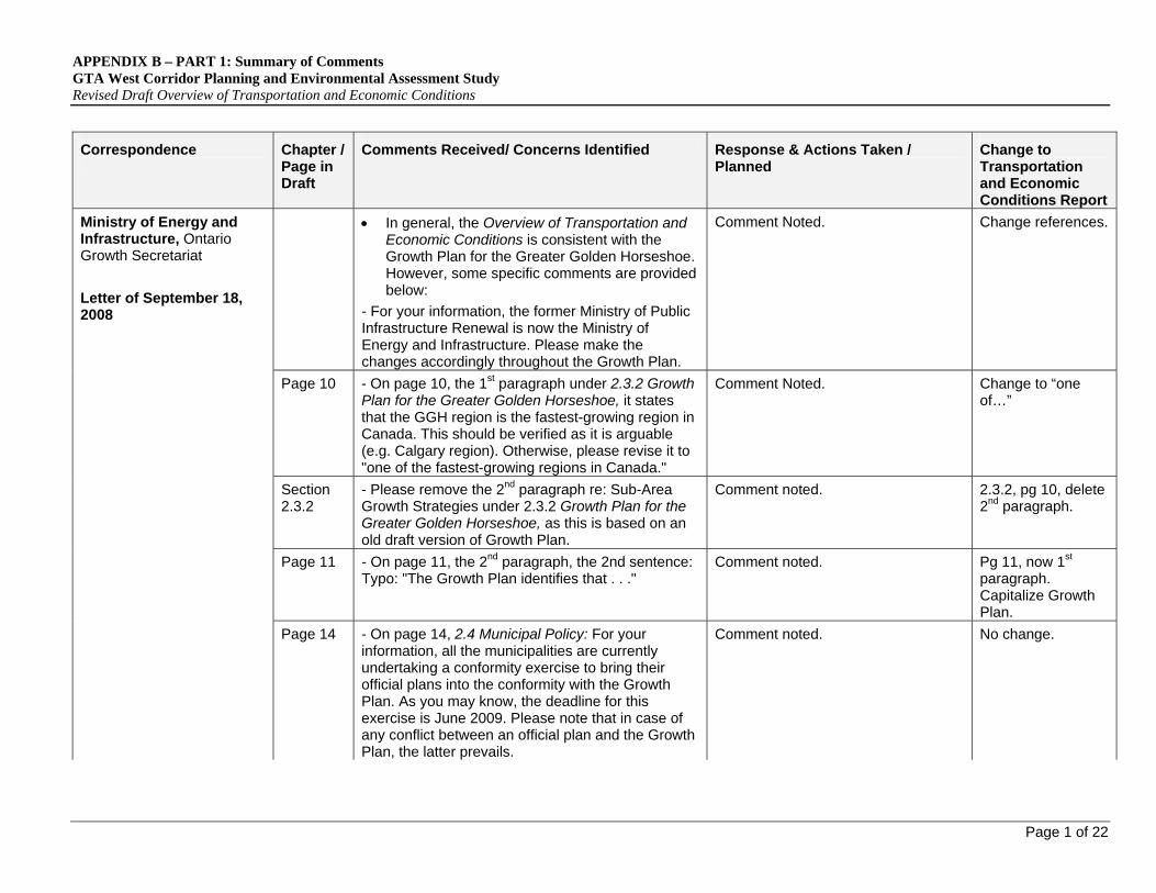
In general, the Overview of Transportation and Economic Conditions is consistent with the Growth Plan for the Greater Golden Horseshoe. However, some specific comments are provided below:
- For your information, the former Ministry of Public Infrastructure Renewal is now the Ministry of Energy and Infrastructure. Please make the changes accordingly throughout the Growth Plan.
Comment Noted. Change references.
Page 10 - On page 10, the 1st paragraph under 2.3.2 Growth Plan for the Greater Golden Horseshoe, it states that the GGH region is the fastest-growing region in Canada. This should be verified as it is arguable (e.g. Calgary region). Otherwise, please revise it to "one of the fastest-growing regions in Canada."
Comment Noted. Change to “one of…”
Section 2.3.2
- Please remove the 2nd paragraph re: Sub-Area Growth Strategies under 2.3.2 Growth Plan for the Greater Golden Horseshoe, as this is based on an old draft version of Growth Plan.
Comment noted. 2.3.2, pg 10, delete 2nd paragraph.
Page 11 - On page 11, the 2nd paragraph, the 2nd sentence: Typo: "The Growth Plan identifies that . . ."
Comment noted. Pg 11, now 1st paragraph. Capitalize Growth Plan.
Ministry of Energy and Infrastructure, Ontario Growth Secretariat
Letter of September 18, 2008
Page 14 - On page 14, 2.4 Municipal Policy: For your information, all the municipalities are currently undertaking a conformity exercise to bring their official plans into the conformity with the Growth Plan. As you may know, the deadline for this exercise is June 2009. Please note that in case of any conflict between an official plan and the Growth Plan, the latter prevails.
Comment noted. No change.
Page 1 of 22

APPENDIX B – PART 1: Summary of Comments GTA West Corridor Planning and Environmental Assessment Study Revised Draft Overview of Transportation and Economic Conditions
Page 2 of 22
Correspondence
Chapter / Page in Draft
Comments Received/ Concerns Identified Response & Actions Taken / Planned
Change to Transportation and Economic Conditions Report
Page 14 - On page 14, under 2.4.1 County of Wellington Official Plan, the total population number, 85,000, is a 2001 figure, yet the figure used for Guelph under 2.4.2, is not a 2001 figure. It will be helpful to use comparable figures.
Comment noted. No change.
Page 84 - On page 84, under 5.1.2 Major Growth Centres: In the 2nd paragraph, the 2nd sentence: Remove the word, "medium." In the 3rd paragraph, replace "the Places to Grow Report" with "the Growth Plan.
Comment noted. Pg 84, 5.1.2
Delete the words ‘and medium’ in paragraph 2, and replace with “the places to grow report” with “the Growth Plan” in paragraph 3
Page 85 - On page 85, Exhibit 5.2: Urban Growth Centres in the Greater Golden Horseshoe: Please replace the map with the Schedule 4 - Urban Growth Centres of the Growth Plan, and add a zoom-in box to highlight the preliminary study area for the GTA-West Transportation Corridor EA Study.
Exhibit as presented is from Growth Plan discussions of urban growth centres during P&O analysis. Will consider showing study area boundaries.
No change
Page 98 - On page 98, under 6.1.7 Demographic Growth: it is not clear how the population number of 750,000 and the employment number of 390,000 between 2006 and 203 1 are calculated. The numbers should be consistent with Schedule 3 of the Growth Plan, and an explanation should be provided.
Schedule 3 of the Growth Plan provides population & employment forecasts for 2001 and 2031 on a regional and county basis. Information provided in Section 6.1.7 discusses population & employment growth within the preliminary study area and uses 2006 as a basis. The figures shown in section 6.1.7 are calculated from municipal summaries presented in Section 5.1.1.
No change.

APPENDIX B – PART 1: Summary of Comments GTA West Corridor Planning and Environmental Assessment Study Revised Draft Overview of Transportation and Economic Conditions
Page 3 of 22
Correspondence
Chapter / Page in Draft
Comments Received/ Concerns Identified Response & Actions Taken / Planned
Change to Transportation and Economic Conditions Report
Page 85 - On page 85, the information regarding the four urban growth centres is misleading. Urban growth centres are generally part of the downtowns and smaller in scale. The proposed UGC boundary delineations are provided in the technical paper, titled, Proposed Size and Location of Urban Growth Centres in the Greater Golden Horseshoe (Spring 2008). The Ministry of Energy and Infrastructure and the municipalities are currently working together to finalize the UGC boundaries. At the meantime, please use the information provided in the above noted technical paper, and revise the bullets as follow:
Downtown Brampton UGC is a significant regional transportation and transit node. It covers about 245 hectares and has an approximate density of 65 people and jobs per hectare in 2001. The density target by 2031 is 200 people and jobs per hectare.
Downtown Milton UGC covers about 150 hectares with an approximate density of 35 people and jobs per hectare in 2001. The density target by 2031 is 200 people and jobs per hectare.
Downtown Guelph UGC covers about 115 hectares with an approximate density of 95 people and jobs per hectare in 2001. The density target by 2031 is 150 people and jobs per hectare.
The Vaughan Corporate Centre UGC covers about 160 hectares with an approximate density of 15 people and jobs per hectare in 2001. The density target by 2031 is 200 people and jobs per hectare.
Comment noted. Update pg 85 bullets.
APPENDIX B – PART 1: Summary of Comments GTA West Corridor Planning and Environmental Assessment Study Revised Draft Overview of Transportation and Economic Conditions
Page 4 of 22
Correspondence
Chapter / Page in Draft
Comments Received/ Concerns Identified Response & Actions Taken / Planned
Change to Transportation and Economic Conditions Report
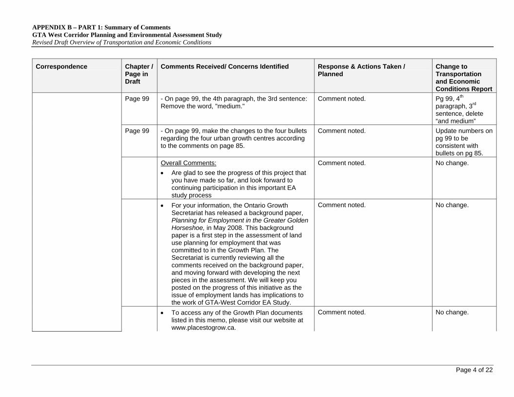
Page 99 - On page 99, the 4th paragraph, the 3rd sentence: Remove the word, "medium."
Comment noted. Pg 99, 4th paragraph, 3rd sentence, delete “and medium”
Page 99 - On page 99, make the changes to the four bullets regarding the four urban growth centres according to the comments on page 85.
Comment noted. Update numbers on pg 99 to be consistent with bullets on pg 85.
Overall Comments:
Are glad to see the progress of this project that you have made so far, and look forward to continuing participation in this important EA study process
Comment noted. No change.
For your information, the Ontario Growth Secretariat has released a background paper, Planning for Employment in the Greater Golden Horseshoe, in May 2008. This background paper is a first step in the assessment of land use planning for employment that was committed to in the Growth Plan. The Secretariat is currently reviewing all the comments received on the background paper, and moving forward with developing the next pieces in the assessment. We will keep you posted on the progress of this initiative as the issue of employment lands has implications to the work of GTA-West Corridor EA Study.
Comment noted. No change.
To access any of the Growth Plan documents listed in this memo, please visit our website at www.placestogrow.ca.
Comment noted. No change.

APPENDIX B – PART 1: Summary of Comments GTA West Corridor Planning and Environmental Assessment Study Revised Draft Overview of Transportation and Economic Conditions
Page 5 of 22
Correspondence
Chapter / Page in Draft
Comments Received/ Concerns Identified Response & Actions Taken / Planned
Change to Transportation and Economic Conditions Report
Report does a good job of laying the groundwork for the EA Study (setting the stage for the identification of alternatives).
No major concerns or issues with the report, only some minor corrections and additions.
Comments noted. No change.
Page 3 P. 3 – It is noted, within the “Support and Implementation of Growth Plan and Greenbelt Plan” section, that MTO will coordinate its planning with other major transportation initiatives being carried out in the study area such as the Metrolinx Regional Transportation Plan. Given the role of Metrolinx in developing a seamless, integrated transportation network in the GTHA it will be very important to involve Metrolinx in all stages of the EA process. This warrants being more explicitly stated in the report.
Agree with comment. Add to report.
Page 24 P. 24 – Main Street/Hurontario Street becomes Highway 10 north of Mayfield Road at the City of Brampton/Town of Caledon boundary (not in the City of Brampton).
Comment Noted. Add Town of Caledon boundary to pg 24, 3.2.4, 2nd paragraph.
Region of Peel
Letter September 12, 2008
Page 25 P. 25 – The list of recent municipal network studies/projects should include the Caledon Transportation Needs Study Update (CATS). North-south corridors through Caledon carry significant volumes of inter-regional traffic (and are potential interchange locations with the GTA West Corridor). A description for the CATS Update is “The CATS Update will determine the existing and future travel demands within the Town of Caledon and identify transportation improvements required to accommodate these travel demands. The study will also review the transportation implications of
Comment Noted. Add CATS Update paragraph on pg 25, 3.2.6, 2nd last paragraph.

APPENDIX B – PART 1: Summary of Comments GTA West Corridor Planning and Environmental Assessment Study Revised Draft Overview of Transportation and Economic Conditions
Page 6 of 22
Correspondence
Chapter / Page in Draft
Comments Received/ Concerns Identified Response & Actions Taken / Planned
Change to Transportation and Economic Conditions Report
proposed development in the Mayfield West and Bolton areas. The CATS Update is a joint study between the Region of Peel and the Town of Caledon.”
Page 25 P. 25 – The correct name for the Highway 50/Highway 427 Extension Area Study is “Peel-Highway 427 Extension Area Transportation Master Plan Study”. The reference to “east-west” in “new/improved east-west road connections” should be removed (the Study is not limited to east-west connections). Finally, the Study is being undertaken by Peel Region, City of Brampton and Town of Caledon (not just Peel Region).
Comment Noted. Change name of study. Delete east/west reference and add city of Brampton and town of Caledon to who is undertaking the study.
Pg 25, 3.2.6, 5th paragraph
Page 25 P. 25 – The northern limit for the North-South Corridor Bramwest Parkway EA Study should be changed to “the Mayfield Road area in Caledon”.
Comment noted. In “the Mayfield road in Brampton” , delete “Brampton” and change to “area in Caledon”, pg. 25, 3.2.6, 4th paragraph.
Page 28 P. 28 – The text notes that “VIA Rail does not serve a specific origin/destination within the Preliminary Study Area, but does pass through the area in an east-west service between Toronto and Kitchener”. VIA Rail stops in Brampton (the station is on Railroad Street west of Main Street).
Comment Noted. Update report with suggested change.
Page 56 P. 56 – Data is presented for the Vaughan intermodal terminal. It would be helpful to see comparable data for the Brampton and Milton intermodal terminals.
We will attempt to obtain this information as part of the Problems & Opportunities analysis.
No change.
APPENDIX B – PART 1: Summary of Comments GTA West Corridor Planning and Environmental Assessment Study Revised Draft Overview of Transportation and Economic Conditions
Page 7 of 22
Correspondence
Chapter / Page in Draft
Comments Received/ Concerns Identified Response & Actions Taken / Planned
Change to Transportation and Economic Conditions Report
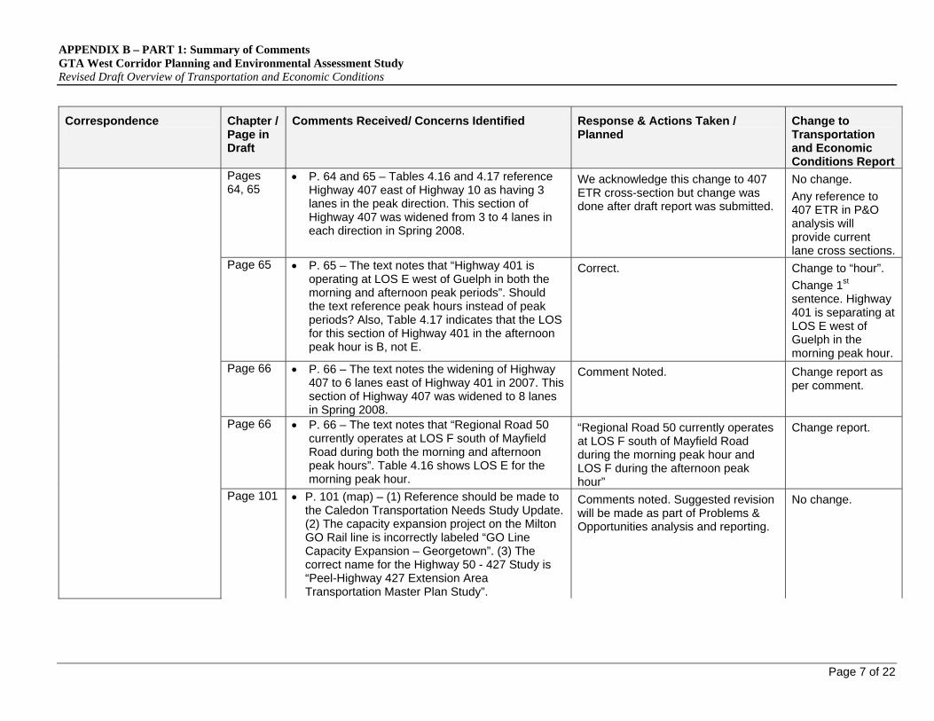
Pages 64, 65
P. 64 and 65 – Tables 4.16 and 4.17 reference Highway 407 east of Highway 10 as having 3 lanes in the peak direction. This section of Highway 407 was widened from 3 to 4 lanes in each direction in Spring 2008.
We acknowledge this change to 407 ETR cross-section but change was done after draft report was submitted.
No change.
Any reference to 407 ETR in P&O analysis will provide current lane cross sections.
Page 65 P. 65 – The text notes that “Highway 401 is operating at LOS E west of Guelph in both the morning and afternoon peak periods”. Should the text reference peak hours instead of peak periods? Also, Table 4.17 indicates that the LOS for this section of Highway 401 in the afternoon peak hour is B, not E.
Correct. Change to “hour”.
Change 1st sentence. Highway 401 is separating at LOS E west of Guelph in the morning peak hour.
Page 66 P. 66 – The text notes the widening of Highway 407 to 6 lanes east of Highway 401 in 2007. This section of Highway 407 was widened to 8 lanes in Spring 2008.
Comment Noted. Change report as per comment.
Page 66 P. 66 – The text notes that “Regional Road 50 currently operates at LOS F south of Mayfield Road during both the morning and afternoon peak hours”. Table 4.16 shows LOS E for the morning peak hour.
“Regional Road 50 currently operates at LOS F south of Mayfield Road during the morning peak hour and LOS F during the afternoon peak hour”
Change report.
Page 101 P. 101 (map) – (1) Reference should be made to the Caledon Transportation Needs Study Update. (2) The capacity expansion project on the Milton GO Rail line is incorrectly labeled “GO Line Capacity Expansion – Georgetown”. (3) The correct name for the Highway 50 - 427 Study is “Peel-Highway 427 Extension Area Transportation Master Plan Study”.
Comments noted. Suggested revision will be made as part of Problems & Opportunities analysis and reporting.
No change.

APPENDIX B – PART 1: Summary of Comments GTA West Corridor Planning and Environmental Assessment Study Revised Draft Overview of Transportation and Economic Conditions
Page 8 of 22
Correspondence
Chapter / Page in Draft
Comments Received/ Concerns Identified Response & Actions Taken / Planned
Change to Transportation and Economic Conditions Report
Section 3.2.6
1. Major Points:
a. “Section 3.2.6 Recent Municipal Network Studies/Projects”: the Guelph/Wellington Transportation Study (Final Report prepared July 2005 by TSH, Paradigm and GSP Group) should be documented here
Comment Noted. Same change as noted by Guelph.
Section 5.1.1
b. “Section 5.1.1 Population and Employment Forecasts” and Table 5.4: Table 5.4 shows aggregated population and employment in Guelph and Wellington at the years 2021 and 2031. In June, the Ministry of Public Infrastructure Renewal (now Infrastructure and Energy) set out a disaggregated forecast for Guelph and Wellington. A recent Wellington Planning and Development Committee report with this correspondence is attached. A copy of County OPA 61, which allocated growth within Wellington to the year 2031, was provided to your study team consultant Mr. Robert Lehman in August.
Land use information received and will be used in subsequent stages of the analysis process.
No change.
Page 6 2. Minor Points:
a. Exhibit 1.3 Area Municipalities should be relabeled with “Township of Guelph/Eramosa
Comment Noted. Change report as per comment.
County of Wellington
Letter of October 3, 2008
Section 2.4.1
b. “Section 2.4.1 County of Wellington Official Plan”: the first paragraph, 4th sentence should go on to say “and includes the community of Rockwood”
Comment noted. Pg 14, add “and includes the community of Rockwood” after, “Surrounding the northwestern boundary of the City of Guelph, the Township of Guelph-Eramosa is

APPENDIX B – PART 1: Summary of Comments GTA West Corridor Planning and Environmental Assessment Study Revised Draft Overview of Transportation and Economic Conditions
Page 9 of 22
Correspondence
Chapter / Page in Draft
Comments Received/ Concerns Identified Response & Actions Taken / Planned
Change to Transportation and Economic Conditions Report a community of approximately 12,600 people1”.
Section 3.1
c. “Section 3.1 Highway Network”: Highway description should add “Rockwood” between “Guelph” and “Acton”
Comment noted. Pg 21, 3.1, Highway 7 paragraph. Add Rockwood, between Guelph and Acton.
Section 3.3.2
d. “Section 3.3.2 Inter-Regional Transit” and “Section 4.4.1 Transit Service Characteristics”: should change references to Guelph Park-and-Ride Lot to “Aberfoyle Park-and-Ride Lot”, as shown on the GO Transit System Map attached
Comment noted. 3.3.2 –pg 27 2nd bullet & 4.4.1 pg 55, end of page, 2nd bullet.
Change Guelph Park and Ride Lot to “Aberfoyle Park-and-Ride Lot”.
Page 19, Section 3
1. P.19, 3rd bullet under section 3: Both Bolton in Caledon and Halton Hills are identified "Transit interchange and potential gateway hubs" by Metrolinx in its Regional Transportation Plan policy papers. This should be recognized in the assessment of "Area Transportation System".
Comment Noted. Add to report. Town of Caledon
Email September 12, 2008
Page 25, Section 3.2.6
2. P. 25 under section 3.2.6: Add "Brampton Transportation and transit Master Plan Update" and "Caledon Transportation Needs Study Update". Both are part of the provincial policy conformity exercise.
Comment Noted. Add to report.
1 County of Wellington Official Plan

APPENDIX B – PART 1: Summary of Comments GTA West Corridor Planning and Environmental Assessment Study Revised Draft Overview of Transportation and Economic Conditions
Page 10 of 22
Correspondence
Chapter / Page in Draft
Comments Received/ Concerns Identified Response & Actions Taken / Planned
Change to Transportation and Economic Conditions Report
Page 48 3. P. 48 regarding Highway 10: If the data for Highway 10 reflects only spring conditions, as indicated on page 45, the following statement is wrong: "The apparent drop in demand in 2007 may in part be a reflection of the increased capacity related to the ongoing expansion of Highway 410, ...", because the opening of Highway 410 from Highway 7 to Mayfield Road happened only in the fall.
Comment Noted. The statement is confusing.
Remove last sentence of discussion on Highway 10 (page 48).
Page 53 4. P.53 5th paragraph: Since September 2, 2008, GO Transit has added three mid-day bus services to its Bolton-Malton line along Hwy 50. Service to Malton from Bolton is now offered 6 times and service from Malton to Bolton is offered 8 times per work day. The GO bus service (twice a day) from Bolton to Toronto along Highway 27 remains.
Comment Noted. Replace 5th paragraph with suggested wording.
Page 82 5. P. 82: The population and employment numbers for the Town of Caledon, currently endorsed by Council, are:
2006 2011 2021 2031 Population: 57 68 84 108 Employment: 24 26 33 49
Comment Noted. Revise Table 5.2.
Page 88 6. P. 88: Exhibit 5.7 should provide the measurement unit.
Agreed. Graph to be updated to show value of trade (y axis).
Section 2.4
Section 2.4: Consider including a review of local official plan policies in addition to Regional policies.
Local OP policies will be reviewed in subsequent stages of study.
No change. Town of Halton Hills
Email September 12, 2008 Page 15 P.15: Section 2.4.3: Should use the 2006 Census data, not 2001 data. The 2006 Halton Region population is: 439,256
Comment Noted. Change report as per comment.

APPENDIX B – PART 1: Summary of Comments GTA West Corridor Planning and Environmental Assessment Study Revised Draft Overview of Transportation and Economic Conditions
Page 11 of 22
Correspondence
Chapter / Page in Draft
Comments Received/ Concerns Identified Response & Actions Taken / Planned
Change to Transportation and Economic Conditions Report
Page 15 P.15: Section 2.4.3: Regarding the sentence in the third paragraph which reads “The Sustainable Halton Plan confirms the Region’s consistency with the provincial policies….”, this sentence should be changed to reflect the fact that the Sustainable Halton Plan exercise is still on going and that it has not yet confirmed any growth options. Hence the word “confirms” should be changed to “will confirm”. Similarly, in the subsequent sentence, the words “The plan guides…” should be changed to “The plan will guide…” or “The outcome of the Sustainable Halton Plan will…”
Comment noted. Pg 15 2.4.3, 3rd paragraph:
Change word “confirms” to “will confirm” & “The plan guides” to “the plan will guide”.
Page 16 P.16: Second paragraph. The first sentence is unclear and implies that the Town of Halton Hills is surrounded by natural areas, and Acton and Georgetown. In fact, Acton and Georgetown are located within the Town of Halton Hills.
Comment Noted. We will revise sentence structure.
Change report. Add a comma after “….. rural area,”
Page 16 P.16: Second paragraph. There are three urban areas in Halton Hills (i.e. 401/407 Employment Area, Georgetown and Acton), not two.
Comment noted. Change report as per comment.
Page 16 P.16: Second paragraph. The population of the Town of Halton Hills is not “51,300”. According to the 2006 Census, the Town’s population is: 55,289. In addition, this information should be consistent for all municipalities. Perhaps the 2006 Census data can be used. Currently there are inconsistencies. For example, while Mississauga’s population is cited for 2005, for York Region it is cited for October 2006.
When the draft report was prepared the 2006 census information was not available. In subsequent work the 2006 values will be used.
Updated Town of Halton Hills with 2006 Census population.
Page 22 P.22: Section 3.1.1: Should include a consideration / coordination of the Niagara-GTA EA.
Comment Noted. Add as requested.
APPENDIX B – PART 1: Summary of Comments GTA West Corridor Planning and Environmental Assessment Study Revised Draft Overview of Transportation and Economic Conditions
Page 12 of 22
Correspondence
Chapter / Page in Draft
Comments Received/ Concerns Identified Response & Actions Taken / Planned
Change to Transportation and Economic Conditions Report
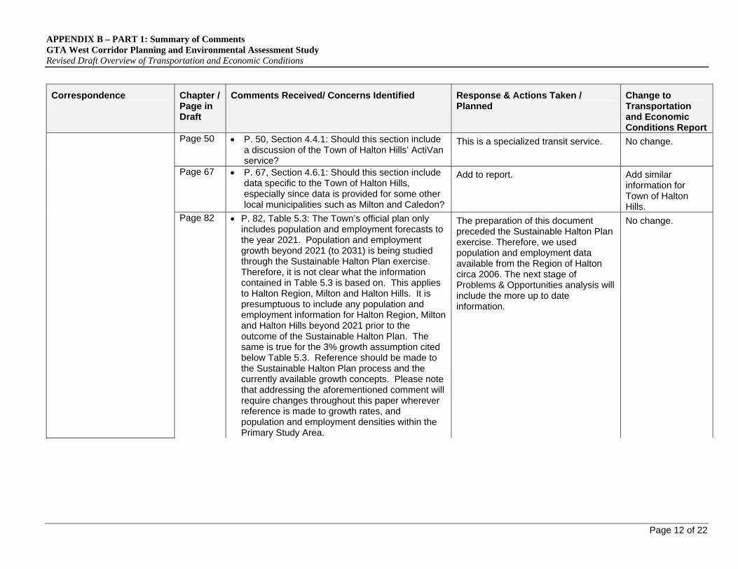
Page 50 P. 50, Section 4.4.1: Should this section include a discussion of the Town of Halton Hills’ ActiVan service?
This is a specialized transit service. No change.
Page 67 P. 67, Section 4.6.1: Should this section include data specific to the Town of Halton Hills, especially since data is provided for some other local municipalities such as Milton and Caledon?
Add to report. Add similar information for Town of Halton Hills.
Page 82 P. 82, Table 5.3: The Town’s official plan only includes population and employment forecasts to the year 2021. Population and employment growth beyond 2021 (to 2031) is being studied through the Sustainable Halton Plan exercise. Therefore, it is not clear what the information contained in Table 5.3 is based on. This applies to Halton Region, Milton and Halton Hills. It is presumptuous to include any population and employment information for Halton Region, Milton and Halton Hills beyond 2021 prior to the outcome of the Sustainable Halton Plan. The same is true for the 3% growth assumption cited below Table 5.3. Reference should be made to the Sustainable Halton Plan process and the currently available growth concepts. Please note that addressing the aforementioned comment will require changes throughout this paper wherever reference is made to growth rates, and population and employment densities within the Primary Study Area.
The preparation of this document preceded the Sustainable Halton Plan exercise. Therefore, we used population and employment data available from the Region of Halton circa 2006. The next stage of Problems & Opportunities analysis will include the more up to date information.
No change.

APPENDIX B – PART 1: Summary of Comments GTA West Corridor Planning and Environmental Assessment Study Revised Draft Overview of Transportation and Economic Conditions
Page 13 of 22
Correspondence
Chapter / Page in Draft
Comments Received/ Concerns Identified Response & Actions Taken / Planned
Change to Transportation and Economic Conditions Report
Gamsby and Mannerow Limited (on behalf of the Township of Puslinch)
Fax of October 3, 2008
To this point of the EA process, we have no specific concerns or issues to bring to the Township Councils attention for consideration.
We expect that more specific comments would be provided to the Ministry of Transportation when alternative solutions have been generated for public review and consultation.
Comments noted. No change.
Section 3.2.1
Section 3.2.1 County of Wellington In the second sentence of the second paragraph, “Eramosa Road” should be replaced by “Wellington Street/Woolwich Street/Eramosa Road”.
Comment noted. Pg 24, 3.2.1, 1st paragraph on page. Replace wording as mentioned.
Section 3.2.2
Section 3.2.2 City of Guelph The first sentence should add “Speedvale Avenue” between Woodlawn Road and College Avenue. Also, delete “St.” before Clair Road.
Comment noted. Pg 24, 3.2.2, add & delete mentioned wording.
Section 3.2.6
Section 3.2.6 Recent Municipal Network Studies/Projects Please add to the list, the 2005 “Guelph-Wellington Transportation Study”.
Comment Noted. Add change to report.
Section 4.5.4
Section 4.5.4 Existing Screenline Operating Characteristics The continuous north-south screenlines, 8002 and 8003, may not be capturing the volume-capacity differences between the road systems in the north and south areas of Guelph. It is likely that roads in the north have a low V/C ration as opposed to roads in the south.
We agree with this comment and will consider shorter and more corridor specific screen lines as part of problems and opportunities analysis.
Comment carried forward to problems and opportunities analysis.
City of Guelph
Letter of January 26, 2009
Section 4.5.5
Section 4.5.5 Summary of Key Facility Operating Characteristics Highway 401 (p. 65) – According to Tables 4.16 & 4.17, eastbound Hwy 401 has LoS E in the AM and LoS B in the PM.
Discrepancy noted. Report will be changed.
Change as per comment.

APPENDIX B – PART 1: Summary of Comments GTA West Corridor Planning and Environmental Assessment Study Revised Draft Overview of Transportation and Economic Conditions
Page 14 of 22
Correspondence
Chapter / Page in Draft
Comments Received/ Concerns Identified Response & Actions Taken / Planned
Change to Transportation and Economic Conditions Report
Section 4.6.1
Section 4.6.1 Review of Municipal Origin – Destination Travel Characteristics City of Guelph (p. 70) – We note that the analysis is based on 6:00 to 9:00 AM Peak Period. But the AM Peak Hour data for the City of Guelph would indicated different breakdown of ‘internal’ trips and trips either starting or ending outside Guelph.
The assessment of peak hour flows will be addressed in subsequent analysis stages.
No change.
Section 5.1.1
Section 5.1.1 Population and Employment Forecasts The City of Guelph has recently adopted the Guelph Local Growth Management Strategy. The population is projected to reach 175,000 and employment is estimated to be 100,000 by 2031. The forecasts at future horizon years are shown below:
2006 2011 2021 2031
Population (000’s)
119 129 154 175
Employment (000’s)
68 75 89 100
Comment Noted. Add change to report.
Solmar Development Corporation
Fax of October, 17, 2008
We are aware that the GTA West Corridor Environmental Assessment has not yet determined what if any solution is proposed. However, we are extremely concerned that numerous public agencies including the Region of York appear to have a preconceived notion that a “400 Series Highway” is the proposed solution and subject matter of the GTA West Corridor Environmental Assessment. This apparent public perception needs to be “nipped in the bud” to ensure that the EA Process you are embarked on is not in any way tarnished.
Response letter sent June 25, 2009:
With respect to your comments on to the two draft Overview Reports, please be assured that they will be considered when the reports are finalized. The Project Team is currently preparing to generate and assess a range of transportation options to address the identified transportation problems and
No change.
APPENDIX B – PART 1: Summary of Comments GTA West Corridor Planning and Environmental Assessment Study Revised Draft Overview of Transportation and Economic Conditions
Page 15 of 22
Correspondence
Chapter / Page in Draft
Comments Received/ Concerns Identified Response & Actions Taken / Planned
Change to Transportation and Economic Conditions Report
With regards to the 2021 planning horizon and in particular, residential development prior to the year 2021; the study team must be cognizant of the ongoing Places to Grow conformity exercise currently being undertaken by both the lower tier and upper tier municipalities in the Region of Peel. As part of the Places to Grow conformity exercise such matters as distribution of population and designation of future residential lands will be reviewed. Accordingly, given that the conformity exercise is not scheduled for completion until June of 2009, it is premature to state that no residential development will occur in Area #4 prior to the year 2021.
Through review of the said reports prepared by your study team, our office has noted that the Mayfield West Planning Area is not considered as a ‘Development Pressure Area’. The Mayfield West Planning Area is bounded by Mayfield Road to the south, Dixie Road to the West, Chinguacousy Road to the east and Old School Road to the north (See Attached Diagram). The Town of Caledon is currently undertaking several background studies in support of a second urban boundary expansion as part of the Mayfield West Phase 2 Secondary Plan which includes additional residential development with limited employment lands. Included within the Mayfield West Planning Area is the intersection of Hwy 410 (Extended) and Hwy 10; a major goods movement corridor within the Region of Peel serving the Golden Horseshoe and beyond. Accordingly, given the significance of this area as a major goods movement corridor, the Mayfield West Planning Area must be
opportunities presented at the second round of Public Information Centres in March 2009. It is anticipated that this work will lead to the identification of a preferred multi-modal Transportation Development Strategy by Spring 2010 and will end Stage 1 of the EA. With respect to your other comments: Areas of Interest (or ‘Development Pressure Areas’) In order to ensure study land-use information is kept current, the Project Team has maintained discussions with municipal staff in order to remain up-to-date with their Official Plan (OP) designations, current OP information and pending development applications. Following a review of available information, a Municipal Advisory Group meeting on February 3, 2009 and municipal workshops held in February / March 2009, the Project Team has revised the Areas of Interest (or ‘Development Pressure Areas’) identified in the Draft Overview of Environmental Conditions and Constraints Report. The Areas of Interest were identified based on a number of factors, including: A. Lands outside the current built-up area that are under pressure for re-designation
APPENDIX B – PART 1: Summary of Comments GTA West Corridor Planning and Environmental Assessment Study Revised Draft Overview of Transportation and Economic Conditions
Page 16 of 22
Correspondence
Chapter / Page in Draft
Comments Received/ Concerns Identified Response & Actions Taken / Planned
Change to Transportation and Economic Conditions Report
identified as an additional ‘Development Pressure Area’ as part of the GTA West Corridor Environmental Assessment.
Further, the study team must be cognizant and updated on the ongoing planning initiatives being undertaken by the Town of Caledon within this secondary planning area as to ensure that the land use planning being undertaken supports the function of the Hwy 410 and Hwy 10 corridor as a major goods movement corridor.
Metrolinx, a Provincial agency, has recently released a ‘draft’ Regional Transportation Plan (RTP) which sets out various transportation improvement projects throughout the Greater Toronto Area. Amongst many projects geared towards transit improvements, the RTP contemplates a GO Transit station to serve the Bolton Community forming part of the Town of Caledon. Such transit initiatives have been development in accordance with the Places to Grow plan which calls for sustainable modes of transportation to move people and sustainable development with the aim of limiting travel patterns while encouraging ‘live/work’ communities.
The study team must work with Metrolinx to ensure that the GTA West Corridor Environmental Assessment is consistent with the RTP as to not hinder land use planning near
B. Lands that logically link Urban Growth Centres and/or linking with other interregional transportation corridors; C. Lands that are adjacent to a potential passenger rail corridor and considered potential station sites by GO Transit on the basis of offset to other potential or existing station locations; D. Lands that are of suitable offset to other freeway infrastructure such as interchanges, that would accommodate freeway-to-freeway interchanges, given limited distances permitted between such facilities; E. Lands that are within areas of active development activity, either inside or outside of designated urban areas as defined by the upper tier municipality or the lower tier municipality; F. Lands that are being considered for future development through current Official Plan designations and policies or as the result of studies being undertaken by upper or lower tier municipalities. G. Lands that are outside of designated Greenbelt, Oak Ridges Moraine, Niagara Escarpment, Provincially Significant Wetlands lands that already are
APPENDIX B – PART 1: Summary of Comments GTA West Corridor Planning and Environmental Assessment Study Revised Draft Overview of Transportation and Economic Conditions
Page 17 of 22
Correspondence
Chapter / Page in Draft
Comments Received/ Concerns Identified Response & Actions Taken / Planned
Change to Transportation and Economic Conditions Report
transit projects like the Bolton GO Transit project.
Closing comments: Our office strongly encourages the study team
to be mindful of all pending development approval applications within the ‘Preliminary Study Area’ and is strongly opposed to the hindrance of development approval applications prior to identifying a potential transportation corridor or alternative solution(s).
Our office wishes to re-emphasize that we are extremely concerned that numerous public agencies, including the Region of York, appear to have a preconceived notion that a “400 Series Highway” is the proposed solution and subject matter of the GTA West Corridor Environmental Assessment. This apparent public perception needs to be “nipped in the bud” to ensure that the EA Process you are embarked on is not in any way tarnished.
protected from development; H. Lands that are in the vicinity of a narrow development “gap” that is anticipated to offer opportunity for a potential new transportation corridor with little impact to adjacent existing or approved future community or designated natural feature. Mapping displaying the revised Areas of Interest has been shared with municipalities but has yet to be incorporated into the final versions of the Overview Reports or placed on the project website. A copy of the current Land Use Constraint Map, with the revised Areas of Interest, has been attached for your reference. Mayfield West Planning Area Based on the input from Town Staff at the Peel Corridor Protection Workshop on February 24, 2009 and as is shown on the attached Land Use Constraint Map, the Project Team has added the Mayfield West Secondary Plan Area as an Area of Interest (Area of Interest #5). The area is bounded by Old School Road to the north, Mayfield Rd to the south, Hurontario Street to the east and Chinguacousy Boulevard to the west. The Project Team continues to keep in contact with the Town of Caledon in regards

APPENDIX B – PART 1: Summary of Comments GTA West Corridor Planning and Environmental Assessment Study Revised Draft Overview of Transportation and Economic Conditions
Page 18 of 22
Correspondence
Chapter / Page in Draft
Comments Received/ Concerns Identified Response & Actions Taken / Planned
Change to Transportation and Economic Conditions Report
to the progress of the Secondary Plan Study and development activity in this area. Coordination with the Metrolinx Regional Transportation Plan (RTP) Metrolinx has developed a transportation plan for the GTA and Hamilton region. All of the transit improvements recommended by Metrolinx will be considered as a part of the base network for this study. Representatives from Metrolinx are members of the study’s Regulatory Agency Advisory Group and are kept up-to-date on study developments. In the coming months, a Draft Area Transportation System Problems and Opportunities Report will be prepared for the GTA West Corridor EA Study and made available to the public via the project website (www.gta-west.com). The Report will incorporate the materials presented at the second round of Public Information Centres (held in March 2009) and the public comments received. As your name is included on the project mailing list, you will receive notification of the completion of this document by direct email.

APPENDIX B – PART 1: Summary of Comments GTA West Corridor Planning and Environmental Assessment Study Revised Draft Overview of Transportation and Economic Conditions
Page 19 of 22
Correspondence
Chapter / Page in Draft
Comments Received/ Concerns Identified Response & Actions Taken / Planned
Change to Transportation and Economic Conditions Report
Chapter 2 1. Overview of Relevant Federal, Provincial and Municipal Policies:
a. excellent idea to link Transportation Study back to the Policies at all levels of government, but concerned that some Federal Policies were established as far back as 10+ years ago, and hope that the GTA West Study would not be limited to the outdated portion of these Policies.
b. Need to consider infrastructure maintenance as this is a serious issue throughout both the Provincial and Municipal governments.
c. Suggest to obtain updated population and employment forecasts information (to 2031) from each municipality since each municipality is required to file the next phase of their Growth Plan by June 16, 2009, and therefore, should be “well along the path to ensure completion by 2009.
d. Limitation of the existing transportation corridors be considered (e.g. limited GO Transit services)
e. Report did not reference the most current Town of Caledon’s Official Plan (i.e. as of 2004, many changes to the plan has been made). Suspect information from other municipalities might also be out of date.
Community of Valleywood (Town of Caledon) Email September 12, 2008
Chapter 3 2. Definition and Description of the “Area Transportation System”:
a. There is minimal, limited transportation services in Caledon generally, and none to the Valleywood community.
Comments noted and will be considered when finalizing the reports.
No Change.
APPENDIX B – PART 1: Summary of Comments GTA West Corridor Planning and Environmental Assessment Study Revised Draft Overview of Transportation and Economic Conditions
Page 20 of 22
Correspondence
Chapter / Page in Draft
Comments Received/ Concerns Identified Response & Actions Taken / Planned
Change to Transportation and Economic Conditions Report
Chapter 4 3. Description of Current “Area Transportation System”:
a. Traffic volume information may be out of date. Through involvement in the 410 Extension Phase III project, aware that the traffic volume studies done by MTO at the time indicated the current volumes were higher than projected for 2011.
b. There are many new initiatives or activities within the immediate area of the Valleywood community, including:
1. Highway 410 – Phase III projected to be completed by Fall 2009, and expected to draw much more traffic to the area adjacent to the community on Highway 10.
2. Town of Caledon Councillor has advised a mall of approximately 100 – 140 acres in size has been proposed for the west side of Highway 10, just across from the community and significantly increasing the traffic volumes to the area.
3. Sources tell us (although not proven) that there are new, or expansions to current, aggregates which will result in approximately 600 additional trucks per day per new or expanded aggregate to our area. This is significant in that the number of new or expanded aggregates has been stated as between 2 – 8.
4. Completion of Highway 410 Extension, Phase III will bring much more traffic to Highway 10 north of Mayfield Road, and the widening of Mayfield Road (currently in progress) will also bring more traffic to Highway 10.

APPENDIX B – PART 1: Summary of Comments GTA West Corridor Planning and Environmental Assessment Study Revised Draft Overview of Transportation and Economic Conditions
Page 21 of 22
Correspondence
Chapter / Page in Draft
Comments Received/ Concerns Identified Response & Actions Taken / Planned
Change to Transportation and Economic Conditions Report
5. Current new development in North West Brampton, plus the planned Mayfield West development in Caledon (adjacent to the community) will also bring more traffic to Highway 10 and arterial roads within this area.
As the area adjacent to Hwy 10 developed, the speed limit on Hwy 10 has been reduced but more traffic signals are implemented. This slows down the flow of traffic. This might be a future concern and developments move north into Caledon. This must be considered when looking at the possible transportation alternatives and corridors.
Chapter 5 4. Description of Preliminary Study Are Socio-Economic Conditions and Outlook:
a. Information in this section appears to be out of date. The numbers for the 2031 Population Projection and Employment Forecast are, Population Projection: 108,000
Employment Forecast: 48,622
b. Acknowledge the significant presence and impact of the auto industry to the area, but should also consider the recent announcements regarding this industry (layoffs, reductions, relocation of work to other regions).
5. Closing Comments:
a. report is very comprehensive and representative of the areas to be considered as part of the GTA West Corridor Study Project.
b. some of the “information” seems to be out of date – not current.
c. the GTA West Corridor Study Project will be ongoing for years, and is important to either stay on

APPENDIX B – PART 1: Summary of Comments GTA West Corridor Planning and Environmental Assessment Study Revised Draft Overview of Transportation and Economic Conditions
Page 22 of 22
Correspondence
Chapter / Page in Draft
Comments Received/ Concerns Identified Response & Actions Taken / Planned
Change to Transportation and Economic Conditions Report
top of the change occurring and reflect it in the project or make sure assumptions and projections include sufficient latitude such that the impact of upcoming changes have minimal impact to the results of the project.
APPENDIX B – PART 2: Summary of Revisions GTA West Corridor Planning & Environmental Assessment Study Revised Draft Overview of Transportation and Economic Conditions
Page 1 of 6
Chapter 1 Section 1.1 Background, Support and Implementation of Growth Plan and Greenbelt Plan
Add to 2nd paragraph:
Given the role of Metrolinx in developing a seamless, integrated transportation network in the GTHA it will be very important to involve Metrolinx in all stages of the EA process.
Section 1.2 Preliminary Study Area and Area of Influence
Replace Exhibit 1.3 with updated graphic.
Chapter 2 Section 2.3.2 Growth Plan for the Greater Golden Horseshoe
Revise 1st paragraph, 1st sentence:
The Greater Golden Horseshoe (GGH) region of Ontario, which encompasses the GTA and a large part of south central Ontario, including the Preliminary Study Area for the GTA West corridor, is considered one of the fastest growing regions in Canada on the basis of recent Statistics Canada census data.
Remove 2nd paragraph:
The Growth Plan also establishes sub-area plans…thus addressing the policy issues and specific needs of each sub-area.
Revise 5th paragraph, 2nd sentence:
The Growth Plan identifies that overall transportation planning must support opportunities for multi-modal use where feasible; prioritizing transit and goods movement needs over those of single occupant automobiles.
Section 2.4.1 County of Wellington Official Plan
Revise 1st paragraph, 4th sentence:
Surrounding the northwestern boundary of the City of Guelph, the Township of Guelph-Eramosa is a community of approximately 12,600 people4 and includes the community of Rockwood.
Section 2.4.3 Region of Halton Official Plan
Revise 1st paragraph, last sentence:
The 2006 Census population data for the Region of Halton is 439,256.
Revise 3rd paragraph, 2nd and 3rd sentence:
The Sustainable Halton Plan will confirm the Region’s consistency with the provincial policies found in the Growth Plan, the Greenbelt Plan and the Provincial Policy Statement. The plan will guide the municipal initiatives that will outline the population and employment growth, the required infrastructure to support growth and the necessary policies that need to be in place to protect natural as well as heritage lands.
Revise 5th paragraph, 1st sentence:
Surrounded predominantly by a natural rural area, with three urban areas – Georgetown, Acton and the 401/407 Employment Area, the Town of Halton Hills is home to 55,289 people (2006 Census).
Chapter 3 Section 3 Definition and Description of the “Area Transportation System”
Add before last bullet:
Cities and other major centres of population that contain designated transit interchanges and potential gateway hubs; and
Section 3.1 Highway Revise 10th paragraph, 1st sentence:
APPENDIX B – PART 2: Summary of Revisions GTA West Corridor Planning & Environmental Assessment Study Revised Draft Overview of Transportation and Economic Conditions
Page 2 of 6
Network Highway 7 provides relatively direct connections between the urban areas of Kitchener-Waterloo, Guelph, Rockwood, Acton, and Georgetown.
Section 3.1.1 Recent Highway Network Studies/Projects
Add after 1st paragraph:
Highway 400 from Langstaff Road to South Canal Bridge – This project received EA approval under two reports: (1) the Environmental Study Report (December 1998) for Langstaff Road to Major Mackenzie Drive which includes the widening of Highway 400 from 6 to 10 lanes and the replacement of the Highway 400 / Major Mackenzie Drive interchange; and (2) Transportation Environmental Study Report (December 2002) for north of Major Mackenzie Drive to South Canal Bridge which includes the widening of Highway 400 from 6 to 10 lanes with provisions for HOV lanes in the median.
Add after 2nd paragraph:
Highway 401 from 1.0 km west of Hespeler Road easterly to Halton Region Boundary – This Class EA and Preliminary design study includes capacity, operational and geometric improvements (widening to 8 or 10 lanes) as well as interchange improvements. Note that EA approval has been received for the section of Highway 401 between Hanlon Expressway and Highway 6 South.
Add before last paragraph:
Niagara to GTA Corridor Planning and EA Study – This study intends to examine existing and future anticipated transportation capacity deficiencies within the Niagara to GTA corridor and to provide additional capacity for a 30 year planning horizon and beyond. The study completion is anticipated for late 2010.
Section 3.2.1 County of Wellington
Revise 2nd paragraph, 2nd sentence:
It runs through the City of Guelph as Wellington Street/Woolwich Street/Eramosa Road and provides east-west connections through the Town of Guelph-Eramosa.
Section 3.2.2 City of Guelph
Revise 1st sentence:
The primary east-west roadways under the jurisdiction of the City of Guelph include Woodlawn Road, Speedvale Avenue, College Avenue, Stone Road, and Clair Road.
Section 3.2.4 Region of Peel
Revise 2nd paragraph, 1st sentence:
Main Street/Hurontario Street becomes Highway 10 north of Mayfield Road at the City of Brampton / Town of Caledon boundary.
Section 3.2.6 Recent Municipal Network Studies/Projects
Revise 4th paragraph:
The North-South Corridor Bramwest Parkway EA Study examines potential new north-south corridors between Highway 401 in Halton and the Mayfield Road area in Caledon as well as connections to Highway 401 and Highway 407.
Revise 5th paragraph:
The Peel-Highway 427 Extension Area Transportation Master Plan Study will build upon previous municipal road needs studies for new/improved road connections in the Peel/York boundary area. This Master Plan Study undertaken by Region of Peel, City of Brampton and Town of Caledon will

APPENDIX B – PART 2: Summary of Revisions GTA West Corridor Planning & Environmental Assessment Study Revised Draft Overview of Transportation and Economic Conditions
Page 3 of 6
consider local road connections to the Highway 427 Transportation Corridor to the west.
Add before last paragraph:
The Brampton Transportation and Transit Master Plan Sustainable Update is a platform to move forward with the implementation of the transportation vision defined in City’s first TTMP in 2004. The Study was completed in November 2009.
The Caledon Transportation Needs Study Update is a joint project by Region of Peel and the Town of Caledon. It is a reference document to help identify and assess the potential transportation improvements needed to accommodate future traffic demand with Caledon. The Study was completed in 2009.
The Guelph-Wellington Transportation Study addresses the transportation needs in Guelph-Wellington for the planning period from 2001 to 2021. The Study was completed in 2005.
Section 3.3.2 Inter-Regional Transit
Revise 5th paragraph, 1st and 2nd bullet:
Route between University of Guelph, the Aberfoyle Park-and-Ride Lot (Highway 401 and Aberfoyle), Square One Mall in Mississauga and the Cooksville GO Station; and,
Route between the University of Guelph, the Aberfoyle Park-and-Ride Lot (Highway 401 and Aberfoyle) and the Meadowvale GO Station.
Revise 9th paragraph, 2nd sentence:
VIA Rail has an east-west service between Toronto and Kitchener through the study area, and a station in the City of Brampton
Chapter 4 Section 4.3.1 Average Daily Traffic Volumes, Highway 10
Remove last sentence:
The apparent drop in demand in 2007 may in part be a reflection of the increased capacity related to the ongoing expansion of Highway 410, which will be completed to Highway 10 by 2009.
Section 4.4.1 Transit Service Characteristics and Flows, GO Bus Service Characteristics
Revise 2nd paragraph, 1st and 2nd bullet:
Route between University of Guelph, the Aberfoyle Park-and-Ride Lot (Highway 401 and Aberfoyle), Square One Mall in Mississauga and the Cooksville GO Station; and,
Route between the University of Guelph, the Aberfoyle Park-and-Ride Lot (Highway 401 and Aberfoyle) and the Meadowvale GO Station.
Revise last paragraph:
GO Transit has added three mid-day bus services to its Bolton-Malton line along Highway 50. Service to Malton from Bolton is offered 6 times and service from Malton to Bolton is offered 8 times per work day. The GO bus service from Bolton to Toronto along Highway 27 is offered twice a day.
Section 4.5.5 Summary of Key Facility Operating Characteristics,
Revise 1st sentence:
Highway 401 is operating at LOS E west of Guelph in the morning peak hour.
APPENDIX B – PART 2: Summary of Revisions GTA West Corridor Planning & Environmental Assessment Study Revised Draft Overview of Transportation and Economic Conditions
Page 4 of 6
Highway 401 Section 4.5.5 Summary of Key Facility Operating Characteristics, Highway 407
Revise 1st sentence:
Prior to the widening of Highway 407 ETR to 6 lanes (and subsequently to 8 lanes in Spring 2008) east of Highway 401 in 2007, the section of Highway 407 ETR between Winston Churchill Boulevard and Highway 410 was operating at capacity during the morning and afternoon peak-hours.
Section 4.5.5 Summary of Key Facility Operating Characteristics, Regional Road 50
Revise 1st sentence:
Regional Road 50 currently operates at LOS F south of Mayfield Road during the morning peak hour and LOS F during the afternoon peak hour.
Section 4.6.1 Review of Municipal Origin – Destination Travel Characteristics
Add after Region of Halton (page 72):
Town of Halton Hills The 2006 TTS morning peak period travel characteristics for the Town of Halton Hills as well as the population growth between 2001 and 2006 are presented in Exhibit 4.18. The 2006 TTS data indicates that:
52% (13,860 trips) of the morning peak period trips stay within the Town of Halton Hills;
82% of the trips are by automobile; and 2% of the trips are by transit. The data indicates that 48% of the morning peak period trips leave the Town of Halton Hills; approximately 92% of these external trips are by car and 5% reflects inter-regional transit use. The majority of these inter-regional transit trips are attracted to Metro PD 1 (540 trips). The major external destinations for trips leaving the Town of Halton Hills during the morning peak period are: 4,280 (16%) total person trips to the City of
Mississauga 2,816 (10%) total person trips to the City of Brampton 1,117 (4%) total person trips to the City of Milton 1,159 (4%) total person trips to the Rest of Metro and
771 (3%) total person trips to Metro PD 1 Chapter 5
Table 5.4 City of Guelph and Wellington County Population and Employment Forecasts
Revise row ‘Regional Forecasts’, ‘Guelph’:
2006 2011 2021 2031 Population: 119 129 154 175 Employment: 68 75 89 100
Section 5.1.1 Population and Employment Forecasts, City of Guelph and County of Wellington
Revise 1st paragraph, 2nd sentence:
Table 5.4 summarizes the population and employment projections for Guelph and Wellington County as reported in the Guelph Local Growth Management Strategy (for City of Guelph), the Guelph-Wellington Transportation Study (for Wellington County), and the 2006 Places to Grow document.
Revise 2nd paragraph:
The City of Guelph is forecast to increase by over 40% to 175,000 between 2006 and 2031. The combined employment in the City of Guelph and the County of Wellington is forecast to increase by approximately 60,000 between 2006 and 2031.

APPENDIX B – PART 2: Summary of Revisions GTA West Corridor Planning & Environmental Assessment Study Revised Draft Overview of Transportation and Economic Conditions
Page 5 of 6
Section 5.1.2 Major Growth Centres
Revise 2nd paragraph, 2nd sentence:
They currently have or are planned to have a composition of high density residential, mixed-use, office, retail and regeneration land uses.
Revise 3rd paragraph:
Within and adjacent to the Preliminary Study Area, the following urban growth centres were identified in the Growth Plan: Downtown Brampton; Downtown Milton; Downtown Guelph; the Vaughan Corporate Centre; Downtown Kitchener/Uptown Waterloo; and Downtown Hamilton.
Revise bullets after 4th paragraph:
Downtown Brampton urban growth centre (UGC) is a significant regional transportation and transit node. It covers about 245 hectares and has an approximate density of 65 people and jobs per hectare in 2001. The density target by 2031 is 200 people and jobs per hectare.
Downtown Milton UGC covers about 150 hectares with an approximate density of 35 people and jobs per hectare in 2001. The density target by 2031 is 200 people and jobs per hectare.
Downtown Guelph UGC covers about 115 hectares with an approximate density of 95 people and jobs per hectare in 2001. The density target by 2031 is 150 people and jobs per hectare.
The Vaughan Corporate Centre UGC covers about 160 hectares with an approximate density of 15 people and jobs per hectare in 2001. The density target by 2031 is 200 people and jobs per hectare.
Table 5.2 Region of Peel, City of Brampton and Town of Caledon Population and Employment Forecasts
Revise row ‘Caledon’:
2006 2011 2021 2031 Population: 57 68 84 108 Employment: 24 26 33 49
Exhibit 5.7 Ontario – Trade Import and Export Forecasts
Add label to Y-axis:
% Change
Chapter 6 Section 6.1.7 Demographic Growth
Revise 5th paragraph, 3rd sentence:
They currently have or are planned to have a composition of high density residential, mixed-use, office, retail and regeneration land uses.
Revise bullets after 6th paragraph:
Downtown Brampton urban growth centre (UGC) is a significant regional transportation and transit node. It covers about 245 hectares and has an approximate density of 65 people and jobs per hectare in 2001. The density target by 2031 is 200 people and jobs per hectare.
Downtown Milton UGC covers about 150 hectares with an approximate density of 35 people and jobs per hectare in 2001. The density target by 2031 is 200 people and jobs per hectare.
Downtown Guelph UGC covers about 115 hectares with an approximate density of 95 people and jobs per hectare in 2001. The density target by 2031 is 150 people and jobs per hectare.
APPENDIX B – PART 2: Summary of Revisions GTA West Corridor Planning & Environmental Assessment Study Revised Draft Overview of Transportation and Economic Conditions
Page 6 of 6
The Vaughan Corporate Centre UGC covers about 160 hectares with an approximate density of 15 people and jobs per hectare in 2001. The density target by 2031 is 200 people and jobs per hectare.


APPENDIX A – PART 1, Summary of Comments and Responses GTA West Corridor Environmental Assessment Overview of Environmental Conditions and Constraints Revised Draft Report
Correspondence
Chapter/page in draft
Comments Received/ Concerns Identified Response & Actions Planned / Taken
Change to Environmental Conditions and Constraints Report
In general, the Overview of Transportation and Economic Conditions is consistent with the Growth Plan for the Greater Golden Horseshoe. However, some specific comments are provided below. Please also note that the recommended changes regarding the Growth Plan should also be applied to the Overview of Environmental Conditions and Constraints document:
1-1
2-9
The former Ministry of Public Infrastructure Renewal is now the Ministry of Energy and Infrastructure. Please make the changes accordingly throughout the Growth Plan.
Comment noted – reference to Ministry has been revised accordingly.
Report has been revised based on suggested wording.
2-10 - Please remove the 2nd paragraph re: Sub-Area Growth Strategies under 2.3.2 Growth Plan for the Greater Golden Horseshoe, as this is based on an old draft version of Growth Plan.
Comment noted - Reference removed.
Reference has been removed from text.
- On page 14, 2.4 Municipal Policy: For your information, all the municipalities are currently undertaking a conformity exercise to bring their official plans into the conformity with the Growth Plan. As you may know, the deadline for this exercise is June 2009. Please note that in case of any conflict between an official plan and the Growth Plan, the latter prevails.
Land use information and mapping is being updated during the study through direct consultation with municipalities and planning department staff. An updated land use section of the report will be issued at the end of the study.
Comment noted and will be reviewed again when report is finalized.
Updated land use sections have been included in the revised draft report.
Ministry of Energy and Infrastructure, Ontario Growth Secretariat
Letter of September 19, 2008
1-3
Exhibit 1-1
- On page 85, Exhibit 5.2: Urban Growth Centres in the Greater Golden Horseshoe: Please replace the map with the Schedule 4 - Urban Growth Centres of the Growth Plan, and add a zoom-in
Schedule 4 is provided in report.
No changes to the report.
Page 1 of 38

APPENDIX A – PART 1, Summary of Comments and Responses GTA West Corridor Environmental Assessment Overview of Environmental Conditions and Constraints Revised Draft Report
Page 2 of 38
Correspondence
Chapter/page in draft
Comments Received/ Concerns Identified Response & Actions Planned / Taken
Change to Environmental Conditions and Constraints Report
box to highlight the preliminary study area for the GTA-West Transportation Corridor EA Study.
Overall Comments:
Are glad to see the progress of this project that you have made so far, and look forward to continuing participation in this important EA study process
Comment noted. No changes to the report.
To access any of the Growth Plan documents listed in this memo, please visit our website at www.placestogrow.ca.
Comment noted. No changes to the report.
Chapter 3
We are pleased to note that the Niagara Escarpment Plan
(NEP) is recognized and referenced throughout the document. However, there is only limited reference to the Niagara Escarpment Planning and Development Act and it is important that the two documents be assessed as part of the report.
Comment noted – text will be revised.
References have been added to the report.
Gen. Every effort must be made to find alternatives to new transportation corridors or find routes which avoid the NEP area so as to meet the overall objectives of the NEP including:
- To protect unique ecologic and historic areas; - To maintain and enhance the quality and character of natural streams and water supplies; - To maintain and enhance the open landscape character of the Niagara Escarpment in so far as possible, by means such as compatible farming or forestry and by preserving the natural scenery - To ensure that all new development is compatible with the purpose of the Plan.
Comments noted. The types of transportation improvements and their general location will be confirmed during the study process.
No changes to the report.
Niagara Escarpment Commission
Letter of October 20, 2008
In Policy 2.2, General Development Criteria of the NEP, Sub-section 5 states that 'Where development involves new roads, road improvements or service corridors, their designation and alignment should be in harmony with the Escarpment landscape", reinforcing the need to ensure that any new
Specific impacts (including the need for mitigation or compensation measures) associated
No changes to the report.

APPENDIX A – PART 1, Summary of Comments and Responses GTA West Corridor Environmental Assessment Overview of Environmental Conditions and Constraints Revised Draft Report
Page 3 of 38
Correspondence
Chapter/page in draft
Comments Received/ Concerns Identified Response & Actions Planned / Taken
Change to Environmental Conditions and Constraints Report
development must not have a negative impact on Escarpment environmental features such as contours, water quality, natural vegetation, soil, wildlife, population, visual attractiveness and cultural heritage features.
with any transportation solutions identified in the Recommended Transportation Development Strategy will be identified in subsequent studies (i.e. Phase 2 as noted in the approved ToR).
We recommend that the Project Team continue to examine all alternatives to address transportation needs within the Study Area as part of the EA to ensure that options for improving existing transportation corridors or enhanced public transit are given equal consideration to new transportation corridors.
Same as above. No changes to the report.
2-9 On page 9, first paragraph of the Draft Report it is stated "Where policy directions proposed projects listed in the following documents differ or seem contrary, the most current policy direction will be taken". We would like to suggest that this is not entirely appropriate. Most policy documents and legislation must be read together and new legislation does not necessarily supersede older policy or legislation. This is particularly important in the case of the NEP and the Greenbelt Plan and the Growth Plan. Section 4 of the Growth Plan recognizes that the Greater Golden Horseshoe (GGH) has many unique natural heritage features and areas that are already protected through legislation including the NEP and Greenbelt Plan. The Growth Plan "supports and builds on these initiatives." It does not supersede or replace them. In particular, the Growth Plan states that "or lands within the Greenbelt Area, all policies regarding natural systems set out in provincial plans, applicable to the Greenbelt Area, continue to apply'. Section 2.2 of the Greenbelt Plan states that “The requirements of the NEP, established under the Niagara
Comment noted. Sentence has been deleted.
Reference has been deleted from the report.
APPENDIX A – PART 1, Summary of Comments and Responses GTA West Corridor Environmental Assessment Overview of Environmental Conditions and Constraints Revised Draft Report
Page 4 of 38
Correspondence
Chapter/page in draft
Comments Received/ Concerns Identified Response & Actions Planned / Taken
Change to Environmental Conditions and Constraints Report
Escarpment Planning and Development Act continue to apply and the Protected Countryside policies do not apply with the exception of section 3.3”. We suggest that the draft report be revised to reflect the inter-relationship and applicability of policy and legislation.
4-62 In Section 4.6 of the Draft Report, on page 91, it is stated that “Potential displacement of existing residences, businesses or institutional uses is recognized as a high land use constraint to transportation development”. We support this conclusion but are concerned that the Draft Report does not identify a similar level of concern for the potential impact of a new transportation corridor on environmental features. On page 62, the Report simply states that proximity to infrastructure may affect a feature or species and that removal of habitat would lead to a reduction in abundance and biodiversity. We recommend that the Report be revised to clarify the position of the study team with respect to the importance of concluding that environmental features are also important constraints to transportation development.
Comment noted – text will be revised as appropriate.
References have been added to the report.
3-60 Although we are satisfied that the Draft Report clearly references the NEP policies in several sections, we encourage the Project Team to revise the Draft Report, in either Section 3.6.1 or 3.7.2 to clearly establish that any consideration of alterations to existing transportation routes or new transportation routes must include a specific evaluation of the potential visual impact on the Niagara Escarpment. The NEC has endorsed Visual Assessment Guidelines and these can be found on the NEC website.
Comment noted – text will be revised as appropriate.
References have been added to the report.
Halton Region
Letter September 5, 2008
4-78 Existing Air Quality Conditions: given the possibility of one or more transportation corridors through Halton Region, the Halton Region Health Department suggests that the Province conduct air monitoring for criteria air contaminants (carbon monoxide, sulphur dioxide, nitrogen dioxide, particulate matter
The assessment of climate change and air quality will be as determined in a protocol developed between
No changes to the report.

APPENDIX A – PART 1, Summary of Comments and Responses GTA West Corridor Environmental Assessment Overview of Environmental Conditions and Constraints Revised Draft Report
Page 5 of 38
Correspondence
Chapter/page in draft
Comments Received/ Concerns Identified Response & Actions Planned / Taken
Change to Environmental Conditions and Constraints Report
– PM2.5 and PM10) particularly in the area of overlap for the various transportation corridor study areas.
MTO and the appropriate regulatory agency (e.g. MOE, EC, HC).
Air quality and other surrogate measures that are representative of human health effects (i.e. noise) will be addressed at a broad level during the assessment of Preliminary Planning alternatives.
4-78 Suggests that noise assessment be done for both qualitative and quantitative measures.
Comment noted. The study will follow MTO’s and MOE’s policies for noise analysis and abatement for noise sensitive areas. Noise sensitive areas are defined by MTO’s Environmental Guide for Noise.
No changes to the report.
Gen. In general, no major concern with the information contained in the report, but that potential changes in air quality and noise be considered and addressed in the EA process.
Comments noted. No changes to the report.
Region of Peel
Letter September 12, 2008
Report does a good job of identifying the environmental constraints found in the Preliminary Study Area.
Given the development pressures seen or expected in Peel, appreciate the inclusion of a section on Municipal Development Pressures.
Agree that the four areas identified within Peel (or immediately
Comments noted. No change to report.

APPENDIX A – PART 1, Summary of Comments and Responses GTA West Corridor Environmental Assessment Overview of Environmental Conditions and Constraints Revised Draft Report
Page 6 of 38
Correspondence
Chapter/page in draft
Comments Received/ Concerns Identified Response & Actions Planned / Taken
Change to Environmental Conditions and Constraints Report
adjacent) are under considerable development pressure. This points to the need for early corridor protection action and we urge the project team to expedite this aspect of the study.
Exhibit 4-8 Major Points:
“Exhibit 4-8 Pits and Quarries” shows no pits within Wellington: there are a number of pits across the study area within Wellington, including one of Ontario’s largest areas of extraction activity in Puslinch. The MNR should be contacted for an inventory of pits; this office can also supply zoning information to assist.
Comment noted – will contact MNR to obtain inventory of pits.
Exhibit has been updated in the revised draft report.
Exhibit 4-11
“Exhibit 4-11 Waste Sites” the sites in Rockwood and Morriston should be shown as “Closed”.
Secondary source land use information is being updated during the study and will be summarized in the revised draft report.
Updated land use sections have been included in the revised draft report.
3-31 Minor Points:
“Section 3.4 Fish Habitat”: there appears to be a conflict between “Exhibit 3-7 Species of Conservation” which shows Endangered and Threatened symbols within the Grand River watershed portion of the study area, and the text which states “no species of concern were indicated for reaches or watercourses within the GRCA”.
Comment noted – text will be revised.
Text in report has been revised.
County of Wellington
Letter of October 3, 2008
Exhibit 5-1 Built heritage information in Wellington is maintained primarily by the local municipalities, and they should be contacted in this regard if this has not already been done.
Efforts were made to obtain comprehensive data at the planning level of detail. Site-specific information was not incorporated into the Draft Overview of Environmental Conditions and
No changes to the report.
APPENDIX A – PART 1, Summary of Comments and Responses GTA West Corridor Environmental Assessment Overview of Environmental Conditions and Constraints Revised Draft Report
Page 7 of 38
Correspondence
Chapter/page in draft
Comments Received/ Concerns Identified Response & Actions Planned / Taken
Change to Environmental Conditions and Constraints Report
Constraints report. Such information will be obtained and used as appropriate as the study progresses.
The maps should show the Hamlets of Ariss, Hamilton Drive, Everton, Ospringe, Brisbane, and Crewson’s Corners.
Comment noted – Exhibit will be revised.
Exhibit has been updated in the revised draft report.
2-10 1. P. 10 1st bullet: The province must ensure that a mechanism is in place to identify and protect corridors.
Comment noted.
No change to report.
4-67
2. P. 67 last paragraph: Revise the last sentence to "However, current policy direction indicates that these lands will likely not to be needed for residential development until 2021, and a portion of the lands will be needed for industrial development."
Comment noted.
Report has been revised based on suggested wording.
4-67-68 3. P. 67-68 Exhibit 4-1: The map contains some inaccurate information. Attached please find a corrected version for Caledon.
Land use information (including mapping) is being updated during the study. Revised versions will be included in the revised draft report.
Updated land use information and mapping in revised draft report.
Town of Caledon
Email September 12, 2008
4-73
4. P. 73 suggested changes under Area #4: "Location: Area #4 is located north of Mayfield Road and west of the current Bolton Settlement Area, outside the current official Plan designated settlement area boundary. Plan Type: A portion of Area #4 along the west side of Coleraine Drive is subject to a study by the Town of Caledon which is proposing a settlement boundary expansion to accommodate the need for employment land. A portion of Area#4 east of Gore Road is one of several potential alternative locations identified for a settlement expansion to accommodate population growth after 2021. The Town is not undertaking a planning study at this time
Same as above.
Report has been revised based on suggested wording.
APPENDIX A – PART 1, Summary of Comments and Responses GTA West Corridor Environmental Assessment Overview of Environmental Conditions and Constraints Revised Draft Report
Page 8 of 38
Correspondence
Chapter/page in draft
Comments Received/ Concerns Identified Response & Actions Planned / Taken
Change to Environmental Conditions and Constraints Report
to determine the location for a residential land expansion to accommodate post-2021 population growth. A developer has submitted planning applications to the Region of Peel and the Town of Caledon proposing a residential / commercial / industrial development in the area between Coleraine Drive and Gore Road. Plan Status: No Status"
4-73
5. p. 73 The map for area #4 contains some inaccurate information. Attached please find a corrected version.
Same as above.
Report graphic has been updated.
4-82
6. P. 82 under Town of Caledon: The Official Plan is currently being updated. It is suggested that there be reference to OPA 179's vision, goal and objectives for the prime Agricultural Area.
Same as above.
Report has been revised based on suggested wording.
Exhibit 5-1
7. P. 94-95 Exhibit 5-1: Identify Cheltenham and Caledon Village on the map, and change "Caledon" to "Caledon East".
Comment noted. Exhibit has been updated in the revised draft report.
5-95
8. P. 95 under "Town of Caledon”: Delete "west of Mississauga Road". The study looks at the area between Winston Churchill Blvd. and Creditview Road with a southern boundary at Old Baseline Road. Revise "...in the Study Area and with ..." to "in the Study Area and with a southerly boundary of Mayfield road (southerly limit of Town of Caledon)".
Comment noted – text will be revised.
Report has been revised based on suggested wording.
5-95 9. P. 95 Cataract Trestle Bridge: The bridge was demolished in 2005. Therefore, the sub-section should be removed from the study report.
Comment noted – reference to Cataract Trestle bridge will be removed.
Report has been revised to remove section on Cataract Trestle Bridge.
Town of Halton Hills
2-9 Section 2 refers to the use of the “latest versions” of municipal official plans. Please make certain that the most recent version of the Town’s Official Plan is being used. The
Land use information and mapping is being updated during the study
Updated land use sections have been included in the revised
APPENDIX A – PART 1, Summary of Comments and Responses GTA West Corridor Environmental Assessment Overview of Environmental Conditions and Constraints Revised Draft Report
Page 9 of 38
Correspondence
Chapter/page in draft
Comments Received/ Concerns Identified Response & Actions Planned / Taken
Change to Environmental Conditions and Constraints Report
Consolidated May 2008 version is the latest one available.
through direct consultation with municipalities and planning department staff. An updated land use section of the report will be issued at the end of the study.
Comment noted and will be reviewed again when report is finalized.
draft report.
4-66 Section 4.1.3: Should consider the on-going Sustainable Halton Plan exercise because of its relevance to the location of future growth in the Region.
Same as above Updated land use sections have been included in revised draft report.
4-66 P. 66: Under “Halton Region” modify the sentence which reads “North of Highway 407 is mainly agricultural land and small villages.” This sentence should actually refer to Highway 401 not 407?
Comment noted – text is correct.
No change to report.
4-66 P.66 In addition, in Halton Hills, the lands north of Highway 401 include the Town’s major urban centres, not just “agricultural land and small villages”. Specifically, located there, are the urban areas of the 401/407 Employment Area, Georgetown and Acton.
Comment noted – text will be revised.
Report has been revised based on suggested wording.
Email September 12, 2008
4-66 P. 66: Also under “Halton Region” – the second paragraph only refers to the urban areas of Acton and Georgetown. This is incorrect as Halton Hills has three urban areas identified in its Official Plan - the 401/407 Employment Area, Georgetown and Acton.
Comment noted – text will be revised.
Report has been revised and corrected.

APPENDIX A – PART 1, Summary of Comments and Responses GTA West Corridor Environmental Assessment Overview of Environmental Conditions and Constraints Revised Draft Report
Page 10 of 38
Correspondence
Chapter/page in draft
Comments Received/ Concerns Identified Response & Actions Planned / Taken
Change to Environmental Conditions and Constraints Report
4- 66/67 P. 66-67: Third paragraph under “Halton Region”, the section starting with the sentence “Given the availability of services…until service issues are resolved.” In light of the fact that the Sustainable Halton Plan exercise is still ongoing and five growth concepts have been released recently for public comment, it is presumptuous to state that undeveloped lands in Milton will be developed while the lands in Halton Hills will not be developed. This section should be modified to accurately reflect the status of the Sustainable Halton Plan exercise.
Land use information and mapping is being updated during the study through direct consultation with municipalities and planning department staff. An updated land use section of the report will be issued at the end of the study.
Comment noted and will be reviewed again when report is finalized.
Updated land use sections have been included in revised draft report.
4-67 P. 67: Last paragraph under “Halton Region”. There are three urban areas in Halton Hills (i.e. 401/407 Employment Area, Georgetown and Acton), not two.
Comment noted – text will be revised.
Report has been revised based on suggested wording.
4-67 Given the location of the Town of Halton Hills on the western boundary of Peel Region and immediately north of Milton, characterizing Halton Hills as being “isolated from the rapidly urbanizing GTA”, is not very accurate.
Land use information and mapping is being updated during the study through direct consultation with municipalities and planning department staff. An updated land use section of the report will be issued at the end of the study.
Comment noted and will be reviewed again when report is finalized.
Updated land use sections have been included in the revised draft report.
APPENDIX A – PART 1, Summary of Comments and Responses GTA West Corridor Environmental Assessment Overview of Environmental Conditions and Constraints Revised Draft Report
Page 11 of 38
Correspondence
Chapter/page in draft
Comments Received/ Concerns Identified Response & Actions Planned / Taken
Change to Environmental Conditions and Constraints Report
4-67 P. 67: Third paragraph under “Peel Region”. Isn’t Northwest Brampton essentially designated for future urban development?
Same as above. Updated land use sections have been included in the revised draft report.
4-75 P. 75: This information should reflect the status of the Sustainable Halton Plan exercise, specifically the five growth concepts currently being considered by the Region and the local municipalities.
Same as above. Updated land use sections have been included in the revised draft report.
4-77 P. 77: Section 4.2.4: The sentence “Major commercial and industrial operations are generally located in the larger municipalities including Milton, Guelph, Acton, Georgetown, Brampton, Caledon, Vaughan, and King.” Should be modified. That is, it should also refer to the Town of Halton Hills’ “401/407 Employment Area”. It should also clarify that Acton and Georgetown are not actual ‘municipalities’ but rather urban areas located WITHIN the Town of Halton Hills.
Comment noted – text will be revised.
Report has been revised based on suggested wording.
4-82 P. 82: Section 4.5.3 should also consider the policies of the Town of Halton Hills Official Plan (Consolidated May 2008), especially since a review of another local municipal official plan (i.e. Town of Caledon Official Plan) is included.
Land use information and mapping is being updated during the study through direct consultation with municipalities and planning department staff. An updated land use section of the report will be issued at the end of the study.
Comment noted and will be reviewed again when report is finalized.
Updated land use sections have be en included in the revised draft report.
APPENDIX A – PART 1, Summary of Comments and Responses GTA West Corridor Environmental Assessment Overview of Environmental Conditions and Constraints Revised Draft Report
Page 12 of 38
Correspondence
Chapter/page in draft
Comments Received/ Concerns Identified Response & Actions Planned / Taken
Change to Environmental Conditions and Constraints Report
5-95 P. 95: The Halton Hills section should reference the Town’s Heritage Register. The Register is available at: http://www.haltonhills.ca/residents/pdf/heritageRegister.pdf Among other things, this Register lists properties designated under PART IV of the Ontario Heritage Act. For additional information regarding the Town’s heritage resources, please contact Ashley Mancuso (Records Clerk) at [email protected]
Efforts were made to obtain comprehensive data at the planning level of detail. Site-specific information was not incorporated into the Draft Overview of Environmental Conditions and Constraints report. Such information will be obtained and used as appropriate as the study progresses.
No change to report at the current stage.
Exhibit 4-8 In regard to aggregate resources mapping, the Dufferin Aggregates Pit is not shown on Exhibit 4-8. The pit is active under Pit License P721015, located on Lots 11 & 12, Con 10 & Lot 11, Con 11.
Comment noted. Mapping information was not available.
Updated environmental sections will be included in TDS at end of study.
Exhibit 3-2 ln regard to Exhibit 3-2 Wellhead Protection Areas please note that complete information of the well head protection zone, in the Town of Erin for the Black Creek in Limehouse has not been included. The well head protection area for the Black Creek, does not end at the Halton Erin Town line as shown on the map.
Comment noted. Mapping information for wellhead protection area was not available.
Updated environmental sections will be included in TDS at end of study.
Town of Erin
Letter of September 15, 2008
3-23 ln regard to Source Water Protection the Town of Erin has concerns regarding the potential risks of spills resulting in ground water contamination. Of specific concern to the Town is the transport of hazardous materials through the community on Provincial Highways and rail lines.
Comment noted.
Specific impacts (including the need for mitigation or compensation measures) associated with any transportation solutions identified in the Recommended
No changes to the report.

APPENDIX A – PART 1, Summary of Comments and Responses GTA West Corridor Environmental Assessment Overview of Environmental Conditions and Constraints Revised Draft Report
Page 13 of 38
Correspondence
Chapter/page in draft
Comments Received/ Concerns Identified Response & Actions Planned / Taken
Change to Environmental Conditions and Constraints Report
Transportation Development Strategy will be identified in subsequent studies (i.e. Phase 2 as noted in the approved ToR).
The Town of Erin is embarking on a Master Servicing Plan for the whole of the municipality, although the focus is on the urban areas of Erin Village and Hillsburgh there are considerations for the rural areas in regard to long term transportation planning.
Comments noted. The types of transportation improvements and their general location will be confirmed during the study process.
No changes to the report.
Within the GTA West Environmental Assessment Report there appears to be no direct consideration of safety or long term environmental effects and maintenance in regard to the consequences of weather. Freezing rain, fog, snow, snow squalls and strong winds are more prevalent above the brow of the escarpment resulting in driving conditions that: ○ create public safety issues; . ○ impede projected traffic movement; ○ make the transportation link operationally more expensive
over the long term ; and ○ promote unsustainable environmental issues, a
transportation link, in the form of a highway, must to be maintained "bare pavement" requiring enormous amount of salt which become part of the surface water and, in turn, groundwater.
Specific impacts (including the need for mitigation or compensation measures) associated with any transportation solutions identified in the Recommended Transportation Development Strategy will be identified in subsequent studies (i.e. Phase 2 as noted in the approved ToR).
No changes to the report.
APPENDIX A – PART 1, Summary of Comments and Responses GTA West Corridor Environmental Assessment Overview of Environmental Conditions and Constraints Revised Draft Report
Page 14 of 38
Correspondence
Chapter/page in draft
Comments Received/ Concerns Identified Response & Actions Planned / Taken
Change to Environmental Conditions and Constraints Report
The Town of Erin respectfully requests that a comparison of historic climatic differences be considered as part of the assessment process. The Town of Erin is concerned with potential responsibility for emergency response regarding highway accident closures, loss of life and property and the resulting long term responsibility.
The assessment of climate change and air quality will be as determined in a protocol developed between MTO and the appropriate regulatory agency (e.g. MOE, EC, HC).
No changes to the report.
Gen. To this point of the EA process, we have no specific concerns or issues to bring to the Township Councils attention for consideration.
Comment noted. No changes to the report.
Gamsby and Mannerow Limited (on behalf of the Township of Puslinch)
Fax of October 3, 2008
Gen. We expect that more specific comments would be provided to the Ministry of Transportation when alternative solutions have been generated for public review and consultation.
Transportation solutions identified in the Recommended Transportation Development Strategy will be identified in subsequent studies (i.e. Phase 2 as noted in the approved ToR).
No changes to the report.
City of Guelph
Letter of January 26, 2009
Exhibit 3-2 Well Head Protection Areas – Exhibit 3-2 The City of Guelph wellhead protection zones have been identified in the Township of Puslinch/City of Guelph Groundwater Protection Study prepared by Golder Associates – Figure 7.2 (May 2006). This report should be used to more accurately define the wellhead protection areas in Figure 3-2 Wellhead Protection Areas within the Preliminary Study Area. The Grand River Conservation Authority (GRCA) has recently completed a Groundwater Characterization Study which will provide valuable information.
Comment noted- Exhibit revised to include wellhead protection zones for Guelph and Puslinch.
Exhibit has been updated in the revised draft report.
APPENDIX A – PART 1, Summary of Comments and Responses GTA West Corridor Environmental Assessment Overview of Environmental Conditions and Constraints Revised Draft Report
Page 15 of 38
Correspondence
Chapter/page in draft
Comments Received/ Concerns Identified Response & Actions Planned / Taken
Change to Environmental Conditions and Constraints Report
3 Features and Conditions identified in Subwatershed Studies The City has carried out a number of subwatershed studies over the years. These studies will provide background related to the environmental conditions and constraints in parts of the study area in and around Guelph.
Secondary source environmental information and land use information is being updated during the study and will be summarized in the revised draft report.
Updated environmental and land use information has been included in the revised draft report.
Exhibits
3-7
3-10
3-11
3-12
3-24
Natural Heritage Strategy (Phase 2 Draft) – Dougan and Associates (July 2008) The City has recently completed a DRAFT Natural Heritage Strategy – Phase 2 Terrestrial Inventory of Natural Heritage System Updates. This study provides mapping for a number of natural heritage features including significant woodlands (1ha or more), deer wintering areas, Wetlands, habitat for species at risk, etc.
Same as above. Updated environmental and land use information has been included in the revised draft report. Exhibits have been updated in the revised draft report.
Exhibit 4-1 Designated Employment Areas We note that Exhibit 4-1 does not capture all the employment areas identified in the City’s Official Plan. The Official Plan can be accessed online on the City’s website.
Land use information and mapping is being updated during the study through direct consultation with municipalities and planning department staff. An updated land use section of the report will be issued at the end of the study.
Comment noted and will be reviewed again when report is finalized.
Updated land use sections have been included in the revised draft report.

APPENDIX A – PART 1, Summary of Comments and Responses GTA West Corridor Environmental Assessment Overview of Environmental Conditions and Constraints Revised Draft Report
Page 16 of 38
Correspondence
Chapter/page in draft
Comments Received/ Concerns Identified Response & Actions Planned / Taken
Change to Environmental Conditions and Constraints Report
Exhibit 4-7 Recreation and Trail Map Exhibit 4-7 We note that Exhibit 4-7 does not include the Guelph Radial Trail along Highway 7 east of Guelph, Starkey Trail on Wellington Rd. 37 and the Speed River Trail along the Speed River west of Guelph. The City’s Trail Master Plan can also be accessed on the City’s website.
Secondary source environmental information and land use information is being updated during the study and will be summarized in the revised draft report.
Update environmental sections have been included in the revised draft report.
3. Updates on Studies and Documents We add the following to the list of “background studies and documents on municipal policy in Guelph” that was included in our letter of 28 May 2007:
City of Guelph Ground Water Protection Study (2006) Various subwatershed studies Natural Heritage Strategy (Phase 2 – DRAFT)
Same as above. See Appendix A – Part 2 for cross-reference.
For copies of any of these studies or specific mapping, please contact Gwen Zhang, Transportation Planning Engineer, at 519-837-5604, ex. 2638, or by email at [email protected].
Comments do not include a review by aquatic ecology staff. Comments related to aquatic ecology will be forwarded shortly.
Met with Conservation Halton and obtained updated environmental information during study.
TDS will be updated with additional environmental information received through consultation with Conservation Authorities during study.
2-13 Section 2.3.2 Protecting Public Health and Safety: The 2nd sentence in the 2nd paragraph of this section, on page 13, seems to be missing words. The sentence currently reads: “Development shall not be permitted to be located in hazardous lands and hazardous sites where the land use is.”
Comment noted – text will be revised.
Report has been revised based on suggested wording.
Conservation Halton
Letter September 12, 2008
2-13 Although this section references floodways as a type of natural hazard, it should also recognize erosion as well.
Comment noted – text Report has been
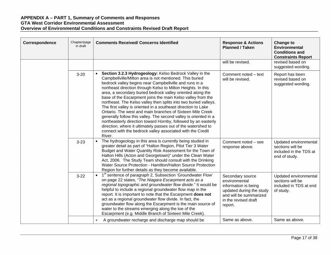
APPENDIX A – PART 1, Summary of Comments and Responses GTA West Corridor Environmental Assessment Overview of Environmental Conditions and Constraints Revised Draft Report
Page 17 of 38
Correspondence
Chapter/page in draft
Comments Received/ Concerns Identified Response & Actions Planned / Taken
Change to Environmental Conditions and Constraints Report
will be revised.
revised based on suggested wording.
3-20 Section 3.2.3 Hydrogeology: Kelso Bedrock Valley in the Campbellville/Milton area is not mentioned. This buried bedrock valley begins near Campbellville and runs in a northeast direction through Kelso to Milton Heights. In this area, a secondary buried bedrock valley oriented along the base of the Escarpment joins the main Kelso valley from the northeast. The Kelso valley then splits into two buried valleys. The first valley is oriented in a southeast direction to Lake Ontario. The west and main branches of Sixteen Mile Creek generally follow this valley. The second valley is oriented in a northeasterly direction toward Hornby, followed by an easterly direction, where it ultimately passes out of the watershed to connect with the bedrock valley associated with the Credit River.
Comment noted – text will be revised.
Report has been revised based on suggested wording.
3-23 The hydrogeology in this area is currently being studied in greater detail as part of “Halton Region, Pilot Tier 3 Water Budget and Water Quantity Risk Assessment for the Town of Halton Hills (Acton and Georgetown)” under the Clean Water Act, 2006. The Study Team should consult with the Drinking Water Source Protection - Hamilton/Halton Source Protection Region for further details as they become available.
Comment noted – see response above.
Updated environmental sections will be included in the TDS at end of study.
3-22 1st sentence of paragraph 2, Subsection ‘Groundwater Flow’ on page 22 states, “The Niagara Escarpment acts as a regional topographic and groundwater flow divide.” It would be helpful to include a regional groundwater flow map in the report. It is important to note that the Escarpment does not act as a regional groundwater flow divide. In fact, the groundwater flow along the Escarpment is the main source of water to the streams emerging along the toe of the Escarpment (e.g. Middle Branch of Sixteen Mile Creek).
Secondary source environmental information is being updated during the study and will be summarized in the revised draft report.
Updated environmental sections will be included in TDS at end of study.
A groundwater recharge and discharge map should be Same as above. Same as above.
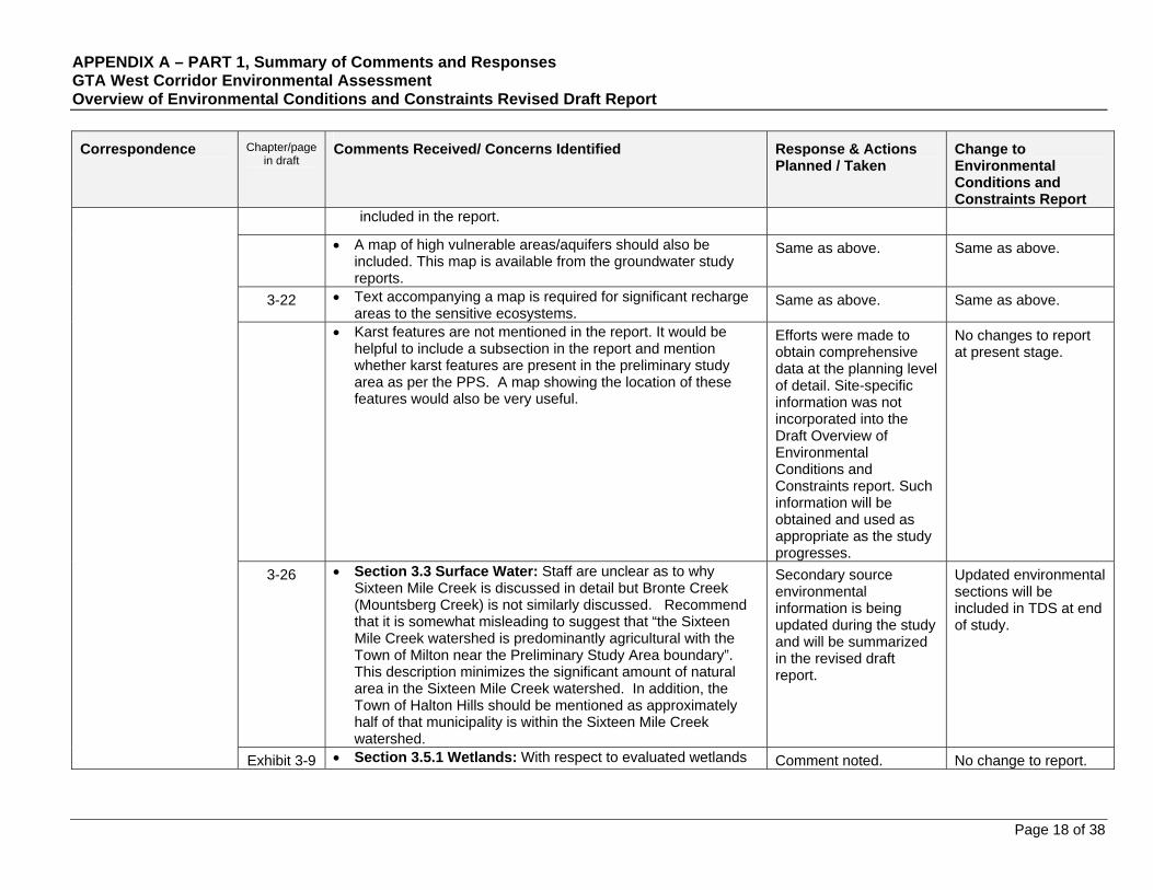
APPENDIX A – PART 1, Summary of Comments and Responses GTA West Corridor Environmental Assessment Overview of Environmental Conditions and Constraints Revised Draft Report
Page 18 of 38
Correspondence
Chapter/page in draft
Comments Received/ Concerns Identified Response & Actions Planned / Taken
Change to Environmental Conditions and Constraints Report
included in the report.
A map of high vulnerable areas/aquifers should also be included. This map is available from the groundwater study reports.
Same as above. Same as above.
3-22 Text accompanying a map is required for significant recharge areas to the sensitive ecosystems.
Same as above. Same as above.
Karst features are not mentioned in the report. It would be helpful to include a subsection in the report and mention whether karst features are present in the preliminary study area as per the PPS. A map showing the location of these features would also be very useful.
Efforts were made to obtain comprehensive data at the planning level of detail. Site-specific information was not incorporated into the Draft Overview of Environmental Conditions and Constraints report. Such information will be obtained and used as appropriate as the study progresses.
No changes to report at present stage.
3-26 Section 3.3 Surface Water: Staff are unclear as to why Sixteen Mile Creek is discussed in detail but Bronte Creek (Mountsberg Creek) is not similarly discussed. Recommend that it is somewhat misleading to suggest that “the Sixteen Mile Creek watershed is predominantly agricultural with the Town of Milton near the Preliminary Study Area boundary”. This description minimizes the significant amount of natural area in the Sixteen Mile Creek watershed. In addition, the Town of Halton Hills should be mentioned as approximately half of that municipality is within the Sixteen Mile Creek watershed.
Secondary source environmental information is being updated during the study and will be summarized in the revised draft report.
Updated environmental sections will be included in TDS at end of study.
Exhibit 3-9 Section 3.5.1 Wetlands: With respect to evaluated wetlands Comment noted. No change to report.
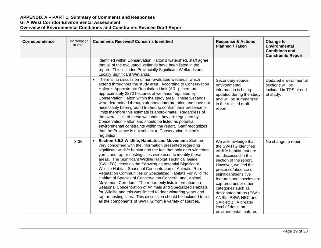
APPENDIX A – PART 1, Summary of Comments and Responses GTA West Corridor Environmental Assessment Overview of Environmental Conditions and Constraints Revised Draft Report
Page 19 of 38
Correspondence
Chapter/page in draft
Comments Received/ Concerns Identified Response & Actions Planned / Taken
Change to Environmental Conditions and Constraints Report
identified within Conservation Halton’s watershed, staff agree that all of the evaluated wetlands have been listed in the report. This includes Provincially Significant Wetlands and Locally Significant Wetlands.
There is no discussion of non-evaluated wetlands, which extend throughout the study area. According to Conservation Halton’s Approximate Regulation Limit (ARL), there are approximately 2270 hectares of wetlands regulated by Conservation Halton within the study area. These wetlands were determined through air photo interpretation and have not necessarily been ground truthed to confirm their presence or limits therefore this estimate is approximate. Regardless of the overall size of these wetlands, they are regulated by Conservation Halton and should be listed as potential environmental constraints within the report. Staff recognizes that the Province is not subject to Conservation Halton’s regulation.
Secondary source environmental information is being updated during the study and will be summarized in the revised draft report.
Updated environmental sections will be included in TDS at end of study.
3-36 Section 3.5.2 Wildlife, Habitats and Movement: Staff are very concerned with the information presented regarding significant wildlife habitat and the fact that only deer wintering yards and raptor nesting sites were used to identify these areas. The Significant Wildlife Habitat Technical Guide (SWHTG) identifies the following as potential Significant Wildlife Habitat: Seasonal Concentration of Animals; Rare Vegetation Communities or Specialized Habitats For Wildlife; Habitat of Species of Conservation Concern; and, Animal Movement Corridors. The report only lists information on Seasonal Concentration of Animals and Specialized Habitats for Wildlife and this was limited to deer wintering years and raptor nesting sites. This discussion should be included to list all the components of SWHTG from a variety of sources.
We acknowledge that the SWHTG identifies wildlife habitat that are not discussed in this section of the report. However, we feel the presence/absence of significant/sensitive features and species are captured under other categories such as designated areas (ESAs, ANSIs, PSW, NEC and SAR etc.). A greater level of detail on environmental features
No change to report
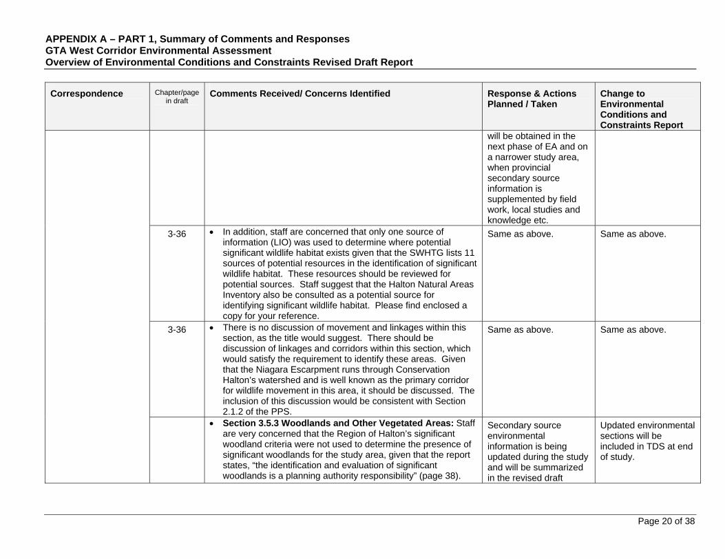
APPENDIX A – PART 1, Summary of Comments and Responses GTA West Corridor Environmental Assessment Overview of Environmental Conditions and Constraints Revised Draft Report
Page 20 of 38
Correspondence
Chapter/page in draft
Comments Received/ Concerns Identified Response & Actions Planned / Taken
Change to Environmental Conditions and Constraints Report
will be obtained in the next phase of EA and on a narrower study area, when provincial secondary source information is supplemented by field work, local studies and knowledge etc.
3-36 In addition, staff are concerned that only one source of information (LIO) was used to determine where potential significant wildlife habitat exists given that the SWHTG lists 11 sources of potential resources in the identification of significant wildlife habitat. These resources should be reviewed for potential sources. Staff suggest that the Halton Natural Areas Inventory also be consulted as a potential source for identifying significant wildlife habitat. Please find enclosed a copy for your reference.
Same as above. Same as above.
3-36 There is no discussion of movement and linkages within this section, as the title would suggest. There should be discussion of linkages and corridors within this section, which would satisfy the requirement to identify these areas. Given that the Niagara Escarpment runs through Conservation Halton’s watershed and is well known as the primary corridor for wildlife movement in this area, it should be discussed. The inclusion of this discussion would be consistent with Section 2.1.2 of the PPS.
Same as above. Same as above.
Section 3.5.3 Woodlands and Other Vegetated Areas: Staff are very concerned that the Region of Halton’s significant woodland criteria were not used to determine the presence of significant woodlands for the study area, given that the report states, “the identification and evaluation of significant woodlands is a planning authority responsibility” (page 38).
Secondary source environmental information is being updated during the study and will be summarized in the revised draft
Updated environmental sections will be included in TDS at end of study.

APPENDIX A – PART 1, Summary of Comments and Responses GTA West Corridor Environmental Assessment Overview of Environmental Conditions and Constraints Revised Draft Report
Page 21 of 38
Correspondence
Chapter/page in draft
Comments Received/ Concerns Identified Response & Actions Planned / Taken
Change to Environmental Conditions and Constraints Report
While we acknowledge that the NHRM gives criteria for evaluating significance of a woodland, it does not take into consideration the conditions of the planning area, which is why the municipalities are encouraged to develop their own criteria. For example, it would be difficult for smaller urban cities to have any woodlands greater than 40ha, but it does not mean that the remaining woodlands within these cities are not significant if they met the criteria established by the regional municipalities. It was staff understanding that the Regional Official Plans would be looked at as part of this study and therefore the Region of Halton’s criteria for determining woodland significance should be used when assessing woodlands in Halton.
report.
Exhibit 3-14
Based on the Regional Official Plan mapping (OP Figure A2), there are numerous candidate significant woodlands that have not been included in the study. Exhibit 3-14 should be revised to include those woodlands identified as significant by the Regional municipalities.
Same as above. Same as above.
Exhibit 3-16
Please provide clarification on what Exhibit 3-16 is intending to show, given that it summarizes the wooded areas as well as treed areas and watershed. It is unclear to staff what the purpose of this table is or how it is useful for the study.
Comment noted – text will be revised.
Exhibit title revised.
3-41 Under “Uncommon Characteristics” staff would include the cedar forests along the Escarpment as well as any other older growth, e.g., forests older than 100 years old that occur within the study area and not just limit the discussion to those features on the Oak Ridges Moraine. Staff recommends consulting the Sixteen Mile Creek Watershed Plan (1996) as woodlands of greater that 100 years were identified within that study.
Efforts were made to obtain comprehensive data at the planning level of detail. Site-specific information was not incorporated into the Draft Overview of Environmental Conditions and Constraints report. Such information will be
Report text has been changed to acknowledge other older growth forests in Sixteen Mile Creek watershed.
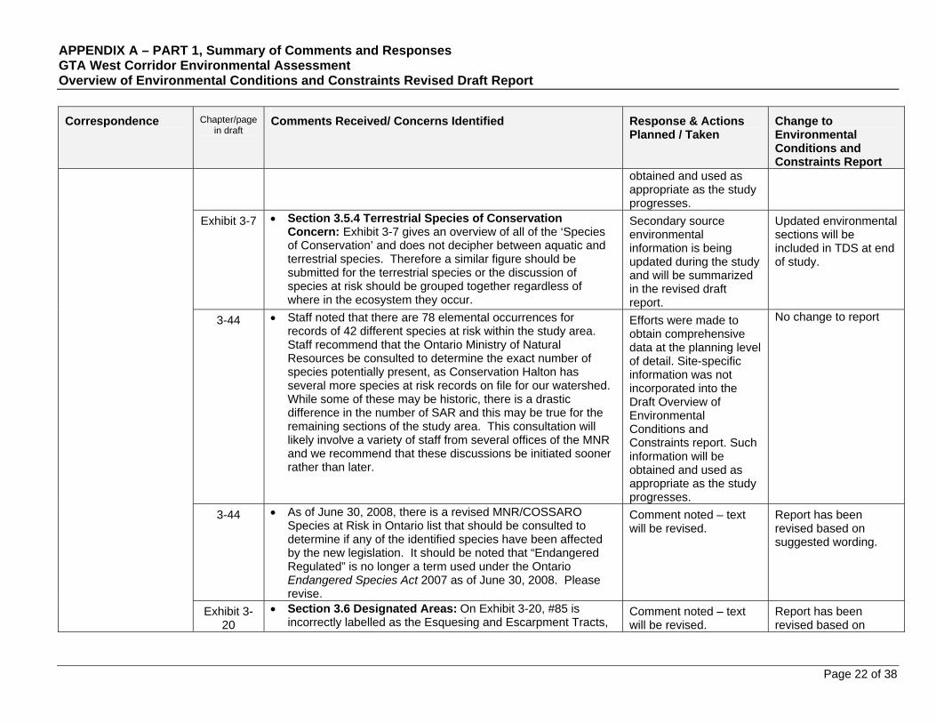
APPENDIX A – PART 1, Summary of Comments and Responses GTA West Corridor Environmental Assessment Overview of Environmental Conditions and Constraints Revised Draft Report
Page 22 of 38
Correspondence
Chapter/page in draft
Comments Received/ Concerns Identified Response & Actions Planned / Taken
Change to Environmental Conditions and Constraints Report
obtained and used as appropriate as the study progresses.
Exhibit 3-7 Section 3.5.4 Terrestrial Species of Conservation Concern: Exhibit 3-7 gives an overview of all of the ‘Species of Conservation’ and does not decipher between aquatic and terrestrial species. Therefore a similar figure should be submitted for the terrestrial species or the discussion of species at risk should be grouped together regardless of where in the ecosystem they occur.
Secondary source environmental information is being updated during the study and will be summarized in the revised draft report.
Updated environmental sections will be included in TDS at end of study.
3-44 Staff noted that there are 78 elemental occurrences for records of 42 different species at risk within the study area. Staff recommend that the Ontario Ministry of Natural Resources be consulted to determine the exact number of species potentially present, as Conservation Halton has several more species at risk records on file for our watershed. While some of these may be historic, there is a drastic difference in the number of SAR and this may be true for the remaining sections of the study area. This consultation will likely involve a variety of staff from several offices of the MNR and we recommend that these discussions be initiated sooner rather than later.
Efforts were made to obtain comprehensive data at the planning level of detail. Site-specific information was not incorporated into the Draft Overview of Environmental Conditions and Constraints report. Such information will be obtained and used as appropriate as the study progresses.
No change to report
3-44 As of June 30, 2008, there is a revised MNR/COSSARO Species at Risk in Ontario list that should be consulted to determine if any of the identified species have been affected by the new legislation. It should be noted that “Endangered Regulated” is no longer a term used under the Ontario Endangered Species Act 2007 as of June 30, 2008. Please revise.
Comment noted – text will be revised.
Report has been revised based on suggested wording.
Exhibit 3-20
Section 3.6 Designated Areas: On Exhibit 3-20, #85 is incorrectly labelled as the Esquesing and Escarpment Tracts,
Comment noted – text will be revised.
Report has been revised based on
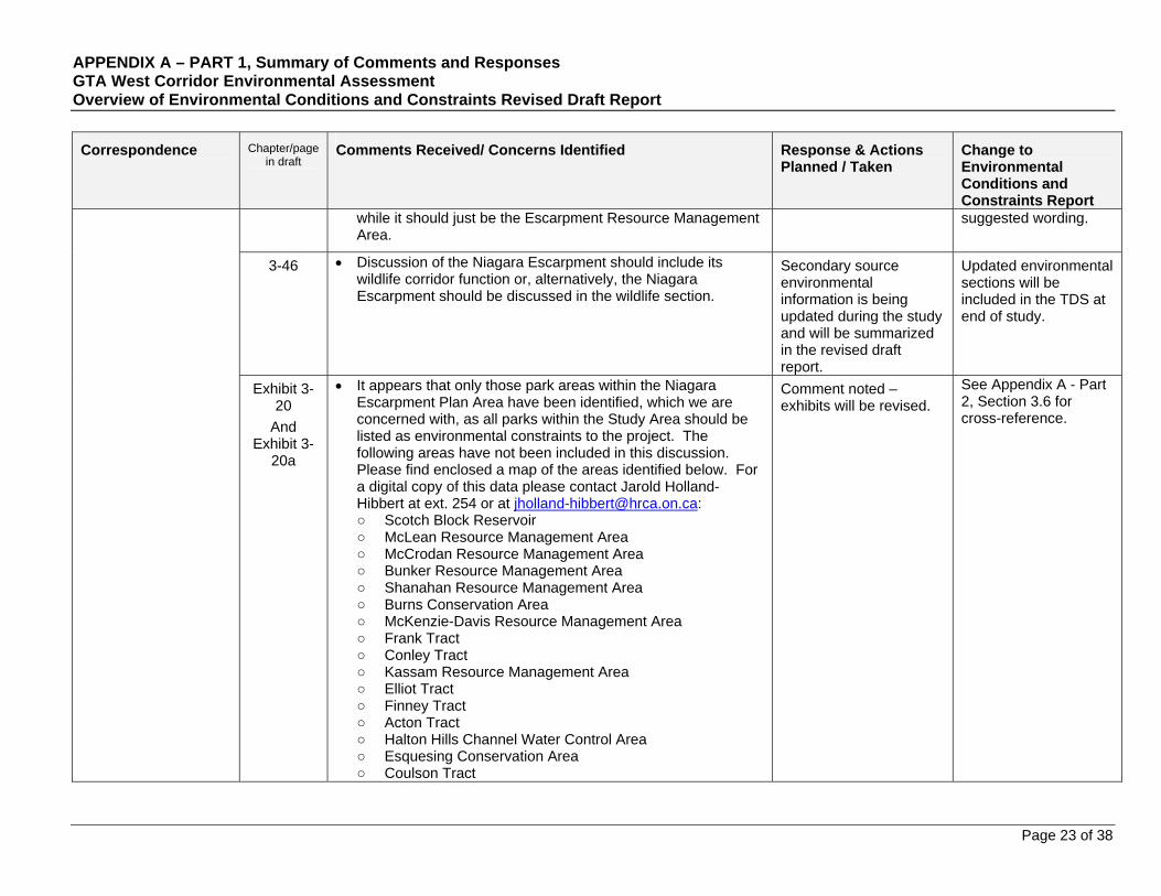
APPENDIX A – PART 1, Summary of Comments and Responses GTA West Corridor Environmental Assessment Overview of Environmental Conditions and Constraints Revised Draft Report
Page 23 of 38
Correspondence
Chapter/page in draft
Comments Received/ Concerns Identified Response & Actions Planned / Taken
Change to Environmental Conditions and Constraints Report
while it should just be the Escarpment Resource Management Area.
suggested wording.
3-46 Discussion of the Niagara Escarpment should include its wildlife corridor function or, alternatively, the Niagara Escarpment should be discussed in the wildlife section.
Secondary source environmental information is being updated during the study and will be summarized in the revised draft report.
Updated environmental sections will be included in the TDS at end of study.
Exhibit 3-20
And Exhibit 3-
20a
It appears that only those park areas within the Niagara Escarpment Plan Area have been identified, which we are concerned with, as all parks within the Study Area should be listed as environmental constraints to the project. The following areas have not been included in this discussion. Please find enclosed a map of the areas identified below. For a digital copy of this data please contact Jarold Holland-Hibbert at ext. 254 or at [email protected]: ○ Scotch Block Reservoir ○ McLean Resource Management Area ○ McCrodan Resource Management Area ○ Bunker Resource Management Area ○ Shanahan Resource Management Area ○ Burns Conservation Area ○ McKenzie-Davis Resource Management Area ○ Frank Tract ○ Conley Tract ○ Kassam Resource Management Area ○ Elliot Tract ○ Finney Tract ○ Acton Tract ○ Halton Hills Channel Water Control Area ○ Esquesing Conservation Area ○ Coulson Tract
Comment noted – exhibits will be revised.
See Appendix A - Part 2, Section 3.6 for cross-reference.
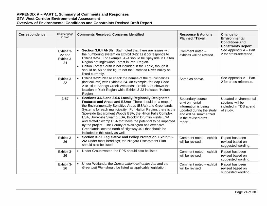
APPENDIX A – PART 1, Summary of Comments and Responses GTA West Corridor Environmental Assessment Overview of Environmental Conditions and Constraints Revised Draft Report
Page 24 of 38
Correspondence
Chapter/page in draft
Comments Received/ Concerns Identified Response & Actions Planned / Taken
Change to Environmental Conditions and Constraints Report
Exhibit 3-22 and
Exhibit 3-24
Section 3.6.4 ANSIs: Staff noted that there are issues with the numbering system on Exhibit 3-22 as it corresponds to Exhibit 3-24. For example, A24 should be Speyside in Halton Region not Inglewood Forest in Peel Region.
Halton Forest South is not included in the Table, though it should be A8 on the figure not the Eramosa River Valley as listed currently.
Comment noted – exhibits will be revised.
See Appendix A – Part 2 for cross-reference.
Exhibit 3-22
Exhibit 3-22: Please check the names of the municipalities (last column) with Exhibit 3-24. An example: for Map Code A18 ‘Blue Springs Creek Wetlands; Exhibit 3-24 shows the location in York Region while Exhibit 3-22 indicates ‘Halton Region’.
Same as above. See Appendix A – Part 2 for cross-reference.
3-57 Sections 3.6.5 and 3.6.6 Locally/Regionally Designated Features and Areas and ESAs: There should be a map of the Environmentally Sensitive Areas (ESAs) and Greenlands Systems for each municipality. For Halton Region, there is the Speyside Escarpment Woods ESA, the Hilton Falls Complex ESA, Brookville Swamp ESA, Brooklin Drumlin Fields ESA and Moffat Swamp ESA that have the potential to be impacted by the project. The County of Wellington has extensive Greenlands located north of Highway 401 that should be included in this study as well.
Secondary source environmental information is being updated during the study and will be summarized in the revised draft report.
Updated environmental sections will be included in TDS at end of study.
Exhibit 3-26
Section 3.7.1 Legislative and Policy Protection, Exhibit 3-26: Under most headings, the Niagara Escarpment Plan should also be listed.
Comment noted – exhibit will be revised.
Report has been revised based on suggested wording.
Exhibit 3-26
Under Groundwater, the PPS should also be listed. Comment noted – exhibit will be revised.
Report has been revised based on suggested wording.
Exhibit 3-26
Under Wetlands, the Conservation Authorities Act and the Greenbelt Plan should be listed as applicable legislation.
Comment noted – exhibit will be revised.
Report has been revised based on suggested wording.

APPENDIX A – PART 1, Summary of Comments and Responses GTA West Corridor Environmental Assessment Overview of Environmental Conditions and Constraints Revised Draft Report
Page 25 of 38
Correspondence
Chapter/page in draft
Comments Received/ Concerns Identified Response & Actions Planned / Taken
Change to Environmental Conditions and Constraints Report
Exhibit 3-26
Under Woodlands and Other Vegetated Areas, in addition to Section 2.1.2 of the PPS, Sections 2.1.3 (b) and potentially 2.1.4 (d) should also be listed. Alternatively, the column could simply reference the PPS without specific reference to the subsections. The various Regional Official Plans should also be listed.
Comment noted – exhibit will be revised.
Report has been revised based on suggested wording.
Exhibit 3-26
Under ANSIs and ESAs, this should be broken into two sections as the PPS and the Greenbelt Plan apply to ANSIs, while they do not for ESAs. Both should also have Regional Official Plans listed as applicable legislation.
Comment noted – exhibit will be revised.
Report has been revised based on suggested wording.
3-60 Section 3.7.3 Groundwater: Staff recommended that a fourth indicator be added to the bulleted list on page 60. Specifically, we recommend adding “highly vulnerable aquifers”.
Comment noted – text will be revised.
Report has been revised based on suggested wording.
3-61 Section 3.7.6 Terrestrial Ecosystems: This summary should be revised to include the above recommended information. For example, expanding the Significant Wildlife discussion to include all possible habitats under the SWHTG, including regulated wetlands, revising the significant woodland discussion based on the respective Official Plans, and based on the consultation with the MNR regarding species at risk.
Secondary source environmental information is being updated during the study and will be summarized in the revised draft report.
Updated environmental sections will be included in TDS at end of study.
4-86/87 Section 4.5.6 Parks and Recreational/Trails Areas: Staff recommend including this section in Designated Areas section of the report (Section 3.6) given the environmental aspect these areas have. In addition, staff note that none of Conservation Halton’s Conservation Areas have not been included on Exhibit 4-7 nor are they discussed in the report. This should be revised.
Secondary source environmental information is being updated during the study and will be summarized in the revised draft report.
See Appendix A – Part 2 for cross-reference.
4-90 Sections 4.5.9 to 4.5.13: The numbers (e.g. ‘Brownfield Sites) given in the text are not consistent with those shown on Exhibit 4-11.
Same as above.
See Appendix A – Part 2 for cross-reference.

APPENDIX A – PART 1, Summary of Comments and Responses GTA West Corridor Environmental Assessment Overview of Environmental Conditions and Constraints Revised Draft Report
Page 26 of 38
Correspondence
Chapter/page in draft
Comments Received/ Concerns Identified Response & Actions Planned / Taken
Change to Environmental Conditions and Constraints Report
Summary: As demonstrated within the draft report and as shown on the enclosed maps, the Study Area within Conservation Halton’s watershed, consists of numerous Provincially and locally significant features and functions including, but not limited to: Provincially and Locally Significant Wetlands, Significant Wildlife Habitat, Environmentally Sensitive Areas, Significant Woodlands, Provincially Significant Areas of Natural and Scientific Interest, Significant Habitat of Endangered and Threatened Species; large areas of publicly owned land; corridors and linkages; and, the Niagara Escarpment. As outlined in previous correspondence, staff strongly recommend against a new transportation corridor within this area, given the high level of Provincially and Locally significant features and functions that would be impacted.
Comment noted. No change to report.
Gen. Please find the following comments relating to aquatic ecology. Staff note that the majority of the comments are related to detailed design and we are aware that the EA is certainly not at that point. We request that these comments be kept on file for future reference.
Comment noted. See Appendix A – Part 2 for cross-reference.
Conservation Halton
Letter of September 23, 2008 (further to letter of September 12, 2008) 3-26 1. Please confirm whether Conservation Halton's fisheries
database was consulted in preparing the natural environment fish and fish habitat section. This database should be referenced when preparing future reports in the environmental assessment process;
Conservation Halton’s fisheries database was consulted during the study to confirm the study team’s understanding of most sensitive areas during generation of road based transportation planning alternatives. However, the Draft Existing Environmental Conditions Report
Updated environmental and land use sections will be included in TDS at end of study.
APPENDIX A – PART 1, Summary of Comments and Responses GTA West Corridor Environmental Assessment Overview of Environmental Conditions and Constraints Revised Draft Report
Page 27 of 38
Correspondence
Chapter/page in draft
Comments Received/ Concerns Identified Response & Actions Planned / Taken
Change to Environmental Conditions and Constraints Report
summarizes information at a provincial level. Secondary source environmental information and land use information is being updated during the study and will be summarized in the revised draft report.
3-23 2. It is requested that all crossings of watercourses associated with this process encompass the entire meander belt width of the watercourse;
Comments noted. The types of transportation improvements and their general location will be confirmed during the study process.
No change to report.
3. It is requested that transportation conduits be designed and managed to minimize as much as possible the use of salt for snow and ice clearing. This is requested because current stormwater management practices are not able to remove salt from stormwater. Alternatives to salt for de-icing transportation conduits should be thoroughly explored;
Specific impacts (including the need for mitigation or compensation measures) associated with any transportation solutions identified in the Recommended Transportation Development Strategy will be identified in subsequent studies (i.e. Phase 2 as noted in the approved ToR).
No change to report.
4. Crossing locations that are already disturbed or that overlap with existing crossings would be preferred over crossings at undisturbed sections of watercourses;
Same as above. No change to report.

APPENDIX A – PART 1, Summary of Comments and Responses GTA West Corridor Environmental Assessment Overview of Environmental Conditions and Constraints Revised Draft Report
Page 28 of 38
Correspondence
Chapter/page in draft
Comments Received/ Concerns Identified Response & Actions Planned / Taken
Change to Environmental Conditions and Constraints Report
5. Crossings of watercourse locations where mature riparian vegetation is present are discouraged;
Same as above. No change to report.
6. Route alternatives that achieve the least number of watercourses crossings are preferable to routes involving a greater number of crossings;
Same as above. No change to report.
7. Any transportation crossings of creeks shall be located on straight sections of watercourses that appear to be stable in terms of their physical geomorphology;
Same as above. No change to report.
8. Open bottom crossings will be required for any crossings of cold water watercourses or for crossings where groundwater discharge is occurring; and,
Same as above. No change to report.
9. The deposit of water that is warmer than ambient water temperatures in creeks during the summer months within Conservation Halton's jurisdiction is considered to be deleterious. Section 36 (3) of the Federal Fisheries Act prohibits the deposit of a deleterious substance into waters frequented by fish. As such, it will be necessary that all stormwater originating from transportation conduits constructed as a result of this project be treated to mitigate thermal warming generated by the contact between precipitation and the transportation conduit. If mitigation of the thermal warming is not possible, these transportation conduits should be designed to avoid the initial warming of stormwater. As such, it is suggested that once route alternatives for the transportation conduit have been chosen, temperature monitoring using accepted protocols be initiated to establish baseline information regarding thermal regime of the creeks receiving stormwater from the new transportation conduit. It is requested that three years of summer season water temperatures be obtained using appropriate field protocols (e.g. data loggers or Ontario Stream Assessment Protocol Temperature Module) prior to final design of the transportation corridor.
Same as above. No change to report.

APPENDIX A – PART 1, Summary of Comments and Responses GTA West Corridor Environmental Assessment Overview of Environmental Conditions and Constraints Revised Draft Report
Page 29 of 38
Correspondence
Chapter/page in draft
Comments Received/ Concerns Identified Response & Actions Planned / Taken
Change to Environmental Conditions and Constraints Report
3-24 1. Section 3.3, Surface Water, describes 4 watersheds (Humber River, Credit River, Sixteen Mile Creek, Eramosa River) that comprise nearly 75% of the Preliminary Study Area. Although Etobicoke Creek, Mimico Creek and the Don River represent smaller watersheds, maintaining and improving the health and function of these systems is extremely important. These watersheds form and contribute to many of the significant natural heritage features that still exist within the jurisdiction. Consideration and protection of these natural features will need to be incorporated into the EA as it is developed.
The Project Team will continue to collect data. Detailed water resources information will be evaluated and used as appropriate as the study progresses.
No changes to the report.
3-24 2. A clear understanding of the existing conditions and constraints within the TRCA watersheds is required to help develop a sustainable growth plan that will not create or increase natural hazards. Section 7 of the report makes reference to the report card on the health of the Humber River Watershed and to the Hurnber River Watershed Plan. Please ensure that all relevant TRCA policies, regulations and reports are included in the EA to ensure that there is an accurate and complete understanding of each of the areas within the study area. For instance, there is no reference to the Etobicoke, Mimico or Don watershed reports, all of which can be found under "Protecting Our Water' on the TRCA website at www.trca.on.ca. Reference should also be made to the TRCA Valley and Stream Corridor Management Program, October 1994, which outlines infrastructure and servicing requirements to allow for continuous greenspace corridors and prevent, eliminate or minimize the threat of life and property caused by flooding, erosion and slope instability.
Secondary source environmental information and land use information is being updated during the study and will be summarized in the revised draft report.
Updated environmental and land use sections have been included in the revised draft report.
Toronto and Region Conservation Authority
Letter of October 6, 2008
3-57 3. Section 3.6.6 of the report briefly discusses Environmentally Sensitive Areas (ESA), but does not discuss details of these areas. Please include in the report further information regarding ESA's, as they will be important to identify when determining the preferred alternative.
Secondary source environmental information is being updated during the study and will be summarized in the revised draft
Updated environmental sections have been included the revised draft report.

APPENDIX A – PART 1, Summary of Comments and Responses GTA West Corridor Environmental Assessment Overview of Environmental Conditions and Constraints Revised Draft Report
Page 30 of 38
Correspondence
Chapter/page in draft
Comments Received/ Concerns Identified Response & Actions Planned / Taken
Change to Environmental Conditions and Constraints Report
report.
4. Discussion regarding Special Policy Areas (SPA) appears to be missing in the report. Please include a discussion on SPA'S as the location of these areas may result in impacts to the preferred alternative.
Land use information and mapping is being updated during the study through direct consultation with municipalities and planning department staff. An updated land use section of the report will be issued at the end of the study.
Comment noted and will be reviewed again when report is finalized.
Updated land use sections have been included in the revised draft report.
5. TRCA staff was recently on site with staff of the Ministry of Natural Resources (MNR) to stake new Provincially Significant Wetlands (PSW), north of Mayfield Road and north of the Heart Lake Wetland Complex. It was determined during the site visit that at least one new wetland may become part of this complex, along with several other wetlands further north on the Mayfield West lands. The status of these wetlands will be determined once MNR completes their analysis and report. Ultimately, there may be additional PSW's identified than what is shown in the report.
Secondary source environmental information and land use information is being updated during the study and will be summarized in the revised draft report.
Updated environmental and land use sections have been included in the revised draft report.
Exhibit 3-5 6. Exhibit 3-5, Aquatic Resources, shows the West Humber River watercourses as all being warm water. Please contact the Ministry of Natural Resources (MNR) for an updated map.
Same as above. Updated environmental and land use sections have been included in the revised draft report.
7. TRCA, in partnership with the Region of Peel, has been conducting the Regional Watersheds Monitoring Program for the past several years, The Region of Peel and TRCA will also be conducting additional groundwater, surface water and aquatic
Secondary source environmental information and land use information is being
Updated environmental and land use sections have been included in the revised draft report.

APPENDIX A – PART 1, Summary of Comments and Responses GTA West Corridor Environmental Assessment Overview of Environmental Conditions and Constraints Revised Draft Report
Page 31 of 38
Correspondence
Chapter/page in draft
Comments Received/ Concerns Identified Response & Actions Planned / Taken
Change to Environmental Conditions and Constraints Report
monitoring within the areas of Boyce's Creek and Centreville Creek as part of the monitoring requirements for water takings due to future development within the Town of Caledon. These watercourses provide important terrestrial and aquatic habitat as part of the headwaters of the Humber River watershed. Please provide some discussion in the EA regarding sensitive headwater areas.
updated during the study and will be summarized in the revised draft report.
8. Once the preferred solution and design is determined, please use a “treatment train” approach to deal with stormwater runoff from proposed structures. Further comments will be provided as the EA is developed.
Specific impacts (including the need for mitigation or compensation measures) associated with any transportation solutions identified in the Recommended Transportation Development Strategy will be identified in subsequent studies (i.e. Phase 2 as noted in the approved ToR).
No changes to the report.
4-70:75 9. Section 4.1.3.1 - Municipal Development Pressures, identifies several areas within TRCA's jurisdiction in which development is expected to take place. In addition to those areas shown in the report (pages 70-75), there are a number of areas in Brampton which should also be considered. There are 2 large block plans (Areas F and H), south of Castlemore Road that will be developed in the next few years. There are also 3 other Block Plan areas between Countryside Drive and Mayfield Road that are in the Planning process, and will likely be developed within the next 5 to 10 years. In essence, all remaining undeveloped areas from Heart Lake Road west to Highway 50 are within the current urban fabric. All of these are now within Block
Land use information and mapping is being updated during the study through direct consultation with municipalities and planning department staff. An updated land use section of the report will be issued at the end of the study.
Comment noted and will
Updated land use sections have been included in the revised draft report.
APPENDIX A – PART 1, Summary of Comments and Responses GTA West Corridor Environmental Assessment Overview of Environmental Conditions and Constraints Revised Draft Report
Page 32 of 38
Correspondence
Chapter/page in draft
Comments Received/ Concerns Identified Response & Actions Planned / Taken
Change to Environmental Conditions and Constraints Report
Plan/MESP/Secondary Plan areas. Although the speed of development within these areas will be better determined through Peel's future Places to
Grow (Growth Plan) conformity exercise, a major infrastructure project like this should consider the full build-out scenario which is planned, and is not that many years away (before 2021). Please contact the City of Brampton for further details regarding proposed development plans.
In Caledon, the Mayfield West community located east of Highway 10 north of Mayfield is a large new community that should be taken into account. Initial phases of construction of this community are now underway. Phase 2 of this community, located to the west of Highway 10, north of Mayfield is in the planning process. Exact numbers for anticipated populations will be refined through their Growth Plan conformity exercise, however, a population of approximately 20,000 is anticipated for this community by 2021.
The report also identifies the 'Solmar' proposal on Page 73. Although this is likely on hold at present time, Caledon has initiated a Bolton - South Albion study to look at potential commercial/industriaI expansion. The Town of Caledon is also examining population intensification opportunities for Bolton as part of their growth management planning exercise. Please contact the Town of Caledon for further information regarding proposed development plans.
be reviewed again when report is finalized.
10. TRCA property is located throughout TRCA's jurisdiction. These lands form an integral part of the landscape and provide natural heritage linkages. Discussion should be included in the EA that identifies these areas such that they can be avoided as the "alternative to" and "alternative methods" are developed.
Site-specific information such as detailed information of private conservation lands will be considered when appropriate as the study progresses.
No changes to the report.
APPENDIX A – PART 1, Summary of Comments and Responses GTA West Corridor Environmental Assessment Overview of Environmental Conditions and Constraints Revised Draft Report
Page 33 of 38
Correspondence
Chapter/page in draft
Comments Received/ Concerns Identified Response & Actions Planned / Taken
Change to Environmental Conditions and Constraints Report
Gen. Overall Comments: Both documents provide a thorough review of the natural and
socioeconomic features within the study corridor.
Comment noted. No changes to the report.
As illustrated in the Environmental Conditions and Constraints report, there are very few wetlands, densely wooded areas and Areas of Natural and Scientific Interest (ANSI), for example, left within TRCA's jurisdiction. It is therefore imperative that the remaining natural features and their corridors remain protected. Staff will continue to be involved as this EA is developed to ensure that these natural features are protected and to provide input to ensure development of the best possible solution.
The Project Team has and will continue to communicate with the Toronto Region Conservation Authority to obtain up-to-date information and mapping related to the natural environment.
No changes to the report.
Please ensure that staff is notified of any upcoming public meetings and advisory group meetings, and that we receive six (6) hard copies and one (1) digital copy, in pdf form, of any reports that follow.
Same as above. No changes to the report.
Please also provide a response to this letter using the numbering scheme provided in this letter that identifies how these comments have been addressed.
Met with TRCA to address comments and respond to questions.
No changes to the report.
Solmar Development Corporation
Fax of October 17, 2008
Area #3: Brampton-Caledon (Bolton) Interface
As mentioned, the City of Brampton is currently moving forward with a secondary planning exercise known as the ‘Highway 427 Industrial Secondary Plan’ which includes designated employment lands and residential lands. The said plan is bounded by Castlemore Road to the south, Highway 50 to the east, The Gore Road to the west and Mayfield Road to the north.
Land use information and mapping is being updated during the study through direct consultation with municipalities and planning department staff. An updated land use section of the report will be issued at the end of the study.
Comment noted and will be reviewed again when
Updated land use sections have been included in the revised draft report.

APPENDIX A – PART 1, Summary of Comments and Responses GTA West Corridor Environmental Assessment Overview of Environmental Conditions and Constraints Revised Draft Report
Page 34 of 38
Correspondence
Chapter/page in draft
Comments Received/ Concerns Identified Response & Actions Planned / Taken
Change to Environmental Conditions and Constraints Report
report is finalized.
Accordingly, the diagram shown on Page 72 of Draft Overview of Environmental Conditions and Constraints Report should be amended to reflect the accurate secondary plan area.
See above comment. Updated land use sections have been included in the revised draft report.
4-73 Area #4: West of Current Bolton Urban Area
Solmar’s lands are located within one of the six areas (Area #4) within the ‘Preliminary Study Area’ identified as a ‘Development Pressure Area’. The diagram shown on Page 73 within Draft Overview of Environmental Conditions and Constraints report is incorrect.
See above comment. Updated land use sections have been included in the revised draft report.
4-73 A ‘Pending Application’ exists for a ‘complete community’ plan known as Humber Station Villages (See Attached Plan). The said application(s) have been deemed complete by both the Region of Peel and Town of Caledon (See Attached Letters) and have been deferred pending the Places to Grow conformity exercise.
See above comment. Updated land use sections have been included in the revised draft report.
4-73 Accordingly, our office requests that the diagram on Page 73 be amended to correctly identify the said development approval application(s). It should be noted that the lands included within the aforementioned applications are not represented by one developer but instead several landowners with an active interest.
See above comment. Updated land use sections have been included in the revised draft report.
4-67 On Page 67 of the said report the study team outlines Caledon’s existing settlement areas but fails to mention the Mayfield West Settlement Area. Such a settlement area should be included in the analysis being undertaken as part of the GTA West Corridor Environmental Assessment.
Comment noted – text will be revised.
Report has been revised based on suggested wording.
Through review of the said reports prepared by your study team, our office has noted that the Mayfield West Planning Area is not considered as a ‘Development Pressure Area’. The Mayfield West Planning Area is bounded by Mayfield Road to the south, Dixie Road to the West, Chinguacousy Road to the
Land use information and mapping is being updated during the study through direct consultation with
Updated land use sections have been included in the revised draft report.
APPENDIX A – PART 1, Summary of Comments and Responses GTA West Corridor Environmental Assessment Overview of Environmental Conditions and Constraints Revised Draft Report
Page 35 of 38
Correspondence
Chapter/page in draft
Comments Received/ Concerns Identified Response & Actions Planned / Taken
Change to Environmental Conditions and Constraints Report
east and Old School Road to the north (See Attached Diagram). The Town of Caledon is currently undertaking several background studies in support of a second urban boundary expansion as part of the Mayfield West Phase 2 Secondary Plan which includes additional residential development with limited employment lands. Included within the Mayfield West Planning Area is the intersection of HWY 401 (Extended) and HWY 10; a major goods movement corridor within the Region of Peel serving the Golden Hoseshoe and beyond. Accordingly, given the significance of this area as a major goods movement corridor, the Mayfield West Planning Area must be identified as an additional ‘Development Pressure Area’ as part of the GTA West Corridor Environmental Assessment.
municipalities and planning department staff. An updated land use section of the report will be issued at the end of the study.
Comment noted and will be reviewed again when report is finalized.
Closing comments: Their office strongly encourages the study team to be mindful
of all pending development approval applications within the study area and is strongly opposed to the hindrance of development approval applications prior to identifying a potential transportation corridor or alternative solution(s).
See above comment. Updated land use sections have been included in the revised draft report.
Are extremely concerned that numerous public agencies, including the Region of York, appear to have a preconceived notion that a “400 Series Highway” is the proposed solution and subject matter of the GTA West Corridor Environmental Assessment.
Comments noted. The types of transportation improvements and their general location will be confirmed during the study process.
No changes to the report.
Community of Valleywood (Town of Caledon)
1-1
Overview of Study Process:
Did not provide explanation on what Working Paper #1 is.
Check spelling.
Working Paper #1 is Overview of Transportation and Economic Conditions.
Text revised to state name of both Working Papers 1 and 2 on page 1.
APPENDIX A – PART 1, Summary of Comments and Responses GTA West Corridor Environmental Assessment Overview of Environmental Conditions and Constraints Revised Draft Report
Page 36 of 38
Correspondence
Chapter/page in draft
Comments Received/ Concerns Identified Response & Actions Planned / Taken
Change to Environmental Conditions and Constraints Report
Policy Context:
While all the policy statements are important, they most impact Caledon in the areas of Land Use - Agricultural lands, Aggregate deposits and Heritage sites.
Two options for the transportation corridor from a Caledon perspective include
1) in the vicinity of Mayfield West where the Agricultural Land Use, Heritage issues have already been addressed so would create less disruption / impact to other areas, and
2) as far north as possible, even in the Greenbelt south of the Oak Ridges Moraine, so as to preserve as much Agricultural land as possible – but minimizing the impact to environmentally sensitive areas would have to be a focus.
Comments noted. The types of transportation improvements and their general location will be confirmed during the study process.
No change to report.
Chapter 3 Natural Environment:
The second option outlined in the Policy Context section would also minimize the impact on wildlife.
Comment noted. Wildlife is included under Natural Heritage.
Updated Land Use sections have been included in the revised draft report.
Email September 12, 2008
Chapter 4 (throughout)
Land Use - Agricultural:
Information for the Town of Caledon is outdated (Official Plan December 2004). A more current version available.
Caledon has updated its Rezoning Bylaw.
Significant growth in the Mayfield West area, adjacent to the Valleywood community, from now until 2031 (including 2,800 to 33,000 residents, plus significant commercial and retail businesses). This is a significant change in direction from what is stated in the report for Caledon, i.e. there are development pressures in the south-east areas of Caledon, but these lands will not be needed until after 2021. Unless the Mayfield West growth plan is revised, the lands in the south-
Land use information and mapping is being updated during the study through direct consultation with municipalities and planning department staff. An updated land use section of the report will be issued at the end of the study.
Comment noted and will be reviewed again when
Updated Land Use sections have been included in the revised draft report.
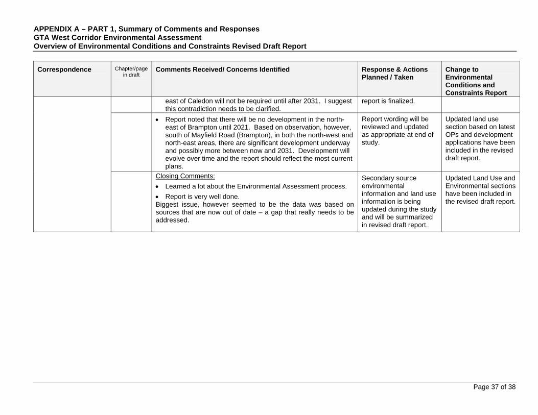
APPENDIX A – PART 1, Summary of Comments and Responses GTA West Corridor Environmental Assessment Overview of Environmental Conditions and Constraints Revised Draft Report
Page 37 of 38
Correspondence
Chapter/page in draft
Comments Received/ Concerns Identified Response & Actions Planned / Taken
Change to Environmental Conditions and Constraints Report
east of Caledon will not be required until after 2031. I suggest this contradiction needs to be clarified.
report is finalized.
Report noted that there will be no development in the north-east of Brampton until 2021. Based on observation, however, south of Mayfield Road (Brampton), in both the north-west and north-east areas, there are significant development underway and possibly more between now and 2031. Development will evolve over time and the report should reflect the most current plans.
Report wording will be reviewed and updated as appropriate at end of study.
Updated land use section based on latest OPs and development applications have been included in the revised draft report.
Closing Comments:
Learned a lot about the Environmental Assessment process.
Report is very well done. Biggest issue, however seemed to be the data was based on sources that are now out of date – a gap that really needs to be addressed.
Secondary source environmental information and land use information is being updated during the study and will be summarized in revised draft report.
Updated Land Use and Environmental sections have been included in the revised draft report.

APPENDIX A – PART 2: Summary of Environmental Information Received from Conservation Authorities
Preface
Summary of environmental information received follows the draft submission of the GTA West Corridor Environmental Assessment Overview of Environmental Conditions and Constraints (July, 2008).
Correspondence received is specific to consultation with four (4) Conservation Authorities, namely Toronto and Region Conservation Authority (TRCA), Credit Valley Conservation (CVC), Conservation Halton (CH), and Grand River Conservation Authority (GRCA).
Opportunities for feedback on the draft report from the above mentioned Conservation Authorities (CAs) follows the July, 2008 submission.
Members of the Project Team also held several workshops at each respective CA office to provide further input on existing environmental conditions as well as to acquire additional environmental information through personal consultation as well as electronically through Geographic Information Systems (GIS) data files. The following workshops were held on the following dates:
o CH – May 19, 2009 at 10:15 am o TRCA – May 20, 2009 at 9:15 am o CVC – May 20, 2009 at 1:00 pm o GRCA – May 26, 2009 at 9:00 am
Chapter 3
Section 3.1.3 East of the Niagara Escarpment
Toronto and Region Conservation Authority The Peel Plain is an expansive area (encompassing the central
portions of the Regional Municipalities of Halton, Peel and York and the northwestern portion of the City of Toronto) that is of agricultural significance due to its unique till soil.
Credit Valley Conservation Electronic GIS data showing the crest of slope within CVCs
jurisdiction. Section 3.2.3 Hydrogeology
Conservation Halton See Pages 17 and 18 in Appendix A - Part 1. Grand River Conservation Authority International Sensitivity Index (ISI) values have been assigned
to all areas within the watershed. They indicate the potential for contamination to affect the first aquifer, thus are an informal indicator of sensitivity.
The Grand River Watershed is groundwater and surface water based. There are numerous local groundwater studies available. Groundwater issues have a very high local profile in the watershed.
Electronic GIS data showing vulnerable areas (i.e., vulnerability to contamination) within GRCAs jurisdiction.
Section 3.3 Surface Water Toronto and Region Conservation Authority See Page 29 in Appendix A - Part 1. Electronic GIS data showing regulation limits, flood lines, as
well as existing intermittent and permanent surface water resources within TRCAs jurisdiction.
Credit Valley Conservation The Credit River Water Management Strategy Update, as well
as other watershed reports is available on the CVC website. Electronic GIS data showing engineered flood lines, estimated
meander belt widths, and regulation limits within CVCs
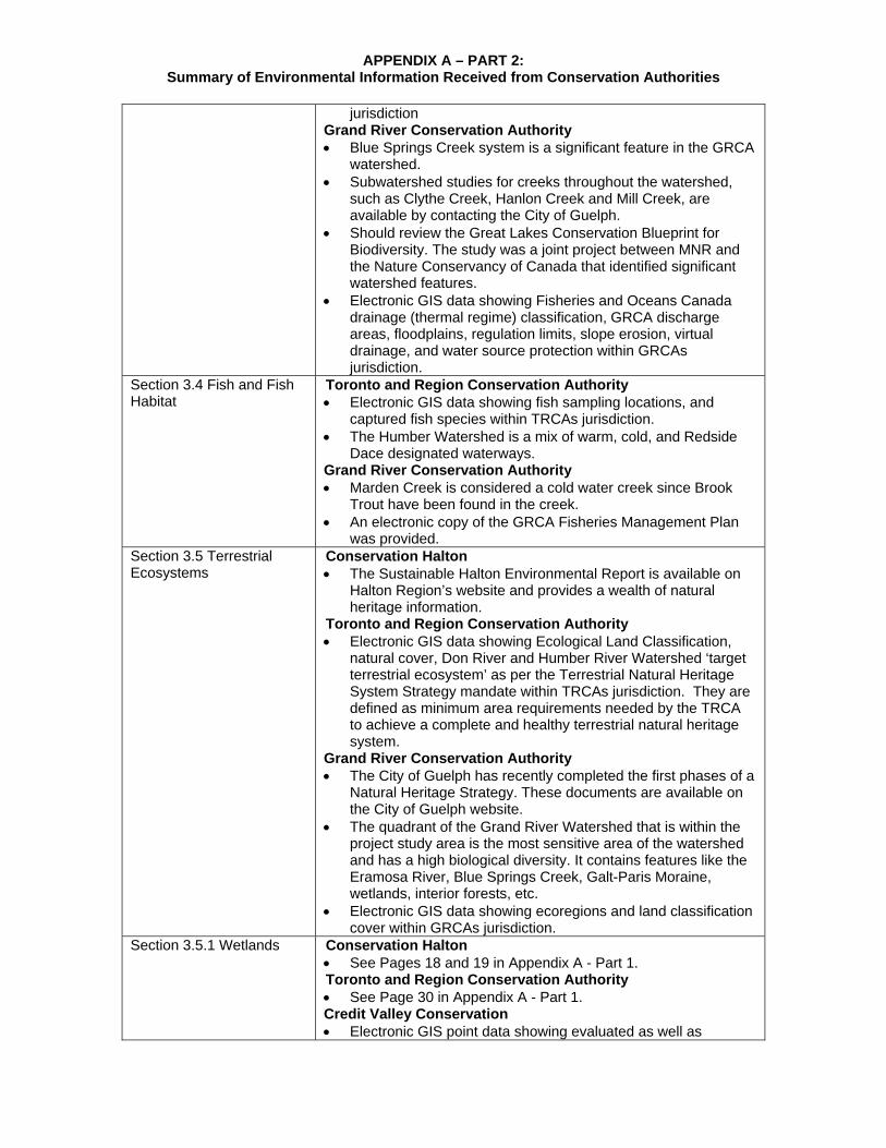
APPENDIX A – PART 2: Summary of Environmental Information Received from Conservation Authorities
jurisdiction
Grand River Conservation Authority Blue Springs Creek system is a significant feature in the GRCA
watershed. Subwatershed studies for creeks throughout the watershed,
such as Clythe Creek, Hanlon Creek and Mill Creek, are available by contacting the City of Guelph.
Should review the Great Lakes Conservation Blueprint for Biodiversity. The study was a joint project between MNR and the Nature Conservancy of Canada that identified significant watershed features.
Electronic GIS data showing Fisheries and Oceans Canada drainage (thermal regime) classification, GRCA discharge areas, floodplains, regulation limits, slope erosion, virtual drainage, and water source protection within GRCAs jurisdiction.
Section 3.4 Fish and Fish Habitat
Toronto and Region Conservation Authority Electronic GIS data showing fish sampling locations, and
captured fish species within TRCAs jurisdiction. The Humber Watershed is a mix of warm, cold, and Redside
Dace designated waterways. Grand River Conservation Authority Marden Creek is considered a cold water creek since Brook
Trout have been found in the creek. An electronic copy of the GRCA Fisheries Management Plan
was provided. Section 3.5 Terrestrial Ecosystems
Conservation Halton The Sustainable Halton Environmental Report is available on
Halton Region’s website and provides a wealth of natural heritage information.
Toronto and Region Conservation Authority Electronic GIS data showing Ecological Land Classification,
natural cover, Don River and Humber River Watershed ‘target terrestrial ecosystem’ as per the Terrestrial Natural Heritage System Strategy mandate within TRCAs jurisdiction. They are defined as minimum area requirements needed by the TRCA to achieve a complete and healthy terrestrial natural heritage system.
Grand River Conservation Authority The City of Guelph has recently completed the first phases of a
Natural Heritage Strategy. These documents are available on the City of Guelph website.
The quadrant of the Grand River Watershed that is within the project study area is the most sensitive area of the watershed and has a high biological diversity. It contains features like the Eramosa River, Blue Springs Creek, Galt-Paris Moraine, wetlands, interior forests, etc.
Electronic GIS data showing ecoregions and land classification cover within GRCAs jurisdiction.
Section 3.5.1 Wetlands Conservation Halton See Pages 18 and 19 in Appendix A - Part 1. Toronto and Region Conservation Authority See Page 30 in Appendix A - Part 1. Credit Valley Conservation Electronic GIS point data showing evaluated as well as

APPENDIX A – PART 2: Summary of Environmental Information Received from Conservation Authorities
potential wetlands within CVCs jurisdiction.
Grand River Conservation Authority Electronic GIS point data showing wetland features within
GRCAs jurisdiction. Section 3.5.2 Wildlife, Habitats, and Movement
Conservation Halton See Pages 19 and 20 Appendix A - Part 1. Toronto and Region Conservation Authority Electronic GIS point data showing previously recorded fauna
species within TRCAs jurisdiction. Section 3.5.3 Woodlands and Other Vegetated Areas
Conservation Halton See Pages 20 and 21 in Appendix A - Part 1. Toronto and Region Conservation Authority Electronic GIS point data showing previously recorded flora
species within TRCAs jurisdiction. Section 3.5.4 Terrestrial Species of Conservation Concern
Conservation Halton See Page 22 in Appendix A - Part 1. Grand River Conservation Authority The MNR is currently mapping Jefferson Salamander habitat
within the GRCA watershed. Section 3.6 Designated Areas
Conservation Halton See Pages 22 and 23 in Appendix A - Part 1. The following land holdings within Conservation have been
provided electronically in GIS format: o Scotch Block Reservoir o McLean Resource Management Area o McCrodan Resource Management Area o Bunker Resource Management Area o Shanahan Resource Management Area o Burns Conservation Area o McKenzie-Davis Resource Management Area o Kassam Resource Management Area o Halton Hill Channel Water Control Area o Esquesing Conservation Area
Toronto and Region Conservation Authority Electronic GIS data showing conservation areas (i.e., TRCA
owned property) within TRCAs jurisdiction. The Heart Lake Conservation Area should be considered a no-
go area. Credit Valley Conservation The area surrounded by Winston Churchill Blvd, Mayfield Rd
and Old Base Line is a sensitive area which contains Provincially Significant Wetlands and ANSI’s associated with the Credit River.
A new ANSI is being designated by MNR near the northern study boundary, east of Highway 10.
Sensitive areas in/around the study area include the Limehouse Conservation Area, Terra Cotta Conservation Area, Belfountain and the Forks of the Credit Provincial Park.
CVC owns a large amount of property in the study area and has particularly large holdings (several thousand acres) in and around Terra Cotta.
Grand River Conservation Area A Fall 2008 inventory was completed at the Rockwood
Conservation Area. The MOE recently completed a review of the Galt-Paris

APPENDIX A – PART 2: Summary of Environmental Information Received from Conservation Authorities
Moraine to determine whether there is a need for new provincial policy or legislation to protect the moraines.
The team should not consider all GRCA properties as areas where new transportation corridors should not be placed. A corridor that followed the northern study boundary would not have significant environmental effects.
Electronic GIS data showing conservation areas (i.e., GRCA owned property) within GRCAs jurisdiction.
Section 3.6.5 and 3.6.6 Locally/Regionally Designated Features and Areas and ESAs
Conservation Halton See Page 24 in Appendix A - Part 1. Toronto and Region Conservation Authority Electronic GIS data showing Environmentally Sensitive Areas
within TRCAs jurisdiction. Credit Valley Conservation Electronic GIS data showing Environmentally Sensitive Areas
within CVCs jurisdiction. Section 3.7.3 Groundwater Grand River Conservation Authority
The Township of Puslinch coordinates the monitoring of their groundwater network.
Chapter 4
Section 4.1 Land Use Policies, Goals, Objectives
Toronto and Region Conservation Authority Electronic GIS data showing Special Policy Area’s within
TRCAs jurisdiction. Section 4.2.2 First Nations Sacred Grounds
Toronto and Region Conservation Authority There is a large First Nation contingency along the Humber
River and in the Etobicoke Creek watershed. Section 4.5.6 Parks and Recreational/Trail Areas
Toronto and Region Conservation Authority The Carrying Place Trail follows the Humber River from
Georgian Bay to Lake Ontario. There are marked crossings along the River which commemorate its use as a significant former First Nations portage route.
Section 4.5.7 Aggregate and Mineral Resources
Credit Valley Conservation There are two (2) significant aggregate applications within the study area. One is located where the Credit River intersects with the northern study boundary and the other is located at Winston Churchill Boulevard and Highway 7 (Norval Quarry). The Acton Quarry has also applied for an expansion. Detailed environmental impact assessments are completed as a part of the application process. Further details about these applications can be found on the Town of Caledon’s website.
Chapter 5
Section 5.1.1 Heritage Sensitive Areas
Toronto and Region Conservation Authority The Humber River is a designated heritage river. Grand River Conservation Authority A heritage bridge inventory was conducted as a part of the
Grand River’s designation as a heritage river. Section 5.2.4 Previous Archaeological Research
Toronto and Region Conservation Authority Due to this historical significance, many archaeological sites
can be found along the River. One site of particular significance is the Seed-Barker Site, a former Iroquois Village, located at Rutherford Rd and the Humber River, north of
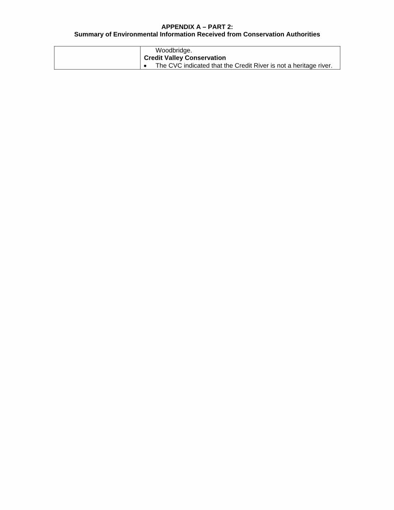
APPENDIX A – PART 2: Summary of Environmental Information Received from Conservation Authorities
Woodbridge. Credit Valley Conservation The CVC indicated that the Credit River is not a heritage river.


GTA West Corridor Planning and Environmental Assessment Study Revised Draft Area Transportation System Problems and Opportunities Report
December 2010 Page 206
Correspondence Reference Comments Received / Concerns Identified Response and Actions
Planned / Taken Change to Revised
Draft Report Regional Municipality of Halton Email of August 4, 2009
N/A What is the deadline for providing comments on the Draft Area Transportation System Problems & Opportunities Report for the GTA West Corridor Environmental Assessment Study?
Question addressed – relevant deadline provided.
No change to report
N/A This will confirm that the Council of the Regional Municipality of Halton, at its meeting held Wednesday, November 18, 2009, adopted the following resolution: 1. THAT Report No. PW-48-09 re: "Greater Toronto Area West Corridor Environmental Assessment - Area Transportation System Problems and Opportunities Report" be endorsed by Regional Council. 2. THAT the Regional Clerk forward a copy of Report No. PW-48-09 to the Ministry of Transportation, the GTA West Corridor Project Team and Local Municipalities for their information. 3. THAT the Ministry of Transportation be requested to assess the effect of road pricing strategies. Enclosed please find a copy of Report No. PW-48-09 for your information. Please note that the resolution adopted by Council differs from the staff recommendation in the report.
Comments noted – explanation that tolling is not currently being assessed as part of the study but may be reviewed at a later stage
No change to report Region of Halton Letter of November 19, 2009
N/A The study is being carried out within a policy framework of approved provincial (Provincial Policy Statement, Metrolinx Regional Transportation Plan, Growth Plan for the Greater Golden Horseshoe, etc.) And municipal (Official Plans, Transportation Master Plans, Land Use Designations, etc.) Planning policies,
Comments noted – any new information will be incorporated into the next study process
No change to report
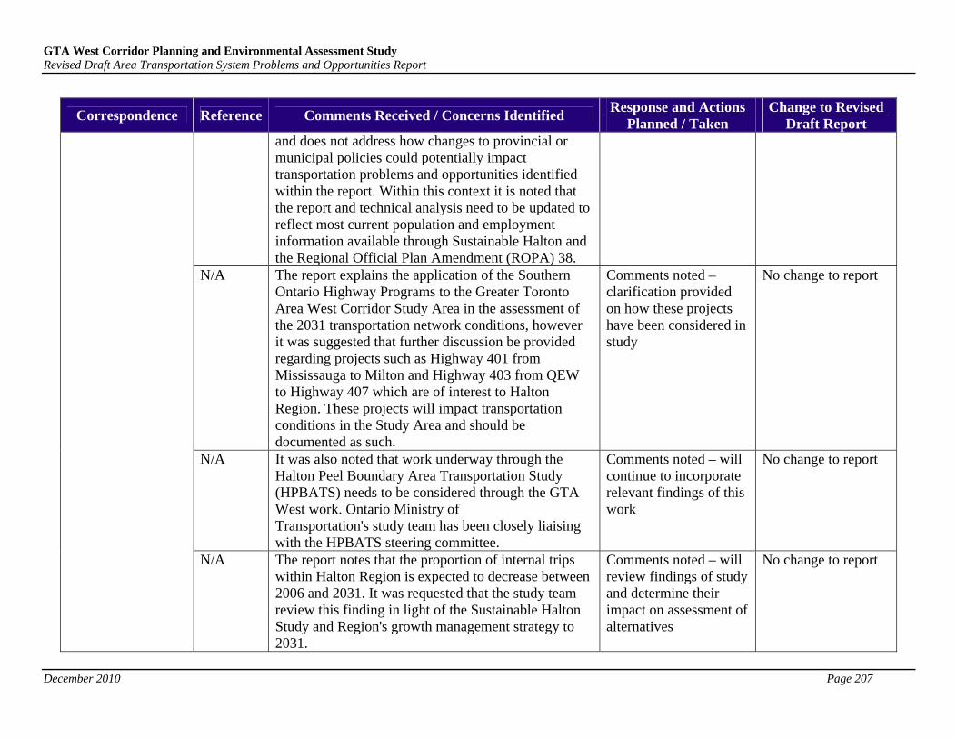
GTA West Corridor Planning and Environmental Assessment Study Revised Draft Area Transportation System Problems and Opportunities Report
December 2010 Page 207
Correspondence Reference Comments Received / Concerns Identified Response and Actions
Planned / Taken Change to Revised
Draft Report and does not address how changes to provincial or municipal policies could potentially impact transportation problems and opportunities identified within the report. Within this context it is noted that the report and technical analysis need to be updated to reflect most current population and employment information available through Sustainable Halton and the Regional Official Plan Amendment (ROPA) 38.
N/A The report explains the application of the Southern Ontario Highway Programs to the Greater Toronto Area West Corridor Study Area in the assessment of the 2031 transportation network conditions, however it was suggested that further discussion be provided regarding projects such as Highway 401 from Mississauga to Milton and Highway 403 from QEW to Highway 407 which are of interest to Halton Region. These projects will impact transportation conditions in the Study Area and should be documented as such.
Comments noted – clarification provided on how these projects have been considered in study
No change to report
N/A It was also noted that work underway through the Halton Peel Boundary Area Transportation Study (HPBATS) needs to be considered through the GTA West work. Ontario Ministry of Transportation's study team has been closely liaising with the HPBATS steering committee.
Comments noted – will continue to incorporate relevant findings of this work
No change to report
N/A The report notes that the proportion of internal trips within Halton Region is expected to decrease between 2006 and 2031. It was requested that the study team review this finding in light of the Sustainable Halton Study and Region's growth management strategy to 2031.
Comments noted – will review findings of study and determine their impact on assessment of alternatives
No change to report

GTA West Corridor Planning and Environmental Assessment Study Revised Draft Area Transportation System Problems and Opportunities Report
December 2010 Page 208
Correspondence Reference Comments Received / Concerns Identified Response and Actions
Planned / Taken Change to Revised
Draft Report N/A The Regional Transportation Advisory Committee
emphasized the importance of recognizing the significant congestion issues within Halton, and the potential impact of national and international initiatives on traffic volumes in the study area. It was also noted that proposed timelines for the next steps of the studies are very aggressive. The Committee also requested that the study team consider environmental impacts identified through previous work in the study area when evaluating alternatives under Phase 2 of the Study. In summary, the report provides data and broadly identifies problems and opportunities, but does not present any new significant information. This is not a concern at this point in the Study, however staff understand the importance of this Study in establishing the nature of inter-regional transportation to 2031 and will continue to work closely with the study team.
Comments noted – explanation that environmental issues are a key component of the study and provision of link to access further information
No change to report
Region of York Email of August 17, 2009
Page 48 and Appendix B
York Region has completed an Official Plan update and it is currently available for public review in draft form (I have attached the link to our website where you can download the material). It is expected to be approved by the end of 2009. The references in your Draft Area Transportation System Problems and Opportunities Report should be updated accordingly.
Comments noted – text will be revised to reflect updated York Region Official Plan
References on Page 48 and in Appendix B updated accordingly
City of Mississauga Email of September
N/A At this point, City of Mississauga has no comments or concerns with regard to the Draft Transportation System Problems and Opportunity report. We would
Interest noted No change to report

GTA West Corridor Planning and Environmental Assessment Study Revised Draft Area Transportation System Problems and Opportunities Report
December 2010 Page 209
Correspondence Reference Comments Received / Concerns Identified Response and Actions
Planned / Taken Change to Revised
Draft Report 9, 2009 like to be further involved in the study and monitor
the proceedings. Section 2.3.1 and Appendix B
Why are lower-tier municipal Official Plans not included in the discussion in Section 2.3.1 and Appendix B? Brampton OP contains specific policies related to corridor protection in west and east Brampton (relating to the North-South Transportation Corridor currently being studied through HPBATS, and the Hwy 427 and arterial network are in east Brampton).
Question addressed – guidance on relevant sections of report provided
No change to report
Page 78 Pg 78, Section 3.2, Road Network Assumptions: It mentions that the traffic analysis accounted for proposed road improvements by upper and single tier municipalities in their tmps. Does this mean that lower tier municipalities such as Brampton were not included? The City of Brampton’s Transportation & Transit Master Plan (TTMP 2009) should be included in the modeling and traffic analysis
Question addressed – explanation that Plan was included in modelling
No change to report
City of Brampton Emails of October 29, 2009 and November 2, 2009
N/A Previous transportation studies undertaken by the City of Brampton have identified the need for a new North-South Transportation Corridor along the Halton-Peel boundary including the City’s Transportation and Transit Master Plan (TTMP) and preliminary findings from the Halton-Peel Boundary Area Transportation Study (HP BATS). The purpose of the study and problem statement should be explicit regarding future north-south transportation infrastructure needs. The traffic analysis should identify the traffic growth issues associated with planned development in Brampton and Georgetown along the Halton-Peel boundary and the opportunity to provide north-south
Comments noted – guidance on relevant reports provided
No change to report

GTA West Corridor Planning and Environmental Assessment Study Revised Draft Area Transportation System Problems and Opportunities Report
December 2010 Page 210
Correspondence Reference Comments Received / Concerns Identified Response and Actions
Planned / Taken Change to Revised
Draft Report transportation infrastructure (such as a new North-South Transportation Corridor).
Page 92 Pg 92, Exhibit 3-17, screenlines were analyzed at South of Hwy 407 and South of Mayfield Road. These screenlines do not capture the significant future traffic volumes between Hwy 407 and south of Mayfield Road (most of Brampton not captured), particularly between WCB and Hurontario St. The only screenline capturing traffic volumes in Brampton is south of Mayfield Road, which would be significantly less at the north end of Brampton than the south end of Brampton. A new screenline needs to be added in the south end of Brampton in the vicinity of north of Hwy 407 to capture the higher traffic volumes.
Comments noted – as part of the ‘alternatives to’ analysis, new screenlines will be added to reflect flows north of Highway 407
No change to report - new screenlines added for subsequent study analysis and the results are provided in the Transportation Alternatives Report.
N/A At the appropriate stage in this EA Study, the extension of existing Highways such as Highways 410 and 427 needs to be identified as connecting with GTA West Corridor.
Comments noted No change to report
N/A Need to proceed with this EA study as quickly as possible in order to protect the lands for a North-South Transportation Corridor as well as future extension of Highway 427 in NE Brampton.
Comments noted No change to report
N/A Does the GGH model use the same methodology to project LRT and BRT trips?
Question addressed – affirmative response
No change to report
Page 78 Page 78, “Highway 410 extension from Mayfield Road to Highway 10”: what is the northerly terminus of 410 in the GGH 2006 scenario?
Question addressed – Bovaird Drive as based on 2006 data
No change to report
Page 79 Page 79: There appears to be some confusion in describing the RT corridors in Brampton. The
Comments noted – will amend Page 79 of the
Description of relevant corridors

GTA West Corridor Planning and Environmental Assessment Study Revised Draft Area Transportation System Problems and Opportunities Report
December 2010 Page 211
Correspondence Reference Comments Received / Concerns Identified Response and Actions
Planned / Taken Change to Revised
Draft Report Brampton acceleride BRT initiative (now rebranded as “Züm”) includes Queen St, Main St, Steeles Ave, Bovaird Dr, a yet-to-be-defined corridor in the east (either Airport Rd or Bramalea Rd), and Mississauga Rd in the west (added as part of the recent Transportation & Transit Master Plan update) – 6 arterial corridors in total. Of these, Queen, Main, and Steeles are identified as RT corridors in the Metrolinx RTP 15-Year Plan, and Steeles in the 25-Year Plan. Hurontario Street is represented in the RTP 15-Yr Plan in 3 sections: Mayfield to Downtown Brampton, Downtown Brampton to Highway 407, and Hwy 407 to Port Credit. The latter two sections comprise the Main Street/Hurontario High Order Transit corridor study, which is looking at potential LRT service. The section north to Mayfield is not included in the Hurontario HOT study, but is part of the acceleride/Züm network as a BRT corridor, though its identification in the RTP does not discount future LRT on this section. Transit (BRT or LRT)-Extension of a line on Hurontario Street north to Mayfield Road”. Based on the foregoing, please clarify bullets 6 and 7 of the “Metrolinx RTP/GO Transit” section and the 1st bullet under the “Other Rapid Transit (BRT or LRT)” section. Also, clarify whether Hurontario LRT in the GGH model extends to Mayfield Rd in 2031.
report to reflect comments
amended on Page 79
N/A Has road capacity been reduced on those arterial corridors with RT service? (e.g. Hurontario/Main St, five Brampton arterial corridors)
Question addressed – assumption that RT services will be accommodated through additional lanes
No change to report
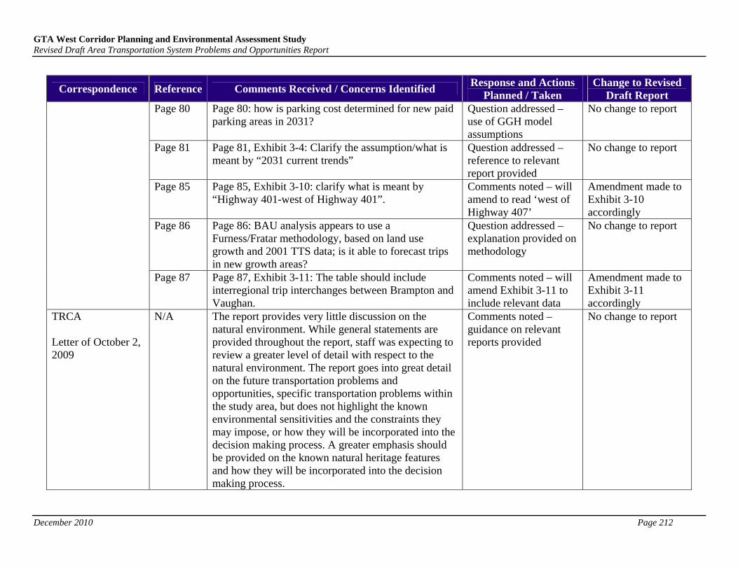
GTA West Corridor Planning and Environmental Assessment Study Revised Draft Area Transportation System Problems and Opportunities Report
December 2010 Page 212
Correspondence Reference Comments Received / Concerns Identified Response and Actions
Planned / Taken Change to Revised
Draft Report Page 80 Page 80: how is parking cost determined for new paid
parking areas in 2031? Question addressed – use of GGH model assumptions
No change to report
Page 81 Page 81, Exhibit 3-4: Clarify the assumption/what is meant by “2031 current trends”
Question addressed – reference to relevant report provided
No change to report
Page 85 Page 85, Exhibit 3-10: clarify what is meant by “Highway 401-west of Highway 401”.
Comments noted – will amend to read ‘west of Highway 407’
Amendment made to Exhibit 3-10 accordingly
Page 86 Page 86: BAU analysis appears to use a Furness/Fratar methodology, based on land use growth and 2001 TTS data; is it able to forecast trips in new growth areas?
Question addressed – explanation provided on methodology
No change to report
Page 87 Page 87, Exhibit 3-11: The table should include interregional trip interchanges between Brampton and Vaughan.
Comments noted – will amend Exhibit 3-11 to include relevant data
Amendment made to Exhibit 3-11 accordingly
TRCA Letter of October 2, 2009
N/A The report provides very little discussion on the natural environment. While general statements are provided throughout the report, staff was expecting to review a greater level of detail with respect to the natural environment. The report goes into great detail on the future transportation problems and opportunities, specific transportation problems within the study area, but does not highlight the known environmental sensitivities and the constraints they may impose, or how they will be incorporated into the decision making process. A greater emphasis should be provided on the known natural heritage features and how they will be incorporated into the decision making process.
Comments noted – guidance on relevant reports provided
No change to report
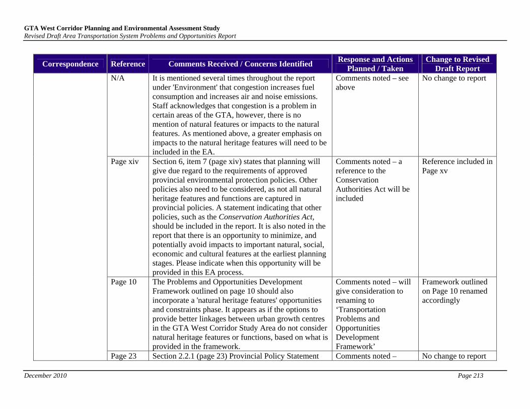
GTA West Corridor Planning and Environmental Assessment Study Revised Draft Area Transportation System Problems and Opportunities Report
December 2010 Page 213
Correspondence Reference Comments Received / Concerns Identified Response and Actions
Planned / Taken Change to Revised
Draft Report N/A It is mentioned several times throughout the report
under 'Environment' that congestion increases fuel consumption and increases air and noise emissions. Staff acknowledges that congestion is a problem in certain areas of the GTA, however, there is no mention of natural features or impacts to the natural features. As mentioned above, a greater emphasis on impacts to the natural heritage features will need to be included in the EA.
Comments noted – see above
No change to report
Page xiv Section 6, item 7 (page xiv) states that planning will give due regard to the requirements of approved provincial environmental protection policies. Other policies also need to be considered, as not all natural heritage features and functions are captured in provincial policies. A statement indicating that other policies, such as the Conservation Authorities Act, should be included in the report. It is also noted in the report that there is an opportunity to minimize, and potentially avoid impacts to important natural, social, economic and cultural features at the earliest planning stages. Please indicate when this opportunity will be provided in this EA process.
Comments noted – a reference to the Conservation Authorities Act will be included
Reference included in Page xv
Page 10 The Problems and Opportunities Development Framework outlined on page 10 should also incorporate a 'natural heritage features' opportunities and constraints phase. It appears as if the options to provide better linkages between urban growth centres in the GTA West Corridor Study Area do not consider natural heritage features or functions, based on what is provided in the framework.
Comments noted – will give consideration to renaming to ‘Transportation Problems and Opportunities Development Framework’
Framework outlined on Page 10 renamed accordingly
Page 23 Section 2.2.1 (page 23) Provincial Policy Statement Comments noted – No change to report
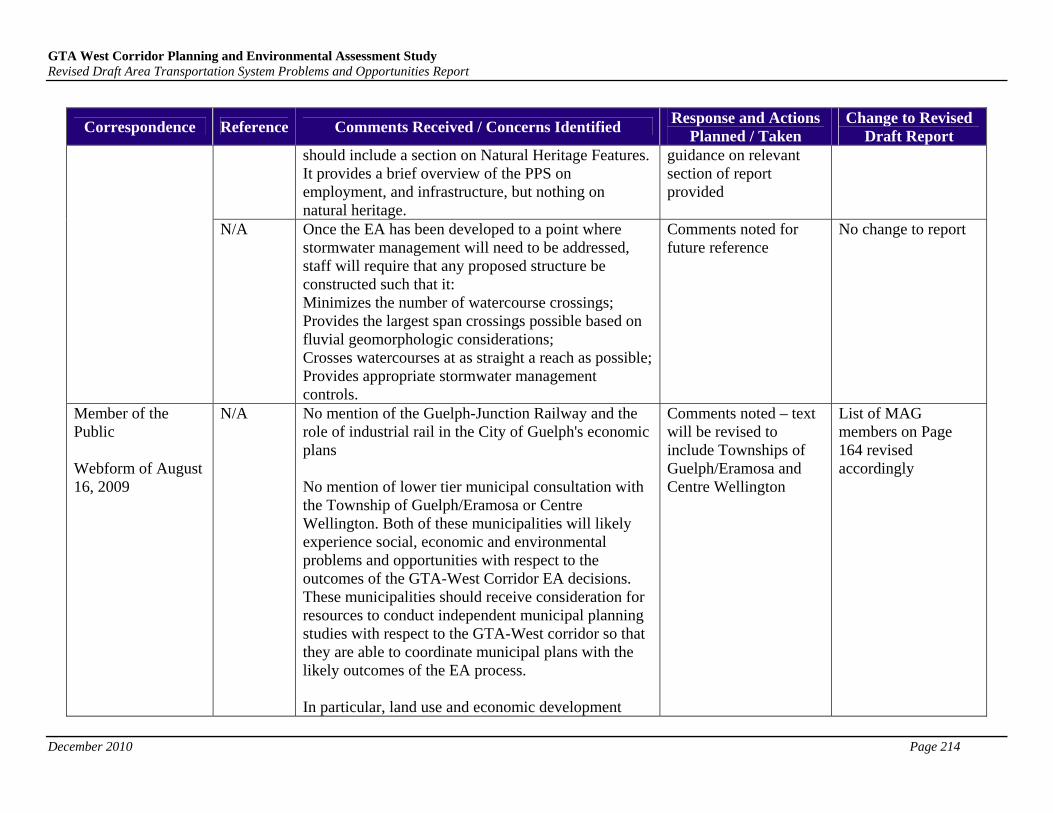
GTA West Corridor Planning and Environmental Assessment Study Revised Draft Area Transportation System Problems and Opportunities Report
December 2010 Page 214
Correspondence Reference Comments Received / Concerns Identified Response and Actions
Planned / Taken Change to Revised
Draft Report should include a section on Natural Heritage Features. It provides a brief overview of the PPS on employment, and infrastructure, but nothing on natural heritage.
guidance on relevant section of report provided
N/A Once the EA has been developed to a point where stormwater management will need to be addressed, staff will require that any proposed structure be constructed such that it: Minimizes the number of watercourse crossings; Provides the largest span crossings possible based on fluvial geomorphologic considerations; Crosses watercourses at as straight a reach as possible; Provides appropriate stormwater management controls.
Comments noted for future reference
No change to report
Member of the Public Webform of August 16, 2009
N/A No mention of the Guelph-Junction Railway and the role of industrial rail in the City of Guelph's economic plans No mention of lower tier municipal consultation with the Township of Guelph/Eramosa or Centre Wellington. Both of these municipalities will likely experience social, economic and environmental problems and opportunities with respect to the outcomes of the GTA-West Corridor EA decisions. These municipalities should receive consideration for resources to conduct independent municipal planning studies with respect to the GTA-West corridor so that they are able to coordinate municipal plans with the likely outcomes of the EA process. In particular, land use and economic development
Comments noted – text will be revised to include Townships of Guelph/Eramosa and Centre Wellington
List of MAG members on Page 164 revised accordingly
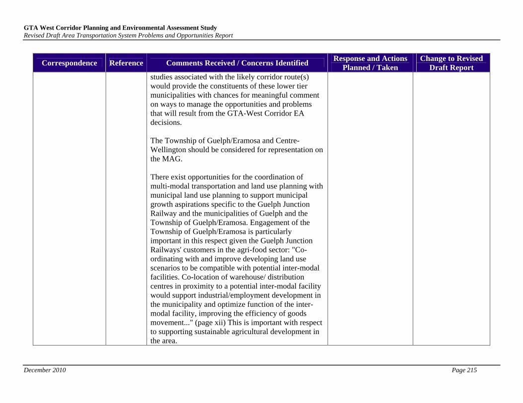
GTA West Corridor Planning and Environmental Assessment Study Revised Draft Area Transportation System Problems and Opportunities Report
December 2010 Page 215
Correspondence Reference Comments Received / Concerns Identified Response and Actions
Planned / Taken Change to Revised
Draft Report studies associated with the likely corridor route(s) would provide the constituents of these lower tier municipalities with chances for meaningful comment on ways to manage the opportunities and problems that will result from the GTA-West Corridor EA decisions. The Township of Guelph/Eramosa and Centre-Wellington should be considered for representation on the MAG. There exist opportunities for the coordination of multi-modal transportation and land use planning with municipal land use planning to support municipal growth aspirations specific to the Guelph Junction Railway and the municipalities of Guelph and the Township of Guelph/Eramosa. Engagement of the Township of Guelph/Eramosa is particularly important in this respect given the Guelph Junction Railways' customers in the agri-food sector: "Co-ordinating with and improve developing land use scenarios to be compatible with potential inter-modal facilities. Co-location of warehouse/ distribution centres in proximity to a potential inter-modal facility would support industrial/employment development in the municipality and optimize function of the inter-modal facility, improving the efficiency of goods movement..." (page xii) This is important with respect to supporting sustainable agricultural development in the area.


GTA West Corridor Environmental Assessment Summary of Comments and Responses on Draft Area Transportation System Alternatives Report (March 2010)
Correspondence Comments Received / Concerns Identified Response & Actions Taken / Planned Change to Area Transportation System Alternatives Report
Upon more closely reading through the draft report, I realize that there is in fact road tolling discussed therein, but the discussion seems to be a little inconsistent. For example, I find it mentioned Table B-2 (Appendix B) under the following numbers: 163, 171, 178, 179, 194, 245, 278 and 279. Depending on the question, the check marks and rationale change, which makes sense in some cases but not in all. Based on your comments yesterday regarding provincial direction, I would expect most of these to be identified as "Should be pursued as part of separate study/initiative". However, #163 (new tolls) and #171 (occupancy/congestion tolls) suggest that these "should be considered further as part of GTA West study". Also, while it notes that #163 "has potential to substantively contribute…", for some reason #171 does not, even though most of the transportation analysis is for peak hour congestion.
Although Table B-2 identifies road tolling as an alternative for addressing the transportation problems and opportunities in the study area, a full analysis of road tolling (including congestion tolling) would need to be studied separately. Tolling analysis is generally undertaken during later stages of the EA process once alternative alignments have been developed.
No change. Region of Waterloo Submitted via Email, dated May 12, 2010
Additionally, since the discussion in Appendix A regarding TDM and TSM in other jurisdictions specifically discusses congestion tolling, the discussion of Group 1 (Optimization) in the Executive Summary and in the main text should also include something about it. If, as you indicated yesterday, the Province is providing direction that this issue is too broad to be examined on a corridor-by-corridor basis and needs to be studied separately, it would help the report if a statement was made in that regard. After all, interested parties should at least know that the issued is actually being studied, of which I myself was unaware until yesterday.
See response above. No change.
Regional Municipality of Halton - Public Works and Engineering Services
Include the linkages in the Regional Natural Heritage System (RNHS), as a sub-factor under 1.2 (Terrestrial Ecosystems) of Table B-1: Factors and Criteria for Assessing Preliminary Planning Alternatives, Section 1- Natural Environmental Factors.
Linkages in RNHS added as a sub-factor. Table B-1 updated.
1

GTA West Corridor Environmental Assessment Summary of Comments and Responses on Draft Area Transportation System Alternatives Report (March 2010)
Correspondence Comments Received / Concerns Identified Response & Actions Taken / Planned Change to Area Transportation System Alternatives Report
The Problems and Opportunities should be Listed in the Executive Summary.
Comment noted. Reference to report retained. No change.
Double use of the term “stage”: i) to describe steps in the development and assessment of
alternatives, and; ii) to describe the broader EA process.
Recommend changing the term stage in i) to phase or step.
Terminology is consistent with other reports and documents including Public Information Centre displays.
No change.
Figure titled “Exhibit E-1 Two-Stage Process” shows three stages. Exhibit E-1 updated to show two stages. Exhibit E-1 updated.
Each Map should have a Separate Exhibit/ Figure Number and Title. Nine maps are labeled “Exhibit E-2. The same comment applies to the maps in Appendix B, which have not been assigned Exhibit numbers nor titles.
Exhibit E2s are re-labelled E2 to E10 in the report. No change to Appendix B since all references to these figures are by alternative number (i.e. Group 2, Group 4-1 etc).
Exhibit E2s re-labeled in the report.
Maps should show the number of existing lanes along with proposed new lanes [i.e. see the Niagara to GTA Corridor Planning and Environmental Assessment Study – ATSAR (April 2010), Exhibit E-3 on page xi].
Noted. No change.
The tables in Appendix B are difficult to navigate. It is recommended that:
Page numbers be added to Appendix B, and Table titles be listed on each page of the multi-page tables.
Agreed, page number and titles added to multi-page tables.
Tables updated in Appendix B.
Heading in Table B-3 is incorrect. See comment below. See comment below.
Submitted via Letter, dated July 8, 2010
Table B-3 should be split into 3 separate tables. Agreed. Table B-3 updated
2

GTA West Corridor Environmental Assessment Summary of Comments and Responses on Draft Area Transportation System Alternatives Report (March 2010)
Correspondence Comments Received / Concerns Identified Response & Actions Taken / Planned Change to Area Transportation System Alternatives Report
Rationale Column in Table B-2 does not match Interest / Disinterest in Alternatives.
Comments noted. No change.
Add Halton-Peel Boundary Area Transportation Study (HPBATS) to Definitions.
Agreed. Definition added.
Alternative Groupings
Your comment regarding the Group 4 alternatives has been noted. We will be revising this section as follows “…some effects can be mitigated through careful environmental planning however, some impacts to natural heritage features/functions and agricultural lands will be unavoidable”.
Executive summary Section 4.6 updated and Section 3.9 in main report updated.
Toronto and Region Conservation Authority Submitted via Letter, dated June 1, 2010
Water Management
This phase of the EA will look to identify a route planning “study area” within which routes will be generated in the next phase of the EA process. Water management will be an important component of evaluating route alternatives during the next phase of study, which will also include more detailed work such as field investigations, drainage analysis, and generation of design alternatives at water crossings etc.
No change.
3

GTA West Corridor Environmental Assessment Summary of Comments and Responses on Draft Area Transportation System Alternatives Report (March 2010)
Correspondence Comments Received / Concerns Identified Response & Actions Taken / Planned Change to Area Transportation System Alternatives Report
Terrestrial Natural Heritage System
We will endeavour to integrate infrastructure with natural heritage systems and open space to minimize habitat fragmentation in the next phase of study.
No change.
Items to Consider
The Ministry will work with TRCA to identify conservation land tracts in future route planning study area – as part of next stage of EA with a view to minimizing impacts during route generation/evaluation.
Land use information and mapping has been updated during the study through direct consultation with municipal planning department staff and CAs. In addition, the mapping and information provided by the TRCA on June 30th, 2009 was included in the updated Environmental Assessment Overview of Environmental Conditions and Constraints Report (dated May 2010) and was considered during the evaluation of transportation alternatives. This information will be updated as part of Stage 2.
The route planning study area to be identified at the end of this phase to allow a reasonable range of alternatives to be generated and evaluated. It is recognized that this will include some Greenbelt areas that extend across the study area (in a north south direction) and some areas of the Niagara Escarpment, if Alternative 4-3 is carried forward. Impacts to these areas will be minimized where possible during generation/evaluation of route
No change.
4
GTA West Corridor Environmental Assessment Summary of Comments and Responses on Draft Area Transportation System Alternatives Report (March 2010)
Correspondence Comments Received / Concerns Identified Response & Actions Taken / Planned Change to Area Transportation System Alternatives Report
planning alternatives in the next phase of the EA. The next EA study phase will also be supported by environmental field work that will include identifying locations of the most sensitive features within these designated areas.
Developing the EA – Areas of Concern
We acknowledge TRCA comments that Group 4 alternatives do have higher natural environment effects than Group 3 alternatives. That has been recognized and considered in the evaluation. Group 3-1 was identified as most preferred from a Natural Environment and Cultural perspective and equally preferred as some of the Group 4 alternatives from an economic perspective. Having said that Group 3-1 has higher Land Use/Social impacts, does not perform as well from a transportation perspective and has some significant constructability challenges. Given these issues, Group 3-1 was not carried forward for further consideration. More detailed information on the evaluation of alternatives and rationale for the preferred alternatives (as presented at PIC 4) is available on the project website.
The next phase of EA will continue to seek ways to reduce impacts to significant natural heritage features in TRCA jurisdiction – through route generation and evaluation phases.
Appendix A Comments
1. Indirect impacts (such as noise and air quality, as well as land use) were considered during the evaluation. The next phase of EA
No change.
5
GTA West Corridor Environmental Assessment Summary of Comments and Responses on Draft Area Transportation System Alternatives Report (March 2010)
Correspondence Comments Received / Concerns Identified Response & Actions Taken / Planned Change to Area Transportation System Alternatives Report
6
will continue to consider additional evaluation criteria that includes direct and indirect impacts at higher level of detail (including drainage and stormwater management).
2. The evaluation criteria under Surface Water includes watershed/sub-watershed drainage features and patterns and the potential to affect existing drainage systems associated with permanent watercourses, which includes floodplain impacts as a result of additional lanes or a new corridor.
3. The intent of this analysis was to identify potential effects at a higher/strategic level to determine which alternatives warranted a higher level of detail. More detailed analysis will be undertaken for the alternatives recommended to be carried forward.
4. Same as response 3.
5. The municipal land use criteria under the Land Use/Socio-economic Environment Factors is intended to include land use plans for existing and future residential, community, commercial, employment or industrial areas. Natural land use areas are taken into consideration under the Natural Environment Factor.
6. Same as response 3.
7. Mitigation will be developed in accordance with MTO Standards and Practices. The

GTA West Corridor Environmental Assessment Summary of Comments and Responses on Draft Area Transportation System Alternatives Report (March 2010)
Correspondence Comments Received / Concerns Identified Response & Actions Taken / Planned Change to Area Transportation System Alternatives Report
extent required (i.e., for a larger footprint) won’t be known until design alternatives are developed in future study phases.
8. The report has been revised to include Environmental Protection Policies for Conservation Authorities.
9. Same as response 8.
10. The project team agrees that TRCA’s jurisdiction remains relatively the same for the new corridor sections generated to date and that impacts to the natural heritage systems will be similar for all options. The next study phase will include generating route alternatives that may have varying levels of impacts on sensitive areas within the corridor.
Conservation Halton Submitted via Letter, dated June 3, 2010
Report Overview
Your comment recommending that all efforts be made to avoid the creation of a new corridor is noted and understood. The study team will be incorporating a number of improvements that include elements of Groups 1 to 3 in the preferred Transportation Development Strategy. However, those improvements are still not enough to accommodate the traffic volumes and address transportation problems that are predicted to occur in the study area by 2031.
No change.
7
GTA West Corridor Environmental Assessment Summary of Comments and Responses on Draft Area Transportation System Alternatives Report (March 2010)
Correspondence Comments Received / Concerns Identified Response & Actions Taken / Planned Change to Area Transportation System Alternatives Report
We agree that in Section 3.5.2 under Assessment of Group 2 – Environment the report should note the “potential impact for increase in resource consumption”.
Note added to Section 3.5.2.
Your comment regarding the Assessment of Group 3 and Group 4 has been noted and the text has been revised accordingly.
Executive summary Section 4.6 updated and Section 3.9 in main report updated.
a. The factors and criteria used for NGTA and GTA West studies are essentially the same. In some cases the criteria, forms of measurement or differences between alternatives are documented slightly differently based on characteristics that are unique to each study area. For example, the GTA West study area refers to specific land use development pressures in York and Peel Regions – these types of pressures generally do not exist in the NGTA study area. The NGTA refers to tender fruit farms and specialty agricultural operations which do not exist in GTA West study area. The Provincial Policy Statement (PPS) has been used to develop criteria for both projects. Furthermore, the evaluation criteria for both projects was approved in the Terms of Reference for each study.
b. As significant woodlands are a planning authority responsibility and the study area
No change.
8
GTA West Corridor Environmental Assessment Summary of Comments and Responses on Draft Area Transportation System Alternatives Report (March 2010)
Correspondence Comments Received / Concerns Identified Response & Actions Taken / Planned Change to Area Transportation System Alternatives Report
crosses various municipalities, the project team used MNR’s Natural Heritage Reference Manual (Attachment A2) to provide a guideline that woodlands greater than 40 ha in size should be considered significant. We acknowledge that the linear impact to a woodlot does not entirely represent the amount of impact but, we use it to provide a fair comparison between planning alternatives at a high level, during this phase of the EA process. Even these lengths will vary within corridors, depending on where routes are generated in the next study phase.
c. We acknowledge that the SWHTG identifies wildlife habitat that are not discussed in this section of the report or taken into consideration at this phase of the EA. However, we feel the presence/absence of significant/sensitive features and species are also captured under other categories such as designated areas (ESAs, ANSIs, PSW, NEC and SAR, etc). In addition we acknowledge that permanent and intermittent watercourses both contribute to downstream water quality and fish habitat. A greater level of detail on environmental features will be obtained in the next phase of EA and on a narrower study area, when provincial secondary source information is supplemented by field work, local studies and knowledge, etc.
9
GTA West Corridor Environmental Assessment Summary of Comments and Responses on Draft Area Transportation System Alternatives Report (March 2010)
Correspondence Comments Received / Concerns Identified R pes no se & Actions Taken / Planned Change to Area Transportation System Alternatives Report
d. A greater level of detail on environmental features (i.e., permanent and intermittent watercourses) will be obtained in the next phase of EA and on a narrower study area, when provincial secondary source information is supplemented by field work, local studies and knowledge, etc.
a. Table B-3 is intended to summarize potential impacts to natural features at a relatively high level of detail – by acknowledging the numbers and names of natural features (including watercourses) potentially impacted by the alternative. We don’t state the type of impact because we don’t know where the route will cross the feature, or on which side of the highway we are widening. Therefore, although we acknowledge that the expansion of existing highways and culverts could create a barrier to fish passage where none currently exist we feel the addition of this type of wording (i.e., level of detail on the impact) is not consistent with the level of detail in the remainder of the table.
We will add SAR in Group 3 alternatives to be consistent with Group 4 alternatives.
In general, we feel that widening existing highways supports the PPS on the protection of Natural Heritage, Agriculture and Cultural Heritage/Archaeological resources because footprint impacts are
Appendix B, Table B-3 updated to incorporate comments in a,b and d.
10
GTA West Corridor Environmental Assessment Summary of Comments and Responses on Draft Area Transportation System Alternatives Report (March 2010)
Correspondence Comments Received / Concerns Identified Response & Actions Taken / Planned Change to Area Transportation System Alternatives Report
contained in an area (usually the highway right-of-way) that is already disturbed. We acknowledge that some impacts (beyond the right of way) are still possible, but that in most cases these are “fringe” impacts to natural, agricultural or cultural areas. Fringe impacts can typically be mitigated using standard mitigation measures and normally result in less impact than new corridor alternatives.
b. We will add the Mountsberg Wildlife Area ESA to list of natural features for Alternatives 3-1.
c. The information listed under Trafalgar Road is consistent with information presented on other sections of Group 3 alternatives.
d. This change can be made in the report.
11

GTA West Corridor Environmental Assessment Summary of Comments and Responses on Draft Area Transportation System Alternatives Report (March 2010)
Correspondence Comments Received / Concerns Identified Response & Actions Taken / Planned Change to Area Transportation System Alternatives Report
a/b. We acknowledge that there are areas of tourism and recreation and a number of unevaluated wetlands that have the potential to be impacted. A greater level of detail on environmental features will be obtained in the next phase of EA and on a narrower study area, when provincial secondary source information is supplemented by field work, local studies and knowledge, etc. Additional evaluation criteria that includes direct and indirect impacts at higher level of detail will also be considered.
c. We believe the “aggregates and mines” sub factor is appropriately placed under the “Land Use/Socio-Economic Environment” and were approved in the Terms of Reference.
d. This phase of EA will look to identify a route planning “study area” within which routes will be generated in the next phase of the EA process. Development pressures resulting from a new corridor will be considered as part of evaluating route alternatives during the next phase of study, which will also include more detailed work. Land use surrounding new corridor highways can be controlled to some extent by location of interchanges etc.
e. We will add “including disruption to
Appendix B, Table B-3, Environmental Summary for Group 4 alternatives updated to incorporate comments in e.
12

13
GTA West Corridor Environmental Assessment Summary of Comments and Responses on Draft Area Transportation System Alternatives Report (March 2010)
Correspondence Comments Received / Concerns Identified Response & Actions Taken / Planned Change to Area Transportation System Alternatives Report
wildlife movement/corridors and impacts to SAR associated with Niagara Escarpment” to the Environmental Summary row for Group 4 Alternatives that cross the escarpment.
Your concerns regarding Alternative 4-5, the avoidance of a new escarpment crossing and the impacts that aggregate operations have on natural heritage features and function as well as groundwater and surface water features have been noted and will be considered as the study moves forward.

GTA West Corridor EA Municipal/Agency Comments and Responses to Draft Transportation Development Strategy (February 2011) Released on March 7, 2011
1
# Comment Date
Municipality / Agency
Comment* Response
EX-220 Mar 7-11 Conservation Halton
Are hard copies of the study being supplied to commenting agencies? If so, I would like to request 3 copies for Conservation Halton. Thank you. Jennifer ___________________________ Jennifer Lawrence, MCIP, RPP Manager, Environmental Planning Conservation Halton
Sent Mar 9-11 Dear Ms. Lawrence, Hard copies were not provided to commenting agencies as the report can be downloaded from the project website (www.gta-west.com). However, if your agency has difficulties in downloading the report and request that a hard copy be mailed to you, please advise Catharine Christiani at [email protected]. Sincerely, The GTA West Project Team
EX-221 Mar 7-11 Halton Region When will this be posted on the Web-page? Can you provide the direct link? Thanks
Sent Mar 9-11 Dear Mr. Glenn, As indicated in the email’s letter attachment, the Draft Transportation Development Strategy Report is now available on the project website. Here is a direct link to the downloadable PDF’s: http://www.gta-west.com/reports.html#draftreports Sincerely, The GTA West Project Team
EX-222 Mar 8-11 Peel Region Thank you the notice that the Draft Transportation Development Strategy Report for the GTA West Corridor EA has been made available. Am I correct in inferring that the deadline for comments to be submitted is 90 days after March 11? If not, I would appreciate finding out what the deadline for comments is. Thank you. Brian Lakeman - Transportation Planner, MCIP, RPP Region of Peel, Public Works - Transportation Planning Division 10 Peel Centre Drive, Suite A, 6th Floor Brampton, ON L6T 4B9
Sent Mar 9-11 Dear Mr. Lakeman, We are providing a minimum of 90 days for public and agency comments, after March 11, 2011. We look forward to your comments. Sincerely, The GTA West Project Team
EX-223 Mar 9-11 City of Guelph We have received your email. I would like to correct the address you have for Guelph City Hall. We are at 1 Carden Street, not 59 Carden Street. Dolores Black Assistant Council Committee Coordinator City Clerk's Office, Information Services City of Guelph
No response necessary. Mailing list updated.
EX-224 Mar 10-11 Infrastructure Canada
Ms Christiani, Thank you for your correspondence of March 7, 2011. I have forwarded the report along to the appropriate people in our department. Sincerely, Infrastructure Canada | www.infc.gc.ca Government of Canada | Gouvernement du Canada Building Canada: Stronger, Safer, Better www.buildingcanada.gc.ca Chantiers Canada : Plus fort, sécuritaire et meilleur www.chantierscanada.gc.ca
No response necessary.
EX-225 Mar 10-11 City of Mississauga
Hi Neil and Jin Thanks for your letter date March 7, 2011, announcing the release of the GTA West Draft Transportation Strategy report. I look forward to reviewing the draft and to Mississauga's continued participation in the EA process for this corridor. Please update my mailing address in your records as I am located at 201 City Centre Drive. See complete mailing address below. Thanks Bob Robert Sasaki Manager, Transportation Planning City of Mississauga Transportation and Works Department
Sent Mar 14-11 Dear Mr. Sasaki, Thanks for your interest in the study. We have updated our mailing list with your complete mailing address. Additional details about the project can be viewed on the project website at www.gta-west.com. Feel free to contact us should you have any questions or wish to provide additional input. Sincerely, The GTA West Project Team
EX-226 Mar 16-11 Halton Region Please forward 2 print copies of the GTA West Corridor EA Transportation Development Strategy Report - Draft for Consultation (February 2011) to my attention at the following address: Legislative and Planning Services Department Region of Halton 1151 Bronte Road Oakville ON L6M 3L1
Sent Mar 21-11 Dear Ms. Kielt, Thanks for your interest in the study. A hard copy of the draft report has been provided to your municipality’s Clerk’s Department and the report

GTA West Corridor EA Municipal/Agency Comments and Responses to Draft Transportation Development Strategy (February 2011) Released on March 7, 2011
2
# Comment Date
Municipality / Agency
Comment* Response
Kathy Kielt Acting Deputy Clerk/Supervisor of Council and Committee Services Region of Halton
is also available for downloading via the project website (www.gta-west.com). If you have difficulties downloading the report and request that a hard copy be mailed to you, please advise Catherine Christiani at [email protected]. Sincerely, The GTA West Project Team
EX-227 Mar 18-11 Grand River Conservation Authority
Good Morning Catherine, Would it be possible to receive a hard copy of the report for review? Thanks, Jamie Jamie Ferguson B.Sc. (Agr.), M.Sc. Resource Planner Grand River Conservation Authority
Sent Mar 21-11 Dear Mr. Ferguson, Hard copies were not provided to commenting agencies as the report can be downloaded from the project website (www.gta-west.com). However, if your agency has difficulties in downloading the report and request that a hard copy be mailed to you, please advise Catherine Christiani at [email protected]. Sincerely, The GTA West Project Team
EX-227b
Mar 21-11 Grand River Conservation Authority
Catherine, Please consider this a request to have a hard copy of the report mailed to us. The mailing address is in my signature below. Jamie Ferguson B.Sc. (Agr.), M.Sc. Resource Planner Grand River Conservation Authority
Sent Mar 22-11 Hi Jamie, A copy of the report will be mailed to your attention shortly. If you require anything further, please let me know. - Catherine Catherine Christiani, Environmental Planner Ecoplans Limited | A Member of the MMM Group
EX-228 Mar 21-11 Conservation Halton
Hi Catharine, Would you be able to provide Conservation Halton with 3 hard copies of the recently released report? We received hard copies upon request from the NGTA Study Team and were hopeful that we could get hard copies from your study team as well. Thanks. Jennifer ___________________________ Jennifer Lawrence, MCIP, RPP Manager, Environmental Planning Conservation Halton
Sent Mar 22-11 Hi Jennifer, 3 copies of the report will be mailed to your attention shortly. If you require anything further, please let me know. - Catherine Catherine Christiani, Environmental Planner Ecoplans Limited | A Member of the MMM Group
EX-229 Mar 24-11 Halton Region Hi Catherine - My Commissioner has requested that we get him two copies of the Niagara to GTA and GTA West Corridor Reports that were released in February. We do have our Clerk's copies for public consultation. Is there any chance of getting two extras of each or are you going to direct me to the website for us to print them ourselves? Kathy Kielt Acting Deputy Clerk/Supervisor of Council and Committee Services Region of Halton
Sent Mar 25-11 Hi Kathy, 2 copies of the report will be mailed to your attention shortly. If you require anything further, please let me know. - Catherine Catherine Christiani, Environmental Planner Ecoplans Limited | A Member of the MMM Group
EX-230 Mar 24-11 Halton Region Hi Jin Trust all is well? We are in receipt of your letter dated March 7, 2011stating that a meeting will be arranged for the above study. Our question to you is when and where, and whether you could please schedule the meeting sooner rather than later as Halton Region is very impacted by this study. With the timelines for comments being fairly short, we would appreciate all time possible to review and comment. Also, would the team be available to present to our council if our Senior management request this? Thanks Andrew
Sent Mar 24-11 Andrew, We just sent out the meeting invitation for the Municipal Advisory Group to meet on April 20. The Project Team will be happy to make a presentation to the council if so requested. Please provide us with the confirmation and the council meeting date as early as possible so the team can be available. Thanks. Jin
EX-231 Mar 25-11 Town of Caledon
Good afternoon, We are in receipt of your correspondence dated March 7, 2011 enclosed the GTA West Corridor Planning and Environmental Assessment (EA)
Sent Mar 25-11 Dear Mr. Karrandjas,

GTA West Corridor EA Municipal/Agency Comments and Responses to Draft Transportation Development Strategy (February 2011) Released on March 7, 2011
3
# Comment Date
Municipality / Agency
Comment* Response
Study - Release of Draft Transportation Development Strategy Report - Draft for Consultation. We note that it has only been provided to the Caledon East Library and we would like you to provide a copy to both the Bolton Branch as well as Margaret Dunn. Their addresses are as follows: Albion Bolton Branch Albion-Bolton Community Centre 150 Queen Street S. Bolton, Ontario L7E 1E3 And Margaret Dunn Valleywood Branch 20 Snelcrest Dr. Caledon, Ontario L7C 1B5 Thank you very much. Barbara Karrandjas Legislative Administrator Administration Department Town of Caledon
Thanks for your interest in the study. One copy of the GTA West Corridor Environmental Assessment Draft Transportation Development Strategy Report will be mailed to the Albion Bolton Branch and the Margaret Dunn Valleywood Branch for public review. See enclosed for your cc: copy of the letters sent with the Reports. If you require anything further, or have any questions, please contact Catherine Christiani at [email protected] or 905-823-4988 x1373. Sincerely, The GTA West Project Team
EX-232 Apr 6-11 City of Brampton
Hello Neil and Jin, Could either of you please point me in the direction of the Transportation Model Technical Background Report (February 2011) mentioned on page 134 of the Draft Transportation Development Strategy Report? Many thanks. David Kuperman Transportation/Infrastructure Policy Planner III Long Range Transportation Planning Planning, Design & Development City of Brampton | 2 Wellington Street W | Brampton ON L6Y 4R2
Sent Apr 6-11 Thank you for your interest in this project and in the reference document you have requested. We are in the process of completing reviews on this draft document and will have it posted on the project web site by the Municipal Agencies Group (MAG) meeting scheduled for April 20. Sorry for any inconvenience in the delayed availability of this document. If there are any specific questions or points of clarification we can provide in the meantime – please forward them to us. Regards, Neil Ahmed, P. Eng. McCormick Rankin Corporation | A member of MMM Group
EX-233 Apr 7-11 Ontario Ministry of Natural Resources
Greetings: I have received a notice indicating that various draft reports on the GTA West EA are now available. Would it be possible to receive hard copies of these reports, particularly those that deal with issues of natural heritage and overall route alternatives? My contact info is included below. Steven Strong, MES, MCIP, RPP District Planner Ministry of Natural Resources, Aurora District
Sent Apr 11-11 Dear Mr. Strong, Thanks for your interest in the study. Hardcopies of the GTA West Corridor Environmental Assessment Draft Transportation Development Strategy Report (February 2011) and the GTA West Corridor Environmental Assessment Environmental Conditions and Constraints Revised Draft Overview Report (December 2010) are being forwarded to your attention at the contact info you provided. Additional details about the project can be viewed on the project website at www.gta-west.com. Feel free to contact us should you have any questions or wish to provide any additional input. Sincerely, The GTA West Project Team
EX-234 Apr 8-11 Ontario Ministry of Agriculture, Food and Rural Affairs
Hello. I have been reviewing both the GTA West and Niagara to GTA corridor EA studies. Working at the Ministry of Agriculture, Food and Rural Affairs in our policy division - I am enquiring how we could add value to these studies from a "food transportation" perspective. Myself and some of my colleagues in our Economic Development Division are just starting to get engaged on this issue and based on MTO CVS data from 2006 - we are seeing both a gap and opportunity in the area of food transportation and reduction of long-haul truck transportation through the 401 corridor. Wondering what your next steps are with respect to these studies and how you could potentially see us getting more engaged? Greg de Vos Policy Advisor OMAFRA
Sent Apr 11-11 Dear Mr. De Vos, Thanks for your interest in the study. The project contact for the Ontario Ministry of Agriculture, Food and Rural Affairs is Jackie Van De Valk, Rural Planner. Notice was recently sent to her attention informing her of an upcoming Regulatory Agency Advisory Group meeting. See attached for a copy of the meeting invitation. If you or your colleagues in the Economic Development Division would also be interested in attending this meeting, please RSVP by emailing Catherine Christiani at [email protected], no later than Monday, April 25, 2011.
GTA West Corridor EA Municipal/Agency Comments and Responses to Draft Transportation Development Strategy (February 2011) Released on March 7, 2011
4
# Comment Date
Municipality / Agency
Comment* Response
We are committed to encouraging consultation with our agency stakeholders and we look forward to your active and effective participation. If you have any questions, please do not hesitate to contact Mr. Jin Wang, MTO Project Coordinator at (416) 585-7246 or Mr. Neil Ahmed, P. Eng., Consultant Project Manager at (905) 823-8500. For further information on this study please visit our website www.gta-west.com. We look forward to seeing you at the meeting. Sincerely, The GTA West Project Team
EX-235 Apr 12-11 City of Vaughan
Thank you for circulating the Draft Transportation Development Strategy Report for the GTA West Corridor Study for agency review and comment. The document is still under review by City staff but there is a notable conflict between the preliminary corridor route and the proposed urban area of the community of Nashville that we wanted to bring to your immediate attention. On September 7, 2010, Vaughan Council adopted the North Kleinburg-Nashville Secondary Plan. The draft Transportation Development Strategy (February 2011) shows a significant portion of the North Kleinburg-Nashville Secondary Plan Area as being within the “Preliminary Route Planning Study Area”, as shown on the attached plan. The site in question is known as the “Huntington Road Community” and is located on the east side of Huntington Road, to the north of the CP Rail Line and south of the Kirby Road road allowance. It is a residential community bordered on the south by an existing residential area and on its east and north sides by the extensive Humber River valley system. The proposed Huntington Road Community has a total developable area of 65 ha (160 acres) and a planned population of approximately 3000. The development area will help define the western edge of the broader Kleinburg-Nashville residential community. Planning for this area was initiated as part of the City’s comprehensive growth management Provincial Growth Plan Conformity initiative (Vaughan Tomorrow). City Council authorization to proceed with the secondary planning process was given in May of 2008 and the studies commenced in 2009. In December of 2009 the Regional Official Plan designated the Huntington Road Community “Towns and Villages” under its new Official Plan. This was reflected in the version of Regional Official Plan that received Ministerial approval in September of 2010. This site was located within the Kleinburg-Nashville Community Plan Area (OPA No. 601), which was approved in 2001. At that time it was designated “Rural Area”; however, Section 4.2.1.3) “Community Boundaries and Grow1h” provides that, “Any expansion to…... the limits of urban development within the Community Plan shall occur on the basis of a review of this community plan associated with the five year review process. Expansion of the community boundary or the limits of urban development will only be considered on a comprehensive basis.” This comprehensive review process took place through the Vaughan Tomorrow program. Including the Huntington Road Community in the study area appears to contradict the provisions of your Principles for Defining the GTA West Preliminary Route Planning Study Area (Exhibit 5-20), particularly “Avoid built up areas” and “Minimize impacts to approve municipal urban expansion areas and approved secondary plans”. Identifying the subject lands for the alignment would bring the highway into close proximity with the existing Nashville Community, maximizing the potential noise and pollution levels. Given the advanced status of the lands in the planning process, maintaining them within the Study Area could result in a long term freeze on the completion of the planning approval process and their subsequent development pending the selection of a final alignment for the highway. As noted above, recognizing that the Province has already approved these lands for development through their approval of the Regional of York Official Plan, it is imperative that these specific lands be removed from the GTA West Preliminary Route Planning Study Area. While we understand that the Study Area plan presented to date is still in draft, we are requesting that you confirm the deletion of these lands from the Study Area in advance of finalizing the rest of the Study Area boundaries, in order to maintain both the City’s and Region’s schedule for advancing the development process on this part of our growth plan. We look forward to a favourable response to this request and will be happy to discuss this with you at our upcoming Municipal Advisory Group meeting on April 20th.
Comments addressed in updated TDS / discussed in subsequent meetings.
EX-236 Apr 14-11 Peel Region – Public Health
Hi Jun, Please forward link to the Air Quality Assessment Report for the GTA West Corridor Study as per voicemail. Thanks Mark Pajot, Research and Policy Analyst Environmental Health Division Peel Public Health
Sent Apr 15-11 Dear Mr. Pajot, Thank-you for your interest in the Study. Enclosed for your review, as requested, is a copy of the Draft Air Quality Assessment Report (May 20, 2010) for the GTA West Corridor EA Study. The results of this report were incorporated into the evaluation of alternative corridors as separately documented. We are committed to encouraging consultation with stakeholders. If you have any questions regarding the study or the enclosed report, please do not hesitate to contact Mr. Jin Wang, MTO Project Coordinator at (416) 585-7246 or Mr. Neil Ahmed, P. Eng., Consultant Project Manager at (905) 823-8500. For further information on this study, you can also visit our website at: www.gta-west.com. Sincerely, The GTA West Project Team
EX-237 Apr 19-11 York Region Thank you for providing York Region with the opportunity to review and comment on the draft GTA West Corridor Environmental Assessment, Transportation Development Strategy Report, February 20 11. York Region strongly supports improvements to the Provincial freeway network and the ongoing planning for this important new east-west freeway connecting Highway 400 to Highway 401 and growth centres in the western part of the Greater Golden Horseshoe.
Comments addressed in updated TDS / discussed in subsequent meetings.

GTA West Corridor EA Municipal/Agency Comments and Responses to Draft Transportation Development Strategy (February 2011) Released on March 7, 2011
5
# Comment Date
Municipality / Agency
Comment* Response
A staff report on the draft Transportation Development Strategy is scheduled for the May 4, 2011 meeting of the Planning and Economic Development Committee. We will advise you of the final outcome following the May 19. 2011 meeting of Regional Council. In the interim, we would like to highlight an issue regarding ongoing protection for the GTA West Corridor in the absence of a detailed alignment to be developed in the next phase of the Environmental Assessment. As you are likely aware, there are three development areas currently within the urban boundary of Vaughan's Official Plan that are affected by the preliminary route planning study area for the GTA West Corridor. These areas are shown on the attached map and include the West Vaughan Employment Area Secondary Plan, Kleinburg-Nashville Secondary Plan and the Vaughan 400 North Employment Area Secondary Plan (Vallghan OrA 637). Each of these areas is in a varying stage of the development approval process. Of immediate interest is the impact of the preliminary route planning study area on the Kleinburg-Nashville Community Plan. The recently adopted new Vaughan Official Plan and the new Kleinburg-Nashville Secondary Plan designates this area for urban residential uses to complete the Kleinburg-Nashville Community. Prior to finalizing the draft Transportation Development Strategy Report, we request that MTO in consultation with York Region and the City of Vaughan revisit the specific limits of the preliminary route planning study area to determine if the land identified for protection can be minimized to exclude the residential development within the Kleinburg-Nashville Secondary Plan. As the next phase of the EA proceeds, it is imperative that MTO begin to finalize detailed alignment alternatives in all of the development areas as soon as possible and work with York Region and the City of Vaughan to refine the route planning study area. The overall objective is to ensure that development can proceed as expeditiously as possible while still protecting for all reasonable GTA West alignment alternatives (including the link to the Highway 427 Extension).
EX-238 May 11-11
Conservation Halton
In a letter dated June 3, 2010, CH outlined the concerns and issues to the previous draft TDS Alternatives Report. At their meeting of Sept 30, 2010, CH’s Board of Directors endorsed the comments contained in that letter. In addition, staff have provided comments throughout the EA process on several background reports. As staff of CH have expressed in the past, we continue to recommend that all efforts be made to avoid the creation of a new transportation corridor given the known environmental impacts that such an alternative will cause. All previous comments remain valid. We appreciate that the Study Team has included a review of Groups 1-3 however, it is our understanding that the Study Team has determined that Groups 1-3 will still not provide the transportation capacity that has been deemed necessary for the study area. As a result, the Study Team has evaluated a number of potential transportation corridors to determine which should proceed to Phase 2 of the EA process. In the previous draft alternatives report, the alternatives included a connection to Highway 401 in one of two locations: (1) in Halton Hills/Peel near the Hwy 407/401 interchange; or (2) west of Milton near the proposed Tremaine Road interchange. The current report is now recommending a connection to Hwy 401 in both locations. The potential connection to Hwy 401 west of Milton is extremely limited in size due to existing development in the area and the proximity of the Niagara Escarpment. Staff are concerned that even though the NGTA and GTA West documents were prepared for the same proponent, there are significant differences between the two reports in fundamental areas (i.e., study and evaluation criteria). For example, the natural heritage criteria of the NGTA study includes a wider definition of a Significant Woodland as opposed to the definition used in the GTA West study which is based on the former Natural Heritage Reference Manual (40 ha for planning areas with 50% or greater forest cover). In addition, the NGTA study considers both PSWs and LWS’ while the GTA West study does not. The NGTA also considers all aspects of Significant Wildlife Habitat not just limited to the deer yards and raptor nesting sites. Staff recommend that attempts be made to harmonize the two documents by using the assessment criteria of the NGTA study when determining the potential impacts on the natural heritage features of the GTA West study area. Exhibit 4-2 (Evaluation Factors and Criteria) – Sub-factor 5.10 (Recreation and Tourism Travel) – as noted previously, this sub-factor assesses only the potential positive contributions to recreation and tourism whereas there are also potential negative impacts including impacts to viewshed and public enjoyment of CAs in close proximity to a new 400-series highway. Exhibit 4-10 (Natural Environment Evaluation) Alternative 4-3 New Transportation Corridor (Highway 400 to Highway 401 west of Milton) and Highway Widening Sub-factor 1.1.2 (Fish Community) states that this alternative has moderate potential to impact fish communities due to the need for the widening of 31 watercourse crossings and 32 new watercourse crossings where aquatic species at risk are present. However, Alternative 4-4 is described as having high potential for impact to fish communities with 31 watercourse crossing widening and 20 new watercourse crossings required for Alternative 4-3, staff question why it is ranked as moderate and Alternative 4-4 is ranked as high? Whereas this sub-factor attempts to compare the alternatives (low, moderate, high potential), the other sub-factors in the table do not have similar comparisons. Please explain the different approach. Exhibit 4-10 (Natural Environment Evaluation) Alternative 4-3 New Transportation Corridor (Highway 400 to Highway 401 west of Milton) and Highway Widening Section 4.4.1 (Evaluation of Alternatives – Natural Environment – Methodology) – it is stated in this section that, while secondary source information was used (i.e. mapping, studies, etc. Obtained from CAs, MNR and local municipalities) it was generally too localized to be valuable for comparisons among broad regional strategies. It is further explained that the information provided by one CA/municipality/agency was not necessarily matched in other area. While each CA/municipality/agency may have different types of information to provide, staff recommend that local information is critical in determining the specific features on the landscape and should still be included in the evaluation.
Comments addressed in updated TDS / discussed in subsequent meetings.
GTA West Corridor EA Municipal/Agency Comments and Responses to Draft Transportation Development Strategy (February 2011) Released on March 7, 2011
6
# Comment Date
Municipality / Agency
Comment* Response
Exhibit 4-10 (Natural Environment Evaluation) Alternative 4-3 New Transportation Corridor (Highway 400 to Highway 401 west of Milton) and Highway Widening Section 4.4.2 (Fish and Fish Habitat) – turbidity and sedimentation issues should be included in the discussion. The precautionary principle should be used when evaluating corridors through areas that contain sensitive terrestrial and aquatic resources and/or endangered species. The risk of irreparable impact may be too high and the corridor may need to be re-evaluated. In addition, it is likely that the existing MOE 2003 Stormwater Management Guidelines are insufficient to protect aquatic life from contaminants including soil particulates and salt products that are found in runoff from roads. Continually escalating levels of salt in long term surface water monitoring results in Halton Region suggest that the application of road salt is having an impact on water quality. The introduction of another 400-series highway into this watershed would put further stresses on water quality. Watercourses normally show a number of poor morphological features in the vicinity of road crossings such as: wide and shallow creek channel cross sections; exacerbated aggradation of sediments in creek channels; excessive erosion in creek channels; excessive hardening of the inverts of creek channels; lack of cover for fish; and obvious lack of riparian vegetation on creek banks. The cumulative impact of additional watercourse crossings within the watershed need to be considered. Exhibit 4-10 (Natural Environment Evaluation) Alternative 4-3 New Transportation Corridor (Highway 400 to Highway 401 west of Milton) and Highway Widening Section 4.4.2 (Terrestrial Ecosystems) – It should be noted that the PPS considers a variety of Significant Wildlife Habitat (SWH) not just deer wintering area and raptor nesting sites. We note that the report only discusses these two types throughout the document. According to the Significant Wildlife Habitat Technical Guide (2000), there are a number of types of SWH not considered as part of this study. Given that the PPS policies 2.1.4 (d) and 2.1.6 states that development and site alteration are not permitted within or adjacent to significant wildlife habitat unless it has been demonstrated that there will be no negative impacts on the natural features or their ecological functions, all aspects of Significant Wildlife Habitat need to be considered. Staff are concerned with the determination that only woodlands 40ha or greater will be used to determine if a Significant Woodland have the potential to be impacted by the new highway. The 2010 edition of MNR’s Natural Heritage Reference Manual provides a number of criteria that are used to determine the significance of a woodland, of which none speak to a 40ha size criterion. Staff are also concerned that only the “Size” criterion of the woodland evaluation was used when there are three other criteria that can be used to determine if a woodland is significant. We also note that Hamilton and Halton Region have already completed their own assessment of Significant Woodlands, which should be considered as part of this study. Staff recommend that this aspect of the report needs to be revised to reflect current provincial and municipal direction as it pertains to Significant Woodlands. With respect to wetlands, staff are concerned that this report only evaluates the impacts to PSWs, whereas NGTA considers LSWs and unevaluated wetlands, staff are of the opinion that these should be considered as part of this study. We recognize that a greater level of protection to PSWs would be given according to the PPS however, we recommend that all wetlands should be included in the evaluation process from a natural heritage systems perspective. It is unclear if wildlife movement corridors were fully assessed as part of this study. We note that it is included in the list of criteria however it does not appear that this aspect, beyond the limited discussion of Significant Wildlife Habitat, was assessed. Staff recommend that the study be further expanded to fully assess wildlife movement. Staff refer the study team to PPS policy 2.1.2 which states that diversity and connectivity need to be maintained or enhanced. There is no indication that wildlife movement is being maintained or enhanced as required. Staff continue to remain concerned regarding the proposed highway and the Hilton Falls Conservation Area and the Scotch Block Reservoir. Hilton Falls provides habitat to a number of species at risk as well as providing interior forest habitat, a feature that is absent from most of the study area within CH’s watershed and which may be compromised by the proposed routing. While alternative route siting may locate the highway outside of the parks limits, the impact of having a highway in close proximity to these areas, in addition to the cumulative impacts this highway may bring, may not be possible to mitigate. For these reasons we continue to recommend that alternatives not involving a highway be considered to ensure that impacts to the natural heritage system do not occur. Staff do not support the concept in the report that most regional or local significant features within the proposed study area are already isolated and therefore impacts can be mitigated by route selection and other types of mitigation measures. The Natural Heritage Reference Manual indicates that the identification of a number of significant features is determined by the planning authority, therefore even though they were identified at a regional level provincial policy would still protect these features. We do not support the concept that further isolation of these features is acceptable. Section 4.9 (Evaluation of Alternatives – Cost and Constructability – Constructability and Staging Methodology) - it is noted that five special areas have been identified as having particular challenges in terms of design and implementation. In CH’s watershed this includes the connection of a new corridor to Hwy 401 west of Milton and a connection at Hwy 401/407. Unlike the NGTA study, the GTA West study does not incorporate maps that specify what the constraints and considerations are that are being assessed at these five special areas. This is especially important given that, Section 4.9.2 (Findings) it is stated that the special areas were the primary input to the evaluation and comparison of alternatives. This information needs to be provided. Exhibit 4-48 (Cost and Constructability Evaluation)

GTA West Corridor EA Municipal/Agency Comments and Responses to Draft Transportation Development Strategy (February 2011) Released on March 7, 2011
7
# Comment Date
Municipality / Agency
Comment* Response
Alternative 4-3, Sub-Factor 6.1.2 (Feasibility of Implementation) states that there will be conflicts with proposed Tremaine Road interchange and existing RR25 interchange. This is contrary to the description provided at the RAAG meeting on April 29,2011 wherein the Study Team advised that it would be possible to connect to Hwy 401 west of Tremaine Rd interchange without impacting the proposed Tremaine Rd interchange. Please clarify. This section also notes potential impacts to Kelso Conservation Area. Given that CH is the landowner, please provide additional details as to the potential impacts. Exhibit 4-48 (Cost and Constructability Evaluation) Summary (Cost and Constructability) – Alternatives 4-3, 4-4, and 4-5 are all described as having the shortest length of freeway widening. Is that meant to be in comparison to Alternatives 3-1, 4-1 and 4-2 rather than to one another? Section 5.3.2 (New Plans and Initiatives), p. 178 notes a potential new GO Station in Campbellville. This differs from the Region of Halton’s Draft Transportation Master Plan which identifies a potential GO Station in the Milton Heights area near Steeles and Tremaine Rd. Please clarify. Draft TDS The strategy recommends advancing to route planning within the refined study area between Hwy 400 and Hwy 401. Rather than selecting only one alternative, the transportation strategy recommends proceeding to the next stage of the EA process with elements from both Alternatives 4-2 and 4-3. The connection to Hwy 401 west of Milton is in very close proximity to the proposed Tremaine Rd interchange. At the meeting on April 29, 2011, the Study Team advised that a future highway would not connect directly into the Tremaine Rd interchange but would instead connect to Hwy 401 just west of the interchange. Staff are concerned that there could be pressure on Tremaine to widen in order to accommodate additional traffic given the planned interchange connection to Hwy 401 and the proximity of the connection to a north-eastern transportation corridor. In addition, the location of the proposed connection is potentially within the habitat of an endangered species (redside dace). The cumulative impacts on this species in this location need to be considered in more detail. Hydro One has identified the potential need for a new hydro tower corridor within the same general study area as the GTA West EA. The MTO and Hydro One have had discussions about the potential to coordinate the two studies. Staff appreciate that the two agencies have recognized the potential benefit of coordination. The PPS, policy 2.1.2 states that “the diversity and connectivity of natural features in an area, and the long-term ecological function and biodiversity of natural heritage systems, should be maintained, restored or, where possible, improved, recognizing linkages between and among natural heritage features and areas, surface water features and groundwater features”. It is staff’s opinion that this policy will not be upheld should a highway proceed within CH’s watershed as a major barrier to wildlife movement will be created thus disrupting the diversity and connectivity of the existing natural heritage system. Contrary to the report, staff do not believe that this will be easy to mitigate based on the size of the highway. While the report also finds that during the next phase the most sensitive features can be avoided, the cumulative impacts of the highway are not being assessed and so it is difficult to determine if avoiding these features will be an effective form of mitigation. As staff of CH have expressed in the past, we continue to recommend that all efforts be made to avoid the creation of a new transportation corridor given the known environmental impacts that such an alternative will cause. Staff disagree with statements made throughout the document that suggest that careful route planning of a new corridor can mitigate impacts to natural features and/or functions. Direct impacts (such as loss of forested area, wetlands, etc) and some less obvious or indirect impacts (disruption to wildlife movement, need for additional aggregate resource extraction along the Niagara Escarpment to supply construction materials for new/widened roads) are unavoidable through the creation of a new highway corridor. Aggregate operations, for example, can have significant impacts on Provincially and locally significant natural heritage features and functions as well as groundwater and surface water features. These impacts to the natural environment are not being considered as part of the evaluation but will have a significant overall impact on the natural heritage features and functions and water quality and quantity within the Study Area and beyond. These impacts should be considered in the evaluation. Staff had previously recommended that it is important that this be clearly documented so that the public and review agencies have a clear understanding of the true impacts of a new highway corridor within the study area. We note that the current document does not identify the cumulative impacts that new transportation corridors will have, including the additional aggregate resource extraction that will be required along the Niagara Escarpment to supply construction materials.
EX-239 May 11-11
City of Guelph I don’t believe I am on the right mailing list. Could you please remove me from this list, and add me to municipal and/or planners list? Thanks, Tim Tim Donegani | Policy Planner
Sent May 12-11 Dear Mr. Donegani, Thanks for your interest in the study. We have added you to our Municipal Advisory Group (MAG) contact list to ensure you are notified of any future events. Additional details about the project can be viewed on the project website at www.gta-west.com. Feel free to contact us should you have any additional questions. Sincerely, The GTA West Project Team
EX-240 / EX-243
May 9-11 Niagara Escarpment Commission
Hi Pat, This is to follow up my voice mail about NEC comments on the GTA West. The NEC because of current workload is having trouble meeting the early June deadline. Is there any chance for an extension to shortly after the NEC meeting which takes place on June 16. The planner on the file talked to his MTO consultant contact and the contact said mid-June for provincial agencies seemed OK but nothing definite. I want to be sure that NEC can comment after its meeting in June? Thanks
Sent May 11-11 Hi Ken, thanks for your email and voicemail. I was run off my feet today and didn’t get a chance to call you back. I’m out in Kenora tomorrow, so earliest we can talk will be Thursday. I’ll be in my office in St Catharines then.
GTA West Corridor EA Municipal/Agency Comments and Responses to Draft Transportation Development Strategy (February 2011) Released on March 7, 2011
8
# Comment Date
Municipality / Agency
Comment* Response
____________________________ Ken Whitbread, Manager Niagara Escarpment Commission
The highest priority for us is the GTA West study. In fact, it is headed on a fairly efficient track to approval and finalization of the strategy this summer, so we are actively working on getting all comments in within the 90 day window. Having said that, we do have some flexibility to accommodate the NEC’s comments towards mid-June while we are addressing all other comments. Could we receive the comments on the GTA West as soon after the NEC meeting as possible – i.e., within a week following the June 16th meeting? The Niagara to GTA study is not on an urgent time track, however we still look forward to receiving the comments as soon as possible. It would also assist us if Jin Wang or I could get a heads up from staff or yourself if there are going to be any major issues re the GTAW raised in your report to the commission before the 16th. I know you cannot predict the commission members’ discussion or the outcome, but it would be very helpful to us to know in advance if we are going to have to respond to any significant NEC staff concerns so we can start preparing and accommodating as much as we can, and not slow the process down. Thanks Ken, And let me know what time on Thursday I can give you a call? Pat
EX-241 May 17-11
Region of Waterloo
See EX-241 for copy of report. Hi Jin and Roger, At Friday’s meeting we promised Roger to send a draft of our report to our Planning and Works Committee about the two proposed corridors. This report will go before our committee on May 24, 2011, and we are about to forward to the area and surrounding municipalities for their information as well. If you have any questions about the report, please contact me. Regards, Geoffrey Keyworth, P.Eng, MCIP, RPP Senior Transportation Planning Engineer Planning, Housing and Community Services Regional Municipality of Waterloo
Report for file. No response necessary.
EX-242 May 20-11
York Region See EX-242 for copy of attachments. Dear Mr. Wang and Mr. Ahmend: Attached is the letter from the Regional Clerk along with the extract and its attachments regarding your presentation to the Planning and Economic Development Committee and the Clause 3 of Report 5. Thank you. Kathy Kathy Coates Administrative Clerk Secretary Regional Clerk's Office
Report for file. No response necessary.
EX-244 May 5-11 City of Brampton
Please find attached a copy of the Status Report on secondary planning for the Highway 427 Industrial Secondary Plan (Area 47), that will be presented to the City of Brampton’s Planning Design and Development Committee meeting of May 9, 2011. The meeting agenda and the report can also be accessed through the following link to the City’s web site: http://www.brampton.ca/en/City-Hall/meetings-agendas/PDD%20Committee%202010/20110509pdd_Ag.pdf Please review and provide written comments, if any, by May 31, 2011. Thank you Malik Majeed M.Sc. MCIP RPP Policy Planner Planning Design and Development Department City of Brampton
Report for file. No response necessary.
EX-245 May 26-11
Ontario Power Authority
Hello, I was wondering what the deadline was for submitting comments for the Draft Transportation Development Strategy Report, as well as the best way to submit? The website indicates a deadline in June, though I am unsure of the exact date. Thank you! Alexandra Barrett Planner, Power Systems Planning Ontario Power Authority
Sent Jun 3-11to entire contact list As you are aware, MTO released the GTA West Draft Transportation Development Strategy Report on March 7, 2011 for a minimum 90-day review period. The Project Team would like to receive your comments by June 30, 2011. If you are unable to meet the above noted closing date for comments, please contact us immediately to discuss the matter. We look forward to your input on the draft report. Written comments can be provided on the project website

GTA West Corridor EA Municipal/Agency Comments and Responses to Draft Transportation Development Strategy (February 2011) Released on March 7, 2011
9
# Comment Date
Municipality / Agency
Comment* Response
at http://www.gta-west.com/comment-form.php or can be sent to the contact below. Please also be advised that if you are unable to submit comments prior to our revising the Strategy report, there will continue to be on-going opportunities to provide input in the subsequent stages of the EA process. For those of you who have already provided comments, we thank you for your input and advise that we are currently reviewing your comments. Contact: Mr. Neil Ahmed, P. Eng., Consultant Project Manager McCormick Rankin Corporation 2655 North Sheridan Way, Suite 300 Mississauga, ON L5K 2P8 Phone (toll-free): 1-877-522-6916 Fax: 905-823-8503 Email: [email protected] Thank you for your interest in the GTA West Corridor EA Study. We look forward to your comments. Sincerely, The GTA West Project Team
EX-246 May 31-11
Town of Halton Hills
See EX-246 for copies of attachments Good Morning, Kindly see the attached letter and map that was sent yesterday to everyone within the Stage 2 Study Area. Nancy Surette for Mayor Bonnette Executive Assistant Office of the Mayor and CAO Town of Halton Hills
No response necessary. For information only.
EX-247 Jun 1-11 Ontario Power Authority
The Ontario Power Authority (OPA) is pleased to provide comments on the Greater Toronto Area (GTA) West Corridor Draft Transportation Development Strategy Report. The Ontario Power Authority ensures a reliable, cost-effective and sustainable supply of electricity for Ontario. Its key areas of focus are: planning, designing and coordinating conservation programs across the province, planning the power system for the long term, and contracting for the development of needed generation resources. This includes planning for the long-term electricity transmission infrastructure requirements within and through local and regional areas, in conjunction with planning authorities responsible for other infrastructure needs. The OPA supports a coordinated approach to infrastructure planning, in accordance with the Provincial Policy Statement, of which Section 1.6.1 provides the following direction related to considerations when planning for infrastructure requiring corridors and rights-of-way:
“Infrastructure and public service facilities shall be provided in a coordinated, efficient and cost effective manner to accommodate projected needs”, and
“Planning authorities shall plan for and protect corridors and rights-of-way for transportation, transit and infrastructure facilities to meet current and projected needs.”
It is the view of the OPA that the GTA West Corridor project being undertaken by the Ministry of Transportation provides an opportunity to coordinate transportation and electricity infrastructure planning to meet current and projected needs within the study area in an efficient and cost effective manner. The Region of Peel is one of the fastest growing areas in the Greater Toronto Area, with the Growth Plan for the Greater Golden Horseshoe (Places to Grow) forecasting a population of approximately 1.64 million people by 2031. Much of this development is expected to occur in the western Brampton/southern Caledon area, as supported by the Peel Region Official Plan. There is also expected to be a significant increase in employment in the region, in part due to the movement of new industry into the area. The existing electricity transmission infrastructure that supplies load within the area is currently close to capacity and is not capable of supplying any significant load growth. To reliably supply the additional load expected by 2031, new transmission infrastructure will need to be built to prevent overloading on the existing facilities. Based on the population forecasts of the Region of Peel Official Plan, it is the OPA’s view that two new double-circuit 230 kV transmission lines should be considered to supply future electricity load growth in the area.2 Transmission line facilities of this nature typically require a corridor width of 130 feet (39.6 meters) to enable the economic, safe and reliable construction, operation, maintenance and expansion of these facilities. To optimally supply the highest growth areas, and to ensure efficient integration with the existing transmission system, one new transmission corridor should be oriented in a roughly east-west direction and be located in either North Brampton or South Caledon. The transmission facilities and related corridor would originate at Kleinburg TS, located in the City of Vaughan, near the corner of Kirby Road and Cold Creek Road. This transformer station site can be economically expanded to provide a bulk transmission supply point capable of serving long-term load growth within this region. The second transmission corridor should be oriented in a north-south direction and be located at the western boundary of the Region of Peel to supply loads in the western Brampton and south-western Caledon areas. Supply for the transmission facilities on this north-south corridor would be obtained from planned 230 kV bulk transmission facilities in the vicinity of Highway 407 and Winston Churchill Blvd. These transmission facilities also provide adequate capacity for supplying load growth in the neighbouring Region of Halton. To optimize the long-term availability and use of land, resources, infrastructure and public service facilities, in accordance with Section 1.7.1 (a) of
Comments addressed in updated TDS / discussed in subsequent meetings.
GTA West Corridor EA Municipal/Agency Comments and Responses to Draft Transportation Development Strategy (February 2011) Released on March 7, 2011
10
# Comment Date
Municipality / Agency
Comment* Response
the Provincial Policy Statement, it is recommended that the east-west transmission corridor be considered within the study area for the Ministry of Transportation Environmental Assessment Study for the GTA West Corridor. The addition of a north south link to connect the future transportation corridor to the 401/407 ETR, as shown in the Preliminary Route Planning Study Area for Stage 2 EA, provides an additional opportunity to consider a multi-use corridor for the north-south component of the future transmission line. Given the guidance provided in Section 1.6.6.1 of the Provincial Policy Statement for planning authorities to “plan for and protect corridors and rights-of-way for transportation, transit and infrastructure facilities to meet current and projected needs”, the OPA supports continued coordination with the Ministry of Transportation in the development of the GTA West Corridor, with a long-term objective of establishing a joint right-of-way with the ability to support a future transmission corridor.
EX-248 Jun 2-11 Region of York See EX-248 for full PDF copies of the below mentioned letter and report. Excerpts are included below. Attached is a copy of the letter we sent to Jin Wang in April and the York Region Planning Committee report from May 2011. We don't have any additional comments related to the Transportation Development Strategy Report. Steve Letter excerpt: Thank you for providing York Region with the opportunity to review and comment on the draft GTA West Corridor Environmental Assessment, Transportation Development Strategy Report, February 2011. York Region strongly supports improvements to the Provincial freeway network and the ongoing planning for this important new east-west freeway connecting Highway 400 to Highway 401 and growth centres in the western part of the Greater Golden Horseshoe. A staff report on the draft Transportation Development Strategy is scheduled for the May 4, 2011 meeting of the Planning and Economic Development Committee. We will advise you of the final outcome following the May 19, 2011 meeting of Regional Council. In the interim, we would like to highlight an issue regarding ongoing protection for the GTA West Corridor in the absence of a detailed alignment to be developed in the next phase of the Environmental Assessment. As you are likely aware, there are three development areas currently within the urban boundary of Vaughan's Official Plan that are affected by the preliminary route planning study area for the GTA West Corridor. These areas are shown on the attached map and include the West Vaughan Employment Area Secondary Plan. Kleinburg-Nashville Secondary Plan and the Vaughan 400 North Employment Area Secondary Plan (Vallghan OrA 637). Each of these areas is in a varying stage of the development approval process. Of immediate interest is the impact of the preliminary route planning study area on the Kleinburg-Nashville Community Plan. The recently adopted new Vaughan Official Plan and the new Kleinburg-Nashville Secondary Plan designates this area for urban residential uses to complete the Kleinburg-Nashville Community. Prior to finalizing the draft Transportation Development Strategy Report, we request that MTO in consultation with York Region and the City of Vaughan revisit the specific limits of the preliminary route planning study area to determine if the land identified for protection can be minimized to exclude the residential development within the Kleinburg-Nashville Secondary Plan. As the next phase of the EA proceeds, it is imperative that MTO begin to finalize detailed alignment alternatives in all of the development areas as soon as possible and work with York Region and the City of Vaughan to refine the route planning study area. The overall objective is to ensure that development can proceed as expeditiously as possible while still protecting for all reasonable GTA West alignment alternatives (including the link to the Highway 427 Extension). Report excerpt: The Planning and Economic Development Committee recommends: 1. Receipt of the presentation by Jin Wang, Project Coordinator, Ministry of Transportation and Neil Ahmed, Consultant Project Manager, McCormick Rankin Corporation; and, 2. Adoption of the recommendation contained in the following report dated April 14, 2011 from the Commissioner of Planning and Development Services with the following additional recommendation:
2. Regional Council advise the Ministry of Transportation Ontario that York Region will continue with the planning of lands affected by the GTA West Corridor route planning area while ensuring appropriate secondary and official plan policies for those lands recognise and protect for the GTA West Corridor as it is being defined through the on-going Provincial environmental assessment process.
Comments addressed in updated TDS / discussed in subsequent meetings.
EM-296 Jun 6-11 Hydro One Dear Mr. Ahmed, In our initial review, we have confirmed that Hydro One Transmission facilities are located within immediate vicinity of the proposed site in your study area. Please allow appropriate lead-time in your project schedule in the event that proposed development impacts Hydro One infrastructure which requires relocation or modifications, or needs an outage, that may not be readily available. In planning, please note that developments should not reduce line clearances and limit access to our facilities at any time in the study area of your Proposal. Any construction activities must maintain the electrical clearance from the transmission line conductors as specified in the Ontario Health and Safety Act for the respective line voltage. The integrity of the structure foundations must be maintained at all times, with no disturbance of the earth around the poles, guy wires and tower footings. There must not be any grading, excavating, filling or other civil work close to the structures.
Comments addressed in updated TDS / discussed in subsequent meetings.
GTA West Corridor EA Municipal/Agency Comments and Responses to Draft Transportation Development Strategy (February 2011) Released on March 7, 2011
11
# Comment Date
Municipality / Agency
Comment* Response
Note that existing rights of ways may have provisions for future lines or already contain secondary land uses (i.e. pipelines, water mains, parking, etc). Please take this into consideration in your planning. Once details are known and it is established that your development will affect Hydro One facilities including the rights of way, please submit plans that detail your development and the affected Hydro One facilities to: Roman Dorfman, Hydro One Real Estate Management 185 Clegg Road, Markham L6G 1B7 Phone: (905) 946-6243, Fax: (905) 946-6242 [email protected] Please note that the proponent will be responsible for costs associated with modification or relocation of Hydro One facilities, as well as any added costs that may be incurred due to increase efforts to maintain our facilities. Regards, Lok Man (Jenny) Mui Transmission Lines Sustainment, System Investment Asset Management, Hydro One Networks Inc.
EX-249 Jun 2-11 Indian and Northern Affairs Canada
Thank you for your email regarding the above project. Please send this and all future requests to [email protected]. Sincerely, Daniel Daniel Johnson, B.Env.Sc. (Hons) Environment Officer, Major Resource Projects Agent de l'environnement, Grands projets des ressources Indian and Northern Affairs Canada - Ontario Region Affaires indiennes et du Nord Canada - Région de l'Ontario
No response necessary. Updated contact list.
EX-250 Jun 3-11 Toronto and Region Conservation Authority
Neil and Jin, TRCA staff are in the process of reviewing the latest submission for the proposed GTA West corridor and comments will be provided by your June 30, 2011 deadline. In the meantime, we will be bringing this project to our Directors Committee meeting next week and may also be taking this as an information piece to the TRCA Authority Board on either June 24, 2011 or July 29, 2011 (meeting starts at 9:30 am). Please hold these dates in your calendar, as a representative from MTO and the consulting group should be available at this meeting to answer any questions presented by the Board, should this report move forward. A draft copy of the report to the Board will be provided in advance for review and comment. TRCA staff would also like to setup a meeting with MTO and the consultant to review the information provided to date and to further discuss the corridor alignment. Please let me know if you are available to meet on any of the following dates: June 13 - 1pm to 3pm June 16 - 3pm to 5pm June 17 - 1:30pm to 3:30pm Should you have any questions please feel free to give me a call. Regards, Sharon Lingertat Acting Senior Planner, Environmental Assessment Planning Toronto and Region Conservation Authority
Sent Jun 7-11 Hi Sharon, Thanks for your email. We look forward to receiving the TRCA’s comments on the Draft TDS Report. Both Jin and Neil have saved the potential TRCA Board dates (June 24th and July 29th) in their calendar’s. As soon as you know which of these dates will be the finalized date for the Board presentation, please let me know. With regards to your request for a meeting, our Project Team members are available June 17 from 1:30 to 3:30pm to meet. We can meet at the TRCA’s offices. Please forward the location/room information for the meeting as soon as you get a chance. Thanks so much. If you have any questions, please don’t hesitate to ask. Catherine Christiani, on behalf of the GTA West Project Team Catherine Christiani, B.URPl, C.EMA Environmental Planner Ecoplans Limited | A Member of the MMM Group
EX-251 Jun 6-11 Ministry of Agriculture, Food and Rural Affairs – Environment and Land Use Policy Unit
It is clear from the report that extensive data collection, technical work and consultation have been undertaken in order to explore the alternative transportation alternatives. OMAFRA agrees with the strategy approach to focus on and prioritize Group #1, optimizing existing transportation networks and Group #2, improving existing and/or providing new non-road infrastructure and transit first before considering the expansion of highways (Group#3) and new highway constructions (Group #4). With regard to the Agri-food sector future transportation planning is critical to its’ economic prosperity as is protecting the land base. The focus of goods movement and enhanced multi-modal transportation linkages in the draft report supports the Agri-food sectors’s interest in having a more efficient transportation network to support and grow their businesses. Taking a comprehensive approach to integrate goods movement and freight plans with the NGTA and GTA West transportation strategies will be vital to continue to support Ontario’s economic prosperity. The draft TDS supports and recommends the need for a new corridor that is a hybrid of alternatives 4-2 and 4-3. Overall impacts to the Agri-food sector are considered to be moderate highlighting that prime agricultural land will be lost and impacts and fragmentation to agricultural operations is likely to occur. As further refinement to the transportation strategy is undertaken and more detailed route planning is considered, please ensure protection of prime agricultural areas and farm operations are adequately balanced and considered in light of other land use considerations and needs. OMAFRA would like to be involved as work continues on the GTA West transportation strategy (Class EAs for highway widening and the EA Phase 2) especially with regard to reviewing criteria for evaluating and assessing impacts on the Agri-food sector and developing mitigation approaches.
Comments addressed in updated TDS / discussed in subsequent meetings.
EX-252 Jun 10-11 City of Mississauga
See EX-252 for the full PDF copy of the below mentioned report. Excerpts are included below.
Comments addressed in updated TDS / discussed in subsequent meetings.

GTA West Corridor EA Municipal/Agency Comments and Responses to Draft Transportation Development Strategy (February 2011) Released on March 7, 2011
12
# Comment Date
Municipality / Agency
Comment* Response
Hi Jin: I hope all is well. Please see attached a copy of Mississauga’s comments on the GTA West Transportation Strategy document. The report will be tabled at Mississauga’s General Committee meeting on June 15. Regards, Steve Report excerpt: RECOMMENDATION: 1. That a copy of the report dated May 25,2011 from the Transportation and Works Department entitled “GTA West Corridor – Draft Transportation Development Strategy” be sent to the Ontario Ministry of Transportation as input to the GTA West Corridor – Draft Transportation Development Strategy Report. 2. That the Ontario Ministry of Transportation amend the GTA West Corridor – Draft Transportation Development Strategy Report to include the following changes: a) highlight the immediate need for the Province to accelerate funding for key transit and highway and road infrastructure b) an increase in GO Bus service from the Guelph and Kitchener/Waterloo area to Mississauga and implementation of all-day/two-way service along the Milton and Georgetown GO Rail corridors be included in the 0-5 year time horizon c) implementation of LRT along the Hurontario/Main Street Corridor be included in the short-term (0-5 year) time horizon d) widening of Highway 401 from the Credit River to Trafalgar Road and construction of the north-south corridor (Halton/Peel Freeway) be included in the 0-5 year time horizon; and, e) MTO partner with the City of Mississauga, Town of Milton and Regions of Peel and Halton to examine opportunities to create and fund east-west arterial road linkages as a pre-cursor to construction of the GTA-West Transportation Corridor. 3. That a copy of the report dated May 25, 2011 from the Commissioner of Transportation and Works entitled “GTA West Corridor – Draft Transportation Corridor Development Strategy”, be forwarded to the Region of Peel, Region of Halton, City of Brampton and Town of Caledon for information.
EX-253 Jun 21-11 Niagara Escarpment Commission
That the NEC directs staff to inform the MTO of its continued objection to the direction envisioned in the West Area – Hamilton to Burlington/Oakville portion of the NGTA Draft TDS, with respect to a new transportation corridor crossing the Niagara Escarpment Plan Area, a UNESCO Biosphere Reserve. That the NEC directs staff to inform the MTO that it generally supports the approach outlined in the Draft TDS in regard to Group 1 – Optimize Existing Transportation Networks and Group 2 – New or Improved Non-Road Infrastructure That the NEC directs staff to inform the MTO that it favours the early implementation of the Group 1 and Group 2 Alternatives prior to considering alternatives and corridor protection measures in relation to a new transportation corridor crossing the Niagara Escarpment, including highway related widenings. That the NEC directs staff to inform the MTO that the Niagara to GTA and GTA West TDS’ need to be sufficiently integrated. That the NEC directs staff to inform the MTO that the Commission supports the concerns articulated by the City of Burlington, Region of Peel and Conservation Halton and to amend the draft TDS accordingly. The NEC wishes to invite the NGTA and GTA West Project/Study Teams to a meeting of the NEC, in the near future, in order to have the Project/Study Teams make presentations on the NGTA and GTA West Planning and EA studies. The NEC would then like to have the opportunity to ask further questions and discuss its concerns with the Project/Study Teams. Following these discussions the NEC will consider whether it needs to provide additional comments on these transportation studies. The commission supports the concerns articulated by the City of Burlington, Region of Peel and Conservation Halton and that TDS should be amended to address those concerns.
Comments addressed in updated TDS / discussed in subsequent meetings.
EX-254 Jun 27-11 Grand River Conservation Authority
GRCA staff are supportive of the inclusion of Group 1 (Optimize Existing Networks) and Group 2 (New/Expanded Non-Road Infrastructure) alternatives to address the transportation needs within the study area. We trust that these alternatives will continue to be given priority as the EA moves forward and implemented in the “near” timeframe as identified in Chapter 5 of the report. In order to further address the transportation needs, Group #3 (widen/Improve Existing Roadways) was brought forward for assessment. Expansion of the 401 through the Grand River watershed could result in impacts to the Mill Creek PSW and tributary of Mill Creek. We recognize that the alternatives being proposed in Group #3 could be done within the existing right of ways and mitigated using approved methods to lessen the environmental impact. We anticipate further review of site specific fieldwork and details for the proposed widening as the EA proceeds. The EA identified that inclusion of Groups 1, 2, and 3 were still not sufficient to address the transportation needs of the GTA West corridor. As a result, Group 4 (New Transportation Corridors) was analyzed and a preliminary route planning study area was selected for a new transportation
Comments addressed in updated TDS / discussed in subsequent meetings.

GTA West Corridor EA Municipal/Agency Comments and Responses to Draft Transportation Development Strategy (February 2011) Released on March 7, 2011
13
# Comment Date
Municipality / Agency
Comment* Response
corridor. The identified study area does not include the Grand River watershed and we anticipate no additional direct environmental impacts within our watershed. We recognize that Stage 1 of this EA was broad scale, high level strategic planning that tried to balance environment, economy, and community in selecting a preferred alternative. We are generally satisfied with the level of review completed to date to identify the TDS. However, as identified in the EA, a more detailed assessment of the potential negative environmental impacts of a new transportation corridor in the study area is needed to gain a better understanding of the issues in relation to the other factors in the matrix, their evaluation, and weighing. We anticipate further participation in the EA process for Stage 2.
EX-255 Jun 29-11 Town of Halton Hills
See EX-255 for full PDF copies of the comments and reports. Dear Mr. Ahmed, Please be advised that Council for the Town of Halton Hills at its meeting of Monday, June 271h,2011 adopted the following Recommendation: Recommendation No. GC-201 1-0132 (Resolution No. 2011-0173) * Denotes Change From Staff Report Recommendation THAT Report No. INF-2011-0035, dated June 23,2011, regarding the GTA West Corridor Environmental Assessment Transportation Development Strategy Report, be received; AND FURTHER THAT the Town of Halton Hills requests that the Ministry of Transportation (MTO) amend the Draft GTA West Corridor Environmental Assessment Transportation Development Strategy Report prior to finalizing Stage 1 of the Environmental Assessment process to recommend only Alternative 4-2, which includes a new corridor from Highway 400 to the Highway 4011407 Interchange in Halton Hills and the requÍred widening of Highway 401 from the Highway 4011407 Interchange to the Tremaine/Highway 401 Interchange in Milton using urban expressway criteria, to satisfy the transportation needs to 2031; AND FURTHER THAT the MTO be advised that the Town of Halton Hills adamantly opposes the new. east-west corridor through the agricultural and rural areas of Halton Hills from the north-south component to Tremaine Road (formerly Alternative 4-3) due to significant impacts on the Town's agriculture and rural fabric and inconsistency with the Province's, Region's and Council's vision of Halton Hills under the Growth Plan for the Greater Golden Horseshoe AND FURTHER THAT the Town of Halton Hills continues to support the transportation improvements outlined in the Halton-Peel Boundary Area Transportation Study (HPBATS) (consistent with Alternative 4-2), as the strategy to accommodate the GTA West transportation demands to 2031 through Halton Hills; AND FURTHER THAT a copy of this report be fon¡yarded to The Honorable Kathleen Wynne, Minister of Transportation; Ted Arnott, MPP; Region of Halton; Town of Milton; City of Brampton; Town of Catedon; Region of Peel; MTO staff and consultants workíng on this project. RECORDED VOTE: ln Favour: Councillors Lawlor, Fogal, Hurst, Inglis, Johnson, Kentner, Lewis, O'Leary, Robson, Somerville, Mayor Bonnette Opposed: NIL CARRIED AS AMENDED As per the above recommendation attached for your information is a copy of Report No. INF-2011-0035. If you have any questions, please do not hesitate to contact Mr. Chris Milfs of our Infrastructure Services Department at (905) 873-2601ext. 2301.
Comments addressed in updated TDS / discussed in subsequent meetings.
EX-256 Jun 27-11 Town of Oakville
I am submitting the following comments for consideration in the preparation of the GTA West Corridor Environmental Assessment and the development of the Draft Transportation Development Strategy Report (Feb. 2011). The Town of Oakville is not directly impacted (to date) by either the Niagara Corridor or the GTA West corridor by way of a new physical corridor within the Town limits, however we are concerned with regards to a future connection of the two corridors. The future planning and development on the North Oakville Employment Lands should remain a consideration with respect to any route planning associated with both the GTA West study and the Niagara Corridor. The Town would greatly appreciate being more involved in the study team or technical advisory team as the relationship between the Niagara Corridor and the GTA West corridor is assessed and evaluated for possible connections. In addition, staff would like to see how the corridors will contribute to the overall existing GTA highway system and in building an inter-regional transportation network. This includes analyzing the impacts to local and regional roads that traverse the Town. Thank you for the opportunity to review and provide comments to the Draft Transportation Development Strategy Report for the GTA West corridor. We will continue to monitor the studies and would appreciate it if the mailing list for this study could be checked for the inclusion of my contact information.
Comments addressed in updated TDS / discussed in subsequent meetings.
EX-257 Jun 27-11 Ministry of Tourism and
MTC has an interest in the conservation of cultural heritage resources including: Archaeological resources;
Comments addressed in updated TDS / discussed in subsequent meetings.
GTA West Corridor EA Municipal/Agency Comments and Responses to Draft Transportation Development Strategy (February 2011) Released on March 7, 2011
14
# Comment Date
Municipality / Agency
Comment* Response
Cultre Built heritage resources; and Cultural heritage landscapes. MTC would be interested in remaining on the circulation list and being informed of the project as it proceeds through the EA process. We would ask that you update your contact list and include: Rosi Zirger A/Heritage Planner Culture Services Unit Programs and Services Branch 401 Bay Street, Suite 1700 Toronto, ON M7A 0A7 The study report indicates that based on comments received by the public and stakeholders, and additional analysis, it is recommended that elements of both Alternative 4-2 and 4-3 be provided for in the new transportation corridor. These elements included: A new transportation corridor from Hwy 400 to Hwy 401 west of Milton A new north south link to Hwy 401 at 407 ETR Exhibit 4-12 Cultural Environment Evaluation considers impacts to cultural heritage resources and archaeological resources. Specifically: Section 3.1 Cultural Heritage-Built Heritage and Cultural Heritage Landscapes indicates that sections of the new corridor cross the Humber River, a designated Canadian Heritage River and the site of Toronto Carrying Place Trail (with historical significance) in King Township. In addition, sections of the new corridor proposed in Alternative 4-3 will potentially impact cultural landscapes near the Niagara Escarpment and the Greenbelt at Milton. Section 3.1.2 First Nations Burial Sites indicates that both alternative 4-2 and 4-3 have the potential to impact First Nation burial sites Section 3.2 Cultural Heritage –Archaeology indicates that the new corridor proposed in Alternatives 4-2 and 4-3 has the potential to impact archaeological sites and resources including sites that may have significance to First Nations. Section 7.5 Cultural Environment indicates that the analysis of Alternative 4-2 and 4-3 at this stage was carried out at a relatively high level of assessment, based on secondary sources, collective team experience, and high level input from stakeholders. It is further indicated that environmental field investigations will continue through the preliminary and detail design phases, will include mitigation and restoration plans for this proposed project. Accordingly, we look forward to receiving both Archaeological Assessment(s) and Heritage Impact Assessment(s) for Built Heritage and Cultural Heritage Landscapes as part of the preliminary design phase of this project. Archaeology An archaeological assessment by an archaeologist licensed under the Ontario Heritage Act for this project should be completed prior to preliminary design. The assessment reports must conform to the MTC’s Standards and Guidelines for Consultant Archaeologists (2011). The licensed archaeologist will forward all completed archaeological assessment reports to the MTC for review by an Archaeology Review Officer. Built Heritage and Cultural Heritage Landscapes Please send one hard copy and one digital copy of the Heritage Impact Assessment to the MTC for review by a heritage planner. The Heritage Impact Assessment should also be forwarded to the local municipality for their review and comment; and should also be available, upon request, to local heritage organizations with an interest in the project. The report and its recommendations should be considered as part of the overall EA.
EX-258 Jun 28-11 City of Brampton
See EX-258 for full PDF copies of the below mentioned comments. Excerpts are included below. Hello Mr. Ahmed and Mr. Wang, Please see the attached files containing the City of Brampton’s comments (letter and Appendix B) on the Ministry of Transportation’s recently completed Draft Transportation Development Strategy for the GTA West Transportation Corridor, along with a staff report recently endorsed by Council. You should receive official hard copies in the mail shortly. Thank you for the opportunity to provide input in writing and through the recent MAG and other meetings with municipalities. We look forward to working closely with you on this important corridor with Provincial and municipal transportation and land use objectives in mind. Best regards, David Kuperman, MS, MCIP, RPP Transportation/Infrastructure Policy Planner III Long Range Transportation Planning Planning, Design & Development City of Brampton Letter excerpt:
Comments addressed in updated TDS / discussed in subsequent meetings.
GTA West Corridor EA Municipal/Agency Comments and Responses to Draft Transportation Development Strategy (February 2011) Released on March 7, 2011
15
# Comment Date
Municipality / Agency
Comment* Response
Thank you for the opportunity to provide input on the Draft Transportation Development Strategy (TDS) report for the GTA West Corridor Environmental Assessment study. City of Brampton staff has reviewed this draft report and prepared comments, attached hereto for your consideration, which were endorsed by Brampton Planning Design & Development Committee on June 13, 2011 and by Brampton Council on June 22, 2011. (Detailed comments comprise Appendix B to the staff report.) The City of Brampton supports the general direction of the EA study and the conclusions of the Draft TDS Report, subject to certain issues which are contained in the detailed staff comments, and summarized in the staff report to PDD Committee. Overall, the recommendations for both highway and non-highway improvements are consistent with the City’s objectives and policies, which are premised on the guiding principle of supporting and maintaining an integrated multi-modal transportation system that supports future population and employment growth and facilitates the movement of people and goods. While we appreciate the long-term benefits to be achieved with the implementation of a new provincial transportation corridor (and the other recommended complementary system improvements), a considerable amount of time will pass before any of this work is completed. In order to allow municipal planning for development in new growth areas to continue unimpeded to fulfill provincial Growth Plan objectives, the Province must expedite the EA process to begin Stage 2 as soon as possible. The City is carrying forward with transportation studies and Eas as part of secondary planning exercises in the northeast and northwest sections of the City (parts of which are affected by proposed GTAW Preliminary Route Planning Study Area). MTO is being asked to participate in these studies and to support work which is intended to refine the limits of corridor protection areas and facilitate approval of secondary plans, potentially prior to the completion of the GTA West EA. We look forward to continued cooperation with the GTAW project team to advance this important EA study. Appendix excerpt: PD&D (Long Range Planning section) has coordinated City staff review of the GTA West Corridor EA Transportation Development Strategy draft report, and consolidated the input for submission to the MTO project team. Staff supports the general direction of the EA study and the conclusions of the Draft TDS Report, subject to certain factors. The recommendation for highway and non-highway improvements is consistent with the City’s overall vision for an integrated multi-modal transportation system that supports future population and employment growth and facilitates goods movement, as stated in the Official Plan, and the optimized use of the existing system before building new infrastructure. It is also generally agreed the province needs to proceed expeditiously to initiate the second phase (route planning) of the EA Study, and to clarify its strategy for corridor protection given the more immediate timelines for planning and development in east and west Brampton. General comments: 1. While the long-term benefits of a new transportation corridor and the other components of the strategy are clear, current levels of congestion warrant more immediate improvements to the transportation system. Short-term as well as long-term actions are required to address existing and future problems. Therefore, the City encourages any action by the Province to expedite more near-term projects, such as the widening of highways 410 and 401, construction of the Highway 427 Extension, and transit improvements through Metrolinx including two-way all-day service on the Georgetown GO rail line, the Hurontario/Main light rail transit line, Queen Street/Highway 7 rapid transit corridor, and transitways on both 407 ETR and Highway 427. 2. Alternatives 4-2 and 4-3 and their impacts have been analyzed separately throughout the report and the environmental assessment so far. However, they are combined (with two additional lanes on Highway 401 as well) and put forth as the recommended strategy on pages 241 and 242. It is unclear, assuming that a combination of essentially all elements of the two alternatives is being considered, if the aggregate effects to cost, land consumption, and other social or environmental effects have been analyzed and determined to be within accepted thresholds. It should be more explicitly stated if a quantitative benefit-cost analysis is being used that takes into account this concern. Currently, the summary only states that impact reduction and mitigation will occur through subsequent route planning and preliminary design in Stage 2 of the EA process – and that the total effects of the combination are the same as the Ministry of Transportation pursuing Alternative 4-3 and municipalities pursuing HPBATS. 3. It is not clear why the same mitigation strategies would not apply to Alternatives 4-2 and 4-3 individually as well. 4. City staff sees value in conducting an analysis of the Draft TDS as a whole, including a new analysis of auto and truck delays on the provincial highways and municipal road network. 5. The Preliminary Route Planning Study Area occupies a significant portion of Secondary Plan Area 47 in northeast Brampton, as well as areas designated for development near Highway 410 (SPA 48) and in northwest Brampton (SPA 52, 53). It should be reduced and refined as soon as feasible to avoid delays to the development of new employment lands and other uses in these areas. MTO should work with the Region and its area municipalities to ensure that route planning aligns with other planning objectives, and consider the many alternative forms of corridor protection discussed in the Draft TDS report. Alternatively, any intent by the Province to purchase lands in these areas should be made clear so that local development decisions are adequately informed. All new development areas should be treated as priority planning areas, with consideration for the extensive planning work and designation already undertaken by municipalities.

GTA West Corridor EA Municipal/Agency Comments and Responses to Draft Transportation Development Strategy (February 2011) Released on March 7, 2011
16
# Comment Date
Municipality / Agency
Comment* Response
6. The Province needs to expedite the identification of funding for and initiation of Stage 2, in order to allow for route planning to be concurrent with the development planning and environmental assessment currently or soon to be underway in each of the municipalities affected. 7. The City will be continuing with transportation studies and environmental assessments in the Northwest Brampton (SPA 52 and 53) and Highway 427 Industrial (SPA 47) secondary plan areas. It is important that MTO participate in Brampton land use and transportation planning studies for those areas of the municipality potentially affected by the GTA West EA, with the intent of refining the limits of corridor protection areas and facilitating approval of secondary plans, potentially prior to the completion of the GTA West EA; 8. Impacts to transit service connectivity will have to be considered. In particular, mid- and long-term extensions to higher-order transit along Hurontario/Main Street, Steeles Avenue, and possibly Queen Street West are likely to intersect the new corridor. Some of these are reflected in The Big Move Regional Transportation Plan, while others are part of the expanding Züm bus rapid transit network, growing conventional transit services in Brampton, or service integration with other transit agencies. 9. Since the construction of the new GTA West freeway is a long-term project, there should also be an emphasis in the meantime on including shorter-term components of the overall vision in the Ministry’s five-year Southern Ontario Highways construction program, including the Highway 427 extension, Highway 410 widening, and the 407 Transitway. 10. It is unclear what impact the selection of the preferred alternative will have on the current HPBATS planning process, which must continue in some form to accommodate development pressures. As both regional municipalities of Halton and Peel recognize the importance of a major new north-south transportation facility to near-term development plans (and Northwest Brampton is a corridor protection area), there is a need to discuss options for initiating an environmental assessment with the aim of constructing an arterial road to be upgraded to a freeway by the Ministry of Transportation as soon as feasible. The Draft TDS also recommends that the Halton-Peel Freeway be six lanes, while the HPBATS Final Report calls for eight lanes between Highway 401/407 ETR and Bovaird Drive and six lanes north of Bovaird Drive (protected to accommodate eight lanes beyond 2031). The new infrastructure is critical to development, which in turn is a necessary contribution to the tax base providing for future municipal services. 11. While a complete analysis including the option of a truck-only facility is appreciated, such a highway will not adequately serve the needs of new development in Northwest Brampton, and would not be consistent with plans for the HPBATS corridor. A future GTA West freeway needs to be a multi-modal facility that accommodates auto traffic (as well as goods movement traffic). Specific comments: 12. Page 10: Note that Metrolinx has completed a study of electrification of the GO network, recommending electrification in phases, beginning with the Air Rail Link, and followed by sections of the Georgetown and Lakeshore lines (report released January 2011). 13. Section 1.6: The inclusion of a goods movement discussion in this document is appreciated. However, it should also mention the completion of the Metrolinx Urban Freight Study (February 2011) and the activities of the Peel Goods Movement Task Force, which has included development of an Action Plan and a conference in partnership with the private sector (http://www.peelregion.ca/pw/roads/goodsmovement/). 14. Page 19: Under Region of Peel, expand the list of primary north-south regional roads to include Chinguacousy Road (designated as major arterial by the City of Brampton). In the next phase of GTA West Study, review feasibility of interchanges at the primary north-south roads. 15. Section 4.9 of the Draft TDS outlines the methodology and findings for “Cost and Constructability” as a factor in the overall evaluation of alternatives. The draft TDS further indicates that while route planning is not within the scope of this stage of study, conceptual alignments were important in determining an approximate number of interchanges and structures that in turn were used to identify a new freeway footprint. Staff notes that the Heritage Heights Transportation Master Plan has identified a comparable need to develop a corridor “footprint” as an early key objective of the study, primarily to identify an optimal crossing envelope of the Credit River. Further to staff’s intent to include MTO as a participant in the HPBATS implementation going forward, and the Heritage Heights TMP, it is requested that MTO make available the GTA West Constructability and Cost Summary Technical Memorandum (February 2011) and the Draft Safety Standards Manual for New Rural Freeways and more detailed information used in arriving at the “limited opportunities for crossing the Credit River” cited on pages 151 and 228 of the draft TDS. 16. Page 147, Section 4.8.3, Sensitivity Analysis, Dedicated Truck Facility: The section recommends that GTA West corridor as truck only facility should be carried forward as a viable solution as part of the transportation development strategy. Exhibit 4-47 demonstrates that the east-west traffic based on N-S screen lines will operate within same level whether the GTA West corridor is planned as mixed use or truck only facility. If the GTA West corridor is proposed as truck only facility, it can potentially impact and increase congestion on the north south corridors such as Highway 410 through Brampton and other City and Regional roads. Traffic from northerly section of Brampton and for most part of Caledon will continue to be forced to use north south road to connect to Highway 401 or Highway 407 to go either east or west. A mixed use GTA facility will provide an alternate to Highway 401 and Highway 407 and thereby relieving the pressure on north south roads. Instead of proposing truck only facility/corridor, explore the feasibility of dedicated truck lanes in combination with HOV and general purposes lanes, if required. 17. Page 176, Exhibit 5-10 (Ultimate Transit Network): Mount Pleasant GO Station is missing in from the figure. Furthermore, based on the discussion on page 175 which recommends expansion of the mobility hub concept to the west of the GTHA, the Mount Pleasant Village Mobility Hub should be included in the figure as a “Potential Mobility Hub” (per the City of Brampton’s Growth Plan Amendment (Schedule ). Mount Pleasant Village, a transit-oriented community anchored by the GO Station, is nearing completion and has received senior government support as a Federal Infrastructure Stimulus Funding project. 18. Page 181: In this section, there is a reference to both a transitway and a truckway within the proposed 170 m right-of-way for the new
GTA West Corridor EA Municipal/Agency Comments and Responses to Draft Transportation Development Strategy (February 2011) Released on March 7, 2011
17
# Comment Date
Municipality / Agency
Comment* Response
transportation corridor. Elsewhere in the report, only general purpose lanes and a transitway are described. If the related analysis determines no need for dedicated truck lanes, how would the road space be allocated? Please clarify what the implications are for timing and road space allocation. 19. Pages 187-188, (Exhibits 5-16 and 5-17): The draft TDS notes that while the analysis and evaluation assumed 14 lanes on Highway 401 between Winston Churchill Boulevard and Highway 410, MTO has subsequently completed planning for this section of Highway 401 and determined that it will not be widened beyond the planned 12 lanes. The draft TDS goes on to conclude that “Since this update would be applied to all alternatives, it would not change the outcome of the preferred improvement.” The draft TDS should clarify what is defined as the preferred improvement and to expand on the conclusion, including addressing any implications to the HPBATS/City of Brampton road network. 20. Page 192, Exhibit 5.20 (Principles for defining the GTA West Preliminary Route Planning Study Area): the last two principles in this exhibit (i.e., “minimize impacts to approved municipal urban expansion areas and approved secondary plans” and “integrating existing transportation infrastructure and offering flexibility to connect to existing and planned transportation facilities in the study area”) are of significance to the HPBATS recommended road network and to the Transportation Master Plan being initiated for the Heritage Heights Secondary Plan in North West Brampton and for the Highway 427 Industrial Area (SP 47) in east Brampton. Page 45 of the draft TDS identifies that “it may be necessary for the Province to consider a more formal form of corridor protection to ensure that land development does not preclude the development of the transportation corridor…” and that “these stages of corridor protection will need to be considered further following the completion of this stage of the study”. Clarification is requested as to specifically what is identified as “stages of corridor protection” relative to the Stage 2 of the GTA West EA and moving forward, given the current corridor protection areas designated in North West Brampton and in SP47. 21. Page 234 (Transportation Analysis): Does the ‘RTP Based AADT Forecast’ used in Exhibits 7-6 and 7-7 include the effects of all 25-year projects, such as all-day two-way GO rail service? 22. Page 238: Is there a clear reason why truck traffic would not experience the same level of delay savings as automobile traffic with the North-South Link operating as a freeway rather than an arterial road? Report excerpt: RECOMMENDATIONS: 1. THAT the report from Henrik Zbogar, Manager, Long Range Transportation Planning, Planning Design & Development, dated May 18, 2011, to the Planning Design & Development Committee Meeting of June 13, 2011, re: Status Report: MTO GTA West Corridor EA – Response to Draft Transportation Development Strategy, be received; 2. THAT staff’s comments to MTO on the GTA West Corridor EA Transportation Development Strategy, appended hereto, be endorsed as Brampton’s official response to the Ministry of Transportation on this matter, in particular: a) That the Province move expeditiously to allocate the necessary funding to proceed with Stage 2 of the EA; b) That MTO expedite the GTA West EA process to advance to Stage 2 as soon as feasible, recognizing the current state of development and transportation planning for areas in North West Brampton (SP 52 and 53, and including the HPBATS corridor) and the Highway 427 Industrial Area (SP 47), that fall within the GTA West Preliminary Route Planning Study Area; c) That given the near term development proceeding in west and east Brampton, the Province be requested to expedite that component of Stage 2 that includes corridor planning in designated urban areas of Brampton, including scoping down the Route Planning Study Area as soon as possible; d) That MTO participate in Brampton land use and transportation planning studies for those areas of the municipality potentially affected by the GTA West EA, with the intent of refining the limits of corridor protection areas and facilitating approval of secondary plans, potentially prior to the completion of the GTA West EA; e) Recognizing that EA completion and construction of a GTA West Corridor facility is many years away and that there are transportation demands on the provincial highway network that require immediate attention, that MTO and Metrolinx expedite other highway and transit improvements to provide necessary capacity and congestion relief, including widening of highways 410 and 401, extension of Highway 427, implementation of transitways, GO rail improvements, and Hurontario and Queen rapid transit improvements; f) That the area at the north end of Highway 410 in Brampton within the Countryside Villages Secondary Plan (SP 48) be removed from the Preliminary Route Planning Study Area, since Highway 410 has been constructed and the adjacent lands are within an industrial Draft Plan of Subdivision. 3. THAT staff continue to participate in negotiations to finalize a Memorandum of Understanding with Peel Region, Halton Region, and Town of Halton Hills to implement the HPBATS recommendations, and proceed with development of a work plan to facilitate planning for the Halton-Peel Freeway. 4. THAT these comments also be circulated for information to Region of Peel, Region of Halton, Region of York, City of Mississauga, Town of Halton Hills, Town of Milton, and Metrolinx.
EX-259 Jun 30-11 Ministry of Municipal Affairs and Housing – Provincial Policy Branch
Thank you for the opportunity to review the GTA West Corridor Planning and Environmental Assessment Transportation Development Strategy Report (draft February 2011). The Provincial Planning Policy Branch has the following comments: Specific Comments: The Challenges and Opportunities for Growth – page ii, second paragraph, second sentence As noted in previous comments (April 1, 2010) in the second paragraph, second sentence we suggest that the Provincial Policy Statement,
Comments addressed in updated TDS / discussed in subsequent meetings.
GTA West Corridor EA Municipal/Agency Comments and Responses to Draft Transportation Development Strategy (February 2011) Released on March 7, 2011
18
# Comment Date
Municipality / Agency
Comment* Response
2005 be included in the list of policy documents providing the policy context and foundation for growth. The Creative Process – page iii, third paragraph, second sentence As noted in our previous comments (April 1, 2010) the “building block approach” should also include the Provincial Policy Statement, 2005
(PPS, 2005). Both the Growth Plan and Greenbelt Plan build on PPS. These provincial plans are to be read in conjunction with the PPS, 2005. The Growth Plan, in conjunction with other provincial plans and the PPS, 2005, express the government’s interests and directions regarding growth management in the GGH.
Assessment of Alternatives, (page vi), last paragraph, forth bullet: We are uncertain as to what “self containment” is intended to imply. Section 1.1 Study Background, (page 1) The fourth paragraph should note that the Growth Plan and the Greenbelt Plan build on the Provincial Policy Statement, 2005 (PPS, 2005) and
are to be read in conjunction with the PPS. Section 1.7.1, Provincial Policy Statement, (page 20) In the second paragraph, we suggest expanding the description of what the PPS contains in Section 2 beyond simply protection for “natural
and prime agricultural areas”. The following wording could be considered: “The PPS contains various policies that provide protection for natural heritage, water, agricultural, and cultural heritage and archaeological resources for their economic, environmental and social benefits”. Our rationale for this change is that it is not just the “natural and prime agricultural areas” that are vital when considering potential new infrastructure, as the current sentence suggests, but a much wider range of considerations, as outlined in Exhibit 4-2, Evaluation Factors and Criteria. Section 1.7.3 Greenbelt Plan (page 21) In the second paragraph, first sentence we suggest the following rewording: “Similar to the PPS and Growth Plan, the Greenbelt Plan policies influence transportation primarily through municipal planning policy as the Greenbelt Act requires that official plans conform to the policies of the Plan.” In the second paragraph, second sentence we suggest removing the following: “in specific areas” In the second paragraph, third sentence we suggest the following wording: “It influences where development can occur, and The Greenbelt Plan sets out policies for how transportation infrastructure may be planned, designed and constructed in accordance with the Greenbelt Plan policies.” Section 1.7.5 Oak Ridges Moraine Conservation Act and Plan (page 23) In the first paragraph we suggest the following rewording: “The Oak Ridges Moraine (ORM) Conservation Plan supports the ORM Protection Act (2001), and clarifies the long-term protection and management of 19,000 ha within that comprise the Moraine. The ORM is one of Ontario’s most significant landforms – an irregular ridge stretching 160 km from the Trent River in the east to the Niagara Escarpment in the west. The ORM has a unique concentration of environmental, geological and hydrological features, including clean and abundant water resources. The southern limit of the ORM forms the approximate northern boundary of the GTA West preliminary study area through the Regions of York and Peel.” Together with the Escarpment, the ORM forms the foundation of south-central Ontario’s natural heritage and Greenspace systems. In the second paragraph we suggest the following rewording: “Similar to the Greenbelt Plan and the NEP, provincial policies for the ORM influence where development, and to some degree infrastructure to serve development, can occur. The Oak Ridges Moraine Conservation Plan allows only those transportation, infrastructure and utilities projects where no reasonable alternative exists and includes policies which require minimum disturbance and impact on the ecological and hydrological integrity of the ORM. The ORM requires the protection of sensitive water resources (e.g. kettle lakes, wetlands, permanent and intermittent streams, seepage areas and springs) from development.” MTO is required to comply with the ORM Protection Act and Conservation Plan in the planning, design, construction, operation and maintenance of all highways located in ORM Conservation Plan areas. “ In reference to the piece that we suggest deleting (as noted above) we question why this is stated here and not for the Greenbelt and the Niagara Escarpment – is this MTO’s opinion? We question why MTO hasn’t said this for the Greenbelt. Section 2.2.2 Report Findings, Policy Framework (page 32) In the second paragraph, second sentence, we suggest removing “Greenbelt Plan” from the sentence. In the second paragraph, we suggest the PPS be mentioned before the Growth Plan.
GTA West Corridor EA Municipal/Agency Comments and Responses to Draft Transportation Development Strategy (February 2011) Released on March 7, 2011
19
# Comment Date
Municipality / Agency
Comment* Response
Section 2.3.2 Report Findings (Environmental Conditions and constraints Overview Report), (page 38) In the second paragraph (Agriculture) we suggest referencing that these lands are also designated in municipal official plans, and to include
those designations in the report. Section 3.3, Group #1 – Optimize Existing Networks, (page 50) In the first paragraph, we suggest the following wording for the second sentence: “The provincial government is planning for the future through policies like those contained in the PPS, The Growth Plan, The Greenbelt Plan, Metrolinx Regional Transportation Plan (RTP).” Section 3.4.2 Assessment of Group #2, (page 54) Under Economy, as noted in our previous comments (April 1, 2011) agriculture is a provincial interest, and is protected under the PPS and
provincial plans (Greenbelt and Oak Ridges Moraine). Agriculture also makes significant contributions to the economy through the agri-food sector and agri-tourism. We question how agriculture has been factored into this assessment.
Under Environment, if the Oak Ridges Moraine is part of this study area, please list separately from Greenbelt lands. Please note that the Oak Ridges Moraine is government by its own legislation and policies, separate from the Greenbelt.
Section 4.1.1 Triple Bottom Line Approach (page 57) Generally, we feel that more clarity is required around what is meant by the “Triple Bottom Line” approach, and to identify how the other
considerations listed may fit within this approach. The sentence which reads… “based on consideration of the environmental “triple bottom line” as well as Transportation and Engineering considerations” is confusing, since, as shown in the bullets below the paragraph, the “triple bottom line” approach includes more than just environmental considerations, but includes social and economic considerations as well.
The limited list of potential impacts described under each sub-heading is also questioned, since it tends to suggest that those considerations listed may be more important than those not listed, which is not likely the intent. The introductory paragraph to this section should also reference Exhibit 4-2, Evaluation Factors and Criteria.
Exhibit 4-2 Evaluation Factors and Criteria, 1.5 Designated Areas (page 60) The Greenbelt is not listed as a Designated Area – we request that the Greenbelt to be added to this list. Section 4.4.1 Methodology (page 84) The first sentence notes “…secondary source information, (i.e. mapping and content from provincial policy statements and local official
plans…”. We suggest replacing the words “provincial policy statements” with “provincial plans” since this likely is what is intended here. Section 7.3.2, Summary (page 223) In the first paragraph, third sentence we suggest removing “policy” from “Greenbelt policy areas.” Section 7.3.2 Findings, Agriculture (page 227) In the third paragraph we note that Halton Region’s ROPA #38 is adopted but is not yet in effect.
EX-260 Jun 30-11 Toronto and Region Conservation Authority
On June 24, 2011, a report was provided at TRCA Authority Meeting #6/11 and carried with several recommendations. A copy of the full report is enclosed for your reference along with Resolution #A112/11. The recommendations provided within the Authority Report will be provided to both the Humber River Watershed Alliance and the Etobicoke/Mimico Coalition for information purposes. A meeting was held with MTO, their consulting team, CVC and TRCA on June 17, 2011 to discuss the above-noted report, and concerns regarding impacts of the GTA West Preliminary Route Planning Study Area. Within TRCA’s jurisdiction the items discussed included impacts on conservation lands (Nashville Resource Management Tract), the natural heritage system within the Humber River (a designated Canadian Heritage River) and Etobicoke Creek watersheds, and further consideration of modifications to the proposed corridor to avoid fragmentation of sensitive natural corridors, watercourses and the Nashville Resource Management Tract. Discussions also touched on future work that will need to be completed during Stage 2 of the EA to scope the work (alignments) and to determine the true implications of a proposed transportation corridor on valleylands, watercourses, wetlands, natural corridors and wildlife. It was agreed that a working group would be established with TRCA staff to ensure comprehensive solutions are established as the EA is developed, and to ensure that mitigation and compensation measures are in place to enhance and improve connectivity objectives at both a site and watershed level. MTO agreed to also work with the Ontario Road Ecology Group (OREG) to design structures that incorporate effective and innovative wildlife crossing methodologies. Staff looks forward to reviewing and commenting on the alternative alignments, as well as meeting on-site to review watercourse, wetland and corridor crossings as the EA moves into Stage 2. Comments specific to the draft GTA West Corridor Environmental Assessment Transportation Development Strategy Report are provided in Appendix A. Detailed engineering, hydrogeology, ecology, geotechnical, property and archaeology comments will be provided as the alignments are developed. Appendix A- TRCA Staff Report Page xx of the summary indicates that during Stage 2 of the EA that mitigation measures will be explored to minimize impacts to the natural environment, but does not address the impacts to conservation lands or fragmentation of natural corridors and systems. Please ensure this is included in Stage 2 of the EA. As noted in the report, the Greenbelt Plan acts to provide permanent protection to natural heritage and water resource systems. It is acknowledged that the preliminary study area includes a large portion of the Greenbelt Planning Area, primarily through the Regions of Peel and Halton. However, the greenbelt (protected countryside) also extends into York Region which will need to be considered in the identification and evaluation of transportation alternatives.
Comments addressed in updated TDS / discussed in subsequent meetings.
GTA West Corridor EA Municipal/Agency Comments and Responses to Draft Transportation Development Strategy (February 2011) Released on March 7, 2011
20
# Comment Date
Municipality / Agency
Comment* Response
Within the Environmental Conditions and Constraints section, mention of conservation lands (Nashville Resource Management Tract) should also be included, as the proposed corridor will fragment these lands. There does not appear to be any mention of the Endangered Species Act or endangered species within the corridor. Please ensure this is considered as part of the detailed analysis. Pg 43 describes opportunities, one of which is minimizing impacts to the natural environment. It is unclear how this is an opportunity as there will be significant impacts to conservation lands and sensitive natural corridors. Please clarify. Factors/criteria were identified on p.59 as part of the “Reasoned Argument” evaluation. Impacts to the overall watershed, watercourses, conservation lands, flora and fauna communities, fragmentation of natural corridors and impacts to endangered species also need to be evaluated. The cost section [of Exhibit 4-2] should not only include environmental mitigation, but also compensation and restoration, independent of streetscaping. The recommended alternative may have impacts on watercourses. Please evaluate the potential impacts and revise Factor 1.4 Measurement of Effects (Exhibit 4-2) to include a qualitative or quantitative assessment of: new pavement area, and new and existing watercourse crossings The evaluation of the surface water factor (p 60) may be required for all of the watercourses rather than permanent watercourses. Please revise Factor 1.4 (Exhibit 4.2) accordingly. Please revise Exhibit 4-10 to incorporate Comments 8 and 9. Exhibit 4-11 notes that 31 TRCA properties will be impacted. Please clarify if this refers to regulated areas or actual TRCA land. p. 78, Fish and Fish Habitat, makes no mention of impacts to the Humber River Watershed which is the largest watershed impacted as a result of the proposed works in TRCA’s jurisdiction. Please ensure this is added to the report and all impacts to this watershed are evaluated. Exhibits 4-10 and 4-48 note that the Heart Lake Wetland complex will be impacted for all possible alternatives, with the exception of widening existing provincial highways due to the connection with Highway 410. It is also noted that Areas of Natural and Scientific Interest (ANSI) will be affected within the Humber River Valley-Kleinberg area, but that it is possible to avoid these areas with route planning. Please discuss these crossings with TRCA staff prior to finalizing a solution as it will be interesting to see how these areas will be avoided as part of the Stage 2 work. Exhibit 4-48, section 6.1.3, notes that there will be less disruption with construction of a new corridor, as compared to widening existing roads/highways, because the new corridor is located primarily through undeveloped lands. This may result in less disruption to the community, but not to the natural environment. This should be clarified in the report. Section 6.1.4 of the same table also notes that a moderate level of environmental mitigation is required at watercourse crossings and through wetlands and sensitive areas. The report should note that a significant level of mitigation and compensation will be required for impacts to existing features. On pg 222, Impacts to Terrestrial Ecosystems, does not mention impacts to TRCA lands. Please note that impacts should be avoided to the extent possible. At Stage 2 of the EA, please provide the following reports: - Drainage and Stormwater Management Report - Fluvial Geomorphic Study - Natural Features Report for the proposed alignments - Hydrogeology Report - Geotechnical Report There is a high potential for encountering archaeological resources. Any work on TRCA lands will be completed by a TRCA Archaeologist and additional fees will be charged for those works. Meeting #6/11, June 24, 2011 Recommendations The draft preliminary route planning study area requires numerous river crossings in the Etobicoke Creek watershed and major river crossings in the Humber River watershed, including the Nashville Resource Management Tract. Stage 2 of the IEA will examine identified planning alternatives, such as the inclusion of transit alternatives, as well as alternative alignments of the highway through the proposed study area and across the Humber River and Etobicoke Creek watersheds. The MTO be advised that TRCA staff understands the provincial need for the new corridor, and that staff is committed to working with the Province to ensure the environmental impacts to the natural heritage system within the Humber River and Etobicoke Creek watersheds are avoided, mitigated and compensated as the IEA is developed The MTO be requested to further consider modifications to the draft preliminary route planning study area to minimize fragmentation of the natural heritage system, particularly in the area of the Nashville Resource Management Tract The MTO be requested to provide an extensive review of the existing natural features, impacts of crossings on the natural features and their

GTA West Corridor EA Municipal/Agency Comments and Responses to Draft Transportation Development Strategy (February 2011) Released on March 7, 2011
21
# Comment Date
Municipality / Agency
Comment* Response
functions, and provide a comprehensive mitigation and compensation strategy for those areas that will be impacted The MTO be requested to establish a working group with TRCA staff to examine the alternatives at a site specific level, to identify and scope the true implications to valleyland corridors and large tracts of natural heritage system within the Humber River watershed and impacts to the Nashville Resource Management Tract (lands in TRCA ownership) The MTO be requested to work with the Ontario Road Ecology Group (OREG) to inform the planning and design of the GTA West Corridor in terms of priority areas for wildlife crossing mitigation The Ministry of Transportation be requested, due to the historical significance of the Humber River (designated a Canadian Heritage River in 1999) to involve First Nations, local heritage groups, municipalities and TRCA early in the planning process, as the potential for significant archaeological findings within this watershed is extremely high TRCA staff continue involvement in the review and stakeholder consultation processes as related to the GTA West Corridor and report back to the Authority when alternative alignments have been determined.
EX-261 Jun 2-11 Town of Caledon
See EX-261 for a full PDF copy of the letter and report comments. Excerpts have been included below. Letter excerpt: At the regular meeting of Council held on May 31, 2011, Council received a report regarding GTA West Transportation Corridor Environmental Assessment Study – Draft Transportation Development Strategy. The following was adopted: That Report DP·2011·038 regarding GTA West Transportation Corridor Environmental Assessment Study – Draft Transportation Development Strategy, be received; and That the Ontario Ministry of Transportation (MTO) be requested to refine the delineated Preliminary Route Planning Study Area to ensure that the Final Route Planning Study Area is consistent with Town’s planning objectives and that it does not impact the Town’s Planning Areas of Mayfield West (Phases 1 and 2) and South Albion-Bolton Proposed Employment Land Expansion as outlined on Page 5 of Report Dp·2011·038; and That the MTO be requested to consider other alternatives for the integration of Highway 410 with the new GTA West Transportation Corridor so that the approved Mayfield West development lands are not affected; and That Council direct staff to work with the MTO and other affected jurisdictions to expedite the EA study process in order to minimize delays in advancing current and future developments within the Final Route Planning Study Area; and That the MTO be requested to work closely with the farming community in the Town to balance-the objectives of agricultural operations and long-term transportation planning goals; and That a copy of Report Dp-2011-038 and the resulting Council resolution’ be forwarded to the MTO, Metrolinx, the Regions of Peel, York and Halton and the Cities of Brampton, Mississauga and Vaughan and the Town of Halton Hills. Please find attached a copy of Report DP-2011-038 which outlines the key issues for the Town of Caledon. If you have any questions regarding the report, please contact Kant Chawla, Senior Transportation Planner at [email protected] or 905-584-2272 ext: 4293. At the same meeting, Council also received Report DP-2011-044 regarding the DeSignation of Land to Accommodate Forecasted Growth. We look forward to receiving a response from you regarding our requests as outlined above. Report excerpt: RECOMMENDATION That Report DP-201,1-038 regarding GTA West Transportation Corridor Environmental Assessment Study – Draft Transportation Development Strategy, be received; That the Ontario Ministry of Transportation (MTO) be requested to refine the delineated Preliminary Route Planning Study Area to ensure that the Final Route Planning Study Area is consistent with Town’s planning objectives and that it does not impact the Town’s Planning Areas of Mayfield West (Phases 1 and 2) and South Albion-Bolton; That the MTO be requested to consider other alternatives for the integration of Highway 410 with the new GTA West Transportation Corridor so that the approved Mayfield West development lands are not affected; That Council direct staff to work with the MTO and other affected jurisdictions to expedite the EA study process in order to minimize delays in advancing current and future developments within the Final Route Planning Study Area; That the MTO be requested to work closely with the farming community in the Town to balance the objectives of agricultural operations and long-term transportation planning goals; and;
Comments addressed in updated TDS / discussed in subsequent meetings.

GTA West Corridor EA Municipal/Agency Comments and Responses to Draft Transportation Development Strategy (February 2011) Released on March 7, 2011
22
# Comment Date
Municipality / Agency
Comment* Response
That a copy of Report DP-2011-038 and the resulting Council resolution be forwarded to the MTO, Metrolinx, the Regions of Peel, York and Halton and the Cities of Brampton, Mississauga and Vaughan and the Town of Halton Hills.
EX-262 May 31-11
Region of Peel See EX-262 for full PDF copies of the letter and report comments. An excerpt of the letter is included below. Letter excerpt: I am writing to advise that Regional Council approved the following resolution at its meeting held on Thursday, May 26, 2011: That the Region of Peel comments on the GTA West Corridor Planning and Environmental Assessment Study’s Draft Transportation Development Strategy Report, attached as Appendix IV to the report of the Commissioner of Public Works, dated May 9, 2011, titled “GTA West Corridor Draft Transportation Development Strategy”, be endorsed; And further, that a copy of the subject report be submitted to the Ontario Ministry of Transportation and the GTA West Corridor Planning and Environmental Assessment Study Project Team, to serve as the Region of Peel’s comments and input on the Draft Transportation Development Strategy Report; And further, that the Regional Chair be authorized to meet with the Minister of Transportation Ontario, on behalf of Regional Council:
• to discuss the Region’s interest in working with the Province to further our common objectives for the GTA West Corridor; and • to request approval to undertake and identify funding for Stage 2 of the GTA West Corridor Planning and Environmental Assessment Study so that this stage can be expedited;
And further, that a copy of the subject report be forwarded to the Cities of Brampton, Mississauga, Guelph and Vaughan, the Towns of Caledon and Halton Hills, the Regions of Halton and York and the County of Wellington, for information.
Comments addressed in updated TDS / discussed in subsequent meetings.
EX-263 Jun 30-11 Credit Valley Conservation Authority
CVC appreciates the level of thoroughness of work that MTO and their consultants have undertaken to date on this project. CVC has reviewed the planning alternatives and the options for the new transportation corridor based upon our mandate and policies including natural hazards and water management and protection of the natural resources of the watershed and overall CVC has no objection to the finalization of the Stage 1 report. CVC is supportive of the recommendation to provide wildlife passage (Section 5.5 p.190) CVC is supportive of combining the GTA West corridor with the proposed HPBATS to facilitate a single crossing of the Credit River thereby reducing impacts to the river, valley and natural heritage system. Section 2, p. 37 – CVC recommends replacing “Common warmwater fish species, particularly in urbanized areas, can usually withstand habitat changes and fluctuating environmental conditions without any significant influence on the community” with “Common warmwater fish species, particularly in urbanized areas, can usually withstand moderate habitat changes and fluctuating environmental conditions over a short period of time without any significant influence on the community” Section 4, p. 79, Exhibit 4-10 – CVC Recommends the following revisions: 1.1.1 Fish Habitat Alternatives 4-2 and 4-3: “Mitigation measures should include open span structures where feasible including open span culverts, bridges that
span the valley, siting the crossings at areas of less dense and less mature vegetation” 1.2.1 Wetlands Alternatives 4-2 and 4-3 – MNR identified wetlands are present in the Mayfield West and North West Brampton planning areas (report mapping
should be updated contact MNR) 1.2.2 Woodlands Alternatives 4-2 and 4-3 – confluences of Silver Creek, Black Creek and the Credit River and portions of the Credit River Valley have been
identified as important centres of biodiversity for their high biological diversity and integrity as part of the preliminary Credit River NHS. 1.2.3 Wildlife habitats and movements Alternative 4-2 – Add: “Potential impacts to major valleys (i.e. Humber River, Credit River) can be mitigated…” Deer wintering areas have been
identified by MNR through the Gateway West Subwatershed Study Update. Bobolink have been identified in the North West Brampton planning area. Consult MNR for requirements under ESA.
Alternative 4-3 – Deer wintering areas have been identified by MNR through the Gateway West Subwatershed Study Update. Bobolink have been identified in the North West Brampton planning area. Consult MNR for requirements under ESA.
1.4.1 Watershed/subwatershed drainage features/patterns Alternative 4-2 – add “New corridor sections across East and Main Humber River floodplains, mapped by TRCA and the main Credit River
floodplain mapped by CVC…” As noted above there are a number of data gaps within the report. We recommend that at the beginning of Stage 2 that MTO and their consultants contact appropriate agencies to gather any new information that may be available.
Comments addressed in updated TDS / discussed in subsequent meetings.
GTA West Corridor EA Municipal/Agency Comments and Responses to Draft Transportation Development Strategy (February 2011) Released on March 7, 2011
23
# Comment Date
Municipality / Agency
Comment* Response
The preliminary route planning study area crosses the Credit River watershed including the headwaters of Fletcher’s Creek, East Huttonville Creek, unnamed tributaries to the Credit River Levi Creek, Mullet Creek and has a major crossing of the Credit River. The study area is relatively wide being on average approximately 4km wide. Although this provides for a large number of options to be reviewed, CVC has concerns that the level of work undertaken will be sufficient to clearly identify the preferred option. CVC recommends that as part of Stage 2 that detail analysis and evaluation of existing and natural features (form and function) be undertaken to inform decisions regarding the preferred route. CVC would be willing to scope the level of work with MTO and their consultants. CVC along with our member municipalities have undertaken a number of subwatershed studies within the study area. The findings and recommendation of these studies are based upon specific development form; any proposed major highway system within these areas may have significant implications to the form and functions that are occurring within these watersheds. As part of Stage 2, CVC recommends that MTO review these subwatershed studies and assess the impacts of their development against the targets set in the study. In order that the subwatershed functions as designed MTO may be required to undertake mitigation, restoration and/or compensation measures. In addition, CVC has undertaken a project to identify a science based integrated, Natural Heritage System for the Credit River Watershed. The primary goals for the Credit River Watershed’s natural features, functions and systems; and to protect or enhance the quantity and quality of surface and groundwater for environmental and human uses. The Terrestrial Ecosystem Enhancement Model (TEEM) project was initiated in CVC to develop a Natural Heritage System for the Credit River Watershed. The term “Credit River Watershed” is used in this document as convenient term to refer to the entire CVC jurisdiction. The project Phases are as follows: Phase 1: Characterize existing conditions in the watershed; assess the relative importance of existing natural areas in GIS using a Landscape Scale Analysis; Phase 2: Plan integration of water and terrestrial functions in the Landscape Scale Analysis; consult with stakeholders; Phase 3: Develop criteria, GIS methodology, and mapping for a watershed Natural Heritage System and consult with stakeholders; Phase 4: Finalize the Natural Heritage System, identifying lands for stewardship, protection or restoration following assessments of impacts of increased development or other land uses and climate change. Develop recommended model policies following stakeholder consultation and review of existing policies. Post Phase 4: engage municipal planning authorities to emphasize the effectiveness of existing natural heritage related policies and provide information in updating existing natural heritage system protection strategies in the context of watershed health. Phases 1 and 2 have been completed and area summarized in a report which includes a characterization of the watershed and an assessment of its existing features and functions through a Landscape Scale Analysis. The full technical report (CVC 2011) with accompanying Appendices can be found on the CVC website at: htpp://www.creditvalleyca.ca/bulletin/resources.htm#natural Phase 3 is currently underway. It includes development of criteria and mapping for the Credit River Watershed Natural Heritage System. It is anticipated that a draft report and mapping will be available towards the end of 2011. The implications of TEEM on the GTA West project is that it will identify areas that are needed for restoration or enhancement as well as existing significant natural features. As your project moves forward into Stage 2, CVC is looking forward to opportunities to integrate the findings of TEEM into the project.
EX-264 Jun 13-11 City of Vaughan
See EX-264 for a full PDF copy of the report. An excerpt is included below. Attached for your information is Item 11, Report No. 30, of the Committee of the Whole regarding the above-noted matter which was adopted, as amended, by the Council of the City of Vaughan at its meeting of June 7, 2011. Report excerpt: The Committee of the Whole recommends: 1) That the recommendation contained in the following report of the Commissioner of Engineering and Public Works, dated May 31, 2011, be approved; and That the presentation by Mr. Jin Wang, Team Leader, Urban Planning Office, Ministry of Transportation, 777 Bay Street, 30th Floor, Suite 3000, Toronto, M7A 2J8 and Mr. Neil Ahmed, McCormick Rankin Corporation, 2655 North Sheridan Way, Mississauga, L5K 2P8 and Communication C2, presentation material, be received. Recommendation The Commissioner of Engineering and Public Works, in consultation with the Director of Policy Planning and the Director of Legal Services, recommends: 1. THAT the presentation from the Ministry of Transportation with respect to the GTA West Corridor Planning and Environmental Assessment Study and draft Transportation Development Strategy be received; 2. That Vaughan Council advise the Ministry of Transportation (Ontario) that the City of Vaughan will continue with the planning of lands affected by the GTA West Corridor Route Planning Area while ensuring appropriate secondary and official plan policies for those lands recognize and protect for the GTA West Corridor as it is being defined through the on-going Provincial environmental assessment process; 3. That the Minister of Transportation be requested to finalize the GTA West Corridor Planning and Environmental Assessment Stage 1 Study in an
Comments addressed in updated TDS / discussed in subsequent meetings.

GTA West Corridor EA Municipal/Agency Comments and Responses to Draft Transportation Development Strategy (February 2011) Released on March 7, 2011
24
# Comment Date
Municipality / Agency
Comment* Response
expeditious manner and then proceed immediately to initiate Stage 2 of the Environmental Assessment Study for the new corridor; 4. That the Ministry of Transportation be requested to work with the City of Vaughan and the Region of York during Stage 2 of the GTA West Corridor Environmental Assessment Study process to expedite the determination of the routing for the GTA West Corridor such that those areas within the GTA West Corridor Study Area which are not required for the new highway can be released for development in accordance with the City’s Official Plan as soon as possible; 5. That the Ministry of Transportation be requested to integrate the provisions of at least one full interchange with Highway 400 to service the 400 North Employment Area Secondary Plan (OPA 637) area together with a Regional arterial connection in conjunction with Stage 2 of the GTA West Corridor Environmental Assessment Study; and 6. That a copy of this report be forwarded to the Province, Ministry of Transportation, the City of Brampton, Town of Caledon, Township of King, Region of Peel and Region of York.
EX-265 Jul 4-11 City of Vaughan
See EX-265 for a full PDF copy of the report comments. An excerpt is included below. Attached for your information is Item 39, Report No. 32, of the Committee of the Whole regarding the above-noted matter which was adopted, as amended, by the Council of the City of Vaughan at its meeting of June 28, 2011. Report excerpt: Item 39, Report No. 32, of the Committee of the Whole, which was adopted and amended, by the Council of the City of Vaughan on June 28, 2011, as follows: By approving Clauses 1, 3 and 4 of the Committee of the Whole recommendation; and By approving: That this Council request MTO to provide the City with information supporting the routing of the proposed GTA West Corridor through this Municipality specifically and York Region generally, to ensure that it will follow a route with the least socio/economic and environmental Impact and be reflective of the Provincial Framework/Guidelines, The Committee of the Whole recommends: 1) That the recommendation contained in the following report of the Commissioner of Engineering and Public Works, dated May 31, 2011, be approved; 2) That the recommendation contained in the following Communication C5, Member’s Resolution submitted by Regional Councillor Schulte, be approved: WHEREAS, the Province of Ontario has required municipalities in the Greater Golden Horseshoe including York Region to plan for growth in accordance with the Provincial Growth Plan, and WHEREAS, the Province has identified the GTA West Corridor in the Growth Plan as part of the required infrastructure to support growth, and WHEREAS, the Ontario Ministry of Transportation is undertaking the multi-staged GTA West Corridor Environmental Assessment study, and WHEREAS, MTO has released a draft Transportation Development Strategy Report for public comment as part of Stage 1 of the GTA West Corridor Environmental Assessment study, and WHEREAS, Council supports the expeditious completion of the GTA West Corridor Environmental Assessment study, and WHEREAS, the proposed GTA West Corridor through the City of Vaughan will bisect the Greenbelt and the Natural Heritage System in Vaughan, encompassing the Purpleville Creek headwaters (endangered red side dace habitat) East Humber River environmentally significant area (ESA #127)/Humber River Cold Creek environmental policy areas; and WHEREAS, the GTA West Corridor Environmental Assessment study recognizes that the natural features of this area are important and must be protected, and WHEREAS, the Greenbelt Plan policy 4,2,1,2(d) stipulates that “New or expanding infrastructure shall avoid key natural heritage features or key hydrologic features unless need has been demonstrated and it has been established that there is no reasonable alternative”, and NOW THEREFORE BE IT RESOLVED that Council request MTO to confirm in Stage 2 of the GT A West Corridor Environmental Assessment study that the proposed GT A West Corridor through the City of Vaughan has less socio/environmental negative impacts than an alternative corridor that crosses the Oak Ridges Moraine; 3) That the following deputations and communications be received:
Comments addressed in updated TDS / discussed in subsequent meetings.

GTA West Corridor EA Municipal/Agency Comments and Responses to Draft Transportation Development Strategy (February 2011) Released on March 7, 2011
25
# Comment Date
Municipality / Agency
Comment* Response
1. and Communication C24, dated June 14, 2011; 2.
and Communication C23, dated June 24, 2011; and 3. and
4) That the following Communications be received: C11 , dated June 13, 2011; and C1G Regional Councillor Schulte, dated June 14, 2011. Council, at its meeting of June 7, 2011, adopted the following (Item 11, Report No. 30): That consideration of this matter be deferred to the Committee of the Whole meeting of June 14, 2011, to permit further consultation. Committee of the Whole recommendation of May 31,2011: 1) That the recommendation contained in the following report of the Commissioner of Engineering and Public Works, dated May 31, 2011, be approved; and That the presentation by Mr. Jin Wang, Team Leader, Urban Planning Office, Ministry of Transportation, 777 Bay Street, 30th Floor, Suite 3000, Toronto, M7A 2J8 and Mr. Neil Ahmed, McCormick Rankin Corporation, 2655 North Sheridan Way, Mississauga, L5K 2P8 and Communication C2, presentation material, be received. Report of the Commissioner of Engineering and Public Works, dated May 31, 2011 Recommendation The Commissioner of Engineering and Public Works, in consultation with the Director of Policy Planning and the Director of Legal Services, recommends: 1. THAT the presentation from the Ministry of Transportation with respect to the GTA West Corridor Planning and Environmental Assessment Study and draft Transportation Development Strategy be received; 2. That Vaughan Council advise the Ministry of Transportation (Ontario) that the City of Vaughan will continue with the planning of lands affected by the GT A West Corridor Route Planning Area while ensuring appropriate secondary and official plan policies for those lands recognize and protect for the GTA West Corridor as it is being defined through the on-going Provincial environmental assessment process; 3. That the Minister of Transportation be requested to finalize the GTA West Corridor Planning and Environmental Assessment Stage 1 Study in an expeditious manner and then proceed immediately to initiate Stage 2 of the Environmental Assessment Study for the new corridor.
EX-266 Jul 8-11 City of Guelph Hi Jin, We were trying to get the comments along with a Council Resolution on the GTA West Development Strategies. Unfortunately, we have not been able to provide a staff report in time to meet the deadline. We will get that done and send the Council resolution in early Fall. Regards, Rajan Philips, M.Sc., P.Eng | Manager Transportation Planning & Development Engineering
Comments addressed in updated TDS / discussed in subsequent meetings.
EX-267 Jul 8-11 Trans-Canada Pipelines Inc.
Dear Neighbour, As a follow up to our letter and information package dated May, 2011, we wanted to take this opportunity to update you on the status of the proposed Parkway Pipeline Project. As you may recall , TransCanada is proposing to build 13.2 kilometres of pipeline which would parallel sections of our existing natural gas pipeline in the cities of Brampton and Vaughan. Preliminary route maps of the two sections of this proposed pipeline are included with this letter for your information. Also, included in this Project Application, are modifications proposed at three compressor stations and one meter station along the existing pipeline in the communities of Bracebridge, Niagara-on-the-Lake, Oro-Medonte and Hamilton. These modifications will allow for the bi-directional flow of natural gas through the pipeline. Initial consultation with provincial and municipal government officials on the proposed project began in February, 2011. In April , we began individual discussions with directly affected landowners followed , in May, with outreach to other potential stakeholders. This outreach included mailing project information, newspaper advertising, meetings, phone calls and emails as well as hosting two public open houses in Vaughan and Brampton. The open houses provided the community with an opportunity to meet with various TransCanada experts and learn more about the proposed Project. It also enabled TransCanada project team members to hear, first hand the questions and concerns of residents. During the open houses and , in the rest of our consultation to date, TransCanada has heard questions about and provided information on: • potential effects from construction, and our mitigation plans for those • potential environmental effects of the proposed pipeline and elements of our environmental protection plan (EPP) • the needs driving this proposed facility and the potential alternatives that have been considered • pipeline route alternatives
Dear Mr. Hoyeck: We received a letter dated July 8, 2011 from TransCanada regarding the update for the TransCanada Proposed Parkway Pipeline Project. It is our understanding that TransCanada is proposing to build 13.2 kilometres of pipeline which would parallel sections of existing natural gas pipeline in the Cities of Brampton (West Section) and Vaughan (East Section). The proposed TransCanada Parkway Project West Section would generally run north-south to the east of Winston Churchill Boulevard between Steeles Avenue and Bovaird Drive and then turn east-west north of Bovaird Drive; while the East Section would generally run east-west between the Maple Compressor Station and Kipling Avenue, south of Kirby Road. The Ontario Ministry of Transportation (MTO) initiated Phase 1 of an Environmental Assessment (EA) Study for the GTA West Corridor to support the transportation objectives of the Growth Plan for the Greater Golden Horseshoe by providing for the efficient movement of people and goods. The purpose of the Study is to plan for future infrastructure needs by examining long-term transportation problems and opportunities to the year 2031 and consider options to provide better linkages between Urban Growth Centres and urban areas in York Region, Peel Region, Halton Region, as well as the City of Guelph. Through review of relevant planning documents and policies, identification of transportation problems and opportunities within the GTA West Study Area, as well as evaluation of transportation modes using factors in natural environment, land use/social environment, cultural environment, area economy, transportation
GTA West Corridor EA Municipal/Agency Comments and Responses to Draft Transportation Development Strategy (February 2011) Released on March 7, 2011
26
# Comment Date
Municipality / Agency
Comment* Response
• TransCanada's pipeline safety and integrity programs and what we do keep our pipeline system safe. Information gathered through our consultation efforts has been considered and integrated into TransCanada's Project Application which we plan to file with our regulator, the National Energy Board (NEB) later this month. The NEB will then post the information on their website (www.neb-one.gc.ca) for public review. The Project Application includes an Environmental and Socio-economic Assessment (ESA) and a Project specific Environmental Protection Plan (EPP) The ESA has been prepared to meet the requirements of the Canadian Environmental Assessment Act (CEAA) and the National Energy Board Act including all regulations and guidelines. The ESAIEPP outline the mitigation strategies TransCanada will implement to avoid or reduce the potential effects of the Project on the environment. Some of these strategies include scheduling of activities to avoid sensitive periods, implementing sediment and erosion control measures to protect watercourses and monitoring activities. TransCanada will be conducting additional field surveys throughout the summer of 2011. The results of the summer 2011 field studies will be filed with the NEB this fall and used to update the EPP with any additional mitigation measures prior to construction. The attached maps outline 'our proposed route for the two sections of the Parkway pipeline in Brampton (West Section) and in Vaughan (East Section). In Brampton, the proposed pipeline parallels TransCanada's existing pipeline route entirely. In Vaughan, the proposed pipeline parallels much of the existing pipeline route, but deviates for approximately 900 metres to run south of an existing subdivision. TransCanada is continuing to investigate the feasibility of paralleling the existing pipeline route in order to ensure the most appropriate route is identified. TransCanada will continue to update and engage the community as we further develop this proposed project. Additional information about the NEB regulatory process can be found on the NEB website. We remain committed to communicating with you about our proposed activities. If you have any questions or comments, please contact the project team at 1.855.336.6075 or email usat [email protected]. In addition, you can find project information on the project website www.transcanada.com/parkway. Sincerely, JeanPierre Project Manager Parkway Pipeline project TransCanada
and cost and constructability, a draft Transportation Development Strategy was developed. Elements of the Draft Transportation Development Strategy include:
• Support the implementation of the Metrolinx RTP and GO 2020 • Optimize use of existing transportation infrastructure through Transportation Demand
Management (TDM) and Transportation System Management (TSM) measures in cooperation with Metrolinx
• Initiate a region-wide Active Traffic Management Study • Widen selected highways to provide additional capacity including HOV (buses or 2+ occupancy)
and multi-modal uses • New transportation corridor from Highway 400 westerly to Highway 401, east of the Niagara
Escarpment • Initiate study to investigate inter-regional transit opportunities linking western urban centres
The draft Transportation Development Report, which documents the planning process of the GTA West EA Study to-date, is available for review and download on the study website (www.gta-west.com), on the “Maps and Reports” page. As noted above, part of the GTA West draft Transportation Development Strategy includes a new transportation corridor; it would terminate at Highway 400 in the east, with connection to the Highway 401/407 ETR interchange, as well as a potential connection at Highway 401 in the Town of Milton west of Tremaine Road (subject to confirmation through additional analysis being carried out). A portion of the new transportation corridor would run north-south in west Brampton and would be in close proximity to the Parkway Pipeline Project (West Section). The GTA West Study identified a Preliminary Route Planning Study Area which is a geographic area within with a reasonable range of route alternatives can be generated during next Stage of the EA Study. Through west Brampton, the proposed Parkway Pipeline Project (West Section) is located within the Preliminary Route Planning Study Area. A copy of the Preliminary Route Planning Study Area is attached for your information. Please note that the plan is draft only and is being reviewing internally based on additional analysis being carried out and comments from technical agencies and members of the public. We encourage TransCanada to review the draft Transportation Development Strategy Report and provide input and detailed comment to the contact below: Mr. Neil Ahmed, P. Eng. Consultant Project Manager McCormick Rankin Corporation 2655 North Sheridan Way, Suite 300 Mississauga, ON L5K 2P8 Phone (toll-free): 1-877-522-6916 Fax: 905-823-8503 Email: [email protected] Since the TransCanada Parkway Pipeline Project and the GTA West Study share a similar study area through west Brampton, we are proposing a greater level of involvement between the two project teams. Please include Mr. Neil Ahmed, P.Eng., GTA West Study Consultant Project Manager, on your study circulation list. If you have any questions regarding the study, please do not hesitate to contact Mr. Jin Wang, MTO Project Coordinator at (416) 585-7246 or Mr. Neil Ahmed, P. Eng., Consultant Project Manager at (905) 823-8500. Sincerely,The GTA West Project Team
EX-268 Jul 12-11 Township of King
See EX-268 for a full PDF copy of the letter and report comments. Excerpts are included below. Letter excerpt: Please find enclosed for your information and file, a copy of the extract of C.O.W. Item #2011-165 of the Committee of the Whole Report of June 27th, 2011 and Planning Department Report No: P-2011-28 regarding the GTA West Corridor Environmental Assessment Update. Report excerpt: Committee considered Planning Department Report Number P-2011-28 to provide an update on the draft GT A West Corridor Environmental Assessment (EA) released by the Ministry of Transportation (MTO) in March 2011 for public review and comment. Committee recommends that Planning Department Report Number P-201128 be received, and the recommendations therein be approved, as
Comments addressed in updated TDS / discussed in subsequent meetings.

GTA West Corridor EA Municipal/Agency Comments and Responses to Draft Transportation Development Strategy (February 2011) Released on March 7, 2011
27
# Comment Date
Municipality / Agency
Comment* Response
follows: A. That Planning Report P-2011-28 be received as information. B. That Township staff request the Ministry of Transportation to refine the Preliminary Route Planning Study to take into consideration the boundary of the Nobleton Community Plan and the associated planning approvals. C. That Township staff advise the Region of York of the Township’s support of a Regional arterial road extending east of the eastern terminus of the GTA West Corridor. D. That Township staff advise the Ministry of Transportation of the Township’s continued support to expedite the Environmental Assessment for the GTA West Corridor. E. Township staff continue to participate and monitor the GTA West Corridor Environmental Assessment and update Council as necessary.
EX-269 Jul 11-11 City of Brampton
See EX-269 for a full PDF copy of the letter and report comments. An excerpt from the letter is included below. Letter excerpt: The following recommendation of the Planning, Design and Development Committee Meeting of June 13, 2011 was approved by Council on June 22, 2011: PDD120-2011 1. That the report from H. Zbogar, Manager, Long Range Transportation Planning, and D. Kuperman, Transportation Policy Planner, Planning, Design and Development, dated May 18, 2011, to the Planning, Design and Development Committee Meeting of June 13, 2011, re: MTO GTA-West Corridor Environmental Assessment (EA) – Response to Draft Transportation Development (File N01) be received; and, 2. That staff’s comments to MTO on the GTA West Corridor EA Transportation Development Strategy, appended to the staff report, be endorsed as Brampton’s official response to the Ministry of Transportation on this matter, in particular: a) That the Province move expeditiously to allocate the necessary funding to proceed with Stage 2 of the EA; b) That MTO expedite the GTA West EA process to advance to Stage 2 as soon as feasible, recognizing the current state of development and transportation planning for areas in North West Brampton (SP 52 and 53, and including the HPBATS corridor) and the Highway 427 Industrial Area (SP 47), that fall within the GTA West Preliminary Route Planning Study Area; c) That given the near term development proceeding in west and east Brampton, the Province be requested to expedite that component of Stage 2 that includes corridor planning in designated urban areas of Brampton, including scoping down the Route Planning Study Area as soon as possible; d) That MTO participate in Brampton land use and transportation planning studies for those areas of the municipality potentially affected by the GTA West EA, with the intent of refining the limits of corridor protection areas and facilitating approval of secondary plans, potentially prior to the completion of the GTA West EA; e) Recognizing that EA completion and construction of a GTA West Corridor facility is many years away and that there are transportation demands on the provincial highway network that require immediate attention, that MTO and Metrolinx expedite other highway and transit improvements to provide necessary capacity and congestion relief, including widening of highways 410 and 401, extension of Highway 427, implementation of transitways, GO rail improvements, and Hurontario and Queen rapid transit improvements; f) That the area at the north end of Highway 410 in Brampton within the Countryside Villages Secondary Plan (SP 48) be removed from the Preliminary Route Planning Study Area, since Highway 410 has been constructed and the adjacent lands are within an industrial Draft Plan of Subdivision. 3. That staff continue to participate in negotiations to finalize a Memorandum of Understanding with Peel Region, Halton Region, and Town of Halton Hills to implement the HPBATS recommendations, and proceed with development of a work plan to facilitate planning for the Halton-Peel Freeway; and, 4. These comments also be circulated for information to Region of Peel, Region of Halton, Region of York, City of Mississauga, Town of Halton Hills, Town of Milton, and Metrolinx; and, 5. That the delegation of Mr. Jin Wang, Project Coordinator, Ontario Ministry of Transportation and Mr. Neil Ahmed, Project Manager, McCormick Rankin Corporation, to the Planning, Design and Development Committee Meeting of June 13, 2011, re: GTA West Corridor Environmental Assessment Draft Transportation Development Strategy, be received.
Comments addressed in updated TDS / discussed in subsequent meetings.
EX-270 Jul 19-11 Region of Halton
This will confirm that the Council of the Regional Municipality of Halton, at its meeting held Wednesday, July 13,2011 , adopted the following resolution: 1. THAT the comments as set out in Items 1 to 4 to Report No. PW-32- 1IILPS43-1I be endorsed by Regional Council with respect to the Greater
Toronto Area West Corridor Environmental Assessment Draft Transportation Development Strategy Report.
Comments addressed in updated TDS / discussed in subsequent meetings.
GTA West Corridor EA Municipal/Agency Comments and Responses to Draft Transportation Development Strategy (February 2011) Released on March 7, 2011
28
# Comment Date
Municipality / Agency
Comment* Response
2. THAT Comment No.5 in Report No. PW-32-IIlLPS43-11 be amended by deleting the words “provided by the alternative 4-3 elements” in bullet
No. I.
3. THAT the following additional comments be included in Comment No.5 and that this revised Comment No.5 be endorsed by Regional Council. “To quote from the 201 1-2014 Strategic Pl an adopted by Regional Council on June 22, 2011, “the Region’s vision is to preserve for the current and future generations a landscape that is rich, diverse, balanced, productive and sustainable and a society that is economically strong, equitable and caring. The Region must plan for communities where urban sprawl is minimized, where infrastructure is maximized, where natural heritage is protected and natural spaces and farmland are preserved. The overall goal is to enhance the quality of life for all people of Halton today and into the future”. This vision will be very difficult if not impossible to maintain if alternative 4.3 is approved since the proposed route essentially bisects the agricultural area of Halton Hills, thus fragmenting farms and making the industry much more difficult to sustain. “Through the Sustainable Halton process it was confirmed that a sustainable, economically viable agriculture industry was an essential part of Halton’s vision for the future”. (Sustainable Halton Phase 3 Agricultural Countryside Strategy, Margaret Walton, Planscape p.I) “Halton is fortunate to have a supply of prime agricultural land, a resource that is limited in Canada. The Region has an obligation to manage this sustainable resource, one that is a major contributor to economic, physical and environmental well-being for the benefit of future generations. Protecting a viable agricultural sector in an urbanizing area will be a challenge. However, it is a challenge that Halton, for the benefit of its current and future residents, must rise to.” (Sustainable Halton Phase 3 Agricultural Countryside Strategy, Margaret Walton, Planscape, p. 2) Halton’s Official Plan Part III Section 91 states “The goal of the Rural System is to maintain a permanently secure, economically viable agricultural industry, as well as other resources industries, and to preserve the open-space character and land scape heritage of Halton’s nonurbanized areas.” There is a serious concern that alternative 4.3 will encourage urban sprawl. Measures to protect against urban sprawl were not articulated in the Draft Transportation Development Strategy Report. Alternative 4.3, which bisects the agricultural area south of Georgetown, would pose and extremely serious blow to agricultural sustainability in Halton, would threaten the open-space character and landscape heritage of Halton and is therefore contrary to the goals in the Official Plan and Halton’s vision for a sustainable future. For these reasons Halton cannot support alternative route 4.3. Furthermore, in light of the serious impacts that the entire corridor will have on the agricultural industry across the top of the GTA, it is recommended that before the GTA West Transportation Strategy Report is finalized in Stage 1 that an agricultural impact assessment be undertaken that includes the economic, environmental and health impacts to the province as a result of not only the actual highway but also the likely loss of farmland that might reasonably be expected to follow as a result of urbanization pressures.”
4. THAT Regional Council indicate to the Province that it strongly objects to alternative 4-3 as being unnecessary in the horizon of the Strategy which is 2031.
5. THAT the Region of Halton request the Ontario Ministry of Transportation accelerate all of the currently planned works in Halton. 6. THAT the Regional Clerk forward a copy of Report No. PW-32-1 lILPS43-1I with this amended recommendation to the Ministry of
Transportation, the Greater Toronto Area West Corridor Project Team, the Greater Toronto Area West Task Force, the City of Burlington, the Town of Halton Hills, the Town of Milton and the Town of Oakville for their information.
Enclosed please find a copy of Report No. PW-32-1l /LPS43-11 for your information. Please note that the resolution adopted by Council differs from the staff recommendation in the report. If you have any questions, please do not hesitate to contact Mr. Mitch Zamojc, Commissioner of Public Works or Mr. Mark G. Meneray, Commissioner of Legislative & Planning Services and Corporate Counsel. Sincerely, Kathy Kielt Acting Deputy Clerk and Supervisor of Council & Committee Services
EX-273 Jul 20-11 Greenbelt Council
Dear Minister: At the most recent meeting of the Greenbelt Council we heard presentations from the Ontario Road Ecology Group (OREG) and from the Ministry of Transportation (MTO). As we have stressed in previous Letters of Advice (for example those of December 2010, December 2009, and February 2008), we are constantly impressed by the professionalism and high standards of the MTO staff including Patricia Boeckner and Jin Wang who have devoted much time and effort to keeping Council informed about MTO proposals affecting the Greenbelt, and to taking seriously our suggestions when it is in their power to do so. We note with pleasure for example that the latest proposals for the GTA-West transportation corridor eliminate most of the crossings of the Greenbelt that were included as possibilities in earlier proposals, especially limiting the crossing west to Guelph and instead consolidating it with Highway 401, and that public transit options take an increasingly
No response necessary. For information purposes only.

GTA West Corridor EA Municipal/Agency Comments and Responses to Draft Transportation Development Strategy (February 2011) Released on March 7, 2011
29
# Comment Date
Municipality / Agency
Comment* Response
high profile with each iteration, Recommendation 1 Council strongly commends the willingness of the MTO to work with groups such as the Ontario Road Ecology Group (OREG) to research ways to make highways more compatible with healthy populations of species-at-risk and of native biodiversity in general. (Please note that John Middleton is both Interim Chair of the Greenbelt Council and Vice-Chair of OREG.). In particular we recommend support for the efforts of the MTO and DREG to explore a long-term BACI (Before, After, Control, Intervention) experiment on a suitable highway project that has the prospect to make Ontario a world leader in th is field, and we look forward to learning more about how the possibility unfolds. Recommendation 2 Council maintains strong reservations about the compatibility of new highways with the integrity of the Greenbelt, in spite of the efforts of MTO staff. We recommend that the apparent conflict between highway building and the Greenbelt's anti-sprawl objective remain a priority point of concern for Government policy. Sincerely, Dr. John Middlelon Interim Chair, Greenbelt Council
EX-274 Aug 19-11
Town of Caledon
Hi Jin, I hope you have had a good summer so far! If you recall, the Town and MTO had a meeting on May 16, 2011, to discuss the Preliminary Study Area (Study Area) for the GTA West Corridor;the Town raised a number of concerns. One particular concern related to the Study Area boundary through the South Albion Bolton (proposed employment lands) area. As you know, the Town has carved off about 100 acres in the southerly most portion of the proposed employment lands to be identified as an industrial study area whereby development would not occur in this area until the GTA West corridor alignment has been determined. At the May 16 meeting, MTO advised that there may be a need to adjust the 100 acre boundary to include an additional 25-50 acres. One of the follow-up actions of the meeting was for MTO to review the Study Area boundary in this area and advise the Town the area of land impacted (size, location, etc.) by the boundary. Also at the Town of Caledon Council Workshop of July 13, Council directed staff to ensure it receives written confirmation from MTO of the location and size of the Study Area boundary within South Albion Bolton. We have not heard from you. It is important that we receive this information because if changes to the boundary are required, the Town will have to advise the Region of Peel to prepare an amendment to the Town's Region of Peel Official Plan amendment application, particularly Schedule C attachment. Please advise. Thanks. Marisa Williams, RPP, MCIP I Senior Policy Planner Policy and Sustainability Section Development Approval and Planning Policy Department Town of Caledon I 6311 Old Church Road I Caledon ON L7C 1J6
Meeting held Nov 2-11 to discuss comments.
EX-275 Apr 18-11 MPP – Wellington / Halton Hills
Dear Minister: On Friday I received a message from the CAO of the Town of Halton Hills in response to my request for a list of the town's transportation needs and priorities. The list is as follows: • Highway 7 o Signalization of Highway 7 and 22 Side Road (Not officially endorsed by Council. but is recognized as a need by the local councillors.) o Reduction of posted speed limit on Highway 7. west of Ontario Street (Georgetown) o Intersection Improvements at Highway 7 and 4th Line and 5th Line Oeft turn lanes) • Need for stable long term funding for the connecting link program to allow improvements to the Highway 7 corridor. • Halton Region Transportation Master Plan identifies a need for an alternate route around Acton to deal with goods movement. realignment of Highway 7. • Constant congestion and emergency incidents on Highway 401. resulting in significant bypass traffic on 5 Side Road and Steeles Avenue. o Province should consider assisting municipalities with maintenance to offset the deterioration associated with lack of capacity on the Freeway system. o Commit funding to widen Highway 401 through Halton Hills is a priority
No response nessecary. Comments made in legislature.

GTA West Corridor EA Municipal/Agency Comments and Responses to Draft Transportation Development Strategy (February 2011) Released on March 7, 2011
30
# Comment Date
Municipality / Agency
Comment* Response
• Halton Peel Boundary Area Transportation Study o Provincial commitment to required infrastructure o System of improvements recommended in addition to the north-south corridor, specifically new road links around the Hamlet of Norval to address capacity constraints on Highway 7 particularly in the east-west direction. • Highway 401 / Tremaine interchange o The Region is in the process of designing the interchange but is looking to the Province to provide financial support for the project given the anticipated widening of the 401 and the need to reconstruct existing structures over the 401 in the area .
EX-276 Jun 23-11 Town of Milton See EX-276 for a full PDF copy of staff report. An excerpt is included below. Good Afternoon Jin, Further to my voicemail today around noon, and following further discussion with my Director, I wanted to follow up with an email outlining Milton’s intentions for the GTA West Corridor. As you may be aware, a staff report (PD-030-11) was taken to Committee/Council on May 16, 2011. I have attached a copy to this email. While the recommendation simply stated that staff should monitor and provide input into the EA, the body of the report indicated that staff supported the hybrid alternative (of 4-2 and 4-3) as presented at the most recent MAG meeting. However, at this point, the Town has not taken a formal stance on the GTA West Project in order to allow the EA process to provide full recommendations. In the last few weeks since the most recent MAG meeting, I have been speaking with my Director about the issues facing the GTA West EA. Due to the pressure surrounding this EA, Milton staff will be taking a report to the July 18 meeting of Council which will be providing the Town’s formal position with regards to this EA. I wanted to let you know that this report was being taken since the formal commenting deadline is June 30, 2011. A copy of this report will be forwarded to you and the project team, as soon as it is available, so that Milton’s comments can be included in the record. If you have any questions or comments, please do not hesitate to contact me. Thank you, Stephanie Jarvis, OALA, CSLA, MCIP, RPP, LEED® AP Environmental and Sustainability Planner Planning & Development Department Town of Milton Report excerpt: RECOMMENDATION: THAT Staff Report No. PD-047-11 be received for information; AND THAT the Town Clerk be directed to advise the Ministry of Transportation that the Town of Milton supports the new east-west corridor as proposed by the Transportation Development Strategy Report that extends west from Highway 400 to the area of the future Highway 401/Tremaine Road interchange (as identified as Alternative 4-3 in Appendix B to report PD-047-11) in order to satisfy the transportation needs of the Town of Milton to beyond 2031; AND THAT the Town Clerk be directed to request the Ministry of Transportation to expedite the initiation of Stage 2 of the GTA-West Transportation Corridor Environmental Assessment (EA), based on the recommendations of the MTO Transportation Development Strategy Report, in order to expedite the advancement of the proposed Alternative 4-3 and the associated Tremaine Road/401 interchange; AND FURTHER THAT the Town Clerk be directed to request the Ministry of Transportation to proceed with the expanded Highway 401 redesign and associated EAs as soon as possible in order to facilitate the Town’s ongoing economic development program; AND FURTHER THAT the Town Clerk be directed to send a copy of Report PD-47-011 and its resolutions to the Honourable Kathleen Wynne, Minister of Transportation; the local area MPP’s; the Region of Halton; the Town of Halton Hills; the City of Brampton; the Town of Caledon; the Region of Peel; the City of Mississauga; and MTO staff and consultants for the GTA-West project.
Comments addressed in updated TDS / discussed in subsequent meetings.
EX-277 Jul 19-11 Town of Milton Good Afternoon Jin, As a follow up to my email from yesterday, Town of Milton Council met yesterday evening with Report PD-047-11 on the agenda. The resolutions as presented in the report did not pass but were verbally amended to read as follows:
Verbal Motion-PD-047-11 THAT Staff Report No. PD-047-11 be received for information; AND THAT the Town Clerk be directed to advise the Ministry of
Comments addressed in updated TDS / discussed in subsequent meetings.
GTA West Corridor EA Municipal/Agency Comments and Responses to Draft Transportation Development Strategy (February 2011) Released on March 7, 2011
31
# Comment Date
Municipality / Agency
Comment* Response
Transportation that the Town of Milton supports the Region of Halton’s Resolution dated July 13, 2011. CARRIED
The body of the staff report can still be considered as Milton staff’s opinion, however Council voted in favour of supporting the recent Regional resolution from July 13, 2011. As indicated in the resolution, the Town Clerk will be forwarding you a copy of the verbal motions. Should you have any questions or need to discuss this further, please do not hesitate to contact me. Enjoy your day, Stephanie Jarvis, MCIP, RPP, OALA, CSLA, LEED® AP Environmental and Sustainability Planner Planning & Development Department Town of Milton
* Note: All comments in the “Comments” column have been kept verbatim, as they were submitted to the Project Team.

APPENDIX D OTHER MUNICIPAL TECHNICAL MEETING
SUMMARY NOTES
GTA West Corridor Planning and EA Study
Summary of Presentation to Caledon Council March 18, 2008 Council Workshop
Mayfield Room, Town of Caledon, 10:00 am – 11:00 am ATTENDES: Mayor Marolyn Morrison Regional Councillors Richard Paterak (Ward 1) Allan Thompson (Ward 2) Richard Whitehead (Ward 3 & 4) Annette Groves (Ward 5) Area Councillors Doug Beffort (Ward 1) Gord McClure (Ward 2) Nick deBoer (Ward 3 & 4) Jason Payne (Ward 5) - unconfirmed MTO Jin Wang, Heide Garbot, and Will Mackenzie Consultant Neil Ahmed and Katherine Jim Region of Peel Tom AppaRao, Murray McLeod Town of Caledon Mary Hall, Haiqing Xu Members of Public 30+ NOTES: Jin informed the audience that the GTA West EA Terms of Reference has been approved. Jin and Neil then proceeded to make a 20-minute joint presentation using PowerPoint. Following the presentation, there was an approximately 30-minute period of questions and comments by the Caledon Councillors chaired by Mary Hall, Director of Planning. The following summarizes key comments by the Councillors and responses by Jin and Neil. Copies of the presentation were provided to the Town for distribution to the Councillors at the end of the meeting and a copy was also provided on CD.
COUNCILLOR QUESTIONS/COMMENTS RESPONSE Regional Councillor Allan Thompson (Ward 2)
Involvement of municipalities going forward
Participation of municipalities (through MAG meetings) is a key element of the study process.
MAG will have the opportunity to review and comment at various stages of the study including existing and future conditions, alternatives solutions, etc.
Consideration for rail All modes of transportation will be considered and reviewed.
GO Transit and other rail providers are involved in providing input for the study.
Movement of both people and goods will be taken into consideration.
Incorporate other infrastructure (e.g. utilities) if a new corridor is identified (i.e. similar to Hwy 407)
Utility providers such as Hydro One have been involved in our study and will determine if such opportunities exist should a new corridor be identified.
COUNCILLOR QUESTIONS/COMMENTS RESPONSE Trucking route that links
Fort Erie to Hwy 401 The NGTA study is taking place in a similar
timeframe as GTAW under similar process. This allows MTO to review opportunities to consider potential transportation linkages between the two study areas (depending on the recommended alternative from each study).
Regional Councillor Annette Groves (Ward 5)
Potential to connect to future Hwy 427 Extension
The GTA West Study will take into consideration any future extension of Hwy 427
Objective of our study is to examine the overall transportation needs in the GTA West area.
Coordinate with Metrolinx
(e.g. SW Mayfield identified as a major GO Transit hub)
The MoveOntario 2020 identified future transit plan including GO Transit services to the Bolton area.
Metrolinx is developing the Regional Transportation Plan that will be incorporated into our study.
Have the stakeholder groups been identified (e.g. is Caledon Chamber of Commerce on the list?)
The Project Team has put together a list of TSP and BCS, and will be contacted in the next stage of the study
Caledon Chamber of Commerce is on the list Working with Caledon in
terms of land use planning The Project Team is working with Town staff as
well as other ministries (MMAH, MPIR) to address land use planning issues
Land acquisition Too early in the process to determine property requirement. If required, this will be negotiated between MTO and the property owner
Regional Councillor Richard Whitehead (Ward 3& 4)
Must identify pinch points in the corridor as soon as possible given that development is taking place quickly in many areas
Have identified pinch points within the study area, and have discussed land use control strategy with MMAH and MPIR. And will soon discuss with municipalities.
Municipalities and the province will have to work in collaboration with the province to deal with development through the pinch point areas
Opportunities to link 400 series highways
Based on other provincial initiatives (e.g. Places to Grow), it seems that additional highway infrastructure is “natural" conclusion
This study will review all alternative solutions to address future transportation needs. The need for additional highway infrastructure is to be determined and quantified.
Area Councillor Doug Beffort (Ward 1)
What is the required width of a new corridor?
Standard for MTO facilities: - 110 m ROW for freeway - 170 m ROW for freeway with transit way
The ROW includes median and accommodates potential future expansion
Seems obvious where a new corridor would go given the many constraints within the study area
The need for a new highway is to be determined through the study. There are many factors that would have to be considered in the evaluation and analysis process to determine the actual alignment of a new facility if required.
COUNCILLOR QUESTIONS/COMMENTS RESPONSE Area Councillor Nick deBoer (Ward 3 & 4)
Account for where traffic originates (e.g. significant traffic from Hwy 9), and potential for improvements to local roadways
All alternative solutions will be reviewed in the study process, including improvements to local roadways
Province should purchase entire property if land is severed from the proposed corridor
Comment noted Regional Councillor Richard Paterak (Ward 1)
Should consider that not all traffic from Sarnia, Windsor, and Niagara are destined to GTA, they may want to bypass GTA and go to Barrie
Data on traffic movement from Barrie to the south is being collected and reviewed, and will be presented in the next phase of the study
Consider bikeway as part of transit corridor
Comment noted and will be considered in the next phase of the study.
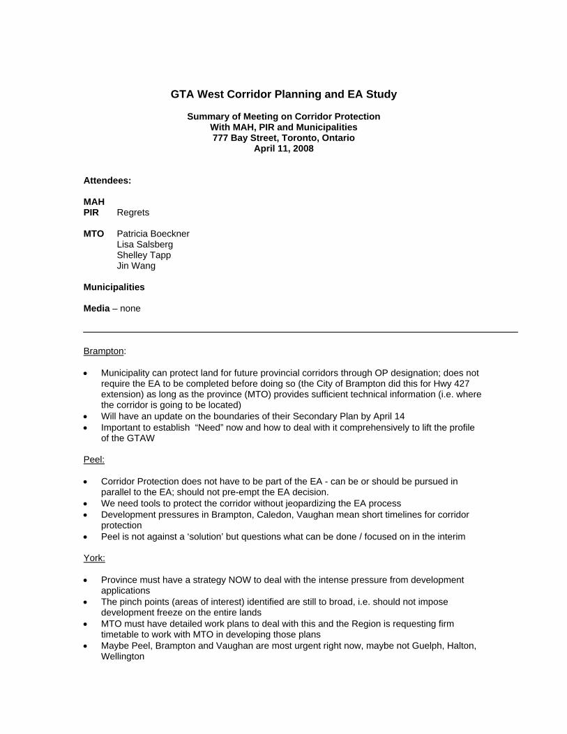
GTA West Corridor Planning and EA Study
Summary of Meeting on Corridor Protection With MAH, PIR and Municipalities 777 Bay Street, Toronto, Ontario
April 11, 2008 Attendees: MAH PIR Regrets MTO Patricia Boeckner
Lisa Salsberg Shelley Tapp
Jin Wang Municipalities Media – none
Brampton: Municipality can protect land for future provincial corridors through OP designation; does not
require the EA to be completed before doing so (the City of Brampton did this for Hwy 427 extension) as long as the province (MTO) provides sufficient technical information (i.e. where the corridor is going to be located)
Will have an update on the boundaries of their Secondary Plan by April 14 Important to establish “Need” now and how to deal with it comprehensively to lift the profile
of the GTAW Peel: Corridor Protection does not have to be part of the EA - can be or should be pursued in
parallel to the EA; should not pre-empt the EA decision. We need tools to protect the corridor without jeopardizing the EA process Development pressures in Brampton, Caledon, Vaughan mean short timelines for corridor
protection Peel is not against a ‘solution’ but questions what can be done / focused on in the interim York: Province must have a strategy NOW to deal with the intense pressure from development
applications The pinch points (areas of interest) identified are still to broad, i.e. should not impose
development freeze on the entire lands MTO must have detailed work plans to deal with this and the Region is requesting firm
timetable to work with MTO in developing those plans Maybe Peel, Brampton and Vaughan are most urgent right now, maybe not Guelph, Halton,
Wellington
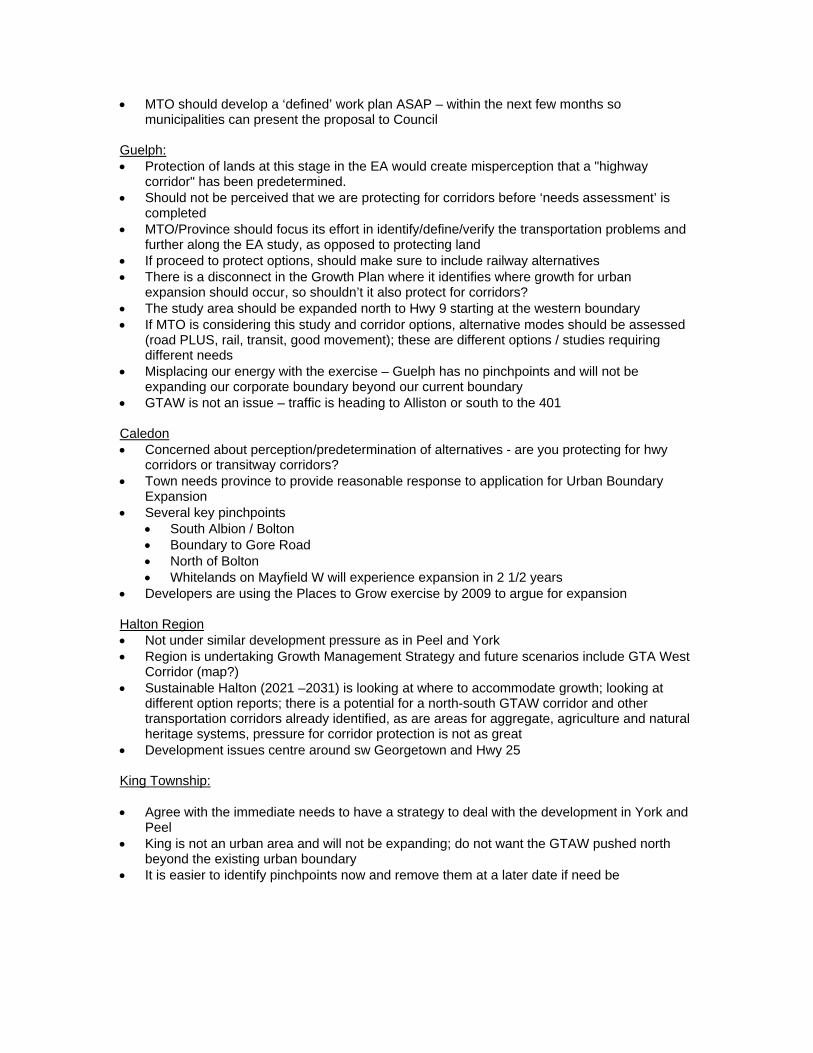
MTO should develop a ‘defined’ work plan ASAP – within the next few months so municipalities can present the proposal to Council
Guelph: Protection of lands at this stage in the EA would create misperception that a "highway
corridor" has been predetermined. Should not be perceived that we are protecting for corridors before ‘needs assessment’ is
completed MTO/Province should focus its effort in identify/define/verify the transportation problems and
further along the EA study, as opposed to protecting land If proceed to protect options, should make sure to include railway alternatives There is a disconnect in the Growth Plan where it identifies where growth for urban
expansion should occur, so shouldn’t it also protect for corridors? The study area should be expanded north to Hwy 9 starting at the western boundary If MTO is considering this study and corridor options, alternative modes should be assessed
(road PLUS, rail, transit, good movement); these are different options / studies requiring different needs
Misplacing our energy with the exercise – Guelph has no pinchpoints and will not be expanding our corporate boundary beyond our current boundary
GTAW is not an issue – traffic is heading to Alliston or south to the 401 Caledon Concerned about perception/predetermination of alternatives - are you protecting for hwy
corridors or transitway corridors? Town needs province to provide reasonable response to application for Urban Boundary
Expansion Several key pinchpoints
South Albion / Bolton Boundary to Gore Road North of Bolton Whitelands on Mayfield W will experience expansion in 2 1/2 years
Developers are using the Places to Grow exercise by 2009 to argue for expansion Halton Region Not under similar development pressure as in Peel and York Region is undertaking Growth Management Strategy and future scenarios include GTA West
Corridor (map?) Sustainable Halton (2021 –2031) is looking at where to accommodate growth; looking at
different option reports; there is a potential for a north-south GTAW corridor and other transportation corridors already identified, as are areas for aggregate, agriculture and natural heritage systems, pressure for corridor protection is not as great
Development issues centre around sw Georgetown and Hwy 25 King Township: Agree with the immediate needs to have a strategy to deal with the development in York and
Peel King is not an urban area and will not be expanding; do not want the GTAW pushed north
beyond the existing urban boundary It is easier to identify pinchpoints now and remove them at a later date if need be
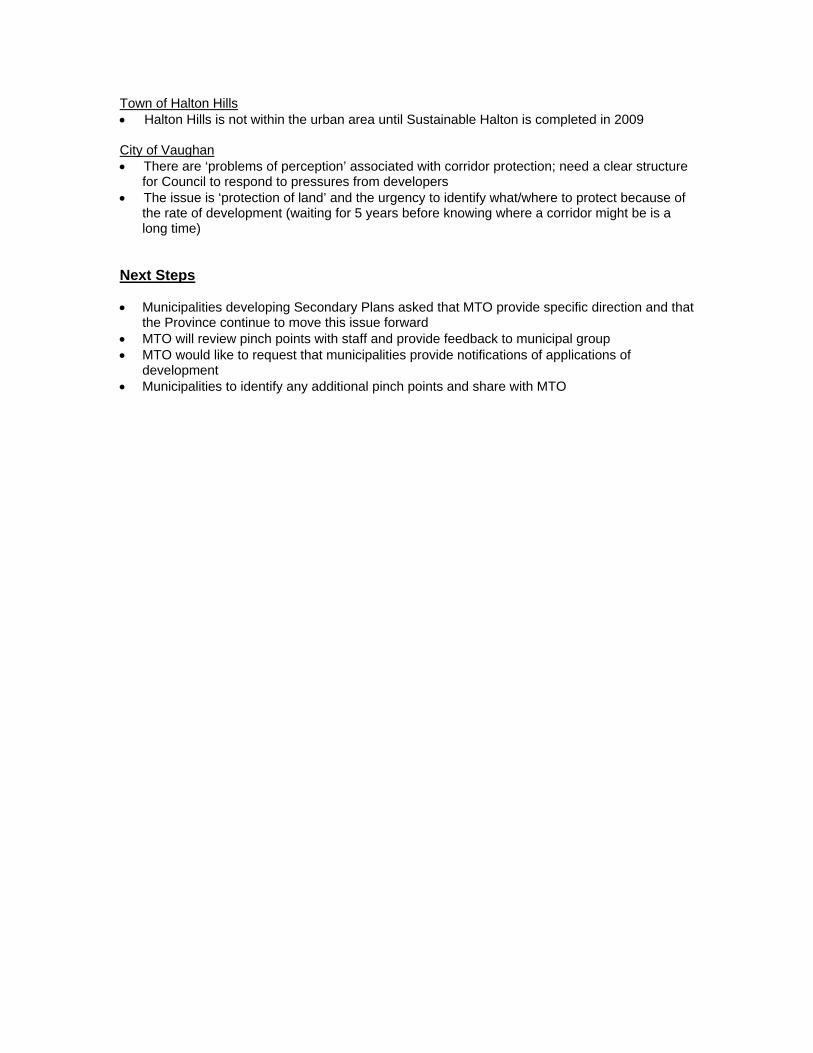
Town of Halton Hills Halton Hills is not within the urban area until Sustainable Halton is completed in 2009 City of Vaughan There are ‘problems of perception’ associated with corridor protection; need a clear structure
for Council to respond to pressures from developers The issue is ‘protection of land’ and the urgency to identify what/where to protect because of
the rate of development (waiting for 5 years before knowing where a corridor might be is a long time)
Next Steps Municipalities developing Secondary Plans asked that MTO provide specific direction and that
the Province continue to move this issue forward MTO will review pinch points with staff and provide feedback to municipal group MTO would like to request that municipalities provide notifications of applications of
development Municipalities to identify any additional pinch points and share with MTO
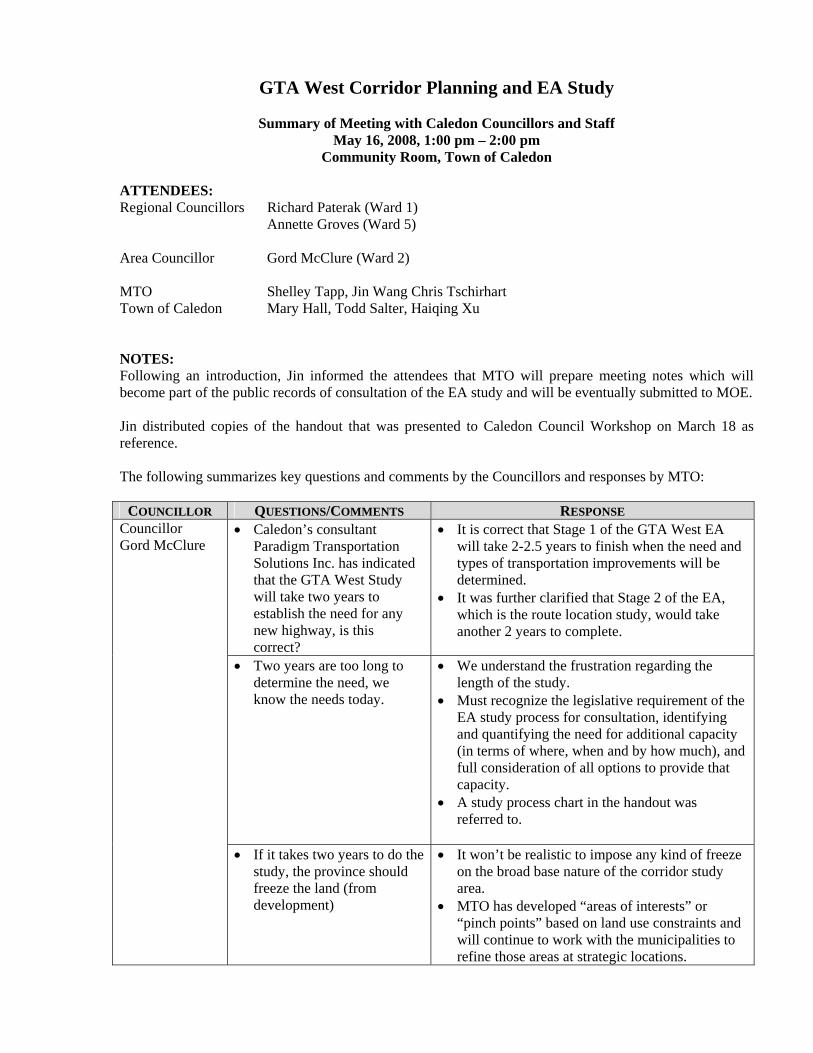
GTA West Corridor Planning and EA Study
Summary of Meeting with Caledon Councillors and Staff May 16, 2008, 1:00 pm – 2:00 pm
Community Room, Town of Caledon ATTENDEES: Regional Councillors Richard Paterak (Ward 1) Annette Groves (Ward 5) Area Councillor Gord McClure (Ward 2) MTO Shelley Tapp, Jin Wang Chris Tschirhart Town of Caledon Mary Hall, Todd Salter, Haiqing Xu NOTES: Following an introduction, Jin informed the attendees that MTO will prepare meeting notes which will become part of the public records of consultation of the EA study and will be eventually submitted to MOE. Jin distributed copies of the handout that was presented to Caledon Council Workshop on March 18 as reference. The following summarizes key questions and comments by the Councillors and responses by MTO:
COUNCILLOR QUESTIONS/COMMENTS RESPONSE Councillor Gord McClure
Caledon’s consultant Paradigm Transportation Solutions Inc. has indicated that the GTA West Study will take two years to establish the need for any new highway, is this correct?
It is correct that Stage 1 of the GTA West EA will take 2-2.5 years to finish when the need and types of transportation improvements will be determined.
It was further clarified that Stage 2 of the EA, which is the route location study, would take another 2 years to complete.
Two years are too long to determine the need, we know the needs today.
We understand the frustration regarding the length of the study.
Must recognize the legislative requirement of the EA study process for consultation, identifying and quantifying the need for additional capacity (in terms of where, when and by how much), and full consideration of all options to provide that capacity.
A study process chart in the handout was referred to.
If it takes two years to do the study, the province should freeze the land (from development)
It won’t be realistic to impose any kind of freeze on the broad base nature of the corridor study area.
MTO has developed “areas of interests” or “pinch points” based on land use constraints and will continue to work with the municipalities to refine those areas at strategic locations.
COUNCILLOR QUESTIONS/COMMENTS RESPONSE MTO is also investigating effective corridor
protection strategies or approaches that can protect options while the EA is underway. MTO has had extensive discussions with other key ministries such as PIR and MAH on this issue. MTO had initial meeting with municipalities recently (April), and is planning to come back to municipalities either through another standalone province-municipal meeting or the Regional Planning Commissioners of Ontario (RPCO) meeting in the near future.
Councillor Annette Groves
Caledon does not want to slow down the development such as those in the South Albion/Bolton area because of the on-going GTA West Study.
Noted Councillor’s position
If the Town went ahead with its development plan in south-Albion/Bolton, would MTO consider the Town’s development plan as input? If the development plan ends up in areas that may be later required by the EA for a new corridor, what would be the province’s position?
MTO will take land use/development plans by the municipalities into consideration in the EA
There will be opportunities for municipalities and the Province to work together during the EA between now and the completion of Stage 2. More information will come out from the EA study as we move along which can help municipalities in making their land use/development decisions.
Should consider potential connections to Highway 427 up to Highway 9.
Should include options north of Bolton as well as south of Bolton.
Both GTA West and 427 EA studies must be consistent with provincial plans such as the Greenbelt Plan and the Growth Plan. Extension of 427 to Highway 9 across the Moraine is not envisaged by the Growth Plan.
The GTA West Study will look at the travel patterns and traffic interactions beyond the “preliminary study area”, for example, the goods movement analysis will be carried out in a much broader context including connections to US-Canada borders at Niagara, Sarnia and Windsor.
The current study area does not preclude consideration of options north of Bolton, however, it is noted that major natural environment features such the Oak Ridges Moraine and the Humber River represent significant challenges.
If all of the development proposed in the Bolton Area was allowed to proceed in the next two years, it would become a barrier to the GTA West at the south of Bolton.
If the solution of EA study is a 400 series freeway, what
Standards for MTO facilities: - 110 m ROW for freeway
COUNCILLOR QUESTIONS/COMMENTS RESPONSE will be the width of the freeway?
- 170 m ROW for freeway with transit way The Standards are regardless of the no. of lanes, in order to accommodate potential future expansion
Who have been involved from the Caledon communities in the GTA West Study? Is the Caledon Chamber of Commerce represented?
Requested the list of stakeholders
Development industry is represented on the Commercial and Business Advisory Group, including the Chamber of Commerce. There is also a Community Advisory Group where local residents are represented, in addition to the Municipal Advisory Group.
Will provide the list of stakeholders to Town staff.
Councillor Richard Paterak
Acknowledged that the legal requirement of conducting the EA process needs to be respected.
A new provincial highway will be required through south Caledon which will be important to support future economic and employment growth and opportunities in this part of the region
Comment noted. Reiterated that the need for any new highway has
not been established and quantified yet – will be determined in the EA study.
Would it be helpful if the municipalities of Peel/Brampton/Caledon and York/Vaughn jointly develop a municipal-identified corridor? The municipalities could use such corridor to decide what lands can be released for development.
The integrity of the EA process might be a concern. The success of the EA is in the best interest of both municipalities and the Province.
Province and municipalities need to work in collaboration in addressing the development issues during the EA.
The provincial policy context is different now from the past due to the legislative requirement of the Growth Plan regarding municipal conformity.
Such coordinated response from all affected municipalities would be considered input to the EA process.


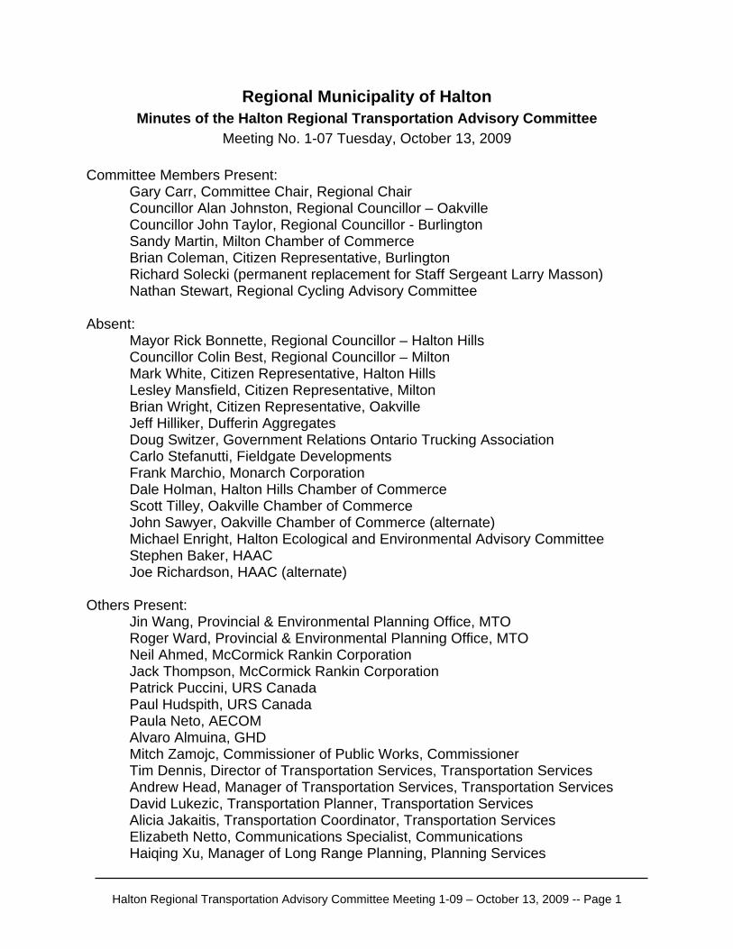
Regional Municipality of Halton Minutes of the Halton Regional Transportation Advisory Committee
Meeting No. 1-07 Tuesday, October 13, 2009
Committee Members Present: Gary Carr, Committee Chair, Regional Chair Councillor Alan Johnston, Regional Councillor – Oakville Councillor John Taylor, Regional Councillor - Burlington Sandy Martin, Milton Chamber of Commerce Brian Coleman, Citizen Representative, Burlington Richard Solecki (permanent replacement for Staff Sergeant Larry Masson)
Nathan Stewart, Regional Cycling Advisory Committee Absent: Mayor Rick Bonnette, Regional Councillor – Halton Hills Councillor Colin Best, Regional Councillor – Milton Mark White, Citizen Representative, Halton Hills Lesley Mansfield, Citizen Representative, Milton Brian Wright, Citizen Representative, Oakville Jeff Hilliker, Dufferin Aggregates Doug Switzer, Government Relations Ontario Trucking Association Carlo Stefanutti, Fieldgate Developments Frank Marchio, Monarch Corporation Dale Holman, Halton Hills Chamber of Commerce Scott Tilley, Oakville Chamber of Commerce John Sawyer, Oakville Chamber of Commerce (alternate) Michael Enright, Halton Ecological and Environmental Advisory Committee Stephen Baker, HAAC Joe Richardson, HAAC (alternate) Others Present: Jin Wang, Provincial & Environmental Planning Office, MTO
Roger Ward, Provincial & Environmental Planning Office, MTO Neil Ahmed, McCormick Rankin Corporation Jack Thompson, McCormick Rankin Corporation Patrick Puccini, URS Canada Paul Hudspith, URS Canada Paula Neto, AECOM Alvaro Almuina, GHD Mitch Zamojc, Commissioner of Public Works, Commissioner Tim Dennis, Director of Transportation Services, Transportation Services Andrew Head, Manager of Transportation Services, Transportation Services David Lukezic, Transportation Planner, Transportation Services Alicia Jakaitis, Transportation Coordinator, Transportation Services Elizabeth Netto, Communications Specialist, Communications Haiqing Xu, Manager of Long Range Planning, Planning Services
Halton Regional Transportation Advisory Committee Meeting 1-09 – October 13, 2009 -- Page 1

The meeting started at 1:30 p.m.
1. Welcome and Opening Remarks Those present at the meeting introduced themselves. Tim Dennis noted that this was the third meeting of the Halton Regional Transportation Advisory Committee and provided the purpose of the meeting, which was to meet with the Niagara to GTA (N-GTA) Project Team and the GTA West (GTA-W) Project Team to discuss the Area Transportation System Problems and Opportunities Reports released for each of the projects and to provide an overview of Halton Region comments on both projects. Both Project Teams will present their reports and Committee members will have the opportunity to provide comments and ask questions to the Project Teams. He also noted that they are at the beginning stages of the EA process.
2. Confirmation of the Minutes of Meeting 1-07 held Wednesday, January 25, 2006
The minutes of meeting 1-07 held Thursday, May 10, 2007 were adopted as circulated. (Moved by Councillor Alan Johnston and Councillor John Taylor)
3. Presentation: GTA West Corridor Environmental Assessment (EA) and Niagara to GTA Corridor EA: Area Transportation System Problems and Opportunities Report
Neil Ahmed started the presentation noting that the Study Areas do not include Mississauga and Toronto and that the Terms of Reference for both studies were approved by the Ministry of Environment. He noted that the Growth Plan, the Metrolinx 25 Year Plan and the GO Transit Move 2020 include plans that will have a high impact on transportation for both studies. Both studies are in the early stages of the planning process. It is predicted that the over-arching problem in both study areas is the roadway system: parts of the system will exceed capacity and the roadway system integrates all other transportation modes. Neil Ahmed then continued with describing the methodology for predicting the future transportation conditions including the four-stage model, model inputs, model assumptions and model outputs. The transportation problems for the GTA-W Corridor from the perspective of goods movements and commuters (both road users and transit commuters) were presented. Patrick Puccini presented the transportation problems for the N-GTA Corridor which is similar to the problems for the GTA-W Corridor for Hamilton and Halton. Congestion and delays for tourism traffic and conflicts between truck and tourist/recreational traffic is more specific to the Niagara Region.
Halton Regional Transportation Advisory Committee Meeting 1-09 – October 13, 2009 -- Page 2
The transportation opportunities go beyond addressing specific transportation problems and are intended to create a multi-modal transportation solution that will influence the broader community, economy and environment. Councillor John Taylor raised a concern that the project is rushed in that there was insufficient time in between issuing the Draft Problems and Opportunities report (July 31, 2009) and PIC#3 tentatively to be scheduled in late November / early December 2009. PIC#3 will include a long list of alternatives. Jin Wang noted that the report is an “interim final report”. Councillor John Taylor noted that the figure on slide # 20 shows that 2031 highways are expected to operate at LOS “E/F” in Halton, Hamilton and Niagara but that traffic congestion is much more severe in Halton and Hamilton. Jack Thompson noted that the Metrolinx RTP will be investing significant funds in Halton and Hamilton but limited funds in Niagara and this is one factor that will influence the predicted reduction in LOS in Niagara. Councillor John Taylor noted that there cannot be another crossing through the Niagara Escarpment. Councillor Alan Johnston asked what modal splits were assumed for the Study Areas for both commuter traffic and freight traffic. Jack Thompson noted that the modal splits for commuter traffic were based on the Metrolinx RTP. Jin Wang noted that the modal splits for freight depend on the tonnage and value of goods. Based on tonnage the modal split is 26% marine, 27% rail and 47% truck. Based on value of goods the modal splits are 68% truck, 25% rail and 5% marine. Brian Coleman noted that the two Study Areas cannot be assessed in isolation. He inquired if the Continental 1 highway, high speed rail between Windsor and Quebec and the Peace Bridge expansion were taken into consideration within the study. Roger Ward acknowledged that they were aware of these projects and monitoring the status of the individual projects and if required, would include them within the study. Brian Coleman asked for an update on the Sea 3 container service to Quebec and the GO Service to Niagara. The Project team noted that an update will be available after they meet with Metrolinx. Councillor John Taylor noted that public involvement is key throughout the entire project and must be prioritized during this phase of the study.
Halton Regional Transportation Advisory Committee Meeting 1-09 – October 13, 2009 -- Page 3

Halton Regional Transportation Advisory Committee Meeting 1-09 – October 13, 2009 -- Page 4
4. Presentation: Halton Region Comments on Area Transportation System Problems and Opportunities Reports for both the GTA West Corridor EA and Niagara to GTA Corridor EA
Alvaro Almuina started the presentation noting that GHD undertook a peer review of the Area Transportation System Problems and Opportunities Reports for both the GTA-W Corridor EA and N-GTA Corridor EA and then showed the two study areas on a map. The peer review key findings were that both studies need to be updated to reflect “Sustainable Halton”; they need to include detailed information on Southern Ontario Highway Programs proposed in Halton Region and they need to reflect how major transportation initiatives such as Halton Peel Boundary Area Transportation Study (HPBATS) will be considered as part of the study. Councillor John Taylor asked if the peer review key findings included looking at a crossing through the Niagara Escarpment. Alvaro Almuina noted that the peer review is related to the Area Transportation System Problems and Opportunities Reports not the generation of alternatives. Councillor John Taylor asked why the Committee is looking at the Draft Area Transportation System Problems and Opportunities Reports when the Project Teams have already initiated the process of generating alternatives. Tim Dennis assured that the Committee is not behind schedule and that Halton Region has not missed any opportunities for being included in the study. A long list of alternatives is being looked at a very high level and the Committee will be convened to discuss updates. It was noted that the Project Teams will be presenting a preview of the list of options and alternatives to the Public Works Committee on November 12, 2009. Councillor John Taylor asked when PIC#4 would be held. Jin Wang noted that the date has not been set for PIC#4 but that it will most likely take place in mid-2010 or late Spring 2010.
5. Closing Remarks Chair Gary Carr expressed thanks to all Committee members, staff for their support and both Project Teams for participating in the meeting.
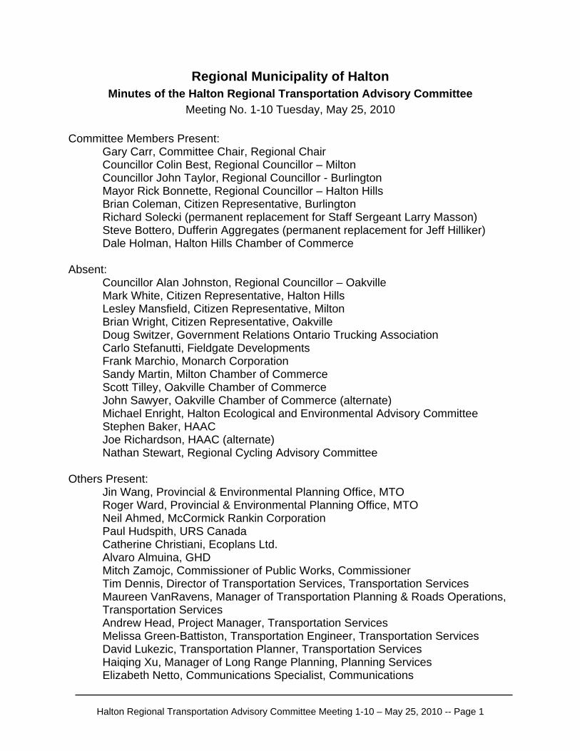
Regional Municipality of Halton Minutes of the Halton Regional Transportation Advisory Committee
Meeting No. 1-10 Tuesday, May 25, 2010
Committee Members Present: Gary Carr, Committee Chair, Regional Chair Councillor Colin Best, Regional Councillor – Milton Councillor John Taylor, Regional Councillor - Burlington Mayor Rick Bonnette, Regional Councillor – Halton Hills Brian Coleman, Citizen Representative, Burlington Richard Solecki (permanent replacement for Staff Sergeant Larry Masson) Steve Bottero, Dufferin Aggregates (permanent replacement for Jeff Hilliker) Dale Holman, Halton Hills Chamber of Commerce Absent: Councillor Alan Johnston, Regional Councillor – Oakville Mark White, Citizen Representative, Halton Hills Lesley Mansfield, Citizen Representative, Milton Brian Wright, Citizen Representative, Oakville Doug Switzer, Government Relations Ontario Trucking Association Carlo Stefanutti, Fieldgate Developments Frank Marchio, Monarch Corporation Sandy Martin, Milton Chamber of Commerce
Scott Tilley, Oakville Chamber of Commerce John Sawyer, Oakville Chamber of Commerce (alternate) Michael Enright, Halton Ecological and Environmental Advisory Committee Stephen Baker, HAAC
Joe Richardson, HAAC (alternate) Nathan Stewart, Regional Cycling Advisory Committee
Others Present: Jin Wang, Provincial & Environmental Planning Office, MTO
Roger Ward, Provincial & Environmental Planning Office, MTO Neil Ahmed, McCormick Rankin Corporation Paul Hudspith, URS Canada Catherine Christiani, Ecoplans Ltd. Alvaro Almuina, GHD Mitch Zamojc, Commissioner of Public Works, Commissioner Tim Dennis, Director of Transportation Services, Transportation Services Maureen VanRavens, Manager of Transportation Planning & Roads Operations, Transportation Services Andrew Head, Project Manager, Transportation Services Melissa Green-Battiston, Transportation Engineer, Transportation Services David Lukezic, Transportation Planner, Transportation Services Haiqing Xu, Manager of Long Range Planning, Planning Services Elizabeth Netto, Communications Specialist, Communications
Halton Regional Transportation Advisory Committee Meeting 1-10 – May 25, 2010 -- Page 1

Mabel Watt, Executive Assistant to the Regional Chair, Office of the Regional Chair Alana Fulford, Intermediate Planner, Planning Services Monte Dennis, COPE Scott Hamilton, City of Burlington Dan Ozimkovic, City of Burlington Neil Bryson, Neil A. Bryson Consultant The meeting started at 1:30 p.m.
1. Welcome and Opening Remarks Chair Gary Carr welcomed all present to the meeting. Tim Dennis noted that this was the fourth meeting of the Halton Regional Transportation Advisory Committee and provided the purpose of the meeting, which was to meet with the Niagara to GTA (N-GTA) Project Team and the GTA West (GTA-W) Project Team to discuss the Area Transportation System Alternatives reports released for each of the projects and to provide an overview of Halton Region comments on both projects. Both Ministry of Transportation (MTO) Project Teams will present their reports and Committee members will have the opportunity to provide comments and ask questions to the MTO Project Teams. He also introduced the members of the MTO Project Team for both projects.
2. Confirmation of the Minutes of Meeting 1-09 held Wednesday, January 25, 2006
The minutes of meeting 1-09 held Tuesday, October 13, 2009 were adopted as circulated. (Moved by Councillor Colin Best)
3. Presentation: GTA West Corridor and Niagara to GTA Corridor Planning and Environmental Assessment (EA) Studies: Joint Study Update for the Halton Regional Transportation Advisory Committee
Paul Hudspith started the presentation by identifying the two study areas which have some similarities but also different area characteristics. He noted that the EA study process is unique and emphasized that the Terms of Reference for both studies were approved by the Ministry of Environment, that the studies are seeking to develop a multi modal transportation development strategy and that the studies include a significant amount of consultation. The presentation noted that the Growth Plan is likely the most important policy document guiding the study as it provides the context for growth which is used to forecast the demand on the transportation system. Other initiatives are also important to the study (i.e. the Metrolinx Regional Transportation Plan, GO 2020, the Ministry of Transportation Southern Highways Program, etc.) and the projects from these studies were assumed to be implemented in the transportation model for both projects.
Halton Regional Transportation Advisory Committee Meeting 1-10 – May 25, 2010 -- Page 2

Paul Hudspith further explained the building block approach where each roads based alternative was assigned to one of four groups:
Group 1: Optimize Existing Networks – This category includes alternatives that improve the performance and efficiency of the existing transportation system for all modes through strategies designed to reduce auto and truck demand.
Group 2: Expand Non-road Infrastructure – This category includes “non-road-based” capacity improvements, such as new air, marine, transit, and freight rail infrastructure.
Group 3: Widen / Improve Roads – this category includes alternatives for widening of existing roads or highways (beyond widening which is currently planned or contemplated by municipalities and the province).
Group 4: Add New Transportation Corridors – This category includes alternatives for new roadway corridors.
The presentation noted that the main conclusion from Group 1 and Group 2 alternatives is that they do not address the problems and opportunities. Neil Ahmed continued the presentation and noted that many of the added / expanded non-road infrastructure plans were not in place at the beginning of the study. It was emphasized that Hamilton will become a centroid focused community for inter-regional transit. The analysis of alternatives for the GTA West were presented and compared in terms of traffic operation, commuter travel and people movement, economic benefits, impacts on the natural environment, cultural environment, agriculture, land use, air quality and greenhouse gas emissions and finally constructability challenges. Overall, Alternatives 4-2 and 4-3 are emerging as very formidable alternatives based on the preliminary evaluation. Paul Hudspith continued the presentation by describing the new transportation corridor alternatives for the N-GTA. Councillor Taylor asked if Alternatives 4-2 and 4-3 included the GTA-W corridor in the analysis and what are the effects on the N-GTA corridor when the GTA-W corridor is included in the transportation network. Jin Wang and Roger Ward noted that the MTO Project Team tested the alternatives with and without the GTA-W corridor and the results of this analysis showed that including the GTA-W corridor in the transportation network does not result in a significant diversion of traffic from the N-GTA corridor. The presentation emphasised that new corridor alternatives do provide network flexibility, reserve capacity and divert traffic from existing facilities. The QEW will always be the most direct route between Niagara and the GTA and the new corridors will not eliminate all widening requirements associated with Alternative 3-1. There is no significant difference between Group 3 and Group 4 alternatives from an economic perspective, air quality and greenhouse gas emissions. Group 4 alternatives have a greater impact on the environment compared to Group 3 alternatives while on the other hand Group 3 alternatives have greater community impacts (property impacts, residential impacts, etc.). There are a number of areas that would have significant constructability issues and one of these includes widening of Highway 403 through Hamilton which is particularly troublesome. The overall conclusion is that the
Halton Regional Transportation Advisory Committee Meeting 1-10 – May 25, 2010 -- Page 3

preliminary assessment of alternatives does not show any single alternative emerging as a formidable one. The overall transportation strategy will need to include a combination of optimizing existing networks, new/expanded non-road infrastructure, widening existing roadways and corridor protection for new facilities to provide network redundancy. The presentation was finalized by noting that the next steps in the process will be to develop a draft transportation development strategy (TDS) including consultation with municipalities and regulatory agencies, Public Information Centre (PIC) #4 in June 2010, revisions to the TDS based on stakeholder input received and finalizing the TDS by the end of 2010. Councillor Taylor asked if the projects are being driven by the Growth Plan. Roger Ward confirmed that the projects are being driven by the Growth Plan but also by other plans identified earlier. Councillor Taylor noted that the MTO Project Team is discussing corridor protection as opposed to constructing a new corridor in the next 20 years. Roger Ward responded that growth in the area will be monitored and that the immediate focus will be on moving forward with widening existing corridors while the new corridor will be protected for the longer term horizon. Councillor Taylor requested Halton Region staff to investigate in more detail the linkage between the GTA-W and N-GTA corridors. Councillor Best noted that it is important to protect corridors in fast growing areas and suggested that the MTO Project Team should look into the feasibility of having narrower lanes and vehicles. He noted that he is encouraged to see that the N-GTA includes an alternative that will connect to Guelph and Kitchener. Brian Coleman noted that the terminology for railcar should be changed to self-propelled railcar. Railcars are sometimes called a sprinter for diesel rails and railcars can be either diesel or electric. He further noted that there is a reverse flow of traffic on the QEW and that the flow is Hamilton-centric and also mentioned that the GO trains should depart earlier in the morning. The last note from Brian was that the presentation did not include marine alternatives which should be included since coal is shipped from Buffalo to Hamilton. Subsequent to the meeting Brian Coleman forwarded the modern version of the Rail Diesel Car (RDC) or Budd car (attached) and noted that they are now diesel only but the company is developing a diesel-electric version. Dale Holman asked if the projects investigated whether or not there are enough aggregate materials to build new transportation facilities. Jin Wang noted that this type of detail was not looked at in this stage of the study. He also asked if the study investigated the possibility of reversing traffic lanes to accommodate peak directional flows of traffic. Roger Ward confirmed that reversing traffic lanes was analyzed. Reversing traffic lanes makes sense when there are significant directional flows of traffic and the analysis concluded that this occurs to tourist destinations such as Niagara Falls on weekends but not during weekday peak travel periods in Halton.
Halton Regional Transportation Advisory Committee Meeting 1-10 – May 25, 2010 -- Page 4
Mitch Zamojc suggested that the studies will need to include more information on air quality and emissions. Jin Wang noted that the model used for the projects include emissions and air quality outputs and that the results showed that widening existing highways would have a higher impact on air quality than new corridor alternatives.
4. Presentation: Halton Region Comments on Area Transportation System Alternative Reports for both the GTA West Corridor EA and Niagara to GTA Corridor EA
Maureen VanRavens noted that Halton Region retained GHD Consultants to undertake a peer review of both studies, report findings to the Region and present the findings to the Transportation Advisory Committee. Alvaro Almuina started the presentation by introducing the two study areas in relation to Halton Region boundaries and explaining the building blocks of the group alternatives approach. The presentation first included comments on the GTA-W alternatives and one of the key findings was that alternatives are required above and beyond Group 1 and Group 2 measures. None of the Group 3 alternatives provide redundancy to the freeway network not providing any inter-regional alternatives in the event of incidents on the freeway; leading to usage of Regional Roads as emergency detours. Trafalgar Road widening to 4-lanes may be required just to service growth per Regional Official Plan Amendment (ROPA) 38, not accounting for inter-regional demands. A six lane Trafalgar Road widening for inter-regional traffic is not justifiable and widening of Highway 7 to 6-lanes through Georgetown would have severe environmental/social impacts. Under Group 4 five alternatives transportation corridors are identified. Alternative 4-1 provides a new corridor connecting Highway 400 to Highway 410. This is alternative does not fully address the system requirements and staff recommend that there be no further consideration of the alternative. Alternatives
4-2 - new corridor Hwy 400 to Hwy 401-407 - using HPBATS corridor; 4-3 - new corridor Hwy 400 to Hwy 401-connects with Hwy 401 near Tremaine
Road; 4-4 - new corridor Hwy 400 to Guelph; and 4-5 -new corridor Hwy 400 to south of Guelph,
are all recommended for further consideration The key finding from the peer review of N-GTA was that it is difficult to provide a critical review of the new corridor alternatives as some information is missing in the reports and the review concluded that Halton Region continue working with the MTO Project Team to define the Group 4 alternatives.
Halton Regional Transportation Advisory Committee Meeting 1-10 – May 25, 2010 -- Page 5

Halton Regional Transportation Advisory Committee Meeting 1-10 – May 25, 2010 -- Page 6
Councillor Taylor asked when the dates for the fourth round of PIC’s will be available. Roger Ward confirmed that the PIC dates will be known by Friday, May 31, 2010. Councillor Taylor asked what will be presented at the PIC’s. Jin Wang noted that the PIC will include a more detailed assessment of alternatives plus a draft transportation development strategy and its key elements. Neil Ahmed also emphasised that the MTO Project Team wants to receive as much input as possible from the community. Neil Bryson questioned whether the Halton Region Transportation Master Plan (HTMP) may be duplicating improvements identified in GTA-W and N-GTA. It was noted that the HTMP is incorporating the MTO studies in to the plan. Tim Dennis noted that Transportation Services will prepare a staff report summarizing the peer review of both reports for the June 16 Halton Planning and Public Works Committee meeting (and June 23 Halton Regional Council meeting). Jin Wang noted that the draft report will be available for review in fall 2010 but the MTO Project Teams would appreciate comments after PIC#4. Councillor Taylor noted that providing comments in the fall may be difficult to schedule as the elections are this October. Tim Dennis noted that both studies are very important to Halton Region and once certainty is there after PIC#4, the Region will provide comments.
5. Closing Remarks Chair Gary Carr adjourned the meeting.

McCORMICK RANKIN
CORPORATION
2655 North Sheridan Way Mississauga, Ontario, L5K 2P8
Tel: (905)823-8500 Fax: (905) 823-8503 E-mail: [email protected]
Website: www.mrc.ca
MINUTES OF MEETING PROJECT: GTA West Corridor EA Stage 1
Assignment No. 2006-P-055675
PROGRESS MEETING: Meeting with Town of Milton
FILE NO.: W.O. 6720
DATE: Monday, June 14, 2010 TIME: 10:30 a.m. to 12:00 noon
PLACE: Town of Milton, Engineering Boardroom
PRESENT: Jin Wang Joe Perrotta Bill Mann John Brophy Mark Basin Stephanie Jarvis Neil Ahmed Katherine Jim
MTO Provincial Planning MTO Provincial Planning Town of Milton Town of Milton Town of Milton Town of Milton MRC MRC
PURPOSE: Meeting with Town of Milton to provide an overview of the activities carried out since the last Municipal Advisory Group Meeting and to present elements of the draft Transportation Development Strategy, which was presented at Public Information Centre #4.
PROCEEDINGS: ACTION BY:
1.1 The purpose of the meeting was to provide an overview of the activities carried out since the last Municipal Advisory Group (MAG) Meeting and to present the draft Transportation Development Strategy, which was presented at Public Information Centre (PIC) #4.
1.2 Using a PowerPoint presentation, N. Ahmed, MRC, provided an overview of the study process, study approach, the draft Transportation Development Strategy and next steps. A copy of the presentation was provided to those at the meeting.
ITEM 2 – DISCUSSION
C – Comments from Town of Milton Q – Questions from Town of Milton A – Answers from GTA West Project Team The following documents key points from the discussion:
Q. If existing highways are proposed to be widened beyond the planned program improvements, would land acquisition become a problem?

Minutes of Meeting Page 2 of 3 Date: June 14, 2010 PROCEEDINGS: ACTION BY:
A. The Project Team has investigated the potential impact to adjacent lands as a result of the proposed widening on existing highways, particularly in Alternative 3-1 (widening on existing network only and no new corridor). Alternatives 4-3 to 4-5 require less widening on existing network compared to Alternative 3-1 in the Milton area.
C. The Town stressed the need to coordinate between the GTA West Project Team and the Highway 401 (RR 25 to Trafalgar Road) EA Project Team to ensure consistency in the proposed improvements on Highway 401.
Q. What was the outcome of the Halton-Peel Boundary Area Transportation Study (H-P BATS)?
A. The H-P BATS identified the need for a 6-8 lane highway type transportation facility. Alternatives for the potential connection between the H-P BATS corridor and 407 ETR/Highway 401 were also developed.
Q. How are toll road taken into consideration?
A. The transportation analysis assumed toll road on 407 ETR only.
Q. Were any adjustments made in the transportation model to account for the tolling on 407 ETR?
A. The model assumed a time penalty and operating cost on 407 ETR compared to a free facility.
Q. Is it reasonable to assume that the new transportation corridor would be toll free?
A. That was the assumption in the transportation model.
Q. Why are there no PICs in Milton considering the potential impact to the Town?
A. Typically, PICs are arranged at one location per Region (Halton Region PIC is being held in Georgetown – Wednesday, June 16); however, local PICs are likely in Stage 2 of the EA.
C. The H-P BATS corridor should tie into the Trafalgar Road interchange on Highway 401 (instead of the 407ETR/Highway 401 interchange).
A. The alternatives of a new transportation corridor do not preclude the possibility of tying the H-P BATS corridor into the Trafalgar Road interchange.
C. Town of Milton would support Alternative 4-3 if MTO is willing to contribute one third of the construction cost of the proposed Tremaine Road interchange. Alternative 4-3 is more favourable from the Town’s perspective in terms of contribution to the economy, overall transportation network, as well as long range planning. Alternative 4-2 is less favourable as it would still require 12 lanes in a core-collector facility on Highway 401 through Milton which would lead to impacts to adjacent land uses.
In summary, Town staff supports Alternative 4-3 subject to discussion
Town

Minutes of Meeting Page 3 of 3 Date: June 14, 2010 PROCEEDINGS: ACTION BY:
with the Province regarding local infrastructure construction, funding, and will prepare a staff report for the August Council.
A. A draft Transportation Development Strategy Report will be prepared following the PICs and will seek formal input from municipalities. Additional meeting with municipalities will likely be following the PICs.
C. If Alternative 4-3 is the preferred alternative, would NGTA corridor tie into the same location at Highway 401?
A. Project Team did assess new corridor connections at Hwy 401 in both corridors.
ITEM 3 – NEXT STEPS
3.1 PIC #4 are being held as follows:
• June 14th, 4:00 to 8:00pm –Caledon, • June 15th, 4:00 to 8:00pm – Woodbridge • June 16th, 4:00 to 8:00pm – Georgetown • June 22nd, 4:00 to 8:00pm – Brampton • June 24th, 4:00 to 8:00pm – Guelph, River Run Centre
The foregoing represents the writer’s understanding of the major items of discussion and the decisions reached and/or future actions required. If the above does not accurately represent the understanding of all parties attending, please notify the undersigned within 48 hours of receiving these minutes at 905-823-8500.
Minutes prepared by, McCormick Rankin Corporation
Katherine Jim, P. Eng. cc: All attending
File: W:\6k\6720 GTA West Corridor EA Study\6720.700 Planning\6720.730 Meetings\6720.733 Municipalities\Town of Milton\6720 Milton meeting re June 14 10_FINAL.doc
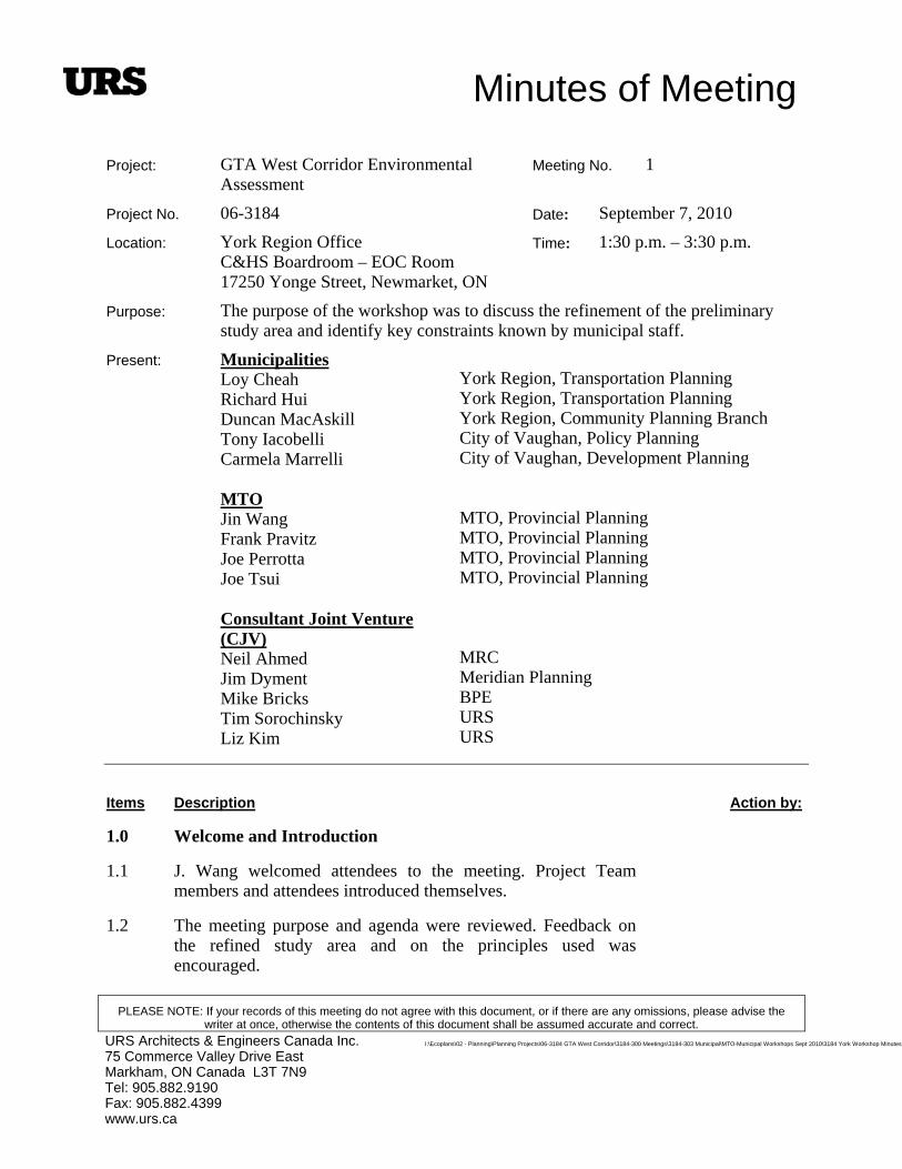
Minutes of Meeting
PLEASE NOTE: If your records of this meeting do not agree with this document, or if there are any omissions, please advise the writer at once, otherwise the contents of this document shall be assumed accurate and correct.
I:\Ecoplans\02 - Planning\Planning Projects\06-3184 GTA West Corridor\3184-300 Meetings\3184-303 Municipal\MTO-Municipal Workshops Sept 2010\3184 York Workshop Minutes
URS Architects & Engineers Canada Inc. 75 Commerce Valley Drive East Markham, ON Canada L3T 7N9 Tel: 905.882.9190 Fax: 905.882.4399 www.urs.ca
Project: GTA West Corridor Environmental Assessment
Meeting No. 1
Project No. 06-3184 Date: September 7, 2010
Location: York Region Office C&HS Boardroom – EOC Room 17250 Yonge Street, Newmarket, ON
Time: 1:30 p.m. – 3:30 p.m.
Purpose: The purpose of the workshop was to discuss the refinement of the preliminary study area and identify key constraints known by municipal staff.
Present: Municipalities Loy Cheah Richard Hui Duncan MacAskill Tony Iacobelli Carmela Marrelli MTO Jin Wang Frank Pravitz Joe Perrotta Joe Tsui Consultant Joint Venture (CJV) Neil Ahmed Jim Dyment Mike Bricks Tim Sorochinsky Liz Kim
York Region, Transportation Planning York Region, Transportation Planning York Region, Community Planning Branch City of Vaughan, Policy Planning City of Vaughan, Development Planning MTO, Provincial Planning MTO, Provincial Planning MTO, Provincial Planning MTO, Provincial Planning MRC Meridian Planning BPE URS URS
Items Description Action by:
1.0 Welcome and Introduction
1.1 J. Wang welcomed attendees to the meeting. Project Team members and attendees introduced themselves.
1.2 The meeting purpose and agenda were reviewed. Feedback on the refined study area and on the principles used was encouraged.
Page 2
I:\Ecoplans\02 - Planning\Planning Projects\06-3184 GTA West Corridor\3184-300 Meetings\3184-303 Municipal\MTO-Municipal Workshops Sept 2010\3184 York Wor
Items Description Action by:
2.0 Update on TDS Report and Status of the Project
2.1 N. Ahmed presented an overview and background of the GTA West study. Presentation slides outlining the study process, issues and challenges, what has been done and how the study will be progressing were discussed.
2.2 N. Ahmed reviewed the various transportation corridor alternatives that were evaluated and how the preferred alternative(s) were selected.
3.0 Review of Preliminary Route Planning Study Area Identified by the Project Team
3.1 M. Bricks presented the reasons and principles in establishing a refined preliminary study area and the list of factors that contributed to the identification of the area.
Principles/factors taken into consideration include the following:
Meeting MTO geometric standards (i.e. minimum desirable radius curve); and
Avoiding special features and/or minimizing impacts to key natural features (e.g. Humber River crossing);
Avoiding built-up and developing areas such as Kleinburg.
3.2 T. Sorochinsky walked through a large roll plan of the refined preliminary route planning study area beginning at the east end.
3.3 Proposed Highway 400 Interchange
The preliminary study area is wider in this area to allow for flexibility when designing the ramps at this major interchange.
At this stage, the Project Team is focused on protecting the area for future transportation infrastructure opportunities to include a transitway, stations and storm water management facilities.
Secondary Plan is being developed currently for the 400 Employment Lands. Land developers are anxious to receive the Secondary Plan approval from York Region because it is a significant employment area.
Issue: is there an opportunity to narrow the corridor at this interchange?
Page 3
I:\Ecoplans\02 - Planning\Planning Projects\06-3184 GTA West Corridor\3184-300 Meetings\3184-303 Municipal\MTO-Municipal Workshops Sept 2010\3184 York Wor
Items Description Action by:
ROPA 52 has been reviewed in the refinement of the preliminary study area.
The strip from Highway 400 to Jane Street has already been taken out to reduce the study area limits.
Further reducing the study area boundary may limit options for the interchange design.
Issue: how can a possible east connection (east of GTA West, past Highway 400 to Jane Street) be protected?
The location of freeway ramps will not be identified until the next phase of the study.
GTAW Project may not be a good basis for precluding future development beyond the requirement of the provincial undertaking for the purpose of accommodating a municipal arterial connection).
There will be an opportunity to look at this issue in further detail during the GTAW Corridor route planning stage.
4.0 Group Discussion
4.1 J. Wang facilitated the group discussion/question/comment period. The following summarizes the key discussions that took place:
4.1.1 Land Development
At this point, the preliminary route planning study area is in draft form and the main goal for this discussion is to confirm development activity in the area as it may become a constraint.
Draft Secondary Plan shows that Bolton is expanding westerly.
Northwest corner of Kleinburg is undergoing a lot of development pressure.
Development pressures in Vaughan will be a lot higher in the next few months.
Development of the northeast corner of Brampton (near Mayfield) has been on hold (Area 47). It is the only window that the GTA West Corridor can pass through south of Bolton.
Issue: is there anything happening in York Region that the Project Team has not taken into consideration in our preliminary

Page 4
dor\3184-300 Meetings\3184-303 Municipal\MTO-Municipal Workshops Sept 2010\3184 York WoI:\Ecoplans\02 - Planning\Planning Projects\06-3184 GTA West Corri r
Items Description Action by:route planning study area map?
York’s Focus Area Review Study has been accounted for in the mapping.
4.1.2 Greenbelt Area in Vaughan
Issue: the Greenbelt in Vaughan seems to be the most affected compared to other regions. How will GTA West compensate for the loss of agricultural land and natural features?
The conservation authority will take an active role in the EA process.
The Project Team has tried to avoid the Greenbelt as much as possible and where a crossing can not be avoided, the impacts will be minimized through mitigation.
Issue: where are discussions regarding the Greenbelt effects/crossings?
MTO Project Team is has had discussions with Ministry of Municipal Affairs and Housing (MMAH) as well as the Greenbelt Council.
It has been recognized that a major east-west corridor through York/Vaughan will have to cross the Humber River.
An approximately 300m span bridge has been assumed for the alternative Humber River crossings.
4.1.3 Project Timeline
Issue: what is the timing of completing Stage 1 and progressing into Stage 2 of the EA process?
Project Team would like to complete Stage 1 with as much input from municipal staff and other stakeholders as possible.
Release of the draft Transportation Development Strategy (TDS) Report is expected in the Fall 2010. After receiving and responding to comments, a revised TDS Report will be released early in the new year.
After the draft report is finalized, the municipalities will have an opportunity to comment. TDS Report will be revised based on input.
Stage 2 will likely take 3-5 years to complete, once initiated
MTO will need the Minister’s direction to commence with

Page 5
I:\Ecoplans\02 - Planning\Planning Projects\06-3184 GTA West Corridor\3184-300 Meetings\3184-303 Municipal\MTO-Municipal Workshops Sept 2010\3184 York Wor
Items Description Action by:Stage 2.
4.1.4 Corridor Protection Issues
Is it possible to split the study area into smaller pieces/areas so that work can commence on the areas that have greater development pressures sooner?
Do municipalities have to amend their official plan to hold the land?
Project Team is asked to provide a higher level of detail regarding which properties are included in the study area.
MTO should be notified of development applications within the preliminary study area and will review them on a case by case basis.
4.1.5 Freeway-to-Freeway Interchanges
Issue: will the design of the Highway 400 freeway-to-freeway interchange accommodate future arterial extension easterly?
The refined preliminary study area will protect for only the freeway-to-freeway interchange.
Route planning, at the next stage of the project, will determine if the interchange can accommodate other easterly connections.
4.1.6 Other Project in the Works
King-Vaughan Road Connection
R. Hui informed the Project Team that a new connection on King-Vaughan Road is at the conceptual stage. The proposed connection will relieve King Road traffic between Bathurst Street and Highway 400.
This roadway may connect with the GTA West Corridor in the future.
Issue: if a freeway-to-freeway interchange is put in (at Highway 400), will it supersede this municipal study? Is it possible to add a fourth leg to the interchange?
The challenge will be to design the connection on King-Vaughan Road. Re-alignment may be required later.
Transportation Master Plan: GO Station
Page 6
I:\Ecoplans\02 - Planning\Planning Projects\06-3184 GTA West Corridor\3184-300 Meetings\3184-303 Municipal\MTO-Municipal Workshops Sept 2010\3184 York Wor
Items Description Action by:
Potential future GO Station at Kirby Road/Keele Street as identified in York Region’s Transportation Master Plan
May connect with shuttle and YRT buses.
Vaughan Transportation Master Plan
The Project Team should at a minimum reflect the status of the Vaughan Transportation Master Plan in the draft TDS Report.
Issue: will there be any new GO stations on the Bolton line?
A feasibility study was initiated by GO, however, GO has not started the EA .
There are plans for a new station in Bolton as part of the feasibility study.
There is a possibility of a new GO station in Kleinburg. GO will release their draft feasibility report by the end of this year.
A new station is proposed along Major MacKenzie, however; this will not affect the GTA West Corridor.
GTA West Project Team
4.1.7 Further Refining the Preliminary Study Area
R. Hui informed the Project Team that since the proposed study area boundary is west of Jane Street, York Region will not have the mechanism to hold the lands east of Highway 400.
N. Ahmed noted that a note could be added to the plans that there may be a future need for more land beyond Highway 400 due to municipal requirements. York Region will know how much land is required by early next year?
Refined preliminary study area boundary is not fixed and is subject to further modification in Stage 2 EA.
The north study area boundary was drawn to the furthest extent possible south of Nobleton.
5.0 Next Steps
5.1 Next council meeting is in January for York Region and the City of Vaughan and this study area should be brought to their attention.

Page 7
I:\Ecoplans\02 - Planning\Planning Projects\06-3184 GTA West Corridor\3184-300 Meetings\3184-303 Municipal\MTO-Municipal Workshops Sept 2010\3184 York Wor
Items Description Action by:
5.2 Project Team is currently completing the draft TDS Report.
Submitted by: Elizabeth Kim, Engineer-in-Training
Catherine Christiani, Ecoplans Ltd. (Revisions)
Distribution: All Attendees

2655 North Sheridan Way Mississauga, Ontario L5K 2P8
Tel: (905) 829-4988 Fax: (905) 823-2669
E-mail: [email protected] Website: www.ecoplans.com
NOTES OF MEETING
PROJECT: GTA West Corridor Environmental Assessment
MEETING: Halton Municipal Workshop
FILE NO.: 06-3184
DATE: September 9, 2010 TIME: 1:30 p.m.
PLACE: Hugh Foster Hall, Milton Town Hall, Milton, ON
PRESENT: Municipalities Andrew Head Alana Fulford Haiqing Xu Bruce MacLean Tara Buonpensiero Chris Mills Stephanie Jarvis David Wong Tricia Collingwood Bruce Zvaniga Vito Tolone MTO Jin Wang Frank Pravitz Joe Perrotta Joe Tsui Trevor Greenman Jason White Consultant Team Neil Ahmed Karin Wall Jim Dyment Tim Sorochinsky Mike Bricks Catherine Christiani
Halton Region Halton Region Halton Region Town of Halton Hills Town of Halton Hills Town of Halton Hills Town of Milton Town of Oakville Town of Oakville City of Burlington City of Burlington MTO Provincial and Environmental Planning MTO Provincial and Environmental Planning MTO Provincial and Environmental Planning MTO Provincial and Environmental Planning MTO Urban Planning MTO Central Region Planning and Design MRC AECOM Meridian Planning URS BPE Inc. Ecoplans Limited
PURPOSE: The purpose of the workshop was to discuss the refinement of the preliminary route planning study area and identify key constraints known by municipal staff.
ITEM PROCEEDINGS: ACTION BY:
1.0
Welcome and Introductions
1.1 J. Wang welcomed attendees to the meeting. Project Team members and
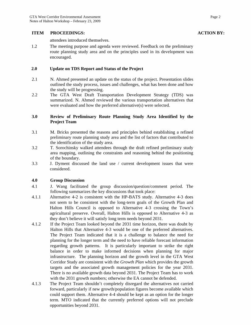
GTA West Corridor Environmental Assessment Page 2 Notes of Halton Workshop – February 23, 2009
ITEM PROCEEDINGS: ACTION BY:
attendees introduced themselves. 1.2 The meeting purpose and agenda were reviewed. Feedback on the preliminary
route planning study area and on the principles used in its development was encouraged.
2.0 Update on TDS Report and Status of the Project
2.1 N. Ahmed presented an update on the status of the project. Presentation slides outlined the study process, issues and challenges, what has been done and how the study will be progressing.
2.2 The GTA West Draft Transportation Development Strategy (TDS) was summarized. N. Ahmed reviewed the various transportation alternatives that were evaluated and how the preferred alternative(s) were selected.
3.0 Review of Preliminary Route Planning Study Area Identified by the
Project Team
3.1 M. Bricks presented the reasons and principles behind establishing a refined preliminary route planning study area and the list of factors that contributed to the identification of the study area.
3.2 T. Sorochinsky walked attendees through the draft refined preliminary study area mapping, outlining the constraints and reasoning behind the positioning of the boundary.
3.3 J. Dyment discussed the land use / current development issues that were considered.
4.0 Group Discussion 4.1 J. Wang facilitated the group discussion/question/comment period. The
following summarizes the key discussions that took place:
4.1.1 Alternative 4-2 is consistent with the HP-BATS study. Alternative 4-3 does not seem to be consistent with the long-term goals of the Growth Plan and Halton Hills Council is opposed to Alternative 4-3 crossing the Town’s agricultural preserve. Overall, Halton Hills is opposed to Alternative 4-3 as they don’t believe it will satisfy long term needs beyond 2031.
4.1.2 If the Project Team looked beyond the 2031 time horizon, there was doubt by Halton Hills that Alternative 4-3 would be one of the preferred alternatives. The Project Team indicated that it is a challenge to balance the need for planning for the longer term and the need to have reliable forecast information regarding growth patterns. It is particularly important to strike the right balance in order to make informed decisions when planning for major infrastructure. The planning horizon and the growth level in the GTA West Corridor Study are consistent with the Growth Plan which provides the growth targets and the associated growth management policies for the year 2031. There is no available growth data beyond 2031. The Project Team has to work with the 2031 growth numbers; otherwise the EA cannot be defended.
4.1.3 The Project Team shouldn’t completely disregard the alternatives not carried forward, particularly if new growth/population figures become available which could support them. Alternative 4-4 should be kept as an option for the longer term. MTO indicated that the currently preferred options will not preclude opportunities beyond 2031.

GTA West Corridor Environmental Assessment Page 3 Notes of Halton Workshop – February 23, 2009
ITEM PROCEEDINGS: ACTION BY:
4.1.4 Aggregate and goods movement are key issues which do not seem to be addressed by the current preferred alternatives. The Project Team noted that goods movement have been considered and will review the assumptions made regarding movement of aggregates.
4.1.5 The Project Team were asked if both, or just one, of the currently preferred corridors will be recommended for further examination in the draft TDS. The Project Team indicated that one or both of the currently preferred alternatives could be recommended for further examination. Both Alternatives 4-2 and 4-3 were found to provide better overall benefits and less impacts as compared to the other alternatives, and were, therefore recommended to be carried forward for additional analysis after Public Information Centre #4. The additional analysis of these corridor options will allow the Project Team to look more closely at the specific potential effects associated with these two options, in order to make a more informed decision.
4.1.6 The Project Team was asked about the Highway 401 Improvements Study from Trafalgar Road to Highway 25 and if it is being coordinated with the GTA West Study. MTO indicated that the Highway 401 widening is dependant on the GTA West Study’s preferred corridor alternative. Both Project Teams are working together and are aware of each others progress.
4.1.7 Internal discussions are occurring between all of the municipalities in the H-P BATS study area regarding how best to move forward and define a corridor as soon as possible. A Memorandum of Understanding (MOU) will hopefully be finalized and signed by the end of September (prior to the municipal elections), then a technical steering committee will be created which will engage with MTO moving forward.
4.1.8 The Town of Milton prefers the idea of Alternative 4-3 as it eliminates the need for a core collector system (12 lanes as proposed in Alternative 4-2) through the Milton area and would not negatively affect their growth allocation in adjacent lands. Further, the introduction of a 4 lane transportation corridor that runs northwest from Tremaine Road would be beneficial to the current and planned employment lands north of the 401 in Milton, and also potentially in Halton Hills.
4.1.9 The H-P BATS study will be proceeding with Phases 3 and 4 of the Municipal Class EA process if that study process is pursued. Will there be compatibility issues moving forward if the GTA West Study determines the facility should be provincially owned? MTO indicated that a facility to provincial standard can be approved through the Municipal Class EA process.
4.1.10 More details regarding the evaluation of the alternatives is required by municipal staff. Many want to know how the overall bubble-chart summary was derived, particularly the reasoning behind the social and natural environment factors. These details will be included in the draft TDS Report.
4.1.11 There appears to be a lack of connection between the GTA West and Niagara to GTA Studies. The lack of a corridor connection between the two studies seems illogical. The Project Team indicated that the studies are separate, as their purposes are distinct and separate, and each are intended to address different sets of transportation problems and opportunities. Highway 401 is the common boundary between the two studies. There was a high level of coordination between the two studies. A common connection between the two studies was explored and was found not to provide a significant benefit.
4.1.12 If MTO wants an official plan amendment to be drafted to protect for a
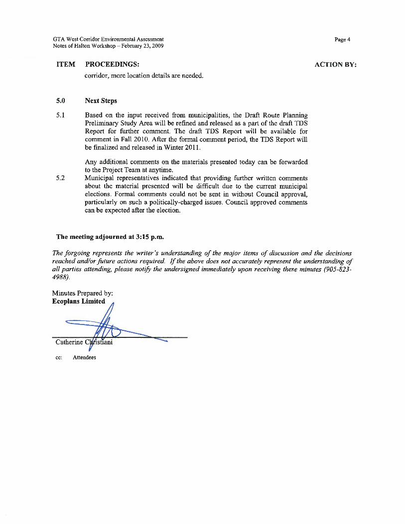

Minutes of Meeting
PLEASE NOTE: If your records of this meeting do not agree with this document, or if there are any omissions, please advise the writer at once, otherwise the contents of this document shall be assumed accurate and correct.
URS Architects & Engineers Canada Inc. 75 Commerce Valley Drive East Markham, ON Canada L3T 7N9 Tel: 905.882.9190 Fax: 905.882.4399 www.urs.ca
Project: GTA West Corridor Environmental Assessment
Meeting No. 1
Project No. 06-3184 Date: September 13, 2010
Location: Peel Region Office 1st Floor, Suite A, Caledon-Brampton Meeting Rooms 10 Peel Centre Drive, Brampton, ON
Time: 2:00 p.m. – 4:15 p.m.
Purpose: The purpose of the workshop was to discuss the refinement of the preliminary study area and identify key areas known by municipal staff.
Present: Municipalities Tom Apparao Sabbir Saiyed Brian Lakeman Tina Deteramani Kennedy Self Andrea Warren Todd Salter Kant Chawla Adrian Smith Henrik Zbogar David Kuperman Malik Majeed David Waters Khurram Tunio Chris Duyvestyn Chris Tschirhart MTO Jin Wang Frank Pravitz Joe Tsui Rina Kulathinal
Peel Region, Transportation Planning Peel Region, Transportation Planning Peel Region, Transportation Planning Peel Region, Transportation Planning Peel Region, PW Development Services Peel Region, PW Development Services Town of Caledon, Planning and Development Town of Caledon, Policy Planning City of Brampton, Planning Policy & Growth Management City of Brampton, Long Range Transportation Planning City of Brampton, Long Range Transportation Planning City of Brampton, Transportation Planning City of Brampton, Transportation Planning City of Brampton, Infrastructure Planning City of Brampton, Infrastructure Planning City of Brampton, Brampton Transit MTO, Provincial and Environmental Planning MTO, Provincial and Environmental Planning MTO, Provincial and Environmental Planning MTO, Central Region, Highway Engineering
Consultant Team Neil Ahmed Jim Dyment Mike Bricks Liz Kim
MRC Meridian Planning BPE URS
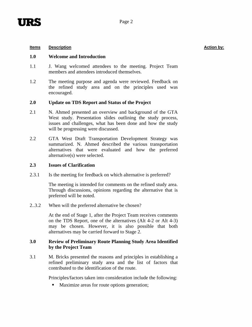
Page 2
Items Description Action by:
1.0 Welcome and Introduction
1.1 J. Wang welcomed attendees to the meeting. Project Team members and attendees introduced themselves.
1.2 The meeting purpose and agenda were reviewed. Feedback on the refined study area and on the principles used was encouraged.
2.0 Update on TDS Report and Status of the Project
2.1 N. Ahmed presented an overview and background of the GTA West study. Presentation slides outlining the study process, issues and challenges, what has been done and how the study will be progressing were discussed.
2.2 GTA West Draft Transportation Development Strategy was summarized. N. Ahmed described the various transportation alternatives that were evaluated and how the preferred alternative(s) were selected.
2.3 Issues of Clarification
2.3.1 Is the meeting for feedback on which alternative is preferred?
The meeting is intended for comments on the refined study area. Through discussions, opinions regarding the alternative that is preferred will be noted.
2..3.2 When will the preferred alternative be chosen?
At the end of Stage 1, after the Project Team receives comments on the TDS Report, one of the alternatives (Alt 4-2 or Alt 4-3) may be chosen. However, it is also possible that both alternatives may be carried forward to Stage 2.
3.0 Review of Preliminary Route Planning Study Area Identified by the Project Team
3.1 M. Bricks presented the reasons and principles in establishing a refined preliminary study area and the list of factors that contributed to the identification of the route.
Principles/factors taken into consideration include the following:
Maximize areas for route options generation;

Page 3
Items Description Action by:
Meeting MTO geometric standards (i.e. maximum radius curve);
Minimizing impacts to key natural features by providing a number of possible crossing locations; and
Minimize or avoid impacts to built up areas and future development plans.
3.2 The refinement of the study area provides a starting point for Stage 2. An important consideration in the refinement of the preliminary study area is to provide an area large enough to ensure that a reasonable range of alternatives can be considered in Stage 2. Narrowing the area to one route location is not intended.
3.3 N. Ahmed walked through the refined preliminary study area from east to west terminus.
3.4 Proposed Highway 400 Interchange
Proposed interchange is constrained by the existing ramps/ interchanges north and south of the corridor. There is a limited geometric opportunity to put in a freeway-to-freeway interchange at Highway 400.
3.5 It was noted that the only location to get through the Bolton area is through a small gap between north Brampton and south Bolton.
3.6 Boundary constraints are based largely on high-level geometrics.
4.0 Group Discussion
4.1 J. Wang facilitated the group discussion/question/comment period. The following summarizes the key discussions that took place:
4.2 Regional Official Plan Amendment Number 24 (ROPA 24) – Places to Prosper
Was the Strategic Infrastructure Study Area (SISA) considered in the refinement of the preliminary study area?
The identification of the transportation corridor is conceptual in nature.
The Growth Plan and the GTA West Corridor Study, at its

Page 4
Items Description Action by:current stage, do not provide the basis for the specific location of the SISA.
SISA has protection policies in the southern boundary of the refined preliminary study area.
ROPA 16 was completed 5 years ago. It may overlap with GTA West preliminary study area. This needs to be confirmed.
The approved Secondary Plan (for a residential and industrial area) is not shown on the aerial photos; however, the subdivisions are in an approvals process and it is starting to build out. Should the boundary of the study area line be moved to account for this?
At this stage it is too early to narrow the boundary, however further review and consideration will be given to refinements. During route planning (Stage 2) the corridor will likely be refined to reflect the status of residential and/or industrial plans.
4.3 Proposed Highway 410 Interchange
Study area development provides for an interchange with Highway 410.
It was noted that Valleywood Residents (VRA) were delegating Council on September 14th regarding protecting a 60 metre transportation corridor through approved OPA 208 industrial lands to connect 410 to GTA West Corridor.
Can Highway 410 extend further north and connect with GTAW Corridor north of the built-up area?
North and south limits of the refined study area are likely sufficient to accommodate future Highway 410 connection.
Staff from Town of Caledon raised concerns that opportunities to extend Highway 410 straight (vertically) north from Mayfield Road may not be feasible due to the approved Secondary Plan and Development applications that are being processed in the area. MTO will review the status of development applications.
4.4 Caledon Staff discussed the development of the Preliminary Study Area and noted that the recognition of Mayfield West Phase 1 was not given the same attention as the Flying Club. The Preliminary Study Area avoided the Flying Club but not the
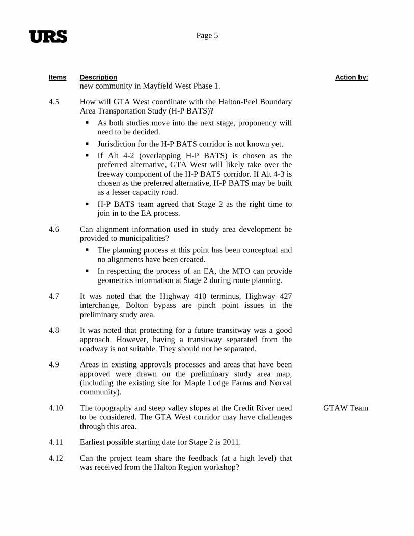
Page 5
Items Description Action by:new community in Mayfield West Phase 1.
4.5 How will GTA West coordinate with the Halton-Peel Boundary Area Transportation Study (H-P BATS)?
As both studies move into the next stage, proponency will need to be decided.
Jurisdiction for the H-P BATS corridor is not known yet.
If Alt 4-2 (overlapping H-P BATS) is chosen as the preferred alternative, GTA West will likely take over the freeway component of the H-P BATS corridor. If Alt 4-3 is chosen as the preferred alternative, H-P BATS may be built as a lesser capacity road.
H-P BATS team agreed that Stage 2 as the right time to join in to the EA process.
4.6 Can alignment information used in study area development be provided to municipalities?
The planning process at this point has been conceptual and no alignments have been created.
In respecting the process of an EA, the MTO can provide geometrics information at Stage 2 during route planning.
4.7 It was noted that the Highway 410 terminus, Highway 427 interchange, Bolton bypass are pinch point issues in the preliminary study area.
4.8 It was noted that protecting for a future transitway was a good approach. However, having a transitway separated from the roadway is not suitable. They should not be separated.
4.9 Areas in existing approvals processes and areas that have been approved were drawn on the preliminary study area map, (including the existing site for Maple Lodge Farms and Norval community).
4.10 The topography and steep valley slopes at the Credit River need to be considered. The GTA West corridor may have challenges through this area.
GTAW Team
4.11 Earliest possible starting date for Stage 2 is 2011.
4.12 Can the project team share the feedback (at a high level) that was received from the Halton Region workshop?
Page 6
Items Description Action by:
York Region’s primary comments are: speed up the process, narrow down the location for corridor/alignment.
Halton Region was concerned with changing the agricultural landscape.
They raised concerns as to why the EA study does not look beyond 2031.
4.13 Peel/Caledon/Brampton suggested that the Project Team should consider integrating the GTA West corridor with NGTA and the rest of GTA.
4.14 Peel/Caledon/Brampton sent a letter to the Project Team that indicates that they prefer Alts 4-4 and 4-5 because they provide better opportunity to connect with an NGTA corridor that may extend to Highway 401.
The modeling and analysis shows that there is limited transportation benefit in Alts 4-4 and 4-5, compared to significant impact on the natural environment.
Choosing Alt 4-4 or 4-5 as the preferred solution is difficult because the need for a longer corridor is not a “given” as there is no data beyond 2031. In addition there are other ways to provide capacity out to Guelph (widening Highway 401 as significantly less effects than a new corridor across the escarpment and greenbelt crossing)
The project does not preclude another corridor continuing to the west (towards Guelph) in the future.
Municipalities’ suggested that the flexibility of another future corridor connecting to the GTA West corridor should be considered in choosing the preferred option.
4.15 Have freeway-to-freeway interchanges been looked at for Alts 4-2 and 4-3?
Both interchanges have been developed conceptually at a high-level for feasibility. Alt 4-2 is a more complex interchange compared to Alt 4-3, with multiple legs and levels; however both interchanges seem constructible.
A preliminary design should be prepared for the other freeway-to-freeway interchanges along the GTA West corridor, particularly for Highway 410 and 427.
GTAW Team
4.16 Goods Movement
Page 7
Items Description Action by:
Goods movement was an important component in the assessment of alternatives and was accounted for in the traffic modeling.
Goods movement (particularly aggregate removal and transportation) was looked at in a bigger picture.
T. Apparao indicated that there are not enough routes running north-south that can accommodate trucks. Was this considered in the refinement of the preliminary study area?
Dixie Road and Hurontario Street are some of the only routes that trucks can travel north-to-south.
Project Team will confirm that goods movement has been properly accounted for.
GTAW Team
4.17 Can the south boundary line be raised to Mayfield Road?
Dropping off the section south of Mayfield Road will be looked at by the Project Team.
GTAW Team
4.18 Highway 410 / Highway 10
Project Team needs to look at the existing use and access to Highway 10 and Highway 410. The GTA West corridor may impact Highway 10.
Using the existing Highway 10 or improving Highway 10 was suggested. At the moment, the project does not preclude using Highway 10 as the connection between 410 and the new corridor.
Highway 10 is a high-truck traffic corridor.
Valleywood residents are still very concerned with the approval of the Highway 410 extension. They do not want any more trucks in their community.
4.19 There is no current site plan for the proposed developments around Heart Lake Road.
4.20 GTA West Corridor – Future ROW
Protecting for 110m (roadway) and 60m (transitway and auxiliary facilities).
The H-P BATS study identified 8 lanes in the proposed H-P BATS corridor, while GTA West Alt. 4-2 showed 4 lane in the same area.
Previously, only 30m was identified for the 407

Page 8
Items Description Action by:Transitway. This area may be insufficient and all MTO new route planning studies provide for 60m ROW for Transitway.
4.21 Has the Project Team looked at interchange concepts at Trafalgar Road where there will be constraints?
A high-level engineering feasibility analysis looked at having an interchange at Trafalgar Road; however, the team did not exhaust the various possibilities of an interchange.
4.22 Coordination with Hydro One
Hydro One has not started with their EA; however, there has been a lot of interest regarding the GTA West study.
The Project Team has talked about coordination and integration with Hydro One and will continue to work with them throughout the study.
Potentially, there is a need for another 37m for a hydro corridor.
ToR does not require the Project Team to coordinate with Hydro One or a future hydro corridor; however, the team will continue to work with Hydro One.
4.23 GO / Metrolinx
Metrolinx RTP has been incorporated in the foundation of the study.
GTA West will build on their Smart Commute program.
Western Web is beyond Metrolinx jurisdiction.
Peel Region wants their transit network to link with Metrolinx.
Transit interconnections will be looked at in more detail. GTAW Team
4.24 Kennedy Self from Peel suggested that the Project Team look at going through the north end of Bolton to cross the Humber River when the valley is less defined.
4.25 Halton-Peel Boundary Area Transportation Study
If Alt 4-3 is chosen as the preferred alternative and H-P BATS becomes a lower capacity road, it is a disadvantage for Peel Region in terms of accommodating trucks. There are limited choices of routes and roads that trucks can use
Page 9
Items Description Action by:to travel north/south.
Which jurisdiction will H-P BATS be under? MTO or municipalities?
4.26 Alternative 4-2
Western terminus of Alt 4-2 could encroach on Mississauga. If we need more information in that area we need to consult with the City of Mississauga.
GTAW Team
5.0 Next Steps
5.1 The refined preliminary study area will be released in draft form with the draft Transportation Development Strategy Report. It is a starting point for the next stage.
5.2 GTA West Corridor Study (Stage 1) will conclude early in 2011. Route planning may begin later in 2011; however, Minister’s direction is required to move to the next stage.
5.3 Another Municipal Advisory Group (MAG) meeting can be scheduled in the next couple of months.
GTAW Team
Post Meeting Note: Subsequent to the September 13, 2010 meeting, it was determined that elements from both Alternative 4-3 and 4-2 would be required as part of the Transportation Development Strategy. The road component of the Transportation Development Strategy would include a new transportation corridor from Highway 400 to Highway 401 west of Milton (i.e., new corridor as shown in Alternative 4-3), and a north-south link between Highway 401/407ETR interchange and the GTA West corridor (i.e., similar location as the H-P BATS corridor). Based on the traffic analysis carried out, the north-south link has been identified to be a 6-lane facility.
Submitted by: Elizabeth Kim, Engineer-in-Training
Catherine Christiani, Ecoplans Ltd. (Revisions) Distribution: All Attendees
2655 North Sheridan Way Mississauga, Ontario L5K 2P8
Tel: (905) 829-4988 Fax: (905) 823-2669
E-mail: [email protected] Website: www.ecoplans.com
NOTES OF MUNICIPAL ADVISORY GROUP MEETING #6
PROJECT: GTA West Corridor Environmental Assessment
MEETING NO: Municipal Advisory Group Meeting #6
FILE NO.: 06-3184
DATE: April 20, 2011 TIME: 1:30 p.m.
PLACE: Caledon Centre Ballroom, Holiday Inn Select Brampton, Brampton, ON
PRESENT: Municipalities Brian Lakeman Sabbir Saiyed Wayne Chan Steve Ganesh Chris Duyvestyn David Kuperman Henrik Zbogar David Waters Khurram Tunio Kant Chawla Mary Hall Steve Mota Tony Iacobelli Roy McQuillin Andrew Pearce Andrew Head Karyn Poad Tara Buonpensiero Ted Drewlo Stephanie Jarvis Sally Stull Geoffrey Keyworth Stephen Kitchen Gwen Zhang MTO Jin Wang Frank Pravitz George Ivanoff Trevor Greenman Joachim Tsui Consultant Joint Venture (CJV) Neil Ahmed Mike Bricks
Region of Peel Region of Peel Region of Peel City of Mississauga City of Brampton City of Brampton City of Brampton City of Brampton City of Brampton Town of Caledon Town of Caledon York Region City of Vaughan City of Vaughan City of Vaughan Halton Region Halton Region Town of Halton Hills Town of Halton Hills Town of Milton Town of Erin Region of Waterloo Township of King City of Guelph MTO Provincial and Environmental Planning MTO Provincial and Environmental Planning MTO Provincial and Environmental Planning MTO Provincial and Environmental Planning MTO Provincial and Environmental Planning MRC BPE Inc.

GTA West Corridor Environmental Assessment Page 2 Notes of MAG Meeting #6 – April 20, 2011
Kevin Jones Tim Sorochinsky Jim Dyment Catherine Christiani
AECOM URS Meridian Planning Ecoplans Limited
PURPOSE: To present and discuss the recently released Draft Transportation Development Strategy (TDS) Report, with particular focus on the proposed new transportation corridor, in order to facilitate municipal review of the report. Provide an opportunity to receive and discuss preliminary municipal comments on the report.
ITEM PROCEEDINGS: ACTION BY:
1.0
Welcome and Introductions
1.1 J. Wang welcomed attendees to the meeting. The project team, presenters and attendees introduced themselves. The meeting purpose was also reviewed.
2.0 Project Team Presentation
2.1 N. Ahmed and M. Bricks presented a study update, an overview of the study background and process, the key elements of the recommended Draft Transportation Development Strategy (including the new transportation corridor and north-south link), the key factors of the recommendation and summary of the additional analysis conducted. They also reviewed the preliminary route planning study area and outlined the study’s next steps.
3.0 Discussion
3.1 The following questions / comments were raised after the presentation:
3.1.1 Comment: Although only a small portion of the City of Mississauga is in the study area, this area bears the brunt of a lot of the transportation demand. Response: Comment noted.
3.1.2 Question: How does the Project Team see the recent Transportation Development Strategy (TDS) results’ fitting in with the Metrolinx RTP’s for project prioritization? Response: The GTA West Corridor Study builds on the Metrolinx RTP, the GO 2020 Strategic Plan and other provincial and municipal transit initiatives. The travel demand forecasting work that is included in the GTA West study also incorporates the assumptions made in both the RTP and the component RTP projects. The project team anticipates that the Metrolinx RTP will be built out by 2031 (in advance of the construction of the new corridor) and supports the plan’s early wins.
3.1.3 Question: Does MTO foresee any opportunities for partnerships with regional municipalities regarding road improvements needed in the interim, before the corridor is built? Answer: MTO recognizes that there will be short-term pressure on local roads however the GTA West project is focused on long-term transportation solutions.
3.1.4 Question: When will Stage 2 of the EA be initiated? Answer: This will ultimately be a government decision, based on the input
GTA West Corridor Environmental Assessment Page 3 Notes of MAG Meeting #6 – April 20, 2011
ITEM PROCEEDINGS: ACTION BY:
received from the public and stakeholders. Our goal is to address comments and concerns and finalize the strategy within a 90 day timeframe.
3.1.5 Question: Will all comments need to be received within the 90 day timeline? Some municipalities may not be able to send comments within that period. Answer: The Project Team is trying to be flexible and stated in all materials that at a minimum there will be a 90 day review period. Advance notice should be given to the Project Team if it is anticipated that comments will not be submitted by the 90 day deadline.
3.1.6 Question: How will the Project Team respond to the comments? With just written responses, or will meetings also be proposed? Answer: In all cases a written response will be provided. Where appropriate, meetings will be proposed. The Project Team wants to address all comments prior to moving into Stage 2 of the EA.
3.1.7 Question: Has MTO considered advancing route planning in key areas? Answer: The decision to advance route planning in any area will be tied to the Minister’s decision to implement Stage 2 of the EA. The data and information required to advance route planning has not yet been collected. Some modifications to the Preliminary Route Planning Study Area may be made now based on current information and input received during the comment period. Prior to route planning beginning, another round of consultant acquisition will need to take place which could take 6-12 months.
3.1.8 Question: How will the HP-BATS coordination work? Answer: MTO recognizes that there are both provincial and local functions with a North-South Link in the area and MTO will need to work together with local municipalities to determine what EA process will be used to facilitate working together (ie. Province could take over HP-BATS component, or HP-BATS could be pursued through other EA options). Discussions need to occur between MTO, MOE and the local municipalities on how to pursue this.
3.1.9 Comment: The City of Brampton will be proceeding with secondary planning in north Brampton, around Heritage Heights and Area 47, which is to include the completion of transportation studies. MTO will be invited to attend as a stakeholder to these discussions, and is encouraged to participate. Answer: Comment noted.
3.1.10 Question: The Preliminary Route Planning Study Area does not include the current termination point of Highway 410. Any solution should begin at the current termination point of Highway 410, not Mayfield Road. Answer: It was envisioned that there would be two options in this area – upgrade the existing Highway 410/10 corridor to provide a connection or construct a new corridor located within the Preliminary Route Planning Study Area. This was not communicated well in the draft TDS and the Project Team will be looking for ways to improve this in the final TDS, Follow-up Comment: Dixie Road should also be considered as a connection point. Answer: Comment noted.
3.1.11 Question: In Stage 2 of the EA will connections to the regional road network with interchanges, be considered? Answer: Yes.
3.1.12 Question: The draft TDS mentions that analysis was completed and that the transportation corridor could be a truck-only facility. Answer: Further study needs to be done. The initial analysis completed by the
GTA West Corridor Environmental Assessment Page 4 Notes of MAG Meeting #6 – April 20, 2011
ITEM PROCEEDINGS: ACTION BY:
Project Team revealed many benefits to having a truck-only facility, however further analysis is required to assess the impacts. Some stakeholders have shown an interest in having a truck-only facility and/or truck-only lanes.
3.1.13 Question: The Region of Waterloo’s comments on the draft TDS can be found through review of the current Regional Council report, recently forwarded to the Project Team. Waterloo has recommended that the Project Team protect for Alternatives 4-4 or 4-5 in the future (beyond 2031), due to the strategy’s possible creation of a Milton bottleneck. Another criterion should be added which allows for the future incorporation of connections to new facilities. Answer: Alternative 4-4 was not recommended because the preferred alternative can provide similar transportation benefits with a better balance of effects to the natural environment and individual property owners. The recommended alternative has been found to be able to address the transportation demands west of Milton through the widening Highway 401, while avoiding the significant effects and costs associated with impacts to agricultural lands, cultural features, and crossing the Niagara Escarpment, the Greenbelt and other environmentally sensitive features. It is less intrusive to expand a current facility across the Niagara Escarpment, then create a new one. It is hard to predict future targets and predictions beyond the currently prescribed horizon year of 2031. The draft TDS also includes better transit connections and TDM/TSM to the Guelph-Wellington-Waterloo area, not just the expanded Highway 401.
3.1.14 Comment: The model used by the Project Team was based on old travel patterns. Beyond 2031, travel patterns will be different. Also, once the GTA West corridor is available, it may alter travel patterns. Has this been considered? Answer: The Project Team used the Ontario Ministry of Transportation’s (MTO) current Greater Golden Horseshoe Model (GGH Model) to forecast future travel demands for the transportation analysis. The model utilizes a detailed transportation network including both transit and roadway, and forecasts trip-making by all modes of travel based on forecasts of population and employment growth, land use densities, socio-economic and demographic information, current and future transportation costs (representing fuel costs, tolls, parking costs, transit fares, vehicle operating costs, etc.) and transportation network performance for all travel modes. A balance of trip patterns should occur over time throughout the study area, including increased self-containment. All of the modelling results are detailed in the draft TDS and a corresponding modelling report.
3.1.15 Comment: It would be useful for the Project Team to show the traffic projections both east and west of Milton, in order to show how it differs. Answer: Comment noted.
3.1.16 Question: Does the MTO see itself as a possible proponent in the HP-BATS study? Answer: There is a provincial transportation function related to long-distance north-south movement in the area. See response to 3.1.8 for additional details.
3.1.17 Comment: A link between the GTA West corridor and Niagara to GTA (NGTA) corridor is not shown. Answer: The GTA West and NGTA studies are separate as their purposes are distinct and separate, and each is intended to address different sets of transportation problems and opportunities. There has been a high level of

GTA West Corridor Environmental Assessment Page 5 Notes of MAG Meeting #6 – April 20, 2011
ITEM PROCEEDINGS: ACTION BY:
coordination between the two studies, including a highly coordinated modelling approach and traffic analysis. Preliminary work has shown that there isn’t a benefit to directly connecting the two corridors. The NGTA Project Team is still working to finalize their recommended TDS, however at the moment the GTA West corridor could connect to the NGTA corridor through either Highways 401 or 407.
3.1.18 Question: The Region of York and City of Vaughan are concerned about the effect the Preliminary Route Planning Study Area will have on development lands. The City of Vaughan would like the Project Team to present to the Committee of the Whole. Both York and Vaughan would like to have separate meetings with the Project Team to discuss issues. Is there any further information the Project Team can provide, beyond what is in the TDS? Answer: Comment noted. The requested meetings and presentation will be planned. The Project Team has done some high-level feasibility work on the crossings at the Humber River, which could be brought to an internal meeting for discussion. In addition, the Project Team has met with the Nashville developers (on May 2nd). The results of that meeting could also be discussed.
GTA West Project Team
3.1.19 Comment: It would be appropriate to start the Stage 2 work as soon as possible, even without the official commencement of the job. The Stage 2 work needs to be expedited. Answer: Comments noted. The Project Team recognizes the need to start Stage 2 of the EA as soon as possible. Those comments need to come to the attention of the Minister’s Office, and should be communicated through any Council/Staff comments on the draft TDS. MTO will be working with MMAH and municipalities to protect corridor lands.
3.1.20 Comment: A liaison group with MTO Central Region should be created. Answer: Comment noted.
3.1.21 Comment: Refinements to the Preliminary Route Planning Study Area need to be made, prior to any Stage 2 work commencing. This should be discussed at individual municipal meetings. The Preliminary Route Planning Study Area includes lands which already have established plans. Answer: Comment noted. The Project Team needs flexibility for various options to be considered, however clarity in certain key areas also needs to be established.
3.1.22 Question: What opportunities will there be to initiate preliminary Stage 2 work if there is no committed budget? Answer: MTO needs to complete the consultant procurement process, prior to beginning any Stage 2 work. It is hoped that by next Spring this work can begin.
3.1.23 Comment: All of the municipalities would like to see the corridor alignment better defined through development pressure areas. Answer: If this is a common sentiment, it needs to be communicated to the Project Team so the Minister can consider accelerating the Stage 2 procurement and begin this work. Follow-up Comment: It is incumbent upon the municipalities to help each other by voicing this opinion to the Minister.
3.1.24 Question: How long will Stage 2 of the EA take? Answer: Stage 2 of the EA, Route Planning and Preliminary Design, will be a multi-year process. In the meantime, development will not be frozen. Given the geography, technical work and consultation required, Stage 2 will likely
GTA West Corridor Environmental Assessment Page 6 Notes of MAG Meeting #6 – April 20, 2011
ITEM PROCEEDINGS: ACTION BY:
take between 3 and 5 years to complete. It will then likely take MOE 1-2 years to review the EA.
3.1.25 Question: How will lands be protected while Stage 2 is being completed? Answer: MTO and the Project Team will continue to work with municipalities throughout the planning process. Development applications within the study area will be reviewed on a case-by-case basis to ensure that the planning and implementation of the new transportation corridor is not compromised.
3.1.26 Question: The draft TDS mentions that a new hydro corridor could be incorporated into the transportation corridor. Will this undertaking be conducted as a separate EA or in conjunction with the study? Answer: The Project Team has had meetings with Hydro One and Ontario Power Generation (OPG), and there is interest in coordinating with the GTA West study. The incorporation of hydro facilities would increase the ROW by approximately 30m. Hydro One and OPG will be at the RAAG Meeting on April 29, 2011 and further meetings are planned with them to determine the future scope of coordinated EA processes.
3.1.27 Comment: MTO should extend HOV lanes on Highway 401, west of Milton. There shouldn’t be a gap between areas where HOV lanes are provided. Answer: Comment noted.
3.1.28 Comment: Given the current high levels of congestion, projects along the 400 series highways should be accelerated. The capacity is needed. Answer: Comment noted.
4.0 What’s Next
4.1 N. Ahmed thanked attendees for their participation. Any further comments or questions on the presentation material were encouraged to be submitted to the Project Team.
MAG Members
The meeting adjourned at 3:30 p.m. Note that a copy of the presentation is available on the project website. Post Meeting Note: In response to input received on the draft GTA West Corridor Transportation Development Strategy, the ministry has decided to carry out additional analysis and consultation to further examine the recommendations in the Halton area. The additional work will be carried out over the Fall and Winter and is expected to be completed by Spring 2012. The ministry will consult with all stakeholders on the results of the additional work before any decision on next steps is taken.
The forgoing represents the writer’s understanding of the major items of discussion and the decisions reached and/or future actions required. If the above does not accurately represent the understanding of all parties attending, please notify the undersigned immediately upon receiving these minutes (905-823-4988).
GTA West Corridor Environmental Assessment Page 7 Notes of MAG Meeting #6 – April 20, 2011
Minutes Prepared by: Ecoplans Limited Catherine Christiani
cc: Attendees
Project Team Members Municipal Advisory Group Contact List
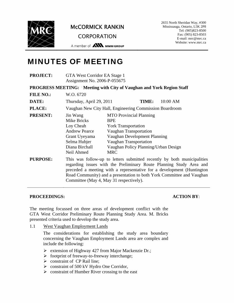
McCORMICK RANKIN CORPORATION
2655 North Sheridan Way, #300 Mississauga, Ontario, L5K 2P8
Tel: (905)823-8500 Fax: (905) 823-8503 E-mail: [email protected]
Website: www.mrc.ca
MINUTES OF MEETING PROJECT: GTA West Corridor EA Stage 1
Assignment No. 2006-P-055675
PROGRESS MEETING: y Meeting with City of Vaughan and York Region Staff
FILE NO.: W.O. 6720
DATE: Thursday, April 29, 2011 TIME: 10:00 AM
PLACE: Vaughan New City Hall, Engineering Commission Boardroom
PRESENT: Jin Wang MTO Provincial Planning Mike Bricks BPE Loy Cheah York Transportation Andrew Pearce Vaughan Transportation Grant Uyeyama Vaughan Development Planning Selma Hubjer Vaughan Transportation Diana Birchall Vaughan Policy Planning/Urban Design Neil Ahmed MRC
PURPOSE: This was follow-up to letters submitted recently by both municipalities regarding issues with the Preliminary Route Planning Study Area and preceded a meeting with a representative for a development (Huntington Road Community) and a presentation to both York Committee and Vaughan Committee (May 4, May 31 respectively).
PROCEEDINGS:
ACTION BY:
The meeting focussed on three areas of development conflict with the GTA West Corridor Preliminary Route Planning Study Area. M. Bricks presented criteria used to develop the study area.
1.1 West Vaughan Employment Lands
The considerations for establishing the study area boundary concerning the Vaughan Employment Lands area are complex and include the following:
extension of Highway 427 from Major Mackenzie Dr.; footprint of freeway-to-freeway interchange; constraint of CP Rail line; constraint of 500 kV Hydro One Corridor, constraint of Humber River crossing to the east
Minutes of Meeting Page 2 of 3 Date: April 29, 2011 PROCEEDINGS:
ACTION BY:
There was discussion about the potential further extension of Highway 427 beyond the GTA West Corridor. It was indicated by M. Bricks that there would likely be opportunities to avoid precluding Highway 427 extension in the future north of the GTAW Corridor. J. Wang indicated that there are currently no provincial plans to accommodate extension beyond the GTA West Corridor. There was also mention of the Hydro One EA potential, between Kleinburg Transformer Station and Milton Transformer Station.
1.2 North Kleinburg/Nashville Secondary Plan
The Huntington Road Community has been approved by the City and Regional approval is pending. Using a topographic plan of the Humber River valleys it was illustrated how a possible shortest crossing of the valley may be at a point that would conflict with the proposed development. Based on this, the Project Team indicated that Huntington Road development area should not be omitted from the study area without further study in the next stage. In addition, it was suggested that TRCA would be concerned if we did not maximize crossing opportunities.
Regarding the Huntington Road development, J. Wang indicated that MTO had provided comments through MMAH and content was similar to that of the York Region OP comments. L. Cheah asked what the province would do if the Region approved the development. J. Wang stated that he could not speculate. The question of when MTO could move forward with a route in that area was raised. D. Birchall indicated that a similar circumstance to that of the 400 North Employment Lands could arise here, likely with similar outcomes of the 400 lands.
There was discussion regarding whether the route planning could be initiated outside of the EA process. It was agreed this would not be appropriate as long as there is an ongoing EA.
1.3 Greenbelt
There was discussion about the Greenbelt and how much work was carried out to understand its importance and sensitivity. M. Bricks advised that to date the work has been based on secondary source information and no field work.
Minutes of Meeting Page 3 of 3 Date: April 29, 2011
PROCEEDINGS:
ACTION BY:
Regarding potential impacts to the York Region Greenbelt, there was interest in the extent of natural heritage work that would be undertaken in Stage 2. M. Bricks provided a response based on traditional MTO EA route planning studies to demonstrate the level of impact assessment undertaken and discuss examples of mitigation measure MTO has used in the past to minimize effects on similar nature features. D. Birchall noted that a Natural Heritage Network Study is underway by the City in association with TRCA, with an inventory to be initiated this year and that the GTA West Corridor is driving the need for the inventory. There was a question as to whether mitigation or enhancement is available where impacts are required. M. Bricks indicated that mitigation is the legal requirement in these circumstances; however enhancement opportunities may be identified where possible.
J. Wang noted that whereas widening of the Highway 401 corridor will provide suitable capacity improvements across the Niagara Escarpment, this cannot be expected in York Region given the limitations to highway widening due to urban conditions along Highway 401 and the 407 ETR. As such, a new corridor will be required to accommodate the future demands.
1.4 Highway 400 North Employment Area
The 400 North Employment Lands was discussed. It was noted that there is a municipal interest to provide a connection to the east from Highway 400 and that a new interchange at Kirby Road or other location is going to be required. To that end, the municipalities enquired what would be required to introduce this requirement into the Stage 2 scope. J. Wang indicated that they should submit a request to MTO for an interchange.
Vaughan / York
The foregoing represents the writer’s understanding of the major items of discussion and the decisions reached and/or future actions required. If the above does not accurately represent the understanding of all parties attending, please notify the undersigned within 48 hours of receiving these minutes at 905-823-8500. Minutes prepared by, McCormick Rankin Corporation Neil Ahmed, P. Eng. cc: list all attending

McCORMICK RANKIN
CORPORATION
2655 North Sheridan Way, #300 Mississauga, Ontario, L5K 2P8
Tel: (905)823-8500 Fax: (905) 823-8503 E-mail: [email protected]
Website: www.mrc.ca
MINUTES OF MEETING
PROJECT: GTA West Corridor EA Stage 1
Assignment No. 2006-P-055675 PROGRESS MEETING: Meeting with City Meeting with Town of Caledon Staff FILE NO.: W.O. 6720 DATE: Monday, May 16, 2011 TIME: 2:30 p.m. to 4:45 p.m. PLACE: Town of Caledon, Palgrave Room PRESENT: Jin Wang
Joe Perrotta Joe Tsui Rina Kuhthinal Mary Hall Tim Manley Marisa Williams Kant Chawla Mike Bricks Neil Ahmed Katherine Jim
MTO Provincial Planning MTO Provincial Planning MTO Provincial Planning MTO Central Region Town of Caledon Town of Caledon Town of Caledon Town of Caledon BPE MRC MRC
PURPOSE: The purpose of the meeting was to discuss the development pressure issues associated with the proposed GTA West transportation corridor in the Town of Caledon – particularly, South Albion-Bolton area, and Mayfield West Phases 1 and 2.
PROCEEDINGS: ACTION BY: ITEM 1 - INTRODUCTIONS 1.1 Those at the meeting were introduced. 1.2 The GTA West Project Team had a workshop with Caledon Council on
April 12, 2011. Key issues noted by Caledon Council at the meeting were South Albion-Bolton boundary expansion, Mayfield West Phases 1 and 2, integration of GTA West Corridor and Highway 410, as well as the refinement of the Preliminary Route Planning Study Area. Therefore, a meeting with staff was arranged.
1.3 The purpose of the meeting was to discuss the areas of concerns as noted above, and to identify next steps.
1.4 The GTA West Project Team have had (and will continue to have) meetings with municipalities, and have also received letters from developers identifying their concerns.
Minutes of Meeting Page 2 of 4 Date: May 16, 2011 PROCEEDINGS: ACTION BY: ITEM 2 – DISCUSSION ON AREAS OF CONCERNS The following summarizes key points from the discussion: 2.1 South Albion-Bolton The Preliminary Route Planning Study Area identified through the
South Albion-Bolton area is constrained by the proposed Highway 427 extension connection with the GTA West corridor, Humber River crossing, hydro corridor crossing and railway corridor crossing.
In the South Albion-Bolton area, the north boundary of the Preliminary Route Planning Study Area extends from southeast to northwest, affecting two blocks of properties north of Mayfield Road, between Coleraine Drive and Humber Station Road – part of the proposed South Albion-Bolton urban boundary expansion area.
From the Town‟s perspective, it would be ideal if the Preliminary Route Planning Study Area boundary could be revised to follow Humber Station Road down to Mayfield Road (i.e. eliminating the diagonal boundary and the impact to development blocks all together).
Recognizing that may not be possible, the Town has identified the “south property” as part of a special study area (approximately 100 acres), protecting for the potential GTA West Corridor. It would be desirable if MTO to review the Preliminary Route Planning Study Area to see it the „north block‟ could be avoided.
GTA West Project Team explained by removing the “diagonal line” in the Preliminary Route Planning Study, it would significantly limit the ability to develop alternatives to accommodate a freeway to freeway interchange, the Humber River crossing and the railway corridor crossing, in addition to Hydro tower lines.
Based on comments from the Town, the Project Team will review the potential to refine the “diagonal line” to minimize impact to the “north property”.
GTA West Project Team
2.2 Mayfield West – Phase 1 GTA West Project Team reviewed the various conceptual plans for
the connection between Highway 410 and the GTA West corridor. o Concept 1: utilize existing Highway 10 corridor as the
connection to GTA West Corridor. Access to adjacent properties along Highway 10 would be provided via service roads.
o Concept 2: extension of Highway 410 at Mayfield Road (northbound connection on the east side of existing interchange).
o Concepts 3, 4 and 5: extension of Highway 410 to the east / west / through the woodlot north of Mayfield Road.

Minutes of Meeting Page 3 of 4 Date: May 16, 2011 PROCEEDINGS: ACTION BY:
o Concept 6: extension of Highway 410 to the west of Heart Lake Road.
All alternatives would be developed in greater detail and evaluated during next Stage of the EA process.
Town of Caledon stressed that this area is in an advanced stage of the development process and should be regarded as one of the built up areas (i.e. grey areas) in the land use plan. The “V” shape outline shown in the Preliminary Route Planning Study Area plan at Highway 410 should be removed.
GTA West Project Team explained that a connection between Highway 410 and the GTA West corridor would be an important link in the over transportation system. From an EA perspective, the boundaries of the Preliminary Route Planning Study Area were identified to ensure a reasonable range of alternatives could be developed during next Stage of the EA process, and therefore, the Preliminary Route Planning Study Area will have to accommodate the development of alternatives to connect to Highway 410.
Town of Caledon indicated that they would continue with the planning in the area. Town staff suggested exploring GTA West alternatives that extend to the east of Dixie Road as there are no existing or planned developments in the area.
GTA West Project Team will review the boundary of the Preliminary Route Planning Study Area in greater detail, but noted that the “V” shape will likely remain as required.
GTA West Project Team
GTA West Project Team suggested coordination/meeting with developers, if required, to explore opportunities that would accommodate both a freeway and freeway connection with minimal impact to properties. Should any meetings be arranged, Town of Caledon staff should also be invited.
2.3 Mayfield West – Phase 2 Town of Caledon questioned why the Mayfield West Phase 2
development area would be included in the Preliminary Route Planning Study Area. In the April 19, 2011 letter from Glen Schnarr & Associates Inc., they suggested narrowing the Preliminary Route Planning Study Area to exclude the Mayfield West Phase 2 Area.
GTA West Project Team explained that there are a number of Greenland and watercourses in the area and it is important to provide a study area large enough to allow for sufficient opportunities to develop alternatives that would be less intrusive to the valley systems (e.g. a perpendicular crossing). Some of the alternatives may have impact to the Mayfield West Phase 2 area. As requested by the Town, GTA West Project Team will review Glen Schnarr & Associate Inc. proposal in greater detail.
GTA West Project Team
Minutes of Meeting Page 4 of 4 Date: May 16, 2011 PROCEEDINGS: ACTION BY: Town noted that if the GTA West corridor were to cross the
Mayfield West Phase 2 area, the entire land use plan will have to be revised. In terms of status, the Regional Official Plan Amendment for urban boundary expansion has yet to be drafted for this area; this will typically take about 1 year.
ITEM 3 - OTHER BUSINESS / NEXT STEPS 3.1 Town will prepare staff report for Council endorsement regarding all
three areas of concern.
3.2 Overall, Town of Caledon is in support of the Transportation Development Strategy; however, would like to minimize property impact and allow early land use development.
3.3 Town of Caledon Mayor sent a letter to the Minister of Transportation on May 6, 2011 regarding concerns in South Albion-Bolton, as well as Mayfield West Phases 1 and 2. A copy of the letter was provided to the Project Team.
The foregoing represents the writer’s understanding of the major items of discussion and the decisions reached and/or future actions required. If the above does not accurately represent the understanding of all parties attending, please notify the undersigned within 48 hours of receiving these minutes at 905-823-8500. Minutes prepared by, McCormick Rankin Corporation
Katherine Jim, P. Eng. cc: All attending
W:\6k\6720 GTA West Corridor EA Study\6720.700 Planning\6720.730 Meetings\6720.733 Municipalities\Town of Caledon\May 16 2011\6720 Town of Caledon Meeting May 16 2011_FINAL.docx
GTA West Corridor Planning and EA Study – Stage 1
Summary of Presentation to Peel Regional Council
May 26, 2011 Council Chambers, Region of Peel, 9:30 am – 12:00 pm
ATTENDES: Regional Chair Emil Kolb Regional Clerk CAO
Carol Reid David Szwarc
Caledon Mayor Marolyn Morrison Regional Councillors Allan Thompson Richard Paterak Richard Whitehead
Patti Foley Brampton Regional Councillors Elaine Moore John Sprovieri Gael Miles Mississauga Mayor Hazel McCallion Regional Councillors George Carlson
Frank Dale Ron Starr Nando Iannicca
Carmen Corbasson Maja Prentice Katie Mahoney Eve Adams Patricia Mullin Carolyn Parrish Jim Tovey Media Bill Rea (Simcoe-York Group of Newspapers, ie. King Township
Sentinel, New Tecumseth Times, Caledon Citizen, Innisfil Scope) MTO Jin Wang, Frank Pravitz Consultant Neil Ahmed, Catherine Christiani NOTES: In a 10-minute PowerPoint presentation, Jin and Neil provided an overview of the progress of the GTA West Study. Following the presentation, there was an approximately 50-minute period of questions and comments by members of Council. The following summarizes key comments by Council and the corresponding responses by Jin. Copies of the presentation were provided to the Clerks Department for distribution to Council prior to the presentation.

COUNCILLOR QUESTIONS/COMMENTS RESPONSE Regional Councillor A. Thompson
Work with the HP-BATS study needs to be completed ASAP. Hopefully both the GTA West Project Team and HP-BATS Project Team can work together effectively.
Comments noted.
Moving truck traffic and goods effectively through the study area is essential.
The GTA West Project Team is encouraged to move quickly through the study process. Peel, Brampton and Caledon are eager to work with you.
The timeliness of buying farmland is very important. As soon as you know what lands will be needed, they should be purchased ASAP. People are being held up in the interim.
Regional Councillor R. Whitehead
Support the notion of having an east-west corridor, and that it will contain as much infrastructure as possible (such as a transitway and hydro elements).
Comment noted.
When will the route of the corridor be known?
The Project Team is currently acquiring input on the Draft Transportation Development Strategy (TDS). Upon addressing all comments, the TDS will be finalized pending direction from the Ontario Government. Stage 2 of the Environmental Assessment (EA), Route Planning and Preliminary Design (PD), can then commence. This is anticipated to take 3-5 years. Upon completion of the PD, the EA will be formally reviewed by MOE, which can take 1-2 years to complete.
During PD, a number of alignment alternatives will be short-listed. Development will be dealt with throughout this process. No lands will be frozen.
Once the route is approved, how long until the corridor is built?
Firstly, the right-of-way (ROW) will need to be designated, then detailed design and property acquisition will commence. It will be a minimum of 10 years until construction begins.
Many are being seized by the study process and are waiting for the final results. The Preliminary Route Planning Study Area includes 500 acres of designated industrial lands in
Comments noted. MTO hasn’t formally commented on that OPA to MMAH, but the Project Team have had a meeting with Caledon Staff about the area.
COUNCILLOR QUESTIONS/COMMENTS RESPONSE
the Coleraine Drive area. These lands should be released from consideration. MTO needs to speak with MMAH about this area, and remove it from the revised study area.
What would the maximum ROW be? A 400-series highway requires a 110m ROW. A transitway would require an additional 60m, and a hydro ROW would require an additional 39m. In total, if both transitway and hydro facilities are included, the ROW required will be approximately 210m (or 600ft).
A 210m ROW encompasses a huge amount of residential and agricultural lands. The values of these properties will be affected whether they are bought out for the ROW or end up beside the ROW. The rural residents being affected won’t be acquiring any benefits from the new facility – only new, future city dwellers will. Rural residents shouldn’t lose out at the end of this process.
Comments noted.
15 years ago, I was paid a projected suffering loss from the Province in advance of the Highway 50 widening. This should be considered again.
MTO shouldn’t overload local roads while the corridor is being built.
The Provincial government has an obligation to consider the people of Caledon.
Mayor H. McCallion
Congratulations to MTO on finally doing long-term planning. This type of long-range thinking hasn’t existed before, and the study is a good example for future transportation planning.
Comments noted.
Expropriation is used often to accommodate facilities in urban City of Mississauga, however we do still have sympathy for the rural farmers to be affected.
Our economic future will be affected by congestion. Something needs to be done to address congestion ASAP.
It is hard to see where the money for this facility is going to come from, when $50 billion is still required for the Metrolinx RTP.
Highway 401, west of Mississauga Based on the study forecasts, the 401
COUNCILLOR QUESTIONS/COMMENTS RESPONSE
Road, is going to be severely congested.
west of Mississauga Road will need to be widened to 12 lanes by 2031. There is no budget for this work yet.
Regional Councillor R. Paterak
The Mayfield West “V” or cone is a contentious issue. Have you met with Peel staff about this area? If not, this should be done ASAP. There could be future legal issues in this area if a corridor is built, since the area is already zoned for other uses.
The Project Team has not yet met with Peel staff about this area, but they have met with Caledon Staff.
Congestion is a huge issue on our 400 series highways, and severely affects businesses and our economy. Does the Project Team know what the cost of congestion is in the area?
Congestion costs for the area were calculated on an annual basis. It is estimated that $2 billion will be lost annually if congestion is not addressed.
Optimization techniques sound like a good idea, however if our highways keep being built in the form of a congested grid, rather than a dispersed grid, we are very susceptible to problems if an extreme emergency were to happen (such as bridges failing or a plane crash). The GTA needs a better transportation grid system.
Comments noted.
The NGTA Project Team hasn’t connected to Highway 401, which is a mistake. This decision shouldn’t have been made based on the fact that the connection at the 401 would have been more costly.
Regional Road 24, a local road, was originally being considered to be widened. I would like to know in future, what the cost of this would be and where this proposal now lies.
Mayor M. Morrison
Concur with Mayor McCallion. It is encouraging to see that MTO is undertaking long-term planning.
Comments noted.
Need MTO to move quickly on establishing the final route, as many lands are currently sterilized.
Significant investment ($45 million) is being held up byo the presence of the Mayfield West “V” or cone. Over the years, MTO has always said that Highway 410 would eventually connect to 10, thus the “V” is now contrary to what was said.
MTO should review the Region’s capital forecasting plan to ensure coordination.
I have recently spoken with Minister
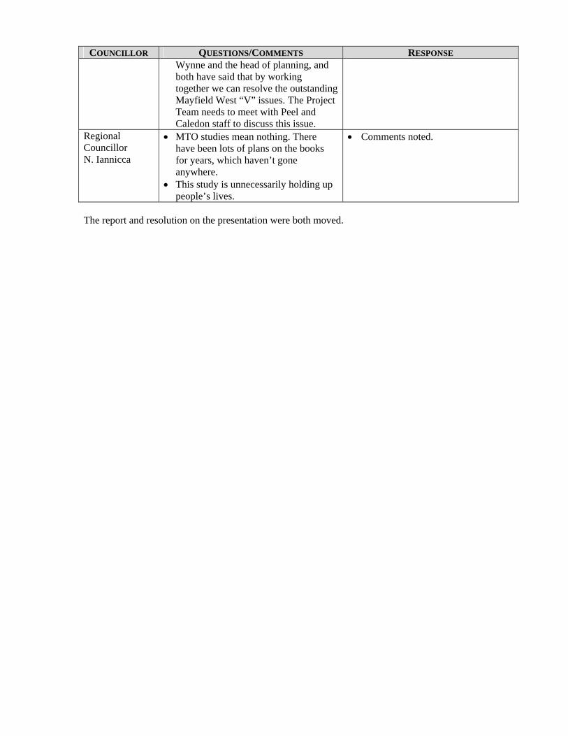
COUNCILLOR QUESTIONS/COMMENTS RESPONSE
Wynne and the head of planning, and both have said that by working together we can resolve the outstanding Mayfield West “V” issues. The Project Team needs to meet with Peel and Caledon staff to discuss this issue.
Regional Councillor N. Iannicca
MTO studies mean nothing. There have been lots of plans on the books for years, which haven’t gone anywhere.
This study is unnecessarily holding up people’s lives.
Comments noted.
The report and resolution on the presentation were both moved.

McCORMICK RANKIN
CORPORATION
2655 North Sheridan Way Mississauga, Ontario, L5K 2P8
Tel: (905)823-8500 Fax: (905) 823-8503 E-mail: [email protected]
Website: www.mrc.ca
MINUTES OF MEETING
PROJECT: GTA West Transportation Corridor EA Study – Stage 1 PROGRESS MEETING NO: FILE NO.: 6720 DATE: Monday, June 20, 2011 TIME: 9:00 a.m. PLACE: Region of Peel – Caledon Room PRESENT: Sabbir Saiyed
Tina Detaramani Gary Kocialek Sabrina Khan Hitesh Topiwala Chris Duyvestyn David Kuperman Adrian Smith Marta Roias Kant Chawla Jin Wang Frank Pravitz Fabio Saccon Rina Kulathinal Aimee-Rose Tupaz Astrid Poei Mike Bricks Neil Ahmed
PURPOSE: A follow-up discussion to the recent presentations regarding the MTO Draft Transportation Development Strategy, the Preliminary Route Planning Study Area and related input submitted by municipalities to MTO.
PROCEEDINGS:
ACTION BY:
1. Introduction J. Wang opened the meeting with introductions and statement of meeting purpose. It was noted that Mississauga would not be attending however they have provided input through Bob Sasaki and Steve Ganesh already.
Region of Peel Region of Peel Region of Peel Region of Peel Region of Peel City of Brampton City of Brampton City of Brampton City of Brampton Town of Caledon MTO Provincial Planning MTO Provincial Planning MTO Central Region MTO Central Region MTO Central Region MTO Central Region BPE MRC
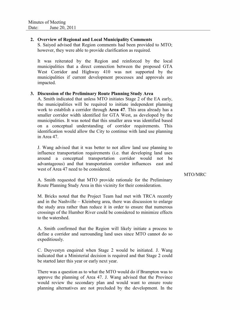
Minutes of Meeting Date: June 20, 2011 2. Overview of Regional and Local Municipality Comments
S. Saiyed advised that Region comments had been provided to MTO; however, they were able to provide clarification as required. It was reiterated by the Region and reinforced by the local municipalities that a direct connection between the proposed GTA West Corridor and Highway 410 was not supported by the municipalities if current development processes and approvals are impacted.
3. Discussion of the Preliminary Route Planning Study Area
A. Smith indicated that unless MTO initiates Stage 2 of the EA early, the municipalities will be required to initiate independent planning work to establish a corridor through Area 47. This area already has a smaller corridor width identified for GTA West, as developed by the municipalities. It was noted that this smaller area was identified based on a conceptual understanding of corridor requirements. This identification would allow the City to continue with land use planning in Area 47. J. Wang advised that it was better to not allow land use planning to influence transportation requirements (i.e. that developing land uses around a conceptual transportation corridor would not be advantageous) and that transportation corridor influences east and west of Area 47 need to be considered. A. Smith requested that MTO provide rationale for the Preliminary Route Planning Study Area in this vicinity for their consideration. M. Bricks noted that the Project Team had met with TRCA recently and in the Nashville – Kleinberg area, there was discussion to enlarge the study area rather than reduce it in order to ensure that numerous crossings of the Humber River could be considered to minimize effects to the watershed. A. Smith confirmed that the Region will likely initiate a process to define a corridor and surrounding land uses since MTO cannot do so expeditiously. C. Duyvestyn enquired when Stage 2 would be initiated. J. Wang indicated that a Ministerial decision is required and that Stage 2 could be started later this year or early next year. There was a question as to what the MTO would do if Brampton was to approve the planning of Area 47. J. Wang advised that the Province would review the secondary plan and would want to ensure route planning alternatives are not precluded by the development. In the
MTO/MRC

Minutes of Meeting Date: June 20, 2011
worst case, MTO could request an OMB Hearing if the plan had significant negative effect on the route planning stage of the EA. It was reiterated that the area at the York-Peel boundary is a challenging one with considerations that include Humber River crossing, CP Rail, High Voltage Hydro One Transmission Corridor, ramp connections with Highway 427 Extension and built development in the area. A smaller study area would severely restrict consideration of alternative routes through this complex area. K. Chawla asked if a joint study could be initiated between MTO and the municipalities to accelerate an outcome in this area. M. Bricks indicated that alternative delivery methods had been considered however it is expected that no other approach is appropriate. Attention turned to the HP-BATS corridor. J. Wang noted that MTO is recommending only limited ramp moves at the connection of GTA West Corridor with Highway 401/407 ETR as that is all that is required for provincial movements if the link west of Milton is also constructed. Again the discussion of an accelerated process was discussed to initiate this corridor earlier than MTO is proposing. It was again advised that no other process is appropriate from MTO’s perspective (for the reasons noted in the paragraph below). An MOU is still being completed for a municipally-directed study to identify a corridor. MTO advised that it would be necessary that a municipal process be firstly successful as an EA and secondly, must meet MTO geometric requirements. There is also the potential that if initiated separately, MOE may see this as “piecemealing”. MTO would be willing to meet with MOE and Municipalities if they wanted to discuss alternative processes. In the vicinity of the Mayfield West Phase I, those developments are being approved municipally and so MTO would have difficulty delaying the start of development. There was discussion about the alternatives that have been considered, which now include options west of Heart Lake Road and also east of Dixie Road. The addition of these would expand the Preliminary Route Planning Study Area in this vicinity so that alternatives could be generated that avoid some of the development north of Mayfield Road. There was also discussion of using Dixie Road as a high order arterial connection between GTA West Corridor and Highway 410. There is currently an EA underway for widening Dixie Road in this area. The Bramwest Parkway is being progressed by the City of Brampton through a Transportation Master Plan that is still to begin. MTO will be
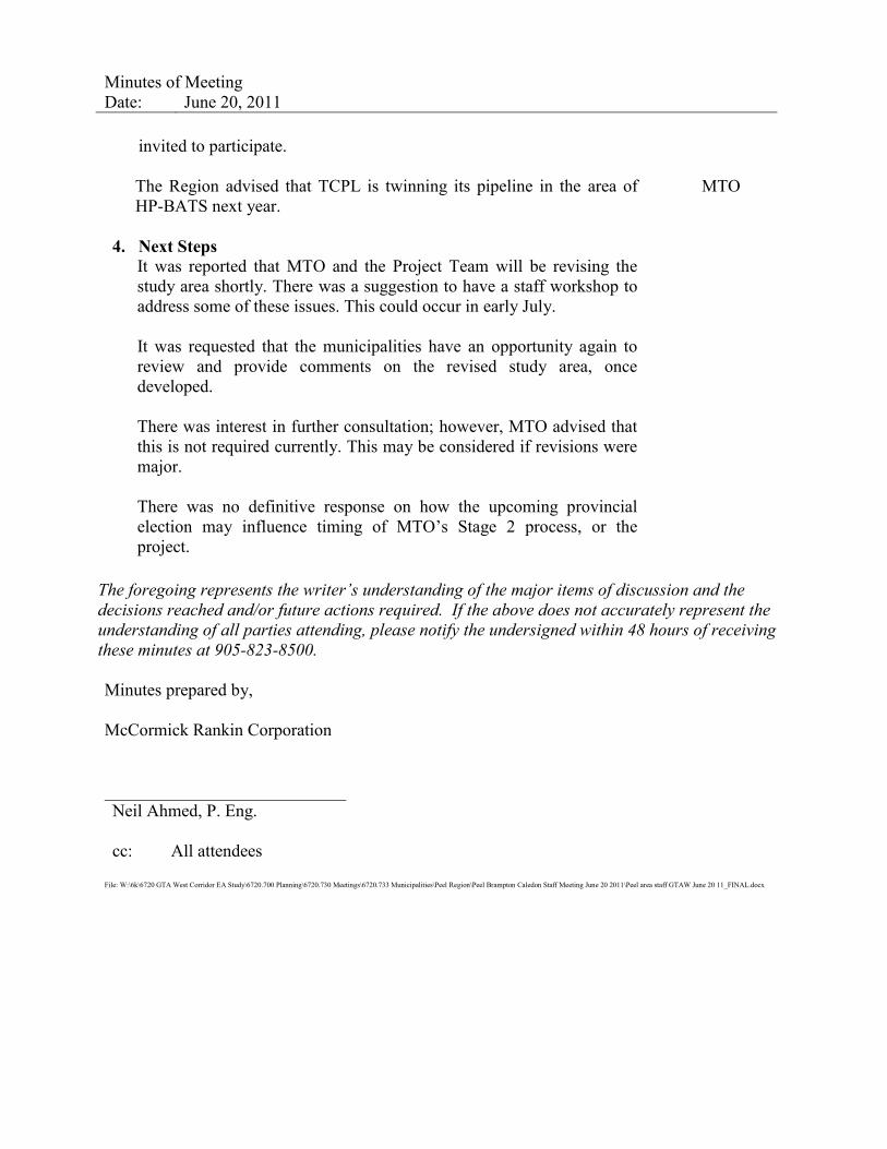
Minutes of Meeting Date: June 20, 2011
invited to participate. The Region advised that TCPL is twinning its pipeline in the area of HP-BATS next year.
4. Next Steps
It was reported that MTO and the Project Team will be revising the study area shortly. There was a suggestion to have a staff workshop to address some of these issues. This could occur in early July. It was requested that the municipalities have an opportunity again to review and provide comments on the revised study area, once developed. There was interest in further consultation; however, MTO advised that this is not required currently. This may be considered if revisions were major. There was no definitive response on how the upcoming provincial election may influence timing of MTO’s Stage 2 process, or the project.
MTO
The foregoing represents the writer’s understanding of the major items of discussion and the decisions reached and/or future actions required. If the above does not accurately represent the understanding of all parties attending, please notify the undersigned within 48 hours of receiving these minutes at 905-823-8500. Minutes prepared by, McCormick Rankin Corporation Neil Ahmed, P. Eng. cc: All attendees
File: W:\6k\6720 GTA West Corridor EA Study\6720.700 Planning\6720.730 Meetings\6720.733 Municipalities\Peel Region\Peel Brampton Caledon Staff Meeting June 20 2011\Peel area staff GTAW June 20 11_FINAL.docx
2655 North Sheridan Way Mississauga, Ontario L5K 2P8
Tel: (905) 829-4988 Fax: (905) 823-2669
E-mail: [email protected] Website: www.ecoplans.com
MINUTES OF MEETING
PROJECT: GTA West Corridor Environmental Assessment
MEETING: Meeting with Town of Caledon Staff
FILE NO.: 06-3184
DATE: November 2, 2011 TIME: 1:30 p.m.
PLACE: Town of Caledon, Committee Room
PRESENT: Jin Wang Joe Perrotta Joe Tsui Rina Kulathinal Steve Ganesh Haiqing Xu Kathie Kurtz Kant Chawla Tim Sorochinsky Jim Dyment Neil Ahmed Catherine Christiani
MTO Provincial Planning MTO Provincial Planning MTO Provincial Planning MTO Central Region Region of Peel Town of Caledon Town of Caledon Town of Caledon URS Meridian Planning MRC Ecoplans Limited
PURPOSE: The purpose of the meeting was to further discuss the integration of the GTA West Corridor and development planning in the Town – particularly, South Albion-Bolton area, and Mayfield West Phases 1 and 2. The meeting was in follow-up to a meeting held on May 16, 2011.
ITEM PROCEEDINGS: ACTION BY:
1.0
Introductions and Study Update
1.1 Those at the meeting were introduced.
1.2 K. Chawla reviewed the meeting agenda and noted that this meeting was in follow-up to a meeting held with the GTA West Project Team on May 16, 2011. The Town would like an update on the Project Team’s work in the Town’s key planning areas of interest, and the work being done in order to resolve linkages between highway 410 and the potential GTA West Corridor. Town is also keen to understand as to how MTO/Project team is addressing town’s concerns as expressed during the last follow-up meeting.
1.3 J. Wang provided a study update. The following items were noted: The Project Team received a lot of input on the Draft Transportation
Development Strategy (TDS), particularly from the Halton area. In response to the input received on the Draft TDS Report regarding
the proposed transportation improvements in the Halton area, MTO decided to carry out additional analysis and consultation to further
GTA West Corridor Environmental Assessment Page 2 Notes of Town of Caledon Staff Meeting – November 2, 2011
ITEM PROCEEDINGS: ACTION BY:
examine the recommendations in that area. The additional work will be carried out over the fall and winter and is
expected to be completed by spring 2012. The work will focus on further examining the benefits and impacts of both a potential new transportation corridor through the Town of Halton Hills and potential improvements to the Highway 401 corridor.
MTO will consult with all stakeholders on the results of the additional work before any decision on next steps is taken; this consultation may include PICs in Halton.
The Draft TDS will be finalized after the additional analysis is complete.
The project website has been updated with the new direction. The Project Team is still open to receiving comments on the Draft
TDS until it is finalized. 1.4 K. Chawla asked the Project Team to outline how completing the additional
analysis has affected the overall project schedule. J. Wang clarified that originally the Draft TDS was scheduled to be finalized by the end of 2011, however now that additional work is being completed, scheduled completion is approximately late spring 2012.
2.0 Discussion on Areas of Concern
2.1 N. Ahmed presented using a hand-out, which included updated mapping in the South Albion-Bolton area, outlined the constraints in the Caledon area, and conceptual Highway 410 connection alternatives.
2.2 The following outlines the key points raised during the presentation and discussion:
2.2.1 The Town of Caledon asked the Project Team to clarify the amount of South Albion-Bolton lands that are located in the Preliminary Route Planning Study Area, as shown in red hatching on Slide 6 of the presentation. The Project Team indicated that the red hatching equals approximately 53.5ha (132 acres) of land.
2.2.2 S. Ganesh indicated that the Region of Peel is currently working on a Class EA for the widening of Mayfield Road to 6 lanes, from Chinguacousy Road to Heart Lake Road. A briefing about the project was recently provided to Mayor Morrison and Councillor Thompson. S. Ganesh asked if their EA team could use the map on Slide 6 of the presentation (depicting the South Albion-Bolton urban expansion area within the GTA West Preliminary Route Planning Study Area) on display panels at their upcoming PIC. J. Wang indicated that the Project Team can provide him with the map, however the property fabric background would need to be removed so that the image is more conceptual. S. Ganesh indicated that the Region will highlight the area as “Under Review by the GTA West Corridor Study”.
Project Team / Region of Peel
2.2.3 The Town of Caledon asked why the Preliminary Route Planning Study Area cannot be changed in the South Albion-Bolton area. N. Ahmed indicated that due to the constraints outlined on Slide 7, the study area boundaries need to be maintained in that area.
2.2.4 H. Xu indicated that the Town of Caledon is currently updating their Official Plan, and will be including in the Plan urban area designations up to 2031. H.

GTA West Corridor Environmental Assessment Page 3 Notes of Town of Caledon Staff Meeting – November 2, 2011
ITEM PROCEEDINGS: ACTION BY:
Xu asked if an alignment of the GTA West corridor will be known by 2021. The Project Team indicated that it is hoped that a future alignment will be known before then.
2.2.5 H. Xu mentioned that the Town of Caledon may consider the phased release of lands in the South Albion-Bolton area, however if they do, they will need to know exactly when the corridor alignment will be known. The lands may be controlled to keep development away until the corridor alignment is known, however they don’t want to be perceived as holding the lands. J. Wang indicated that the corridor alignment will not be known until Stage 2 of the EA process is complete (Route Planning and Preliminary Design). Stage 2 of the EA will take 5-7 years to complete (including EA approval), once it has been initiated. The preferred alignment will be determined within the 5-7 year period.
2.2.6 The Town of Caledon asked if the Project Team would accept the City of Vaughan imposing a holding symbol on lands needed for the corridor. J. Wang and J. Perrotta indicated that OPA 637 includes policies that require clearance from the Province before development applications can be approved within the protected area, which is consistent with a recent OMB decision on the area.. MTO would prefer that similar issues be addressed and resolved through discussions such as meetings like the one held today, instead of going to the OMB.
2.2.7 The Town of Caledon indicated that at present there are chiefly three planning areas in the Town which are at advanced stages of planning and Mayfield West 1 is already an approved secondary plan area. Town is concerned that any impacts caused to these planning areas would affect the economic/fiscal viability and the long-term sustainability of the Town. There are immense development pressures and the Town will be processing any received development applications in this approved planning area of Mayfield West 1 as appropriate. Staff further reiterated that integrating Highway 410 with the potential GTA West Corridor through the approved lands is not supported by the Town and may not be an option. It was suggested that MTO explore other reasonable options. Regarding Mayfield West 2, staff advised that Town Council has endorsed a preferred land use concept located south of Etobicoke Creek.
2.2.8 The Town of Caledon asked how the Project Team is working with regions/municipalities on EA’s in the area. J. Wang indicated that the team does not want to impede works in the area. The Project Team has engaged in extensive consultation to inform stakeholders of the status of the project. All planned regional and municipal transportation infrastructure projects have been incorporated into the project’s modelling for demand forecasting.
2.2.9 K. Chawla stressed that the potential arterial connection within Peel (Brampton’s SP47 area) established through Peel-Highway 427 TMP study process integrating with Highway 427 Extension should be appropriately depicted on the project mapping.
2.2.10 In Slide 11, it appears the City of Brampton has attempted to protect lands for the GTA West corridor in their SP 47. The Town of Caledon asked if this is an example of something MTO would like to see in other municipalities’ Official Plans. MTO indicated that the Brampton mapping is one example of how MTO has worked with a municipality to incorporate their respective responsibilities. MTO would prefer that the corridor protection area not be
GTA West Corridor Environmental Assessment Page 4 Notes of Town of Caledon Staff Meeting – November 2, 2011
ITEM PROCEEDINGS: ACTION BY:
designated if they are currently rural. Where lands have already been designated for urban development, the Brampton mapping is one possible way to depict the corridor in secondary plans.
2.2.11 K. Chawla noted that not a lot has changed in the Caledon area and the Town’s concerns/issues have not been addressed since the 1st follow-up meeting held on May 16, 2011 between Caledon staff and the Project Team. Additionally, in order to provide better linkages between Highway 410 & GTA West Corridor and also to minimize impacts on town’s planning areas. The Town’s position has not changed since the release of the Draft TDS – they believe Highway 10 needs to be strengthened as a highway to highway connection and Dixie Road needs to be considered and augmented for providing additional capacity. The town staff stressed that in keeping with these concerns, MTO should modify the preliminary study area as appropriate. The Project Team acknowledged the Town’s position, but explained that they need to accommodate all possible options. The “V” was an early concept which the team is considering expanding to a “U” in order to accommodate the extension of Highway 410 into Highway 10 and consideration of Dixie Road. K.Chawla again reiterated that with the given concerns the project team should consider and examine reasonable options.
2.2.12 K. Chawla indicated that the Town was hoping the “V” would be removed from the study area, and not reshaped. Expanding the “V” to a “U” may not be taken well at Town Council or Senior Management. J. Wang and N. Ahmed indicated that because of the constraints outlined in the presentation, it would be inappropriate to remove the “V” area for examining the 410 connection.
2.2.13 The Town of Caledon indicated that they are proceeding with the development approval process for all received applications in the “V” area as the lands encompassing the ‘V’ are approved development lands within Mayfield West 1. MTO indicated that they understand the Town’s perspective, and also stressed the need to consider options to ensure the integrity of the EA.
2.2.14 Town staff suggested moving the Highway 410 extension to east of Dixie Road. The Project Team noted the suggestion, and re-iterated that a variety of alternatives will be considered and evaluated including the Dixie Road corridor.
2.2.15 The Town of Caledon noted that reasonable alternatives need to be considered and the Town does not believe that including approved lands within “V” in the study area is reasonable. The Project Team explained that they have reviewed and considered the Town’s concerns and have looked at a number of conceptual alignment alternatives (shown in Slides 14 to 17) so that there will be more opportunities to minimize the impact to development lands as well as to natural features and communities. In order to include these options for the route planning EA, the Project Team is planning to broaden the area for a 410 connection (i.e. expanding the “V” into a “U” shape). The Project Team requested that Caledon staff communicate this to Town Council and Senior Management.
Town of Caledon
2.2.16 K. Chawla suggested to consider lowering the “V” so that it begins further south, in Brampton or explore other creative solutions which minimizes the impacts on Caledon’s approved development area. The Project Team noted that lands in Brampton (south of Mayfield Road) are either built up or have been draft approved for subdivision (at 410, south of Mayfield Road).
2.2.17 The Project Team noted that there are conceptual Highway 410 Connection
GTA West Corridor Environmental Assessment Page 5 Notes of Town of Caledon Staff Meeting – November 2, 2011
ITEM PROCEEDINGS: ACTION BY:
alternatives outside of the “V” area, ex. Concept 6 in the presentation package. The Town of Caledon noted that they will review the conceptual connections provided with their land use planners.
2.2.18 The Project Team reiterated that they need to maintain a range of possible alternatives for the Highway 410 connection including considering an alternative that is up to freeway-to-freeway standard. Upgrading the current Highway 410 to Highway 10 connection would be substandard and would ultimately have poor long-term effects on the Caledon/Peel residents using it. Town staff felt that MTO should examine all other options which are reasonable.
2.2.19 The Town of Caledon asked if a meeting had been held with the developers/landowners in the Highway 410/Mayfield area. The Project Team noted that if a meeting is requested, they could accommodate it. In the meantime, the Team is working on responding to their written comments submitted on the Draft TDS.
2.2.20 S. Ganesh asked if the Town of Caledon’s areas of interest could be considered for additional analysis, similar to what is being done in the Halton area. The Project Team noted that there is a difference in the issues, as the Team is looking to further evaluate corridor options in Halton whereas in Caledon the issues are route related and need to be addressed in Stage 2 of the EA.
2.2.21 The Town of Caledon asked if design work (Stage 2 of the EA) could be accelerated in the Caledon area. The Project Team indicated that there are multiple pinch point areas within the current Preliminary Route Planning Study Area (as shown on Slide 3). MTO will be considering accelerating the planning in these areas during Stage 2 of the EA.
2.2.22 The Project Team noted that a workshop/education session with Caledon Senior Management and/or Council may be a helpful forum. The Town will consider having such a meeting.
2.2.23 Town of Caledon staff requested clarification as to why the Preliminary Route Planning Study Area needs to be extended further into the Mayfield West Phase 2 lands (around Mayfield Road and McLaughlin Road). The Project Team clarified that while the options in the north avoid the proposed developments, they would potentially have higher impact on the creek system based on the natural environmental constraint data. This was discussed and confirmed with the Credit Valley Conservation Authority, who indicated a route alternative that avoids crossing as many arms of the sensitive creek system would be preferred. The Town of Caledon questioned the significance of these lands in comparison to the extensive Greenbelt impacts anticipated in Vaughan. The planning of these lands is at advanced stages and the development lands are needed by Caledon for their future fiscal sustainability and economic development. The project team should examine ways to mitigate impacts on environmental features and balance land use planning objectives.
2.2.24 The Town of Caledon noted that they want the GTA West Corridor EA to be successful; however some lands that will be potentially impacted by the study could have large impacts on the economic future of the Town and how they plan their growth. The Town doesn’t feel like their interests are being understood by the Project Team. MTO acknowledged that the Town’s concerns are understood, however they need to consider all of the interests in the area (natural environment, economic, cultural, and social).
Town of Caledon
GTA West Corridor Environmental Assessment Page 6 Notes of Town of Caledon Staff Meeting – November 2, 2011
ITEM PROCEEDINGS: ACTION BY:
3.0 What’s Next
3.1 MTO thanked attendees for their participation. Any further comments or questions were encouraged to be submitted to the Project Team.
3.2 The Town of Caledon requested that a copy of the draft meeting minutes be circulated to them for review before they are finalized.
Ecoplans
The meeting adjourned at 3:50 p.m.
The foregoing represents the writer’s understanding of the major items of discussion and the decisions reached and/or future actions required. If the above does not accurately represent the understanding of all parties attending, please notify the undersigned within 48 hours of receiving these minutes at 905-823-8500.
Minutes Prepared by: Ecoplans Limited Catherine Christiani
cc: Attendees
APPENDIX E OTHER AGENCY TECHNICAL MEETING
SUMMARY NOTES

Minutes of Meeting
PLEASE NOTE: If your records of this meeting do not agree with this document, or if there are any omissions, please advise the writer at once, otherwise the contents of this document shall be assumed accurate and correct.
URS Canada Inc. 75 Commerce Valley Drive East Markham, ON Canada L3T 7N9 Tel: 905.882.4401 Fax: 905.882.4399 www.urs.ca
Project: GTA West Corridor EA Study Meeting No. 01
Date: December 15, 2008
Location: 2111 Steeles Avenue West, Bramalea Time: 10:00-12:00 AM
Purpose: Identification of Problems & Opportunities – Ontario Chamber of Commerce
Present: – Policy Analyst, Ontario Chamber of Commerce (OCC)
– International Trade Consultant, OCC – Chair, Borders, Transportation & Infrastructure
Committee, OCC – President & CEO, Caledon Chamber of Commerce
– Secretary, Halton Hills Chamber of Commerce – Senior Policy Advisor, Brampton Board of Trade
– President & CEO, John C. Munro Hamilton International Airport
Pat Griepsma (PG) – Planner, Ministry of Transportation Mike Delsey (MD) – Vice-President, AECOM Christine Darson (CD) – Environmental Planner, URS
Description Question/ Response
By:
MD reviewed the project history and Study Area
Topic 1:
The Preliminary Study Area is extensive. In Caledon the municipal planning process is not moving forward because the City is waiting for the results of this study.
The Ministry does not have the legal authority to freeze development in an area without formal EA approval. However, we are working with municipalities to ensure that their land use planning does not preclude a future GTA West transportation corridor. Mr. Jin Wang is the MTO Project Coordinator who is dealing with these issues.
KD
MD
Topic 2:
Will the Environmental Assessment (EA) further narrow the limits of the Preliminary Study Area?
KD
Page 2
URS Canada Inc. 75 Commerce Valley Drive East Markham, ON Canada L3T 7N9 Tel: 905.882.4401 Fax: 905.882.4399 www.urs.ca
Description Question/ Response
By:
The EA process is a long one. Initially the Terms of Reference (ToR) was released, and subsequent project steps were postponed to coordinate the GTA West Study with the Metrolinx Study. We are currently investigating existing and future Problems and Opportunities within the Preliminary Study Area, and it will be some time before we can further narrow the Study Area. Possible solutions to transportation issues can be either road or rail based for example, or may take the form of a multimodal solution. Currently there is no freeway planned, but we are open-minded.
MD
Topic 3:
I have members who are losing money on a daily basis because of the delays caused by this study. How can we work together to fix this?
Timelines are too long - we need to adjust the EA process to ensure shorter timelines. The current timelines are not acceptable. This project will tie up the community for far too long.
The Ontario Chamber of Commerce has an existing policy process, but we should be more proactive. The OOC is in the process of creating a taskforce to deal with this issue more specifically.
MTO is carrying out a broad study and we are involved with many stakeholders such as GO Transit, VIA Rail, and others. We have to consider the environment and take this to the politicians who will ultimately make funding decisions. This takes time.
We appreciate your situation. I think the taskforce will push the timing issue. The current framework takes too long and is probably more costly then it needs to be.
We will speak to (VP of Policy and Government Relations, Ontario Chamber of Commerce) about this.
KD
RK
SM
PG
RK
BA
Topic 4:
I have heard a lot about pinch points. How are they decided on? Do politicians, the public, or lobby groups decide on which areas are identified as pinch points? Being able to identify where the pinch points are located within the Study Area would be very beneficial to me and my members. For people looking at investing in Caledon, being able to show them where within the Study Area the pinch points are located would be a tremendous advantage. Will anything be released with this information?
We are working with various municipalities to identify these pinch points. This
KD
MD

Page 3
URS Canada Inc. 75 Commerce Valley Drive East Markham, ON Canada L3T 7N9 Tel: 905.882.4401 Fax: 905.882.4399 www.urs.ca
Description Question/ Response
By:information has not been shared with the public as of yet because we feel to do so at this point is premature.
If the pinch points have already been identified, then should the municipality freeze the surrounding areas? Does the province require it?
The local municipalities can freeze these lands if they feel it necessary. The province is currently working with the municipalities on this issue
KD
PG
Topic 5:
In Caledon, no land use planning has happened. Do the pinch points conform to the Places to Grow Act?
Certainly. If all municipalities conformed to Places to Grow, it would be much easier to draft future policies and plans. We need to identify economic centres and growth areas. We are proceeding with the best and most complete information available to us. If anything new is learned, we will incorporate it into this study. We will be out in January meeting with Councils and our Public Information Centre will be held mid to late February. We will take your concerns back to the Study Team.
KD
MD
Topic 6:
I understand Metrolinx is carrying out a goods movement study. There is a great amount of traffic which originates in Quebec and goes through our east-west corridor. We need to control this. Is anyone dealing with this issue?
When we undertake forecasts, we look at movement throughout the southern Ontario region all the way to the United States. We treat the region as a gateway into our Study Area. We are incorporating the Metrolinx Study into our project.
Has Metrolinx incorporated your study in their projections?
No they have not. We have slowed the pace of our study to incorporate their findings. We have created a 15 to 20 year plan, and we are using the same forecast information. We are pleased about the Metrolinx Study because the more information the better.
MTO needs to fund the Metrolinx Study or with them more to get more information to work with.
I am not positive who is working with Metrolinx, but I imagine it is Rob Tardiff of the Ministry of Transportation. We will follow up on it.
RK
PG
RK
MD
RK
PG
Page 4
URS Canada Inc. 75 Commerce Valley Drive East Markham, ON Canada L3T 7N9 Tel: 905.882.4401 Fax: 905.882.4399 www.urs.ca
Description Question/ Response
By:
Appreciated. There has to be some information on how the GTA West Study will fit into the over all picture.
We need information on how everything ties together.
While the Gateway Study looks at cross provincial issues, the GTA West Study looks at how to best link southern Ontario to the United States. There is no master strategy which exists to link all our studies. Logistically speaking, since this is such a large area we need to look at smaller chunks and have each study proceed.
To undertake an EA which looked at the entire area it would be a very long process. We realize that the GTA West Study will take 3 to 5 years to get through the first part of the EA process. A study that large would take much longer. We recognize that due to increasing development pressures we are in a race against time.
RK
RK
MD
PG
Topic 7:
The Ontario Chamber of Commerce will be in touch in regards to setting up the transit and infrastructure taskforce.
SM
Submitted by: C. Darson
Distribution: P. Griepsma, MTO
B. Patkowski, URS M. Delsey, AECOM
, OCC (to distribute to members)


Niagara Escarpment Commission Board Meeting 232 Guelph Street, Georgetown
Niagara to GTA and GTA West Joint Presentation – Summary Notes
Thursday, January 21, 2010 10:00 – 11:30
Questions from the NEC Board Members: 1) Transit Assumptions
Allan Elgar (AE) – how did you decide on 0% increase for transit cost assumptions?
Jin Wang (JW): looking at longer term tradeoffs between auto and transit use and the magnitude of tradeoffs. We assumed a 200% increase in auto costs while transit fare remains the same – looking at shifting use between driving and transit in relative terms.
2) Modal Split
AE: from 1990 to 2000, do you have data on the modal split? It has been stuck at 5% for the last 20 years, modal split has not moved. The tax base doesn’t allow us to increase transit use for where we are today; concerned that using a false transit assumption in modeling will skew everything
JW: we are using bold assumptions for transit. We recognize there is a risk in making those assumptions. The Metrolinx RTP total cost is $50 Billion, not all of funding is committed. We need to take a balanced approach, which will include assessing the need for new corridors. We do have the technical capabilities in the modeling to test other assumptions as sensitivity test.
3) Air Quality AE: Do you also have models to prove that Air Quality will improve by 2031?
JW: We have models that can predict air pollution and greenhouse gas emission and for the next stage of the study we will review this on a regional basis, but not at local level.
4) Unrealistic Transit Costs
): Comment - There is no advantage to the cause of transit 1st that cost of transit in 2031 stays the same; people see it as unrealistic, thinking that your Group 3 options are what you really want. By doing this you may be undermining your own strategy. The public is getting the message that Groups 3 and 4 options is what they are getting all along. Your assumption really is saying that the cost of driving is going to increase four times higher than the cost of taking transit. That’s what you should say, otherwise the public won’t understand the way it’s presented.
5) 407 ETR GTAW Groups 3 and 4 shows one of the core links being the 407. The 401 is the most used
highway in North America; the 407 the most underused; so if you want to widen the 407 who will pay for that – the Spanish group? I think not! Building a new highway further north of 407 will be better for truck traffic.
JW: We’ve heard comments about the under use of 407. We will look at better ways of optimizing 407 while considering the legal agreement between the government and the 407ETR; e.g., we will be looking at ways to increase the use of trucks on 407 as well as car traffic.
With respect to the cost of 407ETR widening – again, we are working under the existing policy framework and legal agreement. We will consider the net cost of widening sections of 407 in the
Confidential – draft version Page 1 12/8/2010
analysis, but will not consider the cost of taking back the 407 as a reasonable option. With respect to “who pays for widening the 407”, more discussions are needed.
: it’s tragic if in 2031, we’ll have a heavily used highway north of the 407 and a heavily traveled
highway south of the 407 but not ON the 407. 6) NGTA New Roads
: Previous versions of Group 3’s for the NGTA showed a highway 406 link to Fort Erie. Is there a new code for that e.g., QEW to somewhere? There is much vaguer language and no maps for Group 4s for the current NGTA Study – what’s the code for these? Paul Hudspith (PH): The GTAW Study Area has more confined geography and land use, therefore it’s easier to map out and define new corridors; NGTA is more open and less defined, harder to find new corridors that are defendable. If they are shown on maps at this point, they will be in the public mind before being able to be properly assessed. All previous new corridor alternatives are on the table and being assessed and there will be interesting tradeoffs.
: Comment - The emphasis on the QEW for the NGTA, tells me that the NEC and Greenbelt are
being acknowledged. 7) PICs
): Asking about a recent ad for a PIC at the end of January to discuss alternatives as part of the process (for Hamilton, Niagara Falls, and Grimsby). Roger Ward (RW): That is for GO transit. NGTA PICs are being planned for later in 2010.
: What’s the difference between PIC 4 and upcoming PIC as stated in the package?
RW: The package that you are reefing to was prepared in advance of PIC 3 so the upcoming PIC is in reference to PIC 3.
9) Link between Widening the QEW and GO
: Group 3 widening of QEW to 6 lanes between Hamilton and Niagara and 2 in St. Catharines – where’s the link be between widening the QEW and the GO?
RW Widening of the QEW from Hamilton area to Niagara Falls is 2 lanes with 6 lanes existing and the 2 new ones being HOV lanes. The majority of congestion is in the Burlington Skyway area, and exactly where the transition is will be determined during later stages.
: As a resident in that area, it’s interesting how would you get those additional lanes?
RW: That would vary depending on the location. In some areas the existing ROW can accommodate additional lanes but around the Skyway and Hamilton we would need to acquire additional property. Highway projects that are recommended would go through the regular process of funding availability and prioritization with other MTO projects and would be subject a Class EA process. Right now we are determining a long term strategy and are working closely with Metrolinx and GO, and using the same transportation model.
10) Commuters
: Estimates of 3 million more people in the GTA, so if we retain bedroom commuter communities, the traffic flow in and out of Toronto will only get worse. What is being done by MTO and MAH to change these bedroom communities / commuters into Toronto? If nothing is, then regardless of these studies, we’ll end up with a 12 lane parking lot instead of a 6 lane parking lot.
Confidential – draft version Page 2 12/8/2010

Expected that car ownership costs will increase 200%, however with hybrids, the cost of driving a car will be cheaper than using public transportation. Even if not, there’ll still be lots of cars on the road regardless.
RW: The Growth Plan estimates almost 4 million additional people in the GTHA. It is addressing commuting through more self contained communities higher densities and more transit.
Need people to work where they live.
RW: Existing communities are already in place so the commuting issue will continue to exist, although we need to make transit more attractive, and enhance the complete communities’ ideas through future developments, but there are still going to be an additional 4 million people living in the area and some of those will also need to make commuter trips.
We have been criticized for not considering European like gas prices or Peak Oil, opposite to what you are suggesting with automobile pricing reducing in the future. We’ve done sensitivity analysis of moving people from cars to transit and incorporating the results of the Metrolinx studies. This sensitivity analysis provides us with confidence in the results of the modeling.
11) TDM
: I am glad to see that TDM is being taken seriously and some charts show that but it’s not being treated with the methodology that is intended. Did you include my submission from the last PIC?
On p. 14 TDM and TSM are shown to have the greatest impact in urban areas. It’s the entire system that has to be studied. What about the statement by Metrolinx about managing organizations to reduce single car drivers by organizing van pools, etc.? TDM and TSM needs to be addressed in more detail.
PH: Yes, we have received your letter and further work is continuing to be done by the study team, including a teleconference this afternoon with the US experts on our study team.
12) Forcing Transit Use through Congestion
Shawn Davidson: The QEW to Hamilton/403 will create substantial environmental impacts. If we really want to force people to take transit we need to get the system so congested like in the USA, but we won’t let that happen because of trucks, goods and services results in impacts to our economy.
Are there other considerations beside a new 406/QEW/427 or QEW to Oakville? Would a bridge across Lake Ontario not be more financially feasible with fewer environmental impacts, like footprints in the Greenbelt? To connect 2 million people with 6 million people, taking people off the congested Skyway and spending $15 Billion on roads, makes a bridge more economical.
PH: Yes, we have looked at that, however, travel patterns don’t all go to from St. Catharines downtown Toronto or even the GTA. It starts to make more sense, cutting the corner just near the Burlington Skyway.
13) GHG Emissions Richard Paterak (RP): in widening versus other Groups, have you modeled GHG emissions?
JW: not yet… we will carry out GHG emission analysis and will be presenting those results at the next PIC.
Confidential – draft version Page 3 12/8/2010

14) Deferring Truck Traffic to Night RP: California is deferring truck traffic from day to night. Are we doing that on 401 or 400? We are overwhelmed with goods movement, and there is lots of opportunity for night driving capacity. Just-in-Time delivery uses the highway to store goods, therefore we need to look at this not only for capacity but also to reduce trucks. Smaller trucks, smaller warehouses, night movement; has that been considered?
PH: We’ve had consultation and workshops on all these considerations. However, our projects need to work within the policies as they exist today. Also, there economic focus / competitive environment support Just in Time delivery.
JW: We could say as we conclude our studies that these improvements are based on current policy framework and we could recommend that some policy changes should be considered. But realistically we have to recognize that those policy changes are beyond the scope of our study and now we’re working under the current policy environment.
15) Impacts of Widening Existing Infrastructure
: I disagree that widening of existing infrastructure leads to little impact. Also need to address indirect impacts for each additional lane of the QEW. Regional Road 20 is a corridor and the region worked for decades to maintain a gap between Welland and Fonthill. The highway, GO transit, hydro corridors should all go to the south to get out of the Escarpment further. PH: The intent was to state that, generally speaking, widening an existing corridor usually has fewer impacts, relatively speaking, to a new corridor on previously undisturbed lands.
16) Highway 20 / 5
: Have you seen the Highway 20 (not Red Hill Creek) Study? Please make note that an Escarpment crossing at 50 Road is not suitable except for development / traffic that is already there.
RW: Yes, we are aware of the study.
: Comment - I am concerned that if you widen 50 Road to QEW, there is a huge potential to
impact the Niagara Escarpment, and between 406 and now the Red Hill Creek Expressway too. Make sure it’s not impacted.
- o -
Confidential – draft version Page 4 12/8/2010
Confidential – draft version Page 5 12/8/2010
NEC Members Present
Chair PUBLIC at LARGE Representatives
MUNICPAL Representatives David Baldwin Dufferin County Tom Boyle Bruce County Shawn Davidson Simcoe County Allan Elgar Halton Region Lloyd Ferguson City of Hamilton Richard Paterak Peel Region Wally Reif Grey County


McCORMICK RANKINMcCORMICK RANKINMcCORMICK RANKINMcCORMICK RANKIN
CORPORATION
2655 North Sheridan Way
Mississauga, Ontario, L5K 2P8
Tel: (905)823-8500
Fax: (905) 823-8503
E-mail: [email protected]
Website: www.mrc.ca
MINUTES OF MEETING #2
PROJECT: GTA West Corridor EA Stage 1
Assignment No. 2006-P-055675
FILE NO.: W.O. 6720
DATE: Wednesday, February 24, 2010 TIME: 11:00 a.m. – 12:15 p.m.
PLACE: Teleconference
PRESENT: Jin Wang
Frank Pravitz
Joe Perrotta
John Slobodzian
Chris Papatolis
Linda Fisher
Sharon Lithwick
Dave Smith
John Sabiston
Ankur Dewan
Rami Migally
Samir Adkar
Jim Dyment
Neil Ahmed
MTO – Provincial Planning Office
MTO – Provincial Planning Office
MTO – Provincial Planning Office
MTO – Environmental Policy Office
MTO – Planning & Environmental Office (CR)
MTO – Planning & Environmental Office (CR)
Hydro One
Hydro One
Hydro One
Hydro One
Ontario Power Authority
MEI
Meridian Planning
MRC
PURPOSE: To further discuss coordination opportunities between the GTA West Study and
prospective Hydro Corridor study as per the issued agenda.
PROCEEDINGS: ACTION BY:
This meeting was arranged to follow up on the meeting of February 9, 2010, to
discuss policy issues, action items and aspects of moving forward with a hydro
EA component. It was noted that additional MTO staff were on the call to
support the EA perspective. It was also noted that Brian McCormick nor Mike
Bricks could participate
1. Business Arising from Previous Meeting (February 9, 2010)
Action items from the previous meeting were not discussed. Those
items were the topic of this meeting.
There were not comments on the previous minutes.
2. Update from Hydro One/OPA
J. Sabiston advised that Hydro One is supportive of a joint effort to
proceed together with a new transportation corridor for GTAW and a
new hydro tower corridor for Hydro One. Their view is that a joint

Minutes of Meeting Page 2 of 6
Date: February 24, 2010
PROCEEDINGS: ACTION BY:
effort will provide the best chance for success. The alternative –
separate EA processes would likely be poorly received by the public.
While this has been raised with senior management at Hydro One and is
getting support, there is no process currently to prepare a letter of
endorsement as had been discussed previously.
J. Sabiston confirmed that a new hydro corridor would likely be
implemented through 2 study processes to reduce the length to be <50
km which requires only a Class EA process and not an Individual EA.
The limits would be Kleinberg Substation to the Halton-Peel boundary
and another corridor possibly extending west to Guelph. Hydro One
would be interested in integrating only the East-West section of the
corridor since they already have a process underway to integrate with
the Halton-Peel BATS corridor. Although the hydro corridor may not
be constructed for a decade, a Class EA would likely accommodate
their requirements (i.e. no “lapse of time” issue).
J. Slobodzian was advised that the hydro EA could be accommodated in
an Individual EA process as an alternative.
There was discussion regarding the potential differences in geography
that may result with the two linear corridors. It was agreed that while
there are areas where a combined corridor is likely, there may be other
areas where the corridors may separate.
With regard to the GTAW new transportation corridor alternatives, J.
Sabiston indicated that whereas Alternatives 4-4 or 4-5 terminating in
Guelph may be desirable for hydro requirements, Alternatives 4-1 or 4-
2 may not be due to their limited length, particularly with 4-2 already in
another planning process (in the north-south section).
There was clarification also that the hydro corridor required 230kV
lines on two tower lines. There is no interest in an easterly corridor to
Highway 400.
3. Update from MEI
S. Adkar reported that MEI is supportive of the coordination concept
but is looking for more information to be provided in order to support
the requirement for such an undertaking.
4. Update from MTO
J. Slobodzian initiated this update indicating that MTO also supports
the concepts of a joint effort, however he envisioned that there is a need
for an effective approach to combine the two facilities in an Individual
EA as a co-proponency. If this is pursued then Hydro One will be
required to address all issues and constraints together with MTO, which
will be a more stringent EA process. There will be EA funding issues

Minutes of Meeting Page 3 of 6
Date: February 24, 2010
PROCEEDINGS: ACTION BY:
also. The EA ToR will also likely be replaced to incorporate both
projects. The previous OPA need and justification work would likely
be introduced into the revised ToR.
With all of the repercussions that may evolve with this change to the
ongoing EA process and the way forward for Hydro One, it would
appear to be a massive Individual EA process. This being stated, it
could offer certain benefits that may reduce impacts to the Greenbelt
and other land uses. It was anticipated that embarking towards a new
ToR would require high level provincial approval.
The above focussed on one option that involved co-proponency
however other options exist. J. Wang highlighted the options raised to
date:
i) fully integrated process with co-proponency, requiring a new ToR;
ii) coordination of 2 separate EA processes running in parallel; and
iii) GTAW EA continues with Hydro One input and involvement as a
stakeholder.
It was MTO’s position that the question must be raised: Does the
Government of Ontario want to pursue a joint-use corridor?
J. Perrotta raised some inherent risks that come with considering the
above options:
i) there are challenges to provide adequate process coordination if
there are two processes;
ii) there are challenges in suitably coordinating with area land use
planning with two separate corridors and implementation processes,
with potential property cost implications;
iii) there would be an overall higher cost to the public in carrying out
two separate parallel EA processes with consultation and
documentation requirements;
iv) timing of incorporating both EA processes could have a bearing on
the timely conclusion of GTAW’s Transportation Development
Strategy in that delays could be expected;
v) there is a possibility that the geography associated with one project
may not be appropriate for both projects;
vi) two parallel processes may be negatively received by local
municipalities or other stakeholders (i.e. double the involvement
and participation); and
vii) the approved GTAW EA ToR could be at risk if a new ToR is
pursued.
J. Perrotta suggested that prior to correspondence being initiated to
Minutes of Meeting Page 4 of 6
Date: February 24, 2010
PROCEEDINGS: ACTION BY:
confirm support by each agency, there should be a coordinated
assessment of risks.
J. Wang provided a summary to this point. He noted that there could be
some significant tangible risks if a co-proponency is pursued. This
could include losing opportunities to address land use pressures.
5. Discussion regarding the Potential Approaches
It was suggested that a working group be formed to consider the risks
and prepare an options paper including an assessment for each
stakeholder agency to consider. Within that role should be the
consideration of legislation similar to the successful Parkway Belt West
Plan that was completed in 1978. That group should provide suitable
information on risks that could be acknowledged by each agency prior
to their signing correspondence establishing that there is a need for a
coordinated EA approach to both projects.
J. Slobodzian suggested that the working group options paper should
include the consideration of legislative opportunities that would include
Minister Zoning Orders as well. A legislative process would supersede
the EA process requirements.
J. Wang noted that a more current tool was provincial Bill 25 that was
passed to amend the Planning Act. Whereas the Parkway Belt West
Plan was a specific undertaking, Bill 25 was more of a process available
as required. The Bill 25 approach would still require EA approval.
Stage 2 of the current EA study process could be modified to
incorporate the Bill 25 approach or other legislative process.
J. Perrotta reiterated that the options paper should focus on the broader
objectives and questions. The details of how a shared corridor is
pursued can be addressed later.
J. Wang noted that in preliminary discussion with MOE EA Branch in
regard to co-proponency, there were no fatal flaws. He also noted that
the GTAW EA was to continue on its current schedule. Any risk
assessment would be carried out in parallel with the ongoing study.
J. Perrotta enquired again about Hydro One’s and OPA’s interest in
pursuing this initiative given all of the risks and challenges raised.
J. Sabiston responded that Hydro One would like to review the GTAW
ToR to determine what modifications would likely be required to
provide co-proponency. He noted that Hydro One understands the
inherent risks as discussed. He acknowledged that there would be an
interest to avoid “throwaway” effort already put into the GTAW study.
They were interested in how a joint ToR would look.
Minutes of Meeting Page 5 of 6
Date: February 24, 2010
PROCEEDINGS: ACTION BY:
R. Migally indicated that from the OPA perspective, they agree with
Hydro One. As in their presentation last meeting, from a review of the
Provincial Policy Statement which appears to support joint corridors,
(PPS Sections 1.6.1, 1.6.5.2, 1.6.6.1, 1.7.1(a)), they would still question
the province’s interest in this particular undertaking given the local
circumstances as discussed.
J. Perrotta suggested the group needs to demonstrate a coordinated
approach through implementation but also needs to consider the risks in
providing that coordination. A most appropriate approach must be
identified.
J. Perrotta clarified that the group would be addressing “coordination of
linear infrastructure planning”. The possibility of full integration of this
infrastructure would consider streamlining the approvals process
through provincial designation. The group should consider this
designation option in risk analysis.
6. Next Steps
J. Wang initiated some closure to the meeting. He indicated should
MTO ‘s preferred alternative include a new corridor, that they should
have a process in place within 2 months and that F. Pravitz will be
assisting in the coordination of this initiative.
It was agreed that the working groups would be kept small and would
include:
− S. Adkar – MEI (tentative pending discussion internally)
− R. Migally – OPA (possibly if appropriate)
− J. Sabiston – Hydro One
− F. Pravitz – MTO (MTO lead and coordination and framing of
options)
Working Group
J. Wang also indicated that MTO Central Region will also likely need to
be involved since they would be the lead in Stage 2 of the current EA
process.
MTO agreed to prepare a draft paper initially and provide it to Hydro
One.
MTO
It was agreed that formal letters of intent were not appropriate yet. The
letters would be a tool to initiate the integration process later.
L. Fisher raised the possibility of other infrastructure in a shared
corridor. Pipelines, park lands and conservation authority lands could
be brought into this process. This possibility exists and should be
considered by the working group.
Minutes of Meeting Page 6 of 6
Date: February 24, 2010
The foregoing represents the writer’s understanding of the major items of discussion and the
decisions reached and/or future actions required. If the above does not accurately represent the
understanding of all parties attending, please notify the undersigned within 48 hours of receiving
these minutes at 905-823-8500.
Minutes prepared by,
McCormick Rankin Corporation
W:\6k\6720 GTA West Corridor EA Study\6720.700 Planning\6720.730 Meetings\6720.739 Regulatory Agencies\OPA Feb 9 10\6720 nfa 24 02 10 mto hydro opa mei_FINAL.doc
Neil Ahmed, P. Eng.
cc: All attending
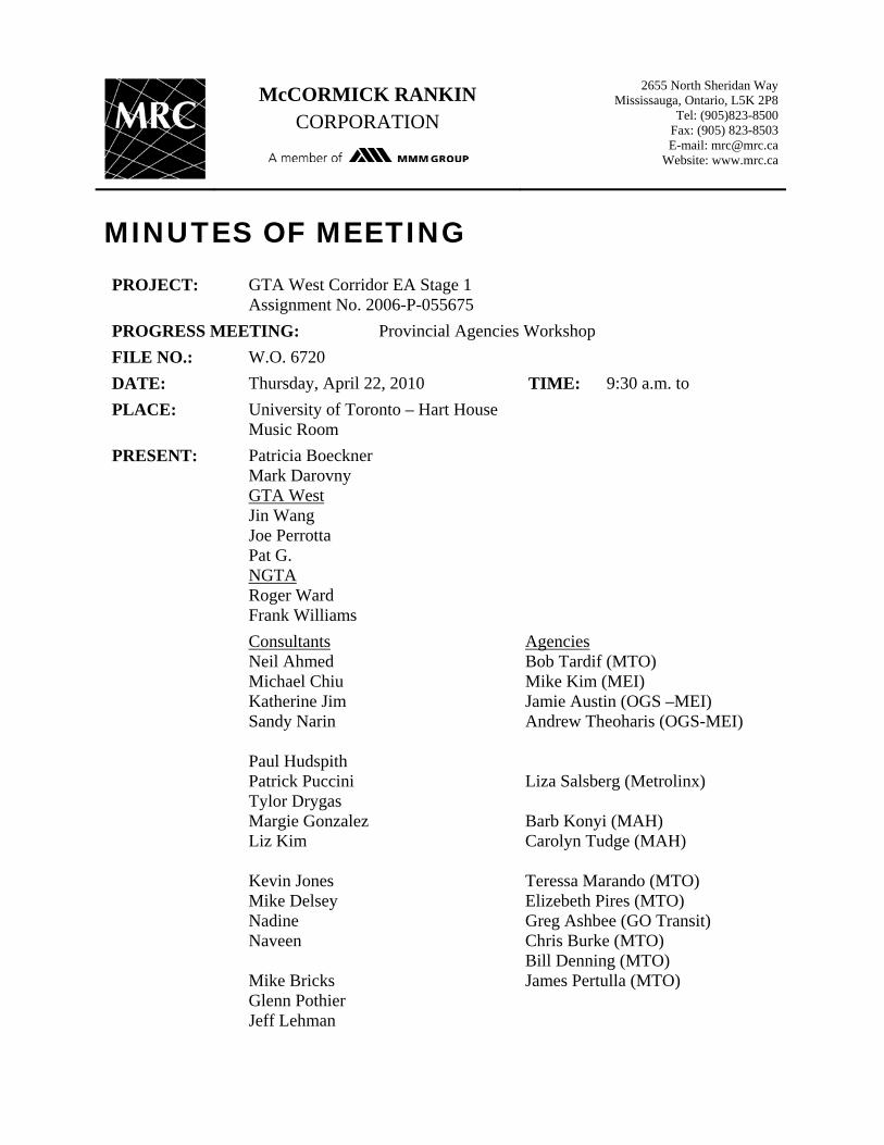
McCORMICK RANKIN CORPORATION
2655 North Sheridan Way Mississauga, Ontario, L5K 2P8
Tel: (905)823-8500 Fax: (905) 823-8503 E-mail: [email protected]
Website: www.mrc.ca
MINUTES OF MEETING PROJECT: GTA West Corridor EA Stage 1
Assignment No. 2006-P-055675
PROGRESS MEETING: Provincial Agencies Workshop
FILE NO.: W.O. 6720
DATE: Thursday, April 22, 2010 TIME: 9:30 a.m. to
PLACE: University of Toronto – Hart House Music Room
PRESENT: Patricia Boeckner Mark Darovny GTA West Jin Wang Joe Perrotta Pat G. NGTA Roger Ward Frank Williams
Consultants Neil Ahmed Michael Chiu Katherine Jim Sandy Narin Paul Hudspith Patrick Puccini Tylor Drygas Margie Gonzalez Liz Kim Kevin Jones Mike Delsey Nadine Naveen Mike Bricks Glenn Pothier Jeff Lehman
Agencies Bob Tardif (MTO) Mike Kim (MEI) Jamie Austin (OGS –MEI) Andrew Theoharis (OGS-MEI) Liza Salsberg (Metrolinx) Barb Konyi (MAH) Carolyn Tudge (MAH) Teressa Marando (MTO) Elizebeth Pires (MTO) Greg Ashbee (GO Transit) Chris Burke (MTO) Bill Denning (MTO) James Pertulla (MTO)

Minutes of Meeting Page 2 of 20 Date: April 22, 2010 PURPOSE: Purpose of the workshop is to present Preliminary Planning alternatives,
preliminary assessment of the alternatives developed, discuss potential implementation responsibilities and discuss conformity with existing provincial policies/ regulations and coordination with other related provincial initiatives.
PROCEEDINGS: ACTION BY:
ITEM 1 – INTRODUCTION AND OPENING REMARKS
1.1 Glenn welcomed all to the meeting. This is a joint NGTA and GTA West meeting. The two studies share similar study approach and the study teams have coordinated on an ongoing basis to ensure consistency between the two studies. PIC #4 is tentatively scheduled to be held in June.
1.2 The purpose of the meeting is to provide an opportunity for ministries/agencies to provide specific input that will help the Minister of Transportation to make a decision on the NGTA and GTAW transportation development strategy.
1.3 The objective of the meeting is not to come to a conclusion of the preferred transportation strategy but rather to gather input.
1.4 Those at the meeting were introduced.
ITEM 2 – STUDY BACKGROUND & PROCESS
2.1 P. Hudspith, URS, provided an introduction, an overview of the approach of the two studies, including policy context and other provincial initiatives.
2.2 Studies to date have looked at alternatives to optimize existing network, non road infrastructure (beyond that of Metrolinx), and even with these improvements implemented, additional capacity is needed to address future transportation needs as projected by the Growth Plan. Alternatives for the proposed widening on existing highways and new corridors were developed. Preliminary assessments of these alternatives were carried out and are being presented at the meeting.
2.3 In terms of consultation, there have had been meetings with municipalities and councils, and various stakeholders.
2.4 The two studies are similar in scope and schedule and the two project teams coordinate regularly on both the MTO and consultant levels. This provide an opportunity to coordinate transportation improvement strategies for a larger overall area
2.5 The two study areas are unique – NGTA: close to the lake, international border; GTA West is half the size of NGTA but is projected to experience twice the population and employment growth than NGTA.
Minutes of Meeting Page 3 of 20 Date: April 22, 2010 2.6 Unique approach: It’s a two-phase (stage) EA process. The two
studies are currently in phase (stage) 1 of the process to identify the need and provide a multi-modal approach in developing the “Alternatives To” the undertaking.
2.7 Policy Context: Growth Plan - identify where the growth will be and this is a first step for transportation improvements.
2.8 Both studies assumed that transit and other provincial initiatives are already in place – Metrolinx, GO 2020, planned projects by MTO, other transit plans, etc.
2.9 Brief description of the Building Block Approach.
ITEM 3 – TRANSPORTATION DEVELOPMENT STRATEGY
3.1 Optimizing Existing Networks (Group 1)
Build upon strategies in the Regional Transportation Plan, GO 2020 Strategic Plan and municipal transportation master plans.
Initiatives to optimize existing infrastructure include: bus bypass shoulders, enhance incident/congestion management, expanded use of ramp metering, HOV/transit bypass lanes, speed harmonization, support Metrolinx and Smart Commute in expanding their Transportation Demand Management programs.
Potential locations where the initiatives noted above may be applied to the two study areas were shown.
3.2 Add/Expand Non-Road Infrastructure (Group 2)
Focus on improving existing and /or providing new non-road infrastructure and transit, building on the recommendations of the Metrolinx RTP and GO 2020 Strategic Plan.
Examples of additional initiatives to the Metrolinx RTP and GO 2020 include new/expanded connections west of Pearson airport, Hamilton focused inter-regional transit, new inter-regional transit links between western Urban Growth Centres.
Additional studies will have to be done to ensure viability and feasibility of these additional initiatives.
Three main principles: inter regional link to Toronto, link UGC, UGCs as gateways. A framework of a feasibility study for that is being developed.
Freight rail: current conflicts include passenger vs. freight rail services and at-grade road/rail crossings.
3.3 Discussion / Comment:
Q. Some of the initiatives that are being put forward are indirect (e.g. HOV, bus bypass) how did you translate into the level of service assumption? How did you get to a road conclusion without more detailed service assumptions? How did you go from basic infrastructure recommendations (no modeling on
Minutes of Meeting Page 4 of 20 Date: April 22, 2010
impact) then recommend more roads are required?
A. have not look at the detail to see how they would affect service level. The model assumed a 4% reduction; this accounts for all concepts in Group 1, subject to further studies (i.e. have look at it on a broader level). Freight movement to other modes assumed a 10% reduction of goods movement from truck to rail. There will be recommendations as to how these initiatives can be implemented. The model also built in the assumption of the entire RTP (e.g. Halton Region modal split from 2% to 8%); these are some aggressive assumptions.
Q. How are agencies/ministries to comment affectively without having some of the quantitative information? Looking for quality input?
A. Agencies/ministries are to comment through the review of the documentations (e.g. Overview Reports, Problems and Opportunities Report, Alternatives Report). Will prepare another document on Transportation Development Strategy for agencies/ministries to comment. The workshop is a work in progress session. The draft transportation strategy report (which includes the analysis and evaluation of alternatives) will be release after the next PIC.
Q. Non-road also meant to include bus transit? Yes
C. GO Transit – planning to connect Guelph and Kitchener and Cambridge, some initial thoughts to provide feeder system to use underutilized tracks to connect these municipalities.
Q. Trip containment aspect in the Growth Plan part of the model? A. As part of the modeling exercise have update land use,
population, employment forecast, and use municipalities growth conformance exercise to understand where growth had been assigned. Model look at how these initiatives affect self containment in the community, and other measures in the growth plan.
Q. connection between modes is important, however, 10% modal shift based solely the regulatory/legislative improvements may be difficult to achieve – it’s an issue for the actual mode (cost and level of service). What does the 10% include?
A. 10% is for the shift for long distance truck to freight rail (have consider type of goods that are suitable for shifting from truck to rail).
Q. Has there been any analysis done on impact modal shift, use of transit, etc.?
A. have look at opportunity, have not look at these in modal. But have looked the markets where the initiatives have been taking place. Have look at from a legislative approach, not from
Minutes of Meeting Page 5 of 20 Date: April 22, 2010
modeling approach.
3.4 Road Alternatives (Groups 3 and 4) - Analysis / Assessment Approach:
Environment, Community, Economy and Transportation (including cost and constructability issues)
Transportation Approach: update land use assumptions based on recent municipal updates, used most recent update of the GGH Model, analyze future travel demands and deficiencies for Base Case which include MTO planned improvements (5 year programs), municipal improvements identified in Transportation Master Plans and RTP/GO 2020.
Economic Analysis: TREDIS program – model the incremental impact of increased transportation capacity on different sectors of the economy, as well as transportation benefits to consumers/companies.
Environment and Community: used factors from the approved EA ToR under Natural environment, Socio-economic environment, Cultural environment. Have been meeting with First Nations to understand their issues.
Footprint assessment: to assess potential property impact and impact to environmental features based on the proposed widening of existing highways.
Constructability / costing issues through critical areas (e.g. freeway to freeway interchanges in both study areas).
Cost analysis – high level cost estimate based on the proposed widening, structural replacements, interchange reconfigurations, etc.
The Group 4 alternatives still requires some widening on existing facilities.
3.5 Discussion:
Q. TREDIS model only apply to Group 3 and 4? Does it show the impact on each group?
A. No, driven by the transportation modeling which is the building block approach (i.e. Group 1, 2 and 3, or Group 1, 2 and 4). It’s not a very sensitive model and does not look at the impact on each group alternative, but rather look at the impact as a “whole package”.
ITEM 4 – ASSESSMENT FINDINGS & TRADE-OFFS – NGTA (GROUPS 3 AND 4 ALTERNATIVES)
4.1 Transportation Analysis:
Reviewed Group 3 and 4 alternatives and key findings.
Higher inter-regional commuter demands in both Groups 3
Minutes of Meeting Page 6 of 20 Date: April 22, 2010
and 4 but overall PM peak trip containment and transit mode split are not significantly affected
Groups 3 and 4 scenarios perform similarly in addressing deficiencies
Some widening of existing freeways is required in all Group 4 alternatives in key constraint areas
Modelling predicts that portions of a new corridor may not be heavily utilized by 2031
Overall observations under new corridor alternatives (Group 4):
Provide better overall system performance Provide network flexibility and reserve capacity, but portions
are not heavily utilized by 2031 Do not avert many of the widening requirements associated
with Group 3 alternative A new corridor with no additional highway widenings beyond
MTO planned improvements will not attract significantly greater traffic volumes and will continue to be significant congestion on existing facilities.
4.2 Economic Analysis:
Growth determined by the Growth Plan and conformity exercise by municipalities (shown on map).
Reviewed how the alternatives match the growth areas (population and employment growth).
Travel cost savings by cost type and total economic impacts in GGH in each alternative. Alternative 3-1 perform better than the Group 4 alternatives.
Key findings:
Group 3 alternative serves key employment nodes in Hamilton and Halton well
Group 4 alternatives provide new corridor in Niagara, serving south part of the Region (the new corridor is largely in the greenbelt from Hamilton to Halton and will serve as a economic corridor – area is not developable).
Economic impact modelling shows strongest output and jobs benefits: to manufacturing sectors – generally from 3-1 and 4-3, to tourism sectors – from 3-1 and 4-3 next, and to business/professional services, public sector – 3-1 well ahead.
TREDIS analysis shows widenings (3-1) may produce greater economic impact both in terms of transportation cost savings and industry impacts
Group 3 provides capacity to key employment growth areas Group 4 provides new access to south Niagara and
redundancy to border, but does not provide economic corridor benefits or local economic development benefits as strongly.

Minutes of Meeting Page 7 of 20 Date: April 22, 2010 4.3 Environment and Community Analysis:
Localized impacts to significant environmental features, overall environmental impacts, and community impacts are noted in the slides.
Overall assessment: Overall greater natural environmental impacts on Group 4
alternatives compared to Group 3 Group 4 alternatives result in crossing of the Niagara
Escarpment, new Greenbelt impacts and high potential for species at risk impacts
Alternative 3-1 has high localized high natural environmental impacts at QEW/RHVP and Highway 403/Niagara Escarpment
Alternative 3-1 greater community impacts Group 4 alternatives result in greater potential for
fragmentation of agricultural lands Relatively small air quality impacts for all alternatives
4.4 Cost and Constructability
Reviewed cost and constructability issues in special area in the NGTA study area: QEW/Hwy 403 Oakville interchange, Freeman interchange, Hwy 403 through Hamilton, Burlington Skyway
RHVP interchange, Garden City Skyway
Key findings
Alternative 3-1 results in significantly more complex constructability issues than Group 4 alternatives
Based on high-level analysis, all alternatives are anticipated to have similar costs
4.5 Overall Summary:
Will focus on first on transit. But as noted before, even with the implementation of all the Metorlinx RTP and GO 2020 initiatives, there will still be significant congestion in the transportation network, and therefore, additional capacity is required.
Provided an overall summary under community, economy, environment, transportation.
4.6 Discussion:
Q. How are agricultural lands being evaluated? Land use only? Economic use? Especially in the greenbelt area, agricultural lands contribute in an economic perspective. It appears that it’s only considered as a constraint (under natural environment/land use).
A. it was considered as one of the many industries in the economic review. The model does not make a judgement as to which industry is more important. Agricultural lands were

Minutes of Meeting Page 8 of 20 Date: April 22, 2010
considered as part of an economic sector.
C. when presenting to others, it appears that the importance of agricultural lands seem to be buried. The Greenbelt 5 year report card commented on highways and value of agriculture as an industry not just a land use. Should bring up agricultural lands as something more visible.
Q. Community model impact, Group 4 also require widening, want to understand what are the impacts on properties?
A. Yes, the Group 4 alternatives account for the property impacts from the widening also. Group 4 have significantly less property impact (big difference through St. Catharine).
C. GO Transit is carrying out an EA for train services to the Niagara Falls / St. Catharine area. The study looked at CN alignment that runs along QEW through Stoney Creek – preferred. Also looked at CP alignment that goes through Welland and Fort Erie (rejected as does not attract rider and longer travel time). But it seems to be similar to new corridor in Group 4. GO transit is not considering that CP corridor, and therefore, may welcome the new corridor.
C. Concern from a Growth Plan perspective, will be attracting new growth area not assigned.
C. the alternatives may not meet all aspects of the Growth Plan and therefore, should be careful in stating so in the public forum.
A. through the economic assessment done, historically thought the transportation corridor will have significant economic opportunities, but the economic analysis appears to not support that.
C. the difference between Group 3 and Group 4 alternatives, Group 3 plans have significant rebuilding of existing infrastructure, construction will last for long time. The economic impacts due to the delay during construction were not captured in the economic analysis (not easily quantifiable) vs. new corridor would be more easily constructed through greenfield.
Q. Is it possible to quantify economic impact associated with construction delay?
A. Limited ability to do so in the economic analysis because the transportation model output feed the economic model. May be able to do a desk top exercise. Reminder that Group 4 alternatives have widening as well, so there are delay associated with those alternatives during construction.
Q. What are the transportation criteria there were looked at/assessed?
A. Overall transportation criteria looked at: e.g. inter-regional transit (how well it’s supported, e.g. HOV), new corridor also
Minutes of Meeting Page 9 of 20 Date: April 22, 2010
considered incorporation of transit (e.g. Hamilton and Welland), goods movements (truck demand, what would happen if a new corridor vs. existing corridor widening, connection between different modes), support for tourism (e.g. how new corridor access tourist areas, from border to GTA north), modal integration (e.g. how the new corridor support integration of various mode). Information will be in the draft report to come. The presentation is a high level summary of the findings.
Q. Did you look at Group 3 and Group 4 impact on transit (i.e. will it hurt transit?)
A. yes, have looked at that. Through findings in modelling, there would be minimal impact on the transit in the south part of the NGTA study area, Halton and Peel area some impact – 1% change. Hamilton still in the 9% range even with new corridor. Niagara is very much self contained use whether with or without the new corridor at 2%. Overall limited impact on the transit.
Q. Congestion pricing should be added to the analysis – would that yield a different outcome on the Group 3 and 4 alternatives?
A. congestion pricing have not been included explicitly, but have assumed cost of traveling in future. The modeling assumed a double the cost of auto travel (fuel, etc.)
C. important to look at congestion pricing (e.g. whether it’ll be different to toll the QEW, buy the 407 back?)
A. have been directed not to consider congestion pricing. A. through work of modeling, have looked at congestion pricing
(e.g. remove toll on 407 – better utilize unused capacity).
Q. when noted redundancy on border crossing vs. congestion through the canal, unusual events and failure – some can be addressed by better operation.
A. Redundancy is based on keeping mobility on the highway networks, not heavily on border crossing. E.g. when highway is closed due to incidents, impact on goods improvements, etc.
Q. findings in the modeling shows that the new corridor will be underutilized by 2031 – some may comment that the planning is short sighted, and not planning for the vision of Ontario in the long term. Can it be seen as a corridor for the future to open up the Province? Is MTO being short sighted by relying on this model (i.e. up to 2031)?
C. yes, should plan for longer term scenario. It’ll only become harder to get a corridor with development. The decision need to be made for the longer term.
C. from a goods movement side, they would like to see the redundancy and the alternate route to the border.
C. Can recommend to the Minister to widen based on 3-1, but also have a plan to freeze development in the new corridor lands.
Minutes of Meeting Page 10 of 20 Date: April 22, 2010
C. The fact that it’s on the international border makes it more important to look at the long term vision.
Q. what is the net gain between Group 3 and Group 4 in terms of transportation analysis?
A. vehicle hour delay, between alternatives they are generally similar (less than 10% difference).
C. worth while to look at environmental impact and constructability impact in the longer term.
C. agree that the statement “alternative conforms to the Growth Plan” is not correct, but the alternatives are to support the overall Growth Plan. In response to the comment, “Alternative 4 undermine the growth plan” – they have to be read the planning documents in its entirety, municipalities have to follow policies in the growth plan that deals with settlement areas.
If there is interest is planning beyond 2031, how should the MTO proceed? ToR stated plan to 2031, Growth Plan only have numbers up to 2031.
C. new numbers are coming in 5 years. The Growth Plan is intended look only within the next 20 years, otherwise municipalities over designate lands. General trend perspective, can extrapolate based on the growth plan number, birth rate, etc.
If go beyond 2031, have to go back to all Groups (1, 2, 3 and 4, not just 3 and 4).
C. corridor protection. OGS support protection of corridor (e.g. in schedule 6 – question is always timing and when it’s appropriate to build)
C. the challenge is how to protect the corridor. Until the EA is approved, hard to protect a corridor; also to get the consensus from all the ministries and department to agree the various parameters. Also, not sure what the EA implication is if the time horizon is to go beyond 2031.
C. Not necessarily where the corridor will be, but to identify area of key constraints to be protected …. Maybe a zoning order.
ITEM 5 – ASSESSMENT FINDINGS & TRADE-OFF – GTA WEST (GROUP 3 AND GROUP 4)
5.1 It was stressed again, that both studies apply a “transit first” approach with the consideration of other transportation mode. Groups 3 and 4 alternatives are developed using the building block approach.
5.2 The GTA West study area and Groups 3 and 4 alternatives were reviewed. Parts of York Region, Peel Region, Halton Region and the City of Guelph are in the study area, while the Niagara Escarpment bisects the study area.
5.3 Alternatives:
Alternative 3-1: shows the proposed widening on Highways 400,

Minutes of Meeting Page 11 of 20 Date: April 22, 2010
427, 410, 401, and 407 ETR. The proposed Halton-Peel Boundary Area Transportation Study area (H-P BATS) is shown. It should be noted that the number of lane requirement is based on transportation need only. This alternative proposed the widening of 407 ETR up to 14 / 16 lanes.
Group 4 alternatives all start at Highway 400 and connect to various terminus to the west at Highway 410, Hwy 401 (east and west of Milton – these alternatives do not cross the Niagara Escarpment), and Highway 7 / Highway 6 to the north / south of Guelph.
5.4 Transportation Analysis:
Key findings:
Higher inter-regional commuter demands in both Groups 3 and 4, but overall PM peak trip containment and transit mode split are not significantly affected.
Alternatives 4-3, 4-4 and 4-5 address future capacity needs and provide highest overall transportation benefits
Alternatives 3-1 and 4-1 address future capacity needs but do not provide suitable overall transportation benefits
Alternative 4-2 addresses future capacity needs and provides moderate overall transportation benefits.
Overall, Group 4 alternatives (other than 4-1) outperform Group 3 in terms of traffic operations, commuter travel and people movement.
Group 4 alternatives appear to be better for most people movement criteria
Group 4 alternatives (other than 4-1) provide good linkages to population and employment centres
Alternatives 4-3, 4-4, and 4-5 ranked well in all factor/criteria areas
5.5 Economic Analysis:
Employment growth in Vaughan, Brampton/Caledon, Milton/Halton Hills with the study area, and the region of Waterloo/Kitchener.
Travel cost savings are similar for Alternatives 3-1, 4-3, 4-4, and 4-5. All alternatives have substantial cost savings benefits.
Economic impacts slightly better in Alternative 3-1.
Key findings:
Group 4 alternatives connect among major employment nodes allows for circumferential travel of workers and goods – support supply chains
Widenings serve most growth areas well (if Hwy 427 and Hwy 410 are extended and Brampton North-South corridor
Minutes of Meeting Page 12 of 20 Date: April 22, 2010
implemented – very well) Argument for connection to Guelph does not seem strong
from and economic development perspective – stronger from a commuter perspective
Considerable benefit to Kitchener / Waterloo Region from all alternatives
Connection to Milton / Halton Hills is important; nature of employment growth is highly dependent on freeway access and capacity, much greater amount of growth
Economic impact modelling shows strongest output and jobs benefits: to manufacturing sectors (no significant difference among alternatives), to distribution/logistics sector (3-1 is strongest, followed by 4-3), to business/professional service, public section (3-1 strongest, others are equal)
New corridors create redundancy, but difficult to quantify value
Slide Summary
5.6 Impact Assessment:
The major differences between the NGTA and GTA West studies were reviewed: GTA West study area is about half the size of NGTA study area
but is projected to experience twice the employment and population growth (i.e. a more dense urban area)
The pinch points in the NGTA study area are the environmentally sensitive areas in the Hamilton / Burlington area while the environmental constraints (Niagara Escarpment) in the GTA West study area are in the west
Within the GTA West study area, the existing facilities are newer and have a wider buffer to adjacent lands than the existing facilities in the NGTA study area.
Natural Environment:
Alternative 3-1 (widening existing highways) has the least amount of impact to the natural environment
Alternative 4-1 and other Group 4 alternatives cross Humber River and associated valley, trails, wildlife corridors, etc.
Impacts of new crossing can be mitigated through route selection and design.
Alternatives 4-2 and 4-3 have additional, moderate impacts Alternatives 4-4 and 4-5 have long sections through the
Greenbelt across the Niagara Escarpment and in rural areas where some sensitive features cannot be avoided because of their size.
Land Use / Social Environment
Alternative 3-1 has minimal impact to residential areas and

Minutes of Meeting Page 13 of 20 Date: April 22, 2010
community but is not compatible with municipal land use plans for future growth and development
Alternative 4-1 addresses growth in York and Peel Regions but not in Halton Region
Alternatives 4-2 and 4-3 address growth and land use pressures in York, Peel and Halton Regions. Impacts to residential areas and community can be minimized through route selection process
Alternative 4-4 impact agricultural areas through the Greenbelt in north Halton and Wellington County, as well as residential areas in north Guelph
Alternative 4-5 impact agricultural areas in the Greenbelt and new residential area south of Guelph
Cultural Environment:
Alternative 3-1 has limited impact to built heritage features and archaeological resources
Alternatives 4-1 to 4-5 have increased potential to cultural environment. The longest new corridors have the highest potential impact.
5.7 Constructability – Special Areas
407 ETR – connections with Highways 400, 427, 410 and 401 Key challenges with difficulty in construction staging,
impacts during construction and impacts to adjacent roadway. 407 ETR is a revenue generating facility and the loss in
revenue during construction is difficult to account for.
Highway 407 Transitway – alignment, impact to stations, etc. Potential changes in profile, impact access to transit stations,
limited flexibility in modifying location of transit stations, proximity to hydro corridor
MTO 407 transitway planner noted that it is already difficult to implement the stations and any further widening would be even harder to accommodate – possibly comprising the station geometric, etc.
All alternatives have complex constructability issues particularly with Alternative 3-1 and 407 ETR issues (bridge replacements, construction of freeway to freeway interchange, constrained in many locations by urban development for widening beyond 10 lanes). Group 4 alternatives would have challenges widening Hwy 401 through the Niagara Escarpment / Greenbelt area west of Milton.
Based on high level analysis of construction costs, Alternative 3-1 is between 10-20% higher than Group 4 alternatives and Group 4 alternatives range by up to 10%.
5.8 Overall Assessment:
Minutes of Meeting Page 14 of 20 Date: April 22, 2010
Alternatives 4-3, 4-4 and 4-5 would provide adequate capacity to address future transportation needs
Alternatives 4-4 and 4-5 offer improved connections to support economic growth in Kitchener/Waterloo and Guelph, however, economic benefits are not very high
Alternatives 4-2 and 4-3 provide very good connections among major employment nodes benefiting goods movement and creating opportunities for new inter-regional transit services
New corridor alternatives have more significant environmental and community impacts than widening existing highways, particularly Alternatives 4-4 and 4-5
New corridor alternatives avoid some of the significant constructability issues associated with Alternative 3-1
All alternatives have similar construction costs
Alternative 3-1 would have more impact to community and economy during construction
5.9 GTA West Transportation Development Strategy:
Build on current initiatives of Metrolinx RTP And GO 2020
Integrate additional inter-regional transit linking western urban centres
Optimize use of existing transportation infrastructure through TDM and TSM measures
Encourage means of shipping goods other than by truck
Widening of area highways to provide additional capacity including HOV and multi-modal uses
New transportation corridor from Highway 400 westerly to east or west of Milton (without crossing the Escarpment).
5.10 Discussion:
Q. What is the delta between Alternatives 4-2 and 4-3? It appears that in most cases Alternative 4-3 is preferred. But the proposed corridor in Alternative 4-2 is not much different than Alternative 4-3, since both alternatives would address growth in Milton and Halton Hills?
A. One of the key differences is that Alternative 4-3 would avoid having the 12 lane section (on Highway 401) through Milton (in Alternative 4-2). In Alternative 4-3, the proposed 10 lane section on Highway 401 through Milton is more feasible and would avoid some of the constructability issue (i.e. avoid core/collector system). Also, Alternative 4-3 would avoid reconstruction of the connection between Highways 407 and 401. Alternative 4-2 would incorporate the H-P BATS corridor as part of the GTA West corridor; even the H-P BATS project team had problems
Minutes of Meeting Page 15 of 20 Date: April 22, 2010
finding a proper connection at the Highways 407 and 401. Alternative 4-3 assumes that the H-P BATS corridor would be built by the municipalities. From economic perspective, Alternative 4-3 connects Highway 401 west of Milton and provides connection through Halton Hills. The supply chain could go from Milton to Vaughan/Brampton, the extra link is an advantage
Q. The underlying map shows growth in the Haltom Hills area (ROPA 38), is that already happening?
A. Yes.
Q. Are the proposed additional lanes on 407 ETR also going to be tolled?
A. Yes, any additional lanes on 407 ERT would operation under the same conditions as existing.
Q. Have you look at permutation on widening options on Highway 400? If you look at the relationship between transit (to the Barrie / Simcoe area) and congestion on Highway 400, you may come up with a different conclusion.
A. No, we have not test a lot of permutation on Highway 400. Where Highway 400 enters the study area, we look at what is required to accommodate future demand (i.e. 12 lanes). The study has not look at how far other improvements need to go beyond the study area. The widening requirement is up to Highway 9 area. However, the GGH model does provide travel demand up to Simcoe.
Q. When you look at transit impact, is it only within the study area? Transit impact is broader than the study area.
A. The transportation analysis looked at transit impact east and west from the study area, however, not specifically in the north (up to Simcoe). It also looked at impact to the south in combination with NGTA. The analysis can be updated to look at transit impact to the north as it is part of the GGH model.
C. MTO noted that they are in the late state in issuing the RFP for the Simcoe area transportation requirement study, which will look at the future transportation need. Central Region will be carrying that out for the next 18 months.
CJV
Q. In regards to the land use/ social analysis, Alternative 3-1 noted that it is not compatible for land use, why?
A. When you look at future land use – Vaughan, Brampton, development is coming to the north, even thought Alternative 3-1 will provide the sufficient number of lanes in the south of the study area, it does not address development in the north. Group 4 will provide a connection to the growth areas in the north.
Q. All alternatives connect to Highway 400, how important is this link?

Minutes of Meeting Page 16 of 20 Date: April 22, 2010
A. Connection to Highway 400 critical from a transportation perspective. The existing level of service at Highways 401/400 connection is breaking down and therefore, need new facility to relieve the congestion there.
C. From a goods movement perspective, it is important to connect to Highway 400, as 407 ETR is not a facility of for trucks. The connection to 407 ETR has limited benefits to goods movement. The new corridor would connect to Highways 400, 427, 410 and 401, and help relieve the constraint at Highways 400/401.
C. There is a significant number of trucks from Alliston that utilize Highway 9 and Highway 24 instead of Hwy 400 due to congestion. The new link would provide a freeway connection to their markets and help relieve local traffic infiltration and impacts.
Q. There are contradicting statements under community impact in the overall assessment?
A. It should be clarified that the natural environment / social environment look at the footprint impact without consideration of construction affect. We want to break out the cost / constructability affects as they are different from the long term land use impact.
C. All alternatives are similar. Any alternatives that do not cross the Niagara Escarpment are considered to be positive.
C. It appears that Alternative 4-3 is the most preferred in most of the evaluation categories. We encourage you to provide any input and comments regarding this.
Q. It is positive to see that Kitchener / Waterloo have been added as one of the growth areas. If Alternative 4-4 connects to Guelph, how long will it take for the facility to serve Kitchener / Waterloo. It will take a few years to achieve the demand required. Was that taken into consideration?
A. Similarly benefits (i.e. connection to Kitchener / Waterloo) could be achieved by widening Highway 401 vs. a new corridor in Alternative 4-4. Kitchener / Waterloo typically have a more self-contained economy. The transportation forecast for Kitchener / Waterloo is mostly domestic, not inter-regional truck goods movement. It is not clear if Alternative 4-4 have significant economic impact. The economic section in Cambridge has a bigger sector in truck movements.
C. In the transportation modeling in Alternative 4-4, it includes the connection to Highway 7, however, trucks are still using Highway 401 since most are destined to Cambridge. Kitchener / Waterloo economy are based in the high tech section which do not rely on inter-regional truck traffic.
C. MTO noted that they have had preliminary discussions with
Minutes of Meeting Page 17 of 20 Date: April 22, 2010
the Kitchener / Waterloo mayor who have expressed interest to carry out another study for the Kitchener / Waterloo / Cambridge area. It is anticipated that they study will begin the next 12 months.
C. In Alternative 4-3, the section of the new corridor beyond H-P BATS should not be built too early. H-P BATS should be constructed first prior to the remaining section of Alternative 4-3. The additional benefit from Alternative 4-3 vs. Alternative 4-2 is questionable.
C. From a Greenbelt point of view both Alternatives 4-2 and 4-3 avoid the Niagara Escarpment. However, from the environmental perspective, Alternative 4-2 is preferred.
C. The review of more detail information is required before noting a preference of any of the alternatives. The main concern in relation with Metrolinx is that the studies (GTA West and NGTA) assume all projects in the RTP would be implemented. Yet, Metrolinx is still facing challenges for completion of the projects in the RTP. It is undesirable for different government agencies to compete for funding.
C. If the government move forward with some of these initiatives (from the GTA West and NGTA studies), if not a significant portion of the RTP is implemented, the public may criticize the government for providing funding that favors highway projects.
C. There are also costs associated with natural and social environment impact that are difficult to quantify. It should also be noted that it takes time for life style shift to take place – i.e. shifting to transit before introducing the highway.
C. It should be stressed that for within the GTA West study area, there are many areas that face development pressure issue. If no decision is made in 2-3 years for the protection of a new corridor, there will be no more opportunities in generations to come for a new transportation facility.
C. Further, the longer we wait, the more we pay for the land for a new corridor (i.e. lands that have been redesignated or developed). However, the government has to justify the need in order to protect for a corridor.
ITEM 6 – STRATEGIC DISCUSSION – THE RIGHT STRATEGY FOR NGTA & GTAW
6.1 Planning and improvements are proposed by MTO but we all have a role. That makes implementation more difficult since MTO does not have jurisdiction over all initiatives.
6.2 Those at the meeting are encourage to provide comments and input on the following key questions:

Minutes of Meeting Page 18 of 20 Date: April 22, 2010
Are any of these alternatives financial feasible? Especially when transit projects are being delayed.
What if the RTP is never fully funded?
Will the strategy take funding from other transit projects for highways?
What if the high modal split is not realized?
What if growth projection not realized? The projection number being higher or lower than expected
How to respond to new growth number?
Time horizon issue (i.e. beyond 2031)
What if other modes do not follow through? (i.e. other agencies do not deliver their projects)
To implement the widening, that will require a number of EAs for different areas. What are the chances to coordinate all the EAs and have all of the EAs approved? What are the chances for all that to happen before 2031?
6.3 Discussion:
C. If the growth number is higher than expected, then the demand would be fulfilled by 2020 instead 2031, and the government will have to react accordingly. If the growth number is less than expected, then any improvements can be delay even longer, and this will be reviewed.
Q. Will this study result in an approved EA? Can the recommendations be used to preserve a new corridor?
A. The end of this study will recommend a transportation strategy, but not a formal EA approval, which will be at the end of the route planning study.
C. Funding and planning are both government processes. The government should note the outcomes of these studies and prioritize funding (i.e. RTP and other facilities) accordingly. On the planning side, you cannot plan a project without the assumptions of other projects will take place.
Regardless of what the assumptions is built upon, these studies (GTA West and NGTA) must move forward to Stage 2 (Phase 2) of the EA process for corridor protection. From now until the proposed corridor built, it could take 15-20 years. The key decision point is to proceed with next stage, when and how the facility will be built is subject to availability for funding.
C. The transportation modelling assumed all the RTP projects will be in placed and that the assumed road components are to be implemented in increment. The problem is if you move ahead with the road improvements concurrently with the RTP projects,
Minutes of Meeting Page 19 of 20 Date: April 22, 2010
you might under the opportunities for people to shift to other modes.
C. The transportation model is based on level of service D; not free flowing traffic.
C. We need to make sure that the government spend money on transit first then a new highway.
C. The transportation needs (particularly goods movement) in GTA West is something that has to be addressed for a long time and cannot wait.
C. In contrast with GTA West, NGTA is not likely that to have a clear preferred alternative. If GTA West is moving forward with Alternative 4-3 as the preferred alternative, but NGTA is going with pieces of improvements within the study area, what are the areas that should be concentrated on?
C. The more you can stay out of the Greenbelt/Niagara Escarpment and the tender fruitlands (major economic contributor), the better it will be. It is important to evaluation the consequences of acting now vs. later.
C. The cost of doing nothing is $1 billion /year, and the cost to do something is also about $1 billion.
C. If a new corridor is recommended, but will continue to have congestion at various constraint areas, it seems that more qualitative argument and more transparent analysis of other alternatives (e.g. transit) is needed.
Q. Is the connection between Kitchener / Waterloo and Hamilton being investigated?
C. One of the issues from the last round of PIC is the need to look at beyond RTP to connect those communities. In the Provincial Highway Management section, they have looked at Highway 24 connection to those communities. Again, the Mayor of those areas have approach MTO to carry a study to look at potential connect of those communities via multi modal approach.
C. The demand forecasting was done on GGH base and did include those areas. Have look at GTA West and NGTA common connection point. Findings do not indicate significant difference whether a connection to Kitchener / Waterloo is provided or not.
C. It should be noted that there is also a study that will be looking at connection between Brantford and Cambridge.
ITEM 7 – CONCLUDING REMARKS
7.1 The next steps are:
Finalize Groups 1 and 2 components
Finalize assessment of Group 3 vs. Group 4
Develop the draft Transportation Development Strategy
Minutes of Meeting Page 20 of 20 Date: April 22, 2010
Present draft Transportation Development Strategy
Minister of Transportation May 2010 Stakeholder Meetings in May and June 2010-04-22 PIC 4 in late June 3010
The foregoing represents the writer’s understanding of the major items of discussion and the decisions reached and/or future actions required. If the above does not accurately represent the understanding of all parties attending, please notify the undersigned within 48 hours of receiving these minutes at 905-823-8500. Minutes prepared by, McCormick Rankin Corporation Katherine Jim, P. Eng. cc: All attending
File: W:\6k\6720 GTA West Corridor EA Study\6720.700 Planning\6720.730 Meetings\6720.731 MTO\Central Region Meeting Mar 31 10_Apr 12 10\6720 Central Region meeting Mar 31 10_DRAFT.doc

GTA West Corridor Planning and EA Study (Stage 1) and Niagara to GTA Corridor Planning and EA Study (Stage 1)
Summary of Presentation to Niagara Escarpment Commission (NEC)
June 17, 2010, 10:00am NEC Georgetown Office
COMMISSIONERS ATTENDED: Chair Commissioners Brian Baty (Niagara Region) Allan Elgar (Halton Region) Richard Paterak (Peel Region) PROJECT TEAM STAFF MTO (GTAW) Frank Pravitz Consultant (GTAW) Mike Bricks MTO (NGTA) Roger Ward Consultant (NGTA) Paul Hudspith, Patrick Puccini, Sandy Nairn NOTES: In a 15-minute PowerPoint presentation, Frank, Mike, and Patrick provided an overview of the progress of the GTA West and Niagara to GTA studies. Following the presentation, there was an approximately 45-minute period of questions and comments by the Commission. The following summarizes key comments by the Commissioners and responses by the project teams. COMMISSIONER QUESTIONS/COMMENTS RESPONSE Richard Paterak (Peel Region)
Roads are key to goods movement. Large roads can be intimidating to the
general public.
Comments noted.
Have transit opportunities been thoroughly explored? Couldn’t increased GO Train service solve some of the anticipated transportation problems?
The base assumptions of the model highly encouraged transit.
An NGTA connection to 407 ETR could facilitate an extension of the proposed 407 Transitway.
Requested that the team’s return in a month for questions so that members can have enough time to digest the amount of material presented.
There is congestion from the GTA to Fort Erie. An expansive new corridor is required.
The Project Team’s methodology and geographic focus is suspect.
Comments noted. The material presented is in draft
form and is intended to stimulate dialogue amongst the NEC and stakeholders.
Allan Elgar (Halton Region)
The future extent of congestion needs to be better explained to the public, ex. display the average speed on highways to a destination now vs. what it will be in the
Comment noted.

COMMISSIONER QUESTIONS/COMMENTS RESPONSE future.
Does not envy the task of the Project Team’s.
Does not think that a significant shift to transit use will occur. The alternatives presented need to be better and not just road-focused in order to expect a true transit shift.
The study process is short-sighted.
Comments noted.
The problems in the study areas are due to land use issues.
The land use assumptions in the Growth Plan form the basis of the study’s assumptions.
Both project teams have been consulting with the Ontario Growth Secretariat (OGS) and Ministry of Municipal Affairs and Housing (MMAH).
Both OGS and MMAH are in the process of updating their land use forecasts. The project teams have also been consulting with municipalities on where their growth is to occur.
Is the GGH model used by the Project Team’s able to differentiate between freight/goods movement and people movement?
Yes.
For each study, did one alternative perform better for freight/goods movement and not for people movement (or vice versa)?
The alternatives provide benefit for both goods and people movement.
Goods movement was analyzed in isolation by modeling a truck-only facility. This type of facility would be utilized more through the GTA West study area then the NGTA study area.
Richard Paterak (Peel Region)
Just-in-time delivery is not desirable since it creates “Warehousing on the Highway”. It can also cause municipalities to lose revenue due to the lack of a need for a large warehouse.
Comment noted.
Finds the draft strategy’s very regressive. The NGTA study is funneling
transportation infrastructure through sensitive fruitlands.
The economic centre of the NGTA study area is Welland, not the north part of the region.
The QEW through the NGTA study area should be kept at 6 lanes.
Comments noted.
Brian Baty (Niagara Region)
The youth population in Niagara is decreasing. More jobs are needed in the region to entice them to stay.
Comment noted.

NIAGARA TO GTA CORRIDOR PLANNING & EA STUDY – Phase 1 GTA WEST CORRIDOR PLANNING & EA STUDY – Stage 1
- 1 -
Meeting: Conservation Halton, Water Management Advisory Committee Meeting
Location: Conservation Halton, 2596 Britannia Road Date: September 16, 2010
Purpose: NGTA & GTA West Study Updates Time: 3:00 p.m. – 5:00 p.m.
Present: NGTA & GTA West Study Team
Roger Ward, MTO
Terry Hilditch, MTO
Heide Garbot, MTO
Frank Pravitz, MTO
George Ivanoff, MTO
Neil Ahmed, MRC
Mike Bricks, BPE
Karin Wall, AECOM
Gillian Thompson, Ecoplans
Margie Gonzalez, URS
Conservation Halton Water Management Advisory Committee
Ken Phillips, CAO/Secretary-Treasurer
Robert Edmondson, Director, Watershed Management Services
Ray Guther, Manager, Watershed Engineering Services
Brenda Axon, Manager, Watershed Planning Services
Cory Harris, Water Resources Engineer
Janette Brenner, Water Resources Engineer
Amy Mayes, Water Resources Engineer
Diana Friesen, Water Resources Technologist
Kate Sapozhnikova, Water Resources Technologist
Jennifer Lawrence, Manager, Environmental Planning
Leah Smith, Environmental Planner
Jane DeVito, Environmental Planner
Kellie McCormack, Environmental Planner
Margaret Charles, Environmental Planner
Katie Jane Stewart, Environmental Planning Technician
Charles Priddle, Watershed Permit Analyst
Kim Peters, Environmental Planner
Brian Jamieson, Planning Technician - Permit Administrator
Samantha Mason, Senior Aquatic Ecologist
Michelle Caissie, Recording Secretary

NIAGARA TO GTA CORRIDOR PLANNING & EA STUDY – Phase 1 GTA WEST CORRIDOR PLANNING & EA STUDY – Stage 1
- 2 -
Item Description Order of meeting was changed to move GTA West and NGTA presentations
to first agenda items. N. Ahmed introduced the presenters and study teams. GTA West was presented first and NGTA followed. Discussion suggested between each presentation to focus on each study separately.
1.
GTA West
N. Ahmed presented an overview of the GTA West study. Conservation Halton noted that they have received GTA West's response to their comments on the Alternatives Report. N. Ahmed noted that this presentation focuses on the phase after that - the Transportation Development Strategy (PIC 4).
(see copy of presentation for specifics):
Alternative 2 was carried forward - new corridor from Hwy 400 to Hwy 410 and down to connect to the Hwy 407/401 interchange
Alternative 3 was carried forward - builds on Alternative 2 but connects further west to Hwy 401 in the west Milton area but does not cross the Niagara Escarpment.
GTA West has begun identifying a more refined preliminary study area for route planning work - Stage 2.
Comments and Responses
GTA West response letter is provided in the presentation package and has been mailed to Conservation Halton. Highlights of comments and the study team responses were presented by K. Wall.
(see presentation for specifics)
Discussion for GTA West
Q: On page 5, the Metrolinx and GO Transit planning horizon was not to 2031, or have they caught up by now? What was their planning horizon?
A: Metrolinx’s planning horizon extended to 2031 as well. GO Transit extended to 2020. Most modelling and forecasting work for growth, development and transportation for the Ontario
NIAGARA TO GTA CORRIDOR PLANNING & EA STUDY – Phase 1 GTA WEST CORRIDOR PLANNING & EA STUDY – Stage 1
- 3 -
Item Description government is to 2031.
Is there any tandem financial thinking involved with all these separate studies? Do you have a cost estimate? With regard to Alternative 3, am I safe in interpreting that it may be the preferred alternative?
We are still determining whether Stage 1 can include a decision regarding whether Alternatives 2 or 3 is preferred. We are conducting additional evaluation work on these two alternatives. Information for making a decision at this point is still limited.
Cost is a key factor in the decision point. All alternatives are in the range of $4-5 billion but specifics have not been determined. However, all options presented today have similar levels of cost.
Is $4-5 B estimate a 2008, 2009, or 2010 calculation?
They were done this year.
When will these be implemented?
The GTA West recommendations are not a programmed improvement. There is still Stage 2 necessary, which is another 3-5 years in study. It may be 10-15 years at the earliest for implementation and it may also be staged implementation. The Ontario government is putting an emphasis on transit first, so they are trying to postpone roadway improvements as far into the future as possible. This will require municipal and provincial staff working together.
In 15-20 years the cost could increase significantly. Is it a provincial initiative, a joint municipal / provincial initiative, or a tolled initiative?
No decision has been made with regard to financing / tolling.
Slide 12: If I was to assume Alternative 3 is the most preferred, would that be a safe assumption?
It would appear to be preferred based on the high level assessment. But it is difficult to judge the two alternatives being carried forward on this basis. We are still working on deciding between Alternative 2 and 3 and need more detailed analysis.

NIAGARA TO GTA CORRIDOR PLANNING & EA STUDY – Phase 1 GTA WEST CORRIDOR PLANNING & EA STUDY – Stage 1
- 4 -
Item Description A coordinated effort is very important. The team should coordinate more
closely with municipalities and Conservation Authorities (CAs). What has been coordinated regionally, locally, and with CAs to date?
Generally, we start a study from secondary sources and information provided by provincial ministries (typical for this stage of work). However, due to the significant features in the study area, we met with the CAs to show that we understood the importance of these features. Through our meetings with the 4 CAs in our study area, they were able to give us information on where sensitive areas were in each watershed. They also provided up-to-date information that MNR sometimes doesn't have. Conservation Halton also provided some mapping that we could include in our plans. As a result, when we began to develop our alternatives, we were quite aware of the existing conditions in each of these watersheds and the impacts of our alternatives. Even though our documentation in Stage 1 is very broad, we have a very detailed understanding of where we can and cannot avoid features. We have also had regular meetings with municipal staff, so we've been obtaining current information on land use and planning growth, etc.
Slide 12, Alt 3: What is considered under the “cultural” environment?
Potential for archaeological resources, built heritage features, etc. For example, with widening, the impacts are relatively low because there is very little potential for cultural features left in highway right-of-ways. With new corridors, you have more potential to impact undisturbed cultural features.
How does coordination happen as mentioned above?
Stage 2 works will pick up where Stage 1 finishes, including all the same stakeholders. It will also build on the information that has been provided to date. Stage 2 will have a very rich base to work from.
Have regions / municipalities received this presentation?
A similar presentation identifying an overview of the study and the draft TDS has been presented to all municipalities and was
NIAGARA TO GTA CORRIDOR PLANNING & EA STUDY – Phase 1 GTA WEST CORRIDOR PLANNING & EA STUDY – Stage 1
- 5 -
Item Description available at PIC 4. Municipalities and Regions have been involved throughout the study. Presentations and meetings have been held at every major milestone.
If you build a road, development will occur around it. Have we examined how much capacity the City of Toronto can still hold? Why continue increasing capacity into a city that cannot accommodate that increase?
The GTA, not Toronto, has become the new centre of employment and residence. The City of Toronto does not have as much growth as it once used to. The traffic is dispersing around the GTA instead. The GGH model took these travel demands into account.
When we talk about natural environment, one of our major concerns is the Escarpment and a road crossing it. As it seems evident that a crossing of the Escarpment is unavoidable, why not go under it with a tunnel?
It should be reiterated that Alternative 2 and Alternative 3 do not cross the Niagara Escarpment for the GTA West study. The options that would have required a new crossing of the Escarpment are not recommended.
Comment: If you look at Alternative 3 in Slide 9 and include the kind of growth that the next 21 years will entail, by the year 2031 that will be defined by the (water) pipeline that will occur in Georgetown.
Places to Grow follows a very specific formula, in which transit is central to living, working, and playing in the same community. The province has not adequately dealt with the transportation issue in the last 20 years and now we're looking at another 10-15 years to even begin implementation. Milton is booming and will continue to boom. Alternative 3 will be essential to this growth.
Comment noted.
What's happening to railway?
The plans identified in GO 2020 and The RTP by Metrolinx will continue to be implemented. There will be more frequent and better services. With regard to the rail network, the issue of

NIAGARA TO GTA CORRIDOR PLANNING & EA STUDY – Phase 1 GTA WEST CORRIDOR PLANNING & EA STUDY – Stage 1
- 6 -
Item Description providing more efficient freight will require more attention as there will be conflicts between passenger and freight. We have suggested addressing at-grade crossing and opportunities for adding lines in existing right-of-ways.
If we build the roads, cars will come. Are you studying what will happen to the air sheds?
We've completed air quality work for all the alternatives presented. This work identified that there were not significant differences between the alternatives. There could be air quality impacts that come with improvements and we will continue to look at this in Stage two.
2.
NGTA
R. Ward presented an overview of the NGTA study.
(see presentation for specifics):
NGTA study area is twice the size of the GTA West study area but has half the population.
There has been a high level of coordination between the two studies.
Assessments presented are very high level and were used at PIC 4 for public consumption. Currently we are in the process of detailing those assessments in the draft TDS Report.
East Area: route planning for a new corridor connection QEW to Highway 406 in Welland.
Central Area: a new corridor will likely be necessary shortly after 2031, so planning for that corridor may begin prior to 2031.
West Area: 8-10 lanes were modelled on Hwy 403 and were found to be insufficient and have significant natural and social impacts. Conservation Halton had expressed concerns in their letter to the study team that widening of Highway 403 would have significant impacts on the natural and socio-economic environment.
Mitigation will be very important to any recommendations for the west area. Tunnelling will be considered as part of Phase 2. The MTO

NIAGARA TO GTA CORRIDOR PLANNING & EA STUDY – Phase 1 GTA WEST CORRIDOR PLANNING & EA STUDY – Stage 1
- 7 -
Item Description has experience in new techniques to mitigate natural environment impacts (e.g. Windsor’s DRIC).
We are not trying to achieve free flow conditions on existing and future facilities, as it is recognized that some level of congestion is inevitable, and can be beneficial in terms of promoting a shift to other modes of transportation such as transit. Recommendations in the west area QEW have been kept to a minimum in terms of roadway widening since that area will have the most significant transit improvements that should be promoted.
Discussion for NGTA
Q: What kinds of studies have been done in terms of the types of traffic currently on existing corridors (e.g. cars vs. trucks)?
A: Commercial vehicle surveys, the Transportation Tomorrow Survey, the GGH model used by Metrolinx and GTA West, etc. We know based on population areas and employment areas what the general origin-destinations volumes (O-D) are in each study area. These O-D volumes have been tested with each alternative.
Moving towards the border, which destination is the most economically critical in terms of trade - Niagara or Fort Erie?
Fort Erie and Queenston-Lewiston are the main crossings.
Is that why on page 28 Welland gets thought of in significant ways?
In The Growth Plan, Welland is identified as an economic centre. And Niagara has a “grow south” policy as well. Niagara Region is currently looking at a new connection in this area and we are recommending that it be a staged-freeway.
When we get to these two main crossings and move higher volumes of traffic, the bridge structures will be impacted. Has this been considered?
The Peace Bridge has had a study ongoing for several years and it is at a stage where it is nearing approval. This study and similar studies have found that the biggest capacity constraint is generally not the bridge, but the customs plazas. At this point in

NIAGARA TO GTA CORRIDOR PLANNING & EA STUDY – Phase 1 GTA WEST CORRIDOR PLANNING & EA STUDY – Stage 1
- 8 -
Item Description our study, the 2 main crossings are not creating the capacity constraint.
The GTA West has identified Alternatives 2 and 3 are being carried forward. Does the NGTA have any “preferred” alternatives?
The NGTA study has not conducted any route analysis. The draft TDS identifies that route planning for a new corridor in the east area, widening existing highways throughout, and corridor planning in the west area should be pursued as part of Phase 2 in greater detail to identify a “preferred” corridor alternative.
The NGTA study has been ongoing for a while. Does the province have the financial capacity to consider these 2 corridor planning studies (GTA West and NGTA)?
In the GTA West corridor there are larger demands and larger constraint issues that would require determining the corridor sooner than the NGTA study. When it comes to implementing both studies, the province is looking at innovative implementation strategies.
According to the presentation, there are people travelling in both directions on the QEW in relatively equal amounts. I find that hard to believe.
It's not identical but the volumes are high enough in both directions that if you take away capacity in one direction you would create more severe congestion than normal. We need more study to determine areas where contraflow lanes would be more beneficial, such as in the Escarpment and toward Niagara Falls (to handle tourism traffic).
For reversible lanes / moveable barriers, that would mean that a new lane would not be necessary, but rather the barrier / median would be moved?
Yes. Initial research and analysis has identified opportunities on Highway 403 up the Escarpment and on the east side of the Garden City Skyway.
Traffic control signs work until there is an accident. Why does it take so

NIAGARA TO GTA CORRIDOR PLANNING & EA STUDY – Phase 1 GTA WEST CORRIDOR PLANNING & EA STUDY – Stage 1
- 9 -
Item Description long to clear the roads? Wouldn’t slower speeds reduce accidents?
Collision frequency is influenced more by variable speeds, as opposed to slower speeds. Congestion management approaches are still in their infancy around the world. Stop-and-go conditions would be reduced if you reduced the speeds during congestion to have more free flow. However, there are a lot of policy issues with these approaches (e.g. recommending a new route to commuters if there is an accident results in unexpected pressures on local infrastructure).
Without enforcement, how effective can these initiatives be?
With many of the Group #1 recommendations, enforcement becomes a real issue that would have to be addressed as well in further study stages. Municipal impacts also have to be considered as there may be more pressure on municipal infrastructure due to provincial initiatives. For example, increased ramp metering would be ineffective if it created queues on municipal roads.
There will be a large gap in Halton Region between the NGTA and GTA West study areas (from Highway 401 to Highway 407/403). Won't the recommendations of these two studies need to be linked?
A direct link was considered but there would be even more significant impacts to the Escarpment. We are primarily trying to solve two different problems (GTA West is addressing east-west movements while NGTA is addressing capacity issues around Hamilton Bay). The recommendations of each study address their respective problems without having that direct link.
Hamilton, Halton, Burlington, and Milton have real concerns with the above-mentioned "gap".
The NGTA study team has met with the Niagara Escarpment Commission, City of Burlington, Region of Halton, etc. We are in the process of addressing their concerns in the draft TDS Report.
When will the property acquisition mentioned on the Next Step (Slide 29) occur?
NIAGARA TO GTA CORRIDOR PLANNING & EA STUDY – Phase 1 GTA WEST CORRIDOR PLANNING & EA STUDY – Stage 1
- 10 -
Item Description We're looking to finalize Phase 1 early in 2011. At that time, it's
up to the Ministry to determine when widening projects will be implemented and when route / corridor planning will take place. The Ministry has to assess its priorities and then commence a separate study. As an example of the best case scenario, Phase 2 would start approximately at the end of 2011 and can range from 3-10 years depending on the complexities of the study. Then there would be a 6-month review period by the Ministry of the Environment (MOE) to approve the recommendation(s). Then alignments need to be designated and property acquisition can begin.
Can we assume that we are at least 5-7 years away from property acquisition?
Possibly, it is difficult to say at this early stage of planning. It could be many more years than that.
What steps have been taken to date to protect for the new corridors.
Both study teams have been working with the respective municipalities from the beginning of the study. The GTA West has been discussing protecting for new corridors more significantly because that study area has more constraints and significant development pressures that need to be addressed quickly.
Did the province learn anything from the Highway 407 exercise? Who acquired the land for Highway 407?
The Ministry had the majority of the land but whether they had all of it cannot be answered at this time. The land is still owned by the province but was given to the 407 ETR Corporation on a 99-year lease.
The 407 corporation does not pay any taxes on it. If the province is going to toll roads then at least it should benefit from it.
The Highway 407 East completion has identified a new type of agreement. The province has made changes from the original Highway 407 study.
NIAGARA TO GTA CORRIDOR PLANNING & EA STUDY – Phase 1 GTA WEST CORRIDOR PLANNING & EA STUDY – Stage 1
- 11 -
Item Description For the completion of Highway 6 to Highway 401 through Morriston, the
property had been acquired 40 years ago.
Property acquisition is currently underway but some did pre-date the EA Act and had to be updated.
3.
Staff Summary: “What We Heard” and Comments
The lands within the Greenbelt was protected by the Greenbelt Plan and the Niagara Escarpment Plan, but the existing transportation network in the area surrounding these lands was already beyond its capacity. Conservation Halton understands that the new corridor was anticipated in the Niagara Escarpment Plan and the Greenbelt Plan. Once a corridor is established in the Greenbelt, you are taking "the best of the worst". You can see that there are significant swaths of features. Impacts to the Medad Valley are a significant concern to Conservation Halton. Some impacts will be unavoidable.
With all the widenings, in 2031 the congestion we experience today will be no better in the future. Do new highways really solve the problem?
The impact of quarries to the natural environment is a concern to Conservation Halton. Provincial direction is to find your aggregate source as close to where it's needed as possible. Our watershed is right between both of these studies.
Meeting on these items adjourned at 5:00 p.m.
Submitted by: M. Gonzalez Distribution: NGTA and GTA West study teams
2655 North Sheridan Way Mississauga, Ontario L5K 2P8
Tel: (905) 829-4988 Fax: (905) 823-2669
E-mail: [email protected] Website: www.ecoplans.com
NOTES OF MEETING
PROJECT: GTA West Corridor Planning and EA Study – Stage 1 Niagara to GTA (NGTA) Corridor Planning & EA Study – Stage 1
MEETING: MOE EAAB Meeting
FILE NO.: 06-3184
DATE: September 20, 2010 TIME: 10:00 a.m.
PLACE: 2 St Clair West, Toronto, ON, 14th Floor Boardroom
PRESENT: MOE Solange Desautels MTO Jin Wang Frank Pravitz Heide Garbot George Ivanoff Chris Papatolis Consultant Team Karin Wall Mike Bricks Sandy Nairn Catherine Christiani
MOE EAAB MTO Provincial and Environmental Planning MTO Provincial and Environmental Planning MTO Provincial and Environmental Planning MTO Central Region MTO Central Region AECOM BPE Inc. Ecoplans Limited Ecoplans Limited
PURPOSE: The purpose of the meeting was to: Provide updates on the studies progress; Review the studies recommendations, process followed and compliance
with Terms of Reference; Review the key comments/issues raised to date; Discuss the EA process used and get MOE’s input on the Stage 1 / Phase 1
Recommendations; and Discuss First Nations consultation to date and MOE expectations.
ITEM PROCEEDINGS: ACTION BY:
1.0
Welcome and Introductions
1.1 J. Wang welcomed attendees to the meeting. Attendees introduced themselves.
1.2 M. Bricks reviewed the purpose of the meeting and the meeting’s agenda.

GTA West/Niagara to GTA Corridor EA Studies – Stage 1 / Phase 1 Page 2 MOE EAAB Meeting – September 20, 2010
ITEM PROCEEDINGS: ACTION BY:
2.0 Study Update
2.1 M. Bricks presented an update on the status of the projects.
2.2 S. Desautels complimented the Project Teams on the quality of the display boards and graphics presented to the public at the Public Information Centres (PICs), which were supplied prior to the meeting for review.
3.0 Overview of Recommendations, Process Followed and Compliance with
Terms of Reference
3.1 M. Bricks presented an overview of the GTA West Study’s recommendations, the reasons and principles behind establishing a refined preliminary route planning study area and the list of factors that contributed to the identification of the study area.
3.2 S. Desautels asked if a transitway will be included as a part of the new transportation corridor proposed by the GTA West Project Team. The Project Team indicated that they will be protecting for a 170m right-of-way, which is to include a transitway element. S. Desautels indicated that this was not very clear in the PIC display boards and should be emphasized more in the Transportation Development Strategy, particularly for GTA West Alternative 4-2.
3.3 S. Nairn presented an overview of the NGTA Study’s recommendations including the evaluation approach utilizing the three geographic areas.
3.4 Following the presentations, a general discussion regarding MOE’s input on the Stage 1/Phase 1 recommendations was had. The following summarizes the key discussions that took place:
3.4.1 S. Desautels asked if a net effects analysis was completed for alternatives to the undertaking (See comment 3.4.5 for additional discussion of this issue). K. Wall indicated that the project teams examined high-level potential effects. When impacts were known, they were stated in the project evaluation tables, otherwise potential effects were roughly outlined. The effects associated with road widenings were easier to estimate than the new corridor alternatives due to their nature (i.e. known proximity to current ROW).
3.4.2 K. Wall indicated that both studies have distinct stages of traceability, particularly as it relates to the environmental evaluation:
1. Terms of Reference (ToR) – outlines the evaluation criteria and study methodology
2. Environmental Conditions and Constraints Report – summarizes the key existing environmental conditions and constraints data for each study
3. Evaluation Tables – uses the evaluation criteria from the ToR and data from the environmental conditions report to evaluate the alternatives
4. Updated Environmental Conditions and Constraints Report – updated report based on current data
3.4.3 S. Desautels asked if any assumptions had been made with regards to

GTA West/Niagara to GTA Corridor EA Studies – Stage 1 / Phase 1 Page 3 MOE EAAB Meeting – September 20, 2010
ITEM PROCEEDINGS: ACTION BY:
mitigation. Yes, mitigation assumptions have been made. For example, in the GTA West Study any crossings of the Humber River were assumed to be more costly long-span structures in order to decrease effects on the valley. S. Desautels suggested that the Project Teams clearly state what mitigation techniques have been assumed either in the evaluation tables or upfront sections of the report. If higher costs have been assumed, that should be stated, along with the rationale.
3.4.4 There was discussion about some public’s opposition to the building of any new roads. The Project Teams discussed how while that sentiment is still present in some individuals, surprisingly both teams have been criticized for assuming too much of a transit shift. Some doubt that this will be achieved. The building block approach has been a helpful tool for explaining the projects’ focus on optimizing the existing network and transit prior to building new infrastructure. This often helps reduce these concerns.
3.4.5 S. Desautels asked if there should be an environmental evaluation of Groups 1, 2, 3 and 4 with the Do Nothing Alternative in order to demonstrate compliance with the EA Act (environmental evaluation of Alternatives to). M. Bricks noted that since this was more of a network (master plan) type study a detailed environmental comparison of Groups 1 and 2 to 3 and 4 was not appropriate as Groups 1 and 2 do not come close to addressing the problems. It as further noted that Group 3 and 4 are ‘alternatives to’ (widening existing vs new infrastructure). After some discussion it was suggested that one option would be to compare the alternatives being carried forward to a ‘do nothing’ (or base case) alternative. K. Wall further explained how each individual alternative mode (i.e. TDM/TSM, freight rail, transit, marine, etc.) was analyzed separately at PIC 3. Individual modes were evaluated based on their ability to address the transportation problems and opportunities. This work was documented in the Area Transportation System Alternatives Report. S. Desautels noted this work and indicated that the Project Teams should clearly document what was carried forward and why in their reporting. There was discussion about how the environmental analysis for the new do-nothing alternative would be completed, in particular, how the effects of other agencies projects (i.e. Metrolinx, GO Transit, etc.) would be assumed if the GTA West and NGTA Project Teams aren’t the direct proponents. S. Desautels indicated that a full environmental analysis wouldn’t be needed, particularly if we know that the Group 1 and 2 alternatives (in combination) won’t address the problems. Instead, descriptive text about why the Group 3 and 4 alternatives are needed, and how the Group 1 and 2 alternatives don’t address needs would suffice. Alternatively, a summary comparison of the advantages and disadvantages of the alternatives being carried forward to the new do-nothing alternative could be presented.
3.4.6 S. Desautels indicated that, to date, MOE has not received any written complaints about either project.

GTA West/Niagara to GTA Corridor EA Studies – Stage 1 / Phase 1 Page 4 MOE EAAB Meeting – September 20, 2010
ITEM PROCEEDINGS: ACTION BY:
3.4.7 S. Desautels asked what the estimated timeline for the Route Planning EA
submission would be. MTO indicated that it would be 3-5 years, at the earliest, until the EA would be submitted.
3.4.8 S. Desautels suggested that the GTA West Project Team compare the lengths of corridor alternatives 4-2 and 4-3. If they are 50 km + the project may be designated as a Comprehensive Study under CEAA.
GTA West Project Team
3.4.9 There was discussion about the EA submission process for the NGTA Study. S. Desautels indicated that although the NGTA Study will be recommending two separate facilities, they are not considered separate undertakings since one ToR was submitted for the study. MOE will expect to receive one EA submission from the NGTA Project Team, not two, unless they resubmit a new ToR. The existing ToR cannot be amended, although a phasing approach could be incorporated into the EA submission to address the two facilities. The NGTA Project Team will review and may arrange a follow-up meeting on this subject.
NGTA Project Team
3.4.10 There have been concerns by the public, municipalities and agencies about the limitation of the 2031 planning horizon. Many feel the Project Teams should be forecasting beyond 2031, and if it were done, the results of the studies modelling would be different. For GTA West, Alternatives 4-4/4-5 may become justified, while for NGTA, the gap between the two proposed facilities may be found to be needed to be filled by a new corridor. The Project Teams’ typical response has been that the projects have to strike a balance between having a long-term vision and being able to use reliable information such as growth estimates, which are only available to the year 2031. S. Desautels indicated that the MOE will not require the Project Teams to look beyond 2031 since there is no data to support/defend that vision, however if a policy change were to occur the Project Teams should react appropriately. All rationale should be properly documented.
4.0 Overview of Comments / Issues
4.1 M. Bricks presented an overview of the key comments/issues received about the GTA West Study to date from the public, municipalities and regulatory agencies. S. Nairn then presented the key comments/issues received about the NGTA Study.
4.2 The City of Burlington has indicated to the NGTA Project Team that they plan to launch legal action if the Transportation Development Strategy (TDS) Report recommends a connection to 407 ETR.
5.0 First Nations Consultation to Date and MOE Expectations
5.1 H. Garbot presented a summary report of engagement with the First Nations’ communities in the GTAW and NGTA Study Areas to date. (The following points relate to GTAW only)

GTA West/Niagara to GTA Corridor EA Studies – Stage 1 / Phase 1 Page 5 MOE EAAB Meeting – September 20, 2010
ITEM PROCEEDINGS: ACTION BY:
5.2 The Williams Treaty Group and the Kawartha Nishnawbe First Nation were included in the list of First Nations initially identified and contacted during the Terms of Reference / study commencement stage. Although these two groups are not as actively involved in Phase 1 of the Study as the Mississaugas of the New Credit First Nation and the Six Nations of the Grand River Territory, due to their proximity to the study area, they will continue to be notified and provided with opportunities for more active involvement during Stage 2 of the EA.
5.3 Six Nations and Mississaugas have been actively attending both the GTA West and NGTA Study PICs, and the Project Teams have been meeting with the communities for key milestones and /or as requested.
5.4 A communications binder has been assembled which includes a Consultation Plan for First Nations and record of contact for each First Nation. The binder is being kept updated and will be given to the Phase 2 EA Study Team as the project progresses.
5.5 S. Desautels suggested that MTO consider including the Huron and Metis during Stage 2 of the EA, when the project is more defined. Their involvement will be more of an issue when archaeological assessments are completed and impacts are known, since they typically have specific interests. MTO acknowledged that has already been considered and will be implemented at the beginning of Phase 2 – when the engagement process will be re-assessed. MTO will contact and discuss this with MOE.
MTO
6.0 Next Steps
6.1 J. Wang reviewed the timeline for release of the draft TDS Reports. The reports will be made available for public and stakeholder review in late 2010, and then will be finalized based on the comments received in Winter 2011. MOE comments on the report are welcome. S. Desautels indicated that the project’s are not yet at the stage where MOE would provide detailed comments.
The meeting adjourned at 1:00 p.m.
The forgoing represents the writer’s understanding of the major items of discussion and the decisions reached and/or future actions required. If the above does not accurately represent the understanding of all parties attending, please notify the undersigned immediately upon receiving these minutes (905-823-4988). Minutes Prepared by: Ecoplans Limited Catherine Christiani
cc: Attendees

McCORMICK RANKIN
CORPORATION
2655 North Sheridan Way Mississauga, Ontario, L5K 2P8
Tel: (905)823-8500 Fax: (905) 823-8503 E-mail: [email protected]
Website: www.mrc.ca
MINUTES OF MEETING PROJECT: GTA West Corridor EA Stage 1
Assignment No. 2006-P-055675
FILE NO.: W.O. 6720
DATE: Friday, September 24, 2010 TIME: 9:30 a.m. – 12:00 noon
PLACE: MTO 777 Bay Street, 30th Floor, Medium Boardroom
PRESENT: Jin Wang Frank Pravitz Chris Papatolis Linda Fisher Cynthia Yu Dave Smith John Sabiston Alexendra Barrett Eva Ping Mike Bricks Neil Ahmed Katherine Jim
MTO – Provincial Planning Office MTO – Provincial Planning Office MTO – Planning & Environmental Office (CR) MTO – Planning & Environmental Office (CR) Hydro One Hydro One Hydro One Ontario Power Authority (OPA) Hydro One BPE MRC MRC
TELECONFERENCE: Joe Perrotta John Slobodzian
MTO – Provincial Planning Office MTO – Environmental Policy Office
PURPOSE: To further discuss coordination opportunities between the GTA West Study and prospective Hydro One transmission corridor.
PROCEEDINGS: ACTION BY:
1. Study Background
MTO provided a brief background and update of the GTA West Study. Hydro One identified a need for a future transmission corridor between the existing Kleinberg transmission station and the transmission corridor in the proximity of Highway 401/407 ETR. Hydro One indicated that it would be beneficial for the future transmission to be somewhat aligned with the proposed transportation corridor of the GTA West Study. The purpose of this meeting is to explore the ability to coordinate in the planning processes between GTA West and Hydro One going forward.
2. Key Outcome of Study Process
GTA West Project Team provided a brief summary of the study outcome to date. Key points include:
Minutes of Meeting Page 2 of 6 Date: September 24, 2010 PROCEEDINGS: ACTION BY:
• The study is currently in Stage 1 of the Individual EA (‘alternatives to’) process where the draft Transportation Development Strategy would be identified upon completion of this stage.
• The next step would be to commence Stage 2 of the EA study which includes refinement of study area, generation and evaluation of route alternatives and selection of the preferred route location.
• The transportation corridor alternatives and the corresponding advantages and disadvantages associated with each were reviewed (see presentation slides as shown at the meeting).
• Following the analysis and evaluation of alternatives, the proposed corridor in Alternatives 4-2 and 4-3 were carried forward for further consideration. Both Alternatives 4-2 and 4-3 include widening of existing facilities and a new transportation corridor that extends from Highway 400 westerly to Highway 401, east of the Niagara Escarpment; these form part of the draft Transportation Development Strategy (TDS).
• The draft TDS includes a range of initiatives such as optimize use of existing transportation infrastructure, initiate region-wide Active Traffic Management Study, widen selected highways to provide additional capacity, new transportation corridor from Highway 400 westerly to Highway 401, east of the Niagara Escarpment, and initiate study to investigate inter-regional transit opportunities linking western urban centres. These initiatives are to be pursued by MTO, as well as other jurisdictions as required.
Hydro One asked if the outcome of Stage 1 of the EA Study would select either Alternatives 4-2 or 4-3 as the preferred route alternative. The Project Team responded that both alternatives are recommended to be carried forward for further investigation at the moment as additional analysis and evaluation is required to make a decision between the two alternatives. There is a potential that the study will move forward to Stage 2 with both alternatives if it is determined that further data gathering and analysis is needed to make a decision.
Hydro One commented that both Alternatives 4-2 and 4-3 would overlap the entire / a portion of the Halton Peel Boundary Area Transportation Study (HP BATS) corridor. Hydro One has identified in HP BATS that they have an interest for a future transmission corridor that follows the HP BATS corridor and recommended a 37 m right-of-way is required to accommodate Hydro One’s needs. The proposed future transmission line

Minutes of Meeting Page 3 of 6 Date: September 24, 2010 PROCEEDINGS: ACTION BY:
would support hydro needs for the next 20-30 years. Hydro One asked what has been the coordination between GTA West and HP BATS.
The Project Team responded that there has been ongoing coordination between the GTA West and BATS study teams. It is recognized that BATS has been approved by municipal Councils and GTA West have also incorporated the BATS corridor study area in Alternatives 4-2 and 4-3.
3. Refinement of Study Area
Much of the GTA West preliminary study area is within fast growing areas of York, Peel and Halton Regions. Therefore, the Project Team has been refining the preliminary study area for route planning (i.e. Stage 2 of the EA Study) to assist MTO in protecting the lands required for the proposed transportation corridor. In the meantime, MTO is reviewing land use applications.
Hydro One noted that their senior management supports the proposed transportation corridor and would like to see this as a multi-use corridor (i.e. including transmission corridor). The need for a future transmission corridor between the existing Kleinberg transmission station and the transmission corridor at Highway 401/407 ETR has been confirmed. The exact terminus of the future transmission corridor has not been identified.
GTA West Project Team reviewed the principles considered when establishing the preliminary study area for route planning (see Slide 14 in the presentation as shown at the meeting). The overarching principle is to maximize opportunities for route generation. Other principles considered include meeting MTO Geometric Design Standards, minimizing impacts to key natural features, maximizing areas where crossings of key natural features cannot be avoided, avoiding built-up areas, minimizing impacts to approved municipal urban expansion areas and approved secondary plan areas.
Using an aerial base plan, the GTA West Project Team reviewed the preliminary study area for route planning. The preliminary route planning study area represents the potential transportation corridor location for both Alternatives 4-2 and 4-3 (170 m ROW for highway and transitway – 110 m for highway and 60 m for transitway). The width of the preliminary route planning study area ranges from 2-3 km to 700-800m. The HP BATS study area has been taken into consideration.
It should be noted that the preliminary route planning study area has been significantly reduced from the preliminary study area used during Stage 1 of the GTA West Study.

Minutes of Meeting Page 4 of 6 Date: September 24, 2010 PROCEEDINGS: ACTION BY:
4. Discussion regarding the Potential to Integrate or Coordinate between GTA West and Hydro One
Based on the current Terms of Reference (ToR), the outcome of the GTA West Study is to identify a transportation corridor for people and goods movement, not including utilities (i.e. hydro and natural gas).
There was much discussion between Hydro One and MTO regarding the potential to integrate and/or coordinate the EA processes for the transmission corridor and the transportation corridor. For the purpose of these minutes the following outlines the definition of these terms:
• Integration – full integration refers to a combined or joint EA, including terms of reference, approval/ EA clearances . It would involve an integrated team approach to planning, data collection, consultation, and documentation.
• Coordination – refers to some degree of coordination between data collection, planning and consultation: however documentation and approval/EA clearance would likely run on separate streams. A highly coordinated process could involve two legally required EA processes, that from a project management perspective, involve joint planning, data collection, analysis, team meetings, public consultation and route selection.
Key points are as follows:
• Hydro One has not initiated the EA process for the future transmission corridor, and in their opinion would be more beneficial to integrate with the GTA West EA process moving forward.
• MTO stressed that the GTA West study is based on an approved ToR for the planning of a transportation corridor (including transitway) only; at the end of the study, the EA submission can only be for a transportation corridor and not a multi-purpose corridor that would include a transmission corridor.
• While MTO recognized that there are opportunities to coordinate with Hydro One in planning for the future transmission corridor, based on current MTO policies and government directives, it may be difficult to integrate given the legal issues associated with amending a ToR and some of the other risks associated with planning transmission corridors. MTO noted that Senior Management is particularly concerned that a new ToR would significantly delay the process, which is already perceived by many in the public to be much too long.
Minutes of Meeting Page 5 of 6 Date: September 24, 2010 PROCEEDINGS: ACTION BY:
• MTO explained that amending the ToR may potentially set back the Stage 1 EA work that has already been completed to date (e.g. would need to go through consultation again to explain to stakeholders about the need for additional land to accommodate a 37 m right-of-way for the transmission corridor).
• Hydro One indicated that if they were to initiate an EA study for the future transmission corridor, it will likely be a Class EA Study (typically take approximately 2 years to complete), since the proposed corridor will only be within the Class EA threshold of approximately 40-50 km in length.
• Stage 2 of the GTA West EA process will likely take 3-5 years; although the start date is to be determined.
• It is recognized that there are advantages and disadvantages associated with integration of the EA processes vs. coordination of the EA processes, and that requirements and constraints for a transportation corridor vs. a transmission corridor would be unique in some areas when undergoing evaluation.
• After much discussion, MTO indicated that their preference would be for a coordinated approach given the ToR issues and other issues noted previously. MTO also suggested that coordination may also be more beneficial for Hydro as well as there project could likely be classified as a Class EA while the MTO project is an Individual EA.
• It was suggested that a highly coordinated approach to project management could achieve almost all of the benefits of a fully integrated (joint EA) approach without needed to undertake the legal requirements to formally create a joint EA. In other words, the project management benefits could be achieved without the time and risks associated with creating a new legal framework.
• As such, the GTA West Study will proceed based on the current approved ToR and will coordinate with Hydro One as much as possible in the future. For example, there could be sharing of background information, joint public information centres, coordination with Hydro One in determining a corridor that would be suitable for both transportation and transmission purposes, etc.
Minutes of Meeting Page 6 of 6 Date: September 24, 2010 PROCEEDINGS: ACTION BY:
5. Next Steps.
MTO will meet internally and prepare briefing material for MOE and MEI regarding the suggested approach, and will seek Hydro One input on the briefing material. Input from MOE and MEI is required and will also have to take into consideration MTO Central Region priorities.
Appropriate wordings regarding the suggested approach will be included in the TDS (i.e. separate EA process but coordinated during planning and design of the corridors).
Hydro One noted that the contact persons are John Sabiston and Eva Ping.
The foregoing represents the writer’s understanding of the major items of discussion and the decisions reached and/or future actions required. If the above does not accurately represent the understanding of all parties attending, please notify the undersigned within 48 hours of receiving these minutes at 905-823-8500.
Minutes prepared by, McCormick Rankin Corporation
W:\6k\6720 GTA West Corridor EA Study\6720.700 Planning\6720.730 Meetings\6720.739 Regulatory Agencies\Hydro One Sept 24 10\6720 kj 24 09 10 mto hydro one_FINAL.doc
Katherine Jim, P. Eng.
cc: All attending
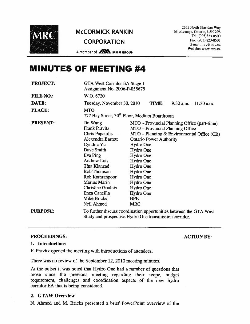


2655 North Sheridan Way
Mississauga, Ontario L5K 2P8
Tel: (905) 829#4988
Fax: (905) 823#2669
E#mail: [email protected]
Website: www.ecoplans.com
NOTES OF REGULATORY AGENCY ADVISORY GROUP
MEETING #6
PROJECT: GTA West Corridor Environmental Assessment
MEETING NO: Regulatory Agency Advisory Group Meeting #6
FILE NO.: 06#3184
DATE: April 29, 2011 TIME: 1:30 p.m.
PLACE: Caledon West Ballroom, Holiday Inn Select Brampton, Brampton, ON
PRESENT: Agencies
Eva Ping
Tina Kianzad
Jonquil Li
Alexandra Barrett
Julia Salvini
Anthony Caruso
Michael Baran
Liam Marray
Jennifer Lawrence
Paul Kerry
Jamie Ferguson
Bohdan Kowalyk
Sharon Lingertat
Jackie Van de Valk
MTO
Jin Wang
Frank Pravitz
George Ivanoff
Consultant Joint Venture
(CJV)
Neil Ahmed
Mike Bricks
Karin Wall
Catherine Christiani
Hydro One, Transmission Planning
Hydro One, EDCS
Hydro One, Environment
Ontario Power Authority
Metrolinx, Policy and Planning
Metrolinx, Policy and Planning
Niagara Escarpment Commission
Credit Valley Conservation
Conservation Halton
CP Rail
Grand River Conservation Authority
Ministry of Natural Resources
Toronto and Region Conservation Authority
Ministry of Agriculture, Food and Rural Affairs
MTO Provincial and Environmental Planning
MTO Provincial and Environmental Planning
MTO Provincial and Environmental Planning
MRC
BPE Inc.
AECOM
Ecoplans Limited
PURPOSE: To present and discuss the recently released Draft Transportation Development
Strategy (TDS) Report, with particular focus on the proposed new transportation
corridor, in order to facilitate review of the Report. Provide an opportunity to
receive and discuss preliminary comments on the Report.

GTA West Corridor Environmental Assessment Page 2
Notes of RAAG Meeting #6 – April 29, 2011
ITEM PROCEEDINGS: ACTION BY:
1.0
Welcome and Introductions
1.1 J. Wang welcomed attendees to the meeting. The project team, presenters and
attendees introduced themselves. The meeting purpose was also reviewed.
2.0 Project Team Presentation
2.1 N. Ahmed and M. Bricks presented a study update, an overview of the study
background and process, the key elements of the recommended Draft
Transportation Development Strategy (including the new transportation
corridor and north#south link), the key factors of the recommendation and
summary of the additional analysis conducted, reviewed the preliminary route
planning study area, and outlined the study’s next steps.
3.0 Discussion
3.1 The following questions / comments were raised after the presentation:
3.1.1 Question: Is the new facility intended to tie into the Tremaine Road
interchange at Highway 401?
Response: Alternative 4#3 will likely connect to Highway 401 somewhere to
the west of Dublin Line, west of the proposed Tremaine Road interchange
area. The specific location will be determined during Stage 2 of the EA
(Route Planning and Preliminary Design). One of the objectives of this
connection is to provide additional capacity around Milton without requiring a
new crossing of the Niagara Escarpment.
Follow�up Question: There will likely be future pressures on the Tremaine
Road interchange due to the presence of the GTA West corridor connection
nearby. Tremaine Road is currently a rural road that crosses environmental
features. Increased pressure on Tremaine Road will mean increased pressure
on those environmental features.
Response: Comments noted.
3.1.2 Question: What type of corridor connection will be made at the Highway
401/407 ETR interchange?
Response: Slide 29 shows a representative 4#leg interchange, containing the
required provincial / inter#regional interchange connections. Other
representative interchange configurations will be considered. The Project
Team will be discussing additional access requirements with municipalities as
the study progresses. Access and interchange locations will be determined in
Stage 2 of the EA.
3.1.3 Question: The TRCA questioned the need for the road and noted some
concerns regarding the fragmentation of conservation lands and natural
corridors. The TRCA’s biggest concern is a potential new Humber River
crossing. Is there any way to remove or avoid impacts in the Humber River
area?
Response: The Project Team used demand forecasting to determine the need
for transportation capacity improvements. The result of that analysis
determined that the most congested area within the study area is in York
Region, between Highways 400 and 410. Through the use of the building

GTA West Corridor Environmental Assessment Page 3
Notes of RAAG Meeting #6 – April 29, 2011
ITEM PROCEEDINGS: ACTION BY:
blocks approach, it was determined that optimization alternatives, modal
alternatives and improvements to existing facilities would not address the
transportation issues in the area and a new transportation corridor is required.
Unfortunately, a new corridor crossing of the Humber River Valley is
unavoidable due to that fact that it runs north to south through the study area.
Stage 2 of the EA, Route Planning and Preliminary Design, will provide the
opportunity for field work to be completed in order to identify features,
minimize intrusion impacts and find the best available crossing. The
Preliminary Route Planning Study Are has been developed to be as large as
possible in the vicinity of the crossing so that several route alternatives can be
examined during Stage 2 of the EA. For example, an established development
area in Kleinburg was kept in the Preliminary Route Planning Study Area,
despite developer opposition, in order to keep a key environmental crossing
opportunity available. It is recognized that not creating a new crossing would
be most desirable however if a crossing is required the Project Team wants to
maximize the number of options available. The footprint (or, right#of#way) for
the proposed corridor is estimated to be 170 m, while the study area shown is
approximately 3#5 km wide. Potential effects can be minimized using
innovative design and mitigation techniques. Potential future land use changes
can be controlled by limiting access and proper land use planning in order to
limit the introduction of incompatible uses into the area.
3.1.4 Comment: Hydro One and the Ontario Power Authority (OPA) are looking at
opportunities to coordinate the GTA West Corridor planning with a possible
future transmission corridor within the Preliminary Route Planning Study Area
during Stage 2 of the EA. It was requested that this be made clearer in the
final TDS report. In January, Hydro One provided comments on a project
discussion paper.
Response: Comments noted. Both Hydro One and the OPA are encouraged to
provide comments on the draft TDS, in addition to the discussion paper
presented in January. The Project Team is planning to have a meeting with
MOE regarding the discussion paper, which contains a number of EA
coordination options.
Comment: Both the GTA West Project Team and Hydro One/OPA need to
ensure their efforts are coordinated so that neither precludes another’s
opportunities, and overall impacts are minimized. Any corridor will have
effects on natural and agricultural lands.
Response: Comment noted.
3.1.5 Question: Does the Project Team plan on meeting with each of the agencies
individually?
Response: If required, follow#up meetings will be arranged with specific
agencies to discuss their comments. During the route planning stage of the
study (EA Stage 2), field work and detailed studies will begin. Individual
meetings with agencies will most likely take place at that time.
3.1.6 Comment: The CVC is concerned with a potential Credit River crossing. The
GTA West study area is larger than the HP#BATS study area.
Response: There will likely be only one crossing of the Credit River. The
Preliminary Route Planning Study Area is larger than the HP#BATS study area
because the GTA West Project Team saw an additional crossing opportunity to
the north that accommodates extension to the west. The Preliminary Route
Planning Study Area was made as large as possible to ensure opportunities

GTA West Corridor Environmental Assessment Page 4
Notes of RAAG Meeting #6 – April 29, 2011
ITEM PROCEEDINGS: ACTION BY:
aren’t precluded, and to wait for field investigations to commence.
3.1.7 Question: When will Stage 2 of the EA begin?
Response: The draft TDS report was released on March 7th, and will be
available for review and comment for a minimum of 90 days. A government
decision will be made as to the start of Stage 2 of the EA, once all comments
are received.
3.1.8 Comment: Metrolinx recently completed a freight study in January, which was
approved by the Board. Intermodal freight pilot projects will soon be
beginning. Other studies/work that Metrolinx is working on are:
• The University of Toronto is compiling more data on freight;
• A Transportation Association of Canada (TAC) study is underway on
truck lanes; and,
• An industry round table has been set#up to advise on urban freight
issues.
Response: Comments noted. The Project Team appreciates the update, and
may contact Metrolinx regarding the results of the studies being completed. As
a part of the traffic analysis, a scenario for a truck#only facility was tested. It
was found that particularly between Highways 400 and 427, there is a need for
a 4#lane truck#only facility. The Project Team’s recommended new
transportation corridor could contain a combination of HOV lanes, truck#only
lanes and a transitway. Truck#only lanes or a truck#only facility could also be
phased in during implementation.
3.1.9 Question: Have species at risk been considered?
Response: Species at risk (SAR) was considered and will be further examined
during the route planning stage of the EA. The Project Team has information
on SAR from both the Ministry of Natural Resources and the Conservation
Authorities, however it will all need to be confirmed through field work during
Stage 2 of the EA. This information was considered in the evaluation as
secondary source data, and helped to identify where concentrations of SAR
were. The Niagara Escarpment was one area where large concentrations of
SAR existed, and because of this (amongst other reasons), a crossing of the
Niagara Escarpment can be avoided.
3.1.10 Question: Will the future transportation corridor be given a 400#series
highway number?
Response: Upon approval of the EA, the legal name of the corridor will be
determined.
3.1.11 Question: During the evaluation, how were trade#offs between factor areas
made?
Response: The Project Team used a qualitative approach to the evaluation,
called the Reasoned Argument Method. The reasoned argument method
highlights the differences in net effects associated with the various
alternatives. Based on these differences, the advantages and disadvantages of
each alternative are identified according to the evaluation of trade#offs
between the various evaluation factors, criteria and indicators. The relative
significance of potential impacts is then examined to provide a clear rationale
for the selection of the preferred alternative.
4.0 What’s Next

GTA West Corridor Environmental Assessment Page 5
Notes of RAAG Meeting #6 – April 29, 2011
ITEM PROCEEDINGS: ACTION BY:
4.1 N. Ahmed thanked attendees for their participation. Any further comments or
questions on the presentation material were encouraged to be submitted to the
Project Team.
RAAG
Members
The meeting adjourned at 3:15 p.m.
Note that a copy of the presentation is available on the project website.
Post Meeting Note: In response to input received on the draft GTA West Corridor Transportation
Development Strategy, the ministry has decided to carry out additional analysis and consultation to
further examine the recommendations in the Halton area. The additional work will be carried out over
the Fall and Winter and is expected to be completed by Spring 2012. The ministry will consult with all
stakeholders on the results of the additional work before any decision on next steps is taken.
The forgoing represents the writer’s understanding of the major items of discussion and the decisions
reached and/or future actions required. If the above does not accurately represent the understanding of
all parties attending, please notify the undersigned immediately upon receiving these minutes (905�823�
4988).
Minutes Prepared by:
Ecoplans Limited
Catherine Christiani
cc: Attendees
Project Team Members
Regulatory Agency Advisory Group Contact List
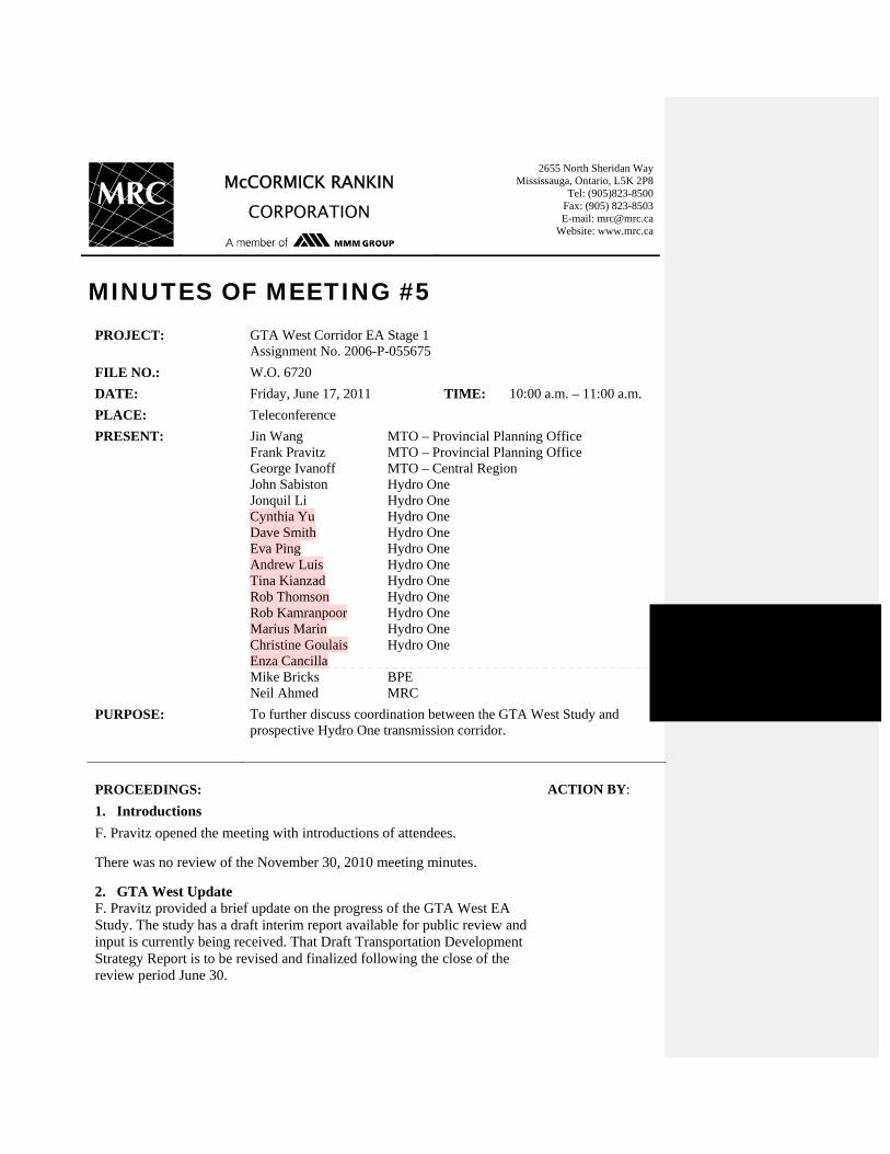
McCORMICK RANKIN CORPORATION
2655 North Sheridan Way Mississauga, Ontario, L5K 2P8
Tel: (905)823-8500 Fax: (905) 823-8503 E-mail: [email protected]
Website: www.mrc.ca
MINUTES OF MEETING #5 PROJECT: GTA West Corridor EA Stage 1
Assignment No. 2006-P-055675
FILE NO.: W.O. 6720
DATE: Friday, June 17, 2011 TIME: 10:00 a.m. – 11:00 a.m.
PLACE: Teleconference
PRESENT: Jin Wang Frank Pravitz George Ivanoff John Sabiston Jonquil Li Cynthia Yu Dave Smith Eva Ping Andrew Luis Tina Kianzad Rob Thomson Rob Kamranpoor Marius Marin Christine Goulais Enza Cancilla Mike Bricks Neil Ahmed
MTO – Provincial Planning Office MTO – Provincial Planning Office MTO – Central Region Hydro One Hydro One Hydro One Hydro One Hydro One Hydro One Hydro One Hydro One Hydro One Hydro One Hydro One BPE MRC
PURPOSE: To further discuss coordination between the GTA West Study and prospective Hydro One transmission corridor.
PROCEEDINGS: ACTION BY:
1. Introductions
F. Pravitz opened the meeting with introductions of attendees.
There was no review of the November 30, 2010 meeting minutes.
2. GTA West Update F. Pravitz provided a brief update on the progress of the GTA West EA Study. The study has a draft interim report available for public review and input is currently being received. That Draft Transportation Development Strategy Report is to be revised and finalized following the close of the review period June 30.

Minutes of Meeting Page 2 of 3 Date: June 17, 2011 PROCEEDINGS: ACTION BY:
3. Hydro One Update
Hydro One has reviewed the January 2011 “Proposal to Coordinate Environmental Assessment Requirements for a Combined GTA West Transportation and Electricity Transmission Corridor” as prepared by both study teams.
Hydro One has prepared a high level budget estimate for their IEA to be undertaken and staff is intending to take a submission to the President of Hydro One in the summer. Their intent is to seek approval of joint public consultation with MTO’s Stage 2 EA study.
Although OPA is being kept aware of the study, the Integrated Power System Plan that considers future requirements includes a need for this corridor in the beyond 20 year horizon and so the timing of this study is earlier than necessary.
4. Discussion
It was Hydro One’s position that in the above-noted memo, Alternative B is preferred (Two separate EAs running in parallel, but with a coordinated management approach). This approach would minimize and coordinate efforts overall, with use of the same specialists as appropriate. Two parallel corridors would be the best outcome, with some deviations as appropriate.
There was discussion regarding the interest and need to meet soon with MOE as regards the parallel and coordinated EA processes approach. It was noted that the Hydro One Board of Directors is appointed by the Minister of Energy and that Line Management can approve the initiation of the EA study for Hydro One (there may have been some misunderstanding of the MOE reference being Ministry of Environment and not Ministry of Energy).
The Hydro One Terms of Reference that will be required is typically started within 1-2 months following internal approvals. If the ToR is started September 1, the 6-12 month ToR process would then start. The EA would typically be 2-3 years for this length of study area however it was recognized that the MTO EA process would be the critical path. Assuming ToR approval next spring or summer, the Hydro IEA could be initiated after that. Hydro One would typically advise MOE once internal approvals are in place and then release an RFP.
It was recognized that although a joint meeting together with MOE would be suitable, it was too early to do so now. The timing should be to follow the approvals from Hydro One of a study initiation.
On that basis it was agreed that MTO could prepare a memo to MOE outlining the intent to proceed in parallel.
MTO

Minutes of Meeting Page 3 of 3 Date: June 17, 2011
The foregoing represents the writer’s understanding of the major items of discussion and the decisions reached and/or future actions required. If the above does not accurately represent the understanding of all parties attending, please notify the undersigned within 48 hours of receiving these minutes at 905-823-8500.
Minutes prepared by, McCormick Rankin Corporation
W:\6k\6720 GTA West Corridor EA Study\6720.700 Planning\6720.730 Meetings\6720.739 Regulatory Agencies\Hydro One Nov 30 2010\6720 June 17 2011 mto hydro one_draft.doc
Neil Ahmed, P. Eng.
cc: All attending

2655 North Sheridan Way Mississauga, Ontario L5K 2P8
Tel: (905) 829-4988 Fax: (905) 823-2669
E-mail: [email protected] Website: www.ecoplans.com
NOTES OF TRCA / CVC MEETING
PROJECT: GTA West Corridor Environmental Assessment
MEETING NO: Toronto and Region Conservation Authority (TRCA) / Credit Valley Conservation (CVC) Meeting
FILE NO.: 3331840
DATE: June 17, 2011 TIME: 1:30 p.m.
PLACE: Canada West Room, Black Creek Pioneer Village, Toronto, ON
PRESENT: TRCA / CVC* Beth Williston Dena Lewis Carolyn Woodland Maria Parish Sharon Lingertat Maggie Liu Liam Marray MTO Jin Wang Frank Pravitz George Ivanoff Consultant Joint Venture (CJV) Neil Ahmed Mike Bricks Catherine Christiani
TRCA, Manager – Environmental Assessment TRCA, Manager – Terrestrial and Aquatic Ecology TRCA, Director – Planning and Development TRCA, Supervisor – Planning Ecology TRCA, Planner TRCA, Water Resources Engineering Supervisor CVC, Planner / Ecologist MTO Provincial and Environmental Planning MTO Provincial and Environmental Planning MTO Provincial and Environmental Planning MRC BPE Inc. Ecoplans Limited
PURPOSE: Arranged by TRCA to discuss the Conservation Authorities (CA’s) comments on the Draft Transportation Development Strategy (TDS) Report, review the TRCA staff report (prior to its presentation at the TRCA Board on June 24, 2011), and provide clarity on the study’s next steps.
* Note: Staff from Conservation Halton was invited to the meeting, but was not able to attend.
ITEM PROCEEDINGS: ACTION BY:
1.0
Welcome and Introductions
1.1 S. Lingertat welcomed attendees to the meeting and reviewed the meeting purpose. Attendees introduced themselves.
2.0 Project Team Review of Work Completed to Date

GTA West Corridor Environmental Assessment Page 2 Notes of TRCA / CVC Meeting – June 17, 2011
ITEM PROCEEDINGS: ACTION BY:
2.1 N. Ahmed and M. Bricks reviewed the study milestone’s to date: The GTA West Corridor study began in 2007. The purpose of the
study is to plan for future transportation needs by examining long-term transportation problems and opportunities to the year 2031 and considering options to provide better movement of both people and goods between urban areas in the Preliminary Study Area, including designated Urban Growth Centres.
Over the next twenty years, significant growth is projected within the Greater Golden Horseshoe as population and employment is expected to increase 34% and 29% respectively by 2031. The purpose of this study is to identify the transportation network improvements required to support this future growth to 2031 and beyond.
The GTA West Corridor Preliminary Study Area includes parts of York Region, the Region of Peel, Halton Region, the County of Wellington and City of Guelph. It includes the Urban Growth Centres of Downtown Brampton (Peel), Downtown Milton (Halton), Vaughan Metropolitan Centre (York) and Downtown Guelph (Guelph).
During Stage 1 of the EA, the Project Team identified future transportation problems and developed alternatives for how to address these issues. The Project Team used an innovative building blocks approach to develop the alternatives, firstly considering how to optimize the existing transportation network and how many trips could be shifted to other modes of transportation, including transit and rail.
Even with significant optimization of the existing network and transit improvements (through the implementation of the GO 2020 Strategic Plan and Metrolinx Regional Transportation Plan (RTP)), it was concluded that additional transportation capacity (i.e. highway widenings and a new corridor) is required to support goods movement, the economy and intended growth.
Stage 1 of the EA process is nearing completion with the recent release of a draft report that recommends a long-term multi-modal Transportation Development Strategy (TDS) for the GTA West Corridor. The recommendation in the TDS includes the identification of a Preliminary Route Planning Study Area for a new transportation corridor. The Preliminary Route Planning Study Area will provide a focused area for the start of Stage 2 of the EA, Route Planning and Preliminary Design.
Stage 2 of the EA will involve comprehensive data collection, the generation, and evaluation of various route alternatives, and consultation with area stakeholders. This will lead to the selection of the preferred route for the corridor and the preliminary design of that route. Upon completion of Stage 2 of the EA, the preferred alignment and right-of-way requirements for the new corridor will be determined.
MOE will be the final review authority.
3.0 Discussion
3.1 The following questions / comments were raised after the project update:

GTA West Corridor Environmental Assessment Page 3 Notes of TRCA / CVC Meeting – June 17, 2011
ITEM PROCEEDINGS: ACTION BY:
3.1.1 Question: To what extent was a more sustainable live-work lifestyle
incorporated into the transportation modelling? Was a shift in attitude toward auto commuting accounted for? Response: Yes. The Project Team used the Greater Golden Horseshoe (GGH) Model to forecast future travel demands for the transportation analysis. It is the same model that was used by Metrolinx in the development of the RTP and by the Niagara to GTA (NGTA) Study. The model utilizes a detailed transportation network (including both transit and roadway) and forecasts trip-making by all modes of travel based on forecasts of population and employment growth, land use densities, socio-economic and demographic information, current and future transportation costs (representing fuel costs, tolls, parking costs, transit fares, vehicle operating costs, etc.) and transportation network performance for all travel modes. The land use criteria for intensification, from the Provincial Growth Plan, have been incorporated into the model, such as an expected increase in working at home and an increase in the use of transit. Some of the other GGH model assumptions include:
Auto Costs increase by 200% in real terms over 2006 levels Parking costs increase by 50% in real terms over 2006 levels Transit fares maintained at 2006 levels with provision of fare
integration Optimized high order transit frequency and average operating speeds
The GGH Model assumes an aggressive modal shift to public transit use. It is important to note that even with this preferential treatment, and all the transit improvements outlined in the Metrolinx RTP, GO Transit 2020 Strategic Plan and some additional transit-related improvements recommended in the Draft TDS Report, that there would still be significant deficiencies in the network and road widening and new corridor alternatives would still be required to address the remaining 2031 future capacity needs in the study area.
3.1.2 Question: It has been mentioned in previous meetings that Hydro One is interested in coordinating the implementation of a new transmission corridor with the GTA West transportation corridor. Would the new transmission corridor begin at Nashville Station? Response: Yes, the Project Team is in talks with Hydro One and the Ontario Power Authority in order to coordinate the GTA West Corridor planning with a possible future transmission corridor also within the Preliminary Route Planning Study Area during Stage 2 of the EA (Route Planning and Preliminary Design). The transmission corridor would begin at Nashville Station and end in Milton.
3.1.3 Question: How were the Preliminary Route Planning Study Area limits determined? Response: The Preliminary Route Planning Study Area was developed based on the overarching principle to maximize the opportunities for route generation while attempting to meet MTO Geometric Design Standards and avoid and/or minimize effects on the natural environment, existing built-up areas and approved municipal land use plans. MTO Geometric Design Standards were also used to ensure the engineering
GTA West Corridor Environmental Assessment Page 4 Notes of TRCA / CVC Meeting – June 17, 2011
ITEM PROCEEDINGS: ACTION BY:
feasibility at key locations including the potential connections with Highways 400, 427, 410 and at two points along Highway 401; and the crossings of major watercourses including the Humber River and Credit River. The study area was purposefully expanded at the Humber River and Credit River Valley’s in order to maximize the amount of crossing opportunities that could be considered. The Preliminary Route Planning Study Area is intended to be large enough to accommodate several route alternatives for new highway / transitway routes, including interchanges to connecting freeways and major arterials, sideroad connections or realignments, transit stops or rail connections, as well as other related facilities such as stormwater management ponds, areas for environmental mitigation, transit station parking, etc. The study area is preliminary and will be refined during Stage 2 of the EA. The Project Team wants to ensure there is a reasonable balance between having a focused area that provides certainty for municipalities, but which also has a wide enough area to minimize environmental impacts.
3.1.4 Comment: In their review, the TRCA will want to know what cumulative impacts a new corridor will have on the headwaters of the Humber River and the watershed. The cumulative impact/implications of the project on the Humber River headwaters should be accounted for in the evaluation. Impacts should be assessed on a watershed scale, not just on a site/project scale. Both the TRCA and CVC watershed plans should be reviewed and considered. Their targets for the future function of the watersheds should be taken into account. The 407ETR route planning was done before watershed planning was completed. The approach to this project should be different and watershed plans should be considered in the evaluation since they are available. A detailed evaluation, similar to what was done to determine transportation need, should also be done for the environment. The Project Team should begin to consider the following:
Are the watershed plan’s targets and the study’s targets compatible? Will the study be affecting the watershed plan’s targets negatively? What type of compensation/land banking would then need to be taken
into account? The Project Team needs to enhance the work they have completed with the added watershed considerations. Response: Comments noted. The Project Team appreciates the input and will discuss internally and work together with the TRCA and CVC to determine how best to address the incorporation of watershed plans into the both Stages 1 and 2 of the EA.
Project Team
3.1.5 Question: Why didn’t the Project Team consider corridor alternatives north of the Preliminary Study Area, around Highway 9? Response: A corridor north of the existing preliminary study area would be well removed from the transportation linkages currently envisaged in the Growth Plan and would likely encourage sprawl and development ‘leapfrogging’ the Greenbelt.
3.1.6 Question: Why didn’t the Project Team consider corridor alternatives east of Highway 400 to Markham? Response: While the study modeling and forecasting work did include the transportation network on the east side of Highway 400, and the entire Greater

GTA West Corridor Environmental Assessment Page 5 Notes of TRCA / CVC Meeting – June 17, 2011
ITEM PROCEEDINGS: ACTION BY:
Golden Horseshoe, corridor connections east of Highway 400 are outside of the scope of the current study. There are significant constraints east of Highway 400 due to concentrated development along the Yonge Street corridor and the presence of the Oak Ridges Moraine. Follow-up Question: The Growth Plan is now extending into Simcoe County. Will transportation improvements be looked at in this area too? Response: MTO has begun a separate network review for that area.
3.1.7 Comment: The TRCA Board will likely question why a new corridor is required when 407ETR is operating below capacity. Response: Comment noted. The planning for new infrastructure can take years. The recommendations in this study need to be initiated as soon as possible so that the proposed optimization and transit initiatives can begin to be implemented. The designation of the future corridor will assist municipalities in their planning and protect the land for transportation.
3.1.8 Project Team Question: How did the TRCA work with municipalities in developing their watershed plans? Response: The development of watershed plans is mandated in the Oak Ridges Moraine Plan. The municipalities within the TRCA jurisdiction helped pay for the development of the plans and they adopted resolutions to abide by them.
3.1.9 Comment: The TRCA Board will likely ask the following questions of the Project Team at the upcoming Board Meeting on June 24th:
Why is the project needed? Why is the new corridor not located more northerly? Have the TRCA’s watershed plans been accounted for? Why is the new corridor south of Bolton, and not north?
Response: Comments noted. Thanks for the information.
3.1.10 There was discussion regarding potential refinements to the Preliminary Route Planning Study Area, particularly around the Nashville Tract (lands owned by the TRCA) due to its possible fragmentation. It was suggested that the Preliminary Route Planning Study Area be expanded to the east/south to allow the development of alternative crossings over the Humber River in an area that is narrower. Upon review, it was agreed that the Preliminary Route Planning Study Area would be expanded in Kleinburg (around the Nashville Tract) in order to maximize the amount of opportunities available for a Humber River Valley crossing.
Project Team
3.1.11 Comment: The Project Team should be aware that the City of Vaughan wants to do a study on the Greenbelt lands in Vaughan. Tony Iacobelli, an Environmental Planner at the City of Vaughan, would be the appropriate contact. The area of Vaughan to be studied has often been called the Rouge Park of Vaughan. Response: Comment noted.
3.1.12 Question: Have First Nations been consulted with? Response: Yes, MTO has consulted with interested First Nations since the beginning of the study including the Six Nations of the Grand River Elected Council, the Six Nations of the Grand River Confederacy Council, the Mississauga’s of the New Credit First Nation, Williams Treaty, and the Kawartha Nishnawbe First Nation. First Nations will continue to be involved, and their interest will likely peak during the route planning and preliminary design stage of the EA.
3.1.13 Project Team Question: What is the status of the Humber Heritage Trail? TRCA
GTA West Corridor Environmental Assessment Page 6 Notes of TRCA / CVC Meeting – June 17, 2011
ITEM PROCEEDINGS: ACTION BY:
Response: The Humber Heritage Trail is a walking trail. Mapping of the trail may be available. The TRCA will check and provide mapping of the route, if it is available.
3.1.14 Comment: The Project Team should consider endangered species and species at risk in the area, including Redside Dace and Butternut. Response: Comment noted.
3.1.15 Comment: From the view point of managing/mitigating impact on watershed and habitat, it is generally preferred to cross the Humber River downstream, to the south i.e. one large crossing over the main river as opposed to multiple crossings over the tributaries upstream. A question was raised about whether or not a crossing south of Kleinburg should be considered. Response: Comment noted. The Project Team will relook at the rationale for why the revised study area did not include crossing locations south of Kleinburg. (Post Meeting Note: Upon review, a south of Kleinburg Humber River crossing was not included due to land use and geometrics issues. There were no feasible opportunities to go south of Kleinburg and connect to Highway 427 without significant impacts to existing and planned approved developments (built-up areas). Due to the fact that the Humber River meanders sharply in this area, multiple crossings of the Humber would also result from a south crossing.)
Project Team
3.1.16 Comment: The CVC agrees with the points brought up by the TRCA thus far. The biggest overall concerns for the CVC is a potential crossing of the Credit River and potential effects to the Credit River headwaters. The Credit River should only be crossed once and preferably as far south as possible. Response: Comments noted.
3.1.17 Question: How will new data be incorporated? Response: The study’s existing conditions information will be updated at the beginning of Stage 2 of the EA.
3.1.18 There was discussion about the crossing at the Etobicoke Creek. Stakeholders in Caledon have been requesting that the Study Area be refined to only allow for a northern crossing of the Creek so that they can develop south. TRCA and CVC confirmed that there were more potential for environmental effects to the north (e.g. stormwater management issues and the presence of redside dace, etc) and both options should be examined in greater detail during Stage 2 of the EA.
3.1.19 Comment: The Project Team should be aware that the Huttonville area contains a lot of wetlands which MNR has yet to release as provincially-significant. Response: Comment noted.
3.1.20 There was some discussion regarding expansion of the natural heritage system and the need for future restoration and compensation. Specific direct effects and opportunities for mitigation/enhancement will be discussed during Stage 2 of the EA.
3.1.21 S. Lingertat reviewed Conservation Halton’s key comments on their behalf, as sent by email from Jennifer Lawrence:
The strategy is too car-focused. The focus needs to be on transit improvements.
Cumulative impacts are not adequately addressed. Like that the study is avoiding a crossing of the Niagara Escarpment,
however the aggregate required to build the facility will need to come
GTA West Corridor Environmental Assessment Page 7 Notes of TRCA / CVC Meeting – June 17, 2011
ITEM PROCEEDINGS: ACTION BY:
from there. The connection between the GTA West and NGTA studies needs to be
better explained in the TDS. Conservation Halton’s full set of comments on the TDS has been submitted to the Project Team via letter.
4.0 What’s Next
4.1 N. Ahmed thanked attendees for their participation. Any further comments or questions on the presentation material were encouraged to be submitted to the Project Team.
TRCA / CVC
The meeting adjourned at 3:45 p.m. The forgoing represents the writer’s understanding of the major items of discussion and the decisions reached and/or future actions required. If the above does not accurately represent the understanding of all parties attending, please notify the undersigned immediately upon receiving these minutes (905-823-4988). Minutes Prepared by: Ecoplans Limited
Catherine Christiani
cc: Attendees
Project Team Members Jennifer Lawrence, Conservation Halton

GTA West Corridor Planning and EA Study – Stage 1 TRCA Board of Directors Meeting
June 24, 2011 Weston B Room – Black Creek Pioneer Village 9:30 am – 11:30 am
ATTENDEES: Chair: Gerri Lynn O’Connor
Vice Chair: Maria Augimeri Adjala-Tosorontio/Mono Glenn Mason Durham Gerri Lynn O’Connor Toronto Anthony Perruzza
Bryan Bertie Gay Cowbourne Glenn De Baeremaeker Gloria Lindsay-Luby Laurie Bruce Pamela Gough Peter Milczyn Vicent Crisanti
Peel Bob Callahan
John Sprovieri Richard Whitehead Jim Tovey Chris Fonseca
York Jack Heath
Linda Pabst Michael Di Biase
TRCA Executive Team Brian Denney – Chief Administrative Officer
Nick Saccone – Director, Restoration Services Carolyn Woodland – Director, Planning and Development Deborah Martin-Downs – Director, Ecology Adele Freeman – Director, Watershed Management
MTO Jin Wang
George Ivanoff Frank Pravitz
Consultant Mike Bricks
Meghan Bratt Karin Wall
NOTES: The GTA West Corridor Individual Environmental Assessment was item 7.2 on the agenda at the TRCA’s Board of Director’s meeting held on Friday, June 24, 2011. The item was held by John Sprovieri. There was approximately a 10-minute period when three members of the board asked questions to MTO’s consultant. The following summarizes key comments by the Board of Directors and the corresponding responses by Mike Bricks. Board Member Question / Comment Response
John Sprovieri (Peel)
Paragraph 1: Insert the word ‘either’ into the text where it says “THEREFORE LET IT BE RESOLVED THAT the Ministry of Transportation be advised that TRCA staff understands the provincial need for the new corridor, and that staff is committed to working with the Province to ensure the environmental impacts to the natural heritage system within the Humber River and Etobicoke Creek watersheds are avoided, mitigated and compensated as the IEA is developed;” It is suggested that the word, “either’ be inserted into the paragraph before the word avoided because if we apply these 3 conditions then the highway will never be built. The word ‘either’ will make it happen, as it is a huge challenge to build a highway with these environmental constraints.
The staff report was produced by staff at the Conservation Authority, not MTO. MTO does not see a problem with the proposed wording change MTO will continue to work with the CA.
Laurie Bruce (Toronto)
On page 47 in the bulleted list, specifically the 3rd bullet, is written in a way that is different that it is intended. “Overall principle is to maximize opportunities for route generation so that a reasonable range of alternatives can be generated while attempting to: Maximize areas where crossings
In the TDS we expand on the rationale. We can modify the TDS to address this wording.

of key natural features cannot be avoided;”
Where crossing of key naturalfeatures cannot be avoided thestudy area will be widened tomaximize the examination ofalternatives.
Michael Di Biase (York)
On page 42, paragraph 2 it says: “THAT the Ministry of Transportation be requested to further consider modifications to the draft preliminary route planning study area to minimize fragmentation of the natural heritage system, particularly in the area of the Nashville Resource Management Tract;” It would be strengthened to include the major valley of Humber River and other significant features.
The staff report was produced by staff at the Conservation Authority, not MTO. MTO does not see a problem with the proposed wording change MTO will continue to work with the CA.
Gaye Cowbourne (Toronto) Doesn’t the following paragraph address your comment / concern. Gerri Lynn O’Connor (Chair) Michael’s comment is site specific.
Carried with three amendments
APPENDIX F
INDIVIDUAL TSP/BCS TECHNICAL MEETING SUMMARY NOTES

Minutes of Meeting
PLEASE NOTE: If your records of this meeting do not agree with this document, or if there are any omissions, please advise the writer at once, otherwise the contents of this document shall be assumed accurate and correct.
URS Canada Inc. 75 Commerce Valley Drive East Markham, ON Canada L3T 7N9 Tel: 905.882.4401 Fax: 905.882.4399 www.urs.ca
Client: Ministry of Transportation Project Name: GTA West Corridor and NGTA Corridor
Planning and EA Study Date: July 27, 2009
Time: 10:00 a.m. to 12:00 p.m. Location: MTO Downsview Offices – 6th Floor Boardroom Purpose: Discussion of the projects in relation to the 407 ETR Attendees:
Jack Thompson - MRC, Transportation Consultant Jin Wang - MTO, Senior Transportation Planner Patrick Griepsma - MTO, Planner Arthur Tai - MTO, Senior Policy Advisor Eric Hakomaki - MTO, Transportation Systems Engineer Christine Darson - URS, Environmental Planner Jim Horton - 407 Express Toll Route, Director of Traffic and Planning
Description
Action by:

Page 2
Description
Action by:
INTRODUCTIONS
J. Thompson noted that the Growth Plan was the policy foundation for both the NGTA and GTA West projects. The Growth Plan identifies the need for a linkage between the 400 and Wellington County area, as well a linkage from the Fort Erie area to the GTA. Both studies will examine long-term transportation strategies for both people and goods, and expand on the multi-modal capacities of both study areas. J. Thompson noted that the Terms of Reference for both studies have been approved. The next step for the NGTA and GTA West studies will be hosting a Public Information Centre (PIC) in the fall of 2009.
P. Griepsma noted that meetings have been held throughout the process with various transportation service providers (TSP), and that information has been gathered from a wide variety of sources on multiple transportation modes.
J. Thompson noted that the transportation model being used for these studies is the Greater Golden Horseshoe Model (GGH Model). The study team is looking at both peak hour and daily traffic flow on the inter-regional transportation system.
J. Horton noted that traffic congestions on Highway 407 (even at 2031 peak levels) will be effectively managed by 407 ETR through the use of toll rates, thereby assuring their customers a certain level of service.
J. Thompson noted that the Project Team has also examined data from the 1960s to aid in their projections. The traffic forecasts developed by the GGH model indicated more than 10 lanes on Highway 407 west of Highway 400.
J. Horton notes that there are an ultimate number of core lanes. The ultimate number of core lands is shown in Schedule 1 of Schedule 22 in the Concession and Ground Lease Agreement. It is 4 core lanes west of Highway 401 and 5 lanes east of Highway 401. The only exception is a continuous auxiliary lane from Highway 427 to Highway 400.
J. Horton indicated that the 407 ETR has no issue sharing data with MTO, but data that is considered private can not be released or presented publicly. J. Horton noted that the 407 ETR website has extensive information on it and anything found on the 407 ETR website is considered public information and can be used for display purposes. Information shared and not found on the website is considered private information. E. Hakomaki noted that any information released as per the agreement between the 407 ETR and MTO is considered private. J. Horton suggested that if clarification is required on what is considered proprietary information, to send a request through Mr. Hakomaki. J. Horton clarified that if the Project Team creates their own 407 traffic forecasts then this can be presented publically, but the Project Team can not use and present 407 ETR traffic forecasts.
J. Wang noted that as part of this study we want to better maximize the current road network and structures. After this has been exhausted, additions to the physical capacity of the infrastructure will be considered. As part of the Project Team’s forecasts J. Wang inquired if past data provided by 407 ETR could be extrapolated to support the Project Team’s projections. J. Horton noted that the Project Team should create their own forecasts using data they have collected. P. Griepsma noted that a caveat will be added to the Project Team work noting that any such projections were created by MTO.
J. Thompson inquired if a cordon count could be done by the Project Team. J. Horton confirmed that this should be fine to perform.

Page 3
Description
Action by:
J. Horton noted that the 407 ETR is bound by their agreement with MTO in regards to what can and can not be done. If there is something beyond this agreement that the Project Team or MTO requires then the 407 ETR would be open to discussions.
J. Wang noted that the Project Team’s EA is currently being done at a high level and that specifics are beyond the scope of this project.
J. Thompson noted that as part of the modelling, the Project Team has been using 1700 vehicles per lane and inquired if this is reasonable. J. Horton confirmed that 1700 vehicles per lane is the volume specified in the Concession and Ground Lease Agreement as the threshold for expansion.
J. Thompson inquired as to whether information for specific sections can be presented or if it can only be presented on the entire system. J. Horton confirmed that displaying section information to the public is prohibited. If further clarification is required on this then J. Horton will present our request to the 407 ETR.
J. Wang inquired as to the best way to engage the 407 ETR in future discussions. J. Horton confirmed that M. Hakomaki is their MTO contact and that participation in the NGTA and GTA West projects can be done through M. Hakomaki. Additionally if any further clarification is required then Mr. Horton can query the information request.
Closing Remarks
J. Thompson and the Project Team thanked Jim Horton for his attendance and participation at the meeting. Meeting adjourned at 12 p.m.
Submitted by: Christine Darson
Distribution:
Attendees

NIAGARA TO GTA CORRIDOR EA – Phase 1
- 1 -
NNNGGGTTTAAA
Location: 777 Bay Street, 30th Floor, Exec. Bdrm Date: Friday February 19, 2010
Purpose: Joint Meeting with Metrolinx, GO Transit and Smart Commute to Discuss TDM and Transit Concepts
Time: 9:30 a.m. – 12:00 p.m.
Present:
Lisa Salsberg, Metrolinx
Julia Salvini, Metrolinx
Greg Ashbee, GO Transit
Ryan Lanyon, Smart Commute
Roger Ward, MTO
Jin Wang, MTO
Frank Pravitz, MTO
Patrick Griepsma, MTO
Howard Anders, MTO
Paul Hudspith, URS
Patrick Puccini, URS
Kevin Phillips, URS
Thomas Cerny, URS
Neil Ahmed, MRC
Mike Delsey, AECOM
Mario Peloquin, AECOM
Items Description Action by:
1. Opening Remarks
• R. Ward thanked all for attending and provided a brief update on the current status of both studies.
2. Overview Presentation
P. Hudspith and N. Ahmed provided an overview the study areas, policy context, and approach to generating the transportation system alternatives for both studies. The following comments and questions were discussed:
• How are the studies addressing cross border trade issues?
Answer: Both studies are undertaking an economic analysis to understand the potential economic opportunities associated with each of the preliminary planning alternatives, which will factor into the assessment of these alternatives
NIAGARA TO GTA CORRIDOR EA – Phase 1
- 2 -
NNNGGGTTTAAA
Items Description Action by:
• What level of approval will be sought at the end of Phase 1 for both studies?
Answer: There is no formal MOE approval required at the end of Phase 1. The Government of Ontario will carefully consider the elements of the Transportation Development Strategy that are within their jurisdiction before proceeding to Phase 2 of the study.
• What are the transportation problems that can’t be addressed by the Group #1 and Group #2 alternatives?
Answer: The Group #1 and Group #2 alternatives are an important foundation and will help to address the transportation problems and opportunities. However, these alternatives will not fully address the future highway congestion issues which affect the ability of all modes of transportation to function efficiently.
• Will concepts such as reserved bus lanes and incident management only be considered for existing highways?
Answer: These concepts will be applied principally to inter-regional transportation facilities, and could be applied to Group 3 and Group 4 alternatives.
• Suggest adding the GO Transit initiative to extend service to Guelph/Kitchener in the list of Group #2 concepts.
Agreed.
• Will this study be considering a transit connection between Guelph and Hamilton?
Answer: Yes.
• Will the final Transportation Development Strategy involve prioritizing of the initiatives included within it?
Answer: It is anticipated the Transportation Development Strategy will involve categorizing the various initiatives as near, medium and long term initiatives.
• Will cost estimates be prepared for the Group #1 and Group #2 alternatives?
Answer: Cost estimates for the Group #1 and Group #2 alternatives will be developed during the next phase of the study as greater detail becomes available.
• Will the inter-urban transit initiative that is being pursued by Niagara Region be incorporated into the NGTA study in some way?
Answer: The NGTA study team is aware of this initiative through consultation with Niagara Region staff. While this initiative will serve to provide travel choice for local travellers in Niagara Region, the NGTA study is focused on addressing future inter-

NIAGARA TO GTA CORRIDOR EA – Phase 1
- 3 -
NNNGGGTTTAAA
Items Description Action by:regional travel demands.
3. Transportation Demand Management (TDM)
• R. Lanyon provided an overview of the Smart Commute organization. He noted the following:
− Smart Commute focuses on home-based commuter trips during peak commuter periods.
− The program engages participants primarily through their employers. The success of the program is highly dependent on the ability to engage employers.
− The Smart Commute program focuses on the GTHA but the commuter shed is substantially larger.
− Smart Commute is starting to look at school based trips as well, but is not involved in TDM for tourism, goods movement, special events, etc.
− There are 130 active employers registered in the Smart Commute program representing more than 335,000 workers and post secondary students.
− Metrolinx is the central agency responsible for the Smart Commute program. This enables economies of scale and maximizes efficiencies. Metrolinx provides 50% of funding to the Transportation Management Associations (TMAs). In some cases municipalities also contribute funding (e.g. Richmond Hill and Markham).
− Smart Commute has studied the potential for third party vanpooling, which is a very successful program in the United States. Implementation of third party vanpooling in Ontario would require legislative changes, as it is currently not permitted in Ontario.
− The study undertaken by Smart Commute on third party vanpooling is entitled “Vanpool Program Feasibility Study (iTRANS, March 2007)” and is available online at SmartCommute.ca/resources.
• There was discussion with regard to the potential for supporting Metrolinx and Smart Commute in further establishing TDM practices in the GTHA. The following was noted:
− Under current legislation, the Smart Commute could be expanded beyond the GTHA, but funding could not be provided to TMAs in these areas.
− Assistance in terms of establishing TDM supportive policies around traffic management, tax incentives, etc. would be beneficial.
NIAGARA TO GTA CORRIDOR EA – Phase 1
- 4 -
NNNGGGTTTAAA
Items Description Action by:
− Financial incentives for TDM programs used in US have been very successful, especially when the employer is engaged in monitoring the participation of their employees. Often these programs involve providing financial incentives for a limited trial period (e.g. 3 months). The experience has been the even when the incentives are removed the majority of users continue to participate in the TDM programs.
− There was discussion as to whether it would be beneficial to establish some form of provincial governance that would oversee efforts to optimize the transportation system such as a Transportation Demand Management and an Active Traffic Management Strategy that could include Smart Commute, Carpool/HOV, TSM initiatives, etc.
It was noted that the concern would be that this may serve to limit TDM, which should be integrated across all aspects of the transportation system, as opposed to being considered an individual component.
It was agreed that the development of a broad TDM strategy that promotes integration across all of the aspects of the transportation system and reaches out to all relevant transportation agencies across the GTHA may be a better strategy.
− Smart Commute is looking into establishing a new TMA in the vicinity of Pearson International Airport that would be run by the Mississauga TMA.
− The annual funding for Smart Commute is on the order of $2 million, of which $1.3 million is provided to TMAs. Recommendations for increased funding within the Transportation Development Strategies for the NGTA and GTA West would be supported by Metrolinx and Smart Commute.
− R. Lanyon agreed to provide some information and review the final wording to be included within both Transportation Development Strategies related to TDM recommendations.
R. Lanyon
4. Transit
K. Phillips provided a brief overview of the transit related components that have been identified for the Group #2 alternatives for both studies. These included:
• Transit service between Hamilton International Airport (HIA) and Niagara Falls.
NIAGARA TO GTA CORRIDOR EA – Phase 1
- 5 -
NNNGGGTTTAAA
Items Description Action by:
• New/expanded transit service west of Pearson International Airport.
• Transit service focused around the City of Hamilton.
• Transit service focused around the City of Guelph.
• Transit service connecting Urban Growth Centres west of the GTA West study area.
The following summarizes the key discussion points with regard to these concepts:
• A transit service between the HIA and Niagara Falls is not anticipated to be a provincial initiative, but could be a private sector opportunity.
• The demand for this service may not be sufficient to justify its implementation.
• G. Ashbee noted that the GO Transit rail service to Niagara on weekends and holidays last year was successful in stimulating tourism. However, even with the significant number of trips generated, significant subsidy was required to maintain service.
• Metrolinx/GO Transit agree in principle with the concept of focusing inter-regional transit service around major employment nodes beyond the GTA. This would likely be a long-term initiative and would require further study to consider issues such as:
− Whether more appropriate for this service to be provided by municipal transit?
− Could be positioned as a “feeder” service into regional rail network.
− Kitchener/Waterloo could be another area of focus.
• With regard to transit service connecting Urban Growth Centres west of the GTA West study area, the following was noted:
− The Region of Waterloo undertook a study on extending GO Transit rail service to the region from Union Station. The recommendation was to provide service to Kitchener via the CP Rail line that services Milton.
− The study described above didn’t consider inter-connecting service between Kitchener, Cambridge, Waterloo and Guelph. This could be considered in conjunction with smaller trains.
− GO Transit would likely look at providing bus service

NIAGARA TO GTA CORRIDOR EA – Phase 1
- 6 -
NNNGGGTTTAAA
Items Description Action by:before implementing rail service.
− More study and consultation with municipalities would be required to explore this concept.
• Metrolinx and GO Transit were generally supportive of further considering the concepts presented, but noted that if included in the Transportation Development Strategy, they should be described in more general terms.
NGTA and GTA West
Study Teams
• Metrolinx and GO Transit agreed to review and provide further input on the transit related recommendations to be included in the Transportation Development Strategy.
Metrolinx/ GO Transit
• A teleconference with Metrolinx and Smart Commute will be scheduled to discuss the potential for broader TDM initiatives related to freight movement, tourism, special events, etc. in the two study areas.
URS
Meeting Adjourned at 12 p.m.
Submitted by: Patrick Puccini
Distribution: Attendees
2655 North Sheridan Way Mississauga, Ontario L5K 2P8
Tel: (905) 829-4988 Fax: (905) 823-2669
E-mail: [email protected] Website: www.ecoplans.com
NOTES OF TRANSPORTATION SERVICE PROVIDERS / BUSINESS AND COMMERCIAL STAKEHOLDERS MEETING
PROJECT: GTA West Corridor Environmental Assessment
MEETING NO: Transportation Service Providers (TSP) / Business and Commercial Stakeholders (BCS) Meeting
FILE NO.: 06-3184
DATE: May 11, 2011 TIME: 1:30 p.m.
PLACE: Hall A, Pearson Convention Centre, Mississauga, ON
PRESENT: TSP/BCS
Keith Randial
Ted Drewlo
Jonathan Lin
MTO Frank Pravitz Pat Griepsma Mark Darovny Consultant Joint Venture (CJV) Neil Ahmed Mike Bricks Catherine Christiani
Ontario Federation of Agriculture Ontario Federation of Agriculture York Region Transit Milton Chamber of Commerce Town of Halton Hills, Infrastructure Services Dept. Ontario Stone, Sand and Gravel Association Ontario Stone, Sand and Gravel Association Ontario Chamber of Commerce 407 ETR Association of International Auto Manufacturers Ontario Home Builders Association Ontario Home Builders Association Solmar Development Corporation (part-time) MTO Provincial and Environmental Planning MTO Provincial and Environmental Planning MTO Transportation Economics MRC BPE Inc. Ecoplans Limited
PURPOSE:
To provide an overview of the Draft Transportation Development Strategy (TDS) Report, in order to seek TSP and BCS reaction to the draft strategy. Provide an opportunity to receive and discuss preliminary comments on the draft report as they relate to people and goods movement.
GTA West Corridor Environmental Assessment Page 2 Notes of TSP/BCS Meeting – May 11, 2011
ITEM PROCEEDINGS: ACTION BY:
1.0
Welcome and Introductions
1.1 F. Pravitz welcomed attendees to the meeting. The project team, presenters and attendees introduced themselves. The meeting purpose and agenda were reviewed.
2.0 Project Team Presentation
2.1 F. Pravitz, N. Ahmed and M. Bricks presented a study update, an overview of the study background and process, the key elements of the recommended Draft Transportation Development Strategy (including the new transportation corridor and north-south link), the key factors of the recommendation and summary of the additional analysis conducted, reviewed the preliminary route planning study area, and outlined the study’s next steps.
3.0 Discussion
3.1 The following questions / comments were raised after the presentation:
3.1.1 Question: Where will Alternative 4-3 connect to Highway 401 - around Tremaine Road? Response: Alternative 4-3 will connect to Highway 401 somewhere to the west of Dublin Line, west of the proposed Tremaine Road interchange area. The specific location will be determined during Stage 2 of the EA, Route Planning and Preliminary Design. Follow-up Question: Dufferin Aggregates likes this option, because it has access onto Highway 401. How much access will there be to the new corridor? Response: The Project Team will need to find a balance between providing appropriate access and not encouraging development through agricultural lands. Access and interchange locations will be determined in Stage 2 of the EA.
3.1.2 Question: How has this study been integrating with municipal Official Plans? Are municipalities going to protect lands for the new corridor? Response: The Project Team has been actively working with municipalities to keep them up to date on the study process. MTO has been reviewing and commenting, as appropriate, on development applications to ensure that the planning and implementation of the new transportation corridor is not compromised.
3.1.3 Question: Once Stage 2 of the EA is initiated, will affected property owners be notified? Response: A decision hasn’t been made regarding future notification efforts, however that type of broad notification is being considered. Follow-up Comment: With other large studies, landowners weren’t informed and found out about the impacts too late. This should be avoided. Response: Comment noted.
3.1.4 Question: Has the Project Team considered the locations of potential pits and quarries? Response: Areas of potential extraction were identified. The cost of resources and impact to resource extraction areas were considered in the evaluation.

GTA West Corridor Environmental Assessment Page 3 Notes of TSP/BCS Meeting – May 11, 2011
ITEM PROCEEDINGS: ACTION BY:
3.1.5 Comment: Slide 20 shows that there is currently a lot of traffic in the study area, even on local roads. This will just get worse in the future. Response: The purpose of the study is to address the long-term transportation needs of the study area. A new transportation corridor will alleviate pressures on the local road network. The Project Team recognizes the impacts that are occurring to local roads, and that is partly why the study is trying to provide alternative modes of transportation so this can be remedied in the future.
3.1.6 Question: Please explain Slide 25, “Key North-South Link Connections”. Response: Slide 25 shows the required provincial / inter-regional interchange connections. Other new connections to 407ETR may be considered. Discussions with 407ETR will continue as the study progresses.
3.1.7 Comment: The Project Team is assuming people will be using 407ETR. Response: The Project Team has forecasted future traffic volumes for the transportation system throughout the GTA West study area, including 407ETR. The draft TDS is about providing transportation choices.
3.1.8 Question: What is the estimated cost of the transportation corridor? Response: It is estimated that the highway components of the TDS (new corridor and highway widenings) will likely cost 4 to 5 billion dollars to implement, including the costs of the highway widenings. This cost does not include the cost of the transit initiatives.
3.1.9 Question: If Stage 2 of the EA is completed quickly, how soon could construction begin? Response: Stage 2 of the EA will likely take 3 to 5 years to complete. The Ministry of the Environment approval process then takes another 1 to 2 years. Detail design of the corridor would then likely take another 4 to 5 years, and then construction could begin. The Project Team is working to complete the EA as quickly as possible. New infrastructure is a long-term solution, and the Project Team anticipates other elements of the strategy, such as TDM/TSM and transit investment, to be in place beforehand.
3.1.10 Comment: MTO should use local resources for its construction materials. Response: Comment noted.
3.1.11 Question: Will there be any future meetings, like this one, for just the Niagara to GTA (NGTA) Corridor study? Response: The NGTA study is currently completing additional analysis. After that is completed, more meetings will be held to discuss results.
4.0 What’s Next
4.1 F. Pravitz thanked attendees for their participation. Any further comments or questions on the presentation material were encouraged to be submitted to the Project Team.
TSP / BCS Members
The meeting adjourned at 2:45 p.m. Post Meeting Note: In response to input received on the draft GTA West Corridor Transportation Development Strategy, the ministry has decided to carry out additional analysis and consultation to further examine the recommendations in the Halton area. The additional work will be carried out over the Fall and Winter and is expected to be completed by Spring 2012. The ministry will consult with all stakeholders on the results of the additional work before any decision on next steps is taken.

GTA West Corridor Environmental Assessment Page 4 Notes of TSP/BCS Meeting – May 11, 2011
The forgoing represents the writer’s understanding of the major items of discussion and the decisions reached and/or future actions required. If the above does not accurately represent the understanding of all parties attending, please notify the undersigned immediately upon receiving these minutes (905-823-4988). Minutes Prepared by: Ecoplans Limited Catherine Christiani
cc: Attendees
Project Team Members
Summary of:
GTA West Corridor
Environmental Assessment Study Community Advisory Group Meeting #7
Meeting Date/Location:
September 21, 2010 Four Points at Sheraton, Meadowvale Room
Mississauga, Ontario

Summary of Meeting Highlights Opening Remarks Glenn Pothier, the independent meeting facilitator, called the group to order, welcomed and thanked all participants for taking time out of their schedules to attend the session, and encouraged the group to take the opportunity to participate fully in the meeting. He then provided an overview of the meeting’s purpose/agenda, noting that the meeting had three main objectives:
1. Update the Community Advisory Group (CAG) on the project’s status; 2. Present and get valued feedback on the draft Transportation Development
Strategy and the principles developed for generating a draft Route Planning Preliminary Study Area; and
3. Outline the study’s next steps. The group was asked if there were any errors or omissions concerning the May 4, 2010 meeting summary. None were raised, thus the May 4th summary will be considered final.
indicated that he was unsure if he received the last meeting minutes. The Project Team will confirm he was sent a copy. [Upon review, it was confirmed that was sent an email copy of the minutes on August 16, 2010.] Observer Comments G. Pothier reminded the group that in the interest of openness, transparency and accountability, any member of the public can attend a CAG meeting as an observer. He then provided the opportunity for observer comments/questions — as there were no observers present at this point in the meeting, this agenda item was skipped. Overview Presentation: Status Update
M. Bricks, BPE Inc, provided a brief overview of the events held since the last CAG meeting — including a series of meetings with different groups and municipalities — and reviewed the feedback that was received from the public at Public Information Centre #4, held in June 2010. The following questions/comments were shared during and after the presentation:
Question: At the last CAG Meeting the group expressed strong concerns about growth projections and related transportation corridor planning being limited to the 2031 planning horizon. Were similar concerns echoed by others who attended the Public Information Centres and municipalities/agencies?
Response: Yes, concerns about the limitation of the 2031 planning horizon were made by members of the public and by municipalities and agencies. Though we heard this comment quite a bit, we reminded everyone that our
GLPi GTA West CAG Meeting #7 — September 21/10 2

project has to strike a balance between having a long-term vision and being able to use reliable information such as growth estimates, which are only available to the year 2031.
Follow-up Comment: If comments about this issue were plentiful, then the presentation slide should be revised to reflect the importance of this point. Currently, the comment is shown only as a sub-bullet when it should be its own bulleted point, in bold text.
Response: Agreed. The presentation slide will be revised. Similar changes will also be made in the draft TDS Report.
Question/Comment: How much traffic is anticipated to leave Highway 401 and use Alternative 4-3 as a by-pass? If needs aren’t met by Alternative 4-3, a new corridor north around Highway 9 may be required. You need to have a 50-year vision.
Response: With the introduction of Alternative 4-3 to the network, the number of lanes needed on Highway 401 has been projected to be 10.
Comment: If you focus on just using the Growth Plan as the basis for your planning, the Project Team is going to fall behind on their projections. The planning horizon of 2031 in the Growth Plan is too short. A 50 year vision is needed. When the GTA West Study is complete, planning will need to immediately begin for the next 20 years due to the intense growth in the area and high demand for facilities.
Response: Comment noted. The Project Team recognizes the challenge to balance the need for planning for the longer term and the need to have reliable forecast information regarding growth patterns. It is particularly important to strike the right balance in order to make informed decisions when planning for major infrastructure. The planning horizon and the growth level in the GTA West Corridor Study are consistent with the Growth Plan which provides the growth targets and the associated growth management policies for the year 2031. The Ontario Ministry of Transportation (MTO), and Project Team, are bound by current provincial policy and cannot make land use projections without the appropriate data.
Comment: A lot of the discussions occurring during the current municipal elections in Halton Hills are about this study. Some residents are very concerned about the outcome of the study. The Project Team should be aware that the Town of Halton Hills is opposed to Alternative 4-3.
Response: Comments noted. The Project Team is aware of the Town of Halton Hills’ concerns.
GLPi GTA West CAG Meeting #7 — September 21/10 3
Comment: Simply relying on the Growth Plan is a cop-out. You’re going to have the same transportation problems you have today twenty years from now. MTO needs to break the cycle and do things differently. Before anything ever gets built, you will already have to plan for even greater growth.
Response: Comment noted.
Question: Are there equivalent studies underway to the north, south, east and west of the Preliminary Study Area?
Response: To the south of the Preliminary Study Area is the Niagara to GTA (NGTA) Corridor EA Study. The NGTA and GTA West EA studies share a common boundary in Highway 401 — and the two studies have been closely integrated. To the west is the Cambridge to Brantford EA Study. MTO is currently considering initiating a review of the Simcoe transportation network to the north. There are no current studies to the east of the Preliminary Study Area, primarily due to the fact that east of Highway 400 is fully developed. All of the Project Team’s modeling was done on a network level and incorporated the areas north, south, east and west of the study area, and wasn’t exclusive just to the study area.
Question: Would a new transportation corridor incorporate a transitway and/or hydro/utilities corridor?
Response: Likely yes. Any new transportation corridor would likely include a transitway and could be coordinated with hydro elements.
Overview Presentation: The Draft Transportation Development Strategy N. Ahmed, MRC, provided a brief overview of the draft Transportation Development Strategy. [Note: Presentation slides are posted on the project website.] The following questions/comments were shared during and after the presentation:
Question: With Alternative 4-4, how many lanes would be needed along Highway 401?
Response: Between Highway 407 and Milton, 10 lanes would likely be required on Highway 401. East of Milton to Guelph, 8 lanes would likely be required. Work is already underway to widen the 401 further to the West.
Comment/Question: The Bram-West Parkway isn’t yet final, but it does not seem to factor strongly into the study’s material. Its presence could have a huge effect on the transportation network. Why isn’t the Bram-West Parkway being shown more clearly and assumed more as a certainty?
GLPi GTA West CAG Meeting #7 — September 21/10 4

Response: The Halton-Peel Boundary Area Transportation Study (HP-BATS), sometimes referred to as the Bram-West Parkway, is a joint study being conducted by the Region of Peel, Halton Region, City of Brampton, Town of Caledon, and the Town of Halton Hills in order to identify the long-term (2021 and 2031) transportation network required to support provincial and inter-municipal planning goals, and to serve future transportation demands within the study area. The study is being conducted outside of the EA process, and a facility has not yet been approved. MTO and the participating municipalities have been coordinating and are currently in discussions to determine the potential proponency of the facility should it proceed.
Question: Alternative 4-2 will impact Maple Lodge Farms. Has the Project Team consulted with them?
Response: The representative transportation corridor alternatives shown are up to 4 kilometres in width and are intended to illustrate possible end points and potential connections to the transportation network. Specific route locations/alignments of these illustrative alternatives will be examined in more detail in subsequent steps of the EA Process. The HP-BATS study area is shown in hatching on the map and, as a result of consultation with Maple Lodge Farms, avoids those lands. The GTA West Project Team would do the same.
Comment: A new hydro generation station is to be located at Sixth Line and Steeles Avenue. Any new hydro facilities that are part of a future transportation corridor should connect to this new hydro generation station.
Response: Comment noted. The Project Team is working with Hydro One and will be meeting with them on September 24, 2010 to further discuss coordination.
Question: Regional Councillor Jane Fogal [Halton Hills representative for Halton Region] is quoted in an email as saying: ‘From a trucking point of view, Alternative 4-2 makes sense, while 4-3 does not.’ Has the Project Team consulted with trucking associations throughout the course of the study?
Response: Yes, as a part of the study’s consultation program Transportation Service Providers, and Business and Commercial Stakeholders have been consulted, including the Ontario Trucking Association.
Follow-up Comment: Alternative 4-3 and the connection to the HP-BATS corridor would provide two reliable options for the trucking industry.
GLPi GTA West CAG Meeting #7 — September 21/10 5
Response: [Comment noted.]
Following the presentation, CAG members were asked if they had any additional thoughts about the advantages and disadvantages of Alternatives 4-2 and 4-3. The following were shared:
The mapping of the alternatives is inconsistent when it comes to their representation of the Highway 410 Extension corridor.
Alternative 4-2 is needed no matter what and should be built as soon as possible as the first phase of work. The Project Team should then monitor connections from Alternative 4-2 to Alternatives 4-3 and 4-4, and then decide which to build based on land use information as the second phase of work. This project needs a phase 1 and phase 2 of planning and construction. The project team should not be inflexible and unwilling to change as new information comes to light.
If you build Alternatives 4-2 or 4-3 now, there’s the potential to build 4-4 in the future as an ‘offshoot’ given that they share the same early routing.
Alternative 4-3 is located close to the new hydro generation station at Sixth Line and Steeles Avenue, so a connection to the facility would be easier.
Prefer Alternative 4-3 due to its length and connection to the HP-BATS facility. By building this alternative, the transportation network gets the benefits of both Alternatives 4-2 and 4-3.
In considering existing and new electricity plants, the team should look into whether it would take much effort to integrate these with Alternative 4-2.
Overview Presentation: Review of the Rationale and Principles for Developing the Draft Preliminary Route Planning Study Area M. Bricks provided a brief overview of the rationale for and principles used while developing the draft Preliminary Route Planning Study Area. He made clear that the draft Preliminary Route Planning Study Area and principles are a work in progress, and that the Project Team has just begun the process of refinements. Following the presentation, CAG members were asked if they had any additions or refinements to the list of principles generated. The following additions to the list of principles were shared/suggested:
Maximize the ability to integrate with utilities. Minimize impacts to the Greenbelt. When having to cross large and significant natural features, do so in a way that
minimizes the amount of overall crossings — and maximizes the potential for ‘right angle’ river/watercourse crossings.
Maximize opportunities to utilize abandoned gravel pits in route design. Minimize impacts to agriculture. Minimize impacts to approved municipal expansion areas and likely future
development areas. The Project Team should look beyond the area Official Plans and be visionary.
GLPi GTA West CAG Meeting #7 — September 21/10 6

The following question was shared as part of the discussion:
Question: Will a detailed analysis of agricultural lands — that is, what’s actually on the ground — be undertaken?
Response: Yes. During the next stage of the EA (EA Stage 2 – Route Location) additional studies on agricultural operations and linkages will be conducted. A number of principles and evaluation factors will be considered.
What’s Next N. Ahmed reviewed the next steps in the study and the timeline for release of the draft Transportation Development Strategy (TDS) Report. This Report will be made available for public and stakeholder review in late 2010. G. Pothier indicated that while this is likely the last CAG meeting, another may be proposed after the release of the TDS Report in order to discuss the report and comments submitted. If there is another CAG meeting, all CAG members will be notified. In addition, while it is not guaranteed, there will likely be a CAG formed in the second stage of the EA Study, which all current members would likely be invited to attend. G. Pothier and J. Wang, MTO, thanked CAG Members for their time and participation on the CAG. Both noted that the input received from the group has been invaluable to the Study. The Project Team acknowledged member contributions by presenting each with a personalized letter from the Director of the MTO Transportation Planning Branch. A copy of each letter is also being sent to each member’s local municipal clerk, in order to recognize their participation to the broader community. Open Forum and Observer Comments G. Pothier asked whether the Project Team or CAG members had any further business to add to the meeting agenda. The following questions/comments were shared by the CAG:
Question: How long will the next stage of the EA (EA Stage 2 – Route Location) and Detailed Design take?
Response: EA Stage 2 – Route Location and Preliminary Design will take 3 to 5 years to complete. After that is finished, Detailed Design can commence and could take up to 2 years. The Detailed Design for 7 km of Highway 404 took 2 years to complete, which included design and property acquisition. Implementation/construction is dependant on available funding.
Question: How large will the new transportation corridor right-of-way (ROW) be?
GLPi GTA West CAG Meeting #7 — September 21/10 7
Response: A typical highway ROW is 110 metres + 60 metres for a transitway allowance, equaling a total ROW width of 170 metres. If a hydro component were to be added to the ROW, the total width required would be 210 metres.
Comment: The Project Team has heard a lot of input from the CAG over the last 3 years and should challenge themselves to go beyond the ordinary and learn from the comments given.
Response: [Comment noted.]
Comment: I understand that the Greenbelt is a ‘floating greenbelt’ — and that while it allows for infrastructure to be built within greenbelt boundaries,there is also a provision for swapping lands in one area of the greenbelt for lands in another area as long as the total acreage remains at the same minimum size.
Response: We disagree with this interpretation of the Greenbelt Plan, and don’t believe the legislation is written as described. I don’t think you can swap existing portions of the Greenbelt with other lands. We will review the Greenbelt Plan and Bill 135 to clarify the intent with regards to land designation.
Observers were then invited to share any additional questions/comments. The following was discussed:
Comment: As a resident of Vaughan, I am disappointed that the corridor crosses the Greenbelt lands through Vaughan. In addition, with the corridor terminating at Highway 400 and not continuing easterly, there are concerns that the traffic wanting to continue east will spill over into the local community.
Response: The City of Vaughan is almost entirely built-up, so the only available area for a corridor connection is through the Greenbelt lands in northern Vaughan. In the evaluation of alternatives, the Project Team applied premium costing to any facilities located on Greenbelt lands (such as, long span bridge structures across the Humber River) in order to incorporate the costs of mitigating environmental effects through design. MTO will also use their Environmental Reference for Highway Design Guide for Designated Areas when planning any new corridor facilities through Greenbelt lands. The guide outlines the technical requirements for environmental protection / mitigation for highway design. East of the study area (that is east of Highway 400) is almost entirely built-up, due to the presence of the Yonge Street corridor. Although the study limits end at Highway 400, the study modelling considered the whole transportation network, including areas north, south, east and west of the Preliminary Study Area.
GLPi GTA West CAG Meeting #7 — September 21/10 8

Follow-up Question: Could a copy of the MTO Design Guide be sent to me?
Response: Yes. [Note: M. Bricks subsequently sent a digital copy of the MTO Environmental Reference for Highway Design Guide for Designated Areas to via email on September 23, 2010].
Question: Will development be permitted next to the new corridor through Greenbelt lands?
Response: If a new corridor is located within the Greenbelt, limited highway access and proper land use policies can discourage development pressure for lands adjacent to the new corridor. The Greenbelt Plan contains policies that prevent development from happening through the Greenbelt.
Closing Remarks Glenn Pothier thanked the group for their attendance and valued input. The meeting was formally adjourned (having run from approximately 7:00 pm to 9:00 pm).
GLPi GTA West CAG Meeting #7 — September 21/10 9

GLPi GTA West CAG Meeting #7 — September 21/10 10
Attendance (names listed in no particular order) CAG Members:
Public/Observers:
Ontario Ministry of Transportation: Heide Garbot Jin Wang Consultant Team: Neil Ahmed (McCormick Rankin Corporation) Mike Bricks (BPE Inc.) Catherine Christiani (Ecoplans Limited) Independent Facilitator: Glenn Pothier (GLPi)

Summary of:
GTA West Corridor
Environmental Assessment Study Community Advisory Group Meeting #8
Meeting Date/Location:
May 3rd, 2011 Holiday Inn Mississauga/Toronto West, Heartland Room
Mississauga, Ontario
GLPi GTA West CAG Meeting #8 — May 3, 2011 2
Summary of Meeting Highlights Opening Remarks Glenn Pothier, the independent meeting facilitator, called the group to order, welcomed and thanked all participants for taking time out of their schedules to attend the session, and encouraged the group to take the opportunity to participate fully in the meeting. He noted that there had been some notable developments since the last CAG meeting and that these precipitated this additional session, which would likely be the last within this project phase. Glenn then provided an overview of the meeting’s purpose, noting that the meeting had three main objectives:
1. Update the Community Advisory Group (CAG) on the project’s status; 2. Provide an overview of some key refinements made to the GTA West draft
Transportation Development Strategy (TDS) prior to its formal release; and 3. Outline what’s upcoming in terms of study next steps.
Glenn then walked the group through the more specific agenda components and described meeting procedures regarding observer involvement. Following self introductions by all meeting attendees, Jin Wang (Project Manager, MTO) thanked all participants for their ongoing interest and contributions to the project, and noted that a CAG would likely be formed in Stage Two of the initiative — adding that he hoped this group would continue to stay involved. Glenn asked the group if there were any notable errors or omissions in the September 21st, 2010 meeting summary. None were raised, thus that summary will be considered final. Observer Comments G. Pothier reminded the group that in the interest of openness, transparency and accountability, any member of the public can attend a CAG meeting as an observer. He then provided the first opportunity for observer comments/questions — none were forthcoming at this time. Status Update Presentation M. Bricks, BPE Inc, provided a brief overview of key events since the last CAG meeting, noting that:
The draft TDS report was formally released in March 2011, with a review period of 3 months (90 days);
The TDS included refinements to the recommendations — more specifically, that a combination of elements from options 4-2 and 4-3 be brought forward to Stage Two; and
There was a refined Preliminary Route Planning Study Area.
GLPi GTA West CAG Meeting #8 — May 3, 2011 3
Overview of Key Draft Transportation Development Strategy Refinements M. Bricks and Neil Ahmed (Project Manager, MRC) then provided an overview presentation covering:
The overall Study process — including the ‘building block’ approach; The context for the project — including the challenge of preparing for growth and
building on other transportation initiatives in and around the Study area; The key Study recommendations in such areas as:
o Optimizing the existing transportation network; o New/expanded non-road infrastructure; o Existing road widenings/improvements; and o The proposed new transportation corridor and North-South Link (a new
transportation corridor from Highway 400 to Highway 401 west of Milton and a new North-South Link to Highway 401 at 407ETR) — this included an overview of the benefits and supporting analysis/rationale for these.
A description of the purpose and boundaries of the preliminary route planning study area for Stage Two of the Study;
Coordination with the Halton-Peel Boundary Area Transportation Study; and Next steps — including various municipal and stakeholder consultation in
progress, receipt and review of comments on the TDS, finalization of the TDS, and initiation of the Stage Two Environmental Assessment. [Note: Presentation slides are posted on the project website.]
The following questions/comments were shared during and after the presentation:
Comment: The Project Team should be aware that there is a large shale deposit around the Norval area that may be mined — there is already a lot of truck traffic in that area, including inter-regional trips from surrounding quarries.
Response: [Noted.]
Question: Where has agriculture been accounted for in the evaluation — especially in the area at the top of Highway 410?
Response: Agricultural impacts were a key consideration in the evaluation to date. Once into the route planning stage, there will be additional principles and criteria to ensure that impacts are minimized by following lot lines and generally avoiding impacts as much as possible. We recognize that there are large agricultural operations around the Highway 410 ‘V’. There are lots of issues with development and agriculture in this area. If the ‘V’ is deleted from the refined study area, then the project will be forced to go through a residential area (Valleywood). The Project Team wants to look at this area in more detail after the detailed studies/field work is done. It is important to have all of the information before any option is removed.
GLPi GTA West CAG Meeting #8 — May 3, 2011 4
Comment: There are century farms and large agricultural operations in both Caledon and Halton Hills. A new highway through these areas will cause a lot of disruption and could have dramatic impacts on operations and property values. Farmers have a lot of money invested in their lands.
Response: [Noted.]
Comment: Valleywood is already pretty much fully developed — there should be less concern about the impacts there.
Response: [Noted.]
Comment: Transportation corridors have huge impacts on farms. Hydro corridors can have effects on animals/herds — the ‘tingle effect.’ If you are going to do this, it makes sense to have one corridor and put the infrastructure together. If you are going to buy farms and land, buy the whole thing, not just parts.
Response: Hydro One is looking to link the station in Kleinberg to one on the south side of 401 — they need the new line to serve additional growth. There have been a number of meetings with Hydro One and we are working together to ensure coordination between the two initiatives.
Question: If there is a utility corridor as well, does that mean the right of way would be larger then 170 metres?
Response: A new highway plus a transitway requires a 170 metre corridor. An adjacent hydro corridor would be in addition to that for a total of about 210 metres. The work we have shown has focused on the transportation corridor. Again, the Project Team is looking to coordinate with Hydro One, but the work to date has not included their requirements — approximately, 39 metres in addition to the transportation right of way would be needed.
Question: So, the hydro component would be outside of the transportation corridor?
Response: Yes, typically it is separate, but adjacent to the transportation facility.
Question: How would you improve Highway 10? Highway 410 is a controlled access highway. Right now it transitions into a kings highway. Are you looking to provide further controlled access with associated service roads?
Response: It is prudent to keep the ‘V’ in the refined study area, in order to evaluate it with more detailed information. We need to leave options open. Analysis suggests the need to add another four lanes to the 410 in this area
GLPi GTA West CAG Meeting #8 — May 3, 2011 5
by 2031 and the area is already tight from an engineering perspective. It is going to be a challenge to accommodate future need at this location. The Project Team requires more detailed information before taking any option off the table.
Comment: To minimize impacts on agriculture, keep the corridor as close to the planned urban area as possible.
Response: [Noted.]
Comment: Highway 410 is inconsistently shown on the maps. It creates confusion about whether the 410 is in or out of the study — you need a clear message for the community about whether expansion of the 410 is part of the study.
Response: The Project Team’s intent is to show potential locations for a new facility — connections to the 410 were always going to be considered. The Team will be looking at various options in the next Phase.
Comment: In that case, the study area should have included Valleywood. If the intent is to look at two options to connect the corridor to 410, the study area should have included Valleywood. In fact, the 410 should have been designed properly from the beginning.
Response: Again, the intent of the study area was to show where new facilities could be placed.
Comment: If you build this and there are still congestion challenges shortly afterward — and the need for further expansion — this will not have been a successful exercise. If you are going to do it, do it right. Your planning horizons are too short.
Response: [Noted.]
Comment: Looking forward 20 years, neither option 4-2 or 4-3 go far enough. You should reconsider option 4-4 and tie into Guelph. In the long run, it will be more useful. Bite the bullet and do it now. This option should be reconsidered.
Response: [Noted.]
Comment: There is an obvious ‘elbow’ in the study area, where a new highway would have gone to Guelph — this is an opportunity for a future intersection with a facility that goes to that City. The Project Team should make provision around the elbow for an interchange/connection. Given that the Greenbelt/Escarpment lands are there, there won’t be as heavy development pressures in the future. Keep this option available.

GLPi GTA West CAG Meeting #8 — May 3, 2011 6
Response: [Note: the Project Team briefly reviewed the pros and cons of Options 4-4 and 4-5, and clarified that the preferred approach of combining elements of options 4-2/4-3 adequately serve transportation needs west of Milton while minimizing environmental impacts.]
Comment: You should create a new escarpment crossing. You will need to do it eventually – so you might as well do it now.
Response: [Noted.]
Comment: There is an opportunity to do something fantastic with a new crossing of the escarpment. You could build a landmark structure, something iconic.
Response: [Noted.]
Comment: The preferred route is a waste of money. The Project Team isn’t looking far enough into the future – the plan will become dated very quickly.
Response: [Noted.]
Comment: The Project Team should create a monitoring strategy — with clearly established check-in points — to ensure the direction of the project is in line with trends and as a way to factor in changes over time. This will help ensure money isn’t wasted.
Response: [Noted.]
Question: Where will you start with the future work — will the planning/construction occur from east-to-west?
Response: This has yet to be determined. One project, with one study area must be submitted to MOE for approval. There are pinch-point areas on which it will be logical to focus, but the whole thing will be looked at as one project.
Question: What is HP-BATS?
Response: The Halton-Peel Boundary Area Transportation Study, sometimes referred to as the Bram-West Parkway, is a joint study being conducted by the Region of Peel, Halton Region, City of Brampton, Town of Caledon, and the Town of Halton Hills in order to identify the long-term (2021 and 2031) transportation network required to support provincial and inter-municipal planning goals, and to serve future transportation demands within the study area. The study is being conducted outside of the EA process and a facility has not yet been approved.

GLPi GTA West CAG Meeting #8 — May 3, 2011 7
Comment: I have concerns about the suggestion to revisit options 4-4 and 4-5 — either today or in the future. The recommended 4-2 and 4-3 approach helps keep development concentrated in urban areas and helps avoid ‘leap frog’ development. The idea of encouraging greater transit use before a new highway is built is a good one. Current policy supports this and is the basis of the study directions. It’s important to move people through alternative means and accommodate goods at the same time — this has been a balanced approach.
Response: [Noted.]
Open Forum and Observer Comments G. Pothier asked whether the Project Team or CAG members had any further business to add to the meeting agenda. CAG members shared the following questions/comments:
Comment: Agriculture makes a significant contribution to the economy.
Response: [Noted.]
Question/Comment: Did you examine why transportation initiatives seem to work better in Europe and Asia? In some ways, they are more advanced than us.
Response: We have looked at things done in other areas, including various approaches and technologies used elsewhere — such as adjustable speed limits that are included in our strategy. The plan is to provide a lot of transit and other improvements, including bus rapid transit, as part of implementing the Metrolinx recommendations. The intent is to create a network that can evolve over time — beginning with the transit planning and then following up with road improvements in order to create a web network. There are notable differences between Europe/Asia and the GTA West area — from population densities, to historical norms and so forth.
Question/Comment: How accurate are the growth projections? How accurate have the past projections been? There is a need to rely on the expertise of the local municipalities.
Response: [Noted.] G. Pothier then asked whether observers had any questions/comments. The following were shared: [Note: Councillors in attendance who offered observations made it clear that they were not speaking on behalf of their respective Councils.]
GLPi GTA West CAG Meeting #8 — May 3, 2011 8
Comment: Halton Hills is currently formulating a response to the draft TDS report for the Project Team. The quality of input from the CAG is great. More emphasis needs to be placed on protecting agriculture and making is sustainable. The green or environmental areas on the map seem to have been given more emphasis than the white. Local food comes from the white lands on which greater value should be placed. There is a huge local food movement underway. It’s important to remember that food matters — and it’s short-sighted to remove agricultural lands from production. While there is an appreciation that the strategy is multi-modal, less money should be spent on highways and more on transit to create effective grids and options. The Metrolinx Regional Transportation Plan is described as a base on which the GTA West strategy is built, but that plan is still not completely funded. Money should be allocated for this. We need a comprehensive transit network now.
Response: [Noted.]
Comment: I’m concerned about the disappearance of agricultural land. If one farmer is put out of business, that is one too many. I expect a lot more from my MTO planners. Are we even going to be driving cars in 20 years? MTO should be looking at sustainable alternatives. The focus is on cars and trucks, and nothing else.
Response: [Noted.]
Comment: If you look at where we are going we might not even be using cars in the future. Things may be quite different 30 years from now. The focus on more roads seems to be short-sighted. We seem to be behind the times, unlike Europe, which is transit and train focused. I have attended previous GTA West Public Information Centres, and have expressed concerns about the routing through Vaughan. The area that the corridor is going through was supposed to be protected for natural/agricultural lands. A new corridor works against compact development. Why can’t Highway 9 be used for the corridor — and then, perhaps, come south down the 427? The current location of the corridor doesn’t seem to be addressing where the traffic load needs to be lightened. The highest class of farmland in the area is being affected. The headwaters of the east Humber is an important feature that needs to be respected, just as much as the Oak Ridges Moraine. It’s disappointing that other things weren’t considered in that area.
Response: [Noted.]
Comment: The chosen route through Vaughan will result in extraordinary development pressures – adjoining natural lands will be gone and much of the Greenbelt will be wiped-out.
Response: [Noted.]

GLPi GTA West CAG Meeting #8 — May 3, 2011 9
G. Pothier indicated that this is likely the last CAG meeting within this phase of the Study. If there is another, all CAG members will be notified. In addition, while it is not guaranteed, there will likely be a CAG formed in the second stage of the EA Study, on which all current members are encouraged to participate. G. Pothier and J. Wang (MTO) thanked CAG Members and observers for sharing their views. Both noted that the input received from the group has been invaluable to the Study. Mr. Wang also noted that the Project Team would be making a presentation to Halton Hills Council on May 10th. Closing Remarks Glenn Pothier thanked the group for their attendance and valued input. The meeting was formally adjourned (having run from approximately 7:00 p.m. to 9:00 p.m.). Attendance (names listed in no particular order) CAG Members:
Public/Observers:
Councillor Jane Fogal Councillor Deb Schulte Ontario Ministry of Transportation: Frank Pravitz Jin Wang Consultant Team: Neil Ahmed (McCormick Rankin Corporation) Mike Bricks (BPE Inc.) Catherine Christiani (Ecoplans Limited) Independent Facilitator: Glenn Pothier (GLPi)

McCORMICK RANKIN CORPORATION
2655 North Sheridan Way Mississauga, Ontario, L5K 2P8
Tel: (905)823-8500 Fax: (905) 823-8503 E-mail: [email protected]
Website: www.mrc.ca
MINUTES OF MEETING PROJECT: GTA West Corridor EA Stage 1
Assignment No. 2006-P-055675
FILE NO.: W.O. 6720
DATE: Thursday, June 16, 2011 TIME: 11:00 a.m. – 12:30 p.m.
PLACE: Teleconference
PRESENT: Silvia Jones Kathryn Creelman
Jin Wang Joe Perrotta Mike Bricks Neil Ahmed
MPP – Dufferin-Caledon Executive Assistant to MPP Sunnymead Farms Sunnymead Farms MTO – Provincial Planning Office MTO – Provincial Planning Office BPE MRC
PURPOSE: To discuss GTA West study progress and specifically potential impacts to agricultural operations at Sunnymead Farms in Caledon.
PROCEEDINGS: ACTION BY:
Remarks by Sunnymead Farms Following introductions, and provided an overview of their agricultural operations at Sunnymead Farms. They provided copies of a submission to MTO that included a Description of the Business, Impacts of Potential Route and Uncertainty of Timing to Choose Route with attachment map and aerial photo.

Minutes of Meeting Page 2 of 2 Date: June 16, 2011 PROCEEDINGS: ACTION BY:
Overview of GTA West Study Progress
J. Wang distributed a copy of materials from the GTA West study for reference.
He explained the derivation of the study area, referencing a large plan. This study area is based on an appropriate area to provide for identification of a variety of route alternatives, to permit the Province to identify land development applications that may have an impact on the route planning process and that accommodates a need to connect Highway 410 with the proposed GTA West Corridor – an east-west highway/transitway through this area. J. Wang further explained that Stage 2 of the EA was to get approval and start later this year or early next year.
MPP Jones enquired how this new infrastructure could be introduced as land use planning occurs across the whole of the study area. J. Wang responded that land use planning is coordinated into the study process.
J. Perrotta indicated that there are some constrained areas that will complicate the process of route planning.
J. Wang noted that the study area will be reviewed and possibly revised as the MTO receives input through this public review process.
In concluding, Sunnymead Farms was encouraged to submit a letter to MTO (through MRC) to describe their concerns in a comprehensive package, although materials provided together with the meeting minutes would provide an overview.
Sunnymead Farms
The foregoing represents the writer’s understanding of the major items of discussion and the decisions reached and/or future actions required. If the above does not accurately represent the understanding of all parties attending, please notify the undersigned within 48 hours of receiving these minutes at 905-823-8500.
Minutes prepared by, McCormick Rankin Corporation
W:\6k\6720 GTA West Corridor EA Study\6720.700 Planning\6720.730 Meetings\6720 June 16 2011 Sylvia Jones MPP minutes draft.doc
Neil Ahmed, P. Eng.
cc: All attending

GTA West Corridor Planning and EA Study – Stage 1
Halton Hills Resident Meeting, June 23, 2011
1
A Town of Halton Hills resident, , held a community meeting regarding the GTA West Corridor Environmental Assessment on Thursday June 23, 2011 at the Glencairn Golf Club, Aberdeen Room (9807 Regional Road 25) in Halton Hills from 7:00 p.m. to 9:30 p.m. The GTA West Project Team was invited to provide a presentation and answer questions about the study. The meeting organizer, , facilitated the meeting. The following representatives from the GTA West Project Team were in attendance:
Jin Wang, MTO [Presenter / On Panel] Frank Pravitz, MTO Derek Barkley, MTO [On Panel] Astrid Poei, MTO Mike Bricks, BPE Inc. [Presenter / On Panel] Mike Delsey, AECOM [Presenter / On Panel]
Karin Wall, AECOM Kevin Jones, AECOM Tim Sorochinsky, URS Glenn Pothier, GLPi Katherine Jim, MRC Catherine Christiani, Ecoplans Ltd.
Purpose of the Meeting
indicated that the purpose of the meeting was to allow for information sharing about the project, and to allow concerned citizens the opportunity to ask questions of the Project Team.
Two display boards of the GTA West Preliminary Route Planning Study Area were put on display. Attendance
Approximately +/- 185 people were in attendance at the meeting. Staff and Councilors (including Councilors Jane Fogal and Moya Johnson) from the Town of Halton Hills, the Mayor of Halton Hills (Rick Bonnette) and MPP Ted Arnott (Wellington-Halton Hills) were also in attendance. A mailing list sign-up sheet was provided for interested attendees, and project business cards with the project’s website address and email address were also made available. 114 people signed up for the project mailing list. During the meeting post cards against the new highway were circulated. The postcards were addressed to the Minister. Media Lisa Tallyn, of the Georgetown Independent Free Press, was in attendance. An interview with the Project Team was not requested. Summary of the Meeting and the Issues / Concerns Raised
1. Welcome and Opening Remarks –
Welcomed all to the meeting and outlined the meeting’s purpose.
Upon talking with her neighbours, she found that, like her, many had not heard about the project until they received a letter from the Mayor in early June.
Noted that she gathered questions from the community and forwarded these to MTO. They will try to answer these questions tonight.
GTA West Corridor Planning and EA Study – Stage 1
Halton Hills Resident Meeting, June 23, 2011
2
2. Remarks – Ted Arnott, MPP, Wellington-Halton Hills
The study began in 2007 and was initiated by the present government.
Will bring the comments/concerns voiced to the Minister and elected officials’ attention.
Would like to work with the Town to ensure that quality of life is enhanced by highway projects, not hurt.
He supports the Town of Halton Hills position on the project. There are other more pressing transportation issues in the area, which have been identified by Town Council.
On August 12, 2010 he wrote a letter on behalf of Halton Hills, indicating the importance of community input through all steps of the study. Has since written to MTO and the Minister’s office, particularly upon getting emails recently about the study.
Was briefed by officials in the past on this study, made a request today (on June 23) to the Minister to receive a full briefing from the senior officials on the study, hoping that the minister will be at the briefing.
Is committed to work with the Town, MTO and residents of Halton Hills moving forward.
3. Overview Presentation by the GTA West Project Team – Jin Wang, Mike Bricks, Mike Delsey
Jin Wang reviewed the consultation completed to-date (including the recent consultation completed in Halton Hills), the key issues raised to date by the Town of Halton Hills and residents, the project study area and study approach.
Mike Bricks reviewed the study process, building blocks approach, the Draft Transportation Development Strategy’s components and the factors used in the assessment of alternatives.
Mike Delsey reviewed the evaluation and reasoning for the preferred corridor and north-south link’s selection.
Mike Bricks reviewed the Preliminary Route Planning Study Area, the Stage 2 EA process, next steps and reviewed and answered key questions asked by Halton Hills residents regarding timelines, construction and property / property acquisition.
Mike Bricks and Jin Wang reviewed and answered key questions submitted by Wendy Bruchal in advance of the meeting pertaining to agricultural impacts, property value impacts, growth forecasting, notification and why alternative 4-4 was not carried forward.
4. Open Question Period
The following summarizes the key comments, issues and concerns raised during / after the presentation:
o Clarify what the width of the Preliminary Route Planning Study Area is.
o Have seen the notification in newspapers since 2007, but none of the ad’s showed alternative 4-3 as an option until recently. Why was this hidden?
o Concerns regarding the timeline for comments. We just found out about the study. We need more time.
o Clarify what the completion date for the end of the study is.
o Why was 4-4 not carried forward?
o Why has development been frozen?

GTA West Corridor Planning and EA Study – Stage 1
Halton Hills Resident Meeting, June 23, 2011
3
o In order to keep us informed as to the study’s progress, consider putting a memo in our tax bills.
o We were blindsided by the combination of 4-2 and 4-3. At the last PIC, this wasn’t discussed as an option and the Town also didn’t share this.
o Pollution/air quality impacts are a concern.
o This project should be stopped like the Oakville Power Plant was.
o The overarching policies guiding the study (such as the Greenbelt Plan, Growth Plan, etc.) could be changed with a new government in place.
o The Growth Plan is too optimistic. The forecasts are wrong. The new data being generated by the census should be consulted.
o The corridor will segregate areas of Halton Hills and will act as a barrier to development and services.
o It was misleading to present this study as a stand-alone study. A network of highways is being planned throughout the province which weren’t shown, such as the Niagara to GTA, Bantford to Cambridge corridor studies. Alternative 4-4 would connect nicely to these other planned projects.
o The corridor will create development pressure in an area with Class 1 farmland.
o If upon doing field work it is determined that the preferred option isn’t preferred, there should be way to stop the project and consider other options.
o Provisions should be made for a peer review to be conducted. A peer review should be completed following the completion of Stage 1, and then following the completion of the Stage 2 work.
o A Public Information Centre (PIC) is needed before the deadline for comments and a question was specifically asked about who can make this decision.
It was noted by the Project Team that it is the Minister’s decision on whether a PIC will be held. The request will be communicated to her.
o The deadline for comments should be extended, question was asked about the specific date of extension.
The Project Team was clear that the comment period is still open and that it is important that stakeholders make their views known, so that they may be incorporated as the study moves forward. It was noted that the report will be finalized over the coming weeks, so receiving comments by early July would be adequate. The dates of July 8th and 10th were quoted. [post-meeting note: it was further clarified through the Georgetown Independent Free Press news paper reporter that the deadline has been extended to July 8th]
o An economic assessment was not done on the combined 4-2 and 4-3 alternative. This makes the EA incomplete.
o The routes being considered weren’t advertised. They were only shown at the PIC.
o The decisions for this project seem to have only have been made by transportation engineers. Environmental interests haven’t been considered or given equivalent weighting.
o The Draft Transportation Development Strategy is too technical and full of jargon. It is hard to understand.
GTA West Corridor Planning and EA Study – Stage 1
Halton Hills Resident Meeting, June 23, 2011
4
o Commercial interests seem to be more valuable to the Project Team then agricultural interests.
o The project contact list should have informed of this meeting.
o The population growth model is wrong.
o What does the Draft Transportation Development Strategy propose to do to encourage less single occupancy vehicles? Any efforts need to be aggressive to work.
o The question and answers discussed in the presentation should be put on the website. [Note – the Project Team agreed]
o Our lives are on hold due to uncertainty about this project.
5. Closing Remarks – Rick Bonnette, Mayor of Halton Hills
Thanked all in attendance for coming and thanked for organizing the meeting.
This study needs to be completed more quickly – the process takes too long.
The Project Team has presented to council previously and has been questioned, particularly about the merits of alternative 4-3.
Canada was built on rail, and this needs to continue. Rail/transit options need to be more seriously looked at.
Town staff’s report will be available tomorrow online, and they will be recommending no to alternative 4-3.
We need to band together and send comments to the Ministers office. She is the one who will be making key decisions about this project.
6. Closing Remarks – Ted Arnott, MPP, Wellington-Halton Hills
Appreciated everyone attending the evening’s session. Thanked both and the Project Team for their participation.
Reiterated that a change in government could mean a change in policy. At the least, the minister could change as a result of the election.
Your comments have been heard and noted by him. He noted to email him any further comments.
GTA West Corridor Planning and EA Study
Summary of Meeting with Valleywood Residents Association Friday, July 22, 2011 10:00 a.m. – 12:00 noon
Caledon Public Library, Margaret Dunn Branch, Town of Caledon, ATTENDES:
Valleywood Residents Association (VRA) Valleywood Residents Association
Joe Perotta MTO – Provincial Planning Jin Wang MTO – Provincial Planning Frank Pravitz MTO – Provincial Planning Tahirou Assane MTO – Provincial Highways Management Tim Sorochinsky URS Neil Ahmed Katherine Jim
MRC MRC
NOTES OF MEETING: The purpose of the meeting was to discuss challenges associated with the existing Highway 410 interchange at Valleywood, the potential impact to the Valleywood community as a result of the proposed SmartCentres development, the proposed connections between Highway 410 and the future GTAWest corridor, and key information that the GTA West Project Team should be aware of when moving forward to the next stage of the EA study. Highway 410 / Valleywood Interchange - Present Highway Related Improvements The Ministry of Transportation (MTO) is moving forward with the improvements plan developed in
consultation with the Town of Caledon, the VRA, and human factors experts to help further improve traffic operations at the Highway 410 interchange and minimize traffic infiltration into the Valleywood subdivision.
The improvements at the interchange would include overhead signs to help direct drivers who are not destined to the Valleywood community, as well as lane layout reconfiguration and implementation of landscaping features. Non-permanent features (i.e. median paint) instead of a raised island (i.e. curb and gutter) are proposed in the area between the Highway 410 on and off ramps in an effort to minimize potential rework should the Smart Centres development be approved and move forward.
The Contract for the improvements is currently at tender stage. Construction is scheduled to start this year (2011).
MTO will continue to monitor traffic operations at the interchange during and after construction to assess the effectiveness of the improvements, and will continue to consult with VRA.
SmartCentres Development In 2006, MTO agreed to access to the proposed SmartCentres development (northwest quadrant of
Valleywood Road and Highway 410). The Developer’s proposal is still subject to meeting MTO access requirements.
The VRA is concerned about the traffic volume that would be generated from the SmartCentres development and would like to ensure that physical measures (e.g. geometric design) are put in place, where feasible, to prevent trucks from using local roads (i.e. Snelcrest Drive); rather than mitigation measures, which would be a reactive approach.
MTO will review the SmartCentres Traffic Impact Study to ensure effective traffic operations at the interchange. MTO will comments on how existing traffic challenges at the interchanges such traffic infiltrations are addressed. Town of Caledon will also review the Traffic Impact Study and circulate it to MTO and other agencies for review. We suggest that the projected growth and other background information identified in the Town of Caledon’s Official Plans be taken into consideration when reviewing the Traffic Impact Study.
MTO noted that the ministry will review the Traffic Impact Study following MTO guideline and review procedures.
The VRA would like a joint meeting involving the Town of Caledon, Peel Region, Smart Centres, VRA, and MTO for a review of the Traffic Impact Study. MTO indicated that the ministry is a review agency, while planning and coordination of site plan applications fall under the jurisdiction of the Town of Caledon.
On July 12, 2011, Caledon Council approved a rezoning application of the Smart Centres property. The VRA had recommended that the rezoning application not be approved until there is better understanding of the combined traffic impact resulting from several proposed developments in the area and their impact on the Highway 410/Valleywood interchange.
Collision on Highway 10 North of Valleywood Boulevard
MTO will meet next week with the OPP to discuss lessons learned and develop a traffic management
plan to mitigate future collision-related traffic impact in the vicinity of the Valleywood interchange. Highway 410 / Valleywood Interchange – Future While MTO has a vision for an ultimate configuration of the interchange including a directional
Highway 10 northbound ramp and has protected some land for this configuration, there is currently no active ministry project on the ultimate configuration. The current interchange configuration is able to accommodate the traffic volume at an acceptable level of service.
The future of the interchange would depend on future development pressure in the area. The Town driven Mayfield West Phase 2 development indicates a need to reconfigure the interchange to support the traffic volume related to Mayfield West Phase 2. In such a case, the Town will likely be the proponent of the project and would need to take the lead on the reconfiguration of the interchange with MTO involvement.
Should MTO be the proponent of the interchange reconfiguration, the ministry would ensure that an adequate level of stakeholder consultation takes place through the EA process.
GTA West – Highway 410 Connection to GTA West As part of the GTA West Transportation Development Strategy, there are two options to connect
Highway 410 to the future GTA West transportation corridor. The two options are: Option 1: widening and using the existing Highway 410 section between Mayfield Road and
Highway 10 to connect to GTA West, including utilizing the Highway 10 corridor. Option 2: having a directional north-south link (i.e. cone area on the plan) near the Highway
410/Mayfield Road interchange to connect to GTA West transportation corridor. The GTAW team will continue to consult with stakeholders, including the VRA during next Stage of
the EA Study. The VRA generally supports the “V” shape shown in the Preliminary Route Planning Study Area. W:\6k\6720 GTA West Corridor EA Study\6720.700 Planning\6720.730 Meetings\6720.7310 Interest Groups\Valleywood Resident Association_July 22 2011\GTA West Valleywood Residents Association Meeting Jul 22 2011_FINAL.doc
Fairway Group Cambridge Times Guelph Tribune New Hamburg Independent Waterloo Chronicle
Guelph, Ontario, Canada News Desk: 519-763-
Your Voice in Guelph
Home News Viewpoint Sports Adv
Hamilton Community Newspapers:
The Record Guelph Mercury Hamilton Spectator
Passages
Contact Us
OHL
Photo Gallery
Movies
Letter to the Editor Diary
Privacy Policy
Community Web Directory Carrier Application
Ancaster News
Dundas Star News
Hamilton Mountain News
Stoney Creek News
Grand River Sachem
Highway East of City Major Link to the Gta
(Apr 13, 2007)
An initial public meeting on a proposed new highway between the Guelph area and Highway 400 north of Toronto will be held at the River Run Centre on Tuesday April 24.
The public information centre in Canada Company Hall from 4-8 p.m. is one of four such meetings being held by the Ontario Ministry of Transportation (MTO) from April 16-24. The others are in Woodbridge, Brampton and Georgetown.
The meeting will have a drop-in format, with members of the project team available to discuss the initial study on the project and respond to questions or concerns.
Draft terms of reference for a planning and environmental assessment study for the proposed Greater Toronto Area "West Corridor" highway project were released last month. Details are on the GTA West project website at www.gta-west.com and at public libraries.
The purpose of the April 24 meeting is to give people a chance to review and comment on the draft terms of reference, the MTO says.
The deadline for comments on the draft terms of reference is May 18, and the MTO then plans to submit revised terms of reference to the Ministry of the Environment in June. The environment ministry would then initiate a formal public review, at which time the public would get another chance to comment.
The project website says the province's long-term growth plan for the Greater Golden Horseshoe area, which includes Guelph, identifies the need for a GTA West Corridor as part of the infrastructure needed to support expected growth. The growth plan was released in February 2006.
This is the study area for the proposed new highway.
Searcbigge
Wa
Gue
nmlkji
nmlkj
ENTER
S
Page 1 of 2Guelph Tribune
16/04/2007http://www.guelphtribune.ca/trib/news/news_765311.html
This highway "represents a strategic link between the City of Guelph and the urban growth centres in the west of the GTA," including the downtown areas of Milton, Brampton and Vaughan, the website says. As the economic activities in the Greater Golden Horseshoe evolve from a central Toronto base "to an economy of multiple centres," it says, "the Guelph-Kitchener/Waterloo-Cambridge triangle is becoming an important centre."
The concentration of population and employment in this triangle area "introduces new transportation challenges to the western portion" of the Greater Golden Horseshoe area, both in terms of commuter travel and "the increasing need for goods movement between multiple centres."
The purpose of the environmental assessment "is to examine long-term transportation problems and opportunities and consider alternative solutions to provide better linkages to urban growth centres within the GTA West Corridor," it says.
Home | News | Viewpoint | Sports
Legal Notice:Copyright 2007. Fairway Newspaper Group. All rights reserved. Distribution, transmission or republication of any material from www.guelphtribune.ca is strictly prohibited without the prior written permission of Fairway Newspaper Group.
For information please contact us at [email protected].
Page 2 of 2Guelph Tribune
16/04/2007http://www.guelphtribune.ca/trib/news/news_765311.html
Home »news »New highway options... Small - Large |
Print |
Email |
|
Lisa Tallyn, Independent & Free Press | Apr 12, 2011 - 10:35 AM | | Report a Typo or Correction
New highway options to be studied
New highway options to be studied.
A new four-lane highway cutting through rural Halton Hills running from Milton to north of Vaughan is closer to being a real possibility after the first stage of an Environmental Assessment for the GTA West Corridor Study. During the fourth round of consultation in the Study two alternatives for a future highway in the area were recommended to be carried forward for more detailed analysis. Both options include a new transportation corridor running through south Halton Hills between Hwy. 400 and Hwy. 401— one terminates at Hwy. 401 and Hwy. 407, and the other at Hwy. 401 west of Milton. The EA has determined that elements of both those alternatives will be required resulting in a combination of a new transportation corridor to Hwy. 401 west of Milton, and a north-south link to Hwy. 401 at the 407 ETR. The study proposes the new transportation corridor that spans across south Halton Hills be protected in the short term, and the MTO designate the lands for the corridor following the completion of Environmental Assessment. The location of the exact alignment of the corridor will be determined through the next stage of the EA process— a route planning study, following the finalization of the Transportation Development Strategy, said Ministry of Transportation spokesperson Emna Dhahak. Halton Hills Mayor Rick Bonnette said the GTA West draft document is “very complex.” “Right now this document is being studied by both Town and regional staff for a future report where the pros and cons will be analyzed,” said Bonnette. “Once it is analyzed then Council ( myself ) will be in a better position to comment.” Bonnette said at least the MTO recognized many of the same concerns Town Council had raised last fall. “So we will have to wait for staff’s in-depth analysis. Even though these highways aren’t going to be built over night they will still have an impact on Halton Hills, “ said Bonnette. Halton Hills Regional Councillor Clark Somerville said Town and Region staff are looking at the document for its impacts. “All the area in the white belt is becoming a transportation corridor,” said Somerville. “Do we really want the traffic engineers doing all our planning for us?” Other recommendations include: • Expanded use of ramp metering on freeway entrance ramps— computer controlled signals that allow vehicles onto freeway at a specified rate • Bypass lanes for transit vehicles on metered highway entrance ramps • Reserved bus lanes, HOV lanes, bus bypass shoulders on Hwys. 400, 410, 427 and 401 • Expansion of the MTOs COMPASS system which provides traffic information on overhead signs on highways • The 15-year plan from Metrolinx includes the expansion on Milton and Georgetown corridors to all-day bi-directional rail service • Improvements to the current inter-regional GO Bus service The province is currently accepting comment on the draft Transportation Development Strategy for 90 days from the study’s March 7 release. Details are available at http://www.gta-west.com/.

Small - Large |
Print |
Email |
|
More Stories News
History of partisan politics at Town Hall, says Mayor
West Oak HS boundaries eyed
Crack investigative team solves case of the missing election signs Candidates square off in Oakville debate St. Joan of Arc wins Home Depot grant
Halton candidates square off in debate $5M gift to hospital Committee supports Randle Reef cleanup Carjacking, chase leads to several charges Local mom one of 45 named to Disney World Moms Panel
Featured
Dominik Kurek, OAKVILLE BEAVER STAFF | Apr 13
Fighter jet spending has Tory candidate defensive
OAKVILLE BEAVER - Conservative candidate Terence Young was forced to defend his...
Featured Video
Halton Region Top Jobs

Home »news »Town staff support... Small - Large |
Print |
Email |
|
| Jun 02, 2011 - 3:00 PM | | Report a Typo or Correction
Town staff support new highway Town staff are in support of a potential new highway corridor that will stretch from York Region to the future Tremaine Road/Hwy. 401 interchange. Dubbed the GTA-West Corridor, the Province’s preferred route begins at Hwy. 400, continues north of Brampton, proceeds just south of Georgetown and ends just west of Milton at Tremaine Road and Hwy. 401. The corridor will also connect with the Hwy. 401/407 interchange east of Trafalgar Road. “Milton staff fully support this proposal as it greatly benefits the Town’s future land use planning,” states a report presented to the administration and planning committee last week. However, Halton Hills town council has raised environmental and agricultural concerns about the corridor that will cut though rural Halton Hills. The results of the first phase of the environmental assessment (EA) were recently presented during a Municipal Advisory Group Meeting, attended by Town staff. The second phase of the EA has yet to begin. For more information about the GTA West study, visit http://www.gta-west.com/.
Small - Large |
Print |
Email |
|
More Stories News
Gas leak
Youth assaulted on path
Robbery attempt at village bank Public input sought on 2012 municipal budget About half of new jobs on way to Halton in Milton
Car taken from driveway Man violently assaulted at bar
Classifieds Flyers
HOT TOPICS
DEATH OF PC GARRETT STYLES
CONCRETE PROBLEMS
SEED TO FEED
ONTARIO VOTES 2011
OFF-LEASH PARKS
VAUGHAN CITY HALL
CONNECTING GEN-Z
Home »news »PRO/CON: The proposed... Small - Large |
Print |
Email |
|
| Jul 29, 2011 - 4:40 PM | | Report a Typo or Correction
PRO/CON: The proposed GTA West Corridor through Vaughan New highway through Vaughan an outdated idea The Ontario Transportation Ministry is planning a new super highway in the 905, the GTA West Corridor. It will extend across Vaughan to Guelph, beginning at Hwy. 400 and cut through Peel and Halton regions. The province believes this highway and the linkages it will create are required for future commuter and shipping needs. For those who believe building more highways in Vaughan will help alleviate the city’s congestion, you’re wrong. In the long term, not only will new highways not reduce traffic, they will create even more congestion. A new highway will simply funnel more cars into Vaughan from other growth centres. Vaughan will potentially be the regional epicentre of automobile traffic due to its existing highway infrastructure and central location. Connecting the car dependent growth centres of Guelph, Milton, Brampton and Vaughan will only result in another congested highway in the region. Over the next 20 years, one thing will remain consistent in Vaughan: traffic congestion. As long as there is car dependency, there will be traffic congestion. According to University of Toronto researchers Gilles Duranton and Matthew Turner, “roads cause traffic”. Their study, The Fundamental Law of Road Congestion, Duranton and Turner, concluded that road construction can never keep pace with road congestion. The data gathered from studying highway networks across the United States showed “vehicle kilometres travelled … increases proportionately to roadway lane kilometres for interstate highways”. The researchers call this the fundamental law of highway congestion. Among the surprising findings of the study is the fact that building new roadways does not divert traffic from existing roads. The Toronto researchers also found that adding transit does nothing to ease highway congestion. When one driver leaves the road, another simply takes his or her place. The only mechanism that does help reduce traffic congestion, according to their report, is congestion pricing. Placing a price on road use is the only effective tool to help curb traffic congestion. This shouldn’t come as a surprise to anyone in Vaughan. One need only study Hwy. 407 for evidence of this finding at work. Hwy. 407 does not suffer the same congestion that we witness on highway 400 or 427 due to the cost of using it. Avoiding congestion has a price. Guelph, Halton, Peel and Vaughan all suffer from traffic congestion related to car dependency. This dependency is born out of urban sprawl and a segregated land use pattern of development that is typical of GTA suburbs. The GTA West Corridor will extend across whitebelt lands in Peel and Halton, facilitating sprawl and exasperating the
problems related to car-dependent development. It is counter-productive to reward these suburbs with a new highway. There are tens of thousands of un-built, single and semi-detached homes in car-dependent subdivisions yet to be built in Halton, Peel, and York Region. Traffic congestion will get worse over the next 20 years. During this time Vaughan will also continue to witness new high-density developments. Having great public transit infrastructure in place when this occurs will convince people moving to the city that a life devoid of car dependency is possible. The province needs to focus on helping municipalities break free of their automobile dependency by investing in public transit infrastructure, not new highways. Investing money toward public transit infrastructure will allow citizens of suburbs a greater range of commuting options that will help reduce congestion, improve commute times, reduce car-related pollution and improve quality of life. How bad is our dependency on cars? In its report, Toronto as a Global City: Scorecard on Prosperity 2010, the Toronto Board of Trade found that 70 per cent of GTA residents drive to work. York Region came in last. The average round trip in the region is 80 minutes, 24 minutes more than Los Angeles, a city legendary for its long commute times. By 2031, that commute is predicted to become a staggering 109 minutes. Sustainable Vaughan believes the proposal of creating a highway through Vaughan’s greenbelt is out-dated. Sony Rai Co-founder, Sustainable Vaughan Need for traffic relief outweighs greenbelt protection I think it is appropriate to point out infrastructure improvements should include investment in public transit systems such as the Spadina subway extension into Vaughan, but should also include investments in highways and roads. It is a balance. Trying to wage a war on the car is like fighting a losing battle. It’s also a waste of time, money and effort. The automobile is here and will always be here. It is a fact of life and cannot be ignored. The notion that if we built it (a highway through the north of Vaughan) drivers would make it congested and it will be worse than before is not a sound argument. What, in all likelihood, you will find is that our other east-west routes in Vaughan will be alleviated. Rutherford Road and Major Mackenzie Drive will, hopefully, have less traffic and it won’t take 45 minutes to travel from Keele Street to Hwy. 400 during rush hour. The province established the Greenbelt Act, however, the title of the act does not determine its policies. Section 4.3 specifically allows for infrastructure to traverse the key natural heritage features and the protected countryside of the greenbelt if “it serves the significant growth and economic development expected in southern Ontario, beyond the greenbelt, by providing for the appropriate infrastructure connections among urban growth centres and between these centres and Ontario’s borders”. The act is a balance between the needs of moving people and goods and protecting the environment. I, too, would like to see vast areas of environmentally sensitive lands protected, however, that is unrealistic considering our current traffic problems. In my opinion, in this circumstance, the needs for traffic relief and the movement of people and goods far outweighs the benefits of protecting what environmental features may exists on those specific lands that may be traversed by the actual highway when it is constructed. The most important parts of the greenbelt can be avoided and impacts minimized through the environmental assessment process. But to suggest that that entire area cannot be touched is unreasonable. The greenbelt lands surrounding the new highway will still be protected under that same legislation and any erosion suggested would only occur as part of a change in legislation only. Such legislative amendments would be very hard to come by. As residents, we should be thankful we are faced with growth and economic prosperity. Along with that success and prosperity comes the challenges of moving people and goods. My challenge to Vaughan politicians would be to embrace our growth and grow smart, but grow in a balanced and realistic way. Antony Niro Time for Change Vaughan
Small - Large |
Print |
Email |
|
WEDNESDAY, FEBRUARY 29, 2012 Vol. 15 • No. 9
Local jobs comingCovanta picksincinerator contractor
p 2 >
Acton Quarry Technical review report released
p 6 >
Transit feasibility Bradford West Gwillimbury assessment
p 7 >
INSIDE
GTA West Corridor
ADDED EA WORKBy Mark Ostler
As the province pushes on with recently added work on the environmental assessment for the GTA West Corridor, at least one GTA town is looking for a bit of clarity on the matter, while standing fi rm on some key points. Initially set to consider the GTA’s transportation needs up to 2031, the Ministry of Transportation is now looking beyond the growth plan’s planning horizon in the additional work on the GTA West Corridor EA. Th e various options being considered include a new east-west corridor that would almost mirror Highway 401, with a north-south link connecting to the 401 and Highway 407, and adding lanes to the 401. Halton Hills is concerned about the various options being considered and how they will impact the town, as well as Halton Region in general. In particular, Halton Hills CAO Dennis Perlin takes issue with the idea of an entire new expressway cutting through the town. An earlier agreement between Halton and Peel Region had seen both sides approve a north-south link west of Winston Churchill Boulevard. “We said we can live with that, but not this expressway that’s going all the way across, through all of our agricultural lands right over to Tremaine Road and really twin, if you like, the 401,” Perlin told NRU. Th e ministry has previously said that to meet the coming transportation demand, the new road
GREATER TORONTO AREA
EDITION
CONTINUED PAGE 3 >>
StraightforwardLegal SolutionsJim Harbell [email protected] Calvin Lantz [email protected]
STIKEMAN ELLIOTT LLP
www.stikeman.com
■ Planning■ Development■ Municipal■ Real property■ Environmental■ Infrastructure/PPP■ Litigation■ Finance
Hurontario LRT update
PHASE TWO PLANNING SET TO LAUNCH Mississauga and Brampton are preparing to take the preliminary design studies for the second phase of the Hurontario LRT project to public consultation later this spring. Building on the outcome of the Hurontario/Main Higher Order Transit Master Plan completed last January, these studies will inform the upcoming six-month provincial Hurontario LRT Transit Project Assessment Process EA. Although currently unfunded, the Hurontario LRT is one of Metrolinx’s priority projects. With design and planning approvals expected to be in place by the end of 2013, Brampton and Mississauga are hoping to showcase a shovel-ready rapid transit project shortly aft er the release of Metrolinx’s business plan, expected by June 2013. “We want to be in the position that if funding is approved we can go,” said Mississauga Hurontario LRT project manager Matthew Williams in an interview with NRU. With nearly 80 per cent of the Hurontario LRT corridor under its jurisdiction, Mississauga is the administrative lead on the second phase of LRT planning and design work. “Th e master plan was really a feasibility study. It was about getting planning, urban design and transportation all on the same page. Th is document now goes from, CONTINUED PAGE 4 >
2
UPCOMING DATES
CITY OF TORONTO GREA TER TORONTO VANCOUVER
Ian A.R. Graham, [email protected]
Lynn Morrow, [email protected]
Mark Ostler, Municipal Affairs [email protected]
Kristine Janzen, Planning [email protected]
Jeff Payette, [email protected]
Kristine Janzen, Circulation/[email protected]
SALES/[email protected]
Annual subscription rate is $349 +HST (ON).
Complimentary trial subscrip-tions are available.
Advertising rates available upon request.
NRU Greater Toronto Area Edition is not to be redis-tributed without the written consent of the publisher.
NRU Greater Toronto Area Edition is published 50 times a year by email by NRU Publishing Inc.
NRU Publishing Inc.Editorial Offi ce26 Soho Street, Suite 330Toronto, ON M5T 1Z7Tel: 416.260.1304Fax: 416.979.2707
Billings Department46 Old Bridle PathToronto, ON M4T 1A7Tel: 416.440.0073Fax: 416.440.0074ISSN 1918-7548
GREATER TORONTO AREA EDITION
GRE ATER TORONTO ARE A EDITION WEDNESDAY, FEBRUARY 29, 2012
FEBRUARY 29Halton Region Council, 9:30 a.m.
MARCH 1Simcoe County Council, 9:00 a.m.
MARCH 5Oakville Council, 7:00 p.m.
Brock Council, 10:00 a.m.
Clarington Council, 7:00 p.m.
Newmarket Council, 7:00 p.m.
Whitby Council, 7:00 p.m.
Greater Oshawa Chamber of Commerce & Greater Toronto Marketing Alliance, The Big Move, The Role of Metrolinx in Durham Region’s Prosperity, keynote speaker, Metrolinx president & CEO Bruce McCuaig, 8:00-9:15 a.m., 1011 Bloor Street East, Oshawa.
Barrie Council, 7:00 p.m.
MARCH 6Halton Hills Council, 6:30 p.m.
Whitchurch-Stouffville Council, 7:00 p.m.
Caledon Council, 9:30 a.m.
MARCH 7Durham Region Council, 10:00 a.m.
Brampton Council, 1:00 p.m.
Innisfi l Council, 7:15 p.m.
MARCH 8Peel Region Council, 9:30 a.m.
MARCH 9Oshawa Council, Committee Room, 10 a.m.
Th e American company tapped to build the Clarington incinerator aimed to put to rest concerns that the new general contractor won’t be employing local workers on the $276.5-million project. Last week Covanta Energy Corporation announced a replacement for previous general contractor Aecon. Covanta has signed Courtice Power Partners, which is a joint venture between Toronto-based Barton-Malow Canada Inc. and Mississauga-based Kenaidan Contracting Ltd. But in an interview aft er the news was announced, Covanta vice-president of business development Joey Neuhoff insisted the company will keep its word on hiring local. “We believe a majority of the work will be local work,” Neuhoff said, adding that the project will include a lot of skilled mechanical workers. “We believe those employees will be regionally based.” Th e issue came to a head last week, when Clarington councillor Corinna Traill raised the spectre of a Durham project built with workers from the other side of the GTA while skilled Durham workers sat idle. Traill’s concerns stem in part from the fact that Aecon Group, Covanta’s initial general contractor and a signatory to a number of labour unions with many
local Durham members, stepped away from the project in September. Neuhoff explained that Covanta and Aecon parted ways because the two were unable to agree on costs. “Ultimately, we submitted a number to the client…that was our own number that we generated, without Aecon’s participation,” Neuhoff told NRU. “We could never come together contractually with Aecon on scope and price to do the work, so ultimately we had to bid out the work.” Aecon did submit a bid when Covanta sought a replacement, but was unsuccess-ful. Neuhoff insisted that despite Aecon’s absence, the facility will be built to a high standard. “Councillor Traill and others may think that by us breaking the engagement with Aecon, that that somehow means you’re going to get an inferior product and we think quite the opposite,” he said. And while Neuhoff confi rmed that Covanta’s contract for the incinerator does not impose any requirement for local hiring, he pointed out that the company would benefi t from using the local talent pool. “Th at is not in our contract, but it would make sense for us to maximize local content when
Incinerator contractor announced
KEEPING LABOUR LOCALBy Mark Ostler
CONTINUED PAGE 3 >>
3GRE ATER TORONTO ARE A EDITION WEDNESDAY, FEBRUARY 29, 2012
ADDED EA WORK CONTINUED FROM PAGE 1
would have to be considered because the 401 can’t accommodate an expansion to 12 lanes all the way to Tremaine Road. Th e additional analysis is being undertaken to consider alter-natives to building a new transportation corridor through Halton, including taking a closer look at widening the 401. Halton Hills still has signifi cant rural areas and there’s enough greenfi eld development potential to fuel decades of gradual expansion. A new expressway could alter the town’s future much more quickly. “We’re still a rural-urban community that still wants to see agriculture as a major part of our way of life out here and we think it can continue for a long time in the future,” Perlin said. “But you put an expressway through that, that creates a diff erent ball game in terms of what’s the urban-rural future.” To that end, Halton Hills subsequently got in touch with consultants Hatch Mott MacDonald, who have designed expressways for the Ministry of Transportation before, including the Windsor-Essex Parkway. “Using MTO guidelines is there a way of doing this through Milton without impacting existing stores and businesses?” the consultants were asked, according to Perlin. “Can you do it for 12 [lanes] and is it cheaper than doing a full new four to six lane expressway to the north, twinning the 401?” Th e consultants’ conclusion was that, contrary to the ministry’s assertion, a 12-lane 401 expansion was possible. “You said you needed 12 lanes, here’s 12 lanes. You can do it,” Perlin said. But beyond the details, Perlin’s biggest issue is that the
Ministry of Transportation has changed the terms of the EA mid-stream. It is now looking to plan for transportation beyond 2031, when the province has specifi cally prevented some municipalities from approving offi cial plans that look beyond that growth plan end date. Th e Halton Hills CAO asserted that now that the town has demonstrated the 401 can be expanded to 12 lanes all the way to Tremaine Road, the province has responded that it will need additional transportation capacity beyond the 2031 planning framework initially envisioned for the EA. “Where did that come from? Th at was never [that criterion] in the EA. Th ere’s no basis for it,” Perlin said. “Th ey admit they haven’t got any growth statistics beyond 2031 which would allow them to do the planning for that. How are you now taking it beyond 2031? What are you basing it on?” Ministry spokesperson Emna Dhahak told NRU via email that the EA is being conducted with direction from the growth plan. Dhahak cited the growth plan’s mandate to provide “the framework for infrastructure investments in the [Greater Golden Horseshoe], so that existing infrastructure and future investments are optimized to serve growth to 2031 and beyond.” “Th e [GTA West] Corridor EA study will continue to use 2031 as the planning horizon,” Dhahak said. “However, the additional analysis will assess the lifespan of the alternatives to determine how well they will perform to 2031 and beyond. Th is analysis will assist in making informed recommendations for infrastructure improvements.” nru
available. When competitive and qualifi ed contractors and suppliers of work and services [are available], we’d like to hire as much local talent as we can,” Neuhoff said. “Th e story is that there is a $250-million-plus project that is going to employ a lot of local labour.” In addition to calling on the region to press Covanta to spread the project’s money around locally, Traill had also stressed the importance of using union workers on the project. Neuhoff told NRU that the project will use a mix of
union and non-union labour, but he noted that the scope of the project precludes using Durham labour exclusively. “Th e bottom line is the scope of this work is much bigger than Durham Region. Th e amount of diff erent specialty needs may not all be able to be serviced just in Durham Region,” Neuhoff said. “It’s a big project, but we have to look at the overall value of the proposition and pick the best candidates. But it is a commitment to try to localize as much as we can.” nru
KEEPING LABOUR LOCAL CONTINUED FROM PAGE 2

4GRE ATER TORONTO ARE A EDITION WEDNESDAY, FEBRUARY 29, 2012
we’ve decided it’s an LRT, we know roughly where it is going to be, to now let’s get all of the details on the design and cost. Th is work we are doing will tell [Metrolinx] with a much greater degree of confi dence what the actual cost [of the LRT] will be,” explained Williams. Th e corridor master plan breaks Hurontario up into 11 character areas, with three in Brampton—downtown Brampton, Brampton Gateway and Main Street South. In terms of land use planning, both Mississauga and Brampton have had interim control by-laws in place for parts of the Hurontario corridor since last year. Th e by-laws restrict new development while staff carries out planning studies and implement updated land use designations and urban design guidelines to realize a higher density mixed-use transit supportive urban form. Mississauga’s planning and land study to implement the master plan for its section of the corridor is still underway, with consultation on the study set to begin later this spring. In Brampton, where the higher order transit master plan was the impetus for the interim control by-law that restricts development in the Brampton gateway section of the Hurontario LRT corridor, planning staff have completed the study and draft ed new planning regulations to implement the master plan vision. Th e intersection of Hurontario and Steeles is also a gateway mobility hub, where a regional commercial centre and mixed-use development is envisioned. Th e existing transit terminal behind Shopper’s World will be relocated to a more prominent location at the intersection that will serve current and future rapid transit services on both Hurontario and Steeles. “[Th e gateway section] is where we’ve got the most opportunity to transform what’s really been auto-oriented land uses into something more urbanized. Th e work that we’re doing will fi t in on the provincial direction and try to capitalize on the importance of the area as a regional transit connection as well,” explained Brampton’s acting planning policy and growth management director Henrik Zbogar in an interview with NRU. Th e proposed offi cial plan and zoning by-law amendment for Brampton’s gateway section of the Hurontario LRT corridor was presented at public open house last night. Th e draft offi cial plan amendment seeks to establish a
new secondary plan area for the corridor, which includes lands that are currently part of three existing secondary plan areas. Together, the proposed planning instruments seek to establish a three-storey minimum building height and a 10-to-25-storey maximum building height along with a maximum density range of 2 to 4 times the fl oor space index. Continuous building frontage and setback requirements are also included in the draft offi cial plan and zoning by-law amendments. Th e proposed zoning for the area includes permissions for mixed uses and higher densities and restrictions on car-related land uses, such as drive-through facilities, gas stations, car washes and car retailers for most of the Hurontario/Main Street South corridor in Brampton. Zoning and performance requirements for the area include a requirement for retail to locate at ground level, reduced parking rates to promote transit use, and a restriction on surface parking between the street edge and front wall of new buildings. Performances standards in Brampton’s draft zoning by-law include building heights, densities, continuous building frontages and setbacks and locating retail uses at grade to promote a pedestrian-oriented transit-supportive built form. Reduced parking rates and bicycle parking requirements are also outlined in the proposed zoning by-law. “Th is is a long term vision for what we want this corridor to look like. If and when the LRT does get built, we want to establish the conditions and land uses that encourage that kind of development. Th e changes that we are proposing refl ect what we would call good planning today—community oriented, transit oriented more pedestrian oriented. Do we expect to come up against criticism? Undoubtedly. Th e market today suits [auto-related] uses. We would like to slowly move away from that [type of land use]or else we’re not going to get to the kinds of solutions we are going to need to deal with traffi c and congestion and the higher population [we’re] expecting in the next 20 years,” said Zbogar. Further consultations on the proposed offi cial plan and zoning by-law amendments for Brampton’s Hurontario gateway area will be scheduled at a later date. Staff expects the statutory public meeting with staff recommendations on the proposed regulations will occur in the fall for council consideration in early 2013. nru
PHASE TWO PLANNING SET TO LAUNCH CONTINUED FROM PAGE 1
5GRE ATER TORONTO ARE A EDITION WEDNESDAY, FEBRUARY 29, 2012
DURHAM
Whitby golf course proposal
Th e Town of Whitby will host a public meeting March 12 at 7:30 p.m. at the Whitby municipal building to discuss an offi cial plan amendment and rezoning application by G & L Group. Th e proposal is to develop an 18-hole golf course and ancillary uses south of Highway 7, west of
Coronation Road. Th ere is currently an existing driving range on site.
Whitby budget
At its meeting last week, Whitby council approved its 2012 $98.3-million operating and $22.7-million capital budgets, which include a 2.79 per cent property tax increase in the town’s portion of the property tax bill. Th e tax increase will allow the town to maintain
its current programs and services, as well as plan for long-term growth. “Investments today are important for building the town’s future. Th is approved budget will allow Whitby to remain a sustainable community,” said Whitby mayor Pat Perkins in a press release. CONTINUED PAGE 6 >
Revitalizing People, Places and CommunitiesA Forum on Housing Regeneration
May 28-29, Toronto, ONHotel Novotel Toronto Centre
Learn how the regeneration of housing can happen in Ontario from on-the-ground experts, planners, real-life case studies and workshops in community engagement, financing, capacity and the physical asset.
Limited space, register early at hscorp.ca
RegenerationForum
GTA IN BRIEF
PHOTOS.COM PHOTOS.COM

6GRE ATER TORONTO ARE A EDITION WEDNESDAY, FEBRUARY 29, 2012
HALTON
Acton Quarry technical review
A public information session to discuss the outcome of a technical review of the Acton Quarry expansion applications by Duff erin Aggregates, a division of Holcim (Canada) Inc., will be held March 20 from 6:30 to 9 p.m. at 21 Cedar Road in Action. Th e Joint Acton Review Team, which undertook the review and released a fi nal report earlier this month, is sponsoring the event. Th e fi nal report was prepared by environmental planner Steven Rowe in cooperation with Joint Acton Review Team agencies and peer reviewers. Th e full report is available from the Halton Region website. Representatives from Duff erin Aggregates, Halton Region, the Niagara Escarpment Commission, Halton Hills, Conservation Halton, Credit Valley Conservation and the Ministry of Natural Resources, who participated on the review team, will also be at the event.
Oakville committee vacancies
Oakville is seeking residents to fi ll three vacancies
on the Accessibility Advisory Committee and two vacancies on the Heritage Oakville Advisory Committee. Further information on the requirements of the positions and application forms are available from the town’s website.
PEEL
Downtown interim control by-law extension
At its meeting Monday, Mississauga planning and development committee considered a staff report recommending a one-year extension of the city’s downtown core interim control by-law. Th e interim control by-law restricts new development in the downtown core while staff carries out a planning study and develops new policies to guide redevelopment of the area. Th e staff recommendations will be before council for consideration at its March 7 meeting.
Mississauga refreshment vehicle by-law review
Th e City of Mississauga will host a public meeting March 2 at 3235 Mavis Drive to discuss the review of the
city’s vehicle licensing by-law. Th e city is looking to update its regulations so that ice cream trucks, catering
trucks and chip trucks are regulated under one refreshment vehicle by-law.GTA IN BRIEF
CONTINUED FROM PAGE 5 CONTINUED PAGE 7 >
NEW EDITION + CD-ROM OF FORMSONTARIO MUNICIPAL LAW: A USER’S MANUAL 2012GEORGE RUST–D’EYE, OPHIR BAR-MOSHE, AND ANDREW JAMES
For 10 years, hundreds of Ontario municipalities have relied on annual editions of Ontario Municipal Law: A User’s Manual for fast answers to complex issues. In this new 2012 edition, leading authorities George Rust-D’Eye, Ophir Bar-Moshe, and Andrew James offer a current, comprehensive and easy-to-use source of municipal law.
FEATURES INCLUDE:• 31 practical checklists clarifying the
legislation and compliance requirements, including one on the scope of the integrity commissioner’s duties
• Full text of the Municipal Act, 2001, with case law annotations and regulations located under the relevant section
• Comparisons of the Municipal Act, 2001 and equivalent provisions of the City of Toronto Act, 2006 throughout, including all cases decided under the City of Toronto Act, 2006
• Full text of the Municipal Conflict of Interest Act, the Municipal Elections Act, 1996 and the Municipal Freedom of Information and Protection of Privacy Act, along with unique provisions of the City of Toronto Act, 2006, each with annotations of key sections
• Cerlox binding with tab dividers and a detailed index for instant access to the information
• A model Code of Conduct for councillors and integrity commissioners
• CD-ROM of fillable forms
ORDER # 983579-62788 $102Softcover December 2011 approx. 1000 pages978-0-7798-3579-9
Annual volumes available on standing order subscriptionMultiple copy discounts available
AVAILABLE RISK-FREE FOR 30 DAYS Order online at www.carswell.com Call Toll-Free: 1-800-387-5164 In Toronto: 416-609-3800Shipping and handling are extra. Price subject to change without notice and subject to applicable taxes.
POWERS, LIABILITIES, COTA, CONFLICTS OF INTEREST, FOI, ELECTIONS – ALL IN ONE PORTABLE VOLUME
PHOTOS.COM
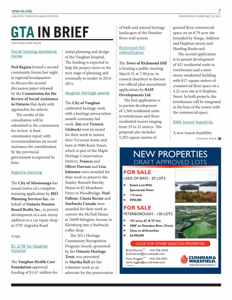
7GRE ATER TORONTO ARE A EDITION WEDNESDAY, FEBRUARY 29, 2012
Social housing assistance review
Peel Region hosted a second community forum last night at regional headquarters to discuss the second discussion paper released by the Commission for the Review of Social Assistance in Ontario that deals with approaches for reform. Th e results of the consultation will be submitted to the commission for review. A fi nal commission report with recommendations on social assistance for consideration by the provincial government is expected in June.
Argentia rezoning
Th e City of Mississauga has issued notice of a complete rezoning application by JKO Planning Services Inc. on behalf of Ontario Pension Board Realty Inc., to permit development of a one-storey addition to a car repair shop at 2795 Argentia Road.
YORK
$1.67M for Vaughan Hospital
Th e Vaughan Health Care Foundation approved funding of $1.67-million for
initial planning and design of the Vaughan hospital. Th e funding is expected to help the project move to the next stage of planning and eventually to tender in 2014-2015.
Vaughan Heritage awards
Th e City of Vaughan celebrated heritage week with a heritage preservation awards ceremony last week. Jim and Victoria Globocki won an award for their work to restore their Victorian home and barn at 9986 Keele Street, which is part of the Maple Heritage Conservation District. Frances and Oliver Dawson and Lisa Johnston were awarded for their work to preserve the Stanley Bennett Barclay House at 82 Monsheen Drive in Woodbridge. Paul Fallone, Cinzia Recine and Starbucks Canada were awarded for their work to convert the McNeil House at 10499 Islington Avenue in Kleinburg into a Starbucks coff ee shop. Th e 2011 Heritage Community Recognition Program Award, sponsored by the Ontario Heritage Trust, was presented to Martha Bell for her volunteer work as an advocate for the preservation
of built and natural heritage landscapes of the Humber River trail system.
Richmond Hill intensifi cation
Th e Town of Richmond Hill is hosting a public meeting March 21 at 7:30 p.m. in council chambers to discuss two offi cial plan amendment applications by BAIF Developments Ltd. Th e fi rst application is to permit development of 1,560 residential units in townhouses and three residential towers ranging from 19 to 31 storeys. Th e proposal also includes 5,292-square metres of
ground fl oor commercial space on an 8.79-acre site bounded by Yonge, Addison and Hopkins streets and Harding Boulevard. Th e second application is to permit development of 421 residential units in townhouses and a nine-storey residential building with 817-square metres of commercial fl oor space on a 4.23-acre site at 0 Hopkins Street. In both projects, the townhouses will be integrated in the base of the towers with the commercial space.
BWG transit feasibility
A new transit feasibility
GTA IN BRIEF CONTINUED FROM PAGE 6
NEW PROPERTIESDRAFT APPROVED LOTS
FOR SALE LAKE OF BAYS - 29 LOTS
Estate Lots With
Spectacular Views
114 acres
$950,000
FOR SALE PETERBOROUGH - 130 LOTS
107 acres, 65’ & 75’ lots
3000’ on Otonabee River (Trent)
Close to all Amenities
$4,900,000
CLICK FOR OTHER SELECTED PROPERTIES
Brad Warren** 416-756-5418 [email protected]
Earle Ruggles** 416-756-5441 [email protected]** Broker
CONTINUED PAGE 9 >>

Halton Hills subdivision appeal update
In a prehearing decision issued February 15, board member Mary-Anne Sills scheduled a second prehearing conference April 20 regarding an appeal by Kevin Lake. Th e appeal concerns an offi cial plan and zoning by-law amendment and proposed plan of subdivision applications by Equesing Developments Ltd., which were approved by the Town of Halton Hills. Equesing proposes to develop a single-detached 20-lot subdivision at 11673 Sixth Line. At the hearing, Lake told the board he represents a group of residents who live in the vicinity of the proposed development. Concerns cited by the group include the location of the proposed subdivision entrance and water quality and supply impacts, as well as preservation of the rural aesthetic. He told the board that while his group has had preliminary discussions with a lawyer as well as traffi c, hydrogeology and planning professionals, they have not yet made a decision as to whether they will be retaining counsel or expert witnesses. Th e board directed the applicant to advise the board’s planner should his group decide to retain counsel. Further, any expert witnesses for the hearing of appeals should be retained no later than 60 days aft er March 26. Th e board scheduled the second prehearing conference to discuss the terms of a procedural order and to set a hearing date. Solicitor Herbert Arnold represents Equesing Developments Ltd. Solicitor Jeff rey Wilker (Th omson Rogers) represents the Town of Halton Hills. Solicitor Dave Beck represents Halton Region. Kevin Lake is not represented by counsel. (See OMB Case No. PL110872.)
Downtown Mississauga interim control ZBL appeal
In a prehearing decision issued February 16, board member Reid Rossi, provided an update on appeals by Morguard Investments Ltd., OMERS Realty Management Corporation, Th e Great-West Life Assurance Company et al. and Whiterock Acquisitions Corporation regarding the City of Mississauga’s downtown interim control by-law. Th e by-law was enacted by council March 30, 2011 to restrict development in the city centre until a land use plan is completed to implement the city’s new Downtown21 vision.
Th e board noted at the previous prehearing conference, Mississauga counsel Robert Doumani (Aird & Berlis) had advised the board the city was carrying out studies that would result in offi cial plan and zoning by-law amendments for the area under the interim control by-law. At that time, Doumani advised the board that the city had reached a settlement agreement in principle with Morguard, Great-West and Whiterock,
8GRE ATER TORONTO ARE A EDITION WEDNESDAY, FEBRUARY 29, 2012
GTA OMB NEWS
CONTINUED PAGE 9 >
Design Review Panel Membership
Downsview Park is seeking applications for qualified professionals to be appointed to Downsview Park’s Design Review Panel (DPDRP). The DPDRP will provide advice to Downsview Park’s Management in support of their goal to ensure that the development of all lands identified within their Master Plan (total of 572 acres, including 5 neighbourhoods) reflect excellence and innovation in design and sustainable development.
We are looking for professionals from the disciplines of Architecture, Landscape Architecture, Urban Design, Planning, Municipal Engineering, Transportation and Sustainable Development. Each applicant will hold local or national membership within their respective discipline.
The term for the Design Review Panel will be two years and is a volunteer appointment.
Interested candidates should submit a cover letter and resume in WORD or PDF format to [email protected] include “Candidate for Downsview Park Design Review Panel” in the subject line.
Application deadline is Monday, March 19, 2012.

Former Town of Oakville solicitor Denise Baker has
joined Townsend and Associates, starting April 9.
Baker’s expertise is in development applications, planning
policy, heritage issues and municipal matters. She spent
more than fi ve years on staff at the Town of Oakville.
GTA PEOPLE
9GRE ATER TORONTO ARE A EDITION WEDNESDAY, FEBRUARY 29, 2012
GTA IN BRIEF CONTINUED FROM PAGE 7
GTA OMB NEWS CONTINUED FROM PAGE 8
settlement agreement represents good planning. Th e board noted no one opposed the settlement agreement at the hearing. It allowed the appeals by TDL Group Corp, Wendy’s Restaurants of Canada Inc., A&W Food Services of Canada Inc. and McDonald’s Restaurants of Canada Limited and approved the settlement agreement and zoning by-law amendment. Th e board noted parties will update the board on any progress of appeals by email in March. Solicitor Herbert Arnold represents Joao DaSilva and Linda Melnychuk. Solicitor Michael Polowin (Gowling Lafl eur) represented TDL Group Corp., Wendy’s Restaurants of Canada Inc., Ontario Hotel and Motel Association, A&W Food Services of Canada Inc., McDonald’s Restaurants of Canada Ltd. Solicitor Barnett Kussner (Weir Foulds) represents the City of Brampton. Solicitor Jeff rey Wilker (Th omson Rogers) represents the Town of Halton Hills.
Solicitor Ronald Folkes represents Maple Lodge Farms Ltd. (See OMB Case No. PL100931.) nru
study for the Town of Bradford West Gwillimbury by consultants HDR Corporation has identifi ed a need for transit service. Recommendations outlined in the report include implementation of a community bus service as an interim step before providing conventional transit service. Also
recommended is a GO Transit Demand Responsive Shared Ride Taxi and Demand Responsive Taxi Service to Bond Head two days per week. Th e complete report is available from the town’s website.
King Township 2012 fees
King Township will host a
public meeting March 19 in council chambers at 6 p.m. to discuss the town’s 2012 proposed fee schedule. New fees will be considered by council for approval at its April 2 meeting. Th e proposed fee schedule will be available from the town March 16. nru
ErratumTwo Brampton briefs—Brampton transit ridership grows and Brampton heritage designation—in last week’s NRU-GTA edition were included under Halton rather than Peel Region. NRU regrets the error.
To subscribe or advertise in Novæ Res Urbis GTA Edition go to www.nrupublishing.com or call 416-260-1304.

Discussion continues on Hwy. 401 widening through Milton Milton Canadian Champion Wed Jun 13 2012 Page: 1 Section: News Byline: Julie Slack, Canadian Champion Staff, [email protected]
Cost, impact on agricultural lands, heritage features, residences and businesses were factors in choosing a Hwy. 401 expansion plan as the preferred choice to alleviate gridlock in the GTA.
The preference to widen Hwy. 401 to 12 lanes from Regional Road 25 to Trafalgar Road through Milton rather than construct a new corridor, was explained by the Ministry of Transportation (MTO) last night.
The draft recommendation also proposes widening Hwy. 401 to 12 lanes west of James Snow Parkway.
Although no recommendations were made to town council's community services committee during the Town Hall presentation on Monday, the MTO outlined why the widening plan is the most preferred over the earlier recommendation to build a new corridor through Milton and Halton Hills to help alleviate gridlock.
The proposed new corridor would have cut through No. 5 and No. 10 sideroads, paved some 12,000 acres of agricultural lands and cost more than $510 million to construct, and an additional cost of up to $138 million for property costs.
The widening of the highway to 12 lanes is expected to cost $440 million, with property costs set by the MTO at $76 million to $112 million.
Regional council has long-since established its opposition to the new corridor route, noted Mayor Gord Krantz, who added politics are definitely at play in such a position.
The GTA West Corridor study, which addressed comments made at public meetings held in the fall and winter, concludes that widening Hwy. 401 to 12 lanes from its current six would accommodate transportation needs through to 2031, said MTO manager Joe Perrotta, who works in the provincial planning office.
Perrotta said the MTO's draft recommendation is to go ahead with the widening. No construction is expected to begin for some five years.
The expansion proposal includes barrier-divided collector and express lanes, as well as High-Occupancy Vehicle (HOV) lanes, similar to what is in place on the QEW through Burlington and on Hwy. 403 through Mississauga.
Perrotta said there are a number of questions the MTO needs to work out with the Town and that a meeting has been scheduled to discuss all concerns.
In its comparisons, MTO team members, including McCormick Rankin Corporation's senior project manager for transportation Neil Ahmed, also considered a third option of widening the highway to 14 lanes, which proved too costly.
"We took the feedback we received last spring and the stakeholders in Halton and the local councillorsthe analysis we have done, is not something you would do, we were asked to dig a little deeper in the three alternatives," Perrotta said. "Through the analysis, we found there are trade offs, there are pros and cons, but as Ahmed pointed out we found out upon balancing, all three met the needs, but the widening provided the best alternative moving forward."
Ward 3 Councillor Cindy Lunau raised concerns about the potential impact to area roads during construction and in the aftermath of a traffic accident.
Ahmed assured her that having separate collector and express lanes will help traffic flow through the area.
He also advised her that some 20 to 30 business properties, another 20 residences and 21 agricultural properties would be directly impacted by the widening, which includes a complex new interchange at the 407ETR.
Ahmed said each lane takes up approximately 3.75 metres of width, and admitted that it's going to be tight to accommodate with the existing right-of-way.
Gridlock was also a concern of Krantz who said he's "well aware how it works. I know all about gridlock.
"My good friend (Mississauga Mayor) Hazel McCallion is talking about gridlock," he said. "She's talking about increasing taxes (to construct more highways), and I'm not. Regardless of whether it's the cheapest solution or not.
"What's the chances of us having any positive impact on this," he questioned.
Councillor Colin Best added that widening a highway isn't the solution to gridlock.
"There's too many single drivers in vehicles," he said. "We need people to work in areas they live. There's too many people leaving towns
"And then they wonder, spending hours in gridlock, why they have a problem with their lifestyle," he continued. "We need to come up with other alternatives. We can't just keep widening roads."
Perrotta suggested ongoing Metrolinx plans, which include more public transportation options, will help move people out of the area in the future.
The MTO has a series of public meetings planned, including one this Thursday at the Milton Sports Centre from 4 to 8 p.m.
Once input has been received and reviewed, the final GTA West Corridor Transportation Development Strategy Report will be prepared and released this fall.
© 2012 Metroland Printing, Publishing & Distributing
Edition: Final Length: 743 words Idnumber: 201206130099
Tone: Neutral Ad Value: $680 Circulation: 23,540
This image cannot currently be displayed.

By Bill Rea
Caledon councillors are call-ing on the Province to leave theMayfield West community alonewhen it comes to integratingHighway 410 and the GTA Westtransportation corridor.
Council Tuesday unani-mously accepted the recommen-dation from Town staff, with acouple of additions.
The motion requests the Min-istry of Transportation (MTO) toreconsider the proposed alter-natives to integrating the roadand corridor. It also calls onMayor Marolyn Morrison toseek a meeting with Transporta-tion Minister Bob Chiarelli to ex-plain the serious impacts the
proposed development freeze inthe area will have on the Town,Peel Region and the community.As well, MTO is being asked towork with the Town to identifythe final alignment to connectthe 410 and corridor by the endof October.
A point in the motion thatwas not part of the staff recom-mendation is that MTO be ad-vised that the Town stillrecognizes the existing end ofthe 410 at Highway 10 as theprefered integration point.
As well, council directed staffto keep processing developmentapplications in the first phase ofMayfield West, as well as con-tinue work on the secondaryplan for the second phase.
The staff report that went tocouncil Tuesday stated MTO hasreceived considerable input onthis matter over the last yearfrom municipalities, agenciesand the public. The neighbour-ing Town of Halton Hills had ex-pressed concerns over possibleimpacts to agriculture and therural community, and thatprompted the Ministry to do ad-ditional work in that area. Oneof the ideas resulting from thatis the possible widening of High-way 401 in Halton Region to 12
lanes.Addressing Caledon issues,
Town planners raised a numberof matters in their report.
MTO’s preliminary routeplanning study area takes inareas that have either been ap-proved for development or arein advanced planning stages.They also pointed out the studyarea around Highway 410 andMayfield Road has been ex-panded, increasing the impactson planned development in May-field West. The plan in MayfieldWest, which was approved in2007, calls for some 9,000 resi-dents, plus roughly 180 hectaresof employment lands.
Planners added the Town hasbeen working on the secondaryplan for the second phase of theMayfield West developmentsince 2008. They said all the re-quired studies have been com-pleted.
A major concern is with theintegration of the corridor andthe 410. Planners said the Townreceived a letter last monthfrom MTO, requesting deferal ofany further planning approvalsuntil it’s shown these planswould not have a negative im-pact on the route planning in thecorridor.
MTO staff appeared beforeTown council last month, andtheir presentation includedseven options for the integrationof the corridor and 410, includ-ing extending the highway northin the area of Dixie and HeartLake Roads. There were variousdelegations responding to that,including representation fromimpacted landowners. Councilalso stated at the time the Towncan’t support having the integra-tion run through the first phaseof Mayfield West.
Planners said there havebeen discussions between Townand MTO staff to resolve the is-sues, but differences remain.
THIS BULL WAS TRYING TO GET SOMETHING OFF HIS BACKCowboy A.J. Vaal tried to stay on the bull for eight seconds, but didnʼt quite make it Saturday night in the Rodeo held at BramptonFairgrounds. The International Professional Rodeo Association show, presented by the Rawhide Rodeo Company, drew a largeand enthusiastic crowd to see all sorts of cowboy stunts, like bull and saddle bronc riding, rope tricks, etc. Portions of the proceedsare to go in support Camp Maple Leaf, a year-round camp for military families with children to reconnect in a nurturing environmentafter a demanding tour of duty.
Photo by Bill Rea
30º C 15º C
Thursday
30º C 18º C
Friday
27º C 19º C
Saturday
28º C 19º C
Sunday
Caledon CitizenCombined Weekly Circulation: 34,616 l 905-857-6626 l 1-888-557-6626 l www.caledoncitizen.com
$1.00 per copy (95¢ + 5¢ G.S.T.) Volume 31, Issue 28
Thursday, July 12, 2012
Send Best Wishes To Our Local Olympian!
Town Hall hours are:
9:00 a.m. until 4:30 p.m.
Visit Town Hall between now and next Tuesday to
sign the Town flag to equestrian, Yann Candele,
and his horse as they head to London, England.
SAME DAY SERVICEAIR CONDITIONING & HEATING
905-939-2350
NO REFERRALSNEEDED
Licensed Since 1995
Full/Partial DenturesImplant Services
EmergencyDenture Repairs,while you wait
9905-857-446430 Martha St., Suite 105
David Kostynyk, DD, BSc.Come Experience TRUE EXPERIENCE
KostynykDenture CentreDENTURIST | DENTURE CENTRE | SINCE 1995
THE
905-586-COOL (2665)donsheatingandcooling.com905-586-COOL (2665)donsheatingandcooling.com
Delivering Superior Service Since 1990
SalesInstallation
ServiceRentals
Mailing Registration No. 40032702
Town telling MTO it wants to go forward on Mayfield West
A total outdoor burning ban,issued by the Town of CaledonSaturday, remains in effect.
The ban will remain in effectat least until noon today(Thursday).
It was implemented follow-ing consultation with neigh-bouring municipalities and anevaluation of surface fuels.The ban applied to those whohave received a burn permit. Acondition of the permit re-
quires people to call the BurnStatus Line at 905-584-2272,ext. 4343 for updated condi-tions before any burning takesplace.
Contravention of this banwill result in a minimum fine of$245 and a minimum invoice of$400 per vehicle per hour offire service response requiredto extinguish the fire, plusclean-up costs, in addition to anadministration fee.
Burning ban still in effect, for nowQuoteof the Week“There were connections
that were definitely made. I
think it was a good experi-
ence for us.”
Leah Dilley, commenting
on the benefits from the
unsuccessful effort to
make Bolton the next Mil-
lion Dollar Neighbour-
hood.
See ʻMeetingʼ on page 15

Caledon Citizen July 12, 2012 15
BIGGER AND BETTER THAN EVER!
BIGGER AND BETTER THAN EVER!
ALDER STREET REC CENTRE
RibbersBad Wolf BBQBlazin BBQBoss Hog’sGator BBQPistol Pete’s SmokehouseTennessee Fatbacks
ADMISSION IS FREE BUT DONATIONS TOWARDS THE FENDLEY PARK SPLASHPADWILL BE GRATEFULLY ACCEPTED
www.orangevilleribfest.com
THE ROTARY CLUB OF ORANGEVILLE
Non-Food VendorsBody Glow Arts(face painting, fake tattoos)Rai Trading (hats, T-shirts)Jewellery 4 YouPampered ChefTupperware & more!
Entertainment Friday July 20th4pm – Scream Soda6pm – Opening Ceremonies7pm – The Tone Dogs
Saturday July 21st 11am – 2 of a Kind1:30pm – Talent Contest4:30pm – Cold Duck7pm – Campfire Poets
Sunday July 22nd11am – The Chapelaires (southern Gospel)1:30pm – End of the Road4pm – Gary Heaslip & The Henry’s
HoursFriday 4pm - 10pmSaturday 11am - 10pmSunday 11am - 7pm
Plus
Classic Car ShowSaturday July 21st
THE ANNUAL
ORANGEVILLEROTARY RIBFEST
W E L C O M E T O
JULY 20, 21 & 22 2012
OrangevilleFire Equipment
Of Canada, Ltd. Orangeville
Jim & Lee-Annes
Dr. M. Gewarges
W E L C O M E T O
W E L C O M E T OTHE ANNUAL
W E L C O M E T OTHE ANNUAL
ORANGEVILLEROT
ORANGEVILLETHE ANNUAL
Y RARTTA
ORANGEVILLETHE ANNUAL
RIBFE
ORANGEVILLEEST OR
THE RO
ORANGEVILLEY CLUB OF ARTHE ROT
Blazin BBQBad WRibbers
LD
Blazin BBQolf BBQBad W
Ribbers
ALDER STREET REC CENTRE
ALDER STREET REC CENTRE
TPistol Pete’Gator BBQBoss Hog’
Rai T(face painting, fake tattoos)Body Glow ArtsNon-Food V
ennessee FatbacksTTes SmokehousePistol Pete’
Gator BBQsBoss Hog’
-shirts)rading (hats TT-Rai T(face painting, fake tattoos)Body Glow Arts
endNon-Food VVe
endors
2YY 2
ULLLYUULY
JJU
2&120220
YY 2
2112
0012202222
TPampered ChefJewellery 4 YRai T
upperware & more!TPampered Chef
ouJewellery 4 YYo-shirts)rading (hats, TT-Rai T
2&12,00,
22222
Jim & Lee-Annes
eillvOrange
.Of Canada, Ltd
Fire EquipmentOrangeville
es idence Riremente tR
Fire EquipmentOrangeville
. M. GewargesDr
. M. Gewarges
By Bill Rea
The Province should speed up itswork on the GTA West Corridor Study.
Peel Regional councillors last weekunanimously approved a staff recom-mendation, and called upon the Ministryof Transportation (MTO) to completethe first stage of the environmental as-sessment study and get started on thesecond phase “in an expeditious man-ner.”
The motion passed by council alsocalled on MTO to “place considerableweight” on approved and in-process sec-ondary plans in both Caledon andBrampton when working on route plan-ning.
It also called on MTO to work withRegional and local staff to resolve suchmatters as prioritizing the primary routein certain areas, and present findings tocouncil by May 2013.
The staff report that went to Regionalcouncil identified several issues.
They included the connections toHighway 410. MTO staff have presentedseveral options involving Mayfield andDixie Roads, and Highway 10. The reportpointed out these options could impacton many landowners, and some of theproperties have development proposalsthat have received draft approval.
“It is critical that MTO conduct an ex-pedited evaluation on the various con-nection options and work incollaboration with municipalities toidentify a preferred option in a timelymanner,” the staff report stated.
The report also referred to lands innortheast Brampton which are beingstudied as part of a secondary plan forthe City. Staff said it’s “critical” that MTOspeed up the evaluation of these landstoo.
In addition, staff commented that theenvironmental assessments are cur-rently using a 2031 planning horizon.They said that’s inadequate for highwayplanning, and something beyond thatshould be looked at.
Addressing matters relating to Cale-don, the staff report stated the Town rec-ognizes the importance of the corridor,but is also anxious to see issues of ap-proved secondary plans resolved. Thereport also said Mayfield West is of sig-nificant economic importance to theTown, but warned the Town can’t sup-port postponing all development in thearea until the environmental assessmentis done.
As well, if a road is to some day gothrough the corridor, the Town and Re-gion have stressed the importance of afull interchange at Dixie.
Mayor Marolyn Morrison was pleasedthe Region is taking a stand.
“The Region needs to be involved be-cause it’s Regional assessment that’s in-volved here,” she said.
She wasn’t as happy with the May2013 time line.
“It’s too long,” she commented. “It’skilling us.”
Councillor Richard Whiteheadpointed out that with the industrial lands
in Mayfield West frozen, a lot of pressureis put on the industrial areas in Tullam-ore and Bolton.
“The best plan is to still spread theindustrial,” he said, adding plugging de-velopment there will cause the othertwo areas to grow too fast, making itmore difficult to sort out transportationissues.
Whitehead pointed out the corridorhas narrowed “pinch points” in the areasof Mayfield West and south of Boltonand issues in those areas need to be pur-sued.
“We want to know where it’s going togo,” he commented, adding once it’s un-derstood where the route is going to be,planning can proceed.
He added industrial developers arenot going to wait around. “They willquickly disappear of you don’t act expe-ditiously,” he warned.
Whitehead said that wouldn’t setmuch of a precedent, as the study area
has already been reduced, freeing upsome 550 acres on the west side of Col-eraine Drive near Bolton. There are stillabout 100 acres at Mayfield Road andColeraine that are still frozen.
He also said it should be possible forthe province to address all these issueswithin a year. He said environmental as-sessments and transportation conceptswere dealt with when the lands were ap-proved for industrial development.
“They don’t need to create that infor-mation,” he said. “They only need toanalyse it.”
Councilor Allan Thompson said thebest part is the May 2013 timeline hasbeen set.
He also pointed out the Region will beworking with Morrison in calling onMTO not to hold up the industrial devel-opment in Mayfield West.
“Everybody agreed,” he declared.“This is important for Caledon, and weneed to make it a priority.”
Region wants MTO to speed things up on GTA West corridor
They pointed to the substantial agri-cultural economy in the area, and con-cerns that could be disrupted by thecorridor. They said impacts on agricul-tural and residential communities needto be assessed more.
Morrison told councillors there havebeen talks with the Minister’s office, andshe was hoping a meeting could bearranged as soon as he gets back from
vacation.Councillor Gord McClure com-
plained MTO was making itself lookfoolish in this, as well as the Town. Hesaid if the Ministry wanted to extendHighway 410 to the north, it shouldhave done that in the first place. “Whydidn’t they plan this right off the bat?”he demanded.
Councillor Doug Beffort was annoyedthat there has been no response yet fromMTO to the concerns raised.
Meeting with minister expected soonFrom page 1