APPENDIX A SECTION 404(b)(1) EVALUATION AND 401 ...
278
Appendix A Section 404(b)(1) & 401 WQ Cert Tybee Island Shoreline Protection Project, Georgia HIM Emergency Supplemental 2019 APPENDIX A SECTION 404(b)(1) EVALUATION AND 401 WATER QUALITY CERTIFICATION TYBEE ISLAND, GEORGIA SHORELINE PROTECTION PROJECT 2019 HURRICAN HARVEY, IRMA, MARIA EMERGENCY SUPPLEMENTAL RENOURISHMENT U.S. ARMY CORPS OF ENGINEERS SAVANNAH DISTRICT REVISED AUGUST 2019
-
Upload
khangminh22 -
Category
Documents
-
view
3 -
download
0
Transcript of APPENDIX A SECTION 404(b)(1) EVALUATION AND 401 ...

Appendix A Section 404(b)(1) & 401 WQ Cert Tybee Island Shoreline Protection Project, Georgia
HIM Emergency Supplemental 2019
APPENDIX A
SECTION 404(b)(1) EVALUATION AND
401 WATER QUALITY CERTIFICATION
TYBEE ISLAND, GEORGIA
SHORELINE PROTECTION PROJECT 2019 HURRICAN HARVEY, IRMA, MARIA
EMERGENCY SUPPLEMENTAL RENOURISHMENT
U.S. ARMY CORPS OF ENGINEERS
SAVANNAH DISTRICT
REVISED AUGUST 2019

Appendix A Section 404(b)(1) & 401 WQ Cert Tybee Island Shoreline Protection Project, Georgia
HIM Emergency Supplemental 2019
This page intentionally blank.
Appendix A Section 404(b)(1) & 401 WQ Cert Tybee Island Shoreline Protection Project, Georgia
HIM Emergency Supplemental 2019
3
SECTION 404(b)(1) EVALUATION OF DREDGE AND FILL MATERIAL
Tybee Island Shore Protection Project, Georgia 2019 Hurricane Harvey, Irma, Maria, Emergency Supplemental Renourishment 1.0 INTRODUCTION The following evaluation is prepared in accordance with Section 404(b)(1) of the Clean Water Act of 1977 (CWA) to evaluate the environmental effects of the proposed placement of dredged or fill material in Waters of the United States. Toxic and hazardous waste pertaining to fill or dredge activities are also regulated under the CWA. Specific portions of the regulations are cited and an explanation of the regulation is given as it pertains to the project. These guidelines can be found in Title 40, Part 230 of the Code of Federal Regulations. Tybee Island is located 17 miles east of Savannah at the mouth of the Savannah River on the Atlantic Ocean (Figure 1). Tybee Island is Georgia’s most densely developed barrier island, bordered on the north by the South Channel of the Savannah River, on the east by the Atlantic Ocean, and on the south and west by Tybee Creek and a vast tidal marsh system. Tybee Island has an average width of 0.5 miles and the ground elevation varies from 10 to 18 feet above Mean Lower Low Water (MLLW) and slopes westward to the salt marshes. Project elevations for design and construction are established from NOAA tide gage Station 8670870 at Fort Pulaski, GA and based on MLLW in accordance with ER 110-2-8160 and EM 110-2-6056. Conversion from MLLW to NAVD88 at Station 9670870: +0’ MLLW = +4.05’ NAVD88. 2.0 PROPOSED ACTION AND ENVIRONMENTAL SETTING 2.1 PROPOSED ACTION Information on the authorized project can be found in the EA in Section 1.1. As proposed, the project will be constructed using a hydraulic cutterhead pipeline dredge and support equipment. A submerged pipeline will extend from the borrow site to the southerly tip of Tybee Island. Shore pipe will be progressively added to perform fill placement along the shorefront or creek front areas to be renourished. Temporary toe dikes will be utilized in a shore parallel direction to control the hydraulic effluent and reduce turbidity. The sand will be placed in the form of varying design templates based upon longshore volumetric fill requirements which reflect beach conditions at the time of construction. Additional beach fill will be strategically placed in areas of documented highest erosional stress such as the 2nd Street “hot spot” (Figure 2).

Appendix A Section 404(b)(1) & 401 WQ Cert Tybee Island Shoreline Protection Project, Georgia
HIM Emergency Supplemental 2019
4
Figure 1: Tybee Island Shore Protection Map Location

Appendix A Section 404(b)(1) & 401 WQ Cert Tybee Island Shoreline Protection Project, Georgia
HIM Emergency Supplemental 2019
5
Figure 2: Tybee Island Erosion Hotspots

Appendix A Section 404(b)(1) & 401 WQ Cert Tybee Island Shoreline Protection Project, Georgia
HIM Emergency Supplemental 2019
6
The proposed offshore borrow site is an expansion of a presently defined and permitted area utilized for the construction of the 1994 Georgia Port Authority (GPA) South Beach project and the Savannah District 2000, 2008, 2015 and 2018 renourishments (Figure 3). The original borrow area is located approximately 4,000 feet southeast of the southernmost Federal terminal groin. Figure 3 shows the location of the borrow area with the borrow area extension. The Northwest facing side of the 2019 borrow location extension is ~3,090 ft (long edge toward Tybee). The Northeast facing side of the 2019 borrow location extension is ~6,800 ft (long edge facing the Savannah River navigation channel). The East facing side of the 2019 borrow location extension is ~7,160 ft (long edge facing the ocean.) The total area of the 2019 proposed borrow area extension is ~625 acres. Total area of the 2015 borrow area was ~213 acres. Total area of the 2008 borrow locations was ~256 acres. Total of yellow "original borrow area limits" was ~290 acres. The total area of the whole borrow area, including the extension, is ~1,340 acres. The borrow site limits have been extended, principally in a northerly direction, since the volume of sand remaining within the previously permitted area was deemed insufficient to construct the 2019 HIM Supplemental renourishment project in its entirety. Extension of the borrow site in a northward direction was selected to avoid potential impacts to Little Tybee Island CBRA Unit No.1 to the south. Additionally, expansion of the borrow site to the east was not pursued due to the silty nature of the material to the east (i.e. seaward) of the previously authorized borrow site. In order to support the expansion of the previously defined borrow site, geotechnical, environmental and cultural resources investigations were conducted for the proposed borrow site expansion. An updated hydrographic survey data for the borrow site was performed in August 2018.

Appendix A Section 404(b)(1) & 401 WQ Cert Tybee Island Shoreline Protection Project, Georgia
HIM Emergency Supplemental 2019
7
Figure 3: Tybee Island borrow area history and planned expansion.

Appendix A Section 404(b)(1) & 401 WQ Cert Tybee Island Shoreline Protection Project, Georgia
HIM Emergency Supplemental 2019
8
The proposed project template design is based on project performance and erosion rates since the last renourishment project in 2018, and the calculated storm damage. Areas include the North Beach (North End Groin to Oceanview Court), Second Street area (Oceanview Court to Center Street), Middle Beach (Center Street to 11th Street), South Beach (11th Street to South End Groin), and the South Tip Groin Field. Additional fill will be placed between these areas to provide a more stable beach profile and to avoid some of the excessive losses in the 2nd Street “hot spot” from project end losses and offshore losses that resulted from the wide beach constructed at this location during the last renourishment. Beach widths on the Oceanfront Beach will vary from a 25-foot width berm, to a berm approximately 350 feet wide at the elevation of +11.2 MLLW. Based on natural angle of repose on the existing beach, and experience with previous placement, a beach slope of 1 vertical on 25 horizontal will be required on the oceanfront beach (Figure 4 and Figure 5).
Figure 4: Tybee Island Template.
Beach fill final placement will be based on physical conditions and funds available at the time of construction. The proposed project is expected to commence by November 2019, and be completed by April 30, 2020.

Appendix A Section 404(b)(1) & 401 WQ Cert Tybee Island Shoreline Protection Project, Georgia
HIM Emergency Supplemental 2019
9
Figure 5: Project Features

Appendix A Section 404(b)(1) & 401 WQ Cert Tybee Island Shoreline Protection Project, Georgia
HIM Emergency Supplemental 2019
10
2.2 ENVIRONMENTAL SETTING Tybee Island is one of a series of barrier islands lying along the Atlantic coast from Florida to North Carolina. The island is located directly south of the Savannah River entrance, about 17 miles east of the city of Savannah, Chatham County, Georgia. It is bounded on the north by the Savannah Harbor, to the east by the Atlantic Ocean, and on the south and west by Tybee Creek and a vast tidal marsh system. The major portion of the land mass above high tide is occupied by the City of Tybee Island. The City of Tybee Island is the only population center on the island with the major portion of its economy primarily oriented toward support facilities which service summer vacationers. The study area includes the North Beach, Second Street, Middle Beach, South Beach and Back River.
2.2.1 Threatened, Endangered and other Listed Species
The Savannah District has prepared an updated Biological Assessment of Threatened and Endangered Species (see BATES, Appendix B). The 2015 Biological Opinion determined that implementation of this beach restoration may affect piping plover and designated critical habitat unit GA-1. In addition, the Savannah District and resource agencies have determined if the renourishment extends past April 30, loggerhead and leatherback sea turtles are likely to be adversely affected. The Savannah District believes that the project, implemented according to special conditions included in the BATES and the latest BO, will not be likely to adversely affect the other listed species in the area, including the Florida manatee, red knot, and shortnose and Atlantic sturgeon. 3.0 SUBPART B - COMPLIANCE WITH THE GUIDELINES The following objectives should be considered in making a determination of any proposed discharge of dredged or fill material into waters of the United States. 3.1 RESTRICTIONS ON DISCHARGE "(a) except as provided under Section 404(b)(2), no discharge of dredged or fill material shall be permitted if there is a practical alternative to the proposed discharge which would have less adverse impact on the aquatic ecosystem, so long as the alternative does not have other significant adverse environmental consequences." Beach renourishment was the only practicable or feasible alternative identified for shore protection at Tybee Island, Georgia.

Appendix A Section 404(b)(1) & 401 WQ Cert Tybee Island Shoreline Protection Project, Georgia
HIM Emergency Supplemental 2019
11
Some incidental loss of sediments to the water column will occur during the dredging process and placement of dredged material on the beaches and during construction. Construction losses have been estimated to be 20%. These losses would not result in a violation of state water quality standards. Impacts at the proposed borrow area and on the beach would include impacts to benthic resources. Based on recommendations during the 2008 renourishment from NMFS a monitoring program of both the fill and borrow area was implemented to document changes relative to control areas and assess long-term recovery. Results of this monitoring may be located in the 2008 EA, Sections 4.18.1 and 4.18.2. Consultation occurred 6 November 2018 with USFWS to determine if benthic monitoring is appropriate for this renourishment. Benthic monitoring was deemed unnecessary for this renourishment with the following statement issued from USFWS, “The executive summary from the SCDNR final report for the swash zone on the renourished beach for the last Tybee renourishment states: The impact and recovery trajectories of benthic macroinfauna in response to the placement of sand on Tybee Island appear to be within the range of similar studies.” Suspended particulate may be expected to have some adverse impact on filter feeders, but those impacts are expected to be temporary. Where appropriate, construction activities would be timed so that possible turbidity impacts to larval estuarine fish and shellfish would be minimized. To minimize these impacts, the proposed actions in this area would not take place during the critical reproductive season for estuarine fish and shellfish. "(b) Discharge of dredged material shall not be permitted if it;" "(1) Causes or contributes, after consideration of disposal dilution and dispersions, to violations of any applicable state water quality standard;" Turbidity at the site would increase during construction. However, this situation would be temporary and localized. Part of these losses would be from suspended silts and clays that might travel far from the site before settling, while the majority would be from fine sands that settle near but outside the project template. The average percentage of fines from sampling completed at the borrow site (sediment passing the No. 200 sieve) was 3.27%., which is well within the state requirement of less than 10%. As mentioned previously, temporary toe dikes will be utilized in a shore parallel direction to control the hydraulic effluent and reduce turbidity. No State water quality standards are expected to be violated. "(2) Violates any applicable toxic effluent standard or prohibition under Section 370 of the Clean Water Act." A Public Notice will be issued on this proposed activity in conjunction with a request to the State of Georgia for issuance of a Section 401 – Water Quality Certification for this project after District and Division reviews. A review of the project specifications indicates that the proposed action is not expected to reduce water quality below applicable standards or

Appendix A Section 404(b)(1) & 401 WQ Cert Tybee Island Shoreline Protection Project, Georgia
HIM Emergency Supplemental 2019
12
violate other prohibitions under Section 307 of the Act. This conclusion is based on the containment testing that occurred November 2018 which showed that the dredged material is not known to contain contaminants at toxic levels. "(3) Jeopardizes the continued existence of species listed as endangered and threatened under the Endangered Species Act of 1973, as amended." A separate BATES was prepared and will be coordinated with both the USFWS and the NMFS during public review. The BATES concluded that the proposed project may affect piping plover and designated critical habitat unit GA-1 as well as the red knot but is not likely to adversely impact these species and critical habitat. In addition, it was determined that if the renourishment extends past April 30 loggerhead and leatherback sea turtles are likely to be adversely affected. The District feels that the project, with special conditions included in any contract for dredging, will not be likely to adversely affect the other listed species in the area, including the Florida manatee and whales. "(4) Violates any requirements imposed by the Secretary of Commerce to protect any marine sanctuary designated under Title Ill of the Marine Protection Research and Sanctuaries Act of 1972." No marine sanctuary or other items addressed under this act would be affected by the proposed work. "(c) Except as provided under Section 404(b)(2), no discharge of dredged or fill material shall be permitted which will cause or contribute to significant degradation of the waters of the United States. Findings of significant degradation related to the proposed discharge shall be based upon appropriate factual determinations, evaluations, and tests required by Subparts B and G of the consideration of Subparts C-F with special emphasis on the persistence and permanence of the effects contributing to significant degradation considered individually or collectively include:" "(1) Significantly adverse effects of the discharge of pollutants on human health or welfare including, but not limited to effects on municipal water supplies, plankton, fish, shellfish, wildlife, and special aquatic sites." Sediment testing was performed on sediments proposed for excavation in this project to assess the potential for contaminant-related environmental impacts from the dredged material. The testing concluded that the sediments proposed for excavation and beach nourishment do not contain contaminants at toxic levels. See the 2019 Environmental Assessment 2.2.6. Therefore, provisions of the above paragraph are not expected to be violated. The placement of dredged material on the beach would have a short-term impact on the turbidity of the receiving waters. This impact is expected to last only for the time of the construction and the discharged sediments would quickly settle out or be swept out of the immediate vicinity via the tidal system.

Appendix A Section 404(b)(1) & 401 WQ Cert Tybee Island Shoreline Protection Project, Georgia
HIM Emergency Supplemental 2019
13
"(2) Significantly adverse effects of the discharge of pollutants on life stages of aquatic life and other wildlife dependent upon aquatic ecosystems, Including the transfer, concentration, and spread of pollutants or their by-products outside the disposal site through biological, physical, and chemical processes." The sediments to be dredged are not considered to contain pollutants at toxic levels. Therefore, provisions of the above paragraph are not expected to be violated. See the 2019 Environmental Assessment 2.2.6. "(3) Significantly adverse effects of the discharge of pollutants on aquatic ecosystems diversity, productivity, and stability. Such effects may include, but are not limited to, loss of fish and wildlife habitat or loss of the capacity of a wetland to assimilate nutrients, purify water, or reduce wave energy; or" "(4) Significantly adverse effects of the discharge of pollutants on recreational, aesthetic, and economic values." The proposed activity is not expected to adversely affect ecosystems, diversity, productivity and stability, or recreational, aesthetic, and economic values primarily because it is a shore protection project that would protect property and would enhance the aesthetic and recreational values of the area. "(d) Except as provided under Section 404(b)(2), no discharge of dredged or fill material shall be permitted unless appropriate and practical steps have been taken which will minimize the potential adverse impacts of the discharge on the aquatic ecosystem." Construction and future periodic renourishment activities would be targeted to avoid the nesting season for sea turtles (1 May – 30 August) to the maximum extent practicable. Project construction dates are planned for November – April to avoid impacts to larval fish, shellfish and sea turtles to the extent practicable. Additional steps that will be taken to minimize the potential impacts of the project on threatened and endangered species are enumerated in the BATES and in the EA. 3.2 FACTUAL DETERMINATION
3.2.1 Physical Substrate Determinations
Since the substrate is common to the area and has been disturbed before, the proposed activities are not expected to have an adverse effect on the physical substrate of bottom sediments in the immediate project vicinity. The proposed project would protect the Federal Authorized Template consisting of a 40-foot berm at +11.2 feet MLLW, with a 1V:20H slope.

Appendix A Section 404(b)(1) & 401 WQ Cert Tybee Island Shoreline Protection Project, Georgia
HIM Emergency Supplemental 2019
14
3.2.2 Water Circulation, Fluctuations, and Salinity Determinations
The proposed dredging is not expected to result in any adverse effects on water circulation, fluctuations, salinity or water quality degradation. Excavation of the borrow area is not expected to significantly alter the current patterns at the site. Extension of the borrow site in a northward direction was selected to avoid potential impacts to Little Tybee Island to the south.
3.2.3 Suspended Particulate/Turbidity Determinations
3.2.3.1 Effects on Physical Properties of the Water Column
Effects on the water column are primarily those associated with a reduction on light transmission, aesthetic values, and direct destructive effects on nektonic and planktonic populations. The proposed shore protection project would have the following impacts on these factors:
a. Reduction in light transmission. Sediment which becomes
suspended in the water column as a result of the shore protection project is expected to result in a temporary elevation in suspended solids along the shore until the fines are swept offshore by tidal action. This impact should be temporary in nature as the sediments will quickly settle out or be dispersed.
b. Aesthetics. The turbidity produced by operation of the pipeline
dredge will result in minor adverse impacts on the aesthetic appeal of the area. The decrease in aesthetics will be temporary and cease soon after construction is completed.
3.2.3.2 Effects on Biota There will be a temporary disruption in benthic communities at the borrow site and at the beach areas. The temporary increase in turbidity surrounding the construction site will also have a short-term and minor adverse impact on benthics in the vicinity of the project. No lasting changes in community structure are expected, as the beach areas have already experienced nourishment activities. The proposed project is expected to have little impact on dissolved oxygen because of the rapid aeration in the surf zone.
3.2.4 Contamination Determination
The sediments to be excavated have been evaluated. Potentially toxic materials detected in the sediments were found to be below toxic levels (See EA Section 2.2.6). Therefore, the material dredged during this project would impact neither the communities from which it is taken nor communities at the beach project.

Appendix A Section 404(b)(1) & 401 WQ Cert Tybee Island Shoreline Protection Project, Georgia
HIM Emergency Supplemental 2019
15
3.2.5 Aquatic Ecosystem and Organism Determinations
There is expected to be a minor, short-lived impact on organisms associated with the borrow site and the beach areas. These effects would be temporary and no significant impacts are expected.
3.2.5.1 Threatened and Endangered Species
The BATES concluded that the proposed project may affect wintering piping plovers and designated critical habitat unit GA-1. In addition, it was determined that if the renourishment extends past April 30 loggerhead and leatherback sea turtles are likely to be adversely affected. The District feels that the project, with special conditions included in any contract for dredging, will not be likely to adversely affect the other listed species in the area, including the Florida manatee and sturgeon species. While the renourishment actions may result in short-term adverse effects, it is our belief that the piping plover and designated critical habitat areas would ultimately benefit from them. 3.2.5.2 Planktonic and Nektonic Species
Impacts to planktonic and nektonic species would be minor in scope, primarily due to increase in turbidity during the dredging operation and placement of material at the beach areas. 3.2.5.3 Other Wildlife
The proposed project would have minimal impact on other wildlife. 3.2.5.4 Effects on Benthos
There will be a temporary disruption in benthic communities at the borrow site and beach areas where some organisms would be lost by covering. Some organisms which inhabit the beach sites are capable of upward burrowing and lateral migration and results of the benthic monitoring showed evidence of some species survival. These organisms are subject to changes associated with daily and seasonal shifts in their habitat substrate and have been shown to recolonize nourished beaches. 3.2.5.5 Wetlands
No special wetland sites have been identified at the project site that could be adversely affected by the proposed project.

Appendix A Section 404(b)(1) & 401 WQ Cert Tybee Island Shoreline Protection Project, Georgia
HIM Emergency Supplemental 2019
16
3.2.6 Proposed Disposal Site Determination
Construction of this project has been found to be a practical and feasible alternative for shore protection for Tybee Island. The site has a history of erosion. Placement of suitable material on the site is expected to be beneficial to the beach as it would be expected to increase the width of the intertidal beach and to provide storm protection.
3.2.7 Determination of Cumulative Effects on the Aquatic Ecosystem
Construction of protective measures to control erosion at Tybee Island was undertaken as early as 1882 with the construction of three rock groins at the north end of the island. This was followed by many other features that have been damaged or destroyed by wind and wave action. The proposed work would allow for continued renourishment of the authorized Federal project. No significant adverse cumulative impacts have been identified. 4.0 FINDINGS OF COMPLIANCE OR NONCOMPLIANCE WITH RESTRICTIONS ON DISCHARGE 4.1 DETERMINATIONS a. That an ecological evaluation of the discharge of dredged material associated with the proposed action has been made following the evaluation guidance in 40 CFR 230.6, in conjunction with the evaluation considerations at 40 CFR 230.5. b. That potential short-term and long-term effects of the proposed action on the physical, chemical, and biological components of the aquatic ecosystem have been evaluated and it has been found that the proposed discharge will not result in significant degradation of the environmental values of the aquatic ecosystem. c. That there are no less environmentally damaging practicable alternatives to the proposed work that would accomplish project goals and objectives. (1) That the proposed action will not cause or contribute to violations of any applicable State water quality standards, will not violate any applicable toxic effluent standard or prohibition under Section 307 of the Clean Water Act, is not likely to adversely affect the continued existence of species listed as endangered or threatened under the Endangered Species Act of 1973, and will not violate any requirement imposed by the Secretary of Commerce to protect any marine sanctuary designated under Title III of the Marine Protection, Research, and Sanctuaries Act of 1972. (2) That the proposed work will not cause or contribute to significant degradation of the Waters of the United States.

Appendix A Section 404(b)(1) & 401 WQ Cert Tybee Island Shoreline Protection Project, Georgia
HIM Emergency Supplemental 2019
17
(3) That the discharge includes all practicable and appropriate measures to minimize potential harm to the aquatic ecosystem. 4.2 FINDINGS Based on the determinations made in this Section 404(b)(1) evaluation, the finding is made that, with the conditions enumerated in this document, the proposed action complies with the Section 404(b)(1) Guidelines.


APPENDIX B
BIOLOGICAL ASSESSMENT OF
THREATENED AND ENDANGERED SPECIES (BATES)
TYBEE ISLAND, GEORGIA SHORELINE PROTECTION PROJECT
2019 HURRICANE HARVEY, IRMA, MARIA EMERGENCY SUPPLEMENTAL RENOURISHMENT
U.S. ARMY CORPS OF ENGINEERS SAVANNAH DISTRICT
REVISED AUGUST 2019

Appendix B BATES Tybee Island Shoreline Protection Project, Georgia
HIM Emergency Supplemental 2019
1
Biological Assessment of Threatened and Endangered Species for
Tybee Island, Georgia Beach Erosion Control Project 2019 Hurricane Harvey, Irma, Maria
Emergency Supplemental Renourishment
1. Project History.
Tybee Island is located 17 miles east of Savannah at the mouth of the Savannah River on the Atlantic Ocean. Tybee Island is Georgia’s most densely developed barrier island, bordered on the north by the South Channel of the Savannah River, on the east by the Atlantic Ocean, and on the south and west by Tybee Creek and a vast tidal marsh system. Figure 1 shows the project location of Tybee Island. The authorized project consists of nourishment of 13,200 linear feet of beach between two terminal groins (referred to as Oceanfront Beach); construction of a groin field along 1,100 linear feet of shoreline from the southern terminal groin around the South Tip to the mouth of Tybee Creek (also known as Back River) including periodic nourishment (referred to as South Tip Beach); and construction of a groin field and nourishment of 1,800 linear feet of the eastern bank of Tybee Creek to the city fishing pier (referred to as Back River Beach; Figure 1). The remaining shoreline from the fishing pier to the mouth of Horse Pen Creek, although included in the authorizing language of WRDA 1996, is relatively stable at this time and no hurricane and storm damage protection measures have been constructed in this reach. The beach was last renourished in 2015 and repaired in 2018. In 2019, there will be 5 years left in the project life (i.e. Federal participation). The 2015 renourishment was intended to provide material to maintain the beach and guard from potential erosion through 2024. After hurricanes Matthew in 2016 and Irma in 2017, supplemental nourishment was conducted in 2018 to add material that was lost due to storm damage. The Borrow Area Extension of 2008 (BAE 08) was used for the 2008 and 2015 renourishments and the 2018 hurricane repairs. BAE 08 has been exhausted, requiring an expansion of the borrow area. Previous investigations have found that dunes within the federal footprint would protect the Federal investment, improve the storm protection benefits, decrease maintenance costs, and delay the need for subsequent renourishment projects (USACE 1988, USACE 1994). Historic erosion rates across the beach profile have shown high erosion in areas known as “hot spots” (Figure 2). The following is a quote from the Section 905(b) Study, dated Sept. 2004, “Since 1975, over 6.9 million CY of sand have been placed along Tybee’s shoreline. The net erosion rate estimated for the beach erosion control project is approximately 78,000 CY/yr. However, hot spots alone that occur primarily at Second Street lose over 125,000 CY/yr”. These hot spots create areas that are vulnerable to storm surge - causing damage to infrastructure, existing dunes and breaches in the design template.

Appendix B BATES Tybee Island Shoreline Protection Project, Georgia
HIM Emergency Supplemental 2019
2
Figure 1: Tybee Island Shore Protection Map Location

Appendix B BATES Tybee Island Shoreline Protection Project, Georgia
HIM Emergency Supplemental 2019
3
Figure 2: Tybee Island erosion hotspots.

Appendix B BATES Tybee Island Shoreline Protection Project, Georgia
HIM Emergency Supplemental 2019
4
2. Project Description As proposed, the project will be constructed using a hydraulic cutterhead pipeline dredge and support equipment. A submerged pipeline will extend from the borrow site to the southerly tip of Tybee Island. Submerged pipeline shall rest on the ocean bottom and will not move. Shore pipe will be progressively added to perform fill placement along the shorefront or creekfront areas to be renourished. Temporary toe dikes will be utilized in a shore parallel direction to control the hydraulic effluent and reduce turbidity. The sand will be placed in the form of varying design templates based upon longshore volumetric fill requirements which reflect beach conditions at the time of construction. The proposed project template design is based on project performance and erosion rates since the last renourishment project in 2018, and the calculated storm damage. Project elevations for design and construction are established from NOAA tide gage Station 8670870 at Fort Pulaski, GA and based on MLLW in accordance with ER 110-2-8160 and EM 110-2-6056. Conversion from MLLW to NAVD88 at Station 9670870: +0’ MLLW = +4.05’ NAVD88. Beach widths on the Oceanfront Beach will vary from a 25-foot width berm, to a berm approximately 350 feet wide at the elevation of +11.2 MLLW. Based on natural angle of repose on the existing beach, and experience with previous placement, a beach slope of 1 vertical on 25 horizontal will be required on the oceanfront beach. Figure 3 shows the proposed design template. Figure 4 shows the project features.
Figure 3: Project Template

Appendix B BATES Tybee Island Shoreline Protection Project, Georgia
HIM Emergency Supplemental 2019
5
Figure 4: Project Features

Appendix B BATES Tybee Island Shoreline Protection Project, Georgia
HIM Emergency Supplemental 2019
6
The proposed sand source for this renourishment is the 2019 BAE (Figure 5). The original borrow area is located approximately 4,000 feet southeast of the southernmost Federal terminal groin. The borrow site limits need to be extended, principally in a northerly direction, since the volume of sand remaining within the previously permitted area was deemed insufficient to construct the 2019 HIM Sup renourishment project in its entirety. Extension of the borrow site in a northward direction was selected to avoid potential impacts to Little Tybee Island CBRA Unit No.1 to the south. Additionally, expansion of the borrow site to the east was not pursued due to the silty nature of the material to the east (i.e. seaward) of the previously authorized borrow site. The total area of the 2019 proposed borrow area extension is ~664 acres. Total area of the 2015 borrow area is ~213 acres. Total area of the 2008 borrow locations is ~256 acres. Total of yellow "original borrow area limits" is ~290 acres. The total area of the whole borrow area including the extension is ~1,380 acres.
Figure 5: Tybee Island Borrow Area history and future expansion plans.

Appendix B BATES Tybee Island Shoreline Protection Project, Georgia
HIM Emergency Supplemental 2019
7
2.0 Environmental Setting.
The project area is located on Tybee Island, one of the most developed barrier islands on the coast of Georgia. The mainland of Chatham County is separated from the Atlantic Ocean by marsh and barrier islands. The islands are separated from one another by tidal creeks and inlets. Tybee Island is located south of the Savannah River entrance, about 17 miles east of the city of Savannah, Georgia. It is bounded on the north by the Savannah Harbor, to the east by the Atlantic Ocean, and on the south and west by Tybee Creek and a vast tidal marsh system. The major portion of the land mass above high tide is occupied by the City of Tybee Island which is the only population center on the island.
Historically, dune areas on Tybee Island have been replaced by sea walls and revetment. Construction of residences, hotels and other businesses has removed much of the natural areas on the island. Efforts to construct dunes on Tybee have been locally driven. Large dunes have formed in front of sand fencing and around catwalks along the oceanfront beach intermittently between 2nd street and the South end. Dunes have also formed along Back River. Dunes currently occur discontinuously along approximately 80% of the landward side of the federal project footprint. The average height of Tybee Island dunes is approximately 18.5 ft MLLW (Range: 12-23 ft MLLW).
Primary influences on the morphology of Tybee Island include tidal fluctuations, tidal currents, and nearshore waves. The study area has a mean tidal range of 6.8 feet and a spring tide range of approximately 9.0 feet.
The major wetland habitat types in the project area belong to the marine and estuarine systems (Cowardin et al., 1979). The marine system consists of the open ocean overlaying the continental shelf and its associated high-energy coastline. The sub-systems include: 1) the marine subtidal unconsolidated bottom, which is the sand bottom that is continuously submerged; and 2) the marine intertidal unconsolidated shore, which is the beach area. Estuarine systems consist of deepwater tidal wetlands and adjacent tidal wetlands along Back River and Horse Pen Creek. The estuarine subsystem includes subtidal unconsolidated bottom and aquatic bed and intertidal streambed, unconsolidated shore and emergent wetlands.
The Oceanfront Beach has a wide, gently sloping shelf with a typical slope of 1 vertical on 20 horizontal in the intertidal zone along the front beach. Offshore depths drop off rapidly to 20 or 30 feet along the northern end of the Back River area, with a more gradual transition to the south.
In efforts to control erosion on the oceanfront, numerous groins and revetments have been constructed as well as a seawall constructed between 1936 and 1941. This sea wall has a top elevation of 12.2 feet above MLLW. Although the seawall

Appendix B BATES Tybee Island Shoreline Protection Project, Georgia
HIM Emergency Supplemental 2019
8
has provided some protection of property, it has also caused additional lowering of the beach profile due to reflected wave action.
The State of Georgia and Georgia Port Authority placed sand material (285,000 c.y.) on the Oceanfront and 50,000 c.y. on the South Tip Beach in 1995 and constructed a series of three groins south of the Federal south groin in an effort to alleviate the extensive erosion at this portion of the beach and stop the potential for failure of the south end seawall.
3.0 Threatened and Endangered Species. The species listed on Table 1 may be found in the general project area and have been classified as threatened or endangered pursuant to the Endangered Species Act of 1973 (ESA). As such, these species must be protected from adverse impacts that could be expected to cause damage either to the individuals or to habitat that has been found to be critical for their survival. In accordance with Section 7 of the ESA of 1973, Savannah District has evaluated the impacts the proposed action could have on any threatened or endangered species potentially occurring in the project area. Each of these species will be described in detail with respect to their sightings and habitat in Chatham County, Georgia. Manatees, right whales, piping plovers and loggerhead sea turtles are the species most likely to be impacted by the proposed project. A new Biological Opinion (BO) for the project was issued on July 18, 2008 by U.S. Fish and Wildlife Service (USFWS). The BO addresses project effects on nesting loggerhead and leatherback sea turtles, non-breeding piping plovers, and designated critical habitat unit GA-1. The Savannah District and USFWS concurred the 2008 renourishment was not likely to adversely affect the Florida manatee based on the inclusion of the special manatee conditions listed in this BATES (section 4.02, 8.00, and attachment EA-4) and the BO. The USFWS reserves the right to issue an updated BO during the Pre-Construction Engineering and Design phase. To ensure protection of individuals of threatened and endangered species, each dredging and construction contract for the Tybee Island Shore Protection Project (TISPP) contains special conditions to minimize adverse impacts.
Table 1: Federal Threatened and Endangered Species
U.S. Fish and Wildlife Service Jurisdiction
Common Name Scientific Name Status
Florida manatee Trichechus manatus latirostris Endangered
Piping plover* Charadrius melodus Threatened
Red Knot Calidris canutus rufa Threatened
Wood stork Mycteria americana Endangered
Bachman’s warbler Vermivora bachmanii Endangered
Kirtland’s warbler Dendroica kirtlandii Endangered
Red-cockaded woodpecker Picoides borealis Endangered
Eastern Indigo snake Drymarshon corais couperi Threatened
Loggerhead sea turtle*+ Caretta caretta Threatened

Appendix B BATES Tybee Island Shoreline Protection Project, Georgia
HIM Emergency Supplemental 2019
9
Leatherback turtle+ Dermochelys coriacea Endangered
Flatwoods salamander Ambystoma cingulatum Threatened
Pondberry Lindera melissifolia Endangered
National Marine Fisheries Service Jurisdiction
North Atlantic Right Whale* Eubalaena glacialis Endangered
Sei Whale Balenoptera borealis Endangered
Blue whale Balaenoptera musculus Endangered
Sperm whale Physeter macrocephalus Endangered
Fin whale Balaenoptera physalus Endangered
Humpback whale Megaptera novaeangliae Endangered
Hawksbill turtle Eretmochelys imbricata Endangered
Green turtle Chelonia mydas Threatened
Kemp’s Ridley turtle Lepidochelys kempii Endangered
Shortnose sturgeon Acipenser brevirostrum Endangered
Atlantic sturgeon* Acipenser oxyrhyncus Endangered
*Critical Habitat for this species found within or near the project area. + Species also under the National Marine Fisheries Service Jurisdiction
NOTE: List developed by the USFWS, Information for Planning and Consultation (IPaC) Website, October 2018
4.0 Discussion of Potential Impacts. The Savannah District reviewed information concerning each of these species and evaluated the potential for the proposed action to impact these species. The results of the evaluation are contained in the following paragraphs: U.S. Fish and Wildlife Service Jurisdiction
Manatee.
Manatees inhabit sluggish rivers, sheltered marine bays, and shallow estuaries, eating most aquatic plants and any terrestrial plants they can reach. Records in Georgia are primarily random sightings and carcass finds and are not the result of systematic research. Systematic aerial surveys were initiated in 1976, and sight records have been increasing in south Georgia in recent years. The Georgia population is primarily migratory in nature and, therefore, fluctuates with season. The majority are sighted in the southern portions of the Georgia coast. Manatees are found in Georgia mainly during the warmer months of the year. During the winter months, most manatees are restricted to peninsular Florida. During the summer, manatees disperse with some individuals moving north along the Atlantic Coast and others west along the Gulf coast. Manatees are known to inhabit both salt and fresh water habitats throughout their range where sufficient depths are available (1-5.5 yards or more). Between October and April, manatees appear to concentrate in areas of warmer water; during other months, they appear to choose areas with an adequate food supply and water depth, often in close proximity to a source of fresh water.

Appendix B BATES Tybee Island Shoreline Protection Project, Georgia
HIM Emergency Supplemental 2019
10
The likelihood of an encounter with a manatee therefore, varies with season but is not likely to occur in the surf zone along the beach during project construction.
Georgia Department of Natural Resources (GA DNR) has records of manatees observed in the vicinity of Little Tybee and Tybee Island. This includes manatees observed in the Back River at Tybee Island, back side of Tybee Creek, and in Lazaretto Creek near Tybee Island. There are other records from the Wilmington and Bull Rivers that place manatees in the general vicinity of Little Tybee. The proposed beach renourishment and dredging operations may affect manatees because the species does occur in the general vicinity of the proposed project area but are not likely to adversely affect manatees because any dredging contract issued would include the special conditions listed below to ensure protection of manatees (USACE, 1998) including that all submerged pipeline will be on the ocean bottom and not allowed to move.
Piping Plover.
The piping plover (Charadrius melodus) is a migratory shorebird endemic to North America. This species is a small, stocky shorebird that resembles sandpipers. The piping plover was listed by the USFWS as threatened and endangered on December 11, 1985. Preferred habitats for the species are sandy beaches along the ocean and inland lakes, bare areas in dredge disposal sites, and natural alluvial islands in rivers. Shorelines with little vegetation are preferred for both nesting and feeding. These plovers feed primarily on fly larvae, beetles, crustaceans, mollusks, and other invertebrates that they pluck from the sand (Bent, 1929). Breeding grounds along the Atlantic Coast range from Newfoundland to North Carolina. Wintering areas on the Atlantic Coast are from North Carolina southward through Florida and in the Bahamas and West Indies. This species occurs on Tybee Island as a winter resident. It departs its breeding grounds for wintering areas by early September and returns to its breeding grounds in late March or early April. This species has been observed as early as August on Wassaw Island and as early as October at Tybee Island where it is most often found on the north end of the island, west of the north jetty and outside the project area (Steve Calver, personal communication). The species generally avoids areas frequently disturbed by humans and pets. No work would be done in the area in which the species is most often observed. Therefore, disturbance to the species is expected to be minimal since this bird is highly mobile and feeds through the area. Newly deposited material may temporary enhance feeding opportunities, although the work is expected to later result in a temporary decline in some benthic organisms on which this species may feed (USACE, 1998). USFWS designated critical habitat for the piping plover in its wintering range on July 10 2001 (66 FR 17; 36038-36143). Critical habitat includes the land from the seaward boundary of MLLW to where densely vegetated habitat, not used by the species, begins and where the constituent elements no longer occur. Paved areas such as parking lots

Appendix B BATES Tybee Island Shoreline Protection Project, Georgia
HIM Emergency Supplemental 2019
11
are not considered critical habitat. The project area does contain habitat which has been designated as being critical for the species' survival. There are five critical habitat units for wintering piping plover within the vicinity of Tybee Island, extending from Unit GA-1 at the north end of the TISPP area south to Unit GA-5 on Ossabaw Island (Figure 5). Unit GA-2 is located immediately south of the project area on Little Tybee Island and Units GA-3 and GA-4 are located south of Little Tybee Island on Wassaw Island. A small portion of the north end of the project (approximately the first 2,300 feet south of the north jetty) is within the Critical Habitat Unit GA-1 for piping plovers (See Figures 5, 6, and 7). Piping plovers may be found on the north tip of Tybee Island between August and early April; therefore, project construction would occur during the months when wintering piping plover would be utilizing the critical habitat. Although the designated critical habitat contains a portion of the front beach south of the north jetty, the species generally favors tidal flats occurring west of the north jetty. Direct, short-term foraging habitat losses would occur along the beach during sand placement within Unit GA-1 during the winter months. However, since only a small portion of Critical Habitat Unit 1 will be directly affected by beach fill placement, adjacent foraging habitat would be available for wintering piping plover immediately west of the construction area within Unit GA-1. The majority of Unit GA-1 would remain undisturbed during construction activities, and high-quality foraging habitat for piping plover and other shorebird species located north and west of the beach fill placement area would not be impacted.

Appendix B BATES Tybee Island Shoreline Protection Project, Georgia
HIM Emergency Supplemental 2019
12
Figure 6: Piping Plover Critical Wintering Habitat: Unit GA-1, Tybee Island (Source: U.S. Fish & Wildlife
Service)

Appendix B BATES Tybee Island Shoreline Protection Project, Georgia
HIM Emergency Supplemental 2019
13
Figure 7: Fill limits for 2019 Tybee Island Beach Renourishment within piping plover Critical Habitat.

Appendix B BATES Tybee Island Shoreline Protection Project, Georgia
HIM Emergency Supplemental 2019
14
Figure 8: Piping Plover Critical Habitat (red dashed lines) in relation to the borrow area expansion.

Appendix B BATES Tybee Island Shoreline Protection Project, Georgia
HIM Emergency Supplemental 2019
15
During the 2008 renourishment a twice monthly bird survey was conducted pre, during, and post construction over a 9 month period. One of the two surveys per month was conducted of the entire Unit GA-1 between one hour before high tide and one hour after high tide. The other survey was conducted when birds were feeding either at low tide or on a falling tide of the entire beach. Results of the survey discovered Piping plovers were present in Critical Habitat Unit GA-1 during 80% of the north end surveys and during 20% of the entire beach surveys, with a higher abundance observed on the southern tip. No takes were observed or reported (USACE Tybee Island 2008 EA and Bird Survey). No piping plovers were observed near the active construction sites. Several gull species, sanderlings, boat tailed grackles, and at least one willet were observed gathering at the dredge pipe output area presumably to feed on any species coming through the pipe. Most birds avoided the pipeline output. During tilling operations, all bird species tended to avoid the active construction area. During the 2015 renourishment, a similar bird survey was conducted pre, during, and post construction over a 12 month period by USACE Savannah District Biologists. Approximately 43 piping plovers were seen either foraging for food or roosting between the months of August 2014 and April 2015. According to the notes take at the time of the survey, none of the piping plovers seemed to be impacted by the renourishment construction. Only a few of the piping plovers observed seem to be disturbed by regular people on the beach, and some were even seen to be very tolerant of people walking by them.
The proposed project has the potential to adversely affect critical wintering habitat unit GA-1, as well as overwintering and migrating plovers within the proposed project area. The Savannah District will work closely with the USFWS to ensure special protection measures are implemented to minimize impacts to the Piping plovers. Since a small portion of the Critical Habitat will receive material that area may receive positive impacts from increased feeding and roosting areas although a decline in benthic organisms in the renourished segment is likely for a short time span due to covering by fill. It is expected benthic organisms will naturally re-populate the areas of fill over time. Additional minor disturbance of foraging activities is possible due to the location of a construction staging area located west of the beach/dune area in the vicinity of Fort Screven (North Staging Area; Figure 7). No equipment or supplies would be stored within the critical habitat area. Given that the construction staging area will be limited to the upland area in the vicinity of the north beach parking lot potential impacts should be temporary and minor. It is likely that the birds would avoid the immediate construction staging area and utilize the foraging habitat immediately adjacent to this area within Unit GA-1 (Miller et. al., 2008).
Required shorebird monitoring during construction activities in the vicinity of Unit GA-1 and establishment of buffer zones during construction operations should provide sufficient protection for wintering piping plover. Therefore, direct impacts to foraging activities along the beach shoreline should be minimal. Refer to the USFWS BO for a complete analysis of direct, indirect, and cumulative effects of the proposed action on
Appendix B BATES Tybee Island Shoreline Protection Project, Georgia
HIM Emergency Supplemental 2019
16
critical habitat for piping plover. A 200-foot buffer zone shall be established around feeding piping plovers. Any construction related activities that could potentially harass feeding piping plovers shall cease while piping plovers are in the buffer zone. Construction activities would be modified to minimize any disturbance to wintering or migratory shorebirds on site. If birds settle into designated construction areas such as truck routes, the creation of alternate truck routes would avoid disturbance to the birds. Relocation of the travel corridor shall be implemented if birds appear agitated or disturbed by construction related activities. Site-specific buffers shall be implemented adjacent to the travel corridors or staging area. The three staging areas that will be used during construction are shown on Figure 1.
Some activity would be maintained within the designated construction areas on a daily basis, without directly disturbing any shorebirds documented on site or interfering with sea turtle nesting, especially when those corridors are established prior to commencement of construction. The direct placement of sand within the project area will result in high mortality of benthic infauna at the beach fill site. The majority of infaunal loss will be in the shallow waters of the surf zone. Infaunal prey density has frequently been shown to affect habitat use in shorebirds (Goss-Custard et al. 1991). Research by Peterson et al. (2006) suggests that impacts to foraging habitat for shorebird species within the proposed Tybee Island project area would be short-term (less than one-year) (Miller et. al, 2008).
In order to minimize impacts to piping plovers during the beach renourishment effort, and while sand is being placed on the beach, a 200 foot buffer zone will be established around those piping plovers that are seen within the project area feeding. If necessary, construction activities would be modified to minimize any disturbance to wintering or migratory shorebirds on site. Any construction related activities that could potentially harass feeding piping plovers shall cease while piping plovers are in the buffer zone. If birds settle into designated construction areas such as truck routes, the creation of alternate truck routes would avoid disturbance to the birds. Relocation of the travel corridor shall also be considered if birds appear agitated or disturbed by construction related activities. The proposed beach renourishment and dredging operations may affect piping plovers and their critical habitat because the species and a portion of its critical habitat does occur in the proposed project area but are not likely to adversely affect piping plovers or adversely modify their critical habitat because any dredging contract issued would include the special conditions mentioned above and listed below to ensure protection of piping plovers (USACE, 1998). It is the District’s belief that the piping plover would ultimately benefit from the project due to erosion control of the bird’s critical habitat area.

Appendix B BATES Tybee Island Shoreline Protection Project, Georgia
HIM Emergency Supplemental 2019
17
Red Knot.
The red knot is another migratory shorebird endemic to North America. In the Western Hemisphere the red knot breeds in the mid to high arctic tundra of Alaska, Canada, and Greenland. Most breeding habitats are near coastal areas, often on islands. Nest sites are generally on dry, sunny, and slightly elevated areas of tundra, frequently on open gravel ridges or slopes. During migration this species switches to coastal beaches usually at or near the mouth of bays, estuaries, or tidal inlets. Staging sites are associated with high wave-energy coastal areas. Wintering sites are generally intertidal habitats such as beaches with significant wave action or currents. As stated on the GA DNR, Biodiversity Portal Website for Rare and Natural Elements website, within the state of Georgia, red knots can be found on any Georgia barrier beach within the winter spring events. It has been found that the red knots have been seen on Little Tybee, Wassaw, St. Catherines, Blackbeard, Sapelo, Little St. Simons, and Cumberland Islands, as well as St. Catherines Island Bar most often during those timeframes, while Wolf Island, Little Egg Island Bar, and Little St. Simons Island at the mouth of the Altamaha River support the only known late summer and fall staging site on the east coast of the U.S., attracting as many as 12,000 knots at one time. During the last major beach renourishment on Tybee Island, USACE Savannah District Biologist conducted bird counts approximately every 2 weeks between August 2014 and August 2015. During that timeframe red knots were seen within the project area between the months of January 2015 and May 2015 ranging from approximately 4 birds and 45 birds per site visit.
In order to minimize impacts to red knots during the beach renourishment effort, and while sand is being placed on the beach, a 200 foot buffer zone will be established around those red knots that are seen within the project area feeding. If necessary, construction activities would be modified to minimize any disturbance to wintering or migratory shorebirds on site. Any construction related activities that could potentially harass feeding red knots shall cease while red knots are in the buffer zone. If birds settle into designated construction areas such as truck routes, the creation of alternate truck routes would avoid disturbance to the birds. Relocation of the travel corridor shall also be considered if birds appear agitated or disturbed by construction related activities. The proposed beach renourishment and dredging operations may affect red knots because the species does occur in the proposed project area but are not likely to adversely affect red knots because any dredging contract issued would include the special conditions mentioned above and listed below to ensure protection of red knots (USACE, 1998). It is the District’s belief that the red knots would ultimately benefit from the project due to erosion control of their habitat area.

Appendix B BATES Tybee Island Shoreline Protection Project, Georgia
HIM Emergency Supplemental 2019
18
Wood Stork.
Wood storks are known to frequent the more protected estuarine areas of the region for both feeding and nesting. Wood stork rookeries and nesting areas are located on hammocks and along the edges of the marsh behind the barrier islands. This species has been observed in the Savannah Harbor area, including the upland disposal areas, Wright River, and particularly the Savannah National Wildlife Refuge. These birds have a unique feeding technique and require higher prey concentrations than other wading birds. Optimal water regimes for the wood stork involve periods of flooding, during which prey (fish) populations’ increase, alternating with drier periods during which receding water levels concentrate fish at high densities. The proposed beach renourishment and dredging operations will have no effect on wood storks because no suitable habitat for this species would be impacted by beach nourishment activities.
Bachman's Warbler.
The present distribution of Bachman's warbler is unknown. Some authors consider it to probably be extinct (Post and Gauthreaux, 1989). Sightings in the mid 70's came from Charleston County, South Carolina; several Louisiana locations; Kentucky; Maryland; and near the Long/McIntosh County line in Georgia. The last sighting in Georgia was in 1976. This species formerly bred mostly in swamps with an understory of cane. It is currently extremely rare with very few recent sightings. Most authorities agree that if the Bachman's warbler still exists it is most likely in the I'on Swamp area in Charleston and Berkeley Counties, South Carolina. The proposed beach renourishment and dredging operations will have no effect on Bachman’s warbler because no suitable habitat for this species would be impacted by beach nourishment activities.
Kirtland's Warbler.
This very rare warbler breeds in Michigan and winters in the Bahamas. It is a rare transient along the Southern Atlantic Coast, including Georgia. We are aware of no estimate of the number of individuals migrating through the state. It would be expected to occur as a very rare migrant in coastal scrub and forest land, especially after storms. The proposed beach renourishment and dredging operations will have no effect on Kirtland’s warbler because no suitable habitat for this species would be impacted by beach nourishment activities.

Appendix B BATES Tybee Island Shoreline Protection Project, Georgia
HIM Emergency Supplemental 2019
19
Red-cockaded Woodpecker.
This species requires forested habitat of at least 50 percent pine 30 years or older. No habitat that could potentially be used by this species would be impacted by the project. No known colony of these woodpeckers is located along Tybee Island. The proposed beach renourishment and dredging operations will have no effect on red-cockaded woodpeckers because no suitable habitat for this species would be impacted by beach nourishment activities.
Eastern Indigo Snake.
This snake seems to prefer high, well-drained sandy soils, such as the sandhill habitat preferred by the gopher tortoise. During the warmer months, these snakes also frequent streams, swamps, and occasionally flat woods. The proposed beach renourishment and dredging operations will have no effect on eastern indigo snakes because no suitable habitat for this species would be impacted by beach nourishment activities.
Sea Turtles.
Five species of threatened or endangered sea turtles are found along the Georgia coast. These include the Kemp’s (Atlantic) Ridley turtle (Lepidochelys kempii), green turtle (Chelonia mydas), leatherback turtle (Dermochelys coriacea), loggerhead turtle (Caretta caretta), and Hawksbill turtle (Eretomochelys imbricata). Of these species only 2 have been known to nest on Tybee Island, the loggerhead and the leatherback therefore under the jurisdiction of USFWS. In 2012 Tybee had the highest nesting loggerhead record with 23 nests with an 83.2% mean hatch success rate. Georgia had its highest number of nests statewide during 2012 with 2,244 recorded (www.seaturtle.org). Further agency coordination will be conducted in during 2019 during the public and agency review of the draft EA. In addition, the District determined if the renourishment extends past April 30 loggerhead and leatherback sea turtles are likely to be adversely affected. With implementation of the project with the previous 2008 NMFS and USFWS conditions, this project is not likely to adversely affect sea turtles or their habitat. The USFWS has designated about 685 miles of coastal beach habitat as important for the recovery of the threatened Northwest Atlantic Ocean population of loggerhead sea turtles, as directed by the ESA (Figure 8). Tybee Island is not included in the listing and does not contain habitat which has been previously designated as being critical for the species’ survival. However, Little Tybee Island is designated as LOGG-T-GA-01in the critical habitat registry for USFWS (Figure 9).

Appendix B BATES Tybee Island Shoreline Protection Project, Georgia
HIM Emergency Supplemental 2019
20
Figure 9: Loggerhead critical habitat designation by USFWS and NMFS.

Appendix B BATES Tybee Island Shoreline Protection Project, Georgia
HIM Emergency Supplemental 2019
21
Figure 10: USFWS northern recovery unit critical habitat for the loggerhead sea turtle.
Loss of turtles could occur by means of broken eggs resulting from sand compaction after beach nourishment. Such an event is expected to be unlikely because the dredged material grain sizes are expected to match existing beach sand sufficiently to avoid major compaction problems. Any escarpments in excess of 18 inches extending

Appendix B BATES Tybee Island Shoreline Protection Project, Georgia
HIM Emergency Supplemental 2019
22
for more than 100 feet and exceeding 500 cone penetrometer index units (cpu) would be mechanically leveled to the natural beach contour for two consecutive turtle nesting seasons following renourishment. Only areas of compaction greater than 500 cpu and greater than 18 inches high by 100 feet long need to be mechanically leveled. Escarpments that are not compacted should not be mechanically leveled regardless of their size as they do not present a problem to sea turtles. Direct impacts to nesting and hatching sea turtles will be avoided by project construction outside of the turtle nesting season. The proposed construction window is between November 2019 and 30 April 2020 in order to avoid impacts to nesting and hatching sea turtles, larval fish, macroinvertebrate, and shrimp species. Between 1999 and 2007, the latest recorded hatching date was September 20. The nesting season for loggerheads in this area extends from May 1 through August 30 and the hatching season extends to October 31. Project construction during sea turtle nesting season in Chatham County (May 1st through October 31st) would involve greater potential for mechanical destruction of nests and burial of nests, greater likelihood for encounters with construction equipment/pipes on the beach during nesting activities; increased beach sand compaction due to the presence of heavy equipment and sand deposition, and negative impacts associated with construction-related lighting. Loss of sea turtles would not be expected from the proposed project because of the conditions in the contract that would be in place to protect nesting turtles (Special Conditions section).
The Savannah District will seek coordination with GA DNR and National Oceanic and Atmospheric Administration (NOAA) Protected Resources Division for any activities which may affect sea turtle nesting. Requirements to minimize adverse impacts will include tilling after construction and monitoring beach profiles and compaction levels for at least 4 nesting seasons (2020-2023 nesting seasons) after construction. The City will comply with tilling requirements during this time period after construction. The renourishment project will be tilled to 36 inches and graded immediately after construction as part of the contract. GA DNR requires beach construction occur outside the sea turtle nesting season
(May 1 – October 31). However, nesting data from Tybee indicate the season is generally over by mid-September.
Tybee Island has passed a beachfront lighting ordinance that applies, with minor
exceptions, to all public and private artificial exterior lights within direct line-of-sight of the beach during nesting season and hatching season. A copy of the ordinance can be found at Attachment EA-2 of this document. This ordinance seeks to minimize disturbance and disorientation to nesting turtles and hatchlings.
The proposed beach renourishment and dredging operations may affect loggerhead and leatherback sea turtles and the loggerhead critical habitat because these species and a portion of the loggerhead critical habitat does occur near the proposed project

Appendix B BATES Tybee Island Shoreline Protection Project, Georgia
HIM Emergency Supplemental 2019
23
area but are not likely to adversely affect loggerhead and leatherback sea turtles or adversely modify loggerhead critical habitat because any dredging contract issued would include the special conditions mentioned above and listed below to ensure protection of sea turtles (USACE, 1998). It is the District’s belief that sea turtles would ultimately benefit from the project due to erosion control of the species’ nesting areas.
Flatwoods Salamander.
Adults and subadults prefer open mesic pine/wiregrass flatwoods dominated by longleaf or slash pine. During breeding season (Oct-Dec) salamanders move to isolated, shallow, small depression (forested with emergent vegetation) that dry on a cyclic basis. The proposed beach renourishment and dredging operations will have no effect on the flatwoods salamander because no suitable habitat for this species would be impacted by beach nourishment activities.
Pondberry.
Habitat includes shallow depression ponds of sandhills, margins of cypress ponds, and in seasonally wet low areas among bottomland hardwoods. The proposed beach renourishment and dredging operations will have no effect on pondberry because no suitable habitat for this species would be impacted by beach nourishment activities. National Marine Fisheries Service Jurisdiction
Whales. These are six species of whales listed as endangered in the State of Georgia: North Atlantic right whale (Eubalaena glacialis), sei whale (Balenoptera borealis), bue whale (Balaenoptera musculus), sperm whale (Physeter macrocephalus), fin whale (Balaenoptera physalus), and humpback whale (Megaptera novaeangliae). The proposed beach renourishment and dredging operations will have no effect on sei, fin, and humpback whales, because the North Atlantic right whale is the only species likely to be encountered during construction.
Right Whales
The National Recovery Plan for the Northern right whale, dated December, 1991 (NMFS, 1991), defines the coastal waters of the southeastern United States and, especially, the shallow waters from Savannah, Georgia, south to Cape Canaveral, Florida, as the wintering ground for a small but significant part of the Atlantic right whale population.

Appendix B BATES Tybee Island Shoreline Protection Project, Georgia
HIM Emergency Supplemental 2019
24
Right whales visit the coasts of Georgia and Florida to calve in shallow offshore coastal waters. The winter calving season for the right whale appears to begin as early as September and can end as late as April. The peak of right whale abundance off the coast of Georgia is from December through March. This coincides with the construction window for the proposed TISPP. Most right whales spotted in the southeast are found from 1 to 15 nautical miles offshore (Kraus et al. 1993; Ellis et al. 1993). A BO issued by the NMFS on 25 November 1991 concluded that pipeline dredges were not likely to adversely affect listed whale species. Therefore, no adverse impacts to right whales are expected while using pipeline dredges.
Accidental collisions with shipping vessels appear to be the most serious threat to right whales. To ensure that the proposed shore protection project would not impact right whales or other whale species and dolphins, the contractor shall be required to implement an endangered species watch plan during project construction. The Endangered Species Watch Plan shall be similar to previously approved watch plans for the Tybee Island Erosion Control Project detailed in the Biological Assessment of Threatened and Endangered Species for the South Tip Beach/Tybee Creek Project (USACE 1997 and 2008). The watch plan shall extend for the entire period of dredging and transportation of material from the borrow area to the beach project area. The Right Whale Early Warning Systems (RWEW) shall be in place during the period of project construction, and the dredging contractor would be required to abide by all operating rules emanating from the RWEW system. NMFS issued a final rule to replace the critical habitat for right whales in the North Atlantic with two new areas in February 2016. The areas designated as critical habitat contain approximately 29,763 nm2 of marine habitat in the Gulf of Maine and Georges Bank region (Unit 1) and off the Southeast U.S. coast (Unit 2; Figure 10). The proposed beach renourishment and dredging operations may affect North Atlantic right whales and the their critical habitat because the species and a portion of the North Atlantic right whale critical habitat does occur within the proposed project area but are not likely to adversely affect North Atlantic right whales or adversely modify their critical habitat because; any dredging contract issued would include the special conditions mentioned above and listed below to ensure protection of whales and their critical habitats, no other species of whales besides North Atlantic right whales are expected to occur with regularity in the project area where the proposed dredging would occur and exhibit behaviors that would make them susceptible to ship collisions.

Appendix B BATES Tybee Island Shoreline Protection Project, Georgia
HIM Emergency Supplemental 2019
25
Figure 11: North Atlantic right whale critical habitat area representing the southeastern U.S. calving area.

Appendix B BATES Tybee Island Shoreline Protection Project, Georgia
HIM Emergency Supplemental 2019
26
Sea Turtles.
Five species of threatened or endangered sea turtles are found along the Georgia coast. These include the Kemp’s (Atlantic) Ridley turtle (Lepidochelys kempii), green turtle (Chelonia mydas), leatherback turtle (Dermochelys coriacea), loggerhead turtle (Caretta caretta), and Hawksbill turtle (Eretomochelys imbricata). Of these species only 2 have been known to nest on Tybee Island, the loggerhead and the leatherback. Further information can be found regarding sea turtles under the U.S. Fish and Wildlife Jurisdiction section above. NMFS issued a final rule to designate critical habitat for the Northwest Atlantic Ocean Distinct Population Segment (DPS) of the loggerhead sea turtle (Caretta caretta) within the Atlantic Ocean and the Gulf of Mexico pursuant to the ESA of 1973, as amended in August 2014. Specific areas for designation include 38 occupied marine areas within the range of the Northwest Atlantic Ocean DPS. These areas contain one or a combination of habitat types: Nearshore reproductive habitat, winter area, breeding areas, constricted migratory corridors, and/or Sargassum habitat (Figure 8). Tybee Island is not included in the listing and does not contain habitat which has been previously designated as being critical for the species’ survival. However, Little Tybee Island is designated as LOGG-N-10 in the critical habitat registry for NMFS (Figure 11). The proposed beach renourishment and dredging operations may affect sea turtles and the loggerhead critical habitat because the species and a portion of the loggerhead critical habitat does occur near the proposed project area but are not likely to adversely affect sea turtles or adversely modify loggerhead critical habitat because any dredging contract issued would include the special conditions mentioned above and listed below to ensure protection of sea turtles (USACE, 1998). The 1997 National Marine Fisheries Service (NMFS) BO on hopper dredging in the southeast found that hopper dredging was much more likely than pipeline dredging to result in adverse impacts to sea turtles. Therefore, negative effects to sea turtles are not anticipated during dredging at the proposed offshore borrow site in association with the use of a hydraulic cutterhead pipeline dredge. To ensure that dredging operations are not likely to adversely affect sea turtles, all dredging operations would be done in compliance with the appropriate BO for navigation channels in the southeast issued by the NMFS. Informal consultation has been initiated with the USFWS in accordance with Section 7 of the ESA.

Appendix B BATES Tybee Island Shoreline Protection Project, Georgia
HIM Emergency Supplemental 2019
27
Figure 12: Loggerhead sea turtle critical habitat designation by NMFS.
Shortnose Stugeon.
The shortnose sturgeon is an anadromous species restricted to the east coast of North America. They have been recorded from New Brunswick to Florida. Throughout its range, shortnose sturgeon occur in rivers, estuaries, and the sea. This species is known to occur in the Savannah, Ogeechee and Altamaha Rivers. The shortnose sturgeon is a suctorial feeder. The preferred prey is small gastropods (NMFS, 1984), but the species will feed on crustaceans, insect larvae, and mollusks (NMFS, 1995). Hall et al., 1991, mention the small clam Corbicula as being a possible prey item.

Appendix B BATES Tybee Island Shoreline Protection Project, Georgia
HIM Emergency Supplemental 2019
28
In the majority of the populations, the greatest abundance occurs in the lower portions of the estuary of their respective river systems (NMFS, 1984). They remain in the estuaries and at the interface of salt and freshwater until late winter, when they move upriver to spawn. The general pattern of seasonal movement appears to involve an upstream migration from late January through March when water temperatures range from 9°C to 12°C. Post-spawning fish begin moving back downstream in March and leave the freshwater reaches of the river in May. Juvenile and adult sturgeon use the area located 1 to 3 miles from the freshwater/saltwater interface throughout the year as a feeding ground. During the summer, this species tends to use deep holes at or just above the freshwater/saltwater boundary (Flournoy et al., 1992, Rogers and Weber, 1994, Hall et al., 1991). The proposed beach renourishment and dredging operations may affect shortnose sturgeon because the species may occur near the proposed project area but are not likely to adversely affect shortnose sturgeon because; eggs and larvae would be expected to be found well upstream and would not be expected to be impacted by the project, juvenile shortnose sturgeon spend their first year in the upper freshwater reaches of the estuary, no shortnose sturgeon larvae (including ichthyoplankton and ichthyofauna) were found during a 2-year study in 2000 in the Savannah River estuary (Jennings and Weyers 2003) and no indication has been found that the shortnose sturgeon frequents barrier island beaches.
Atlantic Sturgeon.
The Atlantic sturgeon (Acipenser oxyrinchus oxyrinchus) was listed as endangered on February 6, 2012 by NMFS. This listing applies to the South Atlantic and Carolina population segment (one of 5 Distinct Population Segments (DPS) off the US East Coast). This anadromous fish resembles the Shortnose sturgeon, with the most distinguishing physical differences being a longer more pointed snout and a larger maximum size. Atlantic sturgeon spawn in freshwater but primarily lead a marine existence. The South Atlantic DPS includes all Atlantic sturgeon that spawn or are spawned in the watersheds (including all rivers and tributaries) of the Ashepoo, Combahee, and Edisto River (ACE) Basins southward along the South Carolina, Georgia, and Florida coastal areas to the St. Johns River, Florida. Rivers known to have current spawning populations within the range of the South Atlantic DPS include the Combahee, Edisto, Savannah, Ogeechee, Altamaha, and Satilla Rivers. NOAA has determined spawning was occurring if young-of-the-year were observed, or mature adults were present, in freshwater portions of a system. However, in some rivers, spawning by Atlantic sturgeon may not be contributing to population growth because of lack of suitable habitat and the presence of other stressors on juvenile survival and development. It has been clear that the various river systems are utilized by the South Atlantic DPS of Atlantic sturgeon for specific life functions, such as spawning, nursery habitat, and foraging. On August 17, 2017, NMFS designated areas in each of the distinct population

Appendix B BATES Tybee Island Shoreline Protection Project, Georgia
HIM Emergency Supplemental 2019
29
segments of Atlantic sturgeon as critical habitat (Figure 12). NMFS designated these areas because they protect spawning locations, rearing areas, water quality, and water quantity necessary for Atlantic sturgeon survival. As stated in the 2017 Amendment to the Biologist Opinion for the Savannah Harbor Expansion Project, prior to the collapse of the fishery in the late 1800s, the sturgeon fishery was the third largest fishery in Georgia. Secor (2002) estimated from U.S. Fish Commission landing reports that approximately 11,000 spawning females were likely present in Georgia and 8,000 adult females were present in South Carolina prior to 1890. The Altamaha River population of the South Atlantic DPS, with an estimated 343 adults spawning annually, is believed to be the largest remaining population in the Southeast, yet is estimated to be only 6% of its historical population size. The abundances of the remaining river populations within the South Atlantic DPS, each estimated to have fewer than 300 annually spawning adults, are estimated to be less than 1% of what they were historically (ASSRT 2007). The NEAMAP model estimates a minimum ocean population of 14,911 South Atlantic DPS Atlantic sturgeon, of which 3,728 are adults. Adult and juvenile sturgeons are believed to be very mobile, even when occupying resting areas during the summer months (deep holes and other deep areas). Based on the current understanding of the different dredging operations relative to sturgeon behavior, clamshell and hydraulic cutterhead dredges are still considered by NMFS as alternative dredge types to reduce potential entrainment impacts to sturgeon (NMFS, 1998). The 1995 NMFS BO on beach renourishment activities in the southeastern U.S. from North Carolina through Florida East Coast states “A formal consultation conducted on dredging and beach nourishment operation from North Carolina through Cape Canaveral, Florida, in 1991, and incorporated by reference, concluded that clamshell and pipeline dredges were not likely to adversely affect listed species. There is no new information to change the basis for that finding.” The proposed beach renourishment and dredging operations may affect Atlantic sturgeon because the species may occur near the proposed project area but are not likely to adversely affect Atlantic sturgeon or adversely modify their critical habitat because; it is not expected that Atlantic sturgeon would commonly use habitats, open nearshore ocean, where the project’s activities would be performed, no impacts to sturgeon eggs or larvae are expected and the proposed work is not happening in Atlantic sturgeon critical habitat.

Appendix B BATES Tybee Island Shoreline Protection Project, Georgia
HIM Emergency Supplemental 2019
30
Figure 13: Atlantic Sturgeon critical habitat rivers in the Southeast U.S.

Appendix B BATES Tybee Island Shoreline Protection Project, Georgia
HIM Emergency Supplemental 2019
31
Special Conditions To ensure that the proposed work would not impact whales, manatees, sea turtles, sturgeon, red knots or piping plovers, special conditions would be added to any contract issued. These conditions are described below.
1. Invasive Species Prevention Plan. U.S. Department of Agriculture (USDA) USDA Quarantine Requirements for Cleaning Equipment. USACE and the USDA have a compliance agreement requiring measures to prevent the spread of certain plant pests that may be present in the soil (ER 1110-1-5). Major portions of all southeastern states are in a quarantine area for such pests, including the imported fire ant. In addition, adjacent states to the north have introduced infestations resulting from movement of soil from infested southeastern states. The Contractor shall thoroughly clean all construction equipment and tools at the previous job site in a manner that ensures that these implements are free from residual soil, egg deposits from plant pests, noxious weeds, and plant seeds. Equipment shall be cleaned using water under pressure, and hand tools shall be thoroughly cleaned by brushing or other means to remove all soil. In addition, all construction equipment used for this USACE contract shall be thoroughly cleaned by the Contractor before it is removed from this job site. The Contractor shall consult with the USDA jurisdictional office for additional cleaning requirements that may be necessary.
2. Piping plover, red knots, sea turtles, whales and the Florida manatee have been
sighted in the general vicinity of the project. The Contractor shall maintain a special watch for these species for the duration of this contract for these animals and any sightings will be reported to the Contracting Officer.
3. Endangered Species Watch Plan. A watch plan (see sample, Attachment E-1) that
is adequate to protect endangered species from the impacts of the dredging and associated operations must be approved by the Contracting Officer before any dredging activities take place. The watch plan shall be for the entire period of dredging and transportation of material from the borrow area to the beach project area and shall include the following:
a. Watch plan coordinator’s name b. Names and qualifications of designated observers c. Name(s) of the person(s) responsible for reporting sightings.
4. The contractor will instruct all personnel associated with the dredging and
renourishing of the beach of the potential presence of piping plover, red knots, manatees, dolphins, sturgeon, whales, and sea turtles, and the need to avoid collisions with these species.

Appendix B BATES Tybee Island Shoreline Protection Project, Georgia
HIM Emergency Supplemental 2019
32
5. All personnel associated with the dredging and renourishing of the beach will be advised that there are civil and criminal penalties for harming, harassing, or killing piping plover, red knots, manatees, sea turtles, and whales which are protected under the Marine Mammal Protection Act of 1972, and or the ESA of 1973. The contractor may be held responsible for any manatee harmed, harassed, or killed as a result of project activities.
6. Siltation or turbidity barriers will be made of material in which manatees cannot
become entangled, be properly secured, and be regularly monitored to avoid manatee entanglement or entrapment. Barriers must not impede manatee movement.
7. All vessels associated with the project will operate at “no wake/idle” speeds at all
times while in the immediate area and while in the water where the draft of the vessel provides less than four feet clearance from the bottom. All vessels will follow routes of deep water whenever possible.
8. Extreme care will be taken in lowering equipment or materials, including, but not
limited to pipelines, dredging equipment, anchors, etc., below the water surface to the ocean floor; taking any precautions not to harm any manatee(s) that may have entered the project area undetected. All such equipment will be lowered at the lowest possible speed.
9. To prevent a crushing hazard to manatees, if plastic pipeline is used to transport
material from the borrow site to the beach the pipeline will be secured to the ocean floor or to a fixed object along its length to prevent movement with the tides or wave action.
10. Dredge lighting must be shielded, or low-sodium, to prevent potential disruption of
courtship or nesting by sea turtles during 1 May through 30 August.
11. The contractor agrees that any adverse interactions with piping plovers, red knots, manatee, sea turtle, sturgeon, whales or any other threatened or endangered species shall be reported immediately to the Corps of Engineers (912-652-5058), the USFWS Coastal Suboffice (912-832-8739), and the GA DNR (Weekdays: 912-264-7218 or 1-800-241-4113; nights and weekends: 1-800-241-4113). Notification will also be made to the above offices upon locating a dead, injured, or sick endangered or threatened species specimen. Care will be taken in handling dead specimens to preserve biological materials for later analysis of cause of death. Any dead manatee(s) found in the project area must be secured to a stable object to prevent the carcass from being moved by the current before the authorities arrive. The finder has the responsibility to ensure that evidence intrinsic to the specimen is not unnecessarily disturbed. In the event of injury or mortality of a manatee, all aquatic activity in the project area must cease pending section 7 consultation under the ESA between the USFWS and the Corps of Engineers.

Appendix B BATES Tybee Island Shoreline Protection Project, Georgia
HIM Emergency Supplemental 2019
33
12. All on-site project personnel are responsible for observing water-related activities
for the presence of manatee(s). All in-water operations, including vessels, must be shutdown if a manatee(s) comes within 50 feet of the operation. Activities will not resume until the manatee(s) has moved beyond the 50-foot radius of the project operation, or until 30 minutes elapses if the manatee(s) has not reappeared within 50 feet of the operation. Animals must not be herded away or harassed into leaving.
13. A minimum of two 3-feet by 4-feet temporary manatee awareness construction
signs labeled “Manatee Habitat-Idle Speed In Construction Area” shall be installed and maintained at prominent locations within the construction area/docking facility prior to initiation of construction and removed upon completion of the project. One sign shall be placed visible to vessel operators and one shall be visible to water related dredging crews. See Attachment EA-4 Temporary Manatee Awareness Construction Signs.
14. Prior to each renourishment cycle, the Savannah District shall coordinate with the
USFWS to review sea turtle nest records for Tybee Island and other pertinent data to determine if Section 7 consultation should be reinitiated.
15. The contractor will keep a log detailing sightings, collision, or injury to piping plover,
red knots, manatees, sea turtles, sturgeon, whales, or other endangered species which have occurred during the contract period. Following project completion, a report summarizing the above incidents and sightings will be submitted to the USFWS, 4980 Wildlife Dr. NE, Townsend, Georgia 31331, to the GA DNR, Nongame Conservation Section, 1 Conservation Way, Brunswick, GA 31520, and to the U.S Army Corps of Engineers, Savannah District, Navigation Section, ATTN: CESAS-OP-SN, 100 W. Oglethorpe Ave., Savannah, Georgia 31401-3640.
16. All temporary project materials will be removed upon completion of the work. No
construction debris or trash will be discarded into the water.
17. Shorebird monitoring will be conducted prior to and during construction activities in the vicinity of critical habitat unit GA-1 for piping plovers. A 200 foot buffer zone will be established around feeding piping plovers and red knots. If necessary, construction activities would be modified to minimize any disturbance to wintering or migratory shorebirds on site. Any construction related activities that could potentially harass feeding piping plovers or red knots shall cease while piping plovers and red knots are in the buffer zone. If birds settle into designated construction areas such as truck routes, the creation of alternate truck routes would avoid disturbance to the birds. Relocation of the travel corridor shall also be considered if birds appear agitated or disturbed by construction related activities.

Appendix B BATES Tybee Island Shoreline Protection Project, Georgia
HIM Emergency Supplemental 2019
34
5.0 Quality of Dredged Material.
Sediment testing was performed in the project area especially within the expanded borrow area to assess the potential for contaminant-related environmental impacts from the dredged material. The dredging material did not contain contaminants at an unacceptable level (see EA, Section 2.2.6).
6.0 Project Timing.
The project is proposed for construction beginning in November 2019 and completing in April 2020. However, various circumstances may occur which delay project implementation or completion.
7.0 Coordination.
In August 1995, the NMFS released a Regional BO covering dredging which includes beach renourishment projects. As a result, the proposed project is currently covered for Section 7 ESA under the existing NOAA/NMFS South Atlantic Regional Biological Opinion (SARBO). In July 2008, USFWS issued a new BO for this project on piping plovers and their critical habitat Unit-GA-1, and nesting loggerhead and leatherback sea turtles. This BATES incorporates the conditions included in those opinions.
This BATES will be submitted to the NMFS and the USFWS for review and comment during public review period of the draft EA. 8.0 Determination.
Based on the above evaluation, it is expected that the proposed project for Tybee Island Shore Protection as proposed in the EA and as outlined in this document will not have significant adverse impacts on these species provided the conditions listed below for the protection of manatees, right whales, piping plovers, red knots, sturgeon and sea turtles are made as a part of the dredging contracts:
a. The contractor will instruct all personnel associated with the dredging and construction of the presence of manatees, right whales, sturgeon and sea turtles and the need to avoid collisions with these species.
b. All personnel associated with the dredging and construction will be advised that
there are civil and criminal penalties for harming, harassing, or killing manatees which are protected under the ESA of 1973 and the Marine Mammal Protection Act of 1972. The contractor may be held responsible for any manatee harmed, harassed, or killed as a result of construction activities.
c. Any collision with a manatee will be immediately reported to the Corps of
Engineers' Contracting Officer's Representative (912-652-6086), the USFWS

Appendix B BATES Tybee Island Shoreline Protection Project, Georgia
HIM Emergency Supplemental 2019
35
Coastal Suboffice (912-832-8739), and the GA DNR (weekdays 8:00 a.m. - 4:30 p.m.; 912-264-7218 or 1-800-272-8363; nights and weekends: 1-800-241-4113).
d. All construction activities in open water will cease upon the sighting of manatees
within 50 yards of the project area. Construction activities will not resume until the manatee has not been seen in the project area for at least 30 minutes. Upland construction activities will not be required to cease in the event of a manatee sighting.
e. The contractor will keep a log detailing sightings, collisions, or injury to manatees
which occur during the dredging operations. f. A report summarizing the above incidents will be provided to the Savannah
District for coordination with the USFWS, 4980 Wildlife Dr. NE, Townsend, Georgia 31331.
g. All vessels associated with the project will operate at "no-wake" speeds at all
times while in the water where the draft of the vessel provides less than four feet of clearance from the bottom and that vessels will follow routes of deep water to the extent possible.
h. The contractor will instruct all personnel associated with the dredging of the
presence of Right Whales and the need to avoid collisions with these mammals. The contractor should also brief all personnel on the habits and behavior of the Right Whale.
i. The contractor shall restrict vessel speeds during the high risk season of
December to March of each year such that collisions with adult or juvenile whales can be avoided.
j. The contractor shall be required to post a whale watch and submit a whale watch
plan prior to conducting any dredging activities at the site. These measures apply to the dredge and any attendant vessel associated with the dredging activity with a length of over 20 feet.
k. Shorebird monitoring will be conducted during construction activities in the
vicinity of critical habitat unit GA-1 for piping plovers. A 200 foot buffer zone will be established around feeding piping plovers and red knots. If necessary, construction activities would be modified to minimize any disturbance to wintering or migratory shorebirds on site. Any construction related activities that could potentially harass feeding piping plovers or red knots shall cease while piping plovers and red knots are in the buffer zone. Surveys to detect piping plovers and red knots or concentrations of other wintering or migratory shorebirds would begin prior to construction commencement and be conducted once every two weeks by the Contractor through April 30, or the end of construction, whichever

Appendix B BATES Tybee Island Shoreline Protection Project, Georgia
HIM Emergency Supplemental 2019
36
comes first. If birds settle into designated construction areas such as truck routes, the creation of alternate truck routes would avoid disturbance to the birds. Relocation of the travel corridor shall also be considered if birds appear agitated or disturbed by construction related activities.
l. Each dredging and construction contract for the Tybee Island Shore Protection
Project will contain the following provisions:
1. Each contractor will be required to instruct all personnel associated with the dredging/construction project about the possible presence of endangered right whales, manatees, sturgeon and sea turtles in the area and the need to avoid collisions. Each contractor will also be required to brief his personnel concerning the civil and criminal penalties for harming, harassing or killing species that are protected under the ESA of 1973 and the Marine Mammal Protection Act of 1972.
2. Dredges and all other disposal and attendant vessels are required to stop,
alter course, or otherwise maneuver to avoid approaching the known location of an endangered species.
3. The contractor will be required to submit an endangered species watch plan
that is adequate to protect right whales, manatees, and sea turtles from the impacts of the proposed work. This plan will include provisions on board the dredge and all attendant vessels of trained observers ( in accordance with the NMFS Regional Opinion) to watch for right whales at all times the vessel is in motion. Observers would be required during those months when these species may be expected to be present in the area.
4. Contractors will be required to use daily available information on the presence
of right whales, manatees, and sea turtles in the project area. The dredge operator must take necessary precautions to avoid whales. During evening hours or when there is limited visibility due to fog or sea states of greater than Beaufort 3, the dredge and attendant vessels must slow down to five knots or less when transiting between areas if whales have been spotted within 15nm of the vessel’s path within the previous 24 hours. If a right whale is known to be within 15 nautical miles of the project area on a given day, dredges and any attendant vessels 20 feet or greater in length will be required to limit speeds that night to 5 knots or less when in the project area. The project area is defined as The Oceanfront Beach, South Tip Beach, Back River Beach, borrow area, and routes traveled between them.
5. If a Right Whale Early Warning System (RWEW) is in place, it will be used to
provide adequate information on the presence of whales during dredging operations.

Appendix B BATES Tybee Island Shoreline Protection Project, Georgia
HIM Emergency Supplemental 2019
37
9.0 References. ASSRT. 2007. Status Review of Atlantic Sturgeon (Acipenser oxyrinchus oxyrinchus). U.S. Department of Commerce, National Oceanic and Atmospheric Administration, National Marine Fisheries Service, Northeast Regional Office, Atlantic Sturgeon Status Review Team, Gloucester, Massachusetts. Bent, A.C. 1926. Life histories of North American Marsh Birds. U.S. Natural Museum Bulletin 135, 392 pp. Calver, Steve. USACE Personal Communication 1997 Cowarding, L.M., V. Carter, F.C. Golet, and E.T. LaRoe. 1979. Classification of wetlands and deepwater habitats of the United States. U.S. Fish and Wildlife Service, Biological Services Program. Ellis SL, Hain JHW, Kenney RD. 1993. Right Whales off Northeast Florida, 5 January-12 February; Biology and habitat use. Final report submitted to: Army Corps of Engineers; Marine Mammal Commission; National Marine Fisheries Service; Navy. Flournoy, P.H., S.G. Rogers, and P.S. Crawford. 1992. Restoration of shortnose sturgeon in the Altamaha River, Georgia. Final Report to the U.S. Fish and Wildlife Service, Atlanta, Georgia. Goss-Custard, J.D., R.M. Warwick, R. Kirby, S. McGrorty, R.T. Clarke, B. Pearson, W.E. Rispin, S.E.A.L.D. Durell and R.J. Rose. 1991. Towards predicting wading bird densities from predicted prey densities in a post-barrage Severn Estuary. Journal of Applied Ecology 28: 1004–26. General Information on Red Knots. Georgia Department of Natural Resources, https://georgiabiodiversity.org/natels/profile.html?es_id=15338&fus_tab_id=18lxt2L6XVhGaGZhwGpN5mLK06bcL2Vz3E__rZcWG&group=all_groups Hall, J.W., T.I.J. Smith and S.D. Lamprecht. 1991. Movements of habitats of shortnose sturgeon, Acipencer brevirostrum in the Savannah River. Copeia 1991. Jennings, C.A., and R.S. Weyers. 2003. Temporal and Spatial Distribution of Estuarine-Dependent Species in the Savannah River Estuary July 2000 to December 2002. Project Final Report for Account # 10-21-RR251-148. Prepared for the Georgia Ports Authority, Savannah, Georgia. Kraus, Scott D., Robert D. Kenney, Amy R. Knowlton, and J.N. Ciano. 1993. Endangered Right Whales of the Southern North Atlantic. OCS Study, MMS 90-0079.

Appendix B BATES Tybee Island Shoreline Protection Project, Georgia
HIM Emergency Supplemental 2019
38
Miller, C.L., E.Olsen, M. Lawson, S. Howard, P. Berman, and G. Watts. 2008. Draft supplemental environmental assessment Tybee Island Beach Renourishment Project. Prepared for Olsen Associates Inc. by Coastal Eco-Group Inc. Ft. Lauderdale, FL. 151 pp. NMFS. 2017. Amendment to the Biological Opinion for the Savannah Harbor Expansion Project. Submitted on October 13, 2017. National Oceanic and Atmospheric Administration, National Marine Fisheries Service, Southeast Regional Office, SER-2017-18749, St. Petersburg, Florida. Olsen and Associates, 2008. 2007 Geotechnical Investigation, Tybee Island, GA, Beach Renourishment Project. Jacksonville, Fla. Peterson, C.H., M.J. Bishop, G.A. Johnson, L.M. D’Anna, and L.M. Manning. 2006. Exploiting beach filling as an unaffordable experiment: benthic intertidal impacts propagating upwards to shorebirds. Journal of Experimental Marine Biology and Ecology 338: 205-221. Post, W. and S.A. Gauthreaux Jr. 1989. Status and Distribution of South Carolina Birds. Contribution #18, Charleston Museum, Charleston, South Carolina. Rogers, S. G., and W. Weber. 1994. Occurrence of shortnose sturgeon (Acipenser brevirostrum) in the Ogeechee-Canoochee river system, Georgia during the summer of 1993. Final Report of the United States Army to the Nature Conservancy of Georgia. Secor, D. H. 2002. Atlantic sturgeon fisheries and stock abundances during the late Nineteenth Century. Pages 89-98 in American Fisheries Society Symposium. U.S. Department of Commerce (DOC), National Oceanic and Atmospheric Administration (NOAA), National Marine Fisheries Service (NMFS). 2012. 77 FR 5880, Rules and Regulations, (DOC), 50 CFR Parts 223 and 224, RIN 0648-XJ00 [Docket No. 100903414-1762-02], Endangered and Threatened Wildlife and Plants; Threatened and Endangered Status for Distinct Population Segments of Atlantic Sturgeon in the Northeast Region, Part II, ACTION: Final rule. U.S. Department of Commerce (DOC), National Oceanic and Atmospheric Administration (NOAA), National Marine Fisheries Service (NMFS). 1995. Endangered Species Act, Section 7 Consultation with U.S. Army Corps of Engineers, South Atlantic Division. Biological Opinion on Hopper dredging of channels and beach nourishment activities in the Southeastern United States from North Carolina through Florida East Coast. U.S. Department of the Interior, Fish and Wildlife Service. 1984. Region Resource Plan, Southeast Region, Atlanta, GA.

Appendix B BATES Tybee Island Shoreline Protection Project, Georgia
HIM Emergency Supplemental 2019
39
U.S. Department of the Interior, Fish and Wildlife Service. 2012. Proposed Rule: Endangered and Threatened Wildlife and Plants; Designation of Critical Habitat for the Northwest Atlantic Ocean Distinct Population Segment of the Loggerhead Sea Turtle (Caretta caretta). FWS–R4–ES–2012–0103. U.S. Army Corps of Engineers, 1994. “Tybee Island Beach Erosion Control Project-Section 934 Reevaluation Report, March 1994.” Revised October 1994. U.S. Army Corps of Engineers (USACE). 1997. Special Report on South Tip Beach/ Tybee Creek portion of Tybee Island Beach Erosion Control Project. Tybee Island, Georgia. U.S. Army Corps of Engineers (USACE). 1998. Final Environmental Assessment Tybee Island Oceanfront Beach Second Street Study, Tybee Island, Georgia. U.S. Army Corps of Engineers (USACE). 2008. Final Environmental Assessment Tybee Island Shore Protection Project, Tybee Island, Georgia.

Appendix B BATES Tybee Island Shoreline Protection Project, Georgia
HIM Emergency Supplemental 2019
40
BATES
Attachment EA-1
Endangered Species
Watch Plan
Tybee Island, Georgia Shore Protection Project
2019 Renourishment

Appendix B BATES Tybee Island Shoreline Protection Project, Georgia
HIM Emergency Supplemental 2019
41
SAMPLE WATCH PLAN FOR ENDANGERED SPECIES
NAME OF DREDGING COMPANY
ENDANGERED SPECIES PROTECTION AND AWARENESS PROGRAM
PROJECT NAME
A. Purpose: Protection of an endangered species (manatee, sea turtle, whale, bird, etc.) during dredging and disposal operations for the above project.
B. Education of employees: Prior to initial work, job site meetings will be
conducted by an environmental consultant, who will familiarize all employees with the habits and habitats of the locally found endangered species, together with detailed instructions and procedures for reporting endangered species sightings. This environmental consultant shall be familiar with the endangered species listed in paragraph D below and Federal regulations regarding their protection. Additional meetings will be conducted by an onsite coordinator as needed.
C. Awareness: In order to provide a continuous reminder to employees of the
endangered species program, graphics will be displayed about the operating equipment and employees provided with a visual display.
D. Watch Plans: A watch plan that is adequate to protect endangered species from
the impacts of dredging must be approved by the Contracting Officer and used during know times of endangered species presence. This plan shall be submitted for approval prior to the pre-construction conference. The watch plan should cover an area adequate to protect the endangered species from impacts associated with all types of dredging activities (i.e., dredging, disposal, blasting, etc.). All activities should stop when an endangered species is in the impact zone and not resume until the species is no longer in the impact zone. Surveillance is mandatory for the following species which are most likely to be present during the following times:
Right Whales-----------------------------------September through April Manatees-----------------------------------------March through December Sea turtles---------------------------------------April through December Piping plovers------------------------------------August through April Red Knots------------------------------------------August through April
Surveillance must be conducted to whatever extent (aerial, waterborne, etc.) necessary to detect the endangered species.

Appendix B BATES Tybee Island Shoreline Protection Project, Georgia
HIM Emergency Supplemental 2019
42
E. Reports: All sightings must be reported immediately to the dredge inspector within 24 hours of the sighting. Additionally, all sightings must be included in the daily report. Following completion of the project, copies of the daily reports with sightings shall be forwarded to the U.S. Army Corps of Engineers, Dredging Section, ATTN: CESAS-OP-NN, U.S. Army Engineer District, 100 W. Oglethorpe Avenue, Savannah, GA 31401-3640. All of the reports must be dated and signed by the Contractor or his/her representative including the name of the person making the sighting.
F. Submittals: The Contractor shall submit the Endangered Species protection
and Awareness Program in the above format to the Contracting Officer for his/her approval before work is commenced in the times identified in Item D above. The submittal must identify the program’s coordinator, surveillance personnel, and who will be responsible for reporting sightings.

Appendix B BATES Tybee Island Shoreline Protection Project, Georgia
HIM Emergency Supplemental 2019
43
ENDANGERED SPECIES SIGHTING INFORMATION
Date and Time: Weather Conditions: Oceanographic Conditions: Location: Species and Reliability of I.D. (sure, unsure): Number of Animals: Associated Organisms: Characteristics Observed Which Resulted in Species Identification:

Appendix B BATES Tybee Island Shoreline Protection Project, Georgia
HIM Emergency Supplemental 2019
44
Behavior of Animals: Photos Available: Send to US Department of Commerce, NOAA National Marine Fisheries Service 9450 Koger Boulevard St. Petersburgh, FL 33702 ATTN: F/SEP 23 Additional Remarks: Name and Address of Observer (Ship or A/C):

Appendix B BATES Tybee Island Shoreline Protection Project, Georgia
HIM Emergency Supplemental 2019
45

Appendix B BATES Tybee Island Shoreline Protection Project, Georgia
HIM Emergency Supplemental 2019
46
Endangered whale species, from top to bottom: northern right, southern right, humpback, blue, fin, sei and sperm whale. Source: P. Folkens

Appendix B BATES Tybee Island Shoreline Protection Project, Georgia
HIM Emergency Supplemental 2019
47

Appendix B BATES Tybee Island Shoreline Protection Project, Georgia
HIM Emergency Supplemental 2019
48
Whale Descriptions
Right. Rotund body without dorsal fin; distinctive bumps (callosities) on top of head; color black, brown or mottled with white region on chin and belly. Southern species almost indistinguishable from Northern but may be slightly larger and have minor differences in skull shape. Humpback. Long nearly white flippers; lumpy dorsal fin; protuberances randomly distributed on the top of the head and lower jaw; distinctive patterns on flukes; color black with white region on belly. Blue. Broad lat U-shaped head with single ridge from in front of paired blowholes almost to tip of snout; very small dorsal fin (13 inches tall); color bluish and often mottled. Fin. Dorsal fin up to 24 inches tall located slightly more than 1/3 forward from tail; black on right side of lower jaw and white on the left; color dark gray to brownish gray. Sei. Differs from other baleens by the very fine bristles (baleen); color dark steel gray on back and sides; often has a shiny or galvanized appearance due to ovid scars. Sperm. Teeth in lower jaw; hump and ridges instead of dorsal fin; single blowhole to left of midline; large blunt head comprising 1/4 to 1/3 of total body; color bluish black. NOTE - Whenever possible take photographs of your sightings. For right whales, photographs of the callosities on the snout are important because they allow individuals to be differentiated. Photographs of the flukes of humpback whales also allow for identification of individuals.

Appendix B BATES Tybee Island Shoreline Protection Project, Georgia
HIM Emergency Supplemental 2019
49
BATES
Attachment EA-2
City of Tybee Lighting Code
Tybee Island, Georgia Shore Protection Project
2019 Renourishment

Appendix B BATES Tybee Island Shoreline Protection Project, Georgia
HIM Emergency Supplemental 2019
50
City of Tybee Lighting Code Sea Turtle Nesting Season 1 May through 31 October Sec. 3-230. Turtle nesting protection. The beaches of Tybee Island serve as a prime nesting site for sea turtles, an endangered species. Coastal development threatens the survival of sea turtles because artificial lighting discourages nesting females and causes disorientation of hatchlings during the nesting season, which runs from May 1 through October 31 each year. It is the intention of the city to offer protection to these endangered sea turtles by providing standards for lighting in the shore protection area adjacent to the city's beaches. For the purposes of this section, the protected nesting area shall be the sand beaches of Tybee Island. (A) Exceptions. The following point sources of artificial light are exempt from the provisions of this section: (1) All lights necessary for the safe navigation of vessels utilizing the waters surrounding the city; (2) All lights necessary to mark obstructions to the safe use of airspace over, above and around the city; (3) All lights necessary for regulating the safe passage and movement of vehicular and pedestrian traffic within the city; (4) Any light that has been specifically designated by the fire and/or police commissioner(s) as necessary for the security and safety of the human inhabitants of the city. (B) New development. Building and electrical plans for new construction including parking lots, dune crossovers, and all other outdoor lighting that can be seen from the beach shall comply as follows: (1) Floodlights shall be shielded and mounted so that no light illuminates the beach and the point source of light is not visible from the breach. (2) Pole lighting shall be shielded and mounted so that light is directed away from the seaward side of the pole and the point source of light is not visible from the beach. (3) Low profile luminaries shall be positioned so that no light shines directly onto the beach. (4) Dune crossovers shall utilize low profile shielded lighting so that no light illuminates the beach and the point source of the light is not visible from the beach.

Appendix B BATES Tybee Island Shoreline Protection Project, Georgia
HIM Emergency Supplemental 2019
51
(5) Lights illuminating buildings and grounds shall be shielded or screened so that they do not illuminate the beach and the point source of light is not visible from the beach, or they shall be turned off from sunset to sunrise during the period of May 1 through October 31 of each year. (6) Temporary security lights at construction sites shall not be mounted higher than 15 feet above ground and shall be positioned not to illuminate the beach. (C) Existing development. All lighting shall come into compliance with the following standards: (1) Lights illuminating buildings and grounds shall be shielded or screened so that they do not illuminate the beach and the point source of light is not visible from the beach, or they shall be turned off from sunset to sunrise during the period of May 1 through October 31 of each year. (2) Lights illuminating crossovers shall be shielded or screened so that they do not illuminate the beach and the point source of light is not visible from the beach, or they shall be turned off during the period of May 1 through October 31 of each year. (3) Security lighting shall be shielded or screened so that the beach is not illuminated and the point source of light is not visible from the beach, or low profile luminaries may be used. (D) Publicly owned lighting. Streetlights and lighting of publicly owned beach access areas must be in compliance with the following: (1) Wherever possible, streetlights shall be located, shielded or shaded so that they will not directly illuminate the beach and the point source of light is not visible from the beach. (2) Lights at parks or other public beach access points shall be shielded or shaded so that they will not directly illuminate the beach and the point source of light is not visible from the beach or, if not necessary for security or public safety, utilization may be discontinued during the nesting season.

Appendix B BATES Tybee Island Shoreline Protection Project, Georgia
HIM Emergency Supplemental 2019
52
BATES
Attachment EA-3
Turtle Monitoring Program
Tybee Island, Georgia Shore Protection Project
2019 Renourishment

Appendix B BATES Tybee Island Shoreline Protection Project, Georgia
HIM Emergency Supplemental 2019
53
DRAFT SCOPE OF WORK FOR
MONITORING SEA TURTLE NESTING TYBEE ISLAND, GEORGIA
1. Purpose: The City of Tybee Island, in cooperation with the Georgia Department
of Natural Resources, will monitor loggerhead sea turtle nesting efforts on Tybee
Island. A monitoring program is necessary due to the Tybee Island Shore
Protection Project 2019 Renourishment. Sediment from an offshore borrow area
will be placed along the beaches of Tybee Island, Georgia. The entire construction
area on the island will be monitored. Construction is scheduled to be completed
by 1 May to avoid impacts to nesting turtles. All nests, false crawls and strandings
will be recorded and nest relocations, if necessary, will be performed within 6 hours
of the completion of the daily patrol. Monitoring under this work activity will
commence on 1 May and will continue on a daily basis through the end of the
nesting season, 30 August. Any unhatched nests remaining on the beach after
the end of the nesting season will continue to be monitored to determine hatching
success and orientation of emerging hatchlings. Currently the Tybee Island Marine
Science Center (TIMSC), in collaboration with GA DNR, runs the sea turtle nest
protection and management program and will continue to monitor sea turtle nesting
in 2019/2020. The remainder of this document contains a sample sea turtle
monitoring plan only and should not be used in place of TIMSC/DNR protocols.
2. Work Efforts: The following work efforts will be undertaken as a part of this
activity:
a. Patrol of the survey area will be made at sunrise each morning from 1 May
through 30 August. The survey area incorporates all the ocean beach
construction areas. It will be the responsibility of the surveyor to clear the
use of survey vehicles with applicable State agencies and local authorities.

Appendix B BATES Tybee Island Shoreline Protection Project, Georgia
HIM Emergency Supplemental 2019
54
b. A daily log sheet (attached) will be completed for each day. All applicable
parts of the log sheet should be completed.
c. Should a stranded sea turtle be encountered on the beach, a stranding form
(attached) will be completed. If any species of stranded sea turtle is
encountered, the Georgia sea turtle coordinator, Mr. Mark Dodd, Georgia
Department of Natural Resources, Coastal Resources Division, will be
contacted immediately (1-800-2-SAVE-ME (1-800-278-2969)).
d. A turtle nest data sheet (attached) will be completed for all turtle nests
found. The locations of all nests discovered during the beach monitoring
program will be carefully described and recorded in relation to existing
structures. A wooden stake, marked with the nest number and date, will be
placed a know distance landward of the nest. A map showing the nest
location will be sketched on the back of the nest data sheet.
e. All nests which are located in the disposal area or within 500 feet of the
limits of the disposal area which are likely to be impacted by future disposal
and /or related construction activities will be relocated to an undeveloped
portion of the beach north of the disposal site. This includes nests which
are laid in the disposal area and are located so the nest is likely to be
destroyed by erosion prior to hatching. All relocated nests will be staked as
described in paragraph “d” above. Relocations will be conducted in
accordance with the attached guidelines.
f. Efforts should be made to obscure evidence of loggerhead nesting where
desirable and practicable. Tracks of crawls leading to a nest are best
erased by sweeping or kicking sand. If questioned by onlookers, the nesting
surveyor will state that he/she is performing environmental surveys
associated with beach disposal operations.
g. Nests will be observed daily to monitor disturbance and predation. When
nests show sign of emergence, the sand around the nests will be smoothed
to improve observations of hatchling tracks. For those nests where
hatchling tracks can be distinguished, the number and orientation of

Appendix B BATES Tybee Island Shoreline Protection Project, Georgia
HIM Emergency Supplemental 2019
55
hatchlings which emerged from the nest will be determined and
enumerated. If hatchlings are disoriented, an effort will be made to identify
lights which appear to have caused disorientation.
h. Nests will be excavated 3 days following signs of emergence or 65 days
following deposition to determine hatchling success. The number of
unhatched eggs, egg shells, and dead hatchlings will be determined and
recorded.
3. Reporting: In addition to the reporting requirements mentioned above, a report of
findings which incorporates the daily log sheets, stranding forms, turtle nest data
sheets and other pertinent field data will be prepared and furnished to the
Savannah District within 4 weeks of the completion of beach nourishment. If
necessary; a revised report will be furnished to the Savannah District within 2
weeks of receipt of any District comments on the original report.
4. Schedule: The City of Tybee Island will be on site at sunrise on or about 1 May
and will monitor daily through 30 August for each year. Relocation of nests within
the impact area will continue until the nesting season is completed or on 30 August.
Nest monitoring will continue until all nests have been hatched or until 65 days
after the nest was laid.

Appendix B BATES Tybee Island Shoreline Protection Project, Georgia
HIM Emergency Supplemental 2019
56
GEORGIA DEPARTMENT OF NATURAL RESOURCES MARINE TURTLE NEST DATA REPORT Name:_______________________________________ Date:___________________ Island:________________________ Nest #:___________ Date of Deposition:___________________ Description of Location (GPS Coordinates if available): Predated: Y or N Date of Predation:___________________ % Destroyed:_______ Type of Predator:___________________________________________ Date of First Emergence:____________________ Date Excavated:___________
# Eggs:__________ # Hatched____________ # Dead or Deformed_____________
Remarks:

Appendix B BATES Tybee Island Shoreline Protection Project, Georgia
HIM Emergency Supplemental 2019
57
PLEASE PRINT CLEARLY AND FILL OUT ALL APPLICALBLE BLANKS
Use codes below. Measurements may be straight line calipers and/or over the carapace curve (tape measure). Measure length from the center of the nuchal notch to the tip of the most posterior marginal. Measure width at the widest point of carapace. CIRCLE THE UNIT USED. See diagram below. Please give a specific location description, include latitude and longitude. Observer’s Full Name____________________________ Stranding Date_________ Address/Affiliation_______________________________________________________ Phone number____________ Species___________________Turtle # by Day_________ Reliability of ID: (circle one) Unsure Probable Positive Species verified by State Coordinator? Yes or no Sex: (circle one) Female Male Undetermined How was sex determined? State__________________ County____________ Location________________ Latitude_________________ Longitude_________________________________ Condition of Turtle (use codes)_________________Final disposition of turtle_________
Tag number, including tag return address and position of tag: ______________________________________________________________________________
______________________________________________________________________________
____________________________________________________________
CODES
Species:
CC= Loggerhead
CM= Green
DC= Leatherback
EI= Hawksbill
LK= Kemp’s Ridley
UN= Unidentified
Condition of Turtle:
0= Alive
1= Fresh dead
2= Moderately decomposed
3= Severely decomposed
4= Dried Carcass
5= Skeleton, bones only
Final Disposition of Turtle:
1= Painted, left on beach
2= Buried on beach
3= Salvaged specimen
4= Pulled up on beach
5= Unpainted, left on beach
6= Alive, released
7= Alive, taken to a holding facility

Appendix B BATES Tybee Island Shoreline Protection Project, Georgia
HIM Emergency Supplemental 2019
58
Remarks: Note if turtle was involved with tar or oil, gear or debris entanglement,
wounds or mutilations, propeller wounds/scars, papillomas, epizoa, barnacles, etc. Try
to photograph turtle if possible.

Appendix B BATES Tybee Island Shoreline Protection Project, Georgia
HIM Emergency Supplemental 2019
59
CORPS OF ENGINEERS, SAVANNAH DISTRICT
GUIDELINES FOR SEA TURTLE NEST RELOCATION
Nests which are located in the disposal areas or within 500 feet of the limits of the disposal
area which are likely to be impacted by future disposal and/or related construction
activities must be relocated to the designated relocation area. Also, nests which are laid
in the newly created beach in areas where they are likely to be destroyed by erosion
before incubation is complete will be relocated. The following guidelines should be used:
1. Loggerhead eggs are frequently located on the seaward side of the nest,
approximately one-half meter beneath the surface of the sand. Extreme care must
be used in attempting to locate eggs. Eggs should be located by hand excavation
whenever possible. A probe should be used only by experienced personnel and
only after extensive digging by hand has failed to locate the nest (preferred probe
would be dead spartina grass stem, or if not available, then a wood or metal rod
about 0.75 centimeters in diameter and about 1 to ½ meters in length). If a probe
results in broken eggs any broken eggs or spilled contents should be removed and
discarded to prevent the clutch from rotting.
2. Once the eggs are located, excavate them by hand quickly and carefully. The size
(depth, width, etc) of the nest chamber and its location in relation to the primary
dune and high tide line should be recorded. Eggs should be placed in a rigid
container on a layer of moist sand from the nest. The container should be large
enough to allow for sand to “buffer” the eggs and the side of the container to
prevent damage during transportation. Eggs should be shaded from the heat of
the sun. Do not allow the eggs to become dry.
3. The hatching success of nests relocated within 6 hours of laying is higher than that
for older nests. Efforts should be made to relocate nests as soon as possible after

Appendix B BATES Tybee Island Shoreline Protection Project, Georgia
HIM Emergency Supplemental 2019
60
laying, and care should be used in moving nests to maintain the axial orientation
of the egg.
4. The relocation site should be located at a site which closely resembles the natural
nest site (i.e. beach profile, relationship to the high-tide line and primary dune,
etc.). A nest chamber should be excavated with shape and dimensions similar to
that of the natural nest. (The pear shaped configuration of a natural nest can be
most easily achieved by using posthole diggers to excavate the “neck” and then
scraping out the egg chamber with a sea shell or other small digging implement).
Once the eggs have been carefully placed in the chamber and the sand from the
original nest put on top, the neck of the chamber should be filled and packed firmly.
5. A turtle nest data sheet should be completed for all relocated turtle nests. The
locations of all original and relocated nest sites should be recorded by the
method(s) described in the scope of work. The street addresses of residences of
any structures used to describe the nest location should be recorded and utilized
in the location map for each nest. A wooden stake, marked with the nest number
and date, will be placed in a known distance landward of the nest.

Appendix B BATES Tybee Island Shoreline Protection Project, Georgia
HIM Emergency Supplemental 2019
61
BATES
Attachment EA-4
Temporary Manatee Awareness Construction
Signs
Tybee Island, Georgia Beach Erosion Project
2015 Renourishment

Appendix B BATES Tybee Island Shoreline Protection Project, Georgia
HIM Emergency Supplemental 2019
62
Attachment EA-4: Temporary Construction Signs Approved Sign Suppliers: The signs are available through the companies listed below and may also be available from other local suppliers throughout the state. Permit/lease holders, marinas, and boat docking/launching facilities should contact sign companies directly to obtain pricing information and arrange for shipping and billing. Approved Suppliers of Manatee Signs: Grafix, Inc. 455 Montgomery Street P.O. Box 1028 Savannah, GA 31402 Voice: 912-691-1117 Fax: 912-232-3845 Image Sign Company 785 King George Blvd., Bldg. 3 Savannah, GA 31419 Voice: 912-961-1444 Fax: 912-961-1499 Doug Bean Signs, Inc. 160 Dean Forest Rd Savannah, GA 31408 Voice: 912-964-1900 Fax: 912-964-2900 Fendig Signs 411 Arnold Rd St. Simons Island, GA 31522 Good & Associates St. Simons Island, GA (912) 638-7664

Appendix B BATES Tybee Island Shoreline Protection Project, Georgia
HIM Emergency Supplemental 2019
63
Temporary Construction Sign

Appendix C CZMD Tybee Island Shoreline Protection Project, Georgia
HIM Emergency Supplemental 2019
1
APPENDIX C
STATE OF GEORGIA COASTAL ZONE MANAGEMENT
DETERMINATION
TYBEE ISLAND, GEORGIA SHORELINE PROTECTION PROJECT
2019 HURRICAN HARVEY, IRMA, MARIA EMERGENCY SUPPLEMENTAL RENOURISHMENT
U.S. ARMY CORPS OF ENGINEERS SAVANNAH DISTRICT
REVISED AUGUST 2019

Appendix C CZMD Tybee Island Shoreline Protection Project, Georgia
HIM Emergency Supplemental 2019
2
COASTAL ZONE MANAGEMENT DETERMINATION
Tybee Island Shoreline Protection Project, Georgia - 2019 Hurricane Harvey, Irma, Maria, Emergency Supplemental Renourishment 1.0 INTRODUCTION State federal consistency lists identify the federal agency, federal license or permit, and federal financial assistance activities that are subject to federal consistency review if the activities occur within a state’s coastal zone pursuant to the applicable subparts of NOAA’s regulations at 15 C.F.R. part 930. The following evaluation is prepared in accordance with the State of Georgia’s Coastal Zone Management Program (CZM). The authorized project consists of nourishment of 13,200 linear feet of beach between two terminal groins (referred to as Oceanfront Beach); construction of a groin field along 1,100 linear feet of shoreline from the southern terminal groin around the South Tip to the mouth of Tybee Creek (also known as Back River) including periodic nourishment (referred to as South Tip Beach); and construction of a groin field and nourishment of 1,800 linear feet of the eastern bank of Tybee Creek to the city fishing pier (referred to as Back River Beach; Figure 1). The beach was last renourished in 2015 and repaired in 2018. In 2019, there will be 5 years left in the project life (i.e. Federal participation). The 2015 renourishment was intended to provide material to maintain the beach and guard from potential erosion through 2024. After hurricanes Matthew in 2016 and Irma in 2017, supplemental renourishment was conducted in 2018 to add material that was lost due to storm damage. The Borrow Area Extension of 2008 (BAE 08) was used for the 2008 and 2015 renourishments and the 2018 supplemental renourishment. BAE 08 has been exhausted, requiring an expansion of the borrow area. Historic erosion rates across the beach profile have shown high erosion in areas known as “hot spots” (Figure 2). The following is a quote from the Section 905(b) Study, dated Sept. 2004, “Since 1975, over 6.9 million cubic yards (cy) of sand have been placed along Tybee’s shoreline. The net erosion rate estimated for the beach erosion control project is approximately 78,000 cy/yr. However, hot spots alone that occur primarily at Second Street lose over 125,000 cy/yr”. These hot spots create areas that are vulnerable to storm surge - causing damage to infrastructure, existing dunes and breaches in the design template.

Appendix C CZMD Tybee Island Shoreline Protection Project, Georgia
HIM Emergency Supplemental 2019
3
Figure 1: Tybee Island Shore Protection Project.

Appendix C CZMD Tybee Island Shoreline Protection Project, Georgia
HIM Emergency Supplemental 2019
4
Figure 2: Tybee Island erosion hotspots.

Appendix C CZMD Tybee Island Shoreline Protection Project, Georgia
HIM Emergency Supplemental 2019
5
2.0 PROPOSED ACTION Project elevations for design and construction are established from NOAA tide gage Station 8670870 at Fort Pulaski, GA and based on Mean Lower Low Water (MLLW) in accordance with ER 110-2-8160 and EM 110-2-6056. Conversion from MLLW to NAVD88 at Station 9670870: +0’ MLLW = +4.05’ NAVD88. As proposed, the project will be constructed using a hydraulic cutterhead pipeline dredge and support equipment. A submerged pipeline will extend from the borrow site to the southerly tip of Tybee Island. Submerged pipeline shall rest on the ocean bottom and will not move. Shore pipe will be progressively added to perform fill placement along the shorefront or creekfront areas to be renourished. Temporary toe dikes will be utilized in a shore parallel direction to control the hydraulic effluent and reduce turbidity. The sand will be placed in the form of varying design templates based upon longshore volumetric fill requirements which reflect beach conditions at the time of construction. Additional beach fill will be strategically placed in areas of documented highest erosional stress such as the 2nd Street “hot spot”. The proposed sand source for this renourishment is the borrow area extension. The original borrow area is located approximately 4,000 feet southeast of the southernmost Federal terminal groin. Figure 3 shows the location of the borrow area with the borrow area extension. The Northwest facing side of the 2019 borrow location extension is ~3,090 ft (long edge toward Tybee). The Northeast facing side of the 2019 borrow location extension is ~6,800 ft (long edge facing the Savannah River navigation channel). The East facing side of the 2019 borrow location extension is ~7,160 ft (long edge facing the ocean.) The total area of the 2019 proposed borrow area extension is ~625 acres. Total area of the 2015 borrow area was ~213 acres. Total area of the 2008 borrow locations was ~256 acres. Total of yellow "original borrow area limits" was ~290 acres. The total area of the whole borrow area, including the extension, is ~1,340 acres.

Appendix C CZMD Tybee Island Shoreline Protection Project, Georgia
HIM Emergency Supplemental 2019
6
Figure 3: Tybee Island borrow area history and planned expansion.

Appendix C CZMD Tybee Island Shoreline Protection Project, Georgia
HIM Emergency Supplemental 2019
7
The chosen alternative’s proposed project template design is based on project performance and erosion rates since the last renourishment project in 2018, and the calculated storm damage. Areas include the North Beach (North End Groin to Oceanview Court), Second Street area (Oceanview Court to Center Street), Middle Beach (Center Street to 11th Street), South Beach (11th Street to South End Groin), and the South Tip Groin Field. Additional fill will be placed between these areas to provide a more stable beach profile and to avoid some of the excessive losses in the 2nd Street “hot spot” from project end losses and offshore losses that resulted from the wide beach constructed at this location during the last renourishment. Beach widths on the Oceanfront Beach will vary from a 25-foot width berm, to a berm approximately 350 feet wide at the elevation of +11.2 MLLW. Based on natural angle of repose on the existing beach, and experience with previous placement, a beach slope of 1 vertical on 25 horizontal will be required on the oceanfront beach (Figure 4 and Figure 5). Beach fill final placement will be based on physical conditions and funds available at the time of construction. The proposed project is expected to commence by November 2019, and be completed by April 30, 2020.
Figure 4: Tybee Island Template.

Appendix C CZMD Tybee Island Shoreline Protection Project, Georgia
HIM Emergency Supplemental 2019
1
Figure 5: Project Features

Appendix C CZMD Tybee Island Shoreline Protection Project, Georgia
HIM Emergency Supplemental 2019
2
The proposed offshore borrow site is an expansion of a presently defined and permitted area utilized for the construction of the 1994 Georgia Port Authority (GPA) South Beach project and the Savannah District 2000 renourishment (See Figure 3). It lies approximately one mile southeast of the southernmost federal terminal groin. The borrow site limits have been extended, principally in a northerly direction, since the volume of sand remaining within the previously permitted area was deemed insufficient to construct the 2019 HIM Supplemental renourishment project in its entirety. Extension of the borrow site in a northward direction was selected to avoid potential impacts to Little Tybee Island CBRA Unit No.1 to the south. Additionally, expansion of the borrow site to the east was not pursued due to the silty nature of the material to the east (i.e. seaward) of the previously authorized borrow site. In order to support the expansion of the previously defined borrow site, geotechnical, environmental and cultural resources investigations were conducted for the proposed borrow site expansion. An updated hydrographic survey data for the borrow site was performed in August 2018. 3.0 SEDIMENT Existing Beach Sediment In November 2018, 14 samples of the native beach sediment were collected from the same locations used during previous borrow area expansions in 1998 and 2007. It is important to note that although the existing beach sediment is referred to as “native”, it is actually the result of several previous renourishment projects from different borrow areas. One sample each was collected from the beach berm and from the intertidal beach at seven sampling locations. Samples were collected from the upper 18 inches of sand Samples were transported to the USACE Environmental Material Unit in Marietta, Georgia for laboratory testing. Samples were washed and sieved according to ASTM Method D422. In addition, the Munsell color was determined by ASTM Method 1535, and the visual shell content was estimated. In general, the native beach sediment consisted of light gray to very pale brown, moderately to poorly graded, fine to medium sized sand with an average shell content of approximately 4.5 percent. Mean grain size ranged from 0.18 to 0.63 mm, with an average value of 0.32 mm (Table 1). Samples with relatively high mean grain size also had relatively high shell content, indicating that the larger fraction of sediment is generally made up of shells. Sorting coefficients ranged from 0.33 to 1.29 phi, with an average value of 0.87 phi (phi: internal friction of soil - according to the Mohr-Coulomb criteria). The percentage of fines (i.e. sediment passing the No. 200 sieve) was less than or equal to 1 percent for all samples.
Appendix C CZMD Tybee Island Shoreline Protection Project, Georgia
HIM Emergency Supplemental 2019
3
Sediment characteristics varied significantly along the beach. In general, the mean grain size, sorting coefficient, and percentage shell content were greater on the north-beach than on the south-beach, however these values were greatest at the mid-beach sample location (6th street). The trend of coarser, well graded sand at the north-beach, and finer, poorly graded sand at the south-beach was also observed in the 2007 study and likely reflects greater erosion at the north-beach. Mean grain size and sorting were fairly consistent between the berm and the intertidal beach, however the average shell content was slightly greater for the intertidal beach (5.8 percent) than for the berm (3.3 percent) Native beach material from the 2018 study was slightly finer (mean grain size of 0.30 mm) than native beach material from the 2007 study (mean grain size of 0.35 mm). The 2018 native beach material was more poorly graded (well sorted) than the 2007 study, with an average sorting coefficient of 0.87 phi compared to 1.31 phi. In addition, the average shell content in 2018 (4.5 percent) was less than in 2007 (12.6 percent; Table 1).

Appendix C CZMD Tybee Island Shoreline Protection Project, Georgia
HIM Emergency Supplemental 2019
4
Table 1: Sediment characteristics of the native beach material. Fines content is based on the percentage passing a No. 200 sieve. Consistent with the 2007 geotechnical investigation, the north beach includes sample locations north of 6th St, mid-beach includes sample locations north of 6th street, mid-beach includes samples at 6th street, and south-beach consists of samples south of 6th street.
Sample Location
Mean (mm)
Mean (phi)
Median (mm)
Median (phi)
Sorting coeff. (phi)
Percent Shell (est.)
Percent Fines
Color
Gulick Street - Berm
0.46 1.11 0.49 1.04 1.11 4.50 0.60 10YR-7/2 & 7/4
Gulick Street - Intertidal Beach
0.24 2.03 0.22 2.16 0.82 5.40 1.00 10YR-6/1 & 7/4
2nd Avenue - Berm
0.31 1.69 0.24 2.06 1.20 6.90 0.70 10YR-7/1
2nd Avenue - Intertidal Beach
0.44 1.19 0.34 1.54 1.45 13.20 0.40 10YR-7/2 & 7/4
2nd Street - Berm
0.24 2.07 0.21 2.24 0.90 6.40 0.40 10YR-7/1
2nd Street - Intertidal Beach
0.18 2.47 0.18 2.45 0.36 0.00 1.00 10YR-7/1
6th Street - Berm
0.35 1.51 0.35 1.53 0.97 2.60 0.50 10YR-7/1
6th Street - Intertidal Beach
0.63 0.67 0.68 0.57 1.29 10.00 0.20 10YR-7/2 & 7/4
11th Street - Berm
0.36 1.46 0.34 1.54 1.10 2.10 0.30 10YR-7/2 & 7/4
11th Street - Intertidal Beach
0.51 0.98 0.51 0.99 1.15 11.70 0.50 10YR-7/2 & 7/4
17th Street - Berm
0.21 2.22 0.20 2.31 0.60 0.40 0.30 10YR-7/1
17th Street - Intertidal Beach
0.19 2.37 0.19 2.37 0.44 0.00 0.70 10YR-7/1
Back River - Berm
0.19 2.43 0.19 2.43 0.33 0.00 0.20 10YR-7/1
Back River - Intertidal Beach
0.19 2.37 0.19 2.37 0.39 0.30 0.10 10YR-7/1
Average of All Samples
0.30 1.75 0.28 1.83 0.87 4.54 0.49
Berm Average 0.29 1.78 0.27 1.88 0.89 3.27 0.43
Intertidal Beach Average
0.30 1.73 0.29 1.78 0.84 5.80 0.56
North Beach Average
0.30 1.76 0.27 1.92 0.97 6.07 0.68
Mid Beach Average
0.47 1.09 0.48 1.05 1.13 6.30 0.35
South Beach Average
0.25 1.97 0.25 2.00 0.67 2.42 0.35

Appendix C CZMD Tybee Island Shoreline Protection Project, Georgia
HIM Emergency Supplemental 2019
5
Offshore Borrow Site Material to be placed on the beach will be obtained from an offshore borrow area located approximately one mile off the coast of Tybee Island (Figure 6). The proposed offshore borrow site is an expansion of a presently defined and permitted area utilized for construction of the 2008, 2014, and 2018 Tybee Island renourishment projects. The borrow area is located adjacent to, and to the northeast of the existing borrow areas. Sediment in the proposed borrow area was characterized using hydrographic survey, vibracore borings, and materials testing. In general, a package of approximately 5.72 million cubic yards (MCY) of beach-compatible sand is readily available above an elevation of -16 feet MLLW. The cut depth of -16 feet MLLW is consistent with adjacent borrow areas and would be the scenario most likely to maximize the volume of beach-compatible material while minimizing the likelihood of disturbing layers of sediment with greater than 10 percent fines content. The compatible sand above -16 feet MLLW ranges in thickness across the study area from approximately 2 to 10 feet thick. The offshore borrow site was divided into two sub-areas based on proximity to the beach and estimated thickness of beach-compatible material. These sub-areas are shown in Figure 6. Greater volumes were estimated to be available in sub-area 18A (3.97 MCY above -16 feet MLLW) compared to sub-area 18B (1.75 MCY above 16 feet MLLW). A summary of sediment characteristics for the proposed borrow area is provided in Table 2. In general, the sediment consists of light gray to light brownish gray, well graded (poorly sorted), fine sized sand with a shell content of approximately 8 percent. The average percentage of fines (sediment passing the No. 200 sieve) was 3.27 percent, which is well within the state requirement of less than 10 percent. In addition, the shell content was within the state requirement of less than 15 percent of total volume. A portion of the moist samples tested were outside of the desired Munsell color range of 10YR6.5/1 to 10YR7/1, however, once the sand is placed on the beach, the color will lighten as the sediment is dried by the sun. Oven dried samples were roughly two values lighter and ranged from white to very pale brown, consistent with existing beach sediment.

Appendix C CZMD Tybee Island Shoreline Protection Project, Georgia
HIM Emergency Supplemental 2019
6
Figure 6: Proposed borrow area with bathymetry and location of vibracore samples.

Appendix C CZMD Tybee Island Shoreline Protection Project, Georgia
HIM Emergency Supplemental 2019
7
Table 2: Sediment Characteristics for composite profiles measured above -16 feet MLLW and native beach material.
Area Median
(phi) Median (mm)
Percent Fines
Percent Shell
Mean (phi)
Sorting Coefficient
(phi)
Overfill Factor
SPMa Dean
(1974)b
Area 18A 2.28 0.21 3.70c 8.23 2.05 1.19 1.40 1.20
Area 18B 2.31 0.20 2.51c 8.09 2.14 1.05 1.60 1.30
Entire Study Area 2.29 0.20 3.27c 8.18 2.09 1.13 1.45 1.25
2018 Native Beach Material
1.83 0.28 0.49c 4.54 1.75 0.87 -- --
2008 Borrow Area Material
2.13 0.23 0.23d 9.0 1.71 1.39 1.14 1.06
2007 Native Beach Material
2.02 0.25 0.05d 12.6 1.53 1.31 -- --
a Overfill factor was calculated according to the method described in the Short Protection Manual and USACE (2008) b Overfill factor was calculated according to the method described in Dean (1974) c Percent passing the #200 sieve d Percent passing the #230 sieve
Sediment Compatibility An evaluation of the compatibility of borrow area material above -16 feet MLLW was performed in a manner consistent with previous Tybee Island borrow area investigations (Olsen, 2008). The grain size distribution of the borrow area material was compared with the native beach material and overfill factors were determined. The overfill factor is a parameter that describes how much fill is required, taking into account the differences in grain size distribution between the borrow area and the native beach material. Application of the overfill factor assumes that borrow material placed on the beach will undergo sorting as a result of coastal processes, and over time, will approach the grain size distribution of the native material (USACE, 2008). The overfill factor is determined by comparing mean sediment diameter and sorting values of the native beach and borrow area sediments. The overfill calculation is only an approximate volume estimation, and design volumes will be based on equilibrium beach profile concepts (which take into account borrow and native material grain size) and assessment of historical erosion rates. Two different methods were used to calculate the overfill factor: the modified Shore Protection Manual (SPM) method and the Dean (1974) method. Each method emphasizes different aspects of the grain size distributions of the borrow area and native beach. The SPM method is generally more conservative (i.e. resulting in a greater overfill factor) than the Dean (1974) method. Calculated overfill factors ranged from 1.2 to 1.4 for sub-area 18A and from 1.3 to 1.6 for sub-area 18B (Table 2). For comparison, the overfill factors from the 2008 borrow area expansion ranged from 1.06 to 1.14. The higher overfill factors for the proposed borrow area reflect that the sediment is somewhat finer (mean grain size of 0.23 mm) than both the native beach sediment (mean grain size of 0.30 mm) and sediment from the 2008 borrow area (mean grain

Appendix C CZMD Tybee Island Shoreline Protection Project, Georgia
HIM Emergency Supplemental 2019
8
size of 0.31 mm). Because of this, it is recommended that an appropriate volume of overfill be added in order to account for variations in the grain size distribution of the borrow area sediment and the native beach sediment. This will likely result in dredged volumes greater than what have been needed for previous Tybee Island beach renourishment projects. A comparison of the grain size distribution of the native beach material and proposed borrow areas is shown in Figure 7.
Figure 7: Grain size distribution of native beach material (black dashed line), sub-area 18A fill material (red line), and sub-area 18B (blue line).

Appendix C CZMD Tybee Island Shoreline Protection Project, Georgia
HIM Emergency Supplemental 2019
9
As stated previously, the grain size distribution varies considerably between the north-beach and the south-beach. This bi-modal distribution makes it difficult to compare the average values of the borrow material to those of the native beach material. The borrow area sediment has a mean grain size (0.23 mm) that is closer to the mean grain size of the south-beach (0.25 mm) than the north-beach (0.30 mm), and a sorting coefficient (1.13 phi) that is closer to the sorting coefficient of the north beach (0.97 phi) than the south-beach (0.67 phi). Despite this uncertainty, it is important to note that previous renourishment projects have used similarly compatible material from nearby borrow areas with satisfactory results. It is expected that material from the proposed borrow area will perform similarly well to past renourishment projects. Contaminant Testing Sediment from the proposed borrow area was tested for heavy metals, consistent with previous borrow area investigations. In November 2018, ten sediment samples were collected according to USEPA Region 4 guidance (USEPA, 2014) from selected vibracore borings at a depth above -16 feet MLLW (see Figure 4). Sediment samples were transferred to laboratory provided containers and immediately stored on ice prior to shipment to the analytical laboratory. All samples were analyzed for heavy metals using USEPA Method 6010D by a National Laboratory Accreditation Program (NELAP) certified laboratory (Test America in Savannah, GA). Previous sediment testing at adjacent borrow area sites have revealed no issues of concern. Similarly, no contaminants were found during the current investigation that exceed sediment ecological screening values set forth in the USEPA Region 4 Ecological Risk Assessment Supplemental Guidance (USEPA, 2015). A summary of metals results is shown in Table 3.
Table 3: Summary of metals results.
Sample Units Arsenic Cadmium Chromium Lead Mercury Selenium Silver
TB-51 mg/kg 1.2 J 0.11 U 4.7 1.8 0.0094 U 1.0 U 0.064 U
TB-53 mg/kg 1.4 J 0.10 U 3.4 0.97 J 0.0097 U 1.0 U 0.063 U
TB-56 mg/kg 2.6 0.11 U 2.3 0.99 J 0.0094 U 1.2 J 0.064 U
TB-62 mg/kg 1.6 J 0.10 U 3.3 1.4 0.0082 U 1.0 U 0.062 U
TB-66 mg/kg 1.9 J 0.10 U 3.9 1.5 0.0084 U 1.0 U 0.062 U
TB-70 mg/kg 1.2 J 0.10 U 4.8 1.8 0.0080 U 1.0 U 0.063 U
TB-72 mg/kg 4.4 0.10 U 2.9 1.3 0.0091 U 0.99 U 0.061 U
TB-75 mg/kg 0.88 U 0.11 U 3.5 1.2 0.010 U 1.1 U 0.066 U
TB-77 mg/kg 3.1 0.11 U 2.6 1.2 0.0098 U 1.1 U 0.068 U
TB-85 mg/kg 2.1 0.10 U 3.4 0.98 J 0.0094 U 0.99 U 0.061 U
Maximum Value
mg/kg 4.4 0.11 U 4.8 1.8 0.010 U 1.2 J 0.068 U
Screening Level a
mg/kg 7.24 0.68 52.3 30.2 0.13 NL 0.73
a Screening level for metals based on the Georgia Ecological Screening Value for Marine/Estuarine Sediment
(USEPA, 2015). NL – Not listed U – The analyte was not detected at the method limit of detection J – The analyte was positively identified; the quantitation is an estimation

Appendix C CZMD Tybee Island Shoreline Protection Project, Georgia
HIM Emergency Supplemental 2019
10
4.0 IMPACTS TO PROTECTED SPECIES AND ESSENTIAL FISH HABITAT
The proposed action would occur within the coastal zone, so consistency with Georgia’s CZM Program is required. The proposed action would result in only minor temporary direct and indirect impacts to Tybee beach and the surrounding coastal zone. Species of concern that may be impacted by the proposed action are listed in Table 4. Table 5 shows Essential Fish Habitat (EFH) as identified in Fishery Management Plan Amendments for the South Atlantic and Mid-Atlantic Fishery Management Councils, geographically defined areas of particular concern and whether or not these areas/habitats occur within the project vicinity or if areas will be impacted by project activities.
Table 4: Species of concern that may be impacted by the proposed action.
Species Federal State Habitat
Florida Manatee Threatened Endangered
Estuaries; tidal rivers, nearshore ocean waters (Trichechus manatus latirostris)
North Atlantic Right Whale (Eubalaena glacialis)
Endangered Endangered Inshore and offshore ocean waters
Sei Whale Endangered Not Listed Inshore and offshore ocean waters
(Balenoptera borealis)
Blue Whale Endangered Not Listed Inshore and offshore ocean waters
(Balaena musculus)
Sperm Whale Endangered Not Listed Inshore and offshore ocean waters
(Physeter catodon)
Finback Whale Endangered Not LIsted Inshore and offshore ocean waters
(Balaenoptera physalus)
Humpback Whale Endangered Not Listed Inshore and offshore ocean waters
(Megaptera novaeangliae)
Piping Plover Threatened Threatened Sandy beaches; tidal flats, inlets
(Charadrius melodus)
Wilson's Plover Not Listed Threatened Sandy beaches; tidal flats
(Charadrius wilsonia)
Red Knot Threatened Threatened Beaches and exposed mudflats
(Calidris canutus rufa)
Gull-billed Tern Not Listed Threatened
Salt marshes; fields; sandy beaches, interdune, dredge islands (Gelochelidon nilotica)
Loggerhead Sea Turtle Threatened Endangered
Open ocean; sounds; coastal rivers; beaches (Caretta caretta)
Leatherback Sea Turtle (Dermochelys coriacea)
Endangered Endangered Open ocean; sounds; coastal beaches
Green Sea Turtle Threatened Threatened
Open ocean; sounds; coastal rivers; beaches (Chelonia mydas)
Kemp’s Ridley Sea Turtle (Lepidochelys kempii)
Endangered Endangered Open ocean; sounds; coastal rivers; beaches
Atlantic Sturgeon (Acipenser oxyrhyncus)
Endangered Endangered Estuaries; lower end of large rivers in deep pools with soft substrates; spawn as far inland as Macon, GA on the Ocmulgee

Appendix C CZMD Tybee Island Shoreline Protection Project, Georgia
HIM Emergency Supplemental 2019
11
While all of the species listed in Table 4 have been known to be seen within the project area, the species most likely to be adversely impacted includes the Florida manatee, North Atlantic Right Whales, sea turtles, piping plovers, and the newly listed red knot. Dredging activities are not expected to affect the other species of listed whales for two reasons: (1) No other species of whales are expected to occur with regularity in the project area where the proposed dredging and beach nourishment would occur, (2) Other whales are not known to exhibit behaviors that would make them susceptible to ship collisions, as is known to be the case for the right whale. It is not expected that Atlantic sturgeon would commonly use open nearshore ocean habitats where the project’s activities would be performed. No impacts to sturgeon eggs or larvae are expected. The proposed work will not impact Atlantic sturgeon critical habitat in the Savannah River. Due to these reasons, the proposed project may affect but is not likely to adversely affect Atlantic sturgeon or their preferred habitats.
Table 5: Essential Fish Habitat.
Essential Fish Habitat
Potential Presence Potential Impacts
In/Near Project Vicinity
Project Impact Area
Dredge Plant
Operation
Beach Disposal Activities
Estuarine Emergent Wetlands Yes Yes No No
Estuarine Scrub/ Shrub Mangroves No No No No
Submerged Aquatic Vegetation No No No No
Oyster Reefs & Shell Banks Yes Yes No No
Subtidal/Intertidal Non-vegetated Flats Yes Yes Yes Yes
Palustrine Emergent & Forested Wetlands No No No No
Aquatic Beds No No No No
Unconsolidated Bottom Yes Yes No No
Estuarine Water Column Yes Yes Yes Yes
Coastal Inlets Yes Yes Yes Yes
Interconnecting Water Bodies Yes Yes No No
Live/Hard Bottoms No No No No
Coral & Coral Reefs No No No No
Artificial/ Manmade Reefs No No No No
Sargassum No No No No
Marine Water Column Yes Yes Yes Yes
GDHAPC Area-Wide
Coastal Inlets Yes Yes Yes Yes
Council designated Artificial Reef Special Management Areas
No No No No
Hermatypic Coral Habitats & Reefs No No No No
Hoyt Hills No No No No
Sargassum Habitat No No No No
State Designated Areas of Importance of Managed Species
No No No No
Submerged Aquatic Vegetation No No No No
Gray’s Reef No No No No

Appendix C CZMD Tybee Island Shoreline Protection Project, Georgia
HIM Emergency Supplemental 2019
12
Intertidal areas and mudflats are important dwelling habitat and feeding areas for benthic macroinvertebrates, juvenile fish species, arthropods, mollusks, and predatory organisms that feed on these species. The proposed project will place fill in areas of Tybee’s intertidal flats burying some organisms while others more motile will likely avoid and survive the dispersal event. Impacts to intertidal areas are expected to be temporary and minor in nature. Although intertidal areas will experience some negative effects the habitat will increase in size due to the fill placement resulting in an overall benefit. Total suspended particulate matter produced by this activity is expected to be similar to that produced by other authorized forms of dredging. These effects are expected to be temporary and minor. Temporary toe dikes will constructed parallel with the shore to control the hydraulic effluent and reduce turbidity. In addition, the quality of dredged material used during this renourishment is primarily fine grained poorly graded SP sands. This material is appropriate for beach placement and should produce very little turbidity. Although no work is occurring directly in the estuarine water column, it is possible turbidity effects resulting from work within the marine water column may impact estuarine waters upstream in the Savannah River due to incoming tides. These impacts would be considered temporary and minor in nature. 5.0 ACTIONS TO REDUCE IMPACTS Detailed below, the USACE, Savannah District will take the following steps to reduce impacts to species and communities within Georgia’s coastal zone.
The Contractor shall maintain a special watch for piping plover, red knots, sea turtles, whales and Florida manatee for the duration of this contract and report any sightings to the Contracting Officer. Endangered Species Watch Plan. A watch plan that is adequate to protect endangered species from the impacts of the dredging and associated operations must be approved by the Contracting Officer before any dredging activities take place. The watch plan shall be for the entire period of dredging and transportation of material from the borrow area to the beach project area.
All in-water operations, including vessels, must be shut down if a manatee(s) comes within 50 feet of the operation. Activities will not resume until the manatee(s) has moved beyond the 50-foot radius of the project operation, or until 30 minutes elapses if the manatee(s) has not reappeared within 50 feet of the operation. Animals must not be herded away or harassed into leaving.
The contractor will instruct all personnel associated with the dredging and renourishing of the beach of the potential presence of piping plover, red knots, manatees, dolphins, sturgeon, whales, and sea turtles, and the need to avoid

Appendix C CZMD Tybee Island Shoreline Protection Project, Georgia
HIM Emergency Supplemental 2019
13
collisions with these species and educate the personal on the civil and criminal penalties for harming, harassing, or killing manatees, sea turtles, and whales which are protected under the Marine Mammal Protection Act of 1972, and or the Endangered Species Act of 1973.
Siltation or turbidity barriers placed around project sites (borrow and placement) will be made of material in which manatees cannot become entangled, be properly secured, and be regularly monitored to avoid manatee entanglement or entrapment. Barriers must not impede manatee movement.
All vessels associated with the project will operate at “no wake/idle” speeds at all times while in the immediate area and while in the water where the draft of the vessel provides less than four feet clearance from the bottom. All vessels will follow routes of deep water whenever possible.
Extreme care will be taken in lowering equipment or materials, including, but not limited to pipelines, dredging equipment, anchors, etc., below the water surface to the ocean floor; taking any precautions not to harm any manatees that may have entered the project area undetected. All such equipment will be lowered at the lowest possible speed.
To prevent a crushing hazard to manatees, if plastic pipeline is used to transport material from the borrow site to the beach the pipeline will be secured to the ocean floor or to a fixed object along its length to prevent movement with the tides or wave action.
The proposed construction window is between November 2015 and 30 April 2016 in order to avoid impacts to nesting and hatching sea turtles, larval fish, macroinvertebrate, and shrimp species.
Shorebird monitoring will be conducted prior to and during construction activities in the vicinity of critical habitat unit GA-1. A 200 foot buffer zone will be established around feeding piping plovers and red knots. If necessary, construction activities would be modified to minimize any disturbance to wintering or migratory shorebirds on site. Any construction related activities that could potentially harass feeding piping plovers or red knots shall cease while piping plovers or red knots are in the buffer zone. If birds settle into designated construction areas such as truck routes, the creation of alternate truck routes would avoid disturbance to the birds. Relocation of the travel corridor shall also be considered if birds appear agitated or disturbed by construction related activities.
All temporary project materials will be removed upon completion of the work. No construction debris or trash will be discarded into the water.

Appendix C CZMD Tybee Island Shoreline Protection Project, Georgia
HIM Emergency Supplemental 2019
14
6.0 CONCLUSIONS
The proposed emergency supplemental funds renourishment is within the same footprint as to what has previously been performed at Tybee Island during the first periodic renourishment in 1987 by the Savannah District, the subsequent 1995 work by Georgia Ports Authority (GPA), and the renourishments in 2000, 2008, 2015, and 2018 also conducted by the Savannah District. Also, similar techniques and equipment will be used. All previous renourishments at Tybee Island received required environmental approvals. The proposed actions are meant to alleviate erosion impacts to the Tybee Island beach that occurred during Hurricane Irma as well as add resiliency to the Tybee Island Shoreline Protection Project. The borrow sites materials are within Georgia’s guidelines for beach nourishment projects. Beyond the window of November 2019 – April 2020, several other efforts will be made to reduce negative impacts to listed species and essential fish habitat. The extension of the borrow area north also reduces impacts to Little Tybee Island. With the above requirements, USACE Savannah District believes this project is fully consistent with the enforceable policies of the State of Georgia’s Coastal Zone Management Program.
7.0 REFERENCES ASTM D1535-14, 2018. Standard Practice for Specifying Color by the Munsell System. ASTM International. ASTM D1535-14(2018). ASTM D422-63, 2007. Standard Test Method for Particle-Size Analysis of Soils. ASTM International. ASTM D422-63(2007)e2. Dean, R. G. 1974. Compatibility of Borrow Material for Beach Fill. Proceedings 14th International Conference on Coastal Engineering. Copenhagen, Denmark. Krumbein and James, 1965. Spatial and Temporal Variations in Geometric and Material Properties of a Natural Beach. Technical Report No. 44, Coastal Engineering Research Center. U.S. Army Engineer Waterways Experiment Station, Vicksburg, MS. NOAA, 2000. Coastal Zone Management Act Federal Consistency Regulations; Final Rule. Department of Commerce, National Oceanic and Atmospheric Administration. Federal Register, Vol. 65, No. 237, 77123 – 77175. Olsen Associates, 2008. Geotechnical Investigation for the Tybee Island, Georgia Beach Renourishment Project. March, 2008. Olsen Associates, Inc. Jacksonville, FL. Shore Protection Manual, 1984. 4th ed., 2 Vol., U.S. Army Engineer Waterways Experiment Station, U.S. Government Printing Office, Washington, DC.

Appendix C CZMD Tybee Island Shoreline Protection Project, Georgia
HIM Emergency Supplemental 2019
15
USACE, 2008. Beach Fill Design. In: Coastal Engineering Manual, Part V, Coastal Project Planning and Design, Chapter IV-4, Engineer Manual 1110-2-1100, U.S. Army Corps of Engineers, Washington, D.C. USEPA, 2014. Sediment Sampling, Region 4 SESD Operating Procedure. SESDPROC-200-R3. U.S. Environmental Protection Agency. August 21, 2014. USEPA, 2015. Region 4 Ecological Risk Assessment Supplemental Guidance Interim Draft. Scientific Support Section Superfund Division. U.S. Environmental Protection Agency. WRDA, 1996. Water Resources Development Act of 1996. Public Law 104–303 104th Congress 110 STAT. 3658 – 3792.

APPENDIX D
ESSENTIAL FISH HABITAT
TYBEE ISLAND, GEORGIA SHORELINE PROTECTION PROJECT
2019 HURRICAN HARVEY, IRMA, MARIA EMERGENCY SUPPLEMENTAL
RENOURISHMENT
U.S. ARMY CORPS OF ENGINEERS SAVANNAH DISTRICT
REVISED AUGUST 2019
Appendix D Essential Fish Habitat Tybee Island Shoreline Protection Project, Georgia
HIM Emergency Supplemental 2019
2
1.0 INTRODUCTION The purpose of this assessment is to fulfill obligations written in the 2005 Limited Reevaluation Report (LRR) for Tybee Island, Georgia which states that “Conduct of an environmental assessment during the Plans and Specifications stage will provide an opportunity to assess the project’s impact on Essential Fish Habitat” and complies with the Savannah District’s commitment in the FONSI for the 934 Project to “address environmental concerns present at the time of successive renourishments.” This evaluation is conducted in accordance with Section 305(b)(2) of the Magnuson-Stevens Fishery Conservation and Management Act (As Amended Through October 11, 1996). That provision states: "Each Federal agency shall consult with the Secretary with respect to any action authorized, funded, or undertaken, or proposed to be authorized, funded, or undertaken, by such agency that may adversely affect any essential fish habitat identified under this Act." It is also done in accordance with the Interim Final Rule (par. 600.920(g)) that requires an EFH Assessment contain the following: (1) Description of the Proposed Action, (2) An Analysis of the Effects, including cumulative effects, of the action on EFH, the managed species, and associated species by life history stage, (3) The Federal agency's views regarding the effects of the action on EFH, and (4) Proposed mitigation, if applicable. Tybee Island is located 17 miles east of Savannah at the mouth of the Savannah River on the Atlantic Ocean (Figure 1). Tybee Island is Georgia’s most densely developed barrier island, bordered on the north by the South Channel of the Savannah River, on the east by the Atlantic Ocean, and on the south and west by Tybee Creek and a vast tidal marsh system. The authorized project consists of nourishment of 13,200 linear feet of beach between two terminal groins (referred to as Oceanfront Beach); construction of a groin field along 1,100 linear feet of shoreline from the southern terminal groin around the South Tip to the mouth of Tybee Creek (also known as Back River) including periodic nourishment (referred to as South Tip Beach); and construction of a groin field and nourishment of 1,800 linear feet of the eastern bank of Tybee Creek to the city fishing pier (referred to as Back River Beach). The beach was last renourished in 2015 and repaired in 2018. In 2019, there will be 5 years left in the project life (i.e. Federal participation). The 2015 renourishment was intended to provide material to maintain the beach and guard from potential erosion through 2024. After hurricanes Matthew in 2016 and Irma in 2017, supplemental nourishment was conducted in 2018 to add material that was lost due to storm damage. The Borrow Area Extension of 2008 (BAE 08) was used for the 2008 and 2015 renourishments and the 2018 hurricane repairs. BAE 08 has been exhausted, requiring an expansion of the borrow area.

Appendix D Essential Fish Habitat Tybee Island Shoreline Protection Project, Georgia
HIM Emergency Supplemental 2019
3
Figure 1: Tybee Island Shore Protection Map.

Appendix D Essential Fish Habitat Tybee Island Shoreline Protection Project, Georgia
HIM Emergency Supplemental 2019
4
Historic erosion rates across the beach profile have shown high erosion in areas known as “hot spots” (Figure 2). The following is a quote from the Section 905(b) Study, dated Sept. 2004, “Since 1975, over 6.9 million cubic yards (CY) of sand have been placed along Tybee’s shoreline. The net erosion rate estimated for the beach erosion control project is approximately 78,000 CY/yr. However, hot spots alone that occur primarily at Second Street lose over 125,000 CY/yr”. These hot spots create areas that are vulnerable to storm surge - causing damage to infrastructure, existing dunes and breaches in the design template.
Figure 2: Tybee Island Erosion Hotspots

Appendix D Essential Fish Habitat Tybee Island Shoreline Protection Project, Georgia
HIM Emergency Supplemental 2019
5
2.0 COORDINATION Savannah District has initiated informal consultation of the proposed project with the National Oceanic and Atmospheric Administration (NOAA) Fisheries Habitat Conservation Division and is now requesting concurrence with the effects analysis. 3.0 DESCRIPTION OF PROPOSED ACTION Project elevations for design and construction are established from NOAA tide gage Station 8670870 at Fort Pulaski, GA and based on mean lower low water (MLLW) in accordance with ER 110-2-8160 and EM 110-2-6056. Conversion from MLLW to NAVD88 at Station 9670870: +0’ MLLW = +4.05’ NAVD88 As proposed, the project will be constructed using a hydraulic cutterhead pipeline dredge and support equipment. A submerged pipeline will extend from the borrow site to the southerly tip of Tybee Island. Shore pipe will be progressively added to perform fill placement along the shorefront or creekfront areas to be renourished. Temporary toe dikes will be utilized in a shore parallel direction to control the hydraulic effluent and reduce turbidity. The sand will be placed in the form of varying design templates based upon longshore volumetric fill requirements which reflect beach conditions at the time of construction. Additional beach fill will be strategically placed in areas of documented highest erosional stress such as the 2nd Street “hot spot”. Existing dunes are minimal in the hot spot areas. The proposed sand source for this renourishment is the borrow area extension. The original borrow area is located approximately 4,000 feet southeast of the southernmost Federal terminal groin. Figure 3Error! Reference source not found. shows the location of the borrow area with the borrow area extension. The borrow site limits have been extended, principally in a northerly direction, since the volume of sand remaining within the previously permitted area was deemed insufficient to construct the 2019 HIM Supplemental renourishment project in its entirety. Extension of the borrow site in a northward direction was selected to avoid potential impacts to Little Tybee Island CBRA Unit No.1 to the south. Additionally, expansion of the borrow site to the east was not pursued due to the silty nature of the material to the east (i.e. seaward) of the previously authorized borrow site. The Northwest facing side of the 2019 borrow location extension is ~3,090 ft (long edge toward Tybee). The Northeast facing side of the 2019 borrow location extension is ~6,800 ft (long edge facing the Savannah River navigation channel). The East facing side of the 2019 borrow location extension is ~7,160 ft (long edge facing the ocean.) The total area of the 2019 proposed borrow area extension is ~625 acres. Total area of the 2015 borrow area was ~213 acres. Total area of the 2008 borrow locations was ~256 acres. Total of yellow "original borrow area limits" was ~290 acres. The total area of the whole borrow area, including the extension, is ~1,340 acres.

Appendix D Essential Fish Habitat Tybee Island Shoreline Protection Project, Georgia
HIM Emergency Supplemental 2019
6
Figure 3: Tybee Island borrow area history and planned expansion.

Appendix D Essential Fish Habitat Tybee Island Shoreline Protection Project, Georgia
HIM Emergency Supplemental 2019
7
The proposed project template design is based on project performance and erosion rates since the last renourishment project in 2018, and the calculated storm damage. Areas include the North Beach (North End Groin to Oceanview Court), Second Street area (Oceanview Court to Center Street), Middle Beach (Center Street to 11th Street), South Beach (11th Street to South End Groin), and the South Tip Groin Field. Additional fill will be placed between these areas to provide a more stable beach profile and to avoid some of the excessive losses in the 2nd Street “hot spot” from project end losses and offshore losses that resulted from the wide beach constructed at this location during the last renourishment. Beach widths on the Oceanfront Beach will vary from a 25-foot width berm, to a berm approximately 350 feet wide at the elevation of +11.2 MLLW. Based on natural angle of repose on the existing beach, and experience with previous placement, a beach slope of 1 vertical on 25 horizontal will be required on the oceanfront beach (Figure 4 and Figure 5). In order to support the expansion of the previously defined borrow site, geotechnical, environmental and cultural resources investigations were conducted for the proposed borrow site expansion. An updated hydrographic survey data for the borrow site was performed in August 2018. Beach fill final placement will be based on physical conditions and funds available at the time of construction. The proposed project is expected to commence by November 2019, and be completed by April 30, 2020.
Figure 4: Beach Template

Figure 5: Project Features

Appendix D Essential Fish Habitat Tybee Island Shoreline Protection Project, Georgia
HIM Emergency Supplemental 2019
9
4.0 ANALYSIS OF THE EFFECTS OF THE PROPOSED WORK ON EFH
4.1 IDENTIFY APPLICABLE EFH
EFH habitat applicable to this proposal includes oyster reefs, estuarine emergent wetland, intertidal flats, unconsolidated bottom, interconnecting water bodies, coastal inlets, and marine and estuarine water columns. More information on the designation of these habitats can be found in “Users Guide to Essential Fish Habitat Designations by the South Atlantic Fishery Management Council” (safmc.net/download/SAFMCEFHUsersGuideFinalRevAug17_2.pdf).
4.1.1 Generalized Areas Designated by the South Atlantic Fisheries Management Council
Table 1 shows EFH as identified in Fishery Management Plan Amendments for the South Atlantic and Mid-Atlantic Fishery Management Councils, geographically defined
Table 1: Essential Fish Habitat Areas.
Essential Fish Habitat
Potential Presence Potential Impacts
In/Near Project Vicinity
Project Impact Area
Dredge Plant Operation
Beach Disposal Activities
Estuarine Emergent Wetlands Yes Yes No No
Estuarine Scrub/ Shrub Mangroves No No No No
Submerged Aquatic Vegetation No No No No
Oyster Reefs & Shell Banks Yes Yes No No
Subtidal/Intertidal Non-vegetated Flats Yes Yes Yes Yes
Palustrine Emergent & Forested Wetlands
No No No No
Aquatic Beds No No No No
Unconsolidated Bottom Yes Yes No No
Estuarine Water Column Yes Yes Yes Yes
Coastal Inlets Yes Yes Yes Yes
Interconnecting Water Bodies Yes Yes No No
Live/Hard Bottoms No No No No
Coral & Coral Reefs No No No No
Artificial/ Manmade Reefs No No No No
Sargassum No No No No
Marine Water Column Yes Yes Yes Yes
GDHAPC Area-Wide
Coastal Inlets Yes Yes Yes Yes
Council designated Artificial Reef Special Management Areas
No No No No
Hermatypic Coral Habitats & Reefs No No No No
Hoyt Hills No No No No
Sargassum Habitat No No No No
State Designated Areas of Importance of Managed Species
No No No No
Submerged Aquatic Vegetation No No No No
Gray’s Reef No No No No

Appendix D Essential Fish Habitat Tybee Island Shoreline Protection Project, Georgia
HIM Emergency Supplemental 2019
10
habitat areas of particular concern (GDHAPC) and whether or not these areas/habitats occur within the project vicinity or if areas will be impacted by project activities. Areas listed in this table were derived from Essential Fish Habitat: A Marine Fish Habitat Conservation Mandate for Federal Agencies. February 1999 (Revised 10/2001; Appendices 4 and 5). 4.1.1.2 Estuarine Emergent Wetlands NOAA defines estuarine emergent wetlands as initially determined by Cowardin et al. (1979) and considered to be the Federally-accepted standard: “Deepwater tidal habitats and adjacent tidal wetlands that are usually semi-enclosed by land but have open, partly obstructed, or sporadic access to the ocean, with ocean-derived water at least occasionally diluted by freshwater runoff from the land. The upstream and landward limit is where ocean-derived salts measure less than 0.5 ppt during the period of average annual low flow. The seaward limit is (1) an imaginary line closing the mouth of a river, bay, or sound; and (2) the seaward limit of wetland emergents, shrubs, or trees when not included in (1).” Estuarine wetlands are important nursery grounds for many fish, shellfish, and other invertebrate species. In addition to providing shelter and food wetlands also serve as erosion deterrents. 4.1.1.3 Oyster Reefs and Shell Banks Oyster reefs and shell banks are defined by SAFMC as being the, “natural structures found between and beneath tide lines, which are composed of oyster shell, live oysters and other organisms”. This habitat is usually found adjacent to emergent marsh
vegetation and provides the other three‐dimensional structural relief in soft‐bottom, benthic habitat (Wenner et al., 1996). Optimal salinity for Crassostrea virginica ranges from 12ppt to 25ppt, and in Georgia the majority of reefs are intertidal. Oyster reefs are extremely important to the aquatic ecosystem as they remove particulate matter, release inorganic and organic nutrients, stabilize sediments, provide habitat cover and serve as both indirect (i.e. house macroinvertebrates) and direct food sources for various fish species. 4.1.1.4 Subtidal and Intertidal Non-vegetated Flats Intertidal areas and mudflats are important dwelling habitat and feeding areas for benthic macroinvertebrates, juvenile fish species, arthropods, mollusks, and predatory organisms that feed on these species. This tidally influenced, constantly changing EFH provides feeding grounds for predators, refuge and feeding grounds for juvenile and forage fish species, and nursery grounds for estuarine dependent benthic species (SAFMC 1998). Animals that move from a pelagic larval to a benthic juvenile existence make use of these EFH flats for life stage development. These flats can provide a comparatively low energy area with tidal phases which allow species the use of shallow water habitat as well as relatively deeper water within small spatial areas. These flats also serve as refuge areas for species avoiding predators, which use the tide cycles for

Appendix D Essential Fish Habitat Tybee Island Shoreline Protection Project, Georgia
HIM Emergency Supplemental 2019
11
access to estuarine feeding grounds (SAFMC 1998). The proposed project will place fill in areas of Tybee’s intertidal flats burying some organisms while others more motile will likely avoid and survive the dispersal event. Impacts to intertidal areas are expected to be temporary and minor in nature. Although intertidal areas will experience some negative effects the habitat will increase in size due to the fill placement resulting in an overall benefit. 4.1.1.5 Unconsolidated Bottom Unconsolidated bottom is defined by USGS as all wetland and deepwater habitats with at least 25% cover of particles smaller than stones, and a vegetative cover less than 30%. Water regimes are restricted to subtidal, permanently flooded, intermittently exposed, and semi-permanently flooded. Diverse assemblages of benthic macroinvertebrates utilize these areas and serve as food sources for demersal fish species. 4.1.1.6 Estuarine Water Column Although no work is occurring directly in the estuarine water column it is possible turbidity effects resulting from work within the marine water column may impact estuarine waters upstream in the Savannah River. These impacts would be considered temporary and minor in nature.
4.1.1.7 Coastal Inlets
Coastal inlets are a connecting passage between two bodies of water. This typically refers to tidal openings in barrier islands, but can also be applied to river mouths in tidal and non-tidal environments (http://chl.erdc.usace.army.mil/glossary). These areas serve as migratory corridors for fishery resources that utilize oceanic and estuarine habitats (SAFMC, 1998). Coastal inlets are closely connected to beach stability, estuary health, exchange of nutrients, water, and sediments between estuaries and the ocean, and recreational opportunities (USACE CIRP, 2008) http://cirp.usace.army.mil/. The Mid-Atlantic Fishery Management Council designates coastal inlets as EFH for bluefish and the NMFS designates coastal inlets as EFH for a variety of sharks. Coastal inlets provide protection and serve as nursery grounds for fish species including blue fish, black sea bass, butterfish, summer flounder, red drum, cobia, and Spanish mackerel.
4.1.1.8 Interconnecting Water Bodies For penaeid shrimp, EFH includes inshore estuarine nursery areas, offshore marine habitats used for spawning and growth to maturity and all interconnecting water bodies as described in the 1998 Habitat Plan for the South Atlantic Region. Specifically interconnecting water bodies includes the migratory habitat, as shrimp larva and juveniles are moving from their off shore habitat to the estuarine environments (surf zone and subtidal surf zone habitat).

Appendix D Essential Fish Habitat Tybee Island Shoreline Protection Project, Georgia
HIM Emergency Supplemental 2019
12
4.1.1.9 Marine Water Column Total suspended particulate matter produced by this activity is expected to be similar to that produced by other authorized forms of dredging. These effects are expected to be temporary and minor. Temporary toe dikes will constructed parallel with the shore to control the hydraulic effluent and reduce turbidity. In addition the quality of dredged material used during this renourishment is primarily fine grained poorly graded SP sands. This material is appropriate for beach placement and should produce very little turbidity. 4.1.1.10 Areas Identified Under Specific Plans for Managed Species
Federally managed species that inhabit the marine water column area offshore of Tybee Island include blue fish (Pomatomus saltatrix), brown shrimp (Penaeus aztecus), pink shrimp (P. duorarum), white shrimp (P. setiferus), cobia (Rachycentron canadum), dolphin (Coryphaena hippurus), Atlantic sturgeon (Acipenser oxyrhynchus) (managed by ASMFC and NOAA), red snapper (Lutjanus campechanus), gag grouper (Mycteroperca microlepis), king mackerel (Scomberomorus cavalla), Spanish mackerel (Scomberomorus maculatus), spot (Leiostomus xanthurus), and Summer Flounder (Paralichthys dentatus) (SAFMC 1998; ASMFC, www.asmfc.org; accessed on 12 December 2018). A summary of managed species and their potential occurrence within the Tybee Island area is provided in Table 2.
Table 2: Summary of managed species potential occurrence in the Tybee Island area.
Species Scientific name Habitat/Occurrence in Project Area
King mackerel Scomberomorous cavalla Migratory pelagic, nearshore and offshore marine
Spanish mackerel S. maculatus Migratory pelagic, nearshore and offshore marine
Bluefish Pomatomus saltatrix Migratory pelagic, nearshore and offshore marine
Gag grouper Mycteroperca microlepis Migratory demersal; nearshore and offshore marine; hardbottom
Shrimp (brown, white and pink)
Penaeus aztecus, P.setiferous, P. duoarum
Migratory decapods crustacean; nearshore and offshore marine; Tybee Inlet; estuarine
Cobia Rachycentron canadum Migratory pelagic; nearshore and offshore marine; Adults-summer water column
Atlantic sturgeon Acipenser oxyrhynchus Migratory; nearshore marine; estuarine; Tybee Inlet; riverine
Dolphin Coryphaena hippurus Oceanic species, offshore marine; larval habitat is coastal pelagic
Summer Flounder Paralichthys dentatus Migratory pelagic; nearshore and offshore marine; Adults nearshore during summer months
Spot Leiostomus xanthurus Migratory; estuarine and marine; spawning offshore in winter; Adults nearshore in fall
Red snapper Lutjanus campechanus
Resident demersal species; nearshore and offshore marine. Juveniles-year round softbottom. Adults- hardbottom of moderate to high relief; sloping soft-bottom area

Appendix D Essential Fish Habitat Tybee Island Shoreline Protection Project, Georgia
HIM Emergency Supplemental 2019
13
The South Atlantic Fishery Management Council is responsible for the conservation and management of many species found in Federal waters in the South Atlantic Region. The Council currently has fishery management plans for eight fisheries. These fisheries include: (1) Coastal Migratory Pelagics (including king and Spanish mackerel), (2) Coral, coral reef and live bottom habitat, (3) Dolphinfish and Wahoo, (4) Golden Crab, (5) Shrimp (penaeid and rock shrimp), (6) Snapper-Grouper (55 species), (7) Spiny Lobster, and (8) Sargassum. Of these fisheries Snapper-Grouper contain species that are overfished. Both the recreational and commercial snapper grouper fisheries are highly regulated and progress continues to be made as more species are removed from the overfished list each year. The other fisheries are expected to continue into the future at productive sustainable levels (www.safmc.net). EFH for bluefish and summer flounder includes coastal waters over the Continental Shelf and inshore waters. Summer flounder adults are likely to be present in the area during the summer months and move offshore to depths of 500 feet or more during winter months. Bluefish migrate south when water temperatures drop. Spawning occurs in open ocean waters when temperatures are between 18 – 22 degrees Celsius. Juveniles migrate from the continental shelf to nearshore waters as they develop. Juveniles are more common in the Mid Atlantic Bight than the South Atlantic Bight as they prefer sandy substrates over silts and clays. Adults use both offshore and inshore areas for foraging but favor warmer temperatures. The proposed renourishment is scheduled to occur during November 2019 to April 2020 which would prevent impacts to spawning populations. Brown and white shrimp (juvenile and adult) and juvenile Spanish mackerel utilize the nearshore areas of Georgia’s coastal waters for feeding but are not expected to be adversely affected due to the availability of other suitable habitat nearby. Historically Atlantic sturgeon supported commercial fisheries of varying magnitude. In the late 1800s, they were second only to lobster among important fisheries, with landings estimated at seven million pounds per year just prior to the turn of the century. Overharvesting of sturgeon for flesh and eggs (known as caviar) continued through the 1990s until the Commission and federal government implemented a coastwide moratorium in late 1997 and early 1998. The Commission’s Fishery Management Plan for Atlantic Sturgeon called for a coastwide moratorium through at least 2038, in order to build up 20 year classes. In October 2009 the Natural Resources Defense Council (NRDC) petitioned NOAA to list Atlantic sturgeon under the Endangered Species Act (ESA) and designate critical habitat. In January 2010 NOAA Fisheries published a positive 90-day finding in the Federal Register. The Atlantic sturgeon was listed as endangered on April 6, 2012. This listing included five distinct population segments (DPS) one of which is the South Atlantic and Carolina population. In 2013, NOAA Fisheries published an Interim Final Rule for the threatened GOM DPS which essentially provides the same protection as an endangered listing. In April 2017, NOAA Fisheries published a final rule to designate Atlantic sturgeon critical habitat (i.e.,

Appendix D Essential Fish Habitat Tybee Island Shoreline Protection Project, Georgia
HIM Emergency Supplemental 2019
14
specific areas that are considered essential to the conservation of the species) in each of the DPSs. Spawning occurs in tidal freshwater regions of large estuaries of waters where the temperatures range from 13.2 – 23 degrees Celsius. EFH for Atlantic sturgeon includes nearshore subtidal bottoms (for juveniles) (www.asmfc.org). The NMFS 1995 BO on hopper dredging and beach renourishment activities in the southeastern US from North Carolina through Florida East Coast concluded that pipeline dredges were not likely to adversely affect listed species. However no impacts to spawning populations would occur as the spawning occurs in freshwater rivers. It would not be expected that Atlantic sturgeon would commonly utilize habitats where this project’s activities would be performed, open nearshore areas of the ocean and beaches. 4.1.1.11 Geographically Defined Habitat Areas of Particular Concern
These include special management zones, hard bottoms, and State-designated areas of importance to managed species, and submerged aquatic vegetation. The Tybee Creek coastal inlet is an EFH-Habitat Areas of Particular Concern (HAPC) south of the project area. Coastal inlets are EFH-HAPC under the fishery management plans for shrimp and the snapper grouper complex. The impact to the Tybee Creek HAPC is expected to be minor and short term in nature during the construction phase on the southern tip of the project. 5.0 THE DISTRICT'S VIEWS ON THE EFFECT OF THE PROPOSED WORK ON EFH
As discussed above under each type of identified EFH, when taking into account the overall effect of the proposed work, Savannah District expects the proposed renourishment to have no more than minimal negative impacts to EFH or the aquatic ecosystem and is not likely to adversely affect listed species. 6.0 PREVIOUS MONITORING As part of the 2008 renourishment NMFS recommended monitoring both the fill and borrow area to document changes relative to a control area and assess long-term recovery. Savannah District coordinated this monitoring with South Carolina Department of Natural Resources and a Before After Control Impact (BACI) monitoring program was conducted to address concerns relayed by NMFS on the lack of bathymetric and benthic data in Georgia where beach renourishment occurs. Results of the monitoring are summarized below and discussed in the EA under section 4.18. Borrow area monitoring:
The content of fine silts and clays as well as finer silts increased in the borrow area relative to an undredged reference site and remained elevated one year after.
Appendix D Essential Fish Habitat Tybee Island Shoreline Protection Project, Georgia
HIM Emergency Supplemental 2019
15
Infaunal communities changed significantly following dredging but appeared to be a product of seasonal changes more so than dredging.
Biological communities changed the greatest during the six and twelve months post-dredging period, rather than immediately after dredging in the borrow area.
The borrow area amphipod community, which normally responds quickly in a negative manner to dredging, exhibited very little change immediately after dredging and decreased in the six and twelve month survey.
Polychaete worm populations increased in the borrow area (an opportunistic species).
Beach monitoring:
Beach sediment characteristics changed very little after renourishment, supporting the findings that the borrow area sediments used were of a good match to existing beach sediments.
Little evidence was found that ghost crab populations decreased significantly in the nourished segments compared to un-nourished reference sites.
Data suggested that adult ghost crabs avoided the areas of active renourishment and successfully recolonized the affected beach system afterward.
A decline in juvenile ghost crabs was evident across the entire beach system though adult populations remained relatively stable.
The small size of Tybee Island made it difficult to distinguish significant changes in ghost crab populations.
Bean clam densities declined during renourishment.
There was low recruitment of juvenile clams to the renourished areas during the post-nourishment monitoring period.
During 2010 a mass mortality of bean clams and other infaunal bivalves occurred at beaches along South Carolina and Georgia. However, the study could not definitively attribute the decline to the beach renourishment.
Declines in the bean clams may also have affected ghost crab recruitment as the clam is one of the major prey sources.

Appendix D Essential Fish Habitat Tybee Island Shoreline Protection Project, Georgia
HIM Emergency Supplemental 2019
16
Consultation occurred 6 November 2018 with USFWS to determine if benthic monitoring is appropriate for this renourishment. Benthic monitoring was deemed unnecessary for this renourishment with the following statement issued from USFWS, “The executive summary from the SCDNR final report for the swash zone on the renourished beach for the last Tybee renourishment states: The impact and recovery trajectories of benthic macroinfauna in response to the placement of sand on Tybee Island appear to be within the range of similar studies.” Suspended particulate may be expected to have some adverse impact on filter feeders, but those impacts are expected to be temporary. Where appropriate, construction activities would be timed so that possible turbidity impacts to larval estuarine fish and shellfish would be minimized. To minimize these impacts, the proposed actions in this area would not take place during the critical reproductive season for estuarine fish and shellfish. 6.0 PROPOSED MITIGATION
Results of the last renourishment monitoring did not show significant adverse impacts to benthic organisms in the borrow area or on the beach. Based on the time of year construction is scheduled, the short duration, and the protective measures in place (type of equipment, endangered species watch plans, etc.) the Savannah District has identified no need for mitigation. 8.0 REFERENCES
EFH Guidance (Essential Fish Habitat: New Marine Fish Habitat Conservation mandate for Federal Agencies, National Marine Fisheries Service, Habitat Conservation Division, Southeast Regional Office, St. Petersburg, FL, February 1999). Final Habitat Plan. (Final Habitat Plan for the South Atlantic Region: Essential Fish Habitat Requirements for Fishery Management Plans of the South Atlantic Fishery Management Council, Prepared by the: South Atlantic Fishery Management Council, October 1998). Interim Final Rule. 50 CFR Part 600. Magnuson-Stevens Act Provisions; Essential Fish Habitat (EFH); Interim Final Rule; Effective on January 20, 1998. Limited Re-evaluation Report Tybee Island, Georgia 2008 Renourishment. USACE August 2005 (Revised December 2005). South Carolina Department of Natural Resources, Marine Resources Division, Marine Resources Research Institute. 2010. The 2008 Tybee Island Renourishment Project: Physical and Biological Responses of the Borrow Area Habitat to Dredging. South Carolina Department of Natural Resources, Marine Resources Division, Marine Resources Research Institute. 2010. The 2008 Tybee Island Renourishment Project:

Appendix D Essential Fish Habitat Tybee Island Shoreline Protection Project, Georgia
HIM Emergency Supplemental 2019
17
Responses of Sediment Composition and Dominant Macroinvertebrates to Nourishment. Supplemental Environmental Assessment Tybee Island Beach Renourishment Project. Prepared by: Coastal Eco-Group Inc. Fort Lauderdale, FL January 2008. U.S. Army Corps of Engineers (USACE). 2008. Final Environmental Assessment Tybee Island, Georgia Shore Protection Project, 2008 Renourishment. Savannah/Mobile District. U.S. Army Corps of Engineers (USACE). 2014. Final Environmental Assessment Tybee Island, Georgia Shore Protection Project, 2014-2015 Renourishment. Savannah District. U.S. Department of Commerce (DOC), National Oceanic and Atmospheric Administration (NOAA), National Marine Fisheries Service (NMFS). 1995. Endangered Species Act, Section 7 Consultation with U.S. Army Corps of Engineers, South Atlantic Division. Biological Opinion on Hopper dredging of channels and beach nourishment activities in the Southeastern United States from North Carolina through Florida East Coast. U.S. Department of Commerce (DOC), National Oceanic and Atmospheric Administration (NOAA), National Marine Fisheries Service (NMFS). 2012. 77 FR 5880, Rules and Regulations, (DOC), 50 CFR Parts 223 and 224, RIN 0648-XJ00 [Docket No. 100903414-1762-02], Endangered and Threatened Wildlife and Plants; Threatened and Endangered Status for Distinct Population Segments of Atlantic Sturgeon in the Northeast Region, Part II, ACTION: Final rule.

1
APPENDIX E
8-Step Process for EO 11988: Flood Plain Management
TYBEE ISLAND, GEORGIA SHORELINE PROTECTION PROJECT
2019 HURRICAN HARVEY, IRMA, MARIA EMERGENCY SUPPLEMENTAL RENOURISHMENT
U.S. ARMY CORPS OF ENGINEERS SAVANNAH DISTRICT
REVIESED AUGUST 2019

1
8-Step Process for EO 11988: Flood Plain Management
Tybee Island Shoreline Protection Project 2019 Hurricane Harvey, Irma, Maria
Emergency Supplemental Renourishment Decision Process for Executive Order (EO) 11988 as Provided by 24 CFR §55.20 E.O. 11988 requires Federal agencies to avoid to the extent possible the long and short-term adverse impacts associated with the occupancy and modification of flood plains and to avoid direct and indirect support of flood plain development wherever there is a practicable alternative.
Step 1: Determine whether the action is located in a 100-year flood plain (or a 500-year flood plain for critical actions). Since the proposed action is located on a barrier island, the entire island is inherently located within a 100-year flood plain. As a barrier island, this action is designed to protect existing resources (both natural and man-made) within the 100-year flood plain. This project, as designed with berm renourishment, will protect the existing dune ecosystem from future storm damage.
Step 2: Notify the public for early review of the proposal and involve the affected and interested public in the decision making process. Savannah District has coordinated this project with Federal and State resources agencies and the interested public and issued a Notice of Availability of the draft Environmental Assessment (EA) in order to:
Inform agencies and individuals of the proposed work and the environmental evaluation contained in the draft EA, and
Provide an opportunity for comments on that evaluation and findings.
Step 3: Identify and evaluate practicable alternatives. No Action Alternative (NAA): The NAA (Alternative A) would result in continued erosion to the Tybee Island Shore Protection Project (an authorized Federal project), including the loss of property and structures, as well as the dune ecosystem. Since December 2008 an average loss of approximately 164,000 cy/yr has occurred on the oceanfront beach. The majority of erosion occurred at the Second Street “hot spot” with a lesser degree of erosion in the vicinity of the Tybrisa Pier. With no renourishment, the beach would continue to erode, with a concomitant loss in storm damage protection and recreational benefits. In addition, if

2
erosion were to be allowed to continue unimpeded, seawall and dune damage would be expected to occur at an accelerated rate. Action Alternatives: Under both of the two action alternatives, this barrier island berm and existing dune ecosystem would be protected and enhanced from past and future storm damages. The chosen Alternative B will be effective in providing protection to existing development (homes and commercial real estate) within the flood plain on this barrier island (it does not include additional developments within the flood plain). In addition, Alternative B for this project would protect, enhance, and maintain the ecological functions of the berm and the existing dune ecosystem, with consequential benefits to the native flora and fauna that inhabit this ecosystem through protection from an elevated berm. Benefits to flora and fauna as detailed in Section 4.7.
Step 4: Identify Potential Direct and Indirect Impacts Associated with Flood Plain Development. This proposed emergency supplemental funds renourishment is within the same footprint and will use similar techniques and equipment as to what has previously been performed at Tybee Island during the first periodic renourishment in 1987 by the Savannah District, the subsequent 1995 work by Georgia Ports Authority (GPA), and the USACE renourishments in 2000, 2008, 2015 and 2018. All previous renourishments at Tybee Island received all of the required environmental approvals. This project will be in compliance with all environmental laws; and all environmental approvals/requirements will be contained within the Final EA. Unavoidable adverse impacts to benthic communities would occur as a result of the proposed project, but this would only be a temporary effect. Individual organisms within the benthic communities would be temporarily lost as a result of the proposed renourishment activities. However, benthic organisms would be expected to recolonize the beach resulting in no long term adverse impacts. Overall, the adverse environmental impacts of implementing the proposed action are expected to be minor in scope and temporary in duration. All of the beneficial environmental impacts of implementing the proposed action are expected to be long term in duration. Since all of the components of the proposed action are designed to optimize protection of existing human development and ecological functions within the flood plain, no long term adverse flood plain impacts have been identified in this NEPA study. In further compliance with this Executive Order, the proposed action avoids direct and indirect support of additional flood plain development.
Step 5: Where practicable, design or modify the proposed action to minimize the potential adverse impacts to lives, property, and natural

3
values within the flood plain and to restore, and preserve the values of the flood plain.
Since all of the components of the proposed action are designed to protect this barrier island from the loss of existing property, structures, human life, and the ecological functions of the berm and existing dune ecosystem, there are no adverse flood plain impacts to minimize.
Step 6: Reevaluate the Alternatives. Although this project is located within a flood plain, the project is designed to protect all existing flood plain property values and ecological values. The no action alternative is impracticable because it will not satisfy the need to prevent adverse impacts to existing property, structures, human life, and the ecological functions of the berm and existing dune ecosystem.
Step 7: Determination of No Practicable Alternative It is our determination that there is no practicable alternative for locating the project out of the flood zone. Since Tybee Island is a barrier island, the entire island is inherently located within the flood plain. Therefore, all of the resources (both man-made and natural) to be protected are all located within the flood plain. A final notice will be published during the public review of the project documents.
Step 8: Implement the Proposed Action USACE will assure that this plan is executed and necessary language will be included in all agreements with participating parties. USACE will also take an active role in monitoring the construction process (as described above) to ensure no unnecessary impacts occur nor unnecessary risks are taken.

APPENDIX F
REAL ESTATE SUMMARY
TYBEE ISLAND, GEORGIA SHORELINE PROTECTION PROJECT
2019 HURRICAN HARVEY, IRMA, MARIA EMERGENCY SUPPLEMENTAL
RENOURISHMENT
U.S. ARMY CORPS OF ENGINEERS SAVANNAH DISTRICT
REVISED AUGUST 2019

i
REAL ESTATE SUMMARY
Table of Contents
REAL ESTATE SUMMARY ..................................................................................................... I
SECTION 1. THE REAL ESTATE REPORT .......................................................................... 2
1.1 Statement of Purpose ........................................................................................ 2
1.2 Project Authorization .......................................................................................... 2
1.3 Project Description ............................................................................................. 4
1.4 Real Estate Requirements ................................................................................. 9
1.5 Utility/Facility Relocation .................................................................................... 9
1.6 Existing Projects ................................................................................................ 9
1.7 Environmental Impacts .................................................................................... 10
1.8 Project Sponsor Responsibilities and Capabilities ........................................... 10
1.9 Government Owned Property .......................................................................... 10
1.10 Historical Significance ...................................................................................... 10
1.11 Mineral Rights .................................................................................................. 10
1.12 Hazardous, Toxic, and Radioactive Waste (HTRW) ........................................ 10
1.13 Navigation Servitude ........................................................................................ 10
1.14 Zoning Ordinances ........................................................................................... 10
1.15 Induced Flooding ............................................................................................. 10
1.16 Public Law 91-646, Relocation Assistance Benefits ........................................ 10
1.17 Attitude of Property Owners ............................................................................ 11
1.18 Acquisition Schedule ........................................................................................ 11
1.19 Real Estate Estimate ....................................................................................... 11
Exhibits .................................................................................................................. 112
Figures
Figure 1: Tybee Island Shoreline Protection Project Map .......................................... 5
Figure 2: Project Features ........................................................................................ 6
Figure 3: South Tip Dune Erosion ............................................................................. 7
Figure 4. Project Borrow Area Map ............................................................................ 8

2
SECTION 1. THE REAL ESTATE REPORT
1.1 Statement of Purpose
This Environmental Assessment (EA) and Finding of No Significant Impact Report (FONSI) demonstrates that incorporating that renourishing the berm are consistent with the project purposes and meet the requirements of the Hurricanes Harvey, Irma and Maria Supplemental (HIM Sup) authorization for construction. Tybee Island Shoreline Protection Project (TISPP) is a Federally-designed and constructed Coastal Storm Risk Management project to reduce risk from waves, erosion, and inundation within the Tybee Island Shoreline Protection Project area. The recommended plan presented in the Feasibility Report was selected as the plan that “maximized National Economic Development (NED) benefits” and has no explicit or implied “level of protection” associated with it. The Real Estate Appendix is intended to support the detailed Environmental Assessment and Finding of No Significant Impact Report for the project. The author of this report is familiar with the Project area. The City of Tybee Island is the non-Federal sponsor for the project. Date of the draft report was March 2019 and the date of the current report is July 2019.
1.2 Project Authorization
The Federal TISPP was authorized in June 1971 by Senate and House resolutions pursuant to Section 201 of the Flood Control Act of 1965 (Public Law (PL) 89-298), as presented in House Document No. 92-105, for a life of 10 years. Section 201 provided a procedure for authorization of projects with, at that time, an estimated Federal first cost of construction of less than $10 million. The authorizing language reads as follows: “RESOLVED BY THE COMMITTEE ON PUBLIC WORKS OF THE UNITED STATES SENATE, That pursuant to the provisions of Section 201 of Public Law 298, Eighty-ninth Congress, (79 Stat. 1073; 42 U.S.C. 1962d-5) the project providing for beach erosion control on Tybee Island, Georgia, is hereby approved substantially in accordance with the recommendations of the Secretary of the Army and the Chief of Engineers in House Document Numbered 105, Ninety-second Congress, at an estimated cost of $404,000.” The authority for Federal participation in periodic nourishment of beach projects was increased from 10 years to 15 years by Section 156 WRDA 1976, which reads as follows: “The Secretary of the Army, acting through the Chief of Engineers, is authorized to provide periodic beach nourishment in the case of each water resources development project where such nourishment has been authorized for a limited period for such additional periods as he determines necessary but in no event shall such additional period extend beyond the fifteenth year which begins after the date of initiation of construction of such project.”

3
Section 934 of WRDA 1986 modified Section 156 of WRDA 1976 by extending the authority for Federal participation in periodic nourishment from 15 years to 50 years and reads as follows: “Section 156 of the Water Resources Development Act of 1976 (42 U.S.C. 1962d-5f) is amended by striking out “fifteenth” and inserting in lieu thereof “fiftieth.” Following the passage of WRDA 1986, a “Section 934” report was prepared which concluded that the authorized Federal project for Tybee Island was economically feasible under the current policy and economic guidelines, and the project should be extended for the remaining life of 30 years (from 1994). The study was initiated in 1990, completed in October 1994 and the “Tybee Island Beach Erosion Control Project, Section 934 Reevaluation Report” was approved in June 1995. Accordingly, the project life of the Tybee Island project was established in September 1974, with the initiation of construction of the North Terminal Groin and Federal participation in the project cost sharing. The project will terminate in September 2024. The TISPP was further modified by Section 301 of WRDA 1996, which amended the authorized project as follows: “The project for beach erosion control, Tybee Island, Georgia, authorized pursuant to section 201 of the Flood Control Act of 1968 (42 U.S.C. 1962d-5; 79 Stat. 1073-1074) is modified to include as an integral part of the project the portion of Tybee Island located south of the existing south terminal groin between 18th and 19th Streets, including the east bank of Tybee Creek up to Horse Pen Creek.” By letter dated 14 March 1997, Headquarters, US Army Corps of Engineers (HQUSACE) authorized a study to determine if the South Tip Beach and Tybee Creek up to Horse Pen Creek should be added to the authorized TISPP. The “Special Report on South Tip Beach/Tybee Creek” was completed in May 1998 in response to this authority and was approved by HQUSACE in August 1998. The report recommended extending the southern limits of the authorized project for an additional 1,100 feet to provide protection for structures along the South Tip and another 1,800 feet to provide protection to the eastern bank of the Back River/Tybee Creek. Another name for Tybee Creek is Back River. Both names are used throughout this report due to the long history of addressing this area by both names. Currently a Beach Renourishment Evaluation Study is taking place evaluating the feasibility of extending the period of nourishment an additional 15 years beyond the 50 year completion of the TISPP. Section 1037 of WRDA 2014 extending the authority for Federal participation in periodic renourishment an additional 15 years beyond the 50 year completion reads as follows: “to provide that, at the request of the non-Federal interest, the Secretary shall carry out, for any coastal storm risk management project for which periodic renourishment is authorized for a maximum period of 50 years, a study to determine the feasibility of

4
extending the period of nourishment for a period not to exceed 15 additional years beyond the 50 year maximum period of federal participation in cost shared renourishment” The TISPP, City of Tybee Island, Chatham County, Georgia, HIM Sup was authorized in the Bipartisan Budget Act of 2018 (PL 115-123), Division B, Subdivision 1, Title IV. PL 115-123 provides Construction funding to address emergency situations at Corps of Engineers projects, and to construct, and to rehabilitate and repair damages caused by natural disasters to Corps projects.
1.3 Project Description
Tybee Island, Georgia, is one of a series of barrier islands lying along the Atlantic coast from Florida to North Carolina. The island is located about 18 miles east of the city of Savannah, Chatham County, Georgia. It is bounded on the north by the Savannah River, to the east by the Atlantic Ocean, and on the south and west by Tybee Creek and a vast tidal marsh system. Figure 1: Tybee Island Shoreline Protection Project Map The authorized project for Tybee Island consists of renourishment of 13,200 linear feet of beach between two terminal groins (referred to as Front Beach); construction of a groin field along 1,100 linear feet of shoreline from the southern terminal groin around the South Tip to the mouth of Tybee Creek (also known as Back River) including periodic renourishment (referred to as South Tip Beach); and construction of a groin field and renourishment of 1,800 linear feet of the eastern bank of Tybee Creek to the city fishing pier (referred to as Back River Beach). The remaining shoreline from the fishing pier to the mouth of Horse Pen Creek, although included in the authorizing language of WRDA 1996, is relatively stable at this time and no renourishment has occurred. Due to variable erosion rates along the project, some areas of the beach require significantly more advance renourishment than other areas. Figure 2: Project Features

5
Figure 1: Tybee Island Shoreline Protection Project Map

6
Figure 2: Project Features

7
Front Beach: A substantial dune system exists from stations 00+00 to 35+00 and from 55+00 to 110+00. The area between stations 35+00 to 55+00, in the proximity of Center Street, and stations 110+00 to 125+00, south of Tybrisa Pier, are known as the “hot spots”. Stations 35+00 to 55+00 historically has had the highest erosion rate on the project and no dunes exists in this area. Stations 55+00 to 110+00 has a high erosion rate and before Hurricane Matthew a substantial dune system existed in this area. Major storm and meteorological events since 2016 have caused the dunes in this area to erode into the berm. Figure 2: Project Features South Tip Beach: South Tip Beach incurred a 50’ wide breach in the construction template during Hurricane Matthew along with erosion to existing dunes. Surveys after Hurricane Irma showed an increase in the breach and continued erosion of the dunes into the berm. A field examination in October of 2018 shows the breach has exposed the dunes to continuous erosion from wave action and is feeding the berm. Figure 3: South Tip Dune Erosion Back River Beach: The Back River Beach has minimal dunes within the limits of the Federal Project. However, a dune system exits outside of the Federal Project in this area. Portions of the Back River Beach renourishment area has limited Real Estate and high erosion rates.
Figure 3: South Tip Dune Erosion

8
Borrow Site: Material to be placed on the beach will be obtained from a newly expanded offshore borrow area located approximately one mile off the coast of Tybee Island. In general, the sediment consists of light gray to light brownish gray, well graded (poorly sorted), fine sized sand with a shell content of approximately 8%. The average percentage of fines (sediment passing the No. 200 sieve) was 3.27%., which is well within the state requirement of less than 10%. In addition, the shell content was within the state requirement of less than 15% of total volume. Figure 4: Tybee Island Borrow Area
Figure 4: Tybee Island Borrow Area

9
1.4 Real Estate Requirements
All lands needed for construction of the Tybee Island Beach Erosion Control Project are sponsor owned. The State of Georgia granted a perpetual easement to the City of Tybee Island for the planning, construction, installation, operation, maintenance, repair and renourishment of beachfront lands claimed by the State of Georgia. Beach fill material used during the renourishment cycles came from the Savannah Harbor Navigation Channel and Borrow Areas 3 and 4. The City of Tybee Island and the State of Georgia entered into a Non-Exclusive Intergovernmental Mineral License for the life of the project to allow for the removal of sand from the offshore borrow areas. A Special Report on South Tip Beach/Tybee Creek approved in August 1998 extended the project by 1,100 feet to provide protection for structures along the South Tip and another 1,800 feet to provide protection to the northern bank of the Tybee Creek. The City of Tybee acquired perpetual storm damage reduction easements over the 17 private properties to allow for construction and periodic nourishment of the 1,800 feet section of Tybee Creek (Back River). For the 2008 renourishment cycle, Borrow Area 4 was enlarged and on April 23, 2008, the Non-Exclusive Intergovernmental Mineral License was amended to allow for the expansion of Borrow Area 4. The Mineral License will be amended once again for the expansion of the off shore Borrow Area 4 to supply material for this Shore Protection Project. The City of Tybee would have to execute the 2nd Amendment to the Mineral License before the construction efforts begins. Also, as a result of the changes to the project and the 2nd Amendment to the Mineral License, the City of Tybee Island will need to sign a new Authorization for Entry for Construction and Attorneys Certificate of Authority. There are 22 public access points throughout the linear foot print of the project. All access points are public right of way. There are metered or pay parking lots located at each access point. All fill material proposed for this renourishment cycle is to be placed within the footprint of the original project areas. No additional pipeline easements are necessary as the pipeline from the dredge will remain within sponsor owned lands, the easement areas or below mean high water. Parking areas and road ends that provide public access were used as staging areas during all previous projects and will be used again for this nourishment cycle.
1.5 Utility/Facility Relocation
There are no utility/facility relocations associated with this project
1.6 Existing Projects
A Section 1037 Beach Renourishment Evaluation Study to extend Federal participation in the Tybee Island Shoreline Protection Project is ongoing and will include the recommended modifications to the Federal Project if accepted.

10
1.7 Environmental Impacts
The environmental impacts are addressed in the Environmental Documentation and Coordination of the main report.
1.8 Project Sponsor Responsibilities and Capabilities
The City of Tybee Island, Georgia is the non-Federal Project Sponsor (NFS). The NFS has the responsibility to acquire all real estate interests required for the Project. The NFS shall accomplish all alterations and relocations of facilities, structures and improvements determined by the government to be necessary for construction of the Project. The sponsor will have operation and maintenance responsibility for the project after construction is completed.
No new land acquisition is required for this project, except for the Mineral License reference above in Section 1.4. Consequently the usual requirements for the NFS pertaining to real estate acquisition are not applicable.
1.9 Government Owned Property
The City of Tybee Island NFS owns the beach land. The State of Georgia is owner of the Borrow Area 4. The City of Tybee Island and the State of Georgia entered into a Non-Exclusive Intergovernmental Mineral License for the life of the project to allow for the removal of sand from the offshore borrow areas. There is no Federally owned land within the areas proposed for construction of the project.
1.10 Historical Significance
Several remote sensing archaeological investigations have been conducted in the past to identify historic properties in the off-shore borrow area.
1.11 Mineral Rights
There are no known mineral activities within the scope of the proposed project.
1.12 Hazardous, Toxic, and Radioactive Waste (HTRW)
There are no known HTRW contaminants in the project area.
1.13 Navigation Servitude
Navigation Servitude is not applicable to this project.
1.14 Zoning Ordinances
Zoning ordinances are not of issue with this project. Application or enactment of zoning ordinances is not to be used in lieu of acquisition.
1.15 Induced Flooding
There will be no flooding induced by the construction or the operation and maintenance of the project.
1.16 Public Law 91-646, Relocation Assistance Benefits
There are no relocations of individuals, businesses or farms for this project.

11
1.17 Attitude of Property Owners
The project is fully supported. There are no known objections to the project from landowners within the project area.
1.18 Acquisition Schedule
The 2nd Amendment to the Mineral License was signed on 25 April 2019 by the Project Sponsor and the State of Georgia. The Project Sponsor, Project Manager and Real Estate Technical Manager will formulate the milestone schedule upon project approval to meet dates for advertisement and award of a construction contract.
1.19 Real Estate Estimate
The real estate requirements are minimal for this project.
Non Federal $2,500
Federal $1,000
Exhibits
Exhibit A - Authorization For Entry For Construction and Attorney’s Certificate of Authority

12
AUTHORIZATION FOR ENTRY FOR CONSTRUCTION
I , for the (Name of accountable official) (Title)
(Sponsor Name) , do hereby certify that the (Sponsor Name) has acquired the real property interest required by the Department of the Army, and otherwise is vested with sufficient title and interest in lands to support construction for (Project Name, Specifically identified project features, etc.). Further, I hereby authorize the Department of the Army, its agents, employees and contractors, to enter upon
(identify tracts)
to construct (Project Name, Specifically identified project features, etc.) as set forth in the plans and specifications held in the U. S. Army Corps of Engineers’ (district, city, state)
WITNESS my signature as for the (Title)
(Sponsor Name) this day of , 20 .
BY: (Name)
(Title)
ATTORNEY’S CERTIFICATE OF AUTHORITY I, , for the (Name) (Title of legal officer) (Sponsor Name), certify that has (Name of accountable official)
authority to grant Authorization for Entry; that said Authorization for Entry is executed by the proper duly authorized officer; and that the Authorization for Entry is in sufficient form to grant the authorization therein stated.
WITNESS my signature as for the (Title) (Sponsor Name), this day of , 20 .
BY: (Name)
(Title)
Exhibit A

APPENDIX G
COORDINATION,PUBLIC COMMENTS &USACE RESPONSES
TYBEE ISLAND, GEORGIA SHORELINE PROTECTION PROJECT
2019 HURRICAN HARVEY, IRMA, MARIA EMERGENCY SUPPLEMENTAL
RENOURISHMENT
U.S. ARMY CORPS OF ENGINEERS SAVANNAH DISTRICT
AUGUST 2019
G1

This Page Intentionally Left Blank
G2

Table of Contents
106 Coordination Phase 1………………………………………………………………………………..4
Early Consultation NEPA…………………………………………………………………………………46
Early Consultation Dune Plantings………………………………………………………………….47
Public Notice………………………………………………………………………………………………….50
USFWS Consultation………………………………………………………………………………………58
NOAA NMFS Consultation……………………………………………………………………………..69
EPA Consultation…………………………………………………………………………………………..80
Georgia DNR – Wildlife Resources Division Consultation……………………….........85
Georgia DNR – Coastal Resources Division Consultation……………………………….93
Georgia DNR – Environmental Protection Division Consultation………………….102
Georgia DNR – State Historic Preservation Officer……………………………………….106
Tribal Consultation NEPA Environmental…………………………………………………….108
106 Coordination Phase 2……………………………………………………………………………119
G3

Executive Office
DEPARTMENT OF THE ARMY U.S. ARMY CORPS OF ENGINEERS
SAVANNAH DISTRICT 100 W. OGLETHORPE AVENUE
SAVANNAH, GEORGIA 31401-3604
SEP 1 O 2e18
Ms. Edwina Butler-Wolfe, Governor Absentee-Shawnee Tribe of Oklahoma 2025 S. Gordon Cooper Drive Shawnee, Oklahoma 74801
Dear Ms. Butler-Wolfe:
The U.S. Army Corps of Engineers (USAGE), Savannah District, recently received funding to conduct a beach renourishment action at Tybee Island, Chatham County, Georgia, related to the damages caused by Hurricanes HaNey, Irma and Maria (HIM). This project is separate from the authorized Tybee Island Shore Protection Project, which is an authorized 3.5 mile project that was initially constructed in 197 4 and undergoes periodic renourishment every 7 years. As part of the HIM project, USAGE will need to explore areas suitable for borrow material.
To determine if material or an area is suitable for borrow, USAGE will need to conduct vibracore borings. The borings have a small diameter (2-4 inches) and will be systematically placed at inteNals ranging from 980 - 1500 feet apart. The entire area that will be investigated is approximately 196 hectares (485 acres).
Based on available information from previous investigations conducted in the vicinity of the existing borrow area, and a review of Georgia's Natural, Archaeological, and the Historic Resources Geographic Information System, USAGE has determined this undertaking will have no adverse effect on historic properties. As the project area is further refined, additional cultural resources investigations will be conducted and coordinated with your office. USAGE respectfully requests you review the enclosed information and provide comments. An expedited review of 15 calendar days would be appreciated to prevent adverse impacts to the project schedule. Please contact the District archaeologist, Julie Morgan, via phone at 706-856-0378, or email, [email protected] with any concerns.
G4

-2-
I am forwarding a copy of this letter to Ms. Erin Thompson,. your Tribal Historic Preservation Officer.
Enclosure
Sincerely,
/':-:;@(/:-_· Daniel H. Hibner, PMP Colonel, U.S. Army Commanding
G5

October 18, 2018
RE: Beach Renourishment Action at Tybee Island, Chatham County, Georgia
To Whom It May Concern: My name is Devon Frazier; and I am the Tribal Historic Preservation Officer for the federally-recognized
Absentee Shawnee Tribe of Indians of Oklahoma. In this capacity, I am the Absentee Shawnee Tribe’s
point of contact for all Section 106 and NAGPRA issues. Our office received your letter on September
24, 2018, regarding the above-referenced project in Chatham County, Georgia.
After research through our database and files, and review of this information, we find no adverse effects
to historical properties and have no objection to the above-mentioned project at Tybee Island at this time.
We defer comment to your office, as well as, to the SHPO and/or State Archaeologist.
However, we remain interested in further communications regarding this project due to its location. Historically, the Shawnee people have documented presence in Georgia. And while there are no documented village sites within the project site or within proximity outside the project site, there still remains the potential of finding unknown sites in and/or surrounding the above-mentioned project location. It is further advised that if the area of potential effect changes— or if the project inadvertently discovers archaeological evidence, or human remains and/or other cultural items liable under the Native American Graves Protection and Repatriation Act (NAGPRA)— we request notification and consultation with the entity of jurisdiction for the location of the discovery. We also ask that all construction and ground disturbing activity stop, and any advertent discovery of human remains and/or cultural items remain in situ, until the interested Tribe(s) and State agencies are consulted. In such case, please contact me at 405-275-4030 (ext. 6243) or by email [email protected]. Thank you for contacting the Absentee Shawnee Tribe of Indians of Oklahoma; we appreciate your time and cooperation in communication regarding Section 106 and NAGPRA issues. Best Regards,
Ms. Devon Frazier
Tribal Historic Preservation Officer
Cultural Preservation Department
Absentee Shawnee Tribe of Oklahoma
2025 Gordon Cooper Drive, Shawnee, OK 74801
(P) 405.275.4030 Ext. 6245
Absentee Shawnee Tribe of Indians of Oklahoma
Cultural/Tribal Historic Preservation Department
2025 S. Gordon Cooper Dr.
Shawnee, Oklahoma 74801
Phone: (405) 275-4030 ext. 6245
G6

Executive Office
DEPARTMENT OF THE ARMY U.S. ARMY CORPS OF ENGINEERS
SAVANNAH DISTRICT 100 W. OGLETHORPE AVENUE
SAVANNAH, GEORGIA 31401-3604
SEP 1 O 2018
Mr. Nelson Harjo, Chief Alabama-Quassarte Tribal Town Post Office Box 187 101 East Broadway Wetumka, Oklahoma 74883
Dear Ms. Bryan:
The U.S. Army Corps of Engineers (USAGE), Savannah District, recently received funding to conduct a beach renourishment action at Tybee Island, Chatham County, Georgia, related to the damages caused by Hurricanes Harvey, Irma and Maria (HIM). This project is separate from the authorized Tybee Island Shore Protection Project, which is an authorized 3.5 mile project that was initially constructed in 1974 and undergoes periodic renourishment every 7 years. As part of the HIM project, USAGE will need to explore areas suitable for borrow material.
To determine if material or an area is suitable for borrow, USAGE will need to conduct vibracore borings. The borings have a small diameter (2-4 inches) and will be systematically placed at intervals ranging from 980- 1500 feet apart. The entire area that will be investigated is approximately 196 hectares (485 acres).
Based on available information from previous investigations conducted in the vicinity of the existing borrow area, and a review of Georgia's Natural, Archaeological, and the Historic Resources Geographic Information System, USAGE has determined this undertaking will have no adverse effect on historic properties. As the project area is further refined, additional cultural resources investigations will be conducted and coordinated with your office. USAGE respectfully requests you review the enclosed information and provide comments. An expedited review of 15 calendar days would be appreciated to prevent adverse impacts to the project schedule. Please contact the District archaeologist, Julie Morgan, via phone at 706-856-0378, or email, [email protected] with any concerns.
G7

-2-
I am forwarding a copy of this letter to Ms. Samantha Robison, your Tribal Historic Preservation Officer.
Enclosure
Sincerely,
~-· Dariv.:r;erYMP Colonel, U.S. Army Commanding
G8

Executive Office
Mr. Bill Harris, Chief Catawba Indian Nation 996 Avenue of the Nations
DEPARTMENT OF THE ARMY U.S. ARMY CORPS OF ENGINEERS
SAVANNAH DISTRICT 100 W. OGLETHORPE AVENUE
SAVANNAH, GEORGIA 31401-3604
SEP 1 O 2018
Rock Hill, South Carolina 29730
Dear Mr. Harris:
The U.S. Army Corps of Engineers (USAGE), Savannah District, recently received funding to conduct a beach renourishment action at Tybee Island, Chatham County, Georgia, related to the damages caused by Hurricanes Harvey, Irma and Maria (HIM). This project is separate from the authorized Tybee Island Shore Protection Project, which is an authorized 3.5 mile project that was initially constructed in 1974 and undergoes periodic renourishment every 7 years. As part of the HIM project, USAGE will need to explore areas suitable for borrow material.
To determine if material or an area is suitable for borrow, USAGE will need to conduct vibracore borings. The borings have a small diameter (2-4 inches) and will be systematically placed at intervals ranging from 980 - 1500 feet apart. The entire area that will be investigated is approximately 196 hectares (485 acres).
Based on available information from previous investigations conducted in the vicinity of the existing borrow area, and a review of Georgia's Natural, Archaeological, and the Historic Resources Geographic Information System, USAGE has determined this undertaking will have no adverse effect on historic properties. As the project area is further refined, additional cultural resources investigations will be conducted and coordinated with your office. USAGE respectfully requests you review the enclosed information and provide comments. An expedited review of 15 calendar days would be appreciated to prevent adverse impacts to the project schedule. Please contact the District archaeologist, Julie Morgan, via phone at 706-856-0378, or email, [email protected] with any concerns.
G9

-2-
I am forwarding a copy of this letter to Dr. Winonah Haire, Tribal Historic Preservation Officer.
Enclosure
Sincerely,
/~~~~ Daniel H. Hibner, PMP Colonel, U.S. Army Commanding
G10

G11

Executive Office
DEPARTMENT OF THE ARMY U.S. ARMY CORPS OF ENGINEERS
SAVANNAH DISTRICT 100 W. OGLETHORPE AVENUE
SAVANNAH, GEORGIA 31401-3604
SEP 1 0 2018
Bill John Baker, Principal Chief Cherokee Nation Post Office Box 984 Tahlequah, Oklahoma 74465-0948
Dear Mr. Baker:
The U.S. Army Corps of Engineers (USAGE), Savannah District, recently received funding to conduct a beach renourishment action at Tybee Island, Chatham County, Georgia, related to the damages caused by Hurricanes Harvey, Irma and Maria (HIM). This project is separate from the authorized Tybee Island Shore Protection Project, which is an authorized 3.5 mile project that was initially constructed in 1974 and undergoes periodic renourishment every 7 years. As part of the HIM project, USAGE will need to explore areas suitable for borrow material.
To determine if material or an area is suitable for borrow, USAGE will need to conduct vibracore borings. The borings have a small diameter (2-4 inches) and will be systematically placed at intervals ranging from 980 - 1500 feet apart. The entire area that will be investigated is approximately 196 hectares (485 acres).
Based on available information from previous investigations conducted in the vicinity of the existing borrow area, and a review of Georgia's Natural, Archaeological, and the Historic Resources Geographic Information System, USAGE has determined this undertaking will have no adverse effect on historic properties. As the project area is further refined, additional cultural resources investigations will be conducted and coordinated with your office. USAGE respectfully requests you review the enclosed information and provide comments. An expedited review of 15 calendar days would be appreciated to prevent adverse impacts to the project schedule. Please contact the District archaeologist, Julie Morgan, via phone at 706-856-0378, or email, [email protected] with any concerns.
G12

-2-
I am forwarding a copy of this letter to Ms. Elizabeth Toombs, Special Project Officer.
Enclosure
Sincerely,
~~~ Colonel, U.S. Army Commanding
G13

From: Elizabeth ToombsTo: Morgan-Ryan, Julie A CIV USARMY CESAS (US)Subject: [Non-DoD Source] Tybee Island Hurricane Harvey, Irma, Marla Supplemental Project in Chatham County, GADate: Wednesday, October 3, 2018 3:37:06 PM
Good Afternoon, Ms. Morgan: This Office recently received a review request for Tybee Island Hurricane Harvey, Irma, MarlaSupplemental Project in Chatham County, GA. Chatham County is outside the Cherokee Nation’sArea of Interest. Thus, this Office respectfully defers to federally recognized Tribes that have aninterest in this landbase. Many thanks for the opportunity to comment upon this proposed undertaking. Please contact me ifthere are any questions or concerns. Wado, Elizabeth Toombs, Tribal Historic Preservation OfficerCherokee NationTribal Historic Preservation OfficePO Box 948Tahlequah, OK 74465-0948918.453.5389
G14

Executive Office
Mr. Bill Anoatubby, Governor Chickasaw Nation Post Office Box 1548 Ada, Oklahoma 7 4281-1548
Dear Mr. Anoatubby:
DEPARTMENT OF THE ARMY U.S. ARMY CORPS OF ENGINEERS
SAVANNAH DISTRICT 100 W. OGLETHORPE AVENUE
SAVANNAH, GEORGIA 31401-3604
SEP 1 O 2018
The U.S. Army Corps of Engineers (USAGE), Savannah District, recently received funding to conduct a beach renourishment action at Tybee Island, Chatham County, Georgia, related to the damages caused by Hurricanes Harvey, Irma and Maria (HIM). This project is separate from the authorized Tybee Island Shore Protection Project, which is an authorized 3.5 mile project that was initially constructed in 1974 and undergoes periodic renourishment every 7 years. As part of the HIM project, USAGE will need to explore areas suitable for borrow material.
To determine if material or an area is suitable for borrow, USAGE will need to conduct vibracore borings. The borings have a small diameter (2-4 inches) and will be systematically placed at intervals ranging from 980 - 1500 feet apart. The entire area that will be investigated is approximately 196 hectares (485 acres).
Based on available information from previous investigations conducted in the vicinity of the existing borrow area, and a review of Georgia's Natural, Archaeological, and the Historic Resources Geographic Information System, USAGE has determined this undertaking will have no adverse effect on historic properties. As the project area is further refined, additional cultural resources investigations will be conducted and coordinated with your office. USAGE respectfully requests you review the enclosed information and provide comments. An expedited review of 15 calendar days would be appreciated to prevent adverse impacts to the project schedule. Please contact the District archaeologist, Julie Morgan, via phone at 706-856-0378, or email, [email protected] with any concerns.
G15

-2-
I am forwarding a copy of this letter to Ms. Karen Brunso, your Tribal Historic Preservation Officer.
Enclosure
Sincerely,
~Ilk· Daniel H. Hibner, PMP Colonel, U.S. Army Commanding
G16

Executive Office
Mr. Ryan Morrow; Town King Thlopthlocco Tribal Town Post Office Box 188 Okemah, Oklahoma 74859
Dear Mr. Morrow:
DEPARTMENT OF THE ARMY U.S. ARMY CORPS OF ENGINEERS
SAVANNAH DISTRICT 100 W. OGLETHORPE AVENUE
SAVANNAH, GEORGIA 31401-3604
SEP 1 0 2018
The U.S. Army Corps of Engineers (USACE), Savannah District, recently received funding to conduct a beach renourishment action at Tybee Island, Chatham County, Georgia, related to the damages caused by Hurricanes Harvey, Irma and Maria (HIM). This project is separate from the authorized Tybee Island Shore Protection Project, which is an authorized 3.5 mile project that was initially constructed in 1974 and undergoes periodic renourishment every 7 years. As part of the HIM project, USACE will need to explore areas suitable for borrow material.
To determine if material or an area is suitable for borrow, USACE will need to conduct vibracore borings. The borings have a small diameter (2-4 inches) and will be systematically placed at intervals ranging from 980 - 1500 feet apart. The entire area that will be investigated is approximately 196 hectares (485 acres).
Based on available information from previous investigations conducted in the vicinity of the existing borrow area, and a review of Georgia's Natural, Archaeological, and the Historic Resources Geographic Information System, USAGE has determined this undertaking will have no adverse effect on historic properties. As the project area is further refined, additional cultural resources investigations will be conducted and coordinated with your office. USAGE respectfully requests you review the enclosed information and provide comments. An expedited review of 15 calendar days would be appreciated to prevent adverse impacts to the project schedule. Please contact the District archaeologist, Julie Morgan, via phone at 706-856-0378, or email, [email protected] with any concerns.
G17

-2-
I am forwarding a copy of this letter to Mr. Terence Clouthier, your Tribal Historic Preservation Officer.
Enclosure
Sincerely,
. ib er, P Colonel, U.S. Army Commanding
G18

THLOPTHLOCCO TRIBAL TOWN Tribal Historic Preservation Office
Terry Clouthier, Tribal Historic Preservation Officer
P.O. Box 188
Okemah, OK 74859
(918) 560-6113
September 24, 2018 THPO File Number: 2018-278
Daniel H. Hibner
Colonel, US Army
Commanding
U.S. Army Corps of Engineers, Savannah District
100 West Oglethorpe Avenue
Savannah, Georgia 31401
RE: USACE Savannah Tybee HIM Project
Dear Mr. Hibner,
Thank you for contacting the Thlopthlocco Tribal Town Tribal Historic Preservation Office
(THPO) soliciting comments on the undertaking to renourish the beach at Tybee Island in
Chatham County, Georgia. Our office has reviewed the report and offers the following
comments.
Based upon a review of the document and consulting our records we are unaware of any
culturally significant sites within the APE. Should any human remains or cultural resources be
inadvertently discovered, please cease all work and contact our THPO at [email protected]
immediately.
The THPO looks forward to reviewing any cultural reports after the boring is complete.
Please feel free to contact the THPO at [email protected] if you have any questions. Email is our
preferred method of communication.
Please refer to THPO file number 2018-278 in all correspondence for this undertaking as my
office prioritizes ongoing projects that have been reviewed over new projects.
G19

Sincerely,
Terry Clouthier
Thlopthlocco Tribal Town
Tribal Historic Preservation Officer
G20

Executive Office
Mr. David Sickey, Chairman Coushatta Tribe of Louisiana Post Office Box 10 Elton, Louisiana 70532
Dear Mr. Sickey:
DEPARTMENT OF THE ARMY U.S. ARMY CORPS OF ENGINEERS
SAVANNAH DISTRICT 100 W. OGLETHORPE AVENUE
SAVANNAH, GEORGIA31401-3604
SEP l 0 m1:a
The U.S. Army Corps of Engineers (USACE), Savannah District, recently received funding to conduct a beach renourishment action at Tybee Island, Chatham County, Georgia, related to the damages caused by Hurricanes Harvey, Irma and Maria (HIM). This project is separate from the authorized Tybee Island Shore Protection Project, which is an authorized 3.5 mile project that was initially constructed in 1974 and undergoes periodic renourishment every 7 years. As part of the HIM project, USACE will need to explore areas suitable for borrow material.
To determine if material or an area is suitable for borrow, USACE will need to conduct vibracore borings. The borings have a small diameter (2-4 inches) and will be systematically placed at intervals ranging from 980 - 1500 feet apart. The entire area that will be investigated is approximately 196 hectares (485 acres).
Based on available information from previous investigations conducted in the vicinity of the existing borrow area, and a review of Georgia's Natural, Archaeological, and the Historic Resources Geographic Information System, USACE has determined this undertaking will have no adverse effect on historic properties. As the project area is further refined, additional cultural resources investigations will be conducted and coordinated with your office. USACE respectfully requests you review the enclosed information and provide comments. An expedited review of 15 calendar days would be appreciated to prevent adverse impacts to the project schedule. Please contact the District archaeologist, Julie Morgan, via phone at 706-856-0378, or email, [email protected] with any concerns.
G21

-2-
I am forwarding a copy of this letter to Dr. Linda Langley, Tribal Historic Preservation Officer.
Enclosure
Sincerely,
/.~~~ Daniel . 1 ner, P P Colonel, U.S. Army Commanding
G22

From: Linda LangleyTo: Morgan-Ryan, Julie A CIV USARMY CESAS (US)Subject: [Non-DoD Source] Re: USACE Savannah Tybee HIM ProjectDate: Tuesday, September 25, 2018 10:51:57 AM
Julie,
Based on my review of the proposed undertaking, I concur with your determination of no adverse effect for theproject. My understanding is that the proposed project will not directly impact the identified sites. If this is correct,then the Coushatta Tribe of Louisiana does not need to consult further on this project.
Aliilamo (thank you),
Linda Langley, Ph.D.
Tribal Historic Preservation Officer
Coushatta Tribe of Louisiana
337-584-1585
________________________________
From: Morgan-Ryan, Julie A CIV USARMY CESAS (US) <[email protected]>Sent: Monday, September 24, 2018 2:05:47 PMTo: Linda LangleySubject: USACE Savannah Tybee HIM Project
Dr. Langley:
Attached please find a copy of letter that was sent to your office requesting a review of the Tybee Harvey, Irma andMaria (HIM) Supplemental Funding Project, Chatham County, Georgia. The letter is dated 10 September 2018.
I wanted to check with you to see if you would be able to provide an expedited review of that project, submittingyour comments or concerns by the end of this week (28 September 2018). An expedited review is requested as thedredge that would be performing the work is available starting 1 October 2018.
If you cannot complete an expedited review, please let me know. Also, if you have any questions regarding theproject, I would be more than happy to answer them for you. You may contact me via email or by phone at 706-856-0378. Thank You.
Respectfully,
Julie A. MorganArchaeologist, Planning BranchU.S. Army Corps of Engineers, Savannah DistrictOffice: 706-856-0378Email: [email protected]
G23

Executive Office
Mr. Tiger Hobia, Mekko Kialegee Tribal Town Post Office Box 332 Wetumka, Oklahoma 74883
Dear Mr. Hobia:
DEPARTMENT OF THE ARMY U.S. ARMY CORPS OF ENGINEERS
SAVANNAH DISTRICT 100 W. OGLETHORPE AVENUE
SAVANNAH, GEORGIA 31401-3604
SEP 1 O 2018
The U.S. Army Corps of Engineers (USAGE), Savannah District, recently received funding to conduct a beach renourishment action at Tybee Island, Chatham County, Georgia, related to the damages caused by Hurricanes Harvey, Irma and Maria (HIM). This project is separate from the authorized Tybee Island Shore Protection Project, which is an authorized 3.5 mile project that was initially constructed in 197 4 and undergoes periodic renourishment every 7 years. As part of the HIM project, USAGE will need to explore areas suitable for borrow material.
To determine if material or an area is suitable for borrow, USAGE will need to conduct vibracore borings. The borings have a small diameter (2-4 inches) and will be systematically placed at intervals ranging from 980 - 1500 feet apart. The entire area that will be investigated is approximately 196 hectares (485 acres).
Based on available information from previous investigations conducted in the vicinity of the existing borrow area, and a review of Georgia's Natural, Archaeological, and the Historic Resources Geographic Information System, USAGE has determined this undertaking will have no adverse effect on historic properties. As the project area is further refined, additional cultural resources investigations will be conducted and coordinated with your office. USAGE respectfully requests you review the enclosed information and provide comments. An expedited review of 15 calendar days would be appreciated to prevent adverse impacts to the project schedule. Please contact the District archaeologist, Julie Morgan, via phone at 706-856-0378, or email,
· [email protected] with any concerns.
G24

-2-
I am forwarding a copy of this letter to Mr. David Cook, your Tribal Historic Preservation Officer.
Enclosure
Sincerely,
-~~~ Colonel, U.S. Army Commanding
G25

Executive Office
DEPARTMENT OF THE ARMY U.S. ARMY CORPS OF ENGINEERS
SAVANNAH DISTRICT 100 W. OGLETHORPE AVENUE
SAVANNAH, GEORGIA 31401-3604
SEP 1 O 2018
Mr. James Floyd, Principal Chief Muscogee (Creek) Nation Post Office Box 580 Okmulgee, Oklahoma 74447
Dear Mr. Floyd:
The U.S. Army Corps of Engineers (USAGE), Savannah District, recently received funding to conduct a beach renourishment action at Tybee Island, Chatham County, Georgia, related to the damages caused by Hurricanes Harvey, Irma and Maria (HIM). This project is separate from the authorized Tybee Island Shore Protection Project, which is an authorized 3.5 mile project that was initially constructed in 1974 and undergoes periodic renourishment every 7 years. As part of the HIM project, USAGE will need to explore areas suitable for borrow material.
To determine if material or an area is suitable for borrow, USAGE will need to conduct vibracore borings. The borings have a small diameter (2-4 inches) and will be systematically placed at intervals ranging from 980 - 1500 feet apart. The entire area that will be investigated is approximately 196 hectares (485 acres).
Based on available information from previous investigations conducted in the vicinity of the existing borrow area, and a review of Georgia's Natural, Archaeological, and the Historic Resources Geographic Information System, USAGE has determined this undertaking will have no adverse effect on historic properties. As the project area is further refined, additional cultural resources investigations will be conducted and coordinated with your office. USAGE respectfully requests you review the enclosed information and provide comments. An expedited review of 15 calendar days would be appreciated to prevent adverse impacts to the project schedule. Please contact the District archaeologist, Julie Morgan, via phone at 706-856-0378, or email, [email protected] with any concerns.
G26

-2-
I am forwarding a copy of this letter to Ms. Corain Lowe-Zepeda, your Tribal Historic Preservation Officer.
Enclosure
Sincerely,
/ Danie . H bner, PMP Colonel, U.S. Army Commanding
G27

From: Emman SpainTo: Morgan-Ryan, Julie A CIV USARMY CESAS (US)Subject: [Non-DoD Source] Beach renourishment action at Tybee Island, Chatham County, Georgia.Date: Monday, October 1, 2018 12:18:49 PM
Dear Ms. Morgan,
The Muscogee (Creek) Nation has received U.S. Army Corps of Engineers notice to conduct a beach renourishmentaction at Tybee Island, Chatham county, Georgia. At this time the Muscogee (Creek) Nation is unaware of anyculturally significant sites that maybe impacted by this project. Further, due to historic and pre-historic presence ofour people within the project areas, inadvertent finds of human remains and/or archaeological remains could occur,even in areas of existing or prior development. This could include off shore submerged cultural sites. Should thishappen, all work should cease in the immediate area of the find and all proper authorities, including this office benotified. Thank you.
Emman Spain
Historic and Cultural Preservation Department, NAGPRA Officer
Muscogee (Creek) Nation
P.O. Box 580 | Okmulgee, OK 74447
T 918.732.7730
F 918.758.0649
Blockedwww.mcn-nsn.gov <Blockedhttp://www.mcn-nsn.gov/>
________________________________
THIS MESSAGE AND ANY ATTACHMENTS ARE COVERED BY THE ELECTRONIC COMMUNICATIONSPRIVACY ACT, 18 U.S.C. §§2510 et seq. AND CONTAIN INFORMATION THAT IS HIGHLYCONFIDENTIAL, PRIVILEGED AND EXEMPT FROM DISCLOSURE. ANY RECIPIENT OTHER THAN THEINTENDED RECIPIENT IS ADVISED THAT ANY DISSEMINATION, RETENTION, DISTRIBUTION,COPYING OR OTHER USE OF THE MESSAGE WITHOUT PRIOR WRITTEN CONSENT IS STRICTLYPROHIBITED. IF YOU HAVE RECEIVED THIS MESSAGE IN ERROR, PLEASE NOTIFY THE SENDERIMMEDIATELY.
G28

Executive Office
DEPARTMENT OF THE ARMY U.S. ARMY CORPS OF ENGINEERS
SAVANNAH DISTRICT 100 W. OGLETHORPE AVENUE
SAVANNAH, GEORGIA 31401-3604
SEP l 0 int:s
Ms. Stephanie A Bryan, Tribal Chair Poarch Band of Creek Indians 5811 Jack Springs Road Atmore, Alabama 36502
Dear Ms. Bryan:
The U.S. Army Corps of Engineers (USACE), Savannah District, recently received funding to conduct a beach renourishment action at Tybee Island, Chatham County, Georgia, related to the damages caused by Hurricanes Harvey, Irma and Maria (HIM). This project is separate from the authorized Tybee Island Shore Protection Project, which is an authorized 3.5 mile project that was initially constructed in 1974 and undergoes periodic renourishment every 7 years. As part of the HIM project, USACE will need to explore areas suitable for borrow material.
To determine if material or an area is suitable for borrow, USACE will need to conduct vibracore borings. The borings have a small diameter (2-4 inches) and will be systematically placed at intervals ranging from 980 - 1500 feet apart. The entire area that will be investigated is approximately 196 hectares (485 acres).
Based on available information from previous investigations conducted in the vicinity of the existing borrow area, and a review of Georgia's Natural, Archaeological, and the Historic Resources Geographic Information System, USACE has determined this undertaking will have no adverse effect on historic properties. As the project area is further refined, additional cultural resources investigations will be conducted and coordinated with your office. USACE respectfully requests you review the enclosed information and provide comments. An expedited review of 15 calendar days would be appreciated to prevent adverse impacts to the project schedule. Please contact the District archaeologist, Julie Morgan, via phone at 706-856-0378, or email, [email protected] with any concerns.
G29

-2-
I am forwarding a copy of this letter to Ms. Carolyn White, your Regulatory Affairs Director.
Enclosure
Sincerely,
LJ<:t"""':w:i-PJ i ne r, PM P Colonel, U.S. Army Commanding
G30

Executive
Mr. Greg P. Chilcoat, Chief Seminole Nation of Oklahoma Post Office Box 1498 Wewoka, Oklahoma 74884
Dear Mr. Chilcoat:
DEPARTMENT OF THE ARMY U.S. ARMY CORPS OF ENGINEERS
SAVANNAH DISTRICT 100 W. OGLETHORPE AVENUE
SAVANNAH, GEORGIA 31401-3604
SEP 1 O 2018
The U.S. Army Corps of Engineers (USAGE), Savannah District, recently received funding to conduct a beach renourishment action at Tybee Island, Chatham County, Georgia, related to the damages caused by Hurricanes Harvey, Irma and Maria (HIM}. This project is separate from the authorized Tybee Island Shore Protection Project, which is an authorized 3.5 mile project that was initially constructed in 197 4 and undergoes periodic renourishment every 7 years. As part of the HIM project, USAGE will need to explore areas suitable for borrow material.
To determine if material or an area is suitable for borrow, USAGE will need to conduct vibracore borings. The borings have a small diameter (2-4 inches) and will be systematically placed at intervals ranging from 980 - 1500 feet apart. The entire area that will be investigated is approximately 196 hectares (485 acres).
Based on available information from previous investigations conducted in the vicinity of the existing borrow area, and a review of Georgia's Natural, Archaeological, and the Historic Resources Geographic Information System, USAGE has determined this undertaking will have no adverse effect on historic properties. As the project area is further refined, additional cultural resources investigations will be conducted and coordinated with your office. USAGE respectfully requests you review the enclosed information and provide comments. An expedited review of 15 calendar days would be appreciated to prevent adverse impacts to the project schedule. Please contact the District archaeologist, Julie Morgan, via phone at 706-856-0378, or email, [email protected] with any concerns.
G31

-2-
I am forwarding a copy of this letter to Mr. Theodore Isham, your Tribal Historic Preservation Officer.
Enclosures
Sincerely,
/~~~_, Daniel . Hibner, PMP Colonel, U.S. Army Commanding
G32

From: Theodore IshamTo: Morgan-Ryan, Julie A CIV USARMY CESAS (US)Subject: [Non-DoD Source] Re: ADDITIONAL INFORMATION FROM USACE, SAS: Tybee Island HIM ProjectDate: Thursday, October 11, 2018 9:44:48 AM
Yes that addressed my concerns.
I would like the reports mentioned
Get Outlook for Android <Blockedhttps://aka.ms/ghei36>
On Thu, Oct 11, 2018 at 8:39 AM -0500, "Morgan-Ryan, Julie A CIV USARMY CESAS (US)"<[email protected] <mailto:[email protected]> > wrote:
Mr. Isham:
Thank you for your comments regarding the Tybee Harvey, Irma and Maria (HIM) Supplemental FundingProject. I would like to address some of your concerns regarding impacts to archaeological sites and future surveys.
Please note that the Section 106 consultation for this Project will be conducted in phases. This phase, Phase I,is only for the borings that will be conducted off-shore in an area adjacent to the current borrow area. Sedimentsamples taken will determine if the area contains material that would be suitable for future beach renourishmentactions. The vibracore diameter is very small (2-4 inches) and will have very limited potential to adversely impactresources should they exist in that area. A review of the Georgia Site Files contained no significant resources in thearea, however two shipwrecks are located to the east approximately 0.5 – 1.0 miles. SAS has received a responsefrom Georgia HPD (attached) with a No Effect determination for Phase I.
If the sediments are determined suitable, a full-blown remote sensing (sidescan sonar, magnetometer survey) will be conducted of the borrow area (Phase II of Section 106 consultation). Anomalies will be diver investigated todetermine if significant cultural resources are present. The results of that investigation will be coordinated withinterested tribes and the GASHPO. A determination of effect will be made based on the results of that survey effortand avoidance through project design will be implemented to the greatest extent.
Precise locations for placement of the material on land have yet to be identified, but USACE is restricted toplacing the material in areas that are part of the current Tybee Project footprint. It is highly likely that the materialwill be placed in areas that have already been renourished. Beach renourishments have taken place roughly every15 years since 1976. A determination of effects for placement of material will be coordinated during Phase II ofSection 106 consultation after the areas have been identified.
G33

Please let me know if this additional information has addressed your concerns. I have also attached theenclosure that contains additional information about previous surveys in the area. Please let me know if you wouldlike copies of the reports cited and I will upload them to AMRDEC for you.
Please note that the dredge that will conduct the borings is scheduled to start work next week.
Respectfully,
Julie A. Morgan
Archaeologist, Planning Branch
U.S. Army Corps of Engineers, Savannah District
Office: 706-856-0378
Email: [email protected] <mailto:[email protected]>
From: Theodore Isham [mailto:[email protected]] Sent: Friday, October 5, 2018 12:06 PM To: Morgan-Ryan, Julie A CIV USARMY CESAS (US) <[email protected]> Subject: [Non-DoD Source] SNO Response to USACE Project a Tybee Island Ga
This Opinion is being provided by Seminole Nation of Oklahoma’s Cultural Advisor, pursuant to authorityvested by the Seminole Nation of Oklahoma General Council. The Seminole Nation of Oklahoma is anindependently Federally-Recognized Indian Nation headquartered in Wewoka, OK.
In keeping with the National Environmental Policy Act (NEPA)d, and Section 106 of the National HistoricPreservation Act (NHPA), 36 CFR Part 800, this letter is to acknowledge that the Seminole Nation of Oklahoma hasreceived notice of the proposed projects at the above mentioned locations.
Based on the information provided and because the potential for buried/submerged cultural resources, theproposed projects have a probability of affecting archaeological resources, some of which may be eligible for listingin the National Register of Historic Places (NRHP), even in previously disturbed land.
The Seminole Nation of Oklahoma request that the cultural surveys, not just the magnetic anomalies surveybut landform and sidescan sonar surveys be incorporated and the proponent plans be further discussed within apotential face to face meeting.
G34

We do request that if cultural or archeological resource materials are encountered at all activity cease and theSeminole Nation of Oklahoma and other appropriate agencies be contacted immediately.
Furthermore, due to the historic presence of our people in the project area, inadvertent discoveries of humanremains and related NAGPRA items may occur, even in areas of existing or prior development. Should this occurwe request all work cease and the Seminole Nation of Oklahoma and other appropriate agencies be immediatelynotified.
Therefore, we do not recommend a finding of “No adverse effects ” for the
proposed undertaking until the previous conditions be met.
If you have any questions, please feel free to contact me at (405) 234-5218 or by e-mail at [email protected]. Thank you for your time and cooperation in this matter.
Sincerely,
Theodore Isham
Seminole Nation of Oklahoma
Historic Preservation Officer
PO Box 1498
Wewoka, Ok 74884
Phone: 405-234-5218
e-mail: [email protected] <mailto:[email protected]>
G35

Executive Office
Mr. Ron Sparkman, Chief Shawnee Tribe Post Office Box 189 Miami, Oklahoma 74355
Dear Mr. Sparkman:
DEPARTMENT OF THE ARMY U.S. ARMY CORPS OF ENGINEERS
SAVANNAH DISTRICT 100 W. OGLETHORPE AVENUE
SAVANNAH, GEORGIA 31401-3604
SEP 1 O 2018
The U.S. Army Corps of Engineers (USAGE), Savannah District, recently received funding to conduct a beach renourishment action at Tybee Island, Chatham County, Georgia, related to the damages caused by Hurricanes Harvey, Irma and Maria (HIM). This project is separate from the authorized Tybee Island Shore Protection Project, which is an authorized 3.5 mile project that was initially constructed in 1974 and undergoes periodic renourishment every 7 years. As part of the HIM project, USAGE will need to explore areas suitable for borrow material.
To determine if material or an area is suitable for borrow, USAGE will need to conduct vibracore borings. The borings have a small diameter (2-4 inches) and will be systematically placed at intervals ranging from 980 - 1500 feet apart. The entire area that will be investigated is approximately 196 hectares (485 acres).
Based on available information from previous investigations conducted in the vicinity of the existing borrow area, and a review of Georgia's Natural, Archaeological, and the Historic Resources Geographic Information System, USAGE has determined this undertaking will have no adverse effect on historic properties. As the project area is further refined, additional cultural resources investigations will be conducted and coordinated with your office. USAGE respectfully requests you review the enclosed information and provide comments. An expedited review of 15 calendar days would be appreciated to prevent adverse impacts to the project schedule. Please contact the District archaeologist, Julie Morgan, via phone at 706-856-0378, or email, [email protected] with any concerns.
G36

-2-
I am forwarding a copy of this letter to Mr. Ben Barnes, your Tribal Historic Preservation Officer.
Enclosures
Sincerely,
~~~ Colonel, U.S. Army Commanding
G37

Planning Branch
Dr. David Crass State Historic Preservation Officer DNR Historic Preservation Division Jewett Center for Historic Preservation 2610 Georgia Highway 155, SW Stockbridge, Georgia 30281
Dear Dr. Crass:
The U.S. Army Corps of Engineers (USACE), Savannah District, recently received funding to conduct a beach renourishment action at Tybee Island, Chatham County, Georgia, related to the damages caused by Hurricanes Harvey, Irma and Maria (HIM). This project is separate from the authorized Tybee Island Shore Protection Project, which is an authorized 3.5 mile project that was initially constructed in 1974 and undergoes periodic renourishment every 7 years. As part of the HIM project USACE will need to explore areas suitable for borrow material.
To determine if material or an area is suitable for borrow, USACE will need to conduct vibracore borings. The borings have a small diameter (2-4 inches) and will be systematically placed at intervals ranging from 980 – 1500 feet apart. The entire area that will be investigated is approximately 196 hectares (485 acres).
Based on available information from previous investigations conducted in the vicinity of the existing borrow area and a review of Georgia’s Natural, Archaeological, and Historic Resources GIS, USACE has determined this undertaking will have no adverse effect on historic properties. As the project area is further refined, additional cultural resources investigations will be conducted and coordinated with your office. USACE respectfully requests you review the enclosed information and provide comments. An expedited review of 15 calendar days would be appreciated to prevent adverse impacts to the project schedule. Please contact the district archaeologist, Julie Morgan, via phone at 706-856-0378, or email, [email protected] with any concerns.
Sincerely,
Steve Fischer Chief, Planning Branch
July 05, 2018
G38

September 19, 2018
Steve Fischer Chief, Planning Branch
US Army Corps of Engineers, Savannah District
100 West Oglethorpe Avenue Savannah, Georgia 31401-3604
Attn: Julie Morgan, Archaeologist
RE: Beach Renourishment, Tybee Island
Chatham County, Georgia
HP-180906-002
Dear Mr. Fischer:
The Historic Preservation Division (HPD) has received the information submitted concerning the above referenced undertaking. Our comments are offered to assist the US Army Corps of Engineers in
complying with provisions of Section 106 of the National Historic Preservation Act of 1966, as amended
(NHPA).
The subject project consists of conducting a beach renourishment action at Tybee Island. Phase I includes
excavating approximately 40 vibracore borings to determine a suitable borrow area. Phase II includes
potentially expanding the existing borrow area and the placement of material on the beach. Based on the submitted information, it is HPD’s opinion that no historic properties that are listed or eligible for listing
in the National Register of Historic Places will be affected by Phase I of this undertaking, as defined in 36
CFR Part 800.4(d)(1), due to the nature of the Phase I activity and its scope of work. HPD looks forward to working with the USACE as this project progresses and consulting for Phase II, once the project is
refined.
Please refer to project number HP-180906-002 in any future correspondence regarding this project. If we may be of further assistance, please do not hesitate to contact Emma Mason, Compliance Archaeologist,
at (770) 389-7877 or [email protected] or me at (770) 389-7851 or [email protected].
Sincerely,
Jennifer Dixon, MHP, LEED Green Associate
Program Manager
Environmental Review & Preservation Planning
G39

Section 106 Determination of Effects Tybee Island Hurricane Harvey, Irma, Maria Supplemental Project
Chatham County, Georgia
1. Location and Description of Undertaking USACE, Savannah District recently received funding to re-nourish parts of Tybee Island
Beach due to damages caused by hurricane events during 2017. The beach is located
in Chatham County, Georgia. In addition to the actual placement of material on the
beach USACE is exploring the need to expand the current borrow area to find sufficient
quality and quantity of material. USACE has identified a prospective area that is
located adjacent to the existing borrow area, which is located approximately .8 miles off
the shore of Tybee Island. The area that will be investigated is approximately 196
hectares (485 acres) and is located adjacent to the existing borrow area (Figure 1).
USACE will be excavating vibracore borings to determine if the prospective area’s
sediments are suitable for borrow material. USACE is planning to excavate 40 borings,
each with a diameter of approximately 2-4 inches. The vibracores will be excavated to
a depth of approximately 20 feet.
As USACE has yet to identify a suitable area for borrow, USACE would like to phase
Section 106 consultation. The present consultation would cover the borings only, future
consultation would consist of the use of the borrow area and placement of the material
on the beach (Figure 2).
2. Area of Potential Effect The APE for the present undertaking is limited to the approximately 196 hectare area
that will be investigated by vibracore borings.
3. Efforts to Identify Historic Properties No surveys of the 196 hectare area have been performed. Numerous remote sensing
surveys have been conducted of the presently used borrow area. In 2008, Tidewater
Atlantic Research surveyed portions of the borrow area currently used and identified 54
magnetic anomalies, 21 of which were considered highly potential for shipwrecks. The
remaining 33 were determined to be modern debris and no additional investigation of
those anomalies was deemed necessary (Watts 2008) (Figure 3). Two clusters were
investigated and determined to be modern debris (anchor, chain and pipe). USACE
was able to avoid the remainder of the anomalies.
G40

An investigation conducted by Panamerican Consultants, Inc. in 2013 included the
survey of a 300 ft. buffer around portions of the borrow area and diver investigations of
12 previously identified anomalies (James and Gifford 2014). Analysis of the remote
sensing data indicated an absence of magnetic, sidescan, or subbottom targets. The
investigation of the twelve targets was negative for potentially significant cultural
resources. For ten targets, probes were negative for objects. The remaining two were
modern debris, such as wire rope, a modern anchor with chain and pipe section.
A review of Georgia’s Natural, Archaeological, and Historic Resources GIS
(GNAHRGIS) shows no historic shipwreck sites within or adjacent to the current borrow
area. Two recorded shipwreck locations (9Ch1475 ([WWII shipwreck] and 9CH1455
[shipwreck]) are located nearby but outside of the proposed project area (Figure 4).
These two sites were recorded from Chris McCabe’s (former State Underwater
archaeologist) database and are not associated with a report or study.
4. Effects to Historic Properties
Based on the type of work to be conducted and a review of previous investigations near
the proposed location of the Undertaking and a review of the GNAHRGIS, USACE has
determined that the vibracore borings will have no adverse effect on historic properties.
The diameter of the core is small and would do limited damage to historic properties, if
present.
USACE will continue to consult with Georgia historic Preservation Division as the
project is better refined and a borrow area and areas of placement are selected.
Reports Cited
James, Stephen R., Jr., Erica Gifford
2014 Remote Sensing Survey of 300-foot Buffer and Diver Identification of Magnetic Anomalies, Tybee Island Beach Erosion Control Project, Chatham County, Georgia, 2015 Renourishment. Report Prepared for U.S. Army Corps of Engineers, Savannah, Georgia. Report Prepared by Panamerican Consultants, Inc., Memphis, Tennessee.
Watts, Gordon P., Jr.
2008 An Archaeological Remote-Sensing Survey and Target Assessment for a Borrow Area Offshore of Tybee Island, Chatham County, Georgia. Submitted to Olsen Associates, Inc., Jacksonville, Florida. Submitted by Tidewater Atlantic Research, Inc., Washington, North Carolina.
G41

Figure 1. Location of proposed borings (yellow dots) in proximity with existing borrow area (green).
G42

Figure 2. Possible Areas of Beach Renourishment (to be further refined).
G43

Figure 3. Figure showing 2008 survey area (Watts 2008) and Panamerican Consultants survey
area (2013).
G44

Figure 4. Archaeological sites from GNAHRGIS in vicinity of proposed Undertaking.
G45

-----Original Message-----
From: Wikoff, Bill [mailto:[email protected]]
Sent: Wednesday, November 7, 2018 4:50 PM
To: Dayan, Nathan S CIV USARMY CESAS (US) <[email protected]>
Cc: Pace Wilber <[email protected]>; Cynthia Cooksey <[email protected]>; Moore, Sarah A CIV
USARMY CESAS (US) <[email protected]>; Armetta, Robin E CIV USARMY CESAS (US)
<[email protected]>; Richards, Mary E CIV USARMY CESAS (US)
Subject: [Non-DoD Source] Re: [EXTERNAL] FW: Benthic survey Tybee HIM sup
Hello Nathan,
For this currently proposed Tybee renourishment, I will not request a benthic study similar to the one conducted for
the 2015 Tybee renourishment. FWS had required the swash zone (beach) portion of the study in our biological
opinion (BO) for the 2015 project.
As noted below the surveys are on before and after impacts to benthic communities at both the borrow area and the
renourished beach. The executive summary from the SCDNR final report for the swash zone on the renourished
beach for the last Tybee renourishment states: "The impact and recovery trajectories of benthic macroinfauna in
response to the placement of sand on Tybee Island appear to be within the range of similar studies." As I understand
it, the currently proposed Tybee renourishment should be similar to previous ones.
Bill
[email protected] <mailto:[email protected]> U.S. Fish and Wildlife Service Ecological Services - Coastal
Georgia Sub Office
4980 Wildlife Drive, NE
Townsend, Georgia 31331
912-832-8739 ext.5, 912-832-8744 fax
NOTE: This email correspondence and any attachments to and from this sender is subject to the Freedom of
Information Act (FOIA) and may be disclosed to third parties.
On Tue, Nov 6, 2018 at 7:34 AM Dayan, Nathan S CIV USARMY CESAS (US)
<[email protected] <mailto:[email protected]> > wrote:
Good morning all,
USACE is preparing an EDR and EA for a Tybee beach nourishment due to damages from recent hurricanes. This
includes us identifying a new borrow area. The area being examined is adjacent to the present borrow area. Will the
agencies want a benthic study similar to the 2014-2015 Biological and Sediment Sampling DRAFT Scope of Work
attached to this e-mail.
Thank You
Nathan Dayan
Environmental Team Leader
Planning Branch - Planning, Programs, and Project Management Division USACE - Savannah District
912-652-5172
G46

From: Moore, KelieTo: Leonard, EamonnCc: Barreiro, Deb; Moore, Sarah A CIV USARMY CESAS (US)Subject: [Non-DoD Source] RE: Coastal Dune PlantingsDate: Thursday, March 7, 2019 4:11:10 PM
Thank you so much Eamonn!
Kelie MooreFederal Consistency CoordinatorCoastal Resources Division(912) 264-7218 | (912) 262-2334Follow us on FacebookBuy a fishing license today!-----------------A division of theGEORGIA DEPARTMENT OF NATURAL RESOURCES
-----Original Message-----From: Leonard, EamonnSent: Wednesday, March 06, 2019 2:17 PMTo: Moore, Kelie <[email protected]>; Mackinnon, Jan <[email protected]>; Noble, Josh<[email protected]>; Bennett, Buck <[email protected]>Cc: Andrews, Jill <[email protected]>; Barreiro, Deb <[email protected]>; Lee, Jason<[email protected]>Subject: RE: Coastal Dune Plantings
So at first glance this looks good. I did not know Ipomea stolonifera but looks like it is a synonym for Ipomeaimperati which is one of the two native beach morning glories. There is also Ipomea pes-caprae that I wouldrecommend adding to the list. I have personally grown both from seed but not sure off hand who you would get thisfrom commercially. Ipomea sagittata would need to be planted in wetter spots or at marsh edges.
I am not familiar with the Seacoastal Bluestem (maybe Schizachyrium littorale) looks like it might be more of amid-Atlantic species
Cliff Gawron on Jekyll has had some on the ground experience with planting in the dune systems. From pastconversations with him he had better success with certain planting depths and fertilizer applications at planting withthe Uniola paniculata specifically. I can check with him on his recommendations.
I would think it would be ok to extend the preferred nursery location to FL, SC and NC but give primary preferenceto a Georgia Nursery.
Technically the Muhly grass that is in the dunes is Purple Muhly Muhlenbergia filipies (syn. Mulenbergia sericea).
Also a good native colonizer in dunes is Chamaecrista faciculata. Not sure if this is found commercially as plugs orjust a seed. Can be more aggressive than the other native species so would recommend using less in percentage tothe other species on the list.
Eamonn LeonardWildlife Biologist II, Wildlife Conservation
Wildlife Resources Division(912) 262-3150 | M: (912) 223-9852
G47

Facebook . Twitter . InstagramBuy a hunting or fishing license today!-----------------
-----Original Message-----From: Moore, KelieSent: Wednesday, March 06, 2019 9:10 AMTo: Mackinnon, Jan <[email protected]>; Noble, Josh <[email protected]>; Bennett, Buck<[email protected]>; Leonard, Eamonn <[email protected]>Cc: Andrews, Jill <[email protected]>; Barreiro, Deb <[email protected]>; Lee, Jason<[email protected]>Subject: FW: Coastal Dune Plantings
Okay experts - what technical assistance can we provide to the Corps on this project? I believe (Deb, please correctme if I am wrong) that the City of Tybee will be doing the planting on dunes the Corps is building in conjunctionwith a beach renourishment project. I appreciate any input you might have. Thank you.
Kelie MooreFederal Consistency CoordinatorCoastal Resources Division(912) 264-7218 | (912) 262-2334Follow us on FacebookBuy a fishing license today!-----------------A division of theGEORGIA DEPARTMENT OF NATURAL RESOURCES
-----Original Message-----From: Moore, Sarah A CIV USARMY CESAS (US) [mailto:[email protected]]Sent: Wednesday, March 06, 2019 8:26 AMTo: Moore, Kelie <[email protected]>Subject: Coastal Dune Plantings
CAUTION: This email originated from outside of the organization. Do not click links or open attachments unlessyou recognize the sender and know the content is safe.
Hello Kelie,
I am Sarah Moore, the biologist at the Corps of Engineers working on Tybee's Hurricane Supplemental EA. Part ofthe proposed alternative is dune construction. With this dune construction, we would like to include vegetationplanting and have been drafting language to include with the O&M manual, EA, and construction contracts.Currently we have drafted the attached language. We want to include additional language around mortality rates(and the need to replant after one year), and possibly language about needing to acquire plants from a GA grower.Currently the team is thinking a mortality rate of 20% in a year should trigger a replanting. We are not sure if thereare any GA growers for these grasses and vines.
My questions for you are as follows -
1) Does this overall planting proposal (plants listed, need more or less species planted, etc.) make sense? From what
G48

I have been reading, multiple species of grasses is always a good idea. I have not been able to find many projectsoutside of some experimental work being done in Puerto Rico with planting vines. The work in Puerto Rico seemsto be making great use of the fast growing nature of native dune vines. Also, I am just a fan of increasing the speciesdiversity and the vines listed have great potential for pollinator benefits as well as dune construction.
2) Do you have any examples of dune planting mortality rates? What is an acceptable rate of mortality?
3) Is requiring plants be purchased from a GA grower reasonable? Should we change the language to includegrowers from SC, GA, and FL?
Please feel free to reach out by phone if I need to clarify any of the questions or statements above!
Thank you for the help!
Sarah
Sarah MooreBiologistUSACE, Savannah District, Planning BranchPhone: 912-652-5558Email: [email protected]
G49

DEPARTMENT OF THE ARMY U.S. ARMY CORPS OF ENGINEERS, SAVANNAH DISTRICT
100 W. OGLETHORPE AVENUE SAVANNAH, GEORGIA 31401-3604
Planning Branch
02 APRIL 2019
PUBLIC NOTICE U.S. Army Corps of Engineers, Savannah District
TO WHOM IT MAY CONCERN:
SUBJECT: Notice of Availability of a Draft Environmental Assessment (EA) and Draft
Finding of No Significant Impact (FONSI) for 2019 Tybee Island Shore Protection Project (TISPP), Hurricanes Harvey, Irma, Maria Supplemental renourishment.
Notice of the following is hereby given:
a. Pursuant to the National Environmental Policy Act of 1969, notice is herebygiven that the US Army Corps of Engineers, Savannah District has selected to perform emergency supplemental beach renourishment on Tybee Island, Georgia.
b. The Savannah District announces the availability to the public of a Draft EAand Draft FONSI concerning the action involving the TISPP. The plan calls for placement of approximately 1,800,000 cubic yards (cy) of material on the beach at
Tybee Island within the limits of the Federal project. The exact quantity to be placed and the final project template will be determined based on physical conditions and funds available at the time of construction. The proposed construction is scheduled to occur between November 2019 and April 2020. Copies of the Draft EA and unsigned FONSI
can be obtained through email request to the following address: [email protected], or contacting Ms. Sarah Moore at (912) 652-5558. Copies may also be downloaded from the District website http://www.sas.usace.army.mil/About/DivisionsandOffices/PlanningDivision/PlansandRe
ports.aspx
c. Written statements regarding the Draft EA and FONSI for the proposed actionwill be received at the Savannah District Office until
12 O’CLOCK NOON, 02 May, 2019
from those interested in the activity and whose interests may be affected by the
proposed action.
PROJECT DESCRIPTION: This authorized 3.5 mile long TISPP was initially
constructed in 1974 with a 50-year project life and periodic renourishments to occur
every 7 years (Figure 1). The authorized project consists of nourishment of 13,200
G50

linear feet of beach between two terminal groins (referred to as Oceanfront Beach) and construction of a groin field along 1,100 linear feet of shoreline from the southern terminal groin around the South Tip (referred to as South Tip Beach) to the mouth of
Tybee Creek (also known as Back River). The beach was last renourished in 2015 and repaired in 2018. In 2019, there will be 5 years left in the project life (i.e. Federal participation). The 2015 renourishment was intended to provide material to maintain the beach and guard from potential erosion through 2024. After hurricanes Matthew in
2016 and Irma in 2017, supplemental nourishment was conducted in 2018 to add material that was lost due to storm damage. The Borrow Area Extension (BAE) of 2008 was used for the 2008 and 2015 renourishments and the 2018 hurricane repairs.
The overall objectives of the 2019 renourishment project are; to replenish the volume of sand lost since the last nourishment of the project shoreline due to storm events, increase the storm protection function of the beaches, and to maintain or improve resiliency of the beaches within the project limits. The 2008 BAE has been exhausted.
The proposed sand source for the 2019 renourishment is a borrow area extension north (Figure 2). Alternatives to the Proposed Action were developed as part of the planning process.
The alternatives that were considered were as follows: Alternative A: Without Project Condition/No Action Alternative - no beach renourishment. This alternative would result in continued erosion to the
TISPP, including potential loss of property and structures. Since December 2008 an average loss of approximately 164,000 cy/yr has occurred on the oceanfront beach. The majority of erosion occurred at the Second Street “hot spot” with a lesser degree of erosion in the vicinity of
the Tybrisa Pier. With no renourishment, the beach would continue to erode, with a concomitant loss in storm damage protection and recreational benefits. In addition, if erosion were to be allowed to continue unimpeded, seawall and dune damage would be expected to occur at an
accelerated rate. Alternative B: Beach Renourishment. The proposed project template design is based on project performance and erosion rates since the last
renourishment project in 2018, the calculated storm damage. Areas include the North Beach (North End Groin to Oceanview Court), Second Street area (Oceanview Court to Center Street), Middle Beach (Center Street to 11th Street), South Beach (11th Street to South End Groin), and
the South Tip Groin Field. Fill will be placed within these areas to provide a more stable beach profile. Based on natural angle of repose on the existing beach, and experience with previous placement, a beach slope of 1 vertical on 25 horizontal will be required on the oceanfront beach.
G51

Figure 1: Tybee Island Shore Protection Map Location
G52

Figure 2: Tybee Island borrow area history and planned expansion.
G53
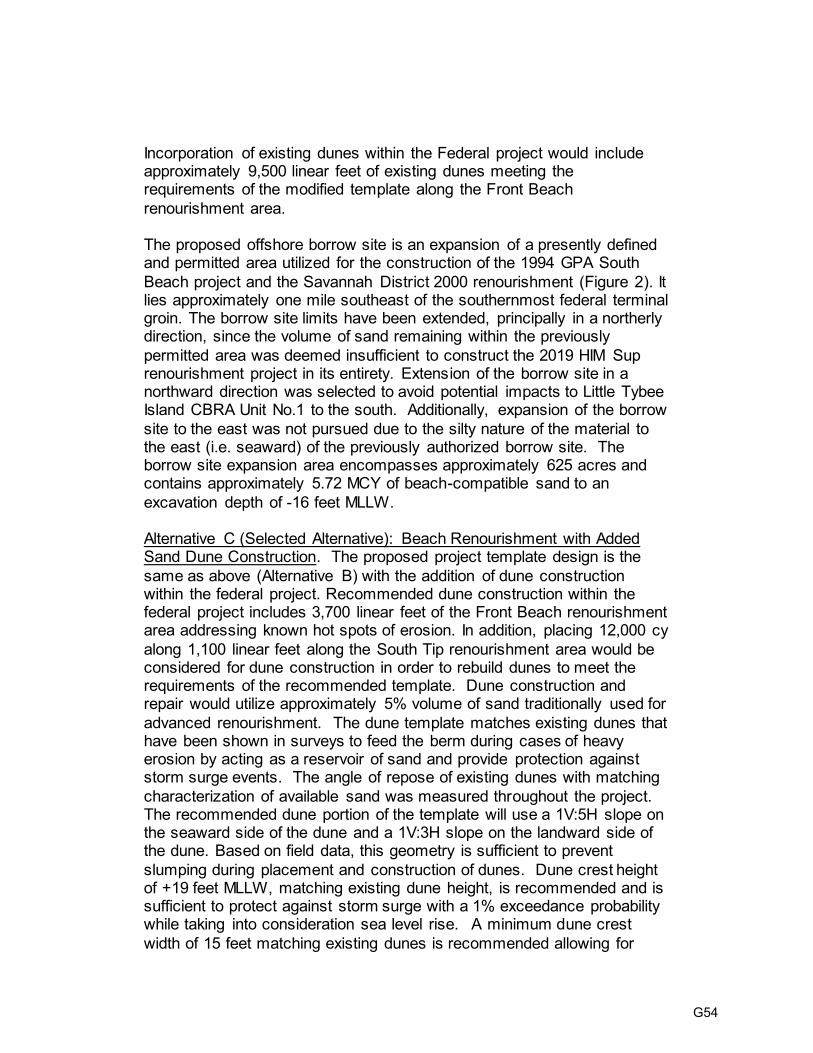
Incorporation of existing dunes within the Federal project would include approximately 9,500 linear feet of existing dunes meeting the requirements of the modified template along the Front Beach
renourishment area. The proposed offshore borrow site is an expansion of a presently defined and permitted area utilized for the construction of the 1994 GPA South
Beach project and the Savannah District 2000 renourishment (Figure 2). It lies approximately one mile southeast of the southernmost federal terminal groin. The borrow site limits have been extended, principally in a northerly direction, since the volume of sand remaining within the previously
permitted area was deemed insufficient to construct the 2019 HIM Sup renourishment project in its entirety. Extension of the borrow site in a northward direction was selected to avoid potential impacts to Little Tybee Island CBRA Unit No.1 to the south. Additionally, expansion of the borrow
site to the east was not pursued due to the silty nature of the material to the east (i.e. seaward) of the previously authorized borrow site. The borrow site expansion area encompasses approximately 625 acres and contains approximately 5.72 MCY of beach-compatible sand to an
excavation depth of -16 feet MLLW. Alternative C (Selected Alternative): Beach Renourishment with Added Sand Dune Construction. The proposed project template design is the
same as above (Alternative B) with the addition of dune construction within the federal project. Recommended dune construction within the federal project includes 3,700 linear feet of the Front Beach renourishment area addressing known hot spots of erosion. In addition, placing 12,000 cy
along 1,100 linear feet along the South Tip renourishment area would be considered for dune construction in order to rebuild dunes to meet the requirements of the recommended template. Dune construction and repair would utilize approximately 5% volume of sand traditionally used for
advanced renourishment. The dune template matches existing dunes that have been shown in surveys to feed the berm during cases of heavy erosion by acting as a reservoir of sand and provide protection against storm surge events. The angle of repose of existing dunes with matching
characterization of available sand was measured throughout the project. The recommended dune portion of the template will use a 1V:5H slope on the seaward side of the dune and a 1V:3H slope on the landward side of the dune. Based on field data, this geometry is sufficient to prevent
slumping during placement and construction of dunes. Dune crest height of +19 feet MLLW, matching existing dune height, is recommended and is sufficient to protect against storm surge with a 1% exceedance probability while taking into consideration sea level rise. A minimum dune crest
width of 15 feet matching existing dunes is recommended allowing for
G54
construction of dunes within the federal foot print and maintaining a distance from the edge of the berm that will prevent erosion to the dunes from wave action. Vegetation would be planted on the dunes for
stabilization and sand fencing could be placed at the toe of the dune to limit pedestrian traffic. The proposed offshore borrow site is an expansion of a presently defined
and permitted area utilized for the construction of GPA and USACE renourishments and is described above in Alternative B.
DEPARTMENT OF THE ARMY EVALUATION:
Environmental Assessment: Savannah District has prepared a Draft Environmental
Assessment (EA) and found that an Environmental Impact Statement should not be required for this action. The Draft EA is being coordinated concurrently with this Notice
to Federal and State natural resource agencies and the public for review and comment. No wetlands would be impacted by the proposed action. Threatened and Endangered Species: The District reviewed the most recent
information on Federally-listed endangered or threatened species and determined that the proposed action may affect, but is not likely to adversely affect sea turtles, loggerhead sea turtle critical habitat, manatees, right whales, right whale critical habitat or Atlantic and shortnose sturgeon due to the time of year construction is scheduled and
the precautions that are listed throughout the EA and appendices. These species are not likely to be present in the construction area during 1 November through 30 April. The District determined the proposed project may affect, and is likely to adversely affect
the Red Knots, Piping Plover and Piping Plover wintering Critical habitat Unit GA-1 due to construction activities which may result in incidental take in the form of harassment. Overall positive net benefits to Piping Plover critical habitat are expected in the form of erosion control. This proposed action is being coordinated with the US Fish and Wildlife
Service and the National Marine Fisheries Service under Section 7 of the Endangered Species Act. Cultural Resources: The Area of Potential Effect includes the beach face to be
renourished, construction access areas, and the borrow area. Consultation conducted under 36 CFR, Part 800, for previous Tybee Beach renourishment projects has established that placement of sand on this beach face and reuse of previously used access areas will have no effect upon significant historic properties. Archaeological
remote sensing surveys are being conducted to identify and evaluate historic properties in a large offshore area. The results of these surveys and supplementary diver investigations will be used to define the borrow area limits in a manner that will avoid impacts to magnetic anomalies and/or sonar targets that may represent potentially
G55

significant historic resources. The results of these investigations are being coordinated with the Georgia State Historic Preservation Office. Essential Fish Habitat: Savannah District evaluated the proposal’s potential effects on
Essential Fish Habitat (EFH). No significant impacts to essential fish habitat are expected. An EFH appendix is provided in the draft Environmental Assessment. This determination is being coordinated with the National Marine Fisheries Service.
Water Quality Certification: Water Quality Certification for the proposed work is being
requested from the Georgia Department of Natural Resources, Environmental Protection Division.
Coastal Zone Consistency: The Savannah District has evaluated the proposed
project and found it is consistent with the Georgia Coastal Zone Management Program to the maximum extent practicable. The District is coordinating it’s consistency with the
Georgia Department of Natural Resources, Coastal Resources Division in Brunswick, Georgia. A Coastal Zone Management appendix is provided in the draft Environmental Assessment. Clean Air Act: This action is being coordinated with the United States Environmental
Protection Agency. No violations of air quality standards are expected. Application of the Section 404(b)(1) Guidelines: The District has conducted an
evaluation of the proposed impacts in accordance with Section 404(b)(1) of the Clean Water Act and determined that the proposed discharge complies with the Section 404(b)(1) Guidelines. That evaluation is included as an appendix to the draft EA for the proposed work.
Public Interest Review: The decision whether to proceed with the project as proposed
will be based on an evaluation of the probable impact, including cumulative impacts, of the proposed activity on the public interest. That decision will reflect the national
concern for both the protection and use of important resources. The benefits which reasonably may be expected to accrue from the proposal will be balanced against its reasonably foreseeable detriments. All factors that may be relevant to the proposal will be considered, including the cumulative effects thereof. Among these are conservation,
economics, aesthetics, general environmental concerns, wetlands, historic properties, fish and wildlife, flood hazards, flood plains, land use, navigation, shoreline erosion/accretion, recreation, water supply and conservation, water quality, energy needs, safety, food and fiber production, mineral needs, consideration of property
ownership, environmental justice, and, in general, the needs and welfare of the people. Consideration of Public Comments: The US Army Corps of Engineers is soliciting
comments from the public; Federal, State, and local agencies and officials; Native
American Tribes; and other interested parties in order to consider and evaluate the
G56

impacts of the proposed activity. Any comments received will be considered by the US Army Corps of Engineers in its deliberations on this action. To make this decision, comments are used to assess impacts to endangered species, wetlands, historic
properties, water quality, general environmental effects, and the other public interest factors listed above. Comments are used in the preparation of the Environmental Assessment pursuant to the National Environmental Policy Act. Comments are also used to determine the need for a public hearing and to determine the overall public
interest of the proposed activity.
Comment Period: Anyone wishing to comment to the Corps on this proposed action
should submit comments no later than the end of the comment period shown in this
notice, in writing, to the US Army Corps of Engineers, Savannah District, Planning Division, ATTN: Ms. Sarah Moore, 100 West Oglethorpe Avenue, Savannah, Georgia 31401-0889, by FAX to 912-652-5787, or by emailing the comments to the following address: [email protected].
Steven A. Fischer Chief, Planning Branch
G57

G58

G59

G60

From: Wikoff, Bill
To: Moore, Sarah A CIV USARMY CESAS (US) Cc: Donald Imm; Mark Dodd
Subject: [Non-DoD Source] Tybee Island Shoreline Protection Project - ESA consultation Date: Thursday, May 2, 2019 10:28:51 AM
Attachments: 20190502_Ltr_DImm-SMoore_FWS Concur W CorpsDetermination.pdf
Ms. Moore,
Please find attached our comments and concurrence with the Corps ESA section 7
determinations for the TISPP.
Bill Wikoff fish and wildlife biologist
U.S. Fish and Wildlife Service
Ecological Services - Coastal Georgia Sub Office
4980 Wildlife Drive, NE
Townsend, Georgia 31331
912-832-8739 ext.5, 912-832-8744 fax NOTE: This email correspondence and any attachments to and from this sender is subject to the Freedom of Information Act (FOIA) and may be
disclosed to third parties.
G61

May 2, 2019 Mr. Steven A. Fischer U. S. Army Corps of Engineers Savannah District – Planning Branch 100 West Oglethorpe Avenue Savannah, Georgia 31401-0889 Attention: Ms. Sarah A. Moore Re: USFWS File Number 2019-0471 Dear Mr. Fischer: The U. S. Fish and Wildlife Service (Service) has reviewed the U. S. Army Corps of Engineers (USACE) Planning Branch April 2, 2019, letter. The USACE requests concurrence with determinations of may affect, but is not likely to adversely affect (MA NLAA) for a list of species found in the vicinity of the Tybee Island Shoreline Protection Project (TISPP) 2019 Hurricanes Harvey, Irma, Maria Emergency Supplemental Renourishment (HIM Sup) located in Chatham County, Georgia. The project Public Notice (PN) was issued on April 2 and April 15, 2019. The PN links to a draft Environmental Assessment (dEA) and Biological Assessment of Threatened and Endangered Species (BATES). Our comments are submitted in accordance with provisions of the Endangered Species Act (ESA) of 1973, as amended; (16 U.S.C. 1531 et seq.). The overall objectives of the 2019 renourishment project are; to replenish the volume of sand lost since the last nourishment of the project shoreline due to storm events, increase the storm protection function of the beaches, and to maintain or improve resiliency of the beaches within the project limits. The original project was constructed in 1974 with a 50-year project life and periodic renourishments to occur every 7 years. The beach was last renourished in 2015 and repaired in 2018 after hurricanes Matthew in 2016 and Irma in 2017. In 2019, there will be 5 years left in the project life (i.e. Federal participation). The ESA listed species that the USACE requests concurrence of the MA NLAA determination from the Service are: West Indian manatee (Trichechus manatus), piping plover (Charadrius melodus) and it’s critical habitat (CH), red knot (Calidris canutus rufa), loggerhead sea turtle (Caretta caretta) and it’s CH, and the leatherback sea turtle (Dermochelys coriacea). Sea turtles when in the water are the responsibility of the National Oceanic and Atmospheric Administration Fisheries. Please refer to them for impacts in the water. Our sea turtle analysis and comments are restricted to turtles on the beach. The USACE dEA and BATES includes project conditions to avoid and minimize impacts to all of the above mentioned species.
United States Department of the Interior
Fish and Wildlife Service RG Stephens, Jr. Federal Building
355 East Hancock Avenue, Room 320 Athens, Georgia 30601
West Georgia Sub Office P.O. Box 52560 Ft. Benning, Georgia 31995-2560
Coastal Sub Office 4980 Wildlife Drive Townsend, Georgia 31331
G62

Based on the information provided in the PN, the Service concurs with your determinations for all species and critical habitats. In view of this, we believe that the requirements of section 7 of the ESA have been satisfied. However, obligations under section 7 of the ESA must be reconsidered if: (1) new information reveals impacts of this identified action that may affect listed species or critical habitat in a manner not previously considered; (2) this action is subsequently modified in a manner which was not previously considered in this assessment; or (3) a new species is listed or critical habitat determined that may be affected by the identified action. This assessment considers the project to occur outside of sea turtle nesting season. If the project or a portion of it occurs or is planned to occur during sea turtle nesting season we would have to reconsider our assessment. We do have other comments at the end of this letter concerning the south end groin field and shell content of the nesting beach that we request the USACE to consider. Manatee The USACE proposes to include conditions to minimize impacts the manatee. We concur with your determination for the West Indian manatee. Piping plover and red knot Both the piping plover and the red knot are known to inhabit the project area. The USACE conditions proposed will minimize impacts during the work. Shoreline renourishment projects do impact the benthic organisms in the intertidal zone that both species forage on for several months. The Service views this temporary loss of foraging habitat and possible disruption of the birds foraging and loafing activities as not rising to the definition of ‘take’. Shorebird usage is primarily on the north and south ends of Tybee Island. From either location ample undisturbed habitat commonly used by shorebirds is close by. To the north it is adjacent to the project area on the other side of the north jetty. To the south habitat is across Tybee Creek / Back River on Little Tybee Island. Piping plover CH A portion of these impacts will be in wintering piping plover CH unit GA-1. We expect these impacts to be temporary. The project is not expected to result in destruction or adverse modification of this habitat unit. We concur with the USACE determination for impacts to piping plover critical habitat unit GA-1. Loggerhead sea turtle We concur with your determination of MA NLAA for the loggerhead sea turtle. Adverse effects will be greatly reduced by the protective measures proposed. With regard to indirect loss of eggs and hatchlings, on most beaches, nesting success typically declines for the first year or two following sand placement, even though more nesting habitat is available for turtles (Trindell et al. 1998, Ernest and Martin 1999, Herren 1999). Reduced nesting success on constructed beaches has been attributed to increased sand compaction, escarpment formation, and changes in
G63

beach profile (Nelson et al. 1987, Crain et al. 1995, Steinitz et al. 1998, Ernest and Martin 1999, Rumbold et al. 2001). In addition, even though constructed beaches are wider, nests deposited there may experience higher rates of wash out than those on relatively narrow, steeply sloped beaches (Ernest and Martin 1999). This occurs because nests on constructed beaches are more broadly distributed than those on natural beaches, where they tend to be clustered near the base of the dune. Nests laid closest to the waterline on constructed beaches may be lost during the first year or two following construction as the beach undergoes an equilibration process during which seaward portions of the beach are lost to erosion. As a result, sand projects are generally anticipated to result in decreased nesting and loss of nests that do get laid within the project area for two subsequent nesting seasons following the completion of the proposed sand placement. TISPP conditions include measures to minimize these effects. Prior to the next three nesting seasons after the project, sand compaction testing and tilling will occur as necessary. The beach will be surveyed for escarpments and graded down as necessary. Additionally, it is important to note that it is unknown whether nests that would have been laid in a project area during the two subsequent nesting seasons had the project not occurred are actually lost from the population or if nesting is simply displaced to adjacent beaches. Regardless, eggs and hatchlings have a low reproductive value; each egg or hatchling has been estimated to have only 0.004 percent of the value of a nesting female (NMFS and Service 2008). Thus, even if the majority of the eggs and hatchlings that would have been produced on the project beach are not realized for up to two years following project completion, the Service would not expect this loss to have a significant effect on the recovery and survival of the species, for the following reasons: 1) some nesting is likely just displaced to adjacent non-project beaches, 2) not all eggs will produce hatchlings, and 3) destruction and/or failure of nests will not always result from a sand placement project. A variety of natural and unknown factors negatively affect incubating egg clutches, including tidal inundation, storm events, and predation. Another documented result of beach nourishment is that lights and glow from beachfront development can be more visible from the post-nourishment elevated berm. This can result in misdirection of nesting sea turtles or hatchling turtles on the raised beach due to the artificial lights being visible that were previously below the horizon. Tybee has a lighting ordinance in place that includes light surveys from the beach to address this issue. Based on the above measures and factors as described we concur with the USACE determination for sea turtles on the beach. Loggerhead sea turtle CH Little Tybee Island is designated as loggerhead sea turtle CH unit LOGG-T-GA-01. The project is not expected to result in destruction or adverse modification of this habitat unit. We concur with the USACE determination for impacts to loggerhead sea turtle CH unit LOGG-T-GA-01. Leatherback sea turtle Loggerhead sea turtles account for 99.4% of the nesting in Georgia. Leatherback sea turtle nests have been documented on Tybee Island in rare instances. Leatherback sea turtle nesting in
G64

Georgia in the last 10 years has ranged from zero to 11 nests per year, with a state average of 4.6 nests per year and an average of 0.2% of the nests. The last leatherback nesting on Tybee Island was one nest in 2004, 14 nesting seasons ago. The Service concurs with your determination of MANLAA for the leatherback sea turtle based upon the rare nesting occurrence in the project area, in the state, and the project minimization measures in place for nesting sea turtles. Other comments: South end groin field The BATES includes the statement that the State of Georgia and Georgia Port Authority constructed a series of three groins south of the Federal south groin in an effort to alleviate the extensive erosion at this portion of the beach and stop the potential for failure of the south end seawall. Generally, the Service is opposed to groins as they may interfere with sea turtle nesting and impair shorebird use of the beach. We would like the Corps to determine: 1) if these groins constructed as part of the initial project are still serving the purposes they were constructed for and 2) if with the addition of dunes and renourishment sand as proposed in this TISPP the groins are no longer necessary. We support the concept of building dunes as part of the project and removing the groins if they can be removed without adversely impacting the southern beach. Along the Georgia coast, longshore currents typically move sand from north to south, accreting the southern tips of barrier islands. Shell content of the nesting beach The Service was concerned that after repeated renourishments and erosion the shell content of the nesting beach will increase making it more difficult for turtles to dig their nests and/or abandon nesting attempts. The USACE addressed this in the BATES. We request the USACE to begin monitoring the shell content using the percent shell by weight method as required by the Georgia Department of Natural Resources (GADNR) for beach nourishment projects instead of using the shell content by visual estimation method. Mark Dodd, GADNR sea turtle biologist opines that this method is more accurate (per. com. M. Dodd – GADNR). We appreciate the opportunity to comment on this project. If you have any further questions, please contact our Coastal Georgia Sub Office staff biologist, Bill Wikoff, at 912-832-8739 extension 5.
cc: Mark Dodd, GADNR Sea Turtle Biologist, Brunswick, Georgia
G65

Literature Cited Crain, D.A., A.B. Bolten, and K.A. Bjorndal. 1995. Effects of beach nourishment on sea turtles: review and research initiatives. Restoration Ecology 3(2):95-104. Ernest, R.G. and R.E. Martin. 1999. Martin County beach nourishment project: sea turtle monitoring and studies. 1997 annual report and final assessment. Unpublished report prepared for the Florida Department of Environmental Protection. Herren, R.M. 1999. The effect of beach nourishment on loggerhead (Caretta caretta) nesting and reproductive success at Sebastian Inlet, Florida. Unpublished Master of Science thesis. University of Central Florida, Orlando, Florida. 138 pages. National Marine Fisheries Service and the U.S. Fish and Wildlife Service (NMFS and Service). 2008. Recovery plan for the Northwest Atlantic population of the loggerhead sea turtle (Caretta caretta), second revision. National Marine Fisheries Service, Silver Spring, Maryland. Nelson, D.A., K. Mauck, and J. Fletemeyer. 1987. Physical effects of beach nourishment on sea turtle nesting, Delray Beach, Florida. Technical Report EL-87-15. U.S. Army Corps of Engineers Waterways Experiment Station, Vicksburg, Mississippi. Rumbold, D.G., P.W. Davis, and C. Perretta. 2001. Estimating the effect of beach nourishment on Caretta caretta (loggerhead sea turtle) nesting. Restoration Ecology 9(3):304-310. Steinitz, M.J., M. Salmon, and J. Wyneken. 1998. Beach renourishment and loggerhead turtle reproduction: a seven year study at Jupiter Island, Florida. Journal of Coastal Research 14(3):1000-1013. Trindell, R., D. Arnold, K. Moody, and B. Morford. 1998. Post-construction marine turtle nesting monitoring results on nourished beaches. Pages 77-92 in Tait, L.S. (compiler). Proceedings of the 1998 Annual National Conference on Beach Preservation Technology. Florida Shore & Beach Preservation Association, Tallahassee, Florida.
G66

USFWS Comments on HIM Sup EA and USACE’s Responses
Comment - South End Groin Field The BATES includes the statement that the State of Georgia and Georgia Port Authority constructed a series of three groins south of the Federal south groin in an effort to alleviate the extensive erosion at this portion of the beach and stop the potential for failure of the south end seawall. Generally, the Service is opposed to groins as they may interfere with sea turtle nesting and impair shorebird use of the beach. We would like the Corps to determine: 1) if these groins constructed as part of the initial project are still serving the purposes they were constructed for and 2) if with the addition of dunes and renourishment sand as proposed in this TISPP the groins are no longer necessary. We support the concept of building dunes as part of the project and removing the groins if they can be removed without adversely impacting the southern beach. Along the Georgia coast, longshore currents typically move sand from north to south, accreting the southern tips of barrier islands.
Response 1) The South Tip Groin Field was constructed by the Georgia Ports Authority with State funds in 1994 to help accrete and hold sand on the South Tip of Tybee Beach. Overall longshore transport for Tybee Island is from North to South. At the Second Street Beach there is a nodal point and material is also transported to the north. Material from the beach moves to the offshore bar on the south end of the island and eventually to barrier islands south. With the construction of the Southern Terminal Groin by USACE in 1987, the area directly south of the groin (south tip of Tybee Island) was cut off from the longshore transport cycle. The Southern Terminal Groin is necessary to prolong the life of the berm on the front beach between renourishments. The T-groins in the South Tip Groin Field compensate for the loss of longshore transported sand by holding the pumped sand in place and accreting material that occasionally washes over the Southern Terminal Groin. This area of Tybee was last renourished in 2008. Due to the success of the South Tip Groin Field accretion and holding of the berm, the South Tip was not renourished during the 2015 renourishment. Hurricane Matthew caused significant damage to the berm on the South Tip in 2016. It is USACE’s stance that upon completion of the HIM Sup renourishment, the South Tip Groin Field will continue to function as designed and allow for extended protection of the berm and the dune field on the South Tip. 2) Dunes are being constructed to both add protection during storm surges but also to aid in erosion control of the berm by becoming a source of sand to feed the berm. The dunes on the southern tip need the South Tip Groin Field to hold the berm in place. Without the T-groins, the berm will erode away leaving the dunes vulnerable to increased erosion. This is the current condition of the south tip. Hurricane Matthew damaged the berm on the south tip which in turn has caused significant erosion to the dune field along the south tip. Once the South Tip Groin Field is renourished and the dunes are repaired and constructed, it is USACE’s stance that the system will function in a healthy sand accretion and protective role for the south tip beach area.
Comment - Shell Content of the Nesting Beach The Service was concerned that after repeated renourishments and erosion the shell content of the nesting beach will increase making it more difficult for turtles to dig their nests and/or abandon nesting attempts. The USACE addressed this in the BATES. We request the USACE
G67

to begin monitoring the shell content using the percent shell by weight method as required by the Georgia Department of Natural Resources (GADNR) for beach nourishment projects instead of using the shell content by visual estimation method. Mark Dodd, GADNR sea turtle biologist opines that this method is more accurate (per. com. M. Dodd – GADNR). We appreciate the opportunity to comment on this project. If you have any further questions, please contact our Coastal Georgia Sub Office staff biologist, Bill Wikoff, at 912-832-8739 extension 5.
Response CONCUR: Prior shell sampling of the native beach material showed shell content reaching 12.6% in 2007 (prior to the 2008 renourishment). USACE has since used the BAE 2008 material which had less shell content than the 2007 native beach material. The BAE 2019’s shell content is approximately 8.18% shell via the visual testing method. USACE was made aware of the changes to shell content monitoring on 8 May 2019 by GA DNR CRD. This was after the visual testing method had been completed for BAE 2019. The email stated “Additionally, we (GA DNR) have revised our sand guidelines (attached) for shell content from a maximum of 15% by volume to a maximum of 15% by weight. Percentage by weight is a much more concise and quantitative measure than percentage by volume, which is more qualitative in nature. The 8% by volume shell content for this project is perfectly adequate, but we will be asking for percent by weight for future projects.” USACE understands that for this project, the visual testing method which found 8.18% shell content will meet the GA DNR CRD standards for material to be placed on the Tybee Beach during the HIM Sup construction. Future projects will use the percent by weight method in the future.
G68

G69

G70

G71

G72

G73

May 2, 2019 F/SER47:CC/pw
(Sent via Electronic Mail) Colonel Daniel Hibner, Commander Savannah District Corps of Engineers 100 W. Oglethorpe Avenue Savannah, Georgia 31402-0889 Attention: Sarah Moore Dear Colonel Hibner: NOAA’s National Marine Fisheries Service (NMFS) reviewed Draft Environmental Assessment and Finding of No Significant Impact, Tybee Island, Georgia, Shoreline Protection Project, 2019 Hurricanes Harvey, Irma, Maria Emergency Supplemental Renourishment (EA) dated April 2019 and the corresponding letter from the Savannah District dated April 2, 2019. The Savannah District proposes to replenish the volume of sand lost from the federal Tybee Island Shoreline Protection Project due to storms. The Savannah District has concluded the proposed supplemental nourishment will have no significant impacts on essential fish habitat (EFH) and, accordingly, the District proposes no compensatory mitigation. As the nation’s federal trustee for the conservation and management of marine, estuarine, and anadromous fishery resources, the NMFS provides the following comments and recommendations pursuant to authorities of the Fish and Wildlife Coordination Act and the Magnuson-Stevens Fishery Conservation and Management Act (Magnuson-Stevens Act). Project Description The Savannah District developed and evaluated three alternatives, including the selected Alternative C: Beach Nourishment with Added Sand Dune Construction. The other alternatives considered included Alternative A: No Beach Nourishment and Alternative B: Beach Nourishment with no added sand dunes. The District based the proposed design on previous project performance and erosion rate, and the District proposes to place of 1.8 million cubic yards of material within the 9,500-linear-foot Tybee Island Project. The borrow area for the original project does not contain sufficient sand for the supplement because the borrow area did not fill with beach compatible sand after the last dredging events. Consequently, the Savannah District proposes to extend the boundary of the original borrow area northward, avoiding silty sediment to the east and the Little Tybee Island Shoal Complex to the south. Dune construction includes 3,700 linear feet within the Tybee Island Project to address known erosion hotspots. The proposed construction period is November 2019 to April 2020. Essential Fish Habitat Evaluation The South Atlantic Fishery Management Council (SAFMC) identifies the sub-tidal and intertidal unconsolidated bottom, surf zones, and coastal inlets as EFH for several species under the fishery
G74

management plans for shrimp, the snapper-grouper complex, and coastal migratory pelagic species. The SAFMC also identifies coastal inlets as a Habitat Area of Particular Concern (HAPC) under the fishery management plans for the shrimp and the snapper/grouper complex. HAPCs are subsets of EFH that are rare, particularly susceptible to human-induced degradation, especially important ecologically, or located in an environmentally stressed area. In addition to serving as EFH, these areas provide habitat for numerous species and their prey that have commercial or recreational importance, including red drum (Sciaenops ocellatus), southern flounder (Paralichthys lethostigma), Florida pompano (Trachinotus carolinus), summer flounder (Paralichthys dentatus), spot (Leiostomus xanthurus), and blue crab (Callinectes sapidus). The SAFMC provides additional information on EFH and federally managed species in Volume IV of the Fishery Ecosystem Plan of the South Atlantic Region1 and the Users Guide to Essential Fish Habitat Designations by the South Atlantic Fishery Management Council2. EA Appendix D EFH Assessment notes the physical disturbances created by dredging and sand placement often have adverse impacts on EFH due to destruction of the benthic communities serving as prey for fishery species. Previous monitoring efforts for the Tybee Island Project showed permanent changes in sediment properties of the borrow area as well as significant impacts to the associated benthic infaunal communities. The monitoring also noted impacts along the beach, such as declines in molluscan densities, from the filling. To address these issues, the Savannah District is implementing avoidance and minimization strategies to increase the likelihood of recovery, including determining fill compatibility with beach sediments, performing work during periods of low biological activity, and locating the borrow area northward to avoid impacts to inlet shoals. Based on the planned inclusion of these impact minimization measures, the NMFS has no EFH conservation recommendations for the beach nourishment portion of the project. Specific Comments on the EA Section 2.6.2 Marine Intertidal Zone (page 29, second paragraph). The NMFS recommends it read “and 4) surf zone: juveniles of federally managed species, shellfish…” Section 2.6.3 Marine Subtidal Zone (page 31, last paragraph). The NMFS recommends inserting a sentence after the existing first sentence noting the importance of benthic assemblages as a foraging resource for fish species inhabiting the zone. Section 2.6.6 Essential Fish Habitat and Appendix D. Please note red drum is no longer a federally managed species and should be removed from this section and Appendix D. First paragraph, next to last sentence should read, “EFH occurring in the project area or vicinity includes oyster reefs, estuarine emergent wetlands, intertidal flats, unconsolidated bottom, interconnecting water bodies, coastal inlets, and marine and estuarine water columns.” Please refer to Users Guide to Essential Fish Habitat Designations by the South Atlantic Fishery Management Council2 for a more detailed discussion of these designations. Second paragraph, last sentence should be deleted and replaced with “EFH-Habitat Areas of Particular Concern in the project area include coastal inlets.” Coastal inlets are EFH-HAPC under the fishery management plans dfor shrimp and the snapper grouper complex; the inlets are EFH under the
1 Available at http:///safmc.net/ 2 Available at http://safmc.net/download/SAFMCEFHUsersGuideFinalRevAug17_2.pdf
G75

fishery management plan for coastal migratory species. Work along the southern edge of the project limit has the potential to impact the coastal inlet. Appendix D should also be altered to reflect these changes. The NMFS appreciates the opportunity to provide these comments. Please direct related correspondence to the attention of Cindy Cooksey at our Charleston Area Office. She may be reached at (843) 460-9922 or by e-mail at [email protected]. Sincerely,
/ for
Virginia M. Fay Assistant Regional Administrator
Habitat Conservation Division cc: COE, [email protected] GADNR CRD, [email protected] GADNR EPD, [email protected] SCDNR, [email protected] EPA, [email protected] FWS, [email protected] SAFMC, [email protected] F/SER4, [email protected] F/SER47, [email protected]
G76

NOAA’s NMFS Comments on HIM Sup EA and USACE’s Responses
Section 2.6.2 Marine Intertidal Zone. The NMFS recommends it read “and 4) surf zone: juveniles of federally managed species, shellfish…”
CONCUR: The following has been added to the EA Section 2.6.2 Marine Intertidal Zone - “and 4) surf zone: juveniles of federally managed species, shellfish…”
Section 2.6.3 Marine Subtidal Zone (page 31, last paragraph). The NMFS recommends inserting a sentence after the existing first sentence noting the importance of benthic assemblages as a foraging resource for fish species inhabiting the zone.
CONCUR: The following sentence has been added to Section 2.6.3 Marine Subtidal Zone in the recommended location – “Benthic assemblages are an important foraging resource for fish species inhabiting the marine subtidal zone.”
Section 2.6.6 Essential Fish Habitat and Appendix D. Please note red drum is no longer a federally managed species and should be removed from this section and Appendix D.
CONCUR: Red drum have been removed from the EA and Appendix D.
Section 2.6.6 Essential Fish Habitat and Appendix D. First paragraph, next to last sentence should read, “EFH occurring in the project area or vicinity includes oyster reefs, estuarine emergent wetlands, intertidal flats, unconsolidated bottom, interconnecting water bodies, coastal inlets, and marine and estuarine water columns.” Please refer to Users Guide to Essential Fish Habitat Designations by the South Atlantic Fishery Management Council for a more detailed discussion of these designations.
CONCUR: The following has been added to the EA Section 2.6.6 Essential Fish Habitat – ““EFH occurring in the project area or vicinity includes oyster reefs, estuarine emergent wetlands, intertidal flats, unconsolidated bottom, interconnecting water bodies, coastal inlets, and marine and estuarine water columns.” More information on the designation of these habitats can be found in “Users Guide to Essential Fish Habitat Designations by the South Atlantic Fishery Management Council” (safmc.net/download/SAFMCEFHUsersGuideFinalRevAug17_2.pdf). The following has been added to Section 4.1 Appendix D – “EFH habitat applicable to this proposal includes oyster reefs, estuarine emergent wetland, intertidal flats, unconsolidated bottom, interconnecting water bodies, coastal inlets, and marine and estuarine water columns.” More information on the designation of these habitats can be found in “Users Guide to Essential Fish Habitat
G77

Designations by the South Atlantic Fishery Management Council” (safmc.net/download/SAFMCEFHUsersGuideFinalRevAug17_2.pdf). The following has been added to Section 4.1.1, Table 1, Appendix D – Unconsolidated Bottom, Interconnecting Water Bodies, and Coastal Inlets. The following subsections have been added to Appendix D with defining statements – 4.1.1.5 Unconsolidated Bottom, 4.1.1.7 Coastal Inlets, 4.1.1.8 Interconnecting Water Bodies
Section 2.6.6 Essential Fish Habitat and Appendix D. Second paragraph, last sentence should be deleted and replaced with “EFH-Habitat Areas of Particular Concern in the project area include coastal inlets.” Coastal inlets are EFH-HAPC under the fishery management plans for shrimp and the snapper grouper complex; the inlets are EFH under the fishery management plan for coastal migratory species. Work along the southern edge of the project limit has the potential to impact the coastal inlet.
CONCUR: The following has been added to the EA Section 2.6.6 Essential Fish Habitat – “The Tybee Creek coastal inlet is an EFH-Habitat Areas of Particular Concern (HAPC) south of the project area. Coastal inlets are EFH-HAPC under the fishery management plans for shrimp and the snapper grouper complex.” The following has been added to the EA Section 4.6.6 Essential Fish Habitat – “When considering EFH-HAPC, work along the southern edge of the project limit has the potential to impact the Tybee Creek coastal inlet. However, temporary, shore-parallel dikes will be constructed in the immediate construction area as needed to control the effluent and maximize the settling of sediments from the discharge before the waters reach the Tybee Creek. Turbidity impacts are expected to be short-term and limited to the period of construction given the low percentage of fine material (less than 1%) within the borrow site sediments.” The following has been added to Section 4.1.1.11 Geographically Defined Habitat Areas of Particular Concern Appendix D – “The Tybee Creek coastal inlet is an EFH-Habitat Areas of Particular Concern (HAPC) south of the project area. Coastal inlets are EFH-HAPC under the fishery management plans for shrimp and the snapper grouper complex. The impact
G78

to the Tybee Creek HAPC is expected to be minor and short term in nature during the construction phase on the southern tip of the project.”
G79

G80

G81

From: White, Roshanna
To: Moore, Sarah A CIV USARMY CESAS (US) Cc: Militscher, Chris; Buskey, Traci P.
Subject: [Non-DoD Source] EPA"s Comments for the DEA and FONSI for Tybee Island Emergency Supplemental Beach
Renourishment Date: Wednesday, May 1, 2019 4:29:27 PM
Sarah Moore
Environmental Resources
Savannah District
U.S. Army Corps of Engineers
100 West Oglethorpe Avenue
Savannah, GA 31401-0889
Dear Ms. Moore:
In accordance with the National Environmental Policy Act (NEPA), Section 309 of the Clean
Air Act, and the Council on Environmental Quality’s implementing regulations (40 CFR 1500
—1508), the Environmental Protection Agency (EPA) has reviewed the Tybee Island, Georgia
Shoreline Protection Project 2019 Hurricanes Harvey, Irma, Maria Emergency Supplemental
Renourishment Environmental Assessment (EA) and Finding of No Significant Impact (FONSI)
for the U.S. Army Corps of Engineers (USACE) Savannah District. The purpose of the proposed
project is to evaluate the environmental impacts of the emergency supplemental beach
renourishment with the incorporation of a new borrow area for the Tybee Island Shoreline to
reduce risk from waves, erosion, and inundation within the project area.
The EPA understands that the last renourishment in 2015 was intended to provide material to
maintain the beach and guard from potential erosion through 2024. Due to storm damage from
Hurricanes Matthew in 2016 and Irma in 2017, in 2018 supplemental nourishment was
conducted to add material that was lost. The EA states the overall objectives of the
renourishment project are to replenish the volume of sand lost since the 2018 nourishment of the
project shoreline due to storm events, increase the storm protection function of the beaches, and
to maintain or improve resiliency of the beaches within the project limits and over the project’s
lifetime.
The proposed project template design is based on project performance and erosion rates since the
last renourishment project in 2018 and the calculated storm damage. The plan calls for placement
of approximately 1.8 million cubic yard (cy) of material on the beach at Tybee Island within the
limit same footprint and an expansion of the existing burrow area off the coast of Tybee Island to
accommodate this emergency supplemental renourishment as well as future renourishments. The
EA considered three alternatives for the proposed action:
Alternative A-No Action: This alternative would result in continued erosion with no
renourishment. With no renourishment, the beach would continue to erode, with
associated loss in storm damage protection and recreational benefits.
G82

Alternative B-Beach Renourishment: Fill would be placed in the following areas to
provide more stable beach profile: Areas include the North Beach (North End Groin to
Oceanview Court), Second Street area (Oceanview Court to Center Street), Middle Beach
(Center Street to 11th Street), South Beach (11th Street to South End Groin), and Back
River/Tybee Creek (South Tip Groin Field to Inlet Avenue). Incorporate existing dunes
within the Federal project to include approximately 9,500 linear feet of existing dunes to
meet the requirements of the modified template along the Front Beach renourishment
area.
The volume of sand remaining within the previously permitted area was deemed
insufficient to construct the 2019 HIM Sup re-nourishment project in its entirety because
borrow area extension of 2008 was used for the 2008 and 2015 renourishments and the
2018 hurricane repairs, the burrow limits needed to be extended approximately 625 acres.
This extended limit contains approximately 5.72 million cy of material to an excavation
depth of negative sixteen feet mean lower low water.
Alternative C (Preferred Alternative)-Beach Renourishment with Added Sand Dune
Construction: This alternative would be the same as Alternative B with the addition of
dune construction. Dune construction would address high erosion areas, known as hot
spots. In addition, placing 12,000 cy along 1,100 linear feet along the South Tip
renourishment area would be considered for dune construction in order to rebuild dunes
to meet the recommended requirements.
Based on our review the EPA requests that the missing reference sources displayed as “Error!
Reference Source Not Found” be corrected in the following sections: 1.5 Project Description,
4.6.5 Protected Species, and 5.4.4 Summary of Conditions.
The USACE Savannah District Tybee Island Beach Renourishment Project has incorporated
avoidance, minimization, and mitigation measures to avoid or minimize negative effects of beach
nourishment and determined that a Finding of No Significant Impact is appropriate for the
proposed action. The EPA has no further comment. If you have any questions regarding these
comments, please contact me at the information below.
Sincerely, Roshanna White │Life Scientist National Environmental Policy Act (NEPA) │Strategic Programs Office U.S. Environmental Protection Agency│Region IV Voice: 404-562-9035 │Email: [email protected]
G83

EPA Comments on HIM Sup EA and USACE’s Responses
Based on our review the EPA requests that the missing reference sources displayed as “Error! Reference Source Not Found” be corrected in the following sections: 1.5 Project Description, 4.6.5 Protected Species, and 5.4.4 Summary of Conditions.
CONCUR: The missing references have been corrected within the final EA and Appendices.
G84

G85

G86

From: Pattavina, Laci
To: Moore, Sarah A CIV USARMY CESAS (US) Cc: Stowe, Carol
Subject: [Non-DoD Source] Tybee Island Shoreline Protection Project
Date: Wednesday, May 8, 2019 5:10:19 PM
Attachments: ir-18723-lsc-2019-05-08.pdf
Ms. Moore,
Please see attached the Wildlife Conservation Section of Georgia DNR’s review of this project. If you have any
questions, please let me know. Thank you for notification and the opportunity to provide this review.
Laci Pattavina
Wildlife Biologist, Wildlife Conservation
Wildlife Resources Division <Blockedhttp://georgiawildlife.com/>
(706) 557-3228 | M: (470) 316-3071
Facebook <Blockedhttp://www.facebook.com/WildlifeResourcesDivisionGADNR> • Twitter
<Blockedhttp://twitter.com/georgiawild> • Instagram <Blockedhttp://www.instagram.com/georgiawildlife>
Buy a hunting or fishing license today! <Blockedhttp://georgiawildlife.com/licenses-permits-passes>
—————————————————
A division of the
GEORGIA DEPARTMENT OF NATURAL RESOURCES
G87

MARK WILLIAMS RUSTY GARRISON COMMISSIONER DIRECTOR
WILDLIFE CONSERVATION SECTION 2065 U.S. HIGHWAY 278 S.E. | SOCIAL CIRCLE, GEORGIA 30025-4743
770.918.6411 | FAX 706.557.3033 | WWW.GEORGIAWILDLIFE.COM
May 08, 2019
Sarah Moore
USACE
100 West Oglethorpe Avenue
Savannah, GA 31401
Subject: Known occurrences of natural communities, plants and animals of highest priority conservation status on or near Tybee Island Shoreline Protection Project, Chatham County, Georgia
Dear Ms. Moore:
This is in response to your request of April 8, 2018. The following Georgia natural heritage
database element occurrences (EOs) were selected for the current site using the local HUC10
watershed for elements whose range distribution is limited by aquatic systems (AQ) and within 3
miles for all other EOs (TR).
(-80.844226, 31.997679, WGS84)
Acacia farnesiana (Sweet Acacia) (TR), approx. 2.6 mi W of site
US Acipenser brevirostrum (Shortnose Sturgeon) in Savannah River, Lower and Middle
(AQ), approx. 19.4 mi NW of site
US Acipenser brevirostrum (Shortnose Sturgeon) in Savannah River, Lower and Middle
(AQ), approx. 5.5 mi W of site
US Acipenser oxyrinchus oxyrinchus (Atlantic Sturgeon) in Ogeechee River (AQ), approx.
19.0 mi SW of site
US Acipenser oxyrinchus oxyrinchus (Atlantic Sturgeon) in Savannah River, Lower and
Middle (AQ), approx. 15.3 mi W of site
US Acipenser oxyrinchus oxyrinchus (Atlantic Sturgeon) in Savannah River, Lower and
Middle (AQ), approx. 18.9 mi NW of site
GA Alasmidonta arcula (Altamaha Arcmussel) in Huc 10 - 0306010906 (Savannah River
Lower 1) (AQ), approx. 31.8 mi NW of site
Ammodramus maritimus macgillivraii (MacGillivray's Seaside Sparrow) (TR), approx. 2.7
mi NW of site
Ammodramus maritimus macgillivraii (MacGillivray's Seaside Sparrow) (TR), approx. 3.0
mi W of site
US Calidris canutus (Red Knot) (TR), approx. 2.3 mi W of site
US Calidris canutus (Red Knot) (TR), on or immediate vicinity of site
US Caretta caretta (Loggerhead Sea Turtle) (TR), approx. 1.3 mi SW of site
US Caretta caretta (Loggerhead Sea Turtle) (TR), approx. 1.1 mi W of site
US Caretta caretta (Loggerhead Sea Turtle) (TR), on or immediate vicinity of site
G88

IR 18723-lsc-2019-05-08-13-53-33
US Charadrius melodus (Piping Plover) (TR), approx. 1.6 mi SW of site
GA Charadrius wilsonia (Wilson's Plover) (TR), approx. 2.4 mi SW of site
Chologaster cornuta (Swampfish) in Black Creek Huc 10 - 0306010906 (AQ), approx.
23.6 mi NW of site
Crotalus adamanteus (Eastern Diamond-backed Rattlesnake) (TR), approx. 1.0 mi SW of
site
Crotalus adamanteus (Eastern Diamond-backed Rattlesnake) [Historic] (TR), in an
uncertain location near the project site
Crotalus adamanteus (Eastern Diamond-backed Rattlesnake) [Historic] (TR), approx. 2.1
mi W of site
US Dermochelys coriacea (Leatherback Sea Turtle) (TR), on or immediate vicinity of site
GA Elassoma okatie (Bluebarred Pygmy Sunfish) in Pipe Makers Creek (AQ), approx. 23.6
mi W of site
Elliptio congaraea (Carolina Slabshell) in Savannah River (AQ), approx. 23.5 mi NW of
site
Elliptio roanokensis (Roanoke Slabshell) in Savannah River (AQ), approx. 31.8 mi NW of
site
US Eubalaena glacialis (Northern Atlantic Right Whale) (TR), on or immediate vicinity
of site
GA Forestiera segregata (Florida Wild Privet) (TR), approx. 2.6 mi W of site
GA Haematopus palliatus (American Oystercatcher) (TR), approx. 0.8 mi SW of site
GA Haliaeetus leucocephalus (Bald Eagle) (TR), approx. 0.8 mi SW of site
GA Haliaeetus leucocephalus (Bald Eagle) (TR), approx. 2.7 mi W of site
Lampsilis cariosa (Yellow Lampmussel) in Savannah River Huc 10 - 0306010906
Savannah River Lower 1 (AQ), approx. 29.2 mi NW of site
GA Lucania goodei (Bluefin Killifish) [Historic] (AQ), approx. 39.4 mi SW of site
Lucania parva (Rainwater Killifish) in Savannah River Estuary (AQ), approx. 14.8 mi W
of site
GA Moxostoma robustum (Robust Redhorse) in Savannah River Lower, Huc 10 - 0306010906
(AQ), approx. 27.2 mi NW of site
Nycticorax nycticorax (Black-crowned Night-heron) [Historic] (TR), in an uncertain
location near the project site
Pseudorca crassidens (False Killer Whale) (TR), on or immediate vicinity of site
Ptilimnium ahlesii (Coastal Bishopweed) (AQ), approx. 19.7 mi NW of site
Stereochilus marginatus (Many-lined Salamander) [Historic] (AQ), approx. 31.9 mi NW
of site
GA Sternula antillarum (Least Tern) (TR), approx. 2.8 mi SW of site
US Trichechus manatus (West Indian Manatee) (AQ), approx. 2.1 mi NW of site
US Trichechus manatus (West Indian Manatee) (AQ), approx. 47.3 mi SW of site
US Trichechus manatus (West Indian Manatee) (AQ), approx. 7.4 mi W of site
US Trichechus manatus (West Indian Manatee) (AQ), on or immediate vicinity of site
BRADY TRACT [Georgia Department of Natural Resources] (TR), approx. 0.3 mi W of
site
Fort Pulaski National Monument [National Park Service] (TR), approx. 2.3 mi W of site
GALT easement [Georgia-Alabama Land Trust] (TR), on or immediate vicinity of
site
G89

IR 18723-lsc-2019-05-08-13-53-33
Juniperus virginiana var. silicicola - (Quercus virginiana, Sabal palmetto) Forest (Cedar -
Live Oak - Cabbage Palmetto Marsh Hammock) (TR), approx. 2.9 mi W of site
LITTLE TYBEE-CABBAGE ISLAND TRACT [Georgia Department of Natural
Resources] (TR), approx. 0.4 mi W of site
Little Tybee Tract 1 Easement [The Nature Conservancy of Georgia] (TR), approx. 0.4 mi
W of site
TYBEE ISLAND TRACT [Georgia Department of Natural Resources] (TR), approx. 1.1
mi W of site
Uniola paniculata - Hydrocotyle bonariensis Grassland (Sea-oats Dune Grassland)
(TR), on or immediate vicinity of site
Savannah River Lower 1 (0306010906) [SWAP High Priority Watershed] (TR), on or
immediate vicinity of site
Ogeechee River, Coast (0306020406) [SWAP High Priority Watershed] (TR), on or
immediate vicinity of site
Recommendations:
Federally listed species have been documented within three miles of the proposed project. To
minimize potential impacts to federally listed species, we recommend consultation with the
United States Fish and Wildlife Service. In Southeast Georgia, call the Coastal Georgia Office at
912-832-8739.
Please be aware that state protected species have been documented within three miles of the
proposed project. For information about these species, including survey recommendations,
please visit our webpage at http://georgiawildlife.com/conservation/species-of-concern#rare-
locations. Surveys for species of conservation concern should be conducted prior to
commencement of construction.
This project occurs within a high priority watershed. As part of Georgia’s State Wildlife Action
Plan, high priority watersheds were identified to protect the best-known populations of high
priority aquatic species, important coastal habitats, and migratory corridors for anadromous
species. Please refer to Appendix F of Georgia’s State Wildlife Action Plan to find out more
specific information about this high priority watershed:
https://georgiawildlife.com/wildlifeactionplan.
A record of a nesting bald eagle (Haliaeetus leucocephalus) is within three miles of the proposed
project. Although bald eagles are no longer listed as federally endangered, they are still protected
by the Migratory Bird Treaty Act, the Bald and Golden Eagle Protection Act, and the Georgia
Endangered Species Act. These Acts continue to protect bald eagles from potentially harmful
human activities. For more information on how to prevent impacts to bald eagles, download the
National Bald Eagle Management Guidelines:
http://www.fws.gov/migratorybirds/issues/BaldEagle/NationalBaldEagleManagementGuidelines
.pdf.
G90

IR 18723-lsc-2019-05-08-13-53-33
This project occurs within three miles of multiple protected bird species, as well as Critical
Habitat for piping plover. In addition to your consultation with the USFWS, please contact Tim
Keyes [email protected] to provide notification of the project activities and to seek further
guidance regarding these species.
This project occurs within three miles of records of sea turtles and/or diamondback terrapins. In
addition to your consultation with the USFWS, please contact Mark Dodd
[email protected] to provide notification of the project activities and to seek further
guidance regarding these species.
This project occurs within three miles of records of marine mammals. In addition to your
consultation with the USFWS, please contact Clay George [email protected] to provide
notification of the project activities and to seek further guidance regarding these species.
Disclaimer:
Please keep in mind the limitations of our database. The data collected by the Wildlife
Conservation Section comes from a variety of sources, including museum and herbarium
records, literature, and reports from individuals and organizations, as well as field surveys by our
staff biologists. In most cases the information is not the result of a recent on-site survey by our
staff. Many areas of Georgia have never been surveyed thoroughly. Therefore, the Wildlife
Conservation Section can only occasionally provide definitive information on the presence or
absence of rare species on a given site. Our files are updated constantly as new information is
received. Thus, information provided by our program represents the existing data in our
files at the time of the request and should not be considered a final statement on the species
or area under consideration.
If you know of populations of highest priority species that are not in our database, please fill out
the appropriate data collection form and send it to our office. Forms can be obtained through our
web site (http://georgiawildlife.com/conservation/species-of-concern#rare-locations) or by
contacting our office. If we can be of further assistance, please let us know.
Laci Pattavina, Wildlife Biologist, Environmental Reviews
[email protected], (706) 557-3228
G91

IR 18723-lsc-2019-05-08-13-53-33
Data Available on the Wildlife Conservation Section Website
• Georgia protected plant and animal profiles are available on our website. These accounts
cover basics like descriptions and life history, as well as threats, management
recommendations and conservation status. Visit
http://georgiawildlife.com/conservation/species-of-concern#rare-locations.
• Rare species and natural community information can be viewed by Quarter Quad, County
and HUC8 Watershed. To access this information, please visit our GA Rare Species and
Natural Community Information page at: http://georgiabiodiversity.org/
• Downloadable files of rare species and natural community data by quarter quad and county
are also available. They can be downloaded from:
http://georgiabiodiversity.org/natels/natural-element-locations.html
G92

G93

G94

From: Moore, KelieTo: Moore, Sarah A CIV USARMY CESAS (US)Subject: [Non-DoD Source] RE: Tybee Emergency Supplemental Renourishment DEA (UNCLASSIFIED)Date: Monday, May 13, 2019 10:11:05 AM
Thank you Sarah.
Kelie MooreFederal Consistency CoordinatorCoastal Resources Division(912) 264-7218 | (912) 262-2334Follow us on FacebookBuy a fishing license today!-----------------A division of theGEORGIA DEPARTMENT OF NATURAL RESOURCES
-----Original Message-----From: Moore, Sarah A CIV USARMY CESAS (US) [mailto:[email protected]]Sent: Friday, May 10, 2019 1:04 PMTo: Moore, Kelie <[email protected]>Subject: RE: Tybee Emergency Supplemental Renourishment DEA (UNCLASSIFIED)
CAUTION: This email originated from outside of the organization. Do not click links or open attachments unless you recognize the sender and know the content is safe.
CLASSIFICATION: UNCLASSIFIED
Hello Kelly,
Please see the attachment with all of the collected sand color. Rows 3 - 135 are the vibracore borrow area samples. Rows 136 - 149 are the native beach material samples. The wet and dry color samples are columns E and F.
I have made geotech aware of the changes to the way shell content will be measured in the future.
Please let me know if you need any other information.
Thank you!
Sarah
-----Original Message-----From: Moore, Kelie [mailto:[email protected]]Sent: Wednesday, May 8, 2019 4:06 PMTo: Moore, Sarah A CIV USARMY CESAS (US) <[email protected]>Cc: Andrews, Jill <[email protected]>; Dodd, Mark <[email protected]>; Noble, Josh <[email protected]>Subject: [Non-DoD Source] RE: Tybee Emergency Supplemental Renourishment DEA (UNCLASSIFIED)
Good Afternoon Sarah:
Page 18 of the DEA (2.2.4 Sediment Characteristics - Borrow Area) states "A portion of the moist samples tested were outside of the desired Munsell color range of 10YR6.5/1 to 10YR7/1.". Could you provide us with the specific color ranges for the sediment samples? We recognize that the surface color will lighten once it is placedon the beach, but we are also interested in the color of the sand 18" - 24" below the surface, where turtle nests occur. We are not as concerned about chroma (/1), but values below 5 (10YR5) can be hotter than higher values (10YR6.5 or 10YR7), which could cause more of the hatchlings to be female.
Turtle sex is determined by the temperature of the sand in which the eggs mature, with males developing in the cooler depths at the bottom of the nests and females developing in the warmer elevations at the top of the nest. While we have not seen substantial shifting of gender associated with slight color variations, we track thisparameter for long-term health of the species.
Additionally, we have revised our sand guidelines (attached) for shell content from a maximum of 15% by volume to a maximum of 15% by weight. Percentage by weight is a much more concise and quantitative measure than percentage by volume, which is more qualitative in nature. The 8% by volume shell content for this projectis perfectly adequate, but we will be asking for percent by weight for future projects.
Kelie MooreFederal Consistency CoordinatorCoastal Resources Division(912) 264-7218 | (912) 262-2334Follow us on FacebookBuy a fishing license today!-----------------A division of theGEORGIA DEPARTMENT OF NATURAL RESOURCES
-----Original Message-----From: Moore, Sarah A CIV USARMY CESAS (US) [mailto:[email protected]]Sent: Thursday, April 11, 2019 7:39 AMTo: Moore, Kelie <[email protected]>Subject: RE: Tybee Emergency Supplemental Renourishment DEA (UNCLASSIFIED)
CAUTION: This email originated from outside of the organization. Do not click links or open attachments unless you recognize the sender and know the content is safe.
CLASSIFICATION: UNCLASSIFIED
Hello Kelie,
It was excellent speaking with you as well and gave me great insight into clarifications we can make in the drawings! We are working on finding the State and Tybee agreement document. I was hoping to have it for you this morning but the people in real estate that know the most about Tybee are out for training this week. I am goingto help the other real estate folks dig through the Tybee documents and try to get this document to you ASAP.
As far as the schedule:
We will not sign a FONSI until we have concurrence on all outstanding environmental clearances. The FONSI must be signed before BCOES starts. The BCOES is our internal review process. We are working on a very tight schedule to meet the construction window and have sand on the beach before hurricane season 2020.
Please let me know if you have any more questions.
Sarah
Sarah MooreBiologist - DA InternUSACE, Savannah District, Planning BranchPhone: 912-652-5558Email: [email protected]
-----Original Message-----From: Moore, Kelie [mailto:[email protected]]Sent: Wednesday, April 10, 2019 1:36 PMTo: Moore, Sarah A CIV USARMY CESAS (US) <[email protected]>Subject: [Non-DoD Source] RE: Tybee Emergency Supplemental Renourishment DEA (UNCLASSIFIED)
Thank you so much for clarifying those two drawings - I have a much better understanding of the proposed project. There is reference to "the State of Georgia grant[ing] a perpetual easement to the City of Tybee Island for the planning, construction, installation, operation, maintenance, repair and renourishment of beachfront landsclaimed by the State of Georgia" in the EA at page 8 and Appendix F Real Estate Summary at page 9. This easement is different from the Mineral License covering the borrow area. Would it be possible for you to get me a copy of that easement?
What are the temporal milestones for this project? The 30-day public and agency notices end on May 2nd and you will have to get all environmental clearances (401, CZM, FWS BO, NMFS EFH, etc.) before the FONSI is signed and before you put this out to bid. Do you have a target date for obtaining all environmental clearances?A bid/contract date? A construction commencement date?
Thanks again for your help Sarah.
Kelie MooreFederal Consistency CoordinatorCoastal Resources Division <BlockedBlockedBlockedhttp://coastalgadnr.org/>(912) 264-7218 | (912) 262-2334
Follow us on Facebook <BlockedBlockedBlockedhttps://www.facebook.com/CoastalGaDNR/>
Buy a fishing license today! <BlockedBlockedBlockedhttp://georgiawildlife.com/licenses-permits-passes>-----------------A division of theGEORGIA DEPARTMENT OF NATURAL RESOURCES
From: Moore, Sarah A CIV USARMY CESAS (US) [mailto:[email protected]]Sent: Wednesday, April 10, 2019 12:16 PMTo: Moore, Kelie <[email protected]>Subject: RE: Tybee Emergency Supplemental Renourishment DEA (UNCLASSIFIED)
CAUTION: This email originated from outside of the organization. Do not click links or open attachments unless you recognize the sender and know the content is safe.
CLASSIFICATION: UNCLASSIFIED
G95

Hello Kelie,
Yes, I am happy to speak with you on the phone about the dune modifications being proposed in the emergency supplemental renourisment. I am available today until 15:30 and tomorrow from 7:00 - 14:00.
Sarah
Sarah Moore
Biologist - DA Intern
USACE, Savannah District, Planning Branch
Phone: 912-652-5558
Email: [email protected] <mailto:[email protected]>
From: Moore, Kelie [mailto:[email protected]]Sent: Wednesday, April 10, 2019 11:57 AMTo: Moore, Sarah A CIV USARMY CESAS (US) <[email protected] <mailto:[email protected]> >Subject: [Non-DoD Source] Tybee Emergency Supplemental Renourishment DEA
Good Morning Sarah:
Could you help me better understand what "modifications" are being proposed in this emergency supplemental renourishment? Figure 3 Page 7 (attached) seems to show a/the modification as the yellow striped area seaward of the Authorized Template. Has the project template always been higher (extending further inland) thanMHHW? From this figure, it appears that the landward boundary of the template is approximately equal to the Highest Observed Tide. What does the Construction Baseline represent? It that different than the Authorized Template footprint? It looks like the dune feature will be built behind (outside of) the authorized footprint.
On Figure 13 Page 40, however, it looks like a/the modification is the dune being constructed behind (landward) of the Construction Baseline. How is the Construction Baseline different from the Project Baseline shown on this figure? Are they the same line or is one further inland than the other? Are the existing dunes (shown inorange) within the template area that was renourished in the past? How did these existing dunes get there? Did the Corps build these? I seem to recall that the City erected sand fencing within the federal template to "grow" the dunes. What do the 2 black lines traversing the island represent on this figure? One solid black (inland) andone with tic marks (adjacent to numbers like 5+00 and 10+00).
In order for us to move forward reviewing the proposed inclusion of dune features in this renoourishment project, it is important we understand where the new dunes will be constructed (inside the past renourishment footprint or behind past placement areas) and how the existing dunes formed (naturally accreting on top of renourishedareas or behind renourished areas). Could I give you a call to discuss some time? When would this be convenient for you? Thank you Sarah.
Kelie MooreFederal Consistency CoordinatorCoastal Resources Division <BlockedBlockedBlockedhttps://gcc01.safelinks.protection.outlook.com/?url=http%3A%2F%2Fcoastalgadnr.org%2F&data=02%7C01%7CKelie.Moore%40dnr.ga.gov%7C1a7897b0fc3a4cd0c51408d6bdcfd76b%7C512da10d071b4b948abc9ec4044d1516%7C0%7C0%7C636905097713847664&sdata=DzcI35hvAxZwrS4MkKPwzArMfCVg0UCtLwnaGk991po%3D&reserved=0>(912) 264-7218 | (912) 262-2334
Follow us on Facebook <BlockedBlockedBlockedhttps://gcc01.safelinks.protection.outlook.com/?url=https%3A%2F%2Fwww.facebook.com%2FCoastalGaDNR%2F&data=02%7C01%7CKelie.Moore%40dnr.ga.gov%7C1a7897b0fc3a4cd0c51408d6bdcfd76b%7C512da10d071b4b948abc9ec4044d1516%7C0%7C0%7C636905097713868051&sdata=4c3vk2EjErTphoHc2NQm3Nx2FsMOGIMByF6D3NuiUmQ%3D&reserved=0>
Buy a fishing license today! <BlockedBlockedBlockedhttps://gcc01.safelinks.protection.outlook.com/?url=http%3A%2F%2Fgeorgiawildlife.com%2Flicenses-permits-passes&data=02%7C01%7CKelie.Moore%40dnr.ga.gov%7C1a7897b0fc3a4cd0c51408d6bdcfd76b%7C512da10d071b4b948abc9ec4044d1516%7C0%7C0%7C636905097713877352&sdata=mt6y%2BlU%2B%2BVdRgXQYOtnbfUdLU49jsgim9F2Nq5dQAZw%3D&reserved=0>-----------------A division of theGEORGIA DEPARTMENT OF NATURAL RESOURCES
CLASSIFICATION: UNCLASSIFIED
CLASSIFICATION: UNCLASSIFIEDCLASSIFICATION: UNCLASSIFIED
G96

G97

G98

G99

From: Moore, Kelie
To: Moore, Sarah A CIV USARMY CESAS (US)
Subject: [Non-DoD Source] RE: Tybee Island Shore Project (UNCLASSIFIED)
Date: Monday, June 10, 2019 2:51:11 PM
This looks great Sarah. I concur.
Kelie Moore
Federal Consistency Coordinator
Coastal Resources Division
(912) 264-7218 | (912) 262-2334
Follow us on Facebook
Buy a fishing license today!
-----------------
A division of the
GEORGIA DEPARTMENT OF NATURAL RESOURCES
-----Original Message-----
From: Moore, Sarah A CIV USARMY CESAS (US) [mailto:[email protected]]
Sent: Monday, June 10, 2019 1:37 PM
To: Moore, Kelie <[email protected]>
Subject: RE: Tybee Island Shore Project (UNCLASSIFIED)
CAUTION: This email originated from outside of the organization. Do not click links or open attachments
unless you recognize the sender and know the content is safe.
CLASSIFICATION: UNCLASSIFIED
Hello Kelie,
I wanted to add a clarifying statement in the EA and the BATES and CZM appendices. Currently, the
sentence states "Immediately after completion of the beach renourishment project and prior to the next
four nesting seasons, beach compaction must be monitored and tilling must be conducted as required
to reduce the likelihood of impacting sea turtle nesting and hatching activities..." The following will be
changed "Immediately after completion of the beach renourishment project and prior to the next four
nesting seasons (2020-2023 nesting seasons), beach compaction must be monitored and tilling must be
conducted as required to reduce the likelihood of impacting sea turtle nesting and hatching activities..."
Please let me know if you concur with this addition.
Thank you!
Sarah
Sarah Moore
Biologist - DA Intern
USACE, Savannah District, Planning Branch
Phone: 912-652-5558
Email: [email protected]
G100

GA DNR-CRD Comments on HIM Sup EA and USACE’s Responses
Comment The Program began measuring the amount of shell hash differently in 2019. We [GA DNR-CRD] now measure shell content by percentage weight rather than percentage volume. This is a much more concise and quantitative measure than volume, which is more qualitative in nature. Attached are the updated GA DNR Requirements for Beach Nourishment Projects.
Response CONCUR: USACE was made aware of the changes to shell content monitoring on 8 May 2019 by GA DNR CRD. The email stated “Additionally, we (GA DNR) have revised our sand guidelines (attached) for shell content from a maximum of 15% by volume to a maximum of 15% by weight. Percentage by weight is a much more concise and quantitative measure than percentage by volume, which is more qualitative in nature. The 8% by volume shell content for this project is perfectly adequate, but we will be asking for percent by weight for future projects.”
Comment Immediately after completion of and prior to the next 4 turtle nesting seasons, beach compaction will be tested above the primary wrack line by USACE and GA DNR/WRD personnel. Any areas compacted more than 500 cpu (cone penetrometer units) must be tilled to a depth of 36"…
Response CLARIFICATION: Through email correspondence (10 June 2019) with GA DNR-CRD, a clarifying statement was added to the EA and Appendix B and Appendix C. The sentence originally stated "Immediately after completion of the beach renourishment project and prior to the next four nesting seasons, beach compaction must be monitored and tilling must be conducted as required to reduce the likelihood of impacting sea turtle nesting and hatching activities..." The following will be added for clarification "Immediately after completion of the beach renourishment project and prior to the next four nesting seasons (2020-2023 nesting seasons), beach compaction must be monitored and tilling must be conducted as required to reduce the likelihood of impacting sea turtle nesting and hatching activities..."
G101

G102

G103

G104

G105

G106

G107

G108

G109

G110

G111

G112

G113

G114

G115

G116

G117

G118

Tybee Island Hurricane Harvey, Irma, Maria Supplemental Project (HP-180906-002)
Chatham County, Georgia Section 106 Determination of Effects
1. Undertaking Description and Location. Tybee Island Shore Protection Project (Federal Project) History
Congress authorized the Tybee Island Shore Protection Project in 1971, and this authorized 3.5 mile long Federal Project was initially constructed in 1974 with a 50-year project life that includes periodic renourishments every 7 years. The authorized Tybee Shore Protection Project consists of nourishment of 13,200 linear feet of beach between two terminal groins (referred to as Oceanfront Beach); construction of a groin field along 1,100 linear feet of shoreline from the southern terminal groin around the South Tip to the mouth of Tybee Creek (also known as Back River) including periodic nourishment (referred to as South Tip Beach); and construction of a groin field and nourishment of 1,800 linear feet of the eastern bank of Tybee Creek to the city fishing pier (referred to as Back River Beach) (Figure 1). The remaining shoreline from the fishing pier to the mouth of Horse Pen Creek, although included in the authorizing language of Water Resources Development Act (WRDA) 1996, is relatively stable at this time and no hurricane and storm damage protection measures have been constructed in this reach. The beach was last renourished in 2015 and in 2018 repairs were made to add material that was lost during hurricane events in 2016 and 2017.
An off-shore borrow area was established in 1993 that contained sediments that are suitable for beach renourishment. The borrow area was expanded in 2008 to meet volume (Figure 2).
Proposed Undertaking
USACE, Savannah District recently received funding to renourish parts of Tybee Island Beach that had been adversely impacted by hurricane events during 2017. This emergency supplemental beach renourishment entails placing material on the beach at Tybee Island, Chatham County, Georgia, within the limits of the Federal project (Figure 1). Material that will be placed on the beach face will be obtained from a new off-shore borrow area that is located approximately 1 mile east of Tybee Island (Figure 2). The proposed emergency supplemental funds renourishment will be within the same
G119

Figure 1. Vicinity Map for Federal Project
footprint as to what has previously been performed at Tybee Island since the first periodic renourishment in 1987 by the Savannah District, the subsequent 1995 work by Georgia Ports Authority, and the renourishments in 2000, 2008, and 2015 also conducted by the Savannah District. Similar techniques and equipment will be used as were for past renourishments. The current undertaking will include the creation of dunes for additional protection from storm surge. All areas that will be renourished will be within the Federal Project footprint.
G120

The currently delineated borrow area has been exhausted and a new, or expanded, borrow area is required for this and future beach renourishments. The new borrow area will be located adjacent to the 2008 expanded area (see Figure 2).
Figure 2. Existing and Proposed Borrow Areas
The overall objectives of this renourishment action are to replenish the volume of sand lost since the last nourishment of the project shoreline due to storm events and increase the storm protection function of the beaches and to maintain or improve resiliency of the beaches within the project limits.
2. Definition of Areas of Potential Effects (APE)
G121

The undertaking’s APE for direct effects is defined as the beach face located within the Federal Project footprint, construction lay down and access areas and the newly expanded borrow area (Figures 2-3). Indirect effects are limited to the area approximately 960 feet inland from the western edge of the Federal Project footprint where the federal project reduces flood damages caused by coastal storm surges (blue/white area in Figure 3). The APE for visual effects would encompass the Federal Project footprint.
G122

Figure 3. Areas of Potential Effects for Proposed Undertaking
3. Efforts to Identify Historic Properties
G123

Archaeological Resources
No cultural resources investigations were conducted within the Federal Project area for the currently proposed undertaking. A review of Georgia’s Natural, Archaeological and Historic Resources GIS (GNAHRGIS) database revealed the locations of 16 archaeological sites within a 1 mile radius of the Federal Project area (Figure 4). Three sites (9CH1449, 9CH1506 and 9CH1507) are located within the APE for direct effects within the Federal Project footprint.
Site 9CH1449 was identified by Tidewater Atlantic Research (Watts 1998) during a pedestrian survey of the beach conducted at low tide. The site, located between Center and Third streets, is recorded as the remains of a wooden hull. The wreck measured 33 feet long and consisted of a portion of the keel and two articulated fragments of the stern or stem post. The two sections were separated by a distance of about 23 feet. Watts also noted fasteners and spikes to help confirm the remains as those of a late 19th – early 20th century vessel. The report recommended documentation of the remains if impacted by project construction. The Georgia archaeological site form lists the National Register of Historic Places status for this site as unknown. No additional information is contained in the USACE files or GNAHRGIS about this site.
Site 9CH1506 was also recorded during the same survey effort, but it was located during the remote sensing portion of the survey (Watts 1998). The site, referred to as TI-08 in the report, had a magnetic signature, but no associated sonar signature. The signature was interpreted as characteristic of a concentration of ferrous objects such as fasteners of a vessel or other similar hardware. The signature was interpreted as the possible remains of a wooden vessel. The report recommends further investigation if the area cannot be avoided during project construction. No additional information about the site is found in USACE records or GNAHRGIS. The Georgia archaeological site form for this site lists the NRHP status as blank.
Site 9CH1507 was recorded during a low water pedestrian survey conducted by Panamerican Consultants, Inc. (PCI) in 1997 (Tuttle 1997), and it is located near the southern end of the island, on the Back River side. The Georgia archaeological site form incorrectly associates this site with a survey conducted by Gordon Watts in Ossabaw Sound, instead of a USACE beach renourishment project. The remains were that of a wooden sailing vessel that had been converted to a motor vessel. The remains were in good condition at the time of discovery. Based on the size, the vessel was interpreted as having been locally used. All hardware of a sailing vessel was present as was an offset motor mount. PCI interpreted the remains as a small vernacular craft modified for use at the dawn of reliable internal combustion engine. The conversion may have taken place in the 1920s-30s. The remains were drawn and photographed in the 1997 report. PCI recommended the site eligible for the NRHP under Criterion D and
G124

Figure 4. Archaeological Sites within 1 Mile of Federal Project Area
G125

possibly Criterion C, and also recommended photo and archival documentation if the site could not be avoided. No additional information about the site is available in USACE records or GNAHRGIS. The Georgia archaeological site file lists the NRHP status as blank.
Remote sensing investigations of the currently in-use borrow areas were conducted in 1997 (Tuttle 1997), 2008 (Watts 2008) and 2013 (James and Gifford 2014). No significant cultural resources are recorded within the area. Two sites, 9CH1455 and 9CH1475, are located within 1 mile of the proposed borrow area expansion. Site 9CH1455 is identified as a shipwreck with no assigned time period with no NRHP status indicated on the site form. Site 9Ch1475 is identified as a World War II shipwreck with no indicated NRHP status on the site form. Neither of these sites has an affiliated site report in GNAHRGIS.
Figure 5. Recorded Archaeological Sites within 1 Mile of the Proposed Borrow Area Expansion
G126

USACE contracted with LG2 Environmental Services, Inc. to conduct a remote sensing survey and diver investigation of the proposed borrow area expansion in March 2019 and May 2019, respectively. The remote sensing survey identified 64 magnetic anomalies, five acoustic side scan sonar target and zero sub-bottom features. Of the targets identified, five anomalies were considered to be the highest priority for diver investigation. These targets were chosen as they are in locations that would be difficult to buffer and avoid in the borrow area. Two other magnetic anomaly clusters located along the sideslope of the southern portion of the borrow area contained signatures that are indicative of potential submerged cultural rsources. These did not undergo diver investigation as USACE will buffer (100 foot radius) and avoid impacting these areas.
None of the diver investigated anomalies/targets located cultural resources. Details of the survey and diver investigation are contained in the enclosed management summary prepared by LG2 Environmental Services (Cozzi et al. 2019).
Historic Resources
No significant historic properties are located within the federal project footprint (i.e., direct APE). A review the NRHP revealed that Tybee Island contains 3 NRHP- listed historic districts and 10 individually listed properties.
District/National Register-Listed Resource Date Listed Fort Screven Historic District 1982 Tybee Island Back River Historic District 1999 Tybee Island Strand Cottages Historic District 1999 Sea View Apartments 2003 Mulherin-Righton Raised Tybee Cottage 2008 J. Herbert and Julia Johnson Raised Tybee Cottage 2008 Dutton-Waller Raised Tybee Cottage 2008 Morgan-Ille Cottage 2008 Rourke-Butler Raised Tybee Cottage 2009 Carbo House (Classic Tybee Boarding House) 2010 Wallis Cottage/Beach View Hotel 2012 Bordley Cottage/Beach View house 2014
G127

Edgar Weil House 2016
Several historic resources surveys have been conducted on Tybee Island to assist the island with meeting its historic preservation goals and objectives. The City of Tybee Island conducted two recent historic resources surveys that documented 835 buildings and structures (Ciucevich 2016; 2017). To be included in the survey resources needed to be at least 40 years or older with a moderate-to-high degree of integrity. To date there have been no formal evaluations of the inventory data for National Register of Historic Places eligibility or recommendations by Georgia Historic Preservation Division (HPD) staff.
A search of GNAHRGIS database provided a return of 946 historic resources on the island. None of the NRHP eligible districts, individual listings, or unevaluated historic resources are within the Federal Project footprint. Of these resources, 456 are located in areas that have flood damages protection provided by the Tybee Shore Protection Project (Figure 6).
No historic resources surveys were conducted for this undertaking as all of the sediment placement and dune construction will be within the Federal Project footprint where there are no historic resources located.
G128

Figure 6. NRHP districts and historic resources on Tybee Island.
4. Previous Section 106 Consultation
Savannah District initiated consultation with your office in July 2018 prior to vibracoring within the proposed expanded borrow area. At that time HPD and
G129

USACE agreed to phase the project for Section 106 purposes, with the borings as Phase I and the beach renourishment and survey of the borrow area as Phase 2.
Consultation with your office for past renourishment actions (1993, 2000, 2008, 2014) has established that placement of sand on the beach and use of previously used access and staging areas will have no effect upon historic properties. All renourishment is confined to areas within the Federal Project footprint.
5. Effects to Historic Properties
The proposed undertaking will have no effect on historic properties within the federal Project footprint. Previous consultation with the Georgia SHPO has determined that placement of sediments on the beach face and reuse of the same access areas has no effects historic properties. No visual impacts will be created as the dunes and sands are features that are normally found on beaches and are not out of character for this type of vista or viewshed. No indirect impacts to historic resources or NRHP eligible historic districts or individually listed resources will be caused by this undertaking. These resources will benefit from the undertaking as the storm surge protection will be fortified by filling areas that were weakened by previous coastal storms.
There will be no effects on historic properties within the expanded borrow area. Diver investigation of five targets/anomalies failed to locate historic properties. Two magnetic clusters will be buffered (100 feet radius) and avoided.
Reports Cited:
Cozzi, Joseph, Gordon Watts, and Alyssa Costas
2019 Management Summary for Submerged Cultural Resource Remote Sensing Survey of Proposed Borrow Area off Tybee Island and Diver Identification of Five Anomalies, Chatham County, Georgia. Submitted to USACE Savannah District, by LG2 Environmental Solutions, Inc., Jacksonville, Florida.
Ciucevich, Robert A.
2016 City of Tybee Island Historic Resources Survey Phase I. Prepared for the
City of Tybee and the Tybee Island Historic Preservation Commission. Prepared by Quatrefoil Consulting, Savannah, Georgia.
2017 City of Tybee Island Historic Resources Survey Phase II. Prepared for the
City of Tybee and the Tybee Island Historic Preservation Commission. Prepared by Quatrefoil Consulting, Savannah, Georgia.
G130

James, Stephen R., Jr., and Erica Gifford. 2014 Remote Sensing Survey of 300-foot Buffer and Diver Identification of
Magnetic Anomalies, Tybee Beach Erosion Control Project, Chatham County, Georgia, 2015 Renourishment. Prepared for the U.S. Army Corps of Engineers, Savannah District. Draft Report. By Panamerican Consultants, Inc., Memphis, Tennessee
Tuttle, Michael C.
1997 Remote Sensing Survey of the Tybee Beach Renourishment Project, Chatham County, Georgia. Prepared for the U.S. Army Corps of Engineers, Savannah District. Draft Report. By Panamerican Consultants, Inc., Memphis, Tennessee.
Watts, Gordon P., Jr.
1998 A Remote Sensing Survey of the Tybee Beach Renourishment Project, Chatham County, Georgia. Submitted to USACE Savannah District. Submitted by Tidewater Atlantic Research, Inc., Washington, North Carolina.
2008 An Archaeological Remote-Sensing Survey and Target Assessment for a
Borrow Area Offshore of Tybee Island, Chatham County, Georgia. Submitted to Olsen Associates, Inc., Jacksonville, Florida. Submitted by Tidewater Atlantic Research, Inc., Washington, North Carolina.
G131

Planning Branch Dr. David Crass Division Director DNR Historic Preservation Division Jewett Center for Historic Preservation 2610 GA Hwy 155, SW Stockbridge, GA 30281 Dear Dr. Crass: The U.S. Army Corps of Engineers (USACE), Savannah District, is proposing to conduct a beach renourishment at Tybee Island, Chatham County, Georgia. Please reference your project file HP-180906-002. Information contained with this letter pertains to Phase II of the Tybee Beach renourisnment project Section 106 of the National Historic Preservation Act of 1966 consultation which includes placement of sediments on the beach face with material obtained from a new off-shore borrow area. This information is provided pursuant to 36 CFR 800 for your review and comment.
The proposed undertaking consists of renourishment of the beach face within the federal Project footprint on Tybee Island’s eastern shoreline. Previous beach renourishment activities and Section 106 consultation with your office has determined there are no effects on historic properties as a result of the renourishment actions. Information is enclosed for your reference and review. Sediments for the renourishment will be obtained from a new off-shore borrow area, which is adjacent to the existing borrow area. Remote sensing and diver investigations were conducted in the new area, and no significant cultural resources were identified. Two anomalies located along what will be the sideslope of the new borrow area were not diver investigated. A 100-foot avoidance buffer around each of these clusters will ensure these areas are not impacted by dredging activities. The enclosed management summary details the investigations, results and recommendations, and per previous discussions with your office, this document will be used for the determination of effects. A final technical report will be produced and submitted in accordance with your agency’s policies.
USACE has applied the criteria of adverse effect found in 36 CFR 800.5 and
determined the undertaking will have no effect on historic properties. Please review the enclosed materials and provide your comments within 30 calendar days of receipt.
G132

You may direct questions and responses to Ms. Julie Morgan, Archaeologist, Planning Branch, via email at [email protected], or phone, 706-856-0378.
Sincerely,
Steve Fischer Chief, Planning Branch
Enclosure
G133

June 12, 2019
Steve Fischer
Chief, Planning Branch
US Army Corps of Engineers, Savannah District
100 West Oglethorpe Avenue
Savannah, Georgia 31401-3604
Attn: Julie Morgan, Archaeologist
RE: Beach Renourishment, Tybee Island
Chatham County, Georgia
HP-180906-002
Dear Mr. Fischer:
The Historic Preservation Division (HPD) has reviewed the additional information submitted concerning the
above referenced project. Our comments are offered to assist the US Army Corps of Engineers in complying
with the provisions of Section 106 of the National Historic Preservation Act of 1966, as amended (NHPA).
The subject project consists of conducting beach renourishment action at Tybee Island. Phase I included
excavating approximately 40 vibracore borings to determine a suitable borrow area. Previously, no historic
properties that are listed or eligible for listing in the National Register of Historic Places (NRHP) were
determined to be affected by Phase I. Phase II includes expanding the existing borrow area and the placement
of material on the beach. The current submitted information includes additional information regarding Phase
II for our review and comment. Based on the additional information provided regarding Phase II, HPD
concurs that the NRHP-eligible archaeological site 9CH1507 and NRHP-unknown sites 9CH1449 and
9CH1506 are within the proposed project’s area of potential effect (APE). Additionally, HPD concurs that
there are multiple historic resources within the proposed project’s APE, some of which may be eligible for
listing in the NRHP. However, it is HPD’s opinion that Phase II of the subject project, as proposed, will have
no adverse effect to historic properties within its APE, as defined in 36 CFR Part 800.5(d)(1). Furthermore,
HPD concurs with the avoidance of the two clusters/anomalies, and concurs that if avoidance is not possible,
additional archaeological investigation will be necessary.
This letter evidences consultation with our office for compliance with Section 106 of the NHPA. It is
important to remember that any changes to this project as it is currently proposed may require additional
consultation. HPD encourages federal agencies to discuss such changes with our office to ensure that potential
effects to historic properties are adequately considered in project planning.
Please refer to project number HP-180906-002 in any future correspondence regarding this project. If we may
be of further assistance, please do not hesitate to contact Emma Mason, Compliance Archaeologist, at (770)
389-7877 or [email protected] or me at (770) 389-7851 or [email protected].
Sincerely,
Jennifer Dixon, MHP, LEED Green Associate
Program Manager
Environmental Review & Preservation Planning
G134

Planning Branch
Ms. Janet Maylen Thlopthlocco Tribal Town Tribal Historic Preservation Officer Post Office Box 188 Okemah, Oklahoma 74859
Dear Ms. Maylen::
The U.S. Army Corps of Engineers (USACE), Savannah District, is proposing to conduct a beach renourishment at Tybee Island, Chatham County, Georgia. Please reference correspondence sent from our office in September 2018 providing initial information about the project. Information contained with this letter pertains to Phase II of the Tybee Beach renourisnment project Section 106 of the National Historic Preservation Act of 1966 consultation which includes placement of sediments on the beach face with material obtained from a new off-shore borrow area. This information is provided pursuant to 36 CFR 800 for your review and comment.
The proposed undertaking consists of renourishment of the beach face within the federal Project footprint on Tybee Island’s eastern shoreline. Previous beach renourishment activities and Section 106 consultation with your office has determined there are no effects on historic properties as a result of the renourishment actions. Information is enclosed for your reference and review. Sediments for the renourishment will be obtained from a new off-shore borrow area, which is adjacent to the existing borrow area. Remote sensing and diver investigations were conducted in the new area, and no significant cultural resources were identified. Two anomalies located along what will be the sideslope of the new borrow area were not diver investigated. A 100-foot avoidance buffer around each of these clusters will ensure these areas are not impacted by dredging activities. The enclosed management summary details the investigations, results and recommendations. A final technical report will be produced and provided upon request.
USACE has applied the criteria of adverse effect found in 36 CFR 800.5 and determined the undertaking will have no effect on historic properties. Please review the enclosed materials and provide your comments within 30 calendar days of receipt.
G135

You may direct questions and responses to Ms. Julie Morgan, Archaeologist, Planning Branch, via email at [email protected], or phone, 706-856-0378.
Sincerely,
Steve Fischer Chief, Planning Branch
Enclosure
G136

From: THPOTo: Morgan-Ryan, Julie A CIV USARMY CESAS (US)Subject: [Non-DoD Source] RE: IMMEDIATE ACTION REQUESTED: USACE Savannah District Tybee Island HIM SUP
ProjectDate: Wednesday, July 10, 2019 9:44:10 AM
Thank you for contacting the Thlopthlocco Tribal Town Historic Preservation Office (THPO) for comments relatingto the undertaking Tybee Island Shore protection Project . Our office has reviewed the consultation request andoffers the following comments.Upon review of information received and consulting our records. We are unaware of any culturally significant siteswithin the project APE. However, should any human remains or cultural resources be inadvertently discovered,Please cease all work and contact our THPO at [email protected] Immediately .. Thank You
-----Original Message-----From: Morgan-Ryan, Julie A CIV USARMY CESAS (US) [mailto:[email protected]]Sent: Wednesday, July 10, 2019 6:51 AMTo: THPO <[email protected]>Subject: IMMEDIATE ACTION REQUESTED: USACE Savannah District Tybee Island HIM SUP Project
Dear Ms. Maylen:
I am following up regarding a Section 106 consultation letter with request for review and comment that was sent toyou for the Savannah District Tybee HIM (Harvey, Irma, Maria), Supplemental project, Chatham County, Georgia. You should have received this letter with enclosures around 31 May 2019. I have attached a copy of the letter anddetermination of effects enclosure for your reference. A copy of the management summary for the remote sensingsurvey of the new/expanded borrow area is also enclosed. Please let me know if you have any comments or needadditional information to complete your review. We have concluded consultation with the GA SHPO, who agreedwith the USACE determination. A copy of their response is also attached for your reference.
If you have no comments, please also let me know.
Thank you.
Respectfully,
Julie A. MorganArchaeologist, Planning BranchU.S. Army Corps of EngineersSavannah DistrictPh: 706-856-0378Email: [email protected]
G137

Planning Branch Mr. Theodore Isham Seminole Nation of Oklahoma Tribal Historic Preservation Officer Post Office Box 1499 Wewoka, Oklahoma 74884 Dear Mr.Isham: The U.S. Army Corps of Engineers (USACE), Savannah District, is proposing to conduct a beach renourishment at Tybee Island, Chatham County, Georgia. Please reference correspondence sent from our office in September 2018 providing initial information about the project. Information contained with this letter pertains to Phase II of the Tybee Beach renourisnment project Section 106 of the National Historic Preservation Act of 1966 consultation which includes placement of sediments on the beach face with material obtained from a new off-shore borrow area. This information is provided pursuant to 36 CFR 800 for your review and comment.
The proposed undertaking consists of renourishment of the beach face within the federal Project footprint on Tybee Island’s eastern shoreline. Previous beach renourishment activities and Section 106 consultation with your office has determined there are no effects on historic properties as a result of the renourishment actions. Information is enclosed for your reference and review. Sediments for the renourishment will be obtained from a new off-shore borrow area, which is adjacent to the existing borrow area. Remote sensing and diver investigations were conducted in the new area, and no significant cultural resources were identified. Two anomalies located along what will be the sideslope of the new borrow area were not diver investigated. A 100-foot avoidance buffer around each of these clusters will ensure these areas are not impacted by dredging activities. The enclosed management summary details the investigations, results and recommendations. A final technical report will be produced and provided upon request.
USACE has applied the criteria of adverse effect found in 36 CFR 800.5 and
determined the undertaking will have no effect on historic properties. Please review the enclosed materials and provide your comments within 30 calendar days of receipt.
G138

You may direct questions and responses to Ms. Julie Morgan, Archaeologist, Planning Branch, via email at [email protected], or phone, 706-856-0378.
Sincerely, Steve Fischer Chief, Planning Branch
Enclosure
G139