A G E N D A - City of Prospect
406
NOTICE TO THE MAYOR AND COUNCILLORS. An ordinary meeting of the Council of the City of Prospect will be held in the Civic Centre, 128 Prospect Road, Prospect on Tuesday 25 July 2017 at 7.00pm. A G E N D A Members of the public are advised that meetings of Council are video recorded and the recordings of the open session of the meeting will be made available on Council’s website for a period of 2 months 1. OPENING 1.1 Acknowledgment of the Kaurna people as the traditional custodians of the land 1.2 Council Pledge 1.3 Declaration by Members of Conflict of Interest 2. ON LEAVE – Nil 3. APOLOGIES – Mayor O’Loughlin, Cr T Evans, Cr M Larwood 4. CONFIRMATION OF MINUTES OF THE ORDINARY MEETING OF COUNCIL HELD ON TUESDAY 27 JUNE 2017 5. MAYOR’S REPORT (Page 1-2) 6. VERBAL REPORTS FROM COUNCIL REPRESENTATIVES ON LOCAL GOVERNMENT OR COMMUNITY ORGANISATIONS 7. PETITIONS – Nil 8. DEPUTATIONS 8.1 Geoffrey Pook (on behalf of Tram Barn Alliance) – Community Use of the Tram Barn 9. MOTIONS ON NOTICE - Nil 10. QUESTIONS WITH NOTICE - Nil 11. QUESTIONS WITHOUT NOTICE
-
Upload
khangminh22 -
Category
Documents
-
view
5 -
download
0
Transcript of A G E N D A - City of Prospect
NOTICE TO THE MAYOR AND COUNCILLORS. An ordinary meeting of the Council of the City of Prospect will be held in the Civic Centre, 128 Prospect Road, Prospect on Tuesday 25 July 2017 at 7.00pm.
A G E N D A Members of the public are advised that meetings of Council are video recorded and the recordings of the open session of the meeting will be made available on Council’s website for a period of 2 months 1. OPENING
1.1 Acknowledgment of the Kaurna people as the traditional custodians of the land
1.2 Council Pledge 1.3 Declaration by Members of Conflict of Interest
2. ON LEAVE – Nil
3. APOLOGIES – Mayor O’Loughlin, Cr T Evans, Cr M Larwood
4. CONFIRMATION OF MINUTES OF THE ORDINARY MEETING OF COUNCIL HELD ON TUESDAY 27 JUNE 2017
5. MAYOR’S REPORT (Page 1-2)
6. VERBAL REPORTS FROM COUNCIL REPRESENTATIVES ON LOCAL GOVERNMENT OR COMMUNITY ORGANISATIONS
7. PETITIONS – Nil
8. DEPUTATIONS
8.1 Geoffrey Pook (on behalf of Tram Barn Alliance) – Community Use of the Tram Barn
9. MOTIONS ON NOTICE - Nil
10. QUESTIONS WITH NOTICE - Nil
11. QUESTIONS WITHOUT NOTICE
12. PROTOCOL The Council has adopted the protocol that only those items on Committee reports reserved by members will be debated and the recommendations of all items will be adopted without further discussion.
13. REPORT OF COMMITTEES
Nil.
14. COUNCIL REPORTS – INFORMATION REPORT
14.1 Strategic Plan Information Report – April – June 2017 (Pages 3-23, Recommendation on Page 3)
15. COUNCIL REPORTS Core Strategy 1 – Our Community
15.1 Project Update – Community Hub, Library and Innovation Centre (CLIC) (Pages 24-28, Recommendation on Page 24)
15.2 Submission on Design Guidelines (Design Quality and Housing Choice) for Consultation by Office for Design and Architecture South Australia (Pages 29-146, Recommendation on Page 30)
15.3 Council Resolution 107/17 – Safety Improvements (Around Construction Sites) (Pages 147-150, Recommendation on Page 148)
16. COUNCIL REPORTS Core Strategy 2 – Our Economy
Nil.
17. COUNCIL REPORTS Core Strategy 3 – Our Environment
Nil.
18. COUNCIL REPORTS Core Strategy 4 – Our Character
Nil.
19. COUNCIL REPORTS Core Strategy 5 – Your Council
19.1 Investment Report 2016-2017 (Pages 151-156, Recommendation on Page 151)
19.2 Update on Council’s Borrowing and Related Financial Arrangements 2016-
2017 (Pages 157-162, Recommendation on Page 157)
19.3 June Eastern Region Alliance Report (Pages 163-178, Recommendation on Page 163)
19.4 Establishing the Developer Partnership Grant Pilot Program (Pages 179-183, Recommendation on Page 179)
19.5 Developer Partnership Grant Pilot Program – Rose Street Public Realm Application (Pages 184-188, Recommendation on Page 184)
19.6 Transfer of Ownership - 93 Charles Street Prospect (Pages 189-190, Recommendation on Page 189)
19.7 Places for People Funding Update – Charles Cane and George Whittle Precinct and Main North Road (Pages 191-195, Recommendation on Page 192)
19.8 Local Area Traffic Management Plan – Churchill Precinct (Pages 196-294, Recommendation on Page 197)
19.9 Local Area Traffic Management Plan – North East / South East (Pages 295-376, Recommendation on Page 296)
19.10 Brussels Street Drainage and Road Reconstruction Project (Pages 377-392, Recommendation on Pages 378-379)
19.11 Availability of Compostable Dog Tidy Bags (Pages 393-394, Recommendation on Page 393)
20. COUNCIL DIARY
20.1 Event: Club 5082 Blues and Roots Winter Music Festival Series 5
Date: Friday August 4 2017 (7pm-10.30pm) Venue: Prospect Town Hall, Prospect Road, Prospect
20.2 Event: Network Prospect will be hosting ‘Starting a Small Business’
Date: Wednesday August 9 2017 (5.30 for 6.00pm start) Venue: Café Komodo, 118 Prospect Road Prospect
20.3 Event: Club 5082 Blues and Roots Winter Music Festival Series 6
Date: Friday August 18 2017 (7pm-10.30pm) Venue: Prospect Town Hall, Prospect Road, Prospect
20.4 Event: North Adelaide Football Club v Central Districts Football Game
Date: Saturday July 30 2017 (2.10pm) Venue: Prospect Oval, Menzies Crescent, Prospect
20.5 Event: North Adelaide Football Club v Port Adelaide Football Game
Date: Sunday August 7 2017 (2.10pm) Venue: Prospect Oval, Menzies Crescent, Prospect
20.6 Event: North Adelaide Football Club v South Adelaide Football Game
Date: Saturday August 13 2017 (2.10pm) Venue: Prospect Oval, Menzies Crescent, Prospect
21. GENERAL BUSINESSCouncil has resolved that an Agenda Item “General Business” be included on Council andCommittee Agendas to enable members to raise matters of a minor nature for action by theAdministration, or to call for reports.
22. GENERAL BUSINESS – URGENT MATTERSCouncil has resolved that an Agenda Item “General Business – Urgent Matters” be includedon Council and Committee Agendas for members to raise matters of a genuinely urgentnature, is not a change to Council Policy and cannot wait until the next Council or Committeemeeting recognising that the leave of meeting will be required for each item on each occasion.
23. CONFIDENTIAL ITEMS
Nil.
24. CLOSURE
Cate Hart Chief Executive Officer
21 July 2017
Item 5: Mayoral Monthly Report
CITY OF PROSPECT: Council Agenda 25/07/2017
AGENDA ITEM NO.: 5 TO: Council on 25 July 2017 FROM: Mayor David O’Loughlin REPORT AUTHOR: Sadie Lovering, Executive Assistant to Mayor SUBJECT: Mayoral Monthly Report
This report covers the period from 28 June 2017 – 25 July 2017 In brief, the Mayoral activities have included the following:
1. Activities
Hosted Members of Prospect Kiwanis and the Gold Foundation at the North Adelaide vs South Adelaide Football Game – Prospect Oval
Guest at the SA Football Commission Chairman’s Match Day Function at Adelaide Oval – Port Adelaide vs Richmond
Attended the Planning Workshop on Community Engagement Charter at Adelaide Pavilion
Attended the Adelaide Multicultural Eid Festival – Adelaide Showgrounds
Opened the 2017 National Aboriginal and Islander Day Observance Committee (NAIDOC) Week Event – Prospect Library
Member of the Judging Panel for City of Prospect Urban Design Awards
Attended The Rotary Club of Prospect Change Over Dinner
Presented at the Institute of Public Administration Australia (SA) 2017 Intrapreneurship Forum
Attended the Aboriginal Community Connect Naidoc Week Celebration
Attended the Local Government Association Mayors Chairs and CEO’s Joint Forum
Attended the Metropolitan Local Government Group (MLGG) Luncheon hosted by Mayor Griggs, Town of Walkerville
Attended the Children's Cancer Fundraiser - Sponsored by Local Business Basetec Services (Charles Figallo)
Attended the Lord Mayor’s Park Lands Ramble, Northern Park Lands
Presided at City of Prospect’s Inaugural Excellence in Urban Design Awards Dinner
Attended the Thought Leaders Project Workshop - A Better Governance System to Enable Australia's Future Economy
Attended the Prospect Blues and Roots Winter Music Series 4 – Prospect Town Hall
Hosted Members of The Rotary Club of Prospect & The Rotary Club of Prospect Sunrise – North Adelaide vs Eagles – Prospect Oval
2. Meetings
Regular Meetings with CEO, Directors and Staff
Council Workshops
Community Hub, Library & Innovation (CLIC) Project Executive Group Meetings
CLIC Briefing with Chris Newby
Tram Barn Alliance Meeting
Meeting with David Elbourne – re Local Government Representation
Meeting with Jo Chapley, State Labor Candidate for Adelaide and Cate Hart – re City of Prospect 2018 Election Prospectus and Various Issues
Metropolitan Local Government Group meeting
Meeting with Paul Davy, dsquared Consulting - CLIC Industry Engagement Process
1

Item 5: Mayoral Monthly Report
CITY OF PROSPECT: Council Agenda 25/07/2017
Meeting with Robert Diciocco, Casa D’Abruzzo-Molise Club Inc, Brendan Lott andChris Birch – re Civic Centre Redevelopment
Meeting Ben Corso, The Physio Clinic – re Telehealth Opportunities
Local Government Association Board Meeting
Meeting with David Cooke - Presiding Member, Prospect Development AssessmentPanel
Meeting with Vintek, Chris Hannaford and George Pajak – re CollaborationOpportunities for Public Wi-Fi
3. Other
Media Enquiries
Various Phone Calls, Emails, Letters, etc
Correspondence and Meetings with Constituents and Councillors
4. President of ALGA Activities and Meetings
Attended the Local Government New Zealand Conference 2017
ALGA Board Meeting
Meeting with National Rural Health Alliance Meeting with Kate Whitehead, ChiefOperating Officer
Meeting with National Rural Health Alliance Meeting with Kate Whitehead, ChiefOperating Officer and David Butt, Chief Executive Officer
Articles, Letters and Calls for and with a range of parties and media.
I would be grateful if an elected member would move this report.
David O’Loughlin Mayor
2
Item 14.1: Information Report – April - June 2017
CITY OF PROSPECT: Council Agenda 25/07/2017
AGENDA ITEM NO.: 14.1
TO: Council on 25 July 2017
FROM: Cate Hart, Chief Executive Officer
REPORT AUTHORS: Executive Leadership Team
SUBJECT: Information Report – April - June 2017
1. EXECUTIVE SUMMARY
1.1 The Information Report provides a summary by the relevant Director and Staff on activities undertaken and/or to provide information to Elected Members relating to Strategic Plan to 2020.
1.2 The Information Report, this month, covers activity for the months of April – June 2017.
2. RECOMMENDATION
(1) Council having considered Item 14.1 Information Report – April - June 2017receives and notes the Report.
3. RELEVANCE TO CORE STRATEGIES / POLICY
3.1 Strategic Plan to 2020.
4. COMMUNITY INVOLVEMENT
4.1 The Information Report, a public document, forms part of the Council Agenda.
5. DISCUSSION
5.1 If clarification is required on any of the information provided, please contact the relevant Director.
ATTACHMENTS
Attachment 1-20: Information Report – April - June 2017
3
Atta
chm
ent
Strategic Plan to 2020 Information Report: April – June 2017 Page 1
PEOPLE KNOW, EMPOWER, CELEBRATE, EDUCATE AND ACTIVATE OUR COMMUNITY
STRATEGY 1.1 Know our community
OUTCOME 1.1.1 A community connected with others
TARGETS
Year on year increase in proportion of residents who regularly engage with 5 or more neighbouring households
Increase in social connectivity within the city through engagement in community activities.
ACTIONS
All you need is comfortable shoes and a willingness to get to know your neighbours and neighbourhood - Prospect Active Walkers is supported Council’s volunteers and The Heart Foundation. The group meets at the Civic Centre carpark on Mondays, Wednesdays and Fridays. Next year will mark their 10
th birthday
and they have achieved 15,337 walks since commencement, connecting people and providing a healthy lifestyle opportunity.
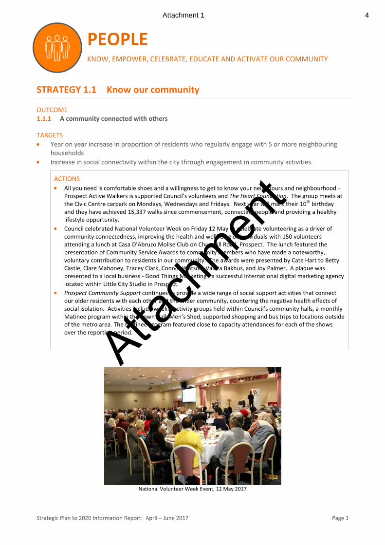
Council celebrated National Volunteer Week on Friday 12 May to celebrate volunteering as a driver of community connectedness, improving the health and wellbeing of individuals with 150 volunteers attending a lunch at Casa D’Abruzo Molise Club on Churchill Road, Prospect. The lunch featured the presentation of Community Service Awards to community members who have made a noteworthy, voluntary contribution to residents in our community. The awards were presented by Cate Hart to Betty Castle, Clare Mahoney, Tracey Clark, Connor Watson, Valeta Bakhus, and Joy Palmer. A plaque was presented to a local business - Good Things Marketing - a successful international digital marketing agency located within Little City Studio in Prospect.
Prospect Community Support continues to provide a wide range of social support activities that connect our older residents with each other and the wider community, countering the negative health effects of social isolation. Activities include weekly activity groups held within Council’s community halls, a monthly Matinee program within the Town Hall, Men’s Shed, supported shopping and bus trips to locations outside of the metro area. The Matinee program featured close to capacity attendances for each of the shows over the reporting period.
National Volunteer Week Event, 12 May 2017
Attachment 1 4

Atta
chm
ent
Strategic Plan to 2020 Information Report: April – June 2017 Page 2
1.1.2 A community which is understood by Council who is able to respond to their needs
TARGETS
Year on year increase on the benchmark of 75% Resident Satisfaction Survey result relating to the range of programs, activities and initiatives offered by Council.
60% satisfaction rating in consultation methods from the Resident Satisfaction Survey (up from 43% in 2015).
ACTIONS
The development of Council’s Annual Business Plan included a community consultation process that commenced 11 May, concluding 3 June. The process featured:
- Electronic submissions received to Council’s website - Two Focus Group Meetings – 25 May - Selected students from Blackfriars Priory School (years 6 to 7) – 30 May - Public Meeting – 5 June - Council’s Audit Committee – 13 June
OUTCOME
1.1.3 A strong community network linked to local community organisations
TARGETS
Contact details and descriptions of services detailed on SA Directory of Community Services for all of the clubs, community groups and agencies located and working within City of Prospect are current and up to date.
Yearly increase in the number of local organisations liaising with council to provide initiatives for community participation.
ACTIONS
SA Community Directory is a government funded directory that is coordinated by Connecting Up, a not-for-profit organisation. Council staff have established a partnership with Connecting Up that provides for Council volunteers to be trained to ensure that information on the clubs, community groups and agencies located and working within Prospect are current. More information about the Council’s partnership may be found at this SA Community blog link http://sacommunity.org/node/400
Pictured Left is Council’s Director Corporate Services
engaging with students from Blackfriars Priory School.
Attachment 2 5
Atta
chm
ent
Strategic Plan to 2020 Information Report: April – June 2017 Page 3
STRATEGY 1.2 Environmentally active, sustainably focused
OUTCOME
1.2.1 Community learning focused on environmental impacts and issues
TARGET
Number of community learning opportunities focused on environmental issues provided and number of participants.
ACTIONS
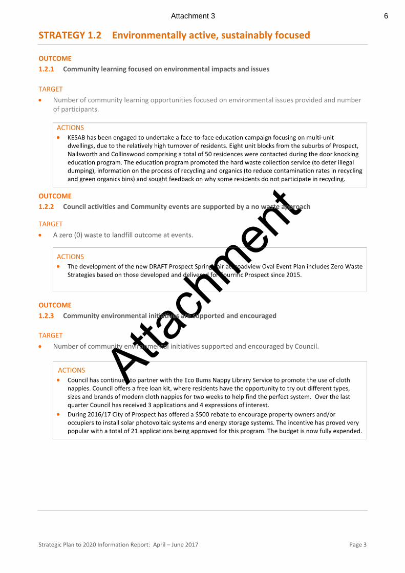
KESAB has been engaged to undertake a face-to-face education campaign focusing on multi-unit dwellings, due to the relatively high turnover of residents. Eight unit blocks from the suburbs of Prospect, Nailsworth and Collinswood comprising a total of 50 residences were contacted during the door knocking education program. The education program promoted the hard waste collection service (to deter illegal dumping), information on the process of recycling and organics (to reduce contamination rates in recycling and green organics bins) and sought feedback on why some residents do not participate in recycling.
OUTCOME
1.2.2 Council activities and Community events are supported by a no waste approach
TARGET
A zero (0) waste to landfill outcome at events.
ACTIONS
The development of the new DRAFT Prospect Spring Fair atBroadview Oval Event Plan includes Zero Waste Strategies based on those developed and delivered for Tourrific Prospect since 2015.
OUTCOME
1.2.3 Community environmental initiatives are supported and encouraged
TARGET
Number of community environmental initiatives supported and encouraged by Council.
ACTIONS
Council has continued to partner with the Eco Bums Nappy Library Service to promote the use of cloth nappies. Council offers a free loan kit, where residents have the opportunity to try out different types, sizes and brands of modern cloth nappies for two weeks to help find the perfect system. Over the last quarter Council has received 3 applications and 4 expressions of interest.
During 2016/17 City of Prospect has offered a $500 rebate to encourage property owners and/or occupiers to install solar photovoltaic systems and energy storage systems. The incentive has proved very popular with a total of 21 applications being approved for this program. The budget is now fully expended.
Attachment 3 6
Atta
chm
ent
Strategic Plan to 2020 Information Report: April – June 2017 Page 4
STRATEGY 1.3 Active living for every age, every stage OUTCOME 1.3.1 Community services, recreation areas and facilities are able to meet the current and future needs
for all stages of life
TARGETS
Two stakeholder forums per year to review Council areas and facilities and guide Council’s asset management plan.
By 2020 all Council buildings will be accessible to every age at every stage.
ACTIONS
Council staff have been assessing the implications to Council from the Disability Inclusion Bill which sets out the role of the State Government in promoting the rights and inclusion of South Australians with a disability, in line with the National Disability Strategy (NDS). This Bill includes the requirement that local councils are accountable for ensuring their services and facilities are accessible and responsive to people with a disability which aligns with the strategic target above.
Prospect Community Support: - Is increasingly being called upon to provide individual advice and support for our older residents as
they navigate the many changes to aged care. In particular, many of our older residents have difficulty in accessing the My Aged Care website; an Australia wide referral point for all aged care service provision.
- Continues to provide Home Assist services to our older residents, supporting them to maintain their properties and continue to live independently within our community. Services include gutter cleaning, changing tap washes, light globes and installing hand rails.
OUTCOME 1.3.2 Lifelong learning opportunities are developed and promoted
TARGET
More than 2,000 lifelong training outcomes conducted annually.
ACTIONS
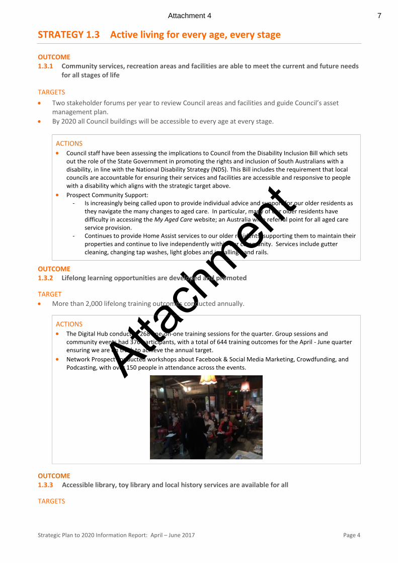
The Digital Hub conducted 268 one-on-one training sessions for the quarter. Group sessions and community events had 376 participants, with a total of 644 training outcomes for the April - June quarter ensuring we are on track to achieve the annual target.
Network Prospect conducted workshops about Facebook & Social Media Marketing, Crowdfunding, and Podcasting, with over 150 people in attendance across the events.
OUTCOME 1.3.3 Accessible library, toy library and local history services are available for all
TARGETS
Attachment 4 7
Atta
chm
ent
Strategic Plan to 2020 Information Report: April – June 2017 Page 5
Successful delivery of an accessible community hub including a new Library and innovation centre by the end of 2019.
5% annual increase in participation and utilisation of Library services.
ACTIONS
Participation in early childhood literacy programs has increased across the board with the initiation of several new programs (1001 Books Before School, Gift of Reading, Children’s University) and the decision to continue providing Rhyme Time and Story Time during school holidays.
Toy Library memberships and loans are steadily increasing, and the introduction of 6 month memberships is expected to further contribute to this.
Visitation to the Thomas Street Centre increased by approximately 23% in the fourth quarter of 2016/17, compared to the same quarter in 2015/16, with over 32,000 visitations in April – June.
The Digital Hub training outcomes were outlined earlier in this report. The Local History Digitisation Project has progressed significantly in the last quarter, with equipment
purchased, collection development/management guidelines developed, and collection preparation/consolidation processes well advanced.
OUTCOME 1.3.4 A community who are involved and participate in decision making and community leadership
TARGETS
Year on year increase in the number of community representatives participating in engagement strategies.
Year on year increase in overall youth engagement.
60% satisfaction rating with Council engagement strategies.
ACTIONS
CLIC Community Reference Group continues to meet monthly with the group being well informed of all progress for the project and providing a community perspective as feedback for the Project Executive Group.
Seven Youth Sponsorship applications were approved this quarter to enable local young people to represent their club / organisation. Six applications were for activities held interstate and one application for an event held overseas. 90% of the program budget has been allocated across the whole year.
STRATEGY 1.4 Celebrate our diverse and creative community
OUTCOME 1.4.1 A City rich with cultural experiences, arts activities and events
TARGETS
Council supports an annual increase in diversity of events, either directly or indirectly.
Year on year increase in community initiated events/activities.
ACTIONS
Prospect Gallery presented three (3) exhibitions from April to June 2017: - As the Crow Flies – John Martin (26 March – 23 April) - Form and Reform – Annabelle Collett and Jeff Trahair (7 May to 11 June plus an artist talk on 3 June
to 12 people) - A Prospect of Prospects – Stephanie Radok (25 June-23 July). 2017 - Attendances at these three exhibitions and to the Gallery were in excess of 5300 people. -
Attachment 5 8
Atta
chm
ent
Strategic Plan to 2020 Information Report: April – June 2017 Page 6
Staff received notification of 9 activities/events held in our parks and open spaces during the April – June period. This time of year is traditionally quiet however the notifications highlight the attractiveness of the Council area for events and activities for the benefit of our whole community.
OUTCOME 1.4.2 A respected and celebrated culturally diverse community
TARGETS
Events within the City are inclusive and reflect our diverse community.
Year on year increase in the satisfaction rating (number of respondents) from the Resident Satisfaction Survey who feel that Prospect is an inclusive and welcoming community.
Deliver on recommendations each year to achieve the Reconciliation Action Plan by 2020.
ACTIONS
Planning for City of Prospect’s Spring Fair in its brand new location at Broadview Oval on Saturday 28 October 2017 from 9am is gaining momentum. Through community consultations we have received lots of great ideas about attractions and how best to utilise the Oval itself, as well as the clubs and facilities onsite.
The Events Team has met with new stallholders from the wider community as well as local residents from the Broadview area. We have also had valuable feedback from a wide range of previous Prospect Fair stallholders and groups.
Their collective responses have allowed us to develop a clearer understanding about what the community expects of a great local Fair.
The overwhelming feedback (which aligns to the strategy targets above) is that the Fair should: - be inclusive and family focused - encourage participation and come-and-try activities for all age groups - be representative of all cultural sectors of our community - include home-based businesses and hobbyists - provide opportunities for local not-for-profit organisations and clubs to fund raise - give priority to local groups and sellers who deliver benefits to and for our community - stall alcohol outlets kept to a minimum and be a non-smoking area
The overall vison of the 2017 Prospect Spring Fair at Broadview Oval is to encourage local clubs, groups and residents to connect with each other, to have fun and learn or try something new – together building an authentic social fabric that will result in safer, healthier communities.
The Draft Reconciliation Action Plan (RAP) - Innovate RAP developed by the working group was reviewed by staff and feedback and comments considered and included as appropriate. It was lodged with Reconciliation Australia on 23 June 2017 for review and approval. The resulting RAP will come back to Council as a report for final endorsement once considered by Reconciliation Australia.
Attachment 6 9
Atta
chm
ent
Strategic Plan to 2020 Information Report: April – June 2017 Page 7
PLACE LOVED HERITAGE, LEAFY STREETS, FABULOUS PLACES
STRATEGY 2.1 Respect the past, create our future OUTCOME 2.1.1 In partnership with the community, a City recognised for its diversity, its range of local
attractions, its local history, character, heritage and stories
TARGETS
Year on year increase in the satisfaction rating from the Resident Satisfaction Survey of a city recognised for its range of local attractions, its local history, character, heritage and stories.
Year on year increase in the number of Heritage Grant applications received.
ACTIONS
As previously reported, nine heritage grant applications were received in the 2016/17 round compared with a total of six in 2015/16. It is noted that since the allocation of funding for this year was fully committed a further seven applications have been received by Council, demonstrating a strong ongoing interest in the initiative.
OUTCOME 2.1.2 A city recognised for high quality and interesting design and built form TARGETS
Year on year increase in community satisfaction relating to building design.
Year on year increase in community satisfaction rating in respect to development across our city.
ACTIONS
In an effort to recognise and encourage good design, the Urban Design Awards have been scoped and nominations are now closed. Judging will occur in early July with the awards dinner occurring on 20 July.
OUTCOME 2.1.3 Diverse development is encouraged on Main Road corridors
TARGETS
Annual review of the outcomes of the Urban Corridor Zone relative to our vision of diversity.
Complete Urban Corridor Zone & Interface Areas DPA by end of 2016/2017.
ACTIONS
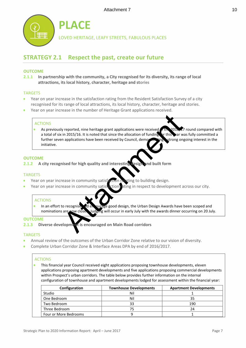
This financial year Council received eight applications proposing townhouse developments, eleven applications proposing apartment developments and five applications proposing commercial developments within Prospect’s urban corridors. The table below provides further information on the internal configuration of townhouse and apartment developments lodged for assessment within the financial year:
Configuration Townhouse Developments Apartment Developments
Studio Nil 1
One Bedroom Nil 35
Two Bedroom 33 190
Three Bedroom 75 24
Four or More Bedrooms 9 1
Attachment 7 10
Atta
chm
ent
Strategic Plan to 2020 Information Report: April – June 2017 Page 8
As is evident from the table, two bedroom dwelling configurations are the most common type of development lodged with Council; accounting for 61% of all housing types. It is noteworthy however that this is substantially decreased since the 2013/14 financial year, in which approximately 90% of housing types were of two bedroom configuration. This suggests that a greater mix of housing types are now being provided that cater to different community needs and aspirations.
The Urban Corridor Zone and Interface Areas Development Plan Amendment (DPA) has been granted consultation approval by the Minister for Planning and has been in interim operation since 30 May 2017. The period required for community consultation, subsequent consideration of the comments received and any necessary revisions to the DPA mean that the changes could be approved by the Minister and consolidated into the Development Plan for ongoing operation as early as October 2017.
STRATEGY 2.2 Loved parks and places
OUTCOME 2.2.1 Look after what we love; the character, native fauna, stories, neighbourhoods, people, parks and
colour
TARGET
Year on year increase on the baseline of 80% satisfaction rating from the Resident Satisfaction Survey (relating to Parks).
ACTIONS Maintenance of our parks and gardens is undertaken on a cyclic basis to ensure the frequency and activities
carried out align to the classification and features unique to each park. During the autumn our focus has been on mowing, weed removal, pruning, irrigation management/repairs and mulching. It is envisaged that alignment of our maintenance programs will contribute towards the overall satisfaction of park users when measured through the survey.
Each year we upgrade assets within our parks and gardens to improve aesthetics and continue providing high quality facilities to meet and exceed people’s expectations. The Beautification budget allows for this to occur and, in combination with ongoing maintenance, will assist in ensuring the target is met.
OUTCOME 2.2.2 Engaging and innovative Parks which provide a range of accessible leisure opportunities
TARGET
The Open Space Strategy is endorsed, budgeted and implemented each year as outlined in the strategy.
ACTIONS
An Open Space Strategy Timeline has been created to illustrate key projects to implement over the course of 10 years.
Informative budgetary figures have been calculated to illustrate the funds needed for each park and reserve classification.
The Web-based Strategy is in progress. We have led a collaborative submission with 4 other councils and the University of Adelaide to install
internet connected smart sensors. The smart sensors will monitor environmental conditions and council assets in Memorial Park.
Attachment 8 11
Atta
chm
ent
Strategic Plan to 2020 Information Report: April – June 2017 Page 9
OUTCOME 2.2.3 A community involved in design, maintenance and upgrade of our parks and places
TARGET
Year on year increase towards a minimum of 10% of local residents involved in the design, upgrade and maintenance of parks and places.
ACTIONS A feasibility study (including community consultation) and preliminary design work has been completed for
the considered development of an ‘Urban Green Link Corridor’ proposing the joining-up of three parks in the North of our City:
- Prospect Estate Reserve - Railway Reserve - Irish Harp Reserve
OUTCOME 2.2.4 Public art across the City that inspires and delights community and visitors TARGET
High levels of feedback (reaction) to new installations of public art.
ACTIONS One new wall was offered through the ‘Match-Up’ program that called for property owners with blank walls
to contact Council to be matched-up with a mural artist and have a mural created for their property. An appropriate mural / artist is still be explored for this site.
Purchase of 'Disorder of Things' by Will Hendriks was finalised and the work was installed on 9 June which received considerable feedback and sparked local media attention. This ‘statement piece’ has certainly had an impact, as desired by the Strategic Target.
Purchase of ‘Everything and Nothing’ by Jina Lee, a Sellick’s Hill marble stone sculpture work installed in Ern Sconce Park on 20 June.
Two public art commissions were selected and will progress to the Concept Design Phase for new, site specific artworks to be fabricated and installed in 2017/18:
- Artist John Hayward - space between the main entrance to Prospect Oval and the RSL, facing into Menzies Crescent)
- Artist Lorry Wedding-Marchioro - small park on the corner of Regency and Main North Roads.
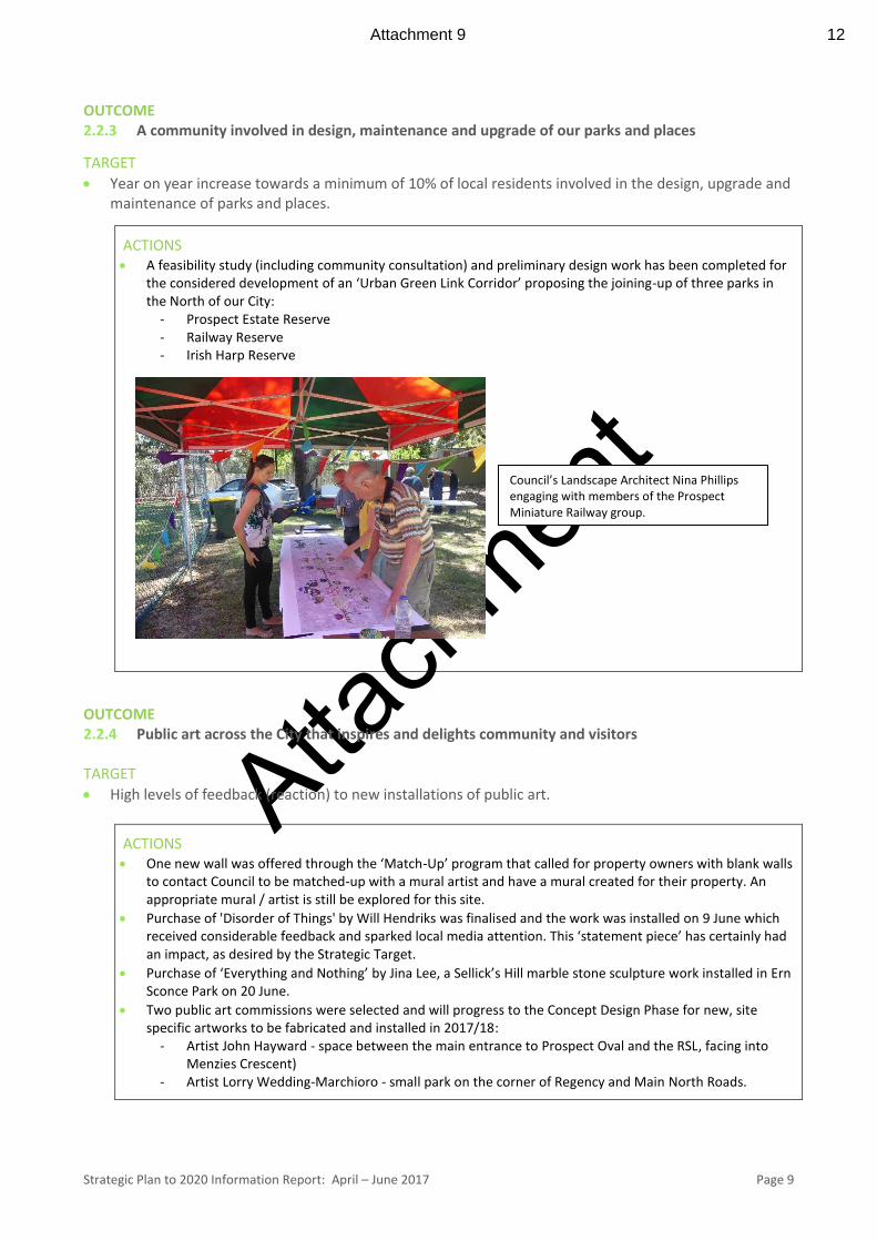
Council’s Landscape Architect Nina Phillips engaging with members of the Prospect Miniature Railway group.
Attachment 9 12
Atta
chm
ent
Strategic Plan to 2020 Information Report: April – June 2017 Page 10
STRATEGY 2.3 An accessible City OUTCOME 2.3.1 Key areas are accessible and linked
TARGET
Finalise Master Plan by end of 2017/2018 and establish one (1) upgraded East-West connection by 2020.
ACTIONS
Transport and Movement Assessment
As part of investigations for Main North Road to undertake a Traffic and Movement Assessment for Main North Road across the length of the local area, between Henrietta Street and Fitzroy Terrace.
Key findings and data undertaken to date include: • Strategic overview (including Council and State document).
• Crash clusters: locations and crash type.
• Bluetooth data traffic assessment.
• Turning movements and detailed traffic/pedestrian counts along the corridor.
• Existing and possible pedestrian crossing locations.
• East-west permeability: current condition.
• Existing corridor widths (cross-sections).
• Right-turn and signalisation investigations: specific locations across the corridor.
• Bus patronage and movement data.
Concept Design Plans Designs have taken their lead from Council’s Visions for the area as a future ‘Green corporate Boulevard’ creating a place to attract investment, generate jobs and revitalise public space along the road. - More trees lighting the history and culture of the area and better connectivity - A workshop with Business operators and owners was held of Thursday 27 April 2017 to talk about the
how the key concepts might be applied to revitalise the Road and the feedback was mostly positive. A further workshop with Elected Members has been scheduled on 18 of July to further discuss this topic.
OUTCOME 2.3.2 Connected/ integrated bicycle and pedestrian networks across the City and linked to other areas
TARGET
Partner with the Australian Bicycle Council to include Prospect within the biennial National Cycling Participation Survey to measure users of the Prospect network.
ACTIONS No activity to report for this period.
OUTCOME 2.3.3 A City well serviced by public transport
TARGETS
Increase in the level of public transport services particularly addressing peak hour issues.
Year on year 5% increase in patronage of community transport options.
Attachment 10 13
Atta
chm
ent
Strategic Plan to 2020 Information Report: April – June 2017 Page 11
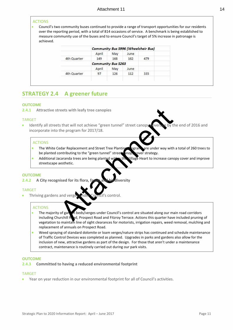
ACTIONS Council’s two community buses continued to provide a range of transport opportunities for our residents
over the reporting period, with a total of 814 occasions of service. A benchmark is being established to measure community use of the buses and to ensure Council’s target of 5% increase in patronage is achieved.
STRATEGY 2.4 A greener future
OUTCOME 2.4.1 Attractive streets with leafy tree canopies
TARGET
Identify all streets that will not achieve “green tunnel” street canopy coverage by the end of 2016 and incorporate into the program for 2017/18.
ACTIONS
The White Cedar Replacement and Street Tree Planting Programs are under way with a total of 260 trees to be planted contributing to the “green tunnel” street canopy cover strategy.
Additional Jacaranda trees are being planted within the Village Heart to increase canopy cover and improve streetscape aesthetic.
OUTCOME 2.4.2 A City recognised for its flora, fauna and biodiversity
TARGET
Thriving gardens and verges under Council’s control.
ACTIONS The majority of garden beds/verges under Council’s control are situated along our main road corridors
including Churchill Road, Prospect Road and Fitzroy Terrace. Actions this quarter have included pruning of vegetation to maintain line of sight clearances for motorists, irrigation repairs, weed removal, mulching and replacement of annuals on Prospect Road.
Weed spraying of standard dolomite or loam verges/nature strips has continued and schedule maintenance of Traffic Control Devices was completed as planned. Upgrades in parks and gardens also allow for the inclusion of new, attractive gardens as part of the design. For those that aren’t under a maintenance contract, maintenance is routinely carried out during our park visits.
OUTCOME 2.4.3 Committed to having a reduced environmental footprint
TARGET
Year on year reduction in our environmental footprint for all of Council’s activities.
Attachment 11 14
Atta
chm
ent
Strategic Plan to 2020 Information Report: April – June 2017 Page 12
ACTIONS
Administration is in the process of finalising its draft Environmental Action Plan for 2017-21. The plan contains a number of actions focused on reducing Council’s environmental footprint through sustainable resource management, and carbon emissions reduction.
OUTCOME 2.4.4 ‘Green’ strategies are established within development activities across the City TARGET
All Development Approvals to have landscaping conditions (where appropriate) which are enforceable and that our policies support this position.
ACTIONS
Of the 531 development applications received this financial year, all proposals that incorporate landscaping as an essential element of the development have had conditions imposed. These conditions stay active for the life of the development and staff follow up complaints where it is brought to our attention that the landscaping is not in place or not well maintained. The Urban Corridor Zone DPA (in its interim form) includes provisions that now require minimum deep soil planting areas be provided within each development, as well as the planting of a minimum number of substantial trees within those areas.
Attachment 12 15
Atta
chm
ent
Strategic Plan to 2020 Information Report: April – June 2017 Page 13
PROSPERITY MORE JOBS, MORE INVESTMENT, MORE ACTIVITY, MORE VIBRANCY
STRATEGY 3.1 A stronger local economy OUTCOME 3.1.1 A busy and vibrant local business environment focused on the Prospect Village Heart TARGETS
A vacancy rate no higher than 3% in the Village Heart and no higher than 5% elsewhere.
Footfall in Village Heart increased by 100% year on year.
ACTIONS Anecdotal information from the real estate industry suggests there has been an increase in the general
commercial vacancy rate across Adelaide. In an effort to insulate Prospect from this trend, Business and Innovation (B&I) have collated a brochure showcasing commercial real estate opportunities in Prospect. This document will be made publically available through our website and social media channels in early July, but has already been issued to potential new businesses considering Prospect.
After an initial planning meeting, the Prospect Mainstreets Association held its first meeting at Caffé Cena. This meeting finalised the association’s business plan and established unified social media guidelines ensuring all member benefit from destination branding.
Following Council’s decision to simplify Outdoor Trading regulation’s B&I have received three new applications from businesses seeking to embrace outdoor trading.
A benchmark of pedestrians will be established using WiFi
OUTCOME 3.1.2 Investment, employment and development encouraged across our City TARGETS
A 100% increase in the value of completed development on our corridors year on year.
Annual Business and Employment Survey to identify improved activity levels year on year.
ACTIONS
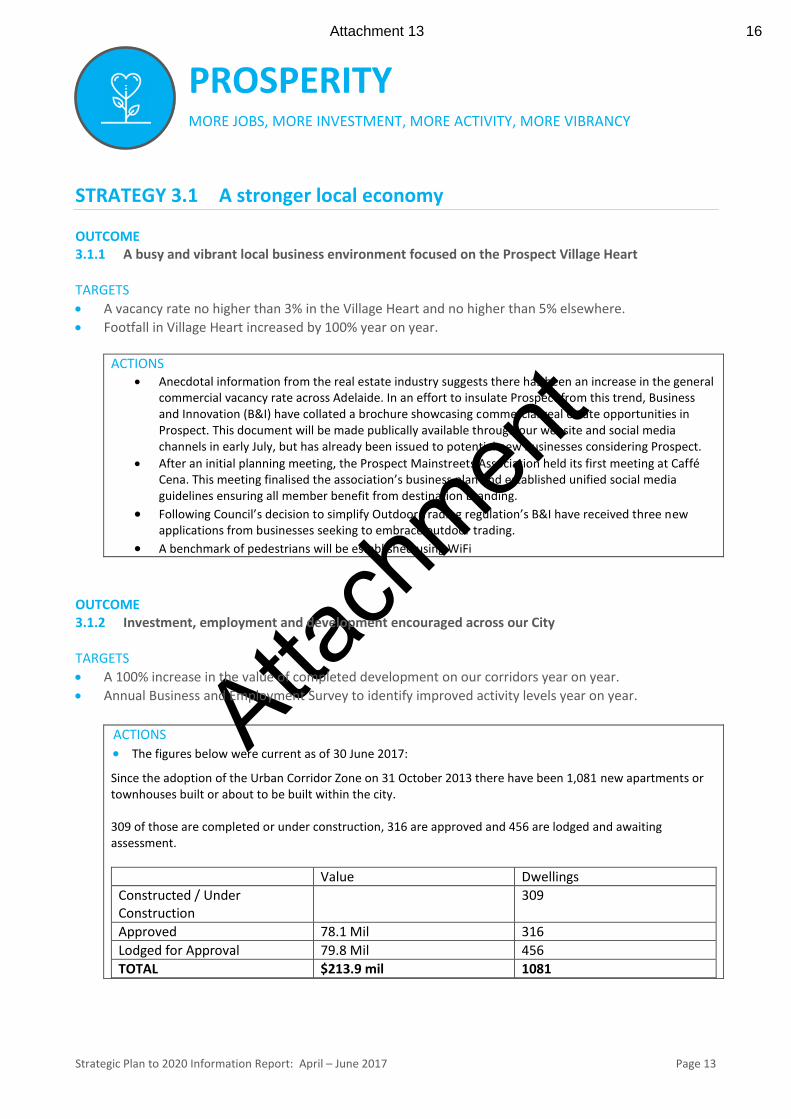
The figures below were current as of 30 June 2017:
Since the adoption of the Urban Corridor Zone on 31 October 2013 there have been 1,081 new apartments or townhouses built or about to be built within the city. 309 of those are completed or under construction, 316 are approved and 456 are lodged and awaiting assessment.
Value Dwellings
Constructed / Under Construction
309
Approved 78.1 Mil 316
Lodged for Approval 79.8 Mil 456
TOTAL $213.9 mil 1081
Attachment 13 16
Atta
chm
ent
Strategic Plan to 2020 Information Report: April – June 2017 Page 14
OUTCOME 3.1.3 A City with strong and relevant relationships with Local, State and Federal Governments
TARGET
Sentiment measured via annual CEO 360 degree performance review process.
ACTIONS City of Prospect has led a “Smart Cities and Suburbs Program” application on behalf of City of Port Adelaide
Enfield, Campbelltown City, City of Burnside, and City of Playford. This application has enjoyed support of the University of Adelaide, and the State Government via Department of Premier and Cabinet. This project will seek to create the largest low powered network in Australia, reaching across much of metropolitan Adelaide, supporting emerging Internet of Things technology; allowing Councils to leverage sensor technology to measure and improve parks and mainstreets; and the community to better access facilities via online booking.
STRATEGY 3.2 A more vibrant night-time
OUTCOME 3.2.1 A City with more people on the streets and more places to go at night
TARGETS
100% increase in pedestrian footfall after 5pm in the Village Heart year on year.
20% of businesses to create peak demand after 5pm.
ACTIONS The aim of ‘8 Nights of Summer’ was to create a local ‘place’ for Friday night drinks. Club5082 presented
four 8 Nights of Summer events during this period with a pop up bar, DJ and food vans that attracted an
average 50-70 people each event many of whom are now regulars. The Council program is now complete
for the season, however negotiations are underway with regard to the participating bar and food vendor
taking on and expanding the event for the 2017/18 summer period.
OUTCOME 3.2.2 A City with after-hours family friendly activities in our buildings, parks and open spaces TARGET
Annual increase in the use of our buildings, parks and open spaces as measured through the Resident Satisfaction Survey.
ACTIONS The Residential Satisfaction Survey is scheduled for around July – September 2017.
See 3.2.1 ‘8 Nights of Summer’
Club5082 in the Prospect Town Hall resumed on 8 April and is working with local businesses to provide catering for the audience at its new Blues & Roots events. Five events have been held to an average 100 people each fortnight with Almina Restaurant, Ben Hurs, Café Di Roma and Caffe Cena in support of the event.
STRATEGY 3.3 Leverage our digital advantage OUTCOME 3.3.1 A high level of take up of high speed/high capacity technology
Attachment 14 17
Atta
chm
ent
Strategic Plan to 2020 Information Report: April – June 2017 Page 15
TARGET
Use the annual Business and Employment Survey to understand the value of trade that is occurring on-line.
ACTIONS
A draft survey is complete and this project will be reviewed, and made publically available later in the year.
OUTCOME 3.3.2 Knowledge workers are supported in the City with a range of network and business opportunities
TARGETS
Year on year increase in the number of businesses as part of Network Prospect
Over 50% of Network Prospect participants attend more than one annual event.
ACTIONS
A full calendar of events has been promoted and final details worked through as presenters provide content. Visit http://networkprospect.com.au/wp-content/uploads/2016/09/Network-Prospect-Business-Events-2017-Calendar-Flyer-1.pdf
Both the knowledge workforce and bricks and mortar businesses are actively promoted via Network Prospect. Those that have signed up to the Network Prospect website are prime candidates for promotion of regular content via the Facebook page.
Network Prospect events are excellent networking opportunities for Prospect’s professionals and a Prospect Mainstreets’ Association (PMA) has been established.
STRATEGY 3.4 International Prospect
OUTCOME
3.4.1 Council is engaged in the global economy, actively seeking diverse business investment
TARGET
Six significant engagements in any given year and across more than one investment type.
ACTIONS
Developed relationship with Austrade’s Landing Pads Manager, and the Manager of Germany’s Austrade Landing pad for start-ups. Access to Austrade’s program will allow businesses from Prospect’s Export Incubator to create business opportunities in the USA, Europe, the Middle East and Asia.
OUTCOME
3.4.2 Promoted and known internationally as Adelaide’s most intelligent community
TARGET
Highest ranked Intelligent Communities Forum (ICF) City in South Australia.
Attachment 15 18

Atta
chm
ent
Strategic Plan to 2020 Information Report: April – June 2017 Page 16
ACTIONS Following City of Prospect’s motion to regard universal access to high-speed broadband as every
citizen’s right.
The National General Assembly of Local Government in Canberra in May 2017 unanimously supported City of Prospect’s motion.
As part of the Australian Smart Communities Association (ASCA) held in Adelaide on 29-30 May; City of Prospect led a contingent of interstate LGAs and agencies in a tour of the Village Heart. Participants were exposed to City of Prospect initiatives such as the Prospect Road upgrade, fast public Wi-Fi, Network Prospect, and partnerships with co-working spaces.
City of Prospect and the University of Adelaide have signed a Memorandum of Understanding to partner on research focused on Smart City, and Green Space projects. This MOU has already been utilised to produce a letter of support for City of Prospect’s “Smart City and Suburbs” application.
Attachment 16 19
Atta
chm
ent
Strategic Plan to 2020 Information Report: April – June 2017 Page 17
SERVICES LEADERS OF THE SECTOR PROVIDING EFFICIENT, RESPONSIVE, ACCESSIBLE SERVICES
STRATEGY 4.1 Excellence in Infrastructure OUTCOME 4.1.1 Taking great care of all of Council's Assets TARGETS
Consistently 75% or higher rating in Resident Satisfaction Survey.
Asset sustainability ratio to align with Audit committee targets.
Infrastructure & Assets Management Plan comprehensively reviewed annually.
ACTIONS
Council’s Precinct Services Program has continued during this quarter to proactively maintain the City’s streets, with each being serviced once every two years. This approach provides an even spread of maintenance services throughout the City with approximately 5 precincts (comprising of approximately 6 streets each) being serviced each quarter. In addition to Council’s reactive maintenance services, it is envisaged that this approach will lead to positive feedback on streetscape maintenance when the Resident Satisfaction Survey is undertaken.
Following the most recent condition assessments, Council are currently reviewing and renewing the Asset management plan to better reflect the actual condition of the assets and the required intervention levels to maximise the efficiency of Council’s works programs.
STRATEGY 4.2 Sound Financial Management OUTCOME 4.2.1 Sourcing funding partners and pursuing new revenue streams TARGETS
An annual increase in funding partners and new revenue streams achieved.
ACTIONS
In preparing for the 2017-2018 financial year, Council was notified during this quarter of its success in obtaining Grants for some its projects. These include;
Rose Street Entrance ($145,000) Northern Parklands Project ($200,000)
OUTCOME
4.2.2 Council continues to increase its corridor development and its commercial and retail sector rate
income
TARGETS
1% shift to these sectors each year off a 2015/16 base of 17%.
Attachment 17 20
Atta
chm
ent
Strategic Plan to 2020 Information Report: April – June 2017 Page 18
ACTIONS Council’s rates for 2017-2018 were endorsed at the Council meeting 27 June 2017. This provided for a 1.4%
shift in rate revenue to the Corridor Development and Non-Residential Sectors of the rating portfolio.
In 2017-2018, 81.6% of Rates will be collected from the existing Residential Rates portfolio, while 18.4% of Rates will be collected from the Corridor Development and Non-Residential Classes.
STRATEGY 4.3 Responsible Waste Management OUTCOME 4.3.1 Waste collection and recycling services meeting community need and enhancing the amenity of
the City
TARGETS
Year on year increase in customer satisfaction of waste collection and recycling services as measured through the Resident Satisfaction Survey.
ACTIONS Council continues to undertake roadside collections of hard waste in response to requests for service, with
waste being collected within two weeks of such requests being received. Due to an increase in hard waste requests, contractors have been undertaking additional work to ensure the two week turnaround time is being met.
A new waste calendar for 2017/18 has been made available to the community through Council’s website. The Calendar provides information on when bins are to be collected and the types of waste and recyclables that should be placed in each bin.
OUTCOME 4.3.2 Innovation in waste management to align with environmental goals TARGETS
Waste collection data collected by 2020 and shared as appropriate.
A framework is developed that delivers at least one innovative waste management practice each year.
ACTIONS As part of Council’s new waste contract beginning in October 2017 Council will be undertaking a series of
trials aimed at continuous improvement, innovation and the wider use of available technologies. The new contractor will be implementing several new initiatives, which include: - trialling a reduction in the size of the residual waste (red) bin, increased frequency of collection (to
occur - weekly) of the organics (green) bin and recyclables (yellow) bin, the provision of large bins for
apartments and multi-unit developments, and organics collection from commercial premises such as restaurants and cafes, as well as additional recyclables bins at selected street and park bin locations (on a trial basis)
Adopting current technologies in waste collection has also been encouraged, including remote sensing of street and park bins in high profile areas, solar powered bins, pay-by-weight collection, and the collection and aggregation of relevant individual and district bin weight related data.
STRATEGY 4.4 Accountable and people-focused services
OUTCOME
4.4.1 Open and accountable practices and decision making processes throughout Council’s operations
Attachment 18 21
Atta
chm
ent
Strategic Plan to 2020 Information Report: April – June 2017 Page 19
TARGETS
Year on year increase in support of Council’s decision making processes from Resident Satisfaction Survey.
ACTIONS
Council conducts the Resident Satisfaction Survey every two years. The next survey will take place commence early 2017/2018 financial year. A discussion has been scheduled for 8 August 2017 Council Workshop.
OUTCOME 4.4.2 Service delivery is visible to and appreciated by the community TARGETS
Ten (10) services reviewed annually with a view to improve the customer experience.
Community to be informed of what we are going to do, when and why.
ACTIONS Customer Service Improvements/Innovation – Progress Update It was reported to Elected Members at the April Information Bulletin that staff are working through the first 3 waves of Customer Service Improvement Action Plan (first 14 /42 improvements) within a 13 week timeframe. These solutions are all focused at improving the Customer Experience, or removing internal obstacles to providing great Customer Service. The approach we have taken encourages the whole Management Team to work together towards the solutions, and we have experienced improved collaboration and communication between the Management Team. This has been further strengthened by the recent leadership coaching undertaken.
We are almost through the Action Plan timeframe with an average task completion of 70% to date. We set an ambitious target which was discussed at a workshop and there have been a number of causes for this response:
The Action Plan timelines were intentionally ambitious to promote rapid delivery of changes,
“Urgent and Important” tasks or issues have taken priority over the Action Plan changes,
Solutions have been re-scoped or changed, meaning timelines have had to be re-planned.
Although current progress is behind plan real progress is being made, it is anticipated that the Action Plan will be completed by end of July 2017 as planned.
OUTCOME 4.4.3 Known for “making our customers’ day”
TARGETS
Spontaneous and unsolicited positive customer feedback is recorded and celebrated.
Attachment 19 22
Atta
chm
ent
Strategic Plan to 2020 Information Report: April – June 2017 Page 20
ACTIONS Positive unsolicited customer feedback received by our Infrastructure and City Maintenance Teams
includes: - “I came back from overseas to discover the Spotted Gum planting program under way along Galway
Avenue. In another generation Galway Avenue will be one of Adelaide’s notable avenues, and I applaud the Council for this major initiative“
- “It was a pleasure to meet you which proved to be a very rewarding and satisfying result all round! Thank you also for your letter of outlining the solutions to our concerns, all of which are addressed. We were away in the country for a few days recently and returned home to find that the street tree had been neatly trimmed as well. With my thanks for your personal attention to our issues.”
OUTCOME 4.4.4 Improved systems and on-line services meet the needs of the community TARGETS
Year on year increase in the number of services able to be transacted end to end online.
All complaints to lead to system improvements.
ACTIONS The Places and Spaces Facilities Booking System project is in its final stage of delivery. This project engaged
a vendor to complete a formal requirements analysis and design of a comprehensive across–council facility booking application for Local Government, a feasibility study into developing the product and the development of a non-functional prototype.
To date, three formal workshops have been held with six participating Councils, two for gathering business requirements and one for gathering technical requirements.
The feasibility study is complete and the final report and prototype will be presented to participating Councils in late July.
Attachment 20 23

Item 15.1: Project Update – Community Hub, Library and Innovation Centre (CLIC)
CITY OF PROSPECT: Council Agenda 25/07/2017
AGENDA ITEM NO.: 15.1 TO: Council Meeting on 25 July 2017 DIRECTOR: Nathan Cunningham, Director Community & Planning REPORT AUTHOR: Brendan Lott, Manager Community Development SUBJECT: Project Update - Community Hub, Library and Innovation
Centre (CLIC)
1. EXECUTIVE SUMMARY
The CLIC project is currently focused on the following key task areas; with specific actions for each of these tasks described within the Discussion section of this report.
1.1 Spatial layout work – Brown Falconer Architects have been working through the Spatial Layout body of work based on the required footprint of the CLIC and Civic facility.
1.2 Community Reference Group (CRG) - met on 5 July 2017 and participated in an ‘emotional brief’ process similar to that conducted by architects Brown Falconer (working in collaboration with Hudson Howells and Snohetta) for Elected Members.
1.3 Change Management - Council’s management team have recently participated in two days of intensive training to gain a more detailed understanding together with practical skills for successfully managing change within the workplace.
1.4 Transition Team – This group has begun to implement a range of communication and engagement initiatives with staff as well as visiting various sites to explore the opportunities to house staff and services of Council during construction of the CLIC.
1.5 Council’s Engagement Hub website – This site continues to provide a one-stop-shop for our community, filled with information on the CLIC project.
1.6 Prudential Report - Dean Newbery & Partners (chartered accountants) have commenced the work on a Prudential Report.
1.7 Prospect Road Site - Commercial real estate group CBRE have begun work on promotional materials to release the opportunity to market within the next month.
1.8 Project Executive Group (PEG) - continues to meet regularly to work through the detail of the documentation and research associated with the CLIC Project.
2. RECOMMENDATION
(1) Council receives and notes the progress update for the Community Hub, Library and Innovation Centre (CLIC) for the period 27 June until 25 July 2017.
(2) Council receives and notes the Project Executive Group (PEG) Actions List (as presented in Attachment 1).
24
Item 15.1: Project Update – Community Hub, Library and Innovation Centre (CLIC)
CITY OF PROSPECT: Council Agenda 25/07/2017
3. RELEVANCE TO CORE STRATEGIES / POLICY
3.1 Council’s Community Engagement and Consultation Policy – November 2012
3.2 Strategic Plan to 2020 Theme 1 – People “Know, empower, celebrate, educate and activate our community”
Strategy 1.1 Know our community
Strategy 1.4 Celebrate our diverse and creative community
3.3 Strategic Plan to 2020 Theme 2 – Place “Loved heritage, leafy streets, fabulous places”
Strategy 2.1 Respect the past, create our future
3.4 Strategic Plan to 2020 Theme 4 – Services “Leaders of the sector providing efficient, responsive, accessible services”
Strategy 4.1 Excellence in Infrastructure
Strategy 4.2 Sound Financial Management
Strategy 4.4 Accountable and people-focused services
The actions and initiatives detailed within this report are directly connected to the above aspects of Council’s current Strategic Plan. The Community Engagement and Communication Plan for the project are based upon the requirement to ‘know’ our communities, be inclusive of a broad cross section of our residents and ensuring that residents are well informed of the steps being taken for the development of the CLIC, with clearly identified opportunities to become involved and influence the project outcome.
Delivery of the CLIC will be based upon that aspect of the Strategic Plan referring to ‘fabulous places’, requiring a high quality facility that is loved by our communities.
Strategies within Theme 4 of the Strategic Plan (Services) speak to Council’s requirement that the CLIC is delivered on time and on budget according to our standards of excellence.
4. COMMUNITY INVOLVEMENT
4.1 Community involvement within the CLIC project over the past four weeks is described within the Discussion section of this report under the sub-headings of Community Reference Group and Engagement Hub.
5. DISCUSSION
Spatial Layout Work
5.1 Brown Falconer Architects have been working through the Spatial Layout body of work based on the required footprint of the CLIC and Civic facility. It is pleasing to report that the site analysis confirms that a Land Division is able to be undertaken which can satisfy the known needs of the Council facility as well as providing for generous land for a market driven development. The options of the market driven development are to be explored through the site marketing set to be undertaken by CBRE on behalf of Council.
25
Item 15.1: Project Update – Community Hub, Library and Innovation Centre (CLIC)
CITY OF PROSPECT: Council Agenda 25/07/2017
5.2 Further, the indicative site layout confirms that likely car parking requirements for the new facility can be met on-site and that by incorporating the CLIC facility with those of a new Civic Centre, efficiencies in space allocation are able to be realised.
5.3 A more detailed discussion on this topic has occurred with PEG in recent weeks and it is important to note that the work of Brown Falconer has concluded that a site with a 20m frontage to Prospect Road (adjacent the existing Town Hall) can achieve the necessary building footprint (and the car parking on the whole site) to provide all the facilities and services to be included in the combined CLIC and Civic Centre.
Community Reference Group
5.4 CLIC Community Reference Group (CRG) has participated in an ‘emotional brief’ process similar to that conducted by architects Brown Falconer (working in collaboration with Hudson Howells and Snohetta) for Elected Members.
5.5 The briefing captured CRG members’ emotional reference and aesthetic preferences of buildings and facilities that possess elements, in their design or form, that the members believe reflect aspirations of the broader Prospect community for the CLIC facility. The CRG feedback is provided to PEG at their 18 July meeting.
Change Management
5.6 Council’s management team have recently participated in two days of intensive training to gain an understanding of, and practical skills for, successfully managing change within the workplace. CLIC will have a wide ranging impact upon staff both during the transition period as well as through new work practices and environments as the new CLIC facility becomes operational.
Transition Team
5.7 CLIC Transition Team have begun to implement a range of communication and engagement initiatives with staff to ensure a common understanding of the steps being taken and that will need to be taken to ensure continuity of service to our community during the transition from the current facilities to the new CLIC facility. Further updates will be presented with greater detail in coming months.
Engagement Hub
5.8 Council’s Engagement Hub website continues to provide a one-stop-shop for our community, providing easy access to all documentation and activities associated with the project. There are 33 registered uses and 11,840 visits to the site since it was established mid November 2016.
5.9 It is likely that the site will attract much more interest and contributions from our community once some of the more significant stages of the project begin to be implemented. The website is able to be updated to be more interactive around key decisions / project milestones.
Prudential Report
5.10 Dean Newbery & Partners (chartered accountants) have commenced investigations for producing a Prudential Report. The process focuses on capital adequacy and credit exposures on a consolidated basis, for the CLIC Project. A draft report is scheduled for completion at the end of October and this will lead to a final Prudential Report then being prepared.
26
Item 15.1: Project Update – Community Hub, Library and Innovation Centre (CLIC)
CITY OF PROSPECT: Council Agenda 25/07/2017
Prospect Road Site
5.11 Commercial real estate group CBRE have begun work on promotional materials, including detailed photography, to market a portion of the Civic Centre site on Prospect Road with the aim of attracting interest in relation to sale/redevelopment and other options. This detail is being refined through discussions with PEG.
Project Executive Group
5.12 PEG continues to meet regularly to work through the detail of the documentation and research associated with the CLIC Project. The Actions List coming out of each meeting (Attachment 1) has been updated with items progressed by key Council staff.
ATTACHMENTS
Attachment 1 Project Executive Group Actions List
27
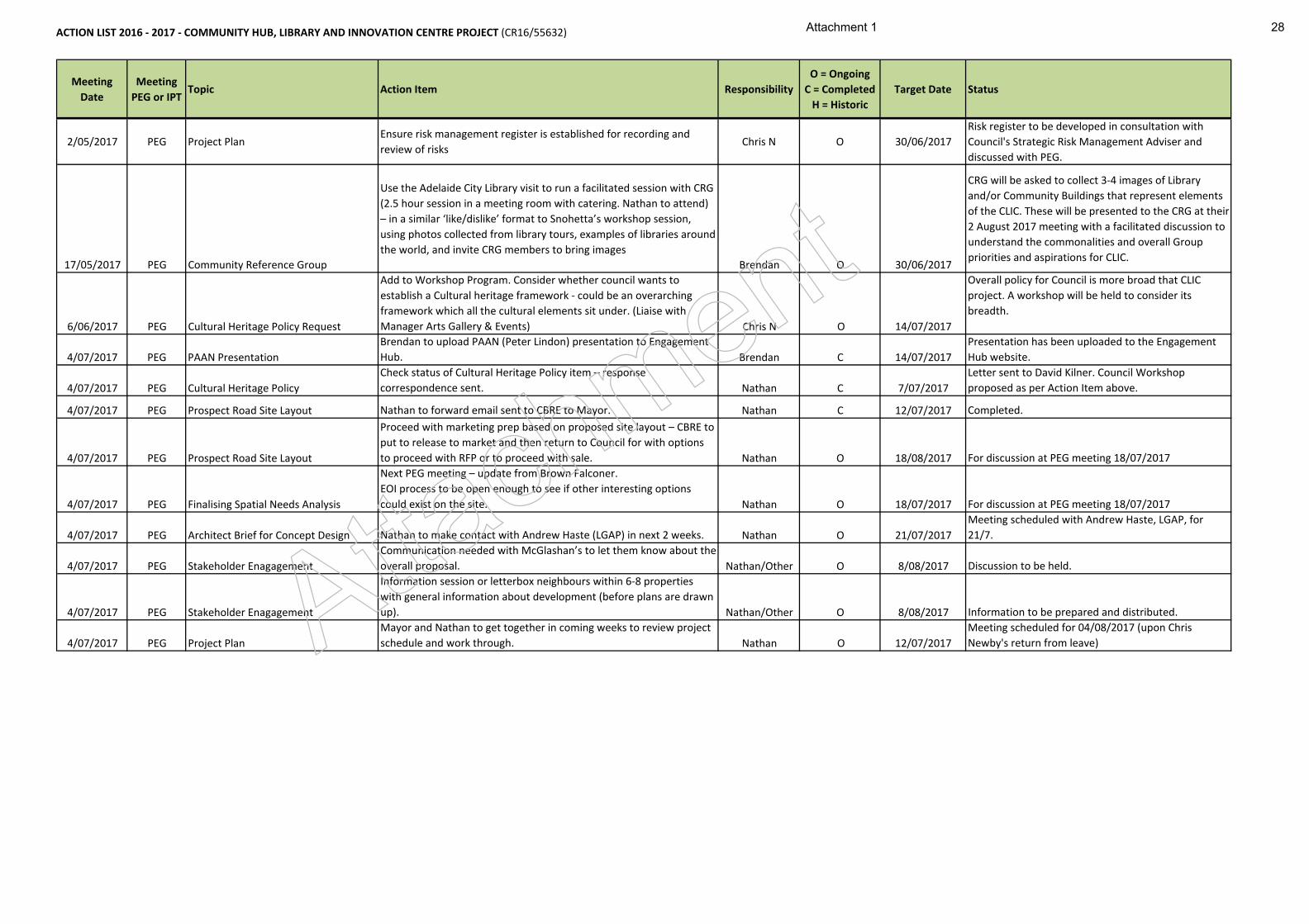
ACTION LIST 2016 ‐ 2017 ‐ COMMUNITY HUB, LIBRARY AND INNOVATION CENTRE PROJECT (CR16/55632)
Meeting Date
MeetingPEG or IPT
Topic Action Item ResponsibilityO = OngoingC = CompletedH = Historic
Target Date Status
2/05/2017 PEG Project PlanEnsure risk management register is established for recording and review of risks
Chris N O 30/06/2017Risk register to be developed in consultation with Council's Strategic Risk Management Adviser and discussed with PEG.
17/05/2017 PEG Community Reference Group
Use the Adelaide City Library visit to run a facilitated session with CRG (2.5 hour session in a meeting room with catering. Nathan to attend) – in a similar ‘like/dislike’ format to Snohetta’s workshop session,using photos collected from library tours, examples of libraries around the world, and invite CRG members to bring images
Brendan O 30/06/2017
CRG will be asked to collect 3‐4 images of Library and/or Community Buildings that represent elements of the CLIC. These will be presented to the CRG at their 2 August 2017 meeting with a facilitated discussion to understand the commonalities and overall Group priorities and aspirations for CLIC.
6/06/2017 PEG Cultural Heritage Policy Request
Add to Workshop Program. Consider whether council wants to establish a Cultural heritage framework ‐ could be an overarching framework which all the cultural elements sit under. (Liaise with Manager Arts Gallery & Events) Chris N O 14/07/2017
4/07/2017 PEG PAAN PresentationBrendan to upload PAAN (Peter Lindon) presentation to Engagement Hub. Brendan C 14/07/2017
4/07/2017 PEG Cultural Heritage PolicyCheck status of Cultural Heritage Policy item – response correspondence sent. Nathan C 7/07/2017
Overall policy for Council is more broad that CLIC project. A workshop will be held to consider its breadth.
Presentation has been uploaded to the Engagement Hub website.Letter sent to David Kilner. Council Workshop proposed as per Action Item above.
4/07/2017 PEG Prospect Road Site Layout Nathan to forward email sent to CBRE to Mayor. Nathan C 12/07/2017 Completed.
4/07/2017 PEG Prospect Road Site Layout
Proceed with marketing prep based on proposed site layout – CBRE to put to release to market and then return to Council for with options to proceed with RFP or to proceed with sale. Nathan O 18/08/2017 For discussion at PEG meeting 18/07/2017
4/07/2017 PEG Finalising Spatial Needs Analysis
Next PEG meeting – update from Brown Falconer.EOI process to be open enough to see if other interesting options could exist on the site. Nathan O 18/07/2017 For discussion at PEG meeting 18/07/2017
4/07/2017 PEG Architect Brief for Concept Design Nathan to make contact with Andrew Haste (LGAP) in next 2 weeks. Nathan O 21/07/2017Meeting scheduled with Andrew Haste, LGAP, for 21/7.
4/07/2017 PEG Stakeholder EnagagementCommunication needed with McGlashan’s to let them know about the overall proposal. Nathan/Other O 8/08/2017 Discussion to be held.
4/07/2017 PEG Stakeholder Enagagement
Information session or letterbox neighbours within 6‐8 properties with general information about development (before plans are drawn up). Nathan/Other O 8/08/2017 Information to be prepared and distributed.
4/07/2017 PEG Project PlanMayor and Nathan to get together in coming weeks to review project schedule and work through. Nathan O 12/07/2017
Meeting scheduled for 04/08/2017 (upon Chris Newby's return from leave)Atta
chm
ent
Attachment 1 28

Item 15.2: Submission on Design Guidelines (Design Quality and Housing Choice) for consultation by Office for Design and Architecture South Australia
CITY OF PROSPECT: Council Agenda 25/07/2017
AGENDA ITEM NO.: 15.2 TO: Council on 25 July 2017 DIRECTOR: Nathan Cunningham, Director Community & Planning REPORT AUTHOR: Rick Chenoweth, Senior Policy Planner SUBJECT: Submission on Design Guidelines (Design Quality and Housing
Choice) for Consultation by Office for Design and Architecture South Australia
1. EXECUTIVE SUMMARY
1.1 The Office for Design and Architecture South Australia (ODASA) has prepared a Design Guidelines document which is currently on consultation until 25 July 2017 (Attachments 1-96).
1.2 City of Prospect was selected in 2016 (due to the work being undertaken to review the Urban Corridor Zone) to collaborate with ODASA and the Department for Planning Transport and Infrastructure (DPTI) staff on the draft Design Guidelines. The intent was that the Guidelines and Draft Urban Corridor Zone (UCZ) policy would find general consistency. In a general sense, this has been able to be achieved.
1.3 Council staff and the Chief Executive Officer (CEO) have presented and participated in a recent LGA workshop and other forums/workshops on the Design Guidelines and this feedback has been used to shape stakeholder responses (refer to Attachments 97-113) which aligns strongly with the comments and position put forward by Council staff on behalf of City of Prospect based on Elected Member and early stakeholder input to the UCZ DPA.
1.4 A summary of the main issues includes:
Support for the overall intent and content of the Guidelines and particularly relevant for areas transitioning to a new larger scale urban form
Aligns well with the new planning system with specific emphasis toward design quality matters
Useful as a ‘best practice’ and aspirational document
Encourages engagement and conversations about achieving good design and provides a framework through its ‘good design principles’ that can be tailored to local situations
Clear structure and explanation presented within the document of what is to be achieved within the different design issues provided
Gaps in the document include:
- Unclear and uncertain as to whether it is to be advisory only, if it will be linked to Development Plans or how it will be incorporated into the new Planning and Design Code
29
Item 15.2: Submission on Design Guidelines (Design Quality and Housing Choice) for consultation by Office for Design and Architecture South Australia
CITY OF PROSPECT: Council Agenda 25/07/2017
- Does not appear to have a target audience and seems to be too ‘broad brush’ and therefore is not effective for any specific stakeholder eg. planners, developers, architects or community
- Desired character is not adequately addressed when contextual considerations are considered
- Does not adequately reference other useful resource documents (eg Zero Waste SA Better Waste Management Guide)
- Does not adequately cover various planning issues such as lower scale infill development (eg. 1 into 2/3/4 developments), historic character/heritage interface, the relationship to affordable housing, building within mixed use areas with commercial uses, site amalgamation, streetscape and public realm and housing diversity. Additional guideline documents (6) are proposed by ODASA, but their themes have not yet been finalised and should cover the content gaps identified herein
- Training and education needs for stakeholders must be considered and implemented to effectively realise these measures. City of Prospect has successfully implemented the use of a design advisor/s process for selected development applications and this has added value to design outcomes and provided useful spin-offs including upskilling DA planners with regard to design matters.
1.5 The Design Guidelines have an important role to play within the new Planning System and in Council’s current Urban Corridor Zone design policy review DPA. It is therefore desirable that Council, as a key stakeholder, provides a submission as part of the consultation process for the Design Guidelines by ODASA.
2. RECOMMENDATION
(1) Council delegates the CEO to make a submission to the Office for Design and Architecture of South Australia and expresses overall support for the Design Guidelines (Design Quality and Housing Choice), subject to issues as identified in Section 1.4 of this report; and
(2) Council delegates the CEO to advise the Local Government Association of South Australia that it supports its Draft Submission on Design Guidelines (Design Quality and Housing Choice) July 2017 (as provided in Attachments 97-113).
3. RELEVANCE TO CORE STRATEGIES / POLICY
3.1 Strategic Plan to 2020 Theme 2 – Place “Loved heritage, leafy streets, fabulous places”
Strategy 2.1 Respect the past, create our future
Strategy 2.3 An accessible City
Strategy 2.4 A greener future
30
Item 15.2: Submission on Design Guidelines (Design Quality and Housing Choice) for consultation by Office for Design and Architecture South Australia
CITY OF PROSPECT: Council Agenda 25/07/2017
3.2 Strategic Plan to 2020 Theme 3 – Prosperity “More jobs, more investment, more activity, more vibrancy”
Strategy 3.1 A stronger local economy
3.3 The Strategic Plan themes identified above are relevant with the preparation of a Design Guideline document that aims to strengthen good design outcomes and guide and promote new development and infrastructure provision to create prosperous and liveable communities.
4. COMMUNITY INVOLVEMENT
4.1 The Design Guidelines by ODASA are on broad consultation until 25 July 2017 with the process for consultation controlled by ODASA. This report considers Council’s response to this draft document for consultation.
5. DISCUSSION
Legislative background
5.1 Parts of the Planning, Development and Infrastructure Act 2016 (the PDI Act) commenced on 1 April 2017. Relevant to this report is Part 2 of the PDI Act, which provides for ‘principles of good planning’ and including ‘high quality design principles’ and Part 5 provides reference to ‘design quality policy’ in State planning policies.
Planning and Design Code
5.2 The PDI Act elevates design as a primary planning principle and provides reference to State planning policies as the relevant area to deliver design quality. The proposed Planning and Design Code will contain these State planning policies, but they have not yet been developed or authorised (likely in late 2017).
5.3 The timing for the release of the Design Guidelines is questioned based on the current absence of a ‘parent document’ within the new planning system. How the Design Guidelines are going to be incorporated into these policies therefore remains unclear and uncertain. For example, will the Guidelines be inserted into statutory planning policy or will it remain as a reference document and if so, what links will be provided to enable it to be used effectively by DA planners?
Urban Corridor Zone and Interface Areas Review DPA
5.4 Council is currently undertaking a design policy review of its Urban Corridor Zone with its Draft Urban Corridor Zone and Interface Areas Review DPA (currently undergoing consultation whilst on interim operation). In collaboration with DPTI, the City of Prospect has been leading the uptake and use of relevant sections of the Design Guidelines and re-drafting it to apply to planning policy. This DPA is currently undergoing consultation and likely to be authorised in late 2017.
Review of the Design Guidelines
5.5 Positive Aspects of the Design Guidelines
31
Item 15.2: Submission on Design Guidelines (Design Quality and Housing Choice) for consultation by Office for Design and Architecture South Australia
CITY OF PROSPECT: Council Agenda 25/07/2017
5.5.1 As the Greater Adelaide region undergoes significant changes to its urban form and land use arrangements, the increasing need for relevant design information within the planning system is generally recognised and supported by all stakeholders. The Design Guidelines is a document prepared by ODASA and design professionals that provides ‘best practice’ and aspirational information to enable users to consider how to achieve better design outcomes.
5.5.2 The format and structure of the document is user friendly and allows for the systematic development of design rationale from the broader contextual considerations to the more detailed on-site elements and attributes that need to be considered. Local examples have also been widely used, wherever possible.
5.5.3 The design themes are reasonably well covered (also refer to Section 5.13), their intent well described and suitable guidance offered through specific design suggestions and solutions.
5.5.4 Whether design is accepted or rejected is often described as a ‘matter of personal taste’ and traditionally something that has been primarily considered outside of the planning system. This document encourages engagement, conversations and education about what constitutes good design and provides a policy and assessment framework through its ‘good design principles’ that can be tailored to meet local situations and planning decision making. City of Prospect’s use of similar design policy and principles in its Urban Corridor Zone and Interface Areas Review DPA is an example of where this has been used.
5.5 Improvements to the Design Guidelines
5.5.1 The timing for the release of the Design Guidelines is not ideal given the current absence of a ‘parent document’ (eg. Planning and Design Code) within the new planning system. This raises questions about how/whether the Design Guidelines are going to be incorporated into these policies or are they going to perform an advisory role only and without statutory ‘teeth’ they will not be effectively used by planners or the development industry. The recommended feedback incorporates this observation.
5.5.2 There does not appear to be a target audience for this document as it attempts to deliver too much to too many stakeholders and therefore its effectiveness is spread too thinly. For example, the Guidelines are stated as advisory, but are also written in a way that can allow them to be inserted into the Code as statutory policy and used in Development Assessment.
5.5.3 Within the document the relationships between design themes are not fully explored and design trade-offs are not addressed. For example, there can be situations where building orientation favouring energy efficiency may be at odds with promoting street facing buildings or townhouse development and the public realm and the document fails to guide this or give weighting to priorities.
5.5.4 The Guidelines are strong in terms of contextual considerations, but need work in terms of the role of desired character considerations. If areas are to be protected then context is the primary consideration, but if areas are to evolve into something different then desired character (as opposed to existing context) becomes the dominant design consideration.
32
Item 15.2: Submission on Design Guidelines (Design Quality and Housing Choice) for consultation by Office for Design and Architecture South Australia
CITY OF PROSPECT: Council Agenda 25/07/2017
5.5.5 Other planning issues that are not adequately covered from a design perspective include lower scale infill development (eg. 1 into 2/3/4 scale developments), interface with heritage/historical character, affordable housing, building within mixed use areas and non-residential uses, site amalgamation, streetscape and public realm and housing diversity. There has been references given to the preparation of other design documents (possibly 6 others) by ODASA, but the themes have not been finalised and it is suggested that gaps described herein should be addressed in the other documents.
5.5.6 This guidelines document should not sit in isolation but should form part of a reference library of accepted resource documents (eg Zero Waste SA Better Waste Management) to educate and add value to design outcomes as part of development policy amendment and DA assessment. To give this reference point statutory status it will need to be identified within Development Plans or through Development Regulations.
5.5.7 Training and educational stakeholder needs should be considered and implemented to provide successful outcomes arising from the work that has been invested into this document. City of Prospect has successfully implemented the use of a design advisor/s process for selected Development Applications and this has added value to design outcomes and provided benefits including the up-skilling of DA planners with regard to design matters.
5.5.8 In summary, the Design Guidelines by ODASA is a useful ‘best practice’ and aspirational design document that needs careful consideration and further work to show how it is going to be effectively incorporated into the new planning system as a useful tool for key stakeholders.
ATTACHMENTS
Attachments 1-96 Design Guidelines (Design Quality and Housing Choice) for consultation by Office for Design and Architecture SA
Attachments 97-113 Draft Submission on Design Guidelines (Design Quality and Housing Choice) July 2017 by Local Government Association of SA
33
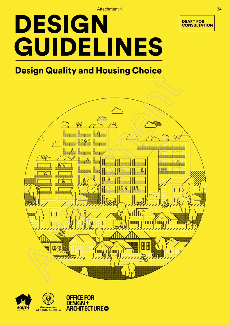
DESIGNGUIDELINES
DRAFT FORCONSULTATION
Design Quality and Housing Choice
DESIG
N G
UID
ELINES
Design Q
uality and Housing C
hoice
Atta
chm
ent
Attachment 1 34

DRAFT FOR CONSULTATION
Atta
chm
ent
Attachment 2 35
Introduction
Achieving Good Design in Adelaide’s Future Urban Form
The recently updated 30 Year Plan for Greater Adelaide envisages our city to grow from its current low-rise suburban pattern to more compact urban forms. Factors such as 21st century living standards, existing land ownership, community expectations and market forces signal the need for new types of higher density housing.
New housing located in close proximity to employment opportunities, essential services, recreation facilities, cycling and walking paths and public transport routes will deliver a range of benefits including:
• Reduced living costs • More active and healthy communities• The creation of vibrant and energetic urban centres• Reduced demands on supporting infrastructure.
The provision of well-designed higher density housing will also diversify Adelaide’s housing stock which is currently dominated by detached dwellings. It will provide greater housing choice to support our ageing population and increase the number of single and two person households. New housing choices will also unlock opportunities for innovative and accessible housing developments.
As infill development increases, good design outcomes will ensure that new higher density housing complements existing neighbourhoods and is embraced by communities.
Good design will support a successful transition to more compact, sustainable urban forms.
Atta
chm
ent
Attachment 3 36
How should the Design Guidelines be used and who are they for?
The Design Guidelines provide best practice guidance regarding the design quality of new developments and cover:
• Neighbourhood and site context
• Access and movement
• Built form
• Open space and landscaping
• Building design (including internal spaces)
• Appearance, materials and services.
This information can be used by:
• Designers, in considering new residential development
• Planners, in understanding various solutions to common design challenges
• Consumers, to raise awareness of good design benefits
• The wider community, to influence better design outcomes in their neighbourhoods.
Are the Design Guidelines mandatory?
The Design Guidelines have been established as an aspirational, best practice guide that supports high quality design outcomes beyond the minimum statutory requirements. The Guidelines are just that, a guide. They are not intended to be used as a Development Assessment tool, as this is the role of Development Plans.
The Design Guidelines aim to encourage creative and innovative approaches to housing design, particularly in relation to higher density residential development. They identify aspects
to consider during the design process and provide guidance about how to address adverse development impacts.
Designers, planners and proponents are encouraged to explore the design possibilities of a site and develop proposals that carefully consider the broader context, benefitting the local community. Innovation and creativity are critical to unlocking new development opportunities in our urban areas.
Role of the Design Guidelines in the Planning System
When established, the Planning and Design Code will set out a comprehensive set of planning rules for development assessment purposes classified into zones, subzones and overlays. The Code will be the single point of reference for development assessment.
The Code will be the only statutory instrument that sets out the minimum performance requirements and deemed-to-satisfy provisions for new development.
In their current form, the Design Guidelines are a best practice tool to provide design guidance until the new Planning system is established. As such, the Design Guidelines provide a wider range of design quality guidance than current Development Plan policies.
The Design Guidelines will likely continue as advisory material in support of the new Planning and Design Code, providing guidance where deemed-to-comply provisions of the Code are not met.
In addition, the Design Guidelines present a framework for a performance-based approach to the
CONSULTATION DRAF T DESIGN GUIDELINES
DRAFT FOR CONSULTATION
Atta
chm
ent
Attachment 4 37
design of residential development, as a more responsive alternative to prescriptive regulation.
This approach:
• Focuses on whole of design issues
• Centres on objectives and desirable outcomes
• Offers an opportunity for diversity and choice
• Provides flexibility to respond to market needs and preferences together with changes in approaches and technology
• This performance-based system anticipates the Planning and Design Code outlined by the new Planning, Development and Infrastructure Act 2016.
What type of development do the Design Guidelines apply to?
The Design Guidelines are particularly applicable to:
• Small, low-rise developments in suburban and township infill areas
• Larger apartment buildings in the city and urban centres.
The Guidelines are scalable in their applicability to various housing and developments types. Their primary focus however, is on medium density development in designated infill growth areas.
Why are the Design Guidelines important in relation to higher density development?
The interface between new and existing developments must be managed carefully. This is particularly the case when there is a transition in residential developments from low to medium density. These interface
and transition considerations should also be supported by high quality landscape and public realm design.
New housing needs to respond positively and sensitively to the existing surroundings and address issues that living in closer proximity can present. These issues may include noise, traffic, height, light access and private open space.
The Design Guidelines address these issues and aim to support the delivery of well-designed homes in metropolitan Adelaide and towns across South Australia. This will ensure new development positively contributes to neighbourhoods and strengthens the character of our streets and suburbs.
The Design Guidelines will also assist the implementation of more flexible planning zones in response to the new strategic directions for urban growth and, with the new Planning and Design Code, support the integration of planning and design standards in local policy frameworks.
It is noted that individual circumstances may mean that certain aspects of the Design Guidelines are unachievable and in these cases consideration of the site context will be particularly important.
Atta
chm
ent
Attachment 5 38
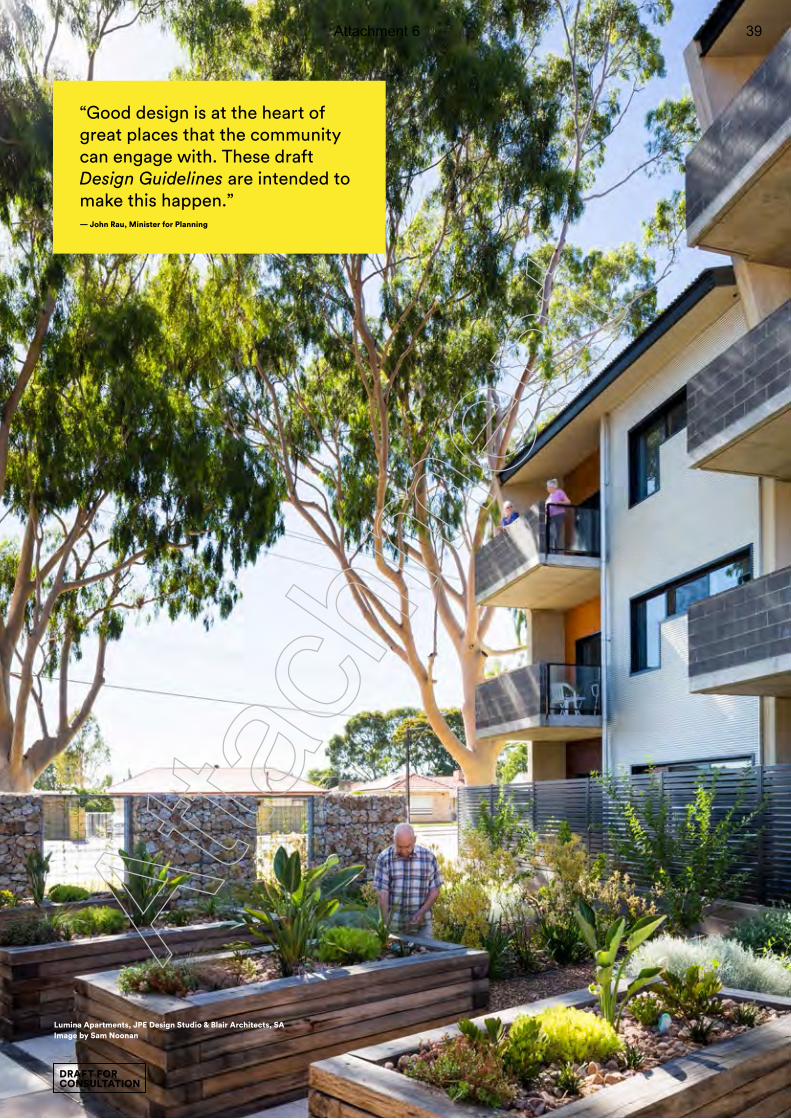
Lumina Apartments, JPE Design Studio & Blair Architects, SAImage by Sam Noonan
“Good design is at the heart of great places that the community can engage with. These draft Design Guidelines are intended to make this happen.” — John Rau, Minister for Planning
DRAFT FOR CONSULTATION
Atta
chm
ent
Attachment 6 39
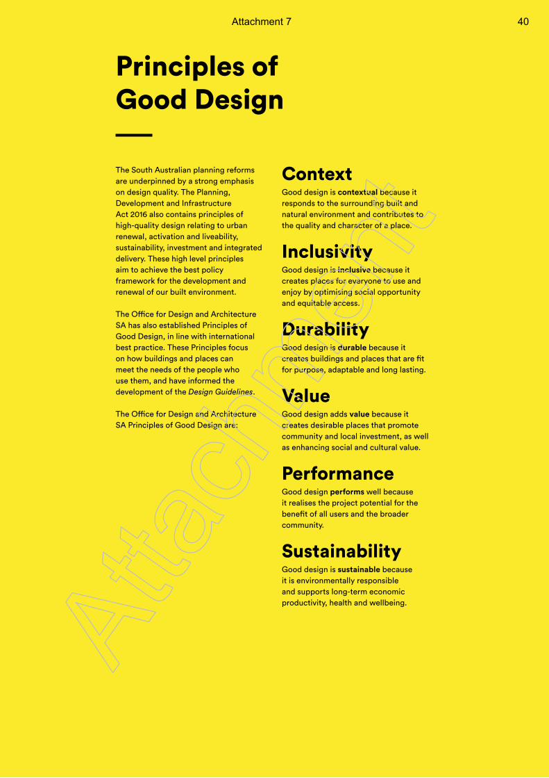
Principles of Good Design
Context Good design is contextual because it responds to the surrounding built and natural environment and contributes to the quality and character of a place.
Inclusivity Good design is inclusive because it creates places for everyone to use and enjoy by optimising social opportunity and equitable access.
Durability Good design is durable because it creates buildings and places that are fit for purpose, adaptable and long lasting.
Value Good design adds value because it creates desirable places that promote community and local investment, as well as enhancing social and cultural value.
Performance Good design performs well because it realises the project potential for the benefit of all users and the broader community.
Sustainability Good design is sustainable because it is environmentally responsible and supports long-term economic productivity, health and wellbeing.
The South Australian planning reforms are underpinned by a strong emphasis on design quality. The Planning, Development and Infrastructure Act 2016 also contains principles of high-quality design relating to urban renewal, activation and liveability, sustainability, investment and integrated delivery. These high level principles aim to achieve the best policy framework for the development and renewal of our built environment.
The Office for Design and Architecture SA has also established Principles of Good Design, in line with international best practice. These Principles focus on how buildings and places can meet the needs of the people who use them, and have informed the development of the Design Guidelines.
The Office for Design and Architecture SA Principles of Good Design are:
Atta
chm
ent
Attachment 7 40

DRAFT FOR CONSULTATION
Atta
chm
ent
Attachment 8 41
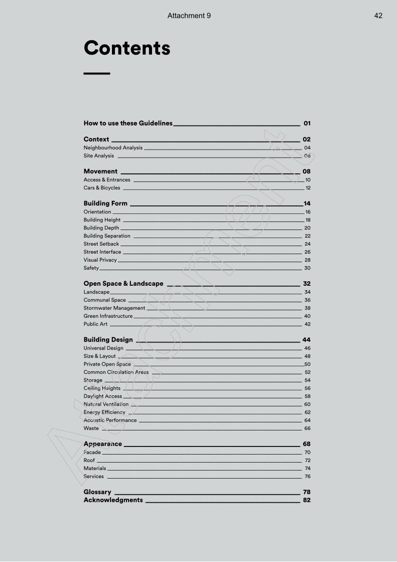
How to use these Guidelines _________________________________________ 01
Context _____________________________________________________________ 02Neighbourhood Analysis ____________________________________________________________ 04
Site Analysis ______________________________________________________________________ 06
Movement __________________________________________________________ 08Access & Entrances _________________________________________________________________ 10
Cars & Bicycles _____________________________________________________________________ 12
Building Form ________________________________________________________14Orientation _________________________________________________________________________ 16
Building Height _____________________________________________________________________ 18
Building Depth _____________________________________________________________________ 20
Building Separation ________________________________________________________________ 22
Street Setback _____________________________________________________________________ 24
Street Interface ____________________________________________________________________ 26
Visual Privacy ______________________________________________________________________ 28
Safety _____________________________________________________________________________ 30
Open Space & Landscape ___________________________________________ 32Landscape _________________________________________________________________________ 34
Communal Space __________________________________________________________________ 36
Stormwater Management ___________________________________________________________ 38
Green Infrastructure ________________________________________________________________ 40
Public Art _________________________________________________________________________ 42
Building Design _____________________________________________________ 44Universal Design ___________________________________________________________________ 46
Size & Layout ______________________________________________________________________ 48
Private Open Space _________________________________________________________________50
Common Circulation Areas _________________________________________________________ 52
Storage ___________________________________________________________________________ 54
Ceiling Heights ____________________________________________________________________ 56
Daylight Access ____________________________________________________________________ 58
Natural Ventilation _________________________________________________________________ 60
Energy Efficiency __________________________________________________________________ 62
Acoustic Performance ______________________________________________________________ 64
Waste ____________________________________________________________________________ 66
Appearance _________________________________________________________ 68Facade ____________________________________________________________________________ 70
Roof ______________________________________________________________________________ 72
Materials __________________________________________________________________________ 74
Services __________________________________________________________________________ 76
Glossary ____________________________________________________________ 78Acknowledgments __________________________________________________ 82
ContentsAtta
chm
ent
Attachment 9 42
Bowden Main Park, ASPECT StudiosImage by Sam Noonan
Innovation and creativity are critical to unlocking new development opportunities in our urban areas.
DRAFT FOR CONSULTATION
Atta
chm
ent
Attachment 10 43
0 1
The Guidelines have been structured to reflect a typical development design proposal, addressing contextual elements considered in the early stages of a project and the more detailed, specific elements considered in the later stages.
All guidance points describe desirable characteristics to be considered when designing or purchasing a dwelling.
The points have been categorised and tagged according to how they relate to other policy regimes:
Planning Considerations
Building Considerations
Guidance points without a or tag are additional best practice guidance that does not fall under either Planning or Building Policy Considerations.
The design guidance is intended primarily for typical lower-scale infill developments, such as two-storey townhouses or row housing. Additional guidance relating to large multi-residential developments and apartments is listed under the subheading ‘Additional Guidance for Apartments’.
Importantly, the Guidelines emphasise the design principles and performance outcomes that should be considered in order to encourage good design outcomes in residential developments.
The Guidelines are arranged into six sections:
• Context• Movement• Building Form• Open Space & Landscape• Building Design• Appearance
Each section has been expanded into related design elements that are described as Performance Outcomes and Design Suggestions.
DescriptionExplanation of the elements and benefits of applying principles of good design.
Performance OutcomesThe high-level goals.
Design SuggestionsDesign guidance for achieving the Performance Outcomes.
Design SolutionsMeasurable criteria (linked to relevant Design Suggestions).
In instances where the guidelines exceed the minimum standard, the Building Code of Australia (BCA) reference is provided.
Note: Some elements have no Design Solutions listed.
The Design Suggestions and Design Solutions should be considered in balance with the overall design proposal and how well it integrates with the existing neighbourhood.
How to use these GuidelinesAtta
chm
ent
Attachment 11 44
0 2
Context
We can recognise a new house when we walk down the street. And we know why some “just work” where other new homes don’t.
Considering context is key. New housing is successful when it has been informed by a complete understanding of the site’s character, its physical features and surroundings. It can be simultaneously fresh and new, while also being sympathetic to the area.
Analysing context involves thinking beyond the site boundary. It includes consideration of the specific physical, social, environmental and economic conditions of the surrounding areas. New housing that is sensitively integrated with its context can add value to existing character and encourage community pride.
CONSULTATION DRAF T DESIGN GUIDELINES
DRAFT FOR CONSULTATION
Atta
chm
ent
Attachment 12 45
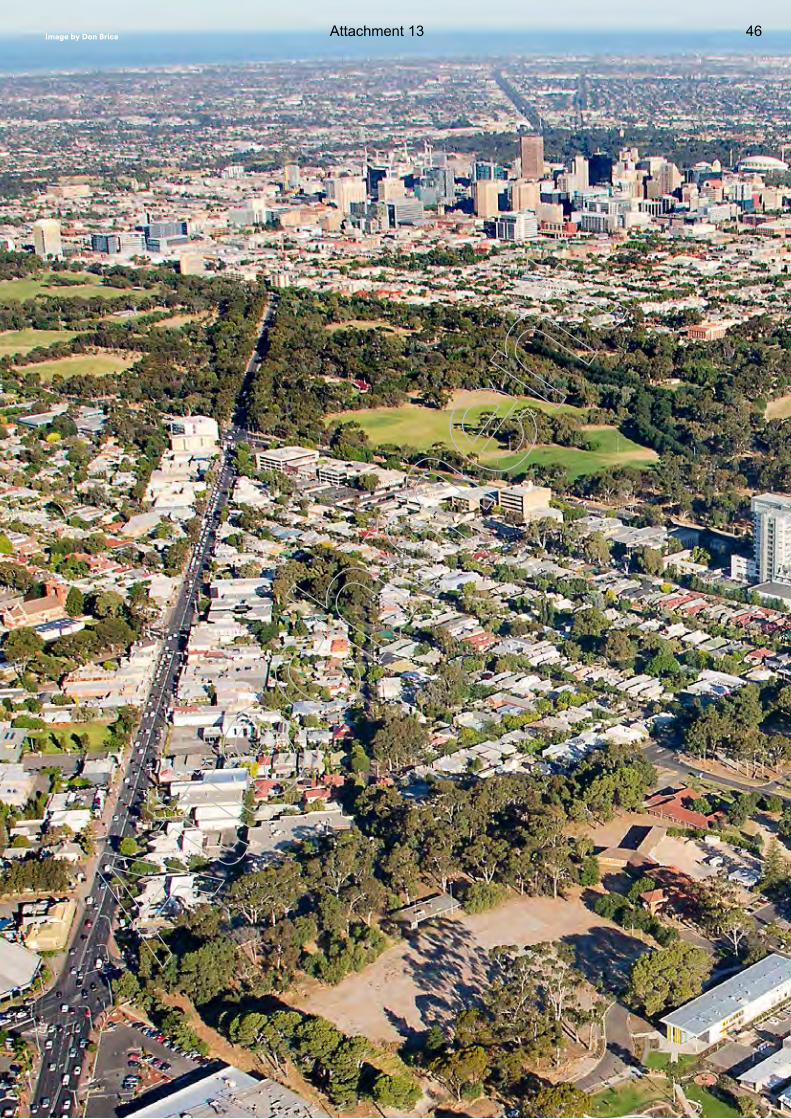
0 3Image by Don Brice
Atta
chm
ent
Attachment 13 46
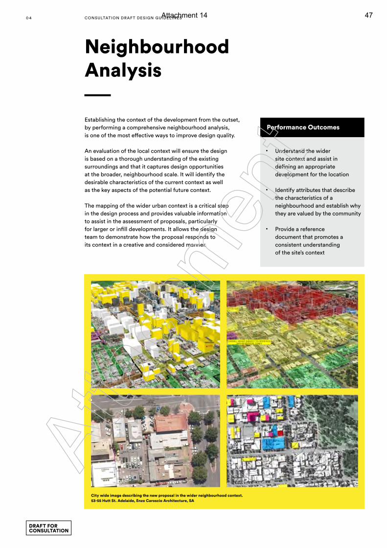
Establishing the context of the development from the outset, by performing a comprehensive neighbourhood analysis, is one of the most effective ways to improve design quality.
An evaluation of the local context will ensure the design is based on a thorough understanding of the existing surroundings and that it captures design opportunities at the broader, neighbourhood scale. It will identify the desirable characteristics of the current context as well as the key aspects of the potential future context.
The mapping of the wider urban context is a critical step in the design process and provides valuable information to assist in the assessment of proposals, particularly for larger or infill developments. It allows the design team to demonstrate how the proposal responds to its context in a creative and considered manner.
Neighbourhood Analysis
Performance Outcomes
• Understand the wider site context and assist in defining an appropriate development for the location
• Identify attributes that describe the characteristics of a neighbourhood and establish why they are valued by the community
• Provide a reference document that promotes a consistent understanding of the site’s context
City wide image describing the new proposal in the wider neighbourhood context. 53-55 Hutt St. Adelaide, Enzo Caroscio Architecture, SA
0 4 CONSULTATION DRAF T DESIGN GUIDELINES
DRAFT FOR CONSULTATION
Atta
chm
ent
Attachment 14 47
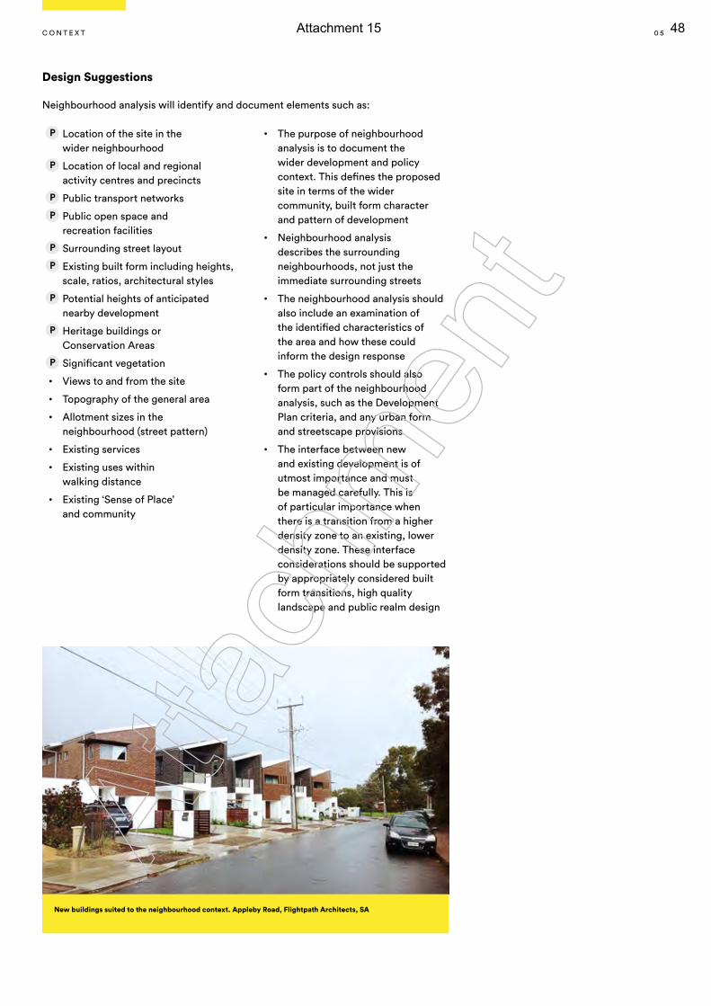
Design Suggestions
Neighbourhood analysis will identify and document elements such as:
Location of the site in the wider neighbourhood
Location of local and regional activity centres and precincts
Public transport networks
Public open space and recreation facilities
Surrounding street layout
Existing built form including heights, scale, ratios, architectural styles
Potential heights of anticipated nearby development
Heritage buildings or Conservation Areas
Significant vegetation
• Views to and from the site
• Topography of the general area
• Allotment sizes in the neighbourhood (street pattern)
• Existing services
• Existing uses within walking distance
• Existing ‘Sense of Place’ and community
• The purpose of neighbourhood analysis is to document the wider development and policy context. This defines the proposed site in terms of the wider community, built form character and pattern of development
• Neighbourhood analysis describes the surrounding neighbourhoods, not just the immediate surrounding streets
• The neighbourhood analysis should also include an examination of the identified characteristics of the area and how these could inform the design response
• The policy controls should also form part of the neighbourhood analysis, such as the Development Plan criteria, and any urban form and streetscape provisions
• The interface between new and existing development is of utmost importance and must be managed carefully. This is of particular importance when there is a transition from a higher density zone to an existing, lower density zone. These interface considerations should be supported by appropriately considered built form transitions, high quality landscape and public realm design
New buildings suited to the neighbourhood context. Appleby Road, Flightpath Architects, SA
0 5C O N T E x T
Atta
chm
ent
Attachment 15 48
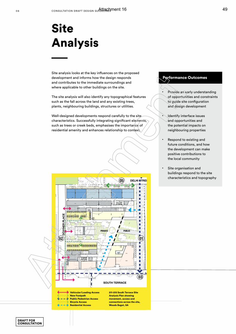
WOODSBAGOT.COM South Terrace - December 2015
07 211-215 SOUTH TERRACE Site Opportunities
05 DELHI STREET BUILT CONTEXT
04 DELHI STREET BUILT CONTEXT
03 SOUTH TERRACE BUILT CONTEXT EXISTING PROPOSED
01 SITE ACCESS
Pedestrian access to the site is from both South Terrace and Delhi street and is supported by the proposed pedestrian link through the site.
Vehicle access for cars and rubbish collection is from Downer Place. Downer place is a public street with services the site and the neighbouring hotel to the west of the proposed development.
02 PUBLIC REALM
It is proposed that a public pedestrian connection from South Terrace to Delhi street is provided to improve connectivity for the neighbouring site context. This will provide a connection between the city and the park contributing to the public realm.To South Terrace an active street edge will be provided with a mix of retail uses and the primary residential lobby.
“...frequent streets and short blocks are valuable because of the fabric of intricate cross-use that they permit..”Jane Jacobs
EXISTING PROPOSED
EXISTING PROPOSED
42.97
42.96
20562057
44.46
44.09
51.84
53.04
52.63
5
44.61
46.67
46.72
46.75
46.83
46.83
44.13
44.5044.51
44.36
44.34
44.16
UPUP450450450450450450
PEDESTRIAN CROSSING
MULTI-LEVEL BUILDINGSAGE HOTEL
MULTI-LEVEL BUILDINGCHIFLEY ON STH TERRACE
EXI
STI
NG
DR
IVE
WA
Y
EXISTINGLANDSCAPE
TWO STOREY CARPARK
EXI
STI
NG
DR
IVE
WA
Y R
AP
SOUTH TERRACE
DELHI STREET
DO
WN
ER
PLA
CE
TITLE BOUNDARY
TITLE BOUNDARY
TITLE BOUNDARY
41 m²21 m²
21 m²
EXISTINGCARPARK /SPORTSCOURT
ACCE
SS G
ATE
EXISTINGCARPARK
EXISTINGLANDSCAPE
SCHOOL BUILDING
SCHOOL BUILDING
SCHOOL BUILDING
MULTI-LEVELBUILDING
CITY PARK MOTEL
TERRACE HOUSESTERRACEHOUSES
TERRACEHOUSESCOMMERCIAL
DE
LHI S
TR
EE
T
EXISTINGSPORT FIELD
PARK LANDS
PE
DES
TRIA
N C
RO
SS
ING
RAMP 1:5RAMP 1:8
Contractor must verify all dimensions on site before commencing workor preparing shop drawings. Do not scale drawings.
Revision
Status
Sheet number
Sheet title
Scale
Project number
Checked Approved
25mm
Sheet sizeA0
Issuer
Size check
Project
Client
Notes & Legend
© Woods Bagot
TM
Recent revision history# Description DateStatus
Date generated
1 : 200C:\My Documents\Autodesk\Revit\RAC2015\130305_SouthTerrace_Towers_A15_Central_melpht.rvt1-12-15 12:19:12 PM
130305
Checker Approver
SOUTH TERRACE, ADELAIDE
1000
LOCATION PLAN
02
03
05
01
PRIVATE PUBLIC
04
KEY POINTS01 Connectivity through site02 Vehicles isolated to Downer Place03 Active edge to South Terrace04 Improve amenity of Delhi street05 Landscaped communal space for residents
Vehicular/ Loading Access
New Footpath
Public Pedestrian Access
Residential Access
Bicycle access
Site analysis looks at the key influences on the proposed development and informs how the design responds and contributes to the immediate surroundings and where applicable to other buildings on the site.
The site analysis will also identify any topographical features such as the fall across the land and any existing trees, plants, neighbouring buildings, structures or utilities.
Well-designed developments respond carefully to the site characteristics. Successfully integrating significant elements, such as trees or creek beds, emphasises the importance of residential amenity and enhances relationship to context.
Site Analysis
Performance Outcomes
• Provide an early understanding of opportunities and constraints to guide site configuration and design development
• Identify interface issues and opportunities and the potential impacts on neighbouring properties
• Respond to existing and future conditions, and how the development can make positive contributions to the local community
• Site organisation and buildings respond to the site characteristics and topography
Vehicular/Loading AccessNew FootpathPublic Pedestrian AccessBicycle AccessResidential Access
211-215 South Terrace Site Analysis Plan showing movement, access and connections across the site, Woods Bagot, SA
0 6 CONSULTATION DRAF T DESIGN GUIDELINES
DRAFT FOR CONSULTATION
Atta
chm
ent
Attachment 16 49
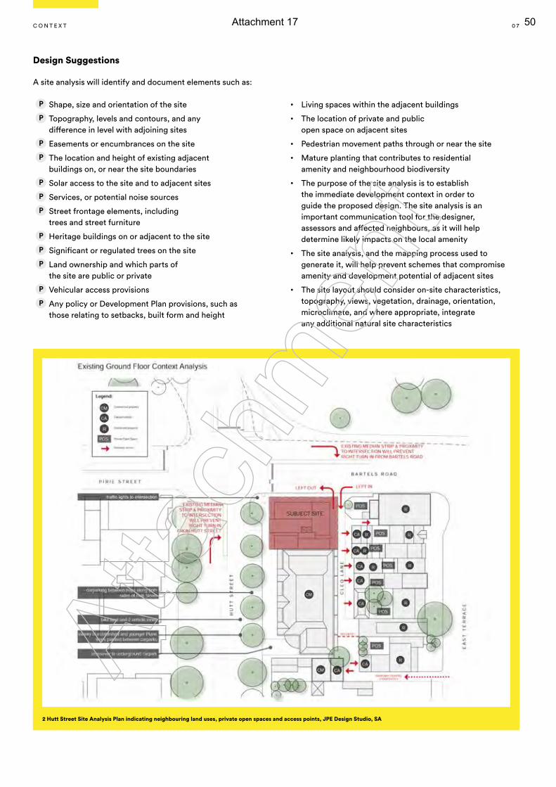
Design Suggestions
A site analysis will identify and document elements such as:
Shape, size and orientation of the site
Topography, levels and contours, and any difference in level with adjoining sites
Easements or encumbrances on the site
The location and height of existing adjacent buildings on, or near the site boundaries
Solar access to the site and to adjacent sites
Services, or potential noise sources
Street frontage elements, including trees and street furniture
Heritage buildings on or adjacent to the site
Significant or regulated trees on the site
Land ownership and which parts of the site are public or private
Vehicular access provisions
Any policy or Development Plan provisions, such as those relating to setbacks, built form and height
• Living spaces within the adjacent buildings
• The location of private and public open space on adjacent sites
• Pedestrian movement paths through or near the site
• Mature planting that contributes to residential amenity and neighbourhood biodiversity
• The purpose of the site analysis is to establish the immediate development context in order to guide the proposed design. The site analysis is an important communication tool for the designer, assessors and affected neighbours, as it will help determine likely impacts on the local amenity
• The site analysis, and the mapping process used to generate it, will help prevent schemes that compromise amenity and development potential of adjacent sites
• The site layout should consider on-site characteristics, topography, views, vegetation, drainage, orientation, microclimate, and where appropriate, integrate any additional natural site characteristics
2 Hutt Street Site Analysis Plan indicating neighbouring land uses, private open spaces and access points, JPE Design Studio, SA
0 7C O N T E x T
Atta
chm
ent
Attachment 17 50
It’s more than just getting from A to B. It’s important to consider why and how we move between places and what happens in between.
Encouraging social interaction, passive surveillance and enhancing a neighbourhood’s walkability can be determined by looking at how people move through and around a site.
Access and parking for vehicles should be designed to minimise the impact on surrounding sites and the wider streetscapes.
Bicycle and pedestrian pathways should be linked to the broader urban networks to create permeable and connected neighbourhoods that enable healthy, safe social interaction and active communities.
Movement
0 8 CONSULTATION DRAF T DESIGN GUIDELINES
DRAFT FOR CONSULTATION
Atta
chm
ent
Attachment 18 51
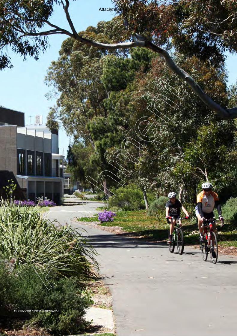
0 9
St. Clair, Outer Harbour Greenway, SA
Atta
chm
ent
Attachment 19 52
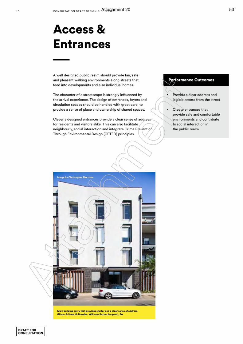
A well designed public realm should provide fair, safe and pleasant walking environments along streets that feed into developments and also individual homes.
The character of a streetscape is strongly influenced by the arrival experience. The design of entrances, foyers and circulation spaces should be handled with great care, to provide a sense of place and ownership of shared spaces.
Cleverly designed entrances provide a clear sense of address for residents and visitors alike. This can also facilitate neighbourly, social interaction and integrate Crime Prevention Through Environmental Design (CPTED) principles.
Access & Entrances
Performance Outcomes
• Provide a clear address and legible access from the street
• Create entrances that provide safe and comfortable environments and contribute to social interaction in the public realm
Image by Christopher Morrison
Main building entry that provides shelter and a clear sense of address.Gibson & Seventh Bowden, Williams Burton Leopardi, SA
1 0 CONSULTATION DRAF T DESIGN GUIDELINES
DRAFT FOR CONSULTATION
Atta
chm
ent
Attachment 20 53
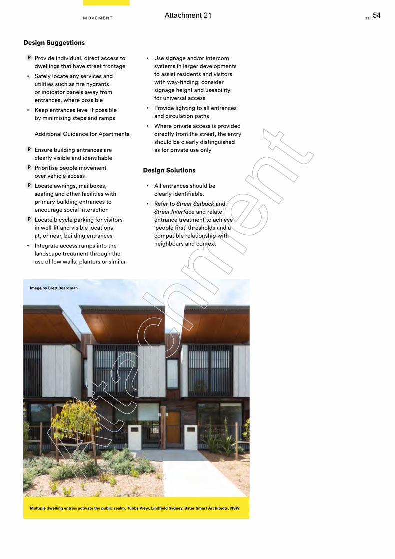
Multiple dwelling entries activate the public realm. Tubbs View, Lindfield Sydney, Bates Smart Architects, NSW
Image by Brett Boardman
Design Suggestions
Provide individual, direct access to dwellings that have street frontage
• Safely locate any services and utilities such as fire hydrants or indicator panels away from entrances, where possible
• Keep entrances level if possible by minimising steps and ramps
Additional Guidance for Apartments
Ensure building entrances are clearly visible and identifiable
Prioritise people movement over vehicle access
Locate awnings, mailboxes, seating and other facilities with primary building entrances to encourage social interaction
Locate bicycle parking for visitors in well-lit and visible locations at, or near, building entrances
• Integrate access ramps into the landscape treatment through the use of low walls, planters or similar
• Use signage and/or intercom systems in larger developments to assist residents and visitors with way-finding; consider signage height and useability for universal access
• Provide lighting to all entrances and circulation paths
• Where private access is provided directly from the street, the entry should be clearly distinguished as for private use only
Design Solutions
• All entrances should be clearly identifiable.
• Refer to Street Setback and Street Interface and relate entrance treatment to achieve ‘people first’ thresholds and a compatible relationship with neighbours and context
1 1M O V E M E N T
Atta
chm
ent
Attachment 21 54
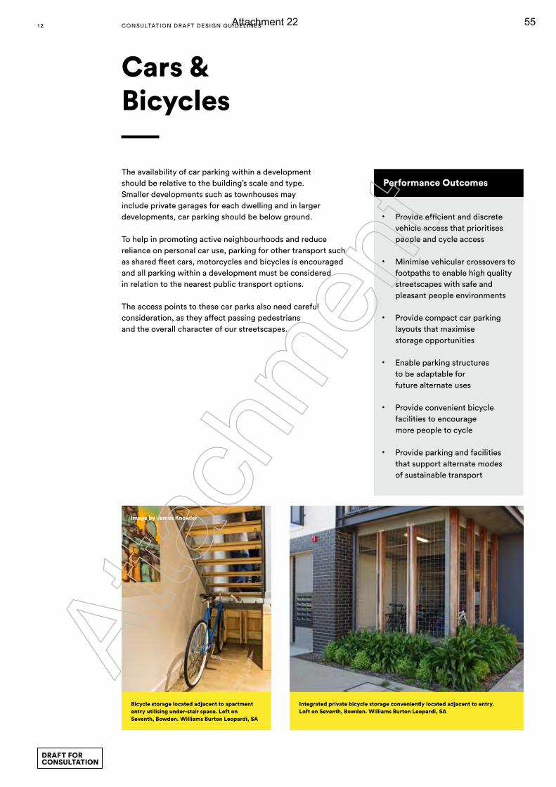
The availability of car parking within a development should be relative to the building’s scale and type. Smaller developments such as townhouses may include private garages for each dwelling and in larger developments, car parking should be below ground.
To help in promoting active neighbourhoods and reduce reliance on personal car use, parking for other transport such as shared fleet cars, motorcycles and bicycles is encouraged and all parking within a development must be considered in relation to the nearest public transport options.
The access points to these car parks also need careful consideration, as they affect passing pedestrians and the overall character of our streetscapes.
Cars & Bicycles
Performance Outcomes
• Provide efficient and discrete vehicle access that prioritises people and cycle access
• Minimise vehicular crossovers to footpaths to enable high quality streetscapes with safe and pleasant people environments
• Provide compact car parking layouts that maximise storage opportunities
• Enable parking structures to be adaptable for future alternate uses
• Provide convenient bicycle facilities to encourage more people to cycle
• Provide parking and facilities that support alternate modes of sustainable transport
Integrated private bicycle storage conveniently located adjacent to entry. Loft on Seventh, Bowden. Williams Burton Leopardi, SA
Bicycle storage located adjacent to apartment entry utilising under-stair space. Loft on Seventh, Bowden. Williams Burton Leopardi, SA
Image by James Knowler
1 2 CONSULTATION DRAF T DESIGN GUIDELINES
DRAFT FOR CONSULTATION
Atta
chm
ent
Attachment 22 55

Rear lane access enables a high quality frontage to the primary street. Small pockets of planting and pedestrian gates can
improve the appearance and amenity of the laneway
Design Suggestions
Locate vehicular crossovers on secondary streets or lanes
Minimise the number and width of vehicular cross-overs
Minimise garages or carports facing primary streets, or limit their width to enable habitable rooms to face the street
Integrate garages, carports, and visitor parking with the building and garden. Use materials or finishes to reduce visual prominence
Include breaks to groups of adjacent garages or carports to enable landscaping
Avoid large extents of consolidated at-grade parking. Where provided, locate to the side or rear of lots, away from primary streets and screened from view
• Provide additional space in garages to accommodate bicycle storage
• Incorporate traffic calming measures such as paving changes to reinforce pedestrian safety
• Incorporate charging points for electric cars, car wash bays, and dedicated parking for motorcycles and scooters
• Activity on street frontages contributes to the social life of streets and neighbourhoods. Generally basement is the preferred location for car parking so active uses are achieved in building floors with direct or close proximity to the street
• Where above ground car parking is proposed, floor heights should be suitable for latter conversion to commercial or residential use and street frontages provided with active uses such as residential or commercial offices
• Refer to Street Interface and Access & Entrances to achieve a ‘people first’ street edge to the development
Additional Guidance for Apartments
Establish shared-zones with pedestrian priority, or separate pedestrian and vehicular movement
Provide landscaping to at-grade parking, including shade trees planted between clusters of cars
Provide secure and accessible communal parking areas
Integrate podium level, or other above-ground enclosed parking into the building design to prevent visibility from primary street frontages
Locate bicycle storage within dwellings or consolidated in a communal location, preferably at ground level adjacent public realm or communal areas
• Ensure waiting areas adjacent lifts or stairs are visible, well-lit, and separated from vehicular movement
• Prioritise basement location when car parking is provided within buildings
• Provide adequate floor-to-floor heights in car parking structures located within buildings to enable future adaptation to alternate uses
Design Solutions
Individual garages: Maximum garage width is no more than 50% of dwelling frontage, the remainder of which is landscaped
Additional Guidance for Apartments
Conceal any above-ground parking from primary street frontages with active uses including dwellings or communal facilities
Provide bicycle storage sufficient for the likely number of residents, taking into account dwelling types and occupancies. Two secure bicycle parks per dwelling is a reasonable provision
Limit the protrusion of semi-basement car parking to 1.2m above finished ground level and incorporate landscaping adjacent the public realm
REAR LA
NE
SECONDARY STREET
PRIMA
RY ST
REET
1 3M O V E M E N T
Atta
chm
ent
Attachment 23 56
One of the most important factors in well-designed housing is its built form. This isn’t just a building’s overall shape or configuration, but its placement in relation to other buildings and how it complements its surroundings. New buildings should positively contribute to local landscapes with their scale, proportions and materials used. Where less immediate visual context exists, there should be a focus on creating positive and distinctive attributes from the beginning, balancing sustainability with local character.
Building Form
1 4 CONSULTATION DRAF T DESIGN GUIDELINES
DRAFT FOR CONSULTATION
Atta
chm
ent
Attachment 24 57
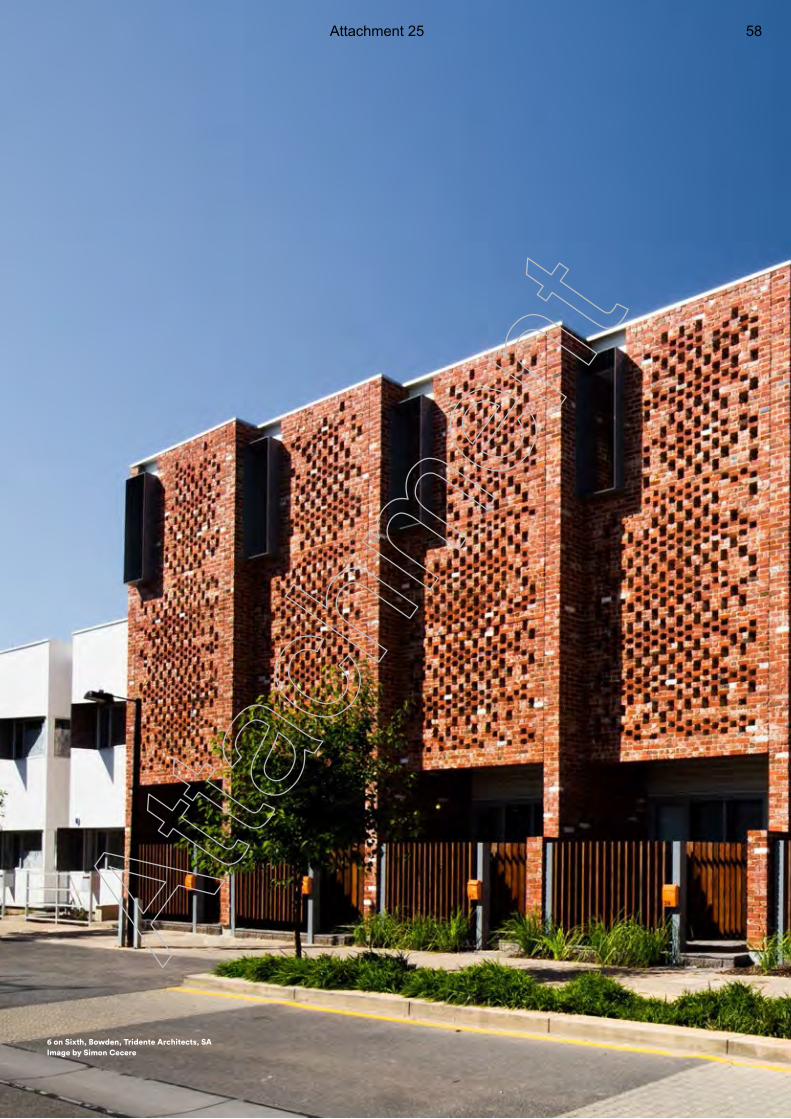
1 5
St. Clair, AV Jennings, SA
6 on Sixth, Bowden, Tridente Architects, SAImage by Simon Cecere
Atta
chm
ent
Attachment 25 58
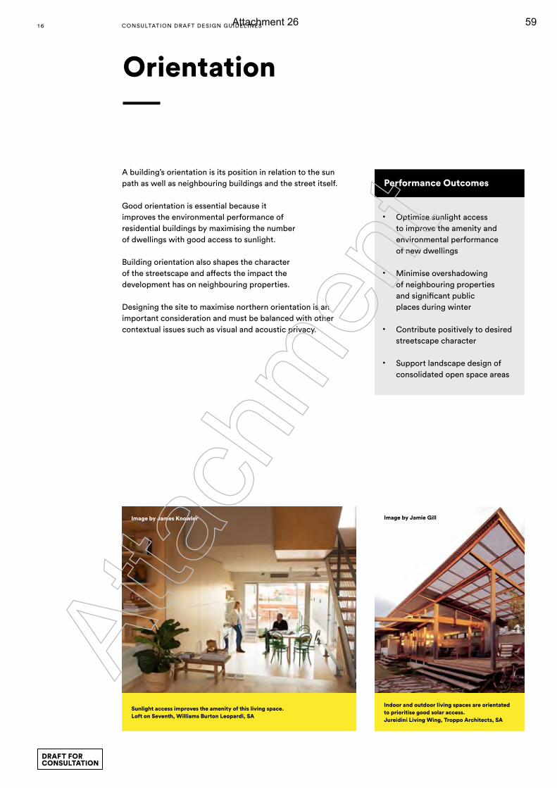
A building’s orientation is its position in relation to the sun path as well as neighbouring buildings and the street itself.
Good orientation is essential because it improves the environmental performance of residential buildings by maximising the number of dwellings with good access to sunlight.
Building orientation also shapes the character of the streetscape and affects the impact the development has on neighbouring properties.
Designing the site to maximise northern orientation is an important consideration and must be balanced with other contextual issues such as visual and acoustic privacy.
Orientation
Performance Outcomes
• Optimise sunlight access to improve the amenity and environmental performance of new dwellings
• Minimise overshadowing of neighbouring properties and significant public places during winter
• Contribute positively to desired streetscape character
• Support landscape design of consolidated open space areas
Sunlight access improves the amenity of this living space.Loft on Seventh, Williams Burton Leopardi, SA
Image by James Knowler
Indoor and outdoor living spaces are orientated to prioritise good solar access.Jureidini Living Wing, Troppo Architects, SA
Image by Jamie Gill
1 6 CONSULTATION DRAF T DESIGN GUIDELINES
DRAFT FOR CONSULTATION
Atta
chm
ent
Attachment 26 59
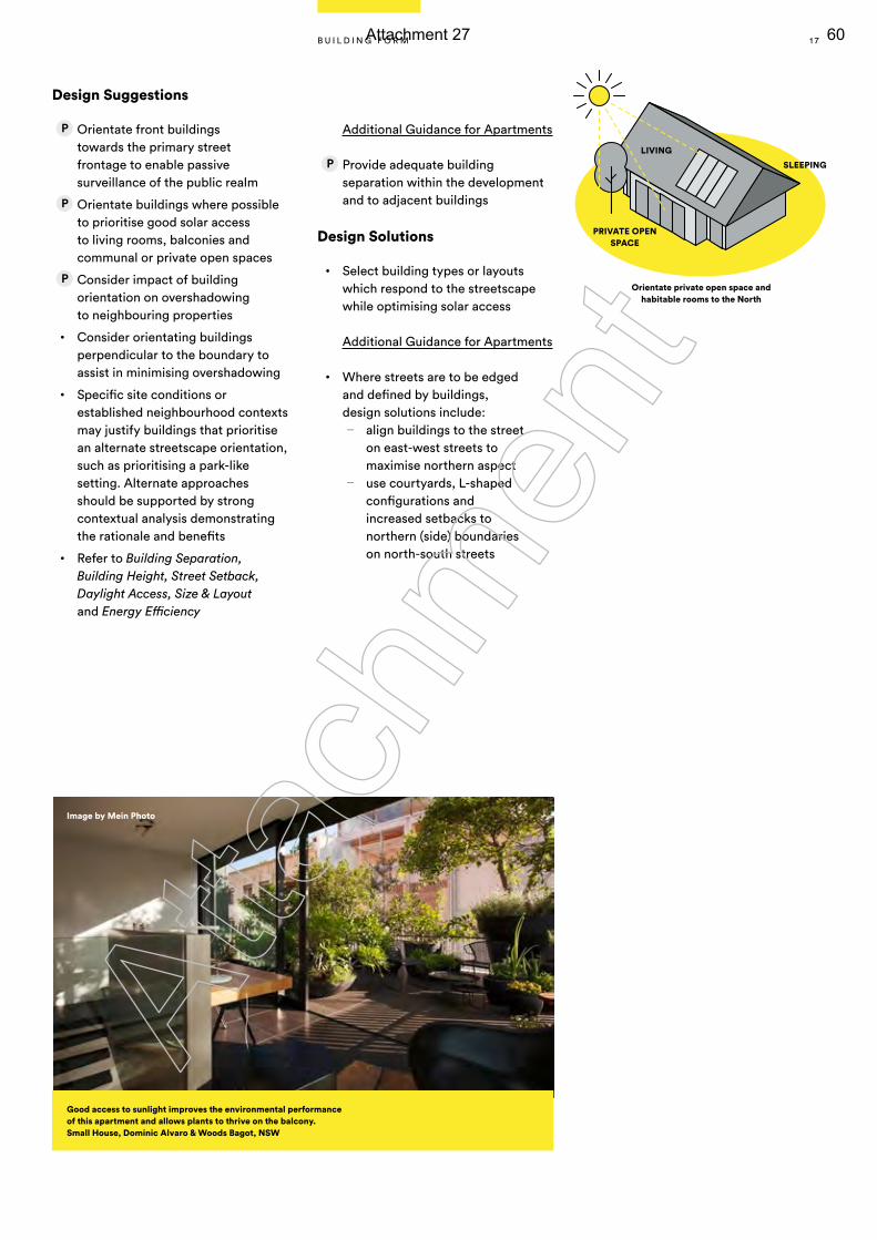
Design Suggestions
Orientate front buildings towards the primary street frontage to enable passive surveillance of the public realm
Orientate buildings where possible to prioritise good solar access to living rooms, balconies and communal or private open spaces
Consider impact of building orientation on overshadowing to neighbouring properties
• Consider orientating buildings perpendicular to the boundary to assist in minimising overshadowing
• Specific site conditions or established neighbourhood contexts may justify buildings that prioritise an alternate streetscape orientation, such as prioritising a park-like setting. Alternate approaches should be supported by strong contextual analysis demonstrating the rationale and benefits
• Refer to Building Separation, Building Height, Street Setback, Daylight Access, Size & Layout and Energy Efficiency
Additional Guidance for Apartments
Provide adequate building separation within the development and to adjacent buildings
Design Solutions
• Select building types or layouts which respond to the streetscape while optimising solar access
Additional Guidance for Apartments
• Where streets are to be edged and defined by buildings, design solutions include:
— align buildings to the street on east-west streets to maximise northern aspect
— use courtyards, L-shaped configurations and increased setbacks to northern (side) boundaries on north-south streets
Good access to sunlight improves the environmental performance of this apartment and allows plants to thrive on the balcony. Small House, Dominic Alvaro & Woods Bagot, NSW
Orientate private open space and habitable rooms to the North
LIVING
PRIVATE OPEN SPACE
SLEEPING
Image by Mein Photo
1 7B U I L D I N G F O R M
Atta
chm
ent
Attachment 27 60
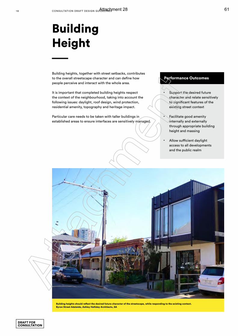
Building heights, together with street setbacks, contributes to the overall streetscape character and can define how people perceive and interact with the whole area.
It is important that completed building heights respect the context of the neighbourhood, taking into account the following issues: daylight, roof design, wind protection, residential amenity, topography and heritage impact.
Particular care needs to be taken with taller buildings in established areas to ensure interfaces are sensitively managed.
Building Height
Performance Outcomes
• Support the desired future character and relate sensitively to significant features of the existing street context
• Facilitate good amenity internally and externally through appropriate building height and massing
• Allow sufficient daylight access to all developments and the public realm
Building heights should reflect the desired future character of the streetscape, while responding to the existing context. Byron Street Adelaide, Ashley Halliday Architects, SA
1 8 CONSULTATION DRAF T DESIGN GUIDELINES
DRAFT FOR CONSULTATION
Atta
chm
ent
Attachment 28 61
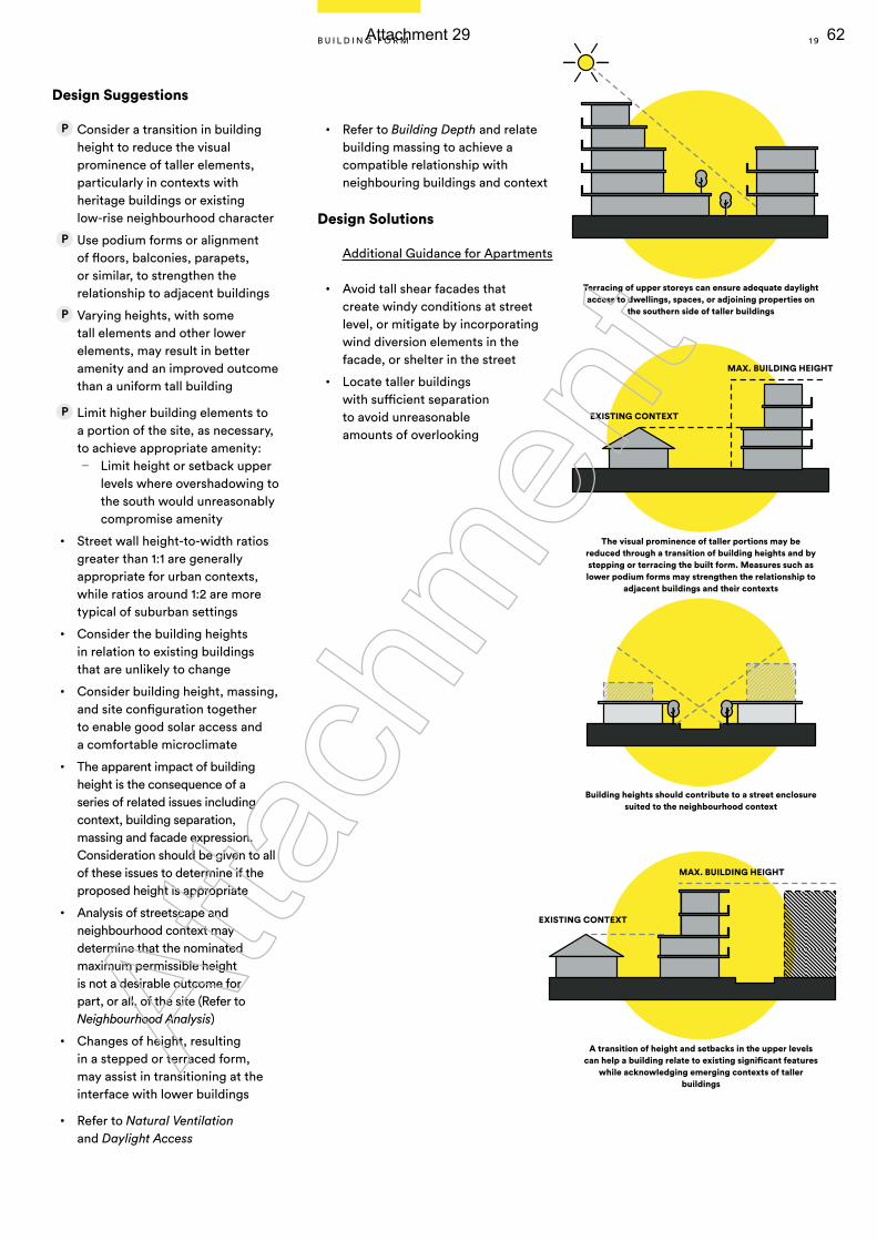
Design Suggestions
Consider a transition in building height to reduce the visual prominence of taller elements, particularly in contexts with heritage buildings or existing low-rise neighbourhood character
Use podium forms or alignment of floors, balconies, parapets, or similar, to strengthen the relationship to adjacent buildings
Varying heights, with some tall elements and other lower elements, may result in better amenity and an improved outcome than a uniform tall building
Limit higher building elements to a portion of the site, as necessary, to achieve appropriate amenity:
— Limit height or setback upper levels where overshadowing to the south would unreasonably compromise amenity
• Street wall height-to-width ratios greater than 1:1 are generally appropriate for urban contexts, while ratios around 1:2 are more typical of suburban settings
• Consider the building heights in relation to existing buildings that are unlikely to change
• Consider building height, massing, and site configuration together to enable good solar access and a comfortable microclimate
• The apparent impact of building height is the consequence of a series of related issues including context, building separation, massing and facade expression. Consideration should be given to all of these issues to determine if the proposed height is appropriate
• Analysis of streetscape and neighbourhood context may determine that the nominated maximum permissible height is not a desirable outcome for part, or all, of the site (Refer to Neighbourhood Analysis)
• Changes of height, resulting in a stepped or terraced form, may assist in transitioning at the interface with lower buildings
• Refer to Natural Ventilation and Daylight Access
• Refer to Building Depth and relate building massing to achieve a compatible relationship with neighbouring buildings and context
Design Solutions
Additional Guidance for Apartments
• Avoid tall shear facades that create windy conditions at street level, or mitigate by incorporating wind diversion elements in the facade, or shelter in the street
• Locate taller buildings with sufficient separation to avoid unreasonable amounts of overlooking
The visual prominence of taller portions may be reduced through a transition of building heights and by stepping or terracing the built form. Measures such as lower podium forms may strengthen the relationship to
adjacent buildings and their contexts
MAX. BUILDING HEIGHT
A transition of height and setbacks in the upper levels can help a building relate to existing significant features
while acknowledging emerging contexts of taller buildings
MAX. BUILDING HEIGHT
EXISTING CONTEXT
EXISTING CONTEXT
Terracing of upper storeys can ensure adequate daylight access to dwellings, spaces, or adjoining properties on
the southern side of taller buildings
Building heights should contribute to a street enclosure suited to the neighbourhood context
1 9B U I L D I N G F O R M
Atta
chm
ent
Attachment 29 62
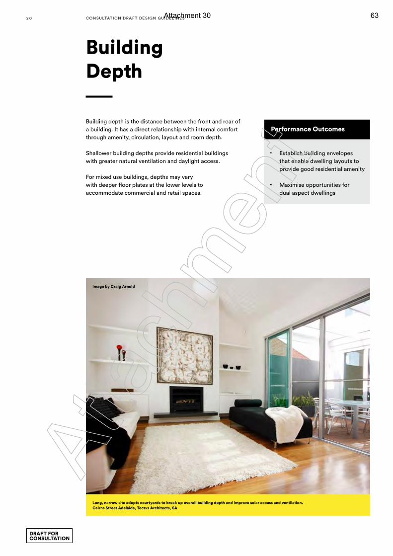
Building Depth
Performance Outcomes
• Establish building envelopes that enable dwelling layouts to provide good residential amenity
• Maximise opportunities for dual aspect dwellings
Building depth is the distance between the front and rear of a building. It has a direct relationship with internal comfort through amenity, circulation, layout and room depth.
Shallower building depths provide residential buildings with greater natural ventilation and daylight access.
For mixed use buildings, depths may vary with deeper floor plates at the lower levels to accommodate commercial and retail spaces.
Long, narrow site adopts courtyards to break up overall building depth and improve solar access and ventilation. Cairns Street Adelaide, Tectvs Architects, SA
Image by Craig Arnold
2 0 CONSULTATION DRAF T DESIGN GUIDELINES
DRAFT FOR CONSULTATION
Atta
chm
ent
Attachment 30 63
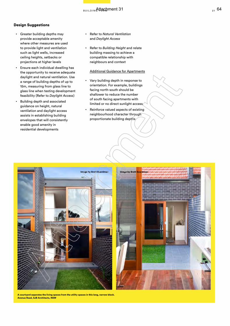
Design Suggestions
• Greater building depths may provide acceptable amenity where other measures are used to provide light and ventilation such as light wells, increased ceiling heights, setbacks or projections at higher levels
• Ensure each individual dwelling has the opportunity to receive adequate daylight and natural ventilation. Use a range of building depths of up to 15m, measuring from glass line to glass line when testing development feasibility (Refer to Daylight Access)
• Building depth and associated guidance on height, natural ventilation and daylight access assists in establishing building envelopes that will consistently enable good amenity in residential developments
• Refer to Natural Ventilation and Daylight Access
• Refer to Building Height and relate building massing to achieve a compatible relationship with neighbours and context
Additional Guidance for Apartments
• Vary building depth in response to orientation. For example, buildings facing north-south should be shallower to reduce the number of south facing apartments with limited or no direct sunlight access
• Reinforce valued aspects of existing neighbourhood character through proportionate building depths
Image by Brett BoardmanImage by Brett Boardman
A courtyard separates the living spaces from the utility spaces in this long, narrow block. Avenue Road, SJB Architects, NSW
2 1B U I L D I N G F O R M
Atta
chm
ent
Attachment 31 64
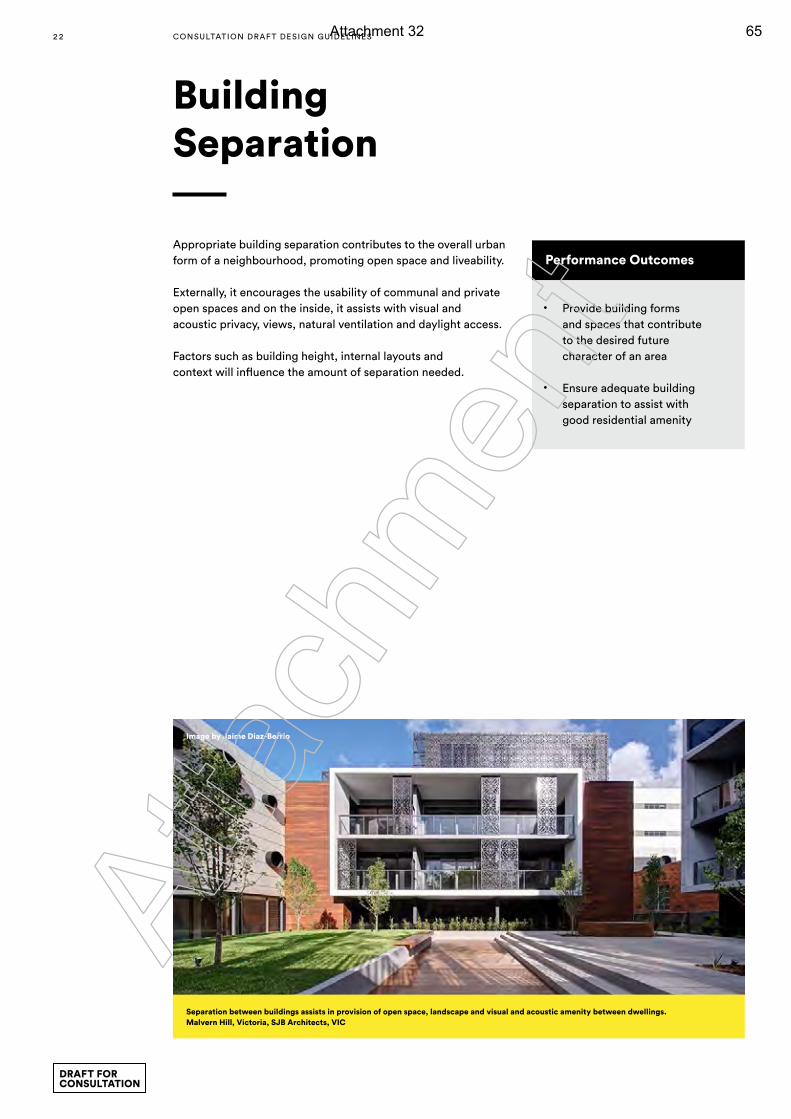
Appropriate building separation contributes to the overall urban form of a neighbourhood, promoting open space and liveability.
Externally, it encourages the usability of communal and private open spaces and on the inside, it assists with visual and acoustic privacy, views, natural ventilation and daylight access.
Factors such as building height, internal layouts and context will influence the amount of separation needed.
Building Separation
Performance Outcomes
• Provide building forms and spaces that contribute to the desired future character of an area
• Ensure adequate building separation to assist with good residential amenity
Image by Jaime Diaz-Berrio
Separation between buildings assists in provision of open space, landscape and visual and acoustic amenity between dwellings. Malvern Hill, Victoria, SJB Architects, VIC
2 2 CONSULTATION DRAF T DESIGN GUIDELINES
DRAFT FOR CONSULTATION
Atta
chm
ent
Attachment 32 65
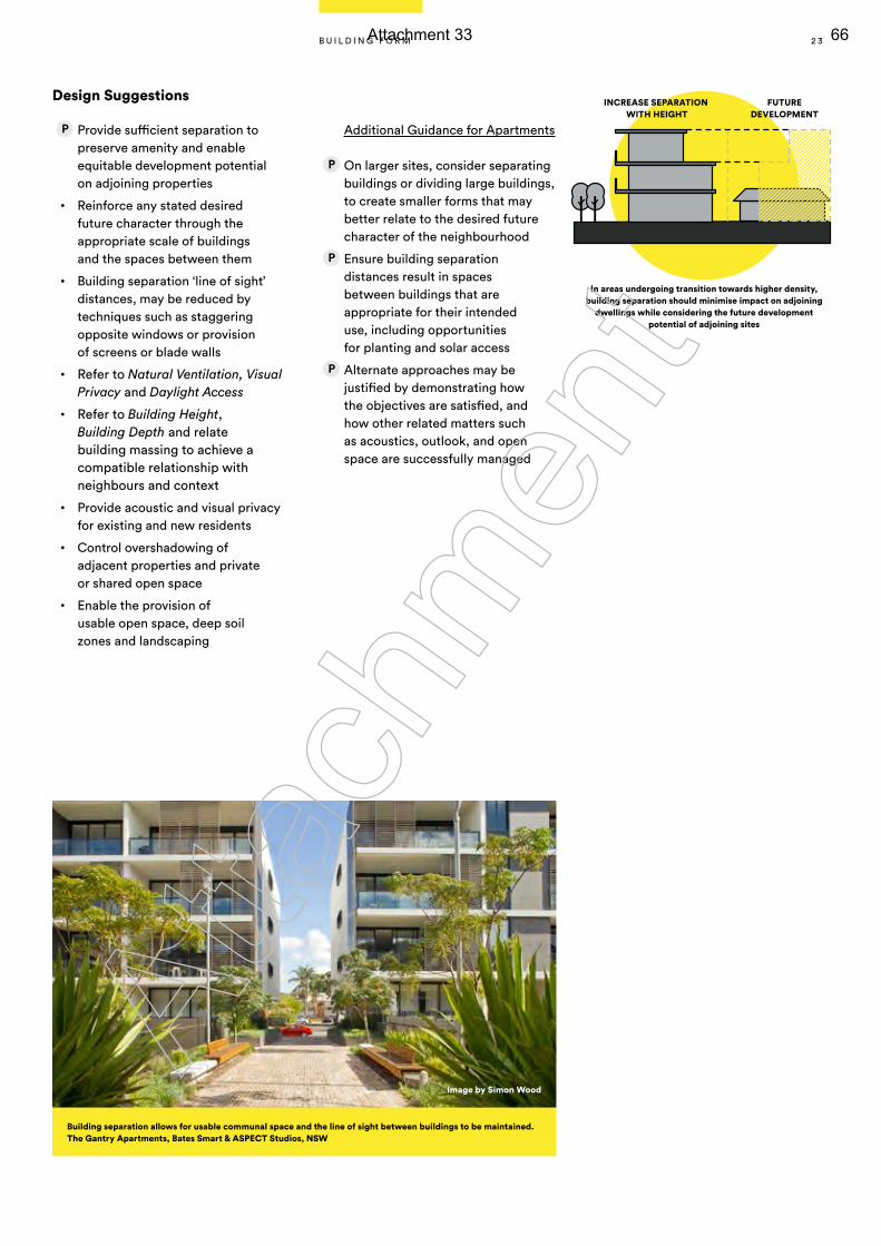
Design Suggestions
Provide sufficient separation to preserve amenity and enable equitable development potential on adjoining properties
• Reinforce any stated desired future character through the appropriate scale of buildings and the spaces between them
• Building separation ‘line of sight’ distances, may be reduced by techniques such as staggering opposite windows or provision of screens or blade walls
• Refer to Natural Ventilation, Visual Privacy and Daylight Access
• Refer to Building Height, Building Depth and relate building massing to achieve a compatible relationship with neighbours and context
• Provide acoustic and visual privacy for existing and new residents
• Control overshadowing of adjacent properties and private or shared open space
• Enable the provision of usable open space, deep soil zones and landscaping
Additional Guidance for Apartments
On larger sites, consider separating buildings or dividing large buildings, to create smaller forms that may better relate to the desired future character of the neighbourhood
Ensure building separation distances result in spaces between buildings that are appropriate for their intended use, including opportunities for planting and solar access
Alternate approaches may be justified by demonstrating how the objectives are satisfied, and how other related matters such as acoustics, outlook, and open space are successfully managed
In areas undergoing transition towards higher density, building separation should minimise impact on adjoining
dwellings while considering the future development potential of adjoining sites
INCREASE SEPARATION WITH HEIGHT
FUTURE DEVELOPMENT
Building separation allows for usable communal space and the line of sight between buildings to be maintained.The Gantry Apartments, Bates Smart & ASPECT Studios, NSW
Image by Simon Wood
2 3B U I L D I N G F O R M
Atta
chm
ent
Attachment 33 66
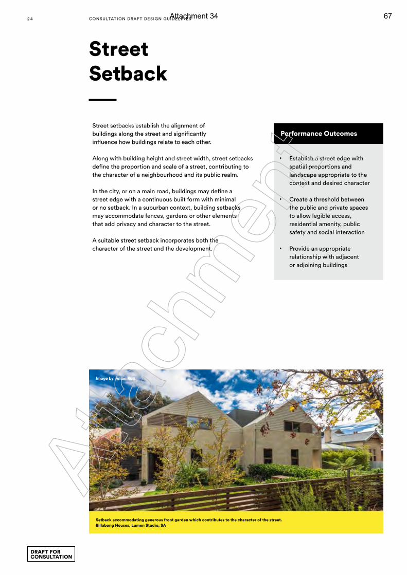
Street setbacks establish the alignment of buildings along the street and significantly influence how buildings relate to each other.
Along with building height and street width, street setbacks define the proportion and scale of a street, contributing to the character of a neighbourhood and its public realm.
In the city, or on a main road, buildings may define a street edge with a continuous built form with minimal or no setback. In a suburban context, building setbacks may accommodate fences, gardens or other elements that add privacy and character to the street.
A suitable street setback incorporates both the character of the street and the development.
Street Setback
Performance Outcomes
• Establish a street edge with spatial proportions and landscape appropriate to the context and desired character
• Create a threshold between the public and private spaces to allow legible access, residential amenity, public safety and social interaction
• Provide an appropriate relationship with adjacent or adjoining buildings
Setback accommodating generous front garden which contributes to the character of the street.Billabong Houses, Lumen Studio, SA
Image by Julian Rutt
2 4 CONSULTATION DRAF T DESIGN GUIDELINES
DRAFT FOR CONSULTATION
Atta
chm
ent
Attachment 34 67
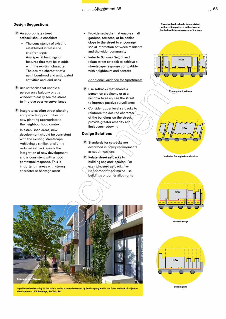
Street setbacks should be consistent with existing patterns in the street or
the desired future character of the area
Design Suggestions
An appropriate street setback should consider:
— The consistency of existing established streetscape and frontages
— Any special buildings or features that may be at odds with the existing character
— The desired character of a neighbourhood and anticipated activities and land-uses
Use setbacks that enable a person on a balcony or at a window to easily see the street to improve passive surveillance
Integrate existing street planting and provide opportunities for new planting appropriate to the neighbourhood context
• In established areas, new development should be consistent with the existing streetscape. Achieving a similar, or slightly reduced setback assists the integration of new development and is consistent with a good contextual response. This is important in areas with strong character or heritage merit
• Provide setbacks that enable small gardens, terraces, or balconies close to the street to encourage social interaction between residents and the wider community
• Refer to Building Height and relate street setback to achieve a streetscape response compatible with neighbours and context
Additional Guidance for Apartments
Use setbacks that enable a person on a balcony or at a window to easily see the street to improve passive surveillance
• Consider upper level setbacks to reinforce the desired character of the buildings on the street, provide greater amenity and limit overshadowing
Design Solutions
Standards for setbacks are described in policy requirements as set dimensions
Relate street setbacks to building use and location. For example, zero setback may be appropriate for mixed-use buildings or corner allotments
NEW
NEW
NEW
NEW
Predominant setback
Variation for angled subdivision
Setback range
Building lineSignificant landscaping in the public realm is complemented by landscaping within the front setback of adjacent developments. AV Jennings, St Clair, SA
Image by Sam Noonan
2 5B U I L D I N G F O R M
Atta
chm
ent
Attachment 35 68
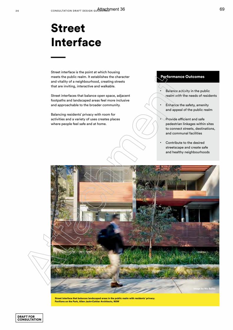
Street interface is the point at which housing meets the public realm. It establishes the character and vitality of a neighbourhood, creating streets that are inviting, interactive and walkable.
Street interfaces that balance open space, adjacent footpaths and landscaped areas feel more inclusive and approachable to the broader community.
Balancing residents’ privacy with room for activities and a variety of uses creates places where people feel safe and at home.
Street Interface
Street interface that balances landscaped areas in the public realm with residents’ privacy.Pavilions on the Park, Allen Jack+Cottier Architects, NSW
Image by Nic Bailey
Performance Outcomes
• Balance activity in the public realm with the needs of residents
• Enhance the safety, amenity and appeal of the public realm
• Provide efficient and safe pedestrian linkages within sites to connect streets, destinations, and communal facilities
• Contribute to the desired streetscape and create safe and healthy neighbourhoods
2 6 CONSULTATION DRAF T DESIGN GUIDELINES
DRAFT FOR CONSULTATION
Atta
chm
ent
Attachment 36 69
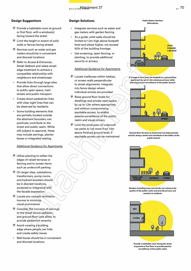
LEVEL CHANGE1.2M MAX
A change in level from the footpath to a ground floor apartment by up to 1.2m enhances privacy while
allowing passive surveillance of the public domain
Provide a habitable room facing the street at ground or first floor to provide passive
surveillance of the public realm
Public Realm Interface Alternatives
Ground floor terraces at street level can help promote activity along a street and contribute to the safety of the
public domain
Gardens including trees and shrubs can enhance the quality of the public realm and provide privacy and
amenity to residents
SETBACKTREES AND SHRUBS STREET
STREET
Design Suggestions
Provide a habitable room at ground or first floor, with a window(s) facing toward the street
Limit the height or extent of solid walls or fences facing streets
Services such as water and gas meters should be in convenient and discreet locations
Refer to Access & Entrances, Street Setback and relate street edge treatment to achieve a compatible relationship with neighbours and streetscape
• Provide links through large sites that allow direct connections to public open space, main streets and public transport
• Create direct pedestrian links with clear sight lines that can be observed by residents
• Some building elements that are partially located outside the allotment boundary can positively contribute to the street and public realm. While still subject to approval, these may include awnings, planter boxes or integrated seating
Additional Guidance for Apartments
Utilise planting to soften the edges of raised terraces or fencing and to screen items such as undercroft parking
On larger sites, substations, transformers, pump rooms and hydrant boosters should be in discreet locations, screened or integrated with the facade expression
Locate any carpark ventilation louvres to minimise visual prominence
Consider the inclusion of awnings to the street where setbacks and ground floor uses allow, to provide pedestrian amenity
Avoid creating a building edge where people can hide and create safety issues
• Mail boxes should be in convenient and discreet locations
Design Solutions
• Integrate services such as water and gas meters with garden fencing
• As a guide, solid walls should be limited to 1.2m high above footpath level and where higher, not exceed 50% of the building frontage
• Use screening, open fencing, or planting, to provide additional security or privacy
Additional Guidance for Apartments
Locate mailboxes within lobbies, or screen walls perpendicular to street alignments. Integrate into fence design where individual entries are provided
Raise ground floor levels for dwellings and private open space by up to 1.2m where appropriate, and without compromising equitable access, to enable passive surveillance of the public realm and visual privacy
Limit the protrusion of undercoft car parks to not more than 1.2m above finished ground level, if equitable access can be maintained
BED
LIVING
2 7B U I L D I N G F O R M
Atta
chm
ent
Attachment 37 70
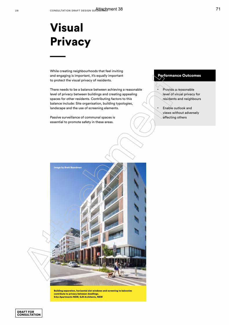
Performance Outcomes
• Provide a reasonable level of visual privacy for residents and neighbours
• Enable outlook and views without adversely affecting others
While creating neighbourhoods that feel inviting and engaging is important, it’s equally important to protect the visual privacy of residents.
There needs to be a balance between achieving a reasonable level of privacy between buildings and creating appealing spaces for other residents. Contributing factors to this balance include: Site organisation, building typologies, landscape and the use of screening elements.
Passive surveillance of communal spaces is essential to promote safety in these areas.
Building separation, horizontal slot windows and screening to balconies contribute to privacy between dwellings. Erko Apartments NSW, SJB Architects, NSW
Image by Brett Boardman
Visual Privacy
2 8 CONSULTATION DRAF T DESIGN GUIDELINES
DRAFT FOR CONSULTATION
Atta
chm
ent
Attachment 38 71
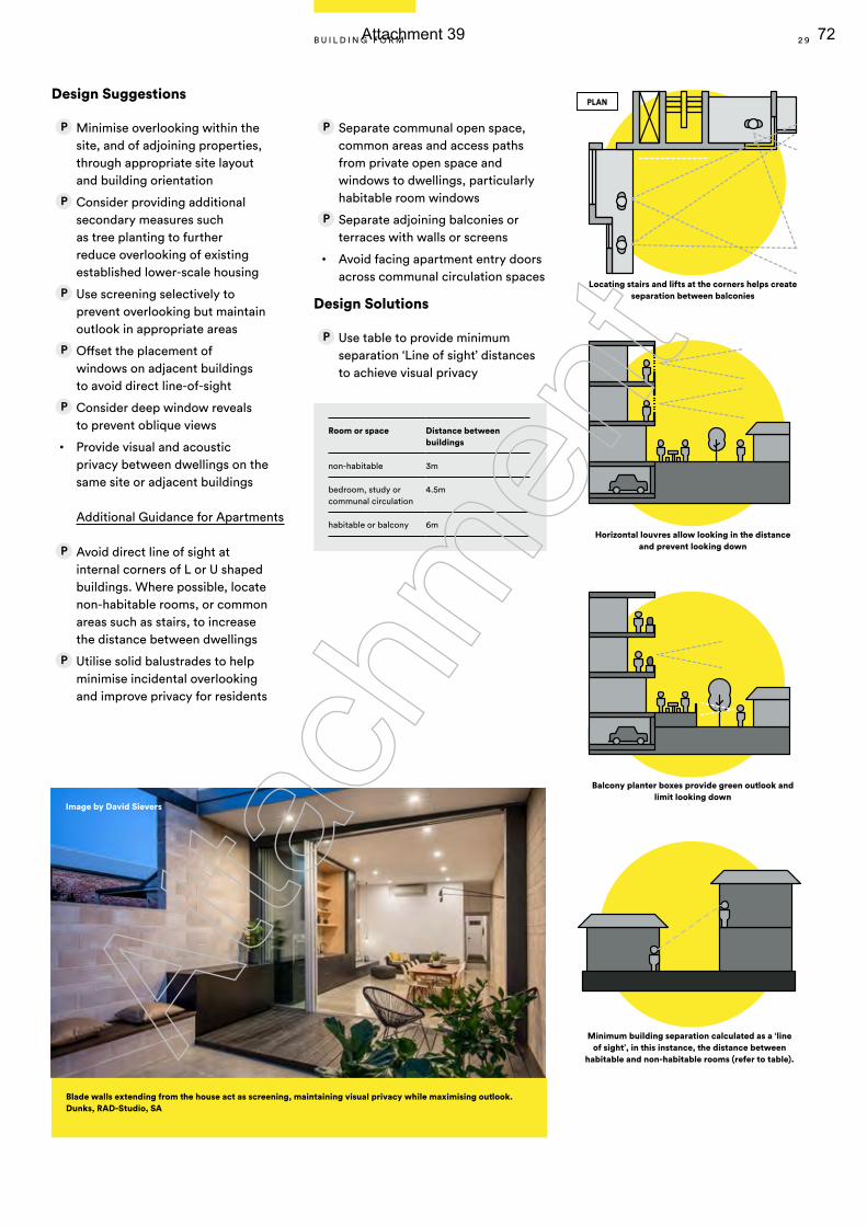
Blade walls extending from the house act as screening, maintaining visual privacy while maximising outlook. Dunks, RAD-Studio, SA
Image by David Sievers
Design Suggestions
Minimise overlooking within the site, and of adjoining properties, through appropriate site layout and building orientation
Consider providing additional secondary measures such as tree planting to further reduce overlooking of existing established lower-scale housing
Use screening selectively to prevent overlooking but maintain outlook in appropriate areas
Offset the placement of windows on adjacent buildings to avoid direct line-of-sight
Consider deep window reveals to prevent oblique views
• Provide visual and acoustic privacy between dwellings on the same site or adjacent buildings
Additional Guidance for Apartments
Avoid direct line of sight at internal corners of L or U shaped buildings. Where possible, locate non-habitable rooms, or common areas such as stairs, to increase the distance between dwellings
Utilise solid balustrades to help minimise incidental overlooking and improve privacy for residents
Separate communal open space, common areas and access paths from private open space and windows to dwellings, particularly habitable room windows
Separate adjoining balconies or terraces with walls or screens
• Avoid facing apartment entry doors across communal circulation spaces
Design Solutions
Use table to provide minimum separation ‘Line of sight’ distances to achieve visual privacy
Locating stairs and lifts at the corners helps create separation between balconies
Horizontal louvres allow looking in the distance and prevent looking down
Balcony planter boxes provide green outlook and limit looking down
Room or space Distance between buildings
non-habitable 3m
bedroom, study or communal circulation
4.5m
habitable or balcony 6m
Minimum building separation calculated as a ‘line of sight’, in this instance, the distance between
habitable and non-habitable rooms (refer to table).
PLAN
2 9B U I L D I N G F O R M
Atta
chm
ent
Attachment 39 72
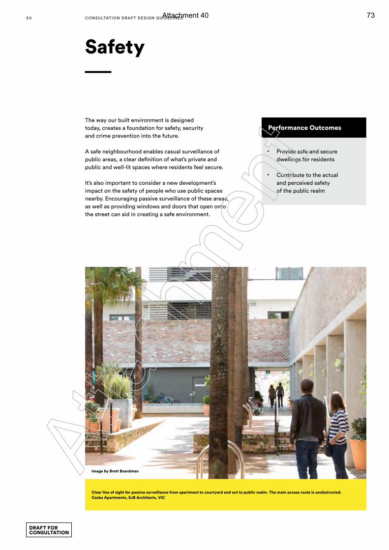
The way our built environment is designed today, creates a foundation for safety, security and crime prevention into the future.
A safe neighbourhood enables casual surveillance of public areas, a clear definition of what’s private and public and well-lit spaces where residents feel secure.
It’s also important to consider a new development’s impact on the safety of people who use public spaces nearby. Encouraging passive surveillance of these areas, as well as providing windows and doors that open onto the street can aid in creating a safe environment.
Safety
Performance Outcomes
• Provide safe and secure dwellings for residents
• Contribute to the actual and perceived safety of the public realm
Clear line of sight for passive surveillance from apartment to courtyard and out to public realm. The main access route is unobstructed. Casba Apartments, SJB Architects, VIC
Image by Brett Boardman
3 0 CONSULTATION DRAF T DESIGN GUIDELINES
DRAFT FOR CONSULTATION
Atta
chm
ent
Attachment 40 73
Design Suggestions
Provide a clear distinction between the public and private realm through measures such as:
— a level change at the site and/or building boundary (subject to accessibility requirements)
— entry awnings — fences, walls and gates — change in surface materials — planting — signage
Orientate entrances to the public realm
• Orientate living areas to enable views over public or communal open spaces
• Consider bay windows, corner windows or balconies which protrude beyond the main facade to enable greater views of the street or public realm
• Avoid blind or dark alcoves
• Provide appropriate levels of lighting to common areas and main routes in multiple dwelling sites
• Employ principles of Crime Prevention Through Environmental Design (CPTED)
• Where criteria are not met, it should be demonstrated that other measures are being implemented to address the safety of residents and that development is not negatively impacting upon the safety of the public realm
• The clear definition of public, private and communal space is an important aspect of safety and security. A clear address establishes the threshold between the public and private domain
• Refer to Street Interface and Access & Entrances
Additional Guidance for Apartments
Provide clear lines of sight between entrances, foyers and the public realm
Provide direct access to ground level apartments from the street, rather than through a common foyer
Ensure access to all private and communal entries is well-lit
Provide casual views to common areas such as lobbies, foyers, hallways, recreation areas and car parks, where they exist
Ensure dwellings cannot be accessed from neighbouring buildings
In mixed-use developments, separate the residential component’s car parking from other building uses and control access from public and common areas
Provide separate access for residents in mixed-use buildings
Include intercom systems for visitors to communicate with residents
3 1B U I L D I N G F O R M
Atta
chm
ent
Attachment 41 74
Creating a sense of openness and space is a vital part of any liveable residential development and it offers a range of benefits.
No matter the size, developments can provide the opportunity for residents to engage with each other and the environment around them. Private and communal rooftops or balcony gardens contribute to residents’ well-being as well as the biodiversity and sustainability of the local area.
It’s all about allowing for spaces outside of the home where people can relax, feel comfortable or socialise.
Open Space & Landscape
3 2 CONSULTATION DRAF T DESIGN GUIDELINES
DRAFT FOR CONSULTATION
Atta
chm
ent
Attachment 42 75
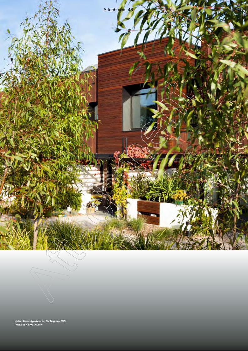
3 3
Heller Street Apartments, Six Degrees, VIC Image by Chloe O’Loan
Atta
chm
ent
Attachment 43 76
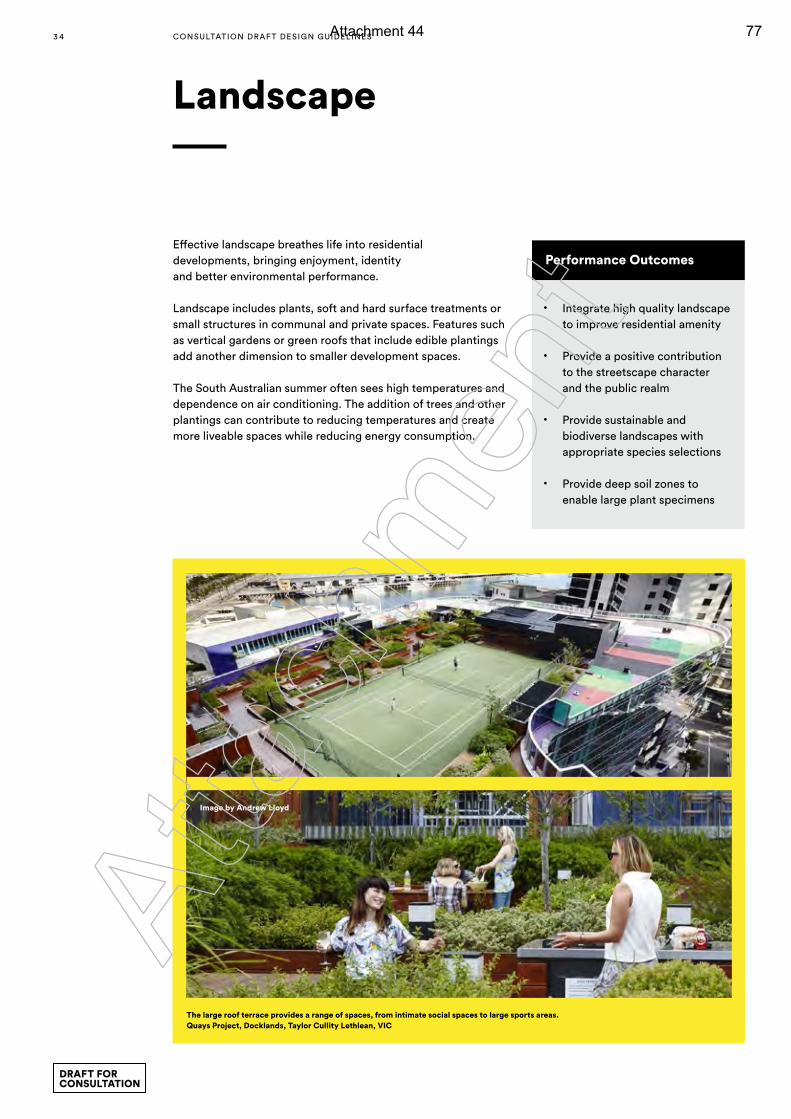
Landscape
Performance Outcomes
• Integrate high quality landscape to improve residential amenity
• Provide a positive contribution to the streetscape character and the public realm
• Provide sustainable and biodiverse landscapes with appropriate species selections
• Provide deep soil zones to enable large plant specimens
Effective landscape breathes life into residential developments, bringing enjoyment, identity and better environmental performance.
Landscape includes plants, soft and hard surface treatments or small structures in communal and private spaces. Features such as vertical gardens or green roofs that include edible plantings add another dimension to smaller development spaces.
The South Australian summer often sees high temperatures and dependence on air conditioning. The addition of trees and other plantings can contribute to reducing temperatures and create more liveable spaces while reducing energy consumption.
Image by Andrew Lloyd
The large roof terrace provides a range of spaces, from intimate social spaces to large sports areas. Quays Project, Docklands, Taylor Cullity Lethlean, VIC
3 4 CONSULTATION DRAF T DESIGN GUIDELINES
DRAFT FOR CONSULTATION
Atta
chm
ent
Attachment 44 77
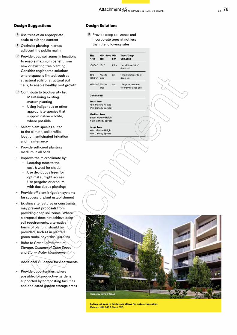
Design Suggestions
Use trees of an appropriate scale to suit the context
Optimise planting in areas adjacent the public realm
Provide deep soil zones in locations to enable maximum benefit from new or existing tree planting. Consider engineered solutions where space is limited, such as structural soils or structural soil cells, to enable healthy root growth
Contribute to biodiversity by: — Maintaining existing
mature planting — Using indigenous or other
appropriate species that support native wildlife, where possible
• Select plant species suited to the climate, soil profile, location, anticipated irrigation and maintenance
• Provide sufficient planting medium in all beds
• Improve the microclimate by: — Locating trees to the
east & west for shade — Use deciduous trees for
optimal sunlight access — Use pergolas or arbours
with deciduous plantings
• Provide efficient irrigation systems for successful plant establishment
• Existing site features or constraints may prevent proposals from providing deep soil zones. Where a proposal does not achieve deep soil requirements, alternative forms of planting should be provided, such as in planters, green roofs, or vertical gardens
• Refer to Green Infrastructure, Storage, Communal Open Space and Storm Water Management
Additional Guidance for Apartments
• Provide opportunities, where possible, for productive gardens supported by composting facilities and dedicated garden storage areas
Design Solutions
Provide deep soil zones and incorporate trees at not less than the following rates:
Site Area
Min. deep soil
Min. dim
Trees/Deep Soil Zone
<300m2 10m2 1.5m 1 small tree/10m2 deep soil
300-1500m2
7% site area
3m 1 medium tree/30m2 deep soil
>1500m2 7% site area
6m 1 large or medium tree/60m2 deep soil
Definitions:
Small Tree<6m Mature Height <4m Canopy Spread
Medium Tree6-12m Mature Height 4-8m Canopy Spread
Large Tree>12m Mature Height >8m Canopy Spread
A deep soil zone in this terrace allows for mature vegetation. Malvern Hill, SJB & Tract, VIC
Image by Simon Wood
3 5O P E N S P A C E & L A N D S C A P E
Atta
chm
ent
Attachment 45 78
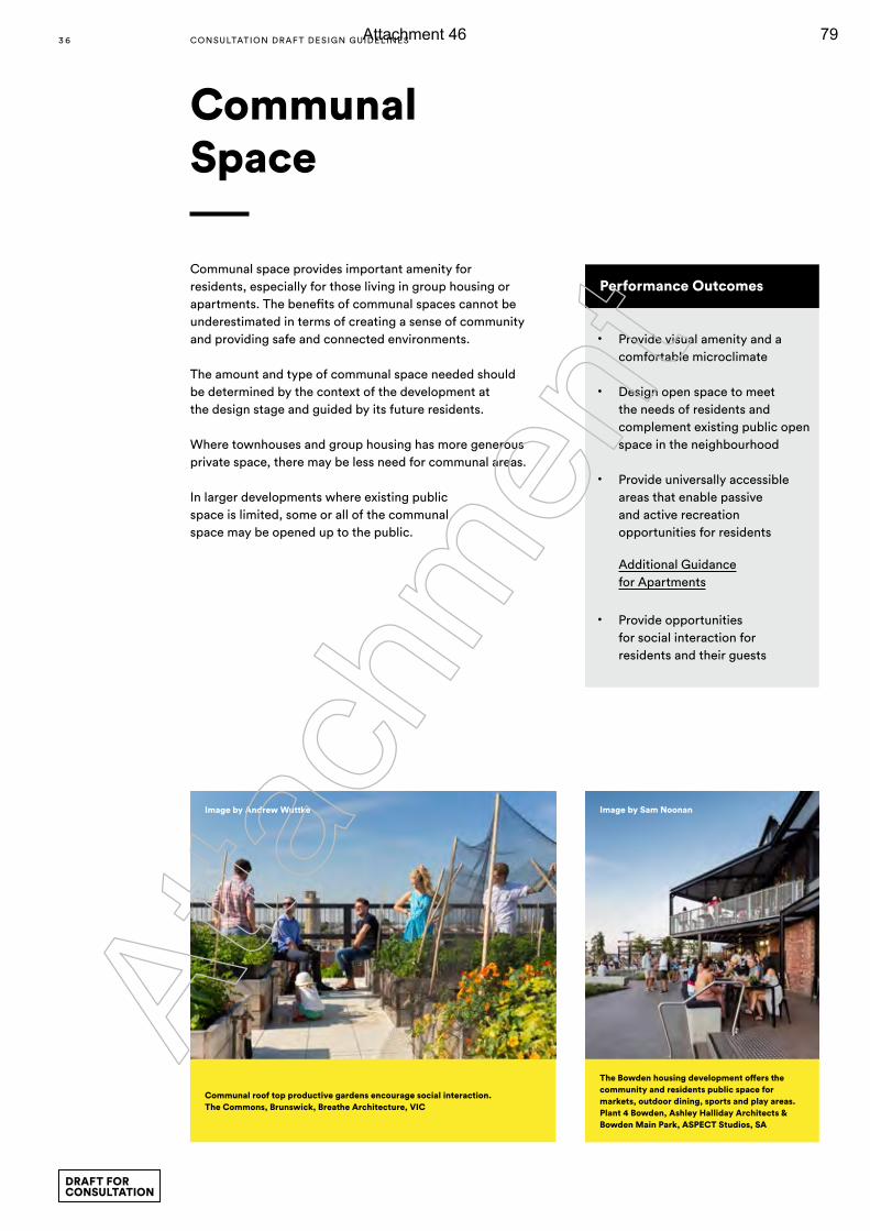
Communal Space
Performance Outcomes
• Provide visual amenity and a comfortable microclimate
• Design open space to meet the needs of residents and complement existing public open space in the neighbourhood
• Provide universally accessible areas that enable passive and active recreation opportunities for residents
Additional Guidance for Apartments
• Provide opportunities for social interaction for residents and their guests
Communal space provides important amenity for residents, especially for those living in group housing or apartments. The benefits of communal spaces cannot be underestimated in terms of creating a sense of community and providing safe and connected environments.
The amount and type of communal space needed should be determined by the context of the development at the design stage and guided by its future residents.
Where townhouses and group housing has more generous private space, there may be less need for communal areas.
In larger developments where existing public space is limited, some or all of the communal space may be opened up to the public.
The Bowden housing development offers the community and residents public space for markets, outdoor dining, sports and play areas. Plant 4 Bowden, Ashley Halliday Architects & Bowden Main Park, ASPECT Studios, SA
Image by Sam Noonan
Communal roof top productive gardens encourage social interaction. The Commons, Brunswick, Breathe Architecture, VIC
Image by Andrew Wuttke
3 6 CONSULTATION DRAF T DESIGN GUIDELINES
DRAFT FOR CONSULTATION
Atta
chm
ent
Attachment 46 79
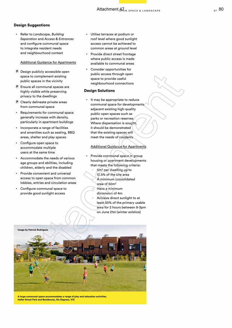
Design Suggestions
• Refer to Landscape, Building Separation and Access & Entrances and configure communal space to integrate resident needs and neighbourhood context
Additional Guidance for Apartments
Design publicly accessible open space to complement existing public spaces in the vicinity
Ensure all communal spaces are highly visible while preserving privacy to the dwellings
Clearly delineate private areas from communal space
• Requirements for communal space generally increase with density, particularly in apartment buildings
• Incorporate a range of facilities and amenities such as seating, BBQ areas, shelter and play spaces
• Configure open space to accommodate multiple users at the same time
• Accommodate the needs of various age groups and abilities, including children, elderly and the disabled
• Provide convenient and universal access to open space from common lobbies, entries and circulation areas
• Configure communal space to provide good sunlight access
• Utilise terraces at podium or roof level where good sunlight access cannot be achieved to common areas at ground level
• Provide direct street frontage where public access is made available to communal areas
• Consider opportunities for public access through open space to provide useful neighbourhood connections
Design Solutions
• It may be appropriate to reduce communal space for developments adjacent existing high-quality public open spaces such as parks or recreation reserves. Where dispensation is sought, it should be demonstrated that the existing spaces will meet the needs of residents
Additional Guidance for Apartments
• Provide communal space in group housing or apartment developments that meets the following criteria:
— 5m2 per dwelling up to 12.5% of the site area
— A minimum consolidated area of 50m2
— Have a minimum dimension of 4m
— Achieve direct sunlight to at least 50% of the primary usable area for 2 hours between 9-3pm on June 21st (winter solstice)
Image by Patrick Rodriguez
A large communal space accommodates a range of play and relaxation activities. Heller Street Park and Residences, Six Degrees, VIC
3 7O P E N S P A C E & L A N D S C A P E
Atta
chm
ent
Attachment 47 80
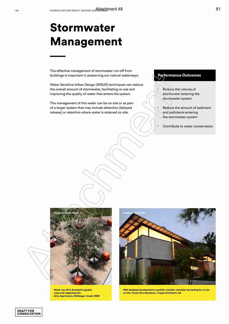
Stormwater Management
Performance Outcomes
• Reduce the volume of stormwater entering the stormwater system
• Reduce the amount of sediment and pollutants entering the stormwater system
• Contribute to water conservation
The effective management of stormwater run-off from buildings is important in preserving our natural waterways.
Water Sensitive Urban Design (WSUD) techniques can reduce the overall amount of stormwater, facilitating re-use and improving the quality of water that enters the system.
The management of this water can be on site or as part of a larger system that may include detention (delayed release) or retention where water is retained on site.
Well designed developments carefully consider rainwater harvesting for re-use on site. Creek Chic Residence, Troppo Architects, SA
Water run-off is directed to garden areas and vegetated pits. Airia Apartments, McGregor Coxall, NSW
Image by Jamie GillImage by Simon Wood
3 8 CONSULTATION DRAF T DESIGN GUIDELINES
DRAFT FOR CONSULTATION
Atta
chm
ent
Attachment 48 81
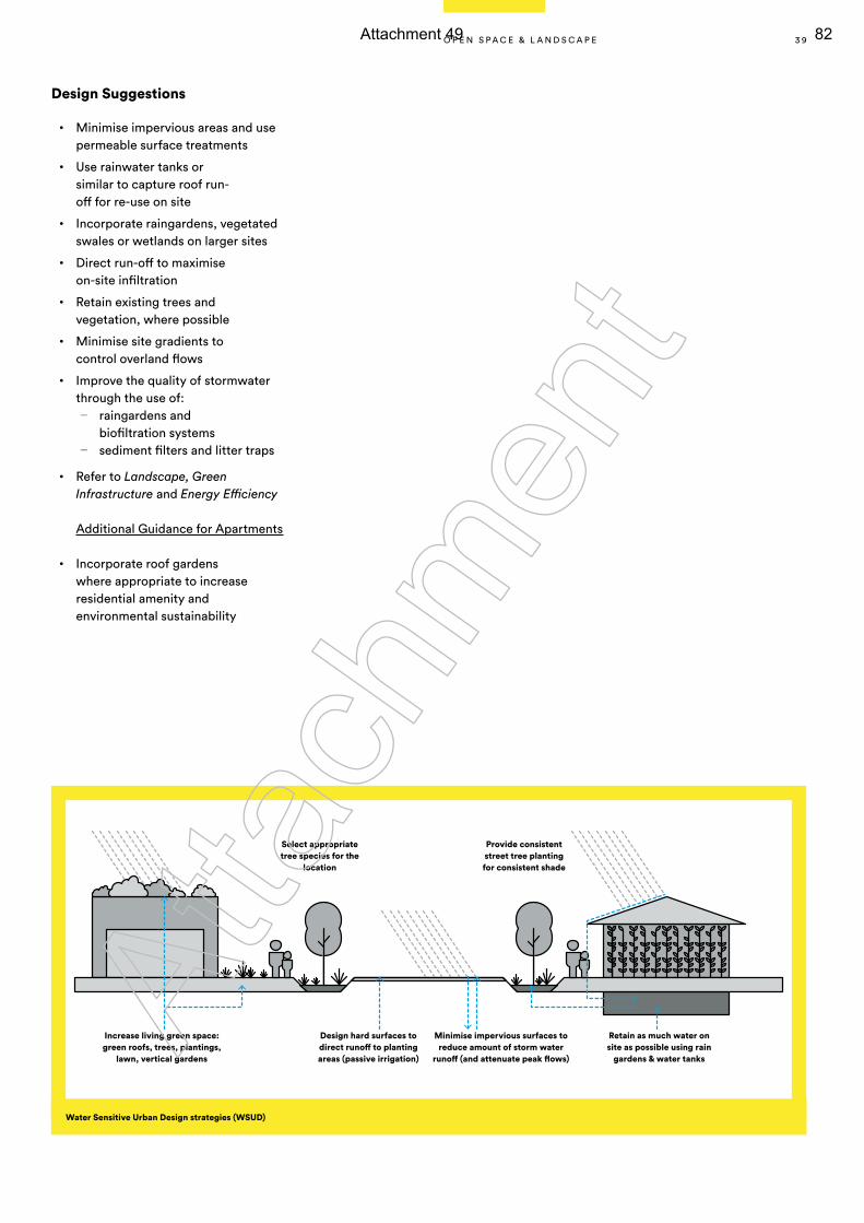
Design Suggestions
• Minimise impervious areas and use permeable surface treatments
• Use rainwater tanks or similar to capture roof run-off for re-use on site
• Incorporate raingardens, vegetated swales or wetlands on larger sites
• Direct run-off to maximise on-site infiltration
• Retain existing trees and vegetation, where possible
• Minimise site gradients to control overland flows
• Improve the quality of stormwater through the use of:
— raingardens and biofiltration systems
— sediment filters and litter traps
• Refer to Landscape, Green Infrastructure and Energy Efficiency
Additional Guidance for Apartments
• Incorporate roof gardens where appropriate to increase residential amenity and environmental sustainability
Increase living green space: green roofs, trees, plantings,
lawn, vertical gardens
Select appropriate tree species for the
location
Provide consistent street tree planting for consistent shade
Design hard surfaces to direct runoff to planting areas (passive irrigation)
Retain as much water on site as possible using rain
gardens & water tanks
Minimise impervious surfaces to reduce amount of storm water
runoff (and attenuate peak flows)
Water Sensitive Urban Design strategies (WSUD)
3 9O P E N S P A C E & L A N D S C A P E
Atta
chm
ent
Attachment 49 82
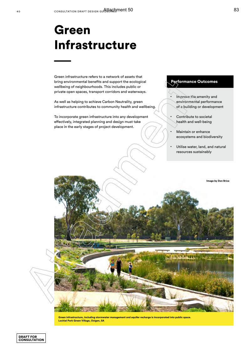
Green Infrastructure
Performance Outcomes
• Improve the amenity and environmental performance of a building or development
• Contribute to societal health and well-being
• Maintain or enhance ecosystems and biodiversity
• Utilise water, land, and natural resources sustainably
Green infrastructure refers to a network of assets that bring environmental benefits and support the ecological wellbeing of neighbourhoods. This includes public or private open spaces, transport corridors and waterways.
As well as helping to achieve Carbon Neutrality, green infrastructure contributes to community health and wellbeing.
To incorporate green infrastructure into any development effectively, integrated planning and design must take place in the early stages of project development.
Green infrastructure, including stormwater management and aquifer recharge is incorporated into public space.Lochiel Park Green Village, Oxigen, SA
Image by Don Brice
4 0 CONSULTATION DRAF T DESIGN GUIDELINES
DRAFT FOR CONSULTATION
Atta
chm
ent
Attachment 50 83
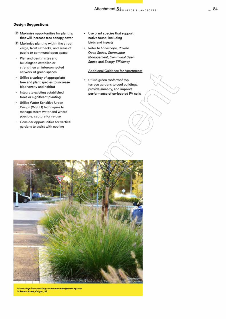
Design Suggestions
Maximise opportunities for planting that will increase tree canopy cover
Maximise planting within the street verge, front setbacks, and areas of public or communal open space
• Plan and design sites and buildings to establish or strengthen an interconnected network of green spaces
• Utilise a variety of appropriate tree and plant species to increase biodiversity and habitat
• Integrate existing established trees or significant planting
• Utilise Water Sensitive Urban Design (WSUD) techniques to manage storm water and where possible, capture for re-use
• Consider opportunities for vertical gardens to assist with cooling
• Use plant species that support native fauna, including birds and insects
• Refer to Landscape, Private Open Space, Stormwater Management, Communal Open Space and Energy Efficiency
Additional Guidance for Apartments
• Utilise green roofs/roof top terrace gardens to cool buildings, provide amenity, and improve performance of co-located PV cells
Street verge incorporating stormwater management system. St Peters Street, Oxigen, SA
Image by Oxigen
4 1O P E N S P A C E & L A N D S C A P E
Atta
chm
ent
Attachment 51 84
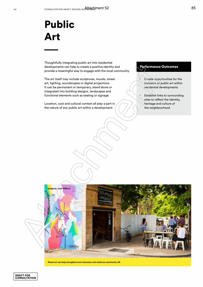
Thoughtfully integrating public art into residential developments can help to create a positive identity and provide a meaningful way to engage with the local community.
The art itself may include sculptures, murals, street art, lighting, soundscapes or digital projections. It can be permanent or temporary, stand alone or integrated into building designs, landscapes and functional elements such as seating or signage.
Location, cost and cultural context all play a part in the nature of any public art within a development.
Public Art
Performance Outcomes
• Create opportunities for the inclusion of public art within residential developments
• Establish links to surrounding sites to reflect the identity, heritage and culture of the neighbourhood
Street art can help strengthen local character and reinforce community, SA
Image by Josie Withers
4 2 CONSULTATION DRAF T DESIGN GUIDELINES
DRAFT FOR CONSULTATION
Atta
chm
ent
Attachment 52 85
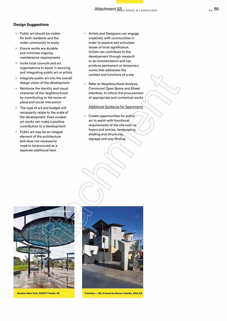
Design Suggestions
• Public art should be visible for both residents and the wider community to enjoy
• Ensure works are durable and minimise ongoing maintenance requirements
• Invite local councils and art organisations to assist in sourcing and integrating public art or artists
• Integrate public art into the overall design vision of the development
• Reinforce the identity and visual character of the neighbourhood by contributing to the sense of place and social interaction
• The type of art and budget will necessarily relate to the scale of the development. Even modest art works can make a positive contribution to a development.
• Public art may be an integral element of the architecture and does not necessarily need to be procured as a separate additional item
• Artists and Designers can engage creatively with communities in order to explore and articulate issues of local significance. Artists can contribute to the development through research or as commentators and can produce permanent or temporary works that addresses the context and functions of a site
• Refer to Neighbourhood Analysis, Communal Open Space and Street Interface, to inform the procurement of appropriate and contextual works
Additional Guidance for Apartments
• Create opportunities for public art to assist with functional requirements of the site such as foyers and entries, landscaping, shading and structures, signage and way-finding
Transition... 109, Artwork by Steven Cybulka, 2015, SABowden Main Park, ASPECT Studio, SA
Image by Sam Noonan
4 3O P E N S P A C E & L A N D S C A P E
Atta
chm
ent
Attachment 53 86
Building design has the ability to affect performance, affordability and sustainability, no matter the household type or scale. Elements of effective building design include: room dimensions, access to daylight, natural ventilation, outlook, visual and acoustic privacy, storage, indoor and outdoor space and ease of access for anyone entering.
The key to achieving effective building design is understanding the relationships between these elements and using them to create positive living environments.
Building Design
4 4 CONSULTATION DRAF T DESIGN GUIDELINES
DRAFT FOR CONSULTATION
Atta
chm
ent
Attachment 54 87
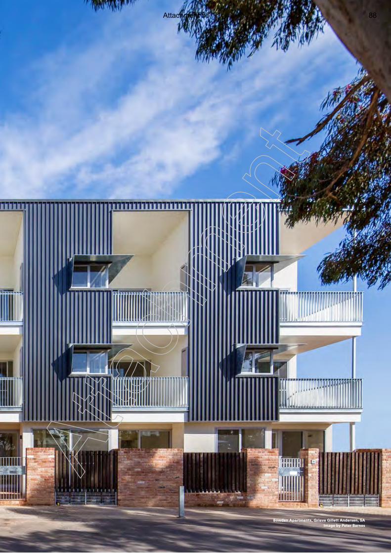
4 5
Bowden Apartments, Grieve Gillett Andersen, SA Image by Peter Barnes
Atta
chm
ent
Attachment 55 88
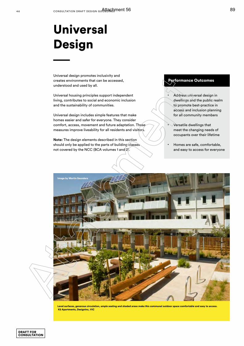
Universal Design
Performance Outcomes
• Address universal design in dwellings and the public realm to promote best-practice in access and inclusion planning for all community members
• Versatile dwellings that meet the changing needs of occupants over their lifetime
• Homes are safe, comfortable, and easy to access for everyone
Universal design promotes inclusivity and creates environments that can be accessed, understood and used by all.
Universal housing principles support independent living, contributes to social and economic inclusion and the sustainability of communities.
Universal design includes simple features that make homes easier and safer for everyone. They consider comfort, access, movement and future adaptation. These measures improve liveability for all residents and visitors.
Note: The design elements described in this section should only be applied to the parts of building classes not covered by the NCC (BCA volumes 1 and 2).
Level surfaces, generous circulation, ample seating and shaded areas make this communal outdoor space comfortable and easy to access. K2 Apartments, DesignInc, VIC
Image by Martin Saunders
4 6 CONSULTATION DRAF T DESIGN GUIDELINES
DRAFT FOR CONSULTATION
Atta
chm
ent
Attachment 56 89
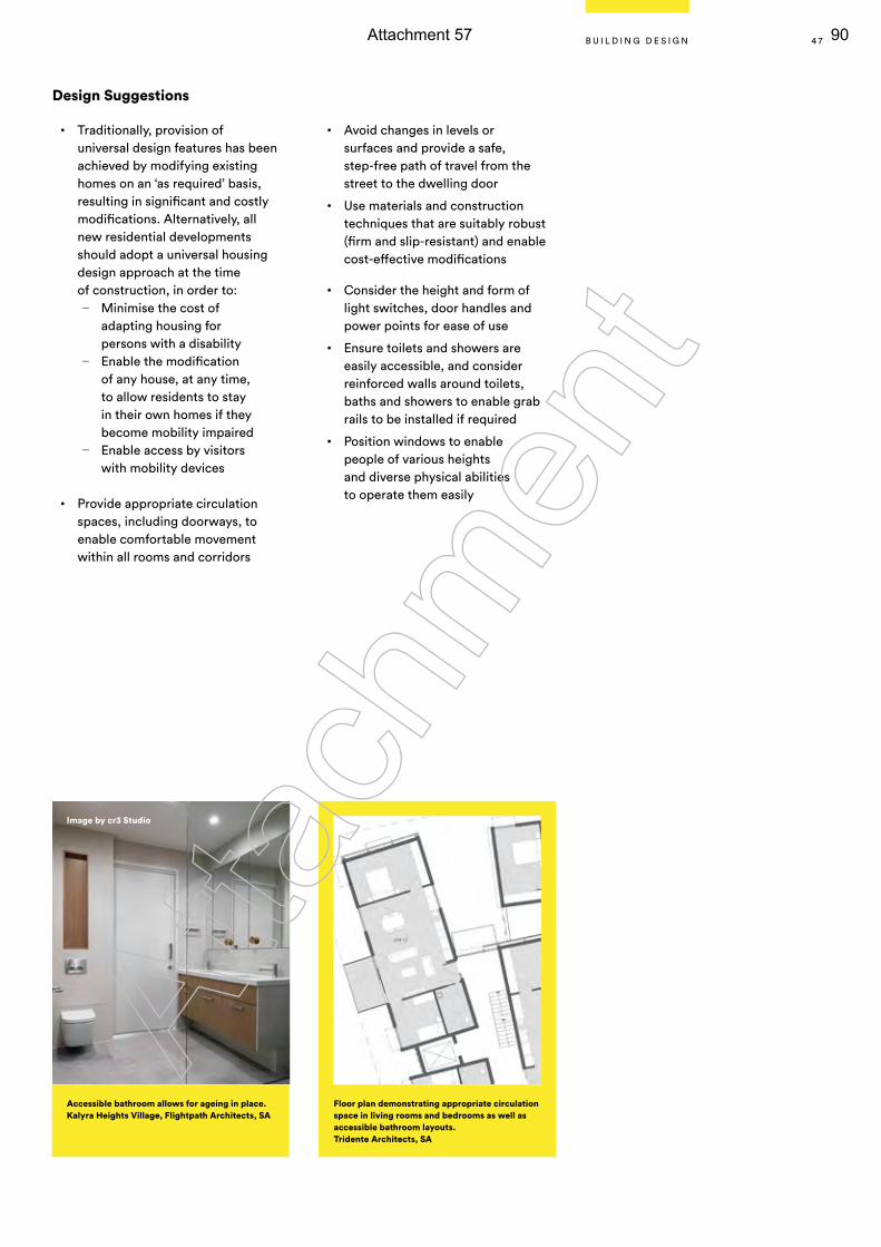
Design Suggestions
• Traditionally, provision of universal design features has been achieved by modifying existing homes on an ‘as required’ basis, resulting in significant and costly modifications. Alternatively, all new residential developments should adopt a universal housing design approach at the time of construction, in order to:
— Minimise the cost of adapting housing for persons with a disability
— Enable the modification of any house, at any time, to allow residents to stay in their own homes if they become mobility impaired
— Enable access by visitors with mobility devices
• Provide appropriate circulation spaces, including doorways, to enable comfortable movement within all rooms and corridors
• Avoid changes in levels or surfaces and provide a safe, step-free path of travel from the street to the dwelling door
• Use materials and construction techniques that are suitably robust (firm and slip-resistant) and enable cost-effective modifications
• Consider the height and form of light switches, door handles and power points for ease of use
• Ensure toilets and showers are easily accessible, and consider reinforced walls around toilets, baths and showers to enable grab rails to be installed if required
• Position windows to enable people of various heights and diverse physical abilities to operate them easily
Accessible bathroom allows for ageing in place. Kalyra Heights Village, Flightpath Architects, SA
Floor plan demonstrating appropriate circulation space in living rooms and bedrooms as well as accessible bathroom layouts. Tridente Architects, SA
Image by cr3 Studio
4 7B U I L D I N G D E S I G N
Atta
chm
ent
Attachment 57 90
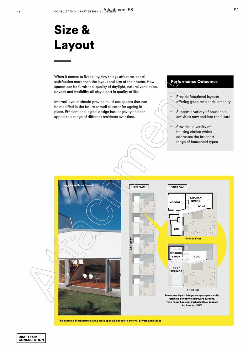
When it comes to liveability, few things affect residents’ satisfaction more than the layout and size of their home. How spaces can be furnished, quality of daylight, natural ventilation, privacy and flexibility all play a part in quality of life.
Internal layouts should provide multi-use spaces that can be modified in the future as well as cater for ageing in place. Efficient and logical design has longevity and can appeal to a range of different residents over time.
Performance Outcomes
• Provide functional layouts offering good residential amenity
• Support a variety of household activities now and into the future
• Provide a diversity of housing choice which addresses the broadest range of household types
Size & Layout
LAN
EWA
Y
SITE PLANImage by Anthony Browel
This example demonstrates living areas opening directly to external private open space
Row house layout integrates open space while retaining privacy to courtyard gardens.
Twin Peaks housing, Durbach Block Jaggers Architects, NSW
Ground Floor
First Floor
BEDROOM STUDY
ROOF TERRACE
VOID
KITCHEN DININGGARAGE
BED
LIVING
FLOOR PLAN
4 8 CONSULTATION DRAF T DESIGN GUIDELINES
DRAFT FOR CONSULTATION
Atta
chm
ent
Attachment 58 91
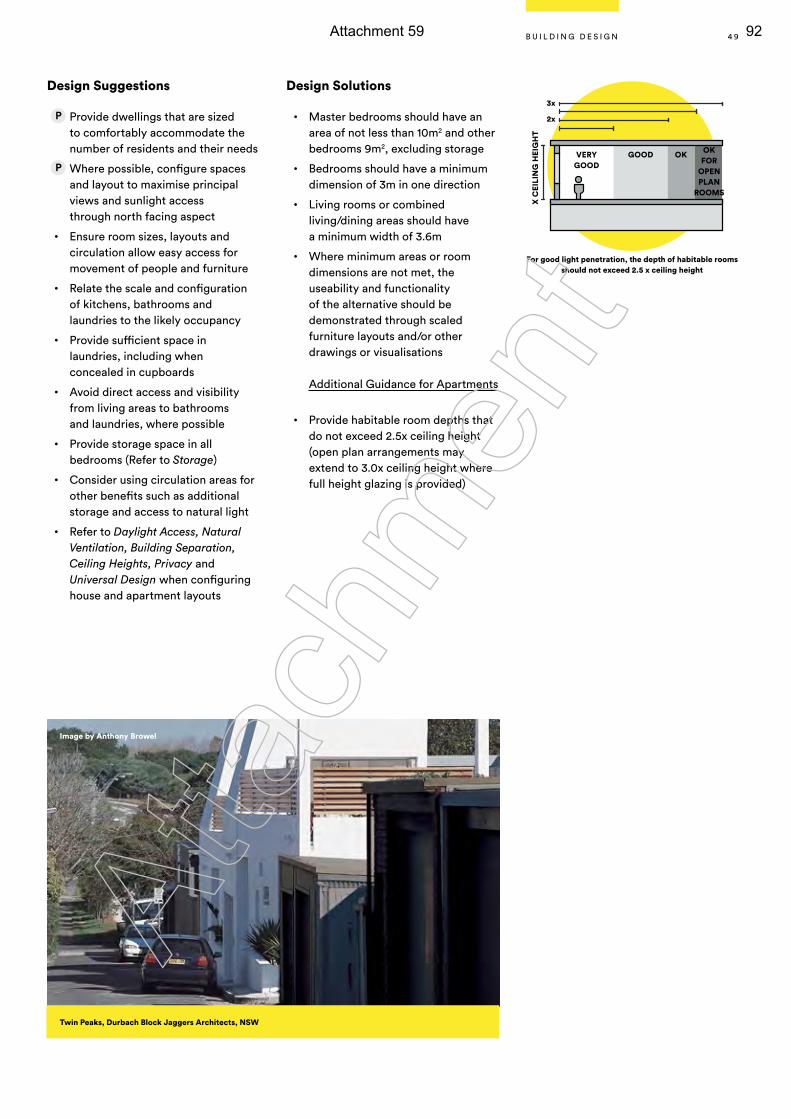
Design Suggestions
Provide dwellings that are sized to comfortably accommodate the number of residents and their needs
Where possible, configure spaces and layout to maximise principal views and sunlight access through north facing aspect
• Ensure room sizes, layouts and circulation allow easy access for movement of people and furniture
• Relate the scale and configuration of kitchens, bathrooms and laundries to the likely occupancy
• Provide sufficient space in laundries, including when concealed in cupboards
• Avoid direct access and visibility from living areas to bathrooms and laundries, where possible
• Provide storage space in all bedrooms (Refer to Storage)
• Consider using circulation areas for other benefits such as additional storage and access to natural light
• Refer to Daylight Access, Natural Ventilation, Building Separation, Ceiling Heights, Privacy and Universal Design when configuring house and apartment layouts
Design Solutions
• Master bedrooms should have an area of not less than 10m2 and other bedrooms 9m2, excluding storage
• Bedrooms should have a minimum dimension of 3m in one direction
• Living rooms or combined living/dining areas should have a minimum width of 3.6m
• Where minimum areas or room dimensions are not met, the useability and functionality of the alternative should be demonstrated through scaled furniture layouts and/or other drawings or visualisations
Additional Guidance for Apartments
• Provide habitable room depths that do not exceed 2.5x ceiling height (open plan arrangements may extend to 3.0x ceiling height where full height glazing is provided)
Image by Anthony Browel
For good light penetration, the depth of habitable rooms should not exceed 2.5 x ceiling height
VERYGOOD
GOOD OK OKFOR
OPENPLAN
ROOMS
2x
3x
X C
EILI
NG
HEI
GH
T
Twin Peaks, Durbach Block Jaggers Architects, NSW
4 9B U I L D I N G D E S I G N
Atta
chm
ent
Attachment 59 92
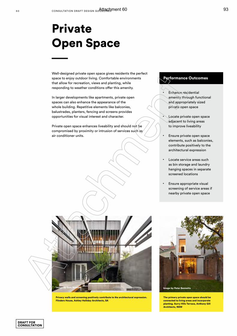
Well-designed private open space gives residents the perfect space to enjoy outdoor living. Comfortable environments that allow for recreation, views and planting, while responding to weather conditions offer this amenity.
In larger developments like apartments, private open spaces can also enhance the appearance of the whole building. Repetitive elements like balconies, balustrades, planters, fencing and screens provides opportunities for visual interest and character.
Private open space enhances liveability and should not be compromised by proximity or intrusion of services such as air conditioner units.
Private Open Space
Performance Outcomes
• Enhance residential amenity through functional and appropriately sized private open space
• Locate private open space adjacent to living areas to improve liveability
• Ensure private open space elements, such as balconies, contribute positively to the architectural expression
• Locate service areas such as bin storage and laundry hanging spaces in separate screened locations
• Ensure appropriate visual screening of service areas if nearby private open space
The primary private open space should be connected to living areas and incorporate planting. Surry Hills Terrace, Anthony Gill Architects, NSW
Privacy walls and screening positively contribute to the architectural expression. Flinders House, Ashley Halliday Architects, SA
Image by Peter BennettsImage by Sam Noonan
5 0 CONSULTATION DRAF T DESIGN GUIDELINES
DRAFT FOR CONSULTATION
Atta
chm
ent
Attachment 60 93
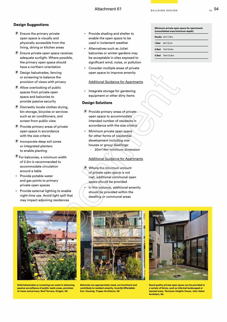
Design Suggestions
Ensure the primary private open space is visually and physically accessible from the living, dining or kitchen areas
Ensure private open space receives adequate sunlight. Where possible, the primary open space should have a northern orientation
Design balustrades, fencing or screening to balance the provision of views with privacy
Allow overlooking of public spaces from private open space and balconies to provide passive security
Discreetly locate clothes drying, bin storage, bicycles or services such as air conditioners, and screen from public view
Provide primary areas of private open space in accordance with the size criteria
Incorporate deep soil zones or integrated planters to enable planting
For balconies, a minimum width of 2.2m is recommended to accommodate circulation around a table
• Provide potable water and gas points to primary private open spaces
• Provide external lighting to enable night time use. Avoid light spill that may impact adjoining residences
• Provide shading and shelter to enable the open space to be used in inclement weather
• Alternatives such as Juliet balconies or winter-gardens may be acceptable in sites exposed to significant wind, noise, or pollution
• Consider multiple areas of private open space to improve amenity
Additional Guidance for Apartments
• Integrate storage for gardening equipment or other dirty items
Design Solutions
Provide primary areas of private open space to accommodate intended number of residents in accordance with the size criteria
• Minimum private open space for other forms of residential development including row houses or group dwellings:
— 20m2/4m minimum dimension
Additional Guidance for Apartments
Where the minimum amount of private open space is not met, additional communal open space should be provided
• In this instance, additional amenity should be provided within the dwelling or communal areas
Solid balustrades or screening can assist in balancing passive surveillance of public realm areas, provision of views and privacy. Roof Terrace, Oxigen, SA
Balconies are appropriately sized, are functional and contribute to resident amenity. Invaritji Affordable Eco- Housing, Troppo Architects, SA
Good quality private open space can be provided in a variety of forms, such as informal landscaped or lawned areas. Tennyson Heights House, John Adam Architect, SA
Image by John Adam
Minimum private open space for apartments (consolidated area/minimum depth)
Studio 4m2/1.8m
1 Bed 8m2/2.1m
2 Bed 11m2/2.4m
3 Bed 15m2/2.6m
5 1B U I L D I N G D E S I G N
Atta
chm
ent
Attachment 61 94
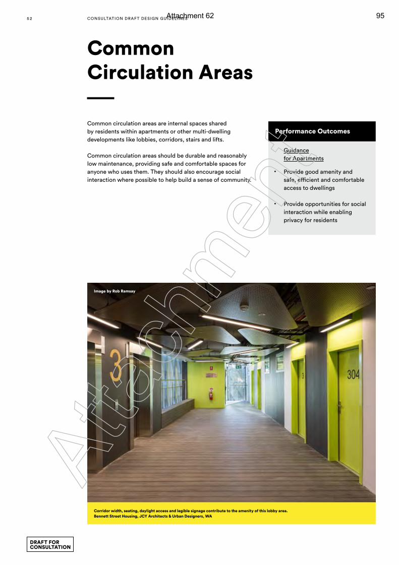
Common Circulation Areas
Performance Outcomes
Guidance for Apartments
• Provide good amenity and safe, efficient and comfortable access to dwellings
• Provide opportunities for social interaction while enabling privacy for residents
Common circulation areas are internal spaces shared by residents within apartments or other multi-dwelling developments like lobbies, corridors, stairs and lifts.
Common circulation areas should be durable and reasonably low maintenance, providing safe and comfortable spaces for anyone who uses them. They should also encourage social interaction where possible to help build a sense of community.
Corridor width, seating, daylight access and legible signage contribute to the amenity of this lobby area. Bennett Street Housing, JCY Architects & Urban Designers, WA
Image by Rob Ramsay
5 2 CONSULTATION DRAF T DESIGN GUIDELINES
DRAFT FOR CONSULTATION
Atta
chm
ent
Attachment 62 95
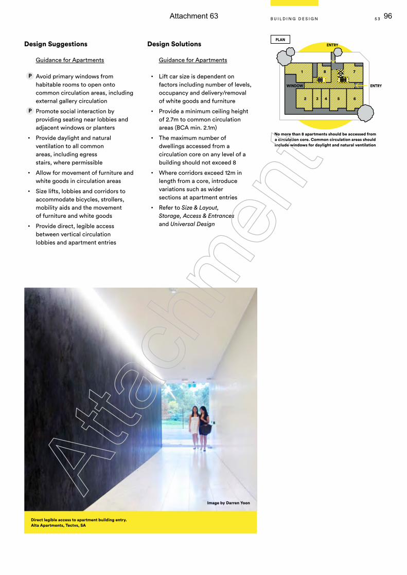
Design Suggestions
Guidance for Apartments
Avoid primary windows from habitable rooms to open onto common circulation areas, including external gallery circulation
Promote social interaction by providing seating near lobbies and adjacent windows or planters
• Provide daylight and natural ventilation to all common areas, including egress stairs, where permissible
• Allow for movement of furniture and white goods in circulation areas
• Size lifts, lobbies and corridors to accommodate bicycles, strollers, mobility aids and the movement of furniture and white goods
• Provide direct, legible access between vertical circulation lobbies and apartment entries
Design Solutions
Guidance for Apartments
• Lift car size is dependent on factors including number of levels, occupancy and delivery/removal of white goods and furniture
• Provide a minimum ceiling height of 2.7m to common circulation areas (BCA min. 2.1m)
• The maximum number of dwellings accessed from a circulation core on any level of a building should not exceed 8
• Where corridors exceed 12m in length from a core, introduce variations such as wider sections at apartment entries
• Refer to Size & Layout, Storage, Access & Entrances and Universal Design
Image by Darren Yoon
1 8 7
65
ENTRY
ENTRY
WINDOW
PLAN
432
No more than 8 apartments should be accessed from a circulation core. Common circulation areas should include windows for daylight and natural ventilation
Direct legible access to apartment building entry. Alta Apartments, Tectvs, SA
5 3B U I L D I N G D E S I G N
Atta
chm
ent
Attachment 63 96
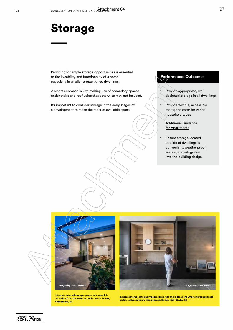
Storage
Performance Outcomes
• Provide appropriate, well designed storage in all dwellings
• Provide flexible, accessible storage to cater for varied household types
Additional Guidance for Apartments
• Ensure storage located outside of dwellings is convenient, weatherproof, secure, and integrated into the building design
Providing for ample storage opportunities is essential to the liveability and functionality of a home, especially in smaller proportioned dwellings.
A smart approach is key, making use of secondary spaces under stairs and roof voids that otherwise may not be used.
It’s important to consider storage in the early stages of a development to make the most of available space.
Images by David SieversImages by David Sievers
Integrate external storage space and ensure it is not visible from the street or public realm. Dunks, RAD-Studio, SA
Integrate storage into easily accessible areas and in locations where storage space is useful, such as primary living spaces. Dunks, RAD-Studio, SA
5 4 CONSULTATION DRAF T DESIGN GUIDELINES
DRAFT FOR CONSULTATION
Atta
chm
ent
Attachment 64 97
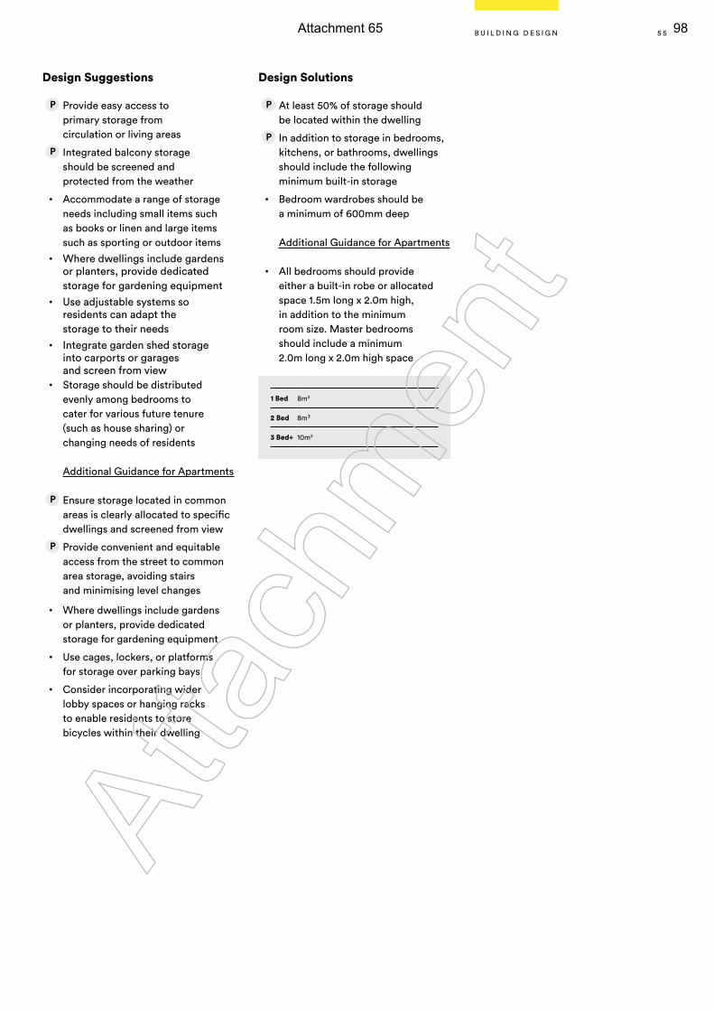
Design Suggestions
Provide easy access to primary storage from circulation or living areas
Integrated balcony storage should be screened and protected from the weather
• Accommodate a range of storage needs including small items such as books or linen and large items such as sporting or outdoor items
• Where dwellings include gardens or planters, provide dedicated storage for gardening equipment
• Use adjustable systems so residents can adapt the storage to their needs
• Integrate garden shed storage into carports or garages and screen from view
• Storage should be distributed evenly among bedrooms to cater for various future tenure (such as house sharing) or changing needs of residents
Additional Guidance for Apartments
Ensure storage located in common areas is clearly allocated to specific dwellings and screened from view
Provide convenient and equitable access from the street to common area storage, avoiding stairs and minimising level changes
• Where dwellings include gardens or planters, provide dedicated storage for gardening equipment
• Use cages, lockers, or platforms for storage over parking bays
• Consider incorporating wider lobby spaces or hanging racks to enable residents to store bicycles within their dwelling
Design Solutions
At least 50% of storage should be located within the dwelling
In addition to storage in bedrooms, kitchens, or bathrooms, dwellings should include the following minimum built-in storage
• Bedroom wardrobes should be a minimum of 600mm deep
Additional Guidance for Apartments
• All bedrooms should provide either a built-in robe or allocated space 1.5m long x 2.0m high, in addition to the minimum room size. Master bedrooms should include a minimum 2.0m long x 2.0m high space
1 Bed 8m3
2 Bed 8m³
3 Bed+ 10m3
5 5B U I L D I N G D E S I G N
Atta
chm
ent
Attachment 65 98
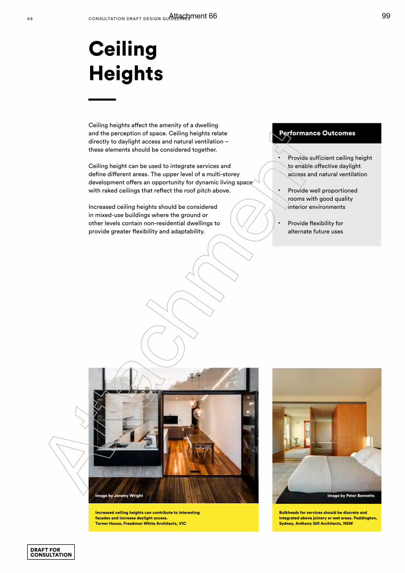
Ceiling Heights
Performance Outcomes
• Provide sufficient ceiling height to enable effective daylight access and natural ventilation
• Provide well proportioned rooms with good quality interior environments
• Provide flexibility for alternate future uses
Ceiling heights affect the amenity of a dwelling and the perception of space. Ceiling heights relate directly to daylight access and natural ventilation – these elements should be considered together.
Ceiling height can be used to integrate services and define different areas. The upper level of a multi-storey development offers an opportunity for dynamic living space with raked ceilings that reflect the roof pitch above.
Increased ceiling heights should be considered in mixed-use buildings where the ground or other levels contain non-residential dwellings to provide greater flexibility and adaptability.
Image by Jeremy Wright Image by Peter Bennetts
Increased ceiling heights can contribute to interesting facades and increase daylight access. Turner House, Freadman White Architects, VIC
Bulkheads for services should be discrete and integrated above joinery or wet areas. Paddington, Sydney, Anthony Gill Architects, NSW
5 6 CONSULTATION DRAF T DESIGN GUIDELINES
DRAFT FOR CONSULTATION
Atta
chm
ent
Attachment 66 99
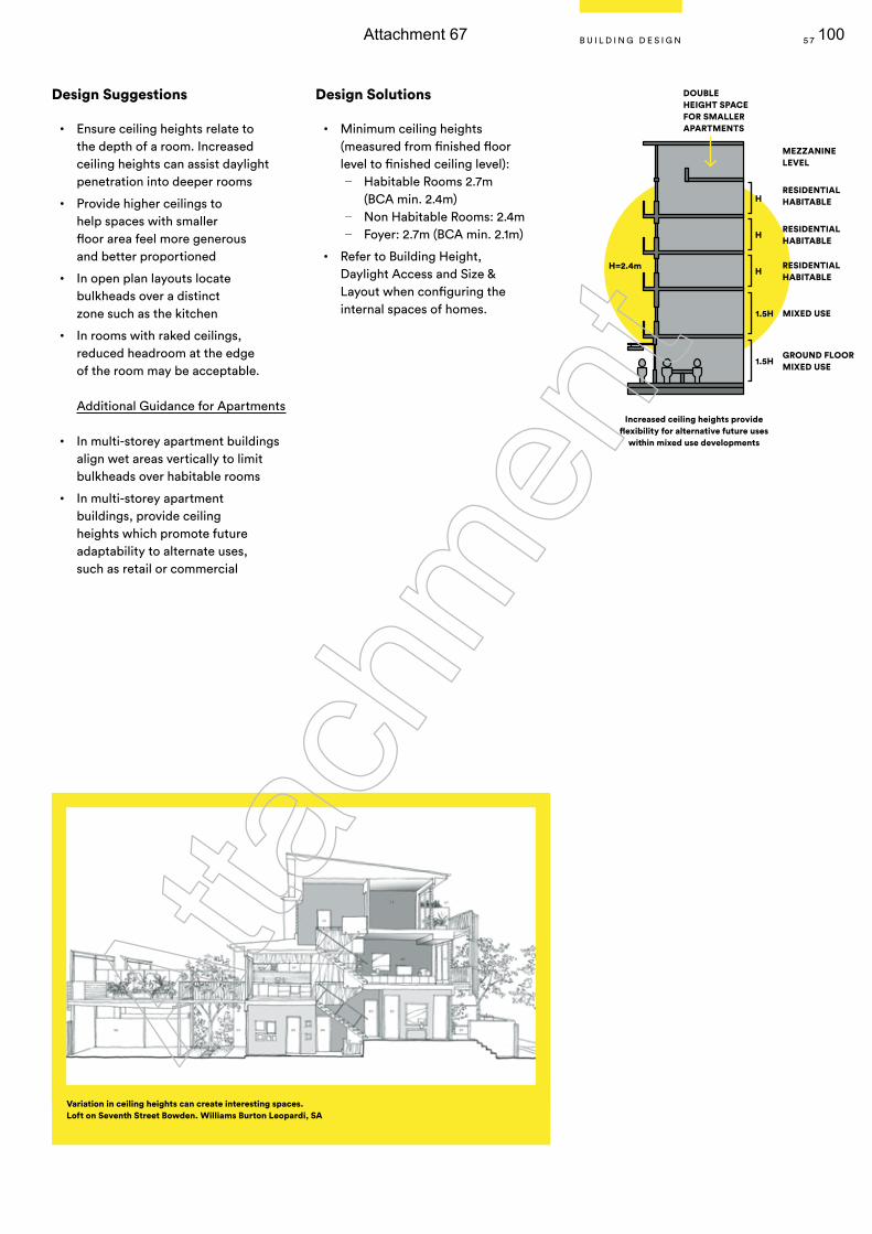
Design Suggestions
• Ensure ceiling heights relate to the depth of a room. Increased ceiling heights can assist daylight penetration into deeper rooms
• Provide higher ceilings to help spaces with smaller floor area feel more generous and better proportioned
• In open plan layouts locate bulkheads over a distinct zone such as the kitchen
• In rooms with raked ceilings, reduced headroom at the edge of the room may be acceptable.
Additional Guidance for Apartments
• In multi-storey apartment buildings align wet areas vertically to limit bulkheads over habitable rooms
• In multi-storey apartment buildings, provide ceiling heights which promote future adaptability to alternate uses, such as retail or commercial
Design Solutions
• Minimum ceiling heights (measured from finished floor level to finished ceiling level):
— Habitable Rooms 2.7m (BCA min. 2.4m)
— Non Habitable Rooms: 2.4m — Foyer: 2.7m (BCA min. 2.1m)
• Refer to Building Height, Daylight Access and Size & Layout when configuring the internal spaces of homes.
Variation in ceiling heights can create interesting spaces. Loft on Seventh Street Bowden. Williams Burton Leopardi, SA
Increased ceiling heights provide flexibility for alternative future uses
within mixed use developments
GROUND FLOORMIXED USE
MIXED USE
RESIDENTIALHABITABLE
RESIDENTIALHABITABLE
RESIDENTIALHABITABLE
H
MEZZANINE LEVEL
DOUBLE HEIGHT SPACE FOR SMALLER APARTMENTS
H
H
1.5H
1.5H
H
H=2.4m
5 7B U I L D I N G D E S I G N
Atta
chm
ent
Attachment 67 100
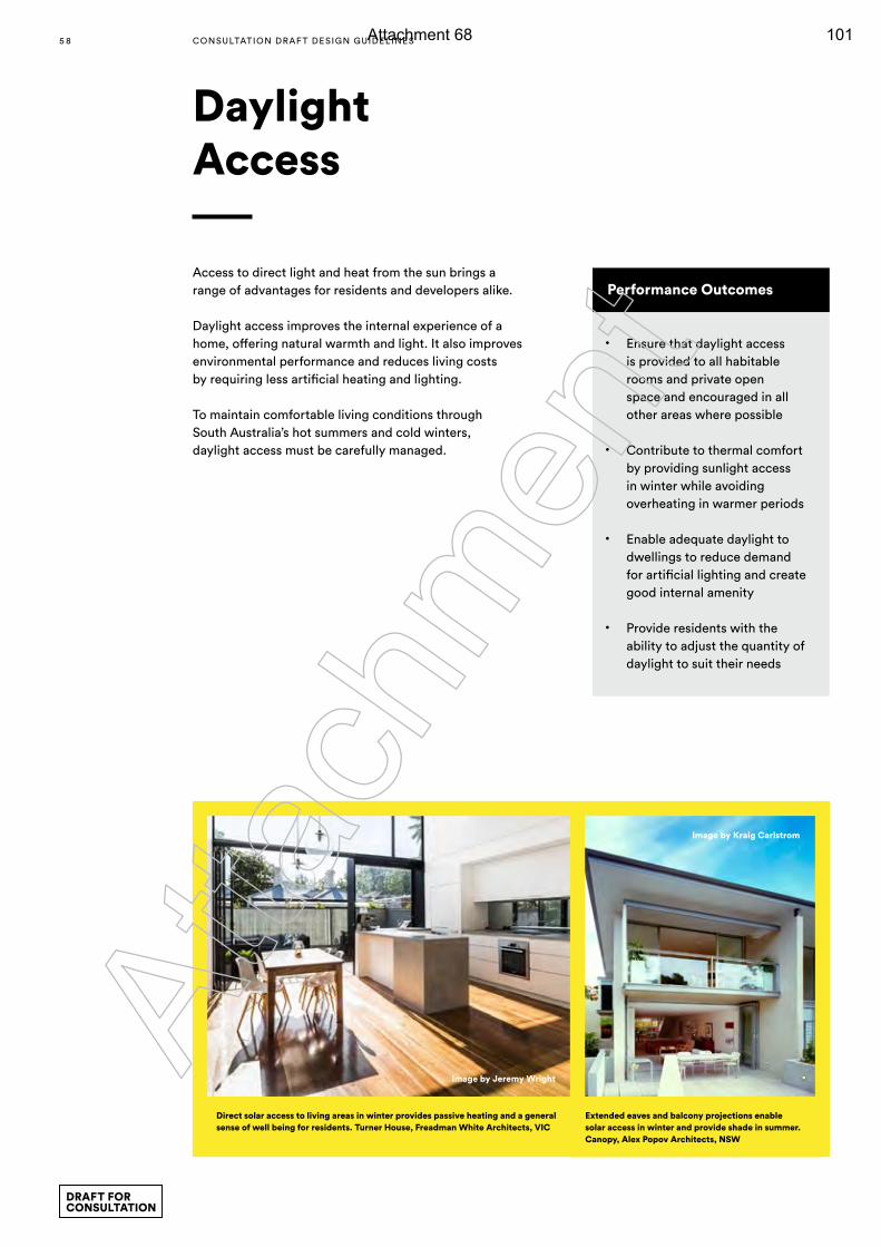
Access to direct light and heat from the sun brings a range of advantages for residents and developers alike.
Daylight access improves the internal experience of a home, offering natural warmth and light. It also improves environmental performance and reduces living costs by requiring less artificial heating and lighting.
To maintain comfortable living conditions through South Australia’s hot summers and cold winters, daylight access must be carefully managed.
Daylight Access
Performance Outcomes
• Ensure that daylight access is provided to all habitable rooms and private open space and encouraged in all other areas where possible
• Contribute to thermal comfort by providing sunlight access in winter while avoiding overheating in warmer periods
• Enable adequate daylight to dwellings to reduce demand for artificial lighting and create good internal amenity
• Provide residents with the ability to adjust the quantity of daylight to suit their needs
Image by Jeremy Wright
Image by Kraig Carlstrom
Direct solar access to living areas in winter provides passive heating and a general sense of well being for residents. Turner House, Freadman White Architects, VIC
Extended eaves and balcony projections enable solar access in winter and provide shade in summer. Canopy, Alex Popov Architects, NSW
5 8 CONSULTATION DRAF T DESIGN GUIDELINES
DRAFT FOR CONSULTATION
Atta
chm
ent
Attachment 68 101
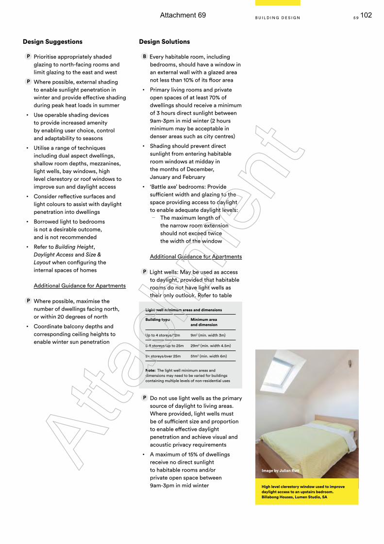
Design Solutions
Every habitable room, including bedrooms, should have a window in an external wall with a glazed area not less than 10% of its floor area
• Primary living rooms and private open spaces of at least 70% of dwellings should receive a minimum of 3 hours direct sunlight between 9am-3pm in mid winter (2 hours minimum may be acceptable in denser areas such as city centres)
• Shading should prevent direct sunlight from entering habitable room windows at midday in the months of December, January and February
• ‘Battle axe’ bedrooms: Provide sufficient width and glazing to the space providing access to daylight to enable adequate daylight levels:
— The maximum length of the narrow room extension should not exceed twice the width of the window
Additional Guidance for Apartments
Light wells: May be used as access to daylight, provided that habitable rooms do not have light wells as their only outlook. Refer to table
Do not use light wells as the primary source of daylight to living areas. Where provided, light wells must be of sufficient size and proportion to enable effective daylight penetration and achieve visual and acoustic privacy requirements
• A maximum of 15% of dwellings receive no direct sunlight to habitable rooms and/or private open space between 9am-3pm in mid winter
Design Suggestions
Prioritise appropriately shaded glazing to north-facing rooms and limit glazing to the east and west
Where possible, external shading to enable sunlight penetration in winter and provide effective shading during peak heat loads in summer
• Use operable shading devices to provide increased amenity by enabling user choice, control and adaptability to seasons
• Utilise a range of techniques including dual aspect dwellings, shallow room depths, mezzanines, light wells, bay windows, high level clerestory or roof windows to improve sun and daylight access
• Consider reflective surfaces and light colours to assist with daylight penetration into dwellings
• Borrowed light to bedrooms is not a desirable outcome, and is not recommended
• Refer to Building Height, Daylight Access and Size & Layout when configuring the internal spaces of homes
Additional Guidance for Apartments
Where possible, maximise the number of dwellings facing north, or within 20 degrees of north
• Coordinate balcony depths and corresponding ceiling heights to enable winter sun penetration
Image by Julian Rutt
Light well minimum areas and dimensions
Building type Minimum area and dimension
Up to 4 storeys/12m 9m2 (min. width 3m)
5-8 storeys/up to 25m 29m2 (min. width 4.5m)
9+ storeys/over 25m 51m2 (min. width 6m)
Note: The light well minimum areas and
dimensions may need to be varied for buildings containing multiple levels of non-residential uses
High level clerestory window used to improve daylight access to an upstairs bedroom.Billabong Houses, Lumen Studio, SA
5 9B U I L D I N G D E S I G N
Atta
chm
ent
Attachment 69 102
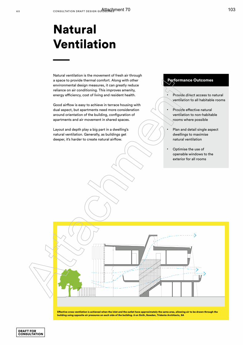
Natural ventilation is the movement of fresh air through a space to provide thermal comfort. Along with other environmental design measures, it can greatly reduce reliance on air conditioning. This improves amenity, energy efficiency, cost of living and resident health.
Good airflow is easy to achieve in terrace housing with dual aspect, but apartments need more consideration around orientation of the building, configuration of apartments and air movement in shared spaces.
Layout and depth play a big part in a dwelling’s natural ventilation. Generally, as buildings get deeper, it’s harder to create natural airflow.
Natural Ventilation
Effective cross ventilation is achieved when the inlet and the outlet have approximately the same area, allowing air to be drawn through the building using opposite air pressures on each side of the building. 6 on Sixth, Bowden, Tridente Architects, SA
Performance Outcomes
• Provide direct access to natural ventilation to all habitable rooms
• Provide effective natural ventilation to non-habitable rooms where possible
• Plan and detail single aspect dwellings to maximise natural ventilation
• Optimise the use of openable windows to the exterior for all rooms
6 0 CONSULTATION DRAF T DESIGN GUIDELINES
DRAFT FOR CONSULTATION
Atta
chm
ent
Attachment 70 103
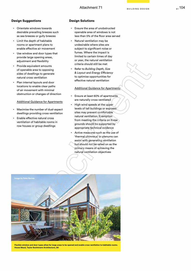
Design Suggestions
• Orientate windows towards desirable prevailing breezes such as sea breezes or gully breezes
• Limit the depth of habitable rooms or apartment plans to enable effective air movement
• Use window and door types that provide large opening areas, adjustment and flexibility
• Provide equivalent amounts of openable area to opposing sides of dwellings to generate natural cross ventilation
• Plan internal layouts and door locations to enable clear paths of air movement with minimal obstruction or changes of direction
Additional Guidance for Apartments
• Maximise the number of dual-aspect dwellings providing cross ventilation
• Enable effective natural cross ventilation of habitable rooms in row houses or group dwellings
Design Solutions
• Ensure the area of unobstructed openable area of windows is not less than 5% of the floor area served
• Natural ventilation may be undesirable where sites are subject to significant noise or fumes. Where the impact is limited to certain times of day or year, the natural ventilation criteria should still be met
• Refer to Building Depth, Size & Layout and Energy Efficiency to optimise opportunities for effective natural ventilation
Additional Guidance for Apartments
• Ensure at least 60% of apartments are naturally cross ventilated
• High wind speeds at the upper levels of tall buildings or exposed sites may prevent comfortable natural ventilation. Exemption from meeting the criteria on these grounds should be supported by appropriate technical evidence
• Active measures such as the use of ‘thermal chimneys’ or plenums can assist with generating ventilation but should not be relied on as the primary means of achieving the natural ventilation objectives
Flexible window and door types allow for large areas to be opened and enable cross ventilation to habitable rooms. House Maud, Taylor Buchtmann Architecture, SA
Image by Peter Barnes
6 1B U I L D I N G D E S I G N
Atta
chm
ent
Attachment 71 104
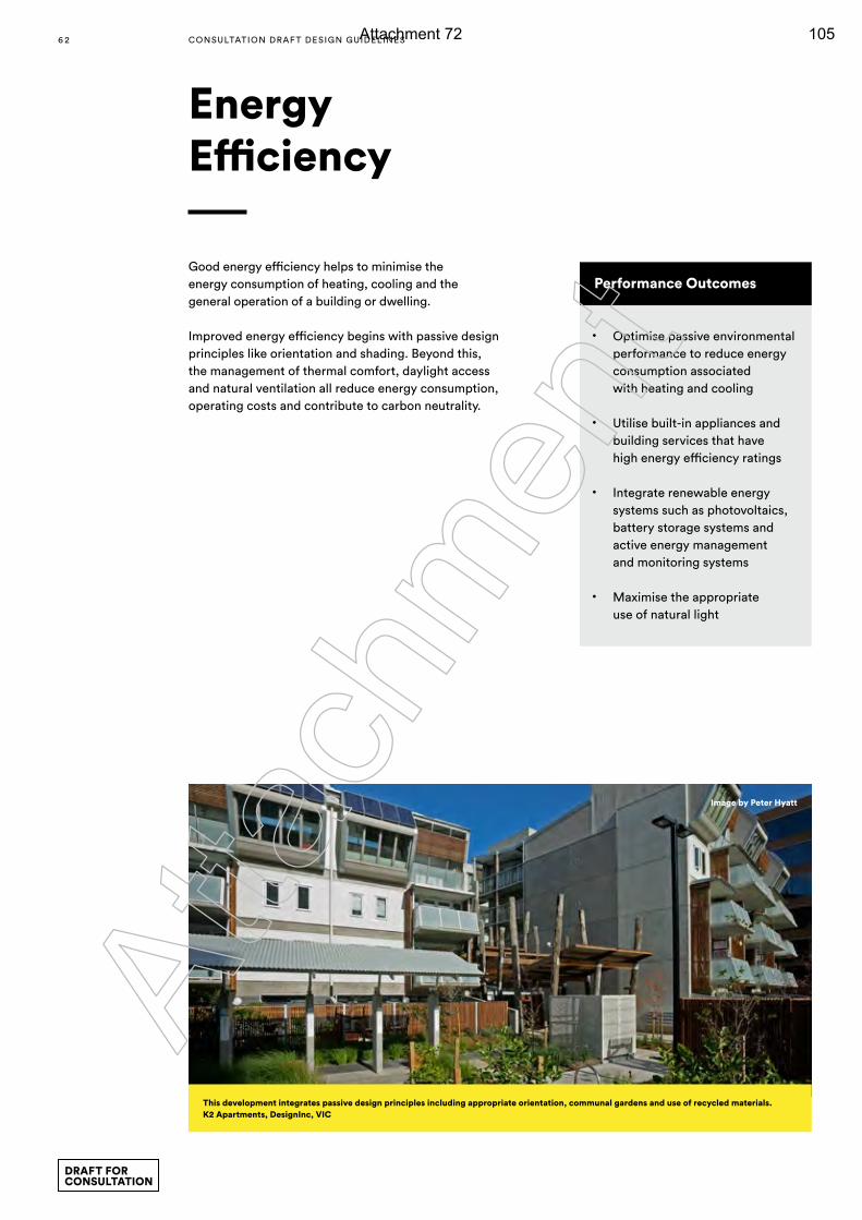
Good energy efficiency helps to minimise the energy consumption of heating, cooling and the general operation of a building or dwelling.
Improved energy efficiency begins with passive design principles like orientation and shading. Beyond this, the management of thermal comfort, daylight access and natural ventilation all reduce energy consumption, operating costs and contribute to carbon neutrality.
Energy Efficiency
Performance Outcomes
• Optimise passive environmental performance to reduce energy consumption associated with heating and cooling
• Utilise built-in appliances and building services that have high energy efficiency ratings
• Integrate renewable energy systems such as photovoltaics, battery storage systems and active energy management and monitoring systems
• Maximise the appropriate use of natural light
This development integrates passive design principles including appropriate orientation, communal gardens and use of recycled materials.K2 Apartments, DesignInc, VIC
Image by Peter Hyatt
6 2 CONSULTATION DRAF T DESIGN GUIDELINES
DRAFT FOR CONSULTATION
Atta
chm
ent
Attachment 72 105
Design Suggestions
Provide adequate daylight to all habitable rooms
• Optimise natural ventilation to reduce reliance on air conditioning
• Optimise the benefit of controlled sunlight access to dwellings
• Locate private or communal outdoor drying areas to receive sunlight
• Incorporate photovoltaic panels or make provisions for future installation
• Allow space for future battery storage units
• Incorporate smart technology (or infrastructure) that allows energy consumption to be measured and displayed, and/or systems to be controlled remotely
• Refer to Orientation, Materials, Daylight Access, Natural Ventilation, Green Infrastructure and Stormwater Management
Additional Guidance for Apartments
• Provide opportunities for grey water re-use
• Connect to recycled water provision (purple pipe), or allow for future adaptation
Design Solutions
Selection of energy efficient appliances and fittings can significantly reduce the total energy costs for residents.
Selection of materials with low embodied energy or high proportions of recycled materials can significantly reduce the greenhouse emissions of a development.
On-site energy generation, such as solar boosted hot water and photovoltaic panels, reduces the use of fossil fuels and contributes to carbon neutrality
• Orientate living spaces to face north, or within 20 degrees of magnetic north
• Position windows and doors to achieve cross ventilation to assist summer cooling
• Group rooms with similar heating or cooling requirements into zones
• Provide doors to circulation spaces to effectively separate zones
• Use high performance glazing (low-e or similar)
• Select high thermal mass flooring for north facing living areas
• Insulate floors, walls, roofs and providing weather seals to doors and windows
• Provide effective shading of windows and external walls
• Utilise ceiling fans in conjunction with evaporative cooling, in preference to refrigerated air conditioning.
• Use materials with low embodied energy
6 3B U I L D I N G D E S I G N
Atta
chm
ent
Attachment 73 106
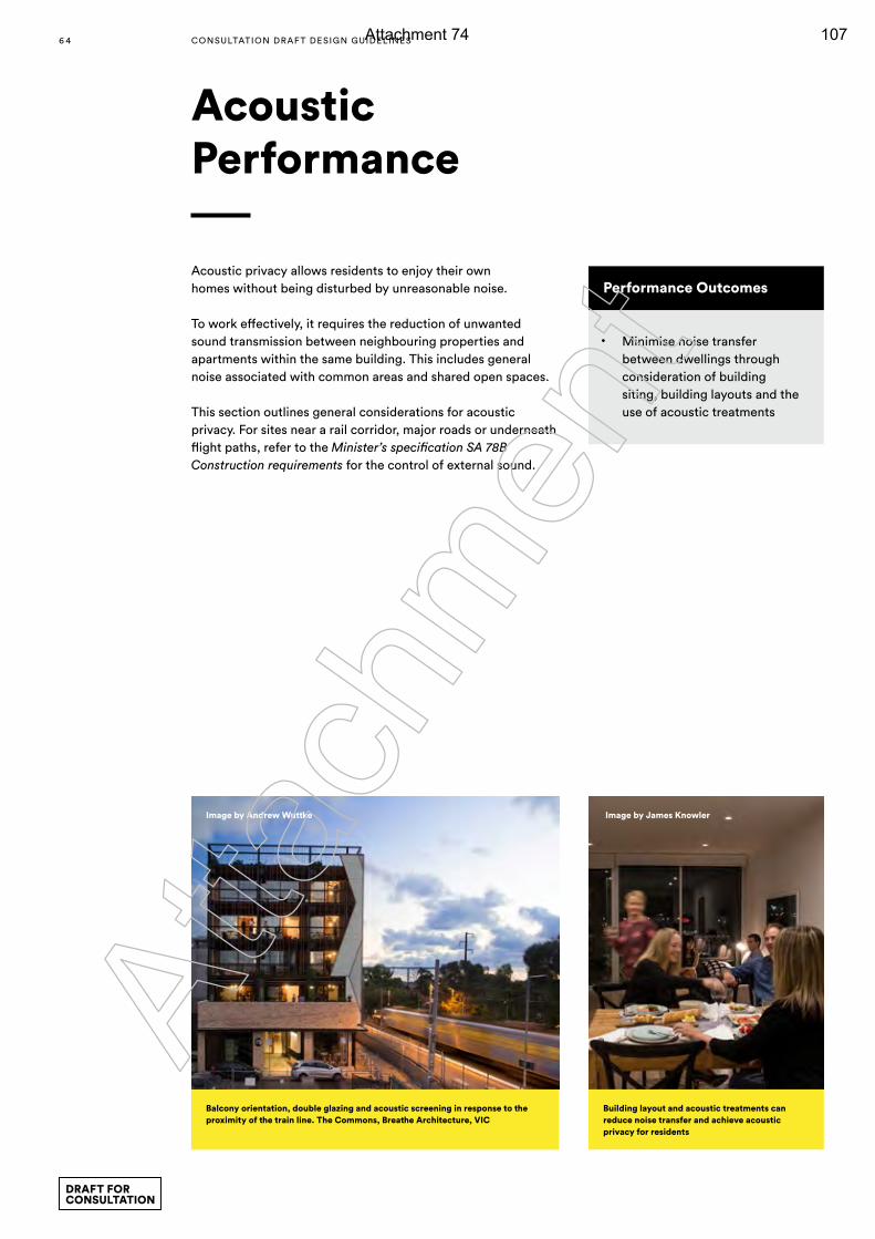
Acoustic privacy allows residents to enjoy their own homes without being disturbed by unreasonable noise.
To work effectively, it requires the reduction of unwanted sound transmission between neighbouring properties and apartments within the same building. This includes general noise associated with common areas and shared open spaces.
This section outlines general considerations for acoustic privacy. For sites near a rail corridor, major roads or underneath flight paths, refer to the Minister’s specification SA 78B Construction requirements for the control of external sound.
Acoustic Performance
Performance Outcomes
• Minimise noise transfer between dwellings through consideration of building siting, building layouts and the use of acoustic treatments
Image by Andrew Wuttke Image by James Knowler
Balcony orientation, double glazing and acoustic screening in response to the proximity of the train line. The Commons, Breathe Architecture, VIC
Building layout and acoustic treatments can reduce noise transfer and achieve acoustic privacy for residents
6 4 CONSULTATION DRAF T DESIGN GUIDELINES
DRAFT FOR CONSULTATION
Atta
chm
ent
Attachment 74 107
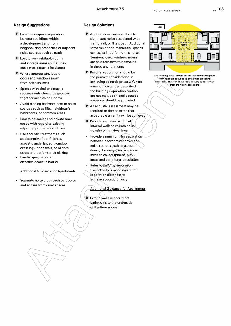
Design Suggestions
Provide adequate separation between buildings within a development and from neighbouring properties or adjacent noise sources such as roads
Locate non-habitable rooms and storage areas so that they can act as acoustic insulators
Where appropriate, locate doors and windows away from noise sources
• Spaces with similar acoustic requirements should be grouped together such as bedrooms
• Avoid placing bedroom next to noise sources such as lifts, neighbour’s bathrooms, or common areas
• Locate balconies and private open space with regard to existing adjoining properties and uses
• Use acoustic treatments such as absorptive floor finishes, acoustic underlay, soft window dressings, door seals, solid core doors and performance glazing
• Landscaping is not an effective acoustic barrier
Additional Guidance for Apartments
• Separate noisy areas such as lobbies and entries from quiet spaces
Design Solutions
Apply special consideration to significant noise associated with traffic, rail, or flight path. Additional setbacks or non-residential spaces can assist in buffering this noise. Semi-enclosed ‘winter-gardens’ are an alternative to balconies in these environments
Building separation should be the primary consideration in achieving acoustic privacy. Where minimum distances described in the Building Separation section are not met, additional acoustic measures should be provided
An acoustic assessment may be required to demonstrate that acceptable amenity will be achieved
Provide insulation within all internal walls to reduce noise transfer within dwellings
• Provide a minimum 3m separation between bedroom windows and noise sources such as garage doors, driveways, service areas, mechanical equipment, play areas and communal circulation
• Refer to Building Separation Use Table to provide minimum separation distances to achieve acoustic privacy
Additional Guidance for Apartments
Extend walls in apartment bathrooms to the underside of the floor above
The building layout should ensure that amenity impacts from noise are reduced to both living areas and
bedrooms. The plan above locates living spaces away from the noisy access core
ACCESS CORE
PLAN
6 5B U I L D I N G D E S I G N
Atta
chm
ent
Attachment 75 108
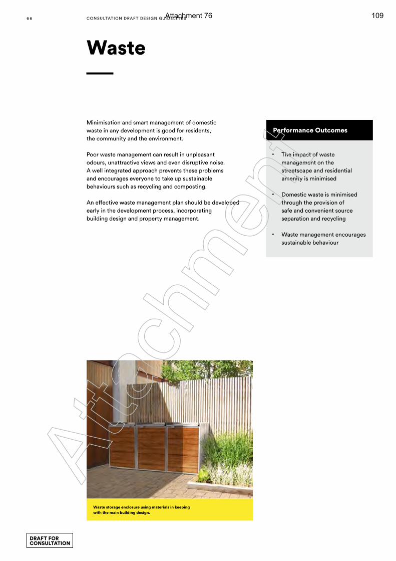
Waste
Performance Outcomes
• The impact of waste management on the streetscape and residential amenity is minimised
• Domestic waste is minimised through the provision of safe and convenient source separation and recycling
• Waste management encourages sustainable behaviour
Minimisation and smart management of domestic waste in any development is good for residents, the community and the environment.
Poor waste management can result in unpleasant odours, unattractive views and even disruptive noise. A well integrated approach prevents these problems and encourages everyone to take up sustainable behaviours such as recycling and composting.
An effective waste management plan should be developed early in the development process, incorporating building design and property management.
Waste storage enclosure using materials in keeping with the main building design.
6 6 CONSULTATION DRAF T DESIGN GUIDELINES
DRAFT FOR CONSULTATION
Atta
chm
ent
Attachment 76 109
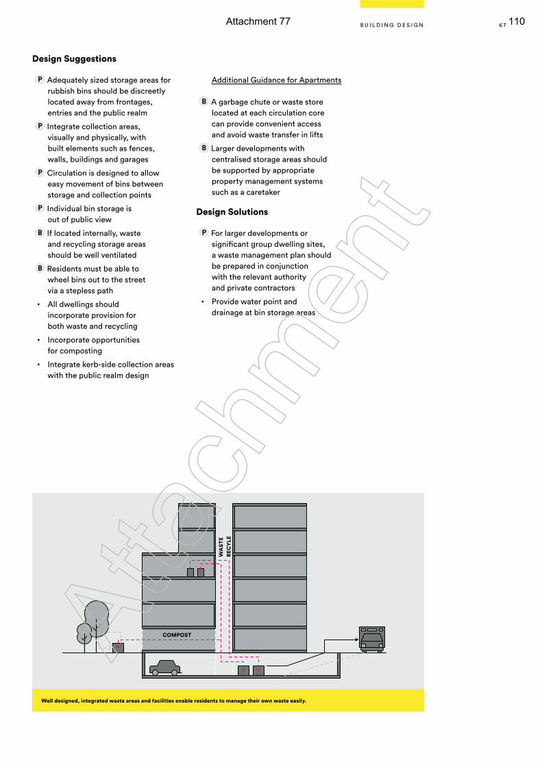
Design Suggestions
Adequately sized storage areas for rubbish bins should be discreetly located away from frontages, entries and the public realm
Integrate collection areas, visually and physically, with built elements such as fences, walls, buildings and garages
Circulation is designed to allow easy movement of bins between storage and collection points
Individual bin storage is out of public view
If located internally, waste and recycling storage areas should be well ventilated
Residents must be able to wheel bins out to the street via a stepless path
• All dwellings should incorporate provision for both waste and recycling
• Incorporate opportunities for composting
• Integrate kerb-side collection areas with the public realm design
Additional Guidance for Apartments
A garbage chute or waste store located at each circulation core can provide convenient access and avoid waste transfer in lifts
Larger developments with centralised storage areas should be supported by appropriate property management systems such as a caretaker
Design Solutions
For larger developments or significant group dwelling sites, a waste management plan should be prepared in conjunction with the relevant authority and private contractors
• Provide water point and drainage at bin storage areas
Well designed, integrated waste areas and facilities enable residents to manage their own waste easily.
COMPOST
WA
STE
REC
YLE
6 7B U I L D I N G D E S I G N
Atta
chm
ent
Attachment 77 110
A well designed building complements its surrounding landscape, the existing and future character of the street and delivers enjoyment to the whole community.
To achieve a contemporary character, buildings must display good proportions and a balanced composition of elements that reflect the internal layout.
Good design selects materials that are durable and efficient for longevity.
Appearance
6 8 CONSULTATION DRAF T DESIGN GUIDELINES
DRAFT FOR CONSULTATION
Atta
chm
ent
Attachment 78 111
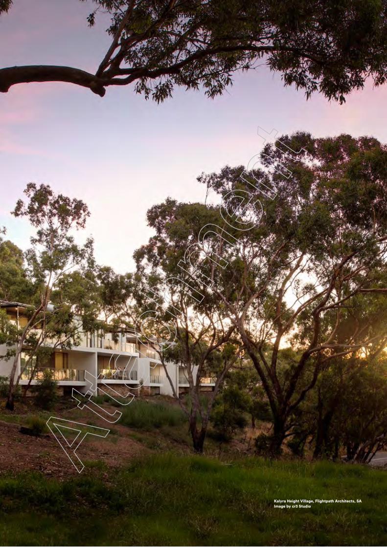
6 9
Kalyra Height Village, Flightpath Architects, SA Image by cr3 Studio
Atta
chm
ent
Attachment 79 112
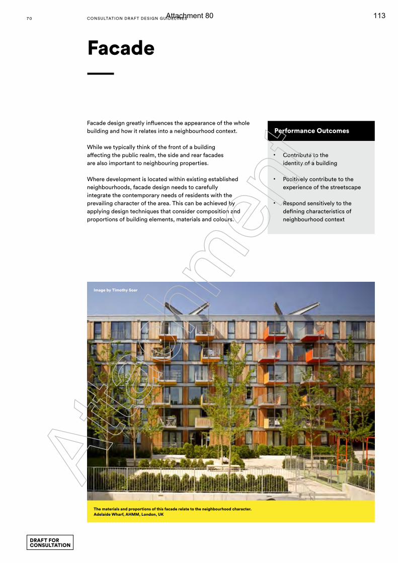
Facade
Performance Outcomes
• Contribute to the identity of a building
• Positively contribute to the experience of the streetscape
• Respond sensitively to the defining characteristics of neighbourhood context
Facade design greatly influences the appearance of the whole building and how it relates into a neighbourhood context.
While we typically think of the front of a building affecting the public realm, the side and rear facades are also important to neighbouring properties.
Where development is located within existing established neighbourhoods, facade design needs to carefully integrate the contemporary needs of residents with the prevailing character of the area. This can be achieved by applying design techniques that consider composition and proportions of building elements, materials and colours.
The materials and proportions of this facade relate to the neighbourhood character.Adelaide Wharf, AHMM, London, UK
Image by Timothy Soar
7 0 CONSULTATION DRAF T DESIGN GUIDELINES
DRAFT FOR CONSULTATION
Atta
chm
ent
Attachment 80 113
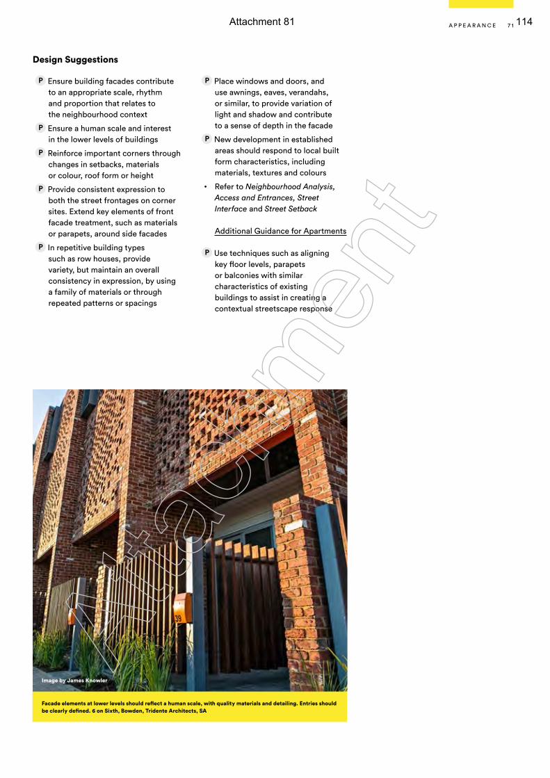
Design Suggestions
Ensure building facades contribute to an appropriate scale, rhythm and proportion that relates to the neighbourhood context
Ensure a human scale and interest in the lower levels of buildings
Reinforce important corners through changes in setbacks, materials or colour, roof form or height
Provide consistent expression to both the street frontages on corner sites. Extend key elements of front facade treatment, such as materials or parapets, around side facades
In repetitive building types such as row houses, provide variety, but maintain an overall consistency in expression, by using a family of materials or through repeated patterns or spacings
Place windows and doors, and use awnings, eaves, verandahs, or similar, to provide variation of light and shadow and contribute to a sense of depth in the facade
New development in established areas should respond to local built form characteristics, including materials, textures and colours
• Refer to Neighbourhood Analysis, Access and Entrances, Street Interface and Street Setback
Additional Guidance for Apartments
Use techniques such as aligning key floor levels, parapets or balconies with similar characteristics of existing buildings to assist in creating a contextual streetscape response
Facade elements at lower levels should reflect a human scale, with quality materials and detailing. Entries should be clearly defined. 6 on Sixth, Bowden, Tridente Architects, SA
Image by James Knowler
7 1A P P E A R A N C E
Atta
chm
ent
Attachment 81 114
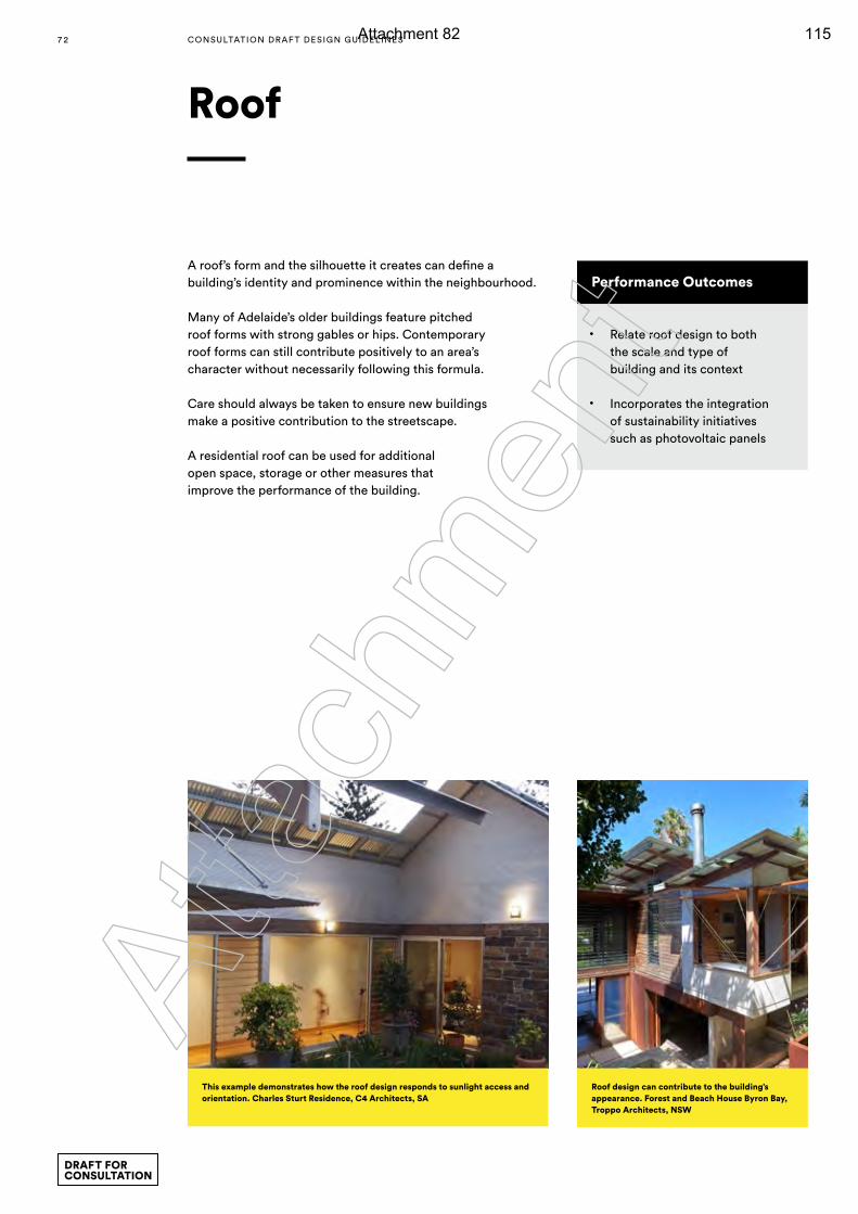
Roof
Performance Outcomes
• Relate roof design to both the scale and type of building and its context
• Incorporates the integration of sustainability initiatives such as photovoltaic panels
A roof’s form and the silhouette it creates can define a building’s identity and prominence within the neighbourhood.
Many of Adelaide’s older buildings feature pitched roof forms with strong gables or hips. Contemporary roof forms can still contribute positively to an area’s character without necessarily following this formula.
Care should always be taken to ensure new buildings make a positive contribution to the streetscape.
A residential roof can be used for additional open space, storage or other measures that improve the performance of the building.
Roof design can contribute to the building’s appearance. Forest and Beach House Byron Bay, Troppo Architects, NSW
This example demonstrates how the roof design responds to sunlight access and orientation. Charles Sturt Residence, C4 Architects, SA
7 2 CONSULTATION DRAF T DESIGN GUIDELINES
DRAFT FOR CONSULTATION
Atta
chm
ent
Attachment 82 115
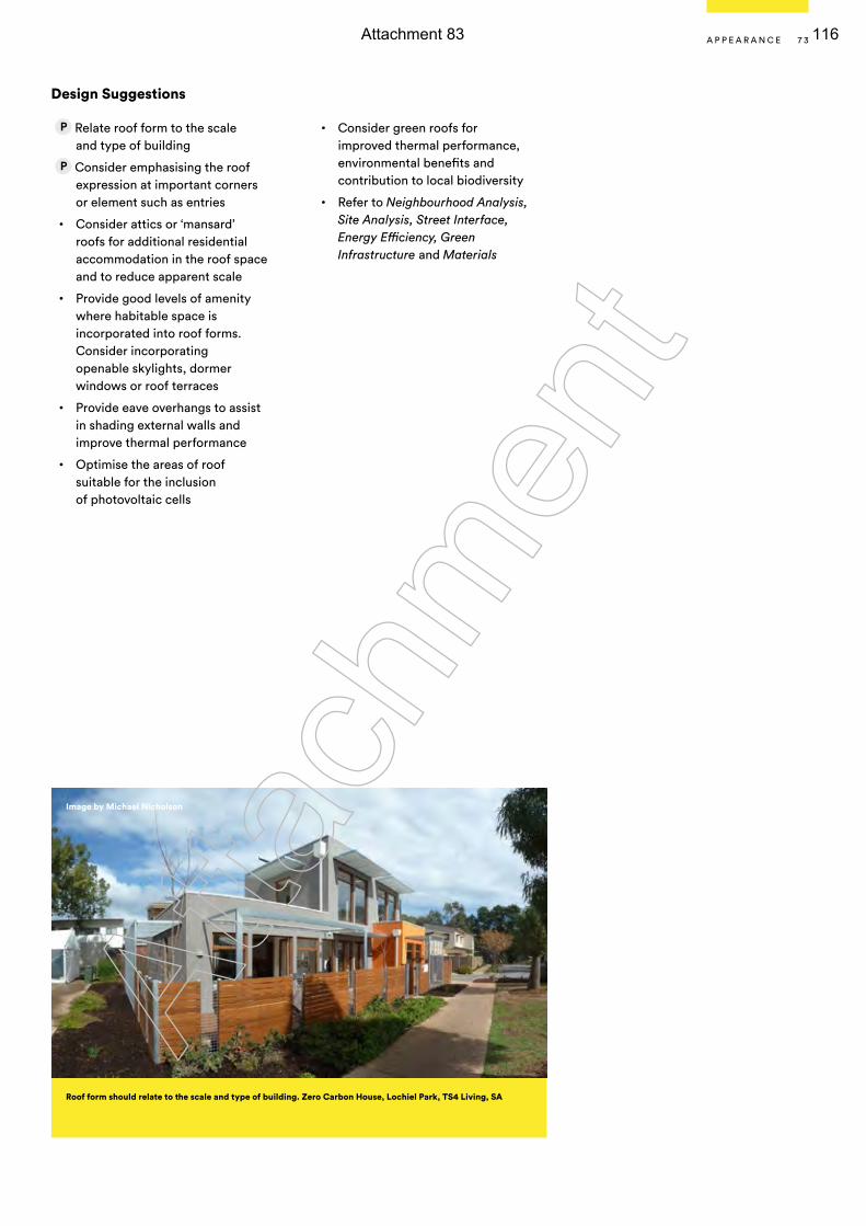
Design Suggestions
Relate roof form to the scale and type of building
Consider emphasising the roof expression at important corners or element such as entries
• Consider attics or ‘mansard’ roofs for additional residential accommodation in the roof space and to reduce apparent scale
• Provide good levels of amenity where habitable space is incorporated into roof forms. Consider incorporating openable skylights, dormer windows or roof terraces
• Provide eave overhangs to assist in shading external walls and improve thermal performance
• Optimise the areas of roof suitable for the inclusion of photovoltaic cells
• Consider green roofs for improved thermal performance, environmental benefits and contribution to local biodiversity
• Refer to Neighbourhood Analysis, Site Analysis, Street Interface, Energy Efficiency, Green Infrastructure and Materials
Image by Michael Nicholson
Roof form should relate to the scale and type of building. Zero Carbon House, Lochiel Park, TS4 Living, SA
7 3A P P E A R A N C E
Atta
chm
ent
Attachment 83 116
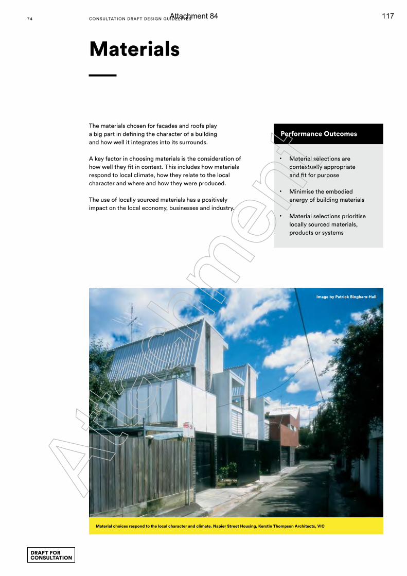
Materials
Performance Outcomes
• Material selections are contextually appropriate and fit for purpose
• Minimise the embodied energy of building materials
• Material selections prioritise locally sourced materials, products or systems
The materials chosen for facades and roofs play a big part in defining the character of a building and how well it integrates into its surrounds.
A key factor in choosing materials is the consideration of how well they fit in context. This includes how materials respond to local climate, how they relate to the local character and where and how they were produced.
The use of locally sourced materials has a positively impact on the local economy, businesses and industry.
Material choices respond to the local character and climate. Napier Street Housing, Kerstin Thompson Architects, VIC
Image by Patrick Bingham-Hall
7 4 CONSULTATION DRAF T DESIGN GUIDELINES
DRAFT FOR CONSULTATION
Atta
chm
ent
Attachment 84 117
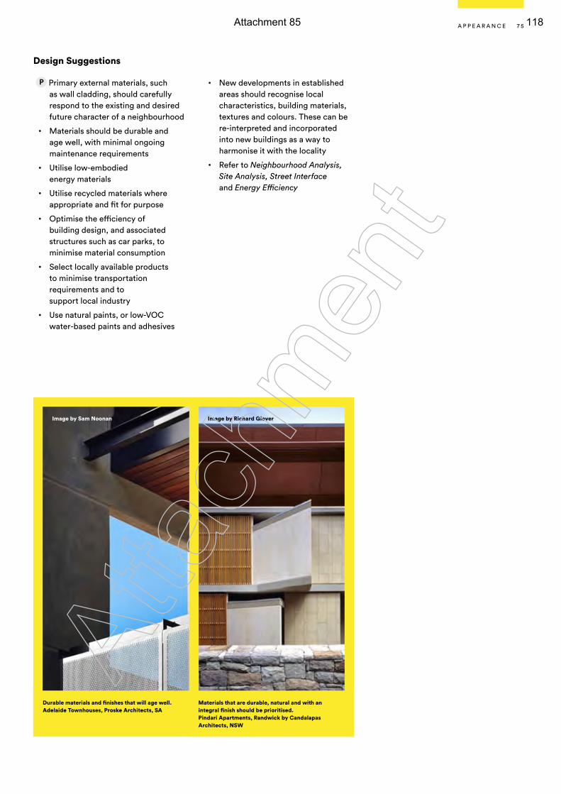
Design Suggestions
Primary external materials, such as wall cladding, should carefully respond to the existing and desired future character of a neighbourhood
• Materials should be durable and age well, with minimal ongoing maintenance requirements
• Utilise low-embodied energy materials
• Utilise recycled materials where appropriate and fit for purpose
• Optimise the efficiency of building design, and associated structures such as car parks, to minimise material consumption
• Select locally available products to minimise transportation requirements and to support local industry
• Use natural paints, or low-VOC water-based paints and adhesives
• New developments in established areas should recognise local characteristics, building materials, textures and colours. These can be re-interpreted and incorporated into new buildings as a way to harmonise it with the locality
• Refer to Neighbourhood Analysis, Site Analysis, Street Interface and Energy Efficiency
Image by Sam Noonan Image by Richard Glover
Durable materials and finishes that will age well.Adelaide Townhouses, Proske Architects, SA
Materials that are durable, natural and with an integral finish should be prioritised. Pindari Apartments, Randwick by Candalapas Architects, NSW
7 5A P P E A R A N C E
Atta
chm
ent
Attachment 85 118
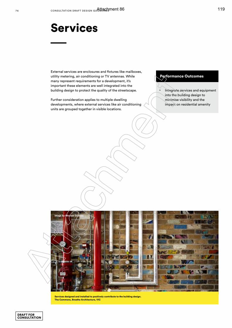
Services
Performance Outcomes
• Integrate services and equipment into the building design to minimise visibility and the impact on residential amenity
External services are enclosures and fixtures like mailboxes, utility metering, air conditioning or TV antennas. While many represent requirements for a development, it’s important these elements are well integrated into the building design to protect the quality of the streetscape.
Further consideration applies to multiple dwelling developments, where external services like air conditioning units are grouped together in visible locations.
Services designed and installed to positively contribute to the building design. The Commons, Breathe Architecture, VIC
Image by Michael Downes
7 6 CONSULTATION DRAF T DESIGN GUIDELINES
DRAFT FOR CONSULTATION
Atta
chm
ent
Attachment 86 119
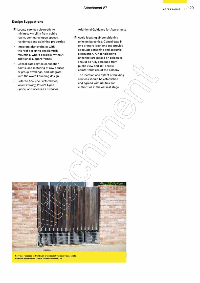
Design Suggestions
Locate services discreetly to minimise visibility from public realm, communal open spaces, residences and adjoining properties
• Integrate photovoltaics with the roof design to enable flush mounting, where possible, without additional support frames
• Consolidate service connection points, and metering of row houses or group dwellings, and integrate with the overall building design
• Refer to Acoustic Performance, Visual Privacy, Private Open Space, and Access & Entrances
Additional Guidance for Apartments
Avoid locating air conditioning units on balconies. Consolidate in one or more locations and provide adequate screening and acoustic attenuation. Air conditioning units that are placed on balconies should be fully screened from public view and still enable comfortable use of the balcony
• The location and extent of building services should be established and agreed with utilities and authorities at the earliest stage
Services recessed in front wall are discreet yet easily accessible. Bowden Apartments, Grieve Gillett Andersen, SA
7 7A P P E A R A N C E
Atta
chm
ent
Attachment 87 120
7 8
Glossary
avDefined as walking, cycling, and skating. Public transport can also be included, but only if the initial mode of transport to the bus, train or tram was not by car.
Affordable housingDwellings appropriate to the needs of households with low and moderate incomes (that is, up to 120% of gross annual median income). The criteria for affordable housing (including price points) is published in the Government Gazette and is reviewed annually.
Affordable livingExpands upon affordable housing to include transportation costs. By taking into account the combined costs of housing and transportation associated with the location of the home, it provides a more complete understanding of affordability. Affordable living also takes into account; indirect costs such as accessing employment areas, services and facilities; household expenditure on electricity, gas and water; and the costs of adaptable housing for older people or people with a disability.
AmenityRefers to the liveability, comfort or quality of a place that makes it pleasant and agreeable to be in for individuals and the community. Amenity is important in the public, communal and private domains and includes the enjoyment of sunlight, views, privacy and quiet. It also includes protection from pollution and odours.
BCABuilding Code of Australia.
Building height The greatest vertical distance between the base of the ground floor and the highest structure on the roof.
Building depthThe overall cross section dimension of a building envelope. It includes the internal floor plate, external walls, balconies, external circulation and articulation such as recesses and steps in plan and section.
Carbon emissionsThe carbon dioxide and carbon monoxide in the atmosphere produced by vehicles and industrial processes.
Carbon neutralA carbon neutral activity emits no net greenhouse gases. This can be achieved by reducing carbon emissions from housing-related activities and/or by offsetting emissions with changes to activities unrelated to the dwelling.
Case Management and Pre-lodgement ServiceThis is a collaborative process in which proponents and key decision-makers, including statutory referral agencies work closely to achieve the best design, planning and development outcomes for everyone involved. The process is particularly effective for complex projects where addressing issues early in the design stage can have significant benefits for the applicant and the community.
ClerestoryHigh level windows.
Climate change Climate change is a long-term change in the statistical distribution of weather patterns over periods of time that range from decades to millions of years. It may be a change in the average weather conditions or a change in the distribution of weather events with respect to an average, for example, greater or fewer extreme weather events. Climate change may be limited to a specific region, or may occur across the whole Earth.
Communal open spaceOutdoor space located within the site at ground level or on a structure that is within common ownership and for the recreational use of residents. Communal open space may be accessible to residents only, or to the public.
CoreVertical circulation (lift and stairs) within a building. A single core may include multiple lifts serving the same floor area.
CourtyardCommunal space at ground level or on a structure (podium or roof) that is open to the sky, formed by the building and enclosed on 3 or more sides.
DaylightConsists of both skylight (diffuse light from the sky) and sunlight (direct beam radiation from the sun). Daylight changes with the time of day, season and weather conditions.
DemographicThe study of statistics to illustrate the condition of communities.
CONSULTATION DRAF T DESIGN GUIDELINES
DRAFT FOR CONSULTATION
Atta
chm
ent
Attachment 88 121
DensityA measure of the population or the number of dwelling units in a given area.
Development PlansDevelopment Plans seek to promote the provisions of the Planning Strategy and include planning or development objectives or principles. They are the principal document in South Australia used to assess development.
Dual aspect dwellingCross ventilating dwellings which have at least two major external walls facing in different directions, including corner, cross-over and cross-through dwelling.
Embodied EnergyThe energy consumed by all of the processes associated with the production of a material or building including natural resources, manufacturing and transportation.
FacadeThe external face of a building.
Glass lineInside face of windows on the external walls of a building.
Greenhouse gas emissions Naturally occurring gases in our atmosphere that trap heat and keep our earth warm enough for life to survive. Carbon dioxide (CO2) is the primary greenhouse gas in our atmosphere and its concentrations are increasing as a result of human activities. The main human activity that emits CO2 is the combustion of fossil fuels (coal, natural gas and oil) for energy and transportation, although certain industrial processes and land use changes also emit CO2.
Green infrastructureThe network of green spaces and water systems that delivers multiple environmental, social and economic values and services to urban communities.
Green roofA roof surface that supports the growth of vegetation, comprised of a waterproofing membrane, drainage layer, organic growing medium (soil) and vegetation.
Green wallA wall with fixtures to facilitate climbing plants. It can also be a cladding structure with growing medium to facilitate plant growth.
Growth AreasThese areas have been identified for urban expansion in the Planning Strategy. They will be subject to further intensive investigations and public consultation.
Habitable roomA room used for normal domestic activities, and includes a bedroom, living room, lounge room, music room, television room, kitchen, dining room, sewing room, study, playroom, family room and sunroom; but excludes a bathroom, laundry, water closet, pantry, walk-in wardrobe, corridor, hallway, lobby, photographic darkroom, clothes-drying room, and other spaces of a specialised nature occupied neither frequently nor for extended periods, as defined by the BCA.
Healthy neighbourhoodsHealthy neighbourhoods are places where people can live, learn, work and play. They offer a wide range of services that can be easily reached on foot or by bicycle, including schools, health care, shops, parks, playing fields and public transport. They also provide streets and public spaces which support diverse and vibrant public life, biodiversity and physical activity.
Heritage Local heritage place means a place that is designated as a place of local heritage value by a Development Plan. State heritage place means either a place entered, either on a provisional or permanent basis, in the State Heritage Register or a place within an area established as a State Heritage Area by a Development Plan.
High rise developmentBuildings of more than seven storeys in height.
Household formationThe process whereby individuals in the population form separate households.
Household type The composition of the group of people living within a household: Couple with children, couple without children, single parent family and other families of related persons, single person or groups.
Housing typeRefers to the physical type of dwelling. For example: Unit, apartment, townhouse, duplex, detached house or specialist accommodation.
G L O S S A R Y 7 9
Atta
chm
ent
Attachment 89 122
8 0
InfillThe rededication of land in an urban environment to new construction. Infill also applies within an urban area to construction on any undeveloped land that is not on the urban fringe.
Juliet balconyA shallow projecting balcony or railing at the outer edge of a window opening.
Liveability A measure of city residents’ quality of life used to benchmark cities around the world. It includes socio-economic, environmental, transport and recreational measures.
Low rise development Buildings of between one and two storeys in height.
Medium rise development Buildings of between three to six storeys in height.
‘Missing Middle’ housingIncreasing housing choice and options to meet the needs of a changing population.
Natural cross ventilationNatural ventilation which allows air to flow between positive pressure on the windward side of the building to the negative pressure on the leeward side of the building providing a greater degree of comfort and amenity for occupants.
NeighbourhoodsLocal areas within towns and cities recognised by people who live there as distinct places with their own character and approximate boundaries.
Non-habitable roomA space of a specialised nature not occupied frequently or for extended periods, including a bathroom, laundry, water closet, pantry, walk-in wardrobe, corridor, hallway, lobby, photographic darkroom or clothes-drying room, as defined by the BCA.
Planning and Design Code The State Planning Commission will be responsible for preparing and maintaining a new ‘Planning and Design Code’, which will require a new approach to the drafting, presentation and interpretation of zoning rules. The new code will be based on a more design-oriented style of zoning that focuses on built form and mixed use development. The code will set out a comprehensive set of planning rules for development assessment purposes, classified into zones, subzones and overlays. These will be applied in each region in a manner consistent with the relevant regional plan. This will make the code the single point of reference for development assessment.
PodiumThe base of a building upon which taller (tower) elements are positioned.
Private open spaceOutdoor space located at ground level or on a structure that is within private ownership and provided for the recreational use of residents of the associated dwelling.
Public open spaceAny open piece of land that is undeveloped and is accessible to the public. Open space usually refers to green space that is partly or completely covered with grass, trees, shrubs or other vegetation.
Public realmAny publicly owned street, pathway, right of way, park, publicly accessible open space or any public or civic building and its facilities.
Solar access Is the ability of a building to continue to receive direct sunlight without obstruction from other buildings or impediments, not including trees.
Street setback Space along the street frontage between the property boundary and the building.
Sustainable development Forms of development that meet the needs of the present without compromising the ability of future generations to meet their needs.
Universal designInternational design philosophy that enables people to carry on living in the same home by ensuring dwellings are able to change with the needs of the occupant.
Urban design The collaborative and multi-disciplinary process of shaping the physical setting for life in cities and towns. It involves the design of buildings, groups of buildings, spaces and landscapes, and the establishment of frameworks and processes that facilitate successful development.
CONSULTATION DRAF T DESIGN GUIDELINES
DRAFT FOR CONSULTATION
Atta
chm
ent
Attachment 90 123
Urban form The structural elements that define the city physically, such as natural features, transportation corridors (including the fixed rail/tram transit system), open space, public facilities, as well as activity centres and focal elements.
Urban renewal/regeneration The process of improving the economic, social and environmental sustainability of a particular urban area. It typically involves urban redesign, infrastructure renewal and investment, and the creation of more attractive residential environments.
Urban sprawlThe expansion of human populations away from central urban areas into low-density, monofunctional and usually car-dependent communities. In addition to describing a particular form of urbanisation, the term also relates to the social and environmental consequences associated with this type of development.
G L O S S A R Y 8 1
Atta
chm
ent
Attachment 91 124
8 28 2
Acknowledgments
The Draft Design Guidelines have been produced with assistance from the following organisations and individuals:
• SJB
• Davis + Davis Architects
• NSW Department of Planning and Environment
• Office of the Victorian Government Architect
• Government Architects Network of Australia
We would also like to acknowledge the generosity of all of the designers who have contributed case studies for this publication (see photo credits).
CONSULTATION DRAF T DESIGN GUIDELINES
DRAFT FOR CONSULTATION
Atta
chm
ent
Attachment 92 125
8 38 3
Your Turn!
The Design Guidelines have been developed to promote well-designed housing in South Australia.
This is your opportunity to provide feedback and help shape future neighbourhoods.
To download the Guidelines please visit odasa.sa.gov.au.
Feedback can be emailed to [email protected] or join in the conversation at yoursay.sa.gov.au.
Atta
chm
ent
Attachment 93 126

Atta
chm
ent
Attachment 94 127
Consultation Draft This version of the Design Guidelines (DG) is a DRAFT only and is being released for consultation purposes and the content may therefore be subject to further amendment.
DisclaimerThe Offi ce for Design and Architecture SA and the Crown in Right of the State of South Australia (as well as their agents, offi cers and employees) disclaim any liability to any person in respect of anything done or the consequences of anything done or omitted to be done, in reliance upon the whole (or any part) of the DG.
CopyrightSave for any acknowledgement of third party copyright set out below, the Crown in Right of the State of South Australia owns copyright in this document.
Unless done with express written permission to do so, the reproduction, alteration, storage or transmission of materials appearing in this document is only permitted if:
• done for the purpose of the consultation process conducted by the Offi ce for Design and Architecture SA;
• it is acknowledged that the materials are sourced from a consultation Draft of the DG; and
• the materials remain subject to the statements of copyright and disclaimers set out on this page.
All other rights are reserved.
Photographs of Renewal SA’s Bowden Development, taken by James Knowler, © Renewal SA.
ISBN pending.
Acknowledgement of Third Party CopyrightThe DG includes material (NSW Material) from the New South Wales Department of Planning and Environment (NSW Department) “SEPP 65/Residential Design Code” and in relation to that NSW Material the following acknowledgement of the author, copyright notice and disclaimer apply. Acknowledgment of Author (NSW Material).
© Crown Copyright 2015NSW Department of Planning and Environment July 2015
DisclaimerWhile every reasonable eff ort has been made to ensure that the NSW Material is correct at the time of printing, the State of New South Wales, its agents and employees, disclaim any and all liability to any person in respect of anything or the consequences of anything done or omitted to be done in reliance or upon the whole or any part of the NSW Material.
Copyright NoticeIn keeping with Planning and Environment’s commitment to encourage the availability of information, you are welcome to reproduce the NSW Material that appears in this document for personal, in-house or non-commercial use without formal permission or charge. All other rights are reserved. If you wish to reproduce, alter, store or transmit the NSW Material appearing in this document for any other purpose, a request for formal permission should be directed to:
NSW Department of Planning and Environment GPO Box 39Sydney NSW 2001
You are required to acknowledge that the NSW Material is provided by the NSW Department or the owner of the copyright as indicated in this document and to include this copyright notice and disclaimer in any copy. You are also required to acknowledge the author (Planning and Environment) of the NSW Material as indicated in this document.
Atta
chm
ent
Attachment 95 128

8 68 6
DRAFT FOR CONSULTATION
Atta
chm
ent
Attachment 96 129

Submission to Office for Design and Architecture South Australia
Draft Submission on Design Guidelines (Design Quality and Housing Choice)
July 2017
Note: This is not an endorsed Submission. It has been prepared for consultation purposes only, and is subject to consideration by the LGA Board.
Atta
chm
ent
Attachment 97 130
LGA of SA ECM 652071 Submission to Department of Planning, Transport and Infrastructure on Design Guidelines Page 2 of 17
Table of contents
The Local Government Association of SA (LGA) ............................................................... 3
Executive Summary ............................................................................................................... 4
Introduction ............................................................................................................................ 5
Review of the Design Guidelines ......................................................................................... 6
Positive Aspects of the Design Guidelines ........................................................................... 6
Structure of Document ...................................................................................................... 6
Using the Document ......................................................................................................... 6
Improvements to the Design Guidelines .............................................................................. 8
Purpose of the Design Guidelines .................................................................................... 8
Definitions ......................................................................................................................... 8
Practical examples ........................................................................................................... 8
Expansion of sections ....................................................................................................... 9
Higher emphasis on context ............................................................................................. 9
Site Analysis ..................................................................................................................... 9
Gaps in the Design Guidelines ........................................................................................... 10
Heritage .......................................................................................................................... 10
Affordable solutions ........................................................................................................ 10
Building with mixed use .................................................................................................. 10
Smaller scale infill ........................................................................................................... 10
Housing diversity ............................................................................................................ 10
Training and education needs ........................................................................................ 11
Suggestions for Other Design Guidelines .......................................................................... 12
Summary .............................................................................................................................. 13
Appendix .............................................................................................................................. 14
Atta
chm
ent
Attachment 98 131

LGA of SA ECM 652071 Submission to Department of Planning, Transport and Infrastructure on Design Guidelines Page 3 of 17
The Local Government Association of SA (LGA) The LGA is a membership organisation for all councils in South Australia and is the voice of local government in this State. The LGA is created by councils and endorsed by the South Australian Parliament through the South Australian Local Government Act 1999 and is recognised in 29 other South Australian Acts. All 68 councils are members of the Association, as is Anangu Pitjantjatjara Yankunytjatjara.
The LGA provides representation, quality service and leadership relevant to the needs of member councils. The LGA also operates specific units/entities providing:
all public liability and professional indemnity cover for all South Australian councils;
all workers compensation cover for all South Australian council employees and associated local government bodies;
asset cover for South Australian councils; and extensive education and training; industrial relations; procurement; online services
and a research and development scheme.
The LGA is involved in the operation of (and establishment of): the local government Finance Authority; Statewide Super; and Public Library Services.
The LGA has a formal State/local government Relations Agreement with the Premier of the State, and is a constituent member of the Australian Local Government Association.
Local government in South Australia
Local government in South Australia comprises 68 councils of which 19 are metropolitan councils and 49 are rural or regional councils. A large land area of the State is not incorporated under the local government Act but for the purposes of the Commonwealth local government (Financial Assistance) Act comprises five Aboriginal communities and the Outback Communities Authority.
The Constitution Act 1934 (SA), the Local Government Act 1999 (SA), and the Local Government (Elections) Act 1999 (SA) and the City of Adelaide Act 1997 (SA), create the primary legal framework within which local government operates and the four-yearly election process which underpins the representative nature of councils in this State.
The local government system in South Australia is integral to the democratic system of Government in Australia which provides vital economic, social and environmental support for communities. South Australian councils in 2015 managed about $22.4 billion of infrastructure and operating expenditures of about $2.0 billion a year. Councils receive significant Commonwealth and State funding and work in partnership at the local level for communities.
Local government in South Australia is typified by: high standards of operational competence and accountability; sharing resources, working consultatively and cooperatively with other councils
and other spheres of Government; low net debt and conservative management of finances; and expanding roles and increases in standards of service to respond to community
demands, other Governments and service gaps.
Atta
chm
ent
Attachment 99 132
LGA of SA ECM 652071 Submission to Department of Planning, Transport and Infrastructure on Design Guidelines Page 4 of 17
Executive Summary The LGA welcomes the opportunity to comment on the Office for Design and Architecture South Australia (ODASA) draft Design Guidelines – Design Quality and Housing Choice. The LGA recognises the draft Design Guidelines’ importance as areas transition into a more compact urban form and new planning system. The LGA supports the overall intent and content of the Design Guidelines and recognises that the document encourages conversation and engagement with good design. Although the LGA recognises the strengths and benefits of these Guidelines, following consultation with councils, the LGA has identified improvements that could be made, gaps in the Guidelines, and other guidelines (or aspects) which would be of use for councils. Improvements that could be made include:
Clarifying the purpose of the Design Guidelines; The definition section; Addition of practical examples; Expansion of sections; Higher emphasis on context; Information on Site Analysis.
Identified gaps in the Design Guidelines to include:
Heritage; Affordable Solutions; Building with Mixed use; Smaller scale infill; Housing Diversity; Training and Education needs;
Guidelines that could be developed in the future include:
Mixed use; Commercial; Regional; Heritage; Street Scape and Public Realm.
The LGA appreciates the value of these Design Guidelines and encourages the ODASA and State Government to consult with local government at an earlier stage when developing further guidelines, and to adopt a collaborative work approach with relevant knowledge and expertise.
Atta
chm
ent
Attachment 100 133
LGA of SA ECM 652071 Submission to Department of Planning, Transport and Infrastructure on Design Guidelines Page 5 of 17
Introduction This Submission is in relation to the draft Design Guidelines (Design Quality and Housing Choice) developed and released by ODASA. In preparing this submission, the LGA has consulted with councils by engaging through Circulars. The LGA has also hosted a workshop with council planning practitioners and ODASA representatives. At this workshop, current concerns and examples within council areas were identified. Positive aspects, possible improvements, and gaps in the Design Guidelines were also discussed. This Submission highlights some of the topics considered in the workshop and suggests ways in which the Design Guidelines could be improved.
Atta
chm
ent
Attachment 101 134
LGA of SA ECM 652071 Submission to Department of Planning, Transport and Infrastructure on Design Guidelines Page 6 of 17
Review of the Design Guidelines
Positive Aspects of the Design Guidelines
The LGA supports the overall intent and content of the Design Guidelines. The LGA recognises that the document is ‘best practice’ and provides useful information to enable councils and others to consider the multiplicity of design elements that need to be considered to achieve good design outcomes.
It was great see many Adelaide/South Australian examples were used throughout the Design Guidelines. This showed the design quality within the State, and recognised the skills of local architects.
Structure of Document
The principles of good design (namely context, inclusivity, durability, value, performance and sustainability) allow for clear and consistent messages as to what well-designed dwellings should look like. The Design Guidelines are clearly and logically ordered allowing them to be easily applied to the design of developments.
The explanation under each of the six sections (being Context, Movement, Building Form, Open Space and Landscaping, Building Design and Appearance) as to what the section is aiming to achieve is invaluable as it helps the reader to understand the content of the document. This explanation allows for useful discussions with developers in order to explain the design aims. The further qualification within each section of the description of the element and its outcomes also allows this. The identification of Planning (P) and Building (B) Considerations, again allows for better understanding of when and how to achieve these principles and elements of good design.
The identification of the importance to context (both at a neighbourhood and site analysis) is acknowledged and applauded as this should form an important part of any proposed development. However, this section could go into further analysis, detail and examples to enable additional weight and awareness to be given to its significance.
Using the Document
Throughout the consultation process, councils consistently suggested that the Design Guidelines are a great starting point and that the Guidelines help begin internal discussions and have informed conversations with potential developers. Councils also identified that the Guidelines will provide assistance across the planning and development industry as to what comprises good design. However, councils also highlighted that there is confusion as to how the Guidelines will work practically at the assessment stage.
Certain councils have already benefited by using these Guidelines (or a version of during development) and working together with the ODASA and the Department for Planning, Transport and Infrastructure in the development of new policy. The need for new policy came about through the identification of the role design can play and assist in interface and impact management. The importance of this when changing/amending policy to provide
Atta
chm
ent
Attachment 102 135

LGA of SA ECM 652071 Submission to Department of Planning, Transport and Infrastructure on Design Guidelines Page 7 of 17
diverse housing options and increase densities adjacent existing low scale residential. Other councils identified that these Guidelines would be a good reference to begin thinking and help create new policy for areas of change.
Overall, the LGA sees these Guidelines as positive and offers the below discussion to provide for further improvements and an overall more effective and useful document.
Atta
chm
ent
Attachment 103 136
LGA of SA ECM 652071 Submission to Department of Planning, Transport and Infrastructure on Design Guidelines Page 8 of 17
Improvements to the Design Guidelines
Whilst the LGA believes the Design Guidelines are a good starting point and reference, the following key issues/areas for improvement were identified.
Purpose of the Design Guidelines
While it is clear the document has no role to play in statutory development assessment at this time, on page 2 of the introduction section, the wording is somewhat contradictory as the document states that the Design Guidelines do not have statutory force, but then states: “The Design Guidelines will likely continue as advisory material in support of the new Planning and Design Code, providing guidance where deemed-to-comply provisions of the Code are not met.” Inclusion of the latter statement is questioned, given the lack of detail available at this point in time regarding the content of the Planning and Design Code.
This statement is also contradictory as on the one hand it suggests that the Design Guidelines will be ‘advisory’ in nature sitting outside of the assessment process, yet also infers that the Guidelines may have a more formal role to play in the assessment of applications that don’t meet certain criteria in the future Planning and Design Code. The Guidelines’ lack of reference and links to the positioning of the document means it is difficult for councils to understand the force and purpose of the Design Guidelines.
In its current form, the Design Guidelines do not appear to have a clear target audience. It is acknowledged the Guidelines have been prepared and can be used by designers, planners, consumers and the wider public. Having such a broad document runs the risk of not having the detail needed to be effective for any of the abovementioned audiences. The LGA is concerned this lack of focus means the document’s usability is diminished. This concern may be alleviated by having a clear dedicated audience or by having a further expanded section on ‘who can use these Guidelines and how’.
Definitions
The current definition section of the Design Guidelines could be further expanded. The Guidelines lack a comprehensive glossary of design terms (i.e. mass, scale, relief and other basic terms). Expansion of the definitions would allow for clear understanding across the board/industry and limit misinterpretations and assist in discussions with developers and the wider public.
Practical examples
The Design Guidelines could be further improved by including more practical examples. Specifically, the document could include lower scale infill examples (i.e. 1 into 2/3/4). As the Design Guidelines are ‘intended primarily for typical lower-scale infill developments, such as two-storey townhouses or row housing’, it would still appear that the current focus is directed towards higher density infill/apartments. Many councils expressed that additional guidance with examples of good design in this lower scale development would be extremely useful and a specific section on this could also be of use. A
ttach
men
t
Attachment 104 137
LGA of SA ECM 652071 Submission to Department of Planning, Transport and Infrastructure on Design Guidelines Page 9 of 17
Expansion of sections
Certain sections of the Design Guidelines could be expanded further in order to assist the reader. Specifically, Landscaping, Stormwater Management and Waste Collection sections could be expanded; as such information is crucial for developers and councils. Throughout the consultation process, councils suggested they understood the technical nature of some of the documents, but commented on the major impacts or influence of these on certain residential development was not adequately explored.
The Design Guidelines could also be improved by referencing and using practical examples from other guidelines/documents produced by other agencies. For example, reference to the Zero Waste SA Better Practice Waste Management Guide, Green Industries’ Waste Strategy 2015-2020, and the Water Sensitive Urban Design (WSUD) Guidelines would enhance the usability of the document. Including these links would provide greater technical detail and design solutions.
Higher emphasis on context
The Design Guidelines could be improved by the inclusion of more information regarding how to balance existing low-scale residential (and potential existing noteworthy character) with the desire and policy direction for higher density infill. There is always a significant challenge when trying to respond to an existing and a future desired character of an area. Further examples and principles would be beneficial in terms of what impacts to be aware of and how good design can be achieved.
Site Analysis
The current section on Context ‘Site Analysis and Neighbourhood Analysis’ could be improved by including more information on topography and site contamination. Further analysis on topography should be highlighted as part of the Design Guidelines, given the importance, impact and requirements that sloping land can have on a development. This could also include design outcomes and solutions/examples. Also, as part of any site analysis a site history/potential site contamination should also be recognised. This is important to acknowledge given that it could impact upon the viability, size and location of the development and ultimately impact the design outcomes. Whilst this issue is not relevant to all councils, many would find the inclusion of such information to be invaluable.
Further work and detail could also be part of the neighbourhood analysis. Specifically, further acknowledgement of traffic analysis (hierarchy of adjacent road network, existing traffic volumes and availability of on-street parking) would be useful as these issues impact the requirements for off-street parking and movements. Such analysis could start to look at the availability of off-street parking for required services (waste, delivery, emergency vehicles), especially in existing built up areas.
Atta
chm
ent
Attachment 105 138
LGA of SA ECM 652071 Submission to Department of Planning, Transport and Infrastructure on Design Guidelines Page 10 of 17
Gaps in the Design Guidelines
Heritage
The Design Guidelines fail to address building within a character area, heritage areas or adjacent to a heritage place (Local or State) in a meaningful and detailed way. The addition of such information would be of assistance to many councils and developers. The desire for infill and higher density is primarily focused in inner metro areas which can also have strong heritage (and character). Further advice on principles and examples of how to manage interface or how outcomes could be achieved would be useful. As suggested below, developing an additional addendum to these Guidelines or a separate heritage Design Guidelines may help to ameliorate this issue.
Affordable solutions
The Design Guidelines do not address the issue of affordable solutions. The Guidelines could address this issue to emphasise that good design should not cost more. It could also highlight that the smaller (and generally affordable) housing choices do not come at the cost of amenity for those future residents. Additional principles and examples of how improved amenity could be achieved in smaller/affordable dwellings without significant additional costs would also be of use.
Building with mixed use
The Design Guidelines do not adequately address buildings with a mixed use area or as infill development occurs. The Guidelines could also provide further information and address the issue of street interface with a commercial ground floor. While the LGA acknowledges the information provided in the document, the existing information relating to mixed use could be further expanded and enhanced by examples. These issues are of interest to many councils and should be included in this document and/or in subsequent guidelines.
Smaller scale infill
The Design Guidelines do not adequately address smaller scale infill issues. Arguably, further information on smaller scale infill is required, and more design examples of how design principles can be achieved should be included in the document or as a subsequent addendum.
Housing diversity
The Design Guidelines do not include information on ways of achieving housing diversity. The document could include information on incentives for housing diversity (i.e. trade-offs), and include examples of ways to achieve diverse housing stock on a development site. At present, councils have identified that many developments are producing similar housing choice outcomes (i.e. 3 bedroom dwelling or 2 bedroom apartment).
The LGA understands that diversity can be difficult as the market dictates the product, however showing how alternative housing options can be incorporated within one development to still achieve amenity would be useful. Suggesting how other incentives could be integrated into design to counteract perceptions of lower quality of living (for example the
Atta
chm
ent
Attachment 106 139

LGA of SA ECM 652071 Submission to Department of Planning, Transport and Infrastructure on Design Guidelines Page 11 of 17
use of high quality and useable shared space) would also be a beneficial addition to the Design Guidelines.
Training and education needs
Training and education is vitally important in order for the Design Guidelines to be effectively utilised. As developers are accustomed to receiving direction, many may not understand the ‘performance based’ approach. Furthermore, it is important that building designers who are not as qualified (as an architect) receive education in order to understand how to use the Guidelines. The private sector education will be of huge importance, as by the time an application is lodged for assessment the majority of the work/thinking/resources/money will have already been outlaid for the design of the development. At this point in time, it is very difficult (or too late) to enable meaningful change to align with good design principles and can be a cause of great frustration for both sides.
Further education and understanding could be provided through giving ‘real-‘life’/case study on a potential development on a specific site. This would give further context to the Design Guidelines and start to promote awareness as to how practitioners, developers, architects, designers and the general public can work together to achieve good design outcomes.
It is also important for council staff to learn about the Design Guidelines and how to understand what good design is and move towards a more design/performance based assessment. Reading through the Guidelines will not be enough, and consequently, further training and education will be required. This education and training could include (but not be limited to) presentations, forums, workshops, online workshops and professional development courses. Furthermore, additional design advisor(s) may be required to be accessible to councils in order assist with understanding the Guidelines. DPTI/ODASA will need to consider this when the Planning and Design Code is implemented, and throughout the subsequent use under the new planning system.
Atta
chm
ent
Attachment 107 140

LGA of SA ECM 652071 Submission to Department of Planning, Transport and Infrastructure on Design Guidelines Page 12 of 17
Suggestions for Other Design Guidelines
The LGA encourages ODASA to work with councils in developing any of the further guidelines to be released. The LGA notes the value of guidelines and encourages to consult with Local Government at an earlier stage in developing the other guidelines.
Of the next five guidelines identified to be released, many councils have shown an interested in participating in the development of the Masterplan and Infrastructure Design Guidelines. Councils currently face challenges and significant work (expertise) has already been undertaken in these areas. This is not to exclude the other guidelines as local governments have many examples and expertise with these as well.
Through discussions it was identified the need for and it is suggested that ODASA look to investigate to possibility for additional Design Guidelines on the below topics:
- Mixed-use Development o Particularly in strategic areas designated for infill development
- Commercial o Useful for both greenfield and infill sites o In centre area (both new centres and redeveloping older centre stock) o At present, getting big bulking warehouse approach and not ideal in centre
areas - Regional Guidelines
o Agricultural o Primary Production o Renewable Energy o Wind Farms o Small Scale Industrial
- Heritage - Street Scape and public realm
As mentioned above, the LGA would strongly recommend and suggest early engagement in the development of the future guidelines, rather than just at a designated period.
Atta
chm
ent
Attachment 108 141
LGA of SA ECM 652071 Submission to Department of Planning, Transport and Infrastructure on Design Guidelines Page 13 of 17
Summary
The LGA supports the overall intent and content of the Design Guidelines, however as the document is largely best practice and aspirational, there is concern as to how and when the Design Guidelines will be used. By amending the current document by considering the improvements proposed and highlighted gaps, the Design Guidelines will arguably be more useful to readers. In developing any further guidelines, the LGA encourages the State Government to consult with Local Government at an earlier stage
Atta
chm
ent
Attachment 109 142
LGA of SA ECM 652071 Submission to Department of Planning, Transport and Infrastructure on Design Guidelines Page 14 of 17
Appendix The following responses to ODASA’s Your Say Questionnaire were collected from the LGA’s workshop with Councils.
Do you think the Design Guidelines will help make neighbourhoods better places to live?
Yes: 14
No: 3
Comments:
- Possibly - If integrated with legislation - Maybe - If statutory and enforced - If followed and implemented in planning reform - No – not in their current form but the potential is there
Do you think the overall structure and content of the Guidelines is easy to understand and practical to use?
Yes: 15
No: 2
Comments:
- For us yes, for others maybe not - Yes for professionals, no for mum and dad developers - See Onkaparinga submission - Needs a little more rigor - Structure and topics are practical
Are there any additional topics you feel should be addressed in the Guidelines?
No: 5
Yes: 12
Comments:
- Mixed use - Lower-medium density development - Effluent disposal - WSUD - Heritage/character areas - See Onkaparinga submission - Topography - Non-residential uses
Atta
chm
ent
Attachment 110 143
LGA of SA ECM 652071 Submission to Department of Planning, Transport and Infrastructure on Design Guidelines Page 15 of 17
- Further examples of landscaping, WSUD, waste management, energy efficiency - Heritage interface - Small-scale infill (1 into 2/3/4 developments)
Performance Outcomes are important to include
Strongly Disagree:
Disagree: 2
Neither agree nor disagree:
Agree: 7
Strongly agree: 8
Design suggestions are important to include
Strongly Disagree: 1
Disagree: 1
Neither agree or disagree:
Agree: 6
Strongly agree: 9
Design Solutions are important to include
Strongly Disagree: 2
Disagree: 1
Neither agree or disagree: 2
Agree: 4
Strongly agree: 8
Can you recommend any changes to the Performance Outcomes, Design Suggestions or Solutions?
No: 8
Yes: 5
Comments:
- More detail – potentially sub-groups - Ensure succinct and not repetitive - More images - See Onkaparinga submission - Minimum desired requirements - More quantitative as well as qualitative - Provide specific examples of good design
Atta
chm
ent
Attachment 111 144
LGA of SA ECM 652071 Submission to Department of Planning, Transport and Infrastructure on Design Guidelines Page 16 of 17
Are the diagrams, plans and images appropriate and easy to understand?
Yes: 12
No: 3
Comments:
- Yes for professionals, less so for general members of public - Could be larger - See Onkaparinga submission - Yes but all examples are from architects, but not reality for majority of developments - Further examples of smaller scale infill would be good
Please select the 6 design elements you consider to be most important for new developments in established areas
Neighbourhood Analysis: 6
Site Analysis: 7
Access and Entrances: 2
Cars and Bicycles: 5
Orientation: 5
Building Height: 6
Building Depth: 1
Building Separation: 6
Street Setback: 2
Street Interface: 10
Visual Privacy: 4
Safety: 1
Landscape: 9
Communal Space: 0
Stormwater Management: 3
Green Infrastructure: 4
Public Art: 0
Universal Design: 0
Size & Layout: 2
Private Open Space: 3
Common Circulation Areas: 0
Storage: 3
Ceiling Heights: 0
Daylight Access: 5
Natural Ventilation: 2
Energy Efficiency: 4
Acoustic Performance: 1
Waste: 5
Appearance: 7
Facade: 2
Roof: 0
Materials: 4
Service: 2
Atta
chm
ent
Attachment 112 145
148 Frome St Adelaide SA 5000
GPO Box 2693 Adelaide SA 5001
T (08) 8224 2000
F (08) 8232 6336
www.lga.sa.gov.au
Atta
chm
ent
Attachment 113 146

Item 15.3: Council Resolution 107/17 – Safety Improvements (Around Construction Sites)
CITY OF PROSPECT: Council Agenda 25/07/2017
AGENDA ITEM NO.: 15.3 TO: Council Report on 25 July 2017 DIRECTOR: Nathan Cunningham, Director Community & Planning REPORT AUTHOR: Helen Robins, Manager City Maintenance & Community Safety Victor Di Maria, Strategic Risk Management Officer SUBJECT: Council Resolution 107/17 – Safety Improvements (Around
Construction Sites)
1. EXECUTIVE SUMMARY
1.1 This report provides information and specifically responds to the recent Council Motion regarding public safety and road traffic issues outside of the development sites (on public land) in the vicinity of construction activity within City of Prospect. The Motion read as follows:
Council receive a report on the Safety Improvements that Council can enforce to improve the safety and convenience of residents, pedestrians and traffic around construction sites in the city.
1.2 Council has a number of legislative avenues (including a permitting process) to address road traffic issues and pedestrian safety adjacent to significant (commercial and residential) developments pursuant to the Local Government Act (“The Act”). Developers and Builders have an overarching responsibility to work to the requirements of the Work Health Safety (WHS) legislation and other conditions.
1.3 Council has an established permitting system for assessing and allowing activities that will impact the adjacent road environment. Permit holders and/ or developers have a responsibility to comply with relevant legislation, the permit and its associated conditions. The obligations include the requirement to maintain a safe environment.
1.4 Permits have a self-regulating function, with developers and land owners remaining responsible for activities which may impact road (including the footpath) users or other public accessed areas.
1.5 Council’s permitting system is being enhanced, considering the evolving pace of multi-storey developments at key sites. It is proposed to update the process to include relevant (industry accepted) conditions to enforce (legislative) powers and maintain a prudent level of safety during the construction phase (including the need for covered walkways at key sites).
1.6 To support the enhanced process, a new Council Guide will be developed to provide information regarding the level of protection needed at significant work sites. The guide will also document internal communication process between the planning team and the Community Safety Team as well as reinforcing appropriate communication channels to developers through the planning assessment process.
1.7 Council’s Risk Management Officer has recently reviewed the Permit system and made a number of recommendations outlined in the main body of this report which will enhance public safety around development sites.
147
Item 15.3: Council Resolution 107/17 – Safety Improvements (Around Construction Sites)
CITY OF PROSPECT: Council Agenda 25/07/2017
2. RECOMMENDATION
(1) The Council notes this Report responding to the Council Motion regarding public safety around development sites.
3. RELEVANCE TO CORE STRATEGIES / POLICY
3.1 Local Government Act 1999
3.2 Development Act 1993
3.3 Work Health Safety Act 2012
3.4 City Works Permit Application. Corporate Risk Management Policy & Framework.
3.5 Strategy 4: Services – Leaders of the sector providing efficient, responsive, accessible services.
4.4 Accountable and people-focussed services
3.6 An efficient system that assesses and permits temporary occupation of roads/ land adjacent to significant works/ development endorses safe systems of work and provides a level of protection of council infrastructure.
3.7 The application of risk management by all stakeholders resulting in efficiencies and assurance of legislative responsibilities and endorsement of council protocols.
4. COMMUNITY INVOLVEMENT
4.1 Key stakeholders including, contractors, property developers and builders who are undertaking demolition, building or construction projects within the City of Prospect. These parties will be involved in discussions around the updated permit system and the Council Guide document.
5. DISCUSSION
5.1 The purpose of this report is to respond to the motion raised by Council in resolution 107/17. The Motion read as follows:
Council receive a report on the Safety Improvements that Council can enforce to improve the safety and convenience of residents, pedestrians and traffic around construction sites in the city.
5.2 A standard Condition of Development Approval provides that development must not impact (adjacent) council infrastructure, nor put any pedestrians at risk during construction. Further, no obstruction of a footpath can take place without the permission of Council (through delegation to appropriate officers) as part of the Council Permit System.
5.3 Whilst the development legislation mandates controls on development and matters within private land, the Local Government Act (“the Act”) provides Council with powers to manage various activities on land/ roads:
148
Item 15.3: Council Resolution 107/17 – Safety Improvements (Around Construction Sites)
CITY OF PROSPECT: Council Agenda 25/07/2017
5.3.1 Sections 221/222 of the Act provides Council the power to authorise any business or an alteration of a road. This would include temporary requirements for development that may impact the adjacent road such as fencing/ hoarding and other matters.
5.4 Council requires any alteration to a road (including on a footpath) to be subject to the City Works Permit Application. When approved, the permit can allow certain activity (including obstructing a footpath) to take place adjacent to significant developments.
5.5 Council’s permit application process requires a developer to provide a detailed traffic management plan which includes information regarding footpath obstruction, the need for hoarding and any traffic speed restrictions or other traffic management. Any non-compliance is managed by the Community Safety Team of the Infrastructure, Assets & Environment directorate.
5.6 The objective of the permit and legislation is to ensure minimal distruption to the general pubic during the construction phase and that council infrastructure remains in a reasonable condition, with any damage being rectified upon completion at the request of staff.
5.7 Should members of the community be concerned by the public safety proximate to development sites, they are encouraged to contact Council so that the Community Safety Officers can attend to review the conditions of the site and the adherence to any permit conditions.
Multi-level Development
5.4 Various multi-level developments on main roads, such as Prospect and Churchill Roads, have resulted in many areas of construction impacting roads and footpaths. A focus of the current permit system is to maintain safe passage of pedestrian and vehicular traffic.
5.5 The Development and permitting process provides that any construction activity impacting public space is managed appropriately and is consistent across the city.
5.6 Council’s 2020 Strategic Plan Outcomes (Excellence in Infrastructure and a stronger local economy) include the need to take ‘great care of all of Council’s Assets’ and that ‘Investment, employment and development are encouraged across our city’. Development therefore, must not put the general public or Council infrastructure at risk and the permit system is used to manage the interaction with public land and Council’s Assets.
5.7 As a result of an internal review which included input from Council’s Risk Management Officer, in order to continue to provide a prudent and consistent service across the City, the current permit application is being enhanced to include:
5.7.1 Specific commentary regarding Sections 221/222 of the Act, including information on penalties and fines, and WHS (legislative) requirements of builders and developers;
5.7.2 A range of general conditions, standard across Local Government, that stipulate the key obligations of all parties;
149
Item 15.3: Council Resolution 107/17 – Safety Improvements (Around Construction Sites)
CITY OF PROSPECT: Council Agenda 25/07/2017
5.7.3 Specific conditions for any party contemplating major development and the need to obstruct a section of a road (footpath), including triggers and assessment process to evaluate the need for a covered walkway.
5.8 Further to the Permit Application, a short City Works Guide is being prepared which will include relevant requirements for any development that will impact any ‘public space’. The Guide will be benchmarked against systems currently in place across metropolitan Councils.
5.9 The revised Permit and Guide will be finalised by September 2017 and information provided in the Guide will include
(1) Legislative and internal system process
(2) Local Government by-law information
(3) Traffic and parking obligations
(4) Any alteration of a road/ footpath, including pedestrian and vehicular safety provisions
(5) Use of scaffolds and hoardings to protect the public
(6) Permitting conditions
(7) Council Community Safety powers – including patrols and monitoring
Conclusion
5.10 Council has various (legislative) powers to allow development and manage any impacts to roads and/ or land in the public realm. This report focuses on public safety and matters relating to the interface with Council’s Assets (Outside of the development site).
5.11 As a result of a changing development landscape, Council utilises its powers (as per other South Australian councils) by engaging with developers and landowners via the City Works Permitting System.
5.12 The permit process is being enhanced by including (universally accepted) conditions, including relevant WHS and public safety requirements of developers and builders.
5.13 A guide will accompany the permit to ensure internal and external compliance with requirements.
ATTACHMENTS
Nil
150
Item 19.1: Investment Report 2016 - 2017
CITY OF PROSPECT: Council Agenda 25/07/2017
AGENDA ITEM NO.: 19.1 TO: Council on 25 July 2017 DIRECTOR: Ginny Moon, Director Corporate Services REPORT AUTHOR: Chris Birch, Manager Financial Services SUBJECT: Investment Report 2016 - 2017
1. EXECUTIVE SUMMARY
1.1 Section 140 of the Local Government Act 1999 requires Council to annually consider the performance of its investments.
1.2 As at 30 June 2017, Council had $1,424,283.11 invested with the Local Government Finance Authority (LGFA).
1.3 Total interest income from cash deposits (with the ANZ Bank) and investments with the LGFA for the period 1 July 2016 to 30 June 2017 is approximately $71,358 (previous year $88,793).
1.4 Council’s budget for 2016-2017 anticipated Investment Income of $97,500. As identified in item 5.8, Council has received $71,358, being $26,142 unfavourable to budget.
1.5 Council has received less investment income than budgeted due to it deferring the budgeted borrowing and utilising its own cash reserves prior to accessing new loan facilities. This has resulted in a lower investment balance (principal) for which interest is paid. In addition, interest rates have been lower than budgeted (approximately 0.25%).
1.6 A summary of Council’s investment portfolio with the Local Government Finance Authority as at 30 June 2017 is provided at Attachment 1.
2. RECOMMENDATION
(1) The Council having considered Item 19.1 Investment Report 2016-2017, 25 July 2017 receives and notes the report.
3. RELEVANCE TO CORE STRATEGIES / POLICY
3.1 Council’s Strategic Plan 2020 sets the strategy of “Sound Financial Management” through diverse income streams. Investment income achieves this through planned treasury management where Council only holds cash on hand for its immediate need and utilises surpluses to earn investment income (interest) or deferring borrowing drawdowns.
151
Item 19.1: Investment Report 2016 - 2017
CITY OF PROSPECT: Council Agenda 25/07/2017
3.2 Accounting Policies and Procedures, Section 7.6 – Investments.
3.3 Accounting Policies and Procedures, Section 14 – Treasury Management Policy.
3.4 Sections 139 and 140 of the Local Government Act 1999 (the Act).
4. COMMUNITY INVOLVEMENT
4.1 There is no relevant community consultation requirement.
5. DISCUSSION
5.1 Council’s existing policy in relation to investments is listed in section 7.6 of the Accounting Policies and Procedures as:-
“Investment of Council’s surplus income will be with the Local Government Finance Authority unless determined otherwise by Council resolution.”
5.2 Section 140 of the Act requires Council to annually consider the performance of its investments.
5.3 A summary of Council’s investment portfolio with the Local Government Finance Authority as at 30 June 2017 is provided at Attachment 1.
5.4 As at 30 June 2017, Council had $1,424,283.11 invested with the Local Government Finance Authority (LGFA).
5.5 Council currently invests surplus funds in both a 24 hour at call and fixed term deposit facilities with the Local Government Finance Authority (LGFA) at the interest rate declared by the LGFA. The balance of money held with ANZ Bank, being Council’s “transaction account”, is kept to a minimum at all times.
5.6 This report provides a summary of investments for the 2016-2017 financial year to enable Council to review the performance of its investments in accordance with Section 140 of the Act and Section 7.6.3 of the Accounting Policies and Procedures Manual.
5.7 LGFA offer an on-call interest rate equal to the Reserve Bank (RBA) cash rate. Funds can be transferred intraday with our transaction bank, meaning that Council is able to keep minimal funds within its transactional bank account.
5.8 In addition, Council is able to place short-term investments in order to receive a premium interest rate paid on its investments. Traditionally, these investments are made for a period shorter than 90 days. This aligns Council’s financial needs with the quarterly instalment cycle of rates being collected.
5.9 Despite a premium interest rate, total interest income from cash deposits (with the ANZ Bank) and investments with the LGFA for the period 1 July 2016 to 30 June 2017 is approximately $71,358 (previous year $88,793). The majority of the interest earned was derived from the LGFA. The amount of interest earned includes a bonus of $16,014 (previous year $21,273).
152
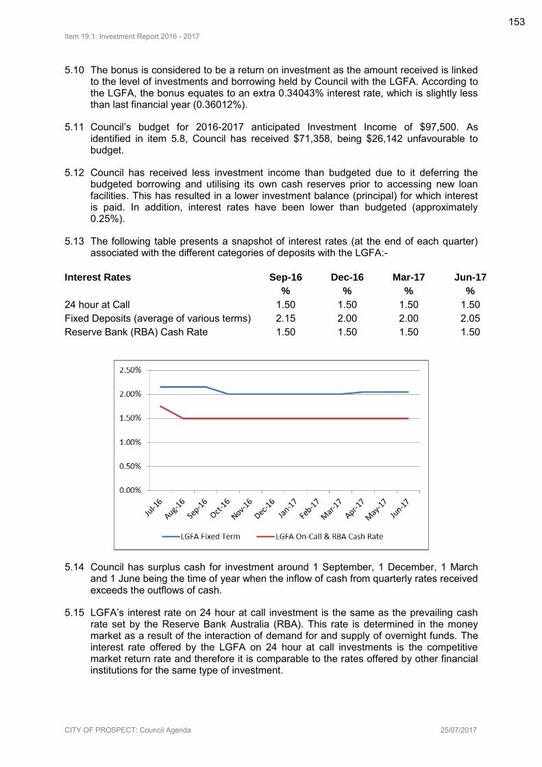
Item 19.1: Investment Report 2016 - 2017
CITY OF PROSPECT: Council Agenda 25/07/2017
5.10 The bonus is considered to be a return on investment as the amount received is linked to the level of investments and borrowing held by Council with the LGFA. According to the LGFA, the bonus equates to an extra 0.34043% interest rate, which is slightly less than last financial year (0.36012%).
5.11 Council’s budget for 2016-2017 anticipated Investment Income of $97,500. As identified in item 5.8, Council has received $71,358, being $26,142 unfavourable to budget.
5.12 Council has received less investment income than budgeted due to it deferring the budgeted borrowing and utilising its own cash reserves prior to accessing new loan facilities. This has resulted in a lower investment balance (principal) for which interest is paid. In addition, interest rates have been lower than budgeted (approximately 0.25%).
5.13 The following table presents a snapshot of interest rates (at the end of each quarter) associated with the different categories of deposits with the LGFA:-
Interest Rates Sep-16 Dec-16 Mar-17 Jun-17
% % % %
24 hour at Call 1.50 1.50 1.50 1.50
Fixed Deposits (average of various terms) 2.15 2.00 2.00 2.05
Reserve Bank (RBA) Cash Rate 1.50 1.50 1.50 1.50
5.14 Council has surplus cash for investment around 1 September, 1 December, 1 March and 1 June being the time of year when the inflow of cash from quarterly rates received exceeds the outflows of cash.
5.15 LGFA’s interest rate on 24 hour at call investment is the same as the prevailing cash rate set by the Reserve Bank Australia (RBA). This rate is determined in the money market as a result of the interaction of demand for and supply of overnight funds. The interest rate offered by the LGFA on 24 hour at call investments is the competitive market return rate and therefore it is comparable to the rates offered by other financial institutions for the same type of investment.
153
Item 19.1: Investment Report 2016 - 2017
CITY OF PROSPECT: Council Agenda 25/07/2017
5.16 The interest rates paid by the LGFA on 24 hour at call investments have reflected the changes to the RBA Official Rate. The RBA cash rate changed only once during the past twelve months. This was a reduction of 0.25% on 3 August 2016.
5.17 In addition to investing monies on a 24 hour at call basis, Council has been investing monies surplus to immediate working capital requirements for fixed periods via ‘term deposits’.
5.18 Term deposits are typically for periods of up to 90 days. The interest rates offered by the LGFA on term deposits at any point in time is determined by the financial market and driven by prevailing economic conditions. That is, the interest rate can change on a daily basis as the financial market responds to/speculates on current/future economic conditions. As a result, the differential between the 24 hour at call rate and the term deposit rate can fluctuate on an ad hoc basis.
5.19 At the time of writing this report, the RBA’s prevailing cash target rate was 1.5%. The following rates were being offered by the LGFA as at 30 June (previous years shown for comparison purposes):-
2016-17 %
2015-16 %
2014-15 %
2013-14 %
2012-13 %
24 Hour at Call 1.50 1.75 2.00 2.50 2.75
90 day deposit 2.05 2.15 2.30 3.05 3.50
5.20 Given Fixed Term Deposits generally have a higher interest rate than the 24 hour at call, Council staff constantly monitor surplus cash requirements in order to maximise investment return via Fixed Term Deposits. During the 2016-2017 year we have experienced historic low interest rates and the enticement to lock funds away for a period of less than 90 days has not always presented itself.
5.21 In accordance with Council’s Treasury Management Policy, cash reserves have been utilised prior drawing down new borrowings.
5.22 Council’s Treasury Management Policy includes the following investment strategies:-
5.22.1 Council funds that are not immediately required for operational needs and cannot be applied to either reduce existing borrowings or avoid the raising of new borrowings will be invested. The balance of funds held in any operating bank account that does not provide investment returns at least consistent with ‘at call’ market rates shall be kept at a level that is no greater than is required to meet immediate working capital requirements.
5.22.2 Council funds available for investment will be lodged ‘at call’ or, having regard to differences in interest rates for fixed term investments of varying maturity dates, may be invested for a fixed term. In the case of fixed term investments the term should not exceed a point in time where the funds otherwise could be applied to cost-effectively either defer the need to raise a new borrowing or reduce the level of Council’s variable interest rate borrowing facility.
5.23 When investing funds within the above criteria Council staff will select the investment type which delivers the best value, having regard to investment returns, transaction costs and other relevant and objectively quantifiable factors.
154

Item 19.1: Investment Report 2016 - 2017
CITY OF PROSPECT: Council Agenda 25/07/2017
ATTACHMENTS
Attachment 1: Local Government Finance Authority Audit Certificate as at 30/6/2017
155
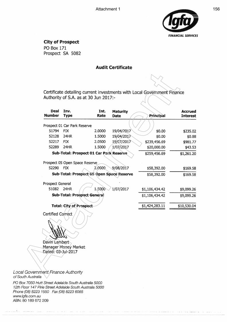
Atta
chm
ent
Attachment 1 156
Item 19.2: Update on Council’s Borrowing & Related Financial Arrangements 2016 - 2017
CITY OF PROSPECT: Council Agenda 25/07/2017
AGENDA ITEM NO.: 19.2 TO: Council on 25 July 2017 DIRECTOR: Ginny Moon, Director Corporate Services REPORT AUTHOR: Chris Birch, Manager Financial Services SUBJECT: Update on Council’s Borrowing & Related Financial
Arrangements 2016 - 2017
1. EXECUTIVE SUMMARY
1.1 A summary of Council’s loan portfolio with the Local Government Finance Authority (LGFA) as at 30 June 2017 is provided at Attachment 1.
1.2 As at 30 June 2017, Council’s borrowing from the LGFA totalled $7,155,790.70.
1.3 During 2016-2017 a new loan of $3,491,000 was included in the budget. This loan was to fund the road and footpath works on Prospect Road. As PLEC were delayed in exiting the site, Council’s works were also delayed and the new loan was not drawn down. This new loan will still be required to fund the project, when completed.
1.4 Total loan principal outstanding as at 30 June 2017 is $7,155,790.70 (including the loan to the North Adelaide Football Club (NAFC) of $1,744,716). The total outstanding principal is approximately 4.015% of Total Assets. Given the assets of the City, this is comparable to having a $20,075 mortgage on a $500,000 property.
1.5 The Third Budget Review adopted by Council on the 23 May 2017, projected the net financial liabilities ratio (total liabilities less financial assets/total operating revenue) to be 45%. This is well within the 2016-2017 target range of 10% to 50%. Revised targets have been adopted for 2017-2018 and onwards.
2. RECOMMENDATION
(1) The Council having considered Item 19.2 Update on Council’s Borrowing & Related Financial Arrangements 2016-2017, 25 July 2017 receives and notes the report.
3. RELEVANCE TO CORE STRATEGIES / POLICY
3.1 Council’s Strategic Plan 2020 sets a strategy outcome of “Sound Financial Management”. The use of borrowings and debt is a tool available to Council in order to fund its activities while delivering intergenerational equity opportunities. Careful monitoring of debt levels is a key role with the adherence of sound financial management.
157
Item 19.2: Update on Council’s Borrowing & Related Financial Arrangements 2016 - 2017
CITY OF PROSPECT: Council Agenda 25/07/2017
3.2 Accounting Policies and Procedures Manual – “Loan Borrowings” and “Treasury Management Policy”, Section 7.13 and Section 14.
3.3 Sections 134 and 135 of the Local Government Act, 1999.
3.4 Strategic Financial Parameters - Borrowings and Financial Position (refer 2016-2017 Annual Business Plan, pages 30-31).
4. COMMUNITY INVOLVEMENT
4.1 There is no relevant community consultation requirement.
5. DISCUSSION
5.1 Council’s existing policy in relation to borrowing as per section 7.14 of Council’s Accounting Policy and Procedures.
5.2 Sections 134 and 135 of the Local Government Act that relate to the borrowing of money.
5.3 A summary of Council’s loan portfolio with the Local Government Finance Authority as at 30 June 2017 is provided as Attachment 1.
5.4 As at 30 June 2017, Council’s borrowing from the LGFA totalled $7,155,790.70.
5.5 During 2016-2017 a new loan of $3,491,000 was included in the budget, however was not drawn.
5.6 The new borrowing was included in the original budget and was to be used for the purposes of undertaking the current stages of the undergrounding of power lines (PLEC) project and associated rehabilitation works.
5.7 As PLEC were delayed in exiting the site, Council’s works were also delayed and the new loan was not drawn down. This new loan will still be required to fund the project, when work is completed. The new loan will be included in the 2017-2018 budget as part of the carry forwards process in the first budget review.
5.8 Total loan principal outstanding as at 30 June 2017 is $7,155,790.70 (including the loan to the North Adelaide Football Club (NAFC) of $1,744,716). The total outstanding principal is approximately 4.015% of Total Assets. Given the assets of the City, this is comparable to having a $20,075 mortgage on a $500,000 property.
5.9 The loan drawn by NAFC had a five year interest only period. This period expired with their repayments in 2016-2017 and principal repayments have commenced.
Strategic Parameters
5.10 One of Council’s Strategic Financial Parameters relates to Borrowings and Financial Position as follows (refer 2016-2017 Annual Business Plan, page 24):
“Borrowings and Financial Position - When should we borrow? How much can we borrow?
158
Item 19.2: Update on Council’s Borrowing & Related Financial Arrangements 2016 - 2017
CITY OF PROSPECT: Council Agenda 25/07/2017
Borrowings will be used to promote intergenerational equity within Council’s prudential limits and capacity to repay. Net Financial Liabilities and associated net interest costs will be maintained within target.
Target: Net Financial Liabilities (30 June) <= 50% x Total Operating Revenue
Net Interest Costs <= 5% x Total Operating Revenue”
5.11 As detailed in 5.14 below, Council’s Net financial Liabilities for 2016-2017 is anticipated to be 45% (third budget review).
5.12 Council’s interest cover ratio for 2016-2017 is 1.83%.
Net Financial Liabilities
5.13 Net Financial Liabilities is not the amount Council borrows but it measures Council's indebtedness. It is calculated by the following formula:-
Council's projected total liabilities (or total debt ie. total loan principal outstanding and amount owing to creditors)
less
Council's projected net financial assets (ie. liquid assets - term deposits, cash at bank and amount owed to Council by current debtors).
5.14 The Net Financial Liabilities for 2016-2017 is projected to be approximately $10.0m, including NAFC loan (Third Budget Review adopted by Council on the 26 April 2016), which is within the target range ($2m to $10m). This includes a $1.88m loan taken out on behalf of NAFC (which will be fully reimbursed, over the term of the loan – 15 years).
5.15 The average Net Financial Liabilities Ratio for the next 10 years is projected to be approximately 52%. This is presented on page 36 of the Annual Business Plan 2017-2018. Council’s 10 year Net Financial Liabilities Ratio target range has been amended to 10%-60% from 2017-2018 onwards.
5.16 The Third Budget Review adopted by Council on the 23 May 2017, projected the net financial liabilities ratio (total liabilities less financial assets/total operating revenue) to be 45%. This is within the 2016-2017 target range of 10% to 50%.
5.17 The Long Term Financial Plan contained within the Annual Business Plan 2017-2018 contains a series of borrowings totalling $8.7m between 2017-2018 and 2018-2019. The borrowings are required to construct the replacement facility of Prospect Road to co-locate Council’s services onto one site. New borrowings are included on Council’s projected loan schedule on page 61 of the Annual Business Plan 2017-2018.
5.18 The loan schedule identifies that the outstanding loan balance peaks in the 2018-2019 financial year, which is approximately $17.0m before reducing to nil in 2034-2035.
Interest Paid
5.19 The Interest cover ratio indicates the extent to which Council’s commitment to interest expenses are met by total operating revenues.
159
Item 19.2: Update on Council’s Borrowing & Related Financial Arrangements 2016 - 2017
CITY OF PROSPECT: Council Agenda 25/07/2017
5.20 The net interest ratio is projected to be 1.83%. This is well within Council’s interest cover ratio target (net interest over operating revenue), of <= 5% (Annual Business Plan 2016-2017, page 24).
5.21 Council’s net interest (loan interest repayment less investment interest) for the 2016-2017 Financial Year is projected to be approximately $410,280. This means that interest expense on loan borrowing is $410,280 more than income received from term deposit interest (investment).
5.22 Council’s loan interest repayment for 2016-2017 is approximately $481,638, which equates to 2.14% of Council’s total operating revenue (per Third Budget Review for 2016-2017).
5.23 The reduction in loan interest paid is due to the deferral of new borrowings. Instead, as per Council’s Treasury Management Policy, cash reserves have been utilised to fund operations and projects. As stated in 5.7 above, new borrowings will still be required to complete projects carried forward to 2017-2018.
Treasury Management Policy
5.24 At its February 2008 meeting, Council adopted the Audit Committee’s (4 February 2008) recommendation to include the contents of LGA’s Treasury Management Policy into Council’s Accounting Policies and Procedures Manual.
5.25 The Accounting Policies and Procedures Manual (including Section 14 - Treasury Management Policy) was last reviewed by Council on 26 August 2014.
Cash Advance Debenture 5.26 At the Council meeting on 18 June 2002, Council resolved:-
“That for the temporary accommodation of the Council, application be made to the Local Government Finance Authority of South Australia, pursuant to Section 134 of the Local Government Act 1999, for loan funds by way of a Cash Advance Debenture Facility for a term of 15 years of up to $500,000 secured against the general revenue of the Council, with the proceeds of such facility to be credited to a bank account in the name of the Council. That the loan is not (either wholly or in part) for the purposes of a project requiring a Prudential Issues Report pursuant to Section 48 of the Local Government Act 1999. The amount of the loan plus interest accrued, at the rates or rates to be negotiated with the Authority, is to be repaid to the bank account of the Local Government Finance Authority of South Australia in accordance with arrangements made with the Authority.”
5.27 At the Council meeting on 26 July 2011, Council resolved to increase the limit of the Cash Advance Debenture from $500,000 to $1,000,000. The Cash Advance rate was 3.75% as at the 30 June 2017.
5.28 The period from June to September each year, being the period between the last rate instalment of one financial year and the first instalment of the next financial year, is traditionally a time where Council’s cash position can become strained.
5.29 The Cash Advanced Debenture Facility will be utilised as/when required, should future cash flow requirement necessitate its use.
160
Item 19.2: Update on Council’s Borrowing & Related Financial Arrangements 2016 - 2017
CITY OF PROSPECT: Council Agenda 25/07/2017
5.30 The Cash Advance Debenture Facility was not utilised during the 2016-2017 financial year. No Interest expense associated with this facility was incurred; the facility does not attract any penalty fees for not utilising it.
ATTACHMENTS
Attachment 1: Local Government Finance Authority Audit Certificate as at 30/6/2017
161
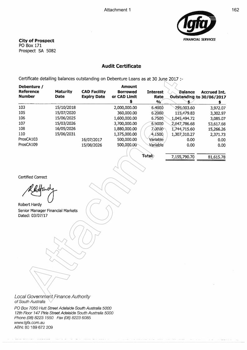
Atta
chm
ent
Attachment 1 162
Item 19.3: June Eastern Region Alliance Report
CITY OF PROSPECT: Council Agenda 25/07/2017
AGENDA ITEM NO.: 19.3 TO: Council on 25 July 2017 DIRECTOR: Cate Hart REPORT AUTHOR: Cate Hart, CEO SUBJECT: June Eastern Region Alliance Report
1. EXECUTIVE SUMMARY
1.1 The Eastern Region Alliance (ERA) is a voluntary regional association of eastern metropolitan Councils. The Member Councils are City of Burnside, City of Campbelltown, City of Norwood Payneham St Peters, City of Prospect, City of Unley and Town of Walkerville. These Councils have executed a Memorandum of Agreement (MOA) to form ERA.
1.2 Since signing that MOU, the ERA councils have worked towards improved co-operation, resource sharing, more effective working relationships and joint actions to agree and address strategic priorities between any two or more of the councils. ERA has aimed to:
Improve cooperation, collaboration, and coordination across the member councils
Establish a robust operational framework to deliver effective and efficient services
Be successful in attracting state and federal government funding for regional initiatives
Increase awareness, and the influence, of ERA within the three spheres of government.
1.3 ERA is currently reviewing its existing MOU and its Strategic Plan which will be presented to Council in the coming months.
1.4 This report presents information from the Chairman of ERA on its activities for Council noting.
2. RECOMMENDATION
(1) Council notes the report.
3. RELEVANCE TO CORE STRATEGIES / POLICY
3.1 Strategic Plan to 2020 Theme 4 – Services “Leaders of the sector providing efficient, responsive, accessible services”
163
Item 19.3: June Eastern Region Alliance Report
CITY OF PROSPECT: Council Agenda 25/07/2017
4. COMMUNITY INVOLVEMENT
4.1 There has been no requirement or need for community consultation.
5. DISCUSSION
5.1 ERA has determined that its member Councils should be keep informed of its initiatives and operations on a regular basis. As such a 6 monthly report will be presented for tabling at Council.
5.2 This report provides two such reports in order to ensure information for the 2016/2017 period is presented for Council review and noting.
5.3 ERA Mayors and CEO’s meet 4 times per year to focus on a range of matters and to share information and initiatives.
5.4 For the financial year 2016/2017 the key focus for ERA has been:
5.4.1 Review of the Strategic Plan
5.4.2 Street lighting project
5.4.3 Resilient East – Regional Climate Change Adaptation Plan
5.4.4 Regional Economic Development initiatives
5.4.5 Resource sharing opportunities
5.4.6 Regional Planning
5.4.7 Waste management
5.5 Information in respect to these foci is contained in Attachment 1.
5.6 The ERA CEO’s also meet (monthly) in order to ensure the Alliance is supported in its endeavours and directions. The Action List included in Attachment 1 outlines the work of this group.
5.7 Council funds ERA through a 6 monthly payment. This is incorporated into the Annual Business Plan.
ATTACHMENTS
Attachments 1-7: Chairman and CEO Report December 2016
Attachments 8-14: Chairman and CEO Report June 2017
164
Attachment 1
Atta
chm
ent
165
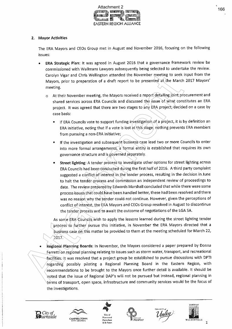
Attachment 2
Atta
chm
ent
166
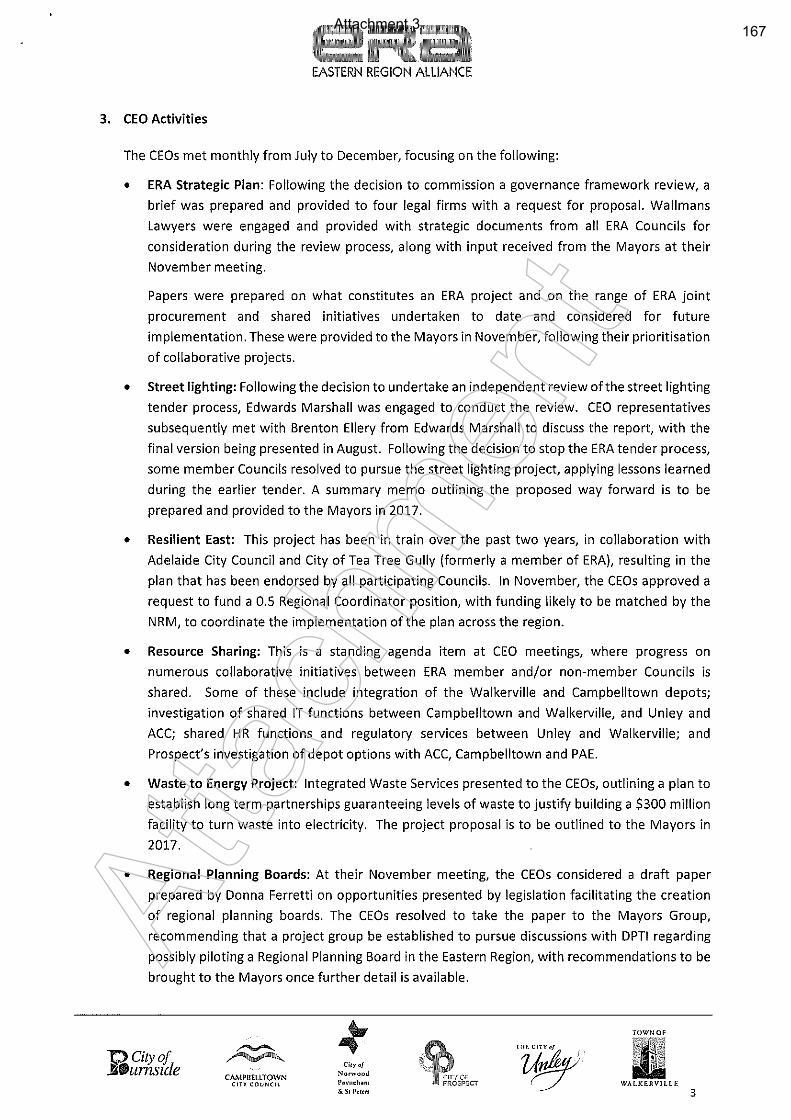
Attachment 3
Atta
chm
ent
167

Attachment 4
Atta
chm
ent
168
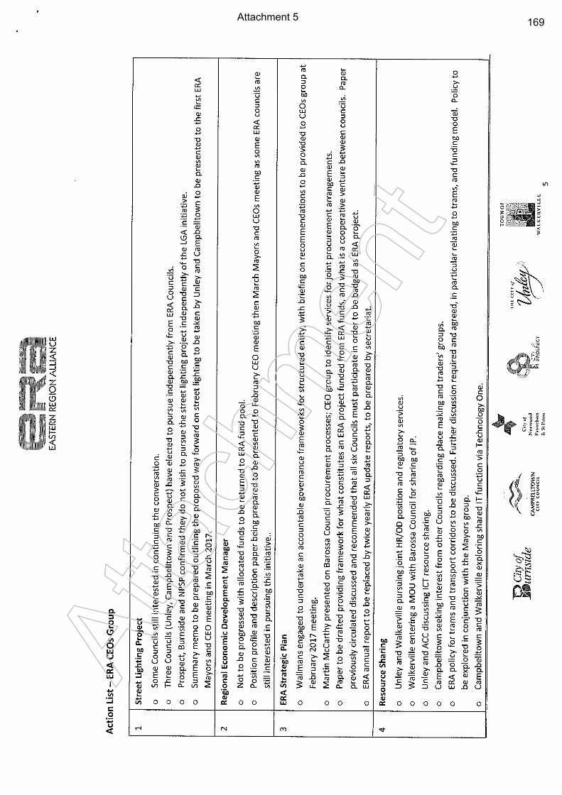
Attachment 5
Atta
chm
ent
169
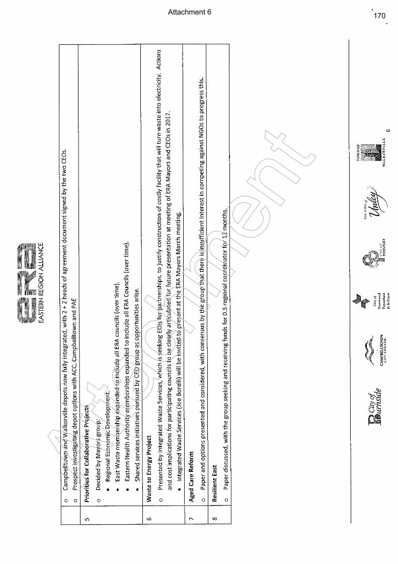
Attachment 6
Atta
chm
ent
170
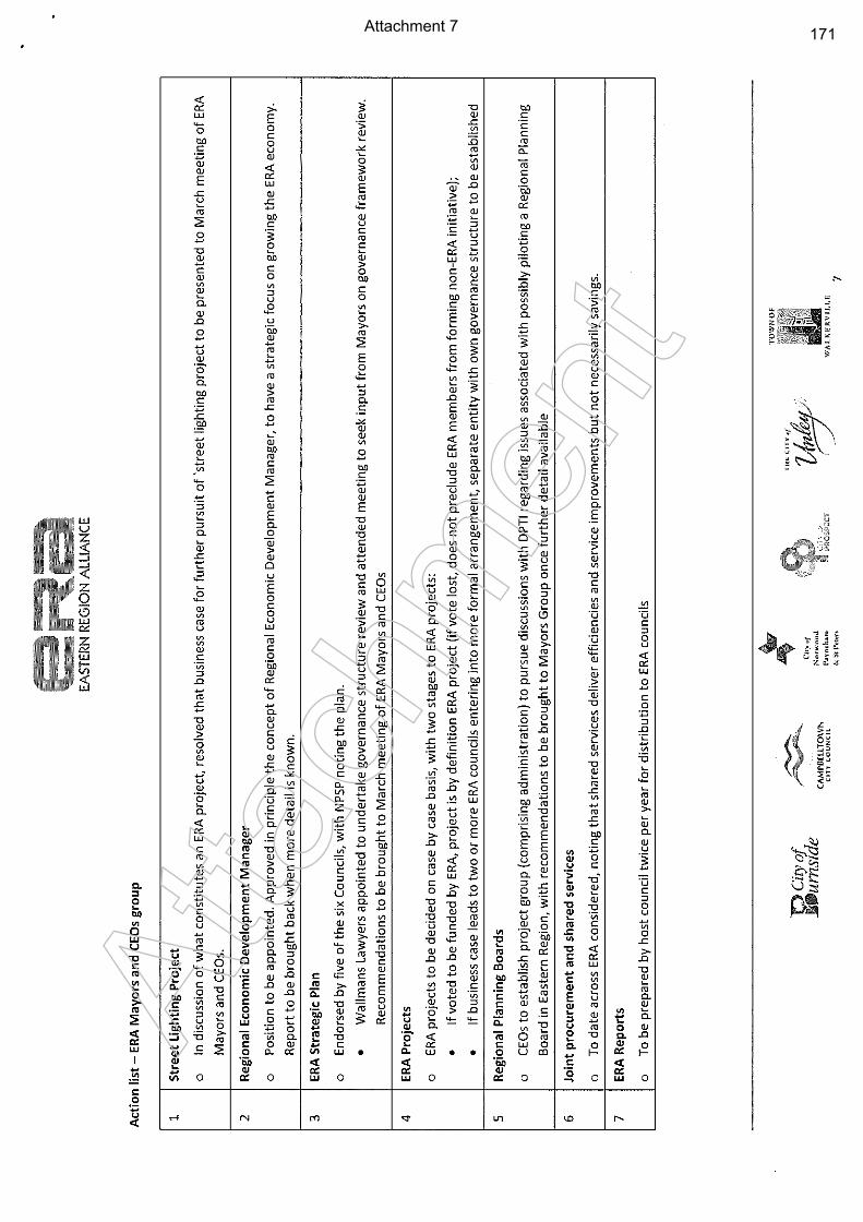
Attachment 7
Atta
chm
ent
171
Attachment 8
Atta
chm
ent
172
Attachment 9
Atta
chm
ent
173
Attachment 10
Atta
chm
ent
174
Attachment 11
Atta
chm
ent
175
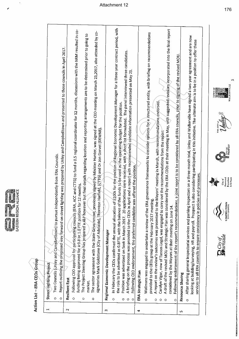
Attachment 12
Atta
chm
ent
176
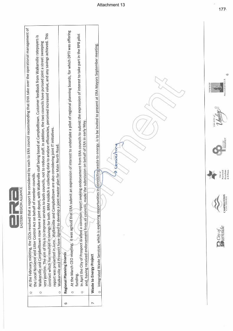
Attachment 13
Atta
chm
ent
177
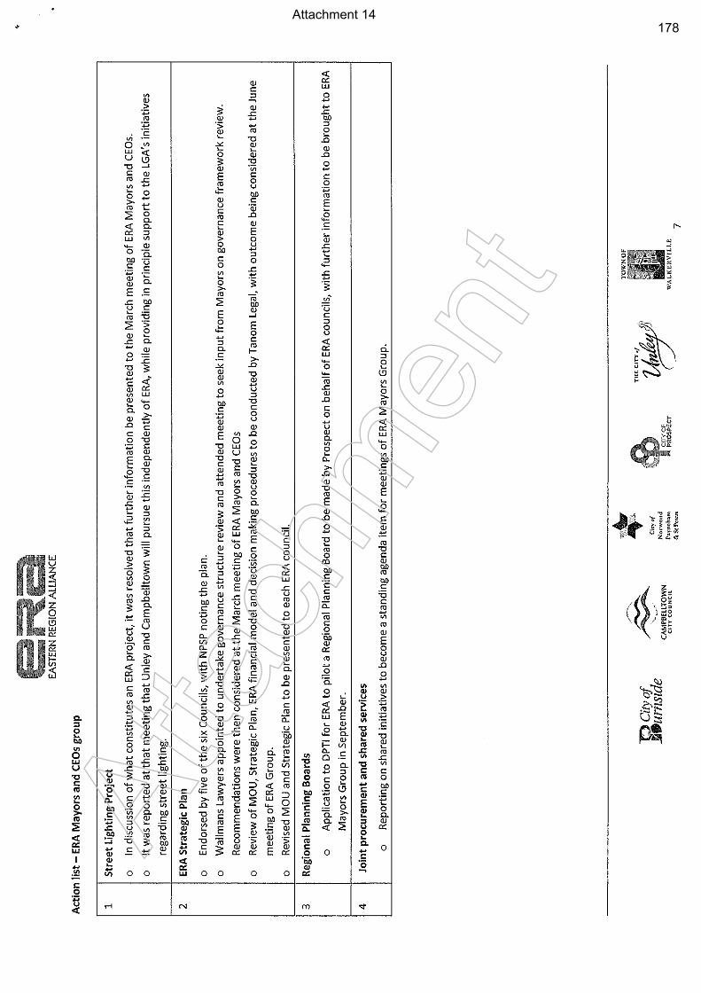
Attachment 14
Atta
chm
ent
178
Item 19.4: Establishing the Developer Partnership Grant Pilot Program
CITY OF PROSPECT: Council Agenda 25/07/2017
AGENDA ITEM NO.: 19.4 TO: Council on 25 July 2017 DIRECTOR: Ginny Moon, Director Corporate Services REPORT AUTHOR: Jo-Ann Tanti, Manager Governance & Administration SUBJECT: Establishing the Developer Partnership Grant Pilot Program
1. EXECUTIVE SUMMARY
1.1 The Council adopted Annual Business Plan 2017-2018 includes a new initiative to work in partnership with local developers to improve, upgrade or expand Council assets that will be for community benefit and contribute to achieving the strategic objectives.
1.2 This report provides the opportunity for Council to adopt the Guidelines that will be used to administer the 2017-2018 pilot program as presented or advise further alterations to ensure the maintenance of desired outcomes.
2. RECOMMENDATION
(1) The Council having considered Item 19.4 Establishing the Developer Partnership Grant Pilot Program 25 July 2017 receives and notes the report.
(2) Council adopt the Developer Partnership Grant Pilot Program Guidelines as presented in Attachments 1-2.
3. RELEVANCE TO CORE STRATEGIES / POLICY
Strategic Plan to 2020
Theme 3 – Prosperity: “More jobs, more investment, more activity, more vibrancy”
3.1 A stronger local economy
3.1.1 A busy and vibrant local business environment focused on the
Prospect Village Heart
3.1.2 Investment, employment and development encouraged across our City
3.2 A more vibrant night-time
3.2.1 A City with more people on the streets and more places to go at night
Theme 4 – Services: “Leaders of the sector providing efficient, responsive, accessible services”
4.2 Sound Financial Management
4.2.1 Sourcing funding partners and pursuing new revenue streams
179
Item 19.4: Establishing the Developer Partnership Grant Pilot Program
CITY OF PROSPECT: Council Agenda 25/07/2017
4. COMMUNITY INVOLVEMENT
No community engagement was undertaken in the preparation of this report.
5. DISCUSSION
Background
5.1 Council adopted the Annual Business Plan (ABP) and Budget 2017-2018 at the
ordinary meeting held in June 2017. The ABP included budget provision for a new
initiative offering local developers the opportunity to apply for a partnering arrangement
with Council.
5.2 The Council is committing a funding pool based on a ratio of no less than 50/50 share
of contribution to enable the upgrading or renewal of assets for a demonstrable
community benefit.
5.3 The 2017-2018 capital project cost budget reflects a total commitment of $423,300,
with an associated income source at 50% resulting in a financial contribution by council
of $211,650.
Current Matters
5.4 The Developer Partnership Grant Pilot Program 2017-2018 is proposed to operate as a
pilot program in order to evaluate the feasibility, time, effectiveness and achievement of
outcomes in an attempt to predict the continued benefits and level of developer interest
across the City.
5.5 The purpose of this report is to establish the Funding Guidelines, simplifying the
application process whilst ensuring the assessment criteria is structured to achieve a
high level of Community benefit.
5.6 Council workshopped a program outline recently, resulting in a number of suggestions
being proposed for inclusion in the draft Guidelines shown in Attachments 1-2.
5.7 The draft Guidelines include the following for consideration:
Expected outcomes;
Applicant Eligibility;
What can be Funded;
How to Apply;
Documentation required;
How applications are assessed; and
Assessment Criteria.
5.8 On completion of the criteria analysis it is appropriate that Council enter into a binding arrangement to be known as the Funding Agreement. This is a legal document that outlines the terms, conditions and obligations of funding accountability for both the successful applicant and the Council.
The Funding Agreement may include:
Council and applicant to be involved in the project design;
180
Item 19.4: Establishing the Developer Partnership Grant Pilot Program
CITY OF PROSPECT: Council Agenda 25/07/2017
Council is the Superintendent of the project;
How we will deal with project variations;
Progress payments / Milestones;
Project delivery timelines.
Council administration will engage the services of a legal practitioner for the
preparation of the Funding Agreement.
5.9 Dependent on the successful outcome and learnings from the 2017-2018 pilot program, a city wide registration of interest may provide an opportunity to assess the feasibility of undertaking further programs in future years.
5.10 The pilot program will therefore be subject to an evaluation, proving value and revealing deficiencies in order to apply for future funding.
ATTACHMENTS
Attachments 1-2: Draft Developer Partnership Grant Pilot Program 2017-2018 Guidelines
181
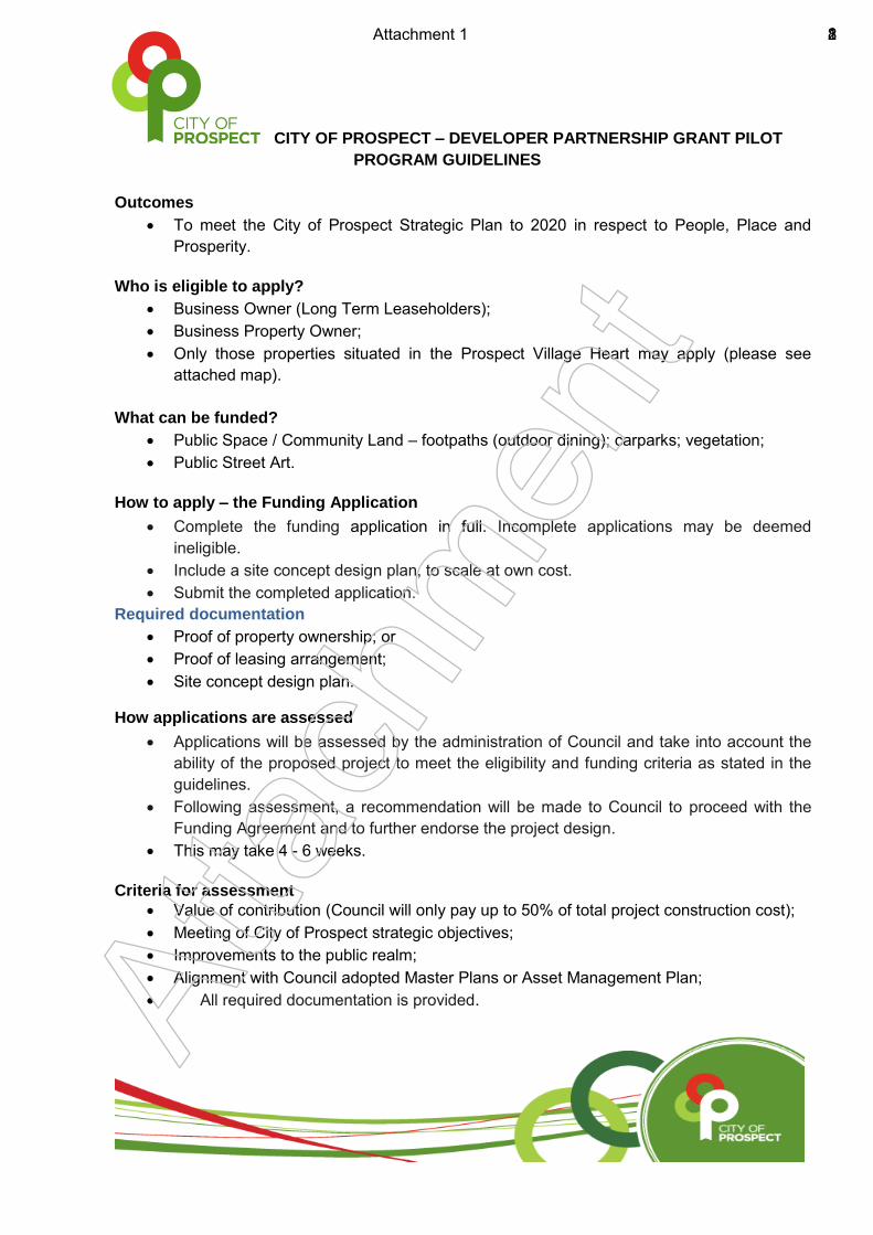
CITY OF PROSPECT – DEVELOPER PARTNERSHIP GRANT PILOT
PROGRAM GUIDELINES
Outcomes
To meet the City of Prospect Strategic Plan to 2020 in respect to People, Place and
Prosperity.
Who is eligible to apply?
Business Owner (Long Term Leaseholders);
Business Property Owner;
Only those properties situated in the Prospect Village Heart may apply (please see
attached map).
What can be funded?
Public Space / Community Land – footpaths (outdoor dining); carparks; vegetation;
Public Street Art.
How to apply – the Funding Application
Complete the funding application in full. Incomplete applications may be deemed
ineligible.
Include a site concept design plan, to scale at own cost.
Submit the completed application.
Required documentation
Proof of property ownership; or
Proof of leasing arrangement;
Site concept design plan.
How applications are assessed
Applications will be assessed by the administration of Council and take into account the
ability of the proposed project to meet the eligibility and funding criteria as stated in the
guidelines.
Following assessment, a recommendation will be made to Council to proceed with the
Funding Agreement and to further endorse the project design.
This may take 4 - 6 weeks.
Criteria for assessment
Value of contribution (Council will only pay up to 50% of total project construction cost);
Meeting of City of Prospect strategic objectives;
Improvements to the public realm;
Alignment with Council adopted Master Plans or Asset Management Plan;
All required documentation is provided.
Atta
chm
ent
Attachment 1 182
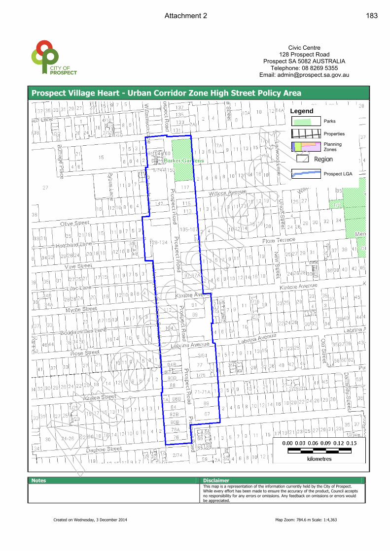
Created on Wednesday, 3 December 2014 Map Zoom: 784.6 m Scale: 1:4,363
Prospect Village Heart - Urban Corridor Zone High Street Policy Area
Notes Disclaimer This map is a representation of the information currently held by the City of Prospect.
While every effort has been made to ensure the accuracy of the product, Council accepts
no responsibility for any errors or omissions. Any feedback on omissions or errors would be appreciated.
Civic Centre
128 Prospect Road Prospect SA 5082 AUSTRALIA
Telephone: 08 8269 5355 Email: [email protected]
Legend
Parks
Properties
Planning Zones
Prospect LGA
Atta
chm
ent
Attachment 2 183

Item 19.5: Developer Partnership Grant Pilot Program – Rose Street Pubic Realm Application
CITY OF PROSPECT: Council Agenda 25/07/2017
AGENDA ITEM NO.: 19.5 TO: Council on 25 July 2017 DIRECTOR: Ginny Moon, Director Corporate Services REPORT AUTHOR: Jo-Ann Tanti, Manager Governance & Administration SUBJECT: Developer Partnership Grant Pilot Program – Rose Street
Public Realm Application
1. EXECUTIVE SUMMARY
1.1 Council have received a written application from the Maras Group, developers of the
mixed-use facility at 94-98 Prospect Road (corner Rose Street), Prospect to access
funding allocated to the Developer Partnership Grant Pilot Program for the proposed
Rose Street Public Realm Upgrade (the Project).
1.2 The Project is to be delivered in conjunction with the opening of the cinema complex,
expected for mid-October 2017 and will incorporate provision for outdoor dining,
landscaping and street furniture.
1.3 Attention to the funding criteria has been applied to the assessment of this project,
fulfilling the provisions as described in the Funding Guidelines, shown in Table 1
Application Assessment Summary below.
2. RECOMMENDATION
(1) Council having considered Item 19.4 Establishing Developer Partnership Grant Pilot Program receives and notes the report.
(2) Council endorses the design for public realm upgrades for the intersection of Prospect Road and Rose Street as per Attachment 1.
(3) Council approves the Maras Group application for funding as assessed in accordance with the Developer Partnership Grant Pilot Program Funding Guidelines.
3. RELEVANCE TO CORE STRATEGIES / POLICY
Strategic Plan 2020
Theme 3 – Prosperity: “More jobs, more investment, more activity, more vibrancy”
3.1 A stronger local economy
184
Item 19.5: Developer Partnership Grant Pilot Program – Rose Street Pubic Realm Application
CITY OF PROSPECT: Council Agenda 25/07/2017
3.1.1 A busy and vibrant local business environment focused on the
Prospect Village Heart
3.1.2 Investment, employment and development encouraged across our City
3.2 A more vibrant night-time
3.2.1 A City with more people on the streets and more places to go at night
Theme 4 – Services: “Leaders of the sector providing efficient, responsive, accessible services”
4.1 Excellence in Infrastructure
4.1.1 Taking great care of all of Council’s Assets
4.2 Sound Financial Management
4.2.1 Sourcing funding partners and pursuing new revenue streams
4. COMMUNITY INVOLVEMENT
4.1 Preliminary concept design and perspectives for the upgrade of the Prospect Road and Rose Street public realm were presented to Elected Members on 3 May 2016 Workshop.
4.2 Subsequently, a public consultation meeting regarding the concept design for upgrading this portion of Prospect Road and Rose Street was held on 31 July 2016 at the Town Hall with over 50 local residents attending.
4.3 Community feedback was generally positive with the majority of the community agreeing with the overall design intent in improving the local amenity whilst increasing the landscaping opportunity.
4.4 A summary of key outcomes following the public meeting were sent to all residents on Rose Street via a postcard format in October 2016. Residents were also encouraged to keep up to date on the progress of this project through the Council Website.
4.5 A Memorandum of key outcomes was also sent to Elected Members.
4.6 A Workshop with Elected Members was held on 4 July 2017 where concept designs were tabled with members providing commentary and suggestions on design improvements.
4.7 Resident and business interaction involved a door-knock engagement approach to inform adjacent properties of the updated designs in July 2017. This has been supplemented with correspondence.
5. DISCUSSION
Background
5.1 Council adopted the Annual Business Plan (ABP) and Budget 2017-2018 at the
Ordinary meeting held in June 2017. The ABP included budget provision for a new
initiative offering local developers/businesses the opportunity to apply for a partnering
arrangement with Council.
185
Item 19.5: Developer Partnership Grant Pilot Program – Rose Street Pubic Realm Application
CITY OF PROSPECT: Council Agenda 25/07/2017
5.2 The Developer Partnership Grant Pilot Program 2017-2018 is proposed to operate as a
pilot program in order to evaluate the feasibility, time, effectiveness and achievement of
outcomes in an attempt to predict the continued benefits and level of developer interest
across the City.
5.3 Council has previously been briefed on the opportunity to upgrade the intersection of
Prospect Road and Rose Street, Prospect, together with a local area traffic
management approach in consideration of increased traffic movement and car parking
demands resulting from the Maras Group mixed use development at 94-98 Prospect
Road, commonly known as the cinema development.
Current Matters
5.4 Council’s administration has received a formal request from the Maras Group (the
Applicant), to access the Developer Partnership Grant Pilot Program (the partnership
program) for upgrading of the Prospect Road and Rose Street intersection as part of
the construction and official opening of the Palace Nova Cinema and associated shops
and cafes, together with introducing a traffic calming device on Rose Street.
5.5 The Applicant has expressed a financial commitment to their proposal, with the
contribution of 50% to the cost of Council undertaking the Project (subject to the total
project not exceeding $300,000).
5.6 The request has included an expectation that civil works will be completed in
conjunction with the site opening estimated for mid-October 2017. It is apparent that
the short timeline requested by the applicant has resulted in council administration
expediting associated governance and design requirements to ensure Council can
make best use of this opportunity.
5.7 Establishment of the partnership program is expected to be received and endorsed by
Council on 25 July 2017, providing assessment criteria to determine the quality of the
Maras Group application.
5.8 Table 1 Developer Partnership Grant Pilot Program 2017 – 2018 – Application Assessment Summary Table
Refer to details within Guidelines Fulfilled Assessment Criteria Yes/No
1. Applicant Maras Group (Aust.) Pty Ltd
2. Funding Category Footpath/kerbing, Outdoor Dining, Increase foot traffic, Landscaping and Street Furniture
Yes
3. Eligibility Business Property Owner, Long Term Leaseholder, located within Village Heart Precinct
Yes
4. Community Benefit Economic, Social and Environmental Objectives outlined in the Prospect Strategic Plan 2020
Yes
186
Item 19.5: Developer Partnership Grant Pilot Program – Rose Street Pubic Realm Application
CITY OF PROSPECT: Council Agenda 25/07/2017
5. Funding Criteria Conformity to application requirements;
Site Concept Plan
Cost Breakdown
Project Program
Financial resources
Project Background and goals related to the 2020 Strategic Plan
Administration resources to manage the project
Required proof of ownership or lease agreement
Yes
6. Private contribution Contribution of 50% of more to the overall cost of the project
Yes
5.9 The Council Workshop held on 11 July 2017 included a detailed design of the
proposed concept plan known as the Rose Street Upgrade. Elected Members were
generally supportive of upgrading the Rose Street intersection to establish an improved
footpath area, and to address future potential traffic issues, subject to addressing a
number of elements including:
establishing the Rose Street residential ‘pinch point’ as a single lane;
ensuring appropriate bollard placement adjacent the road junction;
designing appropriate footpath widths to address future increased traffic movement;
ensuring appropriate landscaping and public seating opportunities;
establishing festoon/catenary lighting (to be funded solely by the Maras Group), subject to agreement from adjoining property owners;
ensure minimal loss of car parking;
consideration for a cinema patron’s drop off area on Prospect Road.
5.10 As a result of responding to these points, the concept plan has been finalised.
5.11 It is considered the plan generally represents the views of Council whilst taking into account engineering requirements, and its implementation will enhance this intersection.
ATTACHMENTS
Attachments 1: Rose Street Public Realm Draft Concept Design
187
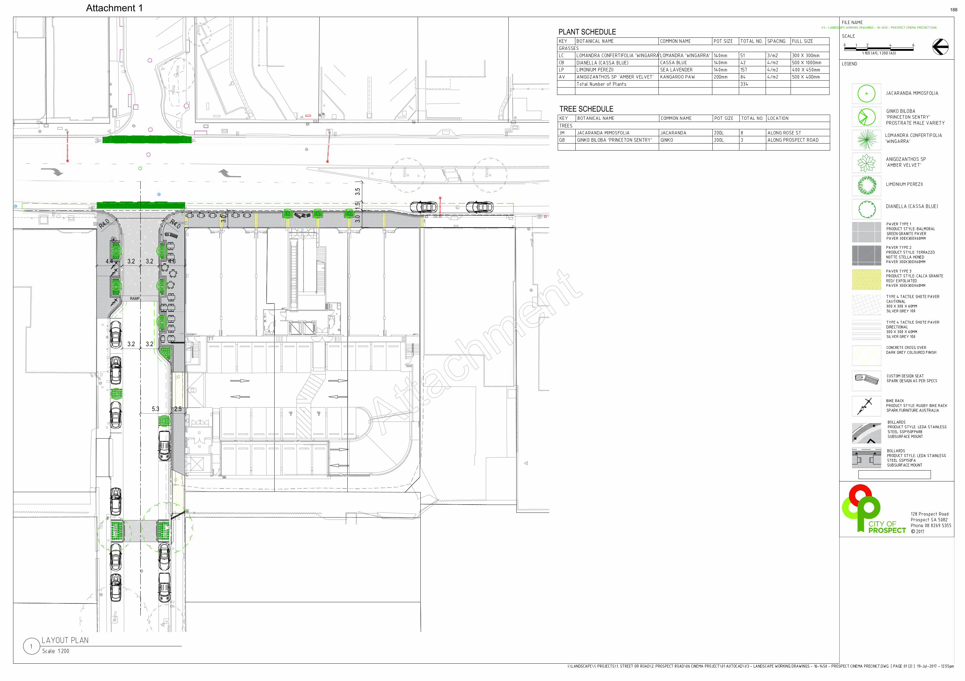
EXO
TIC
EXO
TIC
NAT
IVE
EXO
TIC
HEDG
E
EXO
TIC
EXO
TIC
EXO
TIC
EXO
TIC
RAMP
5.3
3.23.2
3.23.2
4.6
2.5
4.4
R4.0R4.0 3.03.0
3.51.5
R4.0
PLANT SCHEDULE
Attach
ment
Attachment 1 188

Item19.6: Transfer of Ownership – 93 Charles Street, Prospect
CITY OF PROSPECT: Council Agenda 25/07/2017
AGENDA ITEM NO.: 19.6 TO: Council Meeting on 25 July 2017 DIRECTOR: Ginny Moon, Director Corporate Services REPORT AUTHOR: Jo-Ann Tanti, Manager Governance & Administration SUBJECT: Transfer of Ownership - 93 Charles Street, Prospect
1. EXECUTIVE SUMMARY
1.1 Council delegated power to the Chief Executive Officer to enter into negotiations with the owner of 93 Charles Street, Prospect in May 2017. The property is adjacent the Stan Watson Reserve, where a stormwater pumping station manages emergency situations.
1.2 Council administration have been successful in the bid to secure the Charles Street site and consequently executed a contract of sale, due for disbursement on 28 July 2017.
1.3 Endorsement of the staff recommendation will permit settlement of property ownership and progression of the Reserve expansion and associated stormwater upgrade.
2. RECOMMENDATION
(1) That Council having considered Item 19.6 of 25 July 2017, delegates to the Chief Executive Officer the power to act on the transfer of ownership for 93 Charles Street, Prospect.
3. RELEVANCE TO CORE STRATEGIES / POLICY
3.1 Corporate Governance & Internal Control Framework
3.2 Strategic Plan to 2020 Theme 4 – Services “Leaders of the sector providing efficient, responsive, accessible services”
Strategy 4.1 Excellence in Infrastructure
4. COMMUNITY INVOLVEMENT
No community engagement was undertaken in the preparation of this report.
189
Item19.6: Transfer of Ownership – 93 Charles Street, Prospect
CITY OF PROSPECT: Council Agenda 25/07/2017
5. DISCUSSION
Background
5.1 The property located at 93 Charles Street, Prospect (the property) is adjacent Stan Watson Reserve (the reserve); in the lowest lying part of the city of which Council currently operate two stormwater emergency pumps.
5.2 Acquisition of the property will allow Council to increase Open Space in the area and to implement stormwater retention or other stormwater management options currently inhibited by the small size of the reserve.
5.3 Council adopted the Annual Business Plan (ABP) and Budget 2017-2018 at the ordinary meeting of June 2017. The ABP included budget provision for expansion of the reserve and flood mitigation work.
Current Matters
5.4 At the May 2017 Ordinary Meeting, Council approved the power to negotiate the purchase of the property to the Chief Executive Officer (CEO). Accordingly, Council administration entered into discussion with the property agent and has executed a contract of sale.
5.5 The purchase settlement is expected at the end of July 2017. This report is provided to give the CEO authority to sign a ‘client authorisation form’ and all other documents required to affect transfer of the property.
5.6 The property will thereafter be listed on Council’s Community Land Register, resulting in a minor review of the Community Land Management Plan 2017-2021.
ATTACHMENTS
Nil.
190
Item 19.7: Places for People Funding Update – Charles Cane and George Whittle Precinct and Main North Road
CITY OF PROSPECT: Council Agenda 25/07/2017
AGENDA ITEM NO.: 19.7 TO: Council on 25 July 2017 DIRECTOR: Ginny Moon, Director Corporate Services REPORT AUTHOR: Alex Cortes, Manager Infrastructure, Assets & Environment SUBJECT: Places for People Funding Update – Charles Cane and George
Whittle Precinct (Design Development) and Main North Road (Design Development)
1. EXECUTIVE SUMMARY
1.1 The purpose of this report is to provide Council with advice regarding two Places for People grant applications which have not been successful.
1.2 The unsuccessful grant funding relates to Charles Cane and George Whittle Precinct (Design Development) and Main North Road (Design Development).
1.3 Due to not receiving this grant funding the implementation these two projects will not be able to proceed as initially planned given the 50% reduction in funds. This will be reflected in the first budget review of 2017/2018.
1.4 The application procedure required the following assessment criteria;
Outline the Strategic Context
Project Background and Brief
Proposed project delivery, timing and detailed budget breakdown;
Meeting core objectives to support social, cultural and economic wellbeing of
the community; improved access and linkages; Maximise opportunities for
sustainability; improve safety of the public realm and community support and
consultation;
Meeting Places for People objectives; Increase the usability and function of the
public realm; innovation and creative design outcomes.
1.5 The grant funding for these two projects was included in the projected Annual Business
Plan 2017/2018 income. As these funds were not successful with the Places for People funding application a decision needs to be made regarding the future of these projects and the expectations of the delivery in the 2017/2018 Financial Year.
1.6 This results in the need for a decision in respect to either proceeding with these two projects, changing the scope of works, or delaying one or both.
191
Item 19.7: Places for People Funding Update – Charles Cane and George Whittle Precinct and Main North Road
CITY OF PROSPECT: Council Agenda 25/07/2017
2. RECOMMENDATION
(1) Council defer the Main North Road detail design.
(2) Council proceed with the detailed design of George Whittle Reserve, with additional funds being allocated from the Main North Road detailed design budget ($35,000).
(3) The budget of Main North Road detail design and George Whittle Reserve
detail design projects is adjusted at the first budget review 2017/18.
3. RELEVANCE TO CORE STRATEGIES / POLICY
Strategic Plan to 2020
3.1 Theme 2 – Place “Loved heritage, leafy streets, fabulous places”
Strategy 2.1 Respect the past, create our future
Strategy 2.2 Loved parks and places
Strategy 2.3 An accessible City
3.2 Theme 4 – Services “Leaders of the sector providing efficient, responsive, accessible services”
Strategy 4.1 Excellence in Infrastructure
4. COMMUNITY INVOLVEMENT
4.1 No community engagement was undertaken in the preparation of this report.
5. DISCUSSION
5.1 Administration undertook a funding application process for Open Space and Places for People grant funding in January 2017.
5.2 A discussion was held on January 2017 with the Open Space Strategic Projects Team from the State Government to outline possible funding opportunities in the City of Prospect specifically related to the public realm upgrades.
5.3 This meeting with the Department outlined favourable applications to include:
Prospect Cinema Public Realm Implementation;
Main North Road (Design Development) following the completed concept plans;
Charles Cane and George Whittle Precinct (Design Development) due to the increasing residential uplift;
192
Item 19.7: Places for People Funding Update – Charles Cane and George Whittle Precinct and Main North Road
CITY OF PROSPECT: Council Agenda 25/07/2017
The two latter projects have concept plans in the final stages which will be completed as part of a carry forward from 2016/17 ($100,000).
5.4 The application procedure required the following assessment criteria:
Strategic Context - how it meets the objectives of state government plans and Councils Strategic vision 2020;
Project Background and Brief – to illustrate why the project is required and the overall aim of the project;
Proposed project delivery and detailed budget breakdown – illustrate target outcomes and deliverables and issues or risks;
Meeting core objectives - to support social, cultural and economic wellbeing of the community; improved access and linkages; Maximise opportunities for sustainability; improve safety of the public realm and community support and consultation;
Meeting Places for People objectives - Increase the usability and function of the public realm; innovation and creative design outcomes.
5.5 It is evident each year the grant funding is highly competitive with over $25 million
worth of applications received. Council was advised on 6 July 2017 that it had been unsuccessful in respect to Charles Cane and George Whittle Precinct (Design Development) and Main North Road (Design Development).
5.6 Not receiving grant funding for these two projects means their implementation will not be able to proceed as initially planned due to the 50% reduction in funds and will need to be reviewed in the first budget review of 2017. No other funding opportunities have been identified.
5.7 It is considered there are a number of options available for consideration in determining how to proceed:
Option 1 - Council does not proceed with projects ‘Main North Road Detail Design’ and ‘George Whittle Reserve Detail Design’ and applies for a funding opportunity and budget bid again for 2018/2019 to further progress these projects;
Option 2 - Council proceeds with a reduced scope for George Whittle Reserve with the $35,000 budget in the Annual Business Plan after the completion of the Masterplan. Hold off from detail design works on Main North Road until full funds are available;
Option 3 – Proceed with Main North Road Design Development with a reduced scope of $60,000 budget. Hold off design development of George Whittle Reserve until the completion of the Masterplan and a budget bid for 2018/2019;
Option 4 - Proceed with both projects at the reduced budget and at a reduced scope (it is considered this will not provide an ideal outcome for an implementation project);
193
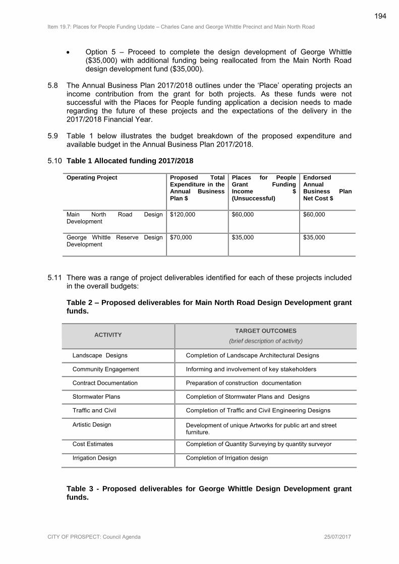
Item 19.7: Places for People Funding Update – Charles Cane and George Whittle Precinct and Main North Road
CITY OF PROSPECT: Council Agenda 25/07/2017
Option 5 – Proceed to complete the design development of George Whittle ($35,000) with additional funding being reallocated from the Main North Road design development fund ($35,000).
5.8 The Annual Business Plan 2017/2018 outlines under the ‘Place’ operating projects an income contribution from the grant for both projects. As these funds were not successful with the Places for People funding application a decision needs to made regarding the future of these projects and the expectations of the delivery in the 2017/2018 Financial Year.
5.9 Table 1 below illustrates the budget breakdown of the proposed expenditure and available budget in the Annual Business Plan 2017/2018.
5.10 Table 1 Allocated funding 2017/2018
Operating Project Proposed Total Expenditure in the Annual Business Plan $
Places for People Grant Funding Income $ (Unsuccessful)
Endorsed Annual Business Plan Net Cost $
Main North Road Design Development
$120,000 $60,000 $60,000
George Whittle Reserve Design Development
$70,000 $35,000 $35,000
5.11 There was a range of project deliverables identified for each of these projects included in the overall budgets:
Table 2 – Proposed deliverables for Main North Road Design Development grant funds.
ACTIVITY
TARGET OUTCOMES
(brief description of activity)
Landscape Designs Completion of Landscape Architectural Designs
Community Engagement Informing and involvement of key stakeholders
Contract Documentation Preparation of construction documentation
Stormwater Plans Completion of Stormwater Plans and Designs
Traffic and Civil Completion of Traffic and Civil Engineering Designs
Artistic Design Development of unique Artworks for public art and street furniture.
Cost Estimates Completion of Quantity Surveying by quantity surveyor
Irrigation Design Completion of Irrigation design
Table 3 - Proposed deliverables for George Whittle Design Development grant funds.
194
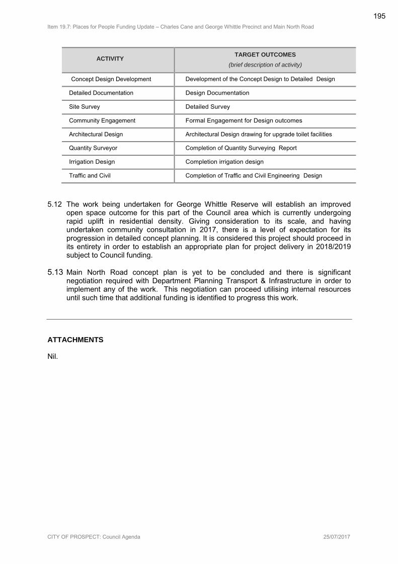
Item 19.7: Places for People Funding Update – Charles Cane and George Whittle Precinct and Main North Road
CITY OF PROSPECT: Council Agenda 25/07/2017
ACTIVITY TARGET OUTCOMES
(brief description of activity)
Concept Design Development Development of the Concept Design to Detailed Design
Detailed Documentation Design Documentation
Site Survey Detailed Survey
Community Engagement Formal Engagement for Design outcomes
Architectural Design Architectural Design drawing for upgrade toilet facilities
Quantity Surveyor Completion of Quantity Surveying Report
Irrigation Design Completion irrigation design
Traffic and Civil Completion of Traffic and Civil Engineering Design
5.12 The work being undertaken for George Whittle Reserve will establish an improved open space outcome for this part of the Council area which is currently undergoing rapid uplift in residential density. Giving consideration to its scale, and having undertaken community consultation in 2017, there is a level of expectation for its progression in detailed concept planning. It is considered this project should proceed in its entirety in order to establish an appropriate plan for project delivery in 2018/2019 subject to Council funding.
5.13 Main North Road concept plan is yet to be concluded and there is significant negotiation required with Department Planning Transport & Infrastructure in order to implement any of the work. This negotiation can proceed utilising internal resources until such time that additional funding is identified to progress this work.
ATTACHMENTS
Nil.
195

Item 19.8: Local Area Traffic Management Plan - Churchill Precinct:
CITY OF PROSPECT: Council Agenda 25/07/2017
AGENDA ITEM NO.: 19.8
TO: Council Meeting on 25 July 2017
DIRECTOR: Ginny Moon, Director Corporate Services
REPORT AUTHOR: Alex Cortes, Manager Infrastructure, Assets and Environment
SUBJECT: Local Area Traffic Management Plan – Churchill Precinct
1. EXECUTIVE SUMMARY
1.1 As part of Council’s ongoing commitment to traffic management, City of Prospect engaged a traffic consultant to undertake the Churchill Precinct Local Area Traffic Management Plan (LATM) during 2016. A copy of the completed plan is provided in Attachment 5-92.
1.2 The primary function of this LATM was to identify aspects of the local road network which may require improvement, either through minor modifications, maintenance, moderating vehicle speeds, improving safety or discouraging through traffic on local roads.
1.3 The study area for this investigation encompasses the area to the west of Churchill Road, to the east of the railway line, south of Regency Road and north of Torrens Road.
1.4 This report does not include recommendations for improvements on roads maintained by DPTI (Churchill Road, Regency Road and Torrens Road) but has provided some recommendations for Council to undertake ongoing liaison with DPTI.
1.5 The northern portion of the study region also includes the Churchill Centre South retail district, north of Regency Road, west of Churchill Road and east of the railway line. However, this development site is accessible only from DPTI maintained roads and does not include internal Council owned roads. As such, this retail precinct is beyond the scope of any investigation undertaken as part of this Local Area Traffic Management study.
1.6 In general, the traffic volumes on the local street network fall within acceptable limits for the existing local road classifications.
1.7 Analysis of current and historic traffic volumes throughout the study area generally shows a reduction in traffic volume on the local streets. The 85th percentile speed data shows that travel speeds throughout the local area are generally moderate.
1.8 A number of residents raised concerns about on-street parking capacity within the study area due to the increasing residential population and new residential developments. InfraPlan conducted an inspection of on and off-street parking provision and use and did not observe any instance whereby on-street parking in the local area was not available, nor instances where on-street parking prohibited through traffic or presented a safety concern.
196
Item 19.8: Local Area Traffic Management Plan - Churchill Precinct:
CITY OF PROSPECT: Council Agenda 25/07/2017
1.9 Excessive speed within the study area was raised as an issue by residents. InfraPlan suggests that the Council investigate the introduction of a 40km/h speed limit within the Churchill Precinct (excluding Pym Street and Belford Avenue), consistent with the area on the eastern side of Churchill Road.
1.10 A summary of the actions and recommendations from the report can be found in Attachment 1-4.
2. RECOMMENDATION
(1) Council having considered Item 19.8 Local Area Traffic Management Plan –Churchill Precinct dated 25 July 2017, endorse the plan provided as (Attachments 5-92).
(2) Council endorse the actions planned for 2017/18 (as presented in Attachment 1-4)
(3) Council consider budget bids for 2018/19 for the Local Area Traffic Management Plan – Churchill Precinct recommendations as provided in Attachment 1-4 that cannot be delivered through the 2017/18 recurrent budget.
3. RELEVANCE TO CORE STRATEGIES / POLICY
3.1 Traffic Management Policy
Prospect (City) Development Plan: Land Use and Parking Requirements
30 Year Plan for Greater Adelaide
Integrated Transport and Land Use Policy (ITLUP)
Metropolitan Adelaide Road Widening Plan
3.2 Strategic Plan to 2020 Theme 1 – People “Know, empower, celebrate, educate and activate our community”
Strategy 1.1 Know our community
Strategic Plan to 2020 Theme 2 – Place “Loved heritage, leafy streets, fabulous places”
Strategy 2.3 An accessible City
Strategic Plan to 2020 Theme 4 – Services “Leaders of the sector providing efficient, responsive, accessible services”
Strategy 4.1 Excellence in Infrastructure
4. COMMUNITY INVOLVEMENT
.
197
Item 19.8: Local Area Traffic Management Plan - Churchill Precinct:
CITY OF PROSPECT: Council Agenda 25/07/2017
4.1 A consultation process was undertaken as per the project and Council Policy requirements.
4.2 The following processes have been employed to gather feedback into the input of this report:
4.2.1 Initial contact with residents and stakeholders.
4.2.2 A letter box drop of the precinct with the following information.
4.2.3 Announcement of the project, its purpose and expected outputs.
4.2.4 An invitation to attend a Neighbourhood Forum, and
4.2.5 A link to an online survey questionnaire to identify concerns and opportunities
4.2.6 Neighbourhood Forum
(1) This open forum provided a platform to discuss issues in detail, confirm the issues identified and discuss possible options and solutions.
4.3 Traffic data was collected during May 2016 on the local road network at the midblock point of all east-west streets within the study area and midblock on Devonport Terrace (south of both Pym Street and Belford Avenue).
5. DISCUSSION
5.1 As part of Council’s ongoing commitment to traffic management, the City of Prospect engaged a traffic consultant to undertake the Churchill Precinct Local Area Traffic Management Plan. The study area encompasses the area to the west of Churchill Road, to the east of the railway line, south of Regency Road and north of Torrens Road.
5.2 This Local Area Traffic Management Plan has been developed to consider all council owned roads within the Churchill Local Traffic Precinct. The primary function of this LATM is to identify aspects of the local road network which may require improvement, either through minor modifications, maintenance, moderating vehicle speeds, improving safety or discouraging through traffic on local roads.
5.3 In general, the traffic volumes on the local street network fall within acceptable limits for the existing Local Road classifications. However, Pym Street and Belford Avenue carry traffic volumes greater than 1500 vehicles per day (vpd) and therefore fall within the Collector Road category. Therefore, to comply with the current City of Prospect road categorisation system, Pym Street and Belford Avenue should be re-classified to Collector Roads. It is recommended that the City of Prospect Traffic Management Policy be updated to reflect Pym Street as a Major Collector and Belford Avenue as Minor Collector so that defined role and function more appropriately matches its observed operation.
5.4 Analysis of current and historic traffic volumes throughout the study area generally shows a reduction in traffic volume on the local streets.
198
Item 19.8: Local Area Traffic Management Plan - Churchill Precinct:
CITY OF PROSPECT: Council Agenda 25/07/2017
5.5 The 85th percentile speed data shows that travel speeds throughout the local area are generally moderate. They are below 40km/h in all cases except for Kingdom Place, Pym Street and Boucher Place where they are 40.7, 45.5 and 45.7 km/h respectively. Over 5% of east-bound traffic on both Pym Street and Boucher Place was recorded above the posted speed limit of 50km/h.
5.6 In addition to speeds and volumes, the development occurring within the area was of Concern to residents with regard to its impact on Traffic in the area. Given that the infill development across the suburb is generally spread across the area, the expected impact of additional traffic is minimised as it will likely not be localised to any specific road or intersection. In the following table the assumed additional traffic generation of 1,400 vehicles per day over the next 5 years has been distributed across the network to determine if any of the local roads exceed the threshold of traffic volumes for local roads (as per the City of Prospect Traffic Management Guidelines).
5.7 Despite the potential average percentage increase of 48% of traffic volumes on local streets, the resultant additional traffic is considered acceptable given the threshold of 1,500vpd is not exceeded on any local street, other than on Belford Ave and Pym Street which already exceed the threshold.
5.8 The development potential of 250 Churchill Road and its impact on the precinct was requested for consideration by the Elected Member body. While appreciating the development potential of this significant land parcel, until the scale and land use mix is determined, a traffic impact statement should not be pursued, but will be required once the development capacity is known. This traffic impact statement should take into consideration this local area traffic management plan, and may require further consideration of other traffic control device interventions. As such this development was not considered as part of this LATMP.
5.9 Infraplan has recommended the following recommendations for the Churchill Precinct:
5.9.1 Kingdom Place - Install pavement bar island at the western end of Kingdom Place, at the approach to Devonport Terrace. To be completed during 2017/18 utilising recurrent budget.
5.9.2 Kingdom Place – Implement yellow line pavement marking to strengthen ‘No Stopping’ at the approach to Devonport Terrace (to ensure sufficient space is available on approach to the intersection). To be completed during 2017/18 utilising recurrent budget.
5.9.3 Corner of Devonport Terrace and Kingdom Place - Repair footpath paving blocks, (if possible, address local businesses to alert them to the issue and encourage assistance to prevent recurrence). To be completed during 2017/18 utilising recurrent budget.
5.9.4 Pym Street and Belford Avenue - Re-categorise Pym Street to a Collector Road and Belford Avenue to a Minor Collector Road to reflect the role and function of these roads in accordance with the City of Prospect Traffic Management Policy Road Hierarchy Plan.
5.9.5 Full Churchill LATM area – Further investigate the introduction of a 40km/h speed limit, with the exception of Pym Street and Belford Avenue.
5.9.6 Full Churchill LATM area - Replace on-street parking signage as necessary. To be completed during 2017/18 utilising recurrent budget.
199
Item 19.8: Local Area Traffic Management Plan - Churchill Precinct:
CITY OF PROSPECT: Council Agenda 25/07/2017
5.9.7 Devonport Terrace, North Side of Belford Avenue Intersection - Install threshold pavement treatment similar to that on Devonport Terrace at Pym Street. Ongoing monitoring of impacts to traffic speed and volumes in Boucher Place, particularly commercial vehicle volumes. A budget bid will be submitted for the 2018/19 financial year to undertake this work.
5.9.8 Elizabeth Street, Devonport Terrace and Boucher Place - Replace worn painted yellow lines and parking signage on Belford Avenue. Install new painted yellow line markings to restrict parking on Elizabeth Street at the approach to Churchill Road to ensure sight distance and safe intersections widths are maintained. Remove signage and faded line markings to permit parking on the northern side of Belford Avenue (with clearance for driveways) while maintaining “No Parking” on the southern side. To be completed during 2017/18 utilising recurrent budget.
5.9.9 Devonport Terrace at Ovingham Railway Station - Restrict parking to the eastern side of the road with painted yellow lines and / or no parking signs on the western side. This ensures access to driveways on the eastern side while maintaining a single travel lane and improves sight lines for cyclists. Driveways also provide passing space when required. To be completed during 2017/18 utilising recurrent budget.
5.9.10 Devonport Terrace, Rail Reserve - Consider streetscape upgrade with improved vegetation along railway line. A budget bid will be submitted for the 2018/19 financial year to undertake this work.
5.9.11 Devonport Terrace, Rail Reserve - Consider installation of additional “No Dumping” where vegetation is sparse and dumping is occurring.
5.9.12 Devonport Terrace, speed humps and cycle paths - Improved maintenance practices including use of leaf blowers and brooms to clear affected sections ahead of street sweepers. Ongoing monitoring, particularly during heavy leaf fall seasons. To be completed during 2017/18 utilising recurrent budget.
5.10 Pym Street
5.10.1 It is known that the Department of Transport has, over many years, considered possible works to address concerns with Pym Street regarding the level crossing of the Gawler passenger and freight lines and the intersection at Churchill Road. Site observations showed that large volumes of heavy vehicles use this roadway to access local industrial precincts in the City of Port Adelaide Enfield from Churchill Road.
5.10.2 The recommendation to upgrade the categorisation of Pym Street to a Minor Collector Road acknowledges the elevated traffic and heavy vehicle volumes and use of Pym Street as a through road to endorse and support Council advocacy for improved road treatments of Pym Street and upgraded intersection arrangements.
200
Item 19.8: Local Area Traffic Management Plan - Churchill Precinct:
CITY OF PROSPECT: Council Agenda 25/07/2017
5.10.3 In the absence of detailed investigations and designs of the intersection, it is recommended that solutions including road widening of Pym Street to allow multiple lane approaches, signalisation of the intersection and improved turning allowances for heavy vehicles entering Pym Street be considered. This is likely to require relocation of the stobie pole and 66kV power lines located at the north-western corner of the intersection and is also likely to force amelioration works on the level crossing at the western end of the City of Prospect section of Pym Street.
5.11 Pedestrian fencing for rail crossing at Pym Street
5.11.1 One local resident made mention of the fencing that was installed in 2016 parallel to the northern kerb on Pym Street within the Rail Reserve to prevent pedestrians from entering the roadway. While this fence is a permeable structure, it was observed during a site inspection that when viewed at an acute angle, the vertical elements obscure visibility along Pym Street to the west, affecting drivers approaching Pym Street, southbound on Devonport Terrace. It is recommended that Council advocate DPTI to realign this fence to provide greater visibility for these motorists, reducing the crash risk at the intersection.
5.12 City of Prospect will need to advocate to the Department of Planning, Transport and Infrastructure for improvements to Pym Street:
5.12.1 Engagement with Port Adelaide Enfield to establish a working committee and discuss and document design options or alternative network functionality, including:
(1) Option A: Improvement of functionality of Pym Street / Churchill Road intersection aligned with the 2010 Tonkin proposal, but considering other design solutions including signalisation options.
(2) Option B: Remove functionality by closing the level crossing or Pym Street access at Churchill Road. Network implications require investigation, and agreement with Port Adelaide Enfield. Alternative routes for accessing industrial areas west of the rail line may include via Exeter Terrace or access from South Road. This requires interaction with CC Port Adelaide Enfield as many network impacts will be felt in the neighbouring council area.
5.12.2 Engagement with DPTI to present possible design or network solutions (an agreed solution suitable to both Port Adelaide Enfield and City of Prospect)
5.12.3 Develop concept plans in partnership with DPTI for an appropriate design solution
5.12.4 Undertake consultation with local residents and businesses to determine support, or refine preferred design option
5.12.5 Secure funding to implement agreed design/network solution.
5.13 Belford Avenue
201
Item 19.8: Local Area Traffic Management Plan - Churchill Precinct:
CITY OF PROSPECT: Council Agenda 25/07/2017
5.13.1 Council is encouraged to advocate DPTI to investigate intersection widening at Belford Avenue to create two approach lanes eastbound to Churchill Road. This will separate left- and right-turn movements exiting Belford Avenue to Churchill Road, improving traffic flows from Belford Avenue and reducing opportunistic driver behaviour using parallel local streets.
5.14 Pedestrian crossings of Churchill Road near Ovingham Station
5.14.1 Rail passengers from Ovingham Station, including many school children were observed making uncontrolled crossings of Churchill Road near Avenue Road. There is no pedestrian crossing amenity provided in this area and medians are painted only, offering no shelter or protection for pedestrians. It is recommended that Council advocate to DPTI to provide a crossing facility in this area as a pedestrian desire line has been identified.
5.15 Electrification of Gawler Passenger Rail Line
5.15.1 It is recommended that Council supports the position of state government in pursuing the electrification of the Gawler passenger rail line. It is understood that such an upgrade comes with necessary improvements and changes to the rail corridor including extensive fencing around the high-voltage rail environment.
5.16 Station upgrades
5.16.1 It is noted that the three passenger rail stations in close proximity to the local area, Ovingham, Dudley Park and Islington, are among the worst rated and most poorly patronised stations on the Adelaide Rail Network. It is recommended that Council supports upgrades to station amenity including shelters, way finding and passenger information at these stations, with or without electrification of the rail line.
5.16.2 It is recommended that Council advocate to have Ovingham, Dudley Park and Islington stations added to the State Government Stations Upgrade Program.
5.17 A summary of the actions and recommendations from the report can be found in Attachment 1-4.
ATTACHMENTS
Attachment 1-4: Recommendations and Actions
Attachments 5-92: Churchill Precinct Local Area Traffic Management Plan
202
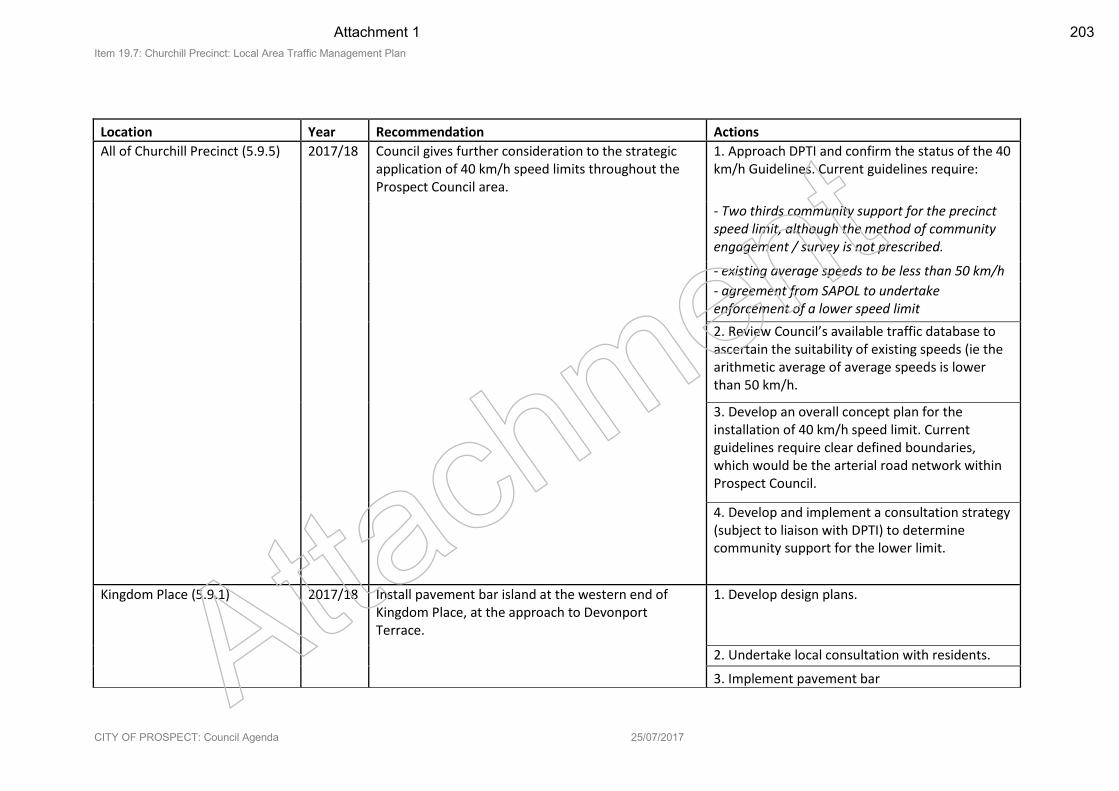
Item 19.7: Churchill Precinct: Local Area Traffic Management Plan
CITY OF PROSPECT: Council Agenda 25/07/2017
Location Year Recommendation Actions
All of Churchill Precinct (5.9.5) 2017/18 Council gives further consideration to the strategic application of 40 km/h speed limits throughout the Prospect Council area.
1. Approach DPTI and confirm the status of the 40 km/h Guidelines. Current guidelines require:
- Two thirds community support for the precinct speed limit, although the method of community engagement / survey is not prescribed.
- existing average speeds to be less than 50 km/h
- agreement from SAPOL to undertake enforcement of a lower speed limit
2. Review Council’s available traffic database to ascertain the suitability of existing speeds (ie the arithmetic average of average speeds is lower than 50 km/h.
3. Develop an overall concept plan for the installation of 40 km/h speed limit. Current guidelines require clear defined boundaries, which would be the arterial road network within Prospect Council.
4. Develop and implement a consultation strategy (subject to liaison with DPTI) to determine community support for the lower limit.
Kingdom Place (5.9.1) 2017/18 Install pavement bar island at the western end of Kingdom Place, at the approach to Devonport Terrace.
1. Develop design plans.
2. Undertake local consultation with residents.
3. Implement pavement bar Attach
ment
Attachment 1 203
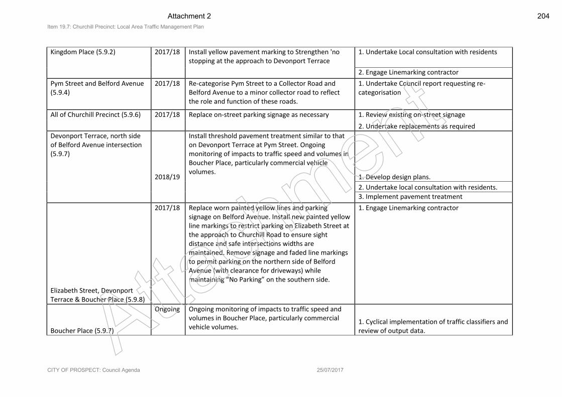
Item 19.7: Churchill Precinct: Local Area Traffic Management Plan
CITY OF PROSPECT: Council Agenda 25/07/2017
Kingdom Place (5.9.2) 2017/18 Install yellow pavement marking to Strengthen 'no stopping at the approach to Devonport Terrace
1. Undertake Local consultation with residents
2. Engage Linemarking contractor
Pym Street and Belford Avenue (5.9.4)
2017/18 Re-categorise Pym Street to a Collector Road and Belford Avenue to a minor collector road to reflect the role and function of these roads.
1. Undertake Council report requesting re-categorisation
All of Churchill Precinct (5.9.6) 2017/18 Replace on-street parking signage as necessary 1. Review existing on-street signage
2. Undertake replacements as required
Devonport Terrace, north side of Belford Avenue intersection (5.9.7)
2018/19
Install threshold pavement treatment similar to that on Devonport Terrace at Pym Street. Ongoing monitoring of impacts to traffic speed and volumes in Boucher Place, particularly commercial vehicle volumes.
1. Develop design plans.
2. Undertake local consultation with residents.
3. Implement pavement treatment
Elizabeth Street, Devonport Terrace & Boucher Place (5.9.8)
2017/18 Replace worn painted yellow lines and parking signage on Belford Avenue. Install new painted yellow line markings to restrict parking on Elizabeth Street at the approach to Churchill Road to ensure sight distance and safe intersections widths are maintained. Remove signage and faded line markings to permit parking on the northern side of Belford Avenue (with clearance for driveways) while maintaining “No Parking” on the southern side.
1. Engage Linemarking contractor
Boucher Place (5.9.7)
Ongoing Ongoing monitoring of impacts to traffic speed and volumes in Boucher Place, particularly commercial vehicle volumes.
1. Cyclical implementation of traffic classifiers and review of output data. Atta
chm
ent
Attachment 2 204
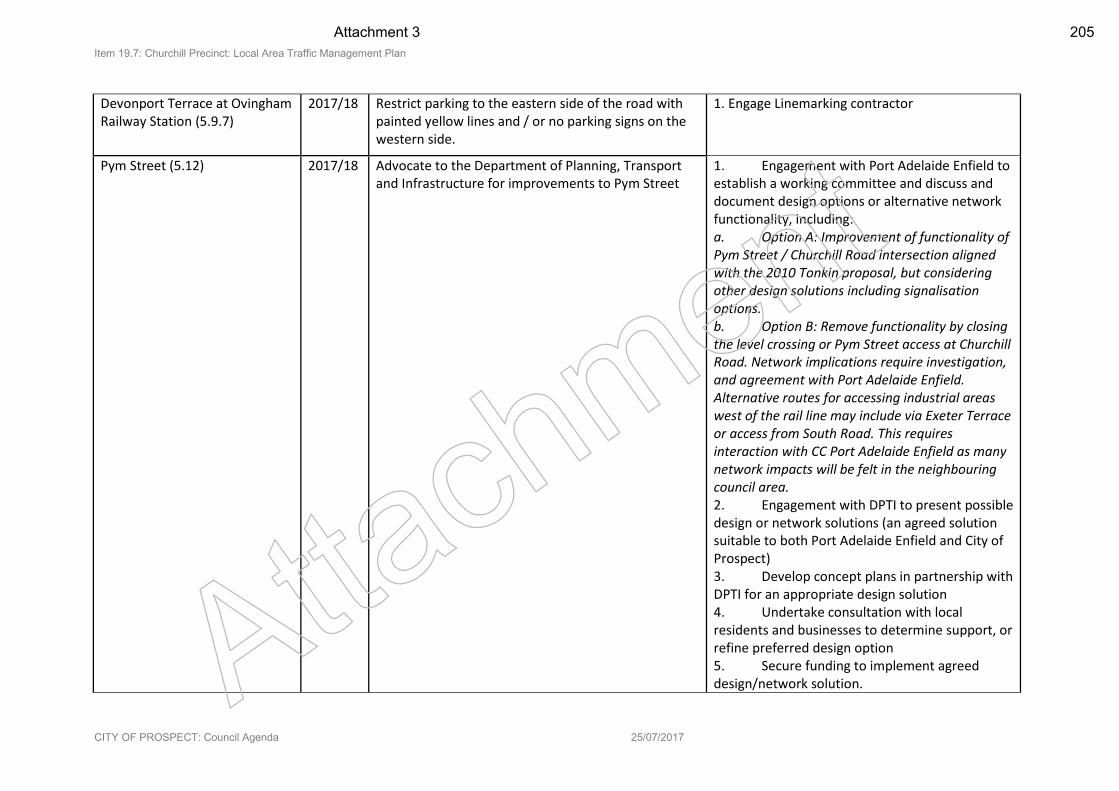
Item 19.7: Churchill Precinct: Local Area Traffic Management Plan
CITY OF PROSPECT: Council Agenda 25/07/2017
Devonport Terrace at Ovingham Railway Station (5.9.7)
2017/18 Restrict parking to the eastern side of the road with painted yellow lines and / or no parking signs on the western side.
1. Engage Linemarking contractor
Pym Street (5.12) 2017/18 Advocate to the Department of Planning, Transport and Infrastructure for improvements to Pym Street
1. Engagement with Port Adelaide Enfield to establish a working committee and discuss and document design options or alternative network functionality, including: a. Option A: Improvement of functionality of Pym Street / Churchill Road intersection aligned with the 2010 Tonkin proposal, but considering other design solutions including signalisation options. b. Option B: Remove functionality by closing the level crossing or Pym Street access at Churchill Road. Network implications require investigation, and agreement with Port Adelaide Enfield. Alternative routes for accessing industrial areas west of the rail line may include via Exeter Terrace or access from South Road. This requires interaction with CC Port Adelaide Enfield as many network impacts will be felt in the neighbouring council area. 2. Engagement with DPTI to present possible design or network solutions (an agreed solution suitable to both Port Adelaide Enfield and City of Prospect) 3. Develop concept plans in partnership with DPTI for an appropriate design solution 4. Undertake consultation with local residents and businesses to determine support, or refine preferred design option 5. Secure funding to implement agreed design/network solution. Atta
chm
ent
Attachment 3 205
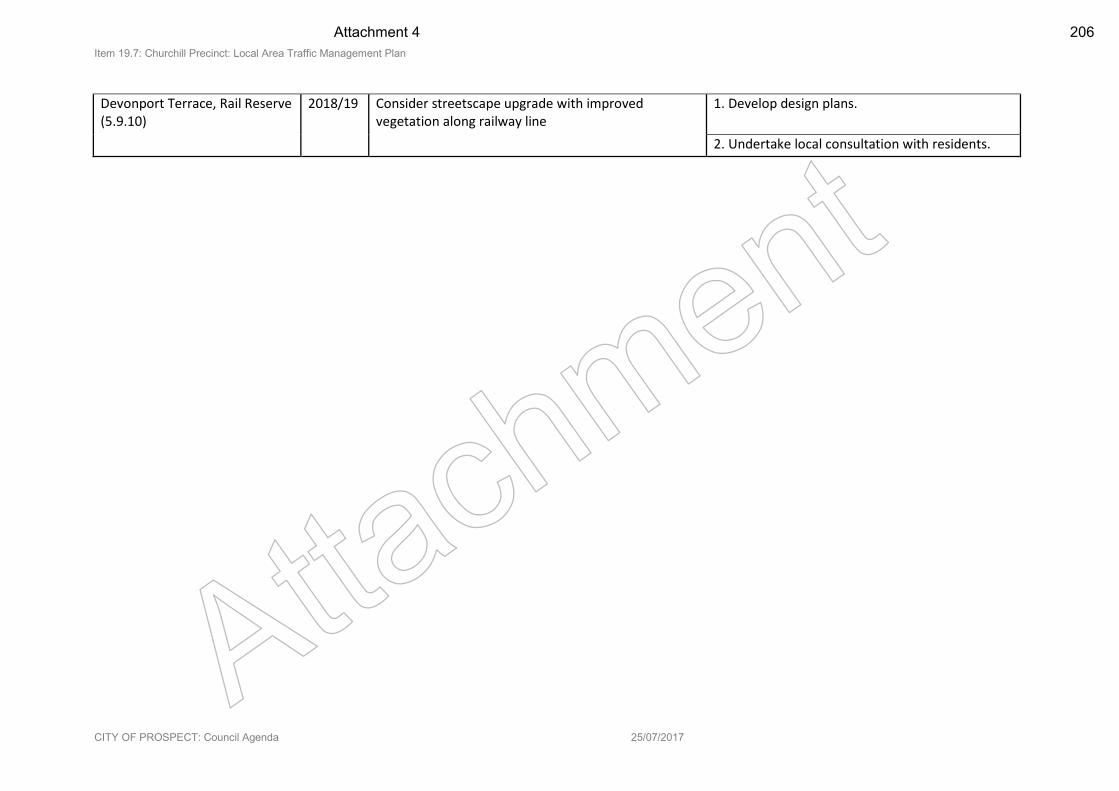
Item 19.7: Churchill Precinct: Local Area Traffic Management Plan
CITY OF PROSPECT: Council Agenda 25/07/2017
Devonport Terrace, Rail Reserve (5.9.10)
2018/19 Consider streetscape upgrade with improved vegetation along railway line
1. Develop design plans.
2. Undertake local consultation with residents.
Attach
ment
Attachment 4 206
Churchill Precinct: Local Area Traffic Management Plan
Prepared by
Atta
chm
ent
Attachment 5 207
City of Prospect – Churchill Precinct: Local Area Traffic Management Plan
InfraPlan (Aust) Pty Ltd 2017
The information contained in this document produced by InfraPlan (Aust) Pty Ltd is solely for the use of the Client for the purposes for which it has been prepared and InfraPlan (Aust) Pty Ltd undertakes no duty or accepts any responsibility to any third party who may rely on this document. All rights reserved. No sections or elements of this document may be removed from this document, reproduced, electronically stored or transmitted in any form without the written permission of InfraPlan (Aust) Pty Ltd.
Prepared for
Anders Bogdanowicz
Environment and Transport Engineer
City of Prospect
128 Prospect Road, Prospect SA 5082
Telephone: 08 8269 5355
Consultant Benjamin Russ - Associate
James Edwards - Transport Analyst & Planner
Infraplan (Aust) Pty Ltd
Level 3, 66 Wyatt Street | ADELAIDE SA 5000 | p: +8227 0372
Last saved 19/07/2017 11:10:43 AM
Version Control IP16.014_Churchill LATMP
Version (suffix)
Notes Author Date Reviewer
R1 Preliminary Draft for Council Review BR/JE 05.07.2016 GB
R2 Draft following EM workshop BR/JE 28.03.2017
R3 Removal of Draft watermark BR/JE 05.06.2017
R4 Additional information regarding 40km/h precinct and Pym St intersection actions
BR/JE 13.07.2017 Atta
chm
ent
Attachment 6 208
City of Prospect – Churchill Precinct: Local Area Traffic Management Plan
Table of Contents
1. Executive Summary ........................................................................................................... 1
2. Introduction ...................................................................................................................... 2
3. Strategic Context and Policies ............................................................................................ 4
3.1 City of Prospect Policies ................................................................................................................ 4
3.2 State Policies ............................................................................................................................... 11
4. Existing Conditions .......................................................................................................... 15
4.1 Road Hierarchy ............................................................................................................................ 15
4.2 Existing Local Area Traffic Management ..................................................................................... 17
4.3 Traffic Data - Volume and Speed ................................................................................................ 18
4.4 Crash History ............................................................................................................................... 24
4.5 Public Transport .......................................................................................................................... 26
4.6 Cycling ......................................................................................................................................... 27
5. Population Growth and Traffic Generation ....................................................................... 28
5.1 Demographic Comparison and suburban growth ....................................................................... 28
5.2 Traffic generation Rates .............................................................................................................. 29
6. Consultation ................................................................................................................... 32
6.1 Summary of Consultation Feedback ........................................................................................... 32
6.2 Issues Raised by Elected Members ............................................................................................. 36
7. Recommendations .......................................................................................................... 38
7.1 Direct actions for council to implement ..................................................................................... 38
7.2 Issues for Engagement With and Advocacy To Others (primarily DPTI) ..................................... 56
Appendix A ................................................................................................................................ 60
Appendix B ................................................................................................................................ 61
Appendix C ................................................................................................................................. 78
Appendix D ................................................................................................................................ 81
Appendix E ................................................................................................................................. 82
Appendix F ................................................................................................................................. 83
Atta
chm
ent
Attachment 7 209
City of Prospect – Churchill Precinct: Local Area Traffic Management Plan
1
1. Executive Summary This Local Area Traffic Management Plan (LATMP) has been developed to consider all Council owned roads within the Churchill Local Traffic Precinct (Churchill Precinct). The primary function of this LATMP is to identify aspects of the local road network which may require improvement, either through minor modifications, maintenance, moderating vehicle speeds, improving safety or discouraging through traffic on local roads.
Land uses, population, transport services and infrastructure change over time, and therefore it is important to review the local road network role and function, ensuring a fit-for-purpose current and future context.
All recommendations provided herein are descriptive only and require detailed design prior to implementation. Site visits, community consultation and desktop investigations have been carried out to ensure that the recommendations are feasible and can comply with:
Austroads Guide to Traffic Management Part 8: Local Area Traffic Management
Department of Planning Transport and Infrastructure (DPTI). Pavement Marking Manual
DPTI, Manual of Legal Responsibilities and Technical Requirements for Traffic Control Devices
The City of Prospect is responsible for the implementation of the recommendations within this report and for detailed design in accordance with Australian Standards, Austroads Guides and DPTI codes.
Atta
chm
ent
Attachment 8 210
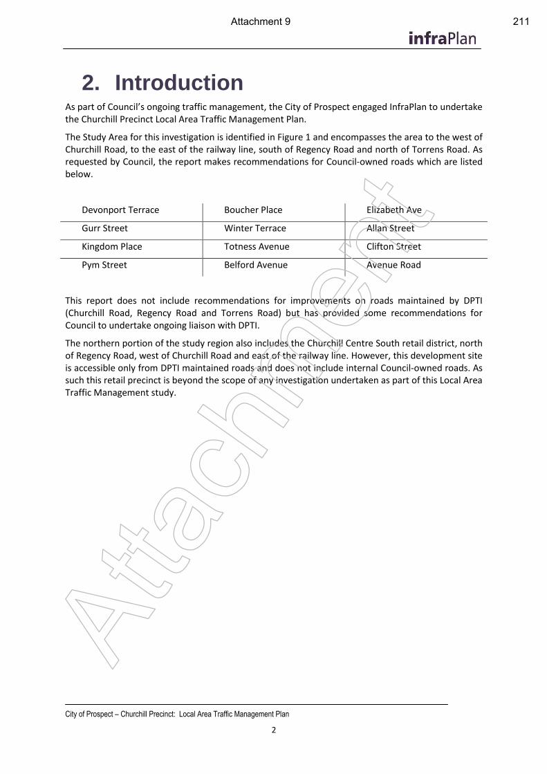
City of Prospect – Churchill Precinct: Local Area Traffic Management Plan
2
2. Introduction As part of Council’s ongoing traffic management, the City of Prospect engaged InfraPlan to undertake the Churchill Precinct Local Area Traffic Management Plan.
The Study Area for this investigation is identified in Figure 1 and encompasses the area to the west of Churchill Road, to the east of the railway line, south of Regency Road and north of Torrens Road. As requested by Council, the report makes recommendations for Council-owned roads which are listed below.
Devonport Terrace Boucher Place Elizabeth Ave
Gurr Street Winter Terrace Allan Street
Kingdom Place Totness Avenue Clifton Street
Pym Street Belford Avenue Avenue Road
This report does not include recommendations for improvements on roads maintained by DPTI (Churchill Road, Regency Road and Torrens Road) but has provided some recommendations for Council to undertake ongoing liaison with DPTI.
The northern portion of the study region also includes the Churchill Centre South retail district, north of Regency Road, west of Churchill Road and east of the railway line. However, this development site is accessible only from DPTI maintained roads and does not include internal Council-owned roads. As such this retail precinct is beyond the scope of any investigation undertaken as part of this Local Area Traffic Management study.
Atta
chm
ent
Attachment 9 211
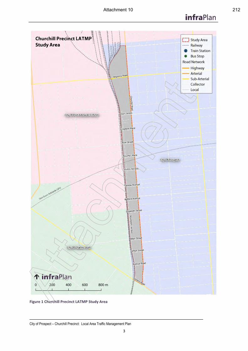
City of Prospect – Churchill Precinct: Local Area Traffic Management Plan
3
Figure 1 Churchill Precinct LATMP Study Area
Atta
chm
ent
Attachment 10 212
City of Prospect – Churchill Precinct: Local Area Traffic Management Plan
4
3. Strategic Context and Policies Several State and Local Government strategies and policies have been reviewed to ensure that the current policy framework aligns with the recommendations provided in this Local Area Traffic Management Plan.
3.1 City of Prospect Policies
Traffic Management Policy
The City of Prospect Traffic Management Policy was adopted by Council in May 2007, and defines the Churchill Precinct. The intention of the policy is outlined as follows:
The intention of this (Traffic Management) Policy is to establish a framework for the management of traffic on local roads throughout the City of Prospect.
Managing the competing demands on our roads remains one of the most sensitive issues facing Prospect Council. Traffic management affects the whole community and must balance the needs of a broad range of road users with an appropriate level of amenity for the adjacent land uses
To this end the objective of the Policy is to identify a range of factors by which Council and the community can assess the need for future traffic management intervention. This will include:
(1) An agreed road hierarchy for Council’s road network
(2) Recognition of the functional use of the road network with regard to providing for social access, freight access, pedestrian and cycling movements
(3) An agreed set of criteria by which speeds and volumes (in particular) can be assessed relative to the road hierarchy
(4) An agreed process by which future traffic investigations will be undertaken.
As identified in Section 4 herein, the Traffic Management Policy establishes the functional road hierarchy by which the recommendations of this report adhere.
The Traffic Management Plan also identifies several Policy Statements which are integral to the development of the recommendations of this Local Area Traffic Management Plan, specifically:
Management of the local road network must balance the needs of all road users
Council will approach traffic management on the basis of local area precincts (as shown in “Local Traffic Precincts” Plan).
Council will approach traffic management on the basis of a strategic road hierarchy and functional road use.
The selection of traffic control treatments must also be proportional to the significance of the problem being addressed.
City of Prospect Strategic Plan
The City of Prospect Strategic Plan establishes Guiding Principles, ‘Our Focus’ areas and Core Strategies (relating to 5 strategic areas of Community, Economy, Environment, Character and Council).
Atta
chm
ent
Attachment 11 213
City of Prospect – Churchill Precinct: Local Area Traffic Management Plan
5
The Churchill Precinct features significantly in the Strategic Plan as one of the 10 ‘Our Focus’ areas. The Plan identifies the Churchill Road Precinct as an area to “Encourage quality medium to high density housing, attractive commerce and employment precincts, local shops, facilities and green recreational areas and streetscapes. Enable a mix of medium and high density, multi storey residential and retail development which is complemented by an inviting, accessible public realm and efficient public transport options”.
Other “Our Focus’ areas with relevance to this Local Area Traffic Management Plan include:
People Movement: A travel friendly city. Expand integrated people movement choices and work to ensure reliable high quality commuter networks throughout our City. Shape our commuter network to meet current and future community needs with a focus on increased pedestrian and cycle use. Council’s approach will be guided by demographic changes, local employment and optimising the speed, safety and functionality of our transport networks and residential streets.
Diverse Living: A variety of housing choices. Enable the development of quality medium and higher density housing appropriately located along our transport corridors, while protecting surrounding heritage and character. Cater for a diverse community to enable local people with changing needs to continue to call Prospect ‘home’.
As well as the focus areas, there are a number of Key Strategies which relate to transport and urban form which provide strategic direction to traffic management and which have relevance to the Churchill Local Traffic Precinct, including:
2.1.3 Promote Main North Road and Churchill Road as arterial gateway roads for medium to large commercial, retail and higher density residential development
2.4.1 Development of 250 Churchill Road precinct: Liaise with developer(s) and investment partner(s) regarding development within the Precinct
2.4.2 Development of 250 Churchill Road precinct: Pursue completion of the northern section of the Churchill Road Master Plan infrastructure works in response to development authority
4.2 Encourage development on arterial roads to improve housing options and to complement the character, heritage and amenity of our City
4.2.1 Support quality medium to higher density, mixed-use development on main arterial road corridors to achieve the desired character for each area
4.2.2 Support the development of diverse housing options including quality medium and higher density housing on our arterial road corridors
5.1.5 Complete the development, implementation and post implementation review of Local Area Traffic Management Plans
5.1.8 Improve movement by bicycle or on foot, through the development and maintenance of our street network
5.5.1 Actively improve non-vehicular community movement: Work to develop, implement and promote a network of safe and connected pedestrian and cycle routes to reduce the dependency on motor vehicles
5.5.2 Actively improve non-vehicular community movement: Action the footpath maintenance program based on use and risk around our City
Atta
chm
ent
Attachment 12 214
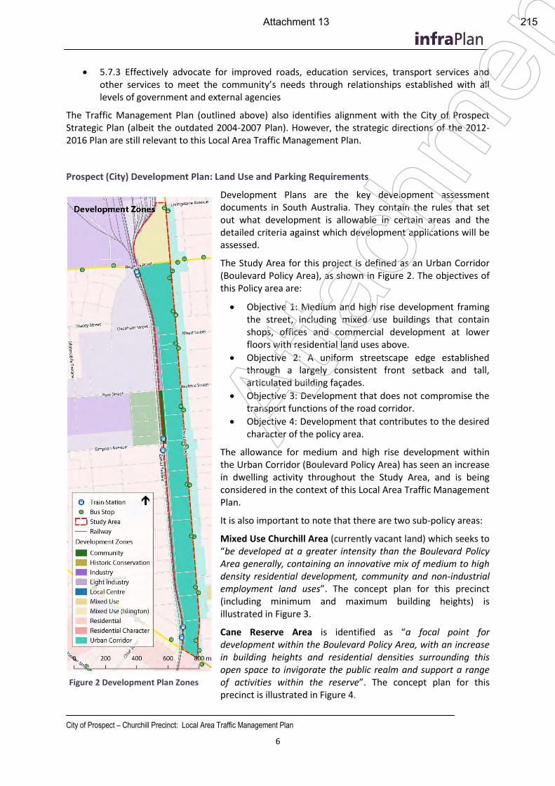
City of Prospect – Churchill Precinct: Local Area Traffic Management Plan
6
5.7.3 Effectively advocate for improved roads, education services, transport services and other services to meet the community’s needs through relationships established with all levels of government and external agencies
The Traffic Management Plan (outlined above) also identifies alignment with the City of Prospect Strategic Plan (albeit the outdated 2004-2007 Plan). However, the strategic directions of the 2012-2016 Plan are still relevant to this Local Area Traffic Management Plan.
Prospect (City) Development Plan: Land Use and Parking Requirements
Development Plans are the key development assessment documents in South Australia. They contain the rules that set out what development is allowable in certain areas and the detailed criteria against which development applications will be assessed.
The Study Area for this project is defined as an Urban Corridor (Boulevard Policy Area), as shown in Figure 2. The objectives of this Policy area are:
Objective 1: Medium and high rise development framing the street, including mixed use buildings that contain shops, offices and commercial development at lower floors with residential land uses above.
Objective 2: A uniform streetscape edge established through a largely consistent front setback and tall, articulated building façades.
Objective 3: Development that does not compromise the transport functions of the road corridor.
Objective 4: Development that contributes to the desired character of the policy area.
The allowance for medium and high rise development within the Urban Corridor (Boulevard Policy Area) has seen an increase in dwelling activity throughout the Study Area, and is being considered in the context of this Local Area Traffic Management Plan.
It is also important to note that there are two sub-policy areas:
Mixed Use Churchill Area (currently vacant land) which seeks to “be developed at a greater intensity than the Boulevard Policy Area generally, containing an innovative mix of medium to high density residential development, community and non-industrial employment land uses”. The concept plan for this precinct (including minimum and maximum building heights) is illustrated in Figure 3.
Cane Reserve Area is identified as “a focal point for development within the Boulevard Policy Area, with an increase in building heights and residential densities surrounding this open space to invigorate the public realm and support a range of activities within the reserve”. The concept plan for this precinct is illustrated in Figure 4.
Figure 2 Development Plan Zones
Atta
chm
ent
Attachment 13 215
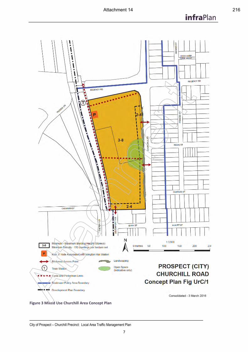
City of Prospect – Churchill Precinct: Local Area Traffic Management Plan
7
Figure 3 Mixed Use Churchill Area Concept Plan Atta
chm
ent
Attachment 14 216
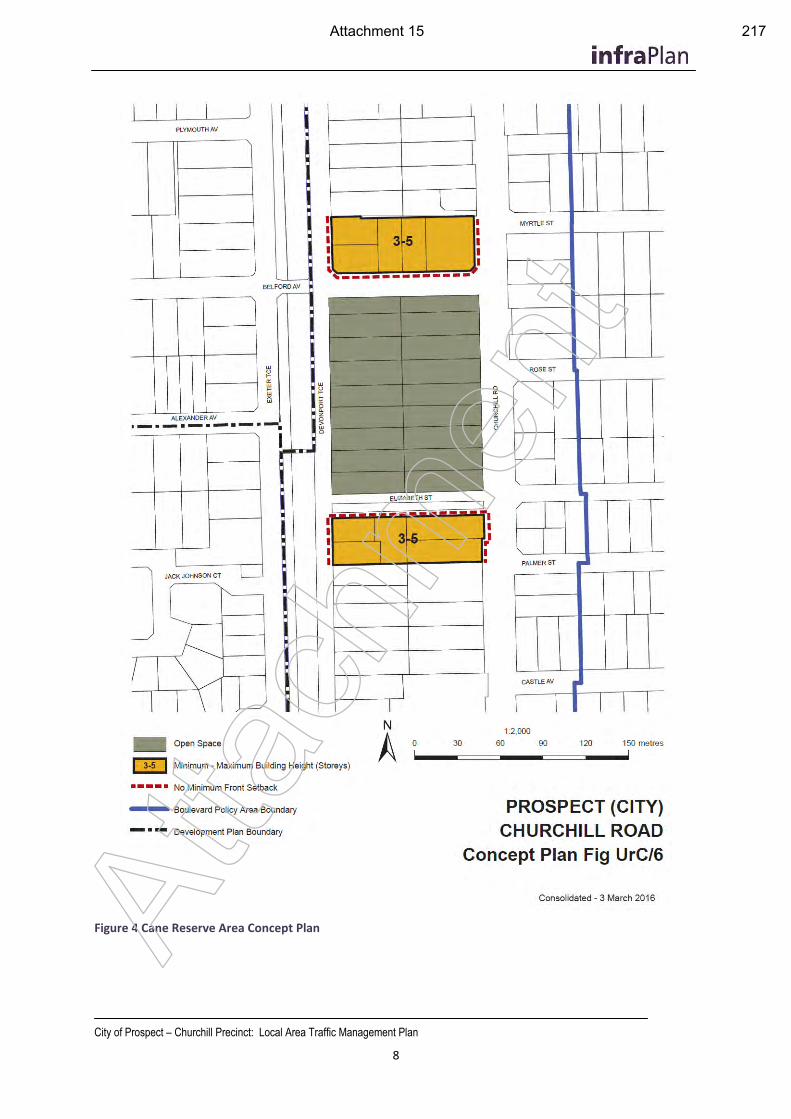
City of Prospect – Churchill Precinct: Local Area Traffic Management Plan
8
Figure 4 Cane Reserve Area Concept Plan
Atta
chm
ent
Attachment 15 217
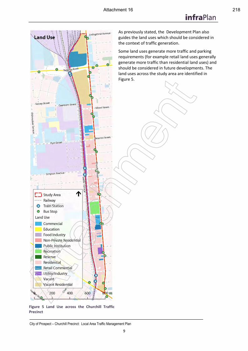
City of Prospect – Churchill Precinct: Local Area Traffic Management Plan
9
As previously stated, the Development Plan also guides the land uses which should be considered in the context of traffic generation.
Some land uses generate more traffic and parking requirements (for example retail land uses generally generate more traffic than residential land uses) and should be considered in future developments. The land uses across the study area are identified in Figure 5.
Figure 5 Land Use across the Churchill Traffic Precinct
Atta
chm
ent
Attachment 16 218
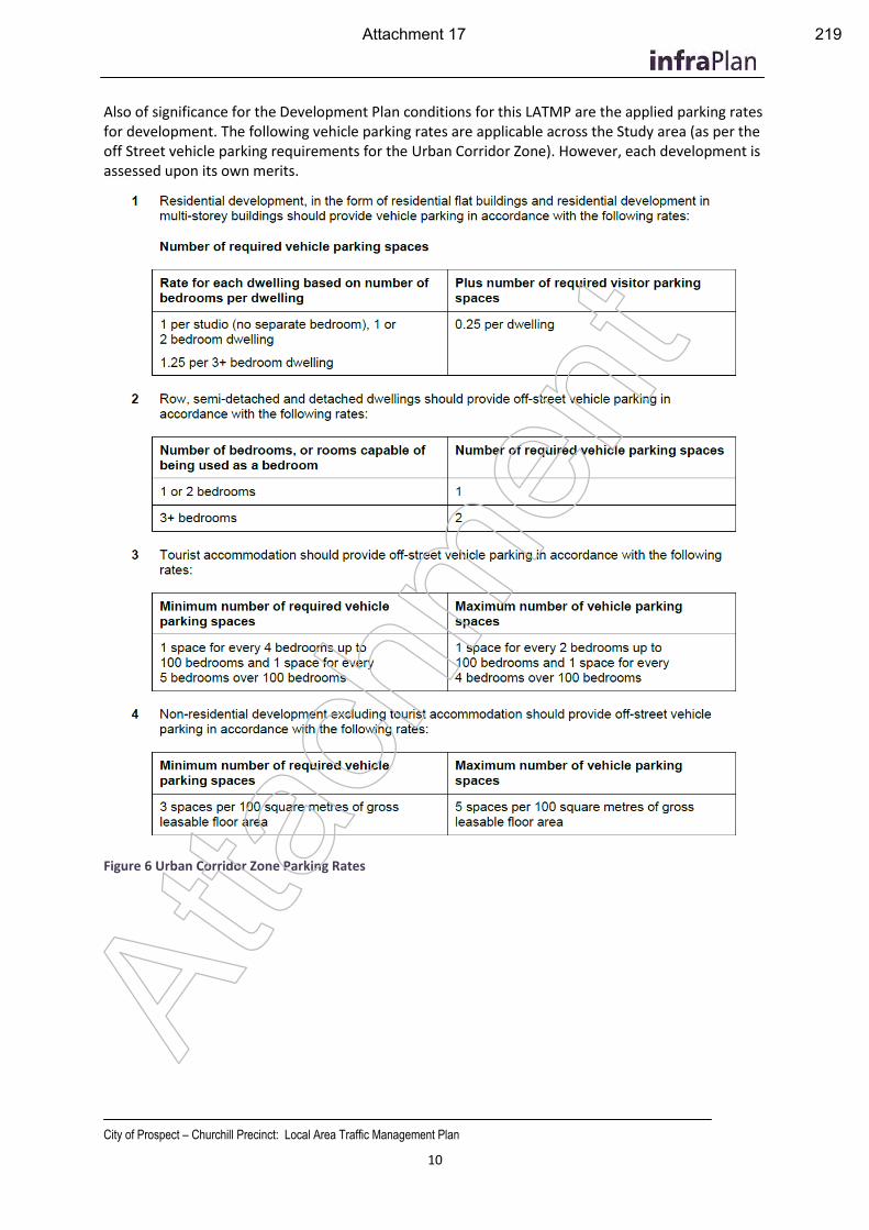
City of Prospect – Churchill Precinct: Local Area Traffic Management Plan
10
Also of significance for the Development Plan conditions for this LATMP are the applied parking rates for development. The following vehicle parking rates are applicable across the Study area (as per the off Street vehicle parking requirements for the Urban Corridor Zone). However, each development is assessed upon its own merits.
Figure 6 Urban Corridor Zone Parking Rates
Atta
chm
ent
Attachment 17 219
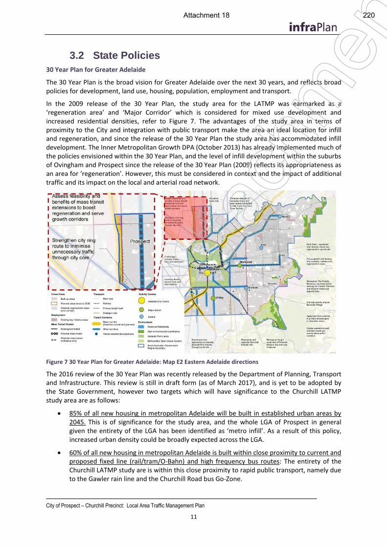
City of Prospect – Churchill Precinct: Local Area Traffic Management Plan
11
3.2 State Policies
30 Year Plan for Greater Adelaide
The 30 Year Plan is the broad vision for Greater Adelaide over the next 30 years, and reflects broad policies for development, land use, housing, population, employment and transport.
In the 2009 release of the 30 Year Plan, the study area for the LATMP was earmarked as a ‘regeneration area’ and ‘Major Corridor’ which is considered for mixed use development and increased residential densities, refer to Figure 7. The advantages of the study area in terms of proximity to the City and integration with public transport make the area an ideal location for infill and regeneration, and since the release of the 30 Year Plan the study area has accommodated infill development. The Inner Metropolitan Growth DPA (October 2013) has already implemented much of the policies envisioned within the 30 Year Plan, and the level of infill development within the suburbs of Ovingham and Prospect since the release of the 30 Year Plan (2009) reflects its appropriateness as an area for ‘regeneration’. However, this must be considered in context and the impact of additional traffic and its impact on the local and arterial road network.
Figure 7 30 Year Plan for Greater Adelaide: Map E2 Eastern Adelaide directions
The 2016 review of the 30 Year Plan was recently released by the Department of Planning, Transport and Infrastructure. This review is still in draft form (as of March 2017), and is yet to be adopted by the State Government, however two targets which will have significance to the Churchill LATMP study area are as follows:
85% of all new housing in metropolitan Adelaide will be built in established urban areas by 2045. This is of significance for the study area, and the whole LGA of Prospect in general given the entirety of the LGA has been identified as ‘metro infill’. As a result of this policy, increased urban density could be broadly expected across the LGA.
60% of all new housing in metropolitan Adelaide is built within close proximity to current and proposed fixed line (rail/tram/O-Bahn) and high frequency bus routes: The entirety of the Churchill LATMP study are is within this close proximity to rapid public transport, namely due to the Gawler rain line and the Churchill Road bus Go-Zone.
Atta
chm
ent
Attachment 18 220
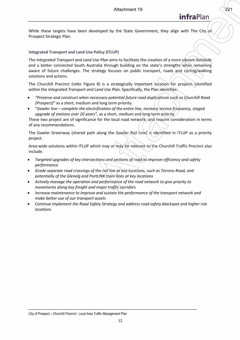
City of Prospect – Churchill Precinct: Local Area Traffic Management Plan
12
While these targets have been developed by the State Government, they align with The City of Prospect Strategic Plan.
Integrated Transport and Land Use Policy (ITLUP)
The Integrated Transport and Land Use Plan aims to facilitate the creation of a more vibrant Adelaide and a better connected South Australia through building on the state’s strengths while remaining aware of future challenges. The strategy focuses on public transport, roads and cycling/walking solutions and actions.
The Churchill Precinct (refer Figure 8) is a strategically important location for projects identified within the Integrated Transport and Land Use Plan. Specifically, the Plan identifies:
“Preserve and construct when necessary potential future road duplications such as Churchill Road (Prospect)” as a short, medium and long term priority.
“Gawler line – complete the electrification of the entire line, increase service frequency, staged upgrade of stations over 20 years”, as a short, medium and long term priority
These two project are of significance for the local road network, and require consideration in terms of any recommendations.
The Gawler Greenway (shared path along the Gawler Rail Line) is identified in ITLUP as a priority project.
Area-wide solutions within ITLUP which may or may be relevant to the Churchill Traffic Precinct also include:
Targeted upgrades of key intersections and sections of road to improve efficiency and safety performance
Grade separate road crossings of the rail line at key locations, such as Torrens Road, and potentially of the Glenelg and PortLINK tram lines at key locations
Actively manage the operation and performance of the road network to give priority to movements along key freight and major traffic corridors
Increase maintenance to improve and sustain the performance of the transport network and make better use of our transport assets
Continue implement the Road Safety Strategy and address road safety blackspot and higher risk locations
Atta
chm
ent
Attachment 19 221
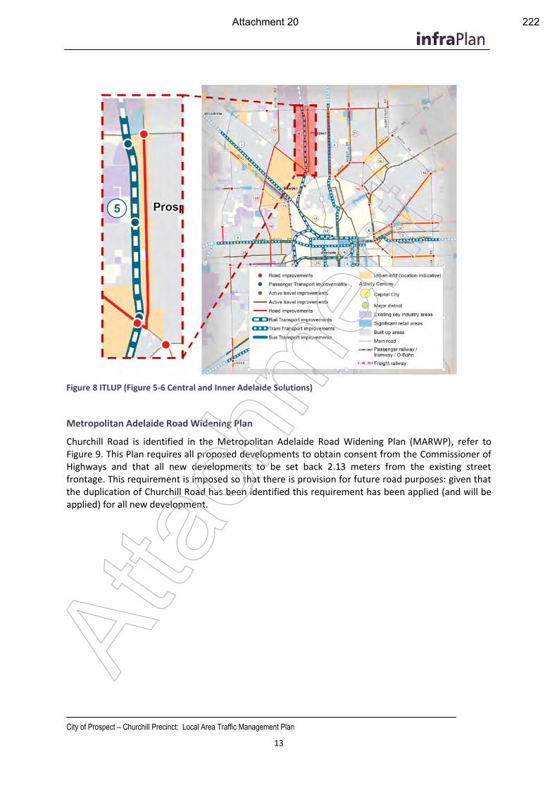
City of Prospect – Churchill Precinct: Local Area Traffic Management Plan
13
Figure 8 ITLUP (Figure 5-6 Central and Inner Adelaide Solutions)
Metropolitan Adelaide Road Widening Plan
Churchill Road is identified in the Metropolitan Adelaide Road Widening Plan (MARWP), refer to Figure 9. This Plan requires all proposed developments to obtain consent from the Commissioner of Highways and that all new developments to be set back 2.13 meters from the existing street frontage. This requirement is imposed so that there is provision for future road purposes: given that the duplication of Churchill Road has been identified this requirement has been applied (and will be applied) for all new development.
Atta
chm
ent
Attachment 20 222
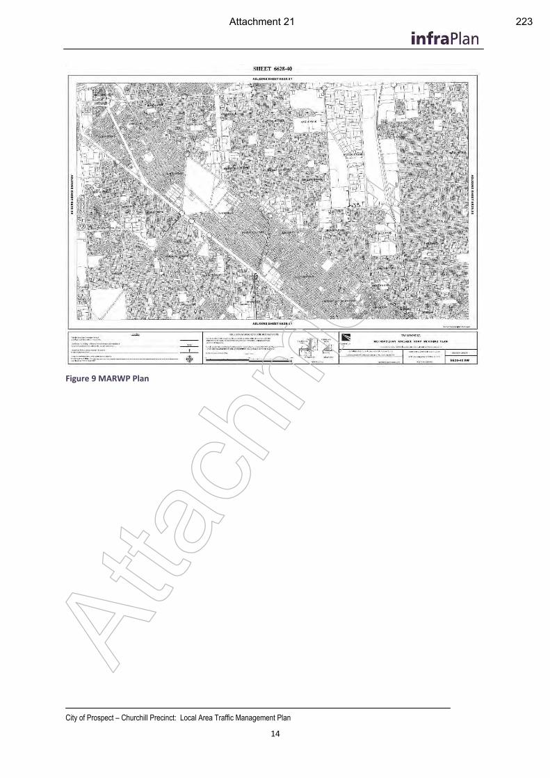
City of Prospect – Churchill Precinct: Local Area Traffic Management Plan
14
Figure 9 MARWP Plan
Atta
chm
ent
Attachment 21 223
City of Prospect – Churchill Precinct: Local Area Traffic Management Plan
15
4. Existing Conditions Understanding the existing transport context for the Study Area is an important aspect of ensuring the recommendations in this Local Area Traffic Management Study are justifiable and robust. The following sections of the report examine the defined strategic road hierarchy, the current use of traffic calming devices, speed profiles, traffic volumes and crash history of the Churchill Precinct.
4.1 Road Hierarchy
An important part of this LATMP was to assess whether the roads within the study area are operating as per their attributed road hierarchy categorisation.
The City of Prospect Traffic Management Policy defines the Strategic Road Hierarchy, as well as the specific role and function of these roads. The Strategic Road Hierarchy categorisation provides context on how to manage a road based on its use and condition. The four defined road categories expressed in the Traffic Management Plan are:
Arterial Road:
Movement of vehicles / goods / people between regions
Typically under control of the State Government
Minimum of 1 lane in either direction – typically more
The following are Arterial Roads: Prospect Road, Regency Road, Churchill Road, Main North Road, North East Road and Nottage Terrace
Major Collector Road:
Major distributor of traffic within / through our City
Typically, 1 lane in either direction
May have bus route and/or cycle routes
Minor Collector Road:
Connection between local streets and distributor or arterial roads
Wide enough for 2 directions of traffic
May have bus route and/or cycle routes
Local Road:
End of trip functionality servicing adjacent properties
Wide enough for at least one direction of traffic (may have to pass between parked cars)
Through traffic should not be encouraged onto these routes
Table 1 lists the typical traffic volume and speed for each road hierarchy classification, as given in the City of Prospect Traffic Management Policy.
This hierarchy has been used as guidance for traffic management recommendations for this report. Where it is observed that the typical volumes or speeds are being exceeded, consideration has been given for intervention. (It is noted that there is an error in this table and traffic volumes between 2500 and 6000 are not listed, but fall between a Minor and Major Collector Road).
Atta
chm
ent
Attachment 22 224
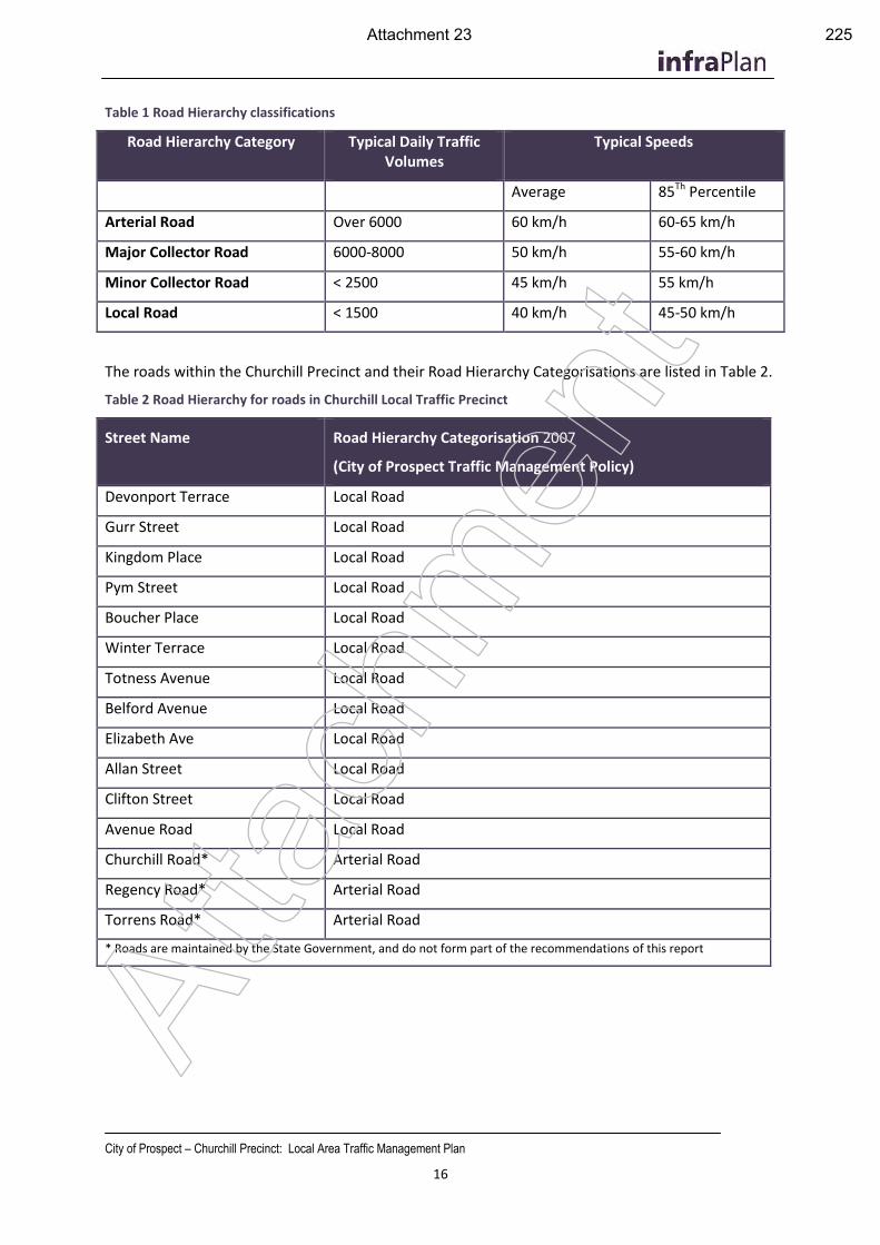
City of Prospect – Churchill Precinct: Local Area Traffic Management Plan
16
Table 1 Road Hierarchy classifications
Road Hierarchy Category Typical Daily Traffic Volumes
Typical Speeds
Average 85Th Percentile
Arterial Road Over 6000 60 km/h 60-65 km/h
Major Collector Road 6000-8000 50 km/h 55-60 km/h
Minor Collector Road < 2500 45 km/h 55 km/h
Local Road < 1500 40 km/h 45-50 km/h
The roads within the Churchill Precinct and their Road Hierarchy Categorisations are listed in Table 2.
Table 2 Road Hierarchy for roads in Churchill Local Traffic Precinct
Street Name Road Hierarchy Categorisation 2007
(City of Prospect Traffic Management Policy)
Devonport Terrace Local Road
Gurr Street Local Road
Kingdom Place Local Road
Pym Street Local Road
Boucher Place Local Road
Winter Terrace Local Road
Totness Avenue Local Road
Belford Avenue Local Road
Elizabeth Ave Local Road
Allan Street Local Road
Clifton Street Local Road
Avenue Road Local Road
Churchill Road* Arterial Road
Regency Road* Arterial Road
Torrens Road* Arterial Road
* Roads are maintained by the State Government, and do not form part of the recommendations of this report
Atta
chm
ent
Attachment 23 225
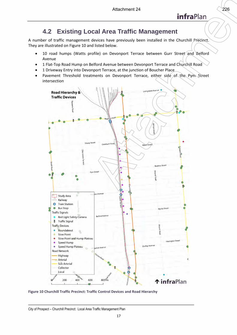
City of Prospect – Churchill Precinct: Local Area Traffic Management Plan
17
4.2 Existing Local Area Traffic Management
A number of traffic management devices have previously been installed in the Churchill Precinct. They are illustrated on Figure 10 and listed below.
10 road humps (Watts profile) on Devonport Terrace between Gurr Street and Belford Avenue
1 Flat-Top Road Hump on Belford Avenue between Devonport Terrace and Churchill Road
1 Driveway Entry into Devonport Terrace, at the junction of Boucher Place
Pavement Threshold treatments on Devonport Terrace, either side of the Pym Street intersection
Figure 10 Churchill Traffic Precinct: Traffic Control Devices and Road Hierarchy
Atta
chm
ent
Attachment 24 226
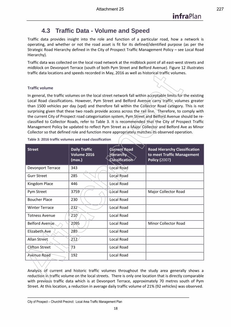
City of Prospect – Churchill Precinct: Local Area Traffic Management Plan
18
4.3 Traffic Data - Volume and Speed
Traffic data provides insight into the role and function of a particular road, how a network is operating, and whether or not the road asset is fit for its defined/identified purpose (as per the Strategic Road Hierarchy defined in the City of Prospect Traffic Management Policy – see Local Road Hierarchy).
Traffic data was collected on the local road network at the midblock point of all east-west streets and midblock on Devonport Terrace (south of both Pym Street and Belford Avenue). Figure 12 illustrates traffic data locations and speeds recorded in May, 2016 as well as historical traffic volumes.
Traffic volume
In general, the traffic volumes on the local street network fall within acceptable limits for the existing Local Road classifications. However, Pym Street and Belford Avenue carry traffic volumes greater than 1500 vehicles per day (vpd) and therefore fall within the Collector Road category. This is not surprising given that these two roads provide access across the rail line. Therefore, to comply with the current City of Prospect road categorisation system, Pym Street and Belford Avenue should be re-classified to Collector Roads, refer to Table 3. It is recommended that the City of Prospect Traffic Management Policy be updated to reflect Pym Street as a Major Collector and Belford Ave as Minor Collector so that defined role and function more appropriately matches its observed operation.
Table 3: 2016 traffic volumes and road classification
Street Daily Traffic Volume 2016 (max.)
Current Road Hierarchy Classification
Road Hierarchy Classification to meet Traffic Management Policy (2007)
Devonport Terrace 343 Local Road
Gurr Street 285 Local Road
Kingdom Place 446 Local Road
Pym Street 3759 Local Road Major Collector Road
Boucher Place 230 Local Road
Winter Terrace 232 Local Road
Totness Avenue 210 Local Road
Belford Avenue 2095 Local Road Minor Collector Road
Elizabeth Ave 289 Local Road
Allan Street 212 Local Road
Clifton Street 73 Local Road
Avenue Road 192 Local Road
Analysis of current and historic traffic volumes throughout the study area generally shows a reduction in traffic volume on the local streets. There is only one location that is directly comparable with previous traffic data which is at Devonport Terrace, approximately 70 metres south of Pym Street. At this location, a reduction in average daily traffic volume of 21% (92 vehicles) was observed.
Atta
chm
ent
Attachment 25 227
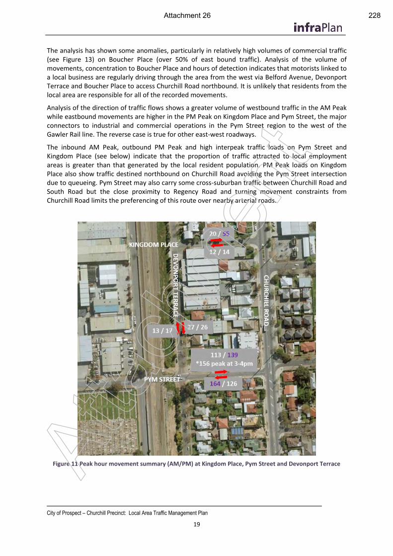
City of Prospect – Churchill Precinct: Local Area Traffic Management Plan
19
The analysis has shown some anomalies, particularly in relatively high volumes of commercial traffic (see Figure 13) on Boucher Place (over 50% of east bound traffic). Analysis of the volume of movements, concentration to Boucher Place and hours of detection indicates that motorists linked to a local business are regularly driving through the area from the west via Belford Avenue, Devonport Terrace and Boucher Place to access Churchill Road northbound. It is unlikely that residents from the local area are responsible for all of the recorded movements.
Analysis of the direction of traffic flows shows a greater volume of westbound traffic in the AM Peak while eastbound movements are higher in the PM Peak on Kingdom Place and Pym Street, the major connectors to industrial and commercial operations in the Pym Street region to the west of the Gawler Rail line. The reverse case is true for other east-west roadways.
The inbound AM Peak, outbound PM Peak and high interpeak traffic loads on Pym Street and Kingdom Place (see below) indicate that the proportion of traffic attracted to local employment areas is greater than that generated by the local resident population. PM Peak loads on Kingdom Place also show traffic destined northbound on Churchill Road avoiding the Pym Street intersection due to queueing. Pym Street may also carry some cross-suburban traffic between Churchill Road and South Road but the close proximity to Regency Road and turning movement constraints from Churchill Road limits the preferencing of this route over nearby arterial roads.
Figure 11 Peak hour movement summary (AM/PM) at Kingdom Place, Pym Street and Devonport Terrace Atta
chm
ent
Attachment 26 228
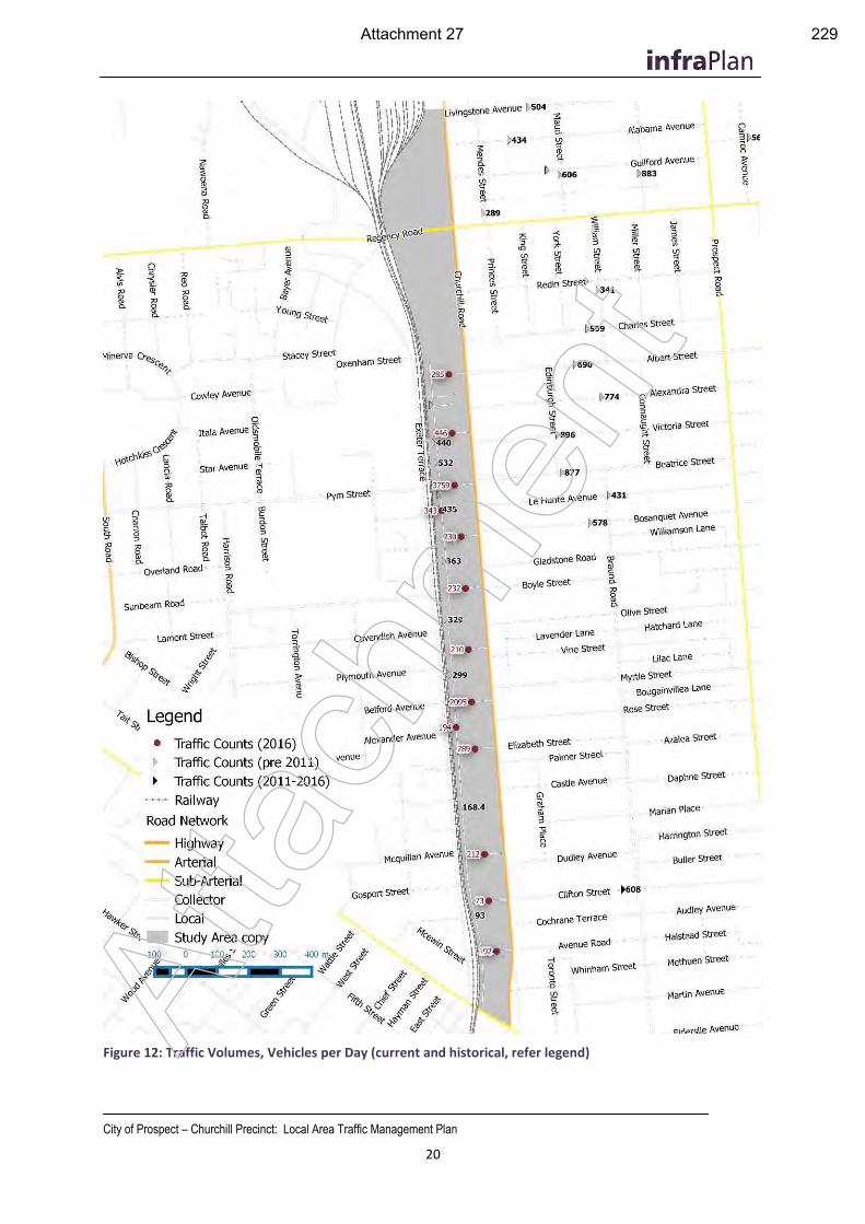
City of Prospect – Churchill Precinct: Local Area Traffic Management Plan
20
Figure 12: Traffic Volumes, Vehicles per Day (current and historical, refer legend) Atta
chm
ent
Attachment 27 229
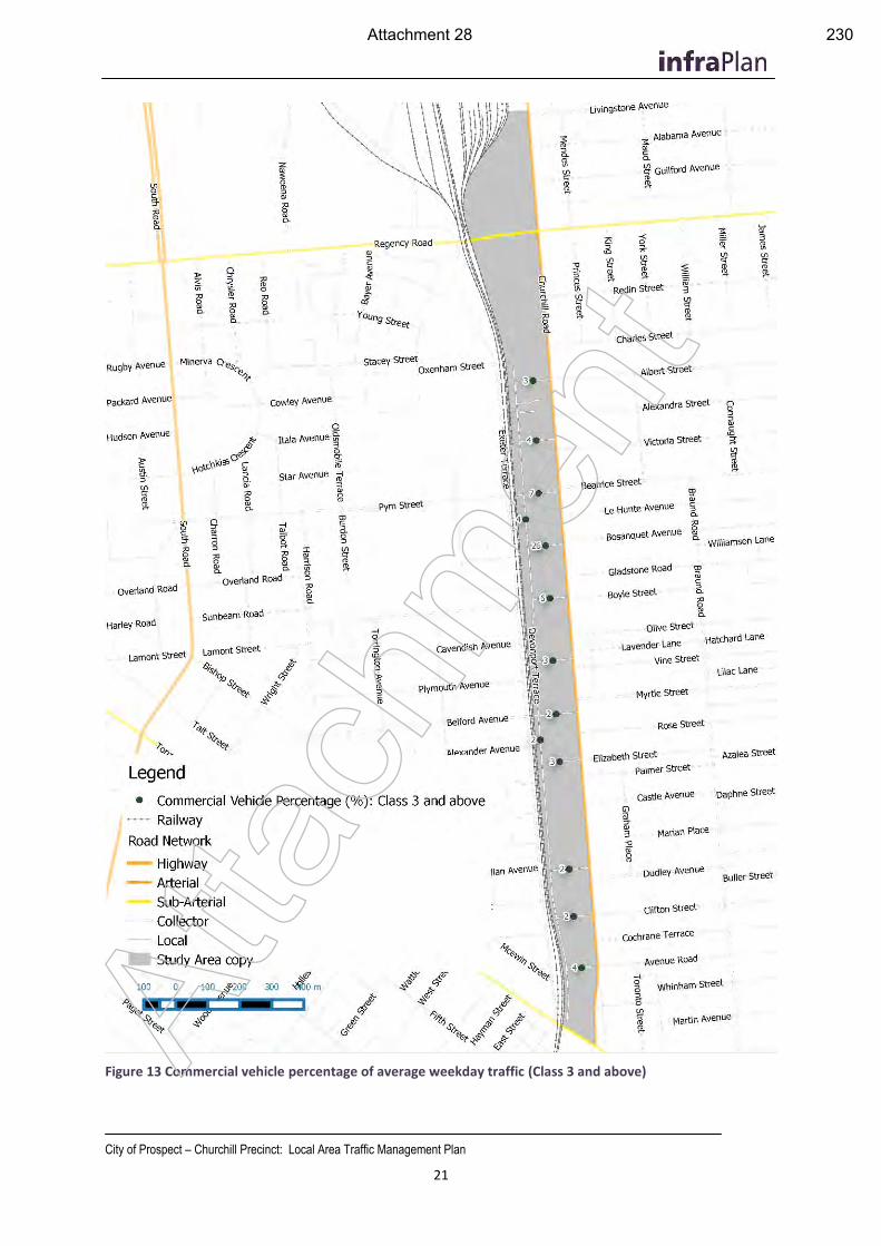
City of Prospect – Churchill Precinct: Local Area Traffic Management Plan
21
Figure 13 Commercial vehicle percentage of average weekday traffic (Class 3 and above) Atta
chm
ent
Attachment 28 230
City of Prospect – Churchill Precinct: Local Area Traffic Management Plan
22
Commercial Vehicle Traffic
Figure 13 shows Boucher Place recorded a high percentage of commercial vehicles at 26% of the average weekday traffic. Analysis of the recorded data shows that this activity is recorded during business hours and appears to be entering the study area from Belford Avenue, suggesting that many motorists, likely linked to a local operator, are using Boucher Place to avoid the flat-top road hump on Belford Ave, avoiding potential queuing/delays at the Belford/Churchill intersection and limit their exposure to Churchill Road traffic.
While the use of these streets is not illegal and doesn’t necessarily present an increased safety risk to local residents or road users, it is not the intended road use and therefore warrants some consideration.
Traffic Speed data
The 85th percentile speed data (see Figure 14) shows that travel speeds throughout the local area are generally moderate. They are below 40km/h in all cases except for Kingdom Place, Pym Street and Boucher Place where they are 40.7, 45.5 and 45.7 km/h respectively. Over 5% of east-bound traffic on both Pym Street and Boucher Place was recorded above the posted speed limit of 50km/h.
Excessive speed was not noted as a problem on other streets in the region during the survey period. Speeding in the west bound direction is less prevalent, perhaps due to the tube counters having been placed closer to Churchill Road than Devonport Terrace due to the location of driveways, parked cars and other obstructions at the time of installation.
The traffic data combined with an assessment of the road layout and driver behaviour, indicates that Kingdom Place carries through traffic from Pym Street to Churchill Road northbound, to avoid queued traffic at the Pym Street / Churchill Road intersection. The higher travel speed recorded on Kingdom Place (85th percentile speed of 40.7km/h) is likely to be linked to this opportunistic behaviour as drivers attempt to ‘get ahead’ of the traffic, particularly in peak periods.
The higher speeds recorded on Boucher Place is of concern and analysis of the data suggests it is linked to through traffic from Belford Avenue, destined for Churchill Road via Devonport Terrace. Boucher Place may be the preferred link because this route avoids the single lane slow point on Devonport Terrace immediately north of Boucher Place. The road humps on Devonport Terrace between Belford Avenue and Boucher Place were observed to have a relatively flat ramp profile and may not be a strong deterrent to opportunistic ‘through-traffic’ motorists.
Atta
chm
ent
Attachment 29 231
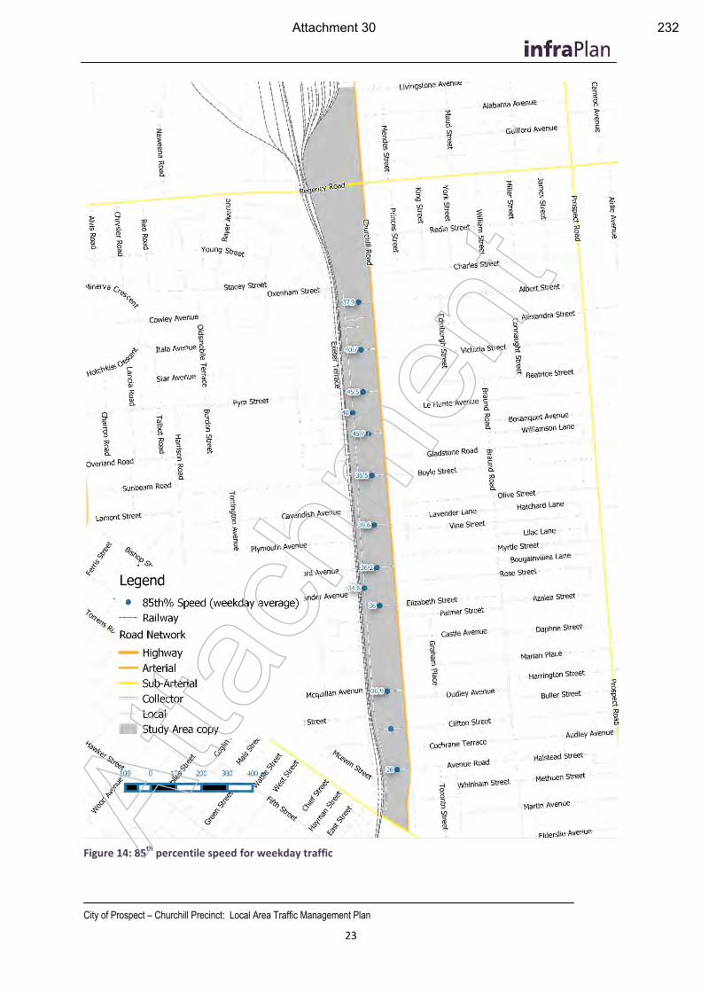
City of Prospect – Churchill Precinct: Local Area Traffic Management Plan
23
Figure 14: 85th
percentile speed for weekday traffic
Atta
chm
ent
Attachment 30 232
City of Prospect – Churchill Precinct: Local Area Traffic Management Plan
24
4.4 Crash History
Figure 15 illustrates the locations of crash clusters and severity of reported injuries. Locations of cyclists and pedestrian crashes have also been shown separately. A total of 109 incidents were reported within the study area between 2010 and 2014, resulting in 89 injuries, 7 of which were reported as Serious Injuries. No fatalities were recorded during this period. 10 incidents involved a bicycle and one involved a pedestrian.
Crash clusters are shown at the major intersections of Churchill Road/Torrens Road and Churchill Road/Regency Road. These are intersections of major arterial roads with high traffic volumes and these crash occurrences are similar across Metropolitan Adelaide.
There is a cluster of crashes at the intersection of Churchill Road and Pym/Beatrice Streets. Driver behaviour observed by infraPlan during the morning peak traffic periods showed some concerning driver behaviour at the Churchill Road and Pym Street intersection. This was largely associated with difficulty to turn right from Pym Street to Churchill Road due to high traffic volumes and insufficient gaps in Churchill Road traffic flows. This resulted in drivers sheltering in the painted median on Churchill Road (more than one vehicle at a time), merging into traffic in a hazardous manner and forcing other drivers to take evasive action.
Four crashes were recorded on Davenport Terrace, and nine crashes on Pym Street, (including four at the level crossing) between 2010 and 2014. The only crashes resulting in injuries were recorded on Churchill Road.
Atta
chm
ent
Attachment 31 233
City of Prospect – Churchill Precinct: Local Area Traffic Management Plan
25
Figure 15 Crash locations, clusters, severity and pedestrian and cyclist involvement for the Churchill study area from 2010 to 2014 At
tach
men
t
Attachment 32 234
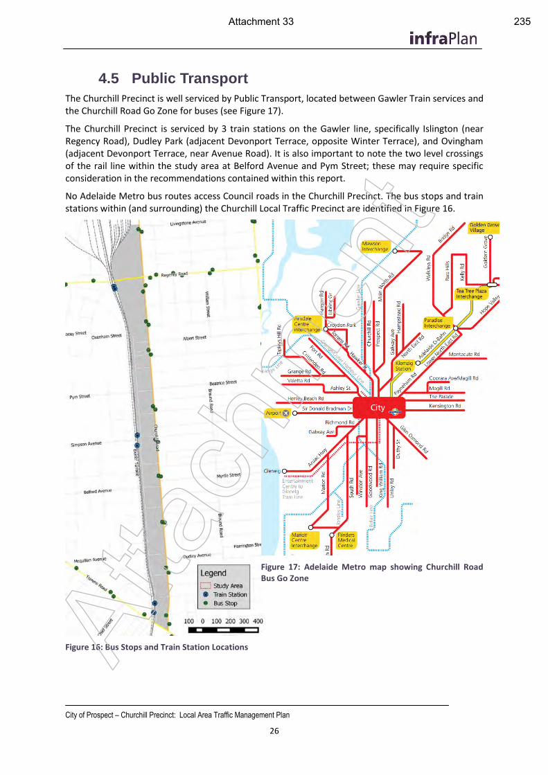
City of Prospect – Churchill Precinct: Local Area Traffic Management Plan
26
4.5 Public Transport
The Churchill Precinct is well serviced by Public Transport, located between Gawler Train services and the Churchill Road Go Zone for buses (see Figure 17).
The Churchill Precinct is serviced by 3 train stations on the Gawler line, specifically Islington (near Regency Road), Dudley Park (adjacent Devonport Terrace, opposite Winter Terrace), and Ovingham (adjacent Devonport Terrace, near Avenue Road). It is also important to note the two level crossings of the rail line within the study area at Belford Avenue and Pym Street; these may require specific consideration in the recommendations contained within this report.
No Adelaide Metro bus routes access Council roads in the Churchill Precinct. The bus stops and train stations within (and surrounding) the Churchill Local Traffic Precinct are identified in Figure 16.
Figure 16: Bus Stops and Train Station Locations
Figure 17: Adelaide Metro map showing Churchill Road Bus Go Zone
Atta
chm
ent
Attachment 33 235
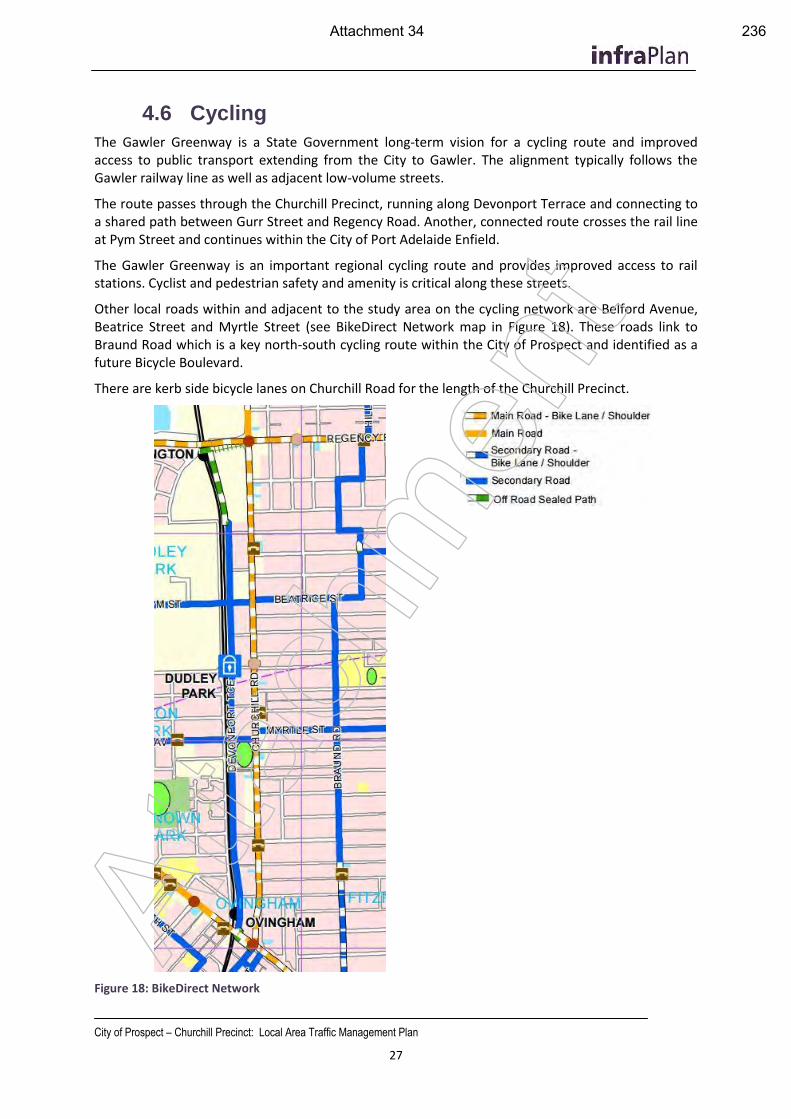
City of Prospect – Churchill Precinct: Local Area Traffic Management Plan
27
4.6 Cycling
The Gawler Greenway is a State Government long-term vision for a cycling route and improved access to public transport extending from the City to Gawler. The alignment typically follows the Gawler railway line as well as adjacent low-volume streets.
The route passes through the Churchill Precinct, running along Devonport Terrace and connecting to a shared path between Gurr Street and Regency Road. Another, connected route crosses the rail line at Pym Street and continues within the City of Port Adelaide Enfield.
The Gawler Greenway is an important regional cycling route and provides improved access to rail stations. Cyclist and pedestrian safety and amenity is critical along these streets.
Other local roads within and adjacent to the study area on the cycling network are Belford Avenue, Beatrice Street and Myrtle Street (see BikeDirect Network map in Figure 18). These roads link to Braund Road which is a key north-south cycling route within the City of Prospect and identified as a future Bicycle Boulevard.
There are kerb side bicycle lanes on Churchill Road for the length of the Churchill Precinct.
Figure 18: BikeDirect Network
Atta
chm
ent
Attachment 34 236
City of Prospect – Churchill Precinct: Local Area Traffic Management Plan
28
5. Population Growth and Traffic Generation
Given the context of the 30 Year Plan and the City of Prospect Development Plan, the Churchill Precinct (and environs) are subject to change, growth and development. The development of urban areas will often result in different transport outcomes which need to be considered. The development (predominantly residential) within the Churchill Precinct has been considered in this chapter in terms of traffic generation and network impact. The outputs of the traffic generation have been considered in the recommendations of this LATMP.
5.1 Demographic Comparison and suburban growth
Prospect and Ovingham are increasingly popular inner metropolitan suburbs, as evidenced by recent population growth. Although the Churchill Precinct only incorporates a section of these suburbs, a comparison of the 2006 and 2011 Census data (refer Appendix F), reflects the popularity as desirable suburbs. Between 2006 and 2011 (the past two Census periods), there has been a population increase of 675 persons and 174 dwellings in these two suburbs. Although the 2016 Census has not yet been conducted, the number of people and dwellings is expected to increase, especially in the Churchill Road precinct. The growth rate between 2006 and 2011 for the suburbs of Prospect and Ovingham and identified below:
Table 4 Ovingham and Prospect (Suburbs) Population and Dwelling growth (2006 – 2011)
Census Year Population (persons)
increase from 2006-2011
Dwellings increase from 2006-2011
2011 13,711 675 5,974 174
2006 13,036 - 5,800 -
Due to the locational advantages the suburbs enjoy, (close proximity to the city and residential suburban neighbourhoods which are close to services and amenities) the precinct has experienced dwelling and population growth over the past 10 years, with significant growth over the past 5 years. The land use policies from the 30 Year Plan, and now reflected in the Development Plan (Urban Corridor – Boulevard Policy Area), this growth is expected in accelerate further in the short term.
Atta
chm
ent
Attachment 35 237
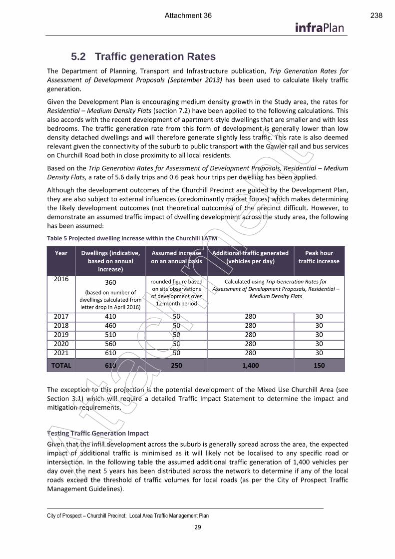
City of Prospect – Churchill Precinct: Local Area Traffic Management Plan
29
5.2 Traffic generation Rates
The Department of Planning, Transport and Infrastructure publication, Trip Generation Rates for Assessment of Development Proposals (September 2013) has been used to calculate likely traffic generation.
Given the Development Plan is encouraging medium density growth in the Study area, the rates for Residential – Medium Density Flats (section 7.2) have been applied to the following calculations. This also accords with the recent development of apartment-style dwellings that are smaller and with less bedrooms. The traffic generation rate from this form of development is generally lower than low density detached dwellings and will therefore generate slightly less traffic. This rate is also deemed relevant given the connectivity of the suburb to public transport with the Gawler rail and bus services on Churchill Road both in close proximity to all local residents.
Based on the Trip Generation Rates for Assessment of Development Proposals, Residential – Medium Density Flats, a rate of 5.6 daily trips and 0.6 peak hour trips per dwelling has been applied.
Although the development outcomes of the Churchill Precinct are guided by the Development Plan, they are also subject to external influences (predominantly market forces) which makes determining the likely development outcomes (not theoretical outcomes) of the precinct difficult. However, to demonstrate an assumed traffic impact of dwelling development across the study area, the following has been assumed:
Table 5 Projected dwelling increase within the Churchill LATM
Year Dwellings (indicative, based on annual
increase)
Assumed increase on an annual basis
Additional traffic generated (vehicles per day)
Peak hour traffic increase
2016 360
(based on number of dwellings calculated from letter drop in April 2016)
rounded figure based on site observations of development over
12-month period
Calculated using Trip Generation Rates for Assessment of Development Proposals, Residential –
Medium Density Flats
2017 410 50 280 30 2018 460 50 280 30 2019 510 50 280 30 2020 560 50 280 30 2021 610 50 280 30
TOTAL 610 250 1,400 150
The exception to this projection is the potential development of the Mixed Use Churchill Area (see Section 3.1) which will require a detailed Traffic Impact Statement to determine the impact and mitigation requirements.
Testing Traffic Generation Impact
Given that the infill development across the suburb is generally spread across the area, the expected impact of additional traffic is minimised as it will likely not be localised to any specific road or intersection. In the following table the assumed additional traffic generation of 1,400 vehicles per day over the next 5 years has been distributed across the network to determine if any of the local roads exceed the threshold of traffic volumes for local roads (as per the City of Prospect Traffic Management Guidelines).
Atta
chm
ent
Attachment 36 238
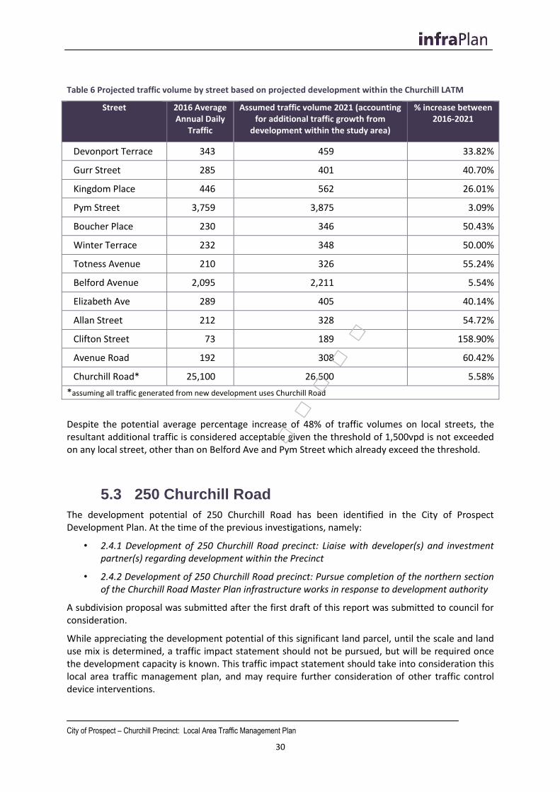
City of Prospect – Churchill Precinct: Local Area Traffic Management Plan
30
Table 6 Projected traffic volume by street based on projected development within the Churchill LATM
Street 2016 Average Annual Daily
Traffic
Assumed traffic volume 2021 (accounting for additional traffic growth from
development within the study area)
% increase between 2016-2021
Devonport Terrace 343 459 33.82%
Gurr Street 285 401 40.70%
Kingdom Place 446 562 26.01%
Pym Street 3,759 3,875 3.09%
Boucher Place 230 346 50.43%
Winter Terrace 232 348 50.00%
Totness Avenue 210 326 55.24%
Belford Avenue 2,095 2,211 5.54%
Elizabeth Ave 289 405 40.14%
Allan Street 212 328 54.72%
Clifton Street 73 189 158.90%
Avenue Road 192 308 60.42%
Churchill Road* 25,100 26,500 5.58%
*assuming all traffic generated from new development uses Churchill Road
Despite the potential average percentage increase of 48% of traffic volumes on local streets, the resultant additional traffic is considered acceptable given the threshold of 1,500vpd is not exceeded on any local street, other than on Belford Ave and Pym Street which already exceed the threshold.
5.3 250 Churchill Road
The development potential of 250 Churchill Road has been identified in the City of Prospect Development Plan. At the time of the previous investigations, namely:
• 2.4.1 Development of 250 Churchill Road precinct: Liaise with developer(s) and investment partner(s) regarding development within the Precinct
• 2.4.2 Development of 250 Churchill Road precinct: Pursue completion of the northern section of the Churchill Road Master Plan infrastructure works in response to development authority
A subdivision proposal was submitted after the first draft of this report was submitted to council for consideration.
While appreciating the development potential of this significant land parcel, until the scale and land use mix is determined, a traffic impact statement should not be pursued, but will be required once the development capacity is known. This traffic impact statement should take into consideration this local area traffic management plan, and may require further consideration of other traffic control device interventions.
.....
City of Prospect – Churchill Precinct: Local Area Traffic Management Plan
31
It is the consultants understanding that current access arrangements on Churchill Road are being undertaken: this is being undertaken between the proponent with DPTI. Pending the outcomes of these arrangement, further consideration to traffic control in the Churchill LATM area will be required. It should also be noted that the Pym Street/Churchill Road intersection may experience more traffic loading, which warrants further intersection intervention (See Section 7.2 of this report).
Atta
chm
ent
Attachment 38 240
City of Prospect – Churchill Precinct: Local Area Traffic Management Plan
32
6. Consultation A consultation process was undertaken as per the project and Council Policy requirements. Detailed outputs from the consultation process, including the letter of invitation, survey outputs, advertising channels and a spreadsheet of reported issues and responses are provided in Appendix B, and are summarised below.
To date the following processes have been employed to gather feedback into the input of this report.
1. Initial contact with residents and stakeholders A letter box drop of the precinct with the following information:
Announcement of the project, its purpose and expected outputs
An invitation to attend a Neighbourhood Forum, and
A link to an on-line survey questionnaire to identify concerns and opportunities
2. Neighbourhood Forum This open forum provided a platform to discuss issues in detail, confirm the issues identified and discuss possible options and solutions.
6.1 Summary of Consultation Feedback
Issues raised during consultation were reviewed on site by the project team.
On-Street Parking
A number of residents raised concerns about on-street parking capacity within the study area due to the increasing residential population and new residential developments.
InfraPlan has conducted inspection of on- and off-street parking provision and use and did not observe any instance where on-street parking in the local area was not available, nor instances where on-street parking prohibited through traffic or presented a safety concern. Observations show that while a number of side streets are constrained by on-street parking, this is in line with the Traffic Management Policy and serves as a passive traffic control device, limiting vehicle speed and traffic volumes and discouraging non-local traffic from using the affected streets.
The City of Prospect Traffic Management Policy defines Local Streets as having:
End of trip functionality servicing adjacent properties (which includes use of recreational and community facilities)
Wide enough for at least one direction of traffic (may have to pass between parked cars)
The east-west streets within the Churchill LATM region are no longer than 115m which allows for drivers to see any oncoming traffic from the other end of the roadway. In addition, driveways provide space for one vehicle to pull out of the running lane and permit opposing traffic to pass.
Photo 1 below shows an extreme case where events at Charles Cane Reserve generate large numbers of visitors to the area for a short period of time on weekends. This photo was taken at 3:35pm on Saturday 25th June during an amateur league soccer game at Charles Cane Reserve / Parndo Yerta. Observed weekday on-street parking demand throughout the region is far lower and restricts traffic movements to a lesser degree. Weeknight observations show that on-street parking demand during training sessions is moderate and largely limited to Elizabeth Street.
Site observations also showed a number of instances where parking signage and yellow line marking was faded or worn away, such as shown in Photo 2. Belford Avenue is a particularly good example of
Atta
chm
ent
Attachment 39 241
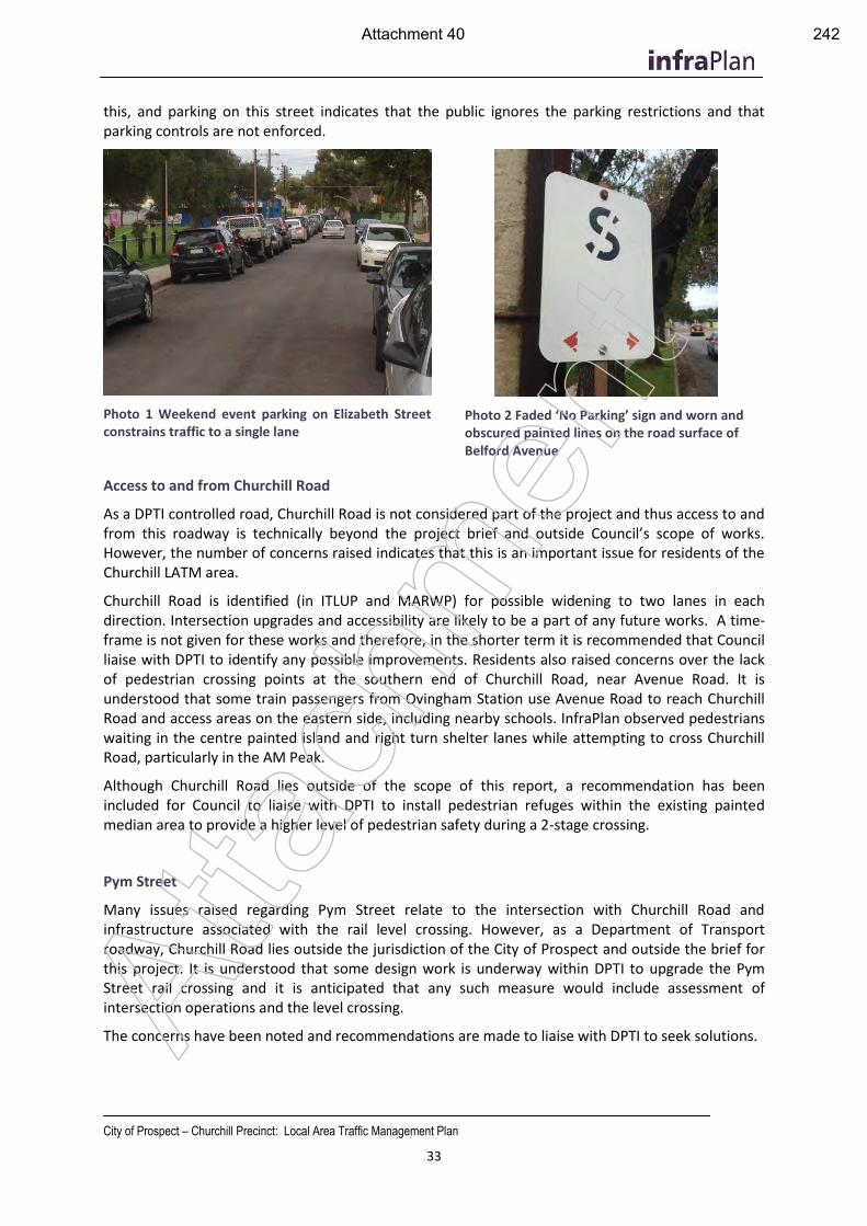
City of Prospect – Churchill Precinct: Local Area Traffic Management Plan
33
this, and parking on this street indicates that the public ignores the parking restrictions and that parking controls are not enforced.
Photo 1 Weekend event parking on Elizabeth Street constrains traffic to a single lane
Photo 2 Faded ‘No Parking’ sign and worn and obscured painted lines on the road surface of Belford Avenue
Access to and from Churchill Road
As a DPTI controlled road, Churchill Road is not considered part of the project and thus access to and from this roadway is technically beyond the project brief and outside Council’s scope of works. However, the number of concerns raised indicates that this is an important issue for residents of the Churchill LATM area.
Churchill Road is identified (in ITLUP and MARWP) for possible widening to two lanes in each direction. Intersection upgrades and accessibility are likely to be a part of any future works. A time-frame is not given for these works and therefore, in the shorter term it is recommended that Council liaise with DPTI to identify any possible improvements. Residents also raised concerns over the lack of pedestrian crossing points at the southern end of Churchill Road, near Avenue Road. It is understood that some train passengers from Ovingham Station use Avenue Road to reach Churchill Road and access areas on the eastern side, including nearby schools. InfraPlan observed pedestrians waiting in the centre painted island and right turn shelter lanes while attempting to cross Churchill Road, particularly in the AM Peak.
Although Churchill Road lies outside of the scope of this report, a recommendation has been included for Council to liaise with DPTI to install pedestrian refuges within the existing painted median area to provide a higher level of pedestrian safety during a 2-stage crossing.
Pym Street
Many issues raised regarding Pym Street relate to the intersection with Churchill Road and infrastructure associated with the rail level crossing. However, as a Department of Transport roadway, Churchill Road lies outside the jurisdiction of the City of Prospect and outside the brief for this project. It is understood that some design work is underway within DPTI to upgrade the Pym Street rail crossing and it is anticipated that any such measure would include assessment of intersection operations and the level crossing.
The concerns have been noted and recommendations are made to liaise with DPTI to seek solutions.
Atta
chm
ent
Attachment 40 242
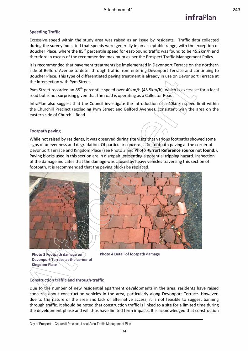
City of Prospect – Churchill Precinct: Local Area Traffic Management Plan
34
Speeding Traffic
Excessive speed within the study area was raised as an issue by residents. Traffic data collected during the survey indicated that speeds were generally in an acceptable range, with the exception of Boucher Place, where the 85th percentile speed for east-bound traffic was found to be 45.2km/h and therefore in excess of the recommended maximum as per the Prospect Traffic Management Policy.
It is recommended that pavement treatments be implemented in Devonport Terrace on the northern side of Belford Avenue to deter through traffic from entering Devonport Terrace and continuing to Boucher Place. This type of differentiated paving treatment is already in use on Devonport Terrace at the intersection with Pym Street.
Pym Street recorded an 85th percentile speed over 40km/h (45.5km/h), which is excessive for a local road but is not surprising given that the road is operating as a Collector Road.
InfraPlan also suggest that the Council investigate the introduction of a 40km/h speed limit within the Churchill Precinct (excluding Pym Street and Belford Avenue), consistent with the area on the eastern side of Churchill Road.
Footpath paving
While not raised by residents, it was observed during site visits that various footpaths showed some signs of unevenness and degradation. Of particular concern is the footpath paving at the corner of Devonport Terrace and Kingdom Place (see Photo 3 and Photo 4Error! Reference source not found.). Paving blocks used in this section are in disrepair, presenting a potential tripping hazard. Inspection of the damage indicates that the damage was caused by heavy vehicles traversing this section of footpath. It is recommended that the paving blocks be replaced.
Photo 3 Footpath damage on Devonport Terrace at the corner of Kingdom Place
Photo 4 Detail of footpath damage
Construction traffic and through-traffic
Due to the number of new residential apartment developments in the area, residents have raised concerns about construction vehicles in the area, particularly along Devonport Terrace. However, due to the nature of the area and lack of alternative access, it is not feasible to suggest banning through traffic. It should be noted that construction traffic is linked to a site for a limited time during the development phase and will thus have limited term impacts. It is acknowledged that construction
Atta
chm
ent
Attachment 41 243
City of Prospect – Churchill Precinct: Local Area Traffic Management Plan
35
in this region is likely to continue for a number of years into the future but that this will be at sites spread throughout the precinct. Development of these sites is occurring in line with Council Development Plan and the corridor plan for Churchill Road.
Construction workers parking on local streets and access restrictions as a result have also been raised through the consultation process. This is a necessary provision and affects local residents for a limited time during the construction process. Vehicle owners are also present on site if vehicles are preventing movements on local streets. It is unfeasible to restrict access and parking provision for these workers as they require vehicles to travel to and from various sites. This is a matter for individual site management and residents should make their concerns known to Site Managers if work vehicles are restricting property access or movement through their local neighbourhood.
Davenport Terrace - Rail reserve vegetation
Residents of Devonport Terrace in particular, expressed a desire for increased and improved protection from the rail line, including additional vegetation, noise walls or fencing. During site inspections, it was noted that the vegetation is sparse in some areas and is of poor aesthetic quality, (refer to Photo 5). In addition, there was significant build-up of pine needles along the road edge which will obstruct stormwater flows in the spoon drain and reduces space for cyclists and parking.
The rail line is fenced by chicken wire and wooden posts or star pickets. Vegetation lies outside of the scope of this LATMP however this does present an opportunity to improve the streetscape and visual environment along Devonport Terrace.
It is understood that a Devonport Terrace Masterplan project is already underway within council and that it will address issues including vegetation, fencing and lighting. The advice contained in this section is intended to inform and guide Council officers preparing the Masterplan. Recommendations contained within this report should be considered for further consideration as part of the development of the masterplan.
Devonport Terrace - Illegal dumping
It was observed during site visits that No Dumping signs (refer to Photo 6), have been erected to the western side of Devonport Terrace, north of Pym Street to discourage illegal dumping. Comments received regarding illegal dumping refer to locations toward the southern end of Devonport Terrace. It is recommended that Council consider erecting similar signs in the southern section of Devonport Terrace, at the interface with the Rail Reserve, to deter illegal dumping and encourage reporting of this behaviour to Council. Improvements to street lighting and vegetation in this area will also improve passive surveillance, reduce opportunity and improve the overall appearance of the area which can all contribute to reducing the instances of illegal roadside dumping.
The KESAB website includes an Illegal Dumping Toolkit, developed in conjunction with neighbouring Councils: (http://www.lga.sa.gov.au/page.aspx?u=1888) This online resource provides advice for councils on how to manage illegal dumping hotspots and gives access to signage and other control measures. At
tach
men
t
Attachment 42 244
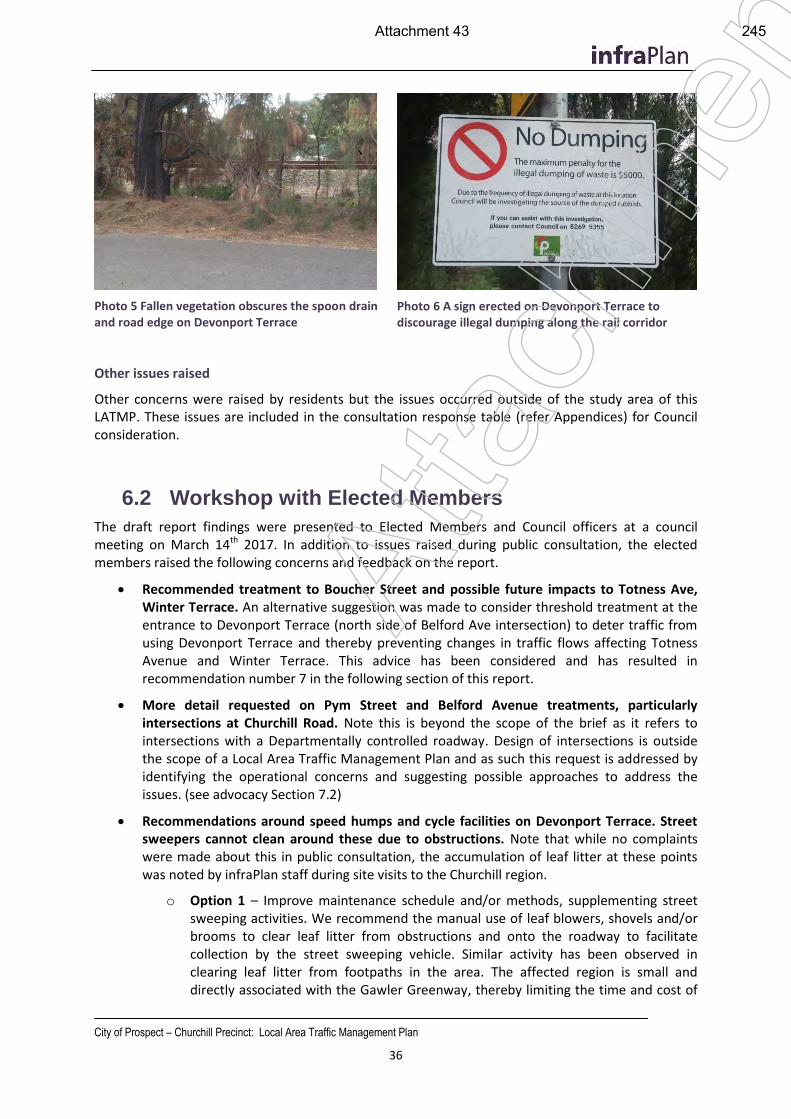
City of Prospect – Churchill Precinct: Local Area Traffic Management Plan
36
Photo 5 Fallen vegetation obscures the spoon drain and road edge on Devonport Terrace
Photo 6 A sign erected on Devonport Terrace to discourage illegal dumping along the rail corridor
Other issues raised
Other concerns were raised by residents but the issues occurred outside of the study area of this LATMP. These issues are included in the consultation response table (refer Appendices) for Council consideration.
6.2 Workshop with Elected Members
The draft report findings were presented to Elected Members and Council officers at a council meeting on March 14th 2017. In addition to issues raised during public consultation, the elected members raised the following concerns and feedback on the report.
Recommended treatment to Boucher Street and possible future impacts to Totness Ave, Winter Terrace. An alternative suggestion was made to consider threshold treatment at the entrance to Devonport Terrace (north side of Belford Ave intersection) to deter traffic from using Devonport Terrace and thereby preventing changes in traffic flows affecting Totness Avenue and Winter Terrace. This advice has been considered and has resulted in recommendation number 7 in the following section of this report.
More detail requested on Pym Street and Belford Avenue treatments, particularly intersections at Churchill Road. Note this is beyond the scope of the brief as it refers to intersections with a Departmentally controlled roadway. Design of intersections is outside the scope of a Local Area Traffic Management Plan and as such this request is addressed by identifying the operational concerns and suggesting possible approaches to address the issues. (see advocacy Section 7.2)
Recommendations around speed humps and cycle facilities on Devonport Terrace. Street sweepers cannot clean around these due to obstructions. Note that while no complaints were made about this in public consultation, the accumulation of leaf litter at these points was noted by infraPlan staff during site visits to the Churchill region.
o Option 1 – Improve maintenance schedule and/or methods, supplementing street sweeping activities. We recommend the manual use of leaf blowers, shovels and/or brooms to clear leaf litter from obstructions and onto the roadway to facilitate collection by the street sweeping vehicle. Similar activity has been observed in clearing leaf litter from footpaths in the area. The affected region is small and directly associated with the Gawler Greenway, thereby limiting the time and cost of
Atta
chm
ent
Attachment 43 245
City of Prospect – Churchill Precinct: Local Area Traffic Management Plan
37
additional maintenance works. The City of Prospect’s goals to improve cycling infrastructure and promote alternative transport aligns with improved maintenance of the Gawler Greenway to encourage cyclists to this route and protect those already using it. This solution is recommended for its simplicity, ability to be implemented immediately, minimal cost to Council and no negative impact to road users.
o Option 2 – Extend Watts Profile speed humps to gutter edge: This option will improve access to the kerb line for street sweeping vehicles but removes the visible preference and reduces comfort for cyclists along the Gawler Greenway.
o Additional options that addressed solutions using road infrastructure were assessed. These were eventually rejected for a variety of reasons including the scale of the interventions, construction costs, risks to stormwater drainage flow paths, interruptions to traffic flows and risks to other road users.
Access to Islington Station and integration with 250 Churchill development. These considerations are linked to development planning of the whole site and are inextricably linked to DPTI plans for the Islington Station. Suggestions of Park‘n’Ride facilities and transport interchanges are beyond the scope of this LATMP and cannot be properly considered without an understanding of the future development potential of the site. It is also recommended that any such ideas consider the best and highest use of the site as well as the access arrangements from Churchill Road. It is likely that any vehicle access point is likely to be well south of the Regency Road intersection and as such may not be conducive to a Park’n’Ride access arrangement. In the short term, improved amenity, safety and access to the train station can be provided with additional lighting for the existing path between the station and the Regency Road intersection. Amenity of this path is limited in the short term given the inactivated land surrounding the intersection and station. It is recommended that any future development plans for this site consider activating this walking and cycling route. At
tach
men
t
Attachment 44 246
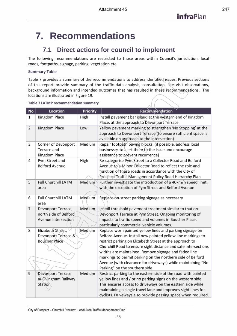
City of Prospect – Churchill Precinct: Local Area Traffic Management Plan
38
7. Recommendations
7.1 Direct actions for council to implement
The following recommendations are restricted to those areas within Council’s jurisdiction, local roads, footpaths, signage, parking, vegetation etc.
Summary Table
Table 7 provides a summary of the recommendations to address identified issues. Previous sections of this report provide summary of the traffic data analysis, consultation, site visit observations, background information and intended outcomes that has resulted in these recommendations. The locations are illustrated in Figure 19.
Table 7 LATMP recommendation summary
No Location Priority Recommendation
1 Kingdom Place High Install pavement bar island at the western end of Kingdom Place, at the approach to Devonport Terrace
2 Kingdom Place Low Yellow pavement marking to strengthen ‘No Stopping’ at the approach to Devonport Terrace (to ensure sufficient space is available on approach to the intersection)
3 Corner of Devonport Terrace and Kingdom Place
Medium Repair footpath paving blocks, (if possible, address local businesses to alert them to the issue and encourage assistance to prevent recurrence)
4 Pym Street and Belford Avenue
High Re-categorise Pym Street to a Collector Road and Belford Avenue to a Minor Collector Road to reflect the role and function of these roads in accordance with the City of Prospect Traffic Management Policy Road Hierarchy Plan
5 Full Churchill LATM area
Medium Further investigate the introduction of a 40km/h speed limit, with the exception of Pym Street and Belford Avenue
6 Full Churchill LATM area
Medium Replace on-street parking signage as necessary
7 Devonport Terrace, north side of Belford Avenue intersection
Medium Install threshold pavement treatment similar to that on Devonport Terrace at Pym Street. Ongoing monitoring of impacts to traffic speed and volumes in Boucher Place, particularly commercial vehicle volumes.
8 Elizabeth Street, Devonport Terrace & Boucher Place
Medium Replace worn painted yellow lines and parking signage on Belford Avenue. Install new painted yellow line markings to restrict parking on Elizabeth Street at the approach to Churchill Road to ensure sight distance and safe intersections widths are maintained. Remove signage and faded line markings to permit parking on the northern side of Belford Avenue (with clearance for driveways) while maintaining “No Parking” on the southern side.
9 Devonport Terrace at Ovingham Railway Station
Medium Restrict parking to the eastern side of the road with painted yellow lines and / or no parking signs on the western side. This ensures access to driveways on the eastern side while maintaining a single travel lane and improves sight lines for cyclists. Driveways also provide passing space when required.
Atta
chm
ent
Attachment 45 247
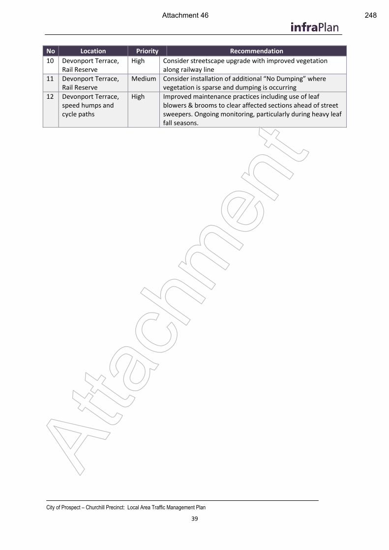
City of Prospect – Churchill Precinct: Local Area Traffic Management Plan
39
No Location Priority Recommendation
10 Devonport Terrace, Rail Reserve
High Consider streetscape upgrade with improved vegetation along railway line
11 Devonport Terrace, Rail Reserve
Medium Consider installation of additional “No Dumping” where vegetation is sparse and dumping is occurring
12 Devonport Terrace, speed humps and cycle paths
High Improved maintenance practices including use of leaf blowers & brooms to clear affected sections ahead of street sweepers. Ongoing monitoring, particularly during heavy leaf fall seasons.
Atta
chm
ent
Attachment 46 248
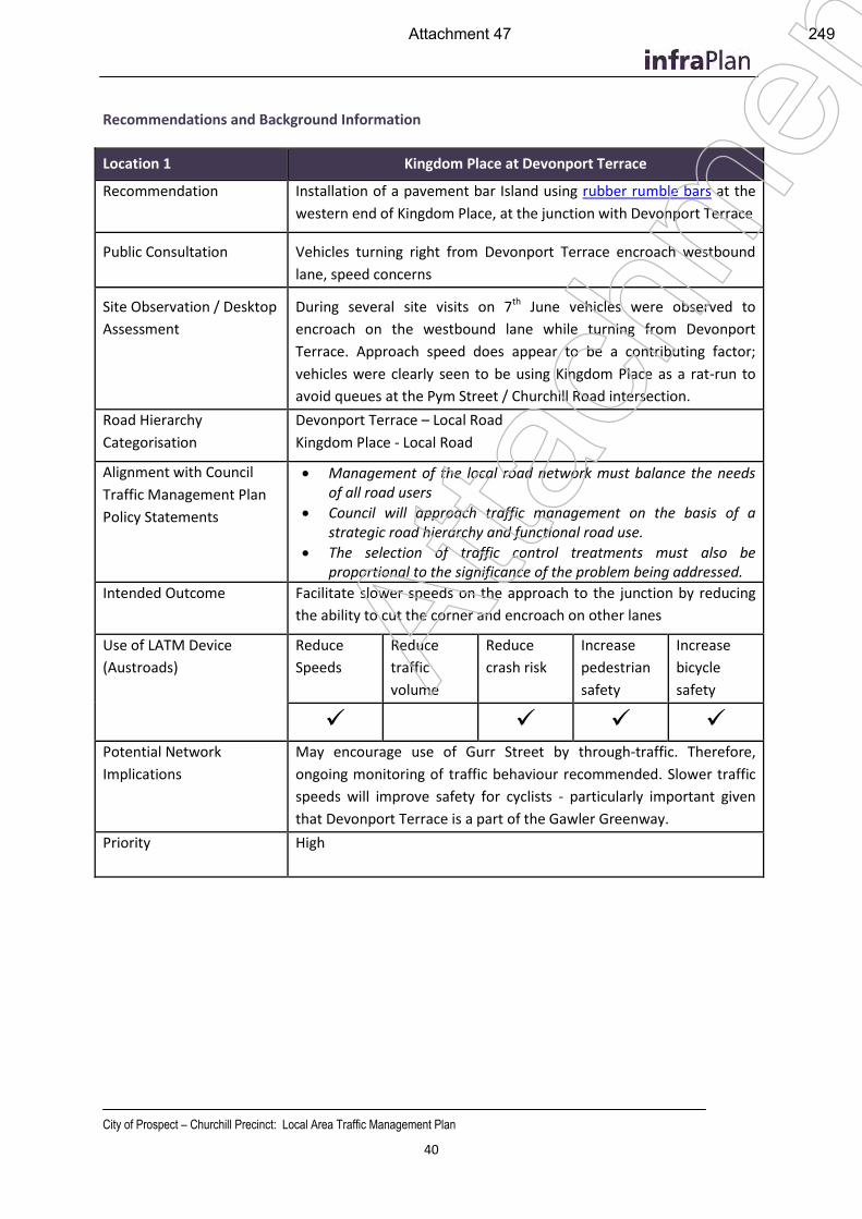
City of Prospect – Churchill Precinct: Local Area Traffic Management Plan
40
Recommendations and Background Information
Location 1 Kingdom Place at Devonport Terrace
Recommendation Installation of a pavement bar Island using rubber rumble bars at the
western end of Kingdom Place, at the junction with Devonport Terrace
Public Consultation Vehicles turning right from Devonport Terrace encroach westbound
lane, speed concerns
Site Observation / Desktop
Assessment
During several site visits on 7th June vehicles were observed to
encroach on the westbound lane while turning from Devonport
Terrace. Approach speed does appear to be a contributing factor;
vehicles were clearly seen to be using Kingdom Place as a rat-run to
avoid queues at the Pym Street / Churchill Road intersection.
Road Hierarchy
Categorisation
Devonport Terrace – Local Road
Kingdom Place - Local Road
Alignment with Council
Traffic Management Plan
Policy Statements
Management of the local road network must balance the needs of all road users
Council will approach traffic management on the basis of a strategic road hierarchy and functional road use.
The selection of traffic control treatments must also be proportional to the significance of the problem being addressed.
Intended Outcome Facilitate slower speeds on the approach to the junction by reducing
the ability to cut the corner and encroach on other lanes
Use of LATM Device
(Austroads)
Reduce
Speeds
Reduce
traffic
volume
Reduce
crash risk
Increase
pedestrian
safety
Increase
bicycle
safety
Potential Network
Implications
May encourage use of Gurr Street by through-traffic. Therefore,
ongoing monitoring of traffic behaviour recommended. Slower traffic
speeds will improve safety for cyclists - particularly important given
that Devonport Terrace is a part of the Gawler Greenway.
Priority High
Atta
chm
ent
Attachment 47 249
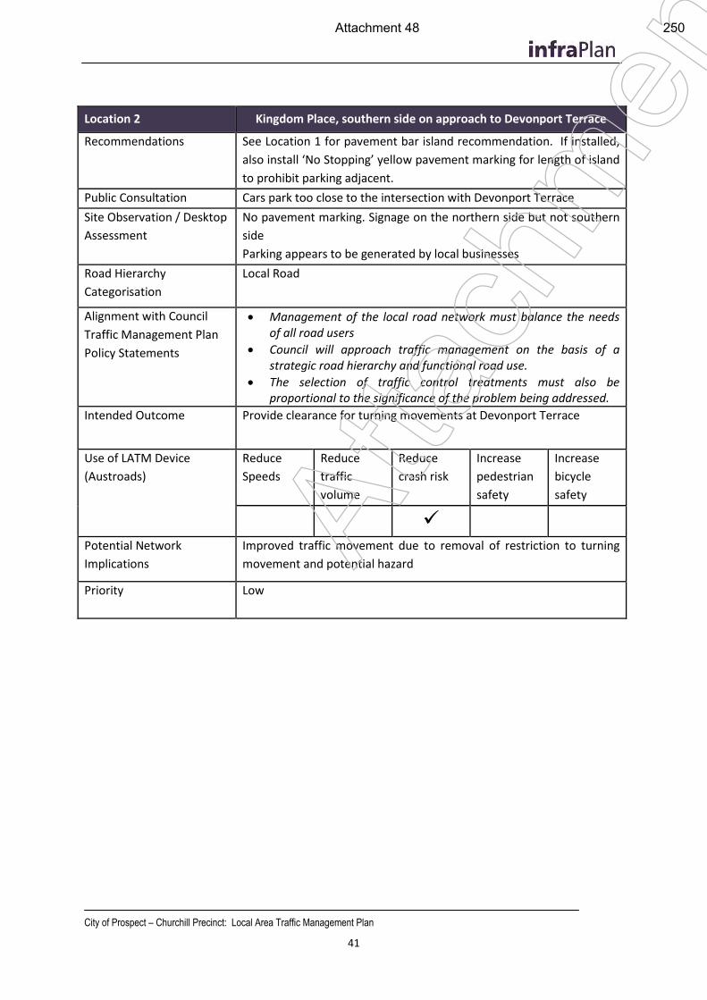
City of Prospect – Churchill Precinct: Local Area Traffic Management Plan
41
Location 2 Kingdom Place, southern side on approach to Devonport Terrace
Recommendations See Location 1 for pavement bar island recommendation. If installed,
also install ‘No Stopping’ yellow pavement marking for length of island
to prohibit parking adjacent.
Public Consultation Cars park too close to the intersection with Devonport Terrace
Site Observation / Desktop
Assessment
No pavement marking. Signage on the northern side but not southern
side
Parking appears to be generated by local businesses
Road Hierarchy
Categorisation
Local Road
Alignment with Council
Traffic Management Plan
Policy Statements
Management of the local road network must balance the needs of all road users
Council will approach traffic management on the basis of a strategic road hierarchy and functional road use.
The selection of traffic control treatments must also be proportional to the significance of the problem being addressed.
Intended Outcome Provide clearance for turning movements at Devonport Terrace
Use of LATM Device
(Austroads)
Reduce
Speeds
Reduce
traffic
volume
Reduce
crash risk
Increase
pedestrian
safety
Increase
bicycle
safety
Potential Network
Implications
Improved traffic movement due to removal of restriction to turning
movement and potential hazard
Priority Low
Atta
chm
ent
Attachment 48 250
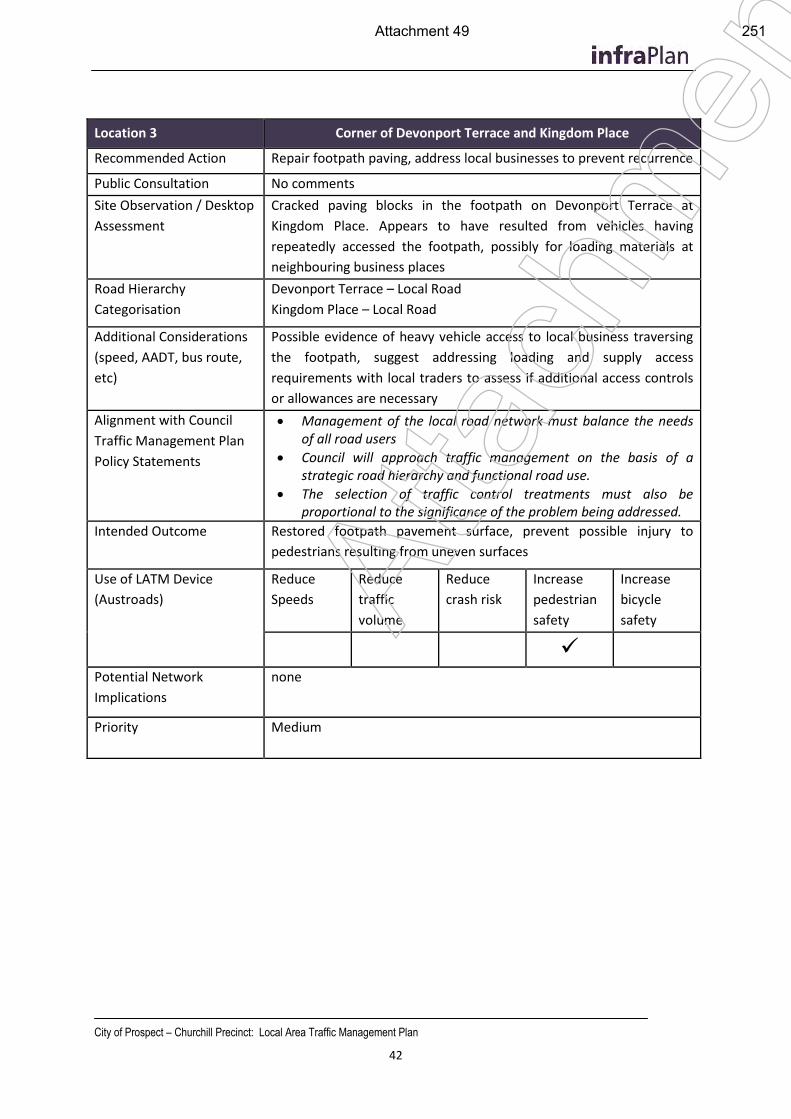
City of Prospect – Churchill Precinct: Local Area Traffic Management Plan
42
Location 3 Corner of Devonport Terrace and Kingdom Place
Recommended Action Repair footpath paving, address local businesses to prevent recurrence
Public Consultation No comments
Site Observation / Desktop
Assessment
Cracked paving blocks in the footpath on Devonport Terrace at
Kingdom Place. Appears to have resulted from vehicles having
repeatedly accessed the footpath, possibly for loading materials at
neighbouring business places
Road Hierarchy
Categorisation
Devonport Terrace – Local Road
Kingdom Place – Local Road
Additional Considerations
(speed, AADT, bus route,
etc)
Possible evidence of heavy vehicle access to local business traversing
the footpath, suggest addressing loading and supply access
requirements with local traders to assess if additional access controls
or allowances are necessary
Alignment with Council
Traffic Management Plan
Policy Statements
Management of the local road network must balance the needs of all road users
Council will approach traffic management on the basis of a strategic road hierarchy and functional road use.
The selection of traffic control treatments must also be proportional to the significance of the problem being addressed.
Intended Outcome Restored footpath pavement surface, prevent possible injury to
pedestrians resulting from uneven surfaces
Use of LATM Device
(Austroads)
Reduce
Speeds
Reduce
traffic
volume
Reduce
crash risk
Increase
pedestrian
safety
Increase
bicycle
safety
Potential Network
Implications
none
Priority Medium
Atta
chm
ent
Attachment 49 251
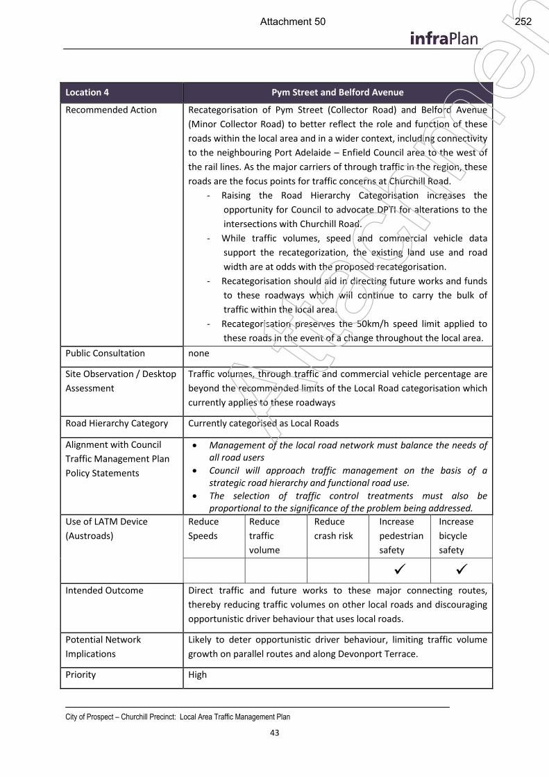
City of Prospect – Churchill Precinct: Local Area Traffic Management Plan
43
Location 4 Pym Street and Belford Avenue
Recommended Action Recategorisation of Pym Street (Collector Road) and Belford Avenue
(Minor Collector Road) to better reflect the role and function of these
roads within the local area and in a wider context, including connectivity
to the neighbouring Port Adelaide – Enfield Council area to the west of
the rail lines. As the major carriers of through traffic in the region, these
roads are the focus points for traffic concerns at Churchill Road.
- Raising the Road Hierarchy Categorisation increases the
opportunity for Council to advocate DPTI for alterations to the
intersections with Churchill Road.
- While traffic volumes, speed and commercial vehicle data
support the recategorization, the existing land use and road
width are at odds with the proposed recategorisation.
- Recategorisation should aid in directing future works and funds
to these roadways which will continue to carry the bulk of
traffic within the local area.
- Recategorisation preserves the 50km/h speed limit applied to
these roads in the event of a change throughout the local area.
Public Consultation none
Site Observation / Desktop
Assessment
Traffic volumes, through traffic and commercial vehicle percentage are
beyond the recommended limits of the Local Road categorisation which
currently applies to these roadways
Road Hierarchy Category Currently categorised as Local Roads
Alignment with Council
Traffic Management Plan
Policy Statements
Management of the local road network must balance the needs of all road users
Council will approach traffic management on the basis of a strategic road hierarchy and functional road use.
The selection of traffic control treatments must also be proportional to the significance of the problem being addressed.
Use of LATM Device
(Austroads)
Reduce
Speeds
Reduce
traffic
volume
Reduce
crash risk
Increase
pedestrian
safety
Increase
bicycle
safety
Intended Outcome Direct traffic and future works to these major connecting routes,
thereby reducing traffic volumes on other local roads and discouraging
opportunistic driver behaviour that uses local roads.
Potential Network
Implications
Likely to deter opportunistic driver behaviour, limiting traffic volume
growth on parallel routes and along Devonport Terrace.
Priority High
Atta
chm
ent
Attachment 50 252
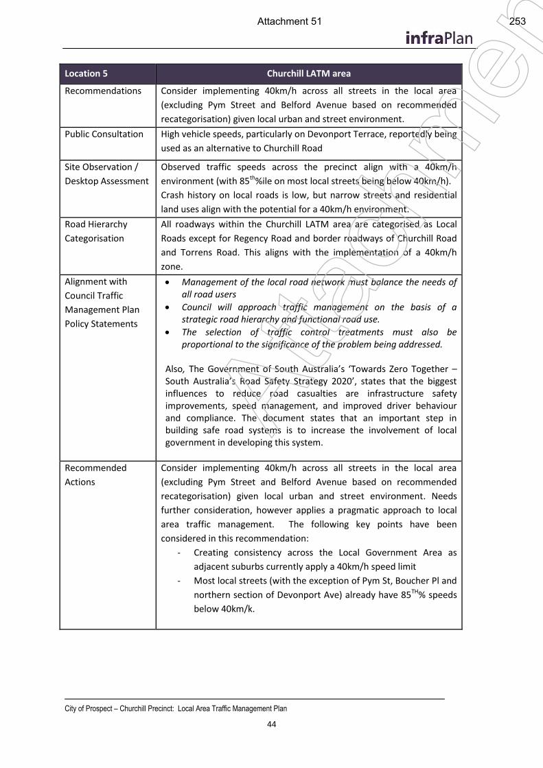
City of Prospect – Churchill Precinct: Local Area Traffic Management Plan
44
Location 5 Churchill LATM area
Recommendations Consider implementing 40km/h across all streets in the local area
(excluding Pym Street and Belford Avenue based on recommended
recategorisation) given local urban and street environment.
Public Consultation High vehicle speeds, particularly on Devonport Terrace, reportedly being
used as an alternative to Churchill Road
Site Observation /
Desktop Assessment
Observed traffic speeds across the precinct align with a 40km/h
environment (with 85th%ile on most local streets being below 40km/h).
Crash history on local roads is low, but narrow streets and residential
land uses align with the potential for a 40km/h environment.
Road Hierarchy
Categorisation
All roadways within the Churchill LATM area are categorised as Local
Roads except for Regency Road and border roadways of Churchill Road
and Torrens Road. This aligns with the implementation of a 40km/h
zone.
Alignment with
Council Traffic
Management Plan
Policy Statements
Management of the local road network must balance the needs of all road users
Council will approach traffic management on the basis of a strategic road hierarchy and functional road use.
The selection of traffic control treatments must also be proportional to the significance of the problem being addressed.
Also, The Government of South Australia’s ‘Towards Zero Together – South Australia’s Road Safety Strategy 2020’, states that the biggest influences to reduce road casualties are infrastructure safety improvements, speed management, and improved driver behaviour and compliance. The document states that an important step in building safe road systems is to increase the involvement of local government in developing this system.
Recommended
Actions
Consider implementing 40km/h across all streets in the local area
(excluding Pym Street and Belford Avenue based on recommended
recategorisation) given local urban and street environment. Needs
further consideration, however applies a pragmatic approach to local
area traffic management. The following key points have been
considered in this recommendation:
- Creating consistency across the Local Government Area as
adjacent suburbs currently apply a 40km/h speed limit
- Most local streets (with the exception of Pym St, Boucher Pl and
northern section of Devonport Ave) already have 85TH% speeds
below 40km/k.
Atta
chm
ent
Attachment 51 253
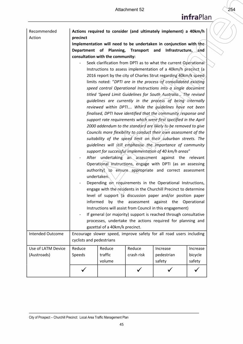
City of Prospect – Churchill Precinct: Local Area Traffic Management Plan
45
Recommended
Action
Actions required to consider (and ultimately implement) a 40km/h
precinct
Implementation will need to be undertaken in conjunction with the
Department of Planning, Transport and Infrastructure, and
consultation with the community:
- Seek clarification from DPTI as to what the current Operational
Instructions to assess implementation of a 40km/h precinct (a
2016 report by the city of Charles Strut regarding 40km/k speed
limits noted: “DPTI are in the process of consolidated existing
speed control Operational Instructions into a single document
titled ‘Speed Limit Guidelines for South Australia… The revised
guidelines are currently in the process of being internally
reviewed within DPTI…. While the guidelines have not been
finalised, DPTI have identified that the community response and
support rate requirements which were first specified in the April
2000 addendum to the standard are likely to be removed to give
Councils more flexibility to conduct their own assessment of the
suitability of the speed limit on their suburban streets. The
guidelines will still emphasise the importance of community
support for successful implementation of 40 km/h areas”
- After undertaking an assessment against the relevant
Operational Instructions, engage with DPTI (as an assessing
authority) to ensure appropriate and correct assessment
undertaken.
- Depending on requirements in the Operational Instructions,
engage with the residents in the Churchill Precinct to determine
level of support (a discussion paper and/or position paper
informed by the assessment against the Operational
Instructions will assist from Council in this engagement)
- If general (or majority) support is reached through consultative
processes, undertake the actions required for planning and
gazettal of a 40km/k precinct.
Intended Outcome Encourage slower speed, improve safety for all road users including
cyclists and pedestrians
Use of LATM Device
(Austroads)
Reduce
Speeds
Reduce
traffic
volume
Reduce
crash risk
Increase
pedestrian
safety
Increase
bicycle
safety
Atta
chm
ent
Attachment 52 254
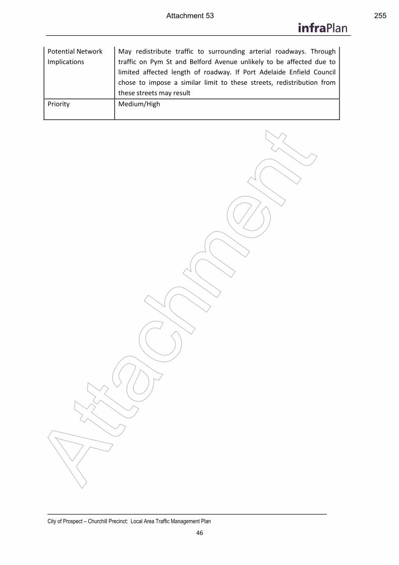
City of Prospect – Churchill Precinct: Local Area Traffic Management Plan
46
Potential Network
Implications
May redistribute traffic to surrounding arterial roadways. Through
traffic on Pym St and Belford Avenue unlikely to be affected due to
limited affected length of roadway. If Port Adelaide Enfield Council
chose to impose a similar limit to these streets, redistribution from
these streets may result
Priority Medium/High
Atta
chm
ent
Attachment 53 255
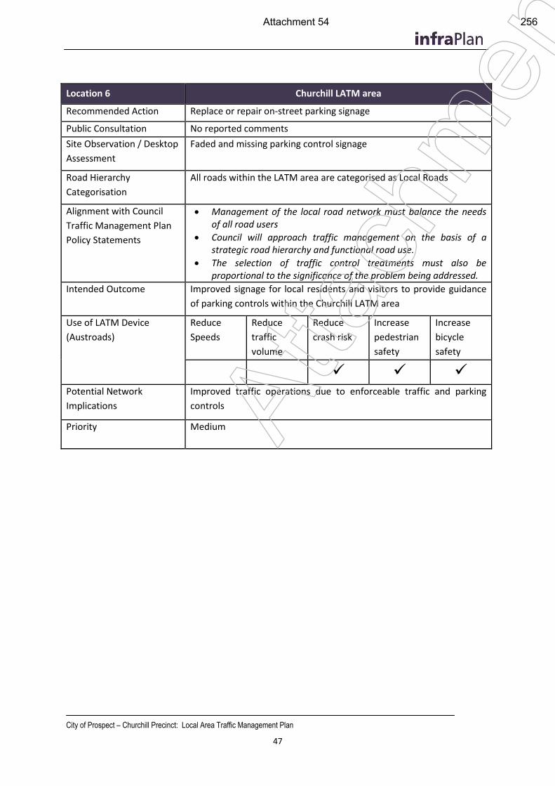
City of Prospect – Churchill Precinct: Local Area Traffic Management Plan
47
Location 6 Churchill LATM area
Recommended Action Replace or repair on-street parking signage
Public Consultation No reported comments
Site Observation / Desktop
Assessment
Faded and missing parking control signage
Road Hierarchy
Categorisation
All roads within the LATM area are categorised as Local Roads
Alignment with Council
Traffic Management Plan
Policy Statements
Management of the local road network must balance the needs of all road users
Council will approach traffic management on the basis of a strategic road hierarchy and functional road use.
The selection of traffic control treatments must also be proportional to the significance of the problem being addressed.
Intended Outcome Improved signage for local residents and visitors to provide guidance
of parking controls within the Churchill LATM area
Use of LATM Device
(Austroads)
Reduce
Speeds
Reduce
traffic
volume
Reduce
crash risk
Increase
pedestrian
safety
Increase
bicycle
safety
Potential Network
Implications
Improved traffic operations due to enforceable traffic and parking
controls
Priority Medium
Atta
chm
ent
Attachment 54 256
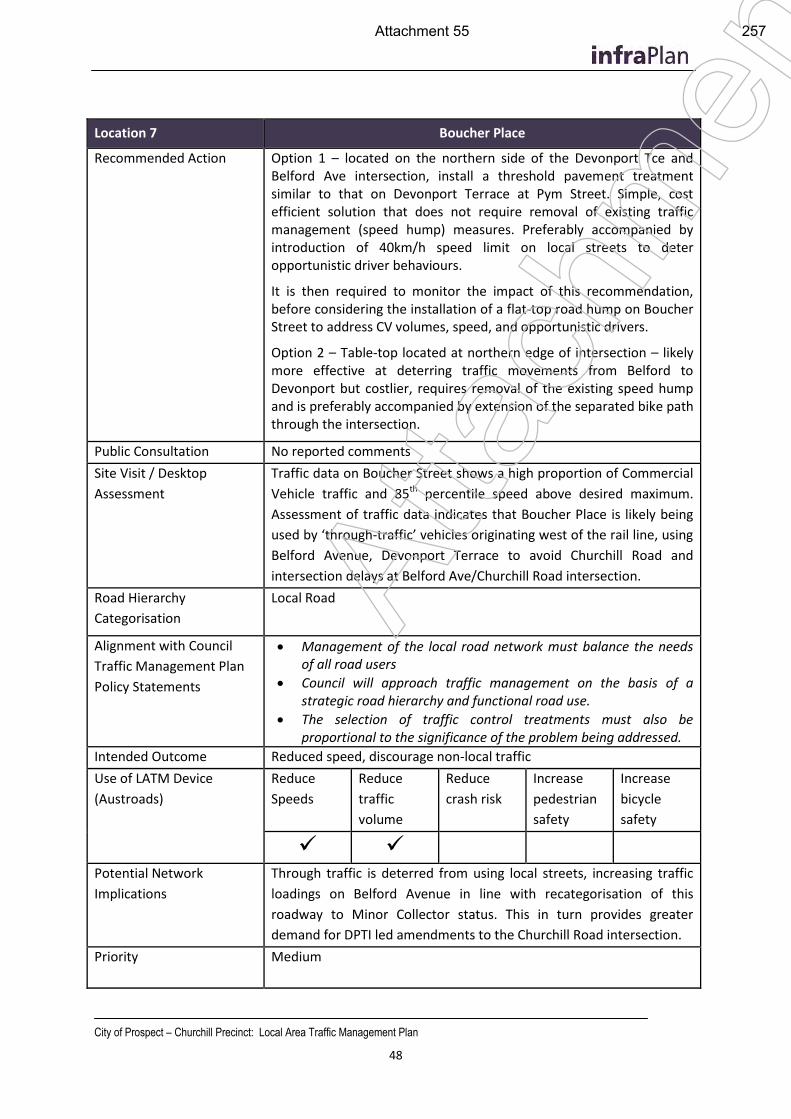
City of Prospect – Churchill Precinct: Local Area Traffic Management Plan
48
Location 7 Boucher Place
Recommended Action Option 1 – located on the northern side of the Devonport Tce and Belford Ave intersection, install a threshold pavement treatment similar to that on Devonport Terrace at Pym Street. Simple, cost efficient solution that does not require removal of existing traffic management (speed hump) measures. Preferably accompanied by introduction of 40km/h speed limit on local streets to deter opportunistic driver behaviours.
It is then required to monitor the impact of this recommendation, before considering the installation of a flat-top road hump on Boucher Street to address CV volumes, speed, and opportunistic drivers.
Option 2 – Table-top located at northern edge of intersection – likely more effective at deterring traffic movements from Belford to Devonport but costlier, requires removal of the existing speed hump and is preferably accompanied by extension of the separated bike path through the intersection.
Public Consultation No reported comments
Site Visit / Desktop
Assessment
Traffic data on Boucher Street shows a high proportion of Commercial
Vehicle traffic and 85th percentile speed above desired maximum.
Assessment of traffic data indicates that Boucher Place is likely being
used by ‘through-traffic’ vehicles originating west of the rail line, using
Belford Avenue, Devonport Terrace to avoid Churchill Road and
intersection delays at Belford Ave/Churchill Road intersection.
Road Hierarchy
Categorisation
Local Road
Alignment with Council
Traffic Management Plan
Policy Statements
Management of the local road network must balance the needs of all road users
Council will approach traffic management on the basis of a strategic road hierarchy and functional road use.
The selection of traffic control treatments must also be proportional to the significance of the problem being addressed.
Intended Outcome Reduced speed, discourage non-local traffic
Use of LATM Device
(Austroads)
Reduce
Speeds
Reduce
traffic
volume
Reduce
crash risk
Increase
pedestrian
safety
Increase
bicycle
safety
Potential Network
Implications
Through traffic is deterred from using local streets, increasing traffic
loadings on Belford Avenue in line with recategorisation of this
roadway to Minor Collector status. This in turn provides greater
demand for DPTI led amendments to the Churchill Road intersection.
Priority Medium
Atta
chm
ent
Attachment 55 257
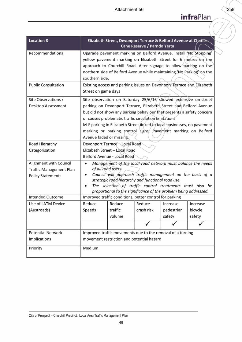
City of Prospect – Churchill Precinct: Local Area Traffic Management Plan
49
Location 8 Elizabeth Street, Devonport Terrace & Belford Avenue at Charles Cane Reserve / Parndo Yerta
Recommendations Upgrade pavement marking on Belford Avenue. Install ‘No Stopping’
yellow pavement marking on Elizabeth Street for 6 metres on the
approach to Churchill Road. Alter signage to allow parking on the
northern side of Belford Avenue while maintaining ‘No Parking’ on the
southern side.
Public Consultation Existing access and parking issues on Devonport Terrace and Elizabeth
Street on game days
Site Observations /
Desktop Assessment
Site observation on Saturday 25/6/16 showed extensive on-street
parking on Devonport Terrace, Elizabeth Street and Belford Avenue
but did not show any parking behaviour that presents a safety concern
or causes problematic traffic circulation limitations
M-F parking in Elizabeth Street linked to local businesses, no pavement
marking or parking control signs. Pavement marking on Belford
Avenue faded or missing.
Road Hierarchy
Categorisation
Devonport Terrace – Local Road
Elizabeth Street – Local Road
Belford Avenue - Local Road
Alignment with Council
Traffic Management Plan
Policy Statements
Management of the local road network must balance the needs of all road users
Council will approach traffic management on the basis of a strategic road hierarchy and functional road use.
The selection of traffic control treatments must also be proportional to the significance of the problem being addressed.
Intended Outcome Improved traffic conditions, better control for parking
Use of LATM Device
(Austroads)
Reduce
Speeds
Reduce
traffic
volume
Reduce
crash risk
Increase
pedestrian
safety
Increase
bicycle
safety
Potential Network
Implications
Improved traffic movements due to the removal of a turning
movement restriction and potential hazard
Priority Medium
Atta
chm
ent
Attachment 56 258
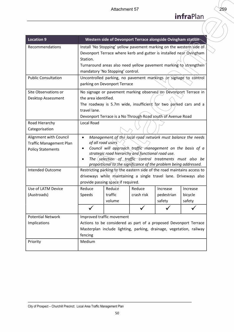
City of Prospect – Churchill Precinct: Local Area Traffic Management Plan
50
Location 9 Western side of Devonport Terrace alongside Ovingham station
Recommendations Install ‘No Stopping’ yellow pavement marking on the western side of
Devonport Terrace where kerb and gutter is installed near Ovingham
Station.
Turnaround areas also need yellow pavement marking to strengthen
mandatory ‘No Stopping’ control.
Public Consultation Uncontrolled parking, no pavement markings or signage to control
parking on Devonport Terrace
Site Observations or
Desktop Assessment
No signage or pavement marking observed on Devonport Terrace in
the area identified.
The roadway is 5.7m wide, insufficient for two parked cars and a
travel lane.
Devonport Terrace is a No Through Road south of Avenue Road
Road Hierarchy
Categorisation
Local Road
Alignment with Council
Traffic Management Plan
Policy Statements
Management of the local road network must balance the needs of all road users
Council will approach traffic management on the basis of a strategic road hierarchy and functional road use.
The selection of traffic control treatments must also be proportional to the significance of the problem being addressed.
Intended Outcome Restricting parking to the eastern side of the road maintains access to
driveways while maintaining a single travel lane. Driveways also
provide passing space if required.
Use of LATM Device
(Austroads)
Reduce
Speeds
Reduce
traffic
volume
Reduce
crash risk
Increase
pedestrian
safety
Increase
bicycle
safety
Potential Network
Implications
Improved traffic movement
Actions to be considered as part of a proposed Devonport Terrace
Masterplan include lighting, parking, drainage, vegetation, railway
fencing
Priority Medium
Atta
chm
ent
Attachment 57 259
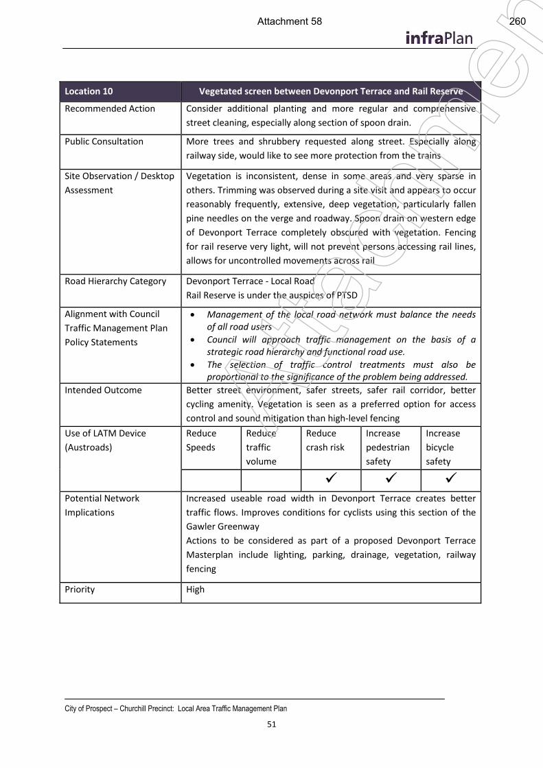
City of Prospect – Churchill Precinct: Local Area Traffic Management Plan
51
Location 10 Vegetated screen between Devonport Terrace and Rail Reserve
Recommended Action Consider additional planting and more regular and comprehensive
street cleaning, especially along section of spoon drain.
Public Consultation More trees and shrubbery requested along street. Especially along
railway side, would like to see more protection from the trains
Site Observation / Desktop
Assessment
Vegetation is inconsistent, dense in some areas and very sparse in
others. Trimming was observed during a site visit and appears to occur
reasonably frequently, extensive, deep vegetation, particularly fallen
pine needles on the verge and roadway. Spoon drain on western edge
of Devonport Terrace completely obscured with vegetation. Fencing
for rail reserve very light, will not prevent persons accessing rail lines,
allows for uncontrolled movements across rail
Road Hierarchy Category Devonport Terrace - Local Road
Rail Reserve is under the auspices of PTSD
Alignment with Council
Traffic Management Plan
Policy Statements
Management of the local road network must balance the needs of all road users
Council will approach traffic management on the basis of a strategic road hierarchy and functional road use.
The selection of traffic control treatments must also be proportional to the significance of the problem being addressed.
Intended Outcome Better street environment, safer streets, safer rail corridor, better
cycling amenity. Vegetation is seen as a preferred option for access
control and sound mitigation than high-level fencing
Use of LATM Device
(Austroads)
Reduce
Speeds
Reduce
traffic
volume
Reduce
crash risk
Increase
pedestrian
safety
Increase
bicycle
safety
Potential Network
Implications
Increased useable road width in Devonport Terrace creates better
traffic flows. Improves conditions for cyclists using this section of the
Gawler Greenway
Actions to be considered as part of a proposed Devonport Terrace
Masterplan include lighting, parking, drainage, vegetation, railway
fencing
Priority High
Atta
chm
ent
Attachment 58 260
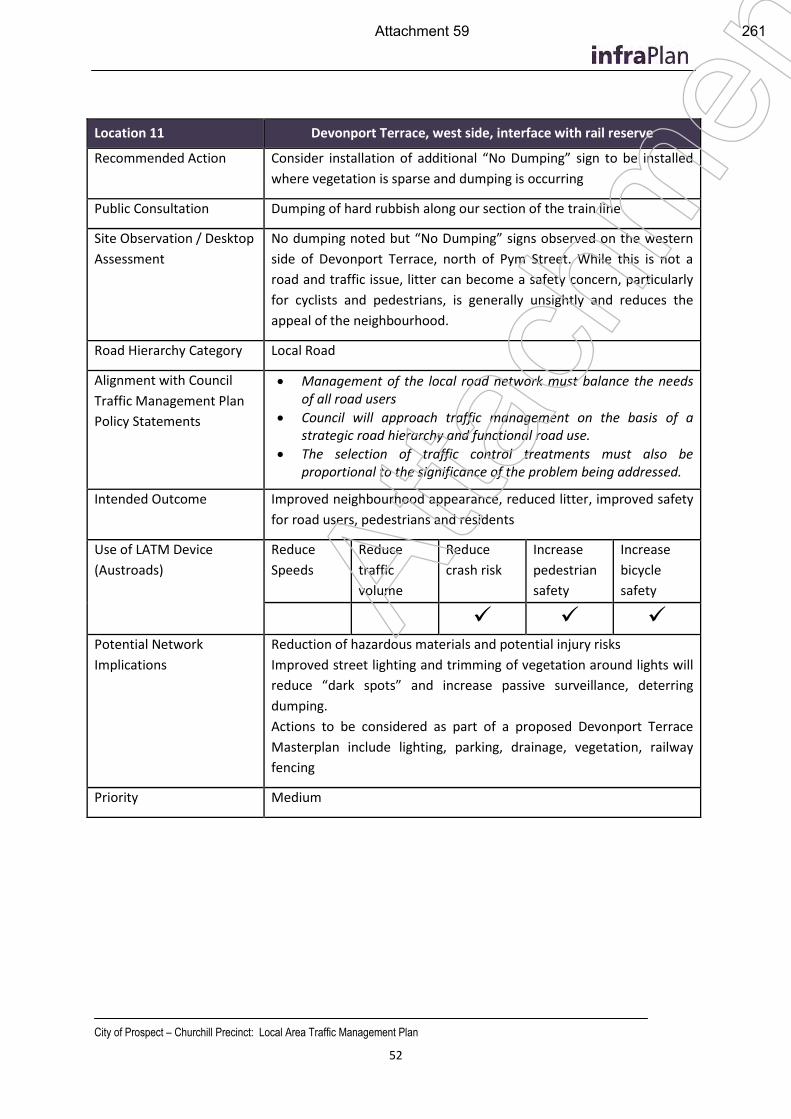
City of Prospect – Churchill Precinct: Local Area Traffic Management Plan
52
Location 11 Devonport Terrace, west side, interface with rail reserve
Recommended Action Consider installation of additional “No Dumping” sign to be installed
where vegetation is sparse and dumping is occurring
Public Consultation Dumping of hard rubbish along our section of the train line
Site Observation / Desktop
Assessment
No dumping noted but “No Dumping” signs observed on the western
side of Devonport Terrace, north of Pym Street. While this is not a
road and traffic issue, litter can become a safety concern, particularly
for cyclists and pedestrians, is generally unsightly and reduces the
appeal of the neighbourhood.
Road Hierarchy Category Local Road
Alignment with Council
Traffic Management Plan
Policy Statements
Management of the local road network must balance the needs of all road users
Council will approach traffic management on the basis of a strategic road hierarchy and functional road use.
The selection of traffic control treatments must also be proportional to the significance of the problem being addressed.
Intended Outcome Improved neighbourhood appearance, reduced litter, improved safety
for road users, pedestrians and residents
Use of LATM Device
(Austroads)
Reduce
Speeds
Reduce
traffic
volume
Reduce
crash risk
Increase
pedestrian
safety
Increase
bicycle
safety
Potential Network
Implications
Reduction of hazardous materials and potential injury risks
Improved street lighting and trimming of vegetation around lights will
reduce “dark spots” and increase passive surveillance, deterring
dumping.
Actions to be considered as part of a proposed Devonport Terrace
Masterplan include lighting, parking, drainage, vegetation, railway
fencing
Priority Medium
Atta
chm
ent
Attachment 59 261
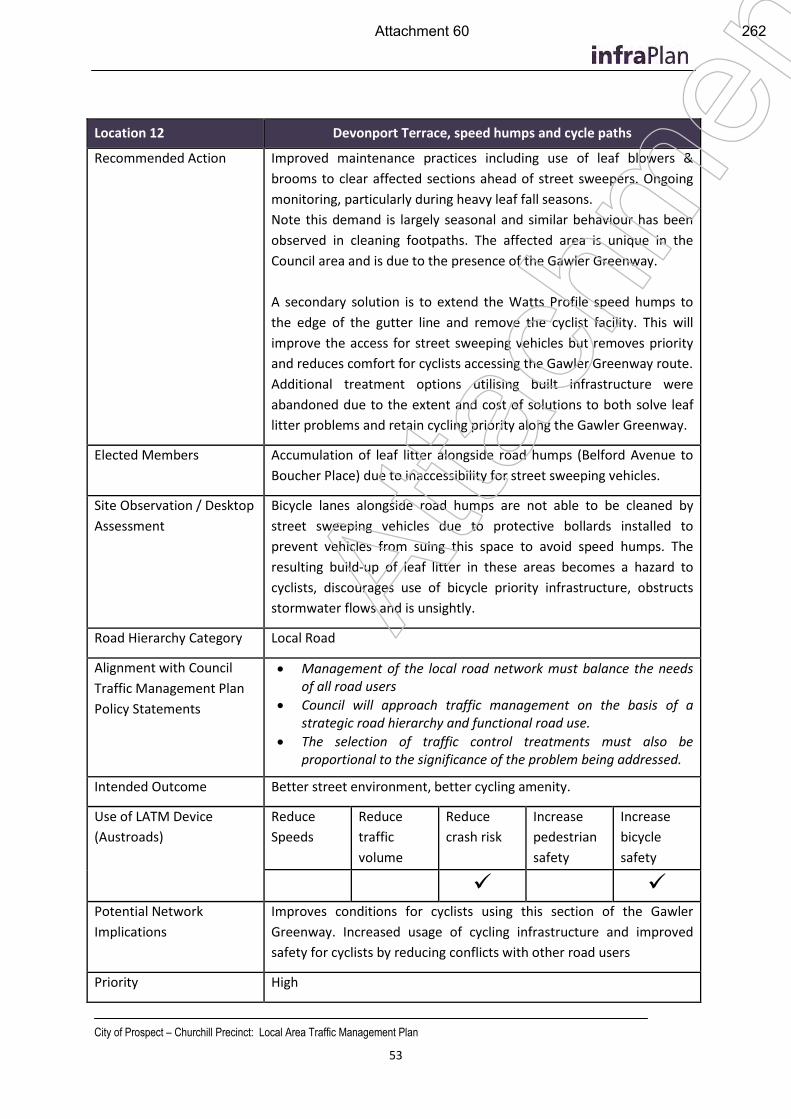
City of Prospect – Churchill Precinct: Local Area Traffic Management Plan
53
Location 12 Devonport Terrace, speed humps and cycle paths
Recommended Action Improved maintenance practices including use of leaf blowers &
brooms to clear affected sections ahead of street sweepers. Ongoing
monitoring, particularly during heavy leaf fall seasons.
Note this demand is largely seasonal and similar behaviour has been
observed in cleaning footpaths. The affected area is unique in the
Council area and is due to the presence of the Gawler Greenway.
A secondary solution is to extend the Watts Profile speed humps to
the edge of the gutter line and remove the cyclist facility. This will
improve the access for street sweeping vehicles but removes priority
and reduces comfort for cyclists accessing the Gawler Greenway route.
Additional treatment options utilising built infrastructure were
abandoned due to the extent and cost of solutions to both solve leaf
litter problems and retain cycling priority along the Gawler Greenway.
Elected Members Accumulation of leaf litter alongside road humps (Belford Avenue to
Boucher Place) due to inaccessibility for street sweeping vehicles.
Site Observation / Desktop
Assessment
Bicycle lanes alongside road humps are not able to be cleaned by
street sweeping vehicles due to protective bollards installed to
prevent vehicles from suing this space to avoid speed humps. The
resulting build-up of leaf litter in these areas becomes a hazard to
cyclists, discourages use of bicycle priority infrastructure, obstructs
stormwater flows and is unsightly.
Road Hierarchy Category Local Road
Alignment with Council
Traffic Management Plan
Policy Statements
Management of the local road network must balance the needs of all road users
Council will approach traffic management on the basis of a strategic road hierarchy and functional road use.
The selection of traffic control treatments must also be proportional to the significance of the problem being addressed.
Intended Outcome Better street environment, better cycling amenity.
Use of LATM Device
(Austroads)
Reduce
Speeds
Reduce
traffic
volume
Reduce
crash risk
Increase
pedestrian
safety
Increase
bicycle
safety
Potential Network
Implications
Improves conditions for cyclists using this section of the Gawler
Greenway. Increased usage of cycling infrastructure and improved
safety for cyclists by reducing conflicts with other road users
Priority High
Atta
chm
ent
Attachment 60 262
City of Prospect – Churchill Precinct: Local Area Traffic Management Plan
54
Atta
chm
ent
Attachment 61 263
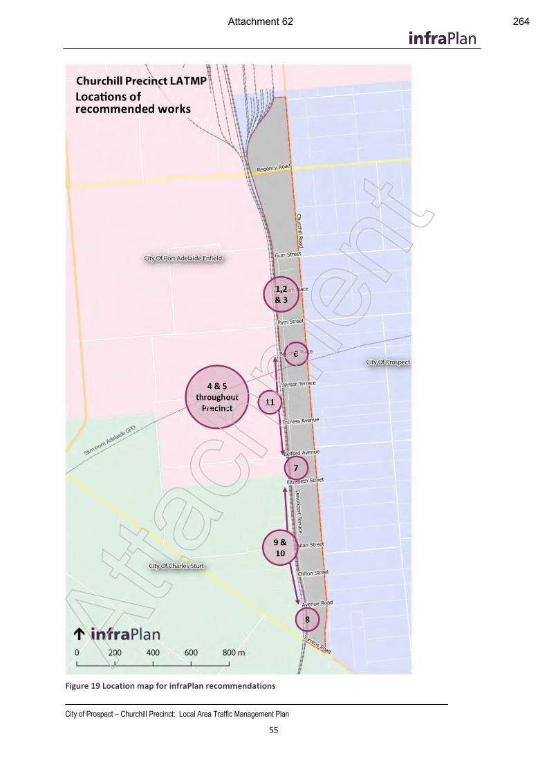
City of Prospect – Churchill Precinct: Local Area Traffic Management Plan
55
Figure 19 Location map for infraPlan recommendations
Atta
chm
ent
Attachment 62 264
City of Prospect – Churchill Precinct: Local Area Traffic Management Plan
56
7.2 Issues for Engagement With and Advocacy To Others (primarily DPTI)
Pym Street
In the context of this LATMP, improving the operation of Pym Street (particularly the level crossing and intersection with Churchill Road) is a longer-term proposal: It is known that the Department of Transport has, over many years, considered possible works to address concerns with Pym Street regarding the level crossing of the Gawler passenger and Freight lines and the intersection at Churchill Road. Site observations showed that large volumes of heavy vehicles use this roadway to access local industrial precincts in the City of Port Adelaide Enfield from Churchill Road.
Pym Street runs between Churchill Road and Days Road with a signalised intersection at the South Road junction, a roundabout at the junction with Oldsmobile Terrace and a level crossing of two passenger rail lines and the freight rail line. It is a two-lane road with parking permitted on both sides. While mostly surrounded by residential areas, there is a significant section of industrial land between the railway line and Harrison Road which includes logistics operations and manufacturing businesses and has been shown to generate significant levels of heavy vehicle traffic, including articulated trucks.
Pym Street falls within the City of Port Adelaide Enfield to the west of the rai line and City of Prospect on the eastern side. The portion within the City of Prospect is currently classed as a local road, however tube count observations taken in October 2015 show that the existing traffic volumes far exceed the acceptable upper limit for a local road. A Local Area Traffic Management Plan completed in early 2016 recommended upgrading of this roadway and investigation of potential treatments to improve traffic flow and safety at the Churchill road intersection and level crossing.
The recommendation to upgrade the categorisation of Pym Street to a Minor Collector Road (identified in section 7.1 for this report) acknowledges the elevated traffic and heavy vehicle volumes and use of Pym Street as a through road. If this recommendation is implemented, it identifies support by Council for improved road treatments of Pym Street and upgraded intersection arrangements.
A road safety audit was undertaken by Tonkin Consulting April 2010 to assess the Churchill Road, Pym Street and Beatrice Street intersection. This assessment was largely concerned with the access to and from Pym Street, turning space requirements for large vehicles and subsequent lane straddling. This report made comment on the existing median and lane marking treatments, particularly the unconventional right turn lane from Churchill Road to Pym Street which is made from the right-hand side of the central median. It included observations of heavy vehicle traffic straddling lanes and mounting kerbs when turning in and out of Pym Street from Churchill Road.
The report concluded with recommended intersection widening, lane marking and median island changes to retain the existing functionality but provide sufficient space for heavy vehicles to turn in and out of Pym Street safely and without crossing into oncoming lanes. Plans also included widening and realignment of the left turn lane from Beatrice Street, including new median treatments to restrict right turn and through movements from Beatrice Street. The proposal did not include signalisation of the intersection nor an increase in lane provision on any of the approach roads.
None of the recommendations made in the Tonkin report have been adopted, recent observations made by infraPlan show that the heavy vehicle movements in particular continue to pose a risk. A multi storey development has since been erected near the north-western corner of the intersection with an at-grade residential car park and letterboxes occupying space which would be impacted by Tonkins’ proposed recommendations. At
tach
men
t
Attachment 63 265
City of Prospect – Churchill Precinct: Local Area Traffic Management Plan
57
Observations suggest that traffic loadings on both Pym Street and Churchill Road appear to have increased in recent time. It is likely that some of this increase is due to the ongoing works on South Road for the Torrens2Torrens project and therefore may subside once construction is complete. However, this project is expected to continue for some time yet and plans to continue the works north of Pym Street to Regency Road may extend the timeframe. While it is noted that existing traffic volumes on Churchill Road are temporarily exaggerated due to works on South Road, the design, safety and heavy vehicle generation issues are pre-existing given the 2010 safety audit and site observations for the LATMP were undertaken prior to Torrens to Torrens works commencing.
Signalisation of the intersection and restricting turning allowances for heavy vehicles entering Pym Street were not considered. These options are likely to require relocation of the Stobie pole and 66kV power lines located at the north-western corner of the intersection and is also likely to force amelioration works on the level crossing at the western end of the City of Prospect section of Pym Street.
Given the above consideration the City of Prospect will need to advocate to the Department of Planning, Transport and Infrastructure for improvements to Pym Street:
1. Engagement with Port Adelaide Enfield to establish a working committee and discuss and document design options or alternative network functionality, including:
a. Option A: Improvement of functionality of Pym Street / Churchill Road intersection aligned with the 2010 Tonkin proposal, but considering other design solutions including signalisation options.
b. Option B: Remove functionality by closing the level crossing or Pym Street access at Churchill Road. Network implications require investigation, and agreement with Port Adelaide Enfield. Alternative routes for accessing industrial areas west of the rail line may include via Exeter Terrace or access from South Road. This requires interaction with CC Port Adelaide Enfield as many network impacts will be felt in the neighbouring council area.
2. Engagement with DPTI to present possible design or network solutions (an agreed solution suitable to both Port Adelaide Enfield and City of Prospect) 1
3. Develop concept plans in partnership with DPTI for an appropriate design solution
4. Undertake consultation with local residents and businesses to determine support, or refine preferred design option
5. Secure funding to implement agreed design/network solution.
1 While not deemed necessary due to observed pre-existing safety and operational concerns, DPTI may request
re-evaluation of operations and traffic volumes at Pym Street/Churchill Road intersection to be undertaken once the South Road works are complete and traffic behaviour impacts have adjusted to network conditions.
Atta
chm
ent
Attachment 64 266
City of Prospect – Churchill Precinct: Local Area Traffic Management Plan
58
Pedestrian fencing for rail crossing at Pym Street
One local resident made mention of the fencing that was installed in 2016 parallel to the northern kerb on Pym Street within the Rail Reserve to prevent pedestrians from entering the roadway. While this fence is a permeable structure, it was observed during a site inspection that when viewed at an acute angle, the vertical elements obscure visibility along Pym street to the west, affecting drivers approaching Pym Street, southbound on Devonport Terrace. It is recommended that Council advocate DPTI to realign this fence to provide greater visibility for these motorists, reducing the crash risk at the intersection.
Belford Avenue
InfraPlan encourage Prospect City Council to advocate DPTI to investigate intersection widening at Belford Avenue to create two approach lanes eastbound to Churchill Road. This will separate left- and right-turn movements exiting Belford Avenue to Churchill Road, improving traffic flows from Belford Avenue and reducing opportunistic driver behaviour using parallel local streets.
Pedestrian crossings of Churchill Road near Ovingham Station
Rail passengers from Ovingham Station, including many school children were observed making uncontrolled crossings of Churchill Road near Avenue Road. The is no pedestrian crossing amenity provided in this area and medians are painted only, offering no shelter or protection for pedestrians. We recommend that Council advocate to DPTI to provide a crossing facility in this area as a pedestrian desire line has been identified.
Electrification of Gawler Passenger Rail Line
Prospect City Council supports the position of state government in pursuing the electrification of the Gawler passenger rail line. It is understood that such an upgrade comes with necessary improvements and changes to the rail corridor including extensive fencing around the high-voltage rail environment.
Station upgrades
It is noted that the three passenger rail stations in close proximity to the local area, Ovingham, Dudley Park and Islington, are among the worst rated and most poorly patronised stations on the Adelaide Rail Network. Prospect City Council supports upgrades to station amenity including shelters, wayfinding and passenger information at these stations, with or without electrification of the rail line.
Council advocate to have Ovingham, Dudley Park and Islington stations added to the State Government Stations Upgrade Program:
“DPTI's Station Upgrade Program continues to upgrade selected stations along
metropolitan passenger rail lines to provide safer and more efficient services for
train customers. Upgraded stations include Elizabeth, Elizabeth South, Chidda,
Evanston, Parafield, Munno Para, Gawler, Hallet Cove and Hallet Cove Railway
Stations.
Improved facilities for commuters include new shelters, improved lighting,
platform furniture, additional cover, improved access, pedestrian crossings, bike
enclosures, additional CCTV camera, new access paths and ramp along with new
car parking facilities. All improvements focus on accessibility that is in line with
the DDA (Disability Discrimination Act) for public transport services.”
Atta
chm
ent
Attachment 65 267
City of Prospect – Churchill Precinct: Local Area Traffic Management Plan
59
Islington Train Station access
The brief for the 250 Churchill Road development includes requests for improvements to public transport access, and facilities including improvement to lighting and access paths. The latter is of interest for Council in the short term to improve access and amenity for passengers utilising this station.
The Council does not have jurisdiction to require a Park’n’Ride facility as part of a new development on the 250 Churchill Road site. InfraPlan also question if this is the highest and best use of land in this location given the likely indirect nature of traffic movements through this future development site. Future planning for any such facility, including amendments to station access and surroundings would need to be considered as part of overall planning for the redevelopment of the 250 Churchill Road site.
Atta
chm
ent
Attachment 66 268
City of Prospect – Churchill Precinct: Local Area Traffic Management Plan
60
Appendix A
Definitions and Abbreviations
AADT = Average Annual Daily Traffic
TCD = Traffic Calming Device
LATMP = Local Area Traffic Management Plan
VPD = Vehicles per Day
Council = City of Prospect
DPTI = Department of Planning, Transport and Infrastructure
PTSD = Public Transport Services Division (of DPTI)
ITLUP = Integrated Transport and Land Use Plan (of DPTI)
Atta
chm
ent
Attachment 67 269
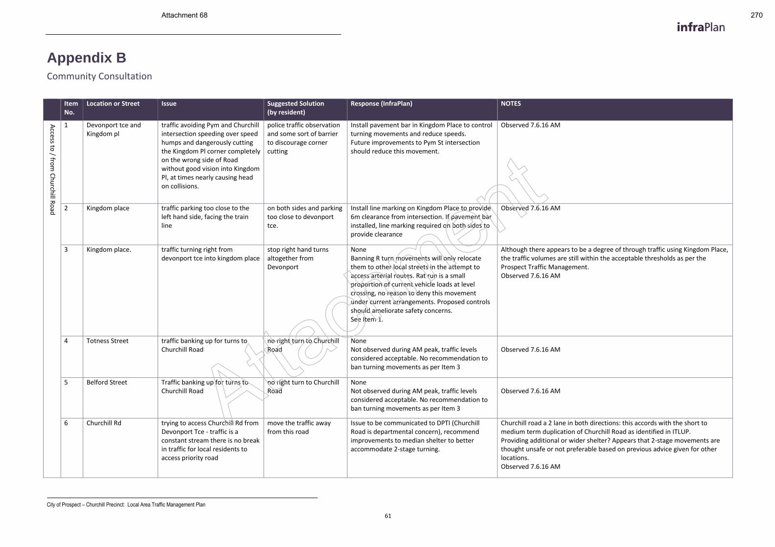
City of Prospect – Churchill Precinct: Local Area Traffic Management Plan
61
Appendix B
Community Consultation
Item No.
Location or Street Issue Suggested Solution (by resident)
Response (InfraPlan) NOTES
Access to
/ from
Ch
urch
ill Ro
ad
1 Devonport tce and Kingdom pl
traffic avoiding Pym and Churchill intersection speeding over speed humps and dangerously cutting the Kingdom Pl corner completely on the wrong side of Road without good vision into Kingdom Pl, at times nearly causing head on collisions.
police traffic observation and some sort of barrier to discourage corner cutting
Install pavement bar in Kingdom Place to control turning movements and reduce speeds. Future improvements to Pym St intersection should reduce this movement.
Observed 7.6.16 AM
2 Kingdom place traffic parking too close to the left hand side, facing the train line
on both sides and parking too close to devonport tce.
Install line marking on Kingdom Place to provide 6m clearance from intersection. If pavement bar installed, line marking required on both sides to provide clearance
Observed 7.6.16 AM
3 Kingdom place. traffic turning right from devonport tce into kingdom place
stop right hand turns altogether from Devonport
None Banning R turn movements will only relocate them to other local streets in the attempt to access arterial routes. Rat run is a small proportion of current vehicle loads at level crossing, no reason to deny this movement under current arrangements. Proposed controls should ameliorate safety concerns. See Item 1.
Although there appears to be a degree of through traffic using Kingdom Place, the traffic volumes are still within the acceptable thresholds as per the Prospect Traffic Management. Observed 7.6.16 AM
4 Totness Street traffic banking up for turns to Churchill Road
no right turn to Churchill Road
None Not observed during AM peak, traffic levels considered acceptable. No recommendation to ban turning movements as per Item 3
Observed 7.6.16 AM
5 Belford Street Traffic banking up for turns to Churchill Road
no right turn to Churchill Road
None Not observed during AM peak, traffic levels considered acceptable. No recommendation to ban turning movements as per Item 3
Observed 7.6.16 AM
6 Churchill Rd trying to access Churchill Rd from Devonport Tce - traffic is a constant stream there is no break in traffic for local residents to access priority road
move the traffic away from this road
Issue to be communicated to DPTI (Churchill Road is departmental concern), recommend improvements to median shelter to better accommodate 2-stage turning.
Churchill road a 2 lane in both directions: this accords with the short to medium term duplication of Churchill Road as identified in ITLUP. Providing additional or wider shelter? Appears that 2-stage movements are thought unsafe or not preferable based on previous advice given for other locations. Observed 7.6.16 AM
Attachment
Attachment 68 270
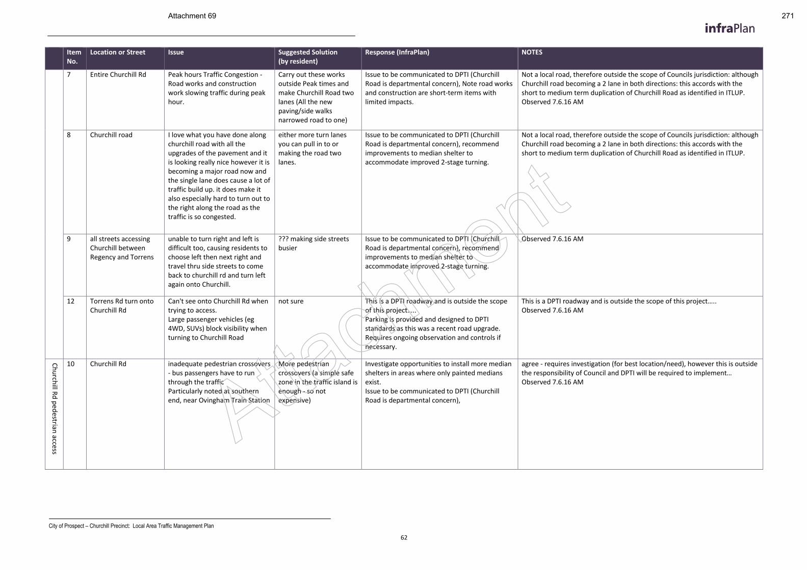
City of Prospect – Churchill Precinct: Local Area Traffic Management Plan
62
Item No.
Location or Street Issue Suggested Solution (by resident)
Response (InfraPlan) NOTES
7 Entire Churchill Rd Peak hours Traffic Congestion - Road works and construction work slowing traffic during peak hour.
Carry out these works outside Peak times and make Churchill Road two lanes (All the new paving/side walks narrowed road to one)
Issue to be communicated to DPTI (Churchill Road is departmental concern), Note road works and construction are short-term items with limited impacts.
Not a local road, therefore outside the scope of Councils jurisdiction: although Churchill road becoming a 2 lane in both directions: this accords with the short to medium term duplication of Churchill Road as identified in ITLUP. Observed 7.6.16 AM
8 Churchill road I love what you have done along churchill road with all the upgrades of the pavement and it is looking really nice however it is becoming a major road now and the single lane does cause a lot of traffic build up. it does make it also especially hard to turn out to the right along the road as the traffic is so congested.
either more turn lanes you can pull in to or making the road two lanes.
Issue to be communicated to DPTI (Churchill Road is departmental concern), recommend improvements to median shelter to accommodate improved 2-stage turning.
Not a local road, therefore outside the scope of Councils jurisdiction: although Churchill road becoming a 2 lane in both directions: this accords with the short to medium term duplication of Churchill Road as identified in ITLUP.
9 all streets accessing Churchill between Regency and Torrens
unable to turn right and left is difficult too, causing residents to choose left then next right and travel thru side streets to come back to churchill rd and turn left again onto Churchill.
??? making side streets busier
Issue to be communicated to DPTI (Churchill Road is departmental concern), recommend improvements to median shelter to accommodate improved 2-stage turning.
Observed 7.6.16 AM
12 Torrens Rd turn onto Churchill Rd
Can't see onto Churchill Rd when trying to access. Large passenger vehicles (eg 4WD, SUVs) block visibility when turning to Churchill Road
not sure This is a DPTI roadway and is outside the scope of this project….. Parking is provided and designed to DPTI standards as this was a recent road upgrade. Requires ongoing observation and controls if necessary.
This is a DPTI roadway and is outside the scope of this project….. Observed 7.6.16 AM
Ch
urch
ill Rd
ped
estrian access
10 Churchill Rd inadequate pedestrian crossovers - bus passengers have to run through the traffic Particularly noted at southern end, near Ovingham Train Station
More pedestrian crossovers (a simple safe zone in the traffic island is enough - so not expensive)
Investigate opportunities to install more median shelters in areas where only painted medians exist. Issue to be communicated to DPTI (Churchill Road is departmental concern),
agree - requires investigation (for best location/need), however this is outside the responsibility of Council and DPTI will be required to implement… Observed 7.6.16 AM
Attachment
Attachment 69 271
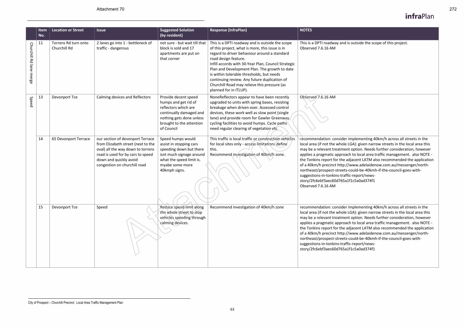
City of Prospect – Churchill Precinct: Local Area Traffic Management Plan
63
Item No.
Location or Street Issue Suggested Solution (by resident)
Response (InfraPlan) NOTES
Ch
urch
ill Rd
lane m
erge
11 Torrens Rd turn onto Churchill Rd
2 lanes go into 1 - bottleneck of traffic - dangerous
not sure - but wait till that block is sold and 17 apartments are put on that corner
This is a DPTI roadway and is outside the scope of this project, what is more, this issue is in regard to driver behaviour around a standard road design feature. Infill accords with 30-Year Plan, Council Strategic Plan and Development Plan. The growth to date is within tolerable thresholds, but needs continuing review. Any future duplication of Churchill Road may relieve this pressure (as planned for in ITLUP).
This is a DPTI roadway and is outside the scope of this project. Observed 7.6.16 AM
Spee
d
13 Devonport Tce Calming devices and Reflectors Provide decent speed humps and get rid of reflectors which are continually damaged and nothing gets done unless brought to the attention of Council
NoneReflectors appear to have been recently upgraded to units with spring bases, resisting breakage when driven over. Assessed control devices, these work well as slow point (single lane) and provide room for Gawler Greenway cycling facilities to avoid humps. Cycle paths need regular clearing of vegetation etc
Observed 7.6.16 AM
14 65 Devonport Terrace our section of devonport Terrace from Elizabeth street (next to the oval) all the way down to torrens road is used for by cars to speed down and quickly avoid congestion on churchill road
Speed humps would assist in stopping cars speeding down but there isnt much signage around what the speed limit is. myabe some more 40kmph signs.
This traffic is local traffic or construction vehicles for local sites only - access limitations define this. Recommend investigation of 40km/h zone.
recommendation: consider implementing 40km/h across all streets in the local area (if not the whole LGA): given narrow streets in the local area this may be a relevant treatment option. Needs further consideration, however applies a pragmatic approach to local area traffic management. also NOTE - the Tonkins report for the adjacent LATM also recommended the application of a 40km/h precinct http://www.adelaidenow.com.au/messenger/north-northeast/prospect-streets-could-be-40kmh-if-the-council-goes-with-suggestions-in-tonkins-traffic-report/news-story/2fc6ebf3aec60d765a1f1c5a0ad374f1 Observed 7.6.16 AM
15 Devonport Tce Speed Reduce speed limit along the whole street to stop vehicles speeding through calming devices.
Recommend investigation of 40km/h zone recommendation: consider implementing 40km/h across all streets in the local area (if not the whole LGA): given narrow streets in the local area this may be a relevant treatment option. Needs further consideration, however applies a pragmatic approach to local area traffic management. also NOTE - the Tonkins report for the adjacent LATM also recommended the application of a 40km/h precinct http://www.adelaidenow.com.au/messenger/north-northeast/prospect-streets-could-be-40kmh-if-the-council-goes-with-suggestions-in-tonkins-traffic-report/news-story/2fc6ebf3aec60d765a1f1c5a0ad374f1 Attachment
Attachment 70 272
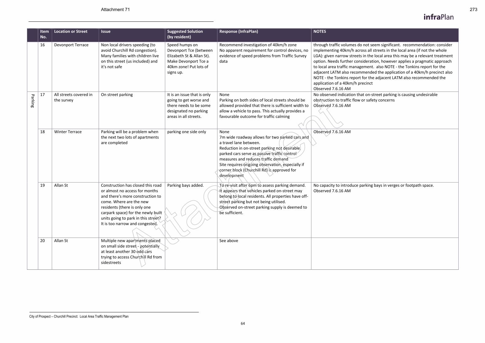
City of Prospect – Churchill Precinct: Local Area Traffic Management Plan
64
Item No.
Location or Street Issue Suggested Solution (by resident)
Response (InfraPlan) NOTES
16 Devonport Terrace Non local drivers speeding (to avoid Churchill Rd congestion). Many families with children live on this street (us included) and it's not safe
Speed humps on Devonport Tce (between Elizabeth St & Allan St). Make Devonport Tce a 40km zone! Put lots of signs up.
Recommend investigation of 40km/h zone No apparent requirement for control devices, no evidence of speed problems from Traffic Survey data
through traffic volumes do not seem significant. recommendation: consider implementing 40km/h across all streets in the local area (if not the whole LGA): given narrow streets in the local area this may be a relevant treatment option. Needs further consideration, however applies a pragmatic approach to local area traffic management. also NOTE - the Tonkins report for the adjacent LATM also recommended the application of a 40km/h precinct also NOTE - the Tonkins report for the adjacent LATM also recommended the application of a 40km/h precinct Observed 7.6.16 AM
Parkin
g
17 All streets covered in the survey
On street parking It is an issue that is only going to get worse and there needs to be some designated no parking areas in all streets.
None Parking on both sides of local streets should be allowed provided that there is sufficient width to allow a vehicle to pass. This actually provides a favourable outcome for traffic calming
No observed indication that on-street parking is causing undesirable obstruction to traffic flow or safety concerns Observed 7.6.16 AM
18 Winter Terrace Parking will be a problem when the next two lots of apartments are completed
parking one side only None 7m wide roadway allows for two parked cars and a travel lane between. Reduction in on-street parking not desirable, parked cars serve as passive traffic control measures and reduces traffic demand Site requires ongoing observation, especially if corner block (Churchill Rd) is approved for development
Observed 7.6.16 AM
19 Allan St Construction has closed this road or almost no access for months and there's more construction to come. Where are the new residents (there is only one carpark space) for the newly built units going to park in this street? It is too narrow and congested.
Parking bays added. To re-visit after 6pm to assess parking demand. It appears that vehicles parked on-street may belong to local residents. All properties have off-street parking but not being utilised. Observed on-street parking supply is deemed to be sufficient.
No capacity to introduce parking bays in verges or footpath space. Observed 7.6.16 AM
20 Allan St Multiple new apartments placed on small side street - potentially at least another 30 odd cars trying to access Churchill Rd from sidestreets
See above Attachment
Attachment 71 273
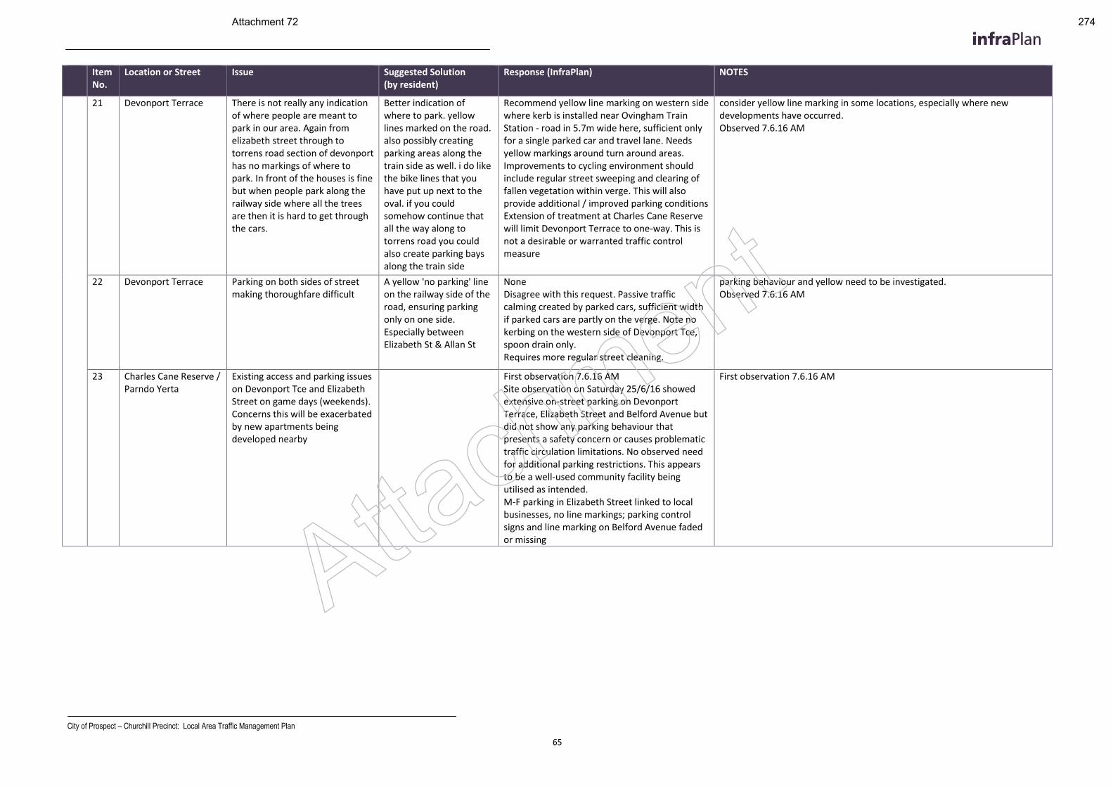
City of Prospect – Churchill Precinct: Local Area Traffic Management Plan
65
Item No.
Location or Street Issue Suggested Solution (by resident)
Response (InfraPlan) NOTES
21 Devonport Terrace There is not really any indication of where people are meant to park in our area. Again from elizabeth street through to torrens road section of devonport has no markings of where to park. In front of the houses is fine but when people park along the railway side where all the trees are then it is hard to get through the cars.
Better indication of where to park. yellow lines marked on the road. also possibly creating parking areas along the train side as well. i do like the bike lines that you have put up next to the oval. if you could somehow continue that all the way along to torrens road you could also create parking bays along the train side
Recommend yellow line marking on western side where kerb is installed near Ovingham Train Station - road in 5.7m wide here, sufficient only for a single parked car and travel lane. Needs yellow markings around turn around areas. Improvements to cycling environment should include regular street sweeping and clearing of fallen vegetation within verge. This will also provide additional / improved parking conditions Extension of treatment at Charles Cane Reserve will limit Devonport Terrace to one-way. This is not a desirable or warranted traffic control measure
consider yellow line marking in some locations, especially where new developments have occurred. Observed 7.6.16 AM
22 Devonport Terrace Parking on both sides of street making thoroughfare difficult
A yellow 'no parking' line on the railway side of the road, ensuring parking only on one side. Especially between Elizabeth St & Allan St
None Disagree with this request. Passive traffic calming created by parked cars, sufficient width if parked cars are partly on the verge. Note no kerbing on the western side of Devonport Tce, spoon drain only. Requires more regular street cleaning.
parking behaviour and yellow need to be investigated. Observed 7.6.16 AM
23 Charles Cane Reserve / Parndo Yerta
Existing access and parking issues on Devonport Tce and Elizabeth Street on game days (weekends). Concerns this will be exacerbated by new apartments being developed nearby
First observation 7.6.16 AM Site observation on Saturday 25/6/16 showed extensive on-street parking on Devonport Terrace, Elizabeth Street and Belford Avenue but did not show any parking behaviour that presents a safety concern or causes problematic traffic circulation limitations. No observed need for additional parking restrictions. This appears to be a well-used community facility being utilised as intended. M-F parking in Elizabeth Street linked to local businesses, no line markings; parking control signs and line marking on Belford Avenue faded or missing
First observation 7.6.16 AM
Attachment
Attachment 72 274
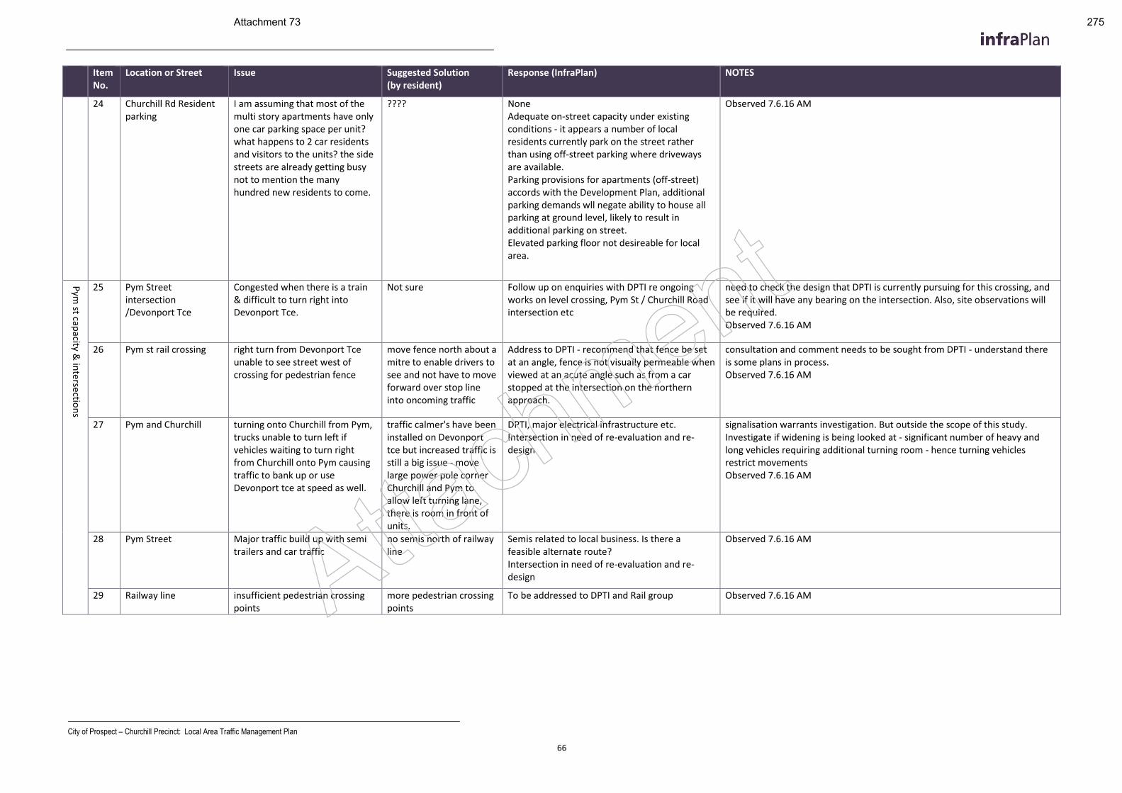
City of Prospect – Churchill Precinct: Local Area Traffic Management Plan
66
Item No.
Location or Street Issue Suggested Solution (by resident)
Response (InfraPlan) NOTES
24 Churchill Rd Resident parking
I am assuming that most of the multi story apartments have only one car parking space per unit? what happens to 2 car residents and visitors to the units? the side streets are already getting busy not to mention the many hundred new residents to come.
???? None Adequate on-street capacity under existing conditions - it appears a number of local residents currently park on the street rather than using off-street parking where driveways are available. Parking provisions for apartments (off-street) accords with the Development Plan, additional parking demands wll negate ability to house all parking at ground level, likely to result in additional parking on street. Elevated parking floor not desireable for local area.
Observed 7.6.16 AM
Pym
st capacity &
interse
ction
s
25 Pym Street intersection /Devonport Tce
Congested when there is a train & difficult to turn right into Devonport Tce.
Not sure Follow up on enquiries with DPTI re ongoing works on level crossing, Pym St / Churchill Road intersection etc
need to check the design that DPTI is currently pursuing for this crossing, and see if it will have any bearing on the intersection. Also, site observations will be required. Observed 7.6.16 AM
26 Pym st rail crossing right turn from Devonport Tce unable to see street west of crossing for pedestrian fence
move fence north about a mitre to enable drivers to see and not have to move forward over stop line into oncoming traffic
Address to DPTI - recommend that fence be set at an angle, fence is not visually permeable when viewed at an acute angle such as from a car stopped at the intersection on the northern approach.
consultation and comment needs to be sought from DPTI - understand there is some plans in process. Observed 7.6.16 AM
27 Pym and Churchill turning onto Churchill from Pym, trucks unable to turn left if vehicles waiting to turn right from Churchill onto Pym causing traffic to bank up or use Devonport tce at speed as well.
traffic calmer's have been installed on Devonport tce but increased traffic is still a big issue - move large power pole corner Churchill and Pym to allow left turning lane, there is room in front of units.
DPTI, major electrical infrastructure etc. Intersection in need of re-evaluation and re-design
signalisation warrants investigation. But outside the scope of this study. Investigate if widening is being looked at - significant number of heavy and long vehicles requiring additional turning room - hence turning vehicles restrict movements Observed 7.6.16 AM
28 Pym Street Major traffic build up with semi trailers and car traffic
no semis north of railway line
Semis related to local business. Is there a feasible alternate route? Intersection in need of re-evaluation and re-design
Observed 7.6.16 AM
29 Railway line insufficient pedestrian crossing points
more pedestrian crossing points
To be addressed to DPTI and Rail group Observed 7.6.16 AM Attachment
Attachment 73 275
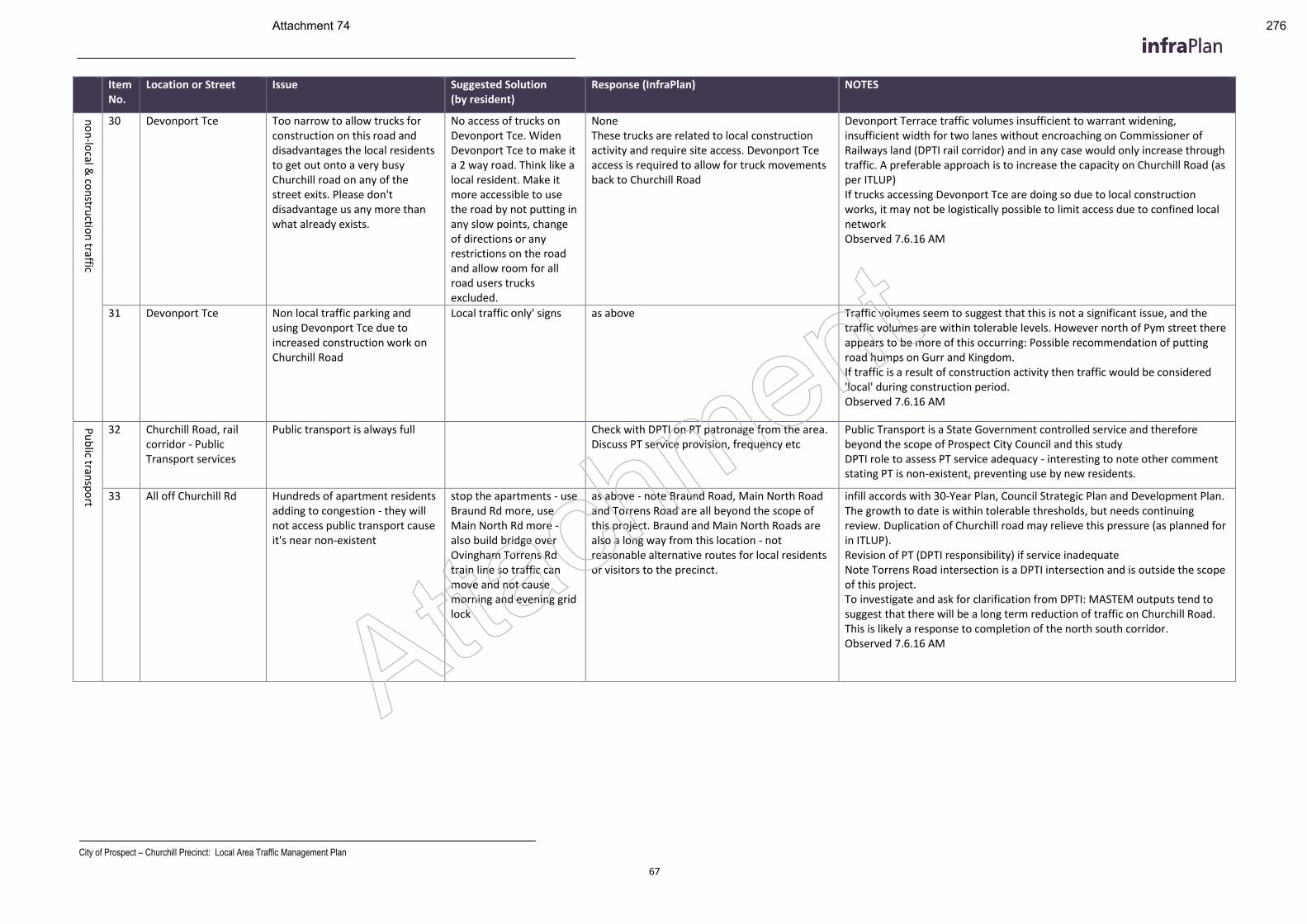
City of Prospect – Churchill Precinct: Local Area Traffic Management Plan
67
Item No.
Location or Street Issue Suggested Solution (by resident)
Response (InfraPlan) NOTES
no
n-lo
cal & co
nstru
ction
traffic
30 Devonport Tce Too narrow to allow trucks for construction on this road and disadvantages the local residents to get out onto a very busy Churchill road on any of the street exits. Please don't disadvantage us any more than what already exists.
No access of trucks on Devonport Tce. Widen Devonport Tce to make it a 2 way road. Think like a local resident. Make it more accessible to use the road by not putting in any slow points, change of directions or any restrictions on the road and allow room for all road users trucks excluded.
None These trucks are related to local construction activity and require site access. Devonport Tce access is required to allow for truck movements back to Churchill Road
Devonport Terrace traffic volumes insufficient to warrant widening, insufficient width for two lanes without encroaching on Commissioner of Railways land (DPTI rail corridor) and in any case would only increase through traffic. A preferable approach is to increase the capacity on Churchill Road (as per ITLUP) If trucks accessing Devonport Tce are doing so due to local construction works, it may not be logistically possible to limit access due to confined local network Observed 7.6.16 AM
31 Devonport Tce Non local traffic parking and using Devonport Tce due to increased construction work on Churchill Road
Local traffic only' signs as above Traffic volumes seem to suggest that this is not a significant issue, and the traffic volumes are within tolerable levels. However north of Pym street there appears to be more of this occurring: Possible recommendation of putting road humps on Gurr and Kingdom. If traffic is a result of construction activity then traffic would be considered 'local' during construction period. Observed 7.6.16 AM
Pu
blic tran
spo
rt
32 Churchill Road, rail corridor - Public Transport services
Public transport is always full Check with DPTI on PT patronage from the area. Discuss PT service provision, frequency etc
Public Transport is a State Government controlled service and therefore beyond the scope of Prospect City Council and this study DPTI role to assess PT service adequacy - interesting to note other comment stating PT is non-existent, preventing use by new residents.
33 All off Churchill Rd Hundreds of apartment residents adding to congestion - they will not access public transport cause it's near non-existent
stop the apartments - use Braund Rd more, use Main North Rd more - also build bridge over Ovingham Torrens Rd train line so traffic can move and not cause morning and evening grid lock
as above - note Braund Road, Main North Road and Torrens Road are all beyond the scope of this project. Braund and Main North Roads are also a long way from this location - not reasonable alternative routes for local residents or visitors to the precinct.
infill accords with 30-Year Plan, Council Strategic Plan and Development Plan. The growth to date is within tolerable thresholds, but needs continuing review. Duplication of Churchill road may relieve this pressure (as planned for in ITLUP). Revision of PT (DPTI responsibility) if service inadequate Note Torrens Road intersection is a DPTI intersection and is outside the scope of this project. To investigate and ask for clarification from DPTI: MASTEM outputs tend to suggest that there will be a long term reduction of traffic on Churchill Road. This is likely a response to completion of the north south corridor. Observed 7.6.16 AM
Attachment
Attachment 74 276
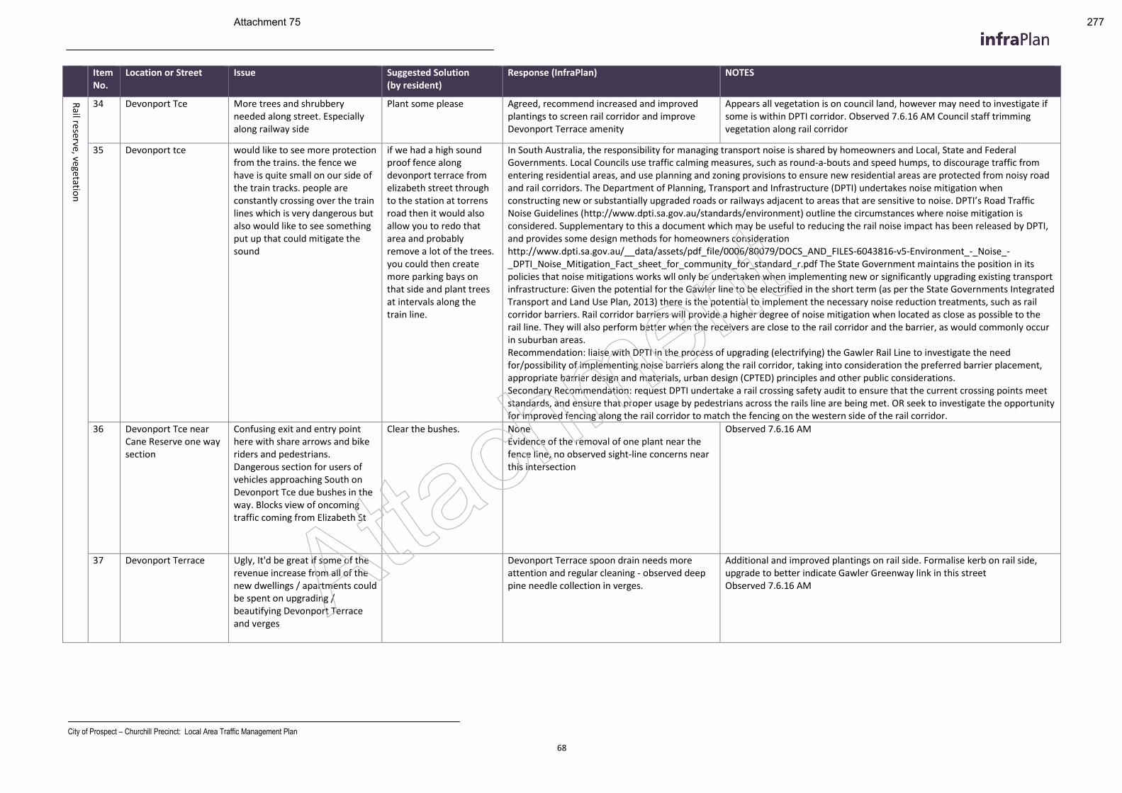
City of Prospect – Churchill Precinct: Local Area Traffic Management Plan
68
Item No.
Location or Street Issue Suggested Solution (by resident)
Response (InfraPlan) NOTES
Rail re
serve, vegetation
34 Devonport Tce More trees and shrubbery needed along street. Especially along railway side
Plant some please Agreed, recommend increased and improved plantings to screen rail corridor and improve Devonport Terrace amenity
Appears all vegetation is on council land, however may need to investigate if some is within DPTI corridor. Observed 7.6.16 AM Council staff trimming vegetation along rail corridor
35 Devonport tce would like to see more protection from the trains. the fence we have is quite small on our side of the train tracks. people are constantly crossing over the train lines which is very dangerous but also would like to see something put up that could mitigate the sound
if we had a high sound proof fence along devonport terrace from elizabeth street through to the station at torrens road then it would also allow you to redo that area and probably remove a lot of the trees. you could then create more parking bays on that side and plant trees at intervals along the train line.
In South Australia, the responsibility for managing transport noise is shared by homeowners and Local, State and Federal Governments. Local Councils use traffic calming measures, such as round-a-bouts and speed humps, to discourage traffic from entering residential areas, and use planning and zoning provisions to ensure new residential areas are protected from noisy road and rail corridors. The Department of Planning, Transport and Infrastructure (DPTI) undertakes noise mitigation when constructing new or substantially upgraded roads or railways adjacent to areas that are sensitive to noise. DPTI’s Road Traffic Noise Guidelines (http://www.dpti.sa.gov.au/standards/environment) outline the circumstances where noise mitigation is considered. Supplementary to this a document which may be useful to reducing the rail noise impact has been released by DPTI, and provides some design methods for homeowners consideration http://www.dpti.sa.gov.au/__data/assets/pdf_file/0006/80079/DOCS_AND_FILES-6043816-v5-Environment_-_Noise_-_DPTI_Noise_Mitigation_Fact_sheet_for_community_for_standard_r.pdf The State Government maintains the position in its policies that noise mitigations works wll only be undertaken when implementing new or significantly upgrading existing transport infrastructure: Given the potential for the Gawler line to be electrified in the short term (as per the State Governments Integrated Transport and Land Use Plan, 2013) there is the potential to implement the necessary noise reduction treatments, such as rail corridor barriers. Rail corridor barriers will provide a higher degree of noise mitigation when located as close as possible to the rail line. They will also perform better when the receivers are close to the rail corridor and the barrier, as would commonly occur in suburban areas. Recommendation: liaise with DPTI in the process of upgrading (electrifying) the Gawler Rail Line to investigate the need for/possibility of implementing noise barriers along the rail corridor, taking into consideration the preferred barrier placement, appropriate barrier design and materials, urban design (CPTED) principles and other public considerations. Secondary Recommendation: request DPTI undertake a rail crossing safety audit to ensure that the current crossing points meet standards, and ensure that proper usage by pedestrians across the rails line are being met. OR seek to investigate the opportunity for improved fencing along the rail corridor to match the fencing on the western side of the rail corridor.
36 Devonport Tce near Cane Reserve one way section
Confusing exit and entry point here with share arrows and bike riders and pedestrians. Dangerous section for users of vehicles approaching South on Devonport Tce due bushes in the way. Blocks view of oncoming traffic coming from Elizabeth St
Clear the bushes. None Evidence of the removal of one plant near the fence line, no observed sight-line concerns near this intersection
Observed 7.6.16 AM
37 Devonport Terrace Ugly, It'd be great if some of the revenue increase from all of the new dwellings / apartments could be spent on upgrading / beautifying Devonport Terrace and verges
Devonport Terrace spoon drain needs more attention and regular cleaning - observed deep pine needle collection in verges.
Additional and improved plantings on rail side. Formalise kerb on rail side, upgrade to better indicate Gawler Greenway link in this street Observed 7.6.16 AM Attachment
Attachment 75 277
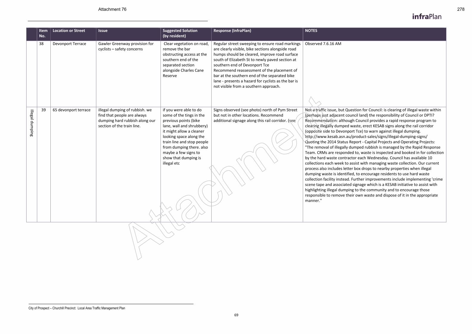
City of Prospect – Churchill Precinct: Local Area Traffic Management Plan
69
Item No.
Location or Street Issue Suggested Solution (by resident)
Response (InfraPlan) NOTES
38 Devonport Terrace Gawler Greenway provision for cyclists – safety concerns
Clear vegetation on road, remove the bar obstructing access at the southern end of the separated section alongside Charles Cane Reserve
Regular street sweeping to ensure road markings are clearly visible, bike sections alongside road humps should be cleared, improve road surface south of Elizabeth St to newly paved section at southern end of Devonport Tce Recommend reassessment of the placement of bar at the southern end of the separated bike lane - presents a hazard for cyclists as the bar is not visible from a southern approach.
Observed 7.6.16 AM
Illegal du
mp
ing
39 65 devonport terrace illegal dumping of rubbish. we find that people are always dumping hard rubbish along our section of the train line.
if you were able to do some of the tings in the previous points (bike lane, wall and shrubbery) it might allow a cleaner looking space along the train line and stop people from dumping there. also maybe a few signs to show that dumping is illegal etc
Signs observed (see photo) north of Pym Street but not in other locations. Recommend additional signage along this rail corridor. (see
Not a traffic issue, but Question for Council: is clearing of illegal waste within (perhaps just adjacent council land) the responsibility of Council or DPTI? Recommendation: although Council provides a rapid response program to clearing illegally dumped waste, erect KESAB signs along the rail corridor (opposite side to Devonport Tce) to warn against illegal dumping. http://www.kesab.asn.au/product-sales/signs/illegal-dumping-signs/ Quoting the 2014 Status Report - Capital Projects and Operating Projects: "The removal of illegally dumped rubbish is managed by the Rapid Response Team. CRMs are responded to, waste is inspected and booked in for collection by the hard waste contractor each Wednesday. Council has available 10 collections each week to assist with managing waste collection. Our current process also includes letter box drops to nearby properties when illegal dumping waste is identified, to encourage residents to use hard waste collection facility instead. Further improvements include implementing 'crime scene tape and associated signage which is a KESAB initiative to assist with highlighting illegal dumping to the community and to encourage those responsible to remove their own waste and dispose of it in the appropriate manner."
Attachment
Attachment 76 278
City of Prospect – Churchill Precinct: Local Area Traffic Management Plan
70
Item No.
Location or Street Issue Suggested Solution (by resident)
Response (InfraPlan) NOTES
40 Devonport Terrace Illegal dumping of hard rubbish along railway
Signs to deter. Policing of this. Regular cleanup
See above Not a traffic issue, but Question for Council: is clearing of illegal waste within (perhaps just adjacent council land) the responsibility of Council or DPTI? Recommendation: although Council provides a rapid response program to clearing illegally dumped waste, erect KESAB signs along the rail corridor (opposite side to Devonport Tce) to warn against illegal dumping. http://www.kesab.asn.au/product-sales/signs/illegal-dumping-signs/ Quoting the 2014 Status Report - Capital Projects and Operating Projects: "The removal of illegally dumped rubbish is managed by the Rapid Response Team. CRMs are responded to, waste is inspected and booked in for collection by the hard waste contractor each Wednesday. Council has available 10 collections each week to assist with managing waste collection. Our current process also includes letter box drops to nearby properties when illegal dumping waste is identified, to encourage residents to use hard waste collection facility instead. Further improvements include implementing 'crime scene tape and associated signage which is a KESAB initiative to assist with highlighting illegal dumping to the community and to encourage those responsible to remove their own waste and dispose of it in the appropriate manner."
Ou
tside p
roject sco
pe
41 Clifton street (between Churchill road and Braund road)
too many cars using it to "rat run" / through traffic
Putting a no right hand turn into and out of Clifton street or some sort of traffic calming option.
This section of Clifton Street is located outside of the Churchill Local Traffic Precinct, and is part of the Prospect South-West Local Traffic precinct. Although this issue does have context to the Churchill Local Area Traffic Precinct and will be considered in the recommendations contained within this report, recommendations to address this concern are outside the scope of this project and will need to be addressed in a LATM for the Prospect South-West Local Traffic Precinct. Also traffic controls at the intersections of local roads (e.g. Clifton Street) and arterial Roads (i.e. Churchill Road) require approval and implementation by the Department of Planning, Transport and Infrastructure. Although traffic flow onto Churchill Road is somewhat influenced by the controls implemented by Council in the local road network, ultimately the management of traffic flow on Churchill Road is maintained by the Department for Planning, Transport and Infrastructure and the implementation of changes to State roads are beyond the responsibility of Council.
42 Braund Rd 'Rat run' traffic using Braund Rd instead of Churchill
Enable greater traffic flow on Churchill Rd between Regency Rd and Fitzroy Tce. Especially heading South. The two sets of lights at Torrens and Fitzroy create excessive congestion. Slow motor vehicle traffic on Braund Rd through use of intersection speed bumps to slow traffic and minimise occurrence of people ignoring the give way signs at intersections, without slowing bicycle traffic
Braund Road is located outside of the Churchill Local Traffic Precinct, and is part of the Prospect South-West Local Traffic precinct. Although this issue does have context to the Churchill Local Area Traffic Precinct and will be considered in the recommendations contained within this report, recommendations to address this concern are outside the scope of this project and will need to be addressed in a LATM for the Prospect South-West Local Traffic Precinct. Also although traffic flow onto Churchill Road is somewhat influenced by the controls implemented by Council in the local road network, ultimately the management of traffic flow on Churchill Road is maintained by the Department for Planning, Transport and Infrastructure and the implementation of changes to State roads are beyond the responsibility of Council. Attachment
Attachment 77 279
City of Prospect – Churchill Precinct: Local Area Traffic Management Plan
71
Item No.
Location or Street Issue Suggested Solution (by resident)
Response (InfraPlan) NOTES
43 Braund road congestion from cars parked and vehicles travelling in opposite directions
braund road oneway vehicle traffic heading south. Retain two bike lanes to support Nth-Sth bike corridor into Nth Adel and CBD
Braund Road is located outside of the Churchill Local Traffic Precinct, and is part of the Prospect South-West Local Traffic precinct. Although this issue does have context to the Churchill Local Area Traffic Precinct and will be considered in the recommendations contained within this report, recommendations to address this concern are outside the scope of this project and will need to be addressed in a LATM for the Prospect South-West Local Traffic Precinct. Also although traffic flow onto Churchill Road is somewhat influenced by the controls implemented by Council in the local road network, ultimately the management of traffic flow on Churchill Road is maintained by the Department for Planning, Transport and Infrastructure and the implementation of changes to State roads are beyond the responsibility of Council.
44 Braund road narow and irregular pavement. Decreases usability for kids bikes, the elderly and prams
widen foot path and reduce the traffic flow to one way to streamline traffic congestion
Braund Road is located outside of the Churchill Local Traffic Precinct, and is part of the Prospect South-West Local Traffic precinct. Although this issue does have context to the Churchill Local Area Traffic Precinct and will be considered in the recommendations contained within this report, recommendations to address this concern are outside the scope of this project and will need to be addressed in a LATM for the Prospect South-West Local Traffic Precinct. Also although traffic flow onto Churchill Road is somewhat influenced by the controls implemented by Council in the local road network, ultimately the management of traffic flow on Churchill Road is maintained by the Department for Planning, Transport and Infrastructure and the implementation of changes to State roads are beyond the responsibility of Council.
45 Braund road poor visibility at intersections leading to a hazard for bike riders and pedestrians
widen foot path and delineate bike lanes along entire road
Braund Road is located outside of the Churchill Local Traffic Precinct, and is part of the Prospect South-West Local Traffic precinct. Although this issue does have context to the Churchill Local Area Traffic Precinct and will be considered in the recommendations contained within this report, recommendations to address this concern are outside the scope of this project and will need to be addressed in a LATM for the Prospect South-West Local Traffic Precinct. Also although traffic flow onto Churchill Road is somewhat influenced by the controls implemented by Council in the local road network, ultimately the management of traffic flow on Churchill Road is maintained by the Department for Planning, Transport and Infrastructure and the implementation of changes to State roads are beyond the responsibility of Council.
46 Castle Ave Difficult to make a right turn onto Churchill from this street, Olive, Rose etc. Often have to wait for many minutes while holding up cars behind waiting to make a left turn..
Have an intersection with traffic lights to allow cars to enter traffic on Churchill heading north.
Castle Ave is located outside of the Churchill Local Traffic Precinct, and is part of the Prospect South-West Local Traffic Precint. Although this issue does have context to the Churchill Local Area Traffic Precinct and will be considered in the recommendations contained within this report, recommendations to address this concern are outside the scope of this project and will need to be addressed in a LATM for the Prospect South-West Local Traffic Precinct. Also traffic controls at the intersections of local roads (e.g. Castle Ave) and arterial Roads (i.e. Churchill Road) require approval and implementation by the Department of Planning, Transport and Infrastructure. Although traffic flow onto Churchill Road is somewhat influenced by the controls implemented by Council in the local road network, ultimately the management of traffic flow on Churchill Road is maintained by the Department for Planning, Transport and Infrastructure and the implementation of changes to State roads are beyond the responsibility of Council.
47 Braund road Now crossed by rat runners between Chrchill and Prospect Roads at several places especially at Castle then Daphne - concerned about driver attention on other users eg expected influx of cyclists due to boulevard status, runners and pedestrians
maybe stop signs just to add a few seconds onto the time drivers have to pay attention to Braund Road traffic and check drivers intentions coming out of Castle and Daphne
Braund Road is located outside of the Churchill Local Traffic Precinct, and is part of the Prospect South-West Local Traffic precinct. Although this issue does have context to the Churchill Local Area Traffic Precinct and will be considered in the recommendations contained within this report, recommendations to address this concern are outside the scope of this project and will need to be addressed in a LATM for the Prospect South-West Local Traffic Precinct. Also although traffic flow onto Churchill Road is somewhat influenced by the controls implemented by Council in the local road network, ultimately the management of traffic flow on Churchill Road is maintained by the Department for Planning, Transport and Infrastructure and the implementation of changes to State roads are beyond the responsibility of Council.
Attachment
Attachment 78 280
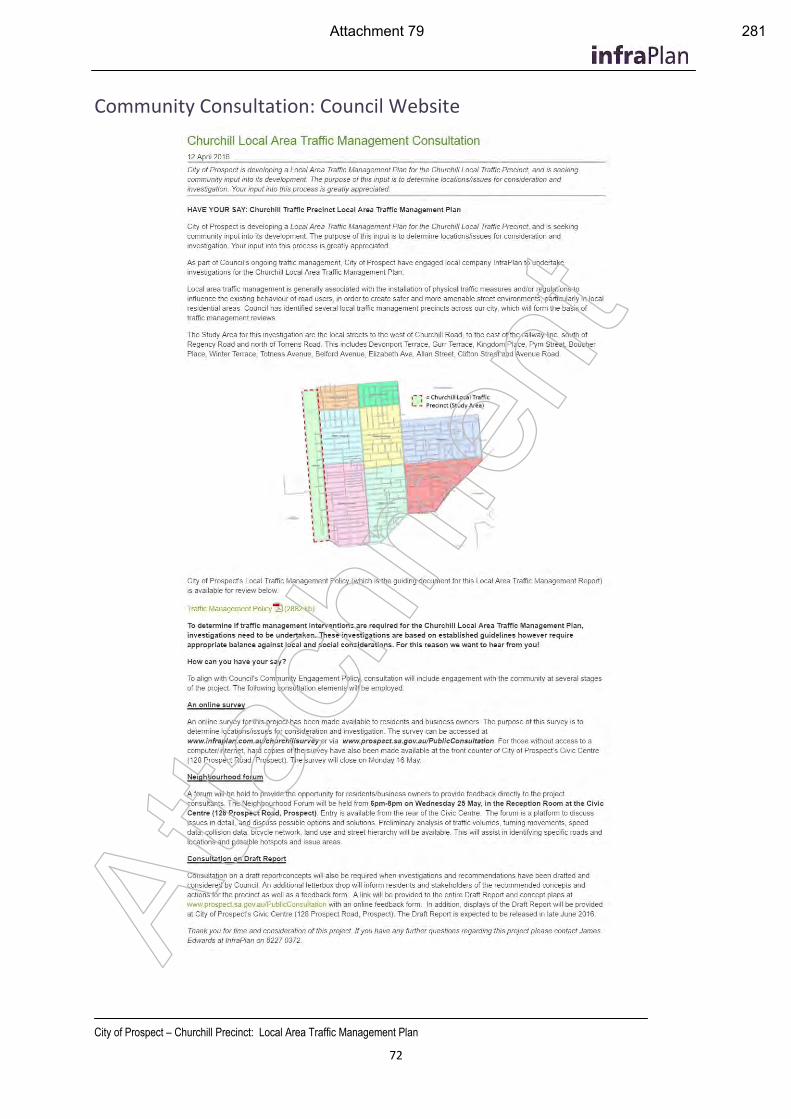
City of Prospect – Churchill Precinct: Local Area Traffic Management Plan
72
Community Consultation: Council Website
Atta
chm
ent
Attachment 79 281
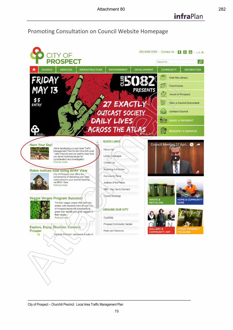
City of Prospect – Churchill Precinct: Local Area Traffic Management Plan
73
Promoting Consultation on Council Website Homepage
Atta
chm
ent
Attachment 80 282
City of Prospect – Churchill Precinct: Local Area Traffic Management Plan
74
Community Consultation: Survey Template
Atta
chm
ent
Attachment 81 283
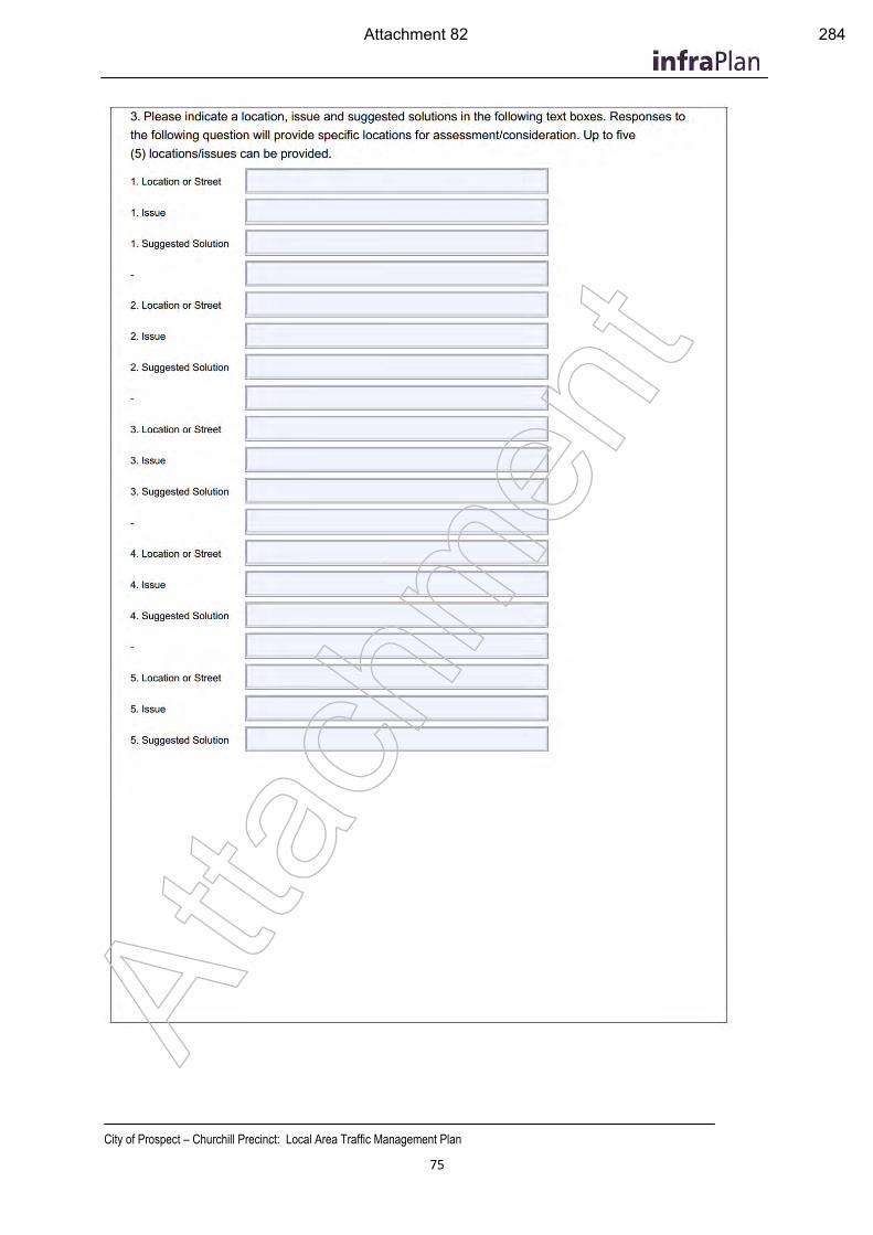
City of Prospect – Churchill Precinct: Local Area Traffic Management Plan
75
Atta
chm
ent
Attachment 82 284
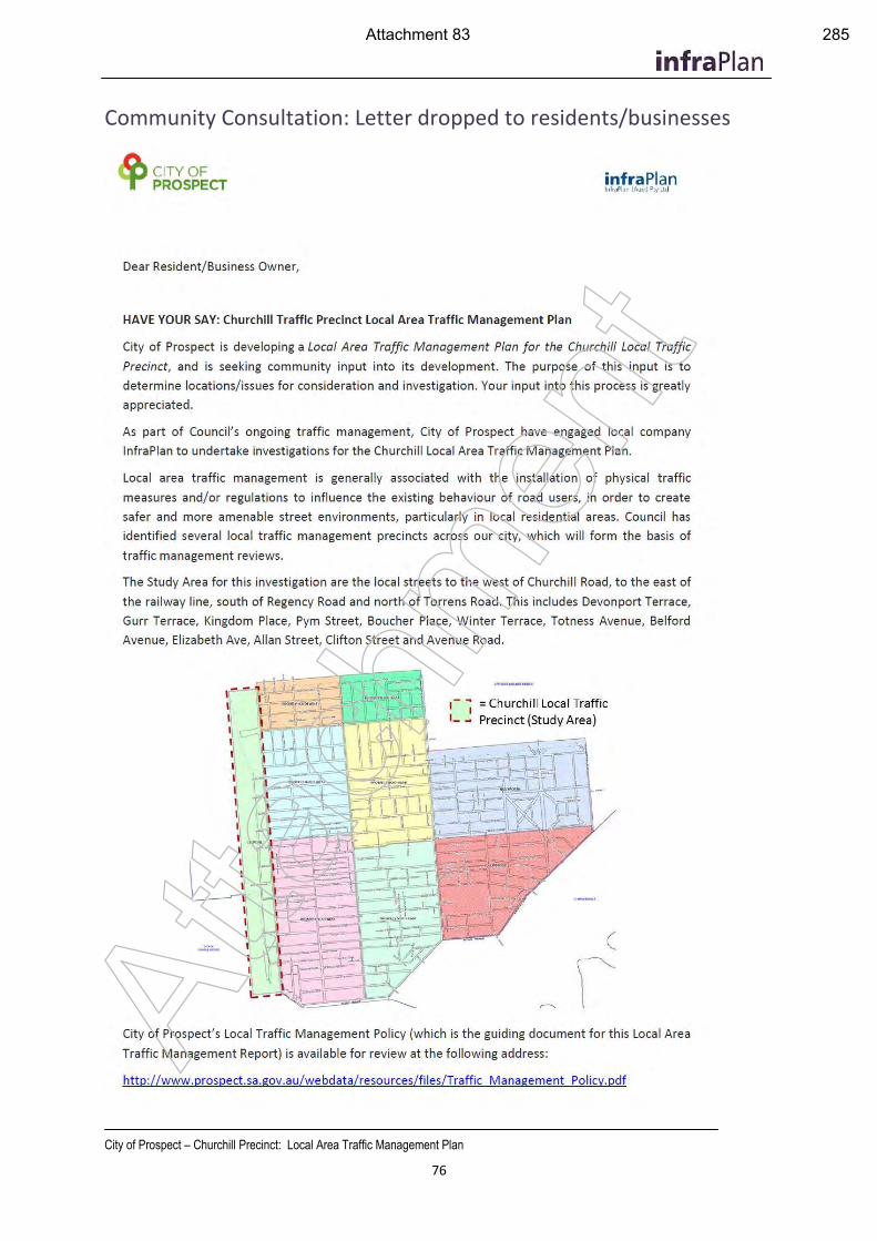
City of Prospect – Churchill Precinct: Local Area Traffic Management Plan
76
Community Consultation: Letter dropped to residents/businesses
Atta
chm
ent
Attachment 83 285
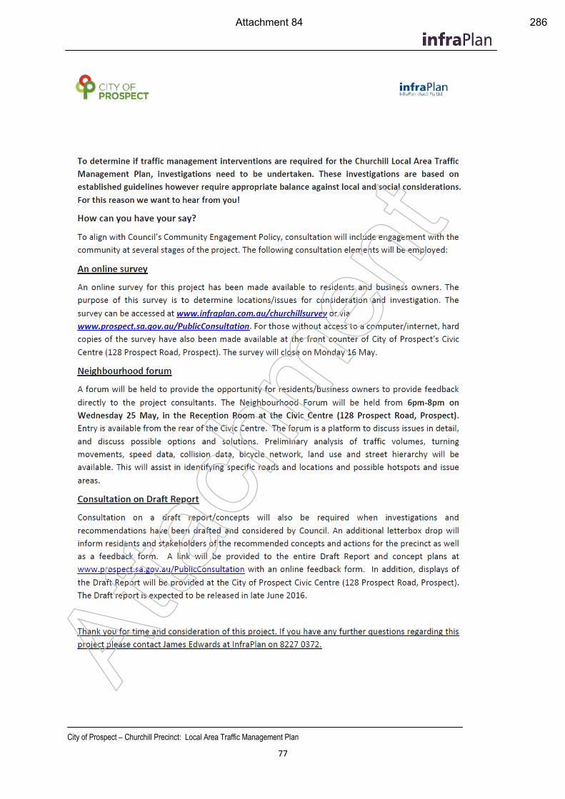
City of Prospect – Churchill Precinct: Local Area Traffic Management Plan
77
Atta
chm
ent
Attachment 84 286
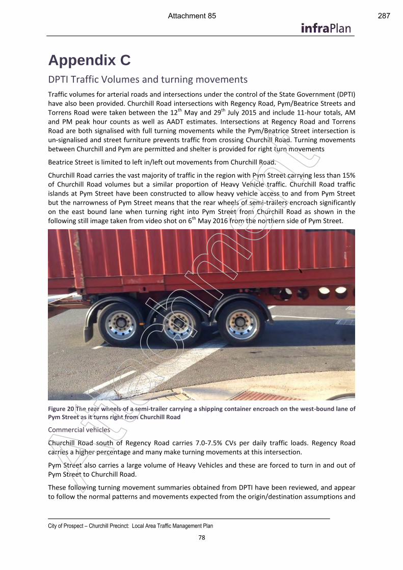
City of Prospect – Churchill Precinct: Local Area Traffic Management Plan
78
Appendix C
DPTI Traffic Volumes and turning movements
Traffic volumes for arterial roads and intersections under the control of the State Government (DPTI) have also been provided. Churchill Road intersections with Regency Road, Pym/Beatrice Streets and Torrens Road were taken between the 12th May and 29th July 2015 and include 11-hour totals, AM and PM peak hour counts as well as AADT estimates. Intersections at Regency Road and Torrens Road are both signalised with full turning movements while the Pym/Beatrice Street intersection is un-signalised and street furniture prevents traffic from crossing Churchill Road. Turning movements between Churchill and Pym are permitted and shelter is provided for right turn movements
Beatrice Street is limited to left in/left out movements from Churchill Road.
Churchill Road carries the vast majority of traffic in the region with Pym Street carrying less than 15% of Churchill Road volumes but a similar proportion of Heavy Vehicle traffic. Churchill Road traffic islands at Pym Street have been constructed to allow heavy vehicle access to and from Pym Street but the narrowness of Pym Street means that the rear wheels of semi-trailers encroach significantly on the east bound lane when turning right into Pym Street from Churchill Road as shown in the following still image taken from video shot on 6th May 2016 from the northern side of Pym Street.
Figure 20 The rear wheels of a semi-trailer carrying a shipping container encroach on the west-bound lane of Pym Street as it turns right from Churchill Road
Commercial vehicles
Churchill Road south of Regency Road carries 7.0-7.5% CVs per daily traffic loads. Regency Road carries a higher percentage and many make turning movements at this intersection.
Pym Street also carries a large volume of Heavy Vehicles and these are forced to turn in and out of Pym Street to Churchill Road.
These following turning movement summaries obtained from DPTI have been reviewed, and appear to follow the normal patterns and movements expected from the origin/destination assumptions and
Atta
chm
ent
Attachment 85 287
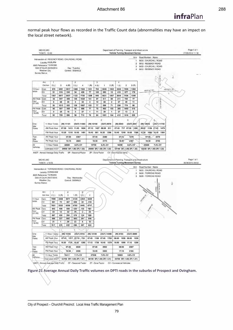
City of Prospect – Churchill Precinct: Local Area Traffic Management Plan
79
normal peak hour flows as recorded in the Traffic Count data (abnormalities may have an impact on the local street network).
Figure 21 Average Annual Daily Traffic volumes on DPTI roads in the suburbs of Prospect and Ovingham. Atta
chm
ent
Attachment 86 288
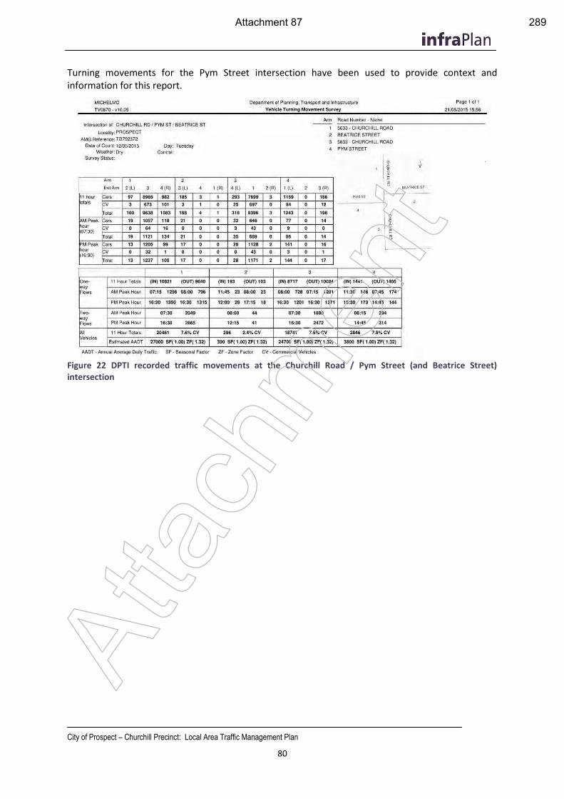
City of Prospect – Churchill Precinct: Local Area Traffic Management Plan
80
Turning movements for the Pym Street intersection have been used to provide context and information for this report.
Figure 22 DPTI recorded traffic movements at the Churchill Road / Pym Street (and Beatrice Street) intersection
Atta
chm
ent
Attachment 87 289
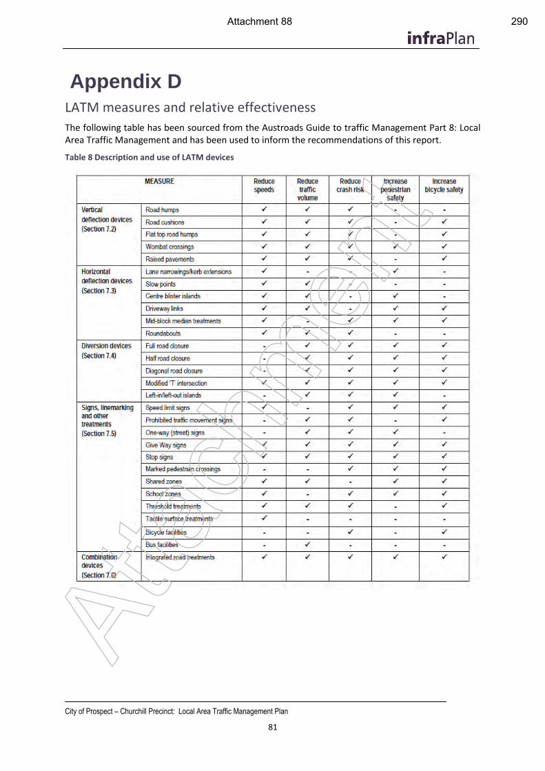
City of Prospect – Churchill Precinct: Local Area Traffic Management Plan
81
Appendix D
LATM measures and relative effectiveness
The following table has been sourced from the Austroads Guide to traffic Management Part 8: Local Area Traffic Management and has been used to inform the recommendations of this report.
Table 8 Description and use of LATM devices
Atta
chm
ent
Attachment 88 290
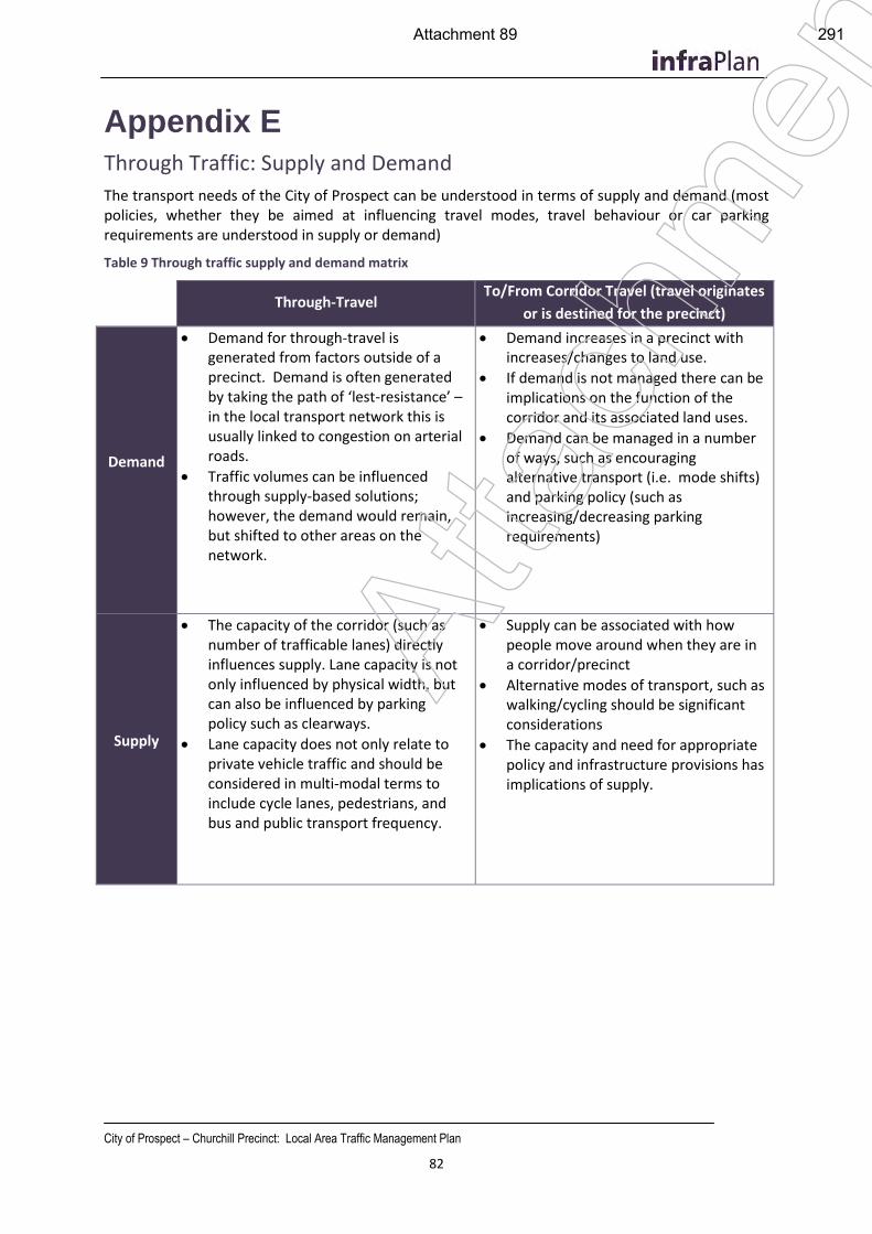
City of Prospect – Churchill Precinct: Local Area Traffic Management Plan
82
Appendix E
Through Traffic: Supply and Demand
The transport needs of the City of Prospect can be understood in terms of supply and demand (most policies, whether they be aimed at influencing travel modes, travel behaviour or car parking requirements are understood in supply or demand)
Table 9 Through traffic supply and demand matrix
Through-Travel To/From Corridor Travel (travel originates
or is destined for the precinct)
Demand
Demand for through-travel isgenerated from factors outside of aprecinct. Demand is often generatedby taking the path of ‘lest-resistance’ –in the local transport network this isusually linked to congestion on arterialroads.
Traffic volumes can be influencedthrough supply-based solutions;however, the demand would remain,but shifted to other areas on thenetwork.
Demand increases in a precinct withincreases/changes to land use.
If demand is not managed there can beimplications on the function of thecorridor and its associated land uses.
Demand can be managed in a numberof ways, such as encouragingalternative transport (i.e. mode shifts)and parking policy (such asincreasing/decreasing parkingrequirements)
Supply
The capacity of the corridor (such asnumber of trafficable lanes) directly influences supply. Lane capacity is not only influenced by physical width, but can also be influenced by parking policy such as clearways.
Lane capacity does not only relate toprivate vehicle traffic and should beconsidered in multi-modal terms toinclude cycle lanes, pedestrians, andbus and public transport frequency.
Supply can be associated with howpeople move around when they are ina corridor/precinct
Alternative modes of transport, such aswalking/cycling should be significantconsiderations
The capacity and need for appropriatepolicy and infrastructure provisions hasimplications of supply.
Atta
chm
ent
Attachment 89 291
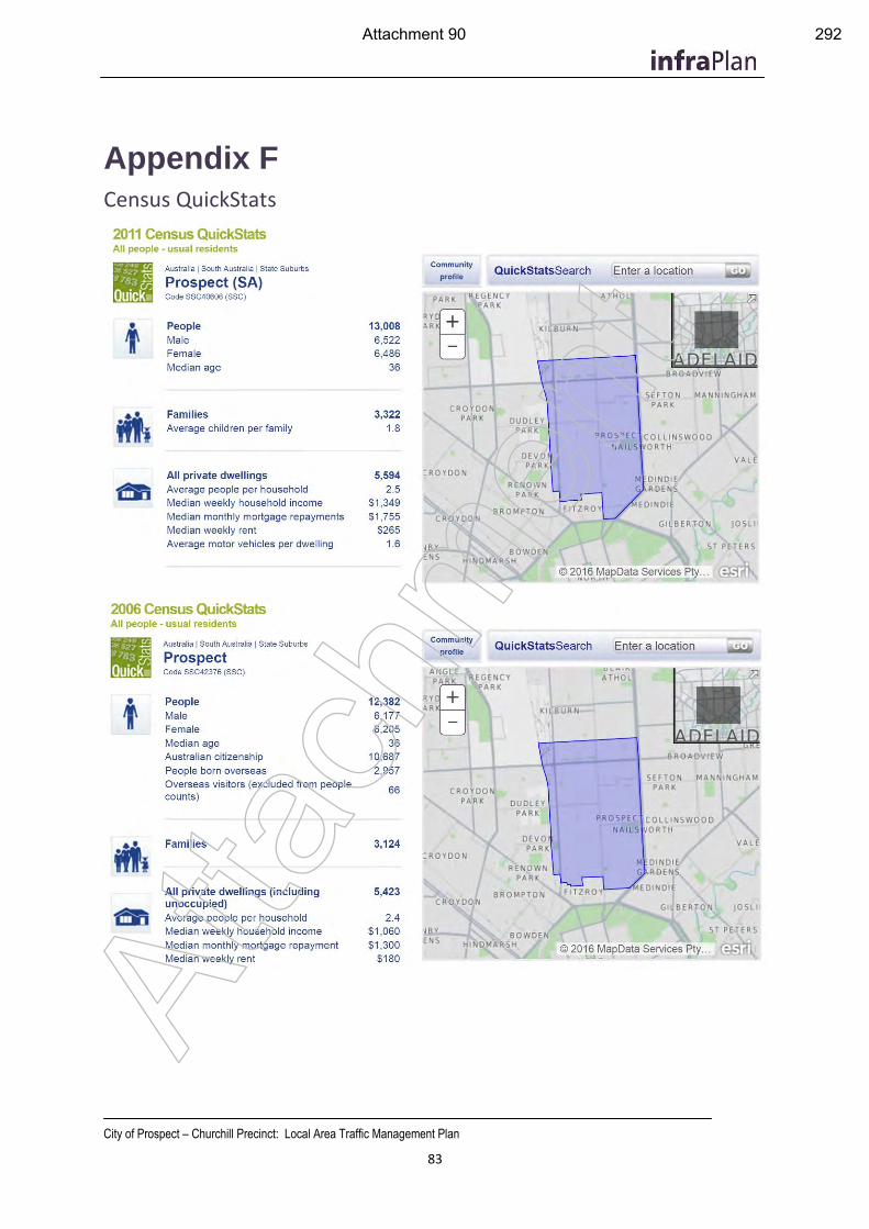
City of Prospect – Churchill Precinct: Local Area Traffic Management Plan
83
Appendix F
Census QuickStats
Atta
chm
ent
Attachment 90 292
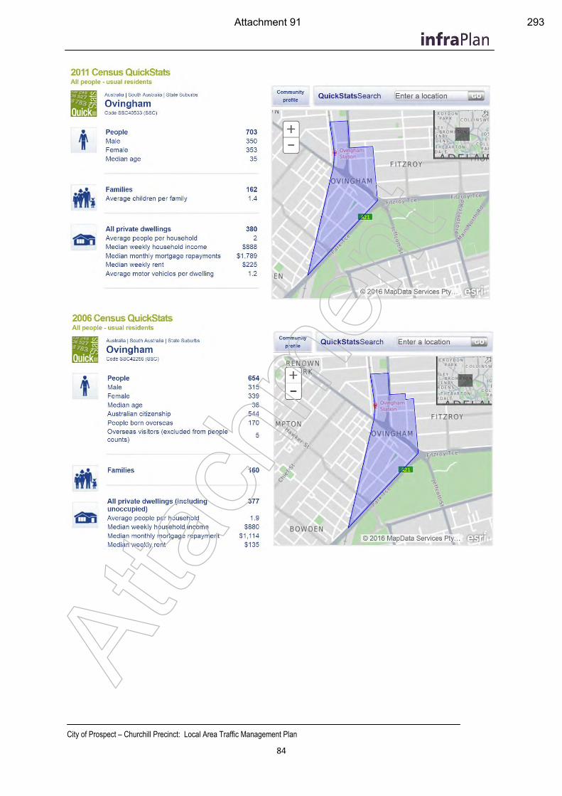
City of Prospect – Churchill Precinct: Local Area Traffic Management Plan
84
Atta
chm
ent
Attachment 91 293
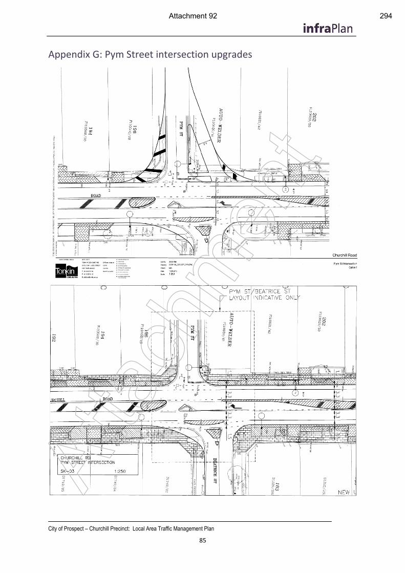
City of Prospect – Churchill Precinct: Local Area Traffic Management Plan
85
Appendix G: Pym Street intersection upgrades
Atta
chm
ent
Attachment 92 294

Item 19.9: Local Area Traffic Management Plan – North East / South East
CITY OF PROSPECT: Council Agenda 25/07/2017
AGENDA ITEM NO.: 19.9 TO: Council Meeting on 25 July 2017 DIRECTOR: Ginny Moon, Director of Corporate Services REPORT AUTHOR: Alex Cortes, Manager Infrastructure, Assets and Environment SUBJECT: Local Area Traffic Management Plan – North East / South East
1. EXECUTIVE SUMMARY
1.1 As part of Council’s ongoing commitment to traffic management, City of Prospect engaged a traffic consultant to undertake the North East and South East Local Area Traffic Management Plan (LATM). Attachment 3-74.
1.2 The primary function of this LATM was to identify aspects of the local road network which may require improvement, either through minor modifications, maintenance, moderating vehicle speeds, improving safety or discouraging through traffic on local roads.
1.3 Key issues were identified for areas throughout this precinct of City of Prospect. A series of recommendations were made by the LATM study prepared by Tonkin Consulting, summarised below (A summary of these recommendations and actions is provided in Attachment 1-2):
1.3.1 General speeds and volumes: Council give further consideration to
implementation of 40km/h speeds throughout the Prospect Council Area
1.3.2 Carter Street: further consideration be given to either a roundabout or raised intersection treatment of Thorngate Street.
1.3.3 Ballville Street: implementation of a yellow line marking parking restriction arrangement along the road to improve its navigability.
1.3.4 College Avenue/ Main North Road Intersection: No further action required
1.3.5 Gloucester Street: Install speed humps on western end of Gloucester Street
1.3.6 Highbury Street (including Penn Place Intersection): No further action for Highbury Street (continue to work with Blackfriars Priory School), construct driveway entry to west of Penn Place.
1.3.7 Percy Street Intersection: Installation of contrasting pavements at the intersections
1.3.8 Te Anau Avenue: implementation of parking restrictions along Te Anau Avenue.
295
Item 19.9: Local Area Traffic Management Plan – North East / South East
CITY OF PROSPECT: Council Agenda 25/07/2017
2. RECOMMENDATION
(1) The Council having considered Item 19.9 Local Area Traffic Management North East/South East dated 25 July 2017, endorse the plan (as presented in Attachments 3-74).
(2) Council endorse the actions planned for 2017/18 (as presented in Attachment 1-2).
(3) The Council consider budget bids for the Local Area Traffic Management North East and South East Precincts as part of the 2018-19 budget deliberation process (as presented in Attachment 1-2).
3. RELEVANCE TO CORE STRATEGIES / POLICY
3.1 Strategic Plan to 2020 Theme 1 – People “Know, empower, celebrate, educate and activate our community”
Strategy 1.1 Know our community
Extensive community consultation was undertaken, demonstrating a Council that can respond to the needs of the community (Outcome 1.1.2).
3.2 Strategic Plan to 2020 Theme 2 – Place “Loved heritage, leafy streets, fabulous places”
Strategy 2.3 An accessible City
The outcomes of the report contributes to ensuring key areas are accessible and linked (Outcome 2.3.1) and considers the service provided public transport (Outcome 2.3.3).
3.3 Strategic Plan to 2020 Theme 4 – Services “Leaders of the sector providing efficient, responsive, accessible services”
Strategy 4.1 Excellence in Infrastructure
Recommendations of the report included the adjustment and installation of traffic management devices, considered Council Assets.
4. COMMUNITY INVOLVEMENT
4.1 Multiple stages of community consultation were undertaken.
4.2 A call for public comment was conducted in 2015, in which:
4.2.1 Circulars were sent to 1851 properties in February 2015;
4.2.2 Two Residents Control Group meetings were on the 8th April and 20th May, 2015.
4.3 A second round of community consultation was conducted in December 2016, in which:
296
Item 19.9: Local Area Traffic Management Plan – North East / South East
CITY OF PROSPECT: Council Agenda 25/07/2017
4.3.1 Circulars were sent to 1851 properties in December 2016.
5. DISCUSSION
5.1 In accordance with City of Prospect’s Traffic Management Policy, Council recognises that the approach to traffic management must be holistic; treatments applied in isolation can affect traffic conditions in other streets. Isolated problems should be considered in ‘the context of the broader street network’. Council, therefore, approaches ‘traffic management on the basis of local area precincts’. The implementation of traffic engineering controls that are not considered minor are investigated for each precinct through a Local Area Traffic Management (LATM) study.
5.2 City of Prospect engaged Tonkin Consulting to undertake a LATM study in the Prospect North Eeast (NE) and South East (SE) area. This area is bound by Prospect Road, Regency Road, Main North Road and Fitzroy Terrace. This LATM study identified existing controls and traffic management issues, ultimately recommending the implementation of a series of traffic engineering controls throughout the Council area, with the aim of improving traffic management for the NE/SE Precinct.
Methodology
5.3 In conducting the LATM study, Tonkin Consulting;
Assisted in conducting initial community consultation, which included:
General mail out to all residents identifying traffic and road safety concerns
Two meetings with the Residents Control Group to discuss issues and potential solutions
Mail out of proposed treatment options for comment
Conducted analysis of traffic volumes, speeds and vehicle classifications using the network;
Conducted analysis of crash data in the area
Conducted independent site inspections and recorded observations of driver behaviour;
Developed and submitted a draft plan to the Residents Control Group and the wider community;
Amended the draft plan to take into account the recommendations based on the feedback received.
Involvement in a community workshop held in May 2017
The draft report was then submitted to City of Prospect.
Key Issues
General Speed and Volumes
297
Item 19.9: Local Area Traffic Management Plan – North East / South East
CITY OF PROSPECT: Council Agenda 25/07/2017
5.4 According to the LATM study conducted, there was no identification of unduly high volumes or speeds.
5.5 The only road with daily traffic volumes in excess of 1,500 vehicles per day are Percy Street (1,800 vehicles per day). As a general guide, traffic volumes less than 1,500 vehicles per day are considered acceptable for residential streets, which is reflected in the “intervention criteria” as part of Council’s Traffic Management Policy.
5.6 Average speeds were found to be typically around 40km/h and 85th percentile speeds at approximately 45km/h which is acceptable for the prevailing speed limit based on Council’s “intervention criteria”. During the period of community consultation a number of residents did raise the idea of possibly changing the speed limit in all the streets from 50km/h to 40km/hr. This was in response to perceived high speeds across the study area as well as to maintain consistency with the area to the west of Prospect Road. Given the average speed was found to be approximately 40km/h, the community should not expect a further wholesale reduction in speeds if a lower limit was introduced. It should be noted that previous LATM’s conducted in other areas of Prospect (e.g. Nailsworth and Collinswood) have indicated the community generally does not have the appetite for the wholesale application of the lower limit.
5.7 It was suggested that, given the support ratio of the community consultation feedback (76%) during this LATM study, Council give further recommendation to the strategic application of 40km/h speed limits throughout the Prospect Council area.
Carter Street
5.8 There were various issues identified along Carter Street, including:
High speeds;
Through traffic;
Increased traffic from Blackfriars School;
Perceived increase in traffic due to the On the Run (OTR) development on the Main North Road corner.
5.9 This led to the exploration of a number of options to address these issues, including:
Full road closure
Diagonal road closure
Roundabout
Raised intersections
Single lane speed humps
5.10 Community consultation indicated there was a lack of support for road closure, though it was noted most respondents were those most heavily affected by these closures. There was support for some form of intersection treatment. There was also support for street wide treatment with single lane speed humps.
5.11 Tonkin Consulting did not believe that conditions warrant the installation of full or partial road closures. Given traffic data indicating that speeds and volumes are not excessive, whole of street treatment with road humps was not considered warranted. It was recommended further consideration be given to either a roundabout or raised intersection treatment of Thorngate Street.
298
Item 19.9: Local Area Traffic Management Plan – North East / South East
CITY OF PROSPECT: Council Agenda 25/07/2017
Ballville Street
5.12 There have been 9 accidents along Ballville Street between 2007 and 2013, all of which were involving a collision with a parked vehicle.
5.13 Community consultation indicated that the potential construction of traffic management in Carter Street could lead to increased traffic in Ballville Street.
5.14 It is recommended to implement yellow line marking parking restriction arrangement along the road to improve its navigability. This work will be completed as part of the 2017/18 recurrent budget.
College Avenue/Main North Road Intersection
5.15 Issues were raised regarding reduced sight lines for traffic exiting from College Avenue onto Main North Road, due to a bus stop shelter located close to the corner.
5.16 Removal of the bus shelter and removal of the bus stop were considered.
5.17 The bus shelter was removed by Adshel during 2016, no further action is required at this stage, noting that conditions along Main North Road are currently being reviewed as part of the Main North Road Master Plan).
Gloucester Street
5.18 Issues were raised regarding access to Prospect Road and Main North Road, particularly during peak times. The intersection at Prospect Road was flagged as dangerous due to the proximity to the service station entrance and conflicting traffic movements.
5.19 Concerns were raised regarding speeds and inconsistency in traffic management devices along Gloucester Street; there are currently speed humps only on the eastern end of the street.
5.20 In order to maintain consistency, the installation of single lane speed humps on the western side was explored.
5.21 Minimal community consultation feedback was received through the consultation process with 3 responses received in the second round of consultation while 6 responses were originally received that raised high speeds and rat-running as an issue.
5.22 The recommendation was made to install speed humps on the western side of Gloucester Street. A budget bid will be submitted for 2018/19 to undertake this work.
Highbury Street (General Street Concerns)
5.23 Residents repeatedly raised concerns regarding congestion caused by traffic activities associated with Blackfriars High Priory School.
5.24 These activities included;
Parking on street all day on both sides of the road (i.e. staff and older students)
Hoon driving
Large influx of cars at pick up times that double park illegally causing congestion
299
Item 19.9: Local Area Traffic Management Plan – North East / South East
CITY OF PROSPECT: Council Agenda 25/07/2017
Options explored included:
Changing the parking restrictions from during peak school times to all day parking restrictions
One way restriction
The creation of alternative drop off and pick up zones
Single lane speed humps
5.25 Community feedback indicated limited support for any traffic management along Highbury Street. Since the report, Council has worked with Blackfriars Priory School to install an Emu Crossing on Highbury Street.
5.26 No further action was recommended for Highbury Street, other than to continue to work with Blackfriars Priory School and the local community to manage ongoing traffic concerns as far as practical.
Penn Place Intersection
5.27 Residents raised concerns over the amount of car carriers using the road due to the car yards on Main North Road.
5.28 Tonkin explored the construction of a driveway entry to the west of Penn Place, in order to separate the caryards to the east of Penn Place from the residential street to the west.
Percy Street Intersection
5.29 There were 4 right turn crashes along Percy Street at the intersections with Arthur Street and Stuart Road. Residents commented that this could be due to misperceptions of speed due to the traffic control devices on Percy Street, as well as rat-running traffic as motorists try to avoid the Prospect Road/ Regency Road intersection.
5.30 Options were explored for the treatment of these intersections:
Driveway entries (treating the side roads with a driveway entry treatment, giving it the appearance of a private driveway)
Contrasting pavement (stamped asphalt or brick pavers)
5.31 During consultation, community members were opposed to the proposal or private driveway entries, stating that it would add confusion to motorists on Percy Street (which already has traffic management devices)
5.32 Recommendation: Tonkin acknowledged the hazardous aspects of the intersections and recognised that there was support for contrasting pavements at the intersections. A budget bid will be submitted for 2018/19 to undertake this work.
Te Anau Avenue
5.33 Concerns were raised regarding the narrow street, in addition to poor sight lines at the intersections with Wilson Street and Bradford Street. Crashes were also reported at Bradford Street and Moora Avenue.
300
Item 19.9: Local Area Traffic Management Plan – North East / South East
CITY OF PROSPECT: Council Agenda 25/07/2017
5.34 Options explored were:
Raised intersections at Moora Avenue and Bradford Street
Contrasting pavements
Single lane speed humps along Te Anau Avenue
Restriction of parking along Te Anau Avenue
5.35 Community consultation revealed mixed support for parking restrictions.
5.36 It is recommended that parking restrictions be implemented along Te Anau Avenue, due to the amount of crashes along the street. It was noted that this can be progressed through specific consultation in accordance with Council’s Narrow Streets Policy. This work will be completed as part of the 2017/18 recurrent budget.
Summary
5.37 A number of issues were explored and recommendations made for the implementation of traffic management strategies, throughout community consultation. Council has reviewed the recommendations and supports their implementation for the Prospect North East and South East Precinct.
5.38 Key issues were identified for areas throughout this precinct of City of Prospect. A series of recommendations were made by the LATM study prepared by Tonkin Consulting, summarised below (A summary of these recommendations and actions is provided in Attachment 1-2):
5.38.1 General speeds and volumes: Council give further consideration to
implementation of 40km/h speeds throughout the Prospect Council Area
5.38.2 Carter Street: further consideration be given to either a roundabout or raised intersection treatment of Thorngate Street.
5.38.3 Ballville Street: implementation of a yellow line marking parking restriction arrangement along the road to improve its navigability.
5.38.4 College Avenue/ Main North Road Intersection: No further action required
5.38.5 Gloucester Street: Install speed humps on western end of Gloucester Street
5.38.6 Highbury Street (including Penn Place Intersection): No further action for Highbury Street (continue to work with Blackfriars Priory School), construct driveway entry to west of Penn Place.
5.38.7 Percy Street Intersection: Installation of contrasting pavements at the intersections
5.38.8 Te Anau Avenue: implementation of parking restrictions along Te Anau Avenue.
ATTACHMENTS
301
Item 19.9: Local Area Traffic Management Plan – North East / South East
CITY OF PROSPECT: Council Agenda 25/07/2017
Attachment 1-2: Recommendations and Actions
Attachments 3-74: Prospect North East and South East Precincts Local Area Traffic Management Plan
302
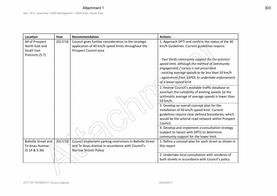
Item 19.8: Local Area Traffic Management – North East / South East
CITY OF PROSPECT: Council Agenda 25/07/2017
Location Year Recommendation Actions
All of Prospect North East and South East Precincts (5.7)
2017/18 Council gives further consideration to the strategic application of 40 km/h speed limits throughout the Prospect Council area.
1. Approach DPTI and confirm the status of the 40 km/h Guidelines. Current guidelines require:
- Two thirds community support for the precinct speed limit, although the method of community engagement / survey is not prescribed.
- existing average speeds to be less than 50 km/h
- agreement from SAPOL to undertake enforcement of a lower speed limit
2. Review Council’s available traffic database to ascertain the suitability of existing speeds (ie the arithmetic average of average speeds is lower than 50 km/h.
3. Develop an overall concept plan for the installation of 40 km/h speed limit. Current guidelines require clear defined boundaries, which would be the arterial road network within Prospect Council.
4. Develop and implement a consultation strategy (subject to liaison with DPTI) to determine community support for the lower limit.
Ballville Street and Te Anau Avenue (5.14 & 5.36)
2017/18 Council implement parking restrictions in Ballville Street and Te Anau Avenue in accordance with Council’s Narrow Streets Policy.
1. Refine a concept plan for each street as shown in this report
2. Undertake local consultation with residents of both streets in accordance with Council’s policy Atta
chm
ent
Attachment 1 303
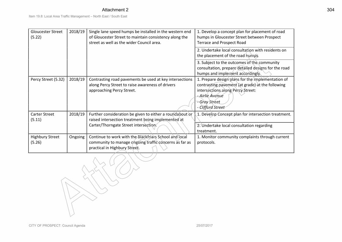
Item 19.8: Local Area Traffic Management – North East / South East
CITY OF PROSPECT: Council Agenda 25/07/2017
Gloucester Street (5.22)
2018/19 Single lane speed humps be installed in the western end of Gloucester Street to maintain consistency along the street as well as the wider Council area.
1. Develop a concept plan for placement of road humps in Gloucester Street between Prospect Terrace and Prospect Road
2. Undertake local consultation with residents on the placement of the road humps
3. Subject to the outcomes of the community consultation, prepare detailed designs for the road humps and implement accordingly.
Percy Street (5.32) 2018/19 Contrasting road pavements be used at key intersections along Percy Street to raise awareness of drivers approaching Percy Street.
1. Prepare design plans for the implementation of contrasting pavement (at grade) at the following intersections along Percy Street:
- Airlie Avenue
- Gray Street - Clifford Street
Carter Street (5.11)
2018/19 Further consideration be given to either a roundabout or raised intersection treatment being implemented at Carter/Thorngate Street intersection.
1. Develop Concept plan for intersection treatment.
2. Undertake local consultation regarding treatment.
Highbury Street (5.26)
Ongoing Continue to work with the Blackfriars School and local community to manage ongoing traffic concerns as far as practical in Highbury Street.
1. Monitor community complaints through current protocols.
Attach
ment
Attachment 2 304
Prospect NE and SE Precincts
Local Area Traffic Management Plan
City of Prospect
May 2017
Ref No. 20141130DR1
Client Ref No. 20141130FR1
Atta
chm
ent
Attachment 3 305
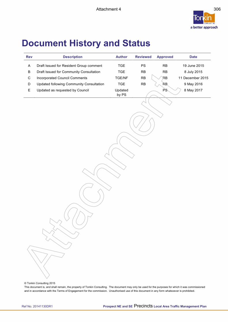
Ref No. 20141130DR1 Prospect NE and SE Precincts Local Area Traffic Management Plan
© Tonkin Consulting 2015 This document is, and shall remain, the property of Tonkin Consulting. The document may only be used for the purposes for which it was commissioned and in accordance with the Terms of Engagement for the commission. Unauthorised use of this document in any form whatsoever is prohibited.
Document History and Status Rev Description Author Reviewed Approved Date
A Draft Issued for Resident Group comment TGE PS RB 19 June 2015
B Draft Issued for Community Consultation TGE RB RB 8 July 2015
C Incorporated Council Comments TGE/NF RB RB 11 December 2015
D Updated following Community Consultation TGE RB RB 9 May 2016
E Updated as requested by Council Updated by PS
PS 8 May 2017
Atta
chm
ent
Attachment 4 306
Ref No. 20141130DR1 Prospect NE and SE Precincts Local Area Traffic Management Plan
Contents 1 Introduction 1
1.1 Background 1
1.2 Process 2
1.3 Context 3
1.4 LATM Boundaries 3 1.4.1 Thorngate 3 1.4.2 Main North Road Master Plan 3
2 Findings 4
2.1 Background 4 2.1.1 Call for Public Comment 4 2.1.2 Review of Traffic Data 4 2.1.3 Collision Data 4 2.1.4 Asset register 4 2.1.5 Site Investigations 4
2.2 Summary of Key Issues 5 2.2.1 Speeds and Volumes 5 2.2.2 Parking Issues 5 2.2.3 Pulsford Road – Single lane angled slow points 6 2.2.4 Ballville Street 6 2.2.5 Carter Street 6 2.2.6 College Avenue/Main North Road Intersection 6 2.2.7 Gloucester Street 7 2.2.8 Highbury Street – Blackfriars School 7 2.2.9 Percy Street Intersections 7 2.2.10 Te Anau Avenue 7
2.3 Second Round of Community Consultation 7
3 Discussions and Recommendations 9
3.1 Design Approach 9
3.2 Speeds and Volumes 9 3.2.1 40km/h Speed Zone 9 3.2.2 Community Feedback 10
3.3 Parking Issues 11
3.4 Ballville Street 11 3.4.1 Restrict parking 11 3.4.2 Community Feedback 11
3.5 Carter Street 12 3.5.1 Overview 12 3.5.2 Traffic Data 12 3.5.3 Full Road Closure 14 3.5.4 Diagonal Road Closure 15 3.5.5 Roundabout 15 3.5.6 Raised intersections 16 3.5.7 Single Lane Speed Humps 16 3.5.8 Community feedback 16
Atta
chm
ent
Attachment 5 307
Ref No. 20141130DR1 Prospect NE and SE Precincts Local Area Traffic Management Plan
3.6 College Avenue/Main North Road Intersection 17 3.6.1 Removal of bus shelter 17 3.6.2 Relocation of bus stop 17 3.6.3 Removal of bus stop 18 3.6.4 Community Feedback 18
3.7 Gloucester Street 19 3.7.1 Single lane speed humps 19 3.7.2 Community Feedback 19
3.8 Highbury Street – Blackfriars School 20 3.8.1 Overview 20 3.8.2 Restrict parking 20 3.8.3 One Way Restriction 20 3.8.4 Pick Up / Drop off 21 3.8.5 Penn Place Intersection – Driveway Entry 21 3.8.6 Single lane speed humps 21 3.8.7 Community Feedback 21
3.9 Percy Street Intersections 22 3.9.1 Driveway entries 22 3.9.2 Contrasting pavement 23 3.9.3 Community Feedback 23
3.10 Te Anau Avenue 24 3.10.1 Raised intersections 24 3.10.2 Contrasting pavements 24 3.10.3 Single Lane Speed Humps 24 3.10.4 Restrict parking 25 3.10.5 Community Feedback 25
4 Summary and Recommendations 26
Figures Figure 1.1 - Study Area 1 Figure 3.1 - Parking restriction at western end of Ballvile St 11 Figure 3.2 - Parking restriction at eastern end of Ballville St 11 Figure 3.3 - Road closure example showing maintained traffic movements 14 Figure 3.4 - Diagonal road closure showing maintained traffic movements 15 Figure 3.5 - Example of a raised intersection 16 Figure 3.6 - View looking south from College Avenue / Main North Road Intersection 17 Figure 3.7 - College Avenue bus stop options 18 Figure 3.8 - School drop off zone with one-way section 20 Figure 3.9 - Percy street intersections 22 Figure 3.10 - Example of a driveway entry 22 Figure 3.11 - Example of a contrasting pavement intersection 23 Figure 3.12 - Te Anau intersections 24 Figure 3.13 - Parking restrictions on Te Anau Avenue 25 A
ttach
men
t
Attachment 6 308
Ref No. 20141130DR1 Prospect NE and SE Precincts Local Area Traffic Management Plan
Appendices Appendix A Summary of Community Feedback Appendix B Summary of Traffic Data Appendix C Crash Data Appendix D Asset Register Appendix E Concept Traffic Management Plan for Consultation Appendix F City of Prospect Traffic Management Policy Appendix G Community Consultation Comments
Atta
chm
ent
Attachment 7 309
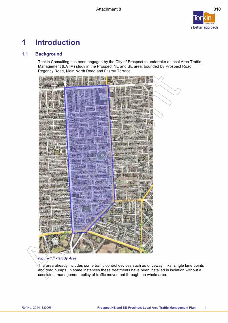
Ref No. 20141130DR1 Prospect NE and SE Precincts Local Area Traffic Management Plan 1
1 Introduction 1.1 Background
Tonkin Consulting has been engaged by the City of Prospect to undertake a Local Area Traffic Management (LATM) study in the Prospect NE and SE area, bounded by Prospect Road, Regency Road, Main North Road and Fitzroy Terrace.
Figure 1.1 - Study Area
The area already includes some traffic control devices such as driveway links, single lane points and road humps. In some instances these treatments have been installed in isolation without a consistent management policy of traffic movement through the whole area. A
ttach
men
t
Attachment 8 310
Ref No. 20141130DR1 Prospect NE and SE Precincts Local Area Traffic Management Plan 2
1.2 Process The preparation of this LATM Plan commenced in early 2015 and progressed through various stages of community consultation until May 2016 when the project stalled due to concerns over a muted substantial redevelopment of the Thorngate area.
Community consultation included:
General mail out to all residents identifying traffic and road safety concerns
Two meetings with the Residents Control Group to discuss issues and potential solutions
Mail out of proposed treatment options for comment
An analysis of traffic volumes, speeds and vehicle classifications using the network;
An analysis of crash data in the area; and
Independent site inspections/observations of driver behaviour.
Following the above process, the plan was submitted to both a Residents Control Group and the wider community. The draft plan was amended to take into account the recommendations based of the subsequent feedback received (May 2016).
Concerns over a development of the Thorngate area have since been resolved. During the ensuing period (May 2016-2017) there have been other developments including:
Upgrade of the service station on the corner of Main North Road and Carter Street
Additional traffic data collected on Carter Street (March 2017)
Commencement of the Main North Road Master Planning Study (initiated by Council)
Construction of alternative traffic control devices in Pulsford Street
Design and proposed construction of an Emu crossing in Highbury Street (Blackfriars School).
This report updates the previous draft LATM investigations to include these recent developments.
The plan is intended to provide Council and the community with a clear direction for traffic management in the Prospect SE and NE LATM precincts.
Atta
chm
ent
Attachment 9 311
Ref No. 20141130DR1 Prospect NE and SE Precincts Local Area Traffic Management Plan 3
1.3 Context
1.4 LATM Boundaries Preparation of the LATM has largely focussed on traffic concerns within the “internal” local street network. The investigations have not concentrated on traffic issues along the surrounding arterial road network which is under the control and management of DPTI.
1.4.1 Thorngate
Council was advised in early-mid 2016 of a development consortium being interested in pursuing a large scale mixed use development in the suburb of Thorngate.
No application was ever lodged so the ‘proposal’ was always referred to as a ‘potential development proposal’.
In recent times Council has been made aware that the consortium is pursuing other development sites outside of City of Prospect so it appears unlikely to pursue a proposal in Thorngate.
This LATM has not considered the impact of any substantial development within the precinct.
1.4.2 Main North Road Master Plan
Council has commenced two inter-related projects that may influence future local traffic movements within the LATM precinct:
Streetscape Master Plan
Traffic and Movement Assessment
In March 2017 Council initiated a project to develop a Master Plan for the rejuvenation and streetscape of Main North Road between Fitzroy Terrace and Regency Road. The project aims to revitalise the public space along Main North Road, achieve walkable east-west connections over Main North Road (between the adjacent precincts), and enhance cycling and pedestrian networks.
Allied to this project, Council is also undertaking a Traffic Movement Assessment for Main North Road as an input to the Master Planning process. The objectives of this Assessment include:
Clearly identify current traffic behaviour and traffic management issues
Identification of future demands and requirements for Main North Road
Prepare a Concept Plan of recommended treatments including a prioritised set of recommendations, by time (ie short, medium and long term priorities).
The Traffic Movement Assessment is not intended to develop a detailed Corridor Management Plan for Main North Road, as this would normally be a documented coordinated by DPTI. Rather the Transport and Movement Assessment will identify issues from a Council perspective that can be embodied within the Streetscape Master Plan, and make recommendations for treatment options that may need further consideration by DPTI.
Atta
chm
ent
Attachment 10 312
Ref No. 20141130DR1 Prospect NE and SE Precincts Local Area Traffic Management Plan 4
2 Findings 2.1 Background
A number of steps have been undertaken to qualify and quantify factors affecting the road network within the study area, including public consultation, site reviews and analysis of available traffic and crash data.
2.1.1 Call for Public Comment Circulars were sent to 1,851 properties in February 2015.
73 written responses were received (3.9% response rate)
Two Residents Control Group meetings were held on the 8 th April and 20th May, 2015.
Feedback from the community circulars and community meetings has been summarised per street and issue identified. The full summary of feedback is included in Appendix A.
2.1.2 Review of Traffic Data
Traffic data was collected as part of this project in November 2014. Additional traffic data was collected in Carter Street during March 2017. This data has been summarised together with historic data for the precinct in Appendix B.
Council has a number of previously collected traffic counts that Tonkin manages on their Exponare servers. These traffic counts were also reviewed.
2.1.3 Collision Data
Crash data for the period 2007-2012 was reviewed, based on geo-coded collision records maintained by the Department Planning Transport and Infrastructure (DPTI). The data was useful in identifying common trends throughout the area and locations with higher numbers of collisions. Collision data has been presented in Appendix C.
2.1.4 Asset register
Condition data for roads within the study area was reviewed, based on the asset register maintained by Tonkin Consulting’s spatial services. The data was useful in identifying poor condition roads, as well as highlighting basic geometry features. Asset information has been presented in Appendix D.
2.1.5 Site Investigations
Most roads in the area were reviewed and driven by vehicle. Some road widths have been checked to confirm that certain devices can be implemented; should the consultation process lead Council to that stage. The independent site inspections were undertaken in the context of a road safety audit to identify:
Potential areas for speeding / rat-running through the area;
Areas where parking demand is high and there is potential conflict between parked vehicles and travelling vehicles in particular streets;
The provisions for vulnerable road users such as cyclists and pedestrians;
Intersections with limited sight distance or other factors that might influence crashes; and
Conflicts with land uses, for example abutting residential, school and industrial zones.
Atta
chm
ent
Attachment 11 313
Ref No. 20141130DR1 Prospect NE and SE Precincts Local Area Traffic Management Plan 5
2.2 Summary of Key Issues While there were many separate issues raised by the community (summarised in Appendix A), not all issues warrant specific intervention. In some cases, the reported concerns cannot be substantiated by actual traffic data, while in other cases the concerns and potential remedial treatments need to be balanced against the needs of other road users and possible adverse impacts, as well as the “value for money” of the treatment. The following comments summarise and respond to the major concerns raised by the community.
2.2.1 Speeds and Volumes
Numerous residents mentioned excessive speeds and traffic volumes throughout the precinct. Some of these comments were made in the general sense that excessive speeds were encountered “area wide”, while others were specific to certain streets. Roads mentioned included:
Arthur Street
Ballville Street
Bradford Street
Carter Street
Da Costa Avenue
Flora Terrace
Gloucester Street
Labrina Avenue
Milner Street
Prospect Terrace
Richman Avenue
Te Anau Avenue
From examining the traffic data obtained in November 2014, it was seen that 85th percentile1 speeds range from 41km/h to 51km/h with average speeds of 35km/h – 40km/h.
Volumes on a majority of streets are less than 1,500 vehicles per day and are therefore considered Local Streets. The only exception to this is Percy Street with approximately 1,800 vehicles per day and is considered a Minor Collector Road.
2.2.2 Parking Issues
Respondents made reference to various locations where parking can create congestions/squeeze points, including:
Airlie Avenue
Arthur Street
Ballville Street
Carter Street
Clifford Street
Da Costa Avenue
185th Percentile speed is the speed at or below which 85% of all vehicles are observed to travel under free flowing conditions past a nominated point
Atta
chm
ent
Attachment 12 314
Ref No. 20141130DR1 Prospect NE and SE Precincts Local Area Traffic Management Plan 6
Flora Terrace
Edgeworth Street
Hudson Street
Kintore Avenue
Koonga Avenue
Labrina Avenue
Milner Street
Percy Street
Prospect Terrace
Richman Avenue
Stuart Road
Wilson Street
2.2.3 Pulsford Road – Single lane angled slow points
Several residents expressed concern over the (previously installed) single lane angled slow points along Pulsford Road. Various issues were mentioned including condition, driver behaviour approaching slow points, rubbish collection and access difficulties for properties adjacent each slow point.
Separate to the LATM, Tonkin Consulting was also engaged to undertake an assessment of the existing devices and subsequently a design of upgrades of the devices. The design proposed the replacement of the angled slow points with single lane road humps, which have now been constructed. As a result of this, the comments surrounding these single lane angled slow points is considered closed.
2.2.4 Ballville Street
Residents raised concerns of ‘opportunistic non-locals’ (rat running) between Prospect Road and Main North Road as it is the southern most direct access between the two major roads.
The street also has a larger number of “Hit Parked Vehicle” accidents along the street. The accidents are more frequent in the western half, which community feedback suggests is due to the increase in traffic from Blackfriars School.
2.2.5 Carter Street
Residents raised concerns of high speed traffic between Prospect Road and Main North Road to avoid lights at Fitzroy Terrace. There is also an increase in traffic due to Blackfriars School during pick up and drop off times.
Subsequent concerns were also raised over the development of the “On The Run” service station on the corner with Main North Road. Additional traffic data was collected on Carter Street (March 2017) to consider the impact of the development.
2.2.6 College Avenue/Main North Road Intersection
Several residents expressed sight distance issues caused by the bus stop located to the south of the College Avenue & Main North Road Intersection. During peak hours this bus stop was also flagged as being unsafe due to the small footpath and large amount of students from Blackfriars. A
ttach
men
t
Attachment 13 315
Ref No. 20141130DR1 Prospect NE and SE Precincts Local Area Traffic Management Plan 7
2.2.7 Gloucester Street
A number of residents raised issues with access to both Prospect Road and Main North Road, especially during peak times. The intersection at Prospect Road was flagged as dangerous due to the proximity to the service station entrance and conflicting traffic movements.
There is also a concern of higher speeds at the western end of Gloucester Street, as the traffic control devices only exist at the eastern end.
2.2.8 Highbury Street – Blackfriars School
Highbury Street was raised repeatedly by residents living in the southern end of the study area as being highly congested by traffic activities associated with Blackfriars School.
These activities included:
Parking on street all day (i.e. staff and older students);
Hoon driving;
Large influx of cars at pick up times that double park illegally causing congestion;
Parking time restrictions are being ignored and not policed.
There have also been several residents express concern over the amount of car carriers using the road due to the car yards on Main North Road.
Subsequent to the consultation process, Council has designed a new Emu Pedestrian Crossing in Highbury Street adjacent the school, which is scheduled for construction in May 2017.
2.2.9 Percy Street Intersections
From review of the collision data, it was noticed that there were 4 right turn crashes along Percy Street at the intersections with Arthur Street and Stuart Road. Residents commented that this could be due to misperceptions of speed due to the traffic control devices on Percy Street, as well as rat-running traffic as motorists try to avoid the Prospect Road/Regency Road intersection.
2.2.10 Te Anau Avenue
Residents raised concerns over the generally tight street and poor sight lines at the Wilson Street and Bradford Street intersections.
Collision data indicated two right angle crashes at the Bradford Street intersection and one at the Moora Avenue intersections.
2.3 Second Round of Community Consultation A second round of community consultation was undertaken in December 2016 to provide comment on the proposed treatment options. The consultation was undertaken by Council and included providing a mail out and link to the report.
Circulars were sent to 1,851 properties in December 2016 and 120 written responses were received (6.5% response rate).
Feedback from this community consultation has been summarised within the relevant street and issue identified. The full summary of feedback is included in Appendix G.
Generally, there was greater support for subtle traffic control measures through restriction of parking, contrasting pavement and speed humps rather than high impact traffic control devices such as road closures and driveway entries.
Atta
chm
ent
Attachment 14 316
Ref No. 20141130DR1 Prospect NE and SE Precincts Local Area Traffic Management Plan 8
Additional concerns that were raised as part of this consultation include:
Lack of consideration for cyclists and pedestrians in study area with installation of existing traffic control devices, and
Concern over current developments in or adjacent to the study area, i.e. new On The Run on Main North Road and new cinema complex on Prospect Road.
Atta
chm
ent
Attachment 15 317
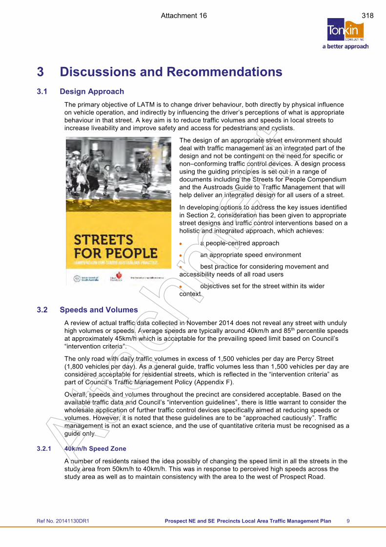
Ref No. 20141130DR1 Prospect NE and SE Precincts Local Area Traffic Management Plan 9
3 Discussions and Recommendations 3.1 Design Approach
The primary objective of LATM is to change driver behaviour, both directly by physical influence on vehicle operation, and indirectly by influencing the driver’s perceptions of what is appropriate behaviour in that street. A key aim is to reduce traffic volumes and speeds in local streets to increase liveability and improve safety and access for pedestrians and cyclists.
The design of an appropriate street environment should deal with traffic management as an integrated part of the design and not be contingent on the need for specific or non–conforming traffic control devices. A design process using the guiding principles is set out in a range of documents including the Streets for People Compendium and the Austroads Guide to Traffic Management that will help deliver an integrated design for all users of a street.
In developing options to address the key issues identified in Section 2, consideration has been given to appropriate street designs and traffic control interventions based on a holistic and integrated approach, which achieves:
a people-centred approach
an appropriate speed environment
best practice for considering movement and accessibility needs of all road users
objectives set for the street within its wider context.
3.2 Speeds and Volumes A review of actual traffic data collected in November 2014 does not reveal any street with unduly high volumes or speeds. Average speeds are typically around 40km/h and 85th percentile speeds at approximately 45km/h which is acceptable for the prevailing speed limit based on Council’s “intervention criteria”.
The only road with daily traffic volumes in excess of 1,500 vehicles per day are Percy Street (1,800 vehicles per day). As a general guide, traffic volumes less than 1,500 vehicles per day are considered acceptable for residential streets, which is reflected in the “intervention criteria” as part of Council’s Traffic Management Policy (Appendix F).
Overall, speeds and volumes throughout the precinct are considered acceptable. Based on the available traffic data and Council’s “intervention guidelines”, there is little warrant to consider the wholesale application of further traffic control devices specifically aimed at reducing speeds or volumes. However, it is noted that these guidelines are to be “approached cautiously”. Traffic management is not an exact science, and the use of quantitative criteria must be recognised as a guide only.
3.2.1 40km/h Speed Zone
A number of residents raised the idea possibly of changing the speed limit in all the streets in the study area from 50km/h to 40km/h. This was in response to perceived high speeds across the study area as well as to maintain consistency with the area to the west of Prospect Road.
Atta
chm
ent
Attachment 16 318
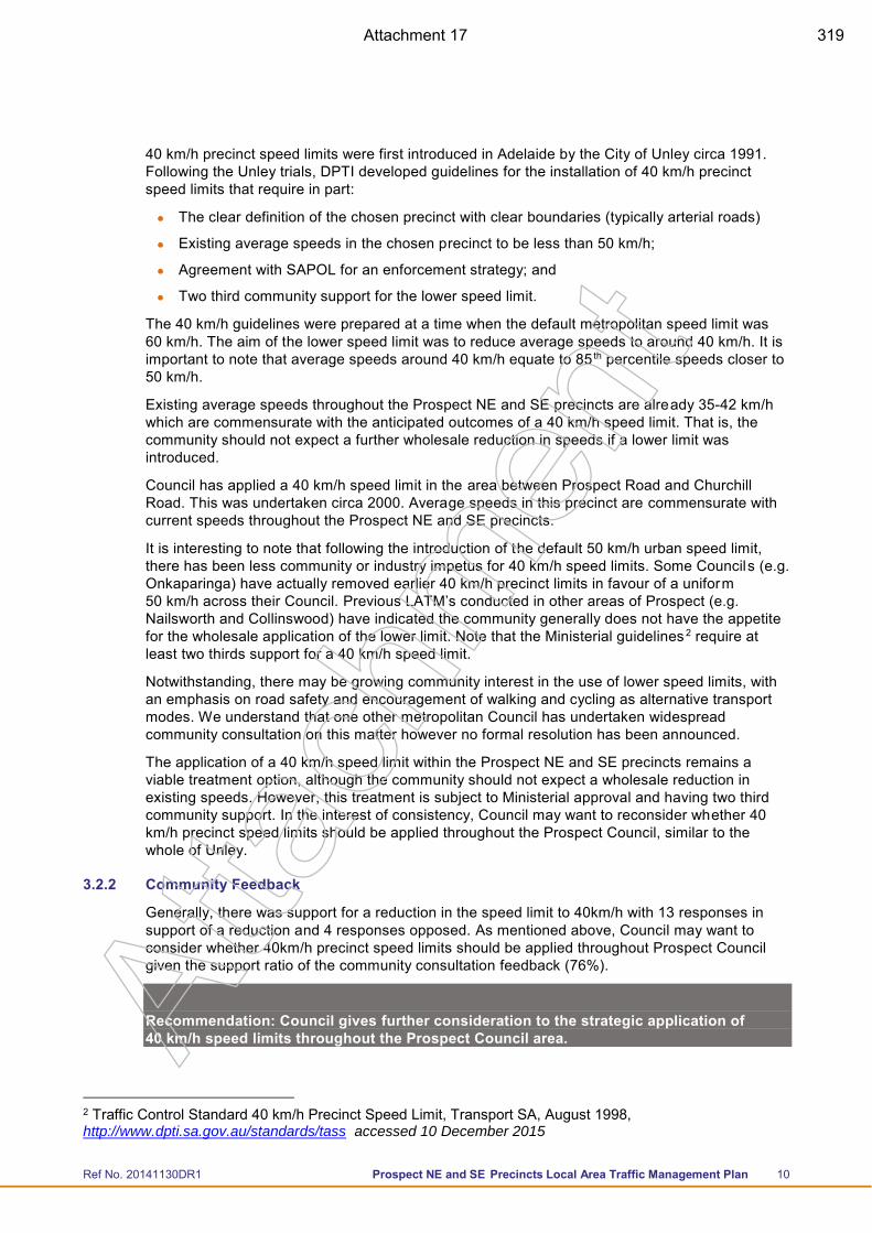
Ref No. 20141130DR1 Prospect NE and SE Precincts Local Area Traffic Management Plan 10
40 km/h precinct speed limits were first introduced in Adelaide by the City of Unley circa 1991. Following the Unley trials, DPTI developed guidelines for the installation of 40 km/h precinct speed limits that require in part:
The clear definition of the chosen precinct with clear boundaries (typically arterial roads)
Existing average speeds in the chosen precinct to be less than 50 km/h;
Agreement with SAPOL for an enforcement strategy; and
Two third community support for the lower speed limit.
The 40 km/h guidelines were prepared at a time when the default metropolitan speed limit was 60 km/h. The aim of the lower speed limit was to reduce average speeds to around 40 km/h. It is important to note that average speeds around 40 km/h equate to 85 th percentile speeds closer to 50 km/h.
Existing average speeds throughout the Prospect NE and SE precincts are already 35-42 km/h which are commensurate with the anticipated outcomes of a 40 km/h speed limit. That is, the community should not expect a further wholesale reduction in speeds if a lower limit was introduced.
Council has applied a 40 km/h speed limit in the area between Prospect Road and Churchill Road. This was undertaken circa 2000. Average speeds in this precinct are commensurate with current speeds throughout the Prospect NE and SE precincts.
It is interesting to note that following the introduction of the default 50 km/h urban speed limit, there has been less community or industry impetus for 40 km/h speed limits. Some Councils (e.g. Onkaparinga) have actually removed earlier 40 km/h precinct limits in favour of a uniform 50 km/h across their Council. Previous LATM’s conducted in other areas of Prospect (e.g. Nailsworth and Collinswood) have indicated the community generally does not have the appetite for the wholesale application of the lower limit. Note that the Ministerial guidelines 2 require at least two thirds support for a 40 km/h speed limit.
Notwithstanding, there may be growing community interest in the use of lower speed limits, with an emphasis on road safety and encouragement of walking and cycling as alternative transport modes. We understand that one other metropolitan Council has undertaken widespread community consultation on this matter however no formal resolution has been announced.
The application of a 40 km/h speed limit within the Prospect NE and SE precincts remains a viable treatment option, although the community should not expect a wholesale reduction in existing speeds. However, this treatment is subject to Ministerial approval and having two third community support. In the interest of consistency, Council may want to reconsider whether 40 km/h precinct speed limits should be applied throughout the Prospect Council, similar to the whole of Unley.
3.2.2 Community Feedback
Generally, there was support for a reduction in the speed limit to 40km/h with 13 responses in support of a reduction and 4 responses opposed. As mentioned above, Council may want to consider whether 40km/h precinct speed limits should be applied throughout Prospect Council given the support ratio of the community consultation feedback (76%).
Recommendation: Council gives further consideration to the strategic application of 40 km/h speed limits throughout the Prospect Council area.
2 Traffic Control Standard 40 km/h Precinct Speed Limit, Transport SA, August 1998, http://www.dpti.sa.gov.au/standards/tass accessed 10 December 2015
Atta
chm
ent
Attachment 17 319
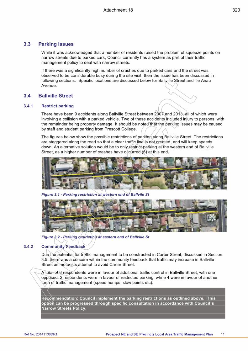
Ref No. 20141130DR1 Prospect NE and SE Precincts Local Area Traffic Management Plan 11
3.3 Parking Issues While it was acknowledged that a number of residents raised the problem of squeeze points on narrow streets due to parked cars, Council currently has a system as part of their traffic management policy to deal with narrow streets.
If there was a significantly high number of crashes due to parked cars and the street was observed to be considerable busy during the site visit, then the issue has been discussed in following sections. Specific locations are discussed below for Ballville Street and Te Anau Avenue.
3.4 Ballville Street
3.4.1 Restrict parking
There have been 9 accidents along Ballville Street between 2007 and 2013, all of which were involving a collision with a parked vehicle. Two of these accidents included injury to persons, with the remainder being property damage. It should be noted that the parking issues may be caused by staff and student parking from Prescott College.
The figures below show the possible restrictions of parking along Ballville Street. The restrictions are staggered along the road so that a clear traffic line is not created, and will keep speeds down. An alternative solution would be to only restrict parking at the western end of Ballville Street, as a higher number of crashes have occurred (6) at this end.
Figure 3.1 - Parking restriction at western end of Ballvile St
Figure 3.2 - Parking restriction at eastern end of Ballville St
3.4.2 Community Feedback
Due the potential for traffic management to be constructed in Carter Street, discussed in Section 3.5, there was a concern within the community feedback that traffic may increase in Ballville Street as motorists attempt to avoid Carter Street.
A total of 6 respondents were in favour of additional traffic control in Ballville Street, with one opposed. 2 respondents were in favour of restricted parking, while 4 were in favour of another form of traffic management (speed humps, slow points etc).
Recommendation: Council implement the parking restrictions as outlined above. This option can be progressed through specific consultation in accordance with Council’s Narrow Streets Policy.
Atta
chm
ent
Attachment 18 320
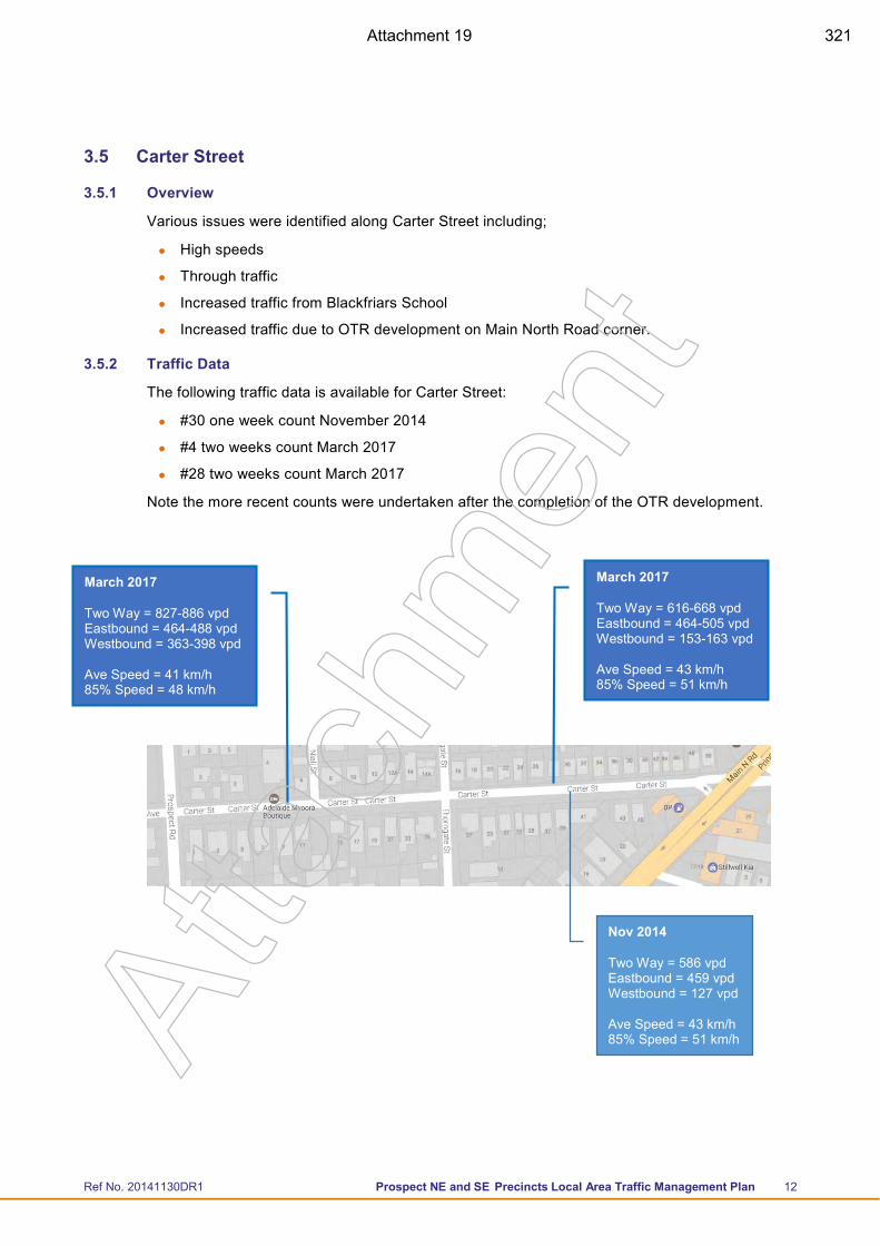
Ref No. 20141130DR1 Prospect NE and SE Precincts Local Area Traffic Management Plan 12
3.5 Carter Street
3.5.1 Overview
Various issues were identified along Carter Street including;
High speeds
Through traffic
Increased traffic from Blackfriars School
Increased traffic due to OTR development on Main North Road corner.
3.5.2 Traffic Data
The following traffic data is available for Carter Street:
#30 one week count November 2014
#4 two weeks count March 2017
#28 two weeks count March 2017
Note the more recent counts were undertaken after the completion of the OTR development.
Nov 2014 Two Way = 586 vpd Eastbound = 459 vpd Westbound = 127 vpd Ave Speed = 43 km/h 85% Speed = 51 km/h
March 2017 Two Way = 616-668 vpd Eastbound = 464-505 vpd Westbound = 153-163 vpd Ave Speed = 43 km/h 85% Speed = 51 km/h
March 2017 Two Way = 827-886 vpd Eastbound = 464-488 vpd Westbound = 363-398 vpd Ave Speed = 41 km/h 85% Speed = 48 km/h
Atta
chm
ent
Attachment 19 321
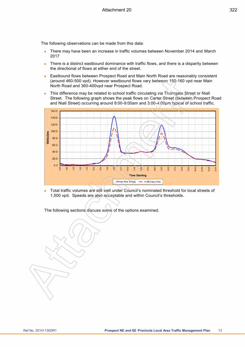
Ref No. 20141130DR1 Prospect NE and SE Precincts Local Area Traffic Management Plan 13
The following observations can be made from this data:
There may have been an increase in traffic volumes between November 2014 and March 2017
There is a distinct eastbound dominance with traffic flows, and there is a disparity between the directional of flows at either end of the street.
Eastbound flows between Prospect Road and Main North Road are reasonably consistent (around 460-500 vpd). However westbound flows vary between 150-160 vpd near Main North Road and 360-400vpd near Prospect Road.
This difference may be related to school traffic circulating via Thorngate Street or Niall Street. The following graph shows the peak flows on Carter Street (between Prospect Road and Niall Street) occurring around 8:00-9:00am and 3:00-4:00pm typical of school traffic.
Total traffic volumes are still well under Council’s nominated threshold for local streets of 1,500 vpd. Speeds are also acceptable and within Council’s thresholds.
The following sections discuss some of the options examined.
Atta
chm
ent
Attachment 20 322
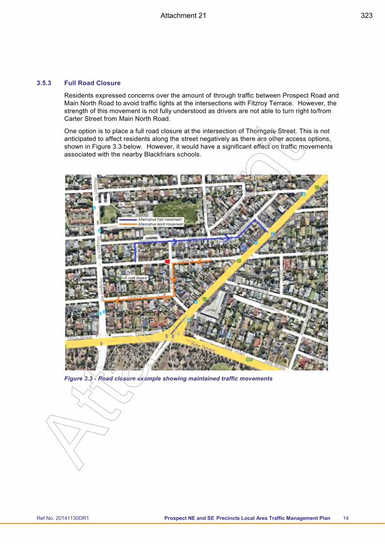
Ref No. 20141130DR1 Prospect NE and SE Precincts Local Area Traffic Management Plan 14
3.5.3 Full Road Closure
Residents expressed concerns over the amount of through traffic between Prospect Road and Main North Road to avoid traffic lights at the intersections with Fitzroy Terrace. However, the strength of this movement is not fully understood as drivers are not able to turn right to/from Carter Street from Main North Road.
One option is to place a full road closure at the intersection of Thorngate Street. This is not anticipated to affect residents along the street negatively as there are other access options, shown in Figure 3.3 below. However, it would have a significant effect on traffic movements associated with the nearby Blackfriars schools.
Figure 3.3 - Road closure example showing maintained traffic movements
Atta
chm
ent
Attachment 21 323
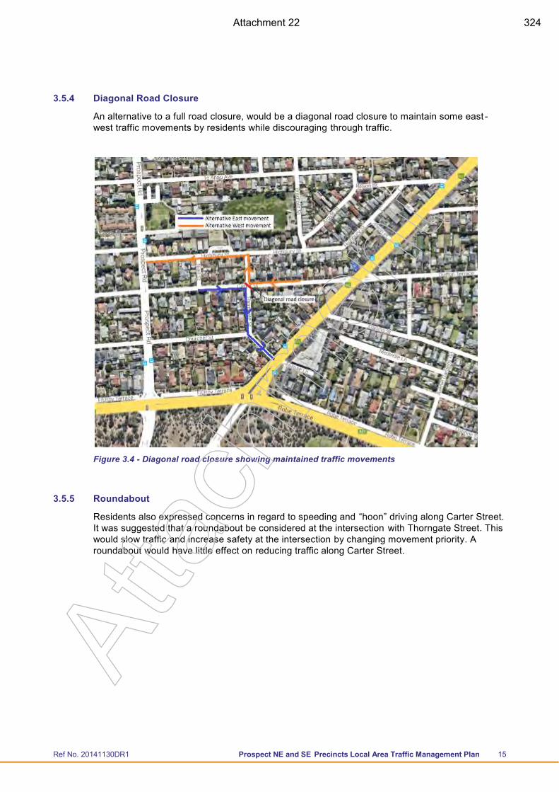
Ref No. 20141130DR1 Prospect NE and SE Precincts Local Area Traffic Management Plan 15
3.5.4 Diagonal Road Closure
An alternative to a full road closure, would be a diagonal road closure to maintain some east -west traffic movements by residents while discouraging through traffic.
Figure 3.4 - Diagonal road closure showing maintained traffic movements
3.5.5 Roundabout
Residents also expressed concerns in regard to speeding and “hoon” driving along Carter Street. It was suggested that a roundabout be considered at the intersection with Thorngate Street. This would slow traffic and increase safety at the intersection by changing movement priority. A roundabout would have little effect on reducing traffic along Carter Street.
Atta
chm
ent
Attachment 22 324
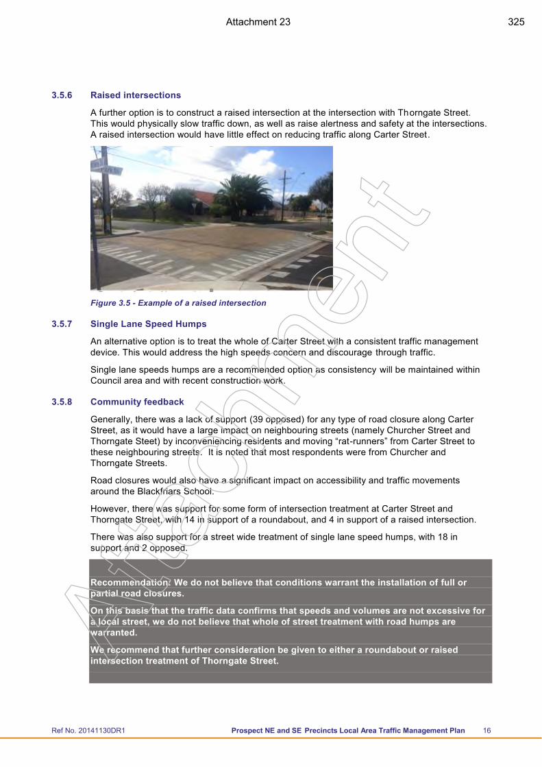
Ref No. 20141130DR1 Prospect NE and SE Precincts Local Area Traffic Management Plan 16
3.5.6 Raised intersections
A further option is to construct a raised intersection at the intersection with Thorngate Street. This would physically slow traffic down, as well as raise alertness and safety at the intersections. A raised intersection would have little effect on reducing traffic along Carter Street.
Figure 3.5 - Example of a raised intersection
3.5.7 Single Lane Speed Humps
An alternative option is to treat the whole of Carter Street with a consistent traffic management device. This would address the high speeds concern and discourage through traffic.
Single lane speeds humps are a recommended option as consistency will be maintained within Council area and with recent construction work.
3.5.8 Community feedback
Generally, there was a lack of support (39 opposed) for any type of road closure along Carter Street, as it would have a large impact on neighbouring streets (namely Churcher Street and Thorngate Steet) by inconveniencing residents and moving “rat-runners” from Carter Street to these neighbouring streets. It is noted that most respondents were from Churcher and Thorngate Streets.
Road closures would also have a significant impact on accessibility and traffic movements around the Blackfriars School.
However, there was support for some form of intersection treatment at Carter Street and Thorngate Street, with 14 in support of a roundabout, and 4 in support of a raised intersection.
There was also support for a street wide treatment of single lane speed humps, with 18 in support and 2 opposed.
Recommendation: We do not believe that conditions warrant the installation of full or partial road closures.
On this basis that the traffic data confirms that speeds and volumes are not excessive for a local street, we do not believe that whole of street treatment with road humps are warranted.
We recommend that further consideration be given to either a roundabout or raised intersection treatment of Thorngate Street.
Atta
chm
ent
Attachment 23 325
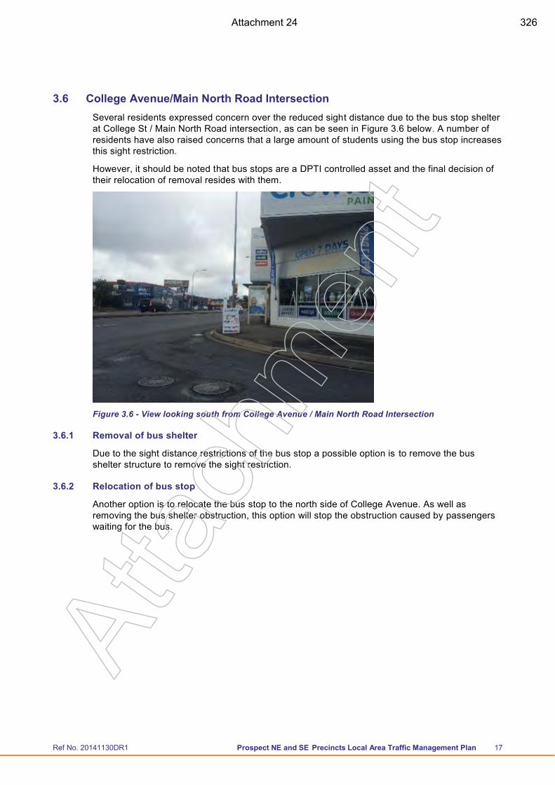
Ref No. 20141130DR1 Prospect NE and SE Precincts Local Area Traffic Management Plan 17
3.6 College Avenue/Main North Road Intersection Several residents expressed concern over the reduced sight distance due to the bus stop shelter at College St / Main North Road intersection, as can be seen in Figure 3.6 below. A number of residents have also raised concerns that a large amount of students using the bus stop increases this sight restriction.
However, it should be noted that bus stops are a DPTI controlled asset and the final decision of their relocation of removal resides with them.
Figure 3.6 - View looking south from College Avenue / Main North Road Intersection
3.6.1 Removal of bus shelter
Due to the sight distance restrictions of the bus stop a possible option is to remove the bus shelter structure to remove the sight restriction.
3.6.2 Relocation of bus stop
Another option is to relocate the bus stop to the north side of College Avenue. As well as removing the bus shelter obstruction, this option will stop the obstruction caused by passengers waiting for the bus.
Atta
chm
ent
Attachment 24 326
Ref No. 20141130DR1 Prospect NE and SE Precincts Local Area Traffic Management Plan 18
3.6.3 Removal of bus stop
An alternative is to remove the College Avenue bus stop entirely. Due to the proximity of the bus stop at Gloucester Street, the implications of removing the bus stop would be minimal. The Gloucester Street bus stop is approximately 170 metres north of the College Avenue stop.
Figure 3.7 - College Avenue bus stop options
3.6.4 Community Feedback
The bus shelter at College Avenue is going to be removed by Adshel during 2016. Removal of the shelter will address the site line issues.
Recommendation: No further action at this stage (noting that conditions along Main North Road are currently being reviewed as part of the Main North Road Master Plan).
Atta
chm
ent
Attachment 25 327
Ref No. 20141130DR1 Prospect NE and SE Precincts Local Area Traffic Management Plan 19
3.7 Gloucester Street A number of residents raised issues with access to both Prospect Road and Main North Road, especially during peak times. The intersection at Prospect Road was flagged as dangerous due to the proximity to the service station entrance and conflicting traffic movements.
3.7.1 Single lane speed humps
A number of residents have expressed concerns involving speeds and inconsistency in traffic management devices along Gloucester Street. The eastern end of Gloucester Street contains single lane speed humps at regular spacing of approximately 100 metres.
The 85th percentile speeds at the eastern end are 42km/h compared to 50km/h at the western end. The traffic also increased from approximately 1,050 vehicles per day to 1,200 vehicles per day.
An option is to maintain consistency along the street by installing single lane slow points along the western half of the street. This is not expected to have any negative implications to the surrounding network. This is also consistent with surrounding streets; namely Pulsford Road which has recently had single lane slow points constructed.
3.7.2 Community Feedback
Generally, feedback on the proposed Gloucester Street treatment of single lane speed humps was minimal, with only 3 responses received. 2 responses were opposed to extending the single lane speed hump treatment into the western half of Gloucester Street on the basis of aesthetics.
Recommendation: While it is noted that a majority of responses were opposed to the proposal of single lane speed humps, it should be recognised that only 3 responses were received in the second round of consultation while 6 responses were originally received that raised high speeds and rat-running as an issue.
As a result, it is recommended that single lane speed humps be installed in the western end of Gloucester Street to maintain consistency along the street as well as the wider Council area.
Atta
chm
ent
Attachment 26 328
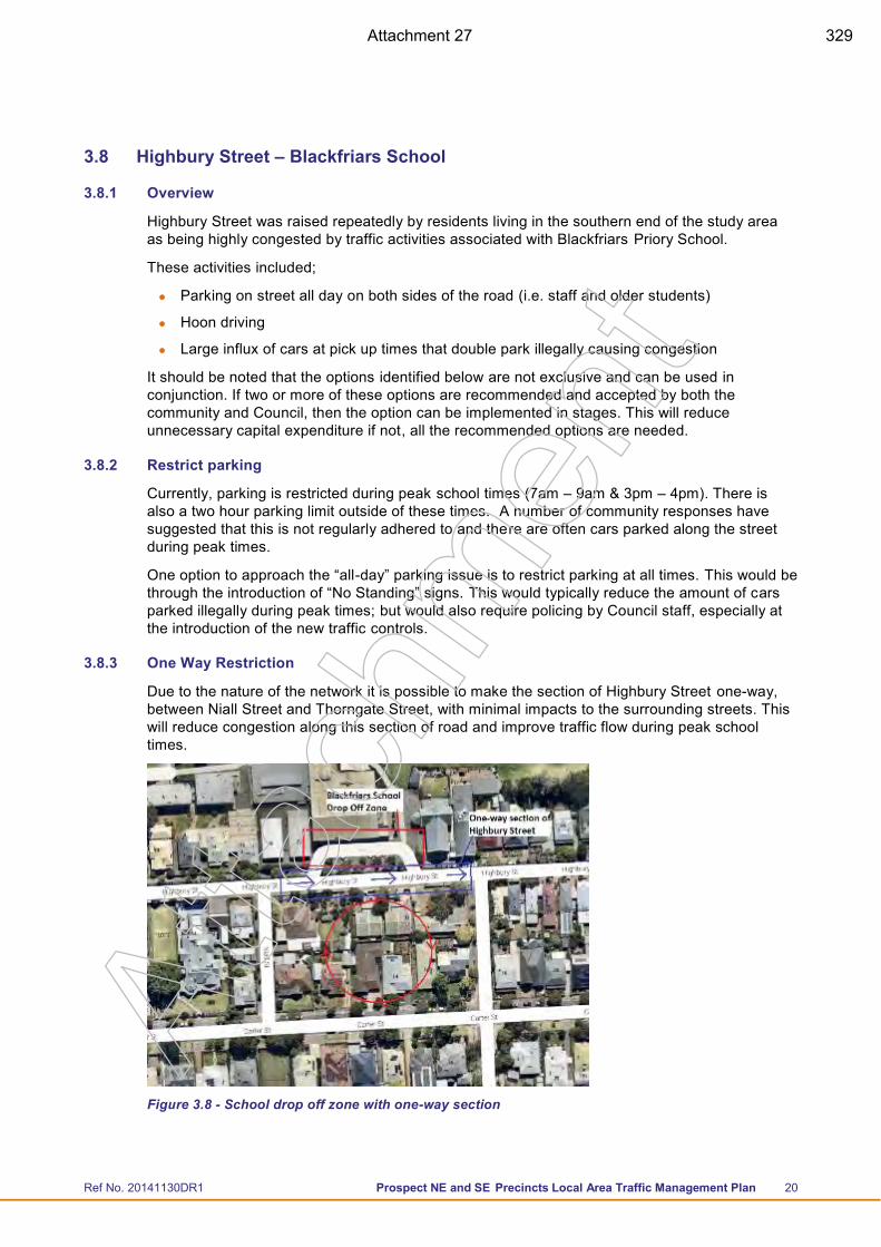
Ref No. 20141130DR1 Prospect NE and SE Precincts Local Area Traffic Management Plan 20
3.8 Highbury Street – Blackfriars School
3.8.1 Overview
Highbury Street was raised repeatedly by residents living in the southern end of the study area as being highly congested by traffic activities associated with Blackfriars Priory School.
These activities included;
Parking on street all day on both sides of the road (i.e. staff and older students)
Hoon driving
Large influx of cars at pick up times that double park illegally causing congestion
It should be noted that the options identified below are not exclusive and can be used in conjunction. If two or more of these options are recommended and accepted by both the community and Council, then the option can be implemented in stages. This will reduce unnecessary capital expenditure if not, all the recommended options are needed.
3.8.2 Restrict parking
Currently, parking is restricted during peak school times (7am – 9am & 3pm – 4pm). There is also a two hour parking limit outside of these times. A number of community responses have suggested that this is not regularly adhered to and there are often cars parked along the street during peak times.
One option to approach the “all-day” parking issue is to restrict parking at all times. This would be through the introduction of “No Standing” signs. This would typically reduce the amount of cars parked illegally during peak times; but would also require policing by Council staff, especially at the introduction of the new traffic controls.
3.8.3 One Way Restriction
Due to the nature of the network it is possible to make the section of Highbury Street one-way, between Niall Street and Thorngate Street, with minimal impacts to the surrounding streets. This will reduce congestion along this section of road and improve traffic flow during peak school times.
Figure 3.8 - School drop off zone with one-way section
Atta
chm
ent
Attachment 27 329
Ref No. 20141130DR1 Prospect NE and SE Precincts Local Area Traffic Management Plan 21
3.8.4 Pick Up / Drop off
It is also recommended that further investigations/design be undertaken, between Council and Blackfriars, into alternative drop off and pick up zones around the school road network. Some locations suggested are;
Te Anau Avenue
Prospect Road (East and West side)
Prospect Terrace
3.8.5 Penn Place Intersection – Driveway Entry
There have also been several residents express concern over the amount of car carriers using the road due to the car yards on Main North Road. The traffic count data shows a heavy vehicle percentage of 6% which is higher than normal for a street of this nature, which would typically expected to be 2 – 3%.
An option to address this would be to construct a driveway entry to the west of Penn Place. This would separate the car yards to the east of Penn Place to the residential street to the west.
3.8.6 Single lane speed humps
An alternative option is to treat the whole of Highbury Street with a consistent traffic management device. This would address the “hoon” driving concern and would reduce the amount of heavy vehicles using the road.
Single lane speed humps are a recommended option to help maintain consistency within Council area and accompany recent construction work.
3.8.7 Community Feedback
Generally, there was limited support for any traffic management along Highbury Street , with 8 opposed and 2 in support. It was acknowledged that there are traffic restrictions during pick-up and drop-off times around Blackfriars but it was also noted that this occurred during a small percentage of the day and did not align with the peak time of people returning from work (5:30pm – 7:00pm).
Council has had further discussions with Blackfriars regarding the functionality of the pickup drop off zone on Highbury Street located between Thorngate and Niall Street. The school has changed the time limit of this zone to ensure turnover and has been more vigilant with teachers monitoring the area to ensure adequate turnover occurs.
Council has also met with Blackfriars regarding drop off zones and has advised the school of alternative drop off locations.
Council has been involved in ongoing discussions with Black Friars Priory School regarding implementation of a School Crossing on Highbury Street. Through these discussions Council has installed an Emu Crossing on Highbury street to facilitate safe crossing. The crossing has been located between Thorngate street and Niall Street.
We understand that since the level of anecdotal complaints has reduced since the new crossing was installed.
Recommendation: No further action at this stage. Continue to work with the School and local community to manage ongoing traffic concerns as far as practical.
Atta
chm
ent
Attachment 28 330
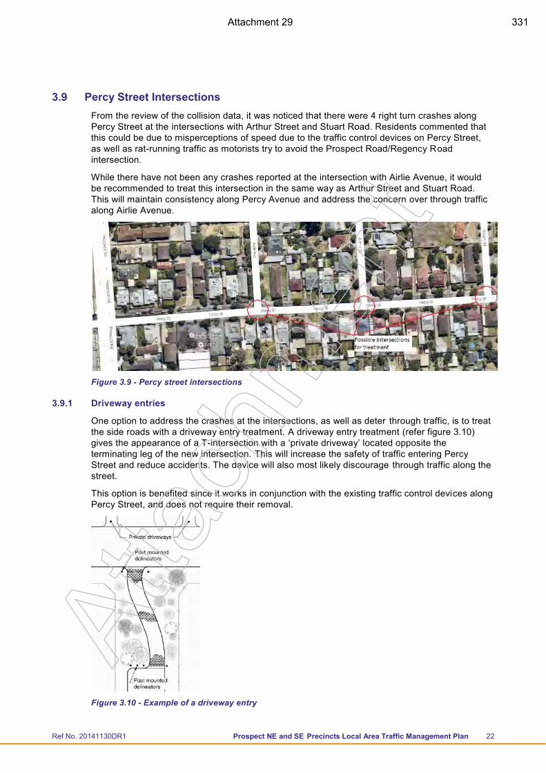
Ref No. 20141130DR1 Prospect NE and SE Precincts Local Area Traffic Management Plan 22
3.9 Percy Street Intersections From the review of the collision data, it was noticed that there were 4 right turn crashes along Percy Street at the intersections with Arthur Street and Stuart Road. Residents commented that this could be due to misperceptions of speed due to the traffic control devices on Percy Street, as well as rat-running traffic as motorists try to avoid the Prospect Road/Regency Road intersection.
While there have not been any crashes reported at the intersection with Airlie Avenue, it would be recommended to treat this intersection in the same way as Arthur Street and Stuart Road. This will maintain consistency along Percy Avenue and address the concern over through traffic along Airlie Avenue.
Figure 3.9 - Percy street intersections
3.9.1 Driveway entries
One option to address the crashes at the intersections, as well as deter through traffic, is to treat the side roads with a driveway entry treatment. A driveway entry treatment (refer figure 3.10) gives the appearance of a T-intersection with a ‘private driveway’ located opposite the terminating leg of the new intersection. This will increase the safety of traffic entering Percy Street and reduce accidents. The device will also most likely discourage through traffic along the street.
This option is benefited since it works in conjunction with the existing traffic control devices along Percy Street, and does not require their removal.
Figure 3.10 - Example of a driveway entry
Atta
chm
ent
Attachment 29 331
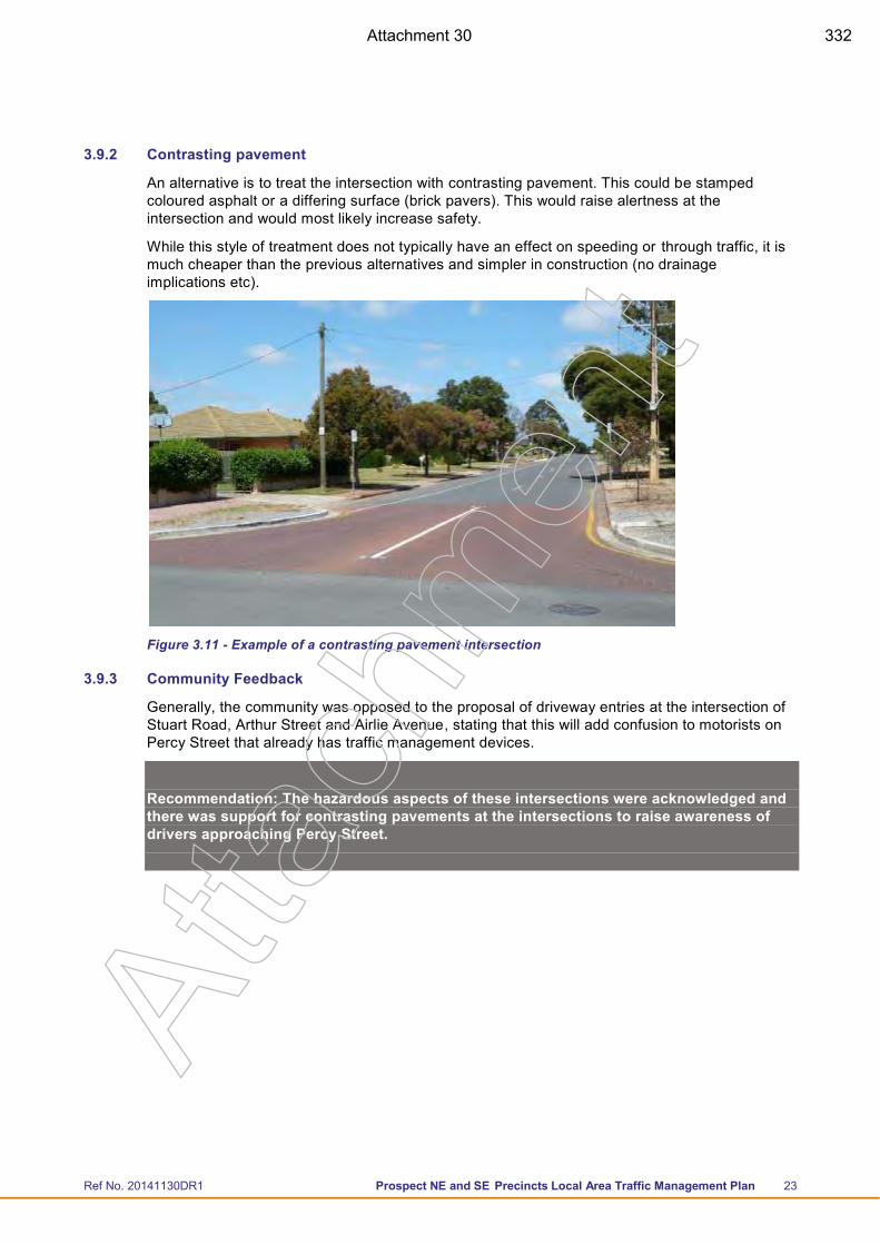
Ref No. 20141130DR1 Prospect NE and SE Precincts Local Area Traffic Management Plan 23
3.9.2 Contrasting pavement
An alternative is to treat the intersection with contrasting pavement. This could be stamped coloured asphalt or a differing surface (brick pavers). This would raise alertness at the intersection and would most likely increase safety.
While this style of treatment does not typically have an effect on speeding or through traffic, it is much cheaper than the previous alternatives and simpler in construction (no drainage implications etc).
Figure 3.11 - Example of a contrasting pavement intersection
3.9.3 Community Feedback
Generally, the community was opposed to the proposal of driveway entries at the intersection of Stuart Road, Arthur Street and Airlie Avenue, stating that this will add confusion to motorists on Percy Street that already has traffic management devices.
Recommendation: The hazardous aspects of these intersections were acknowledged and there was support for contrasting pavements at the intersections to raise awareness of drivers approaching Percy Street.
Atta
chm
ent
Attachment 30 332
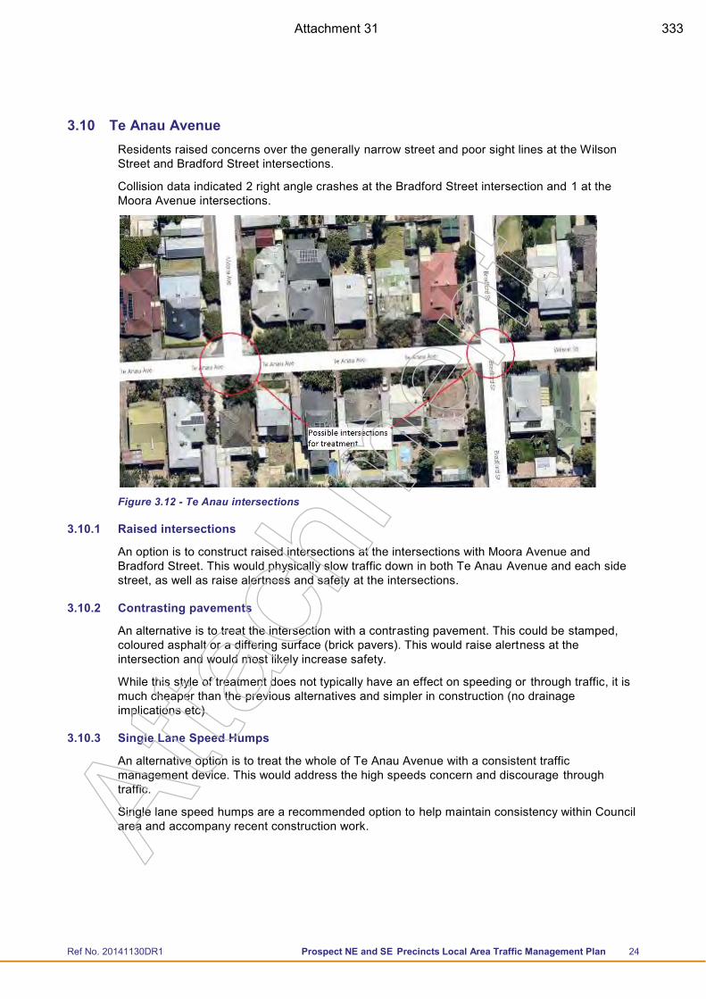
Ref No. 20141130DR1 Prospect NE and SE Precincts Local Area Traffic Management Plan 24
3.10 Te Anau Avenue Residents raised concerns over the generally narrow street and poor sight lines at the Wilson Street and Bradford Street intersections.
Collision data indicated 2 right angle crashes at the Bradford Street intersection and 1 at the Moora Avenue intersections.
Figure 3.12 - Te Anau intersections
3.10.1 Raised intersections
An option is to construct raised intersections at the intersections with Moora Avenue and Bradford Street. This would physically slow traffic down in both Te Anau Avenue and each side street, as well as raise alertness and safety at the intersections.
3.10.2 Contrasting pavements
An alternative is to treat the intersection with a contrasting pavement. This could be stamped, coloured asphalt or a differing surface (brick pavers). This would raise alertness at the intersection and would most likely increase safety.
While this style of treatment does not typically have an effect on speeding or through traffic, it is much cheaper than the previous alternatives and simpler in construction (no drainage implications etc).
3.10.3 Single Lane Speed Humps
An alternative option is to treat the whole of Te Anau Avenue with a consistent traffic management device. This would address the high speeds concern and discourage through traffic.
Single lane speed humps are a recommended option to help maintain consistency within Council area and accompany recent construction work.
Atta
chm
ent
Attachment 31 333
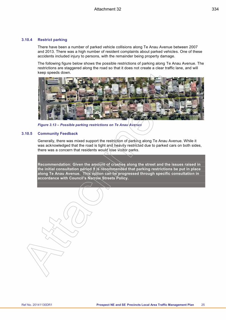
Ref No. 20141130DR1 Prospect NE and SE Precincts Local Area Traffic Management Plan 25
3.10.4 Restrict parking
There have been a number of parked vehicle collisions along Te Anau Avenue between 2007 and 2013. There was a high number of resident complaints about parked vehicles. One of these accidents included injury to persons, with the remainder being property damage.
The following figure below shows the possible restrictions of parking along Te Anau Avenue. The restrictions are staggered along the road so that it does not create a clear traffic lane, and will keep speeds down.
Figure 3.13 – Possible parking restrictions on Te Anau Avenue
3.10.5 Community Feedback
Generally, there was mixed support the restriction of parking along Te Anau Avenue. While it was acknowledged that the road is tight and heavily restricted due to parked cars on both sides, there was a concern that residents would lose visitor parks.
Recommendation: Given the amount of crashes along the street and the issues raised in the initial consultation period it is recommended that parking restrictions be put in place along Te Anau Avenue. This option can be progressed through specific consultation in accordance with Council’s Narrow Streets Policy.
Atta
chm
ent
Attachment 32 334
Ref No. 20141130DR1 Prospect NE and SE Precincts Local Area Traffic Management Plan 26
4 Summary and Recommendations
1. Council gives further consideration to the strategic application of 40 km/h speed limits throughout the Prospect Council area.
2. Council implement parking restrictions in Ballville Street and Te Anau Avenue in accordance with Council’s Narrow Streets Policy.
3. Single lane speed humps be installed in the western end of Gloucester Street to maintain consistency along the street as well as the wider Council area.
4. Contrasting road pavements be used at key intersections along Percy Street to raise awareness of drivers approaching Percy Street.
5. Continue to work with the Blackfriars School and local community to manage ongoing traffic concerns as far as practical in Highbury Street.
Atta
chm
ent
Attachment 33 335
Ref No. 20141130DR1 Prospect NE and SE Precincts Local Area Traffic Management Plan
Appendix A Summary of Community Feedback
Atta
chm
ent
Attachment 34 336
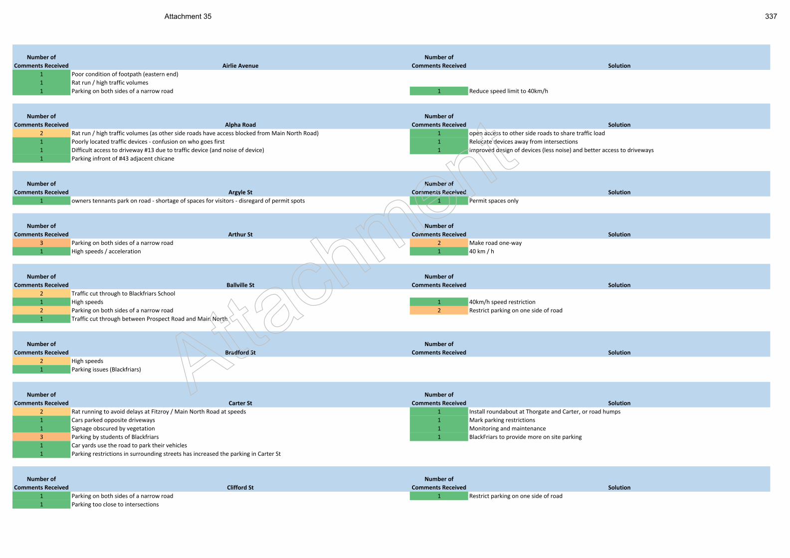
Number of
Comments Received Airlie Avenue
Number of
Comments Received Solution
1 Poor condition of footpath (eastern end)
1 Rat run / high traffic volumes
1 Parking on both sides of a narrow road 1 Reduce speed limit to 40km/h
Number of
Comments Received Alpha Road
Number of
Comments Received Solution
2 Rat run / high traffic volumes (as other side roads have access blocked from Main North Road) 1 open access to other side roads to share traffic load
1 Poorly located traffic devices - confusion on who goes first 1 Relocate devices away from intersections
1 Difficult access to driveway #13 due to traffic device (and noise of device) 1 improved design of devices (less noise) and better access to driveways
1 Parking infront of #43 adjacent chicane
Number of
Comments Received Argyle St
Number of
Comments Received Solution
1 owners tennants park on road - shortage of spaces for visitors - disregard of permit spots 1 Permit spaces only
Number of
Comments Received Arthur St
Number of
Comments Received Solution
3 Parking on both sides of a narrow road 2 Make road one-way
1 High speeds / acceleration 1 40 km / h
Number of
Comments Received Ballville St
Number of
Comments Received Solution
2 Traffic cut through to Blackfriars School
1 High speeds 1 40km/h speed restriction
2 Parking on both sides of a narrow road 2 Restrict parking on one side of road
1 Traffic cut through between Prospect Road and Main North
Number of
Comments Received Bradford St
Number of
Comments Received Solution
2 High speeds
1 Parking issues (Blackfriars)
Number of
Comments Received Carter St
Number of
Comments Received Solution
2 Rat running to avoid delays at Fitzroy / Main North Road at speeds 1 Install roundabout at Thorgate and Carter, or road humps
1 Cars parked opposite driveways 1 Mark parking restrictions
1 Signage obscured by vegetation 1 Monitoring and maintenance
3 Parking by students of Blackfriars 1 BlackFriars to provide more on site parking
1 Car yards use the road to park their vehicles
1 Parking restrictions in surrounding streets has increased the parking in Carter St
Number of
Comments Received Clifford St
Number of
Comments Received Solution
1 Parking on both sides of a narrow road 1 Restrict parking on one side of road
1 Parking too close to intersections
Attach
ment
Attachment 35 337
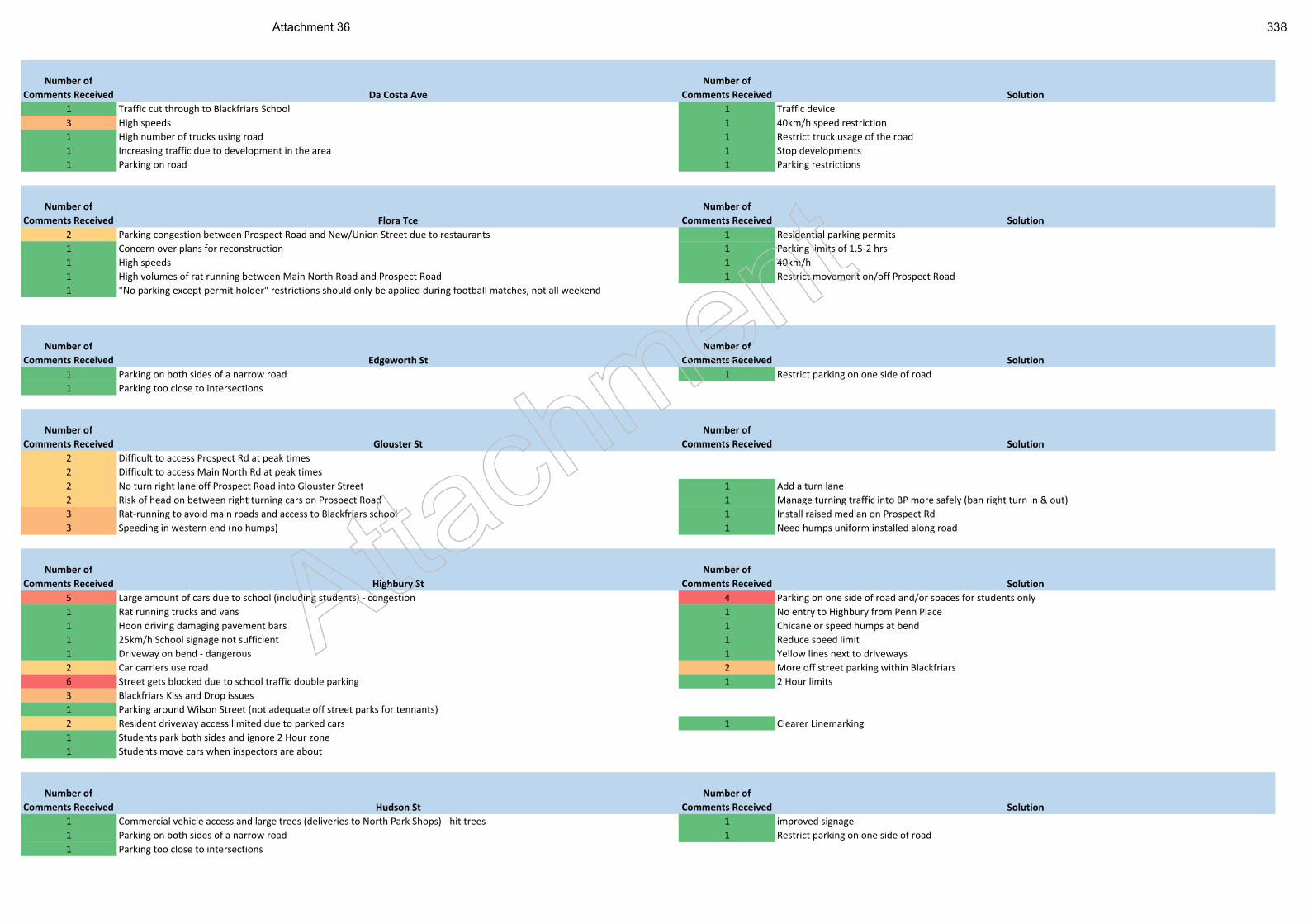
Number of
Comments Received Da Costa Ave
Number of
Comments Received Solution
1 Traffic cut through to Blackfriars School 1 Traffic device
3 High speeds 1 40km/h speed restriction
1 High number of trucks using road 1 Restrict truck usage of the road
1 Increasing traffic due to development in the area 1 Stop developments
1 Parking on road 1 Parking restrictions
Number of
Comments Received Flora Tce
Number of
Comments Received Solution
2 Parking congestion between Prospect Road and New/Union Street due to restaurants 1 Residential parking permits
1 Concern over plans for reconstruction 1 Parking limits of 1.5-2 hrs
1 High speeds 1 40km/h
1 High volumes of rat running between Main North Road and Prospect Road 1 Restrict movement on/off Prospect Road
1 "No parking except permit holder" restrictions should only be applied during football matches, not all weekend
Number of
Comments Received Edgeworth St
Number of
Comments Received Solution
1 Parking on both sides of a narrow road 1 Restrict parking on one side of road
1 Parking too close to intersections
Number of
Comments Received Glouster St
Number of
Comments Received Solution
2 Difficult to access Prospect Rd at peak times
2 Difficult to access Main North Rd at peak times
2 No turn right lane off Prospect Road into Glouster Street 1 Add a turn lane
2 Risk of head on between right turning cars on Prospect Road 1 Manage turning traffic into BP more safely (ban right turn in & out)
3 Rat-running to avoid main roads and access to Blackfriars school 1 Install raised median on Prospect Rd
3 Speeding in western end (no humps) 1 Need humps uniform installed along road
Number of
Comments Received Highbury St
Number of
Comments Received Solution
5 Large amount of cars due to school (including students) - congestion 4 Parking on one side of road and/or spaces for students only
1 Rat running trucks and vans 1 No entry to Highbury from Penn Place
1 Hoon driving damaging pavement bars 1 Chicane or speed humps at bend
1 25km/h School signage not sufficient 1 Reduce speed limit
1 Driveway on bend - dangerous 1 Yellow lines next to driveways
2 Car carriers use road 2 More off street parking within Blackfriars
6 Street gets blocked due to school traffic double parking 1 2 Hour limits
3 Blackfriars Kiss and Drop issues
1 Parking around Wilson Street (not adequate off street parks for tennants)
2 Resident driveway access limited due to parked cars 1 Clearer Linemarking
1 Students park both sides and ignore 2 Hour zone
1 Students move cars when inspectors are about
Number of
Comments Received Hudson St
Number of
Comments Received Solution
1 Commercial vehicle access and large trees (deliveries to North Park Shops) - hit trees 1 improved signage
1 Parking on both sides of a narrow road 1 Restrict parking on one side of road
1 Parking too close to intersections
Attach
ment
Attachment 36 338
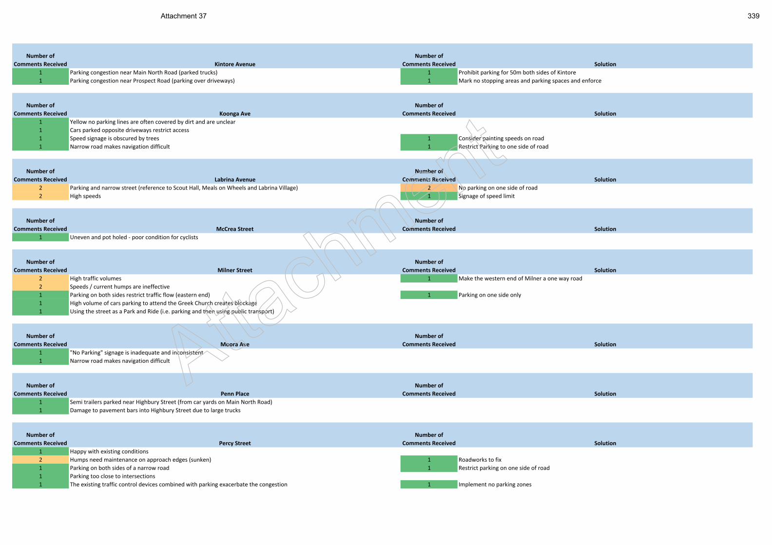
Number of
Comments Received Kintore Avenue
Number of
Comments Received Solution
1 Parking congestion near Main North Road (parked trucks) 1 Prohibit parking for 50m both sides of Kintore
1 Parking congestion near Prospect Road (parking over driveways) 1 Mark no stopping areas and parking spaces and enforce
Number of
Comments Received Koonga Ave
Number of
Comments Received Solution
1 Yellow no parking lines are often covered by dirt and are unclear
1 Cars parked opposite driveways restrict access
1 Speed signage is obscured by trees 1 Consider painting speeds on road
1 Narrow road makes navigation difficult 1 Restrict Parking to one side of road
Number of
Comments Received Labrina Avenue
Number of
Comments Received Solution
2 Parking and narrow street (reference to Scout Hall, Meals on Wheels and Labrina Village) 2 No parking on one side of road
2 High speeds 1 Signage of speed limit
Number of
Comments Received McCrea Street
Number of
Comments Received Solution
1 Uneven and pot holed - poor condition for cyclists
Number of
Comments Received Milner Street
Number of
Comments Received Solution
2 High traffic volumes 1 Make the western end of Milner a one way road
2 Speeds / current humps are ineffective
1 Parking on both sides restrict traffic flow (eastern end) 1 Parking on one side only
1 High volume of cars parking to attend the Greek Church creates blockage
1 Using the street as a Park and Ride (i.e. parking and then using public transport)
Number of
Comments Received Moora Ave
Number of
Comments Received Solution
1 "No Parking" signage is inadequate and inconsistent
1 Narrow road makes navigation difficult
Number of
Comments Received Penn Place
Number of
Comments Received Solution
1 Semi trailers parked near Highbury Street (from car yards on Main North Road)
1 Damage to pavement bars into Highbury Street due to large trucks
Number of
Comments Received Percy Street
Number of
Comments Received Solution
1 Happy with existing conditions
2 Humps need maintenance on approach edges (sunken) 1 Roadworks to fix
1 Parking on both sides of a narrow road 1 Restrict parking on one side of road
1 Parking too close to intersections
1 The existing traffic control devices combined with parking exacerbate the congestion 1 Implement no parking zones
Attach
ment
Attachment 37 339
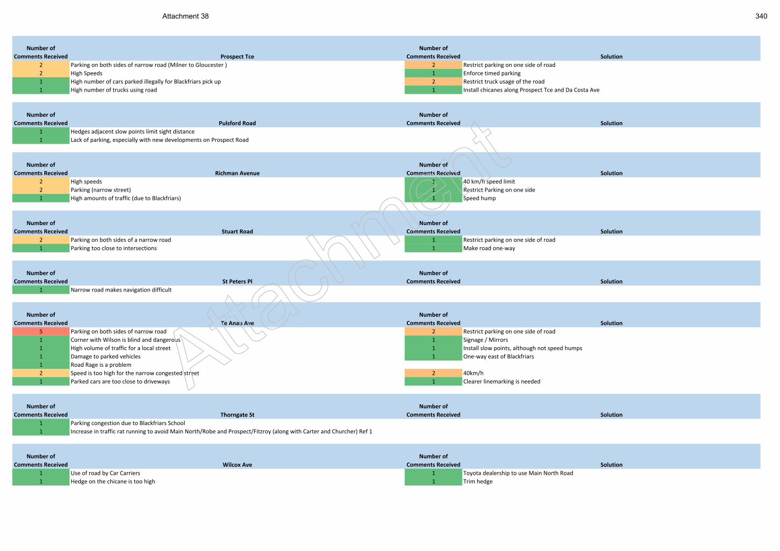
Number of
Comments Received Prospect Tce
Number of
Comments Received Solution
2 Parking on both sides of narrow road (Milner to Gloucester ) 2 Restrict parking on one side of road
2 High Speeds 1 Enforce timed parking
1 High number of cars parked illegally for Blackfriars pick up 2 Restrict truck usage of the road
1 High number of trucks using road 1 Install chicanes along Prospect Tce and Da Costa Ave
Number of
Comments Received Pulsford Road
Number of
Comments Received Solution
1 Hedges adjacent slow points limit sight distance
1 Lack of parking, especially with new developments on Prospect Road
Number of
Comments Received Richman Avenue
Number of
Comments Received Solution
2 High speeds 1 40 km/h speed limit
2 Parking (narrow street) 1 Restrict Parking on one side
1 High amounts of traffic (due to Blackfriars) 1 Speed hump
Number of
Comments Received Stuart Road
Number of
Comments Received Solution
2 Parking on both sides of a narrow road 1 Restrict parking on one side of road
1 Parking too close to intersections 1 Make road one-way
Number of
Comments Received St Peters Pl
Number of
Comments Received Solution
1 Narrow road makes navigation difficult
Number of
Comments Received Te Anau Ave
Number of
Comments Received Solution
5 Parking on both sides of narrow road 2 Restrict parking on one side of road
1 Corner with Wilson is blind and dangerous 1 Signage / Mirrors
1 High volume of traffic for a local street 1 Install slow points, although not speed humps
1 Damage to parked vehicles 1 One-way east of Blackfriars
1 Road Rage is a problem
2 Speed is too high for the narrow congested street 2 40km/h
1 Parked cars are too close to driveways 1 Clearer linemarking is needed
Number of
Comments Received Thorngate St
Number of
Comments Received Solution
1 Parking congestion due to Blackfriars School
1 Increase in traffic rat running to avoid Main North/Robe and Prospect/Fitzroy (along with Carter and Churcher) Ref 1
Number of
Comments Received Wilcox Ave
Number of
Comments Received Solution
1 Use of road by Car Carriers 1 Toyota dealership to use Main North Road
1 Hedge on the chicane is too high 1 Trim hedge
Attach
ment
Attachment 38 340
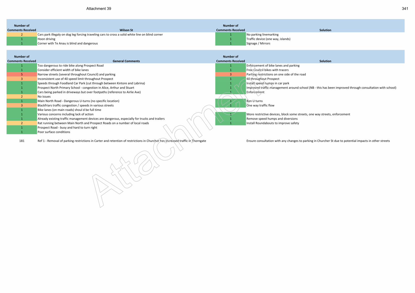
Number of
Comments Received Wilson St
Number of
Comments Received Solution
2 Cars park illegaly on dog leg forcing traveling cars to cross a solid white line on blind corner 1 No parking linemarking
1 Hoon driving 1 Traffic device (one way, islands)
1 Corner with Te Anau is blind and dangerous 1 Signage / Mirrors
Number of
Comments Received General Comments
Number of
Comments Received Solution
1 Too dangerous to ride bike along Prospect Road 1 Enforcement of bike lanes and parking
1 Consider efficient width of bike lanes 1 Free Council bikes with tracers
5 Narrow streets (several throughout Council) and parking 3 Parking restrictions on one side of the road
3 Inconsistent use of 40 speed limit throughout Prospect 1 40 throughout Prospect
1 Speeds through Foodland Car Park (cut through between Kintore and Labrina) 1 Install speed humps in car park
1 Prospect North Primary School - congestion in Alice, Arthur and Stuart 1 Improved traffic management around school (NB - this has been improved through consultation with school)
1 Cars being parked in driveways but over footpaths (reference to Airlie Ave) 1 Enforcement
2 No issues
1 Main North Road - Dangerous U-turns (no specific location) 1 Ban U turns
3 Blackfriars traffic congestion / speeds in various streets 1 One way traffic flow
1 Bike lanes (on main roads) shoul d be full time
1 Various concerns including lack of action 1 More restrictive devices, block some streets, one way streets, enforcement
1 Already existing traffic management devices are dangerous, especially for trucks and trailers 1 Remove speed humps and diversions
2 Rat running between Main North and Prospect Roads on a number of local roads 1 Install Roundabouts to improve safety
1 Prospect Road - busy and hard to turn right
1 Poor surface conditions
181 Ref 1 - Removal of parking restrictions in Carter and retention of restrictions in Churcher has increased traffic in Thorngate Ensure consultation with any changes to parking in Churcher St due to potential impacts in other streets
Attach
ment
Attachment 39 341
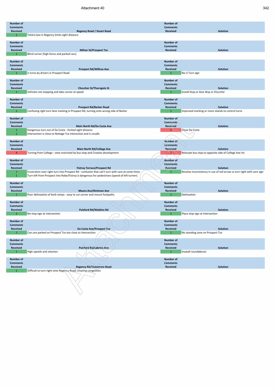
Number of
Comments
Received Regency Road / Stuart Road
Number of
Comments
Received Solution
1 Telstra box in Regency limits sight distance
Number of
Comments
Received Milner St/Prospect Tce
Number of
Comments
Received Solution
1 Blind corner (high fence and parked cars)
Number of
Comments
Received Prospect Rd/Willcox Ave
Number of
Comments
Received Solution
1 U turns by drivers in Prospect Road 1 No U Turn sign
Number of
Comments
Received Churcher St/Thorngate St
Number of
Comments
Received Solution
1 Vehicles not stopping and take corner at speed 1 Install Stop or Give Way in Churcher
Number of
Comments
Received Prospect Rd/Barker Road
Number of
Comments
Received Solution
1 Confusing right turn lane marking in Prospect Rd, turning onto wrong side of Barker 1 Improved marking or more islands to control turns
Number of
Comments
Received Main North Rd/Da Costa Ave
Number of
Comments
Received Solution
1 Dangerous turn out of Da Costa - limited sight distance 2 Close Da Costa
1 Intersection is close to Nottage Tce interection and is unsafe
Number of
Comments
Received Main North Rd/College Ave
Number of
Comments
Received Solution
4 Turning from College - view restricted by bus stop and Crowies development 2 Relocate bus stop to opposite side of College Ave int.
Number of
Comments
Received Fiztroy Terrace/Prospect Rd
Number of
Comments
Received Solution
1 Frustration over right turn into Prospect Rd - confusion that can't turn with care at some times 1 Resolve inconsistency in use of red arrow vs turn right with care sign
1 Turn left from Prospect into Robe/Fiztroy is dangerous for pedestrians (speed of left turners)
Number of
Comments
Received Moora Ave/Richman Ave
Number of
Comments
Received Solution
1 Poor delineation of kerb ramps - easy to cut corner and mount footpaths 1 Delineation
Number of
Comments
Received Pulsford Rd/Watkins Rd
Number of
Comments
Received Solution
1 No stop sign at intersection 1 Place stop sign at intersection
Number of
Comments
Received Da Costa Ave/Prospect Tce
Number of
Comments
Received Solution
1 Cars are parked on Prospect Tce too close to intersection 1 No standing zone on Prospect Tce
Number of
Comments
Received Pulsford Rd/Labrina Ave
Number of
Comments
Received Solution
1 High speeds and volumes 1 Insatall roundabouts
Number of
Comments
Received Regency Rd/Grassmere Road
Number of
Comments
Received Solution
1 Difficult to turn right onto Regency Road, creating congestion
Atta
chm
ent
Attachment 40 342
Ref No. 20141130DR1 Prospect NE and SE Precincts Local Area Traffic Management Plan
Appendix B Summary of Traffic Data
Atta
chm
ent
Attachment 41 343
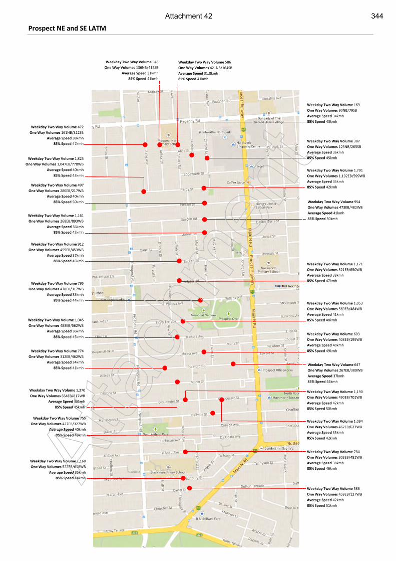
Prospect NE and SE LATM
Weekday Two Way Volume 472
One Way Volumes 161NB/312SB
Average Speed 38kmh
85% Speed 47kmh
Weekday Two Way Volume 548
One Way Volumes 136NB/412SB
Average Speed 31kmh
85% Speed 41kmh
Weekday Two Way Volume 586
One Way Volumes 421NB/164SB
Average Speed 31.8kmh
85% Speed 41kmh
Weekday Two Way Volume 387
One Way Volumes 123NB/265SB
Average Speed 36kmh
85% Speed 45kmh
Weekday Two Way Volume 169
One Way Volumes 90NB/79SB
Average Speed 34kmh
85% Speed 43kmh
Weekday Two Way Volume 497
One Way Volumes 280EB/217WB
Average Speed 40kmh
85% Speed 50kmh
Weekday Two Way Volume 1,161
One Way Volumes 268EB/893WB
Average Speed 36kmh
85% Speed 42kmh
Weekday Two Way Volume 912
One Way Volumes 459EB/453WB
Average Speed 37kmh
85% Speed 45kmh
Weekday Two Way Volume 795
One Way Volumes 478EB/317WB
Average Speed 35kmh
85% Speed 44kmh
Weekday Two Way Volume 1,045
One Way Volumes 483EB/562WB
Average Speed 36kmh
85% Speed 45kmh
Weekday Two Way Volume 1,370
One Way Volumes 554EB/817WB
Average Speed 38kmh
85% Speed 45kmh
Weekday Two Way Volume 755
One Way Volumes 427EB/327WB
Average Speed 40kmh
85% Speed 48kmh
Weekday Two Way Volume 1,160
One Way Volumes 522EB/638WB
Average Speed 35kmh
85% Speed 44kmh
Weekday Two Way Volume 954
One Way Volumes 473EB/482WB
Average Speed 41kmh
85% Speed 50kmh
Weekday Two Way Volume 1,171
One Way Volumes 521EB/650WB
Average Speed 38kmh
85% Speed 47kmh
Weekday Two Way Volume 1,053
One Way Volumes 569EB/484WB
Average Speed 41kmh
85% Speed 48kmh
Weekday Two Way Volume 603
One Way Volumes 408EB/195WB
Average Speed 40kmh
85% Speed 49kmh
Weekday Two Way Volume 1,190
One Way Volumes 490EB/701WB
Average Speed 42kmh
85% Speed 50kmh
Weekday Two Way Volume 784
One Way Volumes 303EB/481WB
Average Speed 38kmh
85% Speed 46kmh
Weekday Two Way Volume 586
One Way Volumes 459EB/127WB
Average Speed 42kmh
85% Speed 51kmh
Weekday Two Way Volume 1,094
One Way Volumes 467EB/627WB
Average Speed 35kmh
85% Speed 42kmh
Weekday Two Way Volume 1,791
One Way Volumes 1,192EB/599WB
Average Speed 35kmh
85% Speed 42kmh
Weekday Two Way Volume 1,825
One Way Volumes 1,047EB/778WB
Average Speed 40kmh
85% Speed 43kmh
Weekday Two Way Volume 774
One Way Volumes 312EB/462WB
Average Speed 34kmh
85% Speed 41kmh Weekday Two Way Volume 647
One Way Volumes 267EB/380WB
Average Speed 37kmh
85% Speed 44kmh
Atta
chm
ent
Attachment 42 344
Ref No. 20141130DR1 Prospect NE and SE Precincts Local Area Traffic Management Plan
Appendix C Crash Data
Atta
chm
ent
Attachment 43 345
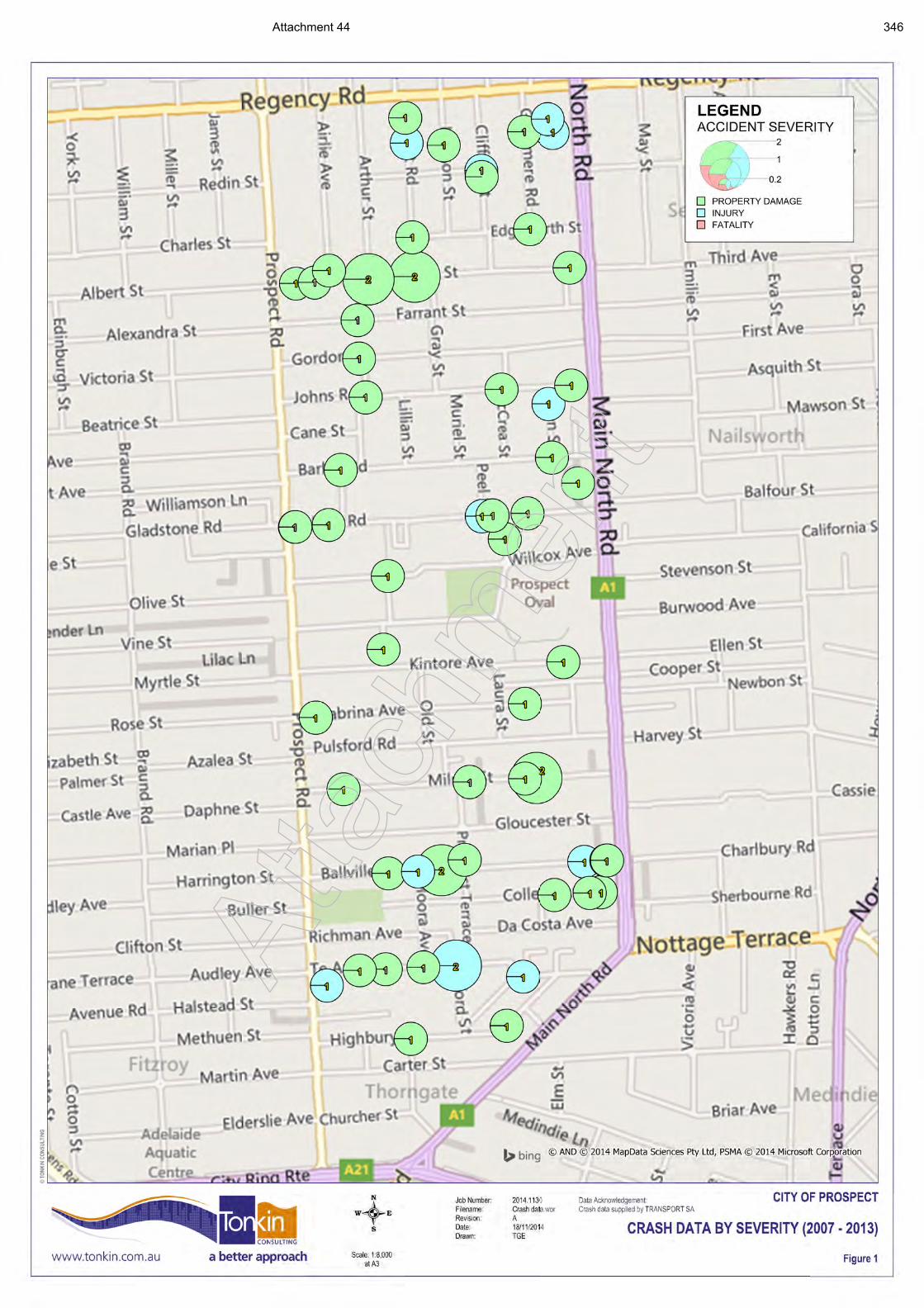
Atta
chm
ent
Attachment 44 346
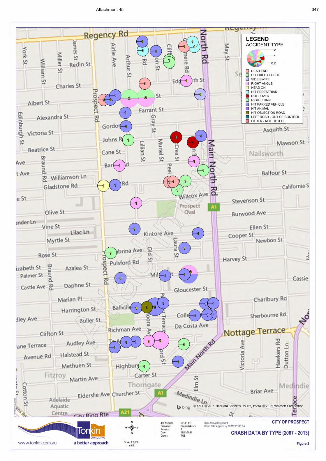
Atta
chm
ent
Attachment 45 347
Ref No. 20141130DR1 Prospect NE and SE Precincts Local Area Traffic Management Plan
Appendix D Asset Register
Atta
chm
ent
Attachment 46 348
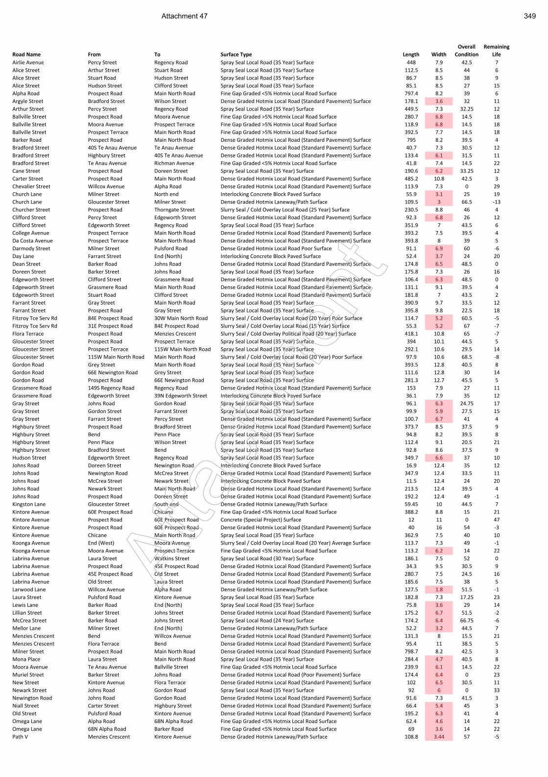
Road Name From To Surface Type Length Width
Overall
Condition
Remaining
Life
Airlie Avenue Percy Street Regency Road Spray Seal Local Road (35 Year) Surface 448 7.9 42.5 7
Alice Street Arthur Street Stuart Road Spray Seal Local Road (35 Year) Surface 112.5 8.5 44 6
Alice Street Stuart Road Hudson Street Spray Seal Local Road (35 Year) Surface 86.7 8.5 38 9
Alice Street Hudson Street Clifford Street Spray Seal Local Road (35 Year) Surface 85.1 8.5 27 15
Alpha Road Prospect Road Main North Road Fine Gap Graded <5% Hotmix Local Road Surface 797.4 8.2 39 6
Argyle Street Bradford Street Wilson Street Dense Graded Hotmix Local Road (Standard Pavement) Surface 178.1 3.6 32 11
Arthur Street Percy Street Regency Road Spray Seal Local Road (35 Year) Surface 449.5 7.3 32.25 12
Ballville Street Prospect Road Moora Avenue Fine Gap Graded >5% Hotmix Local Road Surface 280.7 6.8 14.5 18
Ballville Street Moora Avenue Prospect Terrace Fine Gap Graded >5% Hotmix Local Road Surface 118.9 6.8 14.5 18
Ballville Street Prospect Terrace Main North Road Fine Gap Graded >5% Hotmix Local Road Surface 392.5 7.7 14.5 18
Barker Road Prospect Road Main North Road Dense Graded Hotmix Local Road (Standard Pavement) Surface 795 8.2 39.5 4
Bradford Street 40S Te Anau Avenue Te Anau Avenue Dense Graded Hotmix Local Road (Standard Pavement) Surface 40.7 7.3 30.5 12
Bradford Street Highbury Street 40S Te Anau Avenue Dense Graded Hotmix Local Road (Standard Pavement) Surface 133.4 6.1 31.5 11
Bradford Street Te Anau Avenue Richman Avenue Fine Gap Graded <5% Hotmix Local Road Surface 41.8 7.4 14.5 22
Cane Street Prospect Road Doreen Street Spray Seal Local Road (35 Year) Surface 190.6 6.2 33.25 12
Carter Street Prospect Road Main North Road Dense Graded Hotmix Local Road (Standard Pavement) Surface 485.2 10.8 42.5 3
Chevalier Street Willcox Avenue Alpha Road Dense Graded Hotmix Local Road (Standard Pavement) Surface 113.9 7.3 0 29
Church Lane Milner Street North end Interlocking Concrete Block Paved Surface 55.9 3.1 25 19
Church Lane Gloucester Street Milner Street Dense Graded Hotmix Laneway/Path Surface 109.5 3 66.5 -13
Churcher Street Prospect Road Thorngate Street Slurry Seal / Cold Overlay Local Road (25 Year) Surface 230.5 8.8 46 4
Clifford Street Percy Street Edgeworth Street Dense Graded Hotmix Local Road (Standard Pavement) Surface 92.3 6.8 26 12
Clifford Street Edgeworth Street Regency Road Spray Seal Local Road (35 Year) Surface 351.9 7 43.5 6
College Avenue Prospect Terrace Main North Road Dense Graded Hotmix Local Road (Standard Pavement) Surface 393.2 7.5 39.5 4
Da Costa Avenue Prospect Terrace Main North Road Dense Graded Hotmix Local Road (Standard Pavement) Surface 393.8 8 39 5
Darmody Street Milner Street Pulsford Road Dense Graded Hotmix Local Road Poor Surface 91.1 6.9 60 -6
Day Lane Farrant Street End (North) Interlocking Concrete Block Paved Surface 52.4 3.7 24 20
Dean Street Barker Road Johns Road Dense Graded Hotmix Local Road (Standard Pavement) Surface 174.8 6.5 48.5 0
Doreen Street Barker Street Johns Road Spray Seal Local Road (35 Year) Surface 175.8 7.3 26 16
Edgeworth Street Clifford Street Grassmere Road Dense Graded Hotmix Local Road (Standard Pavement) Surface 106.4 6.3 48.5 0
Edgeworth Street Grassmere Road Main North Road Dense Graded Hotmix Local Road (Standard Pavement) Surface 131.1 9.1 39.5 4
Edgeworth Street Stuart Road Clifford Street Dense Graded Hotmix Local Road (Standard Pavement) Surface 181.8 7 43.5 2
Farrant Street Gray Street Main North Road Spray Seal Local Road (35 Year) Surface 390.9 9.7 33.5 12
Farrant Street Prospect Road Gray Street Spray Seal Local Road (35 Year) Surface 395.8 9.8 22.5 18
Fitzroy Tce Serv Rd 84E Prospect Road 30W Main North Road Slurry Seal / Cold Overlay Local Road (20 Year) Poor Surface 114.7 5.2 60.5 -5
Fitzroy Tce Serv Rd 31E Prospect Road 84E Prospect Road Slurry Seal / Cold Overlay Local Road (15 Year) Surface 55.3 5.2 67 -7
Flora Terrace Prospect Road Menzies Crescent Slurry Seal / Cold Overlay Political Road (20 Year) Surface 418.1 10.8 65 -7
Gloucester Street Prospect Road Prospect Terrace Spray Seal Local Road (35 Year) Surface 394 10.1 44.5 5
Gloucester Street Prospect Terrace 115W Main North Road Spray Seal Local Road (35 Year) Surface 292.1 10.6 29.5 14
Gloucester Street 115W Main North Road Main North Road Slurry Seal / Cold Overlay Local Road (20 Year) Poor Surface 97.9 10.6 68.5 -8
Gordon Road Grey Street Main North Road Spray Seal Local Road (35 Year) Surface 393.5 12.8 40.5 8
Gordon Road 66E Newington Road Grey Street Spray Seal Local Road (35 Year) Surface 111.6 12.8 30 14
Gordon Road Prospect Road 66E Newington Road Spray Seal Local Road (35 Year) Surface 281.3 12.7 45.5 5
Grassmere Road 149S Regency Road Regency Road Dense Graded Hotmix Local Road (Standard Pavement) Surface 153 7.9 27 11
Grassmere Road Edgeworth Street 39N Edgeworth Street Interlocking Concrete Block Paved Surface 36.1 7.9 35 12
Gray Street Johns Road Gordon Road Spray Seal Local Road (35 Year) Surface 96.1 6.3 24.75 17
Gray Street Gordon Street Farrant Street Spray Seal Local Road (35 Year) Surface 99.9 5.9 27.5 15
Gray Street Farrant Street Percy Street Dense Graded Hotmix Local Road (Standard Pavement) Surface 100.7 6.7 41 4
Highbury Street Prospect Road Bradford Street Dense Graded Hotmix Local Road (Standard Pavement) Surface 373.7 8.5 37.5 9
Highbury Street Bend Penn Place Spray Seal Local Road (35 Year) Surface 94.8 8.2 39.5 8
Highbury Street Penn Place Wilson Street Spray Seal Local Road (35 Year) Surface 112.4 9.1 20.5 21
Highbury Street Bradford Street Bend Spray Seal Local Road (35 Year) Surface 92.8 8.6 37.5 9
Hudson Street Edgeworth Street Regency Road Spray Seal Local Road (35 Year) Surface 349.7 6.6 37 10
Johns Road Doreen Street Newington Road Interlocking Concrete Block Paved Surface 16.9 12.4 35 12
Johns Road Newington Road McCrea Street Dense Graded Hotmix Local Road (Standard Pavement) Surface 347.9 12.4 33.5 11
Johns Road McCrea Street Newark Street Interlocking Concrete Block Paved Surface 11.5 12.4 24 20
Johns Road Newark Street Main North Road Dense Graded Hotmix Local Road (Standard Pavement) Surface 213.5 12.4 39.5 4
Johns Road Prospect Road Doreen Street Dense Graded Hotmix Local Road (Standard Pavement) Surface 192.2 12.4 49 -1
Kingston Lane Gloucester Street South end Dense Graded Hotmix Laneway/Path Surface 59.45 10 44.5 7
Kintore Avenue 60E Prospect Road Chicane Fine Gap Graded <5% Hotmix Local Road Surface 388.2 8.8 15 21
Kintore Avenue Prospect Road 60E Prospect Road Concrete (Special Project) Surface 12 11 0 47
Kintore Avenue Prospect Road 60E Prospect Road Dense Graded Hotmix Local Road (Standard Pavement) Surface 40 16 54 -3
Kintore Avenue Chicane Main North Road Spray Seal Local Road (35 Year) Surface 362.9 7.5 40 10
Koonga Avenue End (West) Moora Avenue Slurry Seal / Cold Overlay Local Road (20 Year) Average Surface 113.7 7.3 49 -1
Koonga Avenue Moora Avenue Prospect Terrace Fine Gap Graded <5% Hotmix Local Road Surface 113.2 6.2 14 22
Labrina Avenue Laura Street Watkins Street Spray Seal Local Road (30 Year) Surface 186.1 7.5 52 0
Labrina Avenue Prospect Road 45E Prospect Road Dense Graded Hotmix Local Road (Standard Pavement) Surface 34.3 9.5 30.5 9
Labrina Avenue 45E Prospect Road Old Street Dense Graded Hotmix Local Road (Standard Pavement) Surface 280.7 7.5 24.5 16
Labrina Avenue Old Street Laura Street Dense Graded Hotmix Local Road (Standard Pavement) Surface 185.6 7.5 38 5
Larwood Lane Willcox Avenue Alpha Road Dense Graded Hotmix Laneway/Path Surface 127.5 1.8 51.5 -1
Laura Street Pulsford Road Kintore Avenue Spray Seal Local Road (35 Year) Surface 182.8 7.3 17.25 23
Lewis Lane Barker Road End (North) Spray Seal Local Road (35 Year) Surface 75.8 3.6 29 14
Lillian Street Barker Street Johns Street Dense Graded Hotmix Local Road (Standard Pavement) Surface 175.2 6.7 51.5 -2
McCrea Street Barker Road Johns Street Spray Seal Local Road (24 Year) Surface 174.2 6.4 66.75 -6
Mellor Lane Milner Street End (North) Dense Graded Hotmix Laneway/Path Surface 52.2 3.2 44.5 7
Menzies Crescent Bend Willcox Avenue Dense Graded Hotmix Local Road (Standard Pavement) Surface 131.3 8 15.5 21
Menzies Crescent Flora Terrace Bend Dense Graded Hotmix Local Road (Standard Pavement) Surface 95.4 11 38.5 5
Milner Street Prospect Road Main North Road Dense Graded Hotmix Local Road (Standard Pavement) Surface 798.7 8.2 42.5 3
Mona Place Laura Street Main North Road Spray Seal Local Road (35 Year) Surface 284.4 4.7 40.5 8
Moora Avenue Te Anau Avenue Ballville Street Fine Gap Graded <5% Hotmix Local Road Surface 239.9 6.1 14.5 22
Muriel Street Barker Street Johns Road Dense Graded Hotmix Local Road (Poor Pavement) Surface 174.4 6.4 0 23
New Street Kintore Avenue Flora Terrace Dense Graded Hotmix Local Road (Standard Pavement) Surface 102 6.5 30.5 11
Newark Street Johns Road Gordon Road Spray Seal Local Road (35 Year) Surface 92 6 0 33
Newington Road Johns Road Gordon Road Dense Graded Hotmix Local Road (Standard Pavement) Surface 91.6 7.3 41.5 3
Niall Street Carter Street Highbury Street Dense Graded Hotmix Local Road (Standard Pavement) Surface 66.4 5.4 45 3
Old Street Pulsford Road Kintore Avenue Dense Graded Hotmix Local Road (Standard Pavement) Surface 195.2 6.3 41 4
Omega Lane Alpha Road 68N Alpha Road Fine Gap Graded <5% Hotmix Local Road Surface 62.4 4.6 14 22
Omega Lane 68N Alpha Road Barker Road Fine Gap Graded <5% Hotmix Local Road Surface 69 3.6 14 22
Path V Menzies Crescent Kintore Avenue Dense Graded Hotmix Laneway/Path Surface 108.8 3.44 57 -5
Atta
chm
ent
Attachment 47 349
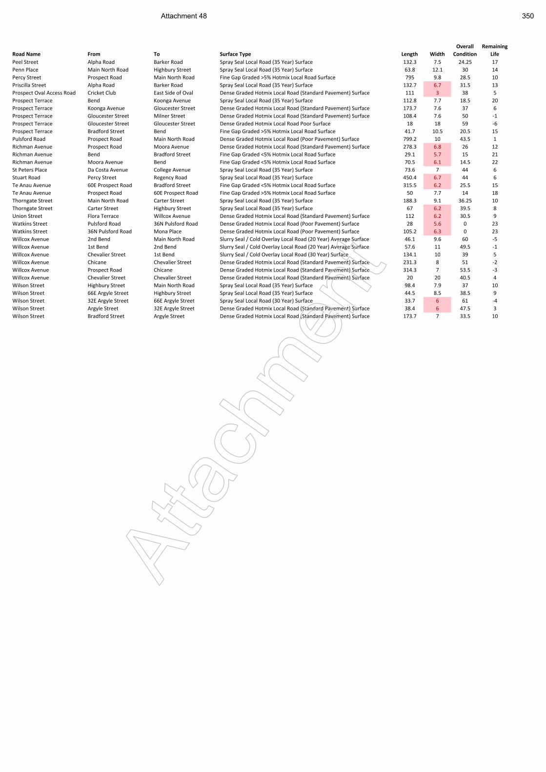
Road Name From To Surface Type Length Width
Overall
Condition
Remaining
Life
Peel Street Alpha Road Barker Road Spray Seal Local Road (35 Year) Surface 132.3 7.5 24.25 17
Penn Place Main North Road Highbury Street Spray Seal Local Road (35 Year) Surface 63.8 12.1 30 14
Percy Street Prospect Road Main North Road Fine Gap Graded >5% Hotmix Local Road Surface 795 9.8 28.5 10
Priscilla Street Alpha Road Barker Road Spray Seal Local Road (35 Year) Surface 132.7 6.7 31.5 13
Prospect Oval Access Road Cricket Club East Side of Oval Dense Graded Hotmix Local Road (Standard Pavement) Surface 111 3 38 5
Prospect Terrace Bend Koonga Avenue Spray Seal Local Road (35 Year) Surface 112.8 7.7 18.5 20
Prospect Terrace Koonga Avenue Gloucester Street Dense Graded Hotmix Local Road (Standard Pavement) Surface 173.7 7.6 37 6
Prospect Terrace Gloucester Street Milner Street Dense Graded Hotmix Local Road (Standard Pavement) Surface 108.4 7.6 50 -1
Prospect Terrace Gloucester Street Gloucester Street Dense Graded Hotmix Local Road Poor Surface 18 18 59 -6
Prospect Terrace Bradford Street Bend Fine Gap Graded >5% Hotmix Local Road Surface 41.7 10.5 20.5 15
Pulsford Road Prospect Road Main North Road Dense Graded Hotmix Local Road (Poor Pavement) Surface 799.2 10 43.5 1
Richman Avenue Prospect Road Moora Avenue Dense Graded Hotmix Local Road (Standard Pavement) Surface 278.3 6.8 26 12
Richman Avenue Bend Bradford Street Fine Gap Graded <5% Hotmix Local Road Surface 29.1 5.7 15 21
Richman Avenue Moora Avenue Bend Fine Gap Graded <5% Hotmix Local Road Surface 70.5 6.1 14.5 22
St Peters Place Da Costa Avenue College Avenue Spray Seal Local Road (35 Year) Surface 73.6 7 44 6
Stuart Road Percy Street Regency Road Spray Seal Local Road (35 Year) Surface 450.4 6.7 44 6
Te Anau Avenue 60E Prospect Road Bradford Street Fine Gap Graded <5% Hotmix Local Road Surface 315.5 6.2 25.5 15
Te Anau Avenue Prospect Road 60E Prospect Road Fine Gap Graded >5% Hotmix Local Road Surface 50 7.7 14 18
Thorngate Street Main North Road Carter Street Spray Seal Local Road (35 Year) Surface 188.3 9.1 36.25 10
Thorngate Street Carter Street Highbury Street Spray Seal Local Road (35 Year) Surface 67 6.2 39.5 8
Union Street Flora Terrace Willcox Avenue Dense Graded Hotmix Local Road (Standard Pavement) Surface 112 6.2 30.5 9
Watkins Street Pulsford Road 36N Pulsford Road Dense Graded Hotmix Local Road (Poor Pavement) Surface 28 5.6 0 23
Watkins Street 36N Pulsford Road Mona Place Dense Graded Hotmix Local Road (Poor Pavement) Surface 105.2 6.3 0 23
Willcox Avenue 2nd Bend Main North Road Slurry Seal / Cold Overlay Local Road (20 Year) Average Surface 46.1 9.6 60 -5
Willcox Avenue 1st Bend 2nd Bend Slurry Seal / Cold Overlay Local Road (20 Year) Average Surface 57.6 11 49.5 -1
Willcox Avenue Chevalier Street 1st Bend Slurry Seal / Cold Overlay Local Road (30 Year) Surface 134.1 10 39 5
Willcox Avenue Chicane Chevalier Street Dense Graded Hotmix Local Road (Standard Pavement) Surface 231.3 8 51 -2
Willcox Avenue Prospect Road Chicane Dense Graded Hotmix Local Road (Standard Pavement) Surface 314.3 7 53.5 -3
Willcox Avenue Chevalier Street Chevalier Street Dense Graded Hotmix Local Road (Standard Pavement) Surface 20 20 40.5 4
Wilson Street Highbury Street Main North Road Spray Seal Local Road (35 Year) Surface 98.4 7.9 37 10
Wilson Street 66E Argyle Street Highbury Street Spray Seal Local Road (35 Year) Surface 44.5 8.5 38.5 9
Wilson Street 32E Argyle Street 66E Argyle Street Spray Seal Local Road (30 Year) Surface 33.7 6 61 -4
Wilson Street Argyle Street 32E Argyle Street Dense Graded Hotmix Local Road (Standard Pavement) Surface 38.4 6 47.5 3
Wilson Street Bradford Street Argyle Street Dense Graded Hotmix Local Road (Standard Pavement) Surface 173.7 7 33.5 10
Atta
chm
ent
Attachment 48 350
Ref No. 20141130DR1 Prospect NE and SE Precincts Local Area Traffic Management Plan
Appendix E Concept Traffic Management Plan for Consultation
Atta
chm
ent
Attachment 49 351
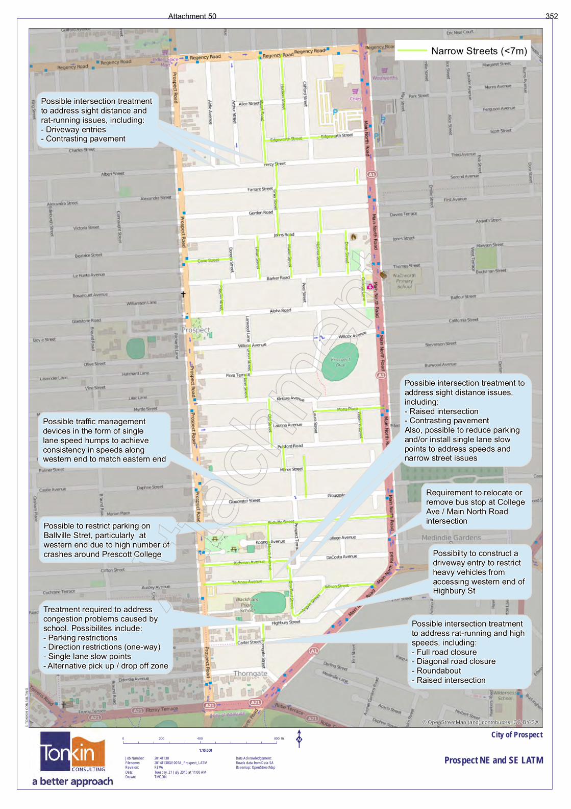
Possible intersection treatment to address sight distance and rat-running issues, including:- Driveway entries
Possible intersection treatment to address sight distance and rat-running issues, including:- Driveway entries- Contrasting pavement
Possible intersection treatment to address sight distance and rat-running issues, including:- Driveway entries- Contrasting pavement
Possible traffic management devices in the form of singlelane speed humps to achieve consistency in speeds along western end to match eastern end
Possible to restrict parking on Ballville Stret, particularly at western end due to high number of crashes around Prescott College
Treatment required to address congestion problems caused by school. Possibilites include:- Parking restrictions- Direction restrictions (one-way)- Single lane slow points- Alternative pick up / drop off zone
Possible intersection treatment to address sight distance issues, including:- Raised intersection- Contrasting pavementAlso, possible to reduce parking and/or install single lane slow points to address speeds and narrow street issues
Possible intersection treatment to address sight distance issues, including:- Raised intersection- Contrasting pavementAlso, possible to reduce parking and/or install single lane slow points to address speeds and narrow street issues
Requirement to relocate or remove bus stop at College Ave / Main North Road intersection
Possibilty to construct a driveway entry to restrict heavy vehicles from accessing western end of Highbury St
Possible intersection treatment to address rat-running and high speeds, including:- Full road closure- Diagonal road closure- Roundabout- Raised intersection
© OpenStreetMap (and) contributors, CC-BY-SA
City of Prospect
Prospect NE and SE LATM
© T
ON
KIN
CO
NS
ULT
ING
Job Number:Filename:Revision:Date:Drawn:
2014113020141130GE001A_Prospect_LATMREVATuesday, 21 July 2015 at 11:00 AMTMOON
0 400 800200 m
Data Acknowledgement:Roads data from Data SABasemap: OpenStreetMap
K1:10,000
Narrow Streets (<7m)
Atta
chm
ent
Attachment 50 352
Ref No. 20141130DR1 Prospect NE and SE Precincts Local Area Traffic Management Plan
Appendix F City of Prospect Traffic Management Policy
Atta
chm
ent
Attachment 51 353
Traffic ManagementPolicy
Adopted by Council 16 December 2008
Atta
chm
ent
Attachment 52 354

Atta
chm
ent
Attachment 53 355

i
Traffic Management Policy December 2008
Contents
1 PURPOSE................................................................................................................................... 1
2 SCOPE........................................................................................................................................ 1
3 DEFINITIONS.............................................................................................................................. 1
4 LEGISLATIVE AND CORPORATE REQUIREMENTS ............................................................. 1
5 POLICY STATEMENTS ............................................................................................................. 2
6 APPLICATION OF POLICY ....................................................................................................... 6
7 FUTURE APPROACH TO TRAFFIC MANAGEMENT.............................................................. 7
8 REVIEW ...................................................................................................................................... 9
9 ACCESS TO THE POLICY......................................................................................................... 9
10 FURTHER INFORMATION....................................................................................................... 10
APPENDIX 1 ....................................................................................................................................... 11 APPENDIX 2 ....................................................................................................................................... 12 APPENDIX 3 ....................................................................................................................................... 13 APPENDIX 4 ....................................................................................................................................... 14 APPENDIX 5 ....................................................................................................................................... 15
Atta
chm
ent
Attachment 54 356

Atta
chm
ent
Attachment 55 357
1
Traffic Management Policy December 2008
1 Purpose 1.2 The Traffic Management Policy (the “Policy”) establishes a framework for the
management of traffic on local roads throughout City of Prospect.
1.3 Managing the competing demands on our roads remains one of the most sensitive issues facing Council. Traffic management affects the whole community and must balance the needs of a broad range of road users with an appropriate level of amenity for the adjacent land uses.
2 Scope 2.1 The Policy identifies a range of factors by which Council and the community can
assess the need for future traffic management intervention. This will include:
2.1.1 An agreed road hierarchy for Council’s road network.
2.1.2 Recognition of the functional use of the road network with regard to providing for social access, freight access, pedestrian and cycling movements.
2.1.3 An agreed set of criteria by which speeds and volumes (in particular) can be assessed relative to the road hierarchy.
2.1.4 An agreed process by which future traffic investigations will be undertaken.
3 Definitions 3.1 Nil.
4 Legislative and Corporate Requirements 4.1 The Policy is to be read and implemented in conjunction with Council’s other relevant
policies, strategies and documents, including:
4.1.1 City of Prospect Strategic Plan (2008-2011) recognises the influence of the road network upon many facets of the community’s activities. The Strategic Plan includes:
(1) Improved frequency and quality of public transport across our City.
(2) Facilitate access to appropriate business infrastructure (eg. power, roads, broadband, car parking, signage, undergrounding of powerlines, etc).
(3) Encourage the community to better manage their impact on the environment.
Atta
chm
ent
Attachment 56 358
2
Traffic Management Policy December 2008
(4) Preserve character dwellings and surrounding amenity.
(5) Increase the number and quality of leafy streets within the City.
(6) Implement best practice asset management planning, including an increased focus on sustainable maintenance and renewal of assets.
(7) Plan developed and implemented for sustainable Asset Management in major asset classes.
(8) Local Area Traffic Management Plans developed.
4.1.2 Other related policies that should be considered include:
(1) Streets and Footpaths
(2) Community Engagement
(3) Code of Technical Requirements for the Legal Use of Traffic Control Devices in SA
(4) Australian Standards
(5) Austroads Guide to Traffic Engineering Practice
(6) City of Prospect Local Bicycle Network Review
5 Policy Statements 5.1 Management of the local road network must balance the needs of all road users
5.1.1 Traffic management affects a broad range of road users often with conflicting requirements. For example, a road that provides freight access (to support business and industry) may be less than conducive for cycling and walking. Similarly, the use of traffic control devices on roads that facilitate bus routes can be limited because of the requirements of the State Passenger Transport authorities.
5.1.2 Fundamental to this policy is the need for a clear understanding of the users and uses of a particular road or road network. Council recognises that in seeking a “balance” between the various road uses, that compromise will sometimes be required between maximising safety, accessibility and amenity.
5.1.3 As most of the streets within City of Prospect are local streets, Council will have a primary focus on access requirements for local residents. Consequently, Council will seek to avoid the local street network being used by extraneous through traffic (ie “rat-running”). Atta
chm
ent
Attachment 57 359
3
Traffic Management Policy December 2008
5.2 Council will approach traffic management on the basis of local area precincts (as shown in “Local Traffic Precincts” Plan Appendix 1)
5.2.1 Local area traffic management is generally associated with the installation of physical traffic measures and/or regulations to influence the existing behaviour of road users, in order to create safer and more amenable street environments, particularly in local residential areas.
5.2.2 Council recognises that treatments applied in isolation can affect traffic conditions in other streets. Accordingly, Council will consider isolated problems in the context of the broader street network. Council has adopted several local traffic management precincts (refer “Local Traffic Precincts” Plan`) which will form the basis of traffic management reviews.
5.3 Council will approach traffic management on the basis of a strategic road hierarchy and functional road use
5.3.1 Strategic Road Hierarchy
(1) The overall road network throughout our City has been categorised on the following basis (as shown in “Road Hierarchy Plan” Appendix 2).
(a) Arterial Roads
• Movement of vehicles / goods / people between regions
• Typically under control of the State Government
• Minimum of 1 lane in either direction – typically more
• The following are Arterial Roads: Prospect Road, Regency Road, Churchill Road, Main North Road, North East Road and Nottage Terrace
(b) Major Collector Roads (Galway Avenue)
• Major distributor of traffic within / through our City
• Typically 1 lane in either direction
• May have bus route and/or cycle routes
(c) Minor Collector Road (Braund Road and D’Erlanger Avenue)
• Connection between local streets and distributor or arterial roads
• Wide enough for 2 directions of traffic
• May have bus route and/or cycle routes Atta
chm
ent
Attachment 58 360
4
Traffic Management Policy December 2008
(d) Local Street (All other roads other than those listed above)
• End of trip functionality servicing adjacent properties
• Wide enough for at least one direction of traffic (may have to pass between parked cars)
• Through traffic should not be encouraged onto these routes
(2) Council recognises that the road network throughout our City is very “permeable” with multiple points of access and egress onto the arterial roads. In the absence of defined east-west collector routes (to supplement the arterial road network), it is inevitable that some external through traffic will be experienced on these roads.
(3) There are two fundamental approaches to this particular issue:
(a) Nominate certain east-west collector routes to supplement the arterial network, and in turn, accept higher traffic volumes on those roads, or
(b) Accept that the east-west local streets are all equal and share the external through traffic demands.
(4) Retrospectively “overlaying” a modern road hierarchy onto our older road network is typically very difficult. Traffic restrictions and/or road closures would be required in a number of streets to establish the new collector routes. Traffic volumes in these particular routes would increase and exceed normal thresholds for residential environments. The amenity of the collector routes would be reduced to the benefit of the wider area. This position is not supported, and Council will therefore not identify and develop any east-west collector routes.
(5) The majority of Council roads have been identified as “local streets”. In accepting some level of external through traffic will use the local road network, it is important that this demand is, as far as reasonably practical, shared across the network.
(6) Functional Road Use
(a) While the nominated road hierarchy (“Road Hierarchy Plan” Appendix 2) describes the roads’ position in the overall hierarchy and thresholds for traffic volumes and speeds, it is also important to consider the functional use of a road relative to social access, freight movements, cyclist and pedestrians.
(b) Social Access Routes
These roads provide for community development and equitable access to community facilities including schools, shops, reserves, and aged care facilities.
Atta
chm
ent
Attachment 59 361
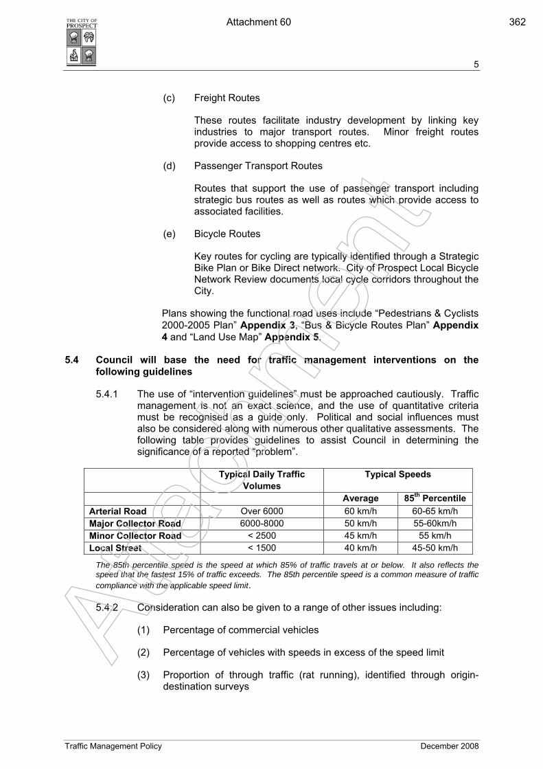
5
Traffic Management Policy December 2008
(c) Freight Routes
These routes facilitate industry development by linking key industries to major transport routes. Minor freight routes provide access to shopping centres etc.
(d) Passenger Transport Routes
Routes that support the use of passenger transport including strategic bus routes as well as routes which provide access to associated facilities.
(e) Bicycle Routes
Key routes for cycling are typically identified through a Strategic Bike Plan or Bike Direct network. City of Prospect Local Bicycle Network Review documents local cycle corridors throughout the City.
Plans showing the functional road uses include “Pedestrians & Cyclists 2000-2005 Plan” Appendix 3, “Bus & Bicycle Routes Plan” Appendix 4 and “Land Use Map” Appendix 5.
5.4 Council will base the need for traffic management interventions on the following guidelines
5.4.1 The use of “intervention guidelines” must be approached cautiously. Traffic management is not an exact science, and the use of quantitative criteria must be recognised as a guide only. Political and social influences must also be considered along with numerous other qualitative assessments. The following table provides guidelines to assist Council in determining the significance of a reported “problem”.
Typical Daily Traffic Volumes
Typical Speeds
Average 85th Percentile Arterial Road Over 6000 60 km/h 60-65 km/h Major Collector Road 6000-8000 50 km/h 55-60km/h Minor Collector Road < 2500 45 km/h 55 km/h Local Street < 1500 40 km/h 45-50 km/h
The 85th percentile speed is the speed at which 85% of traffic travels at or below. It also reflects the speed that the fastest 15% of traffic exceeds. The 85th percentile speed is a common measure of traffic compliance with the applicable speed limit.
5.4.2 Consideration can also be given to a range of other issues including:
(1) Percentage of commercial vehicles
(2) Percentage of vehicles with speeds in excess of the speed limit
(3) Proportion of through traffic (rat running), identified through origin-destination surveys
Atta
chm
ent
Attachment 60 362
6
Traffic Management Policy December 2008
(4) Peak hour traffic concentrations
(5) Use of the road by pedestrians (particularly the aged and children)
(6) Use of the road by cyclists
(7) Frequency of parking on the road
(8) Collision data
(9) Length / Width of Street
(10) Set back of properties
(11) Number of Residential properties within a local street
(12) Potential substantial detriment to neighbouring streets should Council intervene on a particular street
(13) Petitions from residents
5.5 The selection of traffic control treatments must also be proportional to the significance of the problem being addressed
5.5.1 There are a range of traffic management treatments available with varying benefits and disadvantages. Some treatments are very restrictive and are applied to full road sections (e.g. road humps / plateau), and in turn can offer significant reductions in vehicle speeds. Other treatments are site specific (e.g. roundabouts) which only influence traffic behaviour within the vicinity of the treatment.
5.5.2 In developing treatment options, Council must be mindful of the legislative controls (Ministers Notice and Code of Technical Requirements), appropriate Australian Standards and Guidelines, and the impacts associated with each treatment option.
5.5.3 Council will review traffic movements (on/around 12 months) following the implementation of control treatments to determine the impact of traffic movements and the potential need for further refinement of treatments. This review will include a request for community feedback regarding treatments installed.
6 Application of Policy 6.1 The Policy outlines the way Council will undertake Traffic Management in relation to
the local road network within our City. Atta
chm
ent
Attachment 61 363
7
Traffic Management Policy December 2008
7 Approach to Traffic Management 7.1 General Approach
7.1.1 The following outline broadly describes the approach to investigating traffic issues.
(1) Determine whether the roads are under the control of Council or Department for Transport Energy & Infrastructure (DTEI) and refer to DTEI if appropriate.
(2) Research relevant data (typically speed, volume, collisions, previous reports)
(3) Preliminary site inspection and assessment of concern:
(a) Is the reported problem valid in comparison to the intervention guidelines?
(b) Can the problem be resolved with localised treatment with minimal impact to the surrounding network?
7.1.2 Decide whether to treat the location with minor traffic engineering controls, or to undertake further detailed inspection and analysis of the concerns. This will usually be in the form of a broader Local Area Traffic Management (“LATM”) Plan within the defined precinct.
7.2 LATM Process
7.2.1 The following process outlines Council’s commitment to the fundamental stages of undertaking Local Area Traffic Management plans.
(1) Identify the LATM precinct boundaries to form part of the review. This can be based on the precincts provided in the “Local Traffic Precincts Plan Appendix 1 or more discreet areas relative to the problem under review.
(2) Determine the most appropriate consultation strategy (refer below and Council’s Community Engagement Policy).
(3) Clearly identify the problems under review through a range of processes including:
(a) Site reviews / road safety audits
(b) Community input (reference community consultation strategies)
(c) Traffic and speed data collection
(d) Collision data Atta
chm
ent
Attachment 62 364
8
Traffic Management Policy December 2008
(e) Stakeholder consultation (Department of Transport Energy and Infrastructure, Cycling Groups, Public Transport, adjoining Councils, significant land uses / businesses)
(f) Elected Member input, particularly from Ward Councillors.
(4) Develop draft concept options
(a) Define objectives of any scheme
(b) Identify alternative treatments and consider impacts of each option
(c) Consider whether the treatments and impacts are proportional to the extent of the problem, and relative to the road hierarchy and functional use (refer below)
(d) Consult with the community and those immediately affected by any proposals
(5) Refine plan and costing
(a) Finalise the traffic management recommendations with consideration given to estimated costs, budgets and programming.
7.3 Consultation Options
7.3.1 Preparation of local area traffic management plans must be undertaken through consultation with the community and stakeholders.
7.3.2 Council’s Community Engagement Policy acknowledges the preparation of local traffic management plans as a ‘Level 2’ issue, and as such consultation would typically include a range of the following elements:
(1) Council’s web site / Media release
(2) Minimum period of 21-28 days for responses
(3) Copies of plans to be accessible
(4) Focus groups
(5) Surveys
(6) Fact sheets
(7) Displays
(8) Letter box drops
(9) Neighbourhood forums
(10) Report to Council summarising submissions for decision
Atta
chm
ent
Attachment 63 365
9
Traffic Management Policy December 2008
7.3.3 The Policy also acknowledges that consultation strategies require a certain degree of flexibility to suit the particular situation.
7.3.4 A typical approach to LATM consultation would normally include:
(1) Initial contact with residents and stakeholders “announcing” a particular project and seeking input to identify concerns and opportunities (e.g letterbox drop)
(2) Identification of any specific stakeholders that should be approached during the consultation period
(3) Confirmation of the problems identified
(4) Contact with residents and stakeholders (e.g. letterbox drop) to articulate the draft outcomes and recommended treatments and provide opportunity for comment (options include the availability of Web based survey response forms and community forums / displays)
7.3.5 A supplementary approach that can be considered is the formation of an informal Residents’ Group (if one does not already exist) to assist the development of the local area traffic management plan. The role of the Residents’ Group is to assist in confirming the significance of identified traffic issues, and likely community acceptance of proposed treatments.
7.3.6 More active processes of consultation can also be considered where the community is invited to participate in a workshop (or series of workshops) where problems and solutions are collectively identified and discussed.
7.3.7 The appropriate consultation approach should be determined in the initial stages of the local area traffic management plan process depending on the potential issues to be resolved.
7.3.8 Ward Councillors will be involved throughout the consultation process.
8 Review 8.1 The Policy will be reviewed in line with Council’s Policy Framework or earlier in the
event of major changes to legislation or related policies/procedures or if deemed necessary by the Chief Executive Officer or Relevant Director.
9 Access to the Policy 9.1 The Policy is available for public inspection on Council’s website
www.prospect.sa.gov.au and from Customer Service at the Civic Centre, 128 Prospect Road, Prospect SA 5082.
9.2 The Policy is available for staff inspection on Council's intranet site. Atta
chm
ent
Attachment 64 366
10
Traffic Management Policy December 2008
10 Further Information 10.1 For further information about the Traffic Management Policy please contact:
Director Corporate Services City of Prospect 128 Prospect Road Prospect SA 5082
Atta
chm
ent
Attachment 65 367
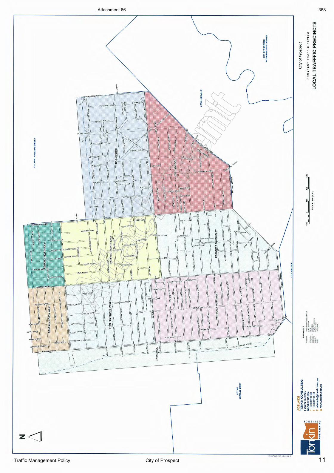
11Traffic Management Policy City of Prospect
Atta
chm
ent
Atta
chm
ent
Attachment 66 368
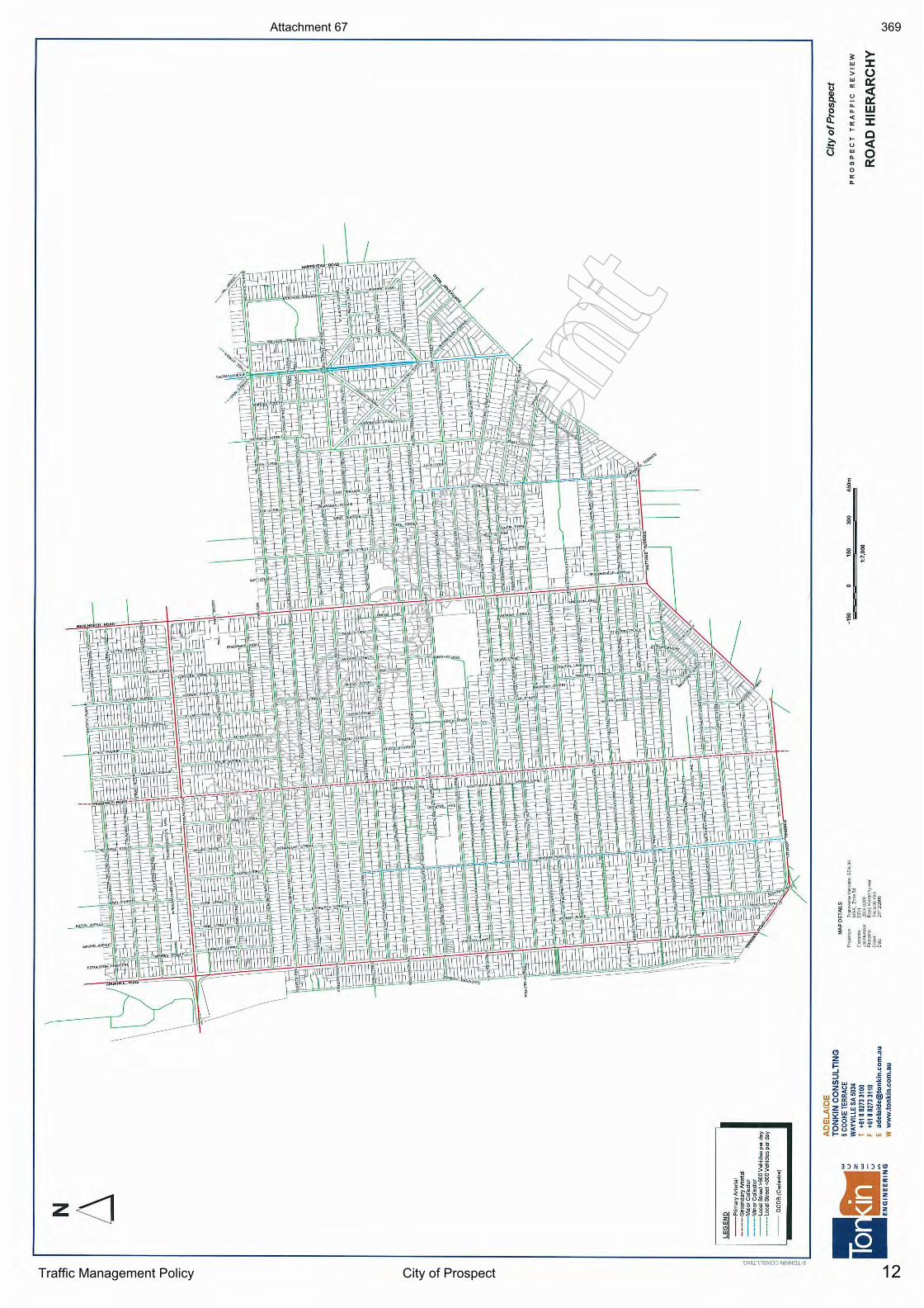
12Traffic Management Policy City of Prospect
Atta
chm
ent
Atta
chm
ent
Attachment 67 369
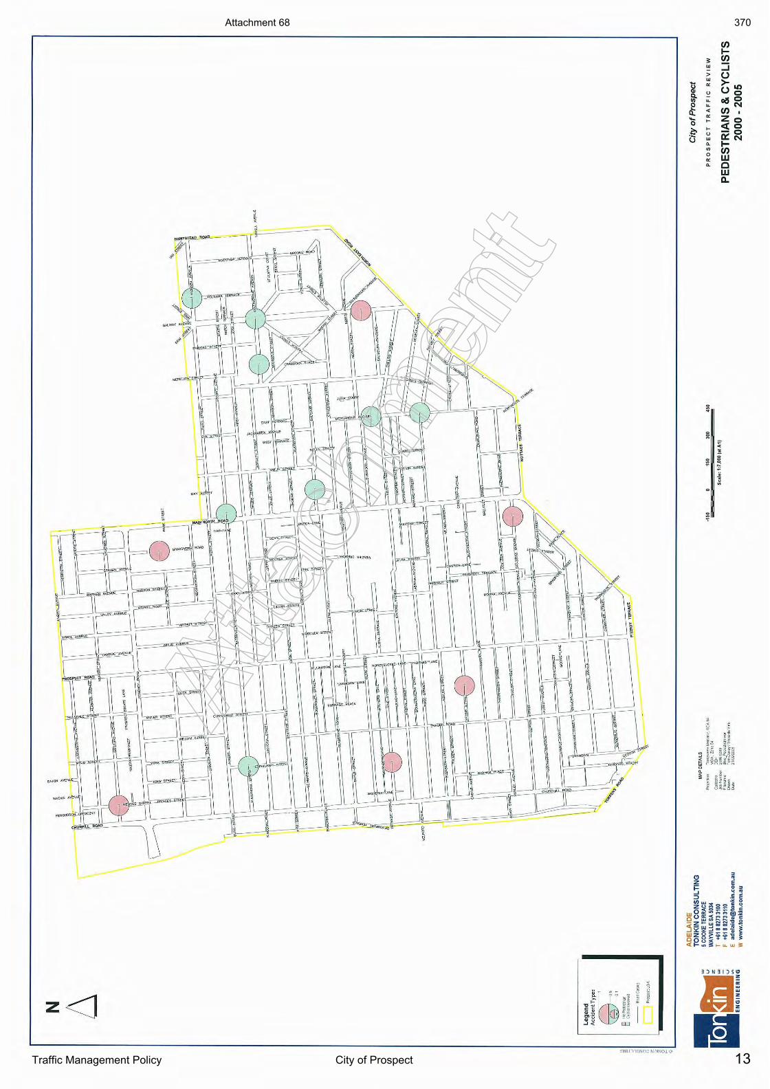
13Traffic Management Policy City of Prospect
Atta
chm
ent
Atta
chm
ent
Attachment 68 370
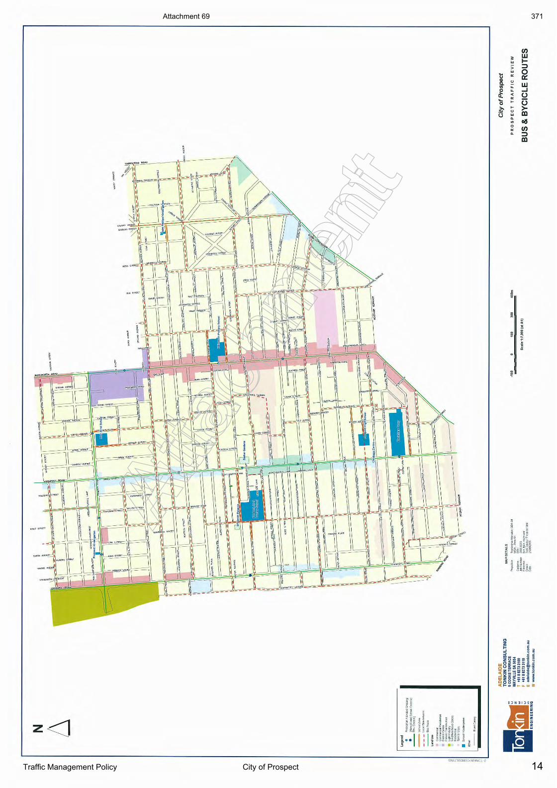
14Traffic Management Policy City of Prospect
Atta
chm
ent
Atta
chm
ent
Attachment 69 371
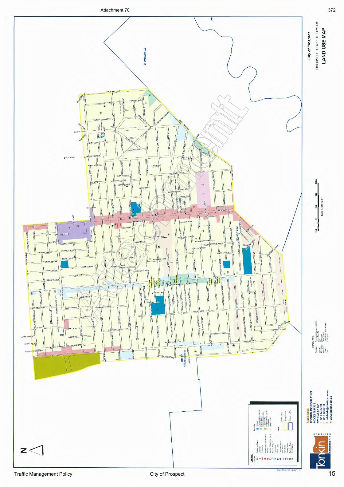
15Traffic Management Policy City of Prospect
Atta
chm
ent
Atta
chm
ent
Attachment 70 372
Ref No. 20141130DR1 Prospect NE and SE Precincts Local Area Traffic Management Plan
Appendix G
Community Consultation Comments
Atta
chm
ent
Attachment 71 373
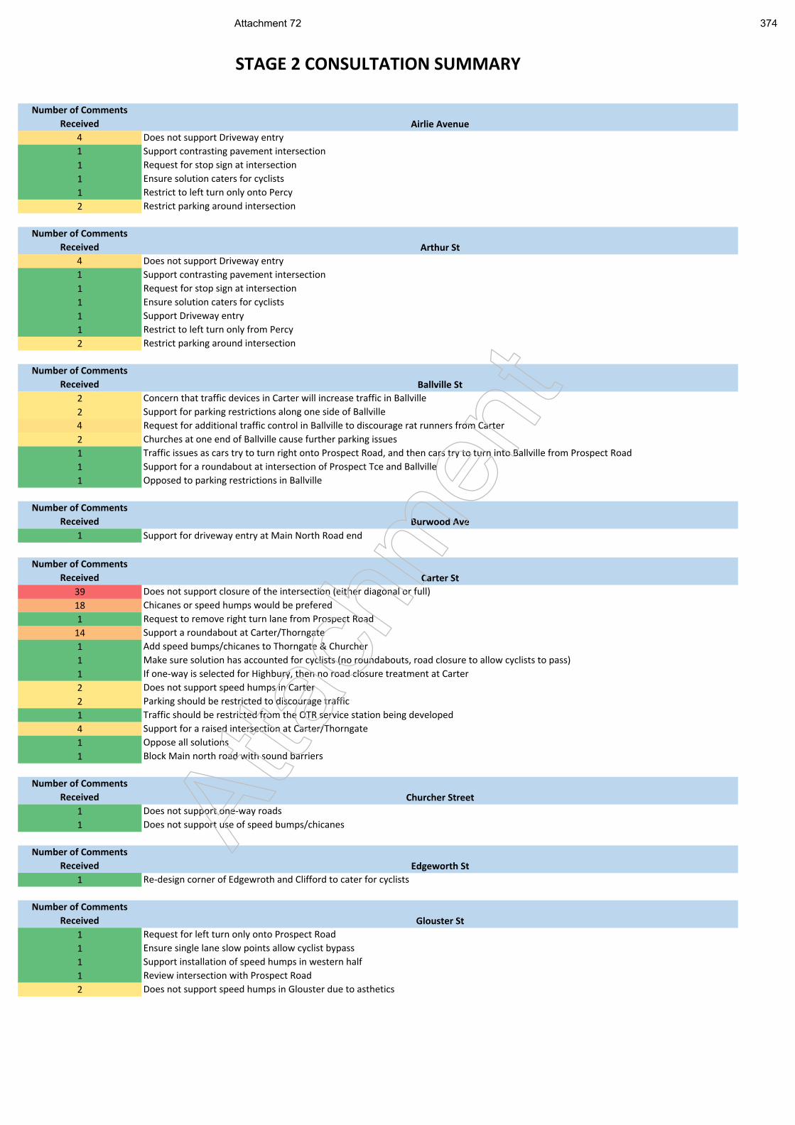
Number of Comments
Received Airlie Avenue
4 Does not support Driveway entry
1 Support contrasting pavement intersection
1 Request for stop sign at intersection
1 Ensure solution caters for cyclists
1 Restrict to left turn only onto Percy
2 Restrict parking around intersection
Number of Comments
Received Arthur St
4 Does not support Driveway entry
1 Support contrasting pavement intersection
1 Request for stop sign at intersection
1 Ensure solution caters for cyclists
1 Support Driveway entry
1 Restrict to left turn only from Percy
2 Restrict parking around intersection
Number of Comments
Received Ballville St
2 Concern that traffic devices in Carter will increase traffic in Ballville
2 Support for parking restrictions along one side of Ballville
4 Request for additional traffic control in Ballville to discourage rat runners from Carter
2 Churches at one end of Ballville cause further parking issues
1 Traffic issues as cars try to turn right onto Prospect Road, and then cars try to turn into Ballville from Prospect Road
1 Support for a roundabout at intersection of Prospect Tce and Ballville
1 Opposed to parking restrictions in Ballville
Number of Comments
Received Burwood Ave
1 Support for driveway entry at Main North Road end
Number of Comments
Received Carter St
39 Does not support closure of the intersection (either diagonal or full)
18 Chicanes or speed humps would be prefered
1 Request to remove right turn lane from Prospect Road
14 Support a roundabout at Carter/Thorngate
1 Add speed bumps/chicanes to Thorngate & Churcher
1 Make sure solution has accounted for cyclists (no roundabouts, road closure to allow cyclists to pass)
1 If one-way is selected for Highbury, then no road closure treatment at Carter
2 Does not support speed humps in Carter
2 Parking should be restricted to discourage traffic
1 Traffic should be restricted from the OTR service station being developed
4 Support for a raised intersection at Carter/Thorngate
1 Oppose all solutions
1 Block Main north road with sound barriers
Number of Comments
Received Churcher Street
1 Does not support one-way roads
1 Does not support use of speed bumps/chicanes
Number of Comments
Received Edgeworth St
1 Re-design corner of Edgewroth and Clifford to cater for cyclists
Number of Comments
Received Glouster St
1 Request for left turn only onto Prospect Road
1 Ensure single lane slow points allow cyclist bypass
1 Support installation of speed humps in western half
1 Review intersection with Prospect Road
2 Does not support speed humps in Glouster due to asthetics
STAGE 2 CONSULTATION SUMMARY
Atta
chm
ent
Attachment 72 374
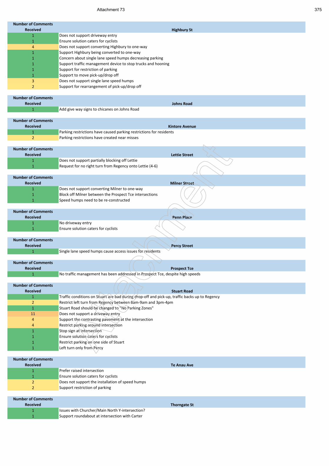
Number of Comments
Received Highbury St
1 Does not support driveway entry
1 Ensure solution caters for cyclists
4 Does not support converting Highbury to one-way
1 Support Highbury being converted to one-way
1 Concern about single lane speed humps decreasing parking
1 Support traffic management device to stop trucks and hooning
1 Support for restriction of parking
1 Support to move pick-up/drop off
3 Does not support single lane speed humps
2 Support for rearrangement of pick-up/drop off
Number of Comments
Received Johns Road
1 Add give way signs to chicanes on Johns Road
Number of Comments
Received Kintore Avenue
1 Parking restrictions have caused parking restrictions for residents
2 Parking restrictions have created near misses
Number of Comments
Received Lettie Street
1 Does not support partially blocking off Lettie
1 Request for no right turn from Regency onto Lettie (4-6)
Number of Comments
Received Milner Street
1 Does not support converting Milner to one-way
1 Block off Milner between the Prospect Tce intersections
1 Speed humps need to be re-constructed
Number of Comments
Received Penn Place
1 No driveway entry
1 Ensure solution caters for cyclists
Number of Comments
Received Percy Street
1 Single lane speed humps cause access issues for residents
Number of Comments
Received Prospect Tce
1 No traffic management has been addressed in Prospect Tce, despite high speeds
Number of Comments
Received Stuart Road
1 Traffic conditions on Stuart are bad during drop-off and pick-up, traffic backs up to Regency
2 Restrict left turn from Regency between 8am-9am and 3pm-4pm
1 Stuart Road should be changed to "No Parking Zones"
11 Does not support a driveway entry
4 Support the contrasting pavement at the intersection
4 Restrict parking around intersection
1 Stop sign at intersection
1 Ensure solution caters for cyclists
1 Restrict parking on one side of Stuart
1 Left turn only from Percy
Number of Comments
Received Te Anau Ave
1 Prefer raised intersection
1 Ensure solution caters for cyclists
2 Does not support the installation of speed humps
2 Support restriction of parking
Number of Comments
Received Thorngate St
1 Issues with Churcher/Main North Y-intersection?
1 Support roundabout at intersection with Carter
Atta
chm
ent
Attachment 73 375
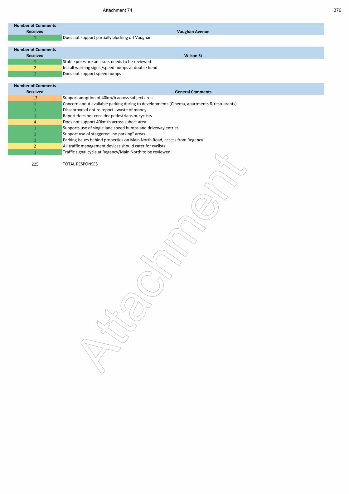
Number of Comments
Received Vaughan Avenue
1 Does not support partially blocking off Vaughan
Number of Comments
Received Wilson St
1 Stobie poles are an issue, needs to be reviewed
2 Install warning signs /speed humps at double bend
1 Does not support speed humps
Number of Comments
Received General Comments
13 Support adoption of 40km/h across subject area
1 Concern about available parking during to developments (Cinema, apartments & restuarants)
1 Dissaprove of entire report - waste of money
1 Report does not consider pedestrians or cyclists
4 Does not support 40km/h across subect area
1 Supports use of single lane speed humps and driveway entries
1 Support use of staggered "no parking" areas
1 Parking issues behind properties on Main North Road, access from Regency
2 All traffic management devices should cater for cyclists
1 Traffic signal cycle at Regency/Main North to be reviewed
225 TOTAL RESPONSES
Atta
chm
ent
Attachment 74 376
Item 19.10: Brussels Street Drainage and Road Reconstruction Project
CITY OF PROSPECT: Council Agenda 25/07/2017
AGENDA ITEM NO.: 19.10
TO: Council Report on 25 July 2017
DIRECTOR: Ginny Moon – Director Corporate Services
REPORT AUTHOR: Alex Cortes – Manager Infrastructure, Assets and Environment
SUBJECT: Brussels Street Drainage and Road Reconstruction Project
1. EXECUTIVE SUMMARY
1.1 The purpose of this report is to advise of the expanded scope, carry over, and budget reallocation that will be required for the Brussels Street Drainage and Road Reconstruction Project.
1.2 As part of the 2016/17 Capital Works Program, Brussels Street, Nailsworth was scheduled for drainage and road reconstruction works.
1.3 The drainage works were to include the construction of an additional side entry pit at the intersection of Brussels and Rheims Streets and the reconstruction and regrading of the spoon drain at the intersection.
1.4 The design component for this project was originally awarded in December 2015, with the design consultant starting work in late January 2016.
1.5 As above, the drainage design component was originally envisaged to treat localised ponding issues, but through catchment analysis it became apparent that a larger catchment area was contributing to stormwater volumes in Brussels Street and as such, a much larger capacity drainage system would be required.
1.6 The extent of the large upstream catchment as seen in Attachment 1 and very flat road grades were identified and a site inspection during a moderate rainfall event as in Attachment 2-10 showed significant issues with stormwater flowing above top of kerb and very large areas of surface ponding.
1.7 The design intent changed from incorporating an additional side entry pit and reconstruction of the spoon drain at the western end of Brussels Street, to the need for the construction of stormwater infrastructure all the way along Brussels Street to deal with the additional stormwater volumes.
1.8 In addition, the increase in the size of the drainage system resulted in service clashes, further increasing the project costs beyond the original budget.
1.9 Multiple design iterations were carried out to achieve the most cost effective solution to address the stormwater volume, working within limitations associated with underground service locations, the overall road grade and the upstream stormwater catchment.
1.10 The finished design drawings were issued to Council in February 2017.
1.11 Soil testing was carried out in Brussels Street with no underlying contaminated soil or other issues reported.
377
Item 19.10: Brussels Street Drainage and Road Reconstruction Project
CITY OF PROSPECT: Council Agenda 25/07/2017
1.12 Council then went to tender in March 2017 for construction. The tenders closed in April 2017.
1.13 Once tenders were received in April 2017 and following a costing review, it was confirmed that the previously estimated budget was not going to be adequate in being able to complete this project in the 2016/17 financial year.
1.14 Project commencement was delayed in order to determine the best strategy for funding the increased works, given the existing budget allocation was not sufficient. The existing project funds, totalling $240,000 are to be carried forward to 2017/18 together with the allocation of additional funds to undertake the increased scope of works of $260,000 (subject to Council approval).
1.15 Further to a previous Council report dated 24 November 2015 ‘Condition Assessment Impact on Long Term Financial Plan’, to which Council endorsed the new Whole of Life Road Management Philosophy, we expect to realise savings in the delivery of the scheduled 2017/18 road reconstruction projects.
1.16 As Council is aware, a review of the Asset Management Plan is planned for endorsement later this year. It is anticipated that significant savings will be identified across the transport assets portfolio through this review due to updated maintenance practices to be considered.
1.17 With regards to savings across the transport assets portfolio, Elected Members will be informed and updated through the Capital & Operating Progress Reports.
1.18 In addition to considering Brussels Street, initial work in respect to Livingstone Avenue (as listed in the 2017/18 Capital Works budget) has revealed complex design issues that will require thorough engineering solutions.
1.19 Given these issues will need to be investigated to determine a suitable design outcome, it will be necessary to review the timing and budget allocation of this project. The preliminary investigations have revealed the original amount budgeted for the reconstruction of Livingstone Avenue following this design work will be insufficient. Accurate costings will be established once details for construction drawings are finalised.
1.20 For the reasons stated above, it is suggested that Council commences the design work of Livingstone Avenue in 2017/18 only and to then include an allocation for reconstruction work in 2018/19.
1.21 Reallocation of the 2017/18 program as part of the Asset Management Plan review will result in the additional funds required for the completion of the Brussels Street project can be sourced out of the existing 2017/18.
RECOMMENDATION
(1) Council endorses the carry over of unspent budget totalling $460,000 from 2016/2017 for completion of the drainage and road reconstruction for Brussels Street.
(2) Council endorses a reallocation of $260,000 within the existing 2017/18 drainage and road reconstruction program directing this toward the Brussels Street Drainage Project.
378
Item 19.10: Brussels Street Drainage and Road Reconstruction Project
CITY OF PROSPECT: Council Agenda 25/07/2017
(3) Council endorses the scope of works for Livingstone Avenue to be focussed on design in preparation for appropriate budget allocation for road and kerb treatment in the 2018/19 financial year.
2. RELEVANCE TO CORE STRATEGIES / POLICY
2.1 Strategic Plan to 2020 Theme 4 – Services “Leaders of the sector providing efficient, responsive, accessible services”
Strategy 4.1 Excellence in Infrastructure
3. COMMUNITY INVOLVEMENT
3.1 No consultation has been undertaken with regard to the issues described in this report.
4. DISCUSSION
4.1 As part of the 2016/17 financial years’ Capital Works Program, Brussels Street Nailsworth, was scheduled for road reconstruction including reconstruction of kerbs, reconstruction of pavement, resurfacing, reconstruction of the northern footpath and improvements around stormwater drainage to eliminate pooling of water in the roadway following large rainfall events.
4.2 The design component for this project was originally awarded in December 2015, with the design consultant starting work in late January 2016.
4.3 The initial intent of the drainage design was to address the overland flow issues along Brussels Street via the implementation of a stormwater collection system at the corner of Brussels and Rheims Street that would connect into the existing stormwater system located at the intersection of Rheims and Howard Street. The aim of this was to address localised ponding along Brussels Street.
4.4 The stormwater modelling analysis undertaken for this area was more complex than originally anticipated, and as such multiple design iterations were required in order to develop an accurate model of the stormwater catchment contributing to the area and the associated flows in Attachment 1.
4.5 Stormwater modelling indicates ~250 L/s of stormwater arriving at the eastern end of Brussels Street in a 2 Year ARI storm event and almost 400 L/s arriving in a 100 Year ARI storm event. As this stormwater approaches Brussels Street it creates wide ponding and unsafe traffic conditions.
4.6 From the stormwater modelling analysis and site investigations undertaken by the consultant, it became apparent that installation of a stormwater collection system at the corner of Rheims and Brussels would not be sufficient to capture the large body of water arriving at the eastern end of Brussels Street, due to the catchment contributing to this area being larger than originally anticipated. As such, extension of the new stormwater system right through to the eastern end of Brussels Street was required to pick up the stormwater on the east side of French Street. The modelling for the system indicated that the proposed system achieved a 2 year ARI level of service.
379
Item 19.10: Brussels Street Drainage and Road Reconstruction Project
CITY OF PROSPECT: Council Agenda 25/07/2017
4.7 Installing this designed stormwater network results in capture and conveyance of all stormwater underground along Brussels Street in storms up to the 2 Yearr ARI and reduces the overland flow of stormwater along Brussels Street in larger storm events to 1/3rd what it currently is.
4.8 The significantly reduced surface flows down Brussels Street will reduce the width and depth of overland flow of stormwater resulting in safer vehicle access along the road as well as into properties. This also results in less overland flow of stormwater along Rheims Street, where stormwater currently flows above the top of the kerb during moderate rainfall events. This will greatly improve the safety of this intersection.
4.9 In addition to the extension of the stormwater system and increased flows, the existing road is very flat with an average of 0.35% longitudinal grade. The consultants road grading aimed for a more consistent grade towards the west, which included multiple local low points together with stormwater side entry pits (SEP’s). To reduce the need for multiple SEP’s along Brussels Street, many design iterations were required to refine the pavement grade design to allow adequate cross fall to improve the shedding of water while minimising these low points. The best solution involved two low points on the southern kerb line, which was the best that could be achieved without making the section of the road too flat.
4.10 The addition of low points will facilitate the average longitudinal grade on the kerbs to be increased. This will result in better draining kerbs with significantly reduced water ponding during a large storm event.
4.11 Due to the extension of the stormwater system, there was also concern around the potential conflict with existing services. Through service potholing, it was identified that the water main in Howard Street would clash and the Telstra conduit at the intersection of Rheims and Brussels Street would also clash. As such, these services would need to be relocated, adding extra variation to the existing costs.
4.12 During initial estimates by design consultants done in August 2016, it was suspected that due to the changed scope of works for Brussels Street, there may be an overrun in the projected costs for the Brussels Street Project. The consultant continued to refine the design to try and reduce these associated costs.
4.13 The finished design drawings were issued to Council in February 2017.
4.14 Council then went to tender in March 2017 for construction. The tenders closed in April 2017.
4.15 Once tenders were received in April 2017, a costing review was undertaken and it was confirmed that the allocated budget was not going to be adequate in being able to complete this project in the 2016/17 financial year.
4.16 During tender evaluations, the tenderer offered an option to improve efficiencies of construction and shorten the project timeline by reconstructing the road surface as total deep lift asphalt resurface rather than partial pavement reconstruction. However a review of this option was carried out by the design consultant and it was established that the thickness of asphalt required to achieve an equivalent pavement strength would result in an increase in the total project cost. As such this option was not pursued.
380
Item 19.10: Brussels Street Drainage and Road Reconstruction Project
CITY OF PROSPECT: Council Agenda 25/07/2017
4.17 Due to delays around multiple iterations of the design and the change in scope of works, the remaining project funds will need to be carried forward for works to continue in the 2017/18 financial year. The amount to be carried forward will be $460,000.
4.18 Additionally, due to the increased scope of works, the original budget set aside for Brussels Street will be insufficient to complete the required works. The additional works will result in an additional $260,000 required. The Asset Management Plan is currently under review based on recent condition assessments and the implementation of the new methodology and to reflect the effect the implementation of the new Whole of Life Road Management Philosophy will have on the long term financial plan.
4.19 Further to a previous Council report dated 24 November 2015 ‘Condition Assessment Impact on Long Term Financial Plan’, which Council endorsed, the new Whole of Life Road Management Philosophy, we expect to realise significant savings in the delivery of the scheduled 2017/18 road reconstruction projects. This results from increased efficiencies in implementing the new methodology for road pavement and surface reconstruction.
4.20 Additionally, upon review of the existing 2017/18 road capital works budget, Livingstone Avenue has been earmarked for partial pavement reconstruction and road resurfacing. Initial investigations into Livingstone Avenue has revealed issues with levels and steep cross falls of verges and driveway crossovers that present both a hazard to pedestrians and vehicular property access difficulties.
4.21 The proposed partial pavement reconstruction and road resurfacing would not solve these level issues, and it is considered these problems should be addressed through an appropriate design solution as part of its reconstruction and resurfacing.
4.22 Additionally further consultation with residents and property owners should be undertaken for this larger scope of works.
4.23 For these reasons, the reconstruction of Livingstone Avenue should be deferred to allow for a complete design solution and level adjustments, as opposed to only repair of the damaged pavement and road resurfacing. This will be considered and rescheduled during the review of the Asset Management Plan which will be tabled and discussed with Elected Members at a future workshop.
4.24 Should Council endorse this approach, a reallocation within the road pavement and surface program and kerb and gutter program can be undertaken in order to fund the additional work required on Brussels Street. This is outlined in the following table.
381
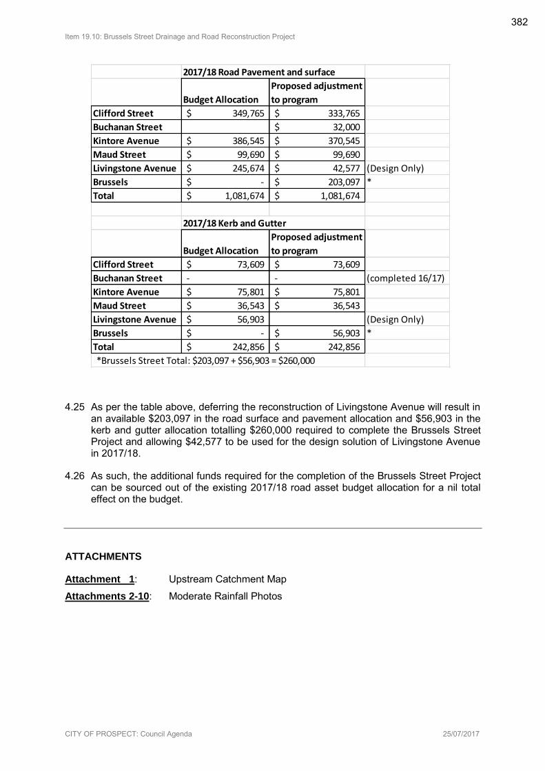
Item 19.10: Brussels Street Drainage and Road Reconstruction Project
CITY OF PROSPECT: Council Agenda 25/07/2017
4.25 As per the table above, deferring the reconstruction of Livingstone Avenue will result in an available $203,097 in the road surface and pavement allocation and $56,903 in the kerb and gutter allocation totalling $260,000 required to complete the Brussels Street Project and allowing $42,577 to be used for the design solution of Livingstone Avenue in 2017/18.
4.26 As such, the additional funds required for the completion of the Brussels Street Project can be sourced out of the existing 2017/18 road asset budget allocation for a nil total effect on the budget.
ATTACHMENTS
Attachment 1: Upstream Catchment Map
Attachments 2-10: Moderate Rainfall Photos
2017/18 Road Pavement and surface
Budget Allocation
Proposed adjustment
to program
Clifford Street 349,765$ 333,765$
Buchanan Street 32,000$
Kintore Avenue 386,545$ 370,545$
Maud Street 99,690$ 99,690$
Livingstone Avenue 245,674$ 42,577$ (Design Only)
Brussels -$ 203,097$ *
Total 1,081,674$ 1,081,674$
2017/18 Kerb and Gutter
Budget Allocation
Proposed adjustment
to program
Clifford Street 73,609$ 73,609$
Buchanan Street - - (completed 16/17)
Kintore Avenue 75,801$ 75,801$
Maud Street 36,543$ 36,543$
Livingstone Avenue 56,903$ (Design Only)
Brussels -$ 56,903$ *
Total 242,856$ 242,856$
*Brussels Street Total: $203,097 + $56,903 = $260,000
382
S
I
I
^'Z. 'Ld
c, , I611Eco
82
^,.
83
OS
g
Is
o
<'6'
ze
coe,
auLs
88
,*
^:^>
90
be
------
NI O
SE
*>
^:?
-------
\
*,
ZL
\
98
\
,s
\
e,
a
NunadaH
\
\
BE
SI
\
^ ^.
L^38LS
\._^ I>
I,
^^ ^
I
\
89
----
g,
^^
at
ae
\
-I
L9
IZ
5<ooC=CD
S,
10
II
II
I
I
II
I
1:1
I-
II
II
I
----
IU.=
19
^,
<9
'1 ,
I
II
I
' 1/1>LLlZ
II
I
I
a II
D IF^
Eel
^^
^^
841'S
La^aLS
a
Jd
\
S*
.---
, .
53
In. I
g
o^^
L3^aLS
I,
69
^L
I
ELEC'S
65Id
DB
TAU38
,,
,,,^
\,>, .
.b6LZ'S
OBI
Z9
9661'
.
------
IZ
I 09
co
03
----
88
E ZL' s
" I
sZ
gel
an
an
^,,
921
*$^,?,^>. <1^,.,
611, 'S
cold
rib
~ ~ ~15''1,
b, LS'S
- 1:1 co
I -
,z
S
I'd
V\Q\
^^^
UJ:^
co
Solid
*.'s
on
^^
^I
I. ..co
1.1o=
------
In
*a
a,
601'S
6LS S
^^^
800 aTBe
,,
----
ON
I,
un
Bin
Q
~^.on *$"'^>
^:
I
's
891
On
eau
a
I111,
I^
,o03
'I
*a A,
,,^^
I
in
LU
IC
ILS'S
- - ~ '=-^itTa
,.
^:^^,
T
SLl
.
9U
a,
<.JD,
Z
^^^
9
^
fill
Bel
^^
><,..,o
e
8
021
I PI
9bz S
^
Sol
60Z'S
Sri
'S
Is'S
V
t
1/1d
121
38LS
AQI, ONi. ,
LSI I,
S
S oz'
3.1 I
s. as nag
^^
Vl
^
g
*ZU
un
I
PCLLl<9Z
C=LLl
,^^
91
err
V
e, ,
sz "
- L33ULS
on
.^
^
on
^
----
\
g
B
\
,,
,*
\
gal
Ib*
us
*to
^- ^
.^ ^
a
II
I
SIb
..
ebb
^^^
16
@59
80
*bb
azi
4th
' ^^9
got
Bib
.=<^o
L33
azi
O*
E
81
^
Oar
egg
DZb
goo tot
II
I
I
139
I. ^38. LS
Bog or 'IZ, E Bog I or I I
Zi
age
\
I'S
Sob
\
I
ODE
II
Zt
S
Is
\
69age re
BIB
L33t*LS
I I ,,, I I~ le, , 99, co
c=
UJI-
nzeIze 3.8 Gas
LLl
IleDIE
t's
608teGo Attachment 1
Attach
ment
Attach
ment
383
Attach
ment
Attachment 2 384
Attach
ment
Attachment 3 385
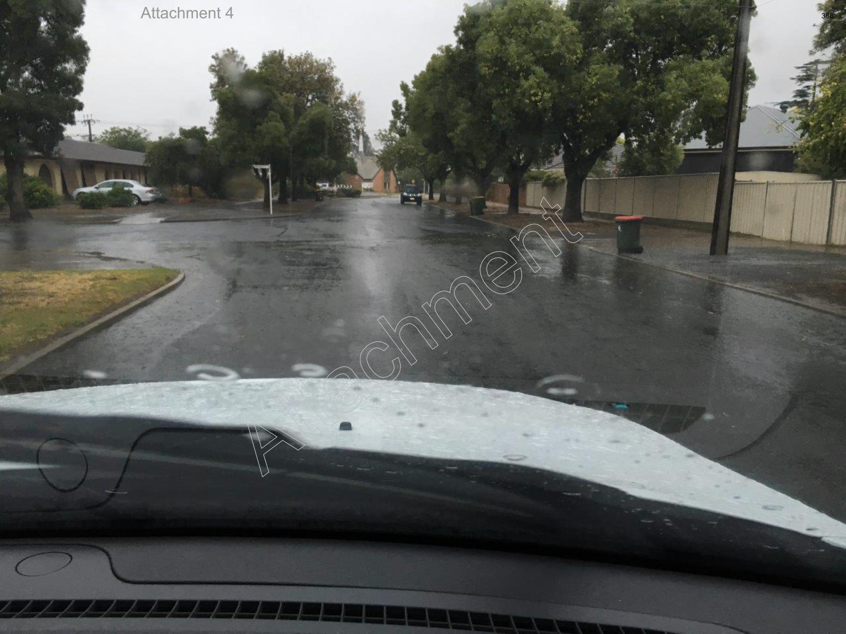
Attach
ment
Attachment 4 386
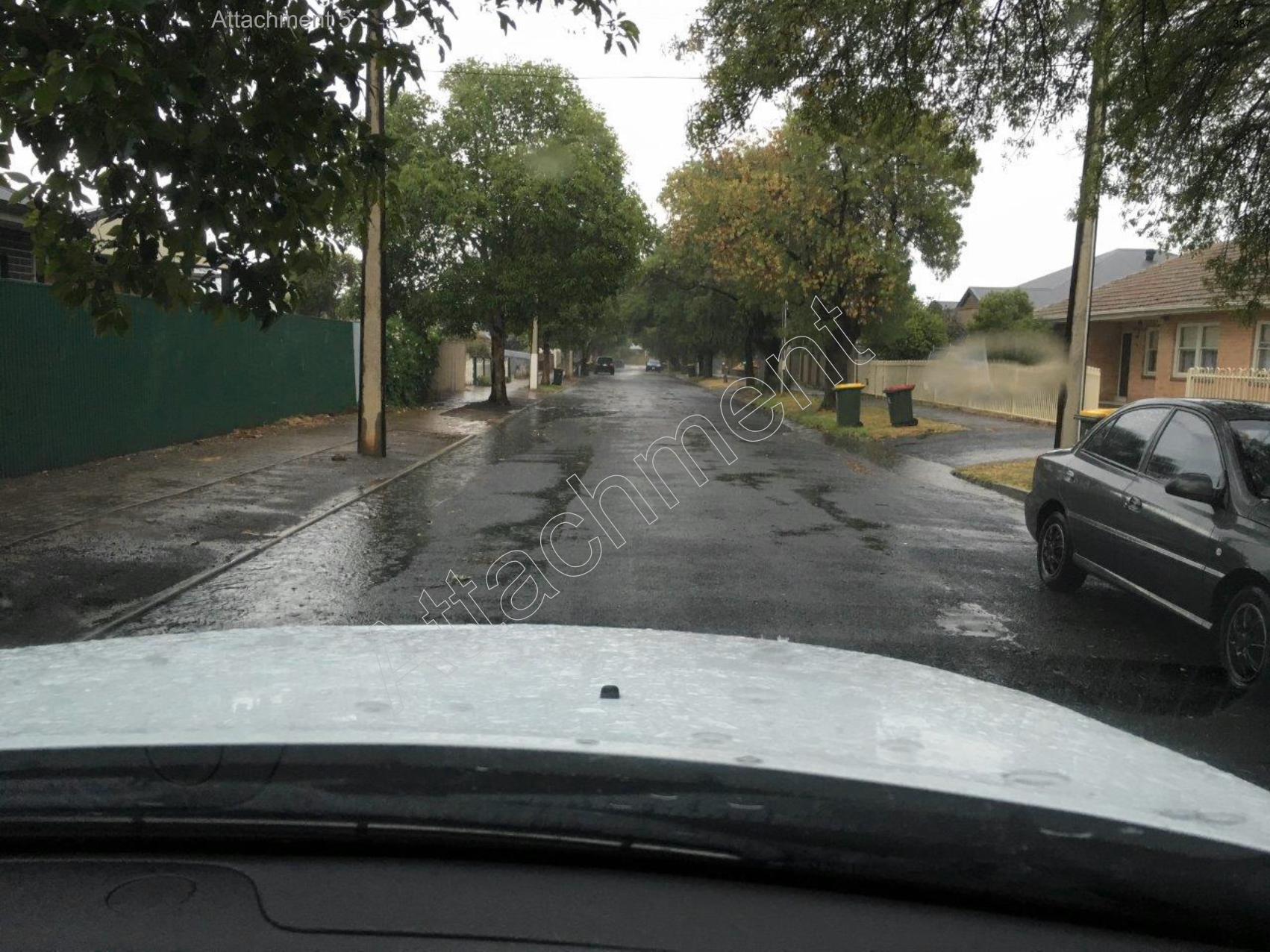
Attach
ment
Attachment 5 387
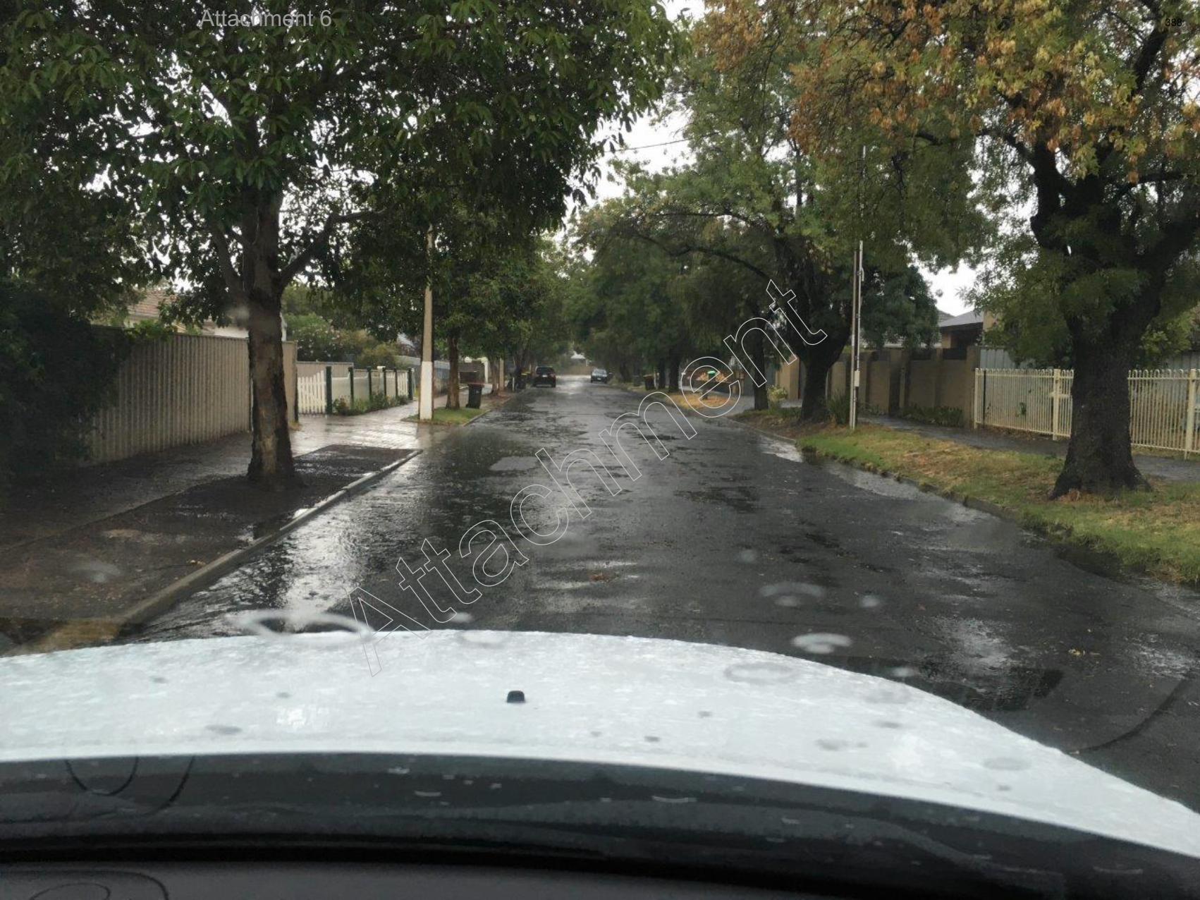
Attach
ment
Attachment 6 388
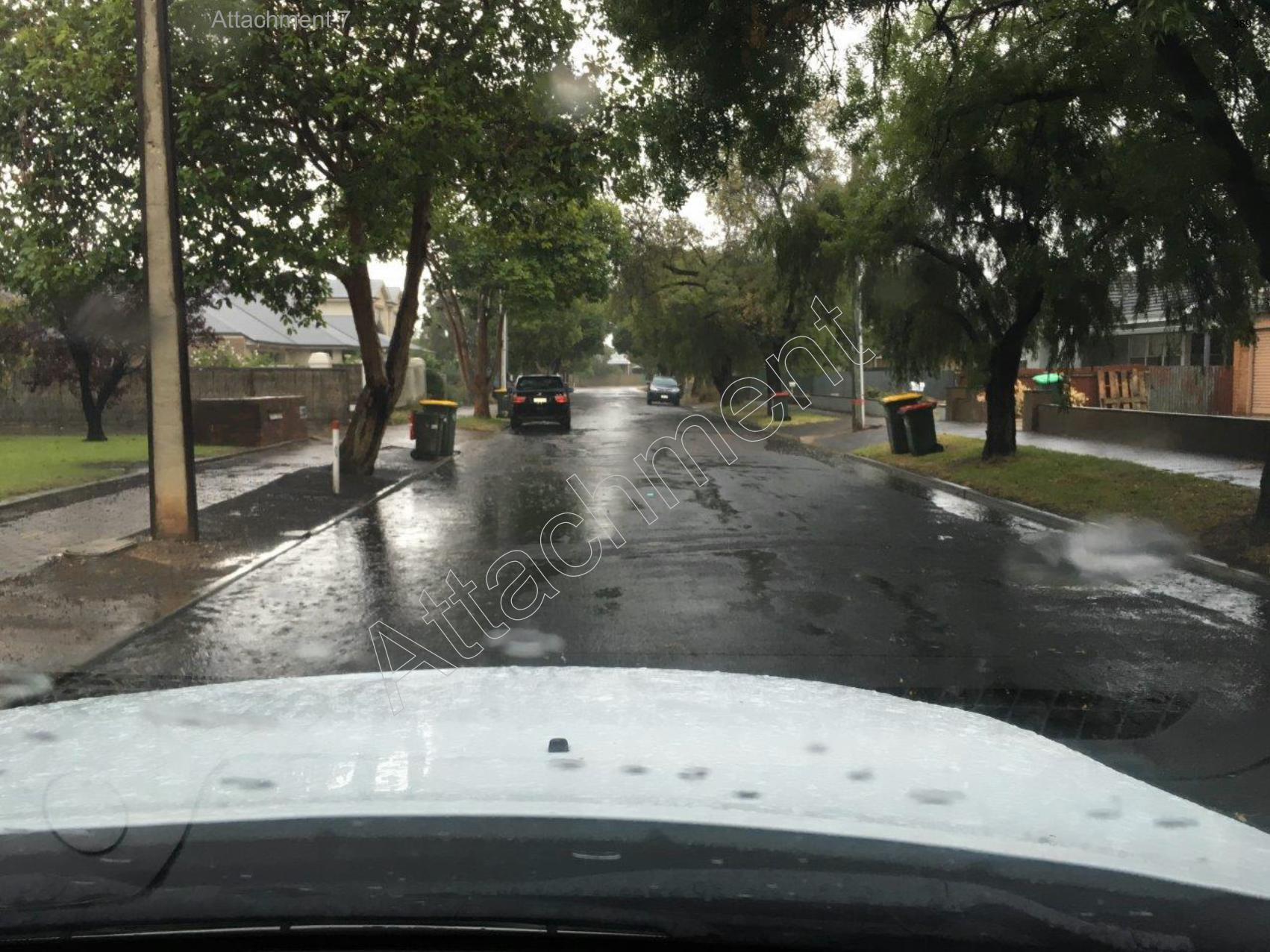
Attach
ment
Attachment 7 389
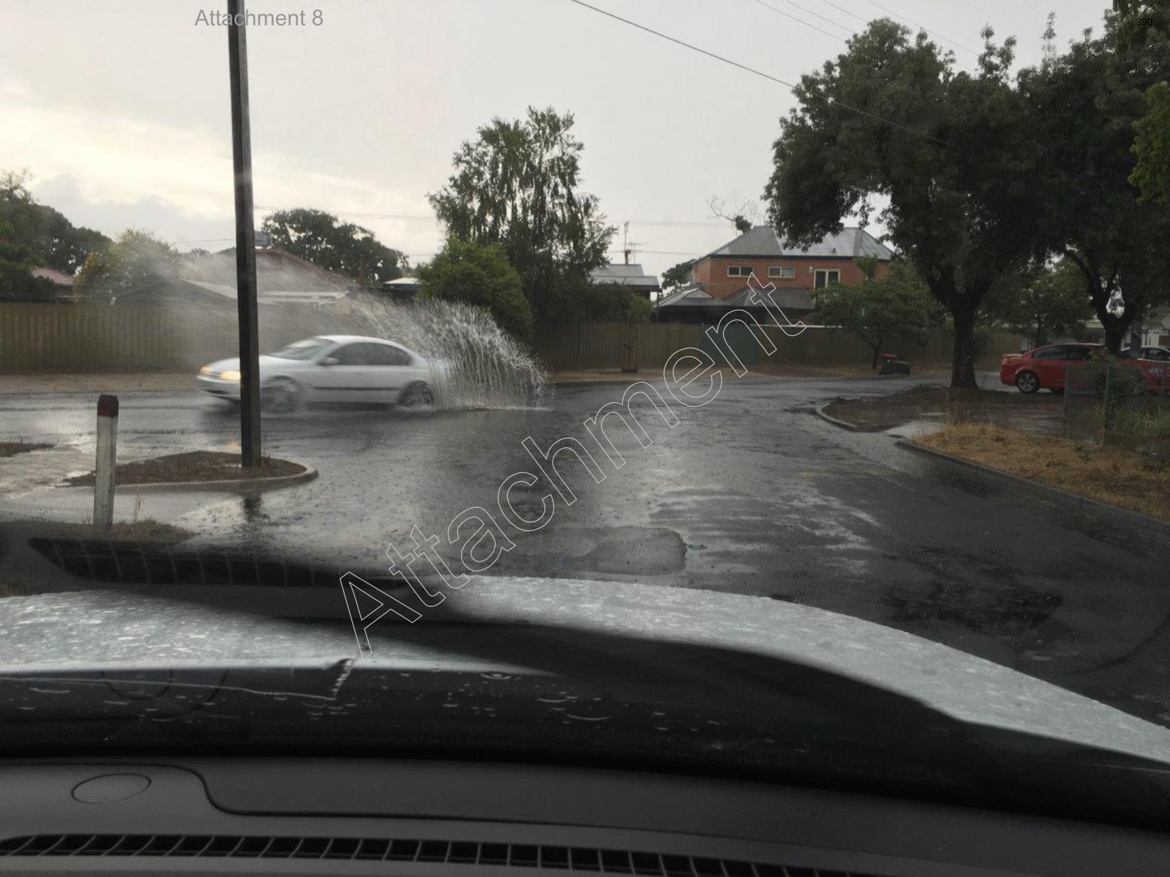
Attach
ment
Attachment 8 390
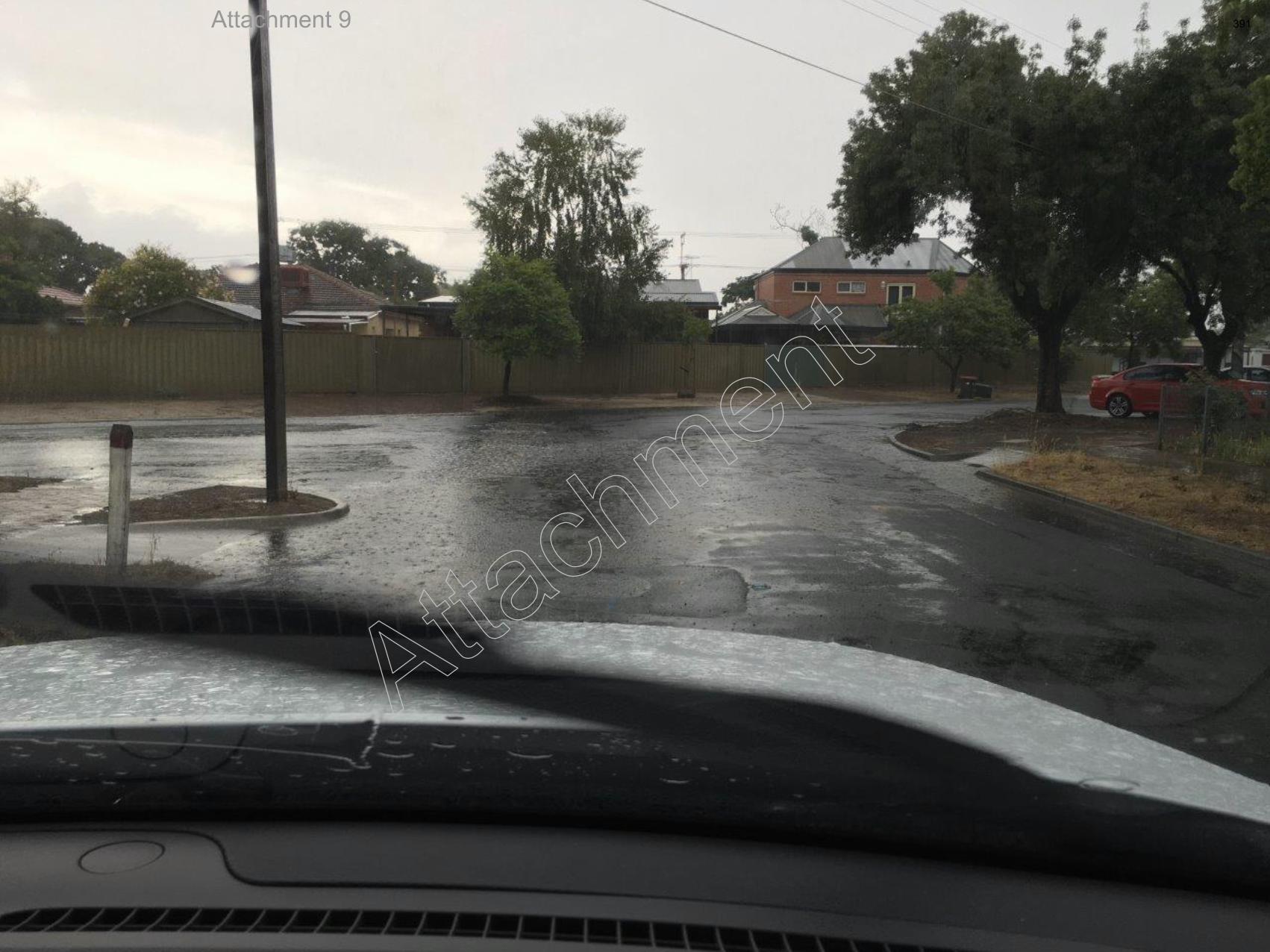
Attach
ment
Attachment 9 391
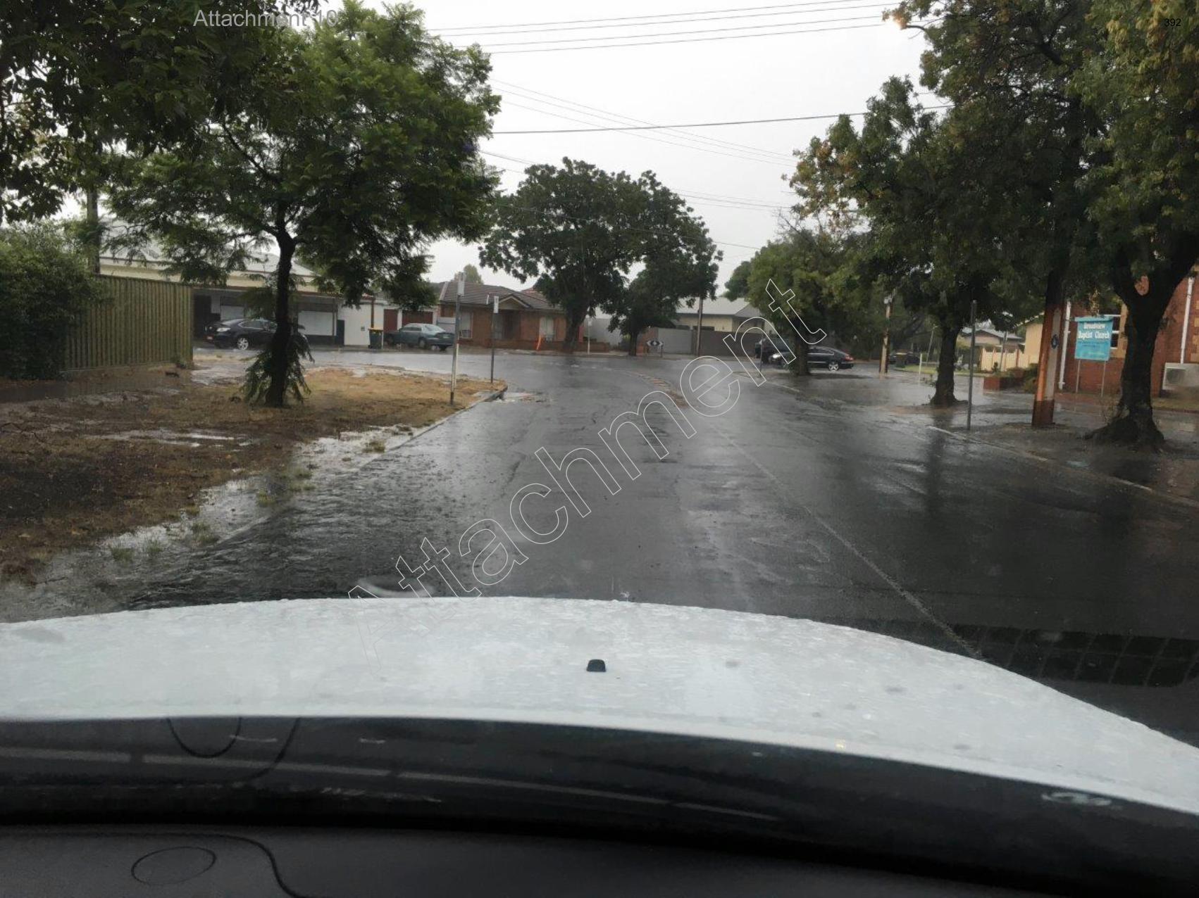
Attach
ment
Attachment 10 392
Item 19.11: Availability of Compostable Dog Bags
CITY OF PROSPECT: Council Agenda 25/07/2017
AGENDA ITEM NO.: 19.11
TO: Council Meeting on 25 July 2017
DIRECTOR: Ginny Moon, Director of Corporate Services
REPORT AUTHOR: Alex Cortes, Manager Infrastructure Assets and Environment
SUBJECT: Availability of Compostable Dog Bags
1. EXECUTIVE SUMMARY
1.1 The purpose of this report is to discuss the potential provision of free compostable dog bags to residents from Council’s customer service counter located at the Civic Centre.
1.2 To address the issue of dog waste within City of Prospect parks and reserves, Council currently provides compostable dog bags for free within dispensers accessible to the general public within Council parks and reserves.
1.3 To supplement this service, it was requested that consideration be given to the provision of rolls of free compostable dog bags for residents, to be available from the Civic Centre customer service counter.
1.4 For the 2016/17 financial year there were 2,395 dogs registered within City of Prospect.
1.5 To provide 1 roll of 20 bags per dog, the total cost would be approximately $3,017.70.
1.6 The additional cost will initially be absorbed within the recurrent 2017/18 budget.
2. RECOMMENDATION
(1) Council to approve the provision of 1 free roll of 20 compostable dog bagsfor each dog registered within City of Prospect, to be available at the Customer Service Counter for distribution on request.
(2) Council notes that additional expenditure may be subject to budget variations.
3. RELEVANCE TO CORE STRATEGIES / POLICY
3.1 Strategic Plan to 2020 Theme 2 – Place “Loved heritage, leafy streets, fabulous places”
Strategy 2.2 Loved parks and places
3.2 Strategic Plan to 2020 Theme 4 – Services “Leaders of the sector providing efficient, responsive, accessible services”
Strategy 4.3 Responsible Waste Management
393
Item 19.11: Availability of Compostable Dog Bags
CITY OF PROSPECT: Council Agenda 25/07/2017
4. COMMUNITY INVOLVEMENT
4.1 No community consultation has been undertaken.
5. DISCUSSION
5.1 To address the issue of dog waste within parks and reserves, Council currently provides rolls of dog tidy bags within dispensers accessible to the general public.
5.2 In supporting responsible dog ownership and to supplement this service, the provision of rolls of compostable dog bags for residents has been considered.
5.3 Compostable dog bags are available from BioBag World Australia, who is Council’s preferred supplier for compostable bags. This is the same company that provides Council’s Kitchen Organic Bags for the Kitchen Organics Basket and park dog tidy bags.
5.4 The compostable dog bags have been approved by Council’s Organics Processor, Jeffries, for placement with the Green Organics Bin as they can be broken down within Jeffries composting process.
5.5 The compostable dog bags are made from a corn starch based material.
5.6 The compostable dog bags differ from the Kitchen Organics Bags in that they are slightly thinner due to carrying less weight.
5.7 BioBag dog waste bags do not contain any polyethylene-based ingredients. They biodegrade within 10-45 days in a well functioning composting environment. By comparison, it takes more than 100 years for normal plastic bags to biodegrade.
5.8 For the 2016/17 financial year there were 2,395 dogs registered within City of Prospect.
5.9 The rolls come in a box which contains two small rolls of 20 bags at $2.52 + GST.
5.10 The rolls of 20 bags has the advantage of being kept small so that they can fit within the small satchels that dog walkers generally have attached to their dog lead.
5.11 For the 2016/17 financial year there were 2,395 dogs registered within City of Prospect.
5.12 To provide 1 roll of 20 bags for each Prospect Council registered dog owners, the cost would be approximately $3,017.70.
5.13 This option will initially be absorbed within the recurrent 2017/18 budget.
ATTACHMENTS
Nil
394