9 List of Preparers - State Water Resources Control Board
97
9-1 Eagle Mountain Pumped Storage Project Final Environmental Impact Report July 2013 9 List of Preparers Name Project Role/ Sections Prepared Title Highest Degree Obtained Subject of Degree Agency/Company Ginger Gillin, C.F.P. Project Manager, Fishery Resources Senior Environmental Scientist M.S. Wildlife Biology, Aquatic Option GEI Consultants, Inc. Richard Westmore, P.E. Project Description Project Engineer M.S. Civil Engineering GEI Consultants, Inc. Alice Karl, Ph.D. Terrestrial Resources and T & E Species Wildlife Biologist Ph.D. Ecology Alice E. Karl and Associates Richard Shatz, P.G. 4853, C.E.G. 1514, C.H.G. 84 Groundwater Resources Senior Hydrogeologist M.S. Geology GEI Consultants, Inc. Rick Suttle Aesthetics, Recreation, and Land Use Landscape Architect M.S. Landscape Architecture Ruettiger, Tonelli & Associates Michael Dahm, AICP Socio-economics, GIS Land Use Planner B.S. Urban and Regional Planning Ruettiger, Tonelli & Associates Robert Lambe, Ph.D. Surface Water Resources Geologist Ph.D. Geology and Geochemistry GEI Consultants, Inc. Nick D. Miller Construction timing, groundwater supply wells, seepage control, spillway, pipeline and operating costs Engineer M.E. Civil Engineering GEI Consultants, Inc. Jeffrey Brown, P.G. 5144, C.E.G. 1930 Geology Senior Geologist B.A. Earth Sciences GEI Consultants, Inc.
-
Upload
khangminh22 -
Category
Documents
-
view
6 -
download
0
Transcript of 9 List of Preparers - State Water Resources Control Board
9-1
Eagle Mountain Pumped Storage Project Final Environmental Impact Report July 2013
9 List of Preparers
Name Project Role/ Sections Prepared
Title Highest Degree Obtained
Subject of Degree Agency/Company
Ginger Gillin, C.F.P. Project Manager, Fishery Resources
Senior Environmental Scientist
M.S. Wildlife Biology, Aquatic Option
GEI Consultants, Inc.
Richard Westmore, P.E.
Project Description Project Engineer M.S. Civil Engineering GEI Consultants, Inc.
Alice Karl, Ph.D. Terrestrial Resources and T & E Species
Wildlife Biologist Ph.D. Ecology Alice E. Karl and Associates
Richard Shatz, P.G. 4853, C.E.G. 1514, C.H.G. 84
Groundwater Resources
Senior Hydrogeologist
M.S. Geology GEI Consultants, Inc.
Rick Suttle Aesthetics, Recreation, and Land Use
Landscape Architect
M.S. Landscape Architecture Ruettiger, Tonelli & Associates
Michael Dahm, AICP
Socio-economics, GIS
Land Use Planner B.S.
Urban and Regional Planning
Ruettiger, Tonelli & Associates
Robert Lambe, Ph.D.
Surface Water Resources
Geologist Ph.D. Geology and Geochemistry
GEI Consultants, Inc.
Nick D. Miller Construction timing, groundwater supply wells, seepage control, spillway, pipeline and operating costs
Engineer M.E. Civil Engineering GEI Consultants, Inc.
Jeffrey Brown, P.G. 5144, C.E.G. 1930
Geology Senior Geologist B.A. Earth Sciences GEI Consultants, Inc.
9-2
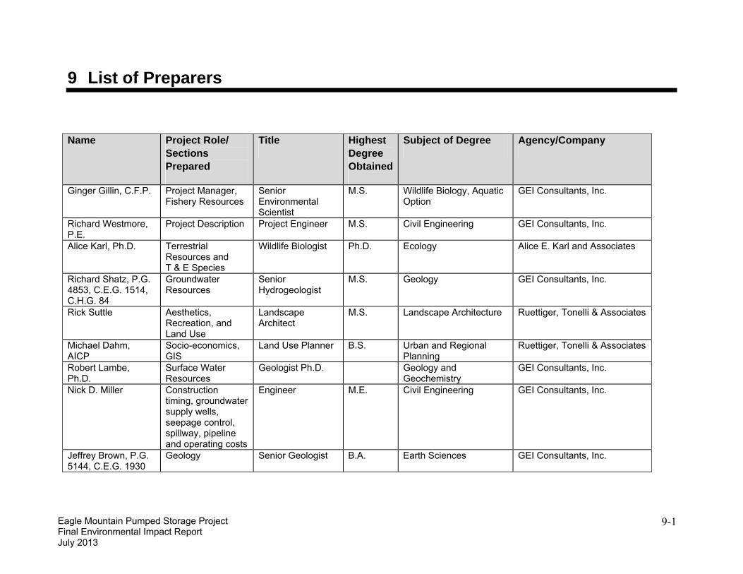
Eagle Mountain Pumped Storage Project Final Environmental Impact Report July 2013
Name Project Role/ Sections Prepared
Title Highest Degree Obtained
Subject of Degree Agency/Company
Paul Miller Noise and Senior Reviewer for Air Quality and Climate Change
Principal M.S. Zoology Paul Miller and Associates
Michael Ratte Air Quality and Climate Change
Senior Air Quality Environmental Scientist
B.S. Meteorology K.B. Environmental Sciences, Inc.
John Pizzimenti, Ph.D.
In-house Consultant QA/QC
Senior Vice President
Ph.D. Evolutionary Biology GEI Consultants, Inc.
Jerry Schaefer, Ph.D.
Cultural Resources Archeologist Ph.D. Archeology ASM Affiliates
Sarah Watkins Mapping Geologist/GIS Analyst
B.S. Geology GEI Consultants, Inc.
Camilla Williams, P.G., C.E.G. 1491
Regulatory oversight, thresholds of significance, QA/QC groundwater analysis, editorial review
Water Quality Certification Unit, Chief
B.S. Geolo gy State Water Resources Control Board
Paul Murphey, P.G. 7014
Regulatory oversight, thresholds of significance, QA/QC groundwater analysis, editorial review
Engineering Geologist
B.S. Geolo gy State Water Resources Control Board
Erin Ragazzi Final editorial review, regulatory oversight
Water Quality Certification Program Manager
B.S. Environme ntal and Resource Science
State Water Resources Control Board
Oscar Biondi Final editorial review, regulatory oversight
Water Resource Control Engineer
B.S. Civil Engineering State Water Resources Control Board
Ginger G. Gillin 1
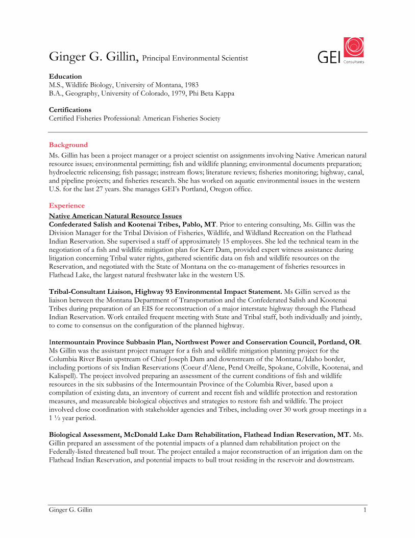
Ginger G. Gillin, Principal Environmental Scientist Education M.S., Wildlife Biology, University of Montana, 1983 B.A., Geography, University of Colorado, 1979, Phi Beta Kappa
Certifications Certified Fisheries Professional: American Fisheries Society
Background
Ms. Gillin has been a project manager or a project scientist on assignments involving Native American natural resource issues; environmental permitting; fish and wildlife planning; environmental documents preparation; hydroelectric relicensing; fish passage; instream flows; literature reviews; fisheries monitoring; highway, canal, and pipeline projects; and fisheries research. She has worked on aquatic environmental issues in the western U.S. for the last 27 years. She manages GEI’s Portland, Oregon office.
Experience
Native American Natural Resource Issues Confederated Salish and Kootenai Tribes, Pablo, MT. Prior to entering consulting, Ms. Gillin was the Division Manager for the Tribal Division of Fisheries, Wildlife, and Wildland Recreation on the Flathead Indian Reservation. She supervised a staff of approximately 15 employees. She led the technical team in the negotiation of a fish and wildlife mitigation plan for Kerr Dam, provided expert witness assistance during litigation concerning Tribal water rights, gathered scientific data on fish and wildlife resources on the Reservation, and negotiated with the State of Montana on the co-management of fisheries resources in Flathead Lake, the largest natural freshwater lake in the western US. Tribal-Consultant Liaison, Highway 93 Environmental Impact Statement. Ms Gillin served as the liaison between the Montana Department of Transportation and the Confederated Salish and Kootenai Tribes during preparation of an EIS for reconstruction of a major interstate highway through the Flathead Indian Reservation. Work entailed frequent meeting with State and Tribal staff, both individually and jointly, to come to consensus on the configuration of the planned highway. Intermountain Province Subbasin Plan, Northwest Power and Conservation Council, Portland, OR. Ms Gillin was the assistant project manager for a fish and wildlife mitigation planning project for the Columbia River Basin upstream of Chief Joseph Dam and downstream of the Montana/Idaho border, including portions of six Indian Reservations (Coeur d’Alene, Pend Oreille, Spokane, Colville, Kootenai, and Kalispell). The project involved preparing an assessment of the current conditions of fish and wildlife resources in the six subbasins of the Intermountain Province of the Columbia River, based upon a compilation of existing data, an inventory of current and recent fish and wildlife protection and restoration measures, and measureable biological objectives and strategies to restore fish and wildlife. The project involved close coordination with stakeholder agencies and Tribes, including over 30 work group meetings in a 1 ½ year period. Biological Assessment, McDonald Lake Dam Rehabilitation, Flathead Indian Reservation, MT. Ms. Gillin prepared an assessment of the potential impacts of a planned dam rehabilitation project on the Federally-listed threatened bull trout. The project entailed a major reconstruction of an irrigation dam on the Flathead Indian Reservation, and potential impacts to bull trout residing in the reservoir and downstream.
Ginger G. Gillin 2
Biological Assessment, Kerr Hydroelectric Project, Flathead Indian Reservation, MT. Ms. Gillin prepared a biological assessment of the potential impact of operation of a 194 MW hydroelectric project on Flathead River and Flathead Lake bull trout and westslope cutthroat trout. The Confederated Salish and Kootenai Tribes are co-licensee with PPL Montana for this major hydroelectric project. The assessment included a review of the existing environmental baseline conditions, and potential mitigation measures to reduce impacts to the species of concern. Federal Energy Regulatory Commission Licensing Mystic Lake Hydropower License Compliance, Custer National Forest, Absarokee, MT (2009 - present). Ms Gillin is assisting PPL Montana with license compliance for the Mystic Project in areas of water quality, fisheries monitoring, wildlife management, and riparian vegetation monitoring. She supervises preparation of technical evaluations and monitoring plans and reports, to comply with the requirements in the FERC license. Eagle Mountain Pumped Storage Hydropower Licensing, Palm Desert, CA (2007-present). Ms. Gillin is project manager for licensing the proposed 1,300 MW Eagle Mountain Pumped Storage Project in California. She is managing a team which is working on licensing this project using the Traditional Licensing Process through the Federal Energy Regulatory Commission (FERC). A Draft and Final License Application has been submitted to the FERC, along with responses to FERC’s requests for additional information request. A licensing decision on this project is anticipated in early 2010. Mystic Lake Hydropower Relicensing, Custer National Forest, Absarokee, MT (2003-2009). Mystic Lake Hydropower Project is a 10 MW electrical generating project located entirely within the Custer National Forest, Montana. The project is licensed by the FERC and operates under a Special Use Permit from the U.S. Forest Service. Ms. Gillin was the project manager for the GEI team working for PPL Montana on the Mystic Lake Hydropower Re-licensing. She was responsible for coordinating FERC submittals, including an License Application which included an Applicant Prepared Environmental Assessment (EA) for compliance with the National Environmental Policy Act and a Biological Assessment for the Endangered Species Act (ESA) Section 7 consultation. She also coordinated stakeholder collaboration and technical evaluations for environmental and engineering issues. Salida Hydropower Project, FERC License Compliance, Pike-San Isabel National Forest, Salida, CO (2002-2004). Ms Gillin worked on license compliance monitoring for the Salida Hydroelectric Project for Public Service Company of Colorado. Work entailed field studies and report preparation on the impact of minimum instream flows in the South Fork of the Arkansas River on fish populations. California Environmental Quality Act (CEQA) and National Environmental Policy Act (NEPA) Delta Flood Preparedness, Response and Recovery Project, Sacramento, CA (2010). Ms. Gillin managed a team preparing the Initial Study and Mitigated Negative Declaration for the Department of Water Resources. Poso Creek Integrated Regional Water Management Plan, Kern County, CA (2009). Prepared a draft Environmental Assessment of the proposed programmatic modifications to water use in the Poso Creek planning area. Eagle Mountain Pumped Storage Hydropower Licensing, Palm Desert, CA (2007-2010). The license application for the Eagle Mountain Project includes an Applicant Prepared Environmental Impact Statement. Ms. Gillin is also managing preparation of an Applicant Prepared Environmental Impact Report for the State Water Resources Control Board compliance with the California Environmental Quality Act, and a Biological Assessment for Endangered Species Act Section 7 consultation.
Ginger G. Gillin 3
Snow-Talon Timber Salvage Sale. Environmental Impact Statement (EIS), Helena National Forest, Lincoln Ranger District, Lincoln, MT (2004-2006). Ms. Gillin supervised preparation the aquatic resources portions of the environmental review for a proposed salvage harvesting of 2,500 acres of land, yielding approximately 20 to 30 million board feet of commercial timber, within the perimeter of the 37,706-acre Snow Talon fire. The harvest proposals included the use of helicopter, cable, and tractor logging methods. Ms. Gillin assisted with preparation of the biological assessment and biological evaluation for threatened, endangered and sensitive aquatic species as well as aquatic resource sections of the draft and final EIS. Yellowstone Pipeline Project EIS, Lolo National Forest, Missoula, MT. When the Yellowstone Pipeline Company lost their lease to cross the Flathead Indian Reservation, they proposed alternate routes to avoid the reservation. Ms Gillin prepared the fisheries and aquatic resources specialist report used for preparation of an EIS on the alternative routes on behalf of the Federal government. Work included risk assessment of alternatives, including alternative routes passing through the Reservation, study planning, supervision of field studies, description of the affected environment, assessment of potential impacts, and alternatives analysis. Ms. Gillin also prepared the biological assessment and biological evaluation for ESA consultation. ASARCO-Rock Creek Mine EIS, Kootenai National Forest, MT (1992-1995). Ms Gillin prepared the fisheries and aquatic resources specialist report used for preparation of an EIS on a proposed underground copper and silver mine under the Cabinet Mountains Wilderness Area in Montana. Work included study planning, description of the affected environment, assessment of potential impacts, and alternatives analysis. Ms. Gillin also prepared the biological assessment and biological evaluation for ESA consultation. Lookout Pass Ski Area Expansion Environmental Assessment (EA), Lolo National Forest, Missoula, Montana and Idaho Panhandle National Forest, Coeur d’Alene, Idaho. The project involved expanding an existing ski area on National Forest System Lands by constructing additional ski runs, access roads, and parking areas. Ms Gillin prepared the aquatic resource portions of the EA and the Biological Assessment for bull trout and the Biological Evaluation for the westslope cutthroat trout. Fish and Wildlife Management Planning Bull Trout Restoration Plan, MT (1996-1998). Ms Gillin served on the Governor of Montana’s Bull Trout Restoration Team, and served as a technical assistant to the Montana Bull Trout Scientific Group. She has prepared numerous biological assessments (BAs) of project impacts to bull trout to comply with the Endangered Species Act. She is or has been involved in fish passage planning for bull trout at four major hydroelectric facilities on the Clark Fork River, Montana. Clark Fork Aquatic Habitat Problem Assessment, Kootenai National Forest, MT (2005-2007). Ms Gillin was project manager for a literature review and problem assessment for native salmonids in the lower Clark Fork River in Montana on behalf of Avista Corp. This project was designed to prioritize native salmonid restoration projects in a large watershed, largely located on National Forest System Lands. The purpose of the project was to assist with implementation of Protection, Mitigation and Enhancement measures for Avista’s Clark Fork Hydropower Project. Fisheries Monitoring Plan, East Boulder River, Gallatin National Forest, Big Timber, MT (2000 - present). Ms Gillin designed and implemented a fisheries monitoring plan for the East Boulder River related to monitoring the impacts of a platinum/palladium mine on behalf of the Stillwater Mining Company. The project was a collaborative effort with the Forest Service, Montana Fish, Wildlife and Parks, Stillwater Mining Company, and stakeholder groups. She also implemented the monitoring including field collection of data, data analysis, and preparation of annual reports.
Ginger G. Gillin 4
Fish Passage Thompson Falls Hydropower Project – Fish Passage Project, Location, MT (2002-present). Ms Gillin is the project manager for the fish passage program at Thompson Falls Dam. The goal of this project is to establish upstream adult fish passage for bull trout, and other native species, at this hydropower project. This project evaluated fish behavior in the tailrace of the dam and physical and biological factors that affect fish passage at this facility, determined the best location for the fish passage facility, the best configuration for the facility, and permitting. A full height fish ladder is currently in construction. Fish Passage at Cabinet Gorge and Noxon Rapids Dam Location, MT (1999-2004). Ms Gillin was responsible for an assessment of bull trout use of an existing fish ladder as a component of a fish passage program at Cabinet Gorge Dam. She also prepared a fish passage facilities development plan for Cabinet Gorge and Noxon Rapids Dam, with bull trout being the target species. She participated in the design team to develop a fish trap for a trap and haul program at Noxon Rapids Dam and prepared the fish trap evaluation plan for that trap.
Professional Activities and Awards
Conference planning committee, National Hydropower Association, 2005 Fishery worker of the year, 1996, Montana Chapter of the American Fisheries Society President, Montana Chapter of the American Fisheries Society 1992–1993 Member, Montana Bull Trout Restoration Team, 1994–1997 Chair, Resolutions Committee, American Fisheries Society, 1995–1997 Best Student Paper, honorable mention, North American Benthological Society, 1983
Publications
Draft Initial Study, Delta Flood Emergency Preparedness, Response, and Recovery Project. Prepared for the Department of Water Resources. Mystic Lake Wildlife Management Plan. Prepared for PPL Montana and submitted to the Federal Energy Regulatory Commission. Annual Activity, Fish Passage, and Bull Trout Take Report, 2009. Thompson Falls Hydroelectric Project, FERC Project #1869. Prepared for PPL Montana and submitted to the Federal Energy Regulatory Commission. Mystic Lake Fisheries Management Plan. Prepared for PPL Montana and submitted to the Federal Energy Regulatory Commission. Applicant Prepared Draft Environmental Impact Report. Eagle Mountain Pumped Storage Hydroelectric Project, Eagle Crest Energy Company. Prepared for the State Water Resources Control Board. Final License Application, Eagle Mountain Pumped Storage Hydroelectric Project, Eagle Crest Energy Company. Submitted to the Federal Energy Regulatory Commission. Final License Application, Mystic Lake Hydroelectric Project, PPL Montana. Submitted to the Federal Energy Regulatory Commission. Biological Evaluation (Bull Trout), Thompson Falls Hydroelectric Project, prepared for PPL Montana and submitted to the Federal Energy Regulatory Commission. Intermountain Province Subbasin Plan. Prepared for Bonneville Power Administration, Portland, Oregon. http://www.nwcouncil.org/fw/subbasinplanning/admin/level2/intermtn/plan/Default.asp
Ginger G. Gillin 5
Lower Clark Fork River Native Salmonid Habitat Problem Assessment. Prepared for Avista Corporation, Noxon, Montana. Thompson Falls Hydropower Project, Long-Term Fish Passage Plan. Prepared for PPL Montana, Butte, Montana. Biological evaluation for sensitive species ASARCO Rock Creek Project. Cabinet Ranger Station, Kootenai National Forest, Montana. Experimentally determined impacts of a small suction gold dredge on a Montana stream. North American Journal of Fisheries Management. 5:480–488. Snow-Talon Timber Salvage Sale. Environmental Impact Statement, Helena National Forest, Lincoln Ranger District, Lincoln, Montana. Prepared the aquatic resources portions of this document. http://www.fs.fed.us/r1/helena/projects/st_feis.shtml Literature of aquatic and recreational resources at Mystic Lake Hydropower Project No. 2301. Mystic Lake, Montana. Prepared for PPL Montana, Butte, Montana. http://www.mysticlakeproject.com/pdfs/0603MysticAquaticlitreview.pdf Assessment of Cabinet Gorge Fish Hatchery ladder as a bull trout fish passage facility. Prepared for Avista Corporation, Spokane, Washington and U.S. Fish and Wildlife Service, Kalispell, Montana. Biological assessment and evaluation for bull and westslope cutthroat trout. Lookout Pass Ski Area expansion. Prepared for U.S.D.A. Forest Service, Idaho Panhandle National Forest, Coeur d’Alene, Idaho. Biological assessment/evaluation for bull and westslope cutthroat trout. Snowbowl Ski Area road and parking improvements, Missoula, Montana. U.S.D.A. Forest Service, Lolo National Forest, Missoula, Montana. Literature Review: Fisheries Information for the Centennial Valley, Montana. Prepared for: U.S. Fish and Wildlife Service, Dillon, Montana. Biological Assessment for the Touch America Fiber Optic Cable Project. Prepared for: POWER Engineers, Hailey Idaho and the U.S.D.A. Forest Service, Lolo National Forest, Missoula, Montana. Changes Proposed to Existing YPL Pipeline Between Thompson Falls and Kingston. Biological Assessment, Fisheries. U.S.D.A. Forest Service, Lolo National Forest. Missoula, Montana. Under contract to: Aspen Environmental Group, Agoura Hills, California. Interdisciplinary Addendum to Specialist Reports, Sediment Bull Trout Analysis. Prepared for U.S.D.A. Forest Service, Lolo National Forest, Missoula, Montana. Under subcontract to: Aspen Environmental Group, Agoura Hills, California. Technical Assistance by Tetra Tech/Simons Li and Associates. Fisheries and aquatic resources specialist report, Yellowstone Pipeline Reroute Project. Prepared for: Lolo National Forest, Missoula, Montana and Aspen Environmental Group, Agoura Hills, California. Biological Resources Report: Shields River Bridge South of Clyde Park, MT. Prepared for: Forsgren Associates, Inc. and Montana Department of Transportation, Helena, Montana. Biological Resources Report: Bitterroot River Bridge East of Victor, MT. Prepared for: Robert Peccia & Associates and Montana Department of Transportation, Helena, Montana.
Ginger G. Gillin 6
Addendum to Biological Resources Report: Middle Fork Flathead River Bridge. Prepared for: Robert Peccia & Associates and Montana Department of Transportation, Helena, Montana. Biological resources report: SE of Ennis and Cameron N-S. Prepared for: Robert Peccia and Associates, Helena, Montana. Biological resources report: Claggett Hill road project. Prepared for: Robert Peccia and Associates, Helena, Montana. Biological resources report: Highwood NE. Prepared for: Forsgren Associates, Inc., West Yellowstone, Montana. Biological evaluation for sensitive species ASARCO Rock Creek Project. Cabinet Ranger Station, Kootenai National Forest, Montana. Biological assessment of introducing smallmouth bass into the Clarks Fork of the Yellowstone River, Montana. Prepared for the Montana Department of Fish, Wildlife and Parks, Helena, Montana. Effects of introducing smallmouth bass into Bear Paw Lake. Prepared for the Montana Department of Fish, Wildlife and Parks, Helena, Montana. Status report: bull trout in Montana. Prepared for the Montana Department of Fish, Wildlife and Parks, Helena, Montana. Canyon Ferry risk assessment: the potential impacts of introduction of five non-native species. Prepared for the Montana Department of Fish, Wildlife and Parks, Helena, Montana. Literature review on crayfish ecology and management methods. Prepared for the Montana Department of Fish, Wildlife and Parks, Helena, Montana. Instream flows for fish: what Tribal policy makers need to know about experts and instream flow quantification methodologies in fulfilling Indian water rights: practical approaches. In J.W. Weber, ed. Proceedings of the Columbia River Inter-Tribal Fish Commission, December 16–17, 1986, Spokane, Washington. Garrison-Taft 500 kV Transmission Line Fisheries Baseline and Monitoring Project. Final Report. Montana Department of Fish, Wildlife and Parks. Intergovernmental Agreement Bonneville Power Administration, DE-AI79-84 BP 16380.

Richard A. Westmore, P.E. 1
Richard A. Westmore, P.E., Education
Senior Vice President
M.S., Water Resources Management (Civil Engineering Specialty), University of Wisconsin, 1971 B.S., Civil Engineering, University of Wisconsin, 1970
Registration Colorado, Oklahoma and Wyoming
Background
As senior engineer and project manager specializing in water resources development, Mr. Westmore is responsible for engineering, economic, and financial investigations of water supply, hydroelectric, irrigation, drainage, and flood control projects. He has extensive experience in coordinating engineering and environmental investigations including NEPA compliance for water supply and hydroelectric projects. He has been actively involved in water resources engineering projects in Colorado since 1985 and has worked closely with municipalities, water districts, water conservancy and conservation districts, irrigation companies, and electric utilities.
Mr. Westmore has 36 years of progressively responsible experience in water resources engineering. This experience includes serving as project engineer and project manager on many water supply and hydroelectric planning, dam, pipeline and canal design, and NEPA compliance assignments throughout the western United States. Many of these projects have extended from initial planning and alternatives evaluations, through permitting, design and construction. He has provided services on water resources development projects in 24 states and resident engineering assignments overseas.
Hydroelectric and FERC Licensing Experience
Hydroelectric project experience includes FERC licensing, agency consultations to plan and negotiate environmental studies, public involvement, and conduct of engineering and economic evaluations under NEPA guidelines, as well as conceptual and final design. FERC experience includes eight licensing assignments, including the first re-licensing activities in Colorado under ECPA regulations, as well as engineering support for Part 12 dam safety inspections and design of remedial measures to bring projects into compliance with FERC dam safety regulations.
Ak Chin Reservation, AZ.
Eagle Mountain Pumped Storage Project for Eagle Crest Energy, Riverside County, CA. Project Engineer and Facilities Planning. Assisting Eagle Crest Energy with the preparation of Federal Energy Regulatory Commission license application documents for an initial license for a 1300 MW pumped-storage project. Currently preparing the feasibility level designs, cost estimates and license application. Project includes supporting the client with FERC strategy, engineering feasibility review, environmental evaluations, and overall permitting compliance.
Planning engineer for pre-feasibility study of adding 4 MW of generating capacity to an irrigation system serving the AK Chin Reservation, including layout and quantity estimating for the power plant and appurtenant works.
FERC Part 12D Inspections (Various Locations) for Pacific Gas and Electric.
• Cabin Creek Upper and Lower Dams (Cabin Creek Pumped Storage Project), CO
Project manager for Part 12D Inspections of:
• Barker Dam (Boulder Hydro), CO
Richard A. Westmore, P.E. 2
• Terminal and Aspaas Dams (Tacoma Hydro Project), CO • Trout Lake Dam (Ames Hydro Project), CO • Sutherland/Lake Maloney Dams and Supply Canals (Sutherland Hydro Project), NE • Dillon Dam, CO
Georgetown and Salida Hydroelectric Projects, Colorado, for Public Service Company of Colorado.
• Resource agency consultations and negotiations of aquatic study programs involving IFIM/PHABSIM and HQI instream flow studies, as well as fish, benthic organism, water quality, and sediment sampling.
Project manager for the re-licensing of two Colorado hydroelectric projects, located near Georgetown and Salida. Responsible for managing and coordinating engineering and environmental studies to support Public Service Company of Colorado, owner of the projects. Work included:
• Consultation with resource agencies during formulation of enhancement plans. • Engineering support for field environmental studies. • Client coordination. • Preparation of license Exhibits A and E and Balancing Statement.
Hydroelectric Expansion, Falls Village, Connecticut, and Turners Falls, MA. Project engineer for feasibility design of hydroelectric expansions at the Falls Village and Turners Falls hydroelectric projects involving additions of 6 and 25 MW power installations, respectively, at the two operating plants. Also responsible for power and energy studies for a range of potential expansion at each site, preliminary cost estimates, optimization of installed capacity, final project feature layouts, and preparation of reports for the FERC license applications.
Hydro Project on the Middle Branch Escanaba River, MI. Lead engineer for assignment of hydroelectric operations and minimum release requirements for a 500 kW hydro project. Responsible for field inspection, effects of minimum bypass flow increase on energy production and unit operations, and report on impacts assessment of minimum bypass flows.
Jacobsen Hydroelectric Project, Near Grand Junction, CO. Project engineer for licensing of a 2,500 kW hydroelectric project on the Colorado River. Energy studies were prepared using a PC spreadsheet program. Other studies included preparation of layouts and cost estimates.
Southern Ute Reservation Hydro Development, Near Durango, CO, for the Southern Ute Water Conservancy District. Project engineer for evaluation of hydropower development opportunities on the irrigation system of the Southern Ute Reservation. Preliminary design of small hydropower developments including energy studies, project concepts, facility layouts, and cost estimates for a 2,000 kW facility and a 750 kW facility.
St. Joseph River, MI and IN .
Sutherland Canal Hydroelectric Project, Nebraska Public Power District, Sutherland NE. Project engineer for a feasibility study of constructing a 4 MW low-head hydroelectric development at an existing 45-foot high canal drop structure on the Sutherland Supply Canal in eastern Nebraska.
Project engineer for feasibility design of upgrading five small (4- to 20-MW) hydro projects on the St. Joseph River. Work included capacity and energy studies, and conceptual plans for upgrading energy production by rehabilitating existing, and replacing old, with new standardized units.
Twin Falls and Kanaka Rapids, on the Snake River, ID, for the Idaho Power Company. Project engineer for feasibility evaluations, designs, and reports and license application sections for the Twin Falls

Richard A. Westmore, P.E. 3
(42 MW) and Kanaka Rapids (15 MW) hydroelectric projects on the Snake River. Responsible for power and energy studies and the preparation of engineering reports on both projects.
Utica-Angels Water System Micro Hydro Development. Calaveras County Water District. Calaveras County, CA. Project engineer for preliminary evaluation of hydroelectric development potentials at four sites on an existing raw water supply system. Prepared se reconnaissance, facility layouts, energy estimates, cost estimates and economic analyses for these projects ranging in size from 90 to 450 kW, with heads of 30 to 130 feet.
Dam and Reservoir Project Experience
Blunn Dam/Arvada Reservoir Enlargement Project, Jefferson County, Colorado for the City of Arvada, CO. Project manager for final design and construction of a project to raise the normal pool of Arvada Reservoir without significantly raising the existing 100-foot-high earthfill dam. The pool raise of 5 feet was achieved by modifying the existing service spillway crest from an ogee weir to a labyrinth weir with capacity of 15,000 cfs during the PMF and modifying the existing emergency spillway.
Cabin Creek Lower Dam, Colorado, for Public Service Company of CO. Project engineer for final design of a new over-the-dam spillway to handle a Probable Maximum Flood outflow of 13,000 cfs. Developed basic data for incremental damage analysis to establish inflow design flood.
City of Boulder Watershed Dams, CO. Project engineer for Probable Maximum Flood, incremental damage studies, and evaluation of alternatives for dam rehabilitation at three high-mountain dams in the Boulder Creek Watershed. An existing side-channel spillway was enlarged at Silver Lake. At Goose Lake, a new valve house and roller-compacted concrete overtopping protection of the dam were implemented. At Lake Albion, a new valve house was constructed and plans were developed for a new concrete dam facing using pre-cast concrete panels.
Clear Lake Dam, Colorado, for Public Service Company of CO. Project manager for conceptual and final design of modifications to this significant hazard embankment dam on Clear Creek, upstream of Georgetown and the north metro Denver area. Work included overtopping protection and a new gate tower in the reservoir. Studies included PMF routing investigations and hydraulic analyses to support design of a service spillway for the 500-year flood and overtopping protection for the dam. Also prepared DAMBRK inundation mapping for the Emergency Action Plan. Construction completed in 1997 and 1998.
Grey Mountain Dam, CO. Project manager for feasibility evaluation of 400-foot-high concrete arch dam on the Cache la Poudre River. Estimated construction cost of $180 million, including state highway relocation and appurtenant facilities. Preliminary hydraulic designs for the dam included the river diversion, outlet works, hydroelectric power plant, and spillway flip bucket and plunge pool.
Ritschard Dam, CO. Project engineer for preliminary and final design activities on this 120-foot-high embankment dam near Kremmling, Colorado. Helped coordinate design activities and evaluated hydropower development opportunities and hydraulic designs to enable a future addition of hydropower to the dam.
Standley Lake Dam, Westminster, CO, for Farmers’ Reservoir & Irrigation Company. Project manager for feasibility evaluation of raising an existing 120-foot-high embankment dam by 14 feet to increasing storage capacity by 18,000 acre-feet. Project includes spillway modifications for the Probable Maximum Flood (labyrinth, side-channel, and roller-compacted concrete options were evaluated); replacement outlet works (tunnel and selective withdrawal tower); new valve house; and stabilization of the dam. Construction costs ranged from $30 million (dam safety) to $50 million (enlargement). Various cofferdam and lake tap options were evaluated for outlet works construction. PMF studies included reservoir flood routings and spillway sizing to provide for PMF routing without affecting 100-year flood discharges
Richard A. Westmore, P.E. 4
from the reservoir. Served as lead hydraulic reviewer for the labyrinth spillway design and issues related to the new outlet works for the dam safety modifications currently under construction.
Pipeline and Conveyance Experience
Compact Compliance Pipeline, Republican River, Northeastern CO. Project Manager for a feasibility study of a 13-mile-long pipeline to deliver up to 25,000 acre-feet per year from a well field to the North Fork Republican River. Study evaluated alignments, pipe sizing, preliminary hydraulics, and outfall locations. Study results used as the basis for State funding support for design and construction of the pipeline and acquisition of water rights. Project cost estimate is $21 million, excluding water rights. Serving as GEI’s in-house technical reviewer during final design of the pipeline. The 13-mile-long pipeline will have diameter from 30 to 42-inches. Mr. Westmore prepared a feasibility study of a small hydroelectric power development as part of the preliminary design effort.
Croke Canal Rehabilitation Project, Jefferson County, CO, for Farmers Reservoir & Irrigation Company.
Williams Fork Collection System, Denver Water. Served as Project Manager for feasibility studies and cost estimates for extending and expanding the existing Williams Fork Collection System in the headwaters of the Colorado River Basin in Colorado, which is owned and operated by Denver Water. The Williams Fork system brings water from the Western Slope of the Rockies into the Gumlick Tunnel and eventually to the Eastern Slope and Denver’s Moffatt Tunnel water supply system. The expansion would increase the Williams Fork source supply for which Denver has maintained conditional water rights. The expanded system would include 30 miles of 20- to 60-inch-diameter pipeline, two 18- by 22-foot tunnels totaling about 5,000 feet in length, two high-pressure inverted siphons, and numerous small diversion and control structures. The system would operate entirely by gravity.
Project manager for evaluation of alternatives to increase the capacity along a 15-mile canal alignment from 450 to 900 cfs. The work included HEC-RAS modeling of the canal and various bridge and hydraulic structures, dynamic modeling of canal surges due to gate closures, and estimation of options to deal with hazardous spills into the canal. The canal is the primary water supply for over 200,000 people bringing water from Clear Creek into Standley Lake Reservoir and also provides major agricultural water supplies. In addition to evaluating canal enlargement, lining, and structure modifications, the design team also prepared recommendations and preliminary cost estimates for canal lining options to reduce seepage quantities and protect adjacent residential and commercial properties. A structured decision support model was used to evaluate alternatives in terms of cost, environmental impacts, and operational effectiveness.
Water Resources Planning and Development Experience
Cache la Poudre Basin Water and Hydropower Resources Management Study, CO. Project manager for investigation of alternatives for developing the water and hydropower resources in an 1,800 square-mile basin in northern Colorado. Study was conducted following NEPA guidelines for agency and public involvement during preliminary planning of alternative water supply and power projects. These projects included: evaluation of available surface water resources and development opportunities at 10 dam sites; estimate of long-range agricultural and municipal water needs within the basin; and evaluation of staged water supply storage and pumped-storage hydroelectric potentials at several sites, ranging from 450 to 2,100 MW.
Emergency Storage Project (ESP), San Diego County, California, for the San Diego County Water Authority (SDCWA). Project hydraulic engineer for conceptual design of dams associated with the $830 million ESP, including a 90-foot roller-compacted concrete raise of the existing San Vicente Dam and the 325-foot-high Olivenhain Dam. Work included preliminary design of construction diversions, cofferdams, spillways, and outlet works. Flood frequency and other design flood estimates were prepared for six dam alternatives. Project lead engineer for water resources and hydraulic investigations to support state and federal permitting of a major water storage project to meet emergency water supply needs in San Diego County. Potential surface storage reservoirs range in size from 24,000 to 143,000 acre-feet, with dam heights
Richard A. Westmore, P.E. 5
ranging from 200 to over 500 feet. Project elements include storage reservoirs, groundwater development, large-diameter supply pipelines, energy recovery, and pumped-storage hydroelectric facilities.
Lower South Platte River Water Management and Storage Sites Study (Phase I) for Colorado Water Conservation Board (CWCB).
Northern Integrated Supply Project. Northern Colorado WCD. Project manager for services providing support to development of an EIS for the project. Updated project development concepts, layouts and cost estimates for Glade Dam and Reservoir, relocation of the Munroe Canal, upgrading of the Poudre Valley Canal, Galeton Dam and Reservoir, and facilities for discharge of stored water to Horsetooth Reservoir and the Poudre River. GEI also performed geotechnical investigations to support preliminary design of conveyance component of NISP, including pipelines for the South Platte Water Conservation Project and the Glade to Horsetooth pipeline.
Project manager and lead planning engineer. Worked with team sub-consultants and stakeholder interests to evaluate storage concepts, develop cost estimates, and make recommendations for the Phase II Evaluations. GEI was the lead consultant to CWCB for completion of a reconnaissance-level study to identify and evaluate surface water storage and management options in the Lower South Platte River Basin. Twenty-two storage alternatives were evaluated using a systematic process. “Stand alone” and “combination” storage developments were identified and recommendations for further study were made to the water users and CWCB.
Tarryall Reservoir, Southpark, CO. Project engineer for evaluation of alternatives for increasing the storage capacity of the reservoir. Examined a dam raise using roller-compacted concrete, a downstream roller-compacted concrete dam, and an embankment dam, including layouts, costs, and project comparisons.
Upper Eagle Project, CO, for the Upper Eagle Regional Water Authority.
Professional Affiliations
Project engineer for preliminary evaluation of alternatives to develop 30,000 acre-feet of water in the Upper Eagle River Basin to meet East Slope and West Slope needs. Project features include new reservoirs with dams up to 200 feet high, pipelines up to 72 inches in diameter, and pumping stations with up to 50,000 horsepower.
• American Society of Civil Engineers • U.S. Committee on Large Dams • U.S. Committee on Irrigation and Drainage • Rocky Mountain Electrical League
Selected Publications
“Hydroelectric Project Licensing Experience: Possible Lessons for Agricultural Water Users,” a paper for the U.S. Committee on Irrigation and Drainage, October 1992 meeting in Phoenix, Arizona.
“Modifications of Storrie Lake Dam,” ASDSO, September 1997, National Conference.
“San Diego County Water Authority’s Emergency Storage Project: Supplying Water During Natural Disasters,” proceedings of the 21st Annual Conference, ASCE, May 23-26, 1994.
“Into the Freeboard – Getting More Storage Without Raising the Dam” co-authored with Chad Masching. Presented at 2006 USSD Annual Conference in San Antonio, TX.

Dick Westmore Page 1
Statement of Adequacy for Engineering Methods
Preparation of the EIR for the Eagle Mountain Project involved a number of engineering analyses, including: basic sizing of the hydraulic elements of the project (tunnels, penstocks, dams, spillways, reservoirs, and related elements); reservoir seepage analyses and assessment of the effects seepage on ground-water levels; assessments of the impacts of the Project on storm-water runoff; identification and sizing of facilities required to develop and convey ground water to supply the Project’s lower reservoir, and identification of structural measures to address potential adverse impacts of the Project on surface and ground water resources. All of the analyses were performed at a level of detail commensurate with current stage of project development, i.e. the preliminary feasibility level. The analyses were based on existing data, because site access could not be obtained from the current land owner. Project sizing and overall configuration and sizing of major project features (reservoirs, dams, and water conductors, as well as the number and size of pump-turbine units and underground powerhouse dimensions), were based on site conditions and engineering judgment. Seepage analyses were performed to estimate the expected groundwater levels and quantity of seepage through the project reservoirs, foundations, and abutments. The seepage analyses were performed using the two-dimensional, finite element program SEEP/W, Version 7.17. The geotechnical and geological information used for the seepage analyses were obtained from prior field investigations and studies conducted in support of studies for a proposed landfill project with hydraulic conductivities for the various geologic materials present at the site developed based on the available field permeability tests, laboratory permeability tests, correlations with published values based on material descriptions and gradations, and empirical correlations between grain size and permeability. Seepage flows and gradients were estimated for the project reservoirs at the minimum and maximum water surface elevations assuming that steady-state seepage was developed. It will take many years for steady-state seepage to actually develop. Potential seepage control measures were also evaluated using SEEP/W. The approach to estimating geologic material properties, groundwater levels, and seepage rates from project reservoirs is based on the only available data and was performed using standard practices and widely accepted methodologies in the engineering community. Significant field investigations and additional modeling will be required during project design to further evaluate reservoir seepage and seepage control measures. Project drainage and spillway design analyses were performed to estimate the Probable Maximum Flood (PMF) inflow to the project reservoirs, spillway dimensions, spillway stilling basins, and conveyance channel capacities required for the project site and reservoirs. The PMF runoff calculations and reservoir routing was performed using the USACE Hydrologic Engineering Center computer program HEC-1. The analyses were performed for both of the project reservoirs and downstream channels. Consistent with FERC and DSOD guidance, the Probable Maximum
Dick Westmore Page 2
Precipitation (PMP) was developed using rainfall depths published in Hydrometeorological Report No. 59 and runoff during the PMP estimated based on synthetic dimensionless unit hydrograph procedures described in the USBR Flood Hydrology Manual. Spillway and energy dissipation structure designs were developed following procedures described in the USBR Design of Small Dams. Channel routing, conveyance capacities and water surface profiles in the discharge channels were estimated using the USACE Hydrologic Engineering Center – River Analysis System (HEC-RAS) computer program. An assessment of the construction activities and quantities was performed to provide a reasonable estimate of the construction schedule, manpower utilization, and the monthly use and types of equipment. These assessments were based on experience on similar projects and published information on equipment project rates on large civil works projects. For the project water supply, engineering analyses were performed to estimate pipe sizes, construction materials, pumping head, pumping costs and constructions costs associated with three proposed groundwater wells and water supply lines. The ground water wells will be used during the initial filling of the reservoirs and to provide make-up water lost through reservoir evaporation. Total pumping head was estimated based on elevation differences from the well field to the lower reservoir and estimated friction losses. Well pumps were sized to deliver water from the well field to the lower reservoir under conditions of maximum dynamic pumping head.
___________________________________ June 17, 2011 Richard A. Westmore, P.E.
AALLIICCEE EE.. KKAARRLL,, PPhh..DD.. AALLIICCEE EE.. KKAARRLL && AASSSSOOCCIIAATTEESS,, IINNCC..
P.O. Box 74006 Davis, California 95617
Phone: (530) 666-9567 (office) (530) 304-4121 (cell) FAX: (612) 465-4822 E-mail: [email protected]
Alice has been an envi ronmental consultant since 1978 and is the principal for the firm Alice E. Karl & Associates, a certified woman-owned business. She has an ext ensive knowl edge of t he ari d sout hwest, havi ng worked continually in the southwestern deserts of the United States and Mexico for over 30 y ears. She has also completed biological surveys in the coastal ranges of California and t he C entral and San Joaqui n val leys. She i s a hi ghly experienced botanist, herpet ologist, sm all-mammalogist, a nd a recogni zed desert t ortoise aut hority. She hol ds permits that allow her to conduct all activities on desert tortoises (e.g., handle tortoises, apply transm itters, collect blood for health analyses) and conduct independent Mohave Ground Squirrel trapping. She also holds a California scientific collecting permit. Alice conducts field surveys on special -status species, assists with project perm itting, conducts research and monitors construction. She regularly organizes and leads large crews to conduct the necessary biological resource surveys for project s, but also is contracted as a reviewer for other firm s’ biological surveys and report s. Agency coordination and permitting is a critical component of her projects and she works with agency biologists and project proponents in an efficient and scientifically credible manner to develop conservation-oriented, practical and feasible project design and mitigation measures. Research has included long-term and geographically extensive projects on (a) desert tortoise reproducti on, translocation, population viability, and habitat relations hips; (b) rare plants; (c) vertebrate community relationships; and (d) sampling methods, especially for desert tortoise. In addition to being an accomplished field biologist, crew chief, and project manager, Alice has worked with agency biologists to develop protocols for desert tortoise surveys, translocation, handling, and ot her procedures. She has developed a sampling technique for estimating tortoise densities over large areas (TRED), which is currently being employed on large military projects. She h as also co ntributed to sev eral area-wid e p lans (W est Mo jave Plan , Northern and Eastern Colorado Desert Plan, Clark County HCP). MAJOR PROJECT CATEGORIES
Solar energy development, hybrid and gas-fired power plants, hydropower projects Transmission lines and pipelines Wind projects Waste facilities Military Mining
MAJOR TASK CATEGORIES
Special-status species surveys Mitigation and monitoring plan development Permitting (ESA, CESA, CEQA, HCPs, BAs, 2081, 1603, 404, SMARA) Agency coordination and workshops Designated Biologist/Authorized Biologist Research Construction Monitoring
SPECIAL-STATUS PLANTS and REVEGETATION • Principal botanist for numerous rare plant surveys in the Mojave, Colorado and Great Basin deserts (California and Nevada), the Tehachapi Mountains, Sonora (Mexico), and the Central and San Joaquin valleys • Thousands of quantitive plant transects in many desert, subtropical, and forest habitats, using multiple sampling techniques for biomass, density, frequency, vigor, percent cover, etc. • Extensive knowledge of Mojave and Colorado Desert flora and habitats • Restoration and revegetation plans and investigations throughout the Mojave, Colorado and Great Basin deserts and northern California • Wetlands delineation
DESERT TORTOISE • Recognized desert tortoise authority, with over 32 years experience studying desert tortoises in California, Nevada, Utah, and western Arizona; habitat specialist • 2 advanced degrees involving desert tortoises
• Holds own handl ing and research perm its from t he USFWS and the California Department of Fish and Game
• Author of or cont ributor t o m any desert t ortoise t ranslocation pl ans and tortoise permitting documents for solar and other projects
• Designed and i mplemented three desert tortoise translocation projects, including one of the l argest and l ongest desert t ortoise research project s t o dat e - approxi mately 130 tortoises were telemetered for 10 y ears t o st udy reproduct ion, growt h, hom e range, burrow use, dispersal within the context of forage production, size and gender
• Instructor for Desert Tortoise Council Technical Workshops and telemetry use; train construction employee groups and tortoise monitors for construction projects • Over 25 Bureau of Land Management (BLM)-type trend plots or other mark-recapture plots for population studies and >3000 transects to assess relative densities • Impacts assessment, mitigation development - numerous projects • Development of TRED sampling model for region-wide and fine-grained density estimates, used for both the Fort Irwin and the MCAGCC Twentynine Palms base expansions. • Construction monitoring and development of monitoring protocol • Contributor to development of methodologies for USFWS survey and handling protocols • A primary reviewer of USFWS original listing package for desert tortoises • Contributor to Clark County Habitat Conservation Plan, West Mojave Plan, and Northern and Eastern Colorado Coordinated Management Plan OTHER WILDLIFE • Extensive knowledge of southwestern reptile and amphibian fauna • Extensive small-mammal (rodents) trapping studies in California, Nevada and Arizona, including Mohave ground squirrel and other special-status rodents. • Survey, research, and permitting experience with the following listed species: Valley elderberry longhorn beetle, Shasta salamander (permitted), Tehachapi slender salamander, San Joaquin kit fox • Burrowing owl surveys and mitigation • Numerous bird surveys in desert habitat. • Mojave ground squirrel - permitted to conduct trapping PERMITS HELD
Federal 10(a)(1)(A) for Desert Tortoise (permit in Alice Karl’s name) (TE 746058-11) State MOU for Desert Tortoise California Scientific Collection Permit (SC001368) Mohave Ground Squirrel trapping (Authorized field Investigator on W. Vanherweg permit)
EDUCATION Ph.D., Ecology - University of California, Davis. January 1998. Dissertation: Reproductive strategies, growth patterns, and survivorship of a long-lived herbivore inhabiting a temporally variable environment. M.S., Biology - California State University, Northridge. 1982. Thesis: The distribution, relative densities, and habitat associations of the desert tortoise, Gopherus agassizii, in Nevada.

PROJECT LIST
PROJECT MANAGER and/or SOLE/LEAD BIOLOGIST: Military Projects
Twentynine Palms Marine Corps Air Ground Combat Center (MCAGCC), Twentynine Palms, California. 2009- ongoing. Directed and conducted desert tortoise, special-status animal, and habitat surveys to support impacts analysis for potential base expansion and to revise management on base. Over 3000 TRED tortoise transects plus other surveys. Consultant to NREA, MCAGCC. Nellis Air Force Base, Las Vegas and Tonopah, California. 2005 - ongoing. Surveys for rare plants on the Nellis North Training Ranges. Consultant to Nellis AFB, Las Vegas, Nevada. Fort Irwin Expansion Project, Barstow, California. 2002-2003. Authored all desert tortoise sections for the Fort Irwin Expansion Biological Assessment. Initial plan for translocation studies for translocation of several hundred tortoises from the expansion area. Contracted to Charis Corporation, Temecula, California. Fort Irwin Expansion Project, Barstow, California. 1998-2003. Developed and tested methods to quantitatively assess population levels and impacts to desert tortoises from proposed land expansion. Included mark-recapture plots (1998, 2001, 2002) and new methodology for region-wide, quantitative population assessments. Consultant to Charis Corporation, Temecula, California (1999-2002) and Chambers Group, Irvine, California (1998). Desert Scimitar (U.S. Marine Corps), 2001. BA for training exercise from Colorado River to Twentynine Palms Marine Corps Air Ground Combat Center Twentynine Palms Marine Corps Air Ground Combat Center (MCAGCC), Twentynine Palms, California. 1996-7. Consultant on desert tortoise issues for housing area expansion. Consultant to Merkel and Associates, San Diego, California.
U. S. Air Force MX Missile Project, Coyote Springs Valley, Nevada. Summer, l981. Intensive field survey (300 transects) of potential facility site to determine the relative densities of the desert tortoise. For Biosystems Analysis, Inc., San Francisco, California.
Miscellaneous Projects Hyundai Motor America Mojave Test Track, western Mohave Desert, California. 2003 - ongoing. Wrote and/or reviewed permitting documents, including HCP. Wrote and conducted 5-year translocation plan and study. Assessed compensation properties. Consultant to Hyundai Motor America, California City, California. Sonoran Desert Tortoise Project, Sonora, Mexico. 2005- ongoing. Ecology and genetics study of the desert tortoise in Sonora, Mexico. Field work includes continuous cohort of over 20 telemetered tortoises since 2005, habitat analyses, habitat use analyses, genetics, health assessments.
Unnamed Housing Project, Lancaster, California. 2007. Mohave ground squirrel protocol trapping. Consultant to Sundance Biology, Inc., Paso Robles, California. San Diego County Water Authority, 2002 - 2005. Technical consultant for biological issues relating to Quantification Settlement Agreement water transfer on Colorado River. Consultant to Greystone Environmental Consultants, Sacramento, California.
Los Angeles County Sanitation District Palmdale Water Reclamation Plant, Palmdale, California. 2003. Agency meetings, survey protocol development and surveys for desert tortoise presence and impacts; surveys for burrowing owl; Mohave ground squirrel trapping; habitat assessment for special-status plants. Consultant to Environmental Science Associates, Oakland, CA.
Los Angeles County Sanitation District, Lancaster, California. 2002. Surveys of proposed pipeline for special-status plants and animals. Special-status plants and animals of greatest concern included desert tortoise, Mohave ground squirrel, burrowing owl, alkali mariposa lily, Lancaster milk-vetch. Consultant to Los Angeles County Sanitation District, Whittier, California. Burlington-Northern Santa Fe Landfarm Project, Barstow, California. 2001-2003. Assessment of desert tortoise impacts , mitigation development, agency coordination for landfarm closure. Consultant to TRC Environmental Solutions, Irvine, California.
Central Washington University and Cal-Tech, Barstow, California. 1994. Monitoring
trenching and closure activities for Endangered Species Act compliance (desert tortoises) on Emerson Fault research project. Consultant to Dr. Charles Rubin, Central Washington University.
U.S. Geological Survey, Landers, California. 1993 and 1994. Monitoring trenching and closure activities for Endangered Species Act compliance (desert tortoises) on Landers’ Fault project. Consultant to Dr. David Schwartz, U.S. Geological Survey, Menlo Park, California.
Twentynine Palms Marine Corps Air Ground Combat Center (MCAGCC), Twentynine Palms, California. 1993. Tustin military base relocation project. Desert tortoise surveys to determine impacts and mitigation to tortoises from relocation of the base to MCAGCC . Authored several interim reports and co-authored final report to MCAGCC with Ogden Environmental, San Francisco, California County of San Bernardino Medical Center, San Bernardino, California. September. 1990 General species inventory, and focused surveys for special-status plants and animals at three proposed sites for location of new medical center. Consultant to Higman-Doehle, Inc., Los Angeles, California.
Lake Minerals Corporation, Owens Valley, California. August, 1990 to present. Field surveys to determine tortoise presence at site of soda ash processing plant. Consultant to McClenahan and Hopkins Associates, Inc., San Mateo, California.
Del Webb Housing Development, Palm Desert, California. August, 1990. Assessment of tortoise habitat quality and likelihood of tortoise presence on proposed site. Consultant to Environmental Science Associates, Los Angeles, California.
Miller Housing Development, Palm Desert, California. 1990. Assessment of tortoise habitat and densities at proposed housing site; development of mitigation. For ERC Environmental, San Diego, California
Great Basin Unified Air Pollution Control District, Owens Lake Dust Control Project. December, 1989. Determined impacts to small mammal special-status species on sites proposed for disturbance. Consultant to McClenahan and Hopkins Associates, Inc., San Mateo, California.
Pacific Agricultural Holdings, Inc., Piute Valley, California. Fall, 1989. Field assessment of tortoise presence on site. Consultant to Pacific Agricultural Holdings, Inc., Fresno, California.
City of Rosamond, California, Expansion. Spring, 1989. Field survey of expansion site to determine impacts to sensitive flora, tortoises, and Mojave Ground Squirrel. Tortoise transects, live-trapping for diurnal rodents. Consultant to CWESA, Sanger, California.
Jet Propulsion Lab Site, Edwards Air Force Base, California. Fall and Winter 1988. Field determination of impacts to tortoises (transects, habitat analyses) from new facility siting. Consultant to WESTEC Services, San Diego, CA. City of Ridgecrest Off-Road Vehicle Park, Searles Valley, California. January to March 1988. Field determination (transects, habitat analyses) of impacts to local desert tortoise populations from siting of proposed park. Consultant to CWESA and Saito Associates, Fresno, California. Bullhead City Airport Expansion, Laughlin, Nevada. October, 1987. Assessment of potential impacts to the desert tortoise from expansion of the Bullhead City Airport. Transects, habitat analyses. Consultant to Heron, Burchette, Ruckert, and Rothwell Washington, D.C. U.S. Borax and Chemical Co., Boron, California. May, 1986. Field assessment of impacts to sensitive flora and fauna on proposed Cogeneration II facility. Consultant to Dames and Moore, Santa Barbara, California. Propeace, Inc., Victorville, CA to Nevada. March, 1986. Assessment of impacts to wildlife and development of mitigation on proposed route of peace march in the Mojave Desert portion of route. Consultant to Propeace, Inc., Los Angeles, California.
Utilities and Transportation (Power Plants, Transmission Lines, Pipelines, Solar or Wind Facilities, Telecommunications, Railroads)
Genesis Solar Generating Facility, Blythe area, California. 2007 - ongoing. Directed and conducted all biological surveys for permitting. Lead permitting biologist with Tetra Tech through all phases of California Energy Commission permitting process (hearings and workshops, preparer and/or reviewer of all plans and documents) and permits with Fish and Wildlife Service and U.S. Bureau of Land Management. Consultant to Tetra-Tech, Inc., Irvine, California. Eagle Mountain Pumped Storage Project, Desert Center, California. 2007-ongoing. Directed and conducted all biological surveys for permitting. Lead permitting biologist with GEI through all phases of FERC, USFWS, and BLM permitting processes (meetings, preparer and/or reviewer of all plans and documents) . Consultant to Eagle Crest Energy, Palm Springs, California. Abengoa Mojave Solar Project, western Mojave Desert, California. 2008 - ongoing. Advisory role: reviewer and advisor for all biological permitting and mitigation documents; direction to company conducting mitigation (AECOM). Participant in hearings and workshops. Wrote desert tortoise translocation plan. Consultant to AECOM, Camarillo, California. Solar Millennium, Blythe, Palen and Ridgecrest Solar Projects. 2009-ongoing. Advisory role: reviewer and advisor for desert tortoise, Mojave fringe-toed lizard and other permitting and mitigation documents. Participant in hearings and workshops. Consultant to AECOM, Camarillo, California.

Palmdale Hybrid Power Project, Palmdale, California. 2008 - ongoing. Advisory role: reviewer and advisor for biological permitting. Consultant to AECOM, Camarillo, California. Victorville II Hybrid Power Project, Victorville, California. 2007 - 2009. Advisory role: reviewer and advisor for all biological permitting and mitigation documents; direction to company conducting mitigation (AMEC). Participant in hearings and workshops. Consultant to AECOM, Camarillo, California. Beacon Solar Energy Project, western Mojave Desert, California. 2007 - 2009. Advisory role: reviewer and advisor for all biological permitting and mitigation documents; direction to company conducting biological surveys (AECOM). Conducted field surveys to ssess compensation properties and alternative routes. Consultant to AECOM, Camarillo, California.
Southern California Edison Palo Verde-Devers II Transmission Line, Colorado River to Devers, California. 1985, 1987, 1988, 2002, 2003, 2004, 2005, 2007. Surveys of proposed transmission line for special-status plants and animals; technical reports. Consultant to: E. Linwood Smith and Associates, Tucson, Arizona (1985-8); EPG Inc., Tucson, Arizona (2002-4; 2007); Tetra-Tech, Inc., Irvine, California (2005). Blythe Energy Project 230 kV Transmission Line, Blythe to Desert Center, California. 2004 and 2005. Surveys of proposed transmission line alternatives, for special-status plants and animals; technical reports. Consultant to Tetra-Tech, Inc., Irvine, California (2005). Blythe Energy Project, Blythe, California. 2000 - ongoing. Designated biologist for proposed power plant, with attendant duties including surveys; biological technical reports; B.A.; AFC assistance; development of mitigation (BRMIMP), monitoring, and education programs (WERP); implementation of mitigation measures; agency coordination; public hearings; and general document reviewer. Special-status plants and animals of greatest concern included desert tortoise, burrowing owl, Harwood's milk-vetch. Consultant to Greystone Environmental Consultants, Sacramento, California (2000-2002), Blythe Energy, LLC (2003 to present).
Desert Southwest Transmission Project (Imperial Irrigation District) Blythe to Niland and Blythe to Devers, California. 2000-2002, 2005. Surveys of multiple, proposed transmission lines for special-status plants and animals, technical reports, EIR. Consultant to: Greystone Environmental Consultants, Sacramento, California (2000-2002); Tetra-Tech, Inc., Irvine, California (2005).
Moapa Power Project, Las Vegas, Nevada. 2001. Initial surveys for special-status plants and animals for proposed power plant, transmission line and pipeline. Consultant to URS Corp, Santa Barbara, California. Ocotillo Power Project, Palm Springs, California. 2000-2001. Surveys and biological technical report for special-status plants and animals for proposed power plant, transmission line and pipeline. Consultant to URS Corp, Santa Barbara, California. Imperial Irrigation District, Blythe to Desert Center, California. 2000. Surveys for special-status plants and animals for proposed transmission line upgrade. Consultant to Greystone Environmental Consultants, Sacramento, California. Enron Pastoria, Tejon Ranch (Bakersfield), California. 1999-2001. Surveys, biological technical report, and AFC preparation for special-status plants and animals for proposed power plant, transmission line and pipeline. HCP preparation for San Joaquin kit fox. Consultant for CEC hearings. Consultant to URS Corp, Santa Barbara, California.
Enron Antelope Valley, Victorville, California. 1999-2001. Surveys and biological technical
report for special-status plants and animals for proposed power plant, transmission line and pipeline. Consultant to URS Corp, Santa Barbara, California. PG&E Generating Company Harquahala Power Project, Toquop, Arizona. 1999-2000. Surveys and biological technical report for special-status plants and animals for proposed power plant and transmission pipeline. Consultant to URS Corp -Dames and Moore, Phoenix, Arizona.
Santa Fe Pacific Pipeline Company, Concord to Colton Pipeline, Mojave to Adelanto, California. Spring 1995. Surveys for special-status plants, desert tortoises, and Mojave Ground Squirrels (CHIEF protocol); project leader. Consultant to Woodward-Clyde Consultants, San Diego, California. Harper Lake Company, San Bernardino County, California. 1994. Re-evaluation of and assistance with position paper on primary compensation measures for LUZ Harper Lake solar project. Consultant to ENSR, Fort Collins, Colorado. Santa Fe Railroad Company, San Bernardino County, California. Spring 1994. (1) Monitoring construction for Endangered Species Act compliance (desert tortoises) on bridge upgrades and (2) educational presentation to Santa Fe employees. Consultant to Environmental Solutions, Inc., Walnut Creek, California. Western Area Power Administration, Parker to Yuma, California. 1994. Led large crew to survey transmission line for determining impacts to desert tortoises, special-status plants, birds, amphibians, and mammals from future transmission line upgrades. Consultant to Woodward-Clyde Consultants, Denver, Colorado.
Mojave Pipeline Operating Company, Mojave Desert, California. 1993. Survey of five proposed compressor station sites for desert tortoise impacts. Consultant to CWESA, Sanger, California. Report submitted to Woodward Clyde Associates, Denver, Colorado. Mojave Pipeline Operating Company, Kramer Junction, California. 1992-93. Led large crew to survey proposed pipeline from Kramer Junction to Inyokern for impacts to desert tortoises, special-status plants, and Mojave ground squirrels. Consultant to CWESA, Sanger, California. Report submitted to Woodward Clyde Associates, Denver , Colorado. Lake Minerals-Vulcan Mine Railroad Upgrade, Searles, Indian Wells, and Owens Valley, California. 1991. Desert tortoise surveys along existing railroad to determine future impacts to desert tortoises from upgrade of railroad. Report submitted to McClenahan and Hopkins, San Mateo, California.
U. S Ecology Radioactive Waste Facility, Beatty, Nevada. August 1990. Survey of proposed power line route to radioactive waste site for impacts to tortoises.
Mojave Pipeline Project, Toquop, Arizona to Bakersfield, California. Spring, 1989-90. Lead
botanist and wildlife biologist for species of concern in the Mojave Desert and Tehachapi Mountains portion of line. Included: field surveys and agency meetings; development of mitigation and relocation techniques for tortoises and training program for field observers; development of portions of Environmental Quality Assurance Program for construction phase. For CWESA, Sanger, California, and Woodward Clyde Consultants, Denver, Colorado.
Southern California Edison Victorville/Kramer High Voltage Transmission Line. Spring
1990. Directed field study to determine tortoise abundance along proposed route. Consultant to ERC Environmental, San Diego, California.

AT&T Fiber Optics Cable Route, southern Nevada. 1990. Field survey of route to determine relative tortoise abundance, impacts on tortoise populations, and appropriate mitigation from burial of cable. Also involved relocation of tortoises and training of field personnel during construction. Consultant to ENSR, Fort Collins, Colorado.
Los Angeles Department of Water and Power Telecommunications Network Project, Los Angeles Basin, California. Winter and Spring, 1989. Field survey of proposed microwave facility sites in mountains surrounding the Los Angeles Basin to determine impacts to wildlife and botanical species of concern. Consultant to Higman Doehle, Inc., Los Angeles, California.
AT&T Fiber Optics Line, Victorville, California to Las Vegas, Nevada. Fall, 1988 to Winter, 1989. Field survey of route to determine relative tortoise abundance, impacts on tortoise populations, and appropriate mitigation from burial of cable. Also involved relocation of tortoises and training of field personnel during construction. Consultant to ENSR, Fort Collins, Colorado. Luz Engineering, Kramer Junction and Harper Lake, California. Spring, 1987 to 1990. Led large crew to assess tortoise densities and habitat quality on relocation site for solar generating facility; density analyses and habitat assessments on facility expansion sites and relocation of tortoises during construction. Consultant to CWESA, Sanger, California, and ENSR, Fort Collins, Colorado. U.S. Telecom, Banning to Blythe, California- May, 1986 - Field assessment of impacts to special-status plants and fauna along proposed route. Consultant to E. Linwood Smith and Associates, Tucson, Arizona. Los Angeles Department of Water and Power, Intermountain Power Project (IPP), Nevada-Utah. July, l982 to August, l985. Field determination of impacts to the desert tortoise (transects), development of mitigation procedures, and implementation of mitigation along two routes of the HVDC Transmission Line in southern Nevada and southeastern Utah. Also, monitoring of sensitive flora and tortoises during construction. Consultant to E. Linwood Smith and Associates, Tucson, Arizona.
Los Angeles Department of Water and Power, Sylmar-Celilo (HVDC) Transmission Line Upgrade, Owens Valley, California. July, l984 to December, 1987. Field determination of impacts to special-status flora and wildlife and development of mitigation procedures along the line from Sylmar, California north to Nevada. Construction monitoring and crew education. Consultant to Applied Conservation Technologies, Inc., Newport Beach, California.
Mines and Aggregate Operations:
Ballast Rock Project, Hinkley, California. 2002- continuing. Special-status species impacts assessments, surveys. Special-status plants and animals of greatest concern included desert tortoise, Mohave ground squirrel, burrowing owl, chuckwalla, Mojave monkeyflower and Barstow woolly sunflower. Consultant to Resource Design Technology, Inc., Folsom, California. S and V Cinder Mine, Big Pine, California. 2002. Baseline, quantitative vegetation surveys for SMARA compliance. Consultant to Resource Design Technology, Inc., Folsom, California. Lehigh South (Calaveras) Cement (limestone, shale), Shasta County, California. 1998, continuing. Field surveys, biological impacts assessment, reclamation plans, Shasta salamander 2081, Shasta salamander research, revegetation. Consultant to Resource Design Technology, Inc., Folsom, California.
Carone Properties (hard rock), Napa County, California. 2000, continuing. Field surveys, biological impacts assessment, California red-legged frog issues. Consultant to Resource Design Technology, Inc., Folsom, California. RMC Lonestar (aggregate), Tulare County, California. 1997, continuing. Biological inventory and impacts assessment; Valley Elderberry Longhorn Beetle surveys; wetlands issues; biological portion of EIR. Consultant to RMC Lonestar, Pleasanton, California, and Resource Design Technology, Inc., Folsom, California.
RMC Pacific Materials (hard rock), Fresno, California. 1999, continuing. Field studies,
impacts assessment. Consultant to Resource Design Technology, Inc., Folsom, California. Lehigh South (Calaveras) Cement (limestone), Tehachapi, California. 1999, continuing.
Field studies, impacts assessment. Consultant to Resource Design Technology, Inc., Folsom, California.
Last Chance Sand and Gravel (aggregate), Beatty, Nevada. 1998-9 Biological consultant for
all phases of project. Surveys for desert tortoise, special-status plants, mammals, reptiles, birds. Consultant to Bill Marchand (operator), Beatty, Nevada. San Benito Supply (aggregate). 1997-present. Vegetation survey to determine baseline conditions for SMARA reclamation compliance; developed revegetation plan. Consultant to Lilburn Corporation, San Bernardino, California, and Resource Design Technology, Inc., Folsom, California. M&T Chico Ranch (aggregate), Butte County, California. 1997-present. Wrote biological portion of EIR. Consultant to Resource Design Technology, Inc., Folsom, California. Granite Construction Co. (aggregate), Whitewater, California. 1997. General species inventory; surveyed for desert tortoises, special-status plants, mammals, reptiles, birds. Consultant to Lilburn Corporation, San Bernardino, California. Teichert Aggregates (aggregate), Esparto, Yolo County, California. 1996. Wrote biological portion of EIR. Consultant to Lilburn Corporation, Folsom, California. Teichert Aggregates (aggregate), Woodland, Yolo County, California. 1996. Wrote biological portion of EIR. Consultant to Lilburn Corporation, Folsom, California. Cache Creek Aggregates (aggregate), Yolo County, California. 1996. Wrote biological portion of EIR. Consultant to Lilburn Corporation, Folsom, California. Asphalt Construction Company (aggregate), Ridgecrest, California. 1995. Vegetation surveys to determine baseline and regrowth conditions for SMARA compliance. Consultant to Lilburn Corporation, Folsom, California.
Castle Mountains Gold Mine (mineral), San Bernardino County, California, 1995, 1996. Assessment of desert tortoise impacts from proposed expansion (field surveys, habitat analysis). Also included re-evaluation of existing mitigation and compensation measures. Consultant to Lilburn Corporation, Folsom, California.
Santa Fe Pacific Gold (mineral), Glamis, California. 1994. (1) Examination of potential drilling sites for desert tortoise impacts (field surveys) and (2) developed proposal to assess remaining tortoise habitat on mine site. Consultant to Santa Fe Pacific Gold Corporation, Reno, Nevada.

Goldfields Mining Company (mineral), Brawley, California. 1991-92. Field surveys and
habitat analysis of gold mine site. Co-authored Biological Assessment. Developed mitigation plan and impacts studies. Led large crew for desert tortoise clearance surveys. Trained core group of facility employees in tortoise handling. Consultant to Environmental Solutions, Inc., Irvine, California.
Cactus Gold Mine (mineral), Mojave, California. August, 1990. Assessment of tortoise presence on site of heap leach pad extension. Consultant to McClenahan and Hopkins Associates, Inc., San Mateo, California.
Waste Facilities
Los Angeles County Sanitation Districts Mesquite Regional Landfill, Brawley, California. 2004 - 2008. Developed approximately 18 mitigation plans for construction and operations phases of landfill to ensure that the project remains in compliance with all permits. Conducted baseline biological surveys for identification of project impacts, including quantitative plant surveys, small-mammal trapping, exotic weeds, quantitative and qualitative habitat monitoring and revegetation; developed and directed other baseline surveys on birds and ravens. Conducted tortoise clearance of 1800+ acres. Planned and conducted translocation study for desert tortoises. Co-produced Worker Environmental Awareness Program video. Consultant to Resource Design Technology, Inc., Folsom, California. Arid Operations Mesquite Regional Landfill, Brawley, California. 1992 to 2000. Led large crew to conduct desert tortoise surveys for determining impacts and mitigation to tortoises from construction and maintenance of proposed landfill and associated rail spur. Co-authored Biological Assessment. Expert witness to address activists’ concerns. Developed research program (mitigation) to track ecosystem health effects from landfill development. Consultant to Environmental Solutions, Inc., Irvine, California, Arid Operations, El Centro, California, and Resource Design Technology, Inc., Folsom, California. NORCAL Sanitary Landfill, Victorville, California. Spring, 1997. General species inventory on expansion area; special surveys for desert tortoises, special-status plants, mammals, reptiles, birds. Consultant to Lilburn Corporation, San Bernardino, California. NORCAL Sanitary Landfill, Landers, California. Spring, 1997. General species inventory on expansion area; special surveys for desert tortoises, special-status plants, mammals, reptiles, birds. Consultant to Lilburn Corporation, San Bernardino, California.
U.S. Ecology/California Department of Health Services Low-level Radioactive Waste Facility, Ward Valley, California, March. 1987 to 2001. Determined impacts to and developed mitigation for desert tortoises in association with construction and maintenance of proposed facility. Developed and conducted a ~10 year, continuous research project on tortoise translocation that focused on effects to reproduction, movements, physiology and mortality. Study cohort included ~150 radiotelemetered tortoises. Principal author of two biological assessments. Reviewer of numerous project opponents’ papers and author of response documents. Consultant to U.S. Ecology, Rocklin, California.
RAIL-CYCLE (Waste Management of North America, Inc. and the Atchison, Topeka, and Santa Fe Railway Company). 1994, 1997. Expert witness for biological impacts at County of San Bernardino hearings for proposed landfill. Consultant to Waste Management of North America, Inc., Pasadena, California. RAIL-CYCLE, Amboy, California, 1991 - Led large crew for desert tortoise surveys to determine impacts and mitigation to tortoises from construction and maintenance of
proposed landfill. Report submitted to Ecological Research Services, Claremont, California and Jacobs Engineering, Pasadena, California. Yucca Mountain Nuclear Waste Project, Nevada Test Site, Nevada. Fall 1989-90. Determination of tortoise abundance, distribution and habitat associations on proposed site of high-level nuclear waste. With Environmental Science Associates, San Francisco, California Hidden Valley Resources Toxic Waste Disposal Facility, Newberry Springs, California. June to September 1988. Determination of impacts to and mitigation for desert tortoises from construction and maintenance of facility. Transects and habitat analyses. Consultant to J&M Land Restoration, Bakersfield, California.
Non-Military Government Contracts:
U.S. Army Corps of Engineers Construction Engineering and Research Laboratory (CERL). Spring 2003. Trained biologists in desert tortoise telemetry techniques, handling, and behavior for tortoise activity project near Barstow, California. Contacts: Mr. Andrew Walde and Dr. Larry Pater. Joshua Tree National Monument, Twentynine Palms, California. 1987-88. Assessed status of the desert tortoise throughout the monument (transects, habitat analyses); developed relocation techniques and assessed sites for tortoises turned in to headquarters. Contact: Dr. Jerry Freilich. Bureau of Land Management, Las Vegas, Nevada. June to October, 1987 (employee). Developed new method for estimating tortoise densities from transects; led team to estimate tortoise densities from transects throughout southern Nevada; developed habitat assessment technique from quantitative habitat analyses. Supervisor: Sidney Slone. Nevada Department of Wildlife, Las Vegas, Nevada. Spring, l984 to 1989. Development of a comprehensive, computerized data base of locations and habitat associations of all vertebrate taxa in Nevada through field, literature, and museum collections' surveys. Field research included live-trapping of all taxa, quantitative censuses of birds, rodents, and carnivores, statistical analyses, and development of baseline research methods for the Department of Wildlife. Contract No. 84-33. Bureau of Land Management, Riverside, California. March to August, l980. Independent, 60-day quantitative and qualitative study of a population of desert tortoises in eastern California. Included extensive analysis of the site's vegetation. Technical report emphasized the relationship of primary production, disturbance, and geo-characteristics to the population demographics of the desert tortoise in this area. Contract No. CA-060-CTO-3. Bureau of Land Management, Las Vegas, Nevada. March, l979 to August, l982. Sole project to date to determine the distribution and relative densities of the desert tortoise in Nevada; also delineated habitat requirements of the tortoise in Nevada. Solitary research involving foot-transecting over 450 miles in Clark, Lincoln, and Nye counties. Also included qualitative and quantitative examinations of three populations of tortoises similar to those mentioned above. Contract No. YA-512-CT9-90.
Bureau of Land Management, Riverside, California. Spring, l979. Independent, 60-day quantitative and qualitative study of a population of desert tortoises in the western Mojave Desert. Included aforementioned aspects. Contract No. CA-960-CT9-106. Bureau of Land Management, Riverside, California. Spring, l978. Independent 30-day quantitative and qualitative study of population of desert tortoises in eastern San

Bernardino County, California. Included aforementioned aspects. Contract No. CA-060-CT8-000042. California Department of Fish and Game, Chino, California. June to December, l978 - Independent, foot-transecting of over 400 miles of the Mojave and Colorado deserts in California to assist in the determination of the status of the desert tortoise in California. Additional study of pupfish (Cyprinodon maculatus) in the Salton Sea, California.
ASSOCIATE PROJECT BIOLOGIST:
Mojave Ground Squirrel Behavioral Project. 2003. Trapping and telemetry with Drs. Phil Leitner and John Harris near Ridgecrest, California. Eagle Mountain Landfill, Desert Center, California. 1996. Desert tortoise surveys on proposed site. Consultant to Circle Mountain Consultants, Wrightwood, California. City of Rosamond General Plan. 1992. Trapping ssessment of Mohave Gound Squirrel population status. Consultant to CWESA, Sanger, CA.
Clark County Desert Tortoise Habitat Conservation Plan. 1990-91. Reviewer and partial author of HCP and member of biological technical team; also included field assessments of tortoise habitat quality. Consultant to RECON, San Diego, California. Desert Tortoise Council. 1990-present. Requested by Council to present techniques for finding tortoises, identifying sign and analyzing data to biologists, developers, and consultants at annual techniques workshop.
American Motorcycle Association/U.S. Fish and Wildlife Desert Tortoise Listing. 1989-90. Review of U.S. Fish and Wildlife Service's basis for Emergency Endangered Listing of the desert tortoise. Examination of all available data, both published and unpublished, to analyze status of the desert tortoise. Draft report heavily cited by U.S. Fish and Wildlife as support for their final listing determination. Subcontracted to Biosystems Analysis, Inc., Tiburon, California.
Salt River Project, Quemado, New Mexico. September, l985, 1987. Determination of impacts to vegetation and evaluation of re-vegetation success (quantitative vegetation transects) from mining coal reserves. In association with E. Linwood Smith and Associates, Tucson, Arizona. Sonora Mining Corporation, Sonora, California. Fall, 1986. Assessment of impacts to fish populations (electro-shocking)in Woods Creek, from mining operations. CWESA, Sanger, California. UNOCAL Platform Irene Project, Lompoc, California. September, 1986. Monitoring of pipeline construction for sensitive wildlife and floral issues. CWESA, Sanger, California. Southern California Edison, Kingman, Arizona. May, 1986. Botanical survey along proposed transmission line route; Kingman, Arizona to Boulder City, Nevada. Biosystems Analysis Inc., Santa Cruz, California Belridge Cogeneration Project, Bakersfield, California. Spring, 1985. Field survey of the blunt-nosed leopard lizard (Gambelia silus) and analysis of vegetation. CWESA, Sanger, California.

CWESA , Sanger, California- September, l984. Field survey of the blunt-nosed leopard lizard in the San Joaquin Valley, California, to determine population dynamics and ecology. U.S. Forest Service, Klamath Forest, California. Summer, l983. Project to determine the population dynamics, behavior, and effective control techniques of pocket gophers (Thomomys bottae) in red fir clearcuts. Field work included use of radio telemetry and live trapping. Walter E. Howard, U.C., Davis.
Southwest Biological Associates, Encinitas, California. Winter, l978. Literature search on the herpetofauna of central and southern California. Bureau of Land Management, Riverside, California. Summer, l978 - Field study of the effects of grazing and urbanization on reptiles at two Mojave Desert sites.
EDUCATIONAL EMPLOYMENT:
Collector and preparer, Museum of Vertebrate Zoology, Wildlife and Fisheries Biology, University of California, Davis, California. l983-l985 - Included trapping, preparation (skeletal and study skin preparation, live-pose taxidermy, freeze-drying), and cataloguing of specimens.
Teaching Assistant, U. C. Davis. l983-85. Courses in wildlife ecology and museum science.
Teaching Assistant, California State University, Northridge. September, l981 to June, l982. Courses in general biology, physiological ecology and local California flora and fauna.
PUBLICATIONS AND PRESENTED PAPERS (not including technical reports and documents associated with projects):
Karl, A. l980. The distribution and relative densities of the desert tortoise, Gopherus agassizi, in Nevada. In: K. Hashagen, ed., Proceedings of the l980 Desert Tortoise Council Symposium, Riverside, California. Pp 75-87. (Paper also presented.) Karl, A. l981. The distribution and relative densities of the desert tortoise, Gopherus agassizi, in Nevada. Part II. In: K. Hashagen, ed. Proceedings of the l981 Desert Tortoise Council Symposium, Riverside, California. Pp76-92. (Paper also presented.) Karl, A. and E. Smith. l984. - Densities of and impacts to the desert tortoise, Scaptochelys agassizii, along the proposed 500 kv D.C. Intermountain Power Project Transmission Line in Nevada and Utah. Paper presented at the Desert Tortoise Council Symposium, Lake Havasu, Arizona. Karl, A. 1994. Reproduction in desert tortoises - ecological and evolutionary perspectives. Paper presented at both the 1994 Desert Tortoise Council Symposium, Las Vegas, Nevada and the American Society of Ichthyologists and Herpetologists Meetings, Los Angeles, California. Karl, A. 1995. Indirect censusing methods for desert tortoises. Paper presented at an invitational workshop on censusing desert tortoises. Reno, Nevada. Karl, A. 1997. Factors affecting reproduction of desert tortoises and resultant implictions for management. Paper presented at the 1997 Desert Tortoise Council Symposium, Las Vegas, Nevada
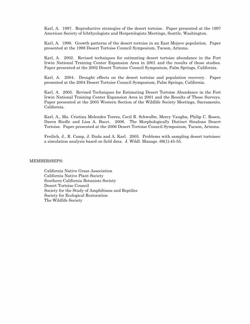
Karl, A. 1997. Reproductive strategies of the desert tortoise. Paper presented at the 1997 American Society of Ichthyologists and Herpetologists Meetings, Seattle, Washington.
Karl, A. 1998. Growth patterns of the desert tortoise in an East Mojave population. Paper presented at the 1998 Desert Tortoise Council Symposium, Tucson, Arizona. Karl, A. 2002. Revised techniques for estimating desert tortoise abundance in the Fort Irwin National Training Center Expansion Area in 2001 and the results of those studies. Paper presented at the 2002 Desert Tortoise Council Symposium, Palm Springs, California. Karl, A. 2004. Drought effects on the desert tortoise and population recovery. Paper presented at the 2004 Desert Tortoise Council Symposium, Palm Springs, California. Karl, A. 2005. Revised Techniques for Estimating Desert Tortoise Abundance in the Fort Irwin National Training Center Expansion Area in 2001 and the Results of Those Surveys. Paper presented at the 2005 Western Section of the Wildlife Society Meetings, Sacramento, California. Karl, A., Ma. Cristina Melendez Torres, Cecil R. Schwalbe, Mercy Vaughn, Philip C. Rosen, Daren Riedle and Lisa A. Bucci. 2006. The Morphologically Distinct Sinaloan Desert Tortoise. Paper presented at the 2006 Desert Tortoise Council Symposium, Tucson, Arizona. Freilich, J., R. Camp, J. Duda and A. Karl. 2005. Problems with sampling desert tortoises: a simulation analysis based on field data. J. Wildl. Manage. 69(1):45-55.
MEMBERSHIPS: California Native Grass Association California Native Plant Society Southern California Botanists Society Desert Tortoise Council Society for the Study of Amphibians and Reptiles Society for Ecological Restoration The Wildlife Society
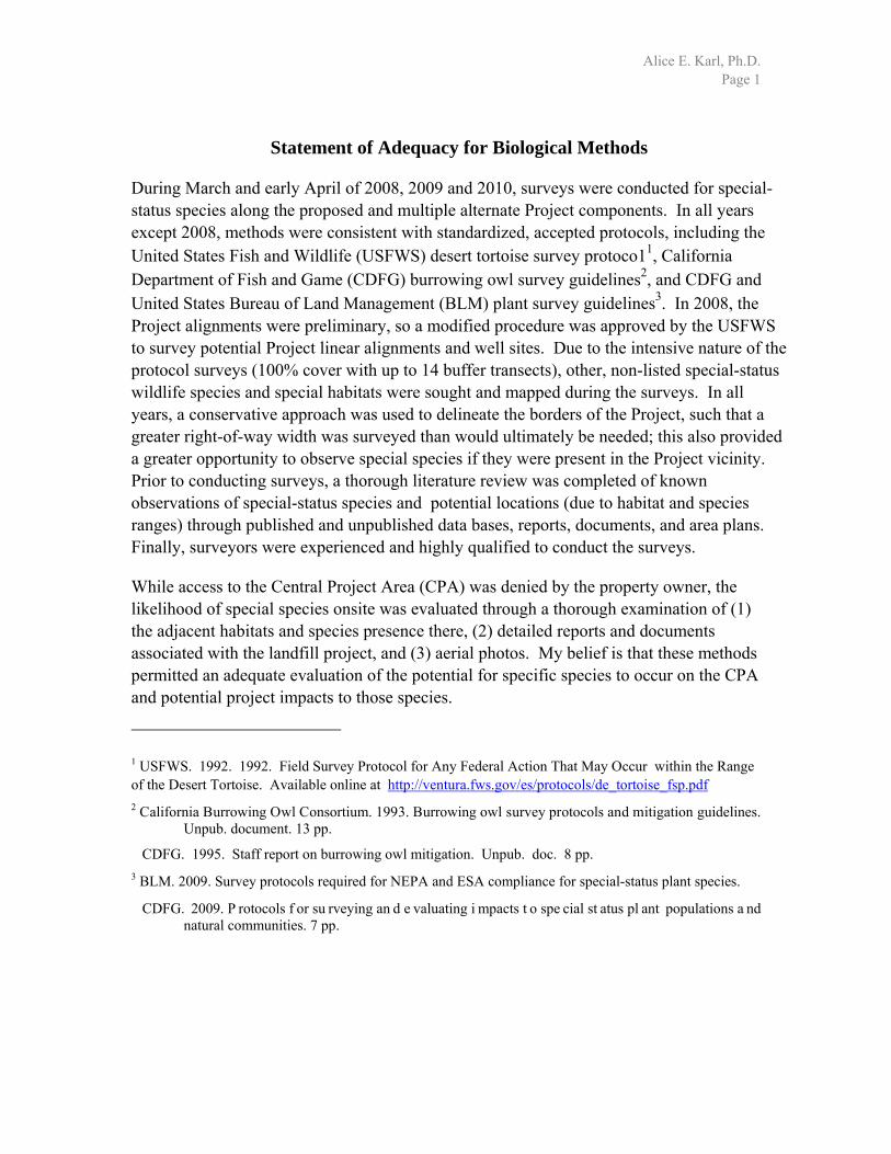
Alice E. Karl, Ph.D. Page 1
Statement of Adequacy for Biological Methods
During March and early April of 2008, 2009 and 2010, surveys were conducted for special-status species along the proposed and multiple alternate Project components. In all years except 2008, methods were consistent with standardized, accepted protocols, including the United States Fish and Wildlife (USFWS) desert tortoise survey protoco11, California Department of Fish and Game (CDFG) burrowing owl survey guidelines2, and CDFG and United States Bureau of Land Management (BLM) plant survey guidelines3. In 2008, the Project alignments were preliminary, so a modified procedure was approved by the USFWS to survey potential Project linear alignments and well sites. Due to the intensive nature of the protocol surveys (100% cover with up to 14 buffer transects), other, non-listed special-status wildlife species and special habitats were sought and mapped during the surveys. In all years, a conservative approach was used to delineate the borders of the Project, such that a greater right-of-way width was surveyed than would ultimately be needed; this also provided a greater opportunity to observe special species if they were present in the Project vicinity. Prior to conducting surveys, a thorough literature review was completed of known observations of special-status species and potential locations (due to habitat and species ranges) through published and unpublished data bases, reports, documents, and area plans. Finally, surveyors were experienced and highly qualified to conduct the surveys.
While access to the Central Project Area (CPA) was denied by the property owner, the likelihood of special species onsite was evaluated through a thorough examination of (1) the adjacent habitats and species presence there, (2) detailed reports and documents associated with the landfill project, and (3) aerial photos. My belief is that these methods permitted an adequate evaluation of the potential for specific species to occur on the CPA and potential project impacts to those species.
1 USFWS. 1992. 1992. Field Survey Protocol for Any Federal Action That May Occur within the Range of the Desert Tortoise. Available online at http://ventura.fws.gov/es/protocols/de_tortoise_fsp.pdf 2 California Burrowing Owl Consortium. 1993. Burrowing owl survey protocols and mitigation guidelines.
Unpub. document. 13 pp.
CDFG. 1995. Staff report on burrowing owl mitigation. Unpub. doc. 8 pp. 3 BLM. 2009. Survey protocols required for NEPA and ESA compliance for special-status plant species.
CDFG. 2009. P rotocols f or su rveying an d e valuating i mpacts t o spe cial st atus pl ant populations a nd natural communities. 7 pp.

Alice E. Karl, Ph.D. Page 2
Based on these factors, it is my belief that the surveys provided an excellent data set for evaluating the presence of biological resources and potential project impacts, both project-specific and cumulative, that might result from any and all phases of the project, as well as for crafting conservation measures to minimize and eliminate impacts to special biological resources and biological resources in general.
___________________________________ June 2, 2011
Alice E. Karl, Ph.D.
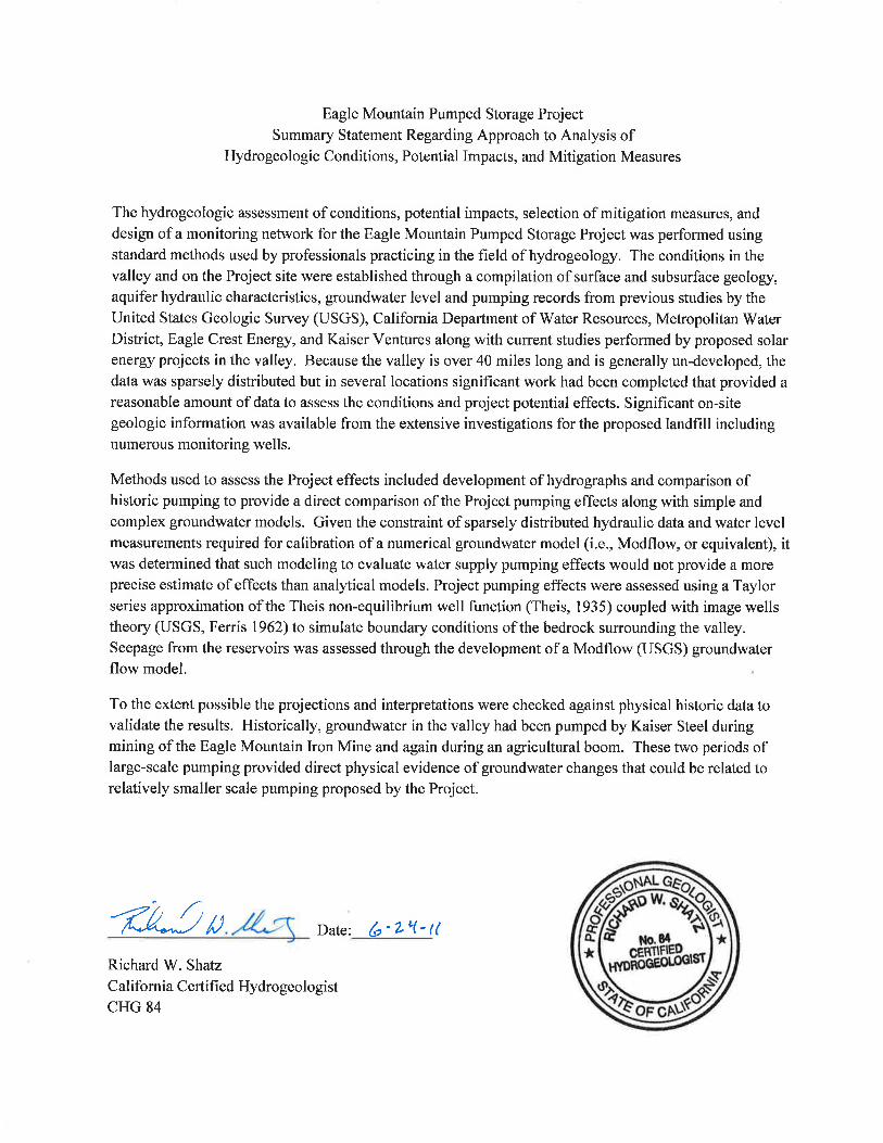

Suttle,R_ENV-HYDRO.doc RSuttle 5/17/11 - 1 -
RICK K. SUTTLE, ASLA Partner Director, Landscape Architecture & Environmental Planning KEY QUALIFICATIONS
Mr. Suttle is a registered Landscape Architect with over 30 years of professional experience in all aspects of Land Planning, Landscape Architecture, Parks and Open Space Design, and Environmental Resource Management. As Director of the Company’s Landscape Architecture and Environmental Planning Department, he oversees all projects involving those disciplines. Mr. Suttle has an extensive portfolio of recreation design projects, environmental studies, and landscape architecture projects. His expertise and background in environmental sciences and visual resource assessment methodologies has helped both public and private sector clients complete restoration projects and meet regulatory permitting requirements. He has authored a number of papers on recreation planning and environmental assessment. PROFESSIONAL REGISTRATIONS Illinois Landscape Architect License No. 157-000825 EDUCATION Degrees:
University of Michigan MLA, Landscape Architecture, 1978 B.S., Resource Ecology, 1975
EXPERIENCE SUMMARY The following project experience has been highlighted due to its relevance to anticipated projects. Additional experience summaries can be provided upon request. Mr. Suttle’s expertise includes management and preparati on of a variety of natural resource management projects, including environmental assessment studies, visual impact assessment studies, wetland delineation studies, permits, vegetation inventories, preservation plans, natural resource restoration plans, stream restoration and erosion control plans. Project highlights include: NATURAL RESOURCE MANAGEMENT AND PERMITTING STUDIES Riverside Medical Center Wind Turbine Project, Illinois – Served as project coordinator relevant to preparation of an Environmental Assessment for a 1.6 MW wind turbine facility in northeast Illinois. Coordination included consultation with Federal, Stat e and local agencies, scoping process, and various studies. Directly responsible for preparing wetl and permitting, visual impact assessment, and land use studies. Autobahn Race Track, Joliet, IL - Project Manager for a 3.5 mile Grand Prix style race course including a private Country Club. Guided clients through the development and permitting process with State, Federal and local agencies and municipalities. Prepared wetland mitigation plan, landscaping plans, and oversaw QA/QC
Suttle,R_ENV-HYDRO.doc RSuttle 5/17/11 - 2 -
procedures associated with construction document prepar ation. Significant coordination with client and pipeline companies was needed to secure licensing agreements. Directed planning and design meetings to refine design, and minimize adverse environmental impacts and implement program objectives. Aesthetic treatment of proposed stream crossings and an assessment of alternative road alignments to reduce adverse impacts were important aspects of the project design. Project cost when completed, is expected to be nearly $12 million. Enron Peaker Plant Visual Impact Assessment Studies, Yorkville, IL – Conducted visual impact assessment studies and simulations related to a proposed gas-fired “peaker” plant by Enron Energy Corporation. Studies included a visibility assessment of proposed transmission lines and exhaust stacks, and an evaluation of various mitigation options. Lewis University Quarry and Land Planning Project, Romeoville, IL - Coordinated a study team and the development of environmental and land planning studies involving potential development options for a quarry and undeveloped University property. Study included coor dination with the U.S. Fish and Wildlife Service relevant to potential impacts to endangered species, and with local governments regarding visual impacts associated with development of a quarry located within a key image/entry area to the community. Coordinated a design charrette with University personnel, government officials and local partner groups. Interstate-80 Bridge Aesthetic Treatment Project, Morris, IL – Led a design study to assess various aesthetic treatments for a proposed new Interstate-80 bridge crossing the main entry into the downtown Morris. Coordinated meetings with local government officials and Illinois Department of Transportation officials to reach consensus on design treatments. Prepared simulations of proposed treatment for evaluation. D’Arcy Restoration Project - Prepared a shoreline restoration plan to support an after-the-fact section 404 permit, relevant to shoreline erosion along the DuPage River. The plan included both a structural and a biotechnical design component. A stone retaining wall was incorporated to absorb impact at critical flow locations; native grasses and willow facines integrated into a turf reinforcement mat completed the downstream section. Recreation, Trail & Open Space Plans. Have prepared numerous recreation designs, trail and open space plans for municipalities and private clients. HYDRO POWER AND ROUTE SELECTION STUDIES FERC Licensing Projects -Involved in over 30 Federal E nergy Regulatory Commission (FERC) licensing/relicensing projects (prior to joining RT&A). Duties included conducting recreation, land management and visual impact assessment studies, and coordination of cultural and socioeconomic resource investigations and preparation of environmental assessment documents. Transmission Line Site Selection/Visual Impact Studies – Coordinated route selection and visual impact assessment studies of transmission line projects in several States, including Alaska, Maryland, Montana, Virginia, West Virginia, Michigan, New York, and Illinois. Several of the studies involved application of the U.S. Forest Service’s Visual Resource Management (VRM) system. Eagle Mountain Pumped-Storage Project, California – Conducted recreation, land use, visual, cultural, and socioeconomic resource impact assessment studies associated with the potential development of a pumped-storage hydroelectric project in southeast California. Responsibilities included the preparation of preliminary and final environmental assessment sections to support an FERC license application and State of California EA requirements. Notable issues included the potential effects on sensitive recreation and visual resources relative to nearby national recreation and wilderness areas, and mountain/desert scenery. Visual studies involved application of the Bureau of Land Management’s VRM methodology. Gibson Hydroelectric Project, Visual Impact Assessment, Montana –Evaluated visual and environmental impacts of various transmission line routes for a pr oposed hydroelectric project in Montana on behalf of a confidential client opposing the project. Functions included site studies, and review of existing scoping documents, license application and relevant data to assess the potential significance of visual and environmental impacts of routes proposed by the Applic ant. Efforts resulted in a selection of a new
Suttle,R_ENV-HYDRO.doc RSuttle 5/17/11 - 3 -
transmission line route by the Applicant that satisfied all parties involved. HydroPower Benefits Study, North America - Part of a study team led by GEI, Inc. to identify and summarize various non-energy benefits provided by North American hydro power owners. The study looked at numerous energy related studies and projects for various regions of the country, and summarized non-energy trade-offs and monetized the values of energy and non-energy benefits in comparable (2008) dollars. The study was sponsored by 47 international utilities and suppliers of hydropower through CEATI International, Montreal, Canada. Boundary Dam Hydroelectric Project Expansion, Washington – Developed reports on land use, recreation and aesthetic resources for Exhibit E of the FERC License Application. Studies included descriptions of existing recreational opportunities and use, land uses, vi sual resources, development of a recreation plan, assessment of effects and preparation of land management and resources protection measures. Dillon Dam Hydroelectric Project, Colorado – Responsible for evaluating recreation and visual impact studies associated with rehabilitation of the Dillon Dam in Colorado. Tasks also included the application of various best management practices to reduce the impacts from construction. Whitewater Boating Survey, West Virginia - Prepared recreation and visual impact reports for the Summersville Modification Study, WV. The study included coordination of white-water boaters during a streamflow test and evaluation of the possible effects of various flow variations on white-water recreation. These efforts contributed to the selection of a flow regime that compromised power production with aquatic resources and white-water boating. Effects of reservoir fluctuation on reservoir-related recreation were also evaluated. Visual Impact Assessment, Montana - Prepared a visual impact assessment and recreation plan for a potential hydroelectric project affecting a scenic waterfall on the Kootenai River in Montana. The study included use of a computerized visual assessment methodology developed by the Forest Service (VIEWIT), and the design of special mitigation measures to distribute project flows over the falls. Prepared expert witness testimony to the FERC on visual and recreational resource impacts. Environmental Impact Assessment Studies, Alaska - Participated in preparation of two EISs for the Tongass National Forest in southeast Alaska, in which impacts of proposed timber harvest alternatives were assessed. Duties included coordinating the project's recreational and visual resource impacts, including use of computerized simulations to support the assessment of visual impacts - a key resource concern in southeast Alaska. Transmission Line Study, El Salvador – Participated in an environmental assessment associated with the construction and restoration of transmission lines and substations destroyed during the Civil War in El Salvador. The project, funded in part by the Inter-D evelopment Bank, was conducted for the Comision Ejecutiva Hidroelectrica Del Rio Lempa in San Salvador. The study involved field review and meetings with local and national agency personnel to identify key environmental issues. The study focused on an analysis of impacts to natural resource systems, as well as assessment of the effects of the line's routing on existing land uses, including agriculture and relocation needs. Transmission Line Study, Alaska - Supervised environmental studies to support a major transmission route selection and feasibility analysis of interconnecting communities throughout southeast Alaska. The study, conducted for the Alaska Power Authority, involved development of route selection criteria, environmental data collection, state and federal agency coordination, and meetings with local governments. Meetings with agencies and local governments included communities of Haines, Skagway, Juneau, Ketchikan, Petersburg, Wrangell, and Sitka. Hydroelectric Project, Alaska - Served as project environmental coordinator responsible for conducting siting studies and environmental assessments for 345-kV transmission lines associated with the proposed 1,020-MW Susitna Hydroelectric Project, AK. Work included coordination of study team analyzing environmental, social, technical, and economic constrai nts for identified transmission route alternatives, including visual impact assessments and simulations. The study also included extensive coordination with federal, state, and local agencies, and several public presentations. Also served as recreation subtask leader in charge of developing a $3-million recreation plan associated with the project, including evaluation of impacts
Suttle,R_ENV-HYDRO.doc RSuttle 5/17/11 - 4 -
to world-class whitewater and highly rated scenic quality. Hydroelectric Project, Alaska - Task leader responsible for visual and recreation resources on the Black Bear Lake Hydroelectric Project, located on the Prince of Wales Island near Ketchikan, AK. The study included preparation of resource overlay maps and analysis of resources and constraints. Areas of concern included eagle habitat, visual and cultural resource assessments. Used USFS Visual Resource Management system to document scenic quality and viewsheds of key view locations. Recommended mitigation measures to reduce or avoid visual impacts resulting from the proposed project. Visual Impact Assessment, Maryland - Responsible for managing a visual impact assessment study involving alternative transmission line crossings of the Appalachian Trail in northern Maryland. As part of an environmental assessment, the study helped Allegheny Power Corporation determine a preferred transmission line crossing that balances effects on aesthetics, land use, cultural, fish and wildlife resources. Close coordination with agencies, particularly the National Park Service, which manages the Appalachian Trail, was an important aspect. The study included use of the U. S. Forest Service's Visual Resources Methodology (USFS VRM) principles to assess the area's visual resources and sensitivity to impact. Additionally, computer-generated simulations from key view locations were prepared to support the assessment. Recreation Plan, Hydroelectric Project, Rome, GA - Lead planner for the Oglethorpe Power Corporation licensed hydroelectric pumped-storage project in Georgia. Prepared a detailed recreation demand study and recreation master plan for an estimated $6-million development. Coordinated development of a compre-hensive resource management plan. The plan included recreation, fish, and wildlife management actions, in addition to reservoir and shoreline operation and management guidelines related to use and protection of project's natural and recreational resources. Evaluated visual effects of two separate transmission line routes. Participated in multi disciplinary meeting in which structured decision making process was utilized to compare and evaluate tradeoffs. Multiple Land Management Plans, Michigan. - As Project Manager for Consumers Power, Hydroelectric Relicensing Projects, MI, directed the preparation of land management, recreation, aesthetic, and socioeco-nomic studies for hy droelectric projects on three separate river drainages in Michigan. National wild and scenic river status for one river and adjacent National Forest lands required close coordination with state and federal agencies. Aesthetic and recreation resource studies involved close coordination with representatives of the Huron-Manistee National Forest to utilize Forest Service Visual Resource Methods (VRM) and Recreation Opportunity Spectrum (ROS) information. Hydroelectric Project, Virginia - Prepared a recreation plan and detailed design drawings associated with the 2100-MW Bath County Pumped Storage Project, VA. The design included two 40-acre ponds developed from borrow areas, a beach, and boating, picnic, and campground facilities. Prepared recreation demand reports, construction drawings and specifications. PUBLICATIONS Suttle, R. "Resolving Conflicts Between Power and Recreation Benefits, Case History V."
Proceedings Hydropower & Nonpower Resource Values Conference, Denver, CO. July, 1991. Suttle, R., Pott, D., Burke, C. "Planning Wetlands for Flood Control in Indiana. " Association of State
Floodplain Managers Conference, Seattle, WA. Suttle, R. "Integrated Resource Planning Meets Challenge of Engineering Requirements for a Pumped-Storage Hydroelectric Project." Thirteenth Annual USCOLD Lecture Series, Chattanooga, TN, May 1993 Suttle, R., Bedross, S. "Creating Wetlands to Enhance a Golf Course," National Interagency Workshop
on Wetlands. April 1995 Suttle, R., McCollum, W. “Planning and Design of the New Lenox Community Golf Course”, ASCE
Conference, June 1998. Suttle, R. “Joliet’s Autobahn Race Course Keeps Conservation On Track”. 31st Natural Areas
Conference, Chicago, IL. 2004.
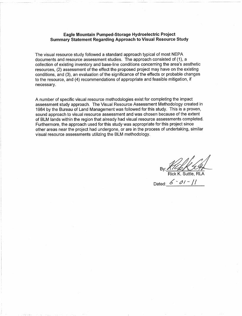
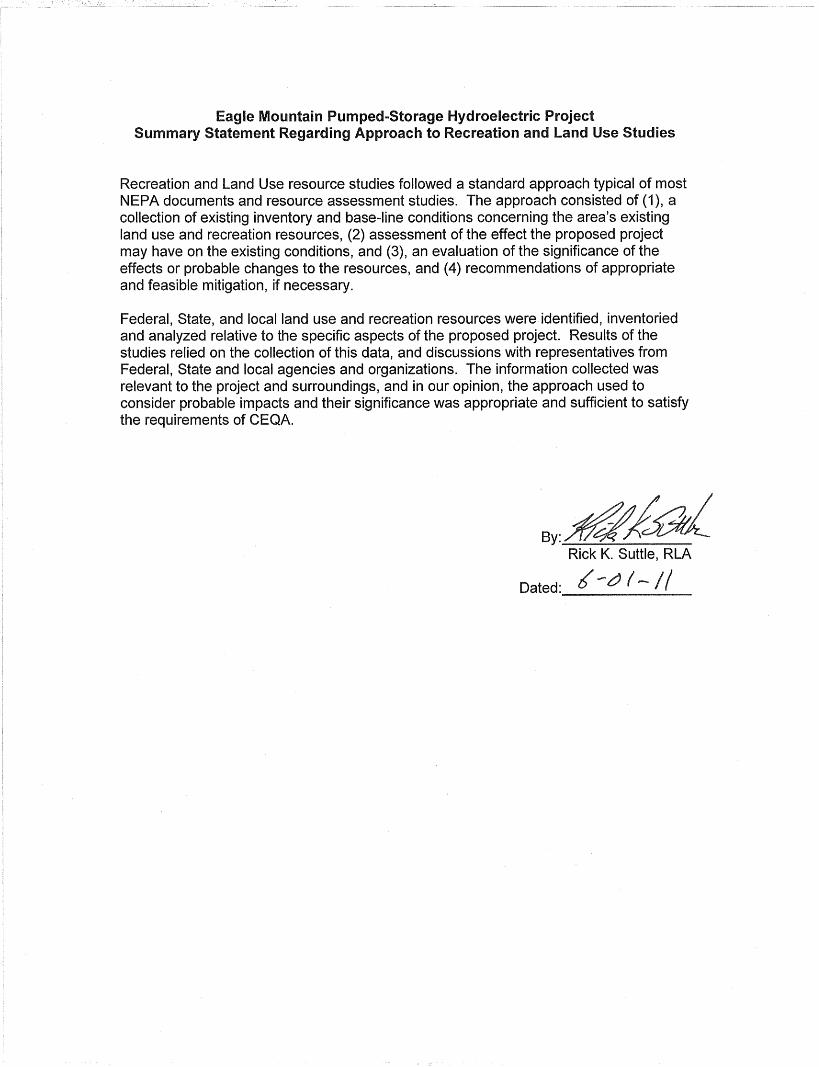
MICHAEL J. DAHM, AICP Senior Planner KEY QUALIFICATIONS
Mr. Dahm is a Certified Planner and GIS Consultant with over 9 years of experience in Land Planning, Comprehensive Planning, Impact Assessments, Environmental Assessments, and GIS mapping. As a Senior Planner, he has expertise in conducting planning efforts and preparing environmental assessments and comprehensive land use controls. Mr. Dahm also serves as a project manager and CAD designer on many land planning & subdivision projects. As part of the planning process, he provides, reviews and coordinates material for establishing client goals and objectives; and policy statements for public planning documents. Mr. Dahm works with many Illinois municipalities and is familiar with planning issues facing municipalities in the region. PROFESSIONAL REGISTRATIONS American Institute of Certified Planners No.: 021296 EDUCATION Degrees:
Iowa State University B.S., Urban and Regional Planning, 2002
EXPERIENCE SUMMARY
The following project experience has been highlighted due to its relevance to anticipated projects. Additional experience summaries can be provided upon request. Mr. Dahm’s expertise includes preparation and work on of a variety of projects including land use plans, environmental assessment studies, permitting, GIS mapping and impact studies. Project highlights include: NATURAL RESOURCE MANAGEMENT AND PERMITTING STUDIES Riverside Medical Center Wind Turbine Project, Illinois – Served as project planner to provide environmental, land use and permitting consulting for an Environmental Assessment for a 1.6 MW wind turbine facility in northeast Illinois. Prepared land use analysis as well as created maps and figures to assist with land use and visual analysis for the project. Community Health Center NEPA Reports, Illinois - Served as project manager and coordinator to prepare and submit NEPA Environmental Assessments to Health Resources and Services Administration for two proposed community health centers. Directly respons ible for preparing the EA reports and figures for submission and approval to HRSA. Phase I Environmental Site Assessment Consulting – Prepared over 40 Phase I Environmental Site Assessment reports to ASTM standards for agricultural, residential, commercial and industrial properties.

HYDRO POWER AND ROUTE SELECTION STUDIES Eagle Mountain Pumped-Storage Project, California – Conducted socioeconomic and assisted with the land use resource impact assessment studies associated with the potential development of a pumped-storage hydroelectric project in southeast California. Responsibilities included the preparation of preliminary and final environmental assessment sections to support an FERC license application and State of California EA requirements Gibson Hydroelectric Project, Visual Impact Assessment, Montana- Worked with GEI Consultants to review a proposed hydroelectric dam license with the Federal Energy Regulatory Commission (FERC). Evaluated the visual impacts of proposed transmission line routes proposed by the applicant on a local land owner and provided input on alternative routes. LAND USE AND FEASIBILITY STUDIES Southwest Will County TMA Feasibility Study, Will County, IL – Partnered with AECOM on the preparation of a Transportation Management Association Feasibilit y Study for Southwest Will County along with the preparation of an updated Transportation Plan for the Joliet Arsenal Development Authority. Created an inventory and GIS maps of the study area’s transpor tation assets, employment and visitor generators, and planned development projects that are creating this dynamic growth area. Midewin Alternative Transportation Plan, Will County, IL – Partnered with AECOM on to examine transportation access to the Midewin National Tall Gra ss Prairie. Created GIS maps for rail, vehicle and bicycle transportation and access to Midewin from the surrounding region. Inland Port Impact Study, Will County, IL – Partnered with AECOM on to examine the flow of freight to provide recommendations for future projects to reduce congestion delays, conflicts and disruptions to freight transportation and reduce or mitigate negative impacts from development. Created an inventory and GIS maps of all transportation and real estate assets in the study area. Southside Comprehensive Plan, City of Joliet, IL – Preparation of a comprehensive plan for 25 square miles of future planning area for the City. The plan placed emphasis on protecting existing natural features and open space while emphasizing planned economic growth through industrial, recreational and commercial uses. Comprehensive Plan, Village of Elwood, IL - Prepared a Comprehensive Plan to incorporate the transitions associated with the redevelopment of the Joliet Army Ammunition Plant and continued industrial, residential and commercial growth. The plan focused on creating planning sectors as well as a transportation plan to separate industrial traffic from the residential and commercial planning areas. Comprehensive Plan, City of Wilmington, IL - Prepared a Comprehensive Plan to incorporate changes to the land use and additional planning areas west of I-55 for future industrial and commercial opportunities. Key elements of the plan include an emphasis on utilizing the transportation centers for commercial and industrial expansion with appropriate separation and buffering for residential growth. Comprehensive Plan, Village of Shorewood, IL - Assisted in the preparation of the Comprehensive Plan in 2007 that focused on creating design sectors to provi de opportunities for transit oriented, traditional and conservation design. Near West Side Neighborhood Plan, City of Joliet, IL – Assisted in the preparation of the neighborhood plan for the City to provide new vehicular and pedestrian connections and intersection improvements as well as destination points and greenway corridors to provide gateways to the community.
Robert N. Lambe, Ph.D., P.G. 1
Robert N. Lambe, Ph.D., P.G., Vice President Education Ph.D., Geology and Geochemistry, University of California, 1981 M.A., Geology and Geochemistry, University of California, 1976 B.S., Geology, Massachusetts Institute of Technology, 1974
Registration Licensed Geologist: North Carolina Registered Geologist: Tennessee
Background
Dr. Lambe has more than 30 years of experience managing site characterization, permitting and remediation, projects at large or complex industrial sites. He has worked for Fortune 100 clients around the globe assisting in the siting and development of new projects as well as managing remedial liabilities at existing operations.
Dr. Lambe’s clients have included utilities, oil and gas, chemical, aerospace, manufacturing, mining, and the United States government (Department of Defense, Department of Energy, Environmental Protection Agency).
Experience
Environmental Impact Assessments
Environmental Impact Assessment, ChevronTexaco, Nigeria. Managed or performed the senior review for three major Environmental Impact Assessments (EIAs) supporting the West African Gas Pipeline Project in Nigeria. These projects included the Escravos Gas to Liquids and Escravos Gas Plant 3 in Nigeria and the Pipeline project in Nigeria, Ghana, Benin, and Togo. Reports were prepared for the governments (in French and English), the consortium led by ChevronTexaco and the World Bank. The project included two major deepwater marine surveys along the pipeline route as well as socioeconomic impacts on the complicated tribal structure in Nigeria and the significant impacts of traversing a sensitive mangrove fisheries habitat.
Environmental Impact Assessment, San Luis Obispo, California. Completed an Environmental Impact Assessment under NEPA and CEQA to assess the impact decomissioning the former Unocal oil fields in San Luis Obispo, California. The final oil extraction process used a diluent to enhance oil recovery that resulted in multiple releases to the environment. The oil fields are situated on the coast in a very sensitive beach-dune-coastal wetland-upland area. The impacts of various remedial actions and restoration scenarios on this sensitive environment were evaluated and preferred options recommended. The project included field data collection activities through report submission.
Environmental Impact Assessment, Enichem, Brindisi, Italy. For the Italian chemical company, Enichem, participated in an environmental impact assessment for the construction of a new ethylene plant in Brindisi, Italy. To help determine potential impacts, field visits were made to the proposed construction site and several operating ethylene units. Responsible for assessing soil, ground, and surface water impacts of the new plant in an Environmental Impact Report (EIR) filed with the Italian government.
Mine Operations Technology Review, Australian Mining Company, Broken Hill, Australia. Reviewed exploration and mining operations, focusing on identifying improved, innovative technologies to increase efficiency and improve profitability. Assessed mining methods and machinery, innovative drilling, rapid (instrumental) assay
Robert N. Lambe, Ph.D., P.G. 2
technologies, blasting techniques, data management computerization, and geological and geophysical exploration techniques.
Risk Assessment of Yucca Mountain Disposal Facility, Department of Energy, Las Vegas, Nevada. Performed a risk assessment of the Exploratory Shaft Facility for the high-level nuclear waste repository at Yucca Mountain, Nevada. This study involved a detailed analysis of the Title 1 Design for all surface and underground facilities. Using fault tree analysis, each component of construction was examined, all failure modes identified, probability of failure estimated, and consequence of failure identified. Primary concern was for loss of life, personal injury, loss of facility and data, and schedule delay. Using this analysis, mitigation factors (modification to design, elimination or replacement of components, and training) were determined to eliminate or lessen risk associated with each component or activity.
Minerals Exploration, Newmont Mining Corp. Supervised all precious and base metal exploration programs in the eastern United States. This included project generation, geochemical sampling program design, economic feasibility studies, budgeting, scheduling, and personnel management. Assisted in determining corporate goals for gold deposit tonnage, grade, mining, and milling characteristics. This was accomplished by visiting more than 40 active, open-pit and underground gold mines throughout the United States and Canada to observe geology and review grade and tonnage figures, operating costs, and milling techniques.
Hydrologic Pump Testing for Mine, Exxon Minerals Co., Crandon, Wisconsin. For the evaluation and development of a major base metal deposit, designed and managed the drilling and participated in a high-capacity pump test to simulate the effect of mine dewatering on the local groundwater regime, conducting similar tests on proposed tailings pond sites to predict possible contaminant-transport routes and using seismic and gravity surveys to define till thickness. Management used the study results to assess the risk of serious water inflow to the mine and the risk of contamination to groundwater from a tailings pond liner breach.
Geological Support of Mine Planning, Metallurgical Circuit Design and EIS, Exxon Minerals Co., Crandon, Wisconsin. Provided the geologic input and assisted in the design of a large ($900 million) underground base metal mine. Provided detailed geologic cross-sections and plans to the mining engineers for mine layout, designed and implemented a large-diameter drilling program to obtain several tons of each ore type for metallurgical pilot testing, and interpreted hydrological field studies to help locate and design spoils and tailings dumps. In support of mining permit applications and preparation of the environmental impact statement, conducted baseline studies to characterize groundwater and surface water quality, radiologic studies to characterize radon production and levels of radionuclides in soils and rock, and a survey for asbestiform minerals. These programs were written into the Environmental Impact Statement (EIS) and testimony made to appropriate state and federal agencies regarding potential environmental risks.
Mine Economics Reserve Analysis of Gold Mine, Gold Mining Company. To assist in the risk evaluation for recapitalization of a major North American gold mining company, conducted a review of reserves and exploration programs for several active gold mines.
Reserve and Mine Feasibility Analysis, Multiple Mining Companies. Supported a number of clients to examine the reserves and mining issues associated with specific coal mines and deposits in the eastern (Appalachian) and western United States and Alaska, and to determine the financial viability of the property for investment and utility versus producer disputes.
Feasibility of Coal Supply, Utility Company. Participated in an analysis of a large open-pit coal mine in a contract dispute with a utility. Responsible for examining exploration methodology, reserves, and coal quality
Robert N. Lambe, Ph.D., P.G. 3
to determine whether the mining company could deliver the quality and tonnage of coal specified in the contract and for support during contract litigation.
Feasibility of Coal Supply (Kentucky), Utility Company. Assisted in the evaluation of an underground coal mine in western Kentucky that supplied coal to the utility. This project included an examination of geology and reserves, coal quality, underground mining technique, roof control problems, the 20-year mine plan, surface support facilities, and the washing plant. Created a series of maps showing the thickness of coal, various overlying shale and sandstone layers, and total overburden depth to predict areas of poor roof. The results were used to examine roof control costs over the 20-year mine life to determine whether the mine could supply coal at the quality and rate guaranteed in the contract.
Financial Analysis of Kaolin Mine, Paper Company, Wrens, Georgia. Performed a financial evaluation of a kaolin property in Georgia. Analysis included reserves, mining methods, permitting issues, mine de-watering, and environmental impacts. To determine the asset value, comparable (active) kaolin operations were evaluated, de-watering costs estimated, and various permit scenarios documented.
Mine Feasibility Analysis, GE Capital. Performed an assessment of the viability of a proposed phosphate mining and milling operation. The assessment included a review of the reserves, calculation methods, lease issues, permit requirements and their status, and mine plan; a walkover of the leases and adjacent properties; a pilot plant tour and inspection of equipment; and an opinion on the likely environmental issues that could impede the project. As a result of the study, it was determined that the project was not financially viable in the market at that time and was unlikely to be approved.
Acquisition Support, Newmont Mining Company. As part of a reorganization and diversification effort for Newmont Mining Corporation, visited and examined numerous active base metal, precious metal, and industrial mineral operations to gather operating data for a cost analysis with regard to purchase. This included reviewing current reserves and evaluating potential reserves; analyzing mining methods and costs, milling costs, and market availability; and recommending acquisition candidates to corporate management.
Feasibility of Gold Mine Metallurgical Process, Al Kalifa Group, Salt Lake City, Utah. For an overseas investor, examined the feasibility of a proposed gold mining property and proprietary metallurgical process in Utah. To determine the feasibility of mining, existing sampling programs were evaluated to establish ore grade, amount of sulfides, and how representative the samples were. The proprietary metallurgical process, observed at laboratory scale, was scaled up on paper to determine reagent costs, water consumption rates, waste generation rates, and metal recoveries. Costs from mining and milling were worked into a 20-year mine plan to calculate cash flows; and, based on these analyses, the project was determined to be economically unfeasible.
Mine Reclamation Mine Reclamation Planning, Iron Mining Company, Hibbing, Minnesota. In an audit of a taconite mine and mill in Minnesota, reviewed mine reclamation plans, activities, and all operational areas for potential soil and groundwater contamination as well as active management of the tailings basins and waste rock piles, and a final report to mine and corporate management.
Design of Wetlands to Treat Acid Mine Drainage, National Rivers Authority (NRA), Cornwall, United Kingdom. For the NRA in Cornwall, Great Britain, assisted in the evaluation of constructed wetlands technology to abate a significant acid mine drainage problem from the district’s historical tin mines. As part of this study, conferred with the U.S. Bureau of Mines staff performing research on constructed wetlands, visited several field projects treating acid mine drainage from Pennsylvania coal mines, and developed a series of recommendations for the NRA.
Robert N. Lambe, Ph.D., P.G. 4
Environmental Liability Assessments
Review of Remedial Liabilities, Polyvinyl Chloride (PVC) Producer, Houston, Texas. Used a unique probabilistic risk model that considered 1) the potential costs associated with remediation of known contaminated site; 2) toxic tort potential from worker history at the facilities; and 3) likely natural resource damage assessment (NRDA) costs associated with contamination of a major river and associated bayous. The costs were prepared to settle a dispute with the seller over eight previously purchased sites.
Environmental Liability Assessment, World Bank, Kingston, Jamaica. Assisted in the evaluation of a petroleum refinery in Jamaica. Determined the existing and potential environmental liabilities associated with the refinery by inspecting the facility, interviewing staff, and reviewing records. Costs were calculated for remedial actions and pollution control upgrades. Current and proposed environmental regulations in Jamaica were reviewed and their impact on the future of the refinery estimated.
Environmental Liability Assessment, Iron Mining Company, Hibbing, Minnesota As part of a corporate divestiture, completed an environmental assessment of the rail and shipping facilities for a taconite producer in Minnesota. Programs associated with oil- and PCB-contaminated soils were reviewed and remedial action costs estimated. Operations including loading, unloading, fueling, and maintenance in relation to hazardous solid waste, tank, asbestos, and PCB management as well as air and water pollution control were all reviewed.
Environmental Support of Acquisition, Mining Company. As part of an acquisition assessment, examined the environmental liabilities associated with an active fluorspar mining and milling operation. The prime areas of concern were the waste rock piles and mill tailings ponds which were leaching trace amounts of metal sulfide into the adjacent streams and wetlands; the monitoring, stabilization, and reclamation plans were then evaluated for adequacy.
Environmental Audit, Department of Energy, Idaho Falls, Idaho. As the senior hydrogeologist for the Department of Energy (DOE) on Tiger Team audit contracts, conducted planning as well as audit plan, report, and performance reviews. Conducted the field audit at the Idaho National Engineering Laboratory and select phases of Weldon Springs.
Environmental Audit, Phosphate Mining Company, Aurora, North Carolina. Examined the gypsum stacks and mill wastes from a phosphate mining, milling, and phosphoric acid facility. The acid ponds and gypsum stacks were leaching fluorine and arsenic into local groundwater aquifers, and low pH solutions also caused dissolution of carbonate rock in the vicinity of the ponds, causing pond failure and leakage. An existing monitoring well program was evaluated and suggestions for improvements made.
Siting and Permitting Eagle Mountain Pumped Storage Project, California. Determined the likely impact of leaching of oxide and sulfide mineralization from the former Eagle Mountain Iron Mine on the quality of water to be used to generate power from a proposed pumped storage facility. Since we could not visit the site, the analysis consisted of reviewing existing documentation on mineralogy and water quality at the site and similar mines elsewhere and the evaluation of likely mineral water equilibria and buffering reactions.
Nine Mile Point Site Characterization, UniStar Nuclear and AREVA, Oswego, New York. Project Manager for a multimillion dollar site characterization project to site, permit, and construct a 1,600MWe Evolutionary Power Reactor (EPR) in New York. The project scope was to characterize the geological, hydrological, and geotechnical characteristics of the site to support site layout (including excavations, tunnels, and safety-related nuclear structures), to provide the basis for seismic analysis of structural integrity, and to provide aspects of the Combined Operating License Application to the U.S. Nuclear Regulatory Commission.
Robert N. Lambe, Ph.D., P.G. 5
Our program included: approximately 16,500 feet of on shore and off shore barge drilling, installation of a monitoring well network, over 130 hydraulic tests, approximately 48,000 feet of on shore and off shore seismic reflection and refraction surveys, down-hole surveys, approximately 1900 chemical analyses, and over 200 geotechnical laboratory tests of soil and rock. The key challenges of the program were: an accelerated schedule (14 months from start to application filing), a rigorous Appendix B QA program (Nuclear Regulatory Commission), management and coordination of 14 specialty subcontractors and laboratories, compliance with UniStar and AREVA security, safety and quality policies, and interaction with a complex team of design firms. The program was completed with over 100,000 hours without a reportable accident, no environmental or regulatory issues, and no findings during NRC, Unistar, and AREVA audits.
Preparation of Operating Permits, Metals Manufacturer, Fallon, Nevada. For a metallurgical operation of a large U.S. manufacturer, led a team to prepare a water use and operations permit for the plant. The team conducted a reagent and water use audit and recommended process modifications to reduce the plant discharge from more than 400 to 15 gallons per minute, as required by the permit. Other recommendations included recycling tertiary leach acids as make-up to the primary leach, a different form of gravity separation for the product to reduce water consumption, and several water recycling strategies. After reducing the discharge to fewer than 15 gallons per minute, the team designed a water treatment and solar evaporation pond system to meet zero discharge permit conditions.
Professional Associations Member, American Nuclear Society Member, Society for Mining, Metallurgy and Exploration Member, Association of the U.S. Army
Publications Lambe, R. and Langseth, D. (1996). “Remediation Assets: Treating Cleanup as a Corporate Business Element Helps Manage Costs, Satisfy Stakeholder Needs.” Environmental Solutions, no. 4, pp. 22-25.
Lambe, R. and Waterman, R. (1996). “Military Cleanup—Bringing New Life to Old Sites.” Waste Management and the Environment, vol. 2, pp. 18-19.
Langseth, D. E. and Lambe, R. N. (1996). “Remediation Management: Improving Performance and Getting Results.” Prism (Arthur D. Little), vol 4, pp. 103-112.
Wescott, W. F. and Lambe, R. N. (1995) “Three Paths for Developing Countries.” Tomorrow, April/June, p. 76.
Bowen, R. C. and Lambe, R. N. (1994). “Analyzing the Costs of Remediation Options.” Best’s Review, vol 1, pp. 70-72.
Lambe, R. N. and Rowe, R. (1987). “Volcanic History, Mineralization, and Alteration of the Crandon Massive Sulfide Deposit.” Economic Geology, vol. 82, pp. 1204-1238.
McCarthy, J. H., Lambe, R. N., and Dietrich, J. A. (1986). “A Case Study of Soil Gases as an Exploration Guide in Glaciated Terrain—Crandon Massive Sulfide Deposit.” Wisconsin: Economic Geology, vol. 81, pp. 408-420.
Hay, R. L., Hildreth, W., and Lambe, R. N. (1979). “Globule Ignimbrite of Mt. Suswa, Kenya,” Geological Society of America, Special Paper, vol. 180, pp. 167-175.
Lambe, R.N., Kosco, D.G., Hebert, A. J., and Curtis, G. H. (1974). “Soft X-ray Analysis of the Grizzly Peak Volcanics, Berkeley Hills.” California: Bulletin Lawrence Berkeley Laboratory, pp. 360-361.
Robert N. Lambe, Ph.D., P.G.
Statement of Adequacy for Water Quality Impact Analysis
The potential impact of the mineralogy associated with the former iron ore mining operations on the stored water in the former mine pits as part of the pumped storage process was evaluated by several methods. First, a base line mineralogy was established by reviewing documents available from the former iron ore mining operations, subsequent studies performed for the proposed landfill project and historical geological reports and papers written on the Iron Mountain District. While this was in lieu of being able to make observations in the field due to site inaccessibility, this means of establishing the baseline mineralogy is deemed appropriate and sufficient based on the variety and quality of reports available.
Next, ore deposits of similar geology and mineralogy were identified from a literature search, generally consisting of state and federal agency reports and academic peer‐reviewed papers. In particular studies of the impact of mineralogy on the pH and chemical constituents of water quality were examined as a model of what the water chemistry could reflect at the Eagle Mountain site during pumped storage operations. This would be a conservative approach as most of the sites were in areas experiencing less evaporation than Eagle Mountain which will require make‐up water that will reduce the concentration of the dissolved metals leached from the residual ore minerals. Also, interviews were conducted with various state and federal agencies doing research or responsible for mine water quality to gather information on this or similar sites. Other than what has been cited in the report, no further studies were mentioned by interviewees. Again, this approach was taken since the opportunity to collect samples and perform laboratory bench scale leach testing was not possible. However, when samples are collected in the future, the appropriate tests and calculations based on the best industry methods currently used by laboratories servicing the mining industry and cited by the U.S. Environmental Agency and U.S. Geological Survey are cited in our responses to questions.
Lastly, the chemistry of the natural waters was examined from previous reports on basins adjoin the site and of similar geology and chemistry to determine whether the ground water used to fill the pits and provide make‐up water would affect leaching or degrade the quality of the water in the pumped storage system. The conclusion is that this is highly unlikely.
/s/ June 21, 2011
Signed: Robert N. Lambe, Ph.D., P.G.
Nick D. Miller, P.E. 1
Nick D. Miller, P.E., Project Engineer Education M.E., Civil Engineering, Colorado State University at Fort Collins, 2005 B.S., Civil Engineering, Colorado State University at Fort Collins, 2004
Registrations Registered Professional Engineer: Colorado
Background
Mr. Miller is skilled in hydrology, hydraulics, and civil engineering design. Project experience includes dams, spillways, outlet works, pipelines, open channel flow, probable maximum flood studies, and extensive hydraulic computer modeling. Mr. Miller is proficient in several software applications including AutoCAD Civil 3D, HEC-1, HEC-HMS, HEC-RAS, WMS, SEEP/W, and ArcGIS.
Mr. Miller’s construction management and observation experience includes geologic investigations of soil and rock, monitoring well installation, soil compaction, field and laboratory materials testing, and structural inspections of residential footings, caissons, walls, concrete slabs, and perimeter drains.
Experience
Forebay Dam Hydropower Alternatives Analysis, El Dorado County, California, El Dorado Irrigation District. Engineer responsible for developing hydropower optimization models and simulation of hydropower operations for several dam and reservoir configuration alternatives. Necessary tasks included reviewing historical hydropower operations, developing reservoir drawdown schedules and inflow data, modeling optimized hydropower operations, and estimating the monetary benefits for each of the dam alternatives. The above tasks required the use of computer programs including MS Excel and MS Visual Basics.
Long Hollow Dam Hydrology Study, La Plata County, Colorado, Colorado Water Resources and Power Authority. Engineer responsible for performing all hydrology and hydraulic calculations and computer modeling for the development of the Long Hollow Dam probable maximum flood (PMF) estimate. Necessary tasks included watershed and subbasin delineation, development of probable maximum precipitation (PMP) using HMR 55A and Extreme Precipitation Analysis Tool (EPAT), estimating basin loss rates, determining drainage baseflows, developing unit hydrographs, developing spillway rating curve, creating channel and reservoir routing parameters, and preparing the final report and figures. The above tasks required the use of several computer programs including WMS, HEC-HMS, HEC-RAS, and GIS.
Cucharas Dam Hydrology and Incremental Damage Analysis Study, Huerfano County, Colorado, Two Rivers Water, LLC. Engineer responsible for performing all hydrology and hydraulic calculations and computer modeling for the development of the Cucharas Dam probable maximum flood (PMF) estimate and Incremental Damage Analysis. Necessary tasks included watershed and subbasin delineation, development of probable maximum precipitation (PMP) using HMR 55A and Extreme Precipitation Analysis Tool (EPAT) estimating basin loss rates, determining drainage baseflows, developing unit hydrographs, developing spillway rating curve, creating channel and reservoir routing parameters, developing hydraulic river model, performing incremental damage analysis, and preparing the final report and figures. The above tasks required the use of several computer programs including WMS, HEC-HMS, HEC-RAS, and GIS.
Merced Falls Dam Break Study, Merced County, California, Pacific Gas and Electric Company. Engineer responsible for performing hydraulic calculations and flood mapping for the Merced Falls Dam break scenario. Necessary tasks included estimating dam breach parameters, developing and calibrating a HEC-RAS model, evaluating USGS gage data, determining downstream flow rates, performing dynamic
Nick D. Miller, P.E. 2
flood routing, performing sensitivity analyses, and preparing the final report and figures. The above tasks required the use of computer programs including AutoCAD, HEC-RAS, and GIS.
Coal Ash Impoundment Inspection and Dam Safety Assessment, Owensville, Indiana, Environmental Protection Agency. Engineer responsible for performing an inspection and dam safety assessment of six large coal ash impoundment dams at the Duke Gibson Generating Station in Indiana. Necessary tasks included inspection of the dam crests, upstream and downstream slopes, spillways, outlet works, toe drains, reservoir rim, and instrumentation. Specific items evaluated included settlement, movement, erosion, seepage, leakage, cracking, deterioration, spillway adequacy, slope stability, and adequacy of maintenance program. The dam safety assessment and recommendations were summarized with a report and figures.
Reservoir Drawdown Plans for the Missouri-Madison Hydroelectric Project, Missouri-Madison River, Various Locations Statewide, Montana, PPL Montana. Engineer responsible for developing reservoir drawdown plans for routine maintenance and inspections that minimize downstream water quality impacts at Hebgen, Madison, Holter, and Hauser Reservoirs. Necessary tasks included collecting and processing bathymetric data, developing reservoir cross sections, evaluating USGS gage data, estimating critical flow rates and velocities, providing recommended drawdown rates at specific reservoir elevations, and preparing the final report and figures. The above tasks required the use of several computer programs including AutoCAD, Surfer 7.0, Microsoft VBA, and Excel.
Montgomery Dam Improvements, Park County, Colorado, Colorado Springs Utilities. Engineer responsible for performing hydrology and hydraulic calculations for the improvement and repair of the 72-inch gated outlet works and diversion pipeline system. Necessary tasks included estimating various recurrence interval inflows, sizing the replacement pipeline and control gate, sizing the diversion pipeline, estimating system losses, developing discharge rating curves, determining hydraulic and energy grade lines, performing cavitation calculations, and assisting in preparation of the final report and figures. The above tasks required the use of several computer programs, including HEC-HMS, HEC-RAS, and AutoCAD LDD.
Coal Ash Impoundment Inspection and Dam Safety Assessment, Pottawatomie County, Kansas, Lockheed-Martin Corporation. Engineer responsible for performing an inspection and dam safety assessment of two large coal ash impoundment dams at the Jeffrey Energy Center in Kansas. Necessary tasks included inspection of the dam crests, upstream and downstream slopes, spillways, outlet works, toe drains, reservoir rim, and instrumentation. Specific items evaluated included settlement, movement, erosion, seepage, leakage, cracking, deterioration, spillway adequacy, slope stability, and adequacy of maintenance program. The dam safety assessment and recommendations were summarized with a report and figures.
Lake Maloney Probable Maximum Flood Study, Lincoln County, Nebraska, Nebraska Public Power District. Engineer responsible for performing all hydrology and hydraulic calculations and computer modeling for the development of the Lake Maloney Dam probable maximum flood (PMF) estimate. Necessary tasks included watershed and subbasin delineation, development of probable maximum precipitation (PMP) using HMR 51 and 52, estimating basin loss rates, determining drainage baseflows, developing unit hydrographs, creating channel and reservoir routing parameters, and preparing the final report and figures. The above tasks required the use of several computer programs including HEC-HMS, HEC-RAS, and GIS.
Eagle Mountain Pumped-Storage Project, Riverside County, California, Eagle Crest Energy Company. Engineer responsible for authoring major portions of the final FERC License Application and developing and reviewing preliminary design drawings for the 1300 MW pumped-storage project. Additional responsibilities included performing civil, hydrologic, and hydraulic analyses for sizing of the large pumped storage project ranging from 500 MW to 4900 MW capacity. Necessary tasks included size selection of the upper and lower reservoirs, estimating material quantities and unit prices, sizing inlet/outlet tunnels and penstocks, sizing the underground powerhouse and components, and estimating project costs for 15 different project sizes. Hydrological tasks included watershed delineation, developing probable maximum precipitation
Nick D. Miller, P.E. 3
(PMP) from HMR 59, and determining the required freeboard for each reservoir. The above tasks required extensive use of Autodesk LDD.
North Fork of the Republican River Hydraulic Analyses, Yuma County, Colorado, Republican River Water Conservation District. Engineer responsible for performing hydraulic analyses of the river to estimate flood water surface elevation and estimate the incremental impacts caused by additional flow in the channel. Necessary tasks included review of previous FEMA data, development of a 1.2-mile-long hydraulic simulation model for the river, estimating the 10-, 50-, 100-, and 500-year flood elevations, developing average monthly stream flows, and estimating the incremental change in water surfaces and channel velocities caused by additional flow in the river due to the compliance pipeline. The above tasks required the use of the hydraulic computer program HEC-RAS.
Ivanhoe Lake Dam Repairs, Pitkin County, Colorado, Busk-Ivanhoe Water System Authority. Engineer responsible for performing hydrologic and hydraulic analyses required for dam repairs. Necessary hydraulic tasks included design of the 36-inch replacement outlet works pipeline, sizing the replacement box culvert for Lyle Ditch, and estimating the discharge capacity of two large ditches. Additional tasks included watershed delineation and subbasin development, estimating basin hydrologic parameters including soil and land use data, determining the 100-year 24-hour storm precipitation from NOAA Atlas II, developing subbasin unit hydrographs, performing basin flood routing, establishing the minimum spillway dimensions, and preparing the final report and figures. The above tasks required the use of hydraulic computer programs, including HEC-RAS, FlowMaster, and HEC-1.
Design and Cost Estimate for the Williams Fork Collection System, Grand County, Colorado, Denver Water. Lead project engineer responsible for managing and developing feasibility level designs and cost estimates of an open channel flow pipeline collection system which conveys water from the west slope of Colorado to the east slope of Colorado through a series of pipelines, tunnels, and rivers. Necessary tasks included review and collection of existing data and mapping, design of several diversion, collection, and connection structures, developing pipeline sizing and alignment, design of rock tunnels and access roads, determining unit costs, and preparing the final report and figures. The above tasks required the use of several computer programs including Autodesk LDD, FlowMaster, and GIS.
Scour and Erosion Study for the Vermont Yankee Nuclear Power Sub-Station (VYNPS), Vernon, Vermont, Entergy Nuclear Vermont Yankee. Engineer responsible for performing hydraulic and scour calculations to estimate bank erosion at the power station during the probable maximum flood (PMF) and a downstream dam breach. Necessary tasks included developing, validating, and calibrating an HEC-RAS model to known FEMA flood elevations, determining downstream flow rates, estimating dam breach parameters, performing dynamic flood routing, estimating scour and bank erosion, and presenting the results to the client in a presentation. The above tasks required the use of computer programs including HEC-RAS and GSTARS 2.1.
Probable Maximum Flood (PMF) Study for Robert W. Matthews Dam, Trinity County, California, Humboldt Bay Municipal Water District. Engineer responsible for performing hydrology and hydraulic calculations and computer modeling for the development of the PMF estimates for Robert W. Matthews Dam. Necessary tasks included subbasin delineation of 4 subbasins in a 121-square-mile watershed, development of probable maximum precipitation (PMP) for each subbasin using HMR 59, estimating basin loss rates, determining drainage baseflows, developing 4 unit hydrographs, creating channel and reservoir routing parameters, and preparing the final report and figures. The above tasks required the use of several computer programs including WMS, HEC-1, and GIS.
Santa Felicia Dam Spillway Phase 1 Alternatives Analysis, Ventura County, California, United Water Conservation District. Engineer responsible for performing and managing hydrologic and hydraulic analyses to mitigate dam safety concerns related to the inadequate spillway capacity to pass the probable maximum flood (PMF). Necessary tasks included determination of the recurrence interval of the storm that
Nick D. Miller, P.E. 4
overtops the dam, performing a preliminary incremental hazard evaluation, managing sub-consultant performing the site specific probable maximum precipitation (PMP), identifying several dam and spillway modifications alternatives to pass the PMF, performing hydrologic and hydraulic analyses of the alternatives, estimating the cost for several alternatives, and preparing the reports and figures. The above tasks required the use of hydraulic computer programs including HEC-RAS, HEC-1, and Autodesk LDD.
Santa Felicia Dam Spillway Hydraulic Analysis, Ventura County, California, United Water Conservation District. Engineer responsible for performing all hydraulic calculations and computer modeling to determine the performance of the spillway during a probable maximum flood (PMF) event. Necessary tasks included data collection and review, developing a detailed HEC-RAS model of the spillway and downstream rock channel, determining the spillway rating curve, estimating air bulking and wave heights, developing spillway performance profiles, and preparing the final report and figures. The above tasks required the use of hydraulic computer programs including HEC-RAS and Autodesk LDD.
Design and Cost Estimates for the Upper Colorado River Recovery Project, Grand Junction, Colorado, Northern Colorado Water Conservancy District. Lead project engineer responsible for managing and developing feasibility level designs and cost estimates of nine separate water supply alternatives to provide water for endangered fish in the upper portions of the Colorado River. Necessary tasks included review and collection of existing data and mapping, designing several alternative embankment dams, spillways, outlet works, pump stations, and pipelines, estimating probable maximum floods (PMFs), developing unit costs, and prepare the final report and figures. The above tasks required the use of several computer programs including Autodesk LDD, HEC-1, and GIS.
Design and Cost Estimates for Santaquin Dam, Santaquin, Utah, Santaquin City Corporation. Project engineer responsible for managing and developing feasibility level designs and cost estimates for Santaquin Dam. Necessary tasks included review and collection of existing data and mapping, design of the embankment dam, spillway, and the inlet and outlet works pipelines, estimating the probable maximum flood, developing unit costs, and preparing the final report and figures. The above tasks required the use of several computer programs including Autodesk LDD, HEC-1, and GIS.
Probable Maximum Flood (PMF) Study for the Upper American River Project, Sacramento, California, Sacramento Municipal Utility District. Engineer responsible for performing all hydrology and hydraulic calculations and computer modeling for the development of six PMF estimates at six separate dams. Necessary tasks included subbasin delineation of 13 subbasins in a 500-square-mile watershed, development of probable maximum precipitation (PMP) for each subbasin using HMR 59, estimating basin loss rates, estimating snow depths and performing snowmelt calculations, determining drainage baseflows, developing 13 unit hydrographs, incorporating the use of spillway gates and 7 powerhouse operational procedures, creating channel and reservoir routing parameters, and preparing the final report and figures. The above tasks required the use of several computer programs including WMS, HEC-1, and GIS.
Hydrology and Preferred Alignment for Upper Williams Creek Dam and Reservoir, Colorado Springs, Colorado, Colorado Springs Utilities as a subconsultant to CH2M HILL. Engineer responsible for performing hydrology and hydraulic calculations and computer modeling for the development of the probable maximum flood (PMF) and 100-year storm estimates for Upper Williams Creek Dam. Necessary tasks included watershed delineation of a 4.3-square-mile watershed, development of probable maximum precipitation (PMP) for the basin using HMR 55A, estimating basin loss rates, estimating developed conditions for the basin, developing basin unit hydrographs using USBR and SCS methods, determining reservoir routing parameters, and preparing the final report and figures. The above tasks required the use of several computer programs including AutoCAD, HEC-1, and GIS.
Hazard Classification and Hydrology Report for Miller Dam and Reservoir, Commerce City, Colorado, Denver Water. Engineer responsible for performing hydrology and hydraulic calculations and computer modeling for the development of the hazard classification and the inflow design flood for Miller
Nick D. Miller, P.E. 5
Dam and Reservoir. Necessary tasks included data collection and review, identifying and modeling critical downstream structures, estimating dam breach parameters, performing dam breach routing, creating the dam failure inundation map, and determining the dam hazard classification. Additional tasks included developing basin hydrologic parameters, determining the 100-year storm precipitation from NOAA Atlas II, developing the basin unit hydrograph, performing basin flood routing, establishing the minimum spillway dimensions, and preparing the final report and figures. The above tasks required the use of hydraulic computer programs including HEC-RAS and HEC-1.
Dam Surveillance and Monitoring Program, Various Locations Statewide, California, Pacific Gas and Electric Company. Engineer responsible for developing dam instrumentation surveillance and monitoring model. The program was developed in response to the Federal Energy Regulatory Commission’s requirements for monitoring dam instrumentation. The necessary task included reviewing existing plans, sections, and details associated with instrumentation for over 35 dams, digitizing plan views and section views to accurately display the instrumentation for each dam, and creating an automatic display of recent or historical instrumentation readings.
Rueter-Hess Dam Expansion, Douglas County, Colorado, Parker Water & Sanitation District. Engineer responsible for developing and modeling the emergency spillway scour and headcut erosion during a probable maximum flood (PMF) event. The analysis was performed using the NRCS SITES model for a soil-cement lined emergency spillway. Necessary tasks included review and development of soil-cement, geologic formation, and hydraulic parameters, and performing all the SITES computer modeling.
Southern Delivery System, El Paso and Pueblo Counties, Colorado, Colorado Springs Utilities as subconsultant to CH2M HILL. Engineer responsible for subsurface investigations and documentation of soil and rock logs for the proposed pipeline alignments and pump stations. Necessary tasks included data collection and review, piezometer installation, laboratory testing programs, and report preparation related to the preliminary and final designs of pipeline alignments and pump station designs.
Aurora Reservoir Water Purification Facility, Aurora, Colorado, City of Aurora as subconsultant to CH2M HILL. Engineer responsible for subsurface investigations and documentation of soil and rock logs for the proposed water purification facilities and small jurisdictional dams. Necessary tasks included data collection and review, field permeability tests, piezometer installation, laboratory testing programs, and report preparation.
Lambertson Lakes, Adams County, Colorado, City of Thornton. Engineer responsible for developing and evaluating conceptual alternative designs for the construction of a series of three small dams to meet Colorado dam safety requirements. Necessary tasks included preparation and analysis of preliminary designs for nine dam alternatives, material quantity estimates, development of unit prices, and preparation of conceptual-level cost estimates for each alternative.
Thornton General Services, Adams County, Colorado, City of Thornton. Engineer responsible for installing and monitoring groundwater observation wells in and around the various gravel pit lakes owned and operated by the City of Thornton. Prepared quarterly and annual monitoring reports presenting the data obtained to the client. Other responsibilities included project coordination with the client, land owners, and subcontractors, and the development of a laboratory testing program.
Professional Affiliations American Society of Civil Engineers Association of State Dam Safety Officials
Nick D. Miller P.E., P.H. Page 1
Statement of Adequacy for Engineering Methods
Seepage analyses were performed to estimate the expected groundwater levels and quantity of seepage through the project reservoirs, foundations, and abutments. The seepage analyses were performed using the two-dimensional, finite element program SEEP/W, Version 7.17. The analyses were performed for the project reservoirs using east-west and north-south representative sections. While access to the Central Project Area (CPA) was denied by the property owner, all geotechnical and geological information used for the seepage analyses were obtained from prior field investigations and studies conducted in support of studies for a proposed landfill in the area. The hydraulic conductivity for the various geologic materials present at the site were developed based on the available field permeability tests, laboratory permeability tests, correlations with published values based on material descriptions and gradations, and empirical correlations between grain size and permeability. The volumetric moisture content functions used in the analyses were developed based on the available volumetric moisture content functions provided by the SEEP/W model which represent various typical soils types. Seepage flow rates and gradients were estimated for the project reservoirs at the minimum and maximum water surface elevations. The seepage flow rates were determined based on a unit width of the geologic section. The total seepage rate for the project reservoirs was estimated by multiplying the unit width seepage rate by the average top width for that water surface elevation. This approach to estimating geologic material properties, groundwater levels, and seepage rates from project reservoirs is based on the best available data and was performed using standard modeling practices and widely accepted methodologies in the engineering community. Based on these factors, it is my belief that the approach to seepage analyses and the results developed for the project are appropriate for evaluating potential project impacts, both project-specific and cumulative, that might result from any and all phases of the project. Project drainage and spillway design analyses were performed to estimate the Probable Maximum Flood (PMF), spillway dimensions, stilling basins, and conveyance channel capacities required for the project site and reservoirs. The PMF runoff calculations and reservoir routing was performed using the USACE Hydrologic Engineering Center computer program HEC-1. The analyses were performed for both of the project reservoirs and downstream channels. The site topography and drainage basin delineations were based on USGS 7.5 minute topographical mapping of the area. Consistent with FERC and DSOD guidance, the Probable Maximum Precipitation was developed using rainfall depths published in Hydrometeorological Report No. 59. Losses due to soil infiltration or depression storage were conservatively assumed to be zero. The drainage basin unit hydrographs were developed using the synthetic dimensionless unit hydrograph procedures described in the USBR Flood Hydrology Manual. Spillway and

Nick D. Miller P.E., P.H. Page 2
energy dissipation structure designs were developed following procedures described in the USBR Design of Small Dams. Channel routing, conveyance capacities and water surface profiles in the discharge channels were estimated using the USACE Hydrologic Engineering Center – River Analysis System (HEC-RAS) computer program. The approaches used for performing the hydrologic and hydraulic calculations were based on standard modeling practices and widely accepted methodologies in the engineering community. Based on these factors, it is my belief that the hydrologic and hydraulic calculations developed for the project are appropriate for evaluating potential project impacts, both project-specific and cumulative, that might result from any and all phases of the project. An assessment of the construction activities and quantities was performed to provide a reasonable estimate of the construction schedule, manpower utilization, and the monthly use and types of equipment. The project construction activities and quantities were evaluated and then correlated with various construction equipment types and typical production rates. Construction equipment types and typical production rates were developed from several published and unpublished data bases, reports, documents, and previous project experience. The approach used for estimating the construction schedule, manpower utilization, and the monthly use and types of equipment were based on widely accepted methodologies in the engineering community. Based on these factors, it is my belief that the construction activity calculations developed for the project are appropriate for evaluating potential project impacts, both project-specific and cumulative, that might result from the project. Engineering analyses were performed to estimate pipe sizes, construction materials, pumping head, pumping costs and constructions costs associated with three proposed groundwater wells and water supply lines. Friction losses through the water supply pipes were estimated using the Swamee-Jain equation. Minor losses were assumed to be 20 percent of the total pipe friction losses and pump efficiency was assumed to be 80 percent. The ground water wells will be used during the initial filling of the reservoirs and to provide make-up water lost through evaporation. The approach used for analyzing the groundwater supply system was based on widely accepted methodologies in the engineering community. Based on these factors, it is my belief that the analysis of the groundwater supply system and calculations developed for the project are appropriate for evaluating potential project impacts, both project-specific and cumulative, that might result from the project.
___________________________________ June 10, 2011
Nick D. Miller, P.E., P.H.

Jeffrey D. Brown, R.G., C.E.G. 1
Jeffrey D. Brown, Senior Geologist
Education B.A., Earth Sciences, California State University, Fullerton, 1976 A.A., Undergraduate Studies in Engineering, Fullerton College, 1972
Registrations/Licenses Arizona: Registered Geologist No. 35603 California: Professional Geologist, No. 5144; Certified Engineering Geologist, No. 1930 Washington: Licensed Geologist, Licensed Engineering Geologist, No. 937
Background
Mr. Brown has over 30 years of experience in geologic and geotechnical investigations throughout Southern California and other areas of the southwestern states. He has served as Project Geologist and Project Manager on a broad range of geotechnical, geologic, and environmental projects for the private sector and Federal, State and local governments and agencies.
Experience
Project experience includes dams, pipelines, tunnels and other types of water/wastewater construction, major highway, bridge and light rail transportation projects, residential and commercial subdivisions, educational and medical facilities, retail and office structures, and most other types of land development. His experience in field activities includes geologic hazard assessment, geologic mapping, boring and trench logging, subsurface sampling for geotechnical and hazardous waste studies, hard rock, soft rock and near shore marine sediment core logging, well installation, percolation testing, packer testing, aquifer testing, and rippability testing. Construction-phase experience includes fill observation and compaction testing, footing and drilled pier inspection, excavation and tunnel logging, and pile driving.
Reservoirs and Detention Basins Liquefaction Evaluation and Mitigation, Lake Wohlford Dam, City of Escondido, Escondido, California (2006-2008). Project and Field Geologist during studies to evaluate the liquefaction susceptibility of the 1925 hydraulic-filled expansion to the original 1895 rockfill dam. Responsibilities included coordination for and logging of test borings on the crest and upstream embankment for recovery of samples and Standard Penetration Test blow counts; describing geologic conditions at the site; and locating potential borrow areas and coordinating seismic refraction investigations for siting of a possible replacement dam. Studies were performed under the critical review of FERC and the California DSOD.
San Vicente Dam Raise Project, San Diego County Water Authority, Lakeside, California (2004-2008). Project Geologist for feasibility and preliminary design studies for the raising of San Vicente Dam, a 200-foot tall concrete gravity dam in San Diego County. The investigation for the San Diego County Water Authority included studies at the existing dam site, two saddle dams and two potential onsite borrow areas. Over 4,200 feet of core, ranging from 2.4-inch to 10-inch in diameter, was drilled for the project. Drilling on steep, inaccessible natural terrain and on and through the existing dam utilized specialized rigs and equipment. Packer permeability testing, downhole and surface geophysics, and extensive laboratory testing were performed for the project. Mr. Brown directed and managed the field and laboratory program, was the principal contributor to the Geotechnical Data Report (GDR), and provided geological support to the numerous technical memoranda prepared for the project.
El Dorado Forebay Stability Investigation, El Dorado Irrigation District, Pollack Pines, California (2004). Project and Field Geologist during investigation for the El Dorado Irrigation District into the stability of the 91-foot tall earthen embankment dam, completed in 1923, that impounds this water reservoir in the
Jeffrey D. Brown, R.G., C.E.G. 2
eastern Sierra Nevada. Responsibilities included logging of test borings, Standard Penetration Testing (SPT), sampling of embankment materials, and detailed reporting of activities and the subsurface horizons encountered for Division of Safety of Dams (DSOD) review.
Tapo Canyon Detention and Debris Basin, Ventura County Watershed Protection District, Simi Valley, California (2004). Project and Field Geologist during a geotechnical investigation at the site of the proposed detention dam and debris basin sited at the southern reach of Tapo Canyon, a major drainage that flows into Simi Valley. The conceptual plan indicated that the maximum dam section would be about 60 feet in height on the exterior slopes and about 80 feet high on the interior (basin will be excavated to provide storage and embankment fill).
Left Abutment Wingwall Stability, Sweetwater Dam, Sweetwater Authority, Spring Valley, California (2004) Project and Field Geologist for investigations of the stability of the left abutment wingwall (constructed in 1917) of Sweetwater Dam under the Probable Maximum Flood. Responsibilities included preparation of a detailed field map and profile of the site area for use in stability analyses; coordination of the test drilling program, which required helicopter operations; and logging of two coreholes (with packer permeability testing) to evaluate the thickness of the structure and the condition of the underlying rock materials
San Vicente Reservoir Landslide Investigation, San Diego County Water Authority, San Diego County, California (2003-2004). Project and Field Geologist during characterization of two large (230 and 340 acres) suspected landslides in igneous rock terrain on the reservoir’s perimeter. Services included geologic mapping, detailed review of air photos, analysis of regional fracture patterns and geomorphology, statistical analyses of the over 800 joint orientations collected, and logging and review of core borings to judge the likelihood that displacements had occurred. Included presentation of study results to the State Division of Safety of Dams (DSOD). The investigation was preparatory to a major increase in the height of San Vicente Dam.
Sweetwater Dam Abutment Erosion Potential Investigation, Sweetwater Authority, Spring Valley, California (2003). Project and Field Geologist during an investigation for the Sweetwater Authority into the erosion potential of the fractured metavolcanic abutment rock during an overtopping event. Studies included reviewing details of the multi-phased dam construction (initiated in 1888) and historic overtopping events, field studies to collect fracture data, and estimating the effects of the overtopping peak maximum flood on the current abutment materials.
New Bullards Bar Dam Outlet Increase Project, Yuba County Water Agency, Yuba County, California (2002). Project Geologist during investigations for a proposed supplemental outlet works tunnel at this dam on the North Yuba River. Performed field mapping and rock mass classification of rock core recovered along alignment. Described general subsurface conditions along alignment, including site geology, geologic structure, geologic hazards and anticipated tunneling support requirements for a feasibility-level report.
Contra Loma Reservoir Saddle Dam Seepage and Stability Investigation, Contra Loma Water District, Antioch, California (2002). Project and Field Geologist for investigations to better define the strength and permeability characteristics of the bedrock and embankment materials at the existing saddle dam, in order to evaluate the potential effects of proposed higher operating levels. Responsibilities included logging of test borings, packer testing and subsurface characterization.
Diamond Valley Reservoir, Metropolitan Water District, Hemet, California (1992-1994). Task Manager of rock borrow investigations for the 90M yd3 earth and rockfill dam project for the Metropolitan Water District (MWD) of Southern California. Investigations included geologic characterization, rock core drilling, rock testing and test blasts for three potential borrow areas and for the inlet/outlet tower excavation. Drafted
Jeffrey D. Brown, R.G., C.E.G. 3
project core logging procedures, and supervised core logging and core review for the 20,000+ lineal feet of core drilled during the site characterization phase studies for the project.
Optimal Storage Project, San Diego County Water Authority, San Diego County, California (1991). Performed exploration and evaluation of geologic conditions at two potential dam sites in North San Diego County during feasibility studies for the San Diego County Water Authority's Optimal Storage Project. Included were investigations of rock structure, overburden thickness, and rippability in potential borrow areas.
Chollas Lake Dam, City of San Diego Parks and Recreation, San Diego, California (1983). Geologic mapping and subsurface exploration for a seismic evaluation of the existing Chollas Lake Dam in the City of San Diego.
Lopez Canyon Sewer and Detention Basins, City of San Diego Municipal Wastewater Department, San Diego, California (1983). Field Geologist during geotechnical investigations for a 3-mile length of sewer pipeline and 2 storm water detention basins proposed for construction within Lopez Canyon in the Mira Mesa area of San Diego. The embankments for the detention basins were designed at heights of 20 feet and lengths of 305 and 375 feet.
Honey Springs Ranch Dam and Reservoir, Presenting Incorporated, San Diego County, California (1982). Project Geologist for field exploration and evaluation of foundation and geologic conditions at the proposed recreational, earthfill Honey Springs Ranch Dam and Reservoir, located in decomposed granitic rock terrain of South-Central San Diego County. Performed extensive rippability explorations and analyses for the associated proposed residential community.
Cuyamaca Reservoir Outlet Tower, Helix Water District, San Diego County, California (1982). Field Geologist during the geotechnical investigation for the replacement outlet tower at Cuyamaca Reservoir for the Helix Water District. Included was the logging of a test boring inside the partially-drained reservoir.
Bonita Long Canyon Detention Basin, Gersten Companies, Bonita, San Diego County, California (1981). Field Geologist during geotechnical investigations for a 2-acre detention basin and associated residential subdivision in the South Bay community of Bonita. The embankment of the detention basin was estimated to be at 35 feet in height.
Storage Tanks and Tank Reservoirs Carancho Tanks, Rancho California Water District, Riverside County, California (1993). Project Geologist for geologic assessment and rippability evaluation at the location of two 5M-gallon surface storage tanks and a 1.2-mile long servicing pipeline for the Rancho California Water District.
Winchester Tanks, Rancho California Water District, Riverside County, California (1993). Performed a geologic reconnaissance study for the Winchester water storage tanks (two at 4.3M gallons) and associated half-mile pipeline for the Rancho California Water District.
Black Mountain Tanks/Otay Mesa Tanks, City of San Diego Water Department, San Diego, California (1990-1993). Project Geologist during siting studies for the Black Mountain (1993) and Otay Mesa Water Storage Tanks (1990-1991) for the City of San Diego. Included were subsurface investigations at multiple candidate tank sites (three sites at Black Mountain; eight sites at Otay Mesa) and a discussion of potential geologic hazards and geotechnical constraints at each location.
Otay Reservoirs, Otay Municipal Water District, Rancho San Diego, San Diego County, California (1986, 1989). Project Geologist for geologic assessment and rippability evaluation for the siting of four 20M-gallon underground water storage tanks for the Otay Water District. Follow-up studies included a mid-
Jeffrey D. Brown, R.G., C.E.G. 4
construction investigation of a fault trace that was found to extend directly through the footprint of one of the reservoirs.
Aqueducts, Pipelines and Water/Wastewater Conveyance Desert Aqueduct Feasibility Investigation, Coachella Valley Water District, Riverside County, California (2007-2009). Project Geologist during feasibility studies into the potential for connecting the State Water Project with the Coachella Valley. Assignments included desktop studies to characterize subsurface conditions, including rippability and trench stability, along potential alignments, and preparation of geologic profiles estimating geologic conditions along proposed tunnel routes.
Pipeline 3 and 4 Pump Station Site Alternatives, San Diego County Water Authority, Fallbrook, California (2008). Project Geologist for a geotechnical and environmental constraints assessment for pump station sites proposed for Pipeline 3 (4 alternative sites) and Pipeline 4 (2 alternative sites) of the Second San Diego Aqueduct in northern San Diego County. The purpose of the investigation was to aid in final site selection. Responsibilities included reviews of geologic literature and aerial photographs, a general geotechnical and environmental field reconnaissance, and report preparation.
Otay Mesa Trunk Sewer, City of San Diego Municipal Wastewater Department, San Diego, California (2003). Project Geologist for characterization of subsurface conditions along approximately 6 miles of alternative routes for construction of a sewer main by micro tunneling. Responsibilities included field mapping, review of historic air photos and maps to locate undocumented fill areas, detailed description of geologic strata, and preparation of geologic profiles along the alignments.
San Vicente Tunnel, San Diego County Water Authority, San Diego County, California (2000-2001). Project Geologist for Phase I geotechnical/geologic investigation for the San Diego County Water Authority’s San Vicente Tunnel for the Emergency Storage Project. Two alternative tunnel routes were investigated, ranging in length from about 11 to 12.5 miles. Responsibilities included rock coring, packer testing, well installation, and subsurface characterization along the alignments. Also provided geologic interpretations for tunneling, including rock mass classifications of rock core and prepared the project’s Geotechnical Interpretive Report (GIR).
Miramar Road Pipeline, City of San Diego Water Department, San Diego, California (2000). Project Manager and Field Geologist of the geotechnical investigation for the 36-inch diameter, 4.7-mile long water pipeline, which utilized both cut-and-cover and pipe-jacking (at railway crossings) construction along a major arterial roadway. A separate pipe-jacked segment passed normal to and beneath Interstate 15. Responsibilities included all field studies, including mapping and test drilling, coordination of geotechnical analyses, including evaluations for the appropriate trenchless technology to be used for the freeway and railway crossings.
Pump Stations 18 & 19 Rehabilitation, City of San Diego Municipal Wastewater Department, San Diego, California (2000). Project Manager for geotechnical and coastal erosion evaluations for the rehabilitation/replacement of Sewer Pump Stations 18 (built 1927; refitted 1949) and 19 (built 1950) along the Pacific Beach/La Jolla coastline in San Diego.
Pump Stations 28, 19 and 45 Improvements, City of San Diego Municipal Wastewater Department, San Diego, California (1999). Project and Field Geologist for geologic reconnaissance and test drilling to characterize geotechnical conditions along 4.2 miles of alternative routes for upgrades in sewer mains and pump stations in the Torrey Pines area of La Jolla in San Diego.
San Luis Rey River Pipeline Crossing, San Diego Gas & Electric Company, Oceanside, California (1995). Project Geologist for geotechnical studies investigating a proposed natural gas pipeline crossing of the San Luis Rey River in Oceanside for San Diego Gas & Electric Company.

Jeffrey D. Brown, R.G., C.E.G. 5
South Bay International Wastewater Treatment Plant, International Boundary and Water Commission, San Diego, California (1994). Project Geologist for phased geotechnical investigations for the International Boundaries and Waters Commission’s South Bay International Wastewater Plant, located in the Tijuana River Valley along the San Diego - Mexico border. Work included subsurface evaluations at the plant site and along the servicing water and sewer pipelines with a combined length of 2.7 miles. Field investigations included drilling within the current river channel to develop recommendations for a subsurface crossing via horizontal directional drilling methods.
Pipeline 2000—Phase III, San Diego Gas & Electric, San Diego County, California (1994). Project Geologist for geotechnical evaluations along the Jamacha Segment of the Pipeline 2000 gas pipeline (Phase III) for San Diego Gas & Electric. Performed extensive research of subsurface data from public files to significantly lower field exploration costs for the Pipeline 2000 investigation.
Inland Feeder System, Metropolitan Water District, Riverside County, California (1994). Field Geologist during exploration (rock coring, packer testing and well installation) for the Metropolitan Water District’s Riverside Badlands Tunnel Segment of the Inland Feeder System Project.
Pipeline 2A, San Diego County Water Authority, San Diego County, California (1992). Project Field Geologist during geotechnical and rippability investigations for Pipeline 2A, a 4-mile connector between the 1st and 2nd San Diego Aqueduct in the north county area for the San Diego County Water Authority. Studies included installation of two monitoring wells to recover local groundwater for contamination and toxicity testing.
UNOCAL Gas Pipeline, UNOCAL North American, Santa Maria District, California (1991). Project and Field Geologist for a geologic/seismic hazards evaluation of existing major gas-gathering pipelines in the Santa Maria District for UNOCAL North American.
Clean Water Project Sewer Alignments, Clean Water Project-City of San Diego, San Diego, California (1990). Project Field Geologist for the Clean Water Project's East Mission Bay and Mission Valley Sewers alignments. Studies included logging of numerous test borings and characterization of subsurface conditions along the alignments, which traversed thick sections of natural alluvium, uncontrolled spread fill, and quarry settling pond silts and backfills.
Willow Glen Drive Trunk Sewer, Otay Municipal Water District, Dehesa, San Diego County (1984). Project and Field Geologist for geotechnical investigations along the proposed 4¼-mile alignment of a sewer main constructed adjacent to Willow Glen Drive between Jamacha and Dehesa in southeast metropolitan San Diego County. Studies included test excavations and evaluation of rippability, cut slope stability, and general soil and rock conditions.
Lopez Canyon Sewer and Detention Basins, City of San Diego Municipal Wastewater Department, San Diego, California (1983). Field Geologist during geotechnical investigations for a 3-mile length of sewer pipeline and 2 storm water detention basins proposed for construction within Lopez Canyon in the Mira Mesa area of San Diego. The embankments for the detention basins were designed at heights of 20 feet and lengths of 305 and 375 feet.
Third Pipeline, Second San Diego Aqueduct, San Diego County Water Authority, San Diego County, California (1981). Coordinated field studies and performed geologic and rippability evaluations during investigations through hard rock terrain of north San Diego County for a 12-mile section of the 3rd Pipeline, 2nd San Diego Aqueduct for the San Diego County Water Authority.
Various Sewer Pipeline Alignments, Municipal Wastewater Departments, San Diego County, California (1981-1988). Project Field Geologist for subsurface characterization and field exploration for
Jeffrey D. Brown, R.G., C.E.G. 6
major sewer alignments, including the San Marcos Tunnel (San Marcos, 1981), the Lopez Canyon Sewer line (San Diego, 1983), the Willow Glen Drive Trunk Sewer (Dehesa, 1984), and the Wabash Trunk Sewer (San Diego, 1988).
Levees American River Levees, California Department of Water Resources, Sacramento, California (2007-2008). Project Geologist for investigations of 24 miles of American River levees from the junction with the Sacramento River to Carmichael. Responsibilities included a detailed site reconnaissance to observe surface conditions and check for levee penetrations, and providing input to the project’s Geotechnical Data Report (GDR) including general surface and geologic conditions, and listing of levee reinforcements, penetrations and dimensions.
Bear Creek Levee, California Department of Water Resources, Stockton, California (2007-2008). Field coordinator for Phase 1 field tasks, including drilling, cone penetration testing and piezometer installation, along 45 miles of levees for Bear and Paddy Creek (Bear Creek System) in and east of Stockton. The investigations were part of DWR’s Urban Levee Geotechnical Evaluations Program for the San Joaquin Area Flood Control Agency.
Phase 4 Feather River Levee Repair, Three Rivers Levee Improvement Authority, Yuba County, California (2005-2007). Project Geologist during investigations addressing improvements and strengthening of the east levee for the Feather River from the Bear River north to the Yuba River for the Three Rivers Levee Improvement Authority (TRLIA). Responsibilities included geologic reconnaissance and mapping, boring location selection and geologic text for the project report.
Bear River Levee Setback Project, Three Rivers Levee Improvement Authority, Yuba County, California (2004). Project Geologist for the preliminary and final design of a 2-mile setback levee along the north bank of the Bear River in southern Yuba County.
Feather River Setback Levee Project, Yuba County Water Agency, Marysville, California (2003). Project and Field Geologist during investigations for a proposed setback realignment of 8.6 miles of the east levee of the Feather River. Coordinated access to exploration sites and performed logging and downhole permeability testing for test borings made along the proposed alignment and borrow areas. Described general subsurface conditions along alignment, including geology and geologic hazards for a feasibility-level report.
Flood Levees, Honda Proving Center, American Honda Motor Company, Cantil, California (1992). Project and Field Geologist during geotechnical investigations for design and construction of levees to protect the test track from 100-year-storm floods emanating from Jawbone Canyon Wash. Levees were designed in accordance with USACE standards.
Water & Wastewater Treatment Facilities South Bay International Wastewater Treatment Plant, International Boundary and Water Commission, San Diego, California (1994, 1998). Project Geologist for phased geotechnical investigations for the International Boundaries and Waters Commission’s South Bay International Wastewater Plant, located in the Tijuana River Valley along the San Diego - Mexico border. Work included subsurface evaluations at the plant site and along the servicing water and sewer pipelines with a combined length of 2.7 miles. Field investigations included drilling within the current river channel to develop recommendations for a subsurface crossing via horizontal directional drilling methods. Performed additional investigations for a proposed westerly expansion of the plant in 1998.
North City Reclamation and Long Term Sludge Processing Plants, City of San Diego Municipal Wastewater Department, San Diego, California (1990). Project and Field Geologist for pre-design geotechnical investigations for the various surface and subsurface construction associated with the proposed
Jeffrey D. Brown, R.G., C.E.G. 7
wastewater processing facility in the Miramar Area of San Diego. Digester tanks up to 100 feet in diameter and 60 feet in height were proposed for the site.
Hale Avenue Waste Water Treatment Plant, City of Escondido, Escondido, California (1990). Project Geologist during subsurface studies at the site of an expansion of the Hale Avenue WWTP in Escondido, California. Logged borings and test pits, characterized site geology, and performed a rock rippability study addressing the deep excavations necessary for new settling basins at the Hale Avenue facility.
Whelan Dairy Sludge Composing Facility, City of Oceanside, Oceanside, California (1990). Project and Field Geologist during a geologic reconnaissance study at the proposed site of a sewage sludge composing facility within a former commercial dairy property near the San Luis Rey River in Oceanside. The study described known geologic hazards, general soil characteristics and potential grading issues on the property.
Sedona Municipal Wastewater Treatment Plant, City of Sedona, Sedona, Arizona (1990). Project Field Geologist during field investigations at the site of Sedona’s WWTP. Performed logging of test borings and interpretations of subsurface conditions.
Point Loma Wastewater Treatment Plant Expansion, San Diego Municipal Wastewater Department, San Diego, California (1986). Field Geologist during geotechnical investigations for a major expansion of the City of San Diego’s primary wastewater treatment facility on Point Loma.
Water Filtration Plant Expansions, Various Water Districts, San Diego & Los Angeles Counties, California (1985-1994). Project Field Geologist during geologic evaluations and field investigations for the expansions of the Lower Otay Water Treatment Plant (City of San Diego, 1985, 1988); the Robert A. Weese Filtration Plant (City of Oceanside, 1989); the R.M. Levy Treatment Plant (Helix Water District, Lakeside, 1994); and the Joseph Jensen Filtration Plant (Metropolitan Water District, Granada Hills, 1994).
Transportation San Diego Trolley, Metropolitan Transportation Development Board, San Diego and La Mesa-El Cajon, California (1988-2000). Project Geologist for large-scale transportation projects including the El Cajon (1988), Old Town (1990), and Mission Valley East (1999-2000) segments of the San Diego Trolley for the Metropolitan Transportation Development Board (MTDB). Included in the Mission Valley East segment were geologic evaluations for the over 1.5 miles of elevated track, which crosses the San Diego River, broad areas of existing development, and the Interstate 8 freeway.
State Route 125, California Transportation Ventures, San Diego County, California (1999). Field and Project Geologist during preliminary geotechnical studies for the proposed State Route (SR) 125 extension from SR 54 to SR 905 in the southern, coastal area of San Diego County for California Transportation Ventures. Included in the project was an evaluation of foundation conditions at several bridge locations including the 3,300-foot-long crossing of the Otay River.
Marina Parkway Extension Project, City of Chula Vista, Chula Vista, California (2000). Project Manager and Project Geologist for geotechnical studies along the realignment of a one-third-mile section of Marina Parkway in Chula Vista. Investigations included logging of test borings through the hydraulic fill and bay deposits that characterize the site area.
State Route 56, California Department of Transportation, San Diego, California (1998-1999). Project and Field Geologist for geotechnical studies along the 6.1-mile extension of State Route 56 in the City of San Diego. Included in this project was the evaluation of geological conditions at six bridge and seven overpass locations.
Jeffrey D. Brown, R.G., C.E.G. 8
South Poway Parkway Extension, City of Poway, Poway, California (1990). Project and Field Geologist during a geologic reconnaissance study along the 2-mile-long proposed alignment for the South Poway Parkway from Sycamore Canyon Road to State Highway 67. The proposed roadway surface along the alignment rose almost 600 feet in elevation and traversed steep canyons and bold rock ridges through the primarily undeveloped hard rock terrain of east Poway. Road cuts and fills to 180 feet and 125 feet in height were proposed.
El Camino Real Extension, Newland California, San Diego, California (1989). Field Geologist during investigations for a 1-mile extension of El Camino Real across Carmel Valley in north San Diego. Included were logging of test borings for a bridge that is founded on up to of 100 feet of liquefiable alluvial soils, and trenching to define the location of the Carmel Valley fault, which passes through the site area.
Cannon Road Extension, Carlsbad, California (1988). Management of field investigations and geologic evaluations during geotechnical studies for the extensions of El Camino Real across and south of Carmel Valley in San Diego, and Cannon Road east of Interstate 5 in Carlsbad. Included in each project were foundation studies for bridge supports underlain by up to 120 feet of compressible alluvial soils.
Camino Del Rey Bridge, County of San Diego Department of Public Works, Bonsall, California (1999). Field and Project Geologist for rock quality assessment and foundation evaluation during construction of the center bent of the Camino Del Rey Bridge over the San Luis Rey River near Bonsall, California. Foundation conditions consisted of highly variably-weathered rock materials that caused unforeseen excavation difficulties for the drilling contractor.
Various Roadway Bridges, Developers and City/County Public Works Departments, San Diego and Riverside Counties, California (1986-2000). Field Geologist for geologic and geotechnical investigations for several roadway bridges in Southern California, including Mission Bay Channel Bridge (San Diego, 1983); Fairmount Avenue Bridge (San Diego, 1986); Fisherman's Channel Bridge (Mission Bay, 1987); Black Mountain Road Bridge (Rancho Penasquitos, 1988); Promenade Avenue Bridge (Corona, CA; 1989); Central Avenue Bridge (San Diego County, 1990, 1991); Gird Road Bridge (Fallbrook, 2000); and Patrick Road Bridge (Harbison Canyon, 2000).
West Main Street Widening, City of El Cajon, El Cajon, California (1987). Field Geologist for the proposed widening of West Main Street in El Cajon, a roadway alignment underlain by, and adjacent to, several ancient landslides. Responsibilities included surface mapping, subsurface profiling, and down-hole logging of large-diameter test borings.
Sorrento Valley Boulevard/Calle Cristobal, City of San Diego, San Diego, California (1987-1988). Management and performance of field studies for Sorrento Valley Boulevard/Calle Cristobal in the City of San Diego, a 5-mile section of roadway through previously undeveloped areas having varied geologic and topographic conditions. Geotechnical evaluation of two bridge locations was included in this project.
West Bernardo Drive Extension, AVCO Community Developers, San Diego, California (1981). Field geologist during geotechnical investigations for a 1¼-mile-long extension of West Bernardo Drive north to Lake Hodges in the Rancho Bernardo area of San Diego.
Tower Sites Sycamore-Creelman Transmission Line, San Diego Gas and Electric Company, San Diego County, California (1992). Project Geologist during geotechnical evaluations along the Sycamore-Creelman Transmission Line for San Diego Gas & Electric Company. The study included reconnaissance-level geologic mapping along a 400-foot wide corridor for the 15-mile long project and rippability investigations at tower locations in hard rock areas.
Jeffrey D. Brown, R.G., C.E.G. 9
ARS Tower Sites, Federal Aviation Administration, Marine Corps Base-Camp Pendleton & Mount Laguna, San Diego County, California (1991). Project and Field Geologist during geotechnical investigations for construction of ARS towers and support buildings located on a ridgeline within the Camp Pendleton Marine Base and at the U.S. Military Reservation atop Mount Laguna in the Laguna Mountains in southeast San Diego County. Field investigations included test borings and electrical resistivity surveys.
Radio Communication Facilities, City of San Diego, San Diego, California (1990). Project and Field Geologist during investigations at proposed sites for emergency communications radio towers and support buildings on Black Mountain, Cowles Mountain and within a Water Utilities compound in Encanto, for the City of San Diego Engineering Department. Field work included logging of test excavations and performance of shallow refraction traverses for foundation augerability evaluations.
Vulcan Mountain Transmission Tower, Pacific Bell, Julian, California (1986). Project and Field geologist during geotechnical investigations for a new transmission tower and equipment building to be constructed on the outer edge of an existing graded pad atop Vulcan Mountain north of Julian.
Environmental Hamilton Army Airfield, US Army Corps of Engineers, Novato, California (1995-1996). Report Manager for the Environmental Investigation of the BRAC Property at Hamilton Army Airfield, Novato, California for the U.S. Army Corps of Engineers. Directed completion of several individual site investigation draft reports and their subsequent integration into a comprehensive Environmental Investigation Report (7 volumes).
Polynuclear Aromatics in Fuels Research—Hamilton Army Airfield, U.S. Army Corps of Engineers, Novato, California (1995). Principal literary researcher and report co-author for a study on the content of polynuclear aromatic hydrocarbons (PNAs) in fuels as part of the risk assessment determinations for the accelerated environmental cleanup (AECUP) of Hamilton Army Airfield, Novato, California for the U.S. Army Corps of Engineers.
Landfill No. 2, Twentynine Palms Marine Corps Air Ground Combat Center, Public Works Office, Twentynine Palms, California (1992). Project Geologist for investigations into the closure of a 27-acre municipal solid waste landfill at the Marine Corps Base. Responsibilities included description of area geology, including soil and rock types, and local faults, and field investigations, including excavations, to locate materials for a clay cap on the landfill.
Sanitary Landfill, Twenynine Palms Marine Corps Air Ground Combat Center, Public Works Office, Twentynine Palms, California (1992). Project Geologist for investigations to evaluate and rank potential sites for a new landfill on the Marine Corps Base. Input included an evaluation of local geologic conditions, including faulting and properties of the underlying soils, at several locations for the proposed landfill.
Pipeline 2A, San Diego County Water Authority, San Diego County, California (1992). Project Field Geologist during geotechnical and rippability investigations for Pipeline 2A, a 4-mile connector between the 1st and 2nd San Diego Aqueduct in the north county area for the San Diego County Water Authority. Studies included installation of two monitoring wells to recover samples of the local groundwater for contamination and toxicity testing.
South Chollas Landfill Closure, City of San Diego Water Department, San Diego, California (1990). Management of field activities, geologic characterization studies, and potential clay borrow evaluation for closure plans at South Chollas Municipal Landfill in San Diego.
Roger Morris Plaza, The Roger Morris Plaza, Ltd., San Diego, California (1989). Field Manager of subsurface investigations for the proposed 48-story Roger Morris Plaza on a two-city-block area of

Jeffrey D. Brown, R.G., C.E.G. 10
Downtown San Diego. Investigations included test drilling for foundations and subterranean parking, and installation of shallow monitoring wells for groundwater contamination analysis.
Monitoring Well Installations, Various Clients, Multiple Sites in California and Arizona. (1982-1989). Exploratory drilling and well installation for groundwater pollution studies at Fairchild-Mos (San Jose, 1982); Napp Systems (San Marcos, 1985); Casmalia Hazardous Waste Landfill (Casmalia, CA; 1987); UNOCAL Tank Farm (Yuma, AZ; 1988); and several sites in San Diego including gasoline stations (1986-1989); several San Diego Gas & Electric facilities (1986); Lindbergh Field (1987); Naval Station (1987); and Solar Turbines (1989). Mr. Brown has supervised the installation of over 125 monitoring and/or production wells.
Naval Training Center Landfill, NAVFAC SW, San Diego, California (1986). Site Management of field studies including subsurface sampling and well installation for evaluation of toxic exposure around the perimeter of a relic hazardous waste dumping site at the Naval Training Center, San Diego.
Landslide Investigations State Route 56, California Department of Transportation, San Diego, California (1998-1999). Managed field exploration, logged test excavations and interpreted geologic conditions as Project Geologist for the Black Mountain Road Segment and the Middle Segment of the State Route 56 Project, a 6.1-mile section of roadway primarily through undeveloped lands. Work included investigation and characterization of several landslides and numerous other topographic anomalies attributed to differential erosion.
San Vicente Reservoir Landslide Investigation, San Diego County Water Authority, San Diego County, California (2003-2004). Project Geologist during characterization of two large (230 and 340 acres) suspected landslides in igneous rock terrain on the reservoir’s perimeter. Services included geologic mapping, detailed review of air photos, analysis of regional fracture patterns and geomorphology, statistical analyses of the over 800 joint orientations collected, and logging and review of core borings to judge the likelihood that displacements had occurred. Included presentation of study results to the State Division of Safety of Dams (DSOD). The investigation was preparatory to a major increase in the height of San Vicente Dam.
West Main Street Widening, City of El Cajon, El Cajon, California (1987). Field Geologist for the proposed widening of West Main Street in El Cajon, a roadway alignment underlain by, and adjacent to, several ancient landslides. Responsibilities included surface mapping, subsurface profiling, and down-hole logging of large-diameter test borings.
Land Development Projects, Various Developers, San Diego and Carlsbad, California (1979-1990). Project and/or Field Geologist during landslide investigations for several land development projects in coastal San Diego County. Residential subdivisions requiring studies of ancient landslides included High County West (1979-1980); Ridgegate - La Jolla (1980); Commercial/industrial projects involving landslides include Paseo del Sud (1981); Carlsbad Oaks (1981); Bernardo Industrial Park (1983); Eastgate Industrial Center (1985); and Carlsbad Oaks East (1990).
Fort Rosecrans Landslide, Naval Public Works Office, NAVFACCOMSW, San Diego, California (1984). Field Geologist during test exploration for a stability evaluation of the 48-acre Fort Rosecrans Landslide, Point Loma Submarine Base, San Diego.
Fault Investigations Proposed CCDC Sports Center, Center City Development Commission, San Diego, California (1994). Field Manager of fault trenching activities for the proposed Sports Center in southeastern Downtown San Diego. Coordinated field activities and personnel, and served as principal trench logger on this project, which discovered previously unmapped traces of the Rose Canyon fault.

Jeffrey D. Brown, R.G., C.E.G. 11
Campus Administration Building, California Western School of Law, San Diego, California (1991). Project Geologist for geotechnical investigations of the Campus Administration Building in Downtown San Diego. Performed stratigraphic analyses using test boring data to aid in the pre-construction determination that traces of the Rose Canyon fault did not extend through the site area. Also performed construction period excavation logging that confirmed the absence of fault traces within the site area.
Student Services Center, San Diego City College, San Diego Community College District, San Diego, California (1991). Project Field Geologist for geotechnical studies related to proposed improvements to SDCC’s Student Services Center. Coordinated all fieldwork and personally performed the trench logging and backfill compaction testing of the fault exploration trench excavated on the property.
Upper Singleton Canyon Reservoir Project, San Gorgonio Pass Water Agency, Cherry Valley, California (1992). Project Field Geologist for a trenching investigation of the Banning Fault in support of a proposed reservoir project. Performed complete trench logging which revealed displacements in overburden deposits characteristic of active (Holocene) faulting.
Torrey Reserve, Sorrento/Carmel Valleys, American Assets, San Diego, California (1990). Project and Field Geologist for geologic and geotechnical investigations for this proposed commercial development. A portion of the work included trenching of the Carmel Valley Fault to determine its trace through the site area.
The Towers of San Diego, San Diego, California (1985). Field Geologist during foundation and fault studies for this proposed downtown high-rise building fronting West Broadway. Logged deep, continuous core borings used in the correlation of stratigraphy across the site for an evaluation of onsite faulting.
Navy Regional Medical Center, NAVFAC SW, San Diego, California (1981-1989). Field Geologist during exploration for construction at the Navy Regional Medical Center in Balboa Park including the School of Health Sciences (1984), Vivarium (1984), Fire Station and two parking structures (1983, 1989). Participated in team field studies for locating and evaluating the Florida Canyon Fault through the site area (1981).
Police Administration Building, Starboard Development Company, San Diego, California (1984). Coordination and performance of preliminary field activities, including logging of test borings, which revealed an anomaly in stratigraphic relationships beneath the Downtown site. Subsequent excavation indicated that the anomaly was caused by an active trace of the Rose Canyon fault.
Geologic and Geotechnical Investigations for Commercial, Industrial and Residential Projects, San Diego County, California (1980s-1990s). Project Geologist and/or Field Geologist for numerous location studies (trenching and test drilling) for unnamed fault segments during investigations in support of proposed development of properties throughout San Diego County.
Educational Facilities Parking Lot Expansion, Veterans Administration Medical Center, University of California San Diego, La Jolla, California (2001). Project Manager for geologic and geotechnical studies for the proposed construction of a large parking area partially atop an uncontrolled fill and fill slope. Studies included investigations for site characterization, analyses for stability fill design and considerations for potential future use as a structural site.
Palomar College Satellite Campus, Palomar Community College District, Poway, California (1997). Field and Project Geologist for a preliminary geotechnical evaluation addressing three potential sites for the Palomar College Satellite Campus. Studies included surface and subsurface characterization, geologic hazards assessment and discussion of geotechnical issues, such as settlement, expansivity, slope stability, liquefaction and rippability, at each location.

Jeffrey D. Brown, R.G., C.E.G. 12
Phase II Infrastructure, California State University, San Marcos, California (1991). Project Geologist for preliminary geotechnical evaluations for the Phase II Infrastructure construction at Cal State University - San Marcos. Project included investigations through literature review, test explorations and analyses for Phase II construction of structures and utilities, site mass grading, and rippability characteristics of the bedrock in proposed cut areas.
Campus Administration Building, California Western Law School, San Diego, California (1991). Project Geologist for geotechnical investigations of the new Campus Administration Building, California Western Law School, San Diego. Stratigraphic correlation between test borings aided in the determination that segments of the Rose Canyon fault did not extend through the site area. Also mapped side walls of subterranean parking excavation at the site to confirm lack of a fault crossing the site.
Improvements to University of California—San Diego Campus, La Jolla, California (1983-1989). Field Geologist during geotechnical investigations for several improvements and additions to the UCSD Campus including the Institute of the Americas (1983), the School of IR/PS (1987), the Student Services Building (1989), and a 69 kV substation (1989). Also Field Geologist for improvements to the UCSD Medical Center in Hillcrest including a proposed parking structure (1982) and a cooling tower (1987).
Other School and College Improvements, San Diego County, California (1987-2000). Field Geologist for geologic assessment and geologic hazard evaluation during investigations for additions or improvements to existing campus facilities at University of San Diego (Law Library Expansion, 1987; Classroom Building, 1991); San Diego State University (West Residence Hall, 1988); Miramar College (Library and Police School Buildings, 1988; Central Plant, 1991); Southwestern College (Sheriff’s Building, 1990; Educational Facility, 2000); San Diego City College (Student Services Building, 1991); Mesa College (Child Development Center; 1991). Performed similar investigations for expansions at several elementary, middle and high schools within San Diego County.
Marine Drilling and Vibracore Strategic Sealift Training Pier, Naval Amphibious Base, NAVFACSW, Coronado, California (1990). Field and Project Geologist during geotechnical studies for construction of a new pier at the Amphibious Base in Coronado. Field responsibilities included logging and sampling from one boring on land, and three borings in San Diego Bay from a spud barge. Report responsibilities included subsurface characterization and geologic hazards assessment. Electromagnetic Roll Garden Pier, Naval Submarine Base-Point Loma NAVFACSW, San Diego, California (1986). Field Geologist during exploration for replacement of the deperming pier at the Point Loma SUBASE. Field activities included logging and sampling of several borings from a spud barge on San Diego Bay. Pier 10 and 11 Replacement, Naval Station-San Diego, NAVFACSW, San Diego, California (2000). Field Geologist during geotechnical investigations for the construction of a single pier to replace the existing Piers 10 and 11 at the NAVSTA San Diego. Field responsibilities included the logging of a land boring, and four borings from a spud barge in San Diego Bay. Fisherman’s Channel Bridge-Mission Bay, City of San Diego, San Diego, California (1987). Field Geologist during geotechnical studies for the construction of a replacement bridge over Fisherman’s Channel in Mission Bay. Field activities included the logging of land borings at the abutments, and a boring at each bridge pier from a spud barge on Mission Bay. Mission Bay Channel Bridge-Mission Bay, City of San Diego, San Diego, California (1983). Field Geologist during geotechnical studies for the replacement of the Ingram Street Bridge over the Mission Bay
Jeffrey D. Brown, R.G., C.E.G. 13
Channel in Mission Bay. Field responsibilities included the logging of borings at pier locations from a jack-up barge on Mission Bay. Dredging Projects, San Diego Bay, San Diego, California. Field Geologist during shallow sediment coring in San Diego Bay from a crane barge using a vibracore for the U.S. Navy (1992) and NASSCO Westec (1982). Responsibilities included locating exploration sites, supervising deployment, operation and recovery of vibracore, and extraction, labeling and handling of core samples. Military Facilities Project and/or Field Geologist for geotechnical investigations involving numerous improvements/facilities on southern California military bases including:
ASW (San Diego). 1982: Trainer Facility.
FISC (San Diego). 1984: Building 12 Remodel.
MCAGCC (Twentynine Palms). 1992. Landfill No. 2 closure (1992) and future landfill siting studies (1992).
MCB-Camp Pendleton (San Diego County). (1982-1998). Railroad Facility (1982); Temporary Lodging Facility (1982); Flight Maintenance Hanger (1983); Camp Horno UEPH (1984); VSTOL Facility (1984); Las Pulgas Maintenance Facility (1986); San Mateo Maintenance Facility (1986); MCTSSA Storehouse (1986); Bulk Storage Facility (1987); Aviation Supply Warehouse (1987); Marina Improvements (1988); Airfield Expansion (1988); Area 14 Mess Hall (1989); and Sewage Percolation Ponds (1998).
NAB (Coronado). (1982-1990). CB Pier Upgrade (1982); EOD Facility (1986); Primary Electrical Station (1987); and Strategic Sealift Training Pier (1990).
NASNI (San Diego). (1982-1997). High Explosives Magazines (1982, 1988); Flight Maintenance Hanger (1983); Flight Officers Training Facility (1986); Missile Magazine (1986); Aircraft Rinse Facility (1986); Air Terminal Canopy (1990); and Mark V Operation Support Facility (1997).
NAVSTA (San Diego). (1986-2000). Quaywall Repair (1986); Fire Fighting Facility (1987); Fire Fighting School (1989); Pier 7 Upgrade (1990); Pier 3 Rehabilitation (1993); and Piers 10 and 11 Replacement (2000).
NOSC (San Diego). (1984-1987). Ground Plane and Support Compound (1984) and Electrical Station (1987).
MRMC (San Diego). (1981-1989). Florida Canyon Fault Study (1981); School of Mental Sciences (1984); Vivarium (1984); Fire Station (1986); and two parking structures (1983, 1989).
NTC (San Diego). (1986-1989). Landfill Investigation (1986); CATS Station Switching Station V (1987); and Pier 9 Rehabilitation (1989).
NWSSB (Seal Beach). (1992). High Explosives Magazine.
SUBASE (San Diego). (1983-1987). Mark 48 Torpedo Building (1982); Fuel Storage Facility (1983); Rosecrans Street Improvements Project (1984); Fort Rosecrans Landslide Investigation (1984); and USCG Search-and-Rescue Facility (1986); Roll Garden Pier (1986); Bachelor Enlisted Quarters (1987).
SWDTF (Niland-Imperial County) (1989). Seal Training Facility.
Jeffrey D. Brown, R.G., C.E.G. 14
Fort Rosecrans Landslide, Naval Public Works Office-NAVFAC SW, San Diego, California (1984). Field Geologist during test exploration for a stability evaluation of the 48-acre Fort Rosecrans Landslide, Point Loma Submarine Base, San Diego.
Naval Pier Replacement/Rehabilitation, NAVFAC SW, San Diego, California Coordination and performance of field activities, including onshore and offshore drilling for pier replacement and rehabilitation at several San Diego Naval Facilities, including Roll Garden Pier (SUBASE, 1986); Pier 9 (NTC, 1989); Strategic Sealift Training Pier (NAB, 1990); and Piers 3, 7, 10 and 11 (NAVSTA, 1990, 2000).
Navy Regional Medical Center, NAVFAC SW, San Diego, California (1981-1989). Field Geologist during exploration for construction at the Navy Regional Medical Center (San Diego) including the School of Mental Sciences (1984), Vivarium (1984), Fire Station and two parking structures (1983, 1989). Participated in team field studies for locating and evaluating the Florida Canyon Fault (1981) through the site area.
Miscellaneous Angel Island State Park Leach Field, California Department of Parks and Recreation, Marin County, California (2002). Project Geologist for an assessment of possible effects on slope stability near the proposed site of a leach field for disposal of treated sewage effluent at the park. Services included a geologic reconnaissance and literature review to evaluate subsurface conditions (including permeability), possible groundwater flow paths, and the potential for percolate to destabilize nearby hillsides.
Valley Center Groundwater Study, Dept. of Environmental Health-County of San Diego, Valley Center, California (1998). Principal field investigator during pump testing to evaluate regional aquifer conditions in the Valley Center groundwater basin in support of studies to rescind the local moratorium on installation of septic systems for the Department of Planning and Land Use, County of San Diego.
Percolation Pond Feasibility, Marine Corps Base-Camp Pendleton, NAVFACSW, San Diego County, California (1998). Project Field Geologist during exploratory drilling and well installation for a study of the percolation characteristics of river terrace deposits at the site of proposed percolation ponds for treated sewage effluent at Camp Pendleton. Studies included extensive test drilling and performance of small and large scale pumping tests for aquifer characterization.
New Life Center Development, The Life Center, San Juan Capistrano, California (1998). Project and Field Geologist for a geotechnical investigation at the site of the proposed New Life Center Development located on the northern edge of the half-square-mile-sized Forster Canyon Landslide in San Juan Capistrano. Responsibilities included review of available literature on the landslide and upslope landfill, coordination for and logging of field explorations, and geologic characterization of the site.
Ligand Pharmaceuticals Building, Ligand Pharmaceuticals, San Diego, California (1997). Project Manager and Project Geologist during pre-construction geotechnical investigations, and subsequent site grading and construction inspections for the corporate headquarters of Ligand Pharmaceuticals in the La Jolla area of San Diego.
Viejas Casino Expansion, Viejas Project Development, Viejas Indian Reservation, San Diego County, California (1996-1997). Project Manager for geotechnical investigations and construction observation for improvements to the Viejas Casino (Viejas Indian Reservation, San Diego County) including the Casino Expansion, Administration Building, Central Plant, and Viejas Springs Village (retail outlet store complex).
San Diego Zoo, Zoological Society of San Diego, San Diego, California (1982-1985). Field Geologist for preliminary soils investigation and subsequent construction inspection for improvements to the San

Jeffrey D. Brown, R.G., C.E.G. 15
Diego Zoo including the Southeast Asian Tropical Rainforest Exhibit (1982), the Hunt Amphitheater (1984), and the Kopje Exhibit Complex (1985).
Aggregate Resources Investigation, Rincon San Luiseno Band of Mission Indians, Rincon Indian Reservation, San Diego County, California (1993). Project Geologist for a feasibility study for aggregate mining at the Rincon Indian Reservation in north-central San Diego County. The work included a geologic characterization, subsurface profiling and a description of feasible mining operations and expected environmental impacts.
Courtyard Hotel and Residence Inn, Mission Valley, Marriot Corporation, San Diego, California (1986). Field Geologist for geotechnical investigations at the 12-acre site in Mission Valley for construction of an up to 4-story hotel complex featuring nearly 250 rooms. Approximately 40 test excavations were performed on the property to characterize subsurface and geologic conditions in the previously-grades site.
Otay Mesa Service Center, Correctional Corporation of America, San Diego County, California (1985). Project and Field Geologist during a geotechnical investigation at 40-acre site proposed for a correctional facility on the east edge of Otay Mesa in unincorporated lands of the County of San Diego.
Construction Inspection Projects, Various Clients, San Diego County, California (1981-2000). Long and short-term construction inspection of drilled piers, footing excavations and pile driving. Representative inspection projects include Gateway II (1983) and Ligand Pharmaceuticals office buildings (1997) in La Jolla; Grossmont Medical Arts Parking Garage (La Mesa, 1983); Poway Library and Sheriff’s Substation (Poway, 1997); and Terminal 2 Improvements (Lindbergh Field, San Diego, 2000).
High-Rise Building Projects, Various Clients, San Diego, California (1984-1989). Project Geologist and/or Field Geologist for subsurface investigations and foundation design for high-rise buildings in downtown San Diego including the Police Administration Building (1984); the Towers of San Diego (1985); Symphony Towers (1986); the Hyatt Regency Hotel (1986); and the proposed Roger Morris Plaza (1989). Additional high-rise experience as Field Geologist includes the Radisson Hotel (Mission Valley, 1984) and the Doubletree Inn (Carmel Valley, 1988).
Land Development Project Geologist and/or Field Geologist during reconnaissance-level, preliminary, construction and post-construction geotechnical investigations for residential and commercial subdivisions, and retail centers throughout San Diego County including:
Residential
Black Mtn. Vistas, Rancho Penasquitos Lake Calavera Hills, Carlsbad Black Mtn. Estates, Rancho Penasquitos Carrillo Estates, Carlsbad Paradise Gardens West, Paradise Hills Mission Pacific, Navajo (SD) Black Mountain View Estates, Rancho Penasquitos Ridgegate, La Jolla Penasquitos Views West, Rancho Penasquitos Laguna Riviera, Carlsbad Penasquitos Park View Estates, Rancho Penasquitos Alsacia Est., South Bay Terraces High Country West, Rancho Bernardo El Rancho Del Rey, Chula Vista Black Mtn. North, Rancho Penasquitos Lopez Ridge, Sorrento Mesa Sycamore Canyon, Rancho Bernardo Eucalyptus Hills, Lakeside Park Rim Estates, Rancho Penasquitos Poway Creek Estates., Poway Canyon View Estates, Rancho Penasquitos Spindrift, Solana Beach Batiquitos Lagoon Educational Park, Carlsbad Hillsborough, South Bay Terraces
Commercial/Industrial

Jeffrey D. Brown, R.G., C.E.G. 16
Penasquitos Pointe, Rancho Penasquitos Crestmar Park, Sorrento Mesa Gillespie Field Industrial Park, El Cajon Poway Corporate Center, Poway Eastgate Industrial Center, Sorrento Mesa Universal Boot Site, San Marcos Sorrento Hills Corporate Center, Sorrento Hills Miramar Ridge, Miramar Mesa Rim Industrial Park, Sorrento Mesa Otay Rio Business Park, Otay Mesa El Camino Industrial Park, Sorrento Mesa Torrey Reserve, Sorrento Hills Carmel Valley Commercial, Carmel Valley Carlsbad Oaks East, Carlsbad Carroll Ridge Business Park, Sorrento Mesa Pomerado Business Park, Poway Sorrento Hills Gateway, Sorrento Hills Gateway II, La Jolla Bernardo Industrial Park, Rancho Bernardo Eastgate Tech. Park, La Jolla Scripps Ranch Business Park, Scripps Ranch. Pacific Industrial Park, Otay Mesa Bernardo Industrial Park North, Rancho Bernardo Pueblo Lands, Sorrento Valley Hewlett-Packard Pala Mesa Site, Fallbrook Carlsbad Oaks, Carlsbad
Retail
Penasquitos Town Center, Rancho Penasquitos Hazard Center, Mission Valley Fashion Valley Expansion, Mission Valley Creekside Plaza, Poway Carmel Village Plaza, Carmel Mountain Ranch Piazza Carmel II, Carmel Valley Midway/East Drive Center, Midway (SD) Car Country, Carlsbad Viejas Springs Village, Viejas Indian Reservation Willow Creek. Plaza, Scripps Ranch
Construction Phase Experience • Logging of Excavation Walls Prior to Shoring • California Western School of Law Campus, Downtown San Diego • Pt. Loma Sewage Treatment Plant Expansion, Point Loma, San Diego
Spread & Perimeter Footing Inspections • Kopje Exhibit Complex, San Diego Zoo, San Diego • Hunt Amphitheater, San Diego Zoo, San Diego • Poway Library, Poway • Poway Sheriff’s Station, Poway • Penasquitos Golf Views, Unit 2, Rancho Penasquitos, San Diego • Pueblo del Rio, San Ysidro, San Diego • Penasquitos Views West, Unit 1, Rancho Penasquitos, San Diego • Genesee Avenue Overcrossing, La Jolla • Sycamore Canyon, Unit 1, Rancho Bernardo, San Diego • Ligand Pharmaceuticals, Corporate Building, La Jolla
Pier Excavation Inspections • Black Mountain Road Bridge (over Los Penasquitos Creek) Rancho Penasquitos, San Diego • Gateway II Office Building, La Jolla • Grossmont Medical Arts Parking Structure, La Mesa • Pacific Galleria, Pacific Beach, San Diego
Grading Observation and Compaction Testing (Substantial Testing) • Viejas Casino Expansion, Viejas Indian Reservation, San Diego County • Sprindrift, Del Mar • Mission Pacific, Navajo, San Diego • Radisson Hotel, Mission Valley, San Diego

Jeffrey D. Brown, R.G., C.E.G. 17
• Ligand Pharmaceuticals, Corporate Building, La Jolla • 255-265 Pacific Avenue, Solana Beach
Pile Driving Inspection • Poway Sheriff’s Station, Poway • Poway Library, Poway • The Hamptons Residential Complex, Carlsbad • Terminal 2 Improvements, Lindbergh Field, San Diego
Professional Associations • Association of Engineering Geologists • Geological Society of America • International Society of Explosives Engineers • San Diego Association of Geologists
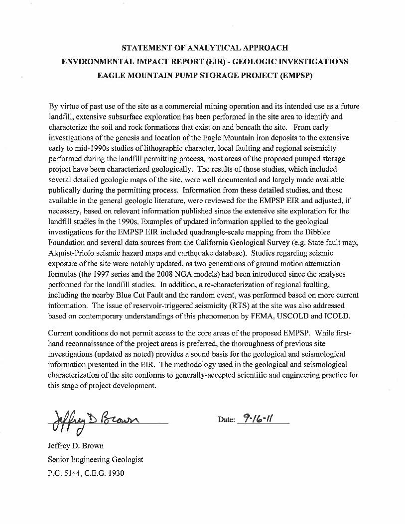
PAUL MILLER, M.S., REA PROFESSIONAL EXPERIENCE
Mr. Miller is an environmental professional with more than 20 years of experience in providing services primarily to City, County and State government agencies in California. With a broad range of environmental skills, since 1986 he has applied his background to CEQA and NEPA environmental assessments. Mr. Miller has had major roles in the preparation of over 250 CEQA and NEPA environmental documents. Mr. Miller has focused on a variety of environmental issue areas throughout his career, including: air quality, noise, energy, and integrated waste management. Since the passage of the California Global Warming Solutions Act of 2006 (AB 32), Mr. Miller has continually been involved in determining the appropriate analyses for Greenhouse Gases in CEQA documents. Mr. Miller has conducted several critical environmental analyses for the California Public Utilities Commission (CPUC) and the California Energy Commission (CEC).
In 2003, Mr. Miller formed Miller Environmental Consultants (MEC) as a sole proprietorship with the intent of providing high-quality services to both public and private clients. Since that time MEC has contributed to more than a 50 projects primarily in the areas of air quality, noise, solid waste management, and CEQA/NEPA project management.
Mr. Miller is also currently the West Coast Coordinator for air quality and noise at Environmental Science Associates (ESA), an environmental consulting company of 300+ employees headquartered in San Francisco. In this role he provides staff training and quality control for air quality and noise analyses prepared in the Sacramento, Oakland, San Francisco and Los Angeles offices.
EDUCATION: M.S., Zoology, Colorado State University, Fort Collins, Colorado 1977
B.A., Zoology, Miami University, Oxford, Ohio 1974 REGISTRATIONS AND CERTIFICATIONS AND ORGANIZATIONS
California Registered Environmental Assessor (REA #926) since 1989 OSHA 40-hour training (29 CFR 1910.120e and GISO 5192 for Hazardous Waste Site Activities) Association of Environmental Professionals Air and Waste Management Association Certificate of Integrated Waste Management, San Francisco State University, 2002 Pacifica Recycling Advisory Committee 1990 - 92 Pacifica Airport Noise Abatement Committee 1992 MAJOR CALIFORNIA ENERGY PROJECT EXPERIENCE (ASPEN ENVIRONMENTAL GROUP AND ESA)
Pacific Gas & Electric Company’s Hydroelectric Divestiture Project. Mr. Miller was p roject manager for t he California Public Utilities Co mmission’s (CPUC) CEQA review of Pacifi c Gas & Electric Com pany’s proposal to di vest their hydr oelectric facilities. As a prim e contractor to the, Aspen managed the envir onmental and economic analyses of more than 25 subcont ractor firms. Currently, PG&E Co. owns and operates the largest private hydroelectric power system in the nation. Situated in t he Sierra Nevada, Southern Cascade, and Coastal m ountain ranges of California, this sy stem is strung along 16 di fferent river basins and annuall y gener ates
Paul Miller, M.S., REA Page 2
approximately five percent of the power consumed each y ear in California. Key components of the sy stem are 68 power houses with a total gene ration capacit y of 3,896 megawatts ( MW) -- enough power to supply approximately 4,000,000 residences. The proposed auction also includes approximately 140,000 acres of land proposed for sale with the hydroelectric sy stem. The DEIR was published in November 2000, and analyzes the range of operational changes that could occur under new ownership, including com plex integrated models that analyze power generation and water management. The DEIR is nine volum es (approximately 4,000 pages) and was co mpleted in onl y eigh t m onths, und er an urgent mandate from the CP UC. The Draft EIR is currently available at http://cpuc-pgehydro.support.net/
CEC Peaking Power Plant Siting Project. In 20 01, Mr. Mil ler managed a team of scientists,
engineers, and land use planners in reviewing pot ential power plant locations for the California Energy Commission (CEC). The tea m’s goal was to preview sites and identify feasible sites for rapid development of a natural gas-fired power plant. The team has reviewed more than 80 site s throughout California and provided detailed summaries and site visit reports to the CEC.
Specific CEC Power Plant Environmental Reviews (Noise). Mr. Miller was a technical
reviewer for various aspec ts of the noise a ssessments for several proposed power plants. He prepared the Staff As sessment for noise for Phas e I of the United Golden Gate Power Plant proposed at San Francisco International Airport (50 MW, si mple cy cle). Mr. Miller also reviewed app licant noise reports (data adequacy review and follow-up data requests) for the Sunrise Power Project II Amendment, and the Ocotillo Energy Project. Mr. Miller has also given noise feedback at pre-appli cation meetings and reviewed noise compliance filings for the Procte r & Gamble Cogeneration Facility. Mr. Miller has been trained for expert testimony by CEC legal staff.
CEC Hybrid and Dry Cooling Technical Review. Mr. Miller was te chnical review ed fo r
information on power pl ant cooling s ystems. The goal of the review is to identif y coo ling technologies (or com binations of technologies) that will reduce the reliance u pon Californi a’s inland and c oastal wat er resources for the purpose of power plant cooling. The reviews were background information for the applicat ions of the Potrero Power Plant in San Francisco and the Morro Bay Power Plant in Morro Bay, California.
PG&E Power Plant Divestiture EIR: Mr. Miller was Project Manager for the EIR on the
second divestiture application by PG&E to sell its fossil-fuel and geothermal power plants. This fast track environm ental document was completed within 10 m onths of PG&E filin g its application. CPUC was the lead agency for this EIR, which covered the sale of three natural gas-fired power plants in the San Francisco region (Potrero, Pittsburg, and Contra Costa) an d the Geysers Power Plants (two units in Lake C ounty and 12 units in Sonom a County). Mr. Miller actively managed both in- house technical staff and four major subconsultant fi rms. Mr. Miller was very involved in the air quality mitigation development for th ese plant sales, and developed mitigations t hat allowed t he Bay Area Air Qua lity Management District (BAAQMD) to either revise Utility Regulation 9 Rule 11 or to m ake specific amendments to the air perm its of the plants that were divested.
PG&E and Edison Power Plant Divestiture Mitigated Negative Declarations: Mr. Miller was
a key participant in the environm ental review of the sales of power plants b y PG&E (A.96-11-
Paul Miller, M.S., REA Page 3
020) and Edison (A.96-11-046). He was ESA’s Pr oject Director throughout the project and was also Project Manager during the final two months leading up to the CPUC approval of the Mitigated Negative Declarations (MNDs) in October 1997. In addition, Mr. M iller was the task leader for the air quality and noise anal yses in both MNDs. Mr. Miller coordinated the overall environmental approach for ESA, conducted initial public agency scoping meetings in San L uis Obispo, Morro Bay and V entura, made technical presentations in Pasadena and Monterey on air quality aspec ts of the pr ojects, frequ ently m et with CPUC En ergy Division staff and ESA subconsultants, and presented project inform ation to the assigned Comm issioners (Me ssrs. Conlon and Bilas) at key decision points.
SDG&E Power Plant Divestiture Mitigated Negative Declaration: Mr. Miller was P roject
Manager for the Mitigated Negative Declaration for the sale of San Diego Gas and Electric power plants (South Bay [706 MW] and Encina Powe r Plants [ 971 MW]) and 17 com bustion turbines having an overall capacity of about 220 MW . The California Public Uti lities Co mmission (CPUC) was the lead agency for this CEQA review. In addition to his Project Manager role, Mr. Miller also was the task leader for air quality and noise analyses on this project.
Sacramento Municipal Utilities District (SMUD) Power Plant Projects: Mr. Miller assisted
in several special studies related to the perm itting of several gas-fired co-generation power plants brought on-line by SMUD in the 1990’s. Mr. Mille r performed technical review of air em ission calculation performed by subconsultants related to determination of emission offsets amounts for nitrogen oxides (Nox) and hy drocarbons (HC). At the Ca mpbell’s Soup pr oject site, Mr. Miller helped to design a noise monitoring program for nearby communities. This included collection of baseline noise levels prior to power pl ant ope ration, and realtime noise measurem ents during blow-down operations just prior to facility start-up
RECENT AIR QUALITY EXPERIENCE
ESA West Coast Coordinator for Air Quality Projects. Since 2002, when Mr. Miller returned to Environmental Science Associates (ESA) he has coordinated air quality and noise work for ESA on the west coast, primarily California (offices in Sacramento, San Francisco, Oakland, San Diego, Woodland Hills and Los Angeles). In this half-time role he oversees six air quality analysts and is responsible for preparation of scopes-of-work, budgets and technical reviews of the work products. The group primarily prepares Air Quality Sections under CEQA. Group work includes review of background air quality data (from the CARB ADAM database), estimates of construction and operation emissions, and development of mitigation measures. The group uses several modeling tools to predict emissions and resultant concentrations; including CALINE4, SCREEN3, ISC3, URBEMIS2007 and EMFAC emission estimates. The group also has conducted several recent reviews of the health risks of diesel particulate matter. Since the passage of the California Global Warming Solutions Act of 2006 (AB 32), Mr. Miller has continually been involved in determining the appropriate analyses for Greenhouse Gases in CEQA documents.
RECENT AIR QUALITY EXPERIENCE (MILLER ENVIRONMENTAL CONSULTANTS -- MEC)
Air Quality and Greenhouse Gas Analyses (2010). In 2010 Mr. Miller was the lead air quality analyst for several environmental documents. These included a Mitigated Negative Declaration for changes to the Alameda County Integrated Waste Management Plan (CoIWMP) including an increase
Paul Miller, M.S., REA Page 4
of the diversion goal to 75%. He also prepared EIR analyses for the restoration of an area of the Salt River in Humboldt County, wetland restoration in southern Yolo County. He prepared analyses for Mitigation Negative Declarations for the restoration Aramburu Island in Marin County, a surface water treatment facility in Lodi, a mixed-use projects in San Jose, a housing development in Antioch, a low-income multi-family project in Solana Beach, and a water force main outfall in Vista. As a follow up to the City of Richmond Port of Honda Project, he worked with a team of three consultants to prepare a Clean Air Action Plan for the Honda Port of Entry.
Air Quality and Greenhouse Gas Analyses (2009). In 2009 Mr. Miller was the lead air quality analyst for several environmental documents. These included EIRs for the expansion of the Knife River Company Quarry near Lodi California, and the expansion of Forward Inc. Landfill near Stockton California and housing projects in Placerville and Union City California, EIS and EIR documents for the proposed 1,300 Megawatt Eagle Mountain Pumped Storage Hydroelectric project in Riverside County California near Desert Center, an EIR for a 10-mile transmission line and substation for Turlock Irrigation District, and an EIR for a 5,000 ton-per-day Materials Recovery Facility in Irwindale California. He also prepared Initial Study CEQA analyses for a housing project in Belmont California, a community center in Solana Beach, a huge packing and distribution center in Irwindale California (Huy Fong Foods), and repair actions at Parsons Slough near Monterey Bay California. He prepared a peer view of an EIR Air Quality study for proposed changes at the Delmar Race Track in San Diego County.
Air Quality Studies (2008). In 2008 Mr. Miller was the lead analyst or principal reviewer for several air quality projects completed including: two Greenhouse Gas analyses for commercial projects in South San Francisco, air quality, Greenhouse Gas and health risk analyses for a Port of Richmond EIR that includes new ship carriers for Honda car imports and an extended rail line, air quality and Greenhouse Gas analyses for commercial and seawall projects in Solana Beach, California, peer review of the air quality section of a quarry EIR in northern California, and air quality and Greenhouse Gas analyses for a proposed steel manufacturing facility in Galt, California, a health risk analysis for a proposed rock crushing and recycling plant in Bakersfield California.
Air Quality Studies (2007). In 2007 Mr. Miller was the lead analyst or principal reviewer for several air quality projects completed including: a wastewater treatment plant expansion in Oakdale, a Wal-Mart Supercenter in Suisun City, residential projects in Kern County, Placerville and Yuba County, a quarry in Kern County, a ski village expansion at Bear Valley, commercial area redevelopments in Baldwin Park, Colusa, and Imperial.
Air Quality Studies (2006). In 2006 Mr. Miller was the lead analyst or principal reviewer for several air quality projects completed including: permit revisions for the South San Francisco Materials Recovery Facility and Transfer Station, permit revisions for the Yuba Sutter Disposal, Inc. Materials Recovery Facility and Transfer Station, the Napa Junction III commercial center and an 800,000 sq. ft. of proposed warehouses in the City of American Canyon, Colusa County Industrial Area Rezone (150 acres) EIR, East Palo Alto Industrial Condos Air Quality Assessment, Peer review of Kern County Quarry Air Quality Report, Sacramento River Water Reliability Study, City of Suisun Carbon Monoxide Study and the air quality analysis for the UC Santa Cruz proposed Biomedical Building.
• Air Quality Studies (2005). In 2005 Mr. Miller was the l ead analy st or principal reviewer for several air q uality project s including: the Chapin Mine EIR in Merced Count y, t he Air Quality
Paul Miller, M.S., REA Page 5
portion of the Madera County Dairy Element, construction emission calculation for Natomas Unified School Distr ict, Novato Sanitation D istrict e xpansion EIR, Oak to Nint h Street Mi xed-Use Development in Oak land, San Fran cisco Marin a Mo difications EIR, th e U.C. San Fran cisco Long Range Development Plan Program EIR, air quality coordination of lead remediation at the Humboldt Road Landfill in Chico, California.
RECENT NOISE EXPERIENCE
ESA West Coast Coordinator for Noise Projects. In 2002, Mr. Miller returned to Environmental Science Associates (ESA) to coordinate air quality and noise work on the west coast, primarily California. In this half-time role he oversees three noise analysts and is responsible for preparation of scopes-of-work, budgets and technical reviews of the work products. The group primarily prepares Noise Sections under CEQA. Group work includes review of background noise regulations, collection of field noise data using precision sound level meters, estimating noise levels based on existing levels and estimated attenuation rates, and development of mitigation measures.
RECENT NOISE EXPERIENCE (MILLER ENVIRONMENTAL CONSULTANTS -- MEC)
Noise Studies (2010). Mr. Miller was the lead noise analyst for several environmental documents. These included a Mitigated Negative Declaration for changes to the Alameda County Integrated Waste Management Plan (CoIWMP) including an increase of the diversion goal to 75%. He also prepared EIR analyses for the restoration of an area of the Salt River in Humboldt County, wetland restoration in southern Yolo County. He prepared analyses for Mitigation Negative Declarations for the restoration Aramburu Island in Marin County, a surface water treatment facility in Lodi, a mixed-use projects in San Jose, a housing development in Antioch, a low-income multi-family project in Solana Beach, and a water force main outfall in Vista. He also prepared a federal Environmental Assessment (EA) noise analysis for improvements on the Yuba River Levee.
Noise Studies (2009). Mr. Miller was the lead noise analyst for several environmental documents. These included EIRs for the expansion of the Knife River Company Quarry near Lodi California, and the expansion of Forward Inc. Landfill near Stockton California and housing projects in Placerville and Union City California, EIS and EIR documents for the proposed 1,300 Megawatt Eagle Mountain Pumped Storage Hydroelectric project in Riverside County California near Desert Center, an EIR for a 10-mile transmission line and substation for Turlock Irrigation District, and an EIR for a 5,000 ton-per-day Materials Recovery Facility in Irwindale California. He also prepared Initial Study CEQA analyses for a housing project in Belmont California, a community center in Solana Beach, a huge packing and distribution center in Irwindale California (Huy Fong Foods), and repair action at Parsons Slough near Monterey Bay California. He prepared a peer view of an EIR Noise study for proposed changes at the Delmar Race Track in San Diego County.
Noise Studies (2008). Mr. Miller was the lead noise analyst for several environmental documents. These included the Port of Richmond EIR that includes new ship carriers for Honda car imports and an extended rail line, the Upper Lake Casino noise study, a noise analysis and opening night noise measurements (Creedance Clearwater Revisited) at a new concert venue at Valley View Casino in Escondido California, the Vineyard RV Resort proposed Expansion, a proposed new courthouse in the downtown area of Stockton, and a proposed rock crushing and recycling center in Bakersfield California.
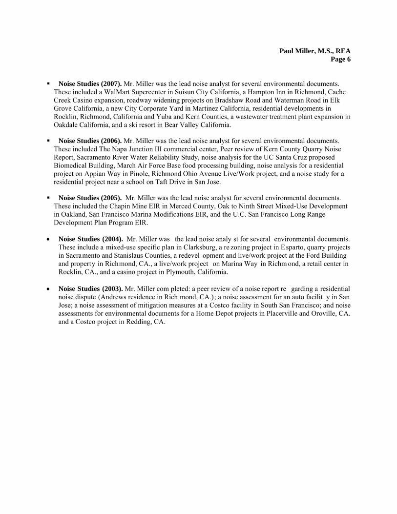
Paul Miller, M.S., REA Page 6
Noise Studies (2007). Mr. Miller was the lead noise analyst for several environmental documents. These included a WalMart Supercenter in Suisun City California, a Hampton Inn in Richmond, Cache Creek Casino expansion, roadway widening projects on Bradshaw Road and Waterman Road in Elk Grove California, a new City Corporate Yard in Martinez California, residential developments in Rocklin, Richmond, California and Yuba and Kern Counties, a wastewater treatment plant expansion in Oakdale California, and a ski resort in Bear Valley California.
Noise Studies (2006). Mr. Miller was the lead noise analyst for several environmental documents. These included The Napa Junction III commercial center, Peer review of Kern County Quarry Noise Report, Sacramento River Water Reliability Study, noise analysis for the UC Santa Cruz proposed Biomedical Building, March Air Force Base food processing building, noise analysis for a residential project on Appian Way in Pinole, Richmond Ohio Avenue Live/Work project, and a noise study for a residential project near a school on Taft Drive in San Jose.
Noise Studies (2005). Mr. Miller was the lead noise analyst for several environmental documents. These included the Chapin Mine EIR in Merced County, Oak to Ninth Street Mixed-Use Development in Oakland, San Francisco Marina Modifications EIR, and the U.C. San Francisco Long Range Development Plan Program EIR.
• Noise Studies (2004). Mr. Miller was the lead noise analy st for several environmental documents. These include a mixed-use specific plan in Clarksburg, a re zoning project in Esparto, quarry projects in Sacramento and Stanislaus Counties, a redevel opment and live/work project at the Ford Building and property in Richmond, CA., a live/work project on Marina Way in Richm ond, a retail center in Rocklin, CA., and a casino project in Plymouth, California.
• Noise Studies (2003). Mr. Miller com pleted: a peer review of a noise report re garding a residential
noise dispute (Andrews residence in Rich mond, CA.); a noise assessment for an auto facilit y in San Jose; a noise assessment of mitigation measures at a Costco facility in South San Francisco; and noise assessments for environmental documents for a Home Depot projects in Placerville and Oroville, CA. and a Costco project in Redding, CA.

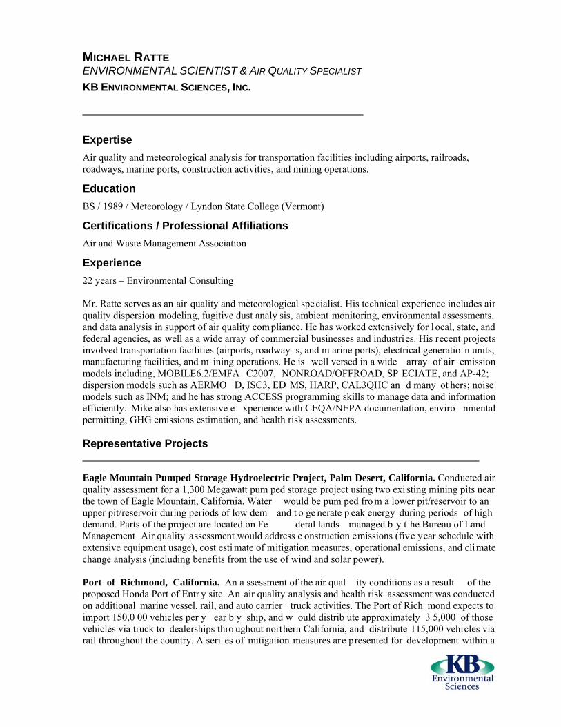
MICHAEL RATTE ENVIRONMENTAL SCIENTIST & AIR QUALITY SPECIALIST KB ENVIRONMENTAL SCIENCES, INC.
Expertise Air quality and meteorological analysis for transportation facilities including airports, railroads, roadways, marine ports, construction activities, and mining operations.
Education BS / 1989 / Meteorology / Lyndon State College (Vermont)
Certifications / Professional Affiliations Air and Waste Management Association
Experience 22 years – Environmental Consulting Mr. Ratte serves as an air quality and meteorological specialist. His technical experience includes air quality dispersion modeling, fugitive dust analy sis, ambient monitoring, environmental assessments, and data analysis in support of air quality com pliance. He has worked extensively for l ocal, state, and federal agencies, as well as a wide array of commercial businesses and industries. His recent projects involved transportation facilities (airports, roadway s, and m arine ports), electrical generatio n units, manufacturing facilities, and m ining operations. He is well versed in a wide array of air emission models including, MOBILE6.2/EMFA C2007, NONROAD/OFFROAD, SP ECIATE, and AP-42; dispersion models such as AERMO D, ISC3, ED MS, HARP, CAL3QHC an d many ot hers; noise models such as INM; and he has strong ACCESS programming skills to manage data and information efficiently. Mike also has extensive e xperience with CEQA/NEPA documentation, enviro nmental permitting, GHG emissions estimation, and health risk assessments. Representative Projects Eagle Mountain Pumped Storage Hydroelectric Project, Palm Desert, California. Conducted air quality assessment for a 1,300 Megawatt pum ped storage project using two exi sting mining pits near the town of Eagle Mountain, California. Water would be pum ped fro m a lower pit/reservoir to an upper pit/reservoir during periods of low dem and t o ge nerate p eak energy during periods of high demand. Parts of the project are located on Fe deral lands managed b y t he Bureau of Land Management Air quality assessment would address c onstruction emissions (five year schedule with extensive equipment usage), cost esti mate of mitigation measures, operational emissions, and climate change analysis (including benefits from the use of wind and solar power). Port of Richmond, California. An a ssessment of the air qual ity conditions as a result of the proposed Honda Port of Entr y site. An air quality analysis and health risk assessment was conducted on additional marine vessel, rail, and auto carrier truck activities. The Port of Rich mond expects to import 150,0 00 vehicles per y ear b y ship, and w ould distrib ute approximately 3 5,000 of those vehicles via truck to dealerships thro ughout northern California, and distribute 115,000 vehicles via rail throughout the country. A seri es of mitigation measures are presented for development within a
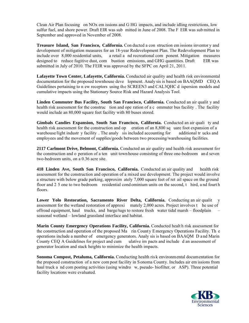
Clean Air Plan focusing on NOx em issions and G HG impacts, and include idling restrictions, low sulfur fuel, and shore power. Draft EIR was sub mitted in June of 2008. The F EIR was sub mitted in September and approved in November of 2008. Treasure Island, San Francisco, California. Con ducted a con struction em issions inventor y and development of mitigation measures for an 18-year Redevelopment Plan. The Redevelopment Plan to include over 8,000 residential units, a retail a nd recreational com ponent. Mitigation measures designed to reduce fugitive dust, com bustion emissions, and GHG quantities. Draft EIR was submitted in July of 2010. The FEIR was approved by the SFPC on April 21, 2011. Lafayette Town Center, Lafayette, California. Conducted air quality and health risk environmental documentation for the proposed townhouse deve lopment. Analy sis is based on BAAQMD CEQ A Guidelines pertaining to n ew receptors using the SCREEN3 and CAL3QHC d ispersion models and cumulative impacts using the Stationary Source Risk and Hazard Analysis Tool. Linden Commuter Bus Facility, South San Francisco, California. Conducted an air qualit y and health risk assessment for the construc tion and ope ration of a c ommuter bus facility . The facility would include an 80,000 square feet facility with 80 buses stored. Gimbals Candies Expansion, South San Francisco, California. Conducted an air quali ty and health risk assessment for the construction and op eration of an 8,800 sq uare foot expansion of a warehouse/light industr y facility . The analy sis included accounting for additional tr ucks and employees and the movement of supplies/goods between two processing/warehousing facilities. 2117 Carlmont Drive, Belmont, California. Conducted an air quality and health risk assessment for the construction and o peration of a ten unit townhouse consisting of three one-bedroom an d seven two-bedroom units, on a 0.36 acre site. 418 Linden Ave, South San Francisco, California. Conducted an air quality and health risk assessment for the construction and operation of a mixed use development. The project would involve a structure with below grade parking, approxim ately 7,000 square feet of ret ail space on the ground floor and 2 5 one to two bedroom residential cond ominium units on the second, t hird, a nd fourt h floors. Lower Yolo Restoration, Sacramento River Delta, California. Conducting an air qualit y assessment for the wetland restoration of approxi mately 2,000 acres. Project involves t he use of offroad equipment, haul trucks, and barge/tugs to restore fresh water tidal marsh – floodplain – seasonal wetland – lowland grassland interface and habitat. Marin County Emergency Operations Facility, California. Conducted healt h risk assessment for the construction and operation of the proposed Ma rin Count y E mergency Operations Facility. Th e operations include a number of emergency generators. Analy sis is based on BAAQM D a nd Marin County CEQ A Guidelines for project and cum ulative im pacts and include d an assessment of generator location and stack heights to minimize the health impacts. Sonoma Compost, Petaluma, California. Conducting health ris k environmental documentation for the proposed construction of a new com post facility in Sonoma County. Includes air em issions from haul truck a nd com posting activities (using windro w, pseudo- biofilter, or ASP). Three potential facility locations were evaluated.

Irwindale Athens Services MRF/TS, California. Conducting air quality analy sis and health risk assessment for a proposed 300,000 square foot materials recovery facility / transfer station (MRF/TS). Construction, operational activities, and truck and automotive traffic planned at the MRF/TS will generate emissions, dust, and odors that may have an effect on local and/or regional air quality. Forward Landfill, Manteca, California. Conduct ed air quality and h ealth risk environmental documentation for the pr oposed expansion of t he Forward Landfill. Includes air em issions from haul truck and landfill gas and projected site life a nd landfill capacity under existing actual and permitted conditions with new gas-fired co mbustion engi nes or landfill gas flares as a part of the proposed project. Keller Canyon Landfill, California. Conducting health risk assessme nt for plans to incr ease t he maximum amount of waste received fr om 3,500 to 4,900 tons pe r day. This increase would result in an increase of combustion equipment (dozers, loaders) and annual truck trips. The increase in tonnage would also increase fugitive landfill gas emissions and landfill flare usage. The baseline impacts also include the use of landfill gas to energy engin es and additional flaring. Analysis is based on BAAQMD CEQA Guidelines for project and cumulative impacts. Pilarcitos Quarry, California. Conducting a health risk asses sment for plans to expand m ining operations onto a west-faci ng slope located adjacent to and imm ediately north of the current mining area. This ex pansion area is approxim ately 20 acres in size. The current annual operations include 450,000 t ons of aggregate processi ng and 100,000 tons of c oncrete recy cling. The aggregate processing would increase to 1 m illion tons with the project expansion (with corresponding i ncreases in haul trucks). Analy sis is based on BAAQMD CEQA Guidelines for pr oject and cum ulative impacts. Permanente Quarry, California. Conducting a health risk assess ment for ope rations in association with the Permanente Quarry East Material Storage Area (EMSA). The EMSA is an 89-acre area used for overburden storage. The EMSA is d esigned to store 4,786,000 cubic yards of overburden fill and is intended to receive material for six years. The EMSA operations include pit activities, movement of materials bet ween the pit and the EMSA, and ac tivities at the E MSA. The HRA will focu s on the cancer risks and health i mpacts (chro nic and acute) from potential exposur e to DPM, c rystalline silica, and ot her air toxics em issions at off-site r eceptors. Analy sis is based o n BAAQMD CEQA Guidelines for project and cumulative impacts. San Rafael Rock Quarry, California. Conducted health risk assessment for a quarry pr oduction extension. The facility includes haul trucks, a ggregate processing, asphalt and brick manufacturing operations, and barge operations. The assessment focused on diesel particulate matter, cr ystalline silica, and hydrogen sulfide emissions and accounted of extending operations by 17 years. Draft EIR was sub mitted in February of 2008. F inal EIR was sub mitted in January of 2009. Final EIR wa s approved and certified in October of 2009. Roblar Road Quarry, California. Prepared an EIR for a ne w hard rock quarry proposed to b e located in southern Son oma County ( west of Cota ti) and adjacent to th e Count y-owned, former Roblar Road Landfill. The Roblar Road Quarry proposes to mine approximately 570,000 cubic yards of quarry m aterial annuall y over a 20-y ear period. The proposed project presents and num ber o f technical issues related to air quality, including po tential landfill gas emissions, serpentine asbestos-containing rock, silica dust e missions, as well as air emissions from onsite processing equipment and haul trucks. Draft EIR was submitted in May of 20 08. Final EIR was submitted in October of 2009 and approved in May of 2010. A Su pplemental EIR was released in June 2010 to include additional

information related to GHG e missions and th e Revised BAA QMD guidelines. Final EIR wa s approved and certified in December of 2010. Philadelphia International Airport, Pennsylvania. In support of the PHL Capacity Enhancement Program (CEP) Environmental Im pact Statement (EIS) for new runway and te rminal improvements, preparing an airport-wide em issions inventor y, di spersion modeling, and General Conformity Determination. The DEIS was submitted in Septem ber of 2008. The Draft General Conformity was submitted in April of 2010 and Fina l EIS and General Conformity were submitted in August of 2010. Involved the applications of Airport Emission Reduction Cred its, em ission offsets, and other mitigation measures to conform VOC, NOx, P M2.5, and SO2 em issions fro m oper ations and construction activities. Also required e xtensive c oordination with the Cit y, F AA, U.S. EPA, and Pennsylvania Department of Enviro nmental Protec tion. The Record of Decision was i ssued in December of 2010. San Francisco International Airport, California. Developed an em issions inventor y for construction activities associated with Runway Safe ty Areas. Co nducted a health risk assessment. Analyses were developed in close consultation w ith the San Francisco Planning Depart ment Major Environmental Analy sis throug h the r eview of An alysis Appro ach, Technical Reports, and Results and the submission of a NEPA EA and CEQA Initial Study. March Inland Port, California. Conducting an air q uality assessment for a pr oposed development of GA facili ties at the a irport. The air qualit y a ssessment includes an emission inventory of construction and operational em issions, a greenhou se gas emissions inventor y, a health risk assessment, and asses sment of i mpacts compared to SCAQMD’ s Localized Significance Threshold for the proposed project and cumulative impacts. San Diego International Airport, California. Developed a hum an heal th risk asses sment of modifications to airport operations as a result of te n additional gates. Analysis worked closely with responsible agencies to deter mine the pollutants of concern and a list of sensitive receptors. Risk assessment was conducted for the existi ng condition a nd two future conditions with alternati ves and developed ha zardous air p ollutant em ission estimates for aircraft, m otor vehicles, and GSE using FAA and EPA guidance on speciation profiles and esti mates of diesel and gasoline usage. Also conducted e mission inventor y and H RA for a landfill closure project located at the airport; which included construction activities associated with soil removal.
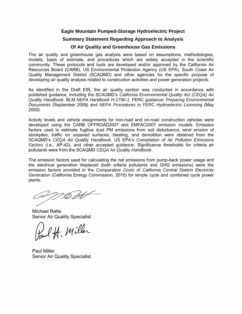
Eagle Mountain Pumped-Storage Hydroelectric Project
Summary Statement Regarding Approach to Analysis
Of Air Quality and Greenhouse Gas Emissions
The air quality and greenhouse gas analysis were based on assumptions, methodologies, models, basis of estimate, and procedures which are widely accepted in the scientific community. These protocols and tools are developed and/or approved by the California Air Resources Board (CARB), US Environmental Protection Agency (US EPA), South Coast Air Quality Management District (SCAQMD) and other agencies for the specific purpose of developing air quality analysis related to construction activities and power generation projects. As identified in the Draft EIR, the air quality section was conducted in accordance with published guidance, including the SCAQMD’s California Environmental Quality Act (CEQA) Air Quality Handbook, BLM NEPA Handbook H-1790-1, FERC guidance: Preparing Environmental Documents (September 2008) and NEPA Procedures in FERC Hydroelectric Licensing (May 2000). Activity levels and vehicle assignments for non-road and on-road construction vehicles were developed using the CARB OFFROAD2007 and EMFAC2007 emission models. Emission factors used to estimate fugitive dust PM emissions from soil disturbance, wind erosion of stockpiles, traffic on unpaved surfaces, blasting, and demolition were obtained from the SCAQMD’s CEQA Air Quality Handbook, US EPA’s Compilation of Air Pollution Emissions Factors (i.e., AP-42), and other accepted guidance. Significance thresholds for criteria air pollutants were from the SCAQMD CEQA Air Quality Handbook. The emission factors used for calculating the net emissions from pump-back power usage and the electrical generation displaced (both criteria pollutants and GHG emissions) were the emission factors provided in the Comparative Costs of California Central Station Electricity Generation (California Energy Commission, 2010) for simple cycle and combined cycle power plants.
Michael Ratte Senior Air Quality Specialist
Paul Miller Senior Air Quality Specialist
John J. Pizzimenti, Ph.D. 1
John J. Pizzimenti, Ph.D. FERC Project Manager Education Ph.D., Biology, University of Kansas, 1974 B.A., Biology, California State University at Northridge, 1969
Background
Dr. Pizzimenti has spent the last 24 years focused on environmental analyses of hydroelectric projects. He has been a member of Hydropower Steering Committees, Regulatory Committees, and Planning Committees for HydroVision, Water Power and National Hydropower Association over the past 15 years.
Known to FERC, John has prepared or directed over 100 reports involving FERC Licensing, fish passage, water quality, endangered species, and habitat restoration. He has presented new analytical methods (HQI) to the FERC. He has been the project manager or lead scientist on the FERC Consultation for 35 Applications in 10 states since 1982. He is Project Manager of the Mystic Lake FERC relicense under the new ILP and PAD requirements. He is an approved member of FERC’s Dispute Resolution Experts for ILP study disputes. He has served on the Northwest Power and Conservation Council’s ISRP (Independent Science Review Panel) to review R&D and mitigation plans for the 22,000 Mw Federal Columbia River Power System.
Prior to joining GEI, Dr. Pizzimenti spent 21 years with Harza Engineering, a company that developed over 50,000 Mw of hydroelectric power. Among John’s first assignments there was to support FERC License Applications at 18 sites for the City of New York. John also worked briefly on two large pumped storage FERC projects, the 2100 Mw Bath County Project and the 1000 Mw Rocky Mountain Project. He is GEI’s Environmental Practice Leader and a past member of the Board of Directors.
Experience
FERC License for Mystic Lake Integrated Licensing Process (ILP), Montana. As project manager, John is managing preparation of Status Reports, Preliminary Application Document (PAD), FERC Scoping and study plans under FERC’s new 2003 ILP rules. Key issues are adjacent wilderness boundaries, recreation, minimum flows, bypass and tailwater fisheries, and historic and cultural resources. All documents have been accepted by FERC and the study program is underway without need for dispute resolution.
FERC Relicense for Boulder Creek Hydroelectric Project. As a FERC expert, provided guidance and developed strategic plans with the City of Boulders to relicense a 20 Mw project. This was a unique project because it was possible to convert a traditional hydropower license into an exemption application by connecting it with the City of Boulder water supply system. FERC is processing the Notice of Intent. If successful, the approach could save thousands of dollars in future licensing and annual FERC charges.
FERC Relicense of Salida and Georgetown Hydros. As project manager, John directed the three-stage FERC process to obtain two new FERC licenses. One project involved two small high-head projects that bypass the natural river. The other involved preserving valuable water rights that were sold to the Coors Brewery in Colorado. John conducted agency consultation and directed all studies and document preparation including the FERC additional information requests and the monitoring and evaluation of the restoration of the bypass fishery at Salida.
FERC Compliance Manual. Provided guidance and quality control for an automated electronic compliance manual to manage Nebraska Public Power Districts FERC Licenses. This database provides cross-references to all FERC regulations and schedules including safety and license conditions. It has capacity to calendar and alert management to key dates.
John J. Pizzimenti, Ph.D. 2
FERC ILP Strategy and Data Collection for the Preliminary Application Documents for the Tacoma and Ames Hydroelectric Projects. John directed the data collection to support the PAD and strategies for submitting and ILP license application for two Colorado hydros. The projects are in separate basins and will be separated into two licenses in the new license.
FERC License for Five Hydroelectric Projects, Otter Tail River, MN. Supervised and managed the following tasks: dam safety, Part 12 Reports; field investigation program; flood studies; preparation of emergency action plans; agency consultation; environmental studies; and license preparation. The team resolved troublesome issues of dam stability and environmental impacts. Major challenges included old structures on earth foundations, minimum flow impacts, loss of power and energy at adjacent steam generating station, historic structures in urban locations. Studies in progress, draft license in preparation.
Lead Scientist, Environmental Program Manager. Preparation of FERC Exhibit E, Environmental Report for 15 hydroelectric dams with existing major licenses pending on four river basins in Michigan. Prepared and reviewed an environmental and agency consultation documents for relicensing according to ECPA regulations (PIP, ICP, Staged Consultation, etc.). Scoped, budgeted and supervised the following environmental study programs: water quality, fish entrainment, IFIM, cultural resources, toxic sampling, wildlife, and recreation. Negotiated study plans with agencies.
FERC Mandated Reservoir Drawdown, Great Falls, MT. As project manager, John is directing and providing QA/QC of studies to develop drawdown protocols of five reservoirs in the Missouri River near Great Falls, Mt. Contaminated sediments can mobilize and affect the downstream water quality, fish, wildlife and human health. These projects are part of the nine-dam Missouri Madison Hydroelectric Project and require agency coordination and approvals.
FERC Schedule A&B for two unlicensed existing hydroelectric installations, Grand River, MI. Applicant had major deficiencies in license application with less than 45 days to correct. Project manager for the preparation of a response to FERC and designed/negotiated environmental study programs to address fish entrainment, water quality, fish passage (salmonids), fish diversion screened intakes, project operation and need for power. Studies and meetings were conducted within the 30-day contract period to meet the FERC deadline.
FERC License Preparation for the Ketchikan Public Utilities Beaver Falls Hydroelectric Project. As project manager, helped scope and conduct studies, prepare the environmental reports and conduct agency consultation for this 20 Mw diversion-dam and water supply project in southeast Alaska.
Environmental Study Design and Resolution of Environmental Issues for Delaware, Croton and Esopus Rivers, NY. Project manager for the preparation of an environmental study. Minimum flows and water quality below dams and protection of trout were at issue. Established studies and conditions needed to add hydropower and protect fish. FERC issued license to construct projects. Agencies: New York DEC, U.S. Fish & Wildlife Service.
Competing License Application for Pearl River, MS. Prepared the Exhibit E for addition of hydropower to Ross Barnett Dam. Environmental issues included: water quality and stripped bass migration were at issue. Incorporated water quality protection design and operation criteria into hydroelectric facility. Developed fish entrainment/fish passage model and study program. Mississippi awarded water quality certificate, approved project. Agencies involved were Mississippi DNR and Department of Wildlife Conservation.
Stage I Consultation for 16 FERC Licenses on the Escanaba, AuSable, Muskegon, and Manistee rivers, MI. At issue were fishery and water quality protection below hydroelectric facilities, for FERC licenses. Managed study plans for IFIM, fisheries, water quality and recreation. Negotiated study plans with Michigan DNR and U.S. Fish & Wildlife Service (1989).
John J. Pizzimenti, Ph.D. 3
Bonneville Power Administration Agency Consultation. As technical advisor on negotiations between the Bonneville Power Administration and state, federal and tribal agencies on restoration of salmon, John provided technical input and review of issues related to hydropower, economics and fish. (1995-1998).
California Green Energy. John identified potential “Green Energy” hydroelectric projects in California using databases extracted from the Internet for the California Energy Commission and Electric Power Research Institute. He directed preparation of Green Energy application on a project in Washington State.
13 FERC License or Exemption Applications for City of New York Bureau of Water Supply. From 1982 through 1985, John prepared the Exhibit E Environmental Reports for 13 FERC License Applications. These facilities were additions to one of the largest water supply systems in the world. Conducted agency consultation among a politically charged atmosphere of contention between city and state agencies. The project balanced water supply, and hydropower with historic and cultural resources, endangered species and recreation.
Hydropower Condition Assessment, Federal Columbia River Hydropower System. As project manager, John managed a multidisciplinary team evaluation of the condition assessment of the Federal Columbia River Hydropower System. The team recommended $990 million in improvements as part of BPA’s strategy submitted to Congress to manage the 22000 Mw System. Rehabilitation of the McNary (2000 Mw) Powerhouse is nearly complete (2005).
Federal Columbia River Power System Hydropower QA/QC. John led a review of the Monitoring and Evaluation of the all BPA fishery investments in the 22,000 Mw Federal Columbia River Power System. The team made recommendations for changes to the investment program and to methods for recovering endangered salmon in the Basin.
Northwest Power Planning Council Independent Expert Hydro Operations. As an independent expert, John prepared and presented recommendations to the Northwest Power Planning Council on operation of the 29-dam 22,000 Mw Federal Columbian Power System under 2001 drought conditions. The Council, which represents the four Northwest states, adopted most of those recommendations.
Rocky Mountain Pumped Storage Project. Evaluated environmental documents and performed due diligence in the transfer of the 1000 Mw License from Georgia Power to Olgethorpe Corp. Provided various input to study needs and designs to complete the project.
Bath County Pumped Storage Project. Provided environmental document support to completion of this 2100 Mw pumped storage project for Virginia Electric Power Company.
Pumped Storage Project Development. Was part of a team at Harza to develop new projects on (1) the Mississippi River, (2) in an off channel abandoned mine in Ohio, and (3) several sites in the Pacific Northwest and California at large existing dams. Evaluated environmental issues related to pumped storage feasibility studies.
Hydro EIS. As an independent reviewer, John contributed to BPA’s Fish and Wildlife Implementation Plan EIS. This NEPA document facilitates the implementation of new fish and wildlife and tribal restoration projects throughout the Columbia River basin.
Salmon Model. As an independent scientist, John led a review team to evaluate NMFS Viable Salmonid Population model to organize salmon recovery around preserving genetic diversity.
Independent Review. As an independent expert, John served the Northwest Power Planning Council ISAB – Independent Scientific Advisory Board in 2002. This group of expert scientists chartered by the US
John J. Pizzimenti, Ph.D. 4
Congress, reviews proposal and generates technical analyses to enhance fish and wildlife in the Columbia Basin under Congressional Authorization/Funding.
Madison Hydroelectric Project Thermal Model, Ennis, MT. As project manager, John is oversaw development and now operations of a Decision Support System (DSS) to manage temperature on the Madison Hydroelectric Project, near Ennis Montana. Using special models and weather data from the Internet, the DSS predicts real-time river temperatures and allow flow changes to protect fish.
Fish Transport over Two FERC Licensed Dams. As project manager John directed developed a Transport Plan for endangered bull trout at the 500 Mw Cabinet Gorge and Noxon Rapids development on the Clark Fork River. The project team consisted of fish passage engineers and scientists from USFWS, Montana Fish Wildlife Parks, Idaho Fish and Game, and Avista Corp.
Milltown Dam Fish Passage. As project manager and senior scientist, John helped conceive four alternatives for fish passage at this FERC Licensed Dam and Superfund site in Montana. Thirteen species of fish including endangered bull trout pass the project. Final report was submitted to EPA for Record of Decision on Removal of Milltown Dam.
Environmental Technologies at Dams. Led preparation of a report to enhance water quality, habitat and fish passage improvements at the 2300 Mw Yacyreta Hydroelectric Project, Argentina. Report addressed spillway flip-lip design, fish ladders, fish elevators, fish diversion screens, advanced turbine design, PIT tags, radio-tags, and Instream Flow Incremental Methods. Final report to Entidad Binacional de Yacyreta.
Fish Passage Innovation. As a senior scientist, conceived a surface oriented spillway design and demonstrated cost-effectiveness as a tool for in-river salmon recovery. The multi-million dollar design-construction cost could be paid for in water savings within 22 days of operation at John Day Dam. Memo prepared to Bonneville Power Administration. This has evolved into the highly effective Removable Spillway Weir (RSW) program that GEI is consulting on.
Review of Dam Removal. As project manager, John evaluated alternatives and facilities at eight dams (10,000 Mw) for preserving endangered fish populations on the Snake and Columbia rivers for the U.S. Army Corps of Engineers. Published Salmon Decision Analysis, which received front-page news coverage in the OREGONIAN. Provided criteria for dam removal and eight other options under three Paths to salmon recovery.
Drawdown Study. As project manager, John led a third party review of $5.9 billion in design modifications to four Snake River dams and one Columbia River dam to preserve three stocks of endangered salmon. John presented Final Report to the Northwest Power Planning Council.
Expert Testimony. As an expert witness, John evaluated impacts and presented testimony on endangered Chinook salmon from development of the 500 Mw Coyote Springs gas fired co-generation facility on the Columbia River. John also testified and presented data before the Washington legislature on the Efficacy and Economics of Riparian Buffers (vegetation along streams) to protect endangered salmon. This was based on a three-year grant from the State Department of Agriculture and a Report of the same name.
Blue Ribbon Trout. As project manager, John led a study of 13 different strategies to reduce temperatures in the Lower Madison River. The project became the Madison DSS, a PPLMT FERC habitat protection project for one the nations’ most famous trout fisheries.
Piscasaw Creek Trout Stream Restoration. As project manger of the Piscasaw Creek Restoration Project, John helped evaluate and restore an agriculturally impacted trout stream. Trout Unlimited honored and
John J. Pizzimenti, Ph.D. 5
published it in Trout Magazine. Participants: Illinois Department of Conservation, McHenry Conservation District, and Trout Unlimited.
Awards President, American Fisheries Society, Portland Chapter (1993-1994).
University of Illinois Course Development Award, “Use of Computers in the Biological Sciences.” (1980)
National Science Foundation Research Grant/Ecology and Population Biology, Principal Investigator: A test of the niche variation hypothesis (University of Chicago). (1975-1978)
Expedition Leader, Field Museum Peruvian Zoological Expedition, a 6-month field collection of genetic, morphometric and ecological data in the Peruvian Andes. Funds: Private Donors and the National Science Foundation: Principal Investigator. (1976)
The Committee on Evolutionary Biology, University of Chicago. Adjunct faculty position. Primary activities: research, seminars and graduate thesis committees. (1975-1978)
Assistant Professor, Department of Ecology and Population Biology, University of Illinois-Chicago. Primary duties: research and graduate education. (1977-1981)
Scientific Research Review. Peer-reviewed manuscripts for publication in scientific journals and grant applications for NSF Funding. (1974-1981)
Assistant Curator of Mammals, Field Museum of Natural History, Chicago. Helped manage the fourth largest collection of mammalian specimens; conducted research, exhibit design, public education; graduate student education; and developed a modern genetics laboratory in the museum. (1974-1977)
Publications, Reports, and Presentations “Guide to Relicensing,” Harza Engineering Company, Chicago, 1987. Streamlined approach to FERC requirements under the new Electric Consumers Protection Act (ECPA).
“The Effect of ECPA on the Relicensing of Hydroelectric Projects,” Land Management Quarterly, Edison Electric Institute, vol. 10, no. 2, 1987.
“Resolving the Conflict: Protecting Endangered Species versus the Economic Limits of Hydropower.” Hydro Vision ’96, Orlando, FL. Participants discussed conflicts and solutions to hydropower impacts.“Technologies to Protect the Environment: A Peek Into the future of Hydro.” National Hydro Association ’95. Washington, D.C. Participants addressed new technologies to improve passage and water quality.
“Balancing Power & Energy with Instream Flows: Where Shall the Twain Meet Under ECPA?” Northwest Small Hydroelectric Association ’89, Portland, OR. Discussed conflict resolution regarding in-stream flows.
“Balancing of Hydropower and non-Hydropower Values.” Conference co-chairman and moderator: Sources of Conflict and Non-Market Values. July 22-23, 1991 in conjunction with WaterPower ’91. Jim Jura, BPA Administrator: Keynote Speaker.
“Fisheries Concerns at Small Hydropower Facilities in Four Regions of the USA,” w/D. Pott, and J. Meldrim. Proceedings of the Symposium on Small Hydropower and Fisheries, American Fisheries Society, pp. 478-480, May 1-3, 1985.
John J. Pizzimenti, Ph.D. 6
“Habitat Quality Index: An Alternative Technique for IFIM.” Presented to FERC technical staff by invitation, April 15, 1993. Washington, D.C. Data demonstrating multivariate approach to in-stream flow needs.
“Fish Entrainment and Relicensing Hydroelectric Projects: Truths and Consequences.” Q/K. Malone, J. Meldrim. Paper presented at Proceedings of Water Power ’91, Denver, Colorado.
EIS-BPA’s Fish and Wildlife Implementation Plan in the Columbia River basin. This document will regulate the annual expenditure of $485 million in fish and wildlife funding. Co-author. May 2001.
System Review of Hydropower Operations of the Snake and Columbia Rivers. Invited power point presentation to the Northwest Power Planning Council, March 2001.
“Salmon Decision Analysis – Lowe Snake River Feasibility Study”. Final Report to US Army Corps, Walla Walla District. October 1996. Proposed expedited dam removal or alternatives using in-river and transport to recover listed anadromous fish. Demonstrated cost-effectiveness of 15 alternative tools for recovery.
“The Columbia-Snake River Flow Targets/Augmentation Program. A White Paper Review with Recommendations for Decision Makers.” W/D. Olsen, J. Anderson, K. Malone, 1998 for Columbia-Snake River Irrigators. Reviewed potential to enhance salmon survival using flow modifications.
“Costs, Benefits, and Uncertainties of Nitrogen Supersaturation Mitigation on the Snake and Columbia Rivers.” Invited Speaker to the American Fisheries Society, Annual Meeting August 1997, and Monterey, CA.
“Fish Passage Technologies.” Panel Moderator, WaterPower ’97, Atlanta, GA. New designs for fish passage.
“Improving Fish Habitat Downstream of Dams”. Panel Moderator, WaterPower ’97, Atlanta.
“IFIM Conference Proceedings: A Workshop and Symposium on the Instream Flow Incremental Method,” J. Pizzimenti, editor, Chicago, IL< Jan. 12-13, 1989. National experts gathered for two-day discussions/seminars.
“Environmental Solutions that Work.” Organizer and chairmen of session at National Hydropower Association, 1993 Annual Meeting, Washington, D.C.
“Snake Reservoir Drawdown, A Progress Report.” Presented at WaterPower ’93, August 13, 1993, Nashville, TN.
“Mainstream Passage, Flow Issues and Remedies,” for the Endangered Salmon and Pacific Northwest Water Impacts session. Invited papers, ASCE 20th Anniversary Conference, May 5, 1993, Water Resource Planning Division. Seattle, WA.
“Fish Entrainment and Turbine-Induced Fish Mortality,” Q&A columns, Hydro Review, April 1991 and June 1991.
HCI Publications. Reviewed papers and presentations for acceptance a conferences and journals devoted to hydropower. Member of Planning Committee, HydroVision since 1991.

Sarah E. Troedson 1
Sarah E. Watkins Troedson Education M.G.I.S., Pennsylvania State University World Campus, (in progress) 2011 B.S., Geology, California State University Sacramento, 2002
Professional Societies Geological Society of America
Background
Ms. Troedson is a geologist/GIS analyst with over seven years of GIS experience in applying these skills to water resources and geology projects; including integrated regional water management plans, levee geotechnical analysis, pipeline alignment evaluation and design.
Experience
Flood Management and Mapping
Flood Emergency Response Program Improvement, California Department of Water Resources, CA (2008-present). Ms. Troedson has created regional location maps, georeferenced and digitized levee data from historic map documents, and created a wide variety of data and maps to assist with the FloodSAFE California project. She has worked collaboratively with other GIS staff on the multi-agency project team developing and enforcing project data management and cartographic standards while maintaining rigorous internal standards. All work will aid in the successful implementation of FloodSAFE throughout the northern and central Sacramento and San Joaquin Valleys.
Urban Levee Geotechnical Evaluations Program, California Department of Water Resources, Central Valley, CA (2006-present). Ms. Troedson has performed spatial and 3D analysis to locate proposed boreholes, create levee profiles, produce elevation data, process resistivity and electromagnetic data using high resolution aerial photos, LiDAR, HEM and ground based resistivity data; produced maps and figures for reports, to aid in geotechnical and engineering analysis, as well as weekly status maps of completed boreholes to aid in meeting production deadlines/timelines, created regional location maps, digitized levee centerlines from aerial photos; worked collaboratively with other GIS staff on the multi-agency project team developing and enforcing project data management and cartographic standards while maintaining rigorous internal standards. All work aided in the borehole mapping, permitting, drilling and analysis for the geotechnical evaluations of levees in the northern and central Sacramento Valley.
Phase 1 Dam Safety Inspection, State of Hawaii Department of Land and Natural Resources, Maui, HI (2008-present). Ms. Troedson was responsible for gathering current and historic seismic data to create maps of seismic activity within 100km of multiple dams on the islands of Maui and Molokai, as well as producing geologic and location maps for field work and reports.
FERC Inspections Pardee and Camanche Dams, East Bay Municipal Utility District, San Joaquin County, CA (2007). Ms. Troedson was responsible for gathering current and historic seismic data to create maps of seismic activity within 100km of each dam.
FERC Inspection Nacimiento Dam, Monterey County Water Resources Agency, Monterey County, CA (2007). Ms. Troedson was responsible for gathering current and historic seismic data to create maps of seismic activity within 100km of each dam.

Sarah E. Troedson 2
Digital Flood Insurance Rate Maps (DFIRM), Federal Emergency Management Agency (FEMA) (2004-2006). Produced complete, seamless, county-wide DFIRM of flood plains for multiple counties in Southern California, Arizona and Nevada. Performed georeferencing, digitizing, advanced raster and spatial analysis (using ArcGIS); import, cleanup and manipulation of hydrology and hydraulics data into GIS database; database creation, management and maintenance; necessary to produce DFIRM. This included reinterpretation of many small approximate flood plains due to differences in original basemaps and current aerial photography. Served as QA/QC Lead/Manager for all GIS products (digital deliverables and paper maps) for multiple projects for FEMA DFIRM; responsible for creating, maintaining, and communicating internal guidelines and specifications; responsible for ensuring products are in accordance with both internal and FEMA Guidelines and Specifications; served as GIS Lead/Manager for six seamless county-wide DFIRM and as GIS assistant and/or trainer on all others; Trained others on DFIRM production and QA/QC.
Water Resources Management
Freeport Element of American River Use Strategy, San Joaquin County, CA (2008-present). Ms. Troedson is responsible for gathering and creating all data necessary to produce base maps and apply a suitability/constraints analysis for alternatives to use Freeport pipeline capacity to support county water rights, integrated planning objectives, water quality and supply issues including groundwater banking possibilities.
San Luis Obispo Groundwater Banking, San Luis Obispo County, CA (2007-present). Ms. Troedson was responsible for the development of maps and GIS data sets to support the groundwater banking feasibility study. This included mapping existing facilities and potential new facilities including pipeline alignments and areas of in-lieu or direct groundwater recharge; displaying groundwater modeling results. This information was used to evaluate the range of costs of different recharge projects.
MWD/PVID Land Fallowing Program, Metropolitan Water District, Blythe, CA (2007-present). Ms. Troedson is responsible for creating an integrated GIS/database to support multiple aspects of the Land Fallowing Program; creating a basemap, fallowing event layers, and the interaction between GIS and the Fallowing Event Database to produce graphical and tabular reports, queries and data input based on the specific criteria of the Program.
Hydrogeologic Assesment of the Tres Pinos Groundwater Subbasin, San Benito County Water District, San Benito County, CA (2007-present). Ms. Troedson compiled water elevation and water quality data from various well locations for the Tres Pinos and surrounding Groundwater Subbasins, processed the data using 3D analysis to produce groundwater contour and water quality contours maps to aid in the geologic assessment of the groundwater subbasin and water sources.
Yuba County Integrated Regional Water Management Plan, Yuba County Water Agency, Marysville, CA (2006-2007). Ms. Troedson prepared numerous maps supporting the development of the Yuba County IRWMP. Many of the maps were used to support land and associated water use analysis within the plan area for current and projected future conditions. Additional mapping was completed to identify specific issues related to historic flooding and flood protection including the location and assessment of the quality of the Project levees within the plan area.
Upper Santa Ana Integrated Regional Groundwater Management Plan, San Bernardino Valley Municipal Water District, San Bernardino, CA (2006-2007). Ms. Troedson was responsible for creating over a dozen maps showing participating agencies, hydrologic regions, groundwater basins and sub-basins, area faults, land use, census data and disadvantaged communities (based on average income), land ownership and more within the project area. Additional analysis was completed to determine which participating
Sarah E. Troedson 3
agencies have a high percentage of disadvantaged communities and to illustrate alternate ways faults control the shape of groundwater sub-basins.
Poso Creek Integrated Regional Water Management Plan, Semitropic Water Storage District, Wasco, CA (2006-2007). Ms. Troedson was responsible to produced maps demonstrating the water resources and needs of the plan area and the role of the Poso Creek in the regional water picture and the previous and current water projects in the area.
Tracy Regional Groundwater Management Plan, City of Tracy, California (2006-2007). Ms. Troedson was responsible for the development of over 20 maps of the GMP Area representing the regional features, geologic setting, water districts and groundwater data. In additional 3D analysis was completed to map multiple surfaces of the confined and unconfined aquifer systems, and map their confined and unconfined water levels, and concentration of groundwater contaminants for each aquifer. These maps and analysis required the development of data sets from existing digital and non-digital sources, including importing well locations, georeferencing and digitizing published geologic maps, updating district boundaries and service areas. These maps and analysis was used to support the recommendations for groundwater management within the plan area.
Desert Aqueduct, Coachella Valley Water District, Coachella, CA (2006-2007). Ms. Troedson directed the GIS development of 10 maps to aid in the feasibility and constraints analysis of four possible alignments for the Desert Aqueduct which extend from north of Lucerne Valley and West of San Bernardino in San Bernardino County to south of San Jacinto and east of Cathedral City in Riverside County. She coordinated this effort with various members of the multi-discipline consulting team to meet a tight project schedule. This included georeferencing and digitizing a significant quantity of data from multiple sources and scales, using advanced cartographic skills to display multiple data sources on each map and spatial analysis to determine which features intersect the five-mile-wide corridor of each alignment. Additionally geologic sections showing the topographic profiles, geologic materials, and hydraulic gradients were prepared for the tunnel segments that were include in two of the proposed alignments.
Data Management
Miscellaneous small projects, various clients, various locations (1997-present: intermittent/ongoing). Prepared simple to moderately complex scripts in AML and VBA; GPS delineation of wetlands and production of associated database and figures/maps; production of site location maps for various projects; conversion of datasets between GIS and CAD, creation of digital data from non-digital sources (georeferencing, digitizing, importing points from tables/spreadsheets, etc).
Data Collection for US Census Bureau Support, Dynamix Corporation, Greenville, MD (2004). As a GPS Field Technician, independently gathering control points using Trimble TerraSync on a Trimble GeoXT GPS unit and navigating with DeLorme Street Atlas; daily file upload/ download; coordinating/ communicating with other field technicians; to be used for georeferencing and orthorectifying aerial imagery to delineate new/ revised census tracts.
GIS/Geology University of Oregon (2002-2004). Graduate Teaching/Research Fellow duties included creating, teaching and grading class lab sections; writing, administering and grading lab exams; assisting with field trips; sample collection and analysis. This requires strong interpersonal, written and verbal communication skills. Additional duties include research as directed by advisor.
United States Geological Survey Hawaiian Volcano Observatory (2003). Intern duties included Digitizing and reinterpreting original published geologic maps of the Hawaiian Islands to accommodate for

Sarah E. Troedson 4
modern topography, using MapInfo. Product created: Geologic Map of the State of Hawaii (USGS OFR 2007-1089).
California Geological Survey (1997-2002). Student assistant duties included digitizing original field geologic maps and producing final mapsheets for publication from the digital databases (see list of publications) using command-line ArcInfo on a UNIX platform, as well as exporting data to Adobe Illustrator and Freehand 8 for publication preparation.
Publications
• Geologic Map of the State of Hawaii • Digital Geologic Map of the Monterey 30’ x 60’ Quadrangle and Adjacent Areas, CA • Digital Geologic Map of the Cordelia and Fairfield South 7.5’ Quadrangles, Solano and Napa
Counties, CA • Digital Geologic Map of the Tubb Canyon 7.5-Minute Quadrangle – San Diego County, CA