1 1111111 11111111111 IIN 11111 111111 11 1111 - City of ...
351
RANDOM TRACKING FILE # 111111111 11141111 ICI N1191 1 1111111 11111111111 IIN 11111 111111 11 1111 Docufree Folder Separator Sheet
-
Upload
khangminh22 -
Category
Documents
-
view
1 -
download
0
Transcript of 1 1111111 11111111111 IIN 11111 111111 11 1111 - City of ...

RANDOM TRACKING FILE # 111111111 11141111 ICIN1191
1 1111111 11111111111 IIN 11111 111111 11 1111 Docufree Folder Separator Sheet

PLANNING COMMISSION MINUTES
JULY 29, 1992
uncontrolled growth which has impacted their infrastructure and the infrastructure of surrounding communities as well. Although she does not have horses, she does have children, and she felt that the traffic during peak hours on Wineville and Limonite would be very dangerous to them. The people in Mira Loma desperately need a sports complex. The amount of money the developers are paying for schonls was not sufficient to pay for the lifetime of problems that they will have in the high schools nor for the junior high which Mira Loma does not have. The children cannot walk to the current junior high because it is located across Van Buren. She questioned whether it would be discriminatory to limit the housing to the people living in the community. Ms. Lind said that she was Tponsidering that issue.
Vicki Long (5960 Saturn Lane, Mira Loma) said she had a letter dated July 27, 1992 written to Joan Mavima, Planner, from a Mr. John Schatz, General Manager of the Jurupa Community Services Dis*rict. This project has not been issued a water or a sewer ava lability letter. In the recent past, they have seen an influx of 'lousing which she felt has not gone through the proper steps. They should at least have quality water available. This issue was not addressed in the EIR, yet the Jurupa Community policy has stressed that projects must have quality water. The Chino basin is experiencing high nitrates and very polluted water, and they are facing a major clean up. She did not want to bear the burden of that clean up, and she believed the future residents of this project would not want to bear that burden either. She was concerned as she believed that the proposal was premature and needed to go back to the Planning Department and community.
Lee Parde (11559 Gerveer Drive, •Mira Loma) said that in the staff report one of the items was not addressed was the availability of the Sheriff's protection. About all that was addressed was the mitigation fees. A letter from the Sheriff's Department to the Planning Department called for 13 additional officers and additional facilities. The County was planning to install a substation in close proximity to this development; however, within the last couple weeks, the County decided against that substation. They do have a lot of public service in their location which work in other areas, and they need to protect those people. He felt that this project needed more community input and approval.
Mr. Gayler returned said that much of what he wanted to say has already been said. He spoke to the rights of people, and said that this development was based on a few people wanting what they can get out of it. This development was proposing to put a community within a community that was already established. He asked that they be able to work with the developers, and that the rights of the community be preserved. They are not fighting the entire project, but rather that part east of the freeway.
11

PANING COMMISSION MINUTES JULY 29, 1992
Commissioner Smith said that the petition and public comments referred to a number of generalities, with no specific comment as to what they wanted changed. The equestrian sphere of influence has to terminate somewhere, and it will be buffered by residential uses throughout the area. He felt that this project was the best kind of transition, from equestrian low density to the project's low density residential. The plan was being very accommodating by making th lots along Limonite appear to be the same size as the lots across (t.he street. Commissioner Smith said that he had not received any input from the community.
Mr. Gayler said he met with Supervisor Dunlap in the Sky Country developme*.t. He lives on the south side of Limonite, and they were hearing rumors that Sky County was going to be changed from animal keeping to straight residential. He was concerned about that change impacting him in the future. Supervisor Dunlap explained that the community would always have its equestrian preserve. The project, with its non animal keeping housing, would have an effect on those whc keep animals. The plan itself is great, and they tried to worl put a compromise with the Mr. Bondar so that everyone would benefit. He wanted an opportunity to work with the developer and come up with a compromise on that property from Wineville to the freeway, then the community would not be in opposition. They have no alternate plan because they are not planners. Commissioner Wolf cautioned Mr. Gayler concerning his getting into personalities, and Mr. Gayler apologized.
Vicki Long asked about an explanation regarding the current status of the trail along the east side of Wineville, which she felt was unacceptable as it was, as it does not comply with any County standards for a regional trail. Because of that trail, the County faced certain liability. The trail needed to be fenced, with the traffic on Wineville taken into consideration. She asked if staff was aware of the trail standards set by the County and had they discussed with the proponent of the project how that trail was going to be widened.
Ms. Mavima advised that the trail easement existed north of Limonite, between Bellegrave and Limonite. The project will provide for an easement south of Limonite by the construction of a curb and gutter and by redoing the driveways of existing residences. The project will also construct a trail in that area, but that it will not be continued beyond a certain point. Ms. Long felt that the project was premature and needed to go back to staff.
REBUTTAL:
Mr. Grisham said that they will be constructing a 15 foot trail south of Limonite and will be paving the driveways. The trail will be constructed down to the edge of their property. They are not
12

PLANNING COMMISSION MINUTES JULY 29, 1992
opposed to fencing, but fencing a horse trail has been considered a liability issue, so it was up to County Counsel or County Transportation to determine what was appropriate. With regard to trails going beyond his project, he felt that those living in a horse keeping area should put in the trails themselves. His project will, however, put in trails to service their own residents. They are reauiring that the buyers into this project be notified that there is -horse keeping and agricultural uses adjacent to this project site, and that those uses may be maintained in perpetuity. They will be putting in larger lots on the south side of Limonite and will be doing the same type of treatment approach north of Limonite. C -Immissioner Smith asked if that meant that they would be putting in 100 foot wide lots, and Mr. Grisham said it did.
Mr. Grisham said that the school district answered the question regarding the school site, and they realize that they have to work it out so that the roaA issues are taken care of. They do not feel that there is enough ef a need to warrant changing the commercial to office commercial. They have had serious problems in Temecula with sports parks located in residential areas. Games often go very late and they use lights. He would prefer to have the park out on a main thoroughfare. If the park were to be located on an internal street, then they would like to see fairly stringent conditions on how that park is to be developed. They designed the project to be consistent with the Jurupa Community Plan, and it is significantly less dense than the density allowed by the Plan. They made a major effort with mitigating concerns. They realize that if the specific plan is approved, that would not mean that water and sewer will follow. They will have to go back to the Jurupa Community Services District and work with their Board. Very specific conditions will have to be put in place. He said that he is a horse keeper and realizes that not only dairies but horses contribute to the nitrate problem.
Ms. Mavima said that the housing element, approved several years ago, reanalyzed the way that the County dealt with specific plans and affordable housing. The Housing Element has a requirement for Category 5 projects to include housing for lower income people. Staff revised that requirement to include all specific plans which contain commercial and industrial uses. This would mitigate the impact that uses such as retail, commercial offices and so forth which create. Staff was directed to insure that the conditions of approval provide flexibility in terms of selecting the site and people who would be eligible for those units. At the applicant's request, they have worked out an alternative fee program. They could purchase units and rehab them. As the previous staff report indicated, there was a plan which used a housing analysis, and their acreage in terms of commercial was similar to this project. The impact of that project indicated that approximately 750
PLANNING COMMISSION MINUTES JULY 29, 1992
households would need assistance. In setting those standards, staff felt that they were doing the very minimum to accommodate a real need. Those residences would not have to be on site, although there were opportunities to build affordable units on site.
Commissioner Smith said that he had problems with the trails system. He knows of trails 9n major roads in Yorba Linda which are doing fine. They need to fevi ,Jw the trails system as a whole in this area, as the system does not go anywhere. Ms. Mavima said that she believed the trail on Bellegrave went along to the west, as she indicated on the exhibit. Commissioner Smith said that Sky Country is a large development with major streets around it, so the horses would have to cross those streets to get out of that area. He asked how the horses got out of Sky Country and whether there was more than one crossing. No matter what they do, they cannot eliminate the crossing into the Sky Country property. He felt that the project itself was not going to have an impact on trails, horses and the equestrian cent-Ir as much as people believed. As people leave the freeway, they 'ill be traveling to where they live and not go any further. He -sked if there was a study on the impact of traffic coming off of the freeway; how much would disperse into the project and how much would continue on. Ms. Paulson said that a traffic study had been submitted, and this project would generate a large amount of traffic.
Commissioner Smith said that he wanted to consider the commercial office in PA 9 more, as he felt that the commercial would create a lot of problems with residential located on either side. They needed uses that are used less than commercial uses. They needed to discuss moving the major park to another area more suitable, as there are points to consider on both sides of the issue. He wanted to hear from the Jurupa Community Services District and have them discuss the problems and solutions, so that they can understand what the limitations of the district are. Mr. Grisham said that he would concur with the continuance. He would prefer, however, that this item go to the Board and be solved at that level with the more conservative conditions of approval in place. Commissioner Smith said he felt that this item should be continued as there were some major improvements that needed to be discussed. He would also like to talk to the people in the area and get their direct input regarding their concerns.
MOTION: Upon motion by Commissioner Smith, seconded by Commissioner Turner, and unanimously carried, the Commission continued Specific Plan 266, Comprehensive General Plan Amendment 242 and Change of Zone 5619 to September 23, 1992 at 10:00 a.m.
14

PLANNING COMMISSION MINUTES June 3, 1992
(AGENDA ITEM 5.2 - Tape 3A, 3B, 4A) SPECIFIC PLAN NO. 266 - EIR 340 - Webb and Associates - Mira Loma Area - Second Supervisorial District - 704+ acres, at I-215 and Bellegrave - PROJECT: Mixed Use Project - 191 acres Commercial; 53.8 acres Industrial; 80.6 acres Multifamily; 16 acres of Park; 2 10 acre School Sites; 1 3.3 acre Public Facility Site WITH COMPREHENSIVE GENERAL PLAN AMENDMEMT NrJ. 242 - PROPOSAL: Amend the Comprehensive General Plan Open Space and Conservation Map designations from "Areas Not Designated as Open Space" to "Specific Plan"; also, to amend the Jurupa Community Plan to change some portions presently designated 1B to C,_2B to C, 2A to I-P, thereby increasing commercial acreage, adding industrial park uses, decreasing residential acreage and units and reallocating density AND CHANGE OF ZONE 5619 - A-2-10 and A-2-20 to C-P-S, C-0, I-P, R-1, R-2. R-3 and R-T
Hearing was opened at 1:54 p.m. and w&I continued to July 29, 1992 at 9:00 a.m.
STAFF RECOMMENDATION: Continuance of Specific Plan 266, CGPA 242 and CZ 5619 so that the Transportation problems can be finalized and other issues settled. Ms. Mavima advised the Commission that they have included in their packet revised letters from the following agencies; Health Department dated May 28, 1992, Transportation letter dated May 29, 1992, Housing Authority letter dated June 2, 1992, letter from the Jurupa Area Recreation and Park District dated June 2, 1992 and a letter from the County Public Library. The proposed specific plan lies within the Mira Loma Zoning District and the Jurupa Community Plan which designates it both commercial and residential. Presently the area is characterized by agricultural uses primarily dairies to the west and crop land. The site itself includes several dairies two of which are south of Limonite and a horse ranch at the northeast corner of Bellegrave and Wineville. On the remainder of the acreage, there are crops and a Edison easement which covers both sides of 1-15. This easement presents both a constraint and a opportunity for the development in that it forms a natural buffer for planning areas as well as it dictating the shape of the planning areas. Ms. Mavima said the main planning constraint is I-15 which bisects the project and also presents an opportunity in that there is an off ramp at Limonite. At the San Bernardino County Line, there is the San Bernardino County Dairy Preserve. There are two parcels on the site that still have agric preserve contracts and it was noted that they will not expire until 1996. To the east, the land is large lot residential rural areas and above the Sky County Specific Plan there is an area that is equestrian oriented. The adopted Jurupa Community Plan establishes this area as a community core (i.e. commercial and a variety of residential densities). The adopted plan proposes higher density Category I residential uses on the west side of the subject
PLANNING COMMISSION MINUTES June 3, 1992
commercial and other Category II uses on the remainder of the project area. Along Wineville the designation is Light 2B meaning these lots should transition to 10,000 square feet in size and relate to the h acre lots on the other side of Wineville. Referring to the staff report, Ms. Mavima said the item under consideration today is a revision of the averages proposed in the specific plan and the draft EIR. In response to comments received on the draft EIR, the applicant has revised th'-s project and the proposal shown today is what he is proposing. The project is proposing a reduction of approximately 100 acres of commercial from that in the specific plan and EIR document. Ms. Mavima presented an exhibit showing what is being proposal in the plan. She noted that the proposal and the draft EIR was approxild -ately 290 acres of commercial and half of which (100 acres) to industrial park and a school site. Some of the commercial acreage is designated commercial office. This plan is now proposing as it relates to the adopted Jurupa Community Plan a 75% increase in commercial and industrial acreage, 25% less residential acreage and 38% fewer units in relation to this plan. Areas tiat were formerly designated 1B were converted to commercial off ce, areas formerly designated 2B have been designated 1B, areas formerly designated 2A have been converted to commercial and industrial park and the areas that were designated 2B have been designated commercial.
The land use designations will be imposed on the project site however, zoning through CZ 5619 will also be imposed with the exception of two parcels that are in the agriculture preserve status. It was noted that the zoning for these parcels will occur later should the project develop and is taken out of this status.
The plan has proposed includes commercial on both sides of 1-15 of which they will have to change to industrial park and the residential located along Wineville in the area designated Light 2B will be designed with larger lots (10,000 square feet and transitioning down to 8,000 square feet). An additional school site has been located and parks have been designated under the subject plan. The proponent is proposing a public facilities site and a equestrian trail along the east side of Wineville which is adjacent to the large lot residential areas. On the west side of Wineville there will be a bikeway landscaped corridor that will be approximately 20 feet wide.
A concern of staff was the design of the commercial areas. Staff will be requesting that the standards and the conditions of approval require that the planning areas, commercial or industrial parks be designed as a whole not has "piece mill".
In looking at the SCAG letter, Ms. Mavima noted that they did make comments pertaining to the Transportation Management. She explained that the recommendation of staff is that these areas be subject to a Transportation Management authority. Ms. Mavima noted that this is an item they envision being proposed. All of the
PLANNING COMMISSION MINUTES
June 3, 1992
commercial and industrial park areas will be required to participate in the above program. Ms. Mavima referred to the suggestions of SCAG who felt the following facility standards should be apart of the site plan review requirements; preferential parking for carpool vehicles, bicycle parking and shower facilities, information center for transportation alternatives, rideshare vehicle loading areas, vanpool vehicle accessibility, bus stop improvements, on site child care facilities, 'local system management and road improvements, facilities to encourage telecommuting, non compliance penalty funds be diverted to funding regional facilities such as park-n-ride lots and multi-modal transportation centers or to area wide transportation management organizations or educational programs and on site amenities such as cafeterias and restaurants, ATMs and other services that would eliminate the need for additional trips. Ms. Mavima continued to explain that SCAG is imposing maximum feasible mitigation. She mentioned that the guidelines presented are good for community development. Additionally, SCAG has commented on tie jcb/housing balance issue as it relates to the income and cost of housing. Staff is recommending according to the staff report that the proposed project include a affordable housing component coordinating with the Housing Authority. Furthermore, in this particular planning area they will be looking for coordination with the Swan Lake Trailer Park for access, security, congestion and light mitigation to insure that the subject project will not present a problem to the existing residents. She stated that the higher density residential areas on this project will incorporate recreation on the site and the residential areas along 1-15 will require special buffering. Presently there is a berm on 1-15 adjacent to the trailer park and staff will be looking for some type of significant noise reduction mitigation in this potential area. Ms. Mavima said another concern of staff was parks. Staff has been in contact with Mr. Logan of the Jurupa Parks District. She noted that the recommendation of staff was consolidation of the parks. Referring to the exhibit, Ms. Mavima pointed out where the parks would be and stated that in the letter from the Jurupa Parks District, they indicated that they concur with consolidation of the parks. In comment to pocket parks, she said staff had a problem with this in that their concern was the recreation of people in this area as well as those west of 1-15 and south of Limonite. They have talked with the project proponent and it was suggested that a pedestrian access over pass be placed on the west and the east side encouraging production of the TNT. Referring to the exhibit, she pointed out that there is a location where staff had thought about placing a small pocket park in the area that was designated as a fire station. In the staff report, the Public Library mentioned that they would like a library in this area. Ms. Mavima said in discussing this matter with Mr. Greg McDonald of the Public Library, he felt this would be an acceptable site and will be sending correspondence relating to their agreement. The subject public facilities site would then have enough room for a library, fire station and a small pocket park all separated by a 88 foot

PLANNING COMMISSION MINUTES June 3, 1992
road. Planning staff is now proposing that the public facilities site be moved to the east side of the road so that there would be access from the residential area. Ms. Mavima said staff is recommending today that the Commission look at this plan and not only impose land use designations but it is there hope that a look will be taken at this plan as a core of a community. The things that have been planned for this area and those built into this plan are all components of a functional, balanced community so that in the future all the needed uses will already exist.
TESTIMONY OF PROPONENT:
Marc Grisham, (McGure & Assoc., 35750 Greer Road, Murrieta, CA) said the subject specific plan has been a long time in coming. In the original Jurupa Community Plan, it was mandated through that process that in order for this area to move forward from the development standpoint, a specific plan would have to be prepared. In general, Mr. Grisham said the applicant is very happy with wha4 . has been put together. It was their feeling that they have come u with a plan that is better then the one they initially propose,1 within the group of community plans in the area of residential density. He said the number of residential units have been lowered within the project and many of the concerns of the community have been addressed. Mr. Grisham had three points he wanted to discuss that were already addressed by staff. The first point he felt should be looked at closely by the Commission was the issue of parks. In terms of park acreage, they had no problem. He said if staff begins to discuss the ideal of consolidating all the parks into a single, large community park, they would suggest that rather than placing this large community park in the center of the residential area away from the major transportation linkages, it would be appropriate for the park to be brought out to the corner of Bellegrave and Wineville where it would be consolidated. He said a park of this type would not only service the immediate residential area but certainly would be a magnet for other parks within the Mira Loma area. He said by placing the park within the residential area would cause the traffic problems to worsen.
An additional comment made by Mr. Grisham relating to parks was the public facilities pocket park, fire station and library at the spot mentioned by staff. He said they would agree to this location. Mr. Grisham said if this is placed within the residential parcel, a problem would be created. He noted that the reason they chose the location for the public facilities was because it adjoins the SCE right of way. Due to the fact they do now know what will happen with this right of way, the opportunity exist where there may be future recreational, open space or trail linkages. Mr. Grisham felt that having a park at this point would make a lot of sense in terms of a access point to this linkage. Secondly, when they looked at public uses and the I-P designation next to the park
PLANNING COMMISSION MINUTES June 3, 1992
and the public facilities site, they felt that if they had to locate a fire station next to the park it would be more appropriate to have it adjacent to I-P uses instead of residential uses.
Another item of concern mentioned by staff in their presentation was the transportation matter. He stated that they have received a letter from the Transportation Department and have had many discussions with them and are comfortable with their approach. Regarding the mitigation for regional growth management, relating to a transportation management authority and local transportation management plans, he said they would agree with this. Mr. Grisham said they have known that this is something that will be of the future and their only statement to this was that as it moves forward it should be something that everyone does not just this project alone.
Thirdly, the concern was affordable housing. He noted that he himself is involved with several low/moderate income housing projects throughout the county. The concern of Mr. Grisham was that he did not feel that affordable housing approaches is something that can be put down as a condition and it work for every specific plan. In the proposed project, he felt that there is a significant portion of affordable housing being placed in the project already. He did not feel that this requirement should be placed on every specific plan but that a look should be taken on this matter throughout the County rather than confining it to this project alone.
Mr. Grisham said the subject project has reduced the housing density by 38% and they do realize that since they have a transition from Sky Country to this project, there is a need to have larger lots (10,000 sq. foot lots) along Wineville. Additionally, he noted that on Wineville besides the major road separating this project from Sky County, they are proposing on the east side a horse trail that would tie the two together and on the west side of the street there would be a 20 foot landscaped bike/pedestrian circulation.
NEUTRAL:
Edgar Peterson, (8044 Rockledge Drive, Riverside) said after seeing the presentation he did not see two issues addressed. Mr. Peterson said he did not see a indication of need for the project since the area as grown rapidly. A point he alluded to from the presentation of staff was the naive attitude that the future air quality decisions would be made to allow them all to be under the guideline that currently exist. In the eyes of Mr. Peterson, he did not see how this would be met with denser housing and more industry. The second item not referenced was the water problems that exist in the area. Mr. Peterson said with the increase in building, (especially residential building) would not benefit the people of Riverside County. He noted that there is no provision for additional water.

PLANNING COMMISSION MINUTES June 3, 1992
One way Mr. Peterson felt that congestion and bad air quality would be curtailed was to create industry for the people who live in the area. In closing, he mentioned that the main concern should be for the existing citizens in connection with water and sewer and all of the other areas not addressed.
OPPONENTS:
Larry Smith, (6317 William Avenue, Mira Loma) read a statement which he submitted addressing his concerns. He mentioned that he was opposed to this plan because of the following concerns; traffic, noise, flooding, air pollution and law enforcement not being adequately addressed. Mr. Smith said he has been a resident of the area for 43 years. He felt that their environment would be adversely affected with smog, flooding of the neighborhood, crime caused by low income, high density housing and the lack of money in the county pocket book to police gangs and traffic from this project. An additional concern of Mr. Smith was all the people who would be exposed to the contaminated soil of the farm land. Mr. Smith said he has seen with his eyes dump sites where drums of chemicals and pesticides have been buried on this property. He said sheep have gazed in the fields and have died here and were left to rot in the pits. Additionally, he said raw sewage is dumped regularly by cesspool dumping companies along the roadways and many years of aerial spraying have been done possibly with DDT exposing young children. It was the feeling of Mr. Smith that soil that is chemical laden would be a crime.
Chuck Logan, (Jurupa Area Recreation Park District) said he had four areas of concern he wanted to address. Regarding the 20 acre park, it is apparent that they desire to have it where they can have a multi-purpose park to meet the sports needs of the youth and adults. He explained that this park can be used in such a way in that it will not have a negative impact on the residents for instance noise and air pollution. Mr. Logan said they would like a park like the proposed to be placed adjacent to a school site. His second concern involved mini and pocket parks. Mr. Logan said their district is against mini parks being one to three acres however, if it is recommended that a substation for a fire station and library be placed in this area they would be in favor of it being one acre or more in size. If a park is this size, it would not be vandalized and the people who would attend this park would not fear for their safety. Thirdly, the district wants to make sure that the trails are developed that would follow the County guidelines according to the design and width. Lastly, he said they are opposed to the trail on Wineville and Bellegrave due to the safety factor of the driver and the rider of the horse.
Bob Gayler, (6318 Dana Avenue, Mira Loma) said he was against the plan. He said what will occur if the subject plan is approved is that the people that would come into the area would have different ideals of the community then what is already established in the
PLANNING COMMISSION MINUTES June 3, 1992
area. Mr. Gayler said the community of Mira Loma is currently an area where there is animal keeping and he stressed that there is nothing in the proposed plan relating to this. The fears of the people in the community is that someday along the line, they maybe be losing their horses and animals. With the trail on Wineville, he said it would mean that people who have dirt bikes etc. would be in the same area has horses. The road in question is approximately 120 feet wide and he felt if a trail like the proposed is placed here, it would be the wrong attitude to take for this area in the way of development. North of Bellegrave, he said there is 3,000 acres that are industrial/commercial development and he did not see any point of adding more industrial to the area when there are some already here. Mr. Gayler said he had a letter from the Transportation Department relating to the traffic matter. In this letter, the Transportation Department stated they would deny the entire plan because it had a level of service "E" instead of the level of service "C" they asked for. In closing he said if future development is placed in this area, a lot of problems would take place with other types of development coming in.
Maureen Brantley, (6115 Ocasa, Mira Loma) said her backyard is directly on Wineville and the community in question is an animal keeping community that they would like to remain as such. She said if homes are placed across from her, she would be afraid of the outcome. Presently, she said it takes at least an hour for them to receive police response and with more people coming to their area she did not know how long it would take. Ms. Brantley said the additional traffic, pollution and congestion in their area would be overwhelming.
Sally Gluckman, (11392 Sky Country, Mira Loma) felt that the subject plan was a horrible representation of spot zoning. Ms. Gluckman said the subject project is within a agricultural preserve and next to a horse community. It was her feeling that the horse trail in the subject plan was ludicrous and she said the reason for the trail was to appease Sky Country. The proposed plan in the eyes of Ms. Gluckman would have a negative impact on the air quality due to the number of cars in the area from those who would be living in this development. It was the feeling of Ms. Gluckman that the subject project is a undesirable conglomeration. She was aware of the fact that job placement and light industry is needed in the area but they do not need a conglomeration.
Pat Delgado, (4985 Eclipse Avenue, Mira Loma) said no one wants a lot of people moving in the area. Her concern was the schools. She noted that she did not like the ideal of the kids walking along a busy street where the speed limit is 40-50 miles per hour. Ms. Delgado is aware of the fact that the children would be bused and would be standing on this street. She said if the park is moved into the corner of the site, and the school moved into the center of the site, you would have to deal with the Edison lines. In closing, she asked that staff take another at the subject plan.
PLANNING COMMISSION MINUTES June 3, 1992
Lee Parde, (11559 Geyser Drive, Mira Loma) said the Jurupa Community Plan to him seemed to be very liquid. He said if the subject project is approved, he would like the applicant to be required to give a disclosure list to those affected and to release the county from future lawsuits. Other concerns he addressed were people being exposed to radiation from high voltage power lines, reducing contamination presently found in the area prompting the water serving the households to be treated and the residents being exposed to unhealthful air quality.
Betty Anderson, (11378 Pena Way, Mira Loma) said she was opposed to the specific plan because of the density. She felt that this part of Mira Loma should coincide with the rest of the area by being a minimum of h acre per dwelling. Ms. Anderson said there should not be any apartments in the area and noted that the surrounding communities of Riverside, Ontario and Corona have a sufficient number. She said at this time, the County is incapable of providing the adequate police protection that these housing units would need. Additionally, she said the traffic on their roads would be even worse than it is now, schools in the area are currently overcrowded, the junior high school has not been built and the high school is not large enough to accommodate the additional students. Ms. Anderson said the new park that the applicant is proposing at the corner of Wineville and Bellegrave will only be a source to crime and assorted mischief caused by students in and out, to and from the Jurupa Valley High School. The trails that currently exist on the Sky Country side of Wineville are not properly maintained by the County so it does not need to be added by the proposed development.
Erling Arend, attorney, (Clayson, Mann, Arend & Yaeger, 601 S. Main, Corona) representing Pete & Cory Vander Ham who own a dairy north of the corner of Bellegrave and Wineville Road said they do not have any objection to the plan itself but to the configuration of Wineville Road. Referring to a map of the project, he pointed out the area that would be affected by the park. Mr. Arend explained that the proposed park would "go through the middle of the diary" cutting off the southwest and northwest corner of his clients' property.
Jean Hoffman, (6415 Frank Street, Mira Loma) said she has been a property owner in the Riverdale area for 15 years and lives one block from the proposed project, a block east of Wineville and a block south of Limonite. Ms. Hoffman said she had a variety of concerns one of which was the traffic on Limonite, another insufficient shopping facilities for the additional people and who would pay for the police and fire protection and the schools. She stated that she was also concerned with the decline in the rural atmosphere in this area and noted that they as voters were successful in keeping themselves rural/County. In her opinion,

PLANNING COMMISSION MINUTES June 3, 1992
there is a lot of unused commercial and office spaces in Corona/Norco and it was her feeling that they should be filled up first before development start in other areas.
Sara Lampe, Director of the Jurupa Area Recreation and Park District said she was concerned with this plan. She said in Ferruary, this plan was presented to their board and the plan that
• is before the body today is not the same one they saw. Ms. Lampe noted that the comments they gave were based on the plan they saw in February. Referring to the exhibit of the plan, Ms. Lampe indicated that where the park is located on the plan now is not in th-t same place it was when they saw the plan in February. She stressed that they do need a 20+ acre park and there is a need for recreation for the children and creating small area parks was not the answer. An additional concern of Ms. Lampe was horse trails; she said the way it is designed now would cross into the riverbeds. She noted that there are eucalyptus trees along the road this trail wculd be going down and she did not want to see them destroyed. In arlition, Ms. Lampe was concerned with the impact a plan like the proposed would have on the landfills. She said the way they are now, they would not be able to handle the increase in the load of trash. In closing, Ms. Lampe concurred with the earlier comments made about the schools being overcrowded.
Marilyn Herb, (6463 Charles Avenue, Mira Loma) said she has been a 25 year resident of the area and many of the points that she wanted to address have already been spoken by others. Referring to the map, she said in the location where the equestrian staging area is being proposed (on the west side), a trail is being proposed along Sky Country. She said in order to get to this trail one would have to cross Wineville. Ms. Herb said there would be a problem because the road in question is being proposed to be a wide and busy road. Concluding, Ms. Herb said she saw nothing in the plan insuring a safe crossing across Limonite.
Sandy Tourigny, (5990 Dodd Street, Mira Loma) said she has lived in the area for 15 years. Ms. Tourigny said even though she does not live adjacent to the property in question, she felt the Commission should take into consideration the way the people of the area feel. She explained that many of the people moved to the area to get away from the high density. Ms. Tourigny said the people came to the area by choice and hope the County will take into consideration that they need to be protected from this type of high density. If the people of this area wanted high density, they would have stayed where they moved from. Animal keeping in this area is a way of life and is something that they want to pass on to their children. She stressed that by allowing the animal keeping residences to slowly diminish in the area, you would be leaving less for the children to do. Ms. Tourigny said the more that is packed into the area and cemented over, the more they are not allowing the children

PLANNING COMMISSION MINUTES
June 3, 1992
the responsibilities they need. She felt that the Commission should not only consider cement and buildings etc. but consider the people that would be exposed to this plan.
Mary Burns, (10909 Julia Street, Mira Loma) said she lives near a specific plan that was proposed in the City of Fontana. She said this plan d:vastated their neighborhood because of the traffic woes. Ms. burns opposed the concept of a specific plan because it would leave out the element of the environment, the spraying of pesticides and the health issues that go along with the spraying. She felt that in order for a project of the proposed size to go forward, it would have to be kept at a price where it would be marketable. An additional concern of Ms. Burns was the Edison easement and she stated she would not ride her horse underneath such an easement.
Terry Large (6047 Lucretia Avenue, Mira Loma) said he wanted to discuss the infrastructure specifically sewer and water. Mr. Large said in tal , .ing with the Jurupa Community Services District, there is no real sewer and water availability for this project. What he was told by them was that the sewage from this project would be placed down a sorie line. It was the feeling of Mr. Large that the sewer discharge on this plan should be operating and not a make shift arrangement using a industrial line. Secondly, he elaborated on water availability. Mr. Large said he was told by JCSD that water from this project would have to come from dissolvers, he questioned who would pay for it. He noted that the answer he received from JCSD regarding the sewer and water problem was that the infrastructure as it is now would not negatively impact any water users currently on JCSD.
Deanna Faver, (6457 Etiwanda, Mira Loma) said the presentation that was presented by staff gave an isolation of the community in which she lives in. Ms. Faver requested that staff go back and make this presentation again to include all of the area as well as the prevailing lifestyle of equestrian as part of this plan. She said if a lot of people are brought into their area, problems would be created. Ms. Faver said if Limonite is made into a boulevard, she said their area would end up in the ghetto area, to her this was not fair nor necessary at this point. She questioned whether staff had the right to specify the kinds of design for the multihouse projects. In closing, Ms. Faver briefly commented on the water in the area.
Terry Large came back with additional testimony. He elaborated on the traffic problems that would be created in the area. He noted that the predominate recreational activity in this area is animal keeping of which most is horse keeping. Mr. Large said he is aware that there are some residents that do not have horses. He stressed with the increase in traffic in the area and no place for the horse rider to cross adequately would create a trap. In summation to his comments he made earlier about sewage, he said the make shift deal

PLANNING COMMISSION MINUTES June 3, 1992
with the sorie line was not a good solution in his opinion. Mr. Large felt that a sewage plant should be bonded, in place and working with hookups before any development occurs in the area. Regarding the Jurupa Road and Bridge Benefit District of which he submitted a copy to the Commission, he said the requirement of this will include all of the area that is undeveloped. The view on this matter is that the fist project that comes in will be required to bond all of the roau improvements that go in. Mr. Large said he would agree with this. He inquired whether the internal roads would be four lanes if so he said it would not work because the traffic would be stacking up all the way back onto the freeway.
REBUTTAL:
Mr. Grisham at this point went through and answered some of the concerns that were addressed by the opponents. The first point he discussed was the overall planning process as it relates to the subject project. Hc noted that the subject plan started from the context of a commun , ty plan. Prior to them ever deciding whether there should be a specific plan at this location, there was over 21/2 years of work done on the Jurupa Community Plan. His second concern was the park. He said originally on their design they showed both of the park sites at Wineville. It was the suggestion of staff to move one of the parks to the interior, of which they agreed. He stated that staff also suggested to them the pocket parks of which they agreed to. Mr. Grisham felt that if you are going to have a large park, it should be on the edge of the project not inside of the residential area.
Pertaining to horse keeping; he said many comments have been made about the problems encountered when neighbors move into the area who do not have horses. He stated that he has owned three horses for ten years and is familiar with some of the problems non horse keeping individuals perceive. Mr. Grisham said they did expect this item to be in the documents and are willing to go along with the fact that there should be a disclaimer for every house sold that clearly states that there is adjacent horse keeping and it was there before residential use was put in place.
Mr. Grisham said several comments were made about how the project was put together and whether or not it was a balanced community. He said the reason they have increased industrial/commercial is to respond to the SCAQMD concerns relating to the job/housing balance. Mr. Grisham said in the past, many specific plans had no commercial/industrial but entirely residential. He stressed that the subject project is a balanced project and over the life of it jobs would be created.
In comment to the school matter; Mr. Grisham said schools are a problem. He said when he moved to Riverside County 10 years ago, the attitude of the school district at this time was no school fees, he noted that he still lives in a rural area with 21/2 acres.

PLANNING COMMISSION MINUTES June 3, 1992
The subject project is different in that they would have to provide two school sites as well as appropriate mitigation fees. He noted that these residences are going to have to pay their fair share on school fees if this project is to go forward. In remark to schools on Wineville, he said this is a concern and the school district as asked them to move one of the schools into the interior. Secondly, the other comment was that the school that will be constructed on Wineville will be taking it's access from the interior portion of the project not off of Wineville.
Mr. Grisham in reply to statements made about the SCE line said there are standards that would require them to keep schools back so many feet from the power lines and noted that this is something they can do within the project.
In comment to the issue relating to traffic on Limonite; Mr. Grisham said Limonite presently has some problems and it should have been improved a lot plore than it was before many of the homes in Mira Loma were built. The proposed project would be conditioned to do significant traffic imIrovements not only for itself but to improve the general traffic situation. He said previously they received a denial letter from the Transportation Department and they in turn had to go back and redesign the project and look at a series of issues involving trip generation in order to come up with something that is acceptable to them.
In remark to the statement made about the shopping in this area, he said as the residential in this project is built there would be new shopping opportunities coming into the community.
Regarding the statement made about land the fill; he said the Highgrove Landfill would be serviceable by El Sobrante. He noted that the landfill is designed to meet the needs of the subject project.
Concerning the cost of fees, Mr. Grisham said he realize that a new development would have to pay its way and noted that the proposed project will be paying it's fair share when it comes to the necessary public services.
In comment to water and sewer availability in the area; Mr. Grisham said they did not receive any negative responses on this matter. It is required of them to be in conformance with the master plan. He felt that the sorie line initially was a good approach for this project. In comment to the statement made about people paying different costs for services, he said since Proposition 13 this has been the reality in California and a matter one will have to deal with.
Commissioner Smith questioned the trail crossing onto Limonite. Mr. Grisham in reply said he himself has a docile horse and he could not envision himself crossing this street. The bulk of the

PLANNING COMMISSION MINUTES June 3, 1992
activity that would be taking place here would be people leaving the project to do shopping or accessing onto the 15 freeway. He felt that a horse crossing on Limonite is a matter that would have to be addressed.
Commissioner Smith said they have received a great deal of response from the public and a lot of areas wae revealed where background work will have to be done. He agreed tnat with all of the concerns mentioned by the residents and that the subject case should be continued in order that these areas can be looked at further.
MOTION: Upon motion by Comn 4 ssilner Smith, seconded by Commissioner Kelley, Specific Plan 266, CGPA 242 and CA 5619 was continued to July 29, 1992 at 9:00 a.m.

Zoning District/Area: Mira Loma
Specific Plan No. 266, 1-15 Corridor Supervisorial District: Second
GPA No. 242, CZ No. 5619
EIR No.: 340
PLANNING COMMISSION: Sept. 23, 1992 Specific Plans Team
Agenda Item No.: 4.1
PROJECT PLANNER: Joan Mavima
RIVERSIDE COUNTY PLANNING DEPARTMENT STAFF REPORT
RECOMMENDATIONS:
CERTIFICATION OF FINAL ENVIRONMENTAL IMPACT REPORT NO. 340 which has been completed in compliance with the E R Guidelines and the Riverside County Rules to Implement CEQA; and
APPROVAL OF COMPREHENSIVE GENERAL PLAN AMENDMENT NO. 242 amending the Open Space and Conservation Map and The Land Use Element of the Comprehensive General Plan to impose the Specific Plan designation and Description, and amending the Jurupa Community Plan by designating areas presently 1B to Commercial Office, 2B to Commercial, 2A to Industrial Park, 2B to 1B, and designating school and park sites; and
APPROVAL OF SPECIFIC PLAN NO. 266, 1-15 CORRIDOR, subject to the attached Conditions of Approval; and
APPROVAL OF CHANGE OF ZONE NO. 5619 from A-2-20, A-2-10 and W-1 to C-P-S, I-P, C-0, R-1, R-2, R-3 and R-5.
Staff recommends these actions based upon the following Findings and Conclusions:
FINDINGS:
1. The 1-15 Corridor Specific Plan is located within the Jurupa Community Plan and is designated "specific plan" on the Land Use Allocation Map.
2. The Comprehensive General Plan Amendment proposes changes to the Jurupa Community Plan which have the effect of reducing residential acreage by 25%, with a corresponding 38% reduction of residential units, and increasing commercial and industrial park acreages by 75%.

3. The Change of Zone would amend zoning from present agricultural uses to those implementing the specific plan proposal.
4. The specific plan can be found to conform with the State Implementation Plan For Air Quality in that it improves the subregion's jobs/housing balance ratio, reduces vehicle trips and vehicle miles traveled to the maximum extent feasible by implementing mitigation, and the project will not have a significant negative impact on air quality in the long term.
5. The project will provide two school sites and will mitigate school impacts in conformance with state law and county ordinances.
6. The project has been conditioned to meet requirements for affordable'nousing in response to fair share and employee income impacts.
7. The project complies with the Quimby Act requirements for neighborhood parks.
CONCLUSIONS:
1. The project complies with the Riverside County Comprehensive General Plan and with adoption of the Comprehensive General Plan Amendment which proposes changes to the Jurupa Community Plan, Open Space and Conservation Map, and the Land Use Element.
2. The proposed zoning is consistent with the Comprehensive General Plan and Specific Plan No. 266.
The project has addressed all infrastructural and environmental issues through conditions of approval and mitigation measures.
FURTHER PLANNING CONSIDERATIONS:
At the July 29, 1992 Planning Commission Hearing, the project was continued at the request of Commissioner Smith in order to provide an opportunity to meet with people in the community. Issues requiring clarification at this hearing were water quality and provision of services by the Jurupa Community Services District; location of the sports/community park; regional trails location and crossings; and traffic impacts on areas east of Wineville Avenue.
An invitation was issued to the John Schatz, General Manager of the Jurupa Community Services District, to appear before this Commission and respond to any questions raised regarding water and sewer services.
The Jurupa Area Recreation and Park District has indicated, in their letter dated September 15, 1992, that a park site location at the intersection of Wineville and Bellegrave would be acceptable; the park district is requesting a twenty acre site for a sports/community park with which staff concurs. Condition of Approval No. 30 requires dedication of this site prior to the issuance of building permits for the 501st single family unit.
Exhibit 3, taken from the Jurupa Community Plan Public Facilities Map, indicates the alignment of the Regional Trail in this area. A trail alignment is planned along the east side of Wineville to the southern boundary of the Jurupa Community Plan. Although the trail is not within the boundary of the project, the project proponent has indicated that the trail easement and construction will be provided in conjunction with the widening of Wineville south of Limonite Avenue. Condition of Approval No. 24 provides for this requirement, as well as equestrian crossing signals at Limonite Avenue.
The Transportation Department will be present at the hearing to respond to any further Lraffic issues.
Several hundred postcards requesting that the Planning Commission schedule this project for an evening hearing have been received. As the hearing was continued from July 29th to thla date and time, staff recommends that the Commission convey this request to Board of Supervisors, but take action on this project at this time.
I-15 CORRIDOR SPECIFIC PLAN REVISED 6/11/92 I PLANNING AREA 'DESIGNATION I ACRES i UNITS DM PER AC I
•
1 2 7 9 11 12 22
C C C C C C
CO
47.9 50.4 14.2 15.1 28.4
9.5 25.9
TOTAL: COMMERCIAL
191.4 5 IP 25.8 6 IP 10.5 20 IP 17.5
TOTAL: INDUSTRIAL PARK 53.8 23 HIGH 26.8 322 12.0 .4 • HIGH 53.8 646 12.0
TOTAL: MULTI-FAMILY 80.6 968 12.0 3 MED. HIGH 40.0 192
oo vz:
oo o
o o
o c
) .ti: e
n v
i er; cn
en
en
8 MEDIUM 60.5 218 10 MEDIUM 32.0 122 13 MEDIUM 93.5 370 16 MEDIUM 43.2 118 17 MEDIUM 37.4 112 19 MEDIUM 29.6 89
TOTAL: SINGLE-FAMILY
336.2
1221
3.6 14 P 16.0 15 S 10.0 18 S 10.0 21 P 1.0 24 PF 2.3
TOTAL: PUBLIC FACILITIES
39.3
* PooPosto ION OR MIR MOS TO 11.0 St
'010t100
ii It
or 111f4LA 1711.111 t7AL
• L,ot nom oLlzo mom.
/ , )/1 7111.1.. 7■ 11741.:A117
1
e e ! 0
...v.., -- 0 -1 v
REVISED 6-11-92
SP 266
• 6 II 10 0
Is II II 14 14
of or fo
I
Ii
iii atu TA 1.
7 I
LEGEND ,
111 COMMERCIAL
Ei INDUSTRIAL PARK
8 - 14 DU/AC
5-8 DU/AC
2-5 DU/AC
SCHOOL'
PARK
PUBLIC FACILITIES
EXHIBIT
PROPOSED LAND USE PLAN
"
•
. ;
EXHIBIT 2
1-1 5 CORRID
_Interstfate 15 Algrraft Mira
mileaucumil• ,
r. A44v ' / > •
PLAN
• .4

JURUPA COMMUNITY PLAN PUBLIC FACILITIES
I.Rilt
if CV) ••••#* •••
cc'
'fulsome REGIONAL TRAILS

nn.
BLOCK WALL
-u -o 0
0
LANDSCAPE PARKWAY/ BIKE PATH
WINEVILLE AVENUE
MULTI - PURPOSE TRAIL CA
• • • . • , • • • • s
BLOCK WALL
Zoning District/Area: Mira Loma Supervisorial District: Second EIR No.: 340 Specific Plans Team
PROJECT PLANNER: Joan Mavima
Specific Plan No. 266, I-15 Corridor GPA No. 242, CZ No. 5619 PLANNING COMMISSION: July 29, 1992 Agenda Item No.: 3.1
RIVERSIDE COUNTY PLANNING DEPARTMENT STAFF REPORT
REC421ME. NDATIONSI
Cl RTEFICATION OF FINAL ENVIRONMENTAL IMPACT REPORT NO. 340 which has been completed in compliance with the EIR Guidelines and the Riverside County Rules to Implement CEQA; and
APPROVAL OF COMPREHENSIVE GENERAL PLAN AMENDMENT NO. 242 amending the Open Space and Conservation Map and The Land Use Element of the Comprehensive General Plan to impose the Specific Plan designation and Description, and amending the Jurupa Community Plan by designating areas presently 1B to Commercial Office, 2B to Commercial, 2A to Industrial Park, 2B to 1B, and designating school and park sites; and
APPROVAL OF SPECIFIC PLAN NO. 266, 1-15 CORRIDOR, subject to the attached Conditions of Approval; and
APPROVAL OF CHANGE OF ZONE NO. 5619 from A-2-20, A-2-10 and W-1 to C-P-S, I-P, C-0, R-1, R-2, R-3 and R-5.
Staff recommends these actions based upon the following Findings and Conclusions:
FINDINGS:
1. The 1-15 Corridor Specific Plan is located within the Jurupa Community Plan and is designated "specific plan" on the Land Use Allocation Map.
2. The Comprehensive General Plan Amendment proposes changes to the Jurupa Community Plan which have the effect of reducing residential acreage by 25%, with a corresponding 38% reduction of residential units, and increasing commercial and industrial park acreages by 75%.

3. The Change of Zone would amend zoning from present agricultural uses to those implementing the specific plan proposal.
4. The specific plan can be found to conform with the State Implementation Plan For Air Quality in that it improves the subregion's jobs/housing balance ratio, reduces vehicle trips and vehicle miles traveled to the maximum extent feasible by implementing mitigation, and the project will not have a significant negative impact on air quality in the long term.
5. The project will provide two school sites and will mitigate school impacts in conformance with state law and county ordinances.
6. The project has been conditioned to meet requirements for affordable housing in response to fair share and employee income impacts.
7. The project complies with the Quimby Act requirements for neighborhood parks.
CONCLUSIONS:
1. The project complies with the Riverside County Comprehensive General Plan and with adoption of the Comprehensive General Plan Amendment which proposes changes to the Jurupa Community Plan, Open Space and Conservation Map, and the Land Use Element.
• 2. The proposed zoning is consistent with the Comprehensive General Plan and Specific Plan No. 266.
3. The project has addressed all infrastructural and environmental issues through conditions of approval and mitigation measures.
4
FURTHER PLANNING CONSIDERATIONS:
At the June 3, 1992 Planning Commission Hearing, staff recommended continuance of the project to allow completion of the Final Environmental Impact Report, resolution of issues relating to traffic analysis, preparation of Conditions of Approval, and resolution of issues relating to Regional Growth Management Plan conformity, park site location, and affordable housing.
The Final ELR has been completed with responses and mitigation adequate to be recommended for Certification. The traffic and circulation issues were resolved at the previous haring with the submittal of the Transportation Department's letter of May 29, 1992. Attacher are Conditions of Approval which include Conditions 21 and 20 which provide for affordable housing and a Transportation Management Plan, in conformance with the Southern California Association of Government's comments.

1-15 CORRIDOR SPECIFIC PLAN REVISED 6/11/92 I PLANNING AREA 1DESIGNATION ACRES I UNITS I D/U PER AC I
1 C .., 47.9 2 C 50.4 7 C 14.2 9 C 15.1 11 C 28.4 12 C 9.5 22 CO 25.9 ,
TOTAL: COMMERCIAL 191.4 5 , IP 25.8 6 IP 10.5 20 IP _ 17.5
TOTAL: INDUSTRIAL PARK 53.8 23 HIGH 26.8 322 12.0 4 HIGH 53.8 646 12.0
TOTAL: MULTI-FAMILY 80.6 968 12.0 3 MED. HIGH 40.0 192 4.8 8 MEDIUM 60.5 218 3.6 10 MEDIUM 32.0 122 3.8 13 MEDIUM 93.5 370 3.8 16 MEDIUM 43.2 118 3.0 17 MEDIUM 37.4 112 3.0 19 MEDIUM 29.6 89 3.0
TOTAL: SINGLE-FAMILY
336.2
1221
3.6 _ -- 14 P 16.0
15 S 10.0 18 S 10.0 21 P 1.0 24 PF 2.3
TOTAL: PUBLIC FACILITIES 39.3 1TOTAL-1ROJECT
1
701.3 I 2189

m
COMMERCIAL
INDUSTRIAL PARK
8-14 DU/AC
5-8 DU/AC
2-6 DU/AC
SCHOOL'
PARK
PUBLIC FACILITIES
S., •
LEGEND
Mut •
0
a:41
~Mt AVM -,1 •:?
.\/ t.„;) REVISED 6-11-92
•••■•••••■••••■•■•••••■•••• 11•■••■••■•••
•
TOTAL.
'URAL. MINIM
• moons III/ANDON Of PAM I MN toss ID.
S P 266
PROPOSED LAND USE PLAN
Zoning District/Area: Mira Loma Supervisorial District: Second FM No.: 340 Specific Plans Team
PROJECT PLANNER: Joan Mavima
Specific Plan No. 266, 1-15 Corridor GPA No. 242, CZ No. 5619 PLANNING COMMISSION: June 3, 1992 Agenda Item No.: 5.2
RIVERSIDE COUNTY PLANNING DEPARTMENT STAFF REPORT
RECOMMENDATIONS:
CONTINUANCE of these items to allow:
Completion of the Final Environmental Impact Report;
Resolution of issues related to circulation and traffic, including Transportation Department's review and recommendation regarding any submitted revised traffic analysis;
Preparation of the specific plan document and Conditionsof Approval which reflect the revised draft plan.
Planning Staff further recommends that the Planning Commission give direction, at this time, regarding its recommendations concerning project design, specifically:
Mitigation for Regional Growth Management Plan conformity and air Quality impacts, including participation in a Transportation Management Authority, formulation of Transportation Management Plans for commercial and industrial planning areas, and conditions for site design regarding onsite facilities incorporating Transportation Demand Management;
Relocation of parkland and provision of "pocket parks."
Inclusion of affordable housing component.
As the FEIR has not been completed, agency comments on the Draft EIR have been included in this staff report.
GA-1
Specific Plan No. 266, 1-15 Corridor GPA No. 242, CZ No. 5619 June 3, 1992 Page 2
1. Applicant: Bob McCune & Associates 2. Engineer/Rep.: Albert A. Webb & Associates 3. Type of Request: Multi-use project on 701.° acres, including
commercial, residential, industrial park, schools, parks, public facilities.
4. Location: South of Bellegrave, North of 68th Street, East of Hamner, West of Wineville, bisected by Interstate 15.
5. Existing Land Use (Exhibit #1): Agriculture, Vacant land 6. Surrounding Land Use (Exhibit #1): Agriculture, Residential 7. Existing Zoning: A-2-10 and A-2-20 (Heavy Agriculture) 8. Surrounding Zoning: R-A, R-A-1/2, R-T, A-1, A-2-10, A-2-20,
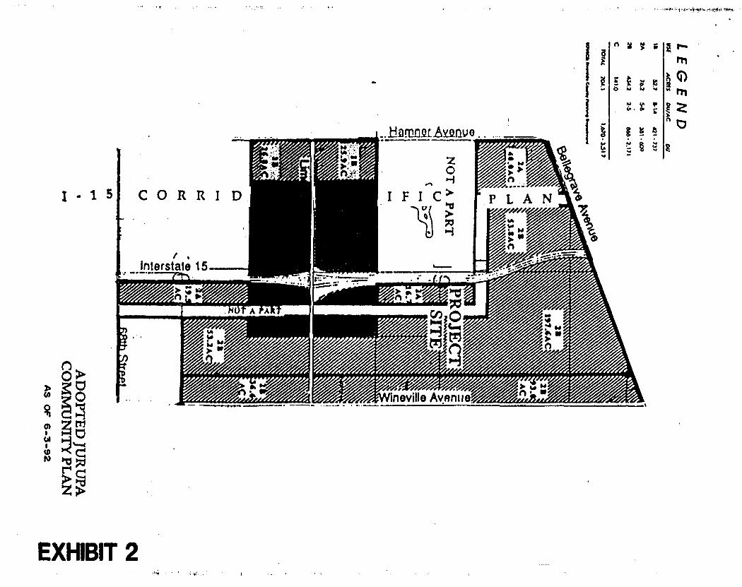
W-1. 9. Jurupa Community Plan (Exhibit #2): Commercial, Residentie, 1B (8-14 du/ac),
Residential 2A (5-8 du/ac), Residential 2B (2-5 du/ac).
10. Letters (Opposing/Supporting): One (Opposing). 11. Sphere of Influence: None.
PROJECT BACKGROUND:
Specific Plan No. 266, 1-15 Corridor, is a multi-use project on 701.3 acres in the Mira Loma area. The project lies within the Jurupa Community Plan, with land use designations of commercial and Categories I and II residential specified, as well as the requirement for a specific plan. In conjunction with the proposed specific plan, Comprehensive General Plan Amendment No. 242 and Change of Zone No. 5619 are proposed. These would place the specific plan designation on the Open Space and Conservation Map of the Comprehensive General Plan; amend the Junipa Community Plan designations from 1B to C, 2B to C, 2A to IP, and 2B to 1B; and amend the existing zoning designations from agricultural uses (A-2-10 and A-2-20) to those of Ordinance No. 348: C-P-S, C-0, R-1, R-2, R-3, I-P, and R-5.
Existing onsite land uses are two dairy farms south of Limonite Avenue, and cropland north of Limonite. The land has been held in Agricultural Preserve status. Notices of Nonrenewal have been filed, with portions scheduled to expire in 1992 and 1996. Zoning is proposed at this time for the areas whose Agricultural Preserve Contracts expire this year.
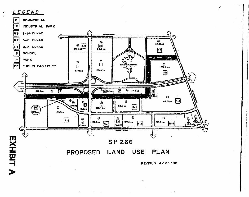
Area land uses include acreage in Agricultural Preserve status to the north, northwest (San Bernardino County Dairy Preserve), west and south. To the east is Specific Plan No. 125, Sky Country, a large lot equestrian-oriented residential project. Residential uses occur to the south of this specific plan. The project is bisected by the recently completed Interstate 15. The project is outside of any City Sphere of Influence, as well as the proposed boundaries of the proposed Cities of Jurupa or Mira Loma.
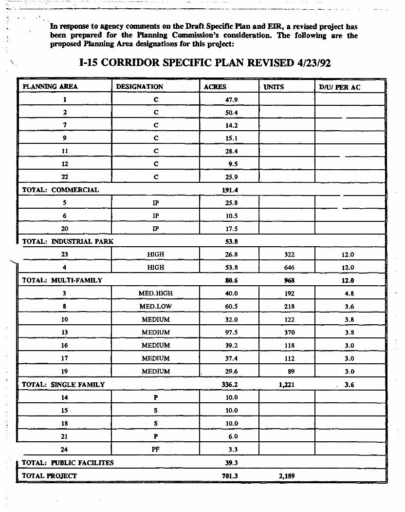
In response to agency comments on the Draft Specific Plan and EIR, a revised project has been prepared for the Planning Commission's consideration. The following are the proposed Planning Area designations for this project:
I-15 CORRIDOR SPECIFIC PLAN REVISED 4/23/92
PLANNING AREA , DESIGNATION ACRES UNITS D/U/ PER AC
1 - C 47.9
2 C 50.4
7 C 14.2
9 C 15.1
11 C 28.4
12 C 9.5
22 C 25.9
TOTAL: COMMERCIAL 191.4
5 IP 25.8
6 IP 10.5
20 IP 17.5
TOTAL: INDUSTRIAL PARK 53.8
23 HIGH 26.8 322 12.0
4 HIGH 53.8 646 12.0
TOTAL: MULTI-FAMILY 80.6 968 12.0
3 MED.HIGH 40.0 192 4.8
8 MED.LOW 60.5 218 3.6
10 MEDIUM 32.0 122 3.8
13 MEDIUM 97.5 370 3.8
16 MEDIUM 39.2 118 3.0
17 MEDIUM 37.4 112 3.0
19 MEDIUM . 29.6 89 3.0 I TOTAL: SINGLE FAMILY 336.2 1,221 . 3.6
14 P 10.0 _ 15 S 10.0
18 I
S 10.0
21 P 6.0
24 PF 3.3
TOTA: PUBLIC FACILITES 39.3
TOTAL PROJECT 701.3 2,189
I

Staff Report Specific Plan No. 266, 1-15 Corridor GPA No. 242, CZ No. 5619 June 3, 1992 Page 5
Agency Comments
The following agencies have submitted comments on the revised draft project:
Building and Safety Grading: 5-5-92 Plan Check: 5-6-92
Environmental Health: 2-20-92 Fire: 5-19-92 Flood: 5-21-92
The Transportation Department's letter of 1-22-92 had indicated that the traffic study prepared in conjunction with the project as proposed at that time indicated a Level of Service "E" at Cloverdale Road/Hamner Avenue and LOS "D" at Limonite Avenue/I-15 ramps, both at p.m. peak hour. As the Comprehensive General Plan Circulation policies require a Level of Service "C", the Transportation Department recommended denial. It was in response to these concerns that the project proponent revised the specific plan, reducing the amount of commercial uses as proposed in the Draft specific plan and EIR, proposing commercial office, industrial park, and public facility uses instead. As a result, the Transportation Department will accept either a revised traffic study substantiating the vehicle trip reduction (and consequent LOS improvement of the revised plan), or will impose a "trip ceiling" on the project. The applicant has agreed to revise the traffic analysis. The Transportation Department will make its recommendation at such time as the report is complete.
Project Design Recommendation
Based on comments received on the Draft EIR, Planning Staff is recommending the following changes to the revised Draft specific plan. Please see the EIR Analysis for further explanation.
In response to comments received from the Southern California Association of Governments (SCAG), the South Coast Air Quality Management District (SCAQMD), and the County Transportation Department, and in order to mitigate air quality, traffic congestion, and conform to the regional Growth Management Plan, staff is requiring the following measures to be included to provide maximum feasible mitigation, and in order to recommend certification of the Environmental Impact Report:

Staff Report Specific Plan No. 266, 1-15 Corridor GPA No. 242, CZ No. 5619 June 3, 1992 Page 6
All commercial and industrial park planning areas will be required to include, as standards for development, Transportation Demand Management measures. These measures will primarily be implemented through property owners associations and include conditions to require participation in a Transportation Management Authority, either project-specific, or area-wide or subregional, whatever is available at time of development. These planning areas will also be required to provide, through their property owners associations, Transportation Management Plans, subject to Regulation 15 of the Air Quality Management Plan. The intent of these measures is to reduce Vehicle Miles Traveled (VMT) through encouragement and provision of alternative transit modes, whether by bus, vanpool, walking, biking, or any other alternatives to single occupancy vehicles.
All commercial and industrial park planning areas will be required to specifically provide for bike storage areas, transit shelters and kiosks in their design, as well as other facilities as recommended in SCAG's letter (page 5).
In response to Housing Element identification of need and the identification by SCAG of the need for housing affordable to workers to be located in proximity to employment, the two large commercial areas west of 1-15 will be required to provide, in cooperation with the Housing Authority, an affordable housing component in this project, modeled on the standards previously approved by the Planning Commission for other mixed use specific plans.
Further VMT reduction can be achieved and a more balanced project provided through the requirement for one to two acre "pocket parks" in Planning Areas 3, 4, and 8. These residential areas are isolated from the parks provided in planning area 14 and 21 which are east of 1-15 and north of Limonite Avenue.
In order to mitigate concerns of noise and proximity to emissions source, staff is recommending that Planning Areas 4 and 13 develop special buffering treatments along the freeway.
FIR ANALYSIS:
Regional Element
Southern California Association of Governments' (SCAG) comments on the Draft EIR indicated that, in their opinion, the project was not in conformance with the State Implementation Plan (SIP) for Air Quality, in that the emissions resulting from the project were significant and that maximum feasible mitigation had not been applied.
03
SP 266
PROPOSED LAND USE PLAN
LEGEND
ra COMMERCIAL
INDUSTRIAL PARK
8..14 DU/AC
5-8 DU/AC
2-5 DU/AC
SCHOOL
PARK
PUBLIC FACILITIES
REVISED 4 / 23 /92

Staff Report Specific Plan No. 266, 1-15 Corridor GPA No. 242, CZ No. 5619 June 3, 1992 Page 7
SCAG noted that, while the project incorporates many Transportation Systems Management components (roadway improvements), Transportation Demand Management (TDM) to reduce impacts was lacking. SCAG recommended that the project include a Transportation Management Plan (TMP) which should include the follow measures, at minimum: parking management, telecommuting, non-work trip reduction, and auto use restrictions. The TMP should also include other facilities as part of its Site Plan Review requirements: preferential parking for carpool vehicles, bicycle parking and shower facilities, information center for transportation alternatives, rideshare vehicle loading areas, vanpool vehicle accessibility, bus stop improvements, onsite child care facilities, facilities to encourage telecommuting, onsite amenities such as cafeterias and ATMs, penalty funds for noncompliance designated for park-n-ride lots or transportation management organizations.
SCAG makes specific recommendation that the County require a TDM Plan from the project proponent that will: 1) provide for the creation of a 1-15 Corridor Transportation Management Association; 2) investigate the feasibility of developing a telecommuting center onsite; and, 3) give consideration to a vanpool demonstration program for 1-15 Corridor residents and employers.
With respect to the Regional Growth Management Plan, their comments noted that, while the project did create a positive impact on the jobs/housing balance, a lack of analysis between the employment opportunities and income distribution, and the cost of housing available was lacking.
Air Quality
The project will result in significant impacts to air quality, with daily emissions of Reactive Organic Gas (ROG), Carbon Monoxide (CO), Nitrogen Oxide (NO), and Particulate Matter (PM10) estimated to be 860 pounds, 5200 pounds, 2400 pounds, and 560 pounds respectively.
South Coast Air Quality Management District's comments identify measures which should be incorporated into the plan. Many of these measures (construction related impacts and stationary source impacts) are covered by grading and building code requirements. Other measures, related to mobile source emissions and cumulative impacts, are those also identified by SCAG in its comments. These comments reiterate the need to incorporate all feasible mitigation measures to reduce single occupancy vehicle trips.
Staff Report Specific Plan No. 266, 1-15 Corridor GPA No. 242, CZ No. 5619 June 3, 1992 Page 4
ANALYSIS:
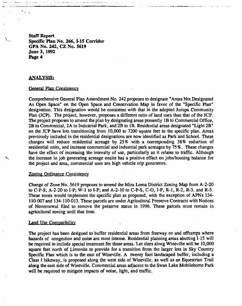
General Plan Consistency
Comprehensive General Plan Amendment No. 242 proposes to designate "Areas Not Designated As Open Space" on the Open Space and Conservation Map in favor of the "Specific Plan" designation. This designation would be consistent with that in the adopted Jurupa Community Plan (JCP). The project, however, proposes a different ratio of land uses than that of the JCP. The project proposes to amend the plan by designating areas presently 1B to Commercial Office, 2B to Commercial, 2A to Industrial Park, and 2B to 1B. Residential areas designated "Light 2B" on the JCP have lots transitioning from 10,000 to 7200 square feet in the specific plan. Areas previously included in the residential designations are now identified as Park and School. These changes will reduce residential acreage by 25 % with a corresponding 38% reduction of residential units, and increase commercial and industrial park acreages by 75%. These changes have the effect of increasing the intensity of use, particularly as it relates to traffic. Although the increase in job generating acreage onsite has a positive effect on jobs/housing balance for the project and area, commercial uses are high vehicle trip generators.
Zoning Ordinance Consistency
Change of Zone No. 5619 proposes to amend the Mira Loma District Zoning Map from A-2-20 to C-P-S; A-2-20 to I-P; W-1 to I-P; and A-2-10 to C-P-S, C-0, I-P, R-1, R-2, R-3, and R-5. These zones would implement the specific plan as proposed, with the exception of APNs 134-110-007 and 134-110-013. These parcels are under Agricultural Preserve Contracts with Notices of Nonrenewal filed to remove the preserve status in 1996. These parcels must remain in agricultural zoning until that time.
Land Use Coppatibility
The project has been designed to buffer residential areas from freeway on and offramps where hazards of congestion and noise are most intense. Residential planning areas abutting 1-15 will be required to include special treatment for those areas. Lot sizes along Wineville will be 10,000 square feet north of Limonite to provide for a transition from the larger lots in Sky Country Specific Plan which is to the east of Wineville. A twenty foot landscaped buffer, including a Class I bikeway, is proposed along the west side of Wineville, as well as an Equestrian Trail along the east side of Wineville. Commercial areas adjacent to the Swan Lake Mobilehome Park will be required to mitigate impacts of noise, light, and traffic.
Staff Report Specific Plan No. 266, 1-15 Corridor GPA No. 242, CZ No. 5619 June 3, 1992 Page 8
Transportation
The Junipa Community Plan requires that all new Category I and II development have a minimum roadway Level Of Service "C" or better. Any project creating higher levels of impact must have prior approval from the County Transportation Department. Specific Plan No. 266, as proposed in the Draft Specific Plan and EIR, would result in Level Of Service "D" or "E" at the northbound and southbound freeway offramps at Limonite Avenue, and at the intersection of Cloverdale Road and Hamner Avenue.
The traffic analysis for this project was based upon the inclusion of three major projects in the area: Speciiic Plan No. 266 (I-15 Corridor), Specific Plan No. 289 (Harada) and the proposed Riverside County Equestrian Center. These projects are identified as being west of this project along Limonite Avenue (see Exhibit #1). The total daily vehicle trip generation was 173,490. Of this, the project generated 125,720 trips. The specific plan identified the following upgrades to the circulation system which the project would incorporate to achieve Level Of Service "C" (with the previously noted exceptions):
General Plan Designations Roadway Segment DAsiisig Proposed
Cloverdale Archibald to Sumner Major Arterial
Cloverdale Sumner to Hamner Major Urban Arterial
Limonite Hamner to Wineville Major Augmented Urban Arterial
Limonite Wineville to east of Etiwanda
Major Urban Arterial
Hamner Bellegrave to south of Schleisman
Specific Plan Road
Urban Arterial
The Augmented Urban Arterial Road identified as mitigation in the Draft EIR would be a 162 foot Right-Of-Way with dual left turn lanes and four through travel lanes in each direction. As noted, Level Of Service "C" would be exceeded even with these upgrades.

Staff Report Specific Plan No. 266, 1-15 Corridor GPA No. 242, CZ No. 5619 June 3, 1992 Page 9
The County Transportation Department indicated in its letter of January 22, 1992, that it would recommend denial of this project, as proposed, based on the findings of the traffic analysis. As a result, the project proponents have modified the project in an effort to mitigate the traffic problems. These modifications have been identified above. Subsequently, the Transportation Department has agreed to accept either a revised traffic analysis, based upon the modified plan, which would substantiate the vehicle trip reduction, or will impose a "trip ceiling". The Transportation Department will make its recommendation at such time as it has this information.
Sousing
As the Draft EIR note., the project does provide for a range of housing, consistent with provisions of the Housing Element, including apartments. While the project does provide for higher density housing on site, assumptions about affordability cannot be based merely on a density range. A study done for a large commercial center (127.8 acres of commercial, 41.6 acres of industrial) in the eastern county showed that the 3500 jobs would include 2380 households. Of these households, 318 were projected to be very low income households (.. .5 50% of median income) This project will have, at minimum, similar impacts, which market rate housing does not address.
Program B.11 (Specific Plan Affordable Housing Provision) of the Housing Element extends responsibility for provision of low income housing to all specific plans which include residential, commercial and/or industrial land uses. This program has been applied to specific plan proposals since the adoption of the Housing Element in 1991. The Housing Authority has worked in cooperation with Planning Staff to develop flexible mitigation for this program. Planning recommends that this project be required to include an affordable housing component, modeled on the standards previously approved by the Planning Commission for other mixed use projects.
Agriculture
The project site is designated in the Comprehensive General Plan, Environmental Resources Map, as being within an area of Agricultural Resources. The Riverside County Important Farmlands Map designates the site as Prime Agricultural Land. Currently in operation onsite are two dairy farms, with acreage north of Limonite used as cropland. Approximately 467 acres of the project are under Williamson Act restrictions (Mira Loma Agricultural Preserves 1 and 19). These contracts expire in 1992 or 1996. The parcels remaining in agricultural preserve status through 1996 are those south of Limonite Avenue, and include portions of Planning Area 1, and Planning Areas 6, 7, 8, 9, 23, and 24. These parcels will have land use designations imposed by the project, but will remain in agricultural zoning until the contracts have expired.

Staff Report Specific Plan No. 266, 1-15 Corridor GPA No. 242, CZ No. 5619 June 3, 1992 Page 10
The Jurupa Community Plan does not allocate any land for permanent agricultural use. An Agricultural/Development Reserve designation is identified in the Jurupa Community Plan; areas to the immediate west of the project site have been given this designation. Agricultural uses within this area are expected to continue; however, periodic reviews of the appropriateness of this designation will occur. The project site has been designated for development by the Jurupa Community Plan, and overriding findings for agriculture were made at the time of adoption of the plan.
Parks
The specific plan proposes 16 acres a neighborhood parkland. The JCP specifies in its Interstate 15 Corridor Policies that "a minimum of three acres of active local parkland shall be provided for each 386 dwelling units." Based on this standard, 2189 dwelling units will require approximately 17 acres of local parldand. Staff would prefer that the park designated for Planning Area 14 be deleted, with additional acreage added to the park designated for Planning Area 21. In addition, "pocket parks" of one to two acres should be provided in Planning Areas 3, 4, and 8, which presently do not have any recreational facilities. These residential areas have some of the highest densities (Planning Area 23 is also high; it has half the units planned for P.A.4 and will include some recreation as part of its plot plan requirements).
These revisions would make the park areas more accessible to project residents, maldng it possible for them to avoid driving to recreation, thereby reducing trips. Land use design such as this enhances the goals of the Air Quality Plan.
Noise
The Jurupa Community Plan has noise standards of 65 dBA CNEL for exterior residential, and 45 dBA CNEL for interior residential. The Draft EIR has identified the project site as subject to significant noise impacts, already in existence prior to project development. The Community Noise Equivalent Level (CNEL) exceeds the standards of the JCP at Bellegrave, Wineville, Limonite, Etiwanda, and Hamner Avenues. A twenty foot landscaped setback along Wineville is planned for buffering land use compatibility. Additional mitigation for noise will be required where residential uses abut Limonite, Bellegrave, and Hamner Avenues.

Staff Report Specific Plan No. 266, 1-15 Corridor GPA No. 242, CZ No. 5619 June 3, 1992 Page 11
Noise levels from Interstate 15 are expected to be typical, with CNEL at levels ranging from "Normally Acceptable" to "Conditionally Acceptable" for commercial and industrial land uses, to "Conditionally Acceptable" to "Generally Unacceptable" for residential uses in Planning Areas 4 and 13. These planning areas will require detaile,,d analysis and special treatments for noise mitigation in order for residential uses to be developed.
Fdison Easement
Southern California Edison has a 245 foot wide v cant right of way that traverses the project. This easement is not part of the specific plan, thur no land use designations are imposed on this area. Edison is currently reviewing possible use, for this easement, with a view to zone or designate these corridors with uses similar to that of adjacent properties. See their letter dated 3-27-92.

L3!
i;i1S 4171 ;Aim' :11 — _
3A (:4-2 Dwellingr Units/Acre) 3.5 1029
R3 (18) 80.6 12 968
R2 (2A) 40.0 4.8 192 R1(28) 296.2
191.4 IP 53.8
39•3
TOTAL 701.3 2189
,
LAND USE IN ACCORDAN WITH JURUPA COMMUNITY 13LAN DESIGNATIONS Lie
M 'Manufacturing)
nr Er4:0;;171 ■
r.: SP 812.5-W KY COUNTRY_
k 7,4 .:111
• 441
ILIM I
41110P,Ipar■
Clover:Ws Road
:OPOSED Sr a Sag
RARADA
213 (2,5 Dwelling Units/Acre
AG/DEV. R. awros
.•••••
V,":: Raz
LEGEND USE ACRES DU/AC DU
IP (Industrial Park) I wee'
AREA MAP WITH
PROPOSED SPECIFIC PLAN 266
REVISED 4 / 23 /92
EXHIBIT 1
LEGEND
(Manufacturing)
43-" ' r LE ACRES DU/AC DU
8-14
54
2-5
.737
381 -6O)
868 .2.171 IP (Industrial Park)
I moo
18 52.7
2A 70.2
211 434.2
141.0
1.6713- 3.51 7 3
me° =
= -=- 3A (4-2 Dwelling
. 17.25 is, EE Units/Aese)*. 11:
Te cf /OM XXI
•
&noon [lama
t • ' \'
, \ L
I :,,, ‘N 1113./1A
A .N \4
I \
PRO ECT SITE
,
10.4AC
"4 m u .0y"
SP #125411 . ultilu 11 inuurcis KY COUNTR •
Pi7111141:.:4" te.rIn
1:12:4Te4.sosit
1::;:r2P:ilar .1111: r =a. alrfal
110.110:11:111Wwwww Corwy Wwwwis 011 1 r
- ile tos
.T.73.7 Era. :=.0.,11 mit !II 111111111
."137711
WO
SA 410.11AC
18 $3.11AC
NOT A PART
Urnonin Avenue C (Cceneneisl)
_LAO 1
ADOPTED JURUPA COMMUNITY PLAN
EXHIBIT 2
t MIRA LOMA *1 OUT IN 1992
2. MIRA LOMA *19 OUT IN 1996
3. MIRA LOMA *5 OUT IN 1996
4. MIRA LOMA *14 , !-•'/,///'/ 0/4/0/:1-/./.1171/.
2 _ //- '";441. °,444.7.7.4....z.m." 21:51:•2:,414z..4
V% =:714 miiiiglititcy 4,:,
A g /- ..
.t ,ta.iii,t,,, ;;;.: :.,,u7 gie.
, y . Mil= Vgl z 6 ..,........1.-.. -0- lel 1 Ii g.
. ..... , 411
wow - imilmitt III winindsz;
7A/
/z
_-,/y ' '///';
_5/7 /// // 7%,
/
RIVERSIDE COUNTY PLANNING DEPARTMENT SPECIFIC PLAN
CONDITIONS OF APPROVAL
Specific Plan No. 266 Date: 9-15-92
1. The following conditions of approval are for SPECIFIC PLAN NO. 266 and consist of Conditions One (1) through Thirty Four (34) inclusive.
2. Specific Plan No. 266 shall consist of the following:
a. Exhibit "A": Specific Plan Text.
b. Exhibit "B": Specific Plan Conditions of Approval.
c. Exhibit "C": Mitigation Reporting/Monitoring Program.
3. If any of the following conditions of approval differ from the specific plan text or exhibits, the conditions enumerated herein shall take precedence.
4. The development of the property shall be in accordance with the mandatory requirements of all Riverside County ordinances including Ordinances Nos. 348 and 460 and state laws; and shall conform substantially with adopted Specific Plan No. 266 as filed in the office of the Riverside County Planning Department, unless otherwise amended.
5. No portion of the specific plan which purports or proposes to change, waive or modify any ordinance or other legal requirement for the development shall be considered to be part of the adopted specific plan.
6. The project shall comply with the conditions set forth in the following agency letters, copies of which are attached, set forth by these agencies at the development stage:
County Transportation Department: County Health Department: County Flood Control District: County Fire Department: County Department of Building and Safety, Grading Section: County Geologist: Junipa Community Services District: Jurupa Area Recreation and Park District:
May 29, 1992 May 28, 1992 May 21, 1992, Sept 3, 1991 May 19, 1992
May 5, 1992 March 15, 1991 July 27, 1992 • September 15, 1992
a. b. C. d. e.
f. g. h.
7. Prior to recordation of any final maps or approval of any plot plan or use permit, Specific Plan No. 266, Comprehensive General Plan Amendment No. 242, and Change of Zone No. 5619, shall be approved by the Board of Supervisors and shall be effective. Lots created by land divisions within Specific Plan No. 266 shall be in conformance with the development standards of the zone ultimately applied to the property.
SPECIFIC PLAN NO. 266 Conditions of Approval Page 2
8. a. Impacts to the Corona/Norco Unified School District shall be mitigated at the development application stage in accordance with the State laws and Board of Supervisors policies in effect at the time of tract submittal.
b. Prior to, and as a condition of approval for the filing of any application for development proposed within Specific Plan No. 266, the Developer shall have entered into a school facilities mitigation agreement with the Jurupa Unified School District which establishes a mitigation fee in the amount of $8523 (subject to inflation as provided for in the agreement) for each residential unit in Specific Plan No. 266. In addition, the Developer shall designate to Jurupa Unified School District two ten acre elementary school sites at locations satisfactory to the school district. All school site shall meet the requirements of the district in terms of size, location, access, and absence from environmental constraint.
9. Development applications which incorporate common areas shall be accompanied by design plans for the common area. Such plans shall specify the location and extent of landscaping, irrigation systems, structures, and circulation (vehicular, pedestrian and/or equestrian).
10. A land division filed for the purposes of phasing or financing shall not be considered an implementing development application.
11. An environment assessment shall be conducted for each tract, change of zone, plot plan, specific plan amendment, or any other discretionary permit required to implement the specific plan. At a minimum, the environmental assessment shall utilize the evaluation of impacts addressed in the Environmental Impact Report prepared for Specific Plan No. 266.
12. The following special studies/reports shall accompany implementing development applications in the planning areas listed below:
study/Report Planning Area
a. Archaeological (Subsurface 2
b. Acoustical Study 3, 4, 8, 13, 16, 17, 19 and 23
To be submitted to the Health Department for review and determination of noise mitigation.
c. Tree Planting Program 16, 17 and 19
d. Geotechnical Report All Planning Areas east of 1-15

SPECIFIC PLAN NO. 266 Conditions of Approval Page 3
13. Prior to the recordation of any final map or issuance of any building permit within Specific Plan No. 266, the first applicant or their successor-in-interest for a subdivision or building permit within a Planning Area shall submit to the Planning Department, correct legal descriptions for the planning area(s) within which the proposed project is located.
14. Prior to issuance of a building permit for the construction of any use contemplated by this approval, the applicant shall first obtain clearance from the Riverside County Planning Department that all pertinent conditions of approval have been satisfied with the specific plan for the phase of development in question.
15. Each planning area shall comply with the Riverside County recycling program upon the plan's adoption.
16. Dual water systems shall be provided in common open space areas for the use of reclaimed water when made available by the water district.
17. In accordance with Section 711.4 of the Fish and Game Code, the applicant/subdivider is obligated to pay a filing fee to defray cost incurred by the Department of Fish and Game in managing and protecting fish and wildlife trust resources. The applicant/subdivider is also obligated to pay a documentary handling fee to defray costs incurred by the County of Riverside in implementing the Department of Fish and Game filing fee program. The filing fee is $1,250.00 for a project for which a negative declaration has been prepared and the filing fee is $850.00 for a project for which an environmental impact report has been prepared. The documentary handing fee is $25.00 in all cases. These fees shall be paid to the County Clerk if the County of Riverside at the time of filing a notice of determination pursuant to Section 21152 of the Public Resources Code. If these fees are not paid, the project in question shall not be operative, vested, or final. Accordingly, until the fees are paid, no subsequent approval will be given, no subsequent permits will be issued and the property involved may not be used in the manner approved.
18. No building permits shall be issued by the County of Riverside for any commercial/industrial/manufacturing development within the project boundary until the developer or the developer's successors-in-interest provide evidence of compliance with public facility financing measures. A cash sum of four-hundred ten dollars ($410) per acre of development shall be deposited with the Riverside County Department of Building and Safety as mitigation for impacts upon law enforcement services (Sheriff services). This fee is a requirement of the Jurupa Community Plan portion of the Riverside County Comprehensive General Plan.

SPECIFIC PLAN NO. 266 Conditions of Approval Page 4
19. No building permits shall be issued by the County of Riverside for any residential lot/unit within the project boundary until the developer or the developer's successors-in-interest provide evidence of compliance with public facility financing measures. A cash sum of three-hundred fifty seven dollars per lot/unit shall be deposited with the Riverside County Department of Building and Safety as mitigation for impacts upon library and law enforcement services ($100 for Sheriff services, and $257 for library services). This fee is a requirement of the Jurupa Community Plan portion of the Riverside County Comprehensive General Plan.
20. Prior to the approval of the first development application, an affordable housing program shall be defined and approved by the Planning Department and Housing Authority. This program must utilize one or more of the following options:
a. Twenty percent of the units with Planning Areas proposing 6000 square foot minimum lot sizes shall be affordable. The Developer shall enter into an administrative agreement and contract with the Housing Authority to qualify buyers and monitor compliance with affordability restrictions placed on such units. Details of such agreement and contract to be negotiated between the Developer and the Housing Authority.
b. Planning Areas 1 and 2 shall provide 5 acres of land, each which will be dedicated to the Housing Authority for affordable rental apartments. The land for these units shall be offered to the Housing Authority (or their designee) at no cost to the Authority. The land to be offered shall be: 1) in a fully developable condition to include street front availability of all required infrastructure, 2) shall be graded and compacted to meet approved site plans, 3) shall be parceled off as separate legal parcels, 4) site plan approvals shall be processed as part of any adjacent development, 5) the land to be offered shall be free of environmental constraints, i.e., biological or geotechnical. The Housing Authority will coordinate implementation of the program with the developer. The project is allowed one market rate unit for each affordable unit provided in these parcels.
c. In coordination with the Housing Authority, the Developer or their designee shall purchase and refurbish existing affordable units in the Mira Loma area, and transfer their ownership to the Housing Authority to increase the number of affordable units in Riverside County. The number of such units will be determined by the Housing Authority and the Developer, but in no case shall the number of units under this scenario be combined with any other option herein described and be less than 150 units total.

SPECIFIC PLAN NO. 266 Conditions of Approval Page 5
d. The developer shall work in conjunction with the Housing Authority to establish a mitigation fee per square foot of commercial/industrial development sufficient to provide the subsidy required to ensure that 150 units of housing are affordable to households whose income is at 60% of county median income.
e. Other affordable housing programs as approved by the Housing Authority and Riverside County Planning Department. At minimum, no less than 150 of the units within SP 266 shall be for "affordable" housing.
21. Prior to approval of the first development application, the Developer shall submit a Transportation Management Plan (I'MP) for approval by the County Transportation Department. The TMP shall be intended to provide assistance to employers and residents within the project in achieving compliance with congestion management and air quality programs.
a. The TMP should address 1) parking management, 2) telecommuting, 3) non- work trip reduction, 4) auto use restrictions.
The TMP should identify the Transportation Management Authority (TMA) and identify responsibilities and financial arrangements with the authority. The developer shall be responsible for the formation of a project TMA if a regional TMA does not exist prior to plot plan approval for the 500,001st square foot of commercial/industrial development.
c. The TMP should delineate in what manner Transportation Demand Management (TDM) measures shall be achieved, including delineation of responsibilities and financial arrangements.
22. Any subsequent review/approvals required by the conditions of approval, including but not limited to grading or building plan review or review of any mitigation monitoring requirement, shall be reviewed on an hourly basis based on the research fee, or such fee as may be in effect at the time of submittal, listed in Ordinance No. 671.
23. Deed disclosures shall be required for all residential areas within the specific plan advising residents of potential impacts such as noise, dust and odors from animal-keeping and surrounding agriculture uses.
24. A Regional Trail shall be constructed along the east side of Wineville, south of Limonite Avenue to 66th Street, in accordance with Comprehensive General Plan Standards for Regional Trails. The trail shall be constructed in conjunction with the widening of Wineville Avenue. Equestrian crossing signals shall be provided at the intersection where Wineville Avenue trail alignment crosses Limonite Avenue.
SPECIFIC PLAN NO. 266 Conditions of Approval Page 6
25. In conjunction with review of development applications for either Planning Areas 3 or 4, a circulation plan for these planning areas will be required.
26. DevUopment of Planning Areas 4 and 23 (multi-family residential) shall occur through comprehensive site development plans for each planning area, incorporating circulation, architectural design guidelines and landscaping guidelines. Planning Area 4 shall incorporate special treatment, as necessary, to mitigate noise, air quality, and aesthetic concerns arising from proximity to 1-15.
27. Development of Planning Area 13 shall incorporate special treatment, as necessary, to mitigate noise, air quality and aesthetic concerns arising from proximity to 1-15.
28. Dew lopment of each commercial and/or industrial planning area shall occur through corn:rehensive site development plans to be submitted for review by the Planning Department in conjunction with the development applications for each planning area, incorporating circulation, architectural design guidelines, and landscaping guidelines. Comprehensive site development plans shall include Site Plan Review requirements for TDM incorporating the following facility standards:
a. preferential parking for carpool and vanpool vehicles b. bicycle parking and shower facilities c. information center for transportation alternatives d. rideshare vehicle loading areas e. bus stop improvements f. on-site child care improvements 8. local transportation systems management h. facilities to encourage telecommuting i. on-site amenities such as cafeterias and restaurants, ATMs, and other services
that would eliminate the need for additional trips.
29. Development of Planning Areas 2 and 22 shall coordinate with Swan Lake Mobile Home Park to ensure that any additional access occurs in a manner that does not diminish security to the park.
30. Dedication of the twenty (20) acre Sports Park, Planning Area 14, to Jurupa Area Recreation and Park District shall occur prior to the 501st building permit for single family units. The site shall be graded, with irrigation and turf installed prior to dedication.

SPECIFIC PLAN NO. 266 Conditions of Approval Page 7
31. Common areas identified in the specific plan shall be owned and maintained as follows:
a. A permanent master maintenance organization shall be established for the specific plan area, tr!, assume ownership and maintenance responsibility for all common recreation, open space, circulation systems and landscaped areas. The organization may be public or private. Merger with an area-wide or regional organization shall satisfy this condition provided that such organization is legally and financially capable of assuming the responsibilities for ownership and maintenance. If the organization is a private association then neighborhood associations shall be established for each residential development, where required, and such associations may assume ownership and maintenance responsibility for neighborhood common areas.
b. Unless oil, m-wise provide for in these conditions of approval, common areas shall be conve, ..td to the maintenance organization as implementing development is approved or any subdivision is recorded.
c. The maintenance organization shall be established prior to or concurrent with the recordation of the first land division, or issuance of any building permits for any approved development permit (use permit, plot plan, etc.).
32. If the permanent master maintenance organization referenced in Condition of Approval No. 10 is a public organization, the developer shall comply with the following condition:
a. Prior to the recordation of any final subdivision map, or issuance of building permits in the case of use permits and plot plans, the applicant shall convey to the County fee simple title, to all common or common open space areas, free and clear of all liens, taxes, assessments, leases (recorded and unrecorded) and easement, except those easements which in the sole discretion of the County are acceptable. As a condition precedent to the County accepting title to such areas, the subdivider shall submit the following documents to the Planning Department and the office of the County Counsel:
1) A declaration of covenants, conditions and restrictions; and
2) A sample document conveying title to the purchaser of an individual lot or unit which provides that the declaration of covenants, conditions and restrictions is incorporated therein by reference.
SPECIFIC PLAN NO. 266 Conditions of Approval Page 8
b. The declaration of covenants, conditions and restrictions submitted for review shall (a) provide for a term of 60 years, (b)provide for the establishment of a property owners' association comprised of the owners of each individual lot or unit and (c) contain the aollowing provisions verbatim:
"Notwithstanding any provision in this Declaration to the contrary, the following provisions shall apply:
1) The property owners' association established herein shall, if dormant, be activated, by incorporation or otherwise, at the request of the County of Riverside, and the property owner's association shall unconditionally accept from the County of Riverside, upon the County's demand, title to all or any part of the 'common area', more particularly described on Exhibit " at Ached hereto. The decision to require activation of the property owners' association and the decision to require that the association unconditionally accept title to the 'common area' shall be at the sole discretion of the County Riverside.
2) In the event that the common area, or any part thereof, is conveyed to the property owners' association, the association, thereafter shall own such 'common area', shall manage and continuously maintain such 'common area' and shall not sell or transfer such 'common area', or any part thereof, absent the prior written consent of the Planning Director of the County of Riverside or the County's successor-in-interest. The property owners' association shall have the right to assess the owners who defaults in the payment of a maintenance assessment. An assessment lien, once created, shall be prior to all other liens recorded subsequent to the notice of assessment or other document creating the assessment lien.
3) This Declaration shall not be terminated, 'substantially' amended or property deannexed therefrom absent the prior written consent of the Planning Director of the County of Riverside or the County's successor-in-interest. A proposed amendment shall be considered 'substantial' if it affects the extent, usage or maintenance of the 'common area'.
4) In the event of any conflict between this Declaration and the Articles of Incorporation, the Bylaws, or the property owners' association Rules and Regulations, if any, this Declaration shall control."
c. Once approved, the declaration of covenants, conditions and restrictions shall be recorded at the same time that the final map is recorded.
SPECIFIC PLAN NO. 266 Conditions of Approval Page 9
33. If the permanent master maintenance organization referenced in Condition of Approval No. 10 is a private organization, the developer shall comply with the following condition:
a. Prior to recordation of any final subvision map or issuance of building permits in the case of use permits and plot plans, the subdivider shall submit the following documents to Planning Department for review, which documents shall be subject to the approval of that department and the Office of the County Counsel:
1) A declaration of covenants, conditions and restrictions; and,
2) A sample document conveying title to the purchaser of an individual lot or unit which provides that the declaration of covenants, conditions and restrictions is incorporated r erein by reference.
b. The declaration of covenants, conditions and restrictions submitted for review shall (a) provide for a term of 60 years, (b) provide for the establishment of a property owners' association comprised of the owners of each individual lot or unit and (c) provide for ownership of the common area by either the property owners' association of the owners of each individual lot or unit as tenants in common and (d) contain the following provisions verbatim:
"Notwithstanding any provision in this Declaration to the contrary, the following provisions shall apply:
1) The property owners' association established herein shall, manage and continuously maintain the 'common area', more particularly described on Exhibit" attached hereto, and shall not sell or transfer the 'common area' or any part thereof, absent the prior written consent of the Planning Director of the County of Riverside or the County successor-in-interest.
2) The property owners' association shall have the right to assess the owners of each individual lot or unit for the reasonable cost of maintaining such 'common area', and shall have the right to lien the property of any such owner who defaults in the payment of a maintenance assessment. An assessment lien, once created, shall be prior to all other liens recorded subsequent to the notice of assessment or other document creating the assessment lien.
SPECIFIC PLAN NO. 266 Conditions of Approval Page 10
3) This Declaration shall not be terminated, 'substantially' amended or property deannexed therefrom absent the prior written consent of the Planning Director of the County of Riverside or the County's successor-in-interest. A proposed amendment shall '.)e considered 'substantial' if it affects the extent, usage or maintenance of the 'common area'.
4) In the event of any conflict between this Declaration and the Articles of Incorporation, the Bylaws, o the property owners' association Rules and Regulations, if nay, this Declaration shall control."
c. Once approved, the declaration of covenants, conditions and restrictions shall be recorded at the same time the final map is recon ed.
34. The applicant or its successor shall defend, indemnify, and hold harmless the County of Riverside, its agents, officers, and employees from any claim, action, or proceeding against the County of Riverside or this agents, officers, or employees to attack, set aside, void or annul an approval of the County of Riverside, its advisory agencies, appeal boards or legislative body concerning Specific Plan No. 266. The County of Riverside, will promptly notify the applicant or its successor of any such claim, action, or proceeding against the County of Riverside andy will cooperate fully in the defense. If the County fails to promptly notify the applicant of any such claim, action, or proceeding or fails to cooperate fully in the defense, the applicant shall not, thereafter, be responsible to defend, indemnify, or hold harmless the County of Riverside.
35. EXHIBIT C MITIGATION REPORTING/MONITORING PROGRAM
An amendment to the California Environmental Quality Act ("CEQA"), codified as Public Resources Code Section 21081.6, required the preparation of a program to ensure that all mitigation measures are fully and completely implemented. The Environmental Impact Report prepared for Specific Plan No. 266, imposes certain mitigation measures on the project. Certain conditions of approval for Specific Plan No. 266 constitute self contained reporting/ monitoring programs for certain mitigation measures. At the time of approval of subsequent development applications, further environmental reporting/monitoring programs will be established to ensure that all mitigation measures are appropriately implemented.
JEM:jem SARLinA2P266ksPcoll
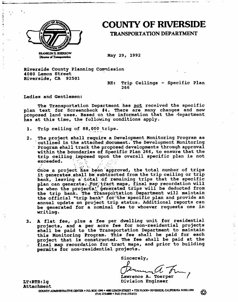
COUNTY OF RIVERSIDE TRANSPORTATION DEPARTMENT
INAMWNEMEMMW OmmircerramponWm May 29, 1992
Riverside County Planning Commission 4080 Lemon Street Riverside, CA 92501
RE: Trip Ceilings - Specific Plan 266
Ladies and Gentlemen:
The Transportation Department has not received the specific plan text for Screencheck #4. There are many changes and new proposed land uses. Based on the information that the department has at this time, the following conditions apply.
1. Trip ceiling of 88,000 trips.
2. The project shall require a Development Monitoring Program as outlined in the attached document. The Development Monitoring Program shall track the proposed developments through approval within the boundaries of Specific Plan 266, to ensure that the trip ceiling imposed upon the overall specific plan is not exceeded.
nce a project has been approved, the total number of trips it generates shall be subtracted from the trip ceiling or trip bank, leaving &total of remaining trips that the specific plan can generate: \Fo;•tiact maps, final map recordation will be when the projects." ... generated trips willbe deducted from the trip bank. The Tianspoitation Department will maintain the official "trip bank" for -the - specific plan and provide an annual update on project trip status. Additional reports can be generated for a nominal fee to whoever requests one in writing.
3. A flat fee, plus a fee per dwelling unit for residential projects, and a per acre fee for non-residential projects shall be paid to the Transportation Department to maintain this Monitoring Program. This fee shall be paid for each project that is constructed. The fee shall be paid at the final map recordation for tract maps, and prior to building permits for non-residential projects.
Sincerely,
Lawrence A. Toerper LT:RTB:lg Division Engineer
Attachment COUNTY ADMINISTRATIVE MIER • P.O. BOX 1090 • MOO LEMON STREET • 7Th FLOOR* RIVERSIDE. CALIIKANIA 92502.1090
(714) 27541190 • FAX (714) 2754721

County of Riverside :
DEPARTMENT OF HEALTH RIVERS IDE COUNTY PLANNING DEPT. ATTN: Joan Mavima DATE:
05-28-92
H.R. LUCHS, Supervisor, Environmental Health. Land FROM: Development
RE: SPECIFIC PLAN 266 EXHIBIT. SCREENCHECK 4/EIR 340, DATED 4 -24 -I21
Department of Environmental Health has re-reviewed the above referenced documents for commercial, residential. industrial, school, and parks. We have no further comments. Our comments dated January 16, 1990, September 16, 1991 and February 20. 1992 still prevail.
The projects shall be served sanitary sewer and potable water by the Jurupa Community Services District.
HRL:dr
C231ra JUN 2 1992 at
RIVERSIDE COUNTY PLANNING DEPARTMENT

mgmoBANDum
RIVERSIDE COUNTY FLOOD CONTROL AND WATER CONSERVATION DISTRICT
DATE: May 21, 1992
TO: County Planning Department
FROM: Eric Eric Russell
RE: Specific Plan 266; 1-215 Corridor Screen Check #4
The District report dated September 3, 1991 is still current for this project.
The engineer, Albert A. Webb Associates, has supplied the District with revised text language for Section 3, Drainage Plan. This is acceptable except some planning areas referenced do not reflect the latest land use map.
EWR:pin
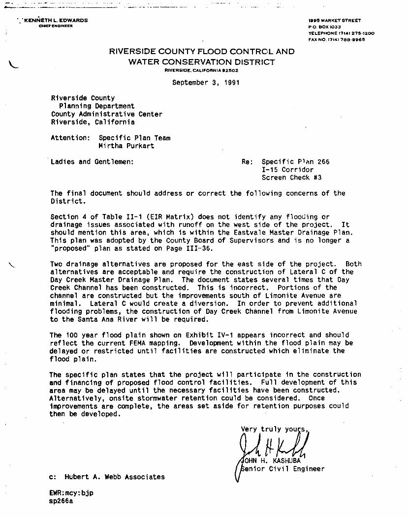
Very truly yours,
IQ 4, 11- OHN H. KASHUBA enior Civil Engineer
.:KENNETIRLEDWARDS
1995 MARKET STREET CHIC" ENGINEER
P.O. BOX 1033
TELEPHONE 1714) 275-1200
FAX NO. (714/ 788-9965
RIVERSIDE COUNTY FLOOD CONTROL AND WATER CONSERVATION DISTRICT
RIVERSIDE, CALIFORNIA 92502
September 3, 1991
Riverside County Planning Department
County Administrative Center Riverside, California
Attention: Specific Plan Team Mirtha Purkart
Ladies and Gentlemen:
Re: Specific Plan 266 1-15 Corridor Screen Check #3
The final document should address or correct the following concerns of the District.
Section 4 of Table II-1 (EIR Matrix) does not identify any flooding or drainage issues associated with runoff on the west side of the project. It should mention this area, which is within the Eastvale Master Drainage Plan. This plan was adopted by the County Board of Supervisors and is no longer a "proposed" plan as stated on Page 111-36.
Two drainage alternatives are proposed for the east side of the project. Both alternatives are acceptable and require the construction of Lateral C of the Day Creek Master Drainage Plan. The document states several times that Day Creek Channel has been constructed. This is incorrect. Portions of the channel are constructed but the improvements south of Limonite Avenue are minimal. Lateral C would create a diversion. In order to prevent additional flooding problems, the construction of Day Creek Channel from Limonite Avenue to the Santa Ana River will be required.
The 100 year flood plain shown on Exhibit IV-1 appears incorrect and should reflect the current FEMA mapping. Development within the flood plain may be delayed or restricted until facilities are constructed which eliminate the flood plain.
The specific plan states that the project will participate in the construction and financing of proposed flood control facilities. Full development of this area may be delayed until the necessary facilities have been constructed. Alternatively, onsite stormwater retention could be considered. Once Improvements are complete, the areas set aside for retention purposes could then be developed.
C: Hubert A. Webb Associates
EWR:mcy:bjp sp266a

3. N. 1111111L723 cozurty Fire Chief
TO:
ATTN: Frank Coyle
RE:
v ranaw.r. COUNTY -
FIRE DEPARTMENT 210 WEST SAN JACINTO AVENUE • PEERIS, CALIFORNIA 92370
• (714) 657-3183
• RIVERSIDE COUNTY DLANNING DEPARTMENT
PLANNING DEPARTMENT
May 19, 1992
IECEOVIE Ju MAY 2 1 1992
Specific Plan 266 Screencheck #4
With respect to the review and/or approval of the above refer-enced document, the proposed project will have a cumulative adverse impact on the Department's ability to provide an accept-able level of service. These impacts are due to the increasei number of emergency or public service calls generated by addi-tional buildings and human population. A portion of the impacts associated with capitol improvements or one-time costs such as land, buildings and equipment can be mitigated by developer participation in the fire protection impact mitigation program. However, the annual costs necessary for an increased level of service. are only partially off-set by the additional county structure tax and would require an increase in the Fire Depart-ment's annual operating budget.
Fire protection impacts can be mitigated be use of the impact mitigation program and an increase in the Fire Department's budget. Therefore, the Fire Department recommends approval of the specific plan subject to the following conditions and/or mitigations:
1. All water mains and fire hydrants providing required fire flows shall be constructed in accordance with the appropri-ate sections of Riverside County Ordinance No. 460 and/or No. 546, subject to the approval by the Riverside County Fire Department.
2. The project proponents shall participate in the fire protection impact mitigation program as adopted by the Riverside County Board of Supervisors.
MIRE PREVENTION DIVISION PLANNING SECTION
AmAgmoma 3760 12th Swam Ilkossiks. CA 92501 OM 2154777 • FAX OM 369.745
CI mote OFFICE "433 Goll••• au' Dam Seim F. Lew. CA 92202
(61,) 163-6$116 FAX (ê12) Si3-7072
Datiftreet Awl a. ma....
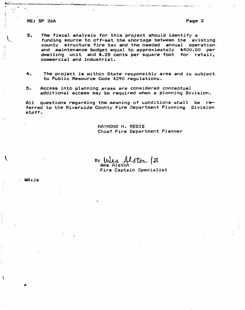
RE: SP 266 Page 2
3. The fiscal analysis for this project should identify a funding source to off-set the shortage between the existing county structure fire tax and the needed annual operation and maintenance budget equal to approximately $400.00 per dwelling unit and $.25 cents per square foot for retail, commercial and industrial.
4. The project is within State responsibly area and is subject to Public Resource Code 4290 regulations.
5. Access into planning areas are considered conceptual additional access may be required when a planning Division.
All questions regarding the meaning of conditions shall be re-ferred to the Riverside County Fire Department Planning Division staff.
RAYMOND H. REGIS Chief Fire Department Planner
By [AIL& (Z Wes Alsto • Fire Captain Specialist
• WAljs
•
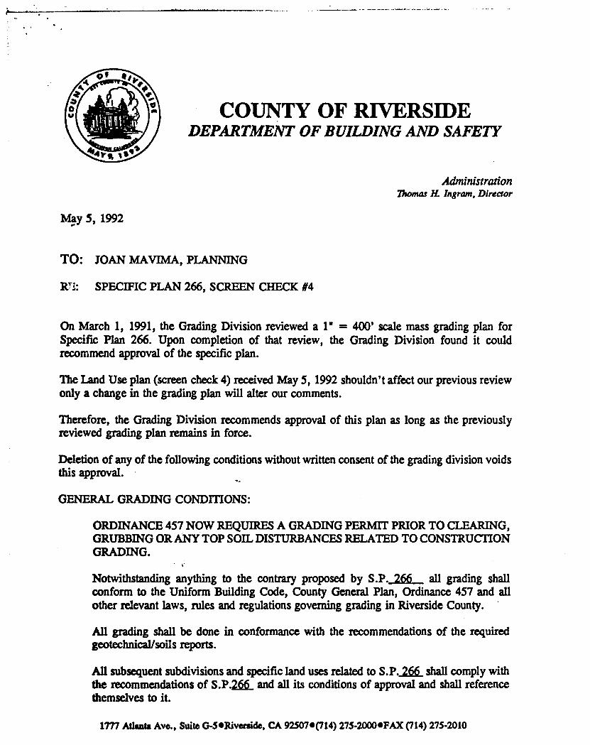
COUNTY OF RIVERSIDE DEPARTMENT OF BUILDING AND SAFETY
Administration Thomas H. Ingram, Director
May 5, 1992
TO: JOAN MAVIMA, PLANNING
In: SPECIFIC PLAN 266, SCREEN CHECK #4
On March 1, 1991, the Grading Division reviewed a 1" = 400' scale mass grading plan for Specific Plan 266. Upon completion of that review, the Grading Division found it could recommend approval of the specific plan.
The Land Use plan (screen check 4) received May 5, 1992 shouldn't affect our previous review only a change in the grading plan will alter our comments.
Therefore, the Grading Division recommends approval of this plan as long as the previously reviewed grading plan remains in force.
Deletion of any of the following conditions without written consent of the grading division voids this approval.
GENERAL GRADING CONDMONS:
ORDINANCE 457 NOW REQUIRES A GRADING PERMIT PRIOR TO CLEARING, GRUBBING OR ANY TOP SOIL DISTURBANCES RELATED TO CONSTRUCTION GRADING.
Notwithstanding anything to the contrary proposed by S.P._266 all grading shall conform to the Uniform Building Code, County General Plan, Ordinance 457 and all other relevant laws, rules and regulations governing grading in Riverside County.
All grading shall be done in conformance with the recommendations of the required geotechnical/soils reports.
All subsequent subdivisions and specific land uses related to S.P. 266 shall comply with the recommendations of S.P.266 and all its conditions of approval and shall reference themselves to it.
1777 Atlanta Ave., Suite G-5•Riverside, CA 925076(714) 275-20006FAX (714) 275-2010

page 2 5/5192 SP 266, SC 4
Graded but undeveloped land shall provide, in addition to erosion control planting, any drainage facilities deemed necessary to control or prevent erosion. Additional erosion protection may be required during the rainy season from October 15 to April 15.
During the actual grading, all necessary measures to control dust shall be implemented by the developer.
All drainage facilities shall be designed to accommodate 100 year storm flows or as approved by the Riverside County Flood Control District.
Minimu a drainage grade shall be 1% except on portland cement concrete where 0.35% shall be the minimum.
Provide drainage facilities and terracing in conformance with Section 7012 of the Uniform Building Code.
Observ' slope setbacks per Section 2907, figure 29-1 Section 7011, and figure 70-1 of the Uniform Building Code.
Further comments and conditions of approval will be forthcoming in conjunction with the application for individual subdivisions related to this specific plan.
Several lots do not illustrate graded slopes; although differences in pad elevations indicate their presence. Their absence from the grading plan should not affect our approval of the proposed mass gadding. However, when the slopes, proper setbacks, and terraces - if any - are included they may affect the design of the specific subdivisions related to them. The applicant shall be deemed as solely responsible for the design risk thereby incurred.
GRADING CONDITIONS TO BE FULFILLED PRIOR TO ISSUING A GRADING PERMIT:
If mass grading of the entire Specific Plan site is proposed,UNDER A SUBDIVISION OR LAND USE CASE ALREADY APPROVED FOR THIS SPECIFIC PLAN, at the same time that application for further subdivision of its parcels is being made, an exception to Ordinance 460, Section 4.4b, shall be obtained from the Planning Director prior to issuance of the mass grading permit (Ordinance 460, Section 3.1). THIS EXCEPTION WILL NOT APPLY TO ANY CASE HAVING ONLY AN APPROVED SPECIFIC PLAN.
Prior to issuance of a grading permit, all certifications affecting grading shall have written clearances. This includes but is not limited to additional Environmental Assessments, Erosion Control plans, additional geotechnical and soils reports, Departmental clearances and the amount being graded. This applies as these are requirements of the specific plan, E.I.R. or a condition of approval.
Prior to commencing any grading in excess of 50 cubic yards, the applicant shall obtain a grading permit and approval to construct from the Building and Safety department.
1777 Atlanta Ave., Suite G-5•Riverside, CA 92507*(714) 275-2000•FAX (714) 275-2010
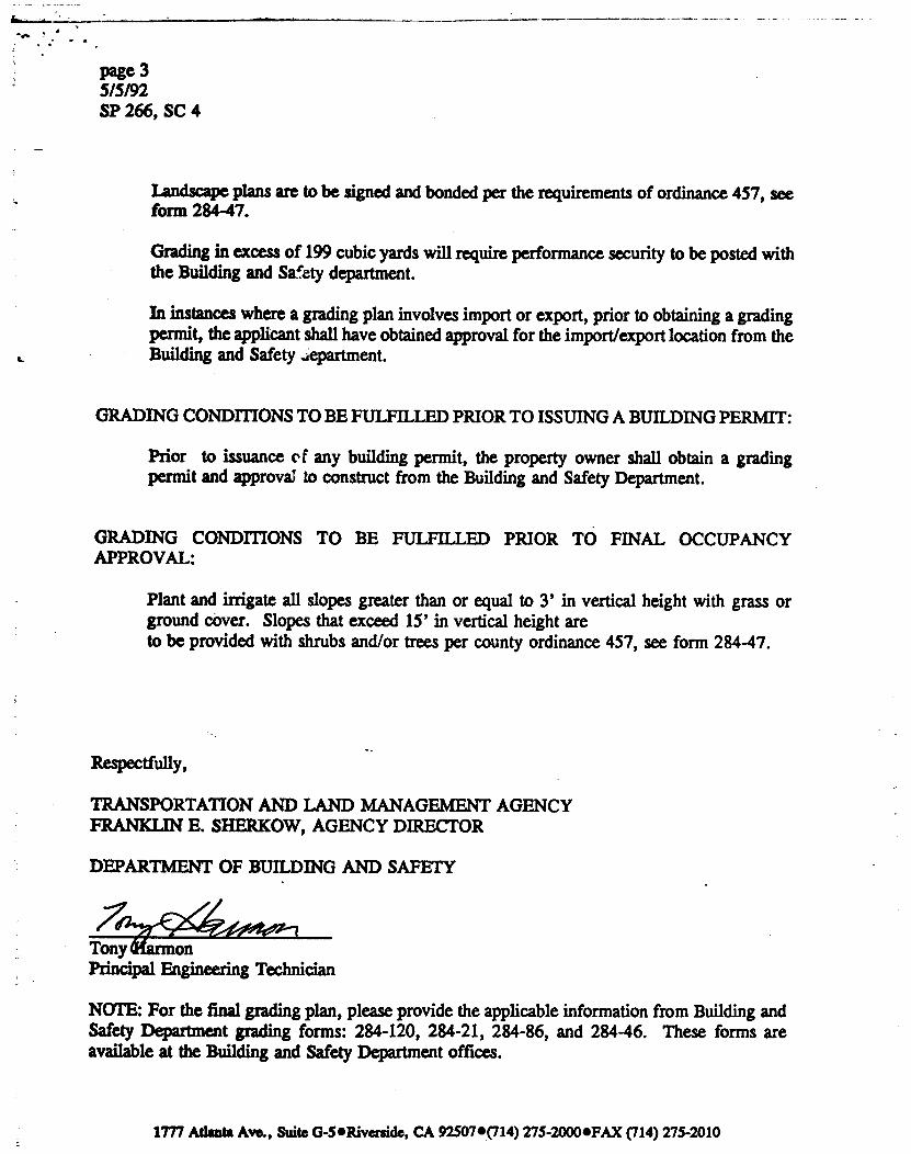
•Nts
page 3 5/5/92 SP 266, SC 4
Landscape plans are to be signed and bonded per the requirements of ordinance 457, see form 284-47.
Grading in excess of 199 cubic yards will require performance security to be posted with the Building and Safety department.
In instances where a grading plan involves import or export, prior to obtaining a grading permit, the applicant shall have obtained approval for the import/export location from the Building and Safety Jepartment.
GRADING CONDITIONS TO BE FULFILLED PRIOR TO ISSUING A BUILDING PERMIT:
Prior to issuance c, f any building permit, the property owner shall obtain a grading permit and approval to construct from the Building and Safety Department.
GRADING CONDITIONS TO BE FULFILLED PRIOR TO FINAL OCCUPANCY APPROVAL:
Plant and irrigate all slopes greater than or equal to 3' in vertical height with grass or ground cover. Slopes that exceed 15' in vertical height are to be provided with shrubs and/or trees per county ordinance 457, see form 284-47.
Respectfully,
TRANSPORTATION AND LAND MANAGEMENT AGENCY FRANKLIN E. SHERKOW, AGENCY DIRECTOR
DEPARTMENT OF BUILDING AND SAFETY
Tony Principal Engineering Technician
NOTE: For the final grading plan, please provide the applicable information from Building and Safety Department grading forms: 284-120, 284-21, 284-86, and 284-46. These forms are available at the Building and Safety Department offices.
1777 Atlanta Ave., Suite 13-5•Riverside, CA 92507•(714) 275-20000FAX (714) 275-2010
RIVERSIDE COUNTY PLANNING DEPARTMENT MEMORANDUM
DATE: 15 MARCH 1991
TO: FRANK COYLE, PROJECT PLANNER
FROM: WENDI J. W.-WILLIAMS, JR. ENGINEERING GEOLOGIST.
RE: SPECIFIC PLAN NO. 266 GEOTECHNICAL STUDY
Following are comments arising from review of the Preliminary Geotechnical Investigation dated January 19, 1990 prepared by I -tighton and Associates, Inc. for Specific Plan No. 266.
1. The report should further consider a potential liquefaction hazard in the recent alluvium within the drainage course. Water encountered in Boring No. 9 may indicate the presence of a perched water table )r a condition of rising groundwater. The discussion should a'iso evaluate the presence of filtration ponds as related to _iquefaction potential. Drilling of additional boring(s) to further assess the liquefaction potential should be considered.
2. Evaluate the need to remove alluvium in the on-site drainage prior to fill placement and provide appropriate recommendations.
c.c.: Albert A. Webb Associates Leighton and Associates, Inc.
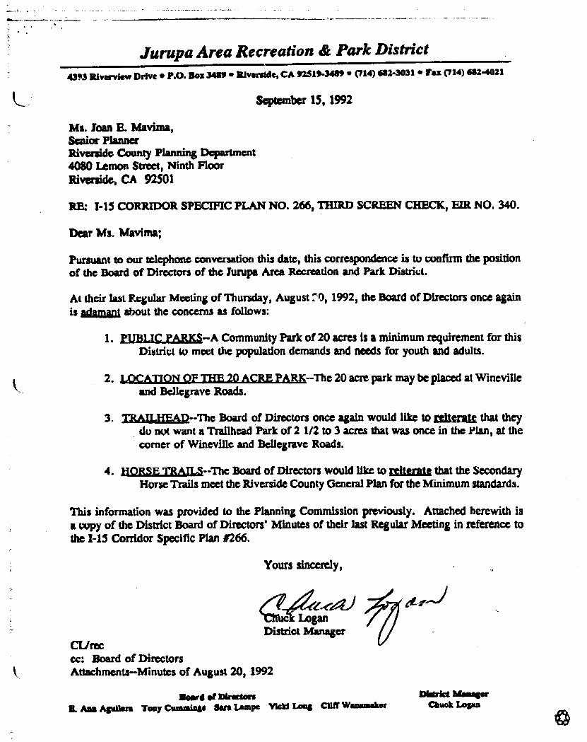
Jurupa Area Recreation & Park District 43,3 Riverview Drive • P.O. Box 3489 • Silverside, CA 92518-3489 • (714) 682-3031 • Fax (714) 682-4021
September 15, 1992
Ms. Joan E. Mavima, Senior Planner Riverside County Planning Department 4080 Lemon Street, Ninth Floor Riverside, CA 92501
RE: 1-15 CORRIDOR SPECIFIC PLAN NO. 266, THIRD SCREEN CHECK, FIR NO. 340.
Dear Ms. Mavima;
Pursuant to our telephone conversation this date, this correspondence is to confirm the position of the Board of Directors of the Jurupa Area Recreation and Park District.
At their last Itr.gular Meeting of Thursday, August 70, 1992, the Board of Directors once again is adamant about the concerns as follows:
1. PUBLIC PARKS—A Community Park of 20 acres is a minimum requirement for this District to meet the population demands and needs for youth and adults.
2. 1,,MATION OF THE20 ACRE PARK—The 20 acre park may be placed at Wineville and Bellegrave Roads.
3. THALLREAD—The Board of Directors once again would like to reiterate that they do not want a Trailhead Park of 2 1/2 to 3 acres that was once in the Plan, at the corner of Wineville and Bellegrave Roads.
4. flORSE TRAILS—The Board of Directors would like to reiterate that the Secondary Horse Trails meet the Riverside County General Plan for the Minimum standards.
This information was provided to the Planning Commission previously. Attached herewith is a copy of the District Board of Directors Minutes of their last Regular Meeting in reference to the 1-15 Corridor Specific Plan 1266.
Yours sincerely,
Logan District Manager
CL/rec cc: Board of Directors Attachments—Minutes of August 20, 1992
Nowa 01 Directors Mirka Maaager
B. Ass Aguliere Toay Cuousiage Sere Lampe Mal Long Cliff Wasmosalwr Mack Logan
*

Jurupa Area Recreation & Park District 4393 Riverview Drive • P.O. Sox 3489 • Riverside, CA 92519-3489 • (714) 682-3031 • Fax (714) 682-4021
September 15, 1992
Ms. Joan E. Mavima, Senior Planner Riverside County Planning Department 4080 Lemon Street, Ninth Floor Riverside, CA 92501
RE: I-15 CORRIDOR SPECIFIC PLAN NO. 266, THIRD SCREEN CHECK, HR NO. 340.
Dear Ms. Mavima;
Pursuant to our telephone conversation this date, this correspondence is to confirm the position of the Board of Directors of the Jurupa Area Recreation and Park District.
At their last Regular Meeting of Thursday, August 20, 1992, the Poard of Directors once again is Adamant about the concerns as follows;
1. PUBLIC PARKS—A Community Park of 20 acres is a minimum requirement for this District to meet the population demands and needs for youth and adults.
2. LOCATION OF TEIE_20 ACRE PARK—The 20 acre park may be placed at Wineville and Fsellegrave Roads.
3. TRAILHEAD—The Board of Directors once again would like to refterate that they do not want a Trailhead Park of 2 1/2 to 3 acres that was once in the Plan, at the corner of Wineville and Bellegrave Roads.
4. NORSE TRAILS—The Board of Directors would like to reiterate that the Secondary Horse Trails meet the Riverside County General Plan for the Minimum standards.
This information was provided to the Planning Commission previously. Attached herewith is a copy of the District Board of Directors' Minutes of their last Regular Meeting in reference to the 1-15 Corridor Specific Plan //266.
Yours sincerely,
a Logan District Manager
CUrec cc: Board of Directors Attachments—Minutes of August 20, 1992
Zoord of Directors Didrkt Manager B. Atio Aguilera Tony Cummings Sara Lampe Vicki Long Cliff Waarunaker Muck Logan
*

5
09:29
1:4-1+1 I HG SATTEL 1 TE
P.02
INTRP-DINPARTMNINTAL LETTAFI
• COUNTY OF RIVERSIDE TRANSPORTATION DEPARTMENT
PLANNING AND DEVELOPMENT REVIEW DIVISION nom)/ I SHIMICOW Mow d Trintrerattlois
DATE: September 23, 1992
TO: Joan Mavima, Senior Planner Planning Department
FROM: Ruthanne Taylor Berger Senior Transportation Planner
RE: I-15 Corridor - Specific Plan No, 266
As per your request on Wednesday, September 22, 1992, our Department has reviewed the following questions and is now responding:
1. How would the traffic generated by the proposed Specific Plan No. 266 affect Limonite Avenue, easterly of Wineville?
The proposed project will generate 16,233 average daily vehicle trips on Limonite Avenue, easterly of Wineville Avenue and westerly of Etiwanda Avenue per the revised Traffic Analysis by Robert Kahn, John Kain and Associates, Inc., May 20, 1992.
Limonite Avenue is designated as a Major Highway (100' R/W) in the Circulation Element of the Comprehensive General Plan. The project would utilize .54 peraent (%) of the roadway capacity of Limonite Avenue for Level of Service "C" (42% of the total roadway capacity), easterly of Wineville and westerly of Etiwanda Avenue. •
The proposed . Specific Plan, based on the revised traffic analysis prepared for the project, recommends that Limonite Avenue be designated Urban-Arterial (134' R/W). If Limonite Avenue were to be designated as an Urban Arterial Highway, the proposed Specific Plan would utilize 34 percent (%) of the available capacity of Limonite Avenhe for Level of Service NC," easterly of Wineville Avenue and westerly of Etiwanda Avenue.
2. What would be the effect of designating an area (approximately 15 acres) presently proposed as Commercial. to Commercial Office?
Post-)t brand fax transmittal memo 7671 Igor PAW
mc)c.t MON; iryNo-1?°")?u.* ha n To. 4 10C """ _
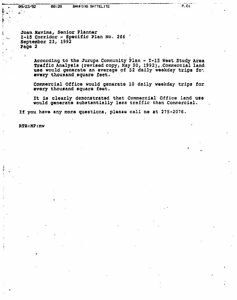
09/23/92 08:28 BANN I 116 SATTEL1TE P.01 hr.
! •••
Joan Mavima, Senior Planner 1-15 Corridor - Specific Plan No. 266 September 23, 1992 Page 2
According to the Jurupa Community Plan - 1-15 West Study Area Traffic Analysis (revised copy, )Iay 20, 1992),.Commercial land use would generate an average of 52 daily weekday trips fo-, every thousand square feet.
Commercial Office would generate 10 daily weekday trips for every thousand square feet.
It is clearly demonstrated that Commercial Office land use would generate substantially less traffic than Commercial.
If you have any more questions, please call me at 275-2076.
RTB:mP:mw
Lany Panish Chief Administrative Officer
County Administrative Office
September 22, 1992
Planning Department County of Riverside 4080 Lemon Street Riverside, California 92502-1409
Attn: Joan Mavima
RE: Specific Plan No. 266, I-15 Corridor
Dear Ms. Mavima:
Mischelle Zbnmennan Assistant Chief Administrative Officer
The fiscal analysis for the project referred to above has been reviewed by the County Administrative Office and found to be plausible. It is reasonable to believe, as presented in the Fiscal Impact Analysis, that the project will generate new revenue sufficient to recover the costs for county public services to the development.
The review indicated positive revenue/cost ratios throughout the life of the project. The revenue/cost ratio is used as an indicator of the project's fiscal impact upon the County. This ratio shows the relationship between total revenue and total expenditure. However, it should be noted that an update of these ratios is being prepared and further adjustments may be made as a result of recent legislation impacting these figures.
In addition, there appear to be several activities which need to be conducted which I understand have been previously identified:
1. A resolution of issues related to circulation & traffic integrating recommendations from the Transportation Department;
2. A preparation of a specific plan document which are reflective of the revised draft plan;
Consideration of mitigation for: a. Relocation of parkland b. Inclusion of affordable housing element c. Regional Growth Management Plan - Air quality impacts;
-r
4. Completion of the Final Environmental Impact Report.
Robert T. Andersen Administrative Center 4080 Lemon Street • 12th Floor • Riverside, California 92501 • (714) 275-1100 • FAX (714) 275-1105
Respectfully yours,
4A• ohn Johnson
Administrative Manager
The Administrative Office review estimated a positive net county re ,enue at one year past project build-out in the year 2010, therefore, it does not object to this proposal provided these aforementioned activities are appropriately conducted.
attachment
Robert T. Andersen Administrative Center 4080 Lemon Street • 12tb Floor • Riverside, California 92501 • (714) 275-1100 • FAX (714) 275-1105

Rolin Bruno, Director Don Galleano, Director James Huber, Director Roger Teagarden, Director Cliff Wanamaker, Director
If lava
COMMUNITY SERVICES DISTRICT kt; i t-Plt Vf - •
SEP 23 1992
8621 Jurupa Road *Riverside, CA 92509 (714) 685-7434 * FAX (714) 685-1153
RIVERSIO CUONTY •t htKii NG DEPA71110. :̂fo
September 21, 1992
Mr. Ron Goldman Principal Planner Riverside County Planning Department 4080 Lemon Street, 9th Floor Riverside, California 92501
RE: ISSUES RELATED TO WATER QUALITY AND AVAILABILITY SPECIFIC PLAN NO. 266,1-15 CORRIDOR - . ,
Dear Mr. Goldman: 7
Thank you for inviting me to testify at the hearing scheduled for September 23, 1992 regarding the above referenced matters. Unfortunately, a representative from the Jurupa Community Service District (JCSD), the public agency responsible for providing water service to the proposed project, will not be available to appear at the hearing, however, i believe the roiiowing information will be sufficient for purposes of addressing the issues related to water quality and availability which have been raised by members of the public.
WATER AVAILABILITY
JCSD relies entirely on the Chino Groundwater Basin for its potable water supply. The Basin, which encompasses over 210 square miles, extends from the Pomona area to Colton/Rialto, and from the San Gabriel Mountains to the Santa Ma River and is the source of drinking water for at least 1 million people.

Mr. Ron Goldman Riverside County Planning Department RE: ISSUES RELATED TO WATER QUALITY AND AVAILABIUTY SPECIFIC PLAN NO. 266,1-15
CORRIDCR September 21, 1992 Page 2
In 1978, the rights of JCSD and other users of the Basin were adjudicated in the case of Chino Basin Municipal Water 'District v. City of Chino, et al. Under the Judgment, there is no limitation on the amount of water which JCSD can pump, however, a pump tax is levied for the purchase of Basin replenishment water from Metropolitan Water District which is percolated into the ground to prevent the overdraft of groundwater. Consequently, there is no limitation with respect to the volume or quantity of water available for new development in connection with continued reliance on the Chino Groundwater Basin.
WATER QUALITY
The quality of water which JCSD delivers to its customers meets all Federal and State requirements.
Water quality in the Chino Groundwater Basin with respect to nitrate and salinity, particularly in the lower Basin where JCSD is located, has been a concern and the subject of extensive study for at least 40 years. The presence of nitrate and salinity is primarily attributable to over 100 years of agricultural land use within the Basin, with the continuing and perhaps most notorious use being 15,000 acres of dairies concentrated in the world's largest dairy preserve in the Chino area. Studies indicate that absent significant changes in Basin management practices (Which include incentives to pump the lower Basin coupled with desalting), eventually the upper Basin area will also be affected by nitrate and salinity.
At this point, JCSD has the option of constructing an extensive and costly pipeline to connect with Metropolitan Water District's system, or installing treatment facilities which will enable continued reliance on the plentiful groundwater available in the lower Basin area which JCSD overlies. In view of the likely possibility of MWD not being able to supply sufficient water during high demand or drought periods, JCSD has elected to proceed with the development of desalting facilities which will not only enable continued reliance on the Basin for existing and future water demands, but also benefit the entire Basin by extracting high

'
Mr. Ron Goldman Riverside County Planning Department RE: ISSUES RELATED TO WATER QUALITY AND AVAILABIUTY SPECIFIC PLAN NO. 266,1-15
CCFRDOR September 21, 1992 Page 3
nitrate/salinity water from the lower Basin and thus enhance groundwater quality. By installing facilities which will provide for the use of the substantial volume of water which directly underlies the JCSD service area, it is predicted that there will not be a need to import water from MWD or other sources for at least 20 years. In essence, we are situated directly over a vast water resource, which if treated to reduce the concentration of nitrate and salinity, will obviate the need to construct extensive and costly waterlines to import a potentially interruptible water supply from MWD.
It should be noted that even without new development, water quality in the Basin will continue to worsen because of the agricultural legacy of nitrate and salinity suspended in the soil overlying the groundwater table. While it may appear that new development may accelerate the need for desalting facilities under the premise that all remaining higher quality areas of the Basin will be depleted sooner, according to several studies, quite the opposite Is true. These studies indicate that if pumping in the lower Basin continues at the present rate or decreases (as is predicted when the dairy industry departs), water quality will actually worsen since there will be less nitrate and salinity extracted from the Basin. The effect is that without programs such as the installation of desalters in the lower Basin to encourage continued pumping of the impaired groundwater, the rate of degradation of water quality will increase. This is not to say that we are encouraging development for the sake of benefiting the groundwater resource, but to point out that in the case of the lower Chino Basin, which is a shared ,resource with. respect to existing and future residents, there is no relationship to new development being the catalyst, nor otherwise triggering' the need for, groundwater quality remediation programs such as desalters.
Relative to the issue of who will pay for the installation and operation of the desalters, JCSD will continue to require developers to pay , their proportionate share of the cost of water facilities, Including a portion of the cost of desalting systems, necessary to provide the development with sufficient water. As stated above, since the desalters are necessary in order to continue to meet

Mr. Ron Goldman Riverside County Planning Department RE: ISSUES RELATED TO WATER QUALITY AND AVAILABIUTY SPECIFIC PLAN NO. 266,1-15
CORRIDOR September 21, 1992 Page 4
present demands because existing wells will be impacted by nitrate and salinity, current residents will also pay a portion of the installation and operation expense.
While it will be possible to continue to pump the lower Basin area in the immediate future without the installation of desalting facilities (probably 10 years), we believe it is prudent to presently begin the process for the construction of such facilities to ensure ex; Aing customers continue to receive an ample supply of high qu , lity water. Increased water demands in connection with new development, therefore, will only affect the capacity of the desalters and are not determinative of the need for such facilities.
While we fully understand the concerns of our customers in connection with the 1-15 development plan and potential impacts on the surrounding community, JCSD's purpose with respect to any proposed new development is to identify the facilities needed to provide the service and require the developer to pay for them. In this regard, our purpose is neither to promote growth or indirectly discourage it by not planning for the future. In summary, we can accurately and unequivocally state that if the developer is able to pay for the facilities necessary to provide the required level of service, JCSD can provide a sufficient volume of high quality water which meets Federal and State standards for public water supplies.
If you have any questions or further information is needed relative to these matters, please contact this office.
Sincerely,
John J. Scha General Manager
JJS:cr 1032.01, Administ
Jurupa Area Recreation & Park District 4393 Riveeview Drive • P.O. Box 3489 • Riverside, CA 92519-3489 • (714) 682-3031 • Fax (714) 682-4021
July 28, 1992
Ms. Joan E. Mavima, Senior Planner Riverside County Pinning Department 4080 Lemon Street, Ninth Floor Riverside, CA 92501
RE: 1-15 CORRIDOR SPECIFIC PLAN NO. 266, THIRD SCREEN CHECK, EIR NO. 340.
Dear Ms. Mavima;
The Board of Directors of the Jurupa Area Recreation and Park District would like to reiterate their concerns regarling the 1-15 Corridor Specific Plan Number 266 as it relates to Parks, Secondary Horse 1: ills and the Head Trail being proposed at Wineville and Bellegrave.
The Board of Directors' concerns are summarized as follows:
1. puBuc PARKS—The major concern of the Board of Directors is the lack of parks of adequate size for organized sports and other related activities to serve the Community. Rather than having two small parks, 8 acres of each size, and a 3.8 acre Equestrian Park Center, it is strongly recommended a preferred large
• Community Park of 20 acres minimum size to be placed preferably adjacent to the Southern California Edison easement and right-of-way. This park is to be centrally _located within the 1-15 Corridor.
2. APPROPRIATELY DESIGNED AND PLANNED.—The 20 acre park can be located and developed in a manner so it will have the least amount of negative impact on the neighborhood. In particular, this Community Park will allow for adequate parking, sports lights for sports complexes and to be able to accomodate large sporting activities without disrupting the lifestyle of the neighborhood. This twenty acre park would also be designed in such a manner.
2. HORSE TRAILS—The Board of Directors does not want the Equestrian trailhead at Wineville and Bellegrave. ,
Yours sincerely,
Chuck Logan District Manager
CL/rec Board of Directors District Manager
B. Ann Aguilera Tony Cummings Sara Lampe Vicki Long Cliff Wanamaker Chuck Logan

- —
"--- - - V I fib/10Z -1433 . —17714 -737 2026 ---- 111cCUNE & ASSOC. -
' • - .
• ..
Real Estate and Dairy Brokers
•••■
July 28, 1992
Is. Joan -Mavima . • Riverside County Planning Dept.
4080 Lemon St., 9th Floor • • Riverside,•CA 92501
• •
Re: Specific Plan 26.6 •
Deir Joan:" • • . . •
. . -• Some confusion. hai arisen regarding the*authority of the County Board of Supervisor's • Resolution92-164'regarding school mitigation Versus the position of the Jurupa Unified School
. District (JUSD). •• • • . • -
Our Position:is that we agree to comply with the same mitigation provisions reqUired • for, any other. development within that school district. We therefore would agree to comply
• • with both the current County requirements and JUSD requirements as stated in their letter' - dated July 28, 1992,13ased on the understanding that neither the County or school district Will
•-• nllow any other, developer to 'pair leis than this amount in the future. If less mitigation were • allowed, we would then, be responsible for the same amount . • ..
We wish to do Our fair share, but in order to be competitive, it must be on a *level- . •
• • playing fieldTM. • ..• .
. Sincerely,
McCUNE & ASSOCIATES, IN
pick .gvuD4&- . Rick Bondar
• RB/sm
Enclosure •••
Edmuncis,..JUSD Fax: 27.5-0328 .
• • • • :
0 0 2
■■•
' ----- UL .28 -/ S2 17:06 FROM JURUPA SCHOOL DISTRIC PAGE.002
JURUPA UNIFIED SCHOOL DISTRICT EDUCATION CENTER 3924 Riverview Drive Riverside, CA 92509 (714) 360-2771 Fax 275-0328
BOARD OF EDUCATION David Barnes, President Betty Folsom. Clerk Mary Burns John Chavez Sandra Puane SUPERINTENDENT John P. Wilson. Ed.D.
•
(714) 360-2757 July 28, 1.992
Ms. Joan Mavima Riverside County Planning Department 4080 Lemon Street, 9th Floor Riverside, CA 92501
REVISED .
Re: Specific Plan No. 266 (I-15 Corridor)
Dear Ms. mavima:
It is the Jurupa Unifieu School District's understanding that on Wednesday, July 29th, the application for Specific Plan No. 266 will be considered• by the Planning Commission. The Environmental Impact Report (No. 340) prepared for the specific plan recognizes the impact which this proposed development will have on the District's school facilities and proposes a mitigation measure that states:
"The developer Shall participate in the school .impact mitigation fee program as required by the County in each district."
The District has concern about the wording of this mitigation measure and the program or mechanism for ensuring the applicant's compliance with the measure. The District assumes that the "mitigation Lee program" identified in the mitigation measure is the program recently established by the Board of Supervisors on June 30, 1992, in Resolution 92-164. As you are aware, the procedures contained in that resolution. were the culmination of extensive negotiations among members of the development community, Riverside County Schools and County officials. The District does not oppose Resolution 92-164, but it is concerned that the procedures it establishes are new and untested and that the mitigation measure proposed in the EIR might not fully protect the interests of the District.
• The District has had numerous discussions with the applicant for Specific Plan No. 266 prior to the adoption of Resolution No.- 92-164 and the District has reached an agreement with the applicant to enter into a school facilities mitigation agreement which establishes * mitigation fee in the amount of $8,523. This mitigation fee was approved by the District's Board and is based upon a fee justification report prepared pursuant to the requirements of Government Code Sections 66000 et ma. (AB 1600). This mitigation fee is being applied to all new

JUL 28 '92 17:21 FROM JURUPA SCHOOL DISTRIC -
PAGE.001
Ms. Joan havima Riverside County Planning Dept. July 28, 3.992 Page 2 - REVISED
development in the District on a consistent "level playing. field" basis so that no development pays less.
Because th=.1 District and the app22.cant are in agreement on the terms of mitigation, the District is requesting that mitigation measure number 1 relating to schools in the Environmental Impact Report be revised to read:
"Prior to, an: as a condition of approval of the filing of any application for a development application proposed within Specific Plan No. 266, the Developer shall have entered into a school facilities mitigation agreement with the Jurupa Unified School District which establishes a mitigation fee in the amount of $8,523 (subject to inflation as provided for n the agreement) for each residential unit in Specific Plan Nc 266. In addition, the developer shall dedicate to Jurupa Unif_ed School District 2 (two) ten-acre elementary school sites at locations acceptable to the District."
Resolution No. 92-164 appears to have contemplated situations such as this where it provides:
"Any residential development proposal for which an agreement has been executed, prior to the effective date of this resolution, between the Developer and the School District, to provide for mitigation of the student generation impacts of the proposal on the school facilities of the District, and said agreement has been acknowledged as adequate mitigation by the County in the adoption of the resolution, ordinance and/or conditions of approval for the proposal, is exempt from consideration of mitigation under this resolution."
Because an agreement has been reached with the applicant for Specific Plan No. 266, the District believes the County can approve this development project with the District's mitigation measure and not run afoul of the goals of its recently adopted resolution.
If you have any questions about this matter, please feel free to give me a telephone call at (714) 360-2757.
Very tr yours,
Rollin unds Assistant Superintendent Business Services
cc: Katherine Lind, Esq. Dan McHugh, Esq. Hubert Webb

JURUPA UNIFIED SCHOOL DISTRICT EDUCATION CENTER 3924 Riverview Drive Riverside, CA 92509 (714) 360-2771 Fax # 275-0328
BOARD OF EDUCATION David Barnes, President Betty Folsom, Clerk Mary Burns John Chavez Sandra Ruane SUPERINTENDENT John P. Wilson, Ed.D.
(714) 360-2757 July 28, 1992
Ms. Joan Mavima Riverside County Planning DeparflIent 4080 Lemon Street, 9th Floor Riverside, CA 92501
Re: Specific Plan No. 266 (1-15 Corridor)
Dear Ms. Mavima:
It is the Jurupa Unified School District's understanding that on Wednesday, July 29th, the application for Specific Plan No. 266 will be considered by the Planning Commission. The Environmental Impact Report (No. 340) prepared for the specific plan recognizes the impact which this proposed development will have on the District's school facilities and proposes a mitigation measure that states:
"The developer shall participate in the school impact mitigation fee program as required by the County in each district."
The District has concern about the wording of this mitigation measure and the program or mechanism for ensuring the applicant's compliance with the measure. The District assumes that the "mitigation fee program" identified in the mitigation measure is the program recently established by the Board of Supervisors on June 30, 1992, in Resolution 92-164. As you are aware, the procedures contained in that resolution were the culmination of extensive negotiations among members of the development community, Riverside County Schools and . County officials. The District does not oppose Resolution 92-164, but it is concerned that the procedures it establishes are new and untested and that the mitigation measure proposed in the EIR might not fully protect the interests of the District.
The District has had numerous discussions with the applicant for Specific Plan No. 266 prior to the adoption of Resolution No. 92-164 and the District has reached an agreement with the applicant to enter into a school facilities mitigation agreement which establishes a mitigation fee in the amount of $8,523. This mitigation fee was approved by the District's Board and is based upon a fee justification report prepared pursuant to the requirements of Government Code Sections 66000 et AAR. (AB 1600). This mitigation fee is being applied to all new

Ms. Joan Mavima Riverside County Planning Dept. July 28, 1992 Page 3
development in the District on a consistent "level playing field" basis so that no development pays less.
Because the District and the dpplicant are in agreement on the terms of mitigation, the District is requesting that mitigation measure number 1 relating to schools in the Environmental Impact Report be revised to read:
'Prior to, and as a condition of approval of any application for a tentative tract map proposed within Specific Plan No. 266, the Developer shall have entered into a school facilities mitigation agreement with the Jurupa Unified School District which establishes a mitigation fee in the amount of $8,523 (subject to inflation as provided for in the agreement) for each residential un!t in Specific Plan No. 266.'
Resolution No. 92-164 appears to have contemplated situtations such as this where it provides:
"Any residential development proposal for which an agreement has been executed, prior to the effective date of this resolution, between the Developer and the School District, to provide for mitigation of the student generation impacts of the proposal on the school facilities of the District, and said agreement has been acknowledged as adequate mitigation by the County in the adoption of the resolution, ordinance and/or conditions of approval for the proposal, is exempt from consideration of mitigation under this resolution."
Because an agreement has been reached with the applicant for Specific Plan No. 266, the District believes the County can approve this development project with the District's mitigation measure and not run afoul of the goals of its recently adopted resolution.
If you have any questions about this matter, please feel free to give me a telephone call at (714) 360-2757.
Very tru yours,
Rollin dmunds Assistant Superintendent Business Services
cc: Katherine Lind, Esq. Dan McHugh, Esq.

Sinc A y,
JURUPA UNIFIED SCHOOL DISTRICT EDUCATION CENTER 3924 Riverview Drive Riverside, CA 92509 (714) 360-2771 Fax # 275-0328
BOARD OF EDUCATION David Barnes, President Betty Folsom, Clerk Mary Burns John Chavez Sandra Ruane SUPERINTENDENT John P. Wilson, Ed.D.
July 28, 1992
Ms. Joan Mavima Riverside County Planning Department 4080 Lemon Street, 9th Floor Riverside, CA 92501
RE: Specific Plan No. 266 (1-15 Corridor)
Dear Ms. Mavima:
After reviewing the Staff Report and Conditions of Approval for the above referenced project, I respectfully request that Condition No. 8 be amended. We would like the amendment to be consistent with mitigation measures that we have proposed be included in the EIR in my letter to you this same date:
"Prior to, and as a condition of approval of any application for a tentative tract map proposed within Specific Plan No. 266, the Developer shall have entered into a school facilities mitigation agreement with the Jurupa Unified School District which establishes a mitigation fee in the amount of $8,523 (subject to inflation as provided for in the agreement) for each residential unit in Specific Plan No. 266."
In addition, Condition No. 8 should reference the dedication of two 10-acre sites to Jurupa Unified School District.
Thank you very much for your consideration.
Rol in Edmunds Assistant Superintendent Business Services
RE:vs
cc: Katherine Lind, Esq. Dan McHugh, Esq.
■•■••••••■■••••••••
.441- Zari Va. 3. •
Very trU, your s
-development in the District on a consistent "level playing field" basis . that no development pays less.
et &Wawa. Jeti da•Fonsaul 6.4.444 7)evsier -Eery
"Prior to and a eenditjsn f a val 4 the filing of any application for /a development application proposed within Specific' Plan No. 266, the Developer shall have entered into a school • facilities mi igation agreement with the Jurupa Unified School District.which tstebliehes a mitigation fee in the amount of $8,523 (subject to inflation as provided for in the amreztInt)r4or. each residential unit in Specific Plan No. 266A "et aaltion, the
shaI- dedicate to Jurupa Unified School District 2 (two) ten:-Acre elementary school sites at locations acceptable to the DiStriCt siercAPIenO Man 4 /60 reclidd -Eh Vclve of 611 114.4 .04 Acte47 4,1;04,41 414 1/ be A exemk
41444* £A1 P1i4I rem -frei
Resolution No. 92-164 appears to have contemplated situations: such as this where it provides:
"Any residential development proposal for which an agreement has been executed, prior to the effective date of this resolution,' between the Developer and the School District, to provide for mitigation of the student generation impacts of the proposal on the school facilities of the District, and said agreement has been acknowledged as adequate mitigation by the County in the adoption of the resolution, ordinance and/or conditions of approval for the proposal, is exempt from consideration of mitigation under this resolution." '
Because an agreement has been reached with the applicant for Specific Plan No. 266, the District believes the County can approve this development project with the District's mitigation measure and not run &fobl of the goals of its recently adopted resolution.
If you have any questions about this matter, please feel free to give me a telephone call at (714) 360-2757.
Rollin 1 dmunds &distant Superintendent . Business Services
Because the District and the applicant are in agreement on .the terms of mitigation, the District is requesting . that mitigation. • -measure number 1 relating to schools in the Environmental Impact Report be revised to read:

OIS BYRD, SH
Janis K. Duke, Captain Riverside Station
RIVERSIDE COUNTY
Sheriff
'')IS BYRD, SHERIFF
RIVERSIDE STATION
July 24, 1992
RIVERSIDE COUNTY PLANNING DEPARTMENT 4080 LEMON STREET, 9TH FLOOR RIVERSIDE, CALIFORNIA 92501
RE: 1-15 CORRIDOR, FEIR # 340, SPECIFIC PLAN NO. 266
ATTENTION; JOAN MAVIMA
My staff has reviewed the Final Environmental Impact Report No. 340, Specific Ran No. 266, 1-15 Corridor Specific Plan.
We would like to direct your attention to Page VII-36, LETTER NO. 7, Comment 7.1/Response 7.1:
The sheriff's department is responding to an increased number of "called for services" because of community growth; however, further communications with Sheriff's Department has revealed that, since preparation of the Draft EIR, an additional patrol officer has been added In the area which has kept the response times primarily the same.
There HAS NOT been an additional patrol officer added to this area to respond to the called for law enforcement services the public expects from the department.
We still maintain in our letter received by your department on February 19, 1992, page V11-64 in the FEIR, that this project will greatly impact the departments ability to respond to the called for law enforcement services provided to the community.
Sincerely,
1111 Spruce Street • P.O. Box 512 • Riverside, California 92502-0512 (714) 275-2600 • FAX (714) 275-2630 *

21 September 1992
Riverside County Planning Department 4080 Lemon Street, Ninth Floor P. O. Box 1409 Riverside, California 92502-1409
(Advance copy to: Joan E. Mavima, Project Planner)
• Dear Sirs:
Ye, the undersigned members of a committee of Mira Loma residents informally termed Residents For Rural Living, present this letter in advance of the Riverside County Planning Commission meeting scheduled for 1000 AM, 23 September 1992, to establish our concerns, objectives, anticipated personal presentations, conclusions, and recommendations to alter the proposal for high density residential housing within the 1-15 corridor.
PRIMARY PISALEIL
The Residents for Rural Living find Specific Plan No. 266,1-15 Corridor (CPA No. 242, CZ No. 5619, PLANNING COMMISSION: Sept 23,1992) in its current configuration to be "CLEARLY INAPPROPRIATE" by Jurupa Community Plan (JCP) Community Policies standards,
PRIMARY OBJECTIVES
Through this letter and personal presentations at the Planning Commission hearing on 23 September 1992, the Residents For Rural Living Committee objectives are:
1. To identify the reasons why Mira Lomas Residents For Rural Living Committee came to form in opposition to some portions of Specific Plan No. 266,1-15 Corridor.
2. To show the Planning Commission the credibility that the Residents For Rural Living have received from the residents in the Mira Loma area.
3. To re-affirm the perspective and intent of Riverside County's Jurupa Community Plan...specifically as it applies to encroachment and incompatible land use.
4. To clearly identify OVERWHELMING community rejection to high density residential development in the I-15 corridor and Mira Loma area.
5. To identify erroneous conclusions in Specific Plan No. 266,1-15 Corridor.
6. To offer a solution by which the Planning Commission might ensure responsible and reasonable accommodation for all concerned with an amended Specific Plan No. 266,1-i5 Corridor,
7'. To identify the associated topics requiring mitigation with proposed 1-15 development.
MEE BACKGROUND ON RESIDENTS FOR RURAL LIVING ACTIVITIES
(To be addressed at the 23 September 1992 hearing by Diana Johnston)
- In mid-August a "grass roots" effort became more organized in opposition to Riverside County's plans to put high density (urban apartments) in the Mira Loma area. .most specifically in the 1-15 corridor.
- Committee membership consists of Mira Loma residents.. Although the Residents For Rural Living Committee has no forrial structure, it operates by committee consensus...the designated committee spokesman is Donna Johnston. Major activities:
— An informational Trail ride was organized and held on 13 September 1992. in Mira Loma to highlight the proposed I-13 corridor development areas. Enclosure (1) shows a flyer announcing the ride. Enclosure (2) shows The Press-Enterprise article covering the ride.
— As a follow-on activity (subsequent to a Petition presented to the . Planning Commission on 29 July), a survey was conducted to assess community opinions and desires regarding development in and near the 1-15 corridor. Enclosure (3) shows a copy of the survey.
— It should be noted that these activities contained no money requests or money gathering activities.
JCP. SPECIFIC PLAN NO. 266. I-15 CORRIDOR. AND COMMUNITY DESIRES PLACED INTO PERSPECTIVE
- (To be addressed at the 23 September 1992 hearing by Dave Zimmerman)
The intent of the Jurupa Community Plan (JCP) Community Policies is logical, straightforward, and enlightening in its perspectives relative to the maintenance of community lifestyles. Its lead paragraph provides excellent summarization:
The Riverside County Comprehensive General Plan is the primary statement of goals and policies for implementing the development and conservation proposals for the County of Riverside, including the Jurupa Community Plan (JCP) area. The JCP is intended to provide additional land use goals and policies that address the unique concerns and needs which exist within the JCP area, thereby facilitating the Implementation of policies and programs of the Comprehensive General Plan."
Further, in Its GOALS, it states:
` 8. Encourage the development of housing which meets the various needs of the people."
"10. Encourage and support policies and programs which implement the concept of extending urbanization

contiguously from established centers rather than allowing scattered development -7hich infringes upon open space."
In its Land Use Policies, it states:
"e. Proposed land uses iiiil be reviewed for compatibility in light of existing and approved land uses within the surrounding area. Additional factors which will enter into the review for compatil ility include the Intensity of use, hazards, nuisances, aesthetics, and design."
Additionally, In Its Land Use Policies - Residential, its lead-off statement shows that: 6 1
"The quality and amenities of the residential neighborhood shall be protected from encroachment by conflicting uses."
As will be demonstrated, the majority If the people moving to the Mira Loma area did so bect use of the rural/country style of life and being able to have animals on their pro9erty...which really aligns with r verside County's stated intention (in JCP's Pro acted Equestrian Sphere Policies; to "Discourage the encroachment of inconniatible land uses Into the protected equestriai sphere."
As a qualifier for land use appropriamess, three ranges ("Clearly Inappropriate," Conditionally Appropriate," and Highly Appropriate") have been established by the JCP to describe the development standards of the JCP and the standards of Ordinance No. 348.
Interestingly enough, in the JCP Community Policies' Zoning Consistency Guidelines Matrix, the statement "A project that initially appears to be consistent through use of the matrix may therefore ultimately Es found to be inconsistent with the JCP." We, the undersigned, believe that to be the care with the high density development (urban apartments) projected for the 1-15 corridor or within the Mira Loma area.
•
EIMISIVE COMMUNITY REJECTION TO HIGH DENSITY (URBAN APARTMENTS) 11111111.1NELlIZERIDORANDIIIRLIONLAREL
Of the people surveyed within the Mira Loma area, initial results are highlighted below:
- Over 96% DO NOT believe that the I-13 corridor should be built up (with apartments).
- Specifically, 98% OPPOSE the Riverside Planning Common proposal for high density development in or near the I-15 corridor.
- Most people (66%) came to the Mira Loma area because of the rural/country style of life.
- 91% would want FUTURE residential development in the Mira Loma area or the I-IS corridor limited to 1/2 ACRE MINIMUM WITH ANIMAL KEEPING RIGHTS.

- Half the people surveyed indicated they would want to assist the Residents For Rural Living in their attempts to stop high density development .67% of those people gave us their phone numbers so they could be contacted for more support.
Raw, to date, survey tallies may be seen in Enclosure (4). Additional graphs and a brief analysis of survey highlights will be presented by Dave Zimmerman at the September 23rd hearing.
3 I
1
In Specific Plan No. 266,1-15 Corridor (CPA N. 242, CZ No. 3619 PLANNING COMMISSION: Sept 23, 1992), the second conclusion that "The proposed zoning is consistent with the Comprehensive Ger-..eral Plan and Specific Plan No. 266 is wrong.
- Item *20 of Riverside County Planning Department Specific Plan CONDITIONS OF APPROVAL Specific Plan No. 266 dated 9-15-92 is "CLEARLY INAPPROPRIATE" in its present form.
▪ Js call for high density housing wantonly "flies in the face" of the int. dons and expressed policies contained in the Jurupa Community Plan.
— Most appalling, sub-paragraph "c" asserts that..."the Developer or their designee shall purchase and refurbish existing affordable units in the Mira Loma area, and transfer their ownership to the Housing Authority to increase the number of affordable units in Riverside County. The number of such units will be determined by the Housing Authority and the Developer, but in no case shall the number of units under this scenario be combined with any other option herein described and be less than 150 units total."
It is blatantly clear that the current intentions of the Riverside County Planning Commission (as seen in Specific Plan No. 266. -15 Corridor) is in DIRECT CONFLICT WITH THE WILL OF THE MIRA LOMA CONSMUANCY (as shown by survey results and personal testimony) AND THE DEVELOPMENT INTENTIONS OF RIVERSIDE COUNTY (as shown in the 0. Community Policies).
moutlARKLESE_RELAIIONSHILLUESEINSIBILIII
The undersigned rind sub-paragraph 34 of the Riverside County Planning Department CONDMONS OF APPROVAL Specific Plan No. 266 dated 9-15-92 to be particularly disturbing.
- This paragraph serves to "indemnify" and "hold harmless" the County of Riverside, its officers, and employees from any claim, action, or proceedings concerning Specific Plan NO. 266.1-15 Corridor.
- How convenient. The Planning Commission sets the situation upon which it could recommend or enact a development plan of magnitude within the Mira Loma area that could not only be in DIRECT CONTRAST to the overwhelming desires of the Mira Loma citizenry and the established development policies of the

Riverside County JCP, and then E 3me totally immune or unaccountable for that action. Several questions beg to 3 asked:
— Where should Riversi 'a County responsibility really begin and end?
— If high density (urba.. apartment) development is forced upon an unwilling populace who substantially oppose it, who should face possible Injunctions or other leg lilies possibly brought about by irate citizens or citizen groups?.. .The Cot nty??...The Developers??
• Ifiligliarr 3N: REASONABLE ACCOMODATION
Residents For Rural Living have not bc 3n a protest movement, nor has the committee employed overt protest tactics. Rather it has sought to educate residents in the Mira Loma area as to the jeopardy Specific ran No. 266, I-15 Corridor brings to the rural lifestyle within Mira Loma. From the c -itset, the Committee has clearly championed and *demonstrated ACCOMODATION,NOTCONFRONTATIONII
Over 90% of the people survey: d indict :ed that they wanted future residential development limited to 1/2 act minim. -m with animal keeping rights. WITHIN THAT STRONG MAJORITY OPINION LIES THE SCI.UTIONI
- FOR THE CITIZENS OF MIRA LOLA: If Specific Plan No. 266,1-15 Corridor (GPA Mo. 242, CZ No. 5619 were amended to eliminate all apartments (urban/multi-unit residential dwellings) and replace those areas with housing compatible with the surrounding residential areas, then as far as the Residents For Rural Living Committee members can ascertain, there would be no longer any reason to actively oppose the amended development plan.
- FOR THE COUNTY OF RIVERSIDE: Once amended, this I-I5 corridor development plan could move forward without further delay or future delays. It is realized that Riverside County, as most of America, faces serious recessionary financial realities. With amended and then unimpeded forward movement, Riverside County would be able to realize more near term revenue as commercial and 1/2 acre residential homesites are developed.
- FOR THE DEVELOPERS: It is not the intention of the Residents For Rural Living to try to devalue the investment potentials of land within the 1-15 corridor or anywhere else within the Mira Loma area. Rather, the intentions, as clearly defined and stated, is to ensure the compatability between the existing rural lifestyle and future developments in the I-1) corridor and within Mira Loma. As a matter of fact, The Residents For Rural Living Committee would encourage a healthy dialogue between the Riverside County Planning Commission, potential developers, and the residents of Mira Loma through the formation of a Mira Loma Citizens Advisory Committee that could review and advise the Planning Commission on development projects affecting Mira Loma.
ASSOCIATED ITEMS REWIRING MITIGATION
(To be addressed at the 23 September 1992 hearing by Terry large)

Although primary focus is and should remain upon the demographic inappropriateness of introducing high density urbanizat:on in our rural area, there are several other factors in mitigation that are also tolerant and should be briefly addressed:
MISLEADING FINDINGS SPECIFIC PLAN NO. 266.1-15 CORRIDOR
- Paragraph 2 of the FINDINGS identif;.'s a proposed reduction of residential *usage by 25%, with a corresponding 38% reduction of residential units, and increasing commercial and indvstrial park acreage by 75%.
- The above figures are quite resleading Brief explanatory detail will be given in presentation on 23 September.
A1:111111MILII lialiffESCREEK.
- Ills necessary to "buffer" obviously incompatible things (such as walls and trees to shield freeways from ad!oining residences).
- To "buffer" the 1-15 corridor is not, .tovever, viewed as an invitation for heavy urbanization on one side of the freeway as compared to the other. Rather, a "buffer" would only be needed tz interface the residential and commercial locations.
1.1.1111LAILD.MIAGE
(To be addressed at the 23 September 1992 hearing by Terry Large)
SCHOOLS
(To be addressed at the 23 September 1992 hearing by Terry Large)
TRANSPORTATION/TRAFFIC IMPLICATIONS
(To be addressed at the 23 September 1992 hearing by Terry Large)
RECOMIENDATIONS FOR ACTION
1. Through amendment of Specific Plan No. 266,1-15 Corridor, limit ALL residential development within the project to be 1/2 acre with animal keeping rights.
2. Ensure compatible zoning (A-1) for the new residential lots within the project.
3. Initiate a request for a Mira Loma Citizens Advisory Board to help advise the Riverside County Planning Commission on development projects affecting Mira Loma.
Thank you again for this "opportunity to be heard." As you can see from the contents of this letter, the public survey, and the neighborhood participation in opposition to high density development in the Mira Loma area, this issue is of major concern to the Mira Loma residents.

We anticipate positive, professional action from the Planning Commission so that mitigation, as we view it, can be minimal, and the mutual interests, environmental expectations, and community continuity can be effectively maintained.
If you have any need for further clarification prior to the Public Hearing, please contact any of the undersigned at the eddress or phone number listed below:
• Donna Johnston 11295 Sirius Way Mira Loma, California 91752 681-0167
David W. Zimmerman 5301 Marlatt St Mira Loma, California 91752 681-3231
Terry Large 6047 Lucretia. Ave Kira Loma, California 91752 360-8508
DWZ/dvz
The below listed-are members of the committee for Residents For Rural Living and co with the above
Robert Brison
Randy Buckman
Mike Freud.
• Robert Gaylor
Bill Reck
Lee Hernandez
Dew Johnston
• Frank Johnston
'ferry Large .
LeU Pardee
Laren Perron
.1
• OUR RURAL L1FES,, IS IN JEOPAR 145 DEVELOPME
..• . 4- . • qt
• i• 4.; .
• . • i• %Tr • •
••• • .2,- • .; .•
PUBLIC AWARENESSRA - .•••
•
•
JOIN US ON THE SHOW YOUR CONCER .
• TO VOLUNTEER HELP OR FOR MORE INFO CALL . ..1. •
681-1993 or 685-8826 - • . • .
FOOD & DRINK • : • -.; RAFFLE DRAWING /WINNERS MUST BE 'PRESENT • •
:S.IcLoSvIC
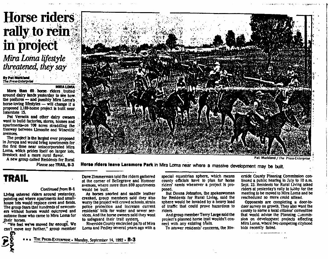
Horse rider* , rally. to r. II' 'projed Mira Loma lifestyle threatened, they , say By lin't Musvktand The Press-Enterprise
. MIRA LOMA More than 80 horse- riders . trotted .*
around daily lands yesterday to see how: • the pastures — and possibly Mira Loma's . horse-loving lifestyles — will change if a proposed 2,189-home project is built near. Interstate 15.
Pat VernOla and other dairy owners want to build factories, stores, houses and apartmentsoon 700 acres straddling the - freeway between Limonite and WineVille' '- avenues.
The project is the largest ever proposed In Jurupa and would bring apartments for the first time near unincorporated Mira Loma, which prides itself on larger lots, livestock and a more rural flavor.
A new group called Residents for Rural Please see TRAIL, B-3
Pat Murktand/ The Press-Enterprise .
Horse riders leave Laramore Park in Mira Loma near where a massive development may be built.
TRAIL Continued from B-1
Living ushered riders around yesterday, pointing out where apartments and small-house lots would replace cows and fields. The group fears that hundreds of newcom-ers without horses would outcrowd and outzone those who came to Mira Loma for
„their horses. "We feel we've moved far enough. We
can't move any further," group member
Dave Zimmerman told the riders gathered at the corner of Bellegrave and Hamner avenues, where more than 800 apartments would be built.
As horses snorted and saddle leather creaked, group members said they also worry the project will crowd schools, strain police protection and increase current residents' bills for water and sewer ser-vices. And the horse owners said they want to safeguard their trail systenv
Riverside County encircled pals of Mira Loma and Pedley several years ago with a
special equestrian sphere, which means county officials have to plan for horse riders' needs whenever a project is pro-posed.
But Donna Johnston, the spokeswoman for Residents for Rural Living, said the sphere would be invaded by a heavy load of traffic that could prove hazardous to riders.
And group member Terry Large said the project's planned horse trail wouldn't con-nect with any existing tails.
To answer residents' concerns, the Riv-
erside County Planning Commission con-tinued a public hearing in July to 10 a.m. Sept. 23. Residents for Rural living asked riders at yesterday's rally to tubby for the meeting to be moved to Mira Loma and be rescheduled so more could attend.
Opponents are completing a door-to-door survey on growth. They also want the county to name a local citizens' committee that would advise the Planning Cmmis-sion on development projects affecting Mira Loma, where two competing cityhood bids recently failed.
• THE P8F.SS-ENTE11P1uSF.• Monday, September 14, 1992 • 03

1-15 Corridor High Density Development Survey
YO 1J DO NOT NEED TO BE A REGISTERED VOTER TO COMPLETE THIS SURVEY
. 1. Do you live in or star Mira Loma? _yes _no (Please give us your name Rad address so we can validate the survey for the Planning Commission Rearing on 9/23/92)
Name-Address-
2. Why did you move to the Mira Loma area? a. More economical housing b. Rural/ccuntry style of life C. Family/friends in the area d. Other
3. What do you like tx.-st about living in the Mira Loma area? a. Raving animals on our property, b. Raving a home on a larger lot C. Being away from the city or Orange County a. Other .
4. Do ycu believe that the 1-15 Corridor in the Mira Loma area should t a built up (Apartments etc.)? yes no
5. Do yca favor or oppose the proposal currently before the Riversid Planning Commission for high density development of the 1-15 Corridor (see map). Favor Oppose
6. For FUTURE residential development in the Mira Loma area or the 1-15 Corridor, would you want all homesites to be limited to 112 acre minimum with animal keeping rights? yes no
7. Would you like to assist some of your neighbors ("Residents for Rural Liring") in trying to avoid high density development of the 1-15 Corridor within the Mira Loma sphere of influence?
a. No...I support the high density development b. Maybe/undecided at this time c. Yes...sign me up to help Phone •
GcLosda t (3)
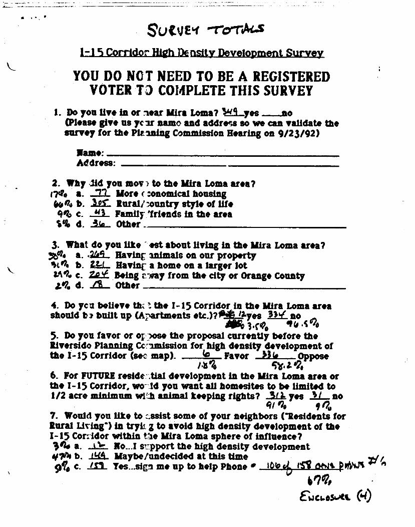
Su VJEli -rerriAts 1-15 Corridor High Density Development Survey
YOU DO NOT NEED TO BE A REGISTERED VOTER 13 COMPLETE THIS SURVEY
I. Do you live in or near Mira Loma? 4g._.yes _no (Please give us year name and address so we can validate the survey for the Pltaning Commission Hearing on 9/23/92)
lame: Address:
2. Why 174 a. k• no b. gee c. le% d.
you mov -) to the Mira Loma area? More ( :onomical housing
.10.1. Rural/ vuntry style of life 2.1_ Family 'friends in the area ../.16_ Other
3. What do you like est about living in the Mira ye. a. ,2t/.9_ Having inimals on our property %O. b. Uri_ Having a home on a larger lot Li*.• c. Being t - ay from the city or Orange County
d. Za._ Other
4. Do yen believe thz the 1-15 Corridor in the Mira Loma area should ba built up (Apartments etc.)?0Ailyes MY_ no
443.M Ins •C 120 5. Do you favor or og?ose the proposal currently before the Riverside Planning Cc-amission for high density development of the 1-15 Corridor (sec map). Co Favor Oppose
ns ft. a 1, 6. For FUTURE reside . .tial development in the Mira Loma area or the 1-15 Corridor, wo - 14 you want all homesites to be limited to 1/2 acre minimum with animal keeping rights? _.S.L1 yes 2.L. no
q/ I 7. Would you like to ..ssist some of your neighbors ("Residents for Rural Living") in tryii. g to avoid high density development of the 1-15 Con-idor within Vie Mira Loma sphere of influence? 1n. a. t No...I r:pport the high density development 04 b. 1_4_4. Maybe/undecided at this time
b.L I. ft Vim 944 c. me up to help Phone 10b cot) tWit P 'NW -•
V?, EW CU CU" 610
Loma area?

• Economical housing
El Rural Living
• Family/Friends
12 Other
Glen Avon
Mira Loma
65.60%
Pedley
8.01% 12.47% 14.30%
65.22%
Jurupa
Why did you move to Mira Loma area?
1-15 Corridor High Density Development Survey. Question 2.

37.40% 31.60% 17.90%
41.50%
• Animals on property
O Home on larger lot
• Away fr. Orange County
O Other
Pedley
4.30%
26.70%
Kira Loma
7.30%
Jurupa
2.40%
Glen Avon
1.60%
• , •
What do you like best about living in the Mira Loma Area?
1-15 Corridor High Density Development Survey, Question 3.

For future residential development would you want all
homesites to be limited to 1/2 acre minimum with animal keeping rights?
0 yes
• no
Do you believe that the 1-15 corridor in the Mira Loma area should be built up
(apartments, etc.)?
3.50%
96.50%
O yes
• no
Do you favor or oppose the proposal...for high density development of the I-15
corridor?
1.80%
9820%
O favor
• oppose
Total from all surveys
1-15 Corridor High Density Development Survey, Questions 4, 5, and 6.
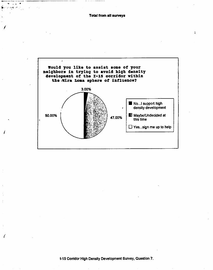
Total from all surveys
Would you like to assist some of your neighbors in trying to avoid high density development of the 1-15 corridor within
the-Wire Loma sphere of influence?
3.00%
50.00% 47.00%
• No...I support high density development
13 Maybe/Undecided at this time
0 Yes. ..sign me up to help
1-15 Corridor High Density Development Survey, Question 7.

JULY 29, 1992
TO: THE RIVERSIDE COUNTY PLANNING COMMISSION SUPERVISOR OF THE 2ND DISTRICT, MELBA DUNLAP RIVERSIDE COUNTY BOARD OF SUPERVISORS
WE, THE UNDERSIGNED ARE RESIDENTS OF MIRA LOMA AND ARE OPPOSED TO HIGH DENSITY HOUSING DEVELOPMENT AND HUD LOW INCOME HOUSING DEVELOPMENT IN MIRA LOMA AND WE ARE OPPOSED TO ANY SPECIFIC PLAN THAI WILL BRING THIS INTO OUR COMMUNITY. WE ARE IN DIRECT OPPOSITION TO THE 1-15 CORRIDOR/EASTVALE DEVELOPMENT PROJECT SPECIFIC PLAN FOR THE FOLLOWING REASONS:
WE OPPOSE HUD HOUSING PROJECTS WE OPPOSE HIGH DENSITY HOUSING WE OPPOSE APARTMENTS
WE ARE OPPOSED TO THE 1-15 CORRIDOR, EASTVALE DEVELOPMENT PLAN THAT WOULD INCORPORATE ANY OF THE ABOVE BECAUSE OF THE NEGATIVE EFFECT ON HOME VALUES TO THE ADJACENT NEIGHBORHOOD(S) AND THE FOLLOWING EFFECTS IT WILL HAVE ON OUR COMMUNITY:
(1) IMPACT OF CRIME INCREASE--GRAFFITTI, GANGS, DRUGS, HOUSE BURGLARIES, AUTO THEFT, AND HALF-WAY HOUSES.
(2) TRAFFIC (3) THE IMPACT ON OUR LIFESTYLE AS AN EQUESTRIAN AND ANIMAL
KEEPING COMMUNITY (4) IMPACT ON OUR HOME VALUES AND REAL ESTATE (S) IMPACT ON OUR SCHOOL DISTRICT (6) IMPACT ON OUR EQUESTRIAN AND LITTLE LEAGUE PARKS (7) FINANCIAL IMPACT ON JCSD, OUR WATER AND SEWER COSTS (8) IMPACT ON OUR JOB MARKET (9) THE INCREASE OF COSTS TO THE COUNTY
(a) POLICE & FIRE PROTECTION, (b) BUILDING CODE DEPT., (c) TRAFFIC DEPT. (d) FINANCIAL BURDEN ON THE COUNTY WELFARE SYSTEM, (e) BURDEN ON THE COUNTY HEALTH CARE SYSTEM, i.e., COUNTY HOSPITAL, THE COUNTY MEDICAL CLINICS, THE INNOCULATION CLINICS FOR SCHOOL CHILDREN, (f) IMPACT ON THE COURT SYSTEM, JUVENILE HALL.
(10) INCREASE IN OUR TAXES IN THE FORM OF ASSESSMENTS TO PROVIDE ADDED SERVICES
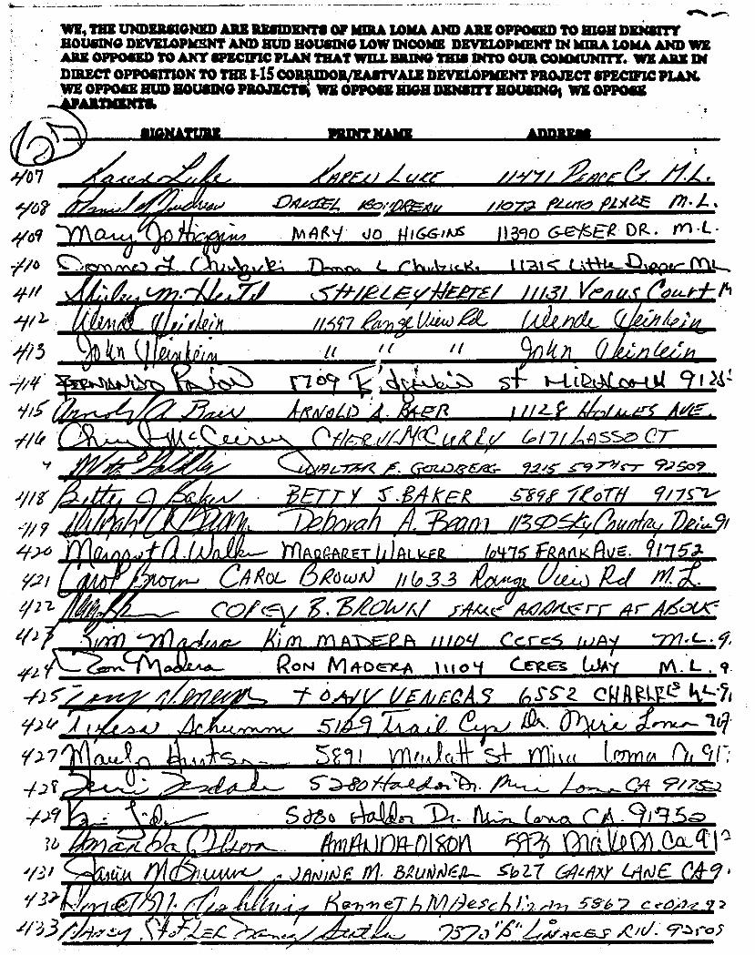
41161 41
41.
194-774
6-crea.),1•6,- 9.2/s- .s-97-//c7- 512509
" MINONOW
69d aT
WV, THE UNDERSIGNED ARE RESIDENTS OF MMA LOMA AND ARE OPPOSED TO HIGH DENSITY • HOUSING DEVELOPMENT AND HUD HOUSING LOW INCOME DEVELOPMENT IN bURA LOMA AND WE
ARE OPPOSED TO ANY SPECIFIC PLAN THAT WILL BRING THIS INTO OUR COMMUNITY. WE ARK DI DIRECT OPPOSITION TO THE 145 CORFDOR/EASTVALE DEVELOPMENT PROJECT SPECIFIC PLAN. WE OPPOSE HUD ROUSING PROJECTS WE OPPOSE HIGH DENSITY HOUSINGS WE OPPOSE
Aussuris
"7/07
449 sYsi\
IP 2- 1/ 3
-7/ 7 404
Pi 92
_ rE rffilaMIW INIMIPII pie
-
// )114(44kR_ET ii)Al_kilk 64/K FR etKAvE. 91#75A
Ohl- (3,040A) //3_3 /61/4 ex.;)Rd Nt COrcryg.Xiat/A/ y;ftAce /4r4Ze.,ex:
40,7-ea 00;;04ext. //c772 toixe.z Pi.
MAH . tio 14,66llos 11390 Dr&. rn-L-
D■vis"e. eiN.Azicg. t 1"At
(5,171-ALlitilE.erS/ Me/ g, ç (fozed-7L-111
//M''7 U2i44.) /Lbw&
RON M 4-0 ele-A 1
6.A1
erite-s LJA 0 kA. .9 .
0-
Uh-A 5 P JEOA. CA gMe h.L4 •
511 ynfli)(4 tnneA ()f ete 5->d)o 01
S CY6 A4s -1 "Di CaiNk,tx .9)'4,5 it hiliat A el !tit OAA
14
1OF Sto 17 c4 Ale
G? e /1 ?les' /, c eel•2
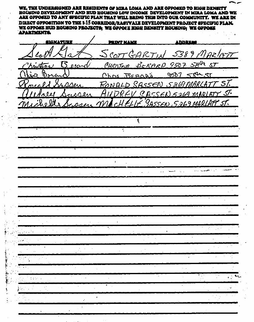
WE, TRE UNDERSIGNED ARE RESIDENTS OF MA LOMA AND ARE OPPOSED TO HIM DENSITT SOUSING DEVELOPMENT AND BUD ROUSING LOW INCOME DEVELOPMENT IN 'IRA LOMA AND WE ARE OPPOSED TO ANY SPECIFIC PLAN THAT WILL BRING THIS INTO OUR COMMUNITY. WE ARE IN DMECT OPPOSITION TO THE CORRIDOIVEASTVALE DEVEIDPMENT PROJECT spume PLAN. WE OPPOSE HUD ROUSING PROJECTS WE WPM MGR DEWITT MOUSING; WE OPPOSE APARTIMNTS.
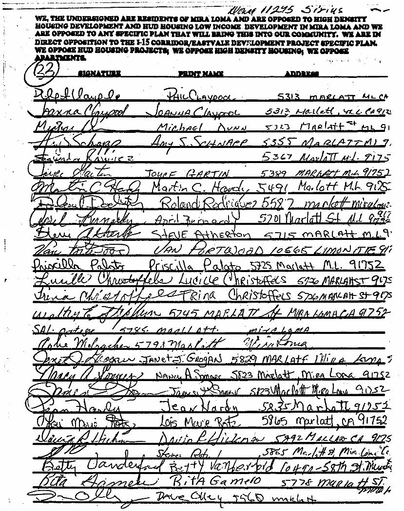
!
1,4
I • '
.4 41
4.11/ ..r Ala. 9 75-
^ ct o•N
Ai I/ n 2.. %IL
A-kik/A nA yff -f-,(.... , I- 64 9.zi
1 c3 • id
• _
• ei
a/era)
i■ AN,
o 6-6
2S o.
"ITIXF-MWMirar -111MILM
C
•/10,7" Aliktgall5
illgf&IFPAIRW,AIMBMPIM/
tAA.14- )
014:4'W'
IA e ,c4 /.
Al.
d
cle sibfce6- SY-zo qt7s
0-11R.1310WeLS cl424 ulfv-Att- gi- t?
4t-I 67 c143 AV RA,/ 77 111 /4- i4/f4 /4 (.4 977 V-
L,7 / Af-t•
t■witot.k.1 %pc -nr.2S PaivEktAr TW. s z. -
c 367
tf 1,-. 912S:
no4 r( qt?
.141
Sc
• I •
44( /4,1Y-5 "g• WE, THE UNDERSIGNED ARE RESIDENTS OF MIRA LOMA AND ARE OPPOSED TO HIGH DENSITY HOUSING DEVELOPMENT AND HUD HOUSING LOW INCOME DEVELOPMENT IN MIRA LOMA AND WE ARS OPPOSED TO ANY SPECIFIC PLAN THAT WILL BRING THIS INTO OUR COMMUNITY. WE ARZ Dl DIRECT OPPOSITION TO THE 1-1SCORRIDOR/EASTVALE DEVELOPMENT PROJECT SPECIFIC PLAN. WE OPPOSE MUD ROUSING PROMO* WE OPPOSE MOH DENS= HOUSING' WE OPPOSE

ADDRESS SIGNATURE PRINT NAME
2/ 2
_ E 0 -
1 addie
WE THE UNDERSIGNED ARE RESIDENTS OF KIRA LOMA AND ARE OPPOSED TO MGR DENSITY ROUSING DEVELOPMENT AND BUD HOUSING LOW INCOME DEVELOPMENT IN IIMA LOMA AND WE ARE OPPOSED TO ANY SPECIFIC PLAN THAT WILL BRING THIS INTO OUR COMMUNITY. WE ARE DIRECT OPPOSITION TO TEE I-1S CORRIDOR/EASTV'ALE DEVELOPMENT PROJECT SPECIFIC PLAN. WE OPP3SE Rua swum paoncrs. WE OPPOSE um =Naffs HOUSING" WE OPPOSE APARTMENTS.
71. /14-eb ; ,s1.18 1-01.( 5 1
• .ar rfrf"t/-
• / a
do/ CIA
.36if
3ar
26(, 3o
3 0,7
?Jr,
d.urztitt‘ et-e,61.4
U
' 11-1 Oirrog- sr./
57 cjc4Z4
19n2/ /06E( oiy. Mt •
Li?ek) ()A M411AN -5-99 -7(c:t 7 r 7 A)
MINLMIF "LW MAW 4WO Al
-IxtrtsaZir.N.st &bbe ammeonov
(, o 2C 44anito..W 530/ filstAlt ■lit 5/- • 6 V(/' 4„eitsfxso-c.
63.414 , 1144041,2,4,4%)
,ACW"uglAM1111111
_4 4
/e
L; II- R. s4e,e-aeb-i7de,k.k.5/11/a
usAno n , . fie y Dr
‘5"7/.7 tfigq -c, otea_alL OR 0-tdc- I V--
11 106 A. 1.Sa r Re M•L
1.0 9/;
f? • Jf/ff 49 41
I
'-‘11. 1111115.w alk 4 I
- II. **1 '
.0
1.4tMitaraw ■ aMMA ifingleffrEL ./ -
/alit ASA) .,Iwo lye_ M.L L . / 7cC2
24 es S /
1
457Eb /.5t-vge 55' -cos .5 v
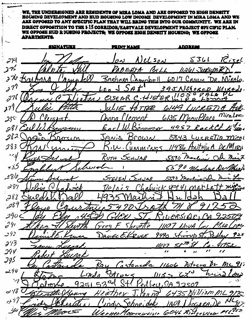
• Adef
M/MIPZO I 2_
' • 11111/11rMilreMa
6- ANI
IP"
Mira-Lem.
• ,drode
L111
0 11,
4.1
A IP: ir:At' --•
(411111110M'W Alt
,4, -
SAr 34,..rniscog..D 0,5eA.,g occbds. '-LA pc, '
• V. • •• a I MPRIIIMII .111PIA r A A •
• 8 3 A OP'
c I
lA •
4.411Pillff
s- 3(4,t A
A
62re ce/ye,..kP
S IP _4 E._ d ■ .■■■■1' 457. ■.■
7 or- • • 111 kffliMI 0/3 •
11111 MAMMIES weiAtiv
way-ezisci ///a7 JA-Ia•el /44 • • • f.its
IMO
# ..r.ant 44,
=2.1(C
's1
0. ?or
r &Willa /UMW
'1-1,EV.M10-tw 6°41‘ '1°) id° "fe..947,
•.•
OP'
la)?? .577M4Y ifT • • 4 g , if
THE UNDERSIGNED ARE aunuarts OF MUIA LOMA AND ARE OPPOSED TO MON DENSITY HOUSING DEVELOPMENT AND HUD HOUSING LOW INCOME DEVELOPMENT IN bURA LOMA AND WE ARE OPPOSED TO ANY SPECIFIC PLAN THAT WILL BRING THIS INTO OUR COMMUNITY. WE ARE IN DMECT OPPOSITION TO THE 1-15 CORILMORJEASTVALE DEVELOPMENT PROJECT SPFCWIC PLAN. WE OPPOSE HUD R GUSING PROJECTS; WE OPPOSE MGM DENSITY HOUSING, WE OPPOSE APARTMENT&
1 1 '
TarA ‘..t4LAT A-42
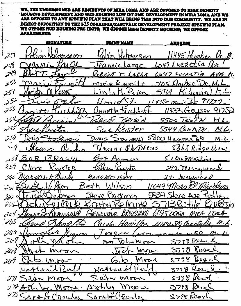
e402
int, THE UNDERGIGNSD ARE RESIDENTS OF MUSA LOMA AND ARIZ OPPOSED TO HIGH DENSITY • BOUS040 DEVELOPMENT AND UUD HOUSING LOW INCOME DEVELOPMENT IN MMA IOWA AND WE ARE OPPOSED TO ANY SPECIFIC PLAN THAT WILL BRING THIS INTO OUR COMMUNITY. WE ARE IN DIRECT OPPOSITION TO THE I-1S CORIUDOR/EASTVAIS DEVELOPMENT PROJECT SPECIFIC PLAN. WE OPPOSE HUD HOUSING PRO mem WE OPPOSE HIGH DENSITY HOUSINGS WE OPPOSE APARTMENTS.
SIGNATURE
PIUNT NAME
ADDRESS
42-0 cvL;),4 ' --crr5?Zoso-.4es 3Oc S Sr,,e ,4r403 5`800 cuo‘ica_x_n.si
firs:/,,Air f71%,/,, s (F/VijeCIA1 5 alx R 11,e M
+TA
/19 ,et7.- E 07 91 71U /1,vel4-ek-efi0
Be-'1h W 1 .1 cn I icqg V19w6 ),Xtnb(1)711 3.k.te '6) c-tyyrin 9;1 StEve
hifr8 V(3 NVAQ PO /5. geNEWIUg MUS5/16 09rGegii- Nfed- LP/14-
#.9/i/r/A >//& nr4f 4'4 9
j6-p 11"r
0 721 4
\gel
Wub--- S-7 7 6 1?_12A-z_k
CO 144/1 141>-* 13-e4- c-j■
(4)A-1-1- P-A&, si Y3
sin P-e-4--Y( • NY) Ot
s pn .1 59 lea
1)/ h dia
A yr-1 ?friet7P44
171- )1112"111 1 1A''-c‘-611
Sis 4,2ag
• NI, 1
dfrff I-
6,20 kAr\ArD-r- •
k ;77/¼4v•) tfv1 a7)--&
.?" --/4--N VA qty.& ALvt-)
:123 cik CI tl ot,Kti& c A rh-t
1 ' •
9 1'7 .. ■ • • •
sco o3 • s 5-/-
MIDRIBS
)4,1,,, LAI/ R Rot_ )■ 4?)u_S (AAA YN-Nme • 14- illit..1-•pr
I- )■ IN) 11 1. 5 )9YkSI 4244". }:vto■ •
•
,5719)M91+16-Sr. 12-471---adh Atithica
' L
7. , A. 6 4 • -r. LS." A /dew- - to
/P65- () /1/ n c e
..011•■ •-
r
It • c.
/Et ArAir
(Nnzrrir •
At,
„A 4&11
It 7, 2,11p or _Are evet424c)",14 opei. ,evezion9,eacit
e,va t 5 00/ 4Z-6-4.--C,/- tehm,■,_
-7
3? . ;- 4iitarr a
)31 ,17:14..._ ■- .1Wrek i if,/ / ■•■41°Lf A
li WNW iv PO q0ji ,,, cif 0 7 i
)'f' 1
_1EHAF, 64' (fle " Sgen
.5" 7 re.„ S 4 /;.) /let •
r/d)AM145 daidth--,461/6,,/ /123/ 7Idea gn.
nit f/l/c. Z./7-71e
_Pace7;.i Au:4a,
41/10. "t
II
E .S;e,
I %.■ / 4 It4
/691V -..191_71... S4086/11ficciin /7c: Ca?'
II
I 7 3)4 egf 1
/24P•if (5-678'.1-Adkr/
4.1.1."1. A-S_ C. m• Je? -7,1 • 4. -9r.
I AZ II Alrj / •
Ae-
• • I
/, s/ibe 4./6- ,Dte,re-ws
WE, THE UNDERSIGNED ARE RESIDENTS OF MIRA LOMA AND ARE OPPOSED TO NIGH DENSITY HOUSING DEVELOPMENT AND BUD HOUSING LOW INCOME DEVELOPMENT IN MIRA LOMA AND WE ARE OMNI= TO ANY SPECIFIC PLAN THAT WILL BRING THIS nao OUR COMMUNITY. WE ARE IN DIRECT OPPOSITION TO THE CORRIDOWEASTVALE DEVELOPMENT PROJECT SPECWIC PLAN. WE OPPOSE BUD HOUSING PROJECTS. WE OPPOSE ME DENSITY ROUSING WE OPPOSE
If
WE, THE UNDERSIGNED ARE RESIDENTS OF MIRA LOMA AND ARE OPPOSED TO HIGH DENSITY HOLISM DEVELOPMENT AND HUD HOUSING LOW INCOME DEVELOPMENT IN KIRA LOblA AND WE ARE OPPOSED TO ANY SPECIFIC PLAN THAT WILL RILING THIS INTO OUR COMMUNITY. WE ARE IN DIRECT OPPOSITION TO THE I-15 CORRIDOR/EASTVALE DEVELOPMENT PROJECT SPECIFIC PLAN. WE OPPOSE HUD HOUSING PROJECTS1 WE OPPOSE 810:1 DENSITY HOUSING; WE OPPOSE APARTMENT&
)1. • SIGNATURE
tx/d/./et_ 'du es:;/.1a0
ADDIMIS
4. I ANI o_
Jelliir 4 se ifr7
ci or4h
ro 01- y Ai
PA. Vi FRI AS
1/ 57
1/--s"-7s ?4,n9t45. e
i/Co -sc 11),A.1
I bgl Pil Pu4 bR dYS-
3-03t
i I 40c, ( eriN1 rit tAr
/163S" 79/Pies4
HUI r8h-ifo:c
O yr) ST,? (ki l IA At/441ra. zp,o - 1)/2_,
111/4 ctIciel 7-1- 11-d-trfr/ k9.5 mt„„L,c f ,
Et4,0 14,et ieS At, AL I/
IIG R-4. pet p tC ACIUNAL:b_l• r ru tkIn to Tattle' o
41.,1 cn • F rPa-4 s r, re t 4-4—PacryveLisbi, - .4./`•
LIMY_ L,T
I I le 4 r1"› , Ter Me 1.-C.tk

ilhAesA t.
5- 3 9 F774./9 n, /wk.../..0",, A.
cC2A-)< 41a)
/1eV■YO41
air
----;0"4/41raVr2 / /TT
.5; .g)2, 'if.
9124."-L
EL
t13 I (r;C f
iev
11
Ai ma.
!AP 7141 C LC Lie/4
/1 .
71:MIPMEMIF • s 11 ..raYEW _
05 (rOW nr-
a <-41 uf nil 4 f 161, tt-
J
• 40 ,
Roy)
0(11 411. ■
A
1411 4'7 o5epfl P &/(fez, s //e5S A/1 t7/2/tv,,/
relif'he / / es
7Coremi4?,nf iv 734. 6 fa sr id/77d 4?c9 PoeM
ate Ica 146i a Pe. ( 0 t‘r- )
ocLJ &SCR rariamg-g.ioe.
rise 14a 1-14.4.1. 455- V El--; we020/4_
i2qS ) I A
sag
Irmareserwawawa•P ~tine •1141APWAin am vs. samara sAimiA *MU *AA UPPINARIN TV UWU DENSITY HOUSING DEVELOPMENT AND imp HOUSING LOW INCOME DEVELOPMENT IN MIRA LOMA AND WE AliE OPPOSED TO ANY SPECIFIC PLAN THAT WILL BRING THIS INTO OUR COMMUNITY. WE ARE IN . DIRECT OPPOSITION TO THE I-1S CORRIDOR/EASTVALE DEVELOPMENT PROJECT SPECWIC PLAN. WE OPPOSE HUD HOUSING PROJECTS. WE OPPOSE HIGH DENSITY HOUSING, WE OPPOSE APARTMENTS.
$IOtiATURE PRD1T NAME. - Ammo
g. •

• (
4 tI
uszoa delv-De. 'At e-4 •
a.,ev 34.41.ek t. C CC:le 9,292 4i-cr R1 10%
V2- •••
— wz, Tax UNDERSIGNED AU RESIDEMIS OF MA LOMA AND ARE OPPOSED TO HIGH DENSITY HOUSING DEVELOPMENT AND HUD ROUGING LOW INCOME DEVELOPMENT IN MA LOMA AND WE AE OPPOSED TO ANY SPECIFIC PLAN THAT WILL ZAINO THIS INTO OUR COMMUNITY. WE ARE IN DIRECT OPPOSITION TO THE I-15 CORRIDOR/EASTVALE DEVELOPMENT PROJECT SPECIFIC PLAN. WE OPPOSE HUD HOUSING PROJECT* WE OPPOSE HIGH DENS= HOUSING, WE OPPOSE A?ARTMRNTS.
SIGNATURE PRINT NAME - ADDREAB
(p370 (Nu- (4 s kve .v4- L._ -
S-14( WC.iZflP m .L YM,Z
• ,3 ..
311 r act_ ' " 0. 0 I--kol pA es Law
H '2. t .14 31r/ IMA °
; II kl 0 %A cn i
3/ A c --Ho7 4, xe,
1 w (-"-2.0t..qcoNe--x) s--(eos- Pharx4,1 1. 41 iii,040, 3'‘ -_ -.aCX/4... • / ,
Su sft c-4-t-SK2. Il"..1.9 G etyr L /1 A tYLI-Ac- kr -
)-1
31 z-• .y.‘11\3x ■ ba_sk 56 S-k
3 7' 114-A LL..c-4 4 r.4 .")7,;f000
eft,. log- Ka -1‘114,...e, L)c
(117MOWW/
/ R i76 F
ticetritA alfardlel'
M. • I•••- o-.
e•--)-0
i I La Ail , /4A...4r &..il.‘_ .!. P y „:. 1./MITMOIMEMWAff
111V lo mr mew" L. • 12_ ft
4. I .114 _ •f!!! • -7C.1 14 . Li ; I ,
/f --a-
/2.■-r rq ye /11411e 2/P•Ile. • 75.2:
f*Q Law,
0 I/0 441->14, P 5 1AME Q.( COPOL/fiC r\lh.410 AlAgi-A77 51' / qi N. I
0.67hq•444./ 59z z
I ft

ADDRESS PRINT NAME .
- - - aperamm ~mar 011111114170 IP wirWiLil &AO 11741/13 MJSII
HOUSING DEVELOPMENT AND HUD HOUSING LOW INCOME DEVELOPMENT IN HULA Unlit AND WE AO OPPOSED TO ANT SPECIFIC PLAN THAT WILL BRING THIS INTO OUR COMMUNITY. WE ARE IN DIRECT OPPOSITION TO THE I-15 CORRIDOR/EASTVALE DEVELOPMENT PROJECT SPECIFIC PLAN.
OPPOSE HUD HOUSING PROJECTS; WE OPPOSE HIGH DENSITY MUNN* WE OPPOSE THEN111.
SIGNATURE
o €. cderi
IM I cel \Mahn, 57 15 Dvicc Aue._ k7;vc-ie (-46 V..eyx.velos 411-e
353
3-5&
357
35 7
36° 5..r/
.30 363
41,^df 4 c S 4etr ec r-2p4, 4 gPe'
. „
)1Xrkt\TX:&2/..
-MO
3fr
6Ie/u Strrrk
Rc) -ov TAA4- cl-Azte Z.A1212,/
63 -317UNIfrer ,7, go(
‘iSR -Ro-f-A ef_Ig Qz
6A317 LII-Lasim Ave.
yi,./fAxi
0 itiorz e_Wn)43,C_C, A)I -rinx) 6.3o 41 /4Xii;ni.A1
/409 ,4,e606e&--- ea .0/e
e ce ss //7(15 • 57 me.57- e /&/?Ac?
5_357 locy-et fa ilv€ o5yz
cl i orfes-r-14 5T ix i
eekA
fa
370 ..„ #
3 6 I I /-ATIOr0
Z.; 12.-Isay,
9
fro 5 S adz_ io
35/ rsifu ass theism • anYhiet 4 Rif /se?,
A
TIM UNDERSIGNED ARE RESIDENTS OF MIRA LOMA AND ARE OPPOSED TO HIGH DENSITY HOUSING DEVELOPMENT AND HUD HOUSING LOW INCOME DEVELOPMENT IN Amu LOMA AND WE ARE OPPOSED TO ANY sPECWIC PLAN THAT WILL BRING THIS INTO OUR COMMUNITY. WE ARE IN DIRECT OPPOSITION TO THE I-15 CORRIDOR/F.ASTVALIC DEVELOPMENT PROJECT SPEC WIC PLAN. WE OPPOSE HUD HOUSING PROJECTS; WE OPPOSE HIGH DENSITY HOUSING WE OPPOSE APARTMENTS.
SIGNATURE
Paper two . - ADDREss
S?(P
3077 Ain 3ae
3019
330
33/
332-
33
3321 33L-
3 V<
Ae 4
__010/■■■/
.)//jjj,e .4/ A'
15-746..5;) 13 et/eri M1,, 4 enZo
4 I • 1M4-
I Avyka
M' re 2.4,.77,2, a. 7/ g.3 2 Dana ity-e.
4..6 ft' tf lee z-444-t.
7/o Parnhe/ 14/1a Coop')
INai,o_ a I). cjin.L .
(,"/'/ dm /7 •
6021 ?/0 re -' n4
cist't9 rn t, 4gg((7. O go4
'
(0;90 ikt-)AfTy ///,
7
33E
33i /4404QA
g$,O
3P
393
36/ 515 .397
3y7
37
evAirmil .S1,4-1..A-c.- 1/L? gio/2/ ..5-XAT-FotD 6e25‘ Porni 0/E
4ovotey 57-61/67v 4mm/ 4-075- recui
Degij c 1 e ci dt4 tro,, L,fr
Ate-i
Li nc:6_ u_s--)0c.„N, 5e ZR,01 / „ ph, L.
/241.'41 /11,_ Gouz
7t-17 ANIe De OA R Z. bid L-At ET A reel/
ak
et_ "son' 640 S" eDa4-1.4_4ue Atirej"
WA( r: 62. 1/5)7 13e(CF2,e/swe 144.9a-
C1411-RIZNE OM-NS 111-1 41 Suatitua- Mt 441‘444
-3E 21 Orouon 9q -a s „A SA • INfl
Fe/44(444A_ M. I (4445.E1.. awAsy 1ø360E-rictizfx/b74 fl Le /
QA/ctt. •
i4G217 05unri e L.
• te
ws, nut UNDERSIGNED ARZ RESIDENTS OF laiUlt LOMA AND ARE OPPOSED TO HIGH DENSITY HOUSING DEVELOPMENT AND HUD HOUSING LOW INCOME DEVELOPMENT IN MIRA LOMA AND WE ARE OPPOSED TO ANY SPECIFIC PLAN THAT WILL RAMO THIS INTO OUR COMMUNITY. WE ARE IN DIRECT oppoinnoN TO THE 1-15 CORIUDOWEASTVALE DEVELOPMENT PROJECT SPECIFIC PLAN. WE OPPOSE HUD HOUSING PROJECTS, WE OPPOSE KWH DENS= BOUM* WE OPPOSE APARTMENT&
SIGNATURE PRINT ?IA= " ADDRESS
f;14 4 1 Z(S --r /4/ 2.4sr 15 A / oge/V A. 111 r -defe/c> ,9d_(2-ites4
T GotoT/ La. Pk
I 4344: c7.5 Hiekido? L a-1414i.
K4 nib 41)04 tot-Ac% fokk
mAKLArr 4/7e ar r .
..C.S =.1 t-- e,-- v-■7 e,
AtiotALdewx, )15
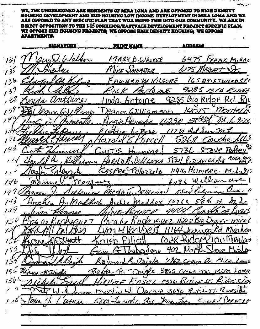
S
Z.5 9.2
A)e%
O•q7C k:41 /1 K
'7S iIf4a4 ¼S
7 1 erA"
/e/G 4./76 AtAr. gc-2, ç,.e>,40ers:
anitlime) a. IE. r9 II ' . • .■ Ot • • • • 1 e ° .._ I Pita ,p P 4. a, AP -
err
13"
1
13 1P ,3'7
')? '9,4)
I ( / 10
pr: wAiregwaiwy.,
/t1 g‘r .W 4L
_ Were
larirm or 1-
—
k/gie all eat
• ■
a...MAAJZ ■
111 11111.W10111. 11. AO
2_ >•2_
AINIMMIAMIEW l/
am • 44,22, you AVIIIILA 6 II ■111,'
Afac.eka ,I9
A e
' /CO • J Ardie
Aar r ft' • I Az
fri I
I g .5""?`‘ k 2 )
L., 1 • ) • L Y6 - Mfg :a/ As. • •
ft • 4„,
a • -Le /,(/
I 7kiduut., l_511 L--4,# / //
4jet. /tYla- 4? TA
Ast
4111111111.111■■
5AY0 rve.wit nate( 1-e)-R
WE. THE UNDBIUSIGNED ARE RESIDENTS OF NSA IAMA AND ARE OPPOSED TO HIGH DENSITY HOUSING DEVELOPMENT AND HUD HOUSING LOW INCOME DEVELOPMENT IN )(IRA LOMA AND WE ARE OPPOSED TO ANY SPECIFIC PLAN THAT WILL BRING THIS INTO OUR COMMUNITY. WE ARE IN DIRECT OPPOSITION TO THE I-1S CORRIDOR/RAW:VALI DEVELOPMENT PROJECT SPECIFIC PLAN. WE OPPOSE HUD ROUSING PROJECT* WE OPPOSE MGR DENOTE ROUSING; WE OPPOSE APARTMENT&
SIGNATURE
AIMILFAS
SPIPMP7'-- /to
sti tid 00(4,0",.
_ • _
64sPec_clIololz.41.6 Pel/G llomtsec- 141 -1-1 ,1; 4 Le 4(lf441,-,- tA...,-A2-
ri

D'..1; •
r
le...- WE, THE UNDERSIGNED ARE RESIDENTS OF MIRA LOMA AND ARE OPPOSED TO HIGH DENSITY HOUSING DEVELOPMENT AND HUD HOUSING LOW INCOME DEVELOPMENT IN 11UR4 LOMA AND WE ARE OPPOSED TO ANY SPECIFIC PLAN THAT WELL BRING THIS INTO OUR COMMUNITY. WE ARE DI DIRECT OPPOSITION TO THE I-1S CORRIDOR/EASTVALE DEVELOPMENT PROJECT SPECIFIC PLAN. WE OPPOSE HUD HOUSING PROJECTS; WE OPPOSE HIGH DENSITY HOUSING; WE OPPOSE
Amami
SIGNATURE ADDEMIS
S6 '76 LUC Rc-_-DA 61(V41-12r
mfret
I/ /Ili /A2fiz $.6(
bt-eltz-lip ‘z /4502 A i,V6e- vtec,, Af ficxt Loo.
51111%/HC- Z- 6c 3 / Atr. tg —Ant15:Thieloo
/7/ / 7 /3 44
/ -
/71 / 76 ,e /*iv De/ii /,S //136 itz f4ve
Esidrt , ---Rtrz.kfc(R67
/144c277/- 7,_.:
/fo /1/ AllingeW A, / I / 0,0
(rt (//120Xcn Miche )/e rneetinJg%1-/
A
an", 7 L •411-4.
Ruirtie-itT II 7c Lirrt- 4- erLAICAtidlaritiA.
.1
/*/ //-5 / C z/ I 1 1/419 i/7. ift 1)71 ../.1/4
GE <TehlE SIV DO uv 14;2_A-1.0.97r
144-, Ler loyi_ Cl -
"I, skfi / e///`47
At.
CoA/
,c776 1,011

PRINT /TAMIL • SIGNATURE ADDRESS
d/2,?3/ / ,
Iforc
Mk' Ot (1r P _51 c 1 4-49„)t?s,ic7 1110 E \KciskeP .-i-ec\sc)4Ar0 &((i`c.,14-i‘t A Cee 11; sJ
L4o‘4A, tPAGAIIA ctr3s 11- (0 1)(1 c14:4, 01 r..Nec5 SOiS pcp. Rat _
tr),
'71
z1/414
otAND 1. ertiweo 5L1/3 ehIA-7 LA/ 17(7_57-
07ct rk M 1-AW." 4krt S-Y/f Alitighr,Avt ?,/ 7.rk.
it1,47,6052- * C ,en ()Ai 1-- .5f 190 819 A /1 /04 Ac
rAye eiic /Ft t ei1kt14.4
ti)Pcc Rafrniu a, Li (\e(A, ktQintt,0 Av-ks .t
rior r( /es 7/ lm Ms.= /02/Z, Aidnie.,?.,14 .4
A LA - 6o65l1imil $1- at f? / •
(AlVe
qt1S-1 P-OG1. • i■A •
I/
y -riferzobo :57,4
L. 6770 ,147/77/ •
//5" P299,-zerod; FidiRiao
• •
-r-:
/1.1acpipi
"bit.LN Vkreuttf
• mower. walla% as,na uramssau RILW111 UKAIIITT HOUSING DEVELOPMENT AND RaliOUSINO LOW INCOME DEVELOPMENT IN MA LOMA AND WE ARE OPPOSED TO ANY smarm PLAN THAT WILL 1RING1 THIS INTO OUR COMMUNITY. WE MUT TN DIRECT OPPOSITION TO THE I-1S CORRIDOR/EASTVALE DEVELOPMENT PROJECT SPECIFIC PLAN. WE OPPOSE inn) ROUSING PROjECTSI WE OPPOSE wen =Ns= ROUSING WE OPPOSE (k APARTMENT&

1‘.3t Kosc s-YIPY 3+ w-e._ Ai.
4:1 4,
140
eoic,eicrr g.esteela stot acti.) Nma,t1st__& CAW 12\J Qc, 5&ô &n6A-• Melt% Ler
C414 ift #ic 5a _s)‘ Am -A( A, 310
...111/P■ ...
Afivirrkfagir"
'77RiAt R
63
WEI THE UNDERSIGNED ARE RESIDENTS OF MIRA LOW. AND ARE OPPOSED TO RION DENSITY HOUSING DEVELOPMENT AND HUD HOUSING LOW INCOME DEVELOPMENT Di MA LOMA AND WE ARE OPPOSED TO ANT SPECIFIC PLAN THAT WILL BRING THIS INTO OUR 00/10dUNITY, WE ARE IN DIRECT OPPOSITION TO THE I-13 CORRIDOWEASTVALE DEVELOPMENT PROJECT SPECWIC PLAN. WE OPPOSE HUD HOUNNO PRO PUTS, WE OPPOSE MGR DENSITY HOUSING; WE OPPOSE APARTMENTS
• SIGNATURE
PRINT NAME
ADDRESS

THE UNDERSIGNED ARE MISMIENTS OF IURA LOMA AND ARE OPPOSED TO NIGH DENSITY HOUSING DEVELOPMENT AND BUD HOUSING LOW INCOME DEVELOPMENT IN MIRA LOMA AND WM ARE OPPOSED TO ANT SPECIFIC PLAN THAT WILL BRING THIS INTO OUR COMMUNITY. WE ARE IN DIRECT OPPOSITION TO THE I-15 CORRIDOR/FASTVALE DEVELOPMENT PROJECT SPECIFIC PLAN. WE OPPOSE MID ROUSING PROJECTS, WE mon SIGS DENSITY NOOSING' WE OPPOSE • APARTMENT&

SIGNATURE PRINT NAME ADDRIUM
s
WE, THE UNDERSIGNED ARE RESIDENTS OF MIRA LOMA AND ARE OPPOSED TO HIGH DENSITY HOUSING DEVELOPMENT AND HUD HOUSING LOW INCOME DEVELOPMENT IN DMA LOINA AND WE ARE OPPOSED TO ANY sPICIFIC PLAN THAT WILL BRING ISM INTO OUR COMMUNITY. WE ASH IN DIRECT OPPOSITION TO THE I-1S CORIUDORJEASTVALE DEVELOPMENT PROJECT SPECIFIC PLAN. WE OPPOSE HUD HOUSING MOM?* WE OPPOSE HIGI DENSITY MUSING; WI OPPOSE APARTMENT& •

$usiEb6.0 11/711111,111 ,
11109 ,0 4- 10e77179,1r., uo kir( l_e7)77e 9/7 do—xt, 110 wA-3, Frptoeco44
t 2
WE, THE UNDERSIGNED ARE RESIDENTS OF MIRA LOMA AND ARE OPPOSED TO HIGH DENSITY HOUSING DEVELOPMENT AND HUD HOUSING LOW INCOME DEVELOPMENT IN MIRA LOMA AND WE ARE OPPOSED TO ANY smarm PLAN THAT WILL BRING THIS INTO OUR COMMUNITY. WE ARE IN DIRECT OPPOSITION TO THE I-1S CORRMORJEARIVALE DEVELOPMENT PROJECT SPECIFIC PLAN. WE OPPOSE HUD HOUSING PROJECTS; WE OPPOSE HIGH DENSITY FO(SING1 WE OPPOSE APARTMENT&
SIGNATURE PRINT NAME ADD
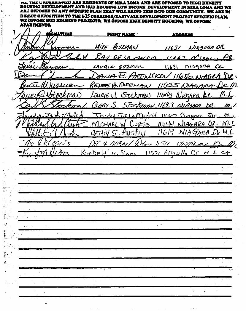
wen -11125 UPUJIMIIIWPULD ARE RESIDENTS OF mnut LOMA AND ARE OPPOSED TO HIGH DENSITY HOUSING DEVELOPMENT AND HUD HOUSING LOW INCOME DEVELOPMENT IN MIRA LOMA AND WE AU OPPOSED TO ANY SPECIFIC PLAN THAT WILL BRING THIS INTO OUR COMMUNITY. WE ARE DI DIRECT OPPOSITION TO THE I-15 CORRIDOR/RAI/WALE DEVELOPMENT PROJECT SPECIFIC PLAN. WE OPPOSE HUD ROUSING PROJECTS, WE OPPOSE EWE DENSITY HOUSING WE OPPOSE APARTMENT&
1 • 1 IPRINT NAME. • ADDREAS
firte /to"- 61a/444) ._
/161/ V/A710/24 #04-
,* .°11 -
.-4.,...4,11 • Z 4 y OE 44- ■•7,4n.to .6 I/ I 6 7 ri, I 0,4 ,„ Ce
diefihjt, _4 o
44 vg i d. d-c/2//nAn- ttOk t'N‘wt-"` C1,.... aJfii-6M tog k
f4,. /130:3A4 A.) 625s- / /97'2,51-' /e- X
1 /LJ t hMiD Aactied 0Thekmak) //643 MINA_ 4.A. IY).1_,.. it 6-19a7 S 37,c4..) /1193 vi/96.9/14 NI. m.4
Li... U. . ■ ik 1,- - .....0266t- ' FARM/ .8
/bit/1"P- ni IcHA EL _ . LA.92:65 ii IpLILI 011q6-424 be . PO. L. p ,
Agi l..: i 4. L CAThiv c. it,[4-14,1 n h 11 Aim /9/4, e4,,, b 57,
4 A A . .1 01,7N v1A. Pt 11
M. Sr ' A , r r i i c; -70 A ry,()#) A) or !Li . L . c_÷

WE, TEE UNDERSIGNED ARE RESIDENTS OF MIRA LOMA AND ARE OPPOSED TO MOH DENSITY HOUSING DEVELOPMENT AND HUD HOUSING LOW INCOME DEVELOPMENT IN MmA IAHLA AND WE ARE OPPOSED TO ANY mom PLAN THAT WILL BRING THIS INTO OUR COMMUNITY. WE ARE IN DIRECT OPPOSITION TO THE I-15 CORRIDOWEASTVALE DEVELOPMENT PROJECT SPECWIC PLAN. WE OPPOSE HUD ROUSING PROJECTS WE OPPOSE MOH DENSITY HOUSINGS WE OPPOSE Al AIM a N
SIGNATURE MIDI? PLAICE •
AIIDEESS
.ty,St-C-6444.reK-3 kivr14( &fr1-mm.0145 eiD00 KokArtv PR .tki

Vit; THE UNDERSIGNED ARE RESIDENTS OF MIRA LOMA AND ARE OPPOCED TO NIGH DENSITY HOUSING DEVELOPMENT AND HUD HOUSING Low mow DEVELOPMENT IN MBA LOMA AND WE ARE OPPOSED TO ANY smarm PLAN THAT WILL 11=40 THIS INTO OUR COMMUNITY. WE ARE IN DMECT OPPOSITION TO THE OS CORRIDOWEASTVALE DEVELOPMENT PROJECT SPECIFIC PLAN. WE OPPOSE &VD HOUSING PROJECTS, WE OPPOSE MOH DENSITY SOUSING, WE OPPOSE
MITKINTS. "T A
0211 e rr Wcj earh eiZter- bor

WE, THE UNDERINGICI1 *RE RESIDENT* OP MLA LOMA AND ARE OPPOSED TO MGM DENSITY HOUSING DEVELOPMENT AND HUD ROUSING LOW DICOME DEVELOPMENT IN MIRA LOMA AND WE ARE OPPOSED TO ANY SPECWIC PLAN THAT WILL BRING TSUI INTO OUR COMMUNITY. WE ARE DI DIRECT OPPOSITION TO ra CORRIDORMASTVALE DEVELOPMENT PROJECT SPECWIC PLAN. WE OPPOSE HUD HOUSING PROJECIIIS WE OPPOSE HIGH DrianT HOUSING WE OPPOSE
ARTMENTS.
SIGNATURE
PRINT NAME
ADDREAS

' WE, TEE UNDERSIGNED ARE RESIDENTS OF ham LOMA AND ARE OPPOSED To HIGH DENSITY HOUSING DEVELOPMENT AND HUD HOUSING LOW INCOME DEVELOPMENT IN MIRA LOMA AND WE ARE OPPOSED TO ANY SPECIFIC PLAN THAT WILL BRING THIS INTO OUR cowman. WE ARE IN
gicIIIECT OPPOSITION TO THE I-1S CORRIDORJEASTVALE DEVELOPMENT PROJECT SPECIFIC PLAN. OPPOSE HUD HOUSING PROJECTS, WE OPPOSE HIGH DENSITY HOUSING' WE OPPOSE
APARTMENTS
SIGNATURE PRINT NAME ADDRESS
4de, 0.A0_6- NoRA AAPtLeo#NA VDT, Ceaso.Thwv. iLl/4441
ALAi 413DFLIAlli 144g rl-q • 414.4
01 •,6
C.,41Z1.05 CoRbego 147o/ 1f.6c.w//0 j>z .
.1.1e,t4re
Dic;Sy 00VeRn (r701
tAie.4ect&r/ k-'04.56)/ //4-r3 gEl
)1R47",3." I/4 cP3
P-4—Lo e% i t, Atle,ir.
/110 21 griaelio
101
4-141) .7"0/74 ,e4AJ2:_o
eel (.( LA.c•
4i40244) A.
//...cZ 9 iefg edir
v/70 //5"ps..41-,A?-5-
Az:.1_41-:;-ki-04 Eva,a . LI 1-4 ■1(1-td «51.
Asq40 A 1`14-re.v4s //67/4. ue7/0
•-// GO # OE..
//, c-Peid A/4a .111f

WE, THE utamounatan ARE =mom OF ban LOMA AXO ARE OPPOSED To DION DENSITY MOUSING DEVELOPMENT AND HUD HOUSING LOW !SCOW DEVELOPMENT IN MIRA LOMA AND WE ARE OPPOSED TO ANY SPECIFIC PLAN THAT WEIL BRING THIS INTO OUR COMMUNITY. WE ARE IN DIRECT OPPOSITION TO THE 145 CORRIDOR/EASTVALE DEVELOPMENT PROJECT SPECIFIC PLAN. WE OPPOSE HUD HOUSING PROJECTS WE OPPOSE HIGH DENSITY HOUSING; WE Opp= APART'S/MS
SIGNATURE
PRINT NAME ADDRESS
11--;igtehartid (1,e-karo SteiniDeft .5 1744' OC/4sA a)k.
c‘e7leg-v /,/<1Y SYf ciot# 404
koikcivihnolit 4a9914/frizo-Ok
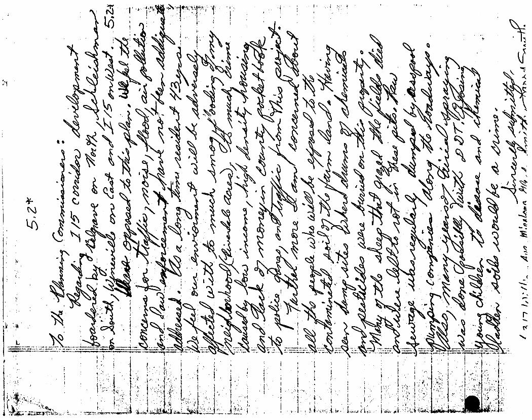
.0•■•••■•••

, •
2:

,t,

Riverside County Planning Department 4080 Lemon Street, Ninth Floor P.O. Box 1409 Riverside, CA 92502-1409
To Whom It May Concern:
To paraphrase an old saying, "The one thing that we learn from history, is that history teaches us nothing." In an age of increasing crime and increasing demand for public services such as police and fire protection, it is inconceivable that a proposal for developing the land in question is even being considered. History shows us that such over development leads to an abundance of problems. These problems range from something as minor as incr.:lased congestion on city streets to an increase in violent crime. It occurs to me that the only reason this proposal is even on the tzble has to do with the possibility that somebody stands to make some money. I propose that you better manage what you have. Become responsible to live and work within a budget like we all have to. There is no reason to further burden our community unnecessarily. There is no reason to invite the overcrowding, the crime, and the congestion into our rural neighborhoods. We those to move here for the benefits of this lifestyle. Again, the almighty dollar reah its ugly head and city officials cannot see past it. It's time to think about the future. It's time to be pro-active. It is time to make a stand and say that we will not let our community succumb to the same sickness, blight and decay that currently plagues our neighboring communities. Overdevelopment invites disaster. Overdevelopment is a catalyst to crime. Overdevelopment does directly effect each of us, and there is no way to distance one's self from the encroachment of urban blight. There is a simple defense. Vote no. Do not allow the developers to come into our community and ruin it. Each one of us has a responsibility to maintain our community's rural lifestyle. Did we not choose to live here for a reason? Our community has a certain look, a certain feel and I am proud to call Mira Loma my home. When I enter our community, I feel as though I've stepped into a different world. We are far enough away from the overcrowded, overdeveloped cities to keep us relatively safe, yet close enough for convenience.
In this day and age of increasing skepticism and distrust of our elected officials, I challenge you to vote your conscience. I challenge you to look to the future, and see that NOT allowing high density housing and overdevelopment proved to be the correct course of action. This can be the legacy that we pass to our children. This can be the moment that you can change things for the better. This can be a time when the people win, when the people benefit, when the land is not overburdened, and our community chooses its own destiny. This is a time when we can come together, a time when bigger is not necessarily better. Remember, Goliath fell from a small stone thrown by an individual. We cast our stone, and say no to the developers...we say no to crime...we say no decay and blight...we say preserve our community...we say it loud and strong.

Se n P. English 11689 Parkcenter r. Mira Loma, CA 9 752
Diane Hall 11689 Parkcenter Dr. Mira Loma, CA 91752
Page 2
In conclusion, this is not an issue that we can turn our backs on or ignore. This is an issue that impacts each and every one of us. It is time for you, the elected officials to serve the best interests of our community. Do not bow down to the big dollar developer. We must stand up to preserve our way of life. A recent song on the radio says it all, "You've got to stand for something, or you'll fall for anything."
Thank you in advance for your correct resolution of this matter.
Sincerely,
RiVERliDE COUFICY manninc DEPAIREMEnt APPLICATION FOR LAND USE AND DEVELOPMENT
4080 LEMON ST., 9TH FLOOR RIVERSIDE, CA 92501 (714) 275-3200
79733 COUNTRY CLUB DR., SUITE E BERMUDA DUNES, CA 92201 (619) 342-8277
41002 COUNTY CENTER DR., Bldg. TEMECULA, CA. 92390 (714) 694-5140
SPECIFIC PLANS
GENERAL PLAN AMENDMENTS TEAMS 1, 2, / 5 INDIO OFFICE TEAM 3 (714) 275-3290
(714) 275-1878 (714) 275-3238 or 275-3290 (619) 342-8277
REFUND OF FEES Whenever an application is terminated, upon request of the applicant a refund of fees paid may be made by the Planning Departmer in accordance with the Refund Policy Statement adopted by the Board of Supervisors. If any portion of the application fee has been pail out by the Planning Department to another jurisdiction or agency for services to be rendered in connection with the application, no refunl of that portion of the fee shall be made by the Planning Department to the applicant until the other jurisdiction or agency authorizes thl Planning Department to refund that portion of those fees. The Planning Department shall retain a processing fee from the total amour to be refunded. (Ord. 671).
I further certify that the application filed is true and correct to the best of my knowledge. I understand that incorrect or erroneous informatioi may be grounds for rejection, denial, or delay of the application.
SIGNATURE OF APPLICANT
DATE
nn e 7, 4A5 CASE NO. F.:FG
C10000513
REG. TEAM NO.
3
CENSUS TRACT NO.
406.02
MODULE NO.
201
CASE PROCESSED BY
LDH
CASE RECEIVED BY
c.. f--, ZONING
A 2-10
SECTIONS
On 0
TOWNSHIP
0T25
RANGE
il P 6, 11 APPLICANT NAME ADDRESS CITY, STATE, ZIP
JEBB ASSOCIATES ALBERT - 3788 MCCRAY RIUFPSTDE CA 920 OWNER(S) NAME ADDRESS CITY, STATE, ZIP
WEBB ASSOCIATES ALBERT 37,00 MCCRM RTUE P!::', I DE CA 9'250 ENGINEER REPRESENTATIVE NAME ADDRESS CITY, STATE, ZIP
PROPOSAL
=ISH AND GAME FEE FOR SP 266 LOCATION
SOUTH OF BELLEGRAUE PIE.,BETWEEN HAMMER t WINE:MLLE 0(171AUFS. LOT SIZE # OF LOTS MIN. LOT SIZE CONCURRENT CASES RELATED CASES
SP 00000266 COMMUNITY PLAN AREA
j UPUPA SUP. DIST.
2
SCH. GENERAL PLAN CATEGORY OPEN SPACE AND CONSERVATION ELEMENT
ARP)S HOT OPEN SPACE ZONING /AREA DISTRICT
PEDLEY
LAND USE PLAN AREA
jURUPA ASSESSOR PARCEL NUMBER
1 f.11, 0 030 001 3
COMMENT/MISCELLANEOUS
CHECK PEC'D 2/2/93 TOTAL AMOUNT PAID $900.00
WEBB ASSOCIATES ALBERT
PL ANN X CALIF FISH & P, FE:E $
$
MCILitT1 PA I D $
,00 (17
0013465 I NG FEE RECE JET
875 . 00
(142 $
.HDHN T Eij! IF 0 RECOD ALBERT Addr 3789 MCCWW City RPHERSIDE Tvpe CV IFiI I 1f.136
,WER3 !„) L.. I 1:1 h..5 HULINT pc) D
ST Srace Phnne 714 -66 -1V70
Ii I
Vr=4 4
F!! F COPN!

PROCF CF PUNACATION
(2C10, 2115.5 CCP)
PpOOF OF 0u3LICATION OF
NOTICOMPLr
2 66
I am a citizen of the United States and a resicent of the County aforesaid; I am over the age of eighteen years. and not a party to or interested in the above entitteo matter. I an an authorized representative of THrz. nRcSS-ENTERPRTSE,
newspaper of gereral circula-tion, printed and published daity in the city of Riverside, County of Riverside, and which newspaper has been adjudicated a newspaper of general circulation by the Superior Court of the County of Riverside, State of California, under date of April 15, 1155, Case Number 54446; that the notice, of which the annexed is a printed copy, has been published in each regular and entire issue of said newspaper and not in any supplement thereof on the following dates, to-wit:
01/17/1992
I Certify tor declare) under penalty of perjury that the foregoing is true and correct.
Dated January 17, 1992 at Riverside, California
NOTICE OF COMPLETION A Draft Environmental Impact
Report (DEIR) has been com-pleted for the project described below:
Specific Plan No. 266, Corn-1 prehensive General Plan Amendment No. 242, Change of Zone 5619, is a commercial and residential project on 704 acres proposed along Interstate 15 between 91 and 60 free-ways, south of Bellegrave Ave-nue and north of 68th Street. The project is comprised of a regional commercial area on 290 acres; 2313 dwelling units on 386 acres, ranging from 4.6 to 14 units per acre; 12 acres of parklands; and a multipur-pose trail.
County applications include Specific Plan No. 266 which would establish permitted land uses, development standards and design guidelines, and regu-latory arid environmental stan-dards and mitigations. Compre-hensive General Plan Amendment No. 242 proposes to change the Open Space and Conservation Map designation from "Areas Not Designated as Open Space" to "Specific Plan No. 266," and to amend the Land Use and Circulation Ele-ments of the General Plan. The Jurupa Community Plan would be amended to increase com-mercial acreage, decrease resi-dential acreage and units, and reallocate density. Change of Zone No. 5619 proposes to change the existing zoning des-ignations of A-2-10I and A-2-20 to S-P (Specific Plan).
Copies of the Draft EIR arc available for review at the River-side County Planning Depart-ment offices at 4080 Lemon Street, 9th Floor, Riverside, Cal-ifornia. Copies of the document will also be provided to the fol-lowing libraries for public review:
Riverside City/County Public Library, Glen Avon Riverside City/County Public Library, Norco Comments on the document
must be submitted to the River-side County Planning Depart-ment no later than 5:00 P.M. on February 25, 1992, to be included in the Final EIR, which will be presented to the hearing body. Notification of the hearing will be provided at a later date. Any questions should be direct-ed to the Riverside County Plan-ning Department, Attention: Joan Mavima - Project Planner, 4080 Lemon Street, 9th Floor, Riverside, CA 92501 RIVERSIDE COUNTY PLANNING DEPT. County Administrative Center 4080 Lemon Street, 9th Floor Riverside, California 92501
1/17
PLANNING OEPT CO OF RIV

SPECIFIC PLAN 266.- I-15 CORRIDOR
DECEMBER 6, 1991
STATUS REPORT
As of today, December 6, 1991, four screenchecks have been submitted to our Department by the applicant. The first three screencheks were reviewed by staff and staff's comments were provided to the applicant (See Attachments "A", "B" and "C"). The fourth screencheck was submitted in November, 1991, and has not yet been reviewed by staff. In addition, the applicant submitted a list of reasons as to why some of the changes required by staff, were not incorporated into screencheck No. 4. (See Attachment UDH) .

traet the Scut-hem California Air Basin, fluswill, however, reptetent significanr increase ir:: pollutants entering fritair oell the proleo area,
oi:;it . ograms to encourage th ic of alternate forme tfartsteeoeeee area the , ,i.e.rvatiorl of energy resources will reduce the
potentiat. total ainoont nf pollutants, the total impact cannot he fully retitigateai. .ahe steternert of overriding considerations will be prepared. An al: quality analysis being prepared using the AQAT model to determine, mieroscale impacts at intersections and appropriate measures to mitigate .tthese kripacts,
c Mitigation
I. The project developer shall encourage the use of alternate forms of transportation, and the use of energy conservation building ard...:Htniques.
A statement of over riding considerations shall be prepared.
3. Short term dust emissions shall be minimized through the use of site watering andiot other soil binders on unpave0 areas. and through the washing of trucks leaving the project site Adjacent paved streets shall be swept periodically to minimize soil buildup,
4. All construction equipment shall be properli Tune4J irad maintained.
Constniction related parking and traffic shall be managed so as to avoid obstruction of through traffic lanes,
Water Quaiity
Existing Conditions/General Flan Policies
The project site is primarily used for dairy farming and agriculenea production and is located within the Chino II and Chine III groundveataf subbasins of the upper Santa Ana River watershed. The current greaan ,j water quality reflects previous land uses in the area which have been predominantly agricultural. As a result of this, groundwaters of the Semi; Aria Region, and especially these subbasMs, are threatened by exceasie-mineraliztuion. Each use and re-use of water increases the amount ea' minerals, or salts, within the discharged water supply. Depending or 0.%..7 type of use, the capacity of groundwater subbasins to assimilate additice mineral content may decrease at an accelerated rate to the • •int thw „Ire groundwater no longer has any beneficial uses. The Chino II subbasin, which most of the project site lies, has no assimilative capacity left, terms of land use, dairies and feed lots are the largest contributor of sal° an e per acre basis (238 tons/acre/year). This is compared to approxirnatel -e tons/acre/year for sewerad residential and commercial land uses.
The Santa Ana Watershed Project Authority is currently constrtn;:t - i, Santa Ana River Interceptor bile (SARI), which when complette. 1. transport mineralized water from the upper Santa Ana River watte:eia.ed directly to Orange County Sanitation District treatment facilities, and thereby not further degrading groundwater supplies in the Chilli;
Crxv .r ,ktr Armen: Dtrict; Arirt QIN
4,
4s.PF1 -?r-' Arr •

The line currently reaches the Corona/Horne Gardens aree, and should le,17 .ach the protect 74,reti by March 1991.
The Cowes isseleies regarding water quality eecornmend that all ;..leveloprrients be reviewed for potential impacts to ground water quality, and that mitigation measures be applied to address these impacts, The mitigations shall also include those which may be necessary to avoid additional salt load within the Santa Ana River. All developments should include low flow plumbing fixtures and other measures which will reduce the overall consumption of water. Grading and construction should be accomplished when wind and water erosion are least likely, Soil adhesives and watering should also be used,
b , Project irmact/Relationship to General Plan Policies
Implementation of the project will remove dairy farming from the project site, thereby eliminating a main source of ground water contamination. In addition, urbanization will increase the amounts of surface run-off with higher mineral COTITent5 as a result of automobile residee from the streets. The amount of dust and soil will also be increased anu posited within the streets arid eventually into the County's storm dram sestein which empties into the Santa Ana River, These impacts can be minimized with frequent street sweeps. Area groundwater currently contains: a. ',7eign mineral leel as a result of historical dairy farm activity. On-site reannre which is a main source of the mineral content will require treatment r removal to eliminate
s potential contaminant to the ground water supply.
Urbanization will also increase the amount of water used for lawn and landscape irrigation. Oyer-irrigation leaches pesticide and fertilizer residue into the ground water supplies which further degrades the quality of the water. Control of commercial irrigation systems incorporating water conservation techniques will minimize this impact.
Mitigations
Site grading and preparation shall be conducted as per County approved standards,
a. Erosion control techniques including soil adhesives and watering shall be used to minimize surface erosion.
h. Grading shall be limited to the amount necessary to implement each stage of the project or between phases t achieve a balance of cut and fill on site,
2 The project developer shall provide frequent street cleaning service ,. during constmction phases of the project.
All graded, but undeveloped land shall include appropriate sloe', control techniques as approved by the County.
On-site manure will be treated and maintained on-site, or s removed and deposited in a site to be approved by the counts, Te Department.
p: 4NNi,"%f 4: r: '

'toxic Rat hict an:, ea
° Ir."132.?
r'Aa2ardo.u3 niaTerialS cuireiltiry :r the rcerr ZS (45p0•50. 11 1,;e6i, The objective et zee R 4e Leteety
Fr',,*";• 4ntsu.r:
the safe handling and rnanageineria, :`7 ,7:: toxic tucts ,- cg eornieliance with federal, state,
:tgniv.fpo•-te
b_ IrmereT:elationship e General Ran Pes
100Srlittt';h 9.S teri8tW the eornmercla land rise areas ate not yet iereeaea ;e eee te determine; the VotentW neae 4.tir the hateiiing
eee eeeeeraioea te ay.:trials at this time la l!lewevee.. zeiat sticat eted irate tate.a.aaise neeessary in the future
'en tee ele.ear:nat a flitaut tenixa reouireS storage ot hatardoa ,.:.7nate:,-eals site. a. retueriai eeeiei, a.ne: ;nanagement plan should etete araa eepye., exit v Hazardous Na'asi.se Mareee -0,e:
sid /de iency evacuatioe rraining provans for empioyeea, 41-4 hazariRrits May be produced on site. these will require rranspor ee ,,,,eaee„ ks a designated facility. Haulers of hazardous materiain and ,hseosal faciatiec must be licensed by the United States Emironmernp ,,k ioi
ihe applicant and all future tenants will be ;_• ,,Le.-e.re:.e.iig aieah Sine TitieS 19 and 22 of the Califon. Aairii,niatranee reek
arid Title 40 of the Code of Federal Regulations, there should be no adverse impacts to surrounding land uses nor to the tenure plan.rine areas within the wecific plan,
Atigations
I Subsequent applications tc implement the Specific Plan shall reviewed pursuant to existing state and local regulate:xis to insure the proper management of hazardous materials,
2. All future tenants which will require the handling (ar storage oe hazardous materials shall submit a materials management plan and employee training plan for review and approval to the Counti Hazardous Waste lvtanagement Committee,
Open Space and Conservation
a. Existing Conditions/General Plan Policies
The project is located in an area which has been designated for evenieea development in the Surupa Community Plan of the Riverside Counte Comprehensive General Plan and has not been designated for open .space: nor as a conservation area (Exhibit V-7). The site is mostly used for dare. farming and crop production. The only vacant land which i,s not currently used is *land which has historically been planted andor use e grazing. The topography of the site is basically level with a few vete: sae,a gentle skrpe reliefs. There are not any significant topographical feat• iocated on site.
; :5 ::::CDOP
t -;• P4 N' ;: 2, ;
•
_
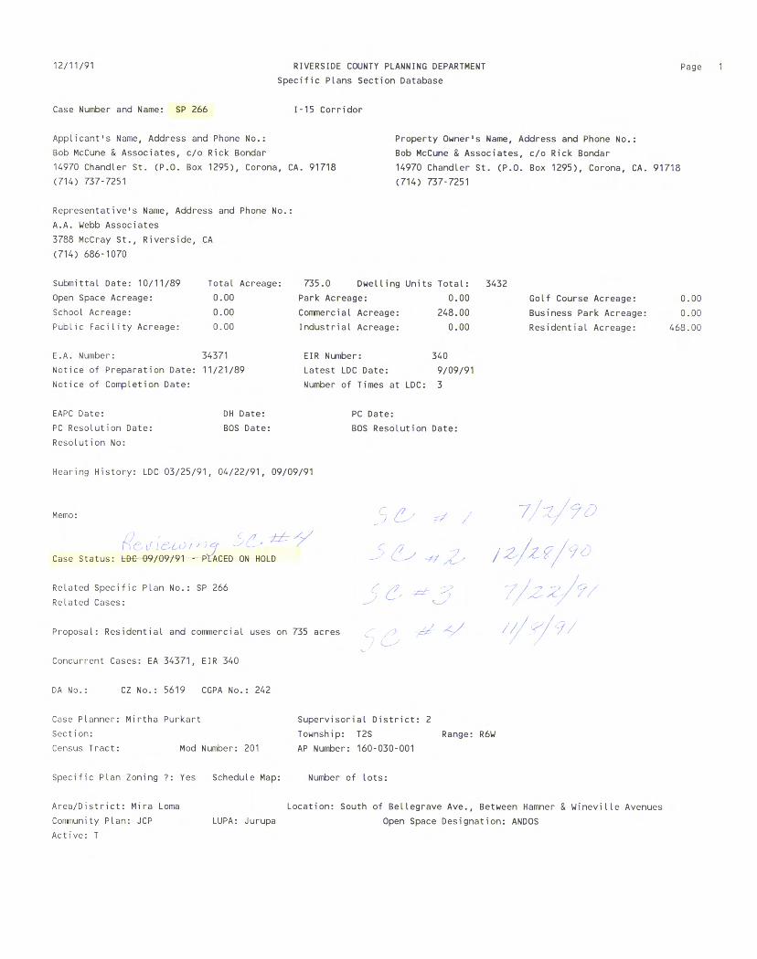
12/11/91 RIVERSIDE COUNTY PLANNING DEPARTMENT Page 1
Specific Plans Section Database
Case Number and Name: SP 266 1-15 Corridor
Applicant's Name, Address and Phone No.:
Bob McCune & Associates, c/o Rick Bondar
14970 Chandler St. (P.O. Box 1295), Corona, CA. 91718
(714) 737-7251
Representative's Name, Address and Phone No.:
A.A. Webb Associates
3788 McCray St., Riverside, CA
(714) 686-1070
Property Owner's Name, Address and Phone No.:
Bob McCune & Associates, c/o Rick Bondar
14970 Chandler St. (P.O. Box 1295), Corona, CA. 91718
(714) 737-7251
Submittal Date: 10/11/89 Total Acreage: 735.0 Dwelling Units Total: 3432
Open Space Acreage: 0.00 Park Acreage: 0.00 Golf Course Acreage: 0.00
School Acreage: 0.00 Commercial Acreage: 248.00 Business Park Acreage: 0.00
Public Facility Acreage: 0.00 Industrial Acreage: 0.00 Residential Acreage: 468.00
E.A. Number: 34371 EIR Number: 340
Notice of Preparation Date: 11/21/89 Latest LDC Date: 9/09/91
Notice of Completion Date: Number of Times at LDC: 3
EAPC Date: DH Date: PC Date:
PC Resolution Date: BOS Date: BOS Resolution Date:
Resolution No:
Hearing History: LDC 03/25/91, 04/22/91, 09/09/91
Memo:
,
Case Status: 09/09/91 - PLACED ON HOLD
Related Specific Plan No.: SP 266
Related Cases:
Proposal: Residential and commercial uses on 735 acres
Concurrent Cases: EA 34371, EIR 340
DA No.: CZ No.: 5619 CGPA No.: 242
Case Planner: Mirtha Purkart Supervisorial District: 2
Section: Township: T2S Range: R6W
Census Tract: Mod Number: 201 AP Number: 160-030-001
Specific Plan Zoning ?: Yes Schedule Map: Number of lots:
Area/District: Mira Loma
Location: South of Bellegrave Ave., Between Hamner & Wineville Avenues
Community Plan: JCP
LUPA: Jurupa Open Space Designation: ANDOS
Active: T
■ ,, 1-15 Corridor Specific Plan No. 266 Screencheck No. 2 Planning Staff
Comments
1. Specific Plan Zoning Ordinance should be included in its own section.
2. Specific Plan Section shall now be Section IV. L7-
3. General Plan/EIR to be Section V.
Please provide a more descriptive analysis on the SCE alignment.
V>1: Confusing. Doesn't the SCE alignment to Belgrand instead o Wineville.
V10. Numbers projected in the EIR matrix are not matching up to the numbers in the EIR.Iro-grt'
N(11. See Comment No. 10._f-- I S
V 1 2 . See Comment No. io.IIH /-6
\/13. Typo.
/14. Typo. J-7 1 -
\A5. See Comment No. 10.
16. See Comment No. 10. ■
17. Zoning Ordinance to be included in its own section and in proper format.
118. Provide measurements. 11_3
19. Begin Specific Plan Section with Project Wide Development Plans and Standards on next page.
/20. Please include a brief discussion on acreage of the park and 13
-84,1a4ple to be provided. It; La I- 7 7. Specific Plan boundary is not accurate.
8. This statement is not true. There are some planning areas') which exceed densities established in the JCP and there are , some areas in the plan that have changed land use `- ( designations. Statement should be corrected. cCh
-6 C ,c
Since the bio was prepared in November
school sites.
and not during the _
Spring months, it may create a problem.
2

i_;a6RA
1-15 Corridor Specific Plan No. 266 • Screencheck No. 2 Planning Staff Comments Page 2
21. SCE should be labeled as "Not A Part". elf- -
Planning area acreage for Planning Area 4 does not match up to Exhibit 111-15.
V23. Provide both gross and net acreage for each Planning Area. 24. Provide a subtotal of gross & net acres for residential
totals.
4 25. Add commas in correct locations.
Ny(26. Exhibit III-1 should be labeled Tabled III-1.
27. Why is Site Plan capitalized. V28. Provide a statement which says "The development of this146
project shall comply with all Riverside County Agencies".
129. This statement is confusing.
V30. What about Ordinance No. 348, State Laws?
3.\I( Delete'for."
Add a statement regarding the maintenance of commercial areas.
According to the Table of Contents, Implementation Programs is located in Section E.
I will check with Ron to see if the equestrian park can be included in the park acreage total to satisfy Quimby requirements.
35. Provide a cleaner copy of exhibit.
-V66. A bike lane is called out in Planning Area 15 but is not shown on Exhibit 111-2.
V37. Does the bike trail just begin at the on and off ramps?
38. It is difficult to interpret the Grading Plan since all the digits are not included in the elevation levels.
Ny49. Correct to 5' to 4'. 1E -2-3
40. Why is this berm located here?
41. Provide more detailed information on the Drainage Plan. Show

1-15 Corridor Specific Plan No. 266 Screencheck No. 2 Planning Staff Comments Page 3
size of pipes, topography, natural drainage patterns, existing and proposed Drainage Plans.
V42 Should be Section D, not Section C. 17T--
V7 . 43 Streetscape 3 & 4 are to close to distinguish from each other. 44. Why isn't there a landscape buffer adjacent to the SCE.
45. Provide a statement regarc34ng using reclaimed water for landscaped areas.
\/46. Numbers are to small to read. AA Y1 9. +i EIX(r
47. Provide two exhibits,,one for Phase I and the for Phase
.48. I will check with Fire to see if this statement is true. m_
Pa=c Aren't these improvements proposed in Phase IVZIE.?,-/
V50- Aren't these improvements proposed in Phase III? r
1151. Change Section D to E.
Vii;, This sentence is confusing regarding commercial intensity.
53. Provide a sentence regarding when the total buildout will /: occur.
54. Provide a better detailed Grading Plan. Show existing and proposed drainage, fill import/export, slopes. How will this effect the SCE alignment? Will SCE require temporary or encroachment permits? Provide a larger exhibit for the Grading Section. - Tv Ct C --- 2,1
55. Call-out all-fiumbers. 0 '
56. Provide the following statement: Grading be in conformance with the overall illustrative Grading Plan.
j57. Cross lot drainage is discouraged.
58. Change h to: All cut and fill slopes shall be constructed at inclinations no steeper than 2:1.
Include the following statement: The tops and toes of slopes higher than ten (10) feet shall be rounded with curves with radii designed in proportions to the total height of the slope.

1-15 Corridor Specific Plan No. 266 Screencheck No. 2 Planning Staff Comments Page 4
61. What about neighborhood park sites?
62. Provide a larger asterisk.
63. , The 2 right-in/right-out intersections are not shown.
64. The secondary right-in/right-out is now shown../
65. Entry monumentation is also shown on Exhibit III-39.0f -
4 66. Bike trail along Hamner Avenue n'eds to be called out.10:- tz__ )67. Not all accesses are shown as per Exhibit III-4. ?
1 68. See Comment No. 65. -
• 69. Correct Planning Area exhibit.
70. Provide 4 conceptual sitte plan exhibit of residential planning areas.
71. Why is this statement included when there are 18 acres of park area which satisfies Quimby requirements?-"7r
5-
9. Correct Planning Area exhibit. eXLJT -15
72. Provide a conceptual site.
, 73. Since there is only one access point, Fire may have a problems with this. ._,_,
. Provide a conceptual of the park site similar to Planning Area
\I 1 75. Secondary to be potential secondary.
69. Correct Planning Area exhibit, i.e., acreage total.
N/6. Primary and secondary accesses are not shown.
V7. Bike lane needs to be shown along "A" Street. 771.4CVL - 17-
08. This statement is confusing because Exhibit 111-47 does not0-6z show any perimeter fencing.
kf /Pi/C-7W - 1 (6 4-on of the park site and uses to be
included. Provide a conceptual site plan of park-efir: ti
1-15 Corridor Specific Plan No. 266 Screencheck No. 2 Planning Staff Comme ts Page
80. How large will these lots be? Provide an exhibit. --cti NI
81. Perimeter fencing in Exhibit III-10 does not match up to Exhibit 111-47.
‘--- . Correct Planning Area, i.e., correct streetscapes, wall
treatment locations label Wineville. _
82 ./Bike trail to be called out on Street "A" and Wineville.
83. Staff would like to see a cross section showing multi purpose trail, split rail fence, bike trail, street scape.
7cIAL(gAlt w 84. Secondary access is not shown. 117-- ,L. '::
85. How large will these lots be?
v86. Bike trail and.streetscape 2 along Park Center Drive needs to be called out.
\i(87. Typo.
V88. Typo.2ZZ-7/ • BR.' c---) .% ,rtr-zz_ ti21: 7 c; ,89. Remove state ent.
90. Provide brief description summary of park site.
IA . Bike lane is not called out along Park Center Drive.
69. Correct Planning Area exhibit. ilT75
\/92. What does this symbol represent?Vz -75 IkAA__01, c--z ,-
93. Include description of park site.
V:(4. Bike lane to be called out along Park Center Drive. e-x t,v--/a--
k,g. Change 4.81 to 4.8.
96. The primary access off of Park Center Drive is not shown or exhibit 111-27.
y/(97. How large will these lots be?
98. Delete No. 7.
69. Correct Planning Area exhibit.
7 7
S

99. Bik lane along Bellegrave to be called out.
100 . portion of 9) was deleted:0-Q) 9 69. Correct Planning Area exhibit.f, - tq-
Y/( IJK Provide a better copy.
Call out bike lane along Bellgrand.
1-15 Corridor Specific Plan No. 266 Screencheck No. 2 Planning Staff Comments Page 6
(104. Staff would like to conceptual site plans for residential planning areas and as well as commercial Planning areas.1E-- ,
05. Conclude drought tolerant plants in sentence./< -
oundary of K.O.W., show bike path, landscape easement is shown as 6' in the Circulation Element Section.
106. Show --2
V08. Show K.O.W., Bike path, Landscape Easement is identified as 6' in the circulation Element Section.
7 109. Determine Location of K.O.W.
110. Call out Bike Path along Hamner.10--?>
111. How high is perimeter wall? ( ek 112. Are there any elevations of major intersection plan? 6-Lk lr-y -;,
113. If this exhibit reflects the buffer adjacent to the freeway, shouldn't the wall be 8' high as according to the acoustical study. -7-77 -v-
34 114. ShouId to be shall.--f
115. Why isn't there a perimeter wall along the west side of Planning Zones 1 and 2.
116. Why isn't there a perimeter fence wall along the west side of Planning Area 7 similar to Planning Area 6 and
117. Why is this fence type different from Planning Area 5, 12 and 11?
118. Provide length of walI777ly?
105.1
107. Show K.O.W. of Limonite. eY- 1/L

131.
Nv432. Include uses. "TIT- (7
1-15 Corridor Specific Plan No. 266 . Screencheck No. 2 Planning Staff Comments Page 7
119. Typo
120. Dimension is confusing
121. After discussion with Dave, staff may not support a chain link fence along an eligible scenic highway.CA177 - _,s
Call out land use designations. -141- - 1 22_
V23. There is no such application as a Large Lot Tentative Tract // - / Map.
124. Include Final Site Development Plan/Plot Plan.-,
1/1‘. 3,023 to be 2,313.--r_IZI,
126. Aren't Agricultural Resources located on the subject site. T ey are according to Comprehensive General Plan.
/2.J r / -)u.?„?t_ -:, P ,; c ,- 4-1,- 0-c- t- L L',-t-, r- -7 tc-I-r7"-- ::.- \127. Show land use designation boundaries, map numbers.
IA8. Planning Area boundaries in EIR are not matching up boundaries . in Specific Plan text.
olimercigi-Acreage is incorrect. _ _ _
4 30. Specific Plan is proposing 2,313 dwelling units, not l,75-3,332.
—
133 Staff may have some concern regarding size of parks0_
34. County Engineer should be County Geologist and Building
./
Safety Grading Section:7'17:- ( 7 135. Change sentence to Road Grades shall not be greater than 15
percent.
136. Provide Planning Area boundaries on topography exhibit._
137. Correct
138. Screencheck No. 1 requested an exhibit to show the location of the 100 year flood plain.., where is it, or the reference to it.
1-15 Cor 'dor Specific Plan No. 266 Screenc eck No. 2 Planning Staff Comment Page - 8
139. Vhere did this statement come from? Confusing. jii
140. 72 to be 713127--27_,5
j 1. Should to be shall.
42. Include a statement regarding the noise analysis will be conducted during the development phase.-p7
V1 . Provide a total for Table IV-5. IV:- 3 )
44. Add comes. lu___- 3/
145. Any water conservation measures prepared? -r(7-
4 46. Provide a better detail & description summary reflecting the agricultural preserves in the vicinity of the project. c_ /_ ----
\f47. Last sentence in Project impacts contradicts mitigation.
148. Provide foot note for bio report.
449. The bio was prepared in November, which could be the reason wh there...yhy there were no sensitive species found.
c ',,_..C. "\_ a 0 ",c) . e-Stepheson Xangarsaca_Rat__not_fou _am-the-aft:tr.
1-15 is designated as an eligible state scenic highway. ---17l_q,-21-,, ja 1/ 152. A Paleontological Study must be conducted for the site. -Tv— --q L
153. Font appears to be wrong size:07-(//
\\/154. Numbers are not matching up to EIR patrix. 1- 2--(--t q
)5q,1. -c- --K (,, --71_,■f — _ ..___',/0-A'1155. Add Add Peak Daily Demand to table -
7( .
\p56. Aca. 5 I G -13C— 1 ci
1 total to acres.
\/157. Typo. RI
158. Scale to be provided on exhibit. V
159. 1 compute 1,928, not 1,931.
\460. Typo .
\pl. Does not match up with EIR

1-15 Corridor Specific Plan No. 266 Screencheck No. 2 Planning Staff Comments Page 9
162. Provide mitigation on page 162.1 163. xaa space below D-2. Program...—tv---8 164. Instead of D-2 above, put D-2 on page IV-79. -10-T-
vA.65. The site features medium, medium high and high density, not low medium.
166. Footnote should be 1.
t/J16. Road to be Transportation.-77 1;4,
FC:jb
SCREENCHECR NO. 3 I-15 CORRIDOR - SPECIFIC PLAN 266 PLANNING STAFF COMMENTS
1. Please make changes in TABLE OF CONTENTS (See SCK #3)
2. Page 11-2, Exhibit 111-4. SCE transmission lines traverse the site. Please provide a letter from SCE authorizing the project to utilize its facilities for access purposes.
Exhibit 11-2. Provide a map which exhibits section, township and range. Also, correct boundary of the proposed project.
-1z44;7zo
* 4. Page 11-6, item C. The proposed median should be created all along the easterly boundary of the project site, on Wineville Avenue.
\/. Exhibit 1V-7 does not show what the last paragraph of Page II-6 describes. Please correct.
• Page 11-6.
jj,LIRSLA. • the same map, draw the Planning Areas' boundaries.
- --1--. , ,45n project site that are still within Agricultural Preserve and "A"4.the year in which the Notices of Non-Renewal will expire. On
Please provide a map which exhibits the parcels within the
. .
(- 1,..;_t_ 7. Page 11-7. kika,...._ .. A Tht- :40 3' - C 0 -: S_s? ) ,)_„.1.,, . Abetc ayy- a =b-r-r-Ltk C3-S CikraW,I° LA. tak_ -
Name the Agricultural Preserve the project site is in. VZ/l s-
.m. Page 11-8. 9-et 8. Please review memo dated August 1st, 1991 from the Riverside tjI ge..v:etz County Engineering Geologist and address all the issues they le Ne expressed concern about. led2, _to;
Ck .k,./4k Cy
9. Page 11-8. _ Considering that that the site has been utilized for disposal of manures, a "Hazardous Substance Evaluation" should be conducted and reviewed by the Health Department.
10. Page II-10. The project site is approximately 2 miles southeasterly of the Ontario International Airport. Please provide a discussion about the impact the noise generated by Ontario Airport would have on the site. An acoustical study will be required at the development stage.
Page II-11, item 6., Page IV-27. Please prepare an Air Quality Analysis based on the AQAT model approved by the Environmental Protection Agency.
Please include a discussion about the temporary impacts that
11.
N
ac-rfic-; f--Qf .
—7301 S CL V`i f3c
a ‘') - D
will result from project construction activities. Also, provide a discussion about air quality impacts associated with development of the total project area. The discussion should include amount of motor vehicles emissions associated with the project, total vehicle miles travelled for the 1-15 Specific Plan, total annual electrical usage and monthly consumption of natural gas.
Please delete the last sentence of the "Impact" section: "As percentage of regional, emissions, the project related impact will be minimal, however, it can not be fully mitigated."
Please include the following mitigation in the Air Quality section: "The design of efficient and direct traffic flow patterns on the project site can help reduce the quantity of air pollutants generated by minimizing the places in the roadway system where automobiles would be idling unnecessarily."
12. Page 11-12, Section 8. Delete the paragraph under "Existing Setting" section. Replace it with a discussion about the proposed project site being used for disposal of manures and the hazardous substance evaluation required in item 9. of this list. Revise mitigation based on evaluation.
.4 kit ,041,444711cd
13.
Section 9. Open Space and Conservation (Impact) Delete the following: "The project is consistent with the Jurupa Community Plan's urban land use designation and \ consistent with the County's policy of phasing urban uses into.44,4 previously agricultural areas." Ap:A.4*.z4k_
-7e P i/icy:14, The statement made under Section 9., Open Space and Conservation, Impact, about SCE's 245-foot strip of land being used in the future for trails, would need a clearance letter from SCE. (PagI-12) .c-of A \j, cm„, v- tks,A) ,-, (11- u,&,(11 4.(_, Ax, cii_ayu,c,e__ c--)vv... .7S (15 Page 11-13, section 10. Discuss the type of crops grown on the site. Also, include a
V.cat discussion about the types of soils on the site, agricultural uses and Agricultural Preserves within 1/2 mile radius. Make a reference to exhibit IV-7.
14. See page 11-13 for revisions.
3 %,\ k NOT AN E 1A-7 Sectio
e revi
elat sar,15. Page The projec
5cc ,;c, 1-1 ,51,447aTeli ible Stat alt6,5„.04;trw, Plan. Ple
is traversed by Highway 15, designated _ cenic . .hway4n the Comprehensive General
section 13. ---
16. Page 11-14., Section 15. Circulation Please provide current and projected levels of service of existing roadways to be utilized by the project site. Include a discussion on number of proposed dwelling units and the
17.
/7a,ska-Ct ' re5 caeter LiA oere
sotw_ e5c-
rtC411.
number of daily vehicle trips these will generate. Also include a discussion on mitigation for each roadway to be utilized by the project.
Page 11-15, section 16. ToiV Please provide a clearance letter f om the Jurupa Community Services District in regards to water and sewer service.
Moreover, provide distance between the nearest water and sewer mains and the site.
Screencheck 3 states that" initially, the project will utilize the SARI line." Please explain what period of time would SARI line be able to be utilized.
In addition, provide a letter from Western Municipal Water District in reference to the utilization of the SARI line.
Please provide verification of availability of services.
18. Page 11-16., Section 20. Provide a clearance letter from the Jurupa Area Recreation and Park District regarding the in lieu fees for the 8.1 acre parkland.
A Riverside County Regional Trail runs along Wineville Avenue. The Riverside County Parks Department states that a 20 foot wide easement must be provided along Wineville Avenue within the project site. Please discuss this issue.
19. Page 11-18 and IV-84.- Section 25, Page IV-6. The project is located within the Ontario Airport Safety Clearance Zones. According to the Jurupa Community Plan, structure heights within these zones are limited as shown on page 124.19 of the Comprehensive General Plan. Please provide a discussion and proposed mitigation.
Also, provide an exhibit which shows proposed site and portion of site that is within the Safety Clearance Zone.
20. Page 11-17, Section 22. Discuss California Assembly Bill 939, how it would apply to your project, discuss proposed, mitigation.
al , s acts& ,A;;AL, )„.9„,..w.,3 pro f r
SZ-4,1/4")Cu'S.1 Include actor utilized to determine daily tons of waste by both landfills, Highgrove and El Sobrante.
Include number of units proposed.
Include average population that project would generate (ie.: population of 6,939 (2,313 d.u./3.0 person p/d.u.)
Discuss recycling and waste reduction centers.
Discuss possibility of inclusion of separate and enlarged trash enclosures to store recycled material.
Discuss possibility of installing trash compactors as a standard feature in new homes.
21. Page 11-19, Section 19 Under "Mitigations" state the following as the last sentence: "The Riverside County will review and recommend mitigation.
22. The heading in page III-1 should read "SPECIFIC PLAN ZONING ORDINANCE"
23. Page 111-19, Section p., item A. and Page 111-13, Section j., item A.
Change the minimum lot size from 6,000 square feet to 7,200 square feet. ,
24. Page 111-22. Please include: IV. SPECIFIC PLAN at the top of the page.
Also change A. Project-Wide Development Plans and Standards to B. Project-Wide Development Plans and Standards
Section 1. Comprehensive Land Use Plan. Include discussion about in lieu payment for parkland, provided Jurupa Area Recreation and Parks District agrees to it.
25. Exhibit III-1 Include proposed lot sizes, proposed number of dwelling units and proposed types of land use within each planning area.
Please include acreage, density (du\ac), and units (DU) in the legend.
26. Table III-1 (Page 111-24) Provide totals for each land use. Please See SCCK # 3.
27. Page 111-25. Please delete be in item
28. Page 111-26. Please include as item 3, under Residential Component the following statement: 3. Project densities may not exceed the density range specified for planning areas, except as provided for in Section E, Implementation Programs.
29. Page 111-27. A conceptual alignment of the proposed Riverside County Regional trail (20 feet minimum width) runs parallel to the project along Wineville Avenue. This multipurpose trail will allow both on-site and off-site residents access to the trail
system for walking, running, bycicle and riding. Please include a discussion about the manner in which the project would supplement the proposed trail. Please, prepare a conceptual plan. The Parks Department will review it and recommend mitigation. It is important to note that the development of such easement by the applicant would make her/him responsible of its maintenance.
State the name of the parks district (JARPD) that would be receiving the in lieu fees for the remaining acreage, provided JARPD agrees to it.
Include a paragraph about the Landscaping Plan section and Design Guidelines that will maintain landscaping within recreation areas.
30. 111-27. Recreation and Open Space Component Due to the location of the project site along major commuter routes and the considerable traffic the project would generate, staff requires that a park-n-ride facility be included within your project. Please include adiscussion about the proposed facility. Also include an exhibit with the exact location of such facility.
31. Exhibit 111-2. Please include bike trail along the southerly side of Bellegrave Avenue and easterly side of Hamner Avenue.
32. Page 111-30 Development Standards item d. The following statement: The project is not responsible for the bike trail on the west side of Hamner Avenue should be replace with: The project is responsible for the bike trail on the east side of Hamner Avenue.
item c Section D3 instead of C3.
33. Exhibit 111-4. In the legend, please darken the symbol for traffic signal.
34. Page 111-36, item 3. Drainage Plan, 2nd paragraph, Please replace "This plan should be adopted by the County Board of Supervisors ..." with "This plan is expected to be adopted...".
Also, include a discussion about the 100 year floodplain the project site is in.
35. Page 111-39, item 5. Water and Sewer Plan Provide exact distance between the nearest sewer and water line and the project site.
Has the sewage pipeline that connects to Etiwanda Avenue already been constructed, and is it operational? Please
LOP 31 4
.38. Exhibit 111-9 Please provide two separate exhibits, one for water and a second one for sewer.-77,
kVA-A A/662M 39. , Page 111-45, item 6. Public Facilities and Phasing Plan.
At what stage of development would price on the school site be ci negotiated? What kind of improvements would you provide P. A.
1 1514- r1J--14 with? Who will be building the school? Ple e contact the11 _L1
-? ,=_JP-2A--8"Chool district and address these issues. TQ- 0,Q__ a vo-tt-t-- tt 0L t c--ovagc-±—
40. Page 111-46, first paragraph state the exact amount Please of acreage for which in
() CaSX}{
tc 1 i
discuss.
Please provide a letter from JCSD confirming their ability to serve the site.
36. Exhibit III-8A Please make corrections along Bellegrave Ave. based on discussion we had in our meeting of August 22. (8 foot combination of pedestrian/biketrail + 6 foot landscape area + wall. Note that wall ought to be outside the 6 foot landscape area.
37. Exhibit III-8B, III-8C, Make corrections on parkway plans.
fees will be paid.
item e. Please replace "Any dead-end street system exceeding 1,320 feet in length shall require approval by the County Fire Marshal" with "The maximum length of any dead-end street system allowed by The Riverside County is 1,320 feet."
41. Please see Exhibit III-10 in Screencheck # 3.
42. Exhibit III-11 Include existing contour.
43. Page 111-57 Missing exhibit.
44. Page 111-58, item k. Please replace. It should read: "Any manufactured slopes greater than 10 feet may be allowed if they are recommended to be safe in a slope stability report written by a soil engineer.
45. Page 111-62. See screencheck No. 3 for revisions.
46. Page 111-62, item 6. and Page 111-64, item 7., Page 111-66., item 5.
Provide reasons as to why the easterly side of Hamner Avenue wouldn't be the adequate one for a biketrail.
rtAA )1-1-44 °-) 1/2-6
47. Exhibit 111-12. ,,
Include a perimeter wall a o
the easterly boundary Of 1 Planning Area 1 as shown on Exhibit 111-47. 4
Wruej.1. Page 111-66, 111-68, 111-80, 111-87, 111-93, 1st paragraph should read: The proposed maximum density is 5.5-,=, ms, A du/ac.
49. Page 111-66., item 5. Should read: A Class II bike lane will be provided along theiL ,-_, , south side of Bellegrave Avenue.
50. Page 111-68.
Include item 6. to read: A Class II biketrail will be located along the south side of Bellegrave Avenue.
51. Page 111-70 Please discuss the possibility of placing landscape along the boundaries of Planning Areas 1, 2, 5, 12 and 13 that face the freeway (I-15)..
52. Page 111-72, item c. Planning Standards, 1. Typo. See screencheck.
53. Page 111-76. Please discuss the multipurpose trail (regional trail) in the descriptive summary.
54. Page 111-78 Item 6. should read: " Class I bikelanes shall be located along the easterly side of A Street and along the north side of a portion of Limonite Avenue, from Wineville to A Street."
Item 7. should read: "A multipurpose trail, as depicted in Exhibit 111-2, will be provided along the western side of Wineville Avenue.
55. Page 111-81 Item 8. Please change "eastern" to "western"
Item 13., please include a statement about the bikelanes along Park Center Drive and Wineville Avenue.
56. Exhibit 111-21 Please make changes according to item 56. referenced above.
57. Exhibit 111-24. Please include theme wall along the easterly boundary of Planning Area 13.
7

58. Page 111-89.
a. Descriptive Summary Please discuss the various types of amenities the park in P. A. 14 will have.
59. Page 111-89 and 111-91, b. Land Use and Development Standards Please include the information that was previously included in Screencheck NO. 2, which is: "Please refer to Ordinance No. 348. (See SP Zon. Ord.).
11 60. Exhibit 111-25. Please pFovide dimensions of facilities within Planning Area 14. We_
61. Page 111-91 item 5. should read: "A multipurpose trail, as depicted in exhibit 111-2, will be provided on the western side of Wineville.
62. Page 111-93, item 1. The full intersection on Park Center Drive does not affect Planning Area 16. Please delete.
Item 8., please change the word "eastern" for "western"
As item 9., please include the following: "A Class II bike lane shall be provided along the south side of Bellegrave."
63. Exhibit 111-27 Please include the Theme Wall along the westerly boundary of this P. A. as shown in exhibit 111-47.
64. Page 111-96 In item 4., please identify the appropriate agency by name.
In item 5., please change the word "eastern" for "western"
As item 7., state: "A Class II bike lane, as depicted in Exhibit 111-2, will be provided along the south side of Bellegrave."
As item 8., state: "Perimeter fencing for Planning Area. 17 will be provided in accordance with the Wall and Fence Plan depicted in Exhibit 111-47.
In the descriptive summary, please include a discussion about the amenities that this park will offer.
65. Exhibit 111-28 Please include a sidewalk/biketrail adjacent to the site along Bellegrave Avenue.
Also, show the multi-purpose trail adjacent to the site.

Provide a conceptual site plan. Include dimensions.
66. Exhibit 111-29, 111-30. Please include width for interior commercial landscaping.
Also, provide a separate exhibit which shows the portion of Limonite between Wineville Avenue and "A" Street, which has a combination of landscape (6'), pedestrian/biketrail (8') and landscape (4').
67. Page 109. Discuss the multi-purpose trail.
68. Exhibit 111-33., 111-34., 111-37., 111-38. Please correct exhibit to show 8' for pedestrian/biketrail and 6' for landscape. Also include height of wall.
69. Exhibit 111-35. and 111-36. Correct exhibit to show the multipurpose (regional trail) adjacent to the project site along Wineville.
70. Provide a streetscape plan for "A" Street.
71. Exhibit 111-42., 111-43. Show height of perimeter wall.
72. Exhibit 111-47. Perimeter fence (chain link fence) is not adequate along the westerly boundaries of Planning Areas 5 and 12. Staff would recommend landscape along the westerly and southerly boundaries of Planning Areas 5 and 12, and along the northerly boundary of Planning Area 12.
73. Exhibit 111-49. Provide proposed height of wall.
74. Page 111-134. See screencheck 3 for corrections.
75. Please look at page IV-1 for revisions and corrections.
Exhibit IV-1. Provide a separate exhibit of the Resources Map.
77. Provide an exhibit of the Open Space and Conservation Map.
78. Exhibit IV-2. Include in the legend "High", "Medium High", and "Medium" for 1B, 2A, and 2B respectively.
79. Exhibit IV-3. Provide a larger map which allows to place acreage within each planning area.

80.
Junya- icIPA ,Oux,Ero
Please include in the legend the following information: use, acreage, DU/AC and proposed # of DUs.
Page IV-5. Screencheck #3 includes some of the land use constraints in the Jurupa Land Use Planning Area. Please discuss proposed mitigations for the impacts that your project will generate. Include a discussion about the 100 year floodplain area the project is in.
Include growth forecasts within the Jurupa LUPA. te.,4ew 4 44 Al ,0cyje.rf 7i5 .
Please see page IV-5 for further changes or additions:
tc.9.12- 94.
81. Page IV-6. Include Jurupa Community Policies: b, c, g, o and p.
Include Land Use Policies - Scenic Corridor, and discuss how your project reflects these policies.
82. See page IV-7. for changes or corrections.
83. Page IV-8. Category 1 - Heavy Urban Residential Policies Provide information regarding the partial incorporation of the project into an improvement district.
Please provide more information about the consistencies and inconsistencies of the project circulation plan with the County General Plan Circulation Element.
84. Please see page IV-9. Category 2 - Urban Residential Policies for corrections.
Page IV-10. 3. Commercial Policies Please delete item "h"
86. Page IV-11.
Please explain what sensitive land uses will be moved away from high impact corridors.
Include a discussion about the number of acres proposed for commercial uses as opposed to the number of commercial uses permitted by the JCP.
In your discussion on residential uses, include the project's proposed multifamily residential development (High - 8 to 14 dwelling units per acre). See page for further changes.
87. Page IV-13. Please review letter from County Geologist and implement his recommendations.

r
88. Exhibit IV-5. Provide an exhibit that shows clearly elevations and contours.
89. Page IV-29. Missing table.
90. Page IV-35. See item # 9.
91. Page IV-37., 10. Agriculture Provide the name of the Agricultural Preserve the acreage within the project site is in.
Indicate the parcels and Planning Areas within the project site that are within the Agricultural Preserve.
92. Exhibit IV-7. Please show on the map the year in which the Notices of Non-Renewal for those areas within Agricultural Preserves will expire.
93.
C_alZI-e A
Show the areas within the project site that are within Agricultural Preserves and indicate the year they will be coming out.
Provide a new exhibit which shows size of parcels located within 1/2 mile radius from the exterior boundaries of the project site. Use the following categories: Red 14-20 du/ac Purple 8-14 du/ac Dark Green 5- 8 du/ac Orange 2- 5 du/ac yellow .4- 2 du/ac light blue .2-.4 du/ac
page IV-40., item b., second paragraph Please provide a comparison between the proposed project's land uses and the designated land uses for the site by the JCP.
Please discuss the impacts of the reconfiguration the project proposes, and proposed mitigations.
Please delete the 1st sentence of the second paragraph: "The project proposal is consistent with the adopted Jurupa Community Plan which shows the site designated as mixed-use specific plan; however,"
94. See page IV-44. for corrections.
95. A paleontological study is required at this time. This study will be reviewed by the San Bernardino County Museum and mitigation recommended.
E ,J1
Cc
C--Lc ■,0--ersr st
w# 43(61;
0-011 99.
(kk, NikXk.rft— r4
age IV-47. Include a discussion for Etiwanda Avenue.
97. Please see page IV-77., IV-78, IV-83 for corrections.
98. Page IV-87. -3Xlso.44is
The Housing Lement has been update-daemandated ky State Law. The Revised Housing Element (revised on June 4, 1991) requires the implementation of affordable housing through Specific Plans. A Specific Plan should provide a full range of housing. Moreover, based on the amount of commercial acreage the project proposes, staff estimates that low income employees will be required, and therefore affordable housing will be needed. Staff requires that a socioeconomic study be prepared to determine availability of housing affordable to
"1>li _h_a_ArtJuko
,
— cuLL-ts_ /IV° a (.2 a
_ -
CoL 49_ u*,1ZA,
ci9_
p
—
those future employees. 35 /u_Igin-owr 0.AA 15--
10 Ft oai-162 Page IV-109 Information
J-Q12_-0-Ai
Ckl\k- -6Ac.cv(
'
1-1
missing.
-
<3( _ (3314tereszAr
ttcuPcoja,_
o )
A //
oc
\ C•le. 3

ALBERT A.
WEBB ASSOCIATES
AItaxikAakA, 3788 McCray Street, Riverside, CA 92506 (714) 686-1070 FAX (714) 788-1256
WO: 87-202 FILE: 2451.131
November 8, 1991
Ms. Mirtha Purkart Riverside County Planning Department 4080 Lemon Street, Ninth Floor Riverside, CA 92501
RE: 1-15 Corridor Specific Plan Response to County Comments for Screenchecks 2 & 3
Dear Mirtha:
As we discussed earlier this week, attached are our responses to the comments and requests for changes received from your department for the Screencheck Drafts 2 and 3 documents. This will aid you in the final review of the latest revision to Screencheck No. 3. We have indicated on the list the changes that were incorporated, and those where the changes were not made and the reasons they were not made. In certain instances where we have indicated that the changes were made, based on a request for additional information from your department, the additional information may have been added in a more appropriate location within the document. In the majority of the issues, however, the changes or additions have been made in the indicated location of the doctunent.
If you have any questions, call me at (714) 686-1070 or leave a message at (714) 247- 4517.
Sincerely,
Attachments
cc: Rick Bondar A. Hubert Webb, AAWA
NOV 0 19i
rievtttSIDE COUNTY PLANNING DEPARTMENT
MSW/LTRS/87-202/RTC
CIVIL ENGINEERING PLANNING ENVIRONMENTAL ANALYSIS SURVEYING ASSESSMENT/SPECIAL TAX ENGINEERING

Screencheck No.A
1-15 Corridor Specific Plan 266 Response to Planning Staff Comments (Mirtha Purkart) rivLaA9- k_ruz,,c
A . Changes have been made.
2. Comment noted. U3 L31,, SCE c_cAwsm-Q-Akli) cy,r cu)sttiOYzt ..t.,(1 )s?-- )V\"--(— °\( Y-CLre--Ck■ ANCtO C.-1•-tC2f.)._01;
V 3. Changes have been made.
4. The median is proposed only north of Limonite Avenue per previous discussions -
with the Board of Supervisors. Lk:4/.1/4-) A.._tt
Changes have been made.
6. Changes have been made. 0
7. Changes have been made.
8. Issues have already been incorporated.
9. In consultation with the County Health Department, manure is not considered to be
a hazardous waste; however, the document has been revised so that manure will be
taken off-site to a location already approved by the County.
10. An acoustical study was prepared for the project site which included 24 hour
monitors over different locations. None of the monitors identified any areas which
are currently impacted by noise from the airport.
11. A revised air quality analysis is currently under way. Ron Goldman agreed that the
Draft could proceed out of LDC and be circulated for the public review period while
awaiting the new air quality analysis to be completed.
12. See item 9.
MSW/LTRS/137-202/RTC/ATTI ATTACHMENT 1
b. The project is within context of the County General Plan policy of phasing
agricultural uses into urban uses as the surrounding development pattern and
infrastructure justify expansion.
c. The document will be revised by deleting this statement.
13. Changes have been made.
14. Changes have been made.
15. The project site is not designated as an eligible State Scenic Highway corridor. The
pattern on the General Plan identifies the future route of the freeway. Comparison
of this with the potential scenic highway routes shows that the line patterns are not
similar.
16. Changes have been made.
17. Jurupa Community Services District will respond with will-serve letters at site
specific review stages. Their concerns and issues will be addressed in the response
to comments after the public review period.
18. The Jurupa Area Recreation and Parks District will provide a clearance letter after
the Board has reviewed the proposal.
19. Structure height is not an issue, language will be added to the text.
20. Objectives to achieve waste reduction are discussed in the EIR, it is the County's
responsibility to implement Assembly Bill 939. Specific waste reduction methods
will be further identified at the project review stage when the proposed land use is
known. Factors to determine waste reduction have been added to the table. Trash
enclosures shall be designed so as to be consistent with County standards.
22. Changes have been made.
23. The proposed lot sizes are to remain the same.
PASW/LTRS/87-202/RTC/ATTI ATTACHMENT 1

24. Fees will be determined at time of development stage. Language has been added to
the text.
25. Too much information for this scale, information can be easily reviewed in other
locations of the document.
26. Changes have been made.
27. Changes have been made.
28. Changes have been made.
29. Width of trail is 12-15 feet and already existing. No expansion of the existing trail
is proposed. Developer/owner will install any required improvements, the County
is responsible for maintenance.
30. Changes have been made.
31. Bike trail will be added along Bellegrave Avenue.
32. There will be no bike trail along the east side of Hamner Avenue.
33. Changes have been made.
34. Discussed in the EIR.
35. Changes have been made. Sewage will be taken to the SARI line. Will-serve
letters will be provided at the site plan review stages.
36. Changes have been made.
37. Changes have been made.
38. Not necessary for clarification or for certification of the EIR, the existing exhibit
was given for review to the Jurupa Community Services District., and they are
satisfied with the exhibit.
MSW/LTRS/87-202/RTC/ATT 1 ATTACHMENT 1

39. Timing and development of Planning Area 14 will be arrange d through an
agreement with the school district. Premature at this point.
40. Changes have been made.
41. Changes have been made.
42. This was a request of the Building and Safety Department which has been satisfied
with a separate map delivered to their office. Scale is too small on existing contours
exhibit to add to grading plan, we tried.
43. Changes have been made.
44. This is a correct statement.
45. Changes have been made.
46. Changes have been made.
47. Existing chain-link fence will be maintained.
48. Changes have been made.
49. Changes have been made (class I modified).
50. Changes have been made (class I modified).
51. Already contained in the Planning Area descriptions.
52. Changes have been made.
53. Changes have been made.
54. Changes have been made.
MSW/LTRS/87-202/RTC/ATT1 ATTACHMENT 1

55. Statement is correct as now contained in the document. Should not be western
instead of eastern.
56. Changes have been made concerning Park Center Drive, does not apply to
Wineville Avenue.
57. Already there.
58. Developer is not responsible for the park, the Jurupa Area Recreation and Park
District will determine ultimate facilities.
59. Changes have been made.
60. Facilities are conceptual only, the Jurupa Area Recreation and Parks District will
determine ultimate facilities.
61. Trail will remain on the east side.
62a. Changes have been made.
b. 'This should stay "western" per subsequent meetings.
c. Changes have been made.
64a. Changes have been made.
b. Will remain eastern.
c. The bike trail on Bellegrave will be a class I trail, text has been revised.
d. No fencing type is being proposed.
e. Park amenities are the responsibility of the Jurupa Area Recreation and Parks
District, there is no indication what amenities will be planned there.
65a. Changes have been made.
MSW/LTRS/87-202/RTC/ATT1 ATTACHMENT 1
b. The multi-purpose trail is not adjacent to the site, exists across the street.
c. The Jurupa Area Recreation and Parks District will determine that facilities will be
located in this park. Pursuant to subsequent meetings, we have added text
addressing typical park facilities and the amount of land required. This text has
been added to the "Parks" section of the EIR.
66a. Width of interior commercial landscaping should be determined at the plot plan
stage to insure that the landscaping is designed in conjunction with the design theme
of the center.
b. The landscape sections do not change from other street sections already provided.
67. No landscaping is proposed within the multi-purpose trail.
68. Changes have been made.
69. The multi-purpose trail will stay where it already exists along the east side.
70. Already provided in Exhibit B1-32.
71. Changes have been made.
72. Existing chain-link fence along the freeway will remain, and will be enhanced by
the freeway buffer landscaping. Landscaping is not need along the north boundary
of Planning Area 12. Landscaping is already proposed along the south side of
Planning Area 5.
73. Changes have been made.
74. Changes have been made.
75. Changes have been made.
76. No need for a separate exhibit.
MSW/LTRS/87-202/RTC/ATT 1 ATTACHMENT 1
77. Changes have been made.
78. Changes have been made.
79a. The smaller vicinity map was provided per Frank Coyle's comment, the original
map was larger. Acreage is shown to illustrate changes to the land use pattern of
the Jurupa Community Plan, not to illustrate the planning areas. This is shown in
. another exhibit.
b. Changes have been made.
80a. Impacts are discussed in the appropriate section of the EIR.
b. Changes have been made.
81. Changes have been made.
82. No Eucalyptus trees are being proposed within Planning Area 5, other changes
have been made.
83a. Changes have been made.
b. Changes have been made.
84. Changes have been made.
85. In reviewing Policy H we felt that the project as designed is consistent with this
policy of placing commercial uses adjacent to secondary or greater highways.
86a. Changes have been made.
b. Changes have been made.
c. Changes have been made.
MSW/LTRS/87-202/RTC/ATT1 ATTACHMENT 1
87. Changes have already been implemented.
88. Changes have been made.
89. Changes have been made.
90. Unclear, couldn't fmd the change.
91a. Changes have been made.
b. Changes have been made.
92a. Changes have been made.
b. Changes have been made.
93a. This is not an agricultural issue, information is provided in other sections of the
document.
b. This is not an agricultural issue, information is provided in other sections of the
document.
c. This is a correct statement.
94. The site is not designated a scenic highway corridor.
95. Study has been prepared.
96. Pursuant to the traffic study, the project does not have a significant impact on
Etiwanda Avenue.
97. Changes have been made.
98. Pursuant to subsequent meetings, the socioeconomic study will be prepared at a
later date.
MSW/LTRS/87-202/RTC/ATT1 ATTACHMENT 1
99. This is correspondence that will be received during the public review period.
MSW/LTRS/87-202/RTC/ATTI ATTACHMENT 1

Screenchecks Nos. 2,3
1-15 Corridor Specific Plan 266
Response to Planning Staff Comments (Frank Coyle)
1. Changes have been made.
2. Changes have been made.
3. Changes have been made.
4. Changes have been made.
5. Changes have been made.
6. Changes have been made.
7. Changes have been made.
8. Changes have been made.
9. Changes have been made.
10. Changes have been made.
11. Changes have been made.
12. Changes have been made.
13. Changes have been made.
14. Changes have been made.
15. Changes have been made.
16. Changes have been made.
MSW/LTR3/117-202/RTC/ATT2 ATTACHMENT 2

17. Changes have been made.
18. Changes have been made.
19. Changes have been made.
20. Changes have been made.
21. Changes have been made.
22. Changes have been made.
23. Changes have been made.
24. Changes have been made.
25. Changes have been made.
26. Changes have been made.
27. Changes have been made.
28. Changes have been made.
29. Changes have been made.
30. Changes have been made.
31. Changes have been made.
32. Changes have been made.
33. Changes have been made.
34. Changes have been made.
MSW/LTR3/87-202/RTC/ATT2 ATTACHMENT 2

35. Changes have been made.
36. Changes have been made.
37. Changes have been made.
38. Changes have been made.
39. Changes have been made.
40. Changes have been made.
41. Not available at this design stage, will require additional coordination with
Riverside County Flood Control and Water Conservation District, as master
drainage plans are revised.
42. Changes have been made.
43. Changes have been made.
44. Buffers are generally used to protect land use incompatibility. In this situation,
there is nothing to buffer, and landscaping at the rear of developments is better
handled at the plot plan development stage.
45. Changes have been made.
46. Changes have been made.
47. We inquired at Jurupa Community Services District (JCSD) on what they wanted in
the exhibit. JCSD preferred the existing exhibit.
48. Comment noted.
49. Changes have been made.
50. Changes have been made.
MSW/LTRS/87-202/RTC/ATT2 ATTACHMENT 2

51. Changes have been made.
52. Changes have been made.
53. Changes have been made.
54. Without detailed development plans, more detailed grading plans are not available.
Necessary permits will be obtained from Southern California Edison if any grading
is proposed on SCE property. At this time none is proposed. The request for a
larger grading exhibit came from the Department of Building and Safety and a full
scale map was hand delivered to their office which satisfied their request.
55. Changes have been made.
56. Changes have been made.
57. Changes have been made.
58. Some slopes, especially flood control facilities require steeper slopes.
Manufactured slopes within planning areas will meet the 2:1 standard.
59. Changes have been made.
60. No change necessary.
61. Changes have been made.
62. Changes have been made.
63. Changes have been made.
64. Changes have been made.
65. Changes have been made.
MSW/LTRS/87-202/RTC/ATT2 ATTACHMENT 2
66. Changes have been made.
67. Changes have been made.
68. Changes have been made.
69. Changes have been made.
70. Changes have been made.
71. Changes have been made.
72. The proposed park has been eliminated from this planning area.
73. Changes have been made.
74. Changes have been made.
75. Changes have been made.
76. Changes have been made.
77. Changes have been made.
78. Changes have been made.
79. Changes have been made.
80. Changes have been made.
81. Changes have been made.
82. Changes have been made.
83. Changes have been made.
MSW/LTRS/87-202/RTC/ATT2 ATTACHMENT 2

84. Changes have been made.
85. Changes have been made.
86. Changes have been made.
87. Changes have been made.
88. Changes have been made.
89. Changes have been made.
90. Changes have been made.
91. Changes have been made.
92. Changes have been made.
93. Changes have been made.
94. Changes have been made.
95. Changes have been made.
96. Changes have been made.
97. Changes have been made.
98. Changes have been made.
99. Changes have been made.
100. Changes have been made.
101. Changes have been made.
MSW/LTRS/87-202/RTC/ATT2 ATTACHMENT 2

102. Changes have been made.
103. Changes have been made.
104. Conceptual plans for commercial areas not available since the product type is not
known yet.
105. Changes have been made.
106. Changes have been made.
107. Changes have been made.
108. Changes have been made.
109. Changes have been made.
110. Bike path along Hamner has been included in text and exhibits for illustration only,
not part of the specific plan.
111. Changes have been made.
112. Elevations of major intersection plans are same as entryway plans.
113. Changes have been made.
114. Changes have been made.
115. Commercial plot plans will incoiporate landscaping adjacent to the street and walls
only as applicable and necessary. This will be determined at the plot plan stage.
116. No wall is proposed to maintain view into commercial establishments from
Limonite Avenue.
117. Changes have been made.
MSW/LTRS/87-202/RTC/ATT2 ATTACHMENT 2

118. The length of wall is not known at this time, will be determined during development
stages.
119. Changes have been made.
120. Changes have been made.
121. This section of 1-15 is not an eligible scenic highway. Verified by Mirtha Purkart.
122. Changes have been made.
123. Changes have been made.
124. Changes have been made.
125. Changes have been made.
126. Changes have been made.
127. Changes have been made.
128. Changes have been made.
129. Changes have been made.
130. Changes have been made.
131. No change necessary.
132. Changes have been made.
133. Comment noted.
134. Changes have been made.
135. Changes have been made.
MSW/LTRS/87-202/RTC/ATT2 ATTACHMENT 2

136. Changes have been made.
137. Changes have been made.
138. Changes have been made.
139. Changes have been made.
140. Changes have been made.
141. Changes have been made.
142. Changes have been made.
143. Changes have been made.
144. Changes have been made.
145. Changes have been made.
146. Changes have been made.
147. Changes have been made.
148. Changes have been made.
149. Changes have been made.
150. Changes have been made.
151. 1-15 is not designated as a scenic highway, this was verified by Mirtha Purkart.
152. Changes have been made.
153. Changes have been made.
)43W/LTRS/87-202/RTC/ATT2 ATTACHMENT 2

154. Changes have been made.
155. Changes have been made.
156. Changes have been made.
157. Changes have been made.
158. Changes have been made.
159. Changes have been made.
160. Changes have been made.
161. Changes have been made.
162. Changes have been made.
163. Changes have been made.
164. Changes have been made.
165. Changes have been made.
166. Changes have been made.
167. Changes have been made.
I
INSW/LTR3/87-202/RTC/ATT2 ATTACHMENT 2

7/76-7 *,PARCEL,LIST
134 100 018 IRA
RIVERSIDE
OwNER ADDRESS (*-MAIL-PROP LOC, =-SAME) PROPERTY DESCRI
,_A PTION
1988-89
PAGE 3,365 *
DOCUMENT DATE / NO. ASSESSED LOT SIZE ZIP SALE DATE / AMOUNT VALUES IMP SIZE
/TAXES
- REAL ESTATE INFORMATION SERVICES -
1 ■4100-027-11563
134 1C0 018 BARTHELEMY_, H & ROLAND * C/O RoLAND BARTHELEMY, 494 S GLEN ALAN, WEST
59-005 * COVINA CA 91791 USE- PY 10.00 AC IN LOT 40 mB 012/006 Se KINGSTON TR ZONE- A2
-- Am PRESERVE CONTR-VACANT --
;o`.18 `181 10.00
134 100 019 BOS, TONY g MARY (Fl) 1/81 9001 NON 93,577 LND * C/O TONY & MARY BOS, 8919 mERRILL, CHINO CA 91710 998.02 /87
59-005 10,00 AC M/L IN LoT 7 MB 012/006 S8 KINGSTON TR USE- PX -- GIFT s ANTIQUE DISTRIBUTORS -- ZONE- A2
134 100 019 AKE VAN RyN, RICHARD S D e FARmS, 1)6*
59-005 VAN RYN, oBERT DE DIE USE-HD =6621 HAMER_ANE, CORONA CA 91720
REF.APN 000065481, 10.00 AC MA. IN LOT 7 ms 012/006 Se KINGSTON TR -- LIVESTOCK, DAIRY --
LND 10.00 56,252 T/F 2,350 8/P 58,609 NET
134 100 020 DOS TONY & MARY (Fl) 1/$1 900 SIT _%,707 LND * 8919 mERRILL, CHINO CA 91710 1/81 436,500 S 200,979 STR
59-005 8.69 AC M/L IN LOT 8 MB 012/006 Se KINGSTON TR USE- PX 255,686 NET -- GIFT g ANTIQUE DISTRIBUTORS -- ZONE- A2 3,035.30 /87
10.00
8.69
134 110 003 BOS, TONY DOS DAIRY DBA
59-005 * 6481 WINEVILLE AvE, MIRA LOMA CA 91752 USE-144 N 6431 wINEVILLCAVE, MIRA LONA
REF,APN 000013463, 86VL1 FIX 199886 DPP 170912, 80vL1FIX 758368PP 52060, DAIRY
▪ LIVESTocK, DAIRY --
8/80 9999% LND 101,144 T/F 222,694 8/P 323,838 NET
134 110 003 CRC6SLAND CREDIT CORP * P 0 BOX 58147 SANTA CLARA CA
59-005 A 6481 WINEVAM MIRA LOmA REF.ApN , BOS DAIRY
- MISC. LEASED EQUIPmENT
95052 USE-GTE
LND 55,306 B/P
134 110 003 DOS
•
641.8rwiTiEvnirE AVE, MIRA LOMA CA 91752 59-005 REF.APN 001515600, BOAT A -8837G5, 84vL1BoT 8122,
ELIMINAT 80 20 , 06" - BOATS
U S E - t.17. B
LNO 6,964 B
134 11U 006 FUNTENGA, GEORGE, TR g AGNES, TR WESTERN SKY DAIRY, DeA
59-005 = 6503 HAmNER AvE, CORONA CA 91720 78.20 AC m/L MN FOR NA 1/4 OF SEC 30 T2S R644 FOR TOTAL DESCRIPTION SEE ASSESSORS MAPS
-- GIFT & ANTIQUE DISTRIBUTORS -- 1 217 124 NET
134 110 007 KASBERGEN, NEIL, TR & MARTHA, TR 4/81 * P 0 BO x 444, miRA LOMA CA 91752
59-005 49.84 AC m/L IN FOR Nw 1/4 OF SEC 30 T2S ReSw FOR USE- Px ToTAL DESCRIPTION SEE ASSESSORS MAPS ZONE- A2200
-- GIFT & ANTIQUE DISTRIBUTORS --
69275 TRN 205,880 LND 49.84 1,510,021 STR
149,611 T/F 4,750 8/P
1,870,262 NET 19,319.10 /87
6/85 139515 NON
USE- PX ZONE- A2200 pHN-(714) 735-6358
254,443 LND 739,824 STR 105,874 T/F 120, B/p
7,
78.20
1/,782.10 787
E08
co,,....r TIM •C
PARCEL
134
1361
134
1341k
134 11
134 1
1361
134 1
13,
134 1
atcvar-,,)

6#1 Alta
Real Estate Data, Inc. Capri* ONO AN Rips Plesrved 800-327-1086
TAR AREA
LtJ M
pmcSAN t Oplis C:1172111611 TAT 5 le
UM • S9-062 014-371-3323 10. goilmaiNGLE !AN RESIO
v .930-ACRES
-A VICSI:Lia
AlleratrligOn9V0106 RIvEROALE T TACNtv- 400SOCT
DIVA
*43i
• poi LorriV141111
WOO
1ST-111 41% WWI
IN OVIOLCOM RIVERDALE • MORTGAGE INF
MN! It15.1AINIMI orrIVIZIER
14411,61 006 *MAW
I \
MI 4 71! t ill •44ffe*b liA L "7:10 CNN 913
gat 111101741 lied evigST2$146w
POlL 01.1: wr 130-ACRES NIS FO -.Alit 97
B 1 2 Real Estate Data, Inc.
ic7.1iNan, S9.00 3714.715-9937 10. Al -SI M. FAN AASI!,

Ill. * PARC& LIS1
160 020 009 TM
RIVERSIDE
OWNER ADDRESS (*-MAIL, X-PROP LOC, =-SAME) PROPERTY DESCRIPTION
1988-89
DOCUMENT DATE / NO. ZIP SALE DATE / AMOUNT
ASSESSED VALUES /•AXES
PAGE 6,057 *
LOT SIZE IMP SIZE
- MAL CalIPIIC mar vnivm I Iviv
1 -B00 -627 -9663
160 020 009 GORZEMAN, JOE 111 ELSIE = C/O JOE GORZEMAN, 12451 BELLEGRAVE AVE, MIRA LOMA
99-009 = CA 91752 47.69 AC M/L POR W 1/2 OF SEC 18 T2S ROW FOR rOTAL DESCRIPTION SEE ASSESSORS MAPS
▪ AGR PRESERVE CONTR-DAIRY
USE- PO ZCNE -A2 FHN-(714) 983-4567
62,264 LND 456, SIR
B/P 7, 11,
545 586 NET 6,05/.46 /87
47.68
160 020 010 MOCHO PLAA (PT) = 12421 BELLEGRAVE AVE, MIRA LOMA CA 91752
99-009
35.10 AC M/L IN POR W 1/2 OF SEC 18 T2S R6W roi TOTAL DESCRIPTIC SEE ASSESSORS MAPS
-- GIFT & ANTIQUE DISTRIBUTORS --
2/86 29244 STN
USE- PX ZONE-A2 PHN-(714) 685-8327
152,032 LND 303,552 STR 455 584 NET
4,770.20 /87
35.10
160 020 010 MOCHO PLAA INC = C/O MOCHO PLAA INC, 12421 BELLEGRAVE AVE, MIk/t
99-009 = LOMA CA____ USE-HWD REF.APN 39297, 35.10 AC MA. IN POR W 1/2 OF SEC 18 T2S ROW FOR TOTAL DESCRIPTION SEE ASSESSORS MAPS
-- LIVESTOCK, DAIRY --
LND 35.10 71,9T/ T/F 85,083 B/P 157,003 NET
160 020 012 VANDIEST, CORNELIUS & ANNA TATC) 12/86 * C/O CORNELIUS VANDIEST, 5907 E ALLINGTON, LW" _IX
99-039 *CA 90713 USE- PX 18.07 AC MVL IN POR SEC 18 12S ROW FOR TOTAL ZONE-A2 DESCRIPTION SEE ASSESSORS MAPS
-- GIFT & ANTIQUE DISTRIBUTORS --
334602 STN 72 453 LNO 18.06 79.66 /87
160 020 013 OOSTDAM, PETER 6 & JACCSA M = 4740 HAMNER AVE, MIRA LOMA CA 91752
99-009 33.69 AC MVL EN POR SW 1/4 OF SEC 18 T2S R6W HY USE- PX TOTAL DESCRIPTION SEE ASSESSORS MAPS
-- GIFT & ANTIQUE DISTRIBUTORS --
127,4 LND 33.69 247,2 SIR
7, 307„ NET
3,902.80 /87
1E0 030 ccn VERNOLA, PAT FRANK (MM) 2/84 42178 JTN 295,580 LND * 1604 N LAUREL AVE, UPLAND CA 91786 _60,917 STR
99-012 X 12080 BELLEGRAVE AVE, MIRA LOMA USE- PX 362,497 MET 61.49 AC M/L IN PO R NW 1/4 OF SEC 19 T2S ROW FOR ZONE-A2 3,834.76 /87 TOTAL DESCRIPTION SEE ASSESSORS MAPS PHN-(714) 982-9208
-- GIFT & ANTIQUE DISTRIBUTORS --
61.48
160 033 002 SOUTHERN CALIFORNIA EDISON CO * C/O C S REENDERS ASST COMPTROLL, P 0 BOX 800,
NON-TAX * ROSEMEAD CA 91770 USE- PX 16.91J AC NIL IN POR NA 1/4 OF SEC 19 T2S ROW FOR TOTAL DESCRIPTION SEE ASSESSORS MAPS
-- GIFT & ANTIQUE DISTRIBUTORS --
LW 16.90
160 030 003 VERNO1A, PAT FRANK (MM) 2/84 * 1604 N LAUREL AVE, UPLAND CA 91786
99-012 37.74 AC IN POR NU 1/4 OF SEC 19 T2S ROW FOR TOTAL USE- PX DESCRIPTION SEE ASSESSORS MAPS ZONE-A2100
-- GIFT & ANTIQUE DISTRIBUTORS --
42178 JTN 213,037 LND 37.73 2,253.38 /87
160 030 004 CITY OF NORCO (CR) * C/O CITY CLERKS OFFICE, P 0 BOX 428, NORCO CA 91760
99-012 1.00 AC MVL IN POR NW 1/4 OF SEC 19 T2S ROW FOR USE- PY TOTAL DESCRIPTION SEE ASSESSORS MAPS ZONE-A2100
-- AGR PRESERVE CGNITR-VACANT --
568 LND 6.00 /87
1 ,00
F03
001”.110I4T TIMM_
MIN 1-800-527-9663 PEAL ERTATF INFOPMATIM RERVInER -
1988-89
DOCUMENT DATE / NO. ASSESSED LOT SIZE ZIP SALE DATE / AMOUNT VALUES IMP SIZE
/TAXES
PAGE 6,074 *I
3' AO LNO 121.88
9,836.82 /87
LND 121.89
§,871 T/F ,997 e/p ,875 NET
312,759 LN0 428,650 SIR
T/F 53, B/P 804,4 NET 9,079. /87
52.70
WR g3;8$8 41; 8,mx. /87
57.45
a. - REAL ESTATE INFORMATION SERVICES -
1-800-827-9663
ARM. LIST RIVERSIDE
160 030 008 OWNER ADDRESS (*-MAIL, "-PROP LCC, m-SAME)
TM PROPERTY DESCRIPTION
.1 iC4
MAGNOLIA FARMS (PT) 1/77 * C/O BOB MCCLNE & ASSOC, P 0 BOX 1295, CORONA C 91718
99-012 77.74 AC M/L IN POR SW 1/4 OF SEC 19 T2S R6W FOR USE- PX TOTAL DESCRIPTION SEE ASSESSORS MAPS
-- GIFT & ANTIQUE DISTRIBUTORS --
177$ 643111 LNO 77.74 3,4 SIR
647, 7,088. 3/
160 030 009 STATE OF CALIF (XX) 9/86 230116 STN * C/O DEPT OF TRANSPORTATION, P 0 BOX 231, SAN
NON-TAX * BERNARDINO CA 92402 2.79 AC M/L IN FOR SW 1/4 OF SEC 19 T2S R6W FOR TOTAL DESCRIPTION SEE ASSESSORS MAPS
LND 2.79
160 040 CCn BOS GERRIT & MARGARET * ST WINEVILLE, MIRA LOMA CA 91752
99-012 21.89 AC M/L IN FOR NE 1/4 OF SEC 18 T2S R6WN FOR USE- PX TOTAL DESCRIPTION SEE ASSESSORS MAPS ZONE-A2100
-- GIFT & ANTIQUE DISTRIBUTORS -- F1v-(714) 737-2808
160 040 CCn SOS, JcHN A J e RANCH,_ DeA
99-012 = 4255 wiNEvILLE Rp, MIRA LOMA CA 91752 USE-4D REF.APNA100015326, 121.89 AC M/L IN FOR NE 1/4 OF SEC 18 T2S R6WA FOR TOTAL DESCRIPTION SEE A SSESSORS MAPS 80VL1FIX 185868 BPP 80156, 84VL1FIX 110644 BPP 136010
-- LIVESTOCK, DAIRY --
160 040 001 CROSSLAND CREDIT CORP * P 0 BOX 58147, SANTA CLARA CA 95052
99-012 0 4255 wiNEVI_____ _ i_LLERDmiRA LomA USE-GTE REF.ApN 000064402, 121.89 AC m/L IN pork NE 1/4 OF SEC 18 T2S R6WO FOR TOTAL DESCRIPTION SEE ASSESSORS MAPS, AJB RANCH
-- MISC. LEASED EQUIPMENT --
160 040 CO3 STATE OF CALIF * C/O DEPT OF TRANSPORTATION, P 0 BOX 231, SAN
NON-TAX * BERNARDINO CA 92403 ZONE-A2 18.02 AC MIL IN POP E 1/2 OF SEC 18 T2S R6W FOR TOTAL DESCRIPTION SEE ASSESSORS MAPS
LND 121.89 45,430 B/P
LND 18.01
160 040 004 mIRALOMA THOROUGHBRED FARMS (PT) 10/87 312487 FIN MIRA LOMA THOROUGHBRED FARM, DBA
99-012 * 12071 BELLEGRAVE AVE, MIRA LOMA CA s175e USE- AL A 12041 BELLEGRAVE AVE, MIRA LOMA ZONE-A210
52.70 AC m/L IN PoR E 1/2 OF SEC 18 T2s ROA FOR pHN-(714) 675-6289 TOTAL DESCRIPTION SEE ASSESSORS MAPS
-- AGRIcuLTuRAL-LIVESTOCK --
160 040 005 mIRALomA THROuGH3RED FARmS (PT) * 12071 BELLGRAvE AVE, KRA LcrA CA
99-012 N 12041 BELLEGRAvE AvE, mIRA LomA 54.70 Ac m/L PORE 1/2 OF SEC 1 8 T2s TOTAL DESCRIPTION SEE ASSESSORS mAps
- AGRIcuLTURAL-LINIESTOcK
10/87 312487 FIN 91752
USE- AL Row FOR NNE-A210
pmN-(714) 675-6289
324,598 LND 1C4,769 SIR 429,347 NET
4,719.14 /87
54.70
160 040 006 vERN0LA, PAT FRANK vERN0LA RANcm, DBA
99-012 * 1604 N LAuREL AVEupLAND CA N 12080 BELLEGRAvE AVEA, MIRA LOMA
57,_46 AC M/L poR SE 1/4 OF SEC 18 T2S R6W FOR TOTAL DESCRIPTION SEE ASSESSORS MAPS
-- GIFT & ANTIQUE DISTRIBUTORS
104
6/79 UC902402 050
91786 USE- PX ZONE-A2 Pt-(714) 982-9208
covvoire /1111• NC.
1988-89 rnimor
* PARCEL LIST
- REAL ESTATE INFORMATION SERVICES -
RIVERSIDE
1 -600 -52' ..9663
PAGE 3,367 *
5/84 10 5/84 1,900, LOAN- 1,575, USE. PO
ZONE... A2 PHN-(714) 947-.3939
4707 15,t00
2,591 LND 26.92 /87
1259 5.00
134 120 003 IRA
OWER ADDRESS (*.41AIL, #-PROP LOC, =...SAME) PROPERTY DESCRIPTION
DOCUMENT DATE / NO. ASSESSED LOT SIZE ZIP SALE DATE / AMOUNT VALUES IMP SIZE
/TAXES
134 120 003 HOGG, GENE PEARL (JT) * 8271 CHINO AVE,ONTARIO CA 91761
59-005 0 12531 SCHLEISMAN RD, MIRA LOMA 47.07 AC IN POR LOTS 29, 30, 31 & 32 MB 012/006 SB KINGSTON TR
-...• AGR PRESERVE CONTR-DAIRY ...•
135,664 LND 587,867 STR 64,179 T/F 54,091 B/P 84,1801NET
8,569.10 /87
134 120 003 IDSINGA, JAMES JAMES IDSINGA JR g SONS DAIRY, DBA
59.-005 = 12541 SCHL RD, MIRA LOMA CA _91752 USE-4440 VII 3627, 47.07 AC IN eDR_ LOTS 29_,_30, 31 •
& 32 MB i /006 SB KINGSTON TR 8ZVL1FIX 4IZ35 BPP 20978, 80VL1FIX 77436 BPP 34396
-. LIVESTOCK, DAIRY •....
LND 47.07 4,251 T/F 14,082 B/P 18,333 NET
134 120 CO3 IDSINGA, JAMES * 14701 SCHEMAN,___CORCNA CA 91720
59-005
REF,APN 001510438, 47.07 AC IN POR LOTS 29, 30, 31 USE-MBA & 32 MB 012/005 SO KINGSTON TR BOAT # .q854GE, CHALLENGE 18'06" 1978 CHEVY 325HP 1978
- BOATS
LNO 47.07 4,308 B
004 , PAT FRANK 134 120 TI2b: N LAUREL AVE, UPLAND CA
59-005 32.00 AC IN PCR SEC 30 125 R6W FOR TOTAL DESCRIPTION SEE ASSE4SORS MAPS
-. AGRICULTURAL-VACANT -.
6/79 UC902402 DTT 371,252 LND 32.00 91786 3,763.26 /87
AY ZONE-. AZ
134 120 005 VERNOLA, PAT FRANK 6/79 UC902402 DTT 232,033 LND * 1604 N LAUREL AVE, UPLAND CA 9I786 2,352.04 /87
59-005 20.00 AC IN FOR SE 1/4 OF SEC 30 T2S R6W FOR TOTAL USE- AY DESCRIPTION SEE ASSESSORS MAPS ZONE.- W2
- AGRICULTURAL-VACANT
20.00
134 120 007 VANDEN SERGE JACOB & GERTIE 8/68 75882 * 6715 WINEVILLE AVE,NRA LCMA CA 91752
59-005 33.02 AC MIL IN POR SE 1/4 OF SEC 30 T2S R6W FOR USE-AD TOTAL DE4CRIPTION SEE ASSESSORS MAPS ZONE-. A2100
-- WaRICULTURAL-DAIRY -.-.
152,224 LND 33.02 1,543.04 /87
134 120 009 TERMAATEN, CASE JR & CLEONE (JT) 1/70 * 11612 68TH ST, MIRA LOMA CA 9I752
59-005 # 11900 68TH ST, MIRA LOMA USE-PD 52.57 AC MIL Di POR SE 1/4 OF SEC 30 T2S R6W FOR ZONE... Al TOTAL DESCRIPTION SEE ASSESSORS MAPS
-... AGR PRESERVE CONTR-DAIRY -..••
2651 71,395 LND 176,737 SIR 248,132 NET 2,527.14 /87
52.57
134 120 009 MOLIA, RICK & DEBBIE 11/78 CRESTVIEW DAIRY, DBA
590015 = 11980 68TH_ST, MIRA LOMA CA 91752 USE-HWO REF.APN C00013960, 52.57 AC MIL IA POR SE 1/4 OF SEC 30 •2S R6W FOR TOTAL DESCRIPTION SEE ASSESSORS MAPS 81VL1FIX 32278 BPP 36062
— LIVESTOCK, DAIRY —
LND 52.57 22,862 T/F 22,174 B/P 45,036 NET
134 120 010 TERMAATEN,_CASE JR & CLEONE (JT) 11/46 * 11612 68TH ST, MIRA LOMA CA 91752
59-005 4.55 AC MYL IN FOR SE 1/4 OF SEC 30 T2S R6W FOR USE- PY TOTAL DESCRIPTION SEE ASSESSORS MAPS ZONE- A2100
-- AGR PRESERVE CONTR-VACANT --
G08
- RFAl FSTAIF INFC1RPAATION SERVICES - 1-800-S27-M3
COOPTINIIINT NC.

AMP ritsiny
* PARCEL LIST
160 040 007 IRA
- REAL ESTATE INFORMATION SERVICES - 1-000-527-NW
RIVERSIDE 1988-89
PAGE 6,075 *
WIER DOCUMENT DATE / NO. ASSESSED LOT SIZE ADDRESS (*-MAIL_#-PROP LOC, =-SAME) ZIP SALE DATE / AMOUNT VALUES IMP SIZE PROPERTY DESCRIPTION /TAXES
160 040 007 BOS GERRIT & MARGARET * 6421 WINEVILLE, MIRA LOMA CA 91752
99-009 .17 AC MIL IN POR NE 1/4 Of SEC 18 T2S R6W FOR TOTAL DESCRIPTION SEE ASSESSORS MAPS
1,235 LND 2.17
160 040 008 STATE OF CALIF (XX) 11/87 326124 STN LND 13.66 * C/O DEPARTMENT OF TRANSPORTATIO, P 0 BOX 231, SAN
NON-TAX * BEFNARDINO CA 92402 • 13.66 AC M/L IN POR NE 1'4 OF SEC 18 12S R614 FOR T01 -RIPTION SEE ASSESSORS MAPS
160 050 ccn VERNOLA, PAT FRAM( UC902402 D50 894,299 LND 139.32 * 1604 N LAUREL AVE, UPLAND CA 51786 2,642 SIR
99-012 139.33 AC MI& IN FOR NE 1/4 OF SEC 19 T2S ROAN FOR 896,941NET TOTAL DESCRIPTION SEE ASSESSORS MAPS
a 944 9,.46 /87
-. GIFT & ANTIQUE DISTRIBUTORS -- r. :714) 982-9208
160 05) 003 VERNOLA, PAT F & MARY ANN 10/82 UC901048 NON 244,018 LND 38.10 * 1604 N LAUREL AVE, UPLAND CA 91786 2,561.70 /87
99-012 38.10 AC IN FOR SE 1/4 OF SEC 19 125 ROW FOR TOTAL USE- AY DESCRIPTION SEE ASSESSORS MAPS ZONE-A2
--AGRICULTURAL-VACANT--
160 050 005 MAGNOLIA FARMS (PT) 1/77 1778 18.35 * C/O BOB MCCUNE G ASSOC, P 0 BOX 1295, CORONA C 91718 1 1)1192 V
99-012 18.36 AC MIL IN FOR SE 1/4 OF SEC 19 12S R644 FOR USE- PX TOTAL DESCRIPTION SEE ASSESSORS MAPS ZONE-A2
-- GIFT & ANTIQUE DISTRIBUTORS --
160 050 007 VERNOLA, PAT FRANK 6/79 UC902402 D50 69,752 LND 10.65 * 1604 N LAUREL AVE, UPLAND CA 91786 745.78 /87
99-012 10.66 AC MA- IN FOR NE 1/4 OF SEC 19 T2S R6W FOR USE- PX TOTAL DESCRIPTION SEE ASSESSORS MAPS ZONE-A2
-- GIFT & ANTIQUE DISTRIBUTORS --
160 050 012 SOUTHERN CALIFORNIA EDISON CO LND 23.90 * C/O C S REENDERS ASST COMPTROLL, P 0 BOX 800,
NON-TAX * ROSEMEAD CA 91770 23.90 AC M/L IN FOR E 1/4 OF SEC 19 T2S R6.' FOR TOTAL DESCRIPTION SEE ASSESSORS MAPS
160 050 013 SOUTHERN CALIFORNIA EDISCN CO LND 1.05 * C/O C S REENDERS ASST COMPTROLL, P 0 BOX 800,
NON-TAX * ROSEMEAD CA 91770 1.05 AC M/L IN FOR NE 1/4 OF SEC 19 T2S R FOR TOTAL DESCRIPTION SEE ASSESSORS MAPS
160 050 014 STATE OF CALIF (XX) 2/86 40213 STN LND 2178 * C/O DEPT OF TRAMPORTATICN, P 0 BOX 231, SAN
NON-TAX * BERNARDINO CA 92402 .05 AC M/L IN FOR NE 1/4 OF SEC 19 T2S R6W FOR TOTAL DESCRIPTION SEE ASSESSORS MAPS, EASEMENT FROM SO CAL ED
160 050 015 VERNOLA, PAT F & MARYANN (JT) * 1604 N LAUREL AVE, UPLAND CA 91786
99-012 39.12 AC MA. IN FOR SE 1/4 OF SEC 19 T2S R6W FOR USE- PX TOTAL DESCRIPTION SEE ASSESSORS MAPS
-- GIFT & ANTIQUE DISTRIBUTORS --
183,977 LND 39.12 2,288.96 /87
J06
coPveasr Ta*
- REAL ESTATE INFORMATION SERVICES - 1-S00-527-9643 ,
* PARCEL LIST RIVERSIDE 1988-89 PAGE 6,058 *
160 030 005 IRA
OWER DOCUMENT DATE / NO. ASSESSED LOT SIZE ADDRESS (*-NAIL, N-PROP LOC, =-SAME) ZIP SALE DATE / AMOLNT VALUES IMP SIZE PROPERTY DESCRIPTION /TAXES
160 033 005 HAMER PARK ASSOC (PT) 10/14/87 SWAN LAKE MOBILEHCME PARK, DBA 10/87 23,
99-006 * C/Q TATUM KAPLAN FINANCIAL, 924 WESTWOOD OLV NO LOAN- 19, * 919, LOS AnELES CA 90024 USE- Cl N 5800 HAMNER AVE, MIRA LOMA ZONE-RT
123.20 AC M/L IN FOR W 1/2 OF SEC 19 T2S R6W FOR TOTAL DESCRIPTION SEE ASSESSORS MAPS
- - COMMERCIAL PROPERTY --
SIT $,496,15i LNO F 13,7871 STR D 90, T/F
194, 48 B/P
ii45,77e1
123.20
160 033 005 JAEYONG, KIM LAKE KART, OSA
99-006 * 17215 MARYGOLD AVE APT 764 PONTANA CM 91752 USE-FJL 0 5800 HAMPERAVE,_MIRA LOMA
REF.APN 000003790, 123.20 AC M/L IN FOR W 1/2 OF SEC 19 T2S R6W FOR TOTAL DESCRIPTION SEE ASSESSORS MAPS
-- GROCERY STORES(EX CHAIN/SUP) --
LND 123.20 6,744 T/F 4,184 B/P
10,932 NET
160 030 005 HENRY, ELVIA L ELVIAS BEAUTY BOUTIQUE, DBA 1
99-006 * 1044 MEADOWVIEW CT CORONA CA 91720 jSE-ECEI 4 ft 5800 FIAAVELES,,MiRA Lg.% 5
REF.APN 00(O1618, 123.20 AC MIL IN FOR W 1/2 OF SEC 19 T2S R64 FOR TOTAL DESCRIPTION SEE ASSESSORS MAPS
-- BEAUTY a WIG SHOP --
LND 123.20 T/F B/P NET
I Is' • A
160 033 005 DUARTE, ALVIN A 8 W CART SHOP, DOA
59-006 HADD_EN, WALLY USE- FKC = 55U0 HAMNER AVE, MIRA LOMA CA 91752
REF.APN 000051648, 123.20 AC MVL IN FOR W 1/2 OF SEC 19 T2S kW FeJA TOTAL DESCRIPTION SEE ASSESSORS MAPS
- - STATIONARY/OFFICE SUPPLIES --
LND 123.20 585 T/F
2,703 B/P 3,2b, NET
160 033 005 HICKS, RICKY RAY & AUDREY MARIE (J7) * 127 DEL MAR CIR, MIRA LOMA CA 91752
99-0c4D6 N 5800 HAMNER AVE 127, MIRA LOMA USE- MP REF.APN 0:9702520, 123.20 AC MIL IN FOR W 1/2 OF ZONE-RI SEC 19 125 R6W FOR TOTAL DESCRIPTION SEE ASSESSORS MAPS MOBILE HOME 0 -LAE6511, 1967 GOLDEN WEST GOLDEN WEST
- - MMILEHOME PARK --
LND 123.20 24,990 SIR 245.54 /87
160 030 005 HASKINS, MATHEW It MARY LNO 123.20 = 5800 HAMNER Aygl 142, MIRA LOMA CA 91752
2310-0 99-606 REF.APN 0097ue522, 123.20 AC M/IL IN FOR W 1/2 OF USE- MP 7, SEC 19 T2S R6W FOR TOTAL DESCRIPTION SEE ASSESSORS ZONE-RT 16'884 NET MAPS VILLA WEST, GOLDEN WEST 1969 PHN-(714) 681-2376 164.52 /87
-- MOBILEH6ME PARK --
60 030 005 STEINQQNE, EVWN LND 123.20 1 = 58UU HAMNER AAA 199, MIRA LOMA CA 91752 20,357 SIR
99-606 REF.APN 0097U2529, 123.20 AC M/L IN FOR W 1/2 OF USE- MP 7,000-HO SEC 19 12S R6W FOR TOTAL DESCRIPTION SEE ASSESSORS ZONE-RT 13,357 NET MAPS ROYAL HOMES, MASDON 1970 PHN-(714) 685-8434 129.86 /87
-- MOBILEH6ME PARK --
G 03 cartoon TIM
LND 123.20 11,905 SIR
LND 123.20 21,200 SIR
7,nrar
* PARtEL LIST
160 030 005 IRA
- REAL ESTATE INFORMATION SERVICES - 1-800-627-9663
RIVERSIDE 1988-89
PAGE 6,0,3 *
000NER DOCUMENT DATE / NO. ASSESSED LOT SIZE ADDRESS (*-mAIL, N-PROP LO', =-SAME) ZIP SALE DATE / AMOUNT VALUES IMP SIZE PROPERTY DESCRIPTION /TAXES
160 030 005 W:LLIAMS, CAT Ng = 5800 HAmNER Ayg_st 378, MIRA LOMA CA 91752
99-606 REF.APN 009709725, 123.20 AC MIL IN POR W 1/2 OF USE- MP SEC 19 TzS R6W FO R TOTAL DESCRIPTION SEE ASSESSORS MAPS 65 UNIVERSAL,AURORA
-- moBILEH6mE PARK --
160 030 005 SEDLEB, DAVID = 5auu HAmNER AAA ?90, miRA LOmA CA 91752
99-606 REF.APN 00992z, '23.20 AC m/L IN POR w 1/2 OF USE- MP SEC 19 TzS R6w FO R TOTAL DESCRIPTION SEE ASSESSORS MAPS SKYLINE HILLCREST / VOL COIN TO LpT
-- moBILEH6ME PA( --
160 OM 005 pABRIZINSKy,_JOHN = muu
H R /WE I! 336, MIRA LCmA CA 91752
99-606 REF.APNA09709929, 123.20 AC M/L IN POR W 1/2 OF USE- MP SEC 19 TzS ROW FO R TOTAL DESCRIPTION SEE ASSESSORS MAPS FASHIONmANOR / VOL COIN TO LPT
-- mOBILEWME PARK --
LND 123.20 25,600 SIR
160 030 005 DENT911A DONALD D & SANDRA L (JT) = 58uu HAmNER AyEj, 227, KRA LOmA cA 91752
99-606 REF.APN 0097u9933, 123.20 AC m/L IN PT w 1/2 OF USE- PP SEC 19 T2S ROA FO R TOTAL DESCRIPTION SEE ASSESSORS MAPS DOMUS / VOL COIN TO LPT
-- mo8ILEH6mE PARK --
LND 123.20 29,200 SIR
160 030 005 DELISLE, CHARLES J = 58C0 HAmNER AVE,_MIRA LCMA CA 91752
99-606 REF.APN_00971cn11, 123.20 AC MVL EN POR W 1 /2 oF USE-PP SEC 19 Tzs ROA FO R 1CTAL DESCRIPTION SEE ASsi=s0RS MAPS 1987 GOLDEN WEST,PLATINU1
-- mOBILEHomE PARK --
UND 123.20 47,000 SIR
160 OM 005 DAviE,_MAURiCE & KATHRYN (JT) = 58uu HANNER AVE # 373, KRA LOMA cA 91752
99-606 REF.APN 009710181, 123.20 AC MVL IN POR w 1/2 OF USE- PP SEC 19 T2S ROA FOR TOTAL DESCRIPTION SEE ASSESSOR!. MAPS 1964 CASCADE / VOL COIN TO LPT
-- moBILEHemE PARK --
LND 123.20 24,000 SIR
160 030 005 GAERISCH,_JULIANN &IISA MARIE = 5800 HAmNER AVE 0 108, MIRA LomA cA 91752
99-606 REF.APN_009710261, 123.20 AC m/L IN POR W 1/2 OF USE- PP SEC 19 TzS 46W FO R TOTAL DESCRIPTION SEE ASSESSORS MAPS FUQUA / VOL COIN TO LPT
-- mOBILEH6ME PARK --
LND 123.20 25,000 SIR
160 030 007 SOUrHERN CALIFORNIA GAS CO LND 6534 * C/O H E GOODENOW, P 0 BOx 3249 TERm ANNEX, LOS
NON-TAX * ANGELES CA 93051 USE- PS .15 AC M/L IN POR SW 1/4 OF SEC 1912? R6w FOR TOTAL DESCRIPTION SEE ASSESSORS MAPS, seE 149-33-40 PAR 1
-- AGR PRESERVE CONTR-VACANT --
H04 COliTINSKI 111* INC.
- REAL ESTATE INFORMATION SERVICES - 1-800-527-9663
* PARCEL LIST
160 050 021 IRA
RIVERSIDE 1988-89
PAGE 6,076 * OWNER DOCUMENT DATE / NO. ASSESSED LOT SIZE ADDRESS (*-MAIL ,_N-PROP LOC, =-SAME) ZIP SALE DATE / AMOLNT VALUES IND SIZE PROPERTY DESCRIPTION /TAXES
160 050 021 MAGNOLIA FARMS (PT) 1/77 * C/O BOB MCCUNE & ASSOC, P 0 BOX 1295, CQRONA C 91718
99-012 5.04 AC MJL IN POR SE 1/4 OF SEC 19 T2S R6W FOR USE- PX TOTAL DESCRIPTION SEE ASSESSORS MAPS
-- GIFT & ANTIQUE DISTRIBUTORS --
1778 40,328 LND 416.56 /87
5.04
160 050 022 STATE OF CALIF (XX) 9/86 230117 STN LND .65 * C/O DEPT OF TRANSPORTATION, P 0 BOX 231, SAN
NON-TAX * BERNARDINO CA 92402 .65 AC MIL IN POR SE 1/4 OF SC 19 T2S R6W FOR TOTAL DESCRIPTION SEE ASSESSOCS MAPS
154,272 LNO 19.28 1,593.56 /87
160 050 023 MAGNOLIA FARMS (PT) * P 0 BQX 1295 CORONA CA 91718
99-012 19.28 AC MIL IN POR SE 1/4 OF SEC 19 T2S R6W FOR USE- PX TOTAL DESCRIPTION SEE ASSESSORS MAPS
-- GIFT & ANTIQUE DISTRIBUTORS --
160 050 024 STATE OF CALIF (XX) 9/86 230116 STN LNO 20.23 * C/O DEPT OF TRANSPORTATION, P 0 BOX 231, SAN
NON-TAX * BERNARDINO CA 92402 20.23 AC MiL IN POR SE 1/4 OF SEC 19 T2S R64 FOR TOTAL DESCRIPTION SEE ASSESSORS MAPS
160 060 001 CORRIE VANDERHAM DAIRY INC (Fl) 3?,935 LND 10.26 VANDERHAM, CORRIE, BEN & MARION A, BEN (Fl) 97,450 STR
99-012 * 4800 WINEVILLE RD, MIRA LOMA CA 51752 USE- PX 7,000-HO X WINEVILLE RD, MIRA LOMA ZONE-A2200 130,385 NET
1 ,27 AC NET IN PAR 1 PM 024/025 PM 6969 PHN-(714) 685-8354 1,392.98 /87 -- GIFT & ANTIQUE DISTRIBUTORS --
160 060 002 CORRIE VANDERHAM DAIRY INC (Fl) 39,691 LND VANDERHAM, PETER J, BEN & MARTHA, BEN (Fl) 91,555 STR
99-012 = 4800 WINEVILLE RD, MIRA LOMA CA 91752 USE- PX 7,000-HO 10,20 AC Mil_ IN PAR 2 PM 024/025 PM 6969 ZONE-A2200 124,686 NET
-- GIFT & ANTIQUE DISTRIBUTORS -- PHN-(714) 685-8354 1,333.64 /87
10.20
160 0e0 002 PETE VAN DER HAM DAIRY INC LND 10.20 * C/Q_SKAFF & KUCHER, 17835 VENTURE BLV, ENCINO 91316 77,948 T/F
99-012 X Quo WINEVILLE_RD, MIRA LOMA USE-HWD 38,174 B/P REF.APN 000038546, 10.20 AC MIL IN PAR 2 PM 116,122 NET 024/025 PM 6969
-- LIVESTOCK, DAIRY --
160 060 003 PETE VANDERHAM DAIRY INC (Fl) 10/82 176055 FIN 167,965 LND 42.82 * C/O PETE VANDERH14 DAIRY INC, 4800 WINEVILLE RD, 427,876 STR
99-012 * MIRA LOMA CA 91752 USE- PX 595,841 NET N 4860 WINEVILLE RD, MIRA LOMA ZONE-A2200 6,349.56 /87
42,83 AC M/L IN PAR 3 PM 024/025 FM 6969 -- GIFT & ANTIQUE DISTRIBUTORS --
160 060 CO3 CORRIE VAN DER HAM DAIRY INC = C/O CORRIE VANDERHAM DAIRY INC, 4860 WINEVILLE,
99-012 = MIRA LOMA CA 91752 USE-HWU REF .APN 000038847, 42.83 AC M/L IN PAR 3 F14 024/025 PM 6969
- LIVESTOCK, DAIRY --
LND 42.83 82,041 T/F 35,512 B/P 118,553 NET
K04 COPTMO4T Tall NC.
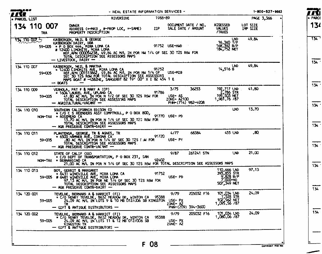
- REAL ESTATE INFORMATION SERVICES - 1-800-527-9663
* PARCEL LIST RIVERSIDE 1988-89 PAGE 3,366 *
OWNER DOCLMENT DATE / NO. ASSESSED LOT SIZE ADDRESS (*4011, N-PROP LOC, =-SAME) ZIP SALE DATE / AMOUNT VALUES VIP SIZE PROPERTY DESCRIPTION /TAXES
LND 49.84 16,360 T/F 168,392 B/P 184,752 NET
134 110 007 TM
KASBERGEN, NEIL & GEORGE KASBERGEN DAIRY, DBA
59-005 * P 0 BOX 444, MIRA LOMA CA 91752 USE-F WD I 12400 LIMAN.* 'AM LOMA
REF.APN 000054433, 49.84 AC WL IN POR NW 1/4 OF SEC 30 T2S R64 FOR TOTAL GESCRIPTII34 SEE ASSESSORS MAPS
-- LIVESTOCK, DAIRY -- LND 49.84
14,516 B 134 110 007 KASKRCAN, NEIL S MARTHA 59-005 * 1c4OU LI16TE AVE, MIRA LOMA CA
REF.APN 51336Z, 49.84 AC WL IN POR NW 1/4 OF USE-MZB 91752
SEC 30 S R6W FOR TOTAL DESCRIPTION SEE ASSESSORS MAPS BOAT A -438211E, SANGERBT 82 19' CKY' X I 82 454 1 E
- BOATS --
134 110 009 VERNOLA, PAT F & MARY A (CP) 3/75 36253 192,717 LND 41.80 * 1604 LAUREL AVE, UPLAND CA 91786 2,786 STR
59-005 41.80 AC M/L MN POR N 1/2 OF SEC 30 T2S R64 FOR USE-AS 195,503 NET TOTAL DESCRIPTION SEE ASSESSORS MAPS ZONE- A2100 1,981.76 /87
--AGRICU-11JRAL.-VACANT-- PHN-(714) 982-9208
LND 13.70 134 110 010 SCUTHERN CALIFORNIA EDISON CO * C/O C S REENDERS ASST COMPTROLL, P 0 BOX 800,
NON-TAX * ROSEMEAD CA 91770 USE- PO 13.P0 AC M/L D4 POR N 1/4 OF SEC 30 T2S R6W FOR TOTAL DESCRIPTION SEE ASSESSORS MAPS
▪ AGR PRESERVE CONRR-DAIRY
134 110 011 PLANTENGA, GEORGE, TR & AGNES, TR 4/77 68384 455 LND .so * 6500 HAMNER AVE, CORONA CA 91720
55‘.005 .80 AC MVL IN POR N 1/4 OF SEC 30 T2S rJw FOR USE- PY TOTAL DESCRIPTION SEE ASSESSORS MAPS
-- AGR PRESERVE CCNIIR-VACANT --
134 110 012 STATE OF CALIF (XX) 9/87 261241 STN LND 21.00 * C/O DEPT OF TRANSPORTATION, P 0 BOX 231, SAN
NON-TAX * BERNARDINO CA 92402 21.00 AC MA. IN POR N 1/4 OF SEC 30 T2S R64 FOR TOTAL DESCRIPTION SEE ASSESSORS MAPS
134 110 013 BOS, GERRIT & MARGARET 110,666 LND * 6431 WINEVILLE AVE, MIRA LOMA CA 91752 393,855 STR
59-005 I 6481 WINEVILLE AVE, MIRA LOMA USE- PD 9,828 B/P 97.13 AC MA- DI POR NE 1/4 OF SEC 30 T2S R64 FOR 7,000-HO TOTAL DESCRIPTION SEE ASSESSORS MAPS 507,349 NET
-- AGR PRESERVE CONTR-DAIRY --
97.13
134 120 CCM TEVELDE, BERNARD A & HARRIET (Fl) 9/79 205032 F16 101,034 LND 24.09 * C/O HENRY TEVELDE, 8632 MEADOW CR, WINTON CA 95388 1,528 STR
59-005 24.09 AC M/L IN LOTS 9 & 10 MB U12/J06 SB KINGSTON USE- PX 102,562 NET TR ZONE- A2 1,095.56 /87
-- GIFT & ANTIQUE DISTRIBUTORS -- PHN-(209) 394-3600
134 120 CO2 TEVELDE, BERNARD A & HARRIET (Fl) 9/79 205032 F16 101,034 LND 24.09 * C/O HENRY TEVELDE, 8632 MEADOW DR, WINTON CA 95388 1,030.06 /87
59-005 24.09 AC M/L IN LOTS 11 & 12 MB 0 1 2/006 S8 USE- PX KINGSTON TR ZONE- A2
-- GIFT & ANTIQUE DISTRIBUTORS --
F08 COPYMNINT TOW INC

C1=0 .04 -11kfLIT-11J3
• OLt03
2AnTA114:rt BEk Ot.-- ;-A
• lar M. 0 SI
VI CD
VI C.)
•00.112 Si •et. e0. 0
iSISYultri
3UM3V A $13KMAH clA
VA
RIACI 0S-S-A
reia v
Z1 6 n
ttsi
551Pq '101 HP%
gl=
5D'
I g' 44
731
ATZ
1Q
i00
wz
3111
0 BO
VIIV
IO
'4 9^'

1(0151■144 nAls
GENERAL NOTES OWNER GUNGE 'mum 12774 CL01E05I4E fn. COMM. CA . 91720 (0091 731-131334
APPLICANT 6760207 1016304 12774 11.041110.6.7 22005(6 CA. RIM MOW 737-0134
NGINEER A. 3f89 4050114115
3768 14211140 1117(1 111301161141 21411r0041.4 92506 Re Mom 606-1070
A.P.N. 134 OW 011
ACREAGE 11.17 AC. 61050 23.40 Ac.
Lop USE f11161116 141.0 A111104. RAC 1111111.10 IMP 1.C.C: (X•AliclAt
turna irma, A-,10 2202020101(286 411 £125220122112431 64.01 30622202208 AG f My a /WM= 301(1141 14441309I65411134 C
UTILITIES MAIM • ...PA C414441111 1E05105 2115011E1 abIR - JPLPA C144411114 511141115 0001112 GAS - 1411114111 CAL PONS, SAS MAW,/ 11(7186. • 1111112110 70617111411 4022001 111(001 • 70C1( 27 MA. 2f1f7151101 1n01011144 302211111111
SCHOOL DISTRICT (711340134403) ItalrUn S0M. 11151111171
NOTES 1. IOW 110435 IVISS. 6411 20516 PAGE 685 14617 T. 11000 Mr A MLA Of MINIM. 110000..
GENERAL PLAN AMENDMENT VICINITY MAP
NOT 10 SCALE
GFIAPIIIC SCALE I"-200
200 0 200 400
640122304 W 11622(0 25 2,25. It 7s. 5041 (46 4244 PAWL 3 Of 101 611.46 £034413002 Ms. 3337 frcurf 4441410, 24. 251
19111114411 714 230/6 11114M111 11111341 CA
ALBERT A. WEBB ASSOCIATES CIVIL ENGIN:Sin
3720 100144 II. 11l4626111 cA. 62.441 1.31 SIG-1070
AISIY3sT11 DV
Cl. VENDA L E ROAD MeN6g6 FON PER 363765
.12.43.36. 22. , 4941.
0 IOW PEll 149 4700
7071146 RU1
ittv
'
• 0440
\SAGLE FAllEsce TIAL TRA
ICT /ND. 25.20
1116•.40,
RA /Nu. N213E20-
5A1(E r - 300•
11414: I/24/2000
RUM
01111,1D Fli •
.4211
of 1 !(II
ows IAA
UMW,. PIA

IN ROAD CLOVERDALE PER NS 3766
GENERAL NOTES OWNER GESTIGE Mroll ■ 12774 721.971092 CORO.. CA. 01730 NOW 737-13834
APPLICANT GEOFICE HVIACIA 22774 7204941141 fr) matt CA. BIM 15094 737-0034
fNGINEER ALOEFIT A. WOO ASSOCIATES 37190 WOW/ SWEET RIVERSICE. CAL IFORNIA 82506
10041 686-1070
A,P.N. 134-090-011
ACREAGE
1337 AC. MISS 14.18 AC. PE
IAND USE EXIST MG LAW La: 4410701 RTRAI INIXOSCO LAND LSE CO.C/CIAL EXISTAG 704114 A-2-10 FOLITOSIO 209174.. C-I
UTILITIES - .ArtrA 0044M17 SEnvIcis OIstnICI
MLR - .13APA ETNAN/IY SIMICLS GAS - SOUI/f/AV CAL 2200974 cAs 100e401 ELE2I410 - scEMENN 120 1(910324 EOlsori 2E9I00E - 73.21(40 0019 1(11715004 12013111441 000E97024
SCHOOL DISTRICT cona.-wyro WC. OISMICI
NOTES 1999 NOUS G. NAP DOM PACE 600 0410 OS.
2. fiCTID 7000 g AfrA CC MOTU. !LOCOING.
1..200' GRAPHIC SCALE
?PP 200 • 400
VICINITY MAP hOT TO SCALE
NM NM NM ■MMMI MIN INN 11111111111111111■1111.1
REVISIONS Gulf
OfSKER FBI APH1040
206. 00. 99700 Ivo
CHANGE OF ZONE
PORTION CS YMCA. a T. RS. R. 70, Sax OEMS PAR= 3 or LOT 1 4719 30.96 01901 /6. 3041 k19C14910 302207 it I.Itt
INSIFUENT /O. 24078 014 RIVUISITC AUNTY. CA .
SCALE: /* 200• ALBERT A. WEBB ASSOCIATES CIVIL ENGDEERS
3708 *OW ST. flIVCRSIDE CA. 02506 MOW 605-1070
MU. 11 4
4971 I/1472000 latE1
OF I SIC IRACEIS
49.041' 9 49.4/'
FLTTLITE ATTI
R42#e_17)2.' ko3e..3a•
on• s. ■■ • r
f RA C r N D. 2E3520 `NGLE 7. e.17I 7141. DEA, 14-1'
RA r No. $f.
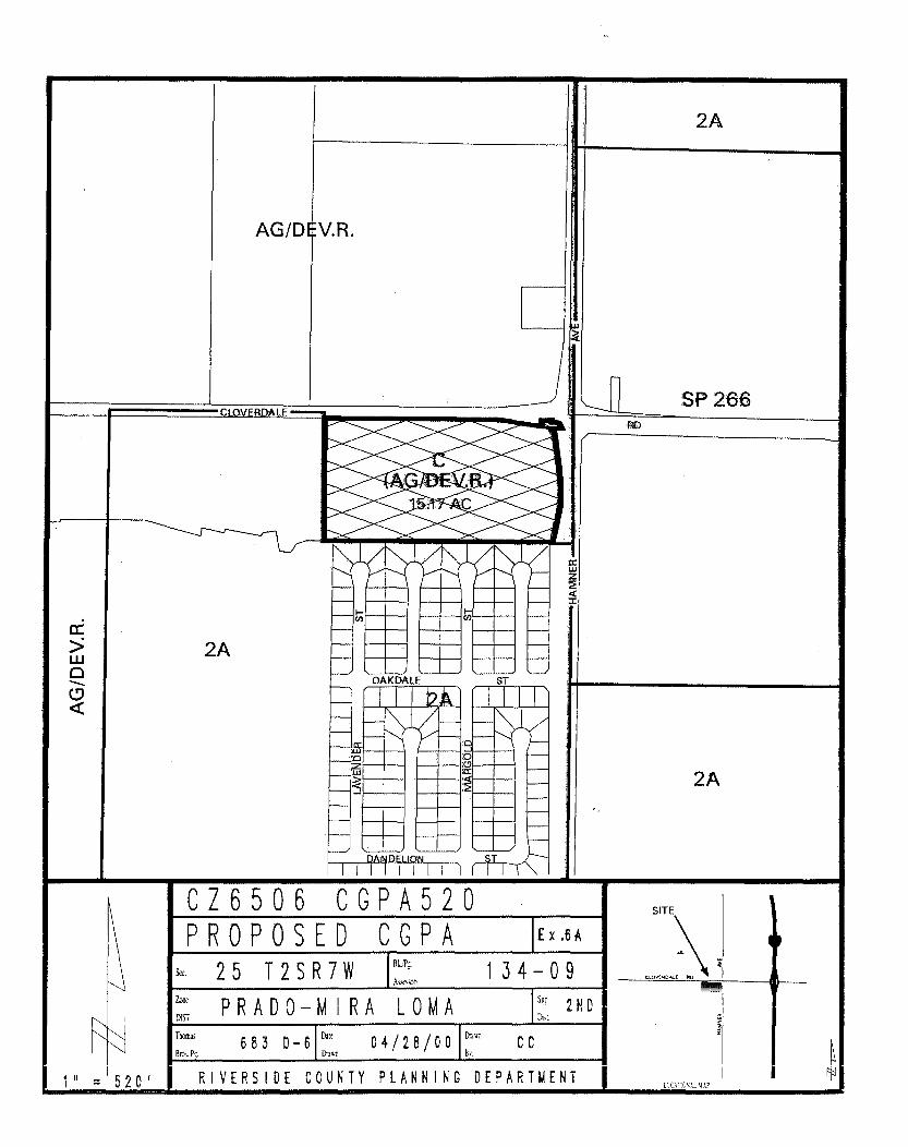
OAKDALE ST
r
2A
AG/D V.R.
SP 266
2A
C76506 CGPA520 PROPOSED CGPA Ex.6A
13k1Pi, .
A SON 134-09 25 T2SR7W
Z"" PRADO-MIRA LOMA DIST
S ". 2 ND
Thomas Dnuil
Bros. PL 683 D-6
Dm 04/28/00 CC
" = 520' RIVERSIDE COUNTY PLANNING DEPARTMENT
SITE
CLOVE.ALE
LCC ;Tr MA?

mopiligleW ao *MS! PINso r." 11111111111.*Warg
r t,)
P
Po
5k S
r - ..,-. 1 .. r t_._ .4 1
"KW lirl... • * I -a- 1 _4‘04 •411111
11100PP -- PROM - -- ar•wom 000.00-1"2"1"1"LV 1.01•00
TYPICAL SECTION ARTERIAL. umot4 HISHMAY ;COIF= SW. AD. 1004
CIOTZEDAll ROAD Ins
LAIC Mgt AC 41724 IF /111.0.1ha SV.010 SP SIAM 3E0/1 WEAN PARSEE TER nrai-N1 4 IC
balViQQ0
Tregik ggrigY , iam04:4 7 144
VICINITY HAP NE ID sEasS
GENERAL NOTES
1.0VgROALE
OWNER /0.10AC
Ens C104,00.1 /1). 09041. CS Was woul w-aus.•
APPLICANT MOSE
0.0.5 10774 5.0005z 114
;IN C0040 0. I1720
717-004
ENGINEER '''`"LWIWILoW AIM • NM •99E1•115
• 0010.1 &WET 1111131SIDE 0114044111:001 • 11319 0149-909
A.P.N. spo-geo-ol,
ACREAGE 19.17 IS. 1440 AO. SET
LAND USE EADMAS LAW WE MUM row PROPOSED Loa me amosERLIPS SPEW SC0D41 5-7- 10 11,10P00 1000 51.11.
MUMS afflaffilo 070001, 1010107 0501110 44111,4 0914011, 094043 016100 113.11415 7$00044 0.01 00.00 009010 C5.10001 00. Aor.JF1C 501111201. 011290101
SCHOOL DISTRICT 005410917 111171110 50545. DISMICT
PARKErr_ 7117 0755)0
toRestortios
011114 11001 Sol • TC791C 1111.01 SEEsEurst
(621 R-T
TRACT Na 28620 e. va - CT R-T
2620-1 M.. 275/ 11 1
NJ "kit
Pe 1-,..11
NOntoS
I. 54,1 9047004ENTS 110.1. 0 57 03417517 9' 01105511005 INAD•101Z 407.
S. WOO DONS SOS 1 19. • 11100 SO SW Cc
MTh POP WES MU P5I141 DC DOM 0:7011145.1 50050 • 1NE500 555557
4. Kt Law me as nom vans anew= otnu I. 17020 205 C 095 Cr 0141100 411940•4
I. 11119404 ILOCO TO 140005 . 1.1009 400. 01.00041 ID 0114000 047 191919100.16.
7. 0110 044.5 0 1.1010TO 04 U0501101 010 MOMS meat poiD! 77.4705 0110014• Oern•
P. .(1) 11420MS 1491.110001 01.11114.
9. MI PYISTOI B7055705 OC TO 0 10000 NM IDE
E. WE 19 hOT SAW YP 1111105.1101 0001 55055. 55110.
Al. OK/ IS 004.317 TO &mows., 0401141104 DI 11000 WW1.
10111SET 01 40! 01004 • 55.011
I1. 40 11.111111.10.1 IST1C abaft 111540110. n_s 04 MEWED PLR RE SM.
St IV INt.1044111 10MOW.
11110707) SCALE
100
1941•901
PLOT PLAN 57107 5 100701 II T. 40. 9. 70. 910
PACO 9 0 TOT IDE 45510011 NI. WO MEMO= APIARY Pi Sea. ZpanossENI to. DEE DA 37110213E awry.
AIJERT A. MO 15555501I11 0591101
Pp. opos. W. muss. omo OM 07.
01.110410
0,6 011W1 1
11.0

WALDRON
JAMIN S WALDRON
GARET 6586 WINEVILLE AVE MIRA LOMA CA 91752
157112005-6
WALDRON BENJAMIN S WALDRON MARGARET 0 6586 WINEVILLE RD MIRA LOMA, CA 91752
KENNEDY 0 KENNEDY MARY 6624 WIMEVILLE AVE MIRA LOMA CA 91752
CHAI SWO MEI CHAI SWO UN C/O KANIBLE CHAI 2418 VIA MARINA NEWPORT BEACH, CA
157181001-6
157181004-9
ET AL
92660 157250010-7
HETTINGA
WILBUR 5240 HAMNER AVE ONTARIO, CA
91761
160020007-8
SOUTHERN CALIFORNIA EDISON CO C S REENDERS *SST COMPTROLLER P 0 BOX 800 :ROSEMEAD, CA 91770
GORZEMAN JOE GORZEMAN ELSIE JOE GORZEMAN 12451 BELLEGRAVE AVE MIRA LOMA , CA 91752
HAMMER PARK ASSCC 459 HIGHLAND .VISTA WAY PERRIS, CA 92370
1600200 8 9
160020009-.0
1600300057
TOTAL LABELS PRINTED 49
******************************************* ********4**00*******00******************* ..**********************0* *0*** 441*********
*********040114*************************** 4414********************040 44011t**

GARCIA GARCIA 11750 64TH ST MIRA LOMA:CA 91752
STILLER STILLER 6416 WINEVILLE AVE MIRA LONA CA 91752
JOSE IRINA
JEFFREY DIANA
THOMAS MARY
57032002-6
157032005-9
HANSEN WILLIAM HANSEN DEANNA
, 6426 WINEVILLE AVE MIRA LIMA CA 91752
157032007-4
PARKER PATRICIA ANN 6432 WINEVILLE AVE MIRA LONA CA 91752
157032010-3
PETTIGREW ANNE 6450 WINEVILLE AVE MIRA LOMA:CA 91752
157111001-9
ABBOTT JOHN 6460 WINEVILLE AVE MIRA UFA CA 91752
1571110020
OMARA DENNIS MICHAEL 6470 WINEVILLE AVE MIRA LOMA CA 91752
157121003-4:
OHARA JON OMARA LINDA 6480 WINEVILLE AVE MIRA LOMA CA 91752
157111004.-2
BULLOCK KATHRYN ELAKELEV MARILYN C/O DAN BLAKELEV P 0 BOX 297 CORONA, CA 91718 157112001-2
HjERPE RUSSELL 6556 WINEVILLE MIRA LOMAstA 91752
157112002-3
RJERPE RUSSELL 6556 WINEVILLE AVE KIRA LOMA CA 91752
157112003-4
ROLLEMA MELVIN itOLLEMA MAR IANNA B 6576 WINEVILLE AVE MIRA LOMA CA 91152
157112004-5
ADMINISTRATOR OF VETERANS AFFAIRS C/0 FHA P 0 BOX 12850 SANTA ANA, CA 92712
157031007-8
HOLMES VERLE 6330 WINEVILLE AVE MIRA LOPA CA 91752
157031009-0
SANC EZ PHILLIP C SANCHEZ BETTY ET AL 6338 WINEVILLE AVE MIRA LOMA CA 91752
157031011-1
MORRIS JEFFREY MORRIS LOUISE 6346 WINEVILLE AVE MIRA LOMA CA 91752
ALLEN ALICE WILHOIT JOHN P 0 BOX au MIRA LOMAT CA
14
91152
157031012-2
ET AL
157031014-4
HARRISON RUTH HARRISON DONALD 6368 WINEVILLE AVE MIRA LOMA CA 91752
157031017-7
BRECKENRIDGE EARL 6370 WINEVILLE AVE MIRA LOMA CA 92752
MUELLER WILLIAM MUELLER JANE 6378 WINEVILLE AVE MIRA LOMA CA 91752
CABRERA FRUMENCIO P 11755 64TH ST MIRA LOMA CA 91752
157031018-8
ET AL
157031022-1
DAIRY BOS 6481 WINEVILLE AVE MIRA LOMA, CA
MONTEON ALFREDO MONTEON RAMON 11787 64TH ST MIRA LOMA CA 91752
FALCO NUNCIO FALCO ROSE 6408 WINEVILLE AVE MIRA LOMA CA 91752
157031025-4
91752
1570 310 26-5
151031O216
157032001-5

TERMAATEN
CASE TERMAATEN
CLE ONE 11612 68TH ST MIRA LOMA, CA
91752
AUKEMAN LEWIS AUKEMAN CAROL 12391 SHLEISMAI4 RD MIRA LOMA, CA 9 752
SOUTHERN CALIFORNIA EDISON CO C S REENDERS ASST COMPTROLLER P 0 BOX 800 ROSEMEAD, CA
91770
SOUTHERN CALIFORNIA EDISON CC C S REENDERS ASST COMPTROLLER P 0 BOX 800 ROSEMEAD, CA 91770
13 120007...6
134120009-8
134120014-2
134120015-.3
134120016-4
-.---■ •■•••••■
HETTINGA HARVEY
de- HETTINGA WILBUR C/O PETE HETTINGA DAIRY 11101 EUCALYPTUS AVE
ET AL
ONTARIO, CA 91761 134070005O
HETTINGA HARVEY HETTINGA WILBUR
ET AL
C/O PETE HEITZ GA DAIRY 11101 EUCALYPTUS AVE CNIARIC, CA
91761 4070006-.1
LEAL ELIZABETH LEAL BRADLEY WILLIAM ET AL 12741 CLOVERDALE RD CORONA CA 91720
134080020-5
LEAL ELIZABETH LEAL BRADLEY
ET AL 12741 CLOVERDALE RD CORONA, CA 91720
134080011-6
HARADA GEORGE HARADA YOSHI 0 12774 CLOVERDALE RD CORONA CA 91720
PLANTENGA GEORGE PLANTENGA AGNES 6500 HAMMER AVE CORONA CA 91720
VERNOLA PAT 1604 N LAUREL AVE UPLAND, CA
VANDEN BERGE JACOB L GERTI 6715 WINEVILLE AVE MIRA LOMA CALIF
TERMAATEN CASE TERMAATEN CLEONE 11612 68TH ST MIRA LOMA, CA
STATE OF CALIF C/C DEPT OF TRANSPORTATION P 0 BOX 231 SAN BERNARDINO, CA
92402
1340900029
134110006-.4
FRANK
9 786
134120004-3
91752
91752 134120018-6
AIKEN
ALDEN 11780 63RD ST MIRA LOMA CA 91752
KING STEVE 11760 63RD ST MIRA L0KA CA 91752
ALLEN ROBERT ALLEN VIRGINIA DALE 6316 WINEVILLE AVE MIRA LOMA CA 91752
134120022-9
157031001-2
157031002-3
157031006-7

JJJJJJJJJJ JJJJJJJJJJ
3333333333 333333333333 0001.0.
33 -JJ JJ 33 JJ 3333 JJ 3333 JJ 33 A
DO WHEY
RICHARD DOWNEY
BARBARA
A 431 E JANICE ST LONG BEACH, CA
90805
WILLIAMS WILLIAMS 5679 OCASA DR MIRA LOMA CA 91752
FONTENOT FONTENOT 5655 OCASA DR MIRA LOMA CA 91752
ABDELWAHAB ABDELWAHAB 5631 OCASA OR MIRA LOMA CA 91752
MONIZ MONIZ 5607 OCASA DR MIRA LOMA CA 91752
ANDERSON FALGOUT P C BOX 8367 RIVERSIDE, CA
RICHARDS BELDEN 11763 ARGUELLO DR MIRA LOMA CA 91752
160220009-8
160220010.....8 .
160220011-.-9
160220012..-0
160220013.-1
160220014.-2
160220015.-3
RAYMOND KAREN
JIMMIE ELLEN
GALAL NORA
STEVEN MARSHA
WILLIAM FREDDIE
92515
• TOTAL LABELS PRINTED
69 •
PPPPPPPPPPP RRRRRRRRRRR PPPPPPPPPPPP RRRRRRRRRRRR PPPPPP - ;/,'
PP PP RR RR PP D, PP PP RR RR PP PP PP RR RR PP Allo
PPPPPPPPPPP RRRRRRRRRRR PPPPPPPPPPF PP RR RR PP
PP
RR RR PP A A PP
RR RR PP e, PP
RR RR PP at-Ylw 41111,01. mom. •No, .0r
0.00 0,11.0
0 40

S
JJ JJ
33 33
*F *F *F •F of
END END END END END
JOB JOB JOB JOB JOB
4JJJ4JJJ JJJJJJ
A.M ■ ■OWIMAISAIMAIM■ft
7//••••• .1■•■••■•
,310A,RPAS35L 2 310 PRPAS35L 2 310 PRPAS35L 2 310 PRPAS35L 2 310 PRPAS35L 2
333333333333 111..
3333333333 113—
■Vira“ ...w ■ fl
001 001 LOCAL 001 001 LOCAL 001.001 LOCAL 001 001 LOCAL 001 001 LOCAL
MEM1,111■•• a=1•■•■■• Ve01.0.0.417WW.
•F END JOB 310 PRPAS35L 2 001 001 LOCAL CF END JOB 310 PRPAS35L 2 001 001 LOCAL •F END JOB 310 PRPAS35L 2 001 001 LOCAL *F END JOB 310 PRPAS35L 2 001 001 LOCAL *F END JOB 310 PRPAS35L 2 001 001 LOCAL
SOW. a••••••• SIM 0941111.11~11. .10 .1.11041.11146. ■•••••■•■■•
JOB •F END 310 PRPAS35L 2 001.001 LOCAL •F END JOB 320 PRPAS35L 2 001 001 LOCAL of END JOB 310 PRPAS35L 2 001.001 LOCAL *F END JOB .310 PRPAS35L 2 001_001 LOCAL of
*F
END
END
JOB iNia• amo.
310 PRPAS35L 2 aW.IIMII• sONI• WIRY IssINNIVIM now
310 PRPAS35L 2
001 001 LOCAL %Waft "WISP .11R MAIIMII•NUAbs,
001 001 LOCAL JOB CF END JOB 310 PRPAS35L 2 001 001 LOCAL *F END JOB 310 PRPAS35L 2 001 001 LOCAL •F END JOB 310 PRPAS35L 2 001 001 LOCAL *F END JOB 310 PRPAS35L 2 001 001 LOCAL
salba

---mmorw.miwarr--- LEBEAU HARK A LEBEAU TAMMA 6055 OCASA DR MIRA LOMA CA 91752
SCOTT MIC ANEL SCOTT JUDY 6035 OC ASA DR MIRA LOMA CA 9 7 2
CLANCY DALE CLANCY VERA 6015 OCASA DR MIRA LORA CA 91752
STEIN CARL STEIN VEDA 5995 OCASA DR RIM LOMA CA 91752
OCHOA DAVID OCHCA SNELLY 5975 OCASA DR MIRA LOA CA 91752
HORVATH JOSEPH NOR VAIN THERESA 5955 OCASA DR MIRA LORA CA 9 7 2
BOYD JEFFREY BOYD SAUNDRA 5935 OCASA DR MIRA LOMA CA 91752
DICKERSON SCOTT DICKERSON THOMAS 5915 OCASA S OR MIRA LOMA CA 91752
FLUKES EDWARD FLORES VIOLET 5895 OCASA DR MIRA LOMA CA 9 7 2
RE ES EKE LITO REYES ALICIA 5871 °CASA OR MIRA LOMA CA 91752
CORCIIILO COS IMO 5847 OCASA DR PIRA LOMA CA 91752
LOVE JAMES LOVE CAROLYN 5823 OC ASA DR MIRA LOMA CA 911
SANDER ALVIN SANDER CAROLYN 5799 OCASA DR KIRA LOMA C A 91752
MARQUEZ MARC ELMO G MARQUE Z MARIA 5775 OCASA DR MIRA LOMA CA 91752
HUTSON LUCILLE 5751 OCASA DR MIRA WPM CA 91752
160210038-3
160210039-4
60210040-4
160210041-5
160210042-6
160210043-7
160210044-8
ETA
60210045-9
160220001-0
160220002-1
160220003-2
160220004-3
160220005-4
160220006-5
1 220 7-6
GONZALEZ ROSENDO F 5727 OCASA DR PIIRA LOMA CA 91752
160220008-7
407
rzO9T LT6 V3 VW01 VVIW
va VSV10 SL09 1 Ian's moscurs 5 3MVHS swravv
I -9EOOTZ I
0-SE00TZ09T
6-*COOIZO9T
-EfOOTZ09I
/4-ZE00TZ09T
9-1E00TZ09I
s-esoorzovr
9-TE006009T
S -62006009T
,P-OZ006009T
E-LZ006009T
ZSLT6 V3 VW01 VSIW sa VSV30 S609
3 3A31A3N35 OWVSSOOV0
01VN0V avvssnava
ZSLt6 V3 VW01 VVIM VO VSV30 srr9
• vnvw /1311MVVEI
S31VVH3 A311MVV9
ZSLT6 V3 VW01 vvrw VO VSV30 SET9
vruvrva fl1I2NVM
3SOT V11I3VVW
ZSLI6 V3 Imo, vvrw VO VSY30 SST9
VIA1AS snvv
wiesar 9(110
ZLt6 V3 VW01 YVIW VG VSV30 SLT9
IV3143 MOSWOHI
arAva N0SW3H1
ZcLt6 V3 VW01 VVIM VO VAS 130 "PUTT
MA1V3M S3VVOL
OS0V3M35 S3VV01
ZSLI6 V3 vwo, va vns 130 OLLTT
1 31303I 1W3031
Hd100V 0V31131
Z LI6 V) VW01 VVIM VO V31M33VVV4 tun
VIMOS USV13
H13MN3N 1VV13
ZSLT6 V3 VW01 vvrw VG V311433Wfd 06LIT
V3V0NV 331S05 1 AVV31 331S05
ZSLT6 V3 VW01 VVIW VO V1MV9 E6SS
'army V3V03
11390V V3V03
i. 6 V3 VW01 VIW VO V1MVU LISS
VNI1 5WV SVV3dS
0VVH3IV SVV3dS
ZSLT6 V3 VW01 VVIW HO VLNVII 69SS
0MI 11V1131S 0P
1 0SV30 LVVM3LS
, COOPER JAMES e w COOPER JEAN A
5313 SULPHUR DR MIRA LOMA CA 91752
1 0 0 1-9
WHITE JAMES WHITE RITA 5361 SULPHUR DR MIRA LOMA CA 917
1600 900C20
LITTLE JOEY LITTLE DIANE 5500 BANTA DR MIRA LOMA CA 91752
SAITMAN STEVEN SA !THAN REVA 5511 SANTA DR MIRA LOMA CA 9 7 2
DEMIRANDA FERNANDO R DEMIRANDA CONSUELO 5521 BANTA DR MIRA LOMA CA 91752
SATCHELL JAMES SATCHELL CHARLOTTE 5531 BANTA DR MIRA LOMA CA 92752
BELL THOMAS BE LL BARBARA 5541 BANTA DR MIRA LOMA CA 91752
JONES TERRY JONES St* LLEY 5547 BANTA DR MIRA LOMA CA 91752
JOHNSON JOHNSON L I A 5551 BANTA DR MIRA LOMA CA 91752
VANDERHAM CORRIE VANDERHAM MARIAN 11756 BARWOOD DR MIRA LOMA CA 91752
160090018-5
160090019-6
160090020-6
60090021-7
160090022-8
160090023-9
160090024-0
ET AL
160090025-1
BIAS CLAUDIO GUSTAVO DIAS GUADALUPE C MI A 5557 BANTA DR KIRA LOMA CA 91752
160090026-2

BRASHEAR LARRY BRASHEAR ALTHEA 5209 SULPHUR DR MIRA LOMA CA 92752
KANGAS HALTER KANGAS ALINE 5223 SULPHUR DR MIRA LOMA CA 92752
GRAHAM DAVID GRAHAM RACHEL 5227 SULPHUR DR MIRA LOMA CA 92752
CARPENTER RCNALD CARPENTER LINDA 5242 SULPHUR DR MIRA LOMA CA 91752
DIAZ ROBERT DIAZ BARBARA 5255 SULPHUR DR MIRA LOMA CA 91752
KEEL DAVID KEEL GIN! P 0 BOX 283 MIRA LOMAT CA
RAMONA RANCHOS JENTS MICHAEL C/0 MICHAEL JENTS 5283 SULPHUR DR MIRA LONA CA 91752
91752
160081019...8
1600810208
160081021-9
160081022-0
160081023-1
160081024-2
ET AL
160081025-3
JONES ELROY JONES GLADYS A 5337 SULPHUR DR MIRA LOMA, CA 91752
160081026-4 O1P
KONEFAT ANTONY KONEFAT FILMENA 11790 GENII CT MIRA LOMA CA 92752
160081011-0
BROWN JOHN BROWN TERES 11786 GENII CT MIRA LOMA, CA
CRUZ AUGUSTO CRUZ PATRICIA 11770 GENII CT MIRA LOMA CA 91752
GOODING WILLIAM GOODING SHIRLEY 5127 SULPHUR DR MIRA LORA CA 91752
91752 16C081012-1
160081013-2
160081014-P3
SHROCK DOUGLAS SHROCK VICKI 5142 SULPHUR DR MIRA LOMA CA 91752
160081015-4
KNUTSON TODD ROBERT 5157 SULPHUR DR MIRA LOMA CA 917
160081016-5
MILLER ARTHUR A MILLER KATHLEEN 5172 SULPHUR DR MIRA LOMA CA 91752
160081017..4
WALTON KEVIN WALTON SUSAN 5293 SULPHUR DR PIRA LOMA CA 9175
160081018-7

******************************************0
e******************100**441* *444. *********0*
********************100**0**************** *************************4 404** ****4*00***
*04******************************40************ ************************************************ ******************************************* **************************************** **************************
STATE OF CALIF C/C DEPT OF TRAMSFCRTATION P 0 BOX 231
10**** ***411.4400411*0
SAN BERNARDINO, CA 92403 160040003-6
IRALOMA THOROUGHBRED FA 12071 BELL EGRAVE AVE MIRA LOU, CA 9752
160040004-7
MIRALOMA THROUGHBRED FARMS 12071 BELLGRAVE AVE MIRA LOU, CA 91752
160040005-8
VANDERHA CORRIE VANDERHAM MARION A AL 4860 WINEVILLE RD MIRA LOU CA 91752
160060001-6
CORRIE VANDERHAM DAIRY INC PETE VANDERHAM DAIRY INC C/0 PETE VAMDERHAM DAIRY INC 4800 WINEVILLE RD MIRA LOU, CA 91152 160060035-7
KLEIN PHILIP KLEIN JOAN P 8 11791 GE IL CT MIRA LOMA CA 91752
160081010-9
41.
TICOR TITLE INSURANCE
COUNTY OF RIVERSIDE
PLANNING DIVISION
Property Owners Certification
PATRICIA HUNDLEY , certify that on
OCTOBER 10 , 1989 , the attached property
owners and lessees list was prepared by TICOR TITLE INSURANCE COMPANY
pursuant to application requirements furnished by the Planning
Division of Riverside County. Said list is a complete and true
compilation of owners of the subject property and all other
property owners within 300 feet of the property involved in the
application and is based upon the latest equalized assessment
rolls.
I further certify, that the information filed is true and correct
to the best of my knowledge; I understand that incorrect or
erroneous information may be grounds for rejection or denial of
the application.
alek/i} /919 Date

IRA. 099 - 0/2 FICWS SECS /7820,7:23,R6W /6658:2806
E77WA449A _
0)1:e ETIONNDA A/E. t•—• co ; ,,
`411 r. •-.41 hi
Mr Z
Per IZSO. rry .44 a Nra., Pee 1150- 3
o710 44 a Di
••• lams,
+a.
TIM 2.12111111 ®
;7.-701 A
,•17 00° 05 15 w 1.75Z •
/74t
k® 4 W EV LE 2
N. wotevtis e RO
oZt 41111/31%.&41, MR POW 11/40
MOO /4/N MON OW 14.4 NIP
418 9/33 58 allwo Rencho PM 24/25-26 Perm/ Atp 6969 RS64/93-95
452T-SSO?'S I/AP BIC 160 176 06 R/1454SGE 0211V1r, CAUF
SIR" /983
S.-oba ___
rHis *.u. /5 f OR
ASSESSMENT PuRoosars ONLY
TRA Par; SW1/4,SEC /7,. ONW /A45E:C. 20,7.25, R 6W /60- C
•
ASSESSOR'S 444P BK /60 P6 Cr
RNERRCE COUNT); C,44/1-
P
M8 /05/89-90 Trost iy 3 9 No 993 3 4 418./20/20-21 418/24/60-6/ " 9933-10 M8131/25-27 " /8592 - 2 A48/31/96-98 " 185% - 3
" 18592
(CT /983
• 784, s>.s 5• .41
ft)
8,
CD
ai KDI
...11
I r ® %
, „ • „ .1 R.,oti, &Pei
.. 5
Ts, C.3
8 3 3 • 11 '• .5
a —WiNEWLEE
■■■=01■
jf, 1.4

POR /VW //4,SEC 2 0 ,r2s,R6W TR A 099 - 012
158-6467;72,75
/60 - 09
/ 200 -
Nor. ')o -e LOT K
/- 'MP
ASSESSOP 'S 444P BK 160 PG 09
17111-R5/0E couvn; CALIF
OCT /983
41
a2 24
/00
.09 .5• . 16 "4
LOT C •.• ' /3 4,
0.45AcAt
o 20
05/Ac NI
/5
0 5/.4c Nt
.45
047Acht VI
/6
0 46.4cA/1
10 47 048.40VI
9
4\4 %4144
9
LOT 0
/•0
e RILT3-7
'04 •■■• '00 ", 03
418/11/31-33 Trod Mo 9933-7 M8/20/2O-2/ " 9933-9
/8592- / M8/3//25-27 " " /8592-2
C*1 ,•■•
.31
72 040,4, 0#17T
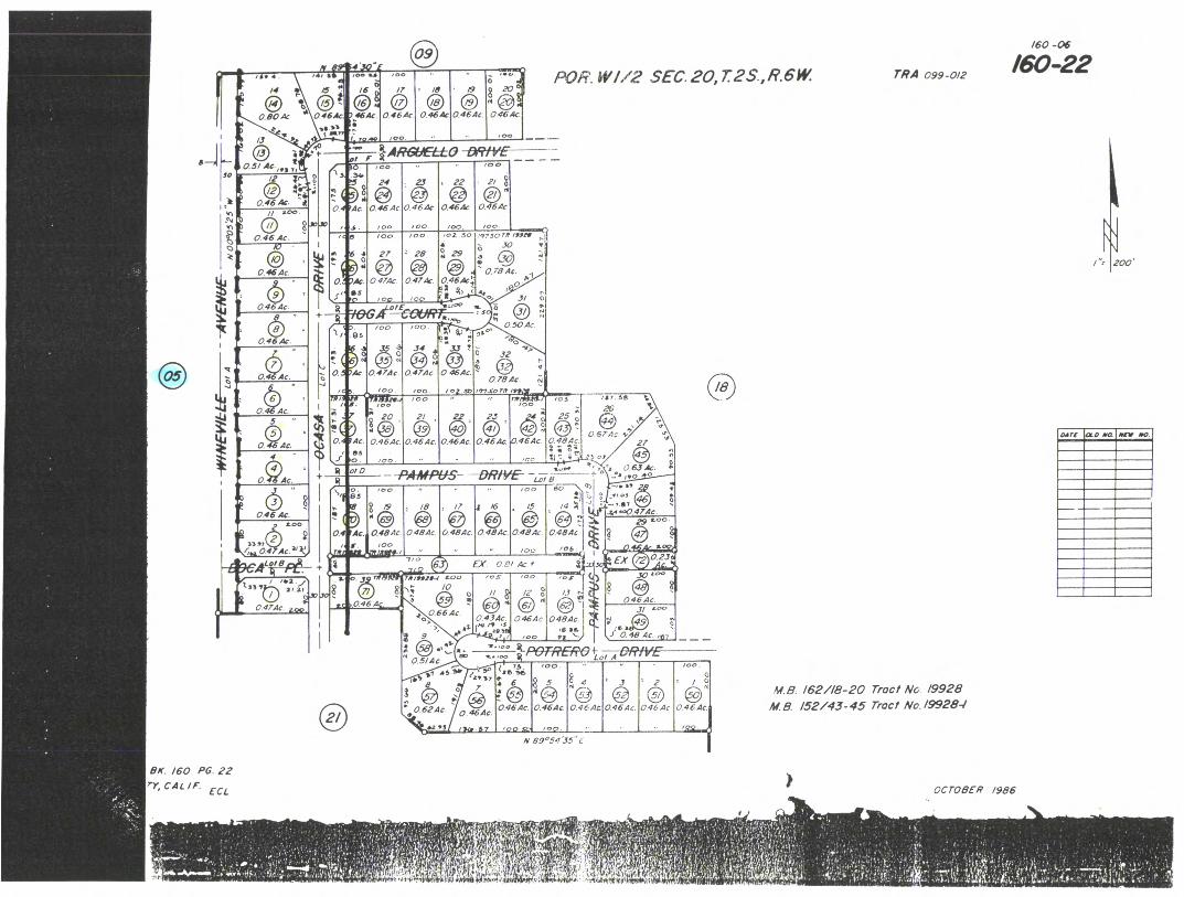
0
p.
SD 100 /0
//
oars OL.0 NO. NEW 010.
POR.W/12 SEC.20,r2s.,R.6W. TWA 099-012
/60 -06
160-22
300
046 Ac
0 Ac
NJ' r
0.46 AC. - 4
04 Ac
0.46 Ac.
0.46 Ac.
100
loo mo oz 50 ..9750 ,R INN" ,..
• 30 e 27 '28 29
@ @ ...f lt 0.78 Ac. 0,474c 0 47.4c. 0.46A4 0,1
' 0
100 '02 ala000
AL" ECOURZ . ....
/00 /00
32
0 464c. 0.78 Ac.
,e7so
100
/00
100
td .ot .33 !
3/ E
0 504c
100 a, .8
26
4
0
0 Ac 5
0. 46 Ac 0 57 Ac is
0.484c. a
0.464c 0.464c. 0.464c. 464c Ac. 27
100 /C0
-PAIMPE/S- —ORIVE -
0.46 Ac. ZOO
2 31,1
0.4 Ac.'kf
Awe
9
&'5 S 19 • 10 •
0 Ac. 0.484c.
S. oo
/8
/7 16
@
/06
Dl o el /O5 00
/0
0 484rJ re 737.
0.48 Ac.
51P6TREffe+ LAI A ,..o..
a
." .5 114 • 67
a 6
,... 0464c.
, op ,t.
'00
5
0.464c
,,,,, .
i 24c 0 46.4c.
0 -
2 4 - ---
0.4640
,
.,
' 3
0464c. ®
046 Ac
/00
0 46 Ac
Pi 89°5435" t
41.8. 162/18-20 Trod/ No /9928 M.8. 152/43-45 Tract No.19928-/
15
0.48.4c. 484c. 0 484c 0.48,4c
0.66 Ac.
a* e'"
COO
r°19 .5 ( /
0.434c.
/2 a
" 0464,
IOC
or f
/3 0464c
3/ ...a"
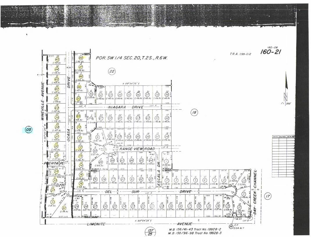
/60-06
/60-2/ rR.A. 099-012 200 JJ POR SW //4 SEC. 20,T2S. , R.6W
0 046 Ac
30,30
0 464c 00 3
0
046 Ac 35,, ,,,i4,4;„...._
8944, sr, /..5v5-.5 • • „
c .„.„,, , co
25
26 554c
® 0. '• 0.46.4c. 0.46 4c. 0.464c 0464c
/00 /00 ..
NIAGARA DRIVE
/5 4
7
89"54'35"(
494c
g C3 (5 °4' 46Ac
3 5
9.494c. 'so Lot 0
0.46.4c 0.464c 0 46.4c
00
Lot A A
o /00 4 04 , 30 /00 8
O.
7
.(7,)
/9 7 2 0 23 22 • 48 Ac
0.46Ac 046 Ac 0.45Ac. 0 46 Ac 0.46.4c 046Ac 5 9 • .30 ■•,4
.340 30 40
/0
/CO co '00
048 Ac 0.49 Ac /05
,0 200 •
25 0 /2 /6 /4 /5 /3 3
0 484c . 0.46 Ac. 0.464c. 0 464c 0 464c 046.4c 0 46Ac 0.61 Ac 046 Ac. 24 // nas
44 1 , 1017
RANGE-YIEWROAD--' --
400 4,:03„
4 2
n
046,/c. 046,/c 0.46 Ac 046.4c. 0.48Ac. Clt
/8 01 0 48 Ac 0.46 Ac
0 5/ Ac • _ 0
oilel
-: 0 47 4c. ,,i,) R _Lot8
CR TA ,,..
r•I
0.66 Ac
4019924i /90 TA
0.484c. /0_11
lff/Si ts. 22 zt iT
t; 0.474c.
/01.. /00 / C /05
/05 /01 7C /00 /4 /9,31,4- 3
0S.
8 5 4
0464c
0 0 484c
, 2
0.464c
3 • 8 9 • 2, aoo 4(
0 0464
C.) 0 46.4c
0 46 Ac
0 046 Ac
(
0.464c 0.48 A c
.l=.1 0.48 Ac 54,■ 2_
'.1 Pt!
' 7 Its 474C..44
046 Ac. 0.464c 0.46,4c 0.46 Ac 0.464c 046 Ac 0 53.4c
6b 20 00) 17
v. •• /00 00 /00
451 E /7 -0RfVE- .? DEL tf-
0 49Ac o 10 •7
Lot A
• 0574c 0.574c. 0.574c 0 57Ac. 0.57Ac. 0.57.1c 0.574c 0.574c. 0.574c. 0.574c 0574c 0.574c. 0.574c. 0.58 AC
0 0 0 0 0* '1,1,111 0 : 0 • , 0.413AC.;
32 3/ *4 30 g 28 g 27 26 g 25 g 24 3 :(2.3 20 ' g
0 ® 0 la ® /8 e 2 " /8 • ^1
/00 /4 ( .
: ?,
4, 0 90 Ac
439.L.M....-411.2.• ' I. 100 10014 00.11.1 jp. 14 / .
30
787 /0
• A
.1 33
0.574 0.79 Ac.
d5 • 475, Zr, C.-Z.
/00
0 , s o 7./10,:0-4 0171/
30 Lol 1
N 89 °54'28"E
EX 004 Ac M8 156/4/-43 Trod t No. /9928-2
441.8.158/96-98 Tract No 19928-3

Mr. Rick Bondar Bob McCune & Associates, Inc. 14970 Chandler Street Post Office Box 1295 Corona, CA 91718
Mr. Rick Bondar Bob McCune & Associates, Inc. 14970 Chandler Street Post Office Box 1295 Corona, CA 91718
Mr. Rick Bondar Bob McCune & Associates, Inc. 14970 Chandler Street Post Office Box 1295 Corona, CA 91718

HANKER PARK ASSOC 459 HIGHLAKI VISTA AY PERRIS, CA
92370
160030005-7
TOTAL LABELS PRINTED 49
************004410*****10104********************* ***************************4411)*********** ********************0*******************
********0**********************************
********4140114444************************* ******O******O*****O******4)************4*** ************************** **PS* ***********
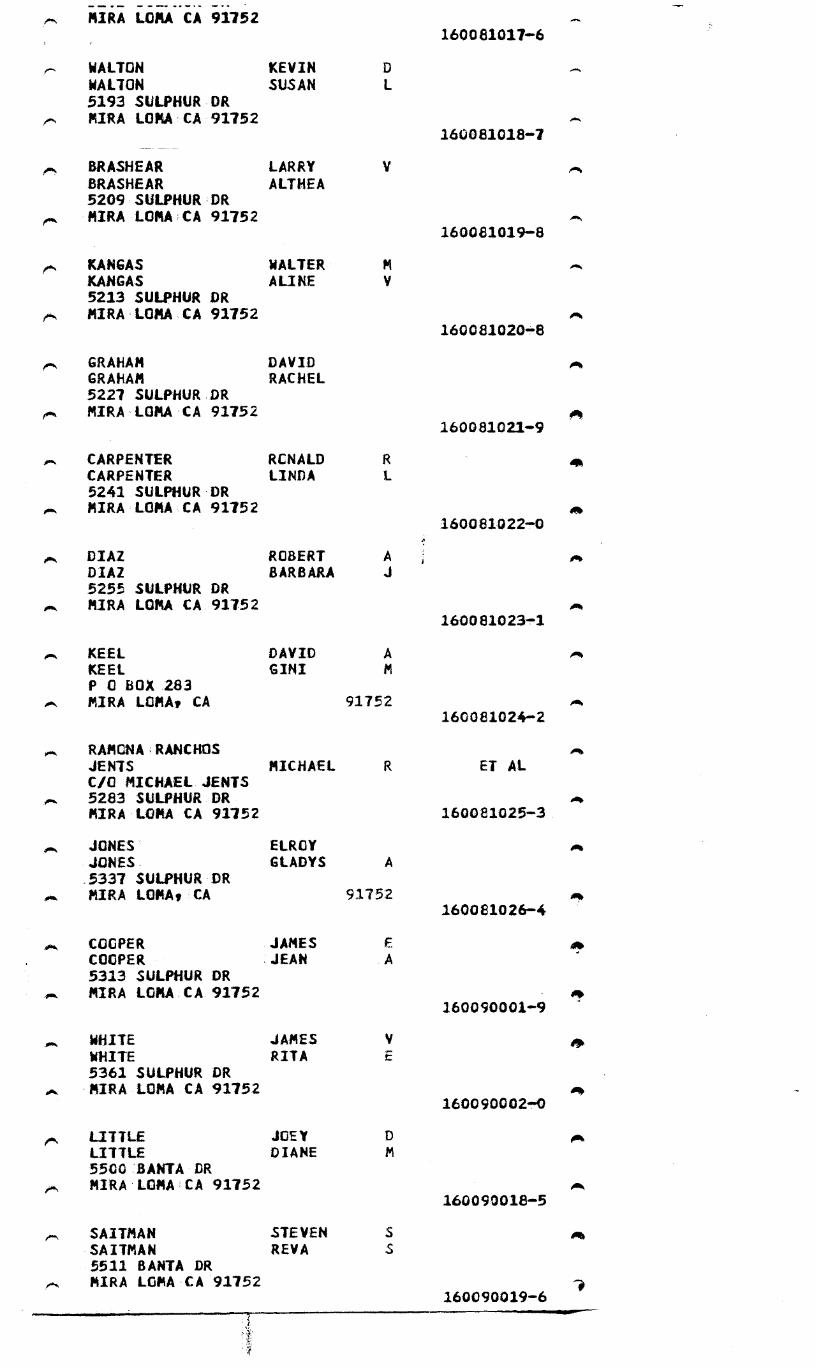
91752 160081017.-6
WALTON KEVIN WALTON SUSAN 5193 SULPHUR DR MIRA LOMA-CA.91752
160081018..7
BRASHEAR LARRY BRASHEAR ALTHEA 5209 SULPHUR MIRA LOMACA 91752
160081019-8
KANGAS WALTER KANGAS ALINE V 5213 SULPHUR DR MIRA'LOMA CA 91752
160081020...8
GRAHAM DAVID GRAHAM RACHEL 5227 SULPHUR DR MIRA'LOMA CA 91752
160081021-9
CARPENTER RCNALD CARPENTER LINDA 5241 SULPHUR DR MIRA.LOMA CA 91752
160081022-.43
DIAZ ROBERT A DIAZ BARBARA 5255 SULPHUR DR MIRA LOMA CA 91752
160081023-.1
KEEL DAVID A KEEL GINI P 0 BOX 283 MIRA LOMA/ CA 91752
160081024-2
RAMONA RANCHOS JENTS MICHAEL ET AL C/O MICHAEL JENTS 5283 SULPHUR DR MIRA-LOMA CA 91752 160081025-3
JONES ELROY JONES GLADYS A 5337 SULPHUR DR MIRA LOMA, CA 91752
160081026-4
COOPER JAMES COOPER :JEAN A 5313 SULPHUR OR MIRA LOMA;CA 91752
160090001-9
WHITE JAMES V WHITE RITA 5361 SULPHUR DR 'MIRA LOMA CA 91752
160090002-!-0
LITTLE JOEY LITTLE DIANE 5500 BANTA DR MIRA LOMA CA 91752
160090018-5
SAITMAN STEVEN SAITMAN REVA 5511 BANTA DR MIRA LOMA'CA 91752
160090019-6

• MIRA • LOMA CA 911b 2 160090019-6
• . DEMIRANDA FERNANDO R
DEMIRANDA CONSUELO 5521 BANTAAA .
• .MIRA LOWCA 91752 160090020-6
SAT CHE LL JAMES SAT CHE LL CHARLOTTE C 5531 BANTA DR MIRA LOMA CA 91752
BELL THOMAS BE LL BARBARA 5541 BANTA DR MIRA LOMA CA 91752
JONES TERRY . JONES SHELLEY 5547 BANTA OR MIRA LOMA CA 91752
JOHNSON JOHNSON LEILA 5551 BANTA DR MIRA LOMA CA 91752
VA NDER HAM CORRIE VA NDER HAM MARIAN 11756 B ARWOOD DR MIRA LOMA CA 93.752
160090021-7
160090022-8
160090023-9
16009 024-0
ET AL
160090025-1
DIAS C LAUDIO GUSTAVO DIAS GUADALUPE CORI A 5557 BANTA . DR MIRA LOMA C A 91752
160090026-2
160090027-3
160090028-.4
160090029-5
160090030-5
160090031-6
160210030-5
STEWART HER SH EL STEWART LINDA 5569 BANTA . DR MIRA LC/4)C CA 91752
SPEARS RICHARD A SPEARS AttGELINA 5577 BANTA DR MIRA LOMA CA 91752
COREA • ROBERT COREA JUDITH 5593 SANTA DR MIRA LOMA CA 91752
GOS LEE TERRY GOSLEE ANDREA 11790 PARKCENTER DR MIRA LOMA CA 91752
CLARK KENNETH CLARK SONIA A 11774 - PARICCENTER DR MIRA LOMA CA 91752
LEBEAU ADOLPH •LEB EAU FREDDIE 11770 . DEL SUR DR MIRA LOMA , CA 91752
TORRES GENEROSO TORRES MER LYN 11,0A IrIGA CIID flO

, LEBEAU 'LEBEAU
ADOLPH FREDDIE
11770 DEL SUR:DR N MIRA LOMAtV91752
160210030-5
TORRES GENEROSO D TORRES MERLYN 11784 DEL SUR1* KIRA LOMA1CA 91752
160210031-6
THOMSON DAVID THOMSON CHERI A 6175 OCASA DR MIRA-LOMA CA -91752
160210032.-7
-KRUG JOSEPH KRUG SYLVIA 6155 OCASA DR 'MIRA LOMA CA 91752
160210033-8
MANCILLA JOSE MANCILLA PATRICIA M 6135 OCASA-DR
„ MIRA LOMA , C4V91752 160220034.1
BRANTLEY CHARLES BRANTLEY MAUREEN 6115 OCASA -DR MIRA LOMA CA 91752
160210035-.0
BROUSSARD -RONALD BROUSSARD GENEVIEVE 6095 OCASA4* PIRA LONA CA 91752
160210036-4
KADING SHANE SIMPSON GLAD! 6075 OCASA ,DR MIRA'ILOMA , CA 91752
160210037..2
LEBEAU MARK A LEBEAU TAMERA' 6055 OCASA:DR MIRA;LOMA-CA 91752
160210038..3
SCOTT MICAHEL SCOTT JUDY A -6035AXASkDR MIRA LOMA CA 91752
160210039-4
eN -CLANCY DALE CLANCY VERA A 6015 OCASA , DR
„ MIRA-LOMA CA 91752 160210040-4
STEIN CARL STEIN VEDA 59954XASA.DR MIRA LOMAXA :91752
160210041..5
ovo
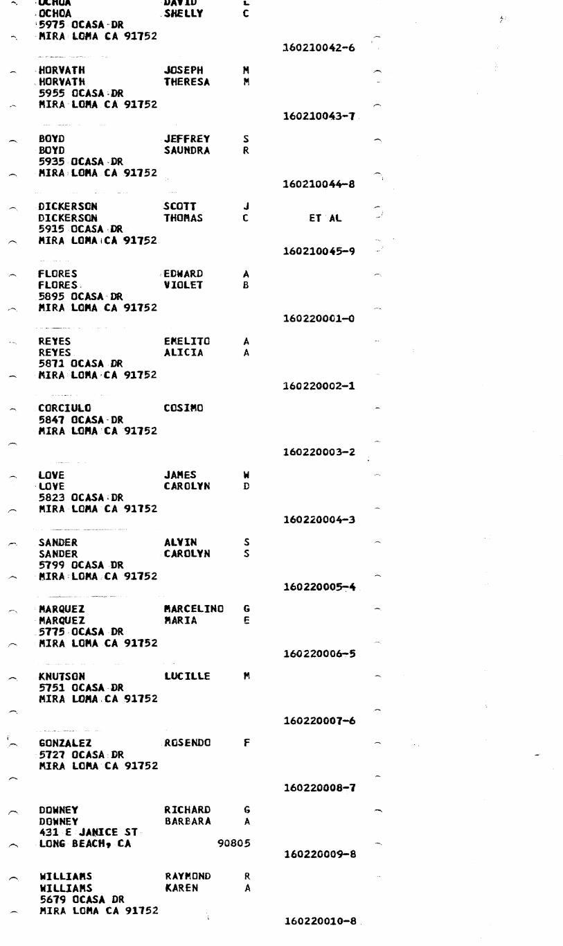
.ULHUA IJAVIU 43CHOA SHELLY 5975 OCASA-DR MIRA LOMA CA 91752
-HORVATH JOSEPH ,HORVATH THERESA 5955 OCASA4* MIRA•LOMA CA 91752
BOYD JEFFREY BOYD SAUNDRA 5935 , 0CASA , DR MIRA...LOMA CA 92752
DICKERSON SCOTT DICKERSON THOMAS 5115 OCASA,DR MIRA LOMAiCA 91752
FLORES EDWARD A FLORES, VIOLET 5895 OCASA-DR MIRA LOMA CA 91752
REYES EMELITO A REYES ALICIA A 5871 OCASA,DR MIRA LOMA , CA 91752
CORCIULO COSIMO 5847 OCASA-DR MIRA LOMA:CA 11752
LOVE JAMES LOVE CAROLYN 5823 OCASVDR MIRA LOMA CA 91752
SANDER ALVIN SANDER CAROLYN 5799 OCASA DR ?IRA LORA CA 92752
MARQUEZ MARCELINO G MARQUEZ MARIA 5775 OCASA DR MIRA LOMA CA 91752
KNUTSON LUCILLE 5751 OCASA DR MIRA LOMA,CA 91752
GONZALEZ ROSENDO 5727 OCASA DR MIRA LOMA CA 91752
DOWNEY RICHARD DOWNEY BARBARA A 431.E 'JANICE ST LONG BEACH, CA 90805
WILLIAMS RAYMOND WILLIAMS KAREN A 5679 OCASA DR MIRA LOMA CA 91752
160210042-6
160210043-7
160210044-8
El AL
160210045-9
1602200010
160220002-1
160220003-2
160220004-3
16022000574
160220006."5
160220007-6
160220008-1
160220009,-8
160220010-8.
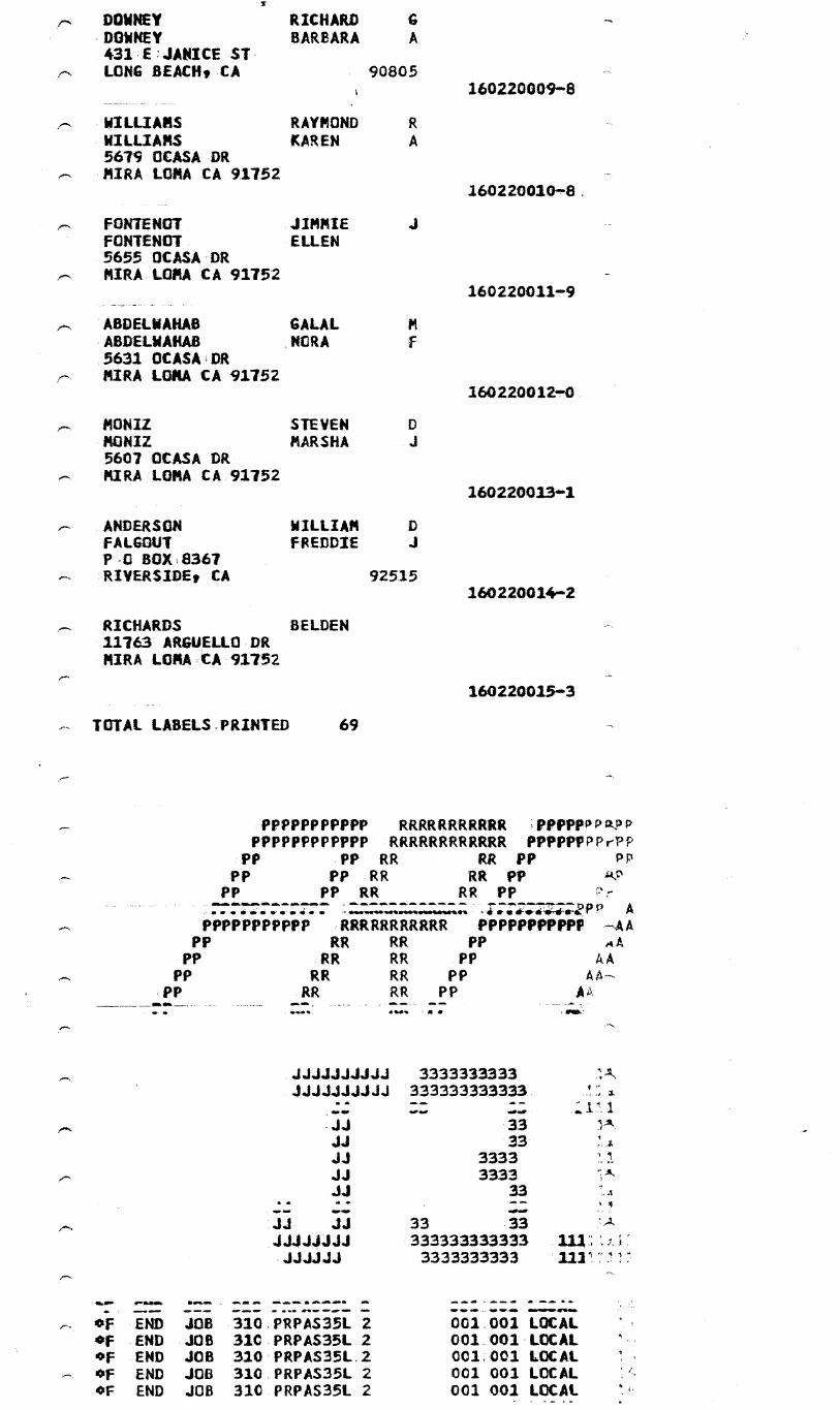
RICHARD BARBARA
RAYMOND KAREN
A
90805
A
JIMMIE ELLEN
GALAL
Pt NORA
STEVEN MARSHA
WILLIAM FREDDIE
92515
DOWNEY 'DOWNEY 431 , E:JANICE ST. LONG BEACH, CA
r, • WILLIAMS WILLIAMS 5679 OCASA DR MIRA LOMA CA 91752
r, FONTENOT FONTENOT 5655 OCASA-DR MIRA-LOMA CA 91752
ABDELWAHAB ABDELWAHAB 5631 OCASA;DR MIRA LOMA CA 91752
MONIZ MONIZ 5607 OCASA DR MIRA LOMA CA 91752
ANDERSON FALGOUT P 0 BOX 8367 RIVERSIDE, CA
RICHARDS BELDEN 11763 ARGUELLO DR MIRA LOMA , CA:91752
1602200098
160220010,8,
1602200111-9
1602200127.0
160220013.-1
160220014-2
160220015-■3
— TOTAL LABELS PRINTED 69
PPPPPPPPPPP RRRRRRRRRRR 44,PPPPPaPP PPPPPPPPPPPP RRRRRRRRRRRR PPPPPPPPePP
-PP PP RR RR PP Pp PP PP AIR RR PP
PP PP RR RR PP
• - • a ar • Irk It
A PPPPPPPPPPP RRRRRRRRRRR PPPPPPPPPPF —AA
PP PP
PP .PP
RR RR PP :RR RR PP RR RR PP RR RR PP
■ en. S•■■ a
JJJJJJJJJJ JJJJJJJJJJ
JJ JJ JJ JJ JJ
jj 55 JJJJJJJJ JJJJJJ
3333333333 333333333333
.33 33
3333 3333
33
33 33 333333333333 3333333333
■•■■•• 6.1■■ ■ ■ ■ ■ Alk ■ ■ ■ ■
■• ■ mw 01”.AVV,■■■■ . ■ ■■■ . ■■■ •■•••■■•■•
tiF END JOB 310,PRPAS35L 2 001.001 LOCAL OF END JOB 31C_PRPAS35L 2 001 001-LOCAL OF END JOB 31013RPAS35L.2 001001 LOCAL OF END JOB 310.PRPAS35L 2 002 001 LOCAL OF END JOB 310 PRPAS35L 2 001 001 LOCAL

134090002-9
134080021-6
• • 6
UN
• • * 4 4 0 4 4 0 4 • ,111•
( ( (
: : * It : :: :
*
: a
-I .3
a -J
il: 1 II: 1 li * 11 UJ
Oa 1"*
W I". W
4 -.I a
:::2: :1+,1 8: 1: ....
4.i w
:::;: **** ** 7C O ***
*0** **** 04 .4
11 *a**
a a ***** *0*** ** 0 **0* *90* ::ii .4 H H -I
N N * 9 * * * it * * 9 9, *9, * * * +0 +0 N N
n * * *a. * * **4* 3:131; 3:33: r- 0- N Ow H H H H
WW Cr+ Ci 9 9* * * * * ** it 0 41, V.** 0 Cr• x X 0 =.4 0
****
" ii: P4W WS. W74 00 * IVO; ::::: ::
?•ce 0
041-- @Ile W0
0...0 M
74
a
***1* * ** 9 ***** *999* pim )..
iiiw
4c..J No NO
a.J o00 mx
***** MW mw WU wW W *** U.4 LuZ
MI! ::::: ..4(74 l'il ,t4 W Jo ***** ***** =maW wM Wm 0,4 au 30 0
• **** ***** 9•**• C370 C33* c4 c7 o 1-.4 aN a w *OW *9999 0909* a a cc cc Zi...- -(A wt.- t.., •**** ***** ***** a a = WO WN 00 M ***** ***** ***** OW ow W W w Ow 20H Om H ****0 *0*** *MO
m......4.~.0....44.......~— .$0 a ::::: 2 : 9*
****
V- . 2',*1- W 47 ON ccr4
m 4C O. *9*** Up
* M14e HI... aN .4 aN Wa <0 W70 W
aWOW 254
4WW u2 409** w ..la W.Ja W0 W cu 0 UM !WI ...s. ..... 04 w 7C a W uJ C3 uJ
a 4C OC xi 0 cc .. .4 ‘J 4.)
Ow I
1600
20008-9
160
020
009-
160
030
005-i
IC IC C3 .J CC 1"4 0 : : ; : i : : : : : : a * 41. 1..04 M a H w ***9* ***** **: ;*,0 * 17.1.7. W 0 :44 p!:W 0 }..xf
.J.44r:
U =IC M =ZNW7C O.X 99999 ***** **w** OO14, WO 001-wC2
=WME WWOH =Pc".4: HoOrlt.4 aa rr::
43 a 4C rr-44 z:
c4; i-4 uJ N N Ul AX
* * * ' 9 lt * * 4} 4} LU uJ ..., ri Z cu cu iii. rl 7C 114 W N C3 1 1 n24- 11 8 W C3 w 0 41 CI. ad
C3 W W uJ * cd 7C 0 cC C3 C3 0 N P4 44 Ul uJ
it * 1r *
::*418 SS::: ***** ZZWHO ZZWr40 .4 .J rl (.) ..J"stirrs118 =SW
. !
i
,417

LEAL BRADLEY 12741 CLOVERDALE RD CORONA, CA 91720
HARADA GEORGE .HARADA VOSHIKO 12774 CLOVERDALE RD CORONA CA
PLANTENGA. GEORGE PLANTENGA AGNES 6500,HAMNER AVE Comm CA 91720
VERNOLA PAT
FRANK 1604 N LAUREL AVE UPLAND, CA
91786
ET AL
134080011-6
134090002•9
134110006-4
134120004-.3 41
VANDEN.BERGE JACOB & GERTIE 6715 WINEVILLE AVE MIRA LOMA CALIF 91752
0
134120007....6
TERMAATEN CASE TERMAATEN CLEONE 21612 68TH ST MIRA LOMA, CA
91752 oft
OIN AUKEMAN LEWIS AUKEMAN CAROL 12391 SCHLEISMAN RD
eN MIRA LOMA,CA
91752
SOUTHERN CALIFORNIA EDISON CO C S REENDERS ASST COMPTROLLER P 0 BOX 800. ROSEMEAD/ CA 91770
134120009-8
134120014-2
134120015-3
oak
rdm■
• SOUTHERN CALIFORNIA EDISON CG C S REENDERS ASST COMPTROLLER P C BOX 800
• ROSEMEAD, CA 91770 134120016-4
TERMAATEN CASE TERMAATEN CLECNE 11612 68TH ST
• MIRA LOMA, CA
91752 134120018-6
STATE OF CALIF C/O'DEPLOF TRANSPOR7ATION P 0 BOX 231 SAN BERNARDINO, CA 92402
134120022-9
• AIKEN ALDEN 11780 63RD ST PIRA LOMA CA 91752
• KING STEVE 11760 63RD ST MIRA LOMA'CA 91752
ALLEN ROBERT ALLEN VIRGINIA DALE 6326 WINEVILLE AVE MIRA LOMA CA 91752
157031001-2
157031002-3
157031006-7
••■
I • s

r,
41
PROGRESSIVE SVGS E
ADMINISTRATOR OF VETERANS AFFAIRS C/O FHA.
, P 0 BOX 12850 .
616165048-5
r- SANTA ANA, CA 92722 157031007-8
HOLMES VERLE 6330 WINEVILLE AVE MIRA LOMA - CA 91752
157031009-0
SANCHEZ PHILLIP SANCHEZ BETTY ET AL 6338 WINEVILLE AVE MIRA LOMA CA 91752
157031011-1
/A- MORRIS JEFFREY A MORRIS LOUISE
rr.
6346 WINEVILLE'AVE MIRA LOMA:CA 91752
157031012-2
ALLEN ALICE 'WILHOIT JOHN S ET AL P 0 BOX 836 MIRA LOMAI,CA 91752
157031014-4
HARRISON RUTH HARRISON DONALD 6368 WINEVILLE,AVE MIRA LOMA CA 91752
157031017-7
BRECKENRIDGE EARL 6370 WINEVILLE AVE MIRA LOMA CA 91752
157031018-8
•ft MUELLER WILLIAM MUELLER JANE E ET AL 6378 WINEVILLE-AVE MIRA . LOMA CA 91752
157031022-1
CABRERA FRUMENCIO P 11755 64TH ST MIRA LORA CA 91752
157031025-4
DAIRY SOS 6481 WINEVILLE4VE MIRA LOMA, CA 91752
157031026-5
MONTEON ALFREDO MONTEON RAMON 11787 64TH ST MIRA LOMA CA 91752
157031027-6
FALCO NUNCIO FALCO ROSE 6408 WINEVILLE AVE MIRA-LOMA CA. 91752
157032001-5
41'
•-••
0 PROGRESSIVE.SVGS & LOAN ASSN 2120 W•RAIN ST ALHAMBRA, CA
9180 1

n%
nunimwn MONTEON 117.87 64TH ST MIRA LORA CA 91752
FALCO
wi.rnmuu RAMON
NUNCIO
157031027-6
FALCO -ROSE 6408 WINEVILLE AVE
A% MIRA-LOMA , CA;91752 0•••
157032001-5
04 GARCIA, GARCIA
JOSE TRINA
11750 64TH ST MIRA LOMAtA 91752
157032002-6
STILLER JEFFREY THOMAS STILLER DIANA MARY 6416 WINEVILLE AVE MIRA LOMA CA 91752 04
157032005-9
A% HANSEN WILLIAM HANSEN DEANNA -6426 WINEVILLE AVE
A% MIRA LOMA'CA - 91752 157032007-1
PARKER- PATRICIA ANN #1114 6432 WINEVILLE AVE MIRA LOMA CA 91752
157032010-3
PETTIGREW ANNE 6450 WINEVILLE AVE MIRA LOMA.CA 91752
157121001-9
ABBOTT JCHN 6460 WINEVILLE AVE MIRA LOMA CA 91752
157111002-0
OMARA DENNIS MICHAEL 6470 WINEVILLE AVE MIRA LOMA CA 91752
157111003-1
OMARA JON OMARA LINDA 6480 WINEVILLE AVE MIRA LOMA CA 91752
157111004-2
BULLOCK KATHRYN 00\
BLAKELEY MARILYN C/O DAN BLAKELEY P 0 BOX 297 CORONA, CA 91718 157112001-2
HjERPE 6556-WINEVILLE
RUSSELL 01,
MIRA LOMAt'CA 91752
157112002-3
HJERPE RUSSELL 6556 WINEVILLE AVE MIRA LOMA CA 91752
157112003-4
ROLLEMA MELVIN ROLLEMA MARIANNA B 6576 WINEVILLE AVE MIRA LOMA Ck91752
157112004-5
WALDRON BENJAMIN S WALDRON MARGARET 6586 WINEVILLE AVE MIRA LCMA CA 91752
157112005-6 -
WALDRON BENJAMIN S WALDRON MARGARET 0 6586 WINEVILLE RD MIRA LOMA, CA 91752
157181001-6 -
KENNEDY KENNEDY MARY 6624 WINEVILLE AVE MIRA L0f4A CA 91752
157181004-9
CHAI SWO WEI CHAI SWO UN ET AL C/O KANIBLE CHAI 2418 VIA MARINA NEWPORT BEACH, CA 92660 157250010-7 -
HETTINGA
WILBUR 5240 HAMNER AVE ONTARIO, CA
91761
160020007-8 -
SOUTHERN CALIFORNIA EDISON CO C S REENDERS ASS,* COMPTROLLER P 0 BOX 800 ROSEMEAD, CA 91770
4P GORZEMAN JOE GORZEMAN ELSIE JOE GORZEMAN 12451 BELLEGRAVE AVE MIRA LOMA CA 91752
HAMMER PARK ASSOC 459 HIGHLAND VISTA WAY PERRIS, CA
TOTAL LABELS PRINTED 49
•
92370
160020008-9
160020009-0
160030005-7 -
41 4441*******44444144444444444.0*******44444441***414,100444441
.10 *********044141*****444***** ***SO ****44*****
**************************so*****#sossossolwal* 4*44444144**********4****4:0001)*414******4140*#*(64141434 444*O**44104g4********441****************04 ,41•4114
4
**44***44*41****40***4*4*0*********************
******44**************444*********44********
4 ************4.414**400010**** 44($4141 ***********
Albert A. Webb Associates Attn: Sam I. Gershon 3788 McCray Street Fiverside, CA 92506
Mr. Rick Bondar Bob McCune Associates, Inc.
a 14970 Chn 129 dler Street
Post Office Boi
5
Corona, CA 91718

MUELLER WILLIAM E MUELLER JANE ET AL 6378 UINEVILLE AVE MIRA LOMA CA 91752
257031022-1
CABRERA FRUMENCIO P 12755 64TH ST MIRA LOMA CA 91752
157031025-4
DAIRY SOS 6481 WINEVILLE AVE PIRA LOMA, CA 91752
MONTEON ALFRED MCKEON RANCH 12787 64TH ST MIRA LOMA CA 9 7
FALCO NUNCIO FALCO ROSE 6408 WINEVILLE AVE MIRA LONA CA 91752
157031026-5
157 10 7-6
157032001-5
GARCIA JOSE GARCIA IRINA 11750 64TH ST MIRA LONA CA 91752
157032002-6
STILLER JEFFREY THOMAS STILLER DIANA MARY 6416 WINEVILLE AVE MIRA LOMA CA 91752
57032005-9
HANSEN WILLIAM HANSEN DEANNA 6426 WIMEVILLE AVE MIRA LOMA CA 91752
157032007-1
PARKER PATRICIA ANN 6432 WINEVILLE AVE MIRA LOMA CA 91752
157032010-1..3
PETTIGREW ANNE 6450 VINEVILLE AVE MIRA LORA CA 91752
157111001-9
ABBOTT JOHN 6460 WIIEVILLE AVE MIRA LOMA CA 91752
157111002-0
°MARA DENNIS MICHAEL 6470 WINEVILLE AVE MIRA LOMA CA 91752
157111003-1

TERMAATEN CASE TERPAATEN CLEONE 11612 68TH ST MIRA LOU, CA
STATE Of CALIF C/O DEPT Of TRANSPORTATION P 0 BOX 231 SAN BERNARDINO, CA
AIKEN ALDEN 11780 63RD ST KIRA LOU CA 91752
917
92402
134120018-6
234120022-9
157031001-2
KING STEVE 12760 63RD ST MIRA LOMA CA 91752
ALLEN ROBERT ALLEN VIRGINIA DALE 6316 WINEVILLE AVE MIRA LOU CA 91752
ADMINISTRATOR OF VETERANS AFFAIRS C/O FHA P 0 BOX 12850 SANTA ANA, CA
92712
HOLMES VERLE 6330 WINEVILLE AVE MIRA LOMA CA 91752
SANCHEZ PHILLIP SANCHEZ BETTY 6338 WINEVILLE AVE MIRA LOMA CA 91752
MORRIS JEFFREY MORRIS LOUISE 6346 WINEVILLE AVE MIRA LOMA CA 91752
157031002-3
157031006-7
157031007-8
157031009...0
ET AL
157031011-1
ALLEN WILHOIT P 0 BOX 836 MIRA LOU, CA
ALICE JUN
91752
151031012-2
ET AL
1570310144
HARRISON RUTH HARRISON DONALD 636E WINEVILLE AVE MIRA LOMA CA 91752
157031017-7
BRECKENRIDGE EARL 6370 WINEVILLE AVE MIRA LOU CA 92752
157031018-8

HETTINGA HARVEY HETTINGA WILBUR C/O PETE HETTINGA DAIRY 11101 EUCALYPTUS AVE ONTARIO, CA
91761
HETTINGA HARVEY HETTINGA WILBUR C/O PETE HETTINGA DAIRY 11101 EUCALYPTUS AVE ONTARIO, CA
91761
LEAL ELIZABETH LEAL BRADLEY 12741 CLOVERDALE RD CORONA CA 91720
LEAL ELIZABETH LEAL BRADLEY 12741 CLOVE ALE RD CORONA, CA 91120
HARADA GEORGE HARADA YOSHIKO 12774 CLOVERDALE RD CORONA CA 91720
PLANTENGA GEORGE PLANTENGA AGNES 6500 HAMNER AVE CORONA CA 91720
ET AL
134070005-0
ET AL
134070006-1
ET AL
134080010-5
ET AL
134080021-6
134090002-9
134110006-4
VERNOLA PAT
FR 1604 N LAUREL AVE UPLAND, CA
91786
VANDEN BERGE JACOB E GERTIE 6715 WINEVILLE AVE MIRA LOMA CALIF 91752
TERMAATEN CASE TERMAATEN CLEONE 11612 68TH ST MIRA LOMA, CA
9 7 2
134120004-3
134120007.-6
134120009-8
AUKEMAN LEWIS AUKEMAN CAROL 12391 SCHLEISMAN RD MIRA LOMA, CA 91752
SOUTHERN CALIFORNIA EDISON CC C S REENDERS ASST COMPTROLLER P 0 BOX 800 ROSEMEAD/ CA 91770
SOUTHERN CALIFORNIA EDISON CC C S REENDERS ASST COMPTROLLER P 0 BOX 800 ROSEMEAD, CA 91770
134120014-2
134120015-3
134120016.4

KRUG KRUG 6155 OCASA:DR MIRA LOMA CA 91752
MANCILLA MANCILLA 6135 OCASA DR MIRkLOMA CA 91752
JOSEPH SYLVIA
JOSE PATRICIA
1 210 3-8
160210034-9
BRANTLEY CHARLES BRANTLEY MAUREEN 6115 OCASA DR MIRA LOMA CA 91752
1602100350
BROUSSARD RONALD BROUSSARD GENEVIEVE C 6095 OCASA DR MIRA LOMA CA 9 7 2
160210036-1
KADING SHANE SIMPSON GLUT 6075 OCASA-DR MIRA LOMA CA 91752
1602100Th-2
LEBEAU MARK A LEBEAU TAMERA 6055 OCASA , DR MIRA LOMA CA 91752
160210038-3
SCOTT MICAHEL SCOTT JUDY A 6035 OCASA DR MIRA LOU CA 91752
160210039-4
CLANCY , DALE CLANCY VERA A 6015 OCASA‘DR MIRA LOMA CA 91752
160210040.4
STEIN CARL STEIN VEDA 5995 OCASA DR MIRA LOMA CA 91752
160210041-5
OCHOA DAVID CCHOA, SHELLY 5975 OCASA DR MIRA LORA CA 91752
160210042-6
HORVATH JOSEPH HORVATH THERESA 5955 OCASA'DR MIRA LORA CA 91752
160210043-7
BOYD JEFFREY BOYD SAUNDRA 5935 OCASVDR KIRA LOMA CA 91752
160210044-8

GONZALEZ ROSENDO 5727 OCASA DR MIRA LORA CA 91752
DOWNEY
RICHARD DOWNEY
BARBARA A 431 E JANICE ST LONG BEACH, CA
9005
IL AMS RAYMOND WILLIAMS KAREN A 5679 OCASA DR MIRA LOMA CA 91752
FONTENOT JIMMIE FONTENOT ELLEN 5655 OCASA DR MIRA LOMA CA 91752
ABDELWAHAB GALAL ABDELWAHAB NORA 5631 OCASA DR MIRA LOMA CA 91752
M WIZ STEVEN MONIZ MARSHA 5607 OCASA DR MIRA LOMA CA 9175
ANDERSON WILLIAM FALGOUT FREDDIE P O BOX 8367 RIVERSIDE, CA
92515
RICHARDS BELDEN 11763 ARGUELLO DR MIRA LOMA CA 91752
160220008...4
160220009-8
60 200108
260220012-9
160220012-.0
160220013-1
260220014.-2
1602200153
TOTAL LABELS PRINTED 69

DICKERSON SCOTT DICKERSON THOMAS 5915 OCASA DR MIRA LOMA CA 91752
FLORES EDWARD FLUKES VIOLET 5895 OCASA OR MIRA LOMA CA 91752
REYES EXELITO REYES ALICIA 5871 OCASA DR MIRA LOMA CA 91752
CORCIULO
COSIMO 5847 OCASA DR MIRA LOMA CA 917
LOVE JAMES LOVE CAROLYN 5823 OCASA OR MIRA LOMA CA 91752
SANDER ALVIN SANDER CAROLYN 5799 OCASA OR MIRA LOMA CA 91752
MARQUEZ MARCELINO MARQUEZ MARIA 5775 OCASA DR MIRA LOMA CA 91752
KNUTSON LUCILLE 5751 OCASA DR MIRA LOMA CA 91752
ET AL
160210045-9
160220001-0
160220002-4
160220003-2
160220004-3
160220005-4
160220006-5
160220007-.6

JONES TERRY JONES SHELLEY 5547 BANTA DR MIRA LOMA CA 91752
1 0 23-9
JOHNSON JOHNSON LEILA 5551 BANTA DR MIRA LOMA CA 9175
16009002+-0
VANDERHAM CORRIE VANDERHAM MARIAN ET AL 11756 BARWOOD DR PIRA LOMA CA 92752
160090025-1
DIAS CLAUDIO GUSTAVO DIAS GUADALUPE CCRIA 5557 BANTA DR MIRA LOMA CA 91752
160090026-2
160090027-3
160090028-4
160090029-5
160090030-5
160090031-6
160210030-5
STEWART HERSHEL STEWART LINDA 5569 BANTA DR MIRA LOMA CA 91752
SPEARS RICHARD SPEARS ANGELINA 5577 BANTA DR PIRA LOMA CA 91752
COREA ROBERT COREA JUDITH A 5593 BANTA DR PIRA LOMA CA 91752
GOSLEE TERRY GOSLEE ANDREA 11790 PARKCENTER DR MIRA LOMA CA 91752
CLARK KENNETH CLARK SONIA 11774 PARKCENTER DR MIRA LORA CA 91752
LEBEAU ADOLPH LEBEAU FREDDIE 11770 DEL SUR DR KIRA LOMA CA 91752
TORRES GENEROSO TORRES MERLYN 11784 DEL SUR DR MIRA LOMA CA 91752
THOMSON DAVID THOMSON CHERI 6175 OCASA DR MIRA LOMA CA 91752
160210031-6
1602 003 7

CARPENTER RONALD CARPENTER LINDA 5241 SULPHUR DR PIRA LOMA CA 91752
DIAZ ROBERT DIAZ BARBARA 5255 SULPHUR DR MIRA LOMA CA 91752
KEEL DAVID KEEL GINI P 0 BOX 2 (IRA LOMA, CA 92752
160081022•0
160081023-1
160081024-2
RAMONA RANCHOS „MATS MICHAEL R ET AL C/O MICHAEL JENTS 5283 SULPHUR DR MIRA LCAA CA 91752 160081025...3
160081026-4
COOPER JAMES COOPER JEAN 5313 SULPHUR DR MIRA LOMA CA 91752
160090001-9
WHITE JAMES *UTE RITA 5361 SULPHUR DR MIRA LOMA CA 91152
160090002-0
LITTLE JOEY
0 LITTLE DIANE 5500 BANTA DR MIRA LOMA CA 9 7 2
SAITMAN STEVEN SAITMAN REVA 5511 BANTA DR M/RA LOMA CA 91752
DEMIRANDA FERNANDO R (*MIRANDA CONSUELO 5521 BANTA DR MIRA LOMA CA 91752
SATCHELL JAMES SATCHELL CHARLOTTE 5531 BANTA DR MIRA LOMA CA 91752
BELL THOMAS BELL BARBARA 5541 BANTA DR MIRA LOMA CA 92752
160090018-5
160090019-4
160090020-6
160090021-7
JONES ELROY JONES GLADYS A 5337 SULPHUR DR MIRA LOMA, CA 91752
1600 22 8

*****44.04400.0040,0,04044401100*****************
*11040,10**0041.044*********444 ***A.* ***********
***********000************************** ****400*****************0****************40******0 41****4044411040***************4******44400****** *******************************4141 40010.0041,00440*4004#********* ***1041 ****441110****
*************************************00*******
****•***•••*********•*••••
STATE OF CALIF C/O DEPT OF TRANSPORTATION P C BOX 231 SAN BERNARDINO, CA
.4014*
92403
****0444***
1 0 3-6
MIRALOMA THOROUGHBRED FARMS 12071 BELLEGRAVE AVE MIRA LOMA, CA 9 7 2
60040004-7
MIRALOMA THROUGHBRED FARMS 12071 BELLGRAVE AVE MIRA LOMAT CA 752
0058
VANDERHAM CCRRIE VANDERHAM MARION ET AL 4860 WINEVILLE RD MIRA LOMA CA 91752
160060001-4
CORRIE VANDERHAM DAIRY I PETE VANDERHAM DAIRY INC C/O PETE VANDER/4AM DAIRY INC 4800 NINEVILLE RD MIRA LOMA, CA 91152 160060035-7

KLEIN PHILIP KLEIN JCAN P B 11791GENIL CT MIRA LOMA CA 91752
160081010-9
KONEFAT ANTONY KONEFAT FILCMENA 11790GENIL CT MIRA LOMA CA 91152
160081011-'0
BROWN JOHN BROWN TERESE 11786 GENIL CT MIRA LONA, CA 91752
160081012-4
CRUZ AUGUSTO CRUZ PATRICIA E 11770GENIL , CT, MIRA-LOMA:CA 91752
160081013-2
GOODING WILLIAM GOODING SHIRLEY 5127 SULPHUR DR MIRA , LOMA CA 92752
160081014,-3
SHROCK DOUGLAS SMOCK -VICKI 5142 SULPHUR DR MIRA LOMA CA 91752
160081015-4
KNUTSON TODD ROBERT 5157 SULPHUR DR PIRA LONA:CA 91752
160081016-.5
MILLER ARTHUR A MILLER KATHLEEN 5171 SULPHUR DR MIRA LOMA CA 91752
160081017-4
WALTON KEVIN 'WALTON SUSAN 5193 SULPHUR DR MIRA LOMA CA 91752
160081018-4
BRASHEAR LARRY V BRASHEAR ALTHEA 5209 SULPHUR DR PIRA LOMACA 91752
60081019-8
KANGAS WALTER KANGAS ALINE 5213 SULPHUR DR MIRA LOMA CA 91752
160081020"-8
GRAHAM DAVID GRAHAM RACHEL 5227 SULPHUR DR MIRA LOMAAGA 91752
1600810219

JONES JONES .5337 SULPHUR DR MIRA LONA, CA
ELROY GLADYS
41%
160061017-4
160081018-7
V
160081019-6
V
160081020-4
160081021•9
160081022-0
A J
160081023-1
A
91752 160081024-2
R ET AL
160081025-3
A
9 7 2 160081026-4
160090001-9
V
1600900020
160090018-5
160090019-6
SAITMAN STEVEN 'SAITMAN REVA ,5511 SANTA DR
e, MIRA'LOMA-CA 91752
0."11
Aft.
■••■■
Olt
#1.4
414
low
41%
•Ro
'NIRA,LOMA , CA 91752
WALTON KEVIN WAL7ON SUSAN 5193 SULPHUR DR PIRA LOMA CA 92752
BRASHEAR LARRY BRASHEAR ALTHEA 5209 SULPHUR DR MIRA LOMA , CA 91752
KANGAS WALTER KANGAS ALINE 5213 SULPHUR DR
t‘• MIRA LOMA CA 91752
GRAHAM DAVID GRAHAM RACHEL 5227 SULPHUR DR MIRA LOMA CA 91752
CARPENTER RONALD CARPENTER LINDA 5241 SULPHUR DR MIRA LOMA CA 91752
DIAZ ROBERT DIAZ BARBARA 5255 SULPHUR DR MIRA LOMA CA 91752
KEEL DAVID KEEL GINI P 0 BOX 283 MIRA LOMA, CA
RAI4CNA RANCHOS JENTS MICHAEL C/0 MICHAEL JENTS 5283 SULPHUR DR MIRA LONA CA 91752
COOPER JAMES COOPER ,JEAN 5313 SULPHUR DR MIRA LOMA,CA 92752
WHITE JAMES WHITE RITA 5362 SULPHUR DR MIRA LOMA CA 91752
LITTLE JOEY LITTLE DIANE 5500 BANTA DR MIRA LONA , CA 91752

"nann - e-unn'ux 74/74
'DEMIRANDA FERNANDO
DEMIRANDA CONSUELO 5521 BANTA-DR MIRA LOMAtA 91752
SATCHELL SATCHELL 5531 BANTA DR MIRA LORA CA• 92752
BELL BELL • 5541 SANTA DR MIRA LOMA CA 91752
JONES .JONES 5547 BANTA.DR MIRA LOMA CA 91752
JOHNSON JOHNSON 5551 SANTA DR MIRA LOMA CA 91752
•-■
VANDER HAM CORRIE •VANDERHAM MARIAN 11756 BARWOOD DR MIRA LOMA CA 91752
JAMES CHARLOTTE
THOMAS BARBARA
TERRY SHELLEY
LEILA
160090019-6
160090020-6
160090021-7
160090022-8
160090023-9
160090024-0
ET AL
160090025-1
DIAS DIAS 5557 BANTA DR MIRA LOMA CA 91752
CLAUDIO GUSTAVO GUADALUPE CORIA
A
STEWART STEWART 5569 SANTA DR MIRA LOMA CA 91752
SPEARS SPEARS 5577 BANTA DR MIRA LOMA,CA 91752
COREA' COREA 5593 BANTA DR MIRA LOMA CA 91752
GOSLEE TERRY GOSLEE ANDREA 117901PARKCENTER DR MIRA LOMA CA 91752
CLARK KENNETH CLARK SONIA 11774-PARKCENTER DR MIRA LOMA, CA 91752
LEBEAU
ADOLPH LEBEAU
FREDDIE 11110 DEL SUR DR MIRA LOMA CA 91752
160090026-2
60090027-3
160090028-4
160090029-5
160090030-5
160090031-6
160210030-5
HERSHEL LINDA
RICHARD ANGELINA
ROBERT -JUDITH
TORRES
GENEROSO D TORRES
MERLYN 117R4 DEL SUR.OR

, LEBEAU ALEBEAU 11110 DEL SUR DR MIRA LOMA CA 91752
ADOLPH FREDDIE
160210030-5
:TORRES GENEROSO D TORRES. MERLYN 11184 , DEL SUR,DR MIRA'LOWCA 91752
160210031-6
THCMSON DAVID THOMSON CHERI 6175 OCASA DR MIRA LOMA CA 91752
160210032-.4
KRUG JOSEPH KRUG SYLVIA 6155 OCASA DR MIRA LOMA CA 91752
160210033-8
MANCILLA JOSE MANCILLA PATRICIA M 6135 OCASA.DR MIRA LONA CA 91752
160210034...9
0, BRANTLEY BRANTLEY
CHARLES MAUREEN
6115 OCASA DR Aft. MIRA LOMA CA 91752
160210035-..0
BROUSSARD RONALD BRCUSSARD GENEVIEVE C 6095 OCASA DR MIRA LOMA CA 91752
160210036-1
KADING SHANE S IIWSON GLADI 6075 OCASA DR MIRA'LOMA CA 91752
160210037-2
LEBEAU NARK A LEBEAU TANERA- 6055 OCASA-DR MIRA , LOMA-CA '91752
1602100383
SCOTT MICAHEL SCOTT JUDY 6035i0CASA-DR MIRA LONA CA 91752
160210039-.4
CLANCY DALE CLANCY VERA 6015 OCASA DR MIRA LOMA CA 91752
160210040-4
STEIN CARL STEIN VEDA 1. 599517CASA.DR MIRA LOMAtA•91752
160210041--5
"
ro.!
AOCHUA MALIN 1.
'OCHOA SHELLY 5975 OCASA-DR MIRA LOMA CA 91752
HORVATH JOSEPH HORVATH THERESA 5955 OCASA . DR MIRA LOMA CA 91752
- BOYD JEFFREY BOYD SAUNDRA 5935 OCASA , DR MIRA LOMA CA 91752
V
, DICKERSON SCOTT DICKERSON THOMAS 5915 OCASA DR MIRA LOMAiCA 91752
FLORES EDWARD FLORES VIOLET 5895 OCASA DR 14IRA LOMA CA 91752
- REYES EMELITO A REYES ALICIA A 5871 OCASA DR
,-- KIRA LOMA -CA 91752
CORCIULO COSI140 5847 OCASA -DR MIRA LOMA CA 91752
- LOVE JAMES LOVE CAROILYN D 5823 OCiASA DR MIRA LOMA CA 91752
• SANDER ALVIN SANDER CAROLYN 5799 OCASA DR
- MIRA LOMA CA 91752
MARQUEZ MARCELINO MARQUEZ MARIA 5775 OCASA DR MIRA LOMA CA 91752
KNUTSON LUCILLE 5751 OCASA DR KIRA LOMA CA 91752
GONZALEZ ROSENDO 5727 OCASA DR MIRA LOMA CA 91752
(•■. DC WHEY RICHARD DOWNEY BARBARA A 431 E JANICE ST
ts, LONG BEACH, CA 90805
WILLIAMS RAYMOND WILLIAMS KAREN A 5679 OCASA DR MIRA LOMA CA 91752
160210042-6
160210041,7,
160210044-8
ET At.
160210045-9
160220 1-0
160220002-1
160220003-2
160220004-3
160220005-4
160220006-5
160220007-6
160220008-7
160220009-8
160220010-8.

DOWNEY
RICHARD G '-DOWNEY
BARBARA A 431'EsJANICE ST LONG BEACH, CA
90805
,-.. WILLIAMS WILLIAMS 5679 OCASA DR MIRA LOMA CA 91752
FONTENOT FONTENOT 5655 OCASA DR MIRA LOMA CA 91752
ABDELWAHAB ABDELWAHAB 5631 OCASAiDR MIRA LOMA CA 91752
MONIZ STEVEN MONIZ MARSHA 5607 OCASA DR MIRA LOMA CA 91752
ANDERSON FALGOUT P42 BOX 8367 RIVERSIDE, CA
RICHARDS BELDEN 11763 ARGUELLO DR MIRA LOMA CA 91752
160220009..8
160220010-.8
160220011-.9
160220012..0
160220013d-1
160220014-.2
160220015..3
RAYMOND KAREN
• JIMMIE ELLEN
GALAL NORA
WILLIAM FREDDIE J
92515
■-••-■
TOTAL LABELS PRINTED 69
PPPPPPPPPPP RRRRRRRRRRR PPPPP0 PAPP PPPPPPPPPPPP RRRRRRRRRRRR PPPPPPPPePP PP PP RR RR PP PP
PP PP RR RR PP AP PP PP RR RR PP a -'7-7-7i,,,ZZ2PP A -11; e' " • •■•••••■■••~0011{0.111~6.6.111 • Er Mt 110,11P
' PPPPIIPPITPP ,RRRRRRRRRRR PPPPPPPPPPP —AA
".■
RR RR RR RR
RR RR RR RR
PP PP
PP PP
AA AA
AA 111•■••11i
jJJJjJJJJJ .111.1.1JJJJJ
•I• •••
JJ JJ JJ JJ jj
:JI JJ 4.14J4JJJ -JJJJJJ
3333333333 333333333333
-33 . 33
3333 3333
33 .11.0
33 33 333333333333
3333333333
OF END OF END *F END OF END *F END
Swam,
—JOB ,JOB 31C,PRPAS35L,2 JOB -310'PRPAS35L.2 JOB 310.PRPAS35L 2 JOB 310,PRPAS35L 2
001. -001 LOCAL 001 001 LOCAL 001,001 LOCAL 002 001 LOCAL 002 001 LOCAL
•

SOUTHERN CALIFORNIA EDISON CO C S REENDERS ASST COMPTROLLER P 0 BOX 800 ROSEMEAD, CA 91770
GORZEMAN ,JOE GORZEMAN :ELSIE JOE GORZEMAN 12451 BELLEGRAVEAVE MIRA LOMAtA 91752
• HANKER PARK ASSOC 459 HIGHLAND VISTA WAY PERRIS, CA
•
92370
• • •
160020008-9
160020009-!-0_
160030005-7
TOTAL LABELS PRINTED 49
***************************04#04***************0 ********000********0************************ *******006*********44440*. ***WS
***************************4444****4**** *************************** 444stfte
**************************************** ***********4**************.***41) 10044******100
HETTINGA HARVEY HETTINGA WILBUR C/0 PETE HETTINGA DAIRY 11101 EUCALYPTUS AVE ONTARIO, CA
HETTINGA HARVEY HETTINGA WILBUR C/O PETE,HEITINGA DAIRY 11101 EUCALYPTUS AVE ONTARIO, CA
:ET AL
91761 1340700051-0
ET AL
91761 134070006..1
LEAL ELIZABETH LEAL BRADLEY WILLIAM ET AL 12741 CLOVERDALE RD CORONA CA 91720
134080010-5
LEAL ELIZABETH LEAL BRADLEY W ET AL 12741 CLOVERDALE RD CORONA, CA 91720
134080011-6
HARADA GEORGE T HARADA 'CUM 12774 CLOVERDALE:RD CORONA CA 91720
134090002-9

LEAL BRADLEY Id
ET AL 12741 CLOVERDALE RD CORONA, CA. 91720
a
a
134080011-6
HARADA GEORGE •HARADA VOSHIKO 12774 CLOVERDALE RD CORONA CA 91720
PLANTENGA GEORGE PLANTENGA AGNES 6500 HAMMER AVE CORONA CA 91720
VERNOLA 1604 N LAUREL A UPLAND, CA
134090002-9
134110006-4 11
PAT
FRANK
0 91786
134120004-3 40
VANDEWBERGE JACOB E GER/1E 6715 WINEVILLE AVE M/RA LOMA CALIF 91752
0
134120007-6
TERMAATEN CASE TERMAATEN CLEONE 11612 68TH ST MIRA LOMA, CA 91752
AN AUKEMAN LEWIS W AUKEMAN CAROL I 12391 SCHLEISMAN RD
00‘ MIRA LOMA, CA 91752
SOUTHERN CALIFORNIA EDISON CO C S REENDERS ASST COMPTROLLER P 0 BOX 800 ROSEMEAD, CA 91770
• SOUTHERN CALIFORNIA EDISON CC C S REENDERS ASST COMPTROLLER P 0 BOX 800 ROSEMEAD, CA 91770
TERMAATEN
CASE TERMAATEN
CLECNE 11612 68TH ST
• MIRA LOMA, CA
91752
• STATE OF CALIF C/O DEPT OF TRANSPORTATION P 0 BOX 231
• SAN BERNARDINO, CA
92402
• AIKEN ALDEN .11780 63RD ST MIRA LOMA CA 91752
• KING STEVE 11760 63RD ST MIRA LONA'CA 91752
ALLEN ROBERT ALLEN VIRGINIA DALE 6316 WINEVILLE AVE MIRA LOMA CA 91752
134120009-.4
134120014-2
,004,
134120015-3
/•••■
134120016-4
134120018-6
o'N
134120022-9
157031001-2
", 157031002-3
157032006-7
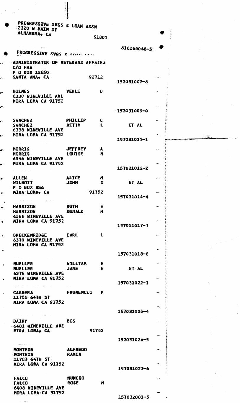
0 PROGRESSIVE SVGS LOAN ASSN 2120 W RAIN ST ALHAMBRA, CA
9.1801
4 PROGRESSIVE SVGS E Ana.,
ADMINISTRATOR OF VETERANS AFFAIRS C/0 FHA P 0 BOX 12850 SANTA ANA, CA 92712
HOLMES VERLE 6330 WINEVILLE AVE MIRA (CPA CA 91752
SANCHEZ PHILLIP SANCHEZ BETTY 6338 WINEVILLE AVE MIRA LOMA CA 91752
MORRIS, JEFFREY A MORRIS LOUISE 6346 WINEVILLE AVE MIRA (DMA CA 91752
ALLEN
ALICE WILHOIT
JOHN P 0 BOX 836 MIRA LOMA, CA
91752
HARRISON RUTH HARRISON DONALD 6368 WINEVILLE AVE MIRA LOMA CA 91152
BRECKENRIDGE EARL 6370 WINEVILLE AVE MIRA LOMA CA 91752
MUELLER
WILLIAM MUELLER
JANE 6378 WINEVILLE.AVE MIRA LOMA CA 91752
616165048•5 •
157031007-8
157031009-0
ET Al.
157031021-1
157031012-2
j•Iry
ET AL
157031014-4
157031017-7
157031018-8
ET AL
157031022-4
CABRERA FRUMENCIO P 11755 64TH ST MIRA LORA CA 91752
DAIRY 80S 6481 WIMEVILLE,AVE MIRA (CPA, CA
91752
MONTEOM
ALFREDO MCKEON
RAMON 11787 64TH ST MIRA LORA CA 91752
.FALCO NUNCIO FALCO ROSE .6408 WINEVILLE AVE MIRA-LOMA , CA:91752
157031025-4
157031026-5
157031027-4
157032001-5

MIS V% ilia 1.0
. RAMON 21787 64TH ST
•". MIRA LORA CA 91752 157031027-6
A% FALCO NUNCIO FALCO ROSE
ok 6408 WINEVILLE AVE MIRA LOMA CA 91752
157032001-5
0 GARCIA GARCIA
JOSE IRINA
11750 64TH ST MIRA LOMA CA 92752
157032002-6
STILLER JEFFREY THOMAS STILLER DIANA MARY 6426 WINEVILLE AVE MIRA LOMA CA 92752
157032005-9
Pt HANSEN WILLIAM HANSEN. DEANNA 6426 WINEVILLE AVE
Ift MIRA LOPILAtA 91752 157032007-1
ok PARKER PATRICIA ANN 6432 WINEVILLE AVE MIRA LOMA CA 92752
157032010-3
PETTIGREW ANNE 6450 WINEVILLE AVE MIRA LOMA CA 91752
157211001-9
•••••, ABBOTT 6460 WINEVILLE AVE
JOHN
MIRA LOMA CA 91752
257121002-0
OMARA DENNIS MICHAEL 6470 WINEVILLE AVE MIRA LOMA CA 91752
257221003-2
OHARA JUN OMARA LINDA 6480 WINEVILLE AVE MIRA LOMA CA 91752
157111004-2
BULLOCK KATHRYN BLAKELEY MARILYN C/O DAN BLAKELEY P 0 BOX: 297 CORONA, CA 91718 157222002-2
HJERPE RUSSELL 6556=WINEVILLE PIRA LOMAs.CA 92752
157212002-3
HJERPE RUSSELL 6556 WINEVILLE AVE MIRA LOMA CA 91752
157112003-4
ROLLEMA MELVIN , ROLLEMA MAR IANNA B 6576 WINEVILLE AVE
ON, MIRA LOMA CA91752 157112004-5
0

t.
WALDRON BENJAMIN S WALDRON MARGARET 6586 WINEVILLE AVE MIRA LOMA CA 91752
WALDRON BENJAMIN S 0
91752
WALDRON MARGARET 6586 WINEVILLE RD MIRA LOMA, CA
KENNEDY 0 KENNEDY MARY 6624 WINEVILLE AVE MIRA LULA CA 91752
CHAI SWO WEI CHAI SWO UN C/O KANIBLE CHAT 2428 VIA MARINA NEWPORT BEACH, CA
HETTINGA
WILBUR 5240 HAMNER AVE ONTARIO, CA
SOUTHERN CALIFORNIA EDISON CO C S REENDERS ASST COMPTROLLER P 0 BOX 800 ROSEMEAD, CA 91770
GORZEMAN JOE GORZEMAN ELSIE JOE GORZEMAN 22451 BELLEGRAVE AVE MIRA LOKA , CA 91752
160020007,.8
160020008-9
160020009-0
157112005-6
157181001-6
157181004-9
ET AL
92660 157250010-7
91761
HAMMER PARK ASSOC 459 HIGHLAND VISTA WAY PERRIS, CA 92370
160030005-7 -
TOTAL LABELS PRINTED 49
00000001000000040000000#0040#0***04404000000000000 0004000000000000*********00.04****440401000****000* 00000.0200000000000400***0000000000000400#04 00000000.0000000040/000.001**044.000.4100**
00000000#000000000400000,* *444* 004,00400*00
00.4.000***0000000000000***0*****4*******0000* 0****00****0000000000.00000004,4*****0.0000*00000 000401000**40.0410**00040004000000000000 ,000** 00***00000400000004000000000004400.0000000
0 00000000004100001004.0000000 . 04,44 0000000,00*
.0***00000*40100.0****0000000000000000440404441000 0:0**0000*000***4100000**00000000******41#000000*** *016000000******0000004400.001000000000.100000 0000000/000**40**41400010000000441010044004000
0/000******40010100*0100000*00 4**** 0**0464110000*

tt,
NI0
3.0 NIO
*******ONWPMPIMM44444400400*444110*******40100*.O. tO 410.4*********************14.0********************
• 4**********0044.0************************ •****
***************************4 1*****************0 ********40414440*********************************0
********************4********************
41rf ************************** ***** ***********
************400***************************** ****************************************
*************00***4******4 **AP.* ***04**00
STATE OF CALIF C/C DEPT OF TRANSFER-MIXON P 0 BOX 231 SAN BERNARDINO, CA 92403
160040003-6
MIRALOMA TNOROUGMBRED-FARMS 12071 BELLEGRAVE AVE MIRA LC, ,CA 91752
1600400047,

MIRALOMAJNROUGHBRED FARMS 12071 BELLGRAVE AVE MIRA LOMA, CA 91752
160040005•8
VANDERHAM CORRIE VANDERHAM MARION A ET AL 4860 WINEVILLE RD MIRA LOMA CA 91752
160060001-6
CORRIE VANDERHAM DAIRY INC PETE VANDERHAM DAIRY INC C/O PETE VANDERHAM DAIRY INC 4800 WINEVILLE RD MIRA LOMA, CA 91752 160060035-7
KLEIN PHILIP KLEIN jOAN P B 11791 GENIL CT MIRA LOMA CA 91752
160081010•9
KONEFAT ANTONY KONEFAT FILOMENA f 11790 GE L CT
• MIRA LOMA CA 91752 160081021-0
BROWN JOHN BROWN TERESE 11786 GENII CT MIRA LOMAg'CA
92752 160081012-1
CRUZ AUGUSTO CRUZ PATRICIA E 11770 GENII CT MIRA LOMA CA 92752
160081013-2
GOODING WILLIAM SODDING SHIRLEY 5127 SULPHUR DR MIRA LOMA-CA 91752
160081014-3
SHROCK DOUGLAS SHROCK VICKI 5142 SULPHUR DR MIRA LOMA CA 91752
16008101 4
KNUTSON TODD
ROBERT 5157 SULPHUR DR MIRA LOMA , CA 91752
1600810165 .
160081017-4
160081018=7
160081019-8
• MILLER ARTHUR A MILLER KATHLEEN 5171 SULPHUR DR MIRA LOMA CA 91752
WALTON KEVIN WALTON SUSAN 5193 SULPHUR DR MIRA LOMA CA 91752
e% BRASHEAR LARRY V BRASHEAR ALTHEA 5209 SULPHUR DR
0% • MIRA LOMA CA 91752
KANSAS WALTER M KANSAS ALINE V 5213 SULPHUR DR

- REAL ESTATE INFORMATION SERVICES - 1.4100-527-954.3
RIVERSIDE 1988-89 PAGE 3,365 *
06NER DOCLHENT DATE / NO. ASSESSED LOT SIZE ADDRESS (*-MAIL ,_N-PROP LCC, =-SAME) ZIP SALE DATE / AMOUNT VALUES IMP SIZE PROPERTY DESCRIPTION /TAXES
iir * PARCEL LIST
134 100 018 IRA
10.00 ;018 1181 134 100 018. BARTHELEMy, H & ROLAND * C/O R0LAND BAR1HELEMY, 494 S GLEN ALAN, WEST
59-005 * COVINA CA 51791 USE- PI'10.00 AC IN LOT 40 mB 012/006 93 KINGSTON TR ZONE- A2
-- AGR PRESERVE CCWR-VACANT --
134 1C0 019 BOS, TONY & MARY (Fl) 1/81 9001 NON 55,5r7 LND 10.00 * c/0 TONY & MARY BOS, 8919 mERRILL, CHINO CA 91710 598.02 /87
59-005 10,00 AC mil. IN L0T 7 mB 012/006 93 KINGSTCN TR USE- PX -- GIFT s ANTIQUE DISTRIBUTORS -- ZONE- A2
134 1C0 019 ARIE VAN RYN, RICHARD S LND 10.00 D B FARmS, QBA 50,252 T/F
59-005 VAN WM, oBERT DE BIE USE-HwD 2,350 B/P = 6621 HAmNER AVE, CORONA CA 51720 58,609 NET
REF.APN 000065481, 10.00 AC MA_ IN LOT 7 mB 012/006 S8 KINGSTONTR -- LIVESTOCK, DAIRY --
134 100 020 90$ TONY & MARY (Fl) 1/81 9041 STT _94,707 LND 8.69 * 8919 mERRILL, CHINO CA 91710 1/81 436,500 S 200,979 SIR
59-005 8.69 AC M/L IN LOT 8 M8 012/COS 93 KINGSTON TR USE- PX 295,686 NET -- GIFT & ANTIQUE DISTRIBUTORS -- ZONE- A2 3,035.30 /87
134 110 003 BOS, TONY 8/80 999996 LND B0S DAIRY,_ DBA - 101,144 T/F
)( 59-4)05* 6481 WINEVILLE AVE, MIRA LOmA CA .N 6431 WINEVILAALAN/E, MIRA LCMA
S1752 USE-MD 222,694 B/P 323,838 NET
REf eAPN 000013463, 86VL1FIX 199886 BPP 170512, 80VL1FIX 75836 8PP 52060, DAIRY
-- LIVESTocK, DAIRY --
95052 USE-GTE
LND 55,306 B/P
134 110 003 CROSSLAND CREDIT CORP * P 0 BOX 58147 SANTA CLARA CA
59-005 0 6481 wINEVIlbgais MIRA LOmA REF.APN ____,_1305 DAIRY
- MISC. LEASED EQUIPmENT
134 110 003 BOS,10Ny T = 6481 wINEVILLE AVE, MIRA LOmA CA 91752
59-005
REF .APN 001515600, BOAT N -8837GS, 84vL1BoT 8122, USE-MZB ELIMINAT 80 20' 06"
LND 6,964 B
—BOATS
PLANTENGA, GEORGE, TR & AGNES, TR WESTERN SKY DAIRY, DBA
59-005 = 6500 HAMNER AVE, CORONA CA 51720 78.20 AC M/L Di POR to4 1/4 OF SEC 30 T2S R64 FOR
6/85 139515 NON
USE- PX ZONE- A2200
254,443 LND ,824 SIR
li,874 T/F 1 , B/P
78.20
TOTAL DESCRIPTION SEE ASSESSORS MAPS PHN-(714) 735-6358 7, -- GIFT & ANTIQUE DISTRIBUTORS -- 1 42174124 NET
12,782.10 /87
KASBERGEN, NEIL, TR & MARTHA, TR 4/81 69275 TRN 205,880 LND 49.84 * P 0 BO x 444, MIRA LOMA CA 91752 1,510,021 SIR
59-005 49.84 AC m/L IN FOR NW 1/4 OF SEC 30 12S R6w FOR USE- PX 149,611 T/F TOTAL DESCRIPTION SEE ASSESSORS MAPS ZONE- A2200 4,750 B/P
-- GIFT & ANTIQUE DISTRIBUTORS -- 1,870,262 NET 19,319.10 /87
134 11u 006
134 110 007
E08 coirmospet TIM INC

Real Estate Data, Inc.
Menial
800-327-1085 MIED
TAx AM 0 NAIR NNE •
copyright WINO AN nom Nessived
itw !mg at;
waives INF
TYPE MICRO
134111108.
Age akii1071,WAD 0016 OlvERSALE
59-062 014-3714323 s , "8491
UTILS- ELECT.GAS.NA
10+ nNtw aiNGLE FAN ESID .930-ACRES
"1:41131Y 400SOIT It INTIM
Mr- . Fat ExERPTION-AOMEOwii; 6-
golvi:limGLI FAN R(SID .; Illf° .930-ACRES a • $111. YErlentt:1141 Y ..I4.4 vi •
aa- Miacmfo- ono'? 4 .
NTRAL • MORTGAGE INV.
'Sul` V .4 &I tat6.1AISA4
niss N JIM IN OT Iry RIVERDALE
......................................
I ti• 1-004 S1412 in4-734439A I WJ NGLI FAN MUD 1471: ylmielltT:1412 .741N-NCRIS UTILS• ELECT.GAIVII9
LII CI al14-ItgrS2SSOFT
NTRAL
ORIEri S R
IN LOT In NO 0,1236 RIVERDALE vE AIR&LOMA
ModlAllow•••••••WW•10.1114r0IIMMAND..W.IMit
•
%V OW 59-00S PO -*AIRY 97. 1 30-ACRES
EMPTION-NONEOPANR
Malt N11,4101 _ItT2SR6w
ION SE ASSEs CmArs
B 12 Real Estate Data, Inc. Copyrisht •1969
AN RI9hts Reamed
gri Idt76.11241A,
SS MOO **IKLEISIAT •
TAX AREA
i9.00 371'..731-9957 10. 111 -SI"%1 fAN NESO "Pi „_A212j. INTIM
* PARCEL LISI
160 020 009 IRA
MICAL CO lAlc Irve- vmoVIA I IVIV JCAVILMJ I-OOP-027-9663
RIVERSIDE 1988-89 PAGE 6,057
06NER DOCUMENT DATE / NO. ASSESSED LOT SIZE ADDRESS (*-MAIL, if-PROP LOC, =-SAME) ZIP SALE DATE / AMOUNT VALUES IMP SIZE PROPERTY DESCRIPTION /TAXES
1E0 ceo 009 GORZEMAN,_JOE & e_siE . C/O JOE GORZEMAN, 12451 BELLEGRAVE AVE, MIRA LOMA
99-009 = CA 91752 47.69 AC MA. IN POR W 1/2 OF SEC 18 T2S R6W FOR rOTAL DESCRIPTION SEE ASSESSORS MAPS
-- NR PRESERVE CONTR-DAIRY --
160 020 010 MOCHO PLAA (PT) : 12421 BELLEGRAVE AVE, MIRA LOMA CA 91752
99-009
35.10 AC MIL IN POR W 1/2 OF SEC 18 T2S R6W roR TOTAL DESCRIFTIOC SEE ASSESSORS MAPS
-- GIFT & ANTIQUE DISTRIBUTORS --
USE- PO ZONE -A2 Fs-N-(714) 9834567
62,264 LIND 456, SIR
Th! B/P 7,11 1
545,586 NET 6,057.46 /87
47.68
2/86 29244 STN
USE- PX ZONE-A? PHN-(714) 685-8327
152,03? LND 303,552 SIR 455,504 NET
4,779.2U /87
35.10
160 020 010 MOCHO PLAA INC = C/O MOHO PLAA INC, 12421 BELLEGRAVE AVE, MIRA
99-009 = LOMA CA 91752 USE-RWO REF.APN CC0039297, 35.10 AC MA. IN POR W 1/2 OF SEC 18 125 R6W FOR TOTAL DESCRIPTION SEE ASSESSORS MAPS
-- LIVESTOCK, DAIRY --
LND 35.10 T/F
85, B/P 157,000 NET
160 020 012 VANDIEST, CORNELIUS & ANNA T_ (TC) 12/86 * C/O CORNELIUS VANDIEST, 5907 E ALLINGTON, LAI — _00
99-009 *CA 90713 USE-_eX 18.07 AC MIL IN FOR SEC 18 12S R6W FOR TOTAL ZONE-AZ DESCRIPTION SEE ASSESSORS MAPS
-- GIFT & ANTIQUE DISTRIBUTORS --
334602 STN 72 453 LND 791.66 /87
18.06
103 020 013 OOSTDAM, PETER G &JACOBA M = 4740 HAMNER AVE, MIRA LCMA CA 91 752
99-009 33.69 AC M/L U4 POR SW 1/4 OF SEC 18 T2S 11644 HY USE- PX TOTAL DESCRIPTION SEE ASSESSORS MAPS
-- GIFT & ANTIQUE DISTRIBUTORS --
127,490 LND 247,2 STR
7 367
,, NET
3,902.80 /87
33.69
160 033 ccn VELA, PAT FRANK (MM) * 1604 N LAUREL AVE, UPLAND CA
99-012 N 12080 BELLEGRAVE AVE, MIRA LOMA 61.49 AC M/L IN PO R NA 1/4 OF SEC 19 TOTAL DESCRIPTION SEE ASSESSORS MAPS
-- GIFT & ANTIQUE DISTRIBUTORS --
2/84 42178 .1114 91786
USE- PX T2S R6W FOR ZONE-A2
PHN-(714) 982-9208
295,580 LND SIR
31!;29; 3,834.76 /87
61.48
160 030 002 SOUTHERN CALIFORNIA EDI934 CO * O/0 C S REENDERS ASST CCMPTROLL, P 0 BOX 800,
NON-TAX * ROSEMEAD CA 91770 USE- PX 16.90 AC M/L IN FOR MA 1/4 OF SEC 19 T2S R6W FOR TOTAL DESCRIPTION SEE ASSESSORS MAPS
-- GIFT & ANTIQUE DISTRIBUTORS --
LND 16.90
160 033 003 VERNOL4, PAT FRANK (MM) 2/84 * 1604 N LAUREL AVE, UPLAND CA 91786
99-012 37.74 AC IN POR NA 1/4 OF SEC 19 T2S R6W FOR TOTAL USE- PX DESCRIPTION SEE ASSESSORS MAPS ZONE-A2100
-- GIFT & ANTIQUE DISTRIBUTORS --
42178 J1N 213,037 LND 37.73 2,253.38 /87
160 030 004 CITY OF NORCO (CR) * C/O CITY CLERKS OFFICE, P 0 BOX 428, NORCO CA 91760
99-012 1.00 AC M/L IN FOR NW 1/4 OF SEC 19 T2S R641 FOR USE- PY TOTAL DESCRIPTION SEE ASSESSORS MAPS ZONE-A2100
-- AGR PRESERVE CONTR-VACANT --
568 LND 6.00 /87
1.00
F03
0011AINIM/ MAIM.
1-800-527-9663 - PEAL ESTATE INFORMATION SERVICES -

448,203 s 9,8315.82
121.88
LND 121.89
9,870 T/F ,997 B/P ,875 NET
376,005 LNO 261,556 SIR 173,299 B/P 81P,840 NET 8,63.90 /87
57.45
ma
* pmts. LIST
160 030 008
1 -600 - 627 - 9663 - REAL ESTATE INFORMATION SERVICES -
PAGE 6)374 *I
LOT SIZE IMP SIZE
RIVERSIDE 1988-89
DOCUMENT DATE / NO, ZIP SALE DATE / AMOUNT
ASSESSED VALUES /TAXES
ORNER ADDRESS (*-NUL, N-PROP LCC m-SAME) PROPERTY DESCRIPTION IRA
643,1 LND 77.74 3,4 STR
647_, 7,088. 71;
'1 MAGNOLIA FARMS (PT) 1/77 1778 * C/O BOB MCCUNE & ASSOC, P 0 BOX 1295, CORONA C 91718
99-012 77.74 AC MA. MN POR SW 1/4 OF SEC 19 T2S R6W FOR USE.. PX TOTAL DESCRIPTION SEE ASSESSORS MAPS
-.■ GIFT & ANTIQUE DISTRIBUTORS --
.8 AI ev:
160 030 009 STATE OF CALIF (XX) 9/86 230116 STN * C/O DEPT OF TRANSPORTATION, P 0 BOX 231, SAN
NON-TAX * BERNARDINO CA 92402 2.79 AC M/L IN FOR SW 1/4 OF SEC 19 T2S.R6W FOR TOTAL DESCRIPTION SEE ASSESSORS MAPS
LND 2.79
160 040 CCA BOS GERRIT & MARGARET * 64t1 WINEVILLE, MIRA LOMA CA 91752
99.-012 21.89 AC M/L IN FOR NE 1/4 OF SEC 18 T2S ROAN FOR USE-. PX TOTAL DESCRIPTION SEE ASSESSORS MAPS ZONE-A2100
-- GIFT & ANTIQUE DISTRIBUTORS -- PHN-(714) 737-2808
160 040 CCM DOS, JOHN A J B RANCH, DBA
99-012 m 4255 WINEVILLE Rp, MIRA LOMA CA 91752 USE-MD REF.APNAP000153Z6, 121.89 AC MIL IN FOR NE 1/4 OF SEC 18 TZS R6WA FOR TOTAL DESCRIPTION SEE ASSESSORS MAPS 80VL1FIX 185868 BPP am), 84V1.1FIX 110644 BPP 136010
-- LIVESTOCK, DAIRY -...
160 040 CCM CROSSLAND CREDIT CORP * P 0 BOX 58147, SANTA CLARA CA 95052
99-012 1 4255 WINEVILLERD,_MIRA LOMA USE-GTE REF.APN 000064404 121.89 AC Mil. IN FOR NE 1/4 OF SEC 18 T2S R64O FOR TOTAL DESCRIPTIUN SEE ASSESSORS MAPS, AJB RANCH
-- MISC. LEASED EQUIPMENT --
LND 121.89 45,430 B/P
160 CWO 003STATE OF CALIF * C/O DEPT OF TRANSPORTATION, P 0 BOX 231, SAN
NON-TAX * BERNARDINO CA 92403 ZONE-A2 18.02 AC MA. IN POP E 1/2 OF SEC 18 12S R6. FOR TOTAL DESCRIPTION SEE ASSESSORS MAPS
LND 18.01
160 040 004 MIRALOMA INCROUGHBRED FARMS (PT) 10/87 312487 FIN MIRA LOMA THOROUGHBRED FARM, DBA
99-012 * 129171 BELLEGRAVE AVE, MIRA LOMA CA 9175 USE- AL N 12041 BELLEGRAVE AVE, MIRA LOMA ZONE-A210
52.70 AC M/L IN POR E 1/2 OF SEC 18 T2S R69 FOR PHN-(714) 675-6289 TOTAL DESCRIPTION SEE ASSESSORS MAPS
-- AGRICULTURAL-LIVESTOCK --
312,759 LND 428,650 STR
g, T/F ,11B/P
804 NET 9,019. /87
52.70
160 043 005 MIRALaiA THROUGHBRED FARMS (PT) * 12071 BELLGRAVE AVE, MIRA LOMA CA
99-012 M 12041 BELLEGRAVE AVE, MIRA LOMA 54.70 AC M/L PORE 1/2 OF SEC 18 T2S TOTAL DESCRIPTION SEE ASSESSORS MAPS
- WaRICULTURAL-LIVESTOCK
10/87 312487 FIN 91752
USE- AL R64 FOR ZONE-A210
PHN-(714) 675-6289
324,598 LND 104,769 STR 429,367 NET
4,719.14 /87
54.70
6/79 UC902402 D50 160 040 006 VERNOLA, PAT FRANK VERNOLA RANCH, DBA
99-012 * 1604 N LAUREL AVE, UPLAND CA N 12080 BELLEGRAVE AVE, MIRA LOMA
57,46 AC M/L IN POR SE 1/4 OF SEC 18 T2S R6W FOR TOTAL DESCRIPTION SEE ASSESSORS MAPS
-- GIFT & ANTIQUE DISTRIBUTORS --
104 COPP•444I TOO MC.
51786 USE- PX ZONE-A2 PHN-(714) 982-9208

4707 15,t0
2,591 LND 26.92 /87
5.00
ASSESSED VALUES /TAXES
75177 * PARCEL LIST
134 120 003 TRA
RIVERSIDE
OWER ADDRESS (*-MAIL, #-PROP LCC, =-SAME) PROPERTY DESCRIPTION
1988-89
DOCUMENT DATE / NO. ZIP SALE DATE / AMOUNT
PAGE 3,367
LOT SIZE IMP SIZE
- REAL ESTATE INFORMATION SERVICES -
1 - 800 -62' - 9663
134 120 003 HOGG, GENE PEARL (JT) * 801 CHINO AVE, ONTARIO CA 91761
59-005 N 12531 SCHLEISMAN RD, MIRA LOMA 47.07 AC IN POR LOTS 29, 30, 31 & 32 MB 012/006 SB KINGSTON TR
-- AGR PRESERVE CONRR-DAIRY --
5/84 10 5/84 1,900, LOAN- 1,575, USE- PO ZONE- A2 PHN-(714) 947-3939
135,664 LND 587,867 STR 64,179 T/F 54,091 B/P
841 801 NET 8,564.10 /87
134 120 003 IDSINGA, JAMES JAMES IDSINGA JR t SONS DAIRY, DBA
59-005 = 12541 SCHL ' • RD, MIRA LOMA CA _9173i USE-JD RELAPN sell 3627, 47.07 AC IN pQR TS 29 30, & 3Z MB 8. /006 SB KINGSTON TR 8ZVL1F
LO
80VL1FIX IX 47/35 BPP 20978,
77436 DPP 34396 -- LIVESTOCK, DAIRY --
LND 47.07 4,251 T/F 14,o82 B/P 18,333 NET
134 120 003 IDSINGA, SCHE JAMES * 14701 LTYVC,CORONA CA _9170Q
59-005 REF,APN 001510438, 47.07 AC IN POR LOTS 29, 30, 31 USE-MBA & 3Z MB 012/006 SB KINGSTON TR BOAT N -7854GE, CHALLENGE 18'06" 1978 CHEVY 3251P 1978
— BOATS
LND 47.07 4,308
20 CO4 , PAT FRANK 134 1 TY2b: N LAUREL AVE, UPLAND CA
59-005 32.00 AC IN FOR SEC 30 T2S R6W FOR TOTAL DESCRIPTION SEE ASSE4SORS MAPS
--AGRICUAAAL-VACANT--
6/79 UC902402 DTT 371,252 LND 32.00 91786 3,763.26 /87
USE- AY ZONE- AZ
134 120 005 VERNOLA, PAT FRANK 6/79 UC902402 DTT 232 033 LND 20.00 * 1604 N LAUREL AVE, UPLAND CA 91786 2,352.04 /87
59-005 20.00 AC IN POR SE 1/4 OF SEC 30 T2S R644 FOR TOTAL USE- AY DESCRIPTION SEE ASSESSORS MAPS ZONE- W2
-- AGRICU-TURAL-VACANT --
134 120 007 VANDEN BERGE JACOB & GERTIE 8/68 75882 * 6715 WINEVILLE AVE, MIRA LOMA CA 91752
59-005 33.02 AC MiL IN POR SE 1/4 OF SEC 30 T2S R6W PDR USE-AD TOTAL DE.CRIPTIC14 SEE ASSESSORS MAPS ZONE- A2100
-- AGRICULTURAL-DAIRY --
152 224 LND 33.02 1,541.04 /87
134 120 009 TERMAATEN,_CASE JR & CLEONE (JT) 1/70 2651 * 11612 68TH ST, MIRA LONA CA 91752
59-005 N 11980 68TH ST, MIRA LOMA USE- PD 52.57 AC M/L IN POR SE 1/4 OF SEC 30 T2S ROA FOR ZONE- Al TOTAL DESCRIPTION SEE ASSESSORS MAPS
-- AGR PRESERVE CONRR-DAIRY --
71,395 LND 176,737 STR 248,132 NET
2,527.14 /87
52.57
134 120 009 MOUW, RICK & D 96 EBBIE 11/78 9999 CRESTVIEW DAIRY, DBA
59-005 = 11980 68TH_SI, MIRA LOMA CA 91752 USE-HWD REF.APN Q00013960, 52.57 AC Mil_ Ii4 FOR SE 1/4 OF SEC 30 I2S R6W FOR TOTAL DESCRIPTION SEE ASSESSORS MAPS 81VL1FIX 32278 BPP 36062
-- LIVESTOCK, DAIRY --
LND 52.57 22,862 T/F 22,174 B/P 45,036 NET
134 120 010 TERMAATEN,_CASE JR & CLEONE (JT) 11/46 1259 * 11612 68TH ST, MIRA LOMA CA 91752
59-0015 4.55 AC MiL IN POR SE 1/4 OF SEC 30 T2S R6W FOR USE- PY TOTAL DESCRIPTION SEE ASSESSORS MAPS ZONE- A2100
-- AGR PRESERVE CONRR-VACANT --
G 08 — DCA, CCT•TC IK1C111:1111,1•TIAKI crovinoc - 1-800-527-98e3
CeirnlienT TO* IMC.
a.
• ARCEL LIST
160 040 007 IRA
- REAL ESTATE INFORMATION SERVICES - 1 -800-527- MO
RIVERSIDE 1988-89
PAGE 6,075 *
OWNER DOCUMENT DATE / NO. ASSESSED LOT SIZE ADDRESS (*-MAIL ,_N-PROP LOC, =-SAME) ZIP SALE DATE / AMOUNT VALUES IMP SIZE PROPERTY DESCRIPTION /TAXES
7 BOS, GERRIT & MARGARET 1,235 LND 2.17 * 6481 WINEVILLE, MIRA LOMA CA 91752
99-009 2.17 AC M/L IN POR NE 1/4 OF SEC 18 T2S R6W FOR TOTAL DESCRIPTION SEE ASSESSORS MAPS
160 040 008 STATE OF CALIF (XX) 11/87 326124 SIN LNO 13.66 * O/0 DEPARTMENT OF TRANSPORTATIO, P 0 BOX 231, SAN
NON-TAX * BEFNARDINO CA 92402 • 13.66 AC M/L IN FOR NE 1'4 OF SEC 18 T2S R6W FOR T00 'RIPTION SEE ASSESSORS MAPS
160 050 ccn VERNOLA, PAT FRANK UC902402 D50 894,299 LND 139.32 * 1604 N LAUREL AVE, UPLAND CA 91786 2,642 SIR
99-012 139.33 AC M/L IN FOR NE 1/4 OF SEC 19 12S OWN FOR 896,941NET TOTAL DESCRIPTION SEE ASSESSORS MAPS Z 9,944.46 /87
- • GIFT & ANTIQUE DISTRIBUTORS — F. 714) 982-9208
160 050 003 VERNOLA, PAT F & MARY ANN 10/82 U0901048 NON 244,018 LND 38.10 * 1604 N LAUREL AVE, UPLAND CA 51786 2,561.70 /87
99-012 38.10 AC IN PCR SE 1/4 OF SEC 19 T2S R6W FOR TOTAL USE- AY DESCRIPTION SEE ASSESSORS MAPS ZONE-A2
-- AGRICULTURAL-VACANT --
160 050 005 MAGNOLIA FARMS (PT) 1/77 1778 146 910 LND 18.35 * C/O BOB MCCUNE G ASSOC, P 0 BOX 1295, CORONA C 91718 1,471.62 /87
99-012 18.36 AC MIL IN FOR SE 1/4 OF SEC 19 12S R6W FOR unE- PX TOTAL DESCRIPTION SEE ASSESSORS MAPS ZONE-A2
-- GIFT & ANTIQUE DISTRIBUTORS --
160 050 007 VERNOLA, PAT FRANC 4 6/79 UC90240e D50 69,752 LND 10.65 * 1604 N LAUREL AVE, UPLAND CA 91786 745.78 /87
99-012 10.66 AC M/L IN FOR NE 1/4 OF SEC 19 T2S R6W FOR USE- PX TOTAL DESCRIPTION SEE ASSESSORS MAPS ZONE-A2
-- GIFT & ANTIQUE DISTRIBUTORS --
160 050 012 SOUTHERN CALIFORNIA EDISON CO LND 23.90 * C/O C S REENDERS ASST COMPTROLL, P 0 BOX 800,
NON-TAX * ROSEMEAD CA 91770 23.90 AC m/L Di FOR E 1/4 OF SEC 19 T2S R6W FOR TOTAL DESCRIPTION SEE ASSESSORS MAPS
160 050 013 SOUTHERN CALIFORNIA EDISON CO LND 1.05 * C/O C S REENDERS ASST COMPTROLL, P 0 BOX 8CO,
NON-TAX * ROSEMEAD CA 91770 1.05 AC MVL IN POR NE 1/4 OF SEC 19 T2S R64 FOR TOTAL DESCRIPTION SEE ASSESSORS MAPS
160 050 014 STATE OF CALIF (XX) 2/86 40213 STN LND 2178 * C/O DEPT OF TRANSPORTATION, P 0 BOX 231, SAN
NON-TAX * BERNARDINO CA 92402 .05 AC MA. IN FOR NE 1/4 OF SEC 19 T2S R69 FOR TOTAL DESCRIPTION SEE ASSESSORS MAPS, EASEMENT FROM SO CAL ED
160 050 015 VERNOLA, PAT F & MARYANN (JT) * 1604 N LAUREL AVE, UPLAND CA 91786
99-012 39.12 AC M/L IN POR SE 1/4 OF SEC 19 T2S R64i FOR USE- PX TOTAL DESCRIPTION SEE ASSESSORS MAPS
-- GIFT & ANTIQUE DISTRIBUTORS --
1E3,977 LND 39.12 2,Z88.96 /87
J04
COPNINONT NNW NC

ammaro%
* PARCEL LIST
160 030 005 IRA
- PEAL ESTATE INFORMATION SERVICES -
1-800-527-9663
RIVERSIDE 1988-89
OWNER DOCUMENT DATE / NO. ADDRESS (*-MAIL, 0-PROP LOC, =-SAME) ZIP SALE DATE / AMOUNT PROPERTY DESCRIPTION
ASSESSED VALUES /TAXES
PAGE 6,058 *
LOT SIZE IMP SIZE
030 005
99-006
HAMNER PARK ASSOC (PT) 10/14/87 SWAN LAKE MOBILEHCME PARK, DBA 10/87 23,
* C/Q TATUM KAPLAN FINANCIAL, 924 WESTWOOD OLV NO LOAN- 19, * 91 LOS A IGELES CA 90024 USE- Ci N HAMNER AVE, MIRA LOMA ZONE-RT
1 .20 AC M/L IN POR W 1/2 OF SEC 19 T2S R64 FOR TOTAL DESCRIPTION SEE ASSESSORS MAPS
— COMMERCIAL PROPERTY —
SIT 8,496,153 L.ND 13,787,213 SIR
, T/F 194,248 B/P
ii45,7TSV "IT
123.20
160 030 005 JAEYONG, KIM LAKE KART, D8A
99-006 * 17215 MARYGOLD AVE APT 76, FONTANA CA 91752 USE-FJL M 5800 HAMNER_AMIMIRA
REF .APN CLELIMWrou, 123.20 AC MA. IN POR W 1/2 OF SEC 19 T2S R6W FOR TOTAL DESCRIPTION SEE ASSESSORS MAPS
- GROCERY STORES(EX CHAIN/SUP) --
LND 123.20 6,744 T/F 4,18$ B/P
10,932 NET
160 033 005 HENRY, ELVIA L ELMS BEAUTY 8CUTIQUE, DBA
99-006 * 1044 MEADOWVIEW CT CORONA CA 91720 USE-ECB M 5800 HAMNELEE,ARA LgmA
REF.APN 0001v618, 123.20 AC MA. IN POR W 1/2 OF SEC 19 12S R6W FOR TOTAL DESCRIPTION SEE ASSESSORS MAPS
- BEAUTY & WIG SHOP
LND 123.20 T/F B/P NET
163 030 005 DLARTE, ALVIN A & W CART SHOP, DBA
99-006 HADD_NE, WALLY USE-FKC = 5800 HAMNER AVE, MIRA LOMA CA 91752
REF.APN 000051648, 123.20 AC M/L IN POR W 1/2 OF SEC 19 T2S PdA Feil TOTAL DESCRIPTION SEE ASSESSORS MAPS
— STATIONARY/OFFICE SUPPLIES —
LND 123.20 585 T/F
2,703 B/P 3,2bi NET
160 030 005 HICKS, RICKY RAY & AUDREY MARIE (JT) * 127 DEL MAR CIR, MIRA LOMA CA 91752
99-#06 N 5800 HAPPIER AVE 127, MIRA LCMA USE- MP REF.APN_0097CL7520, 123.20 AC M/L IN POR W 1/2 OF ZONE-RT SEC 19 TZS RdW FOR TOTAL DESCRIPTION SEE ASSESSORS MAPS MOBILE HOME 0 -LAE6511, 1967 GOLDEN WEST GOLDEN WEST
— MOBILEHOME PARK —
LND 123.20 24,990 SIR 245.54 /87
160 030 005 HASKINS, MATHEW & MARY LND 123.20 = 5900 HAMNER AVIA 142, MIRA LOMA CA 91752 23,88Vir
99-606 REF.APN 00971,2522, 123.20 AC MA. IN POR W 1/2 OF USE- MP 7, SEC 19 T2S ROA FOR TOTAL DESCRIPTION SEE ASSESSORS ZONE-RI 16'884 NET MAPS VILLA WEST, GOLDEN WEST 1969 PHN-(714) 681-2376 164.52 /87
—- MDBILE45ME PARK --
160 OM 005 STEINcigNE,EV9_YN LND 123.20 . 5auu HAmNFR AVE I/ 20 199, MIRA LOMA CA 91752 ,357 STR
99-606 REF.APN C09702529, 123.20 AC M/L IN POR W 1/2 OF USE- MP 7,000-HO SEC 19 T2S R6W FOR TOTAL DESCRIPTION SEE ASSESSORS ZONE-RT 13,357 NET MAPS ROYAL HCMES, MASDON 1970 PHN-(714) 685-8434 129.86 /87
— MOBILEHemE PARK —
G 03
COP, 11/010

ariT7 * PARCEL LIST
160 030 005 TM
- REAL ESTATE INFORMATION SERVICES - 1 - 800 - 527 - 9663
RIVERSIDE 1988-89 PAGE 6,013 *
OWNER DOCUMENT DATE / NO. ASSESSED LOT SIZE ADDRESS (*-MAIL, 0--PROP LOr, =-SAME) ZIP SALE DATE / AMOUNT VALUES If SIZE PROPERTY DESCRIPTION /TAXES
160 030 005 WiLLIAMS. CAT Y = 5800 HAMNER AY§ N 378, MIRA LOMA CA 91752
99-606 REF.APN 009709725, 123.20 AC MVL IN POR W 1/2 OF USE... MP SEC 19 TZS ROA FOR TOTAL DESCRIPTION SEE ASSESSORS MAPS, 65 UNIVERSAL,AURORA
• MOBILEHOME PARK •
LND 123.20 11,905 STR
160 033 005 SEDLEB, DAVID = 5800 HAMNER
AO, MIRA LOMA CA 91752
99-.606 REF.APN 009709922, 123.20 AC MVL IN POR W 1/2 OF USE-PP SEC 19 T2S R6W FOR TOTAL DESCRIPTION SEE ASSESSORS MAPS, SKYLINE HILLCREST / VOL. CONV TO LPT
• MOBILEHOME PARK •
LND 123.20 21,200 SIR
160 033 005 PABRIZINKSY,_JOHN = 5800 HAMNER AVE # 336, MIRA LOMA CA 91752
99...606 REF.APNA09709929, 123.20 AC MVL IN POR W 1/2 OF USE- MP SEC 19 T2S R6W FOR TOTAL DESCRIPTION SEE ASSESSORS MAPS FASHION MANOR / VOL CCNV TO LPT
• MDBILEH61E PARK •
LND 123.20 25,600 SIR
160 030 005 DENTON, DONALD D & SANDRA L (JT) = 5800 HAMNER Anil 227, MIRA LOMA CA 91752
99-606 REF.APN 009709933, 123.20 AC NIL IN PO'" W 1/2 OF USE- MP SEC 19 T2S ROA FOR TOTAL DESCRIPTION SEE ASSESSORS MAPS DCMUS / VOL CONV TO LPT
• MOBILEHaME PARK •
LND 123.20 29,200 SIR
160 030 005 DELISLE, CHARLES J = 5800 HAMNER AVE,JMIRA LOMA CA 91752
99-606 REF.APN O09710T11, 123.20 AC M/L IN POR W 1/2 OF USE. MP SEC 19 TZS ROA FOR 10TAL DESCRIPTION SEE ASSC:CORS MAPS 1987 GOLDEN WEST,PLATINUI
• MOBILEHeME PARK •
LND 123.20 47,000 SIR
.160 030 005 DAVIE,_MAURICE & KATHRYN ( IT) = 5800 HAMNER AVE N 373, MIRA LOMA CA 91752
99-606 REF.APN 00971 0181, 123.20 AC NIL IN POR W 1/2 OF USE- MP SEC 19 T2S R6W FOR TOTAL DESCRIPTION SEE ASSESSORS MAPS, 1964 CASCADE / VOL. CONV TO LPT
• MOBILEHOME PARK •
LND 123.20 24,000 SIR
160 030 005 GAERISCH,_JULIANN &IISA MARIE = 5800 HAMNER AVE N ICS, MIRA LOMA CA 91752
99-606 REF.APNAI09710261, 123.20 AC NIL IN POR W 1/2 OF USE- MP SEC 19 T2S 46W FOR TOTAL DESCRIPTION SEE ASSESSORS MAPS FUQUA / VOL CONV TO LPT
• MOBILEH6ME PARK •
LND 123.20 25,000 SIR
160 030 007 SOUTHERN CALIFORNIA GAS CO LND 6534 * C/O H E GOODENOW, P 0 BOX 3249 TERM ANNEX, LOS
NON-TAX * ANGELES CA 93051 USE-. PS .15 AC M/L IN POR SW 1/4 OF SEC 19T2? ROA FOR TOTAL DESCRIPTION SEE ASSESSORS MAPS, SEE 149-33-40 PAR 1
•- WaR PRESERVE CONTR-VACANT --
H04 COPINI•NI NM INC.

,I 'I aira, * PNKEL LIST RIVERSIDE 1988-89 PAGE 6,076 *
160 050 021 OW4ER ADDRESS (*-MAIL, N-PROP LOC, =-SAME) ZIP SALE DATE / AMOUNT
DOCUMENT DATE / NO. ASSESSED VALUES
LOT SIZE DP SIZE
TM PROPERTY DESCRIPTION /TAXES
160 050 co MAGNOLIA FARMS (PT) 1/77 1778 40,328 LND 5.04 * C/O BOB MCCUNE & ASSOC, P 0 BOX 1295, CORONA C 51718 416.56 /87
99-01 2 5.04 AC MIL IN POR SE 1/4 OF SEC 19 T2S R6W FOR USE- PX TOTAL DESCRIPTION SEE ASSESSORS MAPS
-- GIFT & ANTIQUE DISTRIBUTORS --
- REAL ESTATE INFORMATION SERVICES - 1-800-627-9663
160 050 022 STATE OF CALIF (XX) 9/86 230117 STN LND .65 * C/O DEPT OF TRANSPORTATION, P 0 BOX 231, SAN
NON-TAX * BERNARDINO CA 92402 .65 AC MIL IN POR SE 1/4 OF SEC 19 T2S R6W FOR TOTAL DESCRIPTION SEE ASSESSORS MAPS
154 272 LND 19.28 1,591.56 /87
160 050 023 MAGNOLIA FARMS (PT) * P 0 BQX 1295,_ CORONA CA 91718
99-012 19.28 AC MIL IN POR SE 1/4 OF SEC 19 T2S R6. FOR USE- PX TOTAL DESCRIPTION SEE ASSESSORS MAPS
-- GIFT & ANTIQUE DISTRIBUTORS --
160 050 024 STATE OF CALIF (XX) 9/86 230116 STN LND 20.23 * C/O DEPT OF TRANSPORTATION, P 0 BOX 231, SAN
NON-TAX * BERNARDINO CA 92402 20.23 AC M/L IN POR SE 1/4 OF SEC 19 T2S R6W FOR TOTAL DESCRIPTION SEE ASSESSORS MAPS
160 060 cm CORRIE VANDERHAM DAIRY INC (Fl) 39,935 LND 10.26 VANDERKAM, CORRIE, BEN S MARION A, BEN (FI) 97,450 STR
99-012 * 4800 WINEVILLE RD, MIRA LOMA CA 51752 USE- PX 7,000-HO N 4860 WINEVILLE RD, MIRA LOMA ZONE-A2200 133,385 NET
10,27 AC NET V4 PAR 1 PM 024/025 PM 6969 PHN-(714) 685-8354 1,392.98 /87 -- GIFT & ANTIQUE DISTRIBUTORS --
160 060 002 CORRIE VANDERHAM DAIRY INC (Fl) 39,661 LND VANDERHAM, PETER J, BEN & MARTHA, BEN (Fl) 51,995 STR
99-012 = 4800 WINEVILLE RD, MIRA LOMA CA 91752 USE- PX 7,000-HO 10,20 AC MIL IN PAR 2 PM 024/025 PM 6969 ZONE-A2200 124,686 NET
-- GIFT & ANTIQUE DISTRIBUTORS -- PHN-(714) 685-8354 1,333.64 /87
10.20
160 060 002 PETE VAN DER HAM DAIRY INC LND 10.20 * C/Q_SKAFF & KUC URE HER, 17835 VENT BLV, ENCINO 91316 77,948 T/F
99-012 N 4auul wINEvIvAjp, MIRA LOMA USE-HWD 38,174 B/P REF.APN 000058546, 10.20 AC MIL IN PAR 2 PM 116,122 NET 024/025 PM 6969
-- LIVESTOCK, DAIRY --
160 060 003 PETE VANDERHAM DAIRY INC (Fl) 10/82 176055 FIN 167,965 LND 42.82 * C/O PETE VANDERHN4 DAIRY INC, 4800 WINEVILLE RD, 427,876 STR
99-012 * MIRA LOMA CA 91752 USE- PX 595,841 NET N 4860 WINEVILLE RD, MIRA LOMA ZONE-A2200 6,349.56 /87
42,83 AC M/L IN PAR 3 PM 024/025 PM 6969 -- GIFT & ANTIQUE DISTRIBUTORS --
LND 42.83 82,041 T/F 36,512 B/P 118,553 NET
160 060 003 CORRIE VAN DER HAM DAIRY INC = C/O CORRIE VANDERHAM DAIRY INC, 4860 WINEVILLE,
99-012 = MIRA LOMA CA 91752 USE -HWD REF.APN 000038847, 42.83 AC M/L IN PAR 3 PM 024/025 PM 6969
-- LIVESTOCK, DAIRY --
K04 COPMONT TIM INC.
RIVERSIDE
OWNER ADDRESS (*-MAIL #-PROP LOC, =-SAME)
TRA PROPERTY DESCRIPTION
1988-89
DOCUMENT DATE / NO. ZIP SALE DATE / AMOUNT
* PARCEL. LIST
134 110 007 PAGE 3,366
ASSESSED
LOT SIZE
VALUES
IMP SIZE /TAXES
KASBERGEN, P&IL & GEORGE KASBERGEN DAIRY, DBA
59-005 * P 0 BOX 444, MIRA LMIA CA 91752 USE-HWD # 12400 _ITEMIRA LOMA
REF.APN 000054238, 49.84 AC MIL IN POR NW 1/4 OF SEC 30 T2S R64 FOR TOTAL CESCRIPTIO4 SEE ASSESSORS MAPS
-- LIVESTOCK, DAIRY --
LND 49.84 16,360 T/F
168,392 B/P 184,752 NET
134 110 007 KASBERGEN, NEIL & MARTHA 59-005 * 12,400 LIMI IME AVE, MIRA LOMA CA
REF .APN 51386Z, 49.84 AC MIL IN POR NW 1/4 OF USE-MZB 91752
SEC 30 T S R6W FOR TOTAL DESCRIPTION SEE ASSESSORS MAPS BOAT I -4138ZHE, SANGERBT 82 19' CO' X I 82 454 1 E
- BOATS --
LND 49.84 14,516 B
134 110 009 VERNOLA, PAT F & MARY A (CP) * 1604 LAUREL AVE, UPLAND CA 9I786
59-005
41.80 AC MVL IN POR N 1/2 OF SEC 30 T2S R6W FOR TOTAL DESCRIPTION SEE ASSESSORS MAPS
-- AGRICULTURAL-VACANT --
3/75 36253
USE- A ZONE- A2100 PH-(714) 982-9208
152,717 LND 2,786 STR
195,503 NET 1,981.76 /87
41.80
134 110 010 SOUTHERN CALIFORNIA EDISON CO * C/O C S REENDERS ASST CCMPTROLL, P 0 BOX 800,
NON-TAX * ROSEMEAD CA 91770 USE- PO 13.70 AC M/L IN POR N 1/4 OF SEC 30 T2S REM FOR TOTAL DESCRIPTION SEE ASSESSORS MAPS
-- AGR PRESERVE CC:MR-DAIRY --
LND 13.70
134 110 011 PUINTENGA, _GEORGE., TR & AGNES, TR 4/77 * 6500 HAMNER AVE, CORONA CA 91720
59-005 .80 AC MA. IN POR N 1/4 OF SEC 30 T2S f. -JW FOR USE- PY TOTAL DESCRIPTION SEE ASSESSORS MAPS
-- AGR PRESERVE CONTR-VACANT --
68384 455 LND .80
134 110 012 STATE OF CALIF (XX) 9/87 261241 STN * C/O DEPT OF TRANSPORTATION, P 0 BOX 231, SAN
NON-TAX * BERNARDINO CA 92402 21.00 AC MIL IN POR N 1/4 OF SEC 30 T2S R64 FOR TOTAL DESCRIPTION SEE ASSESSORS MAPS
134 110 013 BOS, GERRIT & MARGARET * 6431 WINEVILLE AVE, MIRA LOMA CA 91752
59-005 # 6481 WINEVILLE AVE, IMIRA LOMA USE- PD 97.13 AC MIL IN POR NE 1/4 OF SEC 30 T2S R64'1 FOR TOTAL DESCRIPTION SEE ASSESSORS MAPS
- AGR PRESERVE CONTR-DAIRY
110,666 LND 393,855 STR 9,828 B/P 7,000-HO
507,349 NET
97.13
134 120 001 TEVELDE, BERNARD A & HARRIET (Fl) 9/79 209332 F16 101,034 LND * C/O HENRY TEVELDE, 8632 MEADOW DR, WINTON CA 95388 1,528 STR
59-005 24.09 AC M/L IN LOTS 9 & 10 MB 012/JO6 SB KINGSTON USE- PX 102,562 NET TR ZONE- A2 1,095.56 /87
-- GIFT & ANTIQUE DISTRIBUTORS -- PHN-(209) 394-3600
24.09
134 120 002 TEVELDE, BERNARD A & HARRIET (Fl) 9/79 * C/O HENRY TEVELDE, 8632 MEADOW DR, WINTON CA 95388
59-005 24.09 AC M/L IN LOTS 11 & 12 M3 0 1 2/006 S8 USE- PX KINGSTON TR ZONE- A2
-- GIFT & ANTIQUE DISTRIBUTORS --
205032 F16 101,034 LND 24.09 1,080.06 /87
F08
CO•vinsest TIM MC.
LND 21.00
- REAL ESTATE INFORMATION SERVICES • -800 -1527 - 9663
134'
134'
134'
134 '
134 '
136'
134
134

BOARD PACKET, RESOLUTION

CTA CC DVDART_ P/C RESOLUTION

3 m 3 0
mai 0
myl
F PI
TRANSMITTAL COMMENTS

CORRESPONDENCE; APPLICANT
CORRESPONDENCE; AGENCIES/PUBLIC
S.L
NY
311
dd
V

RiVERIDE ammo manninc DEPAREMETE
APPLICATION FOR AMENDMENTS TO RIVERSIDE COUNTY COMPREHENSIVE GENERAL PLAN
SECTIONS I, II, V, VI, VII, VIII and IX BELOW MUST BE COMPLETED FOR ANY AMENDMENT TO THE OPEN SPACE AND CONSERVATION MAP OR A COMMUNITY PLAN LAND USE ALLOCATION MAP. FOR OTHER TYPES OF AMENDMENTS, PLEASE CONSULT PLANNING DEPARTMENT STAFF FOR ASSISTANCE PRIOR TO COMPLETING APPLICATION.
I. GENERAL INFORMATION
A. APPLICANT INFORMATION
APPLICANT NAME: Rick Bondar PHONE: C714 )737-7251
MAILING ADDRESS: 14970 Chandler St. P.O. Box 1295 No. Street/P.O. Box Apt. No./Suite No.
Corona, CA 9171R City State Zip Code
OWNER'S V.ME: Above PHONE: ( )
MAILING ADDRESS: Above
No. Street/P.O. Box Apt. No./Suite No.
City
State Zip Code
REPRESENTATIVE: Rick Bondar PHONE: (714) 717-7751
MAILING ADDRESS: 14970 Chandler St., P.O. Box 1295 No. Street/P.O. Box Apt. No./Suite No.
Corona, CA City State Zip Code
NOTE: 1. If more than one person is involved in the ownership of the property, a separate page must be attached to this application which lists the names and addresses of all persons having an interest in the ownership of the property.
2. The Planning Department will only mail correspondence regarding a General Plan amendment application to the person identified above as the applicant's 'representative. ° The representative may be the land owner, an engineer or consultant.
CGPA No.:
FOR OFFICE USE ONLY
Team:
DATE STAMP
Module No.:
Case Rec'd By:
4080 LEMON STREET, 9TH FLOOR RIVERSIDE, CALIFORNIA 92501 Page 1 of 10
46-209 OASIS STREET, ROOM 304 INDIO, CALIFORNIA 92201
ISi PI 142-8277

B. PROPERTY INFORMATION: (required for amendments to Open Space and Conservation Map and Community Policy Area Land Use Allocation Maps; may be required for amendments to other maps if determined necessary by the Planning Department staff):
1. Property Description:
a. Location: south of Rellegrave Ave,. between Ramnpr Aup and Wineyille
Ave.. Northerly of 68th St.
b. Size of Area to be Amended: 679 Acres 134-110-007, 009, 012, 013; 134-120-005;
AsSessor's Parcel NO(S).:160 -030-001, 003, 006,_007; 160-040-006:
l60-050-001,003, 004. 005, 007, 008 009 011 015.
d. Section: 18, 19, 30 Township: 2 South Range: 6 West
e. Zoning: A-2-10: A-2-20; W1
f. Existing Property Use: Agriculture and Related residential
g. Proposed Project or Land Use: Specific Plan
2. Utilities and Services:
Name Agency Serving Area:
Are Facilities (if none, write "none")
present at site?:
a. Electric Company: Southern Cal Edison yes
b. Gas Company: Southern Cal Gas Co. yes
c. Telephone Company: Pacific Bell yes
d. Water Company/ Jurupa Comm. Serv. Dist. yes District:
e. Sewer District: Jurupa Comm. Serv. Dist. yes
Note: An 81/2" x 11" legible reduction of the proposal must accompany application.
Page 2 of 10

II. AMENDMENTS TO COMMUNITY PLAN LAND USE MAP OR OPEN SPACE AND CONSERVATION MAP:
A. General Plan Map Proposed For Amendment (Please name):
Jurupa Community Plan
B. Existing Designation(s): SP
C. Proposed Designation(s): in lan
•
• Justification For Amendment (Please be specific. Attach more pages If needed.)
Same as III D.
Page 3 of 10

III. AMENDMENTS TO POLICIES:
(Note: Conference with Planning Department staff required before application can be filed. Additional information may be required.)
A. Location in Text of Comprehensive General Plan Where Amendment Would Occur:
1. Element: Land Use 2. Issue Section: JCP Land Use Policie.
3 . page: 124 4. Subsection, if any: la
B. Existing Policy (If none, write "none". Attach more pages if needed.):
la The land use allocation map associated with the JCP shall
determine the extent, intensity, and location of land uses.
C. Proposed Policy (Attach more pages if needed.): To determine the
extent, intensity, and location of land uses based upon the proposed
specific plan.
D. Justification for Change (Please be specific. Attach more pages if needed.):
r '•
The proposal represents an increase in intensity of land use.. The additional finds which must be made for an increase in intensity as per the Jurupa Community Plan Land Use Policies (Policy 81) can be made. Public services will accomodate the more intense use; the proposed amendment is comparible with surrounding land use designations and will not create future land use incompatibilities; the proposed amendment is conistent with policies, purpose, and intent of the JCP; commercially designated land with close access to the residential portions of the JCP is not available in quantities to accomodate community and regional commercial land use requirements within the JCP.
Page 4 of 10

IV. OTHER TYPES OF AMENDMENTS:
(Note: Conference with Planning Department staff required before application can be filed. Additional information may be required.)
A. Amendments To Boundaries of Community Policy Areas:
1. Community Policy Area: Jurupa (Please name)
2. Proposed Boundary Adjustment (Please describe clearly):
B. Amendments To Circulation Designations:
I. Circulation Study Area Map No.: No. 1 (no changes)
2. Road Segment: ----
3. Existing Designation:
4. Proposed Designation:
C. Justification for Amendment (Please be specific. Attach more pages if needed.):
None
Page 5 of 10

V. AUTHORIZATION FOR APPLICATION
IMPORTANT: I/WE CERTIFY THAT ALL THE FOREGOING INFORMATION IS TRUE AND CORRECT AND RECOGNIZE THAT ANY FALSE OR MISLEADING INFORMATION SHALL BE GROUNDS FOR DENYING THIS APPLICATION.
SIGNATURE OF APPLICANT: X 7/('ic__ DATE:
AUTHORITY FOR THIS APPLICATION IS HEREBY GIVEN:
SIGNATURE OF PROPERTY OWNER(S): X DATE: (Written authority may be attached)
Page 6 of 10

IV. OTHER TYPES OF AMENDMENTS:
(Note: Conference with Planning Department staff required before application can be filed. Additional information may be required.)
A. Amendments To Boundaries of Community Policy Areas:
1. Community Policy Area: Jurupa
(Please name)
2. Proposed Boundary Adjustment (Please describe clearly): None
B. Amendments To Circulation Designations:
1. Circulation Study Area Map No.: No. 1 (no changes)
2. Road Segment: ----
3. Existing Designation:
4. Proposed Designation:
C. Justification for Amendment (Please be specific. Attach more pages if needed.):
Page 5 of 10
VI. CASE INFORMATION REQUIREMENTS COMPREHENSIVE GENERAL PLAN AMENDMENT
A. FOR APPLICATIONS TO AMEND POLICY MAPS:
To ensure that all applications are processed smoothly, so that as little time as possible elapses between the submittal of the application and consideration by the appropriate governing bodies, the applicant must provide the following when submitting an application for a comprehensive general plan amendment that requires completion of the "Property Information" section of the application form:
1. One completed and signed application (2 if desert case). Provide . a letter of authorization from the property owner if someone
other than the property owner is the applicant.
2. Ti copies of property's legal description as recorded in the Office of the County Recorder.
3. One completed and signed environmental information form (including photos and topography map with site noted).
4. Three copies of a complete and accurate plot plan, folded to a size not more than 8" x 14" with the title block visible. The plot must contain:
a) Name, address and telephone number of applicant.
i
b Name, address and telephone number of land owner. c Name, address and telephone number of map preparer. d Scale (number of feet per inch). e Legal description of property (accurate and complete so as to
bear legal scrutiny). f) North arrow (top of map north). g) Existing General Plan Designation(s) and Proposed General
Plan Designation(s). h) Amendment description (eg. Amend Open Space and Conservation
Map from Mountainous Areas to Areas Not Designated as Open Space on 75.1± acres).
i) Area calculations including total area involved and property size.
j) Date plot plan was prepared. k) Location and names of adjoining streets, alleys and
rights-of-way providing legal access to the property. 1) Overall dimensions of the property and location of adjoining
lot lines. 0 Location and dimensions of existing structures, easements
and/or uses onsite. n) Thomas Bros. Map coordinates and page number.
Page 7 of 10

c
VI. CASE INFORMATION REQUIREMENTS (Continued)
5. An 81/2" x 11" legible acetate reproduction of the plot plan.
6. One vicinity map showing the location and names of adjoining streets.
7. One copy of Assessor's map showing parcel.
8. Two certified property owners lists with gummed labels. (See Section VIII)
9. If the proposed amendment involves the Mountainous Areas ' designation, one copy of a slope analysis of the proposal and an
81/2" x 11" legible acetate reproduction of the slope analysis must be submitted. Contact the Comprehensive General Plan Section for details on how to prepare an acceptable slope analysis.
Failure to have all the required information is justification for rejection of the application.
B. FOR ALL APPLICATIONS:
Attach check payable to RIVERSIDE COUNTY PLANNING DEPARTMENT (Please see current fee schedule).
Page 8 of 10
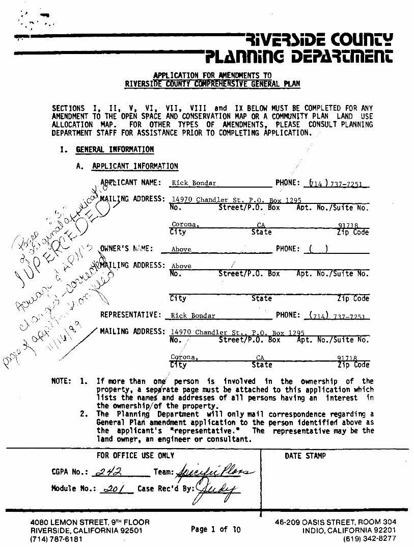
City State Zip Code ) REPRESENTATIVE: Rick Boadar PHONE: (714) 717-7951
MAILING ADDRESS: 14970 Chandler St., P.O. Box 12-95 No. Street/P.O. Box Apt. No./Suite No.
C9tona, CA City State
1;;' &de
9
RiVERIDE COWRY manninc DEnnimEnt
APPLICATION FOR AMENDMENTS TO RIVERSIDE COUNTY COMPREHENSIVE GENERAL PLAN
SECTIONS I, II, V, VI, VII, VIII and IX BELOW MUST BE COMPLETED FOR ANY AMENDMENT TO THE OPEN SPACE AND CONSERVATION MAP OR A COMMUNITY PLAN LAND USE ALLOCATION MAP. FOR OTHER TYPES OF AMENDMENTS, PLEASE CONSULT PLANNING DEPARTMENT STAFF FOR ASSISTANCE PRLOR TO COMPLETING APPLICATION.
I. GENERAL INFORMATION
A. APPLICANT INFORMATION
IRLICANT NAME: Rick Bondar PHONE: (714 )737-7251
IL)1416 ADDRESS: No .
14970 ChandlsetrreSett./Fpk Box
1294t. No./Suite No.
'Cit Corona, CA 9)718 City State Zip Code
12 OWNER'S VNE: Above PHONE: ( )
'LING ADDRESS: Above No. Street/P.O. Box Apt. No./Suite No.
il NOTE: 1. If more than on person is involved in the ownership of the
property, a sep rate page must be attached to this application which lists the name and addresses of all persons having an interest in the ownership/of the property.
2. The Planning Department will only mail correspondence regarding a General Plan amendment application to the person Identified above as the applicant's "representative." The representative may be the land own', an engineer or consultant.
srm'
<‹,?
FOR OFFICE USE ONLY
CGPA No.: c,17 1,1, Team:
Module No.: ,;,./o/ Case Rec'd By:
DATE STAMP
4080 LEMON STREET, 9TH FLOOR RIVERSIDE, CALIFORNIA 92501 (714) 787-6181
Page 1 of 10 46-209 OASIS STREET, ROOM 304
INDIO, CALIFORNIA 92201 (619) 342-8277

a. Proposed Project or La d Use: Specific Plan
vices:
Name Agency Serving Area: Are Facilities (if none, write "none") present at site?:
2. Utilities and Se
B. PROPERTY INFORMATION: (required for amendments to Open pace and Conservation Map and Community Policy Area Land Use Alloc tion Maps; may be required for amendments to other maps if determin necessary by the Planning Department staff):
I. Property Description:
a. Location:
ye.. Northerly of 68th St.
b. Size of Area to be Amended: 7 Acres
c: Assessor's Parcel No(s).: 160-030- 01- 008); 160-040-006: 160-050-001,
004, 011
Al
'
ii le
11 11 11 11: 11•• 1 11 11 11: 11• Portion of
d. Section: 18, 19, 30 Township. • 2 South Range: 6 West
e. Zoning: A-2-10: A-2-20; W1
f. Existing Property Use: griculture and Related residential
Southern Cal Edison
Southern Cal Gas Co.
Pacific Bell
Jurupa Comm. Serv. Dist.
Jurupa Comm. Serv. Dist.
x 11" legible reduction of the proposal must accompany lication.
Note: An ap
a. Electric pany:
b. Gas Compa y:
c. Telepho e Company:
d. Water Company/ Dist ict:
e. Se r District:
yes
yes
yes
yes
yes
007, 017
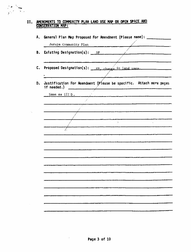
II. AMENDMENTS TO COMMUNITY PLAN LAND USE MAP OR OPEN SPACE AND CONSERVATION MAP:
A. General Plan Map Proposed For Amendment (Please name):
Jurupa Community Plan
B. Existing Designation(s): SP
C. Proposed Designation(s):
in la
- • ••
D. Justification For Amendment ease be specific. Attach more pages if needed.)
Same as III D.
Page 3 of 10

Aro
III. AMENDMENTS TO POLICIES:
(Note: Conference with Planning Department staff required before application can be filed. Additional information may be required.)
A. Location in Text of Comprehensive General Plan Where Amendment Would Occur:
1. Element: Land Use 2. Issue Section: Juruna L.U.P.A.
3. Page: 35 4. Subsection, if any: Kira Iona _Land Use Policies
B. Existing Policy (If none, write "none". Attach more pages if needed.):
Committment to Category III Development (Agriculture Open Space)
along the 1-15 freeway route.
C. Proposed Policy (Attach more pages if needed.): Category II
Development medium to medium high density residential development
between Hamner Ave. & Int. 15, commerical development at Limonte
interchange, medium to medium light residental development between
Int. 15 & Wine ville. D. Justification for Change (Please be specific. Attach more pages
if needed.):
ate 15
unity
I . .
II - I d
_ • O
• I •
• I 40•11'0
IS WO to • uu
,A
achieve in other areas within the Jurupa Community Plan Area because of the lack of large tracts of undeveloped land adnacent to freeway access. The level of public facilities and services is adequate for a mere intense land use, and can be provided as development warrants it. the proposed intensity will be consistent with residental densities to the east and the manufacturing zone to the north. The Interstate 15 corridor will be developed as an intense urban corridor with manufacturing, commerical, and high density residential development. This will warrant a focal community center that can provide regional services that will not be available in other areas of the Jurupa community plan. The 1-15 corridor specific plan will provide an opportunity to develop an integrated community center with regional services and a wide range of residential opportunities.
Page 4 of 10

6rant D.tsr In consideration of $ , receipt of which is acknovdedged
do hereby grant to in,. ;.1. ... , ttn
County of. e the real property in the
State of Califtdnia, described as
All. tly:t cent in re-1 •-•
Frac'. ion , 1 oo Ith ■ •e3t , .;;.rter of rt ^r of yrto.l ,ttettica19 , T r.iOip 0 - , 0 - -
- 4 r. 3 ,
"'`• - erce - '1:7, " , :,'"f 4 """ . ,7 44 '^ ^ 4.
rr of Jectlor. , -
he .o-
-r` • -"'r
trl r".:.• a t"..t
Dated rb' f ! ,!ry ,
RECORDERS ORDER ORDER NO INSTRUMENT NO
State of California,
County of. 5an 5ernardinl" .
on MaY 2 4, 19,52 before Glen A Patton me
WHEN RECORDED MAIL TO
a Notary Public in and for said County, personally c4 appeared. Pat Fran4 Vernola and
L: • Me wife, Mary Ann_Vernola- .... cr)
known to -lir to he the person . 13. whose name
are .sufincril ■ed to the within Instrument and
acknowleiLud to cc th.,they... executed the same.
Witneas my-tiand and official
a
Notary Public in and f , r. said County and State - ,
CUR. 0 b
‘\

NOW!
el*
t -,I
1 . . $ am() 4- R„....A,,,i, mitt tot t, r Al AN D. VALIV IL* .01'5 M I in St ruct , Site 500
KiV0";itic, ClliforniA V501
AFFIDAVIT - DEATH OF JOINT TENANT
1, pAr FRANK VERNOLA, at legal age, hying duly sworn, depose
and state aS !4 1 1:OWS:
That ANTONIETTA VERNOLA, the decedent mentioned in the at-
tached certified copy of Certificate of Death, is the same person
AS the ANTONIETTA VERNOLA mired as one of the parties in the fal-
lowing deed:
Thtt certain Grant Deed dated May 24, 1952, executed by PAT
FRANK VERNOLA and MRS. MARY AN VERNOLA to PAT FRANK VERNOLA, it
married man, and ANTONIETTA VERNOLA, a widow, mother and son, as
•int tenants, recorded in Book 1386, Page 160, on July 21, 1952,
Rtcards of Riverside County, California, covering the
it towing described property In the County of Riverside, State of
it Io!‘ !I '." . .`111Trq ■ - 1 Till I oA• ,,f snntI n 8,
Ind II ,Ir.t Tin, .'1III it nt•of Fr-'I 1 ,, n I I
' q, S011 , 11, N intn. 14t.c.t , in 11nt 11,11- , TI i'11.1 !Int- i ,411 ,,wn Tv
„I l' wt. II !"1 , Sin I' ''it v It t pt
•,(1 ,„• , ,,• u r I Inv. 1,11 jr111w Ti lt
1 1"(" , i`t 1 , 1110 , `11.: ; 1 •-, 1 11, , , I I oil
i'• I 01 JO Sit I ■ Al 14, 1'. , t.:11 ''Ti I p S.qo I ), or . It , Sin II, tin ii n TI
T , 1 , v Inc, .111,1 inni 1,p n. , Inl I ot it d 0 , 1 i I i , 1 - 111 It ..f
I 1 MI !111 So11111, I col 1 , (•1 t Ni t TI I I 4 , 1 t h B i t " 1:4 , 1
I rt 1 1 hollci 4 , 11111 II (11' F1. , I 5 I , • I
—

. •
4vi 1 !P • 1/41 , •
Satlinlinte ONO
ieflos.
g. . f
•
I hereby certify that this is a true copy of the record It tI seat of this otiice purple ----
J . ) •
p • N-
FEB 15 OH Audi t;r San Berru-rdann county. Callf.
entintwis
3:
111 ••ro .01M• Mr. NINO
ars, '1414:4 Mirth War.* Avs. 190 • -
San Sornarolao It.rieivar"lt Ahtonto
Moopliol
Is 9 19 &Mt ••111ar•ino N.•••••11•11•011• •••■• •••• .1 46•111 iloO 1.•• • It N• •
•••11•••• •••• coroust l000dar safrldlott
••••••-•••••• kriltimolat•tile aordio. - •••• • 4- leandlIP 1111014*
■ ..........••......- IOW Ilsoellasroll • Italy
• ................• 55S-341-,1441
r *No No.
WIMP.. .... V., . row r ..............•.•.. • a...N. • •• ••
MOO
la so
Versals Ranch raroioa
It Vorno la • Son MO 5. Lour.
:SonMornorOino 1 . CA sow :Uplond
r0017 ICatiterr.la Mr.
1
s9 low .11,* rt. ilrtf
• •61 • ••• • • I
1 Upiauwl
• • No
• • ;" '
•
t i to •• • • •• • . • - •• ... N. ,.
"27: '; to • ... • • . . . • ..... o .... • .• •• . ..... • No. oN i i ' - • • — • "tiriollijiiris - - - - - i tottlitsei..4:(0044, . . 6-4-1979
Snlootommti .6*/)0/79 I hirlriftlffittd„ up,,
, Draper Mortuary '- -1-• *Aamott 9. ‘`"Vt .9 I •\1`04‘ 19
I I "san" _ r -
• ■•
t
IND
Thence Easterly by a straight lin., to the point of beginning.
That a Certificate of Release of Inheritance Tax Lien has
been granted by the Inheritance Tax Division of the Office of the
Controller of the State of California with respect to the inter-
eat of ANTONIETTA VERNOLA, deceased, in and to the real property
described above.
ysta4,,,,,ftjahobe_1_... 1984
_ " PAT FRANK VERNOLA
SUBSCRIBED AND SWORN TO before me. a Notary Public in and for
the County of Riverside. State of California. thisaitl:.day of
1984.
Dated*
Ij
T :T
1
r-- •
11- ,•-••-. •
V1t1'.4
Page Two
•-----.--...11111■•■•■11101111111111■
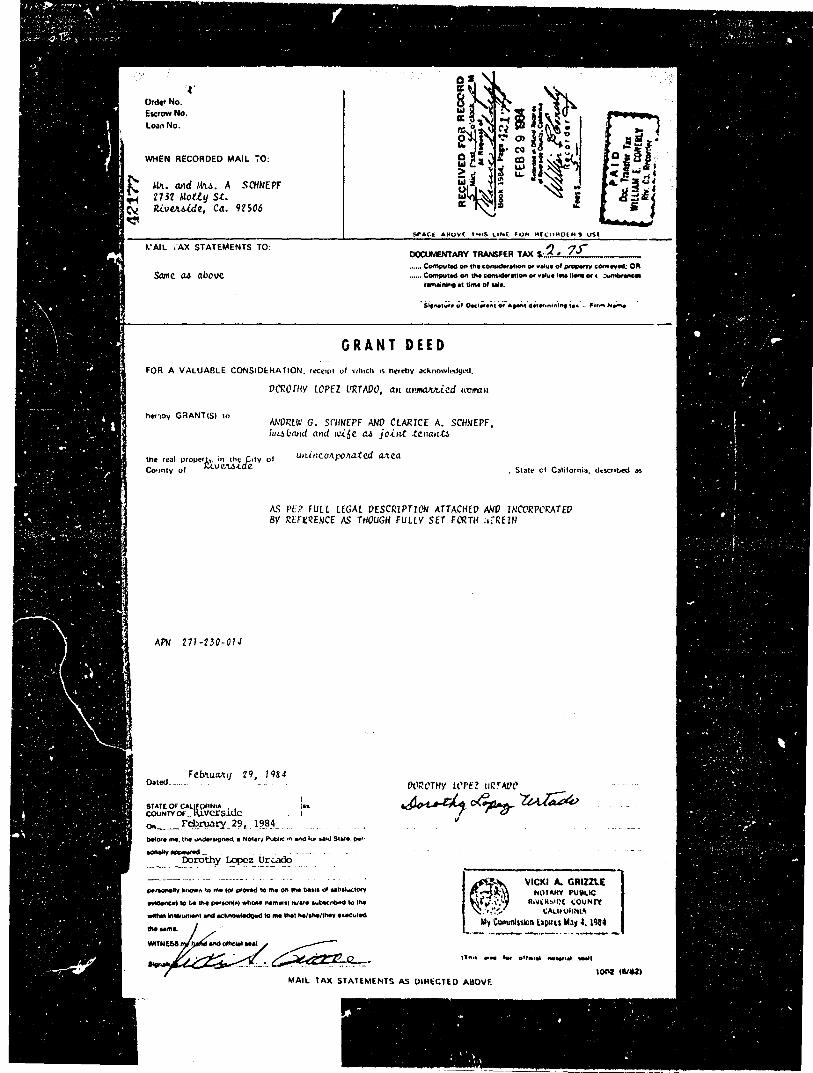
Order No. Escrow No.
Loan No.
Ill
WHEN RECORDED MAIL 70:
Ma. and At4. A SCHNEPF 2732 Maly S. RiveAside, Ca. 92506
CM
0 g • 01 sa 5.
hi 4 iP
SPACE. AtioVE 14,5, LOA FOR R1C000LR 051
VAIL :AX STATEMENTS TO:
Score a6 above
DOCUMENTARY TRANSFER TAX $.- 1 • 75-
.... - Computed on the considention to value of propene Pawned: OR Computed on tho consideration or you. Ion hens oe ttetbeences
remaining it time Of sele.
Sionolio• of Osclar•nt of *own doff...OMNI In - irm Nemo-
GRANT DEED
FOR A VALUABLE CONSIDERATION, receipt of which is hereby acknowledyed,
vcRortiv LOPEZ URTADO, at unnattied avman
herloy GRANT(S) to ANDREW G. SCHNEPF AND CLARICE A. SCHNEPF, husband and wiSe a4 joint totant4
the real properktj tirlekle o f unincoApowted aAca Cognty of , State cf California, described as
AS PEP FULL LEGAL DESCRIPTION ATTACHED AND INCORPORATED BY REFERENCE AS THOUGH FULLY SET FORTH :f:REIN
APN 271 - 230 - 014
Dated_.. Febrmaay 29, 1984
glITL4":41.1TEside on February 29, 1984
DOPOTHy LOPEZ uRTAVO
4'44 C)7:1V- 4.4. 417;4'
Wont Inc the undOugneR • NOW, PubW tn and for seW SW" pow
bOR•Ry aPPIWOR
Dorothy Lopez Urcado
omonothr loORR IR RR P(ORId to me on tho baps at satostectent
wadeoce) to ta Itt. P0,11.0) wham 'Ismael lidate subectilen to Its
within inalmenont ond acknoPodomt to me that no/she/thee 'mooted
VICKI A4 GRIZZLE ,,,ARy PUBLIC
RiVEMs.et COUNTY CALBOhNLO
My Conunission Expo M 4. 1984 the lama
WITNESS and cahoot sma
_ - Pilaw minmiat heal
‘0042 16,4111 MAIL TAX STATEMENTS AS DIRECTED ABOVE
That portion of the Southeast quarter of the Southeast quarter of the Southwebt quarter of Section 28, Township 3 South, Range 5 . West, as shown by Sectionized Survey of Rancho El Soibtante de San Jacinto on file in Book 1 page 8 of Surveys, San Bernardino County Records, described as follows:
COMMENCING at the Northeast corner of the Southeast quarter of the Southeast quarter of the ScuthmeSt qUittet Of said Section; Thence Southerly parallel with the Westerly line of said Section, 165 feet; Thence Westerly, parallel with the Northerly line of said Section, 250 feet, to the TRUE POINT OF BEGINNING; Thence Southerly, parallel with the westerly line of said Section, 165 feet; Thence Westerly, parallel with Northerly line of said Section, 50 feet; Thence Northerly parallel with the westerly line of said Section, 165 fe,t; Thence Easterly, parallel with the Northerly line of said Section, 50 feet to the TRUE POINT OF BEGINNING.
Said property is also shown as Lot 117 on ASSPSSOrS Map No. 55.

Stewart Title Co.
Alp RECORDED, MAL THIS DEED AND, UNLESS 0TH SE SHOWN BELOW. MAN. TAX STATEMENTS
I- Mr. Arend John Boa C/O Bank of America-Escrow Dept.
Tol 12490 Central Ave.
r4 Chino, Ca. 91710
Tr Tr !
SPACE ADOvE THIS LINE JR RECORDER'S US /
GRANT DEED ESCROW NO. 4553-3148-SUE 717l.E ORDER NO.
The undersigned grantor(*) declare(s): A.P. N. 134-110-013 Documentary transfer tax is $ 3,520.00
( X ) computed on full value Of property conveyed, or ( ) computed on full value less value of liens and encumbrances remaining at time of sale. ( X) Unincorporated area: ( ) City ot
By this instrument dated JULY 14, 1989 • for a valuable consideration
GERRIT BOS, A WIDOWER AND GERRIT HOS, EXECUTOR OF THE ESTATE OF MARGARET BOS, DECEASED, Superior Court Case No. 57088.
hereby GRANTS to AREND roHN BOS, A MARRIED MAN AS TO AN UNDIVIDED ONE-FIFTH INTEREST AND TCNY DOS, A MARRIED MAN AS TO AN UNDIVIDED CNE-FIFTH INTEREST AND GARY DDS, A MARRIED MAN AS TO AN UNDIVIDED CNE-FIETH INTEREST AND GERTRUDE DYRSTRA, A MARRIED KCMAN AS TO AN UNDIVIDED ONE-FIFTH INTEREST AND HERMINA DE VRIES, A MARRIED 4,CMAN AS TO AN UNDIVIDED CNE-FIFTH INTEREST, ALL AS TENANTS IN COMMON
the following described real properly In the UNINCORPORATED AREA OF THE County of RIVERSIDE , State of C.ALIECEINIA
SEE LEGAL DESCRIPTION ATTACHED HERETO AND MADE A PART HEREOF AS EXHIBIT "A".
This document was Ned OS recording by STEWART IITLE CO. n an accornodabon son. it has pot been summed as to ib etecubon of as 10 its elect upon IM 11111 00 its iticotabilitY.
STATE OF CALIFORNIA. coutirt of "fieR 3 11)6
On otay /44 my Wm* nu, the undersigned, a Notary Public In and for sold County and State. personally Wowed
44.rr -4- "Bo 5
personally known to me (or proved 10 TO on the basis of satisfactory evidence)* be the person's) whose mime Is subscribed to tMs
Instrument. and acknowledged that he (she Of they) executed It.
"••00/
ioie, „no/
Gerrit Boa, Executor of the Estate of Margaret Boo, Deceased,
Gerrit Boo
OFFICIAL SEAL ' JAMES D. MCCUNE Notary Public-California
RIVERSIDE COUNTY
My Comm Er* My 20.1991
WITNESS my
I. TAX STATEMENTS TO PARTY SHOWN ON FOLLOWING UNE: IF NO PARTY IS SHOWN. ItAll AS DIRECTED ABOVE.
PAW
Eli BankaAnierka ISC-101 1140 low.11/10,
STU( IT MOMS effV.VATO
244116
ESHIBIT A t.frAL DESCRIETIM
ESCROW NO; 4553-3148-8M DATE: JULY 14, 1989
THE EAST 120 ACRES OF THE NORTH HALF OF SECTION 30, TOWNSHIP 2 SOUTH, RANGE 6 • WEST, SAN BERNARDINO BASE AND MERIDIAN, AS SHOWN BY SECTIONIZED SURVEY OF=
JURUPA RANCHO, ON FILE IN BOOK 9 PAGE 33, WRAPS, RECORDS OF SAN BERNADIND COUNTY, CALIFORNIA;
EXCEPTING 1MIBUEFRO4 THE EAST 20 FEET OF THE Nom HALF OF SAID SECTDON, AS CONVEYED TO THE 03UNTY OF RIVERSIDE BY DEED RECORDED APRIL 23, 1917 IN BOOK 460 PAGE 368, OF DEEDS, RECORDS OF R/VERSIDE COUNTY, CALIFORNIA;
ALSO EXCEPTING THAT PORTION OF SAID htRTH HALF OF SAID SECTIM, AS CONVEYED TO THE 03UNTY OF RIVERSIDE BY DEED RECORDED SEPTINFER 27, 1957 IN BOOK 2154 PAGE 226 OF OFFICIAL RECORDS OF RIVERSIDE COUNTY, CALIFORNIA;
ALSO EXEPTING THAT PORTION OF SAID NORTH HALF OF SAID SECTION, AS OCNVEYED TO THE COUNTY OF RIVERSIDE BY DEED RECORDED OCTOBER 3, 1960 IN BOOK 2776 WOE 74 AS INTIRUMENT ht. 85654 OF OFFICIAL REOMDS OF RIVERSIDE COUNTY, CALIFORNIA;
ALSO ENCEPTING THAT PORTION OF SAID NCRIM HALF OF SAID secrum, AS CONVEYED TO SOUTHERN CALIFORNIA EDISON COMPANY BY DEED REOMDED JANUARY 3, 1969 AS INSIRUPINT NO. 509 OF OFFICIAL RECORDS OF RIVERSIDE COUNTY, CALISMNIA;
ALSO EXCEPTING THAT PORTION OF SAID NOM HALF OF SAID sEcrlai AS VEYED TO THE STATE OF CALIFORNIA BY DEED RECORDED NOVEMBER 13, 1987 AS INSTRUMENT NO. 326125 OF OFFICIAL RECORDS OF RIVERSIDE COUNTY, CALIFORNIA.
lt•Ce113 Ilen■ el Amaral NT Mot alsorime PDC

July 21,1989

4
‘IN
to Ic Aa„.• .41%
EDWARD F. ALLEBES, ESQ. Ll P. 0. Box 2386 0 N a
C4 Riverside, CA 92516 cx .., 0 i :: 4 1 I I
2 < (4.: - i I 1 AND WHEW RECOPOLD .4 AIL 7 w.S OLIO 10011•00111110103
LC IC . .1 3 TO oc §:f
VI 1444. N.
N LAW OFFICES OF
A0040111 EOWARO F LLLLL ES 0
ma "4 IL Co > :.. SII RIVERSIDE AVE . STE EA, .: kt 11 ; ,,,,,,,,, C,,,,400.4,4 44414 rl E. 0
I CD t.) .,:i:' 17$0 78 11 ,47 <
VI
w al ,
1 II,. Ord., No Escrow No . I
THIS SPACE FOR RECORDERS USE
GRANT DEED THE IINDERSt:INED GRANVOIttsI DEO AKE( s)
HN:l fNIENTAltV TRANSFER TAX H
C c on full value of property convey...1.0r
comptitell on full value IeSS rah.. of lion or roc hrances n Ina' it LLLLL of sale. and
C Parcel NO. Gale Area
Li l'Ilitheri.thb41 Area City of
FOR A VALI' ABLE coNsunluvrioN. receipt %Aid, iv I,,',ehy u ku.sledged.
NEIL KASBERGEN and MARTHA KASBERGEN, husband and wife, as jo!mt tenants,
hewhy(JIANT'Sit., NEIL KASBERGEN and MARTHA KASBFRGEN, Trustees, their successors or assigns, of the NEIL KASBERGEN FAMILY 1981 TRUST, dated February 23, 1981.
ate Iolloo out 11N41 ...11 prop... Is to the
Riverside . Siale (Adorow•
Legally dcscribed in Exhibit "A" attached hereto and made a part hereof.
NOTE: * There is no consideration for this transfer. This is a transfer to a revocable trust of which the Grantors are both che Settlers and the Bone ficiaries. Therefore, under Section 62 of the California Revenue & Tax-ation Code the transfer is excluded from the change of ownership pro- visions.
1).0.,1/7/k/71 ,"Ve/j)//
STATE III, CALIFORNIA cur% y RIVERSIDE
March 12 1981 berm, ow. the °oder.
sigew.l. a Nola* v I/I awl for ...id th ,11111V .1111I Slate. per•oodll ■ .oppeared NEIL KASBERCEN & MAR'HA
KASBERGEN 10 be the vervok_S__ _whom. natoeS ar e...,t,,, "b.' to Ilo•
anI ill knowledged 1,14 Ilit•ti the sail,
_NEILIASBERCEN
MARTHA KASBERGEN V
410444,144,
OFFICIAL SEAL 1 EDWARD FAILEBES
NOTARY PUBLIC • CALI:0404
RIVERSIDE BMW commMy . ex;irof OfC 21, 1931
N. Crypt.' or I I)
Notary ('ublic in mot for niitl Gouniy and State Space above for official notarial seal)
NIAIL TAX sTATENtrINTs TO PARTY sitowN ON FOLLOWING LINE: IF NO PARTY SO SHOWN. NIAIL AS unterrEn ABOVE
Nr,_& Urs__Ncil_Kasbergen___ Riverside_Ave_____Onta4a, Name Street Mikes> Gaty & State
CT U.73, 1

2.0011 P Mt,fl 4$0..• 41% in:, Sls,
404 ease "NI= igh• MINM IMP
IIIMINAID • IMAMS stoft *ANA** tat fAt 110111111011 01WW8110* Mel
WW1 111■4911 4i21
Own* Ns two* SPIN. X WOW 1•SCOSIDOS S U14 US. •■•■• •or.
1111•1•■•
GRANT DEED (Excluded from Pro 13 WW1 V NIVOIW10.141**401‘1111111.•• I*: • Ala
15111 INK%) 4111% 111/1 1647:11 74/1 • _ _ : .•••vp••••1 •■••MS •elle• praprote .
, . •./..h. •41.8..1 h.e. or rim wooltrom... nvouotomp se Noy wi IMP. rot •••• .111.
- 1 w000..0....1.4 ot ■ -
4nlit A %Al I AM I. I °NMI* NA I DVS. yam h ketrIov 1111no■Orehret.
NL1L KASULRGEN and MARTHA RASBERGEN, husband and wife. an Joint tenants.
6.1,*% 1 .114ANI.• I- NEIL KASBERGEN and MARTHA KASBERGEN. Trustee*, their successors or assigns, of the NEIL KASBERGEN FAMILY 1981 TRUST, dated february 23, 1981.
• .1..1 1.•
Riverside
Legally described in Exh.bit "A" attached hereto and made a part hereof.
NOTE: * There is no consideration for this transfer. This is a transfer to a revocable trust of which the Grantors are both the Settlors and the Bene ficiaries. Therefore, under Section 62 of the California Revenue & Tax-ation Code the transfer is excluded from the change of ownership pro- visions.
1...-1, /11 SI I .4 • \I lintl's.1%
„i RIVERSIDE 11• March 12, 1981
• .1:1 I Sho, 1..toos•11.
HEIL.KASBERGEN 6. 1ARTHA KLOERcEN _ _ _ . koomn I.. Pvt.
I..1..11••• rev.. wk•••• somira - N1'11 4.414. tr6.1 It. Ow *ohm
...1e.ms...1 a*/ *a thot
7••••••• V pm. INI•ei P.M. wviol rawal• ...I M.o.
2 ' ///iike:./7e0'0/1e•-d"
NEIL KASBERGEN
/W444&/ ; ,JA . MARTHA KASBERGEN v
OFFICIAL SEA!. RANAMPAUEMM
•KnAlli• PUMA • CM if *MA
WNW CONY lap aim *Oro tee 2?. HSI
MAII LAX STA71 swe rs 71/ PASTY SHOWN ON 011.1.0WINI, I Mk. IV NO mail Al) SHOWN. MAII. AS 151117111.1) AIDOVR
Mr. 6 Hrs. Nail Esuammqvam- 824.4 Alt? VA id* Ave. opmfarcA...4.1.341.
III f.• • .11 vo.

EXHIBIT "A"
That portion of the North half of Section 30, Township 2 3ouLh, Range 6 West, in the Jurupa Rancho, in the County of Riverside, State of California, as shown by map of sectionized survey of said Rancho, recorded in book 9 page 33 of Maps, in the office of the County Recorder of San Bernardino County, California, described as follows:
Beginning at a point on the West line of the North half of said Section 30, which bears North 0° 20' 32"West, 1308.67 feet from the West one-quarter corner thereof; thence North 89° 20' 26" East parallel with the South line of the North half of said Section 30, a distance of 1858.13 feet; thence North 00 20' 32" West, parallel with the West line of the North half of said Section 30, a distance of 1190.48 feet to the Southerly right of way of Limonite Street, 140 feet wide; thence South 89° 21' 53" West, along Limonite Street a distance of 103.28 feet to the beginning of a tangent curve concave Northerly having a radius of 14,570 feet; thence Westerly on said curve, along Limonite Street, through a central angle of 2° 00' 32" a distance of 510.84 feet; thence North 88° 37' 35" West along Limonite Street, a distance of 1244.61 feet to a point on the West line of the North half of Section 30; thence South 0° 20' .32" East, 1243.85 feet to the point of beginning.
RESERVING unto the grantor herein a non-exclusive easement for con-struction maintenance and use of water pipelines in and over that portion described as follows:
Beginning at a point on the West line of the North half of Section 30, which bears North 0' 20' 32" West, 1308.67 feet from the West one-quarter corner thereof; thence North 89° 20' 26" East, parallel with the South line of the North half of said Section 30, a distance of 60.00 feet to the true point of beginning; thence North 0° 20' 32" West, parallel with the West line of the North half of Section 30, a distance of 20.00 feet; thence North 89 ° 20' 26" East, parallel with the South line of the North half of Section 30, a ,istance or 1743.07 feet; thence _North 0 ° 30'. 35" West, 1120.14 feet;.thence South 87° 02' 00" West, 15.06 feet; thence North 2° 58' 00" West, 25.50 feet; thence North 87 ° 02' 00" East, 36.17 feet; thence Scuth 0° 30" 35" East, 1146.47 feet; thence North 89° 20' 26" East, parallel with the South line of the North half of Section 30, a distance of 35.06 feet; thence South 0° 20' 32" East, 20.00 feet; thence South 89° 20' 26" Wq.st, 1798.13 feet to the true point of beginning.
' END RECORDED DOCUMENT DONALD D. SULLIVAN. COUNTY RECORDER
RECOMMIT INIOUISMI iv
giamner Park Associates c/o Tatum-Kaplan Financial
alma 924 Westwood Blvd. •910 Ado.. Los Angeles, CA. 90024 Clay •
FIN*
. MAIL TAX STATIMENTS TO
Nom
Same as above
A.P. 160-030-05-7 SPACE ABOVE THIS LINE FOR RECORI USE
Partnership Grant Deed
The undersigned grantor(s)deelare(s): Documentary transfer tax is 125,300.00 OCX ) computed on full value of property conveyed, or
) computed on full value less value of liens and encumbrances remaining at time of sal. Ett ) Jnincorporated area: C ) City of ■ nd
FOR A VALUABLE CONSIDERATION, receipt of which is hereb) acknowledged, CARLSBERG MOBILE HOME PROPERTIES, LTD.-'73
a Limited partnership organized under the laws of the State of California hereby GRANTS to
MANNER PARK ASSOCIATES, A CALIFORNIA LIMITED PARTNERSWP
the following described real property in the unincorporated area County of Riverside • State of California.
SEE EXHIBIT "A" ATTACHED.HERETO AND MADE A PART HEREOF
CARLSBERG MOBILE HOME PROPERTIES, LTD.-73 a California limited partnership
Carlsberg Resources Corporation a California corpor ti Gen al Pa tner Alb
• lam earv, Past
By President
Dated: S_eptember 30. 1987
STATE OF CALIFORNIA
COUNTY OF . Los AsMolca On Pas Om 2nd toy a Oct^ber 0 47 . Woo n,. ino on:wowed • Now/ KOF Fl•FF for
sod SIM. poroonsay oppoome H.I111..o W. Coaay. Jr. personalty Moan lo mos proved b no on Ma Mao 0 mOstaMons raOsem to be Os mom who omaxed T, *Om oNnment as Mo
otlara. and -- Ps Xx
portovily Mown M no a pronsa lo mg co So tom o/ mwdoctory rneenai ha to In• pylon Ows ooramt me non 45101054 5a Me
sea.s."1 Ca r 1 sberg Resources Corporation so corporeal:a MI FOR NOTARY SEAL OR STAMP
oma.M0 Moniatinimaninonl on OMR 0 Ca r 1 "bn r9 "thi to Homo Provo rt las , Ltd . - .73 Om pot-
"T 'CiliU non** Inat omMatl Ms mato Inatnananl. and adooMosamod Ions
r..7............;., a
that ma arrporaessn motuNd Me *IMO as NM polio end lam ....,...• • ,.. ..• ■•■••■
o.......40,0Xn. such parrossNoonsaAml Me aim. FATNESS my hard and 015501 mat

EXHIBIT A
LEGAL DESCRIPTION
PARCEL •
THAT PORTION OF THE NORTHWEST QUARTER OF SECTION 19, TOWNSHIP 2 SOUTH, RANGE 6 WEST, SAN BERNARDINO MERIDIAN. IN THE COUNTY OF. RIVERSIDE, STATE OF CALIFORNIA, AS SHOWN BY SECTIONALIZED SURVEY Or THE JURUPA RANCHO RECORDED IN BOOK 9, PAGE 33 OF RECORDS Or SAN BERNARDINO COUNTY, DESCRIBED AS FOLLOWS:
BEGINNING AT THE INTERSECTION Or THE SOUTH LINE OF THE NORTH.' ;. HALF OF THE SOUTHWEST QUARTER Or SAID SECTION 19 AND THE EAST::...!: , • LINE OF THAT PARCEL OF LAND CONVEYED TO THE STATE Or CALIFORNIA BY DEED RECORDED FEBRUARY 15, 1943 IN BOOK 569, PAGE 482.01': "ir OFFICIAL RECORDS. RIVERSIDE COUNTY RECORDS; : •t e.
THENCE NORTH 00003'00 WEST ALONG SAID EAST LINE Or 'THAT . PARCEL CONVEYED TO THE STATE OF CALIFORNIA, 1.230.88 FEET TO . • THE TRUE POINT OF BEGINNING;
THENCE NORTH 90000'00" EAST. 2,665.78 FEET TO THE EAST LINE ' Or THE SOUTHWEST QUARTER OF SAID SECTION 19;
THENCE NORTH 00007'52' WEST (FORMERLY RECORDED NORTH 00006'00' WEST) ALONG SAID EAST LINE OF THE SOUTHWEST QUARTER OF SECTION 19, 105.54 FEET TO THE CENTER OF SAID SECTION 19;
• THENCE NORTH 00008'23" WEST (FORMERLY RECORDED AS NORTH 00006'00' WEST) ALONG THE EAST LINE OF THE FRACTIONAL NORTHWEST QUARTER Or SECTION 19, 692.87 FEET (FORMERLY RECORDED AS SOUTH 693.00 FEET);
THENCE SOUTH 89040'17' WEST (FORMERLY RECORDED AS SOUTH 8904200" WEST), 2,664.58 FEET TO THE EAST LINE OF SAID • PARCEL OF LAND CONVEYED TO THE STATE Or CALIFORNIA;
THENCE SOUTH 00003'00" EAST ALONG SAID EAST LINE, 783.13 FEET TO THE TRUE POINT OF BEGINNING;
EXCEPT THAT PORTION LYING WITHIN THE FOLLOWING DESCRIBED PROPERTY:
BEGINNING AT THE NORTHWEST CORNER OF THE LAND DESCRIBED IN A DEED TO SWAN LAKE CORPORATION RECORDED APRIL 9, 1964 AS INSTRUMENT NO. 43558, OFFICIAL RECORDS, PEING A POINT ON THE EAST LINE OF THE LAND DESCRIBED IN A OECD TO THE STATE Or
00 . CALIFORNIA RECORDED FEBRUARY 15, 1943 IN BOOK 569, PAGE 482 OF
; SAID OFFICIAL RECORDS, NORTH 00003'00' WEST, 1,230.88 FEET ON
gel SAID EAST LINE FROM THE INTERSECTION OF THE SOUTH LINE OF THE NORTH HALF OF SAID SOUTHWEST QUARTER;
THENCE NORTH 00007'52' WEST, 105.54 FEET ON LAST SAID EAST: LINE TO THE CENTER OF SAID SECTION;
THENCE NORTH 00008'23' WEST, 59.46 FEET ON THE EAST LINE Or THE NORTHWEST QUARTER OF SAID SECTION TO A LINE PARALLEL WITH AND NORTHERLY 165.00 FEET FROM SAID NORTH LINE OF THE LAND DESCRIBED IN SAID DEED TO SWAN LAKE CORPORATION; . .
THENCE WEST 2,665.63 FEET ON SAID PARALLEL LINE TO SAID EAST LINE Or THE LAND DESCRIBED IN SAID DEED TO THE STATE OF CALIFORNIA;
THENCE SOUTH 00003'00" EAST, 165.00 FEET ON LAST SAID EAST LINE TO THE POINT OF BEGINNING.
CD CD THENCE EAST 2,665.78 FEET ON THE NORTH LINE OF SAID LAND
01•
DESCRIBED IN THE DEED TO SWAN LAKE CORPORATION TO THE EAST LINE OF THE SOUTHWEST QUARTER OF SAID SECTION; •

1. •
• ..r..44.v.r,::!
ATICEL_Z : -
:1;11 :04 THAT PORTION OF THE NORTH HALF OF THE SOUTHWEST QUARTER 01 1-4(...;1 FRACTIONAL SECTION 19, TOWNSHIP 2 SOUTH, RANGE 6 WEST, volloi BERNARDINO MERIDIAN, IN THE COUNTY OF RIVERSIDE, STATE or i %.9 CALIFORNIA, AS SHOWN BY SECTIONALIZED SURVEY OF THE JURUPA,)6.i ts. . 4 RANCHO RECORDED IN BOOK 9, PAGE 33 OF RECORDS Or SAN BERNARDINO.X:. COUNTY, DESCRIBED AS FOLLOWS:
• 11. BEGINNING AT THE INTERSECTION OF THE SOUTH LINE OF SAID NORTHIAle HALF OF THE SOUTHWEST QUARTER Or SECTION 19 AND THE EASTERLY " 0•4'41:4A. LINE OF THE PARCEL OF LAND CONVEYED TO THE STATE OF CkLIFOkNIA ' •
r , BY DEED RECORDED FEBRUARY 15, 1943 IN BOOK 569, PAGE 462 OF q OFFICIAL RECORDS, RIVERSIDE COUNTY RECORDS;
THENCE NORTH 00003'00 WEST ALONG SAID EkST LINE OF THAT% PARCEL CONVEYED TO THE STATE OF CAIFORNIA, 1,230.88 FEET; -
•
THENCE NORTH 90000'00" EAST, 2,665.76 FEET TO THE EAST LINE.; . .. OF THE SOUTHWEST QUARTER OF SAID SECTION 19;
THENCE SOUTH 00007'52' EAST (FORMERLY RECORDED SOUTH 0000600" EAST) ALONG SAID EAST LINE OF THE SOUTHWEST QUARTER OF SECTION 19, 1,213.64 FEET TO THE SOUTHEAST CORNER OF SAID 1/4. NORTH HALF OF THE SOUTHWEST QUARTER OF SECTION 19; : THENCE SOUTH 8903747' WEST (FORMERLY RECORDED AS SOUTH 8903900" WEST) ALONG THE SOUTH LINE Or THE SAID NORTH HALF • OF THE SOUTHWEST QUARTER OF SECTION 19, 2,667.54 FEET TO THE POINT Or BEGINNING. A
PARCFL 1.
THOSE PORTIONS Or THE NORTHWEST QUARTER AND OF THE SOUTHWEST ' QUARTER OF SECTION 19, TOWNSHIP 2 SOUTH, RANGE 6 WEST, SAN %. BERNARDINO MERIDIAN, IN THE COUNTY OF RIVERSIDE, STATE OF • CALIFORNIA, AS PER MAP or SECTIONALIZED SURVEY OF THE JURUPA ..:.,,,, RANCHO, A COPY Or WHICH IS RECORDED IN MAP BOOK 9, PAGE 33 IN THE OFFICE Or THE COUNTY RECORDER OF SAN BERNARDINO COUNTY, • CALIFORNIA, DESCRIBED AS FOLLOWS:
BEGINNING AT THE NORTHWEST CORNER OF THE LAND DESCRIBED IN A .• DEED TO SWAN LAKE CORPORATION RECORDED APRIL 9, 1964 AS , INSTRUMENT NO. 43558, OFFICIAL RECORDS, BEING A POINT ON THE •• - EAST LINE OF THE LAND DESCRIBED IN A DEED TO THE STATE OF : ) CALIFORNIA RECORDED FEBRUARY 15, 1943 IS BOOK 567, FACE 482 OF OFFICIAL RECORDS, NORTH 00 00300" WEST, 1,230.88 FEET ON SAID . EAST LINE FROM THE INTERSECTION OF THE SOUTH LINE OF THE NORTH' HALF OF SAID SOUTHWEST QUARTER;
• :t. , THENCE EAST 2,665.78 FEET ON THE NORTH LINE OF SAID LAND DESCRIBED IN THE DEED TO SWAN LAKE CORPORATION TO THE EAST LINE i• OF SAID SOUTHWEST QUARTER;
• -vet •1.• THENCE NORTH 00007'52' WEST, 105.54 FEET ON LAST SAID EAST%A." ...4.4 .
LINE TO THE CENTER OF SAID SECTION;
•-.THENCE NORTH 0000823" WEST, 59.46 FEET ON THE EAST LINE OF-..h -• THE NORTHWEST QUARTER OF SAID SECTION TO A LINE PARALLEL WITH ' AND NORTHERLY 165.00 FEET FROM SAID NORTH LINE OF THE LAND r.4 • DESCRIBED IN SAID DEED TO SWAN LAKE CORPORATION;
•
-..-THENCE WEST 2,665.63 FEET ON SAID PARALLEL LINE TO SAID EAST - i-r. OF •■••.- LINE OF THE LAND DESCRIBED IN SAID DEED TO THE STATE
CALIFORNIA; •
.* THENCE SOUTH 00003 5 00' EAST, 165.00 FEET ON LAST SAID EAST ". %.LINE TO THE POINT OF BEGINNING.
good GO;
CD C0 1
Zak'

II____111111.111111111111111111111
Lawn I Jan. 12,1989 Photographed By.T1cor
ag a
L J
RECEIVED FOR RECORD rupacuomx
AN 1 2 ON ammorwmomml.
1-N-42
..A,hVEVORS Mminummoth221
INRWO
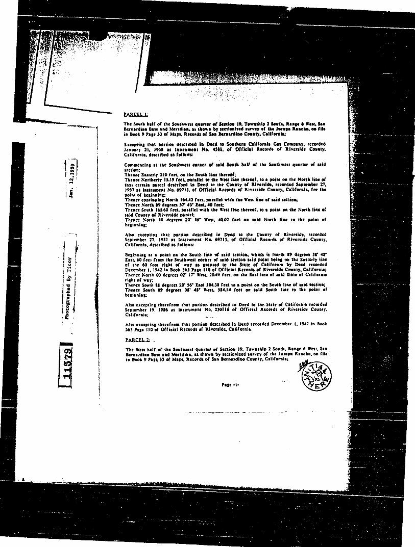
.14.0
PARCEL
The South half of the Southwest quarter or Settles It Towashlp 2 South. Range 6 West, Sal Bernardino Base and Meridian, at shown by seetionised survey of the Jumps Rancho, on file in Snell 9 Pate 33 of Maps. Records of San Bernardino County. California;
Excepting that portion described In Deed to Southern California Gas Company, recorded January 21, 1931 as Instrument No. 4511. Of Official Records of Riverside Canonry, California. described as follows:
Commencing at the Southwest corner of said South half of the Southwest quarter of said section; Thence Easterly 210 feet, on the South line thereof; Thence Northerly 13.19 feel. parallel to the West line thereof, to a point on the North line of that certain parcel described is Deed to the County of Riverside. recorded September 27. 1957 as Instrument No. 69713. of Official Records of Riverside County, California. for the point of beginning; Thence continuing North 164.42 feet, parallel with the West line of said section: Thence North /9 degrees 57' 43' East. 40 feet Thence South 163.60 feet. parallel with the West line thereof. to a point on the North line of said County of Riverside parcel; Thence North II degrees 20 36' West, 40.02 feet on said North line so the point of , beginning;
Also excepting that portion described in Deed to the County of Riverside. recorded September 27. 1937 as Instrument No. 69713. of Official Records of Riverside County, California. described as follows:
Beginning at a point on the South line of said section, which is North 89 degrees sr 48' East. 60 feet from the Southwest corner of said section said point being on the Easterly line of the 60 foot right of way as granted to the State of California by Deed recorded December 1,1941 In Book $63 Page 110 of Official Records of Riverside County, California; Thence North 00 degrees 02' IT' West. 20.44 feet. on the East line of said State of California right of way: Thence South 11 degrees 20' 36' East $84.31 feet to a point on the South line of said section; Thence South 89 degrees sr 48' West. 514.14 feet on said South line to the point of beginning;
Also excepting therefrom that portion described in Deed to the Stale of California recorded September 19. 1986 as Instrument No. 230116 of Official Records of Riverside County. California;
Also excepting therefrom that portion described in Deed recorded December I, 1942 in Book 563 Page 110 of Official Records of Riverside. California.
PARCEL 2.
The West half of the Southeast quarter of Section 19, Township 2 South, Range 6 West, San Bawdier* Base and Meridian. as shown by sectioaized survey of the Jump* Rancho, on file in Book 9 Pan 33 of Maps, Records of San Bernardino County, California;
Page -I-

Page -2-
Escepting therefrom that portion conveyed to Southern California Edison Company, a Corporation. by Deed recorded December 10. 196i as Instrument No. 120541. of Official Records of Riverside County. California. described as followk.
A strip of land 24$ feet wide, the side lines of said strip of land 24$ feet wide. being SO feet Easterly. Northerly and Easterly and 19$ feet Westerly, Southerly and Westerly, measured at right angles respectively. from the surveyed reference line which is described as follow*
Beginning at B point in the Northerly line of fractional Section 19. Township 2 South. Range 6 Nest, San Bernardino Base and Meridian. said point being North 19 degrees 41' 03' East. 1.293.11 feet, m d along last mentioned Northerly line from a found 3 inch iron pipe and nail set at the Northwest corner of said fractional Section 19; Thence South 00 degrees IS' 02' East. 1,784.91 feet, more or less, to a point parallel with and 19$ feet Northerly, measured at right angles, from the Northerly line of the 126.039 acre parcel. as shown by Map on file in Book 7 Page 43 of Records of Survey, Records of R iverstde County. California; • Thence North 89 degrees 2$' 29' East. 2.293.60 feet. measured along said parallel line; Thence South 00 degrees 22' 29' East. 3,525.41 feet, more or less, to a point is the Southerly line of fractional Section 19. Township 2 South. Range 6 West, of the Jumps Rancho. said last mentioned point being South 89 degrees 21' 58' West, 1777.03 feet, measured along, last m:ntioned Southerly line from a found 2 inch by 2 inch stake with tack set at the Southeast corner of said fractional Section It
Also excepting therefrom that portion described in Deeds to the State or California. recorded September 19. 1986 as instrument Nos. 230116 and 230117 of Official Records of Riverside County. California;
Also excepting therefrom the South 20 feet and the Nest 20 fect of the Southwest quarter of the Southwest quarter of the Southeast quarter of said Section 19. as set out in Deed recorded November 22. 1976 as Instrument No. 179279 of Official Records of Riverside County. California;
Also excepting therefrom that portion as described in that certain right or way Deed recorded June 25, 193$ in Book 237, Page 40 of Official Records of Riverside County. California.

/ C. MAKER OF CHECK/CAS
CASE RECEIVED BY: ASSESSOR'S PARCEL NO.: /60 -0.30
APPEAL: El
REVSD V/I 2 YRS: CJ AFTER 2 YRS:
MINOR CHANGE:
UNIT PHASING:
E.A. ONLY:
D. SUB/CONFORNANCE:
EXTENSION OF TINE
STATUTORY CONDO:
EIR NO.:
)24)1't/\ CASE ACCOUNTING INFORMATION SHEET
• A. DATE RECEIVED: - - cF, 1 NO.:
CASE NO.: (;--,/) E.A. NO.: VO 7/ CASES FILED CONCURRENTLY: ,5W,,16 C 2
VESTING: 1:3 SEVERED: EZ NOT SEVERED: 1:3 WAIVED? ns NO 129
FAST TRACT: Ej FLOOD CONTROL: RIVERSIDE MD En BLYTHE 17:1
FIRE DISTRICTS: RIVERSIDE 9- MURRIETA IDYLLVILD J3 PBBIDOUX
B. ES:I9 LOTS: /00T'L *DDT 'L LOTS: MEGAWATTS:
CASE FEE: OVERAGE: S SHORTAGE:
CASE FEE BREAK DOWN
Base Fee:
Number of Acres 0
Number of Lots I
Additional Acres I 0 $
Ea Fee (Base) 0 $
EA Fee acres 0 e $
TOTAL:

qiVERliDE calmly mannin,DEPAREMEllt APPLICATION FOR LAND USE AND DEVELOPMENT
4080 LEMON ST., 9TH FLOOR
46-209 OASIS ST., ROOM 304
27403 YNEZ RD., SUITE 212 RIVERSIDE, CA 92501
INDIO, CA 92201
RANCHO CALIFORNIA, CA 92390 (714) 787-6181
(619) 342-8277
(714) 676-7730
SPECIFIC PLANS GENERAL PLAN AMENDMENTS (714) 787-6356 (714) 787-6183
TEAMS 1, 2, 4, 5 INDIO OFFICE TEAM 3 (714) 787-1363 or 787-1373 (619) 342-8277
REFUND OF FEES Whenever an application is terminated, upon request of the applicant a refund of fees paid may be made by the Planning Department in accordance with the Refund Policy Statement adopted by the Board of Supervisors. If any portion of the application fee has been paid out by the Planning Department to another jurisdiction or agency for services to be rendered in connection with the application, no refund of that portion of the fee shall be made by the Planning Department to the applicant until the other jurisdiction or agency authorizes the Planning Department to refund that portion of those fees. The Planning Department shall retain a processing fee of $60.00 from the total amount to be refunded. (Ord. 348).
I further certify that the application filed is true and correct to the best of my knowledge. I understand that incorrect or erroneous information may be grounds for rejection, denial, or delay of the application.
SIGNATURE OF APPLICANT
DATE
CASE NO. ' ' ' I REG. TEAM NO. CENSUS TRACT NO. MODULE NO. - ■ -
CASE PROCESSED BY CASE RECEIVED BY , r:
ZONING SECTIONS n 0
TOWNSHIP ..
RANGE
APPLICANT NAME ADDRESS CITY, STATE, ZIP ALBERT . & Tt 7 , • ..7, mCCRAY STREET OWNER(S) NAME ADDRESS CITY, STATE, ZIP
BOB & ASSOC. '7 0 CHANDLER STREEH 917 1!- :'
ENGINEER/REPRESENTATIVE NAME ADDRESS CITY, STATE, ZIP
44 1/4- 64 -/- / V es,c od• 37 11 A(1 E Ai/ Sr _ el/Ex 6 i Li ,-. 9as q- PROPOSAL /
iE:i..) THE OPEN SPACE AND CONSERVATION MAP LOCATION
. 71F prtLECROVE AVF.,BETWEEN HAMNER ?„ WTHEvIL Al.TAPJF-7. LOT SIZE
‘'7? # OF LOTS MIN. LOT SIZE SCHEDULE AREA/DIST.
op039 SUPERVISORIAL DIST. LAND USE PLANNING AREA COMMUNITY PLAN AREA
„....
CONCURRENT CASES 4•—■51 ,g4/E 71
5 /. , I (0, C Z. cL i y Ar If _ RELATED CASES
'V& GENERAL PLAN CATEGORY OPEN SPACE AND CONSERVATION ELEMENT
COMMENT/MISCELLANEOUS
THIS CASE IS RELATED TO SPECIFIC PLAN 2b6, 1-15 CORRIDUk ZONING IS W-1, A-2-10 AND R-T APN'S: 160-030-001 THRU 006, 160-040-006, 160-050-001, 003 THRU 009, 011; 134-110-607, 006, 009, 013; 134-120-005, 007, 017. SECTIONS 18, 19 & 30 T2SR6W
ALBERT A. wEee ,& ASSOCIATES AMOUNT PAID $ 3998.u0

ALBERT A. WEBB ASSOCIATES Consulting Engineers
3788 McCray Street • Riverside, California 92506-2973 Telephone (714) 686-1070
FAX (714) 788-1256
ALBERT A. WEBB - ERNEST N. WEBB -
A. HUBERT WEBB JOHN H. STAAF SAM I. GERSHON MATTHEW E WEBB
(1899-1981) (1926-1983)
HAROLD L. MABERRY DAVID M. ALGRANTI RON BUCKLEY WALLACE H. FRANZ
REF. W.O.
FILE NO.
87-202 2451.131
October 9, 1989
Mr. Rick Bondar Bob McCune & Associates 14970 Chandler Avenue P. 0. Box 1295 Corona, CA 91718
RE: 1-15 Corridor Specific Plan
Dear Rick:
I have prepared a map showing the acreages of the ownerships for the participants of the Specific Plan. The acreages have been determine by the Assessor Parcels acreages, and in certain instances, adjustments have been made to reflect the land dedicated for State Highways use. The ownerships, acreages, and percentage of the ownerships are presented as follows:
OWNERSHIPS ACREAGES % TOTAL
1. Vemola 411.17 60.58
2. Sky Country 120.61 17.77
3. Warmington/BOS 97.12 14.31
4. Kasbergen 49.84 7.34
TOTAL 678.74 100.00
In order to file the Specific Plan, zoning, environmental impact report, general plan amendment, and environmental assessment, it will be necessary to secure funds in the amount of $43,017.50. The County fee structure together with the calculations of the filing fee is as follows:
MS/Ltr/I-15 S.PJAHW
Civil Planning Environmental Surveying Assessment

/OA\ ALBERT A. WEBB ASSOCIATES — Consulting
Mr. Rick Bondar October 9, 1989 Page Two
1. Specific Plan plus $27.50/Ac. x 679 Ac.
Engineers
$ 10,626.00 $ 18,672.50 $ 29,298.50 $ 29,298.00
2. Zoning $ 2,801.00
3. Environmental Impact Report (EIR) $ 5,220.00
4. General Plan Amendment $ 3,998.00
5. Environmental Assessment $ 1,700.00 (Max. $1700) $ 469.00
plus $4.50/Ac. x 679 Ac. $ 3,055.50 $ 3,524.50
TOTAL $ 43,017.50
The filing fees per ownership has been determined as follows:
OWNERSHIPS % TOTAL FEES
1. Vernola 60.58 $26,060.00
2. Sky Country 17.77 7,644.22
3. Warmington/BOS 14.31 6,155.80
4. Kasbergen 7.34 3.157.48
TOTAL 100.00 $43,017.50
We plan to file the Specific Plan request tommorrow, October 10, 1989 at 9:00 A.M. It will therefore be necessary to secure the fees from each participant. This company will advance the fees provided that by Friday, October 13, 1989, a check made payable to Albert A. Webb Associates can be received from each participant for reimbursement.
Sincerely,
)7b A. Hubert Webb sik, President
ANW/sm
MS/Ltr/I-15 S.P./AHW
0/1111 ALBERT A. WEBB ASSOCIATES — Consulting Engineers
Mr. Rick Bondar October 9, 1989 Page Three
cc: Mr. Mac O'Donnell The Warmington Co. The Center Town 650 Town Center Dr., Suite 400 Costa Mesa, CA 92626
Neil & Martha Kasbergen 12400 Limonite Mira Loma, CA 91752
Pat & Mary Vemola 12080 Bellegave Mira Loma, CA 91752
bcc: Mr. Broer Vander Dussen Sky Country P. 0. Box 1798 Chino, CA 91708
Mr. Bob McCune Sky County P. 0. Box 1295 Corona, CA 91720
Mr. Lou Laramore Sky Country P. 0. Box 8367 Riverside, CA 92515
MS/Ltr/1-15 S.PJAHW

CASE NO. EA. NO. STAFF USE ONLY
VII. ENVIRONMENTAL INFORMATION FORM
Please complete Parts land II of this form and provide AI of the additional materials requested in Part III. Failure to do so may noisy the review and process of your project If you are unable to provide the irdormation, or you need assistance, please feei free to contact the Planning Department at (714)7874418.
PART I: General Information
1. What is the Total Acreage involved? 735
2. Is there a previous application filed for the earns site? YES 0 NOD If 'Yu," provide Case Number. Also provide the Environmental Assessment Number, If known, and Environmental Impact Report Number, if applicable.
CASE NO. (Parcel Map, Zone Change, etc.)
EA. NO. If Known), EIR NO. Of applicable)
3. Additional comments you may wish to supply regarding your project (Attach an additional sheet V necessary.)
PART II: Environmental OuostIonnaln
1.1$ the project within an Alquist•Priolo Special Studies Zone? YES 0 NO DIV
To determine If your project is located in a Special Studies Zone, contact the Public Information Section, or refer to the Special Study Zoneslitaps available at the Public Information Counter of the Planning Department. If the project is within a zone, refer to Ordinance 547.1, or discuss the situation with the Planning Department Geologist
If a fault hazard report Is necessary, complete the investigation prior to submitting your application and provide 6 copies of the report with this form. If a waiver of the requirements is granted, submit a copy of the waiver with this form.
2. Is the project located within a hazard management zone or liquifaction area as shown on maps of the "Seismic Safety Ele-wont Technical Reporr? YES 0 NO FY
To determine if your project is subject to the geologic hazards noted above you should consult the "Seismic Safety & Safety Element Technical Report" which is available at the Public Information Counter of the Planning Department
If the answer to question *2 is "Yes," contact the appropriate Geographic Planning Team Section to discuss appropriate measure to minimize the hazard. Incorporate any mitigation measures into the project oesign prior to submitting the applica-tion or indicate in the space provided below the results of your discussions with the Planning Team.
3. If your project is in the desert area, is it within a blowsand hazard area? YES 0 NO ca The Planning Offices in Indio and Riverside will provide you with information concerning biowsand hazards. You may also wish to contact the U.S. Soil Conservation Service.
If your project is subject to blowsand hazards, submit a biowsand control plan with the application. (Also refer to Section 14.1 of Ordinance 460, if your project is a parcel map or subdivision).
4. Is water service available at the project site? YES 0 NOM If "No; how far must the water line(s) be extended to provide service?
Number of feet or miles
Further explanation:
...al.& 1.1
01 40 01 afied
rtsrdg--une
:
3VnivNele
3Noifat
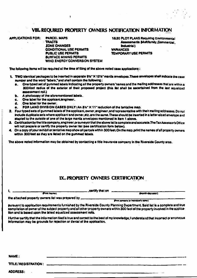
VIII. REQUIRED PROPERTY OWNERS NOTIFICATION INFORMATION
APPLICATIONS FOR: PARCEL MAPS TRACTS ZONE CHANGES CONDITIONAL USE PERMITS PUBLIC USE PERMITS SURFACE MINING PERMITS WIND ENERGY CONVERSION SYSTEM
111.30 PLOT PLANS Requiring Environmental Assessments iMultdamily,Crommereeig. Industrial)
VARIANCES TEMPORARY USE PERMITS
The following Items will be required at the time of filing of the above noted case applications:
1. TWO identical packages to be inserted in separate filYs" X 12Y," manila envelopes .These envelopes shall indicate the case number and the word labeleand shall contain the following: a. One typed set of gummed labels indicating all the property owners'names and the mailing addresses that are within a
300400t radius of the exterior of their proposed project (this list shall be ascertained from the test equalized assessment roll.)
b. A photocopy of the aforementioned labels. c. One label for the applicant/engineer. d. One label for the owner. fp. FOR LAND DIVISION CASES ONLY :An SW" X 11" reduction of the tentative map.
2. Four typed sets of gummed labels of the applicant, owner,ongineer,and representative with their mailing addresses.Do not Include duplicate sets where applicant and owner,etc.are the same.These should be inserted Ins lettersized envelope and stapled to the outside of one of the large manila envelopes mentioned in Item 1 above.
3. Certification by the title company, engineer,or surveyorthat the above list is complete and accurate.TheTaxAssessort Office will not prepare or certify the property owner list (see certification form below).
4. On a copy of your exhibit ortentative map show all parcels within 300feetOn the map,print the names of an property miners within 300 feet as they are listed on the gummed labels.
The above noted information may be obtained by contacting a title Insurance company In the Riverside County area.
IX PROPERTY OWNERS CERTIFICATION
Front WIPP" 11011M0011111 RIM 1
pursuant to applicostion requirements furnished by the Riverside County Planning Department Said list is a complete and true compilation of owner of the subject property and all other property owners within 300 feet of the property involved in the applica-tion and is based upon the latest equalized assessment rolls.
1further certify that the Information filed is true and correct to the best of my knowledge; I understand that incorrect Or erroneous Information may be grounds for rejection or denial of the application.
NAME:
TITLE/ REGISTRATION :
ADDRESS:
1, seer* that on enrol Nam)
the attached property owners list was prepared by

MAPS, PHOTOS & EXHIBITS

suo
po
oi
ol o
yd
-n

g? f 4=,

T...

0,a
—
-
• VS!"-
.Itsp f - s
101
._. •
01.1a Ws M. *dew sec..., Owe., b• Ir. ode, C.•••
Ca C.** 4.00.7
ove•an pratad c•Calc soyakno ere ocrmor, ••cl apeen • a
•••••• Old pc"
PROPOSED JURUPA SPECIFIC PLAN

NOT A PART
•=1-a
LEGEND
USF ACM DUIAC taws
L. ae, m • 70 700 • 11777
. 3° 0 • 1.4 MA • S10
0, Nit) 2 • •
6
PROPOSED
JURUPA COMMUNITY PLAN AffL=L

LEGEND
USE ACRES 041/AC VNIT3
a 02 • - - 100
Se • • 1.775 - 2.11
• - 6 MO • VW
55 IC • 2 N . IC
120
0311•0 11.7 3.30 • 4.7.
04•101[ Cami•I 1.•••10
•••••••••■ ..••••••.•••
ADOPTED
JURUP A COMMUNITY PLAN 4: ANS. P.N. SIN.I . ..NT
C"" ' ' ■•'■ '''' ''' ....... .. ■ ...

Figure 1 ■ :.. e. i.•• •• .•.•.....
1, ,Well •
...a I
AVE • V .....
... ... --".
... .1
. • . I:1
• .. •
•••• .... ... •
•
v•ow,
• Tank?
W.0.87-202 T.2S.R.7W..Sec.11).30.USGS,7.5 °Quaa.C.orocte North.CA
WEBB 0
FEET 2000 Vicinity Map ASSOCIATES,

116/ A
ON
C) 165 62 t Ac
641/I Par. IjI AA
65'
/7./Ac
307 '
0 .47_*Ac
• . • ":" . :1..nag.-1.17•"••-i
vse
La? CC 63 St. /3-379'
0 48 r .40.kAc
... .JP"'
issvv•
0 .404-Ac
eft74. -
310 " 0
43 lAc
.4 )Ac I3o7 vs '
11 0 .5/ 4-Ac r______._.
0 .4J.EAc
0 I .43 Ac
0 .4.314c
307 39
I 0 .47.iAc
05 0 2 941Ac
140
0 307 3 •471Ac 1' '
I @ .47.i Ac
@ .43_ i Ac
161
10 47 .*Ac 307 z..5'
1 14C .5 0
I 0 • .47 Ac
0 .47-Ac
162
I
.47 fAc •
0
.3i7tv
0 .47 ..i- Ac 3/0'
'V. /63 @ .94iAc
3072 '
@ .231 Ac
,5",5-
0 .25./Ac
Z e
0.471.4e.
3/e •
I.
- .26.1.4c
' I.. './1..C- s
.13./Acd .391.4c
,3-3.9"...
.80 .4_ At •
' 3;<; .•'- ' ''•• ••';*-- • •
3/
0
632 . 94 ./Ac
.471.4c /67
.94./Ac
30706 '
St
SO
JO
y a
iopi
pAhy
11
-92/g
y
9 y
/
.307 /3 •
.47./AC
0 .47.* Ac
240 40 i• Ac
/99
so* ao'
37
71
A 3
N1,4
4
PO
R. N
W 1
/4 S
EC
. /9, T
2S
, R6
W.
7: •
0 40/-Ac
/A-

157 (1 45
6 11 ••••
IRA. 059- 062
A, f5' 13/76'77 RIVEROALC ACFE
Rs MAP BK. /5 PG,/ / PE COUNTY , CA L /F.
4 RI
WINEVILL 1111■11 611.1;66. 411==••• dimml• 111■11•
o* i AVE. 12 ' 66 . 66' 66 '
N17
c
0
66
- eo' 132 132 0
Pc)
AVE
I k
52 2a.
FRANK 1 32'
Iftomit
C‘l
NO . 1 b'
POR WI/2 SEC. 29 T 2 S R6 W
Dirt OLOHO 1/79 M. 7 11./0
NOV /974

too. 25 5 '
II WI
.3 2.6 ao
A VENUE Lo
IVO ° j7 .10
104 ZP4.07
256.63
-FRANK Per. Lot
Lo/ Per
01'
Ct) 225'
‘a.
132
*A
DATA: ES S4/1/1 •• OA, Waal! AVE &OFF
ASSESSOR'S MAR 9/f /.57 PS RIVERS/OE COUNTY , CAL/r.
7-45
rR.A. 059.462 /57-18
zas s"
A-VENUE-- Dan AD No. array.
MB. /3/76-77 Riverdale Acres
NOV. /974
POR SW //4 ,SEC.29,T25 R6W.
. 4.. ,,,_ 1 .- Gt 41 .4, al tb N ■ A
179 1 .
420 '

N //2 SEC. 30 7.-2 SR. 6 W. (POR. JURUPA
LIMO-N/TE 5-44.52' r--
myti2z, ,
T.R.A. 5905
L2 #5- LY:
.744-1
—-
' 4 ts s
MI VI ,GA
.44/E . /777. 0
97/3Ac-1
I7o7. •3
4 31 • 31' 33
1337. 7C
0 0
/ 0
_25
/5
V
WIN
EV
/LLE
03
_
24 /9
25
49
/858 /8
/34- //
19 20 _
29
.7443
78 20Ac
fll4ZDNQ NEW NO
. 5.s 4/75 I 5I. T
5/75 I 4 I / 9
11911,111.11111111ME /0/414 * I II • a
/ /S 3 15, sr IMINEINIMIll 1.001.111111.111 lail MN
,
ialifill EU
160 160 05
0
oz.
4/.80.4c. ,
c)5"
698.39
EX.
21.00 Ac.±
0.60Ac. 1
vs" 2 ' gh5
499.93
TN15 P IS FOR
ASSESSME/v I PURPOSES ONLY
7°8 9(.. '17 41
4
L /4
I
L. a5 1"5.) `• 10. —
/2J20Ac
A(AP
:3)
1727. a.,
re,
/60 - 04 TIM. 099 - CO9 099-0/2 PORE.//2,SEC/8,7:25 1 R6W
AVE
8
(2).
PWNEWLLE eoa. 'se
\
0 0/6, '3 o ' w 3 q04 • • al Ri2
320
57
46 A
c.
it)
I
N
70
Ac
SO4. to
c' 814-154
700.07 53 0 . 434.39 400.
1/41C)
Z0 0. x i,
sew ma OLD AU DATE
1/88 a 7• g 25 63
DA 74: R.S. 76/57-58
4Pti
ASSESSOR'S MAP 8/C. 160 PG04
RIVER-WE couvn; CALJE
HP
.5507.- 1.983 z-
THIS MAP FOR
ASSESSMENT PURPOSES ONLY

w//4 Cot Ile 41 KT
ye. 9
29 30
32 3/
SCHLE/SMAN, IC T
TI?. A. 5905
7-44, 7-48
/34 - /2
E //4 Cor y
471.97724 — err Jr
68 &7-
THIS MAP o. ;OR ASSESSMENT PURPOSES ONLY
Vir 430'
29,
0
33.02 1 4c.
)(AP
157
175'
'S8E
/48-33-20
Par Par 2
PU
7 192- A i.t.i ® 1
I8.68A CAIA p
l'U
ST
■
A
25 3i 4i
36 3T-
tti k
S 1/2 SEC. 30 7:2S,R.6W ( POR. JURUF'A RANCHO)
0.474: 8/35„0110. , Ai, /6/94-97 . RS /8/49 RS .30/70
ASSESSOR 'S MAP BK 134 PG. 12 R/ V ERSIDE COUNTY , CAL/f:
N. 4'
E X 4c; 2 „Ara- 4r)
01 10..34 Ac
3 / . 49 Ac
J g A ti 3 2 •
• /.2 AcISBE
o.
I /48-33r / - 46 p0
t 9 7 6 11
16 PU
•z; 735
• swAc
vt
-r J(89° .51'/5--,E.
.10,19, Si
01-0 NO. NEW N2
29
3/86
/0
/3
6
/
14 , ST
/5. ST
/6, ST
ST
3/
1 , 21
32 1DATE
I 2/86
.3/86 2/07
I // -Oa
90.945i
4119
24.09 AC.
1 24.09i AC
K
/0
/2
15-GC
I 4707 AC

1
THIS MAR FOR
ASSESSMENT PLirr95E5 ONLY
IRA 099- 0/2 / — .7 PORNW//4 E//2 SEC/9,72S,R6W
141AE14LLE Z.I.e .7.4. AVE:
45367 640
&3 ±
405 2 . 157 ( ‘095 )
/48o
OLD Att tier Aft•
to I t, sr
—04 6 5/96
i/97 /1, ST
iDATE
1/86
9'5 *
t
/ 2 6
' 6:
t.0
•
N
DATA: R 55/IS
/Mr 1266 6/35
AS9c-SS2T $ MAP EiK /60 PG 05
RIVERSDE COUVTI; c4c#:-
XP
I ado
a.
ts-
MB. 9/33 .58 1Ainipc Ron cho
SEPT /985

A
/100. /I
/2
/3
Oro
!-•
/56
05
Seq °4g fzo"
88Acl
AS S
/ 73 Ac
/8.074c
2 2
C.) 69Ac
z A3
24
ICDPU
2249Ac
FOR 60V
LOT 6
LOT A Pm 74//I 4et
For./
67Ac Cr /2944c M
/0 44 /3
Por
38 37Ac /Vt
/0 44,
9(.0 4- 0 8
35 10 Aci-
t
POR GOV IOT 3 47 69Ac
POP GOV LOT 6
43 46Acl
GOV LOT 7
az:1
POR E.//21 SEC/8,T2S.,R6 -W
so'/C0'3o'W 3q04 iL
350
ASSESSOR'S MAP BK /60 P604
R/VERSICE Cal/l/TY, CAL/F
HR
DATA: R.S. 76 / 57-58
WINE ViLLE
NO *05 Zq 4 6 2./..t.
tc)
52
70
Ac.
cc z. ,
1.4
3"
.4,
1/88 7 8
TRA. 099- 009 099-0/2
/60-04
DATE OLD Ara NEW Aki
MB. 9/33 SB. 'coupe Rancho
cc-PT /923
43 . 700 . 07 200 . 550.3,
22.83t
IL•c
2.°)
4
1363 ±
THIS MAP IS FOR
ASSESSMENT PURPOSES ONLY
7% Ayr 4 5
EX
0 /25
Ac
/57-02
/57 - 25 THIS MAP IS FOR
ASSESSMENT PURPOSES ONLY POR. N 1/2 SEC. 29,7:2S. R6W. IRA . 5907
/60
• fbef •Ni 0
assay'',
s te.1.6.4,;;; Ac*. A:0-.3 A
'72' 1 3.22 - 71. P141d1/32
Jo .
410.0
Por 2
OD' 398 111.. Ni
4.30 AC Err —40W— -;4- ' SS 25
Q. 5g700 '
913/ OS'
• 504 4.1
II Flor Por.
/6.30 Ac.'
- — —
. 20 r ,r0
,570d 4. 8 4 8 fry 9 28
I' = 400'
E77W
AN
DA
A SSE SSOR S MAP BK. /57 1%125
RIVERS/DE COUNTY, CAL IF
()ATE
4/79
OLD NO - _ NEW NO
/ 4, Sr
/0/79 4 5
1//7• d 4 -1
0/57 5 /0 - h?
■
1 I kJ ki
09 er (/0 o .ck -,1
PM. 25/65 Parcel Mop 7/39 PM 71/32-33 " " 13/51
AUG' /976

MB 9/33 58 MB /6/ 94- 97
RS 18/49 RS 38/78
ASSESSOR 'S MAP BK /34 PG. /2
RIVERSIDE COUNTY, CALM":
0.4TA:
MEM. 4■106 .111=1.1. •IMMI•
3/86: 6 /5. sr M 5 /2/6 S.5. Kingston Tract 13/86i /3 I /6, 5
12/87 8 i /7, sr I /1-88 1 /0 I/8,19, St
• / 120,2/, St
/9,2/
3/ 32 'DATE (OLD NO.1NEW
12/86 I /2 sr /4,
/0
IS9Z-
! 24.0$; _t AC
124.09 _t A^ /2
Th'S MAP IS FOR ASSESSMENT PURPOSES ONLY
1
KT
2.9 30 (3
; 4707
SCHLE/SM,4N K
•••••.Z
25 36
32
Yes ° ..;-/ /5- .E
S 1/2 SEC 30 772 S.,R6 14% (PO, . JURUPA RANCHO)
ssit /0 .8
3 2 • 2 4 ,•••••"64.31„
32'97 I!
7.35.142- e-
Iff:'
-7.24c
0 3 494c
S8E
4/48-33-46
/
■••••■
gn /0 34 Ac
IM
o
c;
11/ // 4 Cor
KT 49C
(3 ISBE
204^. 1/48-33-20 I
I Pcr- Par 2 I
4-1 I
k:4 1PU I
/5_14
II r
I
TR. A. 5905
33.02 -t Ac.
18.68Ac
5T
52.5 7
7-44,7-48
/34 - /2
E //4 Ccv:
1 1
I- 11 400 1
W/N
EV/
LLE
Lk;
29

T. R. A . 5905
7-44
/34- // TH/S MAP IS FOR
ASSESSMENT PURPOSES ONLY N //2 SLC. 30 7. - 2 5 R. 6 W. (POP. ,./URUP A P0. )
858 /.5 ■IM■Ir MEW •■■••• •■• 411■11, 1■111. MIMIP 09P
/777. 0.3'
160
A--VE 81 • 39' 33 "
/9 20 _
29
400
3.44
' Is 4
t9•1.1 EiA
157 25)
/337. 7E-
97 /3.4c.i
24 19
25 -
•sz
/03 25
49 84 .4c .r
160
03
LIMO-NUE
0 1 4/ 804c ,
78 20.1c.1-
/707..3
NOV 1974
5" 50
A-x
21.00 Ac.:
95
DA74 115 9/33 SB , /6/94
PS /8/49
ASSESSOR'S MAP 81C /34 PG. //
RIVERSIDE COUNTY, CALIF
DATE laS 110 INEW NO
//151 i 4,5,6
4/75 5 7
5/75 4
3/86 2 /O. 5 .
10/87 8 /1,12
1/881 3 13 , S

/ 40C
N //2 SEC 25 7:2 S R. 7 W. (POP. ,/ U RUPA RO )
T. R. A. 5905
7- 47
/34 - 09
co? 23 ' 24
+ 26 A3d
I
7727 ± AC
f 1-
CLOVERDALE
234 85 .± AC
RD
/ 2 4o
9
r‘IC:11
ID A T E IOLD NO VIEW N
10 D4 TA Id 9 /33 S
ASSESSOR'S MAP BK. /34 PG. 09
RIVERSIDE COUNTY, CAL/ F
NOV /974

/34-08 TR.A. 5905
CL 0 VgRDALE RD 25 I D A 7F OLD moinftly NO.
1
51/2 SEC. 24 T.25.R.7W. ( POP. Lit/PUPA HO.)
24
// .2 7 AC
Lu ,
14TA MB
RS
9/33SE,
52/30,
/1/42
57/6/
6°9
3001- AC
/7/11± AC
;1247.
29. 83±4C
t.:
400' 1
/58 (Lin
200±A' 20 0i-4'
40.0Y At'
7-47
*30, 3 1270.85'
400 .tAC
36.63 1- AC.
28 5/ ± AC
39 66f AC
838.5 S.277./C_ .V2 0 • 5- ?' k-
I CI
ASSESSOR'S MA P BK. 134 R'. 08
RIVERSIDE COUNTY, C A L / f"."
NOV /974

4eo
W \IA
OFR UP.
/0 42± AC
IRO
45± AC
4/90± AC 47. 65±
;
/4.32± AC
I 3 7.3. 1 270. 8°
08
/0.32 .± AC
DATA MB 9 /3 3 SB. , I1/42
RS 52/30 , 57/6/
ASSESSOR'S MAP BK. /34 P6.07
RIVERSIDE CCIJA/TY , CAL/ F
NOV /974
DATE CLD /10 INENVIC71
T R A 5905 /34 - 07
POR. N 1/2 SEC. 24 T 2 S. R7 W. (FOR. JURUPA )
.500 AC 29. 85±-AC
RD 25
DATA MO 9/33 SO, 11/42 RS 52/35, 57/6/
'p3U
DD
110 a
q h
0.•;i
/ 00'
'src
/9 30
OA ar OLD NO. NEW NO.
Secs '
511* -1_
41 II .2 71- AC
It
4-30.3' 12 .70.01'
0
40 0 .t. .tr
e o o 200.t/r 20.01-4: 40.01X
.:1 0
i%
ek r. 285/1 AC
0 39 661 AC.
P. k"
0 36.63 1- AC.
208.7,
1.0tX
't.
V- 3
839.5 . _ _ _
-43 ts.
'45
15-0.cd
23 v
35' 25 —
I. ilk- AC
I/20. 21'
CLO4RDALE
BK. /58
-4
1
51/2 SEC. 24 7:25R.7 W. ( POR i/C/RUPA RO.)
TR.A. 5905 /34-08
ASSESSOR'S MAP BK./34 /'. 08 RIVERSIDE COUNTY, CALIF
NOV /974

24
As
23
26
CLOVERDALE
7727 ±AC
/2f. t
re%
(1)
N //2 SEC. 7:2S.R.7 W (PoR. JURUPA RO.
/ 420
234.85 ±AC
't
RD.
14
DATE OLD NO
DATA M B 9/35 S I
ASSESSOR'S MAP BK. 134 /:G. 09 RIVERSIDE COUNTY, CAL/ E
NOV 1974

r1/0
#/44
'1,f
';"
THIS MAP IS FOR
ASSESSMENT PURPOSES ONLY T.R. A. 5905
03
A-VE /777. 0.5'
to' 31 31'
N 1/2 SEC. 30 T 2 S R. 6 W. (FOR. JURUPA RO. I
/ 5,2•.
41 80.4c'
7- 44
/34- //
97 134c1
19
0.701. C
,/
6 9 9 . 3 9 -744.3
78 20118-
..16 et-5
0.80Ac. 1
.
21.00.4c.
99 95 /7o7. 03
89° 2 G' 30"
DATA 1/8 9/35 SO • /6,14
RS 18/49
ASSESSOR'S MAP BK. /34 PG. // RIVERSIDE COUN7Y , CALI f:
NOV /974
DATE 101-0 NO (NCR' NO
I/ MI I 1 4.5. 8
4/15j 5 I T 5/75 . 4. 114 9
I/86 z i 10. ST A2/87 s i li . a
1/88 I 5 i 15, Sr
I I
1

29
See
NSArlocr331°
-4l a CI
7 18.I Ar
£ 1/4 Coc
TR. A. 5905
C0py,
la 33 02 Ac
,
7-44, 7-48
/34 -/2
LAJ
le
THIS MAP IS FOR ASSESSMENT PURPOSES ONLY
9
Nib
Pk Et
430'
S 1/2 SEC. 30 7: 25., R. 6W (POR. JURUPA RANCHO)
W//4 COC • lir KT
•ts 32 ■46
25 3" ge 36 3T-
5/
SCHLEISMAN
JTO•37'11-i
115.
-Tr-4 11.11
SSE 140-33-
e: a 10.54.4e
735
fe
32.k.
1.4
.71
roc/.
Si:
Al
68-th -rkr:P!
le4
0 3/.49 Ac'
DATA: s/sA • Al/.04-17 R$ isAss as JO •741
ASSESSOR'S MAP 81(134 fa 47 RIVERSIDE COUNTY, CAL/F:
52.57'A
29
3/
M. IL 12/6 SB Kingstan Tract
32 DATE OLD AO. AEU'
SAW IS
.1,•4 4 5_ S 5/Iti 4 l/aV • •
i•
NOV. /974
("..)
1 24.09 .t AC /I
15-4,t
1 24.09 ..t AC 10
30
I 4207 .t AC.
CAW
59
PO
R.
NW
//4 S
EC
. /9
,
.0:
YE/
•r-
2
Al
a 0
7-`
DA
TA
: RS
/9/4
9
NO
V /
974
MG
R W
O I
NL
4K
AN
CE
CO
AR
AR
Y O
F C
AL
IFO
RN
IA
This is not o survey of the land, but is compiled for information only, nor is it a port of the report or polic y
to which it may be attached.
001=„I
, o/c
•
66/
0/r , 53/
otef01, ' , 0 23
•
DV
"0"6 ero
oteros. 19/
ot> FLIP' Z Of
V r z9 . V9/ 0
h/ '7/rZ
M.8
. /3/
76
-77 R
iverd
ale
Ac
res
IS
Ole /07 70(/ , so 0„,), / tr
... , 04
0 VW' 08' . c4 /03 _
@
, .5 ' Es/
oteT 6£' 'NI _ @
0.91
• os
0VT/' @
•..5 1 0/
'ot,'9a'' -(4
@ --
,o/f
....
..,
303 ovTos.
1,4 ht ta @
£91 .
- •A - or ffl•
:
,55e
ot, T 17'
,Ss/
orTit, '
. 0 ,
or-Tit, ' •s• 0 0
*0 4
321 E0 .7
i or.Lat, '
...
ote f' Lb'
0 l
Oter Lc . •aa
47202 0 t ff ' it, '
r 1-9/ *641 otIFTV orTze, •
otlf *6' . t VOl
0
ii* orF2O'
(..) :
ot /Flit,' 91
• EIS z0E
or F TO, '
.3 oteT CP '
6 VI 903 oteFfii .
3 3 0
' N 0 ,I4 ZOE %........ ' a
•Z 0 __ in
0 P'Thi•P'
'VFW, '
— Ofl orrot,'
_ ,z08 orT Et, '
e .
S
9 fn. 48,.•
,
d 1
i
3/0
j.) 093f-C
0 47.4c /96 /69
3 7
7/ A
JA
1144
/68 /97 (;4
94e ,C
2t)
trir ,
BK 1 3 4
r..
0 Ac
/10 (3D
0 931AC
17/
77 9j A C
4( 7
6 5 TH
30)
/,72 0 791A C
173 q cf.tAC
74 (3)
9 ± '
(4) / 15
0.:50141
(5-
P C, R 176 C 4.1 z
E
195 V71
1 194
3 ■ 0
Sr
e . 08 04 AC
/93 N
0 , 1 0
0.4 7...i AC . /92
as 0--
_
(2 ,. 04 7_2- 4C 0-
)
0
0 .4 771 ,4 C 1.91
-.-
0 . ,
,
. C...)
047/AC . 1
:
0
3,0'
crs 0-
N E?9° i-i3'. ■
6?
-0_
7S
?/!
M 8
0d
(;8)
ot
dd
sa
3A
r 531v
70
/1 A
1/1/
Z1V1
C ay
e/ s
o
0 39A Ac
186
C.) /79
73 ' 951Ac
307' 82 .6' 82.5' /4/2'
.331Ac .201Ac 27_AAc
/e
MAY
SZ
LI6
0 '0
3S
17// M
S
co
6g
.V
.21
1
A.i
Nn
oo
3
0/S
Y3
A/8
OL
6/
AO
N
SI O
c1 1
.c/ )4
9 c
/V1
V S
d/O
SS
3S
SII
;-+ C.) /77
A/ i9 • f'3
-s. ,73 Ac
(i) 331Ac
2d120
.94.1.4c
11.6'
/89
/88
310'
ten-
PON . 176
4/89•4fs'e
Ac 107 .471Ac
At.
• ■•• ■••• ■■ • • ■• I.e.. .8 11...“.“.. At
160
17
20
/9 2 21 zo
■Pif
TR.A. 5907 /57- 25 Tr+1.5 MAP IS FOR
ASSESSMENT PURPOSES ONLY POR N 1/2 SEC. 29,T 2S R.6W
.° 29 30 r5/65
WIN
EV/
LL
E
MON
0 Pot. Po v.3
17.77 Ac . 1
a. 4511 70-0; L. 50465
Pot. ft!. 3
/6.30 Ac.
os' *P707 2 ...4.
0.5 ' Inint, yrs '
44 Si.3.Aire
.1„70, 4
_ ■ ■ S t a 546 Acitt
n
4. .391i AC. Nt. % --1 0 .
12C.;1:4e: NI I 3
19" N.4 _2 * ;
SI:: • n
n o. ** 430 I AC
1-51444r4I II
Pr 71 7 /. 7 Z . PM/VW
I i LU W
CC N. 0 Q -.4.1
/34 .//
AVE.
■4A
44s- ,.scrassr 3and' ..c'esiv29 28
0.47( C 1.49 AC NEW Ac
PM 25/65 Parcel Mop 7139 PM 71/32-33" " 13/51
ASSESSOR S MAP BA' /571% 2.5
RIVERSIDE COUNTY , CALIF
4/79 ;
I to/ Iv 4
/// 71, _ S
10,7
AU6 /976

ff I
/110. 417
0
/3 .98Ac /73 Ac 1
/8 07Ac
22 or ie
A
Zis.
245
Ror. /
/3. 67Ac I2 94A. M
/044. 13
—tOT Pm 74/1/
33. 694c
oe.4- 0
be
'?)
/2 7 •ere4C'zo"E
/3
1'1 is• to) 4?1
Ftv 2
SSE /48- /3- 19 PAR. /
0 35 V Ac
38 37 Ac iVt
os
F'Of? GOV LOT 3
4346 Aci
GOV LOT 7
2249.4c .1
fURGOV
—6 zor 6
47 6 9.4c
POI? coy Lor 6
_J
2.71

CC.
/ 7 84 9/
TR.A 099- 006 099- 0/2
/60- 03
•
/4515.153
070 15
s,i cN -
!
C!
'&) • IC
CC tn
1,OG r
It
c■3 cl)
14-.51 1 1 SB COUVTr (NJ
I I
ASSESSOR MAP BK 160 FG 03
RI VE RS/Ce COUNTY, CAL/ F
T2S .R6* -
T 2S ,R7w
460-5S
.1=1•••• 111••• ■1M■
..10/%0 2_ 43" .1=M.
P0RSWY4,SEC/8,13PORW1/2,SEC/9,7:25,R6W
THIS IS NOT A SURVEY OF THE LAND BUT IS COMPILED FOR INFORMATION ONLY NOR IS IT A PART OF THE REPORT OR POLICY TO WHICH IT MAY BE ATTACHED.
THIS AI.4P /5 FOR
ASSESSMENT PURPOSES ONLY
2Z.04.
t4.15
••••' I
Yr'
.7/ 25S. 31 /
79U
TIM TITLE INSURANCE COMPANY OF CALIFORNIA
No• oc.,
C)
77 7
4 Ac
1
J.•
MB 9/33 58 .brupa Randy
cFPT /983
TR.A O59- X25
DATA R_S 7/43,a,/70,/.5/89,6VA 75m
OR 504/ 9-57 /NT 4588 1/58
697/5 9/57
0 • ■ 0
1.1

'/881 1 7. 8
oAre loco fda I Nei. A
/60-0 4 THIS MAP IS FOR PORE//2,SEC78,T25,R6W
IRA. 099-009 099-0/2
ASSESSMENT PURPOSES ONLY
WINEV/LLE d '5-8 AVE /443 04C i":".■
WINE VILLE Z.Z. 83 t 350
G
504 4
400 Z0o 75 35 0 700 0 7
DATA: R.S. 76/57-50
ASSESSOR'S MAP 8K /60 PG04
RIVERS/1E camirr, CALIF
43k. 5
27153 !
Z4 "E 4 6 2Z.
CG
MB 9/33 58 Jurupo Roncho
s44
5 2a
"5
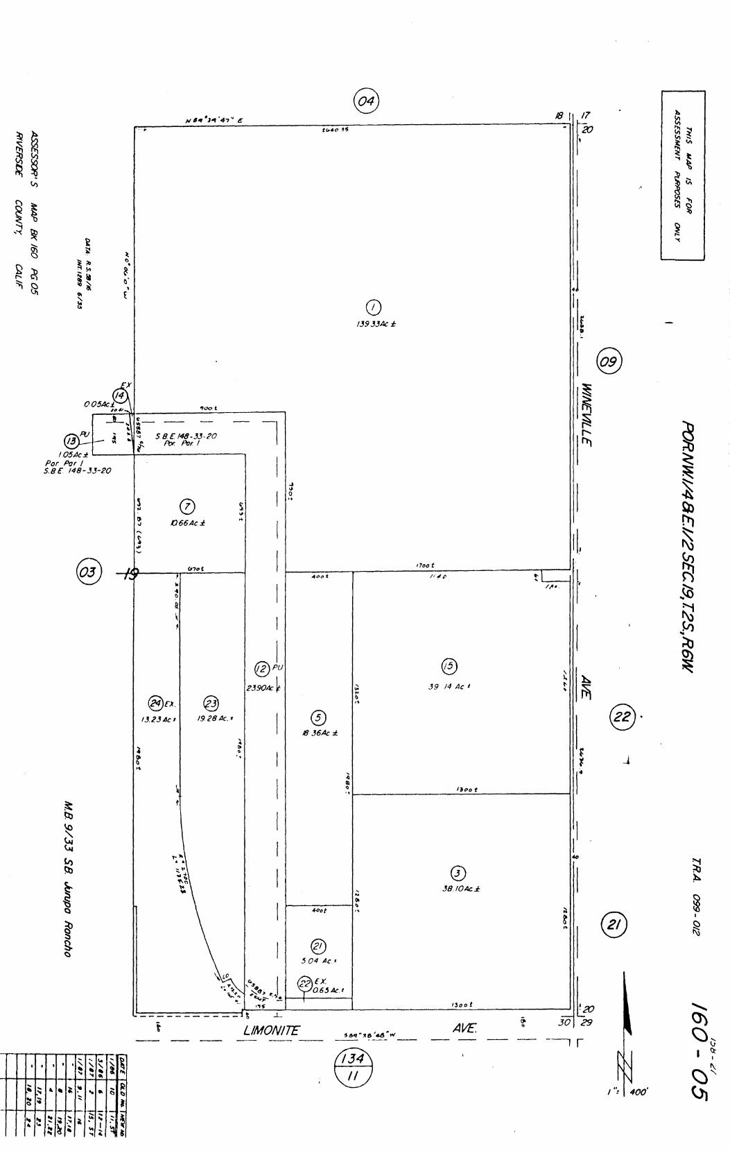
/3933Ac
4
O 66 Ac.
070 t
4 0
00.
13.23 tic
0
/928 Ac.'
#7oo t
400 t
13 36Ac
to
39 /4 Ac
1300 t
/i
/A •
38 /0Ac
0P1.4
• ■41
• it
4 • 11, t. os -- L 4
■ * L d
's .• t .. "'
4.0ot •
• •
0 5.04 Ac.t
(X
065 AC.i
I3oo t
• • •
t
LIMONITE AVE: 3029
r
': 400'
23904:
/7
377
P13N
/M
/ 05Ac Pot Par I
E /48-33-20
sea^ xes'alrov
.41 10, tr.
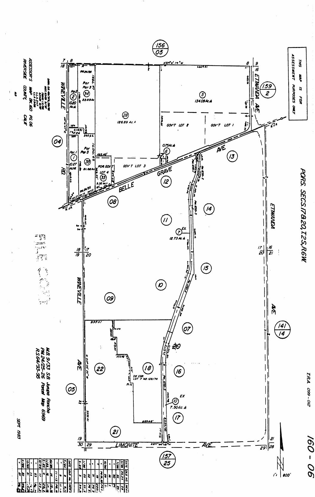
7i8
p t ll ky2s° tiV
/8 4449.41
15409ka f /26.89 4c.1
CO V 'T LOT I
075.4ca
=Me
GOV • T LOT 3 1.
/1 75 Ale
/8 /7 /9 20
- „
401 0f
• 141 14
,Pgn fr4o tA
' .r I. Dr COP.
LOT f I ISO/P4
ra-Ar
EX
7.50Ac.
itAtoog*
/9 50
• Zt%) 29 ,1141Qvr7Z_ MUNN.,
—51
21
rt 800
o
il;b4 a 4
t•c; ,SM 1 4 t nsca k 1 a
a avt kitat4OkIsto. 4

44Y 17
047ACM/44
Etb#AR ,c,•-1353.
4
0 46 Ad+,
PO
RS
SW
//4,S
EC./E
iNW
//4 ,SEC20,T 2
S,R
6W
0 70AcNI 44
0 46.4c "U , s
k
N)
LoT
•A °
A
46'
3 f s, 33
048& /VI
048Ac./V1
/5 0
J 4
48 /VI Leo
szlo t.Y) k.)) (.00 ■0 kel to to to k-4 (A.1
`,A"-N
04 CM
33
04M 32
0 46AcM 3 /
0464c 30
0.46Ac
046k ./VI
46A c M
/4 n.
45AcNt.
/8
A h
/8 17 /9 29
LO •
0 046 Ac /Vt
0464: Nt 047 cM r, P 59' -2 34 "
0464c
619%
t17 r
049A c
0 ACM 85 p2-13
° 26 re 1859 ? - S
046AcM
5
08/.4c NI
0 59Ac NI
0 3
:I 0 48 A c Nt
SEC 17
SEC 20

'36"c SUL /40 .r5
9
a 18592- I ff/ et
0 5/AcM
757 048 ACM
200
0 46AcM Z00 33
0 46 Ac
2°'' 43
R /8591- /
P 9933-7
42
/so
418 /11/31 -33 7thci No 9933-7 418 /20/20-2/ "9933-9 „ Al 8 /28/9/-93 „ /8592 - / „ „ MB 131/25-27 /8592-2
POR NI 4 (1/4,SEC 20 ,T2S,R6W r4O1
Bu7 i COMr:_i.; 'N:(•4"1.1i0r ■ ONLY
NOR IS IT A PART OF THE ;-EKIRT OR POL■Ct
TO WHICH IT MAY BE ATTACHED
TICOR TITLE INSURANCE COMPANY OF CALIFORNIA
IRA 099 - 0/2
046AcM fo
rwy 2.5
3 a i8592-/
510
f. 9
0664C/Vt /0 05/ AcM
75.4cNt
046 Ac/Vt t..9S 4
046Ac 3
0464 At 047AcNt
046Ac/V1 200 /9
046AcM
39 11
® 0 59AcM
/50 5 4
/00 /10 47
41 53 /00
\ 47.47 14- p 3 tf117 4‘ RKC PCR
14/ _ 4L /00 /00
4 LOT 8
28 27 24 25 26 0
Sft
Tr 9933-7
®
/0 a 101 0,
, O0
®
, 0
2/
@
/0
22
C)
/*5
ASSESSOR 'S 444P BK 160 P609
RIVERS/DE 09UN7); CALF
A'Aff.54 3 o' (DT K
/ STRIP

200'
N 89°54'28"E
EX 004 Ac'
ocroRrn /9 RR 4
/660- 4°'/ I.R.A. 099-0/2 20o
C zoo 33
0.48 Ac.
POR. SW 1/4 SEC. 20,125., R.6 W. THIS IS NO" A SURVEY OF THE LAND BUT IS COmPli ED FOR INFORMATION ONLY NOR IS IT A PART OF THE REPORT OR POLICY TO WHICH IT MAY BE ATTACHED
11COR TITLE INSURANCE COMPANY OF CALIFORNIA
0.46 Ac.
II 32 • e
0.48 Ac. 0.464
• 31
0.48 Ac. N 89°54 135" fa
rittssax.1 #00. a
0.48 Ac. " 29 0
0.46Ac. 0.55Ac.
8 0.46Ac 0.46 Ac. 0.46.4c. 0.46Ac 0.46Ac.
0.48.4c. ta,
Lot A Lot 0 -NIAGARA--13MY E 44-21.2.1 o.
8 0.48 Ac.
If 27 = /8
0.46 .4c. 0.48 Ac. 0.48 Ac. 0.464c. 0.46Ae 0.46Ac. 046 Ac.
••
/36 .4.0 0.48 Ac. 0.49 Ac. e /(95
/0 2.0o. 0 • o A ••• •
-■ k■ .1
rt . loco No. ',err too 0.48 Ac. 046.4c. 0.46Ac. 0.6/ Ac. 0.46 Ac.
0
RANGE VIEWfrOAO LOI
• 0.48 Ac 0.46 Ac. ZOO
• f■ 50 e-4- -
0 N. _.0
•al \--' 0 47 Ac., ->
t PUL- RTA!1:e.°"3 r.,
;
10 / 2_J
0 46 Ac.
0.46 Ac. 0.46 Ac. 0.46Ac.
/07 ?33 17(§2I.2.1
0 IP 0
0.474c. •'' ✓ 21 zoo 4 t o
o0 ../ @
/1 0.46Ac. i5 200.
*1;
0.48 Ac
Lot t"
0.48 Ac. 0.46 Ac. 0.46 Ac 0.46 Ac 0.46 Ac 0.46 Ac 048 Ac 0.46 Ac. 203.97
• 52- wi
551°
21 Zi.,_"30 \r /9.7c! 4/7) •
/00
50
OCL 1- -t- 2 1. so Lot A 1 g ... 21' .... 5,, 1 .i 4 /9 A
: el /8 0.9I Ac.
0. 1 0 a) 0.79 Ac. 29. 1 •
r a*C7
z2' .0O2
e i. pelf.
) /7 B7
• ,o /7
■3, ® 4 0.57Ac.
10f 50
100 • 0
0 •1 /6
'1 @
057 Ac
aoc) 17119928-4
., - co 0 0 ../ 33 a. 0
0.574C
If
. 1 -..!
z 32
0.57Ac
fo
.. • 0 0
: 3/
0.574c.
of
. 1, 0
0 : 30
0.574c.
4
. ,
0.57Ac.
..
. .
I` 0
.4 28
@ 0.57Ac.
"
. 4 o
.‘, • 27
(i) 0.57Ac
..
..
a 26
@ 0.57Ac.
''
.. a 0
.. 4 25
0 0_57Ac.
"
. ,
al o
.i ar 24
(..) 0.57Ac.
..
.,
. 2
0.574c.
''
,. .
o .1 0 22
C.) 0.574c
••
0
/00 .
O '"
0.57 Ac.
/00
1- /00./4
20
0.574c.
/Op i4
( s o
• I /9 on O 0 a 0% *I
0.58 Ac 15. 1
4345
'08 II.5
/8
0 .90 Ac.
/-4 , L4
0 Ti s i
/45
DO 24 z -AVENUE-
Lot 0
MB 156/41-43 Tract No. /9928-2 M.8.158/96-98 Tract No.19928-3 M.8. 16245-17 Tract No. 19928-4 ASSESSORS MAP BK. 160 PG.21

/60 -06
/60-22
/ 00'
••
r. /8
0.46,4c 0.464c.
• /2 ; 2 • -- -; • 41 ® " a,-; " ` 0.46 4c- t
0.46 Ac.
0.46 Ac.
M.B. /62/18-20 Tract No /9928 MB /52/43-45 Tract No.19928-1
•••••.0~%
nernpri? /OR
N 89°5430 * /41 2.6 ,00
01
" /6 0
0 "s° 0 46Ac.
tj
• -
1040
POP. W//2 SEC.20,T2S.,R.6W. TRA 099-0/2 a ,.. a
o 20 ° O a
a46 Ac.
/ 00 / S• 47
14 a
r.0 0.80 Ac
0
4 4,
0.5/ Ac.
,00.
40 •
2.1.0 AR6VELLO _
/ 80. 1 33 3‘. . 25
to
0.484c.
,, C.,§ .
1 oo .
24 a 0.46 Ac.
#00 .
"
-
0.464c
# 00
"'
a 2
0.464c.
/00.
leo .
e4
0. 64c
#00. 4samom(
ISMER ;
'•-■
0 ' r
31 c
/ 0 5 .
. _ 264
0.50Ac. e /9 OS
s„,-.' 10
/00
27
0.474c.
/ 00
:
0
/0 0 -
::: Z8
0474€.
, 00
/0 Z. 50
41 ° 29
0.4644
7: 114.---4-40
/97.50TR
z5 30 4 us
SO
I, zoo
0.46 Ac. gl" S.
K)
• C.) 0.46 Ac
0.46 Ac. F 1.-V/0G if"
, -COURT..
1L
8 0.50 Ac.
*
• 0 0.46 Ac.
•
0.78 Ac. 1e7S0 TR 199
0.46Ac. 0.504c 0.474c.
100 loo
RI, ZO-11 /00 100
/ 0 S to/s9re TRnpsZtii
/00 0.46 Ac.
(1.) 0.46 Ac
/ 9 s
DATE cx.0 MO.1 •
1
O. 6 7 A c 0.46 Ac. 0.46 Ac. 0.46Ac 0.46 Ac.
-PA MPUS Lco 8
a • CI
/es. I ic)o
,..\ 9:I 5 /00 . . , /00 . 80 \ /9
. 39 8 /9 /8 „ 17 • /6 • 15 /4
0.484c. 0484c. 0.484c. 0.484c. 0.484c. 0.48,4c. 0.484c.
j** rl 92S - •• • 'VS-, " /oo toy
t)
.. ,
.......1
0.46 Ac. 2
33117 0.47 Ac. v k/
a23o 4
30 Lc' Er. 0.81 Ac 4) -1-
2.00 171/99 / 0 0 r# 199ze-/ zoo 10 -N; /2 o / o
@ "I % 046Ac 048Ac.
le 3 / 0 0 1Z /
8 Ct
0 PI- PerRERO 4- et LO, A
046 Ac. zo,, 046 Ac
0434c,
ora ;so)
IL • / 0 0
100.
0 r 0 . 2
0 046 Ac 0.464 0.464c 0.464c. 0.464c 0.46 Ac.
0.464c. /00 / 0 0 SO '00 .
N 89°5435"E
ASSESSORS MAP BK. 160 PG. 22
RIVERS/OE COUNTY, CAL IF. -,
/34-07 T.R . A. 5905 POR N / /2 SEC 24 7: 2 S. R.7 W.
(FOR. JURUPA R
0 w
hic
h it tr,o
y be attach
ed
DATE MD NO HENN°.
DATA NB 9/53 SR., 11/42
RS 52 /50 , 57/6I
ASSESSOR'S MAP BK. /34 P6.07 RIVERSIDE COUNTY , CAL/ E
NOV /974