
West Side Master Plan
311
Prepared for: Aquidneck Island Planning Commission, West Side Task Force WEST SIDE MASTER PLAN Prepared by: The Cecil Group Pare Engineering Corporation SMWM Edwards and Kelcey Bonz and Company Ninigret Partners, LLC November 2005 AQUIDNECK ISLAND
-
Upload
khangminh22 -
Category
Documents
-
view
0 -
download
0
Transcript of West Side Master Plan
Prepared for:
Aquidneck Island Planning Commission, West Side Task Force
W e s t s i d e M a s t e r P l a n
Prepared by:
The Cecil GroupPare Engineering CorporationSMWMEdwards and KelceyBonz and CompanyNinigret Par tners, LLC
November 2005
aquidneck island
Aquidneck Island Planning Commission, West Side Task Force
Aquidneck islAnd West side MAster PlAn
Prepared by:
The Cecil GroupPare Engineering CorporationSMWMEdwards and KelceyBonz and CompanyNinigret Par tners, LLC
November 2005

The West Side Master Plan reflects the vision and goals of hundreds of Aquidneck Islanders. Although it was written over the past eighteen months, it evolved over a de-cade of collaborative efforts which included local community meetings, focus groups, brainstorming sessions, presentations and long hours of deliberation and planning. For the first time, individuals and groups have worked across municipal, regional, state and federal boundaries to provide a model for future planning efforts in Rhode Island. The Master Plan is now captured within some 350 pages, but only for a moment in time. Soon it will take shape and form within our communities and across our region.
Perhaps the best analogy to describe the Master Plan is that of a master key: unlocking the door to sustainable growth and positive change for our residents and communities. The plan brings us to the threshold, but now it is the free choice and work of residents, planning and zoning boards, institutions, businesses, and city and town councils to turn the key, walk through the door and create a better future.
There are hundreds of recommendations, strategies and concepts outlined in the West Side Master Plan. The ideas look far into the future, and include redevelopment strate-gies for West Side properties, including selected Navy lands which may be excessed or privatized at some point in the coming years. In this manner the plan anticipates a multitude of possible future configurations along the 5,000 acres of the West Side.
The future to be unlocked in the Master Plan includes a sweeping range of concepts from an alternate transportation route to help quiet West Main Road to a shoreline walking trail along Narragansett Bay from McAllister Point to Carr Point. Also among the hundreds of recommendations are tools for preserving agricultural lands, retaining open space and promoting high-quality redevelopment for commercial and mixed-use areas through performance standards.
The plan provides not only the tools, but the timelines for each community to reach both municipal and Island-wide goals. It is inspiring yet practical. Such a unique success must be credited first to our funders, the visionaries who provided the backing for the years of effort on this project. There are numerous individuals and agencies to thank for these donations, and these are listed below. Working side by side with the Aquidneck Island Planning Commission have been the members of the West Side Task Force, also listed herein, who have dedicated nearly a decade to create the groundwork for a successful planning process.
Because the West Side Master Plan has a long history, and is well-known as a collabora-tive effort, its expectations may well exceed reality. It is important to keep in mind, however, that the plan is just a starting point: the real measure of success will be in the implementation of the plan’s ideas. For that phase, the communities of Aquidneck Island will play a key role together with the Aquidneck Island Planning Commission.
Aquidneck Island is a dynamic region with rich resources. The key to success will be long-term application of the tools outlined in the West Side Master Plan, coupled with continued commitment from our public officials, residents and other stakeholders, so that the future of our Island may well match our dreams.
Dr. Robert Quigley, Chairman
West Side Task Force


Aquidneck Island West Side Master PlanAquidneck Island Planning Commission, West Side Task Force
ACknoWledgeMenTSPage i
AcknowledgementsThe Aquidneck Island Planning Commission wishes to thank the members of the West Side Master Plan Task Force for their valued effort, guidance and com-mitment to this plan, as well as all the government officials, Navy representatives, residents, business owners, and members of the community that generously par-ticipated in meetings, interviews and conversations during the planning process.
The West Side Master Plan would not have been possible without the generous contributions from the following funders:
Rhode Island Congressional Delegation - U.S.Department of Commerce, NOAA
Rhode Island General Assembly
Rhode Island Statewide Planning Program
Rhode Island Foundation
University of Rhode Island Coastal Resources Center
Rhode Island Sea Grant
Bank Newport
Alletta Morris McBean Charitable Trust
Town of Middletown
City of Newport
Town of Portsmouth
Prince Charitable Trusts
Prospect Hill Foundation
van Beuren Charitable Foundation
Aquidneck Island West Side Master PlanAquidneck Island Planning Commission, West Side Task Force
ACknoWledgeMenTSPage ii
West Side Master Plan Task Force
Dr. Robert Quigley, Task Force Chairman
Bob Gilstein, Town of Portsmouth
David Sanders, Navy Liaison
George Johnson, RI Statewide Planning Program
Jean Marie Napolitano, Newport City Council
Jennifer McCann, URI Coastal Resources/RI Sea Grant
Keith Stokes, Newport Chamber of Commerce
Kelly Mahoney, RI General Assembly
Louis DiPalma, Middletown Town Council
Paige Bronk, City of Newport
Peter Martin, AIPC Chairman
Roger Poisson, Navy Liaison
Ron Wolanski, Town of Middletown
Steve Devine, RIDOT
Susan Shanley-Szala, RIDOT
William West, Portsmouth Town Council
Tina Dolen, Project Manager, AIPC Executive Director
Town of Middletown, City of Newport, Town of Portsmouth, Naval Station
Newport, Newport County Chamber of Commerce, Rhode Island Statewide
Planning Program, Rhode Island Marine Trades Association, Rhode Island
Department of Transportation, Rhode Island Sea Grant, University of Rhode Is-
land Coastal Centers.
Aquidneck Island Planning Commission
Newport
Peter Martin, AIPC Chairman
Robert Beaver, Chairman, Planning Board
Paige Bronk, City Planner
Middletown
Art Weber, Vice-Chairman
Jan Eckhart
David Lawrence, Alternate
Ron Wolanski, Town Planner
Aquidneck Island West Side Master PlanAquidneck Island Planning Commission, West Side Task Force
ACknoWledgeMenTSPage iii
Portsmouth
Richard S. Wimpress, AIPC Treasurer
dr. Robert Quigley, Chairman, West Side Task Force
Joseph Marshall, Alternate
Bob gilstein, Town Planner
navy liaison Roger Poisson, Planning and Energy Management Branch Head
executive director
Tina dolen
land Use Planner
Teresa Crean
The Aquidneck Island Planning Commission is a joint municipal planning com-mission established by Rhode Island General Laws 45-22 and Resolutions of the Towns of Middletown and Portsmouth, and the City of Newport. The AIPC is committed to providing a forum for communication, coordination and consensus building among Middletown, Newport, Portsmouth, the State of Rhode Island, the U. S. Navy and other federal agencies.
other West Side Master Plan ParticipantsAquidneck Land Trust
Church Community Housing
Grow Smart Rhode Island
Newport Dinner Train
Old Colony and Newport Railway
The Preservation Society of Newport County
Restoration Advisory Board
Rhode Island Coastal Resources Management Council
Rhode Island Department of Environmental Management
Rhode Island General Assembly
Rhode Island Public Transit Authority
Save the Bay
The Foundation Newport
U. S. Environmental Protection Agency (Region I)

Aquidneck Island West Side Master PlanAquidneck Island Planning Commission, West Side Task Force
ACknoWledgeMenTSPage iv
contributing consultants
The Cecil group, Inc.
Steven G. Cecil AIA ASLA, Project Manager
Kenneth J. Buckland AICP LEED AP, Senior Planner
Margarita Iglesia AICP, Project Urban Designer
Pallavi Mande, Planner
Kristen Bendery, Graphic Designer
Marie Pacelli, Graphic Designer
Pare engineering Corporation
Pamela Sherrill AICP, Deputy Project Manager
Kenneth DeCosta P.E., Civil Engineer
edwards and kelcey
David Cabral, Transportation Engineer
Tom Cabana P.E., Civil Engineer
SMWM
Sowmya Parthasarathy AICP, Environmental Planner
Sharon Priest, Planner
Bonz and Company
Richard Bonz CRE, Economic Consultant
Richard Paik, Real Estate Development Consultant
ninigret Partners llC
Kevin Hively, Economic Policy Consultant
Aquidneck Island West Side Master PlanAquidneck Island Planning Commission, West Side Task Force
TAble oF ConTenTSPage I
table of contents
1. Prologue A User’s Guide to the West Side Master Plan ..............................1-2
Structure of the West Side Master Plan ....................................................1-2 linking the Master Plan’s Strategies: Internal References ..........................1-3
The need for a West Side Master Plan ........................................1-4
Working Together to Create this Master Plan ...............................1-6 The First Steps .........................................................................................1-6 Completing the West Side Master Plan .....................................................1-7
Responsibility for the Future ......................................................1-10
2. the Vision for the West side
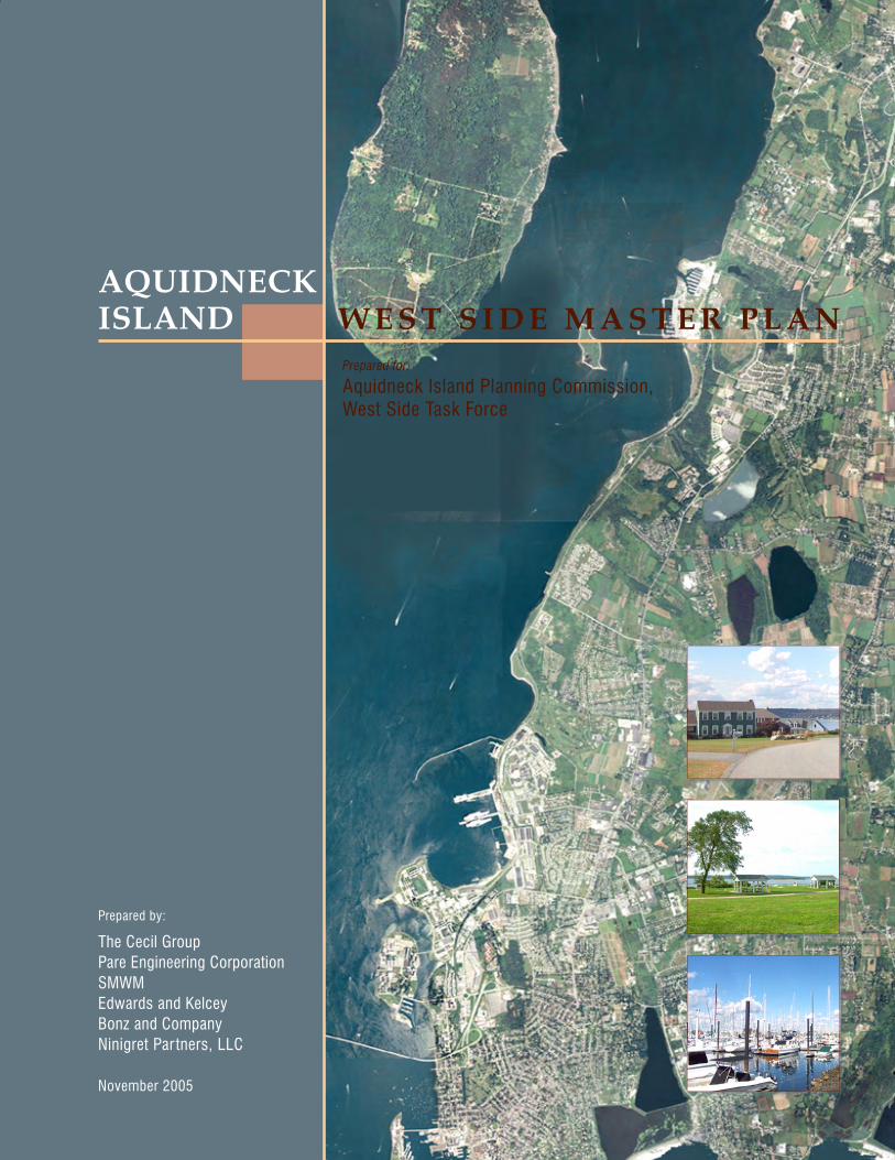
3. oVerVieW The West Side Planning Area ...................................................................3-1
overall Planning Principles ..........................................................3-3 objectives of the West Side Master Plan ...................................................3-3 Criteria for Success .................................................................................3-3
Putting the Pieces Together .........................................................3-5
Summary of Planning Strategies .................................................3-7 land Use Strategies .................................................................................3-7 economic Development Strategies .........................................................3-11 Transportation Strategies .......................................................................3-14 Utilities Strategies ..................................................................................3-19
Implementation Summary .........................................................3-21 overall Coordination Approach Summary ...............................................3-21 Implementation Approach Summary ......................................................3-21 land Use Implementation ...............................................................3-22 economic Development Implementation Summary ..........................3-23 Transportation Implementation ........................................................3-24 Utilities Implementation ...................................................................3-26 Roles and Timelines ..............................................................................3-26
4. Planning context Demographics: The Changing Community ..................................4-1
economic Factors: Jobs, business, Real estate and Housing .......4-4 Military and Military-related Uses ............................................................4-4 Marine-related business and Recreational boating ...................................4-4 Tourism and Hospitality ............................................................................4-5 Commercial office Space ........................................................................4-5 Retail, entertainment and Services ...........................................................4-6 Housing ...................................................................................................4-6
Aquidneck Island West Side Master PlanAquidneck Island Planning Commission, West Side Task Force
TAble oF ConTenTSPage II
Transportation: Moving to, from and through the West Side .........4-8 Historic Trends and Commuting Patterns ..................................................4-8 ongoing Projects and Prospects ..............................................................4-9 Traffic Considerations ...........................................................................4-12 other Modes of Travel: Alternative to the Car ..........................................4-13
Infrastructure: Serving the West Side (and More) ......................4-14 Water Service ........................................................................................4-14 Sewer Service .......................................................................................4-15 Renewable energy .................................................................................4-15
natural Resources: A West Side Heritage ..................................4-16 Conservation and Preservation Trends and Issues ..................................4-17
land Use: open Space and the built environment......................4-20 land Use Patterns .................................................................................4-20 Susceptibility to Change .........................................................................4-22
5. Planning strategies land use .................................................................................5-1
open Space, Recreation and natural Resource Preservation ........5-4 Greenways ..............................................................................................5-5 Identification of Key Areas for open Space Preservation ...........................5-5 Scenic Roads and Vistas .........................................................................5-9 Identification of opportunities for expanded Recreation...........................5-10
bay and Coastal Uses ...............................................................5-13 Use of the bay .......................................................................................5-13 Coastal Use ...........................................................................................5-14
Conversion of Agricultural land ................................................5-15
land Use and the Military .........................................................5-16 Military Properties .................................................................................5-16 Principal Areas for Military-Related Civilian Use ......................................5-17 Conversion of Military land ...................................................................5-17 Special Considerations for Former Tank Farms .......................................5-18 estimated Site Capacity .........................................................................5-19 Use options for the Tank Farms ..............................................................5-22
other Uses ...............................................................................5-24 Marina and Marine-Related Uses ............................................................5-24 Marina and Marine-Industrial Proposals ..................................................5-24 Mixed Use within Commercial Corridors .................................................5-26 Commercial and Industrial Uses .............................................................5-27 Retail Uses ............................................................................................5-29 large Developments ..............................................................................5-30 Hospitality, Tourism and Resort land Use .............................................5-30 Construction of new Residences ...........................................................5-31
Aquidneck Island West Side Master PlanAquidneck Island Planning Commission, West Side Task Force
TAble oF ConTenTSPage III
Putting it All Together: Growth Centers ......................................5-34 A Marina Village and a Marine-oriented Growth Center in Portsmouth .....5-34 Anchorage and West Main Road: A Growth Center in Middletown ..........5-35 Pell bridge/north end Area: A Growth Center in newport ........................5-35
economic deVeloPment .....................................................5-44
economic Priorities ..................................................................5-44
Specific Recommendations ......................................................5-45 naval Station newport ...........................................................................5-45 Defense-Related Research and Development .........................................5-46 Reuse of Former Military land ...............................................................5-47 Marine-related business and Recreational boating ..................................5-48 Tourism and Recreation .........................................................................5-49 Affordable Housing as an economic Strategy .........................................5-50 Mixed-use “lifestyle Center” Development .............................................5-51 entertainment ........................................................................................5-51 Commercial offices and Health Care ......................................................5-51 business Retention/Assistance .............................................................5-52
transPortation ...................................................................5-53
Roadways and Streets ..............................................................5-60 ongoing Projects ...................................................................................5-60 Short Term Improvements ....................................................................5-64 Future Improvements .............................................................................5-69 Managing Traffic for Safety, Convenience and Reduced Congestion ........5-72
long Term opportunities and Transportation options ................5-75 option: Additional Capacity for Shoreline Drive ......................................5-75 option: expanded Rail Transit .................................................................5-76 option: busway Transit ..........................................................................5-78 Water Transportation opportunities ........................................................5-79
bicycle networks ......................................................................5-80 Recommended bicycle Trails and networks ...........................................5-80 Shoreline Drive/newport Secondary bike Path ........................................5-81
Trails, Paths and Sidewalks .......................................................5-85
A blue Trail for Small Craft ........................................................5-86
utilities ................................................................................5-87
Water Supply and Service Recommendations ...........................5-87 opportunities for Coordination and Collaboration ....................................5-87 Recommendations: Water Supply and Services ......................................5-88
Sewer Systems ........................................................................5-91 opportunities and Recommendations .....................................................5-91
Sustainable energy ...................................................................5-94
Aquidneck Island West Side Master PlanAquidneck Island Planning Commission, West Side Task Force
TAble oF ConTenTSPage IV
6. imPlementation overall Coordination Approach ....................................................6-3
Regional Coordination Tools .....................................................................6-3 Regional Coordination Processes .............................................................6-5 Regional Coordination Standards .............................................................6-8 Regional Coordination Resources .............................................................6-9
land Use Implementation .........................................................6-10 land Use Tools ......................................................................................6-10 land Use Processes ..............................................................................6-18 land Use Standards...............................................................................6-25 land Use Resources ..............................................................................6-30
economic Development Implementation ....................................6-33 economic Development Tools ................................................................6-33 economic Development Processes ........................................................6-36 economic Development Financial Resources ..........................................6-37
Transportation Implementation ..................................................6-40 Transportation Tools ..............................................................................6-40 Transportation Processes ......................................................................6-46 Transportation Standards .......................................................................6-50 Transportation Resources ......................................................................6-53
Utilities Implementation .............................................................6-56 Utilities: Tools ........................................................................................6-56 Utilities: Processes ................................................................................6-56Utilities: Standards .................................................................................6-58 Utilities: Resources ................................................................................6-58
Roles and Timelines .................................................................6-59 Federal Roles in Implementation .............................................................6-59 State Roles in Implementation ................................................................6-59 Regional Implementation Roles ..............................................................6-62 local Implementation Roles ...................................................................6-62 Institutional Implementation Roles ..........................................................6-65 other Interested Groups, organizations and Institutions ..........................6-66
aPPendix a: Performance standards objectives ..................................................................................A-1
Agreements and Compliance ......................................................A-2
Process for Review ....................................................................A-3
baseline Performance Standards ................................................A-6 land Clearing ..........................................................................................A-6 Streets .....................................................................................................A-9
Specific land Use Performance Standards ...............................A-10 large Project Performance Standards ....................................................A-10
Commercial Area/Mixed Use Performance Standards: ...............A-13
Aquidneck Island West Side Master PlanAquidneck Island Planning Commission, West Side Task Force
TAble oF ConTenTSPage V
Military land Reuse Performance Standards .............................A-19
Marina and Marine-Related Use Performance Standards ...........A-21
Agricultural land Performance Standards .................................A-23
open Space Performance Standards .........................................A-24
Scenic Roadways and Vistas Performance Standards ...............A-26
Performance Standards for Sustainability ..................................A-27
Sustainable Site Development Principles Applicable to the West Side .A-27
low Impact Development .........................................................A-28
Green building Design (leeD Standards) ..................................A-31 Stormwater Management .......................................................................A-32 Wastewater Treatment ...........................................................................A-32 energy Conservation ..............................................................................A-33 Alternate Modes of Transportation .........................................................A-33 Habitat Protection ..................................................................................A-34
leeD Standards for Sustainable Site Planning ...........................A-34 erosion and Sedimentation Control .........................................................A-34 Site Selection for building ......................................................................A-34 Reduced Site Disturbance ......................................................................A-35 Stormwater Management .......................................................................A-36
bibliography .............................................................................A-37
aPPendix b: interim Planning oVerlay dis-tricts
Interim Planning overlay District Principles ..................................b-1 Zoning ordinance outline .........................................................................b-1 Work Plan: Comprehensive Plan and Zoning Revisions .............................b-3
aPPendix c: sPecial area reuse Plan Special Area Reuse Plans and Conversion of Military land ..........C-1
Special Area Reuse Plan: Work Plan ........................................................ C-1 Subsequent Implementation .................................................................. C-4
aPPendix d: outline agreement for sPe-cial area reuse Plans
Agreement for Special Area Reuse Plan ..................................... D-1 Key Content of Agreement ..................................................................... D-1 Agreements and Procedures ................................................................... D-1Signatories and Participants .................................................................... D-2
Aquidneck Island West Side Master PlanAquidneck Island Planning Commission, West Side Task Force
TAble oF ConTenTSPage VI
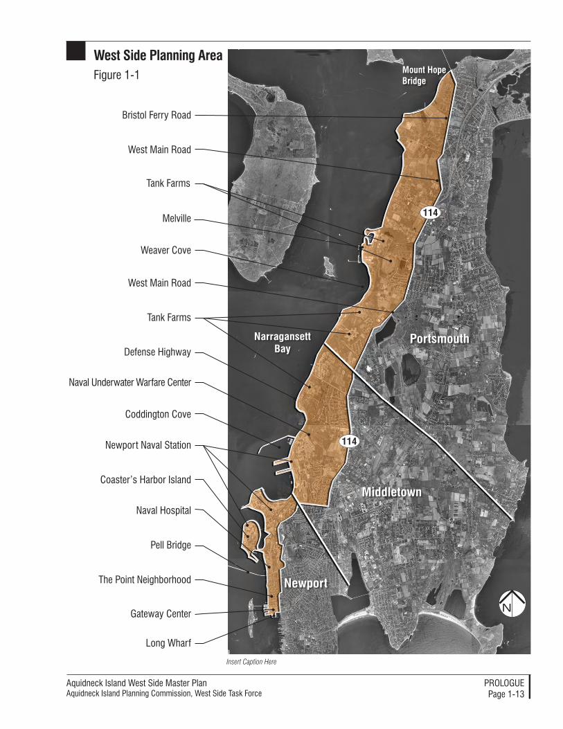
Figure 1-1: West Side Planning Area ...............................................1-13
Figure 2-1: Planning Recommendations.....................................2-6, 2-7
Figure 4-1: Transportation Context ..................................................4-10
Figure 4-2: natural Resources, Water Classifications and Types, Historic Resources .....................................................................................4-18
Figure 4-3: Parcelization, land Use and Susceptibility to Change ....... 4-23
Figure 4-4: navy land and Potential Dispositions ............................4-24
Figure 5-1: land Use Management Recommendations ......................5-2
Figure 5-2: Conservation Recommendations .....................................5-6
Figure 5-3: Greene lane Shoreline Access ......................................5-12
Figure 5-4: Tank Farm Reuse Concepts ...........................................5-20
Figure 5-5: Melville Reuse Concept .................................................5-36
Figure 5-6: Melville Illustrative Concept Plan ...................................5-38
Figure 5-7: Site Planning Principles for the West Side ......................5-40
Figure 5-8: Pell bridge north end Area land Use Concept ...............5-42
Figure 5-9: Transportation Recommendations: newport ..................5-54
Figure 5-10: Transportation Recommendations: Middletown ...........5-56
Figure 5-11: Transportation Recommendations: Portsmouth ...........5-58
Figure 5-12: Sections at J.T. Connell Road ......................................5-62
Figure 5-13: Sections at West Main Road .......................................5-66
Figure 5-14: Illustrations of “Share the Road” bikeway Concept ......5-80
Figure 5-15: Illustrations of bike lanes and Transit Concept ............5-82
Figure 6-1: Implementation Timeline for the State of Rhode Island ...6-68
Figure 6-2: Implementation Timeline for the AIPC ............................6-70
Figure 6-3: Implementation Timeline for Middletown .......................6-72
Figure 6-4: Implementation Timeline for newport ............................6-74
Figure 6-5: Implementation Timeline for Portsmouth .......................6-76
list of figures
Aquidneck Island West Side Master PlanAquidneck Island Planning Commission, West Side Task Force
ProloguePage 1-1
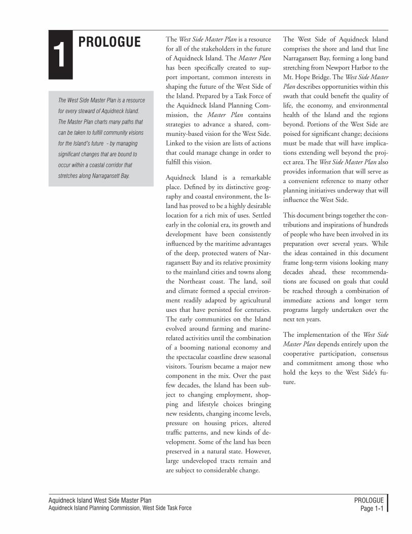
1Prologue The West Side Master Plan is a resource
for all of the stakeholders in the future of Aquidneck Island. The Master Plan has been specifically created to sup-port important, common interests in shaping the future of the West Side of the Island. Prepared by a Task Force of the Aquidneck Island Planning Com-mission, the Master Plan contains strategies to advance a shared, com-munity-based vision for the West Side. Linked to the vision are lists of actions that could manage change in order to fulfill this vision.
Aquidneck Island is a remarkable place. Defined by its distinctive geog-raphy and coastal environment, the Is-land has proved to be a highly desirable location for a rich mix of uses. Settled early in the colonial era, its growth and development have been consistently influenced by the maritime advantages of the deep, protected waters of Nar-ragansett Bay and its relative proximity to the mainland cities and towns along the Northeast coast. The land, soil and climate formed a special environ-ment readily adapted by agricultural uses that have persisted for centuries. The early communities on the Island evolved around farming and marine-related activities until the combination of a booming national economy and the spectacular coastline drew seasonal visitors. Tourism became a major new component in the mix. Over the past few decades, the Island has been sub-ject to changing employment, shop-ping and lifestyle choices bringing new residents, changing income levels, pressure on housing prices, altered traffic patterns, and new kinds of de-velopment. Some of the land has been preserved in a natural state. However, large undeveloped tracts remain and are subject to considerable change.
The West Side Master Plan is a resource
for every steward of Aquidneck Island.
The Master Plan charts many paths that
can be taken to fulfill community visions
for the Island’s future - by managing
significant changes that are bound to
occur within a coastal corridor that
stretches along Narragansett Bay.
The West Side of Aquidneck Island comprises the shore and land that line Narragansett Bay, forming a long band stretching from Newport Harbor to the Mt. Hope Bridge. The West Side Master Plan describes opportunities within this swath that could benefit the quality of life, the economy, and environmental health of the Island and the regions beyond. Portions of the West Side are poised for significant change; decisions must be made that will have implica-tions extending well beyond the proj-ect area. The West Side Master Plan also provides information that will serve as a convenient reference to many other planning initiatives underway that will influence the West Side.
This document brings together the con-tributions and inspirations of hundreds of people who have been involved in its preparation over several years. While the ideas contained in this document frame long-term visions looking many decades ahead, these recommenda-tions are focused on goals that could be reached through a combination of immediate actions and longer term programs largely undertaken over the next ten years.
The implementation of the West Side Master Plan depends entirely upon the cooperative participation, consensus and commitment among those who hold the keys to the West Side’s fu-ture.
Aquidneck Island West Side Master PlanAquidneck Island Planning Commission, West Side Task Force
ProloguePage 1-�
A user’s guide to the West Side Master Plan
The West Side Master Plan has been organized as a resource to manage the future. This User’s Guide will help you quickly navigate through this volume to reach those elements most useful for your purposes.
Structure of the West Side Master Plan1. Prologue: Introduces the West Side Master Plan, explains why it has been prepared, and describes who prepared this Master Plan. The Prologue traces how the Master Plan was prepared through an extended participatory process. The Prologue also introduces the concept of “implementation” – the steps needed to convert recom-mendations into actions. The Prologue notes key roles and responsibilities for the governments, organizations, and citizens who will be the stewards of the West Side’s future.
2. The Vision for the West Side: Brief-ly encapsulates the vision of a positive future for the West Side.
3. Overview: Highlights prominent aspects of the entire West Side Master Plan. After the definition of the West Side planning area, you will find the overall planning strategies that the West Side Master Plan seeks to fulfill. The discussion called “putting the pieces together” describes how the recommendations can be composed to strengthen the region. The next section provides a summary of major recom-mendations that are explored in more detail in Section 5, Plan Strategies. An implementation summary expresses prominent methods for accomplishing the West Side Master Plan, drawn from more detailed discussion in Section 6, Implementation.
4. Planning Context: Sets the con-text of the West Side Master Plan by referring to key conditions and trends that will shape future choices for Aquidneck Island’s communities. The Planning Context assembles influential observations on demographics, eco-nomics, transportation, open space, natural resources, infrastructure and land use.
5. Planning Strategies: Collects all of the planning strategies that will ful-fill the vision for the West Side. The strategies address land use (patterns of land use, natural resources, site plan-ning and design principles, open space preservation); economic development (priorities, specific recommendations); transportation (roadways and streets, transit options, bicycle networks, trails, paths and sidewalks); and utilities.
6. Implementation: Details how the planning strategies in the West Side Master Plan can be accomplished. The section first conveys the overall implementation approach. The section then takes each strategy and assigns stewardship, recommends tools, de-scribes the process, suggests standards for performance, and lists resources for implementation. Key implementation steps are displayed in a schedule of priorities for each of the public juris-dictions that will be stewards of the West Side.
Appendices: Provide specific, expanded descriptions of technical recommenda-tions associated with sustainable plan-ning and design standards.
This Master Plan is not conceived as a
regional blueprint that should direct local,
state, and federal decisions about the
West Side.
Rather, it is conceived as though it were a
cookbook of practical and complementary
recipes for excellent planning. Composed
of strategies that can contribute to the
community-defined vision for the West
Side, this Master Plan is meant as a
practical guide for action; it assembles
tools that can be selected and employed
to achieve the best results by each
steward of the West Side’s future.
Aquidneck Island West Side Master PlanAquidneck Island Planning Commission, West Side Task Force
ProloguePage 1-�
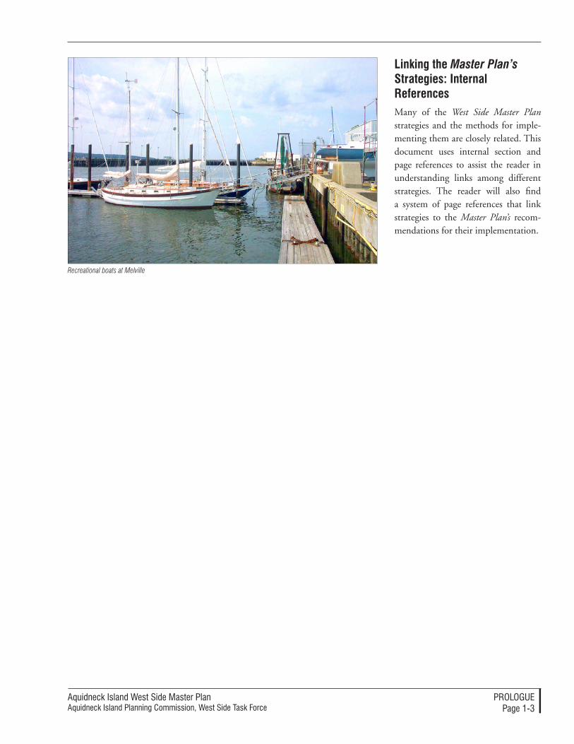
linking the Master Plan’s Strategies: Internal referencesMany of the West Side Master Plan strategies and the methods for imple-menting them are closely related. This document uses internal section and page references to assist the reader in understanding links among different strategies. The reader will also find a system of page references that link strategies to the Master Plan’s recom-mendations for their implementation.
Recreational boats at Melville
Aquidneck Island West Side Master PlanAquidneck Island Planning Commission, West Side Task Force
ProloguePage 1-�
The Need for a West Side Master Plan
Without coordinated planning, the West
Side’s assets can neither be preserved
nor its future successfully managed for
everyone’s benefit.
communities. The role and require-ments of the Navy’s activities can be expected to change with evolving na-tional priorities. Planning is required to provide successful coordination of land use and infrastructure in concert with the changing needs for these uses. This need ranges from protecting the capacity for the Navy-related research and development work to coordina-tion with the Navy’s housing privati-zation program that is now underway. This conversion of former Navy hous-ing to private control and manage-ment is likely to affect infrastructure, services, and redevelopment of some former Navy facilities and land along the West Side.
Planning for the reuse of excess Navy land – Many portions of Naval Sta-tion Newport have been withdrawn from active use over the years, and large areas of excess land have become available for reuse, such as the water-side and landside marine facilities at Melville Harbor in Portsmouth. Ad-ditional dispositions of even larger parcels may be undertaken soon, including former tank farms along Narragansett Bay. Planning is needed to promote common interests in land use, open space preservation, and economic redevelopment among the communities and constituencies of the West Side.
Coordinating transportation strate-gies – Increasing congestion along the major corridors of Aquidneck Island requires coordinated strategies to increase safety, reduce congestion, and provide better options for transit, bicyclists, and pedestrians. A par-ticular focus of planning is the limited north/south corridors along this long and narrow Island. In the West Side, these corridors include West Main
The West Side Master Plan emerges from a recognition of common issues among the constituent jurisdictions and entities along the entire length of the West Side. Issues are best ad-dressed through shared knowledge and, where appropriate, coordinated strategies.
The West Side spans three different municipalities. The southern portion is within the City of Newport, the center is within the Town of Middle-town, while the northern segment is within the Town of Portsmouth. The federal government, through Naval Station Newport, has substantial land holdings of active and inactive facilities. These properties stretch along Narragansett Bay in an 8-mile chain of land and ports from Gateway Center near Newport Harbor to large, abandoned tank farms in Portsmouth, and the Mount Hope Bridge. The State is an important stakeholder by virtue of key roadway, highway, and rail corridors, and through the active role of its agencies and authorities in the West Side.
Among the compelling reasons to provide a planning focus to the West Side are:
Planning for a high quality of life – The high quality of life on Aquidneck Island is directly linked to the valued heritage of the distinctive balance of uses and coastal character. These could be degraded through inappropriate change along the West Side, pro-foundly affecting the economic and civic life within the communities that compose it.
Coordinating continued military use and needs – Naval Station Newport and the associated activities are critical components of the area’s economy and
Aquidneck Island West Side Master PlanAquidneck Island Planning Commission, West Side Task Force
ProloguePage 1-�
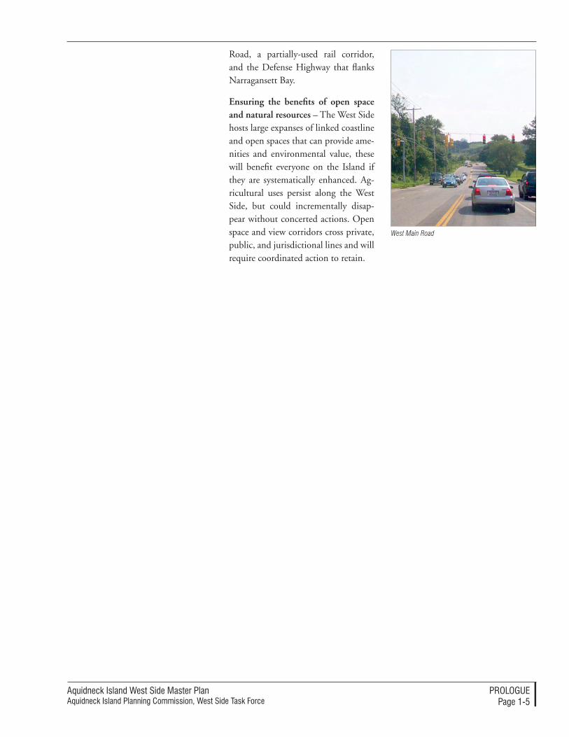
Road, a partially-used rail corridor, and the Defense Highway that flanks Narragansett Bay.
Ensuring the benefits of open space and natural resources – The West Side hosts large expanses of linked coastline and open spaces that can provide ame-nities and environmental value, these will benefit everyone on the Island if they are systematically enhanced. Ag-ricultural uses persist along the West Side, but could incrementally disap-pear without concerted actions. Open space and view corridors cross private, public, and jurisdictional lines and will require coordinated action to retain.
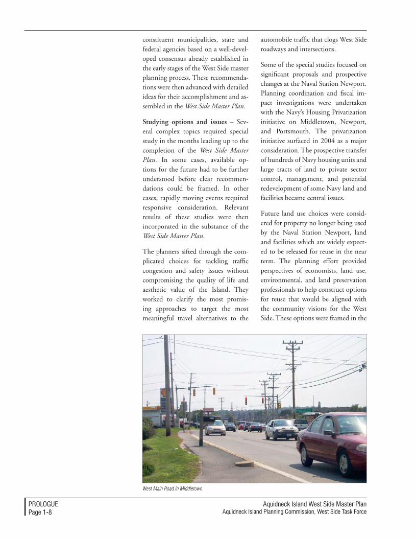
West Main Road
Aquidneck Island West Side Master PlanAquidneck Island Planning Commission, West Side Task Force
ProloguePage 1-�
Working Together to Create this Master Plan
The West Side Master Plan is the
culmination of years of careful
preparation and extensive involvement
of hundreds of participants in meetings,
workshops, briefings and interviews
– all supported by volumes of technical
studies and thousands of hours of staff
and professional assistance.
The West Side Master Plan was prepared as an initiative of the Aquidneck Island Planning Commission to extend its mission and methods. It convenes the constituencies of Aquidneck Island to work together to define and achieve common goals through planning.
The Aquidneck Island Planning Com-mission (AIPC) is a joint municipal planning commission. It is dedicated to its role as a forum for understand-ing, communicating, and reaching consensus on shared issues within the Island. The AIPC was established by the legislature (Rhode Island General Laws 45-22) and by Resolu-tions of each of the municipalities of Aquidneck Island. The AIPC brings together the governmental entities re-sponsible for the Island – Middletown, Newport, Portsmouth, the State of Rhode Island and its authorities, the U.S. Navy, and other federal agencies. The AIPC benefits from the active participation of citizens and organiza-tions who contribute their efforts to its mission.
The AIPC established a Task Force to coordinate the West Side Planning initiative. The Task Force guided the preparation of the West Side Master Plan through its membership. Among its membership have been representa-tives from Middletown, Newport, Portsmouth, the State of Rhode Island, Naval Station Newport, the Newport County Chamber of Commerce, the University of Rhode Island Coastal Resources Center/Rhode Island Sea Grant, and the Board of Directors of the AIPC.
The First StepsOnce established, the West Side Task Force took incremental steps to expand the understanding of the chal-lenges and opportunities for the West Side and to shape a shared vision for its future. Together, these steps formed the foundation for the West Side Master Plan.
Aquidneck Island: Our Shared Vision (1999) – Through a citizen-based participatory process, the AIPC assem-bled a document that expresses com-mon visions for the Island. Through workshops, interviews, and meetings, key messages emerged that were for-mally adopted by the West Side Task Force and incorporated as goals for the Master Plan. Among the salient sentiments were directions to provide a livable landscape that “links open space areas so that individuals may walk or ride their bikes from one end of the island to the other.” The vision directs the West Side Master Plan to “preserve access to the coast, including harbors, coves, and beaches….” Social well-being is to be achieved, in part, by celebrating the history through en-hanced cultural activities. Recognizing the need for a strong local economy
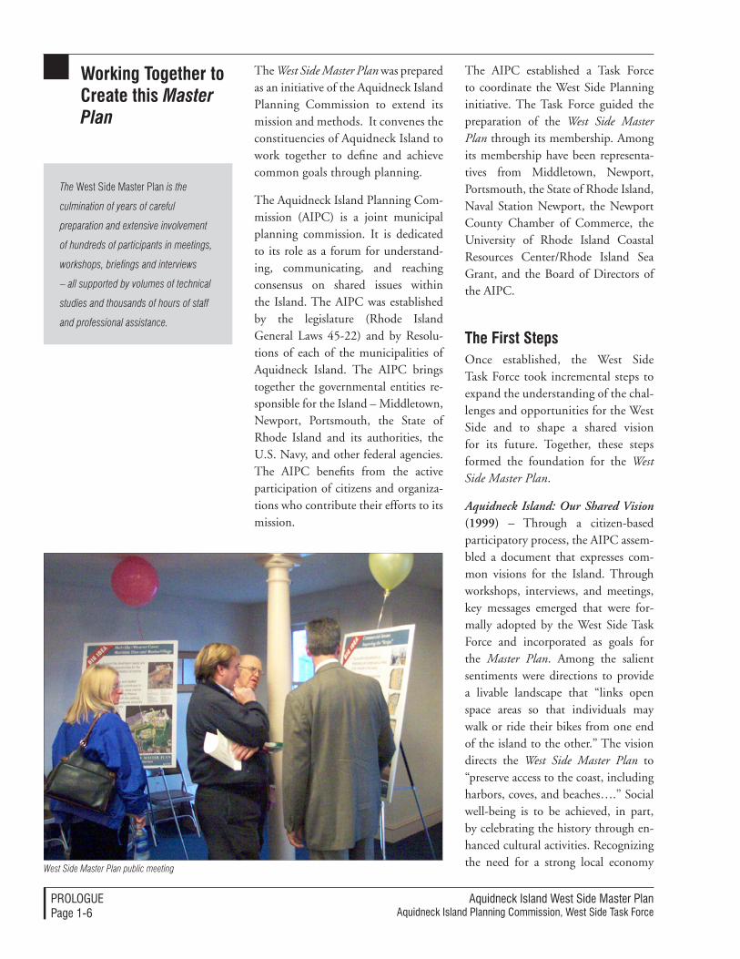
West Side Master Plan public meeting
Aquidneck Island West Side Master PlanAquidneck Island Planning Commission, West Side Task Force
ProloguePage 1-�
that balances preservation and de-velopment, the Shared Vision seeks development that complements the Island’s character. Finally, the Shared Vision projects a future with multiple transportation modes to help relieve congestion.
West Side Planning Inventory (2000) – The Task Force completed an ex-tensive inventory that charted many of the factors influencing the future of the West Side; the relevant information was reviewed and updated in 2004 and used as an essential reference in drafting the West Side Master Plan.
Transportation Guide Plan (2000) – The West Side is a focus of trans-portation issues on an Island that is subject to traffic congestion due to the limited roadway and transit op-tions. After earlier proposals to build new highway corridors were rejected by the Island communities due to the undesirable changes that would occur, the Task Force provided a detailed technical study that documented ex-isting problems and revealed options for roadway, transit, ferry, bicycle, and pedestrian connections along the en-tire West Side of the Island. The West Side Master Plan advances the most promising aspects of the Transporta-tion Guide Plan in concert with land use, economic development, and open space preservation.
The West Side: The People, The Place, The Process (2003) – A broad-based community participation process was conducted by the AIPC to establish principal themes for the West Side Master Plan. Through workshops facilitated by a professional planning team, the Task Force established the criteria that have guided the prepara-tion of this document.
Completing the West Side Master PlanThe Task Force advanced the West Side Master Plan through to completion with an intensive effort of its members, AIPC staff, and the applied planning expertise of a consulting team selected for its local, regional, and national experience with the issues facing the West Side. This nine-month enterprise included periodic public discussions and progress briefings, coordination meetings with the participating juris-dictions, and active involvement with emerging planning challenges. The fi-nal steps in the preparation of the West Side Master Plan included:
Confirming existing conditions and trends – Key issues and opportuni-ties on the West Side were brought into sharp focus through a series of technical studies and evaluations. This included important economic and real estate market evaluations of trends that are affecting the region, Aquidneck Is-land, and the West Side. Additional technical reviews and observations established updated assumptions concerning demographics, affordable housing, traffic and transportation, natural resources, open space, and the utility infrastructure that serves the West Side. The Task Force also received information on state-of-the art planning practices for sustainable planning and development that are emerging in similar community set-tings both regionally and nationally. The reviews were gathered into docu-ments that were reported to the Task Force: a Summary of Findings and a Trends Report.
Establishing baseline recommenda-tions – The Task Force confirmed baseline planning recommenda-tions that should be offered to the
Aquidneck Island West Side Master PlanAquidneck Island Planning Commission, West Side Task Force
ProloguePage 1-�
constituent municipalities, state and federal agencies based on a well-devel-oped consensus already established in the early stages of the West Side master planning process. These recommenda-tions were then advanced with detailed ideas for their accomplishment and as-sembled in the West Side Master Plan.
Studying options and issues – Sev-eral complex topics required special study in the months leading up to the completion of the West Side Master Plan. In some cases, available op-tions for the future had to be further understood before clear recommen-dations could be framed. In other cases, rapidly moving events required responsive consideration. Relevant results of these studies were then incorporated in the substance of the West Side Master Plan.
The planners sifted through the com-plicated choices for tackling traffic congestion and safety issues without compromising the quality of life and aesthetic value of the Island. They worked to clarify the most promis-ing approaches to target the most meaningful travel alternatives to the
automobile traffic that clogs West Side roadways and intersections.
Some of the special studies focused on significant proposals and prospective changes at the Naval Station Newport. Planning coordination and fiscal im-pact investigations were undertaken with the Navy’s Housing Privatization initiative on Middletown, Newport, and Portsmouth. The privatization initiative surfaced in 2004 as a major consideration. The prospective transfer of hundreds of Navy housing units and large tracts of land to private sector control, management, and potential redevelopment of some Navy land and facilities became central issues.
Future land use choices were consid-ered for property no longer being used by the Naval Station Newport, land and facilities which are widely expect-ed to be released for reuse in the near term. The planning effort provided perspectives of economists, land use, environmental, and land preservation professionals to help construct options for reuse that would be aligned with the community visions for the West Side. These options were framed in the
West Main Road in Middletown
Aquidneck Island West Side Master PlanAquidneck Island Planning Commission, West Side Task Force
ProloguePage 1-�
context of various disposition process-es available to the federal government and the related implications for the West Side. Special efforts helped equip Aquidneck Island’s communities with information regarding the procedures for reuse likely to be unlocked either as a result of the 2005 federal Base Realignment and Closure (BRAC) process or through other disposition methods.
Assembling the Master Plan – The baseline recommendations and results of the special studies were compiled, considered, and advanced in this consolidated document which was reviewed, refined, and finally approved by the Aquidneck Island Task Force.
Supporting implementation – The West Side Master Plan has been dedi-cated to supporting active manage-ment of the West Side’s future. It offers strategies, ideas, and specific tools that can be employed by the stewards of that future. These have been incorpo-rated into Implementation Guidebooks that have been tailored for use by the council, boards, commissions, agen-cies, and leadership of Middletown, Newport, Portsmouth, Rhode Island, and the Naval Station Newport.
The AIPC has already used the plan-ning effort to help advance common interests and advocate for the value of the regional perspective provided in the West Side Master Plan. In Febru-ary, 2005 the AIPC contributed a list of potential transportation projects for State consideration as it forms the Rhode Island Transportation Improve-ment Program (TIP). This list of proj-ects was coordinated with the Island’s communities to insure compatibility with local goals. These projects would fulfill the safety, congestion relief, and alternative transportation purposes
contained in the West Side Master Plan.
The AIPC will sponsor public presen-tations and discussions of the West Side Master Plan with the public entities that are stewards of the West Side’s future, seeking endorsements and in-corporation of its recommendations in future decision making.
The AIPC will organize special initia-tives to advance the implementation of the Master Plan. A prominent part of this effort will be the Intergovern-mental Working Group, which will coordinate strategies and intergov-ernmental agreements associated with large redevelopment areas, including excess Navy land.
Aquidneck Island West Side Master PlanAquidneck Island Planning Commission, West Side Task Force
ProloguePage 1-10
responsibility for the Future
The West Side is a shared asset; re-sponsibility for its future must also be shared through coordinated efforts of the many constituents that are its stewards. It is important to recall the principal roles performed by each of the actors on the public policy stage:
Citizens of Aquidneck Island – The fundamental constituency for the West Side’s future is the citizenry of the entire Island. Stewardship is accom-plished when an informed citizenry is consistently involved in public issues along the West Side. There are many resources available, open doors to learn about the West Side, and other avenues to express preferences through volunteer activities, advocacy, and the ballot box.
Aquidneck Island Planning Commis-sion – The AIPC is the only entity entirely focused on regional coordina-tion for this Island. It will continue its leadership role in providing informa-tion, convening stakeholders, and pro-viding technical planning support to the other governmental entities where regional benefits can be attained. At the request of those entities and con-sistent with its mission, the AIPC can also take an active role in project coor-dination, management, promotion, or project review for initiatives along the West Side. The AIPC will participate in the Intergovernmental Working Group that will help implement this Master Plan. The AIPC will also be a participant in the future disposition of excess Naval Station Newport land through a special collaborative process that the Master Plan describes.
Municipalities – Middletown, New-port, and Portsmouth are empowered to exercise wide-reaching land use and development controls through their zoning and subdivision regulations that
The stewardship of the West Side will
never be the responsibility of any single
group, agency or entity – it can only
be accomplished by everyone working
together.
are critical to shaping the future. These powers extend to lands owned by the state or federal governments when that land is used for purposes other than for public facilities. Each community controls its own public facilities and public open spaces, including the abil-ity to shape the local transportation and utility networks that are linked to the vision for the West Side.
In order for the West Side Master Plan to achieve full implementation, key strategies that are relevant or specific to each municipality should become incorporated into its respective Com-prehensive Plan. Comprehensive Plans may be amended from time to time to account for growth and change, and must be updated at least once every five years. Land use controls and regu-lations will also need to be amended as needed to reflect the adopted plan strategies and recommendations.
The municipalities will participate in the Intergovernmental Working Group that will enhance coordination, and be participants in the future disposition of excess Naval Station Newport land through a special collaborative process that the Master Plan describes.
The municipalities can also empower special entities to undertake targeted tasks along the West Side, through enabling legislation approved by the state legislature. In addition to the municipal utilities and authorities al-ready in existence, each municipality could create or designate a Local Re-development Authority (LRA) to serve as a public intermediary for private redevelopment of former Navy land, for example.
State Government – Rhode Island will play multiple roles in the future of the West Side. The State has a regulatory
Aquidneck Island West Side Master PlanAquidneck Island Planning Commission, West Side Task Force
ProloguePage 1-11
role, principally applied to the West Side in the form of environmental, pub-lic health, and public interest standards in the water and coastal resources. The Rhode Island Department of Transpor-tation (RIDOT) is responsible for large portions of the roadway and rail infra-structure serving the West Side; The Rhode Island Public Transit Authority (RIPTA) can play a major role in bus or water transportation. The State is also a sponsor of economic initiatives and the Rhode Island Economic Develop-ment Corporation (RIEDC) can serve to promote, manage, or undertake economic development projects within its mission to support prosperity and jobs. The State will also be a source of funds, programs, and incentives to meet the West Side Master Plan objec-
tives, such as the pivotal role that has already been played by the Uni-versity of Rhode Island Coastal Resources Center/Rhode Island Sea Grant. The state government will participate in the Intergovernmental Working Group that will enhance coordination, and
be participants in the future disposi-tion of excess Naval Station Newport land through a special collaborative process that the Master Plan describes.
Federal Government – The steward-ship of the Rhode Island congressional delegation will be critical to the future of the West Side. The federal role along the West Side is partly vested in Naval Station Newport that has occupied most of the coastal edge and continues to be an important compo-
nent of Aquidneck Island’s economy. The federal government controls the disposition process for unused Navy land and the privatization process for some of its facilities. The federal role in funding will be significant in the future, as it has been in the past. Federal funding has underwritten planning and research efforts, includ-ing this West Side Master Plan. Major transportation improvements are dependent upon federal funding and must consequently meet national stan-dards. Environmental mitigation may be funded by the federal government, among other projects that serve to pro-tect resources, administered through the U.S. Fish and Wildlife Service, the Environmental Protection Agency, or others. Regulations at the federal level will guide changes, including special attention to the coastal conditions and navigation-related projects. Naval Sta-tion Newport should be a participant in the Intergovernmental Working Group that will enhance coordination along the West Side.
Institutions, Organizations, and Companies – Applied assistance from a network of institutions, or-ganizations, and companies will play prominent roles in the future of the West Side. Among those that can be expected to take leadership roles in recommendations of this Master Plan are the following:
Aquidneck Land Trust – The Land Trust preserves open space by acquiring land and development rights. Through its leadership role, it will support continued open space acquisition, preservation of agriculture, protection of the Island’s water supply, and contri-butions to public access with trails.
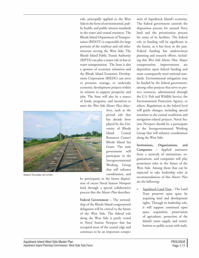
Newport Secondary rail corridor
Aquidneck Island West Side Master PlanAquidneck Island Planning Commission, West Side Task Force
ProloguePage 1-1�
Companies – Private sector com-panies are major stakeholders in the future of the West Side; their participation in achieving the West Side Master Plan vision will be de-termined by their circumstances. Some may shape their land and facilities in line with the recom-mendations contained within these pages, while others may be contributors to programs that will advance the public purposes that the Master Plan expresses.
Foundations, Trusts and Grants – Contributions from charitable foundations, trusts, and grant sources have been essential in advancing planning for the West Side; targeted assistance will be needed to translate planning con-cepts into reality as well.
Newport County Chamber of Commerce – This organization will continue to play a leadership role, bring consistent focus to is-sues of quality of life and quality of employment that are linked to the West Side’s contribution to a healthy economy of Aquidneck Island.
Community College of Rhode Island, Newport County Cam-pus (CCRI) – This new campus within the West Side provides a key educational and training asset that can be an active component in advancing many of the recom-mendations of this Master Plan. CCRI can provide a forum for ex-change of information, education and training in fields linked to the competitive advantages of the West Side. This may include spe-cial programs for marine-related businesses concentrated in Mel-ville (currently being discussed).
Additional academic support could be explored for other di-mensions of the West Side Master Plan as well, such as for military-related research and development activities in the area, specialized environmental issues and tech-nologies, or a host of other topical concentrations.
Rhode Island Marine Trades Asso-ciation – RIMTA’s role will be to advance the interests of both the marine trades that are an impor-tant industry along the West Side and to promote the interests of the boating public of Rhode Island.
Save the Bay – In keeping with its advocacy for the environmental quality of Narragansett Bay, Save the Bay can bring a helpful focus to promoting sustainable landside and waterside practices along the West Side’s coastal edge.
• Other Advocacy and Interest Groups – The West Side Master Plan invites the involvement of advocacy and interest groups that will help advance recommenda-tions that further their own mis-sions. The continued engagement of groups like the Preservation Society of Newport County, Grow Smart Rhode Island, the Founda-tion for Newport, and many oth-ers will be needed.
Aquidneck Island West Side Master PlanAquidneck Island Planning Commission, West Side Task Force
ProloguePage 1-1�
West Side Planning AreaFigure 1-1
Portsmouth
Middletown
Newport
Narragansett Bay
N
Mount Hope Bridge
114
114
Tank Farms
Weaver Cove
Defense Highway
West Main road
Bristol Ferry road
Coaster’s Harbor Island
Coddington Cove
Newport Naval Station
The Point Neighborhood
gateway Center
Melville
West Main road
Tank Farms
Naval Hospital
Pell Bridge
long Wharf
Naval underwater Warfare Center
Insert Caption Here

Aquidneck Island West Side Master PlanAquidneck Island Planning Commission, West Side Task Force
ProloguePage 1-1�
Aquidneck Island West Side Master PlanAquidneck Island Planning Commission, West Side Task Force
The vISIon For The WeST SIdePage 2-�
2The Vision for The WesT side
The West Side will become recog-nized by the citizens of Aquidneck Island as an exceptionally well-man-aged corridor. The associated land and water will attain a sustainable balance among complementary uses and natural resources, each contrib-uting to the high quality of life that distinguishes the unique cultural and natural environment of Aquidneck Island. This will be steadily accom-plished over the next two decades.
The land will reach a stable bal-ance among uses. Nearly all of the West Side land use patterns will be established within twenty years, with ongoing changes concentrated within targeted, predictable areas. The estab-lished land use pattern will consist of tracts of preserved open space and continued agriculture, large well-de-signed and planned developments, a more efficient and consolidated Naval Station Newport, concentrated mixed use areas along the West Side’s major roadways, and diverse, smaller-scale clusters of uses whose design and development pre-date the West Side Master Plan.
The West Side will support valuable job centers. Naval Station Newport will continue to be a leading-edge cen-ter for education and training, as well as for its research and development activities. The civilian research and development work will be clustered in close vicinity to the military facilities, taking advantage of attractively de-veloped nearby sites and the reuse of historic former military facilities, like the former Naval Hospital complex. Through combined federal, state, and local efforts, the West Side will become recognized as an “Innovation Factory” linked to the military’s activities and attracting small and large companies. Commercial success will be associ-ated with the competitive advantages related to the high quality of life on Aquidneck Island and the valued employees that will migrate to be here. Melville will increasingly be recognized as one of the most important national concentrations of recreational boat building, boat technology, and high-end boat services. This will be linked to a well-planned marina complex at Weaver Cove that continues the tradi-tion of Narragansett Bay as a boating haven.
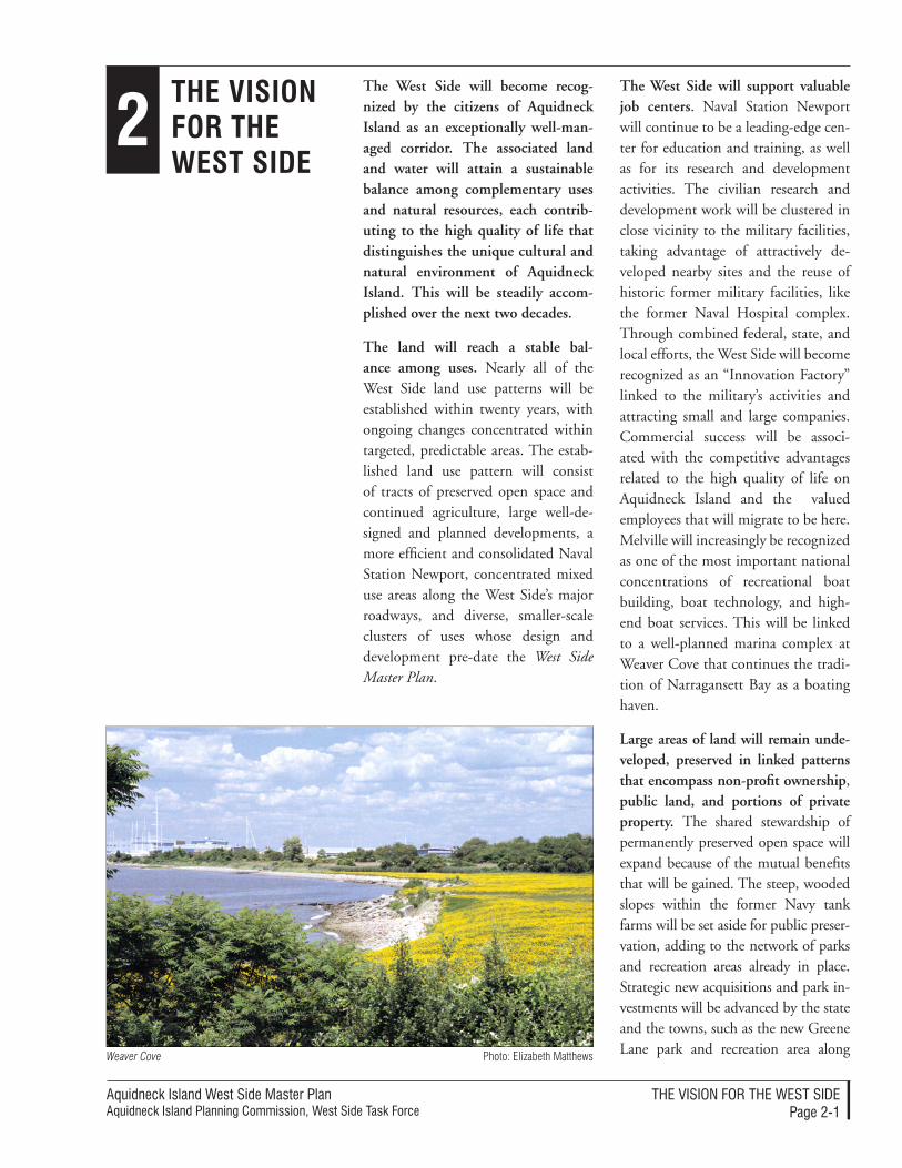
Large areas of land will remain unde-veloped, preserved in linked patterns that encompass non-profit ownership, public land, and portions of private property. The shared stewardship of permanently preserved open space will expand because of the mutual benefits that will be gained. The steep, wooded slopes within the former Navy tank farms will be set aside for public preser-vation, adding to the network of parks and recreation areas already in place. Strategic new acquisitions and park in-vestments will be advanced by the state and the towns, such as the new Greene Lane park and recreation area along Photo: Elizabeth MatthewsWeaver Cove
Aquidneck Island West Side Master Plan Aquidneck Island Planning Commission, West Side Task Force
The vISIon For The WeST SIdePage 2-2
Narragansett Bay. Additional undevel-oped land will be preserved where envi-ronmental values are high through the actions of the Aquidneck Land Trust and through new tools available to the towns. Well-planned development will respond to site planning guidelines and incentives to preserve land for views, public access, habitats, and environ-mental resources. The combination of public, private, and non-profit actions will ensure that places like Lawton Val-ley still extend an unbroken corridor of open space from West Main Road to the shores of Narragansett Bay.
New developments will be designed to preserve the character of the landscape, conceal many of the new buildings from prominent vantage points, and use emerging techniques to dramatically diminish impacts relative to previous practices. The public and private sector will have achieved a common goal: promoting valuable development that respects and protects the image, assets, and charac-ter of Aquidneck Island. Much of the new development will be channelled towards “Growth Centers” rather than being distributed evenly across the landscape (or across other parts of the Island); this long-term approach ben-efits everyone.
The municipalities and development entities will employ state-of-the art site planning techniques that are mu-tually understood and predictably ap-plied, so that responsible development consistent with community goals can advance. When the impacts of a major project appear significant on a regional scale, the municipalities can rely on the expert advice and evaluation of the AIPC to help inform local policies and actions.
The West Side’s agricultural land will be maintained in the future as long and as much as possible. If some of the agricultural land is converted to other uses, however, site planning stan-dards will be applied that help preserve the rural aspect and natural character from prominent public views.
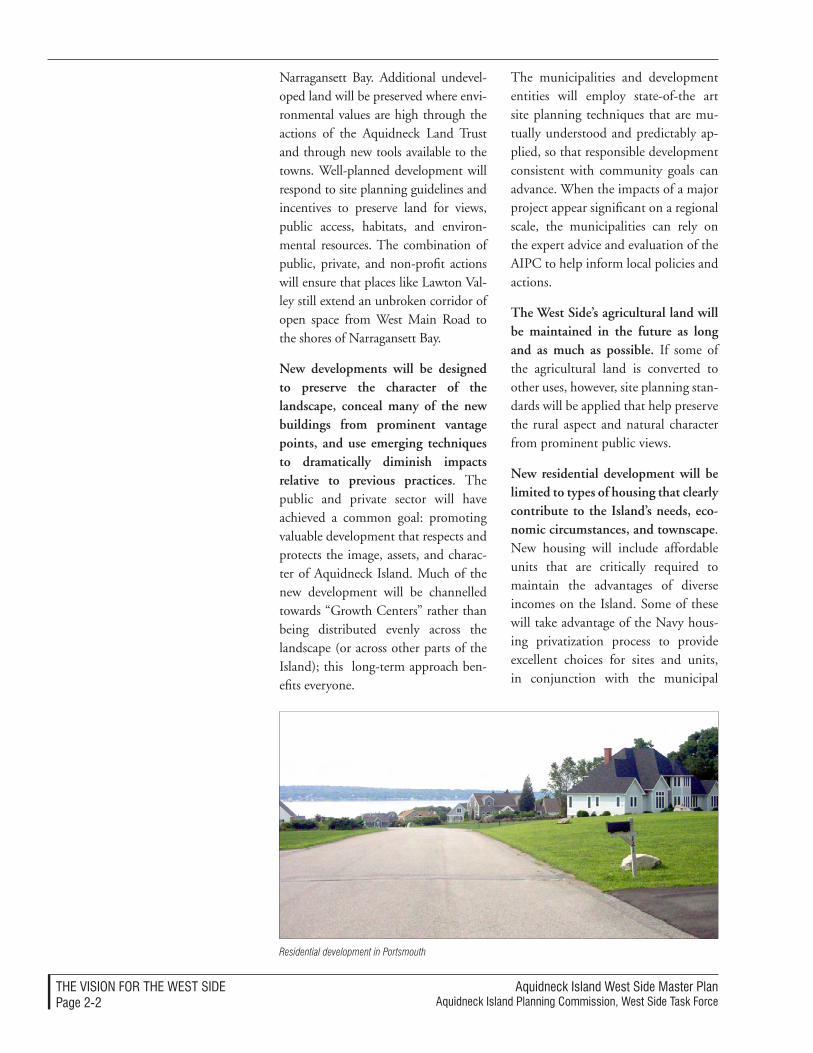
New residential development will be limited to types of housing that clearly contribute to the Island’s needs, eco-nomic circumstances, and townscape. New housing will include affordable units that are critically required to maintain the advantages of diverse incomes on the Island. Some of these will take advantage of the Navy hous-ing privatization process to provide excellent choices for sites and units, in conjunction with the municipal
Residential development in Portsmouth
Aquidneck Island West Side Master PlanAquidneck Island Planning Commission, West Side Task Force
The vISIon For The WeST SIdePage 2-�
goals of each community. High value “resort home” units will be clustered in well-planned areas, attracting resi-dents because they complement, rath-er than dominate, the generous views and landscapes retained. Other resi-dences will be clustered along Weaver Cove. These will directly complement the activities and vitality found there and serve as important components in unlocking the coordinated, high-quality investment in a multi-use marina with public waterfront access and amenities. Multi-family housing will be invited to join the mix of uses. It will help create profitable and more attractive development patterns along areas currently dominated by strip-type development, providing units and a rising tax base.
Retail development will be con-strained to re-development and im-provements to previously developed areas. Large-scale strip commercial development on the West Side will be discouraged. Instead, the somewhat limited commercial and retail oppor-tunities will be directed to promote improvements to existing commercial and retail centers. Both existing and future commercial development will be enhanced through site planning, architectural quality, and generous landscape improvements. These will promote higher values and diminish the negative visual impacts of large parking areas and circulation devoted to automobiles. A wider range of uses, including housing, will be invited to help convert commercial strips into more interesting and productive ar-eas. As a regional model, this “smart growth” approach can be extended to other sensitive parts of the Island.
The Pell Bridge ramps and the area around them will be transformed into
an attractive mixed use district. This district will be served by convenient boulevards and roadways flanked by deep borders of trees and landscap-ing. The reorganization of the bridge ramps will open land that can be as-sembled to provide for a coherently planned redevelopment. The blend of retail, residential, entertainment, and commercial uses will continue the traditional small-city composition of streets, buildings, and spaces that marks Newport’s character. The de-velopment will appeal to the quality of life sought by Aquidneck Islanders. Su-perbly located relative to the regional and local transportation network, it will trigger profitable reinvestment in adjacent private land along J.T. Con-nell Highway.
The West Side will host several sites along the “Heritage Corridor” – us-ing a system of signage and interpre-tive enhancements that links the past to the present. This creative approach to the West Side’s historic resources will help direct visitors along desirable routes and broaden the appreciation of the region.
Moving along the West Main Road network will be safer and more pleas-ant – although it will not be much faster. The West Main Road network will benefit from “intelligent transpor-tation systems” that use technology to manage the flow of vehicles between traffic signals during peak times. Special signage will better distribute seasonal traffic; the signage will be linked to remote parking lots, shuttles, and the increasingly effective transit systems. Incremental improvements will make intersections more func-tional, set aside areas for bus stops, and extend sidewalks and safe pedes-trian crossings in key locations. Curb
Aquidneck Island West Side Master Plan Aquidneck Island Planning Commission, West Side Task Force
The vISIon For The WeST SIdePage 2-�
cuts will be reduced, in part, through progressive improvements to private parcels. Like other West Side scenic roads, rural portions of West Main Road will remain attractive, through a program of regulations. Dramati-cally improved landscaping along less attractive roadsides will enhance the visual qualities of the West Main Road network. The landscape will extend a coordinated palette of stone walls and indigenous plantings to offer pleasant reminders of the terrain and traditions of rural Aquidneck Island. There will be no practical, higher speed alterna-tive, however, for most north-south automobile travel along the West Side; no new parkway will be built and West Main Road will not undergo any sig-nificant expansion.
The Defense Highway will be converted into Shoreline Drive - a pleasant and useful alternative route for some of the Island’s employees, visitors, and residents. The “Burma Road” will continue to connect Mel-ville to the north and Naval Station Newport to the south and have a much improved connection to Stringham Road. If Naval Station Newport and security standards allow, portions of this route will continue to pass through the active portions of the Naval Sta-tion and provide a direct connection to Coddington Highway. For military personnel, civilian employees, and the cluster of uses growing along Weaver Cove and Melville, the Shoreline Drive will be a great way to avoid traffic on the West Main Road network.
Getting to, from, and along Narragan-sett Bay will be easy. Improved public access points (including parking in some locations) will be arranged where land and facilities can be created. Path-ways and walkways will extend along
the edge of some privately developed areas, including much of Weaver Cove. This is a consequence of development incentives built into the local zoning and approval processes. Accessible docks will allow a growing fleet of water taxis, ferries, and excursion boats to move along the West Side’s shore. Stops near the Gateway Center, the Pell Bridge, Weaver Cove, Melville, and the resort/residential communities along the north shore of the Island will increase bay access.
Pedestrian trails and bicycle paths will extend along the entire West Side, linking amenities and crossing through natural areas. The trail and bikeway systems will become amenities that are accomplished incrementally as part of the open space and circulation initiatives along the West Side. Union Street will be a recreational corridor that people can use to get from West Side trails to the Aquidneck Land Trust’s Sakonnet Greenway Trail on the East Side.
The utility infrastructure will effi-ciently and equitably provide services to any of the land uses that the com-munities deem appropriate for the West Side. The sewer, water, and storm drainage networks will be the focus of investment and operating changes af-ter a period of study, negotiations and decisions among the municipalities, Naval Station Newport, and large us-ers. Future systems and operations will be environmentally sensitive.
Natural and man-made hazards will be minimized, and to the extent possible, controlled. Environmental criteria and “best design and development prac-tices” will help to reduce and eliminate impacts on the environment that may result in a detriment of natural condi-tions or people’s safety along the coastal
Aquidneck Island West Side Master PlanAquidneck Island Planning Commission, West Side Task Force
The vISIon For The WeST SIdePage 2-�
land that is subject to flood hazards and the challenges of steep terrain.
Enhanced stewardship of the West Side is integral to the vision for the future. It is impossible to predict all of the economic and technological changes that will influence Aquidneck Island’s future over the very long term. It is neither possible nor wise to attempt to define a blueprint for the next twenty years for all of the
compositional elements. However, it is very possible to equip the com-munities and stakeholders with an excellent forum for communication and tools for managing change. It is equally possible to create an imple-mentation approach to use those tools to the best effect. The Master Plan document shows how planning tools, processes, standards, and re-sources will be focused to fulfill the vision that has emerged.
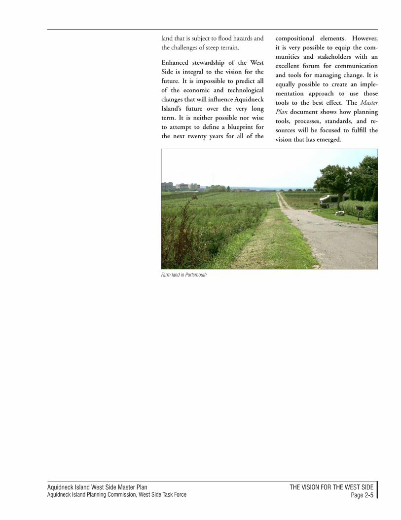
Farm land in Portsmouth
Aquidneck Island West Side Master Plan Aquidneck Island Planning Commission, West Side Task Force
The vISIon For The WeST SIdePage 2-�
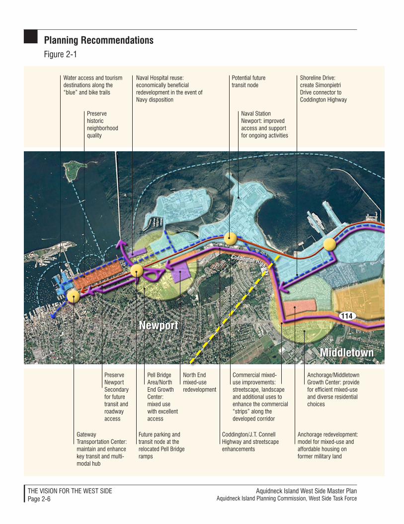
Planning recommendationsFigure 2-�
114
Water access and tourism destinations along the “blue” and bike trails
Preserve historic neighborhood quality
Naval Hospital reuse: economically beneficial redevelopment in the event of Navy disposition
Pell Bridge Area/north end Growth Center: mixed use with excellent access
Preserve newport Secondary for future transit and roadway access
Gateway Transportation Center: maintain and enhance key transit and multi-modal hub
Future parking and transit node at the relocated Pell Bridge ramps
Coddington/J.T. Connell highway and streetscape enhancements
north end mixed-use redevelopment
Naval Station Newport: improved access and support for ongoing activities
Potential future transit node
Shoreline Drive: create Simonpietri Drive connector to Coddington Highway
Commercial mixed-use improvements: streetscape, landscape and additional uses to enhance the commercial “strips” along the developed corridor
Anchorage redevelopment: model for mixed-use and affordable housing on former military land
Anchorage/Middletown Growth Center: provide for efficient mixed-use and diverse residential choices
Coddington highway
Middletown
newport
Aquidneck Island West Side Master PlanAquidneck Island Planning Commission, West Side Task Force
Stringham Road
The VISIon For The WeST SIdePage 2-7
Middletown 114
114
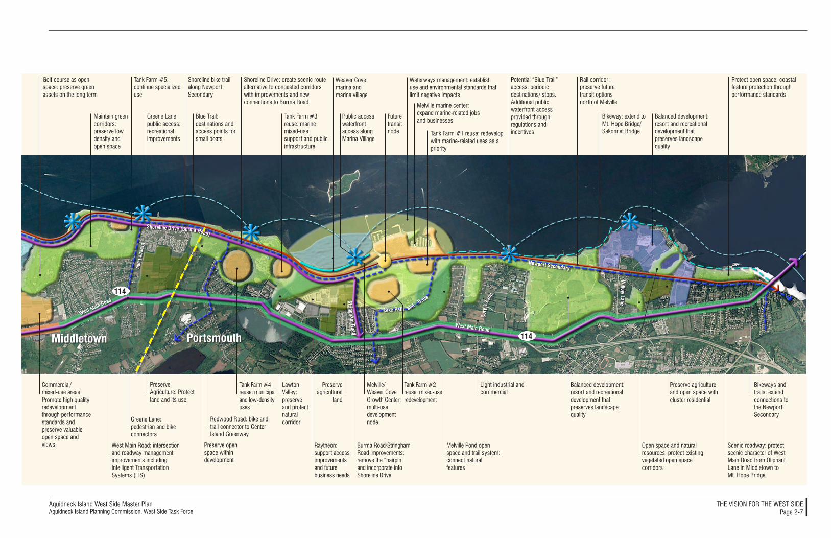
Golf course as open space: preserve green assets on the long term
Maintain green corridors: preserve low density and open space
Tank Farm #5: continue specialized use
Greene Lane public access: recreational improvements
Blue Trail: destinations and access points for small boats
Shoreline bike trail along Newport Secondary
Shoreline Drive: create scenic route alternative to congested corridors with improvements and new connections to Burma Road
Tank Farm #3 reuse: marine mixed-use support and public infrastructure
Public access: waterfront access along Marina Village
Weaver Cove marina and marina village
Future transit node
Melville marine center: expand marine-related jobs and businesses
Tank Farm #1 reuse: redevelop with marine-related uses as a priority
Potential “Blue Trail” access: periodic destinations/ stops.Additional public waterfront access provided through regulations and incentives
Rail corridor: preserve future transit options north of Melville
Bikeway: extend to Mt. Hope Bridge/Sakonnet Bridge
Balanced development: resort and recreational development that preserves landscape quality
Protect open space: coastal feature protection through performance standards
Commercial/ mixed-use areas: Promote high quality redevelopment through performance standards and preserve valuable open space and views West Main Road: intersection
and roadway management improvements including Intelligent Transportation Systems (ITS)
Greene Lane: pedestrian and bike connectors
Tank Farm #4 reuse: municipal and low-density uses
Lawton Valley: preserve and protect natural corridor
Raytheon: support access improvements and future business needs
Preserve agricultural
land
Burma Road/Stringham Road improvements: remove the “hairpin” and incorporate into Shoreline Drive
Melville/ Weaver Cove Growth Center: multi-use development node
Tank Farm #2 reuse: mixed-use redevelopment
Melville Pond open space and trail system: connect natural features
Balanced development: resort and recreational development that preserves landscape quality
Open space and natural resources: protect existing vegetated open space corridors
Preserve agriculture and open space with cluster residential
Scenic roadway: protect scenic character of West Main Road from Oliphant Lane in Middletown to Mt. Hope Bridge
Bikeways and trails: extend connections to the Newport Secondary
West Main Road
West Main Road
Greene Lane
Shoreline Drive (Burma Road)
Newport Secondary
Willow
Lane
Waterways management: establish use and environmental standards that limit negative impacts
Cory
’s L
ane
Redwood Road: bike and trail connector to Center Island Greenway
Bike Path and Trails
Preserve Agriculture: Protect land and its use
Light industrial and commercial
Preserve open space within development
Portsmouth

Aquidneck Island West Side Master PlanAquidneck Island Planning Commission, West Side Task Force
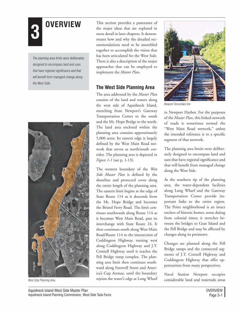
Aquidneck Island West Side Master PlanAquidneck Island Planning Commission, West Side Task Force
overvIeWPage 3-�
3Overview
The planning area limits were deliberately
designed to encompass land and uses
that have regional significance and that
will benefit from managed change along
the West Side.
This section provides a panorama of the major ideas that are explored in more detail in later chapters. It demon-strates how and why the detailed rec-ommendations need to be assembled together to accomplish the vision that has been articulated for the West Side. There is also a description of the major approaches that can be employed to implement the Master Plan.
The west Side Planning AreaThe area addressed by the Master Plan consists of the land and waters along the west side of Aquidneck Island, stretching from Newport’s Gateway Transportation Center to the south and the Mt. Hope Bridge to the north. The land area enclosed within the planning area contains approximately 5,000 acres. Its eastern edge is largely defined by the West Main Road net-work that serves as north/south cor-ridor. The planning area is depicted in Figure 1-1 (see p. 1-13).
The western boundary of the West Side Master Plan is defined by the shoreline and protected coves along the entire length of the planning area. The eastern limit begins at the edge of State Route 114 as it descends from the Mt. Hope Bridge and becomes the Bristol Ferry Road. The limit con-tinues southwards along Route 114 as it becomes West Main Road, past its interchange with State Route 24. It then continues south along West Main Road/Route 114 to the intersection of Coddington Highway, turning west along Coddington Highway and J.T. Connell Highway until it reaches the Pell Bridge ramp complex. The plan-ning area limit then continues south-ward along Farewell Street and Amer-ica’s Cup Avenue, until the boundary rejoins the water’s edge at Long Wharf
in Newport Harbor. For the purposes of the Master Plan, this linked network of roads is sometimes termed the “West Main Road network,” unless the intended reference is to a specific segment of that network.
The planning area limits were deliber-ately designed to encompass land and uses that have regional significance and that will benefit from managed change along the West Side.
At the southern tip of the planning area, the water-dependent facilities along Long Wharf and the Gateway Transportation Center provide im-portant links to the entire region. The Point neighborhood is an intact enclave of historic homes, some dating from colonial times; it stretches be-tween the bridges to Goat Island and the Pell Bridge and may be affected by changes along its perimeter.
Changes are planned along the Pell Bridge ramps and the connected seg-ments of J.T. Connell Highway and Coddington Highway that offer op-portunities from many perspectives.
Naval Station Newport occupies considerable land and waterside areas West Side Planning Area
Newport Secondary line
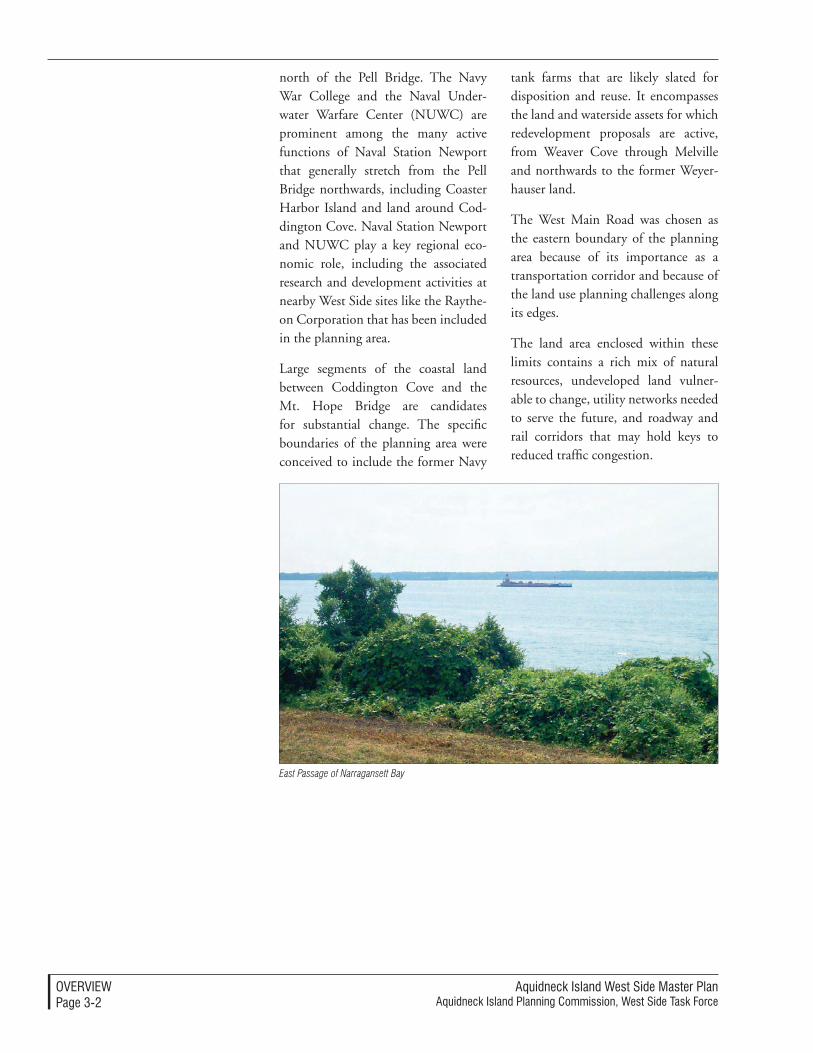
Aquidneck Island West Side Master PlanAquidneck Island Planning Commission, West Side Task Force
overvIeWPage 3-�
north of the Pell Bridge. The Navy War College and the Naval Under-water Warfare Center (NUWC) are prominent among the many active functions of Naval Station Newport that generally stretch from the Pell Bridge northwards, including Coaster Harbor Island and land around Cod-dington Cove. Naval Station Newport and NUWC play a key regional eco-nomic role, including the associated research and development activities at nearby West Side sites like the Raythe-on Corporation that has been included in the planning area.
Large segments of the coastal land between Coddington Cove and the Mt. Hope Bridge are candidates for substantial change. The specific boundaries of the planning area were conceived to include the former Navy
tank farms that are likely slated for disposition and reuse. It encompasses the land and waterside assets for which redevelopment proposals are active, from Weaver Cove through Melville and northwards to the former Weyer-hauser land.
The West Main Road was chosen as the eastern boundary of the planning area because of its importance as a transportation corridor and because of the land use planning challenges along its edges.
The land area enclosed within these limits contains a rich mix of natural resources, undeveloped land vulner-able to change, utility networks needed to serve the future, and roadway and rail corridors that may hold keys to reduced traffic congestion.
East Passage of Narragansett Bay
Aquidneck Island West Side Master PlanAquidneck Island Planning Commission, West Side Task Force
overvIeWPage 3-3
Overall Planning Principles
The recommended strategies and implementation approach contained within the Master Plan are the ex-tension of planning principles that emerged through a vigorous participa-tory process that extended over several years. The principles were expressed as criteria that will define success for the West Side. They are an extension of the shared vision for the entire Island, created through a process sponsored by the Aquidneck Island Planning Com-mission (AIPC).
Objectives of the West Side Master PlanThe objectives for the West Side Master Plan reflect the conviction that many of the West Side problems and opportuni-ties are shared. The articulated objec-tives include a key link to the broader vision for the entire Island:
Incorporate the four elements of Aquidneck Island: Our Shared Vi-sion into the West Side Master Plan – The foundations of the shared vision include ensuring a Livable Landscape, providing Social Well-being, securing a Strong Local Economy, and support-ing Multiple Modes of Transportation. This objective was expanded to express more detailed planning criteria, which are listed below.
The objectives also responded to spe-cific West Side challenges:
Enhance Naval Station Newport by planning surrounding land uses that are compatible with the base’s mission and by planning for the reuse of pub-lic and private property - This objec-tive supports the continuation of the important missions at Naval Station and recognizes that off-base planning is key to its future. It also recognizes
that changes have occurred that will unlock reuse potential that meets mul-tiple purposes, if coordinated planning takes place.
Plan for economic development that complements surrounding land features and contributes to the local economy - The West Side simultane-ously offers clear opportunities for economic development that can pro-vide employment and tax base; this future potential could be lost through precipitous short-term actions. At the same time, the land features and en-vironmental quality are linked to the quality of life and long term value of the entire community. Planning is re-quired to find compatible paths among the many options ahead.
Provide more active and passive recre-ation for community members – De-spite its 5,000-acre scale and abundant open land, the West Side has relatively few active and passive recreation op-portunities for the public; this can be remedied best through planning.
Increase vistas and access on public properties along Narragansett Bay – The long coastline has few access points; this long-held priority should be advanced through the West Side Master Plan.
Criteria for SuccessParticular criteria have been established as a measure of success, organized with the lines established by the Island-wide vision:
A Livable Landscape
Maximize open space – Policies and actions should consistently seek land uses that support the preservation of natural ecosystems and farmland,
Aquidneck Island West Side Master PlanAquidneck Island Planning Commission, West Side Task Force
overvIeWPage 3-�
enhance active and passive recreation, and both establish and link greenways.
Provide public access to the shore – Achieving at least two new public ac-cess points and extending new trails to the waterfront will be the measure of successful development plans and land use strategies.
Minimize adverse aesthetic impacts – Planning and design techniques will protect and enhance the views and visual qualities while limiting undesir-able impacts in order to maintain the high quality of life and community identity that are valued.
Minimize sprawl – Compact and land-efficient development in previ-ously developed areas should be consis-tently supported with the accompany-ing effect of preservation of open space within the West Side.
Social Well-being
Provide educational and professional development opportunities – Stew-ardship of the economy and steward-ship of the land are both linked to a well-educated citizenry with training and skills that are linked to excellent jobs.
Provide adequate housing - A diverse community with a range of incomes is an economic and civic asset. This should be achieved, in part, by land use decisions that provide adequate housing with affordable choices for a range of residents.
Provide a strong sense of community – Aquidneck Island’s identity is linked to its cultural and natural heritage; this identity should be reinforced through future land use and design decisions along the West Side.
A Strong Local economy
Provide a diversified economic base – Success will be measured by the ability of the West Side to support the sectors that are foundations of the ex-isting economy and which expand the opportunities already found here.
Promote environmentally sensitive development – Future development should include strategies that protect or enhance the valued environmental features of the West Side and accom-plish efficient use of resources.
Provide for a diversity of land use – Planning should lead to more mul-tiple-use development patterns that combine compatible uses.
Address demand on municipal ser-vices – The West Side should contrib-ute to the provision of needed services through planned strategies that ad-dress issues of municipal demand and resources.
Multiple Modes of Transportation
Provide flexible, safe, efficient Island transportation – Good choices among multiple transportation modes should be provided for the benefit of the en-tire Island through planned strategies and actions.
Ensure consistency with the regional transportation network – The West Side transportation solutions should be seamlessly integrated into the re-gional transportation framework as it evolves.
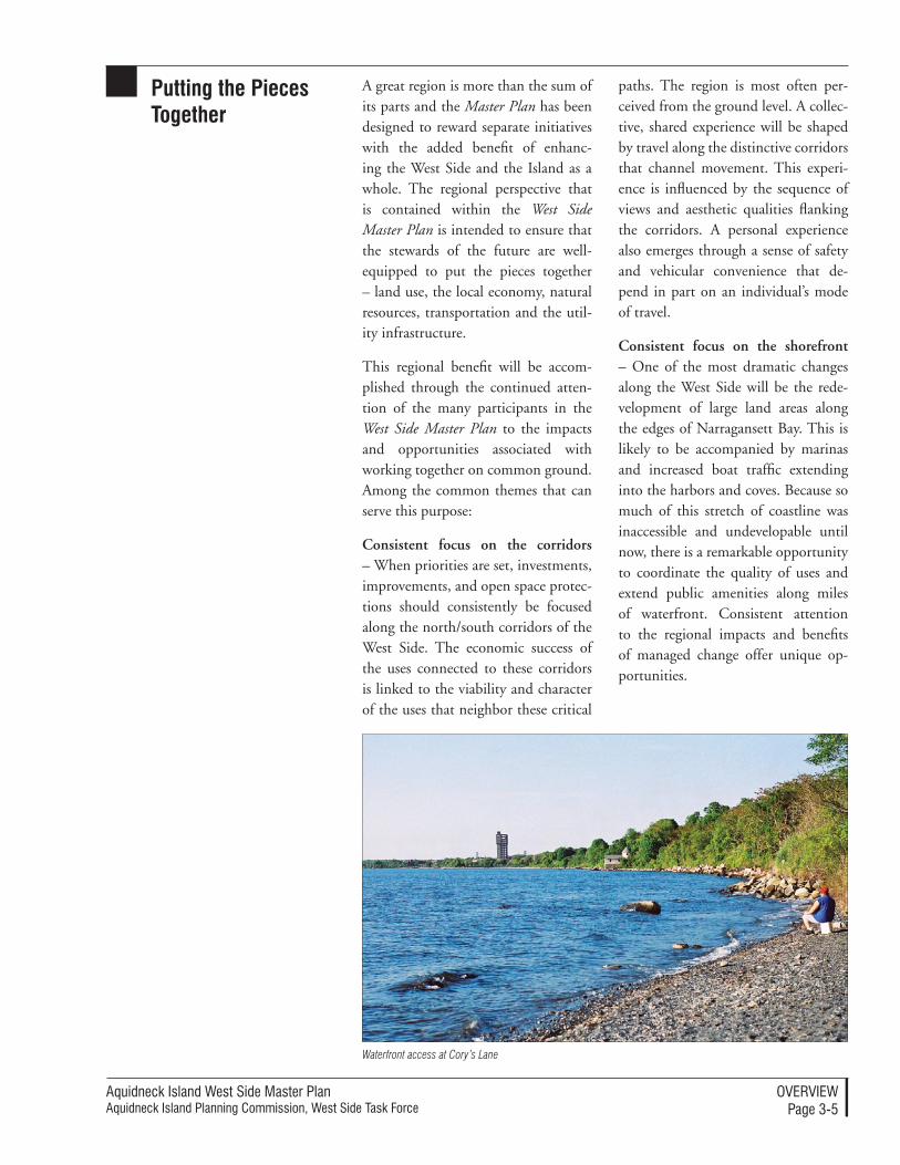
Aquidneck Island West Side Master PlanAquidneck Island Planning Commission, West Side Task Force
overvIeWPage 3-�
Putting the Pieces Together
A great region is more than the sum of its parts and the Master Plan has been designed to reward separate initiatives with the added benefit of enhanc-ing the West Side and the Island as a whole. The regional perspective that is contained within the West Side Master Plan is intended to ensure that the stewards of the future are well-equipped to put the pieces together – land use, the local economy, natural resources, transportation and the util-ity infrastructure.
This regional benefit will be accom-plished through the continued atten-tion of the many participants in the West Side Master Plan to the impacts and opportunities associated with working together on common ground. Among the common themes that can serve this purpose:
Consistent focus on the corridors – When priorities are set, investments, improvements, and open space protec-tions should consistently be focused along the north/south corridors of the West Side. The economic success of the uses connected to these corridors is linked to the viability and character of the uses that neighbor these critical
paths. The region is most often per-ceived from the ground level. A collec-tive, shared experience will be shaped by travel along the distinctive corridors that channel movement. This experi-ence is influenced by the sequence of views and aesthetic qualities flanking the corridors. A personal experience also emerges through a sense of safety and vehicular convenience that de-pend in part on an individual’s mode of travel.
Consistent focus on the shorefront – One of the most dramatic changes along the West Side will be the rede-velopment of large land areas along the edges of Narragansett Bay. This is likely to be accompanied by marinas and increased boat traffic extending into the harbors and coves. Because so much of this stretch of coastline was inaccessible and undevelopable until now, there is a remarkable opportunity to coordinate the quality of uses and extend public amenities along miles of waterfront. Consistent attention to the regional impacts and benefits of managed change offer unique op-portunities.
Waterfront access at Cory’s Lane
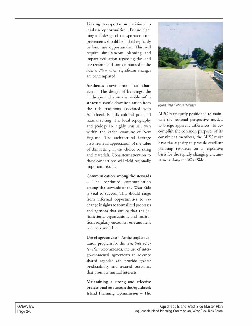
Aquidneck Island West Side Master PlanAquidneck Island Planning Commission, West Side Task Force
overvIeWPage 3-�
Linking transportation decisions to land use opportunities – Future plan-ning and design of transportation im-provements should be linked explicitly to land use opportunities. This will require simultaneous planning and impact evaluation regarding the land use recommendations contained in the Master Plan when significant changes are contemplated.
Aesthetics drawn from local char-acter - The design of buildings, the landscape and even the visible infra-structure should draw inspiration from the rich traditions associated with Aquidneck Island’s cultural past and natural setting. The local topography and geology are highly unusual, even within the varied coastline of New England. The architectural heritage grew from an appreciation of the value of this setting in the choice of siting and materials. Consistent attention to these connections will yield regionally important results.
Communication among the stewards – The continued communication among the stewards of the West Side is vital to success. This should range from informal opportunities to ex-change insights to formalized processes and agendas that ensure that the ju-risdictions, organizations and institu-tions regularly encounter one another’s concerns and ideas.
Use of agreements – As the implemen-tation program for the West Side Mas-ter Plan recommends, the use of inter-governmental agreements to advance shared agendas can provide greater predictability and assured outcomes that promote mutual interests.
Maintaining a strong and effective professional resource in the Aquidneck Island Planning Commission – The
AIPC is uniquely positioned to main-tain the regional perspective needed to bridge apparent differences. To ac-complish the common purposes of its constituent members, the AIPC must have the capacity to provide excellent planning resources on a responsive basis for the rapidly changing circum-stances along the West Side.
Burma Road (Defense Highway)
Aquidneck Island West Side Master PlanAquidneck Island Planning Commission, West Side Task Force
overvIeWPage 3-�
Summary of Planning Strategies
The following summary is a list of ma-jor recommendations that previews the detailed recommendations of Section 5: Planning Strategies. The strategies are organized according to Land Use, Economic Development, Transporta-tion and Utilities. This organizational approach is an effective and traditional planning practice; the organization generally matches the manner in which government and institutional responsibilities are distributed.
In some cases, recommendations on a given topic will appear in nuanced forms in multiple different strate-gies. This is deliberate, although it may seem repetitive to the reader that consumes the entire Master Plan. It is not the result of an editing mistake; many of the recommendations were crafted to meet multiple purposes and must be understood from the different perspectives of those who will imple-ment them. The former military land is an apt example. The recommenda-tions for the reuse of former Navy land entail an economic strategy and a land use strategy and include transportation opportunities and will be linked to utility improvements and management recommendations.
By approaching opportunities from multiple vantage points, the Master Plan aligns these recommendations for ready reference by the governmental entities and institutions responsible for their implementation on the West Side.
Land Use StrategiesThe land use strategies for the West Side recommend targeted, mixed-use redevelopment that supports existing uses and provides public economic benefit, within an attractive and acces-sible open space system. These strate-
gies seek long-term improvement, instead of short-term fixes. The adapt-able approach to land use decisions involves coordinated development, high quality design, public use op-portunities, environmental awareness, and reasonable demands on the com-munity support network.
The open space preservation and recreation strategy promotes the pres-ervation, enhancement, and acquisi-tion of open spaces on the West Side to advance an extensive and varied open space system. The system would incorporate parks, wildlife parcels, greenways, scenic roads and vistas, waterfront property, and agricultural land. Depending on ownership and access, these united elements would support uses ranging from active recreation through natural resource protection and essential visual charac-ter. The master plan targets areas such as the Lawton Valley Brook corridor, the Island’s brook systems, Greene Lane Park, a chain of waterfront access points, and multiple farms with tai-lored strategies for their involvement in the open space system.
The reuse and redevelopment of for-mer military land occupies a promi-nent position in the land use strategy for the West Side. For large parcels, the Master Plan recommends a plan-ning approach that mimics the time-tested BRAC Reuse Plan strategy in an alternative disposition process. Mixed use redevelopments are most appro-priate for the Island, combining uses such as commercial, light industrial, marine-related, affordable housing, or needed public utilities. The Master Plan also recommends uses that sup-port the continued military presence on the West Side, especially to ensure the compatibility of uses on adjacent
Aquidneck Island West Side Master PlanAquidneck Island Planning Commission, West Side Task Force
overvIeWPage 3-�
parcels. Of particular importance are the military housing and tank farms which are in disposition or soon to be transferred.
The land use strategies also recom-mend marina and marine-related development, which would enhance the Island’s strong, existing industry in this field. Marina expansion, marine-industrial, and resort/tourism accom-modations are recommended devel-opments, especially for Melville and adjacent properties. Public waterfront access could be stipulated as part of these projects, which would promote the open space strategy.
The Master Plan supports limited commercial and residential develop-ment as part of mixed-use redevelop-ment projects. Instead of dedicating undeveloped land to new offices, retail, and homes, the strategy for the West Side is to reuse parcels with prior development, thus preserving valuable open space and natural resources and limiting adverse transportation and environmental impacts. Existing com-mercial areas can be enhanced through landscape projects and design guide-lines that improve pedestrian access.
An important, overarching concept for the land use strategy is for the towns to consider the uses and facilities on the West Side with a regional per-spective. It is this standpoint that will foster limited, effective development that supports extant industries, while simultaneously knitting the Island’s built and natural environment into a cohesive physical network with high visual quality.
Land Use Strategies
1. Expand the inventory of system-atically preserved open space and
natural resources that are beneficial to cultural, civic, and environmen-tal values. Among the preserved resources should be priority areas such as land in agricultural use, the Lawton Valley Brook Corridor, entire system of brooks (Gomes, Normans, and Barker), greenways (Sakonnet, the Center Island, and the Newport Neck), wetlands, and coastal features that are identified in the West Side Master Plan.
2. Provide a series of new public places and facilities to enjoy Nar-ragansett Bay, including a scenic overlook and fishing pier at the Midway Pier area near Greene Lane with access to the shoreline for walking, wading and swim-ming, and a shoreline path and walking trails to McAllister Point.
3. Link preserved land and comple-ment the roles and activities of the Aquidneck Land Trust by advanc-ing parallel preservation initiatives through public sector actions and regulations, especially when the valued resources extend across property and jurisdictional lines.
4. Protect and enhance scenic roads and vistas within the West Side. The rural and picturesque qualities enjoyed by everyone who moves along key segments of the West Side’s roadway network are an enormous contributor to the quality of life and value of the Island.
5. Manage change of agricultural land when preservation is not possible, through site design and land use distribution that pre-serves aspects of the low density, rural character, and viewsheds that distinguish these areas.
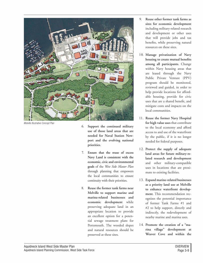
Aquidneck Island West Side Master PlanAquidneck Island Planning Commission, West Side Task Force
overvIeWPage 3-�
6. Support the continued military use of those land areas that are needed for Naval Station New-port and the evolving national priorities.
7. Ensure that the reuse of excess Navy Land is consistent with the economic, civic and environmental goals of the West Side Master Plan through planning that empowers the local communities to ensure continuity with their priorities.
8. Reuse the former tank farms near Melville to support marine and marina-related businesses and economic development while preserving adequate land in an appropriate location to provide an excellent option for a poten-tial sewage treatment plant for Portsmouth. The wooded slopes and natural resources should be preserved at these sites.
9. Reuse other former tank farms as sites for economic development including military-related research and development or other uses that will provide jobs and tax benefits, while preserving natural resources on these sites.
10. Manage privatization of Navy housing to create mutual benefits among all participants. Change within Navy housing areas that are leased through the Navy Public Private Venture (PPV) program should be monitored, reviewed and guided, in order to help provide locations for afford-able housing, provide for civic uses that are a shared benefit, and mitigate costs and impacts on the local communities.
11. Reuse the former Navy Hospital for high value uses that contribute to the local economy and afford access to and use of the waterfront by the public, if it is no longer needed for federal purposes.
12. Protect the supply of adequate land areas for future military-re-lated research and development and other military-compatible uses in locations that are proxi-mate to existing facilities.
13. Expand marine-related businesses as a priority land use at Melville to enhance waterfront develop-ment. This recommendation rec-ognizes the potential importance of former Tank Farms #1 and #2 to help support, directly and indirectly, the redevelopment of nearby marine and marina uses.
14. Promote the creation of a “ma-rina village” development at Weaver Cove and within the
Melville Illustrative Concept Plan
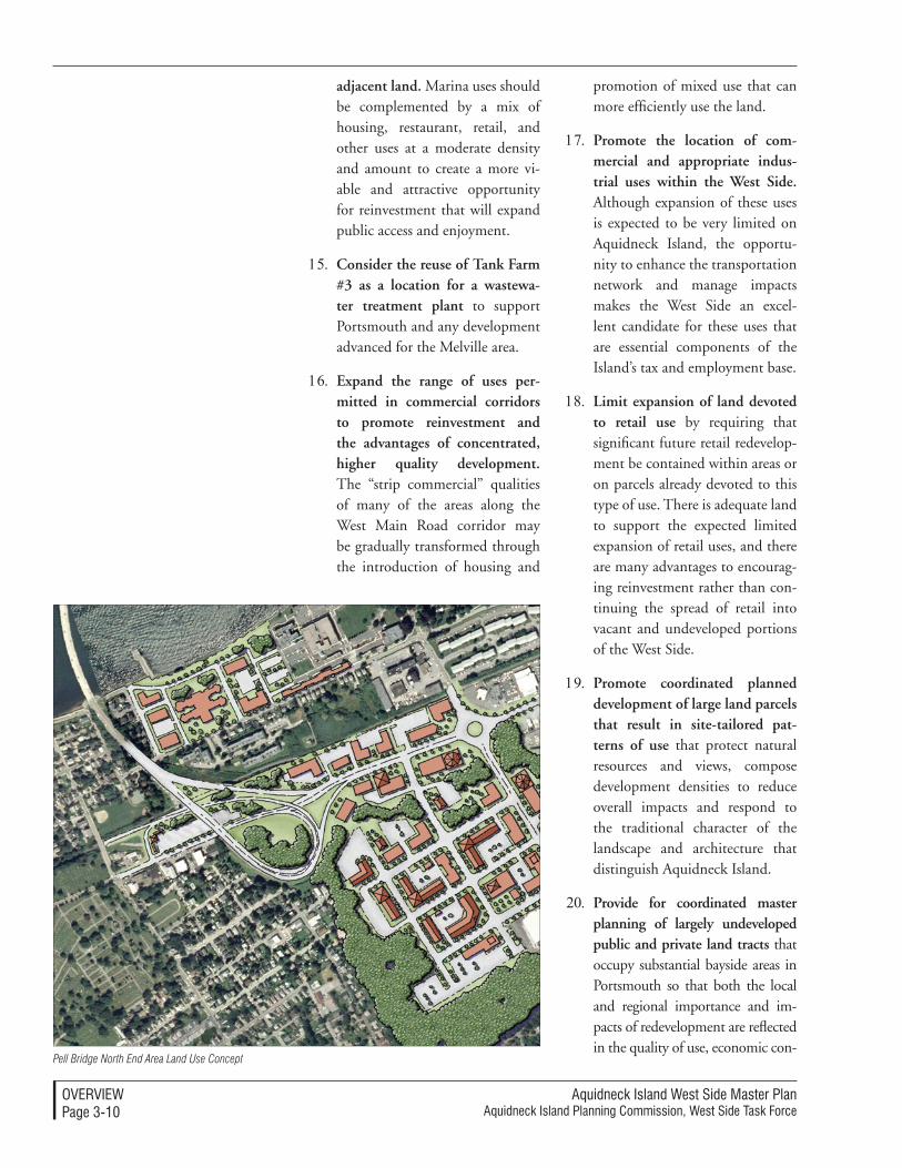
Aquidneck Island West Side Master PlanAquidneck Island Planning Commission, West Side Task Force
overvIeWPage 3-�0
adjacent land. Marina uses should be complemented by a mix of housing, restaurant, retail, and other uses at a moderate density and amount to create a more vi-able and attractive opportunity for reinvestment that will expand public access and enjoyment.
15. Consider the reuse of Tank Farm #3 as a location for a wastewa-ter treatment plant to support Portsmouth and any development advanced for the Melville area.
16. Expand the range of uses per-mitted in commercial corridors to promote reinvestment and the advantages of concentrated, higher quality development. The “strip commercial” qualities of many of the areas along the West Main Road corridor may be gradually transformed through the introduction of housing and
promotion of mixed use that can more efficiently use the land.
17. Promote the location of com-mercial and appropriate indus-trial uses within the West Side. Although expansion of these uses is expected to be very limited on Aquidneck Island, the opportu-nity to enhance the transportation network and manage impacts makes the West Side an excel-lent candidate for these uses that are essential components of the Island’s tax and employment base.
18. Limit expansion of land devoted to retail use by requiring that significant future retail redevelop-ment be contained within areas or on parcels already devoted to this type of use. There is adequate land to support the expected limited expansion of retail uses, and there are many advantages to encourag-ing reinvestment rather than con-tinuing the spread of retail into vacant and undeveloped portions of the West Side.
19. Promote coordinated planned development of large land parcels that result in site-tailored pat-terns of use that protect natural resources and views, compose development densities to reduce overall impacts and respond to the traditional character of the landscape and architecture that distinguish Aquidneck Island.
20. Provide for coordinated master planning of largely undeveloped public and private land tracts that occupy substantial bayside areas in Portsmouth so that both the local and regional importance and im-pacts of redevelopment are reflected in the quality of use, economic con-
Pell Bridge North End Area Land Use Concept
Aquidneck Island West Side Master PlanAquidneck Island Planning Commission, West Side Task Force
overvIeWPage 3-��
tributions, public access, transporta-tion infrastructure and preservation of natural resources and views.
21. Support the Pell Bridge ramp relo-cations to unlock the potential for comprehensively-planned mixed use redevelopment. These initia-tives open the potential for cen-trally located, high quality develop-ment as an excellent alternative to sprawl and include the opportunity to provide a parking and transit facility with regional benefits.
22. Support high quality resort-type residential and recreational devel-opment that are master planned as large land parcels, have low traffic and environmental impacts and contribute substantially to the economy of the Island through related employment and enhance-ment in value.
23. Minimize the construction of new single family market-rate residences along the West Side. This recommendation notes the exception of affordable housing, housing associated with recom-mended mixed use areas and re-sort-type second homes.
economic Development StrategiesThe central economic strategy of the West Side Master Plan is to increase high income jobs and a solid return on investments for the long-term, by capitalizing on existing uses, industries and unique redevelopment opportuni-ties. The recommendations are site-specific, tailored for the Island context and considered alongside the land use and transportation strategies, so that the village image and the value of small-city life can be retained and appreciated.
The Navy is a substantial asset for the Island that can continue to be sup-ported—both in its continuing mili-tary activities and its land disposition process. Promoting defense-related re-search and development will reinforce a mutually-beneficial fiscal relation-ship between the military and Island communities. A “technology trans-fer” is an essential component of this strategy and could be accomplished through the promotion of an “Inno-vation Factory” concept at the former Naval Hospital. Industries should be compatible with the continuing military activities. The housing and infrastructure privatization initiatives must establish equitable compensation and provision of municipal services for all involved. Within these processes of military land reuse, the Island commu-nities receive the right of first refusal. The formation of an LRA will ensure the speed of the transfer process and promote reuses that focus on public benefits and job creation.
A second locus for viable economic growth is the marina and shipbuild-ing industry on the West Side, in the Melville District. The recommended strategy seeks to highlight and sup-port these waterfront uses over the long-term, bolstering the Island to a prominent regional and national yachting destination and shipbuilding center. Unlike quick-fix, waterfront housing developments, the marina and marine-related industry approach will boost job growth in the long-term. In addition, an upland resort or ad-ditional marine-related industries in adjacent parcels would strengthen any marina expansion. The West Side Master Plan’s overall approach to tour-ism is measured: a resort, second-home development, and a heritage corridor are envisioned to spread the benefits of

Aquidneck Island West Side Master PlanAquidneck Island Planning Commission, West Side Task Force
overvIeWPage 3-��
tourism to diversified, yet highly con-trolled, areas on the West Side.
Affordable housing, “life-style cen-ters,” commercial offices and health care industry are additional viable initiatives that are appropriate for the West Side. Any economic develop-ment project should be accompanied by home-based business zoning, air-port improvements, and job-training programs to provide the regulatory context, transportation and access im-provements, and quality employment pool necessary for a viable market.
economic Priorities
The highest return on the investment of time and resources will be achieved as the following economic priorities are used to focus public actions and appropriate development:
1. Consistently support all actions that improve the quality of life for residents of Aquidneck Island as an economic strategy, recogniz-ing that the desirability of living and working on the Island is a key to the retention and expansion of quality employment opportunities.
2. Actively support the existing cluster of military activities and associated research and develop-ment businesses.
3. Actively support the specialized cluster of marine-related and marina uses to the greatest extent practical and necessary to take advantage of the unique physical assets and concentration of activi-ties found along the West Side.
4. Preserve land assets that are potentially prime development opportunities for job-generating businesses rather than maximizing
short-term benefits associated with current market conditions and the high demand for housing.
5. Ensure that the reuse and rede-velopment of excess Navy prop-erty accomplishes both local and regional economic goals as the highest priority.
6. Promote affordable housing de-velopment within the West Side as an economic strategy, recog-nizing the critical importance of diverse housing opportunities for the employers, employees and families of Aquidneck Island.
7. Promote mixed-use development that appeals to the citizens of Aquidneck Island and the quality of life they seek, rather than new large scale or isolated commercial and retail concentration.
8. Promote high value, high quality tourism, resort and second home development.
economic Development Strategies
1. Promote effective privatization of military facilities that will benefit the military presence at Naval Station Newport (including both housing and infrastructure) through efforts that achieve com-patibility with the other goals of the West Side Master Plan.
2. Support the potential infrastruc-ture Public Private Partnership (PPV) dedicated to combining privatization of the Navy’s utili-ties with expanded service to serve desirable future development as-sociated with Navy land disposi-tion, large-area developments near Weaver Cove and Melville and other Portsmouth-area needs.

Aquidneck Island West Side Master PlanAquidneck Island Planning Commission, West Side Task Force
overvIeWPage 3-�3
3. Discourage land uses adjacent to active military functions that will tend to be incompatible.
4. Create a technology transfer center to leverage the clustered human and technical resources already associated with military-research and development.
5. Target the reuse of the former Naval Hospital as a technology transfer center using the emerg-ing “Innovation Factory” con-cept being advanced by RIEDC.
6. Advance the reuse of military land in the event of disposition by focusing on economically beneficial uses. Use the West Side Master Plan as an economic ratio-nale and a basis for a reuse plan that accomplishes the necessary economic objectives and defines the process for transfer.
7. Facilitate marina development at Weaver Cove and promote marina-supporting upland resort development that enhances the investment opportunities through a mixed-use approach.
8. Build upon the local marina sec-tor by supporting marine-related industry to enhance the Island’s status as a premier yachting loca-tion.
9. Develop portions of a heritage/recreational trail along the West Side as an economic strategy, in addition to its contributions to the cultural life of the Island.
10. Investigate the potential for a multi-purpose/arts/entertainment facility and advance its develop-ment in a location that is well served by parking and transit.
11. Promote the development of af-fordable housing by leveraging the transfer and redevelopment of publicly owned land and pro-moting regional coordination that helps implement the affordable housing strategies of the Island’s constituent communities.
12. Promote coordinated re-use of land, transportation, and infra-structure improvements near the Pell Bridge to provide an excellent location for mixed-use lifestyle center development.
13. Promote locations and regula-tions to attract commercial offices and health care facilities along the West Side to take advantage of the available land and the opportunities to provide future transit, transportation, and utility improvements.
14. Actively engage business reten-tion and assistance programs in response to the understanding that the Island’s economy is highly dependent upon a few concen-trated economic sectors and that stability is linked to the health of those sectors and the businesses that are engaged within them.
15. Support cost effective and envi-ronmentally responsible waste water solutions for the northern portions of the West Side. Pro-vision of municipal wastewater treatment will improve the attrac-tion for the expansion of marine trades in Melville and future expansion of the Raytheon cam-pus. Increased commercial and industrial property tax return will help counterbalance the Town’s current dependence on residential property value.
Aquidneck Island West Side Master PlanAquidneck Island Planning Commission, West Side Task Force
overvIeWPage 3-��
Transportation StrategiesThe transportation recommendations range from immediate actions to long-term strategies reaching thirty years into the future.
Many of the traffic strategies focus on enhancing north/south connections along the West Side of Aquidneck Is-land. The Master Plan also emphasizes the importance of alternative modes of travel. It contains recommendations for an extended network of bicycle trails, including the dedicated bikeway that should be created along much of the Newport Secondary. The recom-mendations detail approaches to ex-panded pedestrian networks and a pro-gram of improvements called “traffic calming” that will better balance auto and pedestrian needs. The Master Plan emphasizes strategies that will promote more use of transit. Specific concepts are also advanced to better manage the flows of traffic through emerging tech-nologies and techniques.
The West Main Road network offers important opportunities for improved traffic flows and safety enhancements. The Master Plan recognizes the ad-ditional opportunities associated with two underutilized transportation cor-ridors: Burma Road (Defense High-way) and the state-owned right-of-way along the Newport Secondary rail line. By more fully utilizing these assets, the need to undertake new roadway construction and acquisition of private property is significantly reduced.
A phased strategy targets early and relatively affordable actions. West Main Road improvements can be ac-complished in the short term and set the stage for multimodal improve-ments to meet future transportation needs. It is also a pragmatic strategy:
a phased approach that recognizes fis-cal constraints and the length of time required to conduct feasibility studies, alternatives analysis, environmental impact statements, permitting, and design may take 10 to 20 years for major projects.
Perhaps the most dramatic transporta-tion change in the West Side planning area may be the transformation of Burma Road (Defense Highway) into Shoreline Drive, a two-lane roadway which would bypass West Main Road from Stringham Road in Portsmouth to Coddington Highway in Middle-town. By diverting commuter and tourism traffic from congested roads to an underutilized corridor, traffic on the island will improve. This scenic route along the shoreline would utilize the current alignment of Stringham Road, Burma Road (Defense Highway), Gate 17 Access Road, and a continuation of Simonpietri Drive through Naval Station Newport. By removing the hairpin turn at the Stringham Road/Burma Road intersection and extend-ing Simonpietri Drive, the existing route would be shortened by up to a mile. Geometric, site distance, and drainage improvements, sidewalk con-struction, and landscaping (including brush clearing) would improve speeds and create a scenic road second only to Ocean Drive in Newport.
This alignment would benefit the Navy by improving access for stu-dents, employees, and contractors at the Naval War College, Naval Station Newport, and NUWC. However, relocation of Naval Station Newport’s secure perimeter, utility security, and emergency response routes must be addressed and approved. The align-ment would also improve access to the new North Gate.
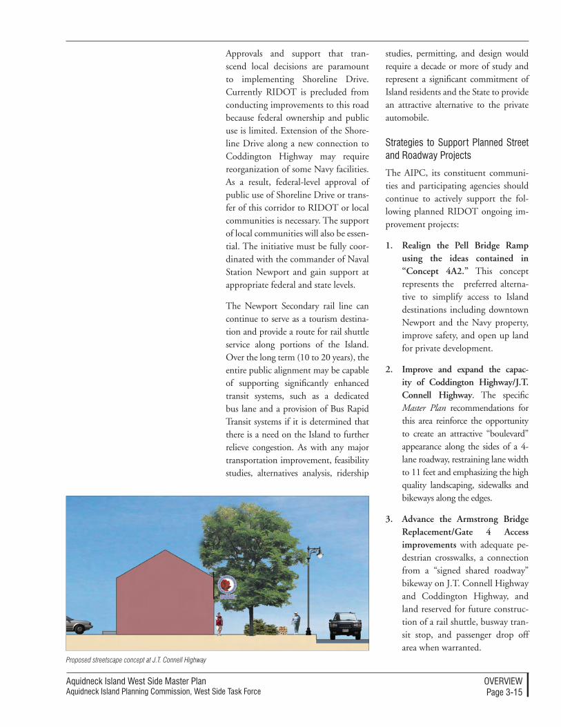
Aquidneck Island West Side Master PlanAquidneck Island Planning Commission, West Side Task Force
overvIeWPage 3-��
Approvals and support that tran-scend local decisions are paramount to implementing Shoreline Drive. Currently RIDOT is precluded from conducting improvements to this road because federal ownership and public use is limited. Extension of the Shore-line Drive along a new connection to Coddington Highway may require reorganization of some Navy facilities. As a result, federal-level approval of public use of Shoreline Drive or trans-fer of this corridor to RIDOT or local communities is necessary. The support of local communities will also be essen-tial. The initiative must be fully coor-dinated with the commander of Naval Station Newport and gain support at appropriate federal and state levels.
The Newport Secondary rail line can continue to serve as a tourism destina-tion and provide a route for rail shuttle service along portions of the Island. Over the long term (10 to 20 years), the entire public alignment may be capable of supporting significantly enhanced transit systems, such as a dedicated bus lane and a provision of Bus Rapid Transit systems if it is determined that there is a need on the Island to further relieve congestion. As with any major transportation improvement, feasibility studies, alternatives analysis, ridership
studies, permitting, and design would require a decade or more of study and represent a significant commitment of Island residents and the State to provide an attractive alternative to the private automobile.
Strategies to Support Planned Street and roadway Projects
The AIPC, its constituent communi-ties and participating agencies should continue to actively support the fol-lowing planned RIDOT ongoing im-provement projects:
1. Realign the Pell Bridge Ramp using the ideas contained in “Concept 4A2.” This concept represents the preferred alterna-tive to simplify access to Island destinations including downtown Newport and the Navy property, improve safety, and open up land for private development.
2. Improve and expand the capac-ity of Coddington Highway/J.T. Connell Highway. The specific Master Plan recommendations for this area reinforce the opportunity to create an attractive “boulevard” appearance along the sides of a 4-lane roadway, restraining lane width to 11 feet and emphasizing the high quality landscaping, sidewalks and bikeways along the edges.
3. Advance the Armstrong Bridge Replacement/Gate 4 Access improvements with adequate pe-destrian crosswalks, a connection from a “signed shared roadway” bikeway on J.T. Connell Highway and Coddington Highway, and land reserved for future construc-tion of a rail shuttle, busway tran-sit stop, and passenger drop off area when warranted.
Proposed streetscape concept at J.T. Connell Highway
Aquidneck Island West Side Master PlanAquidneck Island Planning Commission, West Side Task Force
overvIeWPage 3-��
4. Advance RIDOT-sponsored im-provements at West Main Road, Coddington Highway to East Main Road with left turn lanes, pedestrian crossings and sidewalks included in the project design.
5. Advance the West Main Road Re-surfacing Project in Middletown in accordance with enhanced side-walk recommendations of the West Side Master Plan and recommenda-tions of the Walkability Workshop held in May 2004 in Middletown.
Short Term Street and roadway Im-provement Projects
1. Evaluate, design, and then con-struct left turn lanes in strategic locations along West Main Road. The current state Transportation Improvement Plan (TIP) applica-tion includes left turn lanes and geometric improvements to in-crease capacity and improve safety from Raytheon in Portsmouth to Forest Avenue in Middletown.
2. Realign West Main Road intersec-tions of Hedly Street and Cory’s Lane as one signalized intersec-tion. This will remove a signalized intersection, improve access to local destinations, and provide a site for a gateway welcome center at the north end of the island, im-mediately after Route 24.
3. Remove the awkward switchback at the north end of Burma Road (Defense Highway) at Stringham Road. Roadway realignment and intersection improvements will reduce travel distance by almost one-half mile and make it a more attractive alternative north-south route on Aquidneck Island while improving access to the Navy base, Weaver Cove, and Melville.
4. Upgrade segments of Stringham Road and Burma Road (Defense Highway) to achieve attractive travel times and to draw traffic from West Main Road. Upgrades will retain the current two-lane roadway configuration while retaining sufficient right-of-way for long term roadway widening, if and when warranted. Improve-ments should include enhanced site distance (clearing brush), drainage, access restrictions, and minor grade and geometric im-provements. Through truck traf-fic would be limited due to steep grades. Signage directing tourists to this scenic roadway should also be accomplished.
Major Street and roadway Initiatives
1. Create the Shoreline Drive, con-necting Coddington Highway and the Gate 17 Access Road via an extension of Simonpietri Drive through Naval Station Newport. This roadway would provide the missing link on the Shoreline Drive, extending from West Main Road at Stringham Road in Portsmouth south to Bur-ma Road (Defense Highway) and the Gate 17 Access Road at the Navy base in Middletown. The Shoreline Drive would provide a scenic bypass for commuters and tourists and divert traffic from West Main Road. Implementa-tion of this connection would be the single most important action item for the improvement of traf-fic flow on the West Side. This will require approval and coordination with Naval Station Newport to es-tablish a corridor connecting the Gate 17 Access Road with Cod-dington Highway; its feasibility
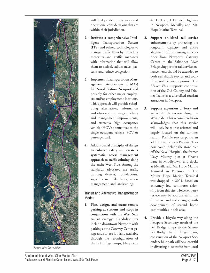
Aquidneck Island West Side Master PlanAquidneck Island Planning Commission, West Side Task Force
overvIeWPage 3-��
will be dependent on security and operational considerations that are within their jurisdiction.
2. Institute a comprehensive Intel-ligent Transportation System (ITS) and related technologies to manage traffic flows by providing motorists and traffic managers with information that will allow them to actively adjust travel pat-terns and reduce congestion.
3. Implement Transportation Man-agement Associations (TMAs) for Naval Station Newport and possibly for other major employ-ers and/or employment locations. This approach will provide sched-uling alternatives, information and advocacy for strategic roadway and management improvements, and attractive high occupancy vehicle (HOV) alternatives to the single occupant vehicle (SOV or passenger car).
4. Adopt special principles of design to enhance safety and create a systematic, access management approach to traffic calming along the entire West Side. Among the standards advocated are traffic calming devices, roundabouts, signed shared bike lanes, access management, and landscaping.
Transit and Alternative Transportation Modes
1. Plan, design, and create remote parking at stations and stops in conjunction with the West Side transit strategy. Candidate sites include downtown Newport with parking at the Gateway Center ga-rage and surface lot, land available through the reconfiguration of the Pell Bridge ramps, Navy Gate
4/CCRI on J.T. Connell Highway in Newport, Melville, and Mt. Hope Marine Terminal.
2. Support on-island rail service enhancements by protecting the long-term capacity and entire alignment of the existing rail cor-ridor from Newport’s Gateway Center to the Sakonnet River Bridge. Support for rail service en-hancements should be extended to both rail shuttle service and tour-ism-based service options. The Master Plan supports continua-tion of the Old Colony and Din-ner Trains as a diversified tourism attraction in Newport.
3. Support expansion of ferry and water shuttle service along the West Side. This recommendation acknowledges that this service will likely be tourist-oriented and largely focused on the summer season. Possible service points in addition to Perrotti Park in New-port could include the stone pier off the Naval Hospital, the former Navy Midway pier at Greene Lane in Middletown, and docks at Melville and Mt. Hope Marine Terminal in Portsmouth. The Mount Hope Marine Terminal was dropped in 2001, based on extremely low commuter rider-ship from this site. However, ferry service may be appropriate in the future as land use changes, with development of second home communities in this area.
4. Provide a bicycle way along the Newport Secondary north of the Pell Bridge ramps to the Sakon-net Bridge. In the longer term, construction of the Newport Sec-ondary bike path will be successful in diverting bike traffic from local Transportation Concept Plan
Aquidneck Island West Side Master PlanAquidneck Island Planning Commission, West Side Task Force
overvIeWPage 3-��
roads and neighborhoods to a dedicated off-road path. To avoid security issues at the Navy base, the bikeway should be diverted to Simonpietri Drive and Cod-dington Highway between Gate 4 and Gate 17 Access Road. Further analysis will be required to deter-mine the feasibility of including various modes of transportation within the Newport Secondary corridor, but a preference for multiple modes and the use or preservation of capacity for transit options should be a priority.
5. Evaluate and designate qualify-ing segments of streets and roads for “Share the Road” bikeways, including Long Wharf, Washing-ton Street, Sycamore Street, Third Street and Admiral Kalbfus Road in Newport; local roads adjacent to the Navy base and Greene Lane in Middletown and Redwood Road and Willow Lane in Portsmouth.
6. Extend new bike lanes as part of roadway improvements where adequate width is available, such as along Coddington Highway. Where on-street parking is per-mitted and striped, the Bike Lane should be placed between the parking area and the travel lane and have a minimum width of 5 feet.
7. Extend off-road “shared use paths” connecting Redwood Road with the Defense Highway Com-muter Bike Lane (or the Newport Secondary bike path) through a Town of Portsmouth playground to create an important connection to the Center Island Greenway and the shoreline of Narragansett Bay.
8. Require construction of sidewalks for any roadway construction or reconstruction. A similar require-ment should be included within local zoning ordinances and land development regulations for proj-ects on local roadways. Sidewalks should be constructed to the next logical destination or intersection to facilitate safe off-street pedes-trian access.
9. Create and market a Blue Trail of kayak and small boat put-in loca-tions, shoreline destinations, and facilities along the West Side.
10. Plan for the potential upgrade of Shoreline Drive to a four-lane parkway as an option for the long term. Not a currently attractive option, this parkway is only rec-ommended when other upgrades and transit alternatives are inef-fective. The expanded Shoreline Drive would extend from West Main Road at Stringham Road south to Burma Road (Defense Highway).
11. Investigate the feasibility of a dedicated busway along the rail alignment if ridership warrants it. A reversible, one-way express bus network would meet future traffic needs on the West Side by more fully utilizing the state-owned right of way of the Newport Secondary rail line. The busway would carry Bus Rapid Transit Service as well as special event and seasonal scheduled and chartered bus services for tourism. Peak hour flow would be on the bus-way with the off-peak return trip via existing roads including J.T. Connell Highway, Coddington Highway, and West Main Road. In the section between the Pell
Aquidneck Island West Side Master PlanAquidneck Island Planning Commission, West Side Task Force
overvIeWPage 3-��
Bridge ramps and the Gateway Center, the busway would share the southbound one-way roadway proposed by RIDOT along the rail right-of-way.
Utilities StrategiesThe West Side Master Plan proposes strategies for water supply, wastewater treatment, and sustainable energy on the Island. While there is adequate water supply for the projected needs of the municipalities, issues regarding water supply purification and distribu-tion must be addressed. The Master Plan bases its recommendations on the continued discussions and negotiations among the Island municipalities, the Navy, the Portsmouth Water and Fire District (PWFD) and the Rhode Island Economic Development Corpora-tion (RIEDC). Multiple options for remedying the water supply issues are possible within this forum, including regionalization alternatives, treatment facility upgrades, and ensuring compat-ibility among water demand and system size. While the water supply is sufficient to meet current projections, the likeli-hood of development, especially in the Melville area of Portsmouth, would require consideration of an additional water supply source. The Melville area could be serviced via Navy nego-tiations to secure a low pressure line. Alternatively, and among other options, PWFD or City of Newport Service could be extended to Melville. The recommendations discuss the various options and encourage further analysis of their respective strengths.
Portsmouth and a proposed develop-ment in Melville present wastewater issues as well. Unlike Newport, Mid-dletown, and Naval Station Newport, Portsmouth has no municipal sewage
treatment system and is accommo-dated by Individual Sewage Disposal Systems, package treatment plants, or hauling septage to the Newport facility. The Master Plan proposes multiple options for wastewater treat-ment in Portsmouth, some of which are contingent upon the land transfer process of former Navy property. Also associated with these alternatives is the possible installation of wind turbines on former Navy tank farms to generate sustainable energy for the wastewater treatment plant.
1. Support the establishment of a regular forum, ongoing discus-sions, and collaboration among the City of Newport, Towns of Middletown and Portsmouth, the Navy, PWFD, and RIEDC regarding water treatment and distribution issues. It is recog-nized that adequate water is avail-able to meet projected needs along the West Side but that several issues must be resolved to assure delivery to all Island residents, businesses and institutions. This forum is expected to resolve the organizational approach for water treatment and distribution.
2. Resolve issues related to the Safe Drinking Water Act, especially the Disinfectants By-products Rule. PWFD and Navy customers at the ends of the distribution sys-tem have experienced water quality which does not meet these require-ments. Treatment facility upgrades are required for compliance.
3. Resolve the best approach to provide all necessary water distri-bution for future development in the Melville area of Portsmouth that is consistent with the Master Plan. This section is currently
Aquidneck Island West Side Master PlanAquidneck Island Planning Commission, West Side Task Force
overvIeWPage 3-�0
underserved by Navy lines that have water quality issues; the City of Newport’s delivery of water to private businesses in Melville is “wheeled through” the Navy distribution system. The PWFD 36-inch line on West Main Road is currently not accessible for use in Melville.
4. Negotiate and execute a contract between the City of Newport and PWFD that assures adequate quantity and quality of water supply will be available at an equitable fee for future needs in Portsmouth.
5. Provide for the transfer, purchase or privatization of Navy utilities and regionally-important utility corridors to the extent that it is mutually beneficial. Privatization of the Navy utility system may provide benefits if it can be linked to solutions for private and public sector sewer and water needs, for example. In addition, extension of Burma Road connections and/or transfer should identify and pre-serve potential utility corridors.
6. Preserve a location, land, and adequate setbacks to allow fu-ture construction of a Municipal Wastewater Treatment Facility (WWTF) for Portsmouth and the Melville redevelopment areas. For-mer Tank Farm 3 may be suitable for construction of a municipal WWTF. Approximately 10 acres should be reserved for current and projected use. Although this loca-tion is not convenient to areas of Town where failed septic systems must be addressed per RIDEM, the Town of Portsmouth may real-ize several cost savings with a plant in the vicinity of Melville.
7. Support the provision of waste-water treatment systems and solutions that are needed to fulfill the economic development goals and land use vision contained in the West Side Master Plan. This recommendation recognizes that there are many alternative methods to provide for waste-water treatment today, and that there are capital, operational, and maintenance trade-offs that must be explored by the entities most directly affected by the outcome. However, delay in the resolution of these issues should not be used to thwart desirable development.
8. Promote the location of wind turbines to supplement electric generation and distribution by sustainable means in locations and numbers that do not dominate the visual qualities of the land from prominent public vantage points.
Aquidneck Island West Side Master PlanAquidneck Island Planning Commission, West Side Task Force
overvIeWPage 3-��
implementation Summary
The West Side Master Plan lays the groundwork for its own implementa-tion. Through specific approaches and tools, the Master Plan provides detailed directions that might be used to accomplish the vision for the West Side. This summary briefly previews the content of the Master Plans’ Section 6: Implementation, which has three sec-tions: Overall Coordination Approach, Implementation Approach, and Roles and Timelines.
This summary does not represent all of the implementation methods in Section 6: Implementation, but highlights some of the most significant tools, processes, standards, and resources available to the West Side.
Overall Coordination Approach SummaryThe Overall Coordination Approach for the Master Plan is termed “consis-tent organized stewardship.” A steady, managed staff, agencies with coherent and defined roles and responsibilities, and a broad stakeholder representation are the foundation of coordination. This summary of the overall coordi-nation approach briefly describes the roles and responsibilities of the AIPC, the Island municipalities, and all asso-ciated agencies.
The AIPC has a central role as a co-ordinator and facilitator for the West Side’s regional perspective. The orga-nization will provide a structure for managing change through implemen-tation committees. The Intergovern-mental Working Group (IWG) will be a consistent forum, facilitated by the AIPC, for promoting projects, shaping intergovernmental agreements, and fostering communication to limit mis-information. IWG participants would
include representatives from the three Island communities, local and regional entities, State offices and legislature, the Navy or DOD, and the Congres-sional delegation.
The AIPC will conduct special stud-ies, Master Plan progress reviews, and present annual updates on the Master Plan implementation. Standards for coordination will be established and revised through regional consistency statements and the implementation matrix. Through its interaction with other agencies, the AIPC could serve as a source for model regulations and standards. It will also contribute to the awareness of the Master Plan through a website and an awards program for outstanding West Side projects. Co-ordination Resources available to the AIPC and other entities include fees for service and grants.
These Coordination tools, processes, standards, and resources are fully ex-plained in Section 6: Implementation.
implementation Approach SummaryThe Implementation Approach fol-lows the coordination approach. The implementation section is also divided into land use, economic development, transportation, and utilities categories. For each of these topical divisions, the implementation approach lists and ex-plains the tools, processes, standards, and resources that could be used to accomplish the planning strategies. A tool is a technique or method that can be employed to fulfill a strategy. A process is an organized series of procedures or events. A standard is a limit that sets the level of performance to be achieved. A resource enables a strategy to be pursued. Synopses of
Aquidneck Island West Side Master PlanAquidneck Island Planning Commission, West Side Task Force
overvIeWPage 3-��
those implementation tools, processes, standards, and resources, for all four categories, are provided in this sum-mary.
Roles and Timelines is a section that follows the Implementation Approach. The summary briefly discusses the priorities from the perspective of key public vantage points which are enu-merated in depth in Section 6: Imple-mentation.
Land Use Implementation
Transfer of development rights (TDR) is a tool that promotes intensi-fied, urban development in some areas, while preserving rural character in oth-ers, protecting open space and natural resources. Landowners relinquish a portion of their development rights and transfer them to a parcel slated for higher-density development.
Interim Planning Overlay Districts (IPODs) improve local regulations without inhibiting development op-portunities. The overlay coexists with the extant zoning and adds new regula-tions or standards to that zoning. They are especially applicable for improved environmental standards, design guide-lines, or density stipulations. IPODs are temporary and are not considered to infringe on property rights.
Growth centers, or “priority invest-ment areas,” are local Smart Growth projects. They promote compact, mixed-use development; open space, natural and historic resource preserva-tion; regionally-appropriate develop-ment; and community and employ-ment goals.
Intergovernmental agreements are tools that assess impact fees, provide services, manage redevelopment, ap-ply performance standards, and design
guidelines that are in keeping with the Master Plan. The agreements are em-ployed through the Intergovernmental Working Group (IWG).
A Local Redevelopment Authority (LRAs) is established or designated by the IWG to facilitate local man-agement and control of a land dis-position process. An LRA acts as a single, community-based entity with the full responsibility for facilitating the planning and implementation of large, military or non-military rede-velopments. It is modeled after the LRA of the BRAC process. An LRA would be appropriate for the reuse of the Tank Farms or other Special Area Reuse Plans.
Special Area Reuse Plans (SARPs) propose large-scale, mixed-use rede-velopment projects and consider the relationships among infrastructure, open space, and land use patterns. Imi-tating the BRAC Reuse Plan process, SARPs are consensus-driven projects implemented through an LRA which coalesce principles from environmen-tal sustainability, Smart Growth, and public benefit. Performance criteria and approval procedures are incorpo-rated at the local, regional, state, and federal levels.
Special Area Management Planning (SAMP) is a comprehensive planning tool for natural resource protection and reasonable economic growth in coastal areas. These processes recognize incom-patibilities among the uses and users of coastal resources. SAMPs form strate-gies to protect and manage resources which cross political boundaries and call upon multiple conflicting groups. Special Area Management Planning could be used along the West Side waterfront, Weaver Cove, and Melville, and can boost economic development.
Aquidneck Island West Side Master PlanAquidneck Island Planning Commission, West Side Task Force
overvIeWPage 3-�3
The Aquidneck Land Trust (ALT) acquires, preserves, and enhances open space and natural resources us-ing tools such as perpetual conserva-tion easements and restrictions, deed restrictions, conservation intent, and land evaluation forms. The AIPC and the municipalities should support and parallel such endeavors.
Land Use Performance Standards and Design Guidelines are tailored land use management tools beyond land use regulations. Assembled at the local level, they shape future de-velopment and land use. Baseline performance standards are applicable to the overall development of land and the management and improvement of roadways. Land Use Specific perfor-mance standards are tailored for large development projects, commercial and mixed use developments, military land reuse, marina/marine-related uses, agricultural land, open space, and scenic roadways/vistas. Sustainable Site Planning and Design Perfor-mance Standards address stormwater management, waste water treatment, energy conservation, erosion control, and site selection through the latest Low Impact Development (LID) and U.S. Green Building Design (US-GBC) LEED standards.
Land Use Resources are available for open space and natural resource pres-ervation, trail networks, land acquisi-tion, development and construction projects. Examples include: The U.S. FHWA Recreational Trails Program (RTP), RIDEM’s Open Space, Recre-ation, Bay and Watershed Protection Bond, the Department of Interior Land and Water Conservation Fund, RIDEM’s Open Space Grants, off-site and local impact fees, and combined construction.
These Land Use Implementation tools, processes, standards, and resources are fully explained in Section 6: Implemen-tation.
economic Development Implementa-tion Summary
A Project of Critical Economic Con-cern is a project status that functions as a tool to enhance commerce, stimulate jobs, and relieve unemployment. Cer-tificates of Critical Economic Concern (CCECs) award a project a priority sta-tus in all permit review processes as an incentive to prospective businesses and industries. CCECs may be especially applicable for Melville, to accelerate marine-related industries, marina and marina-village, tourism and resorts and other desirable developments.
As in the Land Use implementation, intergovernmental agreements are tools for economic development that are formed among constituent and associated agencies and facilitated by an Intergovernmental Working Group (IWG.) They create enforceable con-tracts, advance development, and meet public purposes without burdensome regulations. The IWG also activates the Special Area Reuse Plan (SARP) process or other developments which have economic development value. In the SARP process, the IWG would designate an LRA to coordinate and execute the reuse plan.
Special Area Reuse Plans (SARPs) ad-vance economic development aims in addition to land use strategies. SARPs manage the development of former military property, or non-military property, into large-scale, mixed-use redevelopment projects. They are geared to support projects that provide long-term fiscal benefits and fulfill the aims of the West Side Master Plan.
Aquidneck Island West Side Master PlanAquidneck Island Planning Commission, West Side Task Force
overvIeWPage 3-��
Transfer of Development Rights (TDR) is primarily a land use tool. However, the TDR also provides fi-nancial incentives to developers that render it an attractive method for economic development. Density bo-nuses and downzoning compensation are associated with TDRs as incentives for development that fulfills the fiscal strategies of the West Side.
Additional economic development tools for implementing the West Side Master Plan focus reinvestment, apply supplemental zoning, and offer incen-tives. Such tools include the State’s “Innovation Factory” concept, special economic redevelopment overlay dis-tricts, inclusionary zoning or impact fees for affordable housing, tax abate-ment, and special loan guarantee/credit enhancement programs.
Special Area Management Plans (SAMPs) are effective economic de-velopment processes for coastal prop-erties. These plans reconcile conflicts between coastal resource protection and reasonable economic growth in coastal zones. They create and promote compatible goals and agreements for issues which cross political boundaries and impact conflicting groups. Special Area Management Planning could be used along the West Side waterfront, Weaver Cove and Melville, and can boost economic development.
A Technology Transfer Center, afford-able housing, heritage trail and tour-ism programs, and business retention and assistance programs are economic development processes that will focus and support strategic reinvestment on the West Side over the long term.
Economic Development Resources include a range of financing, tax credit, insurance, and funding options. For
example, Tax Increment Financing promotes private sector development through funding infrastructure devel-opment. New Markets Tax Credits are awarded to local certified entities for improvements in lower-income areas. IRBA/Bond Mortgage Insurance reduc-es the risk and cost of desirable private sector development. CDBG Funding supports qualifying economic develop-ment projects through loans accessible to the West Side under Section 108.
These Economic Development Imple-mentation tools, processes, standards, and resources are fully explained in Section 6: Implementation.
Transportation Implementation
Existing Intelligent Transportation System (ITS) technology tools can be updated to mitigate congestion and incident management through traffic surveillance and information systems. ITS tools include Highway Advisory Radio (HAR) transmitters, Dynamic Message Signs (DMS) Camera Sur-veillance, 511 Traveler Telephone Information System, and Closed Loop Traffic Signal Systems. The ITS tools disseminate traveler information to motorists entering Aquidneck Island on multiple transportation modes.
New Intelligent Transportation Sys-tem (ITS) tools promote an integrated transit system geared to decrease au-tomobile dependence. The integrated transit system includes fleet manage-ment systems, Passenger Information Display Systems (PIDS), parking facility management, traffic signal prioritization, transit security, and an Incident and Planned Event Manage-ment Response Team. The RIDOT Transportation Management Center (TMC) can coordinate new and exist-ing ITS technologies.
Aquidneck Island West Side Master PlanAquidneck Island Planning Commission, West Side Task Force
overvIeWPage 3-��
A Transportation Management Asso-ciation (TMA) is a tool that helps re-duce congestion by decreasing depen-dence on the single occupant vehicle (SOV) for commuting through transit or (HOV) options. Example TMA tac-tics are carpool matching, designating busway and vanpool providers, pro-moting flex time or telecommuting, and HOV strategies. There are three steps to create a TMA. Investigation consists of a Transit Needs Assessment. Implementation resolves regulatory issues, establishes legal and organiza-tional structure, and sets a funding source. Operation maintains service structures, membership, and funding.
Transit Ridership Enhancements can consistently be implemented through coordination with RIPTA and area employers. All Aquidneck Island busi-nesses should participate in RIPTA programs such as Express Traveler Pro-grams, AlterNet Ridership Programs, and Commuter Check Programs to provide alternatives to the SOV. Bus Rapid Transit (BRT) creates express bus service. It is a flexible, economi-cal alternative to the SOV and may be appropriate for the West Side over the long term.
Creating a Shoreline Drive is a process that can improve transportation on the Island by diverting traffic from congested roads to underutilized cor-ridors. The process would involve the disposition, improvement, and mar-keting of Stringham Road and Burma Road (Defense Highway).
Transportation standards specify techniques and aesthetic character for transit corridors on Aquidneck Island. There are standards for bike lanes, access management, public rights-of-way, retaining walls, land-scaping, and signage. AASHTO
designations offer detailed categories and principles for on- and off-road bike ways and lanes.
The statewide Transportation Improvement Program (TIP) is a primary resource for the implementa-tion of the Master Plan transportation improvements. TIP organizes and pri-oritizes a list of transportation projects eligible for state and federal funding, including bicycle and pedestrian proj-ects. Developed by the Transportation Advisory Committee (TAC) and ad-opted by the State Planning Council, these projects are implemented by RIDOT and RIPTA and managed by the Office of Statewide Planning. The AIPC should continue to submit TIP applications to fund improvements of West Main Road, Stringham Road, the Burma Road (Defense Highway), and the bicycle path.
The Congestion Mitigation and Air Quality (CMAQ) Program directs funds toward transportation projects in areas that have been classified under the Clean Air Act as being in non-at-tainment of the ozone and carbon monoxide standards. CMAQ funding is flexible and spans projects related to highways, transit, and non-traditional areas. The CMAQ Program is suitable for the transportation improvements recommended by the Master Plan.
AIPC Staff time, FHWA Ferry Boat Discretionary Funds, combined TIPs and CMAQs, and charitable funds and grants are additional sources of funding for transportation implemen-tation on the West Side.
Informational resources for the West Side Master Plan include AASHTO and project specific Environmental Impact Studies.
Aquidneck Island West Side Master PlanAquidneck Island Planning Commission, West Side Task Force
overvIeWPage 3-��
These Transportation Implementa-tion tools, processes, standards, and resources are fully explained in Section 6: Implementation.
Utilities Implementation
Intergovernmental agreements are effective tools used to assess impact fees, provide services, manage rede-velopment, and apply performance standards and design guidelines as an alternative to regulatory processes. The agreements can determine the best means to allocate roles and re-sponsibilities regarding water supply distribution and treatment, and waste-water collection and treatment on the island.
The Intergovernmental Working Group (IWG) and their coordinated utility agendas are processes that will lead to the best solutions to existing issues regarding utility distribution on the West Side. The IWG proposed in the Master Plan can serve as an ap-propriate forum to advance discussions toward resolution on an organized and scheduled basis. Principle solutions for future issues are in the Utilities Strate-gies of Section 5: Planning Strategies. However, high priority IWG agenda items include securing water supply for the Melville area, and acquiring sewage treatment in Portsmouth. RI-DEM’s State Revolving Loan Fund is a viable state funding source for many of Aquidneck Island’s utility issues and projects. Improvements for the Mel-ville area water supply and the sewage treatment issues in Portsmouth could be funded through this loan.
Sustainable utilities standards will advance the Master Plan strategy to conserve energy on Aquidneck Island. The sustainable and renewable energy recommendations will largely be ac-
complished through the performance criteria for development that are sug-gested.
These Utilities Implementation tools, processes, standards, and resources are fully explained in Section 6: Implemen-tation.
roles and Timelines
Summary of Implementation for Stewards
The AIPC will be the regional entity responsible for the implementation of the West Side Master Plan. In order to achieve this role, the AIPC will sponsor and coordinate several processes, such as periodic progress reviews, annual community updates, annual transpor-tation “summits”, input to the regional Transportation Improvement Plan, and special studies. However, while the AIPC will maintain a central role in the implementation of the Master Plan, most of the actions will be taken by the constituent municipalities, par-ticipating public agencies, local organi-zations and the private sector.
The federal congressional delega-tion links federal legislation, actions, programs, agencies, and funding that will be part of the West Side’s future. The federal stewards of the West Side should adopt aspects of the Master Plan that are consistent with the feder-al purposes and continue to be partici-pants in the key coordination required. This includes particular emphases on collaborating with other jurisdic-tions through the Intergovernmental Working Group (IWG), supporting the Navy land disposition processes and Special Area Reuse Plans, and determining grant funding sources for implementation.
Aquidneck Island West Side Master PlanAquidneck Island Planning Commission, West Side Task Force
overvIeWPage 3-��
Naval Station Newport and the De-partment of Defense are integral to the West Side’s future. These entities should participate in the IWG and the Transportation Management As-sociation (TMA), coordinate roadway uses, security, and access procedures, and incorporate the West Side Master Plan recommendations in their fu-ture military planning. Other federal agencies should consider the eligibil-ity of recommended relevant projects for funding or support as model or demonstration programs for environ-mental sustainability, multi-modal and alternative transportation, and natural resource preservation.
The State of Rhode Island’s stewards of the West Side are asked to incor-porate the recommendations of the Master Plan into the public policies, legislation, regulations, and funded programs at the state level. This in-cludes special emphases on supporting the land transfer processes used for Navy land disposition, advancing the transportation initiatives listed in the Master Plan, and working with the other authorities through the Intergov-ernmental Working Group.
The Rhode Island Department of Transportation (RIDOT), the Rhode Island Public Transit Administration (RIPTA), the Rhode Island Economic Development Corporation (RIEDC), and the Rhode Island Department of Environmental Management (RI-DEM) are essential to the accomplish-ment of many of the recommendations of the West Side Master Plan. Successful initiatives will depend on their active assistance. These state agencies should endorse and apply the Plan’s principles, participate in the implementation committees, and work collaboratively to advance transportation, economic
development and open space preserva-tion strategies.
Middletown, Newport, and Ports-mouth are asked to endorse the Mas-ter Plan and then tailor and absorb those elements most appropriate to their circumstances and comprehen-sive planning. All communities are asked to approve the Island-wide trans-portation strategies described herein. The municipalities should devote appropriate staff time to implement-ing those aspects of the Master Plan consistent with their needs and actively participate in the AIPC’s implementa-tion committees, including the Inter-governmental Working Group.
All associated municipalities, agencies, institutions, and organizations at the local, regional, and state level should formally endorse the Master Plan, contribute to its implementation, devote staff and resources to appli-cable projects, and actively participate on AIPC-facilitated implementation committees. The Aquidneck Land Trust (ALT) and the Newport County Chamber of Commerce are key institu-tional stewards for the West Side.

Aquidneck Island West Side Master PlanAquidneck Island Planning Commission, West Side Task Force
overvIeWPage 3-��
Aquidneck Island West Side Master PlanAquidneck Island Planning Commission, West Side Task Force
PlAnnIng ConTexTPage 4-�
4PlanningContext
The Master Plan has been based on a disciplined and multi-disciplinary re-view of existing conditions and trends that form the context for planning the West Side. This section brings to light some of the important insights gained through the research and analyses that have been accomplished over several years. This review is purposefully brief, so that the bulk of this report can focus on strategies and implementation.
Demographics: the Changing CommunityThe population characteristics of Aquidneck Island have been changing significantly for decades, with impor-tant implications for the way of life for all Islanders. Looking into the future, changes are likely to be less dramatic, but are nevertheless important to un-derstand.
A study of population statistics begins with the total number of residents on Aquidneck Island. The population levels were measured in the past with census statistics and are projected into the future using the statistical models of Rhode Island’s Office of Statewide Planning. Aquidneck Island’s popula-tion peaked over 30 years ago, when the Navy’s active presence was far more extensive than it is today. The census recorded over 76,000 Island residents in 1970, while the most recent census in 2000 counted just under 61,000 residents – a decline of 20 percent.
The sudden decline in population coincided with a major realignment of military bases in New England in 1973. Some of the Navy’s waterside and landside facilities along the West Side have been underutilized or aban-doned since that time, leading to the disposition process that is a focus of
the West Side Master Plan. This can lead to a false conclusion that the military presence is no longer very important; this is not the case. The number of personnel living at Naval Station Newport was listed as 7,384 in 2003 – over ten percent of the Island’s total population and the majority of those who live within the West Side planning area.
A Stable Population Count – Since that sudden drop in population in the 1970’s, the total population on Aquidneck Island has not significantly changed – nor is it expected to in the future. The most recent projections suggest that the Island population in the year 2030 will gain only a few hundred residents above current levels. This can be very difficult to understand in the context of the apparent “growth” on the Island – there are obviously more homes, newcomers moving onto the Island, higher housing prices, more cars, and a lot more congestion than people remember in the past. Looking further into the population patterns reveals some interesting facts that help explain this apparent anomaly.
The following table and graphic summarize population growth for Aquidneck Island and the State from 1950 to 2000 based on U.S. Census historic data, and projected growth for the next twenty-five years based on projections from the Rhode Island Statewide Planning Program. The graphic illustrates changes in popula-tion recorded by each Census begin-ning in 1950, on a percent basis.
The Seasonal Balloon – The seasonal population shifts on Aquidneck Island are dramatic. Accurate estimates are not available, but studies suggest that the peak summer population may increase temporarily by as much as
The number of people living on
Aquidneck Island is growing, but at a
very low rate. In fact, the population
peaked over 30 years ago, when
military activities were far greater than
they are today. However, the character
of the population has been changing
dramatically. There are more households
than in the past, incomes are higher,
there are more retirees, and people are
traveling farther to and from work.
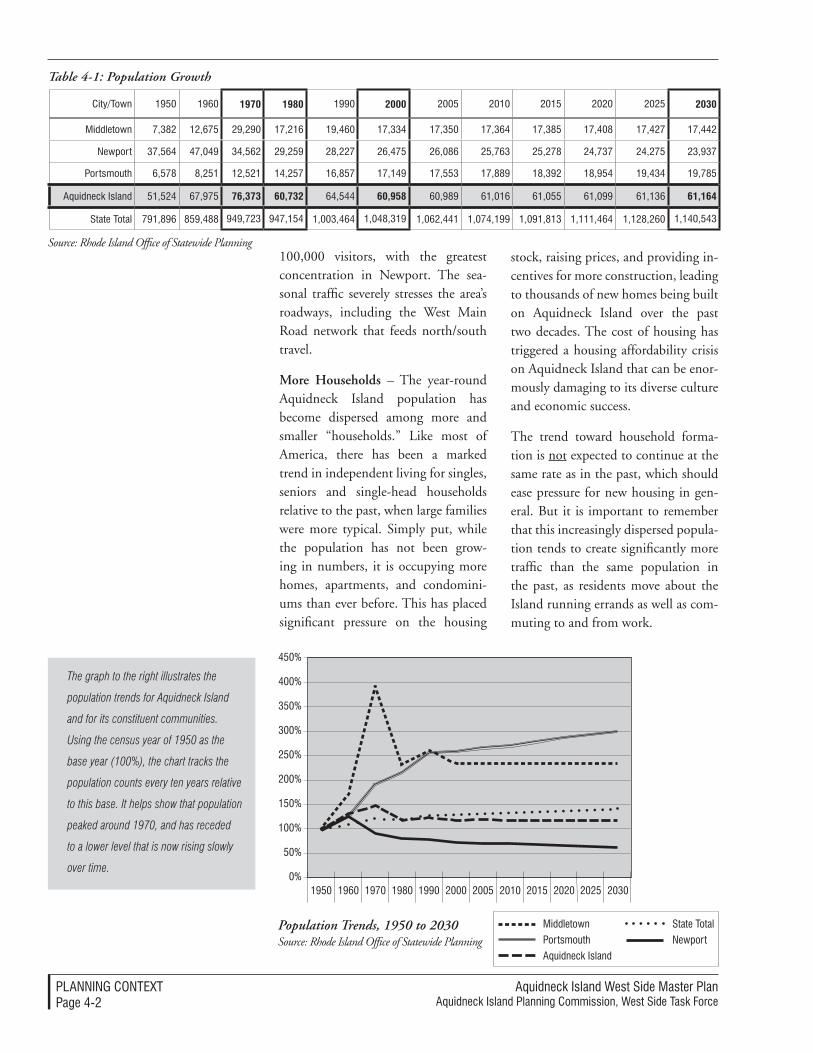
Aquidneck Island West Side Master Plan Aquidneck Island Planning Commission, West Side Task Force
PlAnnIng ConTexTPage 4-�
City/Town �950 �960 1970 1980 �990 2000 �005 �0�0 �0�5 �0�0 �0�5 2030
Middletown 7,38� ��,675 �9,�90 �7,��6 �9,460 �7,334 �7,350 �7,364 �7,385 �7,408 �7,4�7 �7,44�
newport 37,564 47,049 34,56� �9,�59 �8,��7 �6,475 �6,086 �5,763 �5,�78 �4,737 �4,�75 �3,937
Portsmouth 6,578 8,�5� ��,5�� �4,�57 �6,857 �7,�49 �7,553 �7,889 �8,39� �8,954 �9,434 �9,785
Aquidneck Island 5�,5�4 67,975 76,373 60,732 64,544 60,958 60,989 6�,0�6 6�,055 6�,099 6�,�36 61,164
State Total 79�,896 859,488 949,7�3 947,�54 �,003,464 �,048,3�9 �,06�,44� �,074,�99 �,09�,8�3 �,���,464 �,��8,�60 �,�40,543
Table 4-1: Population Growth
Population Trends, 1950 to 2030 Source: Rhode Island Office of Statewide Planning
100,000 visitors, with the greatest concentration in Newport. The sea-sonal traffic severely stresses the area’s roadways, including the West Main Road network that feeds north/south travel.
More Households – The year-round Aquidneck Island population has become dispersed among more and smaller “households.” Like most of America, there has been a marked trend in independent living for singles, seniors and single-head households relative to the past, when large families were more typical. Simply put, while the population has not been grow-ing in numbers, it is occupying more homes, apartments, and condomini-ums than ever before. This has placed significant pressure on the housing
stock, raising prices, and providing in-centives for more construction, leading to thousands of new homes being built on Aquidneck Island over the past two decades. The cost of housing has triggered a housing affordability crisis on Aquidneck Island that can be enor-mously damaging to its diverse culture and economic success.
The trend toward household forma-tion is not expected to continue at the same rate as in the past, which should ease pressure for new housing in gen-eral. But it is important to remember that this increasingly dispersed popula-tion tends to create significantly more traffic than the same population in the past, as residents move about the Island running errands as well as com-muting to and from work.
The graph to the right illustrates the
population trends for Aquidneck Island
and for its constituent communities.
Using the census year of 1950 as the
base year (100%), the chart tracks the
population counts every ten years relative
to this base. It helps show that population
peaked around 1970, and has receded
to a lower level that is now rising slowly
over time. 0%
50%
�00%
�50%
�00%
�50%
300%
350%
400%
450%
�950 �960 �970 �980 �990 �000 �005 �0�0 �0�5 �0�0 �0�5 �030
Middletown
Portsmouth
Aquidneck Island
State Total
newport
Source: Rhode Island Office of Statewide Planning
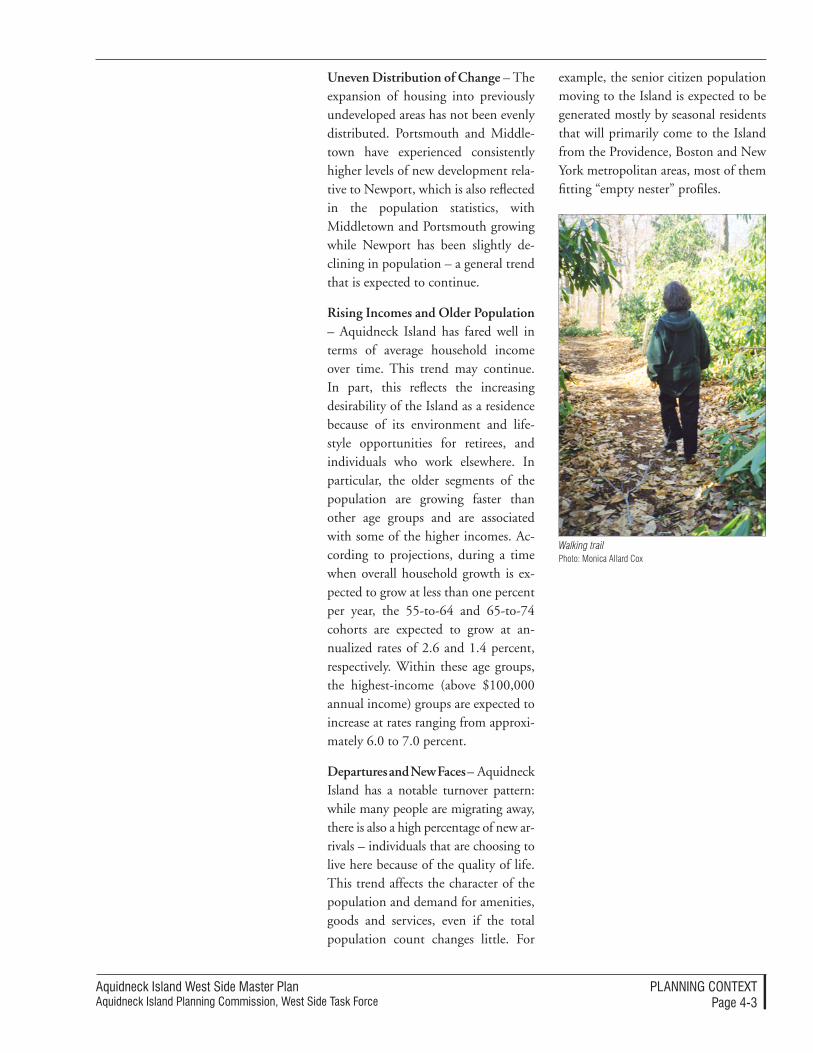
Aquidneck Island West Side Master PlanAquidneck Island Planning Commission, West Side Task Force
PlAnnIng ConTexTPage 4-3
Uneven Distribution of Change – The expansion of housing into previously undeveloped areas has not been evenly distributed. Portsmouth and Middle-town have experienced consistently higher levels of new development rela-tive to Newport, which is also reflected in the population statistics, with Middletown and Portsmouth growing while Newport has been slightly de-clining in population – a general trend that is expected to continue.
Rising Incomes and Older Population – Aquidneck Island has fared well in terms of average household income over time. This trend may continue. In part, this reflects the increasing desirability of the Island as a residence because of its environment and life-style opportunities for retirees, and individuals who work elsewhere. In particular, the older segments of the population are growing faster than other age groups and are associated with some of the higher incomes. Ac-cording to projections, during a time when overall household growth is ex-pected to grow at less than one percent per year, the 55-to-64 and 65-to-74 cohorts are expected to grow at an-nualized rates of 2.6 and 1.4 percent, respectively. Within these age groups, the highest-income (above $100,000 annual income) groups are expected to increase at rates ranging from approxi-mately 6.0 to 7.0 percent.
Departures and New Faces – Aquidneck Island has a notable turnover pattern: while many people are migrating away, there is also a high percentage of new ar-rivals – individuals that are choosing to live here because of the quality of life. This trend affects the character of the population and demand for amenities, goods and services, even if the total population count changes little. For
example, the senior citizen population moving to the Island is expected to be generated mostly by seasonal residents that will primarily come to the Island from the Providence, Boston and New York metropolitan areas, most of them fitting “empty nester” profiles.
Photo: Monica Allard CoxWalking trail
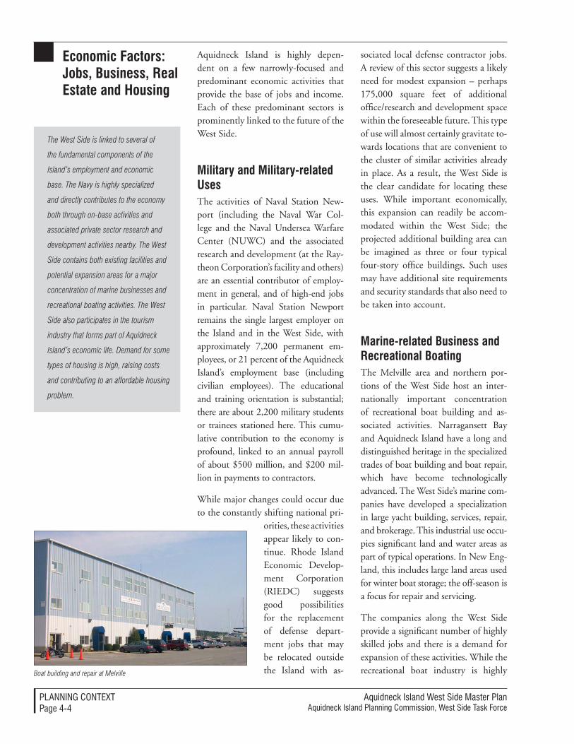
Aquidneck Island West Side Master Plan Aquidneck Island Planning Commission, West Side Task Force
PlAnnIng ConTexTPage 4-4
economic Factors: Jobs, Business, Real estate and Housing
Aquidneck Island is highly depen-dent on a few narrowly-focused and predominant economic activities that provide the base of jobs and income. Each of these predominant sectors is prominently linked to the future of the West Side.
Military and Military-related Uses The activities of Naval Station New-port (including the Naval War Col-lege and the Naval Undersea Warfare Center (NUWC) and the associated research and development (at the Ray-theon Corporation’s facility and others) are an essential contributor of employ-ment in general, and of high-end jobs in particular. Naval Station Newport remains the single largest employer on the Island and in the West Side, with approximately 7,200 permanent em-ployees, or 21 percent of the Aquidneck Island’s employment base (including civilian employees). The educational and training orientation is substantial; there are about 2,200 military students or trainees stationed here. This cumu-lative contribution to the economy is profound, linked to an annual payroll of about $500 million, and $200 mil-lion in payments to contractors.
While major changes could occur due to the constantly shifting national pri-
orities, these activities appear likely to con-tinue. Rhode Island Economic Develop-ment Corporation (RIEDC) suggests good possibilities for the replacement of defense depart-ment jobs that may be relocated outside the Island with as-
sociated local defense contractor jobs. A review of this sector suggests a likely need for modest expansion – perhaps 175,000 square feet of additional office/research and development space within the foreseeable future. This type of use will almost certainly gravitate to-wards locations that are convenient to the cluster of similar activities already in place. As a result, the West Side is the clear candidate for locating these uses. While important economically, this expansion can readily be accom-modated within the West Side; the projected additional building area can be imagined as three or four typical four-story office buildings. Such uses may have additional site requirements and security standards that also need to be taken into account.
Marine-related Business and Recreational Boating The Melville area and northern por-tions of the West Side host an inter-nationally important concentration of recreational boat building and as-sociated activities. Narragansett Bay and Aquidneck Island have a long and distinguished heritage in the specialized trades of boat building and boat repair, which have become technologically advanced. The West Side’s marine com-panies have developed a specialization in large yacht building, services, repair, and brokerage. This industrial use occu-pies significant land and water areas as part of typical operations. In New Eng-land, this includes large land areas used for winter boat storage; the off-season is a focus for repair and servicing.
The companies along the West Side provide a significant number of highly skilled jobs and there is a demand for expansion of these activities. While the recreational boat industry is highly
The West Side is linked to several of
the fundamental components of the
Island’s employment and economic
base. The Navy is highly specialized
and directly contributes to the economy
both through on-base activities and
associated private sector research and
development activities nearby. The West
Side contains both existing facilities and
potential expansion areas for a major
concentration of marine businesses and
recreational boating activities. The West
Side also participates in the tourism
industry that forms part of Aquidneck
Island’s economic life. Demand for some
types of housing is high, raising costs
and contributing to an affordable housing
problem.
Boat building and repair at Melville
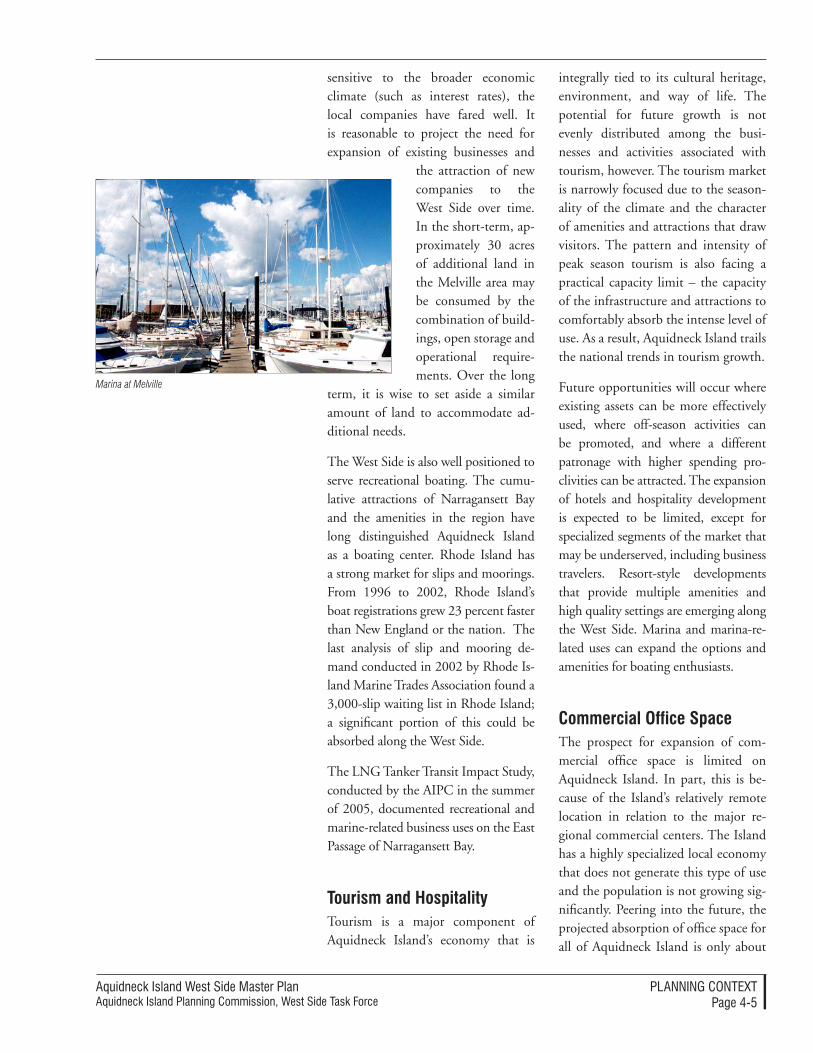
Aquidneck Island West Side Master PlanAquidneck Island Planning Commission, West Side Task Force
PlAnnIng ConTexTPage 4-5
sensitive to the broader economic climate (such as interest rates), the local companies have fared well. It is reasonable to project the need for expansion of existing businesses and
the attraction of new companies to the West Side over time. In the short-term, ap-proximately 30 acres of additional land in the Melville area may be consumed by the combination of build-ings, open storage and operational require-ments. Over the long
term, it is wise to set aside a similar amount of land to accommodate ad-ditional needs.
The West Side is also well positioned to serve recreational boating. The cumu-lative attractions of Narragansett Bay and the amenities in the region have long distinguished Aquidneck Island as a boating center. Rhode Island has a strong market for slips and moorings. From 1996 to 2002, Rhode Island’s boat registrations grew 23 percent faster than New England or the nation. The last analysis of slip and mooring de-mand conducted in 2002 by Rhode Is-land Marine Trades Association found a 3,000-slip waiting list in Rhode Island; a significant portion of this could be absorbed along the West Side.
The LNG Tanker Transit Impact Study, conducted by the AIPC in the summer of 2005, documented recreational and marine-related business uses on the East Passage of Narragansett Bay.
tourism and HospitalityTourism is a major component of Aquidneck Island’s economy that is
integrally tied to its cultural heritage, environment, and way of life. The potential for future growth is not evenly distributed among the busi-nesses and activities associated with tourism, however. The tourism market is narrowly focused due to the season-ality of the climate and the character of amenities and attractions that draw visitors. The pattern and intensity of peak season tourism is also facing a practical capacity limit – the capacity of the infrastructure and attractions to comfortably absorb the intense level of use. As a result, Aquidneck Island trails the national trends in tourism growth.
Future opportunities will occur where existing assets can be more effectively used, where off-season activities can be promoted, and where a different patronage with higher spending pro-clivities can be attracted. The expansion of hotels and hospitality development is expected to be limited, except for specialized segments of the market that may be underserved, including business travelers. Resort-style developments that provide multiple amenities and high quality settings are emerging along the West Side. Marina and marina-re-lated uses can expand the options and amenities for boating enthusiasts.
Commercial office Space The prospect for expansion of com-mercial office space is limited on Aquidneck Island. In part, this is be-cause of the Island’s relatively remote location in relation to the major re-gional commercial centers. The Island has a highly specialized local economy that does not generate this type of use and the population is not growing sig-nificantly. Peering into the future, the projected absorption of office space for all of Aquidneck Island is only about
Marina at Melville
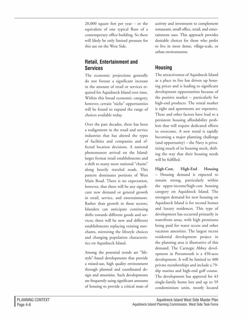
Aquidneck Island West Side Master Plan Aquidneck Island Planning Commission, West Side Task Force
PlAnnIng ConTexTPage 4-6
20,000 square feet per year – or the equivalent of one typical floor of a contemporary office building. So there will likely be only limited pressure for this use on the West Side.
Retail, entertainment and ServicesThe economic projections generally do not foresee a significant increase in the amount of retail or services re-quired for Aquidneck Island over time. Within this broad economic category, however, certain “niche” opportunities will be found to expand the range of choices available today.
Over the past decades, there has been a realignment in the retail and service industries that has altered the types of facilities and companies and ef-fected location decisions. A national phenomenon arrived on the Island: larger format retail establishments and a shift to many more national “chains” along heavily traveled roads. This pattern dominates portions of West Main Road. There is no expectation, however, that there will be any signifi-cant new demand or general growth in retail, service, and entertainment. Rather than growth in these sectors, Islanders can anticipate continuing shifts towards different goods and ser-vices; there will be new and different establishments replacing existing mer-chants, mirroring the lifestyle choices and changing population characteris-tics on Aquidneck Island.
Among the potential trends are “life-style”-based developments that provide a mixed-use, high quality environment through planned and coordinated de-sign and amenities. Such developments are frequently using significant amounts of housing to provide a critical mass of
activity and investment to complement restaurant, small office, retail, and enter-tainment uses. This approach provides desirable choices for those who prefer to live in more dense, village-scale, or urban environments.
HousingThe attractiveness of Aquidneck Island as a place to live has driven up hous-ing prices and is leading to significant development opportunities because of the positive market -- particularly for high-end products. The rental market is tight and apartments are expensive. These and other factors have lead to a persistent housing affordability prob-lem that will require dedicated efforts to overcome. A new trend is rapidly becoming a major planning challenge (and opportunity) – the Navy is priva-tizing much of its housing stock, shift-ing the way that their housing needs will be fulfilled.
High-Cost, High-End Housing – Housing demand is expected to remain strong, particularly within the upper-income/high-cost housing category on Aquidneck Island. The strongest demand for new housing on Aquidneck Island is for second homes and luxury residences. This type of development has occurred primarily in waterfront areas, with high premiums being paid for water access and other vacation amenities. The largest recent residential development project in the planning area is illustrative of this demand. The Carnegie Abbey devel-opment in Portsmouth is a 450-acre development. It will be limited to 400 private memberships and include a 79-slip marina and high-end golf course. The development has approval for 43 single-family home lots and up to 59 condominium units, mostly located
Aquidneck Island West Side Master PlanAquidneck Island Planning Commission, West Side Task Force
PlAnnIng ConTexTPage 4-7
in the 14-story Carnegie Tower. The attractiveness of this type of develop-ment is expected to lead to similar market opportunities on similarly located large parcels of land along the West Side coastline. Prices have aver-aged approximately $1,000,000 per lot and condominium units have averaged approximately $1.4 million. Buyers are reported to be almost exclusively sec-ond home and vacation home purchas-ers. The successful absorption of these units, few of which are used as primary residences, underlines the strength of the resort and second home market.
Tight Rental Markets – Rental housing is also in high demand. No new multi-family rental apartment projects have been constructed in the planning area in the past fifteen years. The six largest apartment properties in the study area include the Bay View Tower, Harbor Village, Eastbay, Northgate Apart-ment, Bayside Village, and Rolling Green Apartments. Collectively, these complexes total over 1,000 units of 1 and 2-bedroom housing. Operators report healthy occupancies, ranging from 93 percent to 98 percent. Rental rates range from $785 to $995 for 1-bedroom units and $930 to $1,100 for 2-bedroom units.
Privatizing Military Housing – Mili-tary housing has long been a major component of the housing stock along the West Side. Recent actions have changed the characteristics of this hous-ing, with significant implications for the Island’s communities. The Navy is participating in a housing privatization program that is transferring control and management responsibilities for a series of housing complexes, some the size of small neighborhoods. The busi-ness relationship is called a Public-Pri-vate Venture (PPV) between the Navy
and a private company, GMH Military Housing. The Navy is expected to lease back many of the units. Other housing units (or land, or other facilities) can become available through the PPV for sale or lease for non-military uses.
The Navy housing privatization initia-tive raises many economic consider-ations, including the fiscal impacts on the Island’s municipalities. The AIPC has assisted the privatization process by preparing economic impact analyses as part of the ongoing negotiating and approvals process for the changes un-derway. The prospect of reuse of former Navy housing, land, or other facili-ties released through the privatization process is likely to provide economic development opportunities in the near future, including prospects for provid-ing much needed affordable housing.
An Affordability Crisis – The attrac-tiveness of available housing to increas-ingly affluent residential buyers and the high demand for rental housing relative to the supply is contributing to an island-wide affordable housing shortage. The lack of affordable hous-ing is a fundamental economic issue as well as a social and cultural concern. Aquidneck Island cannot attract or re-tain a high quality work force nor sup-port existing businesses if there are not good housing choices for a wide range of income levels. The lack of affordable housing will also exacerbate traffic and commuting patterns. Statistics suggest a growing pattern of cross-commuting, where individuals living in high cost Island communities are commuting to high-paying jobs off-island, while workers with lower paying jobs must find other places to live, and are com-muting to the Island to go to work.
New home in Portsmouth

Aquidneck Island West Side Master Plan Aquidneck Island Planning Commission, West Side Task Force
PlAnnIng ConTexTPage 4-8
The West Side hosts several of the ma-jor transportation corridors that serve Aquidneck Island and which must be relied on in the future (see Figure 4-1, Transportation Context, page 4-10). Traf-fic along these corridors and at key inter-sections exhibit the congestion problems that were once common in the tourist season, but which have now become prevalent all year. While other modes of travel are components of the West Side transportation network, they are cur-rently insufficient to offset the predomi-nant use of the automobile to move to, from and through the West Side.
The roadway network on Aquidneck Island is largely defined by its island location, the three bridges that connect it to the region, and the north-south traffic flows that connect the bridges and island communities on both Route 114 (West Main Road network) and Route 138 (East Main Road). A partial north-south connection is provided by the Defense Highway, the so-called “Burma Road” that once linked the Navy’s facility stretched along Narragansett Bay. Civilian use of the Defense Highway is permitted over some portions of the road today, but is subject to security closures in portions that pass through the active areas of Naval Station Newport.
transportation: Moving to, from and through the West Side
The West Side provides several north
south circulation corridors. These have
become congested due to increased
traffic associated with the changing
Island population (more households,
more cars, new destinations) and the
commuter and tourism trips. There are
opportunities for improvements that
would make the corridors more safe and
effective. The West Side also provides
unique opportunities to enhance transit
options, bike trails, and pedestrian
connections.
The surface transportation modes are linked together at the Newport Gate-way Center at the southern end of the planning area. The Gateway Center serves as a hub for all transportation modes, providing bus service spon-sored by the Rhode Island Public Tran-sit Authority (RIPTA), interstate, and tourism-based buses, parking, ferry service to Providence, water taxi ser-vice to harbor destinations and James-town, and access to the Old Colony and Newport Railway and Newport Dinner Train service on the Newport Secondary rail corridor.
This rail corridor extends along the entire West Side; it once extended northwards into Massachusetts, where it joined the regional rail network. Rail connection over the Sakonnet River is no longer available.
Historic trends and Commuting PatternsTraffic volumes on Island bridges and roadways have increased dramati-cally over the past forty years (1965 to 2004) in contrast to the population trends, which declined after the 1973 Navy base realignment and which has been effectively stable since. This increase in traffic is due to the ac-cumulation of many factors. There are more households moving among different destinations on the Island, commuting patterns have changed, and tourism trips have increased along with the revitalization of Newport and Aquidneck Island’s attractive features.
In the past, some of the routes along the Island provided relief from the more congested corridors, but these advantages have been disappearing. For example, although traffic vol-umes have historically been lower on
Historic Trends and Commuting Patterns
5,000
�0,000
�5,000
�0,000
�5,000
30,000
35,000
0
�965
�970
�976
�983
�988
�993
�999
West Main Road
east Main Road
West and east Main RoadHistoric Traffic Volumes, �965-�00�
Aver
age
Daily
Tra
ffic
Year
Source: RIDOT Traffic Flow Maps, 1964 to 2004
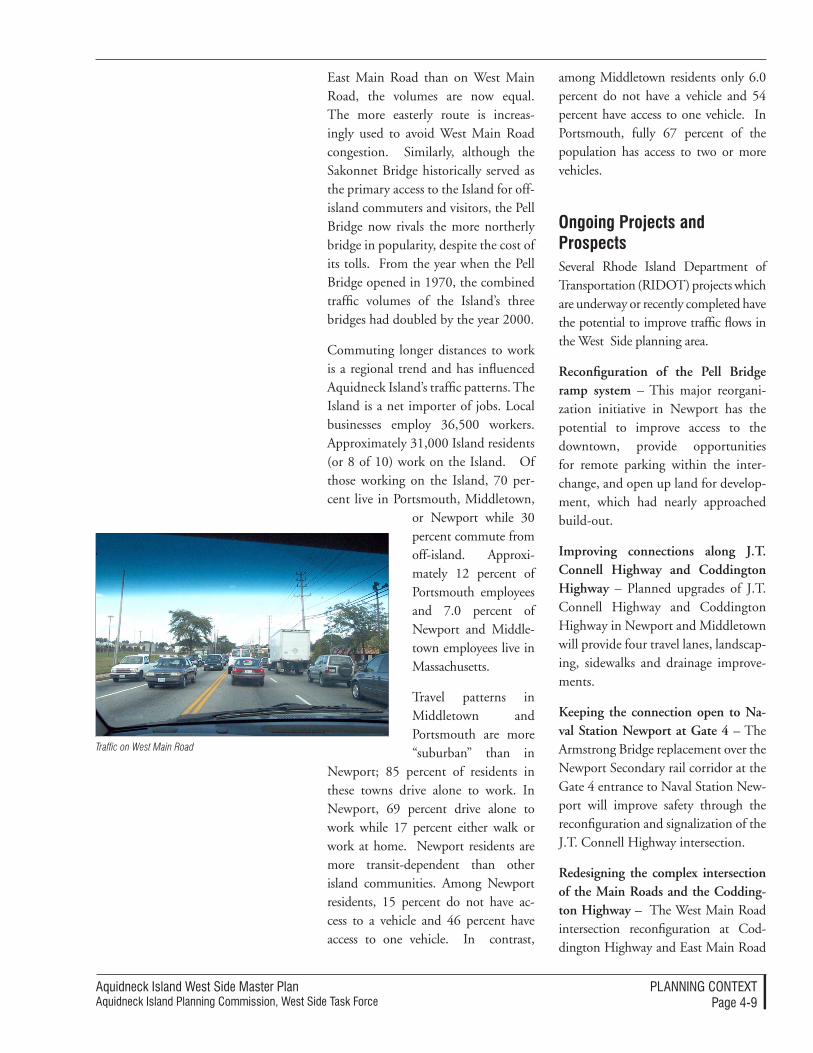
Aquidneck Island West Side Master PlanAquidneck Island Planning Commission, West Side Task Force
PlAnnIng ConTexTPage 4-9
East Main Road than on West Main Road, the volumes are now equal. The more easterly route is increas-ingly used to avoid West Main Road congestion. Similarly, although the Sakonnet Bridge historically served as the primary access to the Island for off-island commuters and visitors, the Pell Bridge now rivals the more northerly bridge in popularity, despite the cost of its tolls. From the year when the Pell Bridge opened in 1970, the combined traffic volumes of the Island’s three bridges had doubled by the year 2000.
Commuting longer distances to work is a regional trend and has influenced Aquidneck Island’s traffic patterns. The Island is a net importer of jobs. Local businesses employ 36,500 workers. Approximately 31,000 Island residents (or 8 of 10) work on the Island. Of those working on the Island, 70 per-cent live in Portsmouth, Middletown,
or Newport while 30 percent commute from off-island. Approxi-mately 12 percent of Portsmouth employees and 7.0 percent of Newport and Middle-town employees live in Massachusetts.
Travel patterns in Middletown and Portsmouth are more “suburban” than in
Newport; 85 percent of residents in these towns drive alone to work. In Newport, 69 percent drive alone to work while 17 percent either walk or work at home. Newport residents are more transit-dependent than other island communities. Among Newport residents, 15 percent do not have ac-cess to a vehicle and 46 percent have access to one vehicle. In contrast,
among Middletown residents only 6.0 percent do not have a vehicle and 54 percent have access to one vehicle. In Portsmouth, fully 67 percent of the population has access to two or more vehicles.
ongoing Projects and ProspectsSeveral Rhode Island Department of Transportation (RIDOT) projects which are underway or recently completed have the potential to improve traffic flows in the West Side planning area.
Reconfiguration of the Pell Bridge ramp system – This major reorgani-zation initiative in Newport has the potential to improve access to the downtown, provide opportunities for remote parking within the inter-change, and open up land for develop-ment, which had nearly approached build-out.
Improving connections along J.T. Connell Highway and Coddington Highway – Planned upgrades of J.T. Connell Highway and Coddington Highway in Newport and Middletown will provide four travel lanes, landscap-ing, sidewalks and drainage improve-ments.
Keeping the connection open to Na-val Station Newport at Gate 4 – The Armstrong Bridge replacement over the Newport Secondary rail corridor at the Gate 4 entrance to Naval Station New-port will improve safety through the reconfiguration and signalization of the J.T. Connell Highway intersection.
Redesigning the complex intersection of the Main Roads and the Codding-ton Highway – The West Main Road intersection reconfiguration at Cod-dington Highway and East Main Road
Traffic on West Main Road

Aquidneck Island West Side Master Plan Aquidneck Island Planning Commission, West Side Task Force
PlAnnIng ConTexTPage 4-�0
MAjoR RoADWAYS
RAIl AnD BIke CoRRIDoRS
newport Secondary
RiDot
“Suitable” for Cycling“Most
RiDot for Cycli
ng” Defense CommuterSuitable”
Pell BridgeRoute 138
gateway Center
admiral Kalbfus Rotary West Main
Road Route 114
Connell J.t. Road
Coddington
Highway
BurmaHighway /Defense
greene lane
= Signal
transportation ContextFigure 4-�
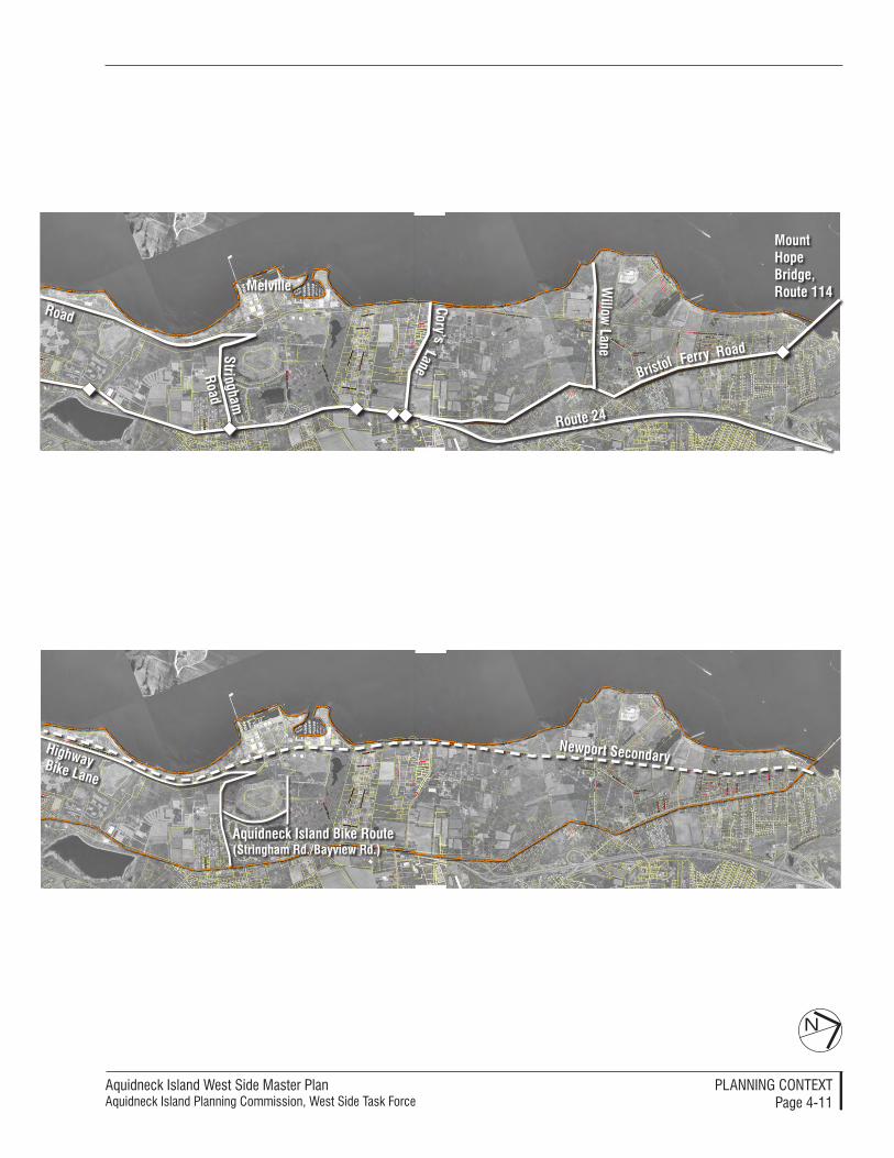
Aquidneck Island West Side Master PlanAquidneck Island Planning Commission, West Side Task Force
PlAnnIng ConTexTPage 4-��
Stri
Road
ngham
Road
Cory’s
Willow
lanelane
BristolRoad
Ferry
Mount Hope Bridge, Route 114Melville
Route 24
newport Secondary
aquidneck island Bike Route(Stringham Rd./Bayview Rd.)
Bike lane
Highway
N
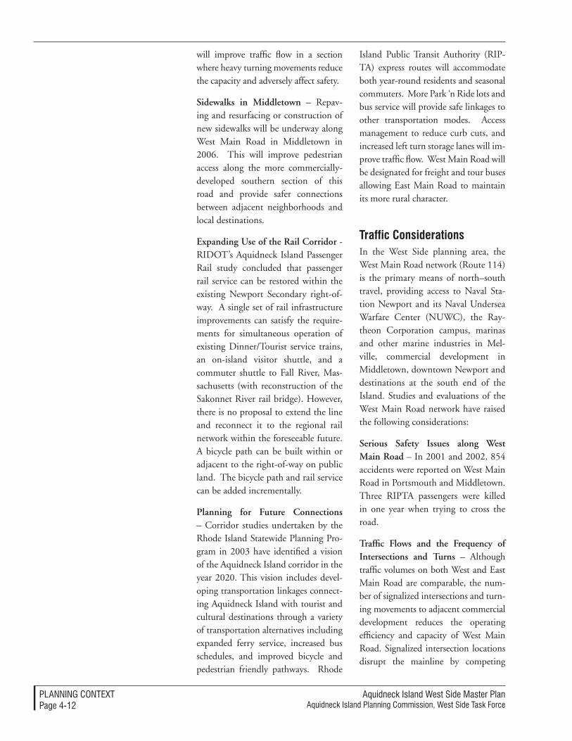
Aquidneck Island West Side Master Plan Aquidneck Island Planning Commission, West Side Task Force
PlAnnIng ConTexTPage 4-��
will improve traffic flow in a section where heavy turning movements reduce the capacity and adversely affect safety.
Sidewalks in Middletown – Repav-ing and resurfacing or construction of new sidewalks will be underway along West Main Road in Middletown in 2006. This will improve pedestrian access along the more commercially-developed southern section of this road and provide safer connections between adjacent neighborhoods and local destinations.
Expanding Use of the Rail Corridor - RIDOT’s Aquidneck Island Passenger Rail study concluded that passenger rail service can be restored within the existing Newport Secondary right-of-way. A single set of rail infrastructure improvements can satisfy the require-ments for simultaneous operation of existing Dinner/Tourist service trains, an on-island visitor shuttle, and a commuter shuttle to Fall River, Mas-sachusetts (with reconstruction of the Sakonnet River rail bridge). However, there is no proposal to extend the line and reconnect it to the regional rail network within the foreseeable future. A bicycle path can be built within or adjacent to the right-of-way on public land. The bicycle path and rail service can be added incrementally.
Planning for Future Connections – Corridor studies undertaken by the Rhode Island Statewide Planning Pro-gram in 2003 have identified a vision of the Aquidneck Island corridor in the year 2020. This vision includes devel-oping transportation linkages connect-ing Aquidneck Island with tourist and cultural destinations through a variety of transportation alternatives including expanded ferry service, increased bus schedules, and improved bicycle and pedestrian friendly pathways. Rhode
Island Public Transit Authority (RIP-TA) express routes will accommodate both year-round residents and seasonal commuters. More Park ‘n Ride lots and bus service will provide safe linkages to other transportation modes. Access management to reduce curb cuts, and increased left turn storage lanes will im-prove traffic flow. West Main Road will be designated for freight and tour buses allowing East Main Road to maintain its more rural character.
traffic Considerations In the West Side planning area, the West Main Road network (Route 114) is the primary means of north–south travel, providing access to Naval Sta-tion Newport and its Naval Undersea Warfare Center (NUWC), the Ray-theon Corporation campus, marinas and other marine industries in Mel-ville, commercial development in Middletown, downtown Newport and destinations at the south end of the Island. Studies and evaluations of the West Main Road network have raised the following considerations:
Serious Safety Issues along West Main Road – In 2001 and 2002, 854 accidents were reported on West Main Road in Portsmouth and Middletown. Three RIPTA passengers were killed in one year when trying to cross the road.
Traffic Flows and the Frequency of Intersections and Turns – Although traffic volumes on both West and East Main Road are comparable, the num-ber of signalized intersections and turn-ing movements to adjacent commercial development reduces the operating efficiency and capacity of West Main Road. Signalized intersection locations disrupt the mainline by competing
Aquidneck Island West Side Master PlanAquidneck Island Planning Commission, West Side Task Force
PlAnnIng ConTexTPage 4-�3
demands for green time. Although two coordinated signal systems are in operation along West Main Road, the efficiency of one eight-signal system is reduced by movements from side streets and adjacent development.
Left Turns and Reduced Capacity –Left turns from West Main Road cause significant disruption to the corridor by blocking a travel lane and forcing vehicles to utilize one travel lane. This occurs at ten signalized intersections where left-turn lanes are not currently provided. Access into the many retail and commercial driveways causes fur-ther disruption of traffic flow.
Buses Stopping in Traffic – RIPTA buses traveling along West Main Road stop in the right travel lane to pick-up and drop-off passengers, forcing ve-hicles to either stop and gather in lines behind them (what traffic engineers call “queues”), or to merge left to try and move around them. School bus stops disrupt flow by halting all traffic north and south during the morning peak traffic periods and during the afternoon periods when traffic volumes increase.
Operations at Capacity – Sections of West Main Road are currently operat-ing near capacity and are experiencing congestion. This is most acute during the peak tourist season when traffic volumes are 49 percent higher than during winter off-peak months.
Right-of-way Constraints – Limited public right-of-way is available along West Main Road to construct safety and capacity improvements. Roadway improvements adjacent to high-density retail and commercial development in the south, where congestion is heaviest, are constrained by minimal setbacks to buildings and parking areas.
other Modes of travel: alternatives to the CarRIPTA Bus Service – RIPTA provides scheduled bus service along the West Side. Route 60 provides local service between Newport and Portsmouth on West Main Road with approximately 29 riders per trip. Additional routes such as the Route 63 provide local service within Newport. This bus aver-ages 16 passenger per trip. RIPTA op-erates a bus garage within the area that is located on J.T. Connell Highway.
Ferry Service – Ferry service is limited along the West Side today. Newport to Providence ferry service is seasonal and tourism based. Ridership on a year-round commuter ferry with service to Newport, Mt. Hope Marine Terminal in Portsmouth and Providence did not warrant continuation of service after the first year of operation in 2002.
Bicycle Routes – The Defense High-way Commuter Bike Lane along Burma Road is the only designated bike route in the West Side planning area. Few roadways provide suitable connection between neighborhoods on the east side of the Island with the shoreline of Narragansett Bay. String-ham Road in Portsmouth is designated as “more suitable” and Washington Street and Third Avenue in Newport are designated as “suitable” for cycling by RIDOT. A Bicyclists’ Guide to Aquidneck Island identifies further options as suitable for cycling: Long Wharf and Admiral Kalbfus Road to Coasters’ Harbor Island in Newport, and Bay View Terrace and the road to the campground in Melville (see Figure 4-1, Transportation Context, page 4-10).
Aquidneck Island West Side Master Plan Aquidneck Island Planning Commission, West Side Task Force
PlAnnIng ConTexTPage 4-�4
The utility infrastructure for the West Side must be planned in concert with the land uses that will be retained or changed over time. But infrastructure planning along the West Side can play an even larger role in terms of Aquidneck Island’s communities. The water and sewer systems for its com-munities and Naval Station Newport are interdependent in many ways, and a regional perspective is helpful.
Water ServiceAn adequate water supply is available for Aquidneck Island’s present and future needs through a series of surface water reservoirs on Aquidneck Island and on the mainland east of the Sakonnet Riv-er. The Newport Water Division’s Wa-ter Supply Management Plan indicates that sufficient water quantity is avail-able to meet water demand through 2025. Infrastructure upgrades will be required in the future to meet pumping and treatment demand and to extend lines for new development. The New-port Water Division (NWD) reports that conservation measures and reduced processing by Newport Creamery have led to a decrease in water consumption. NWD provides municipal water service to Newport and Middletown and sells water wholesale to Naval Station New-port and Portsmouth Water and Fire District (PWFD). Several island-wide water initiatives may address water quality and quantity issues that affect the entire Island:
Actions to Protect Water Qual-ity – The Public Utility Commission mandated in June 2004 that the City of Newport, Town of Portsmouth, and Naval Station Newport work coopera-tively to address compliance with the Safe Drinking Water Act Disinfectants Byproducts Rule.
infrastructure: Serving the West Side (and More)
The infrastructure conditions along the
West Side provide opportunities and
choices for the communities and facilities
along the entire corridor. These include
opportunities to regionalize the water
supply systems to support desired uses
and the possible provision of a location
for a future wastewater treatment plant
for Portsmouth, should it decide to
advance this option.
Opportunities for Better Coordination – In 2004-2005 the AIPC facilitated in-formal discussions with representatives from the City of Newport, Newport Water Division, Portsmouth Water and Fire District, Middletown and the Navy regarding the possibility of forming an Aquidneck Island Water Resources Board. Such an entity would reduce dependence on the City of Newport and more equitably address water quality and quantity issues for residents, businesses and institutions on the island. No con-sensus was reached on a water resources board, and instead the group focused on forming an Aquidneck Island Advisory Committee. The Advisory Committee, although not regulatory, would continue to bring all the constituent groups to-gether, provide a forum for communica-tions, and allow for joint consideration of the island’s quality and quantity of drinking water resources.
Water Supply for Melville – The Melville area water supply is provided through the Navy distribution system. Service to private businesses is pro-vided through an agreement with the Navy. This water is being “wheeled through the Navy” but billed by the City of Newport. Neither the Navy nor the City of Newport would like to expand this arrangement to new water users in Melville. Melville is not within the PFWD service area. PWFD does not have a contract with the City of Newport to assure future water quan-tity; it cannot provide service outside its limits, and its pumps are not sized to expand service to Melville. This places private development at some risk and without a guaranteed capacity for expanding in the future.
Water Quality and Investment Issues with The Navy Water System – Naval Station Newport water system was
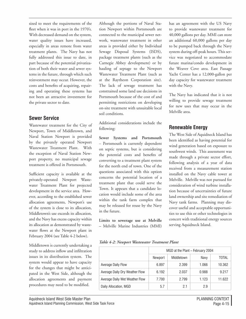
Aquidneck Island West Side Master PlanAquidneck Island Planning Commission, West Side Task Force
PlAnnIng ConTexTPage 4-�5
sized to meet the requirements of the fleet when it was in port in the 1970’s. With decreased demand on the system, water quality issues have increased, especially in areas remote from water treatment plants. The Navy has not fully addressed this issue to date, in part because of the potential privatiza-tion of both their water and sewer sys-tems in the future, through which such reinvestment may occur. However, the costs and benefits of acquiring, repair-ing and operating these systems has not been an attractive investment for the private sector to date.
Sewer ServiceWastewater treatment for the City of Newport, Town of Middletown, and Naval Station Newport is provided by the privately operated Newport Wastewater Treatment Plant. With the exception of Naval Station New-port property, no municipal sewage treatment is offered in Portsmouth.
Sufficient capacity is available at the privately-operated Newport Waste-water Treatment Plant for projected development in the service area. How-ever, according to the established sewer allocation agreements, Newport’s use of the system is close to its allocation, Middletown’s use exceeds its allocation, and the Navy has excess capacity within its allocation as demonstrated by waste-water flows at the Newport plant in February 2004 (see Table 4-2 below).
Middletown is currently undertaking a study to address inflow and infiltration issues in its distribution system. The system would appear to have capacity for the changes that might be antici-pated in the West Side, although the allocation agreements and payment procedures may need to be modified.
Although the portions of Naval Sta-tion Newport within Portsmouth are connected to the municipal sewer net-work, wastewater treatment in other areas is provided either by Individual Sewage Disposal Systems (ISDS), package treatment plants (such as the Carnegie Abbey development) or by hauling of septage to the Newport Wastewater Treatment Plant (such as at the Raytheon Corporation site). The lack of sewage treatment has constrained some land use decisions in Portsmouth because of the cost of and permitting restrictions on developing on-site treatment with unsuitable local soil conditions.
Additional considerations include the following:
Sewer Systems and Portsmouth – Portsmouth is currently dependent on septic systems, but is considering the potential costs and benefits of converting to a treatment plant system for the north end of town. One of the questions associated with this option concerns the potential location of a treatment plant that could serve the Town. It appears that a candidate lo-cation would include some of the area within the tank farm complex that may be released for reuse by the Navy in the future.
Limits to sewerage use at Melville – Melville Marine Industries (MMI)
Table 4-2: Newport Wastewater Treatment Plant
MgD at the Plant – February �004
newport Middletown navy ToTAl
Average Daily Flow 6.897 �.399 �.066 �0.36�
Average Daily Dry Weather Flow 6.�9� �.037 0.988 9.��7
Average Daily Wet Weather Flow 7.700 �.799 �.��3 ��.6��
Daily Allocation, MgD 5.7 �.� �.9
has an agreement with the US Navy to provide wastewater treatment for 40,000 gallons per day. MMI can store an additional 60,000 gallons per day to be pumped back through the Navy system during off-peak hours. This ser-vice was negotiated to accommodate future marina/condo development in the Weaver Cove area. East Passage Yacht Center has a 12,000-gallon per day capacity for wastewater treatment with the Navy.
The Navy has indicated that it is not willing to provide sewage treatment for new uses that may occur in the Melville area.
Renewable energyThe West Side of Aquidneck Island has been identified as having potential for wind generation based on exposure to southwest winds. This assessment was made through a private sector effort, following analysis of a year of data received from a measurement station installed on the Navy cable tower at Melville. Melville was not pursued for consideration of wind turbine installa-tion because of uncertainties of future land ownership and site remediation of Navy tank farms. Planning may dis-cover useful and acceptable opportuni-ties to use this or other technologies in concert with traditional energy sources serving Aquidneck Island.

Aquidneck Island West Side Master Plan Aquidneck Island Planning Commission, West Side Task Force
PlAnnIng ConTexTPage 4-�6
The West Side hosts distinctive and valuable natural resources in its coastal waters, shoreline, and substantial un-developed open space. Its corridors and open space provide a rich environment that is valued for many reasons. This context is pictured in Figure 4-2, Natu-ral Resources, Water Classifications and Types, Historic Resources (page 4-18).
The West Side of Aquidneck Island hosts a diversity of natural habitats ranging from estuarine mudflats and cobble beach, to salt marsh and fresh-water wetlands along the network of named and unnamed streams. Up-land woods and meadows provide additional habitat. The edge between these resource areas provides valuable habitat for estuarine, freshwater, and upland species of plants, animals and shorebirds. The West Side planning area, especially the section north of the heavily developed Navy base and south of the Mount Hope Bridge, is repre-sentative of habitats that have reverted from intensive agriculture through the 1800’s to woodland succession.
Although the Newport Secondary rail line has created a man-made border between these shoreline and upland habitat areas, it has also restricted ac-cess and development. The West Side of Aquidneck Island represents one of the largest expanses of undeveloped shoreline in Rhode Island. In a state where many shorefront lots have been privatized for residential or marine-re-lated commercial development, nearly six miles of shoreline remains undevel-oped north and south of Melville. The view, especially from the water, is of a relatively undisturbed cobble beach and scrub growth along the railroad embankment, backed by woodland.
Several organizations and agencies have been involved in documenting
natural Resources: a West Side Heritage
The West Side preserves a heritage of
natural resources due to its extended
shoreline and substantial undeveloped
open space. Its corridors and open
space provide a rich environment that is
highly valued.
natural resources along the West Side of Aquidneck Island. Naval Station Newport and the Naval Undersea Warfare Center (NUWC) have un-dertaken Integrated Natural Resource Management Plans and have delin-eated all wetlands in accordance with the Rhode Island Freshwater Wetlands Act. The Raytheon Employees Wild-life Habitat Committee (REWHC), a corporate initiative begun in 1999 and certified by the Wildlife Habitat Council (WHC) in 2001, has pre-pared a wildlife management plan that focuses on increasing biodiversity, in-creasing environmental and historical awareness, and protecting the environ-ment for future generations.
The 175-acre Raytheon property on West Main Road extends to Lawton Brook on the south, Burma Road (Defense Highway) on the west, and abuts Chases Farm on the north. The site property line runs through part of Lawton Valley, an inaccessible rocky gorge with waterfalls and old-growth trees. Because of its isolation, it has remained mostly untouched and unmanaged. The REHWC has documented the history of the valley. Thomas Lawton, one of the first set-tlers of Portsmouth, farmed Lawton Valley until 1800 when a town poor-house or asylum was established on the property. During the Civil War era Julia Ward Howe, best known as the author of the Battle Hymn of the Republic, built a house on an old mill site by Lawton Falls. Lawton Valley was dammed for construction of the Lawton Reservoir in 1945.
Melville Park, a 152-acre tract of land given to the Town of Portsmouth “exclusively for public park or pub-lic recreational purposes” by the US government on 16 March 1978, has
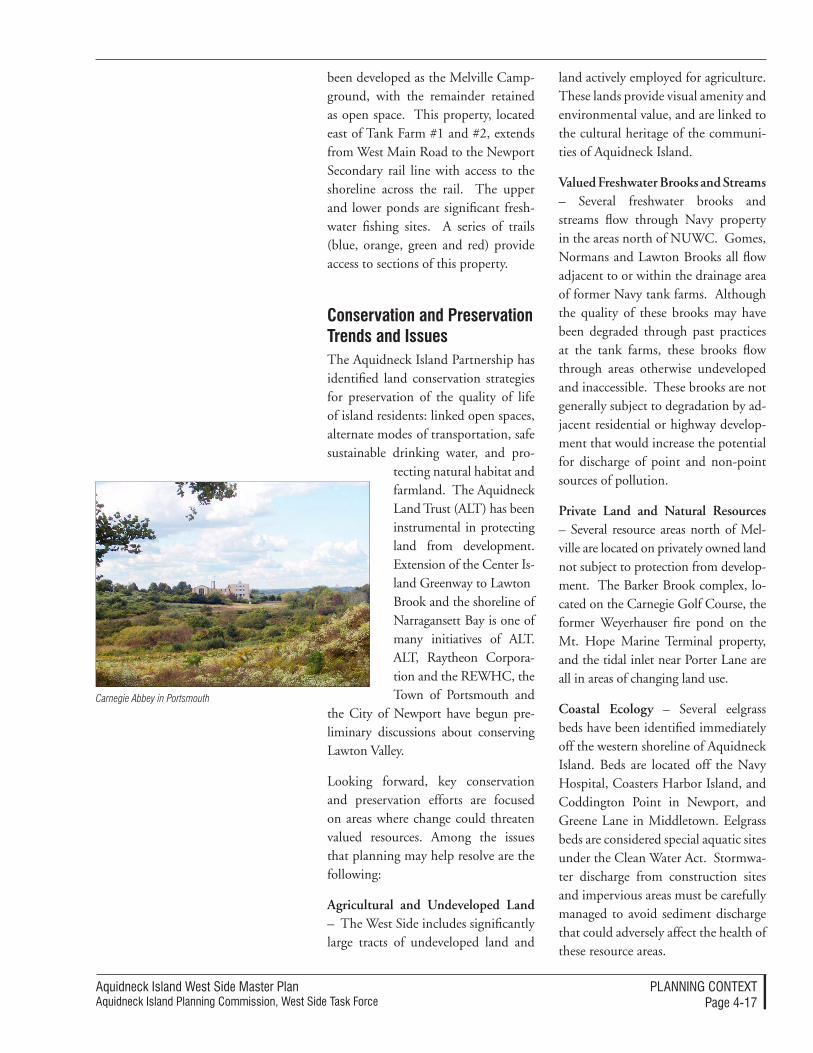
Aquidneck Island West Side Master PlanAquidneck Island Planning Commission, West Side Task Force
PlAnnIng ConTexTPage 4-�7
been developed as the Melville Camp-ground, with the remainder retained as open space. This property, located east of Tank Farm #1 and #2, extends from West Main Road to the Newport Secondary rail line with access to the shoreline across the rail. The upper and lower ponds are significant fresh-water fishing sites. A series of trails (blue, orange, green and red) provide access to sections of this property.
Conservation and Preservation trends and issuesThe Aquidneck Island Partnership has identified land conservation strategies for preservation of the quality of life of island residents: linked open spaces, alternate modes of transportation, safe sustainable drinking water, and pro-
tecting natural habitat and farmland. The Aquidneck Land Trust (ALT) has been instrumental in protecting land from development. Extension of the Center Is-land Greenway to Lawton Brook and the shoreline of Narragansett Bay is one of many initiatives of ALT. ALT, Raytheon Corpora-tion and the REWHC, the Town of Portsmouth and
the City of Newport have begun pre-liminary discussions about conserving Lawton Valley.
Looking forward, key conservation and preservation efforts are focused on areas where change could threaten valued resources. Among the issues that planning may help resolve are the following:
Agricultural and Undeveloped Land – The West Side includes significantly large tracts of undeveloped land and
land actively employed for agriculture. These lands provide visual amenity and environmental value, and are linked to the cultural heritage of the communi-ties of Aquidneck Island.
Valued Freshwater Brooks and Streams – Several freshwater brooks and streams flow through Navy property in the areas north of NUWC. Gomes, Normans and Lawton Brooks all flow adjacent to or within the drainage area of former Navy tank farms. Although the quality of these brooks may have been degraded through past practices at the tank farms, these brooks flow through areas otherwise undeveloped and inaccessible. These brooks are not generally subject to degradation by ad-jacent residential or highway develop-ment that would increase the potential for discharge of point and non-point sources of pollution.
Private Land and Natural Resources – Several resource areas north of Mel-ville are located on privately owned land not subject to protection from develop-ment. The Barker Brook complex, lo-cated on the Carnegie Golf Course, the former Weyerhauser fire pond on the Mt. Hope Marine Terminal property, and the tidal inlet near Porter Lane are all in areas of changing land use.
Coastal Ecology – Several eelgrass beds have been identified immediately off the western shoreline of Aquidneck Island. Beds are located off the Navy Hospital, Coasters Harbor Island, and Coddington Point in Newport, and Greene Lane in Middletown. Eelgrass beds are considered special aquatic sites under the Clean Water Act. Stormwa-ter discharge from construction sites and impervious areas must be carefully managed to avoid sediment discharge that could adversely affect the health of these resource areas.
Carnegie Abbey in Portsmouth
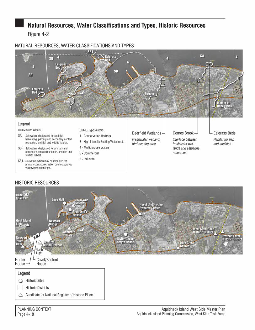
Aquidneck Island West Side Master Plan Aquidneck Island Planning Commission, West Side Task Force
PlAnnIng ConTexTPage 4-�8
natural Resources, Water Classifications and types, Historic ResourcesFigure 4-�
Historic Sites
Historic Districts
Candidate for national Register of Historic Places
legend
north light
Hunter House
Covell/Sanford House
Rose island
goat island light
newport Bridge
Common Burial grounds
newport Yacht Club
luce Hall naval War College
admiral’s gate
President’s House
naval Underwater Systems Center
Holy Cross Church
taylor/Chase/Smyth House
West Main Road Historic District
Prescott FarmHistoric District
HISToRIC ReSouRCeS
nATuRAl ReSouRCeS, WATeR ClASSIFICATIonS AnD TYPeS
Deerfield Wetlands
Freshwater wetland, bird nesting area
gomes Brook
Interface between freshwater wet-lands and estuarine resources
eelgrass Beds
Habitat for fish and shellfish
Stream
Stream
RIDeM Class Waters
SA - Salt waters designated for shellfish harvesting, primary and secondary contact recreation, and fish and wildlife habitat.
SB - Salt waters designated for primary and secondary contact recreation, and fish and wildlife habitat.
SB�- SB waters which may be impacted for primary contact recreation due to approved wastewater discharges.
legend
eelgrass Bed
eelgrass Bed
eelgrass Bed
SB
SB
SB1
SB
Sa
4
4
31
64 4
CRMC Type Waters
� - Conservation Harbors
3 - High-intensity Boating Waterfronts
4 - Multipurpose Waters
5 - Commercial
6 - Industrial
Mother of Hope Brook
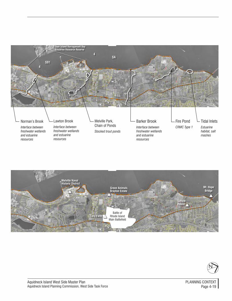
Aquidneck Island West Side Master PlanAquidneck Island Planning Commission, West Side Task Force
PlAnnIng ConTexTPage 4-�9
N
Mt. Hope Bridge
Battle of Rhode Island
Main Battlefield
Melville naval Historic District
green animals, Brayton estate
Cory Farm
gifford House
norman’s Brook
Interface between freshwater wetlands and estuarine resources
lawton Brook
Interface between freshwater wetlands and estuarineresources
Barker BrookInterface between freshwater wetlands and estuarine resources
Fire PondCRMC Type 1
Tidal InletsEstuarine habitat, salt mashes
Melville Park, Chain of Ponds
Stocked trout ponds
SB1
Sa
4
4
6 31
Dyer island narragansett Bay estuarine Research Reserve

Aquidneck Island West Side Master Plan Aquidneck Island Planning Commission, West Side Task Force
PlAnnIng ConTexTPage 4-�0
The planning process has used many resources to comprehend the land use conditions within the 5,000-acre planning area that extends nearly 10 miles along Narragansett Bay. Com-puter mapping that categorizes uses in conventional planning terms has been compiled by the AIPC, the com-munities, and other sources; a recent composite map is a helpful reference. Land use patterns are changing, how-ever, and the mapped information has been supplemented through interviews and other sources so that the West Side Master Plan reflects the most current information available.
The evaluations also took into account projections of current trends, called a “susceptibility to change analysis.” This process is very useful to convey an important planning insight: much of the land along the West Side has already been committed to uses and development patterns that can be expected to remain into the distant future. Most of the planning effort, recommendations and subsequent ac-tions can most beneficially be focused within those area where change is im-minent or likely within a foreseeable
land Use: open Space and the Built environment
Land use along the West Side is
characterized by a diverse collection of
large contiguous areas, each devoted
to different uses. Naval Station Newport
occupies an extensive amount of land
along the shoreline. Agricultural land,
open space and undeveloped land
occupy other substantial areas. Large
institutions, housing developments, and
commercial uses dominate areas of
the West Side, while recreational and
resort-type use is a growing proportion
of the overall pattern. Retail and service
development is strung along the main
roadway network, creating a “strip
commercial” character for sustained
segments.
time frame. The following discussion reveals some of the key observations about land use that have influenced the West Side Master Plan.
land Use PatternsThe land use patterns along the West Side have been clearly influenced by its geography, topography and his-torical development. The Navy long occupied the largest proportion of the coastal land and harbors that have been created, taking advantage of the available low-lying land at the base of the hillsides that climb steeply east-wards towards the center of Aquidneck Island. The connected access pro-vided by West Main Road network has served as a trunk from which uses have branched, reaching into the relatively flat land along either side. The interior parcels have been developed in large “chunks,” as farms and large hold-ings were converted into other uses. The land in between the developed and actively used areas has remained as large parcels for various reasons, in-cluding the difficulties of building on steep slopes, or the persistence of farms with fields in the prominent gridwork pattern that preceded contemporary development. Large parcels remain abandoned from previous industrial or military use, while other areas are minimally occupied by tax exempt institutions. Relatively little of the “empty” land has been set aside from development as public open space or preserved through other means.
Open Space and Recreation – Promi-nent among the lands set aside is the Melville Recreation Area with its 150 acres of passive and active uses. Mul-tiple golf courses occupy hundreds of acres of the land that slope toward the Bay, opening views from some vantage Aerial view of Melville
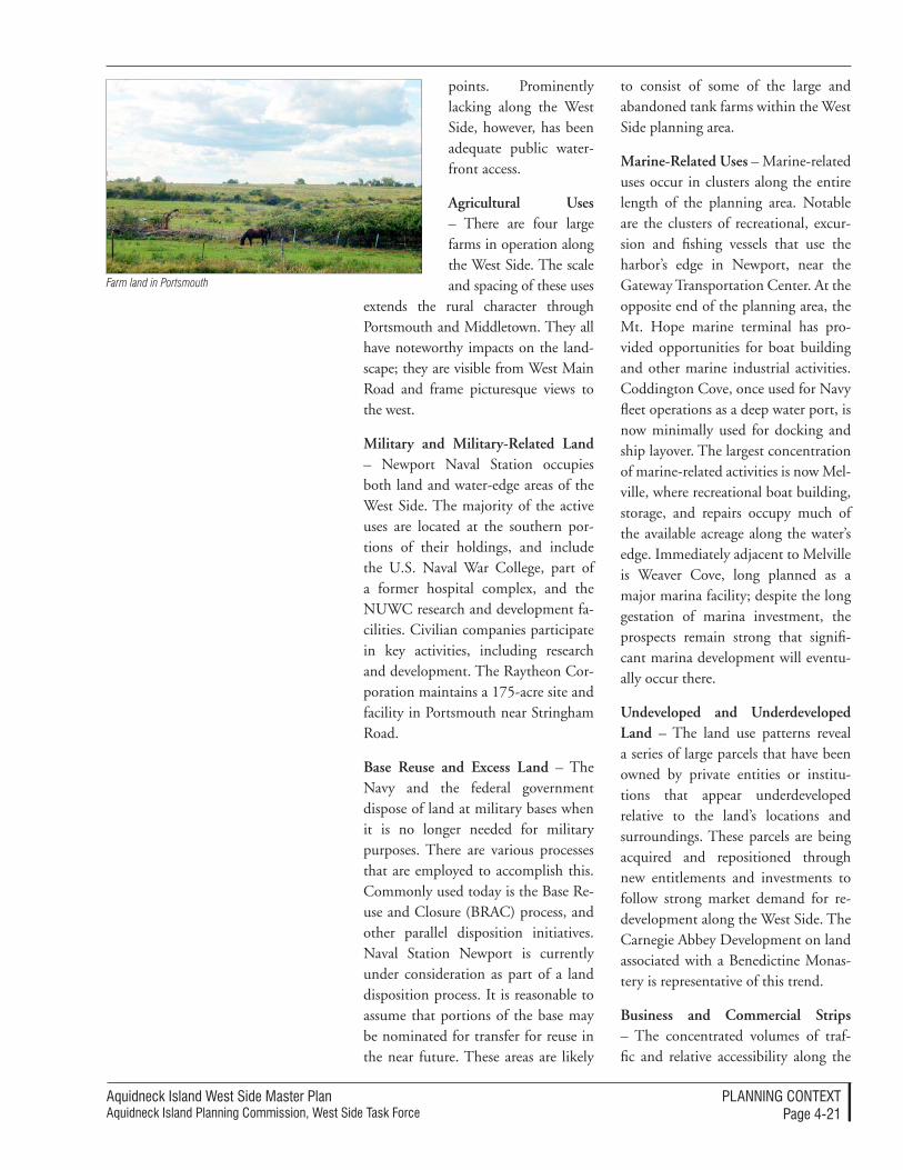
Aquidneck Island West Side Master PlanAquidneck Island Planning Commission, West Side Task Force
PlAnnIng ConTexTPage 4-��
points. Prominently lacking along the West Side, however, has been adequate public water-front access.
Agricultural Uses – There are four large farms in operation along the West Side. The scale and spacing of these uses
extends the rural character through Portsmouth and Middletown. They all have noteworthy impacts on the land-scape; they are visible from West Main Road and frame picturesque views to the west.
Military and Military-Related Land – Newport Naval Station occupies both land and water-edge areas of the West Side. The majority of the active uses are located at the southern por-tions of their holdings, and include the U.S. Naval War College, part of a former hospital complex, and the NUWC research and development fa-cilities. Civilian companies participate in key activities, including research and development. The Raytheon Cor-poration maintains a 175-acre site and facility in Portsmouth near Stringham Road.
Base Reuse and Excess Land – The Navy and the federal government dispose of land at military bases when it is no longer needed for military purposes. There are various processes that are employed to accomplish this. Commonly used today is the Base Re-use and Closure (BRAC) process, and other parallel disposition initiatives. Naval Station Newport is currently under consideration as part of a land disposition process. It is reasonable to assume that portions of the base may be nominated for transfer for reuse in the near future. These areas are likely
to consist of some of the large and abandoned tank farms within the West Side planning area.
Marine-Related Uses – Marine-related uses occur in clusters along the entire length of the planning area. Notable are the clusters of recreational, excur-sion and fishing vessels that use the harbor’s edge in Newport, near the Gateway Transportation Center. At the opposite end of the planning area, the Mt. Hope marine terminal has pro-vided opportunities for boat building and other marine industrial activities. Coddington Cove, once used for Navy fleet operations as a deep water port, is now minimally used for docking and ship layover. The largest concentration of marine-related activities is now Mel-ville, where recreational boat building, storage, and repairs occupy much of the available acreage along the water’s edge. Immediately adjacent to Melville is Weaver Cove, long planned as a major marina facility; despite the long gestation of marina investment, the prospects remain strong that signifi-cant marina development will eventu-ally occur there.
Undeveloped and Underdeveloped Land – The land use patterns reveal a series of large parcels that have been owned by private entities or institu-tions that appear underdeveloped relative to the land’s locations and surroundings. These parcels are being acquired and repositioned through new entitlements and investments to follow strong market demand for re-development along the West Side. The Carnegie Abbey Development on land associated with a Benedictine Monas-tery is representative of this trend.
Business and Commercial Strips – The concentrated volumes of traf-fic and relative accessibility along the
Farm land in Portsmouth
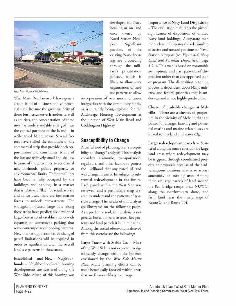
Aquidneck Island West Side Master Plan Aquidneck Island Planning Commission, West Side Task Force
PlAnnIng ConTexTPage 4-��
West Main Road network have gener-ated a band of business and commer-cial uses. Because the great majority of these businesses serve Islanders as well as tourists, the concentration of these uses has understandably emerged near the central portions of the Island – in well-named Middletown. Several fac-tors have stalled the evolution of the commercial strip that provide both op-portunities and constraints. Many of the lots are relatively small and shallow because of the proximity to residential neighborhoods, public property, or environmental limits. These small lots have become fully occupied by the buildings and parking. In a market that is relatively “flat” for retail, service and office uses, there are few market forces to unlock reinvestment. The strategically-located large lots along these strips have predictably developed large-format retail establishments with expanses of convenient parking that serve contemporary shopping patterns. New market opportunities or changed parcel limitations will be required in order to significantly alter the overall land use patterns in these areas.
Established – and New – Neighbor-hoods – Neighborhood-scale housing developments are scattered along the West Side. Much of this housing was
developed for Navy housing or on land once owned by Naval Station New-port. Significant portions of the existing Navy hous-ing are proceeding through the mili-tary’s privatization process, which is likely to allow a re-organization of land use patterns to allow
incorporation of new uses and better integration with the community fabric, as is currently being explored for the Anchorage Housing Development at the junction of West Main Road and Coddington Highway.
Susceptibility to ChangeA useful tool of planning is a “suscepti-bility to change” analysis. This analysis considers economic, transportation, regulatory, and other factors to project the likelihood that any parcel of land will change in use or be subject to sub-stantial redevelopment in the future. Each parcel within the West Side was reviewed, and a preliminary map cre-ated to understand the patterns of pos-sible change. The results of this analysis are illustrated on the following pages. As a predictive tool, this analysis is not precise, but as a means to reveal key pat-terns and land parcels it is illuminating. Among the useful observations derived from this exercise are the following:
Large Tracts with Stable Use – Most of the West Side is not expected to sig-nificantly change within the horizon envisioned by the West Side Master Plan. Many planning efforts can be most beneficially focused within areas that are far more likely to change.
Importance of Navy Land Disposition – The evaluation highlights the pivotal significance of disposition of unused Navy land holdings. A separate map more clearly illustrates the relationship of active and unused portions of Naval Station Newport (see Figure 4-4, Navy Land and Potential Dispositions, page 4-24). This map is based on reasonable assumptions and past patterns of dis-position rather than any approved plan or program. The disposition planning process is dependent upon Navy, mili-tary, and federal priorities that is un-derway and is not highly predictable.
Cluster of probable changes at Mel-ville – There are a clusters of proper-ties in the vicinity of Melville that are poised for change. Existing and poten-tial marina and marine-related uses are linked to this land and water edge.
Large redevelopment parcels – Scat-tered along the entire corridor are large land areas where redevelopment may be triggered through coordinated proj-ects or proposals because of their ad-vantageous locations relative to access, amenities, or existing uses. Among these are large parcels of land around the Pell Bridge ramps, near NUWC, along the northwestern shore, and farm land near the interchange of Route 24 and Route 114.
West Main Road at Middletown
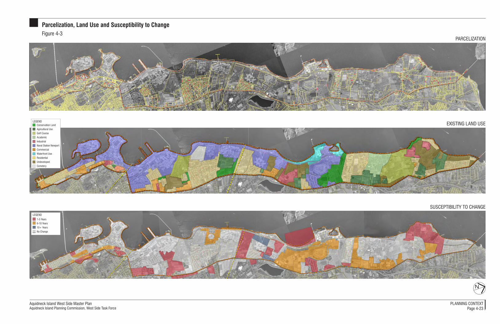
Aquidneck Island West Side Master PlanAquidneck Island Planning Commission, West Side Task Force
Parcelization, Land Use and Susceptibility to ChangeFigure 4-3
N
PArCelIzATIon
SuSCePTIbIlITy To ChAnge
exISTIng lAnd uSe
1-5 years
6-10 years
10+ years
no Change
legend
Conservation land
Agricultural use
golf Course
Academic
Industrial
naval Station newport
Commercial
Waterfront use
residential
undeveloped
Cemetery
legend
PlAnnIng ConTexTPage 4-23
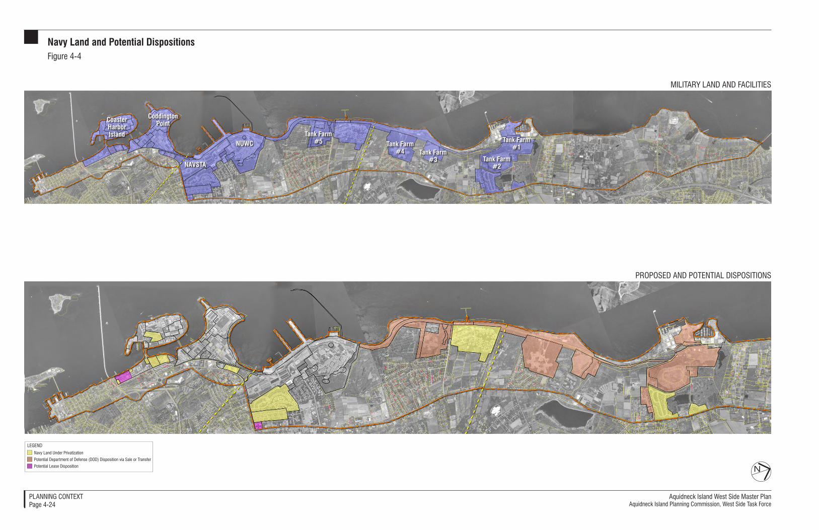
Aquidneck Island West Side Master PlanAquidneck Island Planning Commission, West Side Task Force
Navy Land and Potential DispositionsFigure 4-4
N
MIlITAry lAnd And FACIlITIeS
ProPoSed And PoTenTIAl dISPoSITIonS
Coaster Harbor Island
CoddingtonPoint
NAVSTA
NUWCTank Farm
#5 Tank Farm #4 Tank Farm
#3 Tank Farm #2
Tank Farm #1
navy land under Privatization
Potential department of defense (dod) disposition via Sale or Transfer
Potential lease disposition
legend
PlAnnIng ConTexTPage 4-24

Aquidneck Island West Side Master PlanAquidneck Island Planning Commission, West Side Task Force
PlAnnIng STrATegIeS5-�
Land Use The land use strategies for the West Side direct new development toward designated zones where it can best be absorbed and provide a public eco-nomic benefit, while preserving open space, environmental resources and aesthetic values. The open space, agri-cultural and recreational assets of the area will be preserved and expanded to the extent practical, with particular emphasis on corridors of land that are ecologically and aesthetically signifi-cant.
The land use strategies are linked to economic priorities that recognize the West Side as a long-term asset to the Island. This Master Plan thus stresses long-term benefits relative to short-term opportunities. Additional housing and retail uses are generally discouraged, except as part of redevel-opment of areas that have already been developed. Some new development is directed toward areas that have been previously improved, including estab-lished commercial areas along West Main Road and more urbanized areas in Newport. Other new development is recommended for portions of former military land that were originally hous-ing, fuel tanks or other facilities. Addi-tional new development is encouraged that provides new marina-oriented and
resort uses that build upon the unique coastal heritage as a high quality com-munity for second homes and boating enthusiasts.
The strategies do not compose a com-prehensive “land use plan” defining specific desirable uses for all of the par-cels within the West Side; this remains the role of the constituent jurisdictions. The land use strategies of the West Side Master Plan are focused on those com-mon regional interests that can be met by shaping land use in many locations. However, the “Smart Growth” strate-gies contained in this Master Plan concentrate public and private sector reinvestment in “Growth Centers” and preserve valued open land to benefit everyone in the long term.
The implementation mechanisms for the following recommendations are numerous and are collected in a sub-section of the next chapter (Land Use Implementation, pp. 6-11- 6-32).
5pLanning strategies
The planning recommendations of the West Side Master Plan are termed “strat-egies” for a good reason. They are more than a collection of separate ideas; they are intended to advance coordinated initiatives. The strategies have been or-ganized into categories that correspond to traditional planning themes: land use, economic development, transpor-tation, and utilities.
This section contains numerous refer-ences to the subsequent portions of the West Side Master Plan- major recom-mendations are linked to the tools, processes, resources or standards that may be associated with their accom-plishment.
New Approaches to Land Use Decisions
The communities of Aquidneck Island
have established comprehensive plans
and land use regulations that manage
development and land use according to
their community preferences as allowed
under State law. These rules allow the
communities to set overall patterns of
development, but they may not be capable
of ensuring that the character and quality
of new uses are tailored to the special
conditions of the West Side. This Master
Plan generally endorses a more flexible
approach for land management that better
ensures coordinated development, high
quality design, public use opportunities,
environmental sensitivity, and balanced
demands on the community infrastructure.
A map indicates how the land use
strategy applies to different portions
of the Island (Land Use Management
Recommendations, Figure 5-1, p. 5-2).
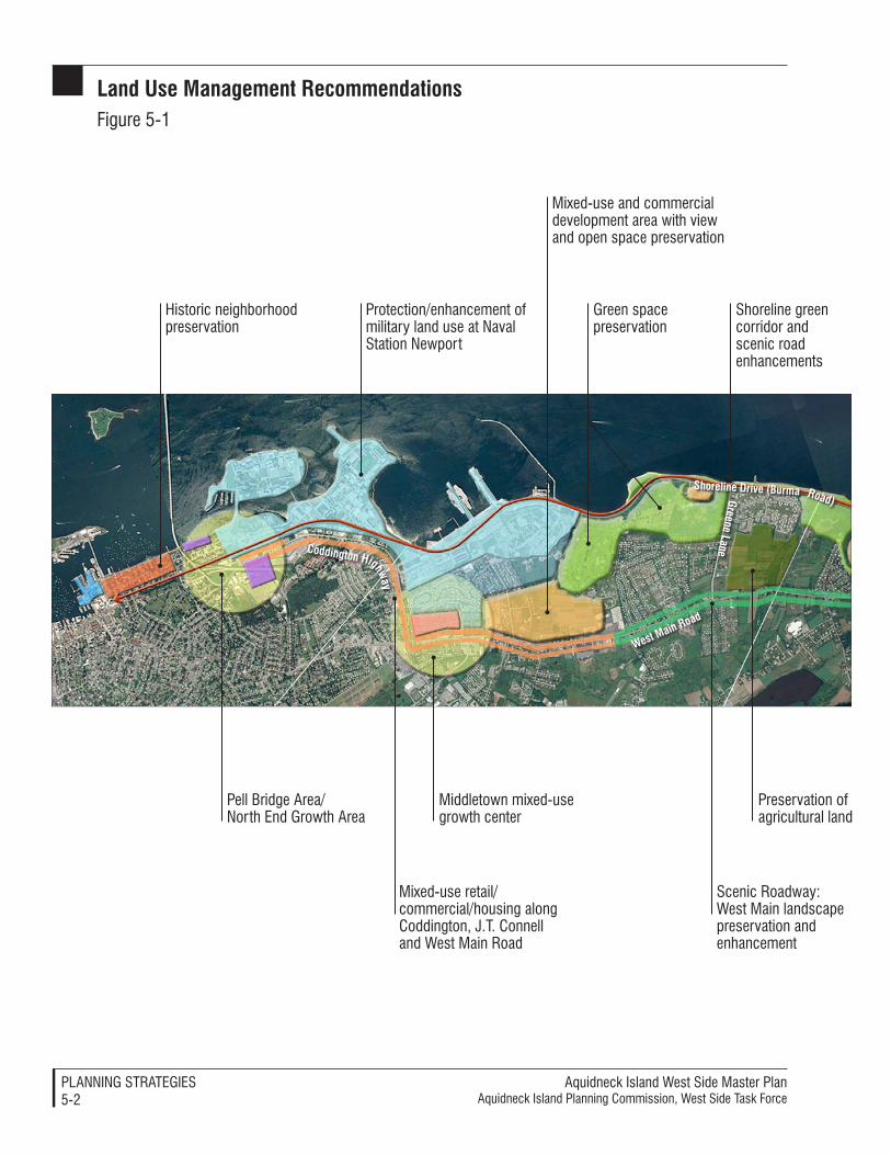
Aquidneck Island West Side Master PlanAquidneck Island Planning Commission, West Side Task Force
PlAnnIng STrATegIeS5-�
Land Use Management recommendationsFigure 5-�
West Main road
greene LaneCoddington Highway
shoreline drive (Burma road)
Historic neighborhood preservation
Pell Bridge Area/north end growth Area
Protection/enhancement of military land use at naval Station newport
Mixed-use retail/commercial/housing along Coddington, J.T. Connell and West Main road
Middletown mixed-use growth center
green space preservation
Mixed-use and commercial development area with view and open space preservation
Preservation of agricultural land
Scenic roadway: West Main landscape preservation and enhancement
Shoreline green corridor and scenic road enhancements
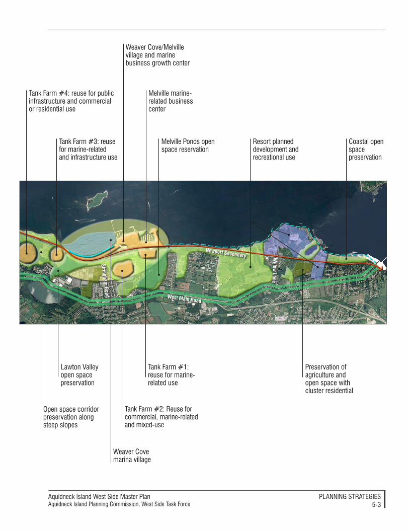
Aquidneck Island West Side Master PlanAquidneck Island Planning Commission, West Side Task Force
PlAnnIng STrATegIeS5-�
West Main roadstringham
road
newport secondary Willow
Lane
Tank Farm #4: reuse for public infrastructure and commercial or residential use
Tank Farm #�: reuse for marine-related and infrastructure use
Open space corridor preservation along steep slopes
lawton Valley open space preservation
Weaver Cove marina village
Weaver Cove/Melville village and marine business growth center
Tank Farm #�: reuse for commercial, marine-related and mixed-use
Tank Farm #�: reuse for marine-related use
Melville marine-related business center
Melville Ponds open space reservation
Preservation of agriculture and open space with cluster residential
Coastal open space preservation
resort planned development and recreational use
Aquidneck Island West Side Master PlanAquidneck Island Planning Commission, West Side Task Force
PlAnnIng STrATegIeS5-4
Open space, recreation and natural resource preservation
Open space preservation continues to be an issue in Aquidneck Island. The West Side has faced rapid develop-ment, loss of working farms and recre-ational space, and a growing threat to the Narragansett Bay watershed over the last few decades. The West Side Master Plan promotes a large, varied open space system. Open space parcels need to be secured, preserved or en-hanced, and linked into a network of wildlife corridors, the waterfront, and residential and business districts.
Open space is an important compo-nent that cuts across several land use strategies and thus must be integrated in a coordinated way with other land use goals. Preservation of open space is typically approached via attempts to secure parcels of land or simply the development rights of those parcels, where the land can be held in public or private ownership. Open space is also preserved through development regulations which specify site planning restrictions, such as percent coverage and setbacks. However, the quality of open space can be greatly enhanced if each component is seen as linked to the regional ecology and to regional mobility. The former derives from a scientific understanding of the natural conditions of the land, such as wildlife corridors and habitat areas. The latter derives from understanding the move-ment of people to activity areas, such as playgrounds, the waterfront, and even businesses, reachable if these ar-eas were linked by secure and pleasant open space corridors.
This Master Plan supports the open space efforts of the Aquidneck Land Trust (ALT) and seeks to both encour-age and parallel these efforts. ALT was established in 1990 to preserve the Island’s open spaces and natural
character for the benefit of the resident community. While there are a number of agencies at federal, state and local levels which have a key role in the preservation of land on the Island, ALT has taken the lead and formed partnerships with other agencies to successfully conserve land all over the Island. ALT has been successful in its preservation efforts through the use of a land acquisition policy, which es-tablishes the principles and procedures governing the Trust’s acquisition of real estate interest. ALT can acquire real estate interests in land on Aquidneck Island or other islands that are legally a part of one of Aquidneck Island’s municipalities, excluding Trade Lands (those lands offered to ALT with the understanding that the subject land can be traded, sold, or leased to gen-erate revenue for ALT). Conservation easements, land evaluations, and deed restrictions are some of the methods used by ALT which should be contin-ued and imitated at a municipal level. More information on these tools and processes is provided in Implementation – Tools: Conservation Easements, Restric-tions, and Evaluations, p. 6-11 and Pro-cesses to Preserve Open Space, Natural Resources and Agricultural Character, p. 6-18. Open space preservation criteria are proposed in Standards: Open Space Preservation Standards, p. 6-25.
Other useful implementation mecha-nisms linked to these recommenda-tions include Transfer of Development Rights (TDR) from undeveloped or agricultural land to other areas of the West Side, such as “growth centers” and land like the former tank farms or the Weaver Cove area (see Tools: Transfer of Development Rights, p. 6-10). Per-formance standards can be employed through regulatory processes and conditions on the redevelopment that

Aquidneck Island West Side Master PlanAquidneck Island Planning Commission, West Side Task Force
PlAnnIng STrATegIeS5-5
includes former public land (see Perfor-mance Standards and Design Guidelines, p. 6-27 and Appendix A: Performance Standards). Open space preservation can also be accomplished as part of the disposition process for former military land, including designation of qualify-ing open space as a “public benefit con-veyance” (see Processes for the Disposition of Military Land, p. 6-20).
greenwaysIn order to preserve larger-scale land-scapes, ALT has been focusing on three greenways linking parcels of protected land. These include the Sakonnet Gre-enway, the Center Island Greenway and the Newport Neck Greenway. It is within these greenways that ALT has identified and prioritized key parcels that reflect the diversity of natural and cultural resources of the Island. These greenway initiatives should be sup-ported and considered in subsequent open space preservation acquisitions and development.
The Sakonnet Greenway stretches from an area around the Glen in Portsmouth south to Sachuest Point in Middletown. It includes 882.13 acres of ALT-conserved land and features working vineyards, family farms, estates, and picturesque vistas. When complete, the six- to seven-mile Sakonnet Greenway Trail will extend from the Glen to Wyatt Road.
The Center Island Greenway extends from Hedly Street in Portsmouth south to First Beach in Newport. With 196.41 acres of ALT-conserved land, the Center Island Greenway focuses on the Island’s drinking water supplies and some exceptional family farms and wildlife habitats. The ALT’s Oakland Forest and Meadow Preserve
(including a public trail), Escobar Farm in Middle Road, the Thurston Farm on Union Street in Portsmouth, and Kempenaar Valley in Middletown are all found within the ALT’s Center Island Greenway. The Center Island Greenway also includes the Lawton Valley area.
The Newport Neck Greenway extends south and west of Narragansett Avenue in Newport. Protected parcels in this greenway can preserve sweeping coast-al views near 10-mile Ocean Drive, buffer Narragansett Bay and its coastal ponds, protect Almy and Lily ponds and Gooseneck Cove from pollution, and safeguard the last working family farms in Newport. The ALT has con-served 42.75 acres in this greenway.
identification of Key areas for Open space preservationOpen space that is eligible for land ac-quisitions can include a range of parcel types that are primarily undeveloped and consist of open agricultural or shorefront property, fresh and saltwa-ter marshes and adjoining uplands, wildlife habitats, land providing access to or views of the bay and ponds, land for paved and unpaved bicycle, bridle and hiking paths and for future passive recreational use, and land for agricul-tural use.
Open space protection and acquisition projects must be flexible in nature and must be adapted to suit specific condi-tions which may be unique to individ-ual properties or terms of purchase and sale. Also, public access to open space parcels needs to be promoted and en-couraged where such access will not threaten or jeopardize critical habitats or sensitive environmental values for which the land is being protected.
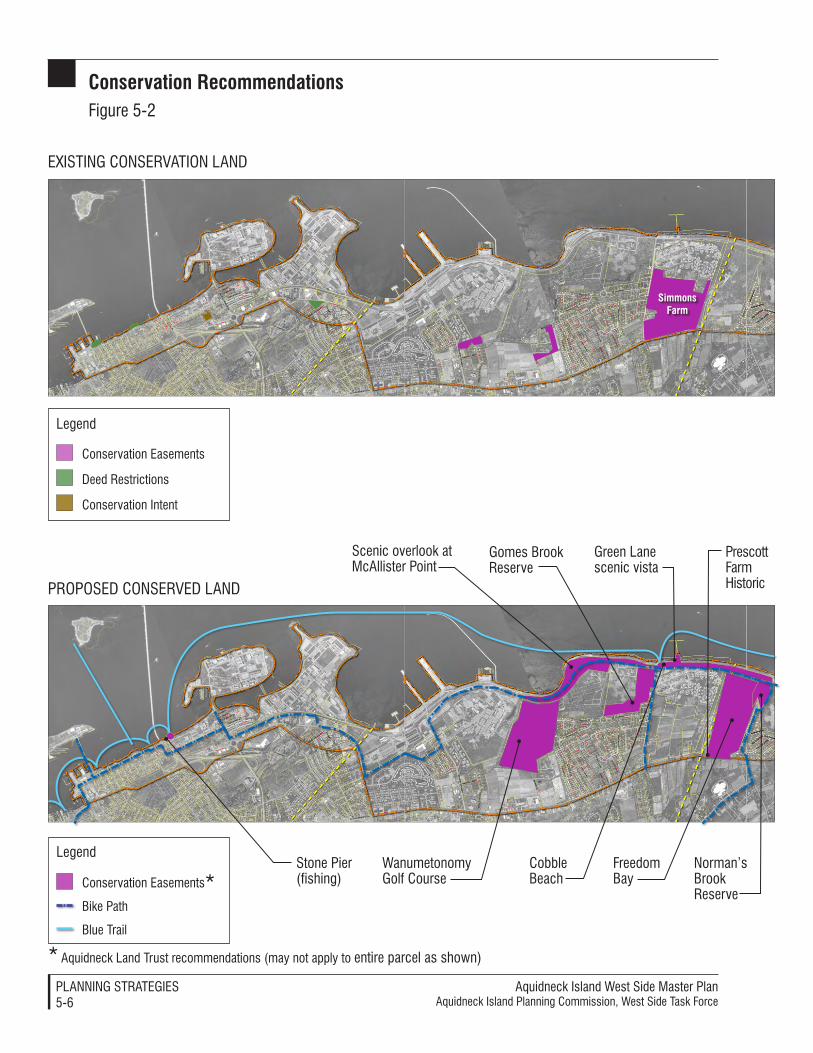
Aquidneck Island West Side Master PlanAquidneck Island Planning Commission, West Side Task Force
PlAnnIng STrATegIeS5-�
exISTIng COnSerVATIOn lAnd
PrOPOSed COnSerVed lAnd
Conservation easements
deed restrictions
Conservation Intent
legend
simmons Farm
Stone Pier (fishing)Conservation easements*
Bike Path
Blue Trail
legend
Scenic overlook at McAllister Point
gomes Brook reserve
Cobble Beach
green lane scenic vista
Prescott Farm Historic
norman’s Brook reserve
Freedom Bay
Wanumetonomy golf Course
* Aquidneck land Trust recommendations (may not apply to entire parcel as shown)
Conservation recommendationsFigure 5-�
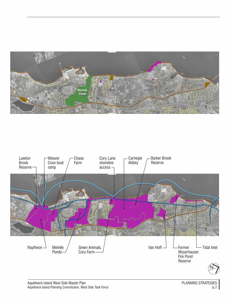
Aquidneck Island West Side Master PlanAquidneck Island Planning Commission, West Side Task Force
PlAnnIng STrATegIeS5-�
N
Melvilleponds
lawton Brook reserve
green Animals, Cory Farm
Barker Brook reserve
Cory lane shoreline access
Former Weyerhauser Fire Pond reserve
Tidal Inlet
Chase Farm
Carnegie Abbey
Weaver Cove boat ramp
raytheon Van HoffMelville Ponds
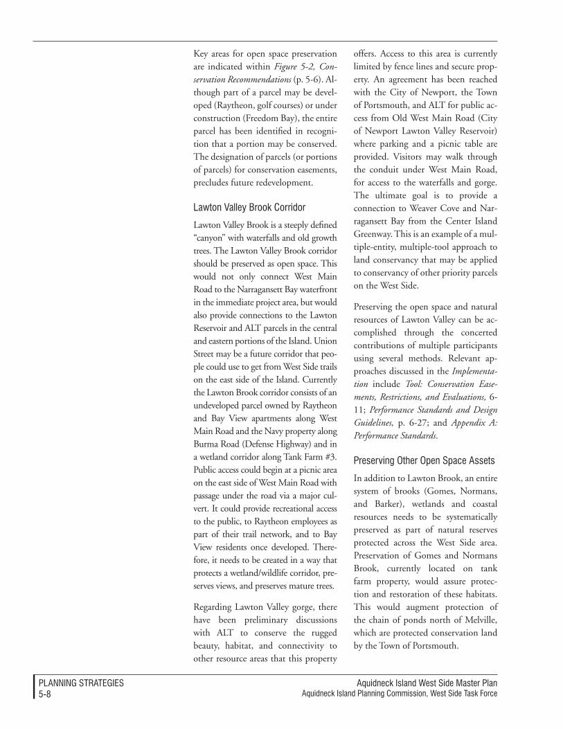
Aquidneck Island West Side Master PlanAquidneck Island Planning Commission, West Side Task Force
PlAnnIng STrATegIeS5-�
Key areas for open space preservation are indicated within Figure 5-2, Con-servation Recommendations (p. 5-6). Al-though part of a parcel may be devel-oped (Raytheon, golf courses) or under construction (Freedom Bay), the entire parcel has been identified in recogni-tion that a portion may be conserved. The designation of parcels (or portions of parcels) for conservation easements, precludes future redevelopment.
lawton Valley Brook Corridor
Lawton Valley Brook is a steeply defined “canyon” with waterfalls and old growth trees. The Lawton Valley Brook corridor should be preserved as open space. This would not only connect West Main Road to the Narragansett Bay waterfront in the immediate project area, but would also provide connections to the Lawton Reservoir and ALT parcels in the central and eastern portions of the Island. Union Street may be a future corridor that peo-ple could use to get from West Side trails on the east side of the Island. Currently the Lawton Brook corridor consists of an undeveloped parcel owned by Raytheon and Bay View apartments along West Main Road and the Navy property along Burma Road (Defense Highway) and in a wetland corridor along Tank Farm #3. Public access could begin at a picnic area on the east side of West Main Road with passage under the road via a major cul-vert. It could provide recreational access to the public, to Raytheon employees as part of their trail network, and to Bay View residents once developed. There-fore, it needs to be created in a way that protects a wetland/wildlife corridor, pre-serves views, and preserves mature trees.
Regarding Lawton Valley gorge, there have been preliminary discussions with ALT to conserve the rugged beauty, habitat, and connectivity to other resource areas that this property
offers. Access to this area is currently limited by fence lines and secure prop-erty. An agreement has been reached with the City of Newport, the Town of Portsmouth, and ALT for public ac-cess from Old West Main Road (City of Newport Lawton Valley Reservoir) where parking and a picnic table are provided. Visitors may walk through the conduit under West Main Road, for access to the waterfalls and gorge. The ultimate goal is to provide a connection to Weaver Cove and Nar-ragansett Bay from the Center Island Greenway. This is an example of a mul-tiple-entity, multiple-tool approach to land conservancy that may be applied to conservancy of other priority parcels on the West Side.
Preserving the open space and natural resources of Lawton Valley can be ac-complished through the concerted contributions of multiple participants using several methods. Relevant ap-proaches discussed in the Implementa-tion include Tool: Conservation Ease-ments, Restrictions, and Evaluations, 6-11; Performance Standards and Design Guidelines, p. 6-27; and Appendix A: Performance Standards.
Preserving Other Open Space Assets
In addition to Lawton Brook, an entire system of brooks (Gomes, Normans, and Barker), wetlands and coastal resources needs to be systematically preserved as part of natural reserves protected across the West Side area. Preservation of Gomes and Normans Brook, currently located on tank farm property, would assure protec-tion and restoration of these habitats. This would augment protection of the chain of ponds north of Melville, which are protected conservation land by the Town of Portsmouth.
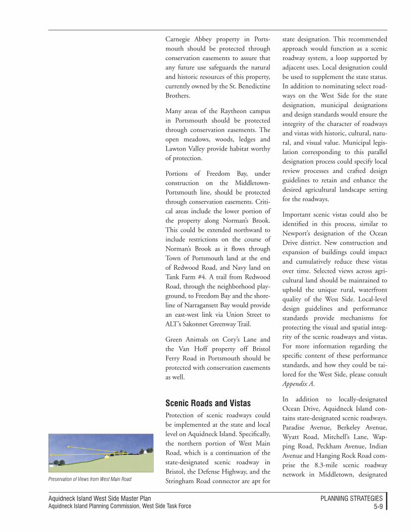
Aquidneck Island West Side Master PlanAquidneck Island Planning Commission, West Side Task Force
PlAnnIng STrATegIeS5-�
Carnegie Abbey property in Ports-mouth should be protected through conservation easements to assure that any future use safeguards the natural and historic resources of this property, currently owned by the St. Benedictine Brothers.
Many areas of the Raytheon campus in Portsmouth should be protected through conservation easements. The open meadows, woods, ledges and Lawton Valley provide habitat worthy of protection.
Portions of Freedom Bay, under construction on the Middletown-Portsmouth line, should be protected through conservation easements. Criti-cal areas include the lower portion of the property along Norman’s Brook. This could be extended northward to include restrictions on the course of Norman’s Brook as it flows through Town of Portsmouth land at the end of Redwood Road, and Navy land on Tank Farm #4. A trail from Redwood Road, through the neighborhood play-ground, to Freedom Bay and the shore-line of Narragansett Bay would provide an east-west link via Union Street to ALT’s Sakonnet Greenway Trail.
Green Animals on Cory’s Lane and the Van Hoff property off Bristol Ferry Road in Portsmouth should be protected with conservation easements as well.
scenic roads and VistasProtection of scenic roadways could be implemented at the state and local level on Aquidneck Island. Specifically, the northern portion of West Main Road, which is a continuation of the state-designated scenic roadway in Bristol, the Defense Highway, and the Stringham Road connector are apt for
state designation. This recommended approach would function as a scenic roadway system, a loop supported by adjacent uses. Local designation could be used to supplement the state status. In addition to nominating select road-ways on the West Side for the state designation, municipal designations and design standards would ensure the integrity of the character of roadways and vistas with historic, cultural, natu-ral, and visual value. Municipal legis-lation corresponding to this parallel designation process could specify local review processes and crafted design guidelines to retain and enhance the desired agricultural landscape setting for the roadways.
Important scenic vistas could also be identified in this process, similar to Newport’s designation of the Ocean Drive district. New construction and expansion of buildings could impact and cumulatively reduce these vistas over time. Selected views across agri-cultural land should be maintained to uphold the unique rural, waterfront quality of the West Side. Local-level design guidelines and performance standards provide mechanisms for protecting the visual and spatial integ-rity of the scenic roadways and vistas. For more information regarding the specific content of these performance standards, and how they could be tai-lored for the West Side, please consult Appendix A.
In addition to locally-designated Ocean Drive, Aquidneck Island con-tains state-designated scenic roadways. Paradise Avenue, Berkeley Avenue, Wyatt Road, Mitchell’s Lane, Wap-ping Road, Peckham Avenue, Indian Avenue and Hanging Rock Road com-prise the 8.3-mile scenic roadway network in Middletown, designated
Preservation of Views from West Main Road
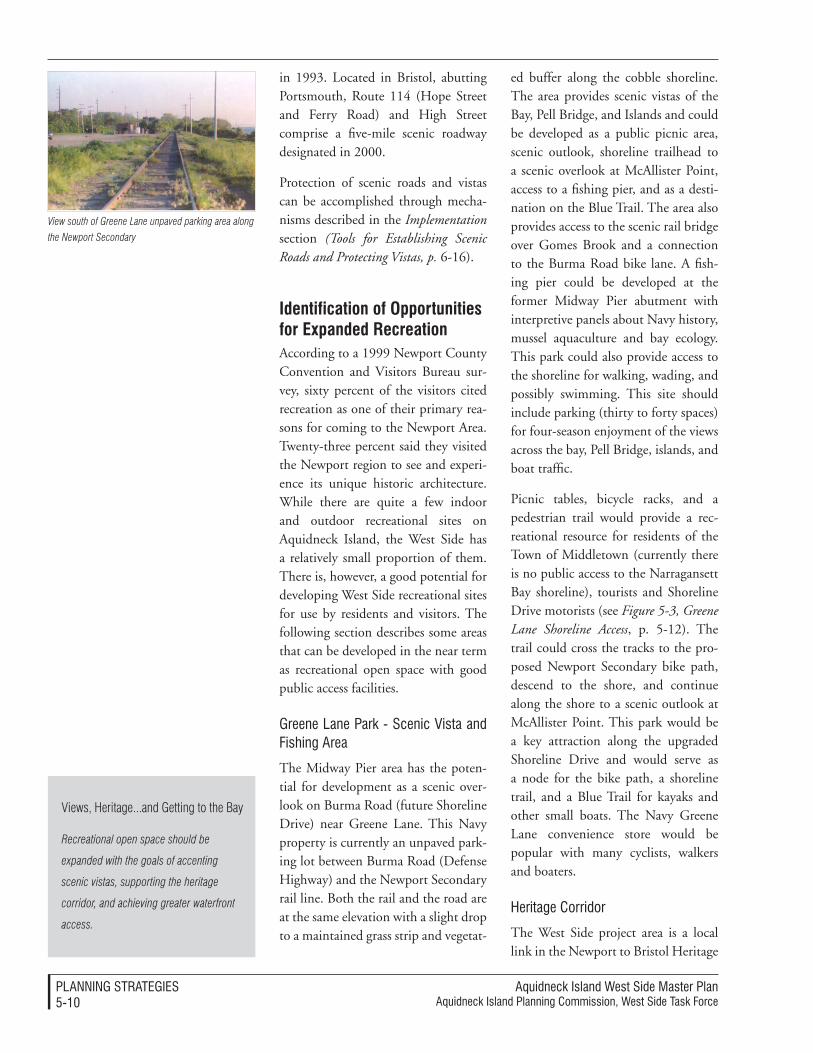
Aquidneck Island West Side Master PlanAquidneck Island Planning Commission, West Side Task Force
PlAnnIng STrATegIeS5-�0
in 1993. Located in Bristol, abutting Portsmouth, Route 114 (Hope Street and Ferry Road) and High Street comprise a five-mile scenic roadway designated in 2000.
Protection of scenic roads and vistas can be accomplished through mecha-nisms described in the Implementation section (Tools for Establishing Scenic Roads and Protecting Vistas, p. 6-16).
identification of Opportunities for expanded recreationAccording to a 1999 Newport County Convention and Visitors Bureau sur-vey, sixty percent of the visitors cited recreation as one of their primary rea-sons for coming to the Newport Area. Twenty-three percent said they visited the Newport region to see and experi-ence its unique historic architecture. While there are quite a few indoor and outdoor recreational sites on Aquidneck Island, the West Side has a relatively small proportion of them. There is, however, a good potential for developing West Side recreational sites for use by residents and visitors. The following section describes some areas that can be developed in the near term as recreational open space with good public access facilities.
greene lane Park - Scenic Vista and Fishing Area
The Midway Pier area has the poten-tial for development as a scenic over-look on Burma Road (future Shoreline Drive) near Greene Lane. This Navy property is currently an unpaved park-ing lot between Burma Road (Defense Highway) and the Newport Secondary rail line. Both the rail and the road are at the same elevation with a slight drop to a maintained grass strip and vegetat-
ed buffer along the cobble shoreline. The area provides scenic vistas of the Bay, Pell Bridge, and Islands and could be developed as a public picnic area, scenic outlook, shoreline trailhead to a scenic overlook at McAllister Point, access to a fishing pier, and as a desti-nation on the Blue Trail. The area also provides access to the scenic rail bridge over Gomes Brook and a connection to the Burma Road bike lane. A fish-ing pier could be developed at the former Midway Pier abutment with interpretive panels about Navy history, mussel aquaculture and bay ecology. This park could also provide access to the shoreline for walking, wading, and possibly swimming. This site should include parking (thirty to forty spaces) for four-season enjoyment of the views across the bay, Pell Bridge, islands, and boat traffic.
Picnic tables, bicycle racks, and a pedestrian trail would provide a rec-reational resource for residents of the Town of Middletown (currently there is no public access to the Narragansett Bay shoreline), tourists and Shoreline Drive motorists (see Figure 5-3, Greene Lane Shoreline Access, p. 5-12). The trail could cross the tracks to the pro-posed Newport Secondary bike path, descend to the shore, and continue along the shore to a scenic outlook at McAllister Point. This park would be a key attraction along the upgraded Shoreline Drive and would serve as a node for the bike path, a shoreline trail, and a Blue Trail for kayaks and other small boats. The Navy Greene Lane convenience store would be popular with many cyclists, walkers and boaters.
Heritage Corridor
The West Side project area is a local link in the Newport to Bristol Heritage
View south of Greene Lane unpaved parking area along
the Newport Secondary
Views, Heritage...and Getting to the Bay
Recreational open space should be
expanded with the goals of accenting
scenic vistas, supporting the heritage
corridor, and achieving greater waterfront
access.
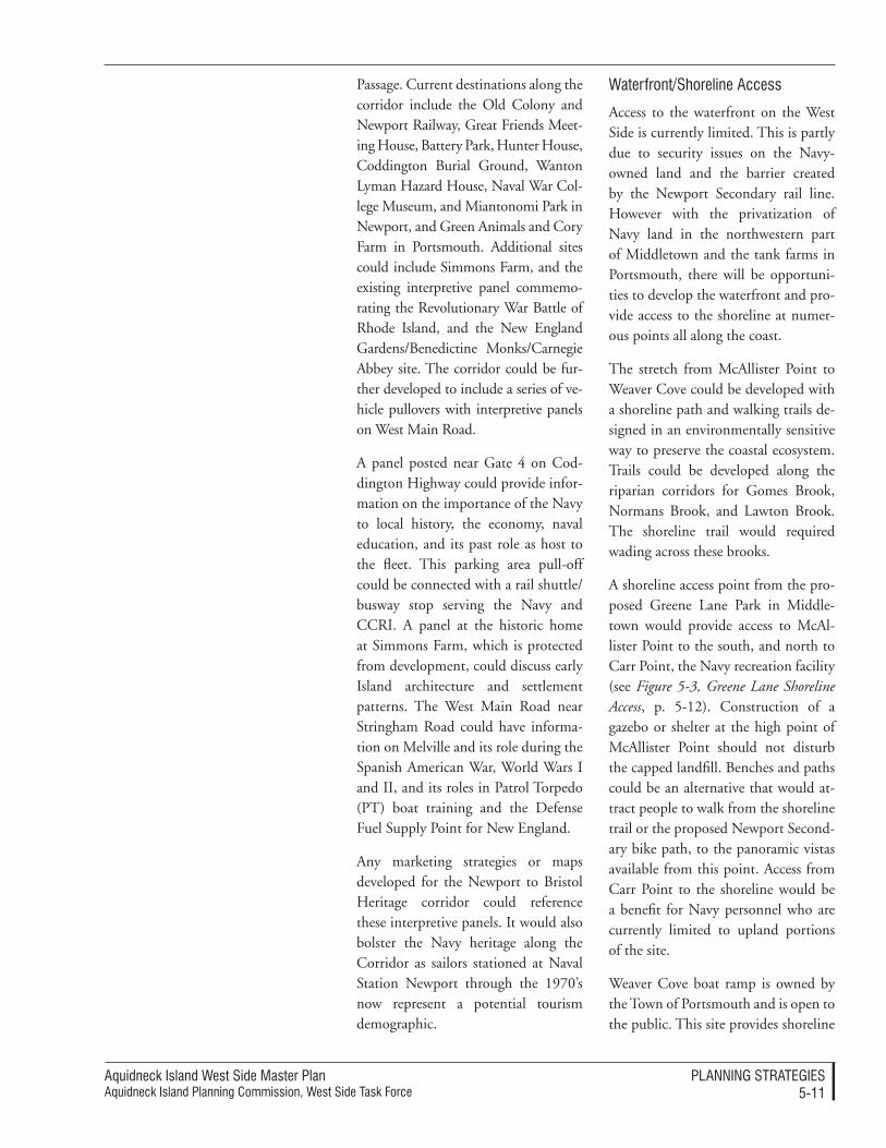
Aquidneck Island West Side Master PlanAquidneck Island Planning Commission, West Side Task Force
PlAnnIng STrATegIeS5-��
Passage. Current destinations along the corridor include the Old Colony and Newport Railway, Great Friends Meet-ing House, Battery Park, Hunter House, Coddington Burial Ground, Wanton Lyman Hazard House, Naval War Col-lege Museum, and Miantonomi Park in Newport, and Green Animals and Cory Farm in Portsmouth. Additional sites could include Simmons Farm, and the existing interpretive panel commemo-rating the Revolutionary War Battle of Rhode Island, and the New England Gardens/Benedictine Monks/Carnegie Abbey site. The corridor could be fur-ther developed to include a series of ve-hicle pullovers with interpretive panels on West Main Road.
A panel posted near Gate 4 on Cod-dington Highway could provide infor-mation on the importance of the Navy to local history, the economy, naval education, and its past role as host to the fleet. This parking area pull-off could be connected with a rail shuttle/ busway stop serving the Navy and CCRI. A panel at the historic home at Simmons Farm, which is protected from development, could discuss early Island architecture and settlement patterns. The West Main Road near Stringham Road could have informa-tion on Melville and its role during the Spanish American War, World Wars I and II, and its roles in Patrol Torpedo (PT) boat training and the Defense Fuel Supply Point for New England.
Any marketing strategies or maps developed for the Newport to Bristol Heritage corridor could reference these interpretive panels. It would also bolster the Navy heritage along the Corridor as sailors stationed at Naval Station Newport through the 1970’s now represent a potential tourism demographic.
Waterfront/Shoreline Access
Access to the waterfront on the West Side is currently limited. This is partly due to security issues on the Navy-owned land and the barrier created by the Newport Secondary rail line. However with the privatization of Navy land in the northwestern part of Middletown and the tank farms in Portsmouth, there will be opportuni-ties to develop the waterfront and pro-vide access to the shoreline at numer-ous points all along the coast.
The stretch from McAllister Point to Weaver Cove could be developed with a shoreline path and walking trails de-signed in an environmentally sensitive way to preserve the coastal ecosystem. Trails could be developed along the riparian corridors for Gomes Brook, Normans Brook, and Lawton Brook. The shoreline trail would required wading across these brooks.
A shoreline access point from the pro-posed Greene Lane Park in Middle-town would provide access to McAl-lister Point to the south, and north to Carr Point, the Navy recreation facility (see Figure 5-3, Greene Lane Shoreline Access, p. 5-12). Construction of a gazebo or shelter at the high point of McAllister Point should not disturb the capped landfill. Benches and paths could be an alternative that would at-tract people to walk from the shoreline trail or the proposed Newport Second-ary bike path, to the panoramic vistas available from this point. Access from Carr Point to the shoreline would be a benefit for Navy personnel who are currently limited to upland portions of the site.
Weaver Cove boat ramp is owned by the Town of Portsmouth and is open to the public. This site provides shoreline
Aquidneck Island West Side Master PlanAquidneck Island Planning Commission, West Side Task Force
PlAnnIng STrATegIeS5-��
access with vistas of Narragansett Bay, Prudence Island and the scenic arch railroad bridge over Lawton Brook. Access from the Melville Ponds’ newly marked Red Trail would connect with a shoreline trail (no parking or vehicu-lar access is envisioned at this time).
The cobble waterfront at the end of Cory’s Lane in Portsmouth is currently undeveloped, although an unpaved area is available for parking one or two cars. Parking for up to five cars could be considered at the end of Cory’s
Lane. A stone foundation located near the Cory’s Lane access area provides a link to past use of the site and thus an opportunity for interpretation.
A marina proposed by Carnegie Abbey at the end of Willow Lane in Ports-mouth would provide public parking for approximately twenty trailers.
A Blue Trail with put-in places and shoreline stops for kayakers and other small boats would provide access and destinations. Blue Trail destinations, indicated in Figure 5-2, Conservation
Recommendations (p. 5-6) include Per-rotti Park and piers along the Point neighborhood, Rose Island, and the Stone Pier north of Pell Bridge in Newport, Greene Lane in Middle-town, and Weaver Cove boat ramp, Dyer Island, Cory’s Lane, and Willow Lane in Portsmouth. Put-in locations for car-top boats could include Greene Lane in Middletown, and Cory’s Lane in Portsmouth. Put-ins currently are located at Elm Street in Newport and Weaver Cove in Portsmouth. Public access is included as part of the CRMC application for a marina at Willow Lane in Portsmouth.
greene Lane shoreline access Figure 5-�
newport Secondary rail line
Proposed shared path
Shoreline drive
McAllister Point scenic overlook
Shoreline path to McAllister Point
Blue Trail Blue Trail kayak launch
Shoreline path to McAllister Point
existing building
gree
ne
lane
Shoreline drive
Shared path
Pedestrian rail crossing
Kayak launch
Parking Playground Picnic area
Fence restrooms
Fishing pier
newport Secondary rail line
greene lane Shoreline Access Concept Plan
gomes Brook
Aquidneck Island West Side Master PlanAquidneck Island Planning Commission, West Side Task Force
PlAnnIng STrATegIeS5-��
Narragansett Bay along the West Side of Aquidneck Island is an active waterway with intensive marine uses – commercial boating and shipping at Melville, Navy mooring, docking and active operations, recreational boating, and fishing. Most of these uses have a landside and waterside implication. In addition, there are important environ-mental and ecological relationships be-tween the landside and waterside uses.
Use of the BayThe waterside of Narragansett Bay is subject to state regulation and manage-ment under the guidance of the Coast-al Resources Management Council (CRMC). Among other mechanisms, they employ a system of categories that guide permissible maritime uses in the waters of Rhode Island (see Figure 4-2, Natural Resources, Water Classifications and Types, Historic Resources, p. 4-18). For the West Side, this classification re-stricts uses to those that are compatible with both environmental conditions and economic goals for the state.
Waterside areas most sensitive to change consist of the portions of the planning area from Weaver Cove to the Mt. Hope Bridge. The majority of this area is indicated as a Type 4 (Mul-tipurpose Waters) category, which ap-pears to be consistent with the vision of the West Side Master Plan and would continue to allow recreational boating, water transportation, marinas and the type of commercial marine enterprises that exist or are contemplated. No increase in the use category should occur.
The AIPC may consider the process to review existing CRMC type use designations off the West Side shore-line. This review would be directed to
Bay and Coastal Uses
more adequately protecting the quality of off-shore waters by upgrading the CRMC water type designation (see Figure 4-2, p. 4-18) for the water areas 500 feet seaward and generally parallel with the mean high water mark from Type 4 Multipurpose Waters to Type 3 High Intensity Boating. Type 1 or 2 waters should be considered 500 feet seaward of land proposed for conserva-tion. This would require concurrence of all stakeholders and a modification of the CRMC program.
Melville is listed as a Type 6 (Industrial Waterfronts and Commercial Naviga-tion Channels) area, which provides for the types of large maritime opera-tions and marine business needs that have occurred there. The use of the Melville basin for large ship opera-tions essentially ended when the Navy relocated these operations to other ports. However, in recent years, some specialized large ship needs have been met here, such as the docking of cruise vessels.
This Master Plan recommends that large tankers and bulk container ship-ments (such as that previously pro-posed at Quonset) be excluded from both landside and waterside areas at Melville, as well as the other coastal edges of the West Side. However, there are many commercial enterprises in the Melville area that will need to rely on the ability to conduct marine in-dustrial activities including associated use of the nearby watersheet for ship-ping and other operational purposes. These needs must be preserved in any regulatory scheme for this portion of Narragansett Bay. The ability to con-duct passenger operations or provide for temporary mooring and docking of large vessels may also be appropriate to preserve.
Aquidneck Island West Side Master PlanAquidneck Island Planning Commission, West Side Task Force
PlAnnIng STrATegIeS5-�4
Waters off the West Side are used for aquaculture. American Mussel cur-rently has a lease north of the former Midway Pier west of Green Lane in Middletown. Waters off the West Side are also used for fishing, lobstering, and quahogging. Any upland change in use could affect the quality of waters for habitat of local species.
This may require a refined approach to the CRMC use classifications. This Master Plan strongly recommends that the state prepare a Special Area Man-agement Plan (SAMP) for Melville to tailor the landside and waterside framework. This approach is discussed in more detail in the Implementation section in Processes: Special Area Man-agement Planning (SAMP), p. 6-18.
Coastal UseMany specific concepts are advanced within this Master Plan for uses along and near the coastal edge; they are described in other portions of this chapter. However, there are important interactions between the landside and waterside conditions that must be managed in order to accomplish the vision of this Master Plan. Landside practices need to protect and enhance the water quality of Narragansett Bay. CRMC has jurisdiction 200 feet in-land from any coastal feature, includ-ing watersheds and certain activities that occur anywhere within the state.
Problems that arise range from erosion, stormwater runoff and its impacts on water quality, pollution associated with human activities and agriculture and degradation of interactive landside, tidal and marine habitats.
The West Side Master Plan recom-mends the application of a system of high performance standards that use “best management practices” in site
planning, design and operational as-pects of projects that will occur along the West Side’s coastal edge. These will need to be tailored to each community and the uses that are anticipated. This system of performance standards and design guidelines is discussed in the Implementation section under Stan-dards: Performance Standards, p. 6-27, including Marine and Marina-Related Use Performance Standards, p. 6-29. Greater detail regarding such standards is provided in Appendix A. Performance Standards, as well.
In anticipation of the advancement of new municipal and state standards for the landside/waterside interaction, this Master Plan recommends that addi-tional buffer areas be established along the water’s edge as an interim measure consistent with municipal planning and goals relative to prospective proj-ects and uses. An additional buffer may be applied through a combination of state and local regulatory process, and is triggered by a formal request from municipalities to the CRMC.
The preparation of the SAMP dis-cussed above also provides a key tool to integrate landside and waterside implementation at both the state and local level. The scope of the SAMP should explicitly use the West Side Master Plan as the basis of landside and waterside use recommendations in order to provide a matching regulatory framework.
Aquidneck Island West Side Master PlanAquidneck Island Planning Commission, West Side Task Force
PlAnnIng STrATegIeS5-�5
Conversion of agricultural Land
The history of Aquidneck Island is closely connected to the agricultural history of Rhode Island. The means and methods of farming have signifi-cantly changed since Rhode Island was economically driven by agriculture. However, the vestiges of agriculture that remain offer several important functions. The remaining farms pro-vide greater diversity of land forms, relief from intense commercial devel-opment elsewhere, attractive and in-teresting views and vistas, and unique commodities that enhance the quality of life on the Island. These agricultural landscapes should be protected.
Until very recently, agricultural lands comprised eighteen percent of Aquidneck Island’s total area. Between 1988 and 1997 however, agricultural land decreased by 11.4 percent, about the same amount that residential land area increased during the same time period. In 1988, Newport, Middle-town, and Portsmouth had 3 percent (143 acres), 24 percent (2,023 acres) and 19 percent (2,907 acres) agricul-tural uses, respectively, which have all reduced in total acreage over time.
Currently Simmons Farm is the only large tract of agricultural land pro-tected with a perpetual conservation restriction. Other pieces of farmland along West Main Road are not under any sort of protection and might be subject to development in the future:
• Vanicek/Rhode Island Nurseries Farms – A zoning amendment to convert these parcels to mixed use has been approved. At least forty percent will be preserved as open space and the view corridor will be protected. This is in ac-cordance with the Comprehensive Plan. However, it is recommended that at least a part of the land be
protected; it is the last agricul-tural land seen going south on West Main Road. Performance standards for future development should assure that resource areas are conserved.
• Chase Farm, which abuts Ray-theon, is a valued agricultural re-source in the community and thus might be worthy of preservation.
• The agricultural land further north on West Main Road, adjoining the privately conserved parcels of the Priory, St. Philomene’s and the Carnegie Golf Course, is also very valuable as an agricultural/open space resource, especially since it is critical to preserving the views from West Main Road looking towards the shoreline.
• Depending on how the parcels of land between Arnold Point and the West Main Road are devel-oped, it will be important to con-serve some parcels of agricultural land (existing pastures, crop lands or Orchards/ Nurseries) as open spaces, which can add value to the development proposed in the area.
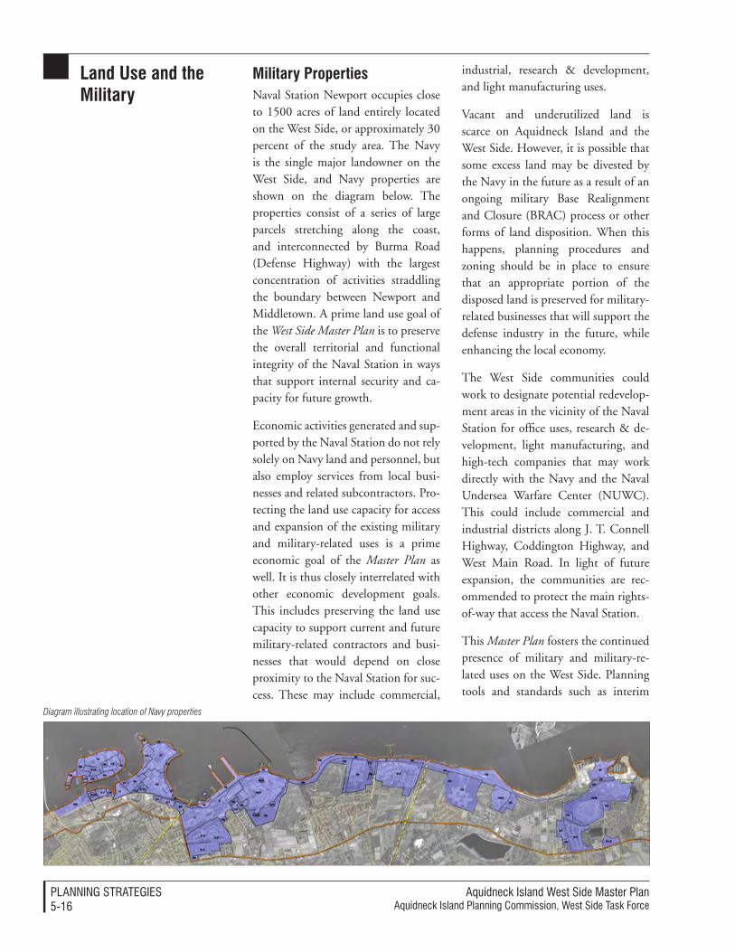
Aquidneck Island West Side Master PlanAquidneck Island Planning Commission, West Side Task Force
PlAnnIng STrATegIeS5-��
Military propertiesNaval Station Newport occupies close to 1500 acres of land entirely located on the West Side, or approximately 30 percent of the study area. The Navy is the single major landowner on the West Side, and Navy properties are shown on the diagram below. The properties consist of a series of large parcels stretching along the coast, and interconnected by Burma Road (Defense Highway) with the largest concentration of activities straddling the boundary between Newport and Middletown. A prime land use goal of the West Side Master Plan is to preserve the overall territorial and functional integrity of the Naval Station in ways that support internal security and ca-pacity for future growth.
Economic activities generated and sup-ported by the Naval Station do not rely solely on Navy land and personnel, but also employ services from local busi-nesses and related subcontractors. Pro-tecting the land use capacity for access and expansion of the existing military and military-related uses is a prime economic goal of the Master Plan as well. It is thus closely interrelated with other economic development goals. This includes preserving the land use capacity to support current and future military-related contractors and busi-nesses that would depend on close proximity to the Naval Station for suc-cess. These may include commercial,
industrial, research & development, and light manufacturing uses.
Vacant and underutilized land is scarce on Aquidneck Island and the West Side. However, it is possible that some excess land may be divested by the Navy in the future as a result of an ongoing military Base Realignment and Closure (BRAC) process or other forms of land disposition. When this happens, planning procedures and zoning should be in place to ensure that an appropriate portion of the disposed land is preserved for military-related businesses that will support the defense industry in the future, while enhancing the local economy.
The West Side communities could work to designate potential redevelop-ment areas in the vicinity of the Naval Station for office uses, research & de-velopment, light manufacturing, and high-tech companies that may work directly with the Navy and the Naval Undersea Warfare Center (NUWC). This could include commercial and industrial districts along J. T. Connell Highway, Coddington Highway, and West Main Road. In light of future expansion, the communities are rec-ommended to protect the main rights-of-way that access the Naval Station.
This Master Plan fosters the continued presence of military and military-re-lated uses on the West Side. Planning tools and standards such as interim
Diagram illustrating location of Navy properties
Land Use and the Military
Aquidneck Island West Side Master PlanAquidneck Island Planning Commission, West Side Task Force
PlAnnIng STrATegIeS5-��
planning overlay districts, sustainable zoning requirements and site planning standards, and density bonuses are tools that can help mediate military uses, non-military uses and transition-al stages. These tools qualify the types of businesses and industries to be de-veloped on transferred Navy land, ad-vance “green” building standards, and plan for increased demands on public utilities and infrastructure. These are discussed at length in Implementation.
principal areas for Military-related Civilian UseIt is important to note that the de-velopment of new office and research space associated with BRAC programs and overall economic growth may be subject to competitive positioning within Aquidneck Island in general. Planning decisions aimed at attract-ing these types of development to the West Side need to be made in advance. The best practical strategy is to provide multiple opportunities within suitable locations, so that good and attractive choices for potential private sector in-vestment are preserved.
Potential locations for the develop-ment of military-related uses would include redevelopment sites within a short driving time/distance from the Navy Base. Assuming a ten-minute time limit and an average speed of thirty miles per hour, this would in-clude any potential sites within a five-mile radius of the Base. The following locations on the West Side study area fall within this category:
• All Navy land that could be po-tentially disposed of as part of BRAC or other land disposition processes, including former tank farm areas.
• Navy properties that may be leased or privatized, such as the Naval Hospital site.
• Publicly-owned land that may become available as a result of the reconfiguration of the Pell Bridge access ramps.
• Undeveloped portions of the Ray-theon industrial site.
• Other smaller commercial and mixed use properties that may be subject to redevelopment.
The results of the economic market trends analysis indicate that needs for military-related defense contrac-tors may amount to approximately 175,000 square feet over the mid- to long-term. The existing land use ca-pacity for redevelopment in the above-mentioned areas more than exceeds this estimate and, therefore, uses other than military-related businesses may also be located on many of those prop-erties. Specific zoning provisions for future military-related uses should be primarily focused on potential redevel-opment areas actually closer to the Na-val Station, such as former Tank Farm # 4, the Vanicek properties, the Naval Hospital site, and properties in transi-tion along J.T. Connell Highway.
Conversion of Military LandRecent legislation and new approaches to military organization and land use by the U.S. Department of Defense (DOD) has an important role on the Island. The communities could have a strong influential position in many of the potential and current changes in military land disposition. This will best be accomplished using new approaches to organization of com-munity goals and authorities, and em-
Aquidneck Island West Side Master PlanAquidneck Island Planning Commission, West Side Task Force
PlAnnIng STrATegIeS5-��
bracing a new approach to the process of land use decision-making.
By the time this Master Plan is fully disseminated, there will be a clearer picture of exactly where DOD wants to position the Naval Station in its plans for future military and federal operations. Even at this stage, changes on the property is strongly predicted. In fact, conversion of the military housing to a private housing manage-ment corporation has already begun with negotiations occurring in each of the Island communities.
With a community-based and region-ally-coordinated strategy for all of the military parcels, the position of the Island will be greatly enhanced in the complex process of land disposi-tion. Well-developed plans will lead to better regional stewardship of the land with coordinated development, transportation and environmental considerations incorporated into the management.
There are several different processes that can be employed to enable the conversion of military land to either other public or civilian uses. The typical processes are described in Implementation under Processes for the Disposition of Military Land, p. 6-20.
special Considerations for Former tank FarmsThe largest extensions of land that may become available for future redevelop-ment on the West Side, as a result of potential military land disposition, are the former tank farms. Redevelopment opportunities are generated by their large size, their proximity to the Navy Base, and easy connectivity through Burma Road (and future upgrade as
Shoreline Drive). Reuse concepts and illustrative sketches of these ideas are shown in Figure 5-4, Tank Farm Reuse Concepts (p. 5-20), Figure 5-5 Melville Reuse Concept (p. 5-36) and Figure 5-6, Melville Illustrative Concept Plan (p. 5-38).
It is important to note that a portion of the former Tank Farm #5 has been redeveloped for military use and is occupied by the Naval Station’s Fire Fighting Training Facility. Conse-quently, it is not expected that the U. S. Government will dispose of this parcel in the foreseeable future, and land use planning considerations for the reuse of Tank Farm #5 are not included in this Master Plan. However, degraded environmental conditions resulting from its past use as fuel de-pots and storage pose reuse limitations that need to be considered. As further described in the Implementation sec-tion (Processes to Manage the Reuse of Former Military Land, p. 6-22), tank farm sites are subject to restoration under Comprehensive Environmental Response, Compensation, and Liabil-ity Act (CERCLA) and Resource Con-servation and Recovery Act (RCRA) regulations. CERCLA, also known as Superfund, is the federal law which guides and finances cleanup of haz-ardous waste sites. Tank farm restora-tion is also regulated under RCRA by RIDEM as storage tank closures. As a result, remediation would be required prior to redevelopment. AIPC should continue to participate in the Navy Restoration Advisory Board (RAB) for the latest status on tank farm remedia-tion.
Cleanup processes in all the former tank farms are currently underway and overseen by the Navy. According to information posted on the Navy web site for Tank Farms #4 and #5, the
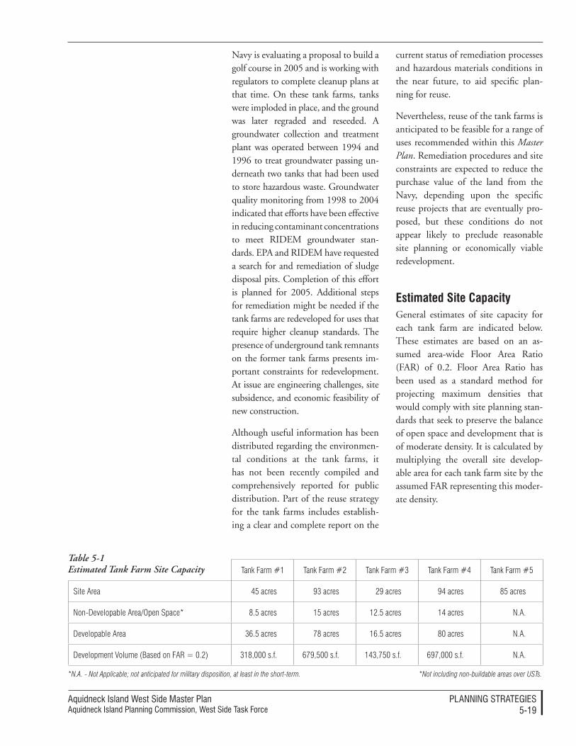
Aquidneck Island West Side Master PlanAquidneck Island Planning Commission, West Side Task Force
PlAnnIng STrATegIeS5-��
Navy is evaluating a proposal to build a golf course in 2005 and is working with regulators to complete cleanup plans at that time. On these tank farms, tanks were imploded in place, and the ground was later regraded and reseeded. A groundwater collection and treatment plant was operated between 1994 and 1996 to treat groundwater passing un-derneath two tanks that had been used to store hazardous waste. Groundwater quality monitoring from 1998 to 2004 indicated that efforts have been effective in reducing contaminant concentrations to meet RIDEM groundwater stan-dards. EPA and RIDEM have requested a search for and remediation of sludge disposal pits. Completion of this effort is planned for 2005. Additional steps for remediation might be needed if the tank farms are redeveloped for uses that require higher cleanup standards. The presence of underground tank remnants on the former tank farms presents im-portant constraints for redevelopment. At issue are engineering challenges, site subsidence, and economic feasibility of new construction.
Although useful information has been distributed regarding the environmen-tal conditions at the tank farms, it has not been recently compiled and comprehensively reported for public distribution. Part of the reuse strategy for the tank farms includes establish-ing a clear and complete report on the
current status of remediation processes and hazardous materials conditions in the near future, to aid specific plan-ning for reuse.
Nevertheless, reuse of the tank farms is anticipated to be feasible for a range of uses recommended within this Master Plan. Remediation procedures and site constraints are expected to reduce the purchase value of the land from the Navy, depending upon the specific reuse projects that are eventually pro-posed, but these conditions do not appear likely to preclude reasonable site planning or economically viable redevelopment.
estimated site CapacityGeneral estimates of site capacity for each tank farm are indicated below. These estimates are based on an as-sumed area-wide Floor Area Ratio (FAR) of 0.2. Floor Area Ratio has been used as a standard method for projecting maximum densities that would comply with site planning stan-dards that seek to preserve the balance of open space and development that is of moderate density. It is calculated by multiplying the overall site develop-able area for each tank farm site by the assumed FAR representing this moder-ate density.
Tank Farm #1 Tank Farm #2 Tank Farm #3 Tank Farm #4 Tank Farm #5
Site Area 45 acres 93 acres 29 acres 94 acres 85 acres
Non-Developable Area/Open Space* 8.5 acres 15 acres 12.5 acres 14 acres N.A.
Developable Area 36.5 acres 78 acres 16.5 acres 80 acres N.A.
Development Volume (Based on FAR = 0.2) 318,000 s.f. 679,500 s.f. 143,750 s.f. 697,000 s.f. N.A.
Table 5-1 Estimated Tank Farm Site Capacity
*N.A. - Not Applicable; not anticipated for military disposition, at least in the short-term. *Not including non-buildable areas over USTs.

Aquidneck Island West Side Master PlanAquidneck Island Planning Commission, West Side Task Force
PlAnnIng STrATegIeS5-�0
Tank Farm #5 Area: �5 acres
Assumed continued navy use.
Tank Farm #4 Area: �4 acres
non-developable Area: �4 acresdevelopable Area: �0 acresdevelopment Volume: ���,000 sf
reuse Options:• Commercial/light Industrial• Open Space• Hospitality/resort• Wind Turbines• Seasonal Outdoor Theater• residential (Affordable Housing)
Tank Farm #� Area: �� acres
non-developable Area: ��.5 acresdevelopable Area: ��.5 acresdevelopment Volume: �4�,�50 sf
reuse Options:• Waste Water Treatment Facility (+/- �0 acres)• Wind Turbines• recreation/Outdoor Theater• Open Space• Marina Accessory Uses (storage, parking)• Marine Industrial Uses
tank Farm #5
tank Farm reuse ConceptsFigure 5-4
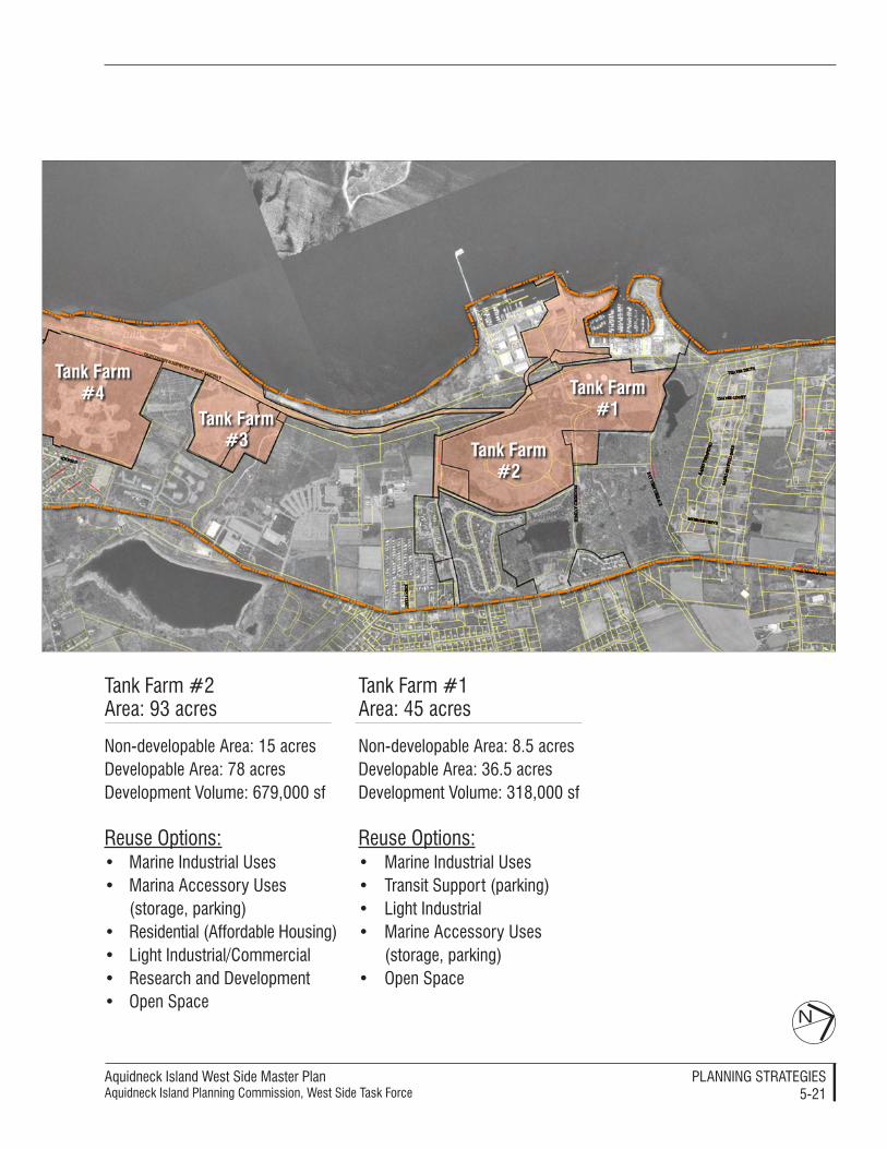
Aquidneck Island West Side Master PlanAquidneck Island Planning Commission, West Side Task Force
PlAnnIng STrATegIeS5-��
N
Tank Farm #� Area: �� acres
non-developable Area: �5 acresdevelopable Area: �� acresdevelopment Volume: ���,000 sf
reuse Options:• Marine Industrial Uses• Marina Accessory Uses (storage, parking)• residential (Affordable Housing) • light Industrial/Commercial• research and development• Open Space
Tank Farm #� Area: 45 acres
non-developable Area: �.5 acresdevelopable Area: ��.5 acresdevelopment Volume: ���,000 sf
reuse Options:• Marine Industrial Uses• Transit Support (parking)• light Industrial• Marine Accessory Uses (storage, parking)• Open Space
tank Farm #4
tank Farm #3 tank Farm
#2
tank Farm #1
Aquidneck Island West Side Master PlanAquidneck Island Planning Commission, West Side Task Force
PlAnnIng STrATegIeS5-��
Use Options for the tank FarmsDuring the course of the planning pro-cess, the reuse potential of the existing tank farms was evaluated from several vantage points. The recommendations reflect the conviction that the reuse decisions should consistently protect the long-term ability of the land to meet public needs, result in direct and indirect economic benefits and pre-serve open space. The distribution of uses within the tank farms should also serve to reinforce, support or expand desirable development patterns in their vicinity.
Site planning for reuse should begin with dedication of valuable open space for permanent conservation and contribution to the network of recre-ational opportunities along the West Side, including trails and bikeways. The tank farms are composed of ter-races cut into the hillside of the Island; their steep slopes remain wooded and should largely be preserved to serve as visual buffers and natural corridors. Where adjacent uses may be negatively affected by redevelopment, open space buffers should be retained. Previously disturbed land should be used for new development and uses, to the greatest extent practical.
Recommended land uses that should be considered as reuse options for the former tank farms consist of the fol-lowing:
• Marine Industrial Uses – Mel-ville represents an economically important cluster of marine industrial uses that have a com-petitive advantage because of the proximity to each other and the extent of available land adjacent to deep water, protected port and
marina facilities. Land should be made available (and a reason-able amount held in reserve) for expansion or new businesses and supporting functions.
• Marina Accessory Uses (Storage, Parking) – Portions of the tank farms should be made available for “backland” uses supporting nearby marinas. This could include park-ing and/or boat storage as well as other accessory uses. Availability of the tank farms for this type of use will enable other, more valu-able uses, to take advantage of adjacency to the waterfront, such as the mixed-use marina village envisioned for the edge of Weaver Cove. Land banking portions of tank farms in anticipation of long-term needs is advisable, if there is limited demand in the short term.
• Light Industrial/Commercial Uses – The tank farms offer good loca-tions for light industrial and commercial uses should there be demand. In addition to the eco-nomic advantages of these uses, they may be well suited to lower cost remediation of environmen-tal conditions than some other options that may be considered. These uses could include public works yards and facilities, con-struction layout yards and storage areas and similar facilities that are needed on the Island. Locating such uses at the tank farms (at least over the short term) may be an effective regional strategy that allows other locations to be better employed with lower impacts on their surroundings.
• Research & Development – Por-tions of the tank farms may prove to be desirable locations for re-
Aquidneck Island West Side Master PlanAquidneck Island Planning Commission, West Side Task Force
PlAnnIng STrATegIeS5-��
search and development activities due to their relative accessibility to Naval Station Newport and the Raytheon campus, the scale of the sites and the amenities found here.
• Residential (Affordable Housing) – Portions of some tank farms could be beneficially used for af-fordable housing.
• Open Space – Open space should remain as a substantial portion of the tank farms after redevelop-ment has been completed.
• Hospitality/Resort – Some of the tank farm land may be advanta-geously used in conjunction with master planned hospitality or resort development. Such devel-opment should comply with the other recommendations of this Master Plan for similar uses.
• Recreation/Outdoor Theater – As noted in the discussion of Economic Development in this section of the
Master Plan, portions of a tank farm may be appropriate to sup-port an appropriately-sized out-door theater/performance venue.
• Wastewater Treatment Plant – Land should be conserved for a potential wastewater treatment plant facility, unless and until resolution has been accomplished that it is not needed as a possible long-term option.
• Wind Turbines – As noted in the Utilities section of this Master Plan, portions of the Tank Farms may be suitable and appropriate for power-generating wind tur-bines.
• Transit Support – Land should either be used or conserved for future transit support in locations where rail or bus transit opera-tions may reasonably require.
The potential distribution of these use options are represented in Figure 5-4, Tank Farm Reuse Concepts, p. 5-20.
Aquidneck Island West Side Master PlanAquidneck Island Planning Commission, West Side Task Force
PlAnnIng STrATegIeS5-�4
Other Uses Marina and Marine-related UsesAquidneck Island makes multiple demands on its waterfront. From public access and recreation to military uses, the waterfront is pulled toward competing and sometimes conflicting ends. Changes in waterfront uses are possible, given reuse decisions linked to future Navy dispositions and rede-velopment initiatives. In consideration of these demands, it is important to ensure that land use decisions and market forces not ignore the value that the waterfront has to marine and ma-rine-related uses.
Even current regulatory requirements for waterfront development may not directly address the full range of op-portunities that appear for water-de-pendent uses on land that is outside coastal jurisdictions. In these instanc-es, supporting marine-related uses become important in order to enhance waterfront development. Supporting marine-related uses, such as mixed-use development that includes housing, restaurants, retail and other integrated uses, creates a higher level of activity and an investment opportunity that improves the project potential for public benefits and higher quality design. The uses and adjacencies could be linked through a master plan concept. This requires the appropriate performance criteria to ensure the best concept is promoted.
In addition, because of the limited market strength of marine and certain marine-related uses, the opportunities to achieve new marine-based projects may be restricted by the faster-paced real estate market that drives use of the waterfront lands. To balance against the real estate market potential, the protection of land and land-banking is
recommended. This will help preserve the areas and lands that will be most appropriate for future marine and ma-rine-related projects.
Marina and Marine-industrial proposalsAn important result of the market trends analysis was that marine in-dustrial uses represent development potential for the West Side and, in particular, for the Melville area. The existing marine trades are growing and in need for expansion. Rhode Island boat registrations indicate the presence of a strong market for slip and mooring demand. In 2002, the Rhode Island Marine Trades Associa-tion found that there was a 3000-slip waiting list in Rhode Island. Currently proposed marinas will add 3,200 boat-slips in the next few years, including a proposal for 1,500 boats in Melville (Weaver Cove). This reduces the wait-ing list, but does not consider addi-tional needs for growth. Conversations with local business representatives and landowners have provided the follow-ing information:
• O’Neill Properties Group, a devel-opment company headquartered in Pennsylvania, has purchased the Melville Boat Basin Marina, and with it a previous developer’s proposal for the construction of a 1,500 boat-slip marina in the area (the former Weaver Cove propos-al). This marina would become the largest in New England, and it would generate up to 4,500 jobs in various industries along the waterfront, according to a recent press release. The developer may also be interested in acquiring a number of upland parcels to sup-port marina expansion. They are
Aquidneck Island West Side Master PlanAquidneck Island Planning Commission, West Side Task Force
PlAnnIng STrATegIeS5-�5
considering a marina village con-cept, including trade services and boat servicing capability. They have also purchased other proper-ties including the former Kaiser Tower and cottage lots at the base of Willow Lane.
• Three local boat builders (Hinck-ley, Alden, NEB) have discussed buying Navy land adjacent to the Melville Basin if a Navy transfer of property takes place. The state EDC would take possession of the land first, and then the land would have to be sold at fair mar-ket value.
Based on this information and lon-ger-term projections for marine trade development, it can be assumed that approximately fifty to sixty acres may need to be dedicated to industrial ma-rine development in the Melville area (in addition to the proposed 1,500 boat-slip expansion of the Melville Boat Basin Marina). This amount of acreage would be needed to include:
• Potential land transfer from Tank Farm #1 (Navy) to boat builders – thirty-two acres (mid-term pro-jection).
• An additional estimate of thirty acres of land to be preserved for future marine-related industries in other tank farm areas (Tank Farms #1 and #2) that may be subject to land disposition (long-term pro-jection).
The development of a large marina at Weaver Cove and a marina/commercial village will require the support of ad-ditional inland boat storage areas and marine services. These could be ini-tially accommodated on former Tank Farms #1 and #2 as part of the above
anticipated industrial marine develop-ment. In the long term, additional space on Tank Farms #3 and #4 could also be potentially available.
Another important reuse opportunity may be represented by marina-related residential uses and affordable hous-ing. These could be located on uphill areas enjoying views and vistas of the ocean, possibly on Tank Farm #2.
Planning for the location of a poten-tial transit stop in the area, proposed by the Aquidneck Island Passenger Rail/Bicycle Path Project, is another important consideration. According to the study, the provision of twenty to thirty parking spaces with access from Stringham Road would be needed.
Land for the potential development of a wastewater treatment plant should also be reserved in the vicinity of the Melville area. This infrastructure would support new and existing uses in North Portsmouth. More detailed recommendations for water infrastruc-ture improvements are provided in the Utilities section (p. 5-87). Investiga-tions of other comparable facilities in the region indicate that approximately four acres of land would be needed. Bristol’s facility provides service for a population roughly the same size than Portsmouth, and occupies 3.98 acres, in comparison. A tentative site area of nine acres is recommended in order to provide for long-term potential expan-sion. Tank Farm #3 has been proposed as the preferred location for this facil-ity. Related land use options could also include space for wind turbines capable of generating enough power to support treatment plant operations. Additional reuse options considered for Tank Farm #3 include recreational facilities, such as an outdoor perfor-mance theater, and open space.
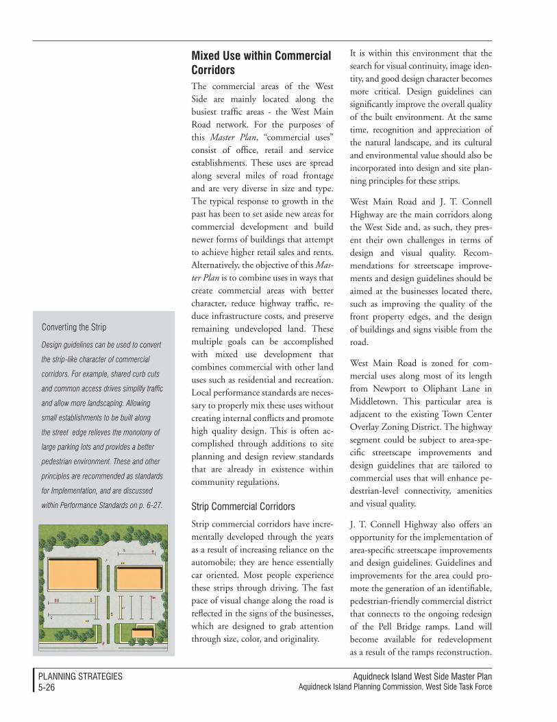
Aquidneck Island West Side Master PlanAquidneck Island Planning Commission, West Side Task Force
PlAnnIng STrATegIeS5-��
Mixed Use within Commercial CorridorsThe commercial areas of the West Side are mainly located along the busiest traffic areas - the West Main Road network. For the purposes of this Master Plan, “commercial uses” consist of office, retail and service establishments. These uses are spread along several miles of road frontage and are very diverse in size and type. The typical response to growth in the past has been to set aside new areas for commercial development and build newer forms of buildings that attempt to achieve higher retail sales and rents. Alternatively, the objective of this Mas-ter Plan is to combine uses in ways that create commercial areas with better character, reduce highway traffic, re-duce infrastructure costs, and preserve remaining undeveloped land. These multiple goals can be accomplished with mixed use development that combines commercial with other land uses such as residential and recreation. Local performance standards are neces-sary to properly mix these uses without creating internal conflicts and promote high quality design. This is often ac-complished through additions to site planning and design review standards that are already in existence within community regulations.
Strip Commercial Corridors
Strip commercial corridors have incre-mentally developed through the years as a result of increasing reliance on the automobile; they are hence essentially car oriented. Most people experience these strips through driving. The fast pace of visual change along the road is reflected in the signs of the businesses, which are designed to grab attention through size, color, and originality.
It is within this environment that the search for visual continuity, image iden-tity, and good design character becomes more critical. Design guidelines can significantly improve the overall quality of the built environment. At the same time, recognition and appreciation of the natural landscape, and its cultural and environmental value should also be incorporated into design and site plan-ning principles for these strips.
West Main Road and J. T. Connell Highway are the main corridors along the West Side and, as such, they pres-ent their own challenges in terms of design and visual quality. Recom-mendations for streetscape improve-ments and design guidelines should be aimed at the businesses located there, such as improving the quality of the front property edges, and the design of buildings and signs visible from the road.
West Main Road is zoned for com-mercial uses along most of its length from Newport to Oliphant Lane in Middletown. This particular area is adjacent to the existing Town Center Overlay Zoning District. The highway segment could be subject to area-spe-cific streetscape improvements and design guidelines that are tailored to commercial uses that will enhance pe-destrian-level connectivity, amenities and visual quality.
J. T. Connell Highway also offers an opportunity for the implementation of area-specific streetscape improvements and design guidelines. Guidelines and improvements for the area could pro-mote the generation of an identifiable, pedestrian-friendly commercial district that connects to the ongoing redesign of the Pell Bridge ramps. Land will become available for redevelopment as a result of the ramps reconstruction.
Converting the Strip
Design guidelines can be used to convert
the strip-like character of commercial
corridors. For example, shared curb cuts
and common access drives simplify traffic
and allow more landscaping. Allowing
small establishments to be built along
the street edge relieves the monotony of
large parking lots and provides a better
pedestrian environment. These and other
principles are recommended as standards
for Implementation, and are discussed
within Performance Standards on p. 6-27.
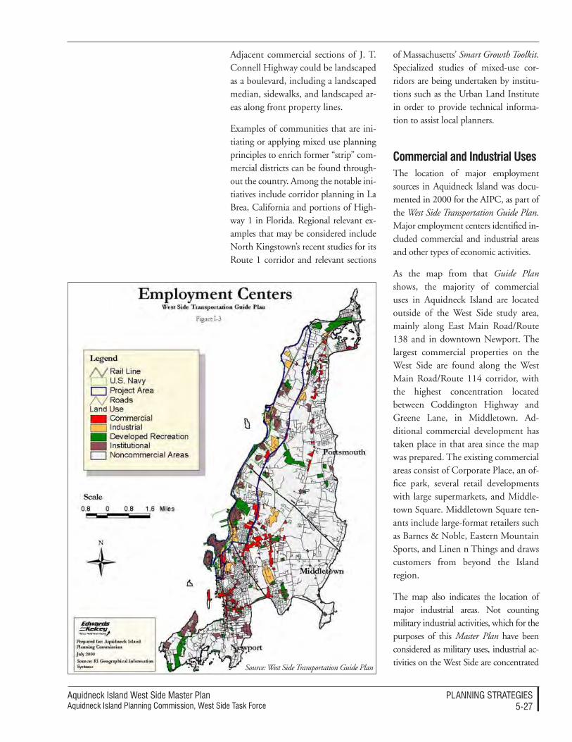
Aquidneck Island West Side Master PlanAquidneck Island Planning Commission, West Side Task Force
PlAnnIng STrATegIeS5-��
Adjacent commercial sections of J. T. Connell Highway could be landscaped as a boulevard, including a landscaped median, sidewalks, and landscaped ar-eas along front property lines.
Examples of communities that are ini-tiating or applying mixed use planning principles to enrich former “strip” com-mercial districts can be found through-out the country. Among the notable ini-tiatives include corridor planning in La Brea, California and portions of High-way 1 in Florida. Regional relevant ex-amples that may be considered include North Kingstown’s recent studies for its Route 1 corridor and relevant sections
of Massachusetts’ Smart Growth Toolkit. Specialized studies of mixed-use cor-ridors are being undertaken by institu-tions such as the Urban Land Institute in order to provide technical informa-tion to assist local planners.
Commercial and industrial UsesThe location of major employment sources in Aquidneck Island was docu-mented in 2000 for the AIPC, as part of the West Side Transportation Guide Plan. Major employment centers identified in-cluded commercial and industrial areas and other types of economic activities.
As the map from that Guide Plan shows, the majority of commercial uses in Aquidneck Island are located outside of the West Side study area, mainly along East Main Road/Route 138 and in downtown Newport. The largest commercial properties on the West Side are found along the West Main Road/Route 114 corridor, with the highest concentration located between Coddington Highway and Greene Lane, in Middletown. Ad-ditional commercial development has taken place in that area since the map was prepared. The existing commercial areas consist of Corporate Place, an of-fice park, several retail developments with large supermarkets, and Middle-town Square. Middletown Square ten-ants include large-format retailers such as Barnes & Noble, Eastern Mountain Sports, and Linen n Things and draws customers from beyond the Island region.
The map also indicates the location of major industrial areas. Not counting military industrial activities, which for the purposes of this Master Plan have been considered as military uses, industrial ac-tivities on the West Side are concentrated
Source: West Side Transportation Guide Plan
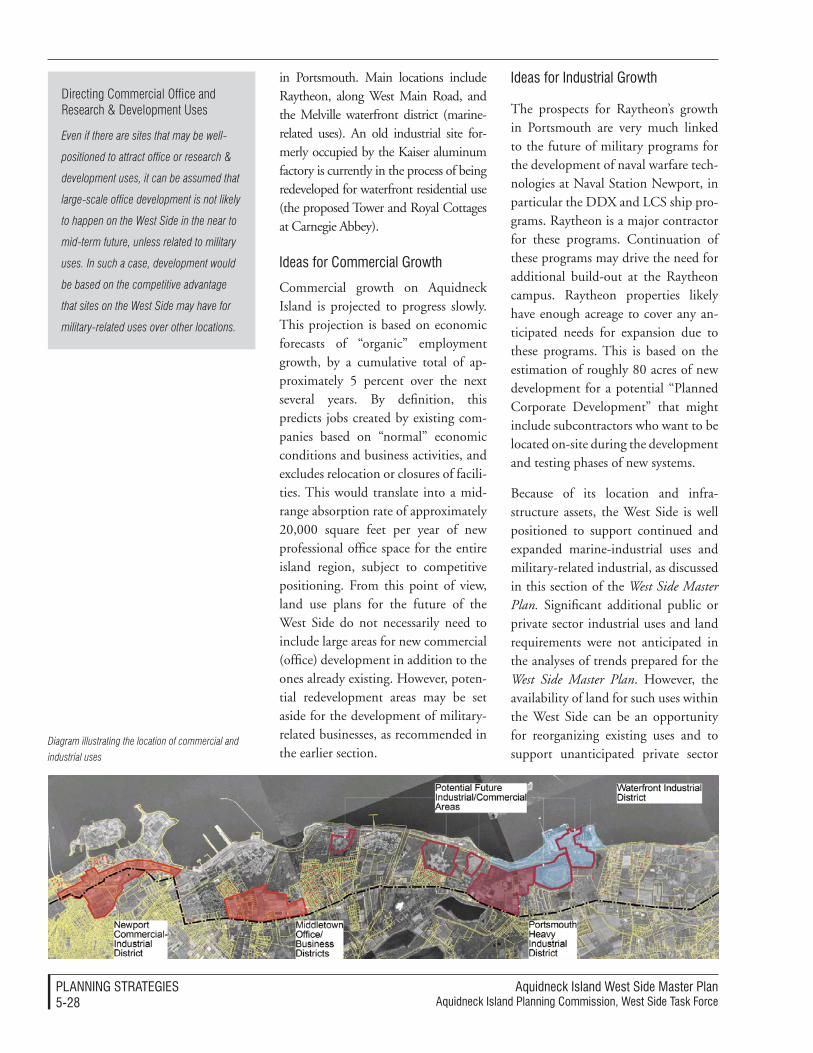
Aquidneck Island West Side Master PlanAquidneck Island Planning Commission, West Side Task Force
PlAnnIng STrATegIeS5-��
in Portsmouth. Main locations include Raytheon, along West Main Road, and the Melville waterfront district (marine-related uses). An old industrial site for-merly occupied by the Kaiser aluminum factory is currently in the process of being redeveloped for waterfront residential use (the proposed Tower and Royal Cottages at Carnegie Abbey).
Ideas for Commercial growth
Commercial growth on Aquidneck Island is projected to progress slowly. This projection is based on economic forecasts of “organic” employment growth, by a cumulative total of ap-proximately 5 percent over the next several years. By definition, this predicts jobs created by existing com-panies based on “normal” economic conditions and business activities, and excludes relocation or closures of facili-ties. This would translate into a mid-range absorption rate of approximately 20,000 square feet per year of new professional office space for the entire island region, subject to competitive positioning. From this point of view, land use plans for the future of the West Side do not necessarily need to include large areas for new commercial (office) development in addition to the ones already existing. However, poten-tial redevelopment areas may be set aside for the development of military-related businesses, as recommended in the earlier section.
Ideas for Industrial growth
The prospects for Raytheon’s growth in Portsmouth are very much linked to the future of military programs for the development of naval warfare tech-nologies at Naval Station Newport, in particular the DDX and LCS ship pro-grams. Raytheon is a major contractor for these programs. Continuation of these programs may drive the need for additional build-out at the Raytheon campus. Raytheon properties likely have enough acreage to cover any an-ticipated needs for expansion due to these programs. This is based on the estimation of roughly 80 acres of new development for a potential “Planned Corporate Development” that might include subcontractors who want to be located on-site during the development and testing phases of new systems.
Because of its location and infra-structure assets, the West Side is well positioned to support continued and expanded marine-industrial uses and military-related industrial, as discussed in this section of the West Side Master Plan. Significant additional public or private sector industrial uses and land requirements were not anticipated in the analyses of trends prepared for the West Side Master Plan. However, the availability of land for such uses within the West Side can be an opportunity for reorganizing existing uses and to support unanticipated private sector
Diagram illustrating the location of commercial and
industrial uses
Directing Commercial Office and Research & Development Uses
Even if there are sites that may be well-
positioned to attract office or research &
development uses, it can be assumed that
large-scale office development is not likely
to happen on the West Side in the near to
mid-term future, unless related to military
uses. In such a case, development would
be based on the competitive advantage
that sites on the West Side may have for
military-related uses over other locations.
Aquidneck Island West Side Master PlanAquidneck Island Planning Commission, West Side Task Force
PlAnnIng STrATegIeS5-��
uses that are also consistent with the goals and objectives for the West Side.
Such uses could include relocation of existing uses from other parts of Aquidneck Island, in order to promote a higher and better use in the original location. Examples include the use of construction supply and layout yards and support facilities for municipal Departments of Public Works.
While significant new industrial uses other than marine or military-related uses has not been anticipated, the convergence of available land and in-frastructure could attract future private sector industrial use proposals. Such proposals could be compatibly ab-sorbed within the overall land use and economic development strategy for the West Side, provided that the proposed uses meet the following criteria:
• Performance Standards - The de-velopment should meet the land use, environmental and other performance standards advocated by the West Side Master Plan and as adopted by the communities in which such development would occur.
• Phasing - Industrial uses (such as site storage, for example), might beneficially use land on a phased basis until higher and better uses are advanced that will better meet community and economic development goals. In the event that such phased use of land is contemplated, the review and ap-proval criteria should ensure that development is compatible with adjacent and nearby areas and that the land may be converted with-out significant expense for more intensive or alternative uses.
retail UsesMarket demand trends for retail uses on Aquidneck Island indicate that there is potential for the development of new retail uses, based on the analysis of net inflow/outflow of retail expend-ing. As previously mentioned, the Island serves as a major retail destina-tion for the region and beyond, with Newport attracting the majority of retail net inflow. A detailed analysis of spending vs. sales for retail categories indicates that there may be an op-portunity to capture an additional $28 million in spending, mainly in the food/groceries and general mer-chandise categories. Projections for the future, however, indicate that this potential is rather low, estimated at a need for up to a total of 70,000 square feet of new development in the near to mid-term future.
Given this analysis, the Master Plan recommends limiting new retail de-velopment, and instead proposes to steer the potential demand for new retail uses towards the redevelopment of existing commercial properties rather than the creation of new areas for future retail development. In these regards, the extension and limits of zoning districts for retail use should remain unchanged.
This recommendation has been found to be consistent with the perception and directives of members of the West Side Master Plan Task Force. They have agreed that there is already enough commercial activity on the Island and the formulation of policies aimed at encouraging redevelopment and reuse of the existing properties would be a step in the right direction.
To this extent, the AIPC and the three Island municipalities should work

Aquidneck Island West Side Master PlanAquidneck Island Planning Commission, West Side Task Force
PlAnnIng STrATegIeS5-�0
together to develop design and devel-opment review guidelines that support adaptive reuse and concentrated devel-opment. These are concepts based on general site planning and design prin-ciples that encourage redevelopment where buildings are clustered together within walking distance, while the pe-rimeter of the site is dedicated to the preservation and restoration of open space, to the extent possible.
Large developmentsLarge development projects are distinct in their impacts and execution. They afford a broader range of opportunities and higher quality results that can sup-port more public benefits. However, they are more difficult to accomplish because of their greater complexity.
The communities of Aquidneck Island should encourage managed processes that result in well-planned large de-velopments that provide the greatest public benefit without jeopardizing the project economic feasibility. For example, larger parcels provide many more options for clustering of devel-opment in order to preserve important features. This allows protection of the landscape heritage, provision for pub-lic access, improved accessibility, and protection of views. The projects can also be pragmatically held to a higher accountability for quality architectural and site design. Density bonuses can be used in these cases to obtain more public benefits, because the opportuni-ties for incorporation of additional de-velopment clusters are greater. Higher quality developments will garner higher tax benefit over time.
This Master Plan provides many implementation mechanisms to assist the communities in managing large
project development. Among the many relevant recommendations, the Implementation includes useful refer-ence to: Tools for Promoting Desirable Development Patterns, p. 6-14; Tools: Inclusionary Zoning, Inclusionary Con-ditions or Impact Fees for Affordable Housing, p. 6-33, Processes: Regional Consistency Statements, p. 6-8; Re-sources: Development Impact Fees, p. 6-38; and Large Project Development Performance Standards, p. 6-28.
Hospitality, tourism and resort Land Use In general, there is a direct relation-ship between the proximity of a ho-tel or lodging property to Newport Harbor and its average occupancy rate. During the last few years, the Middletown and Portsmouth market has under-performed Newport, and the Newport market has been unable to sustain healthy occupancy rates. These low occupancy levels are a re-sult of the highly seasonal character of tourist population on the Island. Ho-tels are full during the summer and half-vacant during the winter months (except for weekends). In spite of high seasonal demand, the relative weakness of the market during the winter precludes the potential for the development of new tourist-oriented hotels in the foreseeable future, unless new tourist amenities are created that would attract large numbers of addi-tional visitors to the Island.
However, there is some demand for increased business-type hotels, which could also be partially supported by tourism. Accompanying this type of hotel may be additional meeting or small conference spaces. This demand is not centered on Newport Harbor, but rather seems to be oriented to-
Market Structure for Hotels
The analysis of the lodging market trends
in Aquidneck Island has indicated the
presence of two distinct lodging sub-
markets – one in downtown Newport, and
the other in Middletown and Portsmouth.
Aquidneck Island West Side Master PlanAquidneck Island Planning Commission, West Side Task Force
PlAnnIng STrATegIeS5-��
wards Middletown and the northern edges of Newport, away from the tour-ist centers.
Meetings, interviews, and conversa-tions with the West Side Master Plan Steering Committee and members of the local communities have consis-tently indicated that encouraging the development of new tourist attractions on the Island is considered neither practical nor desirable. One major concern is that additional amounts of visitors would exacerbate already criti-cal problems of traffic and congestion on the Island roads, particularly during the summer.
“Heritage” tourism and amenities that emphasize and celebrate the Island’s traditions should be further encour-aged and developed, especially on the West Side. Efforts in this direction should build upon the preservation and promotion of existing histori-cal and archaeological resources. The Island communities should work together towards implementing the proposed Newport-Bristol Heritage Trail, further described in the Natural and Cultural Resources section of this Master Plan.
Resort-type land use developments are flourishing along the West Side of Aquidneck Island, taking advantage of the spectacular views, open and developable land, ability to offer rec-reational amenities and the reputation of the Island as a second home and resort location. Recent acquisitions have assembled substantial landhold-ings in Portsmouth, expanding upon the Carnegie Abbey redevelopment. In addition to the potential development of open land, this trend may unlock the long-planned marina development at Weaver Cove. The resort develop-ment provides for linked amenities in
a planned community setting, catering populations that tend to use the resorts as a second home. In this vein, “resort use” and “residential use” overlap along the West Side, and should be consid-ered from both vantage points.
Construction of new residencesThe strongest development response to the current high demand for new housing on Aquidneck Island centers on second homes and luxury resi-dences, as has been documented in the Trends report prepared for this Master Plan. This type of development is gen-erally built on the waterfront, in places that command views of the water and access to recreational amenities such as marinas, golf clubs, and shopping “vil-lages”. High premium costs are paid for these amenities, which are sought after by empty nesters and affluent householders from large metropolitan areas such as Providence, Boston and New York.
These types of development often re-quire large parcels of land located on the water or next to amenities, which are not often available. The northern portions of the study area contain loca-tions that are most likely to experience change in the near to mid-term future. Recent development projects include the Carnegie Abbey development in Portsmouth and plans for the expan-sion of the Melville Boat Basin Mari-na, which are currently underway. Ad-ditional demand for the development of luxury housing in close proximity to these amenities will likely continue, although the development of new large “lifestyle” residential complexes on the West Side may be subject to com-petitive positioning in relation to other parts of the Island. In general, the op-
Directing Residential Use
The West Side needs to establish
limitations to future residential expansion
in favor of other development and the
protection of natural resources. Most of
the existing residential districts within the
study area are close to build-out. Even
when there are real market pressures for
new development, the subdivision of more
developable land for single-family homes
would come at the expense of existing
agricultural uses and open space.
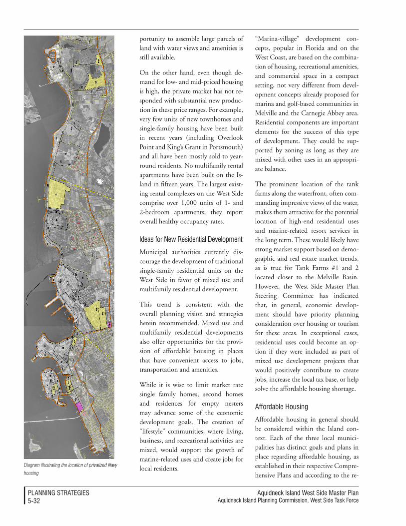
Aquidneck Island West Side Master PlanAquidneck Island Planning Commission, West Side Task Force
PlAnnIng STrATegIeS5-��
portunity to assemble large parcels of land with water views and amenities is still available.
On the other hand, even though de-mand for low- and mid-priced housing is high, the private market has not re-sponded with substantial new produc-tion in these price ranges. For example, very few units of new townhomes and single-family housing have been built in recent years (including Overlook Point and King’s Grant in Portsmouth) and all have been mostly sold to year-round residents. No multifamily rental apartments have been built on the Is-land in fifteen years. The largest exist-ing rental complexes on the West Side comprise over 1,000 units of 1- and 2-bedroom apartments; they report overall healthy occupancy rates.
Ideas for new residential development
Municipal authorities currently dis-courage the development of traditional single-family residential units on the West Side in favor of mixed use and multifamily residential development.
This trend is consistent with the overall planning vision and strategies herein recommended. Mixed use and multifamily residential developments also offer opportunities for the provi-sion of affordable housing in places that have convenient access to jobs, transportation and amenities.
While it is wise to limit market rate single family homes, second homes and residences for empty nesters may advance some of the economic development goals. The creation of “lifestyle” communities, where living, business, and recreational activities are mixed, would support the growth of marine-related uses and create jobs for local residents.
“Marina-village” development con-cepts, popular in Florida and on the West Coast, are based on the combina-tion of housing, recreational amenities, and commercial space in a compact setting, not very different from devel-opment concepts already proposed for marina and golf-based communities in Melville and the Carnegie Abbey area. Residential components are important elements for the success of this type of development. They could be sup-ported by zoning as long as they are mixed with other uses in an appropri-ate balance.
The prominent location of the tank farms along the waterfront, often com-manding impressive views of the water, makes them attractive for the potential location of high-end residential uses and marine-related resort services in the long term. These would likely have strong market support based on demo-graphic and real estate market trends, as is true for Tank Farms #1 and 2 located closer to the Melville Basin. However, the West Side Master Plan Steering Committee has indicated that, in general, economic develop-ment should have priority planning consideration over housing or tourism for these areas. In exceptional cases, residential uses could become an op-tion if they were included as part of mixed use development projects that would positively contribute to create jobs, increase the local tax base, or help solve the affordable housing shortage.
Affordable Housing
Affordable housing in general should be considered within the Island con-text. Each of the three local munici-palities has distinct goals and plans in place regarding affordable housing, as established in their respective Compre-hensive Plans and according to the re-
Diagram illustrating the location of privatized Navy
housing
Aquidneck Island West Side Master PlanAquidneck Island Planning Commission, West Side Task Force
PlAnnIng STrATegIeS5-��
will be held and operated by a private housing developer during the next 50 years. GMH, the designated opera-tional entity, has entered into an agree-ment with the Navy through which some of the houses will remain avail-able to military families, some will be demolished, and some will be traded in the private market.
Housing for military personnel will be affordable and will hopefully maintain the balance of military personnel and their families with their housing needs. The factor that could possibly alter the balance of affordable housing is the number of units that were previously controlled by the Navy and thereby kept affordable, but will be now sold on the open market. If a balance could be reached to include new affordable units within those shifted to private holdings, then local housing groups would be able to supply services and funds to “buy down” the costs of those units and the region’s housing problem would be addressed.
quirements of the Rhode Island Public General Laws. Each Town should con-tinue its efforts to reach and uphold their goals in terms of the amount of affordable housing units and their spa-tial distribution.
The Statewide Planning Program in Rhode Island requires that each Town Comprehensive Plan include an af-fordable housing plan as part of its Land Use component, and establishes requirements such as the following:
• affordable housing must meet the State definition
• a minimum of 10% affordable housing should be provided
• affordable units must remain af-fordable for not less than thirty years, enforced though a land lease and/or deed restriction en-forceable by the municipality and the state of Rhode Island
State public general laws also require that housing strategies applicable to all municipalities must address the hous-ing needs of different populations, including workers earning less than 120% of median income and their families, older citizens, college and university students, low and very low income individuals and families, and vulnerable populations.
navy Housing Privatization
The process of privatization of Navy housing currently underway for the New England region represents an op-portunity for the local municipalities to increase the supply of affordable housing and support the local military operations.
The majority of former Navy housing units will remain available to military personnel on a rental basis, but they
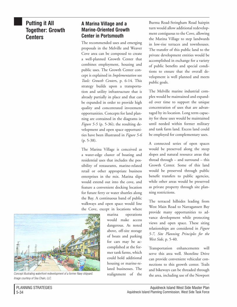
Aquidneck Island West Side Master PlanAquidneck Island Planning Commission, West Side Task Force
PlAnnIng STrATegIeS5-�4
putting it all together: growth Centers
a Marina Village and a Marine-Oriented growth Center in portsmouthThe recommended uses and emerging proposals in the Melville and Weaver Cove area can be composed to create a well-planned Growth Center that combines employment, housing and public uses. The Growth Center con-cept is explained in Implementation see Tools: Growth Centers, p. 6-14. This strategy builds upon a transporta-tion and utility infrastructure that is already partially in place and that can be expanded in order to provide high quality and concentrated investment opportunities. Concepts for land plan-ning are contained in the diagrams in Figure 5-5 (p. 5-36); the resulting de-velopment and open space opportuni-ties have been illustrated in Figure 5-6 (p. 5-38).
The Marina Village is conceived as a water-edge cluster of boating and residential uses that includes the pos-sibility of restaurants, marine-related retail or other appropriate business enterprises in the mix. Marina slips would extend out into the cove, and feature a convenient docking location for future ferry or water shuttles along the Bay. A continuous band of public walkways and open space would line the Cove, except in locations where
marina operations would make access dangerous. As noted above, off-site storage of boats and parking for cars may be ac-complished at the for-mer tank farms, which could hold additional housing or marine-re-lated businesses. The realignment of the
Burma Road-Stringham Road hairpin turn would allow additional redevelop-ment contiguous to the Cove, allowing the Marina Village to step landwards in low-rise terraces and townhouses. The transfer of this public land to the private development entities would be accomplished in exchange for a variety of public benefits and special condi-tions to ensure that the overall de-velopment is well planned and meets public goals.
The Melville marine industrial com-plex would be maintained and expand-ed over time to support the unique concentration of uses that are advan-taged by its location. Long term capac-ity for these uses would be maintained until needed within former military and tank farm land. Excess land could be employed for complementary uses.
A connected series of open spaces would be preserved along the steep slopes and natural resource areas that thread through – and surround – this Growth Center. Some of this land would be preserved through public benefit transfers to public agencies, while other areas would be preserved as private property through site plan-ning restrictions.
The terraced hillsides leading from West Main Road to Narragansett Bay provide many opportunities to ad-vance development while protecting views and open space. These siting relationships are considered in Figure 5-7, Site Planning Principles for the West Side, p. 5-40.
Transportation enhancements will serve this area well. Shoreline Drive can provide convenient vehicular con-nections to this growth center. Trails and bikeways can be threaded through the area, including use of the Newport Concept illustrating waterfront redevelopment of a former Navy shipyard.
Image courtesy of Sea Chain, LLC.
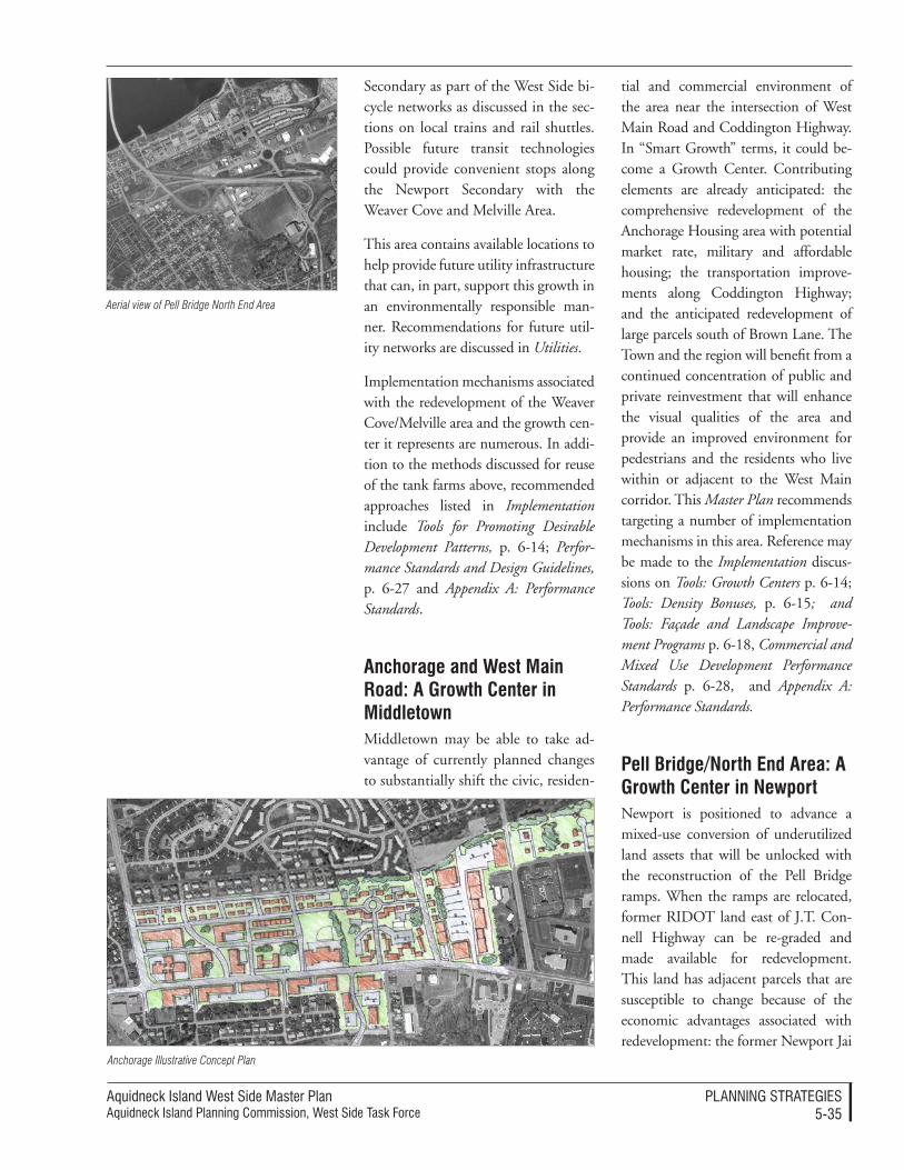
Aquidneck Island West Side Master PlanAquidneck Island Planning Commission, West Side Task Force
PlAnnIng STrATegIeS5-�5
Secondary as part of the West Side bi-cycle networks as discussed in the sec-tions on local trains and rail shuttles. Possible future transit technologies could provide convenient stops along the Newport Secondary with the Weaver Cove and Melville Area.
This area contains available locations to help provide future utility infrastructure that can, in part, support this growth in an environmentally responsible man-ner. Recommendations for future util-ity networks are discussed in Utilities.
Implementation mechanisms associated with the redevelopment of the Weaver Cove/Melville area and the growth cen-ter it represents are numerous. In addi-tion to the methods discussed for reuse of the tank farms above, recommended approaches listed in Implementation include Tools for Promoting Desirable Development Patterns, p. 6-14; Perfor-mance Standards and Design Guidelines, p. 6-27 and Appendix A: Performance Standards.
anchorage and West Main road: a growth Center in Middletown Middletown may be able to take ad-vantage of currently planned changes to substantially shift the civic, residen-
tial and commercial environment of the area near the intersection of West Main Road and Coddington Highway. In “Smart Growth” terms, it could be-come a Growth Center. Contributing elements are already anticipated: the comprehensive redevelopment of the Anchorage Housing area with potential market rate, military and affordable housing; the transportation improve-ments along Coddington Highway; and the anticipated redevelopment of large parcels south of Brown Lane. The Town and the region will benefit from a continued concentration of public and private reinvestment that will enhance the visual qualities of the area and provide an improved environment for pedestrians and the residents who live within or adjacent to the West Main corridor. This Master Plan recommends targeting a number of implementation mechanisms in this area. Reference may be made to the Implementation discus-sions on Tools: Growth Centers p. 6-14; Tools: Density Bonuses, p. 6-15; and Tools: Façade and Landscape Improve-ment Programs p. 6-18, Commercial and Mixed Use Development Performance Standards p. 6-28, and Appendix A: Performance Standards.
pell Bridge/north end area: a growth Center in newportNewport is positioned to advance a mixed-use conversion of underutilized land assets that will be unlocked with the reconstruction of the Pell Bridge ramps. When the ramps are relocated, former RIDOT land east of J.T. Con-nell Highway can be re-graded and made available for redevelopment. This land has adjacent parcels that are susceptible to change because of the economic advantages associated with redevelopment: the former Newport Jai
Aerial view of Pell Bridge North End Area
Anchorage Illustrative Concept Plan
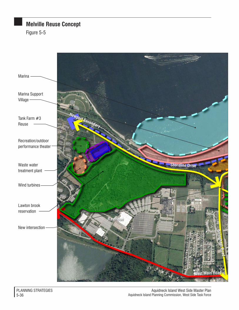
Aquidneck Island West Side Master PlanAquidneck Island Planning Commission, West Side Task Force
PlAnnIng STrATegIeS5-��
Melville reuse ConceptFigure 5-5
West Main road
raytheon
stringham road
newport secondary
Marina
Marina Support Village
recreation/outdoor performance theater
new intersection
Wind turbines
shoreline drive
Tank Farm #� reuse
Waste water treatment plant
lawton brook reservation

Aquidneck Island West Side Master PlanAquidneck Island Planning Commission, West Side Task Force
PlAnnIng STrATegIeS5-��
N
Ferry/water shuttle dock
Park
Marine industrial services
Bike path
Tank Farm #� reuse
Steep sloped woodland area to be preserved
Tank Farm #� reuse
Uphill residential development
light industrial and marine industrial services
Upper Melville
pond
Bradford road
Commercial development
Melville
West Main road

Aquidneck Island West Side Master PlanAquidneck Island Planning Commission, West Side Task Force
PlAnnIng STrATegIeS5-��
Melville illustrative Concept planFigure 5-�
Melville boat basin marina
Waste water treatment plant
Outdoor performance theater
Wind turbines
raytheon
newport secondary
shoreline drive
West Main road
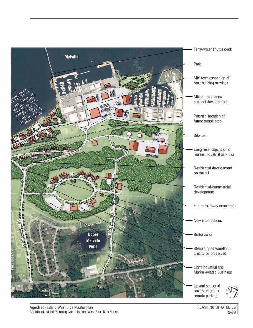
Aquidneck Island West Side Master PlanAquidneck Island Planning Commission, West Side Task Force
PlAnnIng STrATegIeS5-��
N
Ferry/water shuttle dock
Park
Mid-term expansion of boat building services
Potential location of future transit stop
long-term expansion of marine industrial services
light industrial and Marine-related Business
Bike path
Future roadway connection
Buffer zone
Mixed-use marina support development
residential development on the hill
Steep sloped woodland area to be preserved
Upland seasonal boat storage and remote parking
new intersections
residential/commercial development
Upper Melville
pond
stringham road
Bradford road
Melville
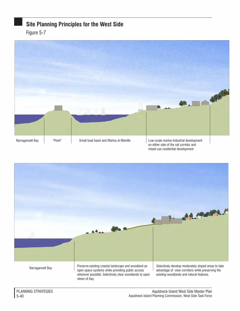
Aquidneck Island West Side Master PlanAquidneck Island Planning Commission, West Side Task Force
PlAnnIng STrATegIeS5-40
low-scale marine industrial development on either side of the rail corridor and mixed use residential development
Small boat basin and Marina at Melville“Point”narragansett Bay
Selectively develop moderately sloped areas to take advantage of view corridors while preserving the existing woodlands and natural features.
Preserve existing coastal landscape and woodland as open space systems while providing public access wherever possible. Selectively clear woodlands to open views of bay.
narragansett Bay
site planning principles for the West sideFigure 5-�
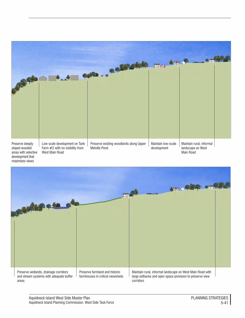
Aquidneck Island West Side Master PlanAquidneck Island Planning Commission, West Side Task Force
PlAnnIng STrATegIeS5-4�
Maintain rural, informal landscape on West Main road with large setbacks and open space provision to preserve view corridors
Preserve farmland and historic farmhouses in critical viewsheds
Preserve wetlands, drainage corridors and stream systems with adequate buffer areas
Preserve existing woodlands along Upper Melville Pond
Maintain low-scale development
Maintain rural, informal landscape on West Main road
low scale development on Tank Farm #� with no visibility from West Main road
Preserve steeply sloped wooded areas with selective development that maximizes views
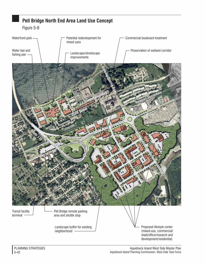
Aquidneck Island West Side Master PlanAquidneck Island Planning Commission, West Side Task Force
PlAnnIng STrATegIeS5-4�
third street
route 138
training station road
newport secondary
J.t. Connell Highway
Waterfront park
landscape/streetscape improvements
Commercial boulevard treatment
Preservation of wetland corridor
Proposed lifestyle center (mixed-use, commercial/retail/office/research and development/residential)
landscape buffer for existing neighborhood
Transit facility terminal
Pell Bridge remote parking area and shuttle stop
Potential redevelopment for mixed uses
Water taxi and fishing pier
pell Bridge north end area Land Use ConceptFigure 5-�
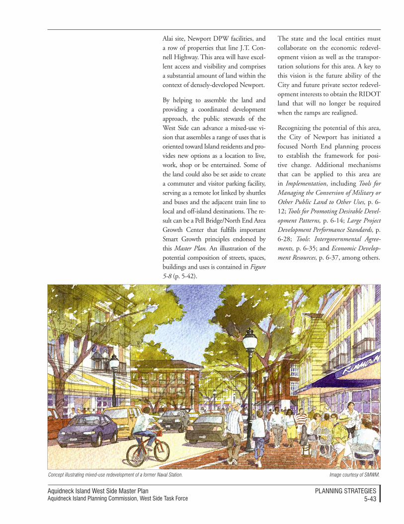
Aquidneck Island West Side Master PlanAquidneck Island Planning Commission, West Side Task Force
PlAnnIng STrATegIeS5-4�
Alai site, Newport DPW facilities, and a row of properties that line J.T. Con-nell Highway. This area will have excel-lent access and visibility and comprises a substantial amount of land within the context of densely-developed Newport.
By helping to assemble the land and providing a coordinated development approach, the public stewards of the West Side can advance a mixed-use vi-sion that assembles a range of uses that is oriented toward Island residents and pro-vides new options as a location to live, work, shop or be entertained. Some of the land could also be set aside to create a commuter and visitor parking facility, serving as a remote lot linked by shuttles and buses and the adjacent train line to local and off-island destinations. The re-sult can be a Pell Bridge/North End Area Growth Center that fulfills important Smart Growth principles endorsed by this Master Plan. An illustration of the potential composition of streets, spaces, buildings and uses is contained in Figure 5-8 (p. 5-42).
The state and the local entities must collaborate on the economic redevel-opment vision as well as the transpor-tation solutions for this area. A key to this vision is the future ability of the City and future private sector redevel-opment interests to obtain the RIDOT land that will no longer be required when the ramps are realigned.
Recognizing the potential of this area, the City of Newport has initiated a focused North End planning process to establish the framework for posi-tive change. Additional mechanisms that can be applied to this area are in Implementation, including Tools for Managing the Conversion of Military or Other Public Land to Other Uses, p. 6-12; Tools for Promoting Desirable Devel-opment Patterns, p. 6-14; Large Project Development Performance Standards, p. 6-28; Tools: Intergovernmental Agree-ments, p. 6-35; and Economic Develop-ment Resources, p. 6-37, among others.
Concept illustrating mixed-use redevelopment of a former Naval Station. Image courtesy of SMWM.

This page intentionally blank.
Aquidneck Island West Side Master PlanAquidneck Island Planning Commission, West Side Task Force
PlAnnIng STrATegIeS5-44
The discussion of economic develop-ment recommendations is preceded by advice concerning priorities that
The following priorities have been ar-ticulated because they promote a long-term balance of uses that will provide both high income jobs and diverse opportunities. They have been selected because they reinforce the existing competitive advantages associated with the cluster of businesses, activities, investments and quality of life found on the Island. In short, focusing on these priorities will bring a particularly high return for the time and resources invested. The priorities direct the stew-ards of the West Side to:
• Actively support the existing cluster of military activities and associated research and develop-ment businesses – A fundamental precept driving future decisions should be reinforcing the highly valued and unique activities as-sociated with Aquidneck Island’s largest employment sector. This priority should extend to entrepre-neurial actions that take advantage of the confluence of knowledge and technology to grow new busi-ness opportunities.
• Actively support the specialized cluster of marine-related and marina uses to the greatest extent practical and necessary to take advantage of the unique physi-cal assets and concentration of activities found along the West Side – The landside and waterside opportunities associated with the cluster of uses that can congregate
at Melville, Weaver Cove and other locations is compelling and compatible with all of the goals of this Master Plan. This priority entails pro-active steps.
• Preserve land assets that are potentially prime development opportunities for job-generat-ing development rather than maximizing short-term benefits associated with current market conditions and the high demand for housing – The opportunities to create high quality, year-round jobs is narrowly focused on spe-cialized sectors that have land, location and adjacency require-ments that are critical to success. It is wise to protect the opportuni-ties for the long term future.
• Ensure that the reuse and re-development of excessed Navy property accomplishes both lo-cal and regional economic goals as the highest priorities. Success is dependent upon a disposition process that is conducted through a coordinated plan that joins municipal consensus with the eco-nomic development interests and resources at the state and federal levels.
• Promote high value, high qual-ity tourism, resort and second home development – This type of development provides important economic benefits relative to other land use options to the extent that such development respects the en-vironmental and cultural heritage
of Aquidneck Island, expands the tourism values, creates positive fiscal benefits, and engages in co-ordinated planning.
• Promote mixed-use development that appeals to the citizens of Aquidneck Island and the qual-ity of life they seek, rather than new large scale or isolated com-mercial and retail concentration. Continued sprawl and dedication of large land parcels to retail and commercial complexes is likely to continue to degrade the image, convenience and quality of life of Island citizens over time. Given the relatively limited projected growth in demand for such uses, it is economically wiser to con-centrate development in locations that can take advantage of joint development with other uses in line with the image of village or small-city life valued by today.
• Consistently support all actions that improve the quality of life for residents of Aquidneck Is-land, including the expansion and maintenance of quality af-fordable housing. The quality of life and the quality of the environ-ment on Aquidneck Island are its greatest long term assets. This quality of life must engage people of diverse incomes and interests.
eCOnOMiC deVeLOpMent
economic priorities
should be advanced as the stewards of the West Side implement this Master Plan.
Aquidneck Island West Side Master PlanAquidneck Island Planning Commission, West Side Task Force
PlAnnIng STrATegIeS5-45
specific recommendations
naval station newportThe economic strategies that focus on Naval Station Newport provide support for ongoing activities. In the event of base realignment that brings new military or federal functions to the Base, this support should be simi-larly extended to the extent that these uses are mutually beneficial for the state, region and municipalities. This approach embraces the emerging con-cept of a “purple” military, which uses its facilities and resources to the best benefit of national security beyond the traditional limits of separate military services (Navy “blue”, Army “green”, and the other services colors).
The recommendations and associated actions include promoting effective privatization of military facilities (in-cluding the infrastructure) through efforts that achieve compatibility with the other goals of the West Side Master Plan. The Public Private Venture pro-grams (PPV) are a major benefit for continued military presence at Naval Station Newport, by reducing costs and enhancing ancillary services. There are two privatization initiatives that need to be taken into account; the first is the housing privatization cur-rently being implemented, while the second is the possible privatization of the military’s utility infrastructure.
The housing privatization program that is being implemented with GMH Housing offers significant op-portunities for mutual benefit. Both GMH and the municipalities will benefit from a planned transition pro-cess based on approved plans for the redevelopment of sites, improvement of the housing stock, and better inte-gration of amenities and services with the surrounding communities. Actions should include the following:
• A predictable and objective pro-cess should be used to establish equitable compensation and pro-vision of municipal services for all parties involved in the PPV program, including periodic re-evaluations.
• A site planning and design review program should be established either through local regulations or by agreement by all parties so that mutually beneficial design strategies can be created through a predictable process, using the per-formance standards for redevelop-ment of former military provided in the West Side Master Plan.
• Any lease of excessed land or facil-ities disposed of through the PPV process should be first offered to the host communities at market rates so that economic redevel-opment goals and/or affordable housing needs can be met.
• Any lease of excessed land or facil-ities disposed of through the PPV process that is offered through the market should first be approved through a local disposition plan that is approved by both parties and addresses the performance standards for redevelopment of former military provided in the West Side Master Plan.
The infrastructure privatization pro-gram has not been implemented at Naval Station Newport because it has been an unattractive investment from a private sector vantage point. How-ever, there may be mutual benefit in rationalizing and privately-managing a utility infrastructure if the process could extend beyond the limits of the Base. There may be an opportunity to

Aquidneck Island West Side Master PlanAquidneck Island Planning Commission, West Side Task Force
PlAnnIng STrATegIeS5-4�
repair and improve the performance of the military utility network and extend the system to serve desirable redevelop-ment of large land areas in Portsmouth, at Weaver Cove, the Melville area and the former tank farms. Actions should include the following:
• An organized dialogue that is initiated among the participants and possible beneficiaries in a rationalized and extended system, including the military, the effected municipalities and utility authori-ties and property owners.
• Funding that is sought and dedi-cated from federal sources to ex-amine the financial feasibility of a hybrid system relative to other possible alternatives.
• If opportunities are mutually ben-eficial and feasible, the constituent parties should advance a proposal and establish a PPV to implement the services.
Initiating a military-oriented Transpor-tation Management Plan (TMP) will maximize accessibility and prioritized transportation improvements for the large traffic flows associated with Na-val Station Newport. This should be coordinated with RIDOT’s active as-sistance and engage the recommended AIPC Transportation Implementation Committee to coordinate preparation of a plan. State and local funding should be employed to help imple-ment a program that would support Park and Ride opportunities, manage-ment of routes and work schedules and other measures that could help make travel to and from Naval Station New-port faster and more convenient.
Another strategy supports the reten-tion of existing dedicated military
recreation areas and provide comple-mentary public recreational amenities attractive to the personnel, employees, students and residents at Naval Station Newport. The provision of additional open space amenities and recreational assets such as bikeways and pedestrian paths along the West Side can be a shared asset.
Naval Station Newport will require the ability to flexibly shift uses to adapt to its evolving mission without interference from adjacent uses such as housing that could be resistant to changing security requirements or other constraints. This Master Plan discourages land uses adjacent to ac-tive military functions that would tend to be incompatible.
Consistent communication should be maintained about shared interests in the activities and economic impacts re-lated to the Navy’s activities. The AIPC can help provide a forum through an Intergovernmental Working Group (IWG) to advance common causes. For information on Implementation, refer to Tools: Special Area Reuse Plans, p. 6-34 and Tools: Intergovernmental Agreements, p. 6-35.
defense-related research and development The cluster of specialized defense-re-lated research and development activi-ties along the West Side involve private companies as well as federal entities. Additional private market opportuni-ties should be promoted through an ac-tive program to accomplish “technology transfer”. This term indicates the poten-tial to leverage the industry’s physical and intellectual capital (for example, skills, expertise, patents, facilities) to generate new services and products.
Aquidneck Island West Side Master PlanAquidneck Island Planning Commission, West Side Task Force
PlAnnIng STrATegIeS5-4�
This concept is can be applied along the West Side through several actions:
• Create a technology transfer center to leverage the clustered human and technical resources already as-sociated with military-research and development. The RIEDC should bring its “Innovation Factory” con-cept to Newport to assist existing businesses with new ventures, fa-cilitate local industry partnerships, encourage entrepreneurship, and generally assist in an overall effort to diversify the focus, applications, and client base of defense-related research. This initiative should also seek cross-over opportunities by assembling shared opportunities with other local industries such as health care, boat-building, and other marine-related technologies.
• Target the reuse of the former Naval Hospital as a technology transfer center using the emerg-ing “Innovation Factory” concept being advanced by RIEDC. The former Naval Hospital is likely to be released for reuse through the Housing PPV or other land disposition process. This 160,000 square foot historic complex is well located relative to the regional transportation network as well as being conveniently located near NUWC, Raytheon and other tech-nology centers. A feasibility study should be undertaken with the in-tention of acquiring the property, providing necessary improvements, attracting tenants, and putting the center into operation. The City of Newport should use its land use regulations and performance stan-dards contained in this Master Plan to encourage this economically promising opportunity.
• Support efforts by Raytheon to expand its facilities and to create facilities for related enterprises on its campus, utilizing the PUD zoning framework.
Information on technology transfer Implementation is discussed in Tools: Innovation Factory, p. 6-35; Processes: Creating a Technology Transfer Center, p. 6-36; and Performance Standards and Design Guidelines, p. 6-27.
reuse of Former Military LandIt will be important to advance the reuse of military land in the event of disposition by focusing on economi-cally beneficial uses. The economic segments and initiatives that might be associated with parcels like the Naval Hospital and former tank farms are ad-dressed as part of other economic rec-ommendations. However, the process used for land transfer has important economic implications.
To advance the land disposition pro-cess, the Island communities should use the West Side Master Plan as the basis for a reuse plan that accomplishes the necessary economic objectives and defines the process for transfer. In pre-paring for a land transfer scenario, the Aquidneck Island community must prepare a base reuse plan and designate a local redevelopment agency (LRA), approved by the federal Office of Eco-nomic Adjustment. This process must proceed swiftly. Unlike its procedures in previous base closure rounds, in this round the federal Department of Defense has been expecting to proceed quickly with public sales of property rather than engaging in extensive ne-gotiations with LRAs, if they cannot resolve local issues and present disposi-tion strategies and procedures. There-
Aquidneck Island West Side Master PlanAquidneck Island Planning Commission, West Side Task Force
PlAnnIng STrATegIeS5-4�
fore, in the event of a disposition, the Island communities must prepare a reuse plan that:
• designates land uses for the military property that remains unclaimed by federal agencies and homeless providers, pursuant to land disposition procedures; and
• sets forth a clear process for dispo-sition, identifying properties to be conveyed at public sale, properties to be used to provide public ben-efits (for example, recreational fa-cilities, educational facilities), and properties allocated for economic development purposes.
For information on Implementation, consult Tools: Local Redevelopment Au-thorities (LRAs), p. 6-12; Tools: Special Area Reuse Plans, p. 6-34; and Tools: Intergovernmental Agreements, p. 6-35.
Marine-related Business and recreational BoatingWhile the boat-building industry has not shown high growth trends in re-cent years, Rhode Island’s critical mass of service providers (for example, yacht design, outfitting, and brokerage busi-nesses) that support the existing sailing and yachting community provide an asset for further development. Much of this activity is co-located with either marinas or shipbuilding facilities, as in the Melville district. This Master Plan seeks to build upon Aquidneck Island’s strong and growing local marina sector, ongoing strength in local shipbuilding, and Aquidneck Island’s continued brand presence as one of the premiere yachting regions of the world. Work-ing with these advantages, this Master Plan seeks to promote Aquidneck Is-land as a location that can capture an
increasing share of the regional market for builders as well as related businesses involved in boat repair, boat parts and retrofitting, boat financing, insurance, and the like. In targeting this objective, the following must be addressed:
The marine-related trades established in the Study Area include boat-build-ing and various service uses. These uses face formidable competition for waterfront land. The uses such as those established at the Melville basin area generate relatively low financial returns as compared to waterfront resi-dential or commercial developments. Consequently, any effort to maintain these uses will require the stewards of the West Side to take the following proactive steps:
• Reserve land for marine-related uses – through purchase and/or regulation – in areas with access to the water and the backland facilities. Initial investigations in-dicate that roughly 30 acres in the near-term and an additional land area of 30 acres should provide an ample land inventory over the next 15 to 20 years.
• Reserve land for accessory uses, most likely involving upland boat storage, boatyard services, and re-mote parking for marina use.
• Promote marine-related training and information exchange through the Community College of Rhode Island, Newport County Campus (CCRI). Ongoing communica-tions with the marine trades industry to identify labor issues, skills training issues, and training programs, and other needs might be coordinated through this new local campus resource.
1 Aquidneck Island’s Economic Clusters: An Analysis, University of Rhode Island, Rhode Island Economic Development Commission, 2002.
Serving the Sea
Marine–related businesses comprise
an important component of Aquidneck
Island’s and Narragansett Bay’s economy
– accounting for 22 percent of local
employment according to a recent study1
– as well as its local culture. Given the
importance of this sector, this plan seeks
to preserve Aquidneck Island’s marine-
related business base and maritime
heritage.
Aquidneck Island West Side Master PlanAquidneck Island Planning Commission, West Side Task Force
PlAnnIng STrATegIeS5-4�
Aquidneck Island may be able to cap-ture a larger share of marine-related industries. In addition to various boat building niches, the area’s access to water and its mass of boat service in-dustries will benefit from an increased number of boats in the area. This number can be increased through the following:
• Facilitate marina development, through local policies focusing on permitting of upland as well as waterside improvements and pro-mote marina-supporting upland resort development that enhance the investment opportunities through a mixed-use approach. By capitalizing on the strong demand for new second-home development, suitable areas could be allocated as strategic land areas. Full-service, mixed-use marina vil-lage areas offering access to high-quality marinas as well as other amenities could cater to those affluent persons seeking leisurely lifestyle alternatives. By providing this residential feature, the Island would help keep high-end, lo-cally-purchased boats in the area, thus fueling increased demand for services, parts and other such employment.
• Promulgate marine-related land and development performance standards through zoning, zoning overlays, or direct involvement in an LRA to manage growth. These actions will protect waterfront land against highly profitable residential development and other high-value waterfront uses. Such zoning schemes have helped maintain the depth and breadth of marine-related uses in Annapolis, Maryland. The overlay should
contain land use regulatory re-strictions as well as tax incentives, which might include “current use” provisions, tax abatement, and marine-based business tax exemp-tions. Given the dwindling avail-ability of water-accessible land for boat-building/servicing industries, such measures will give Aquidneck Island an increasingly important regional and national competitive advantage in capturing greater shares of these industries.
• Promote the use of the State’s Proj-ect of Critical Economic Concern (CEC) mechanism that is already available to accelerate marina and marina-village development.
Implementation suggestions for marina and marine-related uses are Processes: Special Area Management Planning (SAMP), p. 6-18; Standards: Marina and Marine-Related Uses, p. 6-29; and Tools: Projects of Critical Economic Con-cern, p. 6-33, among others.
tourism and recreationDespite its importance to the local economy, the trends analyses presented earlier in this Master Plan identify tour-ism as an industry with modest growth trends and prospects. Notwithstanding these findings, this Master Plan attri-butes the weakness of these outlooks to the somewhat limited focus associated with current attractions and support-ing uses. By diversifying the character and locations of the Island’s tourism amenities, this Master Plan seeks to promote additional growth in tourism/recreational development.
The economic strategy for the West Side should facilitate marina and marina-related upland resort devel-opments. Marina development and
Aquidneck Island West Side Master PlanAquidneck Island Planning Commission, West Side Task Force
PlAnnIng STrATegIeS5-50
boater-focused resorts are likely to enjoy strong market support, and will enhance an already-strong market for second-home, affluent householders. While typical visitors currently spend money on dining, accommodations, and souvenirs, the increased presence of second-homes – rather than addi-tional lodging facilities – will increase visitor spending and diversity such spending to items such as home im-provement products, furnishings, gro-ceries and boating services and supplies for marina resort developments.
The strategy includes developing portions of a heritage/recreational trail along the West Side. Aquidneck Island’s current tourism amenities cluster around Newport Harbor and the Newport Mansions. Despite its rich array of historic features and scenic qualities, Aquidneck Island’s towns currently offer limited exposure to such amenities, as well as limited opportunities for active outdoor activi-ties. Specific components of this trail concept should include:
• Development of a high quality graphic system for identification and interpretation of area heri-tage and recreational resources. The system should be graphically linked to a West Side way-finding system, which will direct seasonal travelers along the north/south corridors to better distribute traf-fic and direct motorists to transit alternatives.
• Commitment to a multi-year pro-motional and informational pro-gram to market the trail system.
Development opportunities may be revealed by investigating the potential for a multi-purpose/arts/entertainment facility and advance its development in
a location that is well served by parking and transit. While Aquidneck Island’s tourism attractions currently focus on historic mansions, sailing, and dining, its proximity to Providence and Bos-ton, combined with its scenic/resort qualities, give it a strong location for large-scale entertainment venues. De-spite Newport’s music festivals and its active arts community, the Island does not contain adequate venues to host events and/or educational programs. Given its array of historic, scenic, and waterfront amenities, areas targeted for mixed-use development could present excellent opportunities for such development. For Implementa-tion suggestions, see Processes: Heritage Trail/Tourism Programs, p. 6-37 and Standards: Commercial and Mixed Use Development, p. 6-28.
affordable Housing as an economic strategyThe need for affordable housing should be advanced within the West Side as part of the overall economic strategy. This approach fulfills social needs and community goals of di-versity. In addition, the provision of affordable housing is directly linked to the ability of the Island to support the range of employment opportuni-ties needed to fulfill the vision for the West Side. This Master Plan promotes the development of affordable housing by leveraging the transfer and redevel-opment of publicly owned land. The prospective transfers of large land areas and former military housing under the auspices of BRAC, PPV or other ini-tiatives, open a doorway for providing affordable housing. There are many ways in which internal subsidies and external resources can be combined to provide below-market unit costs.
Aquidneck Island West Side Master PlanAquidneck Island Planning Commission, West Side Task Force
PlAnnIng STrATegIeS5-5�
These include utilizing regionally-available subsidies linked to Newport’s Hope VI project commitments. Infor-mation on Implementation includes Tools: Provision of Affordable Housing as a Condition on Approval of PPV Housing Redevelopment, p. 6-33 and Tools: Inclusionary Zoning, Inclusionary Conditions or Impact Fees for Affordable Housing, p. 6-33.
Mixed-use “Lifestyle Center” developmentAs discussed in the Growth Center concept for Newport, the anticipated realignments to the Pell bridge access ramps will create substantial new de-velopment parcels. Given its general location and size, over time this prop-erty will likely present an attractive development opportunity. While the housing market offers the strongest short-term opportunities, this property should more appropriately be reserved for developments that can provide amenities, contribute new elements or fill unserved niches in the community. Such niches offering potential include health care or fitness-related facilities, entertainment venues, office uses, as well as housing, supportive retail uses, and other complementary uses, such as recreation. Properties such as this present rare opportunities for the Aquidneck Island community and should be reserved for developments that can serve the economic and com-munity values supported within this overall plan, rather than to serve more easily identified development solutions that provide shorter-term answers.
entertainmentCertain types of entertainment venues may comprise a “niche” market op-portunity that could be supported in
appropriate locations along the West Side. While Aquidneck Island’s tour-ism currently focuses on such attrac-tions as historic mansions, sailing, and dining, its proximity to Providence and Boston and scenic/resort qualities make the West Side a viable candidate for some types of entertainment ven-ues. Despite Newport’s large music festivals and its active arts community, the Island does not contain practical moderate scale venues to host regular performances or arts-oriented events and/or educational programs. Wolf Trap in Virginia and Tanglewood in Massachusetts are examples of attrac-tive venues in communities that have built reputations as arts-related desti-nations. Given its array of historic, scenic, and waterfront amenities, areas targeted for resort-related, or mixed-use development along the waterfront could present excellent opportunities for such facilities. Redevelopment of one of the tank farms with such an entertainment venue should be con-sidered, among other options.
Commercial Offices and Health CareThe health care industry may offer opportunities for additional growth and development. While such do not present immediate, large-scale devel-opment opportunities, the West Side Study could most likely support addi-tional health care-related development over intermediate and long-term time frames. In encouraging this growth, it should identify locations for medical office development, and possibly for outpatient service centers. Such loca-tions are likely to include locations in the northern segments of the West Side corridor, as well as locations in or near new mixed-use developments.
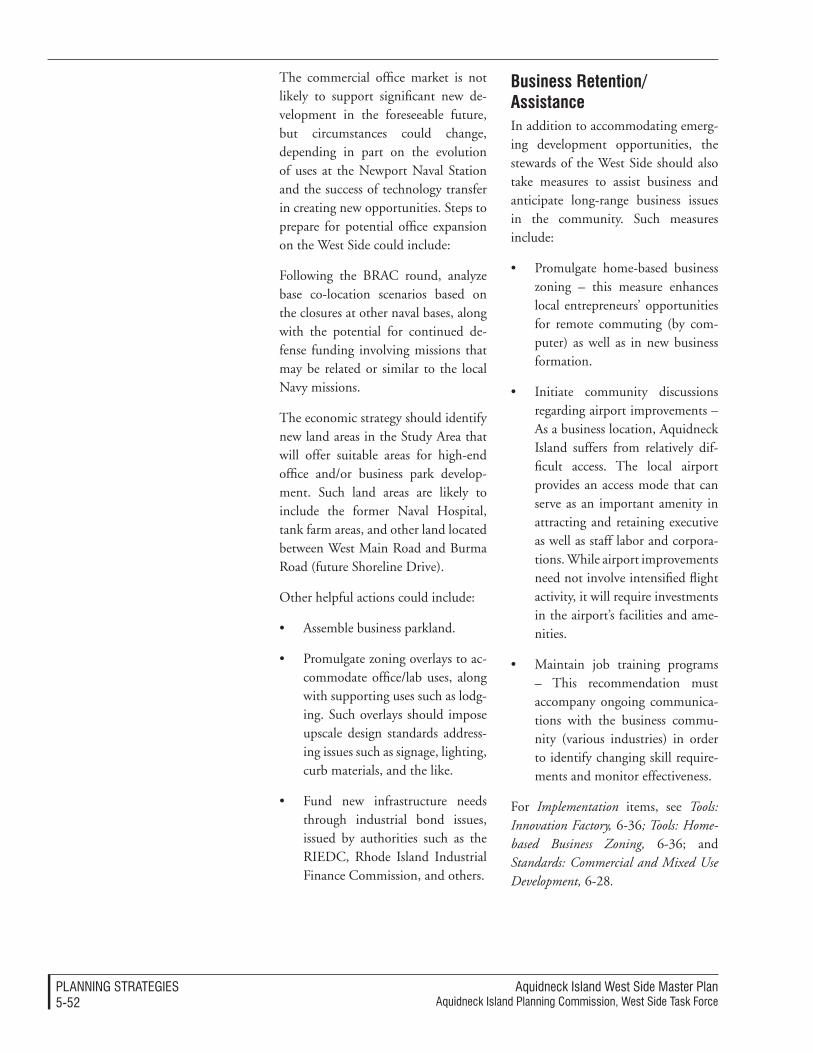
Aquidneck Island West Side Master PlanAquidneck Island Planning Commission, West Side Task Force
PlAnnIng STrATegIeS5-5�
The commercial office market is not likely to support significant new de-velopment in the foreseeable future, but circumstances could change, depending in part on the evolution of uses at the Newport Naval Station and the success of technology transfer in creating new opportunities. Steps to prepare for potential office expansion on the West Side could include:
Following the BRAC round, analyze base co-location scenarios based on the closures at other naval bases, along with the potential for continued de-fense funding involving missions that may be related or similar to the local Navy missions.
The economic strategy should identify new land areas in the Study Area that will offer suitable areas for high-end office and/or business park develop-ment. Such land areas are likely to include the former Naval Hospital, tank farm areas, and other land located between West Main Road and Burma Road (future Shoreline Drive).
Other helpful actions could include:
• Assemble business parkland.
• Promulgate zoning overlays to ac-commodate office/lab uses, along with supporting uses such as lodg-ing. Such overlays should impose upscale design standards address-ing issues such as signage, lighting, curb materials, and the like.
• Fund new infrastructure needs through industrial bond issues, issued by authorities such as the RIEDC, Rhode Island Industrial Finance Commission, and others.
Business retention/assistance In addition to accommodating emerg-ing development opportunities, the stewards of the West Side should also take measures to assist business and anticipate long-range business issues in the community. Such measures include:
• Promulgate home-based business zoning – this measure enhances local entrepreneurs’ opportunities for remote commuting (by com-puter) as well as in new business formation.
• Initiate community discussions regarding airport improvements – As a business location, Aquidneck Island suffers from relatively dif-ficult access. The local airport provides an access mode that can serve as an important amenity in attracting and retaining executive as well as staff labor and corpora-tions. While airport improvements need not involve intensified flight activity, it will require investments in the airport’s facilities and ame-nities.
• Maintain job training programs – This recommendation must accompany ongoing communica-tions with the business commu-nity (various industries) in order to identify changing skill require-ments and monitor effectiveness.
For Implementation items, see Tools: Innovation Factory, 6-36; Tools: Home-based Business Zoning, 6-36; and Standards: Commercial and Mixed Use Development, 6-28.
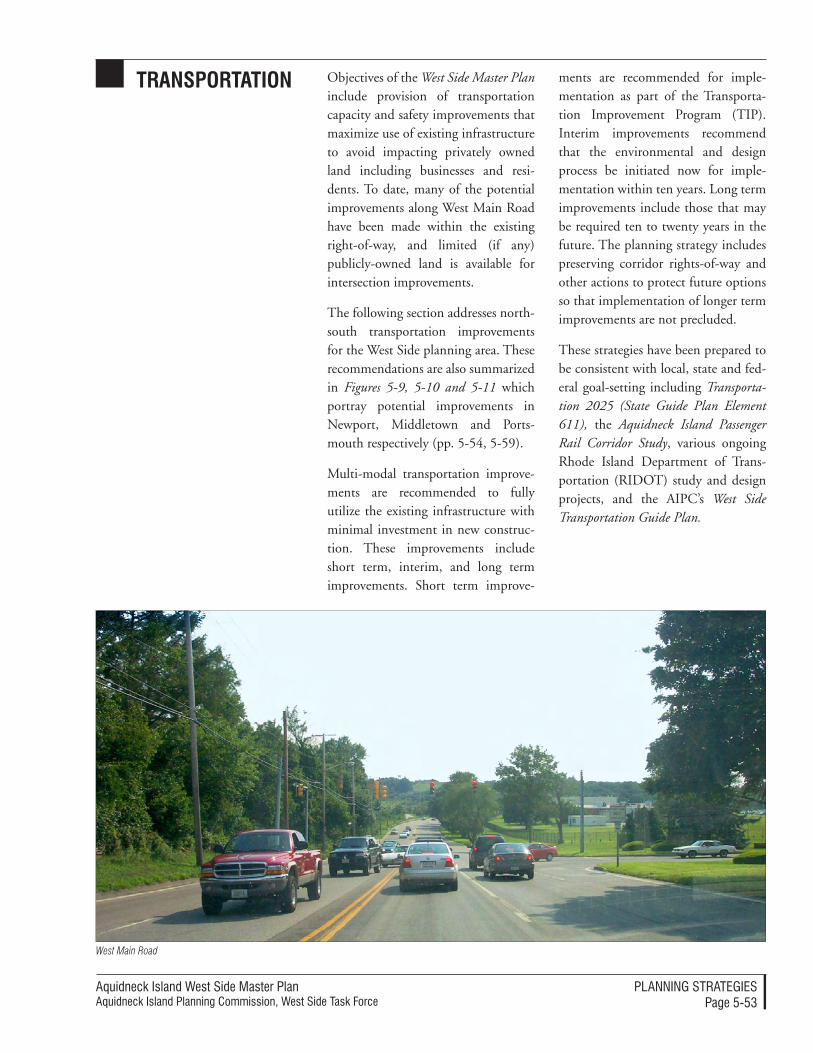
Aquidneck Island West Side Master PlanAquidneck Island Planning Commission, West Side Task Force
PlAnnIng STrATegIeSPage 5-53
transportation Objectives of the West Side Master Plan include provision of transportation capacity and safety improvements that maximize use of existing infrastructure to avoid impacting privately owned land including businesses and resi-dents. To date, many of the potential improvements along West Main Road have been made within the existing right-of-way, and limited (if any) publicly-owned land is available for intersection improvements.
The following section addresses north-south transportation improvements for the West Side planning area. These recommendations are also summarized in Figures 5-9, 5-10 and 5-11 which portray potential improvements in Newport, Middletown and Ports-mouth respectively (pp. 5-54, 5-59).
Multi-modal transportation improve-ments are recommended to fully utilize the existing infrastructure with minimal investment in new construc-tion. These improvements include short term, interim, and long term improvements. Short term improve-
ments are recommended for imple-mentation as part of the Transporta-tion Improvement Program (TIP). Interim improvements recommend that the environmental and design process be initiated now for imple-mentation within ten years. Long term improvements include those that may be required ten to twenty years in the future. The planning strategy includes preserving corridor rights-of-way and other actions to protect future options so that implementation of longer term improvements are not precluded.
These strategies have been prepared to be consistent with local, state and fed-eral goal-setting including Transporta-tion 2025 (State Guide Plan Element 611), the Aquidneck Island Passenger Rail Corridor Study, various ongoing Rhode Island Department of Trans-portation (RIDOT) study and design projects, and the AIPC’s West Side Transportation Guide Plan.
West Main Road
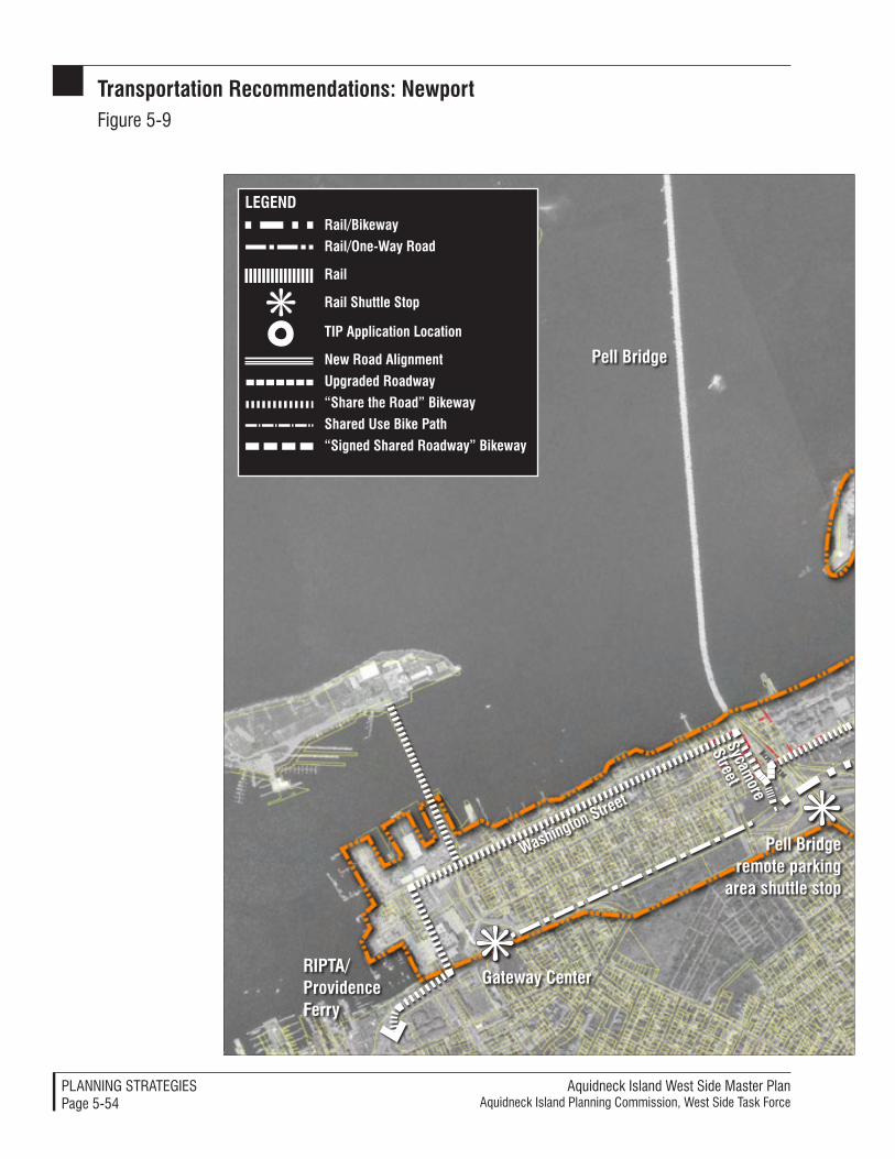
Aquidneck Island West Side Master PlanAquidneck Island Planning Commission, West Side Task Force
PlAnnIng STrATegIeSPage 5-54
pell Bridge remote parking
area shuttle stop
Gateway Centerripta/providence Ferry
pell Bridge
Washington street
sycamore
street
rail/Bikeway
rail/one-Way road
rail
rail shuttle stop
tip application Location
new road alignment
Upgraded roadway
“share the road” Bikeway
shared Use Bike path“signed shared roadway” Bikeway
LEGEnD
transportation recommendations: newportFigure 5-9
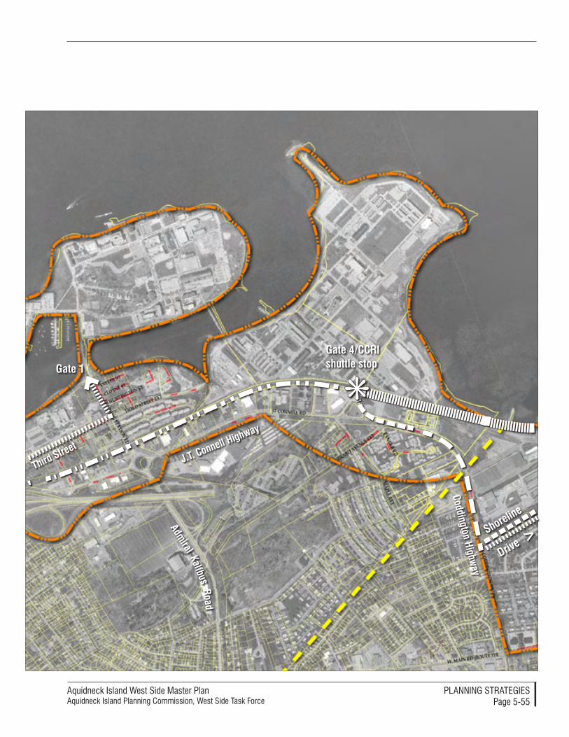
Aquidneck Island West Side Master PlanAquidneck Island Planning Commission, West Side Task Force
PlAnnIng STrATegIeSPage 5-55
Gate 1
Gate 4/CCri shuttle stop
Coddington Highway
J.t. Connell Highway
third street
admiral
roadKalfbus
shoreline
Drive >
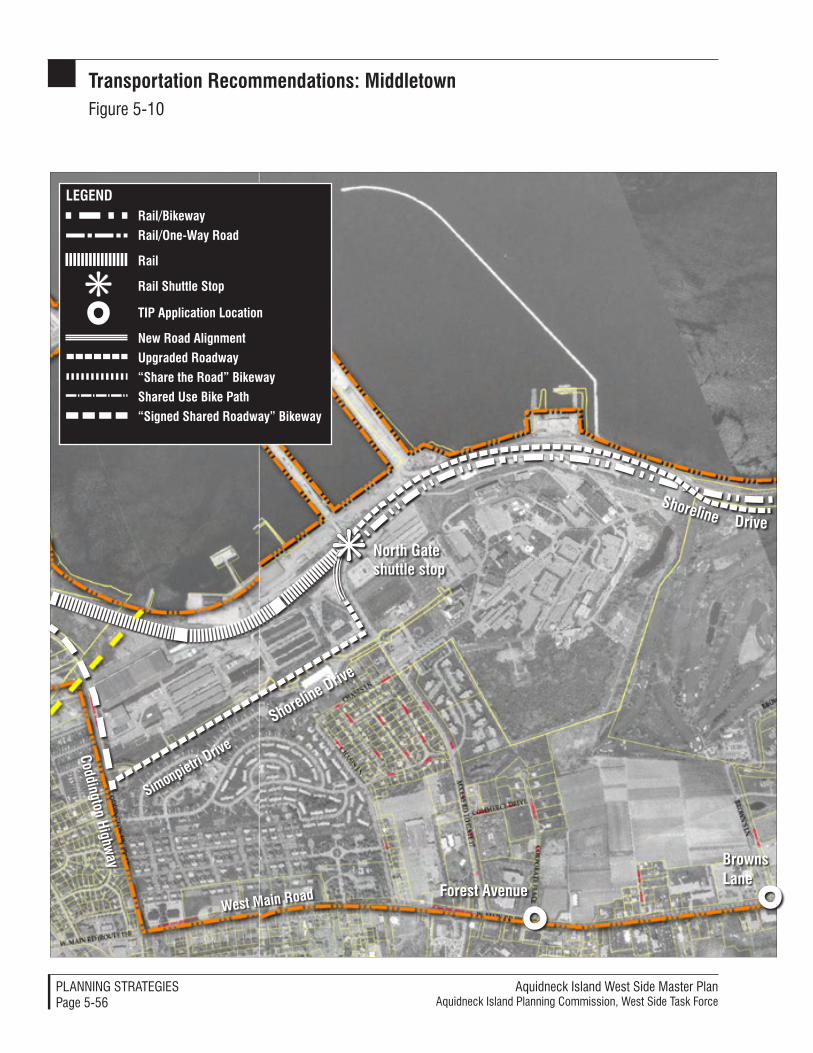
Aquidneck Island West Side Master PlanAquidneck Island Planning Commission, West Side Task Force
PlAnnIng STrATegIeSPage 5-56
transportation recommendations: MiddletownFigure 5-10
Forest avenue
north Gate shuttle stop
West Main road
Coddington Highway
rail/Bikeway
rail/one-Way road
rail
rail shuttle stop
tip application Location
new road alignment
Upgraded roadway“share the road” Bikewayshared Use Bike path
“signed shared roadway” Bikeway
LEGEnD
shoreline Drive
simonpietri Drive
Drive
shoreline
BrownsLane
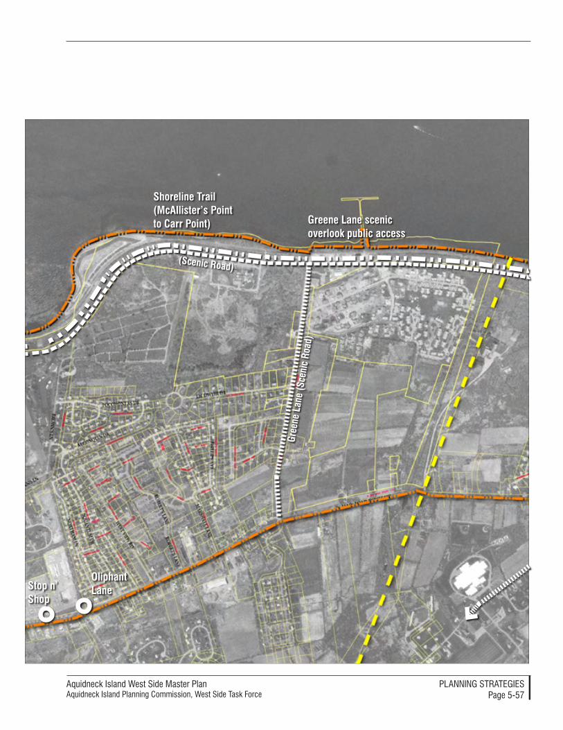
Aquidneck Island West Side Master PlanAquidneck Island Planning Commission, West Side Task Force
PlAnnIng STrATegIeSPage 5-57
oliphant Lane
(scenic road)
Gree
ne L
ane
(sce
nic
road
)
shoreline trail (Mcallister’s point to Carr point) Greene Lane scenic
overlook public access
stop n’ shop
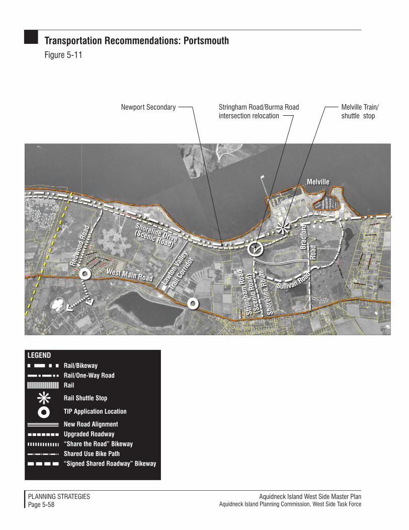
Aquidneck Island West Side Master PlanAquidneck Island Planning Commission, West Side Task Force
PlAnnIng STrATegIeSPage 5-58
transportation recommendations: portsmouthFigure 5-11
(scenic road)
redw
ood
road
Lawt
on V
alley
trai
l Cor
ridor
Stringham road/Burma road intersection relocation
newport Secondary Melville Train/shuttle stop
strin
gham
roa
d
(sce
nic
road
)West Main road
Brad
ford
ro
ad
rail/Bikeway
rail/one-Way road
rail
rail shuttle stop
tip application Location
new road alignment
Upgraded roadway
“share the road” Bikeway
shared Use Bike path“signed shared roadway” Bikeway
LEGEnD
shoreline Drive
shor
elin
e ro
ute
sullivan road
Melville
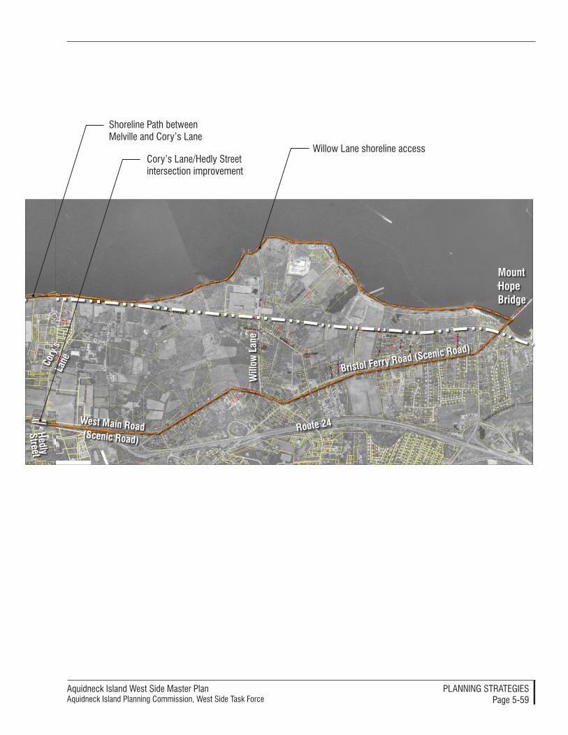
Aquidneck Island West Side Master PlanAquidneck Island Planning Commission, West Side Task Force
PlAnnIng STrATegIeSPage 5-59
Shoreline Path between Melville and Cory’s lane
West Main road(scenic road)
Bristol Ferry road (scenic road)
Mount Hope Bridge
route 24
Will
ow L
ane
Willow lane shoreline access
Cory
’s
Lane
Hedly street
Cory’s lane/Hedly Street intersection improvement
Aquidneck Island West Side Master PlanAquidneck Island Planning Commission, West Side Task Force
PlAnnIng STrATegIeSPage 5-60
roadways and streets
There are a number of ongoing trans-portation improvement projects being advanced by RIDOT that can help accomplish the vision of the West Side Master Plan as they are designed and constructed. Part of the pragmatic transportation planning strategy is to influence several ongoing study and design projects to assure that recom-mendations of the West Side Master Plan are integrated into them.
ongoing projectsRIDOT has several ongoing projects in the West Side. The following gen-eral positions are advocated as AIPC comment to RIDOT:
Pell Bridge ramp realignment
RIDOT is currently considering the right-of-way and real estate issues asso-ciated with two alternatives. Realign-ing the Pell Bridge Ramp, Concept-4A2 (VHB 3/11/03), represents the preferred alternative to simplify access to Island destinations including down-town Newport and the Navy property, improve safety, and open up land for private development. Constructing this alignment would facilitate mode-transfer integration from private ve-hicles to bus, rail or bikeway. A remote parking lot would provide seasonal parking during the peak tourism sea-son and facilitate access to Newport events such as the Jazz and Folk Fes-tivals, Tall Ships, and July Fourth fire-works. This seasonal lot could be sur-faced with porous pavers to minimize stormwater runoff. Safe pedestrian access must be provided to a busway or rail shuttle station located west of and immediately adjacent to the eastbound off-ramp to Newport and the Newport Secondary. A one-way southbound roadway, located within the right-of-
way of the Newport Secondary, is pro-posed to provide direct traffic access to downtown Newport.
The West Side Master Plan advocates that a priority be placed on reserving the Newport Secondary right-of-way between the Pell Bridge and the Gate-way Center for rail and transit service. The one-way southbound road could be used by buses in the southbound direction (northbound busway service would use local roads including Amer-ica’s Cup Avenue and Farewell Street). Construction of the roadway should not affect operation of the Old Colony and Newport Railway and Newport Dinner Train in this section. If suf-ficient right-of-way is available, a bike path could also be considered. This would be a lower priority as cyclists may choose an alternative route via lo-cal streets in the Point neighborhood.
For information on coordination, BRT and bikeway implementation, see Processes: RIDOT Endorsement and Regional Input, p. 6-48; and Standards: RIDOT Criteria and Standards for Bi-cycle Network Designation, p. 6-51.
Coddington Highway/J.T. Connell Highway
RIDOT is reviewing several proposals including RIDOT’s preferred four-lane undivided roadway with left turn lanes at signalized intersections. The Pell Bridge Alignment must be finalized prior to proceeding with the concept for this project. This Master Plan in-cludes recommendations for this area that reinforce the opportunity to create an attractive “boulevard” appearance and a pedestrian-friendly edge along both sides of the roadway. A boule-vard would be created with robust landscaping along the side of the street and not with a landscaped median.
Aquidneck Island West Side Master PlanAquidneck Island Planning Commission, West Side Task Force
PlAnnIng STrATegIeSPage 5-61
The cross sections in Figure 5-12 (p. 5-62) portray these ideas. This concept would restrain lane width to 11 feet (reduced from the 12-foot AASHTO standard in accordance with Context Sensitive Design) to accommodate a 2-foot textured pavement between travel directions for traffic calming. No addi-tional right-of-way would be required for the textured median compared to the RIDOT preferred alignment.
Assuming that bike path recommenda-tions of the Aquidneck Island Passenger Rail Study are implemented with con-struction of a bike lane along the New-port Secondary south of Gate 4, curb offsets should be reduced to three feet south of Gate 4 and increased to five feet north of Gate 4 to accommodate “signed shared roadway” bike access. Crosswalks with neckdowns should be provided at signalized intersections at CCRI/Gate 4 and at the RK Town Center to improve pedestrian safety, increase mobility, and decrease pave-ment width.
There is a current plan to close off the northern end of Girard Avenue (between Maple Avenue and Codding-ton Highway). Closing Girard Avenue will create an additional amount of traffic at the newly constructed John F. Chafee Boulevard intersection with Coddington Highway. Although this intersection does not currently meet signal warrants, RIDOT will install signal conduits as part of a roadway upgrade. A roundabout could be con-sidered at this intersection to avoid the need for a signal.
A uniform five feet of grass or land-scaping should separate the curb from a five-foot sidewalk. Any utility poles relocated as part of this project should be located between the sidewalk and the adjacent property if sufficient
right-of-way is available. In areas with constrained right-of-way, poles should be located within the landscaped area between the curb and the sidewalk. Curb cuts should be reduced to one, or at most two, access point from the roadway to each property. The Imple-mentation discussion on Standards: General Principles of Design provides further access management recom-mendations for redeveloped property. For ideas regarding RIDOT coordina-tion, bikeways and roadway landscape standards refer to Processes: RIDOT En-dorsement and Regional Input, p. 6-48; Processes: Bicycle Route Suitability Re-ports, p. 6-49; Standards: RIDOT Cri-teria and Standards for Bicycle Network Designation, p. 6-51; and Standards: Scenic Roadways and Vistas, p. 6-30.
Armstrong Bridge replacement/gate 4 Access
It is recommended that improvements to this Coddington Highway intersec-tion include adequate pedestrian cross-walks, a connection from a “signed shared roadway” bikeway on Highway to the Newport Secondary, and that land be reserved for future construc-tion of a transit stop and passenger drop off area. See Processes: RIDOT Endorsement and Regional Input, p. 6-48 for Implementation.
West Main road, Coddington High-way to east Main road
RIDOT is proceeding with design im-provements for this congested roadway segment. This project is currently at the 75% design stage. East Main Road construction must be completed prior to proceeding with this West Main Road project. It is recommended that left turn lanes, pedestrian crossings and sidewalks be included as part of the project design. The addition of a
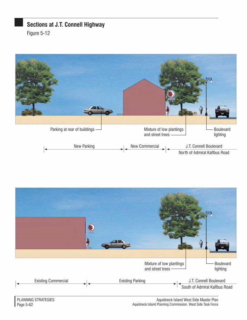
Aquidneck Island West Side Master PlanAquidneck Island Planning Commission, West Side Task Force
PlAnnIng STrATegIeSPage 5-62
sections at J.t. Connell HighwayFigure 5-12
existing Parkingexisting Commercial
Mixture of low plantings and street trees
Boulevard lighting
J.T. Connell BoulevardSouth of Admiral Kalfbus road
new Commercialnew Parking
Parking at rear of buildings Mixture of low plantings and street trees
Boulevard lighting
J.T. Connell Boulevardnorth of Admiral Kalfbus road
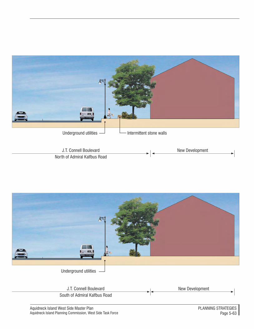
Aquidneck Island West Side Master PlanAquidneck Island Planning Commission, West Side Task Force
PlAnnIng STrATegIeSPage 5-63
J.T. Connell BoulevardSouth of Admiral Kalfbus road
new Development
Underground utilities
J.T. Connell Boulevardnorth of Admiral Kalfbus road
new Development
Underground utilities Intermittent stone walls
Aquidneck Island West Side Master PlanAquidneck Island Planning Commission, West Side Task Force
PlAnnIng STrATegIeSPage 5-64
long, free right turn lane (not signal controlled) would be a significant improvement to traffic flow from West Main Road southbound to Newport Harbor. It is recognized, however, that a free right turn would make this intersection more challenging for pedestrians. These issues must be ad-dressed through final design. Note: The RIDOT study considered extending Coddington Highway east through a neighborhood to meet with East Main Road near Valley Road. This alignment is not part of the West Side Master Plan. For Implementation coordination, con-sult Processes: RIDOT Endorsement and Regional Input, p. 6-48.
West Main road resurfacing Project, Middletown
RIDOT is scheduled to resurface Route 114 in Middletown in 2006. Sidewalk resurfacing is in accordance with recom-mendations of the West Side Master Plan and recommendations of the Walkability Workshop held in May, 2004 in Middle-town. Sidewalks will provide a major im-provement in pedestrian safety and will improve access for Rhode Island Public Transportation Authority (RIPTA) bus patrons. Pedestrian crosswalks will be re-striped as part of this project. Typical sec-tions at West Main Road are presented in Figure 5-13 (p. 5-66).
For more information on advancing the regional positions on these proj-ects, see Processes: RIDOT Endorsement and Regional Input, p. 6-48.
short term improvements Two clusters of short term recom-mendations have been advanced to improve current transportation defi-ciencies in the corridor: improvements along West Main Road and a combi-nation of alignment changes and other
improvements along Stringham Road and its connections to Burma Road (Defense Highway).
The West Main Road project has been selected for further consideration in the FY06-07 Transportation Improve-ment Program (TIP). The Stringham Road/Burma Road application was not selected and should be submitted again for consideration in the FY08-09 TIP process, following transfer of these roadways from the Navy to state or local control. For more informa-tion on the TIP process, see Processes: Transportation Improvement Program. Any short term improvements should adhere to principles outlined in the Implementation section of this docu-ment to the greatest extent possible (see Standards: General Principals of Design, p 6-51). Prominent aspects of the short term improvements include the following ideas.
West Main road left Turn lanes
Although the volume of vehicular traf-fic on West Main Road (Route 114) and East Main Road (Route 138) is roughly equivalent, West Main Road is more congested, due to more traffic signals and adjacent commercial devel-opment. This road provides access to many Aquidneck Island destinations including the Navy base, Raytheon, retail developments, Middletown Library, and other services. To date, RIDOT has conducted traffic im-provements within the existing right-of-way. Additional improvements, in-cluding construction of free right turns and left turn storage lanes, will require acquisition of private land.
Left turns cause significant disrup-tion to the West Main Road corridor by blocking a travel lane and forcing vehicles to utilize one lane of travel.
Aquidneck Island West Side Master PlanAquidneck Island Planning Commission, West Side Task Force
PlAnnIng STrATegIeSPage 5-65
This occurs at many of the crossroad locations where left-turn lanes are not provided. In addition, access into the many retail and commercial driveways cause even further disruption to flow. Of the 14 signalized intersections be-tween Route 24 in Portsmouth and Coddington Highway in Middletown, all but five major intersections include left turn lanes. Many new West Main Road developments have constructed left turn lanes and signalized intersec-tions. RIDOT is currently designing intersection improvements for the East Main Road and Coddington Highway intersections on West Main Road. The current TIP application includes left turn lanes and geometric improvements to increase capacity and improve safety between Raytheon in Portsmouth and Forest Avenue in Middletown. Intersections to be con-sidered include:
• Raytheon and Union/Redwood in Portsmouth
• Oliphant Lane in Middletown
• Super Stop & Shop in Middle-town
• Browns Lane in Middletown
• Forest Avenue in Middletown
A northbound left turn lane is pro-posed to increase safety for left turning vehicles at the Raytheon campus in Portsmouth. A left turn lane would serve as a safety refuge for vehicles along this section of Route 114, where adjacent development decreases in comparison to locations further south, and traffic speeds increase. RIPTA pro-vides service to Raytheon employees on the Route 60 line. The potential for bus pullouts should be considered dur-ing design to improve capacity of the travel lanes. It is recognized, however, that RIPTA does not favor the use of
bus pullouts since they claim that the time needed to get busses back into the traffic flow impedes the schedule. Future defense–related development is possible at the Raytheon campus in Portsmouth. Safety along this seg-ment is a major consideration for the 1,800 Raytheon employees and for any future defense-related employees. A fa-tal accident in 1999 demonstrates the need for a northbound left turn lane. Construction of Boys Town on the east side of this intersection will increase the need for safety improvements.
Union Street connects East and West Main Roads and provides access to Portsmouth Middle School. South-bound school buses must make this left turn without the benefit of a dedicated turn lane. This decreases safety for students aboard the bus and decreases capacity of West Main Road during the morning commute by reducing through traffic to the right lane.
A cross-Island connection is provided between West Main Road and East Main Road at Oliphant Lane in Mid-dletown. A left turn southbound lane is proposed to provide a safety refuge for left turning vehicles and to improve the capacity by providing two through travel lanes. Oliphant Lane provides access to industrial development lo-cated north of Newport State Airport and therefore includes truck traffic.
Turning lanes are proposed to ac-commodate both northbound and southbound traffic at the Super Stop & Shop/McDonald’s existing traffic signal in Middletown. Stop & Shop is a stop on RIPTA’s Route 60 line, providing service for both employees and cus-tomers. The potential for bus pullouts should be considered during design to improve capacity of the travel lanes.
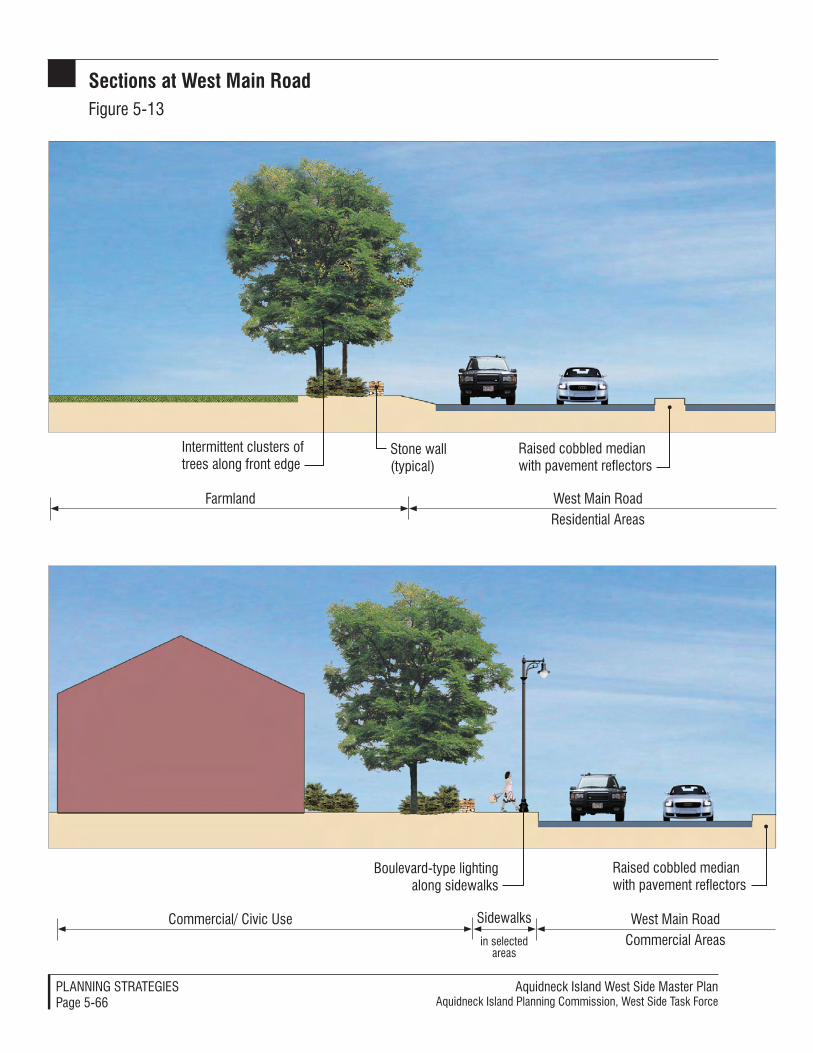
Aquidneck Island West Side Master PlanAquidneck Island Planning Commission, West Side Task Force
PlAnnIng STrATegIeSPage 5-66
Sidewalks
in selected areas
sections at West Main roadFigure 5-13
West Main roadresidential Areas
Farmland
Intermittent clusters of trees along front edge
Stone wall (typical)
raised cobbled median with pavement reflectors
West Main roadCommercial Areas
Commercial/ Civic Use
Boulevard-type lighting along sidewalks
raised cobbled median with pavement reflectors
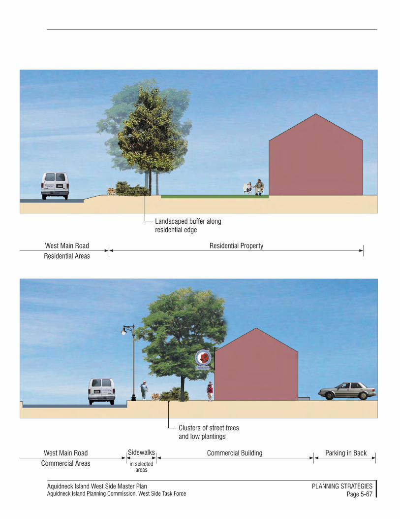
Aquidneck Island West Side Master PlanAquidneck Island Planning Commission, West Side Task Force
PlAnnIng STrATegIeSPage 5-67
Sidewalks
in selected areas
Clusters of street trees and low plantings
Commercial Building Parking in BackWest Main roadCommercial Areas
residential Property
landscaped buffer along residential edge
West Main roadresidential Areas
Aquidneck Island West Side Master PlanAquidneck Island Planning Commission, West Side Task Force
PlAnnIng STrATegIeSPage 5-68
Browns Lane provides access to neigh-borhoods, the golf course, cemetery, office building and auto dealers in an area of West Main Road with peak traffic volumes. A left turn lane is proposed to improve safety for north-bound motorists turning left onto Browns Lane.
Forest Avenue provides access to residential neighborhoods, Newport State Airport, and East Main Road. It also provides convenient access to Middletown Town Hall, Gaudet Middle School and the beaches from Middletown neighborhoods to the north and west. Construction of a left turn southbound lane at this intersec-tion would increase capacity along the more congested southern section of West Main Road in Middletown, improve access to the Navy, and im-prove access to tourist destinations in Newport. Implementation for these improvements is detailed in Processes: West Main Road Left Turn Improve-ments, p. 6-48.
Hedly Street/Cory’s lane Intersection Improvement and Visitor Center
Realignment of the west end of Cory’s Lane to intersect with Hedly Street at the existing signalized intersection or roundabout would remove the first and possibly the second signalized intersections encountered southbound from Route 24. By combining these two intersections (currently located within 300 feet) with left turn lanes, safety would be improved for turning traffic and for through traffic on West Main Road. Hedly Street is a connec-tor road to the town transfer station, industrial park, Middle Road, East Main Road and Portsmouth Town Hall. Cory’s Lane is the location of Carnegie Abbey Golf Course, several private schools, and Green Animals.
Careful realignment could retain the beauty of the agricultural land west of West Main Road and provide an opportunity to construct a visitor cen-ter. This new gateway and Aquidneck Island welcome center could help re-duce traffic congestion island wide by providing efficient directions to island attractions. Ideas about Implementa-tion are described in Processes: Hedly Street/Cory’s Lane Intersection Improve-ment and Visitor Center, p. 6-48.
Stringham road/Burma road Inter-section Improvements
Improvement of this intersection, together with construction of a con-nection through the Navy base, will be one of the most important transporta-tion improvements in the corridor as it will encourage use of the Burma Road (future Shoreline Drive) corridor as an alternative to West Main Road. By im-proving the north- and south-end con-nections, Island residents, employees, and tourists will be afforded a scenic and uncongested bypass.
Removal of the awkward and danger-ous turn at this intersection will reduce roadway length by approximately a half mile in the immediate project vicinity. Both Stringham Road and Burma Road (Defense Highway) rights-of-way are owned by the Navy. The Navy would have to relinquish the land voluntarily for construction. In-tersection improvements will make the underutilized Burma Road (Defense Highway) a more attractive alterna-tive north-south route on Aquidneck Island and will improve access to the Navy base. Access to existing and pro-posed marine related development in Melville will also be improved.
The steeply graded wooded land in this area is currently either owned
Aquidneck Island West Side Master PlanAquidneck Island Planning Commission, West Side Task Force
PlAnnIng STrATegIeSPage 5-69
privately by Founders Homestead Farms, Inc. or is Navy property. The proposed intersection would extend approximately 1300 feet from elevation 125 at the west end of Chases Farm field to elevation 30 along Burma Road near the Weaver Cove boat ramp access ramp. This 7.7 percent grade would not be suitable for truck traffic without a climbing lane but would be appropriate for passenger automobiles. The West Side Task Force has indicated that none of the agricultural fields at Chases Farm should be impacted by roadway realign-ment. Retaining walls and grading will be required to avoid this impact.
Burma Road is a north-south, two-lane urban collector with an approximate roadway width of 28 feet (including bike lanes), with a posted speed limit of 35 mph. The speed limit has been reduced from 45 mph to increase safe-ty for cyclists on the commuter bicycle lane. Stringham Road is a minor east-west, two-lane urban collector with a 20- to 24-foot (approximate) roadway width and with a posted 25 mph speed limit. Several Navy residences have driveways onto Stringham Road.
Future improvements
Shoreline Drive
Beyond the initiatives discussed above, no single additional transportation improvement would better serve the traffic on this island than to open a road between Coddington Highway in Middletown and Stringham Road in Portsmouth via Burma Road. This change in accessibility to Burma Road would be a significant enhancement to the traffic flow on the island and to the quality of life of its residents. The abil-ity to avoid fourteen traffic signals on West Main Road via a scenic Shoreline Drive would have many benefits:
• West Main Road traffic volumes would be reduced with resultant improvements in safety. This would reduce traffic congestion and enable the road to function at a higher level of service, especially during peak traffic periods.
• Shoreline Drive would provide a convenient and direct access from Route 24 and other up-island locations to downtown Newport destinations.
• Shoreline Drive would provide convenient scenic access from Newport Harbor, Pell Bridge, and the Navy to Melville and Raytheon (via a rear entrance) from Newport Harbor. The Navy would benefit with improved ac-cess for employees, contractors and truck deliveries (via Greene Lane), especially with construc-tion of the new North Gate, located near Burma Road and Coddington Cove.
• Retail and other commercial uses on West Main Road would benefit from increased patronage as traffic becomes more manageable.
• Tourism would benefit from an additional scenic attraction. The Shoreline Drive would be an im-portant addition to Ocean Drive as a road with unparalleled views of the East Passage of Narragansett Bay, Pell Bridge, Jamestown, and Prudence Island.
• Melville marine businesses would benefit from increased access to Newport destinations. This would make the marine condo develop-ment proposed at Weaver Cove more attractive.
Aquidneck Island West Side Master PlanAquidneck Island Planning Commission, West Side Task Force
PlAnnIng STrATegIeSPage 5-70
• Burma Road, would be more fully utilized to bear its burden of north-south traffic on the island.
• A continual utility corridor along Shoreline Drive and / or the New-port Secondary could provide public right of way for future subsurface utility installations.
Stringham Road and Defense Highway rights-of-way and roadways are cur-rently owned by the Navy. The right-of-way must be transferred to state or local control or an agreement must be reached between the Navy and state/local transportation agencies prior to advancing Shoreline Drive as a viable north-south transportation alternative on the West Side. Such a route would require the Navy to relinquish the land voluntarily for construction since it is not subject to the State of Rhode Island’s power of eminent domain for highway construction.
By extending Simonpietri Drive north to the Gate 17 Access Road and relo-cating the secure Navy fence line to the west, a key connection would be made to create a viable and attractive alterna-tive to West Main Road. This Navy connection would provide the missing link necessary to avoid West Main Road congestion, especially on the southern section of this road. Further coordina-tion is required with the Navy to secure the commitment of the federal govern-ment to relocate the secure perimeter.
Several Navy issues must be addressed to secure the alignment for a Shoreline Drive. Navy utilities must be protected. Response time from the Navy’s relocat-ed fire and emergency services building must be considered. Depending upon the final alignment, relocation or de-molition of parking and building facili-ties could also be required.
The following issues must be resolved to advance this alignment:
• Agreements would have to be es-tablished for roadway ownership, maintenance, and jurisdiction. Jurisdiction of the roadway could be Exclusive (federal), Concurrent (federal and state) or Proprietary (state or local). This would be based on Navy law and reflect the original purchase of the property.
• This alignment would create two secure “islands.” Building 11 (NUWC) and Building 10 would be separated from other secure areas, east of Shoreline Drive and would require a sepa-rate gate. The alignment would separate the new North Gate and Consolidated Headquarters from the rest of the base (railroad, Gate 17 Access Road, relocated security fence along Simonpietri Drive, and warehouse buildings would surround this area).
• Steam and utility lines must be con-sidered with any grading required along this steep hillside. Access to Navy water lines must be secure.
• Response time from the Navy’s re-located fire and emergency services building must be considered.
For related Implementation recom-mendations, see Processes: Creating a Shoreline Drive, p. 6-47 and Resources: Creating Shoreline Drive, p. 6-54.
Stringham road and Burma road Upgrades
Future upgrades on Stringham Road and Burma Road would be required to achieve attractive travel times on Shoreline Drive. All roadway improve-ments assume that the hairpin turn

Aquidneck Island West Side Master PlanAquidneck Island Planning Commission, West Side Task Force
PlAnnIng STrATegIeSPage 5-71
at the intersection of these roads has been eliminated. Upgrades would retain the current two-lane roadway configuration while retaining suf-ficient right-of-way for long term roadway widening, if and when war-ranted. Minor improvements would be required to increase design speeds and resultant posted speeds to 40 mph on Stringham Road and 45 mph on Burma Road. One way to accomplish this would be to relocate the Defense Highway Commuter Bicycle Lane to the adjacent Newport Secondary right-of-way. Improvements in site distance (clearing brush), drainage, and minor grade and geometric improvements could likely be conducted within the existing right-of-way (assuming the land is transferred from the Navy). Ac-cess controls should be implemented to limit the number of curb cuts from future development. As indicated in the Implementation section Standards: General Principles of Design, p. 6-50, performance standards and design guidelines for highway corridors are included. Local land use controls are critical to maintaining the character and capacity of this road as the Shore-line Drive so that it does not become as densely developed as West Main Road. Assuming that the Burma Road is transferred to RIDOT, any curb cuts would be subject to the state’s require-ment for a Physical Alteration Permit.
Due to steep grades at the String-ham Road/Burma Road intersection, Burma Road may not be suitable for truck through-traffic. The northern portion of Burma Road should there-fore be posted to warn trucks of steep grades. This would enhance the scenic character of this local roadway con-nection and serve as a traffic calming measure. Melville Marine Industries has a deeded right from the Navy to
use Burma and Stringham Roads while East Passage Yachting Center’s deed indicates the right to use Stringham Road. The Navy has designated that all truck traffic access the new North Gate via Greene Lane and the south-ern section of Burma Road (Defense Highway).
It is not feasible to create a parkway-type roadway which prohibits truck traffic. State legislation is required to enact a truck traffic restriction on a state road (presuming the roadway becomes state-owned). Neither RIDOT nor the State Traffic Commission has authority to enact a restriction on its own. It is very unlikely that a roadway with a truck traffic restriction could use federal funds for construction or maintenance since federal funds typically require the road to permit access to all users. Shoreline Drive, by its nature, will have several features which will limit its attraction to through trucking and buses. The 7.5% grade at the Stringham/Burma Road intersection and tight corners at four intersections (West Main Road/String-ham Road, Gate 17 Access Road/Burma Road, Simonpietri Drive extension/Gate 17 Access Road and Simonpietri Drive/Coddington Highway) will not be at-tractive for through trucking.
With these improvements, travel time from the West Main Road / String-ham Road intersection to the North Gate entrance would be reduced to approximately 8 minutes (or 9 min-utes with 20 second signal delay). This would provide an attractive peak hour alternative to West Main Road with travel time between these two points of 9 minutes (or 11 minutes with a more likely 20 second signal delay at the 14 intersections).
The improvement and realignment of Burma Road (Defense Highway)
Aquidneck Island West Side Master PlanAquidneck Island Planning Commission, West Side Task Force
PlAnnIng STrATegIeSPage 5-72
should be designed to accommodate an access drive along its border with the Raytheon campus, to the extent that a connection is determined to be desirable by the owners of that property. With anticipated expansion of the campus for defense-related industry, it would be prudent for Raytheon to reconfigure the internal vehicular circulation and park-ing lots for dual secure access to both Route 114 and Burma Road (future Shoreline Drive). This connection could provide congestion relief and a conve-nient route for employees who commute via the Pell Bridge and business-related traffic to NUWC. The specific loca-tion of such a connection would need to be coordinated to establish both low environmental impacts and a cost effec-tive alignment, given the steep grades in this area. Its implementation would need to be coordinated with open space planning and trail networks that may be established along this portion of the West Side as well.
For related Implementation recom-mendations, see Processes: Creating a Shoreline Drive, p. 6-47 and Processes: Interagency Coordination, p. 6-48.
Managing traffic for safety, Convenience and reduced CongestionTraffic should be better managed to improve safety and convenience while reducing congestion through advanced technologies and management systems that are coordinated to achieve region-al benefits. New strategies that create sustainable and managed transporta-tion can improve existing traffic flows and help meet future demands using the West Side’s streets and roads. This strategy can minimize the need for ex-panded roadways by better using exist-ing facilities. This strategy also recog-
nizes that expanded use of alternative transportation options - bicycle paths, ferry / water taxi service, and improved RIPTA bus service - will not signifi-cantly decrease traffic volumes unless and until the typical motorist perceives that alternatives offer more attractive travel times or travel conditions. Into the foreseeable future, vehicular traffic will remain a dominant mode of travel along the West Side.
generating and Using Information to Direct Traffic Flows
A key part of the strategy is to create greatly enhanced information that can be used to marshall the flow of vehicles in a more effective manner. Information about traffic flows can be used to coor-dinate signals and allow a more smooth flow of traffic. Information about traffic congestion and available routes can guide motorists towards the most effective route as conditions change on the region’s roadway network. The cluster of tools that use traffic informa-tion to improve roadway management are Intelligent Transportation Systems (ITS). Specific recommended tools are discussed in the Implementation section of this Master Plan. These include con-tinued or expanded use of the Highway Advisory Radio (HAR), Dynamic Mes-sage Signs (DMS), camera surveillance, the 511 Traveler Information System, and Arterial Traffic Systems. For related Implementation recommendations, see Tools: Intelligent Transportation Systems, p. 6-40 and Tools: Using New Intelligent Transportation System (ITS) Technolo-gies, p. 6-41.
Managing Peak Traffic Demand to and from employment Centers
A companion strategy will reduce con-gestion by increasing the proportion of vehicles with multiple passengers and
Aquidneck Island West Side Master PlanAquidneck Island Planning Commission, West Side Task Force
PlAnnIng STrATegIeSPage 5-73
distributing trips over greater time periods, so that the traffic peaks are reduced to more manageable levels. This will improve traffic flow on West Main Road. Pro-active steps to pro-mote high occupant vehicles (HOVs) and reduce peak period demand can be accomplished by applying a num-ber of techniques. The Implementation section of this Master Plan describes key tools including Transportation Management Associations (TMAs) at major employers and/or employ-ment locations. For information about Implementation recommendations, see Tools: Transit Management Associations, p. 6-43 and Processes: Creating Transit Management Associations, p. 6-46.
Attracting and Serving Transit Users
Encouraging increased bus ridership is another traffic reduction strategy. Vari-ous methods can be used to increase bus ridership so that additional bus service and additional convenient stops are employed over time. Along the West Side, the focus of these efforts should be enhanced service for area employ-ers. RIPTA has established a number of programs that can be used to fulfill this strategy that are discussed in more detail in Implementation. For related recom-mendations, see Tools: Transit Ridership Enhancements, p. 6-44.
Controlling Traffic Speeds and In-creasing Safety
Traffic calming should be employed as a consistent strategy in the planning and design of all street and roadway improvements along the West Side. Traffic calming focuses on providing design and operational enhancements that reduce excessive speeds, direct ve-hicles into safer patterns, and provide a more pedestrian and bicycle-friendly environment. This strategy will be a
benefit for motorists by providing for safe and appropriate travel speeds in an environment that reduces potential conflicts with pedestrians and other vehicles. Traffic calming will benefit pedestrians and bicyclists by reduc-ing dangerous conditions. Finally, an applied traffic calming strategy will benefit land uses along streets and roads by reducing noise and providing more reasonable access on and off ad-jacent land. For related Implementation recommendations, see Tools: Traffic Calming, p. 6-44.
Where practical, it is preferable to pro-vide for more continuous traffic flows at slower and safer speeds, rather than increasing the number of locations that contribute to the distracting “stop and go” pattern of movement created by strings of signalized intersections. Roundabouts should be introduced where they are practical because they are a safe and convenient alternative. For related Implementation recom-mendations, see Tools: Roundabouts, p. 6-44 and Transportation Standards, p. 6-50 - 6-53.
Access Management and Access Improvements
A strategy that better manages access to and from abutting uses can enhance traffic flows and safety. Reducing the number of curb cuts or access points limits the number of conflict points, separate conflict areas, remove turn-ing vehicles from through traffic lanes, reduce the number of turning move-ments, and improve traffic operations on the roadway. Arranging joint access from adjoining properties can allow consolidation of multiple driveways into a single shared location along the property line (with recorded joint use easements that run with the land) and reduce the number of conflict points.
Aquidneck Island West Side Master PlanAquidneck Island Planning Commission, West Side Task Force
PlAnnIng STrATegIeSPage 5-74
Developing alternate routes along a “frontage road” connecting properties may be considered to provide access for multiple uses. If these can be located at the rear of adjacent properties, this strategy can reduce broad expanses of unattractive pavement along the major roads and allow the design of more safe connections at periodic locations.
Local collector roads will also require new construction to create access to future development, especially in the Melville area. Stringham Road cur-rently provides access to marinas, marine trades, Navy housing, and the Portsmouth campground.
With additional marine trades, marina and mixed use development in this area, additional access from West Main Road will be warranted in the future. It is recommended that the West Main Road / Bradford Road intersection be realigned and moved north to form a “T” intersection. This would move the current intersection from the parking lot of the Melville Elementary School and would require reconfiguration of Navy property at Melville Quarters “A.” This property will be sold by the Navy for private redevelopment of the adjacent Rainbow Heights housing area as part of GMH privatization.
Bay View Terrace, a former Navy unimproved roadway and utility pole corridor located south of King’s Grant, also provides access from West Main Road to the Town of Portsmouth con-servation area and the Melville shore-line. An upgrade of this alignment, with a connection to the proposed development at the former tank farms and the Melville waterfront, could be considered in the future if traffic vol-umes warrant it. Any roadway upgrade or realignment must address steep grade, wetland issues, conservation
use, potential impacts on the camp-ground and adjacent residential area, and reconstruction of a bridge over the Newport Secondary, among others as part of permitting and design. Land swaps and mitigation would be con-sidered during preliminary planning to assure the feasibility of an alignment along this route.
An internal circulation system for fu-ture development at the former Navy tank farms should provide access from Stringham Road to existing roadways along the Melville waterfront. Consol-idated curb cuts and sidewalks should be required in the design and construc-tion of this system.
The access management strategy should discourage additional at-grade intersections with the Newport Sec-ondary rail line as it passes through the Weaver Cove, Melville and Pell Bridge areas to the extent practical. For related Implementation recommendations, see Standards: Access Management, p. 6-50.
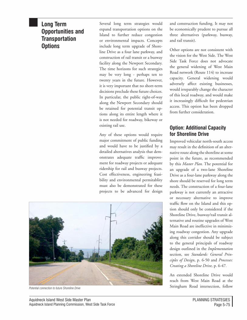
Aquidneck Island West Side Master PlanAquidneck Island Planning Commission, West Side Task Force
PlAnnIng STrATegIeSPage 5-75
Long term opportunities and transportation options
Several long term strategies would expand transportation options on the Island to further reduce congestion or environmental impacts. Concepts include long term upgrade of Shore-line Drive as a four lane parkway, and construction of rail transit or a busway facility along the Newport Secondary. The time horizons for such strategies may be very long - perhaps ten to twenty years in the future. However, it is very important that no short-term decisions preclude these future choices. In particular, the public right-of-way along the Newport Secondary should be retained for potential transit op-tions along its entire length where it is not needed for roadway, bikeway or existing rail use.
Any of these options would require major commitment of public funding and would have to be justified by a detailed alternatives analysis that dem-onstrates adequate traffic improve-ment for roadway projects or adequate ridership for rail and busway projects. Cost effectiveness, engineering feasi-bility and environmental permitablity must also be demonstrated for these projects to be advanced for design
and construction funding. It may not be economically prudent to pursue all three alternatives (parkway, busway, and rail transit).
Other options are not consistent with the vision for the West Side. The West Side Task Force does not advocate the general widening of West Main Road network (Route 114) to increase capacity. General widening would adversely affect existing businesses, would irreparably change the character of this local roadway, and would make it increasingly difficult for pedestrian access. This option has been dropped from further consideration.
option: additional Capacity for shoreline Drive Improved vehicular north-south access may result in the definition of an alter-native route along the shoreline at some point in the future, as recommended by this Master Plan. The potential for an upgrade of a two-lane Shoreline Drive as a four-lane parkway along the shore should be reserved for long term needs. The construction of a four-lane parkway is not currently an attractive or necessary alternative to improve traffic flow on the Island and this op-tion should only be considered if the Shoreline Drive, busway/rail transit al-ternative and routine upgrades of West Main Road are ineffective in minimiz-ing roadway congestion. Any upgrade along this corridor should be subject to the general principals of roadway design outlined in the Implementation section, see Standards: General Prin-ciples of Design, p. 6-50 and Processes: Creating a Shoreline Drive, p. 6-47.
An extended Shoreline Drive would reach from West Main Road at the Stringham Road intersection, follow Potential connection to future Shoreline Drive
Aquidneck Island West Side Master PlanAquidneck Island Planning Commission, West Side Task Force
PlAnnIng STrATegIeSPage 5-76
Stringham Road to Burma Road and continue south along Burma Road (De-fense Highway). A “parkway” concept could be designed with two lanes in each direction, separated by a variable-width median, and using grades to provide views of the Bay. North end connections to Burma Road may include Stringham Road as a four-lane road or on an align-ment via Bradford Road to Sullivan Road to Stringham Road, as described above. Priority should be placed on up-grading Stringham Road with secondary priority being to upgrade Bradford Road with a connection to Sullivan Road. A Bay View Terrace connection (south of King’s Grant) should not be precluded by future roadway alignments, but it is premature to recommend this as a pref-erence; an evaluation of environmental and transportation costs and benefits would need to be undertaken at a time when demand appears to warrant an extended roadway connection. The Bay View Terrace connection through the Melville Ponds conservation area would require Department of Interior coordination/permitting as well as have extensive wetland impacts.
A route through Naval Station New-port is required to provide a complete north-south connection via Shoreline Drive from Route 24 at the north end of the island to Coddington Highway and the Pell Bridge at the south end. Naval Station Newport would be required to provide a connection to Coddington Highway (if the Simon-pietri Drive alignment to the Shore-line Drive is not feasible, as described above under Future Improvements, Shoreline Drive). Such a route would serve as a bypass for West Main Road in Middletown, extending between Portsmouth and Coddington High-way in Middletown, near the Newport municipal line. A four-lane roadway
would require the support, coop-eration and dedication of the Navy, RIDOT, and local communities. It is recommended that sufficient right-of-way be retained along Burma Road to accommodate future widening to four lanes. This corridor could be used for landscaping in the short term. Adja-cent development should not preclude any future upgrade of this corridor.
Any major roadway widening would require completion of an Environ-mental Impact Statement (EIS) for the Federal Highway Administration and the RIDOT. For information on EIS see Implementation, Processes: Envi-ronmental Impact Study (EIS), p. 6-49. Alternatives analysis is an important component of the evaluation process. In addition to the “no build” alterna-tive, it is likely that alternatives would include a range of design concepts (2-lane, 4-lane), and transportation man-agement system improvements that would avoid roadway construction. Lead time from concept to opening of any new roadway would likely require several decades.
option: Expanded rail transitThere is currently a single operational rail line along portions of a West Side corridor known as the “Newport Sec-ondary.” Over the long term, options could be pursued to expand the ability of this rail alignment to serve as an ef-fective rail transit corridor.
Two organizations currently operate under separate RIDOT agreements on the Newport Secondary Line. The National Railroad Foundation & Mu-seum, Inc., doing business as the Old Colony & Newport Railway (OC-NRR), is a Rhode Island not-for-profit 501(c)3 corporation which operates as
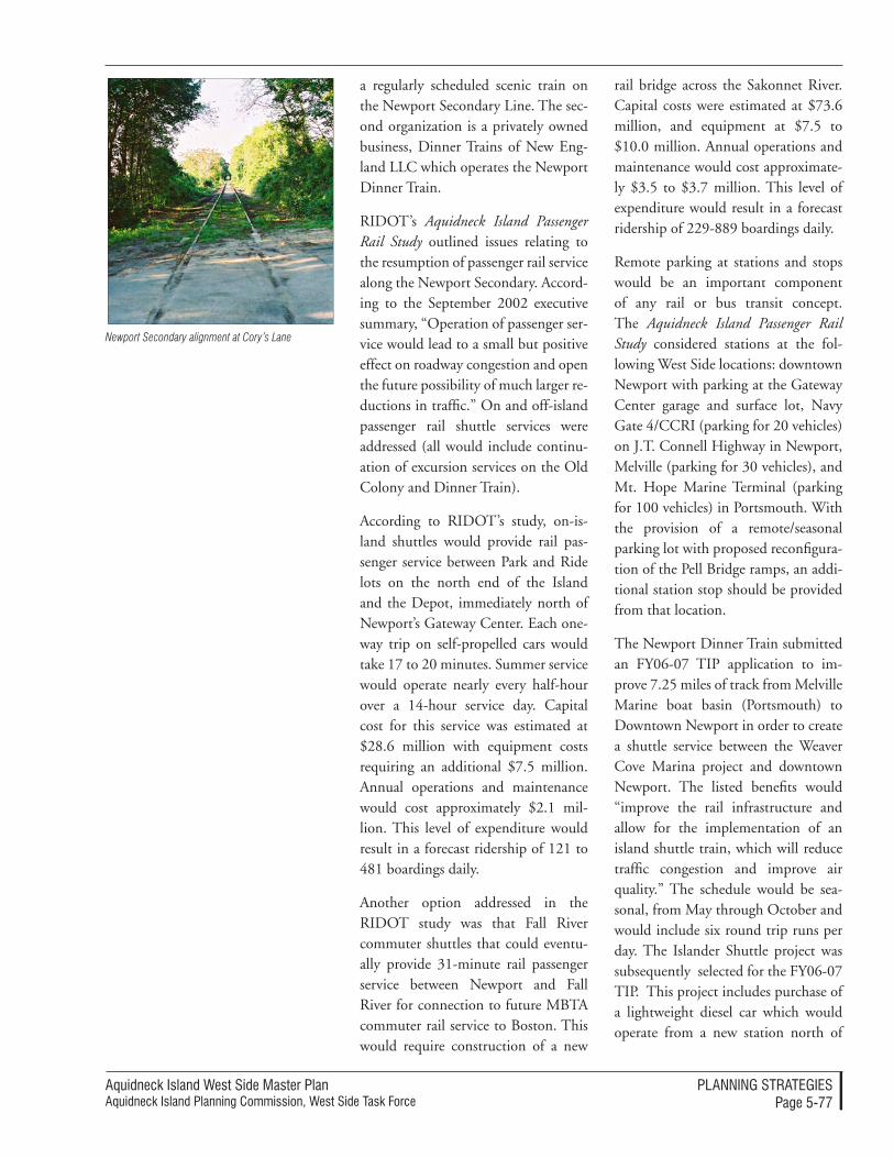
Aquidneck Island West Side Master PlanAquidneck Island Planning Commission, West Side Task Force
PlAnnIng STrATegIeSPage 5-77
a regularly scheduled scenic train on the Newport Secondary Line. The sec-ond organization is a privately owned business, Dinner Trains of New Eng-land LLC which operates the Newport Dinner Train.
RIDOT’s Aquidneck Island Passenger Rail Study outlined issues relating to the resumption of passenger rail service along the Newport Secondary. Accord-ing to the September 2002 executive summary, “Operation of passenger ser-vice would lead to a small but positive effect on roadway congestion and open the future possibility of much larger re-ductions in traffic.” On and off-island passenger rail shuttle services were addressed (all would include continu-ation of excursion services on the Old Colony and Dinner Train).
According to RIDOT’s study, on-is-land shuttles would provide rail pas-senger service between Park and Ride lots on the north end of the Island and the Depot, immediately north of Newport’s Gateway Center. Each one-way trip on self-propelled cars would take 17 to 20 minutes. Summer service would operate nearly every half-hour over a 14-hour service day. Capital cost for this service was estimated at $28.6 million with equipment costs requiring an additional $7.5 million. Annual operations and maintenance would cost approximately $2.1 mil-lion. This level of expenditure would result in a forecast ridership of 121 to 481 boardings daily.
Another option addressed in the RIDOT study was that Fall River commuter shuttles that could eventu-ally provide 31-minute rail passenger service between Newport and Fall River for connection to future MBTA commuter rail service to Boston. This would require construction of a new
rail bridge across the Sakonnet River. Capital costs were estimated at $73.6 million, and equipment at $7.5 to $10.0 million. Annual operations and maintenance would cost approximate-ly $3.5 to $3.7 million. This level of expenditure would result in a forecast ridership of 229-889 boardings daily.
Remote parking at stations and stops would be an important component of any rail or bus transit concept. The Aquidneck Island Passenger Rail Study considered stations at the fol-lowing West Side locations: downtown Newport with parking at the Gateway Center garage and surface lot, Navy Gate 4/CCRI (parking for 20 vehicles) on J.T. Connell Highway in Newport, Melville (parking for 30 vehicles), and Mt. Hope Marine Terminal (parking for 100 vehicles) in Portsmouth. With the provision of a remote/seasonal parking lot with proposed reconfigura-tion of the Pell Bridge ramps, an addi-tional station stop should be provided from that location.
The Newport Dinner Train submitted an FY06-07 TIP application to im-prove 7.25 miles of track from Melville Marine boat basin (Portsmouth) to Downtown Newport in order to create a shuttle service between the Weaver Cove Marina project and downtown Newport. The listed benefits would “improve the rail infrastructure and allow for the implementation of an island shuttle train, which will reduce traffic congestion and improve air quality.” The schedule would be sea-sonal, from May through October and would include six round trip runs per day. The Islander Shuttle project was subsequently selected for the FY06-07 TIP. This project includes purchase of a lightweight diesel car which would operate from a new station north of
Newport Secondary alignment at Cory’s Lane
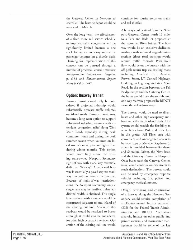
Aquidneck Island West Side Master PlanAquidneck Island Planning Commission, West Side Task Force
PlAnnIng STrATegIeSPage 5-78
the Gateway Center in Newport to Melville. The historic depot would be relocated to Melville.
Over the long term, the effectiveness of a fixed route rail service schedule to improve traffic congestion will be significantly limited because a one track facility cannot carry substantial passenger volumes on a shuttle basis. Planning for implementation of this concept can be pursued through a number of processes, consult Processes: Transportation Improvement Program, p. 6-53 and Environmental Impact Study (EIS), p. 6-49.
option: Busway transitBusway transit should only be con-sidered if projected ridership would substantially decrease traffic volumes on island roads. Busway transit may become a long-term option to support substantial ridership volumes with at-tendant congestion relief along West Main Road, especially during peak commuter hours and during the peak summer season when volumes on lo-cal arterials are 49 percent higher than during winter months. This option would more fully utilize the exist-ing state-owned Newport Secondary right-of-way with a one-way reversible dedicated “busway”. A dedicated bus-way is essentially a paved express road-way reserved exclusively for bus use. Because of right-of-way restrictions along the Newport Secondary, only a single lane may be feasible, unless ad-ditional width is obtained. This single lane roadway with shoulders would be constructed adjacent to and inland of the existing rail line. Access to this roadway would be restricted to buses, although it could also be considered for other high occupancy vehicles. Op-eration of the existing rail line would
continue for tourist excursion trains and rail shuttles.
A busway could extend from the New-port Gateway Center north 13 miles to a Park and Ride lot proposed at the Sakonnet River bridge. The bus-way would be an exclusive dedicated roadway with minimal at-grade inter-sections (three road crossings would require traffic control). Peak hour flow would be on the busway with the off-peak return trip via existing roads including America’s Cup Avenue, Farwell Street, J.T. Connell Highway, Coddington Highway, and West Main Road. In the section between the Pell Bridge ramps and the Gateway Center, the buses would share the southbound one-way roadway proposed by RIDOT along the rail right-of-way.
The busway would be used to divert buses and other high-occupancy rub-ber-tired vehicles off island roads. This system would provide the flexibility to serve buses from Park and Ride lots in the greater Fall River area with convenient and uncongested access to busway stops at Melville, Raytheon (if access is provided between Raytheon and Shoreline Drive), the Navy base, and the Gateway Center in Newport. Once buses reach the Gateway Center, travel could continue on city streets to reach destinations. The busway could also be used by emergency response vehicles including fire, police, and emergency medical services.
Design, permitting and construction of a busway along the Newport Sec-ondary would require completion of an Environmental Impact Statement (EIS) for the Federal Transit Admin-istration and RIDOT. Alternatives analysis, impact on other public and private carriers, and stormwater man-agement would be some of the key
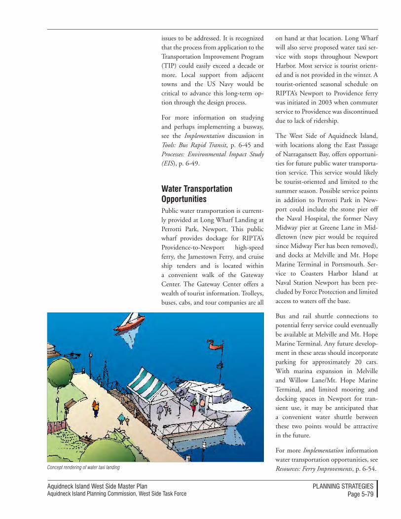
Aquidneck Island West Side Master PlanAquidneck Island Planning Commission, West Side Task Force
PlAnnIng STrATegIeSPage 5-79
issues to be addressed. It is recognized that the process from application to the Transportation Improvement Program (TIP) could easily exceed a decade or more. Local support from adjacent towns and the US Navy would be critical to advance this long-term op-tion through the design process.
For more information on studying and perhaps implementing a busway, see the Implementation discussion in Tools: Bus Rapid Transit, p. 6-45 and Processes: Environmental Impact Study (EIS), p. 6-49.
Water transportation opportunitiesPublic water transportation is current-ly provided at Long Wharf Landing at Perrotti Park, Newport. This public wharf provides dockage for RIPTA’s Providence-to-Newport high-speed ferry, the Jamestown Ferry, and cruise ship tenders and is located within a convenient walk of the Gateway Center. The Gateway Center offers a wealth of tourist information. Trolleys, buses, cabs, and tour companies are all
on hand at that location. Long Wharf will also serve proposed water taxi ser-vice with stops throughout Newport Harbor. Most service is tourist orient-ed and is not provided in the winter. A tourist-oriented seasonal schedule on RIPTA’s Newport to Providence ferry was initiated in 2003 when commuter service to Providence was discontinued due to lack of ridership.
The West Side of Aquidneck Island, with locations along the East Passage of Narragansett Bay, offers opportuni-ties for future public water transporta-tion service. This service would likely be tourist-oriented and limited to the summer season. Possible service points in addition to Perrotti Park in New-port could include the stone pier off the Naval Hospital, the former Navy Midway pier at Greene Lane in Mid-dletown (new pier would be required since Midway Pier has been removed), and docks at Melville and Mt. Hope Marine Terminal in Portsmouth. Ser-vice to Coasters Harbor Island at Naval Station Newport has been pre-cluded by Force Protection and limited access to waters off the base.
Bus and rail shuttle connections to potential ferry service could eventually be available at Melville and Mt. Hope Marine Terminal. Any future develop-ment in these areas should incorporate parking for approximately 20 cars. With marina expansion in Melville and Willow Lane/Mt. Hope Marine Terminal, and limited mooring and docking spaces in Newport for tran-sient use, it may be anticipated that a convenient water shuttle between these two points would be attractive in the future.
For more Implementation information water transportation opportunities, see Resources: Ferry Improvements, p. 6-54.Concept rendering of water taxi landing
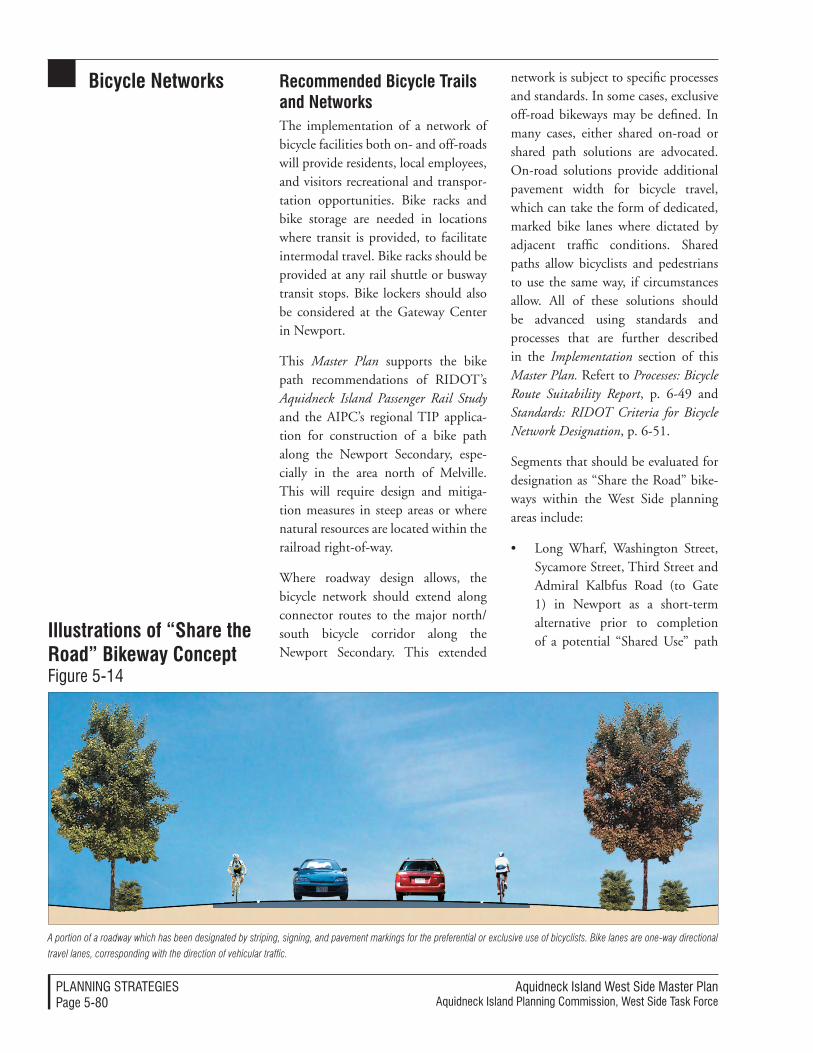
Aquidneck Island West Side Master PlanAquidneck Island Planning Commission, West Side Task Force
PlAnnIng STrATegIeSPage 5-80
Bicycle networks recommended Bicycle trails and networksThe implementation of a network of bicycle facilities both on- and off-roads will provide residents, local employees, and visitors recreational and transpor-tation opportunities. Bike racks and bike storage are needed in locations where transit is provided, to facilitate intermodal travel. Bike racks should be provided at any rail shuttle or busway transit stops. Bike lockers should also be considered at the Gateway Center in Newport.
This Master Plan supports the bike path recommendations of RIDOT’s Aquidneck Island Passenger Rail Study and the AIPC’s regional TIP applica-tion for construction of a bike path along the Newport Secondary, espe-cially in the area north of Melville. This will require design and mitiga-tion measures in steep areas or where natural resources are located within the railroad right-of-way.
Where roadway design allows, the bicycle network should extend along connector routes to the major north/south bicycle corridor along the Newport Secondary. This extended
network is subject to specific processes and standards. In some cases, exclusive off-road bikeways may be defined. In many cases, either shared on-road or shared path solutions are advocated. On-road solutions provide additional pavement width for bicycle travel, which can take the form of dedicated, marked bike lanes where dictated by adjacent traffic conditions. Shared paths allow bicyclists and pedestrians to use the same way, if circumstances allow. All of these solutions should be advanced using standards and processes that are further described in the Implementation section of this Master Plan. Refert to Processes: Bicycle Route Suitability Report, p. 6-49 and Standards: RIDOT Criteria for Bicycle Network Designation, p. 6-51.
Segments that should be evaluated for designation as “Share the Road” bike-ways within the West Side planning areas include:
• Long Wharf, Washington Street, Sycamore Street, Third Street and Admiral Kalbfus Road (to Gate 1) in Newport as a short-term alternative prior to completion of a potential “Shared Use” path
illustrations of “share the road” Bikeway Concept Figure 5-14
A portion of a roadway which has been designated by striping, signing, and pavement markings for the preferential or exclusive use of bicyclists. Bike lanes are one-way directional
travel lanes, corresponding with the direction of vehicular traffic.
Aquidneck Island West Side Master PlanAquidneck Island Planning Commission, West Side Task Force
PlAnnIng STrATegIeSPage 5-81
along the Newport Secondary. It is recognized that the Newport Secondary right-of-way narrows through the Point neighborhood and that it may not be possible to accommodate the rail line, south-bound roadway proposed under the Pell Bridge ramp project, and a “shared use path.”
• In Middletown, “Share the Road” bikeways are proposed on local roads adjacent to the Navy base and Greene Lane.
• In Portsmouth, “Share the Road” bikeways are proposed on Red-wood Road, and Willow Lane.
A segment of Coddington Highway/J.T. Connell Highway in Newport and Middletown is proposed for signed bikeways taking the form of dedicated, marked bike lanes.
Recommended bicycle network en-hancements are indicated in Figure 5-14 (p. 5-80) and further discussed below. Ideas to advance implementa-tion of these concepts can be found in Processes: Interagency Coordination, p. 6-48; Standards: RIDOT Criteria and Standards for Bicycle Network Designa-tion, p. 6-51 and Resources: Resources for Bicycles, p. 6-55.
shoreline Drive/newport secondary Bike pathConstruction of shared use bike paths, bike lanes, signed shared roadways, and shared roadways within the West Side planning area offer significant recreational, tourism and commuter opportunities for cyclists and provide important connections between neigh-borhoods and local destinations includ-ing the shoreline of Narragansett Bay.
In the short-term, bikeways along local roads including Long Wharf, Wash-ington Street, Sycamore Street, and Third Street will continue to provide access between Coasters Harbor Island and downtown Newport. Construc-tion of the Newport Secondary bike path north of Melville, as included in the FY06-07 TIP and recommended in the Aquidneck Island Passenger Rail Study, represents a significant north south cycling connection in the plan-ning area. This bike path, together with a southward continuation along Shoreline Drive or the Newport Sec-ondary would be successful in divert-ing bike traffic from local roads and neighborhoods to a dedicated off-road path.
To avoid security issues at the Navy base, the bikeway should be diverted to local streets between Gate 4 and Gate 17 Access Road. Construction of Shoreline Drive via the Gate 17 Access Road and Simonpietri Drive should be designed to accommodate a “signed shared roadway” or bike lane. RIDOT’s proposed upgrade of Coddington Highway should include adequate shoulders for designation as a “signed shared roadway.” This segment would provide access for residents of Newport Heights, CCRI student and staff, and employees and sailors stationed at Naval Station Newport. The north-south bike path should rejoin the Newport Secondary right-of-way between Gate 4 and Van Zandt Avenue for connection to the Gateway Center and Newport Harbor destina-tions via local roads.
Although the Defense Highway Com-muter Bike Lane along the Burma Road currently provides a connection between the Navy base, Greene Lane, and Melville, it is recognized that this
Aquidneck Island West Side Master PlanAquidneck Island Planning Commission, West Side Task Force
PlAnnIng STrATegIeSPage 5-82
is not an attractive or safe alternative to an off-road bike path. Shoreline Drive offers an unparalleled opportunity to provide a scenic roadway with a scenic bike path, separated by low but robust landscaping. A bike path or shared use path could be designed to hug the existing topography, on an alignment which ranges from the rail line to the roadway. The shared use path would also be suitable for pedestrians, thereby providing an alternative to sidewalk construction. Bike racks should be provided at connections from the bike path to the following overlook or rest areas:
• Melville: Create connections to the bike lane north along the Newport Secondary to the Sa-konnet Bridge, east to a proposed shared use path through the Melville Ponds conservation area to the campground, and west to the vibrant Melville waterfront - Existing rail crossings should be utilized in Melville. Reconstruc-tion of an abandoned rail bridge could provide a connection from the campground area to the Mel-ville waterfront. By including a
bike rack on the proposed Island Shuttle (FY06-07 TIP), cyclists would have multimodal options in the Melville to Gateway Center segment.
• Weaver Cove boat ramp parking area with a connection to the pro-posed conservation area along Law-ton Brook. This connection would utilize an existing rail crossing.
• Carr Point: Access by Navy per-sonnel to the recreation area would utilize an existing rail crossing.
• Norman’s Brook: Construct a shared use path between the Shoreline Drive bike path and Redwood Road with connections to the Center Island Greenway and Portsmouth and Middletown neighborhoods. No rail crossing would be required.
• Greene Lane Park: Include a parking lot, picnic area, fishing pier, and shoreline access. A new rail crossing would be required.
• McAllister Point scenic overlook: A new rail crossing would be re-quired for direct access from the bike path to a scenic overlook. A
newport Secondary linenarragansett Bay
illustrations of Bike Lanes and transit ConceptFigure 5-15
Aquidneck Island West Side Master PlanAquidneck Island Planning Commission, West Side Task Force
PlAnnIng STrATegIeSPage 5-83
rail crossing could be avoided by providing a shoreline connection from Greene Lane Park.
Scenic views should be emphasized with construction of the Shoreline Drive/Newport Secondary bike path. Clearing may be required along the Newport Secondary right of way to open vistas to the bay. Annual main-tenance would be required to prevent these vistas from becoming overgrown. It is recognized that connections will be required across the rail line for ac-cess to the shoreline. As indicated above, existing rail crossings should be used to the greatest extent possible. An additional crossing is recommended at Greene Lane Park.
The Shoreline Drive shared use path would extend from the bike path along the Newport Secondary north of Mel-ville south to NUWC where it would likely return to the road as either a bike lane or a signed shared roadway. Con-struction of the shared use path should be conducted with upgrade of Burma Road as Shoreline Drive. Further anal-ysis is required to determine if this bike path could be constructed on what is
currently Navy property along the De-fense Highway or along state property on the Newport Secondary rail line. All effort should be made to locate this path separate from the roadway. The use of a rumble strip would not be ap-propriate to separate the bi-directional bike path from the southbound lane of Shoreline Drive under RIDOT or AASHTO guidelines (raised pave-ments can cause steering difficulties for bicyclists and should not be used to delineate bicycle lanes).
A “signed shared roadway” bikeway on Greene Lane in Middletown would provide a spur from the Shoreline Drive bike path to Simmons Farm and adjacent neighborhoods both east and west of West Main Road. This spur would begin at the proposed Greene Lane scenic vista and picnic area on Shoreline Drive and provide views of Narragansett Bay. The proposed park/scenic overlook should include bike racks so that cyclists can walk the shoreline trail to the McAllister Point overlook. It would not be safe to ex-tend this spur along West Main Road, a road not suitable or safe for cyclists. The existing West Main Road signal-
Shoreline Drive
existing rail Tracks
Proposed
Bike Path
10’ Bikepath Shared Use Path along Shoreline Drive
Aquidneck Island West Side Master PlanAquidneck Island Planning Commission, West Side Task Force
PlAnnIng STrATegIeSPage 5-84
ized intersection at Greene Lane could be adjusted to accommodate bike traf-fic to Pasture Farm Drive.
An off-road “shared use path” is rec-ommended connecting Redwood Road with the Shoreline Drive bike path. This segment would provide access from this neighborhood and a playground at the west end of this road, to the shoreline. This alignment is currently Navy property adjacent to former Tank Farm #4. A connection to proposed trails at Freedom Bay would provide a continuous recreation path between these two areas. An on-road “share the road” bikeway on Redwood Road would connect with Union Street and Jepson Lane (with access to the Portsmouth Middle School) east of the planning area. These bike routes are identified on A Bicyclist’s Guide to Aquidneck Island map. The existing West Main Road signalized intersec-tion at Redwood Road could be ad-justed to accommodate bike traffic.
An off-road “shared use path” is recommended through the Town of Portsmouth’s conservation property in Melville. Shared use paths through the Melville Ponds area would provide an attractive activity for those staying at the campground and provide a posi-tive improvement in this underutilized gem. A link from the campground to the waterfront would upgrade this fa-cility by connecting it to the shore by ways other than private motor vehicle. This may be routed along existing roadways and trails. This path would connect with the bike path proposed along the Newport Secondary, provid-ing access to the north and south. This path would also intersect a shoreline path from Melville to Cory’s Lane for those interested in saltwater fishing or walking along the cobble beach.
An on-road “share the road” route is proposed along Sullivan from the campground to Stringham Road. Co-ordination would be required with the Melville Committee and the Town of Portsmouth for location and construc-tion.
RIDOT’s Aquidneck Island Passenger Rail Study recommended that a bike path be constructed along the New-port Secondary between Melville and the Sakonnet River Bridge (including the West Side planning area segment, with a connection to the Mt. Hope Bridge). Bicycles are currently prohib-ited on this bridge. This project was submitted as a regional Transportation Improvement Program application by the Aquidneck Island Planning Com-mission and accepted on the FY06-07 TIP. If this segment is not implement-ed, the passenger rail study presents an alternative route connecting the Mt. Hope Bridge and the Newport Secondary via an on-road bikeway on Bristol Ferry Road and Willow Lane. RIDOT DPM criteria must be applied to this route to determine suitability for a “share the road” bikeway desig-nation (see Standards: RIDOT Criteria and Standards for Bicycle Network Des-ignation, p 6-52). This bikeway would provide an asset to existing and pro-posed residential development in the Bristol Ferry and Willow Lane area by providing connections to the East Bay Bike Path in Bristol (via the Mt. Hope Bridge) and Newport.
For Implementation regarding bikeways, consult Tools: Bicycle Map, p. 6-45; Pro-cesses: Bicycle Route Suitability Reports, p. 6-49; Standards: RIDOT Criteria and Standards for Bicycle Network Designa-tion, p. 6-51; Standards: AASHTO, p. 6-53; Resources: Congestion Mitigation and Air Quality (CMAQ) Program, p. 6-55; and Resources: Bicycles, p. 6-55.
Aquidneck Island West Side Master PlanAquidneck Island Planning Commission, West Side Task Force
PlAnnIng STrATegIeSPage 5-85
trails, paths and sidewalks
Facilities for pedestrians need to be extended throughout the West Side Planning Area to provide safe and convenient pedestrian access. Along streets and roadways, sidewalks should normally be required as part of any roadway construction or reconstruc-tion. However, sidewalks should neither be required or provided along portions of scenic roads that are both poorly situated for pedestrian traffic and where rural landscapes and vistas would be disrupted.
Many planning area locations offer spectacular vistas of the East Passage of Narragansett Bay and islands and would provide excellent opportuni-ties for pedestrian improvements. For example, any office park construction should consider construction of trail and / or sidewalks for employee ben-efit, like the trail network that has been constructed at Raytheon.
Currently, shoreline access is limited to the Weaver Cove boat launch and minor public accesses at local roads. Access to the shoreline is generally restricted by a lack of parking, a lack of connections across the Newport Secondary, and steep and overgrown banks leading down to the water’s edge. Shoreline access is especially restricted in Middletown where no public access is currently available. To improve access to the shoreline be-tween Coddington Cove and Melville, a shoreline trail is proposed.
A shoreline trail could extend from the proposed scenic overlook at McAllister’s Point north to Carr Point (a Navy recreation area not open to the public). Access to the trail would be via a proposed Greene Lane Park scenic overlook. This beach trail would require wading across Gomes and Nor-mans Brooks. A shoreline trail is also
proposed between Melville and Cory’s Lane. This trail would connect with trails (existing and proposed by the Melville Committee) in the Town of Portsmouth conservation area around the Chain of Ponds. Signage for shore-line trails would be posted at parking areas. No pathways, benches, or trash cans would be proposed along the shoreline to retain the natural beauty and protect the natural resources of these areas.
Further assessment must be made to determine if development of a trail network along Lawton Brook is ap-propriate. This resource area is steep and rugged. Trail construction could lead to erosion and require grading that could adversely affect the beauty, tranquility, and habitats along this brook. It is recognized that any trail would probably not be ADA-acces-sible because of the steep grade. If a trail is designated, connections to a parking area east of West Main Road (near the Lawton Valley Reservoir) could be made via the existing culvert / bridge under the roadway. A trail could connect Lawton Valley Reservoir with the Narragansett shoreline, providing a missing link in the Aquidneck Land Trust’s Center Island Greenway.
Phasing of trail, paths and sidewalk improvements can be conducted with roadway construction or reconstruc-tion, with adjacent property develop-ment or redevelopment, or as funding becomes available for trail construc-tion and signage.
For ideas regarding Implementation, re-fer to Standards: Sidewalk and Trail, p. 6-52; Resources: Trails and Open Space Networks, p. 6-31; and Processes: Creating and Promoting Shoreline Access, p. 6-23.
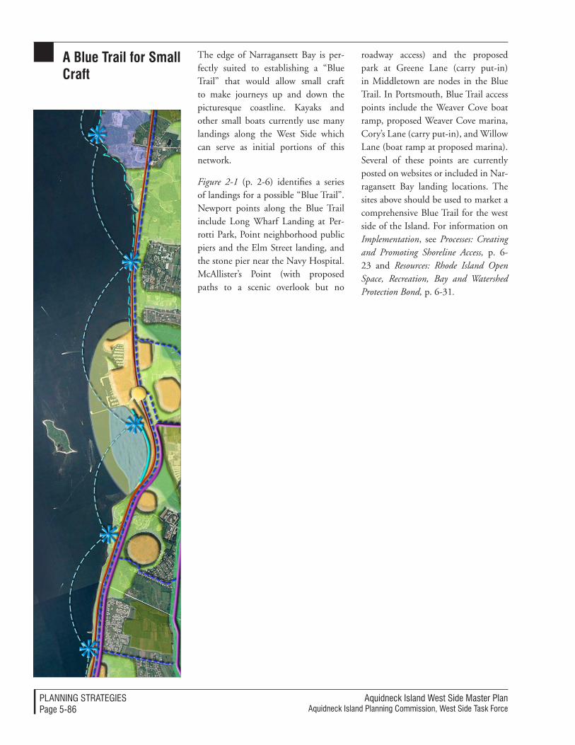
Aquidneck Island West Side Master PlanAquidneck Island Planning Commission, West Side Task Force
PlAnnIng STrATegIeSPage 5-86
a Blue trail for small Craft
The edge of Narragansett Bay is per-fectly suited to establishing a “Blue Trail” that would allow small craft to make journeys up and down the picturesque coastline. Kayaks and other small boats currently use many landings along the West Side which can serve as initial portions of this network.
Figure 2-1 (p. 2-6) identifies a series of landings for a possible “Blue Trail”. Newport points along the Blue Trail include Long Wharf Landing at Per-rotti Park, Point neighborhood public piers and the Elm Street landing, and the stone pier near the Navy Hospital. McAllister’s Point (with proposed paths to a scenic overlook but no
roadway access) and the proposed park at Greene Lane (carry put-in) in Middletown are nodes in the Blue Trail. In Portsmouth, Blue Trail access points include the Weaver Cove boat ramp, proposed Weaver Cove marina, Cory’s Lane (carry put-in), and Willow Lane (boat ramp at proposed marina). Several of these points are currently posted on websites or included in Nar-ragansett Bay landing locations. The sites above should be used to market a comprehensive Blue Trail for the west side of the Island. For information on Implementation, see Processes: Creating and Promoting Shoreline Access, p. 6-23 and Resources: Rhode Island Open Space, Recreation, Bay and Watershed Protection Bond, p. 6-31.
Aquidneck Island West Side Master PlanAquidneck Island Planning Commission, West Side Task Force
PlAnnIng STrATegIeSPage 5-87
UtiLitiEs The West Side planning process was able to conclude that utilities need not be a determining constraint on desirable patterns of use along the West Side. Either adequate resources and systems exist or good technical and operational solutions are available for the full range of land uses contem-plated within the West Side. However, there are numerous issues associated with the utility network that should be
resolved in order to provide cost effec-tive and environmentally responsible services. The decisions regarding fu-ture investment and operations in the infrastructure are within the control of the federal, state and local entities that will be the stewards of the West Side’s future. The following recommenda-tions suggest productive ways to move ahead.
Water supply and service recommendations
Most drinking water on Aquidneck Island is treated by the City of New-port and is either distributed via the municipal system to Newport and Middletown or is sold wholesale to the Navy and the Portsmouth Water and Fire District (PWFD) and distributed through their respective water systems. It is recognized that adequate water is available to meet projected needs but that several issues must be resolved to assure delivery to all Island residents, businesses and institutions.
opportunities for Coordination and CollaborationThe West Side Master Plan supports a forum for discussion such as that begun by the AIPC among representa-tives from the City of Newport, Towns of Middletown and Portsmouth, the Navy, PWFD, and the Rhode Island Economic Development Corporation (RIEDC) regarding water treatment and distribution issues. Such a forum is discussed in Implementation under Processes: The Intergovernmental Work-ing Group: Utility Forum and Utility Working Group Agenda Items, p. 6-57).
Future coordination and collaboration could reopen discussions of the following specific opportunities:
• Consideration of these alternatives or service options: 1) Regionaliza-tion of treatment and distribution for the City of Newport system, Navy, and PWFD; 2) Regional treatment but not distribution; and 3) Formation of an advisory committee with continued treat-ment by the City of Newport and distribution by the City of New-port, Navy, and PWFD. Rhode Island Economic Development Commission (RIEDC) has pre-pared a Cost Benefit Analysis of these options.
• Resolution of issues related to the Safe Drinking Water Act, especial-ly the Disinfectants Byproducts Rule. PWFD and Navy custom-ers at the ends of the distribution system have experienced water quality which does not meet these requirements. Treatment facility upgrades are required for compli-ance.
• Resolution of issues relating to the City of Newport’s delivery of water to Melville private busi-nesses which is “wheeled through” the Navy distribution system. Al-though the City of Newport issues water bills to these customers, the
Aquidneck Island West Side Master PlanAquidneck Island Planning Commission, West Side Task Force
PlAnnIng STrATegIeSPage 5-88
City cannot assure the water qual-ity since it is delivered through the Navy distribution system. The Navy system was sized for the Base population when the fleet was in port in the 1970’s. With reduced demand on the system, stagnation results in over-sized pipes.
• Negotiation of a contract be-tween the City of Newport and the PWFD which assures that adequate quantity and quality of supply will be available at an equi-table fee for future needs in Ports-mouth. The PWFD is currently operating without a contract specifying the quantity of water to be provided.
• Funding implications, restricted to government obligation bonds and the State Revolving Fund.
Most critical to the West Side Master Plan is the resolution of water distri-bution issues for future private devel-opment in the Melville area of Ports-mouth. This section is currently served by two redundant Navy lines (10-inch low pressure and 12-inch high pressure service). The PWFD 36-inch line on West Main Road is currently not ac-cessible for use in Melville because it is outside the service area, pumps are not sized for distribution to this area, and the PWFD does not have a contract with the City of Newport to assure that it will have the quantity of water to meet future expanded needs.
recommendations: Water supply and servicesThe Master Plan offers the following opportunities for water service to ex-isting and proposed development in Melville:
Negotiation with the Navy for transfer or purchase of the 10-inch low pressure line – The Navy Pub-lic Private Venture (PPV) Office has indicated that for the short-term it intends to continue to provide water and sewer service to both the Melville housing area and the Anchorage hous-ing area (including Quarters A), two Navy housing areas that are in the process of being privatized by GMH. GMH will lease the Anchorage hous-ing until the property is sold by the Navy for redevelopment. According to the PPV Office, the Navy intends to offer the Anchorage with the provision of sewer and water although the future developer may seek other alternatives. The Navy would retain the elevated storage tank at Melville together with an easement. The Navy intends to abandon the existing asbestos concrete pipes in place and provide new PVC service in approximately one quarter of the roadway in the housing areas (Phil Hakey, US Navy PPV Office, August 27, 2004).
The Navy Public Works Officer (PWO) has indicated that water ser-vice to GMH housing areas is sepa-rable, i.e. able to be separated from the Navy distribution system. (Naval Station Newport PWO, March 15, 2005). GMH may negotiate with lo-cal municipalities for water service if the Navy does not intend to continue water service to these housing areas. GMH is currently responsible for all water quality monitoring and issuance of any violation notices.
Disposition of either the 10-inch or 12-inch water line to Melville could be considered in the future. Engineering solutions appear to be feasible. Process and policy issues regarding liability, points of demarcation, easements and
Aquidneck Island West Side Master PlanAquidneck Island Planning Commission, West Side Task Force
PlAnnIng STrATegIeSPage 5-89
access points (including security of the Navy water supply) must be resolved. Prior to any negotiation the following information must be obtained:
• Layout and mapping of the sub-ject line.
• Pipe type (%), age, and size of piping.
• Configuration of laterals, separate laterals for each unit or shared and divided within structure.
• Current population and uses served.
• Inventory of infrastructure com-ponents: number of valves, meters, hydrants, booster pump stations (specific details of booster pump stations, i.e. number and size of pumps, age), chlorination stations (including chlorination protocol), sampling stations, vaults (valve or meters), and the like within sub-ject areas.
• Water demand records and records of operations and improvements: main breaks, relays of water line, cleaning, flushing, maintenance of hydrants, hydrant tests/testing, C-Value testing, water quality testing.
• Water pressures within the subject areas, with seasonal figures if avail-able.
• All readily available past system data detailing subject areas inclusive of system wide reports/studies and testing/sampling data and results.
Based on this information, the follow-ing should be completed to fully un-derstand the system and costs of neces-sary upgrades prior to negotiation:
• Conduct water quality analysis to determine any deficiencies in water quality.
• Consider required system changes for implementation to counteract any determined deficiencies in water quality. Prepare opinions of probable costs to reconfigure the system layout to eliminate dead end mains or stagnant areas within the system.
• Conduct pressure testing to evalu-ate system pressures and prepare opinions of probable costs to develop system changes for imple-mentation to counteract any de-termined deficiencies in pressures.
• Perform hydrant test to evalu-ate fire flows. Prepare opinions of probable costs to develop and implement system changes to counteract any determined defi-ciencies in fire flows.
• Perform C-Value testing to deter-mine conditions of pipes within the system. Prepare opinions of probable costs to develop and implement system changes to counteract any determined defi-ciencies in piping condition.
• Perform operation of all system components to insure their work-ing ability. Prepare opinions of probable costs to replace or correct any components with poor opera-tional characteristics. Components should include but not be limited to valves, meters, hydrants, booster pump stations, sampling stations, and vaults (valve or meters).
This information would provide the basis of negotiation. Options for own-ership of the line could include the PWFD (with extension of the service
Aquidneck Island West Side Master PlanAquidneck Island Planning Commission, West Side Task Force
PlAnnIng STrATegIeSPage 5-90
area), the City of Newport (Newport currently provides water service to Raytheon, Bayview and the Redwood Road subdivision), a community water supply board, or RIEDC (similar to the system at Quonset).
Extension of PWFD Service to Mel-ville – As indicated above, this would require a contract with the City of Newport to assure adequate quantity to meet projected needs, extension of the service area to Melville, and re-configuration of pumps to service this area. This option would require that water lines be extended to serve new development.
Extension of City of Newport Mu-nicipal Service to Melville – Two options could be considered: exten-sion of service through Raytheon or extension of service from Freedom Bay north along Burma Road to Melville. Further analysis would be required to determine if adequate supply and dis-
tribution networks would be available for either of these options.
Continuation of “Wheeling Through” the Navy System – This option is not favored by either the Navy or the City of Newport.
Desalinization – Past developers have considered this option but found costs to be prohibitive. A community water supply board would be required for operation and distribution.
Private or Community Wells – Past developers have considered this option but found that yield was only sufficient south of the tank farms. This informa-tion would have to be confirmed and further investigated to determine the cost of implementation. A community water supply board would be required for operation and distribution.
Further analysis is warranted to inves-tigate these options.
Aquidneck Island West Side Master PlanAquidneck Island Planning Commission, West Side Task Force
PlAnnIng STrATegIeSPage 5-91
sewer systems Wastewater treatment for the City of Newport, Town of Middletown, and Naval Station Newport is provided by the privately operated Newport Wastewater Treatment Plant. With the exception of Naval Station New-port property, no municipal sewage treatment is offered in Portsmouth. Individual Sewage Disposal Systems (ISDS), package treatment plants (Carnegie Abbey development) or hauling of septage to the Newport Wastewater Treatment Plant (Raythe-on) are used in Portsmouth. Provision of wastewater treatment is especially critical in Melville where increased development is proposed.
opportunities and recommendationsThe Master Plan offers the following opportunities for wastewater treatment for existing and proposed development in Melville and other West Side loca-tions in Portsmouth:
Municipal Wastewater Treatment (WWTF) Facility – Former Tank Farm #3 may be suitable for construction of a municipal WWTF. Approximately 10 acres should be reserved for current and projected use. Although this location is not convenient to areas of Town where failed ISDSs must be addressed per RIDEM, the Town of Portsmouth may realize several cost savings with a plant in the vicinity of Melville. By routing a sewer interceptor along the Newport Secondary, the need for pump stations could be reduced and traffic on local roads would not be disrupted for con-struction. Federal grants through the Economic Development Administra-tion would offset costs.
Land Cost Savings – A “hot transfer” may be arranged for the transfer of
property from the Navy to US Health and Human Services to the Town of Portsmouth for public benefit. This public purpose conveyance would be at no cost to the Town.
Treatment Cost Savings – Discharge from a plant at this location would be to Class SB waters, requiring a lower standard of treatment than to Class SA waters.
Permitting Cost Savings – According to RIDEM’s Water Quality Regula-tions antidegradation clause, there must be a compelling public project to discharge to SA waters (located off all other Portsmouth shorelines, includ-ing areas more convenient to failed ISDSs). If an alternative discharge to Class SB waters is available, the Town might be compelled by RIDEM to select that site. Note: one of the “tests” for degradation of SA waters would be to assess alternatives. If the tank farm site is a feasible alternative, it might preclude consideration of a plant in the northern section of Portsmouth with discharge to Mount Hope Bay or the Sakonnet River.
Operation Savings – Installation of a wind farm adjacent to the WWTF could be considered to generate power to defray operating cost. Information obtained from a test wind turbine installed in Bristol by Roger Williams University should be considered to de-termine if conditions at Tank Farm #3 would be suitable.
Economic Development – Provision of municipal wastewater treatment would improve the attraction for the expansion of marine trades in Melville and future expansion of the Raytheon campus. Representatives of Raytheon have indicated their support for municipal treatment as this would
Aquidneck Island West Side Master PlanAquidneck Island Planning Commission, West Side Task Force
PlAnnIng STrATegIeSPage 5-92
eliminate costly and inefficient hauling to the Newport WWTF. Increased commercial and industrial property tax return would help counterbalance the town’s current dependence on resi-dential property value. Public private partnerships and tax increment financ-ing could be considered to reduce the cost burden on Portsmouth neighbor-hoods.
Relative Isolation – The site of former Tank Farm #3 is relatively isolated from adjacent development and is exposed to prevailing southwesterly to northwesterly winds off the bay. Dispersion of any odors is best ac-complished with exposure to prevail-ing winds. The proposed Weaver Cove residential development would be at a lower elevation and therefore should not generally be subject to any odors. Existing homes/apartments at Bay View / Rolling Hills Road would be uphill and upwind from prevailing winds. Buffering around a plant (1,000-foot minimum would be best) would help mitigate any odors. Raytheon’s decommissioned WWTF is in the same general location, located on the north side of Lawton Brook instead of to the south.
Conventional ISDS – This would be a suitable wastewater treatment for single-family residential develop-ment. This land use is not proposed in Melville as part of the West Side Master Plan.
Innovative ISDS – RIDEM has ap-proved a series of Innovative or Al-ternative (I/A) ISDS Technologies for sites that do not meet the location, design or construction requirements of a conventional ISDS system. I/A Technology could be considered where sloping sites, high groundwater, soils with either slow or very rapid percola-
tion rates, and sites close to wetlands, coastal ponds, drinking water supplies or other critical water resources would constrain suitability for conventional ISDS construction. Under current RIDEM policy, all new development sites must meet existing requirements for conventional systems before being granted a permit to install an enhanced treatment system using I/A technology. Multiple homes or businesses may be served by a single enhanced I/A ISDS in some situations.
Community Wastewater System – A homeowner association must be formed on site with responsibil-ity based on percent of ownership. The homeowner association must be bonded. The system must be located on the property served.
Private Industrial Wastewater Treat-ment (for multiple users) – RIDEM would have concerns about a privately owned and operated wastewater treat-ment plant for the Melville area that would serve multiple marine trade businesses. Municipalities or RIEDC would be best suited to operate a fa-cility with diverse industrial pre-treat-ment requirements.
Septage Hauling to the Newport WWTF – Future development along the Burma Road could be served by possible wastewater storage and pri-mary treatment in former Navy tank farms with septage hauled to the New-port Wastewater Treatment Plant. This would be subject to a rigorous facilities planning review at the State and local levels. Raytheon currently collects its wastewater in the holding tanks of its former treatment plant and then hauls the septage to the Newport Wastewa-ter Treatment Plant daily. As indicated above, Raytheon is interested in seek-ing alternatives to this arrangement.
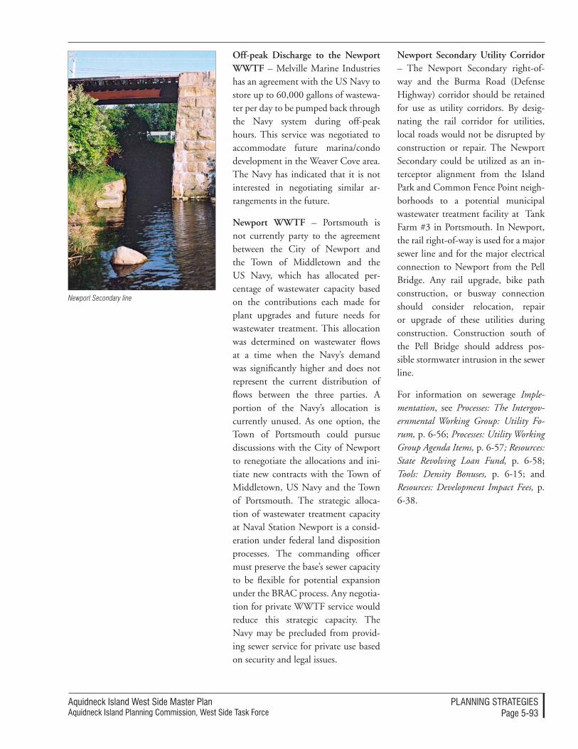
Aquidneck Island West Side Master PlanAquidneck Island Planning Commission, West Side Task Force
PlAnnIng STrATegIeSPage 5-93
Off-peak Discharge to the Newport WWTF – Melville Marine Industries has an agreement with the US Navy to store up to 60,000 gallons of wastewa-ter per day to be pumped back through the Navy system during off-peak hours. This service was negotiated to accommodate future marina/condo development in the Weaver Cove area. The Navy has indicated that it is not interested in negotiating similar ar-rangements in the future.
Newport WWTF – Portsmouth is not currently party to the agreement between the City of Newport and the Town of Middletown and the US Navy, which has allocated per-centage of wastewater capacity based on the contributions each made for plant upgrades and future needs for wastewater treatment. This allocation was determined on wastewater flows at a time when the Navy’s demand was significantly higher and does not represent the current distribution of flows between the three parties. A portion of the Navy’s allocation is currently unused. As one option, the Town of Portsmouth could pursue discussions with the City of Newport to renegotiate the allocations and ini-tiate new contracts with the Town of Middletown, US Navy and the Town of Portsmouth. The strategic alloca-tion of wastewater treatment capacity at Naval Station Newport is a consid-eration under federal land disposition processes. The commanding officer must preserve the base’s sewer capacity to be flexible for potential expansion under the BRAC process. Any negotia-tion for private WWTF service would reduce this strategic capacity. The Navy may be precluded from provid-ing sewer service for private use based on security and legal issues.
Newport Secondary Utility Corridor – The Newport Secondary right-of-way and the Burma Road (Defense Highway) corridor should be retained for use as utility corridors. By desig-nating the rail corridor for utilities, local roads would not be disrupted by construction or repair. The Newport Secondary could be utilized as an in-terceptor alignment from the Island Park and Common Fence Point neigh-borhoods to a potential municipal wastewater treatment facility at Tank Farm #3 in Portsmouth. In Newport, the rail right-of-way is used for a major sewer line and for the major electrical connection to Newport from the Pell Bridge. Any rail upgrade, bike path construction, or busway connection should consider relocation, repair or upgrade of these utilities during construction. Construction south of the Pell Bridge should address pos-sible stormwater intrusion in the sewer line.
For information on sewerage Imple-mentation, see Processes: The Intergov-ernmental Working Group: Utility Fo-rum, p. 6-56; Processes: Utility Working Group Agenda Items, p. 6-57; Resources: State Revolving Loan Fund, p. 6-58; Tools: Density Bonuses, p. 6-15; and Resources: Development Impact Fees, p. 6-38.
Newport Secondary line
Aquidneck Island West Side Master PlanAquidneck Island Planning Commission, West Side Task Force
PlAnnIng STrATegIeSPage 5-94
would enable the operator of the plant to sell electricity to utilities on the spot market and generate Renewable Energy Certificates (RECs).
The data generated by the turbine installed by the Roger Williams Uni-versity architecture department should be consulted to determine if this data is applicable to the tank farm site and if it would be cost effective to construct one or more turbines along the West Side. For the Implementation discus-sion regarding sustainable energy refer to Processes: Wind Turbines, p. 6-58 and Resources: Rhode Island Renewable Energy Fund, p. 6-58.
sustainable Energy Former Tank Farms #3 and #4 are proposed for siting wind turbines. Electricity generated could be used to defray operating costs at a municipal wastewater treatment facility or other municipal need. An industry standard turbine yields 1 to 1.5 megawatts of electricity with a 200-foot tower and a 160-foot diameter rotor. Use is compat-ible with a farm, picnic area, or parking lot among others. For comparison, the proposed Cape Wind project would yield 400 mW. With two turbines, 10 to 15 megawatts of energy may be generated. This would provide more than enough energy for operation of a municipal wastewater treatment and
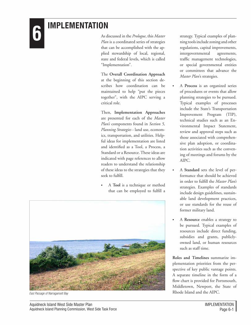
Aquidneck Island West Side Master PlanAquidneck Island Planning Commission, West Side Task Force
IMPleMenTATIonPage 6-�
6ImplementatIon
As discussed in the Prologue, this Master Plan is a coordinated series of strategies that can be accomplished with the ap-plied stewardship of local, regional, state and federal levels, which is called “Implementation”.
The Overall Coordination Approach at the beginning of this section de-scribes how coordination can be maintained to help “put the pieces together”, with the AIPC serving a critical role.
Then, Implementation Approaches are presented for each of the Master Plan’s components found in Section 5, Planning Strategies - land use, econom-ics, transportation, and utilities. Help-ful ideas for implementation are listed and identified as a Tool, a Process, a Standard or a Resource. These ideas are indicated with page references to allow readers to understand the relationship of these ideas to the strategies that they seek to fulfill.
A Tool is a technique or method that can be employed to fulfill a
strategy. Typical examples of plan-ning tools include zoning and other regulations, capital improvements, intergovernmental agreements, traffic management technologies, or special governmental entities or committees that advance the Master Plan’s strategies.
A Process is an organized series of procedures or events that allow planning strategies to be pursued. Typical examples of processes include the State’s Transportation Improvement Program (TIP), technical studies such as an En-vironmental Impact Statement, review and approval steps such as those associated with comprehen-sive plan adoption, or coordina-tion activities such as the conven-ing of meetings and forums by the AIPC.
A Standard sets the level of per-formance that should be achieved in order to fulfill the Master Plan’s strategies. Examples of standards include design guidelines, sustain-able land development practices, or use standards for the reuse of former military land.
A Resource enables a strategy to be pursued. Typical examples of resources include direct funding, subsidies and grants, publicly-owned land, or human resources such as staff time.
Roles and Timelines summarize im-plementation priorities from the per-spective of key public vantage points. A separate timeline in the form of a flow chart is provided for Portsmouth, Middletown, Newport, the State of Rhode Island and the AIPC. East Passage of Narragansett Bay
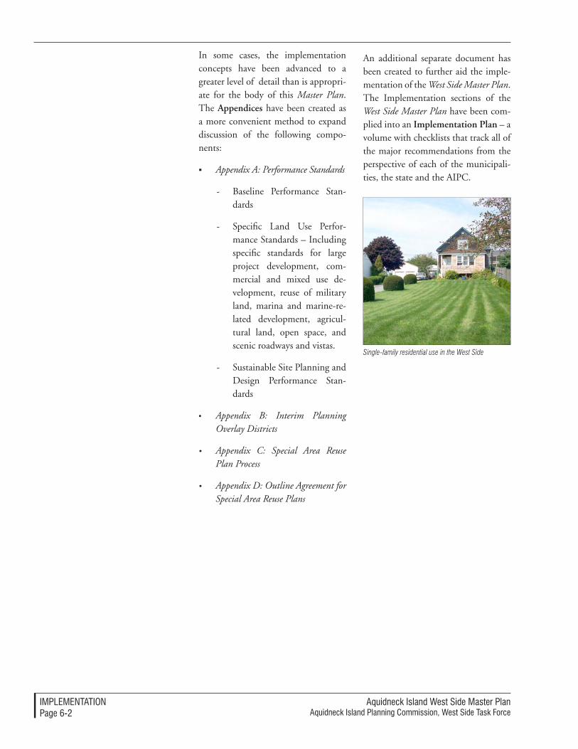
Aquidneck Island West Side Master PlanAquidneck Island Planning Commission, West Side Task Force
IMPleMenTATIonPage 6-�
In some cases, the implementation concepts have been advanced to a greater level of detail than is appropri-ate for the body of this Master Plan. The Appendices have been created as a more convenient method to expand discussion of the following compo-nents:
Appendix A: Performance Standards
- Baseline Performance Stan-dards
- Specific Land Use Perfor-mance Standards – Including specific standards for large project development, com-mercial and mixed use de-velopment, reuse of military land, marina and marine-re-lated development, agricul-tural land, open space, and scenic roadways and vistas.
- Sustainable Site Planning and Design Performance Stan-dards
• Appendix B: Interim Planning Overlay Districts
• Appendix C: Special Area Reuse Plan Process
• Appendix D: Outline Agreement for Special Area Reuse Plans
An additional separate document has been created to further aid the imple-mentation of the West Side Master Plan. The Implementation sections of the West Side Master Plan have been com-plied into an Implementation Plan – a volume with checklists that track all of the major recommendations from the perspective of each of the municipali-ties, the state and the AIPC.
Single-family residential use in the West Side
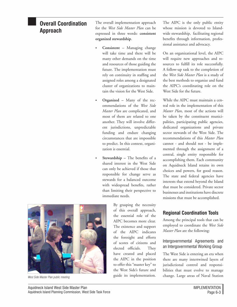
Aquidneck Island West Side Master PlanAquidneck Island Planning Commission, West Side Task Force
IMPleMenTATIonPage 6-�
overall Coordination approach
The overall implementation approach for the West Side Master Plan can be expressed in three words: consistent organized stewardship.
Consistent – Managing change will take time and there will be many other demands on the time and resources of those guiding the future. The implementation must rely on continuity in staffing and assigned roles among a designated cluster of organizations to main-tain the vision for the West Side.
Organized – Many of the rec-ommendations of the West Side Master Plan are complicated, and most of them are related to one another. They will involve differ-ent jurisdictions, unpredictable funding and endure changing circumstances that are impossible to predict. In this context, organi-zation is essential.
Stewardship – The benefits of a shared interest in the West Side can only be achieved if those that responsible for change serve as stewards for a balanced outcome with widespread benefits, rather than limiting their perspective to immediate needs.
By grasping the necessity of this overall approach, the essential role of the AIPC becomes more clear. The existence and support of the AIPC indicates the foresight and efforts of scores of citizens and elected officials. They have created and placed the AIPC in the position to offer this “master key” to the West Side’s future and guide its implementation.
The AIPC is the only public entity whose mission is devoted to Island-wide stewardship, facilitating regional benefits through information, profes-sional assistance and advocacy.
On an organizational level, the AIPC will require new approaches and re-sources to fulfill its role successfully. A follow-up task to the completion of the West Side Master Plan is a study of the best methods to organize and fund the AIPC’s coordinating role on the West Side for the future.
While the AIPC must maintain a cen-tral role in the implementation of this Master Plan, most of the actions will be taken by the constituent munici-palities, participating public agencies, dedicated organizations and private sector stewards of the West Side. The recommendations of this Master Plan cannot - and should not - be imple-mented through the assignment of a central, single entity responsible for accomplishing them. Each community on Aquidneck Island retains its own choices and powers, for good reason. The state and federal agencies have interests that extend beyond the Island that must be considered. Private sector businesses and institutions have discrete missions that must be accomplished.
Regional Coordination toolsAmong the principal tools that can be employed to coordinate the West Side Master Plan are the following:
Intergovernmental Agreements and an Intergovernmental Working Group
The West Side is entering an era when there are many intertwined layers of jurisdictional control and responsi-bilities that must evolve to manage change. Large areas of Naval Station West Side Master Plan public meeting
Aquidneck Island West Side Master PlanAquidneck Island Planning Commission, West Side Task Force
IMPleMenTATIonPage 6-�
Newport are poised for disposition, and tracts of land are being converted from military to private responsibility through the PPV initiative. Large land areas will change in use and ownership, and the utility infrastructure is not yet organized to address some current and future needs. The transportation network is highly dependent upon mul-tiple jurisdictions agreeing on routing, access and priorities of investment. The research and discussions that led to the Master Plan’s recommendations revealed that there are very few fundamental departures among the participating jurisdictions in terms of perspectives on common regional interests or goals. It also revealed that much of the resolution will take the form of intergovernmental agreements that assign responsibilities, costs and benefits among multiple par-ties. To this end, the West Side Master Plan recommends the creation of a West Side Intergovernmental Working Group facilitated by the AIPC to create a formalized forum for advancing initia-tives and finding early agreement – at least in principle – about how key pro-cedures and organizational frameworks should be mutually addressed. Such a forum will also limit the potential for misinformation and simple mistakes that can easily occur in the absence of consistent communication.
The Intergovernmental Working Group should be organized around a series of periodic meetings with agreed-upon agendas and a designat-ed chair. It should meet no less than quarterly for three years, at which point the participants may choose to continue the process, end the Work-ing Group, or alter the format for co-ordination. In the current context of active issues and initiatives, meetings may be productively held as frequently as monthly.
Representatives of the meetings should be formally designated by the participating entities, and member-ship should be limited to the major jurisdictions, agencies and govern-ment representatives responsible for the West Side. The Intergovernmental Working Group should be attended by individuals who are in positions to actively advance discussions toward in-tergovernmental agreements on topics of common concern.
The membership of the Intergovern-mental Working Group should consist of a core group of appointed partici-pants from:
Congressional delegation
Naval Station Newport
The Office of the Governor
State legislative delegation from Aquidneck Island
RIDOT
RIEDC
AIPC
Town of Middletown
Town of Portsmouth
City of Newport
Additional participants should be invited to participate in specific meet-ings or meeting agenda items. Addi-tional participation could be solicited from other federal or state agencies, local redevelopment authorities or commissions.
A series of special forums or meetings should be advanced on significant top-ics, such as utility issues for example – in effect, a utility subcommittee should be created as one of several possible subcommittees. However, key land planning and development topics will be linked to utility infrastructure solutions, so the agendas must be coor-dinated in time and topics. Additional

Aquidneck Island West Side Master PlanAquidneck Island Planning Commission, West Side Task Force
IMPleMenTATIonPage 6-�
ideas regarding the utility forum are discussed at length in Utility Processes, p. 6-56 below.
It is important to differentiate between the roles of the Intergovernmental Working Group (IWG) and the AIPC. The IWG will be focused on particular issues during specific periods of time, while the AIPC will retain an overall co-ordination and stewardship role in plan-ning for the future of the West Side.
Site Planning and Design Awards to Commend Success
The AIPC should initiate a biannual program of site planning and design awards for projects that fulfill the land use recommendations of the West Side Master Plan. This awards program should be jointly sponsored with the Rhode Island chapters of the American Institute of Architects, the American Society of Landscape Architects, and the American Planning Association. The awards program results should be publicized on-island, in addition to the publicity provided by the collaborating professional associations.
AIPC Website for Information and Advocacy
The AIPC website will increasingly become a common ground for infor-mation and updates regarding West Side planning progress. The organiza-tion should aggressively pursue specific funding and professional resources to expand the range of activities and in-formation available on-line.
West Side Master Plan Update
The West Side Master Plan should be comprehensively reviewed and up-dated after ten years. The master plan update process should invite broad public participation. Progress towards
the long term vision should be charted and new issues examined, using techni-cal studies and reports as a foundation for further planning. An updated plan should be distributed and employed to advance revised priorities that take into account the changing context of the West Side.
Regional Coordination processesThe AIPC can sponsor and conduct various processes that will help lead to successful implementation of the West Side Master Plan.
Periodic Progress Reviews
The AIPC should continue to play its leadership role in ensuring that regional coordination occurs so that shared interests can be achieved in a timely and cost effective manner. This responsibility rests with its Executive Committee and its staff. The Executive Committee should maintain a review of the West Side Master Plan imple-mentation as a scheduled item on its agenda, and AIPC staff can prepare periodic updates that describe progress and recommend adjustments in the implementation approaches.
endorsing and Adopting the West Side Master Plan
The Master Plan should be endorsed or adopted by communities, institutions, agencies and organizations. The process should be managed by the AIPC. The manner and import of endorsement or adoption will vary; in some cases, either all of the Master Plan’s recommendations or selected portions may be adopted as formalized policy. More commonly, the Master Plan is expected to be endorsed and then used as the basis for more spe-cific planning actions and incorporated
Aquidneck Island West Side Master PlanAquidneck Island Planning Commission, West Side Task Force
IMPleMenTATIonPage 6-6
into plans and decisions tailored to each municipality or agency using established procedures. There will need to be an or-ganized and managed process to provide consistent information, updates regard-ing adoptions and endorsements, and provide mutual support among commu-nities. The effort is expected to require website support, special publications and staffed outreach/support.
Annual Community Updates
The AIPC should prepare, distribute and present a brief annual update on progress on the West Side Master Plan to the constituent municipalities, jurisdictions and key organizations involved in its implementation. This should take the form of a short briefing paper and could be accompanied by a staff and Board presentation at Town and City Council meetings.
Annual West Side Transportation “Summit”
The AIPC should host an annual discussion of transportation issues, projects and plans that assemble key participants in the regional transporta-tion network. This discussion should be structured around a progress review relative to the recommendations of the West Side Master Plan. It should be employed as a means to inform the AIPC’s input to the State’s TIP, which is discussed below.
Regional Transportation Improvement Plan (TIP) Input
The AIPC should continue focused monitoring, advocacy and input to the biannual state Transportation Im-provement Program from the regional perspective for the West Side planning area. This process augments local input prior to the State’s finalized list of proj-ect and funding priorities.
Special Studies
The AIPC should continue to sponsor and conduct special studies that benefit multiple jurisdictions and constituen-cies and help implement the Master Plan. In some cases, these studies may be facilitated by the AIPC, as was the case for the Fiscal Impact Analysis prepared to gauge the impact of Navy Housing privatization on municipal services and budgets. In other cases, these initiatives may be co-sponsored with collaborating jurisdictions, institu-tions or organizations. Among the spe-cial studies and services recommended for short term action are the following:
Land Planning: Military Land Reuse Technical Studies – Tech-nical studies to support the land disposition process such as en-vironmental mitigation models and remediation cost estimates, legal services on land transfer and disposition issues, evalua-tion of transportation impacts, detailed road or rail alignment studies, detailed environmental resource studies, technical review of Federal/Department of Defense reports, proposals or studies, tech-nical studies of funding or financ-ing options.
Land Planning: Military Land and Ongoing Coordination – Ongoing coordination with the BRAC realignment at Naval Sta-tion Newport, Privatization, Con-gressional or other land disposition processes consisting of meetings, review of proposed actions, poli-cies and procedures, preparation of information and status reports for distribution.
Site Planning and Design Stan-dards – Preparation of tailored site
Aquidneck Island West Side Master PlanAquidneck Island Planning Commission, West Side Task Force
IMPleMenTATIonPage 6-�
planning and design standards to assist adoption and implementa-tion by constituent municipalities, including meetings and coordina-tion support.
Land Preservation Tools – Stud-ies and activities to advance the preferred additional open space and agricultural land preservation tools identified in the Master Plan, such as financial evaluation and feasibility studies, preparation of legislation or legal documents, grant applications or other tools.
Affordable Housing – Staffing of coordination meetings and in-formation resources among inter-ested constituencies: municipali-ties, GMH, non-profit housing providers, others.
Military-related Use Marketing Plan and Activities – Targeted marketing and information mate-rials for military-related business, ongoing coordination and sup-port among interested parties.
Marine-related Use Marketing Plan and Activities – Preparation of targeted marketing and infor-mation materials for desirable marine-related business, ongoing coordination and support among existing businesses, municipali-ties, state agencies, organizations and landowners.
Heritage Trail Implementation Planning – Planning and design for specific sites, coordination with related programs and facilities, preparation of promotional infor-mation, identification of additional funding sources, contribution to fabrication and placement of sig-nage, site improvements.
Wind Power – Site specific techni-cal and financial feasibility studies to provide additional municipal power generation sources.
Transit Planning – Technical and coordination efforts to advance the preferred transit technologies and operations for the West Side.
Bicycle Path and Trail Program – Technical studies and detailed engineering to advance segments of the bicycle path and trail pro-gram in concert with public land, conservation actions, military land transfers and large property redevelopment. Ongoing identi-fication and advocacy for funding and resources.
Wayf ind ing/ Ident i f i c a t ion Program – Environmental signage/graphic design program to create consistent and attractive wayfinding/identification program, preparation of signage designs and specifications, identification of funding, fabrication and place-ment.
Roadway Aesthetics: Specific Landscape and Roadway Stan-dards for the West Side - Land-scape architecture, graphic and other detailed design standards to be incorporated into public roadway and transit projects for the West Side, including standard details, conditions, and specifica-tions.
Green Development – Sus-tainable “green development” principles to be applied through public improvements and land use regulations, or possible Request for Proposals for development.
Aquidneck Island West Side Master PlanAquidneck Island Planning Commission, West Side Task Force
IMPleMenTATIonPage 6-�
Utility Planning – Technical studies to advance regional utility issues on the West Side including water and wastewater service to Melville, and potential transfer of Navy lines to municipal, regional or private infrastructure operators.
Regional Coordination StandardsStandards can be used as a means to encourage and gauge a high level of coordinated activity where recommen-dations span jurisdictional lines.
Implementation Matrix: Measuring Suc-cess of the West Side Master Plan
A West Side Master Plan implementa-tion matrix has been provided to the AIPC to track the many diverse activi-ties that will help implement the Master Plan. The summary matrix can be used as a common reference resource and practical checklist regarding each of the Master Plan’s major recommendations. The matrix is composed of a list of each major recommendation, the time frame in which it might best be accomplished, and related roles and responsibilities.
Regional Consistency Statements
The AIPC should be employed to pro-vide formalized input into large scale development and public infrastructure approval processes by providing pro-fessional planning opinions concern-ing their consistency with regional planning contained in the West Side Master Plan. This can take the form of Regional Consistency Statements that could be required by local or state policy and regulation to ensure that the impacts and benefits of regionally-important actions are considered prior to final approvals being advanced.
The reviews would be advisory to the municipalities and participants. The Regional Consistency Statement would be prepared prior to final ap-proval of major projects, comparing the impacts of the proposed project relative to the recommendations con-tained in the West Side Master Plan. The requirement for a Statement of Regional Consistency could be in-serted into zoning or subdivision regu-lations at the local level by the partici-pating municipalities. Such Regional Consistency Statements could be required through intergovernmental agreements for major public projects as part of the public participation pro-gram. These Statements could also be a required step for creating approved Special Area Reuse Plans for the dispo-sition of former military land through intergovernmental agreements (see p. 6-22).
Qualifying projects would be within the West Side and could be distinguished by scale or type (for example, large developments that would have a master plan required as part of the review and approval process). These reviews would respond to a list of specific questions regarding any of the components of the West Side Master Plan (a “Scope of Re-view”). The AIPC would be responsible for providing the response, and would employ staff and/or professional as-sistance in regard to technical matters. The response would be prepared in written form within a determined time frame: typically, one month.
Model Regulations
The AIPC could serve as a source of model regulations for consideration by Aquidneck Island’s municipalities, gathered through interaction with other state and regional planning entities throughout Rhode Island and
Aquidneck Island West Side Master PlanAquidneck Island Planning Commission, West Side Task Force
IMPleMenTATIonPage 6-�
New England that encounter similar issues. While this activity is likely to have applications for many other areas of Aquidneck Island, the West Side Master Plan implementation will also benefit from such standards.
Regional Coordination ResourcesResources used for the regional coor-dination activities of the AIPC will include continued dedication of a portion of the organization’s financial and staff and volunteer resources that are funded through ongoing commit-ments. As a follow-up to the comple-tion of the West Side Master Plan, the AIPC will be investigating orga-nizational and resource requirements in order to pursue its stewardship of the West Side and the other aspects of its mission. Among the additional resources that should be considered as part of this process are the following:
AIPC Services
These services may include profes-sional support for a variety of activities associated with the implementation of the West Side Master Plan that directly benefit other stakeholders in the future of the West Side – municipalities, agen-cies and institutions. Examples of such services could range from facilitation of the Intergovernmental Working Group, preparation and coordination of special studies, or facilitation of workshops and meetings on base re-alignment and disposition of land.
Fees for Regional Consistency Statements
A schedule of fees could be established for provision of Regional Consistency Statements. This schedule could be incorporated into local zoning or subdi-
vision ordinances for qualifying projects or as a part of intergovernmental agree-ments as discussed in the Regional Coor-dination Tools section on p. 6-3 .
Grant Sources
The AIPC should use the balance of grant proceeds dedicated to the West Side Master Plan process to advance its implementation, as well as targeting and pursuing other federal, state and institutional grant sources in the con-text of its overall fundraising priorities.
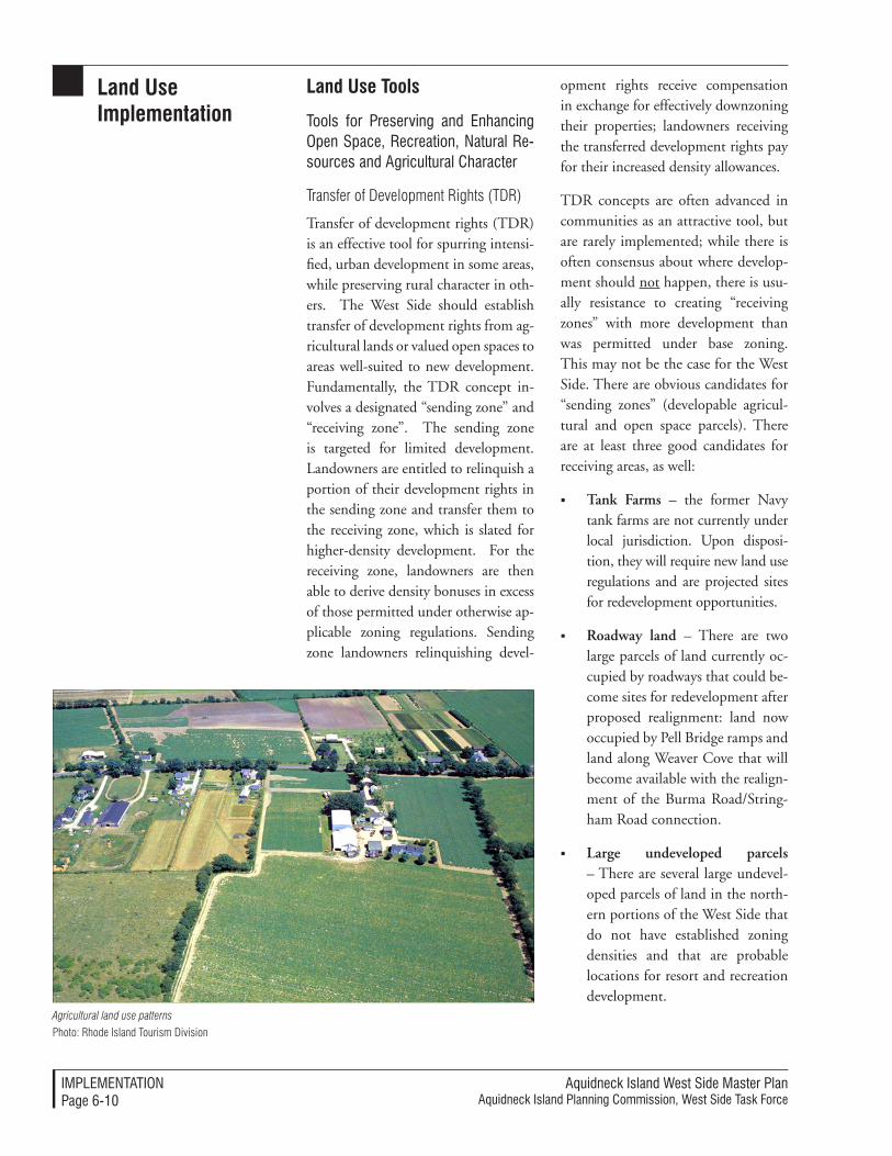
Aquidneck Island West Side Master PlanAquidneck Island Planning Commission, West Side Task Force
IMPleMenTATIonPage 6-�0
land Use Implementation
land Use tools
Tools for Preserving and enhancing open Space, Recreation, natural Re-sources and Agricultural Character
Transfer of Development Rights (TDR)
Transfer of development rights (TDR) is an effective tool for spurring intensi-fied, urban development in some areas, while preserving rural character in oth-ers. The West Side should establish transfer of development rights from ag-ricultural lands or valued open spaces to areas well-suited to new development. Fundamentally, the TDR concept in-volves a designated “sending zone” and “receiving zone”. The sending zone is targeted for limited development. Landowners are entitled to relinquish a portion of their development rights in the sending zone and transfer them to the receiving zone, which is slated for higher-density development. For the receiving zone, landowners are then able to derive density bonuses in excess of those permitted under otherwise ap-plicable zoning regulations. Sending zone landowners relinquishing devel-
opment rights receive compensation in exchange for effectively downzoning their properties; landowners receiving the transferred development rights pay for their increased density allowances.
TDR concepts are often advanced in communities as an attractive tool, but are rarely implemented; while there is often consensus about where develop-ment should not happen, there is usu-ally resistance to creating “receiving zones” with more development than was permitted under base zoning. This may not be the case for the West Side. There are obvious candidates for “sending zones” (developable agricul-tural and open space parcels). There are at least three good candidates for receiving areas, as well:
Tank Farms – the former Navy tank farms are not currently under local jurisdiction. Upon disposi-tion, they will require new land use regulations and are projected sites for redevelopment opportunities.
Roadway land – There are two large parcels of land currently oc-cupied by roadways that could be-come sites for redevelopment after proposed realignment: land now occupied by Pell Bridge ramps and land along Weaver Cove that will become available with the realign-ment of the Burma Road/String-ham Road connection.
Large undeveloped parcels – There are several large undevel-oped parcels of land in the north-ern portions of the West Side that do not have established zoning densities and that are probable locations for resort and recreation development.
Photo: Rhode Island Tourism DivisionAgricultural land use patterns
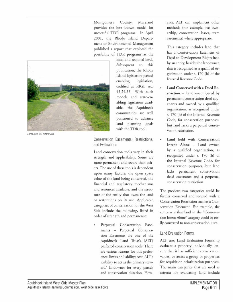
Aquidneck Island West Side Master PlanAquidneck Island Planning Commission, West Side Task Force
IMPleMenTATIonPage 6-��
Montgomery County, Maryland provides the best-known model for successful TDR programs. In April 2001, the Rhode Island Depart-ment of Environmental Management published a report that explored the possibility of TDR programs at the
local and regional level. Subsequent to this publication, the Rhode Island legislature passed enabling legislation, codified at RIGL sec. 45.24.33. With such models and state-en-abling legislation avail-able, the Aquidneck communities are well positioned to advance land planning goals with the TDR tool.
Conservation Easements, Restrictions, and Evaluations
Land conservation tools vary in their strength and applicability. Some are more permanent and secure than oth-ers. The use of these tools is dependent upon many factors: the open space value of the land being conserved, the financial and regulatory mechanisms and resources available, and the struc-ture of the entity that owns the land or restrictions on its use. Applicable categories of conservation for the West Side include the following, listed in order of strength and permanence:
Perpetual Conservation Ease-ments – Perpetual Conserva-tion Easements are one of the Aquidneck Land Trust’s (ALT) preferred conservation tools. There are various reasons for this prefer-ence: limits on liability; cost; ALT’s inability to act as the primary stew-ard/ landowner for every parcel; and conservation duration. How-
ever, ALT can implement other methods (for example, fee own-ership, conservation leases, term easements) where appropriate.
This category includes land that has a Conservation Easement or Deed to Development Rights held by an entity, besides the landowner, that is recognized as a qualified or-ganization under s. 170 (h) of the Internal Revenue Code.
Land Conserved with a Deed Re-striction – Land encumbered by permanent conservation deed cov-enants and owned by a qualified organization, as recognized under s. 170 (h) of the Internal Revenue Code, for conservation purposes, but land lacks a perpetual conser-vation restriction.
Land held with Conservation Intent Alone – Land owned by a qualified organization, as recognized under s. 170 (h) of the Internal Revenue Code, for conservation purposes, but land lacks permanent conservation deed covenants and a perpetual conservation restriction.
The previous two categories could be further conserved and secured with a Conservation Restriction such as a Con-servation Easement. For example, the concern is that land in the “Conserva-tion Intent Alone” category could be eas-ily converted to non-conservation uses.
Land Evaluation Forms
ALT uses Land Evaluation Forms to evaluate a property individually, en-sure that it has sufficient conservation values, or assess a group of properties for acquisition prioritization purposes. The main categories that are used as criteria for evaluating land include
Farm land in Portsmouth
Aquidneck Island West Side Master PlanAquidneck Island Planning Commission, West Side Task Force
IMPleMenTATIonPage 6-��
wildlife habitat values, water resource values, agricultural values, scenic val-ues and recreational values in addition to a few other considerations listed on the form. At a minimum, each Land Evaluation Form is jointly completed by ALT’s Land Protection Director and a qualified biologist/naturalist and used in a confidential, truthful, and objective manner. This system has worked very well for the Island and thus should be endorsed in terms of the approach and institutional pro-cedures. For open space performance standards, refer to Appendix A. Perfor-mance Standards
Tools for Managing the Conversion of Military or other Public land to other Uses
Local Redevelopment Authorities (LRAs)
Local Redevelopment Authorities (LRAs) facilitate local management and control of redevelopment projects; they are excellent tools to effectu-ate the disposition process of public land to private sector use. Such a redevelopment authority possesses the advantages of a single, community-based entity with clear responsibility for accomplishing the planning and implementation of a unique, large-parcel reuse and redevelopment. The agency serves as a single point of con-tact for the community and a cohesive intermediary among local, state, and possibly federal parties. This step is useful in creating local control to fa-cilitate desirable redevelopment in the context of disposition of either federal or state land, and can be accomplished in several ways.
This Master Plan suggests advantages for the municipalities to empower a local redevelopment agency that unites the functions of the Local Re-
development Authority (LRA), similar to the BRAC planning process, with the State-legislated Redevelopment Agency (RDA) model. Inspired by BRAC procedures and enabled by RDA legislation, this distinctive rede-velopment agency would be enabled for the purposes of redeveloping large, prior-selected military or public lands. The reuse plans for these special areas are described more fully in Appendix C. Special Area Reuse Plans.
The powers that are granted to an LRA are entirely dependent upon the range of actions that are reasonably antici-pated - and for which clear advantages exist in vesting these powers in such a specialized public entity. In view of the recommended redevelopment ac-tivities suggested in this Master Plan, the powers assigned to an LRA could reasonably include all of the powers allowed within the enabling legisla-tion (Title 45, Chapter 45-32 of the Rhode Island General Laws) with the exception of the following: the ability of the LRA to exercise eminent do-main should be carefully considered. The criteria for granting this power should be a determination - based on professional planning analyses - that eminent domain is likely to be needed to accomplish an defined redevelop-ment mission in the specific context of private property within the proposed redevelopment project area.
On Aquidneck Island, an LRA struc-ture could be effectively used in the transfer and redevelopment of Tank Farms #1 and #2 or other portions of the Weaver Cove/Melville area for public and private reuse, for example. Should the Island adopt a cohesive strategy regarding multiple redevel-opment areas in the future, a hybrid model could also offer the flexibility
Aquidneck Island West Side Master PlanAquidneck Island Planning Commission, West Side Task Force
IMPleMenTATIonPage 6-��
of implementing a reuse plan based on a consensus vision of effected mu-nicipalities for land development with regional implications. This would in-clude creating a joint operating agree-ment among LRA’s, forming a region-wide LRA, or formally designating an existing authority to act on behalf of multiple jurisdictions. Similarly, LRA in Newport could be essential in fa-cilitating productive redevelopment of the Pell Bridge/North End Area. This could be accomplished through a new entity, or by revising the structure and mission of the existing Newport Rede-velopment Authority.
The RIEDC as an Implementation Tool
As an alternative to LRA’s, at a state level the RIEDC provides similar rede-velopment tools and structure that can be used to enable key redevelopment actions. It may serve as the best vehicle for some – or even all – of the rede-velopment activities associated with the reuse of military land and public property recommended in this Master Plan. However, it will be important to ensure that the state, regional and local priorities are fully coordinated. To this end, the communities and the state should employ the mechanism of the Intergovernmental Working Group and intergovernmental agreements to clearly define roles, responsibilities and distribute costs and benefits ap-propriately.
Other than the RIEDC or LRAs discussed above, this Master Plan dis-courages the formation of other state-enabled redevelopment authorities to advance projects within the West Side. In part, this recommendation reflects a consistent consideration that local and regional considerations must play a very strong role in shaping future land use and development.
Intergovernmental Agreements
Intergovernmental Agreements can effectively be employed to establish lease or use agreements for land and facilities, provide for services and as-sociated compensation, assign man-agement responsibilities for programs and redevelopment, and apply perfor-mance standards and design guidelines that are in keeping with this Master Plan. Under certain circumstances, intergovernmental agreements can be used to establish or distribute impact fees for new projects. The agreements could be enacted through the Inter-governmental Working Group. This is an alternative that addresses local priorities through agreement instead of via regulatory processes. For more information on the Intergovernmental Working Group, consult page 6-4.
Technical Tools for Building on Dis-turbed Land
Preliminary evaluations performed for this Master Plan suggest that the site planning for new buildings or struc-tures at the former tank farms is not likely to be significantly impeded be-cause of the remnants of the tanks and their foundations. However, technical tools are available to solve such issues, if they arise.
Deep Dynamic Compaction (DDC) is one of various engineering techniques used to test and resolve particular structural and environmental con-cerns on sites slated for reuse where removal of pre-existing material is not practically feasible. This tool may be applicable for the tank farms on the West Side in the event that buildings or structures need to be placed over land disturbed by the foundations and demolition of the former tanks. DDC conducts borings studies to determine
Aquidneck Island West Side Master PlanAquidneck Island Planning Commission, West Side Task Force
IMPleMenTATIonPage 6-��
the relative density of materials, sur-veys to determine if there are sensitive structures in the vicinity, and assesses weight compaction by means of a large crane with a tall and narrow load at multiple points on the site. Another al-ternative approach is to construct any buildings with a pile structure or deep foundations where the load is born by the native material beneath the area disturbed by implosion. Both methods are technically complex and expensive. Test borings to determine the exact density of material and suitability for construction would need to be carried out prior to any formal development proposal.
Tools for Promoting Desirable Devel-opment Patterns
Interim Planning Overlay Districts (IPODs)
Interim Planning Overlay Districts (IPODs) address the conflict between the realities of a fast-moving real estate market and slower municipal processes. This is essentially a conflict between the development rights of the property owner and the interests of the community. IPODs allow for the improvement of local regulations and public policy without inhibiting devel-opment opportunities. The overlay is geared to coexist with the extant zoning of a large area and yet supplement that zoning with new policies. The policies might focus on improved environmen-tal standards, design guidelines, or density and mixed-use development stipulations. IPODs are designed to control development within a specific and limited time period; ordinances are in effect temporary, with ‘sunset’ provisions. It is this provisional as-pect that ensures the IPOD will not infringe on property rights.
An IPOD is a zoning amendment which is supported by a comprehen-sive plan revision. The overlay zon-ing is enabled by a Planning Board recommendation and approval by Town Council. On the West Side, IPODs could be established to best advance regional and local goals and the principles and strategies of the West Side Master Plan. IPODs could be ef-fectively implemented in underutilized commercial districts or areas that may be subject to redevelopment, such as near the Pell Bridge in Newport.
For more detailed IPOD implementa-tion information, consult Appendix B: Interim Planning Overlay Districts.
Growth Centers
Growth centers, or “priority invest-ment areas”, are local Smart Growth initiatives in Rhode Island. According to the State Guide Plan, growth centers should “encourage compact, mixed-use development; preserve open space; conserve natural resources; fit the type of development to the capability of the land to support development; and promote a sense of community.” Growth centers are “dynamic and ef-ficient centers for development that have a core of commercial and com-munity services, residential develop-ment, and natural and built landmarks and boundaries that provide a sense of place.” They advance a range of trans-portation modes and housing types, advocate historic preservation, and increase access to employment.
The municipal identification of growth centers creates pinpointed ar-eas for the investment of State support. Municipalities volunteer to identify a growth center, for possible State ap-proval. Both the municipality and the State benefit from this identification,
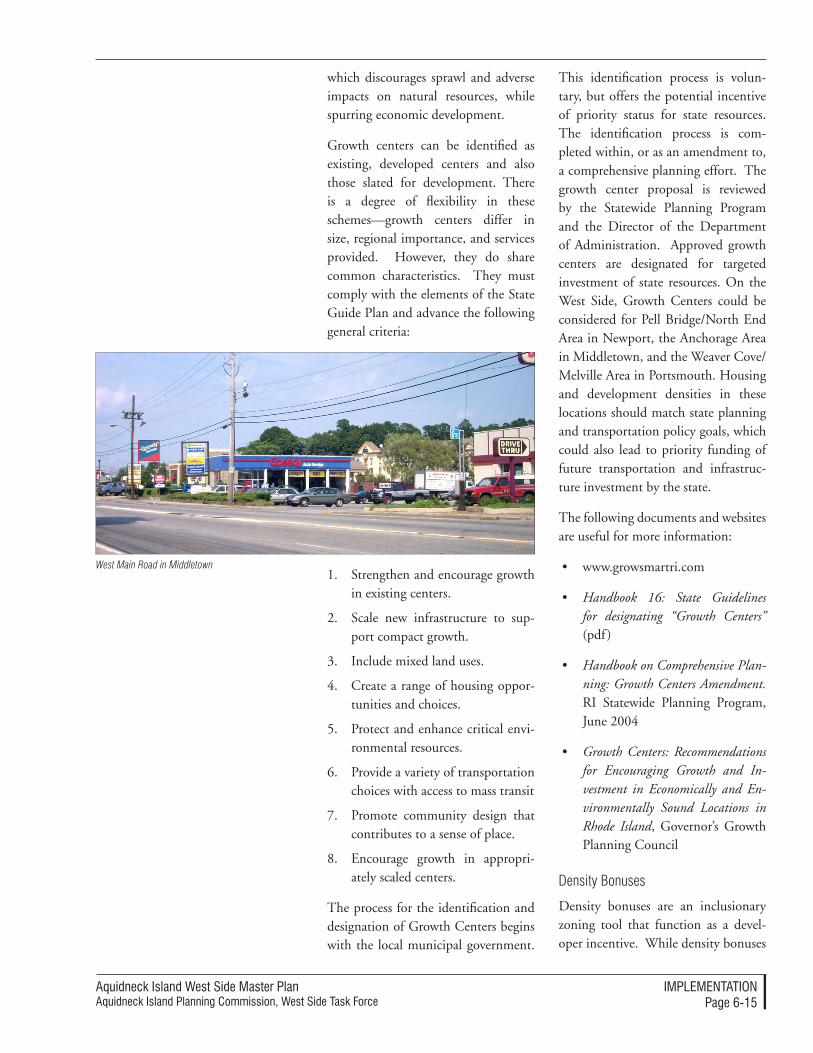
Aquidneck Island West Side Master PlanAquidneck Island Planning Commission, West Side Task Force
IMPleMenTATIonPage 6-��
which discourages sprawl and adverse impacts on natural resources, while spurring economic development.
Growth centers can be identified as existing, developed centers and also those slated for development. There is a degree of flexibility in these schemes—growth centers differ in size, regional importance, and services provided. However, they do share common characteristics. They must comply with the elements of the State Guide Plan and advance the following general criteria:
1. Strengthen and encourage growth in existing centers.
2. Scale new infrastructure to sup-port compact growth.
3. Include mixed land uses.
4. Create a range of housing oppor-tunities and choices.
5. Protect and enhance critical envi-ronmental resources.
6. Provide a variety of transportation choices with access to mass transit
7. Promote community design that contributes to a sense of place.
8. Encourage growth in appropri-ately scaled centers.
The process for the identification and designation of Growth Centers begins with the local municipal government.
This identification process is volun-tary, but offers the potential incentive of priority status for state resources. The identification process is com-pleted within, or as an amendment to, a comprehensive planning effort. The growth center proposal is reviewed by the Statewide Planning Program and the Director of the Department of Administration. Approved growth centers are designated for targeted investment of state resources. On the West Side, Growth Centers could be considered for Pell Bridge/North End Area in Newport, the Anchorage Area in Middletown, and the Weaver Cove/Melville Area in Portsmouth. Housing and development densities in these locations should match state planning and transportation policy goals, which could also lead to priority funding of future transportation and infrastruc-ture investment by the state.
The following documents and websites are useful for more information:
• www.growsmartri.com
• Handbook 16: State Guidelines for designating “Growth Centers” (pdf )
• Handbook on Comprehensive Plan-ning: Growth Centers Amendment. RI Statewide Planning Program, June 2004
• Growth Centers: Recommendations for Encouraging Growth and In-vestment in Economically and En-vironmentally Sound Locations in Rhode Island, Governor’s Growth Planning Council
Density Bonuses
Density bonuses are an inclusionary zoning tool that function as a devel-oper incentive. While density bonuses
West Main Road in Middletown
Aquidneck Island West Side Master PlanAquidneck Island Planning Commission, West Side Task Force
IMPleMenTATIonPage 6-�6
are customarily used for affordable housing initiatives in residential proj-ects, they can also be used to generally address a community need. The phys-ical, cultural and even social goals of a community can be promoted by allow-ing land developers to provide specific amenities and benefits in exchange for zoning incentives. Density bonuses al-low developers to build more housing units than would normally be permit-ted in a zoning district, in exchange for providing a public benefit. The public benefit could range from the preservation or enhancement of a natural resource or open space to the development of a wastewater treat-ment plant on the property. To similar effect, other incentives could include adjustments to height restrictions or modifications of some other require-ments in the zoning ordinance.
Transportation Improvements
Transportation improvements can fulfill land use and economic devel-opment goals. Through local bud-geting, Transportation Improvement Programs (TIP), or impact fees from private development, the enhancement of highway corridors provides for high quality landscaping, removal of private encroachments, consolidated access, high quality signing and circulation improvements which support higher value, mixed-use commercial cor-ridors. On the West Side, this could be applied along the West Main Road/J.T. Connell and Coddington High-way corridors.
Similarly, former transportation land can become a Smart Growth redevel-opment opportunity. If transportation land is made available through an im-provements process, that excess land could be transferred to a LRA. This approach transfers former RIDOT
and/or state land at minimal cost to a designated LRA for planning, reuse and disposition. The strategy requires regional coordination and assistance in the preparation of a master plan for the area that helps identify alternative locations for existing uses in the area. The Pell Ramp relocations offer this opportunity on the West Side. The Newport DPW facilities may have to be relocated in this scenario. This rec-ommendation will need the provision of study, design and implementation funds for a parking/transit multi-mod-al facility in the area. It will further en-tail the adoption of large development performance criteria and guidelines either through the local regulatory process or as direct conditions on the transfer of public property.
As will be shown later, this tool may also be effective for transportation im-provements on military land.
Tools for establishing Scenic Roads and Protecting Vistas
State Scenic Roadway Designation
Designated scenic roadways and scenic vistas can be established at the state level to protect the cultural, historic, and visual character of travel along the West Side of Aquidneck Island. These designations:
acknowledge local history and his-torical significance of a corridor;
establish links among open space areas;
ensure public notification of the visual qualities of an area as viewed from the road;
support economic development initiatives that take advantage of this public designation with its views and vistas; and,
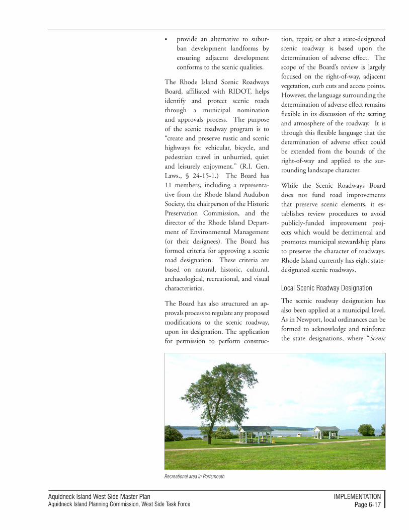
Aquidneck Island West Side Master PlanAquidneck Island Planning Commission, West Side Task Force
IMPleMenTATIonPage 6-��
provide an alternative to subur-ban development landforms by ensuring adjacent development conforms to the scenic qualities.
The Rhode Island Scenic Roadways Board, affiliated with RIDOT, helps identify and protect scenic roads through a municipal nomination and approvals process. The purpose of the scenic roadway program is to “create and preserve rustic and scenic highways for vehicular, bicycle, and pedestrian travel in unhurried, quiet and leisurely enjoyment.” (R.I. Gen. Laws., § 24-15-1.) The Board has 11 members, including a representa-tive from the Rhode Island Audubon Society, the chairperson of the Historic Preservation Commission, and the director of the Rhode Island Depart-ment of Environmental Management (or their designees). The Board has formed criteria for approving a scenic road designation. These criteria are based on natural, historic, cultural, archaeological, recreational, and visual characteristics.
The Board has also structured an ap-provals process to regulate any proposed modifications to the scenic roadway, upon its designation. The application for permission to perform construc-
tion, repair, or alter a state-designated scenic roadway is based upon the determination of adverse effect. The scope of the Board’s review is largely focused on the right-of-way, adjacent vegetation, curb cuts and access points. However, the language surrounding the determination of adverse effect remains flexible in its discussion of the setting and atmosphere of the roadway. It is through this flexible language that the determination of adverse effect could be extended from the bounds of the right-of-way and applied to the sur-rounding landscape character.
While the Scenic Roadways Board does not fund road improvements that preserve scenic elements, it es-tablishes review procedures to avoid publicly-funded improvement proj-ects which would be detrimental and promotes municipal stewardship plans to preserve the character of roadways. Rhode Island currently has eight state-designated scenic roadways.
Local Scenic Roadway Designation
The scenic roadway designation has also been applied at a municipal level. As in Newport, local ordinances can be formed to acknowledge and reinforce the state designations, where “Scenic
Recreational area in Portsmouth
Aquidneck Island West Side Master PlanAquidneck Island Planning Commission, West Side Task Force
IMPleMenTATIonPage 6-��
highway means any road, street, av-enue, drive or other vehicular, pedes-trian or bicycle route which has been designated as a component of the state system of scenic highways pursuant to Title 24 Chapter 15 of the Gen-eral Laws.” (Newport City Ordinance, Section 17.92.020., Usages). Such is the basis for the designation of Ocean Drive in Newport.
There are several instances in which a local scenic designation has been supplemented with additional clas-sification to ensure its character. New-port’s Ocean Drive District has been locally designated as a scenic vista, “a defined angle of perception within the landscape which limits the view to a particular part of the landscape while providing the viewer with an unobstructed sight line to distant land, water, structure of historic or cultural significance or in the continuation of a series of such sight lines or vistas. This shall include all scenic vistas along a designated scenic highway.” (Newport City Ord. 4-97 § 1 (part), 1994: prior code § 1262.05.02) The designation of scenic vistas for districts and road-ways can further inhibit adverse modi-fications to natural, historic, cultural and visual character.
For information regarding the specific content of scenic roadway performance standards, and how they could be tai-lored for the West Side, please consult Appendix A.
Façade and Landscape Improvement Programs
Façade and landscape improvement programs use a combination of public funding sources such as CDBG fund-ing, loans and private loan pools to provide incentives for private sector enhancements.
land Use processes
Processes to Preserve open Space, natural Resources and Agricultural Character
Special Area Management Planning (SAMP)
The Special Area Management Plan-ning (SAMP) is a comprehensive planning process for natural resource protection and reasonable economic growth in coastal areas. The uses and users of coastal resources are not always mutually compatible and often in con-flict. Special Area Management Plans (SAMPs) recognize these discrepancies within:
• Areas where resource degradation conflicts with existing, important economic facilities and infrastruc-ture.
• Zones slated for major, new eco-nomic development, experienc-ing rapid economic transition, or burdened by substantial user conflicts.
• Pollution hot-spots.
• Trans-boundary areas with signifi-cant coastal management issues.
• Areas of high risk for erosion and flooding.
SAMPs address and resolve these envi-ronmental and economic relationships in coastal areas. They also work to resolve social and recreational issues. Where these conflicts are widespread, a SAMP is used to collect and exam-ine data, identify potential develop-ment trends and clarify anticipated or existing conflicts between different uses. SAMPs form strategies to pro-tect and manage resources in order to insure that the goals of the various

Aquidneck Island West Side Master PlanAquidneck Island Planning Commission, West Side Task Force
IMPleMenTATIonPage 6-��
users of the resource are compatible. The preparation of a SAMP explores alternatives that address and manage coastal resource conflicts and identi-fies policies to implement the chosen alternatives. The plans then contain detailed and comprehensive policy statements; standards and criteria to guide public and private uses of lands and waters; and mechanisms for timely implementation in specific geographic areas within the coastal zone.
The Coastal Resources Management Council manages multiple SAMP ini-tiatives for critical watersheds. Section 309 of the Coastal Zone Management Act of 1972 can also be implemented to fund SAMPs. The planning mecha-nism partners central government with local government to manage the geographic areas of particular national concern or interest. The planning ap-proach is consensus-driven through participation by key stakeholders. It re-sults in binding commitments among participating entities and agencies, and has proven to be very effective in dealing with complex projects having major environmental impacts. This type of planning is especially useful for problems which cross political bound-aries and require the cooperation of numerous different groups, sometimes with conflicting interests. Special Area Management Planning could be used along the West Side waterfront, Weaver Cove and Melville.
SAMPs can also function as effective Economic Development processes for coastal properties.
Legal and Policy Processes for Land Conservation
The Aquidneck Land Trust (ALT) em-ploys a number of legal processes that should be applied to preserve valued
open spaces, natural resources and ag-ricultural lands. To the greatest extent practical, all future conserved land not owned by federal, state, municipalities or non-profit organizations should be conserved through conservation ease-ments. The AIPC and the municipali-ties should formally support (through official endorsements) the efforts of the ALT to conserve land through such conservation easements. The AIPC and the municipalities should also sup-port the efforts of the ALT to strength conservation language for properties that are conserved through deed re-strictions or conservation intent only. The AIPC can augment the open space preservation criteria and prioritization process of the ALT through use of the Statement of Regional Consistency tool (see p. 6-8 above), in keeping with the additional considerations con-tained in this Master Plan. The land conservation tools are described above (p. 6-10 to 6-14).
U.S. Fish and Wildlife Service Habitat Assessment
The U.S. Fish and Wildlife Service (USFWS) should be involved in any assessment of habitat and habitat res-toration that will be part of the reuse process of former military land. They may be especially interested in habitat restoration for tank farms or for habi-tat improvements at Melville Ponds. The Special Area Reuse Plan process advocated in the West Side Master Plan should explicitly request a USFWS habitat assessment and promote direct USFWS involvement in habitat resto-ration standards and reviews.
Parallel Implementation Processes
Interagency coordination and support will allow the AIPC and other West Side stewards to promote the principles and
Aquidneck Island West Side Master PlanAquidneck Island Planning Commission, West Side Task Force
IMPleMenTATIonPage 6-�0
strategies of the West Side Master Plan through parallel initiatives of local agen-cies, institutions, and corporations.
For example, the AIPC should support the efforts of Portsmouth’s Melville Pond Committee and the Raytheon Employees’ Wildlife Habitat Commit-tee to connect routes into local trail networks. A trail network could con-nect existing trails at Raytheon north-ward with the expanding trail system at Melville Ponds. This would link well-documented habitats at Raytheon with trails through overgrown and un-documented areas in Melville. Trails could also extend into Lawton Valley, via the pull-off on the old West Main Road near the Lawton water treat-ment plant. It is recognized that this “canyon” is steep, and that any “trail” would involve hopping from rock to rock within the brook itself.
In addition, the AIPC should support the efforts of ALT, Raytheon, Bay View Apartments, the Navy and Newport in any actions regarding preservation of Lawton Brook. This property should be conserved with conservation ease-ments to assure that the land is never developed.
Processes for the Disposition of Mili-tary land
There are several different processes that are commonly used to transfer the use of federally-owned military land so that it can be used for either other pub-lic uses or for private sector redevelop-ment. Typical processes are described below. The specific disposition process to be employed is fundamentally de-termined by the federal government – through Congress or through federal agencies. Each of the processes has dif-ferent implications for the state and local jurisdictions.
Special Legislation
Congress can pass special legislation that disposes of military land that supersedes all other procedures or ac-tions. If approved by the President, special legislation can be used to transfer specific land areas for specific purposes. This approach may specify the process or set conditions on the disposition process, such as its use or the entity that will receive and manage the land.
Base Realignment and Closure (BRAC)
A highly organized and planned selection process for closure and/or reorganization of military properties is the Base Realignment and Closure (BRAC) process (section 2909 of Title 10). This process has occurred on a periodic basis; the most recent pre-liminary recommendations for realign-ment and closure throughout the U.S. and overseas were announced in May 2005 Under the current recommenda-tion, Naval Station Newport will be a recipient of some additional military activities, and no land disposition of property was proposed.
If land is chosen for closure in future BRAC processes, this procedure re-quires the land to be put up for bid for private development unless the land, or any portion of it, is:
Requested by the Navy or another military division;
Requested for housing for the homeless (McKinney Act);
The land is redeveloped for eco-nomic development. In this case the land can be given to a rede-velopment authority at no cost if a formally adopted Base Reuse Plan is prepared according to federal
Aquidneck Island West Side Master PlanAquidneck Island Planning Commission, West Side Task Force
IMPleMenTATIonPage 6-��
procedures that proposes economic development uses for the land. The Secretary of Defense must confer with the Governor of the State and the heads of local government prior to any action for disposal.
Provided as Public Benefit Con-veyance for open space or rec-reation that is taken and either maintained or transferred to a state or local entity by the Depart-ment of Interior, National Park Service.
The disposition process is run through the Department of Defense (DOD) with the Navy as land owner. The Navy has a real estate office that pro-vides a face to the process. Typical ne-gotiations require time or contact with Washington D.C. offices. The com-munities and the state are consulted in the process.
In the event that an economic develop-ment disposition is sought, a redevel-opment authority may be authorized under state law that fulfills federal legal standards and would become the point for negotiation and eventual transfer of the property. The authority is given seven years to complete the transfer process and six years for the planning and reuse process, which is, by previous experience a very tight schedule for ac-tion for a project of any significance. If no redevelopment authority exists, then the Secretary of Defense must confer with the local government, or the agen-cy designated by the Governor.
Early Transfer
In the event that portions of Naval Station Newport are disposed through the BRAC process, the communities proceed with a redevelopment plan for economic development, the communi-
ties could opt for ‘Early Transfer.’ This option puts the land into the hands of the private or redevelopment interests who may then proceed to initiate envi-ronmental clean-up instead of waiting for the military to complete the clean-up. This typically saves many years in the clean-up effort, while it keeps the former military owners responsible for the pollution and remediation. This re-quires a contract involving a developer, a remediation team, and an insurance program – all of which should be part of the redevelopment planning.
Government Service Administration (GSA) Disposition
In some cases, the GSA, through its Public Buildings Service, is authorized to dispose of land under Title 40 of the U.S. Code for federal agencies finding no use for their holdings. Just as with BRAC, the GSA land disposition pro-cess follows the same steps:
offer first to another division of the Navy;
then offered to another military division;
then offered to other federal agencies;
then offered to State agencies and authorities;
then offered for housing for the homeless (McKinney Act);
then offered to the local commu-nities for economic development;
then open to private bid.
Public Benefit Conveyance
A Public Benefit Conveyance is a land transfer option that occurs through a federal agency as part of a land disposi-tion process. As an example, portions of land can be provided to the Depart-ment of Interior, National Parks Ser-
Aquidneck Island West Side Master PlanAquidneck Island Planning Commission, West Side Task Force
IMPleMenTATIonPage 6-��
vice (DOI/NPS) by the Department of Defense (federal to federal transfer) on the basis that they will be used for open space preservation or public recreation and will be turned over to either an-other federal agency, a state agency, or a local authority for management. This option can be negotiated directly between a community and the federal agency.
Lease or Use Agreements
The Navy and Department of De-fense are empowered to execute lease or use agreements for facilities and land that are not currently needed for military purposes. This could in-clude leases or agreements for public facilities or for the use (including im-provements) of infrastructure, such as the proposed Burma Road/Shoreline Drive corridor.
Interim Lease Agreements are also possible, wherein a property is used for non-federal purposes while it is undergoing the lengthy disposal and/or cleanup process.
Processes to Manage the Reuse of Former Military land
Creating Local Redevelopment Authori-ties (LRAs)
These tools can be created using the state Redevelopment Agency (RDA) process. The enabling legislation for an RDA is contained in Chapters 31-33 of Title 45 of the Rhode Island Gen-eral Laws. The Laws specify that an RDA and its functions are established and authorized through a resolution adopted via municipal council vote. The member appointments, compen-sation, tenure, officer appointments, and findings of the agency are also detailed in the State Laws.
Special Area Reuse Planning
A “Special Area Reuse Plan” is a new process that is recommended for ap-plication to significant dispositions of former military land. The Special Area Reuse Plan would be created through a joint planning agreement among the local, regional and state jurisdictions. Appendix D: Outline Agreement for Spe-cial Area Reuse Plans presents more in-formation on the nature of this process and the structure of agreements among the participating jurisdictions to em-ploy this method. The joint planning process would help ensure an informed and coordinated approach to reuse and redevelopment of critical land and in-frastructure resources that are likely to be disposed of in the future – the tank farms, Burma Road, the Naval Hospi-tal and other assets.
The Special Area Reuse Plan process would mirror the Base Realignment and Closure (BRAC) Reuse Plan pro-cess, which has proven highly effective in providing a shared public process for specific reuse decisions. It is an ex-cellent method to ensure coordinated regional planning, provide appropriate local control and that private sector reuse will be unlocked to meet state, regional and local economic develop-ment goals. In the BRAC process, the Reuse Plan is managed through a Lo-cal Redevelopment Authority (LRA). A Special Area Reuse Plan could be managed by a municipality or a LRA, which in Rhode Island practice is typi-cally called a “Redevelopment Agency” (RDA). A state entity such as the RIEDC could also manage the process. The contents of a Special Area Reuse Plan would be established through a preliminary scoping process and could combine fiscal, land-use, environmen-tal remediation, infrastructure, trans-portation, open space and recreation,
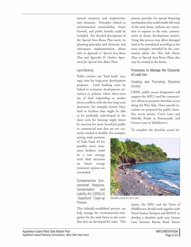
Aquidneck Island West Side Master PlanAquidneck Island Planning Commission, West Side Task Force
IMPleMenTATIonPage 6-��
natural resources and implementa-tion elements. Principles related to environmental sustainability, Smart Growth, and public benefit could be included. For detailed descriptions of the Special Area Reuse Plan tactic, its planning principles and elements, and subsequent implementation, please refer to Appendix C: Special Area Reuse Plan and Appendix D: Outline Agree-ment for Special Area Reuse Plans.
Land Banking
Public entities can “land bank” stra-tegic sites for long-term development purposes. Land banking must be linked to economic development ini-tiatives or policies where short-term use of land responding to market forces conflicts with the best long term directions. For example, former Navy land or facilities that might be able to be profitably redeveloped in the short term for housing might better be reserved for more beneficial public or commercial uses that are not cur-rently needed or feasible. For example, setting aside portions of Tank Farm #3 for possible sewer treat-ment facilities could be a wise strategy until final decisions on future sewage treatment options are concluded.
Comprehensive Envi-ronmental Response, Compensation and Liability Act (CERCLA) “Superfund” Clean-up Process
This federally-established process can help manage the environmental miti-gation for the tank farms in the event that they are developed for reuse. This
process provides for special financing mechanisms that could enable full reuse of the tank farms, without any restric-tion or expense to the state, commu-nities or future development entities. Using this process may allow damaged land to be remediated according to the reuse strategies intended by the com-munity plans, the West Side Master Plan, or Special Area Reuse Plans that may be created in the future.
Processes to Manage the Character of land Use
Creating and Promoting Shoreline Access
CRMC public access designation will support the AIPC’s and the communi-ties’ efforts to promote shoreline access along the West Side. Three specific lo-cations are proposed for public shore-line access points: Cory’s Lane and Melville Ponds in Portsmouth, and Greene Lane in Middletown.
To complete the shoreline access ini-
tiative, the AIPC and the Town of Middletown should work together with Naval Station Newport and RIDOT to develop a shoreline park near Greene Lane between Burma Road (future
Shoreline access at Cory’s Lane
Aquidneck Island West Side Master PlanAquidneck Island Planning Commission, West Side Task Force
IMPleMenTATIonPage 6-��
Shoreline Drive) and the Newport Secondary. This park would create a connection between Green Lane and the proposed fishing pier and kayak launch for parking, picnicking and ser-vice facilities. Portions of this property are currently owned by the Navy along Burma Road and RIDOT as part of the Newport Secondary right-of-way. Co-ordination would be required with both entities to either transfer land, provide a long-term lease or develop an inter-governmental agreement for public use, upgrades, operation, and maintenance.
Marketing Blue Trails will advance waterfront access strategies of the West Side Master Plan. The AIPC should work with organizations interested in marketing Blue Trails for kayaks and other small boats. Trails.com includes links to locations in Narragansett Bay including Newport Harbor and Fort Adams. These trails could be expanded to include waters off of the West Side with stops at McAllister’s Point, Greene Lane Park (carry put-in), Weaver Cove boat ramp, Cory’s Lane (carry put-in), and Willow Lane (boat ramp at proposed marina).
Creating Performance Standards and Design Guidelines
Performance standards and design guidelines are the next level of land use management beyond standard land use regulations. Where regula-tions are typically prescriptive and proscriptive, performance standards allow flexible paths to reach an ob-jective. Assembled at the local level, communities can obtain high quality projects that are locally contextual-ized and site-specific. This section details the process of forming perfor-mance standards. The mechanisms and sample content of performance standards and design guidelines are
discussed in more detail in Appendix A: Performance Standards.
The first step in the process of estab-lishing new guidelines and standards is to decide on the goals that the com-munity wishes to accomplish with these tools. This could include such purposes as higher quality design for private projects and better energy effi-ciency in public buildings. These could also be used to find the best solutions for a particular type of development such as agricultural land preservation or large mixed-use projects. For each goal, a separate combination of guide-lines or performance standards may be found most appropriate.
The next step is a decision on the approach to defining community standards. There are distinctions be-tween guidelines and performance standards that should be noted prior to determining which avenue to follow in developing the program.
Performance standards are the broad-er approach that allows the designer and developer to look at any number of options to meet those standards, and allows the community to make the determination as to whether those standards have been attained. Performance standards typically fo-cus on environmentally-benign and energy-efficient design approaches, but can also deal with issues such as accessibility and mobility.
Design guidelines can be more specific architectural and site planning stan-dards that create a specific character of place, such as a pedestrian-friendly location that is defined by certain features including streetscape, build-ing entrances, fenestration and sign placement, or a ‘New England’ style character of a place.
Aquidneck Island West Side Master PlanAquidneck Island Planning Commission, West Side Task Force
IMPleMenTATIonPage 6-��
After considering the differences, a combination of these approaches may be found appropriate for differ-ent procedures or project types. After noting these differences, there are fur-ther decisions as to how the guidelines and standards will be implemented, prior to looking at the specific review process. The key is to determine the relative weight of analysis that can be accomplished with the community’s resources. With less specific stan-dards, a higher review effort is nec-essary to determine achievement of the standards. The community may have a planner, but additional staff or additional technical experts may be needed if the determinations are complex and lengthy. On the other hand, with higher specificity in the standards there are fewer design op-tions that the proponent can offer, and there is a greater chance that vari-ance from the standards are needed to address specific circumstances. The earlier decisions on the goals of the process will help guide these choices.
The onus should be placed on the applicants to show how the proposed designs meet the intent of the guide-lines. Applicants should demonstrate, through narrative text, photographic studies, site plan submittals and draw-ings of proposed improvements, how the proposed project conforms to the standards, or, describe why and where reasonable modifications are being proposed. The following information could be used to describe the design intent and specific design or perfor-mance elements.
Define the landscape character and original architectural style(s) found in the area, including buildings in adjacent and nearby districts and then describe how the
project intends to fit with, comple-ment, or improve the area style(s).
Describe the natural and man-made resources, the quality of those resources, and their rela-tionship to the project proposal.
Define the approach used in cre-ating the proposed building and site design, and how the project conforms to the specific design guidelines and performance stan-dards for the type of proposed project. This could include: the building façade treatments pro-posed in the design, describing how the site design creates an appropriate composition, listing access and visibility requirements unique to the business, define accessibility and transportation, show how energy efficiency is improved, and show how features and farmland is being preserved.
Design decisions that would signifi-cantly impact access or environmen-tal mitigation to the projects but are outside the local development review process, such as highway design and coastal resources management, should be considered concurrently by the re-sponsible public and state agencies.
land Use Standards
open Space Preservation Standards
Additional criteria for conservation of open space and public access could enhance the well-developed approach of the Aquidneck Land Trust and the communities in preserving open space. Two different types of standards are dis-cussed below. The first are standards for selection that will help establish the en-vironmental and civic value of the land to be preserved. The second list can de-
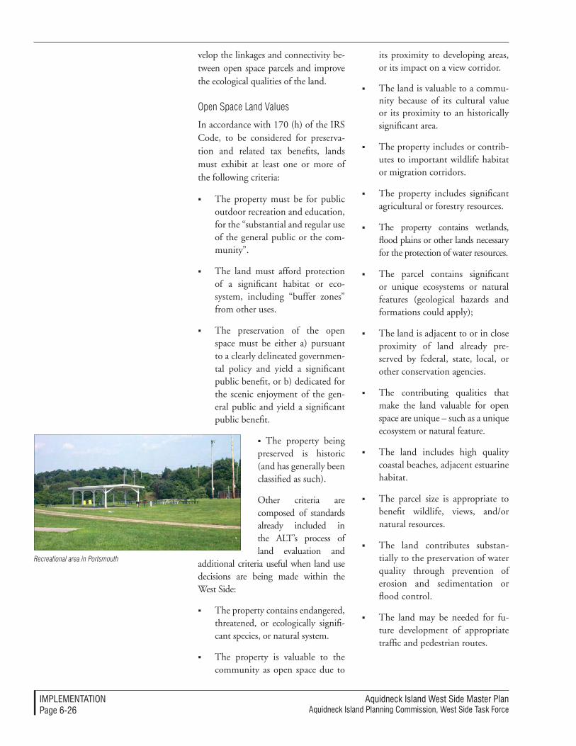
Aquidneck Island West Side Master PlanAquidneck Island Planning Commission, West Side Task Force
IMPleMenTATIonPage 6-�6
velop the linkages and connectivity be-tween open space parcels and improve the ecological qualities of the land.
Open Space Land Values
In accordance with 170 (h) of the IRS Code, to be considered for preserva-tion and related tax benefits, lands must exhibit at least one or more of the following criteria:
The property must be for public outdoor recreation and education, for the “substantial and regular use of the general public or the com-munity”.
The land must afford protection of a significant habitat or eco-system, including “buffer zones” from other uses.
The preservation of the open space must be either a) pursuant to a clearly delineated governmen-tal policy and yield a significant public benefit, or b) dedicated for the scenic enjoyment of the gen-eral public and yield a significant public benefit.
The property being preserved is historic (and has generally been classified as such).
Other criteria are composed of standards already included in the ALT’s process of land evaluation and
additional criteria useful when land use decisions are being made within the West Side:
The property contains endangered, threatened, or ecologically signifi-cant species, or natural system.
The property is valuable to the community as open space due to
its proximity to developing areas, or its impact on a view corridor.
The land is valuable to a commu-nity because of its cultural value or its proximity to an historically significant area.
The property includes or contrib-utes to important wildlife habitat or migration corridors.
The property includes significant agricultural or forestry resources.
The property contains wetlands, flood plains or other lands necessary for the protection of water resources.
The parcel contains significant or unique ecosystems or natural features (geological hazards and formations could apply);
The land is adjacent to or in close proximity of land already pre-served by federal, state, local, or other conservation agencies.
The contributing qualities that make the land valuable for open space are unique – such as a unique ecosystem or natural feature.
The land includes high quality coastal beaches, adjacent estuarine habitat.
The parcel size is appropriate to benefit wildlife, views, and/or natural resources.
The land contributes substan-tially to the preservation of water quality through prevention of erosion and sedimentation or flood control.
The land may be needed for fu-ture development of appropriate traffic and pedestrian routes.
Recreational area in Portsmouth
Aquidneck Island West Side Master PlanAquidneck Island Planning Commission, West Side Task Force
IMPleMenTATIonPage 6-��
The land enhances adjacent or nearby public lands for access, buffer or consolidation.
Preservation of the land is consis-tent with Local Comprehensive Plan, Local Open Space Plan, Regional or Watershed Plan and Greenways/ Green space Element of the State Guide Plan.
Open Space Connectivity
Connectivity standards can be used to implement a strategy for creating a network of usable open spaces within the West Side, integrated with other existing open spaces throughout the Island. The purposes for linking parcels range from ecological goals to enhanced access. The standards would be imple-mented as part of either public projects or as a consequence of regulatory pro-cesses for private land development.
The quality of the connections that will create preserved natural corridors with appropriate views and vistas is a key goal of the West Side Master Plan. The following are some of the impor-tant standards and intended results:
Create a network of biking and walking trails connecting the shoreline to open space reserva-tions in the interior of the Island.
Conserve the existing public ac-cess and rights-of-way and pro-mote environmentally appropriate use of the shoreline (limited access in sensitive habitat areas for envi-ronmental protection).
Require each new shoreline devel-opment to increase public access to the shoreline by permanent dedication of an easement and parking, as appropriate.
Classify and measure the type of public access both in terms of quantity as well as quality.
Create a shoreline trail that would link all shoreline parks and require every new development to contrib-ute to the extension of the trail.
Formulate public access design guidelines for siting development along the shore and maximizing visual and physical public access.
Create a “Green Map” that would outline parks, wetlands, preserva-tion areas, recreation areas, trails, and transit.
Undertake capital improvement projects for enhancing the public realm, including signage pro-grams, educational material, and guidebooks and the like.
Prevent sprawl by concentrating development in higher density areas to allow more land to be set aside for open space.
Adopt mechanisms like Transfer of Development Rights to pre-serve connections.
Performance Standards
The use of performance standards is a particular emphasis of this Master Plan. The addition of performance standards to the community toolkits for growth management offers a new way to judge proposals and guide development and design. By specify-ing standards of performance, the municipalities can supplement their as-of-right, special permit and subdi-vision approvals processes where they may be unable to address special prob-lems. Performance standards can be used to supplement licensing, leasing,
Aquidneck Island West Side Master PlanAquidneck Island Planning Commission, West Side Task Force
IMPleMenTATIonPage 6-��
and general regulations. In addition, the standards can influence municipal approaches to agreements, acquisitions and infrastructure investments, thus clarifying the expectations required to tailor community goals.
Performance standards can be em-ployed through a variety of planning tools such as zoning, overlay zoning, site plan review, direct conditions on disposition of public property, through a Special Area Reuse Plan, or simply through advisory reviews.
The following sections briefly present these performance standards. They range from “Baseline Standards” to standards tailored to the specific land uses. More full delineations of baseline and specific land use performance standards are provided in Appendix A. Performance Standards.
Baseline Performance Standards
Baseline Performance Standards apply to the overall development of land and the management and improvement of roadways in the West Side. The devel-opment of land may adversely impact the surrounding resources, both on- and off-site. Performance standards for land clearing and construction can mitigate, if not eliminate, these impacts. Associated with land clearing, these standards pre-serve original topography, protect wildlife and archaeology, limit cut and fill, control erosion and sedimentation, and promote re-vegetation of the site. Street construc-tion and improvement projects must also embrace performance standards to promote connectivity, transit continuity, and stormwater management. Detailed articulation of these baseline performance standards is provided in Appendix A. Per-formance Standards
Large Project Development Performance Standards
Large project development performance standards are relatively consistent with Smart Growth and Sustainable Design principles. The extended tenure and multiple phases of large projects create additional considerations aside from the standards for each element, which are described over the following pages. These standards enhance the long-term viability of large-scale projects by pro-moting sustainability, density, a range of housing types, commercial and cultural components, street and transit connec-tivity, ADA compliance, and aesthetic review processes.
The performance standards should recognize that length of time for full build-out may require the project to reconsider certain pieces or modify the original concepts. This could be very important in traffic manage-ment, for which long-term changes in traffic from unrelated development may require a different approach to maintaining flow, or allowing different traffic loads on the streets. This could also apply to utility systems and the standards that define long-term im-provements and acceptable demands and loads. Design guidelines should also distinguish between different sec-tions of the project to ensure that the project is not completely homogenous, but instead provides compatible varia-tion and accented areas for continued interest and coherence.
Commercial and Mixed Use Develop-ment Performance Standards
Commercial and mixed use develop-ment performance standards work in conjunction with local dimensional requirements and zoning. Given com-patibility among these requirements, these standards articulate the best
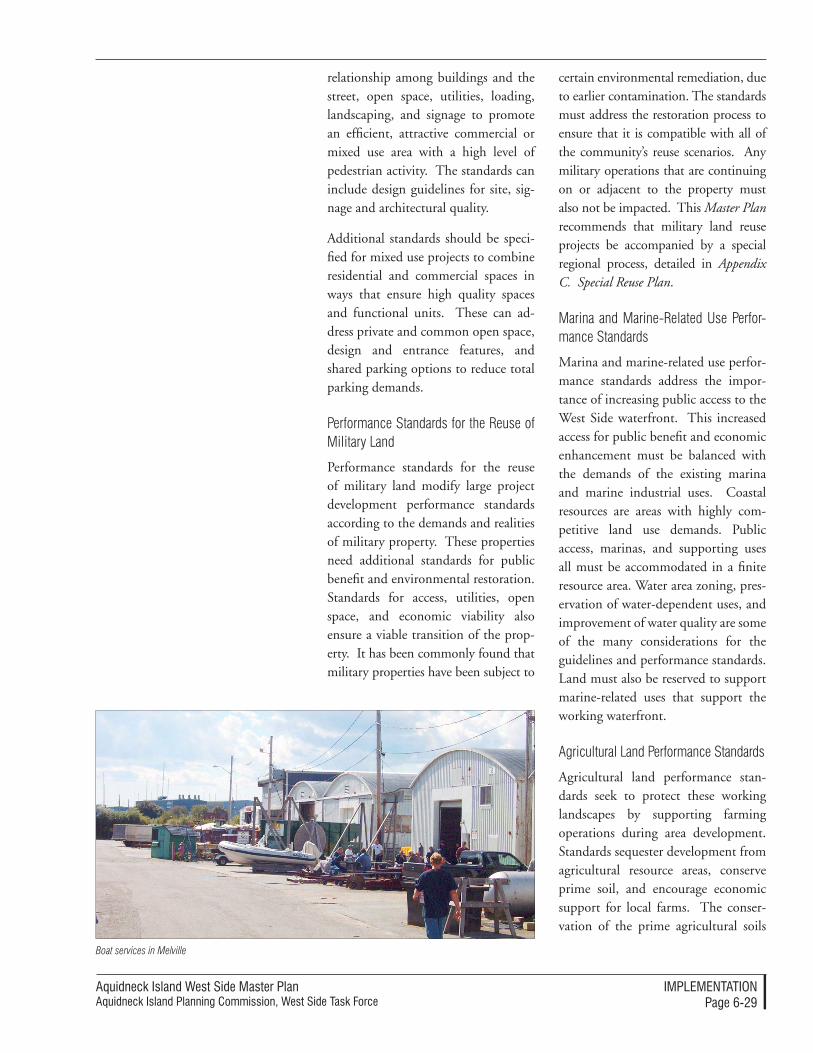
Aquidneck Island West Side Master PlanAquidneck Island Planning Commission, West Side Task Force
IMPleMenTATIonPage 6-��
relationship among buildings and the street, open space, utilities, loading, landscaping, and signage to promote an efficient, attractive commercial or mixed use area with a high level of pedestrian activity. The standards can include design guidelines for site, sig-nage and architectural quality.
Additional standards should be speci-fied for mixed use projects to combine residential and commercial spaces in ways that ensure high quality spaces and functional units. These can ad-dress private and common open space, design and entrance features, and shared parking options to reduce total parking demands.
Performance Standards for the Reuse of Military Land
Performance standards for the reuse of military land modify large project development performance standards according to the demands and realities of military property. These properties need additional standards for public benefit and environmental restoration. Standards for access, utilities, open space, and economic viability also ensure a viable transition of the prop-erty. It has been commonly found that military properties have been subject to
certain environmental remediation, due to earlier contamination. The standards must address the restoration process to ensure that it is compatible with all of the community’s reuse scenarios. Any military operations that are continuing on or adjacent to the property must also not be impacted. This Master Plan recommends that military land reuse projects be accompanied by a special regional process, detailed in Appendix C. Special Reuse Plan.
Marina and Marine-Related Use Perfor-mance Standards
Marina and marine-related use perfor-mance standards address the impor-tance of increasing public access to the West Side waterfront. This increased access for public benefit and economic enhancement must be balanced with the demands of the existing marina and marine industrial uses. Coastal resources are areas with highly com-petitive land use demands. Public access, marinas, and supporting uses all must be accommodated in a finite resource area. Water area zoning, pres-ervation of water-dependent uses, and improvement of water quality are some of the many considerations for the guidelines and performance standards. Land must also be reserved to support marine-related uses that support the working waterfront.
Agricultural Land Performance Standards
Agricultural land performance stan-dards seek to protect these working landscapes by supporting farming operations during area development. Standards sequester development from agricultural resource areas, conserve prime soil, and encourage economic support for local farms. The conser-vation of the prime agricultural soils
Boat services in Melville
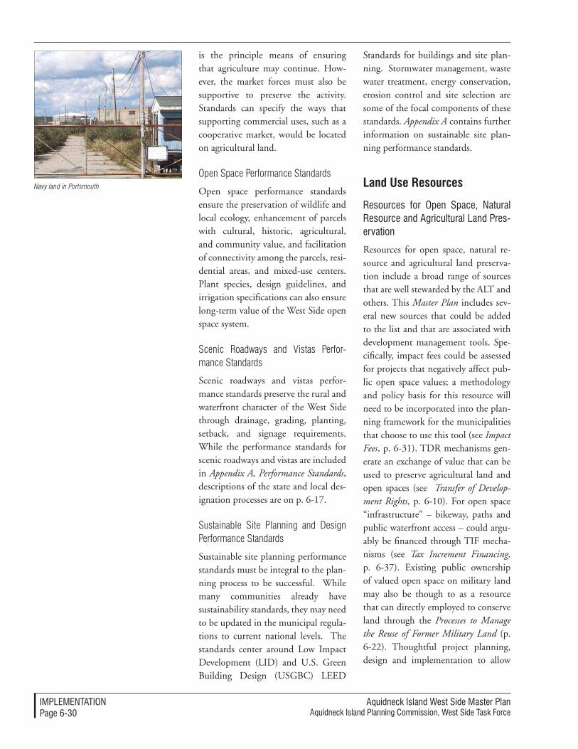
Aquidneck Island West Side Master PlanAquidneck Island Planning Commission, West Side Task Force
IMPleMenTATIonPage 6-�0
is the principle means of ensuring that agriculture may continue. How-ever, the market forces must also be supportive to preserve the activity. Standards can specify the ways that supporting commercial uses, such as a cooperative market, would be located on agricultural land.
Open Space Performance Standards
Open space performance standards ensure the preservation of wildlife and local ecology, enhancement of parcels with cultural, historic, agricultural, and community value, and facilitation of connectivity among the parcels, resi-dential areas, and mixed-use centers. Plant species, design guidelines, and irrigation specifications can also ensure long-term value of the West Side open space system.
Scenic Roadways and Vistas Perfor-mance Standards
Scenic roadways and vistas perfor-mance standards preserve the rural and waterfront character of the West Side through drainage, grading, planting, setback, and signage requirements. While the performance standards for scenic roadways and vistas are included in Appendix A, Performance Standards, descriptions of the state and local des-ignation processes are on p. 6-17.
Sustainable Site Planning and Design Performance Standards
Sustainable site planning performance standards must be integral to the plan-ning process to be successful. While many communities already have sustainability standards, they may need to be updated in the municipal regula-tions to current national levels. The standards center around Low Impact Development (LID) and U.S. Green Building Design (USGBC) LEED
Standards for buildings and site plan-ning. Stormwater management, waste water treatment, energy conservation, erosion control and site selection are some of the focal components of these standards. Appendix A contains further information on sustainable site plan-ning performance standards.
land Use Resources
Resources for open Space, natural Resource and Agricultural land Pres-ervation
Resources for open space, natural re-source and agricultural land preserva-tion include a broad range of sources that are well stewarded by the ALT and others. This Master Plan includes sev-eral new sources that could be added to the list and that are associated with development management tools. Spe-cifically, impact fees could be assessed for projects that negatively affect pub-lic open space values; a methodology and policy basis for this resource will need to be incorporated into the plan-ning framework for the municipalities that choose to use this tool (see Impact Fees, p. 6-31). TDR mechanisms gen-erate an exchange of value that can be used to preserve agricultural land and open spaces (see Transfer of Develop-ment Rights, p. 6-10). For open space “infrastructure” – bikeway, paths and public waterfront access – could argu-ably be financed through TIF mecha-nisms (see Tax Increment Financing, p. 6-37). Existing public ownership of valued open space on military land may also be though to as a resource that can directly employed to conserve land through the Processes to Manage the Reuse of Former Military Land (p. 6-22). Thoughtful project planning, design and implementation to allow
Navy land in Portsmouth
Aquidneck Island West Side Master PlanAquidneck Island Planning Commission, West Side Task Force
IMPleMenTATIonPage 6-��
cost effective improvements should be consistently pursued. So, for example, the construction of trails at McAllister Point could be combined with con-struction of the Greene Lane Park to use similar funding opportunities.
Additional resources that might be considered include the following:
Open Space Acquisition and Preserva-tion Resources
The Recreational Trails Program (RTP) is part of the U.S. Department of Transportation’s Federal Highway Administration (FHWA). The RTP provides $50 million annually to de-velop and maintain recreational trails and/or related facilities for recreational trail uses. Among the trail uses include walking, bicycling, inline skating, cross-country skiing, and other non-motorized and motorized vehicles. The program is administered by the State. A State resource or park agency crafts procedures for project selection. RTP funds may be used for:
maintenance and restoration of existing trails;
development and rehabilitation of trailside and trailhead facilities and trail links;
purchase and lease of trail construc-tion and maintenance equipment;
construction of new trails (with restrictions for new trails on Fed-eral lands);
acquisition of easements or prop-erty for trails;
State administrative costs for the RTP (limited to 7 percent of a State’s funds); and
operation of educational pro-grams to promote safety and
environmental protection related to trails (limited to 5 percent of a State’s funds).
There are stipulations on the percent-ages of funding applied to motorized, non-motorized, and mixed trail uses. Project suitability also depends on guaranteed public access.
Rhode Island Open Space, Recreation, Bay and Watershed Protection Bond
This initiative is a funding opportu-nity managed by RIDEM. The bond funds open space preservation efforts to offset pressures of growth and ex-pansion into rural areas. The Island municipalities should continue to pur-sue fee acquisition of agricultural land for preservation of open space through this program.
Resources for Trails and Open Space Networks
Department of Interior Land and Water Conservation Fund, RIDEM Open Space Grants, and Off-site Impact Fees are all sources to fund new trails and open space networks that are available to the AIPC and the Island municipalities.
Resources for Mitigating land Use Changes
Impact Fees
Local impact fee programs mitigate land use changes for large-scale devel-opment, including impacts associated with the reuse of military land. This resource is thus particularly appro-priate for development on the West Side. The resource allocation concept should be incorporated into the per-formance criteria associated with large project reviews and approvals, reuse of former military land, and privatization of federal property.
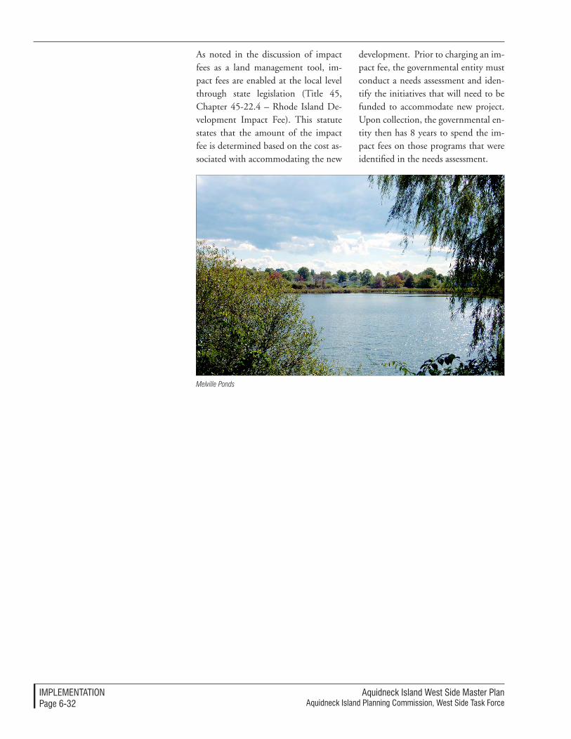
Aquidneck Island West Side Master PlanAquidneck Island Planning Commission, West Side Task Force
IMPleMenTATIonPage 6-��
As noted in the discussion of impact fees as a land management tool, im-pact fees are enabled at the local level through state legislation (Title 45, Chapter 45-22.4 – Rhode Island De-velopment Impact Fee). This statute states that the amount of the impact fee is determined based on the cost as-sociated with accommodating the new
development. Prior to charging an im-pact fee, the governmental entity must conduct a needs assessment and iden-tify the initiatives that will need to be funded to accommodate new project. Upon collection, the governmental en-tity then has 8 years to spend the im-pact fees on those programs that were identified in the needs assessment.
Melville Ponds
Aquidneck Island West Side Master PlanAquidneck Island Planning Commission, West Side Task Force
IMPleMenTATIonPage 6-��
The economic priorities along the West Side will largely be implemented through private sector redevelopment. This Master Plan is focused on the public policy and actions that will support desirable, needed economic activities. As a result, many of the eco-nomic development strategies will be implemented through the coordinated land use, transportation and utility ini-tiatives discussed in the balance of this section because they are most strongly linked to public action. However, supplemental economic strategies will involve additional public/private co-operation to leverage the best regional outcome. The redevelopment process for former Navy land will require sub-stantial public sector assistance to over-come barriers to investment, including infrastructure construction and other forms of development assistance. The strategy for redevelopment must effec-tively employ the available tools and talent to advance redevelopment.
economic Development tools
Projects of Critical economic Concern
Projects of Critical Economic Con-cern are initiatives designated by the Rhode Island Economic Development Corporation (RIEDC) to have sig-nificant job creation potential. These projects are considered to have the capability in their operational stages to enhance business, commerce, and industry, stimulate jobs, and relieve underemployment and unemploy-ment. Upon successful application for a Certificate of Critical Economic Concern (CCEC) by the EDC Board, the project receives priority status in all permit review processes. Once ob-tained, the CCEC is valid for a renew-able two years. The CCEC process thus provides a significant incentive to
economic Development Implementation
prospective businesses and industries seeking to generate jobs and revenue in Rhode Island. CCECs could present a further development incentive on Aquidneck Island, especially in areas such as Melville, for marine-related industries or other uses that meet the criteria of the program. The Melville area of the West Side has been desig-nated as eligible for CCEC’s.
Provision of Affordable Housing as a Condition on Approval of PPV Hous-ing Redevelopment
Support for affordable housing has already been advanced in the initial stages of the Public Private Venture (PPV) process that manages the dis-position of excess land and former Navy Housing. This strategy should continue and include preparation and approval of affordable housing propos-als that also meet the requirements and preferences expressed through the local municipal Housing Plans. This should be accomplished through transactions that effectively subsidize the purchase price of the land from available public sources or as part of the community impact assessments that may properly be applied to transfer and development of such land as enabled through state legislation.
Inclusionary Zoning, Inclusionary Conditions or Impact Fees for Afford-able Housing
Methods that may be required to advance the provision of affordable housing include three tools: inclusion-ary zoning, inclusionary conditions, or impact fees for affordable housing. All of these tools would require com-munities or private developers to help finance affordable housing. These tools may reasonably be applied to large project developments or large
Aquidneck Island West Side Master PlanAquidneck Island Planning Commission, West Side Task Force
IMPleMenTATIonPage 6-��
mixed-use developments that include transfer, sale or lease of state or local public property.
Inclusionary zoning – Local zon-ing may prescribe that qualifying residential projects include an established proportion of units that are deemed affordable using accepted methods for gauging ap-propriate income levels and corre-sponding price levels. Restrictions area placed on the initial and sub-sequent sale or lease of the units to residents who meet income stan-dards. Many models of inclusion-ary zoning have emerged through-out New England and have served to significantly expand the supply of affordable housing and distrib-ute it throughout communities. In some cases, payments in lieu of on-site compliance are permitted, and used to fund off-site afford-able housing units.
Inclusionary conditions – Re-quirements for the inclusion of affordable housing may be estab-lished as a condition on the sale or lease of public property for private sector redevelopment. So, for example, the redevelopment of some tank farm locations or the reuse of land formerly needed for roadways could be accompanied by inclusionary conditions.
Impact fees – The impact fee mechanism may be applied to providing funds that support af-fordable housing initiatives if the municipality establishes the rela-tionship between the economic impact of a project and the miti-gation provided through afford-able housing.
Special Area Reuse Plans
The application of the Special Area Reuse Plan tool should be primarily considered as an economic develop-ment tool to manage the reuse of the former military property into projects that directly contribute to the state, regional and local economy. The Spe-cial Area Reuse Plan mechanism can be used to establish the preferred use of land and link it to economic incen-tives or impact mitigation measures, as well as formulating the associated infrastructure, open space, land use patterns, performance criteria and ap-proval procedures.
Extensive discussion of this proposed tool is also contained in Appendix C: Special Area Reuse Plan and Appendix D. Outline Agreement for Special Area Reuse Plans
This tool imitates the successful pro-cess used in the Base Reuse Plans of the BRAC process, which establish the reuse parameters for disposed military lands. BRAC Reuse Plans are necessary and useful procedures that set forth a clear process for disposition, property conveyance, properties for public ben-efit (for example, recreational facilities, educational facilities), and properties for economic development purposes. It is an excellent model that can be emulated, with modifications, to co-ordinate the similar decisions among local, regional and state levels in the event that federal land is disposed through non-BRAC procedures.
As has been described at length within this Master Plan, certain portions of the Navy’s land are highly susceptible to being placed in one or more fed-eral disposition processes. Because of recent congressional action, the BRAC process stands out as the most
Aquidneck Island West Side Master PlanAquidneck Island Planning Commission, West Side Task Force
IMPleMenTATIonPage 6-��
significant of these. Consequently, the communities, and regional and state authorities should be prepared to act in concerted and proactive ways to re-spond to any disposition. This Master Plan recommends a series of steps to make the necessary choices efficiently and with the broadest representation of interests in these important deci-sions. A detailed description of Special Area Reuse Plans and their develop-ment is provided in Appendix C. Spe-cial Reuse Plan
Intergovernmental Agreements as an economic Tool
Intergovernmental Agreements may be used as an economic tool by the constituent jurisdictions of Aquidneck Island and associated agencies and authorities to conveniently create enforceable contracts to advance de-velopment and limit the need for new legislation or burdensome regulations to meet public purposes. Intergovern-mental agreements are discussed in more detail as a Regional Coordination Tool, p. 6-3).
Innovation Factory
The State’s “Innovation Factory” con-cept should be tailored and applied to Aquidneck Island. The RIEDC has created a very applicable and highly inventive economic development tool that is perfectly matched to the trends in the Rhode Island and re-gional economies. This “Innovation Factory” program will focus reinvest-ment within buildings and complexes that leverage the advantages of shared proximity of both existing businesses and new ventures to facilitate local industry partnerships and synergy, and generally assist in an overall effort to diversify the focus, applications, and client base of defense-related research.
Special economic Redevelopment overlay Districts
Special economic redevelopment overlay districts on the West Side will enhance other redevelopment tools. In promoting or restricting specified types of development or redevelopment, municipalities – either individually or in collective agreement with other jurisdictions – can create economic “overlay” districts in which additional regulations, processes, and/or incentive programs may apply to new develop-ment proposals. For example, overlay zones seeking to promote maritime industrial uses may (1) provide tax incentives for marine-related uses, (2) impose development restrictions or conditions on adjacent residential types of development to avoid conflicts, (3) apply expedited development ap-proval procedures, and/or apply other programs. Rhode Island’s Enterprise Zone program comprises one form of overlay zone. State-created enterprise zones (including one in Portsmouth) currently provide various tax benefits to foster economic growth. In promoting objectives as set forth herein, the towns of Portsmouth, Middletown and New-port should explore possible alternative overlay zone objectives and available incentives, regulations and procedures.
Transfer of Development Rights (TDR) as an economic Tool
This tool promotes intensified de-velopment in targeted zones while maintaining lower density uses in others. While this tool is geared toward land use concerns, the TDR provides financial incentives to developers that render it an attractive method for economic develop-ment. The density bonuses and down-zoning compensation associated with the TDR are incentives that ensure develop-ment in line with the land use strategies
Aquidneck Island West Side Master PlanAquidneck Island Planning Commission, West Side Task Force
IMPleMenTATIonPage 6-�6
of the West Side. For more information regarding TDR programs, consult the Land Use Tools section, p. 6-10.
Home-based Business Zoning
Home-based business zoning is a tool that introduces flexible regulations for home-based businesses that address the growing trends in telecommuting and independent consulting that have de-veloped in the information age. Zon-ing can further broaden the economic base in the Island municipalities and can be tailored to ensure the safety of the communities.
Roadway Realignment as an eco-nomic Tool
Roadway realignments can indirectly advance land use and economic de-velopment goals. A realigned roadway can make land available and create improved access to a property that then contributes to the attractiveness and quality of future development. On the West Side, the realignment of Burma Road would provide for the vi-able disposition of former military land on its western side near Weaver Cove, contributing to a larger, more flexible development and site plan for marina and marine-related development in that area. The public authority that leases, sells or contributes the land for private sector redevelopment can place perfor-mance conditions (such as public ac-cess, open space, affordable housing) on the subsequent private redevelopment that is benefited by the realignment.
economic Development processes
Creating a Technology Transfer Center
“Technology transfer” is a process through which economic advantages
are obtained by creating physical prox-imity and information links among related businesses or activities. This could be accomplished in selected locations and for selected technology clusters along the West Side, using land and building resources. For example, the State and Newport should work together to sponsor redevelopment of the former Navy Hospital complex us-ing the RIEDC’s “Innovation Factory” concepts to promote a technology transfer center for business, technol-ogy and knowledge linked to military-related research and development. This would involve:
Acquiring the property through the PPV or Special Area Reuse Plan process, in which land is excessed by Congress or the DOD to a public entity for economic redevelopment purposes. Obtain funding for holding the facility and advancing the necessary reuse studies.
Using the RIEDC “Innovation Factory” as a model, prepare a reuse feasibility, business and mar-keting plans for the facility.
Providing financing and develop-ment management assistance, with the likelihood that the re-development and operation of the facility would be undertaken under private auspices through a Developer Request for Proposal, Land Disposition Agreement and related processes.
Supporting marketing of the facil-ity and linking its programs and operations to associated educa-tional initiatives through the new Community College of Rhode Island campus.
Aquidneck Island West Side Master PlanAquidneck Island Planning Commission, West Side Task Force
IMPleMenTATIonPage 6-��
Heritage Trail/Tourism Programs
Heritage Trail/Tourism Programs on the West Side are already underway to create, interpret and market tourism sites and a heritage trail for Aquidneck Island. The West Side’s contributions to this network can best be achieved by:
Channeling federal and state fund-ing to complement the ongoing initiatives and support the graphic design, interpretive planning, site improvements and promotional costs of this system.
Providing for additional tourism and heritage trail destinations by advocat-ing and targeting public park rein-vestment in areas such as portions of Melville (the difficult to develop “neck” at Coggeshell Point).
Linking development impact fees to heritage trail improvements where this is a valid public pur-pose and compensating invest-ment.
Business Retention and Assistance Programs are fundamental to a successful employment market on Aquidneck Island. The strategies for business retention and assistance will rely on the continued and increased funding for training and education; a key focus on these expenditures and programs should be the new CCRI campus, which should sponsor pro-grams linked to tourism, the military and marine-related industries.
Operational Improvements at the Airport represent a potential focus for a State-run study. The AIPC should support and allocate funds toward this study, as enhancements of the local air-port could better serve local businesses, without intensifying flight activity.
economic Development Financial Resources
Tax Increment Financing
Tax Increment Financing helps fund infrastructure improvements which would enhance desirable private sector development. This approach to gen-erating resources allows a portion of future tax proceeds associated with re-development to be used to finance the public infrastructure required to allow reinvestment to occur. This financing mechanism has been enabled in Rhode Island by the General Assembly (Tax Increment Financing Act, R.I. Gen-eral Laws section 45-33.2-1 et seq. (2001). It can provide a highly useful mechanism to provide streets, roads, utilities, parking facilities and other critical aspects of redevelopment along the West Side, particular for redevel-opment of the former Naval Hospital, Pell Bridge ramp area, Weaver Cove and Melville areas. A useful primer on TIF that includes useful references to the state legal framework can be found in the National Association of Realtors publication, Tax Increment Financing (TIF) published in 2002 and available on-line at http://assist.neded.org/TIFreport.pdf.
new Markets Tax Credits
New Markets Tax Credits serve as a mechanism to help fund improve-ments in qualifying areas. This federal program (administered by the U.S. Treasury Department’s Community Development Financial Institutions Fund) awards tax credits to local certified entity seeking to provide capital to lower-income areas. Such Community Development Entities (CDEs) are eligible to receive awards to be allocated to a broad range of real estate or economic development
Aquidneck Island West Side Master PlanAquidneck Island Planning Commission, West Side Task Force
IMPleMenTATIonPage 6-��
projects, in amounts of up to 39 per-cent of the project’s private investment cost. Private investors provide capital, for which they receive these tax credits (which they can take over seven year periods). The first step in this process involves the creation or identification of the requisite local entities to apply for CDE certification, which then ap-plies for tax credit allocations.
IRBA/Bond Mortgage Insurance
IRBA/Bond Mortgage Insurance reduces the risk and cost of desir-able private sector development. The Rhode Island Industrial-Recreational Building Authority (IRBA) insures payments on private loans as well as bonds issued by the Rhode Island In-dustrial Facilities Corporation. Such insurance is available for a broad range of activities including commercial and industrial developments, investments in equipment, and recreational facili-ties (many of which are included in the above recommendations). Additional information on the program can be located through the IRBA.
Community Development Block Grant (CDBG) Program
CDBG Funding advances qualifying economic development projects. The U.S. Department of Housing and Ur-ban Development’s CDBG Program continues to grant and loan funding for various economic development en-deavors. In the West Side study area, Newport is a small city entitlement CDBG community, and it receives funding annually. Middletown and Portsmouth are not entitlement com-munities, and they must compete for funding of eligible projects. For these communities not “entitled” to CDBG funds, such programs would likely be eligible through loans derived under
Section 108, whereby communities pledge Rhode Island CDBG funds as collateral for loans. Such loans may be used for economic development, prop-erty acquisition, property rehabilita-tion, site improvements, environmen-tal cleanup, construction of new public facilities, and other such activities. In-formation on the program funding can be located through the Rhode Island Office of Municipal Affairs.
Development Impact Fees
Development impact fees are paid by proponents of new projects to lo-cal municipalities to compensate the towns or cities for additional public costs associated with impacts of the development. Impact fees are enabled under state legislation (Rhode Island General Laws, Chapter 45-22.4, Rhode Island Development Impact Fee Act). The statute also states that impact fees may be imposed when property owned by the federal/state government is converted to private ownership (Title 45, Chapter 22.4-5). The impact fees are properly deter-mined through the mechanisms that include studies that provide technical and professional evaluation of key changes and financial impacts that will result from a development. Rela-tive to the West Side Master Plan, these mechanisms in Newport, Portsmouth and Middletown can be employed to provide needed compensation for traf-fic or infrastructure impacts, school population impacts and the like. These resources might usefully be expanded to quantify and compensate the com-munities for the loss of open space, funding resources to expand open space preservation, provide waterfront access, or recreational assets such as bikeways and parkland (see Impact Fees as a Resource, p. 6-31).
Aquidneck Island West Side Master PlanAquidneck Island Planning Commission, West Side Task Force
IMPleMenTATIonPage 6-��
Tax Abatement
Tax abatement provides redevelop-ment incentives which can help attract commercial and industrial develop-ers (and their tenants) by relieving ongoing tax burdens. Under typical tax abatement programs, for specified types of development identified as beneficial to the public interest, the value of new construction (or renova-tion) is phased in over time. At the beginning of this time period, new or renovated properties are assessed at their initial, predevelopment value; the municipality continues to collect taxes on its preexisting tax base. Over the specified time period, the properties are assessed at increasing fractions of their actual value, eventually reach-ing the full value at the expiration of the phase-in period. These measures provide cost benefits that help attract commercial and industrial develop-ers as well as their tenants. It must be noted that this type of measure is incompatible with TIF programs: tax abatements eliminate the very tax “increment” that would be derived from TIF programs. Where TIF is not applied, however, this type of incen-tive can be tailored for overlay zones, where it can help attract developments that satisfy specified criteria. Spe-cific statutes governing tax abatement programs are provided under Rhode Island General Laws sec. 44-3-9.
Special loan Guarantee/Credit en-hancement Programs
Special loan guarantee/credit enhance-ment programs allow public agencies to finance development. Whereas planners often target unconventional or unusual types of development, lending institutions are often uncom-fortable with the risks associated with the unfamiliar aspects of such projects.
To address this barrier to development, duly authorized public agencies can organize funding mechanisms to guar-antee conventionally financed loans, either partially or in their entirety. In a hypothetical example, the public agen-cy might pledge funds to guarantee 75 percent of loans issued by a local bank. Depending on a variety of factors, the bank would require the agency to reserve only a certain specified percent-age of the total loans. Given a “reserve requirement” of 33 percent, the agency in this example could use $100,000 to guarantee $300,000 in loans, which would insure $400,000 of capital. This sort of loan guarantee program significantly improves a developer’s ability to obtain private financing. In addition, loan guarantee programs often result in below-market interest rates, further enhancing the develop-ment opportunity.
Aquidneck Island West Side Master PlanAquidneck Island Planning Commission, West Side Task Force
IMPleMenTATIonPage 6-�0
transportation tools
Upgrading existing Intelligent Trans-portation System (ITS) Tools
A number of ITS technology tools have been implemented to date on the Aquidneck Island transportation system. These technologies have been augmented by ITS located outside of the Island to facilitate congestion miti-gation and incident management ac-tivities through traffic surveillance and information dissemination systems. The existing ITS deployments should also be expanded to provide additional coverage and allow for an integrated approach to traffic information gath-ering and information dissemination. These systems include:
Highway Advisory Radio (HAR) – RIDOT has installed five highway advisory radio transmit-ters, including installations in Providence and South Kingstown, and is in the process of installing transmitters in Newport and in Tiverton. These transmitters al-low the RIDOT Transportation Management Center (TMC) to broadcast Aquidneck Island traf-fic and incident messages on 1610 AM over a 3-mile radius around each transmitter.
Dynamic Message Signs (DMS) – The RIDOT TMC is currently managing a statewide network of fifteen permanent overhead mes-sage DMS as well as a number of portable Variable Message Signs (VMS). Several permanent signs are on approach routes to Aquidneck Island.
Camera Surveillance – RIDOT has installed over 40 cameras to provide TMC Operators with a
transportationImplementation
view of much of the interstate system around Rhode Island. This system will include several cam-eras in Newport. These cameras enable the TMC to better respond to incidents to keep the roadways clear for traffic.
511 Traveler Information System – The 511 system is a 3-digit telephone number, available na-tionwide, that provides current information about travel condi-tions. This information allows travelers to make better choices - choice of time, choice of mode of transportation, and choice of route. Information is input from the RIDOT TMC, and is avail-able to users free of charge.
Arterial Traffic Signal Systems – Closed loop signal systems have been installed on West Main Road in Portsmouth and Middletown to improve traffic flow. Ten in-tersections are controlled by these systems. Additional closed loop signal systems have been installed on Aquidneck Island in Newport, Middletown, and Portsmouth.
Expanding the use of ITS techno-logical tools as outlined below would greatly enhance transportation on Aquidneck Island.
The dissemination of traveler informa-tion to motorists entering Aquidneck Island provides an opportunity to alert motorists of incidents and congestion, provide alternate route information, and promote alternate forms of trans-portation, such as bus and ferry ser-vices as well as information regarding Park and Ride lots.
It is recommended that the current highway advisory radio (HAR) cover-
Aquidneck Island West Side Master PlanAquidneck Island Planning Commission, West Side Task Force
IMPleMenTATIonPage 6-��
age be expanded throughout the Island and on the inbound routes. Additional HAR transmitters should be installed and synchronized to provide an unin-terrupted message from Tiverton and Jamestown, and throughout Aquidneck Island. The goal would be for motorists to be provided with current travel and transportation conditions, as well as scheduled event information, at any time within these areas.
DMS and portable VMS should be sta-tioned along the routes into Aquidneck Island (Route 138 in Jamestown, Route 114 North of the Mt. Hope Bridge, Route 24 in Tiverton, and on Interstate 195) to alert inbound motorists of travel conditions on the Island as well as HAR availability.
Additional signs on Aquidneck Island should be located at decision points for local (Burma Road/Shoreline Drive and West Main Road, Route 114) and regional (Rte 138 to I-95 or Rte 114) outbound travel.
The HAR and DMS should be con-trolled by the RIDOT TMC. TMC op-erators would also provide similar mes-sages on the Rhode Island 511 system.
West Main Road Arterial operations
In addition to geometric improve-ments recommended in the West Side Master Plan, it is recommended that close loop signal systems be expanded and augmented. Additional intersec-tions should be integrated into the existing closed loop system. There are several intersection controllers along this arterial that exist as stand alone units (with remote dial up access). These signals should be integrated into the two existing signal systems for greater control of traffic flow.
Cameras should be added to strategic intersections along this corridor to provide TMC operators with greater surveillance capabilities for the detec-tion of incidents and assessment of traffic flow. Images from these cam-eras should be made available online to provide information to travelers.
Signal timing plans should be devel-oped to accommodate tourist and planned event travel patterns.
Arterial traffic signal/camera systems should be implemented on Burma Road and other routes to facilitate travel, measure traffic flow on these routes, and provide information to the TMC for dissemination to motorists.
Using new Intelligent Transportation System (ITS) Tools
New ITS technologies can be utilized to improve transit ridership by making it easier for motorists to utilize public transportation. It is recommended that an integrated transit system be implemented on Aquidneck Island to make transit an attractive alternative to automobiles. This transit system should include:
Fleet Management Systems – The buses and ferries that serve Aquidneck Island should be equipped with Automatic Vehicle Location (AVL) systems and Computer Aided Dispatch (CAD). These systems, combined with driver interfaces, also allows for multimodal coordination (co-ordination between the bus and ferry systems to ensure passen-gers are not “stranded” between modes).
Passenger Information Display Systems (PIDS) – PIDS represent roadside and terminal signage that
Aquidneck Island West Side Master PlanAquidneck Island Planning Commission, West Side Task Force
IMPleMenTATIonPage 6-��
allows passengers to know the bus transit system status (how long until the next bus or ferry arrives). This information is invaluable to passengers. The PIDS should be located at strategic bus stops, ferry terminals, Park and Ride lots, and the Newport Gateway Center and Perrotti Park intermodal centers. PIDS should also be integrated with other traveler information systems (internet and 511) to fur-nish travelers with real-time travel information, continuously updat-ed schedules, schedule adherence information, transfer options, and transit routes and fares.
Parking Facility Management – ITS technologies at Park and Ride lots can be used to track lot capac-ity and provide advanced warning to drivers that the lot is full. These systems should be integrated with Fleet Management and PIDS to ensure travelers are aware when the next bus will arrive at the facil-ity. These systems should also be integrated with the RIDOT TMC so that status may be included on the DMS, HAR and 511 systems.
Traffic Signal Prioritization – The transit fleet should employ trans-mitters to communicate with the signal controllers along West Main Road, Burma Road (the future Shoreline Drive), and other key routes to adjust signal timing to assist transit schedule adherence.
Transit Security – Video surveil-lance and passenger alarms should be included in Park and Ride lots as well as transit centers to enhance passenger safety. These systems should include the capa-bility to alert operators and police
to potential incidents identified by these security systems.
An Incident and Planned Event Management Response Team develops a comprehensive man-agement plan involving state and local agencies to address traffic and safety. The AIPC and the three municipalities including their emergency response depart-ments, should work with RIDOT, RIPTA, and the State Police to form an emergency response team to handle traffic and incidents, particularly during Newport events. This team should meet regularly to identify and refine strategies to seamlessly respond to incidents, implement alternate routes, and provide information to travelers. Elements of these strate-gies should include: identification and notification of incidents; communications capabilities and needs; mutual aid response strate-gies; implementation of diversion routes; special event planning and traffic management systems and equipment; resource requirements and equipment locations. This team should integrate remote parking areas, ITS (including vari-able message signs), and shuttle busses to transport spectators and participants from remote sites on the island (and off, including Quonset and downtown Provi-dence) to Newport venues. Motor coaches should also be involved in providing access from destinations outside Rhode Island. It is envi-sioned that recommendations for additional ITS deployments and resources would be identified by this team.
Aquidneck Island West Side Master PlanAquidneck Island Planning Commission, West Side Task Force
IMPleMenTATIonPage 6-��
Transportation Management Associations
A Transportation Management Associa-tion (TMA) is a useful tool to reduce dependence on the single occupant vehicle (SOV) for commutation to large West Side area employers. By facilitating transit or high occupant vehicle (HOV) use the volume of peak-hour traffic on West Main Road may be reduced. Transportation options include RIPTA, busway/motor coach, vanpools and carpools, bicycling, and walking. TMAs are private non-profit organizations that have been successful not only in urban areas but in suburban settings in facilitating mode split op-tions from the private SOV. Formation of a TMA with membership of Naval Station Newport, NUWC, Raytheon, boat industries in the Melville area, other major employment sites/office buildings, and future employers with 50 or more employees would effectively reduce roadway congestion through trip reduction measures. This could build upon the experience of NUWC which has been identified by the US Environ-mental Protection Agency and the US Department of Transportation as one of New England’s Best Workplaces for Commuters.
A TMA would be instrumental in carpool matching, designating busway providers and routes, facilitating pur-chased or leased services from vanpool providers, advocating for flex time or telecommuting, or other HOV strate-gies outlined in Section 5 of this Master Plan. Because commuters make logical commuting choices based on cost and time, savings must be realized in either or both for commuters to shift com-muting patterns. One cost incentive for avoiding SOV commutes is the toll on the Pell Bridge. Other cost incentives in-clude paid parking costs. Although paid
parking lots are available in downtown Newport, parking in the planning area is free and therefore is not an incentive to HOV use. A time savings incentive could also be the avoidance of conges-tion on local bridges and West Main Road. Time savings could also result by providing preferential parking for carpools and vanpools.
Where time and cost savings incen-tives are not sufficient to induce changes in travel behavior, govern-mental regulations become critical to development and implementation of effective TMAs. Land development regulations for Newport, Middletown and Portsmouth should be revised to require the following as part of the local planning and zoning board approval process for proposed devel-opment or redevelopment sites with more than 50 employees:
Reduce required parking lot sizes if TDM strategies are implemented. An incentive to businesses would be reduced parking lot construc-tion costs.
Implement Transportation De-mand Management (TDM) strategies to reduce reliance on SOV by employees. This would reduce the demand for parking, reduce traffic on local roadways, attract an expanded work force, and improve commuting benefits and options for employees.
Join or form a TMA to facilitate transit and HOV use by employ-ees. Each firm would be levied an annual fee (amount determined) to fund the TMA’s operating costs (staff, office space).
A TMA could serve numerous firms in the planning area (or throughout the Island) to facilitate ride-matching.
Aquidneck Island West Side Master PlanAquidneck Island Planning Commission, West Side Task Force
IMPleMenTATIonPage 6-��
Traffic Calming
Traffic calming techniques reduce trav-el speed and increase safety for motor-ists and pedestrians to help retain the pedestrian scale of proposed develop-ment. Reduced pavement width (from AASHTO 12-foot standard width travel lanes for arterials, to 11-foot travel lanes), on-street parking, round-abouts, neckdowns at intersections to reduce pavement width and en-hance pedestrian crossings, and speed humps or tables should be considered, depending on the application, to as-sure that newly constructed roadways reflect the context of the community. Additional techniques include special paving in intersections or on cross-walks to delineate a change or transi-tion in adjacent land use and to create a sense of entrance or “gateway.”
Roundabouts
Roundabouts slow the speed of ap-proaching vehicles, reduce delays for both through and turning traffic, and improve air quality (by not requiring vehicles to idle at red lights). The Island communities should consider roundabouts when signal warrants are met. Traffic is directed by diverters at the approaches to traverse to the right of the center Island. This eliminates cross traffic crashes, slows vehicles, and requires simple decision-making for the motorists. An area in the cen-ter of the intersection that does not carry traffic may also provide land-scaping opportunities. RIDOT now requires that roundabouts be consid-ered as the first option for reconstruc-tion of an existing or proposed signal-ized intersection.
Transit Ridership enhancements
RIPTA will continue working with planning area employers to meet their transit needs. As additional develop-ments come on line, project applicants should work with RIPTA to explore potential service expansion or re-scheduling. Employers should also be encouraged (or required, for new de-velopments) to participate in RIPTA alternatives to the single occupancy vehicle (SOV).
Land development regulations for Newport, Middletown and Ports-mouth could be revised to require that proposed development sites with more than 50 employees work with RIPTA to identify how existing bus service could be modified to increase rider-ship, thereby decreasing SOV use.
All Aquidneck Island businesses, including existing and proposed busi-nesses in the West Side planning area, should be encouraged to participate in the following RIPTA initiatives to pro-vide alternatives to the SOV:
Express Traveler Program – This program reduces transportation costs for those who choose to use transit to commute to work at least six times per month (or 11 one-way trips). RIPTA accepts commuting options via organized carpool / HOV, RIPTA bus, Park and Ride, vanpool, rail, biking or walking within the program. To remove the fear of being un-able to leave work in case of an emergency, RIPTA offers a guar-anteed ride home twice a year for commuters who use some form of transit (this could be a taxi from door to door).
Aquidneck Island West Side Master PlanAquidneck Island Planning Commission, West Side Task Force
IMPleMenTATIonPage 6-��
AlterNet Ridership Program – RIPTA matches carpool or vanpool participants with desti-nations in downtown Newport. Expansion of this program could serve Raytheon, the Navy base, and existing and potential marine trades in Melville.
Commuter Check Program – Employers can offer up to $100 a month in tax-free benefits to employees who commute to work by public transit or vanpool. Em-ployers can purchase Commuter Check vouchers for employees who can then apply the value toward the purchase of RIPTIKS, monthly passes or vanpool fares. Or, employers may set aside pre-tax dollars for the purchase of Commuter Check vouchers. Commuter Checks qualify as tax deductible business expenses and are free of payroll taxes.
Bus Rapid Transit
Bus Rapid Transit (BRT) uses new bus technologies and dedicated roadways to create express bus service that is particularly well suited to regions that experience seasonal and commuter peak travel demand and special event traffic. BRT buses are typically routed along dedicated busways for portions of their trip. Buses can also be equipped with technology that trips green lights at in-tersections as they arrive. Bus and road-way improvements can be less expensive than rail routes. Bus costs are generally lower than rail cars engine units and bring the additional advantage that the vehicles are not constrained to the limits of the rail – they can disperse to different destinations at the end of the “express” portion of their routes. In the long term (ten to twenty years), BRT could conceivably use portions of the
Newport Secondary as a dedicated one-way, reversible route to relieve area roads and highways of congestion. As such, it should remain in the list of long-term options for the West Side.
Implementing bus rapid transit (BRT) will require imaginative and persistent attention to its potential, and funding to untangle the constraints that may block its introduction. For the West Side, this promising approach appears dependent upon a sophisticated ap-plication of a one-way reversible transit lane that must share a public right-of-way with rail and passes through sensitive areas including Naval Station Newport and near neighborhoods. The strategy for its implementation requires a knowledgeable, persistent advocate for its implementation. It appears that RIPTA is perfectly positioned to fulfill this role. RIDOT should coordinate all professional and technical activities, intergovernmental agreements and consequent organizational, operational and marketing activities in concert with RIPTA and the AIPC.
Bicycle Map
With the addition of off-road “shared use paths,” on-road “share the road” and “signed shared roadway” routes, the AIPC’s A Bicyclists Guide to Aquidneck Island brochure/map should be updated. Information on this map should coordinate with the RIDOT Guide to Cycling in the Ocean State map. It would be less confusing for cy-clists if the AIPC guide used RIDOT terminology in identifying the suit-ability of routes for cycling. Updated maps should be distributed through bike shops, Chamber of Commerce, hotels, schools, and the like. Funding for this should be sought from charita-
ble funds through grant applications.
Aquidneck Island West Side Master PlanAquidneck Island Planning Commission, West Side Task Force
IMPleMenTATIonPage 6-�6
transportation processes
Creating a Transportation Manage-ment Association
The AIPC should work with the New-port County Chamber of Commerce, the Navy, RIPTA and the EPA to in-vestigate formation of a TMA for the Navy and defense contractors. RIPTA should advertise its rideshare matching program more fully in the Newport County area to expand this program to Aquidneck Island.
Three steps involved in the develop-ment of a TMA are investigation, implementation and operation. The AIPC would be integral to advancing each of these stages.
TMA Investigation Stage – An investigation includes a Transit Needs Assessment to determine the need to establish a TMA and to identify its mission. This study would identify employer and com-munity needs and concerns. A survey would be conducted to de-termine employee origin, current commuting patterns, and shift hours. Transportation-related problems or deficiencies would be identified. Funding opportunities should also be explored at this stage. The investigation stage is similar to the 2002 Transit Needs Assessment conducted by the RI Economic Development Corpo-ration for the Quonset Davisville Port and Commerce Park. This plan was funded by RIDOT and the RI Statewide Planning Pro-gram as a transportation demand management (TDM) requirement of the Route 403 Environmental Impact Statement.
TMA Implementation Stage – Regulatory issues are resolved, and legal and organizational structure and start-up and more permanent funding is established. The TMA office, with its defined procedures, is established. A membership base of local firms must be solidi-fied. Close working relationships should be developed between the TMA and the member firms as well as governing and transpor-tation agencies such as RIPTA, RIDOT, RI Statewide Planning Program, local municipalities and the Newport County Chamber of Commerce. Membership of non-regulated employers and agencies should be actively sought and encouraged. Specific TDM strategies should be identified and developed and then properly marketed and tested. Tools and resources are available through RIPTA, US EPA, USDOT, and private providers who have been established both regionally and nationally to assist in the grow-ing demand for TDM strategies and TMA formation. The struc-ture and bylaws of a TMA are critical to its implementation. A TMA can be established as an independent partnership with an independent corporate status or it can be established as part of an-other multi-purpose organization. If established as part of an existing organization such at the Newport County Chamber of Commerce, AIPC, or the LRA, many ele-ments are (or will be) established including physical office space, financial controls, and working relationships. The development of the bylaws, establishment of fee structures and government structure, and the relationship of
Aquidneck Island West Side Master PlanAquidneck Island Planning Commission, West Side Task Force
IMPleMenTATIonPage 6-��
the members are critical to the ef-fectiveness of the TMA.
TMA Operation Stage – This stage deals primarily with main-tenance of service structures, membership and funding. In-formation on available transit options should be included at each member company. Adequate marketing and advertising is re-quired to inform the public and provide the program with the best change for success. Ideally, TDM services are evaluated and refined, the TMA membership is expanded and long-term funding is secured. While the second stage of the TMA is getting the asso-ciation off and running, it is the third stage where the TMA has to prove its worthiness. Continuing marketing is critical to encourage commuters to forsake the SOV for HOV travel options.
Creating a Shoreline Drive
A Shoreline Drive offers one of the greatest opportunities to improve transportation on Aquidneck Island. By diverting traffic from congested roads to an underutilized corridor, traffic on the island will improve. The following discussion details the process for accomplishing the Shoreline Drive strategy of the West Side Master Plan.
It is critical that the AIPC initiate discussions with the Navy com-mander regarding the disposition of Stringham Road and Burma Road (Defense Highway) as a high prior-ity item. Based on a recent rejection of the Stringham Road/Burma Road TIP application (due in part to federal ownership of the land) it is imperative that a significant measure of control of this corridor be transferred to ei-
ther the state or to local communities (Portsmouth and Middletown). This could be accomplished through long-term lease, ownership transfer or other type of intergovernmental agreement. Without a change in the status of this property, no improvements funded by the TIP may be made to the hairpin turn and no upgrades may be made to increase safety and capacity or to improve landscaping and scenic vistas. The State does not have the power of eminent domain over federal property; the concurrence of the Navy is required for any roadway upgrades.
Simultaneously, it is imperative that the AIPC continue talks with the Navy regarding improvements to the Shoreline Drive through Naval Station Newport. The Shoreline Drive should be a two-lane road with adequate shoulders and space for landscaping enhancements. The route would con-nect Defense Highway with the Gate 17 Access Road and an extension of Simonpietri Drive through to Cod-dington Highway. This discussion should be based on March 15, 2005 comments at the Navy Town Meeting. Critical issues include moving the se-cure perimeter of the Navy, extending Simonpietri Drive west to the Gate 17 Access Road with new construction, and addressing Navy concerns regard-ing utility security and emergency access. A memorandum of agreement or other intergovernmental agreement should be drafted regarding the role of the Navy, RIDOT, and the AIPC in extending the Shoreline Drive. RIEDC should also be involved in this effort, based on their role to enhance NUWC and Naval Station Newport.
The Shoreline Drive should be marketed as a tourist destination, similar to Ocean Drive. The Newport County Conven-
Aquidneck Island West Side Master PlanAquidneck Island Planning Commission, West Side Task Force
IMPleMenTATIonPage 6-��
tion & Visitors Bureau, the Newport-Bristol Heritage Passage, and the New-port County Chamber of Commerce should collaborate on the marketing aspect of the Shoreline Drive.
RIDoT endorsement and Regional Input
The implementation of the West Side Master Plan would be improved through communication and coordina-tion with RIDOT. RIDOT has several ongoing projects with direct impact on the West Side and for which the Master Plan presents particular strategies and concerns. Since the Master Plan serves as a basis for regional policy, the AIPC should communicate with RIDOT regarding its goals for relevant ongo-ing project. A first step would be to inform RIDOT directors of the Master Plan’s strategies regarding:
Pell Bridge Ramps Project
Coddington Highway / J.T. Con-nell Highway
Armstrong Bridge/ Gate 4
West Main Road, East Main Road to Coddington Highway
West Main Road left Turn Improvements
The AIPC has submitted a TIP appli-cation for four left turn lanes on West Main Road. Preliminary response is that this project has been accepted for Study and Design. The AIPC should continue to monitor the progress of this Master Plan as the FY 06-07 TIP is finalized. The AIPC and Towns of Portsmouth and Middletown should work closely with RIDOT to assure that all appropriate intersections be considered for improvement in the section of West Main Road between Raytheon and Browns Lane in Middle-town, including the following:
Raytheon and Union Street/Redwood Road in Portsmouth
Oliphant Lane, Super Stop & Shop, Forest Avenue, and Browns Lane in Middletown.
By local communities contracting with consultants for study, design and per-mitting, the project will be expedited through the RIDOT process.
Hedly Street/ Cory’s lane Intersection Improvement and Visitor Center
The Town of Portsmouth has retained an engineering firm to investigate the feasibility of combining the Hedly Street and Cory’s Lane intersection with West Main Road into one sig-nalized intersection instead of two. Assuming this is feasible, the Town should also work with the RIEDC to secure enhancement-type funding to conduct preliminary feasibility studies for development of a gateway visitor center at this prominent location at the southern end of Route 24. By demon-strating local funding for preliminary project stages, this concept may be more readily supported by RIDOT for design and construction. The Town of Portsmouth should proceed with RIEDC grant applications and local funding of conceptual design. A FY08-09 TIP application should then be submitted to the Rhode Island Statewide Planning Program for study and design.
Interagency Coordination
Many of the strategies proposed by the West Side Master Plan will be accom-plished via concerted communication, discussion, and assessment among related agencies, organizations, institu-tions and corporations. The following are two examples of processes that re-spond to specific Master Plan strategies and require such coordination.
Aquidneck Island West Side Master PlanAquidneck Island Planning Commission, West Side Task Force
IMPleMenTATIonPage 6-��
Raytheon Access to Shoreline Drive depends upon several steps. The desirability of such a connection should be confirmed with those company officials re-sponsible for the campus. If the company wishes to establish this secondary connection, then the design requirements and costs should be incorporated into the process for enhancement of Shore-line Drive, taking into account an alignment that would have accept-able environmental impacts and be cost effective for those portions of the connection that would be constructed on private property.
The extension of bicycle con-nections is a strategy that is supplemental to the a bike path along the Newport Secondary. The AIPC should work with the municipalities and property own-ers to facilitate bike path construc-tion in the east-west direction. The municipalities can consider the construction or dedication of bicycle trails as a mitigating improvement eligible for impact fees or as a bonusable improve-ment associated with large project developments. ALT should assist the AIPC in the planning and implementation process, includ-ing provision of appropriate access easements across properties under their control.
environmental Impact Study (eIS)
An Environmental Impact Study (EIS) is a federal action that can trigger a requirement for a comprehensive review of environmental impacts and benefits. This process helps imple-ment the National Environmental Policy Act (NEPA). Through the EIS process, various alternatives to a pro-
posed action must be studied and the net impacts and benefits of a project offered for public and agency review and comment. The EIS process is an excellent method for providing a thor-ough technical evaluation of projects that may have major implications for the community, region, or state in which they occur. The determination of the need for an EIS rests with the federal government. Should an EIS be required to study and advance an im-provement (such as a major transporta-tion initiative using federal funds), the process should be viewed as a planning opportunity. Two key phases are de-signed to seek input: scoping and the review of the Draft EIS. The scoping process establishes the issues that must be evaluated in the document. The lead agency responsible for the EIS also solicits comments and questions after the EIS is prepared in Draft form. The AIPC should routinely submit let-ters at both of these stages that request technical evaluation of the compliance of the proposed project and its alterna-tives with the West Side Master Plan.
Bicycle Route Suitability Reports
As roadway improvements are planned along the West Side, a Bicycle Route Suitability Report should be filed with RIDOT as a preliminary step in de-termining the suitability of any local roads for designation.
Creating Transportation Standards for the West Side
RIDOT and the AIPC should col-laborate to establish agreed-upon techniques and aesthetic standards for special landscape, signage and traffic calming devices tailored to Aquidneck Island by funding a professional technical and design team to create a guidebook for the West Side. Sug-
Aquidneck Island West Side Master PlanAquidneck Island Planning Commission, West Side Task Force
IMPleMenTATIonPage 6-�0
gested transportation standards are included in the following section.
transportation Standards
General Principles of Design
The following principles should be considered for any future roadway construction (or reconstruction) in the West Side planning area, as applicable.
Bike Lanes – “Signed Shared Roadway” bikeways should be included to facilitate cycling as a safe and attractive transportation alternative.
Access Management – Property owners could be provided incen-tives to consolidate driveways to provide cross access or be required to do so by zoning regulations (as in Portsmouth). Incentives could include a reduction in lot dimen-sion, parking, or driveway spacing requirements. Requirements for access management could also be incorporated into local zoning or land development regulations for commercial and industrial zones along arterial roadways such as West Main Road, Coddington Highway, and J.T. Connell Highway. These regulations could require that ex-isting nonconforming properties comply during redevelopment or when a change in use occurs. Joint and cross access overlay districts can also be established for local access management. RIDOT could attach conditions to Physical Alteration Permits requiring joint and cross access. Temporary driveways may be provided until adjacent proper-ties develop (or redevelop) with the condition that the property owner closes the driveway when the joint access system is complete.
Access management is especially important along roads currently owned and maintained by the Navy including Stringham Road, Burma Road, and Simonpietri Drive (all part of the alignment of Shoreline Drive). As any of these are transferred to either the State, Portsmouth or Middletown, ad-jacent development will result in increased curb cuts. Joint access should be considered from adjoin-ing properties. Frontage roads to the rear of properties could reduce the number of curb cuts, while re-ducing excessive pavement along the building fronts.
Public Right-of-Way – Acquisi-tion of privately owned property for roadway improvements should be minimized. It is recognized, however, that maximum safety and capacity improvements have been conducted to date within the exist-ing West Main Road right-of-way. Any future improvements includ-ing left turn lane construction will require the use of private land or state right-of-way currently used for parking. Reduction in parking requirements (through a zoning overlay zone or other revision to the local zoning ordinance) or joint use of parking in adjacent lots could be considered to assure the economic viability of affected properties.
Retaining Walls – Any roadway construction should respect the natural terrain and minimize ex-cessive grading. Use of retaining walls should be considered to avoid chasing grades on steep wooded slopes and to reduce impacts on adjacent privately owned property.
Landscaping – Aesthetics are important considerations in es-
Aquidneck Island West Side Master PlanAquidneck Island Planning Commission, West Side Task Force
IMPleMenTATIonPage 6-��
tablishing general principals of design. Requirements for tree-lined vegetated strips separating roadways and sidewalks, land-scaped frontages on both private property and public right-of-way, and landscaping within parking lots should be incorporated, as necessary, into local land develop-ment and subdivision regulations and design guidelines.
Signage – Graphic standards should be included in municipal regulations and guidelines to as-sure that private signage reflects community character. All efforts should be made to reduce the number of public signs along the highway while assuring that ad-equate information is available for motorists, including tourists and other visitors to the area. Scenic roads such as Burma Road (the fu-ture Shoreline Drive), Stringham Road, and Greene Lane should be designated with appropriate signage.
RIDoT Criteria and Standards for Bi-cycle network Designation
RIDOT has established criteria for roads that are being considered for des-ignation as statewide signed bike routes. A basis of these criteria are standards provided by the American Association of State Highway and Transportation Officials (AASHTO). This organiza-tion and its resources are described under the next heading in this chapter. Design Policy Memo (DPM) 920.06 provides technical guidance for the signing of state and local roadways as bike routes that are constructed utiliz-ing federal and state funds. The intent of the DPM is to sign such roadways as an aid to navigation for experi-enced and/or commuter cyclists. This
guidance may be used to determine roadways that may be designated as bike routes, utilizing the parameters of sound engineering judgment by considering a given roadway’s posted speed limit, Average Annual Daily Traf-fic (AADT) volume, minimum usable width in feet, and other factors.
RIDOT uses several AASHTO des-ignations for on- and off-road bike paths:
“Shared Use Path” Off-Road Bike Path – Shared Use Paths should be thought of as a complementary system of off-road transportation routes for bicyclists and others that serve as a necessary extension to the roadway network. Most Shared Use Paths are facilities on exclusive rights-of-way, are designed off-road, and are physi-cally separated from motor vehicle traffic. Shared Use Paths can be located along rivers, ocean fronts, canals, abandoned or active rail-road and utility right-of-way, lim-ited access freeways, within college campuses or within and between parks. Shared Use Paths are de-signed to work with on-road bicy-cle facilities to provide the greatest opportunities to bicyclists and pe-destrians. For Shared Use Paths to be successful, it is very important to provide users with connections to the roadway network. A critical component of Shared Use Paths is the transitions to and from the roadway network.
“Share the Road” Bikeway – A Shared Roadway or on-road facil-ity has no bikeway classification or designation. According to AAS-HTO, different types of roadway conditions can result in a Shared Roadway designation. One condi-
Aquidneck Island West Side Master PlanAquidneck Island Planning Commission, West Side Task Force
IMPleMenTATIonPage 6-��
tion is that the existing street sys-tem is currently being used for effi-cient bicycle travel without signing and striping. A second condition is that the existing roadway is not deemed suitable for bicycle travel and, therefore, bicycle travel should not be encouraged by desig-nating the route by means of sign-ing and/or marking as an approved bikeway. Another condition that could lead to a Shared Roadway classification is that the roadway is not considered a high demand bicycle corridor and as such the road should not be designated as a bikeway classification, regardless of roadway conditions. On roadways without bikeway designation, a minimum lane width of 12 feet, a width of 14 feet being desirable, can best accommodate both the bicyclist and motorist. Bike use should always be one-way, carrying bicyclists in the same direction as the adjacent travel lane and on the right side of the road.
“Signed Shared Roadway” On-Road Bikeway – Signed Shared Roadways are those roads that have been identified by signing only as preferred routes through high demand corridors. This con-cept is illustrated in Figure 5-15, p. 5-82. RIDOT DPM criteria must be considered prior to signing a Signed Shared Roadway. These include, but are not limited to, the removal or restriction of on-street parking, smooth riding surface, regularly maintained roadways that meet the needs of bicyclists, and have wide shoulders. A Signed Shared Roadway should have par-ticular advantages for bicyclists over alternative routes. Accord-ing to AASHTO, Signed Shared
Roadways should provide through and direct travel, connect to other bicycle facilities, and give priority to bicyclists. Signing also advises motorists that bicycles are present.
Bike Lane – A Bike Lane is a por-tion of roadway that has been des-ignated with striping, signing, and pavement markings for preferred or exclusive use by bicyclists. On-street parking is prohibited along a bike lane. The Defense Highway Commuter Bike Lane along Bur-ma Road is an example although it is not currently posted for no parking. Bike Lanes should always be one-way, carrying bicyclists in the same direction as the adjacent travel lane and on the right side of the road. Width requirements for Bike Lanes vary according to road-way conditions. Bike Lanes may have a minimum width of 4 feet if the area beyond the paved shoul-der can provide additional maneu-vering width. A width of 5 feet or greater is preferred where truck traffic is present or where motor vehicle speeds exceed 50 MPH (such as Coddington Highway/J.T. Connell Highway). Where on-street parking is permitted and striped, the Bike Lane should be placed between the parking area and the travel lane and have a minimum width of 5 feet. A Bike Lane should be delineated from motor vehicle travel lanes with a 6-inch solid white line.
Sidewalk and Trail Standards
It is recommended that design stan-dards developed for the West Side include required construction of side-walks, except along certain portions of scenic roadways as noted in the Plan Strategies section. Sidewalk con-
Aquidneck Island West Side Master PlanAquidneck Island Planning Commission, West Side Task Force
IMPleMenTATIonPage 6-��
struction (with adequate curbing and stormwater management) should be tied to RIDOT’s issuances of a Physical Alternation Permit for curb cuts for pri-vate development (or redevelopment) of adjacent parcels on state roadways. A similar requirement should be included within local zoning ordinances and land development regulations for projects on local roadways. Sidewalks should be constructed to the next logical desti-nation or intersection to facilitate safe off-street pedestrian access. Sidewalks should be ADA accessible with a mini-mum 5-foot width.
AASHTo Standards
The American Association of State Highway and Transportation Officials (AASHTO) represents highway and transportation departments across the country. This includes a wide variety of modes including, air, highway, public transportation, rail transporta-tion and water transportation. The organization fosters the development, operation and maintenance of an inte-grated national transportation system. AASHTO thus provides programs and services for bridges and structures, intelligent transportation systems, materials, outreach and pool funded programs. In addition to other West Side standards, the Island communi-ties could look to AASHTO as an informational resource and a locus of specific transportation performance standards and guidelines, particularly regarding bikeways.
transportation Resources
Transportation Improvement Program (TIP)
The statewide Transportation Im-provement Program (TIP) organizes and prioritizes transportation projects
eligible for state and federal funding. It is a biennial document developed by the Transportation Advisory Com-mittee (TAC) and adopted by the State Planning Council. It programs federal transportation dollars to in-dividual projects and programs that are implemented primarily by Rhode Island Department of Transportation (RIDOT) and Rhode Island Public Transit Authority (RIPTA). The pro-cess is managed by the Office of State-wide Planning, using input from local communities and agencies. The TIP takes the form of a list of transporta-tion projects that the State intends to implement using the federal highway and transit funds. However, the pro-gram does not only apply to highway projects; the State has chosen to pro-mote other transportation modes, such as bicycle and pedestrian programs, in addition to environmental projects.
As a state-approved planning entity, the AIPC has the opportunity of sub-mitting its recommendations for fund-ing. The AIPC should continue to submit requests for funding of projects listed in the West Side Master Plan on an annual basis, coordinating its sub-mission with the constituent munici-palities of Aquidneck Island. The TIP will help achieve the recommendations for West Main Road, Stringham Road, Burma Road (Defense Highway), and the bicycle path, for example.
Congestion Mitigation and Air Quality (CMAQ) Program
The Congestion Mitigation and Air Quality (CMAQ) Program was es-tablished by the Intermodal Surface Transportation Efficiency Act of 1991 (ISTEA). It has been continued under subsequent reauthorization legislation known as TEA 21. The CMAQ Pro-gram directs funds toward transporta-
Aquidneck Island West Side Master PlanAquidneck Island Planning Commission, West Side Task Force
IMPleMenTATIonPage 6-��
tion projects in areas that have been classified under the Clean Air Act as being in non-attainment of the ozone and carbon monoxide standards. Rhode Island is in non-attainment with national air quality standards for ozone levels. CMAQ funding is thus focused on investment in air quality improvements. The flexible guidelines of the CMAQ allow the program to span projects and initiatives related to highways, transit, and non-traditional areas. The State Planning Council’s Technical Committee has established a Transportation Air Quality Subcom-mittee that has been charged with recommending CMAQ projects for inclusion in the TIP. The CMAQ Program is suitable for the highway improvements recommended by the Master Plan.
Resources for TMAs
The AIPC could devote some staff time with the Newport County Chamber of Commerce, the Navy, RIPTA and the EPA to investigate formation of a TMA for the Navy and defense con-tractors. An initial step would be to conduct a Transit Needs Assessment, similar to one conducted for Quonset Davisville Port and Commerce Park for the RIEDC. Statewide Planning should be approached for funding pos-sibilities or a CMAQ TIP application (TIP) could be submitted in FY08-09.
Resources for Creating Shoreline Drive
Upon resolution of the ownership and use control issues, the AIPC should submit a TIP application for FY 08-09 funding for the Shoreline Drive. As-suming all property and agreements are in place, this application would include removal of the hairpin turn, geometric and safety improvements
along Stringham Road and Burma Road to increase capacity and speed limits, and landscaping (including brush removal to open scenic vistas) as part of Shoreline Drive improvements. Special federal appropriation should be considered for construction of the Si-monpietri Drive link on the Navy base (and the Burma Road/Stringham Road segments if a transfer of land cannot be accomplished from the Navy to state/local communities). The AIPC should work with the congressional delegation and RIEDC on these initiatives.
Resources for Incident and Planned Management Response Team
Assistance to help fund this transporta-tion tool may be available as CMAQ grants through the TIP application process, and could be sought by the AIPC in conjunction with the partici-pating municipalities on the Island.
Resources for Ferry Improvements
FHWA Ferry Boat Discretionary Funds will support the strategy to expand ferry service on Aquidneck Island. Through this program, the AIPC and the City of Newport may expand the water shuttle service in Newport Harbor and Jamestown for recreational/tourist (not commuter) use. In particular, the funding could be used to develop the additional infrastructure, such as docks and parking areas, that are required by the expansion of ferry service to other Aquidneck Island ports. Ferry service at Melville and Willow Lane/Mount Hope Marine Terminal should be considered as densities of development increase in these areas. Coordination is required with RIDOT Intermodal for information on these programs.
Aquidneck Island West Side Master PlanAquidneck Island Planning Commission, West Side Task Force
IMPleMenTATIonPage 6-��
Resources for Bicycles
The future funding of a separated bike path along the Shoreline Drive should be accomplished within the same com-bination of state and federal funding that is used to undertake the roadway improvements. An application for the FY 08-09 TIP should be submitted to Statewide Planning for extension of the bike path south from Melville to the Gateway Center. It may be pru-dent to break the application down to include two segments: Melville to the Navy base and Gate 4 to the Gateway Center, depending on priority. The AIPC and the Town of Portsmouth
should also work with RIDOT In-termodal and RIDEM Planning and Development for bike path funding. Potential federal recreational sources that might be sought include the De-partment of Interior Land and Water Conservation Fund. RIDEM funds bike path construction as part of its Greenways program.
Funding for an updated version of the AIPC’s A Bicyclists Guide to Aquidneck Island brochure/map should be sought from charitable funds through grant applications.
Aquidneck Island West Side Master PlanAquidneck Island Planning Commission, West Side Task Force
IMPleMenTATIonPage 6-�6
Utilities: tools
Intergovernmental Agreements on Utility Issues
Intergovernmental agreements can effectively provide the mechanisms to assess impact fees, provide services, manage redevelopment, and apply performance standards and design guidelines that are in keeping with this Master Plan. This is an alternative that addresses local priorities through agreement instead of via regula-tory processes. The agreements can determine the best means to allocate roles and responsibilities regarding water supply, distribution, and treat-ment and wastewater collection and treatment on the Island. For more information on the intergovernmental agreements and the Intergovernmental Working Group, consult the Regional Coordination Tools section, p. 6-3.
Water Resources Board
Although not selected as an option in 2005 by the AIPC’s Water Resource Discussion Group, at some point it may be possible to establish an Aquidneck Island Water Resources Board. Such a board might be estab-lished as a formalized entity through intergovernmental agreements that would allow consistent ongoing co-ordination of investment, supply, operational and other issues. Such boards are commonly used when mul-tiple jurisdictions have interdependent system and supply needs. The scope of an Aquidneck Island Water Resources Board would clearly extend beyond the limits of the West Side planning area, and should be pursued in the context of a potential island-wide mechanism.
Wastewater Facilities Plan
The Town of Portsmouth should proceed with plans to conduct a
wastewater facilities plan to address water quality violations at the northeast end of the community. This study should include a cost analysis of treatment options. If it is determined that a wastewater treatment facility in the West Side could cost effectively accommodate both the northeast neighborhoods and proposed development in the Melville and tank farms area, the town should proceed with coordination with the US Navy and Raytheon to secure a potential plant location.
Utilities: processes
The Intergovernmental Working Group: Utility Forum
Organized coordination among in-terested entities will lead to the best solutions to existing issues regarding utility distribution on the West Side. An effective working group has been advancing concepts for water service for some time, and similar discussions have intermittently occurred regarding sewer and wastewater treatment op-tions. The Intergovernmental Working Group proposed in this Master Plan can serve as an appropriate forum to ensure that effective discussions are advanced toward resolution on an organized and scheduled basis. For the purposes of utility agendas, participation by RI-DEM and the state Water Resources Board (WRB) is strongly encouraged.
The special “Utility Forum” should be expanded to include representatives from the local utility authorities in ad-dition to the municipalities, as well as RIDEM and the state Water Resources Board.
The principal options for solving fu-ture issues are found in the Utilities Strategies in Section 5: Planning Strate-gies (p. 5-87). However, the possibility
UtilitiesImplementation

Aquidneck Island West Side Master PlanAquidneck Island Planning Commission, West Side Task Force
IMPleMenTATIonPage 6-��
of linking future needs to privatization of the Navy utility system is worth un-derlining in this section. This prospect may not be viable, but conditions have changed considerably since earlier at-tempts to attract private sector interest failed. The implementation steps asso-ciated with this idea are as follows:
A jointly funded cost/benefit evaluation should be undertaken in the very short term to establish whether a broad program of pri-vate utility provision is viable that would include the Navy systems, developing areas of northern por-tions of the West Side, and pos-sibly the creation of services ex-tending beyond these limits. This study should be funded through agreement among all interested parties and result in a conclusion regarding potential feasibility.
If such an approach proves feasible, then intergovernmental agreements should be used to fund the more extensive studies and prepare the operating agreements, standards, procedures, financing mechanisms and host of other arrangement nec-essary to advance this approach, including coordination with the Navy/DOD regarding issuance of a request for proposals.
Utility Working Group Agenda Items
The IWG could be responsible for the discussion and coordination of util-ity issues on the Island. Early agenda items could be the problems surround-ing water supply in the Melville area and sewage treatment in Portsmouth.
Water Supply for the Melville area - Portsmouth, the AIPC, RIEDC and the Navy should work togeth-er to determine the suitability of
transfer of one of the Navy’s lines from Lawton Valley to Melville to RIEDC or the Portsmouth Water and Fire District. A water supply consulting firm should be hired to undertake the inspection and evaluation required to determine suitability of transfer. Section 5 of this Master Plan includes steps that should be taken to evaluate this line. The role of RIEDC is critical to assure that the Melville area is developable for marine re-lated industry, marina expansion, and related mixed use. Among the relevant options to be considered are the following:
- Extend PWFD Service to Melville
- Extension of City of Newport Municipal Service to Melville
- Continuation of “wheeling through” the Navy System
- Desalinization or other inno-vative technology
- Private or community wells
Sewage Treatment in Portsmouth - Portsmouth can be expected to continue its process to identify the demand for municipal sew-age treatment. As part of any disposition scenario for the tank farms, the Town and State should jointly promote a direct public benefit transfer to the Town of the required acreage and most favor-able location at Tank Farm #3 so that adequate land is reserved for a future treatment plant and buffers from other future uses. Should other sewer treatment options be chosen, Portsmouth should retain the ability to dispose of the land for economic benefit. The Town should work with RIDOT to identify any opportunities and
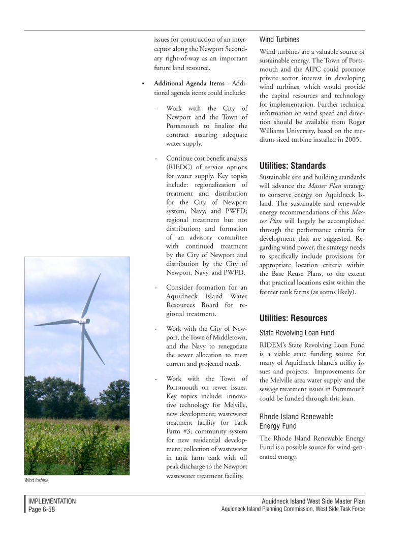
Aquidneck Island West Side Master PlanAquidneck Island Planning Commission, West Side Task Force
IMPleMenTATIonPage 6-��
issues for construction of an inter-ceptor along the Newport Second-ary right-of-way as an important future land resource.
Additional Agenda Items - Addi-tional agenda items could include:
- Work with the City of Newport and the Town of Portsmouth to finalize the contract assuring adequate water supply.
- Continue cost benefit analysis (RIEDC) of service options for water supply. Key topics include: regionalization of treatment and distribution for the City of Newport system, Navy, and PWFD; regional treatment but not distribution; and formation of an advisory committee with continued treatment by the City of Newport and distribution by the City of Newport, Navy, and PWFD.
- Consider formation for an Aquidneck Island Water Resources Board for re-gional treatment.
- Work with the City of New-port, the Town of Middletown, and the Navy to renegotiate the sewer allocation to meet current and projected needs.
- Work with the Town of Portsmouth on sewer issues. Key topics include: innova-tive technology for Melville, new development; wastewater treatment facility for Tank Farm #3; community system for new residential develop-ment; collection of wastewater in tank farm tank with off peak discharge to the Newport wastewater treatment facility.
Wind Turbines
Wind turbines are a valuable source of sustainable energy. The Town of Ports-mouth and the AIPC could promote private sector interest in developing wind turbines, which would provide the capital resources and technology for implementation. Further technical information on wind speed and direc-tion should be available from Roger Williams University, based on the me-dium-sized turbine installed in 2005.
Utilities: StandardsSustainable site and building standards will advance the Master Plan strategy to conserve energy on Aquidneck Is-land. The sustainable and renewable energy recommendations of this Mas-ter Plan will largely be accomplished through the performance criteria for development that are suggested. Re-garding wind power, the strategy needs to specifically include provisions for appropriate location criteria within the Base Reuse Plans, to the extent that practical locations exist within the former tank farms (as seems likely).
Utilities: Resources
State Revolving loan Fund
RIDEM’s State Revolving Loan Fund is a viable state funding source for many of Aquidneck Island’s utility is-sues and projects. Improvements for the Melville area water supply and the sewage treatment issues in Portsmouth could be funded through this loan.
Rhode Island Renewable energy Fund
The Rhode Island Renewable Energy Fund is a possible source for wind-gen-erated energy.
Wind turbine
Aquidneck Island West Side Master PlanAquidneck Island Planning Commission, West Side Task Force
IMPleMenTATIonPage 6-��
Federal Roles in Implementation
Congressional Delegation
The congressional delegation is an es-sential link among federal legislation, actions, programs, agencies and fund-ing that will be part of the West Side’s future. The delegation should:
Participate in the West Side In-tergovernmental Working Group proposed in this Master Plan.
Support the utilization of a “Spe-cial Area Reuse Plan” process (similar to the “BRAC” process) for all future disposition of federal land excessed by Congress or the DOD.
Advocate and provide infor-mation concerning grant and funding sources that directly or indirectly will help implement the Master Plan.
naval Station newport and the De-partment of Defense
Naval Station Newport is a valued part of the West Side’s future. To imple-ment the West Side Master Plan Naval Station Newport should:
Participate in key implementa-tion committees, including the Task Force, Intergovernmental Working Group and the Trans-portation Committee.
Include applicable recommen-dations of the West Side Master Plan in the preparation of future military base master plans to the extent that they are also compat-ible with military standards and policies as well as the operational needs of Naval Station Newport.
Roles and timelines Participate in a special Transpor-tation Management Association (TMA) to improve traffic access for the employees, visitors and those stationed here.
Coordinate with state, regional and local entities to advance the use and extension of Burma Road (Defense Highway) to Cod-dington Highway via Simonpietri Drive to the extent that it is com-patible with security and opera-tional needs.
Coordinate security and access procedures to allow for future rail and busway operations along the Newport Secondary.
Participate in initiatives to re-solve utility supply and distribu-tion issues.
other Federal Agency Roles
Other federal agencies will be encour-aged to consider the eligibility of rel-evant plans and projects called for in the for funding or support as model or demonstration programs for envi-ronmental sustainability, multi-modal and alternative transportation, and natural resource preservation.
State Roles in Implementation
A timeline tracks some of the key roles that the state and its agencies can take over the next decade to accomplish the West Side Master Plan (see Figure 6-1, p. 6-68). The left hand column is drawn from relevant components contained in the Planning Strategies section of this Master Plan. Key imple-mentation measures are charted within an approximate time scale, beginning with the distribution of the Master Plan by the AIPC.
Aquidneck Island West Side Master PlanAquidneck Island Planning Commission, West Side Task Force
IMPleMenTATIonPage 6-60
legislative Delegation
The Aquidneck Island state legisla-tive delegation will be a essential link among state legislation, actions, pro-grams, agencies and funding that will be part of the West Side’s future. The delegation should:
Participate in the Intergovern-mental Working Group and the annual West Side Transportation Summit.
Advocate for and support the utilization of the recommended processes for all future disposition of Navy land.
Advocate and provide infor-mation concerning grant and funding sources that directly or indirectly will help implement the Master Plan, including the no-cost disposition of excess RIDOT land for economic development pur-poses.
Support enabling legislation for Local Redevelopment Authorities that may be approved and sup-ported by the towns and city on Aquidneck Island.
office of the Governor
Endorse the West Side Master Plan as a guide for state programs and actions.
Enter into an intergovernmental agreement with other participat-ing jurisdictions to use Special Area Reuse Plans as described in this Master Plan to help manage future dispositions of military land.
Participate in the Intergovern-mental Working Group.
Rhode Island Department of Trans-portation (RIDoT)
Transportation is a major focus of the West Side Master Plan and many of its recommendations cannot be ac-complished without RIDOT’s active assistance. Among the many actions that involve their active assistance, RIDOT should:
Participate in the Intergovern-mental Working Group and the annual West Side Transporta-tion Summit.
Advance the Shoreline Drive con-cept by working with the Navy, the AIPC and the municipalities to secure the ability to improve and operate the Shoreline Drive concepts and lead the associated studies and future investments contained in this Master Plan.
Endorse and apply the transpor-tation design principles contained in the Master Plan by directing de-sign and construction contracts to use the standards and guidelines for all West Side projects.
Work collaboratively with RIPTA and others to advance the transit recommendations.
Work proactively to advance the multiple use of the Newport Secondary corridor to advance the initiatives proposed in this Master Plan.
Participate in creating TMA’s along the West Side.
Cooperate with local munici-palities and the AIPC to ensure that transportation planning processes explicitly take into account the land use and economic development op-portunities to which they are linked.

Aquidneck Island West Side Master PlanAquidneck Island Planning Commission, West Side Task Force
IMPleMenTATIonPage 6-6�
Rhode Island economic Development Corporation (RIeDC)
The RIEDC has been an active partici-pant in the redevelopment of the West Side through the roles it has played in the disposition and redevelopment of the Melville area. To contribute to the economic redevelopment of additional Navy dispositions, RIEDC should:
Participate in the Intergovern-mental Working Group.
Enter into appropriate inter-governmental agreements with other participating entities to use Special Area Reuse Plans as described in this Master Plan to help manage future dispositions of military land.
Provide direct economic develop-ment assistance through manage-ment, financing, development and property management, promo-tional activities or other programs for sites and facilities through intergovernmental agreements with the City, towns or their Local Redevelopment Authorities.
Secure formal Growth Center designation by the Governor’s Growth Council.
Rhode Island Public Transit Adminis-tration (RIPTA)
The State’s transit agency has many roles that it must play in the imple-mentation of the West Side Master Plan; it should:
Participate in the annual West Side Transportation Summit.
Endorse and apply the transit and SOV-alternative planning recommen-dations contained in the Master Plan by directing planning and programs to advance the West Side initiatives.
Work collaboratively with RIDOT and others to advance the transit recommendations.
Work proactively to advance the bus-related initiatives proposed in this Master Plan.
Participate in creating TMAs along the West Side.
Rhode Island Coastal Resource Man-agement Commission (RICRMC)
Through collaboration with the Coastal and Estuarine Land Conserva-tion Program (CELCP), the CRMC can ensure conservation of coastal and estuarine lands for the benefit of future generations.
Submit CELCP applications for land acquisitions considered im-portant for their ecological, con-servation, recreational, historic or aesthetic value.
Prepare a Special Area Manage-ment Plan (SAMP) to guide the use of the waterways and coastal resources along the West Side.
Increase coastal buffer standards for the purposes of habitat preservation and public access improvements.
other State Agencies
Among the other state agencies that will have stewardship roles in the West Side are the Department of Environmental Management (RIDEM), the Rhode Is-land Emergency Management Agency (RIEMA), the Rhode Island Economic Policy Council (RIEPC), Rhode Island Statewide Planning, and the state’s Water Resources Board (WRB). These and other agencies should:
Expand programs and program funding where the West Side Mas-ter Plan includes public access,
Aquidneck Island West Side Master PlanAquidneck Island Planning Commission, West Side Task Force
IMPleMenTATIonPage 6-6�
open space or cultural interpretive initiatives in keeping with their agency’s mission.
Provide accelerated permitting and approvals when such process-es are triggered through the area’s status as for projects of Critical Economic Concern (CEC).
Participate in the utility forum and other Intergovernmental Working Group meetings on an invited basis for special issues and input.
Participate in the preparation of a Special Area Management Plan (SAMP) to guide the use of the waterways and coastal resources along the West Side.
Request technical and financial assistance for natural hazard miti-gation through disaster and pre-di-saster mitigation funding sources.
Provide expertise and funding to continue the effort for in regional transportation modeling.
Serve as a model for placemaking by contributing expertise to other placemaking projects.
Solicit the active involvement of the Bridge Authority as an influ-ential, funding source.
Regional Implementation RolesRegional implementation of the West Side Master Plan is largely the respon-sibility of the AIPC. The AIPC will continue its mission to create a coor-dinating forum and technical planning resources for the Island. Milestones and priorities along the path to the West Side Vision have been charted in a Timeline for the AIPC (Figure 6-2, p. 6-70), which reflects some of the
key implementation recommendations listed in the Overall Coordination Ap-proach, pp. 6-3 to 6-9.
local Implementation RolesLocal implementation of the West Side Master Plan recommendations will take a different form for each of the constit-uent communities. Milestones and pri-orities along the path to the West Side Vision have been separately charted in Timelines for each community.
However, a common principle applies to all communities: the relevant rec-ommendations of the West Side Master Plan should be endorsed and incor-porated into the local comprehensive plans and land use management frame-works of each of the Island’s three com-munities. This has an important legal implication: Rhode Island law requires that local land management be based upon – and be consistent with – the local comprehensive plan. By incorpo-rating the relevant portions of the West Side Master Plan into the local plan-ning framework, the municipalities will add legal weight to the regulatory decisions and local government actions that will be needed to accomplish the Master Plan’s purposes.
Middletown
A timeline tracks some of the key mea-sures that Middletown can take over the next decade to accomplish the West Side Master Plan (see Figure 6-3, p. 6-72). The left hand column is drawn from relevant components contained in the Planning Strategies section of this Master Plan. Key implementation measures are charted within an ap-proximate time scale, beginning with the distribution of the Master Plan by the AIPC.
Aquidneck Island West Side Master PlanAquidneck Island Planning Commission, West Side Task Force
IMPleMenTATIonPage 6-6�
The Town of Middletown should:
Endorse the West Side Master Plan through approvals by the Planning Board and the Town Council.
Allocate staff resources to sup-port the ongoing implementa-tion of the Master Plan as it may benefit the Town.
Incorporate applicable elements into its Comprehensive Plan.
Actively participate in the Inter-governmental Working Group, including participation in the utility forums.
Enter into an intergovernmental agreement with other participating jurisdictions to use Special Area Reuse Plans as described in this Master Plan to help manage future dispositions of military land.
Specifically endorse island-wide transportation strategies con-tained in this Master Plan through the Town Council and the Plan-ning Board and participate in the annual AIPC West Side Transpor-tation Summit.
Incorporate applicable perfor-mance and design standard prin-ciples and tools into the land use and development framework.
Direct the use of development im-pact fees for projects along the West Side consistent with the West Side Master Plan’s recommendations.
Invite and participate in an an-nual presentation and report by the AIPC on progress in imple-menting the West Side Master Plan through the Town Council in joint session with the Planning Board.
Portsmouth
A timeline tracks some of the key mea-sures that Portsmouth can take over the next decade to accomplish the West Side Master Plan (see Figure 6-5, p. 6-76). The left hand column is drawn from relevant components contained in the Planning Strategies section of this Mas-ter Plan. Key implementation measures are charted within an approximate time scale, beginning with the distribution of the Master Plan by the AIPC.
Endorse the West Side Master Plan through approvals by the Planning Board and the Town Council.
Allocate staff resources to support the ongoing implementation of the Master Plan as it may benefit the Town.
Incorporate applicable elements into its Comprehensive Plan.
Assign participants to each AIPC West Side Master Plan Implemen-tation Committee.
Actively participate in the Inter-governmental Working Group, including participation in the utility forums.
Enter into an intergovernmental agreement with other participat-ing jurisdictions to use Special Area Reuse Plans as described in this Master Plan to help manage future dispositions of military land.
Continue the process of determin-ing the best method to establish a Local Redevelopment Authority (LRA) and either create or desig-nate a qualifying state-enabled en-tity through an intergovernmental agreement to serve in this role in anticipation of the disposition of
Aquidneck Island West Side Master PlanAquidneck Island Planning Commission, West Side Task Force
IMPleMenTATIonPage 6-6�
any former Navy land excessed by Congress or the DOD.
Specifically endorse island-wide transportation strategies con-tained in this Master Plan through the Town Council and the Plan-ning Board and participate in the annual AIPC West Side Transpor-tation Summit.
Undertake zoning measures to manage redevelopment along the West Side.
Incorporate applicable perfor-mance and design standard prin-ciples and tools into the land use and development framework.
Direct the use of development im-pact fees for projects along the West Side consistent with the West Side Master Plan’s recommendations.
Invite and participate in an an-nual presentation and report by the AIPC on progress in imple-menting the West Side Master Plan through the Town Council in joint session with the Planning Board.
Conduct a wastewater treatment cost analysis and technical feasibility study to serve the Portsmouth section of the West Side, especially in the Melville and Tank Farm areas.
Allocate sufficient resources for construction of a municipal sewage treatment facility on or adjacent to Tank Farm 3 if the community decides to sewer residential areas in the northeast section of town, with a connection via the Newport Secondary.
Allocate sufficient resources for construction of as municipal wastewater treatment facility to serve West Side development
only if the community decides not to construct a municipal wastewater treatment facility to serve residential areas at the northeast end of town. The Town should allocate sufficient resources to keep pace with private development initiatives.
newport
A timeline tracks some of the key measures that Newport can take over the next decade to accomplish the West Side Master Plan (see Figure 6-4, p. 6-74). The left hand column is drawn from relevant components contained in the Planning Strategies section of this Master Plan. Key implementation measures are charted within an ap-proximate time scale, beginning with the distribution of the Master Plan by the AIPC.
Endorse the West Side Master Plan through approvals by the Planning Board and the City Council.
Allocate staff resources to sup-port the ongoing implementa-tion of the Plan as it may benefit the City.
Incorporate applicable elements into its Comprehensive Plan.
Actively participate in the Inter-governmental Working Group, including participation in the utility forums.
Enter into an intergovernmental agreement with other participating jurisdictions to use Special Area Reuse Plans as described in this Master Plan to help manage future dispositions of military land.
Continue the process of de-termining the best method to establish a Local Redevelopment
Aquidneck Island West Side Master PlanAquidneck Island Planning Commission, West Side Task Force
IMPleMenTATIonPage 6-6�
Authority (LRA) to help direct development along the West Side by designating the Newport Redevelopment Authority, creat-ing a new entity, or designating a qualifying state-enabled entity through an intergovernmental agreement to serve in this role. This should be accomplished in anticipation of the reorganiza-tion, redevelopment and disposi-tion of land associated with the Pell Bridge ramp relocations, the disposition of any former Navy property either excessed by Congress or the DOD, or land that may be transferred through the PPV Housing Privatization Program.
Specifically endorse through the City Council and the Planning Board island-wide transporta-tion strategies contained in this Master Plan.
Incorporate applicable perfor-mance and design standard prin-ciples and tools into the land use and development framework.
Direct the use of development im-pact fees for projects along the West Side consistent with the West Side Master Plan’s recommendations.
Invite and participate in an an-nual presentation and report by the AIPC on progress in imple-menting the West Side Master Plan through the City Council in joint session with the Planning Board.
Institutional Implementation Roles
Aquidneck land Trust
The Aquidneck Land Trust should con-tinue to contribute to the stewardship of the West Side through actions that:
Incorporate the recommenda-tions of the West Side Master Plan into its prioritization of land preservation projects.
Collaborate with the AIPC in advancing trail and path con-nections through appropriate portions of land they may con-trol or influence.
Collaborate with the munici-palities, state and federal agen-cies and private land owners to promote effective open space corridors and connections across property and jurisdictional lines.
newport County Chamber of Com-merce
The Newport County Chamber of Commerce should continue its sub-stantial support and collaborative efforts as a partner with all of the busi-nesses, jurisdictions and institutions that have a stake in the future of the West Side. Specifically, the Chamber of Commerce should:
Endorse the West Side Master Plan through its Board of Directors.
Specifically endorse the island-wide transportation strategies contained in this Master Plan.
Participate in a special Transpor-tation Management Association (TMA) to improve traffic access for the employees, visitors and those stationed here.
Aquidneck Island West Side Master PlanAquidneck Island Planning Commission, West Side Task Force
IMPleMenTATIonPage 6-66
Allocate staff resources to sup-port the ongoing implementation of the Master Plan as it may be consistent with the mission of the organization.
Assign participants to each AIPC West Side Master Plan Implemen-tation Committee.
Invite and participate in an an-nual presentation and report by the AIPC on progress in imple-menting the West Side Master Plan to its Board of Directors.
non-Profit Development Corporations
Non-profit development entities, such as Church Community Housing and others should continue playing their mission role by providing for afford-able and workforce housing in the West Side. In particular, these organi-zations should:
Continue leading affordable housing redevelopment projects.
Participate in future housing de-velopment efforts.
other Interested Groups, organizations and InstitutionsOther interested groups, organizations and institutions should:
Endorse the West Side Master Plan through its Board of Direc-tors.
Allocate staff resources to sup-port the ongoing implementation of the Master Plan as it may be consistent with the mission of the organization.
Actively participate in the AIPC activities and events associated with the West Side Master Plan.

Aquidneck Island West Side Master PlanAquidneck Island Planning Commission, West Side Task Force
IMPleMenTATIonPage 6-6�
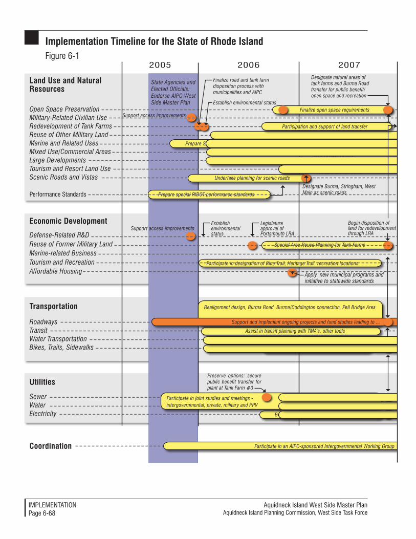
Aquidneck Island West Side Master PlanAquidneck Island Planning Commission, West Side Task Force
IMPleMenTATIonPage 6-68
Implementation Timeline for the State of Rhode IslandFigure 6-1
Coordination
Finalize road and tank farm disposition process with municipalities and AIPC
Legislature approval of Portsmouth LRA
State Agencies and Elected Officials: Endorse AIPC West Side Master Plan
Special Area Reuse Planning for Tank Farms
Support access improvementsFinalize open space requirements
Designate natural areas of tank farms and Burma Road transfer for public benefit/open space and recreation
Preserve options: secure public benefit transfer for plant at Tank Farm #3
Begin disposition of land for redevelopment through LRA
Support access improvements
Realignment design, Burma Road, Burma/Coddington connection, Pell Bridge Area
Designate Burma, Stringham, West Main as scenic roads
Assist in transit planning with TMA’s, other tools
Finalize routes through former military land
Participate in designation of Blue Trail, Heritage Trail, recreation locations
Prepare special RIDOT performance standards
2005 2006 2007
Apply new municipal programs and initiative to statewide standards
Establish environmental status
Establish environmental status
Designate Melville/Weaver Cove as a Growth Center
Designate North End/Pell Bridge Area as a Growth Center
Undertake planning for scenic roads
Designate Anchorage Area as a Growth Center
Support and implement ongoing projects and fund studies leading to ...
Prepare Special Area Management Plan
Participate in joint studies and meetings - intergovernmental, private, military and PPV
Evaluate wind generation options at tank farms
Land Use and Natural Resources
Economic Development
Defense-Related R&DReuse of Former Military LandMarine-related BusinessTourism and RecreationAffordable Housing
Transportation
RoadwaysTransitWater TransportationBikes, Trails, Sidewalks
Utilities
SewerWaterElectricity
Open Space PreservationMilitary-Related Civilian UseRedevelopment of Tank FarmsReuse of Other Military LandMarine and Related UsesMixed Use/Commercial AreasLarge DevelopmentsTourism and Resort Land UseScenic Roads and Vistas
Performance Standards
Participation and support of land transfer
Participate in an AIPC-sponsored Intergovernmental Working Group
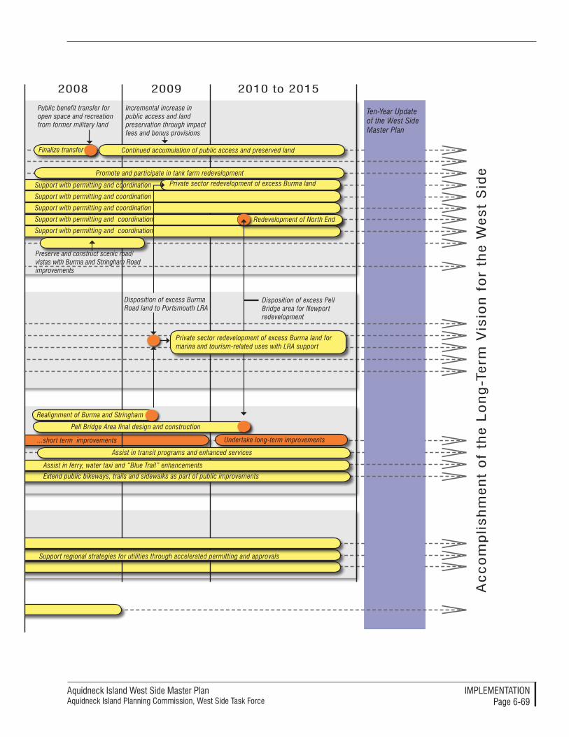
Aquidneck Island West Side Master PlanAquidneck Island Planning Commission, West Side Task Force
IMPleMenTATIonPage 6-69
Public benefit transfer for open space and recreation from former military land
Finalize transfer
Promote and participate in tank farm redevelopment
Realignment of Burma and Stringham
Disposition of excess Burma Road land to Portsmouth LRA
Incremental increase in public access and land preservation through impact fees and bonus provisions
Preserve and construct scenic road/vistas with Burma and Stringham Road improvements
Support with permitting and coordination
Extend public bikeways, trails and sidewalks as part of public improvements
2008 2009 2010 to 2015
Continued accumulation of public access and preserved land
Ac
co
mp
lish
men
t o
f th
e l
on
g-T
erm
Vis
ion
fo
r th
e W
est
Sid
e
Ten-Year Update of the West Side Master Plan
Support with permitting and coordination
Support with permitting and coordination
Support with permitting and coordination Private sector redevelopment of excess Burma land
...short term improvements
Pell Bridge Area final design and construction
Support with permitting and coordination
Disposition of excess Pell Bridge area for Newport redevelopment
Private sector redevelopment of excess Burma land for marina and tourism-related uses with LRA support
Redevelopment of North End
Undertake long-term improvements
Assist in transit programs and enhanced services
Assist in ferry, water taxi and “Blue Trail” enhancements
Support regional strategies for utilities through accelerated permitting and approvals

Aquidneck Island West Side Master PlanAquidneck Island Planning Commission, West Side Task Force
IMPleMenTATIonPage 6-70
Participate in designation of Blue Trail, Heritage Trail, recreation locations
Coordination
Finalize road and tank farm disposition process with municipalities and state
Advocate and support broad endorsement of the AIPC West Side Master Plan
Support short-term access improvements
Facilitate West Side Intergovernmental Working Group
Preserve options: secure public benefit transfer for plant at Tank Farm #3
Provide technical assistance for local and state performance standards
2005 2006 2007
Open Space PreservationMilitary-Related Civilian UseRedevelopment of Tank FarmsReuse of Other Military LandMarine and Related UsesMixed Use/Commercial AreasRetail UsesLarge DevelopmentsTourism and Resort Land UseScenic Roads and Vistas
Performance Standards
Economic Development
Defense-Related R&DReuse of Former Military LandMarine-related BusinessTourism and RecreationAffordable Housing
Assist in planning for scenic roads (special study)
Participate in Special Area Management Plan
Participate in joint studies and meetings - intergovernmental, private, military and PPV
Establish and maintain policy support for ALT and other land and open space preservation...
Provide ongoing regional coordination through Statements of Regional Consistency...
Participate in Special Area Reuse Planning for Tank Farms
Provide ongoing regional coordination through participation in Special Area Plans
Host annual West Side Transportation “summit”
Announce and distribute Master Plan
Annual update for municipalities
Annual update for municipalities
Land Use and Natural Resources
Transportation
RoadwaysTransitWater TransportationBikes, Trails, Sidewalks
Utilities
SewerWaterElectricity
Implementation Timeline for the AIPCFigure 6-2
Annu
al “
sum
mit”
Bian
nual
TIP
Inpu
t
Annu
al “
sum
mit”
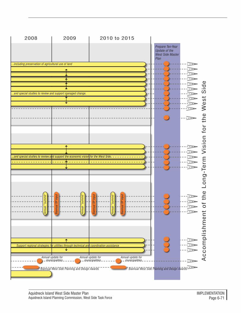
Aquidneck Island West Side Master PlanAquidneck Island Planning Commission, West Side Task Force
IMPleMenTATIonPage 6-71
2008 2009 2010 to 2015
Ac
co
mp
lish
men
t o
f th
e l
on
g-T
erm
Vis
ion
fo
r th
e W
est
Sid
e
Prepare Ten-Year Update of the West Side Master Plan
Support regional strategies for utilities through technical and coordination assistance
...including preservation of agricultural use of land
...and special studies to review and support managed change.
...and special studies to review and support the economic vision for the West Side.
Annu
al “
sum
mit”
Annu
al “
sum
mit”
Annu
al “
sum
mit”
Biannual West Side Planning and Design Awards Biannual West Side Planning and Design Awards
Annual update for municipalities
Annual update for municipalities
Annual update for municipalities
Bian
nual
TIP
Inpu
t
Bian
nual
TIP
Inpu
t
Bian
nual
TIP
Inpu
t

Aquidneck Island West Side Master PlanAquidneck Island Planning Commission, West Side Task Force
IMPleMenTATIonPage 6-72
Coordination
Endorse AIPC West Side Master Plan
Revise zoning
Apply new performance standards
Finalize open space requirements
Designate natural areas of Burma Road or other transfers for public benefit/open space and recreation
Support access improvements (Burma Road/Coddington connections)
Design phase, Burma Road and Burma/Coddington connection
Prepare inclusion standards
Participate in joint studies and meetings - intergovernmental, private, military and PPV
Integrate transit planning with new zoning, project reviews
Finalize routes along new roadways and redevelopment areas
Participate in designation of Blue Trail, Heritage Trail, Green Lane recreation improvements
Prepare performance standards
2005 2006 2007
Apply new standards
Coordinate land planning with AIPC...
Prepare new zoning Promote and support Anchorage redevelopment
Explore and support R&D initiatives
Support access improvements (Pell Bridge, Burma Road and Burma/Coddington connections)
Coordinate and support mixed income, mixed use redevelopment of the Anchorage
Prepare new zoning
Prepare new zoningInterim overlay standards Incorporate into zoning
Promote Blue Trail access/dock at Greene Lane
Finalize plan and disposition for Greene Lane waterfront area
Participate in an AIPC-sponsored Intergovernmental Working Group
Designate Anchorage as a Growth Center
Land Use and Natural Resources
Open Space PreservationConversion of Military LandMixed Use/Commercial AreasRetail UsesLarge DevelopmentsScenic Roads and Vistas
Performance Standards
Economic Development
Naval Station NewportDefense-Related R&DReuse of Former Military LandTourism and RecreationAffordable Housing
Transportation
RoadwaysTransitWater TransportationBikes, Trails, Sidewalks
Utilities
SewerWater
Implementation Timeline for MiddletownFigure 6-3
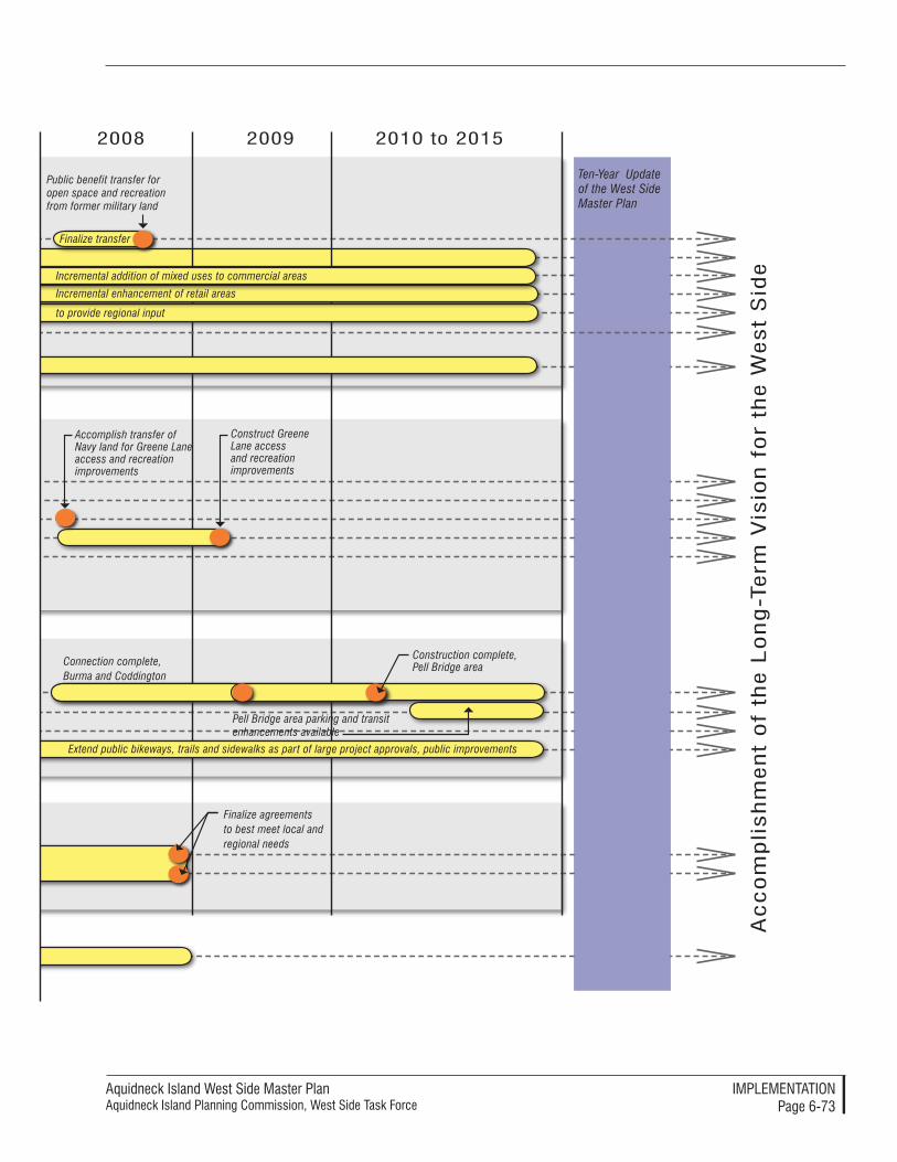
Aquidneck Island West Side Master PlanAquidneck Island Planning Commission, West Side Task Force
IMPleMenTATIonPage 6-73
Public benefit transfer for open space and recreation from former military land
Finalize transfer
2008 2009 2010 to 2015
Ac
co
mp
lish
men
t o
f th
e l
on
g-T
erm
Vis
ion
fo
r th
e W
est
Sid
e
Ten-Year Update of the West Side Master Plan
to provide regional input
Incremental enhancement of retail areas
Extend public bikeways, trails and sidewalks as part of large project approvals, public improvements
Construction complete, Pell Bridge area
Finalize agreements to best meet local and regional needs
Accomplish transfer of Navy land for Greene Lane access and recreation improvements
Pell Bridge area parking and transit enhancements available
Incremental addition of mixed uses to commercial areas
Construct Greene Lane access and recreation improvements
Connection complete, Burma and Coddington

Aquidneck Island West Side Master PlanAquidneck Island Planning Commission, West Side Task Force
IMPleMenTATIonPage 6-74
Coordination
Finalize Naval Hospital and other possible disposition processes with state and others
Endorse AIPC West Side Master Plan
Create interim overlay zoneRevise zoning
Apply new performance standards
Finalize open space requirements
Designate natural areas of Naval Hospital or other transfers for public benefit/open space and recreation
Participate in an AIPC-sponsored Intergovernmental Working Group
Support access improvements (Burma Road/Coddington connections)
Pell Bridge area design phase and connection design, Burma and Coddington
Participate in joint studies and meetings - intergovernmental, private, military and PPV
Integrate transit planning with new zoning, project reviews
Establish ferry stop as part of Naval Hospital reviews and approvals
Finalize routes along new roadways and redevelopment areas
Prepare performance standards
2005 2006 2007
Apply new standards
Open Space PreservationConversion of Military LandMixed Use/Commercial AreasRetail UsesLarge Developments
Performance Standards
Economic Development
Naval Station NewportDefense-Related R&DReuse of Former Military LandTourism and RecreationAffordable HousingMixed Use Center
Transportation
RoadwaysTransitWater TransportationBikes, Trails, Sidewalks
Utilities
SewerWater
Create interim overlay zone
Prepare new zoning (North End) Coordinate land planning with Pell Bridge...
Promote and participate in redevelopment of ...
Initiate Naval Hospital special area reuse plan if it is excessed
Special reuse plan
Support access improvements (Pell Bridge, Burma Road/Coddington connections)
Coordinate or support private reuse...
Designate North End/Pell Bridge Area as a Growth Center
Land Use and Natural Resources
Explore and support R&D initiatives
Participate in designation of Blue Trail, Heritage Trail, recreation locations
Prepare inclusion standards
Prepare North End Plan Coordinate land planning with Pell Bridge...
Prepare new zoning (North End)
Prepare new zoning
Implementation Timeline for NewportFigure 6-4

Aquidneck Island West Side Master PlanAquidneck Island Planning Commission, West Side Task Force
IMPleMenTATIonPage 6-75
Public benefit transfer for open space and recreation from former military land
Finalize transfer
Connection complete, Burma and Coddington
Public access and land preservation through North End development requirements
Provide for transfer of excess RIDOT land to City for redevelopment
2008 2009 2010 to 2015
Ac
co
mp
lish
men
t o
f th
e l
on
g-T
erm
Vis
ion
fo
r th
e W
est
Sid
e
Ten-Year Update of the West Side Master Plan
final alignment decisionsRefine performance standards: North End redevelopment
former Naval Hospital, other excess Navy Land
Incremental enhancement of retail areas
North End mixed use redevelopment, parking and transit enhancements
Extend public bikeways, trails and sidewalks as part of large project approvals, public improvements
Construction complete, Pell Bridge area
Finalize agreements to best meet local and regional needs
final alignment decisions
of Naval Hospital
Conduct Pell Bridge area land disposition/developer selection
Mixed use redevelopment
Pell Bridge area parking and transit enhancements available
Incremental addition of mixed uses to commercial areas
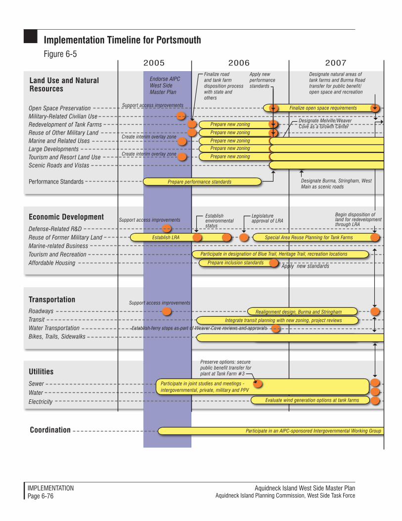
Aquidneck Island West Side Master PlanAquidneck Island Planning Commission, West Side Task Force
IMPleMenTATIonPage 6-76
Coordination
Finalize road and tank farm disposition process with state and others
Create interim overlay zone
Legislature approval of LRA
Endorse AIPC West Side Master Plan
Establish LRA
Create interim overlay zone
Special Area Reuse Planning for Tank Farms
Support access improvements
Prepare new zoning
Apply new performance standards
Finalize open space requirements
Designate natural areas of tank farms and Burma Road transfer for public benefit/open space and recreation
Prepare new zoning
Participate in an AIPC-sponsored Intergovernmental Working Group
Preserve options: secure public benefit transfer for plant at Tank Farm #3
Begin disposition of land for redevelopment through LRA
Support access improvements
Support access improvements
Realignment design, Burma and Stringham
Prepare inclusion standards
Prepare new zoning
Prepare new zoning
Prepare new zoning
Evaluate wind generation options at tank farms
Participate in joint studies and meetings - intergovernmental, private, military and PPV
Designate Burma, Stringham, West Main as scenic roads
Integrate transit planning with new zoning, project reviews
Establish ferry stops as part of Weaver Cove reviews and approvals
Finalize routes through former military land
Participate in designation of Blue Trail, Heritage Trail, recreation locations
Prepare performance standards
2005 2006 2007
Apply new standards
Establish environmental status
Open Space PreservationMilitary-Related Civilian UseRedevelopment of Tank FarmsReuse of Other Military LandMarine and Related UsesLarge DevelopmentsTourism and Resort Land UseScenic Roads and Vistas
Performance Standards
Economic DevelopmentDefense-Related R&DReuse of Former Military LandMarine-related BusinessTourism and RecreationAffordable Housing
TransportationRoadwaysTransitWater TransportationBikes, Trails, Sidewalks
UtilitiesSewer
Water
Electricity
Designate Melville/Weaver Cove as a Growth Center
Land Use and Natural Resources
Implementation Timeline for PortsmouthFigure 6-5
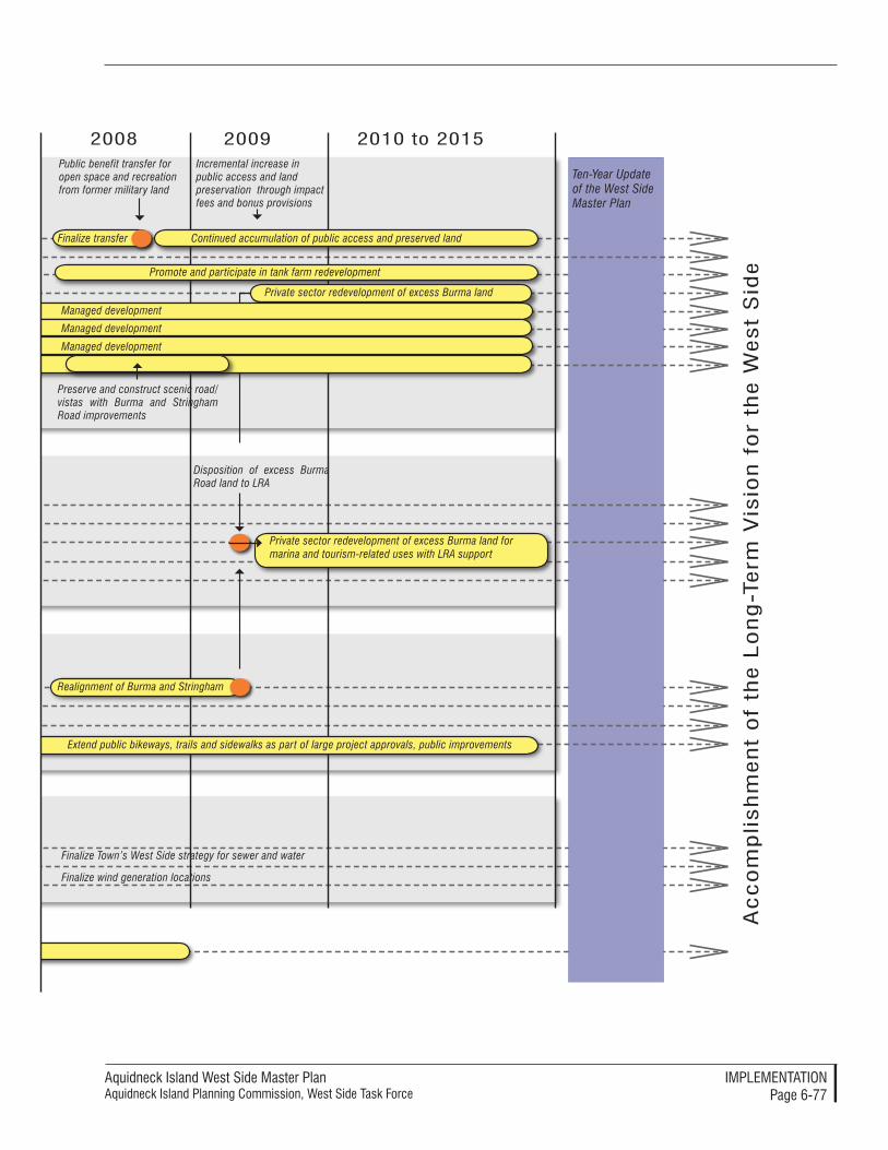
Aquidneck Island West Side Master PlanAquidneck Island Planning Commission, West Side Task Force
IMPleMenTATIonPage 6-77
Public benefit transfer for open space and recreation from former military land
Finalize transfer
Promote and participate in tank farm redevelopment
Realignment of Burma and Stringham
Disposition of excess Burma Road land to LRA
Private sector redevelopment of excess Burma land for marina and tourism-related uses with LRA support
Incremental increase in public access and land preservation through impact fees and bonus provisions
Preserve and construct scenic road/vistas with Burma and Stringham Road improvements
Private sector redevelopment of excess Burma land
Managed development
Managed development
Managed development
Finalize Town’s West Side strategy for sewer and water
Finalize wind generation locations
Extend public bikeways, trails and sidewalks as part of large project approvals, public improvements
2008 2009 2010 to 2015
Continued accumulation of public access and preserved land
Ac
co
mp
lish
men
t o
f th
e l
on
g-T
erm
Vis
ion
fo
r th
e W
est
Sid
e
Ten-Year Update of the West Side Master Plan

Aquidneck Island West Side Master PlanAquidneck Island Planning Commission, West Side Task Force
IMPleMenTATIonPage 6-��
Aquidneck Island West Side Master PlanAquidneck Island Planning Commission, West Side Task Force
APPendIx A: PerForMAnCe STAndArdSPage A-�
AAppendix A: performAnce StAndArdS
This appendix provides planning and design guidelines and performance standards that have been successfully applied in towns and cities around New England, and could serve as mod-els for the preparation of guidelines specific to areas on the West Side.
Performance standards are gener-ally intended as organizing principles aimed at the achievement of high qual-ity environmental and aesthetic design qualities. They can be further tailored to the particular character and condi-tions of particular localities by means of prescriptive regulations or assigned values that can be quantifiable and measured. For example, “trees should be provided along the perimeter of a parking lot to shield parking” is a performance standard; “trees should be provided at an average 40-foot separation” is a prescriptive regulation. Regulatory standards constitute an important way in which performance standards can be tailored to the needs of a particular community. Some com-monly used regulatory standards are indicated in brackets when applicable for informational purposes.
The model guidelines and standards presented here span the broadest ob-jectives down to detailed standards. They are divided into the following sections:
• Objectives – The content starts with the general objectives that would be appropriate for all proj-ects, including municipal projects. These are the goals for improve-ment of the project and design process to ensure the best quality results.
• Agreements and Compliance – There may be legal agreements to bind the parties to certain con-
tinuing actions outside of zoning compliance. Their completion is noted in this section.
• Process for Review – Procedures of review, although most appro-priate for larger projects, could be applied for careful review of any project. The procedures are presented as a two step process with greater detail developed as the project proceeds through the design and approval process.
• Baseline Performance Standards – General site planning and de-sign guidelines are centered on the relationship of buildings and landscaping to public ways, and the visual quality of edges and views.
• Specific Land Use Performance Standards – Performance stan-dards tailored for specific land use types relate to the unique aspects of each use and the desired quali-ties for improvement.
• Sustainability Site Planning and Design Performance Standards – The standards that provide an opportunity to advance ‘green’ projects to reduce energy con-sumption and environmental impact. Although these types of standards are not as common yet in local regulations, these stan-dards have been applied elsewhere with success.
objectivesPurpose and Intent – The project proposal proponents will provide in-formation in written and illustrative form as necessary to show the manner in which the proposal meets the objec-tives established by the community.
Aquidneck Island West Side Master Plan Aquidneck Island Planning Commission, West Side Task Force
APPendIx A: PerForMAnCe STAndArdSPage A-�
Design and Process Objectives:
• All design elements, including site, building form, organization, pro-gram, and materials, complement existing elements of the neighbor-hood and the area’s topography, vegetation, contextual buildings, land uses, and road layout;
• The new development does not conflict with or cause loss of public and private open spaces, or significant vistas;
• Adjoining premises will be pro-tected against seriously detrimen-tal uses by provision for surface water drainage, sound and light buffers, prevention of undue solar reflection and glare and preserva-tion of views, light and air;
• The appearance of the project is attractive from the pedestrian walkways, roadways, and other public land vantage points.
• Site and building designs make the project inviting, safe, and sus-tainable.
• All buildings and structures found eligible for or listed on the Na-tional Register of Historic Places, or identified by the Rhode Island Historic Preservation and Heri-tage Commission as historic re-sources are preserved or adaptively reused according to standards and principles of historic preservation.
Comment: Amended and additional goals and objectives may be included in this section to reflect local preferences as determined from the public hearing pro-cess to adopt the changes.
Agreements and compliancePurpose and Intent - A number of agreements may be necessary for easements, mitigation and long-term management that may be outside the normal zoning process, but still part of the community’s police powers. These standards ensure that the zoning and building permits can consider these additional legal instruments.
Agreements and Compliance Stan-dards:
The following standards will be col-laborated with evidentiary submittals:
A traffic monitoring and mitiga-tion program agreement has been entered into with the Town;
Escrow funds are deposited as required by the traffic monitoring and mitigation program agree-ment entered into with the Town;
Deed restrictions and any ease-ments area prepared and filed on the land records;
Where applicable, compliance with all regulatory and licensing requirements are proven with respect to the handling of poten-tially hazardous materials;
Adequate measures have been tak-en for the private maintenance and management of the development, including roadway maintenance and repair, maintenance of land-scape elements and natural open space, maintenance and repair of stormwater management facilities and utilities, snow removal, trash removal and recycling, where those facilities remain in private ownership or would impact public systems if not maintained;
Aquidneck Island West Side Master PlanAquidneck Island Planning Commission, West Side Task Force
APPendIx A: PerForMAnCe STAndArdSPage A-�
Compliance of the proposal with the applicable requirements of lo-cal codes and regulations is shown; and,
Appropriate evidence of compli-ance of the proposal with any non-zoning agreement entered into with the Town is shown.
Comment: The items for code compliance are not typically necessary but are added for clarification. The hazardous materi-als disposal standards are considered important when dealing with former industrial and military lands.
process for reviewPurpose and Intent - Approval of a complex project shall be by special permit with the Planning Board acting as the special permit granting author-ity [SPGA] for the purposes of these regulations. A special permit shall be granted if the planning board finds that the application complies with these regulations. The special permit process shall be in accordance with Section [the applicable special permit section in the regulations].
Comment: For infill projects, the exist-ing development review procedures found in local regulations may be sufficient to ensure proper review. The optional procedural requirements below are more appropriate for new, large development projects.
Comment: The “Procedures” outlined be-low provide one approach to development review of large and complex projects, and is more applicable to greenfield develop-ment projects. In particular, submittal requirements should conform to those required by local subdivision regulations as well.
Procedures:
Initial conference – Before sub-mitting an application for a proj-ect, the applicant shall schedule an appointment and meet with the [planner, municipal staff ] to discuss the procedure for approval of the project, including submittal requirements and design stan-dards. At the conclusion of the meeting(s), the city/town plan-ning staff will prepare summary notes of the meeting results for distribution.
Integrated Design Process – Initiate an integrated design process involving all stakeholders, including owners, project manag-ers, financial officers, planners, architects, engineers, estimators, contractors (or construction managers), facilities managers, and end users. Retain a Project Sustainability Coordinator(s) with direct managerial and responsi-bility for achieving agreed upon project goals.
General Implementation Plan Submittal Requirements – Fol-lowing the initial conference, the applicant shall submit a general implementation plan application for [Special Permit]. The purpose of the general implementation plan is to establish the intent, den-sity, and intensity for a proposed development. The General Imple-mentation Plan shall include the following:
1. A location map of suitable scale, but no less than one inch = [200] feet, which shows the location of the property within the com-munity and adjacent parcels
Aquidneck Island West Side Master Plan Aquidneck Island Planning Commission, West Side Task Force
APPendIx A: PerForMAnCe STAndArdSPage A-�
including locations of any public streets, railroads, major streams or rivers, and other major features within [1000] feet of the site.
2. A site inventory and analy-sis to identify site assets or resources, and constraints, including but not limited to floodplains, wetlands and soils classified as “poorly drained” or “very poorly drained,” soils with bedrock at or within 42 inches of the surface, utility easements for high-tension electrical transmission lines (>69KV), steep slopes greater than [15%], and brownfields.
3. A conceptual site plan, at a scale of no less than one inch = [100] feet, which indicates topography in [two] foot contours for sites with 15 feet or more of local relief, or one foot contours for local sites with less than 15 feet of lo-cal relief, consisting of a map with proposed features and existing site features and uses that will remain. These fea-tures should include building outlines, location of streets, transit stops, drives and parking areas, pedestrian and bicycle paths, service access areas for receiving material and trash removal, and other impervious surfaces. The location of proposed and ex-isting trees and shrubs should also be included, along with any other significant features.
4. A conceptual storm water management plan identify-ing the proposed patterns of major stormwater runoff,
locations of stormwater infiltration areas, and other significant stormwater best management practices.
5. Identification of the archi-tectural style(s) of the project and the accompanying site design style(s). The design style of the project shall be conveyed with drawings or computer simulations of typi-cal proposed building eleva-tions (including dimensions of building height and width, and facade treatment).
6. A written report that provides general information about the covenants, conservation easements, or agreements, which will influence the use and maintenance of the proposed development. The report shall also describe the site conditions and the devel-opment objectives.
7. Any other information deemed necessary by the [city/town] in order to evaluate plans.
8. Five copies of the above in-formation shall be submitted plus [one] reduced set no larger than 8-1/2 inches by 11 inches.
Specific Implementation Plan Submittal Requirements. Fol-lowing the [zoning map amend-ment, approval, or approval with conditions] of the General Implementation Plan, a Specific Implementation Plan shall be sub-mitted to the SPGA. The purpose of the Specific Implementation Plan is to establish a detailed de-velopment proposal. The Specific
Aquidneck Island West Side Master PlanAquidneck Island Planning Commission, West Side Task Force
APPendIx A: PerForMAnCe STAndArdSPage A-�
Implementation Plan can be pro-posed, reviewed, and acted upon as a whole, in part, or in phases. The applicant shall submit a series of plans, maps, and written mate-rials, which include the following information:
1. A general location map of suitable scale, which shows the boundaries and dimensions of the property and adjacent parcels, including locations of any public streets, railroads, major streams or rivers, and other major features within 1000 feet of the site, along with a legal description of the property.
2. A site inventory and analy-sis to identify site assets or resources, and constraints, including but not limited to floodplains, wetlands and soils classified as “poorly drained” or “very poorly drained,” soils with bedrock at or within 42 inches of the surface, utility easements for high-tension electrical transmission lines (>69KV), slopes greater than [15%], and brownfields.
3. A site plan, including pro-posed topographic contours at one-foot intervals, with the following information:
i. the location of proposed structures and existing structures that will re-main, with height and gross floor area noted;
ii. the location of street and pedestrian lighting, including lamp intensity and height;
iii. the location of proposed open space;
iv. the circulation system indicating pedestrian, bicycle, and motor ve-hicle movement systems, including existing and proposed public streets or right-of-ways; transit stops; easements or other reservations of land on the site; the location and dimensions of existing and proposed curb cuts, off-street parking and loading spaces, include service access for receiv-ing and trash removal; sidewalks and other walkways;
v. location of all trees, shrubs, and ground cover (proposed or existing) to remain on the site.
4. A stormwater management plan for the site. The grading plan shall show existing and proposed ground elevations with contours (one-foot contour interval) and spot elevations at significant high points, low points, and transition points. The grading plan shall also note the finished ground floor elevations of all buildings. The plan shall also show the loca-tions of all storm drainage sewers and structures, and infiltration or detention/retention structures; and all wetlands on the site, and copies of documents completed in mak-ing the wetlands identification.
5. Detailed elevations of all proposed commercial buildings and typical elevations of residential buildings. Scaled elevations should identify
Aquidneck Island West Side Master Plan Aquidneck Island Planning Commission, West Side Task Force
APPendIx A: PerForMAnCe STAndArdSPage A-�
all signs, building materials and percentage of ground floor com-mercial facade in windows; the location, height and material for screening walls and fences, includ-ing outdoor trash storage areas, electrical, mechanical and gas metering equipment, storage areas for trash and recyclable materials, and rooftop equipment.
6. A utilities plan showing under-ground and above ground lines and structures for sanitary sewers, electricity, gas, telecommunica-tions, and all other utilities.
7. A written report, which completely describes the proposal and indicates covenants or agreements that will influence the use and maintenance of the proposed development. The report also shall describe the analysis of site conditions and the development objectives.
8. Phasing plans, where applicable.
9. Any other information deemed necessary by the SPGA in order to evaluate plans.
Comment: Additional Recommenda-tions for Design Reviews - There are several procedural items that could en-hance the design review process. These are the regional approaches that could be implemented after each of the com-munities reaches consensus on their own, internal procedures. After establishing lo-cal preferences, the communities and the AIPC could proceed in the development of regional review procedures for those projects that have project impacts extend-ing across jurisdictional boundaries.
Continue implementing Design Re-view as part of the zoning approval process as established in the Ports-mouth Design Review Guidelines.
Finalize preparation and adop-tion of design review guidelines in Middletown and Newport (local applicability “thresholds” as the one considered in Middletown may be adopted as a means to facilitate the review and approval process).
Conduct joint review and evalua-tion of guidelines specifically aimed at enhancing the visual aesthetics of transportation corridors that run through more than one community.
Continue periodically reviewing and updating design review guide-lines for the three communities in order to maintain overall state-of-the-art quality.
Continue and enhance AIPC advi-sory role to the three municipalities as a steward and repository of good design principles.
Baseline performance Standards
Land Clearing
Purpose and Intent – Development of land can create on-site and off-site im-pacts to other properties and resources unless properly managed. These stan-dards will ease the management and common construction activities associ-ated with any development.
Comment: These performance standards will preserve features and reduce the typi-cal construction impacts that can lead to frequent complaints and potential damages.
Performance Standards:
Site/building design shall preserve natural topography outside of the development footprint to reduce unnecessary land disturbance and
Aquidneck Island West Side Master PlanAquidneck Island Planning Commission, West Side Task Force
APPendIx A: PerForMAnCe STAndArdSPage A-�
to preserve natural drainage chan-nels on the site.
Clearing of vegetation and al-teration of topography shall be limited to less that 50% of the site depending on use with native veg-etation planted in disturbed areas as needed to enhance or restore wildlife habitat.
Clearing for utility trenching shall be limited to the minimum area necessary to maneuver a backhoe or other construction equipment. Roots should be cut cleanly rather than pulled or ripped out during utility trenching. Tunneling for utilities installation should be uti-lized wherever feasible to protect root systems of trees.
Protect hilltops and/or scenic views. Placement of buildings, structures, or parking facilities shall not detract from the site’s scenic qualities and shall blend with the natural landscape. Build-ing sites shall be directed away from the crest of hills, and foun-dations shall be constructed to reflect the natural terrain.
Protect wildlife habitat. Sites shall be designed in such a way as to avoid impacts to rare and endan-gered species and wildlife habitat on a site, and to maintain contigu-ous forested areas.
Avoid impacts to archaeological resources: Applicants shall submit a response from the appropriate Historical Commission regarding the potential for archaeological or historical resources on the site.
Preserve open space and specimen trees on the site. In the design of a development, priority shall be giv-
en to retention of existing stands of trees, trees at site perimeter, contig-uous vegetation with adjacent sites (particularly existing sites protected through conservation restrictions), and specimen trees.
Understory vegetation beneath the drip line of preserved trees shall also be retained in an undis-turbed state. During clearing and/or construction activities, all veg-etation to be retained shall be sur-rounded by temporary protective fencing or other measures before any clearing or grading occurs and maintained until all construction work is completed and the site is cleaned up. Barriers shall be large enough to encompass the essential root zone of all vegetation to be protected. All vegetation within the protective fencing shall be retained in an undisturbed state.
Forested areas shall be preserved if they are associated with:
1. significant forest communi-ties;
2. wetlands, water bodies and their buffers;
3. critical wildlife habitat areas;
4. slopes over 25 percent.
Minimize cut and fill in site devel-opment. Development envelopes for structures, driveways, waste-water disposal, lawn areas, and utility work shall be designated to limit clearing and grading.
1. Other efforts to minimize the clearing and grading on a site associated with construction activities shall be employed, such as parking of construc-tion vehicles, offices/trailers,
Aquidneck Island West Side Master Plan Aquidneck Island Planning Commission, West Side Task Force
APPendIx A: PerForMAnCe STAndArdSPage A-�
stockpiling of equipment/materials, etc. in areas al-ready planned for permanent structures. Topsoil shall not be stockpiled in areas of pro-tected trees, wetlands, and/or their vegetated buffers;
2. Finished grades should be limited to no greater than a 2:1 slope, while preserving, matching, or blending with the natural contours and undulations of the land to the greatest extent possible.
Employ proper site management techniques during construction:
1. BMPs shall be employed to avoid detrimental impacts to existing vegetation, soil com-paction, and damage to root systems;
2. The extent of a site exposed at any one time shall be limited through phasing of construc-tion operations. Effective sequencing shall occur within the boundaries of natural drainage areas.
Protect the site during construc-tion through adequate erosion and sedimentation controls:
1. Temporary or permanent diversions, berms, grassed waterways, special culverts, shoulder dikes, or other such mechanical measures as are necessary, may be required to intercept and divert surface water runoff. Runoff flow shall not be routed through areas of protected vegetation or revegetated slopes and other areas. Temporary runoff from erosion and sedimenta-
tion controls shall be directed to BMPs such as vegetated swales. Retaining walls may be required where side slopes are steeper than a ratio of 2:1;
2. Erosion control measures shall include the use of ero-sion control matting, mulch-es, and/or temporary or per-manent cover crops. Mulch areas damaged from heavy rainfalls, severe storms, and construction activity shall be repaired immediately;
3. Erosion control matting or mulch shall be anchored where plantings are on areas subject to mulch removal by wind or water flows or where side slopes are steeper than 2:1 or exceed 10 feet in height;
4. Runoff from impervious sur-faces shall be recharged on the site by stormwater infiltration basins, vegetated swales, con-structed wetlands or similar systems covered with natural vegetation. Runoff shall not be discharged directly to riv-ers, streams, or other surface water bodies. Dry wells shall be used only where other methods are not feasible. All such basins and wells shall be preceded by oil, grease, and sediment traps. The mouths of all catch basins shall be fitted with filter fabric during the entire construction pro-cess to minimize siltation or such basins shall be designed as temporary siltation basins with provisions made for final cleaning;
Aquidneck Island West Side Master PlanAquidneck Island Planning Commission, West Side Task Force
APPendIx A: PerForMAnCe STAndArdSPage A-�
5. The applicant shall be required to conduct weekly inspections of all erosion and sedimenta-tion control measures on the site to ensure that they are properly functioning as well as to conduct inspections after severe storm events.
Revegetate the site immediately after grading:
1. Proper revegetation tech-niques shall be employed using native plant species, proper seed bed preparation, fertilizer and mulching to protect germinating plants. Revegetation shall occur on cleared sites within 7 (seven) calendar days of final grading and shall occur during the planting season appropriate to the selected plant species;
2. A minimum of 4” of topsoil shall be placed on all dis-turbed surfaces, which are proposed to be planted;
3. Finished grade shall be no higher than the trunk flare(s) of trees to be retained. If a grade change of 6” or more at the base of the tree is pro-posed, a retaining wall or tree well may be required.
Streets
Purpose and Intent – Public and pri-vate streets and roads not only provide access and connectivity, but serve as major conveyors of high volumes of pollutants through stormwater runoff and airborne particulates. Sustain-able street design involves practical design solutions that incorporate basic stormwater management techniques to improve water quality, habitat, and air
quality, as well as address issues of aes-thetics and good connectivity at a local and regional level.
Performance Standards:
Build a street network that avoids cul-de-sacs and promotes connec-tivity. This enables local traffic to use smaller streets rather than be funneled into the main arterial. Such a system is also ideal for al-ternate modes such as biking and walking.
In locations where streets cannot extend to connect to the grid, make the connection through pedestrian walkways, bike routes, or greenways.
Identify streets that are in criti-cal watersheds, close to drinking water sources, in steep areas, and close to streams and natural habi-tats. Apply special design prin-ciples to these streets to minimize polluted runoff.
Consider innovative right-of-way design that uses features such as wide canopy street trees to shade impervious areas, pervious surface treatments especially for parking lanes, filter strips and vegetated swales at the sides or as a median to capture runoff, no curbs in less busy streets to prevent channeling into stormwater drains, infiltra-tion trenches in areas with low runoff soils, and street tree wells as detention options.
Refer to Green Streets: Innova-tive Solutions for Stormwater and Stream Crossings developed for the Portland Metro Region as examples.
Aquidneck Island West Side Master Plan Aquidneck Island Planning Commission, West Side Task Force
APPendIx A: PerForMAnCe STAndArdSPage A-�0
Specific Land Use performance Standards The following section presents some options for performance standards that could be applied to the West Side to specific types of land uses. They may also be appropriate to other areas after modification.
Large Project Performance Standards
Comment: It is anticipated that some of the large property holdings, includ-ing military properties will be subject to redevelopment in the near term. In the event of these projects moving forward, the expectation is that they will be large enough to accommodate a mix of build-ings and land uses that could be designed to create a character of development that is sustainable within the West Side. These standards will create a mix of uses and organize them into development blocks that meet smart growth and traditional neighborhood goals.
Purpose and Intent - Large develop-ment projects are distinct in that their impacts are more significant and their time for execution and completion is longer. However, they are also expect-ed to provide a broader range of op-portunities and higher quality results that can support more public benefits. Large project proponents must show how the project meets the following performance standards:
Performance Standards:
Master Planned – The project must be presented as a Master Plan that includes all components and concepts for improvement. The Master Plan may be present-ed as a Special Area Reuse Plan, a Marina Village Master Plan, or other commercial, residential, or mixed use project proposal.
Sustainability – The project must be shown to be based on a sus-tainable development plan that includes environmental, land use, and market support for the long-term viability of the plan. Part of the determination of sustainability will be to determine off-site infra-structure needs including schools, water, sewer and transportation. On-site support to regional in-frastructure needs must also be proven.
Compact Development – The project must be dense and, at the same time, at a scale that makes a pedestrian feel comfortable. The process of reviewing alternative plans and options for clustering of development that protects the landscape heritage, includes provi-sions for public access, improved accessibility, and protection of views shall be presented so that the Town may be shown that the best quality design has been proposed. If not, this presentation can show what mitigation is proposed to offset adverse conditions created by the preferred plan. However, den-sity bonuses are only available after a determination that the Town will obtain more public benefits than anticipated from similar projects.
Mix of Residential Uses – In or-der to achieve the proximity neces-sary to make neighborhoods walk-able, it is important to provide a mix of residential uses, a project center, and open space. The mix of residential uses may be satisfied by existing residential uses adjacent to the project if the neighborhoods are integrated but will include the following, of which [20] percent will be affordable:
Aquidneck Island West Side Master PlanAquidneck Island Planning Commission, West Side Task Force
APPendIx A: PerForMAnCe STAndArdSPage A-��
1. Single-family detached dwell-ings, including manufactured homes;
2. Single-family attached dwell-ings, including duplexes, townhouses, row houses;
3. Multifamily dwellings, in-cluding senior housing;
4. Accessory dwelling units within a single-family unit;
5. “Special needs” housing, such as community living arrangements and assisted living facilities.
Project Center – There should be a project center of activity and commerce, composed of a mix of commercial, residential, civic or in-stitutional, and open space uses or-ganized to create a walkable center. The commercial uses may include:
1. Food services (neighborhood grocery stores; butcher shops; bakeries; restaurants, not in-cluding drive-throughs; cafes; coffee shops; neighborhood bars or pubs);
2. Retail uses (florists or nurs-eries; hardware stores; sta-tionery stores; book stores; studios and shops of artists and artisans); services (day care centers; music, dance or exercise studios; offices, including professional and medical offices; barber; hair salon; dry cleaning);
3. Accommodations (bed and breakfast establishments, small hotels or inns);
4. Civic or institutional uses should also be included in the project center and should
include municipal offices, fire stations, libraries, museums, community meeting facili-ties, and post offices; transit shelters; places of worship; or educational facilities.
Accessibility and Transportation – Within the project, easy pedes-trian movement is very important. However, the project must also be connected to adjoining areas by accommodations for public transit and safe road systems. The circulation system shall provide adequate traffic capacity, provide connected pedestrian and bicycle routes (especially off street bicycle or multi-use paths or bicycle lanes on the streets), limit access onto streets of lower traffic volume classification, and promote safe and efficient mobility through the traditional neighborhood develop-ment. Streets should be classified and designed for the following:
1. Collector: Provides access to commercial or mixed-use buildings, but is also part of the project’s major street network. On-street parking, whether diagonal or parallel, helps to slow traffic. Addition-al parking is provided in lots to the side or rear of buildings.
2. Sub-collector: Provides pri-mary access to individual residential properties and connects streets of lower and higher function. Design speed is 25 mph.
3. Local Street: Provides primary access to individual residential properties. Traffic volumes are relatively low, with a design speed of 20 mph.
Aquidneck Island West Side Master Plan Aquidneck Island Planning Commission, West Side Task Force
APPendIx A: PerForMAnCe STAndArdSPage A-��
4. Alley. These streets provide secondary access to residential properties where street front-ages are narrow, where the street is designed with a nar-row width to provide limited on-street parking, or where alley access development is desired to increase residential densities. Alleys may also provide delivery access or alternate parking access to commercial properties.
The following types of sidewalks shall be provided:
1. Residential Sidewalks. Clear and well-lighted sidewalks, [3-5] feet in width, depend-ing on projected pedestrian traffic, shall connect all dwell-ing entrances to the adjacent public sidewalk.
2. Project Center Sidewalks. Clear and well-lit walkways shall connect building en-trances to the adjacent public sidewalk and to associated parking areas. Such walkways shall be a minimum of [5] feet in width.
3. Disabled Accessibility. Side-walks shall comply with the applicable requirements of the Americans with Disabili-ties Act.
4. Crosswalks. Intersections of sidewalks with streets shall be designed with clearly defined edges. Crosswalks shall be well lit and clearly marked with contrasting paving materials at the edges or with striping.
The following parking standards shall apply:
1. Residential Parking. Mixed residential areas may include on site and on street parking dependent on the width of the street.
2. Project Center Parking. With the exception of on street parallel parking spaces, park-ing in the project center shall be behind buildings, and the buildings shall front on all streets.
3. Off Site Parking. Off-site parking shall be appropriate to improve active public use and preservation of views in waterfront areas, agricultural areas, and commercial areas. Using off-site parking will re-quire options for transporting people from the parking areas to the activity centers.
Trip Allocation - To maintain ac-cessibility along the public road system and to ensure reasonable management of the costs of infra-structure improvements in regard to the transportation system, the total number of vehicle trips and the peak hour trips will be allo-cated to land uses and areas and implemented as a restriction ac-cording to an agreement with the Town (see General Performance Standards for agreements).
More on trip allocation can be found in the Oregon program which can be viewed at http://www.rvcog.org/pdf/planning_CLH_App_E.pdf
Cultural and Environmental Context - The local and regional cultural and environmental issues that define the character of the
Aquidneck Island West Side Master PlanAquidneck Island Planning Commission, West Side Task Force
APPendIx A: PerForMAnCe STAndArdSPage A-��
area will also be required in the design of new development. All projects are to be held to a higher accountability for the quality of the architectural and site design. Proponents will need to prove how the design meets the best standards of the Town and of the region. At a minimum the project:
1. Is designed for the human scale;
2. Provides a mix of housing styles, types, and sizes to ac-commodate households of all ages, sizes, and incomes;
3. Incorporates a system of rela-tively narrow, interconnected streets with sidewalks, bike-ways, and transit that offer multiple routes for motorists, pedestrians, and bicyclists and provides for the connections of those streets to existing and future developments;
4. Retains existing buildings with historical features or architectural features that enhance the visual character of the community;
5. Incorporates significant envi-ronmental features into the design;
6. Is consistent with the com-munity, regional, and state master plans.
Project Phasing – A Project Phas-ing Plan shall be a requirement of the permit submittals and approval by the town. However, a Large Project is anticipated to be com-pleted over the course of several years, in which time certain mar-ket and program changes may be
required that could alter elements of the project. Because of the com-plexities of public decision-making, project management, and the need to have consistency and expedience in the project completion, the fol-lowing standards shall apply:
1. No significant changes to any project element shall be pro-posed by the town or the pro-ponent after issuance of the municipal permits, without prior consultation between a previously identified town agent and the project propo-nent. After this consultation, those changes appropriate to move forward shall be com-mitted to a formal process of review and approval. Changes shall be those that alter public benefits and mitigation, and changes of more than twenty percent in the building pro-gram either by increase or re-duction, or by shift between land use types;
2. In addition to other criteria within the local regulations, the basis for the town ac-cepting a change will include a finding that the public benefits and mitigation im-proves or remains equal to the prior condition, and that the change in building program is sustainable and fits the char-acter of the original concept.
commercial Area/mixed Use performance Standards:Comment: Many of these standards may already be in place in other forms within the local regulations as prescrip-tive standards. Some of the standards
Aquidneck Island West Side Master Plan Aquidneck Island Planning Commission, West Side Task Force
APPendIx A: PerForMAnCe STAndArdSPage A-��
recommended here may conflict with the dimensional standards of a district, such as having buildings located close to the road when minimum setbacks usually apply. Review of the zoning and consideration for a modification of those dimensional requirements or adoption of a form-based zoning regulation could resolve the potential conflicts.
Purpose and Intent – The com-mercial areas are important centers for commerce and socialization, an important part of the local tax base, and help identify the community. For this reason, the Town expects the highest quality of design and opera-tion of the commercial projects to be gained through application of these standards.
Performance Standards:
Site Improvements - Site improve-ments will be designed and sited with respect to other site features and adjacent public properties to accomplish the following:
1. Buildings should be located close to the road and have entrances from public pedes-trian areas.
2. Buildings should be located to help shape and protect public and private open space.
3. Buildings at roadway inter-sections shall not have park-ing, loading or service areas at the corner. The street corner should either be a focal point for the building or treated as public space.
4. Property edges that face the public right-of-way shall have treatments that blend the pub-lic and private property design.
5. Sidewalks, signs and lighting that improve the edge areas and encourage walking into the site are encouraged.
6. Sidewalks shall be required if a transit stop is available within walking distance.
7. Street trees, furniture and other public right-of-way im-provements shall be designed to relate to the building and site design and not hide the businesses or store entrances.
8. Ideally, the use of bituminous pavement for sidewalks and walkways should be avoided in favor of better quality ma-terials.
9. Pedestrian passages to rear parking areas and entrances may be relatively narrow, but must be inviting and open air. Building side windows, light-ing, and landscaping shall be used to make the passageways pleasant.
10. Planting of trees along side-walks and front property lines is recommended. In general, small deciduous trees should be considered for most loca-tions. Trees could be clustered in groups or equally spaced in rows, according to desired ef-fect.
11. Plantings of different types and sizes should be provided to create a variety of New England landscapes with an informal character. A list of recommended species should be provided as part of detailed design guidelines, in which indigenous varieties appro-
Aquidneck Island West Side Master PlanAquidneck Island Planning Commission, West Side Task Force
APPendIx A: PerForMAnCe STAndArdSPage A-��
priate to the site conditions prevalent at each location should be encouraged.
12. Trees should be interspersed with shrubs and bushes. Ev-ergreens are recommended for buffering and screen-ing. Flowering trees should be used as design accents. Low planting materials and shrubs, preferably of flower-ing varieties, can be used to soften building edges and enhance pedestrian areas. Seasonal planters and flower-ing window boxes are encour-aged, particularly for public sidewalks and sitting areas.
13. Site lighting fixtures should consist of cutoff-style fixtures set at low heights (bottom of fixture not higher than 17 feet).
14. Site utilities should be placed underground whenever feasible.
15. Electrical transformers, un-derground utility feeds, site mechanical equipment, and outdoor storage areas should be screened from public view by landscaping.
Building Design Standards - The application of these standards will be accomplished in accordance with the proper professional de-sign standards and the traditions of the community.
1. Building types shall relate to local and traditional New England building types for coastal communities.
2. To the extent practical, build-ings should be located close
to the road and have archi-tectural features, entrances, and windows that create transparency between the in-terior of the building and the pedestrian.
3. Building façades should gener-ally extend parallel to the pub-lic right-of-way, or follow an alignment that closely relates to the front line of the lot.
4. Building entrances should be clearly recognized. Main entrances must be located on the façade facing the road and on multiple façades when fronting more than one road.
5. The architectural elements of the building should be ar-ticulated to create a sense of scale and proportion through changes in materials, variation in the façade plane through bays, articulation of structure, ornament, or roof forms.
6. Long, unbroken expanses of wall and, conversely, random changes in proportion, mate-rials or design must be avoid-ed. Exterior walls longer than [60] feet visible from public areas should be articulated with glazed openings, projec-tions, recesses, and setbacks.
7. Elements within the building façades shall be proportioned on a human scale for pedes-trian comfort.
8. The first floors shall be taller than the upper floors, and shall have storefronts or other pedestrian-oriented design elements.
Aquidneck Island West Side Master Plan Aquidneck Island Planning Commission, West Side Task Force
APPendIx A: PerForMAnCe STAndArdSPage A-��
9. Building color patterns may vary within any building façade, but strong or bright colors should be limited to decorative elements.
10. Building finish materials shall be of high quality, preferably natural wood and stone, or integrated and textured ma-sonry. Exposed roofing mate-rials may be asphalt shingles, clay tile, slate, concrete tile, or ribbed metal. The use of certain materials, such as con-crete blocks, modular concrete panels, metal exterior panels, and vinyl siding should be avoided unless specifically ap-proved or required.
11. All side and rear walls visible to the public right-of-way or adjacent properties shall have the same or comparable qual-ity exterior materials applied to them as the front façade.
12. At least two-thirds of the ground-level frontage shall be fenestration. Reflective or darkly tinted glazing shall not be permitted.
13. In general, roofs shall be simple forms and avoid exces-sive articulation. However, the use of turrets, dormers or skylights as design accents is encouraged.
14. Rooflines shall be distinguish-able as the top of the building line and shall have cornice treatments or caps, roof over-hangs, stepped parapets, or similar design elements.
15. Rooftops should be designed in such a way that their shape
and size would allow for the location of any large equip-ment that needs to be on top of the building. No pent-houses or rooftop mechanical units shall be visible from the exterior.
Parking and Loading Standards – Parking areas are only for the storage of vehicles and should not create the image of the project. To achieve this standard the follow-ing will apply:
1. Analyze parking requirements at a area-wide level and in-corporate these requirements into the comprehensive plan-ning process. The provision of maximum parking capacity is discouraged.
2. Show the maximum use of shared parking in mixed use and commercial areas to avoid the provision of excess parking.
3. In locations where parking lots are necessary, incorporate trees; porous pavements such as grass pavers, porous as-phalt, and pervious concrete; and stormwater bio-retention areas integrated into traffic islands and landscaped areas.
4. Ensure that infiltration at parking lots does not result in groundwater contamination due to seepage of petroleum by-products.
5. Parking areas should be land-scaped and graded to create broken vistas, so there is no panoramic view of asphalt and cars.
Aquidneck Island West Side Master PlanAquidneck Island Planning Commission, West Side Task Force
APPendIx A: PerForMAnCe STAndArdSPage A-��
6. Parking lots and paved areas should be screened from the road with vegetation, fences, walls, and/or landscape berms.
7. Screening should be accom-plished by employing good quality construction materials, such as steel, cast iron fencing, brick, or stone. No chain link fencing visible from the street shall be allowed.
8. When a fence is built along the front line of the lot, a 6-foot setback landscaped with bushes and low plantings should be provided along the fence.
9. Parking lot design should require a maximum number of spaces that may be pro-vided between landscaped islands, and should specify the minimum acceptable size for islands and minimum size of trees.
10. Sizes of parking spaces should be minimized for a 16-foot average car length, and the to-tal numbers of spaces should be defined.
11. Driveway cuts should be restricted in number (one preferred) and width, depen-dent on truck and emergency access.
12. Loading and dumpster areas should be located towards the rear of the lot, and adequate space and clearance should be provided for the maneuvering of trucks as needed.
13. The visibility of loading areas, trash receptacles, dumpsters, and associated equipment shall be restricted from public view by buildings or screen-ing.
Signage Standards – Signs are necessary for the identification of the businesses but should be subservient to the architecture of the buildings and natural site features:
1. Signage should advertise the name and the type of business at its location. Off-premises signs shall not be allowed.
2. Signs displaying product names and logos should not be permitted unless directly associated with the principal service or products of the establishment.
3. Signage should not be de-signed for the passing vehicles except at low speeds. Design for the pedestrian scale. Mul-tiple store sites may have a single sign with limits on lad-der signs.
4. Color schemes that are ge-neric and associated with the logo or standard building designs of chain operations should be modified to pro-vide a unique design more suited to the creation of a smaller scale, village-oriented environment.
5. Flat wall signs are encouraged for commercial and retail uses. Freestanding ground signs are recommended for office, hotel, recreational, and mul-tifamily residential uses. Only
Aquidneck Island West Side Master Plan Aquidneck Island Planning Commission, West Side Task Force
APPendIx A: PerForMAnCe STAndArdSPage A-��
one freestanding ground sign should be allowed per lot. Pole signs and rooftop signs should be avoided.
6. In a multiple storefront build-ing, signage should be of a consistent location, size and material, and of harmonious color.
7. In new buildings with multiple storefronts, a strong signage band should be designed just above the storefront level if flat wall signs are to be employed. Signs should be designed to extend across the entire sign band, yet within the vertical elements that define indi-vidual storefront bays.
8. Projecting signs: signs mounted on a building per-pendicular to the road—may be allowed only for retail uses. They should convey informa-tion in a unique way, utilizing images that visually represent the goods or services provided at the premises. A minimum clearance of 8 feet under the projecting sign should be maintained.
9. Signs located above the sill of second story windows shall not be allowed, except by spe-cial flat wall signs identifying a hotel or the principal user of a large commercial build-ing. In this case, the location and size of the sign should be integrated with the building architecture subject to design review and approval.
10. Signs should be made of durable materials compatible
with those of the building served. Wood, metal and stone piers for ground signs are encouraged. Plastic in general is not recommended, except if used in combination with other materials, or as part of individual internally lit letters or symbols.
11. Signs utilizing light-colored letters against a dark back-ground and signs on canopy fabrics advertising the name of the business or organiza-tion are encouraged. Neon signs advertising only a busi-ness name, illuminating at a steady, even light level, are appropriate if located behind the façade glass.
12. Directly illuminated signage should be from a series of gooseneck or similar extend-ed arm fixtures, which direct light to the façade and are compatible with the design of the building. Internally lit signs should only be allowed if they consist of indepen-dently lit letters or symbols attached to the building façade. Flashing signs should not be allowed.
13. Exterior lighting of freestand-ing signs with ground or sign-mounted fixtures is encour-aged.
14. Every sign intended for public view shall be subject to design review and approval by local authority.
Aquidneck Island West Side Master PlanAquidneck Island Planning Commission, West Side Task Force
APPendIx A: PerForMAnCe STAndArdSPage A-��
military Land reuse performance StandardsComment: The military parcels are likely to be subject to significant building, open space, and public facility programs. As noted above, these are likely to fall under the large project standards. However, cre-ating these plans will require the estab-lishment of a Special Area Reuse Plan as described elsewhere in these appendices. Along with the Special Area Reuse Plan elements and procedures to accomplish the Plan, these standards will ensure that any redevelopment authority or entity that takes on the task will be made aware of local preferences as established by these performance standards.
Purpose and Intent - Because of the nature and size of the military land parcels on the West Side, the Large Project Performance Standards will often apply to redevelopment of these properties. However, additional standards are added to focus on the public benefits that must be consid-ered for use of public land, and the environmental restoration that must take place to allow the Reuse Plan created by the local redevelopment authority to proceed. The following performance standards shall be goals of the Reuse Plan that must be met by the local redevelopment authority and the eventual developer and user:
Performance Standards:
Compatibility with Remaining Military Uses – The reuse of former military lands should not jeopardize the security or opera-tion of continued military uses, or the related civilian uses that sup-port the military on Aquidneck Island. This will be determined through consultation with the military at the Naval Station and
at the Department of Defense. Additional consultation should be taken with any private military contractors who may operate adja-cent to the reuse area;
Public Benefits – Uses beneficial to the public will take equal prior-ity to proposed uses that provide high level jobs and tax benefits. The Reuse Plan should include:
1. Roads – The Reuse Plan must consider the regional trans-portation needs and options for connecting roads and accessways across the proper-ties. This will include access to adjoining private lands where potential job creation on that land will result from the improved accessibility. This will include secondary north-south accessibility and bike paths.
2. Utilities – The Reuse Plan must consider the regional utility infrastructure and al-locations. New demands for services within the project will be considered together with cumulative demands for improved service within other parts of the community and present allocations to the Newport WWTF. This will include on-site wastewater treatment and community treatment systems within ar-eas, such as the former tank farms that provide space for large systems and lay over land restricted by environ-mental remediation require-ments. On-site water supply systems will also be consid-ered together with cumula-tive demands for improved
Aquidneck Island West Side Master Plan Aquidneck Island Planning Commission, West Side Task Force
APPendIx A: PerForMAnCe STAndArdSPage A-�0
service within other parts of the community and present allocations.
3. Open Space and Recreation – The Reuse Plan must con-sider the community inven-tory of recreational facilities and the options for additional facilities within the project area. This will include athletic fields, passive recreation areas, supporting facilities, and in-door recreation facilities.
4. Job Creation and Tax En-hancements – The Fiscal element of the Reuse Plan should clarify the benefits that accrue to the community through new jobs and taxes. Payments in lieu of taxes, known as PILOT programs, or Tax Increment Financ-ing, or TIF programs, will be acceptable depending on whether the uses provide the other public benefits that conform to local needs and objectives.
Public Access – All reuse proj-ects must maintain and improve public access to these formerly restricted lands. This will include:
1. Access to and along the waterfront with spaces for active public uses and accom-modations. This will include easements with at least [30 feet] of width, and locations for facilities of up to [10,000] sq.ft. of area for building and launching access into the wa-ter with additional on- and off-site parking;
2. Access to areas preserved in their natural state for educa-tional and interpretive pro-grams. This will include the construction of boardwalks when the resources require special protection and inter-pretive signs;
3. Access to areas used for public utility facilities. These will be granted as full rights of access for all future uses of the par-cel under which the facility is sited;
4. Access across lands turned over to private interests, when that access can provide im-proved mobility for residents and workers. These access-ways may be vehicular, and/or pedestrian and bicycle.
Environmental Restoration – Res-toration of past environmental degradation must meet the stan-dards for public access and future public use:
1. Restoration shall be to residential use (the highest) standards when the land is programmed for residential use.
2. Restoration may be to com-mercial standards when the land is programmed for com-mercial uses or is being pro-grammed for future planning.
3. Restoration may be to indus-trial standards when the land is committed to sustainable industrial uses, or when the land is committed to public or private utility uses that are compatible with this lowest standard.
Aquidneck Island West Side Master PlanAquidneck Island Planning Commission, West Side Task Force
APPendIx A: PerForMAnCe STAndArdSPage A-��
marina and marine-related Use performance StandardsComment: It is expected that most wa-terfront projects will fall under the Large Project standards for greenfields, or be urban redevelopment projects. However, because the waterfront is a unique and valuable public resource, additional per-formance standards are necessary to protect water-dependent uses and protect and en-courage public access. Public access would be accomplished by the ‘activation’ of the waterfront with commercial and recre-ational uses that attract people to the site.
Purpose and Intent – If marina and marine-related uses are to thrive as businesses, the developments around them must support and sustain them. In addition, the waterfront as a re-source within the public trust must be enlivened with new development so that people can enjoy the waterfront in many different ways. The economic value of waterfront development should be able to accomplish these goals if properly designed. Projects in the waterfront areas must show how the project meets the following per-formance standards in addition to all other coastal development standards:
Performance Standards:
Preservation of Uses – Preserva-tion of a working waterfront and its character is necessary while at the same time inviting public ac-cess and use:
1. Existing marina and marine-related facilities that support waterfront access, activity, and local heritage shall be preserved to the maximum extent possible;
2. Existing marina and marine-related facilities that must be
relocated or displaced shall be matched to the maximum extent possible within new construction.
3. The heritage character of the Island shall be included in the design of all projects. This will include analysis of the neighborhood architecture and landscape and a report on how the project meets those standards.
Reservation of Land – Land should be reserved for marine-re-lated uses that support the work-ing waterfront. When reserving land for marine related uses, in-terim uses may be permitted;
Public Accessibility – Avoid priva-tizing any of the shoreline and ensure that the public rights to all the shorefront and water resources are protected and encouraged. In the Commercial Core/Marina Village areas, all of the waterfront should be accessible to the public except where safety is a concern. Outside the Commercial Core/Marina Village areas, 50 percent of the waterfront shall be publicly accessible, and additional density shall be provided where the public access is increased or improved;
Financially Supportive Uses – The non-water-dependent uses must be able to support the long-term viability of the water-depen-dent uses either through direct subsidy or preferably by creating the level of activity and market demand that maintains the busi-ness enterprise:
1. Tourist accommodations and other types of living units
Aquidneck Island West Side Master Plan Aquidneck Island Planning Commission, West Side Task Force
APPendIx A: PerForMAnCe STAndArdSPage A-��
may be included according to the other site planning and design standards;
2. Residential development shall be integrated into the design of the projects according to the Large Project standards, where possible, to ensure an active area and strong sup-port from the market sector. The inclusion of vacation or second homes will be consid-ered beneficial to the finances of the project and the town.
Residential Uses – When residen-tial uses are included within the project, those units will be clus-tered in groupings that provide common and private open space, are set into the hillsides, and do not exceed the height of [42] feet or four stories.
1. No housing or other mixed use may be permitted fur-ther than 1/4 mile from the water’s edge, measured by a line parallel to the mean high water line.
2. All housing must be either at-tached or within multi-family buildings.
3. The provision of publicly-accessible mixed uses such as restaurants transient docks or other amenities will provide a bonus of a five percent in-crease in total density.
4. Multi-family construction should be no less than 50 percent of the land use.
5. Base development density should be no greater than one unit per 40,000 square feet for
all of the land (including wet-lands and preserved lands). Increases in density shall be provided where public access and public facilities are added above the base standards.
6. The proportion of housing units to boat slips may not exceed the ratio of one unit to each slip.
Activation of the Waterfront – The waterfront should be an area for active public use and the supporting uses that make the waterfront an attractive and invit-ing area are to be included within specific design standards:
1. There shall be provisions for recreation, entertainment, tourist, retail and other complementary facilities, and the creation of public places along the waterfront to acti-vate the waterfront;
2. There shall be provisions for public boating and parking facilities;
3. Compatible mixed-use de-velopment such as housing, hospitality or entertainment uses would be allowed under the condition that at least 90 percent of the waterfront is publicly accessible along a sidewalk or boardwalk at least 10 feet wide along the water’s edge.
4. Such mixed use development can only occur if waterside parking (parking within 100 feet of the water’s edge) con-sumes less than 30 percent of the total waterfront edge within the planned area.
Aquidneck Island West Side Master PlanAquidneck Island Planning Commission, West Side Task Force
APPendIx A: PerForMAnCe STAndArdSPage A-��
5. Parking and boat storage may occur off-site as long as adequate land and control are demonstrated.
Parking – Special provisions will be made for parking to obtain the maximum project and public ben-efits:
1. On-site parking will be pro-vided to allow reasonable use of the public, commercial, and recreational attractions and facilities. However, the estimated peak parking de-mand will not be the criteria for design of on-site parking if this demand utilizes land area greater than the footprint of the facilities.
2. Off-site and peak parking de-mand will be accommodated with facilities removed from the waterfront.
3. Parking requirements should be established through the Marina Village Master Plan and be based on evaluations of other large scale, season-ally-impacted facilities.
Views – Waterfront and waterside views require special attention to ensure they are preserved in ways that maintain the character of the area, but still allow the building program needed to activate the waterfront. The following stan-dards will apply:
1. Buildings along the wa-terfront will conform to a formula of height and lineal distance parallel to the wa-terfront that blocks no more than 50 percent of the views of the water from the nearest
public right of way, or more than 50 percent of the build-ings on the upland side of the nearest public right of way.
2. Mixed use and commercial building heights may not ex-ceed four stories as measured from the down-hill side of a building.
3. Waterside views of the land form will require an analysis that shows that the character of the upland slopes is main-tained without visible regrad-ing of more than 25 percent of the hillside as seen from the harbor lines.
Agricultural Land performance StandardsComment: Typical agricultural preserva-tion programs seek to purchase the land, reduce the tax burden, or, where the law allows, increase the lot size to parcels on which a farm could be sustainable (e.g. a minimum of 25 to 50 acres). How-ever, other approaches seek to preserve the ongoing agricultural lands as long as possible by requiring new develop-ment to support the farming operations either through design or actual subsidy. These standards are based on the latter approach.
Purpose and Intent – The purposes of these performance standards are to conserve the present agricultural resources, concentrate development away from the resource areas, and transfer development to other loca-tions to allow the productive land to continue as an agricultural use. Land within a development project that is used for agricultural purposes as defined by state law, or includes land
Aquidneck Island West Side Master Plan Aquidneck Island Planning Commission, West Side Task Force
APPendIx A: PerForMAnCe STAndArdSPage A-��
that has been mapped by the Natural Resources Conservation Service (U.S. Department of Agriculture) as Prime soils for agriculture must show how the project meets the following perfor-mance standards:
Performance Standards:
Conservation of Soils – Conserve the existing or potential agricul-tural operations and the existing soils by setting aside sufficient land area to continue the agricul-tural enterprise or allow a future enterprise in a sustainable manner. Sustainability may be assured with subsidies provided to the agricul-tural use;
Farm Sales – Provide an option for sales of produce on or adjacent to agricultural lands;
Runoff and Erosion Controls – Include controls on runoff and potential erosion from farmland to improve water quality before discharge into waterways and pre-vent erosion of the prime soils;
Cluster – Locate new develop-ment on smaller footprints to pre-serve agricultural resources where the resulting higher densities do not conflict with views and view corridors that create the image of the area as agricultural;
Views – Maintain new develop-ment at a height that does not conflict with the views and view corridors that create the image of the area as agricultural;
Landscape Views – Otherwise preserve the views and view cor-ridors that maintain the image of the area as agricultural from public ways;
Compatible Land Uses – Do not place new land uses that may be incompatible with typical agri-cultural operations close to those operations. This includes main-taining a significant separation distance between residences and fields or processing operations;
Easements and Ownerships – Transfers of ownership, ease-ments, or development rights over the agricultural lands to an organi-zation that supports agriculture.
open Space performance StandardsComment: There are three aspects to open space designations of importance. First is the choice of the land that should be set aside and what qualities that land possesses, and second the links between the open space parcels that allow green-ways through out the area and improve the value of the land and mobility for residents. The third is the design of the designated areas that will ensure their long-term value.
Purpose and Intent – These standards will help ensure the highest value land is preserved. The preserved land could be within large development projects or separate parcels. These performance standards are also intended to promote the links and connections between open space parcels.
Performance Standards:
Open Space Preservation – Land within a development that is pro-posed to be set aside as open space must exhibit most of the following criteria, or be shown to be signifi-cantly important for more than one of the criteria:
Aquidneck Island West Side Master PlanAquidneck Island Planning Commission, West Side Task Force
APPendIx A: PerForMAnCe STAndArdSPage A-��
1. Property that contains en-dangered, threatened, or eco-logically significant species, or natural systems, and that is large enough to sustain the habitat for the species either by itself or combined with other protected property;
2. Property that is valuable to the community as open space due to its proximity to devel-oping areas, or its impact on a view corridor;
3. Property that is valuable to a community because of its historical or cultural value or its proximity to an historically significant area;
4. Property that includes or con-tributes to important wildlife habitat or wildlife corridors;
5. Property with significant agri-cultural or forestry resources;
6. Property with wetlands or flood plains and others neces-sary for the protection of water quality and water resources, including erosion control;
7. Property that contains signifi-cant or unique ecosystems or natural features (geological hazards and formations could apply);
8. Property which is adjacent to or in close proximity of land already preserved by federal, state, local, or other conserva-tion agencies; and,
9. Quality of the coastal beaches and adjacent estuarine habitat (or other unique ecosystem or natural feature).
Open Space Connections – These standards are proposed to be used as a strategy for creating a network of usable open spaces across the West Side, which are also inte-grated with existing open spaces throughout the Island. Land with-in a development that is proposed to be set aside for open space con-nections must exhibit most of the following criteria, or be shown to be significantly important for sev-eral of the criteria. The open space connections will:
1. Be secure, natural ways with appropriate views and vistas;
2. Create a network of biking and walking trails connecting the shoreline to open space reservations in the interior of the Island;
3. Conserve the existing public access and rights of way and promote appropriate use of the shoreline while limiting access in sensitive habitat areas;
4. Increase public access to the shoreline with permanent dedication of an easement and parking, as appropriate;
5. Improve the quantity as well as quality of public access;
6. Create a shoreline trail that will link all shoreline parks;
7. Conform to local and state public access design guide-lines for siting development along the shore and maximiz-ing visual and physical public access;
Aquidneck Island West Side Master Plan Aquidneck Island Planning Commission, West Side Task Force
APPendIx A: PerForMAnCe STAndArdSPage A-��
8. Allow for future capital improvement projects for enhancing the public realm; and,
9. Include provisions for sig-nage, educational, and inter-pretive material for the area.
Open Space Design and Manage-ment – The design and manage-ment of the open space areas should ensure the long-term value of the areas:
1. Select locally adapted, pest resistant, and native plant species wherever feasible for landscape plantings. Mini-mize pesticide use.
2. Implement landscape designs and measures that exclude weeds, such as weed cloth, mulches, dense plantings, and mowing strips.
3. Implement landscape designs and measures that maintain vigorous plant growth to minimize landscape pest problems. Examples include the installation of easily maintained, computerized ir-rigation systems, ensuring proper drainage, and using compost to build soil fertility.
4. Use gray water for irrigation.
Scenic roadways and Vistas performance StandardsComment: Scenic roadway programs and regulations are usually designed to ensure that public investment in the rights of way maintain the historic landscape and road configuration. To ensure that the roadway and associated landscape remain, the municipalities will need to determine the
desired classification and ensure that other transportation project capital investments support the distribution of travel demand. Similar standards have been accepted and proven within the Critical Area review criteria in Newport.
Purpose and Intent - The purpose of scenic roads and vistas performance standards are to protect the unique and historic landscape character of a dis-trict along the designated public rights of way. The standards will preserve established street layout and construc-tion, and ensure adjacent construction maintains the topography, vegetation and scenic vistas from the roadway. The following goals are established for the application of these standards:
Acknowledge local history and historical significance of a corri-dor;
Establish a link between open space areas;
Ensure public notification of the visual qualities of an area as viewed from the road;
Support economic development initiatives that take advantage of this public designation with its views and vistas; and,
Provide an alternative to subur-ban development landforms by ensuring adjacent development conforms to the scenic qualities.
Performance Standards:
Street trees, shoulders, road lay-outs and road geometry within the designated public rights of way are to be preserved to the maximum extent possible. All development projects proposed along a designated right of way are

Aquidneck Island West Side Master PlanAquidneck Island Planning Commission, West Side Task Force
APPendIx A: PerForMAnCe STAndArdSPage A-��
to identify and map those features for submittal with any request for a town permit.
Scenic vistas [as defined by the mapped areas and including historic buildings and natural features] are to remain open for public view, unless mitigation is provided. Mitigation can include public access to alternative sites for the vistas.
Methods to handle the increase in runoff from any proposed de-velopment must be designed to maintain the landscape, includ-ing trees, grades, and structures within the public right of way.
The existing grades and significant trees within the site shall be main-tained to the maximum extent possible.
All front yard building setback areas shall remain in their natural state to the maximum extent possible.
Where the proposed development requires removal of trees and vege-tation, the mitigation will include replacement of that vegetation except where the replanting may impact views and vistas.
performance Standards for SustainabilitySustainability guidelines are not separate from or secondary to good planning and site design. To be effec-tive, sustainability must be considered and implemented as part of the pri-mary and initial design and planning processes. There are many different models of sustainable best practices that have been successful in other areas and can provide valuable lessons and
guidance for Aquidneck Island. The guidelines outlined below have been selected for their relevance and appli-cability to the specific set of conditions likely to be encountered on the West Side but could also apply to the whole of Aquidneck Island.
This section is organized into three parts:
Low Impact Development – Site Planning Process
Green Building Design (LEED Standards)
LEED Standards for Sustainable Site Planning
Sustainable Site development principles Applicable to the West SideThe guidelines in this section are developed as models; they are not in-tended for adoption without specific tailoring for each community. They are intended, however, to serve as ap-propriate starting points for groups seeking to adopt regulations on the specific topics noted below. Some of the topic areas discussed below may already be covered by existing local, state, and federal regulations. It is important to note, however, that the main purpose of these design prin-ciples is to encourage towns to review and perhaps update their current regu-lations to comply with state-of-the-art planning practice.
Each topic area describes the purpose and intent of the guidelines and de-scribes some basic design principles and techniques for application. They are generally based on a set of organiz-ing principles for sustainable develop-ment that include:
Aquidneck Island West Side Master Plan Aquidneck Island Planning Commission, West Side Task Force
APPendIx A: PerForMAnCe STAndArdSPage A-��
Integrated planning and design processes to ensure coordination, synergy, and cost savings across disciplines.
Enhancement of existing natural features, habitats, and resources through open space conservation, stormwater management, and wildlife protection.
Creation of a network of sustain-able open spaces, including natu-ral, agricultural, and landscaped areas.
Circulation that emphasizes al-ternate modes of transportation, parking management, and inno-vative design practices applied to streets and parking lots.
Compact development that in-creases density in developed ar-eas, encourages energy and water conservation, and promotes green building design and construction practices.
Low impact developmentPurpose and Intent - The Low-Im-pact Development (LID) approach combines a hydrologically functional site design with pollution preven-tion measures to compensate for land development impacts on hydrology and water quality. LID site planning strategies and techniques provide the means to achieve stormwater manage-ment goals and objectives; facilitate the development of site plans that are adapted to natural topographic con-straints; maintain lot yield; maintain site hydrologic functions; and provide for aesthetically pleasing, and often less expensive stormwater manage-ment controls. Fundamental LID Site Planning concepts include:
Using hydrology as the integrating framework;
Management of stormwater in the smallest units possible;
Controlling stormwater at the sources;
Using simple, nonstructural methods wherever possible;
Creating a multifunctional land-scape.
Performance Standards:
Specific LID controls called Integrated Management Practices (IMP’s) can reduce run-off by integrating storm-water controls throughout the site in many small, discrete units. IMP’s are distributed in a small portion of each lot, near the source of impacts, virtually eliminating the need for a centralized best management practice (BMP) facil-ity such as a stormwater management pond. A developed site can be designed as an integral part of the environment maintaining predevelopment hydro-logic functions through the careful use of LID control measures. LID can achieve stormwater control through the creation of a hydrologically functional landscape that mimics the natural hy-drologic regime by:
Minimizing stormwater impacts to the extent practicable. Techniques include reducing imperviousness, conserving natural resources and ecosystems, maintaining natural drainage courses, reducing use of pipes, and minimizing clearing and grading.
Providing runoff storage measures dispersed uniformly throughout a site’s landscape with the use of a variety of detention, retention, and runoff practices.
Aquidneck Island West Side Master PlanAquidneck Island Planning Commission, West Side Task Force
APPendIx A: PerForMAnCe STAndArdSPage A-��
Maintaining pre-development time of concentration by strate-gically routing flows to maintain travel time and control the dis-charge.
Implementing effective public education programs to encourage property owners to use pollution prevention measures and maintain the on-lot hydrologically functional landscape management practices.
Low Impact Development Site Plan-ning Process:
The LID Site Planning process in-volves the following steps:
Step 1 – Identify applicable zoning, land use, subdivision and other local regulations.
The LID approach employs a number of flexible zoning options to meet the environmental objectives of a site without impeding urban growth. The use of these options provides added environmental sensitivity to the zon-ing and subdivision process over and above what conventional zoning can achieve.
Step 2 - Define development envelopes.
The development envelope can be established by identifying protected ar-eas, setbacks, easements, topographic features and existing sub drainage divides, and other site features. The features that need to be protected include riparian areas such as flood-plains, stream buffers, and wetlands; woodlands; woodland conservation zones and important existing trees; steep slopes; and highly permeable and erosive soils.
To minimize hydrologic impacts on existing site land cover, the area of de-
velopment should be located in areas that are less sensitive to disturbance or have lower value in terms hydrologic function. Site fingerprinting (minimal site disturbance techniques) can be used to further reduce the limits of clearing and grading, thereby minimiz-ing the hydrologic impacts.
These techniques include:
Reducing paving and compaction of highly permeable soils;
Minimizing the size of construction easements and material storage ar-eas, and siting stockpiles within the development envelope during the construction phase of a project;
Siting building layout and clear-ing and grading to avoid removal of existing trees where possible;
Minimizing imperviousness by reducing the total area of paved surfaces;
Delineating and flagging the smallest site disturbance area possible to minimize soil compac-tion on the site and restricting temporary storage of construction equipment in these areas;
Disconnecting as much impervi-ous area as possible to increase opportunities for infiltration and reduce water runoff flow;
Maintaining existing topography and associated drainage divides to encourage dispersed flow paths.
Step 3 – Use drainage/hydrology as a design element.
Hydrologic evaluation procedures can be used to minimize the LID runoff potential and to maintain the predevel-opment time of concentration. These
Aquidneck Island West Side Master Plan Aquidneck Island Planning Commission, West Side Task Force
APPendIx A: PerForMAnCe STAndArdSPage A-�0
procedures are incorporated into the LID site planning process early on to understand and take advantage of the site conditions. Spatial organization of the site layout is also important. Un-like pipe conveyance systems that hide water beneath the surface and work independently of surface topography, an open drainage system for LID can work with natural landforms and land uses to become a major design element of a site plan. The LID stormwater management drainage system can suggest pathway alignment, optimum locations for park and play areas, and potential building sites. The drainage system helps to integrate urban forms, giving the development an integral, more aesthetically pleasing relation-ship to the natural features of the site. Not only does the integrated site plan complement the land, but it can also save on development costs by mini-mizing earthwork and construction of expensive drainage structures.
Step 4 – Reduce/minimize total site impervious areas.
Various methods can be used to achieve a reduction in the total runoff volume from impervious surfaces:
Alternative roadway layout;
Narrow road sections;
Reduced application of sidewalks to one side of primary roads;
Reduced on-street parking;
Reduce rooftop area;
Reduce driveway area by using shared driveways, limiting their widths to 9 feet, minimizing building setbacks to reduce their length and using pervious pavers.
Step 5 – Integrate preliminary site layout plan.
Low-impact, environmentally sensitive development incorporates a combina-tion of all natural resources protec-tion options into a comprehensive, integrated site design. The preliminary integrated site plan provides a base for conducting the hydrologic analysis to compare the pre- and post-develop-ment site hydrology, and to confirm that the overall objective of creating a hydrologically functional site is being met.
Step 6 – Minimize directly connected impervious areas.
Additional environmental benefits can be achieved and hydrologic impacts reduced by disconnecting the unavoid-able impervious areas as much as pos-sible by:
Disconnecting roof drains and directing flows to vegetated areas;
Directing flows from paved areas such as driveways to stabilized vegetated areas;
Breaking up flow directions from large paved surfaces;
Encouraging sheet flow through vegetated areas;
Carefully locating impervious areas so that they drain to natural systems, vegetated buffers, natu-ral resource areas, or infiltratable zones/ soils.
Step 7 – Modify/increase drainage flow paths.
Techniques that can affect and control time of concentration by managing flow and conveyance systems within the development site include:
Aquidneck Island West Side Master PlanAquidneck Island Planning Commission, West Side Task Force
APPendIx A: PerForMAnCe STAndArdSPage A-��
Maximize overland sheet flow;
Increase and lengthen flow paths;
Lengthen and flatten site and lot slopes;
Maximize use of open swale sys-tems;
Increase and augment site and lot vegetation.
Step 8 – Compare pre and post devel-opment hydrology.
The hydrologic analysis quantifies both the level of control that has been pro-vided by the site planning process and the additional level of control required through the use of the integrated man-agement practices (IMPs).
Step 9 – Complete LID site plan.
Completion of the LID site plan usu-ally involves a number of iterative design steps. Based on the results of the hydrologic evaluation, additional stormwater control requirements of the LID site are identified. These re-quirements will be met using IMP’s (bioretention, dry wells, filter/buffer strips, grassed swales, rain barrels, cisterns, infiltration trenches, etc.) dis-tributed throughout the site. A trial- and-error iterative process is then used until all the stormwater management requirements are met.
Green Building design (Leed Standards)The U.S. Green Building Council (USGBC) developed the Leadership in Energy and Environmental Design (LEED®) rating system for evaluating the environmental performance of a building based on existing proven tech-nology. The LEED® system evaluates
performance from a “whole building” perspective over a building’s life cycle, providing a concrete standard for what constitutes a “green” building. As a result, it has garnered national and international acceptance as a common measurement for green buildings. The five LEED® categories of evaluation are: Sustainable Sites, Water Efficiency, Energy and Atmosphere, Materials, and Indoor Environmental Quality. Buildings are rated on a 4-step scale from lowest to highest: LEED® Cer-tified, LEED® Silver, LEED® Gold, and LEED® Platinum.
LEED for New Construction and Major Renovations (LEED-NC®) is a green building rating system that was designed to guide and distinguish high-performance commercial and institutional projects. For more infor-mation see:
h t t p : / / w w w. u s g b c . o r g / L E E D /publications.asp
LEED for Commercial Interiors (LEED-CI®) addresses the specifics of tenant spaces in office, retail, and institutional buildings. LEED-CI is part of a comprehensive suite of LEED green building rating tools developed by USGBC to promote green design, construction, and operations practices in buildings nationwide. For more information see:
http://www.usgbc.org/LEED/leed_interiors.asp
The LEED Green Building Rating System for Existing Buildings (LEED-EB®) is a set of performance standards for the sustainable operation of exist-ing buildings. The LEED-EB criteria cover building operations and systems upgrades in existing buildings where the majority of interior or exterior
Aquidneck Island West Side Master Plan Aquidneck Island Planning Commission, West Side Task Force
APPendIx A: PerForMAnCe STAndArdSPage A-��
surfaces remain unchanged. For more information see: (DOE provide link).
LEED green building principles in-clude the following:
Stormwater Management
Erosion caused by poor drainage and careless construction practices should be avoided. Meeting the LEED-NC® Sustainable Sites Prerequisite for Erosion and Sedi-mentation Control can prevent loss of soil during construction by storm water runoff, construction activities, and/or wind erosion, including protecting topsoil by stockpiling for reuse.
Construct wetlands for storm wa-ter treatment. Treatment wetlands can remove a variety of contami-nants (including fertilizers, pet waste, crankcase oil, pulverized brake linings) prior to discharge into the Bay. Bodies of water, plants and microbes naturally re-move water contaminants. Con-structed wetlands closely mimic natural systems in their operation, harboring diverse, complex eco-systems.
Carefully planned infiltration swales and basins and measures to reduce impermeable surfaces are generally less costly than the conventional practice of installing storm sewers and building large detention ponds.
Maximize treatment level of pol-luted runoff. While mechanical liquid/solid separators are consid-erably better then nothing, they do not remove all pollutants.
Other techniques include: maximiz-ing planted open space, avoiding
contiguous impermeable surfaces, minimizing roadway width, incor-porating living roofs on buildings, storing roof runoff for later use, and using porous paving materials. Spe-cific techniques must be developed tailored to Aquidneck Island based on soil condition, water table, and potential contaminants (tailored to residential, industrial, and natural areas).
Harvest rainwater for gray water irrigation and toilet flush applica-tions.
Separate pipes for gray water from sinks and showers.
Reduce spray head flow and use drip heads for irrigation; use moisture sensors.
Install low flow toilets etc. (build-ing related).
Conserve potable water.
Wastewater Treatment
Use the best available technol-ogy for the reuse of sewage and residual stormwater, using these flows as resources rather than waste products.
Consider a system of decentral-ized, on-site, state-of-the-art, small-footprint, odor-free sewage treatment plants integrated into the landscaping that can recycle water for irrigation purposes, treat sewage for disposal without un-necessary costs, and treat storm water to levels appropriate for ter-tiary uses while minimizing elec-trical loads that would otherwise be required of off-site treatment.
Identify uses for recycled water, in-cluding enhancement of the storm-
Aquidneck Island West Side Master PlanAquidneck Island Planning Commission, West Side Task Force
APPendIx A: PerForMAnCe STAndArdSPage A-��
water treatment wetlands, landscap-ing, etc., and create an appropriate storage and distribution system.
Utilize constructed wetlands for as much as possible of the sewage treatment process. As with storm-water treatment wetlands, bodies of water, plants, and microbes naturally remove water contami-nants. Constructed wetlands are a proven alternative to conventional engineered treatment plants. For more information see:
http://www.buildinggreen.com/auth/article.cfm?filename=030402a.xml
Deconstruct all buildings with substantially recoverable materi-als. Adopt a goal to divert at least 75% of construction, demolition, and land clearing debris from landfill disposal. Require that projects implement a construction waste management plan.
Create recycling programs in all public, commercial, and residen-tial spaces.
Establish a composting program for public, commercial, and resi-dential uses.
Adopt a solid waste diversion goal.
Limit or eliminate potable water use for landscaping.
energy Conservation
Use appropriate street alignment or width and development pat-terns to reduce shading and maxi-mize solar energy potential for all buildings.
Minimize the Island’s electricity demand by reducing energy con-
sumption and explore generating power on-site. Develop the electri-cal distribution system as a distrib-uted energy system to enable all of the power need being met with lo-cal distributed generation systems.
Use high efficiency lighting strate-gies for walkways, streets, signage, and other outdoor lighting. De-sign all outdoor lighting to protect the darkness of the night sky.
Perform a feasibility study of a district heating and/or cooling system that may utilize cogen-eration and or a ground or water source heat exchanger.
Use active and passive solar energy systems to minimize demand for electricity and natural gas as well as generate electricity to the maxi-mum amount feasible.
Refer to LEED guidelines for en-ergy conservation in buildings.
Alternate Modes of Transportation
Reduce automobile use for in-tra-island transportation to the greatest extent possible by the establishment of pedestrian- and bicycle-friendly land uses.
Develop a bike and pedestrian network in conjunction with the development of the greenways.
Provide a bike amenities such as lockers and racks at convenient locations and shower facilities at commercial establishments.
Promote electric and alternate fuel vehicles. Require charging stations and parking spaces.
Provide lighting that is appropri-ate for pedestrian and bike paths
Aquidneck Island West Side Master Plan Aquidneck Island Planning Commission, West Side Task Force
APPendIx A: PerForMAnCe STAndArdSPage A-��
and directional signage. Make biking and walking safe, pleasant, convenient, interconnected, and a real option.
Implement shuttle service where appropriate.
Offer employees incentives to use public transit and develop programs such as the Commuter Benefits Program and an Emer-gency Ride Home Program to reduce traffic congestion and im-prove air quality.
Support neighborhood develop-ment patterns that promotes walking for short trips.
Require the use of zero emission fleet vehicles by government agen-cies; encourage businesses and non-profits on the island that utilize fleet vehicles to use zero emission vehicles and provide preferred parking for AFV’s.
Develop alternative fuel infra-structure on the Island to sup-port the use of clean air vehicles, including electric vehicles.
Limit parking by implementing standards that are below current minimum planning code require-ments, providing preferred parking for carpools and vanpools, imple-menting a Car Share program with the necessary car share pod on site and unbundling some parking from housing units. Consider bundling transit passes with condo fees and with hotel room fees.
Habitat Protection
Protect and enhance biological diversity and natural habitats.
Use wildlife-friendly plants.
Leed Standards for Sustainable Site planning
erosion and Sedimentation Control
• Identify the soil composition on the project site, uncover potential site problems, and devise possible mitigation efforts. Erosion prone areas should be protected from construction activities and a plan should be adopted to stabilize these areas. An Erosion Control Plan should include:
1. A statement of erosion con-trol and storm water control objectives.
2. A comparison of post-devel-opment stormwater run-off conditions with pre-develop-ment conditions.
3. A description of all temporary and permanent erosion con-trol and stormwater control measures implemented on the project site.
4. A description of all type and frequency of maintenance activities required for erosion control facilities utilized.
Site Selection for Building
• Avoid development of inappropri-ate sites and reduce the environ-mental impacts from the location of a building on a site. Do not develop buildings on portions of sites that meet any one of the fol-lowing criteria:
1. Prime farmland as defined by the American Farmland Trust.
2. Land whose elevation is lower than 5 feet above the eleva-
Aquidneck Island West Side Master PlanAquidneck Island Planning Commission, West Side Task Force
APPendIx A: PerForMAnCe STAndArdSPage A-��
tion of the 100- year flood as defined by FEMA.
3. Land that provides habitat for any species on the Federal or State threatened or endan-gered list.
4. Land within 100 feet of any wetland as defined by 40 CFR, Parts 230-233 and Part 22, or as defined by the local or state rule or law, whichever is more stringent.
5. Land that prior to acquisition for the project was public parkland, unless land of equal or greater value as parkland is accepted in trade by the pub-lic landowner (Park Authority projects are exempt).
• Once the site is selected, perform a site survey to inventory all of the important environmental char-acteristics, including wetlands, sloped areas, specific habitat areas, and forested areas.
• Follow the zoning requirements of the local municipality and the community master plan and co-ordinate with the community and allow for public comment on site decisions.
• When designing the building, consider a smaller footprint and set aside large contiguous areas for natural space on the project site.
• Instead of parceling out the site, build in dense blocks and limit the development footprint to the smallest area possible.
• Incorporate site features into the design such as natural shelters from trees or terrain, natural areas
for outdoor activities, and water features for thermal, acoustic, and aesthetic benefit.
• Channel development to areas with existing infrastructures, pro-tecting greenfields and preserving habitat and natural resources. Pro-mote Brownfield redevelopment by rehabilitating damaged sites where development is compli-cated by real or perceived environ-mental contamination, reducing pressure on undeveloped land.
reduced Site disturbance
• Conserve existing natural areas and restore damaged areas to provide habitat and promote bio-diversity.
• Document existing water ele-ments, soil conditions, ecosys-tems, trees and other vegetation and map all potential natural hazards. Consider the impacts of the proposed development on existing natural and built systems and propose mitigation to nega-tive impacts.
• Choose a building footprint that minimizes disturbance to the existing ecosystem. Consider is-sues such as building orientation, daylighting, heat island effects, storm water generation and other sustainable building issues.
• Once the site and building loca-tion has been determined, design and construct a compact building massing to preserve open land. Reduce footprints by tightening program needs and stacking floor plans.
• Encourage preservation, conserva-tion, and restoration of existing,
Aquidneck Island West Side Master Plan Aquidneck Island Planning Commission, West Side Task Force
APPendIx A: PerForMAnCe STAndArdSPage A-��
natural site amenities. If appro-priate, build on parts of the site that already degraded so as not to degrade undisturbed areas.
• Restore the native landscape of the site by preserving and planting native species to re-establish pre-development site conditions. Res-toration efforts will vary depending on the particular project site.
• During the construction process, establish clearly marked construc-tion and disturbance boundaries. Delineate lay down, recycling, and disposal areas and use paved areas for staging activities.
• Establish contractual penalties if destruction of protected ar-eas outside of the construction boundaries are impacted, Coor-dinate infrastructure construction to minimize the disruption of the site and work with existing topog-raphy to limit cut and fill efforts for the project.
Stormwater Management
• Limit disruption of natural water flows by minimizing stormwater runoff, increasing on-site infiltra-tion and reducing contaminants.
• Storm water volumes can be mini-mized by reducing impervious surfaces to encourage natural pro-cess of evaporation and infiltra-tion, designing a smaller building footprint, and installing garden roofs and pervious paving.
• Stormwater could also be har-vested from roofs and hardscapes and can be used for non-potable uses such as sewage conveyance, fire suppression, and industrial applications.
• For stormwater volumes that must be conveyed from the site to a receiving water body, design treat-ment ponds to match the needs of the location and specific drainage areas. Design detention ponds to remove contaminants and release the volumes to local water bodies.
• Utilize biologically-based and in-novative stormwater management features for pollutant load reduc-tion such as constructed wetlands, stormwater filtering, systems, bio-swales, bio-retention basins, and vegetated filter strips.
• Use vegetation buffers around parking lots to remove runoff pol-lutants such as oil and grit by in-stalling water quality ponds or oil grit separators for pretreatment.
• Do not disturb existing wetlands or riparian buffers when con-structing ponds at the lowest ele-vations of a site. Design stormwa-ter runoff to travel into vegetated swales rather than into structured pipes for conveyance to water quality ponds. Swales provide filtration for stormwater volumes and require less maintenance than constructed stormwater features.
• In heavily wooded sites where larger ponds are not feasible, smaller bio-retention areas that use sub-surface compost and plantings to accelerate the filtering of contaminants can be distribut-ed around the site instead of using one large pool. To moderate water runoff along drainage paths, con-struct water ponds to temporarily store storm water flows and they improve water quality through settling and bio-generation of pol-lutants.
Aquidneck Island West Side Master PlanAquidneck Island Planning Commission, West Side Task Force
APPendIx A: PerForMAnCe STAndArdSPage A-��
Actual Costs -- Is Building Green Too Expensive? - Building Green in a Black and White World. Section 2; Chapter 3; Part 3.
Building Green on a Budget - Environ-mental Building News (EBN) Volume 8, No. 5 -- May 1999.
Buildings and Life-Cycle Costing - Ca-nadian Building Digest.
Costing Green: A Comprehensive Cost Database and Budgeting Methodology - (Adobe PDF, 268kb) Lisa Fay Mat-thiessen and Peter Morris of Davis Langdon Adamson.
Economic Benefits of Green Building De-sign - (Powerpoint Presentation)
General Services Agency LEED Cost Study - Provides a review of both hard and soft cost implications of achieving Certified, Silver, and Gold LEED rat-ings for two GSA building types, using GSA’s established design standards as the point of comparison.
Green Building Saves Money - Wiscon-sin Green Building Alliance (WGBA).
Managing the Cost of Green Buildings - (Adobe PDF, 371kb) Abstract.
Sustainable Practices, Public Buildings, and Jobs - Portland State University Publication.
What Every State Executive Should Know About Sustainable Buildings - (Power Point presentation).
LEED Reference Package Version 2.0 - U.S. Green Building Council June 2001.
Low-Impact Development Design Strate-gies -- An Integrated Design Approach. Prince Georges County, Maryland. Department of Environmental Re-
sources, Program and Planning Divi-sion June 1999.
http://www.capecodcommission.org/bylaws/ The Regional Policy Plan by the Cape Cod Development Com-mission.
Bibliography

Aquidneck Island West Side Master Plan Aquidneck Island Planning Commission, West Side Task Force
APPendIx A: PerForMAnCe STAndArdSPage A-��
Aquidneck Island West Side Master PlanAquidneck Island Planning Commission, West Side Task Force
APPendIx B: InTerIM PlAnnIng OverlAy dISTrICTSPage B-�
Bappendix B:interim planning overlay districts
interim planning overlay district principlesThe Island communities consistently try to integrate good public policy into development decisions. However, a fast moving real estate market may place many properties—ones that hold multiple potentials and are highly sus-ceptible to change—out of reach before the highest and best use is determined from a community-wide perspective. Public decision-making requires a longer timeframe to complete than construction schedules demand. As a result, many public policy options that could meet multiple objectives, and thus improve overall property values, are left behind. Stopping real estate development while the towns create new regulations for better develop-ment has sometimes been deemed by the courts as a “taking” of property rights.
There is a reasonable option that does not fully prevent a property owner’s development opportunities, yet allows the community to revise its public policy so that the development can co-incide with improved regulation. This is accomplished with the formation of an Interim Planning Overlay District (IPOD), coincident with a planning agenda.
An IPOD is a temporary district with defined parameters and tailored regu-lations. This district co-exists with the zoning already established for that area and allows the town to enact ad-ditional public policy over the use of the district. Common overlay regula-tions address water supply protection, flood zones, viewsheds, and other en-vironmental features that deviate from property lines, cross land ownerships and cover residential, commercial, industrial and open space uses. The
development may otherwise conform to the underlying, or pre-existing, zoning designations. The overlay standards attend to any particular hazards or potential conflicts with the development that are not included in the current zoning. For example, a designated flood IPOD could specify that buildings in the flood zone must be raised above the flood elevation or built outside the flood hazard line.
The newer forms of overlay districts that have been applied cover land use districts such as residential neighbor-hoods, village or commercial centers, and waterfronts and harbors, where new development could benefit both the landowners and the community if it is properly integrated. For instance, an IPOD could specify design stan-dards for nonwater-dependent uses along the waterfront that render the development compatible with adjacent uses that are water-dependent. Another IPOD example could be the creation of mixed-use development regulations that span established residential and commercial neighborhoods.
Although some communities may enact a moratorium on development during the term of the planning proj-ect, this is not recommended. Morato-riums have been construed by certain courts as ‘taking’ property rights. In-stead, a development review procedure can allow the town to control impacts potentially adverse to their planning goals.
Zoning Ordinance Outline
The outline of the IPOD ordinance is recommended as follows:
Purpose – The purpose of the Interim Planning Overlay District (IPOD) is to ensure the planned
Aquidneck Island West Side Master Plan Aquidneck Island Planning Commission, West Side Task Force
APPendIx B: InTerIM PlAnnIng OverlAy dISTrICTSPage B-�
and orderly future development of areas by controlling real estate speculation during a specified and limited period to allow completion of comprehensive planning and zoning revisions. The IPOD will identify the planning goals and specify the development options during the term of the IPOD.
Applicability – The IPOD speci-fies the area, zoning districts, and uses that are regulated during its term. The IPOD should be des-ignated for a specific area to be shown on the official zoning map. The proposed district boundaries should include enough land area to avoid any suggestion of singling out one parcel. These land areas are typically characterized by special land use, environmental and access considerations that warrant careful control of development under a planned development procedure using the appropriate standards.
Areas in which an IPOD could be implemented on the West Side are:
1. Commercial districts near the airport in Middletown, the Pell Bridge in Newport, and underutilized commercial land throughout the island, where mixed use development could be constructed with tai-lored design and performance standards;
2. Military land that is suscep-tible to change into other public or private ownership, and where uses with signifi-cant public benefit could be sited, provided that market demands are balanced with public needs.
Allowed Development – The minimum development allowed within the IPOD by this section should not create a conflict with the planning goals. The existing trigger for local site plan review may be appropriate.
For the land owners within the IPOD building may proceed. However, proposals for develop-ment of projects exceeding the allowed development standards established by the ordinance must be submitted for review and ap-proval. Approval indicates that the project is a master planned or special permit development project that meets all the appli-cable requirements of the town ordinances. This includes the re-view procedures found in the local zoning ordinance and subdivision regulations.
Development Review Procedures – These procedures should allow the community to properly review the development proposal. Us-ing the performance standards in Appendix A, reviewing agencies could significantly alter or deny projects that conflict with the purpose and planning goals of the IPOD. A two-step master plan and detailed development plan submittal process is appropriate for large projects.
Standards – These standards can include the basis for review and acceptance of a development proj-ect prior to the establishment of the new regulations. These could be proscriptive and performance standards. They could include specification of design and envi-ronmental standards, and dimen-sional and use restrictions could

Aquidneck Island West Side Master PlanAquidneck Island Planning Commission, West Side Task Force
APPendIx B: InTerIM PlAnnIng OverlAy dISTrICTSPage B-�
be included in the standards. The performance standards within Ap-pendix A could also be incorpo-rated.
Sunset Provision – This section will specify the planning process and date of completion, at which time all, or parts, of the IPOD are to be rescinded.
During the term of the ordinance, the town will be able to properly plan for the future of the area and ensure that any development pro-posed will be compatible with the highest standards of the commu-nity. To ensure that the regulation is fairly adopted for the stated pur-pose, each ordinance has a ‘sunset’ provision that rescinds the regula-tion after a specific period of time in which the planning must occur.
Work Plan: Comprehensive Plan and Zoning revisions
Concurrent with the adoption of the IPOD, the town should have the planning program ready to proceed with funding, organization, products and schedules accepted by the parties responsible for completing the study. It is important that the planning pro-gram result in the creation of the plans and regulations that address the issue for which the IPOD was created. Oth-erwise, real estate market speculation may again circumvent the planning goals.
The comprehensive planning process procedures used within the commu-nity will be appropriate for the work plan for the IPOD; the revisions to the local Comprehensive Plan and subsequent implementation by zoning must otherwise follow State laws and regulations.
The elements of the work plan will vary depending on the project. How-ever, for large projects and project areas, many of the Special Area Reuse Plan elements listed in Appendix C may be appropriate.

Aquidneck Island West Side Master Plan Aquidneck Island Planning Commission, West Side Task Force
APPendIx B: InTerIM PlAnnIng OverlAy dISTrICTSPage B-�
Aquidneck Island West Side Master PlanAquidneck Island Planning Commission, West Side Task Force
APPendIx C: SPeCIAl AreA reuSe PlAnPage C-�
CAppendix C:SpeCiAl AreA reuSe plAn
Special Area reuse plans and Conversion of Military landThe recommendation of this Master Plan is to parallel the procedures and work plan of the BRAC Reuse Plan planning process. This process will determine the best alternatives for reuse of military lands. Conducted outside the BRAC process, this plan would instead be a Special Area Reuse Plan (SARP). The process is thus dis-tinguished from BRAC, but follows its historically successful course of action. The Special Area Reuse Plan process will execute similar decision-making procedures when determining the fu-ture of the transferred land or of any significant military parcel that falls un-der regional interests and control.
The BRAC planning process has always included several concurrent planning efforts. These will form the Special Area Reuse Plan process. One com-ponent is to follow the environmental procedures required of the present and future owners. This ensures they are aware of, can remediate, and can use the land for the intended purposes af-ter considering past uses and potential pollution. The other planning effort is to develop the reuse plan that defines the future use of the land. The two planning efforts thus run concurrently, with the present owners responsible for remediation and the future owners re-sponsible for the reuse, and both shar-ing information as the plan progresses.
Special Area reuse Plan: Work Plan
Communities become involved in the completion of a complex reuse plan through a Local Redevelopment Authority (LRA). With the proper authorization and organization, the LRAs can effectively direct the reuse planning and its implementation. A
key responsibility is to first complete the Special Area Reuse Plan. The fol-lowing summary describes the basic form and content of the plan.
Goals of the Special Are Reuse Plan - The Special Area Reuse Plan must be a consensus-driven document that creates enough specificity to allow in-vestment in the redevelopment. Typi-cally the goals of the plan are the major points of consensus, while the regula-tory approvals define the parameters for actual redevelopment. The goals may include:
Consensus on Reuse – The plan will achieve the consensus neces-sary to further the community’s best interests, including the Na-vy’s interests when military land is transferred;
Healthy Environment – The re-use of the land will protect and improve public health and safety and enhance natural resources;
Smart Growth - The plan will uti-lize the best ideas of smart growth and sustainable development as tai-lored to the Island’s character; and,
Public Benefit – The plan will maximize the public benefits that may be obtained from the preser-vation and utilization of the land.
Elements of the Special Area Reuse Plan – The Special Area Reuse Plan should include elements found in the typical BRAC Reuse Plan in order to be comprehensive. These elements can be organized as needed to present the plan and obtain regulatory approval and consensus. However, they are typically similar to a well-designed, comprehensive rezoning package and development proposal. The elements necessary to create this plan include:
Aquidneck Island West Side Master PlanAquidneck Island Planning Commission, West Side Task Force
APPendIx C: SPeCIAl AreA reuSe PlAnPage C-�
Fiscal Element – A real estate market study and an analysis of the potential impacts of new development options begins the analysis. These studies review the potential real estate develop-ment market and also the fiscal impacts on the community. A series of program iterations is then compared with market potential. A determination is made of the best building program that meets the needs of the project when burdened with the public benefit costs. This financing plan is devel-oped throughout the master plan-ning process until final zoning is approved to ensure the construc-tability and marketability of the plan. One of the typical aspects of the Fiscal Plan is also to determine the potential return to the com-munity through the taxes or fees. In this way the community can judge the value of the project on the tax base.
Land Use Element – A program of development envisioned for the property at a level of detail needed to move the project ahead. These plans progress through a series of iterations that create an increasing level of detail. There are usually two levels. What is often present-ed to the public is only the detail required for zoning. However, the building program, financial analy-sis, and remediation plans require a higher level of sophistication that allow integrated decisions on the relationships between these elements. When fully developed, these in turn feed the zoning de-cisions. As noted, the Land Use Plan must be packaged with a zoning proposal for local approv-al. In the event that the project
is a large redevelopment project, the developer(s) may become in-volved to determine the value and phasing of the project to ensure its success. This may include clean-up and remediation. In the case of Special Legislation, the Land Use Plan may be solely the province of the identified receivers. However, the designation of land for certain uses will have to be sustainable from the environmental and market perspective to be wholly viable.
Environmental Remediation Ele-ment – The plan for clean-up and remediation should be integral to the Special Area Reuse Plan. It is necessary and advisable to clearly define what is feasible to put the property back into productive use. This work is typically directed by the property owner, as the respon-sible party, but in public land dis-posal processes it is also overseen by a review board made up of local and state parties. The reme-diation is based on the costs and land use program. The owners, as the responsible party for clean-up, will be required to clean-up the property to reasonable standards that are based on the future land use. However, the owners have the option to limit the potential reuse of the property and thus complete clean-up to a lesser standard. The future owners then have the re-sponsibility to complete the reme-diation to the needs of the desired land use. As the costs become apparent for clean-up, this second option may not prevail. This itera-tive process helps create the Land Use Plan while determining the proper protection of human and environmental safety.
Aquidneck Island West Side Master PlanAquidneck Island Planning Commission, West Side Task Force
APPendIx C: SPeCIAl AreA reuSe PlAnPage C-�
Infrastructure Element – A review of the utility services is completed, potentially including government facilities and schools. This in-cludes engineering, facility design and planning reviews. On military bases and within older communi-ties, the infrastructure commonly includes old systems with a series of updates needed to function effi-ciently. Many times the infrastruc-ture does not fulfill current local or state standards. This requires an analysis of the utility systems that includes more intensive test-ing. It may also require a study of the regional utility systems as they relate to the on site system and may determine recommendations for regional improvements made through the site improvements. For example, stormwater drainage systems may not be able to control watershed runoff, which could be mitigated with some smaller on-site improvements.
Transportation Element – The transportation system is defined in accordance with improvements needed to accommodate the reuse plans and mitigate new demands. This is typically separate from the other infrastructure pieces due to of its rigorous mitigation and re-view requirements. The transpor-tation plan for the military proper-ties on the West Side is particularly important because of the Master Plan goals for trails, bikeways and shoreline access improvements. The transportation plan is also of highest regional importance in any location, because of the potential congestion that could be caused by any local improvements. For large projects on substantial pieces of military land, the traffic impacts
could be significant for the whole Island. In these cases, the same iterative process will be needed to analyze the preferred Land Use Plan against the traffic impacts and mitigation costs.
Open Space and Recreation Element – The open space and recreation requirements for the development must be deter-mined and then programmed for the development area. This can typically take place after the communities complete an internal inventory and demand analysis of recreational needs. Because most recreational facilities are quite local, the local preferences may dominate regional concerns. However, given the large potential projects of the military properties, regional recreational facilities may be feasible. This will in turn drive the financial planning for the project.
Natural Resource Element – The protection and conservation of natural resources is determined after the resources are delineated and described. This can include areas for preservation and habitat protection and those areas for pas-sive or more active use. On-site resources in underutilized areas are not typically well defined, especially to the level needed to know what land is really available. This in turn impacts the program yield for the site, the consequent value, the potential resource im-pacts and mitigation costs. Long term management of the resources may be an issue depending on whether the resource areas are placed within public land hold-ings or included in private sales.
Aquidneck Island West Side Master PlanAquidneck Island Planning Commission, West Side Task Force
APPendIx C: SPeCIAl AreA reuSe PlAnPage C-�
Implementation Element – This plan can include the regulatory and capital requirements to com-plete the plan and its elements. In the case of military land reuse, the disposition of federal land could also be conveyed through one of the public benefit conveyances that seeks participation from the related federal agency for the purpose of the conveyance. For instance, the transfer of land to open space and recreation land could be accomplished through the National Park Service and the use of land for wastewater treatment could be completed by Health and Human Services. In the case of Special Legisla-tion, which may bypass certain ownership transition rules, these additional processes may not be necessary. However, the designa-tion of land for certain uses will also require a series of local deci-sions from zoning to financing.
Some of the above elements have been analyzed from a regional perspective and developed into concepts included in this Master Plan. These ideas could now be taken to a more definitive, local or project level as the land to be reused is better defined, and as the concurrent project selection and environmental remediation processes proceed.
Subsequent Implementation
Upon completion of the Special Area Reuse Plan, the LRA must then ensure the completion of each plan element. This can entail working through the Implementation Element schedule and completing the following:
Zoning Revisions – The town councils must complete the nor-mal process of comprehensive
plan revisions and rezoning to al-low the development to proceed. The LRA can provide the neces-sary background information and reasoning for the plan.
Developer RFPs – Compile and distribute developer Request For Proposals (RFPs) or a similar in-strument to obtain proposals and contract a developer(s) to con-struct the elements of the plan. Alternatively, this may be an item that is taken on by the RIEDC or Governor’s office.
Public Improvements – The projects will require public im-provements such as roads and utility connections. It may even include public facilities such as a wastewater treatment facility, or special open space and recreation facilities. The LRA, or a capital project agency such as the public works department, may need to be coordinated with to manage these projects so that they are phased into the overall redevelop-ment effort.
Development Agreements – Cer-tain agreements may be necessary to ensure that the projects are phased and sustainable. See also the Large Project Performance Standards in Appendix A for addi-tional detail on the possible agree-ments.
Transfer of Ownership – Upon completion of the project, or even certain components such as the roads and other infrastructure improvements, the property own-ership may have to be transferred for the purpose of financing the private projects.
Empowerment – A new agency or implementing body may also be required in certain circumstances, such as a regional solid waste management board. In this case, the appropriate local and state au-thority must be sought to establish the entity.

Aquidneck Island West Side Master PlanAquidneck Island Planning Commission, West Side Task Force
APPendIx d: ouTlIne AgreeMenT For SArPPage d-�
DAppenDix D:Outline Agreement fOr speciAl AreA reuse plAns
Agreement for special Area reuse planAs described in the West Side Master Plan, portions of the Navy’s land on the West Side are anticipated to be placed in a disposition process. To be most effective in reuse planning, the com-munity, regional, and state authorities should act in concerted and proactive ways. This Master Plan recommends a series of steps to make the necessary choices efficiently and with the broad-est representation of interests in these important decisions. The most success-ful decision-making in these instances is through programs that put the key stakeholders together with common goals for action. The following is an outline of content for the agreement that could bring together the entities to complete a process similar to the BRAC Reuse Plan process. For the purposes of the Master Plan, this is called a Special Area Reuse Plan.
Key Content of Agreement
The Special Area Reuse Plan Agree-ment would be based upon the follow-ing findings:
The interest in the ultimate dis-position of large land holdings extends across all levels of gov-ernment and across jurisdictional boundaries;
The integration of the needs and goals of these different perspec-tives into a comprehensive solu-tion and successful transition;
The land in question may be federal property in a disposition process;
Where the tract may be large, underutilized and undergoing re-mediation of past pollution, these
factors render the property highly susceptible to change in the near future;
The best approach to determining the future of the property from the public’s perspective is to com-plete a Special Area Reuse Plan;
A Special Area Reuse Plan will elicit active participation by the public agencies and community groups that clearly have a stake in the future of Aquidneck;
The participants see the balance between the protection of their interests and the need to find the common ground from which to proceed in a disposition and reuse process.
Agreements and Procedures
The signatories agree to take the fol-lowing actions:
Define the goals and objectives for the Special Area Reuse Plan;
Participate in the joint planning process;
Provide reports, data and informa-tion that are available within the participant’s ownership that are classified for public dissemination;
Recommend steps in the creation of a Special Area Reuse Plan;
Define specific contributions that will be provided from each par-ticipant towards the completion of the Special Area Reuse Plan;
Set the milestones and schedule that will advance the process of creating the Special Area Reuse Plan within a reasonable time-frame;
Aquidneck Island West Side Master PlanAquidneck Island Planning Commission, West Side Task Force
APPendIx d: ouTlIne AgreeMenT For SArPPage d-�
Agree that any recommendations or decisions coming from this process will be considered guid-ance that may be used by those entities with jurisdiction over the project approvals and subsequent redevelopment;
Agree to be ready to convene and initiate action as soon as autho-rized by the Governor’s office;
Agree to complete the planning process outlined in this proposal before taking any unilateral ac-tion, based on the jurisdiction of the entity, except for those actions necessary to secure property or complete other agreements and instruments of service that serve to preserve the options for future use and redevelopment.
Signatories and Participants
For any disposition that initiates this process, the invitation to participate will be extended to the relevant juris-dictions. Participation may be changed during the term of the Agreement to allow expansion or contraction, with agreement of the participants. In gen-eral, the participants, as signatories to this Agreement, may include any of the following.:
Any of the three island commu-nities;
The AIPC;
Local and regional business and planning entities;
The State as represented through one or more offices such as the Governor’s office, RIEDC, CRMC, RIDOT, Housing and other agencies;
Members of the state legislative delegation;
The Navy or representative of the Department of Defense;
Members of the U.S. Congressio-nal delegation.
Aquidneck Island Planning Commission,
West Side Task Force
November 2005
Aquidneck islAnd
West side MAster PlAn


![[side] THEORY BASE OF ACCOUNTING](https://static.fdokumen.com/doc/165x107/6316e2fb1e5d335f8d0a2c0c/side-theory-base-of-accounting.jpg)