Walsh Property Site Development Feasibility Assessment
218
TECHNICAL MEMORANDUM Tighe&Bond Environmental and Permitting Evaluation – Walsh Property Site Development Feasibility Assessment TO: Barbara Carboni, Town Planner FROM: Sharon Rooney, AICP, RLA; Brandee Nelson, PE, LEED AP COPY: Arica McCarthy, Planner DATE: January 7, 2022 Introduction This technical memorandum discusses site conditions and permitting necessary for potential development and improvements for the parcels located along Walsh Way in the Town of Truro (the Town), Barnstable County, Massachusetts (the Project Site). According to a Limited Environmental Site Assessment performed by BSC Group in 2019 (Attachment B), the Project Site consists of eight (8) parcels totaling approximately 69.04 acres of land that is primarily woodland with seven (7) wood-framed seasonal dwellings, outbuildings and paved driveways (hereinafter referred to as “Cottages”). Potential uses of the Project Site include housing, recreation, open space, Town facilities and/or infrastructure. Understanding the opportunities and constraints for possible site development and improvements provides vital information to make informed decisions regarding potential development of the Project Site. To evaluate potential use of the Project Site, an initial desktop environmental analysis of the property and a permitting evaluation have been completed consistent with potential uses. As part of our evaluation, we have completed the following tasks to gain a better understanding of the Project Site: ▪ Desktop analysis of site and environmental constraints ▪ Preparation of the following GIS figures, Site Analysis figure, and potential Site Use Plan (Attachment A): o Figure 1: Protected Open Space Priority Habitat o Figure 2: Water Resources o Site Analysis Figure o Potential Site Use Plan ▪ Review of the “Limited Environmental Site Assessment” prepared by BSC Group, dated June 18, 2019 (Attachment B) Assumptions: Tighe & Bond assumes that the existing Cottages on the Project Site are lawfully pre-existing residential uses within the Town of Truro and all associated structures and infrastructure have received all necessary permits and approvals from the Town and are therefore not considered nonconforming uses.
-
Upload
khangminh22 -
Category
Documents
-
view
1 -
download
0
Transcript of Walsh Property Site Development Feasibility Assessment
TECHNICAL MEMORANDUM Tighe&Bond
Environmental and Permitting Evaluation – Walsh Property Site Development Feasibility Assessment
TO: Barbara Carboni, Town Planner
FROM: Sharon Rooney, AICP, RLA; Brandee Nelson, PE, LEED AP
COPY: Arica McCarthy, Planner
DATE: January 7, 2022
Introduction
This technical memorandum discusses site conditions and permitting necessary for potential
development and improvements for the parcels located along Walsh Way in the Town of Truro
(the Town), Barnstable County, Massachusetts (the Project Site). According to a Limited
Environmental Site Assessment performed by BSC Group in 2019 (Attachment B), the Project
Site consists of eight (8) parcels totaling approximately 69.04 acres of land that is primarily
woodland with seven (7) wood-framed seasonal dwellings, outbuildings and paved driveways
(hereinafter referred to as “Cottages”). Potential uses of the Project Site include housing,
recreation, open space, Town facilities and/or infrastructure.
Understanding the opportunities and constraints for possible site development and
improvements provides vital information to make informed decisions regarding potential
development of the Project Site. To evaluate potential use of the Project Site, an initial
desktop environmental analysis of the property and a permitting evaluation have been
completed consistent with potential uses.
As part of our evaluation, we have completed the following tasks to gain a better
understanding of the Project Site:
▪ Desktop analysis of site and environmental constraints
▪ Preparation of the following GIS figures, Site Analysis figure, and potential Site Use
Plan (Attachment A):
o Figure 1: Protected Open Space Priority Habitat
o Figure 2: Water Resources
o Site Analysis Figure
o Potential Site Use Plan
▪ Review of the “Limited Environmental Site Assessment” prepared by BSC Group, dated
June 18, 2019 (Attachment B)
Assumptions:
Tighe & Bond assumes that the existing Cottages on the Project Site are lawfully pre-existing
residential uses within the Town of Truro and all associated structures and infrastructure
have received all necessary permits and approvals from the Town and are therefore not
considered nonconforming uses.

TECHNICAL MEMORANDUM Tighe&Bond
-2-
1 Project Goals Town Meeting authorized the purchase of the eight (8) parcels located along Walsh Way for
general municipal purposes. We understand the Select Board has appointed the Walsh
Property Community Planning Committee (WPCPC) to lead a community planning process to
develop a proposal for uses of the property. Five (5) of the eight (8) parcels, see Table 1-1 in
Section 1 of this memorandum, have seven (7) buildings located on the Project Site. The
Cottages were constructed from 1919 to 1940; please refer to Section 2.03 in Appendix B for
additional information.
TABLE 1-1 On Site Cottage Records
Building Address Date
5 Walsh Way 1920
7 Walsh Way 1920
7A Walsh Way 1919
7B Walsh Way 1928
8 Walsh Way 1940
10 Walsh Way 1940
13 Walsh Way 1940
The Town is considering whether these Cottages should remain at the front of the Site or
whether they should be removed, rehabilitated, or relocated either on or off the Project Site.
A separate engineering study will help the WPCPC form recommendations regarding the
cottages for 2022 Town Meeting.
2 Site Characteristics The Project Site is primarily second-growth woodland with seven Cottages, out buildings and
paved driveways with access via Walsh Way. According to the Limited Environmental Site
Assessment in Attachment B, one structure has an oil heating system with a relatively new
above ground oil tank. The other dwellings have small propane heating systems or no heating
systems. Some of the cottages have existing cesspools. This information was obtained from
the General Findings section in Appendix B.
TABLE 1-1 Project Site Parcel Information
Parcel ID Acreage Address Zoning District
43-2 57.16 10A Walsh Way Residential
43-9 3.69 8 Walsh Way Residential
43-10 0.87 10 Walsh Way Residential
43-13 2.24 13 Walsh Way Residential
43-133 0.45 6 Walsh Way Residential
43-134 0.78 5 Walsh Way Residential
43-135 2.98 7 Walsh Way Residential
43-226 0.87 12 Walsh Way Residential

TECHNICAL MEMORANDUM Tighe&Bond
-3-
The Project Site is entirely within the Residential (R) zoning district in the Town. U.S. Route
6 is west of the Project Site; to the north of the existing subdivision at Walsh Way is the Truro
Central School. The Project Site is east of the Cape Cod National Seashore with single-family
residential developments located north and south of the Project Site. The approximately 57-
acre undeveloped and wooded parcel located at 10A Walsh Way is where the majority of
future uses would be proposed. Appendix B also provides additional information on the
existing conditions of the buildings and existing property information.
The Project Site has no existing identified easements or rights-of-ways. A USA Pipeline
Easement runs east-west outside of the Project Site to the north. Existing municipal water
and sewer are not currently available for the Project Site. The Project Site is not serviced by
natural gas, and the existing Cottages are serviced by above-ground propane tanks. Electrical
service for the area is provided by NSTAR Electric d/b/a Eversource Energy. Overhead
electrical wires adjacent to the Project Site along Route 6 transition to underground wires on
Walsh Way and service the existing Cottages. Comcast provides cable and internet service to
the Project Site.
The existing developed areas on the Site include the Cottages and Walsh Way. Walsh Way is
a narrow approximately 12-foot single-lane, one-way road with no sidewalks. The 10A Walsh
Way parcel consists of steep slopes, including some areas with slopes greater than 25%,
constraining future development of the Site; refer to Appendix A for a Site Analysis Figure
illustrating steep slopes and high points on the Project Site.
3 Environmental Analysis Tighe & Bond conducted a desktop GIS-based analysis of environmental factors affecting
potential development of the Project Site including surface water and wetland resources, soils
and topography, plant and wildlife habitat, and hazardous and solid wastewater supply and
wastewater. These factors were evaluated using MassGIS and Town data, orthoimagery, and
publicly available plans and/or permits from the Town. Based on the data reviewed, the
Project Site does not contain any of the following sensitive receptors:
▪ FEMA flood zones.
▪ Massachusetts Department of Environmental Protection (MA DEP) disposal sites. MA
DEP disposal sites exist within ¼ mile of the subject site. All but one of these sites are
reported as closed with permanent solutions except the former Truro air base site.
Based on the direction of groundwater flow, all of these sites are cross gradient to the
subject site and are not considered (to pose a) significant (threat) to the site.
▪ No significant impact to soils exists from oil or hazardous materials related to the
existing buildings on the subject site.
▪ Protected Open Space, see Figure 1 in Appendix A.
▪ National Register of Historic Places, properties, or districts.
Please refer to Figures 1 and 2 and Site Analysis Figure in Appendix A depicting the on-site
environmental considerations.
TECHNICAL MEMORANDUM Tighe&Bond
-4-
3.1 Surface Water and Wetlands Based on initial desktop mapping and as depicted on Figure 2 in Appendix A, there are no
surface water bodies or bordering vegetated wetlands on or near the Project Site. Appendix
B reveals that the Cape Cod Commission groundwater contour map identifies a groundwater
ridge east of the Site meaning the groundwater on the Site would be expected to flow from
north-east to south-west. Only the Cape Cod National Seashore is up-gradient of the Site and
being protected and undeveloped land, there is no significant potential of any contamination
to migrate to the Site.
3.2 Soils & Topography According to the Limited Environmental Site Assessment, soils on the Project Site consist of
Coarse Carver Sand (252) soil series. The USDA Carver Soil Series consists of very deep,
excessively drained sandy soils formed in glaciofluvial deposits of coarse and very coarse
sands. They are nearly level through steep soils on outwash plains and moraines. Slope
ranges from 0 through 45 percent. Saturated hydraulic conductivity is very high throughout.
Mean annual precipitation is about 1,118 millimeters (44 inches) and mean annual
temperature is about 9 degrees C (48 degrees F).
The topography of the property consists of two broad plateau areas on the northeast and the
south and southwest portion of the property bisected by a large steep ravine running from
the National Seashore in a northwesterly direction toward the school property. The side slopes
of this valley are generally between 15%- 25%, making them very difficult to traverse with
roadways or other access ways that meet Town design standards. Siting buildings on slopes
such as this would require extensive earthwork and clearing of existing vegetation.
3.3 Water Supply and Wastewater The Project Site is within the MA DEP approval wellhead protection area (Zone II) and is
located within a Sole Source Aquifer. The Site also slightly encroaches within the MA DEP
interim wellhead protection area (IWPA) and the non-potential drinking water source area –
medium yield. North of the Site is a community public water supply. South of the Site, across
Route 6, is a non-community transient public water supply.
As stated in Section 2, existing municipal water and sewer are not currently available for the
Project Site. Private septic systems are currently used for wastewater disposal throughout the
Town. Most residents rely on private wells as their source of drinking water. The Cottages
have existing cesspools. There are approximately 100 Truro residents with cesspools. On
January 4, 2021, the Town enacted a ban on all existing cesspools by December 21, 2023
requiring them to be replaced with approved Title 5 systems.
3.4 Plant and Wildlife Habitat MassWildlife Natural Heritage & Endangered Species Program (NHESP) MA DEP GIS mapping
indicates the Project Site is primarily within mapped NHESP priority habitats for rare species
and estimated habitats for rare wildlife; refer to Figure 1 in Appendix A. Based on discussion
with the Town Conservation Agent, the site is likely to contain habitat for Eastern Box Turtle.
The NHESP Priority Habitats of Rare Species PH 892 boundary is identified on the Regional
Policy Plan Data Viewer as encompassing the entirety of 10A Walsh Way.
While the forested ravine that bisects the property has been identified as presenting
challenges for development, the value of this portion of the property as a wildlife and public
access corridor and connection to the National Seashore properties is very high.

TECHNICAL MEMORANDUM Tighe&Bond
-5-
3.5 Hazardous Waste and Disposal Management Neither the Site nor any abutting properties are listed by the MA DEP as a “Disposal Site.” A
significant amount of solid waste is stored in basements and other outbuildings on the Site
but is not characterized as hazardous in nature as described in Appendix B.
4 Zoning Analysis The Project Site is wholly within the Residential (R) zoning district in the Town. The only
permissible residential use in the R zoning district is single-family residential. In addition to
residential uses, the R district permits municipal, non-commercial recreation, and accessory
uses. Under proposed conditions, the property could be considered for a variety of land uses
dependent upon the outcome of the community planning process.
Per Zoning Bylaw Section 40.1.C, an applicant is not permitted to convert a single-family
dwelling into an apartment within the Water Resource Protection District. Therefore, if the
outcome of the community planning process is to pursue housing at a greater density than
single-family homes, either a change in zoning or an overlay district would need to be
implemented to permit housing at a greater density on this Project Site.
The Truro Zoning Bylaw also contain dimensional controls, as well as Area and Height
Regulations found in Section 50 that are applicable to all zoning districts in Town. The
following dimensional controls are required for the R district.
TABLE 4-1 Area and Height Regulations for All Districts
Dimensional Requirement
Maximum & Minimum Requirement with notes
Minimum lot size 33,750 SF (1)(2)(8)
Minimum lot frontage 150 feet (FT) (1)(2)
Minimum front yard setback
25 FT (3)
Minimum side yard setback
25 FT (3)(4)
Minimum backyard setback
25 FT (3)(4)
Maximum building height 2 stories; 30 FT (5)(5a)(6)
Lot shape (9)
Table Notes
1. Except buildings for accessory use and cottages.
2. Except lots or parcels lawfully in existence and shown on a subdivision plan or described in
a deed recorded at the Barnstable County Registry of Deeds prior to the adoption of the bylaw
by Truro Town Meeting on February 15, 1960, having at least five thousand (5,000) square
feet of area and at least fifty (50) feet of lot frontage.
3. Except in the Seashore District where the minimum setback from all streets is 50 ft.
measured at a right angle from the street line.

TECHNICAL MEMORANDUM Tighe&Bond
-6-
4. Except in those portions of the Beach Point Limited Business district served by the Town of
Provincetown Water System, where the minimum side yard and backyard setbacks shall be
equivalent to five (5) ft per story of the building or structure in question. Structures less than
a full story shall meet the minimum 5 ft setback.
5. The 2-story limitation shall be measured from above mean ground level.
5a. Except buildings which do not have a ridge or hip the maximum building height shall not
exceed twenty-three (23) ft as measured to the highest point of the structure.
6. Free standing flagpoles and private noncommercial radio and television antennae shall not
exceed fifty (50) ft above mean ground level.
(#7 deleted)
8. Except in the Seashore District where the minimum lot size is 3 acres.
9. For any lot created after April 30, 2004, the portion of the lot connecting the frontage with
the front line of any building site shall not be less than 50 feet wide, as measured between
opposite sidelines.
Exceptions to height limitations can be authorized by the Zoning Board of Appeals by special
permit. Section 50.2.B of the Town’s Zoning Bylaw also allows for building gross floor area
special permits to allow the Applicant to exceed the limits provided they follow the provisions
within that section. The section currently allows for the Applicant to exceed total gross floor
area to a maximum of 4,668 SF for a lot at least one-acre in size and an additional 300 SF
for each additional contiguous acre of land plus a Planning Board approved accessory dwelling
unit of up to 1,000 SF. Since the parcel at 10A Walsh Way is 57.16-acres, the maximum gross
floor area of a dwelling building could be 21,516 SF.
5 Permits and Approvals Any development of the Project Site will entail permitting requirements as the project site is
almost wholly within the Town’s Water Resource Protection District and mapped NHESP
priority habitats for rare species and estimated habitats for rare wildlife. Permitting
requirements have been separated below by jurisdiction to provide a clear understanding of
how development of the Project Site would be regulated.
5.1 Town of Truro Town of Truro’s Zoning Bylaw, dated April 2019 and Truro Subdivision Regulations amended
February 25, 2016 were reviewed for applicable zoning and subdivision requirements
pertaining to the potential development of the Project Site. Potential use of the Project Site
may require Subdivision Approval, Special Permit, Site Plan Review,, and Board of Health
approval. These requirements are provided in more detail below.
Approval Not Required Plan (ANR)
An Approval Not Required (ANR) Plan or a plan that does not require approval under the
Subdivision Control Law could be accommodate nodes of development not requiring
subdivision of the Project Site if the existing access via Walsh Way and/or Andrew
Way/Leeward Passage provide adequate access as determined by the Truro Planning Board..
According to the Truro Subdivision Regulations, an ANR Plan could be endorsed on which no

TECHNICAL MEMORANDUM Tighe&Bond
-7-
more than one lot is shown as a building lot or a plan showing lots having adequate frontage
on either Walsh Way or Andrew Way/Leeward Passage. An ANR Plan could also be endorsed
for the existing lots on Walsh Way containing the cottages.
Subdivision Approval
A Preliminary Plan may be submitted for any proposed residential subdivision and is required
for any nonresidential subdivision of land in the Town. Preliminary Plans are required to be
filed with the Truro Planning Board and Truro Board of Health. A Definitive Subdivision Plan
is required for any residential subdivision of land in the Town. The number of residential lots
that the property might yield under the Subdivision Control Law (given the Zoning Bylaw
minimum lot area of 33,750 square feet and minimum frontage of 150 feet) is dependent
upon a number of factors including desired limits on changes to topography and natural
features.
Site Plan Review
Section 70 of the Truro Zoning Bylaw requires Site Plan Review by the Truro Planning Boad
for a non-residential development. Commercial Site Plan Review is required for any
construction, alteration, expansion, or modification of any properties, structures, and uses
other than that of single-family or two-family residences and their accessory uses and
structures. Note that Commercial Site Plan Review would only be applicable if the property is
rezoned to allow uses other than single-family residential use.
Board of Health
Section VI of the Truro Board of Health Regulations amended May 18, 2021 requires Board of
Health approval for the siting, construction, inspection, upgrade and expansion of on-site
sewage treatment and disposal systems. Section VIII of the Board of Health Regulations
requires application for a Well Construction Permit by a Registered Well Driller prior to any
construction of private water supply. For new construction, Site and Sewage Plans, stamped
by a Professional Engineer and/or Registered Land Surveyor and/or Registered Sanitarian,
showing the location of proposed well and septic system must be submitted to ensure that
adequate setbacks between well and septic are being provided.
Board of Health Regulations require at least 10,000 SF of buildable upland area (or
approximately a quarter acre) for every 110 gallons per day (gpd) per bedroom. Each
bedroom in a residential property in Truro is assumed to have two human occupants and is
assumed on average to consume 110 gallons per day (gpd) as per Article 13. To meet Truro’s
nitrogen load requirements, four bedrooms would require almost 1 acre, 25 bedrooms would
require 5.7 acres, 70 bedrooms would require 15.9 acres, and 100 bedrooms would require
22.8 acres of land to support the occupants. Variances from Board of Health Regulations may
be granted by the Board of Health when enforcement would do manifest injustice; provided
that the decision by the Board does not conflict with the spirit of the minimum standards set
forth in the regulations, nor with the protection of human health and environmental quality.
Open Space Development
Under Section 80 of the Truro Zoning Bylaw, Open Space Development is also allowed by
special permit and Site Plan Review for five or more single-family detached dwellings. The
purposes of Open Space Development are to protect and preserve natural features, visual
character and open space, to encourage development that conforms to existing topography,
to allow for greater flexibility and creativity in the design of residential subdivisions provided

TECHNICAL MEMORANDUM Tighe&Bond
-8-
the overall density of the development is no greater than what is normally allowed in the
district, and to encourage economical and efficient provision of public services. Reductions in
lot size, lot frontage and setback requirements are allowed. Land not included in the building
lots is typically protected permanently as open space. The maximum number of dwelling units
shall not exceed the number that would be permitted for a conventional subdivision, minus
10% of the total acreage for roads, detention basins, and other utilities; land areas below
mean water, wetlands, and all land precluded from residential development by current
applicable local, state or federal regulations. For the purposes of Open Space Developments,
dimensional regulations may be modified as follows:
Average Minimum Lot Area 17,050 square feet
Minimum Lot Area 14,000 square feet
Average Lot Frontage 80 feet
Minimum Lot Frontage 60 feet
Minimum Front, Side, and Rear Setbacks 15 feet
The open space required by the Town’s bylaw and dictated by site conditions can serve as
both an important recreational and educational amenity providing natural trails connecting
the school and the National Seashore and a wildlife corridor allowing continued movement of
wildlife through the property and preserving the existing forested environment.
Comprehensive Permit
An applicant could also seek a comprehensive permit under Massachusetts General
Laws,(M.G.L.) Chapter 40B. Enacted in 1969, Chapter 40B is a state statute that allows
developers of projects in which at least 20-25% of the units have long-term affordability
restrictions to apply for a single “comprehensive permit” and request waivers of zoning and
other local requirements as needed for feasibility. Chapter 40B allows the ZBA to authorize
waivers to existing land use regulations, if less than 10% of the municipality’s housing stock
is included on its Subsidized Housing Inventory as determined by the Department of Housing
and Community Development. A Chapter 40B application would also be exempt from review
as a Development of Regional Impact (see Section 5.3.1 below), as under the Cape Cod
Commission Act, the Commission is considered a local board for the purposes of Chapter 40B.
Historical Commission
Depending upon the age and any determined significance of the existing structures on the
Prorperty, any proposal to demolish the structure(s) would be subject to the jurisdiction of
the Truro Historical Commission under Section VI of the Town’s General Bylaws. The
Commission has the authority to impose a demolition delay of up to twelve months.
5.2 Commonwealth of Massachusetts Permits & Approvals
MEPA Review
State Massachusetts Environmental Policy Act (MEPA) review is intended to facilitate
environmental planning for projects requiring State Agency action or funding, including an
Agency’s programs, regulations, or policies. The filing of an Environmental Notification Form

TECHNICAL MEMORANDUM Tighe&Bond
-9-
(ENF) or additional MEPA review may be required for potential development of the Project
Site if review thresholds are met and a State Agency action are required. Examples of review
thresholds include: direct alteration of 25 or more acres of land; alteration of designated
significant habitat or greater than two aces of disturbance of designated priority habitat that
results in a take of a state-listed endangered or threatened species. Potential State permits
or Agency actions are listed in Sections 5.2.2 – 5.2.5 below.
Thresholds for an ENF and mandatory EIR or ENF and other MEPA review if the Secretary of
the Executive Office of Energy and Environmental Affairs requires are categorized by land;
state-listed species under M.G.L. c. 131A; wetlands, waterways and tidelands; water;
wastewater; transportation; energy; air; solid and hazardous waste; historical and
archaeological resources; and areas of critical environmental concern per Section 11.03
Review Thresholds in the 301 CMR 11.00: MEPA Regulations.
The primary MEPA thresholds that may be triggered by potential development of the Project
Site would be land alteration or impervious surfaces; impacts to state-listed species under
M.G.L. c. 131A; transportation, and/or historical and archaeological resources.. Early
consultation with the MEPA office is recommended once the community planning process is
complete to determine if MEPA review is required.
If the filing of an ENF is required, the ENF is distributed to the Secretary, any appropriate
state or municipal agencies, and the MEPA office on or before the date of publication in the
Environmental Monitor. A public notice is published in a local newspaper and distributed to
the area that will be impacted by the proposed project. A typical review period for an ENF is
30 days from the date of publication in the Environmental Monitor. It includes a 20-day public
comment period. Within 10 days of the close of the comment period, the Secretary issues a
Certificate on the ENF stating whether or not an Environmental Impact Report (EIR) is
required and, if so, identifying the scope of the EIR.
Massachusetts Department of Transportation (MassDOT)
A MassDOT Highway Access Permit may be required for the Project Site depending on the
volume of traffic generated by potential development of the Project Site. This permit is
required when physical work or activities take place within, or impact, the State Highway
Right-of-Way or property owned under the custody and control of MassDOT Highway (RT-6).
Work activities for this permit can include driveway curb cuts, roadway improvements, utility
work (typically applied for by utility company), landscaping, traffic control, and other
miscellaneous work or activities. The vehicular access permits are distinguished by category:
• Category I – Minor Vehicular Access Permits
o New curb that that does not require a signalized intersection.
• Category II – Major Vehicular Access Permits
o Projects that alter the operating characteristics of traffic at a residential or
commercial driveway intersection. May require a signalized intersection.
• Category III – Complex Vehicular Permits
o Projects that modify the State Highway Layout (SHLO)
Alterations to the State highway layout such as alterations to the existing curb cut on Walsh
Way on Route 6 or other changes to the State highway layout would require a permit from
MassDOT. Applications are reviewed on a first come, first served basis. An Applicant or their
agent shall request issuance of a Permit using the online SHAPS tool, or by submitting a
standard form issued by MassDOT. The application shall include all supporting materials
required on the application form. The application form shall be filed with the District Highway
Director within whose District boundaries access is sought. Please refer to the permitting
matrix in Section 6 of this memorandum for the review timelines and fees. Once the Plan,
Submission and Estimate (PS&E) submission is approved, the District Highway Director will

TECHNICAL MEMORANDUM Tighe&Bond
-10-
issue the Permit authorizing the work to be performed in accordance with the procedures
outlined in 700 CMR 13.03(6). (https://www.mass.gov/doc/700-cmr-13-approval-of-access-
to-massachusetts-department-of-transportation-highways-and-other-property/download)
MassWildlife Natural Heritage and Endangered Species Program
Because the majority of the Project Site falls within an estimated habitat for rare species
(including Box Turtle habitat), NHESP has jurisdiction to review proposals for use and
development of the land to ensure compliance with the Massachusetts Endangered Species
Act (MESA). A MESA Project Review checklist, filing fee, and the required information outlined
on the checklist must be filed. Within 30 days of receiving a filing, the agency provides a
response letter indicating whether or not the submission is complete. If the submission is
complete, they have an additional 60 days to provide a determination.
The review will determine whether the project, as proposed, will impact state-listed species
and their habitats. Under MESA, a determination letter will be provided stating whether or not
a project or activity, as currently proposed, will result in a "Take" of state-listed species. A
“Take” means that the project will impact a target species in some way. Some projects may
require certain conditions such as timing restrictions to avoid impacts to state-listed species
and their habitats. A small percentage of projects will impact state-listed species or their
habitats and must either be revised to avoid such a "Take" or must meet the performance
standards for the issuance of a Conservation and Management Permit
(https://www.mass.gov/how-to/how-to-file-for-a-mesa-project-review).
Massachusetts Historical Commission
Any projects that require funding, licenses, or permits from federal agencies must be reviewed
in compliance with Section 106 of the National Historic Preservation Act of 1966. Section 106
requires federal agencies to take into account the effects of their actions on historic properties.
In addition, any projects that require funding, licenses, or permits from any state agency
must be reviewed by the Massachusetts Historical Commission (MHC) under Massachusetts
General Laws Chapter 9, sections 26-27C.
This law creates the MHC, the office of the State Archaeologist, and the State Register of
Historic Places among other historic preservation programs. It provides for MHC review of
state projects, State Archaeologist’s Permits, the protection of archaeological sites on public
land from unauthorized digging, and the protection of unmarked burials. Another important
State review process in which MHC participates is review under the Massachusetts
Environmental Policy Act (MEPA), which directs state agencies to consider the effects of their
actions on the environment, including historic properties.
If State Agency Action or Permits are required for potential development of the Project Site,
a Project Notification Form (PNF) is required to be submitted to the MHC. Once received, the
PNF is reviewed by professional staff. Within 30 days of receipt, MHC responds in writing on
the historical status of the Site. If MHC determines that the project is unlikely to affect
significant historic or archaeological resources, MHC review is complete. If the MHC does not
respond within 30 days, the project may proceed as planned
(https://www.sec.state.ma.us/mhc/mhcrevcom/revcomidx.htm). It should be noted that
Cape Cod Commission Development of Regional Impact (DRI) review discussed in Section
5.3.1 below requires the filing of a PNF as part of the DRI application process unless waived
by Commission Staff. Undeveloped sites typically require the filing of a PNF for a

TECHNICAL MEMORANDUM Tighe&Bond
-11-
determination by MHC as to whether the project is likely to affect significant archaeological
or historic resources.
Massachusetts Department of Environmental Protection (MA
DEP)
Depending on the amount of wastewater generated, DEP review and a groundwater
discharge permit may be required. Wastewater generation in excess of 10,000 gallons per
day would require a groundwater discharge permit per MassDEP regulations at 310 CMR
15.0000. Using the design standard of 110 gallons per day per bedroom, 10,000 gallons per
day equates to ninety bedrooms. Forty-five, two-bedroom units or thirty, three-bedroom
units or a combination thereof totaling ninety bedrooms would need to be planned to trigger
the MassDEP groundwater permit. A development scenario with less than 90 total
bedrooms would not meet the MassDEP groundwater permit threshold.
To determine the wastewater carrying capacity of the site, and given the site's proximity to
a groundwater resource, a feasibility level analysis of the site’s wastewater carrying capacity
and thegroundwater travel time should be completed to determine the level of wastewater
treatment required for a groundwater discharge permit and to provide a system layout and
planning level cost for the infrastructure. The effluent standards and monitoring
requirements imposed by a Groundwater Discharge Permit are more stringent for a
discharge within a Zone II or IWPA, especially for nitrogen. After completion and approval of
the hydrogeologic evaluation the applicant submits the appropriate application which
includes:
• Engineering Report with Certification
• Hydrogeologic Certification
• Plans and Specification Certification
If the site is located in a Zone II or interim wellhead protection area (IWPA) then the
applicant must notify the Public Water Supply of the submittal.
5.3 Regional Permits & Approvals
Cape Cod Commission (CCC)
Section 3(c) of the Development of Regional Impact (DRI) Enabling Regulations requires
referral to the CCC for “Any development that proposes to divide parcel(s) of land totaling 30
acres or more in common ownership or control on or after September 30, 1994, including
assembly and recombination of lots. This threshold shall include any development activity in
conjunction with any land division of 30 acres or more not otherwise exempted from review
under Section 22(e) of the Act to the Commission as a DRI.” As the Project Site encompasses
land totaling approximately 70 acres, any division of land for residential development would
be subject to review as a DRI.
In addition, Section 3(d) of the DRI Enabling Regulations requires DRI review of “Any
development that proposes to divide land into 30 or more residential lots. Section 3(g) of the
DRI Enabling Regulations requires DRI review for “Any proposed development, including the
expansion of existing developments, that is planned to create or add 30 or more residential
dwelling units.”

TECHNICAL MEMORANDUM Tighe&Bond
-12-
Under Section 2(a)I of the Cape Cod Commission Enabling Regulations, when a Municipal
Agency receives an application for a development permit, the Municipal Agency shall refer the
proposed development to the Cape Cod Commission for review as a DRI if the proposed
development meets or exceeds any of the standards and criteria for DRIs set forth in Section
3 of the DRI Enabling Regulations. DRIs are reviewed for their consistency with the Cape Cod
Commission Act, Regional Policy Plan, local zoning, and local comprehensive plan.
Under the 2018 Regional Policy Plan (RPP), Cape Cod Placetypes is an organizing principle
that informs the Commission’s regulatory review. The applicability and materiality of the RPP
goals and objectives to a project will be determined on a case-by-case basis considering a
number of factors including the location, context (as defined by the Placetype of the location),
scale, use, and other characteristics of a project.
The provision of open space is a requirement of DRIs where new development is proposed.
The methods, quantity, and form of open space provided will vary from site to site, reflective
of Placetype, sensitive resources that may be present, connections to natural and community
systems, extent of development proposed, and context. This flexible approach to DRI review
allows for a strong correlation between the form and function of open space and Cape Cod’s
varied natural and community resources and systems. The required open space is calculated
based on Area of Development Impact.
The Walsh property is located entirely within the Natural Areas Placetype. DRIs in the Natural
Areas Placetype are required to provide high quality open space onsite, or in a Natural Area
offsite, at a ratio of 3:1 Protected Open Space to Area of Development Impact. [Cape Cod
Commission 2018 Regional Policy Plan Technical Guidance, Open Space Technical Bulletin.]
Further, Water Resources Goal WR1 of the 2018 RPP is to maintain a sustainable supply of
high-quality untreated drinking water and protect, preserve or restore the ecological integrity
of fresh and marine surface waters. Projects are limited to a maximum site-wide nitrogen
loading concentration of 5 parts per million (ppm); ensure that no adverse impacts on
downgradient existing or proposed drinking water wells; and ensure siting of septic systems
and other sources of contamination are sited to avoid adversely impacting downgradient
existing or proposed drinking water wells. Development is discouraged in the Natural Areas
Placetype.(https://www.capecodcommission.org/resource-
library/file/?url=/dept/commission/team/Website_Resources/regulatory/tech_bulletins/Cape
_Cod_Regional_Policy_Plan_Technical_Guidance_2019.pdf)
Joint MEPA ENF/CCC review
Under Section 2(d)(i) of the DRI Enabling Regulations, “Any proposed development for which
an Environmental Impact Report (EIR) is required to be prepared under the provisions of
MEPA shall be deemed a DRI.” Under Section 2(d)(ii) of the DRI Enabling Regulations, an
Applicant who is required to file an Environmental Notification Form (ENF) under MEPA shall,
at the same time, file a copy of the ENF with the Clerk. If the Secretary does not require the
preparation of an EIR, the Commission may review the proposed development as a DRI if at
a meeting the Commission determines that the proposed development presents one or more
of the concerns listed in Section 12(b) of the [Cape Cod Commission] Act and is not otherwise
exempt by the provisions of Section 22 [of the Act]. Projects subject to regulation under MEPA
may undergo a Joint Review Process under MEPA and the Act pursuant to a November 25,
1991 Memorandum of Understanding between the two agencies.

TECHNICAL MEMORANDUM Tighe&Bond
-13-
6 Permitting Matrix TABLE 6-1 Permitting Matrix
Town of Truro
Agency/Department/Board Approval Type Applicable Regulation Timeframe Estimates
Fee
Planning Board & Board of Health
Subdivision Approval/Special
Permit (Open Space development)
- Zoning Bylaw Section 40
- Subdivision Bylaws Section 2
Zoning Bylaw
Section 80
3-10 months for the
preliminary and definitive plan submissions
- Preliminary Plan $275
- Definitive Plan $125 per lot
Zoning Board of Appeals Special Permit - Zoning Bylaw Section 80 (open
space development)
5-6 months $50
Commonwealth of Massachusetts
Agency/Department/Board Approval Type Applicable Regulation Timeframe Estimates
Fee
MEPA MEPA Review: ENF and/or EIR (depending on chosen concept)
Section 11.03 Review Thresholds in the 301 CMR 11.00: MEPA Regulations
Review Periods: ENF – 30 days EIR – 37 days
None
MassDOT Highway Access Permit
700 CMR 13.00 10-day review, plus:
- Category I:
20 business days 25% design & 20 business days 75-100% design
- Category II: 35 business days 25% design & 20 business days 75-100% design
- Category III: TBD by MassDOT negotiations
Residential Access:
- 5 Units of less:
$25 - From 6 to 49 Units: $100 - Greater than 49 Units: $2,000
Non-Residential
Access: - >25k SF: $500 - 25-300k SF: $1,000 - 300-750k SF: $2,000 - >750k SF:
$3,000
MassWildlife (MESA) NHESP Review M.G.L. c. 131A: Massachusetts Endangered Species
Act; 321 CMR 8:00: List of Endangered and Threatened Species; 321 CMR 10:00: Massachusetts
90 days MESA Project Reviews - ranging from
$300 to $4,000

TECHNICAL MEMORANDUM Tighe&Bond
-14-
Endangered Species Act Regulations
Massachusetts Historical Commission
MHC Review for impacts to
historic and archaeological resources: PNF
950 CMR 71.00 & Massachusetts
General Laws Chapter 9, sections 26-27C
30 days None
MA DEP Groundwater Discharge Permit
310 CMR 15.0000 Minimum 6 months
$5,000
Regional/Cape Cod
Agency/Department/Board Approval Type Applicable Regulation Timeframe Estimates
Fee
Cape Cod Commission (CCC)
DRI Review 2(a)I of the Cape Cod Commission Enabling
Regulations
7 months Residential development
$11,971 base fee, plus $359
per lot or unit
Joint MEPA ENF/CCC review
(See MEPA & CCC)
Section 2(d)(i) of the DRI Enabling Regulations
(See MEPA & CCC)
(See MEPA & CCC)
7 Potential Site Use Plan Based on our understanding of the environmental and regulatory constraints, a Potential Site
Use Plan was prepared for the Project Site that identifies developable areas, potential trails
and potential open space areas.
8 Conclusion The Project Site’s development potential is affected by the site’s steep topography, location
within mapped rare species habitat, and location within a wellhead protection area (Zone II).
Depending on the outcome of the community planning process, potential development of the
site could trigger several State, regional and local review regulatory permitting thresholds.
The Potential Site Use Plan identifies areas of the Project Site that would be most suitable for
potential development, areas for a potential trail network within the Project Site, and potential
open space areas for the WPCPC’s consideration.
Attachments to this memo include GIS figures, Site Analysis figure, and potential Site Use
Plan (Attachment A; and Limited Environmental Site Assessment” prepared by BSC Group,
dated June 18, 2019 (Attachment B.
We look forward to discussing the findings with the Town.
\\tighebond.com\data\Data\Projects\T\T5044 Truro Walsh Property\Walsh Property Permitting
\\tighebond.com\data\Data\Projects\T\T5044 Truro Walsh Property\Walsh Property Permitting
Memo_01.07.22_bhc_edits.docx

APPENDIX D
SRooney
Text Box
SRooney
Text Box
Attachment A


!Þ
!Þ
"T
4242
000-0
7G
4300
019-0
1G
SOUTHHIGHLANDROAD
QUAIL
RIDG
E ROA
D
GRAND ARMY OF THE REPUBLIC HIGHWAY
ANDREW WAY
LEEW
ARDPA
SSAGE
FISHERMANSROAD
KETTL
EHO
LELA
NE
WALS
HWA
Y
QUAIL RIDGE WAY
ALDENLANE
OVER
LOOK
DRIV E
BAYS IDE
END
SOUT
HHI
GHLA
ND WAY
CABR
ALFA
RMRO
AD
SCRU
BOA
KW A
Y
SYLV
ANLA
NE
BAYSIDEHILLSROAD
SHOR
TLOT
SLA
N E
SAND
YLAN
E
GREA
THOLL
OWRO
AD
UV6
13 W
ALSH
WAY
7 WAL
SHWA
Y5 W
ALSH
WAY
3 WAL
SHWA
Y
6 WAL
SHWA
Y
8 WAL
SH W
AY
4 WAL
SH W
AY
10-A
WALS
H WAY
307 R
T 6
10 W
ALSH
WAY
12 W
ALSH
WAY
130120
140
100
110
90
100 80
110
90
11010011
0 100 90
100 90
60
50
140
13014
0
120
130 120 110
130
120
110
100
100
90
7060
50
40
5040
40
30
130
140
110
70
70
13014
0
140
140
130
120
120
120
100100
100
90
90
90
9080
90
90
90
80
80
80
70
60
60
60
50
50
50
40
40
30
40
40
20
130
100
90
40
T-50
44V:
\Pro
jects\
T\T5
044\
T504
4_Re
sour
ce_1
1x17
.mxd
[Exp
orte
d By
: ECo
ngo,
11/
3/20
21, 9
:51:
34 A
M]
_̂
FIGU
RE 2
WAT
ER R
ESOU
RCES
LEG
END
1. D
ata
sour
ce: O
ffice
of G
eogr
aphic
Info
rmat
ion (M
assG
IS),
Com
mon
wealt
h of
Mas
sach
uset
ts, M
assIT
) Exe
cutiv
e Of
fice
of En
viron
men
tal A
ffairs
. Dat
a va
lid a
s of N
ovem
ber
2021
.
2. B
ased
on
Mass
GIS
Color
Orth
opho
togr
aphy
(201
9)
1:3,
600
015
030
0Fe
et
Wal
sh W
ayTr
uro,
Mas
sach
uset
ts
Nove
mbe
r 20
21
!ÞCo
mmun
ity P
ublic
Wate
r Sup
ply - S
urfac
e Wate
r
!ÞCo
mmun
ity P
ublic
Wate
r Sup
ply - G
round
water
"No
n-Com
munit
y Non
-Tran
sient
Publi
c Wate
r Sup
ply"T
Non-C
ommu
nity T
ransie
nt Pu
blic W
ater S
upply
Conto
ur 10
ftDE
P App
roved
Well
head
Prote
ction
Area
(Zon
e I)
DEP A
pprov
ed W
ellhe
ad Pr
otecti
on Ar
ea (Z
one I
I)DE
P Inte
rim W
ellhe
ad Pr
otecti
on Ar
ea (IW
PA)
Non-P
otenti
al Dr
inking
Wate
r Sou
rce Ar
ea - M
edium
Yield
Site P
arcel
Boun
dary
Appro
ximate
Parce
l Bou
ndary ¹
Tighe&B
ondEn
tire m
ap e
xten
t is w
ithin
EPA
Desig
nate
d So
le So
urce
Aqu
ifer

SOUTHHIGHLANDROAD
QUAIL
RIDGE
ROAD
GRAND ARMY OF THE REPUBLIC HIGHWAY
ANDREWWAY
LEEWAR
DPASS
AGE
FISHERMANSRO
AD
WALS
HWA
Y
QUAIL RIDGE WAY
BAYSIDE END
SOUT
HHI
GHLA
NDWAY
SCRU
BOA
KWA
Y
SAND
YLAN
E
BAYSIDEHILLSROAD GREATHOLLOW
ROAD
SHOR
TLO T
SLA
NE
UV6
13 W
ALSH
WAY
7 WAL
SH W
AY5 W
ALSH
WAY
3 WAL
SH W
AY
6 WAL
SHWA
Y
8 WAL
SH W
AY
4 WAL
SH W
AY
10-A
WALS
H WAY
307 R
T 6
10 W
ALSH
WAY
12 W
ALSH
WAY
120
100
90
80
130
120
110
100
90
80
130120
10090
100
90
9080
80
70
60
50
140
130
13012
0
110
100
90
80
70
60
50
40
5040
40
30
30 20
110
100
140
140
140
140
140
140
120
130
130
120
120
110100
100
100
90
90
90
90
90
80
80
80
70
70
70
6050
40
50
40
90
90
T-50
44V:
\Pro
jects\
T\T5
044\
T504
4_NH
ESP_
11x1
7.m
xd [E
xpor
ted
By: E
Cong
o, 1
1/3/
2021
, 9:3
8:40
AM]
_̂
FIGU
RE 1
PROT
ECTE
D OP
EN S
PACE
PRIO
RITY
HAB
ITAT
LEG
END
1. D
ata
sour
ce: O
ffice
of G
eogr
aphic
Info
rmat
ion (M
assG
IS),
Com
mon
wealt
h of
Mas
sach
uset
ts, M
assIT
) Exe
cutiv
e Of
fice
of En
viron
men
tal A
ffairs
. Dat
a va
lid a
s of N
ovem
ber
2021
.
2. B
ased
on
Mass
GIS
Color
Orth
opho
togr
aphy
(201
9)
1:3,
200
015
030
0Fe
et
Wal
sh W
ayTr
uro,
Mas
sach
uset
ts
Nove
mbe
r 20
21
Conto
ur 10
ftPr
otecte
d and
Rec
reatio
nal O
pen S
pace
NHES
P Pr
iority
Hab
itats
for R
are Sp
ecies
NHES
P Es
timate
d Hab
itats
for R
are W
ildlife
Site P
arcel
Boun
dary
Appro
ximate
Parc
el Bo
unda
ry
¹
Tighe&B
ond


APPENDIX D
SRooney
Text Box
SRooney
Text Box
Attachment B
SRooney
Text Box


Prepared by:
803 Summer Street Boston, MA 02127
Limited Environmental Site Assessment 69.8 +/- Acres on Walsh’s Way Truro, MA
June 18, 2019
Prepared for: Ms. Rae Ann Palmer, Town Manager Town of Truro 24 Town Hall Road Truro, MA 02666 BSC PRJ. 5-0324.00


Index
Exhibit A EXECUTIVE SUMMARY
Exhibit B ENVIRONMENTAL SITE ASSESSMENT SUMMARY 1.0 Introduction
1.01 Purpose 1.02 Involved Parties 1.03 Scope of Services
2.0 General Site Characteristics
2.01 Site Ownership and Location with Site Location Map 2.02 Site Description and Current Uses/Operation 2.03 Former Site Uses and Operations’ 2.04 Review of Historical Aerial Photographs
3.0 Environmental Setting
3.01 Regional Physiographic Conditions 3.02 Soil Conditions 3.03 Surface Water and Groundwater Characteristics
4.0 Results of Investigation
4.01 Site Inspection Observations 4.02 Adjacent Site and Vicinity Observations 4.03 Results of Regulatory Agency List Review and File Search 4.04 Results of Site History Land Use Review
5.0 Findings
6.0 Conclusion 7.0 Limitations 8.0 References 9.0 Certificate
Appendices
1: EDR Regulatory Database Search Printout 2: Aerial Photographic History 3: Septic System information 4: Laboratory Test Results (TPH)


69.8 +/- Acres Walsh’s Way, Truro, MA. Page 1
EXHIBIT A EXECUTIVE SUMMARY
Between April 1, 2019 and June 18, 2019, BSC Group, Inc. (BSC) conducted preliminary site evaluation research activities regarding about 69.8 +/- acres of land located at Walsh Way Truro, MA. Based on the research and investigation activities documented herein, a summary report was prepared. BSC’s findings and conclusions are presented below:
The purpose of this Phase I Environmental Site Assessment (ESA) was to identify Recognized Environmental Conditions (RECs) associated with the subject property as defined by ASTM E 1527-05.
General Findings
• The “Site” is described as being 69.8 +/- acres consisting of the parcels listed below as shown on Assessor’s Map 43. 43-2 - #10A Walsh Way: 57.16 acres (vacant land), 43-9 - #8 Walsh Way: 3.69 acres (vacant land), 43-10 - #10 Walsh Way: 0.87 acres (with one building thereon) 43-13 - #13 Walsh Way: 2.24 acres (with one building thereon), 43-133 - #6 Walsh Way: 0.45 acres (with one building thereon), 43-134 - #5 Walsh Way: 0.78 acres (with one building thereon), 43-135 - #7 Walsh Way: 2.98 acres (with three buildings thereon), 43-226 - #12 Walsh Way: 0.87 acres (vacant land),
• The town is pursuing ownership of the Site for an undetermined future use.
• The owner of record is listed as the Steven Walsh Trust or related Walsh entities.
• The Site or any abutting properties are not listed by the MA DEP as a “Disposal Site”.
• The Site is serviced by private wells and on-site septic systems.
• The site is primarily woodland with 7 wood framed seasonal dwellings, out buildings and paved
driveways. One structure has an oil heating system with a relatively new above ground oil tank. The others were seasonal with small propane heating units or no heat at all.
• Since 1938 the forest has emerged in what was largely a cleared area.
• The DEP GIS MAP indicates the site is partially within Endangered Species Habitat.
• The site is not located within the FEMA flood zone.
• The Site is located within a Zone II drinking water (aquifer) area.

69.8 +/- Acres Walsh’s Way, Truro, MA. Page 2
• DEP disposal sites exist within ¼ mile from the site. All of the listed sites save one are reported as
closed with permanent solutions except on at the Air Base. Based on record groundwater flow directions, all of these sites are cross gradient to the Site and are not considered significant to the Site.
• BSC walked the Site on May 30, 2019 with Fire Chief Tim Collins and DPW Director Jarred Cabrel, 2019.
• BSC also walked the site and discussed its history with the care taker Con Morris. No reports of hazardous material were revealed.
• No olfactory evidence of a release of oil or hazardous materials was noted other than a stain on the concrete panel floor in the basement of Unit 7. The interior of the basement at # 7 was observed to include an oil burner and lightly stained concrete floor tiles. Two of the floor tiles were removed and a soil sample (sand) collected from the below the slab in an effort to determine if the stain had impacted the soil below. Total Petroleum Hydrocarbon (TPH) results in the soil were reported by the lab at non-detect at 33 mg/kg detection limit (the MCP Reportable Concentration is 500 ppm) and as such, a conclusion was reached that there is no significant impact to the soils below the oil burner.
• There is significant solid waste (but not characterized as hazardous in nature) that is stored in the basements, garages and sheds on the site, it is advised that such material should be removed and disposed of in a legal manner.
• Conclusion
Based on the site assessment completed and documented herein, BSC is of the opinion that no Recognized Environmental Conditions were found on the site.

69.8 +/- Acres Walsh’s Way, Truro, MA. Page 3
EXHIBIT B
ENVIRONMENTAL SITE ASSESSMENT SUMMARY
1.0 INTRODUCTION
1.01 PURPOSE The purpose of the Phase I ESA was to identify, to the extent feasible, recognized environmental concerns (REC) in connection with the property. This assessment included a site reconnaissance as well as research and interviews with representatives of the public, property management, and regulatory agencies as applicable or available. A REC is defined as: “The presence or likely presence of any hazardous substances or petroleum products on a property under conditions that indicate an existing release, a past release, or a material threat of a release of any hazardous substances or petroleum products into structures on the property or into the ground, groundwater or surface water of the property. The term includes hazardous substances or petroleum products even under conditions in compliance with laws. The term is not intended to include de minimis conditions that generally do not present a material risk of harm to public health or the environment that generally would not be the subject of enforcement action if brought to the attention of appropriate governmental agencies.”
1.02 INVOLVED PARTIES The parties involved include: The Current owner: 10 Walsh Way Real Estate Trust, Neep Tide LLC, JW Walsh RE Trust, Stephen H Walsh et al, all of 4 Wellington Road Plymouth MA 02360 and Ruth C Walsh RE Trust 142 Wampanoag Ln. Tiverton, RI 02876 The future Owner:
Town of Truro 24 Town Hall Road Truro, MA 02666
69.8 +/- Acres Walsh’s Way, Truro, MA. Page 4
1.03 SCOPE OF SERVICES
This assessment is based on the following Scope of Services from BSC’s agreement with the town of all Truro dated May 23, 2019.
Limited Preliminary Environmental Site Assessment
• Obtain readily available records of prior site use and zoning history;
• Review any Client provided reports, including previous environmental assessments, subsurface investigations, geo-technical studies and/or land use feasibility studies;
• Review relevant record plans, reports, subsurface soils reports, geotechnical studies, USGS topographic and bedrock maps, Mass GIS and aerial photographs;
• Interview knowledgeable contact person (to be identified by the Client) regarding any underground utilities, evidence of any chemical storage, site use and/or waste disposal practices associated with the Site;
• Examine files of State and local agencies regarding releases of oil and hazardous material and any recorded underground storage tanks within one half mile of the Site. Research will be performed at the DEP, and local municipal Fire Department, Board of Health, Assessors, Building Department, and Engineering Offices;
• Visit site and check for visual/olfactory evidence of contamination including staining of the ground, odors, empty chemical containers, and improper waste handling/storage;
• Complete an environmental database review utilizing the Environmental Data Resources, Inc. system for spills, releases, State/federal sites, and other relevant data; and
• Obtain and review historic Sanborn insurance maps (if the area has maps available) for relevant land use information.
• Visit the site grounds to observe conditions and photograph the grounds for olfactory evidence of oil or hazardous materials.
Limited Preliminary Report Preparation
• Assimilate and interpret information gathered as a result of the investigations, including a review of the Site history; review of available geologic studies for the area; identification of sensitive receptors; review of state and local databases and interviews of knowledgeable persons and municipal officials regarding the site conditions.
• Prepare one limited preliminary environmental site assessment report that documents the information obtained and identifies evidence related to release of oil or hazardous materials on

69.8 +/- Acres Walsh’s Way, Truro, MA. Page 5
the Site. The report shall include copies of relevant site plans; research and observations; and findings and conclusions.
• Provide pdf copies and three (3) hard copies (if requested) of the report to the Client.
Any third party relying on the BSC Site Assessment Report(s) shall be limited by the Terms and Conditions of this Agreement. It is the responsibility of the Client to notify third parties of this limitation and to obtain their written assent to this conditional use of BSC information.
2.0 GENERAL SITE CHARACTERISTICS 2.01 SITE OWNERSHIP AND LOCATION WITH SITE LOCATION MAP
• The locus site consists of eight parcels of land with buildings and paved driveways thereon: 43-2 - #10A Walsh Way: 57.16 acres (vacant land), 43-9 - #8 Walsh Way: 3.69 acres (vacant land), 43-10 - #10 Walsh Way: 0.87 acres (with one building thereon) 43-13 - #13 Walsh Way: 2.24 acres (with one building thereon), 43-133 - #6 Walsh Way: 0.45 acres (with one building thereon), 43-134 - #5 Walsh Way: 0.78 acres (with one building thereon), 43-135 - #7 Walsh Way: 2.98 acres (with three buildings thereon), 43-226 - #12 Walsh Way: 0.87 acres (vacant land),
Street Map Locus Plan
Owners information is shown below:

69.8 +/- Acres Walsh’s Way, Truro, MA. Page 6
.
Assessors’ Cards
The Site is located at:
Latitude (North): 42.0155150 - 42° 0’ 55.85’’ Longitude (West): 70.0693710 - 70° 4’ 9.73’’

69.8 +/- Acres Walsh’s Way, Truro, MA. Page 7
Locus Map
Locus Map with Lot Lines

69.8 +/- Acres Walsh’s Way, Truro, MA. Page 8
Truro GIS Map shows the site ranges from elevation 40 +/-along Route 6 to 136 +/- mid site.
2.02 Site Description and Current Uses/Operations The majority of the site is virgin woodland. The site is the location of eight 8 dwelling (cottages), 3 garages and 5 sheds. These are used seasonally. 1948 USGS map indicates the site ranges from elevation 100 +/-along Route 6 to 200 +/- in the central portion of the site. A steep ravine characterizes the larger eastern parcel. The site relies on private wells and on-site septic systems.

69.8 +/- Acres Walsh’s Way, Truro, MA. Page 9
The Site is zoned HVB
Truro Zoning Map showing site location

69.8 +/- Acres Walsh’s Way, Truro, MA. Page 10
2.03 Former Site Uses and Operations
Site History
1898 USGS Map shows site as being vacant with one structure located at the general location of Walsh Lane at Route 6.

69.8 +/- Acres Walsh’s Way, Truro, MA. Page 11
1948 USGS map shows most of current cottages
According to the assessor’s records: # 5 Walsh Way was constructed in 1920. # 7 Walsh Way was constructed in 1920. # 7A Walsh Way was constructed in 1919 # 7B Walsh Way was constructed in 1928 # 8 Walsh Way was constructed in 1940. # 10 Walsh Way was constructed in 1940. # 13 Walsh Way was constructed in 1940. Prior Reports Prepared by Others. There are no known prior reports prepared by others. Sandborne Insurance Maps There are no Sanborn maps available for the area. City Directories There are no known City Directories.

69.8 +/- Acres Walsh’s Way, Truro, MA. Page 12
2.04 Review of Historic Aerial Photographs Additional aerial photographs are included in Appendix 2. Historic aerial photographs indicate that the site and surrounding area has seen little change since 1971 and in 1938 several of the buildings on site existed.
Google Earth 2/18 image current conditions.

69.8 +/- Acres Walsh’s Way, Truro, MA. Page 13
The 1938 aerial photo below shows much of the site as being cleared and an apparent wood road to the center of the rear (eastern) parcel.
1938 aerial photo

69.8 +/- Acres Walsh’s Way, Truro, MA. Page 14
3.0 ENVIRONMENTAL SETTING
3.01 Regional Physiographic Conditions
Surface Water, Hydrogeologic and Natural Resource Information The property is shown on the DEP GIS priority resource map (below), the site is located in the DEP approved Zone II groundwater supply area and is located within a Sole Source Aquifer.
Site is located within a Zone II tributary to several “public” wells

69.8 +/- Acres Walsh’s Way, Truro, MA. Page 15
Site is within Truro Well Head Protection Zone (red)

69.8 +/- Acres Walsh’s Way, Truro, MA. Page 16
MA DEP GIS Priority Resource Map
Site is located within a Zone II and inside a Sole Source Aquifer
69.8 +/- Acres Walsh’s Way, Truro, MA. Page 17
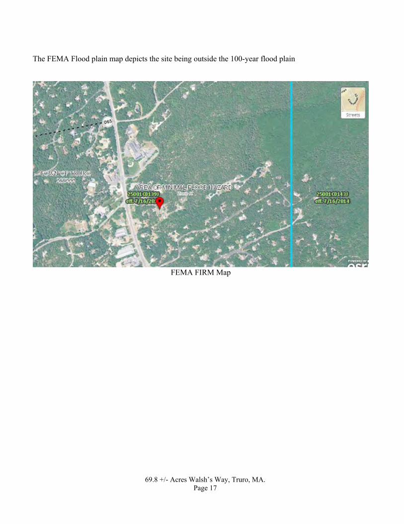
The FEMA Flood plain map depicts the site being outside the 100-year flood plain
FEMA FIRM Map

69.8 +/- Acres Walsh’s Way, Truro, MA. Page 18
From MA GIS, there are no bordering vegetated wetlands on or near the site.
Mass GIS Wetlands Map
69.8 +/- Acres Walsh’s Way, Truro, MA. Page 19
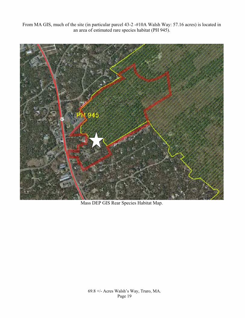
From MA GIS, much of the site (in particular parcel 43-2 -#10A Walsh Way: 57.16 acres) is located in an area of estimated rare species habitat (PH 945).
Mass DEP GIS Rear Species Habitat Map.
69.8 +/- Acres Walsh’s Way, Truro, MA. Page 20
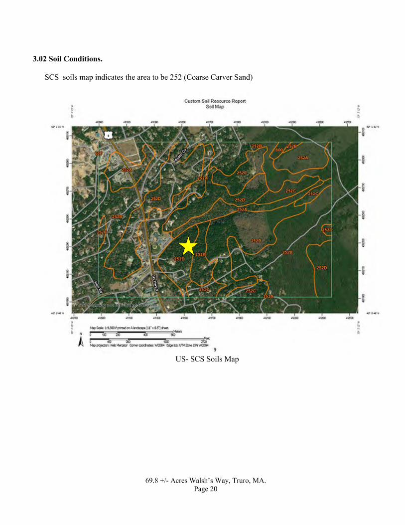
3.02 Soil Conditions.
SCS soils map indicates the area to be 252 (Coarse Carver Sand)
US- SCS Soils Map
69.8 +/- Acres Walsh’s Way, Truro, MA. Page 21
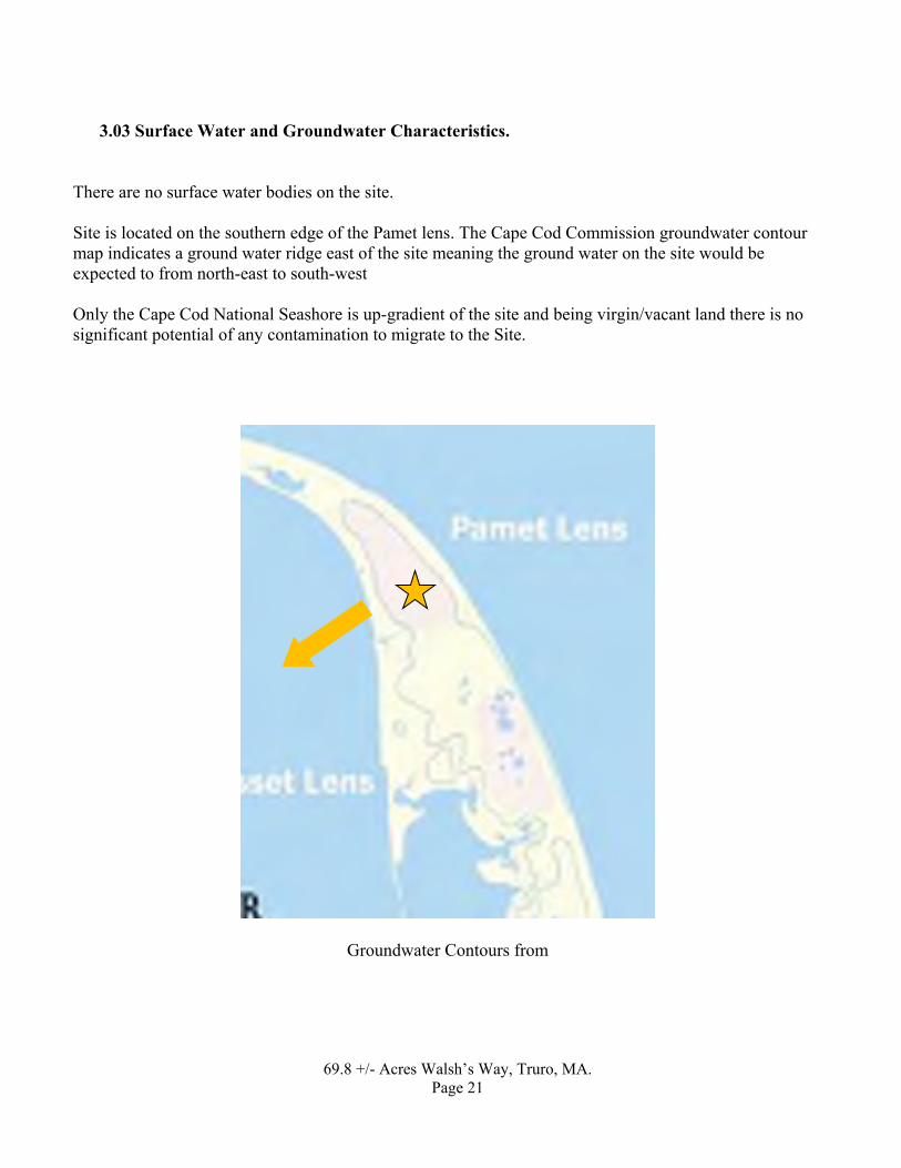
3.03 Surface Water and Groundwater Characteristics. There are no surface water bodies on the site. Site is located on the southern edge of the Pamet lens. The Cape Cod Commission groundwater contour map indicates a ground water ridge east of the site meaning the ground water on the site would be expected to from north-east to south-west Only the Cape Cod National Seashore is up-gradient of the site and being virgin/vacant land there is no significant potential of any contamination to migrate to the Site.
Groundwater Contours from

69.8 +/- Acres Walsh’s Way, Truro, MA. Page 22
Site Map with projec
ted ground water flow direction and DEP release sites (all cross gradient). All sites are closed except Old Dewline Road LUST Radar site
Results of Investigation 4.01 Site Inspection Observations
The site consists of eight parcels of land, six of which are occupied by cottages. Building # 7 has a partial basement and the remainders are crawl space with cinderblock foundations.

69.8 +/- Acres Walsh’s Way, Truro, MA. Page 23
Map showing Building Numbers
No areas of stained soil or distressed vegetation was observed, and no odors were noted with the exception of the floor of building #7 which had an old stain of the concrete floor panels (12”x12”). Based on TPH soil sampling of the sand under the floor panels near the boiler, it was concluded that no significant contamination existing (see below).
No storm Drainage system exists.
• BSC also walk the site and discussed its history with the care taker Con Morris. No reports of hazardous material were revealed. The caretaker reported the site was used for seasonal visits by the owner or renters. A water cistern exists as the top of the hill behind building # 7A . this was used to store water pumped to it from a well. It is no longer in use but appears to remain based on the mounded soil in that location.
Most of the site is wooded/grassed with paved access driveways

69.8 +/- Acres Walsh’s Way, Truro, MA. Page 24
Building # 7 ( with oil heater in basment)
Building 7B

69.8 +/- Acres Walsh’s Way, Truro, MA. Page 25
Building 7C
Garage behing building 7C (well frame visisble)

69.8 +/- Acres Walsh’s Way, Truro, MA. Page 26
Building # 10
The interior of the basement at # 7 was observed to include an oil burner and lightly stained concrete floor tiles. Two of the floor tiles were removed and a soil sample collected from the below the slab in an effort to determine if the stain had impacted the soil below. Total Petroleum Hydrocarbon (TPH) results in the soil were reported at non-detect at 33 mg/kg detection limit (the MCP Reportable Concentration is 500 ppm) and as such, a conclusion was reached that there is no significant impact to the soils below the oil burner. Laboratory results are included in Appendix 4.

69.8 +/- Acres Walsh’s Way, Truro, MA. Page 27
Stained floor in # 7 basement
View of oil burner in basement of number seven. Floor tile removed to collect soil sample.

69.8 +/- Acres Walsh’s Way, Truro, MA. Page 28
Utilities
The site is serviced by private wells on-site septic systems, overhead electric, telephone and propane tank gas. One building (#7) has an above ground fuel oil tank replaced in 2011, that services an oil burner for heat. All other structures have no heat or a small propane tank system
View of AST – no staining Solid Waste Disposal
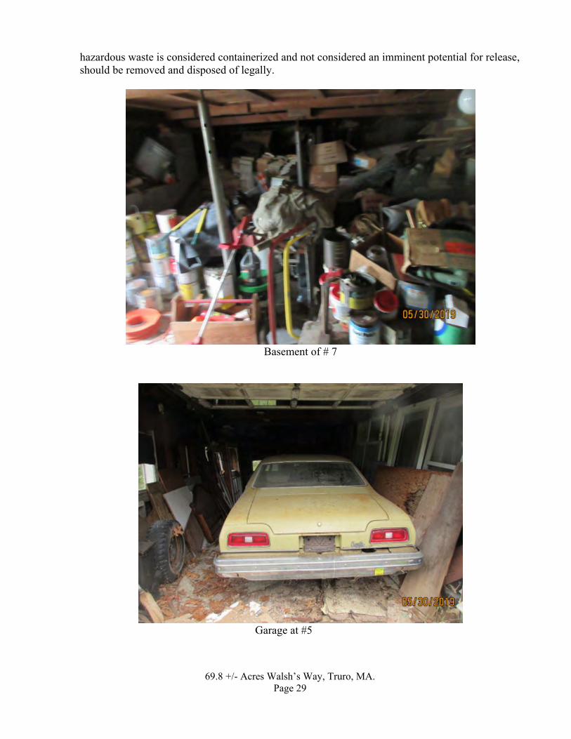
Solid waste is understood to have been historically removed from the site by the owners. Virtually all of the garage is in the basement number seven had some form of solid waste collected in them. This material, while possibly containing small quantities of household
69.8 +/- Acres Walsh’s Way, Truro, MA. Page 29
hazardous waste is considered containerized and not considered an imminent potential for release, should be removed and disposed of legally.
Basement of # 7
Garage at #5

69.8 +/- Acres Walsh’s Way, Truro, MA. Page 30
Garage at #10
Garage at # 7B

69.8 +/- Acres Walsh’s Way, Truro, MA. Page 31
Wastewater Disposal
Wastewater was disposed by on-site septic systems. Information of the septic systems is included in appendix 3.
Sumps
No sump pumps were observed.
Transformers.
No transformers were observed on the site.

69.8 +/- Acres Walsh’s Way, Truro, MA. Page 32
4.02 Adjacent Site and Vicinity Observations
The Site is surrounded by residential, school and open space (Cape Cod National Seashore)
Abutting Properties
Google-earth view of site and surrounding properties
School
residential
Cape Cod National Seashore
Site
residential
restaurant
residential

69.8 +/- Acres Walsh’s Way, Truro, MA. Page 33
View of School east of Site 4.03 Results of Regulatory Agency List Review and File Research
BSC contracted Environmental Data Resources Inc. (EDR) to provide an environmental database records review report. This report is included in the Appendix 1.
The environmental database search did not list the Site as a disposal site in Massachusetts Contingency Plan. No DEP disposal sites exist within ¼ mile from the site. Based on record groundwater flow directions, all of these sites are cross gradient to the Site except one of them,
The Data Base did not report any:
• RCRA generators within proximity to the site
• National Priority List sites within ¼ mile,

69.8 +/- Acres Walsh’s Way, Truro, MA. Page 34
• CERCLIS sites within 1/4 mile of the Site,
• RCRA Treatment, Storage & Disposal (TSD) Facilities facilities within 0.5 mile of the Site.
• Based on review of the database report no Recognized Environmental Conditions surrounding
properties were identified.
4.04 Results of Site History/Land Use Review Personal Interviews
Owner Caretaker Con Morris, did not report any significant historic use of oils or hazardous materials or releases thereof. No written information in the form of a site questionnaire was provided by the owner.
Site Records Review
No prior reports were available.
Fire Insurance Rate Maps Sanborn maps were not available for this area

69.8 +/- Acres Walsh’s Way, Truro, MA. Page 35
Municipal Research
Board of health had numerous records of the septic systems (see appendix 3). Fire Dept. records did not report any UST’s or AST’s on the Site
DEPARTMENT OF ENVIRONMENTAL PROTECTION SOUTHEAST REGIONAL FILES
Whereas there were no listed “disposal sites” on or within the proximity and upgradient of the Site, BSC did not review any files at the DEP Regional office.
5.0 FINDINGS
Between April 1, 2019 and June 18, 2019, BSC Group, Inc. (BSC) conducted preliminary site evaluation research activities regarding about 69.8 +/- acres of land located at Walsh Way Truro, MA. Based on the research and investigation activities documented herein, a summary report was prepared. BSC’s findings and conclusions are presented below:
The purpose of this Phase I Environmental Site Assessment (ESA) was to identify Recognized Environmental Conditions (RECs) associated with the subject property as defined by ASTM E 1527-05.
• The “Site” is described as being 69.8 +/- acres consisting of the parcels listed below as shown
on Assessor’s Map 43. 43-2 - #10A Walsh Way: 57.16 acres (vacant land), 43-9 - #8 Walsh Way: 3.69 acres (vacant land), 43-10 - #10 Walsh Way: 0.87 acres (with one building thereon) 43-13 - #13 Walsh Way: 2.24 acres (with one building thereon), 43-133 - #6 Walsh Way: 0.45 acres (with one building thereon), 43-134 - #5 Walsh Way: 0.78 acres (with one building thereon), 43-135 - #7 Walsh Way: 2.98 acres (with three buildings thereon), 43-226 - #12 Walsh Way: 0.87 acres (vacant land),
• The town is pursuing ownership of the Site for an undetermined future use.
• The owner of record is listed as the Steven Walsh Trust or related Walsh entities.
• The Site or any abutting properties are not listed by the MA DEP as a “Disposal Site”.
• The Site is serviced by private wells and on-site septic systems.

69.8 +/- Acres Walsh’s Way, Truro, MA. Page 36
• The site is primarily woodland with 7 wood framed seasonal dwellings, out buildings and paveddriveways. One structure has an oil heating system with a relatively new above ground oil tank.The others were seasonal with small propane heating units or no heat at all.
• Since 1938 the forest has emerged in what was largely a cleared area.
• The DEP GIS MAP indicates the site is partially within Endangered Species Habitat.
• The site is not located within the FEMA flood zone.
• The Site is located within a Zone II drinking water (aquifer) area.
• DEP disposal sites exist within ¼ mile from the site. All of the listed sites save one are reported asclosed with permanent solutions except on at the Air Base. Based on record groundwater flowdirections, all of these sites are cross gradient to the Site and are not considered significant to theSite.
• BSC walked the Site on May 30, 2019 with Fire Chief Tim Collins and DPW Director Jarrod Cabral, 2019.
• BSC also walked the site and discussed its history with the care taker Lon Morris. No reports of hazardous material were revealed.
• No olfactory evidence of a release of oil or hazardous materials was noted other than a stain onthe concrete panel floor in the basement of Unit 7. The interior of the basement at # 7 wasobserved to include an oil burner and lightly stained concrete floor tiles. Two of the floor tileswere removed and a soil sample (sand) collected from the below the slab in an effort to determineif the stain had impacted the soil below. Total Petroleum Hydrocarbon (TPH) results in the soilwere reported by the lab at non-detect at 33 mg/kg detection limit (the MCP ReportableConcentration is 500 ppm) and as such, a conclusion was reached that there is no significantimpact to the soils below the oil burner.
• There is significant solid waste (but not characterized as hazardous in nature) that is stored in thebasements, garages and sheds on the site, it is advised that such material should be removed anddisposed of in a legal manner.

69.8 +/- Acres Walsh’s Way, Truro, MA. Page 37
6.0 CONCLUSION
Based on the site assessment completed and documented herein, BSC is of the opinion that no Recognized Environmental Conditions were found on the site.
7.0 LIMITATIONS
• BSC staff performed the research as described in the report.
• The Site investigators are familiar with the current provisions of Massachusetts General Law(M.G.L) Chapter 21E and implementing regulations under said Law, including the materialswhich fall within the definitions of “oil” and “hazardous materials” thereunder. However, allreferences and laboratory analysis in this report are based upon the following definitions: PriorityPollutants (as per Federal Clean Water Act), the Massachusetts Drinking Water Standards (as per310 CMR 22), and the National Secondary Drinking Water Standards (as per 40 CFR 143), andthe Massachusetts Contingency Plan 310 CMR 40.0000.
• In preparing this report, BSC has relied on certain information provided by state and localofficials, other referenced parties, and on information contained in the files of state and/or localagencies available to the time of BSC at the time of the Site Assessment. Although there may bea degree of overlap in the information provided by these sources, BSC did not attempt toindependently verify the accuracy or completeness of all information reviewed or received duringthe course of Site Assessment.
• The Site investigators reviewed the recent history of the Site and considered the potential for thegeneration, use, treatment, storage, or disposal of oil or hazardous material by (a) the usespresently associated with the Site and (b) to the extent ascertainable by inquiry as noted in the“Site Investigation”, e.g. the uses previously associated with the Site.
• The Site investigators studied the areas in the vicinity of the Site except as hereinafter qualified toassess the evidence of possible presence of oil and hazardous material on the Site. Thisinvestigation included the observations described in the Summary. However, where access to theportions of the Site or structures on the Site were physically unavailable or obstructed, BSCrenders no opinion regarding the presence of oil and hazardous materials within interior walls,floors, ceilings of buildings or other areas physically inaccessible or obstructed.
• BSC did not perform any analyses to determine if the presence of radon or urea formaldehyde ator in the environment at the Site as part of this investigation nor any investigation of buildingmaterials that contain PCB’s, lead paint or hazardous materials.
• No analysis was performed to determine the presence of asbestos at or in the environment at theSite as part of this investigation.
• The conclusions summarized herein are based on and limited by the investigation as stated in thisreport and by the Scope of Services as defined. This report was prepared in accordance with

69.8 +/- Acres Walsh’s Way, Truro, MA. Page 38
generally accepted practice. Should additional data become available in the future, these data should be reviewed by BSC and conclusions presented herein modified accordingly.
• No other warranty, expressed or implied, is made. No other conclusions, interpretations orrecommendations are contained or implied in this report. No specific attempt was made to checkthe compliance of present or past owners, tenants, or operators of the Site with federal, state orlocal laws and regulations, environmental or otherwise. Should additional investigations discoverdiffering conditions, sections of this report may require modification.
8.0 References
• The Site investigators relied on the current provisions of Massachusetts General Law (M.G.L)Chapter 21E and implementing regulations under said Law, including the materials which fallwithin the definitions of “oil” and “hazardous materials” thereunder. However, all references andlaboratory analysis in this report are based upon the following definitions: Priority Pollutants (asper Federal Clean Water Act), the Massachusetts Drinking Water Standards (as per 310 CMR 22),and the National Secondary Drinking Water Standards (as per 40 CFR 143), and theMassachusetts Contingency Plan 310 CMR 40.0000.
9.0 Certificate
“I certify that I have personally examined and am familiar with the information contained in this document and all attachments and based on inquiry of those individuals immediately responsible for obtaining the information, believe that the information is true, accurate and complete.”
This report is dated June 18, 2019, and is signed by an individual who is duly authorized to do so.
BSC GROUP, INC.
___________________ David J. Crispin, LSP, PE Senior Associate
\\bscbos\bos\Proposals-BOS\2019\Butters Brazilian LLP (Zide) 21E\report to be moved to 5-0300.00\21E rept 459 Main street Hyannis ma .doc 6/18/2019 9:27 AM
FORM-LBD-BCS
®kcehCoeG htiw tropeR ™paM suidaR RDE ehT
6 Armstrong Road, 4th floorShelton, CT 06484Toll Free: 800.352.0050www.edrnet.com
Walsh Way15 Walsh WayTruro, MA 02666
Inquiry Number: 5665938.2sMay 28, 2019

SECTION PAGE
Executive Summary ES1
Overview Map 2
Detail Map 3
Map Findings Summary 4
Map Findings 8
Orphan Summary 30
Government Records Searched/Data Currency Tracking GR-1
GEOCHECK ADDENDUM
Physical Setting Source Addendum A-1
Physical Setting Source Summary A-2
Physical Setting SSURGO Soil Map A-5
Physical Setting Source Map A-10
Physical Setting Source Map Findings A-12
Physical Setting Source Records Searched PSGR-1
TC5665938.2s Page 1
Thank you for your business.Please contact EDR at 1-800-352-0050
with any questions or comments.
Disclaimer - Copyright and Trademark Notice
This Report contains certain information obtained from a variety of public and other sources reasonably available to Environmental DataResources, Inc. It cannot be concluded from this Report that coverage information for the target and surrounding properties does not exist fromother sources. NO WARRANTY EXPRESSED OR IMPLIED, IS MADE WHATSOEVER IN CONNECTION WITH THIS REPORT. ENVIRONMENTALDATA RESOURCES, INC. SPECIFICALLY DISCLAIMS THE MAKING OF ANY SUCH WARRANTIES, INCLUDING WITHOUT LIMITATION,MERCHANTABILITY OR FITNESS FOR A PARTICULAR USE OR PURPOSE. ALL RISK IS ASSUMED BY THE USER. IN NO EVENT SHALLENVIRONMENTAL DATA RESOURCES, INC. BE LIABLE TO ANYONE, WHETHER ARISING OUT OF ERRORS OR OMISSIONS, NEGLIGENCE,ACCIDENT OR ANY OTHER CAUSE, FOR ANY LOSS OF DAMAGE, INCLUDING, WITHOUT LIMITATION, SPECIAL, INCIDENTAL,CONSEQUENTIAL, OR EXEMPLARY DAMAGES. ANY LIABILITY ON THE PART OF ENVIRONMENTAL DATA RESOURCES, INC. IS STRICTLYLIMITED TO A REFUND OF THE AMOUNT PAID FOR THIS REPORT. Purchaser accepts this Report "AS IS". Any analyses, estimates, ratings,environmental risk levels or risk codes provided in this Report are provided for illustrative purposes only, and are not intended to provide, norshould they be interpreted as providing any facts regarding, or prediction or forecast of, any environmental risk for any property. Only a Phase IEnvironmental Site Assessment performed by an environmental professional can provide information regarding the environmental risk for anyproperty. Additionally, the information provided in this Report is not to be construed as legal advice.
Copyright 2019 by Environmental Data Resources, Inc. All rights reserved. Reproduction in any media or format, in wholeor in part, of any report or map of Environmental Data Resources, Inc., or its affiliates, is prohibited without prior written permission.
EDR and its logos (including Sanborn and Sanborn Map) are trademarks of Environmental Data Resources, Inc. or its affiliates. All othertrademarks used herein are the property of their respective owners.
TABLE OF CONTENTS

EXECUTIVE SUMMARY
TC5665938.2s EXECUTIVE SUMMARY 1
A search of available environmental records was conducted by Environmental Data Resources, Inc (EDR).The report was designed to assist parties seeking to meet the search requirements of EPA’s Standardsand Practices for All Appropriate Inquiries (40 CFR Part 312), the ASTM Standard Practice forEnvironmental Site Assessments (E 1527-13), the ASTM Standard Practice for Environmental SiteAssessments for Forestland or Rural Property (E 2247-16), the ASTM Standard Practice for LimitedEnvironmental Due Diligence: Transaction Screen Process (E 1528-14) or custom requirements developedfor the evaluation of environmental risk associated with a parcel of real estate.
TARGET PROPERTY INFORMATION
ADDRESS
15 WALSH WAYTRURO, MA 02666
COORDINATES
42.0155150 - 42˚ 0’ 55.85’’Latitude (North): 70.0693710 - 70˚ 4’ 9.73’’Longitude (West): Zone 19Universal Tranverse Mercator: 411455.8UTM X (Meters): 4651838.5UTM Y (Meters): 79 ft. above sea levelElevation:
USGS TOPOGRAPHIC MAP ASSOCIATED WITH TARGET PROPERTY
5642644 NORTH TRURO, MATarget Property Map:2012Version Date:
5642147 WELLFLEET, MASouth Map:2012Version Date:
AERIAL PHOTOGRAPHY IN THIS REPORT
20140718Portions of Photo from:USDASource:
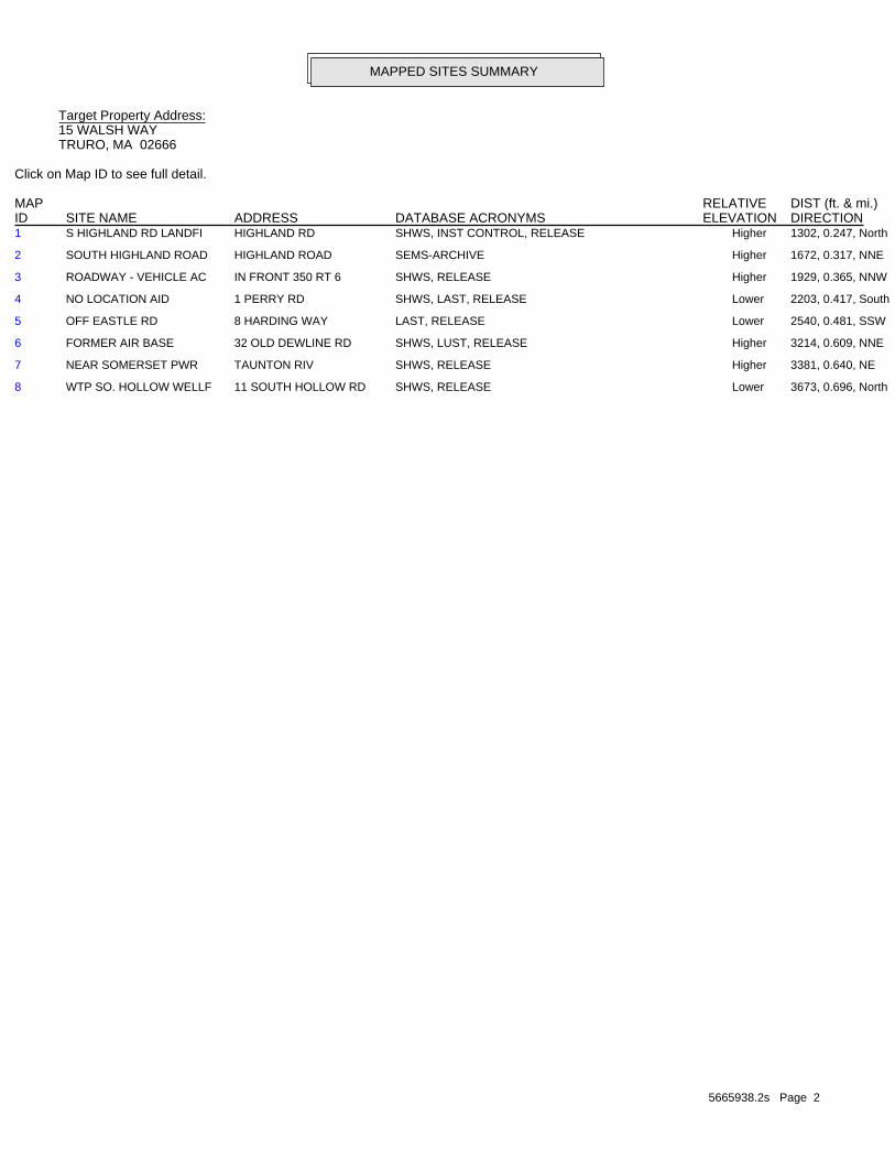
5665938.2s Page 2
8 WTP SO. HOLLOW WELLF 11 SOUTH HOLLOW RD SHWS, RELEASE Lower 3673, 0.696, North
7 NEAR SOMERSET PWR TAUNTON RIV SHWS, RELEASE Higher 3381, 0.640, NE
6 FORMER AIR BASE 32 OLD DEWLINE RD SHWS, LUST, RELEASE Higher 3214, 0.609, NNE
5 OFF EASTLE RD 8 HARDING WAY LAST, RELEASE Lower 2540, 0.481, SSW
4 NO LOCATION AID 1 PERRY RD SHWS, LAST, RELEASE Lower 2203, 0.417, South
3 ROADWAY - VEHICLE AC IN FRONT 350 RT 6 SHWS, RELEASE Higher 1929, 0.365, NNW
2 SOUTH HIGHLAND ROAD HIGHLAND ROAD SEMS-ARCHIVE Higher 1672, 0.317, NNE
1 S HIGHLAND RD LANDFI HIGHLAND RD SHWS, INST CONTROL, RELEASE Higher 1302, 0.247, North
MAPPED SITES SUMMARY
Target Property Address:15 WALSH WAYTRURO, MA 02666
Click on Map ID to see full detail.
MAP RELATIVE DIST (ft. & mi.)ID DATABASE ACRONYMS ELEVATION DIRECTIONSITE NAME ADDRESS

EXECUTIVE SUMMARY
TC5665938.2s EXECUTIVE SUMMARY 3
TARGET PROPERTY SEARCH RESULTS
The target property was not listed in any of the databases searched by EDR.
DATABASES WITH NO MAPPED SITES
No mapped sites were found in EDR’s search of available ("reasonably ascertainable ") governmentrecords either on the target property or within the search radius around the target property for thefollowing databases:
STANDARD ENVIRONMENTAL RECORDS
Federal NPL site list
NPL National Priority ListProposed NPL Proposed National Priority List SitesNPL LIENS Federal Superfund Liens
Federal Delisted NPL site list
Delisted NPL National Priority List Deletions
Federal CERCLIS list
FEDERAL FACILITY Federal Facility Site Information listingSEMS Superfund Enterprise Management System
Federal RCRA CORRACTS facilities list
CORRACTS Corrective Action Report
Federal RCRA non-CORRACTS TSD facilities list
RCRA-TSDF RCRA - Treatment, Storage and Disposal
Federal RCRA generators list
RCRA-LQG RCRA - Large Quantity GeneratorsRCRA-SQG RCRA - Small Quantity GeneratorsRCRA-CESQG RCRA - Conditionally Exempt Small Quantity Generator
Federal institutional controls / engineering controls registries
LUCIS Land Use Control Information SystemUS ENG CONTROLS Engineering Controls Sites ListUS INST CONTROL Sites with Institutional Controls
Federal ERNS list
ERNS Emergency Response Notification System
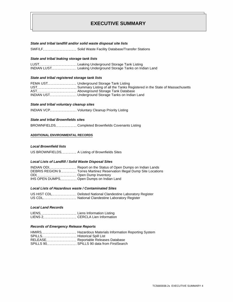
EXECUTIVE SUMMARY
TC5665938.2s EXECUTIVE SUMMARY 4
State and tribal landfill and/or solid waste disposal site lists
SWF/LF Solid Waste Facility Database/Transfer Stations
State and tribal leaking storage tank lists
LUST Leaking Underground Storage Tank ListingINDIAN LUST Leaking Underground Storage Tanks on Indian Land
State and tribal registered storage tank lists
FEMA UST Underground Storage Tank ListingUST Summary Listing of all the Tanks Registered in the State of MassachusettsAST Aboveground Storage Tank DatabaseINDIAN UST Underground Storage Tanks on Indian Land
State and tribal voluntary cleanup sites
INDIAN VCP Voluntary Cleanup Priority Listing
State and tribal Brownfields sites
BROWNFIELDS Completed Brownfields Covenants Listing
ADDITIONAL ENVIRONMENTAL RECORDS
Local Brownfield lists
US BROWNFIELDS A Listing of Brownfields Sites
Local Lists of Landfill / Solid Waste Disposal Sites
INDIAN ODI Report on the Status of Open Dumps on Indian LandsDEBRIS REGION 9 Torres Martinez Reservation Illegal Dump Site LocationsODI Open Dump InventoryIHS OPEN DUMPS Open Dumps on Indian Land
Local Lists of Hazardous waste / Contaminated Sites
US HIST CDL Delisted National Clandestine Laboratory RegisterUS CDL National Clandestine Laboratory Register
Local Land Records
LIENS Liens Information ListingLIENS 2 CERCLA Lien Information
Records of Emergency Release Reports
HMIRS Hazardous Materials Information Reporting SystemSPILLS Historical Spill ListRELEASE Reportable Releases DatabaseSPILLS 90 SPILLS 90 data from FirstSearch

EXECUTIVE SUMMARY
TC5665938.2s EXECUTIVE SUMMARY 5
SPILLS 80 SPILLS 80 data from FirstSearch
Other Ascertainable Records
RCRA NonGen / NLR RCRA - Non Generators / No Longer RegulatedFUDS Formerly Used Defense SitesDOD Department of Defense SitesSCRD DRYCLEANERS State Coalition for Remediation of Drycleaners ListingUS FIN ASSUR Financial Assurance InformationEPA WATCH LIST EPA WATCH LIST2020 COR ACTION 2020 Corrective Action Program ListTSCA Toxic Substances Control ActTRIS Toxic Chemical Release Inventory SystemSSTS Section 7 Tracking SystemsROD Records Of DecisionRMP Risk Management PlansRAATS RCRA Administrative Action Tracking SystemPRP Potentially Responsible PartiesPADS PCB Activity Database SystemICIS Integrated Compliance Information SystemFTTS FIFRA/ TSCA Tracking System - FIFRA (Federal Insecticide, Fungicide, & Rodenticide Act)/TSCA (Toxic Substances Control Act)MLTS Material Licensing Tracking SystemCOAL ASH DOE Steam-Electric Plant Operation DataCOAL ASH EPA Coal Combustion Residues Surface Impoundments ListPCB TRANSFORMER PCB Transformer Registration DatabaseRADINFO Radiation Information DatabaseHIST FTTS FIFRA/TSCA Tracking System Administrative Case ListingDOT OPS Incident and Accident DataCONSENT Superfund (CERCLA) Consent DecreesINDIAN RESERV Indian ReservationsFUSRAP Formerly Utilized Sites Remedial Action ProgramUMTRA Uranium Mill Tailings SitesLEAD SMELTERS Lead Smelter SitesUS AIRS Aerometric Information Retrieval System Facility SubsystemUS MINES Mines Master Index FileABANDONED MINES Abandoned MinesFINDS Facility Index System/Facility Registry SystemDOCKET HWC Hazardous Waste Compliance Docket ListingECHO Enforcement & Compliance History InformationUXO Unexploded Ordnance SitesFUELS PROGRAM EPA Fuels Program Registered ListingAIRS Permitted Facilities ListingASBESTOS ASBESTOSDRYCLEANERS Regulated Drycleaning FacilitiesENF Enforcement Action CasesFinancial Assurance Financial Assurance Information ListingGWDP Ground Water Discharge PermitsHW GEN List of Massachusetts Hazardous Waste GeneratorsMERCURY Mercury Product Recyling Drop-Off Locations ListingNPDES NPDES Permit ListingTIER 2 Tier 2 Information ListingTSD TSD FacilityUIC Underground Injection Control Listing
EDR HIGH RISK HISTORICAL RECORDS
EDR Exclusive Records
EDR MGP EDR Proprietary Manufactured Gas Plants
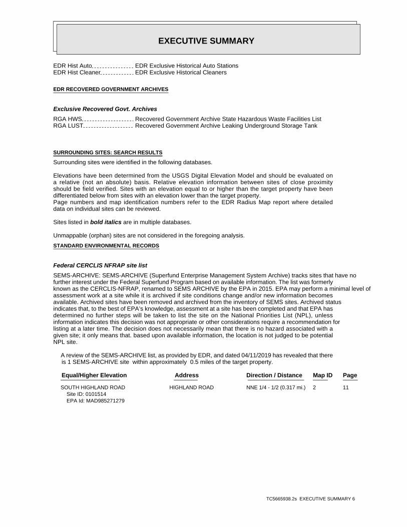
EXECUTIVE SUMMARY
TC5665938.2s EXECUTIVE SUMMARY 6
EDR Hist Auto EDR Exclusive Historical Auto StationsEDR Hist Cleaner EDR Exclusive Historical Cleaners
EDR RECOVERED GOVERNMENT ARCHIVES
Exclusive Recovered Govt. Archives
RGA HWS Recovered Government Archive State Hazardous Waste Facilities ListRGA LUST Recovered Government Archive Leaking Underground Storage Tank
SURROUNDING SITES: SEARCH RESULTS
Surrounding sites were identified in the following databases.
Elevations have been determined from the USGS Digital Elevation Model and should be evaluated ona relative (not an absolute) basis. Relative elevation information between sites of close proximityshould be field verified. Sites with an elevation equal to or higher than the target property have beendifferentiated below from sites with an elevation lower than the target property.Page numbers and map identification numbers refer to the EDR Radius Map report where detaileddata on individual sites can be reviewed.
Sites listed in bold italics are in multiple databases.
Unmappable (orphan) sites are not considered in the foregoing analysis.
STANDARD ENVIRONMENTAL RECORDS
Federal CERCLIS NFRAP site list
SEMS-ARCHIVE: SEMS-ARCHIVE (Superfund Enterprise Management System Archive) tracks sites that have nofurther interest under the Federal Superfund Program based on available information. The list was formerlyknown as the CERCLIS-NFRAP, renamed to SEMS ARCHIVE by the EPA in 2015. EPA may perform a minimal level ofassessment work at a site while it is archived if site conditions change and/or new information becomesavailable. Archived sites have been removed and archived from the inventory of SEMS sites. Archived statusindicates that, to the best of EPA’s knowledge, assessment at a site has been completed and that EPA hasdetermined no further steps will be taken to list the site on the National Priorities List (NPL), unlessinformation indicates this decision was not appropriate or other considerations require a recommendation forlisting at a later time. The decision does not necessarily mean that there is no hazard associated with agiven site; it only means that. based upon available information, the location is not judged to be potentialNPL site.
A review of the SEMS-ARCHIVE list, as provided by EDR, and dated 04/11/2019 has revealed that there is 1 SEMS-ARCHIVE site within approximately 0.5 miles of the target property.
PageMap IDDirection / Distance Address Equal/Higher Elevation ____________________ ________ ___________________ _____ _____
SOUTH HIGHLAND ROAD HIGHLAND ROAD NNE 1/4 - 1/2 (0.317 mi.) 2 11Site ID: 0101514EPA Id: MAD985271279

EXECUTIVE SUMMARY
TC5665938.2s EXECUTIVE SUMMARY 7
State- and tribal - equivalent CERCLIS
SHWS: Contains information on releases of oil and hazardous materials that have been reported toDEP.
A review of the SHWS list, as provided by EDR, and dated 02/28/2019 has revealed that there are 6 SHWS sites within approximately 1 mile of the target property.
PageMap IDDirection / Distance Address Equal/Higher Elevation ____________________ ________ ___________________ _____ _____
S HIGHLAND RD LANDFI HIGHLAND RD N 1/8 - 1/4 (0.247 mi.) 1 8Release Tracking Number / Current Status: 4-0000897 / RAO
ROADWAY - VEHICLE AC IN FRONT 350 RT 6 NNW 1/4 - 1/2 (0.365 mi.) 3 13Release Tracking Number / Current Status: 4-0020912 / RAO
FORMER AIR BASE 32 OLD DEWLINE RD NNE 1/2 - 1 (0.609 mi.) 6 23Release Tracking Number / Current Status: 4-0019586 / RAO
NEAR SOMERSET PWR TAUNTON RIV NE 1/2 - 1 (0.640 mi.) 7 26Release Tracking Number / Current Status: 4-0018510 / ADQREGRelease Tracking Number / Current Status: 4-0016930 / ADQREG
PageMap IDDirection / Distance Address Lower Elevation ____________________ ________ ___________________ _____ _____
NO LOCATION AID 1 PERRY RD S 1/4 - 1/2 (0.417 mi.) 4 15Release Tracking Number / Current Status: 4-0010336 / RAO
WTP SO. HOLLOW WELLF 11 SOUTH HOLLOW RD N 1/2 - 1 (0.696 mi.) 8 27Release Tracking Number / Current Status: 4-0018962 / RAO
State and tribal leaking storage tank lists
LAST: The Leaking Aboveground Storage Tanks database
A review of the LAST list, as provided by EDR, and dated 02/28/2019 has revealed that there are 2 LAST sites within approximately 0.5 miles of the target property.
PageMap IDDirection / Distance Address Lower Elevation ____________________ ________ ___________________ _____ _____
NO LOCATION AID 1 PERRY RD S 1/4 - 1/2 (0.417 mi.) 4 15Release Tracking Number / Current Status: 4-0010336 / RAO
OFF EASTLE RD 8 HARDING WAY SSW 1/4 - 1/2 (0.481 mi.) 5 20Release Tracking Number / Current Status: 4-0011881 / RAO
State and tribal institutional control / engineering control registries
INST CONTROL: Activity and Use Limitations establish limits and conditions on the future use ofcontaminated property, and therefore allow cleanups to be tailored to these uses.
A review of the INST CONTROL list, as provided by EDR, and dated 02/28/2019 has revealed that there is 1 INST CONTROL site within approximately 0.5 miles of the target property.

EXECUTIVE SUMMARY
TC5665938.2s EXECUTIVE SUMMARY 8
PageMap IDDirection / Distance Address Equal/Higher Elevation ____________________ ________ ___________________ _____ _____
S HIGHLAND RD LANDFI HIGHLAND RD N 1/8 - 1/4 (0.247 mi.) 1 8Release Tracking Number: 4-0000897

EXECUTIVE SUMMARY
TC5665938.2s EXECUTIVE SUMMARY 9
Due to poor or inadequate address information, the following sites were not mapped. Count: 2 records.
Site Name Database(s)____________ ____________
AIR ROUTE SURVEILLANCE RADAR SITE SHWS, RELEASENO LOCATION AID SHWS, RELEASE

EDR Inc.EDR Inc.EDR Inc.EDR Inc.EDR Inc.EDR Inc.EDR Inc.EDR Inc.EDR Inc.EDR Inc.EDR Inc.EDR Inc.EDR Inc.EDR Inc.EDR Inc.EDR Inc.EDR Inc.EDR Inc.EDR Inc.EDR Inc.EDR Inc.EDR Inc.EDR Inc.EDR Inc.EDR Inc.EDR Inc.EDR Inc.EDR Inc.EDR Inc.EDR Inc.EDR Inc.EDR Inc.EDR Inc.EDR Inc.EDR Inc.EDR Inc.EDR Inc.EDR Inc.EDR Inc.EDR Inc.
4 0 40 40
1 2 0801
20
40
80
40
40 16 0
4 0
80
80
40 1 2 0
120
40
120
40
12
0
120
12
0
160
12
0
12
0
40
40
4 0
40
4 0
4 0
40
40
1 2 0
4 0
12 0
1 2 0
120
80
120 1
2
0
1 60
80
1 2080 8
0
80
80
1 2 0
80 120
12
0
12
0
120 120
40
12
0
4080
12
0
80
80
1 2 0
1 20
80
80
8080
40
40 4 0 80 1 201
20
1
20
1 2 0
12
1 20
1 2 01 2 0
12
0
1 2 01 2 0
1 2 0
12
0
8 0
8
80 40
4 0 40
4 0
4 040
4 0
1 2 0
40 40
40
8 080
80 4 0
12
0
4040
80 8 0
8 0
80
80
8 0
8 0
8 0
8 0
80
80
80
8 0
8 0
8 0
8 0
40
8 0 404
0
40
120
40
8 0
8 0
8 0
8 0
404
0
12
080
80
8 0
4 0
80
120
40
12 0
12
0
12
01
20
1 2 0
1 2 0
12
0
40
1 2 0
1 2 0
120
8 0
80
8 0
808
0
40
40
40
40
40
40
40
40
4 0
40
4 0
4 0
4 0
4 0
404 0
4 0
4 0
1 2 0 8 08 0
80
80
2 08 04 0

EDR Inc.EDR Inc.EDR Inc.EDR Inc.EDR Inc.EDR Inc.EDR Inc.EDR Inc.EDR Inc.EDR Inc.EDR Inc.EDR Inc.EDR Inc.EDR Inc.EDR Inc.EDR Inc.EDR Inc.EDR Inc.EDR Inc.EDR Inc.EDR Inc.EDR Inc.EDR Inc.EDR Inc.EDR Inc.EDR Inc.EDR Inc.EDR Inc.EDR Inc.EDR Inc.EDR Inc.EDR Inc.EDR Inc.EDR Inc.EDR Inc.EDR Inc.EDR Inc.EDR Inc.EDR Inc.EDR Inc.
120
120
1 20
80
40
80
40
80
120
80
120
80
120
8 0
80
12
040
40
40 120
120
120
120
120120
40
40
40
40
40
80
120
120
40
80
80
80
80
80

MAP FINDINGS SUMMARY
SearchTargetDistance Total
Database Property(Miles) < 1/8 1/8 - 1/4 1/4 - 1/2 1/2 - 1 > 1 Plotted
STANDARD ENVIRONMENTAL RECORDS
Federal NPL site list
0 NR 0 0 0 0 1.000NPL 0 NR 0 0 0 0 1.000Proposed NPL 0 NR 0 0 0 0 1.000NPL LIENS
Federal Delisted NPL site list
0 NR 0 0 0 0 1.000Delisted NPL
Federal CERCLIS list
0 NR NR 0 0 0 0.500FEDERAL FACILITY 0 NR NR 0 0 0 0.500SEMS
Federal CERCLIS NFRAP site list
1 NR NR 1 0 0 0.500SEMS-ARCHIVE
Federal RCRA CORRACTS facilities list
0 NR 0 0 0 0 1.000CORRACTS
Federal RCRA non-CORRACTS TSD facilities list
0 NR NR 0 0 0 0.500RCRA-TSDF
Federal RCRA generators list
0 NR NR NR 0 0 0.250RCRA-LQG 0 NR NR NR 0 0 0.250RCRA-SQG 0 NR NR NR 0 0 0.250RCRA-CESQG
Federal institutional controls /engineering controls registries
0 NR NR 0 0 0 0.500LUCIS 0 NR NR 0 0 0 0.500US ENG CONTROLS 0 NR NR 0 0 0 0.500US INST CONTROL
Federal ERNS list
0 NR NR NR NR NR TPERNS
State- and tribal - equivalent CERCLIS
6 NR 3 2 1 0 1.000SHWS
State and tribal landfill and/orsolid waste disposal site lists
0 NR NR 0 0 0 0.500SWF/LF
State and tribal leaking storage tank lists
0 NR NR 0 0 0 0.500LUST 2 NR NR 2 0 0 0.500LAST 0 NR NR 0 0 0 0.500INDIAN LUST
State and tribal registered storage tank lists
0 NR NR NR 0 0 0.250FEMA UST
TC5665938.2s Page 4

MAP FINDINGS SUMMARY
SearchTargetDistance Total
Database Property(Miles) < 1/8 1/8 - 1/4 1/4 - 1/2 1/2 - 1 > 1 Plotted
0 NR NR NR 0 0 0.250UST 0 NR NR NR 0 0 0.250AST 0 NR NR NR 0 0 0.250INDIAN UST
State and tribal institutionalcontrol / engineering control registries
1 NR NR 0 1 0 0.500INST CONTROL
State and tribal voluntary cleanup sites
0 NR NR 0 0 0 0.500INDIAN VCP
State and tribal Brownfields sites
0 NR NR 0 0 0 0.500BROWNFIELDS
ADDITIONAL ENVIRONMENTAL RECORDS
Local Brownfield lists
0 NR NR 0 0 0 0.500US BROWNFIELDS
Local Lists of Landfill / SolidWaste Disposal Sites
0 NR NR 0 0 0 0.500INDIAN ODI 0 NR NR 0 0 0 0.500DEBRIS REGION 9 0 NR NR 0 0 0 0.500ODI 0 NR NR 0 0 0 0.500IHS OPEN DUMPS
Local Lists of Hazardous waste /Contaminated Sites
0 NR NR NR NR NR TPUS HIST CDL 0 NR NR NR NR NR TPUS CDL
Local Land Records
0 NR NR NR NR NR TPLIENS 0 NR NR NR NR NR TPLIENS 2
Records of Emergency Release Reports
0 NR NR NR NR NR TPHMIRS 0 NR NR NR NR NR TPSPILLS 0 NR NR NR NR NR TPRELEASE 0 NR NR NR NR NR TPSPILLS 90 0 NR NR NR NR NR TPSPILLS 80
Other Ascertainable Records
0 NR NR NR 0 0 0.250RCRA NonGen / NLR 0 NR 0 0 0 0 1.000FUDS 0 NR 0 0 0 0 1.000DOD 0 NR NR 0 0 0 0.500SCRD DRYCLEANERS 0 NR NR NR NR NR TPUS FIN ASSUR 0 NR NR NR NR NR TPEPA WATCH LIST 0 NR NR NR 0 0 0.2502020 COR ACTION
TC5665938.2s Page 5

MAP FINDINGS SUMMARY
SearchTargetDistance Total
Database Property(Miles) < 1/8 1/8 - 1/4 1/4 - 1/2 1/2 - 1 > 1 Plotted
0 NR NR NR NR NR TPTSCA 0 NR NR NR NR NR TPTRIS 0 NR NR NR NR NR TPSSTS 0 NR 0 0 0 0 1.000ROD 0 NR NR NR NR NR TPRMP 0 NR NR NR NR NR TPRAATS 0 NR NR NR NR NR TPPRP 0 NR NR NR NR NR TPPADS 0 NR NR NR NR NR TPICIS 0 NR NR NR NR NR TPFTTS 0 NR NR NR NR NR TPMLTS 0 NR NR NR NR NR TPCOAL ASH DOE 0 NR NR 0 0 0 0.500COAL ASH EPA 0 NR NR NR NR NR TPPCB TRANSFORMER 0 NR NR NR NR NR TPRADINFO 0 NR NR NR NR NR TPHIST FTTS 0 NR NR NR NR NR TPDOT OPS 0 NR 0 0 0 0 1.000CONSENT 0 NR 0 0 0 0 1.000INDIAN RESERV 0 NR 0 0 0 0 1.000FUSRAP 0 NR NR 0 0 0 0.500UMTRA 0 NR NR NR NR NR TPLEAD SMELTERS 0 NR NR NR NR NR TPUS AIRS 0 NR NR NR 0 0 0.250US MINES 0 NR NR NR 0 0 0.250ABANDONED MINES 0 NR NR NR NR NR TPFINDS 0 NR NR NR NR NR TPDOCKET HWC 0 NR NR NR NR NR TPECHO 0 NR 0 0 0 0 1.000UXO 0 NR NR NR 0 0 0.250FUELS PROGRAM 0 NR NR NR NR NR TPAIRS 0 NR NR NR NR NR TPASBESTOS 0 NR NR NR 0 0 0.250DRYCLEANERS 0 NR NR NR NR NR TPENF 0 NR NR NR NR NR TPFinancial Assurance 0 NR NR NR NR NR TPGWDP 0 NR NR NR 0 0 0.250HW GEN 0 NR NR 0 0 0 0.500MERCURY 0 NR NR NR NR NR TPNPDES 0 NR NR NR NR NR TPTIER 2 0 NR NR 0 0 0 0.500TSD 0 NR NR NR NR NR TPUIC
EDR HIGH RISK HISTORICAL RECORDS
EDR Exclusive Records
0 NR 0 0 0 0 1.000EDR MGP 0 NR NR NR NR 0 0.125EDR Hist Auto 0 NR NR NR NR 0 0.125EDR Hist Cleaner
EDR RECOVERED GOVERNMENT ARCHIVES
Exclusive Recovered Govt. Archives
0 NR NR NR NR NR TPRGA HWS
TC5665938.2s Page 6

MAP FINDINGS SUMMARY
SearchTargetDistance Total
Database Property(Miles) < 1/8 1/8 - 1/4 1/4 - 1/2 1/2 - 1 > 1 Plotted
0 NR NR NR NR NR TPRGA LUST
10 0 3 5 2 0 0- Totals --
NOTES:
TP = Target Property
NR = Not Requested at this Search Distance
Sites may be listed in more than one database
TC5665938.2s Page 7

MAP FINDINGSMap IDDirection
EDR ID NumberDistanceEPA ID NumberDatabase(s)SiteElevation
NONECategory: 07/15/1990Notification: TRUROOfficial City: Not reportedPrimary ID: 4-0000897 / RAORelease Tracking Number/Current Status:
Release:
has been implemented. been reduced to background and an Activity and use Limitation (AUL) A3 - A permanent solution has been achieved. Contamination has notResponse Action Outcome: 08/04/2005Action Date: TSAUDAction Stat: AULAction Type: 4-0000897Release Tracking Number:
has been implemented. been reduced to background and an Activity and use Limitation (AUL) A3 - A permanent solution has been achieved. Contamination has notResponse Action Outcome: 10/17/2008Action Date: SNAUDIAction Stat: AULAction Type: 4-0000897Release Tracking Number:
has been implemented. been reduced to background and an Activity and use Limitation (AUL) A3 - A permanent solution has been achieved. Contamination has notResponse Action Outcome: 04/08/2005Action Date: RECPTAction Stat: AULAction Type: 4-0000897Release Tracking Number:
has been implemented. been reduced to background and an Activity and use Limitation (AUL) A3 - A permanent solution has been achieved. Contamination has notResponse Action Outcome: 05/04/2005Action Date: LEGNOTAction Stat: AULAction Type: 4-0000897Release Tracking Number:
INST CONTROL:
Not reportedOil Or Haz Material: A3Response Action Outcome: Not reportedPhase: 04/08/2005Status Date: RAOCurrent Status: Not reportedAssociated ID: NONECategory: 07/15/1990Notification Date: TRURORelease Town: UNCONTAINSource Type: 4-0000897Facility ID:
SHWS:
1302 ft.0.247 mi.
Relative:Higher
Actual:94 ft.
1/8-1/4 RELEASETRURO, MA 02666North INST CONTROLHIGHLAND RD N/A1 SHWSS HIGHLAND RD LANDFILL S105200407
TC5665938.2s Page 8

MAP FINDINGSMap IDDirection
EDR ID NumberDistanceEPA ID NumberDatabase(s)SiteElevation
reduced to background and an Activity and use Limitation (AUL) has A permanent solution has been achieved. Contamination has not beenResponse Action Outcome: 4/7/2000Action Date: Notice of Non-Compliance IssuedAction Status: Compliance and Enforcement ActionAction Type:
been implemented. reduced to background and an Activity and use Limitation (AUL) has A permanent solution has been achieved. Contamination has not beenResponse Action Outcome: 4/7/2000Action Date: Tier 2 ClassificationAction Status: Tier ClassificationAction Type:
been implemented. reduced to background and an Activity and use Limitation (AUL) has A permanent solution has been achieved. Contamination has not beenResponse Action Outcome: 4/7/2000Action Date: Completion Statement ReceivedAction Status: Phase 1Action Type:
been implemented. reduced to background and an Activity and use Limitation (AUL) has A permanent solution has been achieved. Contamination has not beenResponse Action Outcome: 4/4/2003Action Date: Written Plan ReceivedAction Status: Phase 4Action Type:
been implemented. reduced to background and an Activity and use Limitation (AUL) has A permanent solution has been achieved. Contamination has not beenResponse Action Outcome: 2/26/1997Action Date: FLDRUNAction Status: RLFAAction Type:
been implemented. reduced to background and an Activity and use Limitation (AUL) has A permanent solution has been achieved. Contamination has not beenResponse Action Outcome: 10/17/2008Action Date: NAFNVDAction Status: An activity type that is related to an AuditAction Type:
been implemented. reduced to background and an Activity and use Limitation (AUL) has A permanent solution has been achieved. Contamination has not beenResponse Action Outcome: 10/17/2008Action Date: Level II - Audit InspectionAction Status: Activity and Use LimitationAction Type:
Actions:
Click here to access the MA DEP site for this facility:
Not reportedOil / Haz Material Type: has been implemented. been reduced to background and an Activity and use Limitation (AUL) A3 - A permanent solution has been achieved. Contamination has notResponse Action Outcome: Not reportedPhase: 04/08/2005Status Date:
S HIGHLAND RD LANDFILL (Continued) S105200407
TC5665938.2s Page 9

MAP FINDINGSMap IDDirection
EDR ID NumberDistanceEPA ID NumberDatabase(s)SiteElevation
been implemented. reduced to background and an Activity and use Limitation (AUL) has A permanent solution has been achieved. Contamination has not beenResponse Action Outcome: 4/8/2005Action Date: RAO Statement ReceivedAction Status: Response Action Outcome - RAOAction Type:
been implemented. reduced to background and an Activity and use Limitation (AUL) has A permanent solution has been achieved. Contamination has not beenResponse Action Outcome: 4/8/2005Action Date: Transmittal, Notice, or Notification ReceivedAction Status: Activity and Use LimitationAction Type:
been implemented. reduced to background and an Activity and use Limitation (AUL) has A permanent solution has been achieved. Contamination has not beenResponse Action Outcome: 4/8/2005Action Date: As-Built Construction Report ReceivedAction Status: Phase 4Action Type:
been implemented. reduced to background and an Activity and use Limitation (AUL) has A permanent solution has been achieved. Contamination has not beenResponse Action Outcome: 4/8/2005Action Date: Completion Statement ReceivedAction Status: Phase 4Action Type:
been implemented. reduced to background and an Activity and use Limitation (AUL) has A permanent solution has been achieved. Contamination has not beenResponse Action Outcome: 4/8/2002Action Date: Completion Statement ReceivedAction Status: Phase 3Action Type:
been implemented. reduced to background and an Activity and use Limitation (AUL) has A permanent solution has been achieved. Contamination has not beenResponse Action Outcome: 4/8/2002Action Date: Completion Statement ReceivedAction Status: Phase 2Action Type:
been implemented. reduced to background and an Activity and use Limitation (AUL) has A permanent solution has been achieved. Contamination has not beenResponse Action Outcome: 4/8/1999Action Date: A MassDEP piece of correspondence was issued (approvals, NORs, etc.Action Status: A Notice sent to a Potentially Responsible Party (PRP)Action Type:
been implemented. reduced to background and an Activity and use Limitation (AUL) has A permanent solution has been achieved. Contamination has not beenResponse Action Outcome: 4/7/2000Action Date: Transmittal, Notice, or Notification ReceivedAction Status: Tier ClassificationAction Type:
been implemented.
S HIGHLAND RD LANDFILL (Continued) S105200407
TC5665938.2s Page 10

MAP FINDINGSMap IDDirection
EDR ID NumberDistanceEPA ID NumberDatabase(s)SiteElevation
UNCONTAINSource: LANDFILLLocation Type: Not reportedQuantity: UNKNOWNChemical:
Chemicals:
been implemented. reduced to background and an Activity and use Limitation (AUL) has A permanent solution has been achieved. Contamination has not beenResponse Action Outcome: 8/8/2005Action Date: Level I - Technical Screen AuditAction Status: Response Action Outcome - RAOAction Type:
been implemented. reduced to background and an Activity and use Limitation (AUL) has A permanent solution has been achieved. Contamination has not beenResponse Action Outcome: 8/4/2005Action Date: Level I - Technical Screen AuditAction Status: Activity and Use LimitationAction Type:
been implemented. reduced to background and an Activity and use Limitation (AUL) has A permanent solution has been achieved. Contamination has not beenResponse Action Outcome: 7/30/2001Action Date: Scope of Work ReceivedAction Status: Phase 2Action Type:
been implemented. reduced to background and an Activity and use Limitation (AUL) has A permanent solution has been achieved. Contamination has not beenResponse Action Outcome: 7/15/1990Action Date: Valid Transition SiteAction Status: Release DispositionAction Type:
been implemented. reduced to background and an Activity and use Limitation (AUL) has A permanent solution has been achieved. Contamination has not beenResponse Action Outcome: 5/4/2005Action Date: Legal Notice PublishedAction Status: Activity and Use LimitationAction Type:
S HIGHLAND RD LANDFILL (Continued) S105200407
01Region:SEMS Archive Detail:
NFRAP-Site does not qualify for the NPL based on existing informationNon NPL Status: Not on the NPLNPL: NFF: 25001FIPS Code: 10Cong District: MAD985271279EPA ID: 0101514Site ID:
SEMS Archive:
1672 ft.0.317 mi.
Relative:Higher
Actual:124 ft.
1/4-1/2 TRURO, MA 02666NNE HIGHLAND ROAD MAD9852712792 SEMS-ARCHIVESOUTH HIGHLAND ROAD LANDFILL 1003862652
TC5665938.2s Page 11

MAP FINDINGSMap IDDirection
EDR ID NumberDistanceEPA ID NumberDatabase(s)SiteElevation
HQual: 1989-03-31 05:00:00Finish Date: Not reportedStart Date: 1SEQ: SIAction Name: SIAction Code: 00OU: NFF: NNPL: SOUTH HIGHLAND ROAD LANDFILLSite Name: MAD985271279EPA ID: 0101514Site ID: 01Region:
EPA PerfCurrent Action Lead: LQual: 1988-09-28 04:00:00Finish Date: Not reportedStart Date: 1SEQ: PAAction Name: PAAction Code: 00OU: NFF: NNPL: SOUTH HIGHLAND ROAD LANDFILLSite Name: MAD985271279EPA ID: 0101514Site ID: 01Region:
EPA PerfCurrent Action Lead: NQual: 1990-08-09 04:00:00Finish Date: Not reportedStart Date: 1SEQ: ESIAction Name: ESAction Code: 00OU: NFF: NNPL: SOUTH HIGHLAND ROAD LANDFILLSite Name: MAD985271279EPA ID: 0101514Site ID: 01Region:
EPA Perf In-HseCurrent Action Lead: Not reportedQual: 1990-08-09 04:00:00Finish Date: Not reportedStart Date: 1SEQ: ARCH SITEAction Name: VSAction Code: 00OU: NFF: NNPL: SOUTH HIGHLAND ROAD LANDFILLSite Name: MAD985271279EPA ID: 0101514Site ID:
SOUTH HIGHLAND ROAD LANDFILL (Continued) 1003862652
TC5665938.2s Page 12

MAP FINDINGSMap IDDirection
EDR ID NumberDistanceEPA ID NumberDatabase(s)SiteElevation
St PerfCurrent Action Lead: Not reportedQual: 1988-08-02 04:00:00Finish Date: 1988-08-02 04:00:00Start Date: 1SEQ: DISCVRYAction Name: DSAction Code: 00OU: NFF: NNPL: SOUTH HIGHLAND ROAD LANDFILLSite Name: MAD985271279EPA ID: 0101514Site ID: 01Region:
EPA PerfCurrent Action Lead:
SOUTH HIGHLAND ROAD LANDFILL (Continued) 1003862652
reduced to background. A permanent solution has been achieved. Contamination has not beenResponse Action Outcome: 1/31/2008Action Date: Imminent Hazard Evaluation ReceivedAction Status: Immediate Response ActionAction Type:
Actions:
Click here to access the MA DEP site for this facility:
OilOil / Haz Material Type: been reduced to background. A2 - A permanent solution has been achieved. Contamination has notResponse Action Outcome: Not reportedPhase: 01/31/2008Status Date: TWO HRCategory: 11/20/2007Notification: TRUROOfficial City: Not reportedPrimary ID: 4-0020912 / RAORelease Tracking Number/Current Status:
Release:
OilOil Or Haz Material: A2Response Action Outcome: Not reportedPhase: 01/31/2008Status Date: RAOCurrent Status: Not reportedAssociated ID: TWO HRCategory: 11/20/2007Notification Date: TRURORelease Town: VEHICLESource Type: 4-0020912Facility ID:
SHWS:
1929 ft.0.365 mi.
Relative:Higher
Actual:117 ft.
1/4-1/2 TRURO, MA 02666NNW RELEASEIN FRONT 350 RT 6 N/A3 SHWSROADWAY - VEHICLE ACCIDENT S108962912
TC5665938.2s Page 13

MAP FINDINGSMap IDDirection
EDR ID NumberDistanceEPA ID NumberDatabase(s)SiteElevation
12/5/2007Action Date: FOLOFFAction Status: RLFAAction Type:
reduced to background. A permanent solution has been achieved. Contamination has not beenResponse Action Outcome: 12/4/2007Action Date: Oral Approval of Plan or ActionAction Status: Immediate Response ActionAction Type:
reduced to background. A permanent solution has been achieved. Contamination has not beenResponse Action Outcome: 12/10/2007Action Date: A MassDEP piece of correspondence was issued (approvals, NORs, etc.Action Status: A Notice sent to a Potentially Responsible Party (PRP)Action Type:
reduced to background. A permanent solution has been achieved. Contamination has not beenResponse Action Outcome: 11/21/2007Action Date: FOLOFFAction Status: RLFAAction Type:
reduced to background. A permanent solution has been achieved. Contamination has not beenResponse Action Outcome: 11/20/2007Action Date: Reportable Release under MGL 21EAction Status: Release DispositionAction Type:
reduced to background. A permanent solution has been achieved. Contamination has not beenResponse Action Outcome: 11/20/2007Action Date: FLDISSAction Status: A Notice sent to a Potentially Responsible Party (PRP)Action Type:
reduced to background. A permanent solution has been achieved. Contamination has not beenResponse Action Outcome: 11/20/2007Action Date: FLDDOAction Status: RLFAAction Type:
reduced to background. A permanent solution has been achieved. Contamination has not beenResponse Action Outcome: 1/31/2008Action Date: RAO Statement ReceivedAction Status: Response Action Outcome - RAOAction Type:
reduced to background. A permanent solution has been achieved. Contamination has not beenResponse Action Outcome: 1/31/2008Action Date: Completion Statement ReceivedAction Status: Immediate Response ActionAction Type:
reduced to background. A permanent solution has been achieved. Contamination has not beenResponse Action Outcome: 1/31/2008Action Date: Transmittal, Notice, or Notification ReceivedAction Status: RNFEAction Type:
ROADWAY - VEHICLE ACCIDENT (Continued) S108962912
TC5665938.2s Page 14

MAP FINDINGSMap IDDirection
EDR ID NumberDistanceEPA ID NumberDatabase(s)SiteElevation
VEHICLESource: ROADWAYLocation Type: 35 gallonsQuantity: DIESEL FUELChemical:
Chemicals:
reduced to background. A permanent solution has been achieved. Contamination has not beenResponse Action Outcome: 5/14/2008Action Date: Level I - Technical Screen AuditAction Status: Response Action Outcome - RAOAction Type:
reduced to background. A permanent solution has been achieved. Contamination has not beenResponse Action Outcome: 12/5/2007Action Date: FLDD1UAction Status: RLFAAction Type:
reduced to background. A permanent solution has been achieved. Contamination has not beenResponse Action Outcome:
ROADWAY - VEHICLE ACCIDENT (Continued) S108962912
RESIDNTIALLocation Type: 200 gallonsQuantity: #2 FUEL OILChemical:
Chemicals:
OilOil Or Haz Material: been reduced to background. A2 - A permanent solution has been achieved. Contamination has notResponse Action Outcome: Not reportedPhase: 03/10/1995Status Date: Not reportedAssociated ID: TWO HRCategory: 03/15/1994Notification Date: TRURORelease Town: ASTSource Type: 4-0010336 / RAORelease Tracking Number/Current Status:
LAST:
OilOil Or Haz Material: A2Response Action Outcome: Not reportedPhase: 03/10/1995Status Date: RAOCurrent Status: Not reportedAssociated ID: TWO HRCategory: 03/15/1994Notification Date: TRURORelease Town: BASEMENTSource Type: 4-0010336Facility ID:
SHWS:
2203 ft.0.417 mi.
Relative:Lower
Actual:72 ft.
1/4-1/2 RELEASETRURO, MA 02666South LAST1 PERRY RD N/A4 SHWSNO LOCATION AID S102087911
TC5665938.2s Page 15
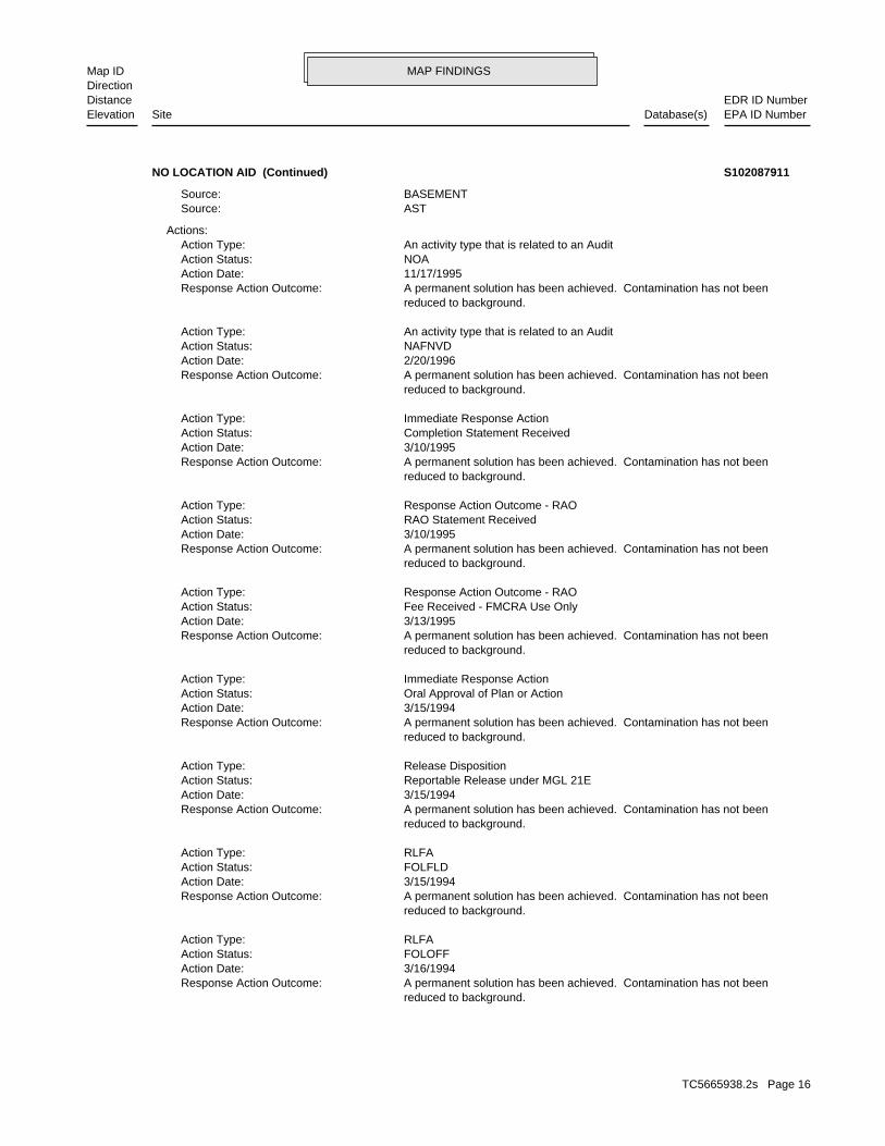
MAP FINDINGSMap IDDirection
EDR ID NumberDistanceEPA ID NumberDatabase(s)SiteElevation
reduced to background. A permanent solution has been achieved. Contamination has not beenResponse Action Outcome: 3/16/1994Action Date: FOLOFFAction Status: RLFAAction Type:
reduced to background. A permanent solution has been achieved. Contamination has not beenResponse Action Outcome: 3/15/1994Action Date: FOLFLDAction Status: RLFAAction Type:
reduced to background. A permanent solution has been achieved. Contamination has not beenResponse Action Outcome: 3/15/1994Action Date: Reportable Release under MGL 21EAction Status: Release DispositionAction Type:
reduced to background. A permanent solution has been achieved. Contamination has not beenResponse Action Outcome: 3/15/1994Action Date: Oral Approval of Plan or ActionAction Status: Immediate Response ActionAction Type:
reduced to background. A permanent solution has been achieved. Contamination has not beenResponse Action Outcome: 3/13/1995Action Date: Fee Received - FMCRA Use OnlyAction Status: Response Action Outcome - RAOAction Type:
reduced to background. A permanent solution has been achieved. Contamination has not beenResponse Action Outcome: 3/10/1995Action Date: RAO Statement ReceivedAction Status: Response Action Outcome - RAOAction Type:
reduced to background. A permanent solution has been achieved. Contamination has not beenResponse Action Outcome: 3/10/1995Action Date: Completion Statement ReceivedAction Status: Immediate Response ActionAction Type:
reduced to background. A permanent solution has been achieved. Contamination has not beenResponse Action Outcome: 2/20/1996Action Date: NAFNVDAction Status: An activity type that is related to an AuditAction Type:
reduced to background. A permanent solution has been achieved. Contamination has not beenResponse Action Outcome: 11/17/1995Action Date: NOAAction Status: An activity type that is related to an AuditAction Type:
Actions:
ASTSource: BASEMENTSource:
NO LOCATION AID (Continued) S102087911
TC5665938.2s Page 16
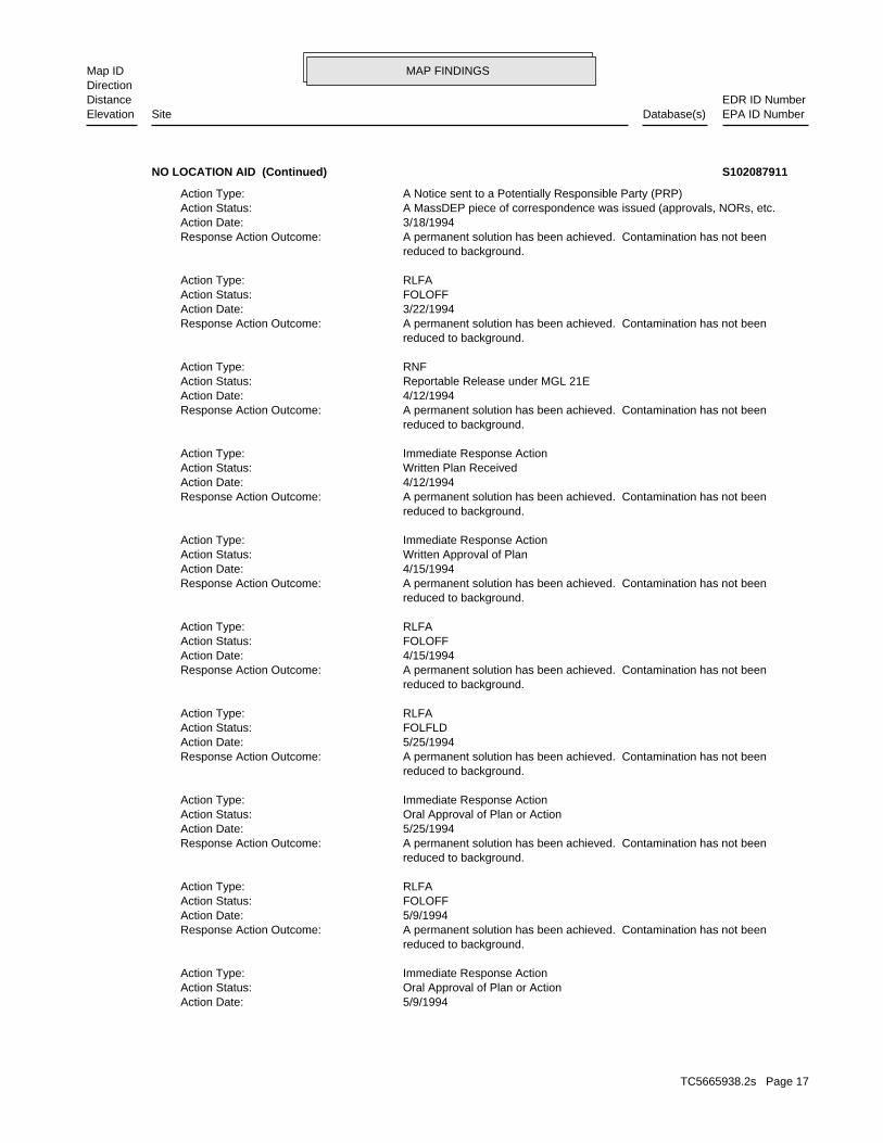
MAP FINDINGSMap IDDirection
EDR ID NumberDistanceEPA ID NumberDatabase(s)SiteElevation
5/9/1994Action Date: Oral Approval of Plan or ActionAction Status: Immediate Response ActionAction Type:
reduced to background. A permanent solution has been achieved. Contamination has not beenResponse Action Outcome: 5/9/1994Action Date: FOLOFFAction Status: RLFAAction Type:
reduced to background. A permanent solution has been achieved. Contamination has not beenResponse Action Outcome: 5/25/1994Action Date: Oral Approval of Plan or ActionAction Status: Immediate Response ActionAction Type:
reduced to background. A permanent solution has been achieved. Contamination has not beenResponse Action Outcome: 5/25/1994Action Date: FOLFLDAction Status: RLFAAction Type:
reduced to background. A permanent solution has been achieved. Contamination has not beenResponse Action Outcome: 4/15/1994Action Date: FOLOFFAction Status: RLFAAction Type:
reduced to background. A permanent solution has been achieved. Contamination has not beenResponse Action Outcome: 4/15/1994Action Date: Written Approval of PlanAction Status: Immediate Response ActionAction Type:
reduced to background. A permanent solution has been achieved. Contamination has not beenResponse Action Outcome: 4/12/1994Action Date: Written Plan ReceivedAction Status: Immediate Response ActionAction Type:
reduced to background. A permanent solution has been achieved. Contamination has not beenResponse Action Outcome: 4/12/1994Action Date: Reportable Release under MGL 21EAction Status: RNFAction Type:
reduced to background. A permanent solution has been achieved. Contamination has not beenResponse Action Outcome: 3/22/1994Action Date: FOLOFFAction Status: RLFAAction Type:
reduced to background. A permanent solution has been achieved. Contamination has not beenResponse Action Outcome: 3/18/1994Action Date: A MassDEP piece of correspondence was issued (approvals, NORs, etc.Action Status: A Notice sent to a Potentially Responsible Party (PRP)Action Type:
NO LOCATION AID (Continued) S102087911
TC5665938.2s Page 17

MAP FINDINGSMap IDDirection
EDR ID NumberDistanceEPA ID NumberDatabase(s)SiteElevation
Immediate Response ActionAction Type:
reduced to background. A permanent solution has been achieved. Contamination has not beenResponse Action Outcome: 3/13/1995Action Date: Fee Received - FMCRA Use OnlyAction Status: Response Action Outcome - RAOAction Type:
reduced to background. A permanent solution has been achieved. Contamination has not beenResponse Action Outcome: 3/10/1995Action Date: RAO Statement ReceivedAction Status: Response Action Outcome - RAOAction Type:
reduced to background. A permanent solution has been achieved. Contamination has not beenResponse Action Outcome: 3/10/1995Action Date: Completion Statement ReceivedAction Status: Immediate Response ActionAction Type:
reduced to background. A permanent solution has been achieved. Contamination has not beenResponse Action Outcome: 2/20/1996Action Date: NAFNVDAction Status: An activity type that is related to an AuditAction Type:
reduced to background. A permanent solution has been achieved. Contamination has not beenResponse Action Outcome: 11/17/1995Action Date: NOAAction Status: An activity type that is related to an AuditAction Type:
Actions:
Click here to access the MA DEP site for this facility:
OilOil / Haz Material Type: been reduced to background. A2 - A permanent solution has been achieved. Contamination has notResponse Action Outcome: Not reportedPhase: 03/10/1995Status Date: TWO HRCategory: 03/15/1994Notification: TRUROOfficial City: Not reportedPrimary ID: 4-0010336 / RAORelease Tracking Number/Current Status:
Release:
reduced to background. A permanent solution has been achieved. Contamination has not beenResponse Action Outcome: 6/14/1994Action Date: Written Plan ReceivedAction Status: Immediate Response ActionAction Type:
reduced to background. A permanent solution has been achieved. Contamination has not beenResponse Action Outcome:
NO LOCATION AID (Continued) S102087911
TC5665938.2s Page 18

MAP FINDINGSMap IDDirection
EDR ID NumberDistanceEPA ID NumberDatabase(s)SiteElevation
A permanent solution has been achieved. Contamination has not beenResponse Action Outcome: 4/15/1994Action Date: FOLOFFAction Status: RLFAAction Type:
reduced to background. A permanent solution has been achieved. Contamination has not beenResponse Action Outcome: 4/15/1994Action Date: Written Approval of PlanAction Status: Immediate Response ActionAction Type:
reduced to background. A permanent solution has been achieved. Contamination has not beenResponse Action Outcome: 4/12/1994Action Date: Written Plan ReceivedAction Status: Immediate Response ActionAction Type:
reduced to background. A permanent solution has been achieved. Contamination has not beenResponse Action Outcome: 4/12/1994Action Date: Reportable Release under MGL 21EAction Status: RNFAction Type:
reduced to background. A permanent solution has been achieved. Contamination has not beenResponse Action Outcome: 3/22/1994Action Date: FOLOFFAction Status: RLFAAction Type:
reduced to background. A permanent solution has been achieved. Contamination has not beenResponse Action Outcome: 3/18/1994Action Date: A MassDEP piece of correspondence was issued (approvals, NORs, etc.Action Status: A Notice sent to a Potentially Responsible Party (PRP)Action Type:
reduced to background. A permanent solution has been achieved. Contamination has not beenResponse Action Outcome: 3/16/1994Action Date: FOLOFFAction Status: RLFAAction Type:
reduced to background. A permanent solution has been achieved. Contamination has not beenResponse Action Outcome: 3/15/1994Action Date: FOLFLDAction Status: RLFAAction Type:
reduced to background. A permanent solution has been achieved. Contamination has not beenResponse Action Outcome: 3/15/1994Action Date: Reportable Release under MGL 21EAction Status: Release DispositionAction Type:
reduced to background. A permanent solution has been achieved. Contamination has not beenResponse Action Outcome: 3/15/1994Action Date: Oral Approval of Plan or ActionAction Status:
NO LOCATION AID (Continued) S102087911
TC5665938.2s Page 19

MAP FINDINGSMap IDDirection
EDR ID NumberDistanceEPA ID NumberDatabase(s)SiteElevation
ASTSource: BASEMENTSource: RESIDNTIALLocation Type: 200 gallonsQuantity: #2 FUEL OILChemical:
Chemicals:
reduced to background. A permanent solution has been achieved. Contamination has not beenResponse Action Outcome: 6/14/1994Action Date: Written Plan ReceivedAction Status: Immediate Response ActionAction Type:
reduced to background. A permanent solution has been achieved. Contamination has not beenResponse Action Outcome: 5/9/1994Action Date: Oral Approval of Plan or ActionAction Status: Immediate Response ActionAction Type:
reduced to background. A permanent solution has been achieved. Contamination has not beenResponse Action Outcome: 5/9/1994Action Date: FOLOFFAction Status: RLFAAction Type:
reduced to background. A permanent solution has been achieved. Contamination has not beenResponse Action Outcome: 5/25/1994Action Date: Oral Approval of Plan or ActionAction Status: Immediate Response ActionAction Type:
reduced to background. A permanent solution has been achieved. Contamination has not beenResponse Action Outcome: 5/25/1994Action Date: FOLFLDAction Status: RLFAAction Type:
reduced to background.
NO LOCATION AID (Continued) S102087911
OilOil Or Haz Material: reduced to background or a threat of release has been eliminated. A1 - A permanent solution has been achieved. Contamination has beenResponse Action Outcome: Not reportedPhase: 05/03/1996Status Date: Not reportedAssociated ID: TWO HRCategory: 01/05/1996Notification Date: TRURORelease Town: ASTSource Type: 4-0011881 / RAORelease Tracking Number/Current Status:
LAST:
2540 ft.0.481 mi.
Relative:Lower
Actual:48 ft.
1/4-1/2 TRURO, MA 02666SSW RELEASE8 HARDING WAY N/A5 LASTOFF EASTLE RD S102088639
TC5665938.2s Page 20

MAP FINDINGSMap IDDirection
EDR ID NumberDistanceEPA ID NumberDatabase(s)SiteElevation
05/03/1996Status Date: TWO HRCategory: 01/05/1996Notification: TRUROOfficial City: Not reportedPrimary ID: 4-0011881 / RAORelease Tracking Number/Current Status:
Release:
to background or a threat of release has been eliminated. A permanent solution has been achieved. Contamination has been reducedResponse Action Outcome: 5/3/1996Action Date: RAO Statement ReceivedAction Status: Response Action Outcome - RAOAction Type:
to background or a threat of release has been eliminated. A permanent solution has been achieved. Contamination has been reducedResponse Action Outcome: 2/26/1996Action Date: Reportable Release under MGL 21EAction Status: RNFAction Type:
to background or a threat of release has been eliminated. A permanent solution has been achieved. Contamination has been reducedResponse Action Outcome: 1/5/1996Action Date: FOLOFFAction Status: RLFAAction Type:
to background or a threat of release has been eliminated. A permanent solution has been achieved. Contamination has been reducedResponse Action Outcome: 1/5/1996Action Date: FOLFLDAction Status: RLFAAction Type:
to background or a threat of release has been eliminated. A permanent solution has been achieved. Contamination has been reducedResponse Action Outcome: 1/5/1996Action Date: Reportable Release under MGL 21EAction Status: Release DispositionAction Type:
to background or a threat of release has been eliminated. A permanent solution has been achieved. Contamination has been reducedResponse Action Outcome: 1/12/1996Action Date: A MassDEP piece of correspondence was issued (approvals, NORs, etc.Action Status: A Notice sent to a Potentially Responsible Party (PRP)Action Type:
to background or a threat of release has been eliminated. A permanent solution has been achieved. Contamination has been reducedResponse Action Outcome: 1/12/1996Action Date: FOLOFFAction Status: RLFAAction Type:
Actions:
ASTSource: RESIDNTIALLocation Type: 175 gallonsQuantity: #2 FUEL OILChemical:
Chemicals:
OFF EASTLE RD (Continued) S102088639
TC5665938.2s Page 21

MAP FINDINGSMap IDDirection
EDR ID NumberDistanceEPA ID NumberDatabase(s)SiteElevation
ASTSource: RESIDNTIALLocation Type: 175 gallonsQuantity: #2 FUEL OILChemical:
Chemicals:
to background or a threat of release has been eliminated. A permanent solution has been achieved. Contamination has been reducedResponse Action Outcome: 5/3/1996Action Date: RAO Statement ReceivedAction Status: Response Action Outcome - RAOAction Type:
to background or a threat of release has been eliminated. A permanent solution has been achieved. Contamination has been reducedResponse Action Outcome: 2/26/1996Action Date: Reportable Release under MGL 21EAction Status: RNFAction Type:
to background or a threat of release has been eliminated. A permanent solution has been achieved. Contamination has been reducedResponse Action Outcome: 1/5/1996Action Date: FOLOFFAction Status: RLFAAction Type:
to background or a threat of release has been eliminated. A permanent solution has been achieved. Contamination has been reducedResponse Action Outcome: 1/5/1996Action Date: FOLFLDAction Status: RLFAAction Type:
to background or a threat of release has been eliminated. A permanent solution has been achieved. Contamination has been reducedResponse Action Outcome: 1/5/1996Action Date: Reportable Release under MGL 21EAction Status: Release DispositionAction Type:
to background or a threat of release has been eliminated. A permanent solution has been achieved. Contamination has been reducedResponse Action Outcome: 1/12/1996Action Date: A MassDEP piece of correspondence was issued (approvals, NORs, etc.Action Status: A Notice sent to a Potentially Responsible Party (PRP)Action Type:
to background or a threat of release has been eliminated. A permanent solution has been achieved. Contamination has been reducedResponse Action Outcome: 1/12/1996Action Date: FOLOFFAction Status: RLFAAction Type:
Actions:
Click here to access the MA DEP site for this facility:
OilOil / Haz Material Type: reduced to background or a threat of release has been eliminated. A1 - A permanent solution has been achieved. Contamination has beenResponse Action Outcome: Not reportedPhase:
OFF EASTLE RD (Continued) S102088639
TC5665938.2s Page 22

MAP FINDINGSMap IDDirection
EDR ID NumberDistanceEPA ID NumberDatabase(s)SiteElevation
reduced to background. A permanent solution has been achieved. Contamination has not beenResponse Action Outcome: 1/26/2006Action Date: FLDD1AAction Status: RLFAAction Type:
reduced to background. A permanent solution has been achieved. Contamination has not beenResponse Action Outcome: 1/26/2006Action Date: Reportable Release under MGL 21EAction Status: Release DispositionAction Type:
Actions:
Not reportedQuantity: GASOLINEChemical:
Chemicals:
Click here to access the MA DEP site for this facility:
USTSource: PIPESource: FEDERALLocation Type:
OilOil Or Haz Material: been reduced to background. A2 - A permanent solution has been achieved. Contamination has notResponse Action Outcome: Not reportedPhase: Not reportedAssociated ID: 72 HRCategory: 01/26/2006Notification Date: TRURORelease Town: USTSource Type: 03/28/2006Status Date: 4-0019586 / RAORelease Tracking Number/Current Status:
Facility:
LUST:
OilOil Or Haz Material: A2Response Action Outcome: Not reportedPhase: 03/28/2006Status Date: RAOCurrent Status: Not reportedAssociated ID: 72 HRCategory: 01/26/2006Notification Date: TRURORelease Town: PIPESource Type: 4-0019586Facility ID:
SHWS:
3214 ft.0.609 mi.
Relative:Higher
Actual:129 ft.
1/2-1 RELEASENORTH TRURO, MA 02652NNE LUST32 OLD DEWLINE RD N/A6 SHWSFORMER AIR BASE S107678074
TC5665938.2s Page 23

MAP FINDINGSMap IDDirection
EDR ID NumberDistanceEPA ID NumberDatabase(s)SiteElevation
A permanent solution has been achieved. Contamination has not beenResponse Action Outcome: 1/26/2006Action Date: Reportable Release under MGL 21EAction Status: Release DispositionAction Type:
Actions:
Click here to access the MA DEP site for this facility:
OilOil / Haz Material Type: been reduced to background. A2 - A permanent solution has been achieved. Contamination has notResponse Action Outcome: Not reportedPhase: 03/28/2006Status Date: 72 HRCategory: 01/26/2006Notification: TRUROOfficial City: Not reportedPrimary ID: 4-0019586 / RAORelease Tracking Number/Current Status:
Release:
reduced to background. A permanent solution has been achieved. Contamination has not beenResponse Action Outcome: 8/11/2006Action Date: Level I - Technical Screen AuditAction Status: Response Action Outcome - RAOAction Type:
reduced to background. A permanent solution has been achieved. Contamination has not beenResponse Action Outcome: 3/28/2006Action Date: RAO Statement ReceivedAction Status: Response Action Outcome - RAOAction Type:
reduced to background. A permanent solution has been achieved. Contamination has not beenResponse Action Outcome: 3/28/2006Action Date: Reportable Release under MGL 21EAction Status: RNFAction Type:
reduced to background. A permanent solution has been achieved. Contamination has not beenResponse Action Outcome: 2/8/2006Action Date: FOLOFFAction Status: RLFAAction Type:
reduced to background. A permanent solution has been achieved. Contamination has not beenResponse Action Outcome: 2/27/2006Action Date: A MassDEP piece of correspondence was issued (approvals, NORs, etc.Action Status: A Notice sent to a Potentially Responsible Party (PRP)Action Type:
reduced to background. A permanent solution has been achieved. Contamination has not beenResponse Action Outcome: 1/27/2006Action Date: FLDRANAction Status: RLFAAction Type:
FORMER AIR BASE (Continued) S107678074
TC5665938.2s Page 24

MAP FINDINGSMap IDDirection
EDR ID NumberDistanceEPA ID NumberDatabase(s)SiteElevation
USTSource: PIPESource: FEDERALLocation Type: Not reportedQuantity: GASOLINEChemical:
Chemicals:
reduced to background. A permanent solution has been achieved. Contamination has not beenResponse Action Outcome: 8/11/2006Action Date: Level I - Technical Screen AuditAction Status: Response Action Outcome - RAOAction Type:
reduced to background. A permanent solution has been achieved. Contamination has not beenResponse Action Outcome: 3/28/2006Action Date: RAO Statement ReceivedAction Status: Response Action Outcome - RAOAction Type:
reduced to background. A permanent solution has been achieved. Contamination has not beenResponse Action Outcome: 3/28/2006Action Date: Reportable Release under MGL 21EAction Status: RNFAction Type:
reduced to background. A permanent solution has been achieved. Contamination has not beenResponse Action Outcome: 2/8/2006Action Date: FOLOFFAction Status: RLFAAction Type:
reduced to background. A permanent solution has been achieved. Contamination has not beenResponse Action Outcome: 2/27/2006Action Date: A MassDEP piece of correspondence was issued (approvals, NORs, etc.Action Status: A Notice sent to a Potentially Responsible Party (PRP)Action Type:
reduced to background. A permanent solution has been achieved. Contamination has not beenResponse Action Outcome: 1/27/2006Action Date: FLDRANAction Status: RLFAAction Type:
reduced to background. A permanent solution has been achieved. Contamination has not beenResponse Action Outcome: 1/26/2006Action Date: FLDD1AAction Status: RLFAAction Type:
reduced to background.
FORMER AIR BASE (Continued) S107678074
TC5665938.2s Page 25

MAP FINDINGSMap IDDirection
EDR ID NumberDistanceEPA ID NumberDatabase(s)SiteElevation
50 gallonsQuantity: UNIDENTIFIED PETROLEUM PRODUCTChemical:
Chemicals:
Not reportedResponse Action Outcome: 3/9/2002Action Date: Reportable Release under MGL 21EAction Status: Release DispositionAction Type:
Not reportedResponse Action Outcome: 3/9/2002Action Date: Release Overseen by US Coast GuardAction Status: RAO Not RequiredAction Type:
Actions:
Click here to access the MA DEP site for this facility:
OilOil / Haz Material Type: -Response Action Outcome: Not reportedPhase: 03/09/2002Status Date: TWO HRCategory: 03/09/2002Notification: SOMERSETOfficial City: Not reportedPrimary ID: 4-0016930 / ADQREGRelease Tracking Number/Current Status:
Release:
OilOil Or Haz Material: Not reportedResponse Action Outcome: Not reportedPhase: 03/09/2002Status Date: ADQREGCurrent Status: Not reportedAssociated ID: TWO HRCategory: 03/09/2002Notification Date: SOMERSETRelease Town: UNKNOWNSource Type: 4-0016930Facility ID:
OilOil Or Haz Material: Not reportedResponse Action Outcome: Not reportedPhase: 06/24/2004Status Date: ADQREGCurrent Status: Not reportedAssociated ID: TWO HRCategory: 06/24/2004Notification Date: SOMERSETRelease Town: Not reportedSource Type: 4-0018510Facility ID:
SHWS:
3381 ft.0.640 mi.
Relative:Higher
Actual:138 ft.
1/2-1 SOMERSET, MA NE RELEASETAUNTON RIV N/A7 SHWSNEAR SOMERSET PWR U002008599
TC5665938.2s Page 26

MAP FINDINGSMap IDDirection
EDR ID NumberDistanceEPA ID NumberDatabase(s)SiteElevation
WATERBODYLocation Type: Not reportedQuantity: OIL SHEENChemical:
Chemicals:
Not reportedResponse Action Outcome: 6/24/2004Action Date: Reportable Release under MGL 21EAction Status: Release DispositionAction Type:
Not reportedResponse Action Outcome: 6/24/2004Action Date: Release Overseen by US Coast GuardAction Status: RAO Not RequiredAction Type:
Actions:
Click here to access the MA DEP site for this facility:
OilOil / Haz Material Type: -Response Action Outcome: Not reportedPhase: 06/24/2004Status Date: TWO HRCategory: 06/24/2004Notification: SOMERSETOfficial City: Not reportedPrimary ID: 4-0018510 / ADQREGRelease Tracking Number/Current Status:
UNKNOWNSource: WATERBODYLocation Type:
NEAR SOMERSET PWR (Continued) U002008599
TWO HRCategory: 03/11/2005Notification: TRUROOfficial City: Not reportedPrimary ID: 4-0018962 / RAORelease Tracking Number/Current Status:
Release:
Hazardous MaterialOil Or Haz Material: A2Response Action Outcome: Not reportedPhase: 05/09/2005Status Date: RAOCurrent Status: Not reportedAssociated ID: TWO HRCategory: 03/11/2005Notification Date: TRURORelease Town: Not reportedSource Type: 4-0018962Facility ID:
SHWS:
3673 ft.0.696 mi.
Relative:Lower
Actual:24 ft.
1/2-1 TRURO, MA 02666North RELEASE11 SOUTH HOLLOW RD N/A8 SHWSWTP SO. HOLLOW WELLFIELD S106863510
TC5665938.2s Page 27
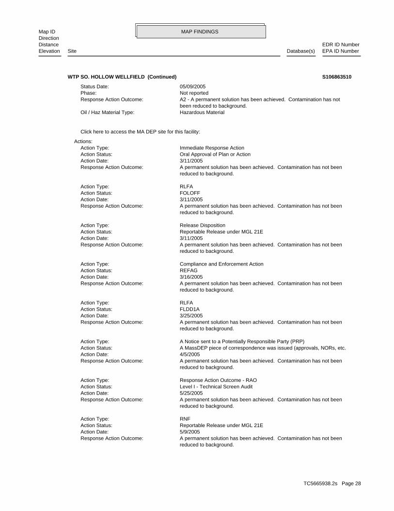
MAP FINDINGSMap IDDirection
EDR ID NumberDistanceEPA ID NumberDatabase(s)SiteElevation
reduced to background. A permanent solution has been achieved. Contamination has not beenResponse Action Outcome: 5/9/2005Action Date: Reportable Release under MGL 21EAction Status: RNFAction Type:
reduced to background. A permanent solution has been achieved. Contamination has not beenResponse Action Outcome: 5/25/2005Action Date: Level I - Technical Screen AuditAction Status: Response Action Outcome - RAOAction Type:
reduced to background. A permanent solution has been achieved. Contamination has not beenResponse Action Outcome: 4/5/2005Action Date: A MassDEP piece of correspondence was issued (approvals, NORs, etc.Action Status: A Notice sent to a Potentially Responsible Party (PRP)Action Type:
reduced to background. A permanent solution has been achieved. Contamination has not beenResponse Action Outcome: 3/25/2005Action Date: FLDD1AAction Status: RLFAAction Type:
reduced to background. A permanent solution has been achieved. Contamination has not beenResponse Action Outcome: 3/16/2005Action Date: REFAGAction Status: Compliance and Enforcement ActionAction Type:
reduced to background. A permanent solution has been achieved. Contamination has not beenResponse Action Outcome: 3/11/2005Action Date: Reportable Release under MGL 21EAction Status: Release DispositionAction Type:
reduced to background. A permanent solution has been achieved. Contamination has not beenResponse Action Outcome: 3/11/2005Action Date: FOLOFFAction Status: RLFAAction Type:
reduced to background. A permanent solution has been achieved. Contamination has not beenResponse Action Outcome: 3/11/2005Action Date: Oral Approval of Plan or ActionAction Status: Immediate Response ActionAction Type:
Actions:
Click here to access the MA DEP site for this facility:
Hazardous MaterialOil / Haz Material Type: been reduced to background. A2 - A permanent solution has been achieved. Contamination has notResponse Action Outcome: Not reportedPhase: 05/09/2005Status Date:
WTP SO. HOLLOW WELLFIELD (Continued) S106863510
TC5665938.2s Page 28

MAP FINDINGSMap IDDirection
EDR ID NumberDistanceEPA ID NumberDatabase(s)SiteElevation
MUNICIPALLocation Type: 8 gallonsQuantity: POTASSIUM HYDROXIDEChemical:
Chemicals:
reduced to background. A permanent solution has been achieved. Contamination has not beenResponse Action Outcome: 5/9/2005Action Date: RAO Statement ReceivedAction Status: Response Action Outcome - RAOAction Type:
reduced to background. A permanent solution has been achieved. Contamination has not beenResponse Action Outcome: 5/9/2005Action Date: Completion Statement ReceivedAction Status: Immediate Response ActionAction Type:
WTP SO. HOLLOW WELLFIELD (Continued) S106863510
TC5665938.2s Page 29
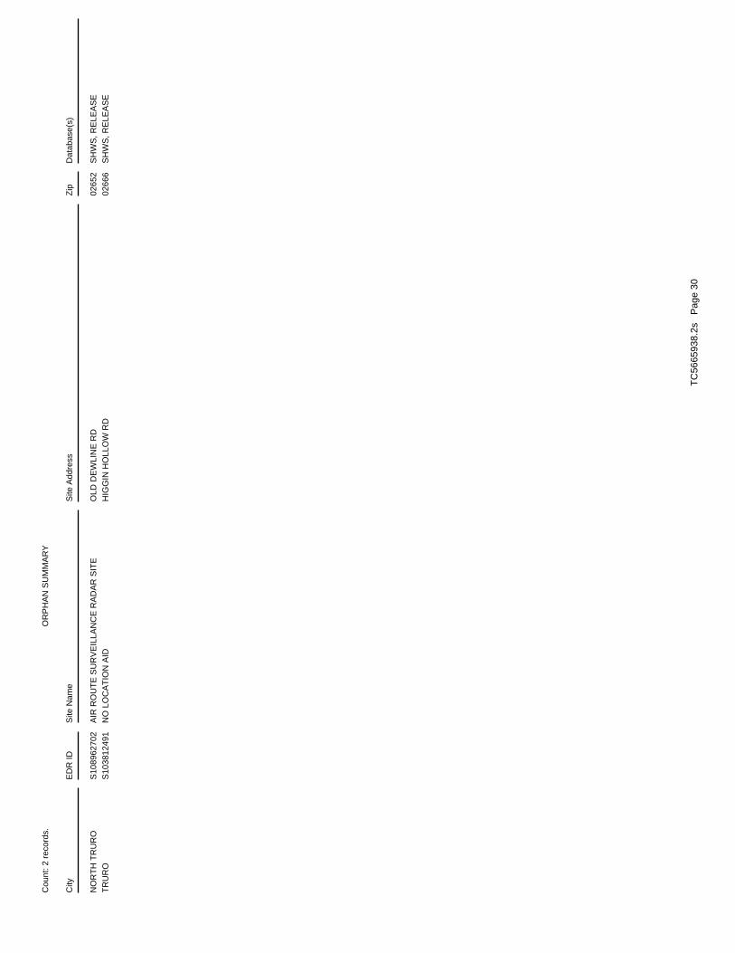
OR
PH
AN
SU
MM
AR
Y
City
ED
R ID
Site
Nam
eS
ite A
ddre
ssZ
ipD
atab
ase(
s)
Cou
nt: 2
rec
ords
.
NO
RT
H T
RU
RO
S
1089
6270
2A
IR R
OU
TE
SU
RV
EIL
LAN
CE
RA
DA
R S
ITE
OLD
DE
WLI
NE
RD
0265
2S
HW
S, R
ELE
AS
ET
RU
RO
S
1038
1249
1N
O L
OC
AT
ION
AID
HIG
GIN
HO
LLO
W R
D02
666
SH
WS
, RE
LEA
SE
TC
5665
938.
2s
Pag
e 30

To maintain currency of the following federal and state databases, EDR contacts the appropriate governmental agencyon a monthly or quarterly basis, as required.
Number of Days to Update: Provides confirmation that EDR is reporting records that have been updated within 90 daysfrom the date the government agency made the information available to the public.
STANDARD ENVIRONMENTAL RECORDS
Federal NPL site list
NPL: National Priority ListNational Priorities List (Superfund). The NPL is a subset of CERCLIS and identifies over 1,200 sites for prioritycleanup under the Superfund Program. NPL sites may encompass relatively large areas. As such, EDR provides polygoncoverage for over 1,000 NPL site boundaries produced by EPA’s Environmental Photographic Interpretation Center(EPIC) and regional EPA offices.
Date of Government Version: 04/11/2019Date Data Arrived at EDR: 04/18/2019Date Made Active in Reports: 05/14/2019Number of Days to Update: 26
Source: EPATelephone: N/ALast EDR Contact: 04/18/2019Next Scheduled EDR Contact: 07/15/2019Data Release Frequency: Quarterly
NPL Site Boundaries
Sources:
EPA’s Environmental Photographic Interpretation Center (EPIC)Telephone: 202-564-7333
EPA Region 1 EPA Region 6Telephone 617-918-1143 Telephone: 214-655-6659
EPA Region 3 EPA Region 7Telephone 215-814-5418 Telephone: 913-551-7247
EPA Region 4 EPA Region 8Telephone 404-562-8033 Telephone: 303-312-6774
EPA Region 5 EPA Region 9Telephone 312-886-6686 Telephone: 415-947-4246
EPA Region 10Telephone 206-553-8665
Proposed NPL: Proposed National Priority List SitesA site that has been proposed for listing on the National Priorities List through the issuance of a proposed rulein the Federal Register. EPA then accepts public comments on the site, responds to the comments, and places onthe NPL those sites that continue to meet the requirements for listing.
Date of Government Version: 04/11/2019Date Data Arrived at EDR: 04/18/2019Date Made Active in Reports: 05/14/2019Number of Days to Update: 26
Source: EPATelephone: N/ALast EDR Contact: 04/18/2019Next Scheduled EDR Contact: 07/15/2019Data Release Frequency: Quarterly
NPL LIENS: Federal Superfund LiensFederal Superfund Liens. Under the authority granted the USEPA by CERCLA of 1980, the USEPA has the authorityto file liens against real property in order to recover remedial action expenditures or when the property ownerreceived notification of potential liability. USEPA compiles a listing of filed notices of Superfund Liens.
TC5665938.2s Page GR-1
GOVERNMENT RECORDS SEARCHED / DATA CURRENCY TRACKING

Date of Government Version: 10/15/1991Date Data Arrived at EDR: 02/02/1994Date Made Active in Reports: 03/30/1994Number of Days to Update: 56
Source: EPATelephone: 202-564-4267Last EDR Contact: 08/15/2011Next Scheduled EDR Contact: 11/28/2011Data Release Frequency: No Update Planned
Federal Delisted NPL site list
Delisted NPL: National Priority List DeletionsThe National Oil and Hazardous Substances Pollution Contingency Plan (NCP) establishes the criteria that theEPA uses to delete sites from the NPL. In accordance with 40 CFR 300.425.(e), sites may be deleted from theNPL where no further response is appropriate.
Date of Government Version: 04/11/2019Date Data Arrived at EDR: 04/18/2019Date Made Active in Reports: 05/14/2019Number of Days to Update: 26
Source: EPATelephone: N/ALast EDR Contact: 04/18/2019Next Scheduled EDR Contact: 07/15/2019Data Release Frequency: Quarterly
Federal CERCLIS list
FEDERAL FACILITY: Federal Facility Site Information listingA listing of National Priority List (NPL) and Base Realignment and Closure (BRAC) sites found in the ComprehensiveEnvironmental Response, Compensation and Liability Information System (CERCLIS) Database where EPA Federal FacilitiesRestoration and Reuse Office is involved in cleanup activities.
Date of Government Version: 04/03/2019Date Data Arrived at EDR: 04/05/2019Date Made Active in Reports: 05/14/2019Number of Days to Update: 39
Source: Environmental Protection AgencyTelephone: 703-603-8704Last EDR Contact: 04/05/2019Next Scheduled EDR Contact: 07/15/2019Data Release Frequency: Varies
SEMS: Superfund Enterprise Management SystemSEMS (Superfund Enterprise Management System) tracks hazardous waste sites, potentially hazardous waste sites,and remedial activities performed in support of EPA’s Superfund Program across the United States. The list wasformerly know as CERCLIS, renamed to SEMS by the EPA in 2015. The list contains data on potentially hazardouswaste sites that have been reported to the USEPA by states, municipalities, private companies and private persons,pursuant to Section 103 of the Comprehensive Environmental Response, Compensation, and Liability Act (CERCLA).This dataset also contains sites which are either proposed to or on the National Priorities List (NPL) and thesites which are in the screening and assessment phase for possible inclusion on the NPL.
Date of Government Version: 04/11/2019Date Data Arrived at EDR: 04/18/2019Date Made Active in Reports: 05/23/2019Number of Days to Update: 35
Source: EPATelephone: 800-424-9346Last EDR Contact: 04/18/2019Next Scheduled EDR Contact: 07/29/2019Data Release Frequency: Quarterly
Federal CERCLIS NFRAP site list
SEMS-ARCHIVE: Superfund Enterprise Management System Archive
TC5665938.2s Page GR-2
GOVERNMENT RECORDS SEARCHED / DATA CURRENCY TRACKING

SEMS-ARCHIVE (Superfund Enterprise Management System Archive) tracks sites that have no further interest underthe Federal Superfund Program based on available information. The list was formerly known as the CERCLIS-NFRAP,renamed to SEMS ARCHIVE by the EPA in 2015. EPA may perform a minimal level of assessment work at a site whileit is archived if site conditions change and/or new information becomes available. Archived sites have been removedand archived from the inventory of SEMS sites. Archived status indicates that, to the best of EPA’s knowledge,assessment at a site has been completed and that EPA has determined no further steps will be taken to list thesite on the National Priorities List (NPL), unless information indicates this decision was not appropriate orother considerations require a recommendation for listing at a later time. The decision does not necessarily meanthat there is no hazard associated with a given site; it only means that. based upon available information, thelocation is not judged to be potential NPL site.
Date of Government Version: 04/11/2019Date Data Arrived at EDR: 04/18/2019Date Made Active in Reports: 05/23/2019Number of Days to Update: 35
Source: EPATelephone: 800-424-9346Last EDR Contact: 04/18/2019Next Scheduled EDR Contact: 07/29/2019Data Release Frequency: Quarterly
Federal RCRA CORRACTS facilities list
CORRACTS: Corrective Action ReportCORRACTS identifies hazardous waste handlers with RCRA corrective action activity.
Date of Government Version: 03/25/2019Date Data Arrived at EDR: 03/27/2019Date Made Active in Reports: 04/17/2019Number of Days to Update: 21
Source: EPATelephone: 800-424-9346Last EDR Contact: 03/27/2019Next Scheduled EDR Contact: 07/08/2019Data Release Frequency: Quarterly
Federal RCRA non-CORRACTS TSD facilities list
RCRA-TSDF: RCRA - Treatment, Storage and DisposalRCRAInfo is EPA’s comprehensive information system, providing access to data supporting the Resource Conservationand Recovery Act (RCRA) of 1976 and the Hazardous and Solid Waste Amendments (HSWA) of 1984. The databaseincludes selective information on sites which generate, transport, store, treat and/or dispose of hazardous wasteas defined by the Resource Conservation and Recovery Act (RCRA). Transporters are individuals or entities thatmove hazardous waste from the generator offsite to a facility that can recycle, treat, store, or dispose of thewaste. TSDFs treat, store, or dispose of the waste.
Date of Government Version: 03/25/2019Date Data Arrived at EDR: 03/27/2019Date Made Active in Reports: 04/17/2019Number of Days to Update: 21
Source: Environmental Protection AgencyTelephone: (888) 372-7341Last EDR Contact: 03/27/2019Next Scheduled EDR Contact: 07/08/2019Data Release Frequency: Quarterly
Federal RCRA generators list
RCRA-LQG: RCRA - Large Quantity GeneratorsRCRAInfo is EPA’s comprehensive information system, providing access to data supporting the Resource Conservationand Recovery Act (RCRA) of 1976 and the Hazardous and Solid Waste Amendments (HSWA) of 1984. The databaseincludes selective information on sites which generate, transport, store, treat and/or dispose of hazardous wasteas defined by the Resource Conservation and Recovery Act (RCRA). Large quantity generators (LQGs) generateover 1,000 kilograms (kg) of hazardous waste, or over 1 kg of acutely hazardous waste per month.
Date of Government Version: 03/25/2019Date Data Arrived at EDR: 03/27/2019Date Made Active in Reports: 04/17/2019Number of Days to Update: 21
Source: Environmental Protection AgencyTelephone: (888) 372-7341Last EDR Contact: 03/27/2019Next Scheduled EDR Contact: 07/08/2019Data Release Frequency: Quarterly
TC5665938.2s Page GR-3
GOVERNMENT RECORDS SEARCHED / DATA CURRENCY TRACKING

RCRA-SQG: RCRA - Small Quantity GeneratorsRCRAInfo is EPA’s comprehensive information system, providing access to data supporting the Resource Conservationand Recovery Act (RCRA) of 1976 and the Hazardous and Solid Waste Amendments (HSWA) of 1984. The databaseincludes selective information on sites which generate, transport, store, treat and/or dispose of hazardous wasteas defined by the Resource Conservation and Recovery Act (RCRA). Small quantity generators (SQGs) generatebetween 100 kg and 1,000 kg of hazardous waste per month.
Date of Government Version: 03/25/2019Date Data Arrived at EDR: 03/27/2019Date Made Active in Reports: 04/17/2019Number of Days to Update: 21
Source: Environmental Protection AgencyTelephone: (888) 372-7341Last EDR Contact: 03/27/2019Next Scheduled EDR Contact: 07/08/2019Data Release Frequency: Quarterly
RCRA-CESQG: RCRA - Conditionally Exempt Small Quantity GeneratorsRCRAInfo is EPA’s comprehensive information system, providing access to data supporting the Resource Conservationand Recovery Act (RCRA) of 1976 and the Hazardous and Solid Waste Amendments (HSWA) of 1984. The databaseincludes selective information on sites which generate, transport, store, treat and/or dispose of hazardous wasteas defined by the Resource Conservation and Recovery Act (RCRA). Conditionally exempt small quantity generators(CESQGs) generate less than 100 kg of hazardous waste, or less than 1 kg of acutely hazardous waste per month.
Date of Government Version: 03/25/2019Date Data Arrived at EDR: 03/27/2019Date Made Active in Reports: 04/17/2019Number of Days to Update: 21
Source: Environmental Protection AgencyTelephone: (888) 372-7341Last EDR Contact: 03/27/2019Next Scheduled EDR Contact: 07/08/2019Data Release Frequency: Quarterly
Federal institutional controls / engineering controls registries
LUCIS: Land Use Control Information SystemLUCIS contains records of land use control information pertaining to the former Navy Base Realignment and Closureproperties.
Date of Government Version: 02/22/2019Date Data Arrived at EDR: 03/07/2019Date Made Active in Reports: 04/17/2019Number of Days to Update: 41
Source: Department of the NavyTelephone: 843-820-7326Last EDR Contact: 05/10/2019Next Scheduled EDR Contact: 08/26/2019Data Release Frequency: Varies
US ENG CONTROLS: Engineering Controls Sites ListA listing of sites with engineering controls in place. Engineering controls include various forms of caps, buildingfoundations, liners, and treatment methods to create pathway elimination for regulated substances to enter environmentalmedia or effect human health.
Date of Government Version: 01/31/2019Date Data Arrived at EDR: 02/04/2019Date Made Active in Reports: 03/08/2019Number of Days to Update: 32
Source: Environmental Protection AgencyTelephone: 703-603-0695Last EDR Contact: 02/04/2019Next Scheduled EDR Contact: 06/10/2019Data Release Frequency: Varies
US INST CONTROL: Sites with Institutional ControlsA listing of sites with institutional controls in place. Institutional controls include administrative measures,such as groundwater use restrictions, construction restrictions, property use restrictions, and post remediationcare requirements intended to prevent exposure to contaminants remaining on site. Deed restrictions are generallyrequired as part of the institutional controls.
Date of Government Version: 01/31/2019Date Data Arrived at EDR: 02/04/2019Date Made Active in Reports: 03/08/2019Number of Days to Update: 32
Source: Environmental Protection AgencyTelephone: 703-603-0695Last EDR Contact: 02/04/2019Next Scheduled EDR Contact: 06/10/2019Data Release Frequency: Varies
TC5665938.2s Page GR-4
GOVERNMENT RECORDS SEARCHED / DATA CURRENCY TRACKING

Federal ERNS list
ERNS: Emergency Response Notification SystemEmergency Response Notification System. ERNS records and stores information on reported releases of oil and hazardoussubstances.
Date of Government Version: 03/25/2019Date Data Arrived at EDR: 03/26/2019Date Made Active in Reports: 05/01/2019Number of Days to Update: 36
Source: National Response Center, United States Coast GuardTelephone: 202-267-2180Last EDR Contact: 03/26/2019Next Scheduled EDR Contact: 07/08/2019Data Release Frequency: Quarterly
State- and tribal - equivalent CERCLIS
SHWS: Site Transition ListContains information on releases of oil and hazardous materials that have been reported to DEP.
Date of Government Version: 02/28/2019Date Data Arrived at EDR: 04/09/2019Date Made Active in Reports: 05/09/2019Number of Days to Update: 30
Source: Department of Environmental ProtectionTelephone: 617-292-5990Last EDR Contact: 04/09/2019Next Scheduled EDR Contact: 07/22/2019Data Release Frequency: Quarterly
State and tribal landfill and/or solid waste disposal site lists
LF PROFILES: Landfill Profiles ListingThis spreadsheet describes landfills that have actively accepted waste or have closed under MassDEP Solid WasteRegulations first adopted in 1971 (310 CMR 16.00 and 310 CMR 19.00). The list does not include landfills thatclosed before 1971 (and which never had a MassDEP permit or approval), or for which agency data is incomplete.
Date of Government Version: 07/01/2015Date Data Arrived at EDR: 10/27/2015Date Made Active in Reports: 12/14/2015Number of Days to Update: 48
Source: Department of Environmental ProtectionTelephone: 617-292-5868Last EDR Contact: 04/05/2019Next Scheduled EDR Contact: 07/15/2019Data Release Frequency: Varies
SWF/LF: Solid Waste Facility Database/Transfer StationsSolid Waste Facilities/Landfill Sites. SWF/LF type records typically contain an inventory of solid waste disposalfacilities or landfills in a particular state. Depending on the state, these may be active or inactive facilitiesor open dumps that failed to meet RCRA Subtitle D Section 4004 criteria for solid waste landfills or disposalsites.
Date of Government Version: 05/01/2018Date Data Arrived at EDR: 07/05/2018Date Made Active in Reports: 08/14/2018Number of Days to Update: 40
Source: Department of Environmental ProtectionTelephone: 617-292-5989Last EDR Contact: 04/05/2019Next Scheduled EDR Contact: 07/15/2019Data Release Frequency: Annually
State and tribal leaking storage tank lists
LUST: Leaking Underground Storage Tank ListingSites within the Leaking Underground Storage Tank Listing that have a UST listed as its source.
Date of Government Version: 02/28/2019Date Data Arrived at EDR: 04/09/2019Date Made Active in Reports: 05/09/2019Number of Days to Update: 30
Source: Department of Environmental ProtectionTelephone: 617-292-5990Last EDR Contact: 04/09/2019Next Scheduled EDR Contact: 07/22/2019Data Release Frequency: Quarterly
TC5665938.2s Page GR-5
GOVERNMENT RECORDS SEARCHED / DATA CURRENCY TRACKING

LAST: Leaking Aboveground Storage Tank SitesSites within the Releases Database that have a AST listed as its source.
Date of Government Version: 02/28/2019Date Data Arrived at EDR: 04/09/2019Date Made Active in Reports: 05/09/2019Number of Days to Update: 30
Source: Department of Environmental ProtectionTelephone: 617-292-5500Last EDR Contact: 04/09/2019Next Scheduled EDR Contact: 07/22/2019Data Release Frequency: Quarterly
INDIAN LUST R6: Leaking Underground Storage Tanks on Indian LandLUSTs on Indian land in New Mexico and Oklahoma.
Date of Government Version: 11/01/2018Date Data Arrived at EDR: 03/07/2019Date Made Active in Reports: 05/01/2019Number of Days to Update: 55
Source: EPA Region 6Telephone: 214-665-6597Last EDR Contact: 04/26/2019Next Scheduled EDR Contact: 08/05/2019Data Release Frequency: Varies
INDIAN LUST R4: Leaking Underground Storage Tanks on Indian LandLUSTs on Indian land in Florida, Mississippi and North Carolina.
Date of Government Version: 09/24/2018Date Data Arrived at EDR: 03/12/2019Date Made Active in Reports: 05/01/2019Number of Days to Update: 50
Source: EPA Region 4Telephone: 404-562-8677Last EDR Contact: 04/26/2019Next Scheduled EDR Contact: 08/05/2019Data Release Frequency: Varies
INDIAN LUST R1: Leaking Underground Storage Tanks on Indian LandA listing of leaking underground storage tank locations on Indian Land.
Date of Government Version: 10/13/2018Date Data Arrived at EDR: 03/07/2019Date Made Active in Reports: 05/01/2019Number of Days to Update: 55
Source: EPA Region 1Telephone: 617-918-1313Last EDR Contact: 04/26/2019Next Scheduled EDR Contact: 08/05/2019Data Release Frequency: Varies
INDIAN LUST R7: Leaking Underground Storage Tanks on Indian LandLUSTs on Indian land in Iowa, Kansas, and Nebraska
Date of Government Version: 02/19/2019Date Data Arrived at EDR: 03/07/2019Date Made Active in Reports: 05/01/2019Number of Days to Update: 55
Source: EPA Region 7Telephone: 913-551-7003Last EDR Contact: 04/26/2019Next Scheduled EDR Contact: 08/05/2019Data Release Frequency: Varies
INDIAN LUST R9: Leaking Underground Storage Tanks on Indian LandLUSTs on Indian land in Arizona, California, New Mexico and Nevada
Date of Government Version: 10/10/2018Date Data Arrived at EDR: 03/08/2019Date Made Active in Reports: 05/01/2019Number of Days to Update: 54
Source: Environmental Protection AgencyTelephone: 415-972-3372Last EDR Contact: 04/26/2019Next Scheduled EDR Contact: 08/05/2019Data Release Frequency: Varies
INDIAN LUST R10: Leaking Underground Storage Tanks on Indian LandLUSTs on Indian land in Alaska, Idaho, Oregon and Washington.
Date of Government Version: 10/17/2018Date Data Arrived at EDR: 03/07/2019Date Made Active in Reports: 05/01/2019Number of Days to Update: 55
Source: EPA Region 10Telephone: 206-553-2857Last EDR Contact: 04/26/2019Next Scheduled EDR Contact: 08/05/2019Data Release Frequency: Varies
TC5665938.2s Page GR-6
GOVERNMENT RECORDS SEARCHED / DATA CURRENCY TRACKING
INDIAN LUST R8: Leaking Underground Storage Tanks on Indian LandLUSTs on Indian land in Colorado, Montana, North Dakota, South Dakota, Utah and Wyoming.
Date of Government Version: 10/16/2018Date Data Arrived at EDR: 03/07/2019Date Made Active in Reports: 05/01/2019Number of Days to Update: 55
Source: EPA Region 8Telephone: 303-312-6271Last EDR Contact: 04/26/2019Next Scheduled EDR Contact: 08/05/2019Data Release Frequency: Varies
INDIAN LUST R5: Leaking Underground Storage Tanks on Indian LandLeaking underground storage tanks located on Indian Land in Michigan, Minnesota and Wisconsin.
Date of Government Version: 10/12/2018Date Data Arrived at EDR: 03/07/2019Date Made Active in Reports: 05/01/2019Number of Days to Update: 55
Source: EPA, Region 5Telephone: 312-886-7439Last EDR Contact: 04/26/2019Next Scheduled EDR Contact: 08/05/2019Data Release Frequency: Varies
State and tribal registered storage tank lists
FEMA UST: Underground Storage Tank ListingA listing of all FEMA owned underground storage tanks.
Date of Government Version: 05/15/2017Date Data Arrived at EDR: 05/30/2017Date Made Active in Reports: 10/13/2017Number of Days to Update: 136
Source: FEMATelephone: 202-646-5797Last EDR Contact: 04/25/2019Next Scheduled EDR Contact: 07/22/2019Data Release Frequency: Varies
UST: Summary Listing of all the Tanks Registered in the State of MassachusettsRegistered Underground Storage Tanks. UST’s are regulated under Subtitle I of the Resource Conservation and RecoveryAct (RCRA) and must be registered with the state department responsible for administering the UST program. Availableinformation varies by state program.
Date of Government Version: 01/08/2019Date Data Arrived at EDR: 01/17/2019Date Made Active in Reports: 02/11/2019Number of Days to Update: 25
Source: Department of Fire Services, Office of the Public SafetyTelephone: 617-556-1035Last EDR Contact: 04/15/2019Next Scheduled EDR Contact: 07/29/2019Data Release Frequency: Quarterly
AST: Aboveground Storage Tank DatabaseRegistered Aboveground Storage Tanks.
Date of Government Version: 12/19/2018Date Data Arrived at EDR: 12/20/2018Date Made Active in Reports: 02/11/2019Number of Days to Update: 53
Source: Department of Public SafetyTelephone: 617-556-1035Last EDR Contact: 04/15/2019Next Scheduled EDR Contact: 07/29/2019Data Release Frequency: No Update Planned
AST 2: Aboveground Storage TanksAboveground storage tanks
Date of Government Version: 04/17/2019Date Data Arrived at EDR: 04/19/2019Date Made Active in Reports: 05/10/2019Number of Days to Update: 21
Source: Department of Fire ServicesTelephone: 978-567-3181Last EDR Contact: 04/15/2019Next Scheduled EDR Contact: 07/29/2019Data Release Frequency: Varies
INDIAN UST R5: Underground Storage Tanks on Indian LandThe Indian Underground Storage Tank (UST) database provides information about underground storage tanks on Indianland in EPA Region 5 (Michigan, Minnesota and Wisconsin and Tribal Nations).
TC5665938.2s Page GR-7
GOVERNMENT RECORDS SEARCHED / DATA CURRENCY TRACKING

Date of Government Version: 10/12/2018Date Data Arrived at EDR: 03/07/2019Date Made Active in Reports: 05/01/2019Number of Days to Update: 55
Source: EPA Region 5Telephone: 312-886-6136Last EDR Contact: 04/26/2019Next Scheduled EDR Contact: 08/05/2019Data Release Frequency: Varies
INDIAN UST R6: Underground Storage Tanks on Indian LandThe Indian Underground Storage Tank (UST) database provides information about underground storage tanks on Indianland in EPA Region 6 (Louisiana, Arkansas, Oklahoma, New Mexico, Texas and 65 Tribes).
Date of Government Version: 11/01/2018Date Data Arrived at EDR: 03/07/2019Date Made Active in Reports: 05/01/2019Number of Days to Update: 55
Source: EPA Region 6Telephone: 214-665-7591Last EDR Contact: 04/26/2019Next Scheduled EDR Contact: 08/05/2019Data Release Frequency: Varies
INDIAN UST R4: Underground Storage Tanks on Indian LandThe Indian Underground Storage Tank (UST) database provides information about underground storage tanks on Indianland in EPA Region 4 (Alabama, Florida, Georgia, Kentucky, Mississippi, North Carolina, South Carolina, Tennesseeand Tribal Nations)
Date of Government Version: 09/24/2018Date Data Arrived at EDR: 03/12/2019Date Made Active in Reports: 05/01/2019Number of Days to Update: 50
Source: EPA Region 4Telephone: 404-562-9424Last EDR Contact: 04/26/2019Next Scheduled EDR Contact: 08/05/2019Data Release Frequency: Varies
INDIAN UST R1: Underground Storage Tanks on Indian LandThe Indian Underground Storage Tank (UST) database provides information about underground storage tanks on Indianland in EPA Region 1 (Connecticut, Maine, Massachusetts, New Hampshire, Rhode Island, Vermont and ten TribalNations).
Date of Government Version: 10/03/2018Date Data Arrived at EDR: 03/07/2019Date Made Active in Reports: 05/01/2019Number of Days to Update: 55
Source: EPA, Region 1Telephone: 617-918-1313Last EDR Contact: 04/26/2019Next Scheduled EDR Contact: 08/05/2019Data Release Frequency: Varies
INDIAN UST R7: Underground Storage Tanks on Indian LandThe Indian Underground Storage Tank (UST) database provides information about underground storage tanks on Indianland in EPA Region 7 (Iowa, Kansas, Missouri, Nebraska, and 9 Tribal Nations).
Date of Government Version: 11/07/2018Date Data Arrived at EDR: 03/07/2019Date Made Active in Reports: 05/01/2019Number of Days to Update: 55
Source: EPA Region 7Telephone: 913-551-7003Last EDR Contact: 04/26/2019Next Scheduled EDR Contact: 08/05/2019Data Release Frequency: Varies
INDIAN UST R8: Underground Storage Tanks on Indian LandThe Indian Underground Storage Tank (UST) database provides information about underground storage tanks on Indianland in EPA Region 8 (Colorado, Montana, North Dakota, South Dakota, Utah, Wyoming and 27 Tribal Nations).
Date of Government Version: 10/16/2018Date Data Arrived at EDR: 03/07/2019Date Made Active in Reports: 05/01/2019Number of Days to Update: 55
Source: EPA Region 8Telephone: 303-312-6137Last EDR Contact: 04/26/2019Next Scheduled EDR Contact: 08/05/2019Data Release Frequency: Varies
INDIAN UST R9: Underground Storage Tanks on Indian LandThe Indian Underground Storage Tank (UST) database provides information about underground storage tanks on Indianland in EPA Region 9 (Arizona, California, Hawaii, Nevada, the Pacific Islands, and Tribal Nations).
TC5665938.2s Page GR-8
GOVERNMENT RECORDS SEARCHED / DATA CURRENCY TRACKING

Date of Government Version: 10/10/2018Date Data Arrived at EDR: 03/08/2019Date Made Active in Reports: 05/01/2019Number of Days to Update: 54
Source: EPA Region 9Telephone: 415-972-3368Last EDR Contact: 04/26/2019Next Scheduled EDR Contact: 08/05/2019Data Release Frequency: Varies
INDIAN UST R10: Underground Storage Tanks on Indian LandThe Indian Underground Storage Tank (UST) database provides information about underground storage tanks on Indianland in EPA Region 10 (Alaska, Idaho, Oregon, Washington, and Tribal Nations).
Date of Government Version: 10/17/2018Date Data Arrived at EDR: 03/07/2019Date Made Active in Reports: 05/01/2019Number of Days to Update: 55
Source: EPA Region 10Telephone: 206-553-2857Last EDR Contact: 04/26/2019Next Scheduled EDR Contact: 08/05/2019Data Release Frequency: Varies
State and tribal institutional control / engineering control registries
INST CONTROL: Sites With Activity and Use LimitationActivity and Use Limitations establish limits and conditions on the future use of contaminated property, and thereforeallow cleanups to be tailored to these uses.
Date of Government Version: 02/28/2019Date Data Arrived at EDR: 04/09/2019Date Made Active in Reports: 05/09/2019Number of Days to Update: 30
Source: Department of Environmental ProtectionTelephone: 617-292-5990Last EDR Contact: 04/09/2019Next Scheduled EDR Contact: 07/22/2019Data Release Frequency: Quarterly
State and tribal voluntary cleanup sites
INDIAN VCP R7: Voluntary Cleanup Priority LisitngA listing of voluntary cleanup priority sites located on Indian Land located in Region 7.
Date of Government Version: 03/20/2008Date Data Arrived at EDR: 04/22/2008Date Made Active in Reports: 05/19/2008Number of Days to Update: 27
Source: EPA, Region 7Telephone: 913-551-7365Last EDR Contact: 04/20/2009Next Scheduled EDR Contact: 07/20/2009Data Release Frequency: Varies
INDIAN VCP R1: Voluntary Cleanup Priority ListingA listing of voluntary cleanup priority sites located on Indian Land located in Region 1.
Date of Government Version: 07/27/2015Date Data Arrived at EDR: 09/29/2015Date Made Active in Reports: 02/18/2016Number of Days to Update: 142
Source: EPA, Region 1Telephone: 617-918-1102Last EDR Contact: 03/25/2019Next Scheduled EDR Contact: 07/08/2019Data Release Frequency: Varies
State and tribal Brownfields sites
BROWNFIELDS 2: Potential Brownfields ListingA listing of potential brownfields site locations in the state.
Date of Government Version: 05/22/2017Date Data Arrived at EDR: 08/03/2017Date Made Active in Reports: 09/22/2017Number of Days to Update: 50
Source: Department of Environmental ProtectionTelephone: 617-556-1007Last EDR Contact: 05/03/2019Next Scheduled EDR Contact: 08/12/2019Data Release Frequency: Varies
TC5665938.2s Page GR-9
GOVERNMENT RECORDS SEARCHED / DATA CURRENCY TRACKING

BROWNFIELDS: Completed Brownfields Covenants ListingUnder Massachusetts law, M.G.L. c. 21E is the statute that governs the cleanup of releases of oil and/or hazardousmaterial to the environment. The Brownfields Act of 1998 amended M.G.L. c. 21E by establishing significant liabilityrelief and financial incentives to spur the redevelopment of brownfields, while ensuring that the Commonwealth’senvironmental standards are met. Most brownfields are redeveloped with the benefit of liability protections thatoperate automatically under M.G.L. c. 21E.
Date of Government Version: 04/05/2017Date Data Arrived at EDR: 08/03/2017Date Made Active in Reports: 10/10/2017Number of Days to Update: 68
Source: Office of the Attorney GeneralTelephone: 617-963-2423Last EDR Contact: 05/03/2019Next Scheduled EDR Contact: 08/12/2019Data Release Frequency: Annually
ADDITIONAL ENVIRONMENTAL RECORDS
Local Brownfield lists
US BROWNFIELDS: A Listing of Brownfields SitesBrownfields are real property, the expansion, redevelopment, or reuse of which may be complicated by the presenceor potential presence of a hazardous substance, pollutant, or contaminant. Cleaning up and reinvesting in theseproperties takes development pressures off of undeveloped, open land, and both improves and protects the environment.Assessment, Cleanup and Redevelopment Exchange System (ACRES) stores information reported by EPA Brownfieldsgrant recipients on brownfields properties assessed or cleaned up with grant funding as well as information onTargeted Brownfields Assessments performed by EPA Regions. A listing of ACRES Brownfield sites is obtained fromCleanups in My Community. Cleanups in My Community provides information on Brownfields properties for which informationis reported back to EPA, as well as areas served by Brownfields grant programs.
Date of Government Version: 12/17/2018Date Data Arrived at EDR: 12/18/2018Date Made Active in Reports: 01/11/2019Number of Days to Update: 24
Source: Environmental Protection AgencyTelephone: 202-566-2777Last EDR Contact: 03/19/2019Next Scheduled EDR Contact: 07/01/2019Data Release Frequency: Semi-Annually
Local Lists of Landfill / Solid Waste Disposal Sites
INDIAN ODI: Report on the Status of Open Dumps on Indian LandsLocation of open dumps on Indian land.
Date of Government Version: 12/31/1998Date Data Arrived at EDR: 12/03/2007Date Made Active in Reports: 01/24/2008Number of Days to Update: 52
Source: Environmental Protection AgencyTelephone: 703-308-8245Last EDR Contact: 04/26/2019Next Scheduled EDR Contact: 08/12/2019Data Release Frequency: Varies
DEBRIS REGION 9: Torres Martinez Reservation Illegal Dump Site LocationsA listing of illegal dump sites location on the Torres Martinez Indian Reservation located in eastern RiversideCounty and northern Imperial County, California.
Date of Government Version: 01/12/2009Date Data Arrived at EDR: 05/07/2009Date Made Active in Reports: 09/21/2009Number of Days to Update: 137
Source: EPA, Region 9Telephone: 415-947-4219Last EDR Contact: 04/22/2019Next Scheduled EDR Contact: 08/05/2019Data Release Frequency: No Update Planned
ODI: Open Dump InventoryAn open dump is defined as a disposal facility that does not comply with one or more of the Part 257 or Part 258Subtitle D Criteria.
Date of Government Version: 06/30/1985Date Data Arrived at EDR: 08/09/2004Date Made Active in Reports: 09/17/2004Number of Days to Update: 39
Source: Environmental Protection AgencyTelephone: 800-424-9346Last EDR Contact: 06/09/2004Next Scheduled EDR Contact: N/AData Release Frequency: No Update Planned
TC5665938.2s Page GR-10
GOVERNMENT RECORDS SEARCHED / DATA CURRENCY TRACKING
IHS OPEN DUMPS: Open Dumps on Indian LandA listing of all open dumps located on Indian Land in the United States.
Date of Government Version: 04/01/2014Date Data Arrived at EDR: 08/06/2014Date Made Active in Reports: 01/29/2015Number of Days to Update: 176
Source: Department of Health & Human Serivces, Indian Health ServiceTelephone: 301-443-1452Last EDR Contact: 04/23/2019Next Scheduled EDR Contact: 08/12/2019Data Release Frequency: Varies
Local Lists of Hazardous waste / Contaminated Sites
US HIST CDL: National Clandestine Laboratory RegisterA listing of clandestine drug lab locations that have been removed from the DEAs National Clandestine LaboratoryRegister.
Date of Government Version: 02/24/2019Date Data Arrived at EDR: 02/26/2019Date Made Active in Reports: 04/17/2019Number of Days to Update: 50
Source: Drug Enforcement AdministrationTelephone: 202-307-1000Last EDR Contact: 05/24/2019Next Scheduled EDR Contact: 09/09/2019Data Release Frequency: No Update Planned
US CDL: Clandestine Drug LabsA listing of clandestine drug lab locations. The U.S. Department of Justice ("the Department") provides thisweb site as a public service. It contains addresses of some locations where law enforcement agencies reportedthey found chemicals or other items that indicated the presence of either clandestine drug laboratories or dumpsites.In most cases, the source of the entries is not the Department, and the Department has not verified the entryand does not guarantee its accuracy. Members of the public must verify the accuracy of all entries by, for example,contacting local law enforcement and local health departments.
Date of Government Version: 02/24/2019Date Data Arrived at EDR: 02/26/2019Date Made Active in Reports: 04/17/2019Number of Days to Update: 50
Source: Drug Enforcement AdministrationTelephone: 202-307-1000Last EDR Contact: 05/24/2019Next Scheduled EDR Contact: 09/09/2019Data Release Frequency: Quarterly
Local Land Records
LIENS: Liens Information ListingA listing of environmental liens.
Date of Government Version: 03/07/2018Date Data Arrived at EDR: 03/09/2018Date Made Active in Reports: 06/21/2018Number of Days to Update: 104
Source: Department of Environmental ProtectionTelephone: 617-292-5628Last EDR Contact: 05/16/2019Next Scheduled EDR Contact: 09/02/2019Data Release Frequency: Varies
LIENS 2: CERCLA Lien InformationA Federal CERCLA (’Superfund’) lien can exist by operation of law at any site or property at which EPA has spentSuperfund monies. These monies are spent to investigate and address releases and threatened releases of contamination.CERCLIS provides information as to the identity of these sites and properties.
Date of Government Version: 04/11/2019Date Data Arrived at EDR: 04/18/2019Date Made Active in Reports: 05/23/2019Number of Days to Update: 35
Source: Environmental Protection AgencyTelephone: 202-564-6023Last EDR Contact: 04/18/2019Next Scheduled EDR Contact: 08/05/2019Data Release Frequency: Semi-Annually
Records of Emergency Release Reports
TC5665938.2s Page GR-11
GOVERNMENT RECORDS SEARCHED / DATA CURRENCY TRACKING
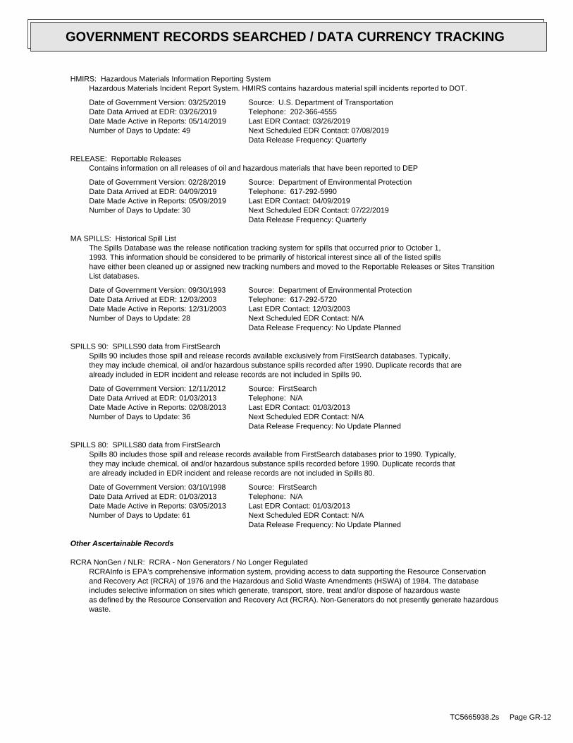
HMIRS: Hazardous Materials Information Reporting SystemHazardous Materials Incident Report System. HMIRS contains hazardous material spill incidents reported to DOT.
Date of Government Version: 03/25/2019Date Data Arrived at EDR: 03/26/2019Date Made Active in Reports: 05/14/2019Number of Days to Update: 49
Source: U.S. Department of TransportationTelephone: 202-366-4555Last EDR Contact: 03/26/2019Next Scheduled EDR Contact: 07/08/2019Data Release Frequency: Quarterly
RELEASE: Reportable ReleasesContains information on all releases of oil and hazardous materials that have been reported to DEP
Date of Government Version: 02/28/2019Date Data Arrived at EDR: 04/09/2019Date Made Active in Reports: 05/09/2019Number of Days to Update: 30
Source: Department of Environmental ProtectionTelephone: 617-292-5990Last EDR Contact: 04/09/2019Next Scheduled EDR Contact: 07/22/2019Data Release Frequency: Quarterly
MA SPILLS: Historical Spill ListThe Spills Database was the release notification tracking system for spills that occurred prior to October 1,1993. This information should be considered to be primarily of historical interest since all of the listed spillshave either been cleaned up or assigned new tracking numbers and moved to the Reportable Releases or Sites TransitionList databases.
Date of Government Version: 09/30/1993Date Data Arrived at EDR: 12/03/2003Date Made Active in Reports: 12/31/2003Number of Days to Update: 28
Source: Department of Environmental ProtectionTelephone: 617-292-5720Last EDR Contact: 12/03/2003Next Scheduled EDR Contact: N/AData Release Frequency: No Update Planned
SPILLS 90: SPILLS90 data from FirstSearchSpills 90 includes those spill and release records available exclusively from FirstSearch databases. Typically,they may include chemical, oil and/or hazardous substance spills recorded after 1990. Duplicate records that arealready included in EDR incident and release records are not included in Spills 90.
Date of Government Version: 12/11/2012Date Data Arrived at EDR: 01/03/2013Date Made Active in Reports: 02/08/2013Number of Days to Update: 36
Source: FirstSearchTelephone: N/ALast EDR Contact: 01/03/2013Next Scheduled EDR Contact: N/AData Release Frequency: No Update Planned
SPILLS 80: SPILLS80 data from FirstSearchSpills 80 includes those spill and release records available from FirstSearch databases prior to 1990. Typically,they may include chemical, oil and/or hazardous substance spills recorded before 1990. Duplicate records thatare already included in EDR incident and release records are not included in Spills 80.
Date of Government Version: 03/10/1998Date Data Arrived at EDR: 01/03/2013Date Made Active in Reports: 03/05/2013Number of Days to Update: 61
Source: FirstSearchTelephone: N/ALast EDR Contact: 01/03/2013Next Scheduled EDR Contact: N/AData Release Frequency: No Update Planned
Other Ascertainable Records
RCRA NonGen / NLR: RCRA - Non Generators / No Longer RegulatedRCRAInfo is EPA’s comprehensive information system, providing access to data supporting the Resource Conservationand Recovery Act (RCRA) of 1976 and the Hazardous and Solid Waste Amendments (HSWA) of 1984. The databaseincludes selective information on sites which generate, transport, store, treat and/or dispose of hazardous wasteas defined by the Resource Conservation and Recovery Act (RCRA). Non-Generators do not presently generate hazardouswaste.
TC5665938.2s Page GR-12
GOVERNMENT RECORDS SEARCHED / DATA CURRENCY TRACKING

Date of Government Version: 03/25/2019Date Data Arrived at EDR: 03/27/2019Date Made Active in Reports: 04/17/2019Number of Days to Update: 21
Source: Environmental Protection AgencyTelephone: (888) 372-7341Last EDR Contact: 03/27/2019Next Scheduled EDR Contact: 07/08/2019Data Release Frequency: Quarterly
FUDS: Formerly Used Defense SitesThe listing includes locations of Formerly Used Defense Sites properties where the US Army Corps of Engineersis actively working or will take necessary cleanup actions.
Date of Government Version: 03/07/2019Date Data Arrived at EDR: 04/03/2019Date Made Active in Reports: 05/23/2019Number of Days to Update: 50
Source: U.S. Army Corps of EngineersTelephone: 202-528-4285Last EDR Contact: 05/21/2019Next Scheduled EDR Contact: 09/02/2019Data Release Frequency: Varies
DOD: Department of Defense SitesThis data set consists of federally owned or administered lands, administered by the Department of Defense, thathave any area equal to or greater than 640 acres of the United States, Puerto Rico, and the U.S. Virgin Islands.
Date of Government Version: 12/31/2005Date Data Arrived at EDR: 11/10/2006Date Made Active in Reports: 01/11/2007Number of Days to Update: 62
Source: USGSTelephone: 888-275-8747Last EDR Contact: 04/12/2019Next Scheduled EDR Contact: 07/22/2019Data Release Frequency: Semi-Annually
FEDLAND: Federal and Indian LandsFederally and Indian administrated lands of the United States. Lands included are administrated by: Army Corpsof Engineers, Bureau of Reclamation, National Wild and Scenic River, National Wildlife Refuge, Public Domain Land,Wilderness, Wilderness Study Area, Wildlife Management Area, Bureau of Indian Affairs, Bureau of Land Management,Department of Justice, Forest Service, Fish and Wildlife Service, National Park Service.
Date of Government Version: 12/31/2005Date Data Arrived at EDR: 02/06/2006Date Made Active in Reports: 01/11/2007Number of Days to Update: 339
Source: U.S. Geological SurveyTelephone: 888-275-8747Last EDR Contact: 04/12/2019Next Scheduled EDR Contact: 07/22/2019Data Release Frequency: N/A
SCRD DRYCLEANERS: State Coalition for Remediation of Drycleaners ListingThe State Coalition for Remediation of Drycleaners was established in 1998, with support from the U.S. EPA Officeof Superfund Remediation and Technology Innovation. It is comprised of representatives of states with establisheddrycleaner remediation programs. Currently the member states are Alabama, Connecticut, Florida, Illinois, Kansas,Minnesota, Missouri, North Carolina, Oregon, South Carolina, Tennessee, Texas, and Wisconsin.
Date of Government Version: 01/01/2017Date Data Arrived at EDR: 02/03/2017Date Made Active in Reports: 04/07/2017Number of Days to Update: 63
Source: Environmental Protection AgencyTelephone: 615-532-8599Last EDR Contact: 05/13/2019Next Scheduled EDR Contact: 08/26/2019Data Release Frequency: Varies
US FIN ASSUR: Financial Assurance InformationAll owners and operators of facilities that treat, store, or dispose of hazardous waste are required to provideproof that they will have sufficient funds to pay for the clean up, closure, and post-closure care of their facilities.
Date of Government Version: 03/25/2019Date Data Arrived at EDR: 03/26/2019Date Made Active in Reports: 05/07/2019Number of Days to Update: 42
Source: Environmental Protection AgencyTelephone: 202-566-1917Last EDR Contact: 03/26/2019Next Scheduled EDR Contact: 07/08/2019Data Release Frequency: Quarterly
TC5665938.2s Page GR-13
GOVERNMENT RECORDS SEARCHED / DATA CURRENCY TRACKING

EPA WATCH LIST: EPA WATCH LISTEPA maintains a "Watch List" to facilitate dialogue between EPA, state and local environmental agencies on enforcementmatters relating to facilities with alleged violations identified as either significant or high priority. Beingon the Watch List does not mean that the facility has actually violated the law only that an investigation byEPA or a state or local environmental agency has led those organizations to allege that an unproven violationhas in fact occurred. Being on the Watch List does not represent a higher level of concern regarding the allegedviolations that were detected, but instead indicates cases requiring additional dialogue between EPA, state andlocal agencies - primarily because of the length of time the alleged violation has gone unaddressed or unresolved.
Date of Government Version: 08/30/2013Date Data Arrived at EDR: 03/21/2014Date Made Active in Reports: 06/17/2014Number of Days to Update: 88
Source: Environmental Protection AgencyTelephone: 617-520-3000Last EDR Contact: 05/06/2019Next Scheduled EDR Contact: 08/19/2019Data Release Frequency: Quarterly
2020 COR ACTION: 2020 Corrective Action Program ListThe EPA has set ambitious goals for the RCRA Corrective Action program by creating the 2020 Corrective ActionUniverse. This RCRA cleanup baseline includes facilities expected to need corrective action. The 2020 universecontains a wide variety of sites. Some properties are heavily contaminated while others were contaminated buthave since been cleaned up. Still others have not been fully investigated yet, and may require little or no remediation.Inclusion in the 2020 Universe does not necessarily imply failure on the part of a facility to meet its RCRA obligations.
Date of Government Version: 09/30/2017Date Data Arrived at EDR: 05/08/2018Date Made Active in Reports: 07/20/2018Number of Days to Update: 73
Source: Environmental Protection AgencyTelephone: 703-308-4044Last EDR Contact: 05/10/2019Next Scheduled EDR Contact: 08/19/2019Data Release Frequency: Varies
TSCA: Toxic Substances Control ActToxic Substances Control Act. TSCA identifies manufacturers and importers of chemical substances included on theTSCA Chemical Substance Inventory list. It includes data on the production volume of these substances by plantsite.
Date of Government Version: 12/31/2016Date Data Arrived at EDR: 06/21/2017Date Made Active in Reports: 01/05/2018Number of Days to Update: 198
Source: EPATelephone: 202-260-5521Last EDR Contact: 03/22/2019Next Scheduled EDR Contact: 07/01/2019Data Release Frequency: Every 4 Years
TRIS: Toxic Chemical Release Inventory SystemToxic Release Inventory System. TRIS identifies facilities which release toxic chemicals to the air, water andland in reportable quantities under SARA Title III Section 313.
Date of Government Version: 12/31/2016Date Data Arrived at EDR: 01/10/2018Date Made Active in Reports: 01/12/2018Number of Days to Update: 2
Source: EPATelephone: 202-566-0250Last EDR Contact: 05/24/2019Next Scheduled EDR Contact: 09/02/2019Data Release Frequency: Annually
SSTS: Section 7 Tracking SystemsSection 7 of the Federal Insecticide, Fungicide and Rodenticide Act, as amended (92 Stat. 829) requires allregistered pesticide-producing establishments to submit a report to the Environmental Protection Agency by March1st each year. Each establishment must report the types and amounts of pesticides, active ingredients and devicesbeing produced, and those having been produced and sold or distributed in the past year.
Date of Government Version: 12/31/2009Date Data Arrived at EDR: 12/10/2010Date Made Active in Reports: 02/25/2011Number of Days to Update: 77
Source: EPATelephone: 202-564-4203Last EDR Contact: 04/24/2019Next Scheduled EDR Contact: 08/05/2019Data Release Frequency: Annually
TC5665938.2s Page GR-14
GOVERNMENT RECORDS SEARCHED / DATA CURRENCY TRACKING

ROD: Records Of DecisionRecord of Decision. ROD documents mandate a permanent remedy at an NPL (Superfund) site containing technicaland health information to aid in the cleanup.
Date of Government Version: 04/11/2019Date Data Arrived at EDR: 04/18/2019Date Made Active in Reports: 05/23/2019Number of Days to Update: 35
Source: EPATelephone: 703-416-0223Last EDR Contact: 04/18/2019Next Scheduled EDR Contact: 06/17/2019Data Release Frequency: Annually
RMP: Risk Management PlansWhen Congress passed the Clean Air Act Amendments of 1990, it required EPA to publish regulations and guidancefor chemical accident prevention at facilities using extremely hazardous substances. The Risk Management ProgramRule (RMP Rule) was written to implement Section 112(r) of these amendments. The rule, which built upon existingindustry codes and standards, requires companies of all sizes that use certain flammable and toxic substancesto develop a Risk Management Program, which includes a(n): Hazard assessment that details the potential effectsof an accidental release, an accident history of the last five years, and an evaluation of worst-case and alternativeaccidental releases; Prevention program that includes safety precautions and maintenance, monitoring, and employeetraining measures; and Emergency response program that spells out emergency health care, employee training measuresand procedures for informing the public and response agencies (e.g the fire department) should an accident occur.
Date of Government Version: 04/25/2019Date Data Arrived at EDR: 05/02/2019Date Made Active in Reports: 05/23/2019Number of Days to Update: 21
Source: Environmental Protection AgencyTelephone: 202-564-8600Last EDR Contact: 04/22/2019Next Scheduled EDR Contact: 08/05/2019Data Release Frequency: Varies
RAATS: RCRA Administrative Action Tracking SystemRCRA Administration Action Tracking System. RAATS contains records based on enforcement actions issued under RCRApertaining to major violators and includes administrative and civil actions brought by the EPA. For administrationactions after September 30, 1995, data entry in the RAATS database was discontinued. EPA will retain a copy ofthe database for historical records. It was necessary to terminate RAATS because a decrease in agency resourcesmade it impossible to continue to update the information contained in the database.
Date of Government Version: 04/17/1995Date Data Arrived at EDR: 07/03/1995Date Made Active in Reports: 08/07/1995Number of Days to Update: 35
Source: EPATelephone: 202-564-4104Last EDR Contact: 06/02/2008Next Scheduled EDR Contact: 09/01/2008Data Release Frequency: No Update Planned
PRP: Potentially Responsible PartiesA listing of verified Potentially Responsible Parties
Date of Government Version: 04/11/2019Date Data Arrived at EDR: 04/18/2019Date Made Active in Reports: 05/23/2019Number of Days to Update: 35
Source: EPATelephone: 202-564-6023Last EDR Contact: 05/10/2019Next Scheduled EDR Contact: 08/19/2019Data Release Frequency: Quarterly
PADS: PCB Activity Database SystemPCB Activity Database. PADS Identifies generators, transporters, commercial storers and/or brokers and disposersof PCB’s who are required to notify the EPA of such activities.
Date of Government Version: 03/20/2019Date Data Arrived at EDR: 04/10/2019Date Made Active in Reports: 05/14/2019Number of Days to Update: 34
Source: EPATelephone: 202-566-0500Last EDR Contact: 04/10/2019Next Scheduled EDR Contact: 07/22/2019Data Release Frequency: Annually
TC5665938.2s Page GR-15
GOVERNMENT RECORDS SEARCHED / DATA CURRENCY TRACKING

ICIS: Integrated Compliance Information SystemThe Integrated Compliance Information System (ICIS) supports the information needs of the national enforcementand compliance program as well as the unique needs of the National Pollutant Discharge Elimination System (NPDES)program.
Date of Government Version: 11/18/2016Date Data Arrived at EDR: 11/23/2016Date Made Active in Reports: 02/10/2017Number of Days to Update: 79
Source: Environmental Protection AgencyTelephone: 202-564-2501Last EDR Contact: 04/08/2019Next Scheduled EDR Contact: 07/22/2019Data Release Frequency: Quarterly
FTTS: FIFRA/ TSCA Tracking System - FIFRA (Federal Insecticide, Fungicide, & Rodenticide Act)/TSCA (Toxic Substances Control Act)FTTS tracks administrative cases and pesticide enforcement actions and compliance activities related to FIFRA,TSCA and EPCRA (Emergency Planning and Community Right-to-Know Act). To maintain currency, EDR contacts theAgency on a quarterly basis.
Date of Government Version: 04/09/2009Date Data Arrived at EDR: 04/16/2009Date Made Active in Reports: 05/11/2009Number of Days to Update: 25
Source: EPA/Office of Prevention, Pesticides and Toxic SubstancesTelephone: 202-566-1667Last EDR Contact: 08/18/2017Next Scheduled EDR Contact: 12/04/2017Data Release Frequency: Quarterly
FTTS INSP: FIFRA/ TSCA Tracking System - FIFRA (Federal Insecticide, Fungicide, & Rodenticide Act)/TSCA (Toxic Substances Control Act)A listing of FIFRA/TSCA Tracking System (FTTS) inspections and enforcements.
Date of Government Version: 04/09/2009Date Data Arrived at EDR: 04/16/2009Date Made Active in Reports: 05/11/2009Number of Days to Update: 25
Source: EPATelephone: 202-566-1667Last EDR Contact: 08/18/2017Next Scheduled EDR Contact: 12/04/2017Data Release Frequency: Quarterly
MLTS: Material Licensing Tracking SystemMLTS is maintained by the Nuclear Regulatory Commission and contains a list of approximately 8,100 sites whichpossess or use radioactive materials and which are subject to NRC licensing requirements. To maintain currency,EDR contacts the Agency on a quarterly basis.
Date of Government Version: 08/30/2016Date Data Arrived at EDR: 09/08/2016Date Made Active in Reports: 10/21/2016Number of Days to Update: 43
Source: Nuclear Regulatory CommissionTelephone: 301-415-7169Last EDR Contact: 04/22/2019Next Scheduled EDR Contact: 08/05/2019Data Release Frequency: Quarterly
COAL ASH DOE: Steam-Electric Plant Operation DataA listing of power plants that store ash in surface ponds.
Date of Government Version: 12/31/2005Date Data Arrived at EDR: 08/07/2009Date Made Active in Reports: 10/22/2009Number of Days to Update: 76
Source: Department of EnergyTelephone: 202-586-8719Last EDR Contact: 03/07/2019Next Scheduled EDR Contact: 06/17/2019Data Release Frequency: Varies
COAL ASH EPA: Coal Combustion Residues Surface Impoundments ListA listing of coal combustion residues surface impoundments with high hazard potential ratings.
Date of Government Version: 07/01/2014Date Data Arrived at EDR: 09/10/2014Date Made Active in Reports: 10/20/2014Number of Days to Update: 40
Source: Environmental Protection AgencyTelephone: N/ALast EDR Contact: 03/05/2019Next Scheduled EDR Contact: 06/17/2019Data Release Frequency: Varies
TC5665938.2s Page GR-16
GOVERNMENT RECORDS SEARCHED / DATA CURRENCY TRACKING

PCB TRANSFORMER: PCB Transformer Registration DatabaseThe database of PCB transformer registrations that includes all PCB registration submittals.
Date of Government Version: 05/24/2017Date Data Arrived at EDR: 11/30/2017Date Made Active in Reports: 12/15/2017Number of Days to Update: 15
Source: Environmental Protection AgencyTelephone: 202-566-0517Last EDR Contact: 04/26/2019Next Scheduled EDR Contact: 08/05/2019Data Release Frequency: Varies
RADINFO: Radiation Information DatabaseThe Radiation Information Database (RADINFO) contains information about facilities that are regulated by U.S.Environmental Protection Agency (EPA) regulations for radiation and radioactivity.
Date of Government Version: 04/02/2019Date Data Arrived at EDR: 04/02/2019Date Made Active in Reports: 05/14/2019Number of Days to Update: 42
Source: Environmental Protection AgencyTelephone: 202-343-9775Last EDR Contact: 04/02/2019Next Scheduled EDR Contact: 07/15/2019Data Release Frequency: Quarterly
HIST FTTS: FIFRA/TSCA Tracking System Administrative Case ListingA complete administrative case listing from the FIFRA/TSCA Tracking System (FTTS) for all ten EPA regions. Theinformation was obtained from the National Compliance Database (NCDB). NCDB supports the implementation of FIFRA(Federal Insecticide, Fungicide, and Rodenticide Act) and TSCA (Toxic Substances Control Act). Some EPA regionsare now closing out records. Because of that, and the fact that some EPA regions are not providing EPA Headquarterswith updated records, it was decided to create a HIST FTTS database. It included records that may not be includedin the newer FTTS database updates. This database is no longer updated.
Date of Government Version: 10/19/2006Date Data Arrived at EDR: 03/01/2007Date Made Active in Reports: 04/10/2007Number of Days to Update: 40
Source: Environmental Protection AgencyTelephone: 202-564-2501Last EDR Contact: 12/17/2007Next Scheduled EDR Contact: 03/17/2008Data Release Frequency: No Update Planned
HIST FTTS INSP: FIFRA/TSCA Tracking System Inspection & Enforcement Case ListingA complete inspection and enforcement case listing from the FIFRA/TSCA Tracking System (FTTS) for all ten EPAregions. The information was obtained from the National Compliance Database (NCDB). NCDB supports the implementationof FIFRA (Federal Insecticide, Fungicide, and Rodenticide Act) and TSCA (Toxic Substances Control Act). SomeEPA regions are now closing out records. Because of that, and the fact that some EPA regions are not providingEPA Headquarters with updated records, it was decided to create a HIST FTTS database. It included records thatmay not be included in the newer FTTS database updates. This database is no longer updated.
Date of Government Version: 10/19/2006Date Data Arrived at EDR: 03/01/2007Date Made Active in Reports: 04/10/2007Number of Days to Update: 40
Source: Environmental Protection AgencyTelephone: 202-564-2501Last EDR Contact: 12/17/2008Next Scheduled EDR Contact: 03/17/2008Data Release Frequency: No Update Planned
DOT OPS: Incident and Accident DataDepartment of Transporation, Office of Pipeline Safety Incident and Accident data.
Date of Government Version: 12/03/2018Date Data Arrived at EDR: 01/29/2019Date Made Active in Reports: 03/21/2019Number of Days to Update: 51
Source: Department of Transporation, Office of Pipeline SafetyTelephone: 202-366-4595Last EDR Contact: 04/30/2019Next Scheduled EDR Contact: 08/12/2019Data Release Frequency: Quarterly
CONSENT: Superfund (CERCLA) Consent DecreesMajor legal settlements that establish responsibility and standards for cleanup at NPL (Superfund) sites. Releasedperiodically by United States District Courts after settlement by parties to litigation matters.
TC5665938.2s Page GR-17
GOVERNMENT RECORDS SEARCHED / DATA CURRENCY TRACKING

Date of Government Version: 03/31/2019Date Data Arrived at EDR: 04/23/2019Date Made Active in Reports: 05/23/2019Number of Days to Update: 30
Source: Department of Justice, Consent Decree LibraryTelephone: VariesLast EDR Contact: 04/05/2019Next Scheduled EDR Contact: 07/22/2019Data Release Frequency: Varies
BRS: Biennial Reporting SystemThe Biennial Reporting System is a national system administered by the EPA that collects data on the generationand management of hazardous waste. BRS captures detailed data from two groups: Large Quantity Generators (LQG)and Treatment, Storage, and Disposal Facilities.
Date of Government Version: 12/31/2015Date Data Arrived at EDR: 02/22/2017Date Made Active in Reports: 09/28/2017Number of Days to Update: 218
Source: EPA/NTISTelephone: 800-424-9346Last EDR Contact: 05/24/2019Next Scheduled EDR Contact: 09/02/2019Data Release Frequency: Biennially
INDIAN RESERV: Indian ReservationsThis map layer portrays Indian administered lands of the United States that have any area equal to or greaterthan 640 acres.
Date of Government Version: 12/31/2014Date Data Arrived at EDR: 07/14/2015Date Made Active in Reports: 01/10/2017Number of Days to Update: 546
Source: USGSTelephone: 202-208-3710Last EDR Contact: 04/11/2019Next Scheduled EDR Contact: 07/22/2019Data Release Frequency: Semi-Annually
FUSRAP: Formerly Utilized Sites Remedial Action ProgramDOE established the Formerly Utilized Sites Remedial Action Program (FUSRAP) in 1974 to remediate sites whereradioactive contamination remained from Manhattan Project and early U.S. Atomic Energy Commission (AEC) operations.
Date of Government Version: 08/08/2017Date Data Arrived at EDR: 09/11/2018Date Made Active in Reports: 09/14/2018Number of Days to Update: 3
Source: Department of EnergyTelephone: 202-586-3559Last EDR Contact: 05/02/2019Next Scheduled EDR Contact: 08/19/2019Data Release Frequency: Varies
UMTRA: Uranium Mill Tailings SitesUranium ore was mined by private companies for federal government use in national defense programs. When the millsshut down, large piles of the sand-like material (mill tailings) remain after uranium has been extracted fromthe ore. Levels of human exposure to radioactive materials from the piles are low; however, in some cases tailingswere used as construction materials before the potential health hazards of the tailings were recognized.
Date of Government Version: 06/23/2017Date Data Arrived at EDR: 10/11/2017Date Made Active in Reports: 11/03/2017Number of Days to Update: 23
Source: Department of EnergyTelephone: 505-845-0011Last EDR Contact: 05/24/2019Next Scheduled EDR Contact: 09/02/2019Data Release Frequency: Varies
LEAD SMELTER 1: Lead Smelter SitesA listing of former lead smelter site locations.
Date of Government Version: 04/11/2019Date Data Arrived at EDR: 04/18/2019Date Made Active in Reports: 05/14/2019Number of Days to Update: 26
Source: Environmental Protection AgencyTelephone: 703-603-8787Last EDR Contact: 04/18/2019Next Scheduled EDR Contact: 07/15/2019Data Release Frequency: Varies
LEAD SMELTER 2: Lead Smelter SitesA list of several hundred sites in the U.S. where secondary lead smelting was done from 1931and 1964. These sitesmay pose a threat to public health through ingestion or inhalation of contaminated soil or dust
TC5665938.2s Page GR-18
GOVERNMENT RECORDS SEARCHED / DATA CURRENCY TRACKING

Date of Government Version: 04/05/2001Date Data Arrived at EDR: 10/27/2010Date Made Active in Reports: 12/02/2010Number of Days to Update: 36
Source: American Journal of Public HealthTelephone: 703-305-6451Last EDR Contact: 12/02/2009Next Scheduled EDR Contact: N/AData Release Frequency: No Update Planned
US AIRS (AFS): Aerometric Information Retrieval System Facility Subsystem (AFS)The database is a sub-system of Aerometric Information Retrieval System (AIRS). AFS contains compliance dataon air pollution point sources regulated by the U.S. EPA and/or state and local air regulatory agencies. Thisinformation comes from source reports by various stationary sources of air pollution, such as electric power plants,steel mills, factories, and universities, and provides information about the air pollutants they produce. Action,air program, air program pollutant, and general level plant data. It is used to track emissions and compliancedata from industrial plants.
Date of Government Version: 10/12/2016Date Data Arrived at EDR: 10/26/2016Date Made Active in Reports: 02/03/2017Number of Days to Update: 100
Source: EPATelephone: 202-564-2496Last EDR Contact: 09/26/2017Next Scheduled EDR Contact: 01/08/2018Data Release Frequency: Annually
US AIRS MINOR: Air Facility System DataA listing of minor source facilities.
Date of Government Version: 10/12/2016Date Data Arrived at EDR: 10/26/2016Date Made Active in Reports: 02/03/2017Number of Days to Update: 100
Source: EPATelephone: 202-564-2496Last EDR Contact: 09/26/2017Next Scheduled EDR Contact: 01/08/2018Data Release Frequency: Annually
US MINES: Mines Master Index FileContains all mine identification numbers issued for mines active or opened since 1971. The data also includesviolation information.
Date of Government Version: 11/27/2018Date Data Arrived at EDR: 02/27/2019Date Made Active in Reports: 04/01/2019Number of Days to Update: 33
Source: Department of Labor, Mine Safety and Health AdministrationTelephone: 303-231-5959Last EDR Contact: 02/27/2019Next Scheduled EDR Contact: 06/10/2019Data Release Frequency: Semi-Annually
US MINES 2: Ferrous and Nonferrous Metal Mines Database ListingThis map layer includes ferrous (ferrous metal mines are facilities that extract ferrous metals, such as ironore or molybdenum) and nonferrous (Nonferrous metal mines are facilities that extract nonferrous metals, suchas gold, silver, copper, zinc, and lead) metal mines in the United States.
Date of Government Version: 12/05/2005Date Data Arrived at EDR: 02/29/2008Date Made Active in Reports: 04/18/2008Number of Days to Update: 49
Source: USGSTelephone: 703-648-7709Last EDR Contact: 03/01/2019Next Scheduled EDR Contact: 06/10/2019Data Release Frequency: Varies
US MINES 3: Active Mines & Mineral Plants Database ListingActive Mines and Mineral Processing Plant operations for commodities monitored by the Minerals Information Teamof the USGS.
Date of Government Version: 04/14/2011Date Data Arrived at EDR: 06/08/2011Date Made Active in Reports: 09/13/2011Number of Days to Update: 97
Source: USGSTelephone: 703-648-7709Last EDR Contact: 03/01/2019Next Scheduled EDR Contact: 06/10/2019Data Release Frequency: Varies
TC5665938.2s Page GR-19
GOVERNMENT RECORDS SEARCHED / DATA CURRENCY TRACKING

ABANDONED MINES: Abandoned MinesAn inventory of land and water impacted by past mining (primarily coal mining) is maintained by OSMRE to provideinformation needed to implement the Surface Mining Control and Reclamation Act of 1977 (SMCRA). The inventorycontains information on the location, type, and extent of AML impacts, as well as, information on the cost associatedwith the reclamation of those problems. The inventory is based upon field surveys by State, Tribal, and OSMREprogram officials. It is dynamic to the extent that it is modified as new problems are identified and existingproblems are reclaimed.
Date of Government Version: 03/27/2019Date Data Arrived at EDR: 03/28/2019Date Made Active in Reports: 05/01/2019Number of Days to Update: 34
Source: Department of InteriorTelephone: 202-208-2609Last EDR Contact: 03/21/2019Next Scheduled EDR Contact: 06/24/2019Data Release Frequency: Quarterly
FINDS: Facility Index System/Facility Registry SystemFacility Index System. FINDS contains both facility information and ’pointers’ to other sources that contain moredetail. EDR includes the following FINDS databases in this report: PCS (Permit Compliance System), AIRS (AerometricInformation Retrieval System), DOCKET (Enforcement Docket used to manage and track information on civil judicialenforcement cases for all environmental statutes), FURS (Federal Underground Injection Control), C-DOCKET (CriminalDocket System used to track criminal enforcement actions for all environmental statutes), FFIS (Federal FacilitiesInformation System), STATE (State Environmental Laws and Statutes), and PADS (PCB Activity Data System).
Date of Government Version: 02/15/2019Date Data Arrived at EDR: 03/05/2019Date Made Active in Reports: 03/15/2019Number of Days to Update: 10
Source: EPATelephone: (617) 918-1111Last EDR Contact: 03/05/2019Next Scheduled EDR Contact: 06/17/2019Data Release Frequency: Quarterly
ECHO: Enforcement & Compliance History InformationECHO provides integrated compliance and enforcement information for about 800,000 regulated facilities nationwide.
Date of Government Version: 04/07/2019Date Data Arrived at EDR: 04/09/2019Date Made Active in Reports: 05/23/2019Number of Days to Update: 44
Source: Environmental Protection AgencyTelephone: 202-564-2280Last EDR Contact: 04/09/2019Next Scheduled EDR Contact: 07/22/2019Data Release Frequency: Quarterly
DOCKET HWC: Hazardous Waste Compliance Docket ListingA complete list of the Federal Agency Hazardous Waste Compliance Docket Facilities.
Date of Government Version: 05/31/2018Date Data Arrived at EDR: 07/26/2018Date Made Active in Reports: 10/05/2018Number of Days to Update: 71
Source: Environmental Protection AgencyTelephone: 202-564-0527Last EDR Contact: 05/24/2019Next Scheduled EDR Contact: 09/09/2019Data Release Frequency: Varies
UXO: Unexploded Ordnance SitesA listing of unexploded ordnance site locations
Date of Government Version: 12/31/2017Date Data Arrived at EDR: 01/17/2019Date Made Active in Reports: 04/01/2019Number of Days to Update: 74
Source: Department of DefenseTelephone: 703-704-1564Last EDR Contact: 04/15/2019Next Scheduled EDR Contact: 07/29/2019Data Release Frequency: Varies
FUELS PROGRAM: EPA Fuels Program Registered ListingThis listing includes facilities that are registered under the Part 80 (Code of Federal Regulations) EPA FuelsPrograms. All companies now are required to submit new and updated registrations.
TC5665938.2s Page GR-20
GOVERNMENT RECORDS SEARCHED / DATA CURRENCY TRACKING

Date of Government Version: 02/19/2019Date Data Arrived at EDR: 02/21/2019Date Made Active in Reports: 04/01/2019Number of Days to Update: 39
Source: EPATelephone: 800-385-6164Last EDR Contact: 05/21/2019Next Scheduled EDR Contact: 09/02/2019Data Release Frequency: Quarterly
AIRS: Permitted Facilities ListingA listing of Air Quality permit applications.
Date of Government Version: 04/18/2019Date Data Arrived at EDR: 04/19/2019Date Made Active in Reports: 05/10/2019Number of Days to Update: 21
Source: Department of Environmental ProtectionTelephone: 617-292-5789Last EDR Contact: 04/15/2019Next Scheduled EDR Contact: 07/29/2019Data Release Frequency: Varies
ASBESTOS: Asbestos Notification ListingAsbestos sites
Date of Government Version: 12/19/2018Date Data Arrived at EDR: 12/20/2018Date Made Active in Reports: 02/11/2019Number of Days to Update: 53
Source: Department of Environmental ProtectionTelephone: 617-292-5982Last EDR Contact: 05/09/2019Next Scheduled EDR Contact: 09/02/2019Data Release Frequency: Varies
DRYCLEANERS: Regulated Drycleaning FacilitiesA listing of Department of Environmental Protection regulated drycleaning facilities that use perchloroethyleneunder the Environmental Results Program.
Date of Government Version: 12/27/2018Date Data Arrived at EDR: 01/17/2019Date Made Active in Reports: 02/11/2019Number of Days to Update: 25
Source: Department of Environmental ProtectionTelephone: 617-292-5633Last EDR Contact: 04/15/2019Next Scheduled EDR Contact: 07/29/2019Data Release Frequency: Varies
ENFORCEMENT: Enforcement Action CasesA listing of enforcement action cases tracked by Department of Environmental Protection programs, including SolidWaste and Hazardous Waste.
Date of Government Version: 01/28/2019Date Data Arrived at EDR: 01/29/2019Date Made Active in Reports: 02/11/2019Number of Days to Update: 13
Source: Department of Environmental QualityTelephone: 617-292-5979Last EDR Contact: 04/26/2019Next Scheduled EDR Contact: 08/12/2019Data Release Frequency: Varies
Financial Assurance 1: Financial Assurance Information ListingInformation for hazardous waste facilities. Financial assurance is intended to ensure that resources are availableto pay for the cost of closure, post-closure care, and corrective measures if the owner or operator of a regulatedfacility is unable or unwilling to pay.
Date of Government Version: 12/01/2010Date Data Arrived at EDR: 12/23/2010Date Made Active in Reports: 02/03/2011Number of Days to Update: 42
Source: Department of Environmental ProtectionTelephone: 617-292-5970Last EDR Contact: 03/11/2019Next Scheduled EDR Contact: 06/24/2019Data Release Frequency: Varies
Financial Assurance 2: Financial Assurance Information ListingA listing of financial assurance information for underground storage tanks. Financial assurance is intended toensure that resources are available to pay for the cost of closure, post-closure care, and corrective measuresif the owner or operator of a regulated facility is unable or unwilling to pay.
TC5665938.2s Page GR-21
GOVERNMENT RECORDS SEARCHED / DATA CURRENCY TRACKING

Date of Government Version: 07/11/2018Date Data Arrived at EDR: 07/17/2018Date Made Active in Reports: 09/05/2018Number of Days to Update: 50
Source: Office of State Fire MarshalTelephone: 978-567-3100Last EDR Contact: 05/13/2019Next Scheduled EDR Contact: 07/29/2019Data Release Frequency: Varies
Financial Assurance 3: Financial Assurance Information listingInformation for solid waste facilities. Financial assurance is intended to ensure that resources are availableto pay for the cost of closure, post-closure care, and corrective measures if the owner or operator of a regulatedfacility is unable or unwilling to pay
Date of Government Version: 01/16/2018Date Data Arrived at EDR: 04/17/2018Date Made Active in Reports: 06/15/2018Number of Days to Update: 59
Source: Department of Environmental ProtectionTelephone: 617-292-5970Last EDR Contact: 04/08/2019Next Scheduled EDR Contact: 07/22/2019Data Release Frequency: Varies
GWDP: Ground Water Discharge PermitsThe Ground Water Discharge Permits datalayer (formerly known as Groundwater Discharge Points) is a statewidepoint dataset containing approximate locations of permitted discharges to groundwater.
Date of Government Version: 01/10/2019Date Data Arrived at EDR: 01/30/2019Date Made Active in Reports: 02/11/2019Number of Days to Update: 12
Source: MassGISTelephone: 617-556-1150Last EDR Contact: 05/03/2019Next Scheduled EDR Contact: 08/12/2019Data Release Frequency: Varies
HW GEN: List of Massachusetts Hazardous Waste GeneratorsPermanent generator identification numbers for all Massachusetts generators of hazardous waste and waste oil thathave registered with or notified MassDEP of their hazardous waste activities.
Date of Government Version: 03/21/2019Date Data Arrived at EDR: 03/27/2019Date Made Active in Reports: 05/09/2019Number of Days to Update: 43
Source: Department of Environmental ProtectionTelephone: 617-292-5500Last EDR Contact: 03/27/2019Next Scheduled EDR Contact: 07/08/2019Data Release Frequency: Semi-Annually
MERCURY: Mercury Product Recyling Drop-Off Locations ListingA listing of locations, collecting and recycling for mercury-added products. Mercury is toxic to the human nervoussystem, as well as fish and animals. Mercury can enter the body either through skin absorption or through inhalationof mercury vapors. At room temperature, small beads of mercury will vaporize.
Date of Government Version: 05/07/2018Date Data Arrived at EDR: 05/25/2018Date Made Active in Reports: 06/25/2018Number of Days to Update: 31
Source: Department of Environmental ProtectionTelephone: 617-292-5632Last EDR Contact: 05/16/2019Next Scheduled EDR Contact: 09/02/2019Data Release Frequency: Varies
NPDES: NPDES Permit ListingListing of treatment plants in Massachusetts that hold permits to discharge to groundwater.
Date of Government Version: 11/14/2018Date Data Arrived at EDR: 11/15/2018Date Made Active in Reports: 12/17/2018Number of Days to Update: 32
Source: Department of Environmental ProtectionTelephone: 508-767-2781Last EDR Contact: 05/17/2019Next Scheduled EDR Contact: 08/26/2019Data Release Frequency: Varies
TIER 2: Tier 2 Information ListingA listing of facilities which store or manufacture hazardous materials and submit a chemical inventory report
TC5665938.2s Page GR-22
GOVERNMENT RECORDS SEARCHED / DATA CURRENCY TRACKING

Date of Government Version: 12/31/2017Date Data Arrived at EDR: 05/17/2018Date Made Active in Reports: 06/29/2018Number of Days to Update: 43
Source: Massachusetts Emergency Management AgencyTelephone: 508-820-2019Last EDR Contact: 04/15/2019Next Scheduled EDR Contact: 07/29/2019Data Release Frequency: Annually
TSD: TSD FacilityList of Licensed Hazardous Waste Treatment, Storage Disposal Facilities (TSDFs) in Massachusetts.
Date of Government Version: 03/26/2019Date Data Arrived at EDR: 03/28/2019Date Made Active in Reports: 05/09/2019Number of Days to Update: 42
Source: Department of Environmental ProtectionTelephone: 617-292-5580Last EDR Contact: 03/26/2019Next Scheduled EDR Contact: 07/08/2019Data Release Frequency: Varies
UIC: Underground Injection Control ListingA list of UIC registration data and their locations
Date of Government Version: 03/21/2019Date Data Arrived at EDR: 03/22/2019Date Made Active in Reports: 05/22/2019Number of Days to Update: 61
Source: Department of Environmental ProtectionTelephone: 617-566-1172Last EDR Contact: 05/10/2019Next Scheduled EDR Contact: 08/26/2019Data Release Frequency: Varies
EDR HIGH RISK HISTORICAL RECORDS
EDR Exclusive Records
EDR MGP: EDR Proprietary Manufactured Gas PlantsThe EDR Proprietary Manufactured Gas Plant Database includes records of coal gas plants (manufactured gas plants)compiled by EDR’s researchers. Manufactured gas sites were used in the United States from the 1800’s to 1950’sto produce a gas that could be distributed and used as fuel. These plants used whale oil, rosin, coal, or a mixtureof coal, oil, and water that also produced a significant amount of waste. Many of the byproducts of the gas production,such as coal tar (oily waste containing volatile and non-volatile chemicals), sludges, oils and other compoundsare potentially hazardous to human health and the environment. The byproduct from this process was frequentlydisposed of directly at the plant site and can remain or spread slowly, serving as a continuous source of soiland groundwater contamination.
Date of Government Version: N/ADate Data Arrived at EDR: N/ADate Made Active in Reports: N/ANumber of Days to Update: N/A
Source: EDR, Inc.Telephone: N/ALast EDR Contact: N/ANext Scheduled EDR Contact: N/AData Release Frequency: No Update Planned
EDR Hist Auto: EDR Exclusive Historical Auto StationsEDR has searched selected national collections of business directories and has collected listings of potentialgas station/filling station/service station sites that were available to EDR researchers. EDR’s review was limitedto those categories of sources that might, in EDR’s opinion, include gas station/filling station/service stationestablishments. The categories reviewed included, but were not limited to gas, gas station, gasoline station,filling station, auto, automobile repair, auto service station, service station, etc. This database falls withina category of information EDR classifies as "High Risk Historical Records", or HRHR. EDR’s HRHR effort presentsunique and sometimes proprietary data about past sites and operations that typically create environmental concerns,but may not show up in current government records searches.
Date of Government Version: N/ADate Data Arrived at EDR: N/ADate Made Active in Reports: N/ANumber of Days to Update: N/A
Source: EDR, Inc.Telephone: N/ALast EDR Contact: N/ANext Scheduled EDR Contact: N/AData Release Frequency: Varies
TC5665938.2s Page GR-23
GOVERNMENT RECORDS SEARCHED / DATA CURRENCY TRACKING

EDR Hist Cleaner: EDR Exclusive Historical CleanersEDR has searched selected national collections of business directories and has collected listings of potentialdry cleaner sites that were available to EDR researchers. EDR’s review was limited to those categories of sourcesthat might, in EDR’s opinion, include dry cleaning establishments. The categories reviewed included, but werenot limited to dry cleaners, cleaners, laundry, laundromat, cleaning/laundry, wash & dry etc. This database fallswithin a category of information EDR classifies as "High Risk Historical Records", or HRHR. EDR’s HRHR effortpresents unique and sometimes proprietary data about past sites and operations that typically create environmentalconcerns, but may not show up in current government records searches.
Date of Government Version: N/ADate Data Arrived at EDR: N/ADate Made Active in Reports: N/ANumber of Days to Update: N/A
Source: EDR, Inc.Telephone: N/ALast EDR Contact: N/ANext Scheduled EDR Contact: N/AData Release Frequency: Varies
EDR RECOVERED GOVERNMENT ARCHIVES
Exclusive Recovered Govt. Archives
RGA HWS: Recovered Government Archive State Hazardous Waste Facilities ListThe EDR Recovered Government Archive State Hazardous Waste database provides a list of SHWS incidents derivedfrom historical databases and includes many records that no longer appear in current government lists. Compiledfrom Records formerly available from the Department of Environmental Protection in Massachusetts.
Date of Government Version: N/ADate Data Arrived at EDR: 07/01/2013Date Made Active in Reports: 12/24/2013Number of Days to Update: 176
Source: Department of Environmental ProtectionTelephone: N/ALast EDR Contact: 06/01/2012Next Scheduled EDR Contact: N/AData Release Frequency: Varies
RGA LUST: Recovered Government Archive Leaking Underground Storage TankThe EDR Recovered Government Archive Leaking Underground Storage Tank database provides a list of LUST incidentsderived from historical databases and includes many records that no longer appear in current government lists.Compiled from Records formerly available from the Department of Environmental Protection in Massachusetts.
Date of Government Version: N/ADate Data Arrived at EDR: 07/01/2013Date Made Active in Reports: 12/24/2013Number of Days to Update: 176
Source: Department of Environmental ProtectionTelephone: N/ALast EDR Contact: 06/01/2012Next Scheduled EDR Contact: N/AData Release Frequency: Varies
OTHER DATABASE(S)
Depending on the geographic area covered by this report, the data provided in these specialty databases may or may not becomplete. For example, the existence of wetlands information data in a specific report does not mean that all wetlands in thearea covered by the report are included. Moreover, the absence of any reported wetlands information does not necessarilymean that wetlands do not exist in the area covered by the report.
CT MANIFEST: Hazardous Waste Manifest DataFacility and manifest data. Manifest is a document that lists and tracks hazardous waste from the generator throughtransporters to a tsd facility.
Date of Government Version: 02/11/2019Date Data Arrived at EDR: 02/12/2019Date Made Active in Reports: 03/04/2019Number of Days to Update: 20
Source: Department of Energy & Environmental ProtectionTelephone: 860-424-3375Last EDR Contact: 05/14/2019Next Scheduled EDR Contact: 08/26/2019Data Release Frequency: No Update Planned
TC5665938.2s Page GR-24
GOVERNMENT RECORDS SEARCHED / DATA CURRENCY TRACKING

NJ MANIFEST: Manifest InformationHazardous waste manifest information.
Date of Government Version: 12/31/2018Date Data Arrived at EDR: 04/10/2019Date Made Active in Reports: 05/16/2019Number of Days to Update: 36
Source: Department of Environmental ProtectionTelephone: N/ALast EDR Contact: 04/10/2019Next Scheduled EDR Contact: 07/22/2019Data Release Frequency: Annually
NY MANIFEST: Facility and Manifest DataManifest is a document that lists and tracks hazardous waste from the generator through transporters to a TSDfacility.
Date of Government Version: 01/01/2019Date Data Arrived at EDR: 01/30/2019Date Made Active in Reports: 02/14/2019Number of Days to Update: 15
Source: Department of Environmental ConservationTelephone: 518-402-8651Last EDR Contact: 05/01/2019Next Scheduled EDR Contact: 08/12/2019Data Release Frequency: Quarterly
PA MANIFEST: Manifest InformationHazardous waste manifest information.
Date of Government Version: 12/31/2017Date Data Arrived at EDR: 10/23/2018Date Made Active in Reports: 11/27/2018Number of Days to Update: 35
Source: Department of Environmental ProtectionTelephone: 717-783-8990Last EDR Contact: 04/15/2019Next Scheduled EDR Contact: 07/29/2019Data Release Frequency: Annually
RI MANIFEST: Manifest informationHazardous waste manifest information
Date of Government Version: 12/31/2017Date Data Arrived at EDR: 02/23/2018Date Made Active in Reports: 04/09/2018Number of Days to Update: 45
Source: Department of Environmental ManagementTelephone: 401-222-2797Last EDR Contact: 05/17/2019Next Scheduled EDR Contact: 09/02/2019Data Release Frequency: Annually
VT MANIFEST: Hazardous Waste Manifest DataHazardous waste manifest information.
Date of Government Version: 01/16/2019Date Data Arrived at EDR: 01/17/2019Date Made Active in Reports: 02/19/2019Number of Days to Update: 33
Source: Department of Environmental ConservationTelephone: 802-241-3443Last EDR Contact: 04/15/2019Next Scheduled EDR Contact: 07/29/2019Data Release Frequency: Annually
WI MANIFEST: Manifest InformationHazardous waste manifest information.
Date of Government Version: 12/31/2017Date Data Arrived at EDR: 06/15/2018Date Made Active in Reports: 07/09/2018Number of Days to Update: 24
Source: Department of Natural ResourcesTelephone: N/ALast EDR Contact: 03/11/2019Next Scheduled EDR Contact: 06/24/2019Data Release Frequency: Annually
Oil/Gas PipelinesSource: PennWell CorporationPetroleum Bundle (Crude Oil, Refined Products, Petrochemicals, Gas Liquids (LPG/NGL), and SpecialtyGases (Miscellaneous)) N = Natural Gas Bundle (Natural Gas, Gas Liquids (LPG/NGL), and Specialty Gases(Miscellaneous)). This map includes information copyrighted by PennWell Corporation. This informationis provided on a best effort basis and PennWell Corporation does not guarantee its accuracy nor warrantits fitness for any particular purpose. Such information has been reprinted with the permission of PennWell.
Electric Power Transmission Line DataSource: PennWell CorporationThis map includes information copyrighted by PennWell Corporation. This information is provided on a besteffort basis and PennWell Corporation does not guarantee its accuracy nor warrant its fitness for anyparticular purpose. Such information has been reprinted with the permission of PennWell.
TC5665938.2s Page GR-25
GOVERNMENT RECORDS SEARCHED / DATA CURRENCY TRACKING

Sensitive Receptors: There are individuals deemed sensitive receptors due to their fragile immune systems and special sensitivityto environmental discharges. These sensitive receptors typically include the elderly, the sick, and children. While the location of allsensitive receptors cannot be determined, EDR indicates those buildings and facilities - schools, daycares, hospitals, medical centers,and nursing homes - where individuals who are sensitive receptors are likely to be located.
AHA Hospitals:Source: American Hospital Association, Inc.Telephone: 312-280-5991The database includes a listing of hospitals based on the American Hospital Association’s annual survey of hospitals.
Medical Centers: Provider of Services ListingSource: Centers for Medicare & Medicaid ServicesTelephone: 410-786-3000A listing of hospitals with Medicare provider number, produced by Centers of Medicare & Medicaid Services,a federal agency within the U.S. Department of Health and Human Services.
Nursing HomesSource: National Institutes of HealthTelephone: 301-594-6248Information on Medicare and Medicaid certified nursing homes in the United States.
Public SchoolsSource: National Center for Education StatisticsTelephone: 202-502-7300The National Center for Education Statistics’ primary database on elementaryand secondary public education in the United States. It is a comprehensive, annual, national statisticaldatabase of all public elementary and secondary schools and school districts, which contains data that arecomparable across all states.
Private SchoolsSource: National Center for Education StatisticsTelephone: 202-502-7300The National Center for Education Statistics’ primary database on private school locations in the United States.
Flood Zone Data: This data was obtained from the Federal Emergency Management Agency (FEMA). It depicts 100-year and500-year flood zones as defined by FEMA. It includes the National Flood Hazard Layer (NFHL) which incorporates FloodInsurance Rate Map (FIRM) data and Q3 data from FEMA in areas not covered by NFHL.
Source: FEMATelephone: 877-336-2627Date of Government Version: 2003, 2015
NWI: National Wetlands Inventory. This data, available in select counties across the country, was obtained by EDRin 2002, 2005 and 2010 from the U.S. Fish and Wildlife Service.
State Wetlands Data: Wetland InventorySource: MassDEPTelephone: 617-292-5907
Current USGS 7.5 Minute Topographic MapSource: U.S. Geological Survey
STREET AND ADDRESS INFORMATION
© 2015 TomTom North America, Inc. All rights reserved. This material is proprietary and the subject of copyright protectionand other intellectual property rights owned by or licensed to Tele Atlas North America, Inc. The use of this material is subjectto the terms of a license agreement. You will be held liable for any unauthorized copying or disclosure of this material.
TC5665938.2s Page GR-26
GOVERNMENT RECORDS SEARCHED / DATA CURRENCY TRACKING

TC5665938.2s Page A-1
geologic strata.of the soil, and nearby wells. Groundwater flow velocity is generally impacted by the nature of theGroundwater flow direction may be impacted by surface topography, hydrology, hydrogeology, characteristics
2. Groundwater flow velocity. 1. Groundwater flow direction, and
Assessment of the impact of contaminant migration generally has two principle investigative components:
forming an opinion about the impact of potential contaminant migration.EDR’s GeoCheck Physical Setting Source Addendum is provided to assist the environmental professional in
2012Version Date:5642147 WELLFLEET, MASouth Map:
2012Version Date:5642644 NORTH TRURO, MATarget Property Map:
USGS TOPOGRAPHIC MAP
79 ft. above sea levelElevation:4651838.5UTM Y (Meters): 411455.8UTM X (Meters): Zone 19Universal Tranverse Mercator: 70.069371 - 70˚ 4’ 9.74’’Longitude (West): 42.015515 - 42˚ 0’ 55.85’’Latitude (North):
TARGET PROPERTY COORDINATES
TRURO, MA 0266615 WALSH WAYWALSH WAY
TARGET PROPERTY ADDRESS
®GEOCHECK - PHYSICAL SETTING SOURCE ADDENDUM®

TC5665938.2s Page A-2
should be field verified.on a relative (not an absolute) basis. Relative elevation information between sites of close proximitySource: Topography has been determined from the USGS 7.5’ Digital Elevation Model and should be evaluated
SURROUNDING TOPOGRAPHY: ELEVATION PROFILES
Ele
vatio
n (f
t)E
leva
tion
(ft)
TP
TP0 1/2 1 Miles
✩Target Property Elevation: 79 ft.
North South
West East
77
25
9
28
64
114
8057
60
797561
67
114
106
107
121
122
1210 0
98 74
95
43
57 38
47
79
89
131 110
132
134 112
122 97
143
General WSWGeneral Topographic Gradient:TARGET PROPERTY TOPOGRAPHY
should contamination exist on the target property, what downgradient sites might be impacted.assist the environmental professional in forming an opinion about the impact of nearby contaminated properties or,Surface topography may be indicative of the direction of surficial groundwater flow. This information can be used toTOPOGRAPHIC INFORMATION
collected on nearby properties, and regional groundwater flow information (from deep aquifers).sources of information, such as surface topographic information, hydrologic information, hydrogeologic datausing site-specific well data. If such data is not reasonably ascertainable, it may be necessary to rely on otherGroundwater flow direction for a particular site is best determined by a qualified environmental professionalGROUNDWATER FLOW DIRECTION INFORMATION
®GEOCHECK - PHYSICAL SETTING SOURCE SUMMARY®

TC5665938.2s Page A-3
Not Reported
GENERAL DIRECTIONLOCATIONGROUNDWATER FLOWFROM TPMAP ID
hydrogeologically, and the depth to water table.authorities at select sites and has extracted the date of the report, groundwater flow direction as determinedflow at specific points. EDR has reviewed reports submitted by environmental professionals to regulatoryEDR has developed the AQUIFLOW Information System to provide data on the general direction of groundwater
AQUIFLOW®
Search Radius: 1.000 Mile.
contamination exist on the target property, what downgradient sites might be impacted.environmental professional in forming an opinion about the impact of nearby contaminated properties or, shouldof groundwater flow direction in the immediate area. Such hydrogeologic information can be used to assist theHydrogeologic information obtained by installation of wells on a specific site can often be an indicatorHYDROGEOLOGIC INFORMATION
YES - refer to the Overview Map and Detail MapNORTH TRURO
NATIONAL WETLAND INVENTORYNWI ElectronicData CoverageNWI Quad at Target Property
FEMA FIRM Flood data25001C0143J
Additional Panels in search area: FEMA Source Type
FEMA FIRM Flood data25001C0139J
Flood Plain Panel at Target Property FEMA Source Type
FEMA FLOOD ZONE
and bodies of water).Refer to the Physical Setting Source Map following this summary for hydrologic information (major waterways
contamination exist on the target property, what downgradient sites might be impacted.the environmental professional in forming an opinion about the impact of nearby contaminated properties or, shouldSurface water can act as a hydrologic barrier to groundwater flow. Such hydrologic information can be used to assistHYDROLOGIC INFORMATION
®GEOCHECK - PHYSICAL SETTING SOURCE SUMMARY®

TC5665938.2s Page A-4
Map, USGS Digital Data Series DDS - 11 (1994).of the Conterminous U.S. at 1:2,500,000 Scale - a digital representation of the 1974 P.B. King and H.M. BeikmanGeologic Age and Rock Stratigraphic Unit Source: P.G. Schruben, R.E. Arndt and W.J. Bawiec, Geology
ROCK STRATIGRAPHIC UNIT GEOLOGIC AGE IDENTIFICATION
Stratifed SequenceCategory:CenozoicEra:QuaternarySystem:PleistoceneSeries:QpCode: (decoded above as Era, System & Series)
at which contaminant migration may be occurring.Geologic information can be used by the environmental professional in forming an opinion about the relative speedGEOLOGIC INFORMATION IN GENERAL AREA OF TARGET PROPERTY
move more quickly through sandy-gravelly types of soils than silty-clayey types of soils.characteristics data collected on nearby properties and regional soil information. In general, contaminant plumesto rely on other sources of information, including geologic age identification, rock stratigraphic unit and soilusing site specific geologic and soil strata data. If such data are not reasonably ascertainable, it may be necessaryGroundwater flow velocity information for a particular site is best determined by a qualified environmental professionalGROUNDWATER FLOW VELOCITY INFORMATION
®GEOCHECK - PHYSICAL SETTING SOURCE SUMMARY®

EDR Inc.EDR Inc.EDR Inc.EDR Inc.EDR Inc.EDR Inc.EDR Inc.EDR Inc.EDR Inc.EDR Inc.EDR Inc.EDR Inc.EDR Inc.EDR Inc.EDR Inc.EDR Inc.EDR Inc.EDR Inc.EDR Inc.EDR Inc.EDR Inc.EDR Inc.EDR Inc.EDR Inc.EDR Inc.EDR Inc.EDR Inc.EDR Inc.EDR Inc.EDR Inc.EDR Inc.EDR Inc.EDR Inc.EDR Inc.EDR Inc.EDR Inc.EDR Inc.EDR Inc.EDR Inc.EDR Inc.
14
2
1
21
1
2
33
1 2
1
0 1/16 1/8 1/4 Miles

TC5665938.2s Page A-6
Excessively drainedSoil Drainage Class:
excessively drained sands and gravels.Class A - High infiltration rates. Soils are deep, well drained toHydrologic Group:
coarse sandSoil Surface Texture:
CarverSoil Component Name:
Soil Map ID: 2
Min: 3.6Max: 5.5
Min: 141.14Max: 705 Not reportedNot reportedcoarse sand64 inches16 inches 3
Min: 3.6Max: 5.5
Min: 141.14Max: 705 Not reportedNot reportedcoarse sand16 inches 7 inches 2
Min: 3.6Max: 5.5
Min: 141.14Max: 705 Not reportedNot reportedcoarse sand 7 inches 0 inches 1
Soil Layer Information
Boundary Classification Saturatedhydraulicconductivitymicro m/sec
Layer Upper Lower Soil Texture Class AASHTO Group Unified Soil Soil Reaction(pH)
> 0 inchesDepth to Watertable Min:
> 0 inchesDepth to Bedrock Min:
LowCorrosion Potential - Uncoated Steel:
Hydric Status: Partially hydric
Excessively drainedSoil Drainage Class:
excessively drained sands and gravels.Class A - High infiltration rates. Soils are deep, well drained toHydrologic Group:
coarse sandSoil Surface Texture:
CarverSoil Component Name:
Soil Map ID: 1
in a landscape. The following information is based on Soil Conservation Service SSURGO data.for privately owned lands in the United States. A soil map in a soil survey is a representation of soil patternsSurvey (NCSS) and is responsible for collecting, storing, maintaining and distributing soil survey informationThe U.S. Department of Agriculture’s (USDA) Soil Conservation Service (SCS) leads the National Cooperative Soil
DOMINANT SOIL COMPOSITION IN GENERAL AREA OF TARGET PROPERTY
®GEOCHECK - PHYSICAL SETTING SOURCE SUMMARY®

TC5665938.2s Page A-7
Min: 3.6Max: 5.5
Min: 141.14Max: 705 Not reportedNot reportedcoarse sand16 inches 7 inches 2
Min: 3.6Max: 5.5
Min: 141.14Max: 705 Not reportedNot reportedcoarse sand 7 inches 0 inches 1
Soil Layer Information
Boundary Classification Saturatedhydraulicconductivitymicro m/sec
Layer Upper Lower Soil Texture Class AASHTO Group Unified Soil Soil Reaction(pH)
> 0 inchesDepth to Watertable Min:
> 0 inchesDepth to Bedrock Min:
LowCorrosion Potential - Uncoated Steel:
Hydric Status: Not hydric
Excessively drainedSoil Drainage Class:
excessively drained sands and gravels.Class A - High infiltration rates. Soils are deep, well drained toHydrologic Group:
coarse sandSoil Surface Texture:
CarverSoil Component Name:
Soil Map ID: 3
Min: 3.6Max: 5.5
Min: 141.14Max: 705 Not reportedNot reportedcoarse sand64 inches16 inches 3
Min: 3.6Max: 5.5
Min: 141.14Max: 705 Not reportedNot reportedcoarse sand16 inches 7 inches 2
Min: 3.6Max: 5.5
Min: 141.14Max: 705 Not reportedNot reportedcoarse sand 7 inches 0 inches 1
Soil Layer Information
Boundary Classification Saturatedhydraulicconductivitymicro m/sec
Layer Upper Lower Soil Texture Class AASHTO Group Unified Soil Soil Reaction(pH)
> 0 inchesDepth to Watertable Min:
> 0 inchesDepth to Bedrock Min:
LowCorrosion Potential - Uncoated Steel:
Hydric Status: Not hydric
®GEOCHECK - PHYSICAL SETTING SOURCE SUMMARY®

TC5665938.2s Page A-8
opinion about the impact of contaminant migration on nearby drinking water wells.professional in assessing sources that may impact ground water flow direction, and in forming anEDR Local/Regional Water Agency records provide water well information to assist the environmental
LOCAL / REGIONAL WATER AGENCY RECORDS
Min: 3.6Max: 5.5
Min: 141.14Max: 705 Not reportedNot reportedcoarse sand64 inches16 inches 3
Min: 3.6Max: 5.5
Min: 141.14Max: 705 Not reportedNot reportedcoarse sand16 inches 7 inches 2
Min: 3.6Max: 5.5
Min: 141.14Max: 705 Not reportedNot reportedcoarse sand 7 inches 0 inches 1
Soil Layer Information
Boundary Classification Saturatedhydraulicconductivitymicro m/sec
Layer Upper Lower Soil Texture Class AASHTO Group Unified Soil Soil Reaction(pH)
> 0 inchesDepth to Watertable Min:
> 0 inchesDepth to Bedrock Min:
LowCorrosion Potential - Uncoated Steel:
Hydric Status: Not hydric
Excessively drainedSoil Drainage Class:
excessively drained sands and gravels.Class A - High infiltration rates. Soils are deep, well drained toHydrologic Group:
coarse sandSoil Surface Texture:
CarverSoil Component Name:
Soil Map ID: 4
Min: 3.6Max: 5.5
Min: 141.14Max: 705 Not reportedNot reportedcoarse sand64 inches16 inches 3
Soil Layer Information
Boundary Classification Saturatedhydraulicconductivitymicro m/sec
Layer Upper Lower Soil Texture Class AASHTO Group Unified Soil Soil Reaction(pH)
®GEOCHECK - PHYSICAL SETTING SOURCE SUMMARY®

TC5665938.2s Page A-9
1/8 - 1/4 Mile WestMA9000000003145 A2
STATE DATABASE WELL INFORMATION
LOCATIONFROM TPWELL IDMAP ID
Note: PWS System location is not always the same as well location.
No PWS System Found
FEDERAL FRDS PUBLIC WATER SUPPLY SYSTEM INFORMATION
LOCATIONFROM TPWELL IDMAP ID
1/2 - 1 Mile SSEUSGS40000463675 361/2 - 1 Mile NNWUSGS40000464083 351/2 - 1 Mile NEUSGS40000464067 331/2 - 1 Mile SSWUSGS40000463705 F321/2 - 1 Mile NNWUSGS40000464082 311/2 - 1 Mile NWUSGS40000464032 D271/2 - 1 Mile ESEUSGS40000463841 261/2 - 1 Mile SouthUSGS40000463704 251/2 - 1 Mile SSEUSGS40000463731 241/2 - 1 Mile NWUSGS40000464014 D231/2 - 1 Mile NWUSGS40000464026 D221/2 - 1 Mile WNWUSGS40000463942 201/2 - 1 Mile SEUSGS40000463785 191/2 - 1 Mile SouthUSGS40000463730 181/2 - 1 Mile WSWUSGS40000463837 171/2 - 1 Mile SWUSGS40000463806 151/2 - 1 Mile NNEUSGS40000464022 141/2 - 1 Mile NNWUSGS40000464005 111/2 - 1 Mile ENEUSGS40000463953 101/4 - 1/2 Mile WNWUSGS40000463934 91/4 - 1/2 Mile WSWUSGS40000463863 81/4 - 1/2 Mile NNEUSGS40000463981 71/4 - 1/2 Mile NorthUSGS40000463975 61/8 - 1/4 Mile WNWUSGS40000463918 A51/8 - 1/4 Mile SouthUSGS40000463868 1
FEDERAL USGS WELL INFORMATION
LOCATIONFROM TPWELL IDMAP ID
1.000State DatabaseNearest PWS within 1 mileFederal FRDS PWS1.000Federal USGS
WELL SEARCH DISTANCE INFORMATION
SEARCH DISTANCE (miles)DATABASE
®GEOCHECK - PHYSICAL SETTING SOURCE SUMMARY®

TC5665938.2s Page A-10
1/2 - 1 Mile SSWMA9000000003653 G381/2 - 1 Mile SSWMA9000000001896 G371/2 - 1 Mile SSWMA9000000002181 F341/2 - 1 Mile NNWMA9000000002077 E301/2 - 1 Mile NNWMA9000000000884 E291/2 - 1 Mile NNWMA9000000001085 E281/2 - 1 Mile NNWMA9000000000202 211/2 - 1 Mile NNWMA9000000001704 161/2 - 1 Mile NNEMA9000000002566 C131/2 - 1 Mile NNEMA9000000002567 C121/8 - 1/4 Mile SSWMA9000000001955 B41/8 - 1/4 Mile SSWMA9000000003627 B3
STATE DATABASE WELL INFORMATION
LOCATIONFROM TPWELL IDMAP ID
®GEOCHECK - PHYSICAL SETTING SOURCE SUMMARY®

EDR Inc.EDR Inc.EDR Inc.EDR Inc.EDR Inc.EDR Inc.EDR Inc.EDR Inc.EDR Inc.EDR Inc.EDR Inc.EDR Inc.EDR Inc.EDR Inc.EDR Inc.EDR Inc.EDR Inc.EDR Inc.EDR Inc.EDR Inc.EDR Inc.EDR Inc.EDR Inc.EDR Inc.EDR Inc.EDR Inc.EDR Inc.EDR Inc.EDR Inc.EDR Inc.EDR Inc.EDR Inc.EDR Inc.EDR Inc.EDR Inc.EDR Inc.EDR Inc.EDR Inc.EDR Inc.EDR Inc.
40
8040 16
04 0
80
80
40 1 2 0
120
40
120
40
12
0
120
12
0
160
12
0
12
0
40
40
4 0
40
4
4 0
40
40
1 2 0
4 0
12 0
1 2 0
120
80
120 1
20
1
80
1 2080 8
0
80
80
1 2 0
80
1 20
12
0
12
0
120
40
1 20
4 080
12
0
80
80
1 2 0
1 20
80
80
8080
40 40 40 80 1 2
0
1
20
1
20
1 2 0
12
0
1 2 01 2 0
12
0
1 2 01 2 0
1 2 0
12
0
8 080
4 0 40
4 0
4 0
40
4 0
1 2 0
40 40
40
8 080
80 4
0 12
0
40
40
80 8 0
8 0
80
8 0
8 0
8 0
8 0
80
80
80
8 0
8 0
8 0
8 0
40
8 0 404
040
120
40
8 0
8 0
8 08 0
404
0
12
080
80
8 0
4 0 80
120
40
12 0
12
0
11 2 01 2 0
12
0
40
1 2 0
1 2 0
120
8 0
80
8 0
808
0
40
40
40
40
40
40
40
4 0
4 0
40
4 0
4 0
4 0
4 0
404 0
4 0
4 0
1 2 0 8 0
80
80
80
1 2 0
80
8 0
8 0
80
40
4 0
4 0
40
40 4 0 40
MA

TC5665938.2s Page A-12
APWS Status: WELL #1Source Name: TRURO MOTOR INNPWS Name: 4300026-01GSource ID:
Not ReportedTertiary Location Source: Not ReportedSecondary Location Source: SVPrimary Location Source: GP_6Location Method: GWFeature Type: 100Accuracy Estimate (ft): NABasemap:
CAPE CODSubBasin: Not ReportedFacility Name: Transient Non-CommunityType: TRURO MOTOR INNSite Name: 4300026PWS ID:
B3SSW1/8 - 1/4 MileLower
MA9000000003627MA WELLS
ACTIVESource Availability: NCPWS Class: ASource Status: APWS Status: WELL 1Source Name: WHITMAN HOUSE RESTAURANTPWS Name: 4300019-01GSource ID:
Not ReportedTertiary Location Source: Not ReportedSecondary Location Source: SVPrimary Location Source: GP_6Location Method: GWFeature Type: 100Accuracy Estimate (ft): NABasemap:
CAPE CODSubBasin: Not ReportedFacility Name: Transient Non-CommunityType: WHITMAN HOUSE RESTAURANTSite Name: 4300019PWS ID:
A2West1/8 - 1/4 MileLower
MA9000000003145MA WELLS
ftWell Hole Depth Units: 63Well Hole Depth: ftWell Depth Units: 63Well Depth: 20020401Construction Date: Unconfined single aquiferAquifer Type:
Stratified Deposits, UndifferentiatedFormation Type: Sand and gravel aquifers (glaciated regions)Aquifer:
Not ReportedContrib Drainage Area Unts: Not ReportedContrib Drainage Area: Not ReportedDrainage Area Units: Not ReportedDrainage Area: 01090002HUC: CCC OBS WELL A7Description: WellType: MA-TSW 289Monitor Location:
USGS Massachusetts Water Science CenterOrganization Name: USGS-MAOrganization ID:
1South1/8 - 1/4 MileLower
USGS40000463868FED USGS
Map IDDirectionDistanceElevation EDR ID NumberDatabase
®GEOCHECK - PHYSICAL SETTING SOURCE MAP FINDINGS®

TC5665938.2s Page A-13
Not ReportedNote: Not ReportedFeet to sea level: 15.86Feet below surface: 1974-05-15Level reading date:
Not ReportedNote: Not ReportedFeet to sea level: 16.22Feet below surface: 1974-07-10Level reading date:
Not ReportedNote: Not ReportedFeet to sea level: 16.53Feet below surface: 1974-08-14Level reading date:
Not ReportedNote: Not ReportedFeet to sea level: 16.53Feet below surface: 1974-09-04Level reading date:
Not ReportedNote: Not ReportedFeet to sea level: 16.29Feet below surface: 1975-05-21Level reading date: 23Ground water levels,Number of Measurements:
Not ReportedWell Hole Depth Units: Not ReportedWell Hole Depth: ftWell Depth Units: 19.7Well Depth: 19720519Construction Date: Not ReportedAquifer Type: Not ReportedFormation Type:
Sand and gravel aquifers (glaciated regions)Aquifer: Not ReportedContrib Drainage Area Unts: Not ReportedContrib Drainage Area: Not ReportedDrainage Area Units: Not ReportedDrainage Area: 01090002HUC: Not ReportedDescription: WellType: MA-TSW 163Monitor Location:
USGS Massachusetts Water Science CenterOrganization Name: USGS-MAOrganization ID:
A5WNW1/8 - 1/4 MileLower
USGS40000463918FED USGS
ACTIVESource Availability: NCPWS Class: ASource Status: APWS Status: WELL #2Source Name: TRURO MOTOR INNPWS Name: 4300026-02GSource ID:
Not ReportedTertiary Location Source: Not ReportedSecondary Location Source: SVPrimary Location Source: GP_2Location Method: GWFeature Type: 16Accuracy Estimate (ft): NABasemap:
CAPE CODSubBasin: Not ReportedFacility Name: Transient Non-CommunityType: TRURO MOTOR INNSite Name: 4300026PWS ID:
B4SSW1/8 - 1/4 MileLower
MA9000000001955MA WELLS
ACTIVESource Availability: NCPWS Class: ASource Status:
®GEOCHECK - PHYSICAL SETTING SOURCE MAP FINDINGS®
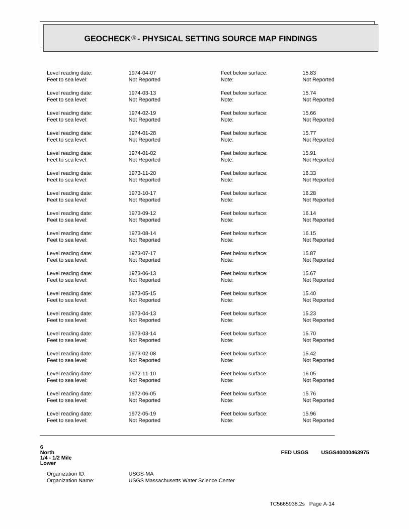
TC5665938.2s Page A-14
USGS Massachusetts Water Science CenterOrganization Name: USGS-MAOrganization ID:
6North1/4 - 1/2 MileLower
USGS40000463975FED USGS
Not ReportedNote: Not ReportedFeet to sea level: 15.96Feet below surface: 1972-05-19Level reading date:
Not ReportedNote: Not ReportedFeet to sea level: 15.76Feet below surface: 1972-06-05Level reading date:
Not ReportedNote: Not ReportedFeet to sea level: 16.05Feet below surface: 1972-11-10Level reading date:
Not ReportedNote: Not ReportedFeet to sea level: 15.42Feet below surface: 1973-02-08Level reading date:
Not ReportedNote: Not ReportedFeet to sea level: 15.70Feet below surface: 1973-03-14Level reading date:
Not ReportedNote: Not ReportedFeet to sea level: 15.23Feet below surface: 1973-04-13Level reading date:
Not ReportedNote: Not ReportedFeet to sea level: 15.40Feet below surface: 1973-05-15Level reading date:
Not ReportedNote: Not ReportedFeet to sea level: 15.67Feet below surface: 1973-06-13Level reading date:
Not ReportedNote: Not ReportedFeet to sea level: 15.87Feet below surface: 1973-07-17Level reading date:
Not ReportedNote: Not ReportedFeet to sea level: 16.15Feet below surface: 1973-08-14Level reading date:
Not ReportedNote: Not ReportedFeet to sea level: 16.14Feet below surface: 1973-09-12Level reading date:
Not ReportedNote: Not ReportedFeet to sea level: 16.28Feet below surface: 1973-10-17Level reading date:
Not ReportedNote: Not ReportedFeet to sea level: 16.33Feet below surface: 1973-11-20Level reading date:
Not ReportedNote: Not ReportedFeet to sea level: 15.91Feet below surface: 1974-01-02Level reading date:
Not ReportedNote: Not ReportedFeet to sea level: 15.77Feet below surface: 1974-01-28Level reading date:
Not ReportedNote: Not ReportedFeet to sea level: 15.66Feet below surface: 1974-02-19Level reading date:
Not ReportedNote: Not ReportedFeet to sea level: 15.74Feet below surface: 1974-03-13Level reading date:
Not ReportedNote: Not ReportedFeet to sea level: 15.83Feet below surface: 1974-04-07Level reading date:
®GEOCHECK - PHYSICAL SETTING SOURCE MAP FINDINGS®

TC5665938.2s Page A-15
20.1Well Depth: 19720519Construction Date: Not ReportedAquifer Type: Not ReportedFormation Type:
Sand and gravel aquifers (glaciated regions)Aquifer: Not ReportedContrib Drainage Area Unts: Not ReportedContrib Drainage Area: Not ReportedDrainage Area Units: Not ReportedDrainage Area: 01090002HUC: Not ReportedDescription: WellType: MA-TSW 162Monitor Location:
USGS Massachusetts Water Science CenterOrganization Name: USGS-MAOrganization ID:
8WSW1/4 - 1/2 MileLower
USGS40000463863FED USGS
Not ReportedNote: Not ReportedFeet to sea level: 101.00Feet below surface: 1951-03-16Level reading date:
Not ReportedNote: Not ReportedFeet to sea level: 102.03Feet below surface: 1972-06-05Level reading date:
Not ReportedNote: Not ReportedFeet to sea level: 101.86Feet below surface: 1972-11-10Level reading date:
Not ReportedNote: Not ReportedFeet to sea level: 102.43Feet below surface: 1973-05-14Level reading date: 4Ground water levels,Number of Measurements:
ftWell Hole Depth Units: 160Well Hole Depth: ftWell Depth Units: 158Well Depth: 19510316Construction Date: Unconfined single aquiferAquifer Type:
Stratified Deposits, UndifferentiatedFormation Type: Sand and gravel aquifers (glaciated regions)Aquifer:
Not ReportedContrib Drainage Area Unts: Not ReportedContrib Drainage Area: Not ReportedDrainage Area Units: Not ReportedDrainage Area: 01090002HUC: Not ReportedDescription: WellType: MA-TSW 74Monitor Location:
USGS Massachusetts Water Science CenterOrganization Name: USGS-MAOrganization ID:
7NNE1/4 - 1/2 MileHigher
USGS40000463981FED USGS
Not ReportedNote: Not ReportedFeet to sea level: 65.50Feet below surface: 1950-02-01Level reading date: 1Ground water levels,Number of Measurements:
ftWell Hole Depth Units: 120Well Hole Depth: ftWell Depth Units: 120Well Depth: 195002Construction Date: Unconfined single aquiferAquifer Type:
Stratified Deposits, UndifferentiatedFormation Type: Sand and gravel aquifers (glaciated regions)Aquifer:
Not ReportedContrib Drainage Area Unts: Not ReportedContrib Drainage Area: Not ReportedDrainage Area Units: Not ReportedDrainage Area: 01090002HUC: Not ReportedDescription: WellType: MA-TSW 45Monitor Location:
®GEOCHECK - PHYSICAL SETTING SOURCE MAP FINDINGS®

TC5665938.2s Page A-16
Not ReportedNote: Not ReportedFeet to sea level: 12.24Feet below surface: 1975-06-25Level reading date:
Not ReportedNote: Not ReportedFeet to sea level: 12.44Feet below surface: 1975-07-22Level reading date:
Not ReportedNote: Not ReportedFeet to sea level: 12.49Feet below surface: 1975-08-19Level reading date:
Not ReportedNote: Not ReportedFeet to sea level: 12.60Feet below surface: 1975-09-29Level reading date:
Not ReportedNote: Not ReportedFeet to sea level: 12.48Feet below surface: 1975-10-22Level reading date:
Not ReportedNote: Not ReportedFeet to sea level: 12.37Feet below surface: 1975-11-26Level reading date:
Not ReportedNote: Not ReportedFeet to sea level: 12.15Feet below surface: 1976-01-29Level reading date:
Not ReportedNote: Not ReportedFeet to sea level: 12.07Feet below surface: 1976-03-01Level reading date:
Not ReportedNote: Not ReportedFeet to sea level: 12.01Feet below surface: 1976-04-05Level reading date:
Not ReportedNote: Not ReportedFeet to sea level: 11.99Feet below surface: 1976-04-28Level reading date:
Not ReportedNote: Not ReportedFeet to sea level: 11.20Feet below surface: 1976-05-24Level reading date:
Not ReportedNote: Not ReportedFeet to sea level: 12.37Feet below surface: 1976-07-02Level reading date:
Not ReportedNote: Not ReportedFeet to sea level: 12.50Feet below surface: 1976-08-03Level reading date:
Not ReportedNote: Not ReportedFeet to sea level: 12.63Feet below surface: 1976-08-31Level reading date:
Not ReportedNote: Not ReportedFeet to sea level: 12.70Feet below surface: 1976-10-04Level reading date:
Not ReportedNote: Not ReportedFeet to sea level: 12.67Feet below surface: 1976-10-29Level reading date:
Not ReportedNote: Not ReportedFeet to sea level: 12.71Feet below surface: 1976-12-06Level reading date:
Not ReportedNote: Not ReportedFeet to sea level: 12.20Feet below surface: 1977-03-01Level reading date:
Not ReportedNote: Not ReportedFeet to sea level: 12.37Feet below surface: 1977-04-11Level reading date: 48Ground water levels,Number of Measurements:
ftWell Hole Depth Units: 20.1Well Hole Depth: ftWell Depth Units:
®GEOCHECK - PHYSICAL SETTING SOURCE MAP FINDINGS®

TC5665938.2s Page A-17
Not ReportedNote: Not ReportedFeet to sea level: 12.15Feet below surface: 1973-08-14Level reading date:
Not ReportedNote: Not ReportedFeet to sea level: 12.11Feet below surface: 1973-09-12Level reading date:
Not ReportedNote: Not ReportedFeet to sea level: 12.18Feet below surface: 1973-10-17Level reading date:
Not ReportedNote: Not ReportedFeet to sea level: 12.16Feet below surface: 1973-11-20Level reading date:
Not ReportedNote: Not ReportedFeet to sea level: 11.74Feet below surface: 1974-01-02Level reading date:
Not ReportedNote: Not ReportedFeet to sea level: 11.61Feet below surface: 1974-01-28Level reading date:
Not ReportedNote: Not ReportedFeet to sea level: 11.68Feet below surface: 1974-02-19Level reading date:
Not ReportedNote: Not ReportedFeet to sea level: 11.84Feet below surface: 1974-03-13Level reading date:
Not ReportedNote: Not ReportedFeet to sea level: 11.94Feet below surface: 1974-04-07Level reading date:
Not ReportedNote: Not ReportedFeet to sea level: 11.97Feet below surface: 1974-05-15Level reading date:
Not ReportedNote: Not ReportedFeet to sea level: 12.19Feet below surface: 1974-07-10Level reading date:
Not ReportedNote: Not ReportedFeet to sea level: 12.51Feet below surface: 1974-08-14Level reading date:
Not ReportedNote: Not ReportedFeet to sea level: 12.59Feet below surface: 1974-09-16Level reading date:
Not ReportedNote: Not ReportedFeet to sea level: 12.61Feet below surface: 1974-10-22Level reading date:
Not ReportedNote: Not ReportedFeet to sea level: 12.54Feet below surface: 1974-11-23Level reading date:
Not ReportedNote: Not ReportedFeet to sea level: 12.46Feet below surface: 1974-12-17Level reading date:
Not ReportedNote: Not ReportedFeet to sea level: 12.42Feet below surface: 1975-01-17Level reading date:
Not ReportedNote: Not ReportedFeet to sea level: 12.18Feet below surface: 1975-02-19Level reading date:
Not ReportedNote: Not ReportedFeet to sea level: 12.10Feet below surface: 1975-03-24Level reading date:
Not ReportedNote: Not ReportedFeet to sea level: 12.01Feet below surface: 1975-04-24Level reading date:
Not ReportedNote: Not ReportedFeet to sea level: 12.16Feet below surface: 1975-05-19Level reading date:
®GEOCHECK - PHYSICAL SETTING SOURCE MAP FINDINGS®

TC5665938.2s Page A-18
135.45Well Depth: 19990908Construction Date: Unconfined single aquiferAquifer Type: OutwashFormation Type:
Sand and gravel aquifers (glaciated regions)Aquifer: Not ReportedContrib Drainage Area Unts: Not ReportedContrib Drainage Area: Not ReportedDrainage Area Units: Not ReportedDrainage Area: 01090002HUC: QUAIL RUN/JEEP TRAIL SITEDescription: WellType: MA-TSW 258-0135Monitor Location:
USGS Massachusetts Water Science CenterOrganization Name: USGS-MAOrganization ID:
10ENE1/2 - 1 MileHigher
USGS40000463953FED USGS
Not ReportedNote: Not ReportedFeet to sea level: 95.99Feet below surface: 1972-05-15Level reading date: 1Ground water levels,Number of Measurements:
Not ReportedWell Hole Depth Units: Not ReportedWell Hole Depth: ftWell Depth Units: 104Well Depth: 197205Construction Date: Not ReportedAquifer Type: Not ReportedFormation Type:
Sand and gravel aquifers (glaciated regions)Aquifer: Not ReportedContrib Drainage Area Unts: Not ReportedContrib Drainage Area: Not ReportedDrainage Area Units: Not ReportedDrainage Area: 01090002HUC: Not ReportedDescription: WellType: MA-TSW 160Monitor Location:
USGS Massachusetts Water Science CenterOrganization Name: USGS-MAOrganization ID:
9WNW1/4 - 1/2 MileHigher
USGS40000463934FED USGS
Not ReportedNote: Not ReportedFeet to sea level: 11.92Feet below surface: 1972-05-31Level reading date:
Not ReportedNote: Not ReportedFeet to sea level: 11.87Feet below surface: 1972-06-05Level reading date:
Not ReportedNote: Not ReportedFeet to sea level: 11.87Feet below surface: 1972-11-10Level reading date:
Not ReportedNote: Not ReportedFeet to sea level: 11.82Feet below surface: 1973-03-14Level reading date:
Not ReportedNote: Not ReportedFeet to sea level: 11.27Feet below surface: 1973-04-13Level reading date:
Not ReportedNote: Not ReportedFeet to sea level: 11.57Feet below surface: 1973-05-15Level reading date:
Not ReportedNote: Not ReportedFeet to sea level: 12.60Feet below surface: 1973-06-13Level reading date:
Not ReportedNote: Not ReportedFeet to sea level: 11.95Feet below surface: 1973-07-17Level reading date:
®GEOCHECK - PHYSICAL SETTING SOURCE MAP FINDINGS®

TC5665938.2s Page A-19
ftWell Hole Depth Units: 129.5Well Hole Depth: ftWell Depth Units: 129.5Well Depth: 20011212Construction Date: Unconfined single aquiferAquifer Type:
Stratified Deposits, UndifferentiatedFormation Type: Sand and gravel aquifers (glaciated regions)Aquifer:
Not ReportedContrib Drainage Area Unts: Not ReportedContrib Drainage Area: Not ReportedDrainage Area Units: Not ReportedDrainage Area: 01090002HUC: CCC OBS WELL P2Description: WellType: MA-TSW 288Monitor Location:
USGS Massachusetts Water Science CenterOrganization Name: USGS-MAOrganization ID:
11NNW1/2 - 1 MileHigher
USGS40000464005FED USGS
Not ReportedNote: Not ReportedFeet to sea level: 123.81Feet below surface: 1999-09-23Level reading date:
Not ReportedNote: Not ReportedFeet to sea level: 123.89Feet below surface: 1999-10-21Level reading date:
Not ReportedNote: Not ReportedFeet to sea level: 123.89Feet below surface: 1999-11-23Level reading date:
Not ReportedNote: Not ReportedFeet to sea level: 123.89Feet below surface: 1999-12-22Level reading date:
Not ReportedNote: Not ReportedFeet to sea level: 123.90Feet below surface: 2000-01-24Level reading date:
Not ReportedNote: Not ReportedFeet to sea level: 122.71Feet below surface: 2000-04-26Level reading date:
Not ReportedNote: Not ReportedFeet to sea level: 122.43Feet below surface: 2000-05-26Level reading date:
Not ReportedNote: Not ReportedFeet to sea level: 122.43Feet below surface: 2000-06-28Level reading date:
Not ReportedNote: Not ReportedFeet to sea level: 122.73Feet below surface: 2000-07-31Level reading date:
Not ReportedNote: Not ReportedFeet to sea level: 122.94Feet below surface: 2000-08-30Level reading date:
Not ReportedNote: Not ReportedFeet to sea level: 123.18Feet below surface: 2000-09-25Level reading date:
Not ReportedNote: Not ReportedFeet to sea level: 123.39Feet below surface: 2000-11-29Level reading date:
Not ReportedNote: Not ReportedFeet to sea level: 123.51Feet below surface: 2000-12-19Level reading date: 13Ground water levels,Number of Measurements:
ftWell Hole Depth Units: 138Well Hole Depth: ftWell Depth Units:
®GEOCHECK - PHYSICAL SETTING SOURCE MAP FINDINGS®

TC5665938.2s Page A-20
4Region: UNKBasin: PROVINCETOWN WATER DEPARTMENTPurveyor: NORTH UNION FIELD WELL NO. 1Well Name:
ACTIVESource Availability: COMPWS Class: ASource Status: APWS Status:
NORTH UNION FIELD WELL NO. 1Source Name: PROVINCETOWN WATER DEPARTMENTPWS Name: 4242000-06GSource ID:
Not ReportedTertiary Location Source: MS_LMTQSecondary Location Source: MS_OTHPrimary Location Source: MAPLocation Method: WFFeature Type: 100Accuracy Estimate (ft): DOQBasemap:
CAPE CODSubBasin: Not ReportedFacility Name: Community Groundwater WellType:
NORTH UNION FIELD WELL NO. 1Site Name: 4242000PWS ID:
C13NNE1/2 - 1 MileHigher
MA9000000002566MA WELLS
4Region: BLACKSTONEBasin: PROVINCETOWN WATER DEPARTMENTPurveyor: NORTH UNION FIELD WELL NO. 2Well Name:
ACTIVESource Availability: COMPWS Class: ASource Status: APWS Status:
NORTH UNION FIELD WELL NO. 2Source Name: PROVINCETOWN WATER DEPARTMENTPWS Name: 4242000-07GSource ID:
Not ReportedTertiary Location Source: MS_LMTQSecondary Location Source: MS_OTHPrimary Location Source: MAPLocation Method: WFFeature Type: 100Accuracy Estimate (ft): DOQBasemap:
CAPE CODSubBasin: Not ReportedFacility Name: Community Groundwater WellType:
NORTH UNION FIELD WELL NO. 2Site Name: 4242000PWS ID:
C12NNE1/2 - 1 MileHigher
MA9000000002567MA WELLS
Map IDDirectionDistanceElevation EDR ID NumberDatabase
®GEOCHECK - PHYSICAL SETTING SOURCE MAP FINDINGS®
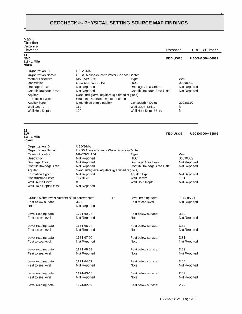
TC5665938.2s Page A-21
2.72Feet below surface: 1974-02-19Level reading date:
Not ReportedNote: Not ReportedFeet to sea level: 2.82Feet below surface: 1974-03-13Level reading date:
Not ReportedNote: Not ReportedFeet to sea level: 3.04Feet below surface: 1974-04-07Level reading date:
Not ReportedNote: Not ReportedFeet to sea level: 3.08Feet below surface: 1974-05-15Level reading date:
Not ReportedNote: Not ReportedFeet to sea level: 3.31Feet below surface: 1974-07-10Level reading date:
Not ReportedNote: Not ReportedFeet to sea level: 3.62Feet below surface: 1974-08-14Level reading date:
Not ReportedNote: Not ReportedFeet to sea level: 3.62Feet below surface: 1974-09-04Level reading date:
Not ReportedNote: Not ReportedFeet to sea level: 3.26Feet below surface: 1975-05-21Level reading date: 17Ground water levels,Number of Measurements:
Not ReportedWell Hole Depth Units: Not ReportedWell Hole Depth: ftWell Depth Units: 13.1Well Depth: 19730515Construction Date: Not ReportedAquifer Type: Not ReportedFormation Type:
Sand and gravel aquifers (glaciated regions)Aquifer: Not ReportedContrib Drainage Area Unts: Not ReportedContrib Drainage Area: Not ReportedDrainage Area Units: Not ReportedDrainage Area: 01090002HUC: Not ReportedDescription: WellType: MA-TSW 164Monitor Location:
USGS Massachusetts Water Science CenterOrganization Name: USGS-MAOrganization ID:
15SW1/2 - 1 MileLower
USGS40000463806FED USGS
ftWell Hole Depth Units: 170Well Hole Depth: ftWell Depth Units: 162Well Depth: 20020110Construction Date: Unconfined single aquiferAquifer Type:
Stratified Deposits, UndifferentiatedFormation Type: Sand and gravel aquifers (glaciated regions)Aquifer:
Not ReportedContrib Drainage Area Unts: Not ReportedContrib Drainage Area: Not ReportedDrainage Area Units: Not ReportedDrainage Area: 01090002HUC: CCC OBS WELL P3Description: WellType: MA-TSW 285Monitor Location:
USGS Massachusetts Water Science CenterOrganization Name: USGS-MAOrganization ID:
14NNE1/2 - 1 MileHigher
USGS40000464022FED USGS
Map IDDirectionDistanceElevation EDR ID NumberDatabase
®GEOCHECK - PHYSICAL SETTING SOURCE MAP FINDINGS®

TC5665938.2s Page A-22
01090002HUC: Not ReportedDescription: WellType: MA-TSW 161Monitor Location:
USGS Massachusetts Water Science CenterOrganization Name: USGS-MAOrganization ID:
17WSW1/2 - 1 MileLower
USGS40000463837FED USGS
INACTSource Availability: NCPWS Class: ISource Status: IPWS Status: WELL # 1Source Name: PILGRIM SPRING MOTELPWS Name: 4300020-01GSource ID:
Not ReportedTertiary Location Source: Not ReportedSecondary Location Source: SVPrimary Location Source: GP_6Location Method: GWFeature Type: 100Accuracy Estimate (ft): NABasemap:
CAPE CODSubBasin: Not ReportedFacility Name: Transient Non-CommunityType: PILGRIM SPRING MOTELSite Name: 4300020PWS ID:
16NNW1/2 - 1 MileHigher
MA9000000001704MA WELLS
Not ReportedNote: Not ReportedFeet to sea level: 2.68Feet below surface: 1973-05-15Level reading date:
Not ReportedNote: Not ReportedFeet to sea level: 2.95Feet below surface: 1973-06-12Level reading date:
Not ReportedNote: Not ReportedFeet to sea level: 3.08Feet below surface: 1973-07-22Level reading date:
Not ReportedNote: Not ReportedFeet to sea level: 3.27Feet below surface: 1973-08-14Level reading date:
Not ReportedNote: Not ReportedFeet to sea level: 2.99Feet below surface: 1973-09-12Level reading date:
Not ReportedNote: Not ReportedFeet to sea level: 3.20Feet below surface: 1973-10-17Level reading date:
Not ReportedNote: Not ReportedFeet to sea level: 3.17Feet below surface: 1973-11-20Level reading date:
Not ReportedNote: Not ReportedFeet to sea level: 2.88Feet below surface: 1974-01-02Level reading date:
Not ReportedNote: Not ReportedFeet to sea level: 2.83Feet below surface: 1974-01-28Level reading date:
Not ReportedNote: Not ReportedFeet to sea level:
®GEOCHECK - PHYSICAL SETTING SOURCE MAP FINDINGS®

TC5665938.2s Page A-23
Not ReportedNote: Not ReportedFeet to sea level: 6.09Feet below surface: 1976-08-03Level reading date:
Not ReportedNote: Not ReportedFeet to sea level: 6.75Feet below surface: 1976-08-31Level reading date:
Not ReportedNote: Not ReportedFeet to sea level: 6.81Feet below surface: 1976-10-04Level reading date:
Not ReportedNote: Not ReportedFeet to sea level: 6.78Feet below surface: 1976-10-29Level reading date:
Not ReportedNote: Not ReportedFeet to sea level: 7.01Feet below surface: 1976-12-06Level reading date:
Not ReportedNote: Not ReportedFeet to sea level: 6.59Feet below surface: 1977-03-01Level reading date:
Not ReportedNote: Not ReportedFeet to sea level: 6.30Feet below surface: 1977-04-11Level reading date: 45Ground water levels,Number of Measurements:
ftWell Hole Depth Units: 9.4Well Hole Depth: ftWell Depth Units: 9.4Well Depth: 19730501Construction Date: Not ReportedAquifer Type: Not ReportedFormation Type:
Sand and gravel aquifers (glaciated regions)Aquifer: Not ReportedContrib Drainage Area Unts: Not ReportedContrib Drainage Area: Not ReportedDrainage Area Units: Not ReportedDrainage Area: 01090002HUC: Not ReportedDescription: WellType: MA-TSW 168Monitor Location:
USGS Massachusetts Water Science CenterOrganization Name: USGS-MAOrganization ID:
18South1/2 - 1 MileLower
USGS40000463730FED USGS
Not ReportedNote: Not ReportedFeet to sea level: 6.71Feet below surface: 1972-05-19Level reading date:
Not ReportedNote: Not ReportedFeet to sea level: 6.94Feet below surface: 1972-06-05Level reading date:
Not ReportedNote: Not ReportedFeet to sea level: 6.39Feet below surface: 1972-11-10Level reading date:
Not ReportedNote: Not ReportedFeet to sea level: 6.66Feet below surface: 1973-02-08Level reading date: 4Ground water levels,Number of Measurements:
Not ReportedWell Hole Depth Units: Not ReportedWell Hole Depth: ftWell Depth Units: 9.5Well Depth: 19720519Construction Date: Not ReportedAquifer Type: Not ReportedFormation Type:
Sand and gravel aquifers (glaciated regions)Aquifer: Not ReportedContrib Drainage Area Unts: Not ReportedContrib Drainage Area: Not ReportedDrainage Area Units: Not ReportedDrainage Area:
®GEOCHECK - PHYSICAL SETTING SOURCE MAP FINDINGS®

TC5665938.2s Page A-24
Not ReportedNote: Not ReportedFeet to sea level: 6.81Feet below surface: 1974-10-22Level reading date:
Not ReportedNote: Not ReportedFeet to sea level: 5.85Feet below surface: 1974-11-23Level reading date:
Not ReportedNote: Not ReportedFeet to sea level: 6.71Feet below surface: 1974-12-17Level reading date:
Not ReportedNote: Not ReportedFeet to sea level: 6.60Feet below surface: 1975-01-17Level reading date:
Not ReportedNote: Not ReportedFeet to sea level: 6.43Feet below surface: 1975-02-19Level reading date:
Not ReportedNote: Not ReportedFeet to sea level: 6.31Feet below surface: 1975-03-24Level reading date:
Not ReportedNote: Not ReportedFeet to sea level: 6.26Feet below surface: 1975-04-24Level reading date:
Not ReportedNote: Not ReportedFeet to sea level: 6.41Feet below surface: 1975-05-19Level reading date:
Not ReportedNote: Not ReportedFeet to sea level: 6.48Feet below surface: 1975-06-25Level reading date:
Not ReportedNote: Not ReportedFeet to sea level: 6.62Feet below surface: 1975-07-22Level reading date:
Not ReportedNote: Not ReportedFeet to sea level: 6.61Feet below surface: 1975-08-19Level reading date:
Not ReportedNote: Not ReportedFeet to sea level: 6.69Feet below surface: 1975-09-29Level reading date:
Not ReportedNote: Not ReportedFeet to sea level: 6.52Feet below surface: 1975-10-22Level reading date:
Not ReportedNote: Not ReportedFeet to sea level: 6.46Feet below surface: 1975-11-26Level reading date:
Not ReportedNote: Not ReportedFeet to sea level: 6.23Feet below surface: 1975-12-29Level reading date:
Not ReportedNote: Not ReportedFeet to sea level: 5.86Feet below surface: 1976-01-29Level reading date:
Not ReportedNote: Not ReportedFeet to sea level: 5.87Feet below surface: 1976-03-01Level reading date:
Not ReportedNote: Not ReportedFeet to sea level: 5.99Feet below surface: 1976-04-05Level reading date:
Not ReportedNote: Not ReportedFeet to sea level: 6.11Feet below surface: 1976-04-28Level reading date:
Not ReportedNote: Not ReportedFeet to sea level: 6.10Feet below surface: 1976-05-24Level reading date:
Not ReportedNote: Not ReportedFeet to sea level: 6.58Feet below surface: 1976-07-02Level reading date:
®GEOCHECK - PHYSICAL SETTING SOURCE MAP FINDINGS®

TC5665938.2s Page A-25
Not ReportedDrainage Area Units: Not ReportedDrainage Area: 01090002HUC: Not ReportedDescription: WellType: MA-TSW 170Monitor Location:
USGS Massachusetts Water Science CenterOrganization Name: USGS-MAOrganization ID:
19SE1/2 - 1 MileLower
USGS40000463785FED USGS
Not ReportedNote: Not ReportedFeet to sea level: 5.72Feet below surface: 1973-05-01Level reading date:
Not ReportedNote: Not ReportedFeet to sea level: 5.86Feet below surface: 1973-05-14Level reading date:
Not ReportedNote: Not ReportedFeet to sea level: 6.04Feet below surface: 1973-06-12Level reading date:
Not ReportedNote: Not ReportedFeet to sea level: 6.24Feet below surface: 1973-07-23Level reading date:
Not ReportedNote: Not ReportedFeet to sea level: 6.35Feet below surface: 1973-08-21Level reading date:
Not ReportedNote: Not ReportedFeet to sea level: 6.30Feet below surface: 1973-09-13Level reading date:
Not ReportedNote: Not ReportedFeet to sea level: 6.41Feet below surface: 1973-10-17Level reading date:
Not ReportedNote: Not ReportedFeet to sea level: 6.44Feet below surface: 1973-11-21Level reading date:
Not ReportedNote: Not ReportedFeet to sea level: 6.17Feet below surface: 1974-01-02Level reading date:
Not ReportedNote: Not ReportedFeet to sea level: 6.04Feet below surface: 1974-01-28Level reading date:
Not ReportedNote: Not ReportedFeet to sea level: 5.91Feet below surface: 1974-02-19Level reading date:
Not ReportedNote: Not ReportedFeet to sea level: 5.91Feet below surface: 1974-03-13Level reading date:
Not ReportedNote: Not ReportedFeet to sea level: 6.15Feet below surface: 1974-04-07Level reading date:
Not ReportedNote: Not ReportedFeet to sea level: 6.19Feet below surface: 1974-05-15Level reading date:
Not ReportedNote: Not ReportedFeet to sea level: 6.44Feet below surface: 1974-07-10Level reading date:
Not ReportedNote: Not ReportedFeet to sea level: 6.69Feet below surface: 1974-08-14Level reading date:
Not ReportedNote: Not ReportedFeet to sea level: 6.74Feet below surface: 1974-09-16Level reading date:
®GEOCHECK - PHYSICAL SETTING SOURCE MAP FINDINGS®

TC5665938.2s Page A-26
Not ReportedNote: Not ReportedFeet to sea level: 5.95Feet below surface: 1975-08-19Level reading date:
Not ReportedNote: Not ReportedFeet to sea level: 5.76Feet below surface: 1975-09-30Level reading date:
Not ReportedNote: Not ReportedFeet to sea level: 5.88Feet below surface: 1975-10-22Level reading date:
Not ReportedNote: Not ReportedFeet to sea level: 5.75Feet below surface: 1975-11-26Level reading date:
Not ReportedNote: Not ReportedFeet to sea level: 5.44Feet below surface: 1975-12-29Level reading date:
Not ReportedNote: Not ReportedFeet to sea level: 4.68Feet below surface: 1976-01-29Level reading date:
Not ReportedNote: Not ReportedFeet to sea level: 2.91Feet below surface: 1976-03-01Level reading date:
Not ReportedNote: Not ReportedFeet to sea level: 4.70Feet below surface: 1976-04-05Level reading date:
Not ReportedNote: Not ReportedFeet to sea level: 4.85Feet below surface: 1976-04-28Level reading date:
Not ReportedNote: Not ReportedFeet to sea level: 4.82Feet below surface: 1976-05-24Level reading date:
Not ReportedNote: Not ReportedFeet to sea level: 5.51Feet below surface: 1976-07-02Level reading date:
Not ReportedNote: Not ReportedFeet to sea level: 5.86Feet below surface: 1976-08-03Level reading date:
Not ReportedNote: Not ReportedFeet to sea level: 6.08Feet below surface: 1976-08-31Level reading date:
Not ReportedNote: Not ReportedFeet to sea level: 6.29Feet below surface: 1976-10-04Level reading date:
Not ReportedNote: Not ReportedFeet to sea level: 6.28Feet below surface: 1976-10-29Level reading date:
Not ReportedNote: Not ReportedFeet to sea level: 6.54Feet below surface: 1976-12-06Level reading date:
Not ReportedNote: Not ReportedFeet to sea level: 6.75Feet below surface: 1977-03-01Level reading date:
Not ReportedNote: Not ReportedFeet to sea level: 5.60Feet below surface: 1977-04-11Level reading date: 45Ground water levels,Number of Measurements:
ftWell Hole Depth Units: 15.5Well Hole Depth: ftWell Depth Units: 15.5Well Depth: 19730406Construction Date: Not ReportedAquifer Type: Not ReportedFormation Type:
Sand and gravel aquifers (glaciated regions)Aquifer: Not ReportedContrib Drainage Area Unts: Not ReportedContrib Drainage Area:
®GEOCHECK - PHYSICAL SETTING SOURCE MAP FINDINGS®
TC5665938.2s Page A-27
Not ReportedNote: Not ReportedFeet to sea level: 5.36Feet below surface: 1973-10-18Level reading date:
Not ReportedNote: Not ReportedFeet to sea level: 5.50Feet below surface: 1973-11-21Level reading date:
Not ReportedNote: Not ReportedFeet to sea level: 5.02Feet below surface: 1974-01-02Level reading date:
Not ReportedNote: Not ReportedFeet to sea level: 4.72Feet below surface: 1974-01-30Level reading date:
Not ReportedNote: Not ReportedFeet to sea level: 4.67Feet below surface: 1974-02-21Level reading date:
Not ReportedNote: Not ReportedFeet to sea level: 4.65Feet below surface: 1974-03-13Level reading date:
Not ReportedNote: Not ReportedFeet to sea level: 4.77Feet below surface: 1974-04-07Level reading date:
Not ReportedNote: Not ReportedFeet to sea level: 4.72Feet below surface: 1974-05-15Level reading date:
Not ReportedNote: Not ReportedFeet to sea level: 5.24Feet below surface: 1974-07-10Level reading date:
Not ReportedNote: Not ReportedFeet to sea level: 5.56Feet below surface: 1974-08-10Level reading date:
Not ReportedNote: Not ReportedFeet to sea level: 5.81Feet below surface: 1974-09-16Level reading date:
Not ReportedNote: Not ReportedFeet to sea level: 6.03Feet below surface: 1974-10-23Level reading date:
Not ReportedNote: Not ReportedFeet to sea level: 6.21Feet below surface: 1974-11-23Level reading date:
Not ReportedNote: Not ReportedFeet to sea level: 6.23Feet below surface: 1974-12-18Level reading date:
Not ReportedNote: Not ReportedFeet to sea level: 5.90Feet below surface: 1975-01-17Level reading date:
Not ReportedNote: Not ReportedFeet to sea level: 5.67Feet below surface: 1975-02-19Level reading date:
Not ReportedNote: Not ReportedFeet to sea level: 5.45Feet below surface: 1975-03-24Level reading date:
Not ReportedNote: Not ReportedFeet to sea level: 5.26Feet below surface: 1975-04-24Level reading date:
Not ReportedNote: Not ReportedFeet to sea level: 5.37Feet below surface: 1975-05-19Level reading date:
Not ReportedNote: Not ReportedFeet to sea level: 5.63Feet below surface: 1975-06-25Level reading date:
Not ReportedNote: Not ReportedFeet to sea level: 5.85Feet below surface: 1975-07-22Level reading date:
®GEOCHECK - PHYSICAL SETTING SOURCE MAP FINDINGS®

TC5665938.2s Page A-28
ACTIVESource Availability: NCPWS Class: ASource Status: APWS Status: WELL 1Source Name: CAPE VIEW MOTELPWS Name: 4300004-01GSource ID:
Not ReportedTertiary Location Source: Not ReportedSecondary Location Source: SVPrimary Location Source: GP_6Location Method: GWFeature Type: 100Accuracy Estimate (ft): NABasemap:
CAPE CODSubBasin: Not ReportedFacility Name: Transient Non-CommunityType: CAPE VIEW MOTELSite Name: 4300004PWS ID:
21NNW1/2 - 1 MileHigher
MA9000000000202MA WELLS
Not ReportedNote: Not ReportedFeet to sea level: 80.32Feet below surface: 1972-06-01Level reading date: 1Ground water levels,Number of Measurements:
Not ReportedWell Hole Depth Units: Not ReportedWell Hole Depth: ftWell Depth Units: 91.7Well Depth: 197205Construction Date: Not ReportedAquifer Type: Not ReportedFormation Type:
Sand and gravel aquifers (glaciated regions)Aquifer: Not ReportedContrib Drainage Area Unts: Not ReportedContrib Drainage Area: Not ReportedDrainage Area Units: Not ReportedDrainage Area: 01090002HUC: Not ReportedDescription: WellType: MA-TSW 159Monitor Location:
USGS Massachusetts Water Science CenterOrganization Name: USGS-MAOrganization ID:
20WNW1/2 - 1 MileLower
USGS40000463942FED USGS
Not ReportedNote: Not ReportedFeet to sea level: 4.22Feet below surface: 1973-04-06Level reading date:
Not ReportedNote: Not ReportedFeet to sea level: 4.18Feet below surface: 1973-05-14Level reading date:
Not ReportedNote: Not ReportedFeet to sea level: 4.55Feet below surface: 1973-06-12Level reading date:
Not ReportedNote: Not ReportedFeet to sea level: 4.20Feet below surface: 1973-07-23Level reading date:
Not ReportedNote: Not ReportedFeet to sea level: 5.11Feet below surface: 1973-08-14Level reading date:
Not ReportedNote: Not ReportedFeet to sea level: 5.15Feet below surface: 1973-09-13Level reading date:
®GEOCHECK - PHYSICAL SETTING SOURCE MAP FINDINGS®

TC5665938.2s Page A-29
10Well Depth: 19730501Construction Date: Not ReportedAquifer Type: Not ReportedFormation Type:
Sand and gravel aquifers (glaciated regions)Aquifer: Not ReportedContrib Drainage Area Unts: Not ReportedContrib Drainage Area: Not ReportedDrainage Area Units: Not ReportedDrainage Area: 01090002HUC: Not ReportedDescription: WellType: MA-TSW 169Monitor Location:
USGS Massachusetts Water Science CenterOrganization Name: USGS-MAOrganization ID:
24SSE1/2 - 1 MileLower
USGS40000463731FED USGS
Not ReportedNote: Not ReportedFeet to sea level: 9.80Feet below surface: 1966-10-20Level reading date: 1Ground water levels,Number of Measurements:
ftWell Hole Depth Units: 59Well Hole Depth: ftWell Depth Units: 44Well Depth: 19661020Construction Date: Not ReportedAquifer Type: Not ReportedFormation Type:
Sand and gravel aquifers (glaciated regions)Aquifer: Not ReportedContrib Drainage Area Unts: Not ReportedContrib Drainage Area: Not ReportedDrainage Area Units: Not ReportedDrainage Area: 01090002HUC: Not ReportedDescription: WellType: MA-TSW 188Monitor Location:
USGS Massachusetts Water Science CenterOrganization Name: USGS-MAOrganization ID:
D23NW1/2 - 1 MileLower
USGS40000464014FED USGS
Not ReportedNote: Not ReportedFeet to sea level: 18.50Feet below surface: 1966-10-24Level reading date: 1Ground water levels,Number of Measurements:
ftWell Hole Depth Units: 60Well Hole Depth: ftWell Depth Units: 55Well Depth: 19661024Construction Date: Not ReportedAquifer Type: Not ReportedFormation Type:
Sand and gravel aquifers (glaciated regions)Aquifer: Not ReportedContrib Drainage Area Unts: Not ReportedContrib Drainage Area: Not ReportedDrainage Area Units: Not ReportedDrainage Area: 01090002HUC: Not ReportedDescription: WellType: MA-TSW 189Monitor Location:
USGS Massachusetts Water Science CenterOrganization Name: USGS-MAOrganization ID:
D22NW1/2 - 1 MileLower
USGS40000464026FED USGS
Map IDDirectionDistanceElevation EDR ID NumberDatabase
®GEOCHECK - PHYSICAL SETTING SOURCE MAP FINDINGS®
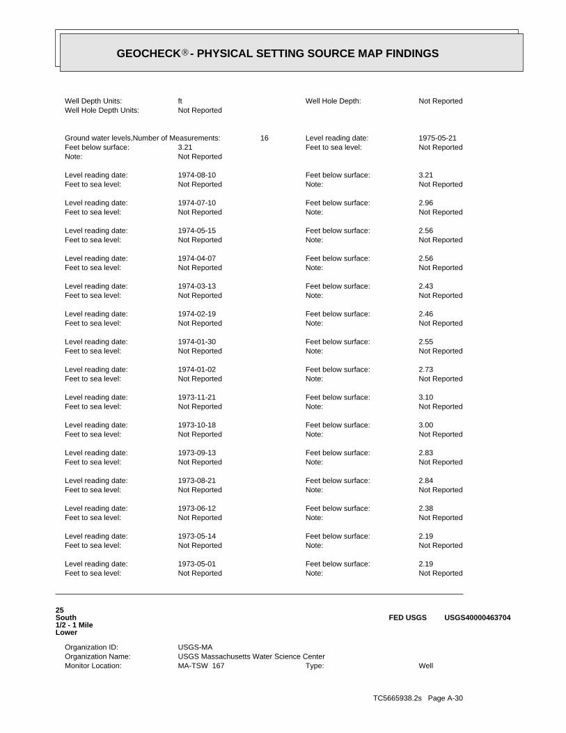
TC5665938.2s Page A-30
WellType: MA-TSW 167Monitor Location: USGS Massachusetts Water Science CenterOrganization Name: USGS-MAOrganization ID:
25South1/2 - 1 MileLower
USGS40000463704FED USGS
Not ReportedNote: Not ReportedFeet to sea level: 2.19Feet below surface: 1973-05-01Level reading date:
Not ReportedNote: Not ReportedFeet to sea level: 2.19Feet below surface: 1973-05-14Level reading date:
Not ReportedNote: Not ReportedFeet to sea level: 2.38Feet below surface: 1973-06-12Level reading date:
Not ReportedNote: Not ReportedFeet to sea level: 2.84Feet below surface: 1973-08-21Level reading date:
Not ReportedNote: Not ReportedFeet to sea level: 2.83Feet below surface: 1973-09-13Level reading date:
Not ReportedNote: Not ReportedFeet to sea level: 3.00Feet below surface: 1973-10-18Level reading date:
Not ReportedNote: Not ReportedFeet to sea level: 3.10Feet below surface: 1973-11-21Level reading date:
Not ReportedNote: Not ReportedFeet to sea level: 2.73Feet below surface: 1974-01-02Level reading date:
Not ReportedNote: Not ReportedFeet to sea level: 2.55Feet below surface: 1974-01-30Level reading date:
Not ReportedNote: Not ReportedFeet to sea level: 2.46Feet below surface: 1974-02-19Level reading date:
Not ReportedNote: Not ReportedFeet to sea level: 2.43Feet below surface: 1974-03-13Level reading date:
Not ReportedNote: Not ReportedFeet to sea level: 2.56Feet below surface: 1974-04-07Level reading date:
Not ReportedNote: Not ReportedFeet to sea level: 2.56Feet below surface: 1974-05-15Level reading date:
Not ReportedNote: Not ReportedFeet to sea level: 2.96Feet below surface: 1974-07-10Level reading date:
Not ReportedNote: Not ReportedFeet to sea level: 3.21Feet below surface: 1974-08-10Level reading date:
Not ReportedNote: Not ReportedFeet to sea level: 3.21Feet below surface: 1975-05-21Level reading date: 16Ground water levels,Number of Measurements:
Not ReportedWell Hole Depth Units: Not ReportedWell Hole Depth: ftWell Depth Units:
®GEOCHECK - PHYSICAL SETTING SOURCE MAP FINDINGS®
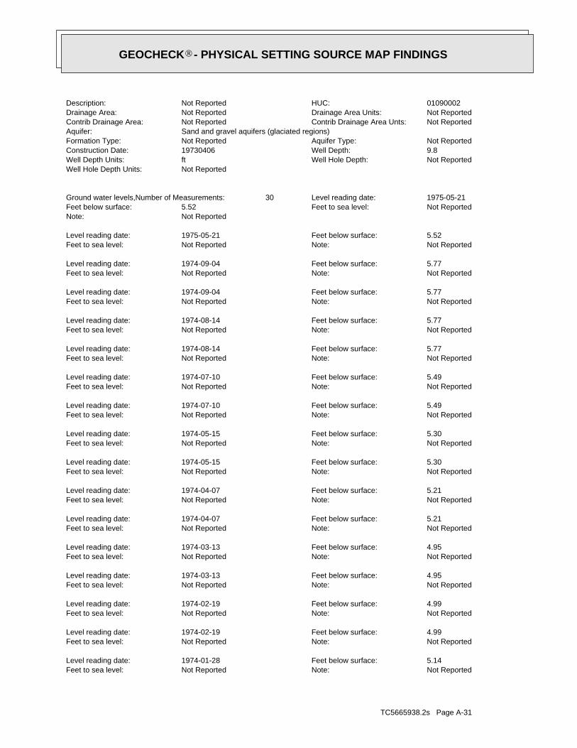
TC5665938.2s Page A-31
Not ReportedNote: Not ReportedFeet to sea level: 5.14Feet below surface: 1974-01-28Level reading date:
Not ReportedNote: Not ReportedFeet to sea level: 4.99Feet below surface: 1974-02-19Level reading date:
Not ReportedNote: Not ReportedFeet to sea level: 4.99Feet below surface: 1974-02-19Level reading date:
Not ReportedNote: Not ReportedFeet to sea level: 4.95Feet below surface: 1974-03-13Level reading date:
Not ReportedNote: Not ReportedFeet to sea level: 4.95Feet below surface: 1974-03-13Level reading date:
Not ReportedNote: Not ReportedFeet to sea level: 5.21Feet below surface: 1974-04-07Level reading date:
Not ReportedNote: Not ReportedFeet to sea level: 5.21Feet below surface: 1974-04-07Level reading date:
Not ReportedNote: Not ReportedFeet to sea level: 5.30Feet below surface: 1974-05-15Level reading date:
Not ReportedNote: Not ReportedFeet to sea level: 5.30Feet below surface: 1974-05-15Level reading date:
Not ReportedNote: Not ReportedFeet to sea level: 5.49Feet below surface: 1974-07-10Level reading date:
Not ReportedNote: Not ReportedFeet to sea level: 5.49Feet below surface: 1974-07-10Level reading date:
Not ReportedNote: Not ReportedFeet to sea level: 5.77Feet below surface: 1974-08-14Level reading date:
Not ReportedNote: Not ReportedFeet to sea level: 5.77Feet below surface: 1974-08-14Level reading date:
Not ReportedNote: Not ReportedFeet to sea level: 5.77Feet below surface: 1974-09-04Level reading date:
Not ReportedNote: Not ReportedFeet to sea level: 5.77Feet below surface: 1974-09-04Level reading date:
Not ReportedNote: Not ReportedFeet to sea level: 5.52Feet below surface: 1975-05-21Level reading date:
Not ReportedNote: Not ReportedFeet to sea level: 5.52Feet below surface: 1975-05-21Level reading date: 30Ground water levels,Number of Measurements:
Not ReportedWell Hole Depth Units: Not ReportedWell Hole Depth: ftWell Depth Units: 9.8Well Depth: 19730406Construction Date: Not ReportedAquifer Type: Not ReportedFormation Type:
Sand and gravel aquifers (glaciated regions)Aquifer: Not ReportedContrib Drainage Area Unts: Not ReportedContrib Drainage Area: Not ReportedDrainage Area Units: Not ReportedDrainage Area: 01090002HUC: Not ReportedDescription:
®GEOCHECK - PHYSICAL SETTING SOURCE MAP FINDINGS®

TC5665938.2s Page A-32
Not ReportedNote: Not ReportedFeet to sea level: 7.66Feet below surface: 1975-05-21Level reading date: 18Ground water levels,Number of Measurements:
Not ReportedWell Hole Depth Units: Not ReportedWell Hole Depth: ftWell Depth Units: 13.5Well Depth: 19730406Construction Date: Not ReportedAquifer Type: Not ReportedFormation Type:
Sand and gravel aquifers (glaciated regions)Aquifer: Not ReportedContrib Drainage Area Unts: Not ReportedContrib Drainage Area: Not ReportedDrainage Area Units: Not ReportedDrainage Area: 01090002HUC: Not ReportedDescription: WellType: MA-TSW 171Monitor Location:
USGS Massachusetts Water Science CenterOrganization Name: USGS-MAOrganization ID:
26ESE1/2 - 1 MileLower
USGS40000463841FED USGS
Not ReportedNote: Not ReportedFeet to sea level: 4.65Feet below surface: 1973-04-06Level reading date:
Not ReportedNote: Not ReportedFeet to sea level: 4.65Feet below surface: 1973-04-06Level reading date:
Not ReportedNote: Not ReportedFeet to sea level: 4.95Feet below surface: 1973-05-14Level reading date:
Not ReportedNote: Not ReportedFeet to sea level: 4.95Feet below surface: 1973-05-14Level reading date:
Not ReportedNote: Not ReportedFeet to sea level: 5.13Feet below surface: 1973-06-12Level reading date:
Not ReportedNote: Not ReportedFeet to sea level: 5.13Feet below surface: 1973-06-12Level reading date:
Not ReportedNote: Not ReportedFeet to sea level: 5.41Feet below surface: 1973-10-17Level reading date:
Not ReportedNote: Not ReportedFeet to sea level: 5.41Feet below surface: 1973-10-17Level reading date:
Not ReportedNote: Not ReportedFeet to sea level: 5.46Feet below surface: 1973-11-21Level reading date:
Not ReportedNote: Not ReportedFeet to sea level: 5.46Feet below surface: 1973-11-21Level reading date:
Not ReportedNote: Not ReportedFeet to sea level: 5.27Feet below surface: 1974-01-02Level reading date:
Not ReportedNote: Not ReportedFeet to sea level: 5.27Feet below surface: 1974-01-02Level reading date:
Not ReportedNote: Not ReportedFeet to sea level: 5.14Feet below surface: 1974-01-28Level reading date:
®GEOCHECK - PHYSICAL SETTING SOURCE MAP FINDINGS®

TC5665938.2s Page A-33
Not ReportedDrainage Area Units: Not ReportedDrainage Area: 01090002HUC: Not ReportedDescription: WellType: MA-TSW 157Monitor Location:
USGS Massachusetts Water Science CenterOrganization Name: USGS-MAOrganization ID:
D27NW1/2 - 1 MileLower
USGS40000464032FED USGS
Not ReportedNote: Not ReportedFeet to sea level: 6.65Feet below surface: 1973-04-06Level reading date:
Not ReportedNote: Not ReportedFeet to sea level: 6.52Feet below surface: 1973-05-14Level reading date:
Not ReportedNote: Not ReportedFeet to sea level: 6.71Feet below surface: 1973-06-12Level reading date:
Not ReportedNote: Not ReportedFeet to sea level: 7.09Feet below surface: 1973-07-23Level reading date:
Not ReportedNote: Not ReportedFeet to sea level: 7.32Feet below surface: 1973-08-14Level reading date:
Not ReportedNote: Not ReportedFeet to sea level: 7.50Feet below surface: 1973-09-13Level reading date:
Not ReportedNote: Not ReportedFeet to sea level: 7.67Feet below surface: 1973-10-18Level reading date:
Not ReportedNote: Not ReportedFeet to sea level: 7.83Feet below surface: 1973-11-21Level reading date:
Not ReportedNote: Not ReportedFeet to sea level: 7.39Feet below surface: 1974-01-02Level reading date:
Not ReportedNote: Not ReportedFeet to sea level: 7.10Feet below surface: 1974-01-30Level reading date:
Not ReportedNote: Not ReportedFeet to sea level: 7.00Feet below surface: 1974-02-21Level reading date:
Not ReportedNote: Not ReportedFeet to sea level: 6.91Feet below surface: 1974-03-13Level reading date:
Not ReportedNote: Not ReportedFeet to sea level: 7.00Feet below surface: 1974-04-08Level reading date:
Not ReportedNote: Not ReportedFeet to sea level: 6.97Feet below surface: 1974-05-15Level reading date:
Not ReportedNote: Not ReportedFeet to sea level: 7.45Feet below surface: 1974-07-10Level reading date:
Not ReportedNote: Not ReportedFeet to sea level: 7.75Feet below surface: 1974-08-10Level reading date:
Not ReportedNote: Not ReportedFeet to sea level: 7.75Feet below surface: 1974-09-04Level reading date:
®GEOCHECK - PHYSICAL SETTING SOURCE MAP FINDINGS®
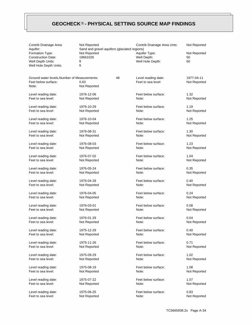
TC5665938.2s Page A-34
Not ReportedNote: Not ReportedFeet to sea level: 0.83Feet below surface: 1975-06-25Level reading date:
Not ReportedNote: Not ReportedFeet to sea level: 1.07Feet below surface: 1975-07-22Level reading date:
Not ReportedNote: Not ReportedFeet to sea level: 1.08Feet below surface: 1975-08-19Level reading date:
Not ReportedNote: Not ReportedFeet to sea level: 1.02Feet below surface: 1975-09-29Level reading date:
Not ReportedNote: Not ReportedFeet to sea level: 0.71Feet below surface: 1975-11-26Level reading date:
Not ReportedNote: Not ReportedFeet to sea level: 0.40Feet below surface: 1975-12-29Level reading date:
Not ReportedNote: Not ReportedFeet to sea level: 0.04Feet below surface: 1976-01-29Level reading date:
Not ReportedNote: Not ReportedFeet to sea level: 0.08Feet below surface: 1976-03-01Level reading date:
Not ReportedNote: Not ReportedFeet to sea level: 0.24Feet below surface: 1976-04-05Level reading date:
Not ReportedNote: Not ReportedFeet to sea level: 0.40Feet below surface: 1976-04-28Level reading date:
Not ReportedNote: Not ReportedFeet to sea level: 0.35Feet below surface: 1976-05-24Level reading date:
Not ReportedNote: Not ReportedFeet to sea level: 1.04Feet below surface: 1976-07-02Level reading date:
Not ReportedNote: Not ReportedFeet to sea level: 1.23Feet below surface: 1976-08-03Level reading date:
Not ReportedNote: Not ReportedFeet to sea level: 1.30Feet below surface: 1976-08-31Level reading date:
Not ReportedNote: Not ReportedFeet to sea level: 1.25Feet below surface: 1976-10-04Level reading date:
Not ReportedNote: Not ReportedFeet to sea level: 1.19Feet below surface: 1976-10-29Level reading date:
Not ReportedNote: Not ReportedFeet to sea level: 1.32Feet below surface: 1976-12-06Level reading date:
Not ReportedNote: Not ReportedFeet to sea level: 0.63Feet below surface: 1977-04-11Level reading date: 48Ground water levels,Number of Measurements:
ftWell Hole Depth Units: 60Well Hole Depth: ftWell Depth Units: 50Well Depth: 19661026Construction Date: Not ReportedAquifer Type: Not ReportedFormation Type:
Sand and gravel aquifers (glaciated regions)Aquifer: Not ReportedContrib Drainage Area Unts: Not ReportedContrib Drainage Area:
®GEOCHECK - PHYSICAL SETTING SOURCE MAP FINDINGS®

TC5665938.2s Page A-35
Not ReportedNote: Not ReportedFeet to sea level: 0.77Feet below surface: 1973-08-14Level reading date:
Not ReportedNote: Not ReportedFeet to sea level: 0.73Feet below surface: 1973-09-12Level reading date:
Not ReportedNote: Not ReportedFeet to sea level: 0.75Feet below surface: 1973-10-17Level reading date:
Not ReportedNote: Not ReportedFeet to sea level: 0.75Feet below surface: 1973-11-20Level reading date:
Not ReportedNote: Not ReportedFeet to sea level: 0.46Feet below surface: 1974-01-02Level reading date:
Not ReportedNote: Not ReportedFeet to sea level: 0.33Feet below surface: 1974-01-28Level reading date:
Not ReportedNote: Not ReportedFeet to sea level: 0.18Feet below surface: 1974-02-19Level reading date:
Not ReportedNote: Not ReportedFeet to sea level: 0.18Feet below surface: 1974-03-18Level reading date:
Not ReportedNote: Not ReportedFeet to sea level: 0.37Feet below surface: 1974-04-07Level reading date:
Not ReportedNote: Not ReportedFeet to sea level: 0.44Feet below surface: 1974-05-15Level reading date:
Not ReportedNote: Not ReportedFeet to sea level: 0.83Feet below surface: 1974-07-10Level reading date:
Not ReportedNote: Not ReportedFeet to sea level: 1.14Feet below surface: 1974-08-14Level reading date:
Not ReportedNote: Not ReportedFeet to sea level: 1.18Feet below surface: 1974-09-16Level reading date:
Not ReportedNote: Not ReportedFeet to sea level: 1.16Feet below surface: 1974-10-22Level reading date:
Not ReportedNote: Not ReportedFeet to sea level: 1.06Feet below surface: 1974-11-23Level reading date:
Not ReportedNote: Not ReportedFeet to sea level: 0.99Feet below surface: 1974-12-17Level reading date:
Not ReportedNote: Not ReportedFeet to sea level: 0.99Feet below surface: 1975-01-17Level reading date:
Not ReportedNote: Not ReportedFeet to sea level: 0.72Feet below surface: 1975-02-19Level reading date:
Not ReportedNote: Not ReportedFeet to sea level: 0.57Feet below surface: 1975-03-24Level reading date:
Not ReportedNote: Not ReportedFeet to sea level: 0.49Feet below surface: 1975-04-24Level reading date:
Not ReportedNote: Not ReportedFeet to sea level: 0.65Feet below surface: 1975-05-19Level reading date:
®GEOCHECK - PHYSICAL SETTING SOURCE MAP FINDINGS®

TC5665938.2s Page A-36
500Accuracy Estimate (ft): DVBBasemap:
CAPE CODSubBasin: Not ReportedFacility Name: Non-Transient Non-CommunityType:
STONES THROW CONDOSSite Name: 4300040PWS ID:
E29NNW1/2 - 1 MileLower
MA9000000000884MA WELLS
INACTSource Availability: NTNCPWS Class: ISource Status: APWS Status: WELL #1Source Name: STONES THROW CONDOSPWS Name: 4300040-01GSource ID:
Not ReportedTertiary Location Source: Not ReportedSecondary Location Source: SVPrimary Location Source: GP_2Location Method: GWFeature Type: 16Accuracy Estimate (ft): NABasemap:
CAPE CODSubBasin: Not ReportedFacility Name: Non-Transient Non-CommunityType:
STONES THROW CONDOSSite Name: 4300040PWS ID:
E28NNW1/2 - 1 MileLower
MA9000000001085MA WELLS
Not ReportedNote: Not ReportedFeet to sea level: 0.33Feet below surface: 1972-05-31Level reading date:
Not ReportedNote: Not ReportedFeet to sea level: 0.29Feet below surface: 1972-06-05Level reading date:
Not ReportedNote: Not ReportedFeet to sea level: 0.52Feet below surface: 1972-11-10Level reading date:
Not ReportedNote: Not ReportedFeet to sea level: 0.40Feet below surface: 1973-02-08Level reading date:
Not ReportedNote: Not ReportedFeet to sea level: 0.24Feet below surface: 1973-03-14Level reading date:
Not ReportedNote: Not ReportedFeet to sea level: 0.33Feet below surface: 1973-04-13Level reading date:
Not ReportedNote: Not ReportedFeet to sea level: 0.01Feet below surface: 1973-05-15Level reading date:
Not ReportedNote: Not ReportedFeet to sea level: 0.26Feet below surface: 1973-06-13Level reading date:
Not ReportedNote: Not ReportedFeet to sea level: 0.53Feet below surface: 1973-07-17Level reading date:
®GEOCHECK - PHYSICAL SETTING SOURCE MAP FINDINGS®

TC5665938.2s Page A-37
Not ReportedNote: Not ReportedFeet to sea level: 45.50Feet below surface: 1979-03-30Level reading date: 1Ground water levels,Number of Measurements:
ftWell Hole Depth Units: 150Well Hole Depth: ftWell Depth Units: 130Well Depth: 19790330Construction Date: Not ReportedAquifer Type: Not ReportedFormation Type:
Sand and gravel aquifers (glaciated regions)Aquifer: Not ReportedContrib Drainage Area Unts: Not ReportedContrib Drainage Area: Not ReportedDrainage Area Units: Not ReportedDrainage Area: 01090002HUC: Not ReportedDescription: WellType: MA-TSW 239Monitor Location:
USGS Massachusetts Water Science CenterOrganization Name: USGS-MAOrganization ID:
31NNW1/2 - 1 MileLower
USGS40000464082FED USGS
ACTIVESource Availability: NTNCPWS Class: ASource Status: APWS Status: REPLACEMENT WELL #2Source Name: STONES THROW CONDOSPWS Name: 4300040-03GSource ID:
Not ReportedTertiary Location Source: AP_DOQSecondary Location Source: SVPrimary Location Source: GP_2Location Method: GWFeature Type: 16Accuracy Estimate (ft): DOQBasemap:
CAPE CODSubBasin: Not ReportedFacility Name: Non-Transient Non-CommunityType:
STONES THROW CONDOSSite Name: 4300040PWS ID:
E30NNW1/2 - 1 MileLower
MA9000000002077MA WELLS
ACTIVESource Availability: NTNCPWS Class: ASource Status: APWS Status: WELL #2Source Name: STONES THROW CONDOSPWS Name: 4300040-02GSource ID:
Not ReportedTertiary Location Source: Not ReportedSecondary Location Source: KNOWPrimary Location Source: OTHLocation Method: GWFeature Type:
®GEOCHECK - PHYSICAL SETTING SOURCE MAP FINDINGS®

TC5665938.2s Page A-38
Not ReportedNote: Not ReportedFeet to sea level: 6.64Feet below surface: 1976-08-03Level reading date:
Not ReportedNote: Not ReportedFeet to sea level: 6.64Feet below surface: 1976-08-03Level reading date:
Not ReportedNote: Not ReportedFeet to sea level: 6.44Feet below surface: 1976-08-31Level reading date:
Not ReportedNote: Not ReportedFeet to sea level: 6.44Feet below surface: 1976-08-31Level reading date:
Not ReportedNote: Not ReportedFeet to sea level: 6.53Feet below surface: 1976-10-04Level reading date:
Not ReportedNote: Not ReportedFeet to sea level: 6.53Feet below surface: 1976-10-04Level reading date:
Not ReportedNote: Not ReportedFeet to sea level: 6.52Feet below surface: 1976-10-29Level reading date:
Not ReportedNote: Not ReportedFeet to sea level: 6.52Feet below surface: 1976-10-29Level reading date:
Not ReportedNote: Not ReportedFeet to sea level: 7.09Feet below surface: 1976-12-06Level reading date:
Not ReportedNote: Not ReportedFeet to sea level: 7.09Feet below surface: 1976-12-06Level reading date:
Not ReportedNote: Not ReportedFeet to sea level: 6.56Feet below surface: 1977-03-01Level reading date:
Not ReportedNote: Not ReportedFeet to sea level: 6.56Feet below surface: 1977-03-01Level reading date:
Not ReportedNote: Not ReportedFeet to sea level: 6.18Feet below surface: 1977-04-11Level reading date:
Not ReportedNote: Not ReportedFeet to sea level: 6.18Feet below surface: 1977-04-11Level reading date: 82Ground water levels,Number of Measurements:
ftWell Hole Depth Units: 10.1Well Hole Depth: ftWell Depth Units: 10.1Well Depth: 19730515Construction Date: Not ReportedAquifer Type: Not ReportedFormation Type:
Sand and gravel aquifers (glaciated regions)Aquifer: Not ReportedContrib Drainage Area Unts: Not ReportedContrib Drainage Area: Not ReportedDrainage Area Units: Not ReportedDrainage Area: 01090002HUC: Not ReportedDescription: WellType: MA-TSW 165Monitor Location:
USGS Massachusetts Water Science CenterOrganization Name: USGS-MAOrganization ID:
F32SSW1/2 - 1 MileLower
USGS40000463705FED USGS
Map IDDirectionDistanceElevation EDR ID NumberDatabase
®GEOCHECK - PHYSICAL SETTING SOURCE MAP FINDINGS®

TC5665938.2s Page A-39
Not ReportedNote: Not ReportedFeet to sea level: 6.53Feet below surface: 1975-08-19Level reading date:
Not ReportedNote: Not ReportedFeet to sea level: 6.79Feet below surface: 1975-09-29Level reading date:
Not ReportedNote: Not ReportedFeet to sea level: 6.79Feet below surface: 1975-09-29Level reading date:
Not ReportedNote: Not ReportedFeet to sea level: 6.32Feet below surface: 1975-10-22Level reading date:
Not ReportedNote: Not ReportedFeet to sea level: 6.32Feet below surface: 1975-10-22Level reading date:
Not ReportedNote: Not ReportedFeet to sea level: 6.56Feet below surface: 1975-11-26Level reading date:
Not ReportedNote: Not ReportedFeet to sea level: 6.56Feet below surface: 1975-11-26Level reading date:
Not ReportedNote: Not ReportedFeet to sea level: 6.09Feet below surface: 1975-12-29Level reading date:
Not ReportedNote: Not ReportedFeet to sea level: 6.09Feet below surface: 1975-12-29Level reading date:
Not ReportedNote: Not ReportedFeet to sea level: 6.09Feet below surface: 1976-01-29Level reading date:
Not ReportedNote: Not ReportedFeet to sea level: 6.09Feet below surface: 1976-01-29Level reading date:
Not ReportedNote: Not ReportedFeet to sea level: 6.05Feet below surface: 1976-03-01Level reading date:
Not ReportedNote: Not ReportedFeet to sea level: 6.05Feet below surface: 1976-03-01Level reading date:
Not ReportedNote: Not ReportedFeet to sea level: 5.17Feet below surface: 1976-04-05Level reading date:
Not ReportedNote: Not ReportedFeet to sea level: 5.17Feet below surface: 1976-04-05Level reading date:
Not ReportedNote: Not ReportedFeet to sea level: 6.27Feet below surface: 1976-04-28Level reading date:
Not ReportedNote: Not ReportedFeet to sea level: 6.27Feet below surface: 1976-04-28Level reading date:
Not ReportedNote: Not ReportedFeet to sea level: 6.30Feet below surface: 1976-05-24Level reading date:
Not ReportedNote: Not ReportedFeet to sea level: 6.30Feet below surface: 1976-05-24Level reading date:
Not ReportedNote: Not ReportedFeet to sea level: 6.58Feet below surface: 1976-07-02Level reading date:
Not ReportedNote: Not ReportedFeet to sea level: 6.58Feet below surface: 1976-07-02Level reading date:
®GEOCHECK - PHYSICAL SETTING SOURCE MAP FINDINGS®

TC5665938.2s Page A-40
Not ReportedNote: Not ReportedFeet to sea level: 5.70Feet below surface: 1974-10-23Level reading date:
Not ReportedNote: Not ReportedFeet to sea level: 5.70Feet below surface: 1974-10-23Level reading date:
Not ReportedNote: Not ReportedFeet to sea level: 6.48Feet below surface: 1974-11-23Level reading date:
Not ReportedNote: Not ReportedFeet to sea level: 6.48Feet below surface: 1974-11-23Level reading date:
Not ReportedNote: Not ReportedFeet to sea level: 5.25Feet below surface: 1974-12-17Level reading date:
Not ReportedNote: Not ReportedFeet to sea level: 5.25Feet below surface: 1974-12-17Level reading date:
Not ReportedNote: Not ReportedFeet to sea level: 6.40Feet below surface: 1975-01-17Level reading date:
Not ReportedNote: Not ReportedFeet to sea level: 6.40Feet below surface: 1975-01-17Level reading date:
Not ReportedNote: Not ReportedFeet to sea level: 6.61Feet below surface: 1975-02-19Level reading date:
Not ReportedNote: Not ReportedFeet to sea level: 6.61Feet below surface: 1975-02-19Level reading date:
Not ReportedNote: Not ReportedFeet to sea level: 6.27Feet below surface: 1975-03-24Level reading date:
Not ReportedNote: Not ReportedFeet to sea level: 6.27Feet below surface: 1975-03-24Level reading date:
Not ReportedNote: Not ReportedFeet to sea level: 6.32Feet below surface: 1975-04-24Level reading date:
Not ReportedNote: Not ReportedFeet to sea level: 6.32Feet below surface: 1975-04-24Level reading date:
Not ReportedNote: Not ReportedFeet to sea level: 6.55Feet below surface: 1975-05-19Level reading date:
Not ReportedNote: Not ReportedFeet to sea level: 6.55Feet below surface: 1975-05-19Level reading date:
Not ReportedNote: Not ReportedFeet to sea level: 6.47Feet below surface: 1975-06-25Level reading date:
Not ReportedNote: Not ReportedFeet to sea level: 6.47Feet below surface: 1975-06-25Level reading date:
Not ReportedNote: Not ReportedFeet to sea level: 6.56Feet below surface: 1975-07-22Level reading date:
Not ReportedNote: Not ReportedFeet to sea level: 6.56Feet below surface: 1975-07-22Level reading date:
Not ReportedNote: Not ReportedFeet to sea level: 6.53Feet below surface: 1975-08-19Level reading date:
®GEOCHECK - PHYSICAL SETTING SOURCE MAP FINDINGS®
TC5665938.2s Page A-41
Not ReportedNote: Not ReportedFeet to sea level: 6.24Feet below surface: 1973-10-18Level reading date:
Not ReportedNote: Not ReportedFeet to sea level: 6.45Feet below surface: 1973-11-21Level reading date:
Not ReportedNote: Not ReportedFeet to sea level: 6.45Feet below surface: 1973-11-21Level reading date:
Not ReportedNote: Not ReportedFeet to sea level: 6.23Feet below surface: 1974-01-02Level reading date:
Not ReportedNote: Not ReportedFeet to sea level: 6.23Feet below surface: 1974-01-02Level reading date:
Not ReportedNote: Not ReportedFeet to sea level: 6.28Feet below surface: 1974-01-28Level reading date:
Not ReportedNote: Not ReportedFeet to sea level: 6.28Feet below surface: 1974-01-28Level reading date:
Not ReportedNote: Not ReportedFeet to sea level: 6.10Feet below surface: 1974-02-19Level reading date:
Not ReportedNote: Not ReportedFeet to sea level: 6.10Feet below surface: 1974-02-19Level reading date:
Not ReportedNote: Not ReportedFeet to sea level: 5.95Feet below surface: 1974-03-13Level reading date:
Not ReportedNote: Not ReportedFeet to sea level: 5.95Feet below surface: 1974-03-13Level reading date:
Not ReportedNote: Not ReportedFeet to sea level: 6.34Feet below surface: 1974-04-07Level reading date:
Not ReportedNote: Not ReportedFeet to sea level: 6.34Feet below surface: 1974-04-07Level reading date:
Not ReportedNote: Not ReportedFeet to sea level: 6.40Feet below surface: 1974-05-15Level reading date:
Not ReportedNote: Not ReportedFeet to sea level: 6.40Feet below surface: 1974-05-15Level reading date:
Not ReportedNote: Not ReportedFeet to sea level: 6.57Feet below surface: 1974-07-10Level reading date:
Not ReportedNote: Not ReportedFeet to sea level: 6.57Feet below surface: 1974-07-10Level reading date:
Not ReportedNote: Not ReportedFeet to sea level: 6.89Feet below surface: 1974-08-14Level reading date:
Not ReportedNote: Not ReportedFeet to sea level: 6.89Feet below surface: 1974-08-14Level reading date:
Not ReportedNote: Not ReportedFeet to sea level: 6.79Feet below surface: 1974-09-16Level reading date:
Not ReportedNote: Not ReportedFeet to sea level: 6.79Feet below surface: 1974-09-16Level reading date:
®GEOCHECK - PHYSICAL SETTING SOURCE MAP FINDINGS®

TC5665938.2s Page A-42
Not ReportedNote: Not ReportedFeet to sea level: 105.99Feet below surface: 1972-06-06Level reading date:
Not ReportedNote: Not ReportedFeet to sea level: 105.49Feet below surface: 1972-11-10Level reading date:
Not ReportedNote: Not ReportedFeet to sea level: 106.05Feet below surface: 1973-05-14Level reading date:
Not ReportedNote: Not ReportedFeet to sea level: 105.81Feet below surface: 1973-10-17Level reading date:
Not ReportedNote: Not ReportedFeet to sea level: 105.54Feet below surface: 1976-06-29Level reading date:
Not ReportedNote: Not ReportedFeet to sea level: 106.16Feet below surface: 1976-08-26Level reading date:
Not ReportedNote: Not ReportedFeet to sea level: 106.33Feet below surface: 1976-09-28Level reading date:
Not ReportedNote: Not ReportedFeet to sea level: 107.17Feet below surface: 1976-10-27Level reading date:
Not ReportedNote: Not ReportedFeet to sea level: 106.45Feet below surface: 1977-04-01Level reading date: 10Ground water levels,Number of Measurements:
ftWell Hole Depth Units: 170Well Hole Depth: ftWell Depth Units: 151Well Depth: 19500210Construction Date: Unconfined single aquiferAquifer Type:
Stratified Deposits, UndifferentiatedFormation Type: Sand and gravel aquifers (glaciated regions)Aquifer:
Not ReportedContrib Drainage Area Unts: Not ReportedContrib Drainage Area: Not ReportedDrainage Area Units: Not ReportedDrainage Area: 01090002HUC: Not ReportedDescription: WellType: MA-TSW 44Monitor Location:
USGS Massachusetts Water Science CenterOrganization Name: USGS-MAOrganization ID:
33NE1/2 - 1 MileHigher
USGS40000464067FED USGS
Not ReportedNote: Not ReportedFeet to sea level: 5.60Feet below surface: 1973-05-15Level reading date:
Not ReportedNote: Not ReportedFeet to sea level: 5.60Feet below surface: 1973-05-15Level reading date:
Not ReportedNote: Not ReportedFeet to sea level: 6.30Feet below surface: 1973-06-12Level reading date:
Not ReportedNote: Not ReportedFeet to sea level: 6.30Feet below surface: 1973-06-12Level reading date:
Not ReportedNote: Not ReportedFeet to sea level: 6.24Feet below surface: 1973-10-18Level reading date:
®GEOCHECK - PHYSICAL SETTING SOURCE MAP FINDINGS®

TC5665938.2s Page A-43
Not ReportedNote: Not ReportedFeet to sea level: 1.81Feet below surface: 1972-05-19Level reading date:
Not ReportedNote: Not ReportedFeet to sea level: 1.33Feet below surface: 1972-06-05Level reading date:
Not ReportedNote: Not ReportedFeet to sea level: 2.02Feet below surface: 1972-11-10Level reading date:
Not ReportedNote: Not ReportedFeet to sea level: 1.53Feet below surface: 1973-05-14Level reading date:
Not ReportedNote: Not ReportedFeet to sea level: 2.47Feet below surface: 1973-10-18Level reading date: 5Ground water levels,Number of Measurements:
Not ReportedWell Hole Depth Units: Not ReportedWell Hole Depth: ftWell Depth Units: 9.2Well Depth: 19720519Construction Date: Not ReportedAquifer Type: Not ReportedFormation Type:
Sand and gravel aquifers (glaciated regions)Aquifer: Not ReportedContrib Drainage Area Unts: Not ReportedContrib Drainage Area: Not ReportedDrainage Area Units: Not ReportedDrainage Area: 01090002HUC: Not ReportedDescription: WellType: MA-TSW 156Monitor Location:
USGS Massachusetts Water Science CenterOrganization Name: USGS-MAOrganization ID:
35NNW1/2 - 1 MileLower
USGS40000464083FED USGS
ACTIVESource Availability: NCPWS Class: ASource Status: APWS Status: WELL 1Source Name: ROSEVILLE CONDOMINIUMSPWS Name: 4300039-01GSource ID:
Not ReportedTertiary Location Source: Not ReportedSecondary Location Source: SVPrimary Location Source: GP_2Location Method: GWFeature Type: 16Accuracy Estimate (ft): NABasemap:
CAPE CODSubBasin: Not ReportedFacility Name: Transient Non-CommunityType: ROSEVILLE CONDOMINIUMSSite Name: 4300039PWS ID:
F34SSW1/2 - 1 MileLower
MA9000000002181MA WELLS
Not ReportedNote: Not ReportedFeet to sea level: 105.99Feet below surface: 1972-06-05Level reading date:
®GEOCHECK - PHYSICAL SETTING SOURCE MAP FINDINGS®

TC5665938.2s Page A-44
APWS Status: WELL 1Source Name: CORN HILL CONDOMINIUMSPWS Name: 4300027-01GSource ID:
Not ReportedTertiary Location Source: Not ReportedSecondary Location Source: SVPrimary Location Source: GP_6Location Method: GWFeature Type: 100Accuracy Estimate (ft): NABasemap:
CAPE CODSubBasin: Not ReportedFacility Name: Transient Non-CommunityType: CORN HILL CONDOMINIUMSSite Name: 4300027PWS ID:
G38SSW1/2 - 1 MileHigher
MA9000000003653MA WELLS
ACTIVESource Availability: NCPWS Class: ASource Status: APWS Status: WELL 2Source Name: CORN HILL CONDOMINIUMSPWS Name: 4300027-02GSource ID:
Not ReportedTertiary Location Source: Not ReportedSecondary Location Source: KNOWPrimary Location Source: OTHLocation Method: GWFeature Type: 500Accuracy Estimate (ft): DVBBasemap:
CAPE CODSubBasin: Not ReportedFacility Name: Transient Non-CommunityType: CORN HILL CONDOMINIUMSSite Name: 4300027PWS ID:
G37SSW1/2 - 1 MileHigher
MA9000000001896MA WELLS
ftWell Hole Depth Units: 105Well Hole Depth: ftWell Depth Units: 103Well Depth: 20020208Construction Date: Unconfined single aquiferAquifer Type:
Stratified Deposits, UndifferentiatedFormation Type: Sand and gravel aquifers (glaciated regions)Aquifer:
Not ReportedContrib Drainage Area Unts: Not ReportedContrib Drainage Area: Not ReportedDrainage Area Units: Not ReportedDrainage Area: 01090002HUC: CCC OBS WELL P6Description: WellType: MA-TSW 287Monitor Location:
USGS Massachusetts Water Science CenterOrganization Name: USGS-MAOrganization ID:
36SSE1/2 - 1 MileHigher
USGS40000463675FED USGS
Map IDDirectionDistanceElevation EDR ID NumberDatabase
®GEOCHECK - PHYSICAL SETTING SOURCE MAP FINDINGS®

TC5665938.2s Page A-45
ACTIVESource Availability: NCPWS Class: ASource Status:
®GEOCHECK - PHYSICAL SETTING SOURCE MAP FINDINGS®
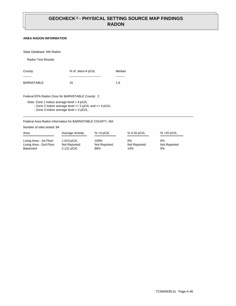
TC5665938.2s Page A-46
0%14%86%2.121 pCi/LBasementNot ReportedNot ReportedNot ReportedNot ReportedLiving Area - 2nd Floor0%0%100%1.013 pCi/LLiving Area - 1st Floor
% >20 pCi/L% 4-20 pCi/L% <4 pCi/LAverage ActivityArea
Number of sites tested: 84
Federal Area Radon Information for BARNSTABLE COUNTY, MA
: Zone 3 indoor average level < 2 pCi/L. : Zone 2 indoor average level >= 2 pCi/L and <= 4 pCi/L. Note: Zone 1 indoor average level > 4 pCi/L.
Federal EPA Radon Zone for BARNSTABLE County: 2
1.615BARNSTABLE
____________________________Median% of sites>4 pCi/LCounty
Radon Test Results
State Database: MA Radon
AREA RADON INFORMATION
GEOCHECK - PHYSICAL SETTING SOURCE MAP FINDINGSRADON
®

TOPOGRAPHIC INFORMATION
USGS 7.5’ Digital Elevation Model (DEM)Source: United States Geologic SurveyEDR acquired the USGS 7.5’ Digital Elevation Model in 2002 and updated it in 2006. The 7.5 minute DEM correspondsto the USGS 1:24,000- and 1:25,000-scale topographic quadrangle maps. The DEM provides elevation datawith consistent elevation units and projection.
Current USGS 7.5 Minute Topographic MapSource: U.S. Geological Survey
HYDROLOGIC INFORMATION
Flood Zone Data: This data was obtained from the Federal Emergency Management Agency (FEMA). It depicts 100-year and500-year flood zones as defined by FEMA. It includes the National Flood Hazard Layer (NFHL) which incorporates FloodInsurance Rate Map (FIRM) data and Q3 data from FEMA in areas not covered by NFHL.
Source: FEMATelephone: 877-336-2627Date of Government Version: 2003, 2015
NWI: National Wetlands Inventory. This data, available in select counties across the country, was obtained by EDRin 2002, 2005 and 2010 from the U.S. Fish and Wildlife Service.
State Wetlands Data: Wetland InventorySource: MassDEPTelephone: 617-292-5907
HYDROGEOLOGIC INFORMATION
AQUIFLOW Information SystemR
Source: EDR proprietary database of groundwater flow informationEDR has developed the AQUIFLOW Information System (AIS) to provide data on the general direction of groundwater
flow at specific points. EDR has reviewed reports submitted to regulatory authorities at select sites and hasextracted the date of the report, hydrogeologically determined groundwater flow direction and depth to water tableinformation.
GEOLOGIC INFORMATION
Geologic Age and Rock Stratigraphic UnitSource: P.G. Schruben, R.E. Arndt and W.J. Bawiec, Geology of the Conterminous U.S. at 1:2,500,000 Scale - A digitalrepresentation of the 1974 P.B. King and H.M. Beikman Map, USGS Digital Data Series DDS - 11 (1994).
STATSGO: State Soil Geographic DatabaseSource: Department of Agriculture, Natural Resources Conservation Service (NRCS)The U.S. Department of Agriculture’s (USDA) Natural Resources Conservation Service (NRCS) leads the nationalConservation Soil Survey (NCSS) and is responsible for collecting, storing, maintaining and distributing soilsurvey information for privately owned lands in the United States. A soil map in a soil survey is a representationof soil patterns in a landscape. Soil maps for STATSGO are compiled by generalizing more detailed (SSURGO)soil survey maps.
SSURGO: Soil Survey Geographic DatabaseSource: Department of Agriculture, Natural Resources Conservation Service (NRCS)Telephone: 800-672-5559SSURGO is the most detailed level of mapping done by the Natural Resources Conservation Service, mappingscales generally range from 1:12,000 to 1:63,360. Field mapping methods using national standards are used toconstruct the soil maps in the Soil Survey Geographic (SSURGO) database. SSURGO digitizing duplicates theoriginal soil survey maps. This level of mapping is designed for use by landowners, townships and countynatural resource planning and management.
TC5665938.2s Page PSGR-1
PHYSICAL SETTING SOURCE RECORDS SEARCHED

LOCAL / REGIONAL WATER AGENCY RECORDS
FEDERAL WATER WELLS
PWS: Public Water SystemsSource: EPA/Office of Drinking WaterTelephone: 202-564-3750Public Water System data from the Federal Reporting Data System. A PWS is any water system which provides water to at
least 25 people for at least 60 days annually. PWSs provide water from wells, rivers and other sources.
PWS ENF: Public Water Systems Violation and Enforcement DataSource: EPA/Office of Drinking WaterTelephone: 202-564-3750Violation and Enforcement data for Public Water Systems from the Safe Drinking Water Information System (SDWIS) after
August 1995. Prior to August 1995, the data came from the Federal Reporting Data System (FRDS).
USGS Water Wells: USGS National Water Inventory System (NWIS)This database contains descriptive information on sites where the USGS collects or has collected data on surfacewater and/or groundwater. The groundwater data includes information on wells, springs, and other sources of groundwater.
STATE RECORDS
Massachusetts Geographic Information System (MassGIS) DatalayersSource: Executive Office of Environmental AffairsTelephone:
Public Water Supply Database
Telephone:The Public Water Supply datalayer contains the locations of public community surface and groundwater supply sources
and public non-community supply sources as defined in 310 CMR 22.00.
Areas of Critical Environmental Concern
Telephone:The Areas of Critical Environmental Concern (ACEC) datalayer shows the location of areas that have been designated
ACECs by the Secretary of Environmental Affairs. ACEC designation requires greater environmental review of certainkinds of proposed development under state jurisdiction within the ACEC boundaries. The ACEC Program is administeredby the Department of Environmental Management (DEM) on behalf of the Secretary of Environmental Affairs. TheMassachusetts Coastal Zone Management (MCZM) Office managed the original Coastal ACEC Program from 1978 to 1993,and continues to play a key role in monitoring coastal ACECs. Procedures for ACEC designation and the generalpolicies governing the effects of designation are contained in the ACEC regulations (301 CMR 12.00). The ACECdatalayer has been compiled by MCZM and DEM and includes both coastal and inland areas.
EPA Designated Sole Source Aquifers
Telephone:The Sole Source Aquifer datalayer was compiled by the Department of Environmental Protection (DEP) Division
of Water Supply (DWS). Seven Sole Source Aquifers have been designated by the US Environmental Protection Agency(EPA) for Massachusetts. A Sole Source Aquifer (SSA) is an aquifer designated by US EPA as the sole or principalsource of drinking water for a given aquifer service area; that is, an aquifer which is needed to supply 50% ormore of the drinking water for that area and for which there are no reasonably available alternative sources shouldthat aquifer become contaminated. The aquifers were defined by an EPA hydrogeologist.
Aquifers
Telephone:MassGIS produced an aquifer datalayer composed of 20 individual panels, generally based on the boundaries of the
major drainage basins. Areas of high and medium yield were mapped. This datalayer includes polygon attribute codingto help in the identification of areas in which cleanup of hazardous waste sites must meet drinking water standards,as defined in the Massachusetts Contingency Plan (MCP) (310 CMR 40.00000).
Non-Potential Drinking Water Source Areas
Telephone:Non-Potential Drinking Water Source Areas (NPDWSA) are regulatory in nature representing one of many considerations
used in determining the standards to which ground water must be cleaned in the event of a release of oil or hazardousmaterial. NPDWSAs are not based on existing water quality and do not indicate poor ambient conditions.
DEP Approved Zone IIs
Telephone:The Department of Environmental Protection (DEP) approved Zone IIs datalayer was compiled by the DEP Division
TC5665938.2s Page PSGR-2
PHYSICAL SETTING SOURCE RECORDS SEARCHED

OTHER STATE DATABASE INFORMATION
RADON
State Database: MA RadonSource: Department of HealthTelephone: 413-586-7525Radon Test Results
Area Radon InformationSource: USGSTelephone: 703-356-4020The National Radon Database has been developed by the U.S. Environmental Protection Agency(USEPA) and is a compilation of the EPA/State Residential Radon Survey and the National Residential Radon Survey.The study covers the years 1986 - 1992. Where necessary data has been supplemented by information collected atprivate sources such as universities and research institutions.
EPA Radon ZonesSource: EPATelephone: 703-356-4020Sections 307 & 309 of IRAA directed EPA to list and identify areas of U.S. with the potential for elevated indoorradon levels.
OTHER
Airport Landing Facilities: Private and public use landing facilitiesSource: Federal Aviation Administration, 800-457-6656
Epicenters: World earthquake epicenters, Richter 5 or greaterSource: Department of Commerce, National Oceanic and Atmospheric Administration
Earthquake Fault Lines: The fault lines displayed on EDR’s Topographic map are digitized quaternary faultlines, preparedin 1975 by the United State Geological Survey
STREET AND ADDRESS INFORMATION
© 2015 TomTom North America, Inc. All rights reserved. This material is proprietary and the subject of copyright protectionand other intellectual property rights owned by or licensed to Tele Atlas North America, Inc. The use of this material is subjectto the terms of a license agreement. You will be held liable for any unauthorized copying or disclosure of this material.
TC5665938.2s Page PSGR-3
PHYSICAL SETTING SOURCE RECORDS SEARCHED


Certified Sanborn® Map Report
Inquiry Number:
6 Armstrong Road, 4th floor Shelton, CT 06484Toll Free: 800.352.0050 www.edrnet.com
Walsh Way
15 Walsh Way
Truro, MA 02666
May 28, 2019
5665938.3

Certified Sanborn® Map Report
Certified Sanborn Results:
Disclaimer - Copyright and Trademark Notice
EDR and its logos (including Sanborn and Sanborn Map) are trademarks of Environmental Data Resources, Inc. or its affiliates. All other trademarks used herein are the property of their respective owners.
page-
The Sanborn Library includes more than 1.2 millionfire insurance maps from Sanborn, Bromley, Perris &Browne, Hopkins, Barlow and others which trackhistorical property usage in approximately 12,000American cities and towns. Collections searched:
Library of Congress
University Publications of America
EDR Private Collection
The Sanborn Library LLC Since 1866™
Limited Permission To Make Copies
Sanborn® Library search results
Contact:EDR Inquiry #
Site Name: Client Name:
Certification #
PO #
Project
05/28/19
15 Walsh WayWalsh Way The BSC Group
803 Summer StreetTruro, MA 02666
5665938.3Boston, MA 02127
David CrispinThe Sanborn Library has been searched by EDR and maps covering the target property location as provided by The BSC Group wereidentified for the years listed below. The Sanborn Library is the largest, most complete collection of fire insurance maps. The collectionincludes maps from Sanborn, Bromley, Perris & Browne, Hopkins, Barlow, and others. Only Environmental Data Resources Inc. (EDR) isauthorized to grant rights for commercial reproduction of maps by the Sanborn Library LLC, the copyright holder for the collection. Resultscan be authenticated by visiting www.edrnet.com/sanborn.
The Sanborn Library is continually enhanced with newly identified map archives. This report accesses all maps in the collection as of theday this report was generated.
BC3B-4480-96F0NA
UNMAPPED PROPERTY
50324.00 Truro MA
This report certifies that the complete holdings of the Sanborn Library,LLC collection have been searched based on client supplied targetproperty information, and fire insurance maps covering the target propertywere not found.
Certification #: BC3B-4480-96F0
The BSC Group (the client) is permitted to make up to FIVE photocopies of this Sanborn Map transmittal and each fire insurance map accompanying this report solelyfor the limited use of its customer. No one other than the client is authorized to make copies. Upon request made directly to an EDR Account Executive, the client maybe permitted to make a limited number of additional photocopies. This permission is conditioned upon compliance by the client, its customer and their agents withEDR's copyright policy; a copy of which is available upon request.
This Report contains certain information obtained from a variety of public and other sources reasonably available to Environmental Data Resources, Inc. It cannotbe concluded from this Report that coverage information for the target and surrounding properties does not exist from other sources. NO WARRANTYEXPRESSED OR IMPLIED, IS MADE WHATSOEVER IN CONNECTION WITH THIS REPORT. ENVIRONMENTAL DATA RESOURCES, INC. SPECIFICALLYDISCLAIMS THE MAKING OF ANY SUCH WARRANTIES, INCLUDING WITHOUT LIMITATION, MERCHANTABILITY OR FITNESS FOR A PARTICULAR USEOR PURPOSE. ALL RISK IS ASSUMED BY THE USER. IN NO EVENT SHALL ENVIRONMENTAL DATA RESOURCES, INC. BE LIABLE TO ANYONE,WHETHER ARISING OUT OF ERRORS OR OMISSIONS, NEGLIGENCE, ACCIDENT OR ANY OTHER CAUSE, FOR ANY LOSS OF DAMAGE, INCLUDING,WITHOUT LIMITATION, SPECIAL, INCIDENTAL, CONSEQUENTIAL, OR EXEMPLARY DAMAGES. ANY LIABILITY ON THE PART OF ENVIRONMENTALDATA RESOURCES, INC. IS STRICTLY LIMITED TO A REFUND OF THE AMOUNT PAID FOR THIS REPORT. Purchaser accepts this Report "AS IS". Anyanalyses, estimates, ratings, environmental risk levels or risk codes provided in this Report are provided for illustrative purposes only, and are not intended toprovide, nor should they be interpreted as providing any facts regarding, or prediction or forecast of, any environmental risk for any property. Only a Phase IEnvironmental Site Assessment performed by an environmental professional can provide information regarding the environmental risk for any property.Additionally, the information provided in this Report is not to be construed as legal advice.Copyright 2019 by Environmental Data Resources, Inc. All rights reserved. Reproduction in any media or format, in whole or in part, of any report or map ofEnvironmental Data Resources, Inc., or its affiliates, is prohibited without prior written permission.
5665938 3 2

The EDR Aerial Photo Decade Package
Walsh Way
15 Walsh Way
Truro, MA 02666
Inquiry Number:
May 29, 2019
5665938.5
6 Armstrong Road, 4th floorShelton, CT 06484Toll Free: 800.352.0050www.edrnet.com

2016 1"=500' Flight Year: 2016 USDA/NAIP
2012 1"=500' Flight Year: 2012 USDA/NAIP
2008 1"=500' Flight Year: 2008 USDA/NAIP
1995 1"=500' Acquisition Date: April 03, 1995 USGS/DOQQ
1991 1"=750' Flight Date: April 04, 1991 USGS
1985 1"=500' Flight Date: March 26, 1985 USDA
1977 1"=1000' Flight Date: April 01, 1977 USGS
1971 1"=500' Flight Date: May 07, 1971 USGS
1960 1"=500' Flight Date: May 19, 1960 USGS
1952 1"=500' Flight Date: July 13, 1952 USDA
1938 1"=500' Flight Date: November 21, 1938 USGS
EDR Aerial Photo Decade Package 05/29/19
Walsh Way
Site Name: Client Name:
The BSC Group15 Walsh Way 803 Summer StreetTruro, MA 02666 Boston, MA 02127EDR Inquiry # 5665938.5 Contact: David Crispin
Environmental Data Resources, Inc. (EDR) Aerial Photo Decade Package is a screening tool designed to assistenvironmental professionals in evaluating potential liability on a target property resulting from past activities. EDR’sprofessional researchers provide digitally reproduced historical aerial photographs, and when available, provide one photoper decade.
Search Results:
Year Scale Details Source
When delivered electronically by EDR, the aerial photo images included with this report are for ONE TIME USEONLY. Further reproduction of these aerial photo images is prohibited without permission from EDR. For moreinformation contact your EDR Account Executive.
Disclaimer - Copyright and Trademark NoticeThis Report contains certain information obtained from a variety of public and other sources reasonably available to Environmental Data Resources, Inc. It cannotbe concluded from this Report that coverage information for the target and surrounding properties does not exist from other sources. NO WARRANTYEXPRESSED OR IMPLIED, IS MADE WHATSOEVER IN CONNECTION WITH THIS REPORT. ENVIRONMENTAL DATA RESOURCES, INC. SPECIFICALLYDISCLAIMS THE MAKING OF ANY SUCH WARRANTIES, INCLUDING WITHOUT LIMITATION, MERCHANTABILITY OR FITNESS FOR A PARTICULAR USEOR PURPOSE. ALL RISK IS ASSUMED BY THE USER. IN NO EVENT SHALL ENVIRONMENTAL DATA RESOURCES, INC. BE LIABLE TO ANYONE,WHETHER ARISING OUT OF ERRORS OR OMISSIONS, NEGLIGENCE, ACCIDENT OR ANY OTHER CAUSE, FOR ANY LOSS OF DAMAGE, INCLUDING,WITHOUT LIMITATION, SPECIAL, INCIDENTAL, CONSEQUENTIAL, OR EXEMPLARY DAMAGES. ANY LIABILITY ON THE PART OF ENVIRONMENTALDATA RESOURCES, INC. IS STRICTLY LIMITED TO A REFUND OF THE AMOUNT PAID FOR THIS REPORT. Purchaser accepts this Report "AS IS". Anyanalyses, estimates, ratings, environmental risk levels or risk codes provided in this Report are provided for illustrative purposes only, and are not intended toprovide, nor should they be interpreted as providing any facts regarding, or prediction or forecast of, any environmental risk for any property. Only a Phase IEnvironmental Site Assessment performed by an environmental professional can provide information regarding the environmental risk for any property.Additionally, the information provided in this Report is not to be construed as legal advice.
Copyright 2019 by Environmental Data Resources, Inc. All rights reserved. Reproduction in any media or format, in whole or in part, of any report or map ofEnvironmental Data Resources, Inc., or its affiliates, is prohibited without prior written permission.
EDR and its logos (including Sanborn and Sanborn Map) are trademarks of Environmental Data Resources, Inc. or its affiliates. All other trademarks used herein arethe property of their respective owners.
5665938 5- page 2

5665938.5
2016
= 500'

5665938.5
2012
= 500'

5665938.5
2008
= 500'
5665938.5
1995
= 500'
Subject boundary not shown because it exceeds image extent or image is not georeferenced.
5665938.5
1991
= 750'
Subject boundary not shown because it exceeds image extent or image is not georeferenced.
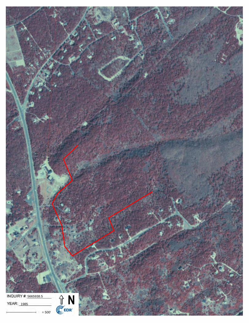
5665938.5
1985
= 500'

5665938.5
1977
= 1000'
Subject boundary not shown because it exceeds image extent or image is not georeferenced.

5665938.5
1971
= 500'
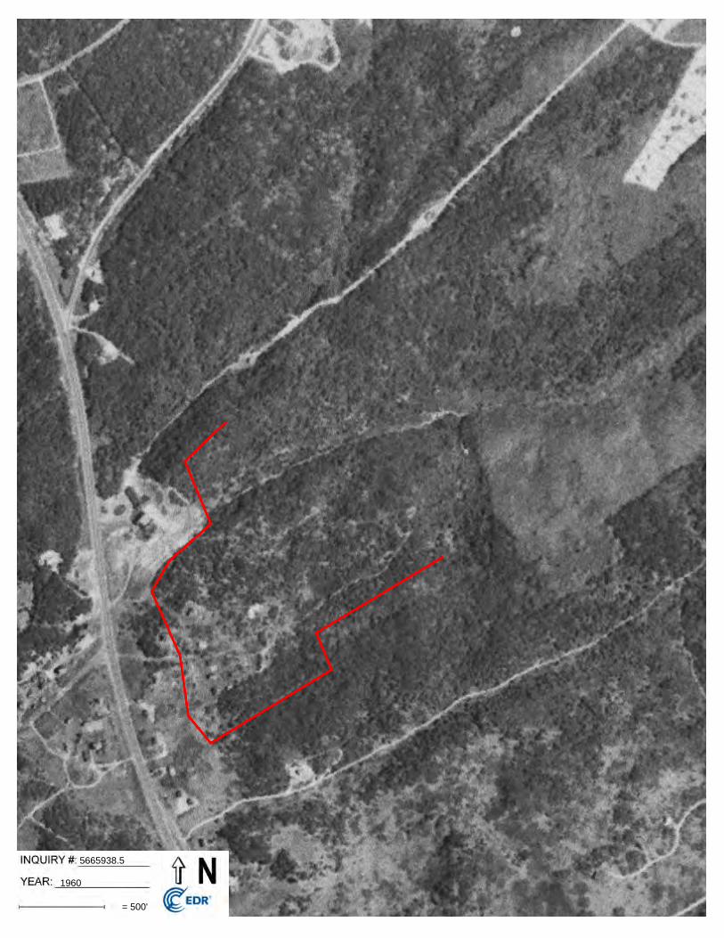
5665938.5
1960
= 500'

5665938.5
1952
= 500'

5665938.5
1938
= 500'


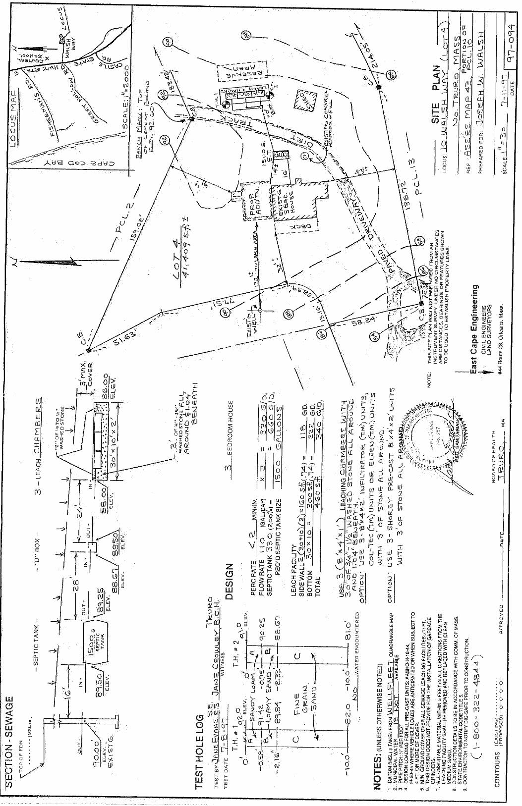

L1923661
The BSC Group, Inc.
5-0324.00
20
Client:
Project Name:
Project Number:
06/14/19
Eight Walkup Drive, Westborough, MA 01581-1019
Lab Number:
Report Date:
508-898-9220 (Fax) 508-898-9193 800-624-9220 - www.alphalab.com
803 Summer Street
Boston, MA 02127
David CrispinATTN:
ANALYTICAL REPORT
Certifications & Approvals: MA (M-MA086), NH NELAP (2064), CT (PH-0574), IL (200077), ME (MA00086), MD (348), NJ (MA935), NY (11148), NC (25700/666), PA (68-03671), RI (LAO00065), TX (T104704476), VT (VT-0935), VA (460195), USDA (Permit #P330-17-00196).
(617) 896-4451Phone:
The original project report/data package is held by Alpha Analytical. This report/data package is paginated and should be reproduced only in itsentirety. Alpha Analytical holds no responsibility for results and/or data that are not consistent with the original.
Serial_No:06141911:51
Page 1 of 19

L192
3661
-01
Alp
ha
Sam
ple
ID
SU
B S
LAB
-1
Clie
nt
ID
TR
UR
O
Sam
ple
L
oca
tio
n
20 5-03
24.0
0
Pro
ject
Nam
e:P
roje
ct N
um
ber
:L
ab N
um
ber
: R
epo
rt D
ate:
L192
3661
06/1
4/19
05/3
0/19
15:
00
Co
llect
ion
D
ate/
Tim
eM
atri
xR
ecei
ve D
ate
SO
IL06
/04/
19
Ser
ial_
No:
0614
1911
:51
Pag
e 2
of 1
9

Project Name:
Project Number:
Lab Number:
Report Date:
Were all samples received in a condition consistent with those described on the Chain-of-Custody, properly preserved (including temperature) in the field or laboratory, and prepared/analyzed within method holding times?
Were the analytical method(s) and all associated QC requirements specified in the selected CAM protocol(s) followed?
Were all required corrective actions and analytical response actions specified in the selected CAM protocol(s) implemented for all identified performance standard non-conformances?
Does the laboratory report comply with all the reporting requirements specified in CAM VII A, "Quality Assurance and Quality Control Guidelines for the Acquisition and Reporting of AnalyticalData?"
VPH, EPH, and APH Methods only: Was each method conducted without significant modification(s)? (Refer to the individual method(s) for a list of significant modifications).
APH and TO-15 Methods only: Was the complete analyte list reported for each method?
Were all applicable CAM protocol QC and performance standard non-conformances identified and evaluated in a laboratory narrative (including all "No" responses to Questions A through E)?
YES
YES
YES
YES
N/A
N/A
YES
A
B
C
D
E a.
E b.
F
MADEP MCP Response Action Analytical Report Certification
L192366120
5-0324.00
Were the reporting limits at or below all CAM reporting limits specified in the selected CAM protocol(s)?
Were all QC performance standards specified in the CAM protocol(s) achieved?
Were results reported for the complete analyte list specified in the selected CAM protocol(s)?
YES
YES
YES
G
H
I
A response to questions G, H and I is required for "Presumptive Certainty" status
This form provides certifications for all samples performed by MCP methods. Please refer to the Sample Results and Container Information sections of this report for specification of MCP methods used for each analysis. The following questions pertain only to MCP Analytical Methods.
An affirmative response to questions A through F is required for "Presumptive Certainty" status
For any questions answered "No", please refer to the case narrative section on the following page(s).
06/14/19
Please note that sample matrix information is located in the Sample Results section of this report.
Serial_No:06141911:51
Page 3 of 19

20
5-0324.00
Project Name:
Project Number:
Lab Number:
Report Date:L1923661
06/14/19
Case Narrative
The samples were received in accordance with the Chain of Custody and no significant deviations were encountered during the preparation
or analysis unless otherwise noted. Sample Receipt, Container Information, and the Chain of Custody are located at the back of the report.
Results contained within this report relate only to the samples submitted under this Alpha Lab Number and meet NELAP requirements for all
NELAP accredited parameters unless otherwise noted in the following narrative. The data presented in this report is organized by parameter
(i.e. VOC, SVOC, etc.). Sample specific Quality Control data (i.e. Surrogate Spike Recovery) is reported at the end of the target analyte list
for each individual sample, followed by the Laboratory Batch Quality Control at the end of each parameter. Tentatively Identified
Compounds (TICs), if requested, are reported for compounds identified to be present and are not part of the method/program Target
Compound List, even if only a subset of the TCL are being reported. If a sample was re-analyzed or re-extracted due to a required quality
control corrective action and if both sets of data are reported, the Laboratory ID of the re-analysis or re-extraction is designated with an "R"
or "RE", respectively.
When multiple Batch Quality Control elements are reported (e.g. more than one LCS), the associated samples for each element are noted in
the grey shaded header line of each data table. Any Laboratory Batch, Sample Specific % recovery or RPD value that is outside the listed
Acceptance Criteria is bolded in the report. In reference to questions H (CAM) or 4 (RCP) when "NO" is checked, the performance criteria
for CAM and RCP methods allow for some quality control failures to occur and still be within method compliance. In these instances, the
specific failure is not narrated but noted in the associated QC Outlier Summary Report, located directly after the Case Narrative. QC
information is also incorporated in the Data Usability Assessment table (Format 11) of our Data Merger tool, where it can be reviewed in
conjunction with the sample result, associated regulatory criteria and any associated data usability implications.
Soil/sediments, solids and tissues are reported on a dry weight basis unless otherwise noted. Definitions of all data qualifiers and acronyms
used in this report are provided in the Glossary located at the back of the report.
HOLD POLICY - For samples submitted on hold, Alpha's policy is to hold samples (with the exception of Air canisters) free of charge for 21
calendar days from the date the project is completed. After 21 calendar days, we will dispose of all samples submitted including those put
on hold unless you have contacted your Alpha Project Manager and made arrangements for Alpha to continue to hold the samples. Air
canisters will be disposed after 3 business days from the date the project is completed.
Please contact Project Management at 800-624-9220 with any questions.
Serial_No:06141911:51
Page 4 of 19

Case Narrative (continued)
20
5-0324.00
Project Name:
Project Number:
Lab Number:
Report Date:L1923661
06/14/19
MCP Related Narratives
Report Submission
All MCP required questions were answered with affirmative responses; therefore, there are no relevant
protocol-specific QC and/or performance standard non-conformances to report.
I, the undersigned, attest under the pains and penalties of perjury that, to the best of my knowledge and belief and based upon my personal inquiry of those responsible for providing the information contained in this analytical report, such information is accurate and complete. This certificate of analysis is not complete unless this page accompanies any and all pages of this report.
Authorized Signature:
Title: Technical Director/Representative Date: 06/14/19
Serial_No:06141911:51
Page 5 of 19

20 5-03
24.0
0
Pro
ject
Nam
e:
Pro
ject
Nu
mb
er:
L192
3661
Lab
Nu
mb
er:
Rep
ort
Dat
e:
QC
OU
TL
IER
SU
MM
AR
Y R
EP
OR
T
06/1
4/19
Met
ho
dC
lien
t ID
(N
ativ
e ID
)L
ab ID
Par
amet
erQ
C T
ype
Rec
ove
ry/R
PD
(%)
QC
Lim
its
(%)
Dat
a Q
ual
ity
Ass
essm
ent
Ass
oci
ated
Sam
ple
s
The
re a
re n
o Q
C O
utlie
rs a
ssoc
iate
d w
ith th
is r
epor
t.
Ser
ial_
No:
0614
1911
:51
Pag
e 6
of 1
9

ORGANICS
Serial_No:06141911:51
Page 7 of 19

PETROLEUM HYDROCARBONS
Serial_No:06141911:51
Page 8 of 19

FF
TPH
Parameter Result Dilution Factor
69000 ug/kg 1
Qualifier Units RL
Petroleum Hydrocarbon Quantitation - Westborough Lab
SAMPLE RESULTS
Project Name:
Project Number:
Lab Number:
Report Date:
20
5-0324.00
L1923661
32900
o-Terphenyl 96 40-140
Acceptance CriteriaSurrogate % Recovery Qualifier
06/14/19
SUB SLAB-1Client ID:05/30/19 15:00Date Collected:06/04/19Date Received:
TRUROSample Location:
L1923661-01Lab ID:
Field Prep: Refer to COC
Matrix: Soil Extraction Method:
Analytical Method:Analytical Date:Analyst:
1,8015D(M)06/11/19 12:16LL
EPA 3546Extraction Date: 06/10/19 11:28
96%Percent Solids:
MDL
--
Sample Depth:
Serial_No:06141911:51
Page 9 of 19

Method Blank AnalysisBatch Quality Control
Project Name:
Project Number:
Lab Number:
Report Date:
20
5-0324.00
L1923661
06/10/19 15:011,8015D(M)Analytical Method:
Analytical Date:Extraction Method: EPA 3546Extraction Date: 06/09/19 17:28
06/14/19
Analyst: SR
TPH
Parameter Result
ND
RL
32800ug/kg
UnitsQualifier
Petroleum Hydrocarbon Quantitation - Westborough Lab for sample(s): 01 Batch: WG1246326-1
o-Terphenyl 101 40-140
Surrogate %Recovery QualifierAcceptance
Criteria
MDL
--
Serial_No:06141911:51
Page 10 of 19
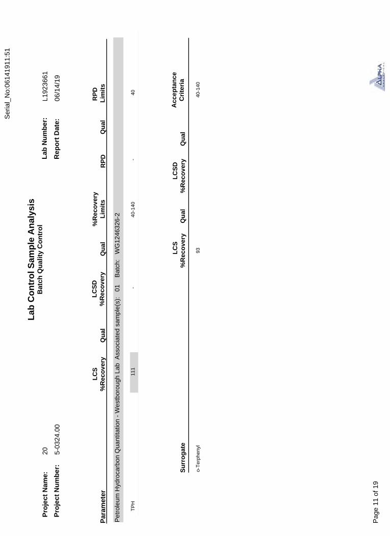
TP
H 1
11-
40-1
40-
40
Par
amet
erL
CS
%R
eco
very
LC
SD
%R
eco
very
%R
eco
very
Lim
its
RP
DR
PD
Lim
its
Pet
role
um H
ydro
carb
on Q
uant
itatio
n -
Wes
tbor
ough
Lab
Ass
ocia
ted
sam
ple(
s):
01
B
atch
: W
G12
4632
6-2
Lab
Co
ntr
ol S
amp
le A
nal
ysis
Bat
ch Q
ual
ity
Co
ntr
ol
Pro
ject
Nam
e:
Pro
ject
Nu
mb
er:
Lab
Nu
mb
er:
Rep
ort
Dat
e:
20 5-03
24.0
0
L192
3661
o-T
erph
enyl
9340
-140
Su
rro
gat
eQ
ual
%R
eco
very
Qu
al%
Rec
ove
ryL
CS
LC
SD
06/1
4/19
Acc
epta
nce
Cri
teri
a
Qu
alQ
ual
Qu
al
Ser
ial_
No:
0614
1911
:51
Pag
e 11
of 1
9

INORGANICS&
MISCELLANEOUS
Serial_No:06141911:51
Page 12 of 19

FF
SUB SLAB-1Client ID:05/30/19 15:00Date Collected:06/04/19Date Received:
Parameter ResultDilution Factor
Matrix: Soil
TRUROSample Location:
L1923661-01Lab ID:
Qualifier Units RL
SAMPLE RESULTS
Project Name:
Project Number:
Lab Number:
Report Date:
20
5-0324.00
L1923661
Field Prep:
DateAnalyzed
AnalyticalMethod Analyst
Refer to COC
General Chemistry - Westborough LabSolids, Total 95.9 % 10.100 06/05/19 14:03 121,2540G RI
Date Prepared
-
06/14/19
MDL
NA
Sample Depth:
Serial_No:06141911:51
Page 13 of 19
*Val
ues
in p
aren
thes
es in
dica
te h
oldi
ng ti
me
in d
ays
L192
3661
-01A
L192
3661
-01B
Via
l Lar
ge S
epta
unp
rese
rved
(4o
z)
Via
l Lar
ge S
epta
unp
rese
rved
(4o
z)
A A
NA
NA
4.7
4.7
Y Y
Abs
ent
Abs
ent
AA
bsen
tC
oo
ler
Cu
sto
dy
Sea
lC
oo
ler
Info
rmat
ion20 5-
0324
.00
TP
H-D
RO
-D(1
4)
TS
(7)
Pro
ject
Nam
e:
Pro
ject
Nu
mb
er:
L192
3661
Lab
Nu
mb
er:
Rep
ort
Dat
e:
Sam
ple
Rec
eip
t an
d C
on
tain
er In
form
atio
n
Co
nta
iner
IDC
on
tain
er T
ype
Co
ole
rT
emp
deg
CP
res
Sea
l
Co
nta
iner
Info
rmat
ion
An
alys
is(*
)
06/1
4/19
Wer
e pr
ojec
t spe
cific
rep
ortin
g lim
its s
peci
fied?
YE
S
Fro
zen
Dat
e/T
ime
Fin
alp
HIn
itia
l p
H
Ser
ial_
No:
0614
1911
:51
Pag
e 14
of 1
9

Report Format: Data Usability Report
GLOSSARY
Project Name:
Project Number:
Lab Number:
Report Date:
L192366120
5-0324.00 06/14/19
Acronyms
DL
EDL
EMPC
EPA
LCS
LCSD
LFB
LOD
LOQ
MDL
MS
MSD
NA
NC
NDPA/DPA
NI
NP
RL
RPD
SRM
STLP
TEF
TEQ
TIC
Detection Limit: This value represents the level to which target analyte concentrations are reported as estimated values, when those target analyte concentrations are quantified below the limit of quantitation (LOQ). The DL includes any adjustments from dilutions, concentrations or moisture content, where applicable. (DoD report formats only.)Estimated Detection Limit: This value represents the level to which target analyte concentrations are reported as estimated values, when those target analyte concentrations are quantified below the reporting limit (RL). The EDL includes any adjustments from dilutions, concentrations or moisture content, where applicable. The use of EDLs is specific to the analysis of PAHs using Solid-Phase Microextraction (SPME).Estimated Maximum Possible Concentration: The concentration that results from the signal present at the retention time of an analyte when the ions meet all of the identification criteria except the ion abundance ratio criteria. An EMPC is a worst-case estimate of the concentration.Environmental Protection Agency.
Laboratory Control Sample: A sample matrix, free from the analytes of interest, spiked with verified known amounts of analytes or a material containing known and verified amounts of analytes.Laboratory Control Sample Duplicate: Refer to LCS.
Laboratory Fortified Blank: A sample matrix, free from the analytes of interest, spiked with verified known amounts of analytes or a material containing known and verified amounts of analytes.Limit of Detection: This value represents the level to which a target analyte can reliably be detected for a specific analyte in a specific matrix by a specific method. The LOD includes any adjustments from dilutions, concentrations or moisture content, where applicable. (DoD report formats only.) Limit of Quantitation: The value at which an instrument can accurately measure an analyte at a specific concentration. The LOQ includes any adjustments from dilutions, concentrations or moisture content, where applicable. (DoD report formats only.)
Limit of Quantitation: The value at which an instrument can accurately measure an analyte at a specific concentration. The LOQ includes any adjustments from dilutions, concentrations or moisture content, where applicable. (DoD report formats only.)
Method Detection Limit: This value represents the level to which target analyte concentrations are reported as estimated values, when those target analyte concentrations are quantified below the reporting limit (RL). The MDL includes any adjustments from dilutions, concentrations or moisture content, where applicable.Matrix Spike Sample: A sample prepared by adding a known mass of target analyte to a specified amount of matrix sample forwhich an independent estimate of target analyte concentration is available. For Method 332.0, the spike recovery is calculated using the native concentration, including estimated values.Matrix Spike Sample Duplicate: Refer to MS.
Not Applicable.
Not Calculated: Term is utilized when one or more of the results utilized in the calculation are non-detect at the parameter's reporting unit.N-Nitrosodiphenylamine/Diphenylamine.
Not Ignitable.
Non-Plastic: Term is utilized for the analysis of Atterberg Limits in soil.
Reporting Limit: The value at which an instrument can accurately measure an analyte at a specific concentration. The RL includes any adjustments from dilutions, concentrations or moisture content, where applicable.Relative Percent Difference: The results from matrix and/or matrix spike duplicates are primarily designed to assess the precision of analytical results in a given matrix and are expressed as relative percent difference (RPD). Values which are less than five times the reporting limit for any individual parameter are evaluated by utilizing the absolute difference between the values; although the RPD value will be provided in the report.Standard Reference Material: A reference sample of a known or certified value that is of the same or similar matrix as the associated field samples.Semi-dynamic Tank Leaching Procedure per EPA Method 1315.
Toxic Equivalency Factors: The values assigned to each dioxin and furan to evaluate their toxicity relative to 2,3,7,8-TCDD.
Toxic Equivalent: The measure of a sample's toxicity derived by multiplying each dioxin and furan by its corresponding TEF and then summing the resulting values.Tentatively Identified Compound: A compound that has been identified to be present and is not part of the target compound list (TCL) for the method and/or program. All TICs are qualitatively identified and reported as estimated concentrations.
-
-
-
-
-
-
-
-
-
-
-
-
-
-
-
-
-
-
-
-
-
-
-
-
Footnotes
Serial_No:06141911:51
Page 15 of 19

Report Format: Data Usability Report
Project Name:
Project Number:
Lab Number:
Report Date:
L192366120
5-0324.00 06/14/19
Terms
Analytical Method: Both the document from which the method originates and the analytical reference method. (Example: EPA 8260B is shown as 1,8260B.) The codes for the reference method documents are provided in the References section of the Addendum.Difference: With respect to Total Oxidizable Precursor (TOP) Assay analysis, the difference is defined as the Post-Treatment value minus thePre-Treatment value. Final pH: As it pertains to Sample Receipt & Container Information section of the report, Final pH reflects pH of container determined after adjustment at the laboratory, if applicable. If no adjustment required, value reflects Initial pH.Frozen Date/Time: With respect to Volatile Organics in soil, Frozen Date/Time reflects the date/time at which associated Reagent Water-preserved vials were initially frozen. Note: If frozen date/time is beyond 48 hours from sample collection, value will be reflected in 'bold'.Initial pH: As it pertains to Sample Receipt & Container Information section of the report, Initial pH reflects pH of container determined uponreceipt, if applicable.PFAS Total: With respect to PFAS analyses, the 'PFAS, Total (5)' result is defined as the summation of results for: PFHpA, PFHxS, PFOA, PFNA and PFOS. If a 'Total' result is requested, the results of its individual components will also be reported.Total: With respect to Organic analyses, a 'Total' result is defined as the summation of results for individual isomers or Aroclors. If a 'Total' result is requested, the results of its individual components will also be reported. This is applicable to 'Total' results for methods 8260, 8081 and 8082.
Data Qualifiers
A
B
C
D
E
G
H
I
J
M
ND
NJ
P
Q
R
RE
S
-
-
-
-
-
-
-
-
-
-
-
-
-
-
-
-
-
Spectra identified as "Aldol Condensation Product".
The analyte was detected above the reporting limit in the associated method blank. Flag only applies to associated field samples that have detectable concentrations of the analyte at less than ten times (10x) the concentration found in the blank. For MCP-related projects, flag only applies to associated field samples that have detectable concentrations of the analyte at less than ten times (10x) the concentration found in the blank. For DOD-related projects, flag only applies to associated field samples that have detectable concentrations of the analyte at less than ten times (10x) the concentration found in the blank AND the analyte was detected above one-half the reporting limit (or above the reporting limit for common lab contaminants) in the associated method blank. For NJ-Air-related projects, flag only applies to associated field samples that have detectable concentrations of the analyte above the reporting limit. For NJ-related projects (excluding Air), flag only applies to associated field samples that have detectable concentrations of the analyte, which was detected above the reporting limit in the associated method blank or above five times the reporting limit for common lab contaminants (Phthalates, Acetone, Methylene Chloride, 2-Butanone). Co-elution: The target analyte co-elutes with a known lab standard (i.e. surrogate, internal standards, etc.) for co-extracted analyses.Concentration of analyte was quantified from diluted analysis. Flag only applies to field samples that have detectable concentrations of the analyte.Concentration of analyte exceeds the range of the calibration curve and/or linear range of the instrument.
The concentration may be biased high due to matrix interferences (i.e, co-elution) with non-target compound(s). The result should be considered estimated.The analysis of pH was performed beyond the regulatory-required holding time of 15 minutes from the time of sample collection.
The lower value for the two columns has been reported due to obvious interference.
Estimated value. This represents an estimated concentration for Tentatively Identified Compounds (TICs).
Reporting Limit (RL) exceeds the MCP CAM Reporting Limit for this analyte.
Not detected at the reporting limit (RL) for the sample.
Presumptive evidence of compound. This represents an estimated concentration for Tentatively Identified Compounds (TICs), where the identification is based on a mass spectral library search.The RPD between the results for the two columns exceeds the method-specified criteria.
The quality control sample exceeds the associated acceptance criteria. For DOD-related projects, LCS and/or Continuing CalibrationStandard exceedences are also qualified on all associated sample results. Note: This flag is not applicable for matrix spike recoverieswhen the sample concentration is greater than 4x the spike added or for batch duplicate RPD when the sample concentrations are lessthan 5x the RL. (Metals only.)Analytical results are from sample re-analysis.
Analytical results are from sample re-extraction.
Analytical results are from modified screening analysis.
1 The reference for this analyte should be considered modified since this analyte is absent from the target analyte list of the original method.
-
Serial_No:06141911:51
Page 16 of 19
Alpha Analytical performs services with reasonable care and diligence normal to the analytical testinglaboratory industry. In the event of an error, the sole and exclusive responsibility of Alpha Analyticalshall be to re-perform the work at it's own expense. In no event shall Alpha Analytical be held liablefor any incidental, consequential or special damages, including but not limited to, damages in any wayconnected with the use of, interpretation of, information or analysis provided by Alpha Analytical.
We strongly urge our clients to comply with EPA protocol regarding sample volume, preservation, cooling,containers, sampling procedures, holding time and splitting of samples in the field.
LIMITATION OF LIABILITIES
1
121
Test Methods for Evaluating Solid Waste: Physical/Chemical Methods. EPA SW-846. Third Edition. Updates I - IV, 2007.
Standard Methods for the Examination of Water and Wastewater. APHA-AWWA-WEF. Standard Methods Online.
Project Name:
Project Number:
Lab Number:
Report Date:
L192366120
5-0324.00
REFERENCES
06/14/19
Serial_No:06141911:51
Page 17 of 19

Alpha Analytical, Inc. ID No.:17873 Facility: Company-wide Revision 12Department: Quality Assurance Published Date: 10/9/2018 4:58:19 PMTitle: Certificate/Approval Program Summary Page 1 of 1
Document Type: Form Pre-Qualtrax Document ID: 08-113
Certification Information
The following analytes are not included in our Primary NELAP Scope of Accreditation:
Westborough FacilityEPA 624/624.1: m/p-xylene, o-xyleneEPA 8260C: NPW: 1,2,4,5-Tetramethylbenzene; 4-Ethyltoluene, Azobenzene; SCM: Iodomethane (methyl iodide), Methyl methacrylate, 1,2,4,5-Tetramethylbenzene; 4-Ethyltoluene.EPA 8270D: NPW: Dimethylnaphthalene,1,4-Diphenylhydrazine; SCM: Dimethylnaphthalene,1,4-Diphenylhydrazine.
EPA 6860: SCM: Perchlorate SM4500: NPW: Amenable Cyanide; SCM: Total Phosphorus, TKN, NO2, NO3.
Mansfield FacilitySM 2540D: TSSEPA 8082A: NPW: PCB: 1, 5, 31, 87,101, 110, 141, 151, 153, 180, 183, 187.EPA TO-15: Halothane, 2,4,4-Trimethyl-2-pentene, 2,4,4-Trimethyl-1-pentene, Thiophene, 2-Methylthiophene, 3-Methylthiophene, 2-Ethylthiophene, 1,2,3-Trimethylbenzene, Indan, Indene, 1,2,4,5-Tetramethylbenzene, Benzothiophene, 1-Methylnaphthalene. Biological Tissue Matrix: EPA 3050B
The following analytes are included in our Massachusetts DEP Scope of Accreditation
Westborough Facility:
Drinking WaterEPA 300.0: Chloride, Nitrate-N, Fluoride, Sulfate; EPA 353.2: Nitrate-N, Nitrite-N; SM4500NO3-F: Nitrate-N, Nitrite-N; SM4500F-C, SM4500CN-CE, EPA 180.1, SM2130B, SM4500Cl-D, SM2320B, SM2540C, SM4500H-BEPA 332: Perchlorate; EPA 524.2: THMs and VOCs; EPA 504.1: EDB, DBCP.Microbiology: SM9215B; SM9223-P/A, SM9223B-Colilert-QT,SM9222D.
Non-Potable WaterSM4500H,B, EPA 120.1, SM2510B, SM2540C, SM2320B, SM4500CL-E, SM4500F-BC, SM4500NH3-BH: Ammonia-N and Kjeldahl-N, EPA 350.1: Ammonia-N, LACHAT 10-107-06-1-B: Ammonia-N, EPA 351.1, SM4500NO3-F, EPA 353.2: Nitrate-N, SM4500P-E, SM4500P-B, E, SM4500SO4-E, SM5220D, EPA 410.4, SM5210B, SM5310C, SM4500CL-D, EPA 1664, EPA 420.1, SM4500-CN-CE, SM2540D, EPA 300: Chloride, Sulfate, Nitrate. EPA 624.1: Volatile Halocarbons & Aromatics, EPA 608.3: Chlordane, Toxaphene, Aldrin, alpha-BHC, beta-BHC, gamma-BHC, delta-BHC, Dieldrin, DDD, DDE, DDT, Endosulfan I, Endosulfan II, Endosulfan sulfate, Endrin, Endrin Aldehyde, Heptachlor, Heptachlor Epoxide, PCBsEPA 625.1: SVOC (Acid/Base/Neutral Extractables), EPA 600/4-81-045: PCB-Oil. Microbiology: SM9223B-Colilert-QT; Enterolert-QT, SM9221E, EPA 1600, EPA 1603.
Mansfield Facility:
Drinking WaterEPA 200.7: Al, Ba, Cd, Cr, Cu, Fe, Mn, Ni, Na, Ag, Ca, Zn. EPA 200.8: Al, Sb, As, Ba, Be, Cd, Cr, Cu, Pb, Mn, Ni, Se, Ag, TL, Zn. EPA 245.1 Hg.EPA 522.
Non-Potable WaterEPA 200.7: Al, Sb, As, Be, Cd, Ca, Cr, Co, Cu, Fe, Pb, Mg, Mn, Mo, Ni, K, Se, Ag, Na, Sr, TL, Ti, V, Zn. EPA 200.8: Al, Sb, As, Be, Cd, Cr, Cu, Fe, Pb, Mn, Ni, K, Se, Ag, Na, TL, Zn.EPA 245.1 Hg. SM2340B
For a complete listing of analytes and methods, please contact your Alpha Project Manager.
Serial_No:06141911:51
Page 18 of 19

Ser
ial_
No:
0614
1911
:51
Pag
e 19
of 1
9