Using Deep Learning with Imagery in ArcGIS - Esri
57
Vinay Viswambharan Using Deep Learning with Imagery in ArcGIS
-
Upload
khangminh22 -
Category
Documents
-
view
1 -
download
0
Transcript of Using Deep Learning with Imagery in ArcGIS - Esri

Vinay Viswambharan
Using Deep Learning with Imagery in
ArcGIS

Session Overview
• AI, Machine Learning & Deep Learning
• Deep Learning Workflow in Pro
• Deep Learning Workflow using arcgis.learn
• Training Models
- ArcGIS Pro
- arcgis.learn
• Types of models and their applications
• Scalable deep learning with Image Server

Neural Networks
TensorFlow
CNTK
Natural Language ProcessingCognitive
Computing
GeoAI
Computer Vision
Dimensionality Reduction
Object Detection
Support Vector Machines
Object Tracking
Keras
PyTorch scikit-learn
fast.ai
Random Forest Machine Learning
Deep Learning
Artificial IntelligenceCaffe
Data Science

Machine Learning
Deep Learning
Artificial Intelligence
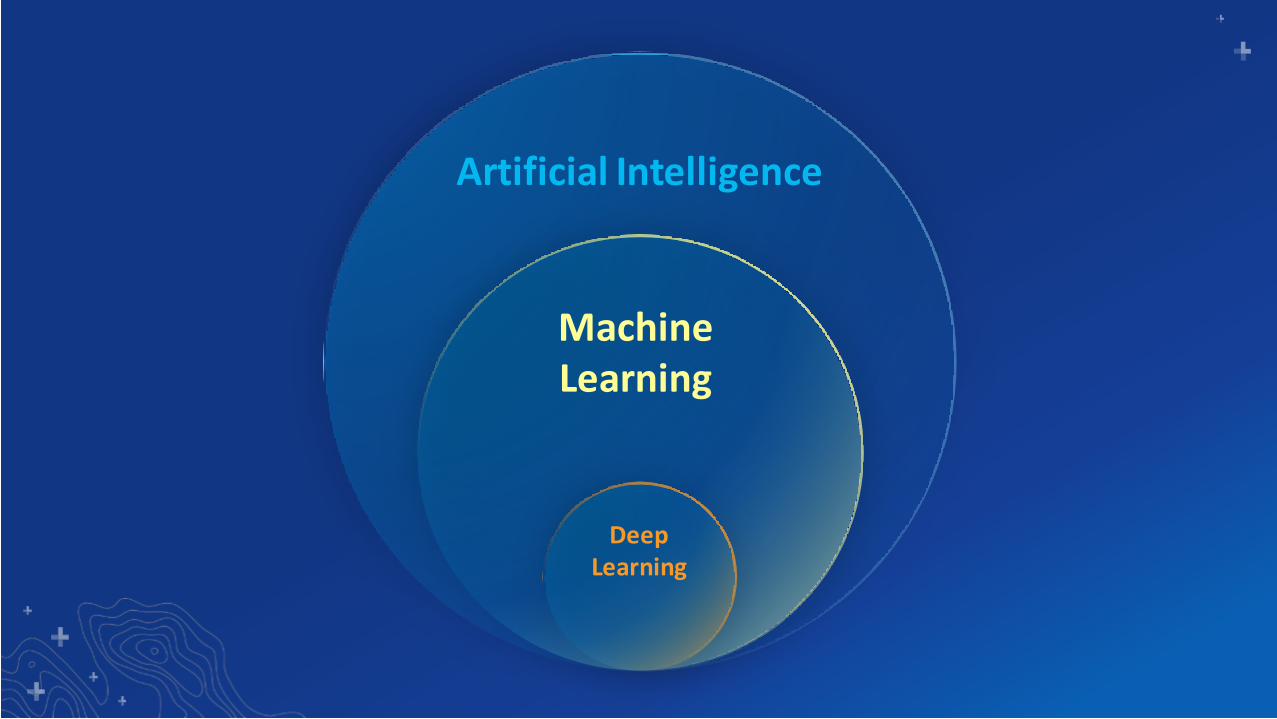
Machine Learning
Deep Learning
Artificial Intelligence

• Pixel & Object Based
• Image Segmentation
• Maximum Likelihood
• Random Trees
• Support Vector Machine
• Empirical Bayesian Kriging
• Areal Interpolation
• EBK Regression Prediction
• Ordinary Least Squares Regression and Exploratory Regression
• Geographically Weighted Regression
Classification PredictionClustering
• Spatially Constrained Multivariate Clustering
• Multivariate Clustering
• Density-based Clustering
• Hot Spot Analysis
• Cluster and Outlier Analysis
• Space Time Pattern Mining
Machine Learning in ArcGIS

• Label Objects
• Training Samples Manager
• Export Training Samples
• Detect Objects
• Classify Pixels
• Classify Objects
• Non Maximum Suppression
Data Preparation InferencingTraining
• Train Deep Learning Model
• Object Detection
• Object Classification
• Pixel Classification
• Instance Segmentation
• arcgis.learn module (ArcGIS API for Python)
Deep Learning in ArcGIS
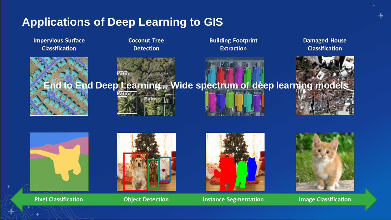
Impervious Surface Classification
Coconut Tree Detection
Building Footprint Extraction
Damaged House Classification
Pixel Classification Object Detection Instance Segmentation Image Classification
End to End Deep Learning – Wide spectrum of deep learning models
Applications of Deep Learning to GIS
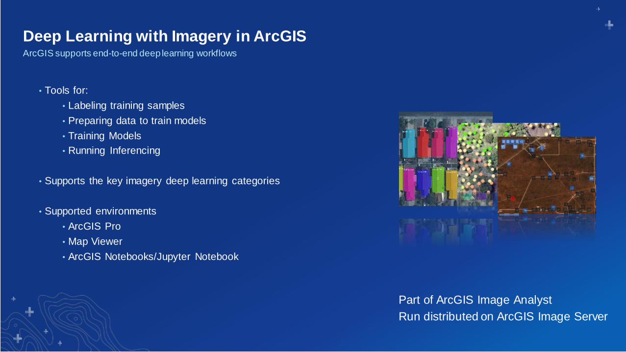
Deep Learning with Imagery in ArcGISArcGIS supports end-to-end deep learning workflows
• Tools for:
• Labeling training samples
• Preparing data to train models
• Training Models
• Running Inferencing
• Supports the key imagery deep learning categories
• Supported environments
• ArcGIS Pro
• Map Viewer
• ArcGIS Notebooks/Jupyter Notebook
Part of ArcGIS Image Analyst
Run distributed on ArcGIS Image Server
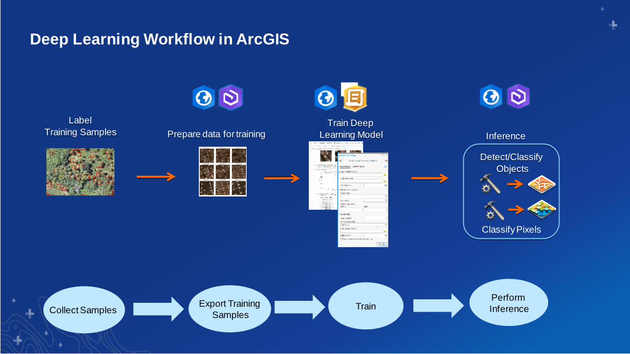
Train Deep
Learning Model
Detect/Classify
Objects
Prepare data for training
Label
Training Samples
Classify Pixels
Collect Samples Export Training
SamplesTrain
Perform
Inference
Deep Learning Workflow in ArcGIS
Inference

Collect Training Samples / Label data
• Different methods
- Label Objects for Deep Learning – ArcGIS Pro (2.5)
- Training sample manager – ArcGIS Pro
- Feature editing
- ArcGIS Pro
- Map Viewer
- JS Web Apps
• Different data models
- Feature class (local single user)
- Feature services (collaborative experience)
- Classified thematic rasters
Collect
Samples
Export
TrainingSamples
Train Perform
Inference
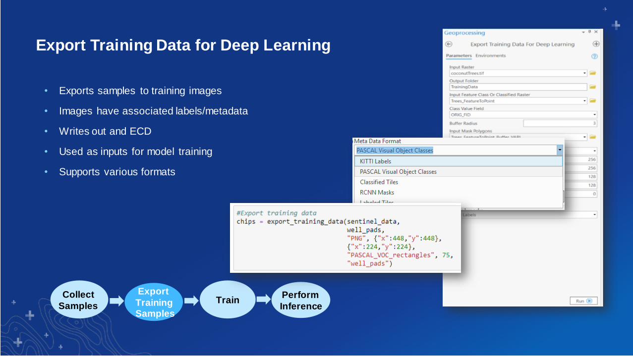
Export Training Data for Deep Learning
Collect
Samples
Export
TrainingSamples
TrainPerform
Inference
• Exports samples to training images
• Images have associated labels/metadata
• Writes out and ECD
• Used as inputs for model training
• Supports various formats

Train Deep Learning Model
• ArcGIS Pro and ArcGIS API for Python supports training
• ArcGIS Pro “Train Deep Learning Model” tool
• arcgis.learn module in ArcGIS API for Python
• Supported Models:
- Object Detection - SSD, RetinaNet, MaskRCNN
- Object Classification – Feature classifier
- Pixel Classification – UNET, PSPNet
• External Deep Learning Frameworks
- TensorFlow
- CNTK…
Collect
Samples
Export
TrainingSamples
Train Perform
Inference
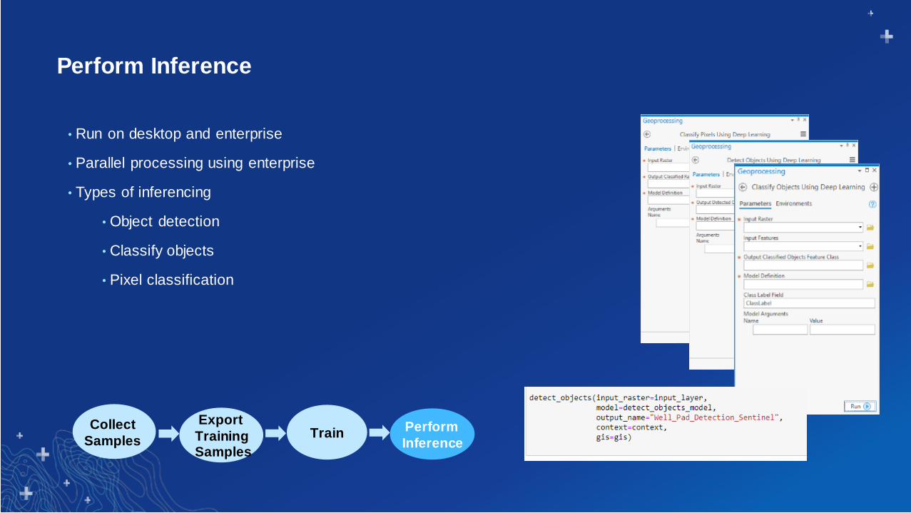
Perform Inference
• Run on desktop and enterprise
• Parallel processing using enterprise
• Types of inferencing
• Object detection
• Classify objects
• Pixel classification
Collect
Samples
Export
TrainingSamples
Train Perform
Inference

ArcGIS – Deep Learning WorkflowEnd-to-end deep learning workflow
Imagery
Tools to
Generate training data
Training sites
Inference
results
Input Images
Tools & APIs
for Training
models
Inferencing
Tools
Tools to generate training samples
• Image Analyst in ArcGIS Pro
• Image Server on ArcGIS Enterprise
Model Training
- ArcGIS Pro
- Notebooks
Inferencing
• Image Analyst in ArcGIS Pro
• Image Server on ArcGIS Enterprise
DLPK
Deep Learning Package
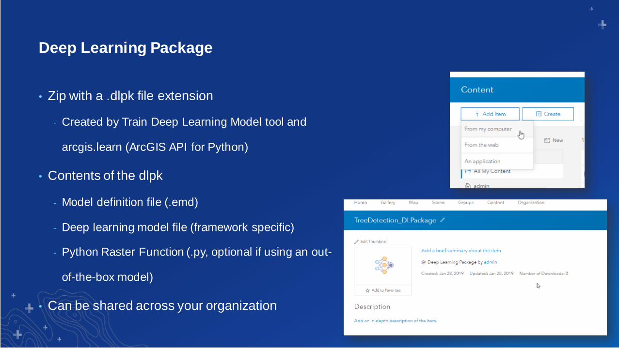
• Zip with a .dlpk file extension
- Created by Train Deep Learning Model tool and
arcgis.learn (ArcGIS API for Python)
• Contents of the dlpk
- Model definition file (.emd)
- Deep learning model file (framework specific)
- Python Raster Function (.py, optional if using an out-
of-the-box model)
• Can be shared across your organization
Deep Learning Package

End-to-end from raw imagery to structured information products
Deep Learning Workflow in ArcGIS
Image
Management
Labelling Data
PrepTrain
Model
Inferencing AnalysisField
Mobility, Monitoring
ArcGIS being used for each step of the deep learning workflow
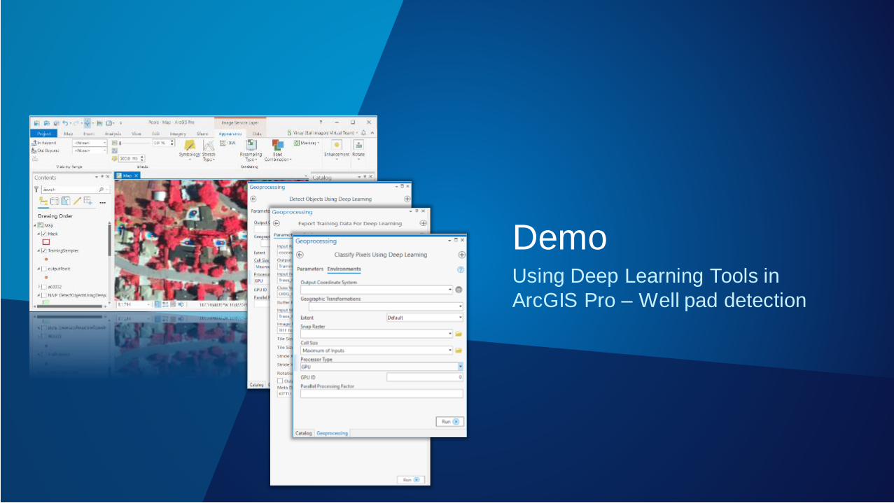
Using Deep Learning Tools in
ArcGIS Pro – Well pad detection
Demo

gis
geometry
network
schematics
features
realtime
widgets
mapping
env
geocoding
geo
enrichment
geo
processing
raster
geo
analytics
learn

The arcgis.learn module in
ArcGIS API for Python enables Python developers and data scientists to
easily adopt and apply deep learning in their workflows.
It enables training state-of-the-art deep learning models with a simple,
intuitive API.
Train Models
Before After
• Installing External DL
Frameworks
• Dozens of lines of
Code
• HARD!
• No Installation
(ArcGIS Notebooks)
• 3-5 lines
• EASY
arcgis.learn module
ArcGIS API for Python

Exporting Training Data arcgis.learn.export_training_data
Training DL Modelsarcgis.learn.SingleShotDetector
arcgis.learn.UnetClassifier
arcgis.learn.FeatureClassifier
arcgis.learn.PSPNetClassifier
arcgis.learn.RetinaNet
arcgis.learn.MaskRCNN
Preparing Data (Augmentation)arcgis.learn.prepare_data
Model Managementarcgis.learn.list_models
arcgis.learn.Model
Model.install
Model.uninstall
Model.query_info
Inference APIsarcgis.learn.detect_objects
arcgis.learn.classify_pixels
arcgis.learn.classify_objects
ArcGIS API for PythonNot just “training”!

ArcGIS Pro 2.5 Notebooks

Things you can do today with arcgis.learnObject Detection, Pixel Classification, Feature Classification, Instance Segmentation
Damaged Structures
Roads
Swimming Pools
Building Footprints
Oil Pads
Land Cover
Palm trees Refugee Camps Surface-to-Air missile (SAM) sites
Catfish Brick Kilns
Sinkholes

Training Model using
arcgis.learn

Image ClassificationAssign a label to a given image
Cat
Applications:
- Damaged building classification
- Clean or ‘green’ pools…
Undamaged Damaged
Object ClassificationAssign a label to a given feature
Models (from torchvision):
- Inception
- ResNet
- VGG…

Damage classification using ArcGIS
Pro
Demo
Vinay

Semantic SegmentationAssign a label to each pixel
Cat
Ground
Sky
Turf/Grass
Building
Water
Pixel Classification
Applications:
- Land Cover Classification
- Pervious/Impervious mapping…
Models:
- UNetClassifier
- PSPNetClassifier

Building footprint extraction


Object DetectionFind objects and their location (bounding boxes)
Applications:
- Detect trees, cars, airplanes, …
Models:
- SingleShotDetector
- RetinaNet

Detecting well pads using ArcGIS Pro
Demo

Instance SegmentationFind objects and their precise locations (masks or polygonal features)
Applications:
- Building footprint extraction
Models:
- MaskRCNN

Building footprints
Demo

ArcGIS Enterprise for Scaling Deep Learning
Problem
• Deep learning is an intensive process
• Resource hog
Solution
• Leverage Raster Analytics to scale inferencing
• All desktop inferencing tools are accessible through enterprise
• Clients to invoke distributed inferencing – Map Viewer, ArcGIS Pro, notebooks
• Multi GPU support
• Requires the ArcGIS Image Server license
60,000 buildingsArcGIS Pro: 1 GP100 GPU (16 GB): 4.5 hoursArcGIS Enterprise: 4 nodes RA server with 3 x P40 GPUs (24GB):20 minutes

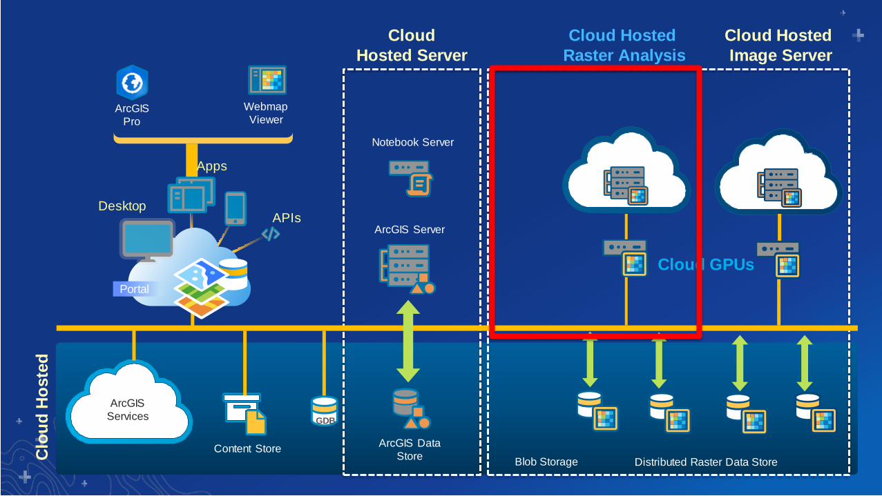
ArcGIS Enterprise Deep Learning – System Architecture
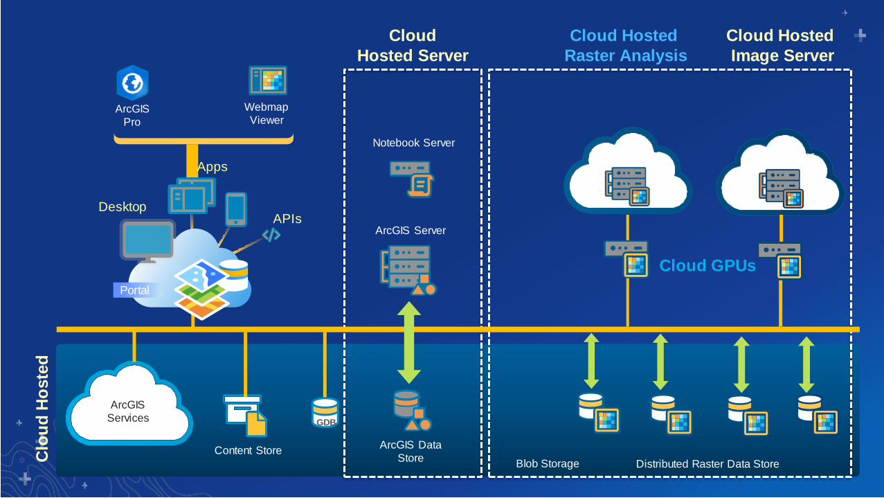
ArcGIS
Pro
Notebook Server
Webmap
Viewer
ArcGIS Server
ArcGIS Data
Store
ArcGIS
Services GDB
Content Store
Cloud
Hosted Server
Cloud Hosted
Raster Analysis
Cloud Hosted
Image Server
Distributed Raster Data Store
Clo
ud
Ho
ste
d
Cloud GPUs
Blob Storage
Portal
Apps
DesktopAPIs
Image Server Image Server

ArcGIS
Pro
Notebook Server
Webmap
Viewer
ArcGIS Server
ArcGIS Data
Store
ArcGIS
Services GDB
Content Store
Cloud
Hosted Server
Cloud Hosted
Raster Analysis
Cloud Hosted
Image Server
Distributed Raster Data Store
Clo
ud
Ho
ste
d
Cloud GPUs
ND6s
P40 GPU
Blob Storage
Portal
Apps
DesktopAPIs
Image Server Image Server
ArcGIS
Pro
Notebook Server
Webmap
Viewer
ArcGIS Server
ArcGIS Data
Store
ArcGIS
Services GDB
Content Store
Cloud
Hosted Server
Cloud Hosted
Raster Analysis
Cloud Hosted
Image Server
Distributed Raster Data Store
Clo
ud
Ho
ste
d
Cloud GPUs
Blob Storage
Portal
Apps
DesktopAPIs
Image Server Image Server

ND6s
P40 GPUImage Server
Image Server
Image Server
ArcGIS
Pro
Notebook Server
Webmap
Viewer
ArcGIS Server
ArcGIS Data
Store
ArcGIS
Services GDB
Content Store
Cloud
Hosted Server
Cloud Hosted
Raster Analysis
Cloud Hosted
Image Server
Distributed Raster Data Store
Clo
ud
Ho
ste
d
Cloud GPUs
Blob Storage
Portal
Apps
DesktopAPIs
Image Server Image Server

GeoAI Sample Use-CasesIdentifying broken insulators
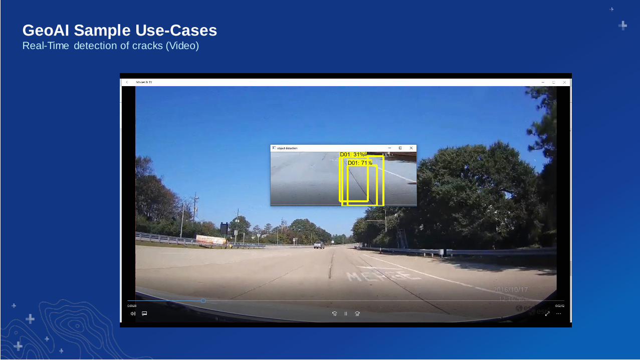
GeoAI Sample Use-CasesReal-Time detection of cracks (Video)

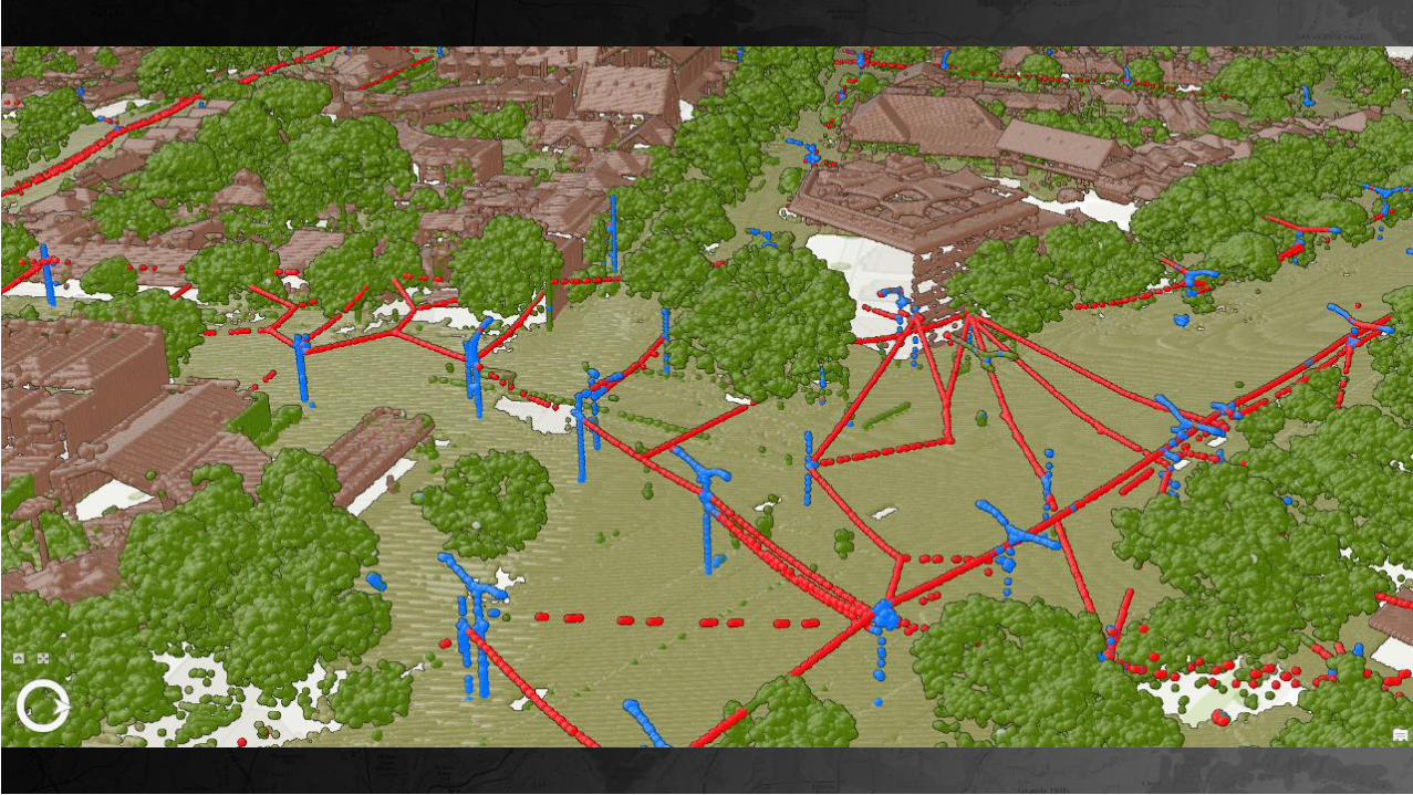
GeoAI Sample Use-CasesVisualize areas with highest amount of cracks
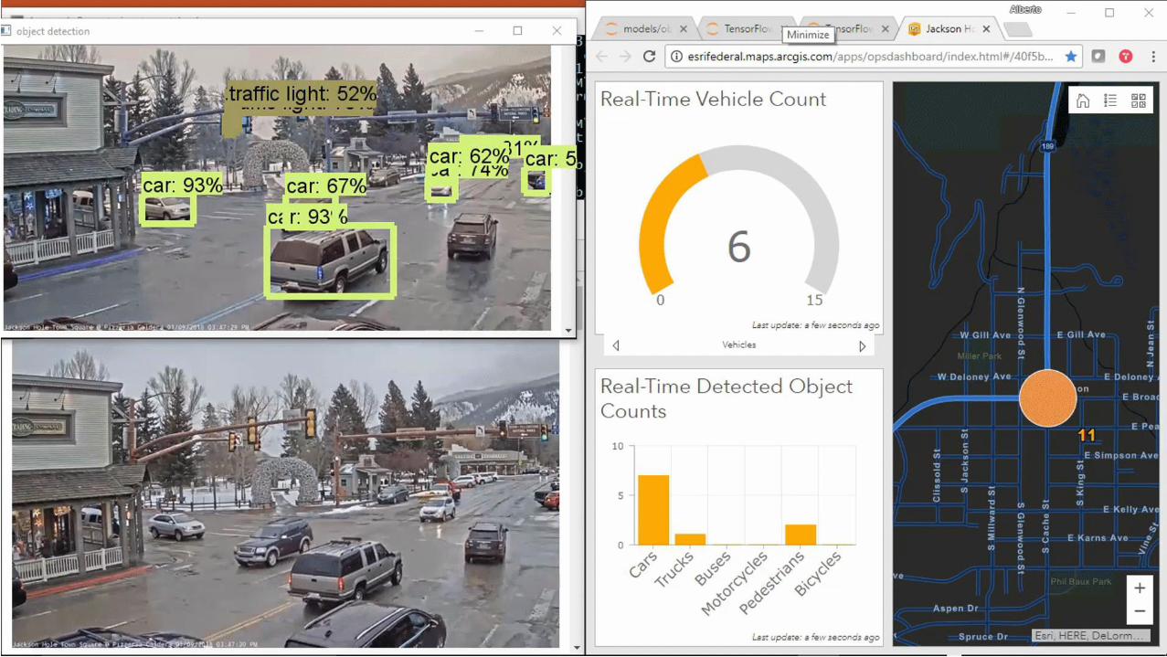
Real-Time Activity Detection using Deep Learning
with ArcGIS API for Python and Ops Dashboard


GeoAI Sample Use-CasesTracking and anomaly detection


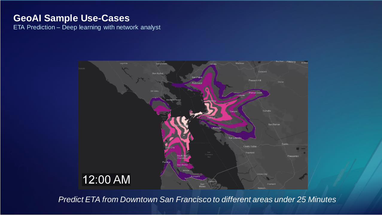
Predict ETA from Downtown San Francisco to different areas under 25 Minutes
GeoAI Sample Use-CasesETA Prediction – Deep learning with network analyst
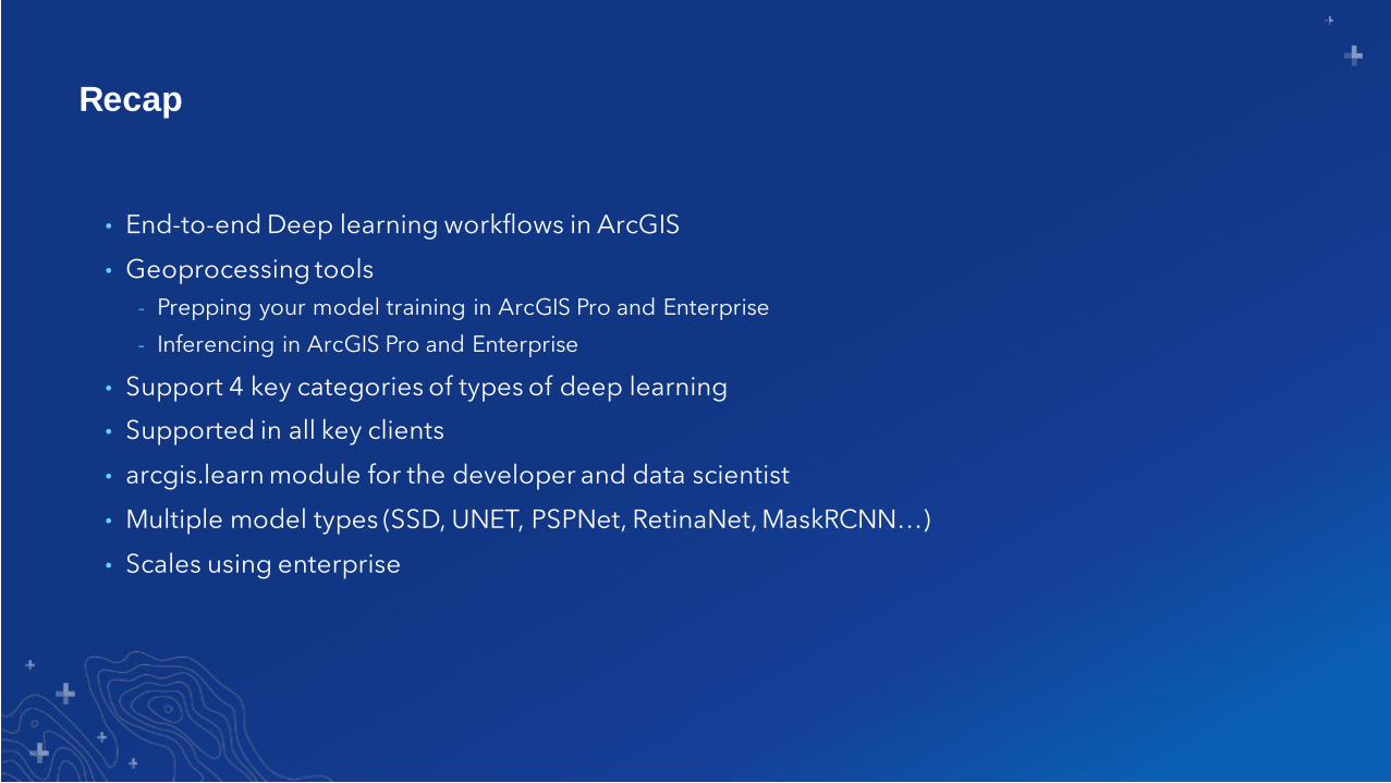
Recap
• End-to-end Deep learning workflows in ArcGIS
• Geoprocessing tools
- Prepping your model training in ArcGIS Pro and Enterprise
- Inferencing in ArcGIS Pro and Enterprise
• Support 4 key categories of types of deep learning
• Supported in all key clients
• arcgis.learn module for the developer and data scientist
• Multiple model types (SSD, UNET, PSPNet, RetinaNet, MaskRCNN…)
• Scales using enterprise

Print Your Certificate of Attendance
Print Stations Located in 150 Concourse Lobby
Tuesday12:30 pm – 6:30 pm
Expo
Hall B
5:15 pm – 6:30 pm
Expo Social
Hall B
Wednesday10:45 am – 5:15 pm
Expo
Hall B
6:30 pm – 9:30 pm
Networking Reception
Smithsonian National Museum
of Natural History

Download the Esri
Events app and find your event
Select the session
you attended
Scroll down to
“Survey”
Log in to access the
survey
Complete the survey
and select “Submit”
Please Share Your Feedback in the App


Parking lot classification