ufafLlv Mfer To: Vp-*-l ' „ WV 2^ 1984 Iti 11 pmJ«c' 'MI company ...
39
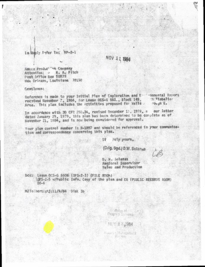
ufafLlv Mfer To: Vp-*-l ' „ WV 2^ 1984 Iti 11 pmJ«c' 'MI company Attention: R • A* Fitch Pott Offica So* S0879 Mow Orleans, Louisiana 701SO f»eirtle*en: Reference ll mad* to your Initial Plan nf exploration and F '^X* 1 *** ort r*c»1«»d «ove**er 7, 1984, For Leas* OCS-G 560.. Block 149, ! ******* Area. This plan Includes tftt -ctlvltles proposed for Valla > -owjjh E. Xn accordance with 30 CR ?50.34, revised December 13, 1979. a our letter dated January 29. 1979, thi* plan I t s bee* determined to bo cw >>let* as of November Z l , 1984 * and Is SOM hel no considered for approval. Your plan control nwaher ir i*-1897 ano should be referenced fa your cownvnica- tion And correspondence concerning this plan. 51 rely yours, (Cil0.$gd^O,W. Solan.* 0. h. iolanas Aeqforal Supervisor 9m\m aod Production ts bcc: Leste OCS-G 5606 (OPS-Z-3) (FILE ROOM lOr!S-2-5 w/Publlc Info. Copy of the plan and ER (PUBLIC RECORDS ROOM) 00-6 MJTo ^ert:gtj: 11/9/84 Disk 3b 384
-
Upload
khangminh22 -
Category
Documents
-
view
0 -
download
0
Transcript of ufafLlv Mfer To: Vp-*-l ' „ WV 2^ 1984 Iti 11 pmJ«c' 'MI company ...
ufafLlv Mfer To: Vp-*-l ' „ WV 2^ 1984
Iti 11 pmJ«c' 'MI company Attention: R • A* Fitch Pott Offica So* S0879 Mow Orleans, Louisiana 701SO
f»eirtle*en:
Reference ll mad* to your Initial Plan nf exploration and F '^X*1 ***ort
r*c»1«»d «ove**er 7, 1984, For Leas* OCS-G 560.. Block 149, ! ******* Area. This plan Includes tftt -ctlvltles proposed for Valla > -owjjh E.
Xn accordance with 30 CR ?50.34, revised December 13, 1979. a our letter dated January 29. 1979, thi* plan I ts bee* determined to bo cw >>let* as of November Zl , 1984 * and Is SOM hel no considered for approval.
Your plan control nwaher ir i*-1897 ano should be referenced fa your cownvnication And correspondence concerning this plan.
51 rely yours,
(Cil0.$gd^O,W. Solan.*
0. h. iolanas Aeqforal Supervisor 9m\m aod Production
ts
bcc: Leste OCS-G 5606 (OPS-Z-3) (FILE ROOM lOr!S-2-5 w/Publlc Info. Copy of the plan and ER (PUBLIC RECORDS ROOM) 00-6
MJTo ^ert:gtj: 11/9/84 Disk 3b
384

PUBLIC INFORMATION Amor^TPfoduction Company Amoco Building Pc i Ofdce Box 508^B Ntv» Orleans Loui»i»n " "315C
Offshore Division
R A Fitcn
P - n l u C l l o r M. rv tg f i ,
MINERALS MANACFMIN7 SERVICE
November I , 1984
F i l e : RAF-LF RULES ANO PR0MCT.0N
Minerals Management Service Offshore Operations Support P. C. Box 7944 M e t a i r i e , LA 70010
A t t e n t i o n : Mr. D. V Solanas Deputy Minerals Manager
Plan of Exploration South Timbalier 149 OCS-G-5606 Offshore Louisiana
I n accordance wi th 30 CFR 250.34-1, Exploration Plan, revised September 14, T979, and l e t t e r dated January 29, 1979, attached please f i n d nine copies of Amoco Producticn Company's Plan of Exploration and Environment a l Report for South Timbalier Block 149, Offshore Louisiana.
Amoco respectful ly requests your favorable attention to th i s matter. Should further information e desired, please contact Harty Van of th i s o f f i c e at telephone 504/58 6567.
Yours sincerely,
HCV/
Attachments

PLAN OF EXPLORATION
South Timbal ie r 149
OCS-G-5606
OFFSHORE, LOUISIANA
AMOCO PRODUCTION COMPANY NEW ORLEANS, LOUISIANA
NOVEMBER, 1984

I / •
COASTAL ZONE MANAGEMENT
CONSISTENCY CERTIFICATION
Plan of Exploration Type of Plan
South Timbalier Block 149 Area and Block
OCS-G-5606 Lease Number
The proposed a c t i v i t i e s describ< in de ta i l in this Plan comply with Louisiana's approved Coastal Management Program and w i l l be conducted
in a manner consistent with such Program.
Arrangements have been made with the State-Times in Baton Rouge, Louisi ' ana to publish a public notice of the proposed ac t i v i t i e s no later than
_ NOV 2 1 1984
Amoco Production Co.
R. A. Fitch Certifying O f f i c i a l
NOV 1 1984 Date

PUBLIC INFORMATION COPY
250.34-1 EXPLORATION PLAN November 1, 1984
J
A BRIEF DrjsdRIPTION OF THE»PROPOSED TYPE AND SEQUENCE OF EXPLORATION ACTIVITIES JO BE UNDERTAKEN TOGETHER WITH A TENTATIVE TIMETABLE FOR THEIR PERFORMANCE INCLUDING PLAN COMMENCEMENT DATE, SEQUENCE EACH WELL IS TO BE DRILLED, TIME FF&ME (DAYS) TO COMPLETE EACH WELL. AND TOTAL TIME TO COMPLETE THE PROPOSED PROJECT.
Amoco Production Company (100*) acquired South Timbalier Block 149, OCS-G-5606, i n Lease Sale No. 72, May, 1983, for $16.OMM.
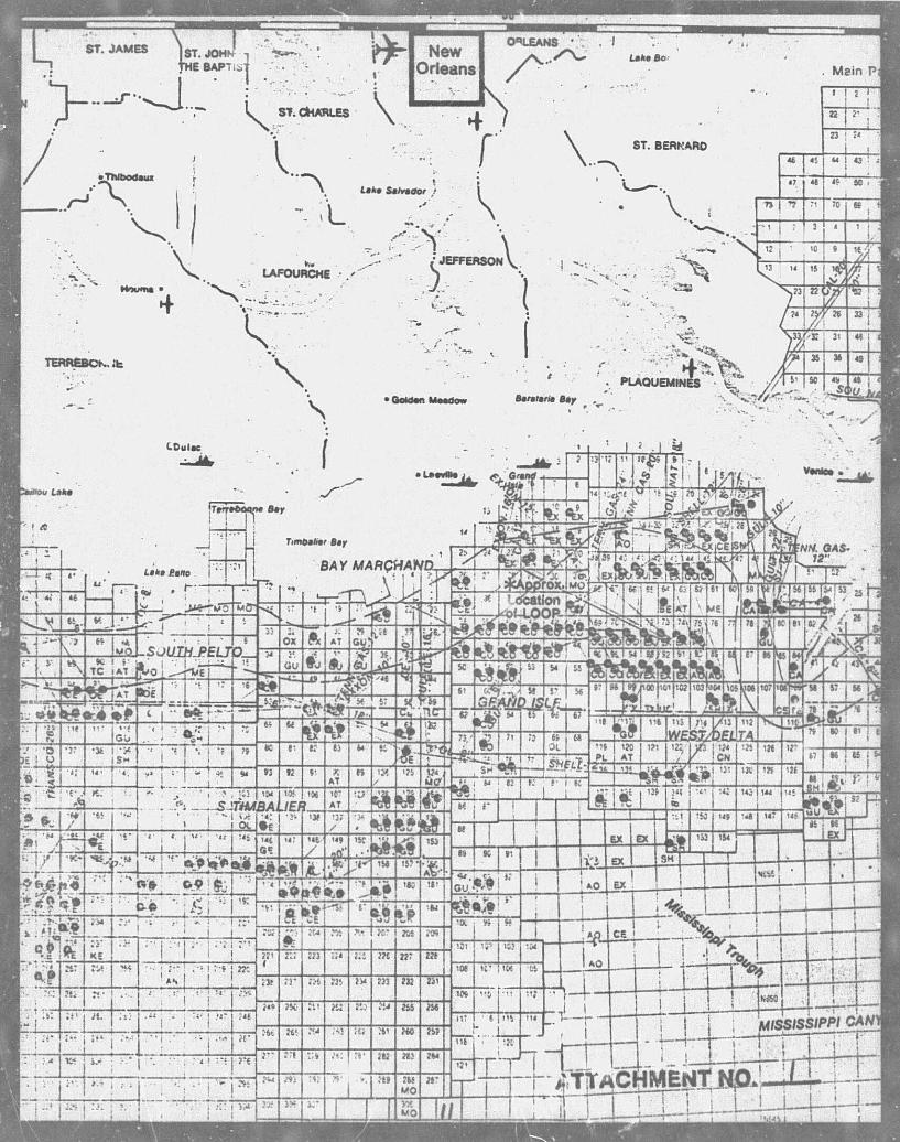
The block is located in 100-127 feet of water, 30 miles offshore and south of Terrebonne Parish, Louisiana. (See Attachment No. 1, Location Plat).
Amoco'-s exploratory plan includes d r i l l i n g five exploratory Wells. The proposed locations of the five wells are as follows:
A. Surface: 600' FSL 600' FWL
B. Surface: 50' FSL 600' FWL
C. Surface: 600' FSL 3400' FWL
D. Surface: 2100' FSL 10001 FWL
E. Surface: 2750' FSL 1500' FWL
Dri l l i n c of the f i r s t well is scheduled to commence on January 1, 1985 with d r i l l i n g of the remaining wells to end on December 16, 1985. Total time to complete the project is estimated to be 350 days. See Attachment No. 2 for the Timing Schedule on the d r i l l i n g of the five wells.
A DESCRIPTION OF THE DRILLING VESSEL(S), OR OTHER INSTALLATION(S) OR DEVICE(S) TO BE PERMANENTLY OR TEMPORARILY ATTACHED TO THE SEABED INDICATING THE IMPORTANT FEATURES THEREOF WITH SPECIAL ATTENTION TO SAFETY FEATURES AND POLI TION PREVENTION AND CONTROL FEATURES INCLUDING OIL SPILL CONTAINMENT UNI CLEANUP PLANS.
The actual r i g to be used is uncertain at this time, however, it. w i l l be a jack-up r i g similar to the Sam Noble. The r i g w i l l be equipped with a l l safety and pollution-prevention equipment required by the OCS Orders. See Attachment No. 3 for r i g det a i l s . See Attachment No. 4 fbr Air Quality Data.
-2-
A l l operations are covered by Amoco's Oi l Sp i l l Contingency Plan previously approved by the MMS on August 10, 1984.
GE0LO(|iri»L AND GEOPHYSICAL SURVEY RESULTS IDENTIFYING GEOLOGICAL HAZARDS AND/OR SUSPECTED ARCHAEOLOGICAL ANOMALIES RELATIVE TO PROPOSED WELL(S), A MAP IDENTIFYING ANY SUSPECTED ARCHAEOLOGICAL ANOMALIES RELATIVE TO PROPOSED WELL(S) WHERE AN ARCHAEOLOGICAL SURVEY IS REQUIRED, AND A DESCRIPTION OF SURVEY EQUIPMENT UTILIZED.
The attached Shallow Hazard Report (Attachment No. 5) confirms that the proposed well locations are free of surface fau l t s , seafloor anomalies or gas accumulations.
In accordance wi th the s t ipula t ion outl ined in the lease agreement, an archaeological survey was conducted and the Cultural Resources Report is included in the Marine High-Resolution Geophysical Survey Report. According to Mr. William H. Spencer, Consulting Archaeologist of Southern Archaeological Research and Mr. Stephen L. Taylor, Chief Geophysicist of Gardline Surveys, Inc. "The single unidentif ied magnetic anomaly located in the survey area does not represent a s ign i f i can t cul tural resource. Although the survey area i s wi th in a general environmental zone which is conducive to prehistoric settlement (Spencer 1984), the specific geomorphic features which are associated with prehis tor ic settlement were not noted in the sub-bottom data. The f i v e unident i f ied anomalies are believed to be the resul t of modern ferruginuous material remaining from pipel ine construction. The sub-bottom data show no ind i cation of any geomorphic features which would be conducive to prehis-tozic coastal settlement."
The entire Marine High-Resolution Geophysical Survey Report in 3 copies is attached. (Attachment No. 6)
A LOCATION MAP OF THE LEASE BLOCK(S) RELATIVE TO THE SHORELINE, INCLUDING A DESCRIPTION OF ONSHORE SUPPORT BASE FACILITIES, A LOCATION MAP SHOWING EACH PROPOSED WELL, INCLUDING SURFACE AND PROJECTED BOTTOM-HOLE LOCATION, WATER DEPTH (BATHYMETRY), PROPOSED TRUE VERTICAL AND MEASURED DEPTH OF EACH WELL.
Please reference Attachment No. 1 Location Plat. This map shows the relationship of Block 149 South Timbalier area, to the shoreline as well as each of the proposed wells at surface location. The water depth in the area ranges from 100-127 feet . See Attachment No. 6 fo r Bathymetry Maps.
Operations w i l l be conducted out of Amoco's base f a c i l i t y at Fourchon, Louisiana located 6 miles southwest of Leevi l le , La. The f a c i l i t y is equipped with a boat landing and he l ipor t for easy access.
- 3 -
J
CURREN^ STRUCTURE MAPS AND, AS APPROPRIATE, SCHEMATIC CROSS SECTIONS
SHOWING EXPECTED DEPTH OR MARKER FORMATIONS.
NOTE: Amoco Product ion Company bel ieves a l l geologic i n fo rma t ion submi t t ed under^this sec t ion t o be exempt from d i sc losure under the Freedom o f Informat ion Act and i t s implementing r egu l a t i ons .
Attachment No. 7 i s a Structure Map demonstrating s t r u c t u r a l r e l a t i o n ships .
Attachment Nos. 8, and 9 are Schematic Cross-Sections showing the geologic s e t t i n g o f the prospects and d e p i c t i n g s t r u c t u r a l r e l a t i onsh ip s as determined by i n t e r p r e t a t i o n o f p r o p r i e t a r y data.
A BRIEF DESCRIPTION OF PROCEDURES, PERSONNEL, AND EQUIPMENT USED IN YOUR OIL SPILL CONTINGENCY PLAN THAI ARE TO BE USED FOR PREVENTING, REPORTING, AND CLEANING UP A POLLUTION SPILL, INCLUDING EQUIPMENT LOCATION AND TRAVEL AND DEPLOYMENT TIME.
In addit ion t o those systems commonly u t i l i z e d by i ndus t ry t o prevent p o l l u t i o n , Amoco i s a member o f Clean Gulf Associates which i s a combine of companies formed t o clean up o i l s p i M s i f such occur. E x i s t i n g o i l s p i l l cleanup equipment w i t h beach p r o t e c t i o n and b i r d - c l e a n i n g s ta t ions can be on hand w i t h i n 9 hours i n * c event of a s p i l l . This equipment is maintained on standby and in * *ady sr.at3 at loca t ions such as Venice , Louisiana; Grand I s l e , Louis iana ; Houma, Louis iana; In t r acoas t a l C i t y , Louis iana; Cameron, Louis iana; Port Aransas ( F u l t o n ) , Texas; and Galveston (Texas C i t y ) , Texas.
A l l applicable s a f e t y and p o l l u t i o n standards of the MMS, USCG, OSHA, and the EPA w i l l be complied w i t h . A l l personnel w i l l be t r a i ned i n the proper maintenance o f e x i s t i n g equipment and w i l l p a r t i c i p a t e i n d r i l l s and inspections designed to enhance t h e i r a b i l i t y to u t i l i z e the equipment to i t s f u l l e s t extent and ensure as safe an opera t ion as poss ib l .
Attachment No. 10 i s the Environmental Report requi red by Section 307 o f the Coastal Zone Management Act (CZMA).
A DETAILED LIST OF MUD COMPONENTS AND ADDITIVES, INCLUDING THE COMMON OR CHEMICAL TRADE NAME OF EACH.
Components o f the d r i l l i n g mud may include any or a l l o f the f o l l o w i n g : b a r i t e , g e l , c a u s t i c , soda, chrome l i g n o s u l f o n a t e , l i g n i t e , sapp, a lumi-
4

• I •
num stearate, soda ash, phosphate, gilsonite, surfactant (methanol), Qu{ck Seal, Spotty and CMC. No bactericides will be used in the mud system. Any drilling mud, drill cuttings, sand, or other solids will iot be disposed of into the Gulf unless all of thefrwee oil has been removed. \
-5-

ATTACHMENT NO—L
LOCATION PLAT SOUTH TIMBALIER BLK. OCS-G-5606 SCALE: 1 " 2000'
149

: V T A R S I I Y M O N T H S X 100 D I V I S I O N S H I >n 111 A i •. . r « c o HMD R t t i 4 G 3 6 5 0
BALIER BLOCK 1^9 CS-Gf5606
TIMING SCHEDULE 1 Ui-U
ioo
90
80
70
i 1 : '
SlARt_DATkjL_JARUAR: t 1, X9$j. rr 1 1
: —
: - ! • : :
J • a i I i ! : :
60
50
r
_L1 70 >AYS . . .
B 70 DAYS
7 0 DAY >
70 )AYS
3fl 70 DAY8 I 1
i • • :
40
30
20
t - t -T : -t- -j :
EES = c =
10
i n 1 1 i i i J i ji I I 1 I f I I 1 1 S i I f 1111 s Ii n84 i«B5 nB6

Hull Dimensions 200'Longx 186'Widex 22'11 "Deep(Triar^kar) Leg Length 414'<vX" Heliport f2'x68'forSfltorskiS-61 Spud Cans 48'Diamelerxl4'nigh U^htShip 7.795 Tons (Approx) Cantilever Distance 14 '-30'with 8'P/S Skidding
35'Max. w/10'P/5 Skkkling l oad Line Draft M'S" Operating Deplh 300' Mcwimur" Wind Speed J25 mph Maximur Vave Height 50'in 300'Water Air Cap 35' Design Boltom Penetration 26'; Maximum footing bearing presure 5,500 psf Jacking Capacity 7,920To. is JackingSpecd 1 R/Min (Up or Down) Certifications _ VS. Coasl Guard; ABSClass A-l
I -evingston's Jack-ups are designed lo withstand hurricane conditions in tlie Guif of Mexico. Tl»e maximum slorm criterion can bc increased in association with a lesser waier depth.
Active Mud " 1.124 Bbl. Rid 4.567Bbl. PoUblc Water 934 BW. Drill Water 5.670 BbL Sack Storage ' 1.800Sq.Ft Bulk Mud and Cement 6.300 Cu. Ft, Variable Load 3.800 Tons

Leviogston Shipbuilding Class Jack-up Drilling Platform
!
Class: TV.sc vessels will bc classed ABS * Al, non-sclf-propelled. s tf-elevating drilling t oils for 300 foot maximum walrr deplh by Ihe American ..'reau of Shipping. The vessel is also certified oy tlie U.S. Coasl Guard.
Equipment Equipment Cranes Main Kngjncs....
2-UnVtHL ABS/API - 218A wilh 100'Boom 3 — EMI) I6Cylindcr (1.9501 IP each)
(w/GM AB-20-6 Generators) . . . . l-Caterpillar D-379 W/400KW Generator
F"'.rox National Jacks. Racks & Pinion,5. trine
Emergency Geneiatois Scw-igc Treatment Jacking System 2 - Sc!/ Propelled 58-Person Enclosed boats
Drilling Equipment Drawworks Auxiliary Brake . . . Mud Pumps Rotary Derrick Blowout Preventers
. . . Oilwell. E-3000 Piumac.lnc.V-295
2 - OiKvefl A -1700-PT (1.7001 IP) Tnplex Oilwell. B 49)4
Lee C. Moore Standard (T-Leg) 1.250.000 Capacity with 12 lines . 1 - Double 13-X x 10.000 Type V. Cameron 1 - Single 13-X x 10.000 Type V. Cameron
1 - Shaffer Li ft x 5,000 Splwrica! 1 - 20" x 2.000 MSP Hydril
B.< !• dling System Dr. ., .«4ctota
1 — NL Control System i90 x 72 Accumul.it' r . . . 1 — Dual 3t Toy Wireline I lou'lnn Svstems
8-GE75? ' * .Mors
Carters Ac vmmnddtion* Ouai~.ii for :vi Persons 'treatment Space '. M?JI

>.u. Ki C'L i i • owrrn. • WISHED EOI .^ENT' • 1
DERRICK:
HULL:
C^fcVTINC DF./'TH: I
SUBSTRUCTURE: ! j
DRAWWOK «?;
CROWN BLOCK:
HOOK:
ELEVATOR LINKS:
f-IPS:
ELEVATORS:
ROTARY TABLX:
ROTARY DRIVE BUSHINGS
Tr VELINO BLOCK:
Lee C. Moore 147* x 30* w i t h capaci ty o f 1,300,0001
1 Levingston Class 111-C Jack-up w i t h Na t iona l rack 6 r^n<on j a c k i n g system. 186' x 200' x 22 '8"
M-ximum o p e r a t i n g depth 300' water i ' i nunum operat i r 7 j e p t h 3 1 ' water
r
bantilevcr ( f r o n transom to maximum d r i l l i n g position) 30'C i(C00,000 capacity at center line. & 8' o f f center l i n e . 1 (frou. transom to aiuxi' "1 vjrkover position) 35'0" -1.000,000 lb. capacity j t etr.rei l i n e & 10' off center line - 780,0005
Oilwell E-3C00 with Kelcc make r.nd brc*K ou: Cithe/.ds, V-295 hy aromatic brake, complete wit -ver-. .v.ig clutch, crow -o-roitic, complete with H-TCJB rocker d r i l l e r console.
Mlwell AP00 crown block rated M: 600 tons with / - 60" *t«M sheaves grooved for 1-3/3" wirr 1'ne.
One EJ '5C0 Dynaplex with SOO ton r u : 3
1 pr. B. 2-3/*M x 1?2M 350 ton r»t.\-1 pr. BJ 3-1/2' , l'«; 5C0 ton rat*.. 1 Doll head asst ;w with l-S/4" x 36" jju&s 80 ton rated
1 Varco type PS-IT . nri-.g operated ./ith necessary equipment 2 Varco type SDXL for i " d r i l l pipe 1 Varco r.ype LCS-R for 7" d r i l l collars 1 Varro uype DCS-L for 7-3/4" d r i l l collaif,
1 BJ ty;>t TA-150 ton l o r 6-1/2" 6 7" i r i < I cellars \ BJ type TA-150 con fo; 7-3/4* c u l i ^ / j 1 BJ type GG-350 ton for 5" d r i l l n<p« 1 BJ type MGG-250 ton for 5" d r i l l pipe 1 set S.BB 5" XH F.H. Elevators Oual System (2 elevators per
set) I table for dual e.'ev.uor system
Oilwell 49-1/2" w . . i and lo -' **du.c<r>n gear and a i r brake, driven by G.E. 752 elef.tr . motors.
. Varco 27 HDP f o i 5-1/4" API hex I l y - 49 1/2" rotary 1 Varco k e l l y bushing safety guard 'userabl) for 49-1/2"
rotary tabl; 1 Varco MpCH hing- d pin drive master casing bushing for 49-1/2" rotarv cer0.«»
C lwell 630 Sheaves 1-3/8 wireline 650 tons
Drilco 5-1/4" lex w i t h 7-3/4" O.D. to;; upset with 6-5/P" API regular LH box up with 2-13/16" bore bot orn upser toinft 6-5/8" O.D. with 4-1/2" IF pin
SWIVEL: 0'*.)veil PC-650 w i t h s tandard equipment

CAPACITIES:
SEWAGE PLANT:
DRILL PIPE SPINNER:
FISHING TOOLS:
MIT LAP:
EMERGENCY GENERATOR SET!
ROTARY TORQUE INDICATOR:
AUTOMATIC DRILLER:
BUG BLOWERS.
TORQUE WRE&CH:
INTERCOM SYSTEM.: •
CENTRIFUGAL MUD PUMPS:
MUD AGITATORS:
Jjj DESAKi^R:
uD CLEANER:
DFtoSSaJ .
H SHALE S .IAKK? :
TO D r i l l water: Fuel: Potable: Total reserve active.
• &lslug p i t s :
i /
5,330 BBLS • k
4,134 iBLS 90'- 'iBLS
1 BBLS
1 Red Fox mode > -2000C wi h Paco PIP 550 l i f t s t a f i o n Coast Guard a-pr. *e>* for 100 men
1 Spinnerhavk u i e l 13, a i r operated j J r i l l pipe Spinner
Fishing too ls and subs fo r cont rac tor : s d r i l l pipe aM equipment
1 Baroid model 821
• C a t t r p i l l a r model D379 *.»ries B, diesel generator set, 4 cycle, V-8, 6.25" bore .. 3" stroke, 3 phase, 120G PPM, «°0 KW (prime), 480 vo i r
1 Martin Decker model 102A wi th dual indicat ing d i a l fo r feet/pounds and amps
1 "Bearcjr automatic with necess?r / equipment
Brandt moee1 B-I30, 15,000 CFK
1 type :«*W w-,th necessary equipment
1 Gai-Ironies cc l i s t i n g o f : 14 ea. weatherproof stations 7 ea. indoor stations 3 ea. explosion pruof s tat ions
2 Mission Magnum 8" x 6" x 14" charging pu.nps 2 Mission Magnum 8" x 6" x 14" mud mixing pumps I Mission Magnum 8" x 6" x 14" dasancler punm 1
i Missio:. Magnum 8" x 6" x 14" des i l t e r pump 1 Mission Magnum 8" x 6" x 1*" degasser pump I Mission lignum 8" x 6" .« spare ump
A l l c e n t r i f u g a l pumps , ' r v e n by 75HP e lec t r ic motors
mode.'' 85Q20 Lightnin mud mixers with 2) HP e l e c t r i c mccors i .nodel 82Q5 Lightnin mud mixers wi th 5 HP e l ec t r i c motcrs
1 TJemco model 123 v e r t i c a l desander with (3) 12" cones
1 Demco model U MC16 mud rleaner with 16 ea. 4" s t y l e '"••"f
cones
1 Swaco "D" gasser
1 Brandt dual tandem shale shaker

MUD b i - 1 EM:
SAFETY VALVES:
P-TANKS
1 Demco 5" 10,0000 W.P. dual standpipe with 5'' XXh piping wi th Demco 10,0000 valves and (Z) 3-1/2" r. •6C
, d r i l l i n g hoses wi th Martin Decker 0 - 10,0000 gauges and necessary equipment
1 .'ims o 1 ,0000 KV900 W"y _ock 3 Omsco 1J,OOO0 test lc .er k e l l y valves - 4-1/2'' IF 1 Omsco cO,OOO0 test i iside B.O.P/. valves - 4-1/2" IF
« "3 ea. 1130 c n . ' f t . , 12'0" dia. X 15'0" high, ASME coded
for 40 PSl - for mud *<3 ea. 1130 cu. f r . ; 12'0" dia. X o'O" high, ASME coded
for 40 PSI - for cement
SACK MUD STORAGE;
BLOWOUT PREVENTERS: *
Sack cement* Sack chemicalr
900 SQ. f t . f l p o r area ww!: 900 sq. f t . f l oo r area
1 Hydr i l 21-1/4" 2000 PSI annular with 21-1/4" bore 1 Shaffer spherical 13-5/8" X 5000 1 ea. 13-5/8" Can'< or. t?-,e 'U" 10,000 single r ^ a
1 ea. 13-5/8" Canertn typt "J" 10,000 double ram 3 - 5" h i , - . 1 b l i n d
CENTRIFUGAL PUMPS:
HELIPORT:
QU/^TERS:
LIFEBOATS
2 Mission 4 x 3 x i3 d r i l l water 2 Mission .: v 2 x 13 t i r e ^ater pumps 2 Cpeco submeiw^'bla raw water pumps. 1 Spare 2 Crane Deming 2 ' potable water pumps 2 Crane Deming 2" sanitary water pumps 2 Gorman Ruop bilg e & ballast pumps 2 Brown & Sharp fuel transfer pumps 1 Brown »* Shi rp d i r t y o i l punp
51'6" x 62' suitable for S-61 Sikorsky helicopter
For 84 iien with 2 galle*,**, recreation area, o f f i c e s , €tc. Three l e v e l ; 90' lon/; x *8 f side x 30' high
2 ea. 58 man Watercraft lifeboats 2 -2a. ''.5 man D*.vit launched l i f e r a f t s
MOORING WINCHES:
CHOKE MANIFOLD:
TEXAS DECK:
".IG SKID JACKS:
4 Skagit model JUQ-074
10,000 PSI ' i t h - 1 positive choke 1 hanr! adjustable choke
1 - 16' x 16' with (2) - I-R 2 Drum a i r winch
2 - HSMC 350 t n Jacks Push or Pull @ 2469 PSI Hydraulic -.essure with claws
2 - HSMC 12_ :on Jacks Push or Pull @ 2500 PSI Hydraulic Pressura with claws
1 HSMC Explosion Proof Power Unit
* i r i l element and seal replacements to be furnis!.*V by Operator. ** S'.vaffer jpherical element and seal replacements to be furnished by Operator.

ROTARY HOSE:
WEIGHT INDICATOP:
WIRELINE:
TONGS:
MEASURING DEVICt;
AIR HOIST:
»ELDING MACHINES:
ENGINE PRIME MOVERS
AH CC i-RF SORS:
ELECTRIC GENER .Tf RS:
D.C. ELECTRxT MOTORS:
HIGH PRESTURE MUD PUMPS
ACCU?4ULATCR:
KELLY SPINNER:
B.O.P. HANDLING SYSTEM:
Two 3-1/2" I.D. x 60', 1O,O6O0 test
Martin Decker model AWD9-1 v i t h Hercules type 131 wireline anc.'jr.
10,000' x 1-3/8" d r i l l i n g l i n e 20,000' x 9/16" sandiin?
3 tongs BJ type DB compleve with lug jaws tc accomodate 3-1/2" to 17" pipe with H6B(G)-28 torque indicating system
* 1 Mathey surveyor wireline unit with maxirw capacity o*«" 20,000' r>f 092 l i n e
Rig Flooi. Cellar D 2k: Derrick:
Conductor Vipe Sn_'bbii:g:
-xr.coln AOO amp.
2 I-R type K5UL 2 I-R type K5UL 1 I-R EUAB/PT wir h A Beche brothers HM-12W hand wind
•I EMD model 16-6A5E8, 1950 HP ea. at 900 RPM with spark arresting exhaust silen:er, complete with automatic shutdown equipment
3 Airdyne model H50BPA0 for r i g a i r 1 Airdyne model 227PR3 bulk a i r reductr^cii system with nec/ssary equipment
1 Airdyne L50B for bulk system 1 Airiyne model 7TD cold s t a r t compressor package with
Lister 8 HP diesel engine
3 EMD model AB20, 2625KV/. at 600 volts, > pliase, 60 hertz 1950 continuous HP with 2200 HP d r i l l i n g service, ABS 1A00 KW v i t h 1575 KW d r i l l i n g service
8 G.E. 7)2AR e l e c t r i c motors, 9C0 HP 3 on drovAJorks 2. e3. cn \ud pumps 1 on rotary
2 Oil w e l l A1700-PT 7-1/2" x 12" Triplex
1 Koomey model T252A0-3S v j *-h manifo' f.nd remote controls vj th model T315-i:i-3 t r i p l e * , pump v i t h 2A eleven gallon bladder type separate accumulators. Unit compl:.e v i t h model AC-62 a i r pump package and a i r control panel and necessary equipment. N
1 International Tool mode. A-6C-2
3 Houi ton Systems 30 on; hydraulic pov.ered v i t h control u n i t an<i necessary equipment
CRANE? 2 FMC L i n k B e l t model A B S / A P I - 2 1 8 A v i t h 100' boo«o 88, 'JOtf c apac i t y , v i t h J i b 10'

•DIVERTER SYSTEM:
DRILL PIPE;
DRILL COLLARS:
I
1 - 8" System with 20" Hydril
9000' - 19-5 E 5" 3000' - 19.5 G 5"
12 - 6-1/2" D r i l l Collars 4-1/2" XH Zip Grooved 12 - 7-3/4" D r i l l Collars 6-5/8" API Reg. Zip Grooved 30 Jts. 5" Hevi-Wate • .
- \

Noble Rig Sara Noble
• I •
Personel To Be Furnished by Contractor J l r
Cllaslsification » No. on Rig •
Hours
T Toolpusher ^
2 12 !
D r i l l e r s 2 12
Derrickmen 2 12
Motormen 2 12
Electrician 1 12
Crane Operator 2 12
Welder 1 12
Roustabout Pusher 1 12
Roustabouts 6 12
Floormen 6 12
Commissary Crew consisting of : Steward, Night Cook and A U t i l i t y men.

Plan o f Exploration fo r South Timbalier Block 149 OCS-G-5606
i Air Quali ty
This attachment includes the information required under 30 CFR Part 250.57(a), to make the necessary f indings under that section.
Exemption Formula •
The distance of the proposed f a c i l i t y from the closest onshore area of a s tate is 31 s ta tute miles:
The proposed f a c i l i t y is at: la t i tude 28° 35' 37.32" north, and longitude 90° 22' 41.51' west.
The closest onshore area of a state i s i n Terrebonne parish, Louisiana, a t :
latitude 29° 3' 0.0 " north, and longitude 90° 24* 41.07" west.
Tliis produces the exemption amount of 1,032 tons/year for par t iculates , s u l f u r dioxide, n i t rogen oxides and v o l a t i l e organic compounds, and the exemption amount of 33,552 tons/year fo r carbon monoxide.
Projected Emissions
D r i l l i n g
The wells proposed to be d r i l l e d on t h i s plan are as follows:
Proposed Veil Proposed Measured Depth (Feet) Rig Type
OCS-G-5606 A Jack-up OCS-G-5606 B Jack-up OCS-G-5606 C Jack-up OCS-G-5606 D Jack-up OCS-G-5606 E Jack-up Total Feet D r i l l e d 92,500
ATTACHMENT NO

Assuming thet the rate of d r i l l i n g w i l l be constant, the to ta l feet d r i l l e d during the plan i s :
I 1985 92,500 feet '
1 I - ' ' 1 I Assuming 60 horsepower hours required to d r i l l one foot on an offshore o i l and gas d r i l l i n g r i g , th is plan w i l l require 5,550,000 horsepower hours to complete the d r i l l i n g . The duration of the operations i s $50 days. Using the emission factors for diesel powered i n d u s t r i a l equipment from Table 3.3.3-1 of EPA publication AP-42, Compilation of Air Pollutant Emission Factors, the following to ta l emissions are expected from th i s plan:
Carbon Nitrogen Sulfur Monoxide Oxide Hydrocarbons Dioxide Particulates
D r i l l i n g 18.54 85.65 6.85 5.70 6.12 Rig
We estimate to have two helicopter landing-takeoff cycles each day at the d r i l l i n g location for the 350 day period of d r i l l i n g a c t i v i t y . Trie emission factors per landing-takeoff cycle for helicopters from Table 3.2.1-3 of EPA Publication AP-42 produce the following helicopter emissions in tons:
Helicopters 1.99 0.20 0.18 0.06 0.09
We plan one 2,000 horsepower workboat landing with six hours of idling three times each week at the d r i l l i n g location. The fuel consumption while idling at the d r i l l i n g location is seven gallons per hour. The emission factors (7 gallons/hour x 6 hours/landing x 3 landing/week x 50 weeks of d r i l l i n g = 6,300 gallons) for CO, VOC id NOx from diesel vessel emission factors by operating mode,
Table 3.2.3-3, and thc factors for S02 and particulates from
Table 3.3.3-1 produce the following workboat emissions, in tons, at the d r i l l i n g location:
Workboats 0.92 0.77 0.30 0.10 ' 0.13
Total 21.45 86.62 7.33 5.86 6.32
These emissions are planned to occur in 1985.
Atmospheric emissions from offshore o i l and gas development and production (EPA 450/3-77-026, p. 82-83, June 1977).
2

Therefore, since none of these amounts approach 1,032 tons (32,552 tons for carbon monoxide), we request that you determine under Section 250.57(d) that!this plan be exempt from further a i r quality review.
v..
-3-

Amoco Production Company Nev% Orleans Region Amoco Building Posi OH.ce I 50879 New Orleans 1.0ms ana 70150
October B l , 1984
Minerals Management Service Deputy Minerals Manager Offshore Operations Support P. 0. Box 7944 Meta i r ie , LA 70010
Subject: Shallow Hazard Report Plan of Exploration South Timbalier Blocks 149 & 150 (OCS-G-5607)
A multi-sensor, high reso lu t ion, geophysical survey was conducted over both blocks. The resul ts indicate a smooth seaf loor, no surface fau l t s , seafloor anomalies, or shallow gas accumulations at the below l i s ted locations:
Ar 600' FSL, 600' FWL Block 149 B. 50' FSL. 600' FWL Block 149 C. 600' FSL, 3400' FWL Block K9 D. 2100* FSL, 1000' FWL Block 149 E. 2750' FSL, 1500' FWL Block 149
The sub-bottom p r o f i l e r records indicate the presence of biogenic gas at various locations throughout the area. At those locat ions,at a proposed d r i11 -s i te , a so i l boring w i l l be taken to ensure that adequate load bearing conditions ex is t before commencing d r i l l i n g operations.
Conventional CDP and "br ight-spot" seismic data, with associated velocity analyses, are free from anomalies at the above locations.
Geologic control i s available immediately west and south at S. Timbalier Blocks 148 and 160. A s im i l a r geologic sequence is expected at the proposed locations..
Byro/i V. Gi l l eon ' Division Geophysical Manager La. Offshore Divis ion
BLG/LGD/e. c
ATTACHMENT NO.-JE

PLAN OF EXPLORATION
ENVIRONMENTAL REPORT
SOUTH TIMBALIER AREA
SOUTH TIMBALIER BLOCK 149
OCS-G-5606
Amoco Production Company
November 1, 1984
P. 0. Box 50879 New Orleans, Louisiana 70150
Phone 504/586-6567
ATTACHMENT NO.

i :A£T.F . F CONTENTS
TITLE .'A'.. . • • v. . i
TABLE OF CONTENTS i i
I . DESCRIPTION OF PROPOSED ACTION 1 A. DESCRIPTION OF PROPOSED TRAVTL MODES ROUTES ANP
QUENCV: 1 B. PERSONNEL REQUIRED TO CC rnUTF ACTIVITIES- . . . 1 C. ONSHORE SUPPORT YSTEMS 2 D. NEW OR UNUSUAL TECHNOLCCY: 2 E. VICINITY MAP: 2 F. PROPOSED MEANS TC TRANSPORT OIL AND GAS TO SHORE,
KOUTES, QUANTITIES: 2
I I . DESCRIPTION OF AFFECTED ENVJ—.NMF.NT 2 A. COMMERCIAL FISHING: 2 B. SHIPPING: 3 C. PLEASURE BOATING, SPORT FISHING AND RECREATION: ... 3
— D. POTENTIAL OR KNOWN CULTURAL RESOURCES: 4 E. ECOLOGICALLY SENSITIVE FEATURES: 5 G. OTHER MINERAL USES: 5 H. OCEAN DUMPING ACTIVITIES: 5 I . ENDANGERED OR THREATENED SPECIES AND CRITICAL HABITAT: 5
I I I . UNAVi 3LE ADVERSE ENVIRONMENTAL EFFECTS 6 A. W, QUALITY: 6 B. EFFLCTS ON MARINE ORGANISMS: 6 C. WETLANDS AND BEACH: D. AIR QUALITY: E. COMMERCIAL FISHING: . . F. SHIP !AVIGAT OV: G. CULTURAL RESOcnCES: H. RECREATION AND AESTHETIC VALUES:
IV. THE PROPOSED ACTIVITY WILL BE CARRIED OUT AND COMPLETED VITH THE GUARANTEE OF THE FOLLOWING ITEMS: 8
REFERENCES 9
APPENDICES 10
LIST OF ATTACHMENTS NO. 1 VICINITY MAP 11 NO. 2 SHIPPING FAIRWAYS 12
11/01/84 Page i i

NO. 3 PIPELINE DETAILS 13 i
rLIST OF APPENDICES LOUISIANA LANDINGS FOR SPECIFIED PERIODS, 1982 and 1963 . . . 14
-r • - \
11/01/84 Page i i i

Plan o f Explora t ion Environmental Report S . -T . 149
OCS-G-5006///
DESCRIPTION OF PROPOSED i-.'.flON
A. I DESCRIPTION" OF PRCPOSED TRAVEL MODES ROUTES AND FREQUENCY: I Boats and he l i cop t e r s v / i l l be dispatched from the Fourchon,
Louisiana ba se on a d a i l y basis or as needed t o the proposed ' d r i l l i n g l o c a t i o n s upon commencement of d r i l l i n g operat ions.
Boats w i l l depart the Fourchon >;ase by Pass Fourchon and upon reaching the Gul f of Mexico, a moi ° or less d i r e : t route w i l l be taken.
The breakdown snown below r e f l e c t s an approximate account of boat and a i r c r a f t departures and a r r i v a l s f o r the d i f f e r e n t phases o f the a c t i v i t y , dependent upon va r i ab l e weather rendit ions .
D r i l l i n g : Boat - 1 t r i p every two days Hel icop te r - 2 t r i p s d a i l y
B. PERSONNEL REQUIRED TO CONDUCT ACTIVITIES: The number o f persons expected t o be needed t o car ry on and support the d r i l l i n g and produc t ion operations i s as f o l l o w s :
O f f s h o r e
D r i l 1 i n g Phase:
Contract Pig Crew
Service Support
Catering
Company Supervision
Onshore
Dockside Support
T r a n s p o r t a t i o n
H e l i c o p t e r P i l o t s
Marine Crews
T o t a l Persons
No. of Employees
55 (7/7 s h i f t )
10 (7/7 s h i f t )
8 (7/7 s h i f t y
2 (7/7 s h i f t )
6 (7/7 s h i f t )
2 (7/7 s h i f t )
12 (7/7 s h i f t )
95
11/01/84 Page 1

Plan of Exploration • £nvironr o " r . . i l .leport S. T. 149
i I •
Since the r i g ana crsnsportation vehicles to be used are currently working in the Gulf of Mexico, no additional fami-
j iies of d r i l l i n g or transportation personnel are expected in
I . the area.^ Any personnel needed for onshore support a c t i v i t i e s 1 w i l l be hired locally; therefore, no new "amilies are a n t i c i -{ pared i n the coastal area.
I ,
C. ONSHORE SUPPORT SYSTEMS: We axpect to use our currently existing support f a c i l i t y in Fourchon, Louisiana, located on Pass Fourchon c miles southwest of Leeville, LA. An easily accessible state highway leads to *he Amoco base f a c i l i t y . No extra land is expected to be needed under the proposed a c t i v i t i e s for f a c i l i t i e s , storage, rights-of-way or easements. Current f a c i l i t i e s already in ^se seem adequate to support a l l phases of the d r i l l i n g plan.
D. NEW OR UNUSUAL TECHNOLOGY: No i*!»w or unusual technology w i l l be employed during this d r i l l i n g operation.
E. VICINITY MAP: See Attachment No. 1.
F. PROPOSED MEANS TO TRANSPORT OIL AND GAS TO SHORE, ROUTES, QUANTITIES: The proposed action is exploratory. No o i l or gas w i l l be produced by this plan ol exploration.
I I . DESCRIPTION OF AFFECTED ENVIRONMENT
A. COMMERCIAL rISHING: The Gulf fishery is dominated by the shell fisheries, shrimp, crabs, and oysters (with sms-ller amounts of clams and scallops). The shrimp fishery in the Gulf area includes brown, white, and pink shrimp. These rre ^ake almost exclusively by trawl wishing ir; depths ranging from 2 to 73 meters.
South Timbalier Block 149, is located within the major f i n f i s h and brown and white shrimp harvest areas and is inside of the principal ndustrial bottomfish and high density shellfish areas. Finfish volume for the Gulf states is dominated by menhaden. I t is number one in volume and second in value for Louisiana. Landings in 1983 were 1.58 b i l l i o n pounds, or 53*
11/01/84 Page 2

i i
Plan of Exploratioh Environmental Report S. T. 1U$
I
of the 2.96 b i l l i o n pounds U.S. menhaden catch. (Fisheries of the United States 1983, A p r i l 1984). Other f i n f i s h caught offshore Louisiana include mullet, croaker, groupers, Spanish mackeral. spotted seatrout, red drum, flounders, black drum, king whiting, white seatrout, and sheepshead (FEIS Sale 72). See Appendix No. ] for a complete l i s t i n g of the catch by major sjpecies. ,
Since the majority of shrimp and commercial bottom fish are caught by trawling, sites occupied by d r i l l i n g rigs and attendant service boats must be avoided.
B. SHIPPING: At least 8,000 km of navigable streams and 1,800 km of intercoastal waterways are located in the state. These waterways include the Mississippi River and the. Gulf Intracoastal Waterway which are major waterways for the nation's waterborne commerce. Other notable waterways include the Atchafalaya River in St. Mary Parish. Louisiana has three major ports - New Orleans*, Baton Rouge, and Lake Charles. Aside from deep-draft ocean shipping, Louisiana is a key focal point for inland waterway t r a f f i c . Inland barge t r a f f i c not only links the deepwater ports to the i n t e r i o r of the nation, but also provides important support for the industrial structure of coast a l Louisiana. The existence of barge service tends to concentrate petrochemical f a c i l i t i e s adjacent to the water sites in Louisiana.
There are no safety fairways near South Timbalier Block 149 See Attachment No. 2. No problems are anticipated in associatio n with fairways (FEIS Sale 72 - Visual No. 11).
In the Gulf of Mexico, safety fairways have been established for the safe passage of vessels en route to or from U.S. ports. Consequently, placement of rigs or platforms are prohibited within these fairways. However, ships do .not always use th^se feirways and t h i s increrses tha p o s s i b i l i t y of a c o l l i s i c a with d r i l l i n g :lgs, permanent platforms r r vessels attending these platforms. In the fairways there is the r i s r of snip/ship c o l l i s i o n s . Impacts which could result include loss of human l i f e , spillage of o i l , release of debris, including part of or the entire d r i l l i n g r i g and the ship. The contents of the ship's cargo could pose a serious threat to the environment i f i t includes toxic materials sucr as chemicals, crude o i l , or refined products. I t should by noted that while the number of offshore structures is increasing, the number of accidents involving the structures hns not increased.
11/01/84 Page 3

Plan of Exploration Environmental Report. S. T. 149
• I "
C. PLEASURE BOATING, SPORT FISHING AND RECREATION: £ p o r t f i s h i n g i n Louisiana i s a very popular form of recreat i o n . Coastal marshland w i t h few roads reaching the shorel ine has l i m i t e d f i s h i n g access and precluded f u l l u t i l i z a t i o n o f the sa l twater - f i she ry resources. Nevertheless, a high percent age o f Louisiana residents own or have access t o boats. Sport f i sh ing^around o f f s h o r e o i l and gas r i g s i s popula .
.Results o f recrea t iona l f i s h e r i e s surveys by D i t t o n and Graefe (1978} i n the northwestern Gu l f of Mexico's Houston-Galveston area i n d i c a t e d that only o n e - t h i r d of the boat --.g populat ion was s a l t w a t e r fishermen and on ly 5% f ished o f f s h o r e . However, o i l and gas s tructures a t t r a c t e d more rushing tha t any other s t r u c t u r e , na tu ra l or a r t i f i c i a l (87% of the boats and 50% o f a l l o f f s h o r e rec rea t iona l f i s h i n g e f f o r t were d i r e c t l y associated w i t h o i l and gas p l a t f o r m s ) . Offshore fishermen were es t imated t o have con t r ibu ted over f i v e m i l l i o n d o l l a r s to the l o c a l economy. (The Ecology o f Petroleum Pla t forms i n the Northwestern Gulf of Mexico: A Community P r o f i l e ) .
Boat ing i n Louisiana 's coas ta l area is most o f t e n r e l a t ed to rec rea t iona l , f i s h i n g . Vater s k i i n g and s a i l i n g are growing i n p o p u l a r i t y , especia l ly i n es tua r ine lakes near South Lousi ana' s major urban centers .
Hunting i s a popular r e c r e a t i o n a l a c t i v i t y i n Louis iana . A v a r i e t y o f water rowl are taken throughout the coas ta l marshes. There is one Na t iona l Park, four Na t iona l W i l d l i f e Refuges and eight a d d i t i o n a l game management areas.
With t he exception of Grand I s l e and v i c i n i t y and a s t r e t c h o f beach area i n Cameron P a r i s h , Louisiana has very l i m i t e d beach area s u i t a b l e f o r r e c r e a t i o n . Most of i t i s very narrow, o f poor r e c r e a t i o n a l q u a l i t y and genera l ly inaccess ib le . Undeveloped and inaccessible by automobile, some of the highest q u a l i t y beach areas i n coas ta l Louisiana are found along the b a r r i e r i s l a n d chain o f f Terrebonne Parish.
Several a d d i t i o n a l s i g n i f i c a n t recreat ions resources are found along the Uni t Coast. Louis iana hes ornamental gardens, scenic roads , r i v e r s , and t r a i l s . No adverse Uipacts are a n t i c i p a t e d .
D. POTENTIAL OR KNOWN CULTURAL RESOURCES: South T i m b a l i e r Biock 149 l i e s ins ide the P r e h i s t o r i c and oui.-s i d « the H i s t o r i c C u l t u r a l Resources High P r o b a b i l i t y Lines. Pursuant t o the lease agreement f o r the t r a c t , a C u l t u r a l Resources Report was requ i red and :'s included i n the Marine High- i teso lu t ion Geophysical S . vey Report which i s an a t tachment t o the Plan of E x p l o r a t i o n .
i l
11/01/84 Page 4

Plan of Exploration' , Environmental Report S. T. 149
,E. ECOLOGICALLY SENSITIVE FEATURES: There are no areas o f p a r t i c u l a r concern w i t h i n South Timbal i e r Block 149. However, t he re are several areas o f environmental ..concern that l i e onshore from the lease area. These inc lude (1) Wisner State W i l d l i f e Management Area, (2) Point Au Chien W i l d l i f e Management Area, (3) East Timbal ie r Is land N a t i o n a l ^ W i l d l i f e Refuge, and (4) Grano1 I s l e State Park Beach and o the r rec rea t iona l beaches.
Block 149 does not occupy a p o s i t i o n w i t h i n any known breeding h a b i t a t , nursery area, or s p e c i f i c migra t ion route;. While associated a c t i v i t i e s could occur i n the b locks , they are not known t o be concentrated t h e r e . No adverse impacts are a n t i c ipa ted .
F. PIPELINES AND CABLES: There are two e x i s t i n g p i p e l i n e s crossing South Timbal ier Block 149. Proposed w e l l l o c a t i o n s are more thai . 500 fee t from these p ipe l i ne s . See Attachment No. 3 f o r P ipe l ine D e t a i l s . No problems are a n t i c i p a t e d i n assoc ia t ion w i t h the e x i s t i n g p i p e l i n e s .
G. OTHER MINERAL USES: There are no known other mine ra l deposits i n the lease area which would be considered commercially important .
H. OCEAN DUMPING ACTIVITIES: There are no EPA approved ocean dumping s i t e s located w i t h i n the South Timbal ie r Area.
I . ENDANGERED OR THREATENED SPECIES AND CRITICAL HABITAT: Five f e d e r a l l y l i s t e d endangered whale species occur w i t h i n the Cen t r a l G u l f . These i nc lude f i n , humpback, r i g h t , s e i , and sperm whales. General ly , these large cetaceans occur i n c o n t i n e n t a l slope and deep oceanic waters. Recently, sperm whales have been sighted n ar the Louisiana Delta ( F r i t t s , 1981, Personal communication).
The red w o l f may occur along thc Louisiana Gulf coast i n Cameron and Vermi l ion Parishes.
Three f e d e r a l l y l i s t e d endangered marine t u r t l e species (Ke.np s r i d l e y , hawksb i l l , and leatherback t u r t l e s ) and two threatened species (green and loggerhead t u r t l e s ) occur i n the Central Gu l f area. Only the loggerhead t u r t l e , which wanders widely throughout the G u l f , i s s igh ted f a i r l y f r equen t l y i n the Cen t r a l Gulf and has h i s t o r i c a l l y nested i n the Chandeleur
11/01/84 Page 5

Pl*n of Exploration • Environmental Report S . T . 149
j I s l ands area. However, i t i s not bel ieved -nat any . endangered/threatened marine t u r t l e s c u r r e n t l y nest i n the ? C e n t r a l Gu l f .
I The American a l l i g a t o r occurs genera l ly throughout the Central I Gu l f coas ta l areas i n f r e s h t o brackish water wetlands. I t i s
b e l i e v e d that Louisiana probably has the la rges t a l l i g a t o r • popular n .the Gulf reg ion of approx ima1 t e l y 200,000 a n i
mals .
The red-cockaded woodpecker occurs p r i m a r i l y i n mature open p ine f o r e s t throughout the Central Gulf coastal area. A few a r t i c peregrine falcons overwinter and migrate through the C e n t r a l Gu l f . M i s s i s s i p p i s a n d h i l l cranes are nonmigratory and a smal l group inhab i t s an area i n Jackson County, Miss i s s i p p i . Four small populat ions of brown pel icans (about 900 -1000 b i r d s ) occur i n the Centra l Gulf i n the area o f Rockef e l l e r Refuge, Queen Bess I s l a n d , nor thern pa r t of St. Bernard P a r i s h , and North I s lands , Louis iana. Bald eagles i nhab i t s eve ra l coastal counties i n the Central G u l f .
No f e d e r a l l y l i s t e d endangered p lan t species are known t o occur i n the Central Gulf area (FEIS Sale 72) .
I I I . UNAVOIDABLE ADVERSE ENVIRONMENTAL EFFECTS
A. WATER QUALITY: D r i l l i n g a c t i v i t i e s w i l l t empora r i ly reduce water q u a l i t y ad jacent t o the d r i l l i n g loca t ions due t o discharges o f d r i l l ing f l u i d s and c u t t i n g s . These discharges w i l l increase t u r b i d i t y i n a plume down-current from the d r i l l s i t e . Released f o r m a t i o n waters and a minor o i l s p i l l could also con t r ibu te t o water q u a l i t y degradat ion.
B. EFFECTS ON MARINE ORGANISMS: Some organisms w i l l be k i l l e d and some w i l l be temporar i ly f u n c t i o n a l l y impaired as a r e s u l t of d r i l l i n g operat ions. The most a f f e c t e d groups w i l l be plankton and benthos immediately around the d r i l l i n g r i g . Damage w i l l be both mechanical and t o x i c o l o g i c a l . Discharge o f format ion waters , d r i l l muds and c u t t i n g s w i l l damage plankton w i t h i r the plume. Disposal o f c u t t i n g s and muds w i l l bury some of the less mobile benthic in fauna and epifauna. These impacts are considered so be l o c a l i z e d , short Lerm and r e v e r s i b l e at the popula t ion l e v e l .
Ai; o i l s p i l l could a f f e c t a broad spectrum of marine organisms. However, most e f f e c t s would be l o c a l i z e d and short
11/01/84 Page 6

Plan of Exploration \ Environmental Report • S . T . 149
term. Any effects on mammals and t *.tles would be s i g n i f i c a n t .
c. | WETLANDS AND'BEACH: In the unlikely event of a s p i l l occurring and reaching shore, organisms in wetland and beach habitats could be k i l l e d or •functionally impaired. Human community disruption could also occur. Although a l l such effects wou J be localized, any effects on endangered species and/or c r i t i c a l habitats would be s i g n i f i c a n t .
D. AIR QUALITY: The a i r quality at the lease site w i l l be degraded temporarily during operations, but should return to normal once operations ara meusurably completed. Offshore a c t i v i t i e s probably w i l l not affect onshore air quality. Air quality at the onshore base w i l l be only insignificantly reduced by onshore a c t i v i t i e s . Any such effect w i l l be temporary.
E. COMMERCIAL FISHING: Only a negligible amount of sea floor w i l l be removed from the use of fishermen by d r i l l i n g operations, but trawling boats may be inconvenienced by having tc avoid the d r i l l i n g area. These effects and any effect that the d r i l l i n g and production operations w i l l have on stocks of important species are considered minor.
F. SHIP NAVIGATION: Very l i t t l e interference can be expeoted between the d r i l l i n g location and ships that use established fairways. However, at night and during rough weather, fog, and heavy seas, ships not using established fairways could collide with the d r i l l i n g r i g .
S. CULTURAL RESOURCES: There i s only a small probability that an unknown cultural resource exists in the lease area. There is en even smaller proba b i l i t y that the a c t i v i t y in the area w i l l adversely affect any unknown cultural resource.
H. RECREATION AND AESTHETIC VALUES: The d r i l l i n g locations may represent an obstacle to some sport fishermen, but such an effect is expected to be negligible and only temporary. The effects that normal operations or a minor
11/01/84 Page 7

Plan' of Exploration • ' Environmental Report S .T . 149
o i l s p i l l would have on any f i sh stocks important to sport fishermen are also considered to be negl igible .
i '
A minor o i l s p i l l and/or non-petroleum floating debris«could fo j i l l beaches inshore of the lease area. The fouling of the beaofnes would be an aestheti cetriment that could adversly affect recreation. Any effects on beach recreation could adversely affect tourism and, consequently, the local economy.
IV. THE PROPOSED ACTIVITY VILL BE CARRIED OUT AND COMPLETED WITH THE GUARANTEE OF THE FOLLOWING ITEMS:
A. The best available and safest technologies w i l l be u t i l i z e d throughout the project. Thi. includes meeting a l l applicable requirements for equipment ty NS, general project layout, safety systems, and equipment ana monitoring systems.
B. A l l operations are covered by Amoco Production Company's Oil S p i l l Contingency Plan, approved by the M. M. S. on August 10, 1984.
Z. A l l applicable Federal, State, and Local requirements regarding a i r emission and water quality and discharge for the proposed a c t i v i t i e s , as well as any other permit conditions, w i l l be complied with.
D. The proposed a c t i v i t i e s described in detail i r the Plan of Exploration comply with Louisiana's Coastal Management Program and w i l l be conducted in a manner consistent with such Program.
11/01/84 Page 8

Plan of Exp lora t ion Environmental Report S. T. 149
i
r REFERENCES • .
/ 1 . Final Regional Environmental Impact Statement, Gulf of Mexico, Jan-
uary 1983, tDCS Sale 72, Volume 1, prepared by the Bureau of Land Management.
2 . Final Regional Environmental Impact Statement. Gulf o f Mexico, January 1983, OCS Sale 72, v i sua l s .
3. Fisheries o f the Uni ted States, 1983, A p r i l , 1984.
4 . The Ecology o f Petroleum Platforms i n the Northwestern Gulf of Mexico: A Community P r o f i l e , Bureau of Land Management Open F i l e Report 82-03, July 19*2.
11/01/84 Page 9

ST. JAMES JOH 4E BAP T _
ST. ARIES
Lafco Bo
LAFOURCHE
TERREBC+.. ib.
Salvador
• Golden Mndo«
ST. BERNARD
. Main Pi
' ' . PLAQUEMINES •« ^ Aarateri* Say
I 2
22 2"
23
| 74
- • 44
I « -
47 4f 90
*?
"1 65
: 3 4 !.
« 9
u IS
•V/ ( 22 yw 'fs? i
i / 7 4
/ / ' 28
\
ft I'* 3t 46
34 36 49
SO 4» *
CDulac
Laaa
, , i " c r Kz
•:" •"i '• . j . . fJ. JM
Ti * ' j i : ,
?*» n. .44 j S j *. j MT
: w
<•• : L}.*a • ••• *
••Lr* • . MM m
1 i YM
2*
iM
rc
2M
•1.
23? ?>4 ."33 232 2i<
ZS 255 256
3 i t i '.-61 260 ?5?
rt- ;•. 212 2M
2!"
2 ^TT7 Lii 1 • 1 ; •*• 1
If J I :2o
•oe M? ic* ti
W «!0
66 f! WTfc
*0 ••rf uo PL t AT
121 12
V i EX
e: 16
lfi IJJB i» -21
I3f
EX EX
AO EX
!4i UJ 144 1««
•••.1 :S0 «4» ?«a I 147 us
I iJ 1S4
107 i
cs r
•2i 126 12-
SH
AO
1
"T
CF.
f> 57 I 56 I
67 M i 15
•2*L$*k! S" I—H
mi
MISSISSIPPI CAN
_T

ASCENSION I / V . i / . J ^
: ; - r - . . . . . . • ; r i ^ - ^ H / f f iSS/^ . , - ^ K E S - . Y ^ S ; - J A M E S ' ' MPTOT x

LOCATION PLAT SOUTH TIMBALIER BLK. 149 OCS-G-5606 SCALE: 1 " 2000' A' TACKMENTNO.-Ji

L O U I S I A N A LANDINGS FOW S P E O F I t U P t « l Q U S » 1 9 * 2 AND 1983
SPECIES
FISH i m m m m
BLUFF!SH BO* F I N B U F F A L O F I S i
c*eio( CARP I CATFISH k BULLr iEAUS CROAKER • * DRUM i BLACK UMUM. RED • E E L . COMMON FLOUNDERS GARFISH ( F P t S H a A T E M ! l i f lOuPEPS JEWFISH KING MACKERtL t> CEwu KING MHITINO MENHADEN MULLET. BLACK PAOOLEFISH POMPANO SAWFISH SEA CATFISH SEA TROUT* SPOTTEO SEA TROUT* UMITE SHAO»UNCL SHARKS SHEEPSHEAD.FRESHXATtw SHEEPSHEAO. ATLANTIC SNAPPER. REO SPANISH MACKEREL SPOT TILEFISH THIPLETAIL FINFISHES.UNCL FOM oA
TOTAL FIS»
1? MONTHS ENDING WITH DECEMBER • 198? -• 19e3
MOUNDS DULLARS • MOUNDS DOLLARS •
0 0* 452 0 0* 134
lv,62? 2.453* I4.*l« 4.667.'9S 874.720* 3 .*8\.128
153 3l« 1*033 401 -278 37.583* 199**01
S.691.857 2 .825.9*0* 6 •059*356 93.612 36.810* 1 88*906
1*690*712 572.882* 1 •657*815 1.454.503 V53.253* 1 *9J8*013
7.747 b.460* 19.8*5 19**7*2 10*.OlO* 276.151 V21.629 249.640* I • 16?.990 3^-833 39.607* 19.862
37* 47* 791 229.186 217.726* 1 •*69«539 102.836 20.8*9* 1M7.277
580.ISO.780 61 .77».391*1. 752 • *1«.150 1.533.*52 306.535* 1 •B6A.6S4
70.958 10.685* 71.789 7*536 2*.675* 22.169 2.* j * 19** 0
59*624 13.933* 37.547 727*606 652.985* 1 •3*0.625 30.538 11.031* 94.067
1*341.917 12*.36b* 1 •811.580 6**650 17.319* 19.919
1.0*2.935 199.132* 1 •316.701 296.758 36.89** 543.416 -07,9*1 68**629* 718,361 15.027 3.12b* 7*.140
727 98* 18*373 6.611 4*62b* 0 1.420 215* 67?
16*207 2.311* 166*000 601*552.200 69 •808.367*1. 777 .337.314
1
ob?
23 2.633
Jo 703
1.4U3 13
lo? 114
12
1.312 37
69.1S3 •352 10 o2
5 1.219
4b I b l
b ?S3 69
l.?U6 40 2
16
80.139
180* 3'J*
.7b2«
.772* 451*
• •#77* .552* • 79b* .453* .27?* • 830* .*5b* • b?*r* • Ml9* 156*
• 762* .59** .bSV* .79V* .757* .637*
0* .533* .915* • 180* .153* • **2* .4?0* .54?* .872* • b9b* • 22b*
0* 15b*
• bOO* .270*
SHELLFISH « • •
• •
CRAP. BLUE. HARO * 17 • 264. 250 4.843.471* 19.616.001 6.2/0.076* CRAfl.B' UE.SOFT 4,PEtlM« 164. 198 431.756* 101.497 2«-0.017* CRAWFISH.FRESHMATEM « • 7 .676, 211 4.074.336* 10.568.423 ••701.211* SnRIMP.FRESHWATER * 1* 000 600* 0 0* OYSTER.EAST.MKT.P.SH * • 1 • 663* 184 2.029.043* 925.063 «*o*. 181* OYSTER.EAST.MKT.P.FA « • 1 • 901 . 083 2.57C.943* 1.359.6*7 2.*69.357«-OYSTER•EAST•MKT.SEEU « 0 0* 4.932 9 . A 1 0 * OYSTER.EaST.MKT.PR.bP« • b .615. 116 7.72V.732* 7.*55.1*6 p.?*9.S0b* OYSTER»EAST.MKT.PR.fA« • 3 .242. 101 4.681.052* 3.*: .609 SQUID. UNCLASSIED .< 0 0* 1.235 390* TERRAPIN * 79 86* 0 0* TURTLE.SNAPPER * 96. 842 83.75e* *0.273 36.303* FROGS « 42. C56 55*034* 35.962 37.7*4*
TOTAL S H E L L F I S H • • 37 .866. 720 26.499.609* *3.592.766 28.v56.97h*
GRANO TOTAL * 1.639 • 43b. 920 96.308.176*1 ,820.930,urt? I0M,096.248*
XJUDZV08- LOUIS IATA
Btttii-ggr fntitrim U E A I B I 19*32 57.368,272 90,531.305 143.697.824 IMS 48.860.SS4 76.953.758 130.911.628
PRELIMINARY 'subject to revision-
APPENDIX 1
14-