TS06I_ekpete-edeh_nnam_10283.pdf - International ...
15
Chukwudi Emmanuel Ekpete-Edeh And Victor Chukwuemeka Nnam Assessment and Prediction of The Effect of Urbanization on Greenery in 9th Mile Corner Ngwo, Enugu State, Nigeria, Using Remote Sensing. (Paper No.: 10283), FIG Working Week 2020 Smart Surveyors for Land and Water Management. Amsterdam, Netherlands, 10 th -14 th May 2020. ASSESSMENT AND PREDICTION OF THE EFFECT OF URBANIZATION ON GREENERY IN 9 TH MILE CORNER NGWO, ENUGU STATE, NIGERIA, USING REMOTE SENSING. (1) Chukwudi Emmanuel Ekpete-Edeh and (2) Victor Chukwuemeka Nnam (1) Department of Geoinformatics and Surveying, University of Nigeria Enugu Campus (UNEC), Enugu State Nigeria. [email protected] (2) Department of Surveying and Geoinformatics, Enugu State University of Science and Technology (ESUT) Enugu Nigeria. victor.nnam@esut.edu.ng ABSTRACT Urban greenery provides a wide range of ecosystem functions including habitat for native species and recreation for residents; It protects us from the adverse greenhouse effects of climate changes. This study applied remote sensing in assessing the effect of urbanization on greenery in 9 th Mile Corner Ngwo, Enugu state, Nigeria. The multi-date Landsat Tm, ETm+ and (OLI TIRS) were openly sourced from United State Geological Survey website. The time series images were from Landsat path 188, row 56. The Normalized Difference Vegetation Index (NDVI) was applied herein in order to extract the greenery from the remotely sensed data. The NDVI value of the study area for 1989, 1999, 2009 and 2019 were reclassified using ArcGis 10.1; during the classification, the two major classes that were identified are Vegetation area and Non vegetation area. Regression analysis was applied to predict the trend of greenery depletion in the study area. The results show that in 1989, 1999, 2009 and 2019, the percentages of greenery within the study area are 94.4%, 91.43%, 90.50%, and 82.67% respectively, while the prediction shows that in 2029 and 2039, the percentage of greenery in the study area will be 75.82% and 65.00% respectively. Consequent upon the statistical analyses of the empirical results, the trend is an evidence of the inference that the greenery within the study area has been depleted and will be dwindling in the course of time due to urbanization and industrialization. If greenery will be so depleted as predicted in this study, it will bring about the consequent negative effects of climate change, therefore, it is strongly recommended that the state government as well as the local planning authority should implement strong development control measures and encourage reforestation within the study area in order to avert the impending danger. Keywords: Urbanization, Greenery, Landsat TM, ETM+, Remote sensing, NDVI.
-
Upload
khangminh22 -
Category
Documents
-
view
3 -
download
0
Transcript of TS06I_ekpete-edeh_nnam_10283.pdf - International ...

Chukwudi Emmanuel Ekpete-Edeh And Victor Chukwuemeka Nnam
Assessment and Prediction of The Effect of Urbanization on Greenery in 9th Mile Corner Ngwo, Enugu
State, Nigeria, Using Remote Sensing. (Paper No.: 10283), FIG Working Week 2020
Smart Surveyors for Land and Water Management.
Amsterdam, Netherlands, 10th -14th May 2020.
ASSESSMENT AND PREDICTION OF THE EFFECT OF
URBANIZATION ON GREENERY IN 9TH MILE CORNER NGWO,
ENUGU STATE, NIGERIA, USING REMOTE SENSING.
(1) Chukwudi Emmanuel Ekpete-Edeh and (2) Victor Chukwuemeka Nnam
(1) Department of Geoinformatics and Surveying, University of Nigeria Enugu Campus (UNEC), Enugu
State Nigeria. [email protected]
(2) Department of Surveying and Geoinformatics, Enugu State University of Science and Technology
(ESUT) Enugu Nigeria. [email protected]
ABSTRACT
Urban greenery provides a wide range of ecosystem functions including habitat for native
species and recreation for residents; It protects us from the adverse greenhouse effects of climate
changes. This study applied remote sensing in assessing the effect of urbanization on greenery in
9th Mile Corner Ngwo, Enugu state, Nigeria. The multi-date Landsat Tm, ETm+ and (OLI TIRS)
were openly sourced from United State Geological Survey website. The time series images were
from Landsat path 188, row 56. The Normalized Difference Vegetation Index (NDVI) was
applied herein in order to extract the greenery from the remotely sensed data. The NDVI value of
the study area for 1989, 1999, 2009 and 2019 were reclassified using ArcGis 10.1; during the
classification, the two major classes that were identified are Vegetation area and Non vegetation
area. Regression analysis was applied to predict the trend of greenery depletion in the study area.
The results show that in 1989, 1999, 2009 and 2019, the percentages of greenery within the study
area are 94.4%, 91.43%, 90.50%, and 82.67% respectively, while the prediction shows that in
2029 and 2039, the percentage of greenery in the study area will be 75.82% and 65.00%
respectively. Consequent upon the statistical analyses of the empirical results, the trend is an
evidence of the inference that the greenery within the study area has been depleted and will be
dwindling in the course of time due to urbanization and industrialization. If greenery will be so
depleted as predicted in this study, it will bring about the consequent negative effects of climate
change, therefore, it is strongly recommended that the state government as well as the local
planning authority should implement strong development control measures and encourage
reforestation within the study area in order to avert the impending danger.
Keywords: Urbanization, Greenery, Landsat TM, ETM+, Remote sensing, NDVI.
Assessment and Prediction of the Effect of Urbanization on Greenery in 9th Mile Corner Ngwo, Enugu State, Nigeria,
Using Remote Sensing. (10283)
Chukwudi Emmanuel Ekpete-Edeh and Victor Chukwuemeka Nnam (Nigeria)
FIG Working Week 2020
Smart surveyors for land and water management
Amsterdam, the Netherlands, 10–14 May 2020

Chukwudi Emmanuel Ekpete-Edeh And Victor Chukwuemeka Nnam
Assessment and Prediction of The Effect of Urbanization on Greenery in 9th Mile Corner Ngwo, Enugu
State, Nigeria, Using Remote Sensing. (Paper No.: 10283), FIG Working Week 2020
Smart Surveyors for Land and Water Management.
Amsterdam, Netherlands, 10th -14th May 2020.
ASSESSMENT AND PREDICTION OF THE EFFECT OF
URBANIZATION ON GREENERY IN 9TH MILE CORNER NGWO,
ENUGU STATE, NIGERIA, USING REMOTE SENSING.
(1) Chukwudi Emmanuel Ekpete-Edeh and (2) Victor Chukwuemeka Nnam
(1) Department of Geoinformatics and Surveying, University of Nigeria Enugu Campus (UNEC), Enugu
State Nigeria. [email protected]
(2) Department of Surveying and Geoinformatics, Enugu State University of Science and Technology
(ESUT) Enugu Nigeria. [email protected]
Keywords: Urbanization, Greenery, Landsat TM, ETM+, Remote sensing, NDVI.
1.0 Introduction
Rapid urbanization has generated great pressure on natural resources, as the human population
increases and more people are moving to urban areas, human activities are having a profound
effect on ecosystems and greenery. Land use changes, fragmentation, and loss of habitat
associated with urbanization have direct effects on biodiversity and ecosystem productivity
(Michelle, Arlington, 2018). The challenge of vegetation degradation is the increasing urban
population, particularly that the poor is becoming more critical in the urban areas of less
developed countries, where an exposure expansion of the urban population due to a high
population growth rate and massive rural-urban drift has compounded the vegetation degradation
situation (Aliyu And Amadu, 2017). Vegetation represents one of the most frequent types of
green area in cities (Cvejić and al. 2015). Urban greenery provide a wide range of ecosystem
functions including habitat for native species and recreation for residents (Bolund and
Hunhammer,1999, Croci and al. 2008). Both forests and orchards in cities can serve as refugia
for rare and threatened specialist species and thus can be of high conservation value (Godefroid
and al. 2007, Horák and al. 2018). Urban growth is the rate of growth of an urban population.
The 9th Mile Corner is one of the fastest growing settlements in Enugu State. The 2006
population census put its population at 25,000 people (NPC, 2006). From its beginning as a
transit camp for travelers between the eastern and the northern regions of Nigeria in the early
1930, it has developed into a sprawling industrial settlement locating important industries like
the Nigerian Brewery Plc Plant, AMA Brewery Plant, Seven-Up Bottling Company Production
Assessment and Prediction of the Effect of Urbanization on Greenery in 9th Mile Corner Ngwo, Enugu State, Nigeria,
Using Remote Sensing. (10283)
Chukwudi Emmanuel Ekpete-Edeh and Victor Chukwuemeka Nnam (Nigeria)
FIG Working Week 2020
Smart surveyors for land and water management
Amsterdam, the Netherlands, 10–14 May 2020
Chukwudi Emmanuel Ekpete-Edeh And Victor Chukwuemeka Nnam
Assessment and Prediction of The Effect of Urbanization on Greenery in 9th Mile Corner Ngwo, Enugu
State, Nigeria, Using Remote Sensing. (Paper No.: 10283), FIG Working Week 2020
Smart Surveyors for Land and Water Management.
Amsterdam, Netherlands, 10th -14th May 2020.
Plant, Nigeria Bottling Company (NBC) Plant and other associated concerns (Onwe, 2004). This
study applied remote sensing in monitoring and predicting the effect of urbanization on greenery
in 9th Mile corner, Ngwo Enugu State, Nigeria.
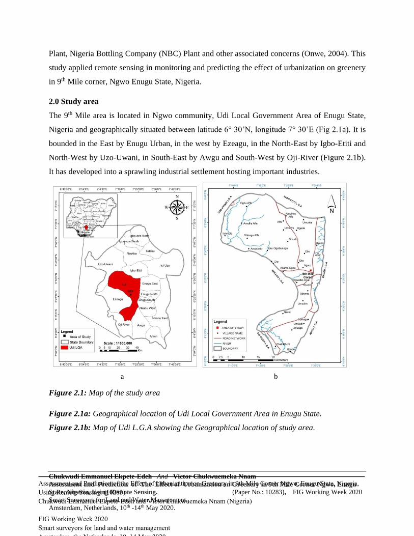
2.0 Study area
The 9th Mile area is located in Ngwo community, Udi Local Government Area of Enugu State,
Nigeria and geographically situated between latitude 6° 30’N, longitude 7° 30’E (Fig 2.1a). It is
bounded in the East by Enugu Urban, in the west by Ezeagu, in the North-East by Igbo-Etiti and
North-West by Uzo-Uwani, in South-East by Awgu and South-West by Oji-River (Figure 2.1b).
It has developed into a sprawling industrial settlement hosting important industries.
Figure 2.1: Map of the study area
Figure 2.1a: Geographical location of Udi Local Government Area in Enugu State.
Figure 2.1b: Map of Udi L.G.A showing the Geographical location of study area.
a b
Assessment and Prediction of the Effect of Urbanization on Greenery in 9th Mile Corner Ngwo, Enugu State, Nigeria,
Using Remote Sensing. (10283)
Chukwudi Emmanuel Ekpete-Edeh and Victor Chukwuemeka Nnam (Nigeria)
FIG Working Week 2020
Smart surveyors for land and water management
Amsterdam, the Netherlands, 10–14 May 2020

Chukwudi Emmanuel Ekpete-Edeh And Victor Chukwuemeka Nnam
Assessment and Prediction of The Effect of Urbanization on Greenery in 9th Mile Corner Ngwo, Enugu
State, Nigeria, Using Remote Sensing. (Paper No.: 10283), FIG Working Week 2020
Smart Surveyors for Land and Water Management.
Amsterdam, Netherlands, 10th -14th May 2020.
3.0 Methodology
3.1 Method of data Collection
The methodology adopted in this study involved data acquisition and data processing (See work
flow below). The Landsat satellite data were openly sourced from United State Geological
Survey (USGS). The Landsat 5 Thematic Mapper (TM) of 1989, the Landsat 7 ETM+ (Enhanced
Thematic Mapper) of 1999 and 2009, the Landsat 8 Operational Land Imager and Thermal
Infrared Sensor (OLI TIRS) of 2019. Obtaining images at near anniversary dates is considered
important for change detection studies (Jensen, 2007). As the Landsat satellite imagery pass over
the earth, the area can be identified by path and row Combination (Ayse, 2012). The time series
images were from Landsat path 188, row 56.
3.2 Data processing
In order to analyze the change pattern of the impact of urbanization on greenery in the study area
between 1989 and 2019, the vegetation index was calculated using Remote Sensing techniques.
The unsupervised classification was adopted, using the Normalized Difference Vegetation Index
(NDVI). This was facilitated by the use of the Red and Near-Infrared bands of Landsat imagery
which makes a clear-cut distinction between vegetation and other features. The satellite imagery
were geometrically corrected by defining the same reference system WGS 84 UTM zone 32N,
and the resample of all the imagery in 30m resolution. The Polygon shapefile defined in ArcGis
10.1 were used to clip out the Area of Interest Using the upper and lower coordinate of the study
area. The radiometric correction was the conversion of the digital number of the bands involved
(Red and Near Infrared (NIR)) to Reflectance and computation of NDVI Different method were
applied based on the Landsat sensors. The ArcGIS 10.1 modeler was used to design the diagram
model and execute the data processing (Figure 3.1).
Assessment and Prediction of the Effect of Urbanization on Greenery in 9th Mile Corner Ngwo, Enugu State, Nigeria,
Using Remote Sensing. (10283)
Chukwudi Emmanuel Ekpete-Edeh and Victor Chukwuemeka Nnam (Nigeria)
FIG Working Week 2020
Smart surveyors for land and water management
Amsterdam, the Netherlands, 10–14 May 2020

Chukwudi Emmanuel Ekpete-Edeh And Victor Chukwuemeka Nnam
Assessment and Prediction of The Effect of Urbanization on Greenery in 9th Mile Corner Ngwo, Enugu
State, Nigeria, Using Remote Sensing. (Paper No.: 10283), FIG Working Week 2020
Smart Surveyors for Land and Water Management.
Amsterdam, Netherlands, 10th -14th May 2020.
Figure 3.1: ArcGIS Modeler for NDVI computation.
3.2.1 Conversion of Landsat Tm and ETM+ to Reflectance
The Band 3 and 4 of Landsat TM and ETM+ were used in conversion of Landsat image Digital
Number (DN) to reflectance. The reflectance is defined as the fraction of incoming radiation that
is reflected back to the surface. The image was first converted to radiance and later the radiance
was converted to reflectance. The equation Eq (1) was used for conversion of DN to Radiance
whole, the equation Eq (2) was used to convert the Radiance to reflectance.
Assessment and Prediction of the Effect of Urbanization on Greenery in 9th Mile Corner Ngwo, Enugu State, Nigeria,
Using Remote Sensing. (10283)
Chukwudi Emmanuel Ekpete-Edeh and Victor Chukwuemeka Nnam (Nigeria)
FIG Working Week 2020
Smart surveyors for land and water management
Amsterdam, the Netherlands, 10–14 May 2020

Chukwudi Emmanuel Ekpete-Edeh And Victor Chukwuemeka Nnam
Assessment and Prediction of The Effect of Urbanization on Greenery in 9th Mile Corner Ngwo, Enugu
State, Nigeria, Using Remote Sensing. (Paper No.: 10283), FIG Working Week 2020
Smart Surveyors for Land and Water Management.
Amsterdam, Netherlands, 10th -14th May 2020.
Convert DN data to radiance data Formula adopted by (Huang, C., B. Wylie, L. Yang, C.
Homer, and G. Zylstra, 2002):
𝐋𝛌 = (𝑮𝒂𝒊𝒏 ∗ 𝑫𝑵) + 𝐁𝐢𝐚𝐬𝛌 … … … … … … … … … … … … … … … … … … … … … … . . . 𝐄𝐪(𝟏)
Where:
𝐋𝛌 is the cell value as radiance; DN is the cell value digital number; Gain is the gain
value for a specific band; while Bias is the bias value for a specific band
i. Convert radiance data to reflectance data Formula adopted by (Chander, G., B. L.
Markham, and D. L. Helder, 2009):
ii. Rλ =π∗Lλ∗ d2
Esun,λ∗Sin(θSE)… … … … … … … … … … … … … … … … … … … … Eq (2)
where Rλ is the reflectance (unitless ratio),
Lλ is the radiance calculated in eq (1),
d is the earth-sun distance (in astronomical units),
Esun,λ is the band-specific radiance emitted by the sun,
θ SE is the solar elevation angle
3.2.2 Conversion of Landsat 8 band to reflectance
The band 4 and 5 of Landsat 8 OLI data were converted to Top of atmospheric (TOA) planetary
reflectance using reflectance rescaling coefficients provided in the product metadata file (MTL
file). The following equation Eq (3) adopted by Black and Stephan (2014) is used to convert DN
values to TOA reflectance for OLI data as follows:
𝛒𝛌′ = 𝐌 𝛒𝐐 𝐜𝐚𝐥 + 𝐀 𝛒 … … … … … … … … … … … … … … … … … … . . 𝐄𝐪 (𝟑)
where:
ρλ' = TOA planetary reflectance, without correction for solar angle.
Note that ρλ' does not contain a correction for the sun angle.
Mρ = Band-specific multiplicative rescaling factor from the metadata
(REFLECTANCE_MULT_BAND_x, where x is the band number)
Assessment and Prediction of the Effect of Urbanization on Greenery in 9th Mile Corner Ngwo, Enugu State, Nigeria,
Using Remote Sensing. (10283)
Chukwudi Emmanuel Ekpete-Edeh and Victor Chukwuemeka Nnam (Nigeria)
FIG Working Week 2020
Smart surveyors for land and water management
Amsterdam, the Netherlands, 10–14 May 2020
Chukwudi Emmanuel Ekpete-Edeh And Victor Chukwuemeka Nnam
Assessment and Prediction of The Effect of Urbanization on Greenery in 9th Mile Corner Ngwo, Enugu
State, Nigeria, Using Remote Sensing. (Paper No.: 10283), FIG Working Week 2020
Smart Surveyors for Land and Water Management.
Amsterdam, Netherlands, 10th -14th May 2020.
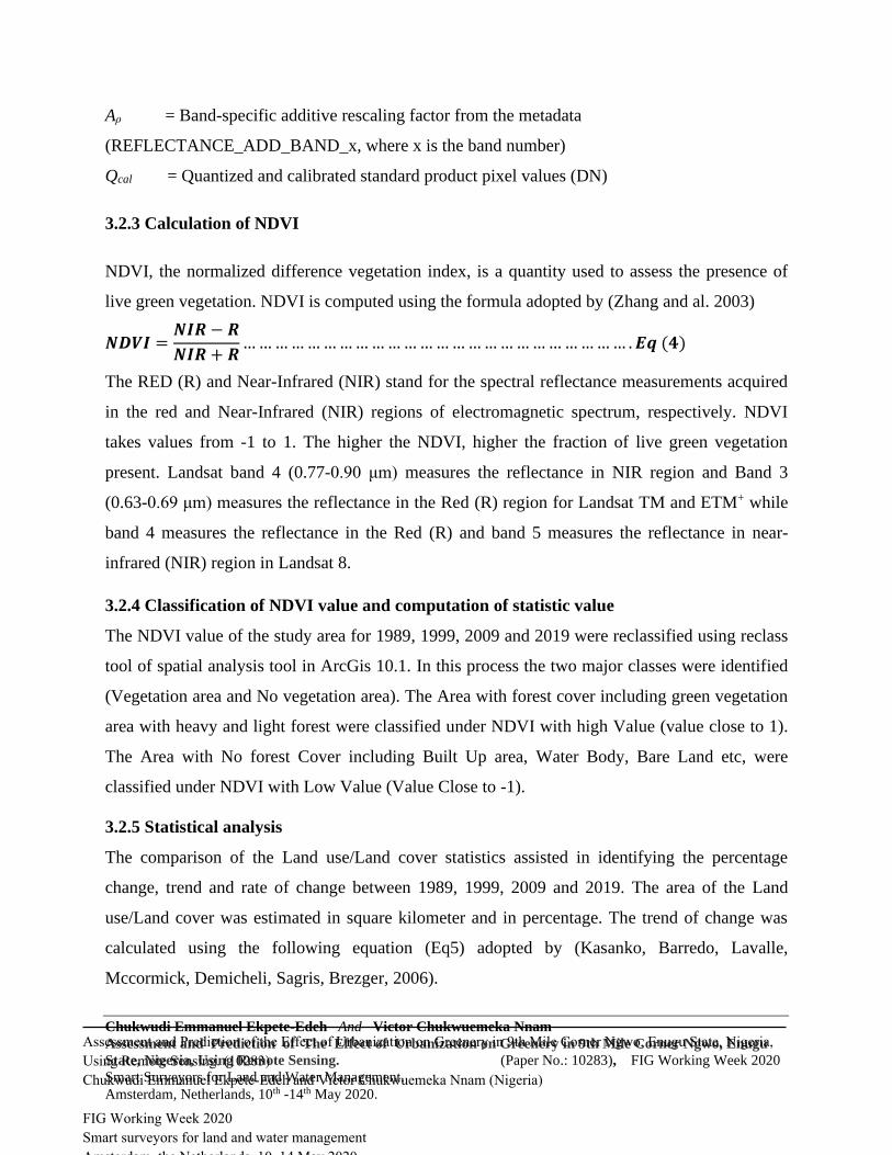
Aρ = Band-specific additive rescaling factor from the metadata
(REFLECTANCE_ADD_BAND_x, where x is the band number)
Qcal = Quantized and calibrated standard product pixel values (DN)
3.2.3 Calculation of NDVI
NDVI, the normalized difference vegetation index, is a quantity used to assess the presence of
live green vegetation. NDVI is computed using the formula adopted by (Zhang and al. 2003)
𝑵𝑫𝑽𝑰 =𝑵𝑰𝑹 − 𝑹
𝑵𝑰𝑹 + 𝑹… … … … … … … … … … … … … … … … … … … … … … … … . 𝑬𝒒 (𝟒)
The RED (R) and Near-Infrared (NIR) stand for the spectral reflectance measurements acquired
in the red and Near-Infrared (NIR) regions of electromagnetic spectrum, respectively. NDVI
takes values from -1 to 1. The higher the NDVI, higher the fraction of live green vegetation
present. Landsat band 4 (0.77-0.90 μm) measures the reflectance in NIR region and Band 3
(0.63-0.69 μm) measures the reflectance in the Red (R) region for Landsat TM and ETM+ while
band 4 measures the reflectance in the Red (R) and band 5 measures the reflectance in near-
infrared (NIR) region in Landsat 8.
3.2.4 Classification of NDVI value and computation of statistic value
The NDVI value of the study area for 1989, 1999, 2009 and 2019 were reclassified using reclass
tool of spatial analysis tool in ArcGis 10.1. In this process the two major classes were identified
(Vegetation area and No vegetation area). The Area with forest cover including green vegetation
area with heavy and light forest were classified under NDVI with high Value (value close to 1).
The Area with No forest Cover including Built Up area, Water Body, Bare Land etc, were
classified under NDVI with Low Value (Value Close to -1).
3.2.5 Statistical analysis
The comparison of the Land use/Land cover statistics assisted in identifying the percentage
change, trend and rate of change between 1989, 1999, 2009 and 2019. The area of the Land
use/Land cover was estimated in square kilometer and in percentage. The trend of change was
calculated using the following equation (Eq5) adopted by (Kasanko, Barredo, Lavalle,
Mccormick, Demicheli, Sagris, Brezger, 2006).
Assessment and Prediction of the Effect of Urbanization on Greenery in 9th Mile Corner Ngwo, Enugu State, Nigeria,
Using Remote Sensing. (10283)
Chukwudi Emmanuel Ekpete-Edeh and Victor Chukwuemeka Nnam (Nigeria)
FIG Working Week 2020
Smart surveyors for land and water management
Amsterdam, the Netherlands, 10–14 May 2020

Chukwudi Emmanuel Ekpete-Edeh And Victor Chukwuemeka Nnam
Assessment and Prediction of The Effect of Urbanization on Greenery in 9th Mile Corner Ngwo, Enugu
State, Nigeria, Using Remote Sensing. (Paper No.: 10283), FIG Working Week 2020
Smart Surveyors for Land and Water Management.
Amsterdam, Netherlands, 10th -14th May 2020.
𝑻𝒓𝒆𝒏𝒅 (%) =𝒐𝒃𝒔𝒆𝒓𝒗𝒆𝒅 𝒄𝒉𝒂𝒏𝒈𝒆
𝒔𝒖𝒎 𝒐𝒇 𝒄𝒉𝒂𝒏𝒈𝒆∗ 𝟏𝟎𝟎 … … … … … … … … … … … … … … … … … … . .. Eq (5)
The regression analysis applied in this study was used to estimate the prediction of the land
development in the study area. The polynomial second order trend line was the best fit for the
prediction because the R square is equal to 0.946. The table 3.1 and 3.2 were the summary of the
regression analysis result. The prediction equation Eq (6) and Eq (7) were derived from the
regression table.
Table 3.1: Summary of regression analysis for urban development
Regression Statistics
Multiple R 0.972758
R Square 0.946257
Adjusted R Square 0.838772
Standard Error 2.017128
Observations 4
ANOVA
df SS MS F
Significance
F
Regression 2 71.64031 35.82016 8.803602 0.231825
Residual 1 4.068807 4.068807
Total 3 75.70912
Coefficients
Standard
Error t Stat P-value
Lower
95%
Upper
95%
Lower
95.0%
Upper
95.0%
Intercept 47462.58 40503.24 1.171822 0.449739 -467180 562105.1 -467180 562105.1
X Variable 1 -47.7221 40.42335 -1.18056 0.447406 -561.35 465.9053 -561.35 465.9053
X Variable 2 0.011997 0.010086 1.189541 0.445027
-
0.11615 0.140148
-
0.11615 0.140148
Assessment and Prediction of the Effect of Urbanization on Greenery in 9th Mile Corner Ngwo, Enugu State, Nigeria,
Using Remote Sensing. (10283)
Chukwudi Emmanuel Ekpete-Edeh and Victor Chukwuemeka Nnam (Nigeria)
FIG Working Week 2020
Smart surveyors for land and water management
Amsterdam, the Netherlands, 10–14 May 2020

Chukwudi Emmanuel Ekpete-Edeh And Victor Chukwuemeka Nnam
Assessment and Prediction of The Effect of Urbanization on Greenery in 9th Mile Corner Ngwo, Enugu
State, Nigeria, Using Remote Sensing. (Paper No.: 10283), FIG Working Week 2020
Smart Surveyors for Land and Water Management.
Amsterdam, Netherlands, 10th -14th May 2020.
The equation of prediction for urban development was derived from the regression summary Eq (6)
𝒀 = 𝟎. 𝟎𝟏𝟏𝟗𝟗𝟕𝐗𝟐 − 𝟒𝟕. 𝟕𝟐𝟐𝟏𝐗 + 𝟒𝟕𝟒𝟔𝟐. 𝟓𝟖 …………………………………………..Eq (6)
4.0 Result presentation
4.1: Evaluation of the Urban and Vegetation pattern
NDVI takes values from -1 to 1. The higher the NDVI, the higher the fraction of live green
vegetation present (Zhang and al. 2003). The figure 4.1 below showing the NDVI of the study
area from 1989, 1999, 2009 and 2019. The NDVI Value in this study indicate the Area covered
with vegetation or greenery and the area with non-vegetation covered which is indicated as the
Urban area (see Table 4.1). The vegetation cover includes the forest, grass land, farm land and
savannah area while the non-vegetation is considered as urban development area including built
up area and bare land. The analysis shows that the urban area counted for 5.54% in 1989
increased to 8.57% in 1999, the urban area kept increasing to 9.50% and 17.33% in 2009 and
2019 respectively. The NDVI result shows that the vegetation area has been decreased from
94.46% in 1989 to 91.43% in 1999. The vegetation keeps decreasing from 90.50% to 82.67
respectively in 2009 and 2019.
Table 4.1: The statistic tabular of NDVI of the study area from 1989, 1999, 2009 and 2019.
Years NDVI Value Class Count
Area
(Km2) PCT
1989
0.0489 - 0.1205 Non Vegetation 9792 8.81 5.54
0.1205 - 0.3976 Vegetation 166998 150.30 94.46
Total 176790 159.11 100.00
1999
0.3124 - 0.090 Non Vegetation 15157 13.64 8.57
0.090 - 0.4874 Vegetation 161633 145.47 91.43
Total 176790 159.11 100.00
2009
0.0489 - 0.1443 Non Vegetation 16790 15.11 9.50
0.1443 - 0.3976 Vegetation 160000 144.00 90.50
Total Vegetation 176790 159.11 100.00
2019
0.0536 - 0.1304 Non Vegetation 30639 27.58 17.33
0.1304 - 0.2774 Vegetation 146151 131.54 82.67
Total 176790 159.11 100.00
Assessment and Prediction of the Effect of Urbanization on Greenery in 9th Mile Corner Ngwo, Enugu State, Nigeria,
Using Remote Sensing. (10283)
Chukwudi Emmanuel Ekpete-Edeh and Victor Chukwuemeka Nnam (Nigeria)
FIG Working Week 2020
Smart surveyors for land and water management
Amsterdam, the Netherlands, 10–14 May 2020

Chukwudi Emmanuel Ekpete-Edeh And Victor Chukwuemeka Nnam
Assessment and Prediction of The Effect of Urbanization on Greenery in 9th Mile Corner Ngwo, Enugu
State, Nigeria, Using Remote Sensing. (Paper No.: 10283), FIG Working Week 2020
Smart Surveyors for Land and Water Management.
Amsterdam, Netherlands, 10th -14th May 2020.
(a) : Greenery of 9th Mile in 1989 (b) : Greenery of 9th Mile in 1999
(c) : Greenery of 9th Mile in 2009 (d) : Greenery of 9th Mile in 2019
Figure 4.1: Land use / Land cover changes of the study area from 1989, 1999, 2009 and 2019.
Assessment and Prediction of the Effect of Urbanization on Greenery in 9th Mile Corner Ngwo, Enugu State, Nigeria,
Using Remote Sensing. (10283)
Chukwudi Emmanuel Ekpete-Edeh and Victor Chukwuemeka Nnam (Nigeria)
FIG Working Week 2020
Smart surveyors for land and water management
Amsterdam, the Netherlands, 10–14 May 2020

Chukwudi Emmanuel Ekpete-Edeh And Victor Chukwuemeka Nnam
Assessment and Prediction of The Effect of Urbanization on Greenery in 9th Mile Corner Ngwo, Enugu
State, Nigeria, Using Remote Sensing. (Paper No.: 10283), FIG Working Week 2020
Smart Surveyors for Land and Water Management.
Amsterdam, Netherlands, 10th -14th May 2020.
4.2 Relationship between urban area and Vegetation Cover
The table 4.2 below shows that the correlation between urban area and vegetation cover from
1989 till 2019 is -1. It means there is negative relationship between the urban and vegetation. As
the urban increased the vegetation decreased (see figure 4.2). The urban has increased between
1989 to 1999 at rate of 21.50% urban land consumption rate while the vegetation decreased at
rate of 1.63%. Between 1999 to 2000 the rate of increment of Urban land consumption reduced
to 5.11% while vegetation decreased at rate of 0.51%, from 2009 to 2019 the urban land
consumption rate rise to 29.20% while vegetation decrease at 4.52%. This analysis reveal that
that the urban area is developed by destroying the greenery. The urbanization incited the
degradation of the greenery for the need of the population in wood, timber, habitation, hunting of
animal, agriculture, industries etc.
Table 4.2: Statistical Evaluation of Urban and Greenery Changes.
Year Urban (%) Greenery (%)
1989 5.54 94.46
1999 8.57 91.43
2009 9.50 90.50
2019 17.33 82.67
Correlation -1
Trend of Urban change (1989-
1999)
Trend of Urban
change (1999-2000)
Trend of Urban change
(2009-2019)
21.50 5.11 29.20
Trend of Greenery change
(1989-1999)
Trend of Greenery
change (1999-2000)
Trend of Greenery
change (2009-2019)
-1.63 -0.51 -4.52
Assessment and Prediction of the Effect of Urbanization on Greenery in 9th Mile Corner Ngwo, Enugu State, Nigeria,
Using Remote Sensing. (10283)
Chukwudi Emmanuel Ekpete-Edeh and Victor Chukwuemeka Nnam (Nigeria)
FIG Working Week 2020
Smart surveyors for land and water management
Amsterdam, the Netherlands, 10–14 May 2020

Chukwudi Emmanuel Ekpete-Edeh And Victor Chukwuemeka Nnam
Assessment and Prediction of The Effect of Urbanization on Greenery in 9th Mile Corner Ngwo, Enugu
State, Nigeria, Using Remote Sensing. (Paper No.: 10283), FIG Working Week 2020
Smart Surveyors for Land and Water Management.
Amsterdam, Netherlands, 10th -14th May 2020.
Figure 4.2: Graph showing the correlation between Urban Area and
Greenery/Vegetation.
4.3 Prediction of urban development
The table below indicates that the Urban area will continue expanding from 27.58Km2 (17.33%)
in 2019 to 38.47 Km2 (24.18%) in 2029. It will continue increasing to 55.68Km2 (35%) in 2039
and 57.62km2 (36.21%) in 2040 (figure 4.3) . This prediction is subjected to the same condition
of development currently observed during our study.
Table 4.3: Prediction of urban development in the study area
Figure 4.3: Prediction of Urban area development in the Study area
0,00
20,00
40,00
60,00
80,00
100,00
1980 1990 2000 2010 2020 2030
Are
a (%
)Urban (%)
Vegetation
Year
Area
(Km2)
Area
(%)
1989 8.81 5.54
1999 13.64 8.57
2009 15.11 9.50
2019 27.58 17.33
2029 38.47 24.18
2039 55.68 35.00
2040 57.62 36.21
Assessment and Prediction of the Effect of Urbanization on Greenery in 9th Mile Corner Ngwo, Enugu State, Nigeria,
Using Remote Sensing. (10283)
Chukwudi Emmanuel Ekpete-Edeh and Victor Chukwuemeka Nnam (Nigeria)
FIG Working Week 2020
Smart surveyors for land and water management
Amsterdam, the Netherlands, 10–14 May 2020
Chukwudi Emmanuel Ekpete-Edeh And Victor Chukwuemeka Nnam
Assessment and Prediction of The Effect of Urbanization on Greenery in 9th Mile Corner Ngwo, Enugu
State, Nigeria, Using Remote Sensing. (Paper No.: 10283), FIG Working Week 2020
Smart Surveyors for Land and Water Management.
Amsterdam, Netherlands, 10th -14th May 2020.
5.0 Conclusion
In Conclusion, Remote Sensing has been an important tool for monitoring urban greenery (Guido
2017). The Normalized Difference Vegetation Index (NDVI) is a quantity used to assess the
presence of live green vegetation in this study.
Empirical facts from the results of the study revealed that while urban area in the study were
increasing within the study period of 1989, 1999, 2009 and 2019, the greenery of the area has
been dwindling till date; it is therefore predicted that the urban area will continue to increase
while the greenery will continue on the downwards trend if policies are not changed.
Following the results presented above, it is inferred that one of the contributing factors to the
above trend is the teeming population of young Rural-urban migrants, a result which led to
increased demand for residential use of land and also progressive deforestation. Another
dominantly contributing factor is industrialization, in the study area we sited many industries
such as Nigerian Brewery Plc Plant, AMA Brewery Plant, Seven-Up Bottling Company
Production Plant, Nigeria Bottling Company (NBC) Plant and then the proposed Free-Trade
Zone. Illegal cutting of timbers in commercial quantities and random harvesting of firewood are
also contributory in the gradual depletion of the greenery of the study area.
6.0 Recommendation
Further to the above results, the following are strongly recommended;
1. An awareness campaign should be launched in the study area and its environs towards the
protection and conservation of green spaces from further depletion.
2. The Master plan of Enugu Urban is getting out-dated. There is need for Government to
review and update the plan in order to incorporate policies that protect greenery.
3. The government should encourage the reforestation in the study area by making
legislations that encourage Planting of Trees as part of urban development.
4. The Government should discourage further development of industries outside the
proposed free trade-zone and design the free trade-zone to incorporate more industries.
This move will help and control deforestation in the area.
5. Strict development control enforcement measures must be put in place by local planning
Authorities in order to curb and mitigate the factors that deplete greenery in the area.
Assessment and Prediction of the Effect of Urbanization on Greenery in 9th Mile Corner Ngwo, Enugu State, Nigeria,
Using Remote Sensing. (10283)
Chukwudi Emmanuel Ekpete-Edeh and Victor Chukwuemeka Nnam (Nigeria)
FIG Working Week 2020
Smart surveyors for land and water management
Amsterdam, the Netherlands, 10–14 May 2020

Chukwudi Emmanuel Ekpete-Edeh And Victor Chukwuemeka Nnam
Assessment and Prediction of The Effect of Urbanization on Greenery in 9th Mile Corner Ngwo, Enugu
State, Nigeria, Using Remote Sensing. (Paper No.: 10283), FIG Working Week 2020
Smart Surveyors for Land and Water Management.
Amsterdam, Netherlands, 10th -14th May 2020.
Reference
Ahmed, Y.A. (2010) “Trend and Pattern of Urban Crime in South Western Nigeria” Unpublished
Ph.D. Thesis, University of Ilorin, Nigeria.
Aliyu A. And Amadu L. 2017: Urbanization, Cities, and Health: The Challenges to Nigeria – A
Review, Annals of African medicine, Ann Afri Med. 2017 Oct-Dec; 16(4): 149–158.
doi:10.4103/aam.aam_1_17,PMCID, PMC5676403, PMID: 29063897.
Aluko, O.E. (2010) “The Impact of Urbanization on Housing Development: The Lagos
Experience, Nigeria” Ethiopian Journal of Environmental Studies and Management Vol. 3, No. 3
Black, A., & Stephen, H. (2014). Relating temperature trends to the normalized difference
vegetation index in Las Vegas. GIScience and Remote Sensing, 51, 468–482.
Bolund P, Hunhammer S. Ecosystem services in urban areas. Ecol Econ. 1999; 29: 293–301.
doi: 10.1016/S0921-8009(99)00013-0
Chander, G., B. L. Markham, and D. L. Helder, 2009: Summary of current radiometric
calibration coefficients for Landsat MSS, TM, ETM+, and EO-1 ALI sensors. Remote Sensing of
Environment, 113, 893-903.
Croci S, Butet A, Georges A, Aguejdad R, Clergeau P. Small urban woodlands as biodiversity
conservation hot-spot: a multi-taxon approach. Landscape Ecol. 2008; 23: 1171–1186.
Crist, E. P., 1985: A TM tasseled cap equivalent transformation for reflectance factor data.
Remote Sensing of Environment, 17, 301-306.
Cvejić R, Eler K, Pintar M, Železnikar Š, Haase D, Kabisch N, Strohbach M et al. 2015, A
typology of urban green spaces, ecosystem services provisioning services and demands. Work
package 3 2015
Guido S. 2017, Remote Sensing to Detect and Monitor Trees in Various Environments: Case
Studies in Chile, Submitted: Open access peer-reviewed chapter, February 27th 2017 Reviewed:
December 4th 2017Published: July 25th 2018, DOI: 10.5772/intechopen.72903.
Huang, C., B. Wylie, L. Yang, C. Homer, and G. Zylstra, 2002: Derivation of a tasseled cap
transformation based on Landsat 7 at-satellite reflectance. International Journal of Remote
Sensing, 23, 1741-1748.
Kasanko, M.; Barredo, J.I.; Lavalle, C.; Mccormick, N.; Demicheli, L.; Sagris, V.; Brezger, A
(2006). Are European cities becoming dispersed?: A comparative analysis of 15 European urban
areas. Landsc. Urban Plan.,77, 111–130.
Assessment and Prediction of the Effect of Urbanization on Greenery in 9th Mile Corner Ngwo, Enugu State, Nigeria,
Using Remote Sensing. (10283)
Chukwudi Emmanuel Ekpete-Edeh and Victor Chukwuemeka Nnam (Nigeria)
FIG Working Week 2020
Smart surveyors for land and water management
Amsterdam, the Netherlands, 10–14 May 2020
Chukwudi Emmanuel Ekpete-Edeh And Victor Chukwuemeka Nnam
Assessment and Prediction of The Effect of Urbanization on Greenery in 9th Mile Corner Ngwo, Enugu
State, Nigeria, Using Remote Sensing. (Paper No.: 10283), FIG Working Week 2020
Smart Surveyors for Land and Water Management.
Amsterdam, Netherlands, 10th -14th May 2020.
Michelle, Arlington 2018: Effects of Urbanization on Plant Growth, Lewisville lake
environmental learning Area (LLELA), https://www.llela.org/research-restoration/graduate-
research/effects-of-urbanization-on-plant-growth.
Nnam V.C, Maduako I., Nnam G. U, Onwuzuligbo C., Eze M. A.(2014): Assessment of spatial
Urban Dynamics in Enugu City Using GIS and Remote Sensing. Presented at the technical
session, paper 6908. FIG Congress 2014, 16 – 21 June 2014, Kuala Lumpur, Malaysia.
Nnam V.C, Okonkwo U. and Onwuzuligbo C. U. (2018) Spatio-Temporal Monitoring and
Prediction of Physical Urban Development of Part of Nike, Enugu, Nigeria Using Remote
Sensing and GIS. Peer Review Paper published in the Environmental Review, Volume 6, No 2,
2018.
National Population Commission (NPC) (2006): Nigeria National Census: Population
Distribution by Sex, State, LGAs and Senatorial District: 2006 Census Priority Tables (Vol. 3).
http://www.population.gov.ng/index.php/publication/140-popn-distri-by-sex-state-jgas-and-
senatorial-distr-2006
Onwe, F. O. (2004). The Environmental Effects of Brewery Industries at the 9th Mile Corner of
Enugu State.(Unpublished Dissertation thesis). Department of Geography, Enugu State
University of Science andTechnology (ESUT).
Zhang Yuandong, Xu Yingtao, Gu Fengxue, 2003. Correlation analysis of NDVI climate and
hydrological factors in oasis and desert. Acta Phytoecologica Sinica, 27(6): 816–821. (in
Chinese).
CONTACTS
Chukwudi Emmanuel EKPETE-EDEH
+2347032608449
Post-Graduate Student,
Department of Geoinformatics and Surveying,
University of Nigeria Enugu Campus (UNEC),
Enugu State, Nigeria.
Dr. Victor Chukwuemeka NNAM.
+2348032760910
Lecturer,
Department of Surveying and Geoinformatics
Enugu State University of Science and Technology.
Enugu State, Nigeria.
Assessment and Prediction of the Effect of Urbanization on Greenery in 9th Mile Corner Ngwo, Enugu State, Nigeria,
Using Remote Sensing. (10283)
Chukwudi Emmanuel Ekpete-Edeh and Victor Chukwuemeka Nnam (Nigeria)
FIG Working Week 2020
Smart surveyors for land and water management
Amsterdam, the Netherlands, 10–14 May 2020
https://www.llela.org/research-restoration/graduate-research/effects-of-urbanization-on-plant-growth