the hong kong polytechnic university hung hom kowloon hong ...
107
-
Upload
khangminh22 -
Category
Documents
-
view
1 -
download
0
Transcript of the hong kong polytechnic university hung hom kowloon hong ...

The Hong Kong Polytechnic University
1 September 2009 - 31 August 2010
2009/10年報
土地測量及地理資訊學系

1 September 2009 to 31 August 2010
Department of Land Surveying & Geo-Informatics
THE HONG KONG POLYTECHNIC UNIVERSITY HUNG HOM KOWLOON
HONG KONG
General Office Telephone : (852) 2766-5968 / 2766-4440 Telefax : (852) 2330-2994 E-mail : [email protected] Home Page: http://www.lsgi.polyu.edu.hk Editor : Katherine CHAU


CONTENTS Page VISION, MISSION AND VALUES The University ..................................................................................................................... 1
The Department ................................................................................................................... 2
HIGHLIGHTS OF DEVELOPMENTS DURING 2009/2010 ......................................... 3
DEPARTMENTAL STAFF Academic Staff ...................................................................................................................... 4
Administrative Staff and Technical Staff ............................................................................... 8
Departmental Review Panel Members, Departmental Academic Advisor,
External Examiners and Adjunct Assistant Professor ............................................................ 9
Research Personnel and Research Students ........................................................................... 10
Academic Visitors ................................................................................................................. 12
Departmental Advisory Committee ..................................................................................... 13
FACILITIES Survey Store .......................................................................................................................... 15
Navigation Lab ...................................................................................................................... 15
Hydrographic Lab ................................................................................................................. 16
Cadastre Lab .......................................................................................................................... 16
Geomatics Computing Lab .................................................................................................... 16
Geographic Information Systems Lab ................................................................................... 16
Photogrammetry and Remote Sensing Lab ........................................................................... 17
Digital Cartography Lab ........................................................................................................ 17
TEACHING ACTIVITIES Course Information
Bachelor of Science (Honours) in Geomatics Programme (Full-Time) ................ 18
Higher Diploma in Geomatics Programme (Full-Time) ......................................... 21
Master of Science/Postgraduate Diploma in Geomatics Programme (Full-Time and Part-Time) ................................................................................ 23
Master of Science in Geomatics Dissertation/Projects ........................................................ 24
Bachelor of Science in Geomatics Final Year Projects .......................................................... 25
Higher Diploma in Geomatics Final Year Projects ................................................................ 28
TEACHING AND LEARNING PROJECTS Current Teaching and Learning Projects and Summary Description ................................. 30
Staff Attendance in Learning and Teaching Activities........................................................... 30

CONTENTS Page
STUDENT AFFAIRS Scholarships & Prizes ............................................................................................................ 34
The Dean’s Honours List ....................................................................................................... 36
The International Association for the Exchange of Students for
Technical Experience (IAESTE) ................................................................................. 37
Student Exchange with Curtin University of Technology ..................................................... 37
Student Profile ....................................................................................................................... 37
Student Activities .................................................................................................................. 38
RESEARCH ACTIVITIES, RESEARCH AWARDS AND RESEARCH OUTPUT Research Programmes ........................................................................................................... 40
Research Centre for Geo-Information Science and Technology ........................................... 41
Research Degree Graduates ................................................................................................... 42
Ongoing PhD Projects ........................................................................................................... 43
Ongoing MPhil Projects ........................................................................................................ 45
New Research Projects .......................................................................................................... 46
Research Output .................................................................................................................... 51
Research Awards ................................................................................................................. 65
Departmental and Public Seminars ..................................................................................... 70
PROFESSIONAL SERVICE AND SCHOLARLY ACTIVITIES Professional Service .............................................................................................................. 74
Academic and Non-Academic Services within The Hong Kong Polytechnic University ..................................................................... 78
Consultancy ........................................................................................................................... 81
Conference Attendance ........................................................................................................ 82
Staff Development Programme ............................................................................................. 85
Others .................................................................................................................................. 86

Annual Report 2009/2010
1
VISION, MISSION AND VALUES OF THE HONG KONG POLYTECHNIC UNIVERSITY
Vision To become a ‘preferred university’ offering ‘preferred programmes’ and producing ‘preferred graduates’. Mission “Academic Excellence in a Professional Context” through Programmes that are application-oriented and produce graduates who can apply theories in practice. Research of an applied nature relevant to industrial, commercial and community needs. Intellectual and comprehensive development of students within a caring environment. Dedicated partnerships with business, industry and the professions. Enabling mature learners to pursue life-long learning. Values We recognise and embrace the following values which are fundamental to our success: People We value integrity, freedom and creativity of individuals. We take calculated risks.
We build teamwork through individual development and by synergistic use of their talents. We provide a caring environment in which students and staff pursue personal and institutional development.
Performance We demand good performance and reward excellence in performance. We encourage innovation, practicality, entrepreneurship, and the pursuit of academic
and management excellence. Productivity We treasure the investment the community has made in us and strive to deliver
quality results in a most cost-effective manner through a simple management structure, efficient processes, effective “checks-and-balances” and vigorous quality assurance mechanisms.
Partnership We, members of the University, are partners in pursuing our shared vision. Together,
we are partners of the community sharing common goals and valuing mutual benefits.

Annual Report 2009/2010
2
VISION AND MISSION OF DEPARTMENT OF LAND SURVEYING & GEO-INFORMATICS
Vision To be one of the top geomatics departments in the world Mission Maintain quality academic programmes for training and education of highly skilled land
surveyors and geospatial information technology engineers capable of meeting local and regional needs;
Develop international leadership in research within the discipline; Strengthen global relationships and linkages with other geomatics institutions by cooperating in
teaching and research, and actively participating in international academic and professional activities;
Further develop close links with industry and local, national, and international professional
organizations.

Annual Report 2009/2010
3
HIGHLIGHTS OF DEVELOPMENTS DURING 2009/2010
Research funding – 1 GRF project with total funding support of $1,094M and 8 new projects with total funding support of $1,623M were awarded in the year
Research students – 11 new PhD research students
Conference organized & co-hosted : Joint International Conference on Theory, Data Handling and Modelling in GeoSpatial
Information Science (26-28 May 2010) Conference on “Spatial Data Infrastructure (SDI) Hong Kong” (18 March 2010) 高速铁路精密测量理论及测绘新技术应用国际学术研讨会 (HSRPES2010) (20-22
Aug 2010) Conference on “Disasters: Preparedness, Response and Recovery” (15 June 2010)
Departmental and Public Seminars organized – 11 nos.
Collaborative projects with China : - Prof. Xiaoli DING - Study of Multi-antenna GPS for Highway Slope Stability
Monitoring (Chang’An University) - Prof. Wu CHEN - Airborne LIDAR for Mapping and 3D Modelling (Chinese
Academic of Survey & Mapping (中國測繪科學研究院)) - Prof. Zhilin LI and Dr. Lilian PUN - 土地利用調查不一致性的自動探測 研究
(Institute of Land Use (中國土地勘測規劃院)) - Prof. John SHI - 數據質量模型研究 (Data Uncertainty and Quality (Institute of Land
Use (中國土地勘測規劃院))
Prof Xiaoli DING has been awarded a Silver Medal for its GPS technology for landslide monitoring, from the International Eureka Contest of Brussels Innova 2009
Prof Xiaoli DING has been awarded a Tewkesbury Fellowship by the University of
Melbourne, Australia Prof Janet NICHOL has been awarded a Dean’s Awards for Outstanding Achievement in
Research Funding 2010 Department has been awarded a PTeC’s Outstanding Professional Services and Innovation
Awards 2009 - Departmental Awards (Maximum Staff Participation)
Community Service Learning Awards 2009/10 – Gold Project Name – “Lian” Us Together (連理在一起)
Prof. Xiaoli DING


Annual Report 2009/2010
4
DEPARTMENTAL STAFF
Academic Staff
Name Fields of Interest
Chair Professor of Geomatics and Head of Department:
Prof. Xiaoli DING 丁曉利 BEng (South Central University of Technology), PhD (University of Sydney),
MISA, FHKIES, FIAG, FCICES
(852) 2766 5965 [email protected]
Engineering Surveying Geodesy and Geodynamics Geohazards Monitoring
Professor Emeritus :
Prof. Yongqi CHEN 陳永奇 Dipl. Eng (Wuhan Technical University of Surveying & Mapping),
PhD (University of New Brunswich), FCSGPC, FHKIS, FInstCES, FRICS, FHKInstES
(852) 2766 5966 [email protected]
Geodesy Estimation Theory Engineering Surveying Hydrographic Surveying
Associate Head of Department and Associate Professor:
Dr. Lilian PUN 潘鄭淑貞 BA (University of Hong Kong), PCed (University of Hong Kong), MPhil
(Chinese University of Hong Kong), PhD (University of Newcastle upon Tyne, UK), FBCartS, MHKGISA
(852) 2766 5959 [email protected]
GIS Data Modelling Digital Mapping Automated Cartography Geography
Professors:
Prof. Wu CHEN 陳武 BSc (University of Science and Technology of China), MSc (Institute of
Geodesy & Geophysics), PhD (University of Newcastle upon Tyne), MRIN
(852) 2766 5969 [email protected]
Satellite Navigation Geodesy System Integration
Prof. H.B. IZ 葉栢基 MSc (The Black Sea Technical UniversityTurkey), PhD (The Ohio State
University)
(852) 2766 5962 [email protected]
Geodetic Science, Selenodesy

Annual Report 2009/2010
5
Academic Staff (Cont'd)
Name Fields of Interest
Professors:
Prof. Zhilin LI 李志林 BEng (Southwestern Jiaotong University), PhD (University of
Glasgow), DSc (University of Glasgow)
(852) 2766 5960
Digital Cartography GIS Digital Photogrammetry/ Remote Sensing
Prof. Esmond MOK 莫志明 BSc (University of Toronto), Dip. Surveying (University College
London), MSc Surveying (University of London), PhD (University of Newcastle upon Tyne), MRICS, MHKIS, RPS(LS), MInstCES, Member - ACSM(AAGS)
(852) 2766 5953 [email protected]
Satellite Geodesy Intelligent Satellite Navigation GIS-GPS Integration Engineering Surveying Wireless Positioning Techniques and LBS Applications
Prof. Janet NICHOL 李真 BSc (London University, UK), MA (University of Colorado, USA),
PhD (Aston University, UK)
(852) 2766 5952 [email protected]
Remote Sensing Urban Heat Island Ecological Monitoring GIS Remote Sensing of Air Pollution
Prof. John SHI 史文中 BEng (Wuhan Technical University of Surveying & Mapping), MEng
(Wuhan Technical University of Surveying & Mapping), Dr.-Sc. (University of Osnabrueck, Germany), FHKInstES, MRICS, MIS (Australia), ASPRS, HKGISA, CPGIS
(852) 2766 5975 [email protected]
GIS Remote Sensing Uncertainty and Spatial Data Quality Control
Associate Professors:
Dr. Bruce KING 金博思 BSc (The University of Newcastle, Aust), PhD (The University of
Newcastle, Aust), MIS Aust, FHKInstES
(852) 2766 5976 [email protected]
Close Range and Digital Photogrammetry Terrestrial and Aerial Laser Scanning
Dr. Conrad TANG 鄧康偉 BScEng (University of New Brunswick), MEng (University of New
Brunswich), PhD (The Hong Kong Polytechnic University), LLM, FHKIS, RPS(LS)
(852) 2766 5963 [email protected]
Cadastre and LIM Engineering Surveying Hong Kong Land Boundary Survey

Annual Report 2009/2010
6
Academic Staff (Cont'd)
Name Fields of Interest
Assistant Professors:
Dr. Eric GUILBERT BSc (Littoral University, France), MSc (University of Grenoble 1,
France), PhD (University of Rennes 1, France)
(852) 3400 3662 [email protected]
GIS Spatial data modelling Cartographic Generalisation Data representation
Dr. George LIU BEng(Southern Institute of Metallurgy), MSc(Wuhan Technical
University of Surveying and Mapping, China), PhD(University of Calgary, Canada)
(852) 2766 5961 [email protected]
Satellite Navigation Geodesy Engineering Surveying Hydrographic Surveying
Dr. Bo WU BEng and MSc(Changsha University of Science and Technology),
PhD(Wuhan University), ASPRS, HKGISA,CPGIS
(852) 2766 4335 [email protected]
Digital Photogrammetry Planetary Mapping and Robotic/Human Navigation 3D GIS and Applications
Senior Lecturer:
Dr. Geoffrey SHEA 佘裕佳 PhD (The Hong Kong Polytechnic University), ME (University of New
South Wales, Sydney), MSc (Victoria University of Technology, Melbourne), PgDipPhotogrammetry (University College London), BSc (National Cheng Kung University, Taiwan), FHKInstES, FBCS Chartered IT Professional, Microsoft Certified Systems Engineers (MCSE)
(852) 2766 5958 geoffrey.shea @polyu.edu.hk
Internet and Mobile GIS Geospatial data modelling and handling GIS applications
Lecturer:
Mr. Steve LAM 林幼華 BTech (Ryerson University), BA (York University), MPhil (The Hong
Kong Polytechnic University), MSc (University of Greenwich), MEd, PgC (The Open University of Hong Kong), Canada Lands Surveyor (CLS), FICE, Chartered Builder (MCIOB), Chartered Surveyor (MRICS), FICE, MASCE, FCInstCES
(852) 2766 594 [email protected]
Tunnel and Railway Surveying Cadastre and LRIS TQM and GIS for Construction Geomatics Curriculum

Annual Report 2009/2010
7
Academic Staff (Cont'd)
Name Fields of Interest
Instructors:
Mr. Nelson CHAN 陳佛生 HCertLS (The Hong Kong Polytechnic University), BSc (York
University), MSc (The Hong Kong Polytechnic University)
(852) 2766 5973 [email protected]
Photogrammetry Engineering Surveying Survey Automation Hydrographic Surveying
Mr. Joseph LAM 林安華 HCertLS (The Hong Kong Polytechnic University), MSc (The Hong
Kong Polytechnic University), MHKInstES, ACICES
(852) 2766 5972 [email protected]
Engineering Surveying Cadastre Hong Kong Land Boundary Survey Computer Programming
Tutors:
Miss Alice CHENG 鄭雅芳 BSc (The Hong Kong Polytechnic University), MPhil (The Hong Kong
Polytechnic University), PGCESLT (The Open University of Hong Kong), MHKIS, MRICS
(852) 2766 4441 [email protected]
Cadastre Hong Kong Land Boundary Survey Engineering Survey Digital Cartography GIS
Miss Mandy TANG 鄧月芳 BSc (The Hong Kong Polytechnic University), MSc (Loughborough
University), MPhil (The Hong Kong Polytechnic University)
(852) 2766 4347 [email protected]
GIS Data Modelling Internet Technologies Data Mining Software Engineering
Dr. Rebecca TSE 謝藹慈 BSc (The Hong Kong Polytechnic University ), MPhil (The Hong
Kong Polytechnic University), PhD (University of Glamorgan )
(852) 2766 5355 [email protected]
GIS 3D Data Modelling Computer Programming Photogrammetry LIDAR

Annual Report 2009/2010
8
Administrative Staff Executive Officer I Mrs Katherine CHAU (852) 2766 5956 MBA (Open University of Hong Kong), Cert (Per. Mgt.), Cert (Japanese Lang.)
Personal Secretary - Head Miss Peony CHAN (852) 2766 5967 Clerical Officer II Miss Vaness YU (852) 2766 4440 Miss Justin YUEN (852) 2766 5968 Typist Miss Ziki CHEUNG (852) 2766 4440 Office Assistant Mr Chishing LAU (852) 2766 5968 Assistant Officer Miss Christine WONG (left Dept in May-10) (852) 2766 4350 Mr Adam YAU (852) 3400 3897
Technical Staff
Mr Waikam HO - Survey Store (852) 2766 5970
Mr Stanley LEUNG - Digital Cartography Lab (852) 2766 5957
Mr Kenneth YAU – Geographic Information Systems Lab (852) 2766 5592
Mr Waileung YUEN - Survey Store (852) 2766 5971

Annual Report 2009/2010
9
Departmental Review Panel Members Prof. Clive S. FRASER
Professor, Department of Geomatics, The University of Melbourne, Australia Prof. C.K. SHUM
Professor, Division of Geodetic Science, School of Earth Sciences, The Ohio State University Columbus, USA
Departmental Academic Advisor Prof. Alan Henry DODSON
BSc Civil Engineering (Nottingham), PhD Civil Engineering (Nottingham), DSc University of Nottingham, FICE, MRICS, FRAS, FRIN, MInstCES, FIAG
Pro-Vice-Chancellor and Professor of Geodesy, IESSG Building, University of Nottingham
External Examiners Overseas Prof. Peter DARE
BSc (North East London Polytechnic), MASc (Toronto), PhD (East London), FRICS, Chartered Land and Hydrographic Surveyor, MAGU, MCIG, MCGU, MION
Associate Professor and Chair of the Department, Department of Geodesy and Geomatics Engineering, University of New Brunswick Local Mr Waipun CHENG
BSc, MSc, MHKIS, MRICS, MBCS
Chief Land Surveyor, Urban Survey Division, Survey and Mapping Office, Lands Department, The Government of the Hong Kong Special Administration Region
Adjunct Assistant Professor Dr. Joon JEO
PhD (University of Wisconsin at Madison)
Assistant Professor, Department of Civil and Environmental Engineering, Yonsei University

Annual Report 2009/2010
10
Research Personnel and Research Students Research Personnel (Full-Time)
Funghang CHOI Haiyong DING Honkwok FUNG Jun HU Shengyue JI Olympian KWOK Maoquan LI Eryong LIU Haixia MAO Md. Latifur Rahman SARKER Yun SHI Xiaozhe SUN
Yuan TIAN Yiliang Wan Bin WANG Wenrui WANG Duojie WENG Mansing WONG Yingyin WONG Wentao YANG Guoning ZHAI Hua ZHANG Ran ZHANG Yunsheng ZHANG
(Part-Time)
Nelson CHAN Bin CHEN Kun CHENG Jian GUO Victoria LAI Waikeung LAM Chingkong MA
Haixia MAO Md. Latifur Rahman SARKER Peng TI Jingzhi WANG Jue WANG Mansing WONG Xunruo ZHANG
Student Assistants
Chingto CHAN Wingfai CHAN Keikwan LAU Hoyim LEUNG Kaman LEUNG
Sauman LEUNG Homing TAM Puinam TSANG Ran WEN Anshu ZHANG

Annual Report 2009/2010
11
Research Personnel and Research Students (Cont’d)
Research Students (Full-Time)
Muhammad BILAL Susu DENG Qiong DING Guangcai FENG Yang GAO Jian GUO Pei HU Mi JIANG Yang OU Gang PANG H M Indika PRASANNA Zhe QIN Muhammad Imran SHAHZAD Hui SUN Peng TI
Puihang TO Cheukyan WAN Chisheng WANG Jue WANG Bing WEI Wailam WONG Shengjun XIAO Qianxiang XU Rui XU Hong ZHANG Lei ZHANG Ling ZHANG Xunruo ZHANG Qi ZHOU
(Part-Time)
Hochiu CHAN
Takcheung CHAN Ngafong CHENG Yikkong CHEUNG
Chikwong LAU
Md. Latifur Rahman SARKER Jing WANG He WEN Kingfai WONG Wentao YANG

Annual Report 2009/2010
12
Academic Visitors Name
Prof. Qiang ZHANG (Associate Dean, School of Social Development & Public Policy, Beijing Normal University) - 5-9 Oct 2009
RICSHK Geomatics Professional Group – 8 Feb 2010
Prof Rashid SHARIFF (Associate Professor and Head, Spatial and Numerical Modeling Laboratory, ITMA, Universiti Putra Malaysia) – 22 Feb 2010
Sr Ahmad Fauzi NORDIN (Chairman, Geomatic and Land Surveying (GLS) Division of the Institution of Surveyors Malaysia (ISM) and Deputy Director General, Department of Survey and Mapping Malaysia) – 18 Mar 2010

Annual Report 2009/2010
13
Departmental Advisory Committee Chairman Mr. Chunghang WONG 黃仲衡
FHKIS, FRICS, MCIArb Deputy Director Survey and Mapping Office Headquarters Lands Department
Internal Members
Prof. Xiaoli DING 丁曉利 BEng, PhD, MISA, FHKIES, FIAG, FCICES
Chair Professor of Geomatics & Head, LSGI The Hong Kong Polytechnic University
Ir. Prof. Jinguang TENG 滕錦光
BEng, PhD, FHKIE, FIIFC
Associate Vice President Dean of the Faculty of Construction and Land Use Chair Professor of Structural Engineering The Hong Kong Polytechnic University
Dr. Lilian PUN 潘鄭淑貞
BA, PCed, MPhil, PhD, FBCartS, MHKGISA
Associate Head and Associate Professor, LSGI The Hong Kong Polytechnic University
Prof. Esmond MOK 莫志明
BSc, Dip. Surveying, MSc Surveying, PhD, MRICS, MHKIS, RPS(LS), MInstCES, Member - ACSM(AAGS)
DLTC Chairman Professor, LSGI The Hong Kong Polytechnic University
Prof. Zhilin LI 李志林 PhD, DSc
DRC Chairman Professor, LSGI The Hong Kong Polytechnic University
Members Mr. Kwokwai NG, Paul 吳國偉
MSc(IT), BSc(Hons), MRICS, MHKIS Lands Department The Government of the Hong Kong Special Administrative Region
Ir. Prof. Yeetak LEUNG, Andrew 梁以德
DSc, PhD, MSc, CEng, FRICS, FRAeS, MIStructE, MHKIE Representative of HKIE
Mr. Chiwo KWOK, Simon 郭志和
BSc(Hons), PgDip(Photogrammetry), MPA, ExeCert(Mgt), MRICS,
MHKIS
Representative of HKIS
Ir. Dr. King WONG 黃敬 B.Eng.(Hons), MSc.(Eng.), DBA, CEng, R.P.E., MHKIE, MCISA,
MCIWEM, RSO, FHKIUS, Accredited Mediator, FIIM, F.PFM,
FHKAAST, MIMechE
Representative of HKIUS

Annual Report 2009/2010
14
Members Mr. Hoiyuen TSUI, Paul 徐開源 MHKIS, MRICS, MPhil(GIS)
Representative of LSGI Alumni Association
Mr. WONG Tat-fai 黃達煇
CEng, MIET
Public utility
Dr. Shukming TANG, Winnie 鄧淑明
PhD, BA(Hons) Private Sector
Secretary Mrs. Katherine CHAU 周黃麗萍 MBA
LSGI The Hong Kong Polytechnic University


Annual Report 2009/2010
15
FACILITIES
Laboratory Room No Lab-in-Charge
Survey Store CF306 Wu CHEN
Navigation Lab FG303 Wu CHEN
Hydrographic Lab FG303 George LIU
Cadastre Lab FG306 Conrad TANG
Geomatics Computing Lab FG307 Geoffrey SHEA
Geographic Information Systems Lab FG308 John SHI
Photogrammetry and Remote Sensing Lab FG310 Bruce KING
Digital Cartography Lab FG311 Geoffrey SHEA
Survey Store The surveying Laboratory continued to provide service of equipment maintenance and production of special accessories in support of teaching and research activities in the department. The laboratory has a variety of surveying equipment, including total stations, precise level instruments, GPS receivers, hydrographic surveying systems, laser scanners, and Ground Penetrating Radar (GPR). A GPS base station has been installed for many years to support student’s experiments. Currently, the department is running a new stream on utility surveying and management. A new utility surveying lab is establishing to support the research and teaching requirements for this new area.
Navigation Lab This laboratory is jointly set up by Department of Land Surveying and Geo-informatics (LSGI) and the Nanjing University of Aeronautics and Astronautics (NUAA). A number of NUAA staff and students visited our department this year. There are four main areas of research interest in the laboratory: Integrated Navigation Systems; GNSS and positioning; and Intelligent Transportation Systems (ITS) and Location based services (LBS). A joint-supervised PhD student between LSGI and NUAA stayed in Hong Kong for a year, working on the project of GPS software receiver. New algorithms based on a Kalman filter are developed for pseudorange and carrier phase estimations. The results shows less than 1 m and a few mm measurement precision can be achieved with pseudorange and carrier phase respectively.The Public Transport Enquiry Service developed for the laboratory has been launched since April 2008, by the Transport Department, HKSAR Government. The system has been widely used by the public, averaging 2000 visitors and 30,000 page views per day. This consultancy project has been extended for another year until early 2011. The laboratory is collaborated with the Department of Civil Engineering to develop various systems for construction management, from early tracking system for RMC plant, to new devices based on zigbee for construction resource tracking. A new regional tracking system is under the development. The initial test results show the positioning accuracy of 2 m can be achieved with WSN networks. Research is also carried out for other wireless communication systems, i.e. mobilephone and WiFi.

Annual Report 2009/2010
16
Hydrographic Lab No significant changes since last year.
Cadastre Lab The Cadastre Lab has 1 set of Pentium IV PC running on MicroSoft Windows XP Professional with MicroSoft Office, Bentley MicroStation V8, Inroads V8, Leica LGO and data download software for varies survey instrument. One large format color ink-jet plotter (HP750C) is installed.
Geomatics Computing Lab This lab is equipped with 51 sets of Dell Precision 360N workstation for general teaching and learning in the department. Currently, the workstations are installed with Microsoft Windows XP operating system and a diversified surveying and geomatics application software such as Matlab, Leica Geo Office, Starnet, ESRI ArcGIS 9. Department is planning to upgrade the workstations in the lab in the coming summer (mid-July 2010).
Geographic Information Systems Lab Geographic Information Systems Laboratory is a multi-discipline laboratory for research and teaching in the area of Geo-Informatics. The Lab covers the disciplines of geographical information systems (GIS), remote sensing, virtual reality and database management systems. In GIS area, the Lab is equipped with software such as Arc/Info 8.1 (three sets, including the major extension modules), ArcGIS 9.2, Microstation and Idrisi. In the area of remote sensing, the Lab is equipped with ER-Mapper 7.0 floating. Other software are Civil Inroads suite, Mathlab 6.1, Visual Studio 2005, Ortho maker, Mono mapper, Stereo maker, Stereo mapper, Star-Net demo etc. There are 16 PC workstations in the Lab. The workstations are Dell Pentium 4 CPU with 3.GHz and with one Gbyte Ram installed. These workstations are linked to each other through network. Other hardware includes an A0 size color HP 800psDesignJet and A4 double-sided printers.

Annual Report 2009/2010
17
Photogrammetry and Remote Sensing Lab This lab is equipped with a range of photogrammetric and laser scanning hardware and software, and software for remote sensing. Photogramemtric hardware includes a two-projector Multiplex, a radial line plotter, 20 Sokkia mirror stereoscopes and parallax bars, a Zeiss P3 analytical stereoplotter with CADMap software, an Intergraph PhotoScan TD and ImageStation, two high performance PCs. The lab also owns a collection of digital SLR cameras and a selection of lenses and flash units. Software includes licenses for LPS, DDPS from 3DMapper and PhotoModeler. For laser scanning there is a CYRAX 2500 and a ScanStation with 10 licenses of Cyclone software. Remote sensing software includes products from ERDAS, ERMapper and PCI. There are 10 PCs dedicated for the use of students undertaking coursework or project and dissertation work using the photogrammetric, laser scanning and remote sensing software.
Digital Cartography Lab No significant changes since last year.


Annual Report 2009/2010
18
TEACHING ACTIVITIES
Course Information The Department offers two full-time undergraduate programmes and one mixed mode (full-time and part-time) taught postgraduate programme. A brief description of the programmes and the changes in their syllabi introduced in the year are given below. Bachelor of Science (Honours) in Geomatics Programme (Full-Time) Programme Code 34014 Name of Programme Leader : Dr. Conrad TANG Intake Quota : 45 This is the year the Geomatics Programme proceeds with three professional streams: land surveying, Geo-Information Technology and utility options. Year 1 students are given introductory courses on all the professional streams and are going to choose their options in the end of Semester 2. The list of subjects and their credit values for 2009/10 are listed below:-
Subject Code Subject Credit Values
Level 2
AMA284 Mathematics 3 COMP201 Principles of Programming 3 COMP210 Discrete Structures 3 COMP211 Data and System Modeling (Prob/Stat) 3 ELC2401 University English for the Faculty of Construction and
Land Use 3
IC251 @ Industrial Safety for Surveying & Geo-Informatics 1 LSGI2222 Fundamentals of GIS 3 LSGI228 Mapping 3 LSGI2294 CAD and Processing for Geomatics 3 LSGI2341 Survey Adjustment 3 LSGI2351 Introduction to Utility Surveying and Management 2 LSGI2361 Field Scheme I 3 LSGI2372 Surveying I 3
Level 3
COMP302 Foundations of Software Engineering 3 COMP304 Operating Systems 3 COMP305 Data Structures and Algorithms 3 COMP311 Foundations of Database Systems 3
COMP316 Object-oriented Methods for Information Systems Development
3
COMP319 Introduction to Multimedia Computing 3 COMP323 Foundations of Chinese Computing 3 COMP324 Project Methodology and Implementation 3 CSE399 Construction Technology & Management 2

Annual Report 2009/2010
19
Level 2
ELC3403 Workplace English for the FCLU 2 ELC3404 Job Application Skills (ELC3401 top-up) 2
Level 3
LSGI3242 Digital Terrain Modelling and Visualisation 3 LSGI3243 Geospatial Database and Data Infrastructure 3 LSGI3244 Spatial Analysis 3 LSGI3251 GIS Project 2 LSGI3253 Integrated GIS Project 3 LSGI326 Cartography 3 LSGI3291 Geomatics Programming 3 LSGI3301 Cadastre and Land Management 2 LSGI3321 Remote Sensing 3 LSGI3332 Photogrammetry I 2 LSGI3341 Advanced Survey Adjustment 2 LSGI3342 Geodetic Control 3 LSGI3343 Communication & Positioning 3 LSGI335 Hydrographic Surveying 3 LSGI3371 Construction Surveying 3 LSGI3382 Survey Instrumentation 3 LSGI3431 Data Integration and System Customisation 2
Level 4
COMP417 Data Warehousing and Data Mining Tech. in Business & Commerce
3
COMP418 Electronic Commerce 3 COMP437 Mobile Computing 3 COMP439 Game Programming 3 COMP444 Internet Infrastructure Security 3 COMP452 Computing Professionals in Society 3 LSGI4212 Geomatics Business Management 3 LSGI4213 GIS in Business and E-commerce 3 LSGI425 Geomatics Projects 3 LSGI4292 Internet and Mobile GIS 3 LSGI4311 Hong Kong Land Boundary Survey 3 LSGI4321 Geoinformation for Urban and Regional
Studies 3
LSGI4322 Geo-IT in Environmental Management 3 LSGI433 Photogrammetry 2 LSGI4342 Space and Physical Geodesy 3 LSGI4343 Deformation and Tunnel Alignment Surveying 3 LSGI4344 Geospatial Data Mining & Knowledge Discovery 3 LSGI4361 Field Scheme II 2 LSGI4371 Geo-IT in Logistics & Transportation 3 LSGI4391 Individual Project 6 LSGI4392 Final Year Project 9

Annual Report 2009/2010
20
General Education
GEC ## General Education 2 It normally takes 3 years to complete this study programme. Generally, level 2 subjects are taken in
the 1st stage, level 3 subjects are taken in the 2nd stage, and level 4 subjects are taken in the final stage. ## the general education subjects can be taken at any semester. @ Training Credit Entrance requirement: The minimum entrance requirements are HKALE or HKALE (AS-Level) with Grade E or above
in one of the following subjects: Pure Mathematics, Applied Mathematics, Mathematics & Statistics, Geography and Physics; and grade D or above in Mathematics or Additional Mathematics, and in Physics, Geography or Computer Studies at Hong Kong Certificate of Education; or equivalent qualifications.
Applications will be considered for entry to year 1 of the programme from holders of Technical Institute Diploma in Civil Engineering Studies, Building Studies, Electrical Engineering, Mechanical Engineering, or Electronics and Communication Engineering. Mature students may be considered subject to their experience and academic background.
Holders of Higher Diploma in Geomatics may be given credit transfer for some of the Year One subjects as listed under the Normal Study Pattern.

Annual Report 2009/2010
21
Higher Diploma in Geomatics Programme (Full-Time) Programme Code : 34012 Name of Programme Leader : Prof. Wu CHEN Intake Quota : 72 (to be completed by Wu CHEN) The list of subjects and their credit values for 2009/10 are listed below:-
Subject Code Subject Credit Values
Level 2
AMA226 Mathematics for Geomatics 3 IC224 Industrial Saety for Surveyors 1 LSGI2222 Fundamentals of GIS 3 LSGI228 Mapping 3 LSGI2294 CAD & Processing for Geomatics 3 LSGI2341 Survey Adjustment 3 LSGI2361 Field Scheme I 3 LSGI2372 Surveying 3 LSGI2492 Computer Programming 3 LSGI2511 Cadastre and Boundary Survey 3
Level 3
CSE399 Construction Technology & Management 2 ELC3401 English in the Workplace for FCLU 2 ELC3402 English for Geomatics 2 LSGI3243 Geospatial Database & Data Infrastructure 3 LSGI3321 Remote Sensing 3 LSGI3331 Photogrammetry 3 LSGI3342 Geodetic Control 3 LSGI3371 Construction Surveying 3 LSGI3411 GIS Workshop 2 LSGI3421 GIS Applications 4 LSGI3431 Data Integration & System Customization 2

Annual Report 2009/2010
22
Subject Code Subject Credit Values
LSGI3463 Spatial Data Representation 3 LSGI3492 Computers and Information Technology 3 LSGI3542 Satellite Positioning 2 LSGI3551 Hydrographic Surveying 2 LSGI3561 Field Scheme II 2 LSGI3572 Engineering Surveying I 3 LSGI3591 Project 3
General Education
GEC General Education 2 Entrance requirement: HKALE in one subject at grade E or above or Grade E in two AS subjects. Hong Kong Certificate of Education with Grade C or above in Mathematics or Additional
Mathematics and Grade E or above in five other subjects including English (Syllabus B), and Chinese Language or Chinese Literature or a language other than English or Chinese, and Physics or Engineering Science.
Technical institution qualifications: Diploma in Civil Engineering Studies; Building Studies; Electrical Engineering; Mechanical Engineering; or Electronics & Communications Engineering; or Computing Studies.
A mature student with the relevant practical industrial experience but with qualifications other than those indicated may be admitted onto the course at the discretion of the Department.
Exceptionally, the Department may consider other qualifications deemed to be equivalent to the above.
Students who do not possess HKALE Grade D in or above in Mathematics or Physics are required to enrol in remedial classes for these subjects in the summer term. Other students may enrol on a voluntary basis.

Annual Report 2009/2010
23
Master of Science/Postgraduate Diploma in Geomatics Programme (Full-Time and Part-Time) Programme/Programme Code : 04001 Name of Programme Leader : Prof. John SHI Intake Quota (Minimum viable number) : 30 (to be completed by John SHI) Subjects in four levels
Block – 4: Dissertation and Project
4.1 Dissertation 4.2 Project
Block – 3: Applications
3.1 Urban remote sensing 3.2 Location-based computing and services 3.3 Advanced GIS
Block – 2: Advanced Technologies
GIS Stream Surveying Stream 2.1.1 GIS engineering 2.1.2 Spatial information visualization and modeling
2.2.1 Satellite positioning & navigation 2.2.2 Advanced surveying
2.3 Spatial data analysis and mining 2.4 Remote sensing image processing
Block – 1: Fundamentals
1.1 Principles of GIS 1.2 Spatial data acquisition
Entrance requirement: A Bachelor’s degree with Honours in engineering, science or technology;
OR
A Bachelor’s degree with Honours in other relevant disciplines (such as a Bachelor of Arts (Honours) in Geography)^;
OR
A professional qualification plus relevant work experience related to surveying or Geographic Information Systems (GIS)^. Holders of the qualifications marked with^ above may be invited to attend an interview to assess their suitability for study.

Annual Report 2009/2010
24
Master of Science in Geomatics Dissertations/Projects Name of student
Topic Supervisor
Bin CHEN Effect of Image Resolution on Extraction of Road
Features
Zhilin LI
Chaktong SO A Study on Effective Management of GIS Projects John SHI
Xiaozhe SUN Assessment of Attribute Uncertainty Spatial Data
in GIS
John SHI
Magnus Chika
OSHILIM
The Integration of GPS with Total Station and
Tiltmeter for Positioning and Attitude
Determination
Xiaoli DING
Tszking LAU Embedded 2D CAD for Mobile Device Geoffrey SHEA

Annual Report 2009/2010
25
Bachelor of Science in Geomatics Final Year Projects
Name of student Topic Supervisor
Waiyan CHAN Mobile GIS for Hikers in Hong Kong Geoffrey SHEA
Waiyi CHAN Spatial Distribution of H1N1 in Hong Kong Using GIS
H.B. IZ
Wingfai CHAN A Structural Analysis of Public Transport Routes for Optimal Route Computation
Lilian PUN
Fungman CHENG Monitoring of Motions of Control Points in HK Polytechnic University
Xiaoli DING
Yiuhung CHENG Performance Analysis of Wi-Fi Positioning Methods in Indoor Environment
Wu CHEN
Hiufung CHEUNG Rainfall Forest Warning System with Mobile Device
Wu CHEN
Yeeting CHEUNG Land Use Regression Analysis on Air Pollution in Hong Kong
Lilian PUN
Pikyue CHUNG Optimize Historical Public Transit Routing by GIS Application - Case Study of Kowloon City Green mini Bus No. 2
Bo WU
Laiwa HO An Analysis of Urbanisation in Hong Kong based on Historical GIS
John SHI
Lungwa HO Felix Study of Adverse Possession Conrad TANG
Onki HO Angela 3D GIS and Spatial Analysis for Urban Utilities Studies
John SHI
Wingyee HUI Accuracy of Tidal Prediction in Hong Kong George LIU
Kalun KWOK Box Culvert Study with Ground Penetrating Radar Application
Wu CHEN
Kinyan KWOK Olivia Abnormalities in Demarcation District 95 Conrad TANG
Wingfu KWONG Online Geospatial Editing Using GML Encoding Geoffrey SHEA
Chinfung LAI Modeling of Yuk Choi Road with Terrestrial Laser Scanning
Bruce KING
Tszkwan LAI Analysis of Traffic Accident in Hong Kong Zhilin LI
Fungyuk LAU Evaluation of Graphical Variables for Children Map Zhilin LI
Kinyi LAU Modeling the Potential Impacts of Sea Level Rise in Hong Kong
Xiaoli DING

Annual Report 2009/2010
26
Bachelor of Science in Geomatics Final Year Projects (Cont’d)
Name of student Topic Supervisor
Chuntat LEUNG The Use of Low-Cost GPS Receiver in Static Deformation Monitoring and Its Data Processing
Esmond MOK
Hokyim LEUNG 3D Modeling of Urban Heat Island and Its Application Eric GUILBERT
Pakshing LEUNG Databse Management of Piping Systems with Terrestrial Laser Scanning
Bruce KING
Sauman LEUNG Esther
Aerosol Optical Thickness Prediction of Urban Area in Hong Kong by Using Aeronet Data and Modis Image
Janet NICHOL
Yantik LI Modelling of Pipework in the Hong Kong Polytechnic University with Terrestrial Laser Scanning
Bruce KING
Puiyi LUI A Preliminary Study on Developing Hong Kong Historical GIS
John SHI
Hongting NG Modeling of the Hong Kong Polytechnic University Main Entrance with Terrestrial Laser Scanning
Bruce KING
Yukcheong NG Nepo Error Distribution on GPS Pseudorange Measurement in Hong Kong
Wu CHEN
Hiuyee NGAN A Study of Human Swine Influenza Distribution in Hong Kong Based On Spatial and Temporal Analysis in GIS
John SHI
Loktin PANG Feasibility Study Using Low-Cost GPS Receiver in Engineering Surveying Applications
Esmond MOK
Hoyin TANG Site Selection of Hosptial for Tung Chung using GIS Techniques
Bo WU
Szeman TANG Comparison of DGPS, RTK and PPP for Hydrographic Surveying
George LIU
Wingyan TAO Evaluation of Effectiveness of Dynamic Symbols on Web Map
Zhilin LI
Puinam TSANG Performance Study of Outdoor WiFi Positioning Esmond MOK
Siokong TSANG Monitoring Stability of a Slope with using GPS and In-place Inclinometers
Xiaoli DING
Szenga TSE A Study on Different Software for 3D Visualization of Underground Utilities
Xiaoli DING
Cheukyan WAN Investigation of Relationship between Land Surface Temperature (LST) and Image Brightness on Very High Resolution Optical Images
Janet NICHOL

Annual Report 2009/2010
27
Bachelor of Science in Geomatics Final Year Projects (Cont’d)
Name of student Topic Supervisor
Yukling WAN Comparison of the Latest Troposphere Mapping Function Models for GPS Data Processing
Bo WU
Yukting WAN Modelling of Area Near Chiang Chen Studio Theatre in the Hong Kong Polytechnic University with Terrestrial Laser Scanning
Bruce KING
Hoyin WAT Factors Affecting Sea Level in Hong Kong George LIU
Honyip WONG Urban Light Pollution Analysis Using GIS Bo WU
Kwokkin WONG The Application of Leica Photogrammetry Suite on Macro Photo
Bruce KING
Wingkit WONG Monitoring Hill Fire Affected Area in Hong Kong Using Remote Sensing
Janet NICHOL
Wingman WONG Analysis of supermarket site selection in Hong Kong by GIS
H.B. IZ
Yeeki WONG Analysis of the Difference in Urban Heat Island Intensity between Large and Small Urban Areas
Janet NICHOL
Yimkai YEUNG A Study on Communication Protocol of ZigBee Positioning Systems and Its Integration with GPS
Esmond MOK
Cheukyuet YIM Vehicle Routing Applied on Mobile Device Geoffrey SHEA
Choifan YIP Analysis on the Site Location of Cinema using GIS H.B. IZ
Yeuklung YU Desertification in Southern West Maoming Janet NICHOL
Kaying YUEN Integration of GPS and Wi-Fi Positioning for Pedestrian Movement Analysis
Esmond MOK
Puiting YUN Study on Two Boundary Re-establishment Cases on New Territories
Conrad TANG

Annual Report 2009/2010
28
Higher Diploma in Geomatics Final Year Projects
Name of student Topic Supervisor
Chiyuen LAI, Kayan HO and Sunghei HO
The height datum transformation in the construction of HongKong - Zhuhai - Macao Bridge
Wu CHEN
Yuksun KONG and Wingpong PONG
Underwater Photogrammetry Bruce KING
Szeman CHAN, Souteng CHEUNG and Lokman HO
Close range photogrammetry Bruce KING
Manshan LEUNG, Chokiu LAU and Yuklun LAI
Laser scanning with the certain building Bruce KING
Yingyue WONG and Kaling WONG
Locating places on Google Map in our web site with Google Map API
Joseph LAM
Sinyau CHOI, Chunsum MOK and Chion WAN
MacLehose Trail tracking using GPS George LIU
Kayan HUI, Laichun LAU and Yaying LIANG
Improvements of Necessary facility in Cycle Way Using GPS
George LIU / Nelson CHAN
Yiulun FUNG, Manyin CHEUNG and Waiting WONG
Accuracy Checking between Total Station of different company and the 3 modes of GPS (Leica GPS 1200)
Esmond MOK
Fungni YAU, Chauna LUI and Tszying CHAN
Landslide distribution in Lantau Island or the western Hong Kong Island
Janet NICHOL
Chilap MAK, Wanching HUNG and Szewing LO
Monitoring and Investigating the Health Condition of Vegetation to Rural via Urban subject to the field of growing.
Janet NICHOL / Bruce KING
Kewkwan LAU, Kaho CHEUNG and Waileong LAW
Relationship between API, geological and environmental factors in HK
Janet NICHOL / Mandy TANG
Yuenwa KO, Howang LI and Wingshan NG
Web GIS Geoffrey SHEA
Wingyin LAU, Waisang IP and Waihang MA
A Web-base tour guide with use google map API and Database sytems
Geoffrey SHEA
Annual Report 2009/2010
29
Higher Diploma in Geomatics Final Year Projects (Cont’d)
Name of student Topic Supervisor
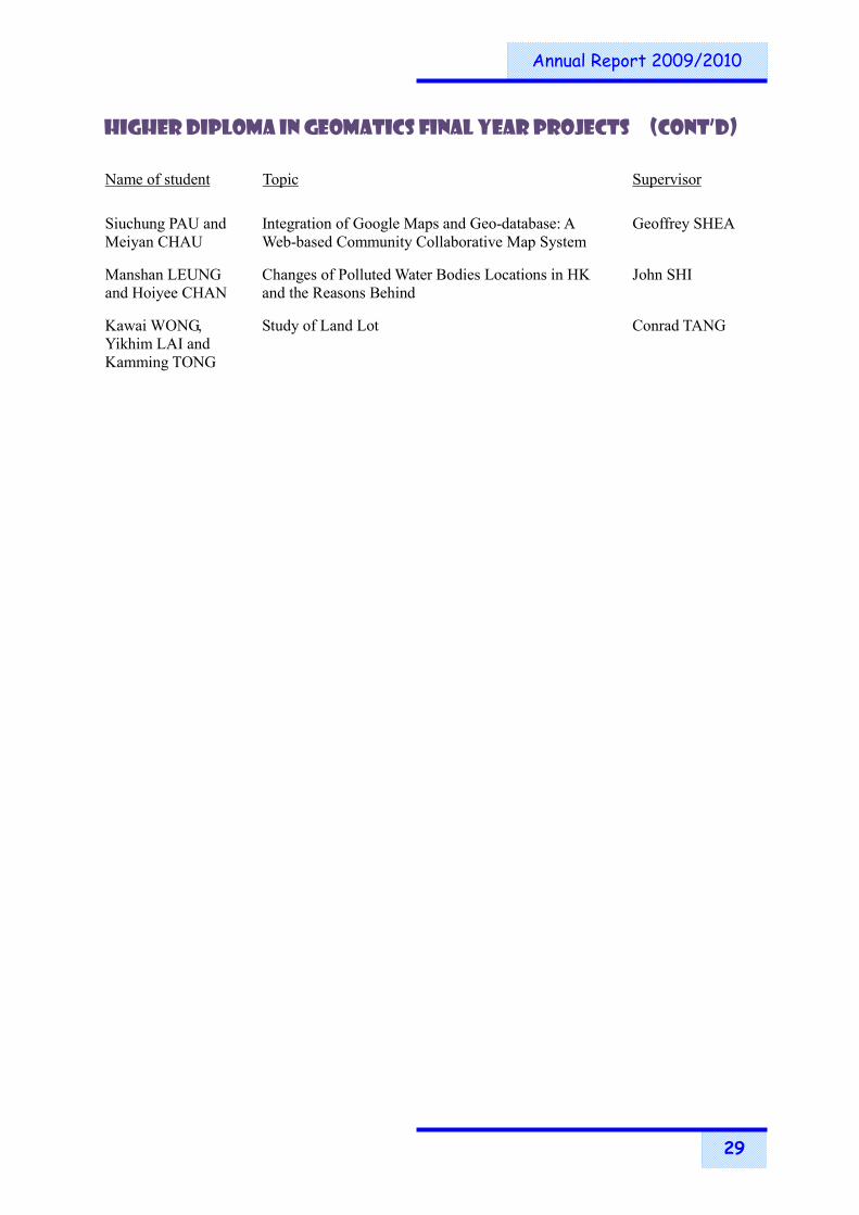
Siuchung PAU and Meiyan CHAU
Integration of Google Maps and Geo-database: A Web-based Community Collaborative Map System
Geoffrey SHEA
Manshan LEUNG and Hoiyee CHAN
Changes of Polluted Water Bodies Locations in HK and the Reasons Behind
John SHI
Kawai WONG, Yikhim LAI and Kamming TONG
Study of Land Lot Conrad TANG


Annual Report 2009/2010
30
TEACHING AND LEARNING PROJECTS
Current Teaching and Learning Projects and Summary Description
Investigators Title Amt of funds Status
Outcome-based Approaches Projects
Esmond MOK Alignment of the BSc(Hons) in Geomatics (Geo-IT) with HKIE and ABET Criteria on Outcome-based programme Accreditation
$393,920 Ongoing
Esmond MOK Assessing Student Generic Programme Outcomes with Final Year Projects
$1,568,343 Ongoing
Staff Attendance in Learning and Teaching Activities
Seminars / Workshop / Symposium Staff Attended Date
Developing Student Skills: Where Do We Stand and Deliver? A View from the University of Exeter, UK
Percy HUNG 03-Sep-09
Basic Teaching Techniques for Research Staff and Research Students (BTTR)
Module 1: Teaching and Learning at PolyU: Your Roles and Responsibilities (Compulsory)
Module 2: Building Relationships and Communicating with Students (Compulsory)
Module 3: Using Questions and Feedback to Help Students Learn (Compulsory)
Peter DAMOAH-AFARI
14-Sep-09
15-Sep-09
16-Sep-09
Introduction to University Teaching (IUT): Preparing to Teach Module: Looking back, looking forward
George LIU Bo WU
29-Sep-09

Annual Report 2009/2010
31
Staff Attendance in Learning and Teaching Activities (Cont’d)
Seminars / Workshop / Symposium Staff Attended Date
eLDSS: Spotling on eLearning: Consultancy Visit by Prof. Diana Laurillard
Open Lecture – The Effective Use of Digital Technologies for Learning and Teaching eLearning Showcase
eLearning Showcase
Nancy LAI
16-Oct-09
16-Oct-09
Assessing Student Learning in WIE: Sharing Session of Best Practices
Percy HUNG 21-Oct-09
Supporting Supplemental Instruction by Creating Learning Communities
Building a Learning Community for Supplemental Instruction
Percy HUNG
28-Oct-09
eLDSS: Education Design Patterns of e-Technologies for Humanities Curricula in PolyU
Nancy LAI 19-Nov-09
eLDSS: WEB 2.0 and Education: Special Interest Group – 7th Meeting Is There a Place for Facebook in Education?
Adam YAU 08-Dec-09
3+3+4 Symposium – Enhancing & Assessing Students’ Learning Outcomes for the New 4-Year Curriculum
Esmond MOK Percy HUNG Nancy LAI
14-Dec-09
Consultancy on Developing Students’ Generic Attributes
Workshop 1: The Teaching and Learning of Generic Attributes
Workshop 2: Assessing the Development of Generic Attributes
Consultation Sessions
Percy HUNG
15-Dec-09
16-Dec-09
15-Dec-09
Engaging Students in Outcome-Based Education: Establishing a Learning Contract with Your Students
Percy HUNG 12-Jan-10
Developing a Successful Learning & Teaching Development Project Proposal – Part 1
Percy HUNG 18-Jan-10
Understanding Your SFQ Results George LIU 19-Jan-10
Teaching What You Don’t Know Rebecca TSE 23-Feb-10
eLDSS: 10 Key Tools for Search, Research, Collaboration and Communication
Nancy LAI 09-Mar-10

Annual Report 2009/2010
32
Staff Attendance in Learning and Teaching Activities (Cont’d)
Seminars / Workshop / Symposium Staff Attended Date
Assessing Individual and Group Projects Percy HUNG 12-Mar-10
eLDSS: iEducation: Exploring the iPhone, iPod and iPad as Educational Tools
Nancy LAI 15-Mar-10
eLDSS: Communicating Online Using Moodle (Part I) Nancy LAI 20-Apr-10
Problem-based Learning for the PolyU Enquiry-based Classroom
Session 1: Writing Good Problems for Problem-based Learning
Percy HUNG
21-Apr-10
Implementing P-LOAP: Analyzing, Interpreting and Presenting Programme-level Data
Workshop 1: Data from Course-Embedded Assessment
Workshop 2: Data from Surveys
Percy HUNG Violett WONG
Percy HUNG Nancy LAI
20-Apr-10
27-Apr-10
Engaging Students in Outcome-Based Education: Using Co-curricular Activities to Fill in the Gaps
Percy HUNG 25-May-10
Developing Criteria and Standards for Assessing Essays and Reports
Percy HUNG 28-May-10
eLDSS: Teaching and Learning Innovation Symposium 2010 George LIU
Nancy LAI
07-Jun-10
eLDSS: Teaching and Learning Innovation Symposium 2010
Post-Symposium Workshop 3: The Renaissance for Voice
Nancy LAI 08-Jun-10
eLDSS: Frameworks for learner engagement Nancy LAI 09-Jun-10
Engaging Students in Outcome-Based Education: Closing the Loop and Moving On
Percy HUNG 11-Jun-10
eLDSS: Virtual World Teaching – A three part series
Virtual World Teaching – Part I: Experience in Second Life and Reaction Grid
Nancy LAI 15-Jun-10

Annual Report 2009/2010
33
Staff Attendance in Learning and Teaching Activities (Cont’d)
Seminars / Workshop / Symposium Staff Attended Date
Basic Teaching Techniques for Research Staff and Research Students (BTTR)
Module 1: Teaching and Learning at PolyU
Module 2: Building Rapport with Students
Module 3: Using Questions and Feedback to Help Students Learn
Pui Hang TO
22-Jun-10
23-Jun-10
24-Jun-10


Annual Report 2009/2010
34
STUDENT AFFAIRS
Scholarship & Prizes Student Name Name of Scholarship Doctor of Philosophy
Takcheung CHAN Departmental of Land Surveying and Geo-Informatics Scholarship
Jing WANG Departmental of Land Surveying and Geo-Informatics Scholarship
He WEN Departmental of Land Surveying and Geo-Informatics Scholarship
MSc in Geomatics with Specialisms in Geo-information Systems – Stage 1
Xi CHENG Entry Scholarship for the Postgraduate Scheme in Construction and Land Use
BSc (Hons) in Geomatics with Specialisms in Land Surveying and Geo-information Technology – Stage 4
Hoiki CHAN Hong Kong Institute of Surveyors (HKIS) Scholarship
Hoiki CHAN Zonta Club of Kowloon Scholarship
Onki HO HKURC-HKIUS Utility Specialists Fund Scholarship
BSc (Hons) in Geomatics with Specialisms in Land Surveying and Geo-information Technology – Stage 3
Hiufung CHEUNG The Outstanding Student, Faculty of Construction & Land Use, 2009
Hiufung CHEUNG Departmental of Land Surveying and Geo-Informatics Scholarship for Hall Residents
Hiufung CHEUNG HKSAR Government Scholarship
Hiufung CHEUNG Hong Kong Institute of Surveyors (HKIS) Scholarship
Cheukyan WAN Topcon Innovator Scholarship
Yukling WAN Providence Foundation Outward Bound Training Award
Kaying YUEN KELand Surveying, Planning & GIS Co. Ltd. Scholarship
Anshu ZHANG HKAUW Undergraduate Scholarship
Anshu ZHANG Post-entry Scholarship for Current Students on UGC-funded Undergraduate Programmes
Anshu ZHANG RICS (Hong Kong) Scholarship

Annual Report 2009/2010
35
Scholarship & Prizes (Cont’d) Student Name Name of Scholarship BSc (Hons) in Geomatics with Specialisms in Land Surveying and Geo-information Technology – Stage 2
Chi CHEN Departmental of Land Surveying and Geo-Informatics Scholarship for Non-local (Chinese mainland) Students
Shuanglin HU The Hong Kong Polytechnic University Non-local Students Scholarship (Academic)
Puihang LI Dr. Y.K. Ching Memorial Scholarship
Puihang LI HKSAR Government Scholarship
Szenga TSE HKURC-HKIUS Utility Specialists Fund Scholarship
BSc (Hons) in Geomatics with specialisms in Land Surveying and Geo-information Technology – Stage 1
Sibo CHEN Departmental of Land Surveying and Geo-Informatics Scholarship for Non-local (Chinese mainland) Students
Leelee CHAN Li & Fung Scholarship Yukyee KWOK Li & Fung Scholarship
Cheukhin LEUNG Departmental of Land Surveying and Geo-Informatics Scholarship
Kwoksheung HUNG Leica OSW Scholarship Waisum SO Leica OSW Scholarship
Yuxiao WANG The Hong Kong Polytechnic University Non-local Students Scholarship (Academic)
Higher Diploma in Geomatics – Stage 2
Chiyuen LAI Departmental of Land Surveying and Geo-Informatics Scholarship
Siuchung PAU The Hong Kong Institution of Engineering Surveyors (HKIES) Scholarship
Student Name Name of Prize / Award Wingfai CHAN The Hong Kong Institute of Surveyors – Outstanding Final Year
Dissertation Awards 2010 – Top Award (Land Surveying) (Project Title: A Structural Analysis of Public Transport Routes for
Optimal Route Comutation) Onkai HO The Hong Kong Institute of Surveyors – Outstanding Final Year
Dissertation Awards 2010 – Second Award (Land Surveying) (Project Title: 3D GIS and Spatial Analysis for Urban Utilities
Studies)

Annual Report 2009/2010
36
The Dean’s Honours List BSc (Hons) in Geomatics Stage 1
Manlok FAN Yungfong KING BSc (Hons) in Geomatics with specialisms in Geo-information Technology Stage 2
Puihang LI Anshu ZHANG Stage 3
Waiyi CHAN BSc (Hons) in Geomatics with specialisms in Land Surveying Stage 2
Kwoksheung HUNG Stage 3
Hiufung CHEUNG Higher Diploma in Geomatics
Stage 1
Shuknuen HO Chimei LAM Waichung LIU Yitak Lily LEUNG Hoikuen AU Higher Diploma in Geomatics with specialisms in Geo-information Technology
Stage 2
Siuchung PAU Higher Diploma in Geomatics with specialisms in Land Surveying
Stage 2
Chiyuen LAI

Annual Report 2009/2010
37
The International Association for the Exchange of Students for Technical Experience (IAESTE) The following students were nominated to carry out the summer training in Greece and Poland through the international student exchange (IAESTE) scheme : Lungyan CHAN IAESTE training in Republic of Serbia
Student Exchange with University of New Brunswick, Canada The University signed an agreement with University of New Brunswick on credit-bearing student exchange scheme in 2002/03. Each year, 2 students studying the BSc (Hons) Surveying & Geo-Informatics programme will be selected to study relevant subjects in the University of New Brunswick (UNB) for one academic year maximum. Similar arrangement from UNB is also expected. The following students were selected in 2009/10:
Leelee CHAN Yukyee KWOK
Student Profile
Student No.
Foundation Stage 1
Stage 2
Stage 3
Stage 4
BSc (Hons) in Geomatics 4 42 48 50 7
Higher Diploma in Geomatics - 90 46 - -

Annual Report 2009/2010
38
Student Activities Community Service Learning Awards
A Course-required project has been chosen for Community Service Learning Awards 2009/10. The award was presented to the participating students at an Award Presentation Ceremony held on 19 January 2011.
Awards / Certificate Gold
Project Name “Lian” Us Together (連理在一起)
Project Description A group of students assisted the Da Ping Zhen Niulushui Primary school (which located in Liannan, a hilly remote area in North Guangdong) to improve some of the school facilities with their surveying and Mapping skills
Service Users Primary school students, their families and teachers
Activities 1. To carry out minor improvement works of the school playground with surveying knowledge.
2. To apply LSGI students’ learning outcome for serving the children in the under-developing region in the Mainland China.
To reinforce bonding between local students and parents long time working outside liannan.
Period Dec 2009 to July 2010
Volunteers Advisors: Ms. Alice Cheng, Ms. Camilla Li and Mr. Joseph Lam
Students: 20 Hong Kong Polytechnic University students

Annual Report 2009/2010
39
Student’s Learning Experience on Chinese Mainland - Study Tour in Nanjing During 27-31 December 2009, 16 LSGI students from different years joined a China study tour and visited Nanjing, Jiangsu. The tour was led by Prof. Li Zhi-li, Dr. Wu Bo and Mr. Adam Yau. During the 5-day tour, we visited Purple Mountain Observatory Chinese Academy of Sciences (中國
科學院紫金山天文台), Nanjing Normal University(南京師範大學), Hohai University(河海大
學), Nanjing University(南京大學)and Nanjing University of Aeronautics and Astronautics(南
京航空航天大學). Apart from the institutions, we also visited a number of Nanjing historical and cultural interests, such as The Memorial Hall of The Victims in Nanjing Massacre, Sun Yat-sen Mausoleum, Ming Xiaoling Mausoleum and Ming Imperial Palace. The tour was sponsored by Department of Land Surveying and Geo-Informatics, Hong Kong Polytechnic University.


Annual Report 2009/2010
40
RESEARCH ACTIVITIES, RESEARCH AWARDS AND RESEARCH OUTPUT
Research Programmes The Department is well recognized as a regional centre of excellence in research in the discipline of geomatics and is comparable with international reputed academic units in the discipline as evidenced by both the number and quality of the research outputs produced and research grants received. The department has a Research Centre for Geo-Information Science and Technology (RCGIST) that carries out research in a number of focused areas as described later in the report. The Department admits research students from both Hong Kong and abroad at the Master’s and Doctoral levels. Various scholarships are available to applicants with outstanding academic merits. For inquiries about the research programmes and student places, please contact Prof. Zhilin LI, Chairman of Departmental Research Committee (tel: 2766 5961; email: [email protected]). Alternatively, you may visit the home page of the Department at www.lsgi.polyu.edu.hk to find a staff member with appropriate specialty for advice.
Surveying, Navigation and Positioning 測量、導航和定位 Automation and enhancement of cadastral systems of Hong Kong; improvement of accuracy, reliability and efficiency in shallow water mapping using new technologies such as multi-beam echo sounders; development of GPS positioning technologies such as multi-antenna GPS; evaluation & modeling of GPS positioning errors; development of technologies for landslide and structure monitoring; multi-sensor and map matching techniques for navigation in high-rise urban areas; intelligent transport information systems; location-based computing and services; and fleet management.
Geodesy and Geodynamics 大地測量及地球動力學 Dynamical interaction between the solid Earth, oceans and atmosphere; El Niño; InSAR (Interferometric Synthetic Aperture Radar) for monitoring Earth surface deformation; precise determination of the geoid; space geodesy; sea-level change and impact assessment; applications of space geodetic techniques to study crustal deformation, atmospheric and environmental changes and the related natural hazards.
Photogrammetry and Remote Sensing 攝影測量及遙感 Applications of close-range photogrammetry and laser scanning in engineering and industry; fusion of satellite images; high-resolution image compression; environmental applications of remote sensing; remote sensing of the urban thermal environment; two- and three-dimensional information extraction from high-resolution digital images.
Geographic Information Systems (GIS) 地理資訊系統 Applications of GIS in transportation, environment and facility management; spatial data structures, terrain modeling and computational geometry; data exchange and integration; dynamic marine GIS; multi-dimensional data models; scale theory; spatial databases; spatial data quality; spatio-temporal analysis and modeling; geovisualization and visual analytics; spatial decision support systems; and internet GIS.
Digital Cartography 數字化制圖 Automated map generalization; cartographic visualization; design of dynamic maps for vehicle navigation; multi-media presentation; multi-scale cartographic databases; and symbol design for tourist maps.

Annual Report 2009/2010
41
Research Centre for Geo-Information Science and Technology Director : Prof. Yongqi CHEN, Deputy Director : Prof. Zhilin LI The objectives of the Research Centre are
To conduct research in a number of focused areas within the broad field of geo-information science and technology;
To promote external research collaborations; and
To promote applications of the latest research outputs and to provide services to the local and international communities.
The main current research areas of the Research Centre are included in three laboratories:
Laboratory for Environmental Change (LEC)
The current research areas include studies of ocean-atmosphere oscillations such as El Niño, crustal deformation monitoring with GPS and interferometric synthetic aperture radar (InSAR) technologies, monitoring stability of slopes and landslides, atmosphere sensing using GPS, measurement of land subsidence with InSAR, monitoring the deformation and health conditions of large engineering structures, sea level change monitoring using tide gauge records and satellite radar altimetry, monitoring of air and ocean pollution using remote sensing methods, study of urban heat islands, dynamical earth systems and phenomena such as earthquakes, typhoons and red tides, and GIS in natural hazards monitoring and management.
Laboratory for Integrated Navigation Technologies (LINT)
The current research areas include GNSS and applications, seamless navigation for urban application, integrated navigation systems, and Intelligent transportation Systems (ITS).
Cyber City Laboratory (CCL)
The research areas include multi-resolution image bases, dynamic and 3-dimensional representation of city, through internet and virtual technology.

Annual Report 2009/2010
42
Research Degree Graduates PhD Name of student Title Supervisor
Haixia MAO Improvement and Estimation of Classification Accuracy for Remotely Sensed Images
John SHI
Peter DAMOAH-AFARI
Detecting Ground Settlement of Megacities Using InSAR Techniques
Xiaoli DING
Md Latifur Rahman SARKER
Estimation of Forest Biomass Using Remote Sensing
Janet NICHOL
Linguo YUAN Determination of Tidal Displacements Using the Global Positioning System
Xiaoli DING @ Wu CHEN
Jing WANG Development of Geographic Image Cognition Approach for Land Degradation Assessment with Hyperion Images
Yongqi CHEN @ Janet NICHOL
MPhil Name of student Title Supervisor
Ka Hei KWOK An Evaluation of ASTER Images for Assessment of Causative Factors of Hong Kong's Urban Heat Island
Janet NICHOL
@ Chief Supervisor

Annual Report 2009/2010
43
Ongoing PhD Projects Name of student Title Supervisor
Full-time
Muhammad BILAL Air Quality Monitoring in Hong Kong and Pearl River Delta Region Using Remote Sensing
Janet NICHOL
Susu DENG Quality Control for Spatial Data John SHI
Qiong DING The Integration of LiDAR and Imagery Datasets for Terrain Analysis of Outfall
Wu CHEN @ Bruce KING
Guangcai FENG Measuring Three-Dimensional Movements by Combining Different SAR Sensors and Different Orbits
Xiaoli DING
Jian GUO Integration of Multi-source Lunar Imagery and Laser Altimetry Data for Precision Lunar Topographic Mapping
Bo WU @ Zhilin LI
Indika Prasanna HERATH MUDIYANSELAGE
Precise Geoid Determination and Geodetic Network Improvements in Sri Lanka
Wu CHEN @ Baki IZ
Mi JIANG Unbiased Interferometric Coherence Estimation and Applications in InSAR
Xiaoli DING
Yang OU A Multi-scale Approach to Automated Recognition of Fuzzy Spatial Objects
Lilian PUN @ Zhilin LI
Muhammad Imran SHAHZAD
Remote Sensing of visibility using weather satellite data
Janet NICHOL
Hui SUN Transformation of Information on Topographic Map from Large Scale to Small Scale
Zhilin LI
Peng TI Automated Generation of Schematic Network Maps Zhilin LI
Chisheng WANG FEM Numerical Simulation of Seismic Deformation Constrained by InSAR
Xiaoli DING
Bing WEI A Dynamic Vehicle Positioning System Based on Wireless Ad Hoc Networks
Wu CHEN @ Xiaoli DING
Qianxiang XU Modeling Uncertainties in Area Estimation for Spatial Objects
John SHI
Rui XU Multi-channel Fusion Tracking in L1/L2 GPS Software Receiver
George LIU @ Wu CHEN
Hong ZHANG Spatially Integrated Social Networks for Studying Urban Structure and Dynamics
Zhilin LI @ Bin JIANG

Annual Report 2009/2010
44
Ongoing PhD Projects (Cont’d) Name of student Title Supervisor
Full-time
Lei ZHANG The Joint Analysis of PSInSAR and GPS Data to Infer Seismic Deformation and Model the Slip Distribution
Xiaoli DING
Ling ZHANG Geo-oriented River Network Generalization Eric GUILBERT @ Zhilin LI
Qi ZHOU Generalization of Transportation Network Zhilin LI
Part-time
Hochiu CHAN On the Dynamics of Genetic Algorithm for a Multi-modal Transportation Database
Lilian PUN @ Zhilin LI
Ngafong CHENG A Precise Boundary Determination Model in Hong Kong Special Administrative Region
Conrad TANG @ Xiaoli DING
Takcheung CHAN Sustainable Development of Geomatics Zhilin LI
Yikkong CHEUNG Simplification of Maps for Mobile-based Navigation
Zhilin LI @ Wu CHEN
He WEN Enhancement of Urban Cadastre and Land Information Management Systems in China
Conrad TANG @ Yongqi CHEN
Kingfai WONG Quality Assessment and Control for Topographic Data
John SHI
Wentao YANG GNSS-Based Multi-Sensor Systems for Structural Health Monitoring
Xiaoli DING
@ Chief Supervisor

Annual Report 2009/2010
45
Ongoing MPhil Projects Name of student Title Supervisor
Full-time
Yang GAO Geographical Information System Zhilin LI
Pei HU Effect of Distortion in Geometric Shape on Recognition of Area Cartogram
Zhilin LI
Gang PANG A Model-based Method for Extracting Terrain Surface from Airborne Lidar Data
John SHI
Zhe QIN Legend-driven Web Tourist Mapping System Zhilin LI @ Geoffrey SHEA
Pui Hang TO Temperature Projection in Hong Kong Using Remote Sensing and Dynamic Modelling
Janet NICHOL @ Rebecca TSE
Jue WANG Effectiveness of Visual, Screen and Dynamic Variables in Animated Mapping
Zhilin LI
Wai Lam WONG 3D Terrain Data Matching Using Energy Minimisation Techniques
Eric GUILBERT @ Zhilin LI
Shengjun XIAO Handling Spatial Inconsistencies in Land Use Data Updating
Lilian PUN @ Zhilin LI
Xunruo ZHANG Generalisation of Contour Lines on Nautical Charts Using Snake Model and a Multi-agent System
Eric GUILBERT @ Zhilin LI
Part-time
Chikwong LAU Investigation on GPS Heighting Accuracy with Different Tropospheric Models Using Hong Kong Satellite Positioning Reference Station Network (SatRef)
Yongqi CHEN @ Wu CHEN
@ Chief Supervisor

Annual Report 2009/2010
46
New Research Projects New Research Projects funded in the reporting year:- Zhilin LI Investigators: Zhilin LI Title: Effect of Scale on Extraction of Spatial Features from Satellite Images (G-U686) Amt of funds: $194,828 Status: Start date : 01-Apr-2010 Description: (to be completed by Zhilin LI) George LIU Investigators: George LIU Title: Contribution of the GPS Modernization to the Precise Point Positioning
Technology (1-ZV6L) Amt of funds: $200,000 Status: Start date : 01-Jan-2010 Description: Nowadays, the use of positioning information provided by U.S. Global Positioning
System (GPS) technology has become increasingly popular and important in our daily life and many scientific and engineering disciplines. In the recent years, a new positioning technique “Precise Point Positioning (PPP)”, has been developed. At the same time, the GPS has undergone a series of modernization in the past a few years. This proposal aims to develop a new generation of precise point positioning (PPP) technology to use the new GPS modernized signals generating highly accurate and reliable positioning and navigation solutions. This new generation PPP technology will take advantage of both the pre-modernization and modernization GPS satellite signals. The development of this new generation of PPP technique will contribute fundamental R&D knowledge to both academia and industrial sectors.

Annual Report 2009/2010
47
Investigators: George LIU, Xiaoli DING and Wu CHEN Title: The Development of a New Generation PPP Technology by Assimilating the GPS
and GLONASS Systems (A-PJ63) Amt of funds: $100,000 Status: Start date : 01-May-2010 Description: In the use of GPS the most essential and concerned issue is to determine the GPS
receiver’s position accurately, rapidly, reliably, economically and conveniently. Several governments are developing GPS-like systems, such as Russia’s GLONASS (nearly complete), European GALILEO (under development), and Chinese COMPASS (under development). The precise positioning and navigation information, derived from GPS and other GNSS systems has numerous useful applications. In recent years, a new technique called Precise Point Positioning (PPP) based on GPS signals has emerged to be a promising positioning method. The GPS-only PPP technique has its own drawbacks. For instance, currently GPS-based PPP technique requires more than 30-minutes to converge in the initialization period. This proposal aims to develop a new generation of precise point positioning (PPP) technology to optimally integrate and process the satellite data by assimilating the world’s two most mature Global Navigation Satellite Systems (GNSS), i.e. GPS and GLONASS, generating highly reliable, highly accurate and instantaneous positioning and navigation solutions.
Esmond MOK Investigators: Esmond MOK, Lilian PUN and Bruce KING Title: Localization in Adverse Satellite Visibility Environments - A Cost Effective
Approach Based on Public WiFi and GNSS Integration (G-U733) Amt of funds: $155,000 Status: Start date : 01-Mar-2010 Description: (to be completed by Esmond MOK)

Annual Report 2009/2010
48
Janet NICHOL Investigators: Janet NICHOL and Quoqing SUN Title: Multi-sensor Estimation of Biomass Carbon in Regenerating Sub-tropical Forest
(B-Q18P) Amt of funds: $1,094,700 Status: Start date : 12-Oct-2009 Description: Secondary forests now have much greater global distribution than primary forests.
They are also more efficient at sequestering carbon dioxide from the atmosphere due to their faster growth rates. The latter is especially true of tropical secondary forests, as in Hong Kong, and little work has been done in the tropics. This research advances existing techniques for estimation of biomass carbon in complex secondary forests using state-of-the-art satellite sensors and image processing methodologies. The two recently launched SAR sensors, Radarsat 2 with C-band and the Japanese Space Agency’s PALSAR with L-band PALSAR offer complementary information on biomass due to their respective sensitivities to canopy, and below canopy (trunk) parameters. Moreover their dual-polarised mode is less likely to saturate at the higher biomass levels typical of tropical forests. A multi-senor approach is adopted, combining both optical and SAR sensors, and the best fit model will be derived from comparison with detailed g round data. The accessibility and familiarity of the study area to the researchers, as well as availability of other high quality digital and GIS data besides images, confers an advantage over previous similar projects in tropical regions. Furthermore, the rugged nature of the terrain combined with species and structural complexity of the forests means that results obtained in this challenging study area could easily be attained in other less complex regions

Annual Report 2009/2010
49
Investigators: Janet NICHOL and Yanyung Edward NG Title: Impacts of Climatic Warming on High Density Living in Hong Kong Using
Remote Sensing and GIS Modelling (K-QZ04) Amt of funds: $388,800 Status: Start date : 1-Oct-2009 Description: Hong Kong’s urban environment will be warmer, more thermally stressful and less
pleasing due to global warming and urbanization. Like governments around the world, the government of HKSAR needs information to develop policies to mitigate this. A spatially comprehensive overview of microclimate over the whole of the HKSAR territory is advantageous, and this can only be provided by remote sensing. This research bridges a long-standing gap between the development of thermal remote sensing as a scientific discipline, and its application to an increasingly urgent global problem. Specifically there is a need to measure and evaluate the impacts of the predicted climatic warming over the next 15 years on the living environment in terms of changes in surface and air temperatures. This research provides a Heat Island Intensity Index (HIII) model of Hong Kong at 10m resolution for different diurnal and seasonal situations, by combining data from many current and past thermal satellite images with field and fixed station data. This will permit the measurement and prediction of surface and air temperatures over the HKSAR for current and future periods by regression analysis of field and fixed station climatic data against the HIII model. Data from a 20-year thermal satellite image archive is being used to build regression models for time series raster modelling related to projected changes in key Parameters of the Built Environment (building density, building height, total built space (representative of plot ratio), and area of green space). Three issues of concern, namely (i) thermal comfort, (ii) increases in mortality and (iii) the incidence of dangerously hot man-made surfaces are being addressed using the model, such that excess of defined climatic limits can be presented as high resolution maps.
John SHI Investigators: John SHI Title: A Sand Accumulation Model-based Satellite Image Segmentation Method
(G-U753) Amt of funds: $191,000 Status: Start date : 01-Jan-2010 Description: (to be completed by John SHI)

Annual Report 2009/2010
50
Conrad TANG Investigators: Conrad TANG Title: Development of Land Boundary Re-establishment Rules from Judements in Hong
Kong (G-U734) Amt of funds: $193,925 Status: Start date : 01-Jan-2010 Description: Hong Kong has no cadastre law or survey law that prescribes the fixing of land
parcel boundaries. Land boundary right is one of the estates created from the registration of documents under the Land Registration Ordinance (Chapter 128). The lawful evidence of a parcel boundary is recorded in the original land lease such that a surveyor has to find out and rely on the grant plan that was registered, as in many other cases, in 1905. A land surveyor may use all other available evidence to help in locating the boundary, albeit an expert opinion - no definite result is achieved. Cadastre law and survey law in other leading jurisdictions would prescribe the method and standard of a cadastral survey and give legal sanction of land parcel boundaries. This research works on the applications of boundary evidence with different weights such that the quality and security of the survey could be assessed against the rules.
Bo WU Investigators: Bo WU Title: Reliable Image Matching Strategies for Mars and Moon Terrain Reconstruction
(1-ZV6K) Amt of funds: $200,000 Status: Start date : 01-Dec-2009 Description: The prosperous Mars and Moon exploration programs manipulated by the United
States and China as well as other countries returned huge amount of ground and orbiter images of the Mars and Moon surface. 3D terrain reconstruction from these images is extremely important for scientific investigation, safe landing, and mission operations on these extraterrestrial bodies. Reliable image matching is an essential and difficult task in terrain reconstruction. Possible problems from geometric distortions, illumination changes, and scale changes will result in matching ambiguity. In particular for Mars and lunar surface imagery, it is more difficult to obtain reliable matching results due to their nature terrain features, such as homogenous textures and similar texture patterns seen in sand dune areas. The up-to-date photogrammetric software systems for image processing are not automatic and require a lot of human interactions due to the limitation of image matching. This proposed project plans to develop innovated image matching strategies for reliable terrain reconstruction of Mars and Moon. Project objectives include:(1) Development of an improved self-adaptive image matching method to enhance the matching reliability for difficult cases in Mars and Moon ground/obiter image matching; and (2) Development of a hierarchical image matching strategy to improve the reliability and efficiency for Mars and Moon obiter image matching.

Annual Report 2009/2010
51
Research Output Book and Book Chapters
Author Title
DAMOAH-AFARI, P.#, DING, X.L., LU, Z., LI, Z.W. and OMURA, M.
" Magnitude and extend of six years of land subsidence in Shanghai revealed by JERS-1 SAR data ". In Imperatore, P. and Riccio, D., eds., Geoscience and Remote Sensing, New Achievements, In-Tech, Vukovar, pp.477-496 (2010)
FUNG, T. and PUN-CHENG, L.S.C.
" Geographic Information Systems ". In Jim, C.Y., Li, S.M. and Fung, T., eds., A New Geography of Hong Kong, Vol. II, Cosmos Books Ltd., Hong Kong, pp.195-227 (2010)
HAN, P., LI, ZHILIN and GONG, J.
" Effects of Aggregation Methods on Image Classification ". In Li, D. et al., ed., Geospatial Technology for Earth Observation, Springer, London, pp.272-288 (2009)
LAM, S. " Engineering Surveying for Civil Engineers: an Algorithmic Approach ". 2nd Ed. McGraw-Hill Education, Singapore, 207pp (2010) ISBN 007-125022-0
SHI, W.Z. " Principle of modeling uncertainties in spatial data and spatial analyses ". 1st Ed. Taylor & Francis Group/ CRC Press, New York, 412pp (2009)
WU, B. " A Prototype System for Astronaut Spatial Navigation on the Lunar Surface ". In Ziyuan Ouyang, Wing-Huen Ip, and Zesheng Tang, eds., New Advances in Lunar Exploration, Macau University of Science and Technology, Macau, pp.157-166 (2010) ISBN 978-99937-53-14-8
WU, J.C., CHEN, Y.Q., DANG, Y.M. and MENG, G.J.
" Fault slip of the 2008 Wenchun 8.0Ms earthquake by inversion of GPS measurements ". In Shi, Chuang, ed., Global navigation satellite systems: technology and innovation, Scientific Research, Beijing, pp.217-219 (2009)

Annual Report 2009/2010
52
Papers in Refereed Journals
Author Title
CHAN, W.S., JI, S., YUAN, L.# and CHEN, WU
" High Order Ionospheric Effect on High Precision GPS Positioning in Hong Kong ". Journal of Geospatial Engineering, Vol. 11, pp.44-52 (2009)
CHEN, G.B., CHEN, Y.Q., WU, J.C. and HE, X.F.
" A statistical method for testing significance of strain components ". Journal of Geodesy and Geodynamics, Vol. 30, No. 1, pp.1-4 (2010)
CHEN, Q., DING, X.L., LIU, G.X., HU, J.C. and YUAN, L.G.#
" Baseline recognition and parameter estimation of persistent-scatterer network in radar interferometry ". CHINESE JOURNAL OF GEOPHYSICS-CHINESE EDITION, Vol. 52, No. 9, pp.2229-2236 (2009)
CHEN, W., HU, C.W., GAO, S.#, CHEN, Y.Q. and DING, X.L.
" Error correction models and their effects on GPS precise point positioning ". SURVEY REVIEW, Vol. 41, No. 313, pp.238-252 (2009)
CHEN, Y.Q. and YI, Z.H.
" Development of a real time precise point positioning (PPP) system ". Journal of Geospatial Engineering, Vol. 11, pp.21-31 (2009)
CHEUNG, Y.K.#, LI, ZHILIN and CHEN, W.
" Integration of cognition-based content zooming and progressive visualization for mobile-based navigation ". CARTOGRAPHIC JOURNAL, Vol. 46, No. 3, pp.268-272 (2009)
CHIU, T., NICHOL, J.E., WONG, P., LAM, S. and BURB, A.
" Urban temperatures in Hong Kong: thermal environmental safety and implications for urban planning ". Journal of Burn Care & Research , Vol. 30, No. 4, pp.735-739 (2009)
DENG, MIN, CHEN, JIE, LI, ZHILIN and XU, ZHEN
" An Improved Local Measure Method for the Importance of Vertices in Curve Simplification ". Geography and Geo-Information Science, Vol. 25, pp.40-43 (2009) (in Chinese)
FANG, XIA, WANG, D.N. and CHEN, WU
" High side-mode suppression ratio optical pulses generated from a self-seeded Fabry-Perot laser diode locked by a linear erbium-doped fiber laser ". IEEE JOURNAL OF QUANTUM ELECTRONICS, Vol. 46, No. 4, pp.462-466 (2010)
FENG, G.#, HETLAND, E.A., DING, X.L., LI, Z. and ZHANG, L.#
" Coseismic fault slip of the 2008 Mw 7.9 Wenchuan earthquake estimated from InSAR and GPS measurements ". GEOPHYSICAL RESEARCH LETTER, Vol. 37 (2010)
(http://europa.agu.org/?view=article&uri=/journals/gl/gl1001/2009GL041213/ 2009GL041213.xml&t=2009gl04) (doi:10.1029/2009GL041213 L01302)

Annual Report 2009/2010
53
Author Title
FOK, H.S., IZ, H.B., SHUM, C.K., YI, Y., ANDERSEN, O., BRAUN, A., CHAO, Y., HAN, G., KUO, C.Y., MATSUMOTO, K. and SONG, Y.T.
" Evaluation Of Ocean Tide Models Used For Jason-2 Altimetry Corrections ". MARINE GEODESY, Vol. 33, No. S1, pp.285-303 (2010)
HAN, P., GONG, J., LI, ZHILIN, BO, Y. and CHENG, L.
" Selection of optimal scale in remotely sensed image classification ". JOURNAL OF REMOTE SENSING (IN CHINSE), Vol. 14, No. 3, pp.513-518 (2010)
HU, J., LI, Z.W., ZHU, J.J., REN, X.C. and DING, X.L.
" Inferring three-dimensional surface displacement field by combining SAR interferometric phase and amplitude information of ascending and descending orbits ". SCIENCE IN CHINA (SERIES D): EARTH SCIENCES, Vol. 53, No. 4, pp.550-560 (2010)
IZ, H.B., CHEN, Y.Q., KING, B.A., DING, X.L. and CHEN, W.
" Deformation Analysis of the Unified Lunar Control Networks ". JOURNAL OF APPLIED GEODESY, Vol. 3, pp.231-238 (2009) (DOI 10.1515/JAG.2009.023.)
JIANG, M.#, LI, Z.W., DING, X.L., ZHU, J.J., FENG, G.C.# and YIN, H.J.
" A study of the maximum and minimum detectable deformation gradients resolved by InSAR ". CHINESE JOURNAL OF GEOPHYSICS-CHINESE EDITION, Vol. 52, No. 7, pp.1715-1724 (2009) (in Chinese)
LI, R., NIU, X., LIU, C., WU, B. and DESHPANDE, S.
" Impact of Imaging Geometry on 3D Geopositioning Accuracy of Stereo IKONOS Imagery ". PHOTOGRAMMETRIC ENGINEERING AND REMOTE SENSING, Vol. 75, No. 9, pp.1119-1125 (2009)
LI, S., LI, ZHILIN and GONG, J.
" Multivariate Statistical Analysis of Measures for Assessing Image Fusion Quality ". International Journal of Image and Data Fusion, Vol. 1, No. 1, pp.47-66 (2010)
MIAO, JIANFENG, CHEN, WU, SUN, YONGRONG and LIU, JIANYE
" Low C/N Carrier Tracking Loop Based on Optimal Estimation Algorithm in a GPS Software Receiver ". Chinese Journal of Aeronautics, Vol. 23, No. 1, pp.109-116 (2010)

Annual Report 2009/2010
54
Author Title
MOK, C.M.E., XIA, L., RETSCHER, G. and TIAN, HUI
" A case study on the feasibility and performance of an UWB-AoA real time location system for resources management of civil construction projects ". JOURNAL OF APPLIED GEODESY, Vol. 4, pp.23-32 (2010)
NICHOL, J.E., WONG, M.S. and WANG, J.#
" A 3D aerosol and visibility information system for urban areas using remote sensing and GIS ". ATMOSPHERIC ENVIRONMENT, No. 44, pp.2501-2506 (2010)
NICHOL, J.E., WONG, M.S., CORLETT, R.A. and NICHOL, D.W.
" Urban bird habitat modeling in Hong Kong using fine resolution satellite images ". LANDSCAPE AND URBAN PLANNING, Vol. 95, pp.54-69 (2010)
CHIU, T., NICHOL J.E., *WONG, P., LAM, and S., BURD,
“Urban temperatures in Hong Kong: thermal environmental safety and implications for urban planning”. JOURNAL OF BURN CARE & RESEARCH Vol 30, No. 4, pp.735-739 (2009).
QI, H.#, LI, ZHILIN and CHEN, J.
" Automated Change Detection for Updating Settlements at Smaller-Scale Maps from Updated Larger-Scale Maps ". JOURNAL OF SPATIAL SCIENCE (COMBINED FROM GEOMATICS RESEARCH AUSTRALASIA, THE AUSTRALIAN SURVEYOR, AND JOURNAL OF CARTOGRAPHY), Vol. 55, No. 1, pp.133-146 (2010)
QIAO, G., WANG, W., WU, B., LIU, C. and LI, R.
" Assessment of Geo-positioning Capability of High-Resolution Satellite Imagery for Densely Populated High Buildings in Metropolitan Areas ". PHOTOGRAMMETRIC ENGINEERING AND REMOTE SENSING, Vol. 76, No. 8, pp.923-934 (2010)
REN, AIAI, SUN, YONGRONG, HU, YINGDONG and CHEN, WU
" Study on robust compensation filter of heading measurement for UAV ". Transducer and Microsystem Technologies, Vol. 28, No. 5, pp.34-39 (2009)
SHI, J.W.Z., KWAN, K.W.#, SHEA, G.Y.K. and CAO, J.N.
" A dynamic data model for mobile GIS ". Computers & Geosciences, Vol. 35, No. 11, pp.2210-2221 (2009) (November 2009, Elsevier)
SHI, W.Z., LIU, K.F. and HUANG, C.Q.
" A fuzzy topology-based area object extraction method ". IEEE TRANSACTIONS ON GEOSCIENCE AND REMOTE SENSING, Vol. 48, No. 1, pp.147-154 (2010) ((SCI, EI paper))
SHI, W.Z., ZHENG, S., TIAN, Y. and LIU, K.F.
" Adaptive Mapped Least Squares SVM-based Smooth Fitting Method for DSM Generation of LIDAR data ". INTERNATIONAL JOURNAL OF REMOTE SENSING, Vol. 30, No. 21, pp.5669-5683 (2009) ((SCI, EI paper))

Annual Report 2009/2010
55
Author Title
SUN, HUI# and LI, ZHILIN
" Effectiveness of Cartogram for the Representation of Spatial Data ". CARTOGRAPHIC JOURNAL, Vol. 47, No. 1, pp.12-21 (2010)
SUN, YONGRONG, HU, YINGDONG, CHEN, WU and LAI, JIZHOU
" Accurate Estimation of Building Deformation Based on Improved Grey GM (1, 1) Model ". Journal of Nanjing University of Aeronautics & Astronautics, Vol. 41, No. 1, pp.107-110 (2009)
TANG, C. " Hong Kong Leasehold Land Tenure and Boundary System ". Journal of Cadastre, Vol. 40, No. 1, pp.49-61 (2010) (Korea Cadastral Survey Corporation, ISSN 1975-3101, June 2010)
TANG, Q.H., LIU, B.H., CHEN, Y.Q., ZHOU, X.H. and LIN, X.B.
" Seabed classification with improved BP neural network ". Hydrographic Surveying and Charting, Vol. 29, No. 5, pp.40-43 (2009)
TIAN, H., XIA, L., MOK, C.M.E. and WU, D.
" Signals of Opportunity Assisted Ubiquitous Positioning and Its Key Elements for Outdoor/Indoor Environment ". Journal of Geomatics and Information Science of Wuhan University, Vol. 34, No. 11, pp.1372-1376 (2009) (in Chinese)
TONG, X.H. and SHI, W.Z.
" Measuring positional error of circular curve features in Geographic information systems ". COMPUTERS AND GEOSCIENCES, Vol. 36, No. 7, pp.861-870 (2010) ((SCI paper))
TONG, X.H., SHI, W.Z. and DENG, SUSU#
" A probability-based multi-measure feature matching method in map conflation ". INTERNATIONAL JOURNAL OF REMOTE SENSING, Vol. 30, No. 20, pp.5453-5472 (2009) ((SCI, EI paper))
TONG, X.H., SHI, W.Z. and LIU, D.J.
" Introducing Scale Parameters for Adjusting Area Objects in GIS based on Least Squares and Variance Component Estimation ". INTERNATIONAL JOURNAL OF GEOGRAPHICAL INFORMATION SCIENCE, Vol. 23, No. 11, pp.1413-1432 (2009) ((SCI Paper))
WANG, J.#, CHEN, Y.Q., HE, T., LV, C.Y. and LIU, A.X.
" Application of geographic image cognition approach in land type classification using hyperion image: a case study in China ". INTERNATIONAL JOURNAL OF APPLIED EARTH OBSERVATION AND GEOINFORMATION, Vol. 12, No. 2, pp.212-222 (2010) (Sep 2010, Doi: 10.1016/jag 2009.06.003)
WANG, J.#, HE, T., LV, C.Y. and CHEN, Y.Q.
" Mapping soil organic matter based on land degradation spectral response units using Hyperion images ". INTERNATIONAL JOURNAL OF APPLIED EARTH OBSERVATION AND GEOINFORMATION, Vol. 12, No. 2, pp.171-180 (2010)
WEISS, P, SHI, W.Z. and YUNG, K.L.
" Attribute uncertainty modeling in lunar spatial data ". INTERNATIONAL JOURNAL OF REMOTE SENSING, Vol. 31, No. 1, pp.197-211 (Jan., 2010) (http://portal.acm.org/citation.cfm?id=1805003) (SCI, EI paper)

Annual Report 2009/2010
56
Author Title
WONG, M.S., NICHOL, J.E. and HOLBEN, B.
" Desert dust aerosols observed in a tropical humid city: a case study over Hong Kong ". INTERNATIONAL JOURNAL OF REMOTE SENSING, Vol. 31, No. 4, pp.1043-1051 (2010)
WONG, M.S., NICHOL, J.E., LEE, K.H. and LI, Z.Q.
" Retrieval of Aerosol Optical Thickness using MODIS 500 x 500m2, a study in Hong Kong and Pearl River Delta region ". IEEE TRANSACTIONS ON GEOSCIENCE AND REMOTE SENSING, Vol. 48, No. 4, pp.3318-3327 (2010)
WONG, M.S., NICHOL, J.E., TO, P.H.# and WANG, J.#
" A simple method for designation of urban fresh air corridors and its application to urban heat island analysis ". BUILDING AND ENVIRONMENT, No. 45, pp.1880-1889 (2010)
XIAO, C.C., TIANG, Y.A. and SHI, W.Z.
" A new method of pseudo absence data generation in landslide susceptibility mapping with a case study of Shenzhen ". SCIENCE IN CHINA SERIES E-TECHNOLOGICAL SCIENCES, Vol. 53, pp.75-84 (2010)
XUE, SHUQANG, DANG, YAMIN and CHEN, WU
" Matrix Volume Method of the Mean Square Deviation Computation of Least Square Solution ". GEOMATICS AND INFORMATION SCIENCE OF WUHAN UNIVERSITY, Vol. 39, No. 9, pp.1107-1109 (2009)
YAN, H., CHEN, WU, ZHU, YANZHONG, ZHANG, WEIMIN and ZHONG, MIN
" Contributions of thermal expansion of monuments and nearby bedrock to observed GPS height changes ". GEOPHYSICAL RESEARCH LETTER, Vol. 36, pp.L13301 (2009) (doi:10.1029/2009GL038152)
YANG, G., HE, X.F. and CHEN, Y.Q.
" Integrated GPS and pseudolite positioning for deformation monitoring ". SURVEY REVIEW, Vol. 43, No. 315, pp.72-81 (2010)
YIU, K# and KING, B
" STEREONET DATA FROM TERRESTRIAL LASER SCANNER POINT CLOUDS ". SURVEY REVIEW, Vol. 41, No. 314, pp.324-338 (2009)
YUAN, L.G.#, DING, X.L., SUN, H.P., ZHONG, P. and CHEN, W.
" Determination of ocean tide loading displacements in Hong Kong using GPS technique ". SCIENCE IN CHINA (SERIES D): EARTH SCIENCES, Vol. 53, No. 7, pp.993-1007 (2010) (doi: 10.1007/s11430-010-3076-2. (in English))
YUAN, L.G.#, DING, X.L., ZHONG, P., CHEN, W. and HUANG, D.F.
" Estimates of ocean tide loading displacements and its impact on position time series in Hong Kong using a dense continuous GPS network ". JOURNAL OF GEODESY - JOGE, Vol. 83, No. 11, pp.999-1015 (2009) (DOI 10.1007/s00190-009-0319-0)
ZHAO, C.Y., ZHANG, Q., DING, X.L., LU, Z., YANG, C.S. and QI, X.M.
" Monitoring of land subsidence and ground fissures in Xian, China 2005-2006: mapped by SAR interferometry ". ENVIRONMENTAL GEOLOGY, Vol. 58, No. 7, pp.1533-1540 (2009)

Annual Report 2009/2010
57
Author Title
ZHONG, P., DING, X.L., YUAN, L.G.#, XU, Y.L., KWOK, K. and CHEN, Y.Q.
" Sidereal filtering based on single differences for mitigating GPS multipath effects on short baselines ". JOURNAL OF GEODESY - JOGE, Vol. 84, No. 2, pp.145-158 (2010)
ZHONG, P., YUAN, L.G.# and DING, X.L.
" Experimental analysis of GPS multipath day-to-day repeatability ". Science of Surveying and Mapping, Vol. 35, No. 2, pp.26,43-45 (2010) (in Chinese)

Annual Report 2009/2010
58
Proceedings and other published items
Author Title
CHEN, WU, JI, S., BING, J., DING, X.L., CHEN, Y.Q., ZHAO, C. and HU, C.
" Ambiguity Validation with Combined Ratio Test and EIA ". ION GNSS 2009, Savannah, GA, 22-25 Sept 2009, pp.2741-2750 (2009)
CHEN, WU, MIAO, JIANFENG, SUN, YONGRONG and LIU, JIANYE
" An Assisted GPS Software Receiver for processing Weak Signals ". Int. Symp. On GPS/GNSS 2009, Jiju, Korea, 4-6 Nov 2009 (2009)
DING, X.L. " Monitoring Ground and Structural Deformation with GPS and InSAR; What Can and Cannot the Technologies Offer? ". Land Surveying Partnering Workshop, MTRC, Hong Kong, 12 March 2010 (2010) ((invited))
DING, X.L. " Radar remote sensing: monitoring ground deformations and geohazards from space ". MRSS 6th International Remote Sensing & GIS Conference and Exhibition, Kuala Lumpur, Malaysia, 28-29 April 2010 (2010) (keynote)
FENG, G.C.#, DING, X.L., LI, Z.W. and ZHANG, L.#
" Triple Difference Model for Persistent Scatterer InSAR ". International Conference on Geo-spatial Solutions for Emergency Management (GSEM 2009) and the 50th Anniversary of the Chinese Academy of Surveying and Mapping, Beijing, China, 14-16 September 2009 (2009) (invited)
HU, C., CHEN, WU, MIAO, J., GUO, Z., WEI, B.# and YUAN, Z.
" Assisted GPS Positioning under Weak Signal Environments ". ION GNSS 2009, Savannah, GA, 22-25 Sept 2009, pp.2602-2609 (2009)
JI, S., CHEN, WU, DING, X.L. and CHEN, Y.Q.
" Low-latitude Area Ionospheric Tomography with Ground-based GPS Observations in Hong Kong ". Int. Symp. On GPS/GNSS 2009, Jiju, Korea, 4-6 Nov. 2009 (2009)
KING, BA, GUO, J#, CHEN, YQ, ZHANG, JX and NING, XG
" The lunar DEM generation process based on Clementine and Chang’e-1 images ". Geospatial Solutions for Emergency Management, Beijing, P.R. China, 14-16/09/2009 (2009)
LAM, OW and CHENG, NF
" Teacher-Students Interaction from a Community Service Experience ". International Conference on Education and New Learning Technologies Conference, Barcelona, Spain, 5-7 July 2010 (2010)
LAM, S. " Work-Integrated Geomatics Higher Education in Hong Kong ". FIG Congress 2010, Sydney, Canada, 11-16 April 2010 (2010)

Annual Report 2009/2010
59
Author Title
LAM, S. " Recent Advances of Engineering Survey Operations for Tunnel Construction in Hong Kong ". FIG Congress 2010, Sydney, Australia, 11-16 April 2010 (2010)
LAM, S. " The Role of Geomatics Engineers in Disaster Management Process ". 5th Annual Seminar on Spatial Information Science and Technology, Hong Kong, 11 December 2009 (2009) (Full paper presented)
LAM, S. " The Role of Land Surveyors in Disaster Resilience ". International Symposium on Capacity Enhancement for Disaster Resilience, Hong Kong, 20-22 October 2009 (2009)
LAM, S. " TQM of Engineering Survey Operations under ISO 9001 in Hong Kong ". FIG Congress 2010, Sydney, Australia, 11-16 April 2010 (2010)
LAM, S. " University-Industry-Government Collaborations for Work Integrated Geomatics Higher Education in Hong Kong ". WACE International Conference on Work Integrated Learning: University-Industry Collaboration for real Life Education, Hong Kong, 3-5 February 2010 (2010)
LIU, ZHIZHAO and DING, XIAOLI
"On Satellite Positioning and Navigation System and Chinese GNSS Space-based Augmentation System ". Proceedings of The 6th Beijing-Hong Kong-Macau Surveying and Mapping Technology Symposium, Beijing, China, Nov 14-16, 2009 (2009)
PUN-CHENG, L.S.C. and CHAN, E.H.C.#
" Use of Genetic Algorithm in GIS - A Review ". Proceedings of MRSS 6th International Remote Sensing & GIS Conference and Exhibition, Kuala Lumpur, Malaysia, 28-29 April 2010 (2010) (CD-ROM, #226)
SHEA, G.Y.K. and CAO, J.N.
" A simple and efficient SQL-based approach for retrieval of geospatial data in mobile GIS application ". In Guilbert, E., Lees, B. and Leung, Y., eds., International Archives of Photogrammetry, Remote Sensing and Spatial Information Sciences, Vol. XXXVIII, Part 2, Proceedings of the Joint International Conference on Theory, Data Handling and Modelling in GeoSpatial Information Science, Hong Kong, 26-28 May 2010, pp.331-336 (2010)
SHEA, G.Y.K. and CAO, J.N.
" Use of open source programs to create a foundation for developing serious GIS application on mobile device ". Proceedings of the XXIV FIG International Congress, Sydney, Australia, 11-16 April 2010 (2010)
SHEN, XUESONG, LU, MING and CHEN, WU
" Automatically Tracking and Guiding Underground Tunnel Boring Machines during Microtunneling and Pipe Jacking Operations ". Construction Research Congress 2010: Innovation for Reshaping Construction Practice, Proceedings of the 2010 Construction Research Congress, Alberta, Canada, 8-11 May 2010, pp.81-90 (2010)

Annual Report 2009/2010
60
Author Title
TAM, H.M. and PUN-CHENG, L.S.C.
" Evaluation of online itinerary planner and investigation of possible enhancement features ". Proceedings of Joint International Conference on Theory, Data Handling and Modelling in Geospatial Information Science, Hong Kong, 26-28 May 2010 (2010) (CD-ROM)
TANG, C. and GUAN, Y.L.
" Correlation of Paddy Field for Land Boundary Record ". FIG Congress 2010, Sydney, Australia, 11-16 April (2010)
TIAN, H., XIA, L. and MOK, C.M.E.
" A Novel Method for Metropolitan-scale Wi-Fi Localization Based on Public Telephone Booths ". Proceedings, Position Location and Navigation Symposium, Palm Springs, CA, USA, 3-6 May (2010)
WANG, J.#, CHEN, Y.Q., LIU, A.X., HE, T. and LV, C.Y.
" The development of the geographic image cognition approach on studying land degradation ". Sensing for Agriculture and Food Quality and Safety, the Proceedings of SPIE, Orlando, USA, 4 April 2010 (2010) (vol. 7676, doi: 10.1117/12.849780)
WEI, B.# and CHEN, WU
" Design and implementation of an integrated dynamic localization system based on 802.15.4 wireless sensor networks ". Int. Symp. On GPS/GNSS 2009, Jiju, Korea, 4-6 Nov 2009 (2009)
WEI, B.# and CHEN, WU
" Design of an integrated system solution for urban vehicle localization ". 12th International IEEE Conference on Intelligent Transportation Systems, ITSC '09, St. Louis, MO, 3-7 October 2009, pp.1-6 (2009)
WONG, M.S. and NICHOL, J.E.
" Monitoring Fine Particulate Matter (PM2.5) within urban regions using satellite-derived Aerosol Optical Thickness (AOT) ". Proceedings of the 7th Taipei International Digital Earth Symposium, Chinese Culture University, Taipei, Taiwan, 20-21 May, pp.480-491 (2010)
WONG, M.S., NICHOL, J.E., GUILBERT, E., KWOK, K.H.# and TO, P.H.#
" Investigation of wind ventilation in an urban area, a study in Hong Kong ". In Guilbert, E., Lees, B. and Leung, Y., eds., Proceedings of the Joint International Conference on Theory, Data Handling and Modelling in GeoSpatial Information Science. International Archives of Photogrammetry, Remote Sensing and Spatial Information Sciences, Vol. XXXVIII, Part 2, Hong Kong, 26-28 May 2010, The Hong Kong Polytechnic University (2010)
WONG, M.S., NICHOL, J.E., NG, E.Y.Y., GUILBERT, E., KWOK, K.H., TO, P.H.# and WANG, J.Z.#
" GIS Techniques for Mapping Urban Ventilation, Using Frontal Area Index and Least Cost Path Analysis ". In Guilbert, E., Lees, B. and Leung, Y., eds., Proceedings of the Joint International Conference on Theory, Data Handling and Modelling in GeoSpatial Information Science. International Archives of Photogrammetry, Remote Sensing and Spatial Information Sciences, Vol. XXXVIII, Part 2, Hong Kong, 26-28 May 2010, pp.586-591 (2010)

Annual Report 2009/2010
61
Author Title
WONG, S.M., LAU, F.C.M. and MOK, C.M.E.
" Interference Impacts of Ultra Wideband Device on Satellite Receiving Station ". Proceedings, The 12th International Conference on Advanced Communication Technology (ICACT 2010), Phoenix Park, Korea, 7 Feb (2010)
XU, RUI#, CHEN, WU, LIU, JIANYE, LI, ZHILIN and SUN, YONGRONG
" Improving Performance of a Pedestrian Navigation Using a Robust Kalman Filter ". Int. Symp. On GPS/GNSS 2009, Jiju, Korea, 4-6 Nov. 2009 (2009)
XU, Y.L., CHAN, W.S. and DING, X.L.
" Application of GPS for wind and structural monitoring of large civil engineering structures ". Proceedings of the 6th International Advanced School on Wind Engineering, GCOE-Program-TPU-Japan, China Academy of Building Research, Beijing, China, 31 Aug - 4 Sep 2009, pp.346-370 (2009) (invited)
YIP, T. L. and LAM, S.
" Work Integrated Undergraduate Programme in International Shipping and Transport Logistics at The Hong Kong Polytechnic University ". 9th International Conference on Modern Industrial Training, Nanjing, P. R. China, 27-30 October 2009 (2009) (9787564118914)
ZHANG, H.# and LI, ZHILIN
" Structural Hole for Structuring Hierarchical Road Networks ". Proceedings of ICC2009, Santiago, Chile, 15-21 November 2009 (2009) (CD-ROM)
ZHANG, L.#, DING, X.L. and LU, Z.
" Least Squares Solution of Small Sample Multiple Master PSInSAR Systems Advances in the Science and Applications of SAR Interferometry ". Fringe 2009 - Advances in the Science and Applications of SAR Interferometry, ESA ESRIN, Frascati, Italy, 30 Nov - 4 Dec 2009 (2009)
ZHANG, L.#, DING, X.L. and LU, Z.
" Monitoring of bridge deformation with InSAR: an experimental study ". XXIV FIG International Congress, Sydney, Australia, 11-16 April 2010 (2010)
ZHANG, L.#, DING, X.L. and LU, Z.
" Study of A Bridge Deformation by Temporarily Coherent Points between Multiple SAR Acquisitions ". International Workshop Spatial Information Technologies for Monitoring the Deformation of Large-Scale Man-made Linear Features, Hong Kong, 11-12 January 2010, The Chinese University of Hong Kong (2010)
ZHANG, L#, DING, X.L. and LU, Z.
" Deformation rate estimation with small SAR data sets: case study for Shanghai region ". Progress in Electromagnetic Research Symposium (PIERS) 2010, Xian, China, 22-26 March 2010 (2010)
ZHANG, SHIYU, CHEN, WU, LI, ZHILIN and LAM, WILLIAM
" A Vehicle Navigation System with GPS and Low-cost Inertial Sensors ". Int. Symp. On GPS/GNSS 2009, Jiju, Korea, 4-6 Nov. 2009 (2009)

Annual Report 2009/2010
62
Author Title
ZHONG, P., HUANG, D.F., YUAN, L.G.# and DING, X.L.
" Study of tropospheric effects on deformation monitoring of super tall buildings with kinematic GPS ". China Satellite Navigation Conference (CSNC 2010), Beijing, China, 19-21 May 2010 (2010) (7 pp., (in Chinese))

Annual Report 2009/2010
63
Others (speeches, public presentations or articles in newspapers)
Author Title
DING, X.L. " Development of GPS and InSAR as technologies for deformation monitoring ". Guangzhou Institute of Geological Survey, 17 March 2010, Guangzhou (2010) (Invited presentation)
DING, X.L. " Development of InSAR technologies for deformation monitoring ". Chinese University of Hong Kong, 9 Oct 2009, Hong Kong (2009) (Invited presntation)
DING, X.L. " Development of multi-antenna GPS technology ". Zhong Hai Da company, 26 March 2010, Guangzhou (2010) (Invited presentation)
DING, X.L. " Monitoring subtle ground deformation from space: radar remote sensing technology ". Nanjing University of Aeronautics and Astronautics, 30 December 2009, Nanjing (2009) (Invited presentation)
DING, X.L. " Radar remote sensing: monitoring ground deformations and geohazards from space ". Tewksbury Lecture, 8 April 2010, University of Melbourne, Australia (2010) (Invited presentations)
GUILBERT, E., LEES, B. and LEUNG, Y.
" Proceedings of the Joint International Conference on Theory, Data Handling and Modelling in GeoSpatial Information Science ". International Archives of Photogrammetry, Remote Sensing and Spatial Information Sciences, Vol.XXXVIII, Hong Kong (2010) (Part 2)
IZ, H.B., SHUM, C.K., CHEN, Y.Q. and DAI, C.L.
" 2010: Sub-meter Precision Lunar Figures from Chang’E-1 and SELENE Laser Altimetry ". Geophysical Research Abstracts, EGU General A2010 (2010) (Vol. 12)
KIM, M.J., KIM, J.H., YOON, J.M., CHAN, P.W., NICHOL, J.E. and WONG, M.S.
" Retrieval of Aerosol Optical Depth over Hong Kong by using MTSAT-1R, 2009 ". American Geophysical Union Fall Meeting, San Francisco, California, USA (2009) (14-18 Dec (poster))
LI, ZHILIN " Effectiveness of Map-alike representation of spatial data ". Cartography and GIS in Digital Era: Annual National Conference on Cartography and GIS, Chinese Society of Geodesy, Photogrammetry and Cartography, China (2010) (17-19 April 2010, Zhenzhou, China, Keynotes speeches)
LIU, ZHIZHAO " Ionospheric Modeling using Tomography ". Institute of Space and Earth Information Science, the Chinese University of Hong Kong (CUHK), Hong Kong, 9 April 2010.
LIU, ZHIZHAO " A New Automated Cycle Slip Detection and Repair Method for a Single Dual-Frequency GPS Receiver ". Chinese Professionals in Global Positioning Systems (CPGPS) Annual General Meeting (2010 ITMGNSS), Shanghai, China, August 17-19, 2010.

Annual Report 2009/2010
64
Author Title
NICHOL, J.E. and WONG, M.S.
" Aerosol observation in Hong Kong ". In the 4th 7-SEAS Meeting and Technical Training, National Central University, Chung-Li, Taiwan (2010) (15-19 June (abstract))
PUN-CHENG, L.S.C.
" SDI-the 4'W' ". Seminar on Spatial Data Infrastructure (SDI) in HK, Hong Kong (2010) (18 March 2010, Organizers: ICES, HKIS, RICS & LSGI of HKPolyU, Invited Speech)
SHI, W.Z. " Fuzzy topology-based object extraction ". International Conference on Geo-spatial Information Technology and Environmental Protection, Xuzhou, China (2009) (19-20 October (Invited speech))
SHI, W.Z. " Geographic information science: the research trend ". Conference for Celebration of 100 Anniversary of Chinese Association of Geography (Cartography, Remote Sensing and GISc), Beijing, China (2009) (17-20 October (Keynote speech))
SHI, W.Z. " Quality control for spatial data: concepts and solutions ". International conference on Geo-spatial Solutions for Emergency Management, Beijing, China (2009) (14-16 September (Invited speech))
SHI, W.Z. " Research trends in spatial information science and technology ". International Symposium on Spatial Analysis, Spatial Temporal Data Modeling and Data Mining'2009, Wuhan, China (2009) (13-14 October (Keynote speech))
SHUM, C.K., FOK, H., YI, Y., ARAKI, H., GOOSSENS, S., MATSUMOTO, K., NODA, H., PING, J., HUANG, Q., IZ, H.B., CHEN, Y.Q. and WILLIAMS, J.
" Lunar Topography Model Refinement Combining Laser Altimetry from Lunar Orbiters ". The 4th Kaguya (SELENE) Science Working Team Meeting, Japan (31 Jan 2010)
WONG, M.S. " Study of Aerosol Optical Thickness (AOT) over a complex urban region: a case study of Hong Kong ". The seminar in the Institute of Space and Earth Information Science, Chinese University of Hong Kong (2009) (25 Sep (abstract))
WONG, M.S., LEE, K.H., NICHOL, J.E. and KIM, Y.J.
" Aerosol Optical Thickness Retrieval using small satellite CHRIS images over Hong Kong ". 2010Korean Society of Remote Sensing (KSRS) Spring Meeting, Inha University, Incheon, Korea (2010) (26 Mar (abstract))

Annual Report 2009/2010
65
Research Awards International Eureka Contest of Brussels Innova 2009 The Faculty of Construction and Land Use (FCLU) of The Hong Kong Polytechnic University (PolyU) has brought home a Silver Medal for its GPS technology for landslide monitoring, from the International Eureka Contest of Brussels Innova 2009. Several other faculties at PolyU were also honoured with awards at this event. The long-standing International Eureka Contest has put together some 450 inventions from more than 30 countries and territories this year. The winners were selected by a panel of judges comprised of senior members from both academia and industry. Dr Lui Sun-wing, Vice President (Partnership Development), said the prestigious awards were strong proofs of the international recognition which PolyU innovations now enjoyed, for their relevance to safety and quality of life in the community. The award winning project entitled `Multi-Antenna GPS Structure Monitoring System’ was led by Professor Xiaoli Ding, Chair Professor and Head, Department of Land Surveying and Geo-Informatics (LSGI), and involved an inter-disciplinary team comprised of the following key members: Professor Yongqi Chen (LSGI), Professor Jianhua Yin of the Department of Civil and Structural Engineering; and Mr Wentao Yang (LSGI). The project has also benefited from collaborations with researchers in China and Australia. This multi-antenna GPS technology has been developed for applications such as landslide monitoring and warning, tracking of deformations of mega-structures such as dams and bridges, and measurement of ground subsidence. This technology makes use of special GPS data management and processing algorithms, hardware and software to enable one GPS receiver to work with multiple antennas so that the deformations of all the points equipped with the antennas can be closely monitored. This breakthrough technology not only reduces the overall cost of GPS hardware for such applications as compared to standard GPS systems, but also greatly enhances the capacity of GPS for monitoring deformations and irregularities of structures.

Annual Report 2009/2010
66

Annual Report 2009/2010
67
Tewkesbury Fellowship Awarded to Prof. Xiaoli Ding
Prof. Xiaoli D, Chair Professor of Geomatics and Head of Department of Land Surveying and Geo-Informatics, has been awarded a Tewkesbury Fellowship by the University of Melbourne, Australia. Supported by the Tewkesbury Bequest Fund, the Fellowship will bring Prof. Ding to the University of Melbourne for an academic visit and to deliver the 2010 Tewkesbury Lecture. The Tewkesbury Bequest began in 1953 when Pearson William Tewkesbury generously allowed for funds in his will for the School of Engineering, the University of Melbourne. The bequest is to be used towards the achievement of best practice in teaching and research, the encouragement of research collaboration, and the establishment of benchmarking parameters by providing support for visits and exchanges of staff.

Annual Report 2009/2010
68
Dean’s Awards for Outstanding Achievement in Research Funding 2010
Prof. Janet Nichol The success of Prof. Janet Nichol of the Department of Land Surveying and Geo-Informatics (LSGI) in securing numerous research grants in the past three years has been on account of the support she has received from the Remote Sensing Research Group in LSGI. The Group is active in research and publication on urban and rural environmental monitoring in Hong Kong. Over the last 5 years it has established two AErosol RObotic NETwork (AERONET) stations as part of a 10-year collaboration with The National Aeronautics and Space Administration (NASA), and is currently establishing an (Micropulse Lidar Network) MPLNET Lidar, which will place FCLU among only 11 co-located AERONETS and MPLNETs worldwide. All this work would establish FCLU as a leading centre for research on remote sensing of air quality both within Asia and globally. Prof. Nichol has been awarded the following grants from 2007 to 2009: RGC General Research Fund, 2007/08 Validation of Aerosol Optical Depth Retrieval Using CHRIS/PROBA Multiple Look Satellite Images RGC General Research Fund, 2008/09 A Remote Sensing Study of the Causative Factors of Hong Kong’s Urban Heat Island RGC General Research Fund, 2009/10 Multi-sensor Estimation of Biomass Carbon in Regenerating Sub-tropical Forest RGC Public Policy Research Grant (PPRG) Scheme, 2009/10 Impacts of Climatic Warming on High Density Living in Hong Kong Using Remote Sensing and GIS Modelling All of the above funded projects have significance to environmental monitoring in Hong Kong, specifically in the areas of air quality and climate change. In fact, the issues have received extensive coverage in the local media. Poor air quality and hot summers have given rise to complaints about high density buildings which restrict ventilation in inner districts, such as Mongkok and Shamshuipo in Kowloon. One of Prof. Nichol’s funded project uses thermal satellite images mainly from NASA’s Advanced Spaceborne Thermal Emission and Reflection Radiometer (ASTER) sensor, to examine the causes of Hong Kong’s urban heat island in terms of those aspects of the built environment which can be controlled by enlightened planning policies. Another project uses archived images to model changes in urban air temperatures in relation to past urbanization. The trends are then projected into the future to predict air temperatures in Hong Kong over the next two decades under a climate change scenario. Yet another project studies the mitigation of climate change by the use of forests as carbon sinks. This uses radar and visible wavelength images from Japan’s recently launched Advanced Land Observing Satellite (ALOS) to estimate the carbon amount in Hong Kong’s vegetation. This work is currently on-going with the generous help of the Agriculture, Fisheries and Conservation Department (AFCD), which has helped to harvest 75 trees as part of their on-going tree-thinning program. After drying and weighing the trees to obtain biomass, models are built to represent the relationship between forest biomass and satellite observations. The results will enable accurate reporting of carbon amounts and sequestration rates, which are mandatory for countries which have ratified the Kyoto Protocol on climate change.

Annual Report 2009/2010
69
Formal recognition for our LSGI PhD student
Mr. Elton HC Chan, a part-time PhD student of the Department of Land Surveying and Geo-Informatics (LSGI) of The Hong Kong Polytechnic University has won the 1st runner up of the HKGISA Best postgraduate GIS Project Awards 2010. This award is a recognition of the innovations of GIS Projects undertaken by the postgraduate students in Hong Kong. The award ceremony was held at the Chinese University of Hong Kong on 26 March 2010. Elton is studying the use of evolutionary algorithm (EA) on spatial analysis. Although different GIS applications using EA have been developed in recent years, EA is yet to be a common tool on GIS platform. In this study, dynamics of EA on GIS problems such as path finding problem in the multi-modal transportation system and zone design problem are analyzed to develop an EA framework on GIS. Dr. Lilian Pun and Prof. Zhilin Li of LSGI are respectively Elton’s Chief Supervisor and Co-supervisor.
Elton Chan & HKGISA Hon Secretary - Dr Matthew Pang
Awardees and HKGISA Representatives

Annual Report 2009/2010
70
Departmental and Public Seminars
Name of Speaker Seminars / Open Lectures Date
Hoksum FOK (Graduate Research Associate, Geodetic Science, School of Earth Sciences, Ohio State University, USA)
Accuracy Assessment of Lunar Topography Models Derived from Chang'E-1 and SELENE Lunar Orbiters
10/9/09
Guochang XU (senior scientist at GFZ German Research Centre for Geosciences)
GNSS and related research topics 21/10/09
Guochang XU (senior scientist at GFZ German Research Centre for Geosciences)
Orbit Determination Theory 22/10/09
F. Benjamin ZHAN (Director of Texas Center for Geographic Information Science & Professor of Department of Geography at the Texas State University)
GIS-Augmented Environmental Health Research 2/11/09

Annual Report 2009/2010
71
Departmental and Public Seminars (Cont’d)
Name of Speaker Seminars / Open Lectures Date
Houze XU (Member, Chinese Academy of Sciences (CAS) 中國科學院院士; Professor, Institute of Geodesy and Geophysics of CAS 中科院測量與地球物理研究所科研究員; Fellow, International Association of Geodesy 國際大地測量協會會士)
Global Environmental Change Monitoring by Use of Satellite Geodetic Technologies
within the "PolyU Distinguished Chinese Visiting Scholars Scheme 2009"
20/11/09

Annual Report 2009/2010
72
Departmental and Public Seminars (Cont’d)
Name of Speaker Seminars / Open Lectures Date
5th Annual Seminar on Spatial Information Science and Technology (ASSIST’09)
11/12/09

Annual Report 2009/2010
73
Departmental and Public Seminars (Con’td)
Name of Speaker Seminars / Open Lectures Date
Mei-po KWAN (Distinguished Professor of Social and Behavioral Sciences, Professor of Geography, Ohio State University)
Geovisualization and Geocomputation for the Analysis of Human Activities: A Time-Geographic Perspective
15/12/09
Tong LIM (International Business Development Executive of Fugro Spatial Solutions in Australia)
Technical seminar on Light Detection and Ranging (LiDAR)
6/1/10
Xiu-ping JIA (Senior Lecturer, School of Information Technology and Electrical Engineering, UNSW@ADFA)
On Class Signature Development from Hyperspectral Data Cube
13/1/10
Fabio Rocca (Technical University of Milan, Italy)
Development of InSAR Technology 13/1/10
Zhenhong LI (Lecturer of Surveying & Geodesy, University of Glasgow)
Advanced InSAR techniques for precise deformation mapping
29/3/10


Annual Report 2009/2010
74
PROFESSIONAL SERVICE AND SCHOLARLY ACTIVITIES
Professional Service Wu CHEN Secretary, IAG sub-commission 4.5: Editor and Editorial Board Member, Journal of Geospatial Engineering Editor Board Member, Journal of Global Positioning Systems Adjunct Professor, Wuhan University, China Adjunct Professor, Nanjing University of Aeronautics and Astronautics,
China Adjunct Professor, Institute of Geodesy and Geophysics, Chinese Academy
of Sciences Adjunct Professor, Chinese Academy of Surveying and Mapping Yongqi CHEN Advisory professor of following Universities in China, The Hehai University;
The Southwest Jiaotong University; Tongji University; Nanjing University of Astronautics; and Aeronautics and First Research Institute of State Oceanic Administration of China; University of Central China; Shandau University of Science and Technology; Shandau University of Agriculture; Changsha University of S&T, Chinee Academy of Surveying & Mapping
Adjunct Professor of Yonsei University, South Korea Editorial Board Member, Journal of Geodesy Editorial Board Member, GPS Solution Editorial Board Member, Crustal Deformation and Earthquakes Editorial Board Member, Geo-Spatial Information Science Editorial Board Member, Acta Geodaetica et Cartographica Sinica Editorial Board Member, Journal of Asia Geo-Informatics Editorial Board Member, Journal of Geodesy and Geodynamics Member, RICS APPAB Xiaoli DING Adjunct Professor, Central South University of Technology, Changsha, China Adjunct Professor, Southwestern Jiaotong University, Chengdu, China Adjunct Professor, Shanghai Astronomical Observatory, Chinese Academy of
Sciences, China Adjunct Professor, State Key Lab. for Information Engineering in Surveying,
Mapping and Remote Sensing (LIESMARS), Wuhan University, Wuhan, China
Adjunct Professor, China University of Geoscience, Beijing, China Adjunct Professor, Nanjing University of Aeronautics and Astronautics, China Vice Chairman, Engineering Surveying Sub-Society, Chinese Society of
Surveying, Geodesy, Cartography and Photogrammetry. Council Member, Hong Kong Institute of Engineering Surveyors. Council Member, The Hong Kong Society for Photogrammetry and Remote
Sensing Chairman, IAG Sub-Commission 4.4: Application of Satellite and Airborne
Imaging Systems Chairman of Working Group 4.4.1: Quality Framework for InSAR,
International Association of Geodesy (IAG) Honorary Advisor, Hong Kong Utility Research Centre Editorial Board Member, Journal of Geospatial Engineering Editor, Journal of Spatial Science Reviewer for over 30 international journals

Annual Report 2009/2010
75
Professional Service (Cont’d) Eric GUILBERT Secretary, Commission II, International Society of Photogrammetry and
Remote Sensing H. Baki IZ Reviewer, Journal of Geodesy Reviewer, Science Bruce KING Invited reviewer, Photogrammetric Engineering and Remote Sensing Invited reviewer, Asian Journal of Geoinformatics Invited reviewer, Geoinformation Science Journal Honorary Secretary, The Hong Kong Society of Photogrammetry and Remote
Sensing Steve LAM Member of Corporate Membership Review Panel (Disciplines of Commercial
Management and Geospatial Engineering, HK Region), The Charterd Institution of Civil Engineering Surveyors, UK
PolyU Delegate to FIG’s Commission 1 – Professional Standards and Practice, and Commission 2 – Professional Education.
Zhilin LI Vice President of International Cartographic Association Honorary Vice President of the Chinese Society of Geodesy, Photogrammetry
and Cartography Chair Professor of Wuhan University Co-Chair, ISPRS Working Group II/IV: Dynamic Systems and Applications Regional editor (East & South East Asia), The Cartographic Journal Associate Chief-editor: GIS book series, GISA of China Editorial Board Member, International Journal of Geographical Information
Science Editorial Board Member, Geo-Spatial Information Science Editorial Board Member, Geomatics World Editorial Board Member, Geography and Geographic Information Science Guest Professor, State Key Lab. for Information Engineering in Surveying,
Mapping and Remote Sensing (LIESMARS), Wuhan University Guest Professor, Southwestern Jiaotong University Guest Professor, Kunming University for Science and Technology Member, Working Group on Automated Map Generalization (International
Cartographic Association) Member, National Committee on Scientific Terms (GIS sub-committee) of
China Council Member, The Hong Kong Society for Photogrammetry and Remote
Sensing Reviewer, for over 10 international journals George LIU Managing Editor, Journal of Global Positioning Systems Board of Director, International Association of Chinese Professional in
Global Positioning System Reviewer: Canadian Natural Sciences and Engineering Research Council, Journal of Geospatial Engineering, Journal of Surveying Engineering, Journal
of Global Positioning Systems, Sensor, Korean Society of Civil Engineers (KSCE) Journal of Civil Engineering, Advances in Structural Engineering, etc.

Annual Report 2009/2010
76
Professional Service (Cont’d) Esmond MOK Editorial Board Member, Survey Review Editorial Board Member, Journal of Global Positioning Systems Editorial Board Member, Journal of Geodesy and Geodynamics Editorial Board Member, Journal of Location Based Services Editorial Board Member, Journal of Applied Geodesy Editorial Board Member, The Hong Kong Institute of Surveyors Journal Hong Kong Representative, Commission 5 of FIG APC assessor, The Hong Kong Institute of Surveyors Member (LS), Divisional Education Committee, The Hong Kong Institute of
Surveyors BOE Panel of Experts of The Hong Kong Institute of Surveyors Member, Cadastral Survey Consultative Committee, Government of the
HKSAR Janet NICHOL Editorial Board Member, Remote sensing Editorial Board Member, Singapore Journal of Tropical Geography Reviewer for Environment and Conservation Fund Secretariat, Hong Kong
Government Peer review of research proposal for Swiss Science Foundation Examiner for PhD candidate at University of New South Wales, Australia Examiner for PhD candidate at Royal Melbourne Institute of Technology Invited reviewer, Photogrammetric Engineering and Remote Sensing Invited reviewer, Asian Journal of Geoinformatics Invited reviewer, Remote Sensing of Environment Invited reviewer, International Journal of Remote Sensing Invited reviewer, Journal of Landscape Ecology Invited reviewer, Landscape and Urban Planning Technical Consultant and advisor to Planning Department on Urban Climatic
Map study Lilian PUN Editorial Board Member, Survey Review Editorial Board Member, Asian Journal of Geo-informatics Geoffrey SHEA International Editorial Board Member, Journal of Geospatial Engineering Director of Education, The Hong Kong Institution of Engineering Surveyors

Annual Report 2009/2010
77
Professional Service (Cont’d) John SHI President, Commission II, International Society of Photogrammetry and
Remote Sensing Council Member, The Association on Environment Remote Sensing of China Adjunct Professor, East China Geological Institute, Wuzhou, China Adjunct Professor, Wuhan University, Research and Development Center in
Spatial Information and Network Communication, Wuhan, China Adjunct Professor, Chinese Academy of Sciences, LREIS, Beijing Advisor, PhD Candidate, South China University of Technology, Guangzhou,
China Advisor, PhD Candidate, Tongji University, Shanghai China Guest Professor, Wuhan University, LIESMARS, Wuhan Member of the Editorial Board, International Journal of Geographic
Information Science Member of the Editorial Board, International Journal of Applied Earth
Observation and Geoinformation (JAG) Member of the Editorial Board, Journal of Spatial Information Science Member of the Editorial Board, Geographical Analysis Member of the Editorial Board, Journal of Geomatics Science and Technology Column Editor, Journal of Geographic Information Science (uncertainty
modeling) Member of the Editorial Board, Geomatics World Member of Editorial Board, Geography and Geographic Information Science Reviewer, Asia Journal of Geoinformatics Reviewer, Cartography and GIS (USA) Reviewer, Computer and Geo-Technics Reviewer, Geoinformatics Reviewer, Geomatics Journal of Hong Kong Reviewer, International Journal of Geographical Information Science Reviewer, International Journal of Marine Geodesy Reviewer, International Journal of Remote Sensing Reviewer, Photogrammetry Engineering and Remote Sensing Reviewer, Transactions in GIS Conrad TANG Council Member, Land Survey Division, The Hong Kong Institute of
Surveyors Secretary, Boundary Survey Advisory Committee, Land Survey Division, The
Hong Kong Institute of Surveyors Member, Research Committee, The Hong Kong Institute of Surveyors. Hong Kong Delegate, University Member to Commission of Cadastre and Land
Management, International Federation of Surveyors Editorial Board Member, Surveying & Built Environment, Hong Kong Institute
of Surveyors (since 2003) Honorable Advisor, The Hong Kong Institute of Land Administration Member, Buildings Ordinance Appeal Tribunal Bo WU Vice President of Hong Kong Geographic Information System Association Co-Chair, ISPRS Working Group II/6 - Geo-Visualization and Virtual
Reality Reviewer, for Photogrammetry Engineering and Remote Sensing, International
Journal of Computer Vision , IEEE Transactions on Geoscience and Remote Sensing, International Journal of Remote Sensing, Marine Geodesy, Computers & Geosciences, ASCE Journal of Surveying Engineering, etc.

Annual Report 2009/2010
78
Academic and Non-Academic Services within The Hong Kong Polytechnic University Nelson CHAN Member, Departmental Health & Safety Committee Departmental Enrolment Liaison Officer – Deputy (All Programmes) Wu CHEN Programme Leader, Higher Diploma in Geomatics Member, Faculty Research Committee Member, Faculty Board (CLU) Ex-Officio Member, Departmental Learning and Teaching Committee Member, Departmental Research Committee Member, Undergraduate Programme Committee Lab-in-charge (Navigation Research Lab) Lab-in-charge (Surveying Lab and Survey Store) Yongqi CHEN Director, Research Centre for Geo-Information Science and Technology Member, Executive Committee of the Faculty Board (CLU) Member, Faculty Board (CLU) Member, Faculty Research Committee (CLU) Member, Heads of Department Consultative Group Member, Senate Member, Departmental Management Committee Member, Departmental Staffing Committee Member, Departmental Learning and Teaching Committee Member, Departmental Research Committee Xiaoli DING Ex-Officio Member, Departmental Advisory Committee Ex-Officio Member, Departmental Research Committee Ex-Officio Member, Departmental Learning and Teaching Committee Ex-Officio Member, Undergraduate Programme Committee Ex-Officio Member, Faculty Staffing Committee Deputy Director, Research Centre for Urban Hazard Mitigation Chairman, Departmental Management Committee Chairman, Departmental Staffing Committee Chairman, Departmental Health & Safety Committee Member, Executive Committee of the Faculty Board (CLU) Member, Faculty Board (CLU) Member, Heads of Department Consultative Group Member, Senate Member, Faculty Research Committee Member, Faculty Staffing Committee Eric GUILBERT Programme Leader, Higher Diploma in Geomatics – Deputy Ex-Officio Member, Departmental Learning and Teaching Committee Member, Departmental Research Committee Member, Undergraduate Programme Committee H.B. IZ Scholarship Assessment Board Programme Leader, MSc/PgD in Geomatics – Deputy Ex-Officio Member, Departmental Learning and Teaching Committee Member, Undergraduate Programme Committee

Annual Report 2009/2010
79
Academic and Non-Academic Services within The Hong Kong Polytechnic University (Cont’d) Bruce KING Deputy Chairman, Departmental Learning and Teaching Committee (from
1-Jun-2010) Departmental Promotions Officer on the School Marketing Advisory group
(up to 1-Jun-2010) Lab-in-charge (Photogrammetry and Remote Sensing Lab) Member, Undergraduate Programme Committee Joseph LAM Community Service Learning Programme Liaison Officer Steve LAM Member, Departmental Health & Safety Committee Member, Departmental Learning and Teaching Committee Zhilin LI Deputy Director, Research Centre for Geo-Information Science and
Technology Chairman, Departmental Research Committee Member, Faculty Research Committee Member, Departmental Management Committee Member, Departmental Staffing Committee George LIU Lab-in-charge (Hydrographic Lab) Departmental Promotions Officer on the School Marketing Advisory group
(from 1-Jun-2010) Esmond MOK Faculty Representative, OBE Champion Faculty Representative, Human Ethics sub-committee Chairman, Departmental Learning and Teaching Committee Member, Departmental Management Committee Member, Departmental Health & Safety Committee Member, Undergraduate Programme Committee Janet NICHOL Faculty Working Group on Sustainable Urbanisation Deputy Chairman, Departmental Research Committee Departmental Library Liaison Officer Ex-Officio Member, Departmental Learning and Teaching Committee Member, Undergraduate Programme Committee Lilian PUN Member, Faculty Board (CLU) Chairman, Undergraduate Programme Committee Departmental Mentorship Scheme Coordinator Departmental Alumni Liaison Officer Lab-in-charge (Digital Cartography Laboratory) Member, Departmental Management Committee Member, Departmental Learning and Teaching Committee

Annual Report 2009/2010
80
Academic and Non-Academic Services within The Hong Kong Polytechnic University (Cont’d) Geoffrey SHEA Departmental Computer Liaison Officer Departmental IT Security Officer Departmental Software Asset Manager Lab-in-charge (Geomatics Computing Laboratory) LSGI Homepage Web Administrator (URL: http://www.lsgi.polyu.edu.hk/) Member, Departmental Research Committee Member, Departmental Health & Safety Committee John SHI Member, The Senate Ex-Officio Member, Faculty Staffing Committee Programme Leader, MSc/PgD in Geomatics Chair, Award Dissertation Committee, MSc/PgD in Geomatics Lab-in-charge (Geo-Informatics Lab) Member, MSc Award Dissertation Committee Member, Faculty Working Group on Annual Course Report (FAPC) Ex-Officio Member, Departmental Learning and Teaching Committee Member, Departmental Management Committee Member, Undergraduate Programme Committee Conrad TANG Programme Leader, BSc (Hons) in Geomatics with specialisms in Land
Surveying and Geo-information Technology Member, Departmental Research Committee Departmental Enrolment Liaison Officer (All Programmes) Departmental Alumni Liaison Officer Ex-Officio Member, Departmental Learning and Teaching Committee Member, Undergraduate Programme Committee Member, Departmental Management Committee Lab-in-charge (Cadastre Lab) Rebecca TSE Deputy Departmental Promotions Officer on the School Marketing Advisory
group Bo WU Member, Faculty Board (CLU) Deputy Programme Leader, BSc (Hons) in Geomatics with specialisms in
Land Surveying and Geo-information Technology

Annual Report 2009/2010
81
Consultancy
Name of Consultancy Project Staff Involved Period
Using sunphotometer data to Retrieve Aerosol Partical Size Distribution (Hong Kong Observatory)
Janet NICHOL / Charles WONG
01/08/10 to 30/09/11
Land Surveying Course for Bailiffs (Bailiff's Office) Conrad TANG 25/06/10
Training Course for Satellite Positioning (Civil Engineering and Development Department)
Wu CHEN / Yongqi CHEN
01/01/10 to 01/05/10
Provision of Course on Application of GPS and Mobile Devices in Land Use Field Survey (Planning Department)
Esmond MOK / Joseph LAM / Wei ZHANG
10/09 to 01/10
Multibeam Survey (EGS (Asia) Ltd) Steve LAM / Nelson CHAN
15/09/09 to 15/10/09
Provision of services for setting up of an operation precipitable water vapor retrieval system using global positioning system statllite signals to support rainfall forecasting in near real time (Hong Kong Observatory)
Yongqi CHEN / Geoffrey SHEA / Wu CHEN / Yuncang CAO
11/09 to 03/11

Annual Report 2009/2010
82
Conference Attendance
Title of Conference Staff Involved Period
Int'l Conference on Geopatial Solutions for Emergency Management (地理空間信息技術在應急管理中的應用
國際會議), Chinese Academy of Surveying and Mapping (中國測繪科學研究院)
Xiaoli DING,
John SHI, Zhilin LI,
Wu CHEN,
Yongqi CHEN
14/09/09 to 15/09/09
14/09/09 to 16/09/09
14/09/09 to 17/09/09
14/09/09 to 18/09/09
Academic Presentation in Autumn 2009, Korea Geotechnical Society
Xiaoli DING 24/09/09 to 25/09/09
2009 FIG Commission 7 Annual Meeting, Dept of Survey and Mapping Malaysia, Land Surveying Board Malaysia & MISM
Cornad TANG 12/10/09 to 16/10/09
(1) Symoposium of ISPRS II-3, ISPRS and WHU and
(2) Symposium for 100 Anniversity of China Geography Association, China Geography Association and Capital Normal University
John SHI 12/10/09 to 16/10/09
Int'l Symposium on Geo-spatial Information Technology and Resources and Environmental Protection, China University of Mining and Technology
John SHI 18/10/09 to 20/10/09
The 7th FIG Regional Conference, FIG and the Vietnam Association of Geodesy, Cartography and remote sensing
Lilian PUN, Xiaoli DING
19/10/09 to 22/10/09
International Symposium 2009 : Capacity Enhancement for Disaster Resilience, School of Nursing, The Hong Kong Polytechnic University
Steve LAM 20/10/09 to 22/10/09
Conference on New Technology for Water Rehabilitation and Utility Management, HKIUS
Bruce KING, Cornad TANG, Geoffrey SHEA, George LIU, Wu CHEN, Mandy TANG, Rebecca TSE
23/10/09
Int'l Symposium on GPS/GNSS 2009, Korean GNSS Technology Council
Wu CHEN 04/11/09 to 06/11/09
Beijing-HK-Macao Conference on Geomatics (第六届京
港澳測繪技術交流會), Beijing Society for Surveying and Mapping (北京測繪學會)
Xiaoli DING, Yongqi CHEN, John SHI
12/11/09 to 15/11/09

Annual Report 2009/2010
83
Conference Attendance (Cont’d)
Title of Conference Staff Involved Period
24th Int'l Cartographic Conference, Int'l Cartographic Association
Zhilin LI 15/11/09 to 21/11/09
中山科協論壇, 中山市科學技術協會 Xiaoli DING 16/11/09
1) Annual convention of Chinese Society of Geodesy, Photogrammetry and Cartography, Chinese Society of Geodesy, Photogrammetry and Cartography
Zhilin LI 04/12/09 to 10/12/09
2) Sino-Germany Workshop on Dynamic Maps, Wuhan University
Zhilin LI 04/12/09 to 10/12/09
3) 2009 Int'l symposium on Geo-computation and analysis, Wuhan University
Zhilin LI 04/12/09 to 10/12/09
WACE Int'l conference on Work Integrated Learning, WACE and The Hong Kong Polytechnic Unviersity
Steve LAM 03/02/10 to 05/02/10
PIERS 2010 in Xian, PIERS Xiaoli DING 22/03/10 to 23/03/10
Int'l Symposium on Lunar Science, Macau University of S & T, Chinese Academy of Science
Yongqi CHEN 24/03/10 to 27/03/10
2010 Korean GIS Annual Meeting, Korea Cadastral Survey Corporation and Korean GIS Society
Cornad TANG 26/03/10 to 27/03/10
XXIV FIG Int'l Congress 2010, FIG Cornad TANG,
Steve LAM, Xiaoli DING,
Geoffrey SHEA
10/04/10 to 17/04/10
11/04/10 to 16/04/10
13/04/10 to 15/04/10
21th ISPRS congress, The Hong Kong Polytechnic Unviersity and the 1st research of oceanic studies, Qingdao
Steve LAM 17/04/10 to 20/04/10
MRSS 2010 - MRSS 6th Int'l remote sensing and GIS conference and exhibition, Dept of Biological and Aricultural Engineering, Faculty of Engineering, UPM, Malaysia
Lilian PUN, Xiaoli DING
28/04/10 to 29/04/10
Joint Int'l conference on theory, data handling and modelling in geospatial information science, Commission II of Int'l society of Photogrammetry and remote sensing
Geoffrey SHEA 26/05/10 to 28/05/10
18th Geoinformatics, Peking University and CPGIS John SHI 18/06/10 to 20/06/10

Annual Report 2009/2010
84
Conference Attendance (Cont’d)
Title of Conference Staff Involved Period
ISPRS Commission VI Symposium, ISPRS Janet NICHOL 05/07/10 to 07/07/10
International Conference on Education and New Learning Technologies Conference, Barcelona, Spain
Joseph LAM, Alice CHENG
05/07/10 to 07/07/10
第一屆全國激光雷達對地觀測高級學術研討會, 國際數
字地球學會中國國家委員會, 中國科學院對地觀測與數
字地球科學中心
John SHI, Wu CHEN
15/07/10 to 16/07/10
Map Asia 2010, GIS Development Xiaoli DING 26/07/10 to 28/07/10
APSG Workshop 2010, APSG Central Bureau Xiaoli DING 13/08/10 to 18/08/10
1) Conference on GNSS development, Chinese GPS Association
Wu CHEN 18/08/10 to 22/08/10
2) Forum on surveying application for high speed railway, Southwest Jiaotong University
Wu CHEN 18/08/10 to 22/08/10
CPGPS 2010 Technical Forum on Satellite Navigation and Positioning, Int'l Association of Chinese Professionals in Global Positioning Systems
George LIU 18/08/10 to 20/08/10
HSRPES 2010, 西南交通大學 Xiaoli DING 20/08/10 to 22/08/10

Annual Report 2009/2010
85
Staff Development Programme
Title of Programme Staff Involved Period
Doktoratsstudium der technischen Wissenschaften (Doctorate studies of Technical Science in Surveying and Geoinformation), Institute for Geoinformation and Cartography, Vienna University of Technology
Mandy TANG Apr 09 to Apr 13
Part time Doctor of Philosophy, The Hong Kong Polytechnic University
Alice CHENG Jan 10 to Dec 16

Annual Report 2009/2010
86
OTHERS
Conference/Seminar Hosted by Department Joint International Conference on Theory, Data Handling and Modelling in GeoSpatial Information Science (26-28 May 2010)
The Joint International Conference on Theory, Data Handling and Modelling in GeoSpatial Information Science, organized by the International Society for Photogrammetry and Remote Sensing (ISPRS) and International Geographical Union (IGU) was successfully held at The Hong Kong Polytechnic University (PolyU) from 26 to 28 May 2010. It was co-hosted by PolyU, Hong Kong Baptist University, The Chinese University of Hong Kong, The University of Hong Kong, and Chinese Academy of Sciences. The aim of the conference was to bring together scholars and professionals from the international community of GeoSpatial Information Science (GISc) to present the latest achievements and to share experience in GISc research. The conference featured keynote speeches delivered by leading GISc scholars, technical sessions with reports of the latest research outcomes, a student forum which facilitated the students to meet with icon figures in GISc, and a commercial exhibition on the latest development in GISc technology. The conference was marked by a good start. In the morning of 26 May, more than 300 researchers and over 150 local government officers congregated at the Jockey Club Auditorium to hear a few wonderful welcoming addresses, which included amongst them one by Prof. Timothy Tong, PolyU President, and another one by Mr Cheuk Fai Leung, Deputy Director of Planning Department of the HKSAR. Five top scientists also gave keynote speeches on the opening day. The Joint International Conference on Theory, Data Handling and Modelling in GeoSpatial Information Science was a landmark event in the field of GISc, in 2010. This was so as it had joined together the ISPRS Technical Commission II Symposium, the 14th International Symposium on Spatial Data Handling, and the conference on Modelling Geographical Systems from IGU, all of which were major events in the discipline. The present conference gathered international experts in the GISc community to present the latest advances in the field. Paper selection was based on a vigorous process of both abstract and full paper peer review. A 3-day commercial exhibition concurrent with the conference attracted many top companies in GISc, these included Environmental Systems Research Institute (ESRI), Leica Geosystems Ltd., Pitney Bowes Business Insight (MapInfo) and Navia Info Corporation Ltd., South Survey and Mapping Instrument, and Taylor & Francis Group. It also attracted the attention of renowned research institutes, including the Institute of Space and Earth Information Science of The Chinese University of Hong Kong, other than the Department of Land Surveying Geo-Informatics at PolyU.

Annual Report 2009/2010
87
Conference Co-hosted by Department Conference on “Spatial Data Infrastructure (SDI) Hong Kong” (18 March 2010) The Conference entitled “Spatial Data Infrastructure (SDI) Hong Kong”, co-organised by the Department of Land Surveying and Geo-Informatics of The Hong Kong Polytechnic University (LSGI, PolyU), Chartered Institution of Civil Engineering Surveyors (ICES), Hong Kong Institute of Surveyors (HKIS) and Hong Kong Institution of Engineers (HKIE) was held on 18 March 2010. The objectives of the conference have been to embrace a sustainable development of SDI in HK, as there is a need to facilitate better interactions between framework of technologies, data, policies and institutional arrangements. There were thus sharings from the perspectives of policies, institutional & management issues, data capturing, visualization and interoperability, access and discovery. The enhancement of a sustainable development of SDI also calls for the working hand in hand of all levels of government, commercial sectors, academia & professions. Dr Lilian Pun, Associate Professor and Associate Head of LSGI, PolyU gave a presentation on the 4 ‘W’s of SDI – what is SDI, why it is necessary, who is responsible and the way forward.

Annual Report 2009/2010
88
Conference Co-hosted by Department (Cont’d) 高速铁路精密测量理论及测绘新技术应用国际学术研讨会 (HSRPES2010) (20-22 Aug 2010) 中国,成都 学术报告 + 特邀报告 + 研讨会 + 展览
展示并陈述你的研究——在知名学术刊物上发表你的研究成果
HSRPES2010 专题
►高速铁路客运专线勘测设计新方法
►高速铁路客运专线控制测量理论
►高速铁路精密工程测量数据处理
►无砟轨道施工测量发展现状与展望
►客运专线轨道静态几何状态检测
►InSAR 技术在高速铁路建设中的应用
►LiDAR 技术在高速铁路建设中的应用
►高速铁路安全模拟与分析
►高速铁路施工的 GPS 和 GIS
►遥感技术在高速铁路勘测中的应用
►其他测绘新技术、方法及应用

Annual Report 2009/2010
89
Conference Co-hosted by Department (Cont’d) Conference on “Disasters: Preparedness. Response and Recovery” (15 June 2010) The conference is jointly organized by CPDC, HKIE-CAD, HKIE-SSC, SOEHK and LSGI-PolyU. This was held at Cheung On Tak Lecture Theatre (TU201), The Hong Kong Polytechnic University on 15 June 2010 at 14:00. This conference aims to provide a platform for engineers, safety professionals and managers from different industries to share their views and experience in the preparedness, response and recovery of disastrous events. The Speakers & Topics:
Mr. Albert CHEUNG H.W.(張孝威先生), SBS, Vice Chairman, Executive Board, Zhong Hua Construction Foundation Ltd “Experience Sharing of the Sichuan Reconstruction after “512” Earthquake”
Ir WONG Hok-ning (汪學寧工程師), Deputy Head (Planning & Standards), Geotechnical
Engineering Office, CEDD, HKSAR Government “Will Hong Kong suffer from an earthquake in the future?”
Ir Dr. Wilton FOK(霍偉棟博士、工程師), Senior Teaching Consultant, Department of
Electrical and Electronic Engineering, The University of Hong Kong “2 Years from Sichuan Earthquake”
Ir Paul CHAN Kei-feng(陳琪丰工程師), Columnist of HK Economics Journal
“Metaphysical Review on 5.12 Earthquake in Sichuan”

Annual Report 2009/2010
90
PTeC's Outstanding Professional Services and Innovation Awards 2009 Departmental Awards - Maximum Staff Participation The Maximum Staff Participation Award went to the Department of Land Surveying and Geo-Informatics. The award was given on the merit of the departments having had the highest percentage of academic staff participation in consultancy projects during FY08/09. LSGI had a participation rate of 57.9%.
Maximum Staff Participation Award

Annual Report 2009/2010
91
Donation from Euro-Asia to LSGI The Department of Land Surveying and Geo-Informatics (LSGI) of The Hong Kong Polytechnic University is thankful for the generous donation of a set of Trimble Surveying Equipment from Euro-Asia, a surveying equipment and systems company specialising in information mapping and digital China. With a strong corporate sense of social responsibility, Euro-Asia has established close relationships with surveying education communities, pioneered educational funds and established equipment donation campaigns. The donated equipment will greatly enhance teaching and learning, research activities and the Community Service Learning Programme (CSLP) in LSGI. The equipment can also be used in applied research in respect of the needs of the local surveying and mapping related professions. In fact this equipment has been used for research and supporting activities related to the Sichuan Earthquake relief and re-construction of earthquake stricken areas. One such activity is the CSLP “Wu Zhi Qiao” bridge building project where LSGI students worked with students from other disciplines to construct a bridge for residents of a remote village in south-western China. The entire department of LSGI - staff, students, and everybody involved in land and engineering surveying topics, will certainly greatly benefit from Euro-Asia’s generous donation.
Prof. Xiaoli Ding, Head of LSGI and Representatives from Euro-Asia and staff of LSGI Mr George Kiu, General Manager, Euro-Asia

Annual Report 2009/2010
92
LSGIAA Soccer Team Won Federation Cup Soccer Tournament The Land Surveying & Geo-Informatics Alumni Association (LSGIAA) of The Hong Kong Polytechnic University (PolyU) sent one soccer team and two basketball teams to take part in the Federation Cup Soccer Tournament and the PolyU Alumni 3-on-3 Basketball Tournament of the PolyU Alumni Homecoming Carnival. The events were held on 14 March 2010. As a token of support to the alumni participating in the tournaments, LSGIAA sponsored all the team members for their team uniforms. These were presented to the team members during the mass pledge rally held just before the events. Prof. Xiaoli Ding, Head of the Department of Land Surveying and Geo-Informatics (LSGI); Mr. Chung Hang Wong, LSGIAA Honorable Member and Mr Paul Tsui, LSGIAA President were invited as guests of honour at the events, and to present the uniforms to the team members. After the events, alumni and guests stayed for networking and light refreshments. For the soccer match, there were a total 4 rounds of games. The LSGIAA soccer team successfully beat the champion of last year to win the Federation Cup of this year. As for the PolyU alumni 3-on-3 Basketball Tournament, LSGIAA had sent two basketball teams, named respectively LSGI Champion Players and Relax. LSGI Champion Players came up with the 3rd runner up despite the presence of many strong opponents. Warmest congratulations are extended to all the participants in the events, who have not only shone on the sports ground but more significantly have fostered closer ties amongst the alumni.
LSGIAA Soccer Team with Prof. Ding, Mr CH Wong and Mr Paul Tsui
Hip Hip Hurray for the LSGIAA soccer & basketball teams!
LSGI Champion Players with Prof. Ding, Mr CH Wong and Mr Paul Tsui
Presentation of uniforms by Prof. Ding and Mr CH Wong

Annual Report 2009/2010
93
LSGI welcomes one-day visit by students across Hong Kong high schools Geomatics plays an increasingly important role in modern life and our society’s development. All the key technologies behind vehicle GPS navigation to Google maps, with which many of us are familiar, have been developed by geomatics engineers and scientists. As the only university department in Hong Kong that offers geomatics programmes at Higher Diploma, Undergraduate degree and Master’s levels, the Department of Land Surveying & Geo-Informatics (LSGI) at The Hong Kong Polytechnic University has deemed it necessary to increase the awareness of the Modern Geomatics Technologies among the younger generation and the public in general. Hence, LSGI hosted on 2 July 2010, a fully scheduled one-day event entitled ‘Modern Geomatics Technologies in Our Daily Life’. The programme attracted 23 Form 5 to Form 7 students from 10 different secondary schools across Hong Kong. In this full-day event, the students had the opportunity to be exposed to modern geomatics technologies through laboratory visits, seminars, instructor demonstrations, hands-on participation, and visiting geomatics-related government departments. The students were delighted by the exposure to the various activities, and especially by the hands-on learning opportunities. They were impressed by the wide range of applications geomatics engineering technologies have played in Hong Kong and beyond. We were also delighted to have two presenters from the geomatics-related government sectors to give talks to the students. They were Mr So Wing Yeung, Senior Land Surveyor, from the Lands Department and Mr Ng Tak Wah, Senior Town Planner, from the Planning Department. The day’s events concluded with a visit to the Hong Kong Planning and Infrastructure Exhibition Gallery of the Planning Department. There the students were informed of the extensive uses of geomatics technologies in urban planning, and the latest update on planning and infrastructure developments in Hong Kong. This full-day event also allowed the high school students to sample their future university life, since they were given the chance to listen to instructors, to do field geomatics experiments on PolyU campus, to have lunch and chat with our teaching staff in the student cafeteria, and to visit geomatics-related government departments. All of us at PolyU were very pleased to hear that some students indicated PolyU as their first choice of university.

Annual Report 2009/2010
94
UTM Global Outreach visits LSGI The Department of Land Surveying & Geo-Informatics (LSGI) at The Hong Kong Polytechnic University was pleased to have students from the Department of Geoinformatics, Universiti Teknologi Malaysia (UTM) to visit our department as their Global Outreach Event. The visitors arrived on 13th July 2010 (Tuesday), and included 30 students and 2 lecturers. Though the visit lasted only one and a half days, both our guests and our students as hosts had thoroughly enjoyed it. There were presentations from both departments, cultural exchange activities, as well as laboratory and campus tours. Dr Lilian Pun and Prof. John Shi gave opening speeches and introduced to our visitors our current research projects. Prof. Mohamad Nor Said, Head of the Department of Geoinformatics at UTM, presented some current GIS and remotes sensing research projects in Malaysia. The presentations facilitated the students’ better understanding of current GIS applications all over the world. On the second day of the visit, some cultural exchange activities took place: UTM students taught our students Malaysian dancing and treated LSGI students to some of their traditional food. It goes without saying that our students responded with enthusiasm to the dancing lesson, and also introduced their Malaysian counterparts to quite a few of the snacks indigenous to Hong Kong. The visit concluded happily with Prof. Mohamad Nor Said presenting gifts to our Department and students, in appreciation of the warm reception and of our having organized the event.

Annual Report 2009/2010
95