Sustainable Urbanisation and land ... - European Commission
58
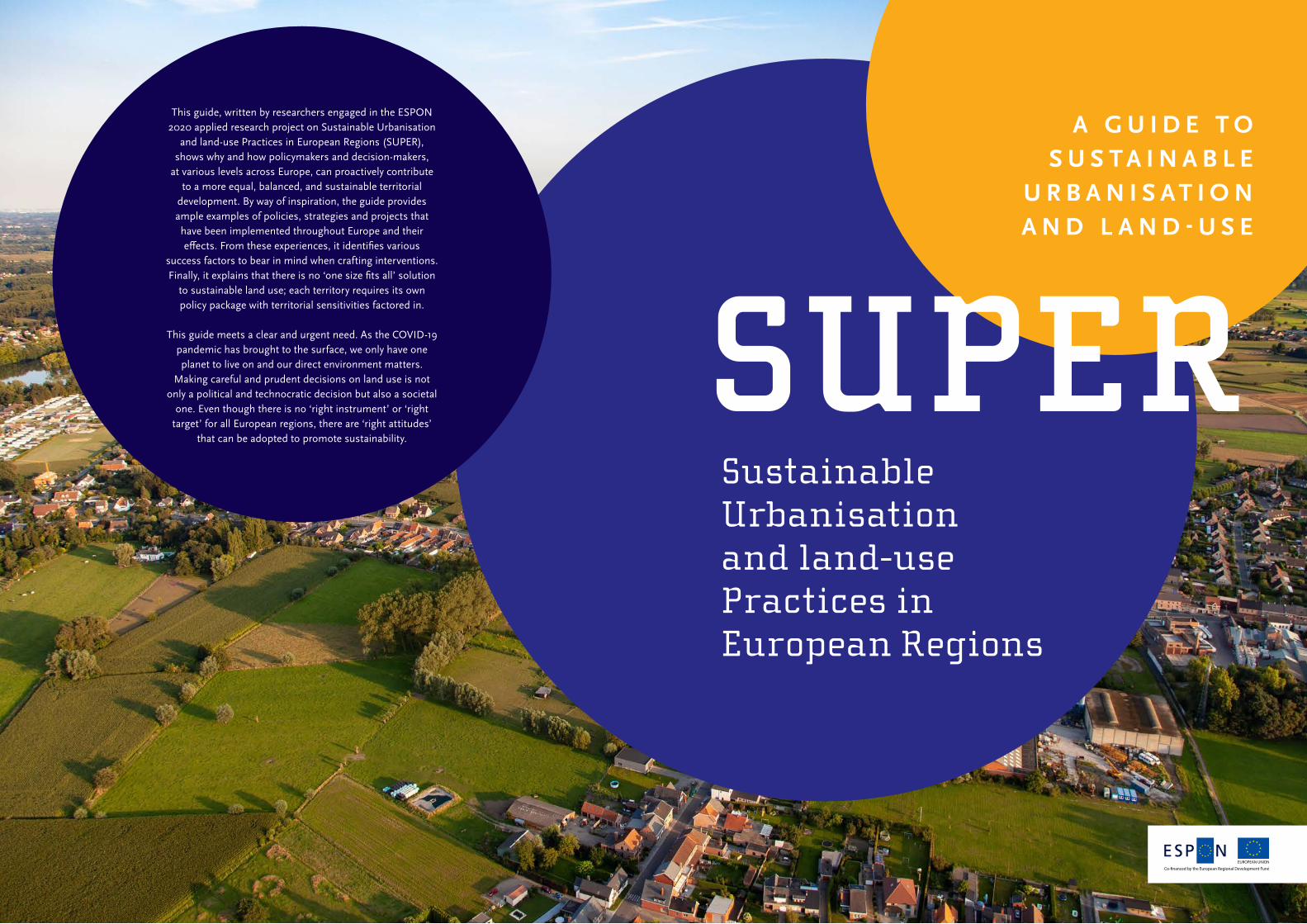
A GUIDE TO SUSTAINABLE URBANISATION AND LAND-USE Sustainable Urbanisation and land‑use Practices in European Regions SUPER EUROPEAN UNION This guide, written by researchers engaged in the ESPON 2020 applied research project on Sustainable Urbanisation and land‑use Practices in European Regions (SUPER), shows why and how policymakers and decision‑makers, at various levels across Europe, can proactively contribute to a more equal, balanced, and sustainable territorial development. By way of inspiration, the guide provides ample examples of policies, strategies and projects that have been implemented throughout Europe and their effects. From these experiences, it identifies various success factors to bear in mind when crafting interventions. Finally, it explains that there is no ‘one size fits all’ solution to sustainable land use; each territory requires its own policy package with territorial sensitivities factored in. This guide meets a clear and urgent need. As the COVID‑19 pandemic has brought to the surface, we only have one planet to live on and our direct environment matters. Making careful and prudent decisions on land use is not only a political and technocratic decision but also a societal one. Even though there is no ‘right instrument’ or ‘right target’ for all European regions, there are ‘right attitudes’ that can be adopted to promote sustainability.
-
Upload
khangminh22 -
Category
Documents
-
view
0 -
download
0
Transcript of Sustainable Urbanisation and land ... - European Commission
A G U I D E T O S U S T A I N A B L E
U R B A N I S A T I O N A N D L A N D - U S E
Sustainable Urbanisation and land‑use Practices in European Regions
SUPER
EUROPEAN UNION
This guide, written by researchers engaged in the ESPON 2020 applied research project on Sustainable Urbanisation
and land‑use Practices in European Regions (SUPER), shows why and how policymakers and decision‑makers,
at various levels across Europe, can proactively contribute to a more equal, balanced, and sustainable territorial
development. By way of inspiration, the guide provides ample examples of policies, strategies and projects that have been implemented throughout Europe and their effects. From these experiences, it identifies various
success factors to bear in mind when crafting interventions. Finally, it explains that there is no ‘one size fits all’ solution
to sustainable land use; each territory requires its own policy package with territorial sensitivities factored in.
This guide meets a clear and urgent need. As the COVID‑19 pandemic has brought to the surface, we only have one planet to live on and our direct environment matters.
Making careful and prudent decisions on land use is not only a political and technocratic decision but also a societal
one. Even though there is no ‘right instrument’ or ‘right target’ for all European regions, there are ‘right attitudes’
that can be adopted to promote sustainability.
ISBN: 978‑29‑197‑9540‑6
This guide has been developed within the framework of the ESPON 2020 Cooperation Programme, partly financed by the European Regional Development Fund.The ESPON EGTC is the Single Beneficiary of the ESPON 2020 Cooperation Programme. The Single Operation within the programme is implemented by the ESPON EGTC and co‑financed by the European Regional Development Fund, the EU Member States and the Partner States, Iceland, Liechtenstein, Norway and Switzerland.This delivery does not necessarily reflect the opinion of the members of the ESPON 2020 Monitoring Committee. The information contained herein does not commit the ESPON EGTC and the countries participating in the ESPON 2020 Cooperation Programme.
AuthorsGiancarlo Cotella (Politecnico di Torino, Italy), David Evers (PBL – Netherlands Environmental Assessment Agency, Netherlands), Umberto Janin Rivolin (Politecnico di Torino, Italy), Alys Solly, (Politecnico di Torino, Italy) and Erblin Berisha, (Politecnico di Torino, Italy)
On the basis of contributions fromDavid Evers, Maarten van Schie, Lia van den Broek, Kersten Nabielek, Jan Ritsema van Eck, Frank van Rijn, Ries van der Wouden (PBL – Netherlands Environmental Assessment Agency, Netherlands)Volker Schmidt‑Seiwert, Anna Hellings, Regine Binot, Lukas Kiel, supported by Jonathan Terschanski (BBSR – Federal Institute for Research on Building, Urban Affairs and Spatial Development, Germany)Giancarlo Cotella, Umberto Janin Rivolin, Alys Solly, Erblin Berisha, Donato Casavola (Politecnico di Torino, Italy)Ivana Katurić, Mario Gregar, Sven Simov, Katarina Pavlek, Ranko Lipovac (URBANEX, Croatia)
Joaquín Farinós‑Dasí, Albert Llausàs, Carmen Zornoza‑Gallego (University of Valencia, Spain)Dorota Celinska‑Janowicz, Adam Ploszaj, Katarzyna Wojnar, University of Warsaw, Centre for European Regional and Local Studies (EUROREG, Poland)Mailin Gaupp‑Berghausen, Erich Dallhammer, Bernd Schuh, Ursula Mollay, Roland Gaugitsch, Liudmila Slivinskaya (ÖIR GmbH – Austrian Institute for Regional Studies, Austria)Tristan Claus (University of Ghent, Belgium)
Advisory GroupProject Support Team: Isabelle Loris, Flanders Department of Environment (Belgium), Tamara Slobodova, Ministry of Transport and Construction (Slovakia), Harald Noreik, Ministry of Local Government and Modernisation, (Norway), Frederick‑Christoph Richters, Ministry of Energy and Spatial Planning (Luxembourg)ESPON EGTC: Marjan van Herwijnen (project expert), György Alfoldy (financial expert)
Layout and graphic designTextcetera, The Hague (Netherlands)Kersten Nabielek, PBL – Netherlands Environmental Assessment Agency (Netherlands)
Information on ESPON and its projects can be found on www.espon.eu.
The web site provides the possibility to download and examine the most recent documents produced by finalised and ongoing ESPON projects.
© ESPON, 2020
Printing, reproduction or quotation is authorised provided the source is acknowledged and a copy is forwarded to the ESPON EGTC in Luxembourg.
Contact: [email protected]
ESPON SUPER – Sustainable Urbanisation and land-use Practices in European Regions.A GUIDE TO SUS TAINABLE URBANISATION AND L AND - USE
1 A guide to sustainable urbanisation and land use 11.1 Who is this guide for? 2
1.2 Why is this guide needed? 3
1.3 How can you use this guide? 6
2 Sustainable urbanisation and land use in a nutshell 92.1 Terminology, philosophy, and approach 10
2.2 Looking back: urbanisation and land‑use development in Europe 17
2.3 Looking forward: scenarios for 2050 23
2.4 Evaluating the sustainability of land‑use developments 25
3 How to promote sustainable urbanisation 333.1 Recommendations for regional and local stakeholders 36
3.2 Recommendations for the national level 65
3.3 Recommendations for EU institutions 78
4 Success factors of interventions 854.1 Governance factors 86
4.2 Inclusion factors 90
4.3 Design 91
4.4 Soft factors 92
4.5 Implementation 92
4.6 Market factors 92
4.7 Sustainability 93
5 Final message to the reader 95
6 Further readings and references at your fingertips 99
Table of Contents

Icons
Policymakers
Decision-makers
Social sustainability
Institutional sustainability
Economic sustainability
Ecological sustainability
Temporal sustainability

1
A guide to sustainable urbanisation and land use
1
3
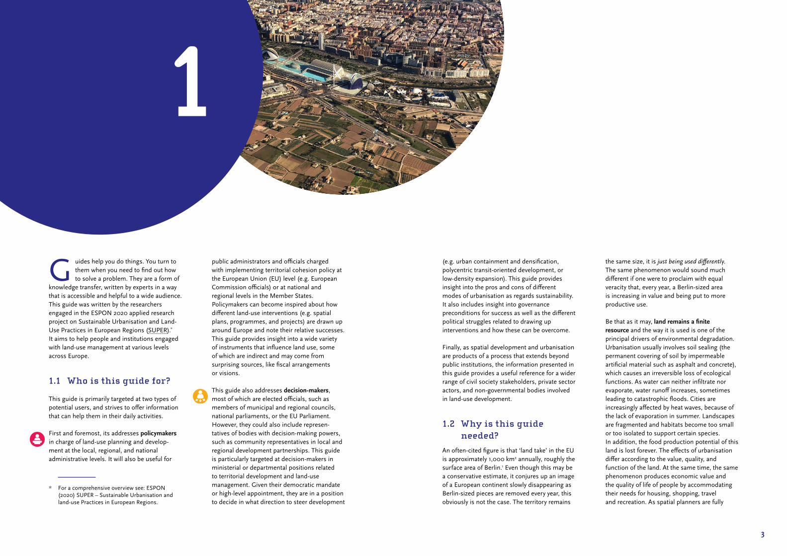
G uides help you do things. You turn to them when you need to find out how to solve a problem. They are a form of
knowledge transfer, written by experts in a way that is accessible and helpful to a wide audience. This guide was written by the researchers engaged in the ESPON 2020 applied research project on Sustainable Urbanisation and Land‑Use Practices in European Regions (SUPER).* It aims to help people and institutions engaged with land‑use management at various levels across Europe.
1.1 Who is this guide for?
This guide is primarily targeted at two types of potential users, and strives to offer information that can help them in their daily activities.
First and foremost, its addresses policymakers in charge of land‑use planning and develop‑ment at the local, regional, and national administrative levels. It will also be useful for
* For a comprehensive overview see: ESPON (2020) SUPER – Sustainable Urbanisation and land‑use Practices in European Regions.
1
public administrators and officials charged with implementing territorial cohesion policy at the European Union (EU) level (e.g. European Commission officials) or at national and regional levels in the Member States. Policymakers can become inspired about how different land‑use interventions (e.g. spatial plans, programmes, and projects) are drawn up around Europe and note their relative successes. This guide provides insight into a wide variety of instruments that influence land use, some of which are indirect and may come from surprising sources, like fiscal arrangements or visions.
This guide also addresses decision-makers, most of which are elected officials, such as members of municipal and regional councils, national parliaments, or the EU Parliament. However, they could also include represen‑tatives of bodies with decision‑making powers, such as community representatives in local and regional development partnerships. This guide is particularly targeted at decision‑makers in ministerial or departmental positions related to territorial development and land‑use management. Given their democratic mandate or high‑level appointment, they are in a position to decide in what direction to steer development
(e.g. urban containment and densification, polycentric transit‑oriented development, or low‑density expansion). This guide provides insight into the pros and cons of different modes of urbanisation as regards sustainability. It also includes insight into governance preconditions for success as well as the different political struggles related to drawing up interventions and how these can be overcome.
Finally, as spatial development and urbanisation are products of a process that extends beyond public institutions, the information presented in this guide provides a useful reference for a wider range of civil society stakeholders, private sector actors, and non‑governmental bodies involved in land‑use development.
1.2 Why is this guide needed?
An often‑cited figure is that ‘land take’ in the EU is approximately 1,000 km2 annually, roughly the surface area of Berlin.1 Even though this may be a conservative estimate, it conjures up an image of a European continent slowly disappearing as Berlin‑sized pieces are removed every year, this obviously is not the case. The territory remains
the same size, it is just being used differently. The same phenomenon would sound much different if one were to proclaim with equal veracity that, every year, a Berlin‑sized area is increasing in value and being put to more productive use.
Be that as it may, land remains a finite resource and the way it is used is one of the principal drivers of environmental degradation. Urbanisation usually involves soil sealing (the permanent covering of soil by impermeable artificial material such as asphalt and concrete), which causes an irreversible loss of ecological functions. As water can neither infiltrate nor evaporate, water runoff increases, sometimes leading to catastrophic floods. Cities are increasingly affected by heat waves, because of the lack of evaporation in summer. Landscapes are fragmented and habitats become too small or too isolated to support certain species. In addition, the food production potential of this land is lost forever. The effects of urbanisation differ according to the value, quality, and function of the land. At the same time, the same phenomenon produces economic value and the quality of life of people by accommodating their needs for housing, shopping, travel and recreation. As spatial planners are fully

I N F O G R A P H I C 1
How many football fieldsper day? Land use change from agriculture or nature to…
Source: PBL/ESPON SUPER
Residential35%
Industrial, offices and commercial37%
Infrastructure17%
Urban green11%
Standard football field for UEFA68 meters
105 meters
About 1.17 million hectares of land were converted to urban use in the ESPON space in the 2000-2018 period. This equals about 248 football fields per day. Of this, 35% became urban fabric (predominantly residential), 37% industrial (including business parks, shopping centres and offices), 17% infrastructure (including airports) and 11% urban green.
pbl.n
l

7
aware, the use of land usually involves a trade‑off between various social, economic and environmental needs.
We can seriously question the efficiency and sustainability of current practices: according to the European Environment Agency, for example, the total surface area of cities in the EU has increased by 78% since the mid‑1950s, whereas the population has grown by only 33.2 Given that the conversion of land to urban use in Europe is the outcome of conscious decisions made by human beings, it is also something that can be affected by conscious human interventions: in other words, policies and practices matter.
The challenge of designing policies to promote sustainable urbanisation and land‑use is present at spatial levels and scales from the local level all the way up to the EU. Indeed, many EU sectoral policies have indirect effects on urbanisation that may be adverse in terms of sustainability. The Roadmap to a Resource Efficient Europe3 proposed that by 2020, EU policies should take into account their impacts on land use in the EU and globally, with the aim to achieve ‘no net land take’ by 2050. However, despite the publication of a Soil Thematic Strategy4 on best practices to limit soil sealing, no EU‑level policies specifically focus on the promotion of sustainable urbanisation and land use.
As such, (sub)national spatial planning and territorial governance can play an important role in achieving a more sustainable use of land by assessing the quality and characteristics of different locations with respect to competing objectives and interests. This already occurs throughout Europe through a variety of interventions that, to varying degrees of success, steer, or attempt to steer, urbanisation and land‑use. Given that these interventions take on various guises in different national contexts, serve different substantive goals and are implemented at various levels of scale, the policy context remains highly heterogeneous
and fragmented.* This guide seeks to address this by bundling together experiences and analyses on sustainable urbanisation and land use practices in European regions.
1.3 How can you use this guide?
This guide highlights key elements for making land‑use practices and urbanisation processes in Europe more sustainable. It begins by presenting the approach adopted by the SUPER project as well as some key findings regarding past and future developments (Chapter 2). The guide then draws on the project’s results to propose a set of good practices and warnings (Chapter 3). More specifically, these concern the type and instrumentation of interventions at various levels of scale. The guide then reflects on the main factors for success in the promotion of sustainable urbanisation (Chapter 4) and finishes with some final thoughts (Chapter 5) and a list of further readings (Chapter 6).
As a final remark, the reader should be aware that all indications and suggestions of this guide remain quite general out of necessity. As geographical and institutional contexts differ greatly across Europe, general principles can be shared, but their application should be filtered in and adapted to each specific situation. Readers with a solid understanding of the nature of the territory where they operate, its administrative structure as well as their main responsibilities, can profit the most from this guide.
* For a comprehensive overview see: ESPON (2018), ESPON COMPASS – Comparative Analysis of Territorial Governance and Spatial Planning Systems in Europe. Final Report. ESPON EGTC: Luxembourg.
When using this guide, please bear in mind:• Avoid ‘one size fits all’ solutions; each territory
requires its own policy package with territorial sensitivities factored in. This means that each policy recommendation should be assessed according to territorial specificities, such as geography and traditions.
• Avoid stand‑alone initiatives when addressing complex issues like sustainable land use. Multi‑dimensional, multi‑sectoral and multi‑stakeholder approaches are preferable.
• Sustainable land use is a shared responsibility. It is not an exclusive administrative domain, so the identified solutions should be carefully evaluated and shared with all relevant actors.
9
Sustainable urbanisation and land use in a nutshell
2
11
T he purpose of this section is to provide readers with a solid basis to fully understand the experiences, lessons
and recommendations laid out later in this handbook.
The first part introduces the basic philosophy and approach of the SUPER project. It contains our conceptualisation and operationalisation of the term sustainability and explains why we avoid using normative or pejorative language such as ‘land take’ and ‘urban sprawl’ when describing urban development. It also presents the causal model for land‑use change adopted by the project. The second part presents state‑of‑the‑art evidence on pan‑European land‑use developments in the 2000‑2018 period. Drawing on several data sources, relationships between different land uses and key indicators like population will be illustrated and explained. Our analysis suggests that, in general, the conversion of land to urban use has outstripped need, indicating a decline in land‑use efficiency. It also reveals important territorial variation. The last section demonstrates the complexity of assessing the sustainability of urban form and development by means of scenarios. These explore three archetypical urbanisation trajectories – compact, polycentric, and diffuse – and present a final image of Europe in 2050 using the land‑use allocation model LUISETTA. These possible futures are then compared
and assessed according to their sustainability. This exercise reveals that there are a number of trade‑offs to consider, underlining the fact that policy decisions on urbanisation and land use are inherently political rather than technical.
2.1 Terminology, philosophy, and approach
The title – Sustainable Urbanisation and Land‑use Practices in European Regions – reflects both our philosophy and terminology. This will be explained in more detail below.
Sustainability
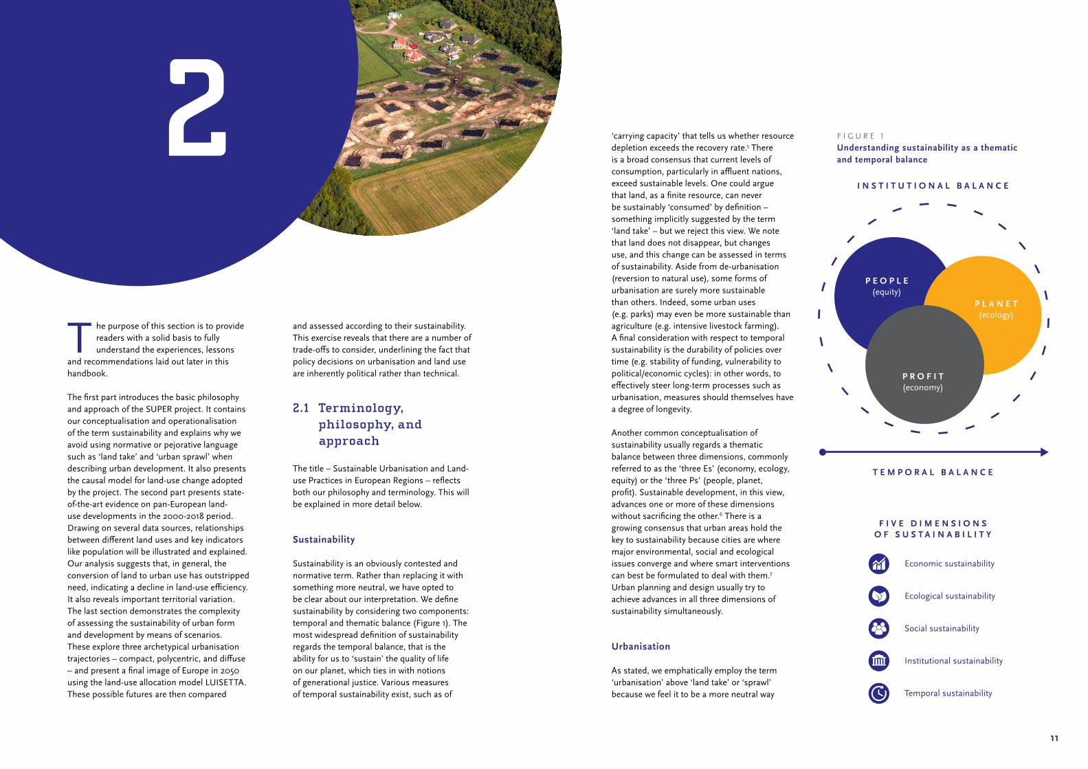
Sustainability is an obviously contested and normative term. Rather than replacing it with something more neutral, we have opted to be clear about our interpretation. We define sustainability by considering two components: temporal and thematic balance (Figure 1). The most widespread definition of sustainability regards the temporal balance, that is the ability for us to ‘sustain’ the quality of life on our planet, which ties in with notions of generational justice. Various measures of temporal sustainability exist, such as of
‘carrying capacity’ that tells us whether resource depletion exceeds the recovery rate.5 There is a broad consensus that current levels of consumption, particularly in affluent nations, exceed sustainable levels. One could argue that land, as a finite resource, can never be sustainably ‘consumed’ by definition – something implicitly suggested by the term ‘land take’ – but we reject this view. We note that land does not disappear, but changes use, and this change can be assessed in terms of sustainability. Aside from de‑urbanisation (reversion to natural use), some forms of urbanisation are surely more sustainable than others. Indeed, some urban uses (e.g. parks) may even be more sustainable than agriculture (e.g. intensive livestock farming). A final consideration with respect to temporal sustainability is the durability of policies over time (e.g. stability of funding, vulnerability to political/economic cycles): in other words, to effectively steer long‑term processes such as urbanisation, measures should themselves have a degree of longevity.
Another common conceptualisation of sustainability usually regards a thematic balance between three dimensions, commonly referred to as the ‘three Es’ (economy, ecology, equity) or the ‘three Ps’ (people, planet, profit). Sustainable development, in this view, advances one or more of these dimensions without sacrificing the other.6 There is a growing consensus that urban areas hold the key to sustainability because cities are where major environmental, social and ecological issues converge and where smart interventions can best be formulated to deal with them.7 Urban planning and design usually try to achieve advances in all three dimensions of sustainability simultaneously.
Urbanisation
As stated, we emphatically employ the term ‘urbanisation’ above ‘land take’ or ‘sprawl’ because we feel it to be a more neutral way
2 F I G U R E 1
Understanding sustainability as a thematic and temporal balance
P L A N E T(ecology)
P E O P L E(equity)
Economic sustainability
Ecological sustainability
Social sustainability
Institutional sustainability
Temporal sustainability
I N S T I T U T I O N A L B A L A N C E
T E M P O R A L B A L A N C E
F I V E D I M E N S I O N SO F S U S T A I N A B I L I T Y
P R O F I T(economy)

I N F O G R A P H I C 2
Three main typesof urbanisation
Urban form is usually the product of historical evolution, but it can also be the outcome of policy. Compact urbanisation, for instance, is often the goal of containment policies which attempt to direct new development inwards, through regeneration, infill, or redevelopment. Polycentric urbanisation is often pursued by spatial planning policies such as garden cities or transit-oriented development. Diffuse urban form is often the result of policies stimulating private car use (e.g. road infrastructure provision) and homeownership. The three types of urbanisation perform differently in relation to sustainability both as a whole as well as with respect to individual dimensions.
UrbanisationNew urbanisation
pbl.n
l
Source: PBL/ESPON SUPER
Compact
Polycentric
Diffuse

15
to describe the phenomenon of conversion of land to more urban uses.8 In our view, urbanisation does not merely denote the movement of population to cities or the expansion of the built‑up area, but all physical urban developments, be it homes, roads, construction sites, playgrounds, airports or business parks. Many variations of urbanisation can be distinguished in Europe, but in general, we wish to distinguish between three main types: compact, polycentric, and diffuse (see Infographic 2). Development within a particular region can therefore be evaluated in the extent to which it adheres to these forms. Given the diversity of Europe and the increased importance of taking a place‑based approach, we feel our conceptualisation of urbanisation is more consistent with and amenable to territorial governance and spatial planning traditions.
Urban form is usually the product of historical evolution, but it can also be the outcome of policy.9 Compact urbanisation, for instance, is often the goal of containment policies which attempt to direct new development inwards, through regeneration, infill, or redevelopment. Polycentric urbanisation is often pursued by spatial planning policies such as garden cities or transit‑oriented development. Diffuse urban form is often the result of policies stimulating private car use (e.g. road infrastructure provision) and homeownership. The three urbanisation types perform differently in relation to sustainability both as a whole as well as with respect to individual dimensions.10 This will be illustrated at the end of this chapter when discussing the results of scenarios based on the three urbanisation types.
Conceptual framework
The goal of SUPER is not merely to measure urbanisation in Europe, but also explain it. Urbanisation is the outcome of countless collective and individual decisions made by humans every day about where and how they want to live, work and play within the
constraints of what they can afford and what they can access. It is also the outcome of how stakeholders such as developers anticipate and react to these decisions. To understand this dynamic better, a conceptual framework was designed that illustrates the main cause‑effect relationships governing urbanisation and land‑use change. See Figure 2.
Regarding the left side of the figure, many studies, particularly quantitative data‑driven research, attempt to explain urbanisation patterns (usually using the term sprawl) on the basis of key drivers like demography, economic development and society/technology (especially car ownership).11 Other scholarship points to countervailing forces that determine the shape, intensity and direction of urbanisation and land‑use change. Physical barriers (e.g. mountains, water bodies) is an obvious structuring element. Policy is another: the designation of a site as a floodplain, natural habitat or industrial zone powerfully affects the prospects for future development.
Regarding the middle of the figure, the crucial decision to covert a site from a non‑urban use to an urban use is governed by the payoffs and interests of the various actors involved, which over time, can be described as development practices. Various drivers at the macro level, including institutional and policy drivers, create (dis)incentives at the micro level to create a ‘local regulatory regime’ or ‘rules of the development game’.12 Key agents with decision‑making authority, those with legal rights or economic or political clout then interact to produce a decision on land use.
To the right, the physical outcome of land‑use decisions is readily measurable thanks to the availability of high‑resolution data based on satellite imagery. Using the Corine land cover dataset, we can ‘see’ the changing landscape of Europe over the past 18 years with a reasonable level of accuracy. The next section turns to this, presenting our findings on how land use in Europe has evolved.
F I G U R E 2
The SUPER conceptual framework
D E M A N D
I N S T I T U T I O N A L /T E R R I T O R I A L
C O N T E X T
S U P P L Y
Q U A N T I T A T I V E
L A N D - U S E C H A N G E SW I T H I M P A C T O N
E C O N O M Y, S O C I E T YA N D E N V I R O N M E N T
Q U A L I T A T I V E
‘ B L A C K B O X ’O F L O C A L
P R A C T I C E S
SustainabilityAssessment of
Urbanisationand land use
drivers
Practices and Outcomes inEuropeanRegions

17
2.2 Looking back: urbanisation and land-use development in Europe
The SUPER project performed an analysis of land‑use change over the 2000‑2018 period based on the Corine Land Cover data and supplemented with other sources. This section provides a short recap of a vast analysis which includes all ESPON countries.
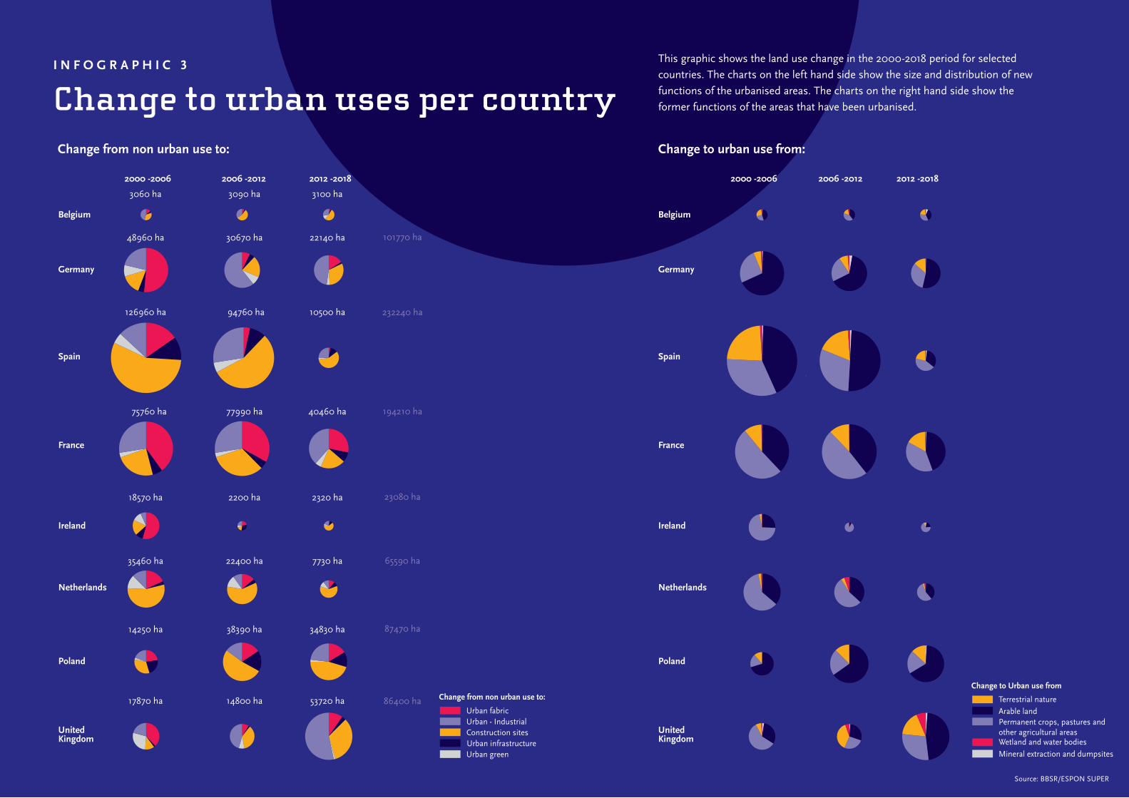
In the 2000‑2018 period, a little under 2.87 million hectares of land changed from one main land‑use category to another, or about 0.6% of the surface area of ESPON space. Almost half of this (1.26 million ha or 44%) concerned a conversion to urban land. Figure 3 and Infographic 3 show the origin and destination of this land‑use conversion, revealing that a significant portion is in a transitory state (construction sites). Most of this urbanisation came at the expense of agricultural land (78%); but a few regions in Austria and the UK (Scotland) saw most new urban land coming from natural areas. Only in Romania (‑0.8%) and Bulgaria (‑0.1%) did the share of urban land decrease as a whole, mostly in non‑built uses such as construction sites or dump sites. In total, 8.6 times more land was converted to urban/artificial use than vice versa.
Urbanisation did not happen equally in all countries and periods. Far less land was converted to a new use in the years following the financial and economic crisis, especially in Spain and Ireland (where the crisis on urban development was acute). On the other hand, urbanisation in Poland almost tripled in the years following EU accession. Between 2000 and 2018 nearly 20% of all Europe’s urbanisation occurred in Spain, followed by France with 15%. In the last period from 2012 to 2018, the UK took the lead; over one fifth of all changes were registered here, followed by France with again 15% and Poland with approximately 13%.
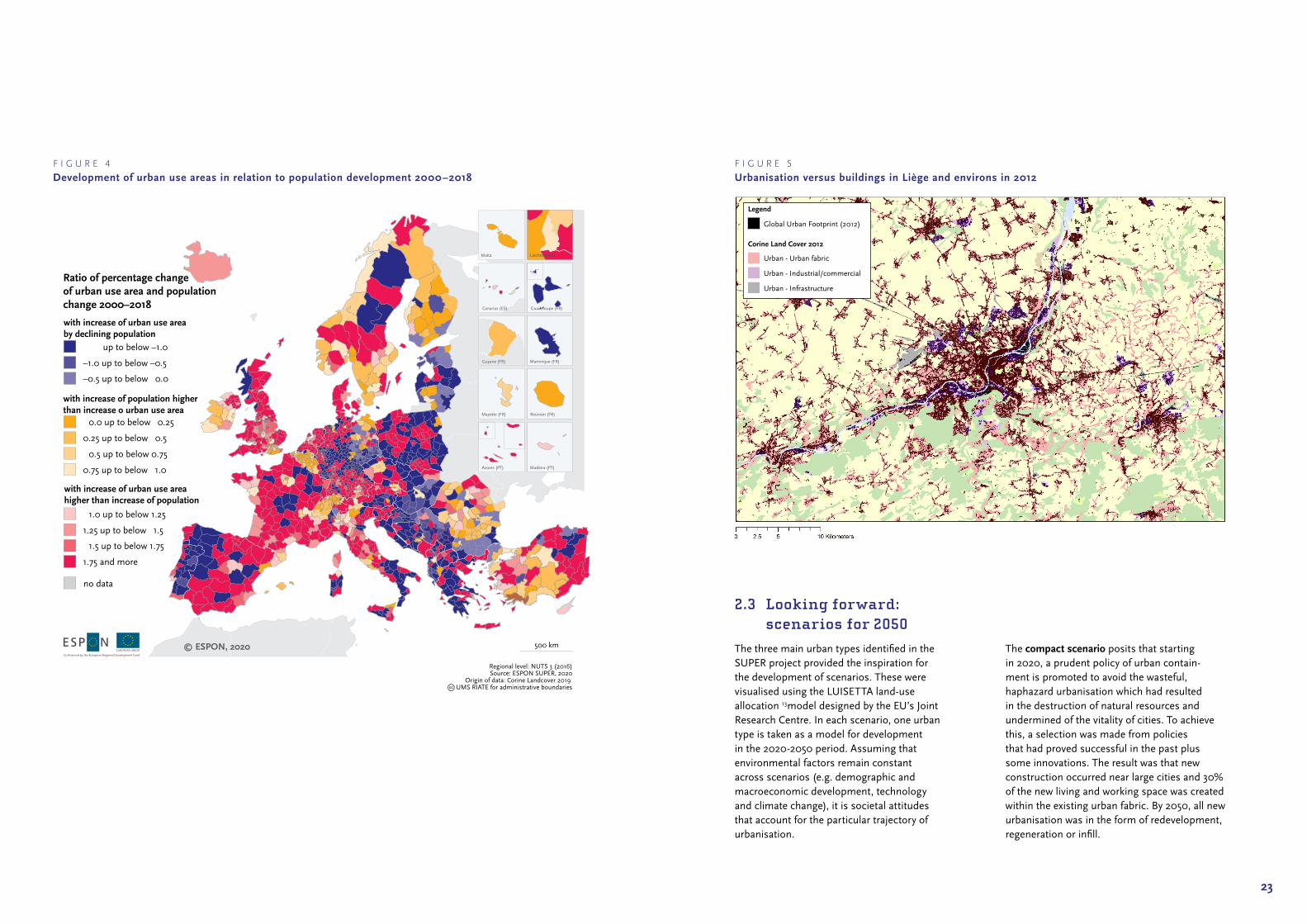
To what degree does this urbanisation meet a measurable demand? Ideally, to answer this question, we would consider population development a suitable indicator for the Corine database’s indicator ‘urban fabric’ (mainly residential) and GDP or job growth for industrial land covers. However, considering that many work areas exist within the urban fabric, this is not possible. Therefore, population data was measured in relation to all urban use areas, including commercial areas, infrastructure and parks. This analysis lends credence to the allegation that the production of urban use areas (land take) is exceeding the assumed need (population growth) in Europe in the 2000‑2018 period (Figure 4). Areas experiencing depopulation still usually show increases in urban use areas. Depending on one’s inclination, this can be taken as an indication of ‘urban sprawl’ or unwarranted ‘land take’. According to this analysis, the main areas where population exceeded urbanisation were Switzerland, Romania, Bulgaria and Belgium.
Given that Corine can overlook small‑scale development, these cases will need to be evaluated with more scrutiny in order to ascertain whether this is a result of compact high‑density urban development (e.g. re‑urbanisation) or extremely scattered development rendered invisible by the limitations of the dataset. This not insignificant data issue is brought clearly into view in Figure 5 which shows the data for the city of Liège. In this figure, the light red areas are ‘urban areas’ in the Corine database, whereas the buildings (drawn from the Global Urban Footprint dataset) are in black. The ribbon development to the east of the city could easily continue along the same roads in the future without being noticed by Corine. When combined with population data, this could easily result in an erroneous finding that urbanisation is highly efficient and sustainable because it makes use of existing built‑up areas. In fact, homes are still being built, just not registered. Rather than urban containment, diffusion is occurring
Arable land:572.662 ha
Grasslandand other
agricultural areas:405.424 ha
Terrestrial nature:208.082 ha
Wetland andWaterbodies:
14.359 ha
Urban fabric: 263.744 ha
Infrastructure96.840 ha
Construction: 437.164 ha
Urban green:82.808 ha
Industrial orcommercial units: 319.971 ha
2000
2018
Source: BBSR/ESPON SUPER
F I G U R E 3
Land converted to urban use in the 2000-2018 period
I N F O G R A P H I C 3
Change to urban uses per country
Source: BBSR/ESPON SUPER
This graphic shows the land use change in the 2000-2018 period for selected countries. The charts on the left hand side show the size and distribution of new functions of the urbanised areas. The charts on the right hand side show the former functions of the areas that have been urbanised.
9450 ha
Belgium
Germany
3060 ha 3090 ha 3100 ha
101770 ha48960 ha 30670 ha 22140 ha
Spain
France
Ireland
Netherlands
Poland
UnitedKingdom
Belgium
Germany
Spain
France
Ireland
Netherlands
Poland
UnitedKingdom
232240 ha126960 ha 94760 ha 10500 ha
75760 ha 77990 ha 40460 ha 194210 ha
18570 ha 2200 ha 2320 ha 23080 ha
65590 ha35460 ha 22400 ha 7730 ha
87470 ha14250 ha 38390 ha 34830 ha
86400 ha17870 ha 14800 ha 53720 ha
2000 -2006 2006 -2012 2012 -2018 Total
Change from non urban use to: Change to urban use from:
,
2000 -2006 2006 -2012 2012 -2018
Change from non urban use to:
Urban fabric
Urban infrastructureConstruction sites
Urban green
Change to Urban use from
Arable landPermanent crops, pastures andother agricultural areas
Terrestrial nature
Mineral extraction and dumpsites
Urban - Industrial
Wetland and water bodies
21
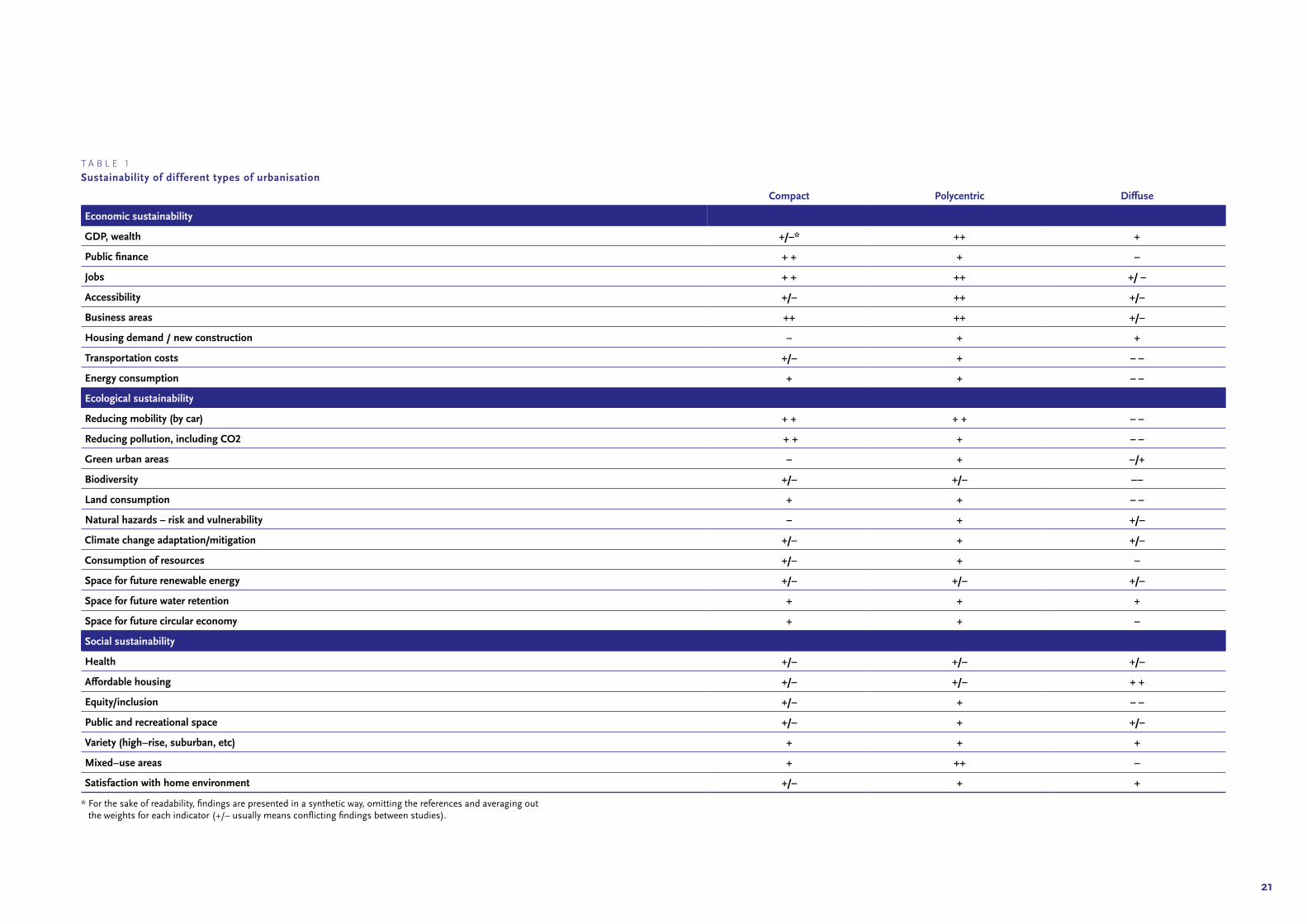
T A B L E 1
Sustainability of dif ferent types of urbanisation
Compact Polycentric Diffuse
Economic sustainability
GDP, wealth +/–* ++ +
Public finance + + + –
Jobs + + ++ +/ –
Accessibility +/– ++ +/–
Business areas ++ ++ +/–
Housing demand / new construction – + +
Transportation costs +/– + – –
Energy consumption + + – –
Ecological sustainability
Reducing mobility (by car) + + + + – –
Reducing pollution, including CO2 + + + – –
Green urban areas – + –/+
Biodiversity +/– +/– ––
Land consumption + + – –
Natural hazards – risk and vulnerability – + +/–
Climate change adaptation/mitigation +/– + +/–
Consumption of resources +/– + –
Space for future renewable energy +/– +/– +/–
Space for future water retention + + +
Space for future circular economy + + –
Social sustainability
Health +/– +/– +/–
Affordable housing +/– +/– + +
Equity/inclusion +/– + – –
Public and recreational space +/– + +/–
Variety (high–rise, suburban, etc) + + +
Mixed–use areas + ++ –
Satisfaction with home environment +/– + +
* For the sake of readability, findings are presented in a synthetic way, omitting the references and averaging out the weights for each indicator (+/– usually means conflicting findings between studies).
23
2.3 Looking forward: scenarios for 2050
The three main urban types identified in the SUPER project provided the inspiration for the development of scenarios. These were visualised using the LUISETTA land-use allocation 13model designed by the EU’s Joint Research Centre. In each scenario, one urban type is taken as a model for development in the 2020-2050 period. Assuming that environmental factors remain constant across scenarios (e.g. demographic and macroeconomic development, technology and climate change), it is societal attitudes that account for the particular trajectory of urbanisation.
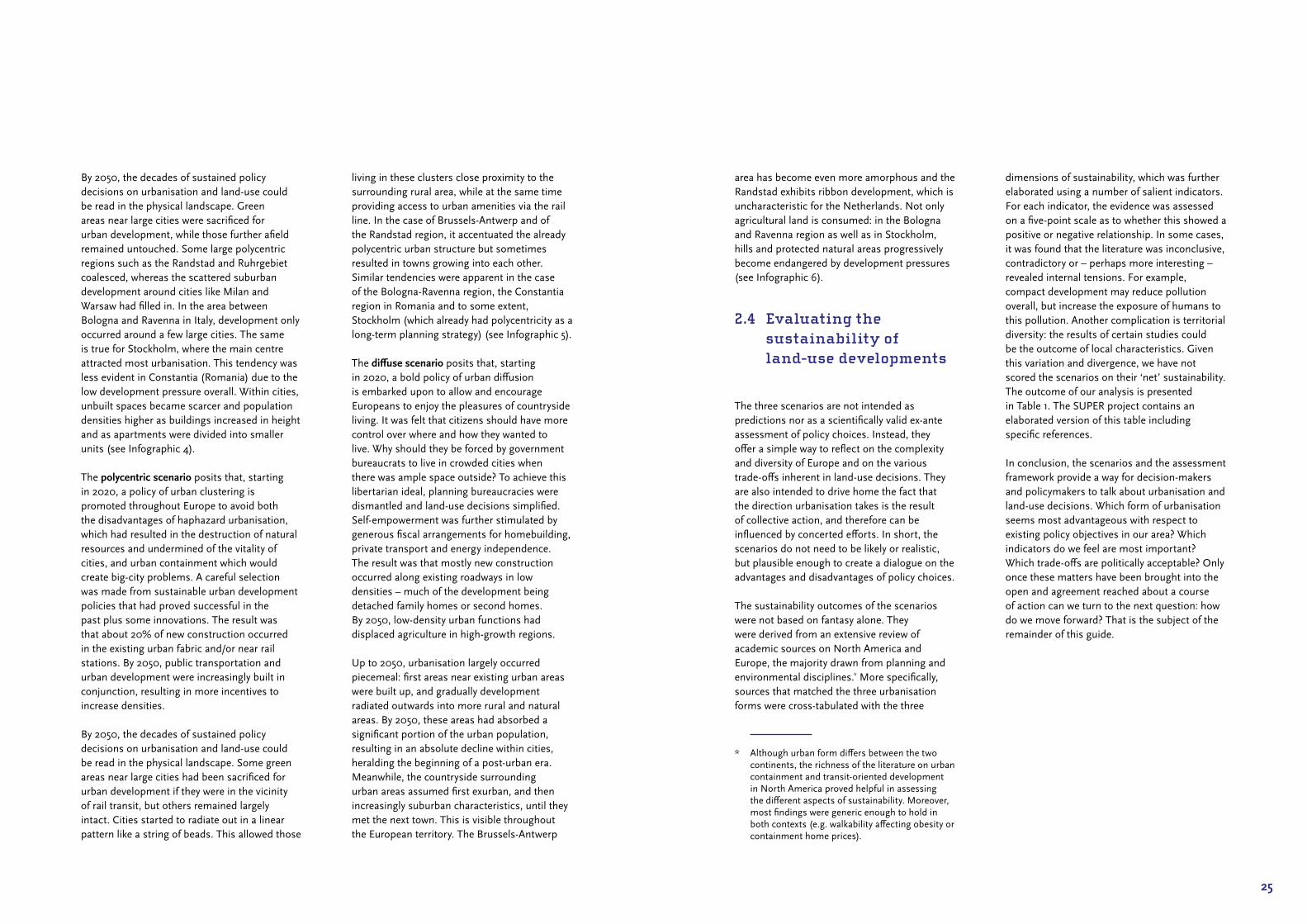
The compact scenario posits that starting in 2020, a prudent policy of urban contain-ment is promoted to avoid the wasteful, haphazard urbanisation which had resulted in the destruction of natural resources and undermined of the vitality of cities. To achieve this, a selection was made from policies that had proved successful in the past plus some innovations. The result was that new construction occurred near large cities and 30% of the new living and working space was created within the existing urban fabric. By 2050, all new urbanisation was in the form of redevelopment, regeneration or infill.
F I G U R E 4
Development of urban use areas in relation to population development 2000–2018
500 km
Malta
Acores (PT)
Guyane (FR)
Madeira (PT)
Reunion (FR)Mayotte (FR)
Canarias (ES)
Liechtenstein
Martinique (FR)
Guadeloupe (FR)
Regional level: NUTS 3 (2016)Source: ESPON SUPER, 2020
Origin of data: Corine Landcover 2019 UMS RIATE for administrative boundaries
© ESPON, 2020
up to below –1.0
–1.0 up to below –0.5
–0.5 up to below 0.0
0.0 up to below 0.25
0.25 up to below 0.5
0.5 up to below 0.75
0.75 up to below 1.0
1.0 up to below 1.25
1.25 up to below 1.5
1.5 up to below 1.75
1.75 and more
with increase of urban use areaby declining population
with increase of population higherthan increase o urban use area
with increase of urban use areahigher than increase of population
Ratio of percentage changeof urban use area and populationchange 2000–2018
no data
F I G U R E 5
Urbanisation versus buildings in Liège and environs in 2012
Legend
Global Urban Footprint (2012)
Corine Land Cover 2012
Urban - Urban fabric
Urban - Industrial/commercial
Urban - Infrastructure
25
By 2050, the decades of sustained policy decisions on urbanisation and land‑use could be read in the physical landscape. Green areas near large cities were sacrificed for urban development, while those further afield remained untouched. Some large polycentric regions such as the Randstad and Ruhrgebiet coalesced, whereas the scattered suburban development around cities like Milan and Warsaw had filled in. In the area between Bologna and Ravenna in Italy, development only occurred around a few large cities. The same is true for Stockholm, where the main centre attracted most urbanisation. This tendency was less evident in Constantia (Romania) due to the low development pressure overall. Within cities, unbuilt spaces became scarcer and population densities higher as buildings increased in height and as apartments were divided into smaller units (see Infographic 4).
The polycentric scenario posits that, starting in 2020, a policy of urban clustering is promoted throughout Europe to avoid both the disadvantages of haphazard urbanisation, which had resulted in the destruction of natural resources and undermined of the vitality of cities, and urban containment which would create big‑city problems. A careful selection was made from sustainable urban development policies that had proved successful in the past plus some innovations. The result was that about 20% of new construction occurred in the existing urban fabric and/or near rail stations. By 2050, public transportation and urban development were increasingly built in conjunction, resulting in more incentives to increase densities.
By 2050, the decades of sustained policy decisions on urbanisation and land‑use could be read in the physical landscape. Some green areas near large cities had been sacrificed for urban development if they were in the vicinity of rail transit, but others remained largely intact. Cities started to radiate out in a linear pattern like a string of beads. This allowed those
living in these clusters close proximity to the surrounding rural area, while at the same time providing access to urban amenities via the rail line. In the case of Brussels‑Antwerp and of the Randstad region, it accentuated the already polycentric urban structure but sometimes resulted in towns growing into each other. Similar tendencies were apparent in the case of the Bologna‑Ravenna region, the Constantia region in Romania and to some extent, Stockholm (which already had polycentricity as a long‑term planning strategy) (see Infographic 5).
The diffuse scenario posits that, starting in 2020, a bold policy of urban diffusion is embarked upon to allow and encourage Europeans to enjoy the pleasures of countryside living. It was felt that citizens should have more control over where and how they wanted to live. Why should they be forced by government bureaucrats to live in crowded cities when there was ample space outside? To achieve this libertarian ideal, planning bureaucracies were dismantled and land‑use decisions simplified. Self‑empowerment was further stimulated by generous fiscal arrangements for homebuilding, private transport and energy independence. The result was that mostly new construction occurred along existing roadways in low densities – much of the development being detached family homes or second homes. By 2050, low‑density urban functions had displaced agriculture in high‑growth regions.
Up to 2050, urbanisation largely occurred piecemeal: first areas near existing urban areas were built up, and gradually development radiated outwards into more rural and natural areas. By 2050, these areas had absorbed a significant portion of the urban population, resulting in an absolute decline within cities, heralding the beginning of a post‑urban era. Meanwhile, the countryside surrounding urban areas assumed first exurban, and then increasingly suburban characteristics, until they met the next town. This is visible throughout the European territory. The Brussels‑Antwerp
area has become even more amorphous and the Randstad exhibits ribbon development, which is uncharacteristic for the Netherlands. Not only agricultural land is consumed: in the Bologna and Ravenna region as well as in Stockholm, hills and protected natural areas progressively become endangered by development pressures (see Infographic 6).
2.4 Evaluating the sustainability of land-use developments
The three scenarios are not intended as predictions nor as a scientifically valid ex‑ante assessment of policy choices. Instead, they offer a simple way to reflect on the complexity and diversity of Europe and on the various trade‑offs inherent in land‑use decisions. They are also intended to drive home the fact that the direction urbanisation takes is the result of collective action, and therefore can be influenced by concerted efforts. In short, the scenarios do not need to be likely or realistic, but plausible enough to create a dialogue on the advantages and disadvantages of policy choices.
The sustainability outcomes of the scenarios were not based on fantasy alone. They were derived from an extensive review of academic sources on North America and Europe, the majority drawn from planning and environmental disciplines.* More specifically, sources that matched the three urbanisation forms were cross‑tabulated with the three
* Although urban form differs between the two continents, the richness of the literature on urban containment and transit‑oriented development in North America proved helpful in assessing the different aspects of sustainability. Moreover, most findings were generic enough to hold in both contexts (e.g. walkability affecting obesity or containment home prices).
dimensions of sustainability, which was further elaborated using a number of salient indicators. For each indicator, the evidence was assessed on a five‑point scale as to whether this showed a positive or negative relationship. In some cases, it was found that the literature was inconclusive, contradictory or – perhaps more interesting – revealed internal tensions. For example, compact development may reduce pollution overall, but increase the exposure of humans to this pollution. Another complication is territorial diversity: the results of certain studies could be the outcome of local characteristics. Given this variation and divergence, we have not scored the scenarios on their ‘net’ sustainability. The outcome of our analysis is presented in Table 1. The SUPER project contains an elaborated version of this table including specific references.
In conclusion, the scenarios and the assessment framework provide a way for decision‑makers and policymakers to talk about urbanisation and land‑use decisions. Which form of urbanisation seems most advantageous with respect to existing policy objectives in our area? Which indicators do we feel are most important? Which trade‑offs are politically acceptable? Only once these matters have been brought into the open and agreement reached about a course of action can we turn to the next question: how do we move forward? That is the subject of the remainder of this guide.
I N F O G R A P H I C 4
Compact scenario
Source: PBL/ESPON SUPER
Economic Real-estate values increased and urban economies flourished from the opportunities provided by brownfield redevelopment. The proximity afforded by high densities allowed companies to decrease transport costs, facilitate communication, and achieve high energy efficiency. It also made high-quality transport connections viable, but also concentrated traffic flows, increasing overall congestion.
Ecological Sparing non-built space gave flexibility with respect to ecological planning outside of cities. Urban green areas were sacrificed however, contributing to urban heat island effects. It also proved increasingly difficult to find space for renewable energy in the city. Air pollution decreased as a whole, but concentrations were higher as well as natural hazard vulnerability.
SocialCompact development produced rising housing costs and possible pricing-out of lower-income households, but also increased noise and environmental pollution as well as diminished access to green spaces. Health improved due to more walking and cycling. In addition, there was lower social segregation and improved access to local services, jobs and recreational spaces.
The compact scenario posits that starting in 2020, a prudent policy of urban containment is promoted to avoid the wasteful, haphazard urbanisation which had resulted in the destruction of natural resources and undermined of the vitality of cities. To achieve this, a selection was made from policies that had proved successful in the past plus some innovations. The result was that new construction occurred near large cities and 30% of the new living and working space was created within the existing urban fabric. By 2050, all new urbanisation was in the form of redevelopment, regeneration or infill.
Bruxelles-Antwerp region, Belgium Bologna-Ravenna region, Italy Randstad region, Netherlands Constanța region, Romania Stockholm region, Sweden
Sample of the compact development scenario in five regions
pbl.n
l

I N F O G R A P H I C 5
Polycentric scenario
Source: PBL/ESPON SUPER
Economic Subcentres contributed to growth of metropolitan regions and relieved pressure from core cities. It did not restrict economic growth and provided open space. There was less walkability and cycling than the compact scenario, offset by good transit opportunities.
Ecological Reduced car mobility and associated reduction in air pollution. Less land consumption than no policy, but more than compact. Polycentric structure improved resilience to natural hazards.
SocialTransport justice increased as did affordable housing stock since these matters were incorporated into spatial planning policies. Without this, housing prices would rise, undermining affordability. Problems of noise pollution if homes are too close to transport infrastructure.
The polycentric scenario posits that, starting in 2020, a policy of urban clustering is promoted throughout Europe to avoid both the disadvantages of haphazard urbanisation, which had resulted in the destruction of natural resources and undermined of the vitality of cities, and urban containment which would create big-city problems. A careful selection was made from sustainable urban development policies that had proved successful in the past plus some innovations. The result was that about 20% of new construction occurred in the existing urban fabric and/or near rail stations. By 2050, public transportation and urban development were increasingly built in conjunction, resulting in more incentives to increase densities.
Bruxelles-Antwerp region, Belgium Bologna-Ravenna region, Italy Randstad region, Netherlands Constanța region, Romania Stockholm region, Sweden
Sample of the polycentric development scenario in five regions
pbl.n
l

I N F O G R A P H I C 6
Diffuse scenario
Source: PBL/ESPON SUPER
Economic Market efficiency results in greatest overall wealth creation, especially in the development sector since building on greenfields is usually much cheaper than regeneration. Relaxing planning restrictions meant more construction activities, creating job growth in the construction sector, for example. Job availability in diffuse areas was usually low and hard to access. Accordingly, transportation costs are higher and energy efficiency lower than in compact cities.
Ecological Higher overall air, noise and light pollution. Extensive loss of agricultural land and open space and a negative impact on biodiversity. Larger resource consumption rates compared to compact cities, but less heat island effect. Also more space for self-supporting communities, and good change adaptation opportunities in hot and humid climates due to enhanced ventilation.
SocialLow housing prices with respect to value-for-money. Privacy, larger gardens and living close to nature reduces stress. Social segregation is more prominent, but diffuse areas can include both low-income and high-income neighbourhoods. Car transport is comfortable and convenient.
The diffuse scenario posits that, starting in 2020, a bold policy of urban diffusion is embarked upon to allow and encourage Europeans to enjoy the pleasures of countryside living. It was felt that citizens should have more control over where and how they wanted to live. Why should they be forced by government bureaucrats to live in crowded cities when there was ample space outside? To achieve this libertarian ideal, planning bureaucracies were dismantled and land-use decisions simplified. Self-empowerment was further stimulated by generous fiscal arrangements for homebuilding, private transport and energy independence. The result was that mostly new construction occurred along existing roadways in low densities – much of the development being detached family homes or second homes. By 2050, low-density urban functions had displaced agriculture in high-growth regions.
Bruxelles-Antwerp region, Belgium Bologna-Ravenna region, Italy Randstad region, Netherlands Constanța region, Romania Stockholm region, Sweden
Sample of the diffuse development scenario in five regions
pbl.n
l

33
How to promote sustainable urbanisation
3
35
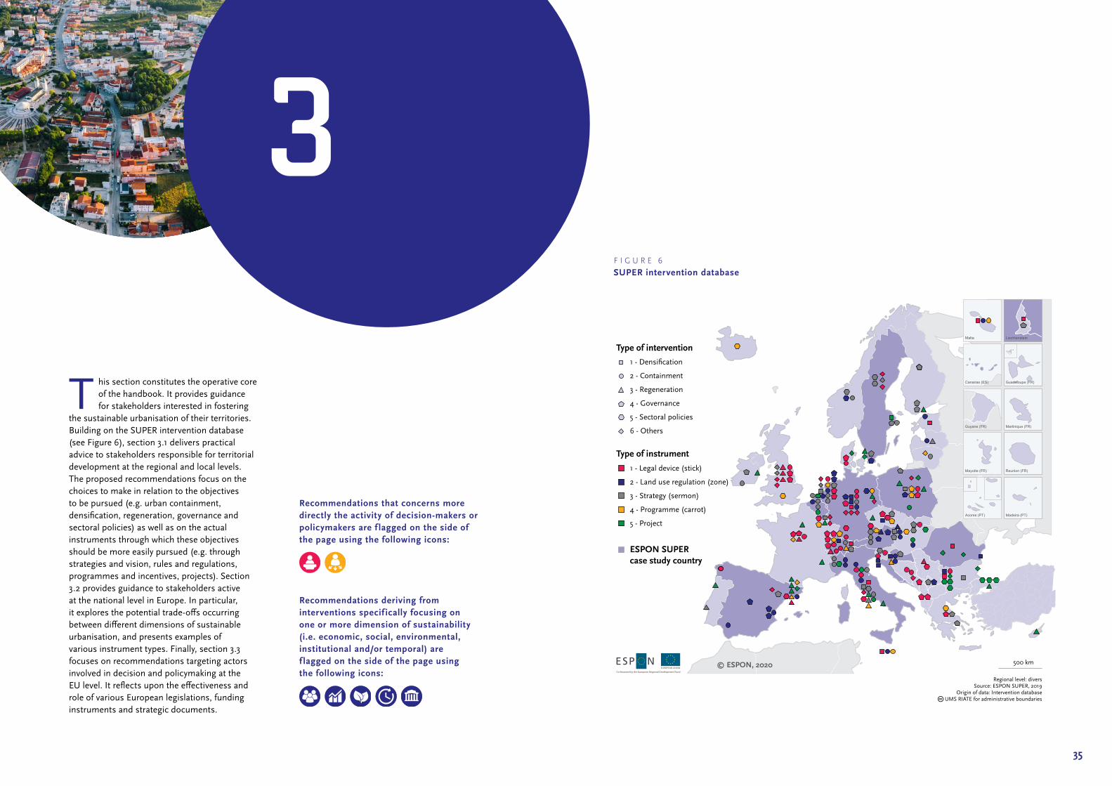
T his section constitutes the operative core of the handbook. It provides guidance for stakeholders interested in fostering
the sustainable urbanisation of their territories. Building on the SUPER intervention database (see Figure 6), section 3.1 delivers practical advice to stakeholders responsible for territorial development at the regional and local levels. The proposed recommendations focus on the choices to make in relation to the objectives to be pursued (e.g. urban containment, densification, regeneration, governance and sectoral policies) as well as on the actual instruments through which these objectives should be more easily pursued (e.g. through strategies and vision, rules and regulations, programmes and incentives, projects). Section 3.2 provides guidance to stakeholders active at the national level in Europe. In particular, it explores the potential trade‑offs occurring between different dimensions of sustainable urbanisation, and presents examples of various instrument types. Finally, section 3.3 focuses on recommendations targeting actors involved in decision and policymaking at the EU level. It reflects upon the effectiveness and role of various European legislations, funding instruments and strategic documents.
3
Recommendations deriving from interventions specif ically focusing on one or more dimension of sustainability (i.e. economic, social, environmental, institutional and/or temporal) are f lagged on the side of the page using the following icons:
Recommendations that concerns more directly the activity of decision-makers or policymakers are f lagged on the side of the page using the following icons:
500 km
Malta
Acores (PT)
Guyane (FR)
Madeira (PT)
Reunion (FR)Mayotte (FR)
Canarias (ES)
Liechtenstein
Martinique (FR)
Guadeloupe (FR)
Regional level: diversSource: ESPON SUPER, 2019
Origin of data: Intervention databaseUMS RIATE for administrative boundaries
© ESPON, 2020
Type of intervention
Type of instrument
1 - Densification
2 - Containment
4 - Governance
5 - Sectoral policies
6 - Others
3 - Regeneration
1 - Legal device (stick)
2 - Land use regulation (zone)
3 - Strategy (sermon)
4 - Programme (carrot)
5 - Project
ESPON SUPERcase study country
F I G U R E 6
SUPER intervention database

37
3.1 Recommendations for regional and local stakeholders
This subsection shows that a wide range of possibilities are available for local and regional decision‑makers and policymakers to promote sustainable land‑use and urbanisation. More specifically, it acknowledges that the success of policy objectives and instruments is not homogeneous in relation to the different types of territories. It then moves to provide guidance and practical recommendations for actions. Firstly, it addresses regional and local decision‑makers, responsible for defining policy objectives, in relation to what direction could be better pursued in relation to different types of territories. Secondly, it targets policymakers responsible for drafting the instruments to be used to pursue these directions.
3.1.1 Which intervention type should be used?
Five main types of interventions have been identified, on the basis of their aim and scope of initiative: densification, regeneration, containment, governance and sectoral policies (see Infographic 7).
Densif ication
Densification processes aim at increasing the density of people living in built up areas. The interventions included in this category mostly concern up‑zoning and measures for infill development. They usually achieve a high degree of success and are characterised by a long‑term sustainable development perspective. For example, the Croatian Spatial Plan of the Primorje-Gorski Kotar County14 sets criteria for determining the size of building areas of settlements, effectively regulating population density. The plan is viewed as successful since it promotes a more effective management
of land use and building areas in order to limit urban growth and land consumption. The maximum surface area of building areas in each municipality was derived from the projected population of the municipality and the minimum density of the inhabitants of the urban area. However, the intervention also had negative effects since, in an attempt to plan more surface area for settlements, planners drove non‑residential facilities (for example sports and recreational areas, business areas etc.) further away, which undermined integration in land uses. Thus, when trying to reach long‑term sustainable development it is important that local administrations adopt tangible short‑term measures; otherwise, this could lead to unsustainable development.
The analysis of the SUPER interventions database shows that densification strategies also encourage diverse typologies of urban development (e.g. compact, polycentric), which might produce positive effects in one case and negative effects in another. For example, the high urban density expansion15 in Amsterdam aims to retain open areas and promote compact yet attractive urban areas. The five strategies used to steer densification, can be categorised into two main groups: i) adding building volumes (the strategies ‘create’, ‘fill’ and ‘top‑up’); ii) transforming the current urban structure or buildings (the strategy ‘re‑uses’ and ‘re‑structures’). On the other hand, the general development plan of the City of Stara Zagora and its adjacent territories (Bulgaria) is an intervention, which aims to create a framework for an optimum use of space and a good balance between public and private interests. The general development plan adopted a new polycentric urban model for the future development of the city and its surroundings: a macro‑structural articulation of the territory, with new secondary urban centres, is expected to bring housing and public services closer to the inhabitants. The targets and functions of the plan, including the upper limits of the development indicators are obligatory: the failure to comply with them is illegal. For the interviewee it can be considered
a best practice. In fact, the adoption of legally binding instruments and strategies often seems to improve the success of these types of interventions.
Increased coordination and cooperation between stakeholders also seems to improve the effectiveness of densification interventions. In particular, the inclusion of private partners throughout the various phases of the intervention seems to improve the overall efficacy. In Sweden, for example, the Royal Seaport eco-district project is considered a very positive intervention, which promotes densification processes in Stockholm. The project addresses this objective because the city has limited space for greenfield development and must promote densification measures to be able to accommodate population growth.16 Although not yet completed, the new neighbourhood presents high standards in terms of energy efficiency17 and is expected to promote efficient environmental solutions. The success of the intervention is attributed to the constant dialogue and negotiation (throughout the different phases of the project) between public and private actors.
Knowledge, data and technical capacity is another important factor in sustainable urban development. The availability of information and data should support both decision making and public participation. However, the success of many interventions seems to be strongly linked to discretionary factors during implementation. A good example is the Infrastructural cost calculator, a strategy set up in 2012 by the federal planning authority of Lower Austria to provide more informed decisions to their municipalities. This is a free online strategic planning tool that provides support to the municipalities in pre‑assessing the financial costs of rezoning and urban expansion (e.g. municipal infrastructural costs and tax revenues), that would come with a certain increase in the population.18 Given that diffuse development generally requires more infrastructural public investment per capita than compact development, this tool could potentially affect local decision making.19 Although the
intervention tries to assess the municipal repercussions on where and how new inhabitants are settled, the effectiveness of the intervention seems to vary according to its implementation. Its mixed success is mostly ascribed to its voluntary nature.
In the case of the Romanian Black Sea Littoral case study, instead, historical, cultural and political contingencies have stimulated somehow pro‑development approaches instead of activating sustainable land use mechanisms (see Box 1).
Overall, what emerges is that there is no ‘one‑size‑fits‑all‑solution’. A factor that might have a positive effect in one region or city, might lead to negative consequences in another. From the analysis of the interventions that support densification it seems that the adoption of certain factors generally improves the effectiveness of these types of interventions:• the adoption of a long‑term perspective
(e.g. up‑zoning and measures for infill development);
• the inclusion and cooperation with private partners, as well as a good balance between public and private interests;
• the adoption of legally binding instruments often improves the success of such interventions.
However, certain unsuccessful characteristics seem to lead to unsustainable development:• if the interventions are not implemented
correctly, they might lead to a discrepancy between the desired objectives and the actual outcomes;
• unstable political will and scarcity of economic resources;
• lack of territorial awareness often due to a shortage of knowledge, data and technical capability;
• this might also be due to social norms and societal behaviour (in some contexts citizens show scarce interest and engagement in sustainable development issues).

Densification
Containment
Regeneration
Sectoral policies
Governance
Stakeholders
An increased coordina-tion and cooperation between the interested stakeholders seems to improve the effective-ness of densification interventions.
Binding instruments
The adoption of legally binding instruments often improves the success of such interventions.
Multidimensionality
Addressing environ-mental, economic and social issues at the same time.
Long-term vision
The adoption of a long-term vision (e.g. up-zoning and measures for infill development).
Political will
The presence of and support from a strong political will.
Private actors
The inclusion and involvement of private actors.
Beyond boundaries
Cooperation and coordination that goes beyond municipal boundaries seems to improve the effective-ness of containment interventions.
Integrated approach
The adoption of a holistic and integrated approach also seems to improve the successful-ness of these interven-tions.
Limitation of market mechanisms
The limitation of market mechanisms through the adoption of policies helps the promotion of a more rational land use.
Multidimensionality
Addressing environ-mental, economic and social issues at the same time.
Long-term perspective
The adoption of a long-term perspective (e.g. green belts, urban growth boundaries).
Political will
The presence of and support from a strong political will.
Knowledge transfer
The engagement with a heterogeneous group of experts (transfer of ‘expert knowledge’).
Integrated approach
Successful interventions that support regenera-tion are those that promote a long-term sustainable develop-ment perspective and integrated approach.
Stakeholders
Cooperation and coordination between the interested stake-holders also seems to improve the effective-ness of these types of interventions.
Multidimensionality
Addressing environ-mental, economic and social issues at the same time.
Long-term vision
The adoption of a long-term vision (e.g. enhance the economic, environmental and social quality of the area and of the local community).
Political will
The presence of and support from a strong political will.
Private actors
The inclusion and involvement of private actors.
Source: PBL/ESPON SUPER
pbl.n
l
I N F O G R A P H I C 7
Characteristics of successful interventions
If the interventions are not implemented correctly, they might lead to a discrepancy between the desired objectives and the actual outcomes...
A scarce multilevel coordination leads to ineffective outcomes.
...this might also be due to a lack ofpolitical will, technical capability andscarcity of economic resources.
41
Regeneration
Regeneration processes have the ambition to improve unused and problematic sites (sometimes contaminated), for example brownfield areas. The aim is to enhance the economic, environmental and social quality of the area and of the local community, promoting long‑term sustainable development. Successful interventions that support regeneration are generally those that envisage the concept of ‘reuse’ and of ‘long‑term sustainable development’. In Austria, for example, the ‘Gründachstadt Linz’20 (roof greening of the City of Linz) is considered a successful intervention because it contributed to the transformation of the city into a post‑industrial, green and sustainable city. In 1984, the city introduced incentives to increase greening in built‑up areas to reduce air pollution. The intervention was an answer to the dramatic loss of green spaces and decline in quality of life related to the economic boom of the 1960s and 1970s and the associated environmental degradation. The policy was based on sound research and introduced through legally binding development plans, financial support, and information and advertising21. In France, the Reinventing Paris (Réinventer Paris) urban regeneration project aims to transform underutilised areas of the city, in order to guarantee long‑term sustainable development. Since the project was launched in 2017, it is still too early to evaluate the impacts; however, preliminary results are promising. In Ireland, the Dublin Docklands project is another successful intervention promoting sustainable development through the regeneration of brownfield areas22. In Germany, the transformation of vacant areas in Berlin was deemed successful since it has promoted the regeneration of areas within the city that had laid vacant for decades. In Luxembourg, to promote the renewal of a former industrial site, the city launched the brownfield redevelopment of the Belval and former Esch-Schifflange steelwork site23 aimed at a sustainable integration of existing and planned land‑uses (e.g. economic activities,
public and private services, housing, leisure, culture and conservation initiatives). Similarly, the remediation of the Solec Kujawski brownfield24 (Poland), focusing on the areas of a former wood preservation plant close to the city centre, introduced a successful operation model based on a ‘softer approach to reuse’. In fact, the adoption of a soft reuse of brownfield sites (e.g. biomass production) can improve the quality of soils and provide services that enhance a regeneration. In contrast Istanbul’s housing renewal projects25 were criticised for doing quite the opposite, namely creating high‑rise housing in peripheral areas without social infrastructure and transport facilities. It was further noted that the majority of these kinds of projects were driven by speculation.
Improved multilevel cooperation between stakeholders seems to strengthen the effective‑ness of these types of interventions. In Italy, the community-led regeneration process in Casoria (2013‑2018) produced very positive results for the rehabilitation of abandoned areas and the enhancement of public participation. The project was socially oriented in that it implemented a series of small interventions in line with the broader urban strategy. From the offset, for example, owners of key brownfield sites were asked to provide temporary public paths on their land to connect future regeneration sites directly with the city centre. Another interesting intervention is the regeneration of parts of the Taht-el-Kale Quarter in Cyprus, which aimed at the rehabilitation and regeneration of parts of the centre of the City of Nicosia. The initiative worked in synergy with a number of social and cultural projects already implemented in the area, as part of a wider sustainable integrated urban regeneration strategy. Nevertheless, even though the initiative aimed to improve the quality of life for the local population and stimulate economic activity, the low level of public participation was lamented. Another interesting initiative is shown by the vision for the regeneration of a former sulphur mine in Manziana (the Solfatara), located in the outskirts of town. This was carried
Territorial characteristics of the area:The city of Constanta is a regional centre that contains most of the Romanian population along the Black Sea coast. Urban development has predominantly occurred along major transport infrastructure in the urban periphery.
Intervention goal and main featuresIntense urban diffusion has taken place which greatly exceeds demographic trends. Land development is considered a symbol of socioeconomic progress rather than a socio‑environmental threat. The Spatial Plan of the Constanta County, as well as other planning instruments and the new Vision of the Constanta Metropolitan area, are trying to address the negative impacts of uncontrolled urbanisation.
Main lessons and policy recommendations:• Delegating planning tasks does not streamline the process enough nor does it constitute a quick
reply to challenges and opportunities.• Coordination is a prerequisite: between neighbouring territories, sectoral departments and spatial
planning.• If land is understood only as an economic resource, sustainable land use is unlikely.• When land development is not demand-oriented but based on supply side factors, densification is
unlikely to occur by itself. It should be triggered from central administrations.• Culture and tradition matter. For example, if detached family housing and homeownership is a
status symbol, this can drive urban diffusion.• EU involvement can help promote new spatial planning practices.
Name of the intervention, location and country: Densification in Constanta County Coastal Area (Romania)
Territorial level: NUTS3; Year: 2014 (since the 1990s)
Website link: http://www.primaria‑constanta.ro/primarie/urbanism/lista‑dezbateri‑urbanism
B O X 1
Densification along the Black Sea Littoral Area (RO)
Overview of Constanta Seacoast – RomaniaSource: Federation of Associations for Tourism Promotion of Romania
43
out in the context of common landownership and management through collaborative and inclusive stakeholder participation.
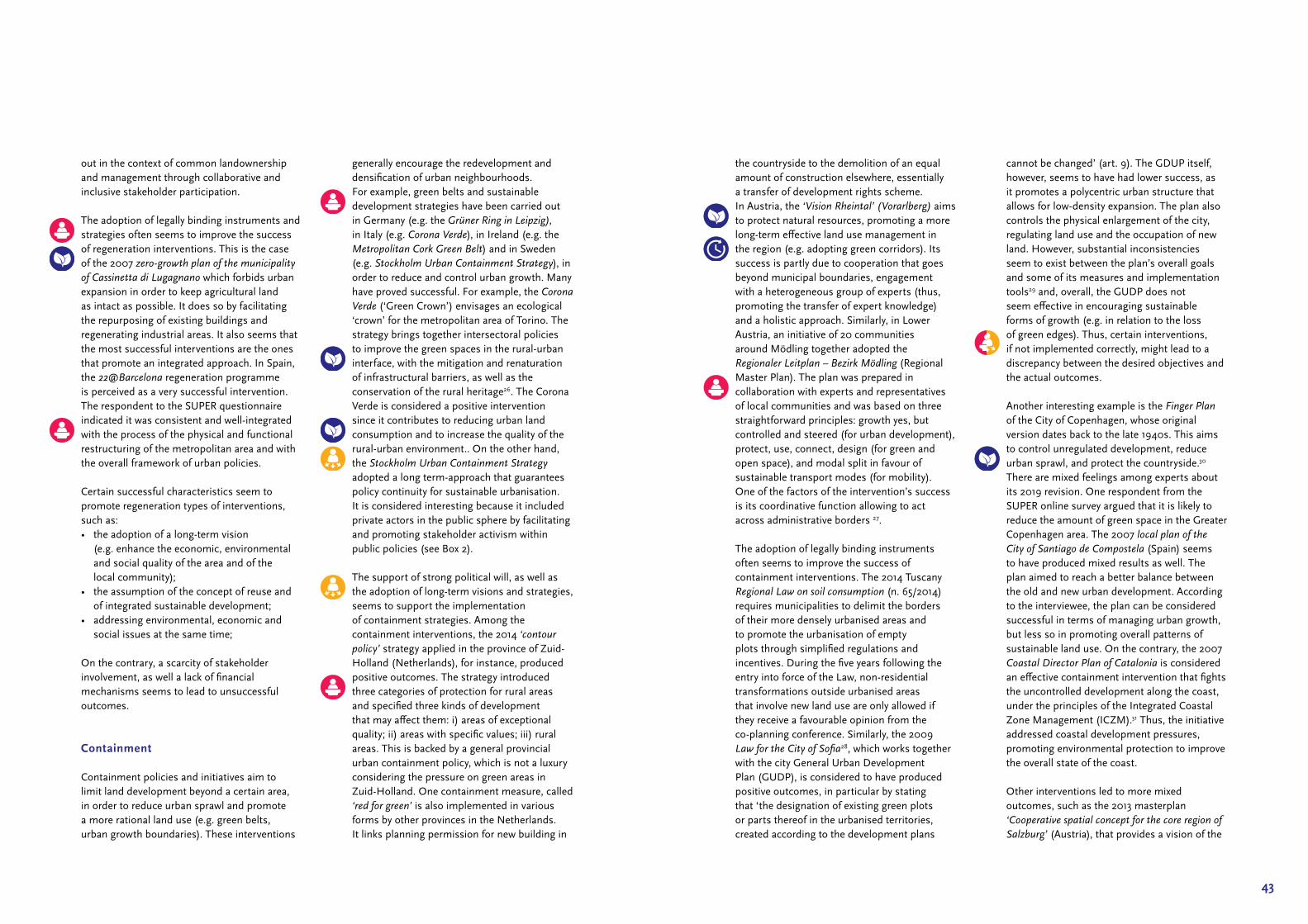
The adoption of legally binding instruments and strategies often seems to improve the success of regeneration interventions. This is the case of the 2007 zero-growth plan of the municipality of Cassinetta di Lugagnano which forbids urban expansion in order to keep agricultural land as intact as possible. It does so by facilitating the repurposing of existing buildings and regenerating industrial areas. It also seems that the most successful interventions are the ones that promote an integrated approach. In Spain, the 22@Barcelona regeneration programme is perceived as a very successful intervention. The respondent to the SUPER questionnaire indicated it was consistent and well‑integrated with the process of the physical and functional restructuring of the metropolitan area and with the overall framework of urban policies.
Certain successful characteristics seem to promote regeneration types of interventions, such as:• the adoption of a long‑term vision
(e.g. enhance the economic, environmental and social quality of the area and of the local community);
• the assumption of the concept of reuse and of integrated sustainable development;
• addressing environmental, economic and social issues at the same time;
On the contrary, a scarcity of stakeholder involvement, as well a lack of financial mechanisms seems to lead to unsuccessful outcomes.
Containment
Containment policies and initiatives aim to limit land development beyond a certain area, in order to reduce urban sprawl and promote a more rational land use (e.g. green belts, urban growth boundaries). These interventions
generally encourage the redevelopment and densification of urban neighbourhoods. For example, green belts and sustainable development strategies have been carried out in Germany (e.g. the Grüner Ring in Leipzig), in Italy (e.g. Corona Verde), in Ireland (e.g. the Metropolitan Cork Green Belt) and in Sweden (e.g. Stockholm Urban Containment Strategy), in order to reduce and control urban growth. Many have proved successful. For example, the Corona Verde (‘Green Crown’) envisages an ecological ‘crown’ for the metropolitan area of Torino. The strategy brings together intersectoral policies to improve the green spaces in the rural‑urban interface, with the mitigation and renaturation of infrastructural barriers, as well as the conservation of the rural heritage26. The Corona Verde is considered a positive intervention since it contributes to reducing urban land consumption and to increase the quality of the rural‑urban environment.. On the other hand, the Stockholm Urban Containment Strategy adopted a long term‑approach that guarantees policy continuity for sustainable urbanisation. It is considered interesting because it included private actors in the public sphere by facilitating and promoting stakeholder activism within public policies (see Box 2).
The support of strong political will, as well as the adoption of long‑term visions and strategies, seems to support the implementation of containment strategies. Among the containment interventions, the 2014 ‘contour policy’ strategy applied in the province of Zuid‑Holland (Netherlands), for instance, produced positive outcomes. The strategy introduced three categories of protection for rural areas and specified three kinds of development that may affect them: i) areas of exceptional quality; ii) areas with specific values; iii) rural areas. This is backed by a general provincial urban containment policy, which is not a luxury considering the pressure on green areas in Zuid‑Holland. One containment measure, called ‘red for green’ is also implemented in various forms by other provinces in the Netherlands. It links planning permission for new building in
the countryside to the demolition of an equal amount of construction elsewhere, essentially a transfer of development rights scheme. In Austria, the ‘Vision Rheintal’ (Vorarlberg) aims to protect natural resources, promoting a more long‑term effective land use management in the region (e.g. adopting green corridors). Its success is partly due to cooperation that goes beyond municipal boundaries, engagement with a heterogeneous group of experts (thus, promoting the transfer of expert knowledge) and a holistic approach. Similarly, in Lower Austria, an initiative of 20 communities around Mödling together adopted the Regionaler Leitplan – Bezirk Mödling (Regional Master Plan). The plan was prepared in collaboration with experts and representatives of local communities and was based on three straightforward principles: growth yes, but controlled and steered (for urban development), protect, use, connect, design (for green and open space), and modal split in favour of sustainable transport modes (for mobility). One of the factors of the intervention’s success is its coordinative function allowing to act across administrative borders 27.
The adoption of legally binding instruments often seems to improve the success of containment interventions. The 2014 Tuscany Regional Law on soil consumption (n. 65/2014) requires municipalities to delimit the borders of their more densely urbanised areas and to promote the urbanisation of empty plots through simplified regulations and incentives. During the five years following the entry into force of the Law, non‑residential transformations outside urbanised areas that involve new land use are only allowed if they receive a favourable opinion from the co‑planning conference. Similarly, the 2009 Law for the City of Sofia28, which works together with the city General Urban Development Plan (GUDP), is considered to have produced positive outcomes, in particular by stating that ‘the designation of existing green plots or parts thereof in the urbanised territories, created according to the development plans
cannot be changed’ (art. 9). The GDUP itself, however, seems to have had lower success, as it promotes a polycentric urban structure that allows for low‑density expansion. The plan also controls the physical enlargement of the city, regulating land use and the occupation of new land. However, substantial inconsistencies seem to exist between the plan’s overall goals and some of its measures and implementation tools29 and, overall, the GUDP does not seem effective in encouraging sustainable forms of growth (e.g. in relation to the loss of green edges). Thus, certain interventions, if not implemented correctly, might lead to a discrepancy between the desired objectives and the actual outcomes.
Another interesting example is the Finger Plan of the City of Copenhagen, whose original version dates back to the late 1940s. This aims to control unregulated development, reduce urban sprawl, and protect the countryside.30 There are mixed feelings among experts about its 2019 revision. One respondent from the SUPER online survey argued that it is likely to reduce the amount of green space in the Greater Copenhagen area. The 2007 local plan of the City of Santiago de Compostela (Spain) seems to have produced mixed results as well. The plan aimed to reach a better balance between the old and new urban development. According to the interviewee, the plan can be considered successful in terms of managing urban growth, but less so in promoting overall patterns of sustainable land use. On the contrary, the 2007 Coastal Director Plan of Catalonia is considered an effective containment intervention that fights the uncontrolled development along the coast, under the principles of the Integrated Coastal Zone Management (ICZM).31 Thus, the initiative addressed coastal development pressures, promoting environmental protection to improve the overall state of the coast.
Other interventions led to more mixed outcomes, such as the 2013 masterplan ‘Cooperative spatial concept for the core region of Salzburg’ (Austria), that provides a vision of the

45
key development measures for the entire region until 2030 in the areas of housing, economy, transport, landscape (for example, it tries to implement measures to stop the consumption of land, manage housing development, as well as environmental pollution). On the other hand, the land take in small municipalities around the capital city Bratislava (Slovakia) seems to have led to negative consequences. Even though local spatial plans should ensure environmental protection and sustainable development, they have led to an uncontrolled development process (e.g. intensive large‑scale and second‑home development) in the urban fringe of Bratislava.32 According to the collected data, this development has had negative impacts on the environment, since it is a very sprawl‑oriented development, which impacts on agriculture and natural areas.
Therefore, certain containment initiatives may turn out to be counterproductive for sustainable land‑use. This seems to be the case of the Cork Area Strategic Plan, that provides a vision and strategy for the development of the Cork City‑Region up to 2020. Despite aiming for environmental balance, reducing urbanisation of the countryside, landscape protection and stopping the degradation of the Green Belt around the city, the plan is considered scarcely successful. A respondent noted that overexploitation of natural resources still occurred and that the strategy is mainly based on a pro‑growth approach. Thus, it seems that long‑term containment strategies need short‑term tangible results in order to be effectively implemented.
Overall, certain successful characteristics seem to promote containment types of interventions:• cooperation and coordination matters
if it goes beyond municipal boundaries and adopts a functional perspective; in fact, containment interventions often involve various municipalities (e.g. metropolitan areas);
• the support of strong, stable and effective political will is needed since the spatial effect of containment initiatives usually takes time to be seen;
• the engagement with a heterogeneous group of experts (transfer of ‘expert knowledge’), as well as the integration of social needs and priorities is important. In fact, these kind of policies drastically impact the social behaviour and quality of life of the local population (see the example of Corona Verde);
• the establishment of an effective and an efficient normative apparatus (e.g. legally binding instruments) guarantees a certain level of success.
• the limitation of market speculative mech‑anisms (i.e. increased land price, expulsion of certain social categories, concentration of development benefits, etc.) through the adoption of policies helps the promotion of a more rational and sustainable land use.
Governance
Governance related interventions aim at improving the ways and mechanisms through which governmental stakeholders decide to manage urban areas, for example through cross‑sectoral integration policies, as well as urban and regional plans. Despite the relevance of the topic, governance interventions seem to have produced results that are varied.
Interventions that promote a long‑term sustainable development perspective and adopt an integrated approach are generally more effective. In Stockholm, the urban transformations and modalities of integrated planning are considered successful cases of integrated land use, housing, and transport planning. Nevertheless, multi‑level collaboration in Stockholm’s urban transformations have had to face challenges, as the intervention of the central government, while aiming at favouring the integration of local actors, after a decade
Territorial characteristics of the area:Stockholm is seen as a leader in brownfield development and in terms of environmental sustainability. Its eco‑districts (e.g. dense functional neighbourhoods) are considered a best practice.
Intervention goal and main featuresThe urban containment policy in Stockholm is a result of both Swedish planning culture as well as the faithful implementation of regional and local plans and strategies.
Main lessons and policy recommendations:• Territorial integration contributes to economic and social competitiveness while preserving natural and
agricultural ecosystems.• Long term approach and continuity is achieved by making periodic operational adjustments without
making major changes at the strategic level. Continuous evaluation helps enable this.• Comprehensive local plans, which adopt a multi‑level perspective are a fine example of the municipality’s
interpretation of sustainability and how it should be achieved.• Coordination and collaboration networks and public-private partnerships can be strengthened by
introducing legal provisions and mechanisms aiming at reaching consensus between many different stakeholders. clear legal provisions in this regard help.
• Good participation focuses on implementation. This involves operationalising the plan into tangible and realistic goals and giving these goals priority in municipal budgets and investment strategies.
• A risk of spatial segregation exists when public control is lacking.• Planning tradition (acquis) and its maintenance are key factors for success. It is not only a responsibility
for leaders but also teams (of trained civil servants) to find alternatives and solutions to recurring crises.
Name of the intervention, location and country: Stockholm Urban Containment Strategy (Sweden)
Territorial level: LAU2; Year: 2017 (since the 1980s).
Website link: https://vaxer.stockholm/globalassets/ tema/oversiktplan‑ny_light/ english_stockholm_city_plan.pdf
B O X 2
Stockholm Urban Containment Strategy (SE)
Public Spaces in new Housing Quarters – Stockholm, Sweden
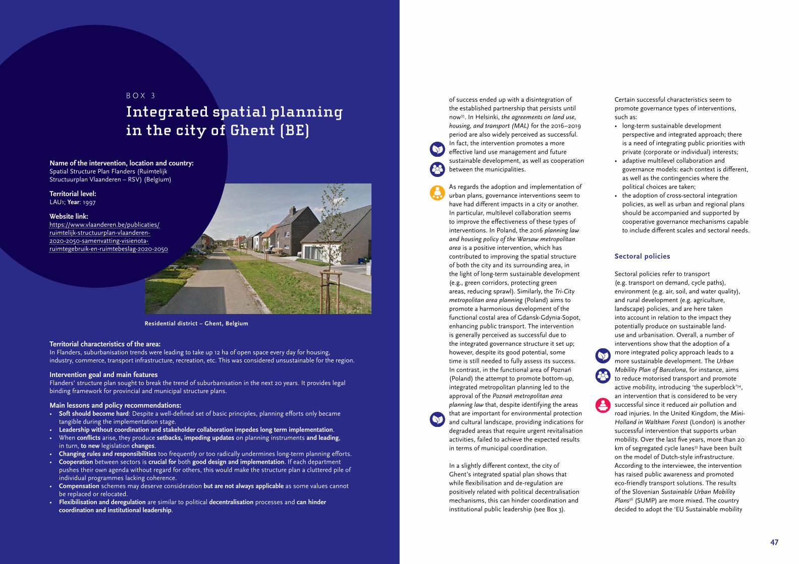
47
of success ended up with a disintegration of the established partnership that persists until now33. In Helsinki, the agreements on land use, housing, and transport (MAL) for the 2016–2019 period are also widely perceived as successful. In fact, the intervention promotes a more effective land use management and future sustainable development, as well as cooperation between the municipalities.
As regards the adoption and implementation of urban plans, governance interventions seem to have had different impacts in a city or another. In particular, multilevel collaboration seems to improve the effectiveness of these types of interventions. In Poland, the 2016 planning law and housing policy of the Warsaw metropolitan area is a positive intervention, which has contributed to improving the spatial structure of both the city and its surrounding area, in the light of long‑term sustainable development (e.g., green corridors, protecting green areas, reducing sprawl). Similarly, the Tri-City metropolitan area planning (Poland) aims to promote a harmonious development of the functional costal area of Gdansk‑Gdynia‑Sopot, enhancing public transport. The intervention is generally perceived as successful due to the integrated governance structure it set up; however, despite its good potential, some time is still needed to fully assess its success. In contrast, in the functional area of Poznań (Poland) the attempt to promote bottom‑up, integrated metropolitan planning led to the approval of the Poznań metropolitan area planning law that, despite identifying the areas that are important for environmental protection and cultural landscape, providing indications for degraded areas that require urgent revitalisation activities, failed to achieve the expected results in terms of municipal coordination.
In a slightly different context, the city of Ghent’s integrated spatial plan shows that while flexibilisation and de‑regulation are positively related with political decentralisation mechanisms, this can hinder coordination and institutional public leadership (see Box 3).
Certain successful characteristics seem to promote governance types of interventions, such as:• long‑term sustainable development
perspective and integrated approach; there is a need of integrating public priorities with private (corporate or individual) interests;
• adaptive multilevel collaboration and governance models: each context is different, as well as the contingencies where the political choices are taken;
• the adoption of cross‑sectoral integration policies, as well as urban and regional plans should be accompanied and supported by cooperative governance mechanisms capable to include different scales and sectoral needs.
Sectoral policies
Sectoral policies refer to transport (e.g. transport on demand, cycle paths), environment (e.g. air, soil, and water quality), and rural development (e.g. agriculture, landscape) policies, and are here taken into account in relation to the impact they potentially produce on sustainable land‑use and urbanisation. Overall, a number of interventions show that the adoption of a more integrated policy approach leads to a more sustainable development. The Urban Mobility Plan of Barcelona, for instance, aims to reduce motorised transport and promote active mobility, introducing ‘the superblock’34, an intervention that is considered to be very successful since it reduced air pollution and road injuries. In the United Kingdom, the Mini-Holland in Waltham Forest (London) is another successful intervention that supports urban mobility. Over the last five years, more than 20 km of segregated cycle lanes35 have been built on the model of Dutch‑style infrastructure. According to the interviewee, the intervention has raised public awareness and promoted eco‑friendly transport solutions. The results of the Slovenian Sustainable Urban Mobility Plans36 (SUMP) are more mixed. The country decided to adopt the ‘EU Sustainable mobility
Territorial characteristics of the area:In Flanders, suburbanisation trends were leading to take up 12 ha of open space every day for housing, industry, commerce, transport infrastructure, recreation, etc. This was considered unsustainable for the region.
Intervention goal and main featuresFlanders’ structure plan sought to break the trend of suburbanisation in the next 20 years. It provides legal binding framework for provincial and municipal structure plans.
Main lessons and policy recommendations:• Soft should become hard: Despite a well‑defined set of basic principles, planning efforts only became
tangible during the implementation stage.• Leadership without coordination and stakeholder collaboration impedes long term implementation.• When conflicts arise, they produce setbacks, impeding updates on planning instruments and leading,
in turn, to new legislation changes.• Changing rules and responsibilities too frequently or too radically undermines long‑term planning efforts.• Cooperation between sectors is crucial for both good design and implementation. If each department
pushes their own agenda without regard for others, this would make the structure plan a cluttered pile of individual programmes lacking coherence.
• Compensation schemes may deserve consideration but are not always applicable as some values cannot be replaced or relocated.
• Flexibilisation and deregulation are similar to political decentralisation processes and can hinder coordination and institutional leadership.
Name of the intervention, location and country: Spatial Structure Plan Flanders (Ruimtelijk Structuurplan Vlaanderen – RSV) (Belgium)
Territorial level: LAU1; Year: 1997
Website link: https://www.vlaanderen.be/publicaties/ ruimtelijk‑structuurplan‑vlaanderen‑ 2020‑2050‑samenvatting‑visienota‑ ruimtegebruik‑en‑ruimtebeslag‑2020‑2050
B O X 3
Integrated spatial planning in the city of Ghent (BE)
Residential district – Ghent, Belgium
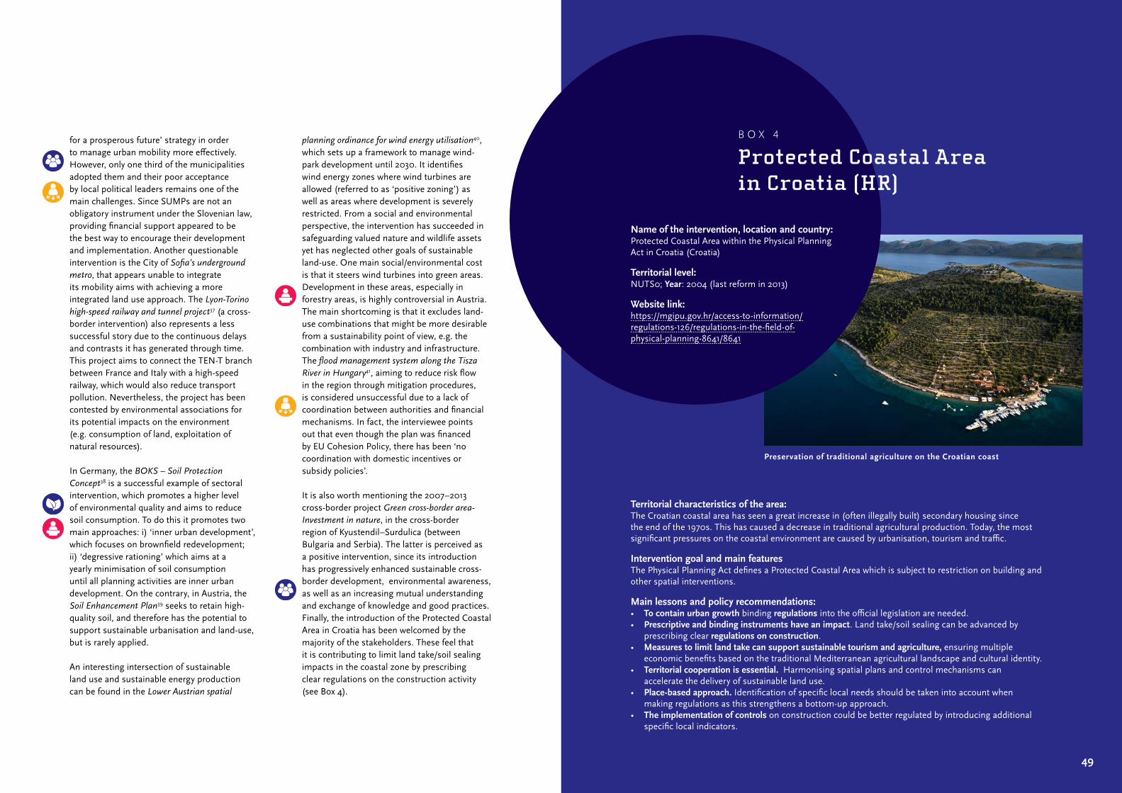
49
for a prosperous future’ strategy in order to manage urban mobility more effectively. However, only one third of the municipalities adopted them and their poor acceptance by local political leaders remains one of the main challenges. Since SUMPs are not an obligatory instrument under the Slovenian law, providing financial support appeared to be the best way to encourage their development and implementation. Another questionable intervention is the City of Sofia’s underground metro, that appears unable to integrate its mobility aims with achieving a more integrated land use approach. The Lyon-Torino high-speed railway and tunnel project37 (a cross‑border intervention) also represents a less successful story due to the continuous delays and contrasts it has generated through time. This project aims to connect the TEN‑T branch between France and Italy with a high‑speed railway, which would also reduce transport pollution. Nevertheless, the project has been contested by environmental associations for its potential impacts on the environment (e.g. consumption of land, exploitation of natural resources).
In Germany, the BOKS – Soil Protection Concept38 is a successful example of sectoral intervention, which promotes a higher level of environmental quality and aims to reduce soil consumption. To do this it promotes two main approaches: i) ‘inner urban development’, which focuses on brownfield redevelopment; ii) ‘degressive rationing’ which aims at a yearly minimisation of soil consumption until all planning activities are inner urban development. On the contrary, in Austria, the Soil Enhancement Plan39 seeks to retain high‑quality soil, and therefore has the potential to support sustainable urbanisation and land‑use, but is rarely applied.
An interesting intersection of sustainable land use and sustainable energy production can be found in the Lower Austrian spatial
planning ordinance for wind energy utilisation40, which sets up a framework to manage wind‑park development until 2030. It identifies wind energy zones where wind turbines are allowed (referred to as ‘positive zoning’) as well as areas where development is severely restricted. From a social and environmental perspective, the intervention has succeeded in safeguarding valued nature and wildlife assets yet has neglected other goals of sustainable land‑use. One main social/environmental cost is that it steers wind turbines into green areas. Development in these areas, especially in forestry areas, is highly controversial in Austria. The main shortcoming is that it excludes land‑use combinations that might be more desirable from a sustainability point of view, e.g. the combination with industry and infrastructure. The flood management system along the Tisza River in Hungary41, aiming to reduce risk flow in the region through mitigation procedures, is considered unsuccessful due to a lack of coordination between authorities and financial mechanisms. In fact, the interviewee points out that even though the plan was financed by EU Cohesion Policy, there has been ‘no coordination with domestic incentives or subsidy policies’.
It is also worth mentioning the 2007–2013 cross‑border project Green cross-border area-Investment in nature, in the cross‑border region of Kyustendil–Surdulica (between Bulgaria and Serbia). The latter is perceived as a positive intervention, since its introduction has progressively enhanced sustainable cross‑border development, environmental awareness, as well as an increasing mutual understanding and exchange of knowledge and good practices. Finally, the introduction of the Protected Coastal Area in Croatia has been welcomed by the majority of the stakeholders. These feel that it is contributing to limit land take/soil sealing impacts in the coastal zone by prescribing clear regulations on the construction activity (see Box 4).
Territorial characteristics of the area:The Croatian coastal area has seen a great increase in (often illegally built) secondary housing since the end of the 1970s. This has caused a decrease in traditional agricultural production. Today, the most significant pressures on the coastal environment are caused by urbanisation, tourism and traffic.
Intervention goal and main featuresThe Physical Planning Act defines a Protected Coastal Area which is subject to restriction on building and other spatial interventions.
Main lessons and policy recommendations:• To contain urban growth binding regulations into the official legislation are needed.• Prescriptive and binding instruments have an impact. Land take/soil sealing can be advanced by
prescribing clear regulations on construction.• Measures to limit land take can support sustainable tourism and agriculture, ensuring multiple
economic benefits based on the traditional Mediterranean agricultural landscape and cultural identity.• Territorial cooperation is essential. Harmonising spatial plans and control mechanisms can
accelerate the delivery of sustainable land use.• Place-based approach. Identification of specific local needs should be taken into account when
making regulations as this strengthens a bottom‑up approach.• The implementation of controls on construction could be better regulated by introducing additional
specific local indicators.
Name of the intervention, location and country: Protected Coastal Area within the Physical Planning Act in Croatia (Croatia)
Territorial level: NUTS0; Year: 2004 (last reform in 2013)
Website link: https://mgipu.gov.hr/access‑to‑information/regulations‑126/regulations‑in‑the‑field‑of‑physical‑planning‑8641/8641
B O X 4
Protected Coastal Area in Croatia (HR)
Preservation of traditional agriculture on the Croatian coast
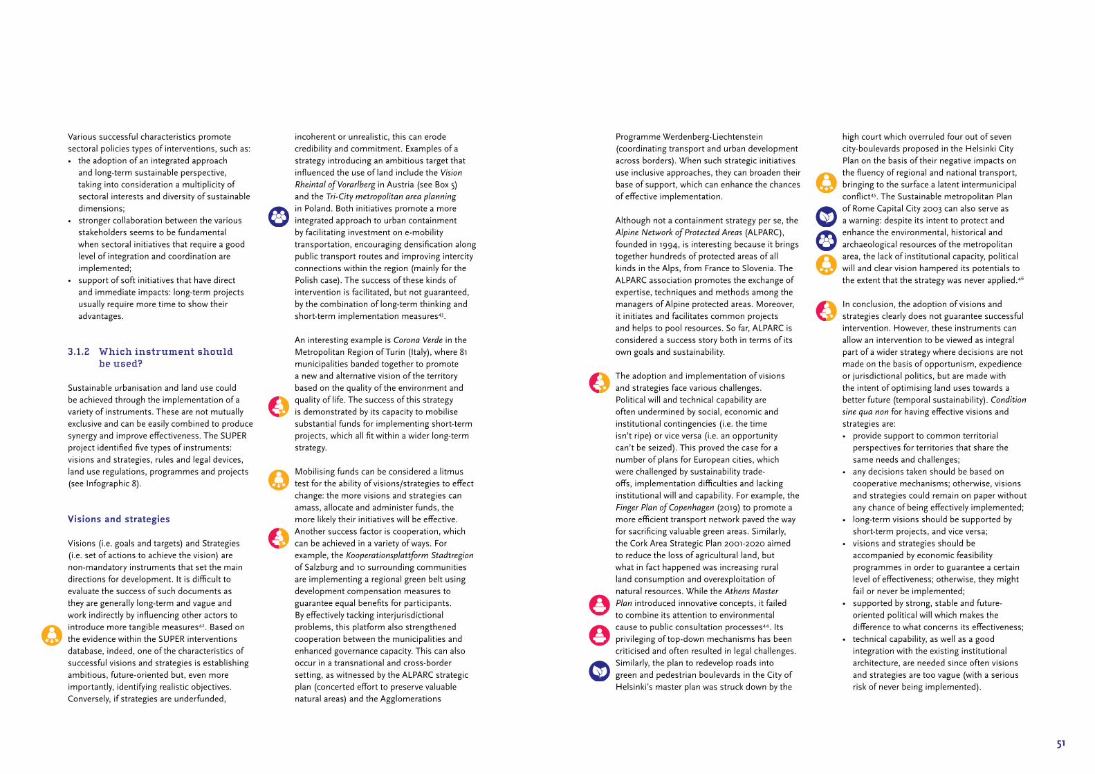
51
Programme Werdenberg‑Liechtenstein (coordinating transport and urban development across borders). When such strategic initiatives use inclusive approaches, they can broaden their base of support, which can enhance the chances of effective implementation.
Although not a containment strategy per se, the Alpine Network of Protected Areas (ALPARC), founded in 1994, is interesting because it brings together hundreds of protected areas of all kinds in the Alps, from France to Slovenia. The ALPARC association promotes the exchange of expertise, techniques and methods among the managers of Alpine protected areas. Moreover, it initiates and facilitates common projects and helps to pool resources. So far, ALPARC is considered a success story both in terms of its own goals and sustainability.
The adoption and implementation of visions and strategies face various challenges. Political will and technical capability are often undermined by social, economic and institutional contingencies (i.e. the time isn’t ripe) or vice versa (i.e. an opportunity can’t be seized). This proved the case for a number of plans for European cities, which were challenged by sustainability trade‑offs, implementation difficulties and lacking institutional will and capability. For example, the Finger Plan of Copenhagen (2019) to promote a more efficient transport network paved the way for sacrificing valuable green areas. Similarly, the Cork Area Strategic Plan 2001‑2020 aimed to reduce the loss of agricultural land, but what in fact happened was increasing rural land consumption and overexploitation of natural resources. While the Athens Master Plan introduced innovative concepts, it failed to combine its attention to environmental cause to public consultation processes44. Its privileging of top‑down mechanisms has been criticised and often resulted in legal challenges. Similarly, the plan to redevelop roads into green and pedestrian boulevards in the City of Helsinki’s master plan was struck down by the
high court which overruled four out of seven city‑boulevards proposed in the Helsinki City Plan on the basis of their negative impacts on the fluency of regional and national transport, bringing to the surface a latent intermunicipal conflict45. The Sustainable metropolitan Plan of Rome Capital City 2003 can also serve as a warning: despite its intent to protect and enhance the environmental, historical and archaeological resources of the metropolitan area, the lack of institutional capacity, political will and clear vision hampered its potentials to the extent that the strategy was never applied.46
In conclusion, the adoption of visions and strategies clearly does not guarantee successful intervention. However, these instruments can allow an intervention to be viewed as integral part of a wider strategy where decisions are not made on the basis of opportunism, expedience or jurisdictional politics, but are made with the intent of optimising land uses towards a better future (temporal sustainability). Condition sine qua non for having effective visions and strategies are:• provide support to common territorial
perspectives for territories that share the same needs and challenges;
• any decisions taken should be based on cooperative mechanisms; otherwise, visions and strategies could remain on paper without any chance of being effectively implemented;
• long‑term visions should be supported by short‑term projects, and vice versa;
• visions and strategies should be accompanied by economic feasibility programmes in order to guarantee a certain level of effectiveness; otherwise, they might fail or never be implemented;
• supported by strong, stable and future‑oriented political will which makes the difference to what concerns its effectiveness;
• technical capability, as well as a good integration with the existing institutional architecture, are needed since often visions and strategies are too vague (with a serious risk of never being implemented).
Various successful characteristics promote sectoral policies types of interventions, such as:• the adoption of an integrated approach
and long‑term sustainable perspective, taking into consideration a multiplicity of sectoral interests and diversity of sustainable dimensions;
• stronger collaboration between the various stakeholders seems to be fundamental when sectoral initiatives that require a good level of integration and coordination are implemented;
• support of soft initiatives that have direct and immediate impacts: long‑term projects usually require more time to show their advantages.
3.1.2 Which instrument should be used?
Sustainable urbanisation and land use could be achieved through the implementation of a variety of instruments. These are not mutually exclusive and can be easily combined to produce synergy and improve effectiveness. The SUPER project identified five types of instruments: visions and strategies, rules and legal devices, land use regulations, programmes and projects (see Infographic 8).
Visions and strategies
Visions (i.e. goals and targets) and Strategies (i.e. set of actions to achieve the vision) are non‑mandatory instruments that set the main directions for development. It is difficult to evaluate the success of such documents as they are generally long‑term and vague and work indirectly by influencing other actors to introduce more tangible measures42. Based on the evidence within the SUPER interventions database, indeed, one of the characteristics of successful visions and strategies is establishing ambitious, future‑oriented but, even more importantly, identifying realistic objectives. Conversely, if strategies are underfunded,
incoherent or unrealistic, this can erode credibility and commitment. Examples of a strategy introducing an ambitious target that influenced the use of land include the Vision Rheintal of Vorarlberg in Austria (see Box 5) and the Tri-City metropolitan area planning in Poland. Both initiatives promote a more integrated approach to urban containment by facilitating investment on e‑mobility transportation, encouraging densification along public transport routes and improving intercity connections within the region (mainly for the Polish case). The success of these kinds of intervention is facilitated, but not guaranteed, by the combination of long‑term thinking and short‑term implementation measures43.
An interesting example is Corona Verde in the Metropolitan Region of Turin (Italy), where 81 municipalities banded together to promote a new and alternative vision of the territory based on the quality of the environment and quality of life. The success of this strategy is demonstrated by its capacity to mobilise substantial funds for implementing short‑term projects, which all fit within a wider long‑term strategy.
Mobilising funds can be considered a litmus test for the ability of visions/strategies to effect change: the more visions and strategies can amass, allocate and administer funds, the more likely their initiatives will be effective. Another success factor is cooperation, which can be achieved in a variety of ways. For example, the Kooperationsplattform Stadtregion of Salzburg and 10 surrounding communities are implementing a regional green belt using development compensation measures to guarantee equal benefits for participants. By effectively tacking interjurisdictional problems, this platform also strengthened cooperation between the municipalities and enhanced governance capacity. This can also occur in a transnational and cross‑border setting, as witnessed by the ALPARC strategic plan (concerted effort to preserve valuable natural areas) and the Agglomerations
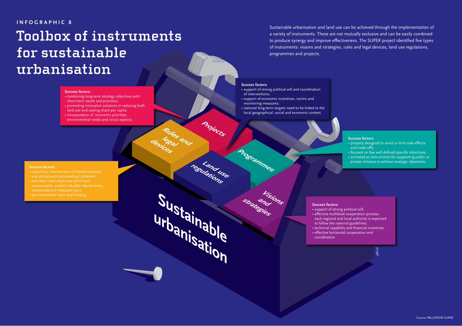
I N F O G R A P H I C 8
Toolbox of instruments for sustainable urbanisation
Land use regulations
Rules and legaldevices
Visionsand strategies
Projects
Programmes
Sustainable urbanisation
Success factors: • support of strong political will and coordination
of interventions;• support of economic incentives, norms and
monitoring measures;• national long-term targets need to be linked to the
local geographical, social and economic context.
Success factors: • combining long-term strategy objectives with
short-term needs and priorities; • promoting innovative solutions in reducing both
land use and sealing share per capita. • Incorporation of economic priorities,
environmental needs and social aspects.
Success factors: • properly designed to avoid or limit side-effects
and trade-offs;• focused on few well defined specific objectives;• activated as instruments for supporting public or
private initiative to achieve strategic objectives.Success factors: • objectives, mechanisms of implementation
and instruments activated are coherent;• laws have clear objectives (limit land
consumption, protect valuable natural areas, compensations measures etc.);
• are normatively strict and binding.
Success factors: • support of strong political will;• effective multilevel cooperation process:
each regional and local authority is expected to follow the national guidelines;
• technical capability and financial incentives.• effective horizontal cooperation and
coordination
Sustainable urbanisation and land use can be achieved through the implementation of a variety of instruments. These are not mutually exclusive and can be easily combined to produce synergy and improve effectiveness. The SUPER project identified five types of instruments: visions and strategies, rules and legal devices, land use regulations, programmes and projects.
Source: PBL/ESPON SUPER
pbl.n
l
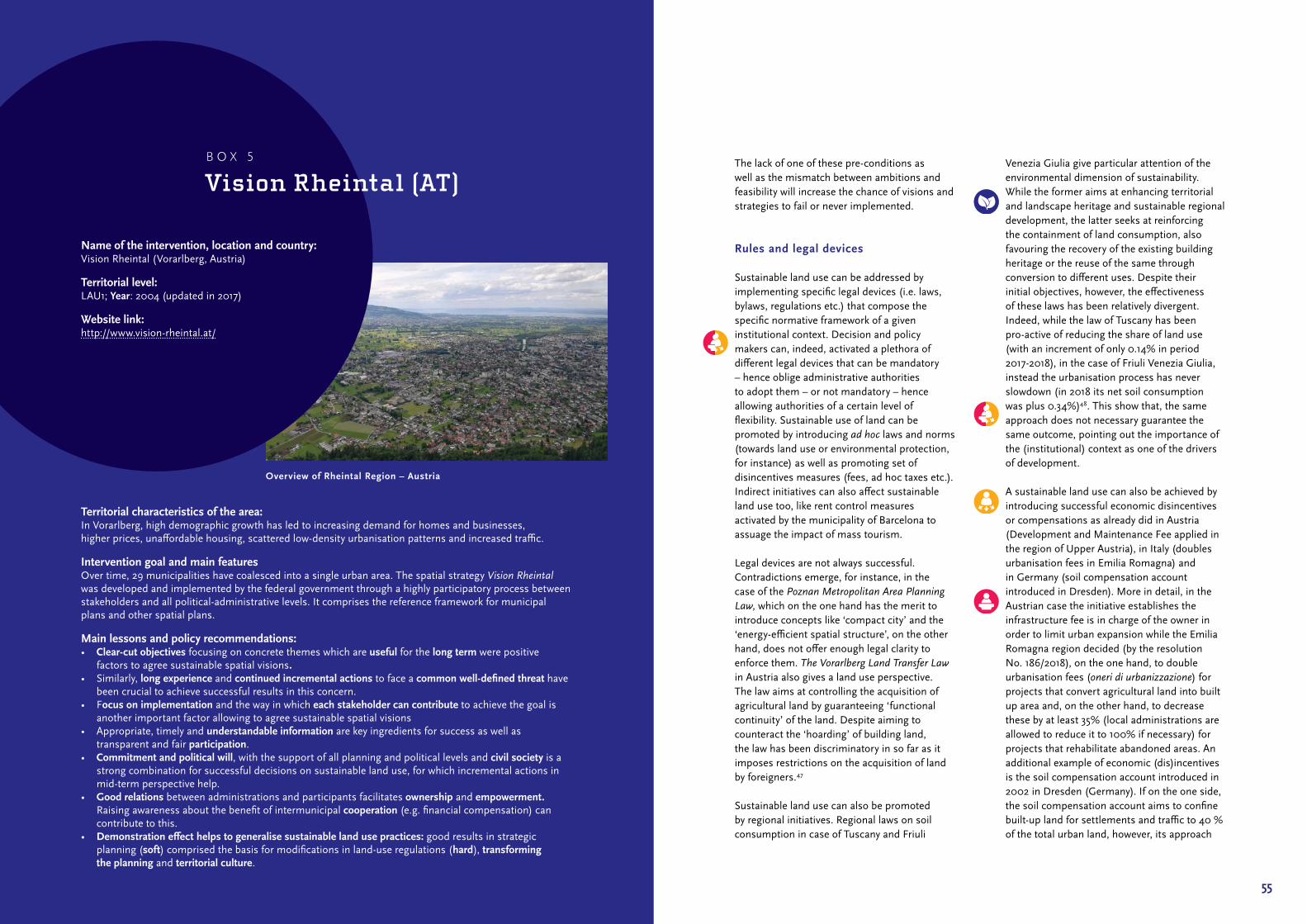
55
The lack of one of these pre‑conditions as well as the mismatch between ambitions and feasibility will increase the chance of visions and strategies to fail or never implemented.
Rules and legal devices
Sustainable land use can be addressed by implementing specific legal devices (i.e. laws, bylaws, regulations etc.) that compose the specific normative framework of a given institutional context. Decision and policy makers can, indeed, activated a plethora of different legal devices that can be mandatory – hence oblige administrative authorities to adopt them – or not mandatory – hence allowing authorities of a certain level of flexibility. Sustainable use of land can be promoted by introducing ad hoc laws and norms (towards land use or environmental protection, for instance) as well as promoting set of disincentives measures (fees, ad hoc taxes etc.). Indirect initiatives can also affect sustainable land use too, like rent control measures activated by the municipality of Barcelona to assuage the impact of mass tourism.
Legal devices are not always successful. Contradictions emerge, for instance, in the case of the Poznan Metropolitan Area Planning Law, which on the one hand has the merit to introduce concepts like ‘compact city’ and the ‘energy‑efficient spatial structure’, on the other hand, does not offer enough legal clarity to enforce them. The Vorarlberg Land Transfer Law in Austria also gives a land use perspective. The law aims at controlling the acquisition of agricultural land by guaranteeing ‘functional continuity’ of the land. Despite aiming to counteract the ‘hoarding’ of building land, the law has been discriminatory in so far as it imposes restrictions on the acquisition of land by foreigners.47
Sustainable land use can also be promoted by regional initiatives. Regional laws on soil consumption in case of Tuscany and Friuli
Venezia Giulia give particular attention of the environmental dimension of sustainability. While the former aims at enhancing territorial and landscape heritage and sustainable regional development, the latter seeks at reinforcing the containment of land consumption, also favouring the recovery of the existing building heritage or the reuse of the same through conversion to different uses. Despite their initial objectives, however, the effectiveness of these laws has been relatively divergent. Indeed, while the law of Tuscany has been pro‑active of reducing the share of land use (with an increment of only 0.14% in period 2017‑2018), in the case of Friuli Venezia Giulia, instead the urbanisation process has never slowdown (in 2018 its net soil consumption was plus 0.34%)48. This show that, the same approach does not necessary guarantee the same outcome, pointing out the importance of the (institutional) context as one of the drivers of development.
A sustainable land use can also be achieved by introducing successful economic disincentives or compensations as already did in Austria (Development and Maintenance Fee applied in the region of Upper Austria), in Italy (doubles urbanisation fees in Emilia Romagna) and in Germany (soil compensation account introduced in Dresden). More in detail, in the Austrian case the initiative establishes the infrastructure fee is in charge of the owner in order to limit urban expansion while the Emilia Romagna region decided (by the resolution No. 186/2018), on the one hand, to double urbanisation fees (oneri di urbanizzazione) for projects that convert agricultural land into built up area and, on the other hand, to decrease these by at least 35% (local administrations are allowed to reduce it to 100% if necessary) for projects that rehabilitate abandoned areas. An additional example of economic (dis)incentives is the soil compensation account introduced in 2002 in Dresden (Germany). If on the one side, the soil compensation account aims to confine built‑up land for settlements and traffic to 40 % of the total urban land, however, its approach
Territorial characteristics of the area:In Vorarlberg, high demographic growth has led to increasing demand for homes and businesses, higher prices, unaffordable housing, scattered low‑density urbanisation patterns and increased traffic.
Intervention goal and main featuresOver time, 29 municipalities have coalesced into a single urban area. The spatial strategy Vision Rheintal was developed and implemented by the federal government through a highly participatory process between stakeholders and all political‑administrative levels. It comprises the reference framework for municipal plans and other spatial plans.
Main lessons and policy recommendations:• Clear-cut objectives focusing on concrete themes which are useful for the long term were positive
factors to agree sustainable spatial visions.• Similarly, long experience and continued incremental actions to face a common well-defined threat have
been crucial to achieve successful results in this concern.• Focus on implementation and the way in which each stakeholder can contribute to achieve the goal is
another important factor allowing to agree sustainable spatial visions• Appropriate, timely and understandable information are key ingredients for success as well as
transparent and fair participation.• Commitment and political will, with the support of all planning and political levels and civil society is a
strong combination for successful decisions on sustainable land use, for which incremental actions in mid‑term perspective help.
• Good relations between administrations and participants facilitates ownership and empowerment. Raising awareness about the benefit of intermunicipal cooperation (e.g. financial compensation) can contribute to this.
• Demonstration effect helps to generalise sustainable land use practices: good results in strategic planning (soft) comprised the basis for modifications in land‑use regulations (hard), transforming the planning and territorial culture.
Name of the intervention, location and country: Vision Rheintal (Vorarlberg, Austria)
Territorial level: LAU1; Year: 2004 (updated in 2017)
Website link: http://www.vision‑rheintal.at/
B O X 5
Vision Rheintal (AT)
Overview of Rheintal Region – Austria
57
is considered too limitative for investors, which are forced to carry out compensation measures by themselves or to pay a compensation fee. These opportunities shows that, even they have different targets, applying disincentives measures can pays‑off (or fail) in the extent of their mechanism are clear and not perceived as additional taxes losing so social credibility (and acceptability).
The regulation of renting apartments to tourists in Barcelona in 2015 was, on the other hand, focused on the social and economic dimensions. The aim was to control and manage the mass touristic apartment rental in the city. The need for better regulation renting out housing units for short‑stay visitors is widely shared in the main European countries, particularly in major tourist destinations. With the emerging of web platforms where demand and supply meet, the housing rental market is becoming a very sensitive issue for both public administrations and society at large. In order to provide a just and equitable regulatory frame, the Barcelona administration introduced a registry of tourist apartments, as well as a neighbourhood map, assessing the maximum allowed allocation of tourist rentals. Additionally, owners and managers of unlicensed apartments have been prosecuted. The tool was relatively successful, especially in the social dimension related to the housing supply. Since the number of short‑stay rentals in Barcelona has dropped, properties could be offered for long‑term rental, moderating the rise of rental prices and allowing low‑income and middle‑income households to rent a flat in the city. Since this relieved pressure for suburban housing, the intervention addressed also the environmental aspect. This has been effective thanks to the involvement of citizens in identifying illegal rentals and creating collaborative mechanisms including website where citizens can easy report violations.
Finally, in some cases, legal devices can also work against sustainable land use. The use of ‘special’ legal devices, as the case of the
Serbian law on Belgrade Waterfront may be used to facilitate of real‑estate development mechanisms instead of preventing the exploitation of natural resources.
As shown, throughout Europe there are number of legal devices to take inspiration from or conversely, learn from their failure. Overall, according to data gathered, legal devices have the chance to succeed if their objectives and mechanisms of implementation are:• clear in their final objective (limit land
consumption, protect valuable natural areas, control housing rental market, for example);
• normatively strict (adapted to their different institutional contexts);
• technically feasible (coherent set of norms and regulations that may guarantee interventions’ applicability);
• socially acceptable (sustained by social legitimacy).
Conversely, if these pre‑conditions are not respected, the risk of failure is high and real. In additions, interventions have high risk to abort when:• there are not institutional capabilities to
translate them in effective measures;• legal devices are not strict but foresees some
windows of flexibility (not mandatory);• legal devices do not consider sustainability
in a holistic perspective privileging one of its dimensions to the expense of the rest them.
Land use regulations
Land use regulations establish binding principle, usually through zoning, that define how land can or cannot be transformed. Historically, spatial plans’ final goal consists “in the act of physical development or, in some cases, the decision not to develop, but to leave the land as it is”.49 Based on the ESPON SUPER dataset, plans have proven to can act in different directions according to their final objective – swinging between pro land use development to land protection and conservation approach.
In this respect, there are different categories of plans acting. Plans may promote policies aiming at reducing land exploitation or increasing its optimal use (e.g. Municipal Operative Plans of Reggio Emilia and Bassa Romagna, Italy). In both cases, they decided to reduce the surface (building plots) about almost 30% and 50% respectively in order to optimise the use of land by subtracting of the market availability free buildable areas and preserver landowners of paying additional taxes on land. These initiatives – not so common in the past – have been successful since there was a convergence between landowners’ needs (to avoid additional taxis), administrative volunteer (to cut‑off buildable volumes) and market conditions (scarcity of private investments).
In particular, in the city of Reggio Emilia, the municipal operative plan was employed to reduce the number of areas, which had been zoned for urban uses, but remained unbuilt. Since landowners pay taxes based on the value of the zoned land, stripping development rights also yields a financial benefit. The cooperation between municipalities and landowners succeeded in downzoning over 135ha of potential urban land to rural functions since 2015. A second phase has so far removed an additional 70ha from potential urbanisation. This intervention is regarded as a success by all parties and is also seen as a boon for sustainability (see Box 6).
Similarly, the Province of Utrecht (the Nether‑lands) is experimenting the de‑zoning of urban functions back to agricultural via the imposed land‑use plan, primarily unbuilt office space. Even not so common throughout Europe, those examples show the possibility to reorient land use policies in order to reconvert buildable areas in agricultural one, which only few years before would never been possible.
Since 2014, Swiss municipalities are readapting their local planning documents according to the referendum on land use. The aim of
the referendum was to curb urban sprawl and promote internal development forcing municipalities to limit urban expansion. In fact, additional land can only be zoned if there is a real need for it (see Box 7).
Other land use plans instead, may focus mainly on protecting and improving existing agricultural land (Territorial Action Plan of the Huerta de Valencia and Rural Park South in Milan) or limiting urban expansion (Physical Environment Special Plan Protection of Andalucia Region). In the first two case, these plans aim at reducing or limiting the pressure on the metropolitan area of Valencia and Milan – two cities characterised by unprecedented urban development. Already in 1980, the Andalusia region in Spain introduced quantitative urbanisation caps for medium and large municipalities (40% of the previously existing urban land or 30% of the previously existing population within eight years), as well as the coordination of management systems for protected natural areas. It was singled out as a European best practice to limit, mitigate or compensate soil sealing (see Box 8).50
The Berlin Biotope Area Factor (BAF) introduced in 1994 sets a benchmark for improving ecosystem services and developing biotopes and biodiversity in the inner‑city areas. Plans for the development of new buildings fall under a regulation requiring a proportion of the area to be left as green space. The intervention contributes to several urban environment quality goals, as well as providing clear but flexible guidelines for developers. The tool also takes a qualitative approach, assuming that different types of green spaces should be weighted differently according to ‘ecological value’. The success of this intervention might have been limited, since BAF is compulsory only in areas where legally binding Landscape Plans are present (16% of Berlin); outside these areas the BAF is voluntary. However, due to its simplicity property owners and designers tend to use the BAF even if it is not obligatory.
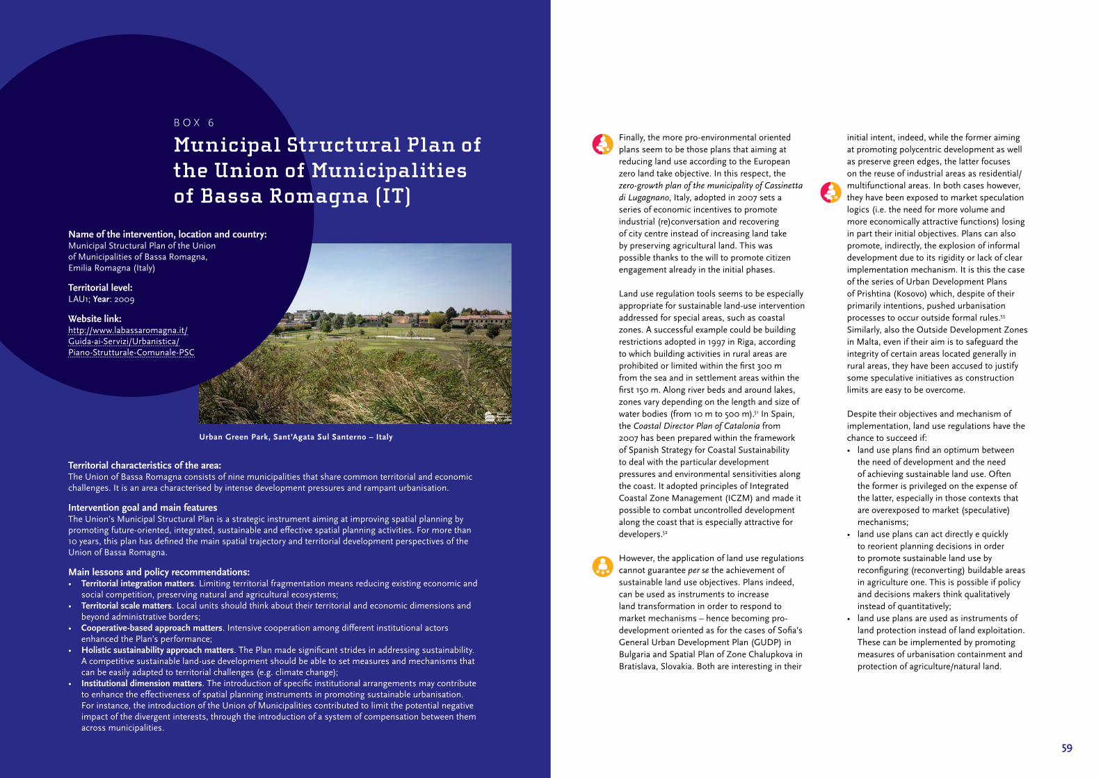
59
Finally, the more pro‑environmental oriented plans seem to be those plans that aiming at reducing land use according to the European zero land take objective. In this respect, the zero-growth plan of the municipality of Cassinetta di Lugagnano, Italy, adopted in 2007 sets a series of economic incentives to promote industrial (re)conversation and recovering of city centre instead of increasing land take by preserving agricultural land. This was possible thanks to the will to promote citizen engagement already in the initial phases.
Land use regulation tools seems to be especially appropriate for sustainable land‑use intervention addressed for special areas, such as coastal zones. A successful example could be building restrictions adopted in 1997 in Riga, according to which building activities in rural areas are prohibited or limited within the first 300 m from the sea and in settlement areas within the first 150 m. Along river beds and around lakes, zones vary depending on the length and size of water bodies (from 10 m to 500 m).51 In Spain, the Coastal Director Plan of Catalonia from 2007 has been prepared within the framework of Spanish Strategy for Coastal Sustainability to deal with the particular development pressures and environmental sensitivities along the coast. It adopted principles of Integrated Coastal Zone Management (ICZM) and made it possible to combat uncontrolled development along the coast that is especially attractive for developers.52
However, the application of land use regulations cannot guarantee per se the achievement of sustainable land use objectives. Plans indeed, can be used as instruments to increase land transformation in order to respond to market mechanisms – hence becoming pro‑development oriented as for the cases of Sofia’s General Urban Development Plan (GUDP) in Bulgaria and Spatial Plan of Zone Chalupkova in Bratislava, Slovakia. Both are interesting in their
initial intent, indeed, while the former aiming at promoting polycentric development as well as preserve green edges, the latter focuses on the reuse of industrial areas as residential/multifunctional areas. In both cases however, they have been exposed to market speculation logics (i.e. the need for more volume and more economically attractive functions) losing in part their initial objectives. Plans can also promote, indirectly, the explosion of informal development due to its rigidity or lack of clear implementation mechanism. It is this the case of the series of Urban Development Plans of Prishtina (Kosovo) which, despite of their primarily intentions, pushed urbanisation processes to occur outside formal rules.53 Similarly, also the Outside Development Zones in Malta, even if their aim is to safeguard the integrity of certain areas located generally in rural areas, they have been accused to justify some speculative initiatives as construction limits are easy to be overcome.
Despite their objectives and mechanism of implementation, land use regulations have the chance to succeed if:• land use plans find an optimum between
the need of development and the need of achieving sustainable land use. Often the former is privileged on the expense of the latter, especially in those contexts that are overexposed to market (speculative) mechanisms;
• land use plans can act directly e quickly to reorient planning decisions in order to promote sustainable land use by reconfiguring (reconverting) buildable areas in agriculture one. This is possible if policy and decisions makers think qualitatively instead of quantitatively;
• land use plans are used as instruments of land protection instead of land exploitation. These can be implemented by promoting measures of urbanisation containment and protection of agriculture/natural land.
Territorial characteristics of the area:The Union of Bassa Romagna consists of nine municipalities that share common territorial and economic challenges. It is an area characterised by intense development pressures and rampant urbanisation.
Intervention goal and main featuresThe Union’s Municipal Structural Plan is a strategic instrument aiming at improving spatial planning by promoting future‑oriented, integrated, sustainable and effective spatial planning activities. For more than 10 years, this plan has defined the main spatial trajectory and territorial development perspectives of the Union of Bassa Romagna.
Main lessons and policy recommendations:• Territorial integration matters. Limiting territorial fragmentation means reducing existing economic and
social competition, preserving natural and agricultural ecosystems;• Territorial scale matters. Local units should think about their territorial and economic dimensions and
beyond administrative borders;• Cooperative-based approach matters. Intensive cooperation among different institutional actors
enhanced the Plan’s performance;• Holistic sustainability approach matters. The Plan made significant strides in addressing sustainability.
A competitive sustainable land‑use development should be able to set measures and mechanisms that can be easily adapted to territorial challenges (e.g. climate change);
• Institutional dimension matters. The introduction of specific institutional arrangements may contribute to enhance the effectiveness of spatial planning instruments in promoting sustainable urbanisation. For instance, the introduction of the Union of Municipalities contributed to limit the potential negative impact of the divergent interests, through the introduction of a system of compensation between them across municipalities.
Name of the intervention, location and country: Municipal Structural Plan of the Union of Municipalities of Bassa Romagna, Emilia Romagna (Italy)
Territorial level: LAU1; Year: 2009
Website link: http://www.labassaromagna.it/ Guida‑ai‑Servizi/Urbanistica/ Piano‑Strutturale‑Comunale‑PSC
B O X 6
Municipal Structural Plan of the Union of Municipalities of Bassa Romagna (IT)
Urban Green Park, Sant’Agata Sul Santerno – Italy
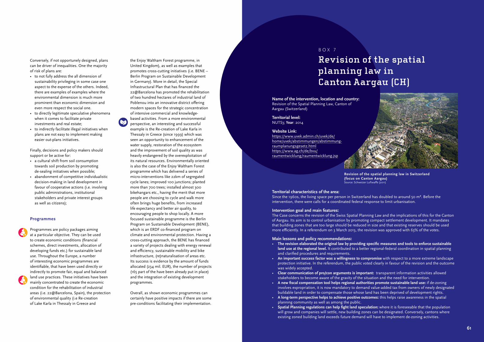
61
Conversely, if not opportunely designed, plans can be driver of inequalities. One the majority of risk of plans are:• to not fully address the all dimension of
sustainability privileging in some case one aspect to the expense of the others. Indeed, there are examples of examples where the environmental dimension is much more prominent than economic dimension and even more respect the social one.
• to directly legitimate speculative phenomena when it comes to facilitate private investments and real estate;
• to indirectly facilitate illegal initiatives when plans are not easy to implement making easier out‑plans initiatives.
Finally, decisions and policy makers should support or be active for:• a cultural shift from soil consumption
towards soil production by promoting de‑sealing initiatives when possible;
• abandonment of competitive individualistic decision‑making in land development in favour of cooperative actions (i.e. involving public administrations, institutional stakeholders and private interest groups as well as citizens);
Programmes
Programmes are policy packages aiming at a particular objective. They can be used to create economic conditions (financial schemes, direct investments, allocation of developing funds etc.) for sustainable land use. Throughout the Europe, a number of interesting economic programmes are identifiable, that have been used directly or indirectly to promote fair, equal and balanced land use practices. These initiatives have been mainly concentrated to create the economic condition for the rehabilitation of industrial areas (i.e. 22@Barcelona, Spain), the protection of environmental quality (i.e Re‑creation of Lake Karla in Thessaly in Greece and
the Enjoy Waltham Forest programme, in United Kingdom), as well as examples that promotes cross‑cutting initiatives (i.e. BENE – Berlin Program on Sustainable Development in Germany). More in detail, the Special Infrastructural Plan that has financed the 22@ Barcelona has promoted the rehabilitation of two hundred hectares of industrial land of Poblenou into an innovative district offering modern spaces for the strategic concentration of intensive commercial and knowledge‑based activities. From a more environmental perspective, an interesting and successful example is the Re‑creation of Lake Karla in Thessaly in Greece (since 1999) which was seen an opportunity to enhancement of the water supply, restoration of the ecosystem and the improvement of soil quality as was heavily endangered by the overexploitation of its natural resources. Environmentally oriented is also the case of the Enjoy Waltham Forest programme which has delivered a series of micro‑interventions like 22km of segregated cycle lanes; improved 100 junctions; planted more than 700 trees; installed almost 300 bikehangars etc., having the merit that more people are choosing to cycle and walk more often brings huge benefits, from increased life expectancy and better air quality, to encouraging people to shop locally. A more focused sustainable programme is the Berlin Program on Sustainable Development (BENE), which is an ERDF co‑financed program on climate and environmental protection. Having a cross‑cutting approach, the BENE has financed a variety of projects dealing with energy renewal and efficiency, sustainable mobility and bike infrastructure, (re)naturalisation of areas etc. Its success is evidence by the amount of funds allocated (234 mil. EUR), the number of projects (165 part of the have been already put in place) and the integration of existing development programmes.
Overall, as shown economic programmes can certainly have positive impacts if there are some pre‑conditions facilitating their implementation.
Territorial characteristics of the area: Since the 1960s, the living space per person in Switzerland has doubled to around 50 m². Before the intervention, there were calls for a coordinated federal response to limit urbanisation.
Intervention goal and main features:The Case concerns the revision of the Swiss Spatial Planning Law and the implications of this for the Canton of Aargau. Its aim is to control urbanisation by promoting compact settlement development. It mandates that building zones that are too large should be reduced in size and that existing reserves should be used more efficiently. In a referendum on 3 March 2013, the revision was approved with 63% of the votes.
Main lessons and policy recommendations: • The revision elaborated the original law by providing specific measures and tools to enforce sustainable
land use at the regional level. It contributed to a better regional‑federal coordination in spatial planning and clarified procedures and requirements.
• An important success factor was a willingness to compromise with respect to a more extreme landscape protection initiative. In the referendum, the public voted clearly in favour of the revision and the outcome was widely accepted.
• Clear communication of pro/con arguments is important: transparent information activities allowed stakeholders to become aware of the gravity of the situation and the need for intervention.
• A new fiscal compensation tool helps regional authorities promote sustainable land use: if de‑zoning involves expropriation, it is now mandatory to demand value‑added tax from owners of newly designated buildable land in order to compensate those whose land has been deprived of development rights.
• A long-term perspective helps to achieve positive outcomes: this helps raise awareness in the spatial planning community as well as among the public.
• Spatial Planning regulations can help fight land speculation: where it is foreseeable that the population will grow and companies will settle, new building zones can be designated. Conversely, cantons where existing zoned building land exceeds future demand will have to implement de‑zoning activities.
Name of the intervention, location and country: Revision of the Spatial Planning Law, Canton of Aargau (Switzerland)
Territorial level: NUTS3; Year: 2014
Website Link: https://www.uvek.admin.ch/uvek/de/home/uvek/ abstimmungen/abstimmung‑raumplanungsgesetz.htmlhttps://www.ag.ch/de/bvu/raumentwicklung/ raumentwicklung.jsp
B O X 7
Revision of the spatial planning law in Canton Aargau (CH)
Revision of the spatial planning law in Switzerland (focus on Canton Aargau)Source: Schweizer Luftwaffe (2011)
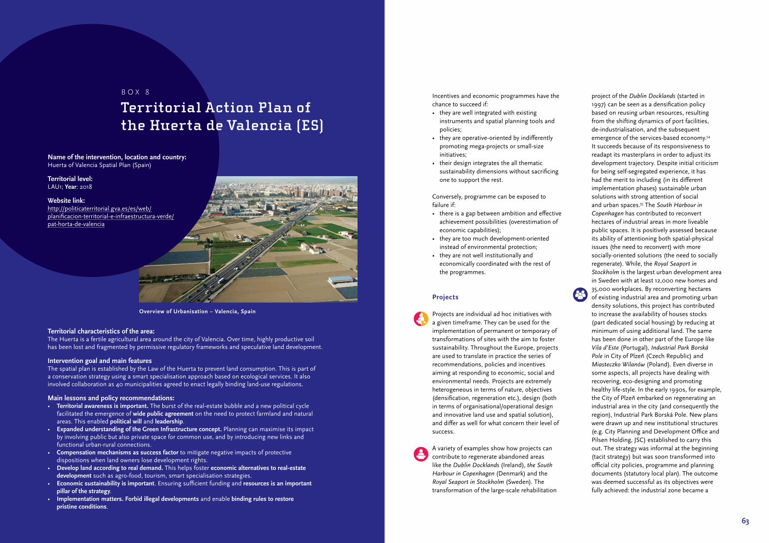
63
Incentives and economic programmes have the chance to succeed if:• they are well integrated with existing
instruments and spatial planning tools and policies;
• they are operative‑oriented by indifferently promoting mega‑projects or small‑size initiatives;
• their design integrates the all thematic sustainability dimensions without sacrificing one to support the rest.
Conversely, programme can be exposed to failure if:• there is a gap between ambition and effective
achievement possibilities (overestimation of economic capabilities);
• they are too much development‑oriented instead of environmental protection;
• they are not well institutionally and economically coordinated with the rest of the programmes.
Projects
Projects are individual ad hoc initiatives with a given timeframe. They can be used for the implementation of permanent or temporary of transformations of sites with the aim to foster sustainability. Throughout the Europe, projects are used to translate in practice the series of recommendations, policies and incentives aiming at responding to economic, social and environmental needs. Projects are extremely heterogeneous in terms of nature, objectives (densification, regeneration etc.), design (both in terms of organisational/operational design and innovative land use and spatial solution), and differ as well for what concern their level of success.
A variety of examples show how projects can contribute to regenerate abandoned areas like the Dublin Docklands (Ireland), the South Harbour in Copenhagen (Denmark) and the Royal Seaport in Stockholm (Sweden). The transformation of the large‑scale rehabilitation
project of the Dublin Docklands (started in 1997) can be seen as a densification policy based on reusing urban resources, resulting from the shifting dynamics of port facilities, de‑industrialisation, and the subsequent emergence of the services‑based economy.54 It succeeds because of its responsiveness to readapt its masterplans in order to adjust its development trajectory. Despite initial criticism for being self‑segregated experience, it has had the merit to including (in its different implementation phases) sustainable urban solutions with strong attention of social and urban spaces.55 The South Harbour in Copenhagen has contributed to reconvert hectares of industrial areas in more liveable public spaces. It is positively assessed because its ability of attentioning both spatial‑physical issues (the need to reconvert) with more socially‑oriented solutions (the need to socially regenerate). While, the Royal Seaport in Stockholm is the largest urban development area in Sweden with at least 12,000 new homes and 35,000 workplaces. By reconverting hectares of existing industrial area and promoting urban density solutions, this project has contributed to increase the availability of houses stocks (part dedicated social housing) by reducing at minimum of using additional land. The same has been done in other part of the Europe like Vila d’Este (Portugal), Industrial Park Borská Pole in City of Plzeň (Czech Republic) and Miasteczko Wilanów (Poland). Even diverse in some aspects, all projects have dealing with recovering, eco‑designing and promoting healthy life‑style. In the early 1990s, for example, the City of Plzeň embarked on regenerating an industrial area in the city (and consequently the region), Industrial Park Borská Pole. New plans were drawn up and new institutional structures (e.g. City Planning and Development Office and Pilsen Holding, JSC) established to carry this out. The strategy was informal at the beginning (tacit strategy) but was soon transformed into official city policies, programme and planning documents (statutory local plan). The outcome was deemed successful as its objectives were fully achieved: the industrial zone became a
Territorial characteristics of the area:The Huerta is a fertile agricultural area around the city of Valencia. Over time, highly productive soil has been lost and fragmented by permissive regulatory frameworks and speculative land development.
Intervention goal and main featuresThe spatial plan is established by the Law of the Huerta to prevent land consumption. This is part of a conservation strategy using a smart specialisation approach based on ecological services. It also involved collaboration as 40 municipalities agreed to enact legally binding land‑use regulations.
Main lessons and policy recommendations:• Territorial awareness is important. The burst of the real‑estate bubble and a new political cycle
facilitated the emergence of wide public agreement on the need to protect farmland and natural areas. This enabled political will and leadership.
• Expanded understanding of the Green Infrastructure concept. Planning can maximise its impact by involving public but also private space for common use, and by introducing new links and functional urban‑rural connections.
• Compensation mechanisms as success factor to mitigate negative impacts of protective dispositions when land owners lose development rights.
• Develop land according to real demand. This helps foster economic alternatives to real-estate development such as agro‑food, tourism, smart specialisation strategies.
• Economic sustainability is important. Ensuring sufficient funding and resources is an important pillar of the strategy.
• Implementation matters. Forbid illegal developments and enable binding rules to restore pristine conditions.
Name of the intervention, location and country: Huerta of Valencia Spatial Plan (Spain)
Territorial level: LAU1; Year: 2018
Website link: http://politicaterritorial.gva.es/es/web/planificacion‑territorial‑e‑infraestructura‑verde/pat‑horta‑de‑valencia
B O X 8
Territorial Action Plan of the Huerta de Valencia (ES)
Overview of Urbanisation – Valencia, Spain

65
location for more than 40 companies creating between 11‑15 thousand jobs and became a flagship of economic recovery. It also can be considered ecologically successful in that no greenfield land was used for this. Efforts in reducing the human footprint has been made in the case of the Eco‑Viikki project in Helsinki (Finland) which even if has consumed new land, it demonstrates how new living standards can be successfully combined with minimal impact on the environment. The average ‘sealed surface per capita’ is much lower compared to standard single‑family houses, likewise the average energy consumption per household is extremely low.56 Indeed, Eco‑Viikki (1999‑2020) is a reference project in Europe.
Also successful was Caserne de Bonne in Grenoble, the first eco‑district in France (2003‑2009). The development addressed several problems of urban living and growing cities, such as solar heating systems fulfilling hot water needs or solar panels providing electricity for the commercial and residential buildings. From the sustainable land‑use perspective the crucial factor is that the shapes of the buildings were compact to reduce land consumption and urban sprawl. Despite land consumption related with realisation of such projects, the main focus was on the environment, however, without neglecting other aspects of sustainable development.
In the last years, community involvement and participation processes have been supported by public administration. Successful examples are the transformation of Vacant Urban Areas in Berlin, that contributed to the development of attractive parks, vibrant public spaces like Parks auf dem Gleisdreieck’, the Schöneberger Südgelände and Tempelhofer Feld. The combination of public long‑term strategy and strong political will to reconvert some strategic areas and the will and activism of social groups, experts and associations can certainly enhance the possibility of a project to succeed. This example shows how sustainable land use can also be conveyed by long‑term or
temporary solutions avoiding any additional urbanisation initiatives. The ParckFarm project implemented in 2014 in Belgium was also community oriented. Former rail paths were transformed into a sustainable public park with community activities that created a new type of public space combining the park with local micro farming. The aim was to sensitise the citizen to agricultural practices in the city. It also promotes public meetings with neighbours, farmers, designers and politicians. Thus, the project has the merit to enhance community involvement as part of its holistic sustainable approach.
In Rotterdam, houses in deprived neighbourhoods were simply bought up by the municipality and given away for free to anyone willing to invest a certain amount in renovation and promising to live there for at least 5 years57. This state‑led gentrification was seen as a success in economic and ecological terms, as it brought in residents who might otherwise have opted for suburban housing, and in some ways, was seen as improving the social sustainability of the area as well, given the improved liveability and services. Also Berlin sought to regenerate problematic sites in the core city. To do this, a state‑owned company Grün Berlin GmbH, is responsible for the reconversion of areas in attractive parks and vibrant public spaces and was successful in transforming several abandoned areas in the city.58,59
A European policy which can deployed as a containment intervention is Life+ which provides funding for nature‑related projects. In 2012, Bologna (Italy) created its Bologna Local Urban Environment Adaptation Plan for a Resilient City (BLUE AP) to provide the city with a climate change adaptation plan, which includes flood protection measures. Another recent example of European influence is how EU Integrated Coastal Zone Management (ICZM) requirements is taking effect in Spain. Catalonia prepared a coastal plan in 2007 under the umbrella of the Spanish Strategy for Coastal Sustainability (SCS) enacted a couple years earlier. The aim was to deal with
development pressures and environmental sensitivities along the coast, which was deemed successful. One evaluation concludes that the SCS was instrumental for the construction of a base of knowledge to improve coastal management practices, but that the success of its implementation was undermined by the complex distributions of competences.60
However, projects also can fail or create unexpected or unwanted effects. Regeneration initiatives can easily produce gentrification, such as like the Urban Development Project of Hyllie (Finland) that ended up with an image of housing ‘wealthy white westerners’.61 The drive to create safe neighbourhoods can pave the way to self‑segregation of settlements, exacerbating social disparities both in terms of services as well as quality of life. If not well‑designed, regeneration projects may channel a pro‑market authoritarian approach as the cases of Skopje 2014 (Macedonia) and the Belgrade Waterfront (Serbia) demonstrate. While both pursue rehabilitation of strategic urban areas, local community interests to a back seat to the market. Finally, some projects explicitly provide for overexploitation of natural resources like the Nessebar and Sunny beach seaside development in Bulgaria, the resort Ranca in Romania and the third Istanbul Bosphorus Bridge Canal Project in Istanbul in Turkey. These projects, as many others throughout Europe, have no explicit sustainable land use objectives, but still can have significant impacts on land use.62
Harbour transformation was the aim of the Copenhagen project Sydhavn (started in 1995). This project transformed a former industrial harbour area into a modern urban neighbour‑hood with offices and new housing. This was seen as a way to attract new residents to the rapidly ageing city. The main rationale behind the project may have been economic but it also included social aspects (i.e. attractive housing for the middle class but also social housing) and to a lesser extent, environmental concerns. One drawback is that the area lacks cultural institutions and recreational spaces, which can
partly be explained by the institutional design and market‑led approach. A similar problem, which was aggravated by land speculation, appeared in the Housing renewal project in Istanbul (2000), while the market‑dominated Skopje 2014 project shows that rehabilitation projects can also serve political purposes.
From the evidence collected, it appears that successful projects are those that:• are part of a long‑term territorial vision
without, however, loosing short‑term objectives;
• incorporate simultaneously economic priorities (being cost‑efficient), environmental needs (promoting pro‑environmental solutions) and social aspects (supporting citizens’ involvement, social housing, quality of space etc.).
One the other hand, projects risk failure when:• regeneration (and densification) sites are
viewed as a tabula rasa for facilitating real‑estate and speculative initiatives;
• projects are used for achieving political legitimacy or exercising political power without due consideration for sustainable land use
• projects produce side‑effects like increasing inequalities, gentrification, segregation etc. Often these kind of projects are rejected by local communities instead of being implemented;
• projects explicitly promote the overexploitation of natural resources since they follow mere pro‑growth market logics.
3.2 Recommendations for the national level
This section looks at potential ways to foster sustainable land‑use and urbanisation processes at the national level, aiming at providing guidance for decision and policymakers at this level. To do so, it focuses on four main issues: Trade‑offs, strategies and visions, legal devices, programmes and subsidies.
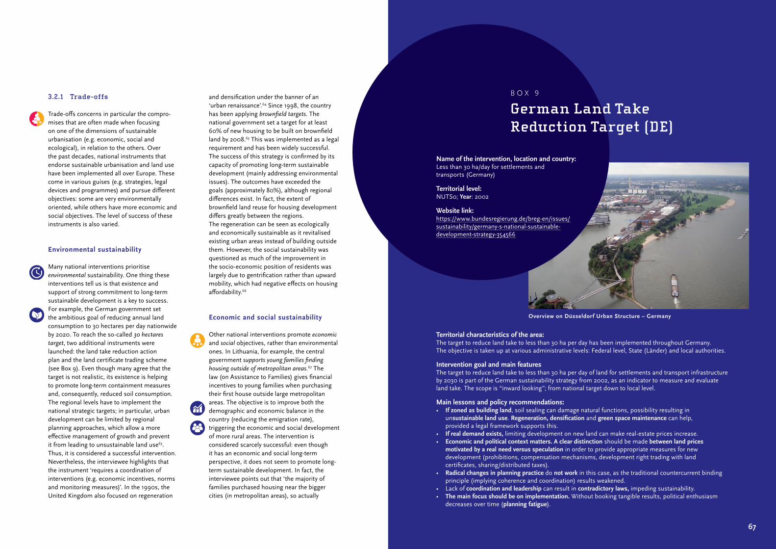
67
3.2.1 Trade-offs
Trade‑offs concerns in particular the compro‑mises that are often made when focusing on one of the dimensions of sustainable urbanisation (e.g. economic, social and ecological), in relation to the others. Over the past decades, national instruments that endorse sustainable urbanisation and land use have been implemented all over Europe. These come in various guises (e.g. strategies, legal devices and programmes) and pursue different objectives: some are very environmentally oriented, while others have more economic and social objectives. The level of success of these instruments is also varied.
Environmental sustainability
Many national interventions prioritise environmental sustainability. One thing these interventions tell us is that existence and support of strong commitment to long‑term sustainable development is a key to success. For example, the German government set the ambitious goal of reducing annual land consumption to 30 hectares per day nationwide by 2020. To reach the so‑called 30 hectares target, two additional instruments were launched: the land take reduction action plan and the land certificate trading scheme (see Box 9). Even though many agree that the target is not realistic, its existence is helping to promote long‑term containment measures and, consequently, reduced soil consumption. The regional levels have to implement the national strategic targets; in particular, urban development can be limited by regional planning approaches, which allow a more effective management of growth and prevent it from leading to unsustainable land use63. Thus, it is considered a successful intervention. Nevertheless, the interviewee highlights that the instrument ‘requires a coordination of interventions (e.g. economic incentives, norms and monitoring measures)’. In the 1990s, the United Kingdom also focused on regeneration
and densification under the banner of an ‘urban renaissance’.64 Since 1998, the country has been applying brownfield targets. The national government set a target for at least 60% of new housing to be built on brownfield land by 2008.65 This was implemented as a legal requirement and has been widely successful. The success of this strategy is confirmed by its capacity of promoting long‑term sustainable development (mainly addressing environmental issues). The outcomes have exceeded the goals (approximately 80%), although regional differences exist. In fact, the extent of brownfield land reuse for housing development differs greatly between the regions. The regeneration can be seen as ecologically and economically sustainable as it revitalised existing urban areas instead of building outside them. However, the social sustainability was questioned as much of the improvement in the socio‑economic position of residents was largely due to gentrification rather than upward mobility, which had negative effects on housing affordability.66
Economic and social sustainability
Other national interventions promote economic and social objectives, rather than environmental ones. In Lithuania, for example, the central government supports young families finding housing outside of metropolitan areas.67 The law (on Assistance to Families) gives financial incentives to young families when purchasing their first house outside large metropolitan areas. The objective is to improve both the demographic and economic balance in the country (reducing the emigration rate), triggering the economic and social development of more rural areas. The intervention is considered scarcely successful: even though it has an economic and social long‑term perspective, it does not seem to promote long‑term sustainable development. In fact, the interviewee points out that ‘the majority of families purchased housing near the bigger cities (in metropolitan areas), so actually
Territorial characteristics of the area:The target to reduce land take to less than 30 ha per day has been implemented throughout Germany. The objective is taken up at various administrative levels: Federal level, State (Länder) and local authorities.
Intervention goal and main featuresThe target to reduce land take to less than 30 ha per day of land for settlements and transport infrastructure by 2030 is part of the German sustainability strategy from 2002, as an indicator to measure and evaluate land take. The scope is “inward looking”; from national target down to local level.
Main lessons and policy recommendations:• If zoned as building land, soil sealing can damage natural functions, possibility resulting in
unsustainable land use. Regeneration, densification and green space maintenance can help, provided a legal framework supports this.
• If real demand exists, limiting development on new land can make real‑estate prices increase.• Economic and political context matters. A clear distinction should be made between land prices
motivated by a real need versus speculation in order to provide appropriate measures for new development (prohibitions, compensation mechanisms, development right trading with land certificates, sharing/distributed taxes).
• Radical changes in planning practice do not work in this case, as the traditional countercurrent binding principle (implying coherence and coordination) results weakened.
• Lack of coordination and leadership can result in contradictory laws, impeding sustainability.• The main focus should be on implementation. Without booking tangible results, political enthusiasm
decreases over time (planning fatigue).
Name of the intervention, location and country: Less than 30 ha/day for settlements and transports (Germany)
Territorial level: NUTS0; Year: 2002
Website link: https://www.bundesregierung.de/breg‑en/issues/sustainability/germany‑s‑national‑sustainable‑development‑strategy‑354566
B O X 9
German Land Take Reduction Target (DE)
Overview on Düsseldorf Urban Structure – Germany

69
intensifying suburbanisation’. Other socio‑economic instruments are perceived to have mixed levels of success. For example, in the United Kingdom, the central government implemented quantitative housing targets68 that have to be taken into consideration by the local authorities when making planning decisions. The interviewee observes that even though the instrument has been strongly criticised, ‘nothing has changed’. Critics point out that these long‑term targets are not linked to local geographical, social and economic contexts, nor to transport policies. The top‑down housing targets also seem to stimulate market speculation and subsequent inflation of agricultural land values, which undermines the feasibility of the targets. Given that the number of households is projected to rise, this is socially unsustainable. Another case is the Ladder for sustainable urbanisation in the Netherlands. On one hand, stakeholders support its focus on preventing oversupply of urban land‑uses and encouragement of infill development, but on the other hand were quite critical about the side‑effects of enforcing the policy via the courts (see Box 10).
3.2.2 Strategies and visions
In Europe, many strategies and visions have been implemented by national governments in order to promote long‑term sustainable development. These national instruments set out guidelines which usually have to be taken into consideration at regional and local levels.
Success stories
Many national strategies seem to be successful. In Italy, for example, the 2015 National Strategy for Climate change adaptation69 sets out a policy framework that addresses climate change adaptation issues for both natural systems and socio‑economic sectors. It provides a national strategy to address climate change adaptation, actions and guidelines to build adaptive
capacity, and concrete proposals about cost‑effective adaptation measures and priorities. As regards land use, the strategy addresses issues of soil protection and hydrogeological instability (e.g. landslides, floods and coastal erosion) as well as soil degradation and desertification connected to climate change. It is considered a successful instrument that promotes long‑term sustainable development in the country. In addition to supporting sustainable land‑use and climate adaptation, the strategy has strengthened collaboration between scientists, stakeholders, and decision‑makers.. In Norway, the National Policy Guidelines for coordinated land use and transport planning are also considered successful. These guidelines put pressure on municipalities to steer development towards existing urban areas instead of urban expansion. Each local authority is expected to follow the national guidelines as part of the multi‑level cooperation process within the country’s planning hierarchy. Article 4 of these guidelines states that ‘municipalities, county municipalities and the representatives of the national authorities in the counties should organise the planning to ensure coordination of land use and the transport system in line with these guidelines’.70 In contrast, the Climate Adaptation Programme from Portugal shows that the success of this type of intervention can be undermined by a lack of political will at the local level71. In conclusion, long‑term visions should therefore seek to rally political support, provide technical capability and financial incentives and strengthen multilevel coordination and cooperation.
One clearly successful strategy is the zero-growth goal for car traffic applied in Norway since 2018. The strategy aims to have all growth in transport over the next decades in public transit and non‑motorised modes. The goal is supported by the National Transport Plans, which implies that the strategy is part of a wider transport policy. The target of zero‑growth for cars should be achieved by promoting public transport, cycling and walking in cities, which should reduce land consumption for transport
Territorial characteristics of the area:In the Netherlands, people living in urban areas have risen since 2010. Developers generally seek out unbuilt or derelict locations inside or at the edges of urban areas, and it is not uncommon that land changes hands several times before it is rezoned and built.
Intervention goal and main featuresThe 2012 national strategy on infrastructure and spatial planning abolished all existing national policies on urban development. As compensation, it introduced a single rule: the ‘ladder’ for sustainable urbanisation. This three‑step procedure requires zoning plans to argue that (1) there is sufficient demand, (2) why a greenfield site was chosen (if applicable) and (3) whether the site is multi‑modally accessible. It allowed citizens to challenge this argumentation in court.
Main lessons and policy recommendations:• Procedural rules can have a real impact. The ladder strives for a compact urban form via a procedural
rule. If there is no demonstrable need or demand, the plan risks getting stuck down in court. The harder it is to prove need, the riskier the plan is to adopt for municipalities.
• Enforcement through the courts has side effects: the ladder became a common weapon wielded by opponents, and this contributed to the judicialization of planning: policy was de facto determined by judges through case law.
• Restrictive policy can produce a backlash: once the impact of the ladder became perceptible, development interests rallied to abolish or weaken it. As a result, it was reformed (streamlined) after 5 years.
• Internalization takes time. In the years following the introduction, compliance was very low. Overt time, however, this has improved to almost full compliance. In addition, stakeholders report that its most important impact is that it forces one to reflect on the merits of a plan, something which is now part of the planning culture.
• Socioeconomic factors matter: the impact of the ladder is difficult to measure given the more important impacts of the economic crisis. The Dutch land‑banking model made municipalities very susceptible to economic volatility.
Name of the intervention, location and country: Ladder for sustainable urbanisation (The Netherlands)
Territorial level: NUTS0; Year: 2012
Website link: https://www.government.nl/topics/ spatial‑planning‑and‑infrastructure
B O X 1 0
Ladder for sustainable urbanisation (NL)
Compact suburban development – Leiden, The Netherlands

71
infrastructure as well as air pollution. Over the long term, reduction in car travel should also lessen urban sprawl.
Mixed results
Other national strategies seem to have led to more mixed outcomes. In the Czech Republic, for example, the 2006 National Policy of spatial development is one of these. The national policy aims to coordinate the various sectoral policies and promote an overall sustainable development of the territory. In this sense, it is in line with the European Sustainable Development Strategy, the Economic Growth Strategy and Natura 2000. The regional and local planning levels are expected to follow these central government guidelines. It also addresses the way in which investments should be used to guarantee sustainable development when developing urban plans and projects all over the country. Nevertheless, the interviewee points out that even though the national policy aims to foster sustainable development and improve environmental quality (e.g. reducing urban sprawl, revitalising rural areas), the policy outcomes seem to have mixed levels of success. In the Netherlands, the Red for green72 national strategy also seems to have mixed outcomes. The policy aims to improve the quality of rural areas, such as landscape and recreational areas (referred to as ‘green’) by using the revenues that derive from urban developments, such as housing, commercial and industrial development (referred to as ‘red’). The long‑term national strategy is in line with the Sustainable Development Goals (SDGs). However, the interviewee points out that the implementation of the projects is not always successful. Thus, as seen in section 3.1.3, it is important to adopt short‑term implementation measures in order to strengthen long‑term visions and strategies.
Another initiative with mixed results is Luxemburg’s ambitious National Infill Programme (Nationales Baulückenprogramm)
adopted in 2014. This seeks to identify suitable lots and to make landowners aware of how their lots could contribute to satisfying the demand for housing.73,74 In total, about 995 hectares of vacant building land (as identified in 2013) were found to be unused (94% of these plots are privately owned). There are however no financial incentives or legal requirements to convert these, the instrument relies purely on communication. Therefore, the effectiveness and impact on sustainability remains to be seen and depends solely on the will of the private landowners.
In Slovakia, the 1991 Territorial System of Ecological Stability75 provides national guidelines for green infrastructure in the country. It is obligatory for all planning levels and projects related to spatial organisation and land use management. More specifically, it proposes measures to improve nature conservation, landscape and sustainable spatial development (e.g. through the implementation of ‘bio‑centres’, ‘bio‑corridors’, and ‘interaction elements’). Despite good intentions, it has been perceived as an unsuccessful instrument.
3.2.3 Legal devices
At the national level, various legal devices can be introduced or enacted to promote sustainable land use, like laws (general and sectoral), bylaws and norms, and binding referendum initiatives. In addition, land use can also be affected as a by‑product of legislation, which can be either positive or negative in terms of sustainability.
Limiting urban expansion
Sometimes strict land use control mechanisms are adopted like those introduced in France (i.e. the Zero Net Artificialisation), Switzerland (the referendum to limit land take of 2013) and in England as the brownfield target. Particularly interesting is the Zero Net Artificialisation
adopted in France, which seeks to limit the consumption of forest, natural, and agricultural spaces, and implement goal of zero net artificialisation by 2030. This long‑term perspective is accompanied by short‑term activities, such as returning 5,500 hectares to nature per year). To this end, it mobilises both regulatory and fiscal tools. Regarding the former, it imposes a minimum land‑use coefficient and floor rate for urban renewal projects. Regarding the latter, it denies tax benefits to new built homes on non‑artificialised areas and adds an artificialisation levy to the development tax and uses these revenues to finance soil renaturation and densification of existing built land. It also regulates the difference in land prices between agricultural land and urbanised land.76
The Czech Republic has raised the bar on greenfield building by requiring a proof‑of‑need. When zoning for new urban development, the need for new land (and, formerly, the impossi‑bility of using currently zoned urban land) needs to be approved according to the Building Act. More recently, it has been integrated into the EIA process. This is seen as a mixed success; it is aligned to sustainability but has been criticised for burdening the planning process.
Regulating tourism and retail pressures
Tourism can negatively impact sustainability, so it is not surprising that various countries have adopted special legal instruments to deal with this. In Switzerland, the adoption of the Weber Law was extremely successful. This rule puts strict limits on second homes (only 20% housing can be second homes per municipality) and includes sanctions for non‑compliance. In practice, no new building permits have been granted in municipalities where limits have been reached (including almost all Swiss ski‑resort communities). The tool addresses mostly environmental aspects of sustainable land‑use at the expense of economic ones. Another similar national‑level legal device is
found in Croatia. The Physical Planning Act designates Protected Coastal Area zones, which comprises the area of coastal self‑governing units, covering 1000 m wide continental belt (both on terrestrial part and islands) and 300 m wide sea belt measured from coastal line. Building restrictions are imposed in this area and additional limitations are determined for building within 100 m from the coastal line. Thus, the rule contains restrictions on building outside of settlement borders, regulates terms and conditions of further spreading of the settlements, protects sensitive areas.77 It is considered relatively successful in its aims, which are generally aligned to sustainability.
Various nations across Europe have implemented national policies to restrict out‑of‑town retail development, such as suburban shopping malls, retail parks and hypermarkets.78,79 One example is the central government planning policy guidance – PPG6 on town centres in the United Kingdom. This policy aimed to concentrate retail development in areas which were not car‑dependent (generally existing town and city centres), providing instructions to local planners to bear this in mind when making decisions on planning permission (Department of the Environment, 1993). This was elaborated via the ‘sequential approach’ concept: preference should be given to town centre sites, where suitable sites or buildings suitable for conversion are available, followed by edge of‑centre sites, district and local centres and only then by out‑of‑centre sites in locations that are accessible by a choice of means of transport. In general, PPG6 was seen as relatively successful: it was effective in changing attitudes to retail development and keeping retailers in city centres. On the other hand, despite its plea for positive planning to promote town centre development, it has largely been interpreted as a development control tool.80 Since 1997, via an amendment to its Planning Act, Denmark also placed restrictions on the construction of large shops and shopping centres on greenfield sites outside the largest cities and promoted small retailers in small

73
and medium‑sized towns. The Act stipulates that new shops should be located in town centres and even limits the size of shops within these centres: “3500 m2 for general shops and – usually – 2000 m2 for specialty shops, in town centres, centres of city districts and secondary centres. In small local centres, the maximum shop size is 1000 m2”.81 This intervention was identified as a best practice82, but was not uncontroversial: it was supported by the association of small shopkeepers and consumer organisations but opposed by municipalities and big retail chains. In the end, “the minister had the power and the will to implement the very detailed top‑down regulation of municipal retail planning”.83 All these cases have proven that clear set of norms and regulations can facilitate implementation.
Inf ill development
The brownfield target in England is a prime example of limiting urban expansion through legal measures aimed at infill development. It dictates that at least 60% of new housing must be built on brownfield land by 2008. In fact, the target was exceeded (around 80% of new housing being built on brownfield sites). Another interesting example of a national legal rule to promote densification is the 2018 decision in Malta to allow the construction of additional floors at second and third floor levels, overriding local plan provisions. Although it is too recent to measure the outcome, the expectation is that this will be a mixed success in terms of sustainability. While conceivably reducing demand for greenfield sites, it could overheat the urban property market and create oversupply (negative economic sustainability), and inconvenience residents and motorists (social sustainability), as more areas are turned into building sites.84 Similarly, in 2009, Liechtenstein enacted a Building Law, which contains a planning instrument supporting densification. Specifically, it gives private and public landowners the right to build higher
(mostly 20% more) than the zoning plan indicates, provided that the architecture, the urban development and the public interests on open spaces, public pathways or any other benefit for the public can be realised. It has been reported as being successful, but there have been some complaints about the sluggishness of the planning process and the possibility of complaints by neighbours. For this reason, some communities do not use it often.85
Some legal devices are well‑established. The German mandatory land readjustment rule has existed for over 100 years and is a standard instrument in planning. It allows for the assembly of land for the development of towns and villages and ensures the rights of the parties involved. A land readjustment procedure can result in prudent land use (thus minimising consumption), while accommodating economic and social needs.86 The same rule (Perequação) was introduced in Portugal in 1999 to allow for the same kinds of success as in Germany, and with the intent to overcome land speculation. So far, experience has shown that it is an effective instrument but not very efficient given the lengthy procedures as compared to the usual form of development. Overall, it can be considered as an important tool for sustainable urbanisation, and one that has not been sufficiently taken advantage of.87
Compensation measures
Sustainable land use can be improved by introducing sectoral (compensation) measure. For example, the National Nature Conservation Act in Germany introduces an eco‑account system, a compensation requirement for developers. It was introduced in 2002 and allows developers a relatively easy way to acquire eco‑points from compensation agencies. The eco‑account system has added value because: (1) the quality of measures is better controlled; (2) measures are pooled and larger projects are facilitated; (3) the system
provides more transparency and fairness; and (4) the procedures are easier for developers. On the other hand, there are however drawbacks as well, e.g. (1) compensation measures are not focused on soil sealing and land take but on impacts on nature in general; (2) there is no limitation to soil sealing or land take (it is just about extra costs); and (3) the costs of compensation measures seem to be very moderate (between 1‑5% of the direct costs of a development per m²).88,89 On the other hand, compensation measures are not focused on soil sealing or land take but on nature in general. There is no limit to land take: developers who consume more simply pay larger amounts of money which are comparatively low (1‑5% of the direct costs of a development per m²). Given this, the positive impact of sustainable land‑use goals might be limited.90
A slightly different approach was adopted in 2018 in Luxembourg where the digital Ökopunkte System differentiates the value of land according to its scarcity and restoration potential using a complex but clear and binding compensation measures assigned to each biotope, habitat or other land use. It also sets a monetary value for eco‑points. A national register enables the allocation of measures to respective projects with compensation requirements as well as eco‑point trading. Even if too early to be assessed properly, this instrument contains innovations like the possibility of trading of ecopoints through a national register. Compensation measures focus mostly on the environmental aspect of sustainable land‑use; however, due to their transparency they are less burdensome to developers.
On the other hand, not all compensation mechanisms are so successful. The Dutch ecological compensation mechanism is a case in point. In the Netherlands, only half of the land which was lined up to be compensated was actually compensated, largely due to the lack of sanctions91. Problematic compensation measures have been also introduced in Slovakia
with the law on compensation payments for agricultural land (2004). The law aims to regulate the conversation of farmland to urban use by imposing a fee, collected nationally, which is and then used for soil protection and soil quality monitoring. However, the act can be criticised for lacking a conceptual approach and not taking into account contextual factors such as land ownership and management. The Act could have better engaged owners, tenants or managers in the improvement of the agricultural land protection.92
Fiscal instruments
Another interesting option for policymakers and decision makers is to use fiscal instruments. Even if not directly oriented on reducing land use, the example of the fiscal taxation in Italy is interesting since these fiscal rules helped promote densification. The national law 147/2013 (and its amendments) establishes that buildable areas are subject to taxation measures (called in Italian the TASI – tributo per i servizi indivisibili) that can vary from one municipality to another.93 Despite its objective of raising taxes, this law has influenced spatial planning and consequently territorial development because it has caused landowners to ask to reconvert their buildable areas to agriculture land in order to avoid paying the tax. This has allowed municipalities to the oversupply in zoned land (see the Bassa Romagna and Reggio Emilia case study). Again in Italy, Paragraph 669 of Article 1 of Law 147/2013 (Legge di stabilità 2014) levies a real‑estate tax on buildings or construction areas, with the exception of agricultural land. This led to a reduction of development pressure, as developers became more wary of taking big risks (and allowing construction sites to remain fallow) or constructing buildings that would not be completely occupied. As farmers were exempt, there was less incentive for them to sell their land. There have however been some efforts to sidestep this rule by registering construction areas as agricultural.94
75
More land use oriented, the Estonian Land Value Tax (1993) seeks at a better redistribution of property taxation system in order to govern urban land‑transformation.95 The country explicitly decided to foster densification using fiscal rules. In particular, the Land Value Tax shifted the base of taxation from the value of buildings to the value of the land plot, encouraging landowners to maximise the use of their land (within the scope of planning regulations), such as building at higher densities or extra floors.96 While in the majority of countries, property taxes are determined by value of buildings, in the case of Land Value Tax, the object of the taxation is the land‑plot by encouraging landowners to maximise the use of their land. After almost thirty years of implementation, however, the efficacy of this initiative in limiting urban sprawl is low. Indeed, suburbanisation has continued through time shows that adopting a taxes oriented approach, not always pays off. Thus, the success seems mixed: it did not seem to halt urban diffusion. However, the introduction and implementation of a certain legal devices do not guarantee per se a high level of success.
A related type of instrument are reference land values systems, such as practiced in Sweden and in Germany. These tools have a long history, dating back to 1960 in Germany and the 1980s in Sweden. They are focused on economic and social dimension of sustainable land‑use but, indirectly, may also have a positive impact on the environment through reduction of land speculation. In Germany, the system was established to support market transparency and to avoid speculations with land. Reference land values are available for each neighbourhood and are evaluated and published periodically97. A slightly different approach has been adopted in Sweden where reference land values are determined by using the sales comparison approach. The values are related to the property taxation system but are used for a number of purposes. Unlike Germany, the Swedish system has no intention of influencing the land market98.
Mixed and disappointing results
Despite their intentions, there are a number of examples of interventions that exhibit limits or where achievements were minor or fell below expectations. This is the case of the Law of Solidarity and Urban Renewal introduced in France in 2000 and the Italian Environmental Code of 2006. The 2000 French Law of Solidarity and Urban Renewal contains provisions, among over things, to counter urban diffusion by coordinating public‑transport infrastructure and promoting social housing (with a 20% minimum target). It is seen as a mixed success regarding containment.99,100 At the beginning of 2000s, there was the need to reconsider the French spatial planning system according to new needs and economic circumstances having the merit for the introduction of the plan d’aménagement et de développement durable. One of the innovations of the law was the introduction of a social housing target of at least 20% for new dwellings. To counter urban sprawl, the law attempts to coordinate infrastructure and public transport planning to reduce the use of private transport101. Through the years, the law has had the merit to increase social housing stock but it has been considered less effective in sustainable urbanisation goals. Attention to the quality of environment is also paid by the Italian Environmental Code of 2006.102 This sets out the legislative framework applicable for all matters concerning environmental protection including soil protection, desertification prevention and hydrogeological risk. Despite its intent to create a comprehensive guide for environmental management, its implementation was more complicated. Specifically, the lack of bylaws hampered its potential and by limiting the operability of the law.
Finally, some legal devices had disappointing or adverse results for sustainable land use. This is the case of those initiatives aiming at legalising informal settlements (the case of the law of Bosnia and Herzegovina)103 that are not accompanied by strict management procedures (see the series of building amnesties passed
in Italy in the last decades).* Even though both aim at giving an answer to social problems like illegal constrictions, the way of which these legalisation and amnesties instruments are applied do not pursue sustainable land use. On the contrary, they legitimate unsustainable practices and do not prevent additional development of informal settlements. A negative impact on land development has been shown by the Act on large-scale retailing in Poland (2005). The law aimed to limit development of large‑scale retailing with the threshold of 400 m2, but the regulations left the final decision up to local authorities, which were not necessarily in favour of the policy. Moreover, implementing regulations were never prepared since the law became invalid in accordance with the judgment of the Constitutional Tribunal of 8 July 2008. The lack of effectiveness also characterises the Law on agricultural land passed in Bosnia and Herzegovina in 2006. In principle, the Law regulates the planning, protection, development, use and management of all land parcels defined and classified as agricultural land. Specifically, the Law on agricultural land prohibits converting agricultural land of 1/4 soil rating categories to construction sites for housing and business. In practice, noncompliance is widespread.
As shown, there is a variety of norms and laws through which address sustainable land use. However, their level of effectiveness (success) is not obvious. Overall, according to data gathered, legal devices have the chance to succeed if:• objectives, mechanisms of implementation
and instruments activated are coherent;• laws have clear their final objective (limit
land consumption, protect valuable natural
* In the last three decades, Italy has adopted at least three Law on Building Amnesty (47/1985, 724/1994 and 326/2003) through which remit and legalise hundreds of thousands of buildings (i.e. primary and secondary houses, construction extensions etc.).
areas, brownfield recovering, compensation measures etc.);
• are normatively strict and binding (adapted to their different institutional contexts);
• are technically feasible (coherent set of norms and regulations that may guarantee interventions’ applicability and implementation);
Conversely, if these pre‑conditions are not respected, they risk failing. In additions, interventions have high risk to abort when:• there are not institutional capabilities to
translate them in effective measures – some initiatives may remain just on paper and never implemented while others may be miss understood (lack of bylaws);
• where legal devices are not strict but foresees some ‘windows of flexibility’ (not mandatory) which may determine uncertainty;
• legal devices do not consider sustainability in a holistic perspective privileging one of its dimensions to the expense of the rest them – or indirectly promote unsustainable practices.
Finally, what decisions and policy makers should take care off, is:• avoiding side‑effects since often the
territorial dimension of policies remains neglected;
• carefully evaluating a series of policy options in order to avoid ‘copy and paste’ solutions since often norms have not the same outcome in different territories;
• avoiding ‘easy solutions’ like amnesties since they often are unsustainable in terms of land use.
3.2.4 Programmes and subsidies
Programmes and subsidies can pro‑actively contribute to sustainable land use by promoting institutional coordination mechanisms, financing spatial transformation (i.e. projects), establishing behavioural incentives and/or subsidising specific initiatives. Not all economic
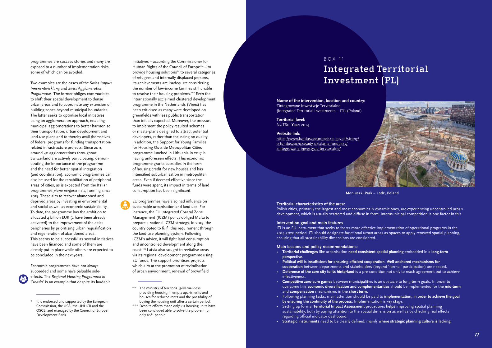
77
programmes are success stories and many are exposed to a number of implementation risks, some of which can be avoided.
Two examples are the cases of the Swiss Impuls Innenentwicklung and Swiss Agglomeration Programmes. The former obliges communities to shift their spatial development to dense urban areas and to coordinate any extension of building zones beyond municipal boundaries. The latter seeks to optimise local initiatives using an agglomeration approach, enabling municipal agglomerations to better harmonise their transportation, urban development and land‑use plans and to thereby avail themselves of federal programs for funding transportation‑related infrastructure projects. Since 2011, around 40 agglomerations throughout Switzerland are actively participating, demon‑strating the importance of the programme and the need for better spatial integration (and coordination). Economic programmes can also be used for the rehabilitation of peripheral areas of cities, as is expected from the Italian programmes piano periferie 1 e 2, running since 2015. These aim to recover abandoned and deprived areas by investing in environmental and social as well as economic sustainability. To date, the programme has the ambition to allocated 4 billion EUR (2 have been already activated) to the improvement of the cities peripheries by prioritising urban requalification and regeneration of abandoned areas. This seems to be successful as several initiatives have been financed and some of them are already put in place while others are expected to be concluded in the next years.
Economic programmes have not always succeeded and some have palpable side‑effects. The Regional Housing Programme in Croatia* is an example that despite its laudable
* It is endorsed and supported by the European Commission, the USA, the UNHCR and the OSCE, and managed by the Council of Europe Development Bank
initiatives – according the Commissioner for Human Rights of the Council of Europe104 – to provide housing solutions** to several categories of refugees and internally displaced persons, its achievements are inadequate considering the number of low‑income families still unable to resolve their housing problems.*** Even the internationally acclaimed clustered development programme in the Netherlands (Vinex) has been criticised as many were developed on greenfields with less public transportation than initially expected. Moreover, the pressure to implement the policy resulted schemes or masterplans designed to attract potential developers, rather than focussing on quality. In addition, the Support for Young Families for Housing Outside Metropolitan Cities programme lunched in Lithuania in 2017 is having unforeseen effects. This economic programme grants subsidies in the form of housing credit for new houses and has intensified suburbanisation in metropolitan areas. Even if deemed effective since the funds were spent, its impact in terms of land consumption has been significant.
EU programmes have also had influence on sustainable urbanisation and land use. For instance, the EU Integrated Coastal Zone Management (ICZM) policy obliged Malta to prepare a national ICZM strategy. In 2019, the country opted to fulfil this requirement through the land‑use planning system. Following ICZM’s advice, it will fight land consumption and uncontrolled development along the coast.105 Latvia also sought to revitalise areas via its regional development programme using EU funds. The support prioritises projects which aim at the promotion of revitalisation of urban environment, renewal of brownfield
** The ministry of territorial governance is providing housing in empty apartments and houses for reduced rents and the possibility of buying the housing unit after a certain period.
*** Despite efforts made only 411 housing units have been concluded able to solve the problem for only 1081 people
Territorial characteristics of the area:Polish cities, primarily the largest and most economically dynamic ones, are experiencing uncontrolled urban development, which is usually scattered and diffuse in form. Intermunicipal competition is one factor in this.
Intervention goal and main featuresITI is an EU instrument that seeks to foster more effective implementation of operational programs in the 2014‑2020 period. ITI should designate functional urban areas as spaces to apply renewed spatial planning, ensuring that all sustainability dimensions are considered.
Main lessons and policy recommendations:• Territorial challenges like urbanisation need consistent spatial planning embedded in a long-term
perspective.• Political will is insufficient for ensuring efficient cooperation. Well-anchored mechanisms for
cooperation between departments and stakeholders (beyond ‘formal’ participation) are needed.• Deference of the core city to its hinterland is a pre‑condition not only to reach agreement but to achieve
effectiveness.• Competitive zero-sum games between municipalities is an obstacle to long‑term goals. In order to
overcome this economic diversification and complementarities should be implemented for the mid-term and compensation mechanisms in the short term.
• Following planning tasks, main attention should be paid to implementation, in order to achieve the goal by ensuring the continuity of the process. Implementation is key stage.
• Setting up formal Territorial Impact Assessment procedures helps improving spatial planning sustainability, both by paying attention to the spatial dimension as well as by checking real effects regarding official indicator dashboard.
• Strategic instruments need to be clearly defined, mainly where strategic planning culture is lacking.
Name of the intervention, location and country: Zintegrowane Inwestycje Terytorialne (Integrated Territorial Investments – ITI) (Poland)
Territorial level: NUTS0; Year: 2014
Website link: https://www.funduszeeuropejskie.gov.pl/strony/o‑funduszach/zasady‑dzialania‑funduszy/zintegrowane‑inwestycje‑terytorialne/
B O X 1 1
Integrated Territorial Investment (PL)
Moniuszki Park – Lodz, Poland
79
sites and other degraded territories. Support is given to costs associated with construction/ renovation of buildings and equipment.106 This has been deemed relatively successful in both its own aims (creation of jobs in these areas) as well as sustainability. Finally, the efficacy of the Integrated Territorial Investment (ITI) in Poland, is still a debated issue (see Box 11). The ITI is supposed to encourage the develop ment of functional urban areas by promoting the cooperation of their constitutive administrative units, the implementation of common inter‑sectoral, integrated projects that comprehensively meet the needs of the functional urban area. The success and long‑term effect of the implementation of ITI strategies depend largely on local factors, such as the determination of local governments, effective management, creation of the conditions for the multiplier effects of joint projects as well as social acceptance and support for strategic programmes.
In conclusion, it can be said that programmes and subsidies can be instruments to deliver sustainable land use. However, in order to succeed, programmes should be:• properly designed to avoid or limit
side‑effects and trade‑offs;• focused on a few well‑defined objectives;• activated as instruments to support public
or private initiatives to achieve strategic objectives.
Otherwise, programmes can be subject of failure if:• objectives are too vague or broad to monitor
or control their effects;• are too ambitions compared to the allocated
funds (it can create unrealistic expectations);• do not foresee a combination of long‑
term and short‑term objectives which implementation will increase their credibility.
Yet importantly, in designing economic programmes in order to incentive sustainable land use, decision and policy makers should also take care of:• how they allocate public funds in order to find
the best option;• what kind of economic programme to be
activated (investments, subsidies etc.);• what kind of initiative they want to support
(institutional, behavioural, spatial etc.).
3.3 Recommendations for EU institutions
Even if the EU has no explicit competences for spatial planning, it is by no means without influence with respect to urbanisation and land use. The influence it does have is hard to identify because it usually comes as a by‑product of unrelated activities such as sectoral policies, legislation, incentives and funding as well as via overarching agendas (see Figure 7). Recently, a more direct role is being played by the EU Urban Agenda Partnership on Sustainable Land Use and Nature Based Solutions (SLU‑NBS). The SUPER project carried out a broad inventory of EU policies that can and do affect urbanisation and land‑use, resulting in the production of 59 factsheets that discuss impact of individual policies.
Following (Evers & Tennekes, 2016) and others, the SUPER project made a general distinction regarding the way EU policies affect spatial planning issues: (1) those that provide incentives, for example subsidies, to encourage desired behaviour (carrots), (2) those that impose rules to sanction unwanted behaviour (sticks), and (3) those that attempt to persuade by means of providing information, creating forums for discussion, and convincing argumentation (sermon). Where applicable, this section will note whether a particular EU policy works through carrots, sticks, sermons, or a combination of these.
3.3.1 Sticks: European legislation
The SUPER project found that EU directives and regulations have both positive and negative effects on urban development and land use. This usually occurs unintentionally, as these matters are not directly within the scope of the impact assessment of European Commission proposals.* Sometimes, territorially differentiated impacts are a necessary policy design element. In both cases, this demonstrates the need for an awareness about the spatial distribution of impacts that goes beyond the already existing Environmental Impact Assessment (EIA) and Strategic Environmental Impact Assessment (SEA) directives.**
A territorial impact assessment (TIA) can help to estimate the territorial impacts of future or existing policies. The ‘ESPON TIA Tool – TIA necessity check’ provides a step‑by‑step procedure to help officials identify whether such
* Tool #33 of the Better Regulation Toolbox, however recognises that the territorial impact of an EU initiative could be relevant if the problem it addresses is unevenly distributed or if the policy itself its likely to act unevenly on the territory. See: European Commission (2017) Better regulation Toolbox.
** These directives sometimes can bring the spatial and territorial impacts of policies and projects into view. The Environmental Impact Assessment (EIA) directive 2011/92/EU mandates that developments which are likely to have significant direct and indirect impacts on the environment undergo an obligatory assessment, including the soil. It therefore indirectly promotes actions toward compensation of soil sealing environmentally damaging land uses. However, the list of EIA‑obligatory projects is outdated and does not include, for instance, solar thermal power stations. The Strategic Environmental Assessment (SEA) directive 2001/42/EC addresses the environmental impact of plans and programmes. This can also impact urbanisation and land‑use policies and practices. However, studies have found that the overall quality level of SEA reports is still fairly low and exhibit strong variation in quality.
E UD I R E C T I V E S
A N DR E G U L A T I O N S
Stick
Carrot
Source: PBL/ ESPON SUPER
F U N D I N GI N S T R U M E N T S
Sermon
S T R A T E G I E SA N D
( I N ) F O R M A LA G R E E M E N T S
F I G U R E 7
Stick, carrot and sermon
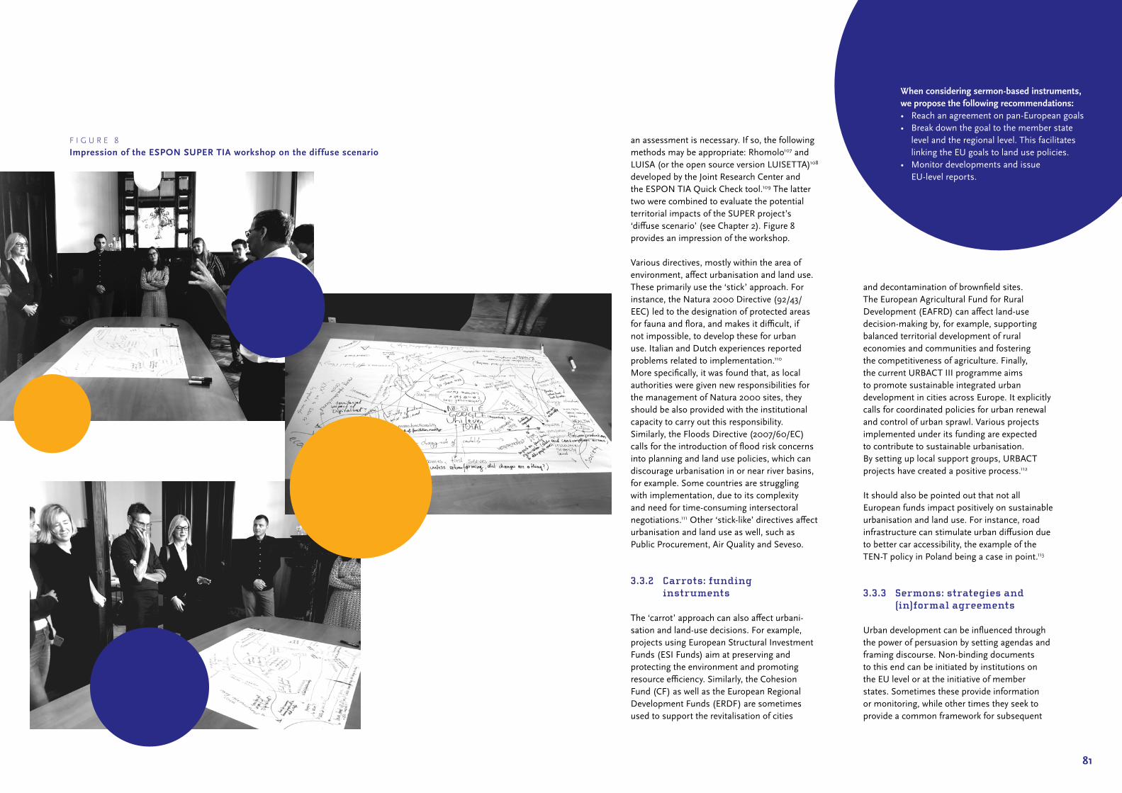
81
an assessment is necessary. If so, the following methods may be appropriate: Rhomolo107 and LUISA (or the open source version LUISETTA)108 developed by the Joint Research Center and the ESPON TIA Quick Check tool.109 The latter two were combined to evaluate the potential territorial impacts of the SUPER project’s ‘diffuse scenario’ (see Chapter 2). Figure 8 provides an impression of the workshop.
Various directives, mostly within the area of environment, affect urbanisation and land use. These primarily use the ‘stick’ approach. For instance, the Natura 2000 Directive (92/43/EEC) led to the designation of protected areas for fauna and flora, and makes it difficult, if not impossible, to develop these for urban use. Italian and Dutch experiences reported problems related to implementation.110 More specifically, it was found that, as local authorities were given new responsibilities for the management of Natura 2000 sites, they should be also provided with the institutional capacity to carry out this responsibility. Similarly, the Floods Directive (2007/60/EC) calls for the introduction of flood risk concerns into planning and land use policies, which can discourage urbanisation in or near river basins, for example. Some countries are struggling with implementation, due to its complexity and need for time‑consuming intersectoral negotiations.111 Other ‘stick‑like’ directives affect urbanisation and land use as well, such as Public Procurement, Air Quality and Seveso.
3.3.2 Carrots: funding instruments
The ‘carrot’ approach can also affect urbani‑sation and land‑use decisions. For example, projects using European Structural Investment Funds (ESI Funds) aim at preserving and protecting the environment and promoting resource efficiency. Similarly, the Cohesion Fund (CF) as well as the European Regional Development Funds (ERDF) are sometimes used to support the revitalisation of cities
and decontamination of brownfield sites. The European Agricultural Fund for Rural Development (EAFRD) can affect land‑use decision‑making by, for example, supporting balanced territorial development of rural economies and communities and fostering the competitiveness of agriculture. Finally, the current URBACT III programme aims to promote sustainable integrated urban development in cities across Europe. It explicitly calls for coordinated policies for urban renewal and control of urban sprawl. Various projects implemented under its funding are expected to contribute to sustainable urbanisation. By setting up local support groups, URBACT projects have created a positive process.112
It should also be pointed out that not all European funds impact positively on sustainable urbanisation and land use. For instance, road infrastructure can stimulate urban diffusion due to better car accessibility, the example of the TEN‑T policy in Poland being a case in point.113
3.3.3 Sermons: strategies and (in) formal agreements
Urban development can be influenced through the power of persuasion by setting agendas and framing discourse. Non‑binding documents to this end can be initiated by institutions on the EU level or at the initiative of member states. Sometimes these provide information or monitoring, while other times they seek to provide a common framework for subsequent
When considering sermon-based instruments, we propose the following recommendations:• Reach an agreement on pan‑European goals• Break down the goal to the member state
level and the regional level. This facilitates linking the EU goals to land use policies.
• Monitor developments and issue EU‑level reports.
F I G U R E 8
Impression of the ESPON SUPER TIA workshop on the dif fuse scenario

83
decision‑making. Regarding the latter, this can take the form of a target: the Europe 2020 strategy, for example, set the 20/20/20 goal for reducing greenhouse gas emissions: 20% lower than 1990 levels, 20% of energy coming from renewables, and 20% increase in energy efficiency. More pertinently, the 2011 Roadmap to a Resource Efficient Europe set the target of ‘zero net land take by 2050’. Even though it is debatable whether this target is a useful way to address urbanisation and land use issues at the pan‑European level, it can help support the development of national and local policies. For example, inspired by this target, the government of Flanders (BE) seeks to ban all new greenfield development by 2040.114
The above can be readily applied to urbanisation and land‑use issues. If a common picture of future urban and rural development exists at the EU level, this can impact the discourse on planning goals and instruments at national, regional, and local levels. The Leipzig Charter is a good example: this document was signed by national ministers responsible for urban development and contains common principles and strategies for urban development policies. Other examples include the European Spatial Development Perspective (ESDP), the Territorial Agenda of the European Union 2020 (TA2020), the Urban Agenda (UA), the Soil Thematic Strategy, the Toledo and Basque declarations and the Aalborg charter. In particular, the TA2020 inspired the Spatial Development Strategy of the Republic of Croatia, which includes measures and actions to develop certain areas and shapes the development of local and regional spatial plans.115 As such, it serves as a strategic framework for spatial planning at all levels.
After agreeing on common principals, a next step is to draw up and sign a binding agreement. An advantage of such a document is that compliance can be safeguarded through administrative and judicial processes.
An example is the Alpine conventions, where member states agree to common development goals and their implementation in national planning systems. More specifically, the Spatial Planning and Sustainable Development Protocol was first agreed by the member states of the Alpine Convention and then transposed into the national law through their own national legislative authority. In the absence of EU competencies, this is one way to deal with cross‑border planning issues.
Arguably the best relevant example of sermon‑based policy is the Partnership on Sustainable Use of Land and Nature‑based Solutions (SLU_NBS) being carried out under the umbrella of the Urban Agenda for the EU (UA). One of the missions of this partnership is to identify and understand phenomena, including legal frameworks and the territorial culture of regions/countries/cities, which generate and fuel suburbanisation processes. In particular, the Partnership’s Action Plan sets the promotion of the ‘compact and liveable city’ as a model for urbanisation and calls for:• measuring ‘net land‑take’ to help cities
setting effective land use policies• including land take in the SEA at EU,
national and local levels• mapping and developing underused and
brownfield land• better coordination of spatial planning
across jurisdictions
Whilst not seeking to challenge the principle of subsidiarity, the Partnership does see a rationale for EU‑level intervention in terms of coordination, facilitation, provision of information, funding and streamlining regulatory provisions. Addressing land‑use issues in EU regulations, at least in some dimensions, would help to prioritise sustainable land use at the national and subnational levels. Finally, the SLU_NBS Partnership advises mainstreaming these issues in EU instruments and policies.
The SLU_NBS Partnership drew up the following recommendations in its Action Plan:• EU level: (i) issues of land take and land use
management should be more outlined in EU‑level policies in order to strengthen sustainable land use across Europe; (ii) need for more incentive on EU level for FUA cooperation and coordinated spatial planning; (iii) more cooperation and integration on various level of governance
• Member States and regional level: National governments should promote FUA cooperation by providing regulatory and financial frameworks and mechanisms (e.g. by providing financial incentives, promoting the benefits of FUA cooperation, providing adequate regulations and the necessary support for such cooperation)
• City level: Nature‑based solutions need to be better recognised as an adequate tool to deal with numerous challenges and to improve life in the cities
85
Success factors of interventions4

87
A s stated, the SUPER project did not find a guaranteed recipe for success with respect to types of interventions or the
instruments used to implement them. Green belts were highly effective in some contexts, but failed in others, binding regulations were faithfully complied with in some contexts, but ignored in others. In order to still draw general conclusions with respect to success, the project examined all 235 interventions and the explanations given as to why they were successful or not. These factors are very different in nature, since the pool of identified experiences is extremely heterogeneous in terms of implementation levels, interested types of territory, focus of the intervention, and type of instrument. The analysis resulted in the production of over 40 salient factors divided into seven categories. Figure 9 presents the findings of this analysis.
The sections to follow discuss each group of factors in turn (see Infographic 9). When reading this, an important caveat is in order: despite the identified recurrence in number of mentions, it is important to stress the relative nature of the factors’ impact: the same
factor in different types of interventions, legal and cultural contexts, or in different types of territories might have completely impact or may work in a different way. The indications that follow should thus not be treated as straightforward recommendations or recipes for successful interventions, but rather as an inspiration.*
4.1 Governance factors
Several factors influencing the success of the analysed interventions relates to governance. These are described in more detail below.
Centralisation: A common solution to collective action problems is centralise decision‑making, particularly in spatial planning. Centralisation
* As it will be presented here more in detail, different factors have a tendency to occur more often in interventions with specific characteristics. Moreover, it should be stressed that in most of the cases numerous factors contribute to the success of an intervention simultaneously.
F I G U R E 9
Factors for (un)successful interventions
4
n.a. Unsuccessful Scarcely successful Mixed success Almost successful Successful
0 5 10 15 20 25 30 35 40 45 50
Coordination
Decentralisation
Multilevel
Centralisation
Collaboration
Private partners
Local and community orientation
Expert knowledge
Financial tools
Legally binding
Special areas
Conditioning
Rising awareness
Vision
Testing
Leadership
Monitoring
Market orientation
Limitations on the market mechanisms
Liberalisation
Long-term perspective
Reusing resources
Multidimensionality
One-dimensionality
Gov
erna
nce
Incl
usio
nD
esig
nSo
ft fa
ctor
sM
arke
t fac
tors
Sust
aina
bilit
y

Implementation
• Monitoring • Leadership • Testing • Timing
Governance
• Multilevel integration• Decentralisation• Centralisation
Inclusion
• Private partnerships• Local community • Expert knowledge• Collaboration
Design
• Financial tools• Legally binding• Special areas• Flexibility
Market
• Market orientation• Liberalisation
Soft factors
• Raising awareness• Vision
Sustainability
• Long-term perspective• Multidimensionality• Reusing resources
The SUPER project has examined 235 interventions related to sustainable urbanisation and identified over 40 factors divided into seven main categories. These factors are very different in nature, since the pool of identified experiences is extremely heterogeneous in terms of implementation levels, interested types of territory, focus of the intervention, and type of instrument.
Source: PBL/ESPON SUPER
pbl.n
l
I N F O G R A P H I C 9
Success factorsof interventions

91
also prevents a diversification of sustainable land‑use principles according to awareness, wealth, and political goals of particular regions or municipalities. Centralisation can have adverse effects, however, if local needs and circumstances are neglected by central authorities. In some cases, especially in countries with less experience with implementing sustainable land‑use interventions, centralised approaches often reflect a market orientation that prioritises economic development over social and environmental aspects.
Decentralisation: this approach allows local contexts, circumstances and needs to be taken into consideration and increases local sense of responsibility for achieving sustainable land‑use goals. On the other hand, it can also result in unintended policy relaxation in cases where sustainable land‑use goals do not enjoy political support among local authorities or have not been sufficiently internalised. Sometimes mandatory measures are needed for implementation.
Multilevel integration: The tensions between centralisation and decentralisation can to some extent overcome by multilevel integration. This is when authorities on different tiers (national, regional, and local) collaborate and coordinate their actions. The higher level usually provides a more strategic approach, while lower levels are more operational and community oriented. This approach has proven very successful for interventions implemented in complex urban settings involving different tiers of government.
Coordination: Coordination of actions on sustainable land‑use goals is in many cases indispensable since spatial phenomena do not respect administrative boundaries. Coordination is usually introduced between local authorities, for example, to limit land consumption. Policy coordination is also considered a success factor in cases when various policies are harmonised to support sustainable land‑use goals.
4.2 Inclusion factors
The inclusion of multiple actors and stakeholders in the development process is also a crucial element of success. Various factors fall into this category.
Collaboration: Collaboration relates to the positive interaction of different types of actors: between private and public organisations and institutions, between public authorities at various spatial and administrative levels (multilevel approach), between public organisations and citizens (public participation) as well as with experts. In general, collaboration provides: (1) a broader base of support for specific actions and strategies, (2) an enhanced sense of responsibility for sustainable land‑use goals among actors (commensurate to their involvement and commitment), (3) easier coordination of cross‑border activities. An important factor is appropriate and professional process management to ensure that no one feels excluded or neglected and that roles and scheduling of activities is clear. Collaboration is especially valuable for defining visions/goals, and less so during the implementation phase when narrower and more task‑oriented cooperation is more effective. This factor was less common among interventions using strict legal tools (were legally binding and mandatory), which may suggest that rigid legal instrumentation does not create a favourable environment for collaboration (or that such collaboration is deemed superfluous).
Expert knowledge: Experts are often involved in designing policies and interventions, such as those in the area of planning, environmental protection, engineering and flood prevention. Expert knowledge can take the form of data used in the intervention design phase. Lack of adequate data or improper usage may result in ineffective and inconsistent interventions.
Local community orientation: This approach is usually visible when local communities are involved in the design and implementation of a project or intervention; it is in line with ‘tailor‑made’ and ‘place‑based’ approaches. Local community orientation can foster a sense of responsibility for the local environment and allow local needs to be incorporated into the project/policy design. It is suitable for pilot interventions because the local community can help identify weaknesses and areas for improvement. Excessive centralisation may create a situation when local circumstances are neglected, which is considered a factor for implementation failure. This situation was more common in the new EU member states, which have less experience and probably capacity to implement sustainable land‑use interventions as well as in and mountain areas where ski‑resort developers neglect local needs. Low community orientation was also negatively associated with temporal sustainability, effectiveness, efficiency, and relevance.
Private partnerships: Inclusion of private parties into projects is a form of multi‑sectoral collaboration. This often takes the form of a partnership where the public partner ensures compliance with sustainable land‑use goals while the private partner is responsible for the implementation/operational aspect of the project. This is a relatively popular model for revitalisation projects. Other examples include the protection or restoration of agriculture as a form of economic activity that economic, environmental, and social goals to be combined. Inclusion of private partners can build support and commitment for the intervention’s aims among private parties. On the other hand, their inclusion may divert attention from non‑economic aspects of the intervention. Inclusion of private partners was positively associated with urban and regeneration interventions and was less common among mandatory and statutory interventions which are usually addressed to public authorities.
4.3 Design
Several factors concern the design of the interventions, particularly their flexibility, identification of special areas as well as to the characteristics of financial and legal tools.
Flexibility: Since sustainable land‑use goals are long‑term by their very nature, it is important to keep them feasible and acceptable for decades rather than years. One way is to make interventions flexible enough to so that their goals can be linked to individual goals of individual companies, organisations, and citizens in various territories.
Special areas: sustainable land‑use interventions are sometimes addressed to specific areas or types of territories. This focus can make the interventions more sensitive to the requirements and resources of territories. A drawback is that sustainable land‑use goals may find fertile ground only in some areas. Lack of spatial continuity might also be a problem in this case.
Financial tools: Financial tools take two main forms: (1) charges and fees to discourage or limit specific activities (this can also take the form of compensation), and (2) incentives and subsidies for, for example, a specific environmental programme to increase the purchasing power of vulnerable households on the housing market.
Legally binding: Although strictness and rigidity can impede an intervention’s success, in some cases a legally binding status is necessary. This is especially the case when there is insufficient appreciation of the importance of sustainable land‑use goals at the implementation level. Or when environmental and economic goals conflict: for many actors, the natural choice is to sacrifice the environment.
93
4.4 Soft factors
Raising awareness and developing joint visions were also considered success factors.
Raising awareness: Although the effectiveness of soft urbanisation and land‑use interventions may seem limited from a short‑term perspective, when broadly accepted, these may bring about significant change in attitudes and behaviours. Raising awareness about sustainable development goals among public authorities and officials can sometimes be achieved through ‘harder’ factors such as guidelines or legal requirements.
Vision: A clear vision developed in a wide participatory and collaborative process enables stakeholder to stay on the right track during implementation and increases their involvement and sense of responsibility. It is also a way to obtain broad political support for the intervention’s aim, even if the specific tools to achieve this may change over time.
4.5 Implementation
When it comes to the implementation phase, relevant factors include monitoring and strong leadership as well as having the right attitude to test new solutions and a feel for timing.
Monitoring: Monitoring is part of the evidence‑based approach in designing and implementing interventions. This factor is especially important for sustainable land‑use interventions because they usually address different policy areas (ideally environment, society, and economy) in a long‑time perspective. It is too easy to focus on the progress in only one area and neglect the others, especially when effects only appear over time. The incredible dynamism and unpredictability of the contemporary world means that the possibility or even necessity of making changes to the intervention or
its implementation needs to be considered. Constant monitoring can facilitate these decisions.
Leadership: Leadership can take shape both institutionally and informally. The former is usually more effective, but the latter may be valuable when a low level of trust exists towards public authorities. Leaders should have appropriate personality traits, be effective and conciliatory and possess authority and trust among other stakeholders. On the other hand, as shown in the Italian case study, strong leadership can be perceived as top‑down, which can undermine involvement and support of stakeholders.
Testing: Sustainable land‑use interventions can be very innovative and employ completely new tools or new configurations of existing tools. It can be very difficult to assess these solutions’ effectiveness, drawbacks or possible side effects beforehand. Testing (e.g. a local pilot study) can provide valuable insights and be used to signal possible negative consequences before a new intervention is rolled out on a larger (e.g. national) scale.
Timing: Timing is always crucial, but in the case of land‑use interventions it is especially important to halt unsustainable processes before they do too much damage. Many alterations to the natural environment are irreparable, so proactive rather than reactive approaches are needed. Timely implementation is even more important because it is much more difficult to change people’s behaviour once it has become routine.
4.6 Market factors
As urbanisation and land use are strongly market dependent, both market‑orientated and liberalisation strategies may strongly influence the success of interventions.
Market orientation: A market orientation, especially liberalisation, is usually associated with failure in terms of the sustainable land‑use goals. Exclusive reliance on the market often leads to excessive land consumption and environmental damage and a neglect of the local context. On the other hand, limited and careful introduction of market‑oriented tools and mechanisms tends to increase the chances of success because they do not clash with powerful market forces (e.g. real‑estate development). This factor was usually associated with profit‑oriented interventions, so it is not surprising that it was more frequently identified with interventions classified as environmentally, socially, temporally and institutionally unsustainable as well as those assessed as inefficient, ineffective and irrelevant. Surprisingly, this factor was even associated with interventions deemed unsustainable from an economic point of view.
Liberalisation: Liberalisation was usually identified as a driver of uncontrolled development and excessive land consumption. In some cases, it also had negative social consequences when new development is not accompanied by appropriate infrastructure and transport facilities. When conditions on development are loosened, the desire for profit usually wins over social and environmental goals. Moreover, liberalisation is negatively associated with temporal and institutional sustainability, success according to sustainable land‑use goals as well as effectiveness and efficiency. Interventions based on liberalisation were more frequently implemented via legal instruments.
4.7 Sustainability
Finally, some factors relate to sustainability directly. This regarded multidimensionality, adoption of a long‑term perspective, and a focus on the reuse of resources.
Multidimensionality: Thematic multidimensio‑nality is a key aspect of sustainability. An exemplary sustainable intervention should address environmental, economic and social issues simultaneously. This is difficult to achieve since the three areas are often in conflict. It is thus crucial that the intervention explicitly address all three aspects and limit the possibility of ‘trade‑offs’ – when one dimension is being sacrificed on behalf of the other dimension(s). In general, the economic aspect of the sustainable land‑use takes care of itself and does not need extra protection. Environment is the most obvious focal point of interventions aimed at sustainable development. Multidimensionality is thus most often related with these two factors. Much less common are interventions addressing social aspects. The opposite of multidimensionality is one‑dimensionality, usually the economy. This may be by design or by one‑sided implementation. The latter may result from intentional actions or as a side‑effect. This factor is more frequently associated with interventions operating through side‑effects.
Long-term perspective: A long‑term perspective, as one of the aspects of sustainable develop ment, is, by definition, positively associated with sustainability. Secondly, in most cases, the results of the interventions can only be fully visible in the long‑term – both the negative and positive consequences.
Reusing resources: This approach is closely aligned with sustainable land‑use goals and usually related to densification, regeneration and revitalisation initiatives, often involving private partners. It addresses especially the environmental aspect of sustainable land‑use by reducing land consumption. This factor was positively associated to interventions deemed successful. Legally binding interventions (i.e. mandatory and statutory), were less often associated with this factor.

95
Final message to the reader5

97
T he maps, figures and projections of land use change and urbanisation patterns presented in Chapter 2
of this Guide illustrate the great diversity of settings, transformative processes and change rates in European territories. This diversity is a reflection of different biophysical characteristics, but above all it is a reflection of the historical trajectories, cultural preferences and customs, economic specialisations and the institutional composition of each region. Given the complexity of managing this rich mosaic, it would be ill‑advised to prescribe overarching reforms or suggest supposedly infallible solutions based on individual ‘best practices’ to promote sustainable urbanisation and land use in all situations and scenarios. Achieving sustainability may be a chimera. But creating a more sustainable way to develop and manage land certainly is not.
The work on which this guide is grounded stems from the recognition that, prior to prescribing solutions, it is just as necessary to have a thorough understanding of the processes of change experienced by the different territories in Europe as well as the motivations and conditioning factors that shape everyday decision‑making. Ultimately, these decisions are the ones that, with all their achievements and
shortcomings, impact the various dimensions of sustainability: economic, ecological, social, institutional and temporal. In line with these principles, ESPON SUPER interviewed over a hundred people involved with urbanisation policy and practice throughout Europe to learn first‑hand about the achievements, innovations and challenges when implementing local interventions.
In contrast to the great territorial and cultural diversity reflected in the maps of urbanisation, the direct contact with local communities revealed a common, virtually homogeneous substrate, from Scandinavia to the Mediter‑ranean and from the Icelandic islands to the Carpathians. In urban spaces and rural environments, in consolidated as well as in developing economies, in booming coastal areas driven by mass tourism to struggling agricultural areas, we found a common resolve to make a better use of the land. This ambition connects political representatives in state or international institutions, academics, regional or municipal planning officers, and activists of all sorts in cities, towns and villages.
In our discussions with stakeholders, we noticed a need for a broader perspective. To understand the situation in the neighbouring country or
a distant region facing similar challenges or addressing a particular dimension of sustainability in an exemplary way. Whether it is to manage land better to mitigate climate change, improve accessibility, enhance competitiveness, restore degraded ecosystem services or promote social cohesion, experiences of others are a source of inspiration and call to action. True to the spirit of the ESPON, the ultimate aim should not be to standardise policies and regulation, but to harness the potential of each territory to contribute to European sustainability using the most appropriate tools at hand.
To this end, this Guide offers information, ideas and perspectives to help decision‑makers and policymakers to proactively contribute to a more equal, balanced, and sustainable territorial development. The decision to convert land to a different use influences our quality of life and that of future generations, and, as this Guide shows, a large toolbox of interventions exists that can help alter prevailing land‑use practices. Choosing among them is a tough decision, and implementation may require strong political commitment and bold leadership. We hope that this Guide provides the inspiration to accept this challenge.
5Whether it is to manage land better to mitigate climate change, improve accessibility, enhance competitiveness, restore degraded ecosystem services or promote social cohesion, experiences of others are a source of inspiration and call to action. To this end, this Guide offers information, ideas and perspectives to help decision‑makers and policymakers to proactively contribute to a more equal, balanced, and sustainable territorial development.

99
Further readings and references at your fingertips
6
101
T he authors invite all readers that are interested in the promotion of sustainable urbanisation and land‑use,
to also consult the following references:
ESPON reports and guides
ESPON and Nordregio (2013). TANGO – Territorial Approaches for New Governance, Final Report. ESPON EGTC.
ESPON and Politecnico di Torino (2014). Towards better territorial governance in Europe. A guide for practitioners, policy and decision makers based on contributions from the ESPON TANGO project. ESPON EGTC.
ESPON and Labein‑Tecnalia (2013) EU‑LUPA – European Land‑Use Patterns, Final Report. ESPON EGTC.
ESPON and TU Delft (2018). COMPASS – Comparative Analysis of Territorial
Governance and Spatial Planning in Europe, Final Report. ESPON EGTC.
ESPON and Tecnalia (2019). GRETA – Green infrastructure: Enhancing biodiversity and ecosystem services for territorial development, Final Report. ESPON EGTC.
ESPON and PBL (forthcoming). SUPER – Sustainable Urbanisation and Land‑use Practices in European Regions, Final Report. ESPON EGTC.
International organisations’ reports
Dige, G., Zamparutti, T., Markowska, A., Hernandez, G., Planes, S., European Environment Agency, & Milieu Ltd. (2016). The direct and indirect impacts of EU policies on land. Publications Office.
EEA, & FOEN. (2016). Urban sprawl in Europe. European Environment Agency and Swiss Federal Office for the Environment.
European Commission. (2012). Guidelines on best practice to limit, mitigate or compensate soil sealing. Commission Staff Working Document.
European Commission, & Joint Commission Resources, I. (2019). The future of cities: Opportunities, challenges and the way forward. Publications Office of the European Union.
Habitat, U. N. (2016). World Cities Report 2016. Urbanisation and Development – Emerging Futures. United Nations Human Settlements Programme.
OECD. (2018). Rethinking Urban Sprawl: Moving Towards Sustainable Cities. OECD.
Books
Angel, S. (2016). Atlas of Urban Expansion: The 2016 Edition, Volume 1: Areas and Densities. NYU Urban Expansion Program at New York University, UN‑Habitat, and the Lincoln Institute of Land Policy.
Bruegmann, R. (2006). Sprawl: A Compact History. University of Chicago Press.
Couch, C., Petschel‑Held, G., & Leontidou, L. (2008). Urban Sprawl in Europe: Landscape, Land-Use Change and Policy. John Wiley & Sons.
Gehl, J. (2013). Cities for people. Island press.
Gerber, J.‑D., Hartmann, T., & Hengstermann, A. (Eds.). (2018). Instruments of Land Policy: Dealing with Scarcity of Land (1st ed.). Routledge. (doi.org/10.4324/9781315511658).
Montgomery, C. (2013). Happy City: Transforming our lives through urban design. Penguin Books.
Wandl, A. (2019). Territories ‑in‑ between: A Cross‑case Comparison of Dispersed Urban Development in Europe. (14th ed.). TU Delft.
Journal articles
Allen, A. (2009). Sustainable Cities or Sustainable Urbanisation? Palette. UCL’s Journal of Sustainable Cities.
Dembski, S., Sykes, O., Couch, C., Desjardins, X., Evers, D., Osterhage, F., Siedentop, S., & Zimmermann, K. (2019). Reurbanisation and suburbia in Northwest Europe: A comparative perspective on spatial trends and policy approaches. Progress in Planning.
Jabareen, Y. R. (2006). Sustainable urban forms: Their typologies, models, and concepts. Journal of Planning Education and Research, 26(1), 38–52.
Oueslati, W., Alvanides, S., & Garrod, G. (2015). Determinants of urban sprawl in European cities. Urban Studies, 52(9), 1594–1614.
Siedentop, & Fina. (2012). Who Sprawls Most? Exploring the Patterns of Urban Growth across 26 European Countries. Environment and Planning A: Economy and Space, 44(11, 2765–2784.
Solly A., Berisha E., Cotella, G., Janin Rivolin, U. (2020) How Sustainable Are Land Use Tools? A Europe‑Wide Typological Investigation. Sustainability, 12(3), 1257.
Wolff, M., Haase, D., & Haase, A. (2018). Compact or spread? A quantitative spatial model of urban areas in Europe since 1990. PLOS ONE, 13(2).
6

103
References list
1 European Commission. (2012). Guidelines on best practice to limit, mitigate or compensate soil sealing. Commission Staff Working Document.
2 European Environment Agency. (2017). Landscapes in transition. An account of 25 years of land cover change in Europe. EEA report No 10/2017.
3 European Commission. (2011). Roadmap to a Resource Efficient Europe. COM(2011)571 final .
4 European Commission. (2012). The implementation of the Soil Thematic Strategy and ongoing activities. COM(2021)46 final.
5 Neuman, M., & Churchill, S. W. (2015). Measuring sustainability. Town Planning Review, 86(4), 457–482. (https://doi.org/10.3828/tpr.2015.28).
6 Campbell, S. D. (2016). The Planner’s Triangle Revisited: Sustainability and the Evolution of a Planning Ideal That Can’t Stand Still. Journal of the American Planning Association, 82(4), 388–397.
7 Hajer, M., & Dassen, T. (2014). Smart About Cities: Visualising the Challenge for 21st Century Urbanism. 010 Publishers.
8 ESPON. (2014). EU LUPA Final Report Part A: Executive Summary. ESPON.
9 Kostof, Spiro (1991). The city shaped: Urban patterns and meanings through history, Little, Brown and Company, Boston.
10 Jabareen, Y. R. (2006). Sustainable urban forms: Their typologies, models, and concepts. Journal of Planning Education and Research, 26(1), 38–52.
11 EEA, & FOEN. (2016). Urban sprawl in Europe. European Environment Agency and Swiss Federal Office for the Environment.
12 Lord, A. (2012). The Planning Game. Routledge.13 Barbosa, A., Vallecillo, S., Baranzelli, C.,
Jacobs‑Crisioni, C., Batista e Silva, F., Perpiña‑Castillo, C., Lavalle, C., & Maes, J. (2017). Modelling built‑up land take in Europe to 2020: An assessment of the Resource Efficiency Roadmap measure on land. Journal of Environmental Planning and Management, 60(8), 1439–1463. (https://doi.org/10.1080/09640568.2016.1221801 ).
14 The Institute for Physical Planning of Primorje‑Gorski Kotar County Public Institution (2013). Spatial Plan of Primorje‑Gorski Kotar Count.
15 Savini F., Boterman W.R., Van Gent W.P.C., Majoor S. (2016). Amsterdam in the 21st century: Geography, housing, spatial development and politics, Cities, 52, 103‑113.
16 Reardon M. & Schmitt P. (2016). Planning for Resource Efficiency in Stockholm: ‘Good’ Territorial Governance Practices without Consistency, in Schmitt P., Van Well L., eds., Territorial Governance across Europe: Pathways, Practices and Prospects, Routledge: London, UK, 95‑110.
17 Holmstedt L., Brandt N., Robèrt K.H. (2017). Can Stockholm Royal Seaport be part of the puzzle towards global sustainability? From local to global sustainability using the same set of criteria, Journal of Cleaner Production,140, 72‑80.
18 Humer A., Sedlitzky R., Brunner D. (2019). When does population growth pay off? A case study of suburban land consumption to assess the Lower Austrian infrastructural cost calculator, Journal of Housing and the Built Environment, 34, 331‑344.
19 Humer A., Sedlitzky R., Brunner D. (2019). When does population growth pay off? A case study of suburban land consumption to assess the Lower Austrian infrastructural cost calculator, Journal of Housing and the Built Environment, 34, 331‑344.
20 Schroepfer T. & Limin H. (2008). Emerging Forms of Sustainable Urbanism: Case Studies of Vauban Freiburg and solarCity Linz, Journal of Green Building, 3(2), 65‑76.
21 Hansen R. (2015). Linz Austria – Case Study City Portrait, APPENDIX – GREEN SURGE study on urban green infrastructure planning and governance in 20 European case studies, 165‑176. Schroepfer T. & Hee, L. (2008). Emerging Forms of Sustainable Urbanism: Case Studies of Vauban Freiburg and solarCity Linz, Journal of Green Building, 3(2), 67‑76.
22 Byrne M. (2016). Entrepreneurial Urbanism after the Crisis: Ireland’s “Bad Bank” and the Redevelopment of Dublin’s Docklands, Antipode, 48, 899‑918.
23 Leick A., Becker T., Hesse M. (2018). Esch‑sur‑Alzette (Luxembourg): The “Science City” in Belval – Planning a large‑scale urban development project in a small country, in Darchen S., Searle G., eds., Global Planning Innovations for Urban Sustainability, Routledge: London, UK, 180‑196.
24 HOMBRE (2014). HOMBRE’s Role in Brownfields Management and Avoidance Urban Land Management 2065; Solec Kujawski brownfield – Pilot Action.
25 Yalçıntaş H.A. (2010). Evaluation of urban regeneration practice in comparison to general framework for managing urban regeneration in developed countries, 14th International Planning History Society Conference.
26 Cassatella, C. (2013). The ‘Corona Verde’ Strategic Plan: An integrated vision for protecting and enhancing the natural and cultural heritage, Urban Research & Practice, 6, 219–228.
27 Klinger S., Krassnitzer P., Zech S. (2016). Regionaler Leitplan Bezirk Mödling.
28 Law for the City of Sofia (2009). 29 Slaev A. D. & Nedovic‑Budic Z. (2016). The
Challenges of Implementing Sustainable Development: The Case of Sofia’s Master Plan, Sustainability, 9(15), 1‑19.
30 Knowles R.D. (2012). Transit Oriented Development in Copenhagen, Denmark: From the Finger Plan to Ørestad, Journal of Transport Geography, 22, 251–261.
31 Sanò M., Gonzalez‑Riancho P., Areizaga J. & Medina R. (2010). The Strategy for Coastal Sustainability: A Spanish Initiative for ICZM, Coastal Management, 38.
32 Sveda, M., Madajova, M., Podolak, P. (2016). Behind the Differentiation of Suburban Development in the Hinterland of Bratislava, Slovakia, Sociologický časopis/Czech Sociological Review, 52(6), pp. 893–925.
33 Paulsson A. (2020). The city that the metro system built: Urban transformations and modalities of integrated planning in Stockholm, Urban Studies, 1‑20.
34 Mueller et al. (2020). Changing the urban design of cities for health: The superblock model, Environment International, 134, 1‑13.
35 Waltham Forest Council (2019). Celebrating five years of Mini‑Holland in Waltham Forest.
36 Tinga, R. (2018). SUMP development in Slovenia.37 Tunnal Euralpin Lyon‑Turin. 38 Landeshauptstadt Stuttgart (2003). Nachhaltiges
Bauflächenmanagement Stuttgart (NBS), Beiträge zur Stadtentwicklung, Stuttgart, 34. Huber S. & Kurzweil A. (2012). Guide Municipal Soil Management.
39 Umweltbundesamt (2012). URBAN Soil Management Strategy SWOT analysis policy instruments.
40 Nabielek P. (2020). Wind power deployment in urbanised regions, an institutional analysis of planning and implementation, Vienna: TU Vienna Academic Press.
41 Péter, B. (2010). Flood and Drought Strategy of the Tisza River Basin.
42 Faludi, A. (2000). The Performance of Spatial Planning. Planning Practice and Research 15(4), 299–318.
43 Etzioni, A. (1967). Mixed‑Scanning: A ‘Third’ Approach to Decision‑Making. Public Administration Review 27(5), 385.
44 Skayannis, P. (2013). The (Master) Plans of Athens and the Challenges of its Re‑Planning in the Context of Crisis. International Journal of Architectural Research, 7(2), 192‑205.
45 Granqvist, K., Sarjamo, S., & Mantysalo, R. (2018). Polycentricity as spatial imaginary: the case of Helsinki City Plan. European Planning Studies, 27(4), 739‑758.
46 Archibugi, F. (2004). Rome: A new planning strategy. Routledge
47 European Commission (2010). Internal Market: Commission refers Austria to Court over restrictions on investment in agricultural real estate in Vorarlberg.
48 Munafò, M. (eds.) (2019). Consumo di suolo, dina-miche territoriali e servizi ecosistemici. Edizione 2019. Report SNPA 08/19.
49 Hall, P. (2002). Urban and Regional Planning, 4th ed. London and New York: Routledge.
50 European Commission (2012). Guidelines on best practice to limit, mitigate or compensate soil sealing. Luxembourg: Publications Office of the European Union
51 European Commission (2012). Guidelines on best practice to limit, mitigate or compensate soil sealing. Luxembourg: Publications Office of the European Union.
52 Sanò, M., Gonzalez‑Riancho, P., Areizaga, J., & Medina, R. (2010). The Strategy for Coastal Sustainability: A Spanish Initiative for ICZM. Coastal Management, 38(1), 76–96.
53 Gollopeni, B. (2016). Socio‑Urban Developments in Kosovo: Study Case Pristina. Geo-Information.
54 Lawton, P. (2015). Socially Integrated Housing and Sustainable Urban Communities: Case Studies from Dublin. NESC Research Series Paper No.8.
55 Lawton, P. (2015). Socially Integrated Housing and Sustainable Urban Communities: Case Studies from Dublin. NESC Research Series Paper No.8.
56 European Commission (2012). Guidelines on best practice to limit, mitigate or compensate soil sealing. Luxembourg: Publications Office of the European Union.
57 Snel, E., Aussen, S., Berkhof, F., & Renlo, Q. (2011). Views of gentrification from below: How Rotterdam local residents experience gentrification? International RC21 Conference.
58 Grün Berlin (2020). About us.
105
59 Oppla. (2019). Berlin – NBS for urban green connectivity and biodiversity.
60 Sanò, M., Gonzalez‑Riancho, P., Areizaga, J., & Medina, R. (2010). The Strategy for Coastal Sustainability: A Spanish Initiative for ICZM. Coastal Management, 38(1), 76–96.
61 Baeten, G. (2012). Normalising Neoliberal Planning: the case of Malmö, Sweden. In G. Baeten, & T. Tasan‑Kok (Eds.), Contradictions of Neoliberal Planning (pp. 21‑42). Springer.
62 Adaman, F., Akbulut, B. & Arsel, M. (eds.) (2017). Neoliberal Turkey and its discontents: Economic policy and the environment under Erdogan. Bloomsbury Publishing.
63 Wickel, M. (2018). A German perspective on urban growth boundaries: the answer of comprehensive regional planning. In Instruments of Land Policy: Dealing with Scarcity of Land; Gerber, J.‑D., Hartmann, T., Hengstermann, A., Eds.; Taylor & Francis: Abingdon, Oxon, 2018; 142–145.
64 Shaw, K., & Robinson, F. (2010). Centenary paper: UK urban regeneration policies in the early twenty‑first century: Continuity or change? Town Planning Review, 81(2), 123–150.
65 Schulze Bäing, A., Wong, C. (2010). Brownfield regeneration and the delivery of sustainable communities in England: what happens to the most deprived neighbourhoods? In: AESOP Annual Conference; 07 Jul 2010‑10 Jul 2010; Helsinki. 2010.
66 Schulze Bäing, A., & Wong, C. (2012). Brownfield Residential Development: What Happens to the Most Deprived Neighbourhoods in England? Urban Studies, 49(14), 2989–3008.
67 Ministry of Social Security and Labour (2018). Housing Assistance for Young Families.
68 Wilson, W. & Barton, C. (2018). Tackling the under-supply of housing in England, Housing of Commons Library, Briefing Paper Number 07671.
69 Ministero dell’Ambiente e della Tutela del Territorio e del Mare (2014). Strategia Nazionale di Adattamento ai Cambiamenti Climatici.
70 Brundtland’s 3rd Government (1993). T‑1049 National Policy Guidelines for coordinated land‑use and transport planning. Published by: Miljøverndepartementet.
71 Campos I., Guerra J., Gomes J.F., Schmidt L., Alves F., Vizinho A., Lopes G.P. (2017). Understanding climate change policy and action in Portuguese municipalities: a survey, Land Use Policy, 62, 68‑78.
72 Wolff, H. de & Marjolein Spaans, M. (2010). The concept of red‑for‑green in the Netherlands.
73 Ministère du Logement. (2016). Lücke sucht Wohnung Neue Chancen für den Wohnungsbau.
74 Ministère du Logement. (2018). Note méthodologique sur l’identification du potentiel foncier et des Baulücken résidentielles. Ministère du Logement.
75 Biodiversity Information System for Europe (BISE). Green Infrastructure in Slovakia.
76 UNAM (2019). Nombre d’élus choqués par le concept de zéro artificialisation nette des sols.
77 Vidan, V.A.A.L.‑H. (2014). Basic facts about the new Croatian Construction Law. Lexology
78 Davies, R. L. (1995). Retail planning policies in Western Europe. Burns & Oates.
79 Evers, D. (2008). The Politics of Peripheral Shopping Centre Development in Northwest Europe in the 1990s: The Cases of Manchester, Amsterdam, and Oberhausen. Edwin Mellen Press.
80 Hillier P. (2004). Policy evaluation of the effectiveness of PPG6. Office of the Deputy Prime Minister.
81 Danish Ministry of the Environment. (2012). Spatial Planning in Denmark.
82 European Commission (2012). Guidelines on best practice to limit, mitigate or compensate soil sealing. Luxembourg: Publications Office of the European Union
83 Reimer, M. (Ed.). (2014). The Danish Planning System 1990—2010: Continuity and decay. In O. Damsgaard, Spatial Planning Systems and Practices in Europe. Routledge.
84 DeBono, J. (2016). New heights policy paves way for property boom. MaltaToday.Com.Mt.
85 Lilex—Gesetzesdatenbank des Fürstentum Liechtenstein (2009). Baugesetz (BauG). Liechtensteinisches Landesgesetzblatt (2009)44.
86 Kötter, T. (2018). A German perspective on land readjustment: A proper instrument of modern urban governance for efficient land use. In J.‑D. Gerber, T. Hartmann, & A. Hengstermann (Eds.), Instruments of Land Policy: Dealing with Scarcity of Land (1st ed., pp. 164–170). Routledge.
87 Condessa, B., Morais de Sá, A., Almeida, J., & Antunes, J. (2018). Land readjustment in Portugal Theoretically attractive but eternally postponed in practice. In J.‑D. Gerber, T. Hartmann, & A. Hengstermann (eds.), Instruments of Land Policy: Dealing with Scarcity of Land (1st ed.). Routledge.
88 Mazza L., Schiller J. (2014). The use of eco‑accounts in Baden‑Württemberg to implement the German Impact Mitigation Regulation: A tool to meet EU’s No‑Net‑Loss requirement? A case
study report prepared by IEEP with funding from the Invaluable and OPERAs projects.
89 European Commission (2012). Guidelines on best practice to limit, mitigate or compensate soil sealing. Luxembourg: Publications Office of the European Union
90 Mazza L., Schiller J. (2014). The use of eco‑accounts in Baden‑Württemberg to implement the German Impact Mitigation Regulation: A tool to meet EU’s No‑Net‑Loss requirement? A case study report prepared by IEEP with funding from the Invaluable and OPERAs projects
91 Cuperus R., Bakermans M.M., De Haes H.A., Canters K.J. (2001). Ecological Compensation in Dutch Highway Planning. Environmental Management, 27(1), 75‑89.
92 Palsova, l. (2014). Legislation on The Protection of Agricultural Land in the context of the implementation of the Thematic Strategy for Soil Protection in Slovak. EU Agrarian Law 3(1). (DOI: 10.2478/eual‑2014‑0004).
93 Croci E. (2016). Local environmental taxation: an opportunity for Italy? Plenary Policy Session, Green Fiscal Reform and abolition of environmentally harmful subsidies: what possible actions for Italian and European environmental policy?
94 Croci, E. (2013). Local environmental taxation: An opportunity for Italy? Fourth IAERE Annual Conference, 25.
95 Wenner F. (2018). Sustainable urban development and land value taxation: The case of Estonia. Land Use Policy, Vol. 77, pp. 790‑800.
96 Thiel, F., & Wenner, F. (2018). Land taxation in Estonia An efficient instrument of land policy for land scarcity, equity, and ecology Fabian Thiel and Fabian Wenner. In J.‑D. Gerber, T. Hartmann, & A. Hengstermann (Eds.), Instruments of Land Policy: Dealing with Scarcity of Land (1st ed.).
97 Voß W. & Bannert J. (2018). Reference land values in Germany: land policy by market transparency. In Instruments of Land Policy: Dealing with Scarcity of Land, Gerber, J.‑D., Hartmann, T., Hengstermann, A., Eds., Taylor & Francis: Abingdon, Oxon, 2018; 36 – 48.
98 Kalbro T. & Norell L. (2018). A Swedish perspective on reference land values: transparency by tax policy. In Instruments of Land Policy: Dealing with Scarcity of Land, Gerber, J.‑D., Hartmann, T., Hengstermann, A., Eds., Taylor & Francis: Abingdon, Oxon, 2018; 49‑52.
99 Aubert, B. (2007). The France Law of Solidarity and Urban Renewal. The concept of Trialogue. 43rd ISOCARP Congress.
100 Guet, J.‑F. (2005). French urban planning tools and methods renewal. 41st ISOCARP Congress, 8.
101 Aubert, B. (2007). The France Law of Solidarity and Urban Renewal. The concept of Trialogue. 43rd ISOCARP Congress.
102 Ronchia S., Salata S., Arcidiacono A., Pirolic E., Montanarella L. (2019). Policy instruments for soil protection among the EU member states: A comparative analysis, Land Use Policy, 82, 763–780.
103 Laws on building legalisation (no. 21/03, 3/04, 19/07, 29/04).
104 Commissioner for Human Rights of the Council of Europe (2016). Report by Nils Muižnieks following his visit to Croatia from 25 to 29 April 2016.
105 Ministry of Foreign Affairs and Trade Promotion. (2019). Malta accedes to the Protocol on Integrated Coastal Zone Management. Press Releases, 4 November 2019 (PR190758).
106 Republic of Latvia. (2015). Procedures for the Implementation, Assessment and Financing of Regional Development Support Measures.
107 Regional Economic Modelling team of JRC. (2020). RHOMOLO web tool: .
108 Regional Economic Modelling team of JRC. (2016). LUISA Territorial Modelling Platform.
109 ESPON TIA TOOL.110 Ferranti, F., Beunen, R., & Speranza, M. (2010).
Natura 2000 Network: A Comparison of the Italian and Dutch Implementation Experiences. Journal of Environmental Policy & Planning, Volume 12, Issue 3 (2010).
111 Kundzewicz, Z. (2014). Adapting flood preparedness tools to changing flood risk conditions: the situation in Poland. Oceanologia,Volume 56, Issue 2 (2014).
112 Esposito de Vita, G., Bevilacqua, C. & Trillo, C. (2013). Improving Conviviality in Public Places: The Case of Naples, Italy. Journal of Civil Engineering and Architecture. Volume 7, No. 10 (Serial No. 71), pp. 1209‑1219.
113 MIiR (Ministerstwo Infrastruktury i Rozwoju). (2013). Impact of motorways and expressways on socio‑economic and territorial development of Poland.
114 Centre Permanent pour la Citoyenneté et la Participation (CPCP). (2018). Le “ Stop au béton ”: Vers une Belgique plus compacte? [The “Stop to concrete”: Towards a more compact Belgium?]
115 Croatian Parliament. (2017). Strategija prostornog razvoja Republike Hrvatske [Spatial Development Strategy of the Republic of Croatia].
107
List of Infographics
Infographic 1 – How many football fields per day? 4Infographic 2 – Three main types of urbanisation 12Infographic 3 – Land use change per country 18Infographic 4 – Compact scenario 26Infographic 5 – Polycentric scenario 28Infographic 6 – Diffuse scenario 30Infographic 7 – Characteristics of successful interventions 38Infographic 8 – Toolbox of instruments for sustainable urbanisation 52Infographic 9 – Success factors of interventions 88
List of Figures
Figure 1 – Understanding sustainability as a thematic balance 11Figure 2 – The SUPER conceptual framework 15Figure 3 – Land converted to urban use in the 2000‑2018 period 16Figure 4 – Development of urban use areas in relation to population development 2000–2018 22Figure 5 – Urbanisation versus buildings in Liège and environs in 2012 23Figure 6 – SUPER intervention database 35Figure 7 – Stick, carrot and sermon 79Figure 8 – Impression of the ESPON SUPER TIA workshop on the diffuse scenario 80Figure 9 – Factors for (un)successful interventions 87
List of Case Study Boxes
Box 1 – Densification along the Black Sea Littoral Area (RO) 40Box 2 – Stockholm Urban Containment Strategy (SE) 45Box 3 – Integrated spatial planning in the city of Ghent (BE) 46Box 4 – Protected Coastal Area in Croatia (HR) 49Box 5 – Vision Rheintal (AT) 54Box 6 – Municipal Structural Plan of the Union of Municipalities of Bassa Romagna (IT) 58Box 7 – Revision of the spatial planning law in Switzerland (CH) 61Box 8 – Territorial Action Plan of the Huerta de Valencia (ES) 62Box 9 – German Land Take Reduction Target (DE) 67Box 10 – Ladder for sustainable urbanisation (NL) 68Box 11 – Integrated Territorial Investment (PL) 77
List of photos
Cover – Berlare, Belgium, by Dimitri Houtteman, UnsplashChapter 1 – Valencia, Spain, by David Evers 1Chapter 2 – Drenthe, The Netherlands, by Ivo Francken 9Chapter 3 – Medugorje, Bosnia and Herzegovina, by Jeswin Thomas, Unsplash 33Chapter 4 – Miasteczno Wilanow, Poland, by Wistula / CC BY‑SA 85Chapter 5 – Kamperland, The Netherlands, by Kersten Nabielek 95Chapter 6 – Malmö, by Pontus Ohlsson, Unsplash 99