SOCIAL STUDIES - Oxford University Press
96
NEW OXFORD SOCIAL STUDIES FOR PAKISTAN 4 3 FOURTH EDITION TEACHING GUIDE Complimentary Copy—Not For Sale
-
Upload
khangminh22 -
Category
Documents
-
view
0 -
download
0
Transcript of SOCIAL STUDIES - Oxford University Press

NEW OXFORD
SOCIALSTUDIES
FOR PAKISTAN
4
3
FOURTH EDITION
TEACHING GUIDE
Complimentary Copy—Not For Sale


NEW OXFORD SOCIAL STUDIES FOR PAKISTAN iii1
IntroductionThe New Oxford Social Studies for Pakistan Fourth Edition has been revised and updated both in terms of text, illustrations, and sequence of chapters, as well as alignment to the Single National Curriculum of Pakistan, 2020. The lessons have been grouped thematically under unit headings. The teaching guides have been redesigned to assist teachers to plan their lessons as per their class needs.
Key learning at the beginning of each lesson provides an outline of what would be covered during the course of the lesson.
Background information is for teachers to gain knowledge about the topics in each lesson.
Lesson plans provide a step-by-step guidance with clearly defined outcomes.
Duration of each lesson plan is 40 minutes; however, this is flexible and teachers are encouraged to modify the duration as per their requirements. If required, teachers can utilise two periods for a single lesson plan.
Outcomes identify what the students will know and be able to do by the end of the lesson.
Resources are materials required in the lesson. Teachers are encouraged to arrange the required materials beforehand. In case students are to bring materials from their homes, they should be informed well ahead of time.
Introduction of the lesson plan, sets forth the purpose of the lesson. In case of a new lesson, the teacher would give a brief background of the topic; while for subsequent lessons, the teacher would summarise or ask students to recap what they learnt in the previous lesson. The idea is to create a sense of anticipation in the students of what they are going to learn.
Explanation is the central part of the lesson plan. Its focus is to ensure that the learning outcomes are met through explanation, demonstration, class discussions, and brainstorming. References to the text, illustrations, and images in the textbook will make the lesson engaging and interesting. The teacher is encouraged to elicit responses from the students to determine whether the learning outcomes are being met.
Classwork is based on the questions, Work pages, and group activities in ‘Things you can do’ section. If there isn’t enough time to complete Classwork, teachers can assign it for homework; or allocate a separate period for the completion of Classwork.
Homework is assigned to students during the lesson. Research-based tasks and projects are usually to be given as homework.
Conclusion wraps up the topic and usually comprises of a review of the topics covered in a particular lesson.
Suggested activities are given for most of the lessons and only conducted if sufficient time and resources are available.
Answers to questions and Work pages are provided at the end of the lesson plans.
Appendix worksheets comprises of worksheets that may be printed out beforehand.
Teachers are encouraged to use digital resources to enhance classroom learning. The digital resources are available on https://oup.com.pk/digital-resources. The teachers can also create their accounts by following the instructions given on the inside cover of the textbook.
1 NEW OXFORD SOCIAL STUDIES FOR PAKISTANiv
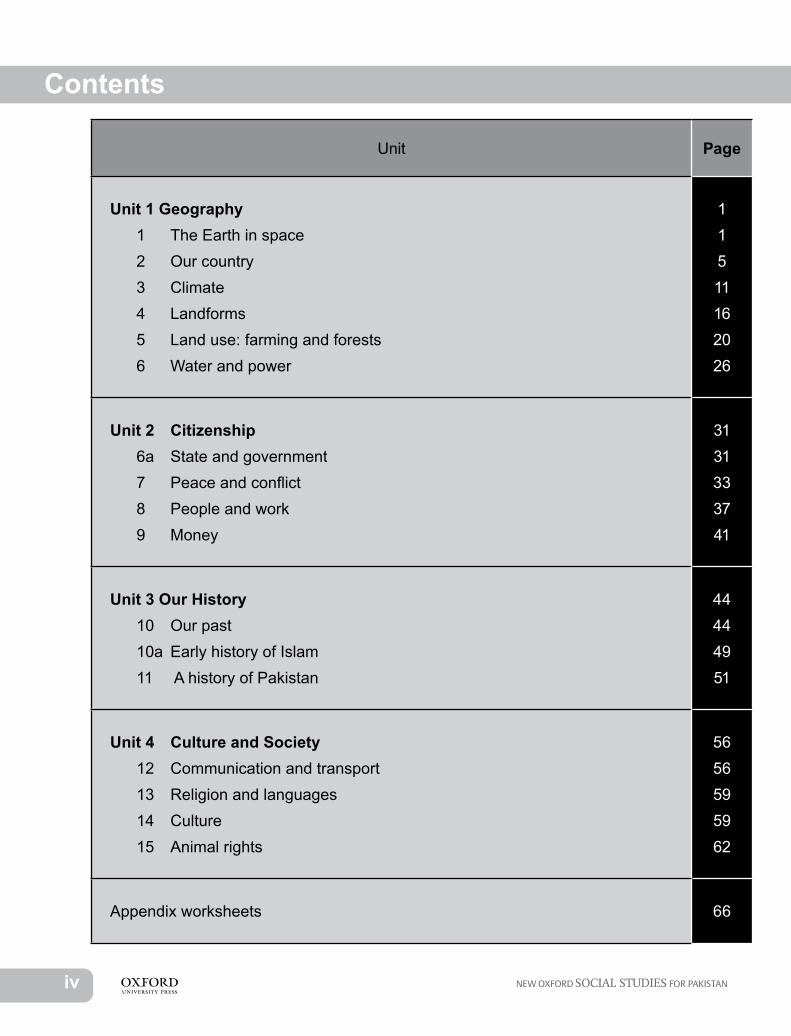
Unit Page
Unit 1 Geography 1 The Earth in space 2 Our country 3 Climate 4 Landforms 5 Land use: farming and forests 6 Water and power
11511162026
Unit 2 Citizenship 6a State and government 7 Peace and conflict 8 People and work 9 Money
3131333741
Unit 3 Our History 10 Our past 10a Early history of Islam 11 A history of Pakistan
44444951
Unit 4 Culture and Society 12 Communication and transport 13 Religion and languages 14 Culture 15 Animal rights
5656595962
Appendix worksheets 66
Contents Unit 1
NEW OXFORD SOCIAL STUDIES FOR PAKISTAN 11
GeographyUnit 11 The Earth in spaceKey learning:• The shape of the Earth• The Earth in space• The Earth’s movements and its effectsBackground information:This lesson will enhance students’ interest in geography as a subject. The use of a globe, which is a model of the Earth, and maps are essential for teaching both history and geography. Documentaries are also a great way to enable students to visualise the different natural phenomenon described in the textbooks.The shape of the Earth is not round but spherical, meaning that it is slightly flattened at the two ends. These ends of the Earth are known as the North and South Poles. The North Pole is always tilted towards the North Star as the Earth revolves around the Sun.The Earth is slightly tilted at an angle of 23.5 degrees. The tilt of the Earth, along with its revolution around the Sun causes seasonal changes. The axis of the Earth is an imaginary line that passes through the centre of the Earth vertically—through the north and south poles. The Earth rotates in a counter-clockwise direction around its axis and the Sun. The Earth rotates on its axis in the East to West direction in each 24-hour period.The tilt of the Earth on its axis causes the Sun’s strongest rays to hit the Earth at different longitudes as the Earth revolves around the Sun. This tilt causes the variation in the daylight hours. It is due to this that days are longer in summer and shorter in winter.The Earth also rotates around the Sun—over a year’s time—on an elliptically shaped pathway called the orbit. The changing of the seasons on Earth is dependent on the Earth’s distance from the Sun at a given time. The Sun is closer to the Earth in the summer and farther away in the winter.It should be known that these facts have been substantiated by science over time through trial and error. In ancient times, there was a misconception that the Sun revolved around the Earth once each day causing day and night. But with time it was discovered that actually the Earth rotates on its axis, around the Sun—causing day and night. It was also believed that the orbit of the Earth was round when in fact the orbits of all the planets and the Moon are elliptical in shape.Lesson plan 1Duration: 40 minutesOutcomes: Students will be able to:• locate the position of the Earth in space.• define key terms such as orbit, axis, equator, and hemisphere.

2 1 NEW OXFORD SOCIAL STUDIES FOR PAKISTAN
Resources: textbook pages 2–3, atlas, globe, a world map, and photographs of the Earth and Moon from the NASA website, photocopied A4 sheets for all students (see suggested activity).Introduction: 10 minutesIntroduce the topic ‘Earth in Space’ to the students. Enquire from the students about the globe displayed on the teacher’s table: How does the globe enable us to understand the features of planet Earth? What is the shape of the globe? Explain that the Earth is not round like the shape of the globe but is slightly flattened at the poles. Call a few students to come forward and point out the position of Pakistan and some other countries like China, and then spin the globe to point out South and North America. They should also be able to pinpoint cities like Karachi, Lahore, and Islamabad.Tell the class that people in ancient times thought that the Earth was flat. They were afraid to walk long distances away from home, as they thought that they would fall off the edge of the Earth and into space! They also believed that the Earth was the centre of the Universe, and the Sun and the Moon revolved around it. Introduce the two astronomers Galileo Galilei from Italy and Copernicus from Poland, who discovered in the sixteenth century that the Sun was at the centre of the Universe and that the Earth and the other planets revolve around it. The Moon is a satellite, as it reflects the light of the Sun to shine at night, and it revolves around the Earth.Explanation: 20 minutesRead page 2 of the textbook. Draw students’ attention to the picture of the Earth given on the top right side of the page. Explain to the students that it is possible to take pictures of the Earth from space through different space probes, which enable scientists to study the data which is sent back in the form of pictures. Meteorologists are scientists who study weather. They also use this data to predict the weather patterns on Earth over a period of time. A few countries have sent astronauts into space. Elicit answers from students about the first person / animals to be sent into space and the years they were sent.Ask: How is it possible that the Earth, since ancient times, has been revolving around the Sun and the Moon revolving around the Earth, yet their paths remain the same? Explain that they revolve around set paths, and these paths on which the Earth and Moon revolve are known as their orbits. These paths are fixed due to the gravity of the Sun which keeps them fixed and allows the planets to stay on their course. The diagram on page 3 shows the orbit of the Earth which is oval or elliptical in shape. Point towards the axis— the imaginary line which is running through the centre of the Earth— that links the North Pole to the South Pole. Point to the tilt of the Earth which is slightly tilted at 23.5 on its axis.The other imaginary line is the Equator, which divides the Earth in the middle. Ask one student to point to the line of the Equator on the globe. Introduce the word hemisphere. Hemi is a Greek word meaning half, while a sphere is a three-dimensional, circular shape. The Northern and the Southern hemispheres, are formed due to the division of the Earth by the Equator.The students can also be asked to name the four cardinal points. Why is it necessary to understand the use of the cardinal directions in geography? It is important so that we can locate a place on the map or globe. Draw a large plus sign on the board. Ask a student to write the names of the four cardinal directions. Explain that other points between the four major cardinal directions are known as the intermediate directions: north-east, north-west,

NEW OXFORD SOCIAL STUDIES FOR PAKISTAN 31
south-east, and south-west. Now ask another student to draw the intermediate directions on the board.Elicit answers from students to name the instrument for pointing the directions. Tell them that it is called a compass. Ask them if they can tell the directions without using a compass. Encourage them to guess where the Sun rises: it rises in the East. If the students are able to locate even a single direction, they can locate other directions. Erase the names of cardinal and inter-cardinal directions from the board. Draw the Sun on top of the board and write ‘East’ on the cardinal direction pointing to the Sun. This would flip the compass drawn previously on the board. Ask students to indicate the other directions. Remind them what they have learnt about finding directions in earlier classes. If you face the north direction, the south will be at your back; east will be to your right, and west will be to your left.Conclusion: 5 minutesRecap the lesson: what was the view of the ancient people about the movements of the ‘heavenly bodies’? Ask students to name the two scientists who discovered that the Earth revolved around the Sun and that it was spherical in shape.Classwork: 5 minutesStudents should do Questions 1–2 given on page 5 and Work page exercise D on page 7.Homework: Students should do Work page exercise C on page 6 and the first activity of ‘Things you can do’. They should find out three facts about the Hubble telescope and the Chandra X-ray Observatory, and bring their research to class for the next lesson.Suggested activity:Draw a large circle on one side of an A-4 sheet and a large plus sign on the other side and bring photocopies to the class. Distribute the sheets among the students. The students will be tasked to draw a line in the centre of the circle horizontally and label the Equator. They will label the two hemispheres, and the North Pole and the South Pole. On the other side they will label the cardinal directions and the intermediate directions.Lesson plan 2Duration: 40 minutesOutcome: Students will be able to:• explain that the rotation of the Earth causes day and night and also affects different
seasons and climates.Resources: textbook pages 4–5, a flashlight, a globe, one football covered with yellow paper, one tennis ball covered with green and blue paper and a table tennis ball covered with silver paper; pictures of different observatories and telescope used to study the Solar SystemIntroduction: 5 minutesAfter settling the class, ask the students to share the information that they had collected about the Hubble Telescope. The Hubble Space Telescope was launched into the Earth’s orbit in 1990. It is the largest among the other telescopes that have been sent into space and is a vital research tool. It sends spectacular images of space and other celestial bodies. The Chandra X-ray Observatory was launched by NASA in 1999. The telescopes in this observatory are very sensitive and especially designed to detect X-ray emissions from very hot regions of the universe.

4 1 NEW OXFORD SOCIAL STUDIES FOR PAKISTAN
Explanation: 25 minutesRead pages 4–5 of the textbook with the students. Tilt the globe to show the way the Earth is tilted when it rotates on its axis and revolves around the Sun. The Earth takes 365 ¼ days to revolve around the Sun. The different seasons are caused by the Earth’s revolution of the Sun. Shine a flashlight on the globe to show how the sunlight falls on the Earth. The areas near the Equator are usually always hot as they directly receive the sunlight throughout the year. When the Sun is closer to the tropics and the temperate zones, these regions experience warm weather; likewise, when these regions are tilted away from the Sun, they experience cold weather. The polar regions do not get direct rays of the Sun, therefore these areas are frozen throughout the year.Ask students to refer to the map on page 5. They should identify the equator, both poles, and the hemispheres.Demonstrate the revolution of the Earth around the Sun and of the Moon around the Earth. Ask three students to come to the front of the class; give the football covered with yellow paper (representing the Sun) to the first student, the tennis ball covered with green paper (representing the Earth) to the second, and the table tennis ball covered with silver (representing the Moon) to the third. The student with the football (Sun) should stand in the middle, while the student with the tennis ball (Earth) will walk around him. The student with the silver tennis ball (Moon) will walk around the student representing the Earth. Explain that the part of the Earth facing the Sun will have daylight and the other side will have night.Conclusion: 5 minutesAsk students to study the map of the world on page 5. Ask: What is the map showing? The map is showing the continents and the oceans.Classwork: 5 minutesStudents should do Questions 6–7 given on page 5 and Work page exercises A and B on page 6.Homework: Students should do Activities 2 and 3 of ‘Things you can do’ on page 7,’ and Questions 3–5 on page 5.Answers to questions on page 51. The shape of the Earth is round but it is slightly flattened at the two poles. This shape
is known as a sphere.2. When the Earth rotates on its axis it is known as rotation. The Earth rotates on its axis
in 24 hours. This movement of the Earth causes day and night. When the Earth goes around the Sun, it is known as revolution. It takes the Earth 365 ¼ days to revolve around the Sun. This movement of the Earth brings the change in the seasons.
3. The seasons are caused by the tilt of the Earth on its axis away or towards the Sun as it revolves around the Sun.
4. The places around the Equator usually have the hottest temperature throughout the year.5. A globe is a model of the Earth. The Earth is so large that we cannot see all of it at
once. The globe shows what the Earth looks like. Flat maps are used to show parts of the Earth. In order to be able to read a map, it needs a title, scale, and a key.
6. There is complete darkness for 24 hours in December, because the Earth’s axis tilts towards the Southern hemisphere, the rays of the Sun cannot reach the North Pole.

NEW OXFORD SOCIAL STUDIES FOR PAKISTAN 51
7. Students should use a globe to find the North and South poles. They can locate the north direction from their school either by using a compass or by locating the east direction from where the Sun rises. If they stand in a way that the east direction falls to their right hand side then the direction they shall be facing will be the north direction.
Work page on pages 6–7A. 1. astronaut—a person trained to travel in space 2. revolution—a circular movement around another object 3. orbit—the path of a planet 4. globe—a spherical model of the Earth 5. axis—an imaginary line through the centre of the Earth 6. equator—an imaginary line round the middle of the Earth 7. hemisphere—half of the EarthB. Students should refer to page 3 to label the diagram.C. 1. west 2. south 3. north-west 4. south-eastD. Continents: Africa Antarctica Asia Australia Europe North America South America Oceans: Arctic Atlantic Indian Pacific Southern
2 Our countryKey learning:• The geographical location of Pakistan• Physical features of Pakistan• Provinces and administrative areas of PakistanBackground information:The official name of Pakistan is the Islamic Republic of Pakistan. It is a country in South Asia. It is the world’s sixth largest populated country, with a population of over 207 million people and an area of 796,095 square kilometres. Area-wise, it is the 33rd largest country in the world. It has a coastline of 1046 kilometres along the Arabian Sea and Gulf of Oman in the South. It is bordered by India to the east, Iran to the west, Afghanistan to the south-west, and China to the north-east. The Wakhan corridor of Afghanistan separates Pakistan from Tajikistan. It also shares a maritime border with Oman.The physical features of Pakistan are highly varied. There are the world’s highest mountain peaks in the north, which are covered in snow, glaciers, and fresh water mountain streams. It has a vast desert in Sindh and Balochistan in the South, while the fertile plains are in Punjab. The River Indus flows through the province of Punjab and Sindh.Pakistan has one of the largest population of Muslims in the world. Many Hindus, Sikhs, Christians, and Parsis also live here. The Pakistan flag is green with a crescent and star. It also has a white portion in proportion to the non-Muslim population of Pakistan. Urdu is the national language, but other regional languages are spoken in the different provinces

6 1 NEW OXFORD SOCIAL STUDIES FOR PAKISTAN
Pakistan is mainly an agricultural country. It also has many different kinds of industry, where cars, textiles, domestic appliances, etc. are manufactured.Lesson plan 3Duration: 40 minutesOutcomes: Students will be able to:• locate Pakistan on a world map and globe.• identify the physical features of Pakistan.• compare the population densities of different parts of PakistanResources: textbook pages 8–10, atlas, globe, an enlarged physical map of Pakistan showing the neighbouring countries, blank sheets of paperIntroduction: 5 minutesAsk students the name of their country. When did it get its independence from the British? Does any student share a birthday with Pakistan? Name the highest mountain in Pakistan. Name the capital of Pakistan.Explanation: 20 minutesRead pages 8–10 of the textbook with the students. Call a few students to the soft board to point out Pakistan on the enlarged world map. Elicit responses from the students about the continent Pakistan is situated in (Asia); which neighbouring countries are to the East and West of Pakistan? (India is to the east and Iran is to the west.) Name the sea which is to the south of Pakistan. (The Arabian Sea is to the south of Pakistan.)Showing the enlarged physical map of Pakistan, point out the highest peak of Pakistan, the K-2. These tall mountains are part of the Himalayan and the Karakoram ranges. The mountain ranges in the west are not very high as the ones in the north. Ask a student to point to the Potohar plateau and the fertile Indus plains. The four rivers: Jhelum, Ravi, Sutlej, and Chenab meet the River Indus at Panjnad. The River Indus is the longest river in Pakistan. This area is considered the most fertile and is considered the agricultural heartland of Pakistan. Ask any student to point to the Thar Desert in Sindh.Pakistan has a population of over 207 million, and an area of 796,095 square kilometres. Explain that population density is the number of people living per square kilometre. The population is not evenly distributed in any country. Ask students to refer to the population density map on page 10. Explain that areas are shaded in different colours to show their respective population densities. For instance, the areas shaded in red have a population density of over 800 persons per square kilometre. Ask students to name such areas: Karachi, Multan, Faisalabad, Lahore, Gujranwala, and Peshawar are the most densely populated areas of Pakistan. Elicit responses from students about the reasons for this. Students may give different responses for this.The people of Pakistan speak many different regional languages. They have different customs, habits, and ways of dressing. Most of the people are Muslims, but people of other religions also live in Pakistan. Most of the people live in villages and work on the farms. Besides the agricultural produce, they also make handicrafts of local raw materials. There are few hospitals and schools in villages. The large cities of Pakistan have all the necessary infrastructure of the modern cities, with tall office building, good roads, and industries where different kinds of goods are manufactured. There are many universities, schools, and hospitals in the cities.

NEW OXFORD SOCIAL STUDIES FOR PAKISTAN 71
Conclusion: 5 minutesTo recap the lesson, students should complete Work page exercise A on page 16. After completing the fact file, they should add more facts, such as the names of the president and the prime minister, the name of the highest mountain peak, the longest river, the major export in agriculture, etc. on blank sheets of paper, handed out to each group.Classwork: 5 minutesStudents should do Questions 1–4 on page 15.Homework: Students should do Work page exercises B and C on page 16 and the Activity 1 of ‘Things you can do’ on page 18. They should bring materials mentioned in the Activity 2 to the next class.Lesson plan 4Duration: 40 minutesOutcomes: Students will be able to:• identify the features and significance of Punjab and Sindh provinces.• locate the famous landmarks of Islamabad, Lahore, and Karachi.Resources: textbook pages 11–13; an enlarged map of Pakistan showing the four provinces; pictures of the various important places of interest such as the Quaid-e-Azam mausoleum, the Minar-e-Pakistan, Badshahi Masjid, Wazir mansion, typical handicrafts of the Punjab and Sindh provinces; plywood, sand, a large sheet of paper, clay, pebbles, and paintsNote: This lesson might be covered in two periods. Activity 2 of ‘Things you can do’ on page 18,’ could be completed in the second lesson.Introduction: 10 minutesIn order to administer the country, Pakistan has been divided into four provinces: Balochistan, Khyber Pakhtunkhwa, Punjab, and Sindh. The capital of Pakistan is Islamabad. Punjab is the second-largest and the most populated province. Lahore is the capital and the largest city of the province. Most of the people of Punjab are engaged in agriculture because the four tributaries of the River Indus flow through the province. Wheat, cotton, sugar cane, and rice are the major crops grown. There are many fruit orchards where export-quality oranges and mangoes are grown. The Changa Manga is a large man-made forest near Lahore. Punjab has set up many industrial estates in the major cities of the province. It is famous for its sports goods, surgical instruments, sugar, cycles, and processed foods.Explanation: 25 minutesShow pictures and handicrafts of these provinces. Read pages 11–13 of the textbook with the students. Show the province of Punjab on an enlarged map of Pakistan. Ask the students to point out the city of Lahore. Ask students if they have visited Lahore. Inquire from them which places they have visited? How did they travel to that city? Why is Punjab such a fertile province? Did they visit the Minar-e-Pakistan or the Badshahi Mosque? Do they know the significance of both these places? Name the major crops grown in the province. What things are manufactured here?Refer to the maps of Islamabad on page 11 and Lahore on page 12. Ask students to locate the famous landmarks of Islamabad and Lahore.Ask a student to point to the province of Sindh on the large map of Pakistan. Sindh is famous for its many mystic shrines that are visited by people from all over Pakistan. The

8 1 NEW OXFORD SOCIAL STUDIES FOR PAKISTAN
large coastline of Sindh has a large mangrove forest, which is home to many kinds of marine life. The ancient archaeological site of Mohenjo-Daro is in the Sindh province. Sindhi is spoken by most people in the province. Karachi, which is the capital city of Sindh is among the big cities of the world. It is the industrial hub of Pakistan where cars, machinery, textiles, and garments are manufactured. Farmers grow cotton, sugarcane, rice and wheat. Sindh is famous for its dates, mangoes, and bananas in the Lower Indus Plains. Ask students to refer to the map of Karachi on page 13 and ask students to locate the famous landmarks of Karachi.Conclusion: 5 minutesHighlight the significant features of each province. Students should be able to name the various places of interest in each province.Classwork: Students should do Questions 5–7 given on page 15.Second period: 40 minutesDivide the class into groups and help them create a relief map of Pakistan using the materials they brought from home. They should refer to the relief map of Pakistan from their atlas for this activity.Homework: Students should do Work page exercises D and E.Lesson plan 5Duration: 40 minutesOutcomes: Students will be able to:• identify the features and significance of Balochistan and Khyber Pakhtunkhwa provinces.• locate famous landmarks of Quetta and Peshawar on maps.Resources: textbook pages 14–15; an enlarged map of Pakistan showing the four provinces; pictures of famous places of Khyber Pakhtunkhwa and Balochistan; traditional handicrafts of these provinces.Introduction: 5 minutesBalochistan is the largest province in terms of the land area. It is located in the south-western region of the country. Refer to the population density map of Quetta on the map on page 10, which shows that the population density in the western part of Balochistan is less than 10 persons per square kilometre and between 10–50 persons per square kilometre in other parts. Quetta, the capital of the province, is situated in a valley near the Bolan Pass. Khyber Pakhtunkhwa is situated in the north-west of Pakistan. Peshawar is its capital city.Explanation: 25 minutesShow pictures and handicrafts of these provinces. Put up the enlarged map of Pakistan in the class. Ask some students to come to the front of the class to point out the provinces of Balochistan and the Khyber Pakhtunkhwa on the map. Ask one of them to point to the capital cities Quetta and Peshawar.Balochistan has an extremely dry desert climate. There is very little vegetation, but in areas where there is water, apples, peaches, grapes, plums, pomegranate, and almonds grow in abundance. Most of the trees are coniferous. It has a large amount of natural resources, especially natural gas which is supplied to the whole country. Balochistan also has a long coastline touching both the Arabian Sea and the Gulf of Oman. A sea port at Gwadar is a part of the China Pakistan Economic Corridor—CPEC.

NEW OXFORD SOCIAL STUDIES FOR PAKISTAN 91
Many different languages are spoken in Khyber Pakhtunkhwa which include Pashto, Hindko, Hazara, Chitrali, and Kohistani. The province has dense coniferous forests. Many kinds of fruits are found in this province, like apple, apricot, almonds, walnuts, and pine nuts. Khyber Pakhtunkhwa has many places which tourists from different countries visit, e.g. Hunza, Chitral, Swat, and the ski slopes of Malam Jabba. Shandur Pass is famous for its polo tournaments in summer. The province has many mineral resources like marble and precious stones. As the province does not have much of flat land, most of the farming is done on the hill sides. Rice, barley, millet, sugarcane, and tobacco are grown there.Quiz students on the following: What is the name of the new port city in Balochistan? (Gwadar is the new port city.) What does CPEC stands for? (CPEC stands for China-Pakistan-Economic-Corridor. This corridor links Pakistan to China through the Karakoram highway.) Where is the Karakoram highway situated in Pakistan? (The Karakoram high is situated in the high mountain ranges of the Khyber Pakhtunkhwa province.) What is the major natural resource of Balochistan? (Natural gas is the natural resource which is supplied throughout Pakistan.) What are the mineral resources of Khyber Pakhtunkhwa province? (Marble and precious stones are found in abundance in this province.) Why is Ziarat an important hill station? (Ziarat is the hill station where Quaid-e-Azam spent his last days before he passed away in Karachi.) Name the famous ski resort in Khyber Pakhtunkhwa. (Malam Jabba is the famous ski resort in the province.)Conclusion: 5 minutesWrap up the discussion by asking students what they have learnt about their country. Ask students to refer to the maps of Quetta on page 14 and Peshawar on page 15 and locate the famous landmarks in these cities.Homework: Students should do Questions 3 and 8 given on page 15 and the Activity 3 of ‘Things you can do’ on page 18.Answers to questions on page 151. China, Afghanistan, Iran, and India share a border with Pakistan.2. The Arabian Sea lies to the south of Pakistan.3. The most-populated areas are Lahore, Gujranwala, Faisalabad, Multan in Punjab;
Peshawar in Khyber Pakhtunkhwa; and Karachi in Sindh. The least-populated areas are mostly in Balochistan.
4. The main deserts of Pakistan are Thar in Sindh, Thal and Cholistan in Punjab, and Kharan in Balochistan.
5. The tributaries of the Indus meet at Panjnad in Southern Punjab.6. The River Indus enters the sea to the south of Karachi.7. The agricultural heartland is on the plains of the Punjab province.
Province Balochistan Khyber
Pakhtunkhwa
Punjab Sindh
Capital cities Quetta Peshawar Lahore Karachi
Famous places
Ziarat, Gwadar
Malam Jabba, Naran, Chitral, Hunza
Lahore Fort, Minar-e-Pakistan, Badshahi Masjid, Shalimar gardens
Tomb of Quaid-e-Azam, Mangroves, Mohenjo-Daro

10 1 NEW OXFORD SOCIAL STUDIES FOR PAKISTAN
Languages spoken
Balochi, Pashto, Brahvi, Persian
Pashto, Hazara, Chitrali, Hindko, Kohistani
Punjabi, Potohari, Seraiki
Sindhi
Foods Sajji Chapli kebabs Sarsoon ka saag, Makki ki roti
Biryani, Palla fish
Games Chauk, jee, horse racing
Mukka archery Kabbadi Malakhro
Clothes Loose shalwar kameez; women’s clothes are embroidered.
Peshawari chappals and pakol cap
Tehmat, kurta, pagri and khussa. Women wear shalwar kameez with chaddar.
Sindhi topi and ajrak
Shrines Baba Kharwari Rehman Baba, Hazrat Khawaja Kaka Sahib
Bullah Shah, Ghulam Farid, Waris Shah, Data Ganj Baksh
Shah Abdul Latif Bhitai, Shahbaz Qalandar, Abdullah Shah Ghazi
Fruits Apples, plums, grapes, pome-granates, cherrry
Apples, apricots, almonds, walnuts, pine nuts
Mangoes and oranges
Mangoes and bananas
Work page on page 16A.
S. No Province Capital1. Balochistan Quetta2 Khyber Pakhtunkhwa Peshawar3 Punjab Lahore4 Sindh Karachi5 Gilgit-Baltistan Gilgit6. Azad Kashmir Muzaffarabad
B.S. No Countries larger than Pakistan Countries smaller than Pakistan
1. China Sri Lanka2. Russia Bangladesh3. Saudi Arabia Afghanistan4. Kazakhstan Brunei5. Mongolia Nepal

NEW OXFORD SOCIAL STUDIES FOR PAKISTAN 111
C. Using their atlases, students should first measure the distance between Islamabad and Karachi on the map of administrative divisions: 15.5 cm. They should write the scale of the map 1: 750,000. They should then multiply the distance (15.5 cm) by 750,000 to get the answer (11,625,000). To get the answer in kilometres, they should divide it by 100,000: 1162.5 km. This is an approximate answer as the actual distance between Islamabad and Karachi is 1142 km.
D. Students should refer to other maps in their atlases to calculate the distance between other cities of Pakistan.
E. 1. Quaid-e-Azam’s mausoleum Karachi
2. Karakoram Highway Khyber Pakhtunkhwa
3. Badshahi Masjid Lahore
4. Shalimar Gardens Lahore
5. Mohenjo-Daro Sindh
6. K-2 mountain peak Khyber Pakhtunkhwa
7. Changa Manga forest Punjab
3. ClimateKey learning:• Difference between weather and climate• Factors affecting climate• Major climatic zones of Pakistan• Instruments used to measure the weatherBackground Information:Weather is the condition of the atmosphere that can be measured as hot or cold, humid or dry, clear or cloudy, and/or rainy or stormy.Climate is the weather conditions of an area, recorded over a certain period of time. Climate can be of several types, e.g. temperate climate, which is not too hot or too cold; tropical climate, which is hot, humid, and receives plenty of rainfall; arid climate, which is dry and dusty and receives very little rain; and polar climate, which is very cold.Lesson plan 6Duration: 40 minutesOutcomes: Students will be able to:• differentiate between weather and climate.Resources: textbook page 19, globe, atlas, pictures showing different kinds of weather, newspaper cuttings of weekly weather forecast of different citiesIntroduction: 10 minutesGreet the students and make a comment about the weather that morning: hot, cold, humid, rainy, etc. Initiate a short discussion about the condition of the weather at that time. Continuing with the discussion, ask what they mean by the term climate. (Climate is the weather condition prevailing at some place over certain period of time.) What kind of a

12 1 NEW OXFORD SOCIAL STUDIES FOR PAKISTAN
climate does Karachi have in summer? (It is hot and humid during the summer months in Karachi.) What kind of climate do people visiting Quetta experience in summer and in winter? (It would be cool and dry in summer and very cold during winter.) Ask them about the climate in Lahore or Islamabad during summer and winter.Explanation: 30 minutesRead page 19 of the textbook with the students. Discuss what they have learned about the terms climate and weather. Weather is the day-to-day conditions that are hot, cold, humid, cloudy, rainy, or dry. Climate is a certain type of weather persists over a period of time in a region. Ask the students to look at the climate map of Pakistan on page 19. They should refer to the key of the map to identify the different climates in Pakistan. There are four main types of climate: the northern parts of Pakistan such as Gilgit-Baltistan and Kashmir have warm to cool summer and cool to cold winter. Khyber Pakhtunkhwa and parts of Balochistan have warm summer and cool winter. Punjab, Sindh, and lower parts of Balochistan have hot summer and mild winter; while the coastal areas in the south of Pakistan have warm summer and mild winter.Ask: What kind of a climate does Karachi have in summer? (Karachi has a warm climate during summers.) What kind of climate does Murree have in summer and winter? (Murree has cool wet summers and it has cold snowy winters.) Can you name some cities of Pakistan which have a lot of rain during the summer? Which other places have snowy, cold winters?The climate of a place has a great influence on the lives of the people. If it is too hot and dry, it means that with little or no rains it will be difficult to grow any kinds of crops. Rains are important for the growth of plants and to have an abundance of crops.Suggested activity:Divide the class in five groups. Give each group a newspaper cutting of weekly weather reports of different cities of Pakistan. Each group should select a city and make notes of the maximum and minimum temperatures and humidity of that city over a period of 5 days. Each group should analyse the data and identify the weather pattern of that city.Conclusion: 10 minutesDiscuss the findings of the students from the initial discussion.Homework: Students should do Work page exercise A on page 25 and Questions 1, 2, and 6 on page 24.Lesson plan 7Duration: 40 minutesOutcome: Students will be able to:• identify the factors affecting climate.Resources: textbook pages 20–21, the climate map of Pakistan given on page 19, and an enlarged world mapIntroduction: 5 minutesShow the students the map of the world. Ask the students to point out the line of Equator. Tell them that countries situated on the equator or near it have usually a hot climate, as the rays of the Sun are always shining on them. The farther a place is from the Sun, the cooler temperature it has. Places which are closer to the North and South Poles are very cold and the temperature drops to below freezing point.Explanation: 25 minutes

NEW OXFORD SOCIAL STUDIES FOR PAKISTAN 131
Read pages 20–21 of the textbook. Explain to the students that there are some factors which affect the climate of a place. Elicit responses from students why do some places have more rain and some places do not receive any. Some places have more rain as they come within the path of the rain bearing clouds or winds. While some places receive little or no rain.One of many factors that influence the climate of a place is closeness to the sea. Places closer to the sea have cool sea breezes blowing towards the land that help to lower the temperature of that place. Karachi is an example, where it is hot during the day but by the evening, cool sea breezes start blowing that bring the temperature down.On the other hand places that are landlocked are hot in summer because they are surrounded by mountains or hills which stop the winds and the rains. They are known as sheltered areas. One side may get rain but the other remains dry. Ask which two places of Pakistan are in the sheltered or rain shadow areas. Quetta, Chitral, and Gilgit are few examples of such places.Altitude refers to the height of a place. It is generally calculated from the sea level. If a place has a higher altitude, its temperature would be lower than places on a lower altitude. Generally mountains have a colder climate, e.g. the northern areas of Pakistan. Mount Kilamanjaro in Kenya is situated on the Equator, however, it has a cold climate due to its high altitude. Its peaks are covered with snow.Ask the students to point out the high mountains on the world map. What kind of climate do these areas have throughout the year? These areas have freezing temperature during the winter and cold temperature during summer. The reason for these areas being so cold is that the higher a place is from the sea level, the colder it becomes.Monsoon winds are seasonal winds that blow from June to September in South Asia. These winds bring heavy rains from the Indian Ocean and the Bay of Bengal. In the winter the winds blowing from Iran and Afghanistan bring rains, which affect the north and west of the country. Point to the map of Pakistan on page 21, and explain how the Monsoon winds blow across the Indian Ocean and the Bay of Bengal and bring rain to the South Asian subcontinent from June to September. During the winter, winds from Iran and Afghanistan bring rain clouds. These rain clouds do not bring heavy rains.Conclusion: 5 minutesAsk students to name the factors which affect the climate of a place. (Rainfall, altitude, closeness to the sea) Why is rainfall necessary for a place? (Rain lowers the temperature of a place and helps plant growth.) What are sheltered or rain shadow areas? (These are the places which are sheltered by mountains and hills, and act as barriers against strong winds and heavy rains.) In what months does Pakistan gets heavy Monsoon winds? (Monsoon winds blow during June to September in Pakistan.)Classwork: 5 minutesWorking in pairs, students should do Work page exercises B and C on page 25.Homework: Students should do Questions 3–5 given on page 24 in their notebooks.Lesson plan 8Duration: 40 minutesOutcome: Students will be able to:• identify the major climatic zones of Pakistan.

14 1 NEW OXFORD SOCIAL STUDIES FOR PAKISTAN
Resources: textbook page 22, an enlarged physical map of Pakistan, blank sheets of paper for activityIntroduction: 5 minutesPakistan is divided into four climatic zones. Ask the students to refer to the map of Pakistan showing the different climatic zones on page 19. The four zones are the highlands, arid, semi-arid, and coastal.Ask: In which zone does Karachi fall? (Coastal) Point to the mountainous region in the north and west of Pakistan on the map on the wall. Which mountainous regions will fall in the highlands? (The northern, north-western, and the western mountains will be a part of the highlands.) What does arid mean? (Arid means dry.)Explanation: 25 minutesPakistan is a country of varied landforms. Ask a student to come forward and point out the mountainous areas of Pakistan on an enlarged physical map of Pakistan.Students should read page 22. Explain to them that the mountains that are in the northern part of the country are a part of the Himalayan and the Karakoram ranges. These mountains fall into the highland regions with the mountains in the west of Pakistan. This region has long winter with heavy snowfall. Why do tourists visit the northern mountains during the summers? (The summers are short in the northern mountains, and the climate is mild and wet. There are many hill stations with hotels where they can spend their summer vacations.) The western mountains are warm and dry.Ask the students to name the two deserts that are in the Sindh and Balochistan provinces. (Thar desert in the Sindh province and the Kharan desert of Balochistan). These regions fall in the areas which are Arid. Arid means dry. This area is dry and dusty throughout the year and there is very little rainfall. When it rains the desert of Thar becomes green and flowers also begin to bloom.Pointing to the Upper Indus plains, the Lower Indus Plains, and the Potohar Plateau on the enlarged map of Pakistan, explain to the students that this area is semi-arid. It has hot summers, cool winter, and receives Monsoon rains during the summer months.The country has a long coastline in the south. Ask one student to come to the front of the class and point out the other cities that are in the coastal region of Pakistan. This area has a humid and mild temperature because of the sea breezes that blow throughout the year.Students can work in pairs. Each pair will be given an A-4 sheet on which they will make four columns: Highlands, arid, semi-arid, and coastal. They will refer to the map of Pakistan, and write the names of at least five cities or towns which fall in these regions. Each pair will compare their findings.Conclusion: 5 minutesStudents should review each other’s data.Classwork: 5 minutesStudents should do Question 7 given on page 24 in class. Discuss the given data with your partner and write the answer in their notebooks.Homework: Students should make a display for the class soft board showing pictures of major hill resorts of Pakistan, the mangrove forest near Karachi, and the Potohar plateau.

NEW OXFORD SOCIAL STUDIES FOR PAKISTAN 151
Lesson plan 9Duration: 40 minutesOutcomes: Students will be able to:• identify the use of different instruments to forecast the weather.Resources: textbook page 23, pictures of a weather satellite, pictures of a thermometer, rain gauge, weathervane, anemometer, barometer, and a hygrometerIntroduction: 10 minutesAsk the students if they have seen a weather report being shown on television. Some may have seen a weather report and same may not have. Ask what information is given in the weather report. The weather report shows the maximum and minimum temperatures, where the maximum temperature is recorded/predicted during the day and the minimum temperature is recorded/predicted during the night. It also tells us about the amount of moisture or humidity in the air. Weather reports give predictions or forecasts for the next day.Explanation: 20 minutesRead page 23 of the textbook with the students. Talk about how the anchor of the weather report points to the weather map and shows the movement of the winds which are bringing rain or snow storms. The anchor sometimes also invites a person from the meteorological department to explain how they analyse the data collected from the weather satellites. Ask the students: Ask: How does the weather report help us?A weather report in the newspaper or on television makes us aware of the weather condition in the area over a short period of time. It enables the farmers to decide on the sowing or harvesting of crops. The farmers must also know about rainfall prediction so that they can make arrangements accordingly. It can also help people protect themselves from severe storms in summer or winter. A meteorologist is a scientist who studies the weather patterns and can make a prediction by reading the data that has been collected from the weather satellite every day. Different organisations of government also study weather, in order to prepare in advance for any adverse situations like floods, severe snow storms, tsunamis, cyclones, etc.Show the pictures of weather instruments to the students and explain the use of each instrument. The maximum and minimum temperatures are measured by a thermometer on the Celsius scale. The rainfall is measured with the rain gauge in millimetres. The direction of wind is recorded by the wind vane. The speed of wind is measured by an anemometer. The air pressure is measured by a barometer. The hygrometer measures the humidity in the atmosphere.Conclusion: 5 minutesDiscuss the importance of a weather report for the farmers and government agencies. Ask students to find out the names and uses of different instruments used to record weather.Classwork: 5 minutesStudents should do Work page exercise D on page 25.Homework: Students should do ‘Things you can do’ on page 26. They should collect information about the scientist who made the first weather satellite, and how weather satellites work. This information should be shared in the next lesson.

16 1 NEW OXFORD SOCIAL STUDIES FOR PAKISTAN
Answers to questions on page 241. The climate of a region is the average weather conditions of that region over a long
period of time.2. Students’ own answers3. The higher the location of a place above the surface of the Earth, the colder its climate is.4. Rainfall is an important factor for the climate as it provides water, which is essential for
the survival of humans, plants, and animals.5. Places that are situated closer to the sea have a mild climate due to the sea breezes
that blow from the sea to the land.6. Weather forecasts are important for farmers as it informs them about forthcoming rains.
Government’s agencies can make evacuation plans in case of a cyclone or a flooding forecast. People can generally benefit from weather forecasts and prepare for hot, rainy, or cold weather.
7. Students will observe that the average temperature of Quetta is lower than Islamabad in summers as well as in winters.
Work page on page 25A. 1. false 2. true 3. true 4. false 5. false 6. falseStudents will answer Questions B, C, and D independently.
4 LandformsKey learning:• Formation of landforms• Physical regions of PakistanBackground information:Millions of years ago, there was just a single, huge landmass on the crust of Earth, surrounded by a gigantic ocean. The Earth’s crust is made of large moving rocks which are known as tectonic plates. The lines along which tectonic plates meet are called boundaries or fault lines. Tectonic plates are always moving. Over a period of two hundred million years, due to the gradual shifting of the tectonic plates, the large landmass broke into the seven continents.Mountains, valleys, plateaus, deserts, and plains are all different kinds of landforms on the Earth’s surface. These landforms were created due to the continuous shift of the tectonic plates. Earthquake and tsunamis also occur due to their movement. The movement of the water and the winds also bring about a change in the landforms.Pakistan has two distinct physical regions—the Western Highlands and the Indus river plains. The Western highlands are situated in the west and north of the country. Mountains and hills begin from the Makran coast in the south to the northern part of the country. Pakistan is home to one of the highest mountainous peak of the world. It is part of the

NEW OXFORD SOCIAL STUDIES FOR PAKISTAN 171
Himalaya, Karakoram, and the Hindu Kush mountain ranges. The Karakoram highway passes through the Karakoram pass which is at an elevation of 5575 meters and links Pakistan and China.The Khunjerab pass is at a height of 4693 meters. The Hindu Kush mountains join the other mountains towards the west of Pakistan. These mountains separate Pakistan and Afghanistan. There are many mountain passes, including the Lawarai Pass. Many dams have been constructed in these mountains to irrigate the valleys and to produce electricity. The famous Khyber Pass is a natural pass in the Safed Koh and Waziristan hills. In the south is the Khojak Pass which connects Pakistan to Afghanistan. The two plateaus falling within these mountains are the Balochistan Plateau and the Potohar Plateau. The Balochistan plateau has a huge lake known as the Hamun-e-Mashkel. The Potohar plateau lies between the Jhelum and Indus Rivers. Islamabad, the capital of Pakistan, is situated in the north of this plateau.The Indus river is 2400 kilometres long. It starts from the lake Mansorawar in the area known as Tibet, high in the Himalaya Mountains. Passing through the valleys of the Himalayas and the Karakoram mountains, it is of only half a kilometre wide, but fast-flowing. When it reaches Kalabagh it gets wider and slower. It is joined by Jhelum, Chenab, Ravi, and Sutlej at Mithankot, which is about 650 kilometres before it reaches the Arabian Sea. The River Indus provides Pakistan its best agricultural lands. Most of the population of Pakistan lives on the Indus river plains which has a large number of cities and towns.The eastern border of Pakistan has deserts, where no rivers flow and the soil is sandy—hence, there is very little vegetation.Lesson plan 10Duration: 40 minutesOutcome: Students will be able to:• describe how landforms are formed.Resources: textbook page 27, pictures of the place before and after an earthquakeIntroduction: 5 minutesWrite ‘Landforms’ on the board and ask students to define it. Listen to their responses; explain that landforms are the natural features of the Earth. Ask them to name any landform that they are aware of. List the landforms on the board: mountains, valleys, deserts, plains, and plateaus.Explanation: 25 minutesRead the first three paragraphs on page 27 of the textbook. Using the content from the textbook and the Background information on page 17, explain to the students that the surface of the Earth changed over millions of years due to the movement of tectonic plates, as well as the movement of wind and water.Show pictures of a place before and after an earthquake or a tsunami. Ask students to note down their observations in notebooks.Conclusion: 5 minutesDiscuss the observations of each group about what they observed.Lesson plan 11Duration: 40 minutes

18 1 NEW OXFORD SOCIAL STUDIES FOR PAKISTAN
Outcome: Students will be able to:• describe the physical features of Pakistan.Resources: a map of Pakistan showing the physical features such as on page 27; for rivers map on page 31; blank outline maps of Pakistan, colour pencilsIntroduction: 5 minutesPakistan has two distinct physical regions: Western Highlands and the Indus river plains. In this lesson students will learn about the physical features of the Western Highlands. These mountain ranges stretch from the Makran coast in the south, pass through Balochistan and extend up to Khyber Pakhtunkhwa and the Punjab province. The mountain ranges are the Himalaya, Karakoram, and the Hindu Kush.Explanation: 20 minutesBegin the lesson by reading page 27. Point to the two physical regions of Pakistan on the map of Pakistan. Ask some students to point out the various mountain ranges, shaded grey and the Indus Plains shaded green on the map on page 27. Read pages 28–29. Discuss the features of the Himalayas, Karakoram, and Hindukush ranges. Discuss other regions mentioned in the textbook, such as the Potohar and Balochistan plateaus, Safed Koh and Waziristan Hills, and Sulaiman and Kirthar ranges.Conclusion: 5 minutesDiscuss Questions 1–3 on page 32 in class.Classwork: 10 minutesStudents should do Work page exercise A and B on page 33 in pairs. Ask students to identify the ranges on blank maps, colour and label them.Homework: Students should do Questions 1–3 on page 32 and the second activity of ‘Things you can do’ on page 35 in their notebooks.Lesson plan 12Duration: 40 minutesOutcome: Students will be able to:• describe the physical features of the Indus river plains, deserts, and valleys.Resources: textbook pages 30–32, an enlarged map showing the physical features of Pakistan, pictures of rivers, plains, deserts, and valleys of PakistanIntroduction: 15 minutesIdentify the origin of the River Indus (near Tibet). Explain how it flows through the landscape of Pakistan and how it thins and widens according to the varying features of the land.Identify and label the Panjnad, where the Indus river meets the other great rivers of the Punjab—Jhelum, Chenab, Ravi, and Sutlej. Link this fact to the fertility of the adjoining soil (in Punjab) and why this element, along with the access to water, has allowed Punjab to be so densely populated. Show them pictures of the fields in Punjab on page 31.Refer to the the flooding of the Indus and why it happens. Also explain the purpose of dams: to control flooding, irrigation, and electricity generation.Identify the deserts on a map of Pakistan. Pakistan has deserts on its eastern and south-eastern part.

NEW OXFORD SOCIAL STUDIES FOR PAKISTAN 191
Explain what are valleys. Valleys are formed by fast moving rivers or glaciers. The famous valleys are Quetta, Murree, Neelum, Swat, Hunza, and Kaghan.Explanation: 15 minutesSettle the class and read pages 30–32 of the textbook with the students. Show a map showing the Tibet region high up in the Himalayas, to show the students the point of origin of the river Indus. Look at the picture of river Indus on page 30. Ask them to describe the river. They should also notice the snow-peaked Karakoram mountains from where it is flowing. Ask them to look at the map of rivers of Pakistan on page 31. Point to Mithankot on the map where the river Indus meets the other rivers of Punjab. Ask students to name the other rivers of Pakistan. (Jhelum, Chenab, Ravi, and Sutlej).Unlike the fertile plains, deserts are extremely dry areas which receive very little or no rainfall at all. They have sandy soil, which is not very fertile for any kind of vegetation. Show pictures of plains and deserts of Pakistan and ask them to compare the landscape with that of the fertile plains.Define valley as the low land between mountains or hills. Explain that valleys are formed by the moving waters of rivers or glaciers. Some famous valleys in Pakistan are Quetta, Murree, Hunza, Swat, Gilgit, Neelum, and others. Show the pictures of these valleys to students and ask if they have ever visited these.Conclusion: 5 minutesThe students should be able to trace the river Indus from Tibet to the Arabian Sea. They should be able to name the main rivers of the Punjab, understand the importance of the river Indus in Pakistan: including how it makes the soil fertile and provides water to generate electricity, etc.Classwork: 5 minutesStudents should do Activity 3 in ‘Things you can do’ on page 35 as group work. Work page exercises C and D on pages 34–35 are to be completed.Homework: Students should do Questions 4–10 on page 32 and the Activity 3 of ‘Things you can do’ in their notebooks.Answers to questions on page 321. The Western Highlands can be found in Khyber Pakhtunkhwa, Balochistan, and parts of
Punjab.2. The highest peak of Pakistan Mount Godwin Austen or K-2 is found in the Karakoram
Mountains. It is 8611 meter high and is the second highest peak in the world.3. The Khunjerab Pass, the Karakoram Pass, Lawarai Pass, Khyber Pass, and the Khojak
Pass.4. The river Indus originates from Lake Mansorawar in Tibet.5. The most populated area is the Indus Plains. This area is very fertile as there is plenty
of water. There is an excellent irrigational canal system which provides water to areas which are not near the rivers. Many cities and towns have been developed here.
6. Some areas of the country are provided water by a system of irrigational canals.7. River Indus originates in the Himalayas. It flows between the Himalayas and the
Karakoram mountains until it reaches Pakistan. It is joined by two small river Gilgit and Hunza. It flows through the Potohar plateau to Kalabagh.
8. Valleys are formed by the fast flowing rivers and glaciers.

20 1 NEW OXFORD SOCIAL STUDIES FOR PAKISTAN
Work page on pages 33–35A. Students should write the names in the correct places on the map. They could use
Oxford School Atlas for Pakistan for this purpose.B. Glaciers—a slowly moving mass or river of ice, mostly found on high mountains or the
two poles. Pass—is a gap in high mountains, created by glaciers. A pass provides a route for
people to travel across steep mountain ranges.Valley—the low area of land between mountains or hills, with a stream flowing through it
Plateau—an area of fairly level high ground. Delta—the mouth of a river
Basin—a depression in the Earth’s surface; rivers have basins where water collects from its tributaries.Tributaries—a river or stream flowing into a larger river or lakeGorge—a narrow valley between two mountains or hills with steep rocky sides preferably with a stream passing through it
C. Students should refer to the map on page 31 to label the rivers.D.
Name of Lake LocationLake Saif-ul-Mulook Kaghan
Satpara Lake Skardu valley, Gilgit
Lulusar Naran Valley
Manchar Sindh
5 Land use: farming and forestsKey learning:• Uses of soil• Agriculture is the backbone of Pakistan’s economy• Uses of the various types of forestsBackground information:Soil is the upper layer of the Earth in which plants grow. Its composition varies from one place to another. There are different kinds of soils, e.g. fertile soil found on the plains and poor quality soil found in deserts, mountains, and muddy land near the sea.Pakistan is an agricultural country. Agriculture depends upon the availability of water, favourable climate, and fertile soil. In the Punjab province, the rivers deposit rich soil, called alluvial soil along their banks, thus making the land ideal for growing crops. Pakistan has an extensive canal irrigation system that supplies water to far flung areas.Soil erosion is a critical factor affecting the land and agriculture of a place. It is caused due to fast moving water and harsh winds that blow away the top soil of a land. Soil erosion can be prevented by planting forests, as the long roots of trees hold the soil together.Pakistan has different kinds of forest, e.g. alpine forest in Chitral, Gilgit, Swat and Dir; coniferous forests in Murree and Nathia Gali; juniper forest in Ziarat; dry forest in the Potohar

NEW OXFORD SOCIAL STUDIES FOR PAKISTAN 211
Plateau; Mangrove forests in the Indus delta and the coastal areas in the Southern areas; and riverine forests planted near rivers. There are also man-made forests called plantations.Lesson plan 13Duration: 40 minutesOutcome: Students will be able to:• describe the uses and kinds of soil.Resources: textbook pages 36–37, an enlarged map of Pakistan, samples or pictures of different types of soil, e.g. alluvial soil, sandy soil, rocky soilIntroduction: 5 minutesBring samples of sand, dry soil, and dark, wet soil from a flower pot. Ask students to observe the differences amongst these. Students should notice that the colour and texture of each kind will be different from the other. Ask which soil is best for growing plants and why. Listen to their responses and explain that wet, dark soil is best for agriculture because it has moisture and rich nutrients. Sandy and rocky soils on the other hand are not good for agriculture because they do not retain water and are not mineralised enough to support plant growth.Explanation: 25 minutesSettle the class and read page 36 of textbook with the students. Refer to the map on this page that shows the different types of soils in Pakistan. The dark green areas have rich, fertile soils. Students should compare this map with the map of rivers on page 31. They will notice that the rich soils are found around the rivers of Pakistan. This is because the rivers deposit rich soils on the plains as they flow through them or when they flood. The yellow regions in the north of Pakistan represent glaciers where no plants can be grown. (Glaciers are large ice masses on mountains.) The brown areas represent the mountains where the soil is rocky and only few plants can grow in that kind of soil. The light green areas represent the deserts where the soil is sandy and very little vegetation can grow in this kind of soil. The grey area near the coast of the Arabian Sea in the south of Pakistan has tidal flats, which means that the area is muddy and not favourable for farming.Read page 37. Explain that erosion means the weathering away of rocks due to fast flowing rivers or strong winds. The rivers erode the rocks of the mountains and carry it with them until they deposit it along their banks. A heavy shower of rain also washes away the top soil of the land. This lowers the quality of soil and makes it unfit for agriculture in the long run.Conclusion: 5 minutesAsk students to name the different kind of forests found in Pakistan and where they are located. Ask them why they think these forests have grown here and what that tells us about the soil in the area.Classwork: 10 minutesStudents should complete exercises B and D on Work Page on page 43.Homework: Students should find out why crops can not grow in some areas, and write the answer in their notebooks.Lesson plan 14Duration: 40 minutesOutcome: Students will be able to:• recognise that agriculture is the backbone of the country.

22 1 NEW OXFORD SOCIAL STUDIES FOR PAKISTAN
Resources: textbook pages 38–39 an enlarged map of Pakistan; sample, and pictures of different kinds of farms and farm productsIntroduction: 10 minutesAsk the students if they know what bread and cake have made from. The answer will be flour or atta. Has any student in class brought apples for lunch? Ask them where the apples might have come from. Ask: Which one of you likes to eat chips or French fries? What are they made from? All the foods that we spoke about grow on farms. Most of the food we eat comes from farms of our own country. Read pages 38–39 of the textbook.Explanation: 20 minutesExplain that Pakistan is basically an agricultural country, as 48% of the population is engaged in agriculture. Punjab and some parts of Sindh have large fertile areas, with a good system of irrigational canals. Many different kinds of crops are grown on the farms. Name some crops that grow in Pakistan. Rice, wheat, sugarcane, and cotton are grown in Punjab and Sindh. Tobacco is grown in Khyber Pakhtunkhwa. Balochistan does not have suitable soil for agriculture, but in some areas where water is available, apples, cherries, peaches, almonds, and grapes grow. On the other hand in Khyber Pakhtunkhwa province, farming is done in the valleys, where water is available due to mountain streams and farmers also make fields on the mountain slopes. This is known as terrace farming.Ask: What is a food crop? A food crop is a crop grown for food or for sale commercially. What is a cash crop? Crops which are grown for commercial purposes are cash crops.Ask: What are the food crops that grow in Pakistan? The food crops that grow in Pakistan are wheat, rice, maize, millets, gram, masoor, mustard, and groundnuts. Some farmers grow cash crops, they are cotton, sugarcane, sugar beet, and tobacco. Fertilisers are also used to enhance the production of the crops. Orchards are fruit farms. Name the fruits that grow in Pakistan. Where in Balochistan does fruit grow? Good quality fruit is exported to many places around the world. Vegetables are also grown commercially in Pakistan.Ask: What is livestock? The animals are bred by farmers for use on their farms. Which animals are kept on the farms? Oxen, camels, and horses are used to help on the farm, while cows, buffaloes, goats, and sheep are reared for their milk and meat. Pakistan is the fourth-largest producer of milk in the world. Many farmers have set up poultry farms for the eggs and chicken meat.Conclusion: 5 minutesHave a small agricultural produce exhibition in class. Divide the class into groups. One group will display samples of different kinds of pulses (dals). One group will display pictures of fruits grown in Pakistan. One group will display pictures of vegetables grown. One group will show the cash crops that are grown in Pakistan. One group can inform the class about the different animals kept on the farms.Classwork: 5 minutesStudents should do work page exercises A and B on page 43.Homework: Students should do Questions 1–4 given on page 42.Lesson plan 15Duration: 40 minutesOutcome: Students should be able to:• identify the use of various types of forests.

NEW OXFORD SOCIAL STUDIES FOR PAKISTAN 231
Resources: textbook pages 39–42 pictures of various types of forestsIntroduction: 10 minutesSettle the class and read pages 39–42 with the students.Explanation: 20 minutesIdentify and list any forests in Pakistan. Explain the uses of a forest, including their aesthetic value, their value to the environment and animals, and the commercial value of their wood (for firewood, construction, furniture, paper).Ask: What is deforestation? Also explain the link of deforestation to extinction of animals and climate change.Forests are not only found in tropical climates. Alpine forests grow in areas of very cold conditions. These trees can grow at the height of 4000 meters. Silver fir, juniper, and birch grow in the forests of Gilgit-Baltistan and also in Swat, Chitral, Dir, and Gilgit. Coniferous forests grow in Murree and Nathia Gali, and also in Balochistan. In these forests, fir, spruce, deodar, and kail are found. Some broad leaf trees like oak, maple, walnut, willow, birch chestnut, poplar, and juniper also grow there. The wood of these trees is very expensive as it is used for making furniture.The juniper forests near Ziarat in Balochistan are a protected heritage site as the trees are 5000 years old. Dry forests grow in the Potohar plateau, Peshawar and Suleiman range in Balochistan. Phula and Kao are evergreen trees, aside from chestnut, juniper, walnut, and oak trees.Thorn or Rakh grow in the western part of Balochistan. Across most part of Punjab and Sindh, these trees do not grow except thorny bushes of acacia and tamarisk.Mangroves grow in the Indus delta and the coastline in the south of Pakistan. These plants do not grow very tall because of the salty water of the sea. These forests are home for small fish, prawns, and shrimps. They protect the coastal areas from erosion, tidal waves, and tsunamis.Riverine forest are mostly found close to the rivers. They are known as the bela forest. Babul and shisham are the common trees that grow here. The largest riverine forest is in Sindh on the bank or river Indus.A plantation is a man-made forest. These forests, are near canals and rivers. Eucalyptus, shisham, and babul trees are commonly grown here. Eucalyptus is used for making insecticides, it is fast growing, and has long roots which grow very fast in search of water. They are grown in marshes and swamps.Students must be reminded that forests and trees are an asset for all living things. Ask: Can you name some ways in which trees help us? Plants give out oxygen which is necessary for all living things to stay alive.Medicines, perfumes, resins, paint, rubber, dyes, and glue are made from different parts of the plants. Furniture, houses, even toys, and farming ploughs are made from wood. Paper is also made by pulping wood. Trees also provide shade for us during the summer months; it also becomes homes of different kinds of birds and insects. We must plant more trees so that we can save the planet from global warming.1. Students should collect leaves of the different kinds of trees that grow in their
neighbourhood. Wipe them clean and place one leaf on an A-4 size paper, fold the paper to cover it. Place the covered leaves between heavy books for a week. Carefully take out

24 1 NEW OXFORD SOCIAL STUDIES FOR PAKISTAN
the A-4 sheet from under the books. The leaves can now be put in an album as your collection of leaves. Label them if you can find out the name of the tree they belonged to.
2. Students should make a presentation on the importance of forests.3. Take the students out in the school ground if there are different kinds of trees or take
them to a well-developed park with many big trees. Ask the students to make notes by drawing pictures of the different kinds of trees they see. Find out the names of the trees they observed in the park. Collect different leaves of the trees they saw. Explain the importance of trees in combating the effects of climate change.
Conclusion: 5 minutesThe students should be able to name the trees that grow in the Alpine forest.Recap: What are thorn or rakh? Why is the juniper forest in Ziarat a heritage site? Why must we grow more trees?Classwork: 5 minutesStudents should do Work page exercises C and D on page 43.Homework: Students should do Questions 5–7 given on page 4 in their notebooks.Answers to questions on page 421. It is difficult to grow crops on the steep rocky slopes of the mountains and in the desert
areas.2. Alluvial soil is the most fertile soil. It is found on river plains.3. Pakistan is an agricultural country. It needs good fertile soil, rains, and irrigational
canals to supply water to the crops.4. Livestock farming is important for Pakistan. Animals are bred to provide milk and meat.
Some animals like oxen are used to plough the fields and turn the water wheel on the farm.
5. The Alpine and the Coniferous forest are found in the mountainous areas of Pakistan.6. The thorn forests are found in parts of Balochistan, and all over Punjab and Sindh
provinces. The mangrove forests are found in the Indus delta and the coastal areas in the south.
7. Forests are important as the green plants give out oxygen necessary for all living things to breathe. The trees also provide us with medicines, cooking oil, rubber for making tires for cars, wood for building homes and furniture. The soft woods are pulped to make paper. We also get perfume, glue, paints, and dyes from the different parts of the plants. The trees of the forest provide homes to many small animals, birds, and insects.
8. Thorn forests are mostly found in western Balochistan, with very few forests in Sindh and Punjab.
Mangrove forests are found along the coast, in the south of Pakistan, as well as in the delta of the River Indus.
9. Forests are important as they are a source of oxygen and are used in the making of many medicines. Wood from the forests is used to make many essential things such as buildings, furniture, wheels, railway sleepers, and much more. Trees and plants are also responsible for providing things such as paper, glue, resin, perfumes, dyes, etc.
Trees are a source of fruit and nuts. They also provide shelter to many kinds of animals and insects that are essential to balance our ecosystem.

NEW OXFORD SOCIAL STUDIES FOR PAKISTAN 251
Work page on page 43A.
Food crops Cash crops
wheat sugar cane
rice sugar beet
maize cotton
mustard tobacco
B.
valleys between rivers greensnowy areas browndeserts browndelta brownalluvial soil greenmountains brown
C. 1. fertilisers 2. alluvial 3. oxen, buffaloes, and camels 4. shisham 5. plantation 6. gum and medicineD.
Kinds of forests location Type of trees1 Alpine Gilgit-Baltistan silver fir, juniper, and birch
2 Coniferous Murree, Nathiagali, and in some parts of Balochistan
spruce, fir, deodar, and kail trees, Oak, maple, willow, poplar, walnut, chestnut and juniper
3 Dry Potohar plateau phula and kao
4 Thorn or Rakh parts of Balochistan, all over Punjab and Sindh
acacia and tamarisk
5 Plantation near rivers and canals on banks of the rivers, swamps and marshes
6 Riverine along the river Indus in Sindh
babul and shisham
E. Students should work in groups to make a presentation about it.

26 1 NEW OXFORD SOCIAL STUDIES FOR PAKISTAN
6 Water and powerKey learning:• The water cycle• Sources of water in Pakistan• Means of generating power• Natural resources of PakistanBackground information:Water is a major natural resource. Living things cannot live without water. ¾ of the Earth’s surface is covered with water. Fresh water found on land is only 3% of the water on Earth, whereas the water found in seas and oceans is salty and unfit for use. We use water for drinking, washing, etc.Water on the surface of the Earth is heated up by the rays of the Sun, some of it changes into water vapour, rises into the atmosphere to form clouds. When the clouds are filled with water and they become heavy, tiny drops fall to the Earth as rain. Rain clouds are moved by the winds, some parts get a lot of rain, some get moderate rains, and some none at all and remain dry. At the poles and the very high mountains the moisture in the clouds falls as snow. In some parts the snow forms glaciers on the mountains. The snow on some parts of the mountains melts and increases the flow of water into the rivers.In Pakistan most of the rains fall during the monsoon season in summer. Some water is stored in dams and reservoirs. Big rivers also have irrigational canals which take the water to the drier parts of the country. Wells are also dug to draw out the underground sources of water. Tube wells are dug to deeper levels to draw water out by using electric pumps. This way farmers are able to have water for irrigation throughout the year. The use of solar pumps has also increased due to the shortage of electricity in the country. The initial cost is expensive but it benefits the farmers in the long run. Dams and reservoirs have been built on the large rivers to store the fast moving water. The Tarbela dam, Warsak dam, and the Mangla dam are multi- purpose projects. They store the water for irrigation and other purposes and also generate electricity. Other smaller dams are in the Khyber Pakhtunkhwa province. The barrages on rivers are built like a wall to control the water of the river. Guddu and Sukkur Barrages are two big barrages on the Indus river.There are a few ways by which electricity is generated in Pakistan: hydroelectricity, fossil fuels, atomic power, biogas, wind power, ethanol, and solar power.Natural resources found in Pakistan are metallic and non-metallic. Metallic consists of copper, iron, gold, and silver. Non-metallic minerals include salt, gypsum, limestone, soapstone sulphur, and marble. Precious stones such as diamonds, emeralds, and rubies are also found in Pakistan.Lesson plan 16Duration: 40 minutesOutcome: Students will be able to:• describe the water cycle.Resources: textbook page 45, an enlarged map of the world showing physical features, pictures of lakes, rivers, glaciersIntroduction: 3 minutes

NEW OXFORD SOCIAL STUDIES FOR PAKISTAN 271
We use fresh water to fulfil our needs. Sea water is too salty and unfit for human consumption. The water cycle helps us to replenish some of the water that we have used. Explanation: 25 minutesAsk the students to make a list of the ways in which water is used in our day-to-day life. Washing, bathing, drinking, swimming, gardening, and cleaning are some ways in which water is used by us. Now read page 45 of the textbook with the students.Explain the water cycle by either drawing it on the board or bring a chart of the water cycle for display. Begin from the Sun shining and ask them as you go along pointing to each step as you explain. The water on the Earth is heated by the Sun rays. Some of this turns into water vapour and rises up to form clouds. When the clouds begins to get heavy with water then send tiny drops of water back to the Earth in the form of rain. The rain clouds are moved by the wind.All the places on Earth do not get the equal amounts of rain, some parts get heavy rains, while some may get no rain at all. The moisture that evaporates from high mountains and the polar regions fall in the form of snow because of cold temperatures that freeze the rainwater. Some snow will freeze to form glaciers, while some will begin to melt and flow into rivers. Some water is also absorbed into the ground which raises the underground water level. In this way, the water cycle replenishes the fresh water reserves above and below the ground.Students in groups can draw or make a collage picture of the water cycle for display in the classroom.Conclusion: 5 minutesAsk: What part of the Earth’s surface is covered with water? What part of it is fresh water? Where is fresh water found on the Earth? What is the water cycle?Classwork: 2 minutesStudents should do work page exercise B on page 52.Lesson plan 17Duration: 40 minutesOutcome: Students will be able to:• recognise the different sources of water used in Pakistan.Resources: textbook pages 46–47, pictures of dams, barrages, tube wells, wells, solar pumpsIntroduction: 5 minutesAsk students when Pakistan gets most of its rain. From June to September Pakistan experiences monsoon rains. Do we, in Pakistan, store rain and river water for use in the other months? Yes, water is stored in reservoirs and dams. In this lesson students will study about the other sources of water.Explanation: 25 minutesRead pages 46–47 of the textbook with the class. Ask where most rivers originate from. Most of the rivers originate from the mountains or lakes. Ask: When it rains where does the water go? Some of the water is absorbed in the ground, while some flows into low lying areas, some flows into nearby streams and rivers. The water in the river always flows downwards towards the sea. Point to the map on page 31 of the textbook. Show how the river Indus
28 1 NEW OXFORD SOCIAL STUDIES FOR PAKISTAN
flows down the mountains, through the plains to the Arabian Sea. Canals from the rivers supply water to the dry areas of the country. There are many ways to store water.Wells are large deep holes dug into the ground to obtain water from underground source. The water which is absorbed in the ground is trapped between layers of hard rock. Some of these wells are useful where there are no piped water lines.Tube wells are deep wells. They are made by drilling very deep holes into the ground, a pipe is put into the hole, and water is pumped out by electric pumps. Farmers can use water from tube wells throughout the year. If electricity is not available solar pumps can be used to pump out the water. Farmers in the northern areas use these pumps to draw out water for their fields.The northern areas have fast-moving rivers. These rivers have been harnessed by building three large multipurpose dams. The reservoir of the dam is used to supply water to the irrigational canals. These dams are also used to generate electricity. The largest dams of Pakistan are Warsak, Mangla, and Tarbela, besides these dams there are other smaller dams in upper Punjab and Khyber Pakhtunkhwa province. Barrage is another way to control the flow of water, by building a barrier across the river. The gates in the barrage are opened to let the water out in times of floods. Sukkur and Guddu barrages are on the River Indus.Suggested activities: Collect pictures and information about the three major dams and the two big barrages in Pakistan. Find out when they were constructed, how long did the construction take, how much did they cost, how much water can be stored in the reservoirs, how much electricity is produced, which areas do they irrigate, and on which rivers have they been constructed. This activity can be done as group work and later displayed in the class as group presentation.Conclusion: 5 minutesDiscuss Questions 1–3 on page 51.Classwork: 5 minutesStudents should do Work page exercise A on page 52.Homework: Students should do Questions 1–3 on page 51 in their notebooks.Lesson plan 18Duration: 40 minutesOutcome: Students will be able to:• recognise the various means of generating power.Resources: textbook pages 48–49, pictures of hydroelectric power stations, atomic power stationsIntroduction: 10 minutesIn recent years Pakistan has become more industrialised. It is using more of its own power and natural resources. In order to be able to develop more industries there is a need to have proper infrastructure—which include power supply, water, and raw materials. In this lesson we shall study how power is generated in Pakistan.Explanation: 20 minutesRead pages 48–49 of the textbook with the students. Ask students if they know how power is generated in our country. Power is generated by using the water stored in the dams. When the gates of the dams are opened, water turns the turbines which creates power the generator changes it into electrical power. This is called hydroelectricity.

NEW OXFORD SOCIAL STUDIES FOR PAKISTAN 291
Power is also made by using fossil fuels. Fossils are the remains of animals buried thousands years ago. Crude oil was made from the remains of animals and plants that were compressed for billions of years. Coal is made from plants and forest. Natural gas is also similar to oil and coal; it is found in the form of bubbles without any smell and is mostly methane gas. Oil and gas is drilled out while coal is mined. Pakistan uses oil and coal, to produce electricity in thermal power stations. Karachi, Hyderabad, Rawalpindi, Quetta, Lahore, Faisalabad, and Sukkur have thermal power stations.Atomic power stations produce electricity using nuclear or atomic power. The two atomic power stations in Pakistan are in Karachi and at Chashma in the north.Power can also be generated by using biogas (cow dung), solar power, ethanol (maize and sugar cane), and wind mills.Conclusion: 5 minutesRecap the lesson by asking: What is hydroelectricity? Name the different fossil fuels? What are the other means of generating power in Pakistan?Classwork: 5 minutesStudents should do Questions 4 and 5 given on page 51.Homework: Students should do Questions 6–8 on page 51.Lesson plan 19Duration: 40 minutesOutcome: Students will be able to:• recognise the different natural resources of Pakistan.Resources: textbook pages 50–5 pictures of some metallic minerals and non-metallic minerals; things made of copper, silver, gold, iron, rock saltIntroduction: 5 minutesIn order to manufacture any product there has to be a good supply of raw material. Raw material can be obtained from plants or minerals. Plants and some rocks are found on the surface of the Earth. Many minerals are found under the Earth’s surface and used in industry.Explanation: 20 minutesThere are metallic minerals and non-metallic minerals. Pakistan has many metallic and non-metallic minerals. The metallic minerals available are copper, chromite, iron ore, and manganese. Most of these metallic minerals are found in Balochistan and Sindh. The non-metallic minerals found in Pakistan are rock salt, gypsum, limestone, soapstone, sulphur, and marble. Gypsum is used to make cement, and limestone is used to make paints. Precious stones such as diamonds, rubies and emeralds are also mined in Khyber Pakhtunkhwa province.Conclusion: 5 minutesAsk students: In which province is coal mined? In which province are precious stones found? What is limestone used for? What do we make from gypsum?Classwork: 5 minutesStudents may work in pairs and list objects made of copper, gypsum, limestone, and marble.Homework: Students should find out where rock salt is mined and how it is used.Suggested activity: Students should do Activity 4 from ‘Things you can do’ as a class project in groups.

30 1 NEW OXFORD SOCIAL STUDIES FOR PAKISTAN
Answers to questions on page 511. The sources of water in Pakistan are rainfall, wells, tube wells, solar pumps, dams, and
barrages.2. A well is a large hole dug in the ground to obtain water from underground sources.
Tube wells are made by drilling deep holes in the ground, a tube is pushed into the hole. Water is pumped out by electric or diesel pumps.
3. Water is stored in dams on the upper part of the major rivers. Barrages are barriers built across the river.
4. An industrial country is one which has moved from an agricultural to being an industrial one.5. Pakistani industries use raw material found in the country.6. In order to set up an industry it needs, power supply, water, and raw materials.7. Water is important for industry, as it is required in the processing of most goods.8. Pakistan uses hydroelectric, fossil fuel, and atomic power. Biogas, ethanol, solar, and
wind power are used in rural areas.Work page on page 521. Reservoir—a large natural or an artificial lake used as a source of water2. Glacier—a river of ice3. Dam—a barrier that stops the flow of water4. Barrage—a barrier across a river to prevent flooding5. Resource—a supply of materials6. Canal—artificial waterways to supply water7. Hydroelectricity—electricity produced by generators that are pushed by the movement
of water8. Turbine—a machine for producing continuous power, in which a wheel is made to
revolve by fast moving water, steam or gas9. Generation—production or creation of something
Unit 2

NEW OXFORD SOCIAL STUDIES FOR PAKISTAN 311
Unit 006a State and GovernmentKey learning• Citizens, global citizens, and digital / cyber citizens• Rights and responsibilities • The government Background information:All people in the world can trace back their identity to a country when it comes to their national roots. Rightly so, the people living in a country are called citizens, whereas the right to be called a citizen of a country is called citizenship. The term citizen implies that the person is a rightful resident of the country with entitlement to several rights and responsibilities and can also participate in all activities that relate to the growth of the state. It also means the citizens must not engage in any anti-state activities. Bringing harm to one’s country is against the constitution of the country.The terms citizen and citizenship branch out to its constituents such as, global citizens / ship, digital citizens / ship, etc. Within those branches, the expanse and scope of the rights and responsibilities also change. For example, while interacting online, digital citizens should follow a set of rules that are defined by the local laws, and often international laws. These laws are enacted to protect the rights of all digital citizens. Most rules are globally defined, such as protection against cybercrimes, identity theft, financial scams, and threats and misconduct including hate speech and bullying, etc.Global citizenship has a wider context in nature. It can be defined as the intent and act to understand, build, and innovate the world by addressing pressing issues in a more sustainable and equal manner i.e. for everyone. Hence, a global citizen is solution-oriented and works across boundaries of culture, religion, race, ethnicity, language, and origin. However, these activities and missions are also protected and regulated under global and local laws. Lesson plan 20Duration: 40 minutes Outcomes:• define and differentiate between the terms citizen, global citizen, and digital / cyber
citizenship• differentiate between rights and responsibilities Resources: textbook page 55Introduction:Students could read page 55 in class. Write a list of these words on the board: citizens, digital / cyber citizens, and global citizens. If you wish to write definitions of these terms in simple words, it will help students understand by way of reading as well.
Unit 2 Citizenship

32 1 NEW OXFORD SOCIAL STUDIES FOR PAKISTAN
Explanation:Draw a big box on the board and the draw a circle inside it, i.e. the centre of the box. Write ‘student’ inside the circle and sketch three lines to label elementary, primary, and secondary. Ask students what they think this representation mean? Most students should be able to connect the dots and respond correctly – partially, if not fully. Read the first paragraph on page 55 and ask students if they can establish relationship between ‘citizens’, ‘digital / cyber citizens’, and ‘global citizens’. Now redirect them all towards the diagrammatic representation on the board and explain that all students are a part of the school; some are elementary students, while others are primary and secondary students.The major role play all children coming to school is being the ‘student’ which entitles them to certain rights and responsibilities as well. Explain the rights and responsibilities in the same manner. For example, you could tell them as students have the right to ask questions in the class, use school facilities such as library, TV room, sports equipment, etc. However, on the other hand, students also have responsibility to maintain decorum in the class, use sports equipment responsibly, respect teachers and staff, not litter around school, etc. Explain that rights and responsibilities go hand-in-hand. A citizen of a country cannot only ask for rights without adhering to observing rules and regulations. When citizens fulfill their responsibilities, it helps the government roll out better facilities in the future and make them available for more citizens. For example, if people paid the right amount of taxes on time, it will help government to serve people better and on the right time. Similarly, when people use public services without brining harm and damage, they are useful for a longer period, incur less repair costs, and more people can access them. For example, public parks, adventure spots such as zoos, beaches, etc. Students should by now have recognized the pattern used in the diagram and be able to relate it to the term citizen and its various forms. Now explain these terms as per the description in the lesson. Conclusion:Open the floor to questions and help students complete activity 3 from ‘Things you can do’. Classwork: Students can do Questions 1-2 in copies. Homework: Students can do activities 4-5 from ‘Things you can do’. Lesson plan 21Duration: 45 minutesOutcomes:• explain civic sense by giving examples (traffic rules, keep the environment clean,
WASH)• define state and government• describe the basic characteristics of the constitution of Pakistan • recognize the right and responsibilities of citizens as defined by the constitution• describe the organs of a government: legislature, executive, judiciary • distinguish between rules and laws and describe how they help create a just and
healthy political environment in a country • identify the qualities of a leader• define the term general elections

NEW OXFORD SOCIAL STUDIES FOR PAKISTAN 331
• describe the formation and function of political parties• describe how they contest elections according to their manifestoResources: textbook page 56-57Introduction: Students could read pages 56-57 Explanation: Using the same model, explained in the previous lesson plan, chart out the roles and designation of your school staff starting from the headmistress, head teachers, class teachers, assistant / substitute teachers. This analogy will help you to explain the roles charted on page 56. Also, you could write down key words and define what they mean for the government and the people. For example, explain that a state is a country where people of multiple races, religion, and social backgrounds live under a government that is run by large groups of people in key positions. Refer to the chart drawn on page 56 so students know the connection between different functions of government. Similarly, explain that a constitution of a country is the most important document that directs the government how to run the country. Tell students constitution of 1973 is in effect in Pakistan and all citizens of Pakistan adhere to it. it is based on the principles of Islam because Pakistan was formed in the name of religion for the Muslims of the Subcontinent in 1947. However, it also safeguards the rights of the religious minorities living in the country. Explain the key roles such as the president, prime minister, and other terms discussed on page 57. Explain that since Pakistan is a democratic country, general elections are held every 5 years so people can choose their leaders who form a government. Simplify complex details; instead describe the significance of each segment of the government. Conclusion: Open the floor to questions and discuss activity 1 from ‘Things you can do’. Classwork: Students could do Question 3, on page 57, in their notebooks.
Homework: Students could do activity A from ‘Work Page’, and activity 2 from ‘Things you can do’.
7 Peace and conflictKey learning:• Conflict and peace• Role of the UN in maintaining world peace• Issues that cause conflicts and ways to resolve themBackground knowledge:Conflict is a disagreement or a fight. Conflict leads to misery and hardship for the both parties involved. A conflict can be resolved through communication and cooperation.People should learn to deal with conflict in daily life. This can be done by listening to the other person, staying calm, taking time to think, and asking a third person to mediate.Conflict can also be a disagreement among friends or with siblings or parents. There are ways to resolve this conflict and find peace by talking to someone about it or looking for a solution to all that is causing discomfort.

34 1 NEW OXFORD SOCIAL STUDIES FOR PAKISTAN
Similarly a war can break out causing death and destruction, many lives are lost, many made homeless, and the infrastructure of electricity, gas, and water is damaged. Wars can also be avoided through communication, negotiation, and cooperation.Everyone should strive for peace. Peace is when there is no disagreement or unrest.When there is conflict or war between nations it is very difficult for normal life to continue. Schools cannot function regularly, hospitals are full of injured people, and doctors find it difficult to perform their duties efficiently due to the lack of essential medicines. There is also a shortage of food.There are organisations in the world that are performing the duty of finding a peaceful solution to conflict. United Nations is one such organisation that acts like a mediator and tries to make countries talk to each other in order to resolve their conflict peacefully.Lesson plan 22Duration: 40 minutes.Outcomes: Students will be able to:• define the terms ‘conflict’ and ‘peace’.Resources: textbook page 55, pictures of the aftermath war, and pictures of peaceful placesIntroduction: 5 minutesShow pictures of the aftermath of a war. Talk to them about the condition of a country and its people during and after a war. Then show them pictures of peaceful situations, like a cabin in the mountains, people strolling in a park, children playing in parks, or visiting an amusement park. Discuss the students’ reactions to these pictures.Explanation: 20 minutesRead page 59 of the textbook with the students. Discuss how the book explains what conflict is. What are the suggested solutions?Ask: What does peace mean to all of you? Give each pair of student an A-4 sheet on which they write what peace means to them. Peace can also mean an absence of any conflict e.g., it could be the laughter of children playing, a walk on a sandy beach, or listening to music peacefully.Conclusion: 5 minutesRecap the lesson by discussing how conflicts could be avoided.Classwork: 10 minutesStudents should do exercise B of Work page on page 61.Homework:Students should do Question 1 given on page 60.Suggested activity:Make groups and ask the students to find out areas where wars were fought in the last 30 years. Use a world map and mark areas where conflicts have occurred. Lesson plan 23Duration: 40 minutesOutcome: Students will be able to:• discuss and assess the role of the UN in maintaining world peace.

NEW OXFORD SOCIAL STUDIES FOR PAKISTAN 351
Resources: textbook page 59, pictures of the UN peace keeping forces, meetings in the Security Council and General AssemblyIntroduction: 5 minutesA conflict between two countries may lead to war, which may threaten and put into danger thousands of lives. It is better to come to an agreement without bloodshed. Sometimes organisations and individuals also try to bring about a solution to conflicts between countries. The largest organisation of this type is the United Nations Organisation (UNO) whose aim is to make the world a better and peaceful place for its inhabitants.Explanation: 20 minutesIn some instances a conflict arising between two countries may lead to war. In history there have been wars that have lasted a hundred years. In the last thirty years there have been 120 such conflicts in some part of the world.Ask: In areas where such wars have occurred, what do you think must be the condition of the people? Many people were badly injured, many must have lost family members, lost their homes and belongings; it must have disrupted access to water, electricity, or gas, schools, hospitals, and food supplies.Many organisations have worked with the countries at war to put an end to this bloodshed. One such organisation is the United Nations Organization (UNO). This organisation was set up in 1945, after the end of the Second World War. The UNO had 51 members when it was set up, and now it has 193 member states. They all have equal representation in the General Assembly. The UNO works independently and acts as a referee in conflict situations. It does this by helping conflicting parties engage in communication and negotiation to put an end to the conflict.Conclusion: 5 minutesDiscuss how the UN helps in bringing about peace in an area of conflict.Classwork: 10 minutesStudents should do exercise C of the Work page on page 62.Homework: Students should do Questions 2, 3, and 4 on page 60.Suggested activities:1. Students in groups can find out more information about the Security Council, General
Assembly, UNICEF, UNESCO, and FAO.2. Activity 1 given in ‘Things you can do’ on page 62 could also be done.Lesson plan 24Duration: 40 minutesOutcome: Students will be able to:• identify issues that cause conflicts and look at ways to resolve them.Resources: textbook page 59Introduction: 5 minutesAsk: What would you do if you had a disagreement or fight with someone? Who lost the fight? If you did, how did you console yourself? It must have made you angry, but you should pause and think: were you being too hasty, or were you not ready to listen to the other person’s view point. In this lesson students will learn how to control oneself from picking fights or being bullied by another.

36 1 NEW OXFORD SOCIAL STUDIES FOR PAKISTAN
Explanation: 20 minutesThe students will be asked to read page 60 of their textbooks. Ask students how they feel when they are angry. Some might say that they sometimes had to just accept rude treatment as they did not have the courage to fight back. Explain to them the points given in ‘How to deal with conflict’ given on page 60. Talk to them about the kind of things that irritate or make them angry. Note their ideas on the board. It should be emphasised that at no time should they get into a fight. They should keep in mind that it is better to talk it over, or take help from a friend or someone who is older. Try to listen to the other person’s view point, at the same time calmly express your own views without putting all the blame on him/her. They should think how the conflict can be resolved by coming to some agreeable solution. It is very difficult to do so if you are very upset and angry, but before things get out of hand it is better to take a deep breath and calm yourself. This can be done by staying away from people who create trouble for you; but never take things in your own hands.Conclusion: 5 minutesDiscuss with students how they will find a solution to the conflicts given in Activity 2 of ‘Things you can do’ on page 62.Classwork: 5 minutesExercise A of Work page on page 61 is to be completed.Homework: Questions 5 and 6 on page 60 are to be completed in notebooks.Answers to questions on page 601. Conflict means a disagreement or a fight. Peace means there is no unrest in the country.2. The UN is dedicated to find peaceful solutions to any conflict.3. In the last 30 years 120 wars have been fought all over the world.4. When there is a war, a normal life cannot continue, schools are closed, there is very
little clean water, gas or electricity. Many people lose their lives or get badly injured. Doctors in hospitals are overworked; there is a shortage of medicines.
5. We need to be calm in order to resolve a conflict so that things do not get out of control.
6. Soothing means to do something like listening to music or doing some things to calm yourself.
Work page on page 61A 1. b 2. c 3. aC 1. false 2. true 3. false 4. true 5. false

NEW OXFORD SOCIAL STUDIES FOR PAKISTAN 371
8 People and workKey learning:• Understand what census is• The factors taken into account when a census is conducted• The different kinds of industries in PakistanBackground information:A census is conducted by a government to collect data or statistics so that it can plan according of the needs of its population. Overpopulation means when a country has a large population but does not have the resources to support their need. The disadvantages of overpopulation are: unemployment, overcrowding in cities leading to traffic jams, less food, and other resources. Pakistan is an overpopulated country.Most people in our country live in villages or rural areas and have professions such as farm workers. Some urban professions are medicine, business, teaching, engineering, banking, mechanics, etc. The government has many institutions which provide services e.g. schools, colleges, hospitals, and banks. The government also runs the transport system, constructs roads, canals, bridges, and highways.Factories use machines to manufacture goods from local raw materials. Some machinery is locally made or imported. Trained or skilled labor is needed to run these machines. The major industrial units are manufacturing iron and steel, heavy machine and cars, fertilisers, chemicals, and cement. Textiles, sugar, cooking oil and small cottage industries.Lesson plan 25Duration: 40 minutesOutcome: Students will be able to:• describe what a census is.Resources: textbook pages 63–64, a map from the atlas showing populationIntroduction: 10 minutesAsk: What do you understand by the words rural and urban? Write these two words on the board. The students will be tasked to recall the kind of life people live in rural and urban areas. Note their answers in the two respective columns on the board.Explanation: 20 minutesAsk: what is a census? Why is it important to count the number of people every ten years? The government conducts census to collect and compile information about the population area-wise, the population in provinces, cities, towns, and villages. It needs information about the size of families, number of school-going children, and occupation of the head of the family, their education, and religion. To conduct the census teams are appointed to go door to door for collecting the aforementioned data, which is later compiled and recorded systematically. The government then computes the data, and creates a budget to plan for the number of school required, jobs, food, and hospital which will be required in the future.For a large population of young children, the government will have to plan for more schools to be built. If the census shows more young people, it means more jobs or training facilities will have to be created for them. More elderly people mean healthcare and support for them in their old age.

38 1 NEW OXFORD SOCIAL STUDIES FOR PAKISTAN
The word ‘rural’ refers to villages, while urban is used for towns and cities. Life in both areas is different, people in rural areas lead a simpler life, people cultivate land, and rear farm animals. 64% of the population of Pakistan lives in rural areas. In Sindh more people live in urban areas because cities in Sindh are industrialised and people can find other jobs.A country will be called overpopulated if there is a lack of jobs, cities are crowded, there is unemployment, and lack of resources. Pakistan is an overpopulated country, as it does not have resources to provide a satisfactory quality of life for all.Conclusion: 5 minutesConduct a census of all the students in the class: record their ages, number of family members, religion, occupations of the head of the family, language, etc.Classwork: 5 minutesStudents should do exercise A of the Work page on page 68.Homework: Students should do Questions 1 to 4 on page 67. Activity 1 from ‘Things you can do’ on page 69.Lesson plan 26Duration: 40 minutesOutcome:• list the factors taken into account to conduct a census.Resources: textbook pages 63–64, pictures of people doing different kinds of jobs, sticky notes.Introduction: 10 minutesBegin the lesson by first passing sticky notes to all the students. Ask them to write what they want to become when they grow up. All the sticky notes will be put up on the soft board. Ask them how they made the decision of choosing their professions.Explanation: 20 minutesRead pages 64 and 65 of the textbook with the students. First appreciate them for having professional ambitions. Explain to them that having a profession means higher professional education and training in skills that will help them in employment. The students must appreciate that aside from qualifications from education, some people can also have technical or vocational education, and they too are well trained and skilled. Professional with vocational training include technicians that can repair electronic equipment, or computer operators, nurses, and laboratory assistant in hospitals and clinics.Then there are groups of people who migrate to cities from villages and have the physical strength and ability to do physical work. They usually seek employment as construction workers, domestic workers, and labourers. Many earn daily wages from these jobs but do not have long-term unemployment, which makes it difficult for them to have financial certainty in their lives.It should be stressed that all professions and all forms of labour is dignified and worthy of appreciation and respect. Students can be asked to discuss what dignity of labour means to them.Governments set up public services in order to provide facilities to its population. These are called (public) services. All the institutions run by the government be it a school, college, hospital, or banks are in service of the people. Public transport is also run by the government, together with the construction of roads, canals, and bridges. The government

NEW OXFORD SOCIAL STUDIES FOR PAKISTAN 391
also helps farmers by subsidising seeds and fertilisers. Ask the students to name the major government hospitals in their city. Most of the big cities have flyovers. In order to manufacture things we need to have machinery. Machines can be made in the country or imported from other countries. Name some products that are manufactured in Pakistan. Most of the people selected to work in factories are skilled. They are trained to use the machine and are known as skilled workers.Conclusion: 5 minutesDiscuss Questions 5 to 7 on page 67.Classwork: 5 minutesStudents should do exercise B of Work Page on page 68.Homework:Students should do Question 5 to 7 on page 67.Suggested activity:This can be a paired activity. Students will discuss in pairs and discuss any one industry such as car manufacturing, construction, and textiles. Write the names of all the different people who work there.Lesson plan 27Duration: 40 minutesOutcome: Students will be able to:• identify the different kinds of industries in Pakistan.Resources: textbook pages 66–67, pictures of different kinds of industryIntroduction: 5 minutesAsk students what percentage of the people live in villages. 64% of the people in Pakistan live in villages. What do most of the people do in villages? They work on farms.Explanation: 20 minutesRead pages 66 and 67 of the textbook with the students. Discuss the significance of setting up iron and steel mills in a country. It is important to set up iron and steel mills as all machinery and construction materials used in various industries are made from iron or steel. Pakistan has to import steel to manufacture steel as it does not have good quality iron ore. The largest steel of Pakistan was set up in Karachi with the help of the Russian government. It manufactured steel used in the construction industry.Karachi, Hyderabad, Taxila, and Lahore are the major centres for the manufacturing of different machines used in industry. These engineering complexes manufacture cranes, boilers, road rollers, and other heavy machines. Cars, motorcycles, and trucks are assembled in Karachi, Lahore and Peshawar. Small instruments and tools are made in Karachi. Surgical instruments, cutlery, and utensils are made in Sialkot.Fertiliser for the agricultural sector is manufactured in Daud Khel, Faisalabad, and Jaranwala. Cement is manufactured in various cities. Chemicals used to make soap, paper, and textiles are also widely produced by several factories.Pakistan’s largest industry is that of products made of cotton: cotton yarn, towelling, canvas, textiles, and ready-made garments are produced. Textile mills have been set up in Karachi, Lahore, and Faisalabad. Raw cotton and cotton yarn is also exported. Pakistan also makes woollen cloth for making clothes and blankets. It also manufactures silk.

40 1 NEW OXFORD SOCIAL STUDIES FOR PAKISTAN
Cooking oil, soaps, and sugar are also manufactured here.Other industries are set up as cottage industry. These are small units making sports goods, handicrafts, carved furniture, pottery, hand-made carpets, and embroidered handmade shoes.Conclusion: 5 minutesAsk students: Where was the largest steel mill set up in Pakistan? Which city has the largest number of manufacturing units in Pakistan? What is Sialkot famous for all over the world?Classwork: 5 minutesStudents should do exercise C of Work page on page 68.Homework: Students should do find out which are the largest fertilisers factories in Pakistan. Where are they situated? Is the produced fertiliser used in Pakistan or is it exported?Suggested activities:1. Students should find out about of the car, motorcycles, and trucks being assembled in
Pakistan and places where their assembly plants are situated.2. Students should complete Activity 4 of ‘Things you can do’ given on page 69.Answer to the questions on page 671. The government finds out about the population in the country by holding census after
every 10 years.2. We need to know the details about the country’s population in order to plan for the future.3. It is important that the people are educated and trained so that they can find jobs for
themselves.4. If a country is overpopulated it leads to many problems such as a lack of schools,
hospitals, housing, jobs, and food security.5. It is important that we do not judge people by the work they do, as every job has to be
done and has a value.6. The government makes schools, colleges, hospitals, banks and builds roads, canals,
and bridges.7. The government helps the people by giving advice to farmers about the kinds of seeds,
fertilisers, and pesticides to be used for growing their crops. It also provides loans to set up cottage industries. Disabled and old people are provided medical care in hospitals. Adult literacy centres have been set up to teach people to read and write.
Work page on pages 68-69A. 1. false. 2. true 3. false 4. true 5. trueB. 1. carpenter 2. artist 3. doctor 4. chef 5. dentist 6. postman 7. cashier 8. pilot 9. actor 10. painter 11. nurse

NEW OXFORD SOCIAL STUDIES FOR PAKISTAN 411
9 MoneyKey learning:• Economics• Needs, wants, and desires• Opportunity cost, budgeting, and apportioning savingsBackground knowledge:Money is what we need to buy something—a candy, a pencil, a bus ticket. Everyone who helps us: domestic servants, doctors, and teachers all are working in order to earn a living. Every time we need something we have to spend our money. With money we can buy a snack, clothes, or anything that we want. In other words money helps us buy the things and the services we need.Economics is studying the effects of production and distribution and the wealth.People’s basic needs include food, water, air, and a house to live in. Wants are something that we do not need but want it as it will make our life easier. Desires are things that we think would make us happy but do not necessarily serve a practical purpose.Opportunity cost is an assessment of the pros and cons of purchasing something at a given time.Spending money aimlessly would result in no savings. It is important to plan how to spend the amount of money one earns in a set period of time. This is called budget. The government, businesses, and even people have to make a budget in order to manage their finances.Saving can be made in several ways—putting the money in the saving account of a bank, or if it is a small amount then storing it in a money box. Saving is possible when people control and minimise their expenses. This will have to be done for a period of time until they save enough to get what they need/want/desire.Lesson plan 28Duration: 40 minutesOutcome: Students will be able to:• define economics.• differentiate between needs, wants, and desires.Resources: textbook page 70Introduction: 5 minutesStudents will be introduced to the term ‘economics’. Read page 70 of the textbook with the students.Explanation: 20 minutesAsk: If you had Rs. 50 in your pocket what will you be able to buy? The students can give their suggestions which will be noted on the board. We need money to purchase goods or services. Economics is the study of the production, distribution, and use of money.Activity: In order to explain needs, wants, and desires make the students work in pairs. Each pair will be given an A-4 size paper on which they will draw three columns. Write needs, wants, and desires as headings of the three columns. The pair will write 5 examples of each. After 5 minutes each pair will discuss another pair with and compare their lists.

42 1 NEW OXFORD SOCIAL STUDIES FOR PAKISTAN
Conclusion: 5 minutesDiscuss with the students the meaning of economics.Ask: What are services?Classwork: 5 minutes.Students should do exercises A and C of the Work page on page 73.Homework: Students should do Questions no 1 and 2 on page 72.Suggested activity:Activity 1 of ‘Things you can do’ on page 73 can be done as project work.Lesson plan 29Duration: 40 minutesOutcomes: Students will be able to:• define the terms: opportunity cost, budget, and savings.Resources: textbook pages 70–72Introduction: 5 minutesRead pages 70–71 of the textbook.Explanation: 20 minutesExplain that opportunity cost means that giving up a profit of something to acquire or achieve something else. Every resource can be put to another use: this is associated with opportunity cost.For example: the government also plans on developing an area which is still underdeveloped. It has to decided if money should be spent on opening a new school or a small rural clinic or build a road. The building of roads is not likely to be given the preference in such a scenario.We as individuals want to buy better things for ourselves and our family. The cost of some of the things we want are so high that it is not possible to make an outright purchase. In such cases it is better to try to cut down on things which we can do without, in order to save money and make that expensive purchase in future. Money can be put into a savings bank or some investment portfolio so that the savings will be of help during times of difficulties.Conclusion: 5 minutesDiscuss what the students learned about opportunity costs.Classwork: 10 minutesStudents should discuss and write the answers in notebooks to Activity B of the Work page given on page 69.Homework:Students should do Questions 3 and 4 on page 72.Suggested activities:Activity 2 of ‘Things you can do’ on page 73.Answers to questions on page 721. You may buy vegetable meat, bakery goods, petrol, etc. We use electricity, gas, and
water supply.

NEW OXFORD SOCIAL STUDIES FOR PAKISTAN 431
2. I might be able to spend about Rs. 100 for ice cream.3. It is better to save money than to borrow money. You might have to borrow money if
someone is ill and hospitalised, or a major purchase has to be made. You should start saving as soon as you get your first job.
4. Opportunity cost is giving up on something for the next best choice because of limited resources.
Work page on page 73A. 1. Budget: an estimate of income and expenditure for a set period of time 2. Savings: the money saved through a bank 3. Economics: the branch of knowledge concerned with the production, consumption,
and transfer of wealth 4. Economic choice: the impact on our lives on the choice we make with our moneyB. Students should discuss the examples.C. 1. Rs. 560 2. She will earn Rs. 480,000. If she uses that budget plan, she would save one-third
of her salary. This means that she will save Rs. 160,000.

44 1 NEW OXFORD SOCIAL STUDIES FOR PAKISTAN
Our HistoryUnit 310 Our pastKey learning: • The main features of the Indus Valley Civilisation• The ancient empires in the subcontinent• The impact of the ancient empire on the subcontinent• The great events that took place during the rule of the great empiresBackground knowledge:The history of the subcontinent goes back to the Stone Ages, because of the stone tools that have been discovered in the various excavation sites discovered here.Excavation means the digging up of an archaeological site. The Indus Valley Civilisation dates back to 2600 BCE (BCE means Before Common Era). One of the most famous excavated site in Pakistan is that of Mohenjo-Daro or ‘the Mound of the dead’, or the settlement of the ‘Mohanas’ (a tribe named Mohanas).Rehman Dheri, Kot Diji, and Mehergarh are other excavated sites that are believed to be older or just as old as Mohenjo-Daro.Most of the world’s greatest civilisations began near the rivers. Mesopotamian (Sumerian) civilisation began on the banks of the Euphrates and Tigris rivers, the Egyptian civilisation flourished on the river Nile. The Chinese civilisation began on the bank of the Huang He River. The Indus Valley Civilisation started on the banks of the River Indus.The Aryans were the tribesmen from Central Asia that invaded the subcontinent in or about 2000 BCE. They pushed the original inhabitants, the Dravadians, to the east and south of the subcontinent. They later settled in the fertile plains of the Indus and Ganges Rivers.In the fifth century BCE, the subcontinent was invaded by the Persians who settled in the area which is now Pakistan. Taxila was one of their capital cities. The Greeks under King Alexander the Great, entered the subcontinent from the Khyber Pass and defeated the Persians.The Mauryans came from the East. Their most famous emperor was Ashoka. He later converted to Buddhism. The subcontinent was later invaded by the Kushans, Guptas, Parthians, and the Huns.Fa-Hsien and Huien Tsang were two Chinese travelers who wrote about the culture followed by the people of that time. In the 4th and 5th century, mathematics, astronomy, art and medicine made great advances. Taxila was a seat of learning with a big university. It was also where people came to study about Buddhism from faraway lands. The rulers of the Nanda dynasty set up the Nalanda university. This university also had a famous mathematician named Aryabhata who introduced the concept of zero.Lesson plan 30Duration: 40 minutesOutcomes: Students will be able to:• describe the main features of the Indus Valley Civilisation.
NEW OXFORD SOCIAL STUDIES FOR PAKISTAN 451
Resources: textbook pages 76–77, pictures of different artifacts found in the Indus Valley during the excavation, world map, a map of the subcontinentIntroduction: 10 minutesIntroduce the subject of history, tell them that we study history so that we may learn about the past. How did the people in the past live? Whatever is happening these days will be studied as history in future. We learn how people lived, what they ate, how did they get their food, and what they discovered and invented.Explanation: 20 minutesBring the students’ attention to a world map. Point out the Mesopotamian (Sumerian) Civilisation on the Rivers Tigris and the Euphrates, the Egyptian on the River Nile, the Chinese on the banks of the Huang He River, and the Indus Valley Civilisation on the bank of the River Indus.Explain to the students that BCE means the period Before Common Era, and is used for a historical time which was previously known as BC. In the same way all the events that were recorded as AD are now recorded as CE meaning Common Era. Muslims also have their Islamic Calendar which begins with the migration (Hijrat) of the Holy Prophet from Makkah to Madinah. This calendar is known as the Hijri calendar.Discuss with students: Why did all the major civilisations develop on the banks of the major rivers of that area? Note the responses of the students on the board.Read pages 75 and 76 of the textbook with the students. The Indus Valley Civilisation was more developed than other civilisations of that time. This civilisation flourished in 2600 BCE on the plains of the River Indus. Observe the map given on page 76, to see the extent of this civilisation. The inhabitants of this city knew how to use the wheel, as toy bullock carts with wheel were recovered from this region. Mohenjo-Daro or the Mound of the Dead, was discovered when a railway line was being laid between the Punjab and Sindh in the early 20th century, some of the bricks found, there were even used in laying the track. Later proper excavations were made by archeologists under Sir John Marshall in 1920, which led to the discovery of the ruins. Later Sir Mortimer Wheeler and Ahmed Hassan Dani made further discoveries in 1945. The inhabitants of this city knew how to use clay and copper to make pots and other utensils. The city was well designed. It had streets which were paved with sun-dried clay bricks, the drains on both sides of the street, were covered. Most of the houses had two stories, with a well and a bath. In the centre of the city were the main temple and the common bath. There was a large granary where all the harvested grains were stored. Most people were farmers.The archeologist have also discovered pieces of pottery with engravings, jewelry made from semi-precious stones and gold beads, ornaments, toys, weights, and seals with inscriptions and symbols, which historians are trying to decipher. Look at the picture on page 77. Two statues have been found one of a priest and the other of a dancing girl. The inhabitants knew how to weave cloth. There is evidence that the people of this city travelled far as some pieces of cloth which was made in this region was found in the artifacts of the Mesopotamian (Sumerian) civilisation.The historians have yet not been able to understand why the people left the city. Did the river Indus change its course, which led to the drying up of their farmland? Did they leave for other places where there was water, or were they attacked by some invading army which led them to flee to safer places? Ask the students about the possible reasons could be, get them thinking! Let them know that any of their ideas could have been possible.

46 1 NEW OXFORD SOCIAL STUDIES FOR PAKISTAN
Conclusion: 5 minutesDiscuss: Why did civilisations develop near rivers? Why did the Indus Valley Civilisation end?Classwork: 5 minutesStudents should do exercise C of the Work page on page 79.Homework:Students should do Questions 1 to 3 on page 78 in their notebooks.Suggested activities:1 Show the students pictures of the different kinds of artifacts found in Mohenjo-Daro.
Divide the class into groups and give each group some molding clay. They should make the toys, the statue of the priest, the dancing girl, the toy bullock cart, the seal, and the clay pots found in the excavations. Display them in class as project work on Mohenjo-Daro.
2 Students should do Activity 2 given in ‘Things you can do’ on page 79.Lesson plan 31Duration: 40 minutesOutcomes: Students will be able to:• identify the ancient empires in the subcontinent.Resources: textbook pages 76–78, map of the world, map of PakistanIntroduction: 5 minutesAfter the collapse of the city state of Mohenjo-Daro, many invasions were made into the subcontinent. The first were the Aryans, and after some time the Persians invaded to expand their empire into the subcontinent. They were later defeated by the Greeks under Alexander the great. Further on, the Mauryans under Ashoka set up their kingdom. The subcontinent was invaded by the Kushans, Guptas, Parthians, and the Huns. Most of these tribes came from Central Asia, and entered the subcontinent through the Khyber Pass.Explanation: 20 minutesThe first invader came to the subcontinent in 1500 BCE. Read the textbook pages 76–78 with the students. These people were the Aryans who were a nomadic tribe from Central Asia. The Aryans settled in the Indus Valley and the Ganges plains. The Aryans brought with them their religion which became the precursor of Hinduism in the subcontinent. They had many verses in praise of their gods that were later collected in the Vedas.For a few centuries there were many battles between the invaders and the local people of the subcontinent. Then in the 5th century BCE, the Persians invaded the subcontinent and made some part of it into their large empire. Taxila became the capital city. They brought new ideas and they also learnt from the Aryans. The Persians were defeated by the Greeks led by Alexander the great, who invaded the subcontinent through the Khyber Pass. The Greeks left an influence on the art and sculpture of that time. Taxila at that time was an important university for the study of Buddhism. Most of the people of that region were Buddhist.The Mauryans came from the east. Ashoka was the most important and strong ruler. He extended his empire through warfare and conquest. After the battle of Kalinga in which thousands of people lost their lives, he was so shocked by the atrocities of war that he converted to Buddhism. He had rules inscribed on stone pillars and placed in different parts of the country. These pillars are known as Ashoka’s pillars. See picture on page 78.

NEW OXFORD SOCIAL STUDIES FOR PAKISTAN 471
The Mauryans were followed by the Kushans from Central Asia, Kanishka was their strongest King. The Guptas were a dynasty of strong rulers, Chandra Gupta extended his empire. The Parthians and the Huns were the savage tribes from Central Asia.Conclusion: 5 minutesDiscuss with the students the role played by Alexander the great, Ashoka, Chandra Gupta, and Kanishka in the history of the subcontinent.Classwork: 10 minutesStudents should do exercise A of the Work page on page 79.Homework: Students should do Question 4 on page 78 in their notebooks.Suggested activities:Ask the students to make a timeline of their life since birth till their ages in Class 4. They should mention date of birth, when they got their first tooth, their first step, first word, the first time they held a spoon to eat, first day in school, learned to ride a bicycle, etc.Lesson plan 32Duration: 40 minutesOutcomes: Students will be able to:• explain the impact of the ancient civilisation on the subcontinent.• make a timeline of the great events that took place during the rule of the great empires.Resources: textbook pages 77–78, pictures of the various artefacts of that timeIntroduction: 5 minutesThe ancient rulers of empires came and went, and brought with them new ideas and cultures. The record of these times can be found in the journals of two Chinese travellers who came as pilgrims; Fa Hsien in the 5th century CE and Huien Tsang in the 7th century CE visited the subcontinent.Explanation: 20 minutesThe Chinese travelers and pilgrims, Fa Hsien and Huien Tsang have left remarkable journals of their visits to the subcontinent during the time of the ancient kingdoms. There were great advances in mathematics, astronomy, art, and medicine. Taxila had been developed as a university to study about Buddhism, and was visited by many Buddhist scholars and others who wanted to learn about this religion. During the time of the Mauryans, Ashoka who was their greatest ruler introduced reforms for the betterment and security of his people. He had these reforms noted on pillars known as Ashoka’s Pillars. The Guptas led a peaceful empire and their most famous ruler was Chandragupta. He had gold coins minted with his name on it. The Nalanda University was set up by Harsha, a ruler of the Nanda dynasty. The concept of zero was cleared by a mathematician Aryabhata of this University. There was great emphasis on acquiring knowledge.Most of the people of the subcontinent were Hindus. The Aryans had brought their holy books the Vedas. They also introduced a new language Sanskrit. In Hinduism the people are all grouped according to their occupations. This is known as the caste system. After sometime, many new religions were introduced into the subcontinent. Jainism also spread within the subcontinent. With the coming of Mohammad bin Qasim in the 8th century CE Islam too began to spread in the subcontinent.Write the timeline of the Indus Valley Civilisation to the coming of Muslims on the board.

48 1 NEW OXFORD SOCIAL STUDIES FOR PAKISTAN
1. the Indus Valley Civilisation begins 2600 BCE2. the coming of the Aryans 1500 BCE3. the Persian invasion 400 BCE4. Alexander invades the subcontinent. 325 BCE5. the Mauryan invasion, the battle of Kalinga (321, 261 CE)6. the Parthians (1st century BCE–1st century CE)7. the Kushans invade the subcontinent (1st century CE)8. the Gupta dynasty (320-350 CE)9. the Hun invasion (5th century CE)Conclusion: 5 minutesDiscuss the various discoveries made in the subcontinent.Classwork: 5 minutesStudents should do exercise B of the Work page, and Activity 3 of ‘Things you can do’ on page 79.Homework: Students should do Question 5 on page 78.Answers to questions on page 781. We have learnt about the early civilisation from the excavations done by the
archeologists to find out about how the people in the early civilisation flourished. They found pieces of pottery, ornaments, jewelry made of semi-precious stones and gold beads, pots and other utensils made from clay and copper. Some seals and weights were also found. Historians are trying to decipher the writings, to find out more about their way of life.
2. Mohenjo-Daro means the ‘Mound of the Dead’. It is located near Larkana.3. We know that the Indus Valley Civilisation was more advanced in time, because they
knew how to use the wheel, they used copper to make utensils, and pieces of cloth made by the people of Indus Valley have been found in Mesopotamia. This showed that they traded with people at a distance from their civilisation.
4. The Aryans were a large tribe from Central Asia, they settled in the subcontinent in 1500 BCE. They introduced the Sanskrit language and also brought the new religion Hinduism.
5. Taxila had one of the largest Buddhist universities, where Buddhist scholars came to study. The Mauryans and the Guptas also encouraged learning. Harsha, a ruler of the Nanda dynasty, set up the Nalanda University. The famous mathematician, Aryabhata, from this university invented the concept of zero.
Work page on page 79A. 1. The Persians (Cyrus the great, Darius the great) 2. The Greeks (Alexander the great) 3. The Mauryans (Ashoka) 4. The Kushans (Kanishka) 5. The Guptas (Chandra Gupta) 6. The Parthians 7. The Huns 8. The Nandas (Harsha)

NEW OXFORD SOCIAL STUDIES FOR PAKISTAN 491
B. 1. True 2. False 3. False 4. True 5. True 6. TrueC. 1. Archaeology: the study of the remains of ancient civilisation. 2. Inscriptions: the words written or carved on a monuments, coins, stone, etc. 3. Dynasty: the succession of rulers from the same family
10a Early History of IslamKey Learning:• Life of Prophet Muhammad (use icon)• The rule of Khulfa-e-Rashideen after Prophet Muhammad (use icon)• Umayyad and Abbasid dynasties Background Information:The lesson aims to impart knowledge specifically on the life and times of Prophet Muhammad (use the icon for all such comments in the text) and more so, his efforts to spread the knowledge of Islam across Arabia. Prophet Muhammad (use icon) was Allah’s (use icon) last messenger who spread the message of Allah through the Holy Quran to people all over the world. The Arab lands were the epitome of lawlessness and lived as unguided societies that needed a leader who would guide them to the righteous path. When Prophet Muhammad (use icon) went out to spread the word of God, most people did not believe him. Of the people who believed in the message of God, Hazrat Khadija bint Khuwaylid (use icon) was the first one. Prophet Muhammad (use icon) later married her and through their daughter Hazrat Fatima (use icon) and her husband Hazrat Ali (use icon) their lineage runs down to Hazrat Imam Hasan (use icon) and Hazrat Imam Hussain (use icon). The Khulfa-e-Rashideen are the four companions of the Prophet Muhammad (use icon) who took reigns of rulership in their hands after His (use icon) passing away. Each companion was carefully chosen after consensus from elders. The rulership of Khulfa-e-Rashideen began with the rule of Hazrat Abu Bakar (use icon) and ended with the rule of Hazrat Ali (use icon). After the martyrdom of Hazrat Ali (use icon), the Umayyads, Abbasids, and many other dynasties ruled not only Arabia but also stretched their rulership across Europe. Lesson plan 33Duration: 45 minutesOutcomes:• describe the key social and political events in the life of Hazrat MuhammadResources: textbook page 80–81, Internet connection, laptop / desktop Introduction: Ask students to read pages 80–81 and write down questions that may arise whilst they read. Write ‘Age of Ignorance’ inside a mind map on board. Define the term ‘ignorance’ and what ‘age’ means in this context. Ask students what this phrase could mean? Write all the possibilities students share about the ‘Age of Ignorance’. Explanation:In order to make text simpler to understand and for the students to remember & recall, and connect dots, draw a timeline on the board. Start entering dates accompanied by a brief caption / description – keeping it as short as possible for purpose of quick reference. Keep entering dates as the lesson progresses until complete. You could ask the following questions for formative assessment purposes:

50 1 NEW OXFORD SOCIAL STUDIES FOR PAKISTAN
- Does it seem like all Arabs were Muslims only? Ask for reference from text as reasoning. - What were Quraish doing that contradicted the teachings of Quran? Ask for reference
from text for reasoning.- Why did Prophet Muhammad want to spread the word of Allah? You should tell
students that he wanted to spread the word of Allah because he was the last Prophet of Allah and was specially sent to the world for the purpose. Also, the Prophet knew that Allah’s word was for the betterment of the people and that He wanted everyone to gain benefit from it.
- How did ‘persistence with peace’ as a quality helped Prophet Muhammad deal with Quraish and spread Islam?
Conclusion:Open the floor to questions. Discuss Questions 1–2 on page 83. Classwork:Using the Internet in class, help students’ complete activities 1 and 3 from ‘Things you can do’ on page 84.’ You could also conduct this activity in a library. In such as case, identify and pre-book a few relevant books beforehand. Homework: Students could compile their research work as assignment and write answers to Questions 1-2 in homework copies. Lesson plan 34Duration: 45 minutesOutcomes:• discuss the rule of the Rightly Guided Caliphs.• discuss the rulers of the Umayyad and Abbasid dynasties.Resources: textbook pages 81–83Introduction: Ask students to read ‘The Four Khulfa-e-Rashideen’ on pages 81–82 and write down any questions that may arise whilst they read. Explanation:Draw four columns on the board and name each after a Khalifa. As the explanation progresses, ask students to share key information from the text and write in the relevant column. Alternatively, at the end of this part of the lesson, you could orally recap key points on the life and times of Khulfa-e-Rashideen and ask students to identify the relevant column where they should go. Conclusion:Discuss Questions 3-5 on page 83 with students. Classwork:Students could complete Questions 3-5 on page 83 in copies. Homework: Students could do activities A-C from Work page (page 84) and activity 2 from ‘Things you can do’.

NEW OXFORD SOCIAL STUDIES FOR PAKISTAN 511
11 A history of PakistanKey learning • The role of key personalities in the creation of Pakistan • Role of provinces in the creation of Pakistan• Role of minorities in the development of Pakistan Background information:Pakistan was created in the name of Islam for the Muslims of the Indian subcontinent. The aim was to provide a separate land for the Muslims so they could be free to practice their religion and culture freely along with followers of other religions who were equally welcome in the newly-formed country. Few political leaders played a key role in the formation of Pakistan of some of whom include Quaid-e-Azam Muhammad Ali Jinnah, Mohtarma Fatima Jinnah, and Allama Iqbal. Others among these include Liaquat Ali Khan, Johar brothers, Sir Syed Ahmed Khan, Sardar Abdul Rab Nishter, Khwaja Nazimuddin, Fazlul Haq, Raja Ghazanfar Ali Khan, Huseyn Suharwardy, and countless others. Present-day provinces of Pakistan have monumental significance in the events that led to the formation of Pakistan. The Pakistan Resolution was passed at the famous Minar-e-Pakistan, then called the Minto Park. Similarly, the minorities of Pakistan have always worked hand-in-hand with the Muslim majority both pre-partition and post-partition. Minorities have not only served the country on government positions but also across all major sectors of the economy. Lesson plan 35Duration: 40 minutes Outcomes:• describe the role of Quaid-e-Azam (use icon), Allama Iqbal (use icon), and Mohtarma
Fatima Jinnah in the creation of Pakistan. Resources: textbook page 85Introduction: Ask students to read page 85 thoroughly and think of any questions that they may have. Explanation:You could ask students some questions about Pakistan. For example, date of independence, founding father of the country, name of the person who wrote the national anthem of Pakistan, the capital cities of Pakistan and their respective provinces, and the names of current prime minister and president. After the explanation of the text, take questions from students that they may have written down. Ask questions such as why it is important to respect these leaders, and what qualities did these leaders exhibit in order to carve a whole new country on the map of the world. Conclusion:To help students do activity 1 from ‘Things you can do’ on page 88’, show a documentary on Minar-e-Pakistan using Internet. Open the floor to questions and ask questions that you may have planned or would like to.Classwork: Students could do Questions 1-2 on page 86, in their notebooks. Homework:Students could do activity B from Work page, on page 87’.

52 1 NEW OXFORD SOCIAL STUDIES FOR PAKISTAN
Lesson plan 36Duration: 45 minutesOutcomes:• explain the region / province’s contribution in the creation of Pakistan • describe the role of minorities in the development of Pakistan Resources: textbook page 86Introduction:Students could read pages 85–86.Explanation: Draw a timeline on the board and write the years for all events. Ask students to recall which events took place on those years. To build up on the lesson, ask students why it is important that all provinces stay united for the betterment of the country. Will doing so could prevent enemies from dismantling the leadership of Pakistan? What happens when all Pakistanis, despite their religious background and caste, come together? Does this affect the international image of the country?Tell students minorities are a group of people belonging to any religions, caste, race, colour, etc. who are lesser in number compared to others in majority. For example, the Hindu and Christians are religious minority groups in Pakistan.Discuss the contribution of minority groups in the welfare of Pakistan. The contributions of the Parsi community in the education and hospitality sectors are quite notable. You could research other such facts present them to the class. Conclusion:Discuss the significance and the last paragraph featuring Quaid’s quote on the assimilation of minorities in the future of Pakistan. Open the floor to questions. Classwork:Students could do Question 3 activity A from Work Page in the copies. Homework:Students could do activity 2 from ‘Things you can do’. 3. Shanghai Maglev, 431 km/hr

NEW OXFORD SOCIAL STUDIES FOR PAKISTAN 531
Culture and SocietyUnit 412 Communication and transportKey learning:• Communication• Means of transportBackground knowledge:Communication can be both verbal and non-verbal; non-verbal communication is when we use our hands or gestures to convey information to another. The purpose of communication is to give or receive information to and from someone. Language is a medium of communication. Languages can be spoken, read, or written. It is important that we understand communicated information.We can communicate through talking or writing out the information that we need to convey. Humans have been communicating since ancient times, at first using gestures and sign language and later through referring to objects that they started to assign names too. There have been discoveries of ancient cave drawings in Europe and elsewhere, which shows that drawings were used a tool for communication. Similarly the American-Indians were able to send smoke signals to communicate certain information. In South America the Natives used to tie knots in a rope to communicate their message.Nowadays there are different ways in which we can communicate with one another. The radio, television, newspaper, telephone, and Internet are all used to give us information from all over the world.Lesson plan 37Duration: 40 minutesOutcomes: Students will be able to:• define what is communication.• differentiate between forms of communications.• identify old and new means of communications.Resources: textbook pages 90–92, an old telephone, a cell phone, newspaper, a few envelopesIntroduction: 10 minutesAsk students how they communicate with one another. Their answers should be noted on the board. Tell them that when we talk to one another we are communicating our idea or feelings to the other person. In this lesson we will study about how we communicate and can keep ourselves well informed through information received from the media.Explanation: 20 minutesRead pages 90 to 92 of the textbook with the students. Discuss various ways in which we can keep in touch with family and friends, and also the events that are taking place in different parts of the world. Telephone, radio, television, newspapers, and Internet are used to communicate information.

54 1 NEW OXFORD SOCIAL STUDIES FOR PAKISTAN
An earlier form of long distance communication was writing, and sending and receiving letters through post offices. Post offices are not only for sending and receiving letters, but they also take money orders and pensions to places where there are no banks. They deliver parcels at a lesser cost than most private courier companies.Have students work in pairs and give each pair an envelope to write an address and draw a stamp in the upper right hand corner. Explain that payment at a post office for sending a letter or parcel is done by purchasing stamps. Show the students some stamps or a stamp collection. Some stamps are issued to commemorate an event or special occasion. The stamps are of different designs and denominations. Stamp collection is also a hobby.As technology advanced, radio became a way to communicate with a large number of people. It was used to relay important speeches and announcements, and plays were performed on the radio; commentaries of various games were also broadcasted ball to ball. There are a number of radio stations even today, which broadcast news and other entertainment in Urdu, English, and other national languages.Newspapers are another way to communicate news. Pakistani newspapers are published in English, Urdu, Sindhi, and other local languages. Some newspapers are published daily and some weekly. A number of magazines are also available which are published weekly, fortnightly or monthly. Most newspapers also update the news on their websites online.Show the students an old telephone set on which you had to dial the number. Tell them that before the advances of the cellular and mobile phones, if a call had to be made out of the city, the operator would dial the number for you and you could only talk for three minutes. The means of communications have improved due to communication satellites which can make connections within seconds in any part of the world. The cell phone, is not only a phone but our portal to the Internet on which we can connect to social media. Television is also a very important medium of communicating news, education, and entertainment. There are many private television channels in Pakistan. Some channels are news channels, while others are entertainment channels. There are a few which broadcast educational programs. Television not only shows local programs but it covers national or international events. It telecasts different sport events live.One of the fastest means to communicate these days is through email. It is a way to send messages and information through electronic means. Your message or document is accessible to the receiver anywhere if their cell phone or computer is connected to the internet. email is popular as it economical and time-saving.Conclusion: 5 minutesDiscuss the points given in exercise B of Work page present on page 96.Classwork: 5 minutesStudents should do exercises A and D of the Work page on Page 96.Homework: Students should do Questions 1 to 5 given on page 95. Students should also do Activity 3 of ‘Things you can do’ on page 97.Lesson plan 38Duration: 40 minutesOutcomes: Students will be able to:• identify a means of transport for communication.• know development of roads and highways for the country’s progress.

NEW OXFORD SOCIAL STUDIES FOR PAKISTAN 551
Resources: textbook pages 93–95, pictures of different means of transport used in Pakistan, pictures of the motorway, airports, seaport, and railway stationsIntroduction: 10 minutesTell the students that in order for a country to progress, it must have a good network of roads and railways. If there is an efficient system it is easier to move required goods from one place to another or a large number of people in the shortest time possible. This lesson will explain the needs for an efficient system of transportation.Explanation: 20 minutesBegin the lesson by first reading pages 93 to 95 of the textbook with the students. Ask them if they know the name of the road on which their school is situated. Note their answers on the board. Name the roads which connect the city to the airport or the railway station. They should be able to name some important roads of their city. Pakistan now has a large network of roads between towns, villages, and cities.Ask: Why are roads helpful?Ask students if they have travelled by train in Pakistan or abroad. In some major cities of the world people use the trains to travel within the city itself. Some of these trains run under the ground and are known as tubes or metros. Show students the pictures of the underground in London. Pakistan has a large network of railway tracks which carry passengers and goods to the major cities of the country.There are international airports in all the provincial capitals of the country, which cater not only the domestic airlines but international airlines as well. Pakistan International Airline or PIA is the national carrier of Pakistan. Airlines carry both people and cargo.One of the first means of travel and trade was by the sea. All of Pakistan’s largest exports of cotton, rice, sugar, and cement and many imported goods come through seaports via ships. Some of these include heavy machinery, cars, and crude oil. Karachi’s main port is the Mohammad Bin Qasim port which handles a large amount of cargo. Pakistan National Shipping Corporation is the largest shipping company of Pakistan. Gwadar is the newest port constructed in Balochistan.Conclusion: 5 minutesDiscuss the various means of transport in the city or province.Classwork: 5 minutesStudents should do exercises C and F of the Work page on page 96. Students can also doActivity 1 of ‘Things you can do’ given on page 97.Homework: Students should do Questions 6 and 7 on page 95. Students should find out which international airlines come to Pakistan.Answers to questions on page 951. Communication means keeping in touch with someone through speech or writing.2. The main means of communication in our country is through post office, radio,
television, telephone, newspaper, fax, and email.3. The main advantage of sending an email is it reaches the other person quickly. The
disadvantage of an email is that it requires an email address and an Internet connection.
4. Roads are the most important part of communication network in Pakistan, because the roads link all big cities to small towns and villages.

56 1 NEW OXFORD SOCIAL STUDIES FOR PAKISTAN
5. More people travel by roads as it is faster than the trains, and cheaper than traveling by air. Roads connect all the villages to small towns and cities.
6. All the airports of the major cities of Pakistan are listed as international airports: Islamabad, Karachi, Lahore, Quetta, Peshawar, Faisalabad, Multan, Sialkot, and Gwadar.
7. Karachi Port, Port Muhammad bin Qasim, and the Gwadar Port in BalochistanWork page on page 96A. Students should design a post card.B. These could be discussed in class.C. 1. Network 2. Steam 3. 1903 4. 263,775 km 5. Karachi to GwadarD. Students’ own answersE. Students’ own answersF. 1. Airbus 380 2. Blackbird, 3530 km/hr 3. Shanghai Maglev, 431 km/hr
13 Religion and LanguageKey learning:• Culture• Different religions of the subcontinent• Respect and tolerance of all religions• Languages of PakistanBackground knowledge:Culture means the way we live our lives, the kind of food we eat, how we celebrate our festivals, our special holidays, the different kinds of clothes we wear everyday, etc. The majority of the people of Pakistan are Muslims, and the minority comprises of Hindu, Christian, Sikhs, and Parsis. Non-Muslims have the freedom to go to their places of worship. They can live and practice their religion and celebrate their holy days. One of the most revered shrine of the Sikhs is situated in Nankana Sahib in Pakistan. Many Sikhs from all over the world come to Pakistan every year, and from 2019 onwards they can use the Kartarpur crossing between India and Pakistan to make the journey. Nani Mandir in Hinglaj, Balochistan is one of the oldest Hindu temple.Many people in Pakistan speak Urdu. It is also the national language. A large number of people who live in the big cities of Pakistan also speak and understand English. People of the four provinces speak their own language. Some of these people learn to speak and understand Urdu and English in order to be able to work or to do business in urban areas. Pakistan is multicultural as each province has its own cultural values.Lesson plan 39Duration: 40 minutesOutcomes: Students will be able to:

NEW OXFORD SOCIAL STUDIES FOR PAKISTAN 571
• define culture.• describe the different religions in the subcontinent.• appreciate that there should be respect and tolerance of all religions.Resources: textbook pages 98–99, pictures of various temples, churches, picture of various festivals, weddings, clothes, foodsIntroduction: 5 minutesEnter the classroom and greet the students with As Salam Alaikum. They should all reply with a Wa Laikum Salam. These are the words of greetings in Muslim culture. People also say Hello, Hi, or Good day when they meet someone as per the place and culture. Hindus say Namaste. Religion has a very great influence on the culture of any country. In this lesson students will study about the culture of the country.Explanation: 20 minutesStudents will read pages 98 to 99 of the textbook in class. Explain to them that culture does not develop in a day and takes centuries to evolve. Therefore when culture and civilisation are referred to, it means the way we practice our religion, language, customs, traditions, foods, crafts, dance, arts, and education. Culture is evolving because with the passage of time, due to the movement of people from one place to another new traditions and customs are introduced into the culture of a region.Write CULTURE in the centre of the board and draw the web to show the different ways culture develops. Ask students to come to the board and write one aspect: language. The students can name the different languages spoken in our country. Now talk about food, the students can name their favourite food. In this way each student should get a turn to say something about their culture; for example, Pakistani men and women wear shalwar kameez of varying kinds.Religion is a very important aspect of a country’s culture. It shapes the way we live, eat, and dress. As Muslims it is part of our religion to treat non-Muslims with respect and to give them protection. Non-Muslims are all Pakistani and protected by the Constitution of Pakistan.Remind the students of the five pillars of Islam. Ask them to tell the class, and note on the board. Ask them to name the five daily prayers.Ask: Where do Muslims go to offer prayers? Where do Christians go to offer their prayers? What about other religions? Show students the pictures of different temples and churches in Pakistan.Show students pictures of Sikh temples, one of the most revered shrine for Sikhs is at Nankana Sahib near Lahore. It is the birth place of their founder Guru Nanak. Many Sikh pilgrims come from all over the world to visit this shrine every year. The Kartarpur crossing enables Sikhs to perform the pilgrimage with ease. The oldest Hindu temple in this region is the Nani Mandir in Hinglaj, Balochistan.Point to the picture of Buddha on page 99, and tell them that Buddha was born a prince, but he could not see lasting peace in the world full of sufferings and cruelty. He left his palace and roamed all over India in search of an end to these sufferings. When he finally found the answer to his questions he came to be known as the Buddha or the Enlightened One. People in Thailand, Tibet, Japan, Nepal, and other South-East Asian countries are followers of Buddhism. Taxila had one of the largest Buddhist University of its time.The Parsis follow Zoroaster, their spiritual leader. Their holy book is the Avesta. The Parsis are monotheist fire worshippers, and they worship the sacred flame in their fire temples.

58 1 NEW OXFORD SOCIAL STUDIES FOR PAKISTAN
This religion began in present-day Iran. During the Persian invasion of India, many Parsis settled down in the major cities where they became successful traders.Conclusion: 5 minutesDiscuss and recap the different religions with the students.Classwork: 10 minutesStudents should do exercise A of Work page given on page 101.Homework: Students should do Questions 1 and 2 given on page 100 and Activity 1 of ‘Things you can do’ on page 101.Suggested activity:Ask the students to find pictures of places of worship of different religions in their city. What is the name given to these places of worship.Lesson plan 40Duration: 40 minutesOutcomes: Students will be able to:• recognise ‘language’ as a major part of culture.• identify the different languages of Pakistan.Resources: textbook pages 98–100Introduction: 5 minutesAfter settling the class, ask the students what other language do you know other than Urdu and English.There may be a few students who will know Punjabi, Sindhi, and Pushto. Tell the students that they will study about the different languages spoken in Pakistan.Explanation: 20 minutesRead pages 98 and 100 of the textbook with the students. Explain to the students that Pakistan is a multicultural country. The people are multilingual, meaning that they know several languages. For example a child will learn his mother tongue at home, and when he comes to school he learns to read and write in two other languages Urdu and English.Language is a medium of expression that we use to express our feelings. The words we speak, and write and what we write about are all a part of our culture. Ask the students if they know any poem or game which is specifically played by the children of that province. Each language has its own folk tales and childrens’ songs which have been told and sung for many generations.The different sentences written on page 100, show that all the sentences were still easy to read and pronounce because they were written in Arabic script but the one written In Gujrati could not be read as the script was different. All the languages in Pakistan share the same script but the dialect is different. Dialect is the way of speaking that is different from the original. People of Khyber Pakhtunkwa speak Pushto while the people on the border of Punjab speak Hindko which is a variation of Pushto.Ask some students to speak in their mother tongue. Discuss with the students the advantages of knowing different languages. You can make new friends, which helps you to mix with the others very easily. The four most-used dialects are Seraiki, Hindko, Thari, and Brahvi.Conclusion: 5 minutesRecall the names of some of the languages spoken in Pakistan, with the students.

NEW OXFORD SOCIAL STUDIES FOR PAKISTAN 591
Classwork: 10 minutesStudents should do exercise B of the Work page on page 101.Homework: Students should do Question 3 on page 100.Suggested activities:1. Invite some students from a different class or a staff member to say a few sentences in
their mother tongue.2. Do Activity 3 of ‘Things you can do’ given on page 101
14 CultureKey learning:• Art• festivals• foods and gamesBackground knowledge:Art is represented through mediums such as music, drawing, sculptures, dance. Art is anything that affects the senses. Each province has its own special cuisine. The Sindhi make palla fish. The Balochi make whole roast stuffed lamb called sajji. Chapli kebab originates from in Khyber Pakhtunkhwa. Saag and makai ki roti is Punjab’s famous food. Many different kinds of spices are used in the food. Some of these spices include turmeric, chilli powder, pepper, cloves, cinnamon, nutmeg, cumin, aniseed, and cardamom.Pakistanis are fond of different sports, cricket, hockey, football, tennis, badminton, and kabaddi.Lesson plan 41Duration: 40 minutesOutcomes: Students will be able to:• identify art as major aspect of culture.• name different forms of dance performed in Pakistan.• learn that music is a part of our history.• name various musical instruments.Resources: textbook pages 102–104, pictures of various kinds of musical instruments, video showing various folk dancesIntroduction: 5 minutesSettle the students and remind them they will now learn about some other aspects of art. Music, dance, art, and architecture are all part of our culture.Explanation: 20 minutesRead pages 102 to 105 of the textbook with the students. Explain to them that each province has its own special dance which is performed at the time of harvest, some festival, or a wedding.The Khattak dance is the only dance which is performed by men in Khyber Pakhtunkhwa province. The Ludi and the Bhangra are popular Punjabi folk dances, the Leva is the folk dance of the Balochi people, and jhoomar is very popular in Sindh. In the Kalash valley in

60 1 NEW OXFORD SOCIAL STUDIES FOR PAKISTAN
the northern mountains, the women wear black clothes with bright borders. They also wear strings of beads around their necks. Their head-covering have cowrie shells and beads. They perform their own dances. The people living in Skardu have their own dances: the flower dance Mindak, the sword dance Stamno, and the clapping dance Khawar are performed regularly at festivals and harvest.Pakistan has a long tradition of music. Music is part of religious festivals at Sufi shrines; qawwali is performed. Playing any musical instrument is also an art form. Find out from the students plays a musical instrument. Show the students pictures of some of the musical instruments mentioned in the book.Nowadays our music is a mixture of east and west. Talk to the students of the different kinds of music that they listen to. Ask them to name their favourite bands and singers. Ask one of them to sing their favourite song.Conclusion: 5 minutesRecap the main points of the lesson with the students.Classwork: 10 minutesStudents should do exercise B of Work page on page 110 in pairs.Homework: Students should do Question 1 on page 109 and Activity 8 of ‘Things you can do’ on page 111.Divide the class into four groups, each representing one province. Each group will than prepare a short festival day in class, in which each group can perform one folk dance.Lesson plan 42Duration: 40 minutesOutcomes: Students will be able to:• describe how art and architecture reflects the culture of a place.• identify kind of art found in Pakistan.• explore literature specific to cultures.Resources: textbook pages 104-106, pictures of truck art, a video on Pakistani artists and writers (if possible)Introduction: 10 minutesShow pictures of truck art to students. Give each student half an A-4 sheets to draw a design to reflect Pakistani culture, e.g. truck art. They will use colour pencils to make their designs attractive.Explanation: 15 minutesRead pages 104-106 of the textbook with the students. Ask if have they seen the large trucks, bowsers, dumpers, and mini buses on the road. What makes them different from the pictures we see of buses of other countries of the world? Our buses and trucks are painted brightly. This is also an art form as it intends to express feeling. Animals, scenery, national heroes, poetic verses are usually painted on trucks. This kind of art is also found in the Philippines where their public transport is similarly decorated.The patterns on the Sindhi ajrak, the block printed chador, the beautifully designed hand woven carpets, all reflect the traditions of our ancestors. Mention world famous artists Chughtai, Ustad Allah Bukhsh, Gulgee, and Sadequain. Sadequain was a well-known

NEW OXFORD SOCIAL STUDIES FOR PAKISTAN 611
calligraphist. A calligraphist is a person who is able to use a decorative style of writing words or verses of the Holy Quran.The Mughals were great architects, the buildings of their times have a unique form of architecture. Most of these building are now part of our national heritage.Literature alone can teach us the beauty of the language and the use of words. Ask students to name some Urdu writers or poets that they are familiar with. Ask them to find out the names of three important Urdu literary figures: a writer, poet, and a dramatist.Conclusion: 5 minutesRecap the main points of the lesson.Classwork: 10 minutesStudents should do exercise C of the Work page on page 110, and Activities 2 and 7 of ‘Things you can do’ on page 111.Homework:Students should do Question 2 on page 109.Lesson plan 43Duration: 40 minutesOutcomes: Students will be able to:• list the foods Pakistan is famous for.• identify the festivals celebrated in Pakistan.• identify the games played in Pakistan.Resources: textbook pages 106–109, samples of different spices used, pictures of festivals and gamesIntroduction: 5 minutesTalk to the students about what they had for dinner yesterday and for breakfast in the morning. Ask them about their favourite foods. Most of the students will mention traditional foods for dinner and lunch, but for breakfast it is possible that they may have cereals and flavored milk instead of having egg and parathas. Talk to them about the games they play and follow by reading about it in the newspaper or on television.Explanation: 20 minutesRead pages 106 to 109 of the textbook with the students. Explain that our traditional foods are made with spices that give the food their distinctive aroma and taste. Some of these spices are good for our health as they contain many kinds of medicinal properties. Tumeric is an antibacterial spice, cumin, and aniseed help in the digestion of food. Show samples of different kinds of spices, allow the students to smell some or even taste them.The staple food of all Pakistani is roti or naan which is made from whole wheat flour; rice is also used. Along with the roti, lentils cooked like curry, beans, and vegetables are eaten along with mutton or chicken dishes. In the coastal areas people also eat a lot of fish. Each province has its own special foods, Punjab has sarsson ka saag and makkai ki roti, they also like to eat paya, nihari, and kunna. The people of Khyber Pakhtunkhwa like to eat chapli kebab. Sajji or whole roast lamb is the Balochi favourite food. Sindhis make biryani and fried palla fish. Tea, lassi, and nimboo pani are some of the liked drinks.Pakistani food is quite popular all over the world, especially biryani, haleem, nihari, kebabs, and tikkas. Many sweet dishes are prepared for traditional religious festivals like Eid. Sheer

62 1 NEW OXFORD SOCIAL STUDIES FOR PAKISTAN
qourma, zarda, shahi tukrae, kulfi, falooda, are among the favourites prepared at home. Then there are the sweet meats like gulab jaman, chamcham, lado, rabri, and barfi.The festivals celebrated include Basant, to celebrate the arrival of spring. This festival is celebrated in the Punjab province, girls wear yellow coloured clothes with colourful dupattas, and the boys wear their traditional clothes and fly kites. There are lots of kite fights in the sky. Nauroze is the spring festival celebrated by the Parsis and those of Irani descent. On the day the table is set early in the morning with seven different things beginning with ‘S’— saib (apple), seer (garlic), sirka (vinegar), sumbal (flower), sweet pudding, (sabzeh) sprouts, sikka (coins). Then there are Muslim festivals of Eid ul Fitr, Eid ul Azha, and Eid ul Milad un Nabi. Christmas and Easter are celebrated by the Christians. Hindus celebrate Diwali.What team sports are available for the students to participate in school? Ask the students to talk about their favourite players now and the players who they admire. Why do they admire these players? How many students would like to train to become a part of the national team? Find out from the students how many play swimming, tennis, badminton, squash, athletics, running. We all know about our cricket and hockey teams, many young people are also participating in other team sports such as baseball, netball, throw ball, and basketball. People in the northern areas hold an annual polo tournament known as Shandur Polo Festival. Remind the students that games have to be played to inculcate team spirit among the players.Conclusion: 5 minutesRecap the main points of the lesson with the students.Classwork: 10 minutesStudents should do exercise A of the Work page on page 110 and complete Activity 5 of ‘Things you can do’ on page 111.Homework: Students should do Questions 3 to 6 given on page 109.Students should collect pictures of hockey and cricket players of the past and write about any records that they have set in their games.They should make a list of fruits and vegetables available in each season.Answers to questions on page 1091. Ludi, Bhangra, Leva, Jhoomar, and Khattak are some folk dances of Pakistan.2. The truck art can be seen on all the trucks and dumpers all over Pakistan.3. Pepper, cloves, cinnamon, nutmeg, cumin, cardamom, aniseed, turmeric, and coriander
seeds are some of the spices that the students can possibly name.4. The staple food is wheat and rice.5. Students’ own answers.6. Students’ own answers.Work page on page 110A 1. Bat cricket 2. Ball cricket, football, tennis, throw ball, netball, basketball, baseball, tennis 3. Glove cricket, baseball, football, 4. Racquet tennis, badminton, table tennis
NEW OXFORD SOCIAL STUDIES FOR PAKISTAN 631
5. Shuttlecock badminton 6. Net tennis, badminton, throw ball, table tennis, football 7. Club baseball 8. Cue billiards
15 Animal rightsKey learning:• All living things have rights• Animals must be treated with care and considerationThe basic rights of a human being are right to food, clothing, shelter, education, and compassion. As animals are living things they also have the right to food, shelter, and compassion. All living things have been created by Allah. It is our duty to take care of them, not mistreat them, provide food to them, not kill them for sport, and not be cruel to them.There are many organisations which take care of stray animals. There are laws to prevent cruelty to animals. Two organisations that are doing all they can to keep the animals safe include the Society for the Prevention of Cruelty to Animals and the Pakistan Animal Welfare Society. It is unethical to test or experiment the effects of different drugs and cosmetics on animals. Killing of animals for skin or fur, to make coats or other designer garments, is also considered cruelty. In many places around the world certain natural areas have been made into national parks; these are restricted areas made to protect species of animals and their habitat that are threatened by destruction or extinction.Lesson plan 44Duration: 40 minutesOutcomes: Students will be able to:• explain the term ‘rights’ in their own words.• identify the basic rights for all living things.• realise the need to respect these rights.• understand that animals must be treated with care and kindness.Resources: textbook pages 112–114, pictures of animals being treated cruellyIntroduction: 5 minutesAsk the students: What do rights mean to you? Note their answers on the board. Tell them that a right is a claim as a living being: to food, shelter, clothing, and compassion.Explanation: 20 minutesAnimals also feel pain, and get hurt, hungry, and lonely, but they cannot express themselves. Animals are used on farms, for transportation, and some are kept as pets in our homes. Some people also make bird stands in their gardens to feed birds and place water for them especially during hot seasons.Ask the students, how many of them watch the various television channels that are devoted to animals; such channels include Animal Planet, National Geographic, and Discovery Channel. These channels show the way animals live in their wild habitat. It is important to take pet animals to a vet if they are not feeling good; animals should not be given any kind of first aid.

64 1 NEW OXFORD SOCIAL STUDIES FOR PAKISTAN
People use domestic animals to pull heavily loaded carts; sometimes they get badly injured by this. The straps that holds the animal to the cart keep rubbing its skin which then gets badly infected, maiming the animal who is unable to work. Animals are mistreated and not attended to properly by a vet.Some animals are trained and are used to provide entertainment to everyone. Can you name such animals? Some animals like monkeys, parrots, and dolphins are smart animals, and are trained to perform in public. However this violates the rights of the animals to remain in their habitat, and makes them do unnatural things and go through cruel training.Conclusion: 5 minutesDiscuss with the students the need to take care of animals.Classwork: 10 minutesStudents should do exercises A and B of Work page on page 115.Homework: Students should do Questions 1 and 2 on page 114, and Activity 1 to 3 of ‘Things you can do’ on page 115. Lesson plan 45Duration: 40 minutesOutcomes: Students will be able to:• realise that our religion also emphasises on kindness towards animals.• identify organisations that protect animal rights.Resources: textbook pages 112–114, picture of different zoosIntroduction: 5 minutesEmphasise on kindness towards animals. This acts shows that a person is aware of his/hers duty of caring for the other creatures created by Allah. It is important to remember that animals also care for those who were kind to them.Explanation: 20 minutesShow pictures of the Zoo in London to the students. All the animals living there have a specially created environment that resembles their habitats. They are given sufficient food to eat and kept clean. Ask the students if they have visited a zoo and if the animals were being kept in clean surroundings or being fed properly. Sometimes people visit the zoo, but they behave unkindly towards the animals and disturb the animal when it is sleeping. How would you feel if you were disturbed from your sleep?In the past animals were used for testing new drugs in the laboratory. With time, people became aware of this cruelty to animals and began to protest against these acts. Now animal testing is illegal in many countries of the world. Killing animals for their furs to make fashionable coats, and caps is also illegal in many countries. Some animal poachers kill elephants for their tusks and rhinoceroses for their horns. This criminal activity is punishable by law.In some African countries large areas of open land have been fenced off to keep animals in their own habitats. These areas are known as safari parks. People stay in their cars or special buses which take them around the park to show them different animals.Narrate an incident from the life of the Hazrat Muhammad to emphasise the importance of caring for the animals. The two organisation that are taking care of welfare of animals are Society for Prevention of Cruelty to Animals and Pakistan Animal Welfare Society.

NEW OXFORD SOCIAL STUDIES FOR PAKISTAN 651
Conclusion: 5 minutesRecap the main points of the lesson with the students.Classwork: 10 minutesStudents should do exercise C of the Work page on page 115.Homework: Students should do Questions 3 and 4 given on page 114, and Activity 1 of ‘Things you can do’ given on page 115.Answers to questions on page 1141. We should be kind to animals, as they are also one of Allah’s many creations.2. The rights of animals are the right to food, shelter, and compassion.3. We can help animals by giving them food and water, and protect them from the heat,
cold, or rain.4. To be done by the studentsWork page on page 115A.
Domestic animal Wild animal Pet animalscow tiger dog
buffalo zebra parrot
goat bear cat
ox lion rabbit

66 1 NEW OXFORD SOCIAL STUDIES FOR PAKISTAN
APPENDIX: WORKSHEETSUnit 1: GeographyWorksheet 1: The Earth in spaceA. Write short answers to the following questions.
1. What does an astronaut do?
2. What is the function of a space probe?
3. Describe the shape of the Earth.
4. What is a satellite?

NEW OXFORD SOCIAL STUDIES FOR PAKISTAN 671
5. List and draw the intermediate directions of a compass.
B. Fill in the blanks.
1. People in the olden days believed that the was the center of the universe.
2. The imaginary line that joins the North and South Pole through the center of the
Earth is called the .
3. A needs a clear title, scale, and key to be read.
4. Man landed on the Moon on .
5. The first man who walked on the Moon was .
C. Circle the correct answer.
1. The Earth rotates/revolves around the Sun.
2. The Moon rotates/ revolves around the Earth.
3. Man has sent many/few satellites around the Earth.
4. It takes the Earth 200/ 365 ¼ days to revolve around the Sun.
5. The Earth is tilted at 23.5/ 24.5 degrees on its axis.

68 1 NEW OXFORD SOCIAL STUDIES FOR PAKISTAN
Worksheet 2 Our countryA. Give short answers to the following questions.
1. What region of the Asian continent is Pakistan located in?
2. Where does the River Indus meet the other rivers of Pakistan?
3. With regard to population, which is the largest province of Pakistan?
4. Name the province with the largest area in Pakistan.
5. What percentage of the population in Pakistan is made up of Muslims?
B. Fill in the blanks.
1. Most of the people of Pakistan live in .
2. The two man-made forests in the Punjab are and
.
3. Trees that grow in coastal areas are known as .
4. The new port being developed in Balochistan is known as .
5. The famous polo shandir tournament is held in valley.
C. Circle the correct answer.
1. The second-highest mountain in the world is the K-2 /Mount Everest.
2. The largest river of Pakistan is river Jhelum/Indus.
3. The Indus Delta is to the North/South of Karachi.
4. The tomb of the Quaid e Azam is at Ziarat/Karachi.
5. The Karakoram Highway connects Pakistan to Iran/China.

NEW OXFORD SOCIAL STUDIES FOR PAKISTAN 691
D. Match the game played in each province.
Name of province Game
Balochistan malakhro
Khyber Pakhtunkhwa tent pegging
Punjab horse riding
Sindh makka archery
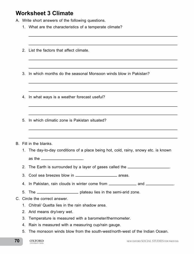
70 1 NEW OXFORD SOCIAL STUDIES FOR PAKISTAN
Worksheet 3 ClimateA. Write short answers of the following questions.
1. What are the characteristics of a temperate climate?
2. List the factors that affect climate.
3. In which months do the seasonal Monsoon winds blow in Pakistan?
4. In what ways is a weather forecast useful?
5. In which climatic zone is Pakistan situated?
B. Fill in the blanks.
1. The day-to-day conditions of a place being hot, cold, rainy, snowy etc. is known
as the .
2. The Earth is surrounded by a layer of gases called the .
3. Cool sea breezes blow in areas.
4. In Pakistan, rain clouds in winter come from and .
5. The plateau lies in the semi-arid zone.
C. Circle the correct answer.
1. Chitral/ Quetta lies in the rain shadow area.
2. Arid means dry/very wet.
3. Temperature is measured with a barometer/thermometer.
4. Rain is measured with a measuring cup/rain gauge.
5. The monsoon winds blow from the south-west/north-west of the Indian Ocean.

NEW OXFORD SOCIAL STUDIES FOR PAKISTAN 711
D. Match the answers.
Instrument Used for measuring
1. Thermometer d. measures the temperature in Celsius
2. Barometer e. measures the air pressure
3. Weather vane a. shows the direction of the wind
4. Rain gauge b. measures the rainfall in milliliters
5. Anemometer c. measures the speed of the wind

72 1 NEW OXFORD SOCIAL STUDIES FOR PAKISTAN
Worksheet 4 LandformsA. Write short answers to the following question.
1. What is the outer-most layer of the Earth called?
2. How is a tsunami different from an earthquake?
3. Give the names of the two physical regions of Pakistan.
4. Why is the Karakoram highway known as the ‘eighth wonder of the world’?
5. Name any three hill stations located in the lesser Himalayas.
B. Fill in the blanks.
1. The two highest peaks in the Hindu Kush mountains are and .
2. Pass connects Peshawar to Kabul.
3. The Indus river originates from Lake in Tibet.
4. The Indus river is kilometer wide in the plains.
5. The desert is the seventh largest desert in the world.
C. Circle the correct answer.
1. Khunjerab Pass/Kararkoram Pass is the highest pass in the Karakoram Mountains.
2. The Indus plains/river provides the best agricultural lands.
3. A valley is lowland/highland between mountains.
4. The Cholistan desert is in Punjab/Sindh.
5. The Khojak pass connects Western Pakistan to Iran/Afghanistan.

NEW OXFORD SOCIAL STUDIES FOR PAKISTAN 731
D. Write the highest peak and highest pass for each mountain range.
S no Mountain range Highest peak Highest pass
1 Himalayas Mount Everest Khyber Pass
2 Karakoram K-2 Karakoram Pass
3 Hindu Kush Noshaq Nakhjir Pass
4 Kohistan, Dir, Swat range
Tirich Mir Badwai Pass

74 1 NEW OXFORD SOCIAL STUDIES FOR PAKISTAN
Worksheet 5 Land use: farming and forestsA. Write short answers to the following questions.
1. What is the name given to the most fertile soil near the river banks?
2. Give two reasons why lower valleys are more fertile than upper valleys.
3. What is meant by terrace farming?
4. Where do Alpine forests grow in Pakistan?
5. Why is there so little vegetation in deserts?
B. Fill in the blanks.
1. There are huge covering the ground on mountain slopes.
2. is the area where the river meets the sea.
3. Oxen and buffaloes are used to pull and .
4. Mangroves do not grow tall because of the water.
5. When good soil is washed away, it is called .
C. Circle the correct answer. 1. The mountains are easy/difficult to climb. 2. The topsoil is very fertile/unfertile soil. 3. We should plant more/less trees on the banks of rivers and on mountains. 4. The Juniper trees in Ziarat are over 5000/3000 years old. 5. Green plants are important for all living things as they give out oxygen/nitrogen gas.

NEW OXFORD SOCIAL STUDIES FOR PAKISTAN 751
Worksheet 6 Water and powerA. Write short answers to the following questions.
1. What are natural resources? List some of the natural resources found in Pakistan.
2. What are the uses of solar pumps?
3. List the different purposes of dams.
4. Name two fossil fuels found in Pakistan.
5. Where are the largest salt mines of Pakistan located?
B. Fill in the blanks.
1. There is % of fresh water in the world.
2. The two large barrages on the River Indus are and
.
3. The two nuclear power stations in Pakistan are and
.
4. Some ways of generating power in Pakistan are ,
and .
5. Minerals found in Pakistan are of two kinds: and
.

76 1 NEW OXFORD SOCIAL STUDIES FOR PAKISTAN
APPENDIX: WORK-SHEETSUnit 1: About MyselfWorksheet 1: Me and my family1. Fill the blanks.
1. The name of my school is .
2. I am a student of Class .
3. I enjoy studying .
C. Circle the correct answer.
1. Sea water is fresh/salty.
2. Dams are constructed to stop/push river water from flowing into the sea.
3. Coal/oil is formed from the remains of trees and forests.
4. Wind mills produce power with the help of water/wind.
5. Pakistan has one of the largest iron /rock salt mines in the world at Khewra.

NEW OXFORD SOCIAL STUDIES FOR PAKISTAN 771
Unit 2 CitizenshipWorksheet 7 Peace and conflictA. Write short answers to the following questions.
1. List some disadvantages of wars.
.
2. What does the UN stand for?
.
3. What is the role of the UN?
.
4. List some of the ways to deal with a personal conflict.
.
B. Fill in the blanks.
1. War causes a lot of damage, and .
2. It is difficult to lead a life during a conflict.
3. The UN was created on .
4. To resolve conflicts we must down.
5. The UN acts as a to help end disputes between countries.
C. Circle the correct answer.
1. War can stop/help people from getting education.
2. Clear communication and cooperation can prevent/begin conflicts.
3. Conflicts can make us feel angry/ happy.
4. Listen/do not listen to the other person’s point of view.
5. Life during wartime is happy/stressful for the people.

78 1 NEW OXFORD SOCIAL STUDIES FOR PAKISTAN
Worksheet 8 People and workA. Write short answers to the following questions.
1. List the types of information collected during a census.
2. What does overpopulation mean?
3. Where does the majority of the population of Pakistan live?
4. Give examples of how a census helps the government to plan?
B. Fill in the blanks.
1. Information collected in the census is known as or
.
2. The percentage of children under 14 years of age are .
3. The people who do not have a degree qualification usually find work as
.
4. The government gives farmers and good
.
5. Trained workers are also known as workers.
C. Circle the correct answer.
1. Schools, hospitals, and colleges are run/not run by the government.
2. The largest steel mill is in Karachi /Lahore.
3. Karachi and Lahore have many car assembly plants/fertiliser factories.
4. The biggest/smallest industry is that of cotton products.
5. Cottage industry/big industry produce handicrafts, pottery, sports goods, and furniture.

NEW OXFORD SOCIAL STUDIES FOR PAKISTAN 791
Worksheet 9 MoneyA. Write short answers to the following questions.
1. What are the two most common things people spend their money on?
2. Define a budget.
3. List three benefits of managing one’s money with a budget.
4. Would you prefer to save some of your money or to spend all of it? Give reasons for your answer.
5. The principal of a school wants to build a science laboratory but there isn’t any vacant space available. What would be the opportunity cost for building the science lab on the school playground?

80 1 NEW OXFORD SOCIAL STUDIES FOR PAKISTAN
B. Fill in the blanks.
1. Economics is the study for the production, distribution, and use of .
2. Economic choices have a great on our lives.
3. Opportunity Cost is important for individuals as well as and .
4. If we want to buy an expensive item, we should to buy it.
5. People also save money in .

NEW OXFORD SOCIAL STUDIES FOR PAKISTAN 811
Unit 3 Our HistoryWorksheet 10 Our pastA. Write short answers to the following questions.
1. Name any three ancient historic sites in Pakistan.
.
2. Name the civilisation that flourished on the banks of the River Indus.
.
3. Who were the Aryans?
.
4. Where did Ashoka inscribe his rules?
.
B. Fill in the blanks.
1. Ashoka became a Buddhist after the .
2. The strongest ruler of the Guptas was .
3. The two Chinese pilgrims that came to India at that time were
and .
4. Two famous universities of that time were at
and .
5. spread in the subcontinent after the arrival of Mohammad bin Qasim.

82 1 NEW OXFORD SOCIAL STUDIES FOR PAKISTAN
C. Circle the correct answer.
1. The Aryans brought the language Sanskrit/Dravidian to the subcontinent.
2. 100,000/150,000 people were killed in the Battle of Kalinga.
3. Ashoka/Kanishka had his rules written on stone pillars.
4. The Parthians and the Huns came from Afghanistan/ Central Asia.
5. Aryabhata used the concept of one/zero.

NEW OXFORD SOCIAL STUDIES FOR PAKISTAN 831
Worksheet 11 Muslim rule in the subcontinentA. Write short answers to the following questions.
1. Who was Raja Dahir?
.
.
2. How did many useful ideas spread from India to the rest of the world?
.
.
3. Who was the first ruler of the Delhi Sultanate?
.
.
.
4. How did Balban defeat Changhez Khan?
.
.
.
5. When did Timur attack India and destroy Delhi?
.
.
.
B. Fill in the blanks.
1. Babur defeated in the first Battle of Panipat.
2. Humayun was defeated by in 1540.
3. The Taj Mahal was built by .
4. Aurangzeb had to fight wars against the and the
.
5. The Mughal Empire was famous for its and
.

84 1 NEW OXFORD SOCIAL STUDIES FOR PAKISTAN
C. Circle the correct answer.
1. The Holy Prophet (SAW) was born in Makkah/ Madina.
2. The first women ruler of the Delhi Sultanate was Mumtaz Mahal/Raziya Sultana.
3. The Mughal ruler Akbar/Humayun never lost a battle.
4. Babur / Humayun was the first ruler to introduce cannons in a battle.
5. Mohammad bin Qasim was the nephew/brother of Hajjaj bin Yousuf.

NEW OXFORD SOCIAL STUDIES FOR PAKISTAN 851
Unit 4 Culture and SocietyWorksheet 12 CommunicationA. Write short answers to the following questions.
1. How do we pay the post office for carrying our letters and parcels?
.
.
2. In what languages does the Pakistan Broadcasting Corporation broadcast its programs?
.
.
3. Are all newspapers and magazines published daily?
.
.
4. How are we able to watch television programs from all over the world?
.
.
5. Why do people find it easier to travel by roads?
.
.
B. Fill in the blanks.
1. The were the first to build roads.
2. The connects Karachi to Gwadar.
3. The cell phones enable a person to send ,
,
, and video messages.
4. ,
is the quickest means of communication these days.
5.
means ways of moving goods or people from one place to another.

86 1 NEW OXFORD SOCIAL STUDIES FOR PAKISTAN
C. Circle the correct answer.
1. Cell phones are easy/difficult to carry.
2. Road have a layer of crushed stone and water/tar.
3. Trains / trucks pull passenger and goods wagons all over the country.
4. Pakistan International Airways was started in 1953/1955.
5. The new port being developed in Balochistan is at Quetta/Gwadar.

NEW OXFORD SOCIAL STUDIES FOR PAKISTAN 871
WORKSHEET 13 Religion and languagesA. Write short answers to the following questions.
1. What percentage of the population of Pakistan are Muslims?
.
2. Give the name of the holy book of Hindus.
.
3. What is the place of worship of Christians called?
.
4. Name the holiest temple of the Sikhs. Where is it located?
.
.
5. Where did the religion of the Parsis follow originate?
.
.
B. Fill in the blanks.
1. The Muslims believe in one God that is ,
2. The also mentions Jesus Christ and his mother Hazrat Maryam (AS).
3. The founder of Buddhism was .
4. The holy book of Parsis is the .
5. Many Pakistanis can speak ,
English, and a language.
C. Circle the correct answer.
1. Hindus worship in churches/temples.
2. The birth place of Guru Nanak is near Lahore/Amritsar.
3. Buddha was a prince in India 2500/3000 years ago.
4. Urdu/English is our national language.
5. Thari/Seraiki is a dialect of Sindhi.

88 1 NEW OXFORD SOCIAL STUDIES FOR PAKISTAN
WORKSHEET 14 CultureA. Write short answers to the following questions.
1. List some festivals celebrated in Pakistan.
.
.
2. Where did Mughal art originate?
.
3. Name two beautiful buildings of the Mughal era in Lahore.
.
4. Name any three great poets of Pakistan.
.
5. List famous sports played in Pakistan.
.
B. Fill in the blanks.
1. The polo tournament in Gilgit-Baltistan is played in .
2. was a world champion in Squash for a number of years.
3. The wind instruments used in Pakistan are the and the
.
4. The paintings on buses, trucks, and trailers are known as .
5. The staple food of Pakistan is and
C. Fill in the columns with the names of the dance of each province and their favourite food.
jhoomar, kunna, ludi, chapli kabab, palla fish, leva, sajji, khattak,
S.no Province Favourite food Dance
1 Balochistan
2 Khyber Pakhtunkhwa
3 Punjab
4 Sindh

NEW OXFORD SOCIAL STUDIES FOR PAKISTAN 891
WORKSHEET 15A. Write short answers to the following questions.
1. List five basic human rights.
.
.
2. Why must we take care of animals?
.
.
3. Name the work done by the farm animals.
.
.
4. Should animals be trained to dance? Why?
.
.
5. Name the place in Karachi, where crocodiles are kept at a shrine.
.
.
B. Circle the correct answer.
1. Animals have a right/no rights to food, shelter, and love.
2. Animals kept on farms should not/should be treated with kindness and protection.
3. It is forbidden/allowed to use animals for testing in laboratories.
4. There are two/three organisations which look after animals in Pakistan.
5. Animals in zoos should be treated badly/kindly.

90 1 NEW OXFORD SOCIAL STUDIES FOR PAKISTAN
Notes:

NEW OXFORD SOCIAL STUDIES FOR PAKISTAN 911
Notes:

92 1 NEW OXFORD SOCIAL STUDIES FOR PAKISTAN
Notes:


![Contested Monarchy: Integrating the Roman Empire in the Fourth Century AD, ed. Johannes Wienand, Oxford/New York: Oxford University Press 2015 [Oxford Studies in Late Antiquity]; ISBN](https://static.fdokumen.com/doc/165x107/631f7db1d10f1687490fd2fe/contested-monarchy-integrating-the-roman-empire-in-the-fourth-century-ad-ed-johannes.jpg)