S. 827 - Govinfo.gov
195
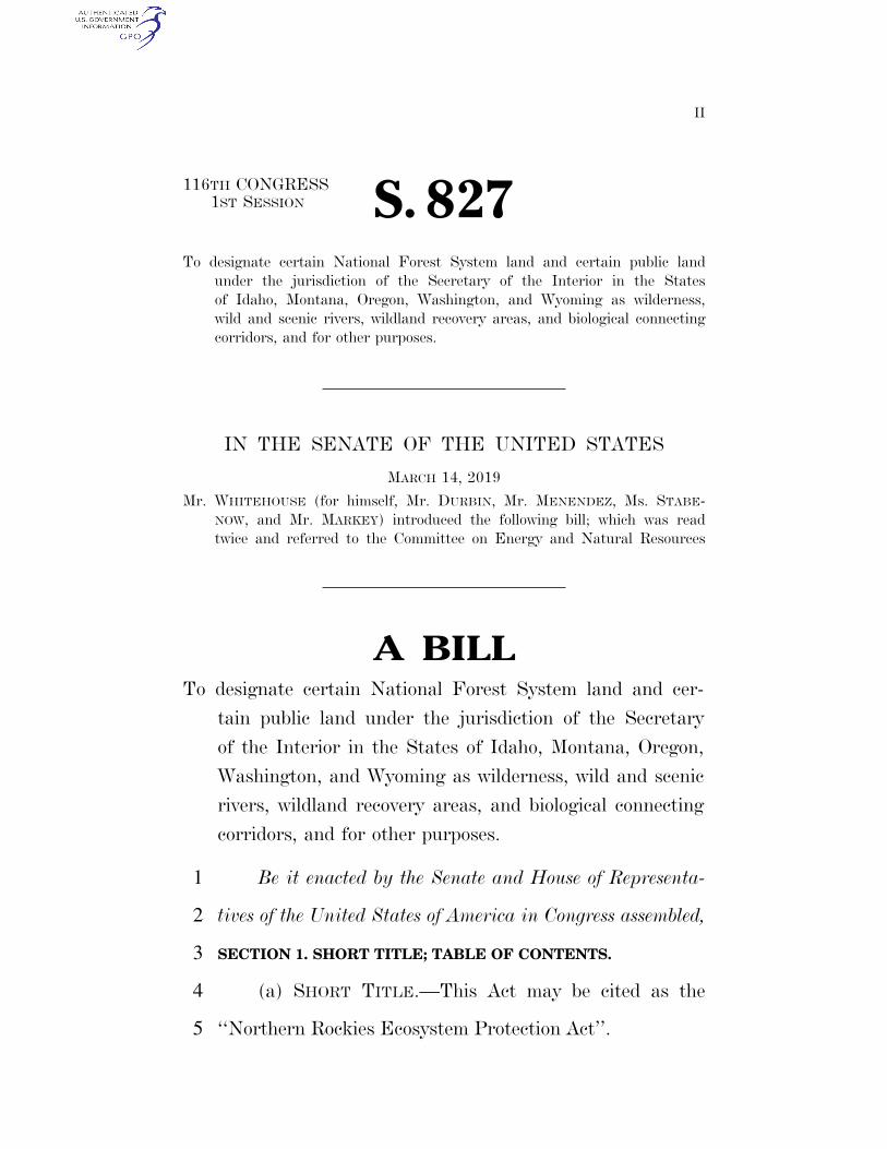
II 116TH CONGRESS 1ST SESSION S. 827 To designate certain National Forest System land and certain public land under the jurisdiction of the Secretary of the Interior in the States of Idaho, Montana, Oregon, Washington, and Wyoming as wilderness, wild and scenic rivers, wildland recovery areas, and biological connecting corridors, and for other purposes. IN THE SENATE OF THE UNITED STATES MARCH 14, 2019 Mr. WHITEHOUSE (for himself, Mr. DURBIN, Mr. MENENDEZ, Ms. STABE- NOW, and Mr. MARKEY) introduced the following bill; which was read twice and referred to the Committee on Energy and Natural Resources A BILL To designate certain National Forest System land and cer- tain public land under the jurisdiction of the Secretary of the Interior in the States of Idaho, Montana, Oregon, Washington, and Wyoming as wilderness, wild and scenic rivers, wildland recovery areas, and biological connecting corridors, and for other purposes. Be it enacted by the Senate and House of Representa- 1 tives of the United States of America in Congress assembled, 2 SECTION 1. SHORT TITLE; TABLE OF CONTENTS. 3 (a) SHORT TITLE.—This Act may be cited as the 4 ‘‘Northern Rockies Ecosystem Protection Act’’. 5 VerDate Sep 11 2014 23:32 Mar 29, 2019 Jkt 089200 PO 00000 Frm 00001 Fmt 6652 Sfmt 6201 E:\BILLS\S827.IS S827 kjohnson on DSK79L0C42 with BILLS
-
Upload
khangminh22 -
Category
Documents
-
view
0 -
download
0
Transcript of S. 827 - Govinfo.gov
II
116TH CONGRESS 1ST SESSION S. 827
To designate certain National Forest System land and certain public land
under the jurisdiction of the Secretary of the Interior in the States
of Idaho, Montana, Oregon, Washington, and Wyoming as wilderness,
wild and scenic rivers, wildland recovery areas, and biological connecting
corridors, and for other purposes.
IN THE SENATE OF THE UNITED STATES
MARCH 14, 2019
Mr. WHITEHOUSE (for himself, Mr. DURBIN, Mr. MENENDEZ, Ms. STABE-
NOW, and Mr. MARKEY) introduced the following bill; which was read
twice and referred to the Committee on Energy and Natural Resources
A BILL To designate certain National Forest System land and cer-
tain public land under the jurisdiction of the Secretary
of the Interior in the States of Idaho, Montana, Oregon,
Washington, and Wyoming as wilderness, wild and scenic
rivers, wildland recovery areas, and biological connecting
corridors, and for other purposes.
Be it enacted by the Senate and House of Representa-1
tives of the United States of America in Congress assembled, 2
SECTION 1. SHORT TITLE; TABLE OF CONTENTS. 3
(a) SHORT TITLE.—This Act may be cited as the 4
‘‘Northern Rockies Ecosystem Protection Act’’. 5
VerDate Sep 11 2014 23:32 Mar 29, 2019 Jkt 089200 PO 00000 Frm 00001 Fmt 6652 Sfmt 6201 E:\BILLS\S827.IS S827kjoh
nson
on
DS
K79
L0C
42 w
ith B
ILLS

2
•S 827 IS
(b) TABLE OF CONTENTS.—The table of contents of 1
this Act is as follows: 2
Sec. 1. Short title; table of contents.
Sec. 2. Findings.
Sec. 3. Purposes.
Sec. 4. Definitions.
TITLE I—DESIGNATION OF WILDERNESS
Sec. 101. Purpose.
Sec. 102. Greater Glacier/Northern Continental Divide ecosystem.
Sec. 103. Greater Yellowstone ecosystem.
Sec. 104. Greater Salmon/Selway ecosystem.
Sec. 105. Greater Cabinet/Yaak/Selkirk ecosystem.
Sec. 106. Greater Hells Canyon ecosystem.
Sec. 107. Islands in the Sky wilderness.
Sec. 108. Wilderness in biological connecting corridors.
Sec. 109. Administration.
Sec. 110. Water.
TITLE II—BIOLOGICAL CONNECTING CORRIDORS
Sec. 201. Findings.
Sec. 202. Designation of biological connecting corridors.
Sec. 203. Treatment of biological connecting corridors.
Sec. 204. Applicability of title.
Sec. 205. Cooperative agreements and land trades and acquisitions.
Sec. 206. Exemption of certain roads and highways.
TITLE III—WILD AND SCENIC RIVERS DESIGNATIONS
Sec. 301. Designation of wild and scenic rivers in Idaho, Montana, and Wyo-
ming.
TITLE IV—WILDLAND RESTORATION AND RECOVERY
Sec. 401. Definitions.
Sec. 402. Restoration and recovery.
Sec. 403. Management.
TITLE V—IMPLEMENTATION AND MONITORING
Sec. 501. Implementation report.
Sec. 502. Interagency team.
Sec. 503. Roadless land evaluation.
TITLE VI—EFFECT OF ACT ON INDIAN TRIBES
Sec. 601. Rights of Indian tribes.
Sec. 602. Federal trust responsibility.
Sec. 603. Exemption from Freedom of Information Act.
Sec. 604. Application of Indian Self-Determination and Education Assistance
Act.
Sec. 605. Tribal use of protected areas.
VerDate Sep 11 2014 23:32 Mar 29, 2019 Jkt 089200 PO 00000 Frm 00002 Fmt 6652 Sfmt 6211 E:\BILLS\S827.IS S827kjoh
nson
on
DS
K79
L0C
42 w
ith B
ILLS

3
•S 827 IS
TITLE VII—EFFECT OF ACT ON WATER RIGHTS
Sec. 701. Water rights.
SEC. 2. FINDINGS. 1
Congress finds that— 2
(1) many areas of undeveloped National Forest 3
System land, National Park System land, and public 4
land administered by the Bureau of Land Manage-5
ment in the States of Idaho, Montana, Oregon, 6
Washington, and Wyoming (referred to in this sec-7
tion as ‘‘public land’’)— 8
(A) possess outstanding natural character-9
istics that give the areas value as wildernesses, 10
parks, or wild and scenic rivers; and 11
(B) if properly preserved, will be an endur-12
ing resource as wildernesses and wildland areas 13
and of biodiversity for the benefit of the people 14
of the United States; 15
(2) the Northern Rockies Bioregion— 16
(A) contains the most diverse array of 17
wildland that remains in the United States 18
south of Canada; 19
(B) provides a sanctuary for species listed 20
as threatened or endangered under the Endan-21
gered Species Act of 1973 (16 U.S.C. 1531 et 22
seq.); 23
VerDate Sep 11 2014 23:32 Mar 29, 2019 Jkt 089200 PO 00000 Frm 00003 Fmt 6652 Sfmt 6201 E:\BILLS\S827.IS S827kjoh
nson
on
DS
K79
L0C
42 w
ith B
ILLS

4
•S 827 IS
(C) is national interest public land that is 1
among the most popular wildland in the United 2
States; and 3
(D) embraces greater ecosystems and na-4
tional treasures such as the Greater Yellow-5
stone, Greater Glacier/Northern Continental Di-6
vide, Greater Hells Canyon/Wallowa, Greater 7
Salmon/Selway, and Greater Cabinet/Yaak/Sel-8
kirk ecosystems; 9
(3) the natural ecosystems in the Northern 10
Rockies Bioregion are largely dependent on— 11
(A) public land; and 12
(B) the ecological productivity and diver-13
sity of resources on public land; 14
(4) conservation of roadless areas on public 15
land— 16
(A) produces clean water; 17
(B) protects native fisheries and native 18
flora and fauna; 19
(C) provides scenic and recreational quali-20
ties; and 21
(D) preserves options for sustainable eco-22
nomics through activities such as hunting, fish-23
ing, and wilderness-based recreation; 24
VerDate Sep 11 2014 23:32 Mar 29, 2019 Jkt 089200 PO 00000 Frm 00004 Fmt 6652 Sfmt 6201 E:\BILLS\S827.IS S827kjoh
nson
on
DS
K79
L0C
42 w
ith B
ILLS
5
•S 827 IS
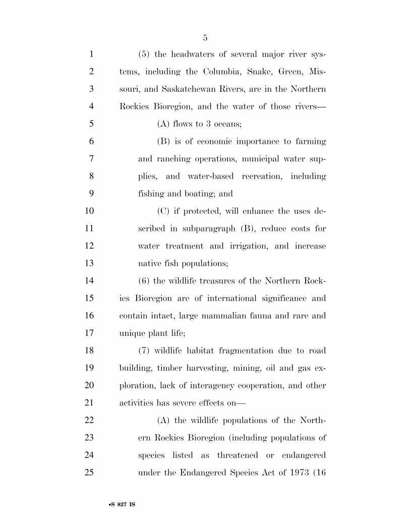
(5) the headwaters of several major river sys-1
tems, including the Columbia, Snake, Green, Mis-2
souri, and Saskatchewan Rivers, are in the Northern 3
Rockies Bioregion, and the water of those rivers— 4
(A) flows to 3 oceans; 5
(B) is of economic importance to farming 6
and ranching operations, municipal water sup-7
plies, and water-based recreation, including 8
fishing and boating; and 9
(C) if protected, will enhance the uses de-10
scribed in subparagraph (B), reduce costs for 11
water treatment and irrigation, and increase 12
native fish populations; 13
(6) the wildlife treasures of the Northern Rock-14
ies Bioregion are of international significance and 15
contain intact, large mammalian fauna and rare and 16
unique plant life; 17
(7) wildlife habitat fragmentation due to road 18
building, timber harvesting, mining, oil and gas ex-19
ploration, lack of interagency cooperation, and other 20
activities has severe effects on— 21
(A) the wildlife populations of the North-22
ern Rockies Bioregion (including populations of 23
species listed as threatened or endangered 24
under the Endangered Species Act of 1973 (16 25
VerDate Sep 11 2014 23:32 Mar 29, 2019 Jkt 089200 PO 00000 Frm 00005 Fmt 6652 Sfmt 6201 E:\BILLS\S827.IS S827kjoh
nson
on
DS
K79
L0C
42 w
ith B
ILLS

6
•S 827 IS
U.S.C. 1531 et seq.)) and the habitats of the 1
wildlife; and 2
(B) the water quality, ancient forests, and 3
greater ecosystems of the Northern Rockies 4
Bioregion; 5
(8) the overemphasis on resource extraction 6
from public land has— 7
(A) compromised ecosystem integrity and 8
detracted from economic diversification oppor-9
tunities; and 10
(B) resulted in economic instability and 11
high unemployment in rural, resource-depend-12
ent communities; 13
(9) the fragmentation and development of the 14
remaining roadless and essentially roadless eco-15
systems and biological connectors of the Northern 16
Rockies Bioregion would cause a loss to the United 17
States of— 18
(A) an entire wildland region; and 19
(B) the only remaining area in the United 20
States south of Canada that can support popu-21
lations of caribou, gray wolves, grizzly bears, 22
anadromous fish, and other rare or endangered 23
plant or animal life in 1 intact bioregion; 24
VerDate Sep 11 2014 23:32 Mar 29, 2019 Jkt 089200 PO 00000 Frm 00006 Fmt 6652 Sfmt 6201 E:\BILLS\S827.IS S827kjoh
nson
on
DS
K79
L0C
42 w
ith B
ILLS

7
•S 827 IS
(10) since the completion of the 1936 roadless 1
area inventory by Bob Marshall, millions of acres of 2
roadless wildland have been developed in the North-3
ern Rockies Bioregion; 4
(11) extensive fragmentation of wildland and 5
wildlife habitat has— 6
(A) resulted in the listing of several species 7
as threatened or endangered under the Endan-8
gered Species Act of 1973 (16 U.S.C. 1531 et 9
seq.); and 10
(B) reduced the number and range of 11
other species, including anadromous fish; 12
(12) the natural ecosystems of the Northern 13
Rockies Bioregion serve as educational and research 14
centers for onsite studies in biology, geology, astron-15
omy, and other sciences; 16
(13) the pristine nature of public land helps 17
local communities attract new residents and busi-18
nesses based on local quality of life; 19
(14) a review of the situation in the Northern 20
Rockies Bioregion as of the date of enactment of 21
this Act has revealed the urgent need for an ecologi-22
cal reserve system for the Northern Rockies Bio-23
region that includes core ecosystem reserve areas 24
and biological connecting corridors necessary to en-25
VerDate Sep 11 2014 23:32 Mar 29, 2019 Jkt 089200 PO 00000 Frm 00007 Fmt 6652 Sfmt 6201 E:\BILLS\S827.IS S827kjoh
nson
on
DS
K79
L0C
42 w
ith B
ILLS

8
•S 827 IS
sure wildlife movements and genetic interchange be-1
tween the core reserve areas; 2
(15) wildlife freedom of movement is essential 3
to the survival of wildlife species, and a number of 4
scientific studies have identified movement corridors 5
as necessary for wildlife conservation in a changing 6
climate; 7
(16) several foreign governments, including the 8
governments of Australia and Scotland, have an-9
nounced plans for corridors that would make wildlife 10
movement possible as climate pressures increase; 11
(17) the concept of connective corridors for 12
wildlife movement— 13
(A) has been endorsed by the Governors of 14
States in the western United States; and 15
(B) is recognized by conservation and sci-16
entific organizations, such as the National 17
Academy of Sciences, which, in 2008, described 18
freedom of movement for wildlife as basic to the 19
emerging new science of movement ecology; 20
(18) freedom of wildlife movement— 21
(A) was a fundamental reason for the de-22
velopment and introduction of this Act; and 23
(B) has become an increasingly high-pro-24
file issue in the climate and biological sciences; 25
VerDate Sep 11 2014 23:32 Mar 29, 2019 Jkt 089200 PO 00000 Frm 00008 Fmt 6652 Sfmt 6201 E:\BILLS\S827.IS S827kjoh
nson
on
DS
K79
L0C
42 w
ith B
ILLS

9
•S 827 IS
(19) the economic value to the United States of 1
most of the public land, left in its natural state, ex-2
ceeds any potential return to the Treasury of the 3
United States from timber harvest and development; 4
(20) if Federal land management in the North-5
ern Rockies Bioregion continues to result in develop-6
ment in roadless areas, the Federal Government will 7
be using tax revenues to fund permanent reductions 8
in wilderness, water quality, fish and wildlife habi-9
tat, species, and biological diversity; 10
(21) this Act— 11
(A) provides opportunities for employment 12
in outdoor trades by establishing rehabilitation 13
zones on specific tracts of damaged Federal 14
land where active restoration work will occur; 15
(B) will provide contracts for local busi-16
nesses; and 17
(C) will renew the intrinsic economic, so-18
cial, and cultural benefits that result from pro-19
ductive land; 20
(22) Federal land rehabilitation projects— 21
(A) have direct benefits to local economies; 22
and 23
VerDate Sep 11 2014 23:32 Mar 29, 2019 Jkt 089200 PO 00000 Frm 00009 Fmt 6652 Sfmt 6201 E:\BILLS\S827.IS S827kjoh
nson
on
DS
K79
L0C
42 w
ith B
ILLS

10
•S 827 IS
(B) reduce the loss to taxpayers in the 1
United States caused by below-cost timber sales 2
and other subsidized resource extraction; 3
(23) a congressional review of roadless areas 4
within public land identifies— 5
(A) areas that, on the basis of the land 6
form, ecosystem, associated fish and wildlife, 7
economic value, and location of the areas, will 8
help to fulfill the role of the Forest Service, Na-9
tional Park Service, and Bureau of Land Man-10
agement to ensure a quality National Wilder-11
ness Preservation System; 12
(B) areas that may have value as wild and 13
scenic rivers; and 14
(C) areas that— 15
(i) may not possess wilderness at-16
tributes and should not now be designated 17
as components of the National Wilderness 18
Preservation System; and 19
(ii) should be studied to determine the 20
role of the areas in maintaining biological 21
diversity in the Northern Rockies Bio-22
region; 23
(24) many areas of public land— 24
VerDate Sep 11 2014 23:32 Mar 29, 2019 Jkt 089200 PO 00000 Frm 00010 Fmt 6652 Sfmt 6201 E:\BILLS\S827.IS S827kjoh
nson
on
DS
K79
L0C
42 w
ith B
ILLS

11
•S 827 IS
(A) have been damaged and experienced a 1
reduction in productivity due to unwise develop-2
ment practices, which have also impaired eco-3
system function and biological diversity, such as 4
the Island Park area adjacent to Yellowstone 5
National Park, which contains large clear-cut 6
areas that border the park boundary; and 7
(B) should be returned to the former eco-8
logical health and native diversity of the areas 9
through efforts— 10
(i) to ensure that vital ecosystem com-11
ponents are restored, especially in areas in 12
which wildlife travel corridors and native 13
fish and wildlife populations have been 14
damaged or eliminated; and 15
(ii) to ensure and maintain genetic 16
interchange, biological diversity, and res-17
toration of native species diversity through-18
out the Northern Rockies Bioregion; 19
(25) backcountry areas of the National Park 20
System have been damaged by inappropriate man-21
agement, despite policies that require that rec-22
ommended wilderness be administered as wilderness; 23
(26) an emphasis on structures and motorized 24
equipment, and in some instances developed 25
VerDate Sep 11 2014 23:32 Mar 29, 2019 Jkt 089200 PO 00000 Frm 00011 Fmt 6652 Sfmt 6201 E:\BILLS\S827.IS S827kjoh
nson
on
DS
K79
L0C
42 w
ith B
ILLS

12
•S 827 IS
backcountry campsites, in backcountry areas of the 1
National Park System has detracted from and de-2
graded the wilderness character of those 3
backcountry areas; 4
(27) Federal agencies entrusted with managing 5
the natural resources of the Northern Rockies Bio-6
region— 7
(A) operate under contradictory congres-8
sional mandates; and 9
(B) are in dissension over management 10
policies that involve common resources and 11
greater ecosystems; 12
(28) Federal agency structures and regulatory 13
mechanisms as of the date of enactment of this Act 14
have proven unsatisfactory for the responsible man-15
agement of nationally important ecosystems on pub-16
lic land; 17
(29) Federal laws and regulations as of the 18
date of enactment of this Act have not been suffi-19
cient to establish and maintain the accountability of 20
Federal agencies for public resources; and 21
(30) this Act does not affect private existing 22
rights. 23
SEC. 3. PURPOSES. 24
(a) IN GENERAL.—The purposes of this Act are— 25
VerDate Sep 11 2014 23:32 Mar 29, 2019 Jkt 089200 PO 00000 Frm 00012 Fmt 6652 Sfmt 6201 E:\BILLS\S827.IS S827kjoh
nson
on
DS
K79
L0C
42 w
ith B
ILLS

13
•S 827 IS
(1) to designate certain National Forest System 1
land, certain National Park System land, and cer-2
tain public land administered by the Bureau of Land 3
Management in the States of Idaho, Montana, Or-4
egon, Washington, and Wyoming as components of 5
the National Wilderness Preservation System; 6
(2) to designate certain National Forest System 7
land, certain public land administered by the Bureau 8
of Land Management, and watercourses on that Na-9
tional Forest System land and public land in the 10
States of Montana, Idaho, and Wyoming as compo-11
nents of the National Wild and Scenic Rivers Sys-12
tem; 13
(3) to prioritize areas for wildland recovery to 14
help restore biological diversity and native species; 15
and 16
(4) to establish a system of biological con-17
necting corridors between the core ecosystems in the 18
Northern Rockies Bioregion. 19
(b) PURPOSE OF DESIGNATIONS.—The designations 20
of land made by this Act are made— 21
(1) to promote, perpetuate, and preserve the 22
wilderness character of the designated land; 23
(2) to protect water quality, watersheds, and 24
wildlife habitats, including the habitats of species 25
VerDate Sep 11 2014 23:32 Mar 29, 2019 Jkt 089200 PO 00000 Frm 00013 Fmt 6652 Sfmt 6201 E:\BILLS\S827.IS S827kjoh
nson
on
DS
K79
L0C
42 w
ith B
ILLS

14
•S 827 IS
listed as threatened or endangered under the Endan-1
gered Species Act of 1973 (16 U.S.C. 1531 et seq.); 2
(3) to protect the ecological integrity and con-3
tiguity of major wildland ecosystems and the inter-4
connecting corridors of the ecosystems identified by 5
the Director of the United States Fish and Wildlife 6
Service or another official; 7
(4) to protect and maintain biological and na-8
tive species diversity and dispersal throughout the 9
Northern Rockies Bioregion; 10
(5) to promote and ensure interagency coopera-11
tion in the implementation of integrated, holistic 12
ecosystem management and protection of the eco-13
systems and corridors covered by this Act based on 14
principles from conservation biology; 15
(6) to preserve scenic, historic, and cultural re-16
sources; 17
(7) to promote scientific research, primitive 18
recreation, solitude, physical and mental challenges, 19
and inspiration for the benefit of the people of the 20
United States; 21
(8) to avoid the misinvestment of scarce capital 22
in land of marginal timber value; and 23
VerDate Sep 11 2014 23:32 Mar 29, 2019 Jkt 089200 PO 00000 Frm 00014 Fmt 6652 Sfmt 6201 E:\BILLS\S827.IS S827kjoh
nson
on
DS
K79
L0C
42 w
ith B
ILLS

15
•S 827 IS
(9) to promote ecologically and economically 1
sustainable management in the Northern Rockies 2
Bioregion. 3
SEC. 4. DEFINITIONS. 4
In this Act: 5
(1) CORRIDOR.—The term ‘‘corridor’’ means an 6
area that provides connectivity of habitat or poten-7
tial habitat, and that facilitates the ability of terres-8
trial, estuarine, and freshwater fish, or wildlife, to 9
move within a landscape— 10
(A) as needed for migration, gene flow, or 11
dispersal; or 12
(B) in response to the impacts of climate 13
change or other impacts. 14
(2) DEVELOPMENT.— 15
(A) IN GENERAL.—The term ‘‘develop-16
ment’’ means an activity that eliminates the 17
roadless and wilderness characteristics of the 18
land on which the activity takes place. 19
(B) INCLUSIONS.—The term ‘‘develop-20
ment’’ includes the construction or operation of 21
a ski resort facility, road building, timber har-22
vesting, mining, and oil and gas drilling. 23
(3) GREATER ECOSYSTEM.—The term ‘‘greater 24
ecosystem’’, when used in conjunction with a specific 25
VerDate Sep 11 2014 23:32 Mar 29, 2019 Jkt 089200 PO 00000 Frm 00015 Fmt 6652 Sfmt 6201 E:\BILLS\S827.IS S827kjoh
nson
on
DS
K79
L0C
42 w
ith B
ILLS

16
•S 827 IS
ecosystem described in this Act, means an ecological 1
land unit— 2
(A)(i) of sufficient scale to support and 3
maintain populations of large vertebrate species 4
and the other native plant and animal species 5
of the unit; and 6
(ii) comprised of land that is similar in to-7
pography, climate, and plant and animal species 8
on the land; or 9
(B) contiguous with the habitat of a wild-10
life indicator species listed as threatened or en-11
dangered under the Endangered Species Act of 12
1973 (16 U.S.C. 1531 et seq.), including the 13
grizzly bear, lynx, or caribou, as depicted on 14
habitat maps of Federal agencies. 15
(4) HABITAT.—The term ‘‘habitat’’ means the 16
physical, chemical, and biological properties that are 17
used by fish, wildlife, or plants for growth, reproduc-18
tion, survival, food, water, and cover on a tract of 19
land, in a body of water, or in an area or region. 20
(5) INDIAN TRIBE.—The term ‘‘Indian tribe’’ 21
has the meaning given the term in section 4 of the 22
Indian Self-Determination and Education Assistance 23
Act (25 U.S.C. 450b). 24
VerDate Sep 11 2014 23:32 Mar 29, 2019 Jkt 089200 PO 00000 Frm 00016 Fmt 6652 Sfmt 6201 E:\BILLS\S827.IS S827kjoh
nson
on
DS
K79
L0C
42 w
ith B
ILLS

17
•S 827 IS
(6) NORTHERN ROCKIES BIOREGION.—The 1
term ‘‘Northern Rockies Bioregion’’ means the por-2
tion of the Northern Rocky Mountains in the States 3
of Montana, Idaho, Wyoming, Oregon, and Wash-4
ington, as depicted on maps referred to in this Act. 5
(7) PUBLIC LAND.—The term ‘‘public land’’ 6
has the meaning given the term ‘‘public lands’’ in 7
section 103 of the Federal Land Policy and Manage-8
ment Act of 1976 (43 U.S.C. 1702). 9
(8) SECRETARY CONCERNED.—The term ‘‘Sec-10
retary concerned’’ means— 11
(A) the Secretary of Agriculture, with re-12
spect to National Forest System land; and 13
(B) the Secretary of the Interior, with re-14
spect to National Park System land and public 15
land. 16
TITLE I—DESIGNATION OF 17
WILDERNESS 18
SEC. 101. PURPOSE. 19
The purpose of this title is to designate certain Na-20
tional Forest System land, National Park System land, 21
and public land administered by the Bureau of Land Man-22
agement in the States of Idaho, Montana, Oregon, Wash-23
ington, and Wyoming as wilderness and as components of 24
the National Wilderness Preservation System in further-25
VerDate Sep 11 2014 23:32 Mar 29, 2019 Jkt 089200 PO 00000 Frm 00017 Fmt 6652 Sfmt 6201 E:\BILLS\S827.IS S827kjoh
nson
on
DS
K79
L0C
42 w
ith B
ILLS

18
•S 827 IS
ance of the purposes of the Wilderness Act (16 U.S.C. 1
1131 et seq.). 2
SEC. 102. GREATER GLACIER/NORTHERN CONTINENTAL DI-3
VIDE ECOSYSTEM. 4
(a) DEFINITION OF MAP.—In this section, the term 5
‘‘Map’’ means the map entitled ‘‘Northern Continental Di-6
vide’’ and dated April 28, 2016. 7
(b) DESIGNATIONS.—To protect the unique eco-8
system of the greater Glacier/Northern Continental Divide 9
ecosystem, the following land is designated as wilderness: 10
(1) BOB MARSHALL WILDERNESS ADDITIONS.— 11
The following land is incorporated in, and shall be 12
administered as part of, the Bob Marshall Wilder-13
ness: 14
(A) CHOTEAU MOUNTAIN/TETON HIGH 15
PEAKS/DEEP CREEK ADDITION.—Certain Fed-16
eral land within the Lewis and Clark National 17
Forest and land administered by the Lewistown 18
Field Office of the Bureau of Land Manage-19
ment comprising approximately 73,000 acres, 20
identified as ‘‘Choteau Mountain/Teton High 21
Peaks/Deep Creek Addition’’ on the Map. 22
(B) RENSHAW ADDITION.—Certain Fed-23
eral land within the Lewis and Clark National 24
Forest and land administered by the Lewistown 25
VerDate Sep 11 2014 23:32 Mar 29, 2019 Jkt 089200 PO 00000 Frm 00018 Fmt 6652 Sfmt 6201 E:\BILLS\S827.IS S827kjoh
nson
on
DS
K79
L0C
42 w
ith B
ILLS

19
•S 827 IS
Field Office of the Bureau of Land Manage-1
ment comprising approximately 30,000 acres, 2
identified as ‘‘Renshaw Addition’’ on the Map. 3
(C) SWAN FRONT ADDITION.—Certain 4
Federal land within the Flathead National For-5
est and Lolo National Forest comprising ap-6
proximately 169,000 acres, identified as ‘‘Swan 7
Front Addition’’ on the Map. 8
(D) HUNGRY HORSE RESERVOIR WEST.— 9
Certain Federal land within the Flathead Na-10
tional Forest comprising approximately 179,000 11
acres, identified as ‘‘Hungry Horse Reservoir 12
West’’ on the Map. 13
(E) BOB NORTH ADDITION.—Certain Fed-14
eral land within the Flathead National Forest 15
comprising approximately 88,000 acres, identi-16
fied as ‘‘Bob North Addition’’ on the Map. 17
(F) MONTURE CREEK ADDITION.—Certain 18
Federal land within the Lolo National Forest 19
comprising approximately 99,000 acres, identi-20
fied as ‘‘Monture Creek Addition’’ on the Map. 21
(2) GREAT BEAR WILDERNESS ADDITIONS.— 22
The following land is incorporated in, and shall be 23
administered as part of, the Great Bear Wilderness: 24
VerDate Sep 11 2014 23:32 Mar 29, 2019 Jkt 089200 PO 00000 Frm 00019 Fmt 6652 Sfmt 6201 E:\BILLS\S827.IS S827kjoh
nson
on
DS
K79
L0C
42 w
ith B
ILLS

20
•S 827 IS
(A) HUNGRY HORSE RESERVOIR EAST AD-1
DITION.—Certain Federal land within the Flat-2
head National Forest comprising approximately 3
37,000 acres, identified as ‘‘Hungry Horse Res-4
ervoir East Addition’’ on the Map. 5
(B) MIDDLE FORK ADDITIONS.—Certain 6
Federal land within the Flathead National For-7
est comprising approximately 53,000 acres, 8
identified as ‘‘Middle Fork Additions’’ on the 9
Map. 10
(3) SCAPEGOAT WILDERNESS ADDITIONS.—The 11
following land, consisting of a total of approximately 12
125,000 acres, is incorporated in, and shall be ad-13
ministered as part of, the Scapegoat Wilderness: 14
(A) STONEWALL MOUNTAIN ADDITION.— 15
Certain Federal land within the Helena Na-16
tional Forest comprising approximately 55,000 17
acres, identified as ‘‘Stonewall Mountain Addi-18
tion’’ on the Map. 19
(B) SILVER KING/FALLS CREEK ADDI-20
TION.—Certain Federal land within the Lewis 21
and Clark National Forest and Helena National 22
Forest comprising approximately 25,000 acres, 23
identified as ‘‘Silver King/Falls Creek Addition’’ 24
on the Map. 25
VerDate Sep 11 2014 23:32 Mar 29, 2019 Jkt 089200 PO 00000 Frm 00020 Fmt 6652 Sfmt 6201 E:\BILLS\S827.IS S827kjoh
nson
on
DS
K79
L0C
42 w
ith B
ILLS
21
•S 827 IS
(C) BENCHMARK/ELK CREEK ADDITION.— 1
Certain Federal land within the Lewis and 2
Clark National Forest comprising approxi-3
mately 28,000 acres, identified as ‘‘Benchmark/ 4
Elk Creek Addition’’ on the Map. 5
(4) MISSION MOUNTAINS WILDERNESS ADDI-6
TIONS.—The following land, consisting of a total of 7
approximately 16,000 acres, is incorporated in, and 8
shall be administered as part of, the Mission Moun-9
tains Wilderness: 10
(A) MISSION MOUNTAIN WILDERNESS AD-11
DITION.—Certain Federal land within the Flat-12
head National Forest comprising approximately 13
20,000 acres, identified as ‘‘Mission Mountain 14
Wilderness Addition’’ on the Map. 15
(B) MARSHALL PEAK ADDITION.—Certain 16
Federal land within the Lolo National Forest 17
comprising approximately 9,000 acres, identi-18
fied as ‘‘Marshall Peak Addition’’ on the Map. 19
(5) NEW NATIONAL WILDERNESS PRESERVA-20
TION SYSTEM COMPONENTS.—Each of the following 21
areas of land is designated as a component of the 22
National Wilderness Preservation System: 23
(A) GLACIER WILDERNESS, GLACIER NA-24
TIONAL PARK.—Certain Federal land within 25
VerDate Sep 11 2014 23:32 Mar 29, 2019 Jkt 089200 PO 00000 Frm 00021 Fmt 6652 Sfmt 6201 E:\BILLS\S827.IS S827kjoh
nson
on
DS
K79
L0C
42 w
ith B
ILLS
22
•S 827 IS
Glacier National Park comprising approxi-1
mately 925,000 acres, identified as ‘‘Wilder-2
ness’’ on the map entitled ‘‘Glacier National 3
Park Wilderness’’ and dated April 29, 2016, 4
which shall be known as the ‘‘Glacier Wilder-5
ness’’. 6
(B) SAWTOOTH RIDGE WILDERNESS.—Cer-7
tain Federal land within the Lewis and Clark 8
National Forest comprising approximately 9
14,000 acres, identified as ‘‘Sawtooth Ridge 10
Wilderness’’ on the Map, which shall be known 11
as the ‘‘Sawtooth Ridge Wilderness’’. 12
(C) TUCHUCK WILDERNESS.—Certain 13
Federal land within the Flathead National For-14
est and the Kootenai National Forest com-15
prising approximately 142,000 acres, identified 16
as ‘‘Tuchuck Wilderness’’ on the Map, which 17
shall be known as the ‘‘Tuchuck Wilderness’’. 18
(D) LE BEAU WILDERNESS.—Certain Fed-19
eral land within the Flathead National Forest 20
and the Kootenai National Forest comprising 21
approximately 8,000 acres, identified as ‘‘Le 22
Beau Wilderness’’ on the Map, which shall be 23
known as the ‘‘Le Beau Wilderness’’. 24
VerDate Sep 11 2014 23:32 Mar 29, 2019 Jkt 089200 PO 00000 Frm 00022 Fmt 6652 Sfmt 6201 E:\BILLS\S827.IS S827kjoh
nson
on
DS
K79
L0C
42 w
ith B
ILLS

23
•S 827 IS
(E) TEN LAKES WILDERNESS.—Certain 1
Federal land within the Kootenai National For-2
est comprising approximately 49,000 acres, 3
identified as ‘‘Ten Lakes Wilderness’’ on the 4
Map, which shall be known as the ‘‘Ten Lakes 5
Wilderness’’. 6
(F) COAL RIDGE WILDERNESS.—Certain 7
Federal land within the Flathead National For-8
est comprising approximately 24,000 acres, 9
identified as ‘‘Coal Ridge Wilderness’’ on the 10
Map, which shall be known as the ‘‘Coal Ridge 11
Wilderness’’. 12
(G) STANDARD PEAK WILDERNESS.—Cer-13
tain Federal land within the Flathead National 14
Forest comprising approximately 19,000 acres, 15
identified as ‘‘Standard Peak Wilderness’’ on 16
the Map, which shall be known as the ‘‘Stand-17
ard Peak Wilderness’’. 18
(H) DEMERS WILDERNESS.—Certain Fed-19
eral land within the Flathead National Forest 20
comprising approximately 7,000 acres, identi-21
fied as ‘‘Demers Wilderness’’ on the Map, 22
which shall be known as the ‘‘Demers Wilder-23
ness’’. 24
VerDate Sep 11 2014 23:32 Mar 29, 2019 Jkt 089200 PO 00000 Frm 00023 Fmt 6652 Sfmt 6201 E:\BILLS\S827.IS S827kjoh
nson
on
DS
K79
L0C
42 w
ith B
ILLS

24
•S 827 IS
(I) LINCOLN GULCH WILDERNESS.—Cer-1
tain Federal land within the Helena National 2
Forest comprising approximately 9,000 acres, 3
identified as ‘‘Lincoln Gulch Wilderness’’ on the 4
Map, which shall be known as the ‘‘Lincoln 5
Gulch Wilderness’’. 6
(J) ANACONDA HILL WILDERNESS.—Cer-7
tain Federal land within the Helena National 8
Forest comprising approximately 20,000 acres, 9
identified as ‘‘Anaconda Hill Wilderness’’ on 10
the Map, which shall be known as the ‘‘Ana-11
conda Hill Wilderness’’. 12
(K) SPECIMEN CREEK WILDERNESS.—Cer-13
tain Federal land within the Helena National 14
Forest comprising approximately 13,000 acres, 15
identified as ‘‘Specimen Creek Wilderness’’ on 16
the Map, which shall be known as the ‘‘Speci-17
men Creek Wilderness’’. 18
(L) CRATER MOUNTAIN WILDERNESS.— 19
Certain Federal land within the Helena Na-20
tional Forest comprising approximately 10,000 21
acres, identified as ‘‘Crater Mountain Wilder-22
ness’’ on the Map, which shall be known as the 23
‘‘Crater Mountain Wilderness’’. 24
VerDate Sep 11 2014 23:32 Mar 29, 2019 Jkt 089200 PO 00000 Frm 00024 Fmt 6652 Sfmt 6201 E:\BILLS\S827.IS S827kjoh
nson
on
DS
K79
L0C
42 w
ith B
ILLS
25
•S 827 IS
(M) OGDEN MOUNTAIN WILDERNESS.— 1
Certain Federal land within the Helena Na-2
tional Forest comprising approximately 8,000 3
acres, identified as ‘‘Ogden Mountain Wilder-4
ness’’ on the Map, which shall be known as the 5
‘‘Ogden Mountain Wilderness’’. 6
(N) NEVADA MOUNTAIN WILDERNESS.— 7
Certain Federal land within the Helena Na-8
tional Forest comprising approximately 54,000 9
acres, identified as ‘‘Nevada Mountain Wilder-10
ness’’ on the Map, which shall be known as the 11
‘‘Nevada Mountain Wilderness’’. 12
(O) BLACKFEET WILDERNESS.—Certain 13
Federal land within the Lewis and Clark Na-14
tional Forest comprising approximately 129,000 15
acres, identified as ‘‘Blackfeet Wilderness’’ on 16
the Map, which shall be known as the ‘‘Black-17
feet Wilderness’’. 18
SEC. 103. GREATER YELLOWSTONE ECOSYSTEM. 19
(a) DEFINITION OF MAP.—In this section, the term 20
‘‘Map’’ means the map entitled ‘‘Greater Yellowstone’’ and 21
dated April 28, 2016. 22
(b) DESIGNATIONS.—To protect the unique eco-23
system of the greater Yellowstone ecosystem, the following 24
land is designated as wilderness: 25
VerDate Sep 11 2014 23:32 Mar 29, 2019 Jkt 089200 PO 00000 Frm 00025 Fmt 6652 Sfmt 6201 E:\BILLS\S827.IS S827kjoh
nson
on
DS
K79
L0C
42 w
ith B
ILLS

26
•S 827 IS
(1) ABSAROKA-BEARTOOTH WILDERNESS ADDI-1
TIONS.—Certain Federal land within the Custer Gal-2
latin National Forest and the Shoshone National 3
Forest comprising approximately 265,000 acres, 4
identified as ‘‘Absaroka-Beartooth Wilderness Addi-5
tions’’ on the Map, is incorporated in, and shall be 6
administered as part of, the Absaroka-Beartooth 7
Wilderness. 8
(2) NORTH ABSAROKA WILDERNESS ADDI-9
TIONS.—Certain Federal land within the Shoshone 10
National Forest and the Custer Gallatin National 11
Forest comprising approximately 173,000, identified 12
as ‘‘North Absaroka Wilderness Additions’’ on the 13
Map, is incorporated in, and shall be administered 14
as part of, the North Absaroka Wilderness. 15
(3) WASHAKIE WILDERNESS ADDITIONS.—Cer-16
tain Federal land within the Shoshone National For-17
est and land administered by the Lander Field Of-18
fice of the Bureau of Land Management comprising 19
approximately 339,000 acres, identified as 20
‘‘Washakie Wilderness Additions’’ on the Map, is in-21
corporated in, and shall be administered as part of, 22
the Washakie Wilderness. 23
VerDate Sep 11 2014 23:32 Mar 29, 2019 Jkt 089200 PO 00000 Frm 00026 Fmt 6652 Sfmt 6201 E:\BILLS\S827.IS S827kjoh
nson
on
DS
K79
L0C
42 w
ith B
ILLS

27
•S 827 IS
(4) FITZPATRICK WILDERNESS ADDITIONS.— 1
The following land is incorporated in, and shall be 2
administered as part of, the Fitzpatrick Wilderness: 3
(A) FITZPATRICK WILDERNESS ADDI-4
TION.—Certain Federal land within the Sho-5
shone National Forest and land administered 6
by the Lander Field Office of the Bureau of 7
Land Management comprising approximately 8
14,000 acres, identified as ‘‘Fitzpatrick Wilder-9
ness Addition’’ on the Map. 10
(B) BENCHMARK/WARM SPRINGS ADDI-11
TION.—Certain Federal land within the Sho-12
shone National Forest comprising approxi-13
mately 15,000 acres, identified as ‘‘Benchmark/ 14
Warm Springs Addition’’ on the Map. 15
(5) TETON WILDERNESS ADDITIONS.—Certain 16
Federal land within the Bridger-Teton National For-17
est comprising approximately 24,000 acres, identi-18
fied as ‘‘Teton Wilderness Additions’’ on the Map, 19
is incorporated in, and shall be administered as part 20
of, the Teton Wilderness. 21
(6) GROS VENTRE WILDERNESS ADDITIONS.— 22
The following land is incorporated in, and shall be 23
administered as part of, the Gros Ventre Wilderness: 24
VerDate Sep 11 2014 23:32 Mar 29, 2019 Jkt 089200 PO 00000 Frm 00027 Fmt 6652 Sfmt 6201 E:\BILLS\S827.IS S827kjoh
nson
on
DS
K79
L0C
42 w
ith B
ILLS
28
•S 827 IS
(A) SHOAL CREEK ADDITION.—Certain 1
Federal land within the Bridger-Teton National 2
Forest comprising approximately 32,000 acres, 3
identified as ‘‘Shoal Creek Addition’’ on the 4
Map. 5
(B) GROS VENTRE ADDITIONS.—Certain 6
Federal land within the Bridger-Teton National 7
Forest comprising approximately 124,000 acres, 8
identified as ‘‘Gros Ventre Additions’’ on the 9
Map. 10
(7) BRIDGER WILDERNESS ADDITIONS.—Cer-11
tain Federal land within the Bridger-Teton National 12
Forest and land administered by the Pinedale Field 13
Office of the Bureau of Land Management com-14
prising approximately 230,000 acres, identified as 15
‘‘Bridger Wilderness Additions’’ on the Map, is in-16
corporated in, and shall be administered as part of, 17
the Bridger Wilderness. 18
(8) POPO AGIE WILDERNESS ADDITIONS.—Cer-19
tain Federal land within the Shoshone National For-20
est comprising approximately 60,000 acres, identi-21
fied as ‘‘Popo Agie Wilderness Additions’’ on the 22
Map, is incorporated in, and shall be administered 23
as part of, the Popo Agie Wilderness. 24
VerDate Sep 11 2014 23:32 Mar 29, 2019 Jkt 089200 PO 00000 Frm 00028 Fmt 6652 Sfmt 6201 E:\BILLS\S827.IS S827kjoh
nson
on
DS
K79
L0C
42 w
ith B
ILLS
29
•S 827 IS
(9) WINEGAR HOLE WILDERNESS ADDITIONS.— 1
Certain Federal land within the Caribou-Targhee 2
National Forest comprising approximately 5,000 3
acres, identified as ‘‘Winegar Hole Wilderness Addi-4
tions’’ on the Map, is incorporated in, and shall be 5
administered as part of, the Winegar Hole Wilder-6
ness. 7
(10) JEDEDIAH SMITH WILDERNESS ADDI-8
TIONS.—Certain Federal land within the Bridger- 9
Teton and Caribou-Targhee National Forest com-10
prising approximately 51,000 acres, identified as 11
‘‘Jedediah Smith Wilderness Additions’’ on the Map, 12
is incorporated in, and shall be administered as part 13
of, the Jedediah Smith Wilderness. 14
(11) LEE METCALF WILDERNESS ADDITIONS.— 15
The following land is incorporated in, and shall be 16
administered as part of, the Lee Metcalf Wilderness: 17
(A) COWBOYS HEAVEN ADDITION.—Cer-18
tain Federal land within the Custer Gallatin 19
National Forest and the Beaverhead-Deerlodge 20
National Forest comprising approximately 21
40,000 acres, identified as ‘‘Cowboys Heaven 22
Addition’’ on the Map. 23
(B) LEE METCALF ADDITION.—Certain 24
Federal land within the Custer Gallatin Na-25
VerDate Sep 11 2014 23:32 Mar 29, 2019 Jkt 089200 PO 00000 Frm 00029 Fmt 6652 Sfmt 6201 E:\BILLS\S827.IS S827kjoh
nson
on
DS
K79
L0C
42 w
ith B
ILLS
30
•S 827 IS
tional Forest and the Beaverhead-Deerlodge 1
National Forest comprising approximately 2
143,000 acres, identified as ‘‘Lee Metcalf Addi-3
tion’’ on the Map. 4
(12) NEW NATIONAL WILDERNESS PRESERVA-5
TION SYSTEM COMPONENTS.—Each of the following 6
areas of land is designated as a component of the 7
National Wilderness Preservation System: 8
(A) YELLOWSTONE WILDERNESS, YELLOW-9
STONE NATIONAL PARK.—Certain Federal land 10
within Yellowstone National Park comprising 11
approximately 2,030,000 acres, identified as 12
‘‘Wilderness’’ on the map entitled ‘‘Yellowstone 13
National Park Wilderness’’ and dated April 29, 14
2016, which shall be known as the ‘‘Yellowstone 15
Wilderness’’. 16
(B) GRAND TETON WILDERNESS, GRAND 17
TETON NATIONAL PARK.—Certain Federal land 18
withinthe Grand Teton National Park com-19
prising approximately 123,000 acres, identified 20
as ‘‘Wilderness’’ on the map entitled ‘‘Grand 21
Teton National Park Wilderness’’ and dated 22
April 29, 2016, which shall be known as the 23
‘‘Grand Teton Wilderness’’. 24
VerDate Sep 11 2014 23:32 Mar 29, 2019 Jkt 089200 PO 00000 Frm 00030 Fmt 6652 Sfmt 6201 E:\BILLS\S827.IS S827kjoh
nson
on
DS
K79
L0C
42 w
ith B
ILLS

31
•S 827 IS
(C) SNOWCREST WILDERNESS.—Certain 1
Federal land within the Beaverhead-Deerlodge 2
National Forest and land administered by the 3
Dillon Field Office of the Bureau of Land Man-4
agement comprising approximately 105,000 5
acres, identified as ‘‘Snowcrest Wilderness’’ on 6
the Map, which shall be known as the 7
‘‘Snowcrest Wilderness’’. 8
(D) ANTELOPE BASIN WILDERNESS.—Cer-9
tain Federal land within the Beaverhead- 10
Deerlodge National Forest comprising approxi-11
mately 70,000 acres, identified as ‘‘Antelope 12
Basin Wilderness’’ on the Map, which shall be 13
known as the ‘‘Antelope Basin Wilderness’’. 14
(E) LONE BUTTE WILDERNESS.—Certain 15
Federal land within the Beaverhead-Deerlodge 16
National Forest comprising approximately 17
14,000 acres, identified as ‘‘Lone Butte Wilder-18
ness’’ on the Map, which shall be known as the 19
‘‘Lone Butte Wilderness’’. 20
(F) BLACK BUTTE WILDERNESS.—Certain 21
Federal land within the Beaverhead-Deerlodge 22
National Forest comprising approximately 23
39,000 acres, identified as ‘‘Black Butte Wil-24
VerDate Sep 11 2014 23:32 Mar 29, 2019 Jkt 089200 PO 00000 Frm 00031 Fmt 6652 Sfmt 6201 E:\BILLS\S827.IS S827kjoh
nson
on
DS
K79
L0C
42 w
ith B
ILLS

32
•S 827 IS
derness’’ on the Map, which shall be known as 1
the ‘‘Black Butte Wilderness’’. 2
(G) GRAVELLY MOUNTAINS WILDER-3
NESS.—Certain Federal land within the Beaver-4
head-Deerlodge National Forest comprising ap-5
proximately 53,000 acres, identified as ‘‘Grav-6
elly Mountains Wilderness’’ on the Map, which 7
shall be known as the ‘‘Gravelly Mountains Wil-8
derness’’. 9
(H) VIGILANTE WILDERNESS.—Certain 10
Federal land within the Beaverhead-Deerlodge 11
National Forest comprising approximately 12
16,000 acres, identified as ‘‘Vigilante Wilder-13
ness’’ on the Map, which shall be known as the 14
‘‘Vigilante Wilderness’’. 15
(I) CHERRY LAKES WILDERNESS.—Certain 16
Federal land within the Beaverhead-Deerlodge 17
National Forest comprising approximately 18
13,000 acres, identified as ‘‘Cherry Lakes Wil-19
derness’’ on the Map, which shall be known as 20
the ‘‘Cherry Lakes Wilderness’’. 21
(J) AXOLOTL WILDERNESS.—Certain Fed-22
eral land within the Beaverhead-Deerlodge Na-23
tional Forest and land administered by the Dil-24
lon Field Office of the Bureau of Land Man-25
VerDate Sep 11 2014 23:32 Mar 29, 2019 Jkt 089200 PO 00000 Frm 00032 Fmt 6652 Sfmt 6201 E:\BILLS\S827.IS S827kjoh
nson
on
DS
K79
L0C
42 w
ith B
ILLS

33
•S 827 IS
agement consisting of approximately 35,000 1
acres, identified as ‘‘Axolotl Wilderness’’ on the 2
Map, which shall be known as the ‘‘Axolotl Wil-3
derness’’. 4
(K) CROCKETT LAKE WILDERNESS.—Cer-5
tain Federal land within the Beaverhead- 6
Deerlodge National Forest comprising approxi-7
mately 7,000 acres, identified as ‘‘Crockett 8
Lake Wilderness’’ on the Map, which shall be 9
known as the ‘‘Crockett Lake Wilderness’’. 10
(L) GALLATIN RANGE WILDERNESS.—Cer-11
tain Federal land within the Custer Gallatin 12
National Forest comprising approximately 13
221,000 acres, identified as ‘‘Gallatin Range 14
Wilderness’’ on the Map, which shall be known 15
as the ‘‘Gallatin Range Wilderness’’. 16
(M) CHICO PEAK WILDERNESS.—Certain 17
Federal land within the Custer Gallatin Na-18
tional Forest comprising approximately 12,000 19
acres, identified as ‘‘Chico Peak Wilderness’’ on 20
the Map, which shall be known as the ‘‘Chico 21
Peak Wilderness’’. 22
(N) MADISON WILDERNESS.—Certain Fed-23
eral land within the Custer Gallatin National 24
Forest comprising approximately 15,000 acres, 25
VerDate Sep 11 2014 23:32 Mar 29, 2019 Jkt 089200 PO 00000 Frm 00033 Fmt 6652 Sfmt 6201 E:\BILLS\S827.IS S827kjoh
nson
on
DS
K79
L0C
42 w
ith B
ILLS

34
•S 827 IS
identified as ‘‘Madison Wilderness’’ on the Map, 1
which shall be known as the ‘‘Madison Wilder-2
ness’’. 3
(O) LIONHEAD WILDERNESS.—Certain 4
Federal land within the Custer Gallatin Na-5
tional Forest and the Caribou-Targhee National 6
Forest comprising approximately 48,000 acres, 7
identified as ‘‘Lionhead Wilderness’’ on the 8
Map, which shall be known as the ‘‘Lionhead 9
Wilderness’’. 10
(P) DEEP LAKE WILDERNESS.—Certain 11
Federal land within the Custer Gallatin Na-12
tional Forest and the Shoshone National Forest 13
comprising approximately 90,000 acres, identi-14
fied as ‘‘Deep Lake Wilderness’’ on the Map, 15
which shall be known as the ‘‘Deep Lake Wil-16
derness’’. 17
(Q) MONUMENT RIDGE WILDERNESS.— 18
Certain Federal land within the Bridger-Teton 19
National Forest comprising approximately 20
18,000 acres, identified as ‘‘Monument Ridge 21
Wilderness’’ on the Map, which shall be known 22
as the ‘‘Monument Ridge Wilderness’’. 23
(R) MUNGER MOUNTAIN WILDERNESS.— 24
Certain Federal land within the Bridger-Teton 25
VerDate Sep 11 2014 23:32 Mar 29, 2019 Jkt 089200 PO 00000 Frm 00034 Fmt 6652 Sfmt 6201 E:\BILLS\S827.IS S827kjoh
nson
on
DS
K79
L0C
42 w
ith B
ILLS

35
•S 827 IS
National Forest comprising approximately 1
10,000 acres, identified as ‘‘Munger Mountain 2
Wilderness’’ on the Map, which shall be known 3
as the ‘‘Munger Mountain Wilderness’’. 4
(S) LITTLE SHEEP MOUNTAIN WILDER-5
NESS.—Certain Federal land within the 6
Bridger-Teton National Forest comprising ap-7
proximately 14,000 acres, identified as ‘‘Little 8
Sheep Mountain Wilderness’’ on the Map, 9
which shall be known as the ‘‘Little Sheep 10
Mountain Wilderness’’. 11
(T) MT. LEIDY HIGHLANDS WILDER-12
NESS.—Certain Federal land within the 13
Bridger-Teton National Forest comprising ap-14
proximately 205,000 acres, identified as ‘‘Mt. 15
Leidy Highlands Wilderness’’ on the Map, 16
which shall be known as the ‘‘Mt. Leidy High-17
lands Wilderness’’. 18
(U) SALT RIVER RANGE WILDERNESS.— 19
Certain Federal land within the Bridger-Teton 20
National Forest comprising approximately 21
245,000 acres, identified as ‘‘Salt River Range 22
Wilderness’’ on the Map, which shall be known 23
as the ‘‘Salt River Range Wilderness’’. 24
VerDate Sep 11 2014 23:32 Mar 29, 2019 Jkt 089200 PO 00000 Frm 00035 Fmt 6652 Sfmt 6201 E:\BILLS\S827.IS S827kjoh
nson
on
DS
K79
L0C
42 w
ith B
ILLS

36
•S 827 IS
(V) GRAYBACK RIDGE WILDERNESS.—Cer-1
tain Federal land within the Bridger-Teton Na-2
tional Forest comprising approximately 314,000 3
acres, identified as ‘‘Grayback Ridge Wilder-4
ness’’ on the Map, which shall be known as the 5
‘‘Grayback Ridge Wilderness’’. 6
(W) COMMISSARY RIDGE WILDERNESS.— 7
Certain Federal land within the Bridger-Teton 8
National Forest comprising approximately 9
143,000 acres, identified as ‘‘Commissary Ridge 10
Wilderness’’ on the Map, which shall be known 11
as the ‘‘Commissary Ridge Wilderness’’. 12
(X) SOUTH WYOMING RANGE WILDER-13
NESS.—Certain Federal land within the 14
Bridger-Teton National Forest comprising ap-15
proximately 98,000 acres, identified as ‘‘South 16
Wyoming Range Wilderness’’ on the Map, 17
which shall be known as the ‘‘South Wyoming 18
Range Wilderness’’. 19
(Y) NORTH MOUNTAIN WILDERNESS.— 20
Certain Federal land within the Bridger-Teton 21
National Forest comprising approximately 22
5,000 acres, identified as ‘‘North Mountain 23
Wilderness’’ on the Map, which shall be known 24
as the ‘‘North Mountain Wilderness’’. 25
VerDate Sep 11 2014 23:32 Mar 29, 2019 Jkt 089200 PO 00000 Frm 00036 Fmt 6652 Sfmt 6201 E:\BILLS\S827.IS S827kjoh
nson
on
DS
K79
L0C
42 w
ith B
ILLS

37
•S 827 IS
(Z) GRAYBACK RIDGE EAST WILDER-1
NESS.—Certain Federal land within the 2
Bridger-Teton National Forest consisting of ap-3
proximately 18,000 acres, identified as 4
‘‘Grayback Ridge East Wilderness’’ on the Map, 5
which shall be known as the ‘‘Grayback Ridge 6
East Wilderness’’. 7
(AA) PALISADES WILDERNESS.—Certain 8
Federal land within the Bridger-Teton National 9
Forest and the Caribou-Targhee National For-10
est comprising approximately 224,000 acres, 11
identified as ‘‘Palisades Wilderness’’ on the 12
Map, which shall be known as the ‘‘Palisades 13
Wilderness’’. 14
(BB) GANNETT HILLS WILDERNESS.—Cer-15
tain Federal land within the Bridger-Teton Na-16
tional Forest, and the Caribou-Targhee Na-17
tional Forest comprising approximately 63,000 18
acres, identified as ‘‘Gannett Hills Wilderness’’ 19
on the Map, which shall be known as the ‘‘Gan-20
nett Hills Wilderness’’. 21
(CC) RAYMOND MOUNTAIN NORTH WIL-22
DERNESS.—Certain Federal land within the 23
Bridger-Teton National Forest and land admin-24
istered by the Kemmerer Field Office of the 25
VerDate Sep 11 2014 23:32 Mar 29, 2019 Jkt 089200 PO 00000 Frm 00037 Fmt 6652 Sfmt 6201 E:\BILLS\S827.IS S827kjoh
nson
on
DS
K79
L0C
42 w
ith B
ILLS

38
•S 827 IS
Bureau of Land Management comprising ap-1
proximately 19,000 acres, identified as ‘‘Ray-2
mond Mountain North Wilderness’’ on the Map, 3
which shall be known as the ‘‘Raymond Moun-4
tain North Wilderness’’. 5
(DD) RAYMOND MOUNTAIN SOUTH WIL-6
DERNESS.—Certain Federal land administered 7
by the Kemmerer Field Office of the Bureau of 8
Land Management comprising approximately 9
24,000 acres, identified as ‘‘Raymond Mountain 10
South Wilderness’’ on the Map, which shall be 11
known as the ‘‘Raymond Mountain South Wil-12
derness’’. 13
(EE) LAKE MOUNTAIN WILDERNESS.— 14
Certain Federal land within the Bridger-Teton 15
National Forest and land administered by the 16
Pinedale Field Office of the Bureau of Land 17
Management comprising approximately 17,000 18
acres, identified as ‘‘Lake Mountain Wilder-19
ness’’ on the Map, which shall be known as the 20
‘‘Lake Mountain Wilderness’’. 21
(FF) GARNS MOUNTAIN WILDERNESS.— 22
Certain Federal land within the Caribou- 23
Targhee National Forest comprising approxi-24
mately 104,000 acres, identified as ‘‘Garns 25
VerDate Sep 11 2014 23:32 Mar 29, 2019 Jkt 089200 PO 00000 Frm 00038 Fmt 6652 Sfmt 6201 E:\BILLS\S827.IS S827kjoh
nson
on
DS
K79
L0C
42 w
ith B
ILLS

39
•S 827 IS
Mountain Wilderness’’ on the Map, which shall 1
be known as the ‘‘Garns Mountain Wilderness’’. 2
(GG) ANTELOPE CREEK WILDERNESS.— 3
Certain Federal land within Caribou-Targhee 4
National Forest comprising approximately 5
17,000 acres, identified as ‘‘Antelope Creek 6
Wilderness’’ on the Map, which shall be known 7
as the ‘‘Antelope Creek Wilderness’’. 8
(HH) BEAR CREEK WILDERNESS.—Cer-9
tain Federal land within the Caribou-Targhee 10
National Forest comprising approximately 11
98,000 acres, identified as ‘‘Bear Creek Wilder-12
ness’’ on the Map, which shall be known as the 13
‘‘Bear Creek Wilderness’’. 14
(II) STUMP CREEK WILDERNESS.—Certain 15
Federal land within the Caribou-Targhee Na-16
tional Forest comprising approximately 97,000 17
acres, identified as ‘‘Stump Creek Wilderness’’ 18
on the Map, which shall be known as the 19
‘‘Stump Creek Wilderness’’. 20
(JJ) CARIBOU-TARGHEE WILDERNESS.— 21
Certain Federal land within the Caribou- 22
Targhee National Forest comprising approxi-23
mately 94,000 acres, identified as ‘‘Caribou- 24
Targhee Wilderness’’ on the Map, which shall 25
VerDate Sep 11 2014 23:32 Mar 29, 2019 Jkt 089200 PO 00000 Frm 00039 Fmt 6652 Sfmt 6201 E:\BILLS\S827.IS S827kjoh
nson
on
DS
K79
L0C
42 w
ith B
ILLS

40
•S 827 IS
be known as the ‘‘Caribou-Targhee Wilder-1
ness’’. 2
(KK) POKER PEAK WILDERNESS.—Certain 3
Federal land within the Caribou-Targhee Na-4
tional Forest comprising approximately 20,000 5
acres, identified as ‘‘Poker Peak Wilderness’’ on 6
the Map, which shall be known as the ‘‘Poker 7
Peak Wilderness’’. 8
(LL) TINCUP WILDERNESS.—Certain Fed-9
eral land within the Caribou-Targhee National 10
Forest comprising approximately 7,000 acres, 11
identified as ‘‘Tincup Wilderness’’ on the Map, 12
which shall be known as the ‘‘Tincup Wilder-13
ness’’. 14
(MM) SCHMID PEAK WILDERNESS.—Cer-15
tain Federal land within the Caribou-Targhee 16
National Forest comprising approximately 17
20,000 acres, identified as ‘‘Schmid Peak Wil-18
derness’’ on the Map, which shall be known as 19
the ‘‘Schmid Peak Wilderness’’. 20
(NN) SAGE CREEK WILDERNESS.—Certain 21
Federal land within the Caribou-Targhee Na-22
tional Forest comprising approximately 11,000 23
acres, identified as ‘‘Sage Creek Wilderness’’ on 24
VerDate Sep 11 2014 23:32 Mar 29, 2019 Jkt 089200 PO 00000 Frm 00040 Fmt 6652 Sfmt 6201 E:\BILLS\S827.IS S827kjoh
nson
on
DS
K79
L0C
42 w
ith B
ILLS

41
•S 827 IS
the Map, which shall be known as the ‘‘Sage 1
Creek Wilderness’’. 2
(OO) PREUSS CREEK WILDERNESS.—Cer-3
tain Federal land within the Caribou-Targhee 4
National Forest comprising approximately 5
14,000 acres, identified as ‘‘Preuss Creek Wil-6
derness’’ on the Map, which shall be known as 7
the ‘‘Preuss Creek Wilderness’’. 8
(PP) DRY RIDGE WILDERNESS.—Certain 9
Federal land within the Caribou-Targhee Na-10
tional Forest comprising approximately 23,000 11
acres, identified as ‘‘Dry Ridge Wilderness’’ on 12
the Map, which shall be known as the ‘‘Dry 13
Ridge Wilderness’’. 14
(QQ) MEADE PEAK WILDERNESS.—Certain 15
Federal land within the Caribou-Targhee Na-16
tional Forest comprising approximately 45,000 17
acres, identified as ‘‘Meade Peak Wilderness’’ 18
on the Map, which shall be known as the 19
‘‘Meade Peak Wilderness’’. 20
(RR) TOBACCO ROOT MOUNTAINS WILDER-21
NESS.—Certain Federal land within the Beaver-22
head-Deerlodge National Forest and land ad-23
ministered by the Dillon Field Office of the Bu-24
reau of Land Management comprising approxi-25
VerDate Sep 11 2014 23:32 Mar 29, 2019 Jkt 089200 PO 00000 Frm 00041 Fmt 6652 Sfmt 6201 E:\BILLS\S827.IS S827kjoh
nson
on
DS
K79
L0C
42 w
ith B
ILLS

42
•S 827 IS
mately 97,000 acres, identified as ‘‘Tobacco 1
Root Mountains Wilderness’’ on the Map, which 2
shall be known as the ‘‘Tobacco Root Moun-3
tains Wilderness’’. 4
(SS) POTOSI WILDERNESS.—Certain Fed-5
eral land within the Beaverhead-Deerlodge Na-6
tional Forest comprising approximately 5,000 7
acres, identified as ‘‘Potosi Wilderness’’ on the 8
Map, which shall be known as ‘‘Potosi Wilder-9
ness’’. 10
(TT) BAYER MOUNTAIN WILDERNESS.— 11
Certain Federal land within the Shoshone Na-12
tional Forest comprising approximately 9,000 13
acres, identified as ‘‘Bayer Mountain Wilder-14
ness’’ on the Map, which shall be known as the 15
‘‘Bayer Mountain Wilderness’’. 16
(UU) LITTLE POPO AGIE CANYON WILDER-17
NESS.—Certain Federal land within the Sho-18
shone National Forest comprising approxi-19
mately 11,000 acres, identified as ‘‘Little Popo 20
Agie Canyon Wilderness’’ on the Map, which 21
shall be known as the ‘‘Little Popo Agie Can-22
yon Wilderness’’. 23
(VV) CLARK FORK WILDERNESS.—Certain 24
Federal land within the Shoshone National For-25
VerDate Sep 11 2014 23:32 Mar 29, 2019 Jkt 089200 PO 00000 Frm 00042 Fmt 6652 Sfmt 6201 E:\BILLS\S827.IS S827kjoh
nson
on
DS
K79
L0C
42 w
ith B
ILLS

43
•S 827 IS
est comprising approximately 42,000 acres, 1
identified as ‘‘Clark Fork Wilderness’’ on the 2
Map, which shall be known as the ‘‘Clark Fork 3
Wilderness’’. 4
SEC. 104. GREATER SALMON/SELWAY ECOSYSTEM. 5
(a) DEFINITION OF MAP.—In this section, the term 6
‘‘Map’’ means the map entitled ‘‘Greater Salmon Selway’’ 7
and dated April 28, 2016. 8
(b) DESIGNATIONS.—To protect the unique eco-9
system of the greater Salmon/Selway ecosystem, the fol-10
lowing land is designated as wilderness: 11
(1) FRANK CHURCH-RIVER OF NO RETURN WIL-12
DERNESS ADDITIONS.—The following land is incor-13
porated in, and shall be administered as part of, the 14
Frank Church-River of No Return Wilderness: 15
(A) PINNACLE PEAK (SUGAR MOUNTAIN) 16
ADDITION.—Certain Federal land within the 17
Payette National Forest comprising approxi-18
mately 10,000 acres, identified as ‘‘Pinnacle 19
Peak (Sugar Mountain) Addition’’ on the Map. 20
(B) PLACER CREEK ADDITION.—Certain 21
Federal land within the Payette National For-22
est comprising approximately 7,000 acres, iden-23
tified as ‘‘Placer Creek Addition’’ on the Map. 24
VerDate Sep 11 2014 23:32 Mar 29, 2019 Jkt 089200 PO 00000 Frm 00043 Fmt 6652 Sfmt 6201 E:\BILLS\S827.IS S827kjoh
nson
on
DS
K79
L0C
42 w
ith B
ILLS

44
•S 827 IS
(C) SMITH CREEK ADDITION.—Certain 1
Federal land within the Payette National For-2
est comprising approximately 2,000 acres, iden-3
tified as ‘‘Smith Creek Addition’’ on the Map. 4
(D) COTTONTAIL POINT-PILOT CREEK AD-5
DITION.—Certain Federal land within the 6
Payette National Forest and land administered 7
by the Cottonwood Field Office of the Bureau 8
of Land Management comprising approximately 9
99,000 acres, identified as ‘‘Smith Creek Addi-10
tion’’ on the Map. 11
(E) JERSEY-JACK ADDITION.—Certain 12
Federal land within the Nez Perce-Clearwater 13
National Forests comprising approximately 14
64,000 acres, identified as ‘‘Jersey-Jack Addi-15
tion’’ on the Map. 16
(F) MALLARD ADDITION.—Certain Federal 17
land within the Nez Perce-Clearwater National 18
Forests comprising approximately 20,000 acres, 19
identified as ‘‘Mallard Addition’’ on the Map. 20
(G) BLUEJOINT ADDITION.—Certain Fed-21
eral land within the Salmon-Challis National 22
Forest and the Bitterroot National Forest com-23
prising approximately 70,000 acres, identified 24
as ‘‘Bluejoint Addition’’ on the Map. 25
VerDate Sep 11 2014 23:32 Mar 29, 2019 Jkt 089200 PO 00000 Frm 00044 Fmt 6652 Sfmt 6201 E:\BILLS\S827.IS S827kjoh
nson
on
DS
K79
L0C
42 w
ith B
ILLS
45
•S 827 IS
(H) BLUE BUNCH ADDITION.—Certain 1
Federal land within the Salmon-Challis Na-2
tional Forest and the Boise National Forest 3
comprising approximately 11,000 acres, identi-4
fied as ‘‘Blue Bunch Addition’’ on the Map. 5
(I) LOON CREEK ADDITION.—Certain Fed-6
eral land within the Salmon-Challis National 7
Forest and the Sawtooth National Forest com-8
prising approximately 109,000 acres, identified 9
as ‘‘Loon Creek Addition’’ on the Map. 10
(J) SALMON-CHALLIS ADDITIONS.—Cer-11
tain Federal land within the Salmon-Challis 12
National Forest comprising approximately 13
303,000 acres, identified as ‘‘Salmon-Challis 14
Additions’’ on the Map. 15
(K) BOISE ADDITIONS.—Certain Federal 16
land within the Boise National Forest com-17
prising approximately 59,000 acres, identified 18
as ‘‘Boise Additions’’ on the Map. 19
(2) GOSPEL HUMP WILDERNESS ADDITIONS.— 20
Certain Federal land within the Nez Perce National 21
Forest comprising approximately 55,000 acres, iden-22
tified as ‘‘Gospel Hump Wilderness Additions’’ on 23
the Map, is incorporated in, and shall be adminis-24
tered as part of, the Gospel Hump Wilderness. 25
VerDate Sep 11 2014 23:32 Mar 29, 2019 Jkt 089200 PO 00000 Frm 00045 Fmt 6652 Sfmt 6201 E:\BILLS\S827.IS S827kjoh
nson
on
DS
K79
L0C
42 w
ith B
ILLS

46
•S 827 IS
(3) SELWAY-BITTERROOT WILDERNESS ADDI-1
TIONS.—The following land is incorporated in, and 2
shall be administered as part of, the Selway-Bitter-3
root Wilderness: 4
(A) FACE ADDITION.—Certain Federal 5
land within the Nez Perce-Clearwater National 6
Forests comprising approximately 75,000 acres, 7
identified as ‘‘Face Addition’’ on the Map. 8
(B) ELK SUMMIT/SNEAKFOOT/NORTH 9
FORK SPRUCE ADDITION.—Certain Federal land 10
within the Nez Perce-Clearwater National For-11
ests comprising approximately 59,000 acres, 12
identified as ‘‘Elk Summit/Sneakfoot/North 13
Fork Spruce Addition’’ on the Map. 14
(C) RACKLIFF-GEDNEY ADDITION.—Cer-15
tain Federal land within the Nez Perce-Clear-16
water National Forests comprising approxi-17
mately 90,000 acres, identified as ‘‘Rackliff- 18
Gedney Addition’’ on the Map. 19
(D) MEADOW CREEK ADDITION.—Certain 20
Federal land within the Nez Perce-Clearwater 21
National Forests and on land administered by 22
the Cottonwood Field Office of the Bureau of 23
Land Management comprising approximately 24
VerDate Sep 11 2014 23:32 Mar 29, 2019 Jkt 089200 PO 00000 Frm 00046 Fmt 6652 Sfmt 6201 E:\BILLS\S827.IS S827kjoh
nson
on
DS
K79
L0C
42 w
ith B
ILLS
47
•S 827 IS
215,000 acres, identified as ‘‘Meadow Creek 1
Addition’’ on the Map. 2
(E) LOLO CREEK ADDITION.—Certain 3
Federal land within the Nez Perce-Clearwater 4
National Forests and the Lolo National Forest 5
comprising approximately 18,000 acres, identi-6
fied as ‘‘Lolo Creek Addition’’ on the Map. 7
(F) BITTERROOT ADDITION.—Certain 8
Federal land within the Bitterroot National 9
Forest and the Nez-Perce National Forest com-10
prising approximately 123,000 acres, identified 11
as ‘‘Bitterroot Addition’’ on the Map. 12
(4) SAWTOOTH WILDERNESS ADDITIONS.—Cer-13
tain Federal land within the Boise National Forest, 14
Sawtooth National Forest, and the Salmon-Challis 15
National Forest comprising approximately 540,000 16
acres, identified as ‘‘Sawtooth Wilderness Additions’’ 17
on the Map, is incorporated in, and shall be adminis-18
tered as part of, the Sawtooth Wilderness. 19
(5) WHITE CLOUD WILDERNESS ADDITION.— 20
Certain Federal land within the Sawtooth National 21
Forest comprising approximately 100,000 acres, 22
identified as ‘‘White Cloud Wilderness Addition’’ on 23
the Map, is incorporated in, and shall be adminis-24
tered as part of, the White Cloud Wilderness. 25
VerDate Sep 11 2014 23:32 Mar 29, 2019 Jkt 089200 PO 00000 Frm 00047 Fmt 6652 Sfmt 6201 E:\BILLS\S827.IS S827kjoh
nson
on
DS
K79
L0C
42 w
ith B
ILLS

48
•S 827 IS
(6) HEMINGWAY WILDERNESS ADDITION.—Cer-1
tain Federal land within the Sawtooth National For-2
est comprising approximately 97,000 acres, identi-3
fied as ‘‘Hemingway Wilderness Addition’’ on the 4
Map, is incorporated in, and shall be administered 5
as part of, the Hemingway-Boulders Wilderness. 6
(7) JERRY PEAK WILDERNESS ADDITION.—Cer-7
tain Federal land within the Sawtooth National For-8
est, the Salmon-Challis National Forest, and on land 9
administered by the Challis Field Office of the Bu-10
reau of Land Management comprising approximately 11
30,000 acres, identified as ‘‘Jerry Peak Wilderness 12
Addition’’ on the Map is incorporated in, and shall 13
be administered as part of, the Jim McClure-Jerry 14
Peak Wilderness. 15
(8) NEW NATIONAL WILDERNESS PRESERVA-16
TION SYSTEM COMPONENTS OF THE GREAT BURN 17
WILDLANDS COMPLEX.—Each of the following areas 18
of land within the Great Burn Wildlands Complex is 19
designated as a component of the National Wilder-20
ness Preservation System: 21
(A) GREAT BURN (HOODOO) WILDER-22
NESS.—Certain Federal land within the Nez 23
Perce-Clearwater National Forests and the Lolo 24
National Forest comprising approximately 25
VerDate Sep 11 2014 23:32 Mar 29, 2019 Jkt 089200 PO 00000 Frm 00048 Fmt 6652 Sfmt 6201 E:\BILLS\S827.IS S827kjoh
nson
on
DS
K79
L0C
42 w
ith B
ILLS
49
•S 827 IS
255,000 acres, identified as ‘‘Great Burn (Hoo-1
doo) Wilderness’’ on the Map, which shall be 2
known as the ‘‘Great Burn (Hoodoo) Wilder-3
ness’’. 4
(B) UPPER NORTH FORK WILDERNESS.— 5
Certain Federal land within the Nez Perce- 6
Clearwater National Forest, the Idaho Pan-7
handle National Forest, and the Lolo National 8
Forest comprising approximately 62,000 acres, 9
identified as ‘‘Upper North Fork Wilderness’’ 10
on the Map, which shall be known as the 11
‘‘Upper North Fork Wilderness’’. 12
(C) SHEEP MOUNTAIN/STATE LINE WIL-13
DERNESS.—Certain Federal land within the 14
Nez Perce-Clearwater National Forests, the 15
Idaho Panhandle National Forest, and the Lolo 16
National Forest comprising approximately 17
68,000 acres, identified as ‘‘Sheep Mountain/ 18
State Line Wilderness’’ on the Map, which shall 19
be known as the ‘‘Sheep Mountain/State Line 20
Wilderness’’. 21
(D) MALLARD-LARKINS WILDERNESS.— 22
Certain Federal land within the Nez Perce- 23
Clearwater National Forests and the Idaho 24
Panhandle National Forest comprising approxi-25
VerDate Sep 11 2014 23:32 Mar 29, 2019 Jkt 089200 PO 00000 Frm 00049 Fmt 6652 Sfmt 6201 E:\BILLS\S827.IS S827kjoh
nson
on
DS
K79
L0C
42 w
ith B
ILLS

50
•S 827 IS
mately 260,000 acres, identified as ‘‘Mallard- 1
Larkins Wilderness’’ on the Map, which shall be 2
known as the ‘‘Mallard-Larkins Wilderness’’. 3
(E) BIGHORN-WEITAS WILDERNESS.—Cer-4
tain Federal land within the Nez Perce-Clear-5
water National Forests comprising approxi-6
mately 260,000 acres, identified as ‘‘Bighorn- 7
Weitas Wilderness’’ on the Map, which shall be 8
known as the ‘‘Bighorn-Weitas Wilderness’’. 9
(F) ELDORADO WILDERNESS.—Certain 10
Federal land within the Nez Perce-Clearwater 11
National Forests comprising approximately 12
7,000 acres, identified as ‘‘Eldorado Wilder-13
ness’’ on the Map, which shall be known as the 14
‘‘Eldorado Wilderness’’. 15
(G) MOOSE MOUNTAIN WILDERNESS.— 16
Certain Federal land within the Nez Perce- 17
Clearwater National Forests comprising ap-18
proximately 22,000 acres, identified as ‘‘Moose 19
Mountain Wilderness’’ on the Map, which shall 20
be known as the ‘‘Moose Mountain Wilderness’’. 21
(H) NORTH LOCHSA SLOPE WILDER-22
NESS.—Certain Federal land within the Nez 23
Perce-Clearwater National Forests comprising 24
approximately 118,000 acres, identified as 25
VerDate Sep 11 2014 23:32 Mar 29, 2019 Jkt 089200 PO 00000 Frm 00050 Fmt 6652 Sfmt 6201 E:\BILLS\S827.IS S827kjoh
nson
on
DS
K79
L0C
42 w
ith B
ILLS

51
•S 827 IS
‘‘North Lochsa Slope Wilderness’’ on the Map, 1
which shall be known as the ‘‘North Lochsa 2
Wilderness’’. 3
(I) POT MOUNTAIN WILDERNESS.—Certain 4
Federal land within the Nez Perce-Clearwater 5
National Forests comprising approximately 6
51,000 acres, identified as ‘‘Pot Mountain Wil-7
derness’’ on the Map, which shall be known as 8
the ‘‘Pot Mountain Wilderness’’. 9
(J) SIWASH WILDERNESS.—Certain Fed-10
eral land within the Nez Perce-Clearwater Na-11
tional Forests comprising approximately 9,000 12
acres, identified as ‘‘Siwash Wilderness’’ on the 13
Map, which shall be known as the ‘‘Siwash Wil-14
derness’’. 15
(K) WEIR-POST OFFICE WILDERNESS.— 16
Certain Federal land within the Nez Perce- 17
Clearwater National Forests comprising ap-18
proximately 22,000 acres, identified as ‘‘Weir- 19
Post Office Wilderness’’ on the Map, which 20
shall be known as the ‘‘Weir-Post Office Wil-21
derness’’. 22
(L) MOSQUITO FLY WILDERNESS.—Cer-23
tain Federal land within the Idaho Panhandle 24
National Forest comprising approximately 25
VerDate Sep 11 2014 23:32 Mar 29, 2019 Jkt 089200 PO 00000 Frm 00051 Fmt 6652 Sfmt 6201 E:\BILLS\S827.IS S827kjoh
nson
on
DS
K79
L0C
42 w
ith B
ILLS

52
•S 827 IS
19,000 acres, identified as ‘‘Mosquito Fly Wil-1
derness’’ on the Map, which shall be known as 2
the ‘‘Mosquito Fly Wilderness’’. 3
(M) MIDGET PEAK WILDERNESS.—Certain 4
Federal land within the Idaho Panhandle Na-5
tional Forest comprising approximately 7,000 6
acres, identified as ‘‘Midget Peak Wilderness’’ 7
on the Map, which shall be known as the 8
‘‘Midget Peak Wilderness’’. 9
(N) STARK MOUNTAIN WILDERNESS.—Cer-10
tain Federal land within the Lolo National For-11
est comprising approximately 13,000 acres, 12
identified as ‘‘Stark Mountain Wilderness’’ on 13
the Map, which shall be known as the ‘‘Stark 14
Mountain Wilderness’’. 15
(9) NEW NATIONAL WILDERNESS PRESERVA-16
TION SYSTEM COMPONENTS OF THE LITTLE SLATE 17
CREEK WILDLANDS COMPLEX.—Each of the fol-18
lowing areas of land within the Little Slate Creek 19
Wildlands Complex is designated as a component of 20
the National Wilderness Preservation System: 21
(A) LITTLE SLATE CREEK WILDERNESS.— 22
Certain Federal land within the Nez Perce- 23
Clearwater National Forests comprising ap-24
proximately 12,000 acres, identified as ‘‘Little 25
VerDate Sep 11 2014 23:32 Mar 29, 2019 Jkt 089200 PO 00000 Frm 00052 Fmt 6652 Sfmt 6201 E:\BILLS\S827.IS S827kjoh
nson
on
DS
K79
L0C
42 w
ith B
ILLS

53
•S 827 IS
Slate Creek Wilderness’’ on the Map, which 1
shall be known as the ‘‘Little Slate Creek Wil-2
derness’’. 3
(B) LITTLE SLATE CREEK NORTH WILDER-4
NESS.—Certain Federal land within the Nez 5
Perce-Clearwater National Forests comprising 6
approximately 6,000 acres, identified as ‘‘Little 7
Slate Creek North Wilderness’’ on the Map, 8
which shall be known as the ‘‘Little Slate Creek 9
North Wilderness’’. 10
(10) OTHER NEW NATIONAL WILDERNESS 11
PRESERVATION SYSTEM COMPONENTS.—Each of the 12
following areas of land is designated as a component 13
of the National Wilderness Preservation System: 14
(A) FRENCH CREEK/PATRICK BUTTE WIL-15
DERNESS.—Certain Federal land within the 16
Payette National Forest comprising approxi-17
mately 170,000 acres, identified as ‘‘French 18
Creek/Patrick Butte Wilderness’’ on the Map, 19
which shall be known as the ‘‘French Creek/ 20
Patrick Butte Wilderness’’. 21
(B) CRYSTAL MOUNTAIN WILDERNESS.— 22
Certain Federal land within the Payette Na-23
tional Forest comprising approximately 13,000 24
acres, identified as ‘‘Crystal Mountain Wilder-25
VerDate Sep 11 2014 23:32 Mar 29, 2019 Jkt 089200 PO 00000 Frm 00053 Fmt 6652 Sfmt 6201 E:\BILLS\S827.IS S827kjoh
nson
on
DS
K79
L0C
42 w
ith B
ILLS

54
•S 827 IS
ness’’ on the Map, which shall be known as the 1
‘‘Crystal Mountain Wilderness’’. 2
(C) SECESH WILDERNESS.—Certain Fed-3
eral land within the Payette National Forest 4
comprising approximately 248,000 acres, identi-5
fied as ‘‘Secesh Wilderness’’ on the Map, which 6
shall be known as the ‘‘Secesh Wilderness’’. 7
(D) NEEDLES WILDERNESS.—Certain 8
Federal land within the Payette National For-9
est and the Boise National Forest comprising 10
approximately 161,000 acres, identified as 11
‘‘Needles Wilderness’’ on the Map, which shall 12
be known as the ‘‘Needles Wilderness’’. 13
(E) CATON LAKE WILDERNESS.—Certain 14
Federal land within the Payette National For-15
est and the Boise National Forest comprising 16
approximately 85,000 acres, identified as 17
‘‘Caton Lake Wilderness’’ on the Map, which 18
shall be known as the ‘‘Caton Lake Wilder-19
ness’’. 20
(F) POISON CREEK WILDERNESS.—Certain 21
Federal land within the Payette National For-22
est and the Boise National Forest comprising 23
approximately 5,000 acres, identified as ‘‘Poi-24
VerDate Sep 11 2014 23:32 Mar 29, 2019 Jkt 089200 PO 00000 Frm 00054 Fmt 6652 Sfmt 6201 E:\BILLS\S827.IS S827kjoh
nson
on
DS
K79
L0C
42 w
ith B
ILLS

55
•S 827 IS
son Creek Wilderness’’ on the Map, which shall 1
be known as the ‘‘Poison Creek Wilderness’’. 2
(G) MEADOW CREEK WILDERNESS.—Cer-3
tain Federal land within the Payette National 4
Forest and the Boise National Forest com-5
prising approximately 29,000 acres, identified 6
as ‘‘Meadow Creek Wilderness’’ on the Map, 7
which shall be known as the ‘‘Meadow Creek 8
Wilderness’’. 9
(H) MOUNT HEINEN WILDERNESS.—Cer-10
tain Federal land within the Boise National 11
Forest comprising approximately 13,000 acres, 12
identified as ‘‘Mount Heinen Wilderness’’ on 13
the Map, which shall be known as the ‘‘Mount 14
Heinen Wilderness’’. 15
(I) REEVES CREEK WILDERNESS.—Certain 16
Federal land within the Boise National Forest 17
comprising approximately 11,000 acres, identi-18
fied as ‘‘Reeves Creek Wilderness’’ on the Map, 19
which shall be known as the ‘‘Reeves Creek Wil-20
derness’’. 21
(J) PEACE ROCK WILDERNESS.—Certain 22
Federal land within the Boise National Forest 23
comprising approximately 192,000 acres, identi-24
fied as ‘‘Peace Rock Wilderness’’ on the Map, 25
VerDate Sep 11 2014 23:32 Mar 29, 2019 Jkt 089200 PO 00000 Frm 00055 Fmt 6652 Sfmt 6201 E:\BILLS\S827.IS S827kjoh
nson
on
DS
K79
L0C
42 w
ith B
ILLS
56
•S 827 IS
which shall be known as the ‘‘Peace Rock Wil-1
derness’’. 2
(K) DEADWOOD WILDERNESS.—Certain 3
Federal land within the Boise National Forest 4
comprising approximately 52,000 acres, identi-5
fied as ‘‘Deadwood Wilderness’’ on the Map, 6
which shall be known as the ‘‘Deadwood Wil-7
derness’’. 8
(L) WHITEHAWK MOUNTAIN WILDER-9
NESS.—Certain Federal land within the Boise 10
National Forest comprising approximately 11
9,000 acres, identified as ‘‘Whitehawk Moun-12
tain Wilderness’’ on the Map, which shall be 13
known as the ‘‘Whitehawk Mountain Wilder-14
ness’’. 15
(M) STONY MEADOWS WILDERNESS.—Cer-16
tain Federal land within the Boise National 17
Forest comprising approximately 13,000 acres, 18
identified as ‘‘Stony Meadows Wilderness’’ on 19
the Map, which shall be known as the ‘‘Stony 20
Meadows Wilderness’’. 21
(N) SCRIVER CREEK WILDERNESS.—Cer-22
tain Federal land within the Boise National 23
Forest comprising approximately 8,000 acres, 24
identified as ‘‘Scriver Creek Wilderness’’ on the 25
VerDate Sep 11 2014 23:32 Mar 29, 2019 Jkt 089200 PO 00000 Frm 00056 Fmt 6652 Sfmt 6201 E:\BILLS\S827.IS S827kjoh
nson
on
DS
K79
L0C
42 w
ith B
ILLS

57
•S 827 IS
Map, which shall be known as the ‘‘Scriver 1
Creek Wilderness’’. 2
(O) GRIMES PASS WILDERNESS.—Certain 3
Federal land within the Boise National Forest 4
comprising approximately 13,000 acres, identi-5
fied as ‘‘Grimes Pass Wilderness’’ on the Map, 6
which shall be known as the ‘‘Grimes Pass Wil-7
derness’’. 8
(P) GALLAGHER WILDERNESS.—Certain 9
Federal land within the Boise National Forest 10
comprising approximately 6,000 acres, identi-11
fied as ‘‘Gallagher Wilderness’’ on the Map, 12
which shall be known as the ‘‘Gallagher Wilder-13
ness’’. 14
(Q) CORSKI CREEK WILDERNESS.—Certain 15
Federal land within the Boise National Forest 16
comprising approximately 8,000 acres, identi-17
fied as ‘‘Corski Creek Wilderness’’ on the Map, 18
which shall be known as the ‘‘Corski Creek Wil-19
derness’’. 20
(R) BULL TROUT WILDERNESS.—Certain 21
Federal land within the Boise National Forest 22
and the Salmon-Challis National Forest com-23
prising approximately 115,000 acres, identified 24
VerDate Sep 11 2014 23:32 Mar 29, 2019 Jkt 089200 PO 00000 Frm 00057 Fmt 6652 Sfmt 6201 E:\BILLS\S827.IS S827kjoh
nson
on
DS
K79
L0C
42 w
ith B
ILLS

58
•S 827 IS
as ‘‘Bull Trout Wilderness’’ on the Map, which 1
shall be known as the ‘‘Bull Trout Wilderness’’. 2
(S) BREADWINNER WILDERNESS.—Certain 3
Federal land within the Boise National Forest 4
comprising approximately 20,000 acres, identi-5
fied as ‘‘Breadwinner Wilderness’’ on the Map, 6
which shall be known as the ‘‘Breadwinner Wil-7
derness’’. 8
(T) ELK CREEK WILDERNESS.—Certain 9
Federal land within the Boise National Forest 10
comprising approximately 15,000 acres, identi-11
fied as ‘‘Elk Creek Wilderness’’ on the Map, 12
which shall be known as the ‘‘Elk Creek Wilder-13
ness’’. 14
(U) STEEL MOUNTAIN WILDERNESS.—Cer-15
tain Federal land within the Boise National 16
Forest comprising approximately 23,000 acres, 17
identified as ‘‘Steel Mountain Wilderness’’ on 18
the Map, which shall be known as the ‘‘Steel 19
Mountain Wilderness’’. 20
(V) RAINBOW WILDERNESS.—Certain Fed-21
eral land within the Boise National Forest com-22
prising approximately 31,000 acres, identified 23
as ‘‘Rainbow Wilderness’’ on the Map, which 24
shall be known as the ‘‘Rainbow Wilderness’’. 25
VerDate Sep 11 2014 23:32 Mar 29, 2019 Jkt 089200 PO 00000 Frm 00058 Fmt 6652 Sfmt 6201 E:\BILLS\S827.IS S827kjoh
nson
on
DS
K79
L0C
42 w
ith B
ILLS

59
•S 827 IS
(W) GRAND MOUNTAIN WILDERNESS.— 1
Certain Federal land within the Boise National 2
Forest comprising approximately 14,000 acres, 3
identified as ‘‘Grand Mountain Wilderness’’ on 4
the Map, which shall be known as the ‘‘Grand 5
Mountain Wilderness’’. 6
(X) SHEEP CREEK WILDERNESS.—Certain 7
Federal land within the Boise National Forest 8
comprising approximately 70,000 acres, identi-9
fied as ‘‘Sheep Creek Wilderness’’ on the Map, 10
which shall be known as the ‘‘Sheep Creek Wil-11
derness’’. 12
(Y) SNOWBANK WILDERNESS.—Certain 13
Federal land within the Boise National Forest 14
comprising approximately 34,000 acres, identi-15
fied as ‘‘Snowbank Wilderness’’ on the Map, 16
which shall be known as the ‘‘Snowbank Wil-17
derness’’. 18
(Z) HOUSE MOUNTAIN WILDERNESS.— 19
Certain Federal land within the Boise National 20
Forest comprising approximately 26,000 acres, 21
identified as ‘‘House Mountain Wilderness’’ on 22
the Map, which shall be known as the ‘‘House 23
Mountain Wilderness’’. 24
VerDate Sep 11 2014 23:32 Mar 29, 2019 Jkt 089200 PO 00000 Frm 00059 Fmt 6652 Sfmt 6201 E:\BILLS\S827.IS S827kjoh
nson
on
DS
K79
L0C
42 w
ith B
ILLS
60
•S 827 IS
(AA) DANSKIN WILDERNESS.—Certain 1
Federal land within the Boise National Forest 2
comprising approximately 30,000 acres, identi-3
fied as ‘‘Danskin Wilderness’’ on the Map, 4
which shall be known as the ‘‘Danskin Wilder-5
ness’’. 6
(BB) COW CREEK WILDERNESS.—Certain 7
Federal land within the Boise National Forest 8
comprising approximately 15,000 acres, identi-9
fied as ‘‘Cow Creek Wilderness’’ on the Map, 10
which shall be known as the ‘‘Cow Creek Wil-11
derness’’. 12
(CC) WILSON PEAK WILDERNESS.—Cer-13
tain Federal land within the Boise National 14
Forest comprising approximately 8,000 acres, 15
identified as ‘‘Wilson Peak Wilderness’’ on the 16
Map, which shall be known as the ‘‘Wilson 17
Peak Wilderness’’. 18
(DD) LOST MAN CREEK WILDERNESS.— 19
Certain Federal land within the Boise National 20
Forest comprising approximately 13,000 acres, 21
identified as ‘‘Lost Man Creek Wilderness’’ on 22
the Map, which shall be known as the ‘‘Lost 23
Man Creek Wilderness’’. 24
VerDate Sep 11 2014 23:32 Mar 29, 2019 Jkt 089200 PO 00000 Frm 00060 Fmt 6652 Sfmt 6201 E:\BILLS\S827.IS S827kjoh
nson
on
DS
K79
L0C
42 w
ith B
ILLS

61
•S 827 IS
(EE) WHISKEY JACK WILDERNESS.—Cer-1
tain Federal land within the Boise National 2
Forest comprising approximately 7,000 acres, 3
identified as ‘‘Whiskey Jack Wilderness’’ on the 4
Map, which shall be known as the ‘‘Whiskey 5
Jack Wilderness’’. 6
(FF) CATHEDRAL ROCKS WILDERNESS.— 7
Certain Federal land within the Boise National 8
Forest comprising approximately 8,000 acres, 9
identified as ‘‘Cathedral Rocks Wilderness’’ on 10
the Map, which shall be known as the ‘‘Cathe-11
dral Rocks Wilderness’’. 12
(GG) LIME CREEK WILDERNESS.—Certain 13
Federal land within the Sawtooth National For-14
est and the Boise National Forest comprising 15
approximately 97,000 acres, identified as ‘‘Lime 16
Creek Wilderness’’ on the Map, which shall be 17
known as the ‘‘Lime Creek Wilderness’’. 18
(HH) O’HARA FALLS CREEK WILDER-19
NESS.—Certain Federal land within the Nez 20
Perce-Clearwater National Forests comprising 21
approximately 33,000 acres, identified as 22
‘‘O’Hara Falls Creek Wilderness’’ on the Map, 23
which shall be known as the ‘‘O’Hara Falls 24
Creek Wilderness’’. 25
VerDate Sep 11 2014 23:32 Mar 29, 2019 Jkt 089200 PO 00000 Frm 00061 Fmt 6652 Sfmt 6201 E:\BILLS\S827.IS S827kjoh
nson
on
DS
K79
L0C
42 w
ith B
ILLS

62
•S 827 IS
(II) LICK POINT WILDERNESS.—Certain 1
Federal land within the Nez Perce-Clearwater 2
National Forests comprising approximately 3
7,000 acres, identified as ‘‘Lick Point Wilder-4
ness’’ on the Map, which shall be known as the 5
‘‘Lick Point Wilderness’’. 6
(JJ) CLEAR CREEK WILDERNESS.—Cer-7
tain Federal land within the Nez Perce-Clear-8
water National Forests comprising approxi-9
mately 9,000 acres, identified as ‘‘Clear Creek 10
Wilderness’’ on the Map, which shall be known 11
as the ‘‘Clear Creek Wilderness’’. 12
(KK) SILVER CREEK-PILOT KNOB WILDER-13
NESS.—Certain Federal land within the Nez 14
Perce-Clearwater National Forests comprising 15
approximately 21,000 acres, identified as ‘‘Sil-16
ver Creek-Pilot Knob Wilderness’’ on the Map, 17
which shall be known as the ‘‘Silver Creek-Pilot 18
Knob Wilderness’’. 19
(LL) DIXIE SUMMIT-NUT HILL WILDER-20
NESS.—Certain Federal land within the Nez 21
Perce-Clearwater National Forests comprising 22
approximately 13,000 acres, identified as 23
‘‘Dixie Summit-Nut Hill Wilderness’’ on the 24
VerDate Sep 11 2014 23:32 Mar 29, 2019 Jkt 089200 PO 00000 Frm 00062 Fmt 6652 Sfmt 6201 E:\BILLS\S827.IS S827kjoh
nson
on
DS
K79
L0C
42 w
ith B
ILLS

63
•S 827 IS
Map, which shall be known as the ‘‘Dixie Sum-1
mit-Nut Hill Wilderness’’. 2
(MM) NORTH FORK SLATE CREEK WIL-3
DERNESS.—Certain Federal land within the 4
Nez Perce-Clearwater National Forests com-5
prising approximately 11,000 acres, identified 6
as ‘‘North Fork Slate Creek Wilderness’’ on the 7
Map, which shall be known as the ‘‘North Fork 8
Slate Creek Wilderness’’. 9
(NN) JOHN DAY WILDERNESS.—Certain 10
Federal land within the Nez Perce-Clearwater 11
National Forests comprising approximately 12
10,000 acres, identified as ‘‘John Day Wilder-13
ness’’ on the Map, which shall be known as the 14
‘‘John Day Wilderness’’. 15
(OO) PERREAU CREEK WILDERNESS.— 16
Certain Federal land within the Salmon-Challis 17
National Forest comprising approximately 18
8,000 acres, identified as ‘‘Perreau Creek Wil-19
derness’’ on the Map, which shall be known as 20
the ‘‘Perreau Creek Wilderness’’. 21
(PP) NAPIAS WILDERNESS.—Certain Fed-22
eral land within the Salmon-Challis National 23
Forest comprising approximately 9,000 acres, 24
identified as ‘‘Napias Wilderness’’ on the Map, 25
VerDate Sep 11 2014 23:32 Mar 29, 2019 Jkt 089200 PO 00000 Frm 00063 Fmt 6652 Sfmt 6201 E:\BILLS\S827.IS S827kjoh
nson
on
DS
K79
L0C
42 w
ith B
ILLS

64
•S 827 IS
which shall be known as the ‘‘Napias Wilder-1
ness’’. 2
(QQ) NAPOLEAN RIDGE WILDERNESS.— 3
Certain Federal land within the Salmon-Challis 4
National Forest comprising approximately 5
51,000 acres, identified as ‘‘Napolean Ridge 6
Wilderness’’ on the Map, which shall be known 7
as the ‘‘Napolean Ridge Wilderness’’. 8
(RR) JESSE CREEK WILDERNESS.—Cer-9
tain Federal land within the Salmon-Challis 10
National Forest comprising approximately 11
14,000 acres, identified as ‘‘Jesse Creek Wil-12
derness’’ on the Map, which shall be known as 13
the ‘‘Jesse Creek Wilderness’’. 14
(SS) HAYSTACK MOUNTAIN WILDER-15
NESS.—Certain Federal land within the Salm-16
on-Challis National Forest comprising approxi-17
mately 12,000 acres, identified as ‘‘Haystack 18
Mountain Wilderness’’ on the Map, which shall 19
be known as the ‘‘Haystack Mountain Wilder-20
ness’’. 21
(TT) PHELAN WILDERNESS.—Certain 22
Federal land within the Salmon-Challis Na-23
tional Forest comprising approximately 13,000 24
acres, identified as ‘‘Phelan Wilderness’’ on the 25
VerDate Sep 11 2014 23:32 Mar 29, 2019 Jkt 089200 PO 00000 Frm 00064 Fmt 6652 Sfmt 6201 E:\BILLS\S827.IS S827kjoh
nson
on
DS
K79
L0C
42 w
ith B
ILLS

65
•S 827 IS
Map, which shall be known as the ‘‘Phelan Wil-1
derness’’. 2
(UU) SHEEPEATER WILDERNESS.—Cer-3
tain Federal land within the Salmon-Challis 4
National Forest comprising approximately 5
35,000 acres, identified as ‘‘Sheepeater Wilder-6
ness’’ on the Map, which shall be known as the 7
‘‘Sheepeater Wilderness’’. 8
(VV) SOUTH FORK DEEP CREEK WILDER-9
NESS.—Certain Federal land within the Salm-10
on-Challis National Forest comprising approxi-11
mately 13,000 acres, identified as ‘‘South Fork 12
Deep Creek Wilderness’’ on the Map, which 13
shall be known as the ‘‘South Fork Deep Creek 14
Wilderness’’. 15
(WW) COBALT WILDERNESS.—Certain 16
Federal land within the Salmon-Challis Na-17
tional Forest comprising approximately 7,000 18
acres, identified as ‘‘Cobalt Wilderness’’ on the 19
Map, which shall be known as the ‘‘Cobalt Wil-20
derness’’. 21
(XX) JUREANO WILDERNESS.—Certain 22
Federal land within the Salmon-Challis Na-23
tional Forest comprising approximately 25,000 24
acres, identified as ‘‘Jureano Wilderness’’ on 25
VerDate Sep 11 2014 23:32 Mar 29, 2019 Jkt 089200 PO 00000 Frm 00065 Fmt 6652 Sfmt 6201 E:\BILLS\S827.IS S827kjoh
nson
on
DS
K79
L0C
42 w
ith B
ILLS

66
•S 827 IS
the Map, which shall be known as the ‘‘Jureano 1
Wilderness’’. 2
(YY) SOUTH PANTHER WILDERNESS.— 3
Certain Federal land within the Salmon-Challis 4
National Forest comprising approximately 5
6,000 acres, identified as ‘‘South Panther Wil-6
derness’’ on the Map, which shall be known as 7
the ‘‘South Panther Wilderness’’. 8
(ZZ) MUSGROVE WILDERNESS.—Certain 9
Federal land within the Salmon-Challis Na-10
tional Forest comprising approximately 8,000 11
acres, identified as ‘‘Musgrove Wilderness’’ on 12
the Map, which shall be known as the 13
‘‘Musgrove Wilderness’’. 14
(AAA) TAYLOR MOUNTAIN WILDERNESS.— 15
Certain Federal land within the Salmon-Challis 16
National Forest comprising approximately 17
63,000 acres, identified as ‘‘Taylor Mountain 18
Wilderness’’ on the Map, which shall be known 19
as the ‘‘Taylor Mountain Wilderness’’. 20
(BBB) MARTIN CREEK WILDERNESS.— 21
Certain Federal land within the Salmon-Challis 22
National Forest comprising approximately 23
99,000 acres, identified as ‘‘Martin Creek Wil-24
VerDate Sep 11 2014 23:32 Mar 29, 2019 Jkt 089200 PO 00000 Frm 00066 Fmt 6652 Sfmt 6201 E:\BILLS\S827.IS S827kjoh
nson
on
DS
K79
L0C
42 w
ith B
ILLS

67
•S 827 IS
derness’’ on the Map, which shall be known as 1
the ‘‘Martin Creek Wilderness’’. 2
(CCC) WHITE KNOB WILDERNESS.—Cer-3
tain Federal land within the Salmon-Challis 4
National Forest comprising approximately 5
65,000 acres, identified as ‘‘White Knob Wil-6
derness’’ on the Map, which shall be known as 7
the ‘‘White Knob Wilderness’’. 8
(DDD) PORPHYRY PEAK WILDERNESS.— 9
Certain Federal land within the Salmon-Challis 10
National Forest comprising approximately 11
47,000 acres, identified as ‘‘Porphyry Peak Wil-12
derness’’ on the Map, which shall be known as 13
the ‘‘Porphyry Peak Wilderness’’. 14
(EEE) GREYLOCK WILDERNESS.—Certain 15
Federal land within the Salmon-Challis Na-16
tional Forest comprising approximately 12,000 17
acres, identified as ‘‘Greylock Wilderness’’ on 18
the Map, which shall be known as the ‘‘Grey-19
lock Wilderness’’. 20
(FFF) COPPER BASIN WILDERNESS.—Cer-21
tain Federal land within the Salmon-Challis 22
National Forest comprising approximately 23
11,000 acres, identified as ‘‘Copper Basin Wil-24
VerDate Sep 11 2014 23:32 Mar 29, 2019 Jkt 089200 PO 00000 Frm 00067 Fmt 6652 Sfmt 6201 E:\BILLS\S827.IS S827kjoh
nson
on
DS
K79
L0C
42 w
ith B
ILLS

68
•S 827 IS
derness’’ on the Map, which shall be known as 1
the ‘‘Copper Basin Wilderness’’. 2
(GGG) COLD SPRINGS WILDERNESS.—Cer-3
tain Federal land within the Salmon-Challis 4
National Forest comprising approximately 5
9,000 acres, identified as ‘‘Cold Springs Wilder-6
ness’’ on the Map, which shall be known as the 7
‘‘Cold Springs Wilderness’’. 8
(HHH) PIONEER MOUNTAINS WILDER-9
NESS.—Certain Federal land within the Saw-10
tooth National Forest and the Salmon-Challis 11
National Forest and on land administered by 12
the Shoshone Field Office of the Bureau of 13
Land Management, identified as ‘‘Pioneer 14
Mountains Wilderness’’ on the Map, which shall 15
be known as the ‘‘Pioneer Mountains Wilder-16
ness’’. 17
(III) RAILROAD RIDGE WILDERNESS.— 18
Certain Federal land within the Sawtooth Na-19
tional Forest and the Salmon-Challis National 20
Forest comprising approximately 51,000 acres, 21
identified as ‘‘Railroad Ridge Wilderness’’ on 22
the Map, which shall be known as the ‘‘Railroad 23
Ridge Wilderness’’. 24
VerDate Sep 11 2014 23:32 Mar 29, 2019 Jkt 089200 PO 00000 Frm 00068 Fmt 6652 Sfmt 6201 E:\BILLS\S827.IS S827kjoh
nson
on
DS
K79
L0C
42 w
ith B
ILLS

69
•S 827 IS
(JJJ) BUTTERCUP MOUNTAIN WILDER-1
NESS.—Certain Federal land within the Saw-2
tooth National Forest comprising approximately 3
57,000 acres, identified as ‘‘Buttercup Moun-4
tain Wilderness’’ on the Map, which shall be 5
known as the ‘‘Buttercup Mountain Wilder-6
ness’’. 7
(KKK) ELK RIDGE WILDERNESS.—Certain 8
Federal land within the Sawtooth National For-9
est comprising approximately 9,000 acres, iden-10
tified as ‘‘Elk Ridge Wilderness’’ on the Map, 11
which shall be known as the ‘‘Elk Ridge Wilder-12
ness’’. 13
(LLL) GRANDMOTHER MOUNTAIN WIL-14
DERNESS.—Certain Federal land within the 15
Idaho Panhandle National Forest and on land 16
administered by the Coeur d’Alene Field Office 17
of the Bureau of Land Management comprising 18
approximately 35,000 acres, identified as 19
‘‘Grandmother Mountain Wilderness’’ on the 20
Map, which shall be known as the ‘‘Grand-21
mother Mountain Wilderness’’. 22
(MMM) PINCHOT BUTTE WILDERNESS.— 23
Certain Federal land within the Idaho Pan-24
handle National Forest and on land adminis-25
VerDate Sep 11 2014 23:32 Mar 29, 2019 Jkt 089200 PO 00000 Frm 00069 Fmt 6652 Sfmt 6201 E:\BILLS\S827.IS S827kjoh
nson
on
DS
K79
L0C
42 w
ith B
ILLS

70
•S 827 IS
tered by the Coeur d’Alene Field Office of the 1
Bureau of Land Management comprising ap-2
proximately 9,000 acres, identified as ‘‘Pinchot 3
Butte Wilderness’’ on the Map, which shall be 4
known as the ‘‘Pinchot Butte Wilderness’’. 5
(NNN) LIBERAL MOUNTAIN WILDER-6
NESS.—Certain Federal land within the Saw-7
tooth National Forest comprising approximately 8
11,000 acres, identified as ‘‘Liberal Mountain 9
Wilderness’’ on the Map, which shall be known 10
as the ‘‘Liberal Mountain Wilderness’’. 11
(OOO) HORSE HEAVEN WILDERNESS.— 12
Certain Federal land within the Payette Na-13
tional Forest and the Boise National Forest 14
comprising approximately 18,000 acres, identi-15
fied as ‘‘Horse Heaven Wilderness’’ on the 16
Map, which shall be known as the ‘‘Horse 17
Heaven Wilderness’’. 18
(PPP) CHIMNEY ROCK WILDERNESS.— 19
Certain Federal land within the Payette Na-20
tional Forest comprising approximately 9,000 21
acres, identified as ‘‘Chimney Rock Wilderness’’ 22
on the Map, which shall be known as the 23
‘‘Chimney Rock Wilderness’’. 24
VerDate Sep 11 2014 23:32 Mar 29, 2019 Jkt 089200 PO 00000 Frm 00070 Fmt 6652 Sfmt 6201 E:\BILLS\S827.IS S827kjoh
nson
on
DS
K79
L0C
42 w
ith B
ILLS

71
•S 827 IS
SEC. 105. GREATER CABINET/YAAK/SELKIRK ECOSYSTEM. 1
(a) DEFINITION OF MAP.—In this section, the term 2
‘‘Map’’ means the map entitled ‘‘Cabinet Yaak Selkirk’’ 3
and dated April 28, 2016. 4
(b) DESIGNATIONS.—To protect the unique, heavily 5
fragmented, and endangered greater Cabinet/Yaak/Selkirk 6
ecosystem, the following land is designated as wilderness: 7
(1) CABINET MOUNTAINS WILDERNESS ADDI-8
TIONS.—Certain Federal land within the Kootenai 9
National Forest comprising approximately 100,000 10
acres, identified as ‘‘Cabinet Mountains Wilderness 11
Additions’’ on the Map, is incorporated in, and shall 12
be administered as part of, the Cabinet Mountains 13
Wilderness. 14
(2) SALMO-PRIEST WILDERNESS ADDITIONS.— 15
Certain Federal land within the Idaho Panhandle 16
National Forest and the Colville National Forest 17
comprising approximately 47,000 acres, identified as 18
‘‘Salmo-Priest Wilderness Additions’’ on the Map, is 19
incorporated in, and shall be administered as part 20
of, the Salmo-Priest Wilderness. 21
(3) NEW NATIONAL WILDERNESS PRESERVA-22
TION SYSTEM COMPONENTS.—Each of the following 23
areas of land is designated as a component of the 24
National Wilderness Preservation System: 25
VerDate Sep 11 2014 23:32 Mar 29, 2019 Jkt 089200 PO 00000 Frm 00071 Fmt 6652 Sfmt 6201 E:\BILLS\S827.IS S827kjoh
nson
on
DS
K79
L0C
42 w
ith B
ILLS

72
•S 827 IS
(A) SKYLINE MOUNTAIN WILDERNESS.— 1
Certain Federal land within the Kootenai Na-2
tional Forest comprising approximately 15,000 3
acres, identified as ‘‘Skyline Mountain Wilder-4
ness’’ on the Map, which shall be known as 5
‘‘Skyline Mountain Wilderness’’. 6
(B) GALENA CREEK WILDERNESS.—Cer-7
tain Federal land within the Kootenai National 8
Forest comprising approximately 20,000 acres, 9
identified as ‘‘Galena Creek Wilderness’’ on the 10
Map, which shall be known as ‘‘Galena Creek 11
Wilderness’’. 12
(C) BERRAY MOUNTAIN WILDERNESS.— 13
Certain Federal land within the Kootenai Na-14
tional Forest comprising approximately 9,000 15
acres, identified as ‘‘Berray Mountain Wilder-16
ness’’ on the Map, which shall be known as 17
‘‘Berray Mountain Wilderness’’. 18
(D) LONE CLIFF-SMEADS WILDERNESS.— 19
Certain Federal land within the Kootenai Na-20
tional Forest comprising approximately 10,000 21
acres, identified as ‘‘Lone Cliff-Smeads Wilder-22
ness’’ on the Map, which shall be known as 23
‘‘Lone Cliff-Smeads Wilderness’’. 24
VerDate Sep 11 2014 23:32 Mar 29, 2019 Jkt 089200 PO 00000 Frm 00072 Fmt 6652 Sfmt 6201 E:\BILLS\S827.IS S827kjoh
nson
on
DS
K79
L0C
42 w
ith B
ILLS

73
•S 827 IS
(E) MCNEELEY WILDERNESS.—Certain 1
Federal land within the Kootenai National For-2
est comprising approximately 7,000 acres, iden-3
tified as ‘‘McNeeley Wilderness’’ on the Map, 4
which shall be known as ‘‘McNeeley Wilder-5
ness’’. 6
(F) NORTHWEST PEAKS WILDERNESS.— 7
Certain Federal land within the Kootenai Na-8
tional Forest comprising approximately 15,000 9
acres, identified as ‘‘Northwest Peaks Wilder-10
ness’’ on the Map, which shall be known as 11
‘‘Northwest Peaks Wilderness’’. 12
(G) RODERICK WILDERNESS.—Certain 13
Federal land within the Kootenai National For-14
est comprising approximately 30,000 acres, 15
identified as ‘‘Roderick Wilderness’’ on the 16
Map, which shall be known as ‘‘Roderick Wil-17
derness’’. 18
(H) GRIZZLY PEAK WILDERNESS.—Certain 19
Federal land within the Kootenai National For-20
est comprising approximately 7,000 acres, iden-21
tified as ‘‘Grizzly Peak Wilderness’’ on the 22
Map, which shall be known as ‘‘Grizzly Peak 23
Wilderness’’. 24
VerDate Sep 11 2014 23:32 Mar 29, 2019 Jkt 089200 PO 00000 Frm 00073 Fmt 6652 Sfmt 6201 E:\BILLS\S827.IS S827kjoh
nson
on
DS
K79
L0C
42 w
ith B
ILLS

74
•S 827 IS
(I) WEST FORK YAAK WILDERNESS.—Cer-1
tain Federal land within the Kootenai National 2
Forest comprising approximately 9,000 acres, 3
identified as ‘‘West Fork Yaak Wilderness’’ on 4
the Map, which shall be known as ‘‘West Fork 5
Yaak Wilderness’’. 6
(J) MT. HENRY WILDERNESS.—Certain 7
Federal land within the Kootenai National For-8
est comprising approximately 14,000 acres, 9
identified as ‘‘Mt. Henry Wilderness’’ on the 10
Map, which shall be known as ‘‘Mt. Henry Wil-11
derness’’. 12
(K) ALEXANDER CREEK WILDERNESS.— 13
Certain Federal land within the Kootenai Na-14
tional Forest comprising approximately 7,000 15
acres, identified as ‘‘Alexander Creek Wilder-16
ness’’ on the Map, which shall be known as 17
‘‘Alexander Creek Wilderness’’. 18
(L) ROBINSON MOUNTAIN WILDERNESS.— 19
Certain Federal land within the Kootenai Na-20
tional Forest comprising approximately 7,000 21
acres, identified as ‘‘Robinson Mountain Wil-22
derness’’ on the Map, which shall be known as 23
‘‘Robinson Mountain Wilderness’’. 24
VerDate Sep 11 2014 23:32 Mar 29, 2019 Jkt 089200 PO 00000 Frm 00074 Fmt 6652 Sfmt 6201 E:\BILLS\S827.IS S827kjoh
nson
on
DS
K79
L0C
42 w
ith B
ILLS

75
•S 827 IS
(M) DEVIL’S GAP WILDERNESS.—Certain 1
Federal land within the Kootenai National For-2
est comprising approximately 5,000 acres, iden-3
tified as ‘‘Devil’s Gap Wilderness’’ on the Map, 4
which shall be known as ‘‘Devil’s Gap Wilder-5
ness’’. 6
(N) LONE CLIFF WEST WILDERNESS.— 7
Certain Federal land within the Kootenai Na-8
tional Forest comprising approximately 5,000 9
acres, identified as ‘‘Lone Cliff West Wilder-10
ness’’ on the Map, which shall be known as 11
‘‘Lone Cliff West Wilderness’’. 12
(O) ALLEN PEAK WILDERNESS.—Certain 13
Federal land within the Kootenai National For-14
est comprising approximately 30,000 acres, 15
identified as ‘‘Allen Peak Wilderness’’ on the 16
Map, which shall be known as ‘‘Allen Peak Wil-17
derness’’. 18
(P) HUCKLEBERRY MOUNTAIN WILDER-19
NESS.—Certain Federal land within the 20
Kootenai National Forest comprising approxi-21
mately 9,000 acres, identified as ‘‘Huckleberry 22
Mountain Wilderness’’ on the Map, which shall 23
be known as ‘‘Huckleberry Mountain Wilder-24
ness’’. 25
VerDate Sep 11 2014 23:32 Mar 29, 2019 Jkt 089200 PO 00000 Frm 00075 Fmt 6652 Sfmt 6201 E:\BILLS\S827.IS S827kjoh
nson
on
DS
K79
L0C
42 w
ith B
ILLS

76
•S 827 IS
(Q) CATARACT PEAK WILDERNESS.—Cer-1
tain Federal land within the Kootenai National 2
Forest and the Lolo National Forest comprising 3
approximately 39,000 acres, identified as ‘‘Cat-4
aract Peak Wilderness’’ on the Map, which 5
shall be known as the ‘‘Cataract Peak Wilder-6
ness’’. 7
(R) CUBE IRON-SILCOX WILDERNESS.— 8
Certain Federal land within the Kootenai Na-9
tional Forest and the Lolo National Forest 10
comprising approximately 39,000 acres, identi-11
fied as ‘‘Cube Iron-Silcox Wilderness’’ on the 12
Map, which shall be known as the ‘‘Cube Iron- 13
Silcox Wilderness’’. 14
(S) SUNDANCE RIDGE WILDERNESS.—Cer-15
tain Federal land within the Lolo National For-16
est comprising approximately 8,000 acres, iden-17
tified as ‘‘Sundance Ridge Wilderness’’ on the 18
Map, which shall be known as ‘‘Sundance Ridge 19
Wilderness’’. 20
(T) TEEPEE-SPRING CREEK WILDER-21
NESS.—Certain Federal land within the Lolo 22
National Forest comprising approximately 23
14,000 acres, identified as ‘‘Teepee-Spring 24
VerDate Sep 11 2014 23:32 Mar 29, 2019 Jkt 089200 PO 00000 Frm 00076 Fmt 6652 Sfmt 6201 E:\BILLS\S827.IS S827kjoh
nson
on
DS
K79
L0C
42 w
ith B
ILLS

77
•S 827 IS
Creek Wilderness’’ on the Map, which shall be 1
known as ‘‘Teepee-Spring Creek Wilderness’’. 2
(U) BALDY MOUNTAIN WILDERNESS.— 3
Certain Federal land within the Lolo National 4
Forest comprising approximately 6,000 acres, 5
identified as ‘‘Baldy Mountain Wilderness’’ on 6
the Map, which shall be known as ‘‘Baldy 7
Mountain Wilderness’’. 8
(V) SCOTCHMAN’S PEAK WILDERNESS.— 9
Certain Federal land within the Kootenai Na-10
tional Forest and the Idaho Panhandle Na-11
tional Forest comprising approximately 88,000 12
acres, identified as ‘‘Scotchman’s Peak Wilder-13
ness’’ on the Map, which shall be known as the 14
‘‘Scotchman’s Peak Wilderness’’. 15
(W) BUCKHORN RIDGE WILDERNESS.— 16
Certain Federal land within the Kootenai Na-17
tional Forest and the Idaho Panhandle Na-18
tional Forest comprising approximately 36,000 19
acres, identified as ‘‘Buckhorn Ridge Wilder-20
ness’’ on the Map, which shall be known as the 21
‘‘Buckhorn Ridge Wilderness’’. 22
(X) GRASSY TOP/HALL MOUNTAIN WILDER-23
NESS.—Certain Federal land within the Idaho 24
Panhandle National Forest and the Colville Na-25
VerDate Sep 11 2014 23:32 Mar 29, 2019 Jkt 089200 PO 00000 Frm 00077 Fmt 6652 Sfmt 6201 E:\BILLS\S827.IS S827kjoh
nson
on
DS
K79
L0C
42 w
ith B
ILLS

78
•S 827 IS
tional Forest comprising approximately 24,000 1
acres, identified as ‘‘Grassy Top/Hall Mountain 2
Wilderness’’ on the Map, which shall be known 3
as the ‘‘Grassy Top/Hall Mountain Wilder-4
ness’’. 5
(Y) ABERCROMBIE-HOOKNOSE WILDER-6
NESS.—Certain Federal land within the Colville 7
National Forest comprising approximately 8
38,000 acres, identified as ‘‘Abercrombie- 9
Hooknose Wilderness’’ on the Map, which shall 10
be known as the ‘‘Abercrombie-Hooknose Wil-11
derness’’. 12
(Z) HARVEY CREEK/BUNCHGRASS WILDER-13
NESS.—Certain Federal land within the Colville 14
National Forest comprising approximately 15
6,000 acres, identified as ‘‘Harvey Creek/ 16
Bunchgrass Wilderness’’ on the Map, which 17
shall be known as the ‘‘Harvey Creek/ 18
Bunchgrass Wilderness’’. 19
(AA) SOUTH FORK MOUNTAIN WILDER-20
NESS.—Certain Federal land within the Idaho 21
Panhandle National Forest and the Colville Na-22
tional Forest comprising approximately 6,000 23
acres, identified as ‘‘South Fork Mountain Wil-24
VerDate Sep 11 2014 23:32 Mar 29, 2019 Jkt 089200 PO 00000 Frm 00078 Fmt 6652 Sfmt 6201 E:\BILLS\S827.IS S827kjoh
nson
on
DS
K79
L0C
42 w
ith B
ILLS

79
•S 827 IS
derness’’ on the Map, which shall be known as 1
the ‘‘South Fork Mountain Wilderness’’. 2
(BB) QUARTZITE WILDERNESS.—Certain 3
Federal land within the Colville National Forest 4
comprising approximately 5,000 acres, identi-5
fied as ‘‘Quartzite Wilderness’’ on the Map, 6
which shall be known as the ‘‘Quartzite Wilder-7
ness’’. 8
(CC) SOUTH FORK HUNGRY MOUNTAIN 9
WILDERNESS.—Certain Federal land within the 10
Idaho Panhandle National Forest and the 11
Colville National Forest comprising approxi-12
mately 9,000 acres, identified as ‘‘South Fork 13
Hungry Mountain Wilderness’’ on the Map, 14
which shall be known as the ‘‘South Fork Hun-15
gry Mountain Wilderness’’. 16
(DD) CONTINENTAL MOUNTAIN WILDER-17
NESS.—Certain Federal land within the Idaho 18
Panhandle National Forest comprising approxi-19
mately 8,000 acres, identified as ‘‘Continental 20
Mountain Wilderness’’ on the Map, which shall 21
be known as the ‘‘Continental Mountain Wilder-22
ness’’. 23
(EE) DEEP WHITE WILDERNESS.—Certain 24
Federal land within the Idaho Panhandle Na-25
VerDate Sep 11 2014 23:32 Mar 29, 2019 Jkt 089200 PO 00000 Frm 00079 Fmt 6652 Sfmt 6201 E:\BILLS\S827.IS S827kjoh
nson
on
DS
K79
L0C
42 w
ith B
ILLS

80
•S 827 IS
tional Forest comprising approximately 8,000 1
acres, identified as ‘‘Deep White Wilderness’’ 2
on the Map, which shall be known as the ‘‘Deep 3
White Wilderness’’. 4
(FF) SCHAFER PEAK WILDERNESS.—Cer-5
tain Federal land within the Idaho Panhandle 6
National Forest comprising approximately 7
6,000 acres, identified as ‘‘Schafer Peak Wil-8
derness’’ on the Map, which shall be known as 9
the ‘‘Schafer Peak Wilderness’’. 10
(GG) UPPER PRIEST LAKE WILDER-11
NESS.—Certain Federal land within the Idaho 12
Panhandle National Forest comprising approxi-13
mately 13,000 acres, identified as ‘‘Upper 14
Priest Lake Wilderness’’ on the Map, which 15
shall be known as the ‘‘Upper Priest Lake Wil-16
derness’’. 17
(HH) LONG CANYON/SELKIRK CREST WIL-18
DERNESS.—Certain Federal land within the 19
Idaho Panhandle National Forest, and on land 20
administered by the Coeur d’Alene Field Office 21
of the Bureau of Land Management comprising 22
approximately 99,000 acres, identified as ‘‘Long 23
Canyon/Selkirk Crest Wilderness’’ on the Map, 24
VerDate Sep 11 2014 23:32 Mar 29, 2019 Jkt 089200 PO 00000 Frm 00080 Fmt 6652 Sfmt 6201 E:\BILLS\S827.IS S827kjoh
nson
on
DS
K79
L0C
42 w
ith B
ILLS

81
•S 827 IS
which shall be known as the ‘‘Long Canyon/Sel-1
kirk Crest Wilderness’’. 2
(II) LAKE ESTELLE ROBERTS WILDER-3
NESS.—Certain Federal land within the Idaho 4
Panhandle National Forest and the Kootenai 5
National Forest comprising approximately 6
79,000 acres, identified as ‘‘Lake Estelle Rob-7
erts Wilderness’’ on the Map, which shall be 8
known as the ‘‘Lake Estelle Roberts Wilder-9
ness’’. 10
(JJ) TRESTLE PEAK WILDERNESS.—Cer-11
tain Federal land within the Idaho Panhandle 12
National Forest and the Kootenai National 13
Forest comprising approximately 7,000 acres, 14
identified as ‘‘Trestle Peak Wilderness’’ on the 15
Map, which shall be known as the ‘‘Trestle 16
Peak Wilderness’’. 17
(KK) BEETOP WILDERNESS.—Certain 18
Federal land within the Idaho Panhandle Na-19
tional Forest comprising approximately 12,000 20
acres, identified as ‘‘Beetop Wilderness’’ on the 21
Map, which shall be known as the ‘‘Beetop Wil-22
derness’’. 23
(LL) PACKSADDLE WILDERNESS.—Certain 24
Federal land within the Idaho Panhandle Na-25
VerDate Sep 11 2014 23:32 Mar 29, 2019 Jkt 089200 PO 00000 Frm 00081 Fmt 6652 Sfmt 6201 E:\BILLS\S827.IS S827kjoh
nson
on
DS
K79
L0C
42 w
ith B
ILLS

82
•S 827 IS
tional Forest comprising approximately 19,000 1
acres, identified as ‘‘Packsaddle Wilderness’’ on 2
the Map, which shall be known as the ‘‘Pack-3
saddle Wilderness’’. 4
(MM) BLACKTAIL PEND OREILLE WILDER-5
NESS.—Certain Federal land within the Idaho 6
Panhandle National Forest comprising approxi-7
mately 5,000 acres, identified as ‘‘Blacktail 8
Pend Oreille Wilderness’’ on the Map, which 9
shall be known as the ‘‘Blacktail Pend Oreille 10
Wilderness’’. 11
(NN) MAGEE WILDERNESS.—Certain Fed-12
eral land within the Idaho Panhandle National 13
Forest comprising approximately 35,000 acres, 14
identified as ‘‘Magee Wilderness’’ on the Map, 15
which shall be known as the ‘‘Magee Wilder-16
ness’’. 17
(OO) TEPEE CREEK WILDERNESS.—Cer-18
tain Federal land within the Idaho Panhandle 19
National Forest comprising approximately 20
5,000 acres, identified as ‘‘Tepee Creek Wilder-21
ness’’ on the Map, which shall be known as the 22
‘‘Tepee Creek Wilderness’’. 23
(PP) TROUBLE CREEK WILDERNESS.— 24
Certain Federal land within the Idaho Pan-25
VerDate Sep 11 2014 23:32 Mar 29, 2019 Jkt 089200 PO 00000 Frm 00082 Fmt 6652 Sfmt 6201 E:\BILLS\S827.IS S827kjoh
nson
on
DS
K79
L0C
42 w
ith B
ILLS

83
•S 827 IS
handle National Forest comprising approxi-1
mately 6,000 acres, identified as ‘‘Trouble 2
Creek Wilderness’’ on the Map, which shall be 3
known as the ‘‘Trouble Creek Wilderness’’. 4
(QQ) GRAHAM COAL WILDERNESS.—Cer-5
tain Federal land within the Idaho Panhandle 6
National Forest comprising approximately 7
10,000 acres, identified as ‘‘Graham Coal Wil-8
derness’’ on the Map, which shall be known as 9
the ‘‘Graham Coal Wilderness’’. 10
(RR) KOOTENAI PEAK WILDERNESS.—Cer-11
tain Federal land within the Idaho Panhandle 12
National Forest comprising approximately 13
5,000 acres, identified as ‘‘Kootenai Peak Wil-14
derness’’ on the Map, which shall be known as 15
the ‘‘Kootenai Peak Wilderness’’. 16
(SS) KATKA WILDERNESS.—Certain Fed-17
eral land within the Idaho Panhandle National 18
Forest comprising approximately 10,000 acres, 19
identified as ‘‘Katka Wilderness’’ on the Map, 20
which shall be known as the ‘‘Katka Wilder-21
ness’’. 22
VerDate Sep 11 2014 23:32 Mar 29, 2019 Jkt 089200 PO 00000 Frm 00083 Fmt 6652 Sfmt 6201 E:\BILLS\S827.IS S827kjoh
nson
on
DS
K79
L0C
42 w
ith B
ILLS
84
•S 827 IS
SEC. 106. GREATER HELLS CANYON ECOSYSTEM. 1
(a) DEFINITION OF MAP.—In this section, the term 2
‘‘Map’’ means the map entitled ‘‘Hells Canyon’’ and dated 3
April 28, 2016. 4
(b) DESIGNATIONS.—To protect the unique and en-5
dangered greater Hells Canyon ecosystem, the following 6
land is designated as wilderness: 7
(1) HELLS CANYON WILDERNESS ADDITIONS.— 8
The following land, consisting of a total of approxi-9
mately 394,000 acres, is incorporated in, and shall 10
be administered as part of, the Hells Canyon Wilder-11
ness: 12
(A) RAPID RIVER ADDITION.—Certain 13
Federal land within the Payette National For-14
est and the Nez Perce-Clearwater National For-15
ests comprising approximately 76,000 acres, 16
identified as ‘‘Rapid River Addition’’ on the 17
Map. 18
(B) SALMON FACE ADDITION.—Certain 19
Federal land within the Nez Perce-Clearwater 20
National Forests comprising approximately 21
9,000 acres, identified as ‘‘Salmon Face Addi-22
tion’’ on the Map. 23
(C) KLOPTON CREEK/CORRAL CREEK AD-24
DITION.—Certain Federal land within the Nez 25
Perce-Clearwater National Forests comprising 26
VerDate Sep 11 2014 23:32 Mar 29, 2019 Jkt 089200 PO 00000 Frm 00084 Fmt 6652 Sfmt 6201 E:\BILLS\S827.IS S827kjoh
nson
on
DS
K79
L0C
42 w
ith B
ILLS

85
•S 827 IS
approximately 21,000 acres, identified as 1
‘‘Klopton Creek/Corral Creek Addition’’ on the 2
Map. 3
(D) BIG CANYON ADDITION.—Certain Fed-4
eral land within the Nez Perce-Clearwater Na-5
tional Forests comprising approximately 14,000 6
acres, identified as ‘‘Big Canyon Addition’’ on 7
the Map. 8
(E) OTHER HELLS CANYON WILDERNESS 9
ADDITION.—Certain Federal land within the 10
Wallowa-Whitman National Forest comprising 11
approximately 264,000 acres, identified as 12
‘‘Other Hells Canyon Wilderness Addition’’ on 13
the Map. 14
(2) EAGLE CAP WILDERNESS ADDITIONS.—Cer-15
tain Federal land within the Wallowa-Whitman Na-16
tional Forest comprising approximately 100,000 17
acres, identified as ‘‘Eagle Cap Wilderness Addi-18
tions’’ on the Map. 19
(3) NEW NATIONAL WILDERNESS PRESERVA-20
TION SYSTEM COMPONENTS.—Each of the following 21
areas of land is designated as a component of the 22
National Wilderness Preservation System: 23
(A) LAKE FORK WILDERNESS.—Certain 24
Federal land within the Wallowa-Whitman Na-25
VerDate Sep 11 2014 23:32 Mar 29, 2019 Jkt 089200 PO 00000 Frm 00085 Fmt 6652 Sfmt 6201 E:\BILLS\S827.IS S827kjoh
nson
on
DS
K79
L0C
42 w
ith B
ILLS

86
•S 827 IS
tional Forest comprising approximately 12,000 1
acres, identified as ‘‘Lake Fork Wilderness’’ on 2
the Map, which shall be known as the ‘‘Lake 3
Fork Wilderness’’. 4
(B) CASTLE RIDGE WILDERNESS.—Certain 5
Federal land within the Wallowa-Whitman Na-6
tional Forest comprising approximately 7,000 7
acres, identified as ‘‘Castle Ridge Wilderness’’ 8
on the Map, which shall be known as the ‘‘Cas-9
tle Ridge Wilderness’’. 10
(C) HOMESTEAD WILDERNESS.—Certain 11
Federal land within the Wallowa-Whitman Na-12
tional Forest comprising approximately 6,000 13
acres, identified as ‘‘Homestead Wilderness’’ on 14
the Map, which shall be known as the ‘‘Home-15
stead Wilderness’’. 16
SEC. 107. ISLANDS IN THE SKY WILDERNESS. 17
(a) DEFINITIONS.—In this section: 18
(1) BIOLOGICAL CORRIDORS MAP.—The term 19
‘‘Biological Corridors Map’’ means the map entitled 20
‘‘Biological Corridors’’ and dated April 28, 2016. 21
(2) MAP 1.—The term ‘‘Map 1’’ means the map 22
entitled ‘‘Islands in the Sky Map 1’’ and dated April 23
28, 2016. 24
VerDate Sep 11 2014 23:32 Mar 29, 2019 Jkt 089200 PO 00000 Frm 00086 Fmt 6652 Sfmt 6201 E:\BILLS\S827.IS S827kjoh
nson
on
DS
K79
L0C
42 w
ith B
ILLS
87
•S 827 IS
(3) MAP 2.—The term ‘‘Map 2’’ means the map 1
entitled ‘‘Islands in the Sky Map 2’’ and dated April 2
28, 2016. 3
(4) MAP 3.—The term ‘‘Map 3’’ means the map 4
entitled ‘‘Islands in the Sky Map 3’’ and dated April 5
28, 2016. 6
(5) MAP 4.—The term ‘‘Map 4’’ means the map 7
entitled ‘‘Islands in the Sky Map 4’’ and dated April 8
28, 2016. 9
(b) DESIGNATIONS.—To protect the unique and in-10
creasingly isolated island mountain ranges in the Northern 11
Rockies Bioregion, the following land is designated as wil-12
derness: 13
(1) WENAHA-TUCANNON WILDERNESS ADDI-14
TIONS.—The following land is incorporated in, and 15
shall be administered as part of, the Wenaha- 16
Tucannon Wilderness: 17
(A) UPPER TUCANNON ADDITION.—Cer-18
tain Federal land within the Umatilla National 19
Forest comprising approximately 13,000 acres, 20
identified as ‘‘Upper Tucannon Addition’’ on 21
Map 1. 22
(B) W-T ADDITION.—Certain Federal land 23
within the Umatilla National Forest comprising 24
VerDate Sep 11 2014 23:32 Mar 29, 2019 Jkt 089200 PO 00000 Frm 00087 Fmt 6652 Sfmt 6201 E:\BILLS\S827.IS S827kjoh
nson
on
DS
K79
L0C
42 w
ith B
ILLS
88
•S 827 IS
approximately 2,000 acres, identified as ‘‘W-T 1
Addition’’ on Map 1. 2
(C) MEADOW CREEK ADDITION.—Certain 3
Federal land within the Umatilla National For-4
est comprising approximately 2,000 acres, iden-5
tified as ‘‘Meadow Creek Addition’’ on Map 1. 6
(2) NORTH FORK JOHN DAY WILDERNESS AD-7
DITIONS.—The following land is incorporated in, and 8
shall be administered as part of, the North Fork 9
John Day Wilderness: 10
(A) GREENHORN MOUNTAIN ADDITION.— 11
Certain Federal land within the Malheur Na-12
tional Forest and the Wallowa-Whitman Na-13
tional Forest comprising approximately 24,000 14
acres, identified as ‘‘Greenhorn Mountain Addi-15
tion’’ on Map 1. 16
(B) JUMPOFF JOE ADDITION TO NORTH 17
FORK JOHN DAY WILDERNESS.—Certain Fed-18
eral land within the Malheur National Forest 19
and the Umatilla National Forest comprising 20
approximately 7,000 acres, identified as 21
‘‘Jumpoff Joe Addition to North Fork John 22
Day Wilderness’’ on Map 1. 23
(C) TWIN MOUNTAIN ADDITION TO NORTH 24
FORK JOHN DAY WILDERNESS.—Certain Fed-25
VerDate Sep 11 2014 23:32 Mar 29, 2019 Jkt 089200 PO 00000 Frm 00088 Fmt 6652 Sfmt 6201 E:\BILLS\S827.IS S827kjoh
nson
on
DS
K79
L0C
42 w
ith B
ILLS

89
•S 827 IS
eral land within the Wallowa-Whitman National 1
Forest comprising approximately 20,000 acres, 2
identified as ‘‘Twin Mountain Addition to 3
North Fork John Day Wilderness’’ on Map 1. 4
(3) CLOUD PEAK WILDERNESS ADDITIONS.— 5
Certain Federal land within the Bighorn National 6
Forest, and land administered by the Worland Field 7
Office of the Bureau of Land Management com-8
prising approximately 203,000, identified as ‘‘Cloud 9
Peak Wilderness Additions’’ on Map 3, is incor-10
porated in, and shall be administered as part of, the 11
Cloud Peak Wilderness. 12
(4) MONUMENT ROCK WILDERNESS ADDI-13
TION.—Certain Federal land within the Malheur Na-14
tional Forest comprising approximately 5,000 acres, 15
identified as ‘‘Monument Rock Wilderness Addition’’ 16
on Map 1, is incorporated in, and shall be adminis-17
tered as part of, the Monument Rock Wilderness. 18
(5) MOUNT NAOMI WILDERNESS ADDITION.— 19
Certain Federal land within the Caribou-Targhee 20
National Forest comprising approximately 28,000 21
acres, identified as ‘‘Mount Naomi Wilderness Addi-22
tion’’ on Map 4, is incorporated in, and shall be ad-23
ministered as part of, the Mount Naomi Wilderness. 24
VerDate Sep 11 2014 23:32 Mar 29, 2019 Jkt 089200 PO 00000 Frm 00089 Fmt 6652 Sfmt 6201 E:\BILLS\S827.IS S827kjoh
nson
on
DS
K79
L0C
42 w
ith B
ILLS

90
•S 827 IS
(6) NEW NATIONAL WILDERNESS PRESERVA-1
TION SYSTEM COMPONENTS IN THE KETTLE MOUN-2
TAINS.—Each of the following areas of land within 3
the Kettle Mountains is designated as a component 4
of the National Wilderness Preservation System: 5
(A) THIRTEEN MILE WILDERNESS.—Cer-6
tain Federal land within the Colville National 7
Forest comprising approximately 12,000 acres, 8
identified as ‘‘Thirteen Mile Wilderness’’ on 9
Map 2, which shall be known as the ‘‘Thirteen 10
Mile Wilderness’’. 11
(B) BALD SNOW WILDERNESS.—Certain 12
Federal land within the Colville National Forest 13
comprising approximately 20,000 acres, identi-14
fied as ‘‘Bald Snow Wilderness’’ on Map 2, 15
which shall be known as the ‘‘Bald Snow Wil-16
derness’’. 17
(C) COPPER/KETTLE WILDERNESS.—Cer-18
tain Federal land within the Colville National 19
Forest comprising approximately 81,000 acres, 20
identified as ‘‘Copper/Kettle Wilderness’’ on 21
Map 2, which shall be known as the ‘‘Copper/ 22
Kettle Wilderness’’. 23
(D) HUCKLEBERRY SOUTH WILDER-24
NESS.—Certain Federal land within the Colville 25
VerDate Sep 11 2014 23:32 Mar 29, 2019 Jkt 089200 PO 00000 Frm 00090 Fmt 6652 Sfmt 6201 E:\BILLS\S827.IS S827kjoh
nson
on
DS
K79
L0C
42 w
ith B
ILLS

91
•S 827 IS
National Forest comprising approximately 1
10,000 acres, identified as ‘‘Huckleberry South 2
Wilderness’’ on Map 2, which shall be known as 3
the ‘‘Huckleberry South Wilderness’’. 4
(E) COUGAR MOUNTAIN WILDERNESS.— 5
Certain Federal land within the Colville Na-6
tional Forest comprising approximately 6,000 7
acres, identified as ‘‘Cougar Mountain Wilder-8
ness’’ on Map 2, which shall be known as the 9
‘‘Cougar Mountain Wilderness’’. 10
(F) OWL MOUNTAIN WILDERNESS.—Cer-11
tain Federal land within the Colville National 12
Forest comprising approximately 15,000 acres, 13
identified as ‘‘Owl Mountain Wilderness’’ on 14
Map 2, which shall be known as the ‘‘Owl 15
Mountain Wilderness’’. 16
(G) DEER KETTLE WILDERNESS.—Certain 17
Federal land within the Colville National Forest 18
comprising approximately 6,000 acres, identi-19
fied as ‘‘Deer Kettle Wilderness’’ on Map 2, 20
which shall be known as the ‘‘Deer Kettle Wil-21
derness’’. 22
(H) JACKKNIFE WILDERNESS.—Certain 23
Federal land within the Colville National Forest 24
comprising approximately 9,000 acres, identi-25
VerDate Sep 11 2014 23:32 Mar 29, 2019 Jkt 089200 PO 00000 Frm 00091 Fmt 6652 Sfmt 6201 E:\BILLS\S827.IS S827kjoh
nson
on
DS
K79
L0C
42 w
ith B
ILLS

92
•S 827 IS
fied as ‘‘Jackknife Wilderness’’ on Map 2, 1
which shall be known as the ‘‘Jackknife Wilder-2
ness’’. 3
(I) PARADISE WILDERNESS.—Certain Fed-4
eral land within the Colville National Forest 5
comprising approximately 9,000 acres, identi-6
fied as ‘‘Paradise Wilderness’’ on the Map, 7
which shall be known as the ‘‘Paradise Wilder-8
ness’’. 9
(J) BULLDOG MOUNTAIN WILDERNESS.— 10
Certain Federal land within the Colville Na-11
tional Forest comprising approximately 7,000 12
acres, identified as ‘‘Bulldog Mountain Wilder-13
ness’’ on Map 2, which shall be known as the 14
‘‘Bulldog Mountain Wilderness’’. 15
(7) NEW NATIONAL WILDERNESS PRESERVA-16
TION SYSTEM COMPONENTS IN THE BIGHORN MOUN-17
TAINS.—Each of the following areas of land in the 18
Bighorn Mountains is designated as a component of 19
the National Wilderness Preservation System: 20
(A) LITTLE BIGHORN WILDERNESS.—Cer-21
tain Federal land within the Bighorn National 22
Forest comprising approximately 120,000 acres, 23
identified as ‘‘Little Bighorn Wilderness’’ on 24
VerDate Sep 11 2014 23:32 Mar 29, 2019 Jkt 089200 PO 00000 Frm 00092 Fmt 6652 Sfmt 6201 E:\BILLS\S827.IS S827kjoh
nson
on
DS
K79
L0C
42 w
ith B
ILLS

93
•S 827 IS
Map 3, which shall be known as the ‘‘Little 1
Bighorn Wilderness’’. 2
(B) WALKER PRAIRIE WILDERNESS.—Cer-3
tain Federal land within the Bighorn National 4
Forest comprising approximately 51,000 acres, 5
identified as ‘‘Walker Prairie Wilderness’’ on 6
Map 3, which shall be known as the ‘‘Walker 7
Prairie Wilderness’’. 8
(C) DEVIL’S CANYON WILDERNESS.—Cer-9
tain Federal land within the Bighorn National 10
Forest comprising approximately 32,000 acres, 11
identified as ‘‘Devil’s Canyon Wilderness’’ on 12
Map 3, which shall be known as the ‘‘Devil’s 13
Canyon Wilderness’’. 14
(D) HIDEOUT CREEK WILDERNESS.—Cer-15
tain Federal land within the Bighorn National 16
Forest comprising approximately 9,000 acres, 17
identified as ‘‘Hideout Creek Wilderness’’ on 18
Map 3, which shall be known as the ‘‘Hideout 19
Creek Wilderness’’. 20
(E) BEAR ROCKS WILDERNESS.—Certain 21
Federal land comprising approximately 25,000 22
acres, identified as ‘‘Bear Rocks Wilderness’’ on 23
Map 3, which shall be known as the ‘‘Bear 24
Rocks Wilderness’’. 25
VerDate Sep 11 2014 23:32 Mar 29, 2019 Jkt 089200 PO 00000 Frm 00093 Fmt 6652 Sfmt 6201 E:\BILLS\S827.IS S827kjoh
nson
on
DS
K79
L0C
42 w
ith B
ILLS

94
•S 827 IS
(F) HORSE CREEK MESA WILDERNESS.— 1
Certain Federal land within the Bighorn Na-2
tional Forest comprising approximately 42,000 3
acres, identified as ‘‘Horse Creek Mesa Wilder-4
ness’’ on Map 3, which shall be known as the 5
‘‘Horse Creek Mesa Wilderness’’. 6
(G) PETES HOLE WILDERNESS.—Certain 7
Federal land within the Bighorn National For-8
est comprising approximately 20,000 acres, 9
identified as ‘‘Petes Hole Wilderness’’ on Map 10
3, which shall be known as the ‘‘Petes Hole 11
Wilderness’’. 12
(H) GROMMUND CREEK WILDERNESS.— 13
Certain Federal land within the Bighorn Na-14
tional Forest comprising approximately 6,000 15
acres, identified as ‘‘Grommund Creek Wilder-16
ness’’ on Map 3, which shall be known as the 17
‘‘Grommund Creek Wilderness’’. 18
(I) HAZELTON PEAKS WILDERNESS.—Cer-19
tain Federal land within the Bighorn National 20
Forest comprising approximately 9,000 acres, 21
identified as ‘‘Hazelton Peaks Wilderness’’ on 22
Map 3, which shall be known as the ‘‘Hazelton 23
Peaks Wilderness’’. 24
VerDate Sep 11 2014 23:32 Mar 29, 2019 Jkt 089200 PO 00000 Frm 00094 Fmt 6652 Sfmt 6201 E:\BILLS\S827.IS S827kjoh
nson
on
DS
K79
L0C
42 w
ith B
ILLS

95
•S 827 IS
(J) LEIGH CREEK WILDERNESS.—Certain 1
Federal land within the Bighorn National For-2
est comprising approximately 7,000 acres, iden-3
tified as ‘‘Leigh Creek Wilderness’’ on Map 3, 4
which shall be known as the ‘‘Leigh Creek Wil-5
derness’’. 6
(K) MEDICINE LODGE WILDERNESS.—Cer-7
tain Federal land within the Bighorn National 8
Forest, and land administered by the Worland 9
Field Office of the Bureau of Land Manage-10
ment comprising approximately 23,000 acres, 11
identified as ‘‘Medicine Lodge Wilderness’’ on 12
Map 3, which shall be known as the ‘‘Medicine 13
Lodge Wilderness’’. 14
(L) ALKALI CREEK WILDERNESS.—Certain 15
Federal land administered by the Worland 16
Field Office of the Bureau of Land Manage-17
ment comprising approximately 17,000 acres, 18
identified as ‘‘Alkali Creek Wilderness’’ on Map 19
3, which shall be known as the ‘‘Alkali Creek 20
Wilderness’’. 21
(M) TRAPPER CREEK CANYON WILDER-22
NESS.—Certain Federal land administered by 23
the Worland Field Office of the Bureau of 24
Land Management comprising approximately 25
VerDate Sep 11 2014 23:32 Mar 29, 2019 Jkt 089200 PO 00000 Frm 00095 Fmt 6652 Sfmt 6201 E:\BILLS\S827.IS S827kjoh
nson
on
DS
K79
L0C
42 w
ith B
ILLS

96
•S 827 IS
17,000 acres, identified as ‘‘Trapper Creek 1
Canyon Wilderness’’ on Map 3, which shall be 2
known as the ‘‘Trapper Creek Canyon Wilder-3
ness’’. 4
(N) NORTH FORK POWDER RIVER WILDER-5
NESS.—Certain Federal land administered by 6
the Buffalo Field Office of the Bureau of Land 7
Management comprising approximately 15,000 8
acres, identified as ‘‘North Fork Powder River 9
Wilderness’’ on Map 3, which shall be known as 10
the ‘‘North Fork Powder River Wilderness’’. 11
(O) GARDNER MOUNTAIN WILDERNESS.— 12
Certain Federal land administered by the Buf-13
falo Field Office of the Bureau of Land Man-14
agement comprising approximately 18,000 15
acres, identified as ‘‘Gardner Mountain Wilder-16
ness’’ on Map 3, which shall be known as the 17
‘‘Gardner Mountain Wilderness’’. 18
(P) HONEYCOMBS WILDERNESS.—Certain 19
Federal land administered by the Worland 20
Field Office of the Bureau of Land Manage-21
ment comprising approximately 53,000 acres, 22
identified as ‘‘Honeycombs Wilderness’’ on Map 23
3, which shall be known as the ‘‘Honeycombs 24
Wilderness’’. 25
VerDate Sep 11 2014 23:32 Mar 29, 2019 Jkt 089200 PO 00000 Frm 00096 Fmt 6652 Sfmt 6201 E:\BILLS\S827.IS S827kjoh
nson
on
DS
K79
L0C
42 w
ith B
ILLS

97
•S 827 IS
(Q) BUFFALO CREEK WILDERNESS.—Cer-1
tain Federal land administered by the Worland 2
Field Office of the Bureau of Land Manage-3
ment comprising approximately 27,000 acres, 4
identified as ‘‘Buffalo Creek Wilderness’’ on 5
Map 3, which shall be known as the ‘‘Buffalo 6
Creek Wilderness’’. 7
(R) LYSITE MOUNTAIN WILDERNESS.— 8
Certain Federal land administered by the 9
Worland and Lander Field Offices of the Bu-10
reau of Land Management comprising approxi-11
mately 10,000 acres, identified as ‘‘Lysite 12
Mountain Wilderness’’ on Map 3, which shall be 13
known as the ‘‘Lysite Mountain Wilderness’’. 14
(8) NEW NATIONAL WILDERNESS PRESERVA-15
TION SYSTEM COMPONENTS IN THE PRYOR MOUN-16
TAINS.—Each of the following areas of land in the 17
Pryor Mountains is designated as a component of 18
the National Wilderness Preservation System: 19
(A) LOST WATER CANYON WILDERNESS.— 20
Certain Federal land within the Custer Gallatin 21
National Forest, the Bighorn National Recre-22
ation Area, and land administered by the Bil-23
lings Field Office of the Bureau of Land Man-24
agement comprising approximately 63,000 25
VerDate Sep 11 2014 23:32 Mar 29, 2019 Jkt 089200 PO 00000 Frm 00097 Fmt 6652 Sfmt 6201 E:\BILLS\S827.IS S827kjoh
nson
on
DS
K79
L0C
42 w
ith B
ILLS

98
•S 827 IS
acres, identified as ‘‘Lost Water Canyon Wil-1
derness’’ on Map 3 and the map entitled ‘‘Wil-2
derness Recommendation Bighorn Canyon Na-3
tional Recreation Area’’ and dated March 1981, 4
which shall be known as the ‘‘Lost Water Can-5
yon Wilderness’’. 6
(B) BIG PRYOR MOUNTAIN WILDERNESS.— 7
Certain Federal land within the Custer Gallatin 8
National Forest comprising approximately 9
39,000 acres, identified as ‘‘Big Pryor Moun-10
tain Wilderness’’ on Map 3, which shall be 11
known as the ‘‘Big Pryor Mountain Wilder-12
ness’’. 13
(9) OTHER NEW NATIONAL WILDERNESS PRES-14
ERVATION SYSTEM COMPONENTS.—Each of the fol-15
lowing areas of land is designated as a component 16
of the National Wilderness Preservation System: 17
(A) WILLOW SPRINGS WILDERNESS.—Cer-18
tain Federal land within the Umatilla National 19
Forest comprising approximately 9,000 acres, 20
identified as ‘‘Willow Springs Wilderness’’ on 21
Map 1, which shall be known as the ‘‘Willow 22
Springs Wilderness’’. 23
(B) ASOTIN CREEK WILDERNESS.—Certain 24
Federal land within the Umatilla National For-25
VerDate Sep 11 2014 23:32 Mar 29, 2019 Jkt 089200 PO 00000 Frm 00098 Fmt 6652 Sfmt 6201 E:\BILLS\S827.IS S827kjoh
nson
on
DS
K79
L0C
42 w
ith B
ILLS

99
•S 827 IS
est comprising approximately 16,000 acres, 1
identified as ‘‘Asotin Creek Wilderness’’ on Map 2
1, which shall be known as the ‘‘Asotin Creek 3
Wilderness’’. 4
(C) SPANGLER WILDERNESS.—Certain 5
Federal land within the Umatilla National For-6
est comprising approximately 6,000 acres, iden-7
tified as ‘‘Spangler Wilderness’’ on Map 1, 8
which shall be known as the ‘‘Spangler Wilder-9
ness’’. 10
(D) WENATCHEE CREEK WILDERNESS.— 11
Certain Federal land within the Umatilla Na-12
tional Forest comprising approximately 19,000 13
acres, identified as ‘‘Wenatchee Creek Wilder-14
ness’’ on Map 1, which shall be known as the 15
‘‘Wenatchee Creek Wilderness’’. 16
(E) WALLA WALLA WILDERNESS.—Certain 17
Federal land within the Umatilla National For-18
est comprising approximately 35,000 acres, 19
identified as ‘‘Walla Walla Wilderness’’ on Map 20
1, which shall be known as the ‘‘Walla Walla 21
Wilderness’’. 22
(F) GRAND RONDE WILDERNESS.—Certain 23
Federal land within the Umatilla National For-24
est and the Wallowa-Whitman National Forest 25
VerDate Sep 11 2014 23:32 Mar 29, 2019 Jkt 089200 PO 00000 Frm 00099 Fmt 6652 Sfmt 6201 E:\BILLS\S827.IS S827kjoh
nson
on
DS
K79
L0C
42 w
ith B
ILLS

100
•S 827 IS
comprising approximately 19,000 acres, identi-1
fied as ‘‘Grande Ronde Wilderness’’ on Map 1, 2
which shall be known as the ‘‘Grande Ronde 3
Wilderness’’. 4
(G) TEXAS BUTTE WILDERNESS.—Certain 5
Federal land within the Umatilla National For-6
est comprising approximately 8,000 acres, iden-7
tified as ‘‘Texas Butte Wilderness’’ on Map 1, 8
which shall be known as the ‘‘Texas Butte Wil-9
derness’’. 10
(H) SKOOKUM WILDERNESS.—Certain 11
Federal land within the Umatilla National For-12
est comprising approximately 9,000 acres, iden-13
tified as ‘‘Skookum Wilderness’’ on Map 1, 14
which shall be known as the ‘‘Skookum Wilder-15
ness’’. 16
(I) POTAMUS WILDERNESS.—Certain Fed-17
eral land within the Umatilla National Forest 18
comprising approximately 6,000 acres, identi-19
fied as ‘‘Potamus Wilderness’’ on Map 1, which 20
shall be known as the ‘‘Potamus Wilderness’’. 21
(J) SOUTH FORK-TOWER WILDERNESS.— 22
Certain Federal land within the Umatilla Na-23
tional Forest comprising approximately 16,000 24
acres, identified as ‘‘South Fork-Tower Wilder-25
VerDate Sep 11 2014 23:32 Mar 29, 2019 Jkt 089200 PO 00000 Frm 00100 Fmt 6652 Sfmt 6201 E:\BILLS\S827.IS S827kjoh
nson
on
DS
K79
L0C
42 w
ith B
ILLS

101
•S 827 IS
ness’’ on Map 1, which shall be known as the 1
‘‘South Fork-Tower Wilderness’’. 2
(K) EAST JOHN DAY WILDERNESS.—Cer-3
tain Federal land within the Umatilla National 4
Forest and the Wallowa-Whitman National 5
Forest comprising approximately 6,000 acres, 6
identified as ‘‘East John Day Wilderness’’ on 7
Map 1, which shall be known as the ‘‘East 8
John Day Wilderness’’. 9
(L) HORSESHOE RIDGE WILDERNESS.— 10
Certain Federal land within the Umatilla Na-11
tional Forest comprising approximately 6,000 12
acres, identified as ‘‘Horseshoe Ridge Wilder-13
ness’’ on Map 1, which shall be known as the 14
‘‘Horseshoe Ridge Wilderness’’. 15
(M) HELLHOLE WILDERNESS.—Certain 16
Federal land within the Umatilla National For-17
est comprising approximately 67,000 acres, 18
identified as ‘‘Hellhole Wilderness’’ on Map 1, 19
which shall be known as the ‘‘Hellhole Wilder-20
ness’’. 21
(N) MOUNT EMILY WILDERNESS.—Certain 22
Federal land within the Wallowa-Whitman Na-23
tional Forest comprising approximately 9,000 24
acres, identified as ‘‘Mount Emily Wilderness’’ 25
VerDate Sep 11 2014 23:32 Mar 29, 2019 Jkt 089200 PO 00000 Frm 00101 Fmt 6652 Sfmt 6201 E:\BILLS\S827.IS S827kjoh
nson
on
DS
K79
L0C
42 w
ith B
ILLS

102
•S 827 IS
on Map 1, which shall be known as the ‘‘Mount 1
Emily Wilderness’’. 2
(O) UPPER GRANDE RONDE WILDER-3
NESS.—Certain Federal land within the 4
Wallowa-Whitman National Forest comprising 5
approximately 12,000 acres, identified as 6
‘‘Upper Grande Ronde Wilderness’’ on Map 1, 7
which shall be known as the ‘‘Upper Grande 8
Ronde Wilderness’’. 9
(P) JOSEPH CANYON WILDERNESS.—Cer-10
tain Federal land within the Wallowa-Whitman 11
National Forest comprising approximately 12
24,000 acres, identified as ‘‘Joseph Canyon 13
Wilderness’’ on Map 1, which shall be known as 14
the ‘‘Joseph Canyon Wilderness’’. 15
(Q) TOPE CREEK WILDERNESS.—Certain 16
Federal land within the Wallowa-Whitman Na-17
tional Forest comprising approximately 9,000 18
acres, identified as ‘‘Tope Creek Wilderness’’ on 19
Map 1, which shall be known as the ‘‘Tope 20
Creek Wilderness’’. 21
(R) BALDY MOUNTAIN WILDERNESS.— 22
Certain Federal land within the Malheur Na-23
tional Forest comprising approximately 6,000 24
acres, identified as ‘‘Baldy Mountain Wilder-25
VerDate Sep 11 2014 23:32 Mar 29, 2019 Jkt 089200 PO 00000 Frm 00102 Fmt 6652 Sfmt 6201 E:\BILLS\S827.IS S827kjoh
nson
on
DS
K79
L0C
42 w
ith B
ILLS

103
•S 827 IS
ness’’ on Map 1, which shall be known as the 1
‘‘Baldy Mountain Wilderness’’. 2
(S) DIXIE BUTTE WILDERNESS.—Certain 3
Federal land within the Malheur National For-4
est comprising approximately 8,000 acres, iden-5
tified as ‘‘Dixie Butte Wilderness’’ on Map 1, 6
which shall be known as the ‘‘Dixie Butte Wil-7
derness’’. 8
(T) MURDERERS CREEK WILDERNESS.— 9
Certain Federal land within the Malheur Na-10
tional Forest comprising approximately 21,000 11
acres, identified as ‘‘Murderers Creek Wilder-12
ness’’ on Map 1, which shall be known as the 13
‘‘Murderers Creek Wilderness’’. 14
(U) GLACIER MOUNTAIN WILDERNESS.— 15
Certain Federal land within the Malheur Na-16
tional Forest comprising approximately 16,000 17
acres, identified as ‘‘Glacier Mountain Wilder-18
ness’’ on Map 1, which shall be known as the 19
‘‘Glacier Mountain Wilderness’’. 20
(V) MALHEUR RIVER WILDERNESS.—Cer-21
tain Federal land within the Malheur National 22
Forest comprising approximately 6,000 acres, 23
identified as ‘‘Malheur River Wilderness’’ on 24
VerDate Sep 11 2014 23:32 Mar 29, 2019 Jkt 089200 PO 00000 Frm 00103 Fmt 6652 Sfmt 6201 E:\BILLS\S827.IS S827kjoh
nson
on
DS
K79
L0C
42 w
ith B
ILLS

104
•S 827 IS
Map 1, which shall be known as the ‘‘Malheur 1
River Wilderness’’. 2
(W) MCCLELLAN MOUNTAIN WILDER-3
NESS.—Certain Federal land within the 4
Malheur National Forest comprising approxi-5
mately 23,000 acres, identified as ‘‘McClellan 6
Mountain Wilderness’’ on Map 1, which shall be 7
known as the ‘‘McClellan Mountain Wilder-8
ness’’. 9
(X) MYRTLE-SILVIES WILDERNESS.—Cer-10
tain Federal land within the Malheur National 11
Forest comprising approximately 11,000 acres, 12
identified as ‘‘Myrtle-Silvies Wilderness’’ on 13
Map 1, which shall be known as the ‘‘Myrtle- 14
Silvies Wilderness’’. 15
(Y) NIPPLE BUTTE WILDERNESS.—Certain 16
Federal land within the Malheur National For-17
est comprising approximately 13,000 acres, 18
identified as ‘‘Nipple Butte Wilderness’’ on 19
Map 1, which shall be known as the ‘‘Nipple 20
Butte Wilderness’’. 21
(Z) WEST MALHEUR WILDERNESS.—Cer-22
tain Federal land within the Malheur National 23
Forest comprising approximately 5,000 acres, 24
identified as ‘‘West Malheur Wilderness’’ on 25
VerDate Sep 11 2014 23:32 Mar 29, 2019 Jkt 089200 PO 00000 Frm 00104 Fmt 6652 Sfmt 6201 E:\BILLS\S827.IS S827kjoh
nson
on
DS
K79
L0C
42 w
ith B
ILLS

105
•S 827 IS
Map 1, which shall be known as the ‘‘West 1
Malheur Wilderness’’. 2
(AA) SHAKETABLE WILDERNESS.—Certain 3
Federal land within the Malheur National For-4
est comprising approximately 8,000 acres, iden-5
tified as ‘‘Shaketable Wilderness’’ on Map 1, 6
which shall be known as the ‘‘Shaketable Wil-7
derness’’. 8
(BB) UTLEY BUTTE WILDERNESS.—Cer-9
tain Federal land within the Malheur National 10
Forest comprising approximately 11,000 acres, 11
identified as ‘‘Utley Butte Wilderness’’ on Map 12
1, which shall be known as the ‘‘Utley Butte 13
Wilderness’’. 14
(CC) FLINT RANGE WILDERNESS.—Cer-15
tain Federal land within the Beaverhead- 16
Deerlodge National Forest comprising approxi-17
mately 73,000 acres, identified as ‘‘Flint Range 18
Wilderness’’ on the Biological Corridors Map, 19
which shall be known as the ‘‘Flint Range Wil-20
derness’’. 21
(DD) FRED BURR WILDERNESS.—Certain 22
Federal land within the Beaverhead-Deerlodge 23
National Forest comprising approximate 6,000 24
acres, identified as ‘‘Fred Burr Wilderness’’ on 25
VerDate Sep 11 2014 23:32 Mar 29, 2019 Jkt 089200 PO 00000 Frm 00105 Fmt 6652 Sfmt 6201 E:\BILLS\S827.IS S827kjoh
nson
on
DS
K79
L0C
42 w
ith B
ILLS

106
•S 827 IS
the Biological Corridors Map, which shall be 1
known as ‘‘Fred Burr Wilderness’’. 2
(EE) ELKHORN MOUNTAINS WILDER-3
NESS.—Certain Federal land within the Helena 4
National Forest, and land administered by the 5
Butte Field Office of the Bureau of Land Man-6
agement comprising approximately 88,000 7
acres, identified as ‘‘Elkhorn Mountains Wilder-8
ness’’ on the Biological Corridors Map, which 9
shall be known as ‘‘Elkhorn Mountains Wilder-10
ness’’. 11
(FF) CACHE PEAK WILDERNESS.—Certain 12
Federal land within the Sawtooth National For-13
est comprising approximately 27,000 acres, 14
identified as ‘‘Cache Peak Wilderness’’ on Map 15
4, which shall be known as the ‘‘Cache Peak 16
Wilderness’’. 17
(GG) SUBLETT WILDERNESS.—Certain 18
Federal land within the Sawtooth National For-19
est comprising approximately 7,000 acres, iden-20
tified as ‘‘Sublett Wilderness’’ on Map 4, which 21
shall be known as the ‘‘Sublett Wilderness’’. 22
(HH) BURNT BASIN/BLACK PINE WILDER-23
NESS.—Certain Federal land within the Saw-24
tooth National Forest comprising approximately 25
VerDate Sep 11 2014 23:32 Mar 29, 2019 Jkt 089200 PO 00000 Frm 00106 Fmt 6652 Sfmt 6201 E:\BILLS\S827.IS S827kjoh
nson
on
DS
K79
L0C
42 w
ith B
ILLS

107
•S 827 IS
44,000 acres, identified as ‘‘Burnt Basin/Black 1
Pine Wilderness’’ on Map 4, which shall be 2
known as the ‘‘Burnt Basin/Black Pine Wilder-3
ness’’. 4
(II) MOUNT HARRISON WILDERNESS.— 5
Certain Federal land within the Sawtooth Na-6
tional Forest comprising approximately 30,000 7
acres, identified as ‘‘Mount Harrison Wilder-8
ness’’ on Map 4, which shall be known as the 9
‘‘Mount Harrison Wilderness’’. 10
(JJ) FIFTH FORK ROCK CREEK WILDER-11
NESS.—Certain Federal land within the Saw-12
tooth National Forest comprising approximately 13
17,000 acres, identified as ‘‘Fifth Fork Rock 14
Creek Wilderness’’ on Map 4, which shall be 15
known as the ‘‘Fifth Fork Rock Creek Wilder-16
ness’’. 17
(KK) THIRD FORK ROCK CREEK WILDER-18
NESS.—Certain Federal land within the Saw-19
tooth National Forest comprising approximately 20
14,000 acres, identified as ‘‘Third Fork Rock 21
Creek Wilderness’’ on Map 4, which shall be 22
known as the ‘‘Third Fork Rock Creek Wilder-23
ness’’. 24
VerDate Sep 11 2014 23:32 Mar 29, 2019 Jkt 089200 PO 00000 Frm 00107 Fmt 6652 Sfmt 6201 E:\BILLS\S827.IS S827kjoh
nson
on
DS
K79
L0C
42 w
ith B
ILLS
108
•S 827 IS
(LL) COTTONWOOD WILDERNESS.—Cer-1
tain Federal land within the Sawtooth National 2
Forest comprising approximately 11,000 acres, 3
identified as ‘‘Cottonwood Wilderness’’ on Map 4
4, which shall be known as the ‘‘Cottonwood 5
Wilderness’’. 6
(MM) MAHOGANY BUTTE WILDERNESS.— 7
Certain Federal land within the Sawtooth Na-8
tional Forest comprising approximately 21,000 9
acres, identified as ‘‘Mahogany Butte Wilder-10
ness’’ on Map 4, which shall be known as the 11
‘‘Mahogany Butte Wilderness’’. 12
(NN) THOROBRED WILDERNESS.—Certain 13
Federal land within the Sawtooth National For-14
est comprising approximately 6,000 acres, iden-15
tified as ‘‘Thorobred Wilderness’’ on Map 4, 16
which shall be known as the ‘‘Thorobred Wil-17
derness’’. 18
(OO) WORM CREEK WILDERNESS.—Cer-19
tain Federal land within the Caribou-Targhee 20
National Forest comprising approximately 21
42,000 acres, identified as ‘‘Worm Creek Wil-22
derness’’ on Map 4, which shall be known as 23
the ‘‘Worm Creek Wilderness’’. 24
VerDate Sep 11 2014 23:32 Mar 29, 2019 Jkt 089200 PO 00000 Frm 00108 Fmt 6652 Sfmt 6201 E:\BILLS\S827.IS S827kjoh
nson
on
DS
K79
L0C
42 w
ith B
ILLS

109
•S 827 IS
(PP) SWAN CREEK MOUNTAIN WILDER-1
NESS.—Certain Federal land within the Car-2
ibou-Targhee National Forest comprising ap-3
proximately 7,000 acres, identified as ‘‘Swan 4
Creek Wilderness’’ on Map 4, which shall be 5
known as the ‘‘Swan Creek Wilderness’’. 6
(QQ) GIBSON WILDERNESS.—Certain Fed-7
eral land within the Caribou-Targhee National 8
Forest comprising approximately 8,000 acres, 9
identified as ‘‘Gibson Wilderness’’ on Map 4, 10
which shall be known as the ‘‘Gibson Wilder-11
ness’’. 12
(RR) PARIS PEAK WILDERNESS.—Certain 13
Federal land within the Caribou-Targhee Na-14
tional Forest comprising approximately 9,000 15
acres, identified as ‘‘Paris Peak Wilderness’’ on 16
Map 4, which shall be known as the ‘‘Paris 17
Peak Wilderness’’. 18
(SS) STATION CREEK WILDERNESS.—Cer-19
tain Federal land within the Caribou-Targhee 20
National Forest comprising approximately 21
9,000 acres, identified as ‘‘Station Creek Wil-22
derness’’ on Map 4, which shall be known as 23
the ‘‘Station Creek Wilderness’’. 24
VerDate Sep 11 2014 23:32 Mar 29, 2019 Jkt 089200 PO 00000 Frm 00109 Fmt 6652 Sfmt 6201 E:\BILLS\S827.IS S827kjoh
nson
on
DS
K79
L0C
42 w
ith B
ILLS

110
•S 827 IS
(TT) MINK CREEK WILDERNESS.—Certain 1
Federal land within the Caribou-Targhee Na-2
tional Forest comprising approximately 16,000 3
acres, identified as ‘‘Mink Creek Wilderness’’ 4
on Map 4, which shall be known as the ‘‘Mink 5
Creek Wilderness’’. 6
(UU) LIBERTY CREEK WILDERNESS.—Cer-7
tain Federal land within the Caribou-Targhee 8
National Forest comprising approximately 9
15,000 acres, identified as ‘‘Liberty Creek Wil-10
derness’’ on Map 4, which shall be known as 11
the ‘‘Liberty Creek Wilderness’’. 12
(VV) WILLIAMS CREEK WILDERNESS.— 13
Certain Federal land within the Caribou- 14
Targhee National Forest comprising approxi-15
mately 10,000 acres, identified as ‘‘Williams 16
Creek Wilderness’’ on Map 4, which shall be 17
known as the ‘‘Williams Creek Wilderness’’. 18
(WW) STAUFFER CREEK WILDERNESS.— 19
Certain Federal land within the Caribou- 20
Targhee National Forest comprising approxi-21
mately 6,000 acres, identified as ‘‘Stauffer 22
Creek Wilderness’’ on Map 4, which shall be 23
known as the ‘‘Stauffer Creek Wilderness’’. 24
VerDate Sep 11 2014 23:32 Mar 29, 2019 Jkt 089200 PO 00000 Frm 00110 Fmt 6652 Sfmt 6201 E:\BILLS\S827.IS S827kjoh
nson
on
DS
K79
L0C
42 w
ith B
ILLS

111
•S 827 IS
(XX) SHERMAN PEAK WILDERNESS.—Cer-1
tain Federal land within the Caribou-Targhee 2
National Forest comprising approximately 3
8,000 acres, identified as ‘‘Sherman Peak Wil-4
derness’’ on Map 4, which shall be known as 5
the ‘‘Sherman Peak Wilderness’’. 6
(YY) SODA POINT WILDERNESS.—Certain 7
Federal land within the Caribou-Targhee Na-8
tional Forest comprising approximately 23,000 9
acres, identified as ‘‘Soda Point Wilderness’’ on 10
Map 4, which shall be known as the ‘‘Soda 11
Point Wilderness’’. 12
(ZZ) CLARKSTON MOUNTAIN WILDER-13
NESS.—Certain Federal land within the Car-14
ibou-Targhee National Forest comprising ap-15
proximately 16,000 acres, identified as 16
‘‘Clarkston Mountain Wilderness’’ on Map 4, 17
which shall be known as the ‘‘Clarkston Moun-18
tain Wilderness’’. 19
(AAA) MALAD WILDERNESS.—Certain 20
Federal land within the Caribou-Targhee Na-21
tional Forest comprising approximately 7,000 22
acres, identified as ‘‘Malad Wilderness’’ on Map 23
4, which shall be known as the ‘‘Malad Wilder-24
ness’’. 25
VerDate Sep 11 2014 23:32 Mar 29, 2019 Jkt 089200 PO 00000 Frm 00111 Fmt 6652 Sfmt 6201 E:\BILLS\S827.IS S827kjoh
nson
on
DS
K79
L0C
42 w
ith B
ILLS

112
•S 827 IS
(BBB) OXFORD MOUNTAIN WILDER-1
NESS.—Certain Federal land within the Car-2
ibou-Targhee National Forest comprising ap-3
proximately 41,000 acres, identified as ‘‘Oxford 4
Mountain Wilderness’’ on Map 4, which shall be 5
known as the ‘‘Oxford Mountain Wilderness’’. 6
(CCC) ELKHORN MOUNTAIN WILDER-7
NESS.—Certain Federal land within the Car-8
ibou-Targhee National Forest comprising ap-9
proximately 42,000 acres, identified as ‘‘Elk-10
horn Mountain Wilderness’’ on Map 4, which 11
shall be known as the ‘‘Elkhorn Mountain Wil-12
derness’’. 13
(DDD) BONNEVILLE PEAK WILDER-14
NESS.—Certain Federal land within the Car-15
ibou-Targhee National Forest comprising ap-16
proximately 32,000 acres, identified as ‘‘Bonne-17
ville Peak Wilderness’’ on Map 4, which shall 18
be known as the ‘‘Bonneville Peak Wilderness’’. 19
(EEE) NORTH PEBBLE WILDERNESS.— 20
Certain Federal land within the Caribou- 21
Targhee National Forest comprising approxi-22
mately 5,000 acres, identified as ‘‘North Pebble 23
Wilderness’’ on Map 4, which shall be known as 24
the ‘‘North Pebble Wilderness’’. 25
VerDate Sep 11 2014 23:32 Mar 29, 2019 Jkt 089200 PO 00000 Frm 00112 Fmt 6652 Sfmt 6201 E:\BILLS\S827.IS S827kjoh
nson
on
DS
K79
L0C
42 w
ith B
ILLS

113
•S 827 IS
(FFF) TOPONCE WILDERNESS.—Certain 1
Federal land within the Caribou-Targhee Na-2
tional Forest comprising approximately 18,000 3
acres, identified as ‘‘Toponce Wilderness’’ on 4
Map 4, which shall be known as the ‘‘Toponce 5
Wilderness’’. 6
(GGG) SCOUT MOUNTAIN WILDERNESS.— 7
Certain Federal land within the Caribou- 8
Targhee National Forest comprising approxi-9
mately 25,000 acres, identified as ‘‘Scout 10
Mountain Wilderness’’ on Map 4, which shall be 11
known as the ‘‘Scout Mountain Wilderness’’. 12
(HHH) WEST MINK WILDERNESS.—Cer-13
tain Federal land within the Caribou-Targhee 14
National Forest comprising approximately 15
20,000 acres, identified as ‘‘West Mink Wilder-16
ness’’ on Map 4, which shall be known as the 17
‘‘West Mink Wilderness’’. 18
(III) CUDDY MOUNTAIN WILDERNESS.— 19
Certain Federal land within the Payette Na-20
tional Forest comprising approximately 41,000 21
acres, identified as ‘‘Cuddy Mountain Wilder-22
ness’’ on Map 1, which shall be known as the 23
‘‘Cuddy Mountain Wilderness’’. 24
VerDate Sep 11 2014 23:32 Mar 29, 2019 Jkt 089200 PO 00000 Frm 00113 Fmt 6652 Sfmt 6201 E:\BILLS\S827.IS S827kjoh
nson
on
DS
K79
L0C
42 w
ith B
ILLS

114
•S 827 IS
(JJJ) COUNCIL MOUNTAIN WILDER-1
NESS.—Certain Federal land within the Payette 2
National Forest comprising approximately 3
17,000 acres, identified as ‘‘McCullough Peaks 4
Wilderness’’ on the map entitled ‘‘Greater 5
Salmon Selway’’ and dated April 28, 2016, 6
which shall be known as the ‘‘Council Mountain 7
Wilderness’’. 8
(KKK) MCCULLOUGH PEAKS WILDER-9
NESS.—Certain Federal land administered by 10
the Cody Field Office of the Bureau of Land 11
Management comprising approximately 38,000 12
acres, identified as ‘‘Council Mountain Wilder-13
ness’’ on Map 3, which shall be known as the 14
‘‘McCullough Peaks Wilderness’’. 15
(LLL) TATMAN MOUNTAIN WILDER-16
NESS.—Certain Federal land administered by 17
the Worland Field Office of the Bureau of 18
Land Management comprising approximately 19
25,000 acres, identified as ‘‘Tatman Mountain 20
Wilderness’’ on Map 3, which shall be known as 21
the ‘‘Tatman Mountain Wilderness’’. 22
(MMM) FIVEMILE CREEK WILDERNESS.— 23
Certain Federal land administered by the 24
Worland Field Office of the Bureau of Land 25
VerDate Sep 11 2014 23:32 Mar 29, 2019 Jkt 089200 PO 00000 Frm 00114 Fmt 6652 Sfmt 6201 E:\BILLS\S827.IS S827kjoh
nson
on
DS
K79
L0C
42 w
ith B
ILLS

115
•S 827 IS
Management comprising approximately 24,000 1
acres, identified as ‘‘Fivemile Creek Wilder-2
ness’’ on Map 3, which shall be known as the 3
‘‘Fivemile Creek Wilderness’’. 4
(NNN) BOBCAT DRAW BADLANDS WIL-5
DERNESS.—Certain Federal land administered 6
by the Worland Field Office of the Bureau of 7
Land Management comprising approximately 8
30,000 acres, identified as ‘‘Bobcat Draw Bad-9
lands Wilderness’’ on Map 3, which shall be 10
known as the ‘‘Bobcat Draw Badlands Wilder-11
ness’’. 12
(OOO) CEDAR BIGHORN WILDERNESS.— 13
Certain Federal land administered by the 14
Worland Field Office of the Bureau of Land 15
Management comprising approximately 39,000 16
acres, identified as ‘‘Cedar Bighorn Wilderness’’ 17
on Map 3, which shall be known as the ‘‘Cedar 18
Bighorn Wilderness’’. 19
(PPP) COPPER MOUNTAIN WILDERNESS.— 20
Certain Federal land administered by the Land-21
er Field Office of the Bureau of Land Manage-22
ment comprising approximately 7,000 acres, 23
identified as ‘‘Copper Mountain Wilderness’’ on 24
VerDate Sep 11 2014 23:32 Mar 29, 2019 Jkt 089200 PO 00000 Frm 00115 Fmt 6652 Sfmt 6201 E:\BILLS\S827.IS S827kjoh
nson
on
DS
K79
L0C
42 w
ith B
ILLS

116
•S 827 IS
Map 3, which shall be known as the ‘‘Copper 1
Mountain Wilderness’’. 2
(QQQ) FULLER PEAK WILDERNESS.—Cer-3
tain Federal land administered by the Lander 4
Field Office of the Bureau of Land Manage-5
ment comprising approximately 10,000 acres, 6
identified as ‘‘Fuller Peak Wilderness’’ on Map 7
3, which shall be known as the ‘‘Fuller Peak 8
Wilderness’’. 9
(RRR) LYSITE BADLANDS WILDERNESS.— 10
Certain Federal land administered by the Land-11
er Field Office of the Bureau of Land Manage-12
ment comprising approximately 14,000 acres, 13
identified as ‘‘Lysite Badlands Wilderness’’ on 14
Map 3, which shall be known as the ‘‘Lysite 15
Badlands Wilderness’’. 16
(SSS) HOODOO MOUNTAIN WILDER-17
NESS.—Certain Federal land within the public 18
land administered by the Missoula Field Office 19
of the Bureau of Land Management comprising 20
approximately 11,000 acres, identified as ‘‘Hoo-21
doo Mountain Wilderness’’ on the Biological 22
Corridors Map, which shall be known as the 23
‘‘Hoodoo Mountain Wilderness’’. 24
VerDate Sep 11 2014 23:32 Mar 29, 2019 Jkt 089200 PO 00000 Frm 00116 Fmt 6652 Sfmt 6201 E:\BILLS\S827.IS S827kjoh
nson
on
DS
K79
L0C
42 w
ith B
ILLS

117
•S 827 IS
(TTT) WALES CREEK WILDERNESS.—Cer-1
tain Federal land within the public land admin-2
istered by the Missoula Field Office of the Bu-3
reau of Land Management comprising approxi-4
mately 12,000 acres, identified as ‘‘Wales Creek 5
Wilderness’’ on the Biological Corridors Map, 6
which shall be known as the ‘‘Wales Creek Wil-7
derness’’. 8
SEC. 108. WILDERNESS IN BIOLOGICAL CONNECTING COR-9
RIDORS. 10
(a) DEFINITION OF MAP.—In this section, the term 11
‘‘Map’’ means the map entitled ‘‘Biological Corridors’’ and 12
dated April 28, 2016. 13
(b) DESIGNATIONS.—To protect the unique and in-14
creasingly isolated island mountain ranges in the biologi-15
cal connecting corridors designated by section 202, the fol-16
lowing land is designated as wilderness: 17
(1) SAPPHIRE MOUNTAINS/CONTINENTAL DI-18
VIDE CORRIDOR.—The following land in Sapphire 19
Mountains/Continental Divide Corridor is designated 20
as wilderness: 21
(A) WELCOME CREEK WILDERNESS ADDI-22
TION.—Certain Federal land within the Lolo 23
National Forest comprising approximately 24
1,000 acres, identified as ‘‘Welcome Creek Wil-25
VerDate Sep 11 2014 23:32 Mar 29, 2019 Jkt 089200 PO 00000 Frm 00117 Fmt 6652 Sfmt 6201 E:\BILLS\S827.IS S827kjoh
nson
on
DS
K79
L0C
42 w
ith B
ILLS

118
•S 827 IS
derness Addition’’ on the Map, is incorporated 1
in, and shall be administered as part of, the 2
Welcome Creek Wilderness. 3
(B) ANACONDA-PINTLER WILDERNESS AD-4
DITION.—Certain Federal land within the Bit-5
terroot and Beaverhead-Deerlodge National 6
Forest comprising approximately 194,000 acres, 7
identified as ‘‘Anaconda-Pintler Wilderness Ad-8
dition’’ on the Map, is incorporated in, and 9
shall be administered as part of, the Anaconda- 10
Pintler Wilderness. 11
(C) NEW NATIONAL WILDERNESS PRESER-12
VATION SYSTEM COMPONENTS.—Each of the 13
following areas of land is designated as a com-14
ponent of the National Wilderness Preservation 15
System: 16
(i) STONY MOUNTAIN WILDERNESS.— 17
Certain Federal land within the Bitterroot, 18
Lolo, and Beaverhead-Deerlodge National 19
Forest comprising approximately 120,000 20
acres, identified as ‘‘Stony Mountain Wil-21
derness’’ on the Map, which shall be 22
known as the ‘‘Stony Mountain Wilder-23
ness’’. 24
VerDate Sep 11 2014 23:32 Mar 29, 2019 Jkt 089200 PO 00000 Frm 00118 Fmt 6652 Sfmt 6201 E:\BILLS\S827.IS S827kjoh
nson
on
DS
K79
L0C
42 w
ith B
ILLS

119
•S 827 IS
(ii) QUIGG PEAK WILDERNESS.—Cer-1
tain Federal land within the Lolo and Bea-2
verhead-Deerlodge National Forests and 3
land administered by the Missoula Field 4
Office of the Bureau of Land Management 5
comprising approximately 77,000 acres, 6
identified as ‘‘Quigg Peak Wilderness’’ on 7
the Map, which shall be known as the 8
‘‘Quigg Peak Wilderness’’. 9
(iii) SILVER KING WILDERNESS.—Cer-10
tain Federal land within the Lolo and Bea-11
verhead-Deerlodge National Forest com-12
prising approximately 50,000 acres, identi-13
fied as ‘‘Silver King Wilderness’’ on the 14
Map, which shall be known as the ‘‘Silver 15
King Wilderness’’. 16
(iv) EMERINE WILDERNESS.—Certain 17
Federal land within the Beaverhead- 18
Deerlodge National Forest comprising ap-19
proximately 15,000 acres, identified as 20
‘‘Emerine Wilderness’’ on the Map, which 21
shall be known as the ‘‘Emerine Wilder-22
ness’’. 23
(v) SLEEPING CHILD WILDERNESS.— 24
Certain Federal land within the Bitterroot 25
VerDate Sep 11 2014 23:32 Mar 29, 2019 Jkt 089200 PO 00000 Frm 00119 Fmt 6652 Sfmt 6201 E:\BILLS\S827.IS S827kjoh
nson
on
DS
K79
L0C
42 w
ith B
ILLS

120
•S 827 IS
National Forest comprising approximately 1
21,000 acres, identified as ‘‘Sleeping Child 2
Wilderness’’ on the Map, which shall be 3
known as the ‘‘Sleeping Child Wilderness’’. 4
(2) JOCKO MOUNTAINS/CABINET MOUNTAINS 5
CORRIDOR.—Each of the following areas of land in 6
Jocko Mountains/Cabinet Mountains Corridor is des-7
ignated as a component of the National Wilderness 8
Preservation System: 9
(A) MOUNT BUSHNELL WILDERNESS.— 10
Certain Federal land within the Lolo National 11
Forest comprising approximately 42,000 acres, 12
identified as ‘‘Mount Bushnell Wilderness’’ on 13
the Map, which shall be known as the ‘‘Mount 14
Bushnell Wilderness’’. 15
(B) CHERRY PEAK WILDERNESS.—Certain 16
Federal land within the Lolo National Forest 17
comprising approximately 38,000 acres, identi-18
fied as ‘‘Cherry Peak Wilderness’’ on the Map, 19
which shall be known as the ‘‘Cherry Peak Wil-20
derness’’. 21
(C) PATRICK’S KNOB/NORTH CUTOFF.— 22
Certain Federal land within the Lolo National 23
Forest comprising approximately 17,000 acres, 24
identified as ‘‘Patrick’s Knob/North Cutoff Wil-25
VerDate Sep 11 2014 23:32 Mar 29, 2019 Jkt 089200 PO 00000 Frm 00120 Fmt 6652 Sfmt 6201 E:\BILLS\S827.IS S827kjoh
nson
on
DS
K79
L0C
42 w
ith B
ILLS

121
•S 827 IS
derness’’ on the Map, which shall be known as 1
the ‘‘Patrick’s Knob/North Cutoff Wilderness’’. 2
(D) SOUTH SIEGEL/SOUTH CUTOFF WIL-3
DERNESS.—Certain Federal land within the 4
Lolo National Forest comprising approximately 5
13,000 acres, identified as ‘‘South Siegel/South 6
Cutoff Wilderness’’ on the Map, which shall be 7
known as the ‘‘South Siegel/South Cutoff Wil-8
derness’’. 9
(E) NORTH SIEGEL WILDERNESS.—Cer-10
tain Federal land within the Lolo National For-11
est comprising approximately 9,000 acres, iden-12
tified as ‘‘North Siegel Wilderness’’ on the 13
Map, which shall be known as the ‘‘North 14
Siegel Wilderness’’. 15
(F) RESERVATION DIVIDE WILDERNESS.— 16
Certain Federal land within the Lolo National 17
Forest comprising approximately 19,000 acres, 18
identified as ‘‘Reservation Divide Wilderness’’ 19
on the Map, which shall be known as the ‘‘Res-20
ervation Divide Wilderness’’. 21
(3) NINE MILE/GREAT BURN CORRIDOR.—Each 22
of the following areas of land in Nine Mile/Great 23
Burn Corridor is designated as a component of the 24
National Wilderness Preservation System: 25
VerDate Sep 11 2014 23:32 Mar 29, 2019 Jkt 089200 PO 00000 Frm 00121 Fmt 6652 Sfmt 6201 E:\BILLS\S827.IS S827kjoh
nson
on
DS
K79
L0C
42 w
ith B
ILLS
122
•S 827 IS
(A) BURDETTE WILDERNESS.—Certain 1
Federal land within the Lolo National Forest 2
comprising approximately 16,000 acres, identi-3
fied as ‘‘Burdette Wilderness’’ on the Map, 4
which shall be known as the ‘‘Burdette Wilder-5
ness’’. 6
(B) PETTY MOUNTAIN WILDERNESS.—Cer-7
tain Federal land within the Lolo National For-8
est comprising approximately 16,000 acres, 9
identified as ‘‘Petty Mountain Wilderness’’ on 10
the Map, which shall be known as the ‘‘Petty 11
Mountain Wilderness’’. 12
(C) GILLMAN CREEK WILDERNESS.—Cer-13
tain Federal land within the Lolo National For-14
est comprising approximately 8,000 acres, iden-15
tified as ‘‘Gillman Creek Wilderness’’ on the 16
Map, which shall be known as the ‘‘Gillman 17
Creek Wilderness’’. 18
(4) ANACONDA-PINTLER DIVIDE CORRIDOR.— 19
Each of the following areas of land in Anaconda- 20
Pintler Divide Corridor is designated as a compo-21
nent of the National Wilderness Preservation Sys-22
tem: 23
(A) FLEECER WILDERNESS.—Certain Fed-24
eral land within the Beaverhead-Deerlodge Na-25
VerDate Sep 11 2014 23:32 Mar 29, 2019 Jkt 089200 PO 00000 Frm 00122 Fmt 6652 Sfmt 6201 E:\BILLS\S827.IS S827kjoh
nson
on
DS
K79
L0C
42 w
ith B
ILLS

123
•S 827 IS
tional Forest comprising approximately 36,000 1
acres, identified as ‘‘Fleecer Wilderness’’ on the 2
Map, which shall be known as the ‘‘Fleecer Wil-3
derness’’. 4
(B) HIGHLANDS WILDERNESS.—Certain 5
Federal land within the Beaverhead-Deerlodge 6
National Forest comprising approximately 7
21,000 acres, identified as ‘‘Highlands Wilder-8
ness’’ on the Map, which shall be known as the 9
‘‘Highlands Wilderness’’. 10
(C) BASIN CREEK WILDERNESS.—Certain 11
Federal land within the Beaverhead-Deerlodge 12
National Forest comprising approximately 13
9,000 acres, identified as ‘‘Basin Creek Wilder-14
ness’’ on the Map, which shall be known as the 15
‘‘Basin Creek Wilderness’’. 16
(D) GRANULATED MOUNTAINS WILDER-17
NESS.—Certain Federal land within the Beaver-18
head-Deerlodge National Forest comprising ap-19
proximately 14,000 acres, identified as ‘‘Granu-20
lated Mountains Wilderness’’ on the Map, which 21
shall be known as the ‘‘Granulated Mountains 22
Wilderness’’. 23
(E) LOWER BOULDER WILDERNESS.—Cer-24
tain Federal land administered by the Butte 25
VerDate Sep 11 2014 23:32 Mar 29, 2019 Jkt 089200 PO 00000 Frm 00123 Fmt 6652 Sfmt 6201 E:\BILLS\S827.IS S827kjoh
nson
on
DS
K79
L0C
42 w
ith B
ILLS

124
•S 827 IS
Field Office of the Bureau of Land Manage-1
ment comprising approximately 6,000 acres, 2
identified as ‘‘Lower Boulder Wilderness’’ on 3
the Map, which shall be known as the ‘‘Lower 4
Boulder Wilderness’’. 5
(F) RUBY RANGE WILDERNESS.—Certain 6
Federal land administered by the Dillon Field 7
Office of the Bureau of Land Management 8
comprising approximately 27,000 acres, identi-9
fied as ‘‘Ruby Range Wilderness’’ on the Map, 10
which shall be known as the ‘‘Ruby Range Wil-11
derness’’. 12
(G) HUMBUG SPIRES WILDERNESS.—Cer-13
tain Federal land administered by the Butte 14
Field Office of the Bureau of Land Manage-15
ment comprising approximately 12,000 acres, 16
identified as ‘‘Humbug Spires Wilderness’’ on 17
the Map, which shall be known as the ‘‘Hum-18
bug Spires Wilderness’’. 19
(5) TEN LAKES/CABINET/YAAK CORRIDOR.— 20
Each of the following areas of land in Ten Lakes/ 21
Cabinet/Yaak Corridor is designated as a component 22
of the National Wilderness Preservation System: 23
(A) GOLD CREEK WILDERNESS.—Certain 24
Federal land within the Kootenai National For-25
VerDate Sep 11 2014 23:32 Mar 29, 2019 Jkt 089200 PO 00000 Frm 00124 Fmt 6652 Sfmt 6201 E:\BILLS\S827.IS S827kjoh
nson
on
DS
K79
L0C
42 w
ith B
ILLS

125
•S 827 IS
est comprising approximately 6,000 acres, iden-1
tified as ‘‘Gold Creek Wilderness’’ on the Map, 2
which shall be known as the ‘‘Gold Creek Wil-3
derness’’. 4
(B) GOLD CREEK WEST WILDERNESS.— 5
Certain Federal land within the Kootenai Na-6
tional Forest comprising approximately 16,000 7
acres, identified as ‘‘Gold Creek West Wilder-8
ness’’ on the Map, which shall be known as the 9
‘‘Gold Creek West Wilderness’’. 10
(C) ZULU CREEK WILDERNESS.—Certain 11
Federal land within the Kootenai National For-12
est comprising approximately 6,000 acres, iden-13
tified as ‘‘Zulu Creek Wilderness’’ on the Map, 14
which shall be known as the ‘‘Zulu Creek Wil-15
derness’’. 16
(D) GOOD CREEK WILDERNESS.—Certain 17
Federal land within the Kootenai National For-18
est comprising approximately 8,000 acres, iden-19
tified as ‘‘Good Creek Wilderness’’ on the Map, 20
which shall be known as the ‘‘Good Creek Wil-21
derness’’. 22
(6) CABINET/YAAK/GREAT BURN COMPLEX COR-23
RIDOR.—Each of the following areas of land in Ten 24
Lakes/Cabinet/Yaak Corridor is designated as a 25
VerDate Sep 11 2014 23:32 Mar 29, 2019 Jkt 089200 PO 00000 Frm 00125 Fmt 6652 Sfmt 6201 E:\BILLS\S827.IS S827kjoh
nson
on
DS
K79
L0C
42 w
ith B
ILLS
126
•S 827 IS
component of the National Wilderness Preservation 1
System: 2
(A) MAPLE PEAK WILDERNESS.—Certain 3
Federal land within the Lolo, Idaho Panhandle, 4
and Kootenai National Forests comprising ap-5
proximately 19,000 acres, identified as ‘‘Maple 6
Peak Wilderness’’ on the Map, which shall be 7
known as the ‘‘Maple Peak Wilderness’’. 8
(B) STORM CREEK WILDERNESS.—Certain 9
Federal land within the Idaho Panhandle and 10
Kootenai National Forest comprising approxi-11
mately 8,000 acres, identified as ‘‘Storm Creek 12
Wilderness’’ on the Map, which shall be known 13
as the ‘‘Storm Creek Wilderness’’. 14
(C) HAMMOND CREEK WILDERNESS.—Cer-15
tain Federal land within the Idaho Panhandle 16
National Forest comprising approximately 17
17,000 acres, identified as ‘‘Hammond Creek 18
Wilderness’’ on the Map, which shall be known 19
as the ‘‘Hammond Creek Wilderness’’. 20
(D) NORTH FORK WILDERNESS.—Certain 21
Federal land within the Idaho Panhandle Na-22
tional Forest comprising approximately 31,000 23
acres, identified as ‘‘North Fork Wilderness’’ 24
VerDate Sep 11 2014 23:32 Mar 29, 2019 Jkt 089200 PO 00000 Frm 00126 Fmt 6652 Sfmt 6201 E:\BILLS\S827.IS S827kjoh
nson
on
DS
K79
L0C
42 w
ith B
ILLS

127
•S 827 IS
on the Map, which shall be known as the 1
‘‘North Fork Wilderness’’. 2
(E) BIG CREEK WILDERNESS.—Certain 3
Federal land within the Idaho Panhandle Na-4
tional Forest comprising approximately 76,000 5
acres, identified as ‘‘Big Creek Wilderness’’ on 6
the Map, which shall be known as the ‘‘Big 7
Creek Wilderness’’. 8
(F) BOBTAIL PEAK WILDERNESS.—Certain 9
Federal land within the Idaho Panhandle Na-10
tional Forest comprising approximately 12,000 11
acres, identified as ‘‘Bobtail Peak Wilderness’’ 12
on the Map, which shall be known as the ‘‘Bob-13
tail Peak Wilderness’’. 14
(G) EAST CATHEDRAL PEAK WILDER-15
NESS.—Certain Federal land within the Idaho 16
Panhandle National Forest comprising approxi-17
mately 34,000 acres, identified as ‘‘East Cathe-18
dral Peak Wilderness’’ on the Map, which shall 19
be known as the ‘‘East Cathedral Peak Wilder-20
ness’’. 21
(H) SPION KOP WILDERNESS.—Certain 22
Federal land within the Idaho Panhandle Na-23
tional Forest comprising approximately 22,000 24
acres, identified as ‘‘Spion Kop Wilderness’’ on 25
VerDate Sep 11 2014 23:32 Mar 29, 2019 Jkt 089200 PO 00000 Frm 00127 Fmt 6652 Sfmt 6201 E:\BILLS\S827.IS S827kjoh
nson
on
DS
K79
L0C
42 w
ith B
ILLS

128
•S 827 IS
the Map, which shall be known as the ‘‘Spion 1
Kop Wilderness’’. 2
(I) ROLAND POINT WILDERNESS.—Certain 3
Federal land within the Idaho Panhandle Na-4
tional Forest comprising approximately 6,000 5
acres, identified as ‘‘Roland Point Wilderness’’ 6
on the Map, which shall be known as the ‘‘Ro-7
land Point Wilderness’’. 8
(J) TROUT CREEK WILDERNESS.—Certain 9
Federal land within the Idaho Panhandle and 10
Kootenai National Forests comprising approxi-11
mately 39,000 acres, identified as ‘‘Trout Creek 12
Wilderness’’ on the Map, which shall be known 13
as the ‘‘Trout Creek Wilderness’’. 14
(K) WONDERFUL PEAK WILDERNESS.— 15
Certain Federal land within the Idaho Pan-16
handle and Lolo National Forests comprising 17
approximately 6,000 acres, identified as ‘‘Won-18
derful Peak Wilderness’’ on the Map, which 19
shall be known as the ‘‘Wonderful Peak Wilder-20
ness’’. 21
(L) STEVENS PEAK WILDERNESS.—Cer-22
tain Federal land within the Idaho Panhandle 23
and Lolo National Forests comprising approxi-24
mately 5,000 acres, identified as ‘‘Stevens Peak 25
VerDate Sep 11 2014 23:32 Mar 29, 2019 Jkt 089200 PO 00000 Frm 00128 Fmt 6652 Sfmt 6201 E:\BILLS\S827.IS S827kjoh
nson
on
DS
K79
L0C
42 w
ith B
ILLS

129
•S 827 IS
Wilderness’’ on the Map, which shall be known 1
as the ‘‘Stevens Peak Wilderness’’. 2
(M) EVANS GULCH WILDERNESS.—Certain 3
Federal land within the Lolo National Forest 4
comprising approximately 8,000 acres, identi-5
fied as ‘‘Evans Gulch Wilderness’’ on the Map, 6
which shall be known as the ‘‘Evans Gulch Wil-7
derness’’. 8
(N) GILT EDGE-SILVER CREEK WILDER-9
NESS.—Certain Federal land within the Lolo 10
National Forest comprising approximately 11
10,000 acres, identified as ‘‘Gilt Edge-Silver 12
Creek Wilderness’’ on the Map, which shall be 13
known as the ‘‘Gilt Edge-Silver Creek Wilder-14
ness’’. 15
(O) WARD EAGLE WILDERNESS.—Certain 16
Federal land within the Lolo National Forest 17
comprising approximately 9,000 acres, identi-18
fied as ‘‘Ward Eagle Wilderness’’ on the Map, 19
which shall be known as the ‘‘Ward Eagle Wil-20
derness’’. 21
(P) MARBLE POINT WILDERNESS.—Cer-22
tain Federal land within the Lolo National For-23
est comprising approximately 13,000 acres, 24
identified as ‘‘Marble Point Wilderness’’ on the 25
VerDate Sep 11 2014 23:32 Mar 29, 2019 Jkt 089200 PO 00000 Frm 00129 Fmt 6652 Sfmt 6201 E:\BILLS\S827.IS S827kjoh
nson
on
DS
K79
L0C
42 w
ith B
ILLS

130
•S 827 IS
Map, which shall be known as the ‘‘Marble 1
Point Wilderness’’. 2
(7) ANACONDA-PINTLER/BITTERROOT MOUN-3
TAINS CORRIDOR.—Each of the following areas of 4
land in Anaconda-Pintler/Bitterroot Mountains Cor-5
ridor is designated as a component of the National 6
Wilderness Preservation System: 7
(A) WEST PIONEERS WILDERNESS.—Cer-8
tain Federal land within the Beaverhead- 9
Deerlodge National Forest comprising approxi-10
mately 230,000 acres, identified as ‘‘West Pio-11
neers Wilderness’’ on the Map, which shall be 12
known as the ‘‘West Pioneers Wilderness’’. 13
(B) CATTLE GULCH RIDGE WILDER-14
NESS.—Certain Federal land within the Beaver-15
head-Deerlodge National Forest comprising ap-16
proximately 19,000 acres, identified as ‘‘Cattle 17
Gulch Ridge Wilderness’’ on the Map, which 18
shall be known as the ‘‘Cattle Gulch Ridge Wil-19
derness’’. 20
(C) EAST PIONEERS/CALL MOUNTAIN WIL-21
DERNESS.—Certain Federal land within the 22
Beaverhead-Deerlodge National Forests and 23
land administered by the Dillon Field Office of 24
the Bureau of Land Management comprising 25
VerDate Sep 11 2014 23:32 Mar 29, 2019 Jkt 089200 PO 00000 Frm 00130 Fmt 6652 Sfmt 6201 E:\BILLS\S827.IS S827kjoh
nson
on
DS
K79
L0C
42 w
ith B
ILLS

131
•S 827 IS
approximately 160,000 acres, identified as 1
‘‘East Pioneers/Call Mountain Wilderness’’ on 2
the Map, which shall be known as the ‘‘East 3
Pioneers/Call Mountain Wilderness’’. 4
(8) FRANK CHURCH/GREATER YELLOWSTONE 5
CORRIDOR.—Each of the following areas of land in 6
Frank Church/Greater Yellowstone Corridor is des-7
ignated as a component of the National Wilderness 8
Preservation System: 9
(A) TOLAN CREEK WILDERNESS.—Certain 10
Federal land within the Bitterroot National 11
Forest comprising approximately 7,000 acres, 12
identified as ‘‘Tolan Creek Wilderness’’ on the 13
Map, which shall be known as the ‘‘Tolan Creek 14
Wilderness’’. 15
(B) ALLAN MOUNTAIN WILDERNESS.—Cer-16
tain Federal land within the Bitterroot and 17
Salmon-Challis National Forest comprising ap-18
proximately 151,000 acres, identified as ‘‘Allan 19
Mountain Wilderness’’ on the Map, which shall 20
be known as the ‘‘Allan Mountain Wilderness’’. 21
(C) ANDERSON MOUNTAIN WILDERNESS.— 22
Certain Federal land within the Beaverhead- 23
Deerlodge and Salmon-Challis National Forest 24
comprising approximately 49,000 acres, identi-25
VerDate Sep 11 2014 23:32 Mar 29, 2019 Jkt 089200 PO 00000 Frm 00131 Fmt 6652 Sfmt 6201 E:\BILLS\S827.IS S827kjoh
nson
on
DS
K79
L0C
42 w
ith B
ILLS

132
•S 827 IS
fied as ‘‘Anderson Mountain Wilderness’’ on the 1
Map, which shall be known as the ‘‘Anderson 2
Mountain Wilderness’’. 3
(D) WEST BIG HOLE WILDERNESS.—Cer-4
tain Federal land within the Beaverhead- 5
Deerlodge and Salmon-Challis National Forest 6
comprising approximately 210,000 acres, identi-7
fied as ‘‘West Big Hole Wilderness’’ on the 8
Map, which shall be known as the ‘‘West Big 9
Hole Wilderness’’. 10
(E) GOAT MOUNTAIN WILDERNESS.—Cer-11
tain Federal land within the Beaverhead- 12
Deerlodge and Salmon-Challis National Forest 13
comprising approximately 45,000 acres, identi-14
fied as ‘‘Goat Mountain Wilderness’’ on the 15
Map, which shall be known as the ‘‘Goat Moun-16
tain Wilderness’’. 17
(F) ITALIAN PEAKS WILDERNESS.—Cer-18
tain Federal land within the Beaverhead- 19
Deerlodge, Salmon-Challis, and Caribou- 20
Targhee National Forests and land adminis-21
tered by the Salmon Field Office of the Bureau 22
of Land Management comprising approximately 23
305,000 acres, identified as ‘‘Italian Peaks Wil-24
VerDate Sep 11 2014 23:32 Mar 29, 2019 Jkt 089200 PO 00000 Frm 00132 Fmt 6652 Sfmt 6201 E:\BILLS\S827.IS S827kjoh
nson
on
DS
K79
L0C
42 w
ith B
ILLS

133
•S 827 IS
derness’’ on the Map, which shall be known as 1
the ‘‘Italian Peaks Wilderness’’. 2
(G) GARFIELD MOUNTAIN WILDERNESS.— 3
Certain Federal land within the Beaverhead- 4
Deerlodge and Caribou-Targhee National For-5
ests comprising approximately 92,000 acres, 6
identified as ‘‘Garfield Mountain Wilderness’’ 7
on the Map, which shall be known as the ‘‘Gar-8
field Mountain Wilderness’’. 9
(H) FOUR EYES CANYON WILDERNESS.— 10
Certain Federal land within the Beaverhead- 11
Deerlodge National Forest comprising approxi-12
mately 8,000 acres, identified as ‘‘Four Eyes 13
Canyon Wilderness’’ on the Map, which shall be 14
known as the ‘‘Four Eyes Canyon Wilderness’’. 15
(I) TENDOY MOUNTAINS WILDERNESS.— 16
Certain Federal land within the Beaverhead- 17
Deerlodge National Forest and land adminis-18
tered by the Dillon Field Office of the Bureau 19
of Land Management comprising approximately 20
83,000 acres, identified as ‘‘Tendoy Mountains 21
Wilderness’’ on the Map, which shall be known 22
as the ‘‘Tendoy Mountains Wilderness’’. 23
(J) HENNEBERRY RIDGE WILDERNESS.— 24
Certain Federal land administered by the Dillon 25
VerDate Sep 11 2014 23:32 Mar 29, 2019 Jkt 089200 PO 00000 Frm 00133 Fmt 6652 Sfmt 6201 E:\BILLS\S827.IS S827kjoh
nson
on
DS
K79
L0C
42 w
ith B
ILLS

134
•S 827 IS
Field Office of the Bureau of Land Manage-1
ment comprising approximately 12,000 acres, 2
identified as ‘‘Henneberry Ridge Wilderness’’ 3
on the Map, which shall be known as the 4
‘‘Henneberry Ridge Wilderness’’. 5
(K) BLACK TAIL MOUNTAINS WILDER-6
NESS.—Certain Federal land administered by 7
the Dillon Field Office of the Bureau of Land 8
Management comprising approximately 15,000 9
acres, identified as ‘‘Black Tail Mountains Wil-10
derness’’ on the Map, which shall be known as 11
the ‘‘Black Tail Mountains Wilderness’’. 12
(L) SAGINAW CREEK WILDERNESS.—Cer-13
tain Federal land within the Beaverhead- 14
Deerlodge National Forest comprising approxi-15
mately 9,000 acres, identified as ‘‘Saginaw 16
Creek Wilderness’’ on the Map, which shall be 17
known as the ‘‘Saginaw Creek Wilderness’’. 18
(M) TASH PEAK WILDERNESS.—Certain 19
Federal land within the Beaverhead-Deerlodge 20
National Forest comprising approximately 21
53,000 acres, identified as ‘‘Tash Peak Wilder-22
ness’’ on the Map, which shall be known as the 23
‘‘Tash Peak Wilderness’’. 24
VerDate Sep 11 2014 23:32 Mar 29, 2019 Jkt 089200 PO 00000 Frm 00134 Fmt 6652 Sfmt 6201 E:\BILLS\S827.IS S827kjoh
nson
on
DS
K79
L0C
42 w
ith B
ILLS

135
•S 827 IS
(N) BEAVER LAKES WILDERNESS.—Cer-1
tain Federal land within the Beaverhead- 2
Deerlodge National Forest comprising approxi-3
mately 7,000 acres, identified as ‘‘Beaver Lakes 4
Wilderness’’ on the Map, which shall be known 5
as the ‘‘Beaver Lakes Wilderness’’. 6
(O) AGENCY CREEK WILDERNESS.—Cer-7
tain Federal land within the Salmon-Challis 8
National Forest comprising approximately 9
6,000 acres, identified as ‘‘Agency Creek Wil-10
derness’’ on the Map, which shall be known as 11
the ‘‘Agency Creek Wilderness’’. 12
(P) FREEZEOUT WILDERNESS.—Certain 13
Federal land within the Caribou-Targhee and 14
Beaverhead-Deerlodge National Forests com-15
prising approximately 37,000 acres, identified 16
as ‘‘Freezeout Wilderness’’ on the Map, which 17
shall be known as the ‘‘Freezeout Wilderness’’. 18
(Q) TWO TOP WILDERNESS.—Certain Fed-19
eral land within the Caribou-Targhee National 20
Forest comprising approximately 7,000 acres, 21
identified as ‘‘Two Top Wilderness’’ on the 22
Map, which shall be known as the ‘‘Two Top 23
Wilderness’’. 24
VerDate Sep 11 2014 23:32 Mar 29, 2019 Jkt 089200 PO 00000 Frm 00135 Fmt 6652 Sfmt 6201 E:\BILLS\S827.IS S827kjoh
nson
on
DS
K79
L0C
42 w
ith B
ILLS
136
•S 827 IS
(R) CENTENNIALS WILDERNESS.—Certain 1
Federal land within the Caribou-Targhee and 2
Beaverhead-Deerlodge National Forests and 3
land administered by the Dillon Field Office of 4
the Bureau of Land Management comprising 5
approximately 88,000 acres, identified as 6
‘‘Centennials Wilderness’’ on the Map, which 7
shall be known as the ‘‘Centennials Wilder-8
ness’’. 9
(S) LITTLE BEAR CREEK WILDERNESS.— 10
Certain Federal land within the Beaverhead- 11
Deerlodge National Forest comprising approxi-12
mately 7,000 acres, identified as ‘‘Little Bear 13
Creek Wilderness’’ on the Map, which shall be 14
known as the ‘‘Little Bear Creek Wilderness’’. 15
(9) LEMHI MOUNTAINS CORRIDOR.—Each of 16
the following areas of land in Lemhi Mountains Cor-17
ridor is designated as a component of the National 18
Wilderness Preservation System: 19
(A) NORTH LEMHI MOUNTAINS WILDER-20
NESS.—Certain Federal land within the Salm-21
on-Challis National Forest and land adminis-22
tered by the Challis Field Office of the Bureau 23
of Land Management comprising approximately 24
309,000 acres, identified as ‘‘North Lemhi 25
VerDate Sep 11 2014 23:32 Mar 29, 2019 Jkt 089200 PO 00000 Frm 00136 Fmt 6652 Sfmt 6201 E:\BILLS\S827.IS S827kjoh
nson
on
DS
K79
L0C
42 w
ith B
ILLS

137
•S 827 IS
Mountains Wilderness’’ on the Map, which shall 1
be known as the ‘‘North Lemhi Mountains Wil-2
derness’’. 3
(B) SOUTH LEMHI WILDERNESS.—Certain 4
Federal land within the Salmon-Challis and 5
Caribou-Targhee National Forests and land ad-6
ministered by the Upper Snake Field Office of 7
the Bureau of Land Management comprising 8
approximately 173,000 acres, identified as 9
‘‘South Lemhi Wilderness’’ on the Map, which 10
shall be known as the ‘‘South Lemhi Wilder-11
ness’’. 12
(C) WARM CANYON WILDERNESS.—Certain 13
Federal land within the Salmon-Challis Na-14
tional Forest comprising approximately 7,000 15
acres, identified as ‘‘Warm Canyon Wilderness’’ 16
on the Map, which shall be known as the 17
‘‘Warm Canyon Wilderness’’. 18
(D) GOLDBUG RIDGE WILDERNESS.—Cer-19
tain Federal land within the Salmon-Challis 20
National Forest comprising approximately 21
13,000 acres, identified as ‘‘Goldbug Ridge Wil-22
derness’’ on the Map, which shall be known as 23
the ‘‘Goldbug Ridge Wilderness’’. 24
VerDate Sep 11 2014 23:32 Mar 29, 2019 Jkt 089200 PO 00000 Frm 00137 Fmt 6652 Sfmt 6201 E:\BILLS\S827.IS S827kjoh
nson
on
DS
K79
L0C
42 w
ith B
ILLS

138
•S 827 IS
(E) SAL MOUNTAIN WILDERNESS.—Cer-1
tain Federal land within the Salmon-Challis 2
National Forest comprising approximately 3
14,000 acres, identified as ‘‘Sal Mountain Wil-4
derness’’ on the Map, which shall be known as 5
the ‘‘Sal Mountain Wilderness’’. 6
(10) LOST RIVER RANGE CORRIDOR.—Each of 7
the following areas of land in Lost River Range Cor-8
ridor is designated as a component of the National 9
Wilderness Preservation System: 10
(A) BORAH PEAK WILDERNESS.—Certain 11
Federal land within the Salmon-Challis Na-12
tional Forest and land administered by the 13
Challis Field Office of the Bureau of Land 14
Management comprising approximately 155,000 15
acres, identified as ‘‘Borah Peak Wilderness’’ 16
on the Map, which shall be known as the 17
‘‘Borah Peak Wilderness’’. 18
(B) KING MOUNTAIN WILDERNESS.—Cer-19
tain Federal land within the Salmon-Challis 20
National Forest comprising approximately 21
87,000 acres, identified as ‘‘King Mountain 22
Wilderness’’ on the Map, which shall be known 23
as the ‘‘King Mountain Wilderness’’. 24
VerDate Sep 11 2014 23:32 Mar 29, 2019 Jkt 089200 PO 00000 Frm 00138 Fmt 6652 Sfmt 6201 E:\BILLS\S827.IS S827kjoh
nson
on
DS
K79
L0C
42 w
ith B
ILLS

139
•S 827 IS
(C) GROUSE PEAK WILDERNESS.—Certain 1
Federal land within the Salmon-Challis Na-2
tional Forest comprising approximately 9,000 3
acres, identified as ‘‘Grouse Peak Wilderness’’ 4
on the Map, which shall be known as the 5
‘‘Grouse Peak Wilderness’’. 6
(D) RED HILL WILDERNESS.—Certain 7
Federal land within the Salmon-Challis Na-8
tional Forest comprising approximately 15,000 9
acres, identified as ‘‘Red Hill Wilderness’’ on 10
the Map, which shall be known as the ‘‘Red Hill 11
Wilderness’’. 12
(E) JUMPOFF MOUNTAIN WILDERNESS.— 13
Certain Federal land within the Salmon-Challis 14
National Forest comprising approximately 15
14,000 acres, identified as ‘‘Jumpoff Mountain 16
Wilderness’’ on the Map, which shall be known 17
as the ‘‘Jumpoff Mountain Wilderness’’. 18
(F) WOOD CANYON WILDERNESS.—Certain 19
Federal land within the Salmon-Challis Na-20
tional Forest comprising approximately 8,000 21
acres, identified as ‘‘Wood Canyon Wilderness’’ 22
on the Map, which shall be known as the 23
‘‘Wood Canyon Wilderness’’. 24
VerDate Sep 11 2014 23:32 Mar 29, 2019 Jkt 089200 PO 00000 Frm 00139 Fmt 6652 Sfmt 6201 E:\BILLS\S827.IS S827kjoh
nson
on
DS
K79
L0C
42 w
ith B
ILLS

140
•S 827 IS
(G) PAHSIMEROI WILDERNESS.—Certain 1
Federal land within the Salmon-Challis Na-2
tional Forest comprising approximately 73,000 3
acres, identified as ‘‘Pahsimeroi Wilderness’’ on 4
the Map, which shall be known as the 5
‘‘Pahsimeroi Wilderness’’. 6
(H) BURNT CREEK WILDERNESS.—Certain 7
Federal land administered by the Upper Snake 8
and Challis Field Offices of the Bureau of Land 9
Management comprising approximately 22,000 10
acres, identified as ‘‘Burnt Creek Wilderness’’ 11
on the Map, which shall be known as the 12
‘‘Burnt Creek Wilderness’’. 13
(I) HAWLEY MOUNTAIN WILDERNESS.— 14
Certain Federal land administered by the 15
Upper Snake Field Office of the Bureau of 16
Land Management comprising approximately 17
17,000 acres, identified as ‘‘Hawley Mountain 18
Wilderness’’ on the Map, which shall be known 19
as the ‘‘Hawley Mountain Wilderness’’. 20
(11) BOULDER/WHITE CLOUDS/LOST RIVER 21
RANGE CORRIDOR.—Each of the following areas of 22
land in Boulder/White Clouds/Lost River Range Cor-23
ridor is designated as a component of the National 24
Wilderness Preservation System: 25
VerDate Sep 11 2014 23:32 Mar 29, 2019 Jkt 089200 PO 00000 Frm 00140 Fmt 6652 Sfmt 6201 E:\BILLS\S827.IS S827kjoh
nson
on
DS
K79
L0C
42 w
ith B
ILLS

141
•S 827 IS
(A) CORRAL-HORSE BASIN WILDERNESS.— 1
Certain Federal land administered by the 2
Challis Field Office of the Bureau of Land 3
Management comprising approximately 47,000 4
acres, identified as ‘‘Corral-Horse Basin Wil-5
derness’’ on the map entitled ‘‘Greater Salmon 6
Selway’’ and dated April 28, 2016, which shall 7
be known as the ‘‘Corral-Horse Basin Wilder-8
ness’’. 9
(B) APPENDICITIS HILL WILDERNESS.— 10
Certain Federal land administered by the 11
Upper Snake Field Office of the Bureau of 12
Land Management comprising approximately 13
22,000 acres, identified as ‘‘Appendicitis Hill 14
Wilderness’’ on the map entitled ‘‘Greater 15
Salmon Selway’’ and dated April 28, 2016, 16
which shall be known as the ‘‘Appendicitis Hill 17
Wilderness’’. 18
(C) WHITE-KNOB MOUNTAINS WILDER-19
NESS.—Certain Federal land administered by 20
the Upper Snake Field Office of the Bureau of 21
Land Management comprising approximately 22
10,000 acres, identified as ‘‘White-Knob Moun-23
tains Wilderness’’ on the map entitled ‘‘Greater 24
Salmon Selway’’ and dated April 28, 2016, 25
VerDate Sep 11 2014 23:32 Mar 29, 2019 Jkt 089200 PO 00000 Frm 00141 Fmt 6652 Sfmt 6201 E:\BILLS\S827.IS S827kjoh
nson
on
DS
K79
L0C
42 w
ith B
ILLS

142
•S 827 IS
which shall be known as the ‘‘White-Knob 1
Mountains Wilderness’’. 2
(12) GREATER GLACIER/GREATER YELLOW-3
STONE CORRIDOR.—The following land in Greater 4
Glacier/Greater Yellowstone Corridor is designated 5
as wilderness: 6
(A) GATES OF THE MOUNTAIN WILDER-7
NESS ADDITION.—Certain Federal land within 8
the Helena National Forest comprising approxi-9
mately 20,000 acres, identified as ‘‘Gates of the 10
Mountain Wilderness Addition’’ on the Map is 11
incorporated in, and shall be administered as 12
part of, the Gates of the Mountain Wilderness. 13
(B) NEW NATIONAL WILDERNESS PRESER-14
VATION SYSTEM COMPONENTS.—Each of the 15
following areas of land is designated as a com-16
ponent of the National Wilderness Preservation 17
System: 18
(i) TENDERFOOT WILDERNESS.—Cer-19
tain Federal land within the Lewis and 20
Clark National Forest comprising approxi-21
mately 105,000 acres, identified as ‘‘Ten-22
derfoot Wilderness’’ on the Map, which 23
shall be known as the ‘‘Tenderfoot Wilder-24
ness’’. 25
VerDate Sep 11 2014 23:32 Mar 29, 2019 Jkt 089200 PO 00000 Frm 00142 Fmt 6652 Sfmt 6201 E:\BILLS\S827.IS S827kjoh
nson
on
DS
K79
L0C
42 w
ith B
ILLS

143
•S 827 IS
(ii) MIDDLE FORK JUDITH WILDER-1
NESS.—Certain Federal land within the 2
Lewis and Clark National Forest com-3
prising approximately 84,000 acres, identi-4
fied as ‘‘Middle Fork Judith Wilderness’’ 5
on the Map, which shall be known as the 6
‘‘Middle Fork Judith Wilderness’’. 7
(iii) PILGRIM CREEK WILDERNESS.— 8
Certain Federal land within the Lewis and 9
Clark National Forest comprising approxi-10
mately 47,000 acres, identified as ‘‘Pilgrim 11
Creek Wilderness’’ on the Map, which shall 12
be known as the ‘‘Pilgrim Creek Wilder-13
ness’’. 14
(iv) PAINE GULCH WILDERNESS.— 15
Certain Federal land within the Lewis and 16
Clark National Forest comprising approxi-17
mately 8,000 acres, identified as ‘‘Paine 18
Gulch Wilderness’’ on the Map, which shall 19
be known as the ‘‘Paine Gulch Wilder-20
ness’’. 21
(v) SAWMILL GULCH WILDERNESS.— 22
Certain Federal land within the Lewis and 23
Clark National Forest comprising approxi-24
mately 12,000 acres, identified as ‘‘Saw-25
VerDate Sep 11 2014 23:32 Mar 29, 2019 Jkt 089200 PO 00000 Frm 00143 Fmt 6652 Sfmt 6201 E:\BILLS\S827.IS S827kjoh
nson
on
DS
K79
L0C
42 w
ith B
ILLS

144
•S 827 IS
mill Gulch Wilderness’’ on the Map, which 1
shall be known as the ‘‘Sawmill Gulch Wil-2
derness’’. 3
(vi) SPRING CREEK WILDERNESS.— 4
Certain Federal land within the Lewis and 5
Clark National Forest comprising approxi-6
mately 18,000 acres, identified as ‘‘Spring 7
Creek Wilderness’’ on the Map, which shall 8
be known as the ‘‘Spring Creek Wilder-9
ness’’. 10
(vii) TW MOUNTAIN WILDERNESS.— 11
Certain Federal land within the Lewis and 12
Clark National Forest comprising approxi-13
mately 8,000 acres, identified as ‘‘TW 14
Mountain Wilderness’’ on the Map, which 15
shall be known as the ‘‘TW Mountain Wil-16
derness’’. 17
(viii) BIG BALDY WILDERNESS.—Cer-18
tain Federal land within the Lewis and 19
Clark National Forest comprising approxi-20
mately 43,000 acres, identified as ‘‘Big 21
Baldy Wilderness’’ on the Map, which shall 22
be known as the ‘‘Big Baldy Wilderness’’. 23
(ix) STANFORD WILDERNESS.—Cer-24
tain Federal land within the Lewis and 25
VerDate Sep 11 2014 23:32 Mar 29, 2019 Jkt 089200 PO 00000 Frm 00144 Fmt 6652 Sfmt 6201 E:\BILLS\S827.IS S827kjoh
nson
on
DS
K79
L0C
42 w
ith B
ILLS

145
•S 827 IS
Clark National Forest comprising approxi-1
mately 10,000 acres, identified as ‘‘Stan-2
ford Wilderness’’ on the Map, which shall 3
be known as the ‘‘Stanford Wilderness’’. 4
(x) TOLLGATE-SHEEP WILDERNESS.— 5
Certain Federal land within the Lewis and 6
Clark National Forest comprising approxi-7
mately 25,000 acres, identified as ‘‘Toll-8
gate-Sheep Wilderness’’ on the Map, which 9
shall be known as the ‘‘Tollgate-Sheep Wil-10
derness’’. 11
(xi) MOUNT HIGH WILDERNESS.— 12
Certain Federal land within the Lewis and 13
Clark National Forest comprising approxi-14
mately 33,000 acres, identified as ‘‘Mount 15
High Wilderness’’ on the Map, which shall 16
be known as the ‘‘Mount High Wilder-17
ness’’. 18
(xii) BLUFF MOUNTAIN WILDER-19
NESS.—Certain Federal land within the 20
Lewis and Clark National Forest com-21
prising approximately 37,000 acres, identi-22
fied as ‘‘Bluff Mountain Wilderness’’ on 23
the Map, which shall be known as the 24
‘‘Bluff Mountain Wilderness’’. 25
VerDate Sep 11 2014 23:32 Mar 29, 2019 Jkt 089200 PO 00000 Frm 00145 Fmt 6652 Sfmt 6201 E:\BILLS\S827.IS S827kjoh
nson
on
DS
K79
L0C
42 w
ith B
ILLS

146
•S 827 IS
(xiii) NORTH FORK SMITH WILDER-1
NESS.—Certain Federal land within the 2
Lewis and Clark National Forest com-3
prising approximately 9,000 acres, identi-4
fied as ‘‘North Fork Smith Wilderness’’ on 5
the Map, which shall be known as the 6
‘‘North Fork Smith Wilderness’’. 7
(xiv) BIG SNOWIES WILDERNESS.— 8
Certain Federal land within the Lewis and 9
Clark National Forest and land adminis-10
tered by the Lewistown Field Office of the 11
Bureau of Land Management comprising 12
approximately 105,000 acres, identified as 13
‘‘Big Snowies Wilderness’’ on the map en-14
titled ‘‘Islands in the Sky Map 3’’ and 15
dated April 28, 2016, which shall be 16
known as the ‘‘Big Snowies Wilderness’’. 17
(xv) HIGHWOODS WILDERNESS.—Cer-18
tain Federal land within the Lewis and 19
Clark National Forest comprising approxi-20
mately 25,000 acres, identified as 21
‘‘Highwoods Wilderness’’ on the Map, 22
which shall be known as the ‘‘Highwoods 23
Wilderness’’. 24
VerDate Sep 11 2014 23:32 Mar 29, 2019 Jkt 089200 PO 00000 Frm 00146 Fmt 6652 Sfmt 6201 E:\BILLS\S827.IS S827kjoh
nson
on
DS
K79
L0C
42 w
ith B
ILLS

147
•S 827 IS
(xvi) HIGHWOOD BALDY WILDER-1
NESS.—Certain Federal land within the 2
Lewis and Clark National Forest com-3
prising approximately 16,000 acres, identi-4
fied as ‘‘Highwood Baldy Wilderness’’ on 5
the Map, which shall be known as the 6
‘‘Highwood Baldy Wilderness’’. 7
(xvii) CALF CREEK WILDERNESS.— 8
Certain Federal land within the Lewis and 9
Clark National Forest comprising approxi-10
mately 10,000 acres, identified as ‘‘Calf 11
Creek Wilderness’’ on the Map, which shall 12
be known as the ‘‘Calf Creek Wilderness’’. 13
(xviii) EAGLE CREEK WILDERNESS.— 14
Certain Federal land within the Lewis and 15
Clark National Forest comprising approxi-16
mately 6,000 acres, identified as ‘‘Eagle 17
Creek Wilderness’’ on the Map, which shall 18
be known as the ‘‘Eagle Creek Wilder-19
ness’’. 20
(xix) CASTLE MOUNTAINS WILDER-21
NESS.—Certain Federal land within the 22
Lewis and Clark National Forest com-23
prising approximately 28,000 acres, identi-24
fied as ‘‘Castle Mountains Wilderness’’ on 25
VerDate Sep 11 2014 23:32 Mar 29, 2019 Jkt 089200 PO 00000 Frm 00147 Fmt 6652 Sfmt 6201 E:\BILLS\S827.IS S827kjoh
nson
on
DS
K79
L0C
42 w
ith B
ILLS
148
•S 827 IS
the Map, which shall be known as the 1
‘‘Castle Mountains Wilderness’’. 2
(xx) BOX CANYON WILDERNESS.— 3
Certain Federal land within the Lewis and 4
Clark National Forest comprising approxi-5
mately 15,000 acres, identified as ‘‘Box 6
Canyon Wilderness’’ on the Map, which 7
shall be known as the ‘‘Box Canyon Wil-8
derness’’. 9
(xxi) CRAZY MOUNTAINS WILDER-10
NESS.—Certain Federal land within the 11
Lewis and Clark National Forest and the 12
Custer Gallatin National Forest com-13
prising approximately 159,000 acres, iden-14
tified as ‘‘Crazy Mountains Wilderness’’ on 15
the Map, which shall be known as ‘‘Crazy 16
Mountains Wilderness’’. 17
(xxii) LAZYMAN GULCH WILDER-18
NESS.—Certain Federal land within the 19
Helena National Forest comprising ap-20
proximately 11,000 acres, identified as 21
‘‘Lazyman Gulch Wilderness’’ on the Map, 22
which shall be known as the ‘‘Lazyman 23
Gulch Wilderness’’. 24
VerDate Sep 11 2014 23:32 Mar 29, 2019 Jkt 089200 PO 00000 Frm 00148 Fmt 6652 Sfmt 6201 E:\BILLS\S827.IS S827kjoh
nson
on
DS
K79
L0C
42 w
ith B
ILLS

149
•S 827 IS
(xxiii) BIG BIRCH POND WILDER-1
NESS.—Certain Federal land within the 2
Helena National Forest comprising ap-3
proximately 19,000 acres, identified as 4
‘‘Big Birch Pond Wilderness’’ on the Map, 5
which shall be known as the ‘‘Big Birch 6
Pond Wilderness’’. 7
(xxiv) CAMAS CREEK WILDERNESS.— 8
Certain Federal land within the Helena 9
National Forest comprising approximately 10
27,000 acres, identified as ‘‘Camas Creek 11
Wilderness’’ on the Map, which shall be 12
known as the ‘‘Camas Creek Wilderness’’. 13
(xxv) JERICHO MOUNTAIN WILDER-14
NESS.—Certain Federal land within the 15
Helena National Forest comprising ap-16
proximately 12,000 acres, identified as 17
‘‘Jericho Mountain Wilderness’’ on the 18
Map, which shall be known as the ‘‘Jericho 19
Mountain Wilderness’’. 20
(xxvi) IRISH GULCH WILDERNESS.— 21
Certain Federal land within the Helena 22
National Forest comprising approximately 23
7,000 acres, identified as ‘‘Irish Gulch Wil-24
VerDate Sep 11 2014 23:32 Mar 29, 2019 Jkt 089200 PO 00000 Frm 00149 Fmt 6652 Sfmt 6201 E:\BILLS\S827.IS S827kjoh
nson
on
DS
K79
L0C
42 w
ith B
ILLS

150
•S 827 IS
derness’’ on the Map, which shall be 1
known as the ‘‘Irish Gulch Wilderness’’. 2
(xxvii) GRASSY MOUNTAIN WILDER-3
NESS.—Certain Federal land within the 4
Helena National Forest comprising ap-5
proximately 7,000 acres, identified as 6
‘‘Grassy Mountain Wilderness’’ on the 7
Map, which shall be known as the ‘‘Grassy 8
Mountain Wilderness’’. 9
(xxviii) MIDDLEMAN/HEDGES WILDER-10
NESS.—Certain Federal land within the 11
Helena National Forest comprising ap-12
proximately 34,000 acres, identified as 13
‘‘Middleman/Hedges Wilderness’’ on the 14
Map, which shall be known as the ‘‘Middle-15
man/Hedges Wilderness’’. 16
(xxix) HELLGATE GULCH WILDER-17
NESS.—Certain Federal land within the 18
Helena National Forest comprising ap-19
proximately 17,000 acres, identified as 20
‘‘Hellgate Gulch Wilderness’’ on the Map, 21
which shall be known as the ‘‘Hellgate 22
Gulch Wilderness’’. 23
(xxx) CAYUSE MOUNTAIN WILDER-24
NESS.—Certain Federal land within the 25
VerDate Sep 11 2014 23:32 Mar 29, 2019 Jkt 089200 PO 00000 Frm 00150 Fmt 6652 Sfmt 6201 E:\BILLS\S827.IS S827kjoh
nson
on
DS
K79
L0C
42 w
ith B
ILLS
151
•S 827 IS
Helena National Forest comprising ap-1
proximately 22,000 acres, identified as 2
‘‘Cayuse Mountain Wilderness’’ on the 3
Map, which shall be known as the ‘‘Cayuse 4
Mountain Wilderness’’. 5
(xxxi) ELECTRIC PEAK/LITTLE BLACK-6
FOOT MEADOWS WILDERNESS, BEAVER-7
HEAD-DEERLODGE AND HELENA NATIONAL 8
FORESTS.—Certain Federal land within 9
the Helena and Beaverhead-Deerlodge Na-10
tional Forests comprising approximately 11
53,000 acres, identified as ‘‘Electric Peak/ 12
Little Blackfoot Meadows Wilderness, Bea-13
verhead-Deerlodge’’ on the Map, which 14
shall be known as the ‘‘Electric Peak/Little 15
Blackfoot Meadows Wilderness’’. 16
(xxxii) WHITETAIL-HAYSTACK WIL-17
DERNESS.—Certain Federal land within 18
the Beaverhead-Deerlodge National Forest 19
comprising approximately 73,000 acres, 20
identified as ‘‘Whitetail-Haystack Wilder-21
ness’’ on the Map, which shall be known as 22
the ‘‘Whitetail-Haystack Wilderness’’. 23
(xxxiii) O’NEIL CREEK WILDER-24
NESS.—Certain Federal land within the 25
VerDate Sep 11 2014 23:32 Mar 29, 2019 Jkt 089200 PO 00000 Frm 00151 Fmt 6652 Sfmt 6201 E:\BILLS\S827.IS S827kjoh
nson
on
DS
K79
L0C
42 w
ith B
ILLS

152
•S 827 IS
Beaverhead-Deerlodge National Forest 1
comprising approximately 7,000 acres, 2
identified as ‘‘O’Neil Creek Wilderness’’ on 3
the Map, which shall be known as the 4
‘‘O’Neil Creek Wilderness’’. 5
(xxxiv) BANGTAIL WILDERNESS.— 6
Certain Federal land within the Custer 7
Gallatin National Forest comprising ap-8
proximately 51,000 acres, identified as 9
‘‘Bangtail Wilderness’’ on the Map, which 10
shall be known as the ‘‘Bangtail Wilder-11
ness’’. 12
(13) MT. LEIDY HIGHLANDS/WIND RIVER 13
RANGE CORRIDOR.—Certain Federal land in Mt. 14
Leidy Highlands/Wind River Range Corridor within 15
the Shoshone National Forest comprising approxi-16
mately 7,000 acres, identified as ‘‘Fish Lake Moun-17
tain Wilderness’’ on the map entitled ‘‘Greater Yel-18
lowstone’’ and dated April 28, 2016, is designated as 19
a component of the National Wilderness Preserva-20
tion System and shall be known as the ‘‘Fish Lake 21
Mountain Wilderness’’. 22
SEC. 109. ADMINISTRATION. 23
(a) IN GENERAL.—Subject to valid existing rights, 24
land designated as wilderness by this title shall be admin-25
VerDate Sep 11 2014 23:32 Mar 29, 2019 Jkt 089200 PO 00000 Frm 00152 Fmt 6652 Sfmt 6201 E:\BILLS\S827.IS S827kjoh
nson
on
DS
K79
L0C
42 w
ith B
ILLS

153
•S 827 IS
istered by the Secretary concerned in accordance with the 1
Wilderness Act (16 U.S.C. 1131 et seq.), except that— 2
(1) any reference in that Act to the effective 3
date shall be deemed to be a reference to the date 4
of the enactment of this Act; 5
(2) any reference in that Act to the Secretary 6
of Agriculture shall be considered to be a reference 7
to the Secretary concerned; and 8
(3) the Secretary of the Interior and the Sec-9
retary of Agriculture shall, to the maximum extent 10
practicable, coordinate the management of an area 11
of land designated as wilderness by this title that 12
contains— 13
(A) land administered by the Secretary of 14
the Interior; and 15
(B) land administered by the Secretary of 16
Agriculture. 17
(b) MAPS AND LEGAL DESCRIPTION.— 18
(1) IN GENERAL.—As soon as practicable after 19
the date of the enactment of this Act, the Secretary 20
concerned shall submit a map and legal description 21
of each area of land designated as wilderness by this 22
title to— 23
(A) the Committee on Energy and Natural 24
Resources of the Senate; and 25
VerDate Sep 11 2014 23:32 Mar 29, 2019 Jkt 089200 PO 00000 Frm 00153 Fmt 6652 Sfmt 6201 E:\BILLS\S827.IS S827kjoh
nson
on
DS
K79
L0C
42 w
ith B
ILLS

154
•S 827 IS
(B) the Committee on Natural Resources 1
of the House of Representatives. 2
(2) FORCE AND EFFECT.—Each map and legal 3
description prepared under paragraph (1) shall have 4
the same force and effect as if included in this Act, 5
except that the Secretary concerned may correct 6
clerical and typographical errors in the map or legal 7
description. 8
(3) PUBLIC AVAILABILITY.—Each map and 9
legal description prepared under paragraph (1) shall 10
be on file and available for public inspection in the 11
Office of the Chief of the Forest Service, the Office 12
of the Director of the Bureau of Land Management, 13
or the Office of the Director of the National Park 14
Service, as appropriate. 15
SEC. 110. WATER. 16
(a) RESERVATION.— 17
(1) IN GENERAL.—With respect to the land 18
designated as wilderness by this title, rights to a 19
quantity of water sufficient to fulfill the purposes for 20
which the land is designated as wilderness are re-21
served. 22
(2) PRIORITY DATE.—The priority date of the 23
rights reserved by paragraph (1) is the date of en-24
actment of this Act. 25
VerDate Sep 11 2014 23:32 Mar 29, 2019 Jkt 089200 PO 00000 Frm 00154 Fmt 6652 Sfmt 6201 E:\BILLS\S827.IS S827kjoh
nson
on
DS
K79
L0C
42 w
ith B
ILLS

155
•S 827 IS
(b) IMPLEMENTATION.—The Secretary of Agri-1
culture, the Secretary of the Interior, and any other rel-2
evant officer of the United States shall, to the maximum 3
extent practicable, ensure that the rights reserved by sub-4
section (a) are protected, including by filing in a court 5
of the State of Idaho, Montana, Wyoming, Oregon, or 6
Washington claims for quantification of those rights in 7
any appropriate stream adjudication— 8
(1) occurring on or after the date of enactment 9
of this Act; and 10
(2) in which the United States is properly 11
joined in accordance with section 208 of the Act of 12
July 10, 1952 (43 U.S.C. 666) (commonly referred 13
to as the ‘‘McCarran Amendment’’). 14
TITLE II—BIOLOGICAL 15
CONNECTING CORRIDORS 16
SEC. 201. FINDINGS. 17
The Congress finds that, as of the date of enactment 18
of this Act— 19
(1) the most recent scientific information on ec-20
ological reserve design and function, including recent 21
scientific information on species dispersal in re-22
sponse to a changing climate, points out the critical 23
need for biological connecting corridors between the 24
larger core ecosystem areas; 25
VerDate Sep 11 2014 23:32 Mar 29, 2019 Jkt 089200 PO 00000 Frm 00155 Fmt 6652 Sfmt 6201 E:\BILLS\S827.IS S827kjoh
nson
on
DS
K79
L0C
42 w
ith B
ILLS

156
•S 827 IS
(2) while none of the remaining major wild land 1
ecosystems of the Northern Rockies Bioregion ap-2
pears to be of sufficient size to perpetuate the full 3
complement of self-sustaining viable populations of 4
native wildlife, biological diversity, and full range of 5
ecological processes on its own, it appears that an 6
effective reserve system can be achieved if biological 7
connecting corridors between the ecosystems are 8
identified and protected; 9
(3) the wild land areas addressed by this title 10
are located between the major core ecosystems of the 11
region and are essential for wildlife and plant migra-12
tion and genetic interchange; and 13
(4) these areas are some of the most beautiful 14
and wild mountain ranges in the United States, in-15
cluding the Bitterroot, Sapphire, Lost River, Lemhi, 16
and Bridger mountain ranges. 17
SEC. 202. DESIGNATION OF BIOLOGICAL CONNECTING COR-18
RIDORS. 19
(a) DESIGNATIONS.— 20
(1) IN GENERAL.—To protect the life flow of 21
the Northern Rockies Bioregion, the areas described 22
in this section are designated as biological con-23
necting corridors. 24
VerDate Sep 11 2014 23:32 Mar 29, 2019 Jkt 089200 PO 00000 Frm 00156 Fmt 6652 Sfmt 6201 E:\BILLS\S827.IS S827kjoh
nson
on
DS
K79
L0C
42 w
ith B
ILLS
157
•S 827 IS
(2) TYPES OF DESIGNATED BIOLOGICAL CON-1
NECTING CORRIDORS.—Each designated biological 2
connecting corridor designated by this section shall 3
be, as specified in the applicable designating sub-4
section— 5
(A) an area designated as a component of 6
the National Wilderness Preservation System in 7
title I; or 8
(B) an area subject to the special corridor 9
management requirements described in section 10
203. 11
(3) NAME.—Each biological connecting corridor 12
designated in this section shall be known by the 13
name given in the subsection establishing the bio-14
logical connecting corridor. 15
(4) MAP.—Each map described by this section 16
shall be on file and available for public inspection in 17
the Office of the Chief of the Forest Service and the 18
Office of the Director of the Bureau of Land Man-19
agement. 20
(b) SAPPHIRE MOUNTAINS/CONTINENTAL DIVIDE 21
CORRIDOR.—Certain Federal land comprising approxi-22
mately 120,000 acres, as generally depicted on the map 23
entitled ‘‘Northern Rockies Ecosystem Protection Act’’ 24
and dated April 28, 2016, and administered by the Bitter-25
VerDate Sep 11 2014 23:32 Mar 29, 2019 Jkt 089200 PO 00000 Frm 00157 Fmt 6652 Sfmt 6201 E:\BILLS\S827.IS S827kjoh
nson
on
DS
K79
L0C
42 w
ith B
ILLS

158
•S 827 IS
root, Beaverhead-Deerlodge, or Lolo National Forest and 1
land administered by the Missoula Field Office of the Bu-2
reau of Land Management is designated as Sapphire 3
Mountains/Continental Divide Corridor and shall be sub-4
ject to the special corridor management requirements 5
under section 203. 6
(c) JOCKO MOUNTAINS/CABINET MOUNTAINS COR-7
RIDOR.—Certain Federal land comprising approximately 8
129,000 acres, as generally depicted on the map entitled 9
‘‘Northern Rockies Ecosystem Protection Act’’ and dated 10
April 28, 2016, and administered by the Lolo National 11
Forest is designated as Jocko Mountains/Cabinet Moun-12
tains Corridor and shall be subject to the special corridor 13
management requirements under section 203. 14
(d) NINE MILE/GREAT BURN CORRIDOR.—Certain 15
Federal land comprising approximately 73,000 acres, as 16
generally depicted on the map entitled ‘‘Northern Rockies 17
Ecosystem Protection Act’’ and dated April 28, 2016, and 18
administered by the Lolo National Forest is designated 19
as Nine Mile/Great Burn Corridor and shall be subject to 20
the special corridor management requirements under sec-21
tion 203. 22
(e) ANACONDA-PINTLER DIVIDE CORRIDOR.—Cer-23
tain Federal land comprising approximately 260,000 24
acres, as generally depicted on the map entitled ‘‘Northern 25
VerDate Sep 11 2014 23:32 Mar 29, 2019 Jkt 089200 PO 00000 Frm 00158 Fmt 6652 Sfmt 6201 E:\BILLS\S827.IS S827kjoh
nson
on
DS
K79
L0C
42 w
ith B
ILLS

159
•S 827 IS
Rockies Ecosystem Protection Act’’ and dated April 28, 1
2016, within the Beaverhead-Deerlodge National Forest 2
and land administered by the Dillon or Butte Field Offices 3
of the Bureau of Land Management is designated as Ana-4
conda-Pintler Divide Corridor and shall be subject to the 5
special corridor management requirements under section 6
203. 7
(f) TEN LAKES/CABINET/YAAK CORRIDOR.—Certain 8
Federal land comprising approximately 310,000 acres, as 9
generally depicted on the map entitled ‘‘Northern Rockies 10
Ecosystem Protection Act’’ and dated April 28, 2016, 11
within the Kootenai National Forest, is designated as Ten 12
Lakes/Cabinet/Yaak Corridor and shall be subject to the 13
special corridor management requirements under section 14
203. 15
(g) CABINET/YAAK/GREAT BURN COMPLEX COR-16
RIDOR.—Certain Federal land comprising approximately 17
205,000 acres, as generally depicted on the map entitled 18
‘‘Northern Rockies Ecosystem Protection Act’’ and dated 19
April 28, 2016, within the Idaho Panhandle, Lolo, or 20
Kootenai National Forest is designated as Cabinet/Yaak/ 21
Great Burn Complex Corridor and shall be subject to the 22
special corridor management requirements under section 23
203. 24
VerDate Sep 11 2014 23:32 Mar 29, 2019 Jkt 089200 PO 00000 Frm 00159 Fmt 6652 Sfmt 6201 E:\BILLS\S827.IS S827kjoh
nson
on
DS
K79
L0C
42 w
ith B
ILLS

160
•S 827 IS
(h) CABINET/YAAK/SELKIRK CORRIDOR.—Certain 1
Federal land comprising approximately 96,000 acres, as 2
generally depicted on the map entitled ‘‘Northern Rockies 3
Ecosystem Protection Act’’ and dated April 28, 2016, and 4
administered by the Idaho Panhandle, Kootenai, or 5
Colville National Forest is designated as Cabinet/Yaak/ 6
Selkirk Biological Connecting Corridor and shall be sub-7
ject to the special corridor management requirements 8
under section 203. 9
(i) CABINET/YAAK/CANADA CORRIDOR.—Certain 10
Federal land comprising approximately 41,000 acres, as 11
generally depicted on the map entitled ‘‘Northern Rockies 12
Ecosystem Protection Act’’ and dated April 28, 2016, 13
within the Idaho Panhandle or Kootenai National Forest 14
is designated as Cabinet/Yaak/Canada Biological Con-15
necting Corridor and shall be subject to the special cor-16
ridor management requirements under section 203. 17
(j) ANACONDA-PINTLAR/BITTERROOT MOUNTAINS 18
CORRIDOR.—Certain Federal land comprising approxi-19
mately 147,000 acres, as generally depicted on the map 20
entitled ‘‘Northern Rockies Ecosystem Protection Act’’ 21
and dated April 28, 2016, within the Beaverhead- 22
Deerlodge National Forest and land administered by the 23
Dillon Field Office of the Bureau of Land Management 24
is designated as Anaconda-Pintler/Bitterroot Mountains 25
VerDate Sep 11 2014 23:32 Mar 29, 2019 Jkt 089200 PO 00000 Frm 00160 Fmt 6652 Sfmt 6201 E:\BILLS\S827.IS S827kjoh
nson
on
DS
K79
L0C
42 w
ith B
ILLS

161
•S 827 IS
Corridor and shall be subject to the special corridor man-1
agement requirements under section 203. 2
(k) FRANK CHURCH/GREATER YELLOWSTONE COR-3
RIDOR.—Certain Federal land comprising approximately 4
642,000 acres, as generally depicted on the map entitled 5
‘‘Northern Rockies Ecosystem Protection Act’’ and dated 6
April 28, 2016, within the Beaverhead-Deerlodge, Bitter-7
root, Caribou-Targhee, or Salmon-Challis National Forest 8
and land administered by the Dillon or Salmon Field Of-9
fice of the Bureau of Land Management is designated as 10
Frank Church/Greater Yellowstone Corridor and shall be 11
subject to the special corridor management requirements 12
under section 203. 13
(l) FRENCH CREEK/HELLS CANYON CORRIDOR.— 14
Certain Federal land comprising approximately 3,000 15
acres, as generally depicted on the map entitled ‘‘Northern 16
Rockies Ecosystem Protection Act’’ and dated April 28, 17
2016, within the Nez Perce-Clearwater National Forests 18
or Payette National Forest and land administered by the 19
Cottonwood Field Office of the Bureau of Land Manage-20
ment is designated as French Creek/Hells Canyon Cor-21
ridor and shall be subject to the special corridor manage-22
ment requirements under section 203. 23
(m) LEMHI MOUNTAINS CORRIDOR.—Certain Fed-24
eral land comprising approximately 88,000 acres, as gen-25
VerDate Sep 11 2014 23:32 Mar 29, 2019 Jkt 089200 PO 00000 Frm 00161 Fmt 6652 Sfmt 6201 E:\BILLS\S827.IS S827kjoh
nson
on
DS
K79
L0C
42 w
ith B
ILLS
162
•S 827 IS
erally depicted on the map entitled ‘‘Northern Rockies 1
Ecosystem Protection Act’’ and dated April 28, 2016, 2
within the Caribou-Targhee or Salmon-Challis National 3
Forest and land administered by the Upper Snake or 4
Challis Field Office of the Bureau of Land Management 5
is designated as Lemhi Mountains Corridor and shall be 6
subject to the special corridor management requirements 7
under section 203. 8
(n) LOST RIVER RANGE CORRIDOR.—Certain Fed-9
eral land comprising approximately 64,000 acres, as gen-10
erally depicted on the map entitled ‘‘Northern Rockies 11
Ecosystem Protection Act’’ and dated April 28, 2016, 12
within the Salmon-Challis National Forest and land ad-13
ministered by the Upper Snake or Challis Field Office of 14
the Bureau of Land Management is designated as Lost 15
River Range Corridor and shall be subject to the special 16
corridor management requirements under section 203. 17
(o) FRANK CHURCH COMPLEX/LEMHI RANGE COR-18
RIDOR.—Certain Federal land comprising approximately 19
3,000 acres, as generally depicted on the map entitled 20
‘‘Northern Rockies Ecosystem Protection Act’’ and dated 21
April 28, 2016, within the Salmon-Challis National Forest 22
and land administered by the Challis Field Office of the 23
Bureau of Land Management is designated as Frank 24
Church Complex/Lemhi Range Corridor and shall be sub-25
VerDate Sep 11 2014 23:32 Mar 29, 2019 Jkt 089200 PO 00000 Frm 00162 Fmt 6652 Sfmt 6201 E:\BILLS\S827.IS S827kjoh
nson
on
DS
K79
L0C
42 w
ith B
ILLS

163
•S 827 IS
ject to the special corridor management requirements 1
under section 203. 2
(p) BOULDER/WHITE CLOUDS/LOST RIVER RANGE 3
CORRIDOR.—Certain Federal land comprising approxi-4
mately 88,000 acres, as generally depicted on the map en-5
titled ‘‘Northern Rockies Ecosystem Protection Act’’ and 6
dated April 28, 2016, within the Salmon-Challis National 7
Forest and land administered by the Upper Snake or 8
Challis Field Office of the Bureau of Land Management 9
is designated as Boulder/White Clouds/Lost River Range 10
Corridor and shall be subject to the special corridor man-11
agement requirements under section 203. 12
(q) BITTERROOT/LEMHI CORRIDOR.—Certain Fed-13
eral land comprising approximately 20,000 acres, as gen-14
erally depicted on the map entitled ‘‘Northern Rockies 15
Ecosystem Protection Act’’ and dated April 28, 2016, 16
within the Salmon-Challis National Forest and land ad-17
ministered by the Challis Field Office of the Bureau of 18
Land Management is designated as Frank Church Com-19
plex/Lemhi Range Corridor and shall be subject to the 20
special corridor management requirements under section 21
203. 22
(r) GREATER GLACIER/GREATER YELLOWSTONE 23
CORRIDOR.—Certain Federal land comprising approxi-24
mately 542,000 acres, as generally depicted on the map 25
VerDate Sep 11 2014 23:32 Mar 29, 2019 Jkt 089200 PO 00000 Frm 00163 Fmt 6652 Sfmt 6201 E:\BILLS\S827.IS S827kjoh
nson
on
DS
K79
L0C
42 w
ith B
ILLS

164
•S 827 IS
entitled ‘‘Northern Rockies Ecosystem Protection Act’’ 1
and dated April 28, 2016, within the Custer Gallatin, Hel-2
ena, or Lewis and Clark National Forest and land admin-3
istered by the Lewistown Field Office of the Bureau of 4
Land Management is designated as Greater Glacier/Great-5
er Yellowstone Corridor and shall be subject to the special 6
corridor management requirements under section 203. 7
(s) MT. LEIDY HIGHLANDS/WIND RIVER RANGE 8
CORRIDORS.—Certain Federal land comprising approxi-9
mately 69,000 acres, as generally depicted on the map en-10
titled ‘‘Northern Rockies Ecosystem Protection Act’’ and 11
dated April 28, 2016, within the Bridger-Teton or Sho-12
shone National Forest and land administered by the 13
Lewistown Field Office of the Bureau of Land Manage-14
ment is designated as Mt. Leidy Highlands/Wind River 15
Range Corridor and shall be subject to the special corridor 16
management requirements under section 203. 17
SEC. 203. TREATMENT OF BIOLOGICAL CONNECTING COR-18
RIDORS. 19
(a) IN GENERAL.—Those portions of the biological 20
connecting corridors designated by section 202 are des-21
ignated as special corridor management areas and shall 22
be managed according to the Multiple-Use Sustained-Yield 23
Act of 1960 (16 U.S.C. 528 et seq.) and other applicable 24
laws and in accordance with subsection (b). 25
VerDate Sep 11 2014 23:32 Mar 29, 2019 Jkt 089200 PO 00000 Frm 00164 Fmt 6652 Sfmt 6201 E:\BILLS\S827.IS S827kjoh
nson
on
DS
K79
L0C
42 w
ith B
ILLS
165
•S 827 IS
(b) REQUIREMENTS.— 1
(1) SILVICULTURAL MANAGEMENT AND TIMBER 2
HARVESTING.—The practice of even-aged silvicul-3
tural management and timber harvesting is prohib-4
ited within the special corridor management areas. 5
(2) MINING, OIL, GAS, AND ROADS.—Subject to 6
valid existing rights, mining, oil, and gas exploration 7
and development and new road construction or re-8
construction is prohibited within the special corridor 9
management areas. 10
(3) ROAD DENSITY.— 11
(A) IN GENERAL.—The Federal land man-12
agement agency responsible for the administra-13
tion of a special corridor management area or 14
portion of a special corridor management area 15
shall act immediately to ensure that road den-16
sities within the biological connecting corridor 17
approach, to the maximum extent practicable, 18
zero miles of road per square mile of land area. 19
(B) LIMITATION.—The road density de-20
scribed in subparagraph (A) shall not exceed 21
0.25 miles per square mile, using the method 22
known as the ‘‘moving window’’ method. 23
VerDate Sep 11 2014 23:32 Mar 29, 2019 Jkt 089200 PO 00000 Frm 00165 Fmt 6652 Sfmt 6201 E:\BILLS\S827.IS S827kjoh
nson
on
DS
K79
L0C
42 w
ith B
ILLS

166
•S 827 IS
SEC. 204. APPLICABILITY OF TITLE. 1
(a) FEDERAL LAND MANAGEMENT AGENCIES.—This 2
title shall apply only to National Forest System land and 3
land under the jurisdiction of the Bureau of Land Man-4
agement and the United States Fish and Wildlife Service. 5
(b) PRIVATE LAND AND LANDOWNERS.— 6
(1) IN GENERAL.—No private land is affected 7
by this title and no private landowner whose land is 8
adjacent to the designated biological connecting cor-9
ridors shall be compelled, under any circumstances, 10
to comply with this title. 11
(2) COOPERATIVE AGREEMENTS.—A private 12
landowner may enter into a cooperative agreement 13
with the Federal Government on a willing partici-14
pant or willing seller basis to include the land of the 15
private landowner in a biological connecting corridor 16
designated by this title. 17
SEC. 205. COOPERATIVE AGREEMENTS AND LAND TRADES 18
AND ACQUISITIONS. 19
(a) COOPERATIVE AGREEMENTS.—The Secretary of 20
the Interior and the Secretary of Agriculture shall seek 21
to enter into cooperative agreements with private, State, 22
and corporate landowners and sovereign Indian tribes the 23
land of which is adjacent to one or more biological con-24
necting corridors designated under this title, if those 25
VerDate Sep 11 2014 23:32 Mar 29, 2019 Jkt 089200 PO 00000 Frm 00166 Fmt 6652 Sfmt 6201 E:\BILLS\S827.IS S827kjoh
nson
on
DS
K79
L0C
42 w
ith B
ILLS

167
•S 827 IS
agreements would benefit the ecological integrity and 1
function of the designated corridors. 2
(b) LAND TRADES AND ACQUISITIONS.—The Sec-3
retary of Agriculture and the Secretary of the Interior 4
may undertake land trades or acquisitions to carry out the 5
purposes of this title if the Secretary concerned considers 6
the action to be appropriate. 7
(c) REPORT.—As part of the report required by sec-8
tion 501, the Secretary of Agriculture and the Secretary 9
of the Interior shall describe the progress of cooperative 10
agreements, acquisitions, and proposed land exchanges 11
sought pursuant to this section. 12
SEC. 206. EXEMPTION OF CERTAIN ROADS AND HIGHWAYS. 13
(a) EXEMPTION.— 14
(1) IN GENERAL.—The roads and highways de-15
scribed in subsection (b) are expressly exempted 16
from this title. 17
(2) ADDITIONAL ROADS.—If the Secretary de-18
termines that any Federal, State, county, or private 19
road has been mistakenly omitted from the list in 20
subsection (b), the Secretary may exempt the road 21
from this title, if the Secretary determines that the 22
exemption is necessary to carry out the purposes of 23
this title. 24
VerDate Sep 11 2014 23:32 Mar 29, 2019 Jkt 089200 PO 00000 Frm 00167 Fmt 6652 Sfmt 6201 E:\BILLS\S827.IS S827kjoh
nson
on
DS
K79
L0C
42 w
ith B
ILLS

168
•S 827 IS
(b) DESCRIPTION.—The roads and highways referred 1
to in subsection (a) are the following: 2
(1) United States Highways 2, 10, 12, 20, 89, 3
91, 93, 95, and 287. 4
(2) Interstate Highways 15 and 90. 5
(3) Idaho State Highways 3, 28, 29, and 87. 6
(4) Montana State Highways 2, 37, 38, 41, 43, 7
56, 58, 83, 87, 135, 200, 278, 287, 293, 294, 298, 8
and 324. 9
(5) Montana Secondary Roads 92, 278, 279, 10
294, 298, 324, 411, and 508. 11
(6) The Thompson Pass Road, Montana-Idaho. 12
(7) The Moyie Springs to East Port Road, 13
Idaho. 14
(8) The Red Rock Pass Road, Montana. 15
(9) Boundary County, Idaho, Routes 3, 18, 34, 16
and 47. 17
(10) Lolo National Forest Route 102. 18
(11) Gallatin National Forest Route 259. 19
(12) Kelly Canyon and Middle Fork Canyon 20
Roads, Gallatin National Forest. 21
(13) Lewis and Clark County, Montana, Roads 22
4, 164, 280, 287, and 291. 23
(14) The Beaverhead-Deerlodge to Basin Road, 24
Montana. 25
VerDate Sep 11 2014 23:32 Mar 29, 2019 Jkt 089200 PO 00000 Frm 00168 Fmt 6652 Sfmt 6201 E:\BILLS\S827.IS S827kjoh
nson
on
DS
K79
L0C
42 w
ith B
ILLS

169
•S 827 IS
(15) The Marysville to Avon Road, Montana. 1
(16) The Pahsimeroi Road, Butte County, 2
Idaho. 3
TITLE III—WILD AND SCENIC 4
RIVERS DESIGNATIONS 5
SEC. 301. DESIGNATION OF WILD AND SCENIC RIVERS IN 6
IDAHO, MONTANA, AND WYOMING. 7
Section 3(a) of the Wild and Scenic Rivers Act (16 8
U.S.C. 1274(a)) is amended by adding at the end the fol-9
lowing: 10
‘‘(214) SOUTH FORK PAYETTE, IDAHO.—The 11
segment within the Boise and Sawtooth National 12
Forests from the Sawtooth Wilderness Boundary 13
downstream approximately 54 miles to confluence 14
with the Middle Fork and then downstream on the 15
main stem to the confluence with the North Fork, 16
as generally depicted on the boundary map entitled 17
‘South Fork Payette Wild River’ and dated January 18
2003, to be administered by the Secretary of Agri-19
culture. 20
‘‘(215) MIDDLE FORK PAYETTE, IDAHO.—The 21
segment within the Boise National Forest from Rail-22
road Pass downstream approximately 33 miles to the 23
national forest boundary, to be administered by the 24
Secretary of Agriculture. 25
VerDate Sep 11 2014 23:32 Mar 29, 2019 Jkt 089200 PO 00000 Frm 00169 Fmt 6652 Sfmt 6201 E:\BILLS\S827.IS S827kjoh
nson
on
DS
K79
L0C
42 w
ith B
ILLS

170
•S 827 IS
‘‘(216) DEADWOOD, IDAHO.—The segment 1
within the Boise National Forest from Threemile 2
Creek downstream approximately 22 miles to the 3
South Fork of the Payette, to be administered by 4
the Secretary of Agriculture. 5
‘‘(217) UPPER PRIEST, IDAHO.—The segment 6
within the Panhandle National Forest from the Ca-7
nadian border downstream approximately 19 miles 8
to Upper Priest Lake, to be administered by the 9
Secretary of Agriculture. 10
‘‘(218) COEUR D’ALENE, IDAHO.—The segment 11
within the Panhandle National Forest from the 12
headwaters downstream approximately 58 miles to 13
the national forest boundary, to be administered by 14
the Secretary of Agriculture. 15
‘‘(219) LITTLE NORTH FORK CLEARWATER, 16
IDAHO.—The segment within the Idaho Panhandle 17
National Forest and the Nez Perce-Clearwater Na-18
tional Forests from the headwaters downstream ap-19
proximately 37 miles to the national forest bound-20
ary, to be administered by the Secretary of Agri-21
culture. 22
‘‘(220) KELLY CREEK, IDAHO.—The segment 23
within the Nez Perce-Clearwater National Forests 24
from its headwaters downstream approximately 31 25
VerDate Sep 11 2014 23:32 Mar 29, 2019 Jkt 089200 PO 00000 Frm 00170 Fmt 6652 Sfmt 6201 E:\BILLS\S827.IS S827kjoh
nson
on
DS
K79
L0C
42 w
ith B
ILLS
171
•S 827 IS
miles to the North Fork of the Clearwater River, to 1
be administered by the Secretary of Agriculture. 2
‘‘(221) CAYUSE CREEK, IDAHO.—The segment 3
within the Nez Perce-Clearwater National Forests 4
from its headwaters downstream approximately 39 5
miles to the confluence of Kelly Creek, to be admin-6
istered by the Secretary of Agriculture. 7
‘‘(222) BARGAMIN CREEK, IDAHO.—The seg-8
ment within the Nez Perce-Clearwater National For-9
ests comprising approximately 21 miles, to be ad-10
ministered by the Secretary of Agriculture. 11
‘‘(223) LAKE CREEK, IDAHO.—The segment 12
within the Nez Perce-Clearwater National Forests 13
from the wilderness boundary downstream approxi-14
mately 10 miles to Crooked Creek, to be adminis-15
tered by the Secretary of Agriculture. 16
‘‘(224) MEADOW CREEK, IDAHO.—The segment 17
within the Nez Perce-Clearwater National Forests 18
from its headwaters downstream approximately 34 19
miles to its confluence with the Selway River, to be 20
administered by the Secretary of Agriculture. 21
‘‘(225) RUNNING CREEK, IDAHO.—The segment 22
within the Nez Perce-Clearwater National Forests 23
comprising approximately 20 miles, to be adminis-24
tered by the Secretary of Agriculture. 25
VerDate Sep 11 2014 23:32 Mar 29, 2019 Jkt 089200 PO 00000 Frm 00171 Fmt 6652 Sfmt 6201 E:\BILLS\S827.IS S827kjoh
nson
on
DS
K79
L0C
42 w
ith B
ILLS

172
•S 827 IS
‘‘(226) SALMON, IDAHO.— 1
‘‘(A) VINEGAR CREEK.—The segment 2
within the Nez Perce-Clearwater National For-3
ests and Payette National Forest from Vinegar 4
Creek downstream approximately 25 miles to 5
the Little Salmon River, to be administered by 6
the Secretary of Agriculture. 7
‘‘(B) SALMON.—The segment on public 8
lands managed by the Bureau of Land Manage-9
ment from Hammer Creek downstream approxi-10
mately 45 miles to the confluence with the 11
Snake River, to be administered by the Sec-12
retary of the Interior. 13
‘‘(C) SALMON.—The segment on public 14
lands within the Sawtooth National Recreation 15
Area from its headwaters downstream approxi-16
mately 60 miles to the recreation area bound-17
ary, to be administered by the Secretary of Ag-18
riculture. 19
‘‘(227) EAST FORK SALMON, IDAHO.—The seg-20
ment within the Sawtooth National Recreation Area 21
from the headwaters downstream approximately 42 22
miles to the recreation area boundary, to be admin-23
istered by the Secretary of Agriculture. 24
VerDate Sep 11 2014 23:32 Mar 29, 2019 Jkt 089200 PO 00000 Frm 00172 Fmt 6652 Sfmt 6201 E:\BILLS\S827.IS S827kjoh
nson
on
DS
K79
L0C
42 w
ith B
ILLS

173
•S 827 IS
‘‘(228) NORTH FORK CLEARWATER, IDAHO.— 1
The segment within the Nez Perce-Clearwater Na-2
tional Forests from the headwaters downstream to 3
the Dworkshak Reservoir, to be administered by the 4
Secretary of Agriculture. 5
‘‘(229) NORTH FORK COEUR D’ALENE, 6
IDAHO.—The segment within the Panhandle Na-7
tional Forest from its headwaters south of Honey 8
Mountain downstream to its confluence with the 9
Coeur d’Alene River to be administered by the Sec-10
retary of Agriculture. 11
‘‘(230) PACK, IDAHO.—The segment within the 12
Panhandle National Forest from Harrison Lake 13
downstream approximately 14 miles to the national 14
forest boundary, to be administered by the Secretary 15
of Agriculture. 16
‘‘(231) HENRY’S FORK, IDAHO.—The segment 17
within the Caribou-Targhee National Forest from 18
Big Springs downstream to the national forest 19
boundary, except for Island Park Reservoir, to be 20
administered by the Secretary of Agriculture. 21
‘‘(232) FALLS RIVER, IDAHO.—The segment 22
within the Caribou-Targhee National Forest from 23
Yellowstone National Park downstream approxi-24
mately 13 miles to the National Forest Boundary, to 25
VerDate Sep 11 2014 23:32 Mar 29, 2019 Jkt 089200 PO 00000 Frm 00173 Fmt 6652 Sfmt 6201 E:\BILLS\S827.IS S827kjoh
nson
on
DS
K79
L0C
42 w
ith B
ILLS

174
•S 827 IS
be administered by the Secretary of Agriculture as 1
a wild river. 2
‘‘(233) LOCHSA RIVER WATERSHED, IDAHO.— 3
The segment within the Nez Perce-Clearwater Na-4
tional Forests of the Lochsa River from the con-5
fluence of Colt Killed Creek and Crooked Fork 6
downstream approximately 2 miles to the beginning 7
of the Lochsa Recreational River, to be administered 8
by the Secretary of Agriculture. 9
‘‘(234) COLT KILLED CREEK, IDAHO.—The seg-10
ment within the Nez Perce-Clearwater National For-11
ests from its headwaters at Big Sand Lake down-12
stream approximately 23 miles to its confluence with 13
Crooked Fork, to be administered by the Secretary 14
of Agriculture. 15
‘‘(235) MOOSE CREEK COMPLEX, IDAHO.—The 16
main segment, including the North Fork segment, 17
the East Fork segment, the West Moose segment, 18
and the Rhoda Creek segment comprising approxi-19
mately 86 miles within the Nez Perce-Clearwater 20
National Forests, to be administered by the Sec-21
retary of Agriculture. 22
‘‘(236) BEAR CREEK COMPLEX, IDAHO.—The 23
Bear Creek segment, the Club Creek segment, the 24
Paradise Creek segment, the Brushy Fork Creek 25
VerDate Sep 11 2014 23:32 Mar 29, 2019 Jkt 089200 PO 00000 Frm 00174 Fmt 6652 Sfmt 6201 E:\BILLS\S827.IS S827kjoh
nson
on
DS
K79
L0C
42 w
ith B
ILLS

175
•S 827 IS
segment, and the Wahoo Creek segment comprising 1
approximately 70 miles within the Nez Perce-Clear-2
water National Forests, to be administered by the 3
Secretary of Agriculture. 4
‘‘(237) THREE LINKS CREEK COMPLEX, 5
IDAHO.—The Three Links Creek segment and the 6
West Fork Three Links Creek segment comprising 7
approximately 23 miles within the Nez Perce-Clear-8
water National Forests, to be administered by the 9
Secretary of Agriculture. 10
‘‘(238) GEDNEY CREEK, IDAHO.—The segment 11
within the Nez Perce-Clearwater National Forests 12
from its headwaters downstream approximately 14.5 13
miles to the confluence the Selway River, to be ad-14
ministered by the Secretary of Agriculture. 15
‘‘(239) SOUTH FORK CLEARWATER, IDAHO.— 16
The segment within the Nez Perce-Clearwater Na-17
tional Forests from the confluence of the Red and 18
American Rivers downstream to the national forest 19
boundary comprising approximately 40 miles, to be 20
administered by the Secretary of Agriculture. 21
‘‘(240) JOHNS CREEK, IDAHO.—The segment 22
within the Nez Perce-Clearwater National Forests 23
from the headwaters downstream to its confluence 24
VerDate Sep 11 2014 23:32 Mar 29, 2019 Jkt 089200 PO 00000 Frm 00175 Fmt 6652 Sfmt 6201 E:\BILLS\S827.IS S827kjoh
nson
on
DS
K79
L0C
42 w
ith B
ILLS

176
•S 827 IS
with the South Fork Clearwater, to be administered 1
by the Secretary of Agriculture. 2
‘‘(241) SLATE CREEK, IDAHO.—The segment 3
within the Nez Perce-Clearwater National Forests 4
from the headwaters downstream the source approxi-5
mately 15 miles to the national forest boundary, to 6
be administered by the Secretary of Agriculture. 7
‘‘(242) SOUTH FORK TWO MEDICINE RIVER, 8
MONTANA.—The segment within the Lewis and 9
Clark National Forest from its headwaters down-10
stream approximately 10 miles to the Sawmill Flat 11
Trailhead, to be administered by the Secretary of 12
Agriculture. 13
‘‘(243) BADGER CREEK, INCLUDING THE 14
SOUTH AND NORTH FORKS, MONTANA.—The seg-15
ment within the Lewis and Clark National Forest 16
from its headwaters downstream approximately 24 17
miles to the national forest boundary, to be adminis-18
tered by the Secretary of Agriculture. 19
‘‘(244) DEARBORN, MONTANA.—The segment 20
within the Lewis and Clark National Forest down-21
stream approximately 19 miles to the national forest 22
boundary, to be administered by the Secretary of 23
Agriculture. 24
VerDate Sep 11 2014 23:32 Mar 29, 2019 Jkt 089200 PO 00000 Frm 00176 Fmt 6652 Sfmt 6201 E:\BILLS\S827.IS S827kjoh
nson
on
DS
K79
L0C
42 w
ith B
ILLS

177
•S 827 IS
‘‘(245) NORTH FORK BIRCH CREEK, MON-1
TANA.—The segment within the Lewis and Clark 2
National Forest from its headwaters downstream ap-3
proximately 7 miles to the national forest boundary, 4
to be administered by the Secretary of Agriculture. 5
‘‘(246) SOUTH FORK SUN, MONTANA.—The seg-6
ment within the Lewis and Clark National Forest 7
from its headwaters at Sun Lake downstream ap-8
proximately 26 miles to its confluence with the 9
North Fork, to be administered by the Secretary of 10
Agriculture. 11
‘‘(247) NORTH FORK SUN, MONTANA.—The 12
segment within the Lewis and Clark National Forest 13
from the confluence of Open Creek and Fool Creek 14
downstream approximately 27 miles, to be adminis-15
tered by the Secretary of Agriculture. 16
‘‘(248) TENDERFOOT CREEK, MONTANA.—The 17
segment within the Lewis and Clark National Forest 18
from the top of Tenderfoot Creek Falls downstream 19
approximately 5 miles to the Smith River, to be ad-20
ministered by the Secretary of Agriculture. 21
‘‘(249) GREEN FORK STRAIGHT CREEK, MON-22
TANA.—The segment within the Lewis and Clark 23
National Forest from its headwaters downstream ap-24
VerDate Sep 11 2014 23:32 Mar 29, 2019 Jkt 089200 PO 00000 Frm 00177 Fmt 6652 Sfmt 6201 E:\BILLS\S827.IS S827kjoh
nson
on
DS
K79
L0C
42 w
ith B
ILLS
178
•S 827 IS
proximately 5 miles to Straight Creek, to be admin-1
istered by the Secretary of Agriculture. 2
‘‘(250) YAAK RIVER, MONTANA.—The segment 3
within the Kootenai National Forest from the Yaak 4
Falls downstream 46 miles to the mouth of the Yaak 5
River at the junction of the Kootenai River, to be 6
administered by the Secretary of Agriculture. 7
‘‘(251) KOOTENAI RIVER, MONTANA.—The seg-8
ment within the Kootenai National Forest from the 9
junction of the Fisher River downstream approxi-10
mately 46 miles to the State line, to be administered 11
by the Secretary of Agriculture. 12
‘‘(252) BULL RIVER, MONTANA.—The segment 13
within the Kootenai National Forest from the junc-14
tion of the North and South Forks downstream 21 15
miles to the Cabinet Gorge Reservoir, to be adminis-16
tered by the Secretary of Agriculture. 17
‘‘(253) VERMILLION RIVER, MONTANA.—The 18
segment within the Kootenai National Forest from 19
the junction of Willow Creek, downstream 12 miles 20
to the Noxon Reservoir, to be administered by the 21
Secretary of Agriculture. 22
‘‘(254) WEST FORK MADISON, MONTANA.—The 23
segment within the Beaverhead-Deerlodge National 24
Forest from approximately the midpoint of T. 12 S., 25
VerDate Sep 11 2014 23:32 Mar 29, 2019 Jkt 089200 PO 00000 Frm 00178 Fmt 6652 Sfmt 6201 E:\BILLS\S827.IS S827kjoh
nson
on
DS
K79
L0C
42 w
ith B
ILLS

179
•S 827 IS
R. 2 W., sec. 28, downstream approximately 21 1
miles to the West Fork Rest Area, to be adminis-2
tered by the Secretary of Agriculture. 3
‘‘(255) ELK RIVER, MONTANA.—The segment 4
within the Beaverhead-Deerlodge National Forest in 5
the southeast corner of T. 11 S., R. 2 W., sec. 16, 6
downstream approximately 17 miles to the con-7
fluence with the West Fork of the Madison River, to 8
be administered by the Secretary of Agriculture. 9
‘‘(256) BROWNS CREEK, MONTANA.—The seg-10
ment within the Beaverhead-Deerlodge National 11
Forest from the west central part of T. 8 S., R. 14 12
W., sec. 1, downstream approximately 4 miles to the 13
national forest boundary, to be administered by the 14
Secretary of Agriculture. 15
‘‘(257) CANYON CREEK, MONTANA.—The seg-16
ment within the Beaverhead-Deerlodge National 17
Forest from Canyon Lake downstream approxi-18
mately 4 miles to the end of USFS road 7401, to 19
be administered by the Secretary of Agriculture. 20
‘‘(258) DEADMAN CREEK, MONTANA.—The seg-21
ment within the Beaverhead-Deerlodge National 22
Forest from its headwaters source downstream ap-23
proximately 10 miles to the national forest bound-24
VerDate Sep 11 2014 23:32 Mar 29, 2019 Jkt 089200 PO 00000 Frm 00179 Fmt 6652 Sfmt 6201 E:\BILLS\S827.IS S827kjoh
nson
on
DS
K79
L0C
42 w
ith B
ILLS

180
•S 827 IS
ary, to be administered by the Secretary of Agri-1
culture. 2
‘‘(259) SMITH RIVER, MONTANA.—The segment 3
within the Lewis and Clark National Forest from 4
Tenderfoot Creek downstream approximately 12 5
miles to Deep Creek, to be administered by the Sec-6
retary of Agriculture. 7
‘‘(260) MIDDLE FORK JUDITH RIVER, MON-8
TANA.—The segment within the Lewis and Clark 9
National Forest from Arch Coulee Junction down-10
stream approximately 5 miles to the national forest 11
boundary, to be administered by the Secretary of 12
Agriculture. 13
‘‘(261) ROCK CREEK WATERSHED, MONTANA.— 14
The segments within the Lolo and Beaverhead- 15
Deerlodge National Forests including the main fork 16
of Rock Creek, the West Fork of Rock Creek, the 17
East Fork of Rock Creek, the Ross Fork of Rock 18
Creek, the Middle Fork of Rock Creek, the Carpp 19
Creek segment, the Copper Creek segment, the 20
Ranch Creek segment, the Welcome Creek segment, 21
the Alder Creek segment, the Hogback Creek seg-22
ment, the Wyman Gulch segment, the Stony Creek 23
segment, the West Fork segment, and the Ross 24
VerDate Sep 11 2014 23:32 Mar 29, 2019 Jkt 089200 PO 00000 Frm 00180 Fmt 6652 Sfmt 6201 E:\BILLS\S827.IS S827kjoh
nson
on
DS
K79
L0C
42 w
ith B
ILLS
181
•S 827 IS
Fork segment comprising approximately 134 miles, 1
to be administered by the Secretary of Agriculture. 2
‘‘(262) SALT RIVER, WYOMING.—The segment 3
within the Bridger-Teton National Forest from the 4
headwaters downstream approximately 12 miles to 5
forest road 10072, to be administered by the Sec-6
retary of Agriculture. 7
‘‘(263) SWIFT CREEK, WYOMING.—The segment 8
within the Bridger-Teton National Forest from the 9
source downstream approximately 8 miles to Peri-10
odic Spring, to be administered by the Secretary of 11
Agriculture. 12
‘‘(264) HOBACK RIVER, WYOMING.—The seg-13
ment within the Bridger-Teton National Forest from 14
the source downstream approximately 10 miles to 15
the end of forest road 30710, to be administered by 16
the Secretary of Agriculture. 17
‘‘(265) THOROFARE, WYOMING.—The segment 18
of the main stem within the Bridger-Teton National 19
Forest from the headwaters downstream approxi-20
mately 25 miles to the confluence with the Yellow-21
stone River, and the headwaters of Open Creek 22
downstream 10 miles to the confluence with the 23
main stem, to be administered by the Secretary of 24
Agriculture. 25
VerDate Sep 11 2014 23:32 Mar 29, 2019 Jkt 089200 PO 00000 Frm 00181 Fmt 6652 Sfmt 6201 E:\BILLS\S827.IS S827kjoh
nson
on
DS
K79
L0C
42 w
ith B
ILLS

182
•S 827 IS
‘‘(266) ATLANTIC CREEK, WYOMING.—The seg-1
ment within the Bridger-Teton National Forest from 2
the Parting of the Waters downstream approxi-3
mately 10 miles to the confluence with the Yellow-4
stone River, to be administered by the Secretary of 5
Agriculture. 6
‘‘(267) YELLOWSTONE, WYOMING.—The seg-7
ment within the Bridger-Teton National Forest from 8
the headwater downstream approximately 28 miles 9
to the boundary of Yellowstone National Park, to be 10
administered by the Secretary of Agriculture. 11
‘‘(268) YELLOWSTONE RIVER, WYOMING AND 12
MONTANA.—The segment within the Custer Gallatin 13
National Forest and Yellowstone National Park 14
from the southern boundary of Yellowstone National 15
Park downstream approximately 102 miles to the 16
mouth of Yankee Jim Canyon, to be administered by 17
the Secretaries of the Interior and Agriculture.’’. 18
TITLE IV—WILDLAND 19
RESTORATION AND RECOVERY 20
SEC. 401. DEFINITIONS. 21
In this title: 22
(1) RECOVERY.—The term ‘‘recovery’’, with re-23
spect to any land damaged by a land management 24
activity, means the restoration of— 25
VerDate Sep 11 2014 23:32 Mar 29, 2019 Jkt 089200 PO 00000 Frm 00182 Fmt 6652 Sfmt 6201 E:\BILLS\S827.IS S827kjoh
nson
on
DS
K79
L0C
42 w
ith B
ILLS

183
•S 827 IS
(A) the natural, untrammeled condition of 1
the land; or 2
(B) the undeveloped, roadless character of 3
the land. 4
(2) RECOVERY AREA.—The term ‘‘recovery 5
area’’ means any area designated as a wildland re-6
covery area by section 402(a). 7
(3) SECRETARY.—The term ‘‘Secretary’’ means 8
the Secretary of Agriculture. 9
SEC. 402. RESTORATION AND RECOVERY. 10
(a) DESIGNATION OF RECOVERY AREAS.—Except as 11
provided in subsection (b), the following areas, consisting 12
of a total of approximately 1,023,000 acres, as depicted 13
on the map dated April 28, 2016, and entitled ‘‘Northern 14
Rockies Ecosystem Protection Act’’, are designated as 15
wildland recovery areas: 16
(1) Skyland area, consisting of approximately 17
10,000 acres administered by the Flathead National 18
Forest. 19
(2) Hungry Horse area (except Hungry Horse 20
Dam and Reservoir), consisting of approximately 21
205,000 acres administered by the Flathead Na-22
tional Forest. 23
VerDate Sep 11 2014 23:32 Mar 29, 2019 Jkt 089200 PO 00000 Frm 00183 Fmt 6652 Sfmt 6201 E:\BILLS\S827.IS S827kjoh
nson
on
DS
K79
L0C
42 w
ith B
ILLS

184
•S 827 IS
(3) Lolo Creek area, consisting of approxi-1
mately 59,000 acres administered by the Lolo or 2
Clearwater National Forest. 3
(4) Yellowstone West area, consisting of ap-4
proximately 164,000 acres administered by the Car-5
ibou-Targhee National Forest. 6
(5) Mt. Leidy area, consisting of approximately 7
70,000 acres administered by the Bridger-Teton Na-8
tional Forest. 9
(6) Cabinet/Yaak area, consisting of approxi-10
mately 100,000 acres administered by the Kootenai 11
National Forest. 12
(7) Lightning Creek area, consisting of approxi-13
mately 31,000 acres administered by the Panhandle 14
National Forest. 15
(8) Coeur d’Alene River area, consisting of ap-16
proximately 372,000 acres administered by the Pan-17
handle National Forest. 18
(9) Magruder Corridor area, consisting of ap-19
proximately 12,000 acres administered by the Nez 20
Perce or Bitterroot National Forest. 21
(b) EXEMPTIONS.—Subject to subsection (c), the fol-22
lowing roads, highways, and facilities are exempted from 23
this title: 24
(1) Any road that is— 25
VerDate Sep 11 2014 23:32 Mar 29, 2019 Jkt 089200 PO 00000 Frm 00184 Fmt 6652 Sfmt 6201 E:\BILLS\S827.IS S827kjoh
nson
on
DS
K79
L0C
42 w
ith B
ILLS

185
•S 827 IS
(A)(i) a private road; or 1
(ii) owned by the Federal Government, a 2
State government, or a unit of local government 3
(including any National Forest System road); 4
and 5
(B) used to access an existing, authorized 6
use. 7
(2) Any facility, such as a developed camp-8
ground, ranger station, or other facility, that is de-9
termined to be essential by the Chief of the Forest 10
Service. 11
(c) REQUIREMENT.—Notwithstanding subsection (b), 12
in accordance with the plans developed under section 403, 13
the Secretary— 14
(1) shall recover and restore the portion of the 15
Magruder Corridor between Magruder Crossing and 16
Dry Saddle; and 17
(2) may recover and restore any National For-18
est System road or Forest Service development or 19
facility located in a recovery area. 20
SEC. 403. MANAGEMENT. 21
(a) RESTORATION REQUIREMENTS.— 22
(1) IN GENERAL.—The land located within a 23
recovery area shall be managed in a manner that, to 24
the maximum extent practicable— 25
VerDate Sep 11 2014 23:32 Mar 29, 2019 Jkt 089200 PO 00000 Frm 00185 Fmt 6652 Sfmt 6201 E:\BILLS\S827.IS S827kjoh
nson
on
DS
K79
L0C
42 w
ith B
ILLS

186
•S 827 IS
(A) restores the native vegetative cover of 1
the land; 2
(B) reduces or eliminates invasive non-3
native species; 4
(C) facilitates native species diversity, sub-5
ject to the conditions imposed by climate 6
change; 7
(D) stabilizes slopes and soils to prevent or 8
reduce further erosion; 9
(E) recontours slopes to their original con-10
tours; 11
(F) removes barriers to natural fish 12
spawning runs; and 13
(G) generally restores the land to a natural 14
roadless and wild condition. 15
(2) WATER QUALITY.—In the management of a 16
recovery area, special consideration shall be given to 17
restoration of water quality. 18
(b) RECOVERY PLANS.— 19
(1) IN GENERAL.—Not later than 3 years after 20
the date of enactment of this Act, the Secretary 21
shall develop a wildland recovery plan for each recov-22
ery area. 23
(2) INCLUSIONS.—Each recovery plan under 24
paragraph (1) shall include a description of the 25
VerDate Sep 11 2014 23:32 Mar 29, 2019 Jkt 089200 PO 00000 Frm 00186 Fmt 6652 Sfmt 6201 E:\BILLS\S827.IS S827kjoh
nson
on
DS
K79
L0C
42 w
ith B
ILLS
187
•S 827 IS
projects, activities, and funding required to achieve 1
compliance with the requirements of this section. 2
(c) EVALUATION.—The Secretary shall use measur-3
able criteria to evaluate the success of recovery actions 4
carried out pursuant to this section. 5
TITLE V—IMPLEMENTATION 6
AND MONITORING 7
SEC. 501. IMPLEMENTATION REPORT. 8
Not later than 3 years after the date of enactment 9
of this Act, the Secretaries concerned shall jointly submit 10
to the Committee on Energy and Natural Resources of 11
the Senate and the Committee on Natural Resources of 12
the House of Representatives a report that— 13
(1) is prepared by a panel of independent sci-14
entists, to be appointed by the National Academy of 15
Sciences, in consultation with the Society for Con-16
servation Biology; and 17
(2) describes— 18
(A) the implementation of this Act during 19
the preceding 3-year period; and 20
(B) any additional projects, activities, and 21
funding required to achieve the purposes of this 22
Act. 23
VerDate Sep 11 2014 23:32 Mar 29, 2019 Jkt 089200 PO 00000 Frm 00187 Fmt 6652 Sfmt 6201 E:\BILLS\S827.IS S827kjoh
nson
on
DS
K79
L0C
42 w
ith B
ILLS

188
•S 827 IS
SEC. 502. INTERAGENCY TEAM. 1
(a) ESTABLISHMENT.—The Secretaries concerned 2
shall jointly establish an interagency team, containing an 3
equal number of participants from the public and private 4
sectors, to monitor, evaluate, and make recommendations 5
to ensure achievement of the long-term results required 6
by this Act. 7
(b) GEOGRAPHIC INFORMATION SYSTEM.— 8
(1) DEVELOPMENT.— 9
(A) IN GENERAL.—The interagency team 10
established under subsection (a) shall develop a 11
geographic information system for monitoring 12
the Northern Rockies Bioregion. 13
(B) REQUIREMENT.—The geographic in-14
formation system under subparagraph (A) 15
shall— 16
(i) be based on satellite-gathered data; 17
and 18
(ii) include comprehensive maps and 19
databases to assist in the detection of 20
changes in the Northern Rockies Bio-21
region. 22
(2) TYPES OF INFORMATION.—The maps and 23
databases included in the geographic information 24
system under paragraph (1) shall be updated peri-25
odically to record the following: 26
VerDate Sep 11 2014 23:32 Mar 29, 2019 Jkt 089200 PO 00000 Frm 00188 Fmt 6652 Sfmt 6201 E:\BILLS\S827.IS S827kjoh
nson
on
DS
K79
L0C
42 w
ith B
ILLS
189
•S 827 IS
(A) Vegetation cover (including a descrip-1
tion of species occurrence and densities). 2
(B) Human impacts. 3
(C) Water and air quality. 4
(D) Activities that impact forest husbandry 5
and restoration. 6
(3) STATUS REPORTS.—The geographic infor-7
mation system under paragraph (1) shall include 8
status reports regarding— 9
(A) the progress of relevant ecosystem pro-10
tection, corridor consolidation, and forest recov-11
ery efforts; and 12
(B) relevant threatened and endangered 13
species, which are primary indicators of eco-14
system health. 15
(c) WILDLIFE MOVEMENTS.— 16
(1) IN GENERAL.—The interagency team estab-17
lished under subsection (a) shall assess the potential 18
for facilitating wildlife movement across or under 19
major highways and rail lines within the biological 20
corridors established under title II. 21
(2) REQUIREMENT.—The assessment under 22
paragraph (1) shall include an identification of 23
major crossing points and practicable management 24
actions to enhance the suitability of the crossing 25
VerDate Sep 11 2014 23:32 Mar 29, 2019 Jkt 089200 PO 00000 Frm 00189 Fmt 6652 Sfmt 6201 E:\BILLS\S827.IS S827kjoh
nson
on
DS
K79
L0C
42 w
ith B
ILLS

190
•S 827 IS
points as movement corridors, including under-1
passes, overpasses, and other methods for reducing 2
the danger to native wildlife while facilitating move-3
ments within the Northern Rockies Bioregion. 4
SEC. 503. ROADLESS LAND EVALUATION. 5
(a) DEFINITION OF ROADLESS LAND.—In this sec-6
tion, the term ‘‘roadless land’’ means land that is— 7
(1) greater than 1,000 acres in area; 8
(2) located within the National Forest System 9
in the Wild Rockies Bioregion in the State of Idaho, 10
Montana, Oregon, Washington, or Wyoming; and 11
(3) not designated as a component of the Na-12
tional Wilderness Preservation System under this 13
Act or any other provision of law. 14
(b) EVALUATION.— 15
(1) IN GENERAL.—The panel of independent 16
scientists described in section 501(1) shall— 17
(A) subject to paragraph (2), identify and 18
evaluate roadless land; 19
(B) study the role of roadless land— 20
(i) in maintaining biological diversity 21
in the Northern Rockies; and 22
(ii) as part of the overall Forest Re-23
serve System; and 24
VerDate Sep 11 2014 23:32 Mar 29, 2019 Jkt 089200 PO 00000 Frm 00190 Fmt 6652 Sfmt 6201 E:\BILLS\S827.IS S827kjoh
nson
on
DS
K79
L0C
42 w
ith B
ILLS

191
•S 827 IS
(C) include in the report under section 501 1
recommendations regarding the management of 2
roadless land. 3
(2) SOURCES OF INFORMATION.—In identifying 4
and evaluating roadless land under paragraph 5
(1)(A), the panel shall use, in addition to other in-6
formation sources, existing satellite information and 7
geographic information system data developed by— 8
(A) the Forest Service; 9
(B) the Bureau of Land Management; and 10
(C) the United States Fish and Wildlife 11
Service. 12
(c) PROHIBITION.—Effective beginning on the date 13
of completion of the evaluation under subsection (b), there 14
is prohibited on roadless land— 15
(1) any construction or reconstruction of a new 16
or existing road; 17
(2) any timber harvesting (except firewood 18
gathering); and 19
(3) subject to valid existing rights, any oil or 20
gas leasing, mining, or other development that im-21
pairs the natural and roadless qualities of roadless 22
land. 23
VerDate Sep 11 2014 23:32 Mar 29, 2019 Jkt 089200 PO 00000 Frm 00191 Fmt 6652 Sfmt 6201 E:\BILLS\S827.IS S827kjoh
nson
on
DS
K79
L0C
42 w
ith B
ILLS

192
•S 827 IS
TITLE VI—EFFECT OF ACT ON 1
INDIAN TRIBES 2
SEC. 601. RIGHTS OF INDIAN TRIBES. 3
Nothing in this Act affects or modifies any treaty or 4
other right of an Indian tribe. 5
SEC. 602. FEDERAL TRUST RESPONSIBILITY. 6
Nothing in this Act amends, alters, or gives priority 7
over the Federal trust responsibility to Indian tribes. 8
SEC. 603. EXEMPTION FROM FREEDOM OF INFORMATION 9
ACT. 10
If a Federal department or agency receives any infor-11
mation relating to a sacred site or cultural activity identi-12
fied by an Indian tribe as confidential, the information 13
shall be exempt from disclosure under section 552 of title 14
5, United States Code (commonly known as the ‘‘Freedom 15
of Information Act’’). 16
SEC. 604. APPLICATION OF INDIAN SELF-DETERMINATION 17
AND EDUCATION ASSISTANCE ACT. 18
The Secretary of the Interior may apply the Indian 19
Self-Determination and Education Assistance Act (25 20
U.S.C. 450 et seq.) as the Secretary determines to be ap-21
propriate in carrying out this Act. 22
VerDate Sep 11 2014 23:32 Mar 29, 2019 Jkt 089200 PO 00000 Frm 00192 Fmt 6652 Sfmt 6201 E:\BILLS\S827.IS S827kjoh
nson
on
DS
K79
L0C
42 w
ith B
ILLS

193
•S 827 IS
SEC. 605. TRIBAL USE OF PROTECTED AREAS. 1
(a) DEFINITION OF PROTECTED AREA.—In this sec-2
tion, the term ‘‘protected area’’ means land designated 3
under this Act as— 4
(1) a wilderness area; 5
(2) a recovery area; 6
(3) a wild or scenic river; or 7
(4) a biological corridor. 8
(b) ACCESS TO PROTECTED AREAS.— 9
(1) IN GENERAL.—In recognition of the past 10
use of portions of protected areas by Indians for tra-11
ditional cultural and religious purposes, the Secre-12
taries concerned shall ensure nonexclusive access by 13
Indians to any applicable protected area for such a 14
traditional cultural or religious purpose. 15
(2) CONSISTENCY WITH APPLICABLE LAW.— 16
The access under paragraph (1) shall be consistent 17
with the purposes and intent of— 18
(A) Public Law 95–341 (commonly known 19
as the ‘‘American Indian Religious Freedom 20
Act’’) (42 U.S.C. 1996); and 21
(B) in the case of any protected area des-22
ignated as wilderness under this Act, the Wil-23
derness Act (16 U.S.C. 1131 et seq.). 24
(3) CLOSING TO PUBLIC.—The Secretaries con-25
cerned, in accordance with the provisions of law re-26
VerDate Sep 11 2014 23:32 Mar 29, 2019 Jkt 089200 PO 00000 Frm 00193 Fmt 6652 Sfmt 6201 E:\BILLS\S827.IS S827kjoh
nson
on
DS
K79
L0C
42 w
ith B
ILLS

194
•S 827 IS
ferred to in paragraph (2) and on receipt of a re-1
quest from an Indian tribe, from time to time may 2
temporarily close to the general public one or more 3
specific portions of a protected area to protect the 4
privacy of a religious activity or cultural use by an 5
Indian. 6
(4) RECOMMENDATIONS FROM INDIAN 7
TRIBES.—In preparing a management plan for a 8
protected area, the Secretaries concerned shall re-9
quest that the head of each applicable tribal govern-10
ment submit to the Secretaries concerned rec-11
ommendations with respect to— 12
(A) ensuring access by Indians to impor-13
tant sites; 14
(B) enhancing the privacy of Indian tradi-15
tional cultural and religious activities; and 16
(C) protecting Indian cultural and religious 17
sites. 18
TITLE VII—EFFECT OF ACT ON 19
WATER RIGHTS 20
SEC. 701. WATER RIGHTS. 21
Nothing in this Act relinquishes or reduces any water 22
right reserved, appropriated, or otherwise secured by the 23
United States in the State of Idaho, Montana, Oregon, 24
VerDate Sep 11 2014 23:32 Mar 29, 2019 Jkt 089200 PO 00000 Frm 00194 Fmt 6652 Sfmt 6201 E:\BILLS\S827.IS S827kjoh
nson
on
DS
K79
L0C
42 w
ith B
ILLS
195
•S 827 IS
Washington, or Wyoming on or before the date of enact-1
ment of this Act. 2
Æ
VerDate Sep 11 2014 23:32 Mar 29, 2019 Jkt 089200 PO 00000 Frm 00195 Fmt 6652 Sfmt 6301 E:\BILLS\S827.IS S827kjoh
nson
on
DS
K79
L0C
42 w
ith B
ILLS