RESEARCH ORIENTED HEALTH CARE SERVICES - CCRAS
312
VOLUME-V Glimpses of CCRAS Contributions (50 Glorious Years) RESEARCH ORIENTED HEALTH CARE SERVICES CENTRAL COUNCIL FOR RESEARCH IN AYURVEDIC SCIENCES Ministry of AYUSH, Government of India New Delhi
-
Upload
khangminh22 -
Category
Documents
-
view
5 -
download
0
Transcript of RESEARCH ORIENTED HEALTH CARE SERVICES - CCRAS

VOLUME-V
Glimpses of CCRAS Contributions (50 Glorious Years)
RESEARCH ORIENTED HEALTH CARE SERVICES
CENTRAL COUNCIL FOR RESEARCH IN AYURVEDIC SCIENCES Ministry of AYUSH, Government of India
New Delhi


Illllllllllllllllllllllllllllllllllllllllllllllllllllllllllllllllllllllllllllllllllllllllllllllllllllllllllllllllllllllllllllllllllllllllllllllll
Glimpses of CCRAS Contributions (50 Glorious Years)
VOLUME-V
RESEARCH ORIENTED HEALTH CARE SERVICES
CENTRAL COUNCIL FOR RESEARCH IN AYURVEDIC SCIENCES Ministry of AYUSH, Government of India
New Delhi
M iiiiiiiiiiiiiiiiii iiiiiiiii iiiiiiii iiiiiiii iiiiiiiii iiiiiiii iiiiiiiii iiiiiiii iiiiiiii iiiiiiiii iiiiiiii iiiiiiiii iiiiiiii iiiiiiii iiiiiiiii iiiiiM

I lllllllll llllllll llllllll lllllllll llllllll lllll l l l l l l l l l l l l l l l l l l l l l l l l l l l l l l l l l l l l l l l l l l l l l l l l l l l l l l l l l l l l l l l l l l l l l l l l l l l l l l l l l l l l l l l l l l l l l l l l l
© Central Council for Research in Ayurvedic SciencesMinistry of AYUSH, Government of India, New Delhi - 110058
First Edition - 2018
Publisher: Central Council for Research in Ayurvedic Sciences, Ministry of AYUSH, Government of India, New Delhi, J. L. N. B. C. A. H. Anusandhan Bhavan, 61-65, Institutional Area, Opp. D-Block, Janakpuri, New Delhi -110 058, E-mail: [email protected], Website: www.ccras.nic.in
Disclaimer: All possible efforts have been made to ensure the correctness of the contents. However Central Council for Research in Ayurvedic Sciences, Ministry of AYUSH, shall not be accountable for any inadvertent error in the content. Corrective measures shall be taken up once such errors are brought to notice.
Cover Page Design: Dr. Radhe Krishan, Research Officer (Publication), CCRAS, New Delhi
Printed at: JK Offset Graphics Pvt. Ltd., New Delhi-110020
ISBN: 978-93-83864-33-1
iiiiiiiiiiiiiiiiiiiiiiiiiiiiiiiiiiiiiiiiiiiiiiiiiiiiiiiiiiiiiiiiiiiiiiiiiiiiiiiiiiiiiiiiiiiiiiiiiiiiiiiiiiiiiiiiiiiiiiiiiiiiiiiiiiiiiiiiiiiiiiiii

I lllllllll llllllll llllllll lllllllll llllllll lllll l l l l l l l l l l l l l l l l l l l l l l l l l l l l l l l l l l l l l l l l l l l l l l l l l l l l l l l l l l l l l l l l l l l l l l l l l l l l l l l l l l l l l l l l l l l l l l l l l
Glimpses of CCRAS Contributions (50 Glorious Years)
Research Oriented Health Care Services Volume - V
Editorial Board
Chief Editor Prof. Vaidya. K. S. Dhiman
Director General, CCRAS, New Delhi
Executive Editor Dr. N. Srikanth
Deputy Director General, CCRAS, New Delhi
Anthology & Content DevelopmentDr. V. K. Shahi, Assistant Director (Ayurveda), CCRAS, New Delhi Dr. B. C. S. Rao, Assistant Director (Ayurveda), CCRAS, New Delhi
Dr. Sobaran Singh, Consultant (Ayurveda), CCRAS, New Delhi Dr. Sarada Ota, Research Officer (Ayurveda), CCRAS, New Delhi
Dr. Sunita, Research Officer (Ayurveda), CCRAS, New Delhi Dr. B.S. Sharma, Research Officer (Ayurveda), CCRAS, New Delhi
Dr. M.M. Sharma, Research Officer (Ayurveda), CCRAS, New Delhi Dr. Shruti Khanduri, Research Officer (Ayurveda), CCRAS, New Delhi
Dr. V.K. Lavaniya, Research Officer (Ayurveda), CCRAS, New Delhi Dr. Renu Singh, Research Officer (Ayurveda), CCRAS, New Delhi
Dr. Vipin Sharma, Research Officer (Ayurveda), CCRAS, New Delhi Dr. Babita Yadav, Research Officer (Ayurveda), CCRAS, New Delhi Dr. Kiran Kale, Research Officer (Ayurveda), CCRAS, New Delhi
Dr. Sumeet Goel, Research Officer (Ayurveda), CCRAS, New Delhi
CENTRAL COUNCIL FOR RESEARCH IN AYURVEDIC SCIENCESMinistry of AYUSH, Government of India
J. L. N. B. C. A. H. Anusandhan Bhavan, 61-65, Institutional Area,Opp. D-Block, Janakpuri, New Delhi - 110 058
iiiiiiiiiiiiiiiiiiiiiiiiiiiiiiiiiiiiiiiiiiiiiiiiiiiiiiiiiiiiiiiiiiiiiiiiiiiiiiiiiiiiiiiiiiiiiiiiiiiiiiiiiiiiiiiiiiiiiiiiiiiiiiiiiiiiiiiiiiiiiiiii

I lllllllll llllllll llllllll lllllllll llllllll lllll l l l l l l l l l l l l l l l l l l l l l l l l l l l l l l l l l l l l l l l l l l l l l l l l l l l l l l l l l l l l l l l l l l l l l l l l l l l l l l l l l l l l l l l l l l l l l l l l l
Technical Support Dr. Vanmala B. Wakode, Research Officer (Ayurveda), CCRAS, New Delhi Dr. Ramavtar Sharma, Research Officer (Ayurveda), CCRAS, New Delhi Dr. Kalpana Kachare, Research Officer (Ayurveda), CCRAS, New Delhi
Dr. Lalita Sharma, Research Officer (Ayurveda), CCRAS, New Delhi Dr. Rakesh Narayanan, Research Officer (Ayurveda), CCRAS, New Delhi
Dr. Mukesh Chincholikar, Research Officer (Ayurveda), CCRAS, New Delhi Dr. Shweta Chaudhary, Research Officer (Ayurveda), CCRAS, New Delhi
Dr. Sophia Jameela, Research Officer (Ayurveda), CCRAS, New Delhi
Special Assistance and Secretarial SupportMr. Ajay Gulliya, Office Assistant
Mr. Gokul Nair, Office Assistant Miss Tanya Oberoi, Data Entry Operator
iiiiiiiiiiiiiiiiiiiiiiiiiiiiiiiiiiiiiiiiiiiiiiiiiiiiiiiiiiiiiiiiiiiiiiiiiiiiiiiiiiiiiiiiiiiiiiiiiiiiiiiiiiiiiiiiiiiiiiiiiiiiiiiiiiiiiiiiiiiiiiiii

I lllllllll llllllll llllllll lllllllll llllllll lllll l l l l l l l l l l l l l l l l l l l l l l l l l l l l l l l l l l l l l l l l l l l l l l l l l l l l l l l l l l l l l l l l l l l l l l l l l l l l l l l l l l l l l l l l l l l l l l l l l
PROLOGUE
The Central Council for Research in Ayurvedic Sciences was established in 1969, since then it has been engaged in Research in Ayurveda with core Research activities comprising of Medicinal Plant Research (Medico-Ethno Botanical Survey, Pharmacognosy and in vitro- propagation technique), Drug Standardization, Pharmacological Research, Clinical Research, Literary Research & Documentation. The Council has taken up various Research Oriented Health Care activities in order to provide Ayurveda Health care services to the door step of public, thus imparting Ayurveda to the grass root level and to study the demography of the area adopted. Presently Council has undertaken five major Programs viz. Tribal Health Care Research Program (THCRP), Ayurveda Mobile Health Care Program under Scheduled Castes Sub Plan (SCSP), Swasthya Rakshan Program (SRP), North East Health Program and National Program National Program for Prevention and Control of Cancer, Diabetes, Cardiovascular Diseases and Stroke (NPCDCS).
Tribal Health Care Research Program (THCRP) was initiated by CCRAS in 1982 through its 15 Institutes/units. To educate, protect and promote health for preventing, identifying and treating the disease related to poor hygiene and sanitation in SC Population, Ayurveda Mobile Health Care Program under Scheduled Castes Sub Plan (SCSP) was taken up by CCRAS on October, 2015 through 20 Institutes/units. In the same month, in order to promote health and health education in villages, Swasthya Rakshan Program (SRP) was also taken up by CCRAS in its 21 units/centers. Later in February 2016, with an aim to extend and sensitize public in North East India toward Ayurveda and to extend Healthcare services in that region, 10 Ayurvedic Sub centre at 3 peripheral institutes of CCRAS Institutes were started with a plan to further extend it. All these programs are successfully working and providing health care services.
Another maj or milestone was achieved by the Council by successfully integrating Ayurveda with Yoga and conventional system of Medicine in the management of Non Communicable Diseases (NCDs) through National Program National Program for Prevention and Control of Cancer, Diabetes, Cardiovascular Diseases and Stroke (NPCDCS) in 2015. The program is currently taken up by the Council in three states through its three peripheral units/ Institutes. The program is showing very promising results in the management and preventions of these NCDs.
This comprehensive document provides a glimpse o f all the Research Oriented Health Care Services being provided by the Councils since their inception. It will help the readers to know about various strength areas of Ayurveda and a quintessential of various programs, their objectives and how they are executed and the output and will help as a ready document for understanding role o f Ayurveda in providing Health care services in India by CCRAS.
iiiiiiiiiiiiiiiiiiiiiiiiiiiiiiiiiiiiiiiiiiiiiiiiiiiiiiiiiiiiiiiiiiiiiiiiiiiiiiiiiiiiiiiiiiiiiiiiiiiiiiiiiiiiiiiiiiiiiiiiiiiiiiiiiiiiiiiiiiiiiiiii

I lllllllll llllllll llllllll lllllllll llllllll lllll l l l l l l l l l l l l l l l l l l l l l l l l l l l l l l l l l l l l l l l l l l l l l l l l l l l l l l l l l l l l l l l l l l l l l l l l l l l l l l l l l l l l l l l l l l l l l l l l l
EXECUTIVE SUMMARY
Ayurveda, the science oflife, evolved as a comprehensive system ofhealthcare systematically through scientific experimentations of high order backed by sound and reproducible evidence base and stood the test of the time. Several strategies and road maps are being drawn to carry forward merits o f this science so as to meet the current day health needs and mainstream its core strengths alongside through research & development in this country and across the globe.
The Council is proving Health care services through its Research Oriented Health Care Services in many parts of the country. Presently Council has undertaken five major Programs viz. Tribal Health Care Research Program (THCRP), Ayurveda Mobile Health Care Program under Scheduled Castes Sub Plan (SCSP), Swasthya Rakshan Program (SRP), North East Health Program and National Program National Program for Prevention and Control of Cancer, Diabetes, Cardiovascular Diseases and Stroke (NPCDCS).
Tribal Health Care Research Program (THCRP) was initiated by Central Council for Research in Ayurvedic Sciences (CCRAS) in 1982 with the core objectives encompassing to study the living conditions o f tribal people including health related demography, documentation of folk claims and Local Health Traditions and use of common medicinal plants in the area, availability o f medicinal plants in the area, propagation o f knowledge about hygiene and prevention of diseases besides extending medical aid at their door steps. Currently, the Tribal Health Care Research Program is being executed in 14 States through 15 (previously through 16) peripheral Institutes o f CCRAS under Tribal sub-Plan (TSP).
The Ministry of AYUSH has taken forward by initiating “Scheduled Caste Sub Plan Program (SCSP)”, launched in October, 2015, so as to educate, protect and promote health for preventing, identifying and treating the disease related to poor hygiene and sanitation in SC Population. The program was initiated through CCRAS. The Central Council for Ayurvedic Sciences (CCRAS), New Delhi implemented “Scheduled Caste Sub Plan (SCSP)” in 19 State through its 20 peripheral institutes. Through this programme special emphasis is giving on collection of the demographic information of the particular area. The focus is on socio-economic information, food habits, lifestyle, etc. of people and patients of that particular region.
‘Swasthya Rakshan Programme’was also launched by Ministry of AYUSH in October 2015 to promote health and health education in villages. The main objective of the program is to take care o f the health of the people in villages and also to promote knowledge and awareness about health all around.
iiiiiiiiiiiiiiiiiiiiiiiiiiiiiiiiiiiiiiiiiiiiiiiiiiiiiiiiiiiiiiiiiiiiiiiiiiiiiiiiiiiiiiiiiiiiiiiiiiiiiiiiiiiiiiiiiiiiiiiiiiiiiiiiiiiiiiiiiiiiiiiii

I lllllllll llllllll llllllll lllllllll llllllll lllll l l l l l l l l l l l l l l l l l l l l l l l l l l l l l l l l l l l l l l l l l l l l l l l l l l l l l l l l l l l l l l l l l l l l l l l l l l l l l l l l l l l l l l l l l l l l l l l l l
The North East Health program was implemented with starting of 10 health centers as Extension centers of RARIGID, Guwahati (Assam) 6 health centers ofARRI Itanagar (Arunachal Pradesh) and 4 Health Centres of RARI, Gangtok (Sikkim). The program is running under the supervision of concerned institutes in their states. The program is doing commendable job in providing healthcare facility through Ayurveda to the rural & urban population through OPDs, creating awareness about hygiene of self and surrounding environment, distribution of IEC and screening and referral o f select research cases.
Keeping the strength of AYUSH systems for prevention and management o f NCDs by promoting healthy lifestyle, “Integration of AYUSH (Ayurveda) with National Program National Program for Prevention and Control of Cancer, Diabetes, Cardiovascular Diseases and Stroke (NPCDCS) program” was conceived in 2015 by Ministry of AYUSH & Central Council for Research in Ayurvedic Sciences in collaboration with Director General for Health Services, for imparting Health Services on Pilot basis. The program currently covers Districts of 3 states, viz. Bhilwara (Rajasthan), Surendranagar (Gujarat) and Gaya (Bihar). This program is showing encouraging benefits of stand-alone Ayurveda therapies as well as benefits as add-on therapies with conventional system of medicine and Yoga.
The council has also laid its vision document 2030 with short term goal and long term goal in for achieving its objectives and further strengthening of scientifically validated Ayurveda for achieving the ultimate goal of ‘Health for all’ and these Research Oriented Health Care Program are playing major role in sensitizing public toward prevention of diseases and Ayurveda system of medicine.
iiiiiiiiiiiiiiiiiiiiiiiiiiiiiiiiiiiiiiiiiiiiiiiiiiiiiiiiiiiiiiiiiiiiiiiiiiiiiiiiiiiiiiiiiiiiiiiiiiiiiiiiiiiiiiiiiiiiiiiiiiiiiiiiiiiiiiiiiiiiiiiii

I lllllllll llllllll llllllll lllllllll llllllll lllll l l l l l l l l l l l l l l l l l l l l l l l l l l l l l l l l l l l l l l l l l l l l l l l l l l l l l l l l l l l l l l l l l l l l l l l l l l l l l l l l l l l l l l l l l l l l l l l l l
CENTRAL COUNCIL FOR RESEARCH IN AYURVEDIC SCIENCES
Information of Outreach activities
S.No. Name of the Institute THCRP
under TSP SRPAMHCP
underSCSP
NPCDCSAHC
under NE Plan
1. ACRI, New Delhi - + + - -
2. NRIP, Cheruthuruthy - + + - -
3. NRIADD, Bhubaneswar + + + - -
4. NRIADD, Kolkata + + + - -
5. NIAPR, Patiala - + + - -
6. NVARI&H, Lucknow - + + - -
7. ACRI, Mumbai - + + - -
8. ACRI, Jaipur + + + + -
9. NRIASHRD, Gwalior + + + - -
10. NARIVBD, Vijayawada + + + - -
11. AMHRI, Nagpur + + + - -
12. NADRI, Bangalore + + - - -
13. ARIMCHC, Trivandrum - + + - -
14. ARRI, Patna + + + + -
15. NEIARI, Guwahati + + + - +
16. ARRI, Gangtok + + + - +
17. ARRI, Itanagar - + - - +
18. ARRI, Jammu + + + - -
19. ARRI, Mandi + + + - -
20. ACDRI, Ahmedabad - + + + -
21. ACAMH&NS, Bangalore - - + - -
22. ALRCA, Chennai + + + - -
23. ATHCRP Port Blair + - - - -
24. NRISR, Leh + - - - -
25. NIIMH, Hyderabad + - - - -
Total Institute - 16 State - 15
Institute - 21 State - 19
Institute - 20 State - 18
Institute - 3 State - 3
Institute - 3 State - 3
iiiiiiiiiiiiiiiiiiiiiiiiiiiiiiiiiiiiiiiiiiiiiiiiiiiiiiiiiiiiiiiiiiiiiiiiiiiiiiiiiiiiiiiiiiiiiiiiiiiiiiiiiiiiiiiiiiiiiiiiiiiiiiiiiiiiiiiiiiiiiiiii

I lllllllll llllllll llllllll lllllllll llllllll lllll l l l l l l l l l l l l l l l l l l l l l l l l l l l l l l l l l l l l l l l l l l l l l l l l l l l l l l l l l l l l l l l l l l l l l l l l l l l l l l l l l l l l l l l l l l l l l l l l l
INDEX
SI. No CHAPTER Page No
1. Genesis and Overview 1 -5
2. Tribal Health Care Research Program (THCRP) 6 -5 7
3. Ayurveda Mobile Health Care Program under Scheduled Castes Sub Plan (SCSP) 58-180
4. Swasthya Rakshan Program (SRP) 181-265
5. North East Health Program 266 - 277
6.National Program National Program for Prevention and Control of Cancer, Diabetes, Cardiovascular Diseases and Stroke (NPCDCS)
278 - 295
MiiiiiiiiiiiiiiiiiiiiiiiiiiiiiiiiiiiiiiiiiiiiiiiiiiiiiiiiiiiiiiiiiiiiiiiiiiiiiiiiiiiiiiiiiiiiiiiiiiiiiiiiiiiiiiiiiiiiiiiiiiiiiiiiiiiiiiiiiiiiiM

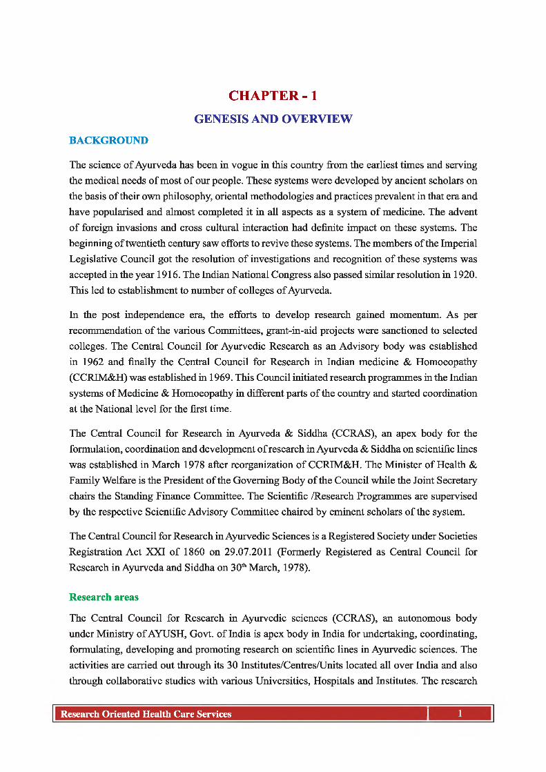
CHAPTER -1GENESIS AND OVERVIEW
BACKGROUND
The science of Ayurveda has been in vogue in this country from the earliest times and serving the medical needs of most of our people. These systems were developed by ancient scholars on the basis of their own philosophy, oriental methodologies and practices prevalent in that era and have popularised and almost completed it in all aspects as a system of medicine. The advent of foreign invasions and cross cultural interaction had definite impact on these systems. The beginning of twentieth century saw efforts to revive these systems. The members o f the Imperial Legislative Council got the resolution of investigations and recognition of these systems was accepted in the year 1916. The Indian National Congress also passed similar resolution in 1920. This led to establishment to number of colleges of Ayurveda.
In the post independence era, the efforts to develop research gained momentum. As per recommendation o f the various Committees, grant-in-aid projects were sanctioned to selected colleges. The Central Council for Ayurvedic Research as an Advisory body was established in 1962 and finally the Central Council for Research in Indian medicine & Homoeopathy (CCRIM&H) was established in 1969. This Council initiated research programmes in the Indian systems of Medicine & Homoeopathy in different parts of the country and started coordination at the National level for the first time.
The Central Council for Research in Ayurveda & Siddha (CCRAS), an apex body for the formulation, coordination and development of research in Ayurveda & Siddha on scientific lines was established in March 1978 after reorganization of CCRIM&H. The Minister of Health & Family Welfare is the President o f the Governing Body of the Council while the Joint Secretary chairs the Standing Finance Committee. The Scientific /Research Programmes are supervised by the respective Scientific Advisory Committee chaired by eminent scholars of the system.
The Central Council for Research in Ayurvedic Sciences is a Registered Society under Societies Registration Act XXI of 1860 on 29.07.2011 (Formerly Registered as Central Council for Research in Ayurveda and Siddha on 30th March, 1978).
Research areas
The Central Council for Research in Ayurvedic sciences (CCRAS), an autonomous body under Ministry of AYUSH, Govt, of India is apex body in India for undertaking, coordinating, formulating, developing and promoting research on scientific lines in Ayurvedic sciences. The activities are carried out through its 30 Institutes/Centres/Units located all over India and also through collaborative studies with various Universities, Hospitals and Institutes. The research
Research Oriented Health Care Services I 1

I INI I INI INI I INI I INI I III I INI I INI I INI INI I INI I INI I INI INI I INI I INI I III I INI I INI I INI INI I INI I INI I INI INI I INI I INI I III I INI I INI I
activities of the Council include Medicinal Plant Research (Medico-ethno Botanical Survey, Pharmacognosy and Tissue Culture), Drug Standardization, Pharmacological Research, Clinical Research, Literary Research & Documentation. Besides this, Council has conducting outreach activities viz. Tribal Health Care Research Programme, Ayurveda Mobile Health Care programme, Swasthya Rakshan Programme and National Programme for Prevention and control of Cancer, Diabetes, Cardiovascular Diseases and Stroke (NPCDCS).
Objectives
1. The formulation of aims and patterns of research on scientific lines in Ayurvedic sciences.
2. To undertake any research or other programs in Ayurvedic sciences.
3. The prosecution o f and assistance in research, the propagation of knowledge and experimental measures generally in connection with the causation, mode o f spread and prevention o f diseases.
4. To initiate, aid, develop and co-ordinate scientific research in different aspects, fundamental and applied o f Ayurvedic sciences and to promote and assist institutions of research for the study of diseases, their prevention, causation and remedy.
5. To finance enquiries and researches for the furtherance of objects of the Central Council.
6. To exchange information with other institutions, associations and societies interested in the objects similar to those of the Central Council and especially in observation and study of diseases in East and in India in particular.
7. To prepare, print, publish and exhibit any papers, posters, pamphlets, periodicals and books for furtherance o f the objects of the Central Council and contribute to such literature.
8. To issue appeals and make applications for money and funds in furtherance of the objects of the Central Council and to accept for the aforesaid purpose gifts, donations and subscriptions of cash and securities and of any property whether movable or immovable.
9. To borrow or raise monies with or without security or on security mortgage charge, hypothecation or pledge of all or any of the immovable or movable properties belonging to the Central Council or in any other manner whatsoever.
10. To invest and deal with the funds and monies of the Central Council or entrusted to the Central Council not immediately required in such manner as may from time to time be determined by the Governing Body of the Central Council.
11. To permit the funds of the Central Council to be held by the Government of India.
12. To acquire and hold, whether temporarily or permanently any movable or immovable property necessary or convenient for the furtherance of the objects of the Central Council.
VOLUME-V
2 Research Oriented Health Care Services

VOLUME-V^ ^ ^ ^ ^ ^ ^ ■ iiiiiiiiiiiiiiiiiiiiiiiiiiiiiiiiiiiiiiiiiiiiiiiiiiiiiiiiiiiiiiiiiiiiiiiiiiiiiiiiiiiiiiiiiiiiiiiiiiiiiiiiiiiiiiiiiiiiiiiiiiiiiiiiiiiiiiiiiiiiiiiiii
13. To sell, lease, mortgage and exchange, and otherwise transfer any of the properties movable or immovable of the Central Council provided prior approval of the Central Government is obtained for the transfer of immovable property.
14. To purchase, construct, maintain and alter any buildings or works necessary or convenient for the purpose of the Central Council.
15. To undertake and accept the management o f any endowment or trust fund for donation, the undertaking or acceptance whereof may seem desirable.
16. To offer prizes and grant o f scholarships, including travelling scholarships in furtherance of the objects of the Central Council.
17. To create administrative, technical and ministerial and other posts under the Society and to make appointments thereto in accordance with the rules and regulations of the Society.
18. To establish a provident fund and/or pension fund for the benefit of the Central Council’s employees and/or their family members.
19. To do all such other lawful things either alone or in conjunction with others as the Central Council may consider necessary or as being incidental or conducive to the attainment of the above objects.
20. To undertake R & D Consultancy projects and transfer of patents on drugs and process to industry.
21. To undertake R & D projects sponsored by industries in public/private sector.
22. To undertake international and interagency collaboration.
23. Utilization of results of research conducted and payment of share of royalties/consultancy fees to those who has contributed towards pursuit of such research.
24. To enter into arrangements with scientific agencies of other countries for exchange of scientists, study tours, training in specialized areas, conducting joint projects etc.
25. To provide technical assistance to Govt./Private agencies in matters consistent with the activities of the Council.
26. To assist Medicinal Plants Board, Government of India in achieving its objectives.
27. To constitute small Management Committees consisting o f eminent Scientists/ Physicians of local areas to monitor the R & D activities and suggest remedial measures for the improvement o f activities o f all Central as well as Research Institutes of the Council.
Research Oriented Health Care Services

VOLUME-Viiiiiiiiiiiiiiiiiiiiiiiiiiiiiiiiiiiiiiiiiiiiiiiiiiiiiiiiiiiiiiiiiiiiiiiiiiiiiiiiiiiiiiiiiiiiiiiiiiiiiiiiiiiiiiiiiiiiiiiiiiiiiiiiiiiiiiiiiiiiiiiiiii
CCRAS Network Map
Afi'i’i'l ihutJ
m u
OntullTLithy "P wurai'lH MUiplKWM
_ hr*, if ■
* ^ ICI
■ TS P 8
MW
vDLAUWtA
DCTLQUm
Research Oriented Health Care Services

1 INI I INI I INI INI I INI I INI I III I INI I INI I INI INI I INI I INI I INI INI I INI I INI I III I INI I INI I INI INI I INI I INI I III I INI I INI I INI I III I INIVOLUME-V
LIST PARTICIPATING INSTITUTES/CENTRES/UNITS
S.No. Name of peripheral institute1. Central Ayurveda Research Institute for Cardiovascular Diseases New Delhi2. National Ayurveda Research Institute for Panchakarma Cheruthuruthy3. Central Ayurveda Research Institute for Hepatobiliary Disorders Bhubaneswar4. Central Ayurveda Research Institute for Drug Development Kolkata5. Central Ayurveda Research Institute for Respiratory Disorders Patiala6. Raja Ramdeo Anandilal Podar (RRAP) Central Ayurveda Research Institute for
Cancer Mumbai7. National Institute of Indian Medical Heritage Hyderabad8. Regional Ayurveda Research Institute for Eye Diseases Lucknow9. M.S. Regional Ayurveda Research Institute for Endocrine Disorders Jaipur10. Regional Ayurveda Research Institute for Drug Development Gwalior11. Regional Ayurveda Research Institute for Skin disorders Vijayawada12. Regional Ayurveda Research Institute for Mother and Child Health Nagpur13. Regional Ayurveda Research Institute for Metabolic Disorders Bangalore14. Regional Ayurveda Research Institute for Life style related Disorders
Thiruvananthapuram15. Regional Ayurveda Research Institute for Infectious Diseases Patna16. Regional Ayurveda Research Institute for Gastro-Intestinal Disorders Guwahati17. Regional Ayurveda Research Institute Gangtok18. Regional Ayurveda Research Institute Itanagar19. Regional Ayurveda Research Institute for Urinary Disorders Jammu20. Regional Ayurveda Research Institute for Nutritional Disorders Mandi21. Regional Ayurveda Research Institute for Skin Disorders Ahmedabad22. Regional Ayurveda Research Institute Ranikhet23. Regional Ayurveda Research Institute Jhansi24. Regional Ayurveda Institute for Fundamental Research Pune25. Captain Srinivasa Murthy Regional Ayurveda Drug Development Institute Chennai26. Advanced Center for Ayurveda in Mental Health & Neurosciences Bangalore27. Dr. Achanta Lakshmipati Research Centre for Ayurveda Chennai28. Regional Research Center of Ayurveda Port Blair29. Herbal Ayurveda Research Centre (HARC) Nagaland University Lumami Nagaland30. National Research Institute for Sowa-Rigpa, Leh
5Research Oriented Health Care Services

I INI I INI INI I INI I INI I III I INI I INI I INI INI I INI I INI I INI INI I INI I INI I III I INI I INI I INI INI I INI I INI I INI INI I INI I INI I III I INI I INI I
CHAPTER - 2TRIBAL HEALTH CARE RESEARCH PROGRAMME
(TRIBAL SUB PLAN)
Background: Tribal Health Care Research Program (THCRP) was initiated by Central Council for Research in Ayurvedic Sciences (CCRAS) in 1982 with the core objectives encompassing to study the living conditions o f tribal people including health related demography, documentation of folk claims and Local Health Traditions and use of common medicinal plants in the area, availability o f medicinal plants in the area, propagation o f knowledge about hygiene and prevention of diseases besides extending medical aid at their door steps. The program has been continued at 6 States Madhya Pradesh, Maharashtra, Bihar, Assam Arunachal Pradesh and Andaman & Nicobar from 1982 to till 2014. During this period, 5 independent Tribal Health Care research Units have been relocated through reorganization which came into force in the year 2000. Further during the year 2014-15 and 2016-17 the program has been extended in 10 more States viz. Rajasthan, Jammu & Kashmir, Himachal Pradesh, Karnataka, Tamil Nadu, West Bengal, Odessa, Andhra Pradesh, Sikkim and Telengana. Currently, the Tribal Health Care Research Program is being executed in 14 States through 15 Peripheral Institutes of CCRAS under Tribal sub-Plan (TSP).
Introduction
India enjoys the distinction of having the largest network o f traditional health care, which are fully functional with a network of registered practitioners, research institutions and licensed pharmacies. With its kaleidoscopic variety and rich cultural heritage, India is proud of some unique medicinal forms that look at health, disease and causes of disease in completely different ways. Best known as the Indian System of Medicine, its focus is on holistic health and wellbeing of humans.
The AYUSH systems (Indian systems of medicine) have age-old acceptance in the communities in India and in most places they form the first line of treatment in case of common ailments. Ayurveda, Yoga, Unani, Siddha and Homoeopathy (AYUSH) are recognized systems of medicine and have been integrated into the national health delivery system. O f these, Ayurveda is the most ancient medical system with an impressive record of safety and efficacy.
AYUSH represents the tradition of codified, textual health knowledge systems other than the modem, while Local Health Traditions (LHT) represent the practices and knowledge of the common people and folk practitioners who follow an oral tradition of learning and passing on of the knowledge Planned development of health services in the public system began in India after independence, based primarily on modem medical science (Bhore Committee Report, 1946).
AYUSH services have been viewed as one way of ensuring access to some form of health care to the rural and poor population groups who are underserved by the dominant system. However, with the dominance of modem medicine over the past century, there has been a drastic decline in the legitimacy and services of the other systems. Now, with the enhanced recognition of their complementary strengths, there is resurgence of utilization of Traditional, Complementary and Alternative Medicine (TCAM), by the well-off of developed as well as the better-off of the developing countries. With concerns o f equity and access in health care, a serious question arises about the availability and access of quality AYUSH services and Local Health Traditions (LHT) for all.
VOLUME-V
6 Research Oriented Health Care Services

1 INI I INI I INI INI I INI I INI I III I INI I INI I INI INI I INI I INI I INI INI I INI I INI I III I INI I INI I INI INI I INI I INI I III I INI I INI I INI I III I INI
The most prevalent users ofAYUSH, Traditional Medicine(TM), Complementary andAltemative Medicine (CAM) are individuals who have incurable, non-life-threatening conditions that may be chronic. The second largest groups of users are those struggling with chronic, potentially life-threatening diseases, such as cancer and HIV-AIDS. Both groups turn to CAM systems for a variety of reasons, such as to improve immune functioning, to improve overall functioning, to increase quality of life, to cope with side effects from conventional therapies, and to relieve symptoms related to their illness.
Several studies and surveys across India also substantiate these facts. Even though for few common and acute conditions like cold, cough etc are being tackle by house hold remedies, LHTs etc. especially at primary lev e l, utilization and preference has been evenly distributed for Chronic illness. Study on Role o f AYUSH and Local Health Traditions under National Rural Health Mission (NRHM) in 18 states across India, Implications of the NRHM strategy of mainstreaming AYUSH were studied. The pivotal outcomes and perceptions conclude that 80-90% households aware about utility of AYUSH/LHTs, Co-located services are well utilized in some states ,preference was for Chronic illness followed by acute illness and Health promotion.
Tribal Health-Indian scenario: India is a canvas portraying a unique assimilation of ethnic groups displaying varied cultures and religions. In fact, this uniqueness in the ethnicity of the country is the factor that makes it different from other nations. Moreover, the vastness of India’s nationalism, accounting to a plethora of cultural extravaganza, religions, etc. is the reason that the country is seen more as a seat for a major world civilization than a mere nation-state. The ethnic diversity in the country is represented by as many as 400 ethnic groups including the tribes and others. The tribal population is almost 7.5% of the total population of the country. Due to inaccessibility to modem health care, the real knowledge of the usages of plants lies with the rural population of the country consisting of tribes, forest dwellers and many villagers. The fact that tribal and forest dwellers have unique knowledge of therapeutic use of plants. Since ancient times, the spiritual land of India has displayed varied hues of culture, religion, race, language, and so on. This variety in race, culture, religion, etc. accounts for the existence of different ethnic groups who, although, live within the sanctums of one single nation, profess different social habits and characteristics. Regional territories in India play an important role in differentiating these ethnic groups, with their own social and cultural identities.. With the governance of different states and union territories in the country, there has originated a sense of regionalism amongst the various parts, with different states displaying different cultures, which although eventually fuse through a common bond to showcase a national cultural identity.
The use of plants or animal products for healing is as old as human civilization. The relationship between man and plant is inseparable and it can be said that humanity at large cannot survive without using the plants, in one way or other. Our country has rich floristic and ethnic diversity. It harbours nearly 45,000 species of both higher and lower group of plants, which included 15,000 higher plants. The modem human civilization, urbanization/developmental activities and industrialization are gradually destroying the heritage of this unique knowledge of medicinal use of plant drugs.
CCRAS initiatives in documenting and reporting Health Care seeking attitude and documentation of Local Health Traditions: Very little information is available on the utilization of Indian systems of medicine and homoeopathy (ISM&H) in India. The Central Council for Research Ayurveda and Siddha has conducted a survey in 12 states across the country on various aspects of health related demography during various periods (Published
VOLUME-V
Research Oriented Health Care Services

I INI I INI INI I INI I INI I III I INI I INI I INI INI I INI I INI I INI INI I INI I INI I III I INI I INI I INI INI I INI I INI I INI INI I INI I INI I III I INI I INI I
report on “Study of Health Statistics under Mobile Clinical Research Program, 1987, CCRAS, New Delhi). This is evident from the fact that out of the total population studied by all the Mobile Clinical Research Units with regard to the treatment received through various codified Systems of Medicine, during the study period, 71.34% of the population received Ayurvedic treatment, 24.67% Allopathic, 2.33% with others, i.e., with folk medicines, 1.65% with Homeopathy and 0.01% with Siddha System. In addition to these recognized system, folk medicines in the villages still play a major role to provide medical assistance in the rural areas. During the study period nearly 2.33% of the population was found to have used folk medicines. Among the population studied by various units, in Joginder Nagar -Himachal Pradesh the highest number of people, i.e. 14.09% received folk medicines for treatment, followed by Bangalore-Kamataka (9.49%) and Kolkata-West Bengal (7.51%).In Varanasi-Uttar-Pradesh, Nagpur -Maharashtra, Vijayawada -Andhra Pradesh, Bhubaneswar -Orissa and Patiala -Punjab none of the cases was found to have used folk medicines for their treatment.
Further, the Central Council for Research in Ayurvedic Sciences (CCRAS,)documented Ethno- medical practices, use of medicinal plants besides studying living conditions o f tribal areas across the country from Trans-Himalayan region, North-eastern India to southern parts of the country and Andaman & Nicobar through its 18 Survey o f Units, Mobile Clinic Research Units, Tribal Health Care Research Program. The authenticity o f the information is confirmed by cross examination o f the treated patients, and specimens of plants/part(s) used were kept in record as herbariums/museum specimens. About 2500 Folklore/Ethno-medical claims used by tribes have been documented. The tribes used to simple diseases/conditions ranging from common cold, cough, fever, vomiting, skin diseases, digestive problems, reproductive and child health problems, wounds etc. The use of herbs for contraception is also prevalent among them.
In addition to the above the Council has documented reported medical practices on prevention, management of vector borne and infectious diseases through Ayurveda and Siddha through 17 institutes across different states of the country. The information is gathered from various sources viz. Ayurvedic colleges, physicians from Ayurveda, Siddha hospitals, dispensaries, clinics, private physicians, local healers, NGOs, etc. has been systematically recorded. A number successful treatment episode on malaria, filariasis, chikungunya etc. has been recorded from the physician’s experiences.
Material and Methods
The physical achievements including the beneficiaries of health care services, details of villages, tribal’s pockets covered, documentation of disease prevalence and local health traditions during period 1982-2016 were compiled summarized and presented based on the information available in the published monographs, technical reports and annual reports of CCRAS.
Observations and physical achievements
Tribal Health Care Research Program (THCRP) has been initiated by Central Council for Research in Ayurvedic Sciences (CCRAS) in 1982 with the core objectives encompassing , Study of the living conditions o f tribal people, documentation o f information Availability and use o f medicinal plants in the area, study of dietetic habits and including health related demography, study of Socio-demographic profile, nature and frequency o f prevalent diseases, propagation of knowledge about hygiene, and prevention of diseases, providing medical aid at their door steps collection and documentation of folklore claims and Local Health Traditions.
VOLUME-V
Research Oriented Health Care Services8

1 INI I INI I INI INI I INI I INI I III I INI I INI I INI INI I INI I INI I INI INI I INI I INI I III I INI I INI I INI INI I INI I INI I III I INI I INI I INI I III I INI
Chronological Developments: The program has been continued at 6 States Madhya Pradesh, Maharashtra, Bihar, Assam Arunachal Pradesh and Andaman & Nicobar from 1982 to till 2014. During this period, 5 independent Tribal Health Care research Units have been relocated through reorganization which came into force in the year 2000.
Further during the year 2014-15 to 2017-18 the program has been extended in 10 more States viz. Rajasthan, Jammu & Kashmir, Himachal Pradesh, Karnataka, Tamil Nadu, West Bengal, Odessa, Andhra Pradesh, Sikkim and Telengana. Currently, the Tribal Health Care Research Program is being executed in 14 States through 15 Peripheral Institutes of CCRAS under Tribal sub-Plan (TSP). (Table-1, Table -2 and Graph-1)
Table-1: Details of establishment of Tribal Health Care Research Projects
VOLUME-V
S. No. State Location of 16 projects in 15 States
Date of Establishment
Details of merger/ shifting of other unit
in the year 20001. Madhya
PradeshRARIDD, Gwalior March, 1986 THCRP, Jagdalpur
shifted at CRI Gwalior2. Maharashtra RARIMCH, Nagpur Dec.’1983 THCRP, Jhabua shifted
at RRI Nagpur3. Bihar RARIID, Patna Feb.’1983 THCRP, Palamau shift
ed at RRI Patna4. Assam RARIGID, Guwahati June, 1989 THCRP, Imphal shifted
at RRI Guwahati5. Arunachal
PradeshRARI, Itanagar July, 1982 THCRP, Ziro shifted at
RRI Itanagar6. Andaman
NicobarRARC, Port Blair Feb.’1984 *Unit physically shift
ed from Car Nicobar to Port Blair in 2005
7. Odisha CARIHD, Bhubaneswar Oct, 2014
8. West Bengal CARIDD, Kolkata Oct, 2014
9. Rajasthan RARIECD, Jaipur Oct, 2014
10. AndhraPradesh
RARISD, Vijayawada Oct, 2014
11. Karnataka RARIMD, Bangalore Oct, 2014
12. Sikkim RARI, Gangtok Oct, 2014
13. Tamil Nadu ALRC A Chennai Oct, 2014
14. Jammu & NRISR, Leh Oct, 2014Kashmir 15. Nov, 2015
15. HimachalPradesh
RARIND, Mandi Nov., 2015
16. Telangana NIIMH, Hyderabad March, 2017
Research Oriented Health Care Services

VOLUME-Viiiiiiiiiiiiiiiiiiiiiiiiiiiiiiiiiiiiiiiiiiiiiiiiiiiiiiiiiiiiiiiiiiiiiiiiiiiiiiiiiiiiiiiiiiiiiiiiiiiiiiiiiiiiiiiiiiiiiiiiiiiiiiiiiiiiiiiiiiiiiiiiiii
Table-2 Chronological development in the establishment of Tribal Health Care Research Projects
S.No. Year No. of Institute established Name of Units/ Institutes Total No. of
Units1. 1982 1 Ziro, Arunachal Pradesh 12. 1983 2 Jhabua (MP) and Palamau (Bihar) 33. 1984 1 Car Nicobar (Andaman & Nicobar Islands) 44. 1989 2 Jagdalpur (MP) and Imphal (Manipur) 65. 2014 8 Bhubaneswar, Kolkata, Jaipur, Vijayawada,
Bangalore, Gangtok, Chennai and Leh14
6. 2015 2 Jammu and Mandi 167. 2017 1 Hyderabad 17
Graph -1: Chronlogical Development in the Establishment of Tribal Health Care Research Units
Total No. of Units
1982 1983 1984 1989 2014 2015 2017
Achievements during 1982-2017: Through this program during the period 1982-2017, the council has extended Health Care Services at 1737 Villages/Tribal pockets covering a population of 1065957 while medical aid and counseling was offered to 3,77,945 people. 929 folk claims/ Local Health Traditions (LHTs) has been documented (Table-3 to Table-21, Graph-2 to Graph-5)
Tribes surveyed under THCRP
S. No. State Institute Names of tribes
1. MadhyaPradesh
RARIDD,Gwalior
Halba, Gonds, Sahariya, Bhils, and Bhariya
2. Maharashtra RARIMCH,Nagpur
Gond, Mana, Kawar and Paradhi
3. Bihar RARIID,Patna
Bhuiya, Munda, Santhal, Baiga, Soren, Hansda, Or- aon, Lohara and Gond
4. Assam RARIGID,Guwahati
Karbi/Mikir, Bora, Garo, Lalung/ Tiwas, Rabha, Saranja, Bora-kachari, Deori
5. AndamanNicobar
RARC, Port Blair
Nicobarese, Onges, Shompens and Great Andamanese
6. Odisha CARIHD,Bhubaneswar
Sabara, Sahara, Santali, Bathudi, Bhuyan, Kolha, Munda, Kandha, Majhi, Gonda, Oraon, Kisan
Research Oriented Health Care Services

VOLUME-V■iiiiiiiiiiiiiiiiiiiiiiiiiiiiiiiiiiiiiiiiiiiiiiiiiiiiiiiiiiiiiiiiiiiiiiiiiiiiiiiiiiiiiiiiiiiiiiiiiiiiiiiiiiiiiiiiiiiiiiiiiiiiiiiiiiiiiiiiiiiiiiiiii
7. West Bengal CARIDD,Kolkata
Santal, Munda, Kora and Sabar
8. Rajasthan RARIECD,Jaipur
Meena, Garasia, Bhil and Damor
9. AndhraPradesh
RARISD,Vijayawada
Lambadi, Koya, Yerukula, Kondareddy, Nayak, Nayapollu, Chenchu, Yenadi
10. Karnataka RARIMD,Bangalore
Haki pikki, Iruligas, Channa Dasara, Koracharu, Naik, Medha, Bavacha, Soligas
11. Sikkim RARI,Gangtok
Bhutia, Lepcha, Sherpa, Limboo and Tamang
12. Tamil Nadu ALRCAChennai
Irular, Malayali
13. Jammu & Kashmir
NRISR, Leh Beda, Balti, Bot/Boto, Brokpa/Drokpa, Changpa, Garra, Mon, Purikpa
14. Gujjars and Bakerwal’s14. Telangana NIIMH,
HyderabadLambada, Koya
Table-3: Details of services extended under Tribal Health Care ResearchProject from 1982-2017
S. No. Name of the Institute VillageCovered
PopulationCovered
Benefiters of Health Care
Program
No. of Folk Claim
documented1. RARIDD, Gwalior 114 108989 26547 802. RARIMCH, Nagpur 146 86548 25914 1423. RARIID, Patna 213 306163 117591 804. RARIGID, Guwahati 87 85050 29102 1275. RARI, Itanagar 338 165895 57495 436. RRCA, Port Blair 135 145083 65171 1297. CARIHD, Bhubaneswar 46 18402 4349 338. CARIDD, Kolkata 79 18125 7341 509. RARIECD, Jaipur 49 26351 6569 3010. RARISD, Vijayawada 94 20471 7458 6411. RARIMD, Bangalore 84 13347 2336 6012. RARI, Gangtok 56 13674 6074 3113. ALRCA, Chennai 97 17437 7929 4514. NRISR, Leh 183 34083 9892 1015. RARIUD, Jammu 2 407 313 016. RARIND, Mandi 12 4968 3788 517. NIIMH, Hyderabad 2 964 76 0
Total 1737 1065957 377945 929
Research Oriented Health Care Services

11 INI I INI INI I INI I INI I III I INI I INI I INI INI I INI I INI I INI INI I INI I INI I III I INI I INI I INI INI I INI I INI I INI INI I INI I INI I III I INI I INI IVOLUME-V
Table-4: Details of Folk Claim/LHTs documented under Tribal Health Care ResearchProject from 1982-2017
S. No. Name of the Institute No. of Folk Claim documented
1. RARIDD, Gwalior 80
2. RARIMCH, Nagpur 142
3. RARIID, Patna 80
4. RARIGID, Guwahati 127
5. RARI, Itanagar 43
6. RRCA, Port Blair 129
7. CARIHD, Bhubaneswar 33
8. CARIDD, Kolkata 50
9. RARIECD, Jaipur 30
10. RARISD, Vijayawada 64
11. RARIMD, Bangalore 60
12. RARI, Gangtok 31
13. ALRCA, Chennai 45
14. NRISR, Leh 10
15. RARIND, Mandi 5Total 929
Graph - 2: Tribal Pockets/Villages covered UnderTHCRP (1982-2017)
Research Oriented Health Care Services

VOLUME-V■iiiiiiiiiiiiiiiiiiiiiiiiiiiiiiiiiiiiiiiiiiiiiiiiiiiiiiiiiiiiiiiiiiiiiiiiiiiiiiiiiiiiiiiiiiiiiiiiiiiiiiiiiiiiiiiiiiiiiiiiiiiiiiiiiiiiiiiiiiiiiiiiii
G
350000
300000
250000
a 200000 ©
jg 150000
o 100000 cl
50000
raph-3:
O'000*00 eo0 ^ rH in
VO
1
’opulation Covered under THCRP (1982-2017)!030
mO'm 52SO o- 3
i l l“ S S g S * 5? ? 00
1 1 ■ I ■ ■ m m m * 1 *
&N a m e o f I n s t i t u t e s
Graph - 4: Patients treated under THCRP (1982-2017)140000
s No. of Patients treated
Name of Institutes
Research Oriented Health Care Services

I INI I INI INI I INI I INI I III I INI I INI I INI INI I INI I INI I INI INI I INI I INI I III I INI I INI I INI INI I INI I INI I INI INI I INI I INI I III I INI I INI IVOLUME-V
Table-5: Madhya Pradesh (RARIDD, Gwalior)-Statement of population covered sinceinception up to March 2017
S.No. Years
No. of villages covered
Name of villagesTotal
populationcovered
No. of patients treated
New Old Total
(A)Work carried out at Jagdalpur (M.P. now C.G.) initiated from 1990-911. 1990-91 01 Dhamour 667 92 473 5652. 1991-92 02 Adaval, Gatavand 1552 96 230 3263. 1992-93 03 Badegatavand,
Durguda, Pandaripani3178 771 2392 3163
4. 1993-94 01 Agahanpur 0 200 743 9435. 1994-95 02 Agahanpur, Sargipal 850 412 2184 25966. 1995-96 01 Tamakoni 58 58 74 1327. 1996-97 01 Agahanpur 5000 38 35 738. 1997-98 01 Kachora 1250 648 1073 1721
(B) Work carried out at Gwalior (M.P.)9. 1981-82 01 Chorpura,(Dist.-
ShivpuriSp.tour)2000 1684 0 1684
10. 2000-01 01 Nayagoan 1136 239 87 32611. 2001-02 01 Jourasi 1770 337 272 60912. 2002-03 02 Panihar, Ghatigoan 2361 417 197 61413. 2003-04 01 Ghatigoan 1107 207 102 30914. 2004-05 03 Siasakapura, Kait,
Girwai2024 358 147 505
15. 2005-06 05 Girwai, Aarone, Chhimak, Dhurshendhi, Shivpuri(Sp.tour)
5302 686 210 896
16. 2006-07 05 Raipur kala, Barole,Maharaj apura, Bujurga, Sehasari
5132 383 140 523
17. 2007-08 4 Jakhoda 1135 104 0 104Mohana 1769 84 13 97Shyampur 374 25 0 25Dourar 1454 87 0 87
18. 2008-09 4 Patai 1344 80 05 85Karai 316 80 0 80Brahana 647 19 0 19Chaint 3074 121 09 130
19. 2009-10 4 Amargarh 649 120 20 140Ummedgarh 1582 77 11 88Samaria Taka 2955 219 07 226Kaitha 240 52 03 55
Research Oriented Health Care Services14

VOLUME-V■iiiiiiiiiiiiiiiiiiiiiiiiiiiiiiiiiiiiiiiiiiiiiiiiiiiiiiiiiiiiiiiiiiiiiiiiiiiiiiiiiiiiiiiiiiiiiiiiiiiiiiiiiiiiiiiiiiiiiiiiiiiiiiiiiiiiiiiiiiiiiiiiii
20. 2010-11 4 Kirawali 525 32 0 32Patha (Panihar) 2087 194 11 205Bhainsnari 1298 108 22 130Bijakpur 1428 124 6 130
21. 2011-12 3 Nunhari 904 113 21 134Rithodan 1957 186 49 235Badagaon 1560 207 27 234
22. 2012-13 3 Thetiapura 714 86 16 102Bhartari 1301 168 22 190Jatrathi 1256 262 39 301
23. 2013-14 4 Gharsondi 1101 105 12 117Gharhi 994 197 27 224Nayagaon 985 47 0 47Ghatigaon 2002 56 0 56
24. 2014-15 23 Bhimlat 460 55 20 75Bhela 413 49 07 56Panar 611 48 0 48Chaintikhera 602 78 24 102Piparbas 781 127 09 136Ratodhan 714 85 0 85Heerapura 354 30 0 30Hanumankhera 266 30 0 30Bandhaly 668 93 08 101Awada 1559 157 53 210Kalmi 674 82 13 95Kakardha 1063 44 23 67Bamoree 307 83 07 90Gothra 460 105 26 131Saran Aharbani 942 59 17 76Bairagi 487 106 19 125Khamha 369 73 19 92Mohani 136 42 08 50Khinha 472 82 06 88Dobh 470 22 0 22Doondikheda 231 60 0 60Dubdee 298 48 0 48Kankra 389 24 0 24
Research Oriented Health Care Services

I INI I INI INI I INI I INI I III I INI I INI I INI INI I INI I INI I INI INI I INI I INI I III I INI I INI I INI INI I INI I INI I INI INI I INI I INI I III I INI I INI IVOLUME-V
25. 2015-16 26 Karrai 638 66 15 81Gadhla 659 169 18 187Piprani 689 119 34 153Bargwan 1710 392 55 447Agra 332 65 21 86Hasanpur 118 30 0 30Palampur 183 47 0 47Sirsod 626 99 4 103Maharajpura 1034 143 19 162Makronda Kalan 889 71 5 76Subkara 829 121 12 133Mujhari 619 117 18 135Baudichapa 1036 132 14 146Nayagaon Tehkhand 545 126 16 142Bagdiya 1179 149 14 163Bheekhapur 987 84 17 101Bardha Bujurag 1321 251 24 275Dengda 1155 83 18 101Kalama 1162 204 20 224Nasirpur 675 121 20 141Ladpura 611 98 30 128D tarda Khurd 475 164 16 180Dlama Khurd 340 73 31 104Tilsani 639 132 0 132Deori Khurd 100 25 0 25Phiphari 853 108 0 108
26. 2016-17 8 Harduli Kalan 1185 194 52 246Sahdara 1476 311 57 368Morpani 1199 263 78 341Mandikooh 966 121 48 169Pipariya kalan 1418 242 77 319Naya chicha 930 206 67 273Jhunkar 1610 523 139 662Kasda Khurda 1037 367 93 460
Total 114 108989 16577 9970 26547
Research Oriented Health Care Services16

VOLUME-V■ i i i i i i i i i i i i i i i i i i i i i i i i i i i i i i i i i i i i i i i i i i i i i i i i i i i i i i i i i i i i i i i i i i i i i i i i i i i i i i i i i i i i i i i i i i i i i i i i i i i i i i i i i i i i i i i i i i i i i i i i i i i i i i i i i i i i i i i i i i i i i i i i i i
Table-6: Maharashtra (RARIMCH, NAGPUR)-Statement of population covered sinceinception up to March 2017
6A. Since inception to March, 1999
S. Year No & Name of Total Population No. of patients treatedNo villages covered covered New Old Total
(A)Work carried out at Jhabua(M.P.) initiated from 1984-85*1987-88 1 Gadwara 725 0 0 2611990-91 1 Gadwara 725 0 0 2221992-93 Hq. 0 0 0 1001993-94 1 Jhabua village 0 0 0 1501995-96 Hq 0 0 0 3831996-97 Hq. 0 0 0 1301997-98 Hq. 0 0 0 971998-99 Hq. 0 0 0 177Total 1450 0 0 1520
6B. 2000 to March, 2017
S. Year No & Name of villages Total Population No. of patients treatedNO. covered covered New Old Total
(B)Work carried out at RARIMCH, Nagpur1. 2000-01 1 Borda 194 08 00 082. 2001-02 4 Borda 1098 111 33 144
Talwada 252 35 26 61Jamlatola 191 34 17 51Kridurd 411 57 48 105
3. 2002- 03 8 Bothali 525 117 75 192Dahegaon 296 46 13 59Shirshi 353 67 16 83Amrutguda 160 42 18 60Bhendala 712 131 09 140Satara(Bhoshle) 339 89 00 89Wine 00 26 00 26Guguldeo 00 46 00 46
4. 2003-04 9 Sonpur 359 114 52 166Maharkund 193 74 20 94Mogra 171 62 28 90Tekadi 372 64 18 82Kundri 949 235 100 335Kanhadevi 259 76 36 112Dhoda 542 114 72 186Pathari 1112 172 83 255Bothia (Palora) 1048 139 54 193
Research Oriented Health Care Services

I INI I INI INI I INI I INI I III I INI I INI I INI INI I INI I INI I INI INI I INI I INI I III I INI I INI I INI INI I INI I INI I INI INI I INI I INI I III I INI I INI IVOLUME-V
5. 2004-05 9 Ghoti 448 111 58 169Marksur 485 93 47 140Vachbodhi 538 167 78 245Borgad 626 100 60 160Gondi (Khapa) 444 86 49 135Chankapur 354 97 79 176Khatta 686 69 38 107Sindewani 681 89 85 174Warghat 1576 146 133 279
6. 2005-06 10 Kohla 402 85 87 172Gugguldov 961 134 113 247Chargaon 520 72 109 181Amghat 398 111 109 220Kawadapur 339 65 79 144Surewani 330 75 83 158Pendhari 312 124 74 198Mohagaon(Jangli) 219 85 82 167Ghatpendhari 1015 93 90 183Belda 965 186 92 278
7. 2006-07 10 Bondetalsarra 488 162 52 214Maudi 840 259 123 382Pendhari 537 112 53 165Salairani 613 153 51 204Chikhaldhokda 440 119 45 164Khanora 670 127 50 177Sawangi 643 126 44 170Pauni (Jangli) 534 101 24 125Salai 544 160 52 212Tuyapar 622 82 50 132
8. 2007-08 8 Khumari 710 143 73 216Akola 503 79 27 106Bhivgad 418 111 65 176Ghogra 902 136 64 200Mayawadi 948 110 38 148Gondi(Dig.) 1288 169 55 224Gonhi 797 155 107 262Navegaon 497 64 09 73
9. 2008-09 10 Kharpada 382 91 56 147Bhandra 565 102 44 146Phuljari 511 112 37 149Khadbikheda 608 95 66 161Chinchada 189 35 33 68Bondewada 607 87 117 204
Research Oriented Health Care Services18

VOLUME-V■iiiiiiiiiiiiiiiiiiiiiiiiiiiiiiiiiiiiiiiiiiiiiiiiiiiiiiiiiiiiiiiiiiiiiiiiiiiiiiiiiiiiiiiiiiiiiiiiiiiiiiiiiiiiiiiiiiiiiiiiiiiiiiiiiiiiiiiiiiiiiiiiii
Dulara 597 37 33 70Nagalwadi 283 67 34 101Saleghat 628 68 38 106Bhandarbodi 1396 90 49 139
10. 2009-10 12 Bondri 698 98 39 137Gudegaon 401 74 60 134Chorbahuli 479 61 75 136Khidki 434 41 8 49Kedapur 282 98 44 142Sabkund 586 58 46 104Ambada 745 90 43 133Jambhulpani 304 64 21 85Panwadi 245 89 00 89Zolwadi 678 105 65 170Zizoria 1027 81 74 155Khairi 297 96 65 161
11. 2010-11 12 Muradpux 334 41 29 70Sindhivihari 308 52 38 90Surabardi 177 65 74 139Mandri 1207 128 26 154Kimapur 759 77 19 96Junewani 384 99 86 185Karwahi 1887 86 41 127Chawari 297 55 14 69Savara 794 73 32 105Sonpur 328 56 16 72Sakharkheda 680 61 24 85Chandanpardi 1178 86 24 110
12. 2011-12 7 NishanGhat 232 37 11 48S injar 1294 86 47 133Khapa 727 138 86 224Ganeshpur 353 76 18 94Ghubdi 392 60 81 141Vadhona 809 68 36 104Khangaon 1483 48 26 74
13. 2012-13 7 Pusda (Ramtek) 1019 59 70 129Manegaon (Ramtek) 672 63 20 83Pindkapar (Ramtek) 696 44 34 78Narhar (Parseoni) 418 56 20 76Kolitmara (Parseoni) 345 74 47 121Umatha (Narkhed) 844 80 14 94Bordoh (Katol) 338 27 10 37
Research Oriented Health Care Services

I INI I INI INI I INI I INI I III I INI I INI I INI INI I INI I INI I INI INI I INI I INI I III I INI I INI I INI INI I INI I INI I INI INI I INI I INI I III I INI I INI IVOLUME-V
14. 2013-14 7 Behalgondi (Katol) 448 26 12 38Karla (Katol) 436 94 33 127Sabkund (Katol) 572 94 108 202Ambazhari (Parseoni) 522 10 12 22Umri (Ramtek) 1091 45 18 63RampuriChaugan(Ramtek)
431 14 0 14
Tangla (Ramtek) 870 113 44 15715. 2014-15 7 Dadapur, Tal. Kurkheda 775 67 13 80
Shivni, Tal. Kurkheda 631 85 11 96Sonsari, Tal. Kurkheda 1120 199 69 268Dhamditola, Tal. Kurkheda
1123 128 19 147
Mohagoan, Tal. Kurkheda 318 36 12 48Anajantola, Tal. Kurkheda
478 88 23 111
Sawargaon, Tal. Kurkheda
467 77 40 117
16. 2015-16 10 Khambada 1191 245 140 385Gardapar 405 183 130 313Gorwat chak 566 218 114 332Sonegaon (Begde) 721 238 129 367Keslabodi 431 143 87 230Nandara 687 262 130 392Yerkheda 609 348 269 617Kaparla 717 281 208 489Lonara 327 136 94 230Rajulwadi 187 61 19 80
17. 2016-17 12 Chindhi Raiyyatwari 676 193 200 393Karbada 491 147 136 283Kasarla 285 124 96 220Khatoda 297 151 98 249Kollara 1179 350 365 715Murpar 695 263 322 585Pethbhansuli 365 241 280 521Shiwara 658 137 110 247Titawi 242 115 82 197Tivarla 722 221 180 401Vihirgaon 766 175 117 292Waigoan Bhoyar 873 201 181 382
Total (B) 143 85098 15258 9136 24394
Research Oriented Health Care Services20

1 INI I INI I INI INI I INI I INI I III I INI I INI I INI INI I INI I INI I INI INI I INI I INI I III I INI I INI I INI INI I INI I INI I III I INI I INI I INI I III I INIVOLUME-V
Table-7: Bihar (RAR1ID, Patna) - Statement of population covered since inceptionupto March 2017
7A. Since inception upto March, 2004
SI.No. Year No. of
villages Village covered Populationcovered
No. of patients treated
1. 1983-84 1 Ranka 12000 302. 1984-85 6 Kardiha, Mayanpur, Khapro, Bori,
Tenudih, Sihajo10,400 750
3. 1985-86 15 Khud, Bhatwabi, Hurdage, Sikata, Jogikhura, Kanchanpur, Mungdaha, Siksiga, Khurda, Barbadiha,Hunhe, Dhurda, Hunhe Kala, SharasanSonadage, Sigsiga Kala
7816 2471
4. 1986-87 20 Palhay, Boila, Lady Kanda, Son Purwa, Kukumbar, Semarkhar Delay, Khura, Babda, Ihagraha, TetadihSaleya, Daundag, Siroi Kala, SerioKhurd, Majhigawa, Birbandha, Swadiha, Sigakhurd, Siga Kala, Uchari, Chankari.
7443 10431
5. 1987-88 24 Bishrampur, Bhadua, Bhaopur, Barahdari, Barwahu, Katra, Chutiya, Baligarh, Gobeardaha, Birajpur, Kushwar, Terardih, Homiya, Duijam, Barwa, Bairiya, Sirka, Mangarhi, Ramkanda, Madgari, Saraidih, Jamauti, Garhwa, Khar diha
32059 27491
6. 1988-89 19 Dalla, Rajbas, Chauteliya, Ranichari, Chiniya, Chirka, Billetikhad, Chapkati, Khudi, Nagshili, Haskhadi, Ranpuri, Mesara, Besari, TudimundBetta, Paleh, Seede, Purigarh, Salwahi
23,333 17903
7. 1989-90 9 Chatakman, Jolgan, Kasmar, Kudrum, Pindra, Furegada, Tamgekhurd, Tamge Kala, Gaurgada
7610 3306
8. 1990-91 11 Bahkahara, GasedagJaune, Chiyarki, Barkagaon, kaudiya, Jhabar, Pokhraha-Kalan, Chukru, Sua, Kundelwa
18,138 8242
9. 1991-92 12 Khanwa, Halumar, Dulsulma, Jurumansuti, Tabar, Sutrayaa, PonwiPokhorcha, LedwaKhard, Gaura, HarmurJora, Turadin, Kanica
25268 5546
21Research Oriented Health Care Services

I INI I INI INI I INI I INI I III I INI I INI I INI INI I INI I INI I INI INI I INI I INI I III I INI I INI I INI INI I INI I INI I INI INI I INI I INI I III I INI I INI IVOLUME-V
10. 1992-93 6 Raj derwaBiriya,KhandibPumadih,Basawra,Duba, Polpol, Urhulia
9040 6446
11. 1993-94 5 Pokharaha, Oriya,
Lotwa, Rakhara, Chandu
10,435 4,825
12. 1994-95 0 Data not available13. 1995-96 2 Chhipadohar, Kechaki 6249 132314. 1996-97 3 Bahera, Khurakhurd, Khura
Chando5,451 1,767
15. 1997-98 0 - 016. 1998-99 7 KhurakhurdBhera, Saluta, Darami,
KalyanpurMangra, Rabdi, Panchnadia, Dubiakhar
21,837 4,555
17. 1999-00 2 Oriya, Jhabar 5330 315518. 2000-01 0 - 35819. 2001-02 5 Chakai, Ponijha, Dumma,
Amata, Rehama
7000 1056
20. 2002-03 2 Jamui,Dumka 10500 105621. 2003-04 9 Keluadih, Baghpathar,
ChhataJhgua,Bandarbhagua, Pipara, Bhalua, Ambadih,Berwari, Dhamnadiha
6288 1061
Total 158 226197 101772
7B. April, 2004 to March, 2017
SI.No. Year
No. of Villag
esVillage covered Population
coveredNo. of patients treated
New Old Total
1. 2004-05 4 Berwari,Hariyandhi,Ambadih,Dhamana
9075 1529 360 1889
2. 2005-06 5 ChataJhagrahiRanaDamakaDorsakola
5035 793 290 1083
3. 2006-07 3 Baheri 5348 1049 316 1365Kovana 3485 594 310 904Kedali 5125 608 396 1004
4. 2007-08 3 NawadihaDahaTaravagada
3485 594 310 904
Research Oriented Health Care Services22

VOLUME-V■iiiiiiiiiiiiiiiiiiiiiiiiiiiiiiiiiiiiiiiiiiiiiiiiiiiiiiiiiiiiiiiiiiiiiiiiiiiiiiiiiiiiiiiiiiiiiiiiiiiiiiiiiiiiiiiiiiiiiiiiiiiiiiiiiiiiiiiiiiiiiiiiii
5. 2008-09 5 Urali 1030 128 75 204Belgara 995 107 69 176Kalyanpur 1045 132 87 219Gidhor 1105 137 93 230Hatbariya 950 104 71 175
6. 2009-10 5 Mardanpur 961 76 21 97Geari 565 45 12 57Kacha 1425 76 26 102Ahuri 1055 65 19 84Tarog 1123 87 33 120
7. 2010-11 3 Dadha 2113 163 38 201Sell 1315 113 18 131Pakariya 1714 96 33 129
8. 2011-12 5 Bachdag 600 50 0 50Sehda 1127 60 42 102Uperbaro 1181 41 41 82Chudharia 349 25 19 44Sanghari 2158 108 101 209
9. 2012-13 3 Suraj 1800 98 65 162Sajna 2420 127 41 168Larkua 1300 83 15 98
10. 2013-14 4 Jaled 1800 129 18 147Amona 1080 83 50 133Kargu pater 1435 73 20 93Kathotia 975 66 13 79
11. 2014-15 5 Maeil urf Saail 0 0 0 0Luttu 726 72 0 72Sijuwa 115 0 0 0Barbadih Chatra (Jharkhand)
400 20 0 20
Kadmahwa 557 147 37 18412. 2015-16 5 Kadamahawa 1030 310 40 350
Chiuntaha 442 139 84 223Bhitaha 960 212 166 378Bairiya 1147 310 169 479Hathwanwa 1296 301 123 424
13. 2016-17 5 Dholbajwa 2077 435 451 886Laxmipur 1677 463 296 759Hasnapur 1191 313 244 557Kataha 862 233 201 434Nawtanwa 1312 334 278 612
Total 55 76966 10728 5091 15819
Research Oriented Health Care Services

I INI I INI INI I INI I INI I III I INI I INI I INI INI I INI I INI I INI INI I INI I INI I III I INI I INI I INI INI I INI I INI I INI INI I INI I INI I III I INI I INI I
Table-8: Assam (RARIGID, Guwahati) - Statement of population covered sinceinception upto March 2017
VOLUME-V
8A. Since inception upto March, 2000
S.No Year
No of Villages covered
Name of villages coveredTotal
populationscovered.
No. of New
patients
No. of old
patientsTotal
patients
(A) Work carried out at Imphal, Manipur*1. 1989-90 3 LangolTarong,
NaikalongTarong, Tharon1020 0 0 125
2. 1990-91 6 Lambuland,Chingmeirong, Ragailong, RamgailongCannanVeng, Doupaoveng, Zomi Villa.
3990 0 0 947
3. 1991-92 1 MahabaleSangalbrou 806 0 0 1794. 1992-93 3 Koirangei, changangi,
Chingkhunlong1080 0 0 1080
5. 1993-94 3 Keikhu,, SabbalTongba, Heigrujam
947 0 0 107
6. 1994-95 1 Konthoujam 1000 0 0 2237. 1995-96 Hq. 1250 0 0 3778. 1996-97 Hq. 0 0 0 18659. 1997-98 Hq. 0 0 0 190610. 1998-99 Hq. 0 0 0 63511. 1999-
2000Hq. 0 0 0 570
Total 17 10093 0 0 8014
8B. 2002 to March, 2017
(B) Workcarrie< I out at RARIGID, Guwahati1. 2002-03 03 Tepesia, Yogdal
Katakeepara5030 1736 443 2179
2. 2003-04 01 Jalukbari 876 163 47 210
3. 2004-05 04 PanbariMisamari.Gariaghuli.Thakurchi
5278 859 285 1144
4. 2005-06 07 Chandapurgoan Chandapur- bagicha Borkhatgoan. LuflongNC Luflongvillage. Mariakuchi 7.Birkuchi
5139 928 390 1318
5. 2006-07 04 Diksak, Bejeni Bamunkhat Panikhaiti goan
5943 1009 558 1567
Research Oriented Health Care Services24

VOLUME-V■ i i i i i i i i i i i i i i i i i i i i i i i i i i i i i i i i i i i i i i i i i i i i i i i i i i i i i i i i i i i i i i i i i i i i i i i i i i i i i i i i i i i i i i i i i i i i i i i i i i i i i i i i i i i i i i i i i i i i i i i i i i i i i i i i i i i i i i i i i i i i i i i i i i
6. 2007-08 03 Ghagua 492 226 326 552Luri 404 193 284 477Barkuchi 493 196 292 488
7. 2008-09 04 Borgoan 365 98 146 244Ketekijhar 510 80 113 193Garobasti 3065 138 174 312Belguri, Kurkuria 1475 79 89 168
8. 2009-10 3 Botahkuchi 3105 208 287 495Hajpombari 1790 149 179 328Burahmayong 1060 110 125 235
9. 2010-11 4 PavakatiKachariGaon 1383 122 126 248Dhemai Village 890 54 85 139Moupur 1712 130 194 324Sendurighopa 1480 68 90 158
10. 2011-12 4 Upporikhola 2962 128 243 371GajaiGoan 1066 112 192 304Baratandu 798 83 151 234Saratandu 492 25 34 59
11. 2012-13 2 Andheijuli 2575 150 260 410Raj apanichanda 2781 140 213 353
12. 2013-14 5 Sarugaon 690 88 131 219Najukuchi 802 69 106 175Barbitali 747 55 79 134Tegheria 498 40 61 101Bhoragoan 2357 152 154 306
13. 2014-15 9 Bandorgog 1368 70 171 241Markong 793 54 84 138Magursila 1712 140 225 365Southala 267 63 52 115Rajapara 267 65 144 209Patgaon 453 93 99 192Burha Mayong 517 67 60 127Panisenga 475 68 84 152Punampur 105 21 27 48
14. 2015-16 9 Deulguri 1184 264 334 598Nortap 1287 256 247 503Challi 695 120 186 306Batahbari 517 130 230 360Garopara 586 120 241 361Tulsibari 783 222 585 807Deopani 397 121 260 381Dhekiabari 344 110 187 297Murkata 424 96 96 192
Research Oriented Health Care Services

I INI I INI INI I INI I INI I III I INI I INI I INI INI I INI I INI I INI INI I INI I INI I III I INI I INI I INI INI I INI I INI I INI INI I INI I INI I III I INI I INI IVOLUME-V
15. 2016-17 8 Laduguri 613 201 43 244Gosaighat 1292 335 36 371Barduar Bagan 1336 354 125 479Balahpur 271 82 41 123Mohmarrang 557 155 47 202Kumarbori 864 213 66 279Manikpur 1015 246 116 362Khokhapara 577 141 50 191
Total 70 74957 11395 9693 21088
Table-9: Arunachal Pradesh- (RARI, Itanagar) Statement of population covered sinceinception upto March 2016
9A. Since inception upto March, 2004
S.No. Year No. of
Villages Village Covered PopulationCovered
No. Of Patients
1. 1982-83 Established2. 1983-84 Preliminary survey of village3. 1984-85 11 Kimin, Dorpa, Komaskia, Lowarsher,
Uppersher, Lowarlichi, Uppderlichi, Jimi, Siroshibe, Hakhera, Jar
1,418 2274
4. 1985-86 13 Lampia, Tamin, Tazang, Kalong, Jorum, Reru, Dhaporijo, Dhumporijo, Lamdik, Dutta, Hiza, yazali, Penni Bellow
12,503 320
5. 1986-87 7 Hari, Talo, Deed, Dam Hong, Yacul, Mayl
5673 3050
6. 1987-88 5 Doimukh, Lampia, MudanTage, Michi, Bamin
18185 302
7. 1988-89 15 Ziro, Old Ziro, Hong, Datta, Hari, Hiza, Reru Kalong, Lampiya, Tajag, Zoram, Siro, Yachuli, Yazali, Deed, Talam
11,365 2110
8. 1989-90 1 BriGaon 126 13329. 1990-91 3 Chunilika, Nanchulia, Boppi 12,851 146410. 1991-92 6 Siro, Mirchi, Dirghadaphla, Borsetam,
LowarJurmi, Kakoi2810 1842
11. 1992-93 7 Ziro oldDuta
Hari, Kalong, Reru, LampiaTalo, Dam, Sivi
15125 10937
12. 1993-94 3 Dutta,
Hong, Tajang
3,500 4,238
13. 1994-95 0 Data not available 0 014. 1995-96 1 Hong 2900 3357
Research Oriented Health Care Services26

VOLUME-V■iiiiiiiiiiiiiiiiiiiiiiiiiiiiiiiiiiiiiiiiiiiiiiiiiiiiiiiiiiiiiiiiiiiiiiiiiiiiiiiiiiiiiiiiiiiiiiiiiiiiiiiiiiiiiiiiiiiiiiiiiiiiiiiiiiiiiiiiiiiiiiiiii
15. 1996-97 4 Talo, Joramhari, Dutta, Mundanttaga 6,718 3,93016. 1997-98 0 Data not available 0 017. 1998-99 0 Data not available 0 018. 1999-
20001 Mani Bagsh 800 236
19. 2000-01 2 Sosa Sopabasti, Sasabasti, 985 34720. 2001-02 3 Rakap
Pichola Mani Basti, YupiaBasti
1000 415
21. 2002-03 2 Gruwardha,
Bishnupura
500 972
22. 2003-04 3 Pichola, Poma
Rakap
785 1089
Total 87 97,244 38215
9B. Since inception upto April, 2004 to March, 2016
S.No. Year No. of
villages Village covered Populationcovered
No. of patientsNew Old Total
1. 2004-05 5 Banderdewa,Tara Jully,Karsingsa,Chimi village, Jullypanchayat,
3656 1106 662 1768
2. 2005-06 10 Ganga,Vatvasti Holongi, Pabar Gwangbasti Upper balijan NankiBalijan Upper Tobong Kokila, Tengbari Chesa, Doimuk
9630 618 304 9223. 2006-07 10 Balijan, Poma,
Holongi-1, Holongi-II, Karvi, Jote Niijuli, Kemi Jullie, Kokila
4812 991 288 1279
4. 2007-08 23 Tengabari 694 95 14 109Karbi 150 20 0 20Karsingsa-I 324 17 0 17Karsingsa-II 412 27 0 27Banderdewa 680 23 0 23
Research Oriented Health Care Services

I INI I INI INI I INI I INI I III I INI I INI I INI INI I INI I INI I INI INI I INI I INI I III I INI I INI I INI INI I INI I INI I INI INI I INI I INI I III I INI I INI IVOLUME-V
Byibala 480 16 0 16Daphala 240 17 0 17Karajuli 697 10 0 10Billobasti-I 492 28 0 28Lanka-II 340 20 0 20SelliBasti 360 105 10 115Balek 244 106 10 116Rasam 440 20 0 20Tigra 253 5 0 5Gune 141 21 0 21Bong 402 30 0 30Yibarg 180 15 0 15Roing 63 15 0 15Banderdewa 5/1 250 49 0 49KrackJuli 303 30 0 30Tarajuli 250 50 0 50Chesa - 1 505 19 0 19Chesa - II, Manku 506 15 0 15
5. 2009-10 32 PoteVasti 324 84 0 84Telam Village 109 18 0 18New Dekapam 318 71 0 71Old Dekapam 308 90 0 90Nari Village 116 43 0 43KarbiVasti 222 73 0 73DirghaDaphala 216 58 0 58Lower&Uppertobung 137 61 0 61Lower Balijan 42 22 0 22DaphalaPahar 112 29 0 29DirghaDaphala 332 102 0 102BoriDirgha 95 34 0 34BarsutumVasti 180 55 0 55Dirgha Village 373 102 0 102Bamin Village 196 42 0 42MichhiVasti 120 24 0 24HariVasti 281 60 0 60Mandan TageVasti 290 69 0 69DuttaVasti 167 39 0 39HijaVasti 190 60 0 60NemichalyangVasti 138 34 0 34Sesa Village 195 55 0 55Elephant pas (Flat) 141 38 0 38TippiVasti 233 57 09 66Bhalukpung 170 48 07 55
Research Oriented Health Care Services28

VOLUME-V■iiiiiiiiiiiiiiiiiiiiiiiiiiiiiiiiiiiiiiiiiiiiiiiiiiiiiiiiiiiiiiiiiiiiiiiiiiiiiiiiiiiiiiiiiiiiiiiiiiiiiiiiiiiiiiiiiiiiiiiiiiiiiiiiiiiiiiiiiiiiiiiiii
Sejusa Village 203 62 05 67SejusaLekhe 119 29 19 48Ruksin 119 34 0 34Berung Village 261 83 0 83Pashighat 59 17 0 17Ayeng Village 306 78 0 78Rani Vasti 38 10 0 10
6. 2010-11 23 New PomaBasti 458 105 26 131TaniHapa Village 403 84 34 118Panbari Village 13 7 0 7Koloriang village 741 214 17 231Yachuli Village 493 123 16 139MadangTageBasti 140 32 0 32HijaBasti 192 53 0 53Bulla Basti 244 58 3 61HariBasti 307 74 3 77Kontur Village 479 107 0 107Pale Village 131 35 0 35Chili EteBasti & LichoBasti
309 76 16 92
KalaptukarBasti 361 79 12 91RajaliBasti 269 128 10 138MedpuBasti 56 17 0 17KherwadiBasti 67 16 0 16ParoBasti 224 58 0 58Lumsi&BomteBasti 101 23 0 23Kangku Village 520 93 0 93UliBasti 67 22 3 25Baleshwari Village &Nigorkochi
534 111 4 115
Borajan Village 501 120 0 120Mopi Village 156 32 5 37
7. 2011-12 26 Upper Berung Village 324 82 0 82Upper Ayeng Village 633 161 0 161Lower Ayeng Village 204 46 0 46Runne Village (Karang circle)
388 78 0 78
Gagar Village 86 22 0 22Malini Village 201 52 0 52Milanpur 50 14 0 14Garbow Village 142 44 0 44Dikshi Pam Basti 57 22 0 22Jamiri Village 203 76 0 76
Research Oriented Health Care Services

I INI I INI INI I INI I INI I III I INI I INI I INI INI I INI I INI I INI INI I INI I INI I III I INI I INI I INI INI I INI I INI I INI INI I INI I INI I III I INI I INI IVOLUME-V
Mahadevpur -1 71 19 0 19Dharampur&Krishnapur 536 148 0 148Manmo w&N anom 500 158 0 158Old Mohong & Mapoliang
251 55 0 55
Mahadevpur -2 149 48 14 62ChakamaBasti 71 15 0 15Yazali Village 666 170 11 181Old Pithapool Village 290 56 0 56New Pithapool (Neepco) Village
327 114 0 114
PoosaBasti 60 13 0 13Balek Village 351 68 0 68Simari Village 157 54 0 54Abali Village 338 107 0 107Simari-2 Village 42 14 0 14Rukmo Village 161 41 06 47Imuli Village 217 60 08 68
8. 2012-13 32 Bene Village 306 121 19 140Bilat village 89 32 0 32Borguli Village 113 62 0 62Chonkham Village 103 65 0 65Depi village 224 87 0 87Jaipur 169 91 0 91JomlobariBasti 209 84 52 136Kangjang 211 64 0 64Karhe Village 261 93 15 108Kiyit Village 363 132 0 132Lower Mebo village 69 32 0 32LumpoDere Village 236 80 0 80Mahadevpur -I 443 128 54 182Mahadevpur-II 112 53 40 93Mahadevpur-III 45 27 1 28Mahadevpur-IV 21 6 17 23Medo Village 116 54 0 54Mori Village 173 82 45 127Mowai-I 210 63 0 63Namey village 226 86 0 86Nari village 83 27 0 27New Depi&DetokBasti 252 86 0 86Ngopok Village 333 86 0 86New Pokhori 116 40 0 40
Research Oriented Health Care Services30

VOLUME-V■iiiiiiiiiiiiiiiiiiiiiiiiiiiiiiiiiiiiiiiiiiiiiiiiiiiiiiiiiiiiiiiiiiiiiiiiiiiiiiiiiiiiiiiiiiiiiiiiiiiiiiiiiiiiiiiiiiiiiiiiiiiiiiiiiiiiiiiiiiiiiiiiii
Old Pokhari 254 78 15 93Oyan Village 533 257 0 257Pangkeng Village 306 123 54 177PobdiBasti 193 71 0 71Tissue Village 173 82 0 82Upper Mebo village 269 65 0 65Wakflasti 164 166 18 184Wakro 84 29 14 43
9. 2013-14 13 Kuntur Village 460 99 45 144Lipu Village 231 55 36 91Pale Village 324 106 41 147Old Sonpura Village 268 89 0 89HatibudaPaya 256 71 26 97Yalong Village 242 90 0 90JekoAdi Village 97 58 0 58Khowji Village 301 83 57 140Mopaya Village 784 141 68 209Kalatang Village 103 34 0 34Dikshi Village 109 31 0 31Jigon Village 174 44 0 44Mukuthing Village 123 27 0 27
10. 2014-15 51 M-Pen 0 40 0 40M-Pen 2 11 43 0 43M-Pen 3 3 29 0 29New Singpho 92 31 0 31M-Pen 0 11 17 28M-Pen 2 6 10 22 32M-Pen 3 30 15 9 24Namgoai 226 38 0 38Dokpey 138 36 5 41Tengmo 198 52 4 56Helong 133 39 2 41Unish Mile 136 43 0 43Hati Duba 109 45 0 45Bish Mile 93 33 0 33Sonpura 91 21 0 21Balek 125 42 0 42Simari 121 39 0 39Harupahar 108 33 0 33Old Abali 165 55 0 55Huru Pahar 0 0 0 0Simari 1&2 50 21 0 21
Research Oriented Health Care Services

I INI I INI INI I INI I INI I III I INI I INI I INI INI I INI I INI I INI INI I INI I INI I III I INI I INI I INI INI I INI I INI I INI INI I INI I INI I III I INI I INI IVOLUME-V
Abali 59 148 0 148Hawa camp 170 25 0 25Sher 134 24 0 24Lower jummi 218 50 0 50Koma seki 86 13 0 13Lora 112 29 0 29Bello 109 27 0 27Tadar hapa 123 31 0 31Kakoi 148 38 0 38Thungre 382 65 0 65Silipam 265 50 0 50Jigaon 422 54 0 54Mukhuting 377 57 0 57Gorbaw 400 82 0 82Kovin 440 87 0 87Longman 215 27 0 27Helong 195 107 02 109Chamro 229 64 0 64Old khamdu 214 140 0 140New khamdu 270 49 0 49Lungpang 268 74 0 74Rima 122 77 0 77Nongkey 117 54 0 54Machum 173 79 0 79Nongthey 121 59 0 59Therimkan 81 53 0 53Mopaya 357 67 0 67Vivek nagar. 339 66 0 66Narottam nagar co. 276 60 0 60Namsang 207 44 0 44
11. 2015-16 26 Lebrang 97 95 14 109Seru 197 192 11 203Changprang 41 50 3 53Kitpi 162 112 16 128Beghar 49 70 4 74Lemberdung 163 103 11 114Maidung 73 70 2 72Gyangkhar 162 103 0 103Lhallung 186 133 16 149Segong 62 47 11 58Thargelling 65 51 13 64Monigong 39 52 14 66Doijeeling 184 124 50 174
Research Oriented Health Care Services32

VOLUME-V■iiiiiiiiiiiiiiiiiiiiiiiiiiiiiiiiiiiiiiiiiiiiiiiiiiiiiiiiiiiiiiiiiiiiiiiiiiiiiiiiiiiiiiiiiiiiiiiiiiiiiiiiiiiiiiiiiiiiiiiiiiiiiiiiiiiiiiiiiiiiiiiiii
Yorko 88 44 25 69Sekar 61 59 0 59Rego 167 69 4 73Gette 137 63 10 73Halleng 78 36 3 39Gossang 241 82 13 95Moying 209 68 11 79Karko 152 52 9 61Komkar(buksang) 151 38 3 41Komkar(rasing) 101 25 0 25Mori 530 174 16 190Mori-Gebo 384 147 6 153Jomoh 622 228 25 253
Total 251 68651 16796 2484 19280
Table-10: Andaman & Nicobar (RARC, Port Blair) - Statement of population covered sinceinception upto March 2017
S.No. Years No. of
VillagesNo. & name of Villages
coveredPopulation
coveredNo. of patients treatedNew Old Total
1. 1984-85 0 HQ 1952 1952 690 26422. 1985-86 9 Rankakhurda,
Bhalwadi,Mungdaha, Hurdage, Sikata, Jogikhura,Kanchanpur, Barbadiha, Hunhe,etc
7816 1291 1180 2471
3. 1986-87 8 Kimios,Teetop,Perka,Malacca,Arong, Mus, Tamaloo, Lapatietc
13546 445 143 588
4. 1987-88 0 HQ 0 540 550 10905. 1988-89 0 HQ 0 811 774 15856. 1989-90 0 HQ 475 589 900 14897. 1990-91 7 Kakana, Sawai, Perka,
Malacca, Kimios,MusTamaloo, Lapatietc
19146 2143 1913 4056
8. 1991-92 1 Baharing 2320 2320 2003 43239. 1992-93 6 Kimios,ViglapathyPerka,
Teetop, Kinyuka, Sawani, etc2444 820 620 1440
10. 1993-94 8 Terka, Perka, Teetop, Malacca,Mus, Kinyuka, Sawani, Lapati etc.
1380 1389 1410 2799
11. 1994-95 1 HQ and Andman Islands 2870 1540 1330 287012. 1995-96 0 HQ 2878 895 1437 233213. 1996-97 0 HQ 3322 1558 1764 332214. 1997-98 0 HQ 2501 966 1023 198915. 1998-99 0 HQ 865 865 702 1567
Research Oriented Health Care Services

I INI I INI INI I INI I INI I III I INI I INI I INI INI I INI I INI I INI INI I INI I INI I III I INI I INI I INI INI I INI I INI I INI INI I INI I INI I III I INI I INI IVOLUME-V
16. 1999-2000
2 Kinmul,Kinuka 7447 1493 1397 2890
17. 2000-01 3 Malacca, Galathi,Checkchucha 10856 6119 0 611918. 2001-02 2 Perka, Jayamthi 4931 4162 0 416219. 2002-03 0 HQ 763 763 1092 185520. 2003-04 2 Tamaloo, Kakana 4500 1096 392 148821. 2004-05 0 HQ 0 782 416 119822. 2005-06 2 Rangat, Campbell bay 1635 938 0 93823. 2006-07 3 Katchal, Tamaloo, Marine hill 5006 1819 758 257724. 2007-08 4 Neil Kendra 2500 816 527 1343
Creche Centre 90 89 38 127Bamboo flat 2762 532 180 712Long Island 1200 139 0 139
25. 2008-09 4 Hut Bay 6699 240 0 240Dugong Creek 94 54 0 54Ramkrishnapur 3671 128 0 128Haramandar Bay 1400 101 0 101
26. 2009- 4 Kadamtala 2794 83 0 832010 Dhaninallah 21 16 0 16
SundergarhBaratanga, 1049 126 0 126Choldari 2146 110 0 110
27. 2010-11 3 Strait Island 57 44 0 44Whole Jarawa Reserve region of South and Middle andaman
380 282 0 282
Jarawa Reserve region of Tirur and ATR
137 19 0 19
28. 2011-12 12 Strait Island 57 32 0 32Tushnabad and Kadamtala 380 90 0 90Harminder Bay Hut 1347 113 0 113Mayabunder 1300 72 0 72ChingumBasti 50 30 0 30Lawfool area 24 19 0 19Rajiv Nagar 368 88 0 88Gandhinagar 524 50 0 50EW Road 30 12 0 12Perka Gram 1548 66 0 66Teetop Gram 512 85 0 85Sawai Gram 1232 149 0 149
29. 2012-13 11 Rampur Gram 231 101 0 101Herminder Bay 264 143 0 143Minakshi Ram Nagar Village 104 62 0 62Japan Tekrey Village 76 28 0 28E-WALL village 126 60 0 60
Research Oriented Health Care Services34

VOLUME-V■iiiiiiiiiiiiiiiiiiiiiiiiiiiiiiiiiiiiiiiiiiiiiiiiiiiiiiiiiiiiiiiiiiiiiiiiiiiiiiiiiiiiiiiiiiiiiiiiiiiiiiiiiiiiiiiiiiiiiiiiiiiiiiiiiiiiiiiiiiiiiiiiii
Hqrs. Car Nicobar 78 38 0 38Big Lapathy village 126 93 0 93Arong Village 210 182 0 182Chukchukiya Village 106 83 0 83BadaKnaka, Kamorta Island 76 58 0 58Vikas Nagar, Kamorta Island 83 52 0 52
30. 2013-14 11 Strait Island 30 30 0 30Harminder Bay 189 109 0 109Zula (Katchal Island) 40 27 0 27Japan Tekrey 94 71 0 71Lal-Munat (Katchal Island) 26 18 0 18Mallaca (Car Nicobar) 121 66 0 66Kinyuka (Car Nicobar) 133 71 0 71Teetop (Car Nicobar) 140 73 0 73Alurong (Teressa Island) 114 61 0 61Kalasi (Teressa Island) 99 60 0 60Minyuka 76 36 0 36
31. 2014-15 13 Strait Island 23 23 0 23Harminder Bay 1548 573 60 633Minakshi Ram Nagar 126 74 0 74Ewall 138 81 0 81Bengali 104 56 0 56Enam 111 67 0 67Chukmachi 134 83 0 83Perka 101 076 0 076Tamaloo 189 123 0 123Malacca 087 053 0 053Champian 087 059 0 059Balu Basti 073 044 0 044Chota Enaka 068 046 0 046
32. 2015-16 9 Dugong Creek 114 63 0 63Perka 700 170 0 170Tamaloo 1685 191 0 191Malacca 1572 81 0 81Kakana 848 102 0 102Bangali 124 34 0 34Alurong 109 51 0 51Tapoiming 270 41 0 41Chukchukiya 281 44 0 44
Research Oriented Health Care Services

I INI I INI INI I INI I INI I III I INI I INI I INI INI I INI I INI I INI INI I INI I INI I III I INI I INI I INI INI I INI I INI I INI INI I INI I INI I III I INI I INI IVOLUME-V
33. 2016-17 10 Harminder Bay 1998 497 0 497Kinmay 63 42 0 42Big Lapathy 41 51 0 51Small Lapathy 118 97 0 97Mus Village 440 142 0 142Kimios Village 343 153 0 153Teetop Village 450 112 0 112Arong 680 71 0 71Sawai 823 132 0 132Campbell bay 68 37 0 37
34. Total 135 145083 43872 21299 65171
Table-11: Odisha (CARIHD, Bhubaneswar)-Statement of population covered sinceinception upto March 2017
S.No. Years No. of
VillagesNo. & name of
Villages coveredPopulation
coveredNo. of patients treated
New Old Total1. 2014-15 9 Chutipalanga 291 90 79 169
Godipokhari 349 94 76 170Kuradhilo 283 58 48 106Pangarsingh 288 50 44 94Bhogada 356 27 00 27Gobindapur 369 32 00 32Katabada 419 42 00 42Nilakanthapur 496 52 00 52Basudevpur 417 30 00 30
2. 2015-16 24 Talagada 288 57 34 91Bhogoda 0 0 13 13Gobindapur 0 0 14 14Kantabada 0 0 26 26Nilakanthapur 0 0 37 37Basudevpur 0 0 19 19Jemabantadei 222 23 20 43Malipadara 181 28 22 50Kathakhuntia 218 23 18 41Chandiprasada 177 35 29 64Dobha 199 41 31 72Goudapatana 180 37 23 60Hirapur 414 49 42 91Sagadabhanga 293 39 32 71Chiam 247 35 23 58Bhuinpur 172 27 19 46Parichhal 333 53 43 96
Research Oriented Health Care Services36

VOLUME-V■iiiiiiiiiiiiiiiiiiiiiiiiiiiiiiiiiiiiiiiiiiiiiiiiiiiiiiiiiiiiiiiiiiiiiiiiiiiiiiiiiiiiiiiiiiiiiiiiiiiiiiiiiiiiiiiiiiiiiiiiiiiiiiiiiiiiiiiiiiiiiiiiii
Thanapalli 228 38 31 69Gohira 1362 197 157 354Ostapura 377 50 39 89Kumunia 686 96 78 174Toraniapal 300 37 34 71Jhankipita 342 36 29 65Samukanendi 738 61 47 108
3. 2016-17 13 Baripal 1065 175 145 320Nua baripal 248 40 35 75Analapal 502 68 59 127Jugalkishorpur 536 79 68 147Asanabahali 452 51 38 89Talagaon 1020 99 80 179Gohirabani 555 75 61 136Kothasahi 286 43 38 81Panchagochia 466 57 49 106Chamarpasi 485 57 47 104Gopalpur 530 43 35 78Baranga 1223 111 95 206Nuhalmalia 809 87 70 157
Total 46 18402 2422 1927 4349
Table-12: West Bengal (CARIDD, Kolkata) -Statement of population covered sinceinception upto March 2017
S.No. Years No. of
VillagesNo. & name of Villages
coveredPopulation
coveredNo. of patients treatedNew Old Total
1. 2014-15 17 Piprakhali 206 61 0 61Tuskhali -Atapur 448 248 21 269Gabberia 412 192 0 192Purba Situlia 370 197 0 197Jeliakhali (Darampara) 275 74 0 74Kultali 744 149 50 199Sukhodoani 386 102 0 102Jeliakhali (Purbakhanda) 369 61 0 61Kamakhali 276 101 0 101Manipur 246 78 0 78Enari Kushbona 223 81 0 81Katharia 319 119 0 119Hansapahari 145 62 0 62Hatgachha 319 78 0 78Ushardihi-Parashibona 353 107 0 107Rangametya 300 113 0 113Musibdihi 268 100 0 100
Research Oriented Health Care Services

I INI I INI INI I INI I INI I III I INI I INI I INI INI I INI I INI I INI INI I INI I INI I III I INI I INI I INI INI I INI I INI I INI INI I INI I INI I III I INI I INI IVOLUME-V
2. 2015-16 31 Hatgacha (N) 146 65 0 65Gabberia 193 78 19 97Hatgacha (S) 30 19 11 30Borah Simian 142 50 0 50Borah 185 67 05 72Bijur 210 101 0 101Jabuidanga 97 66 0 66Kuchut 31 11 0 11Bohara Sidapara 172 84 0 84Sihika Pahari 178 70 0 70Kharbona 129 48 0 48Ghosergram 251 85 0 85Babudi & Murgaboni 184 65 0 65Malvedya 203 107 0 107Sreekrishnapur 161 89 0 89Asanbani 425 166 17 183Kachbel 430 199 74 273Jagannathdih 325 152 0 152Hirakhun 380 144 09 153Parbelia 190 71 0 71Chhatar Kanali 190 72 21 93Mahishnadi 509 159 18 177Churamoni 207 68 0 68Paharabera 260 105 0 105Maharajnagar 227 104 0 104Dhangajore 113 36 0 36Vosko 187 64 0 64Bidhakata 299 131 0 131Alkusha 193 96 0 96Latulbaid 211 91 0 91Tarabari 154 83 0 83
3. 2016-17 31 Chattar Kanali 46 17 12 29Chalmara 90 37 09 46Alkusha 184 60 14 74Goipur 67 20 00 20Dhapaspara 385 195 34 229Pathardiha 125 66 00 66Vosko 131 63 24 87Hirakhun 50 13 04 17Kolabaganpara 152 44 00 44Bara Baharkuli 63 23 00 23Noara 134 44 00 44Gopal Nagar 195 85 00 85
Research Oriented Health Care Services38

VOLUME-V■iiiiiiiiiiiiiiiiiiiiiiiiiiiiiiiiiiiiiiiiiiiiiiiiiiiiiiiiiiiiiiiiiiiiiiiiiiiiiiiiiiiiiiiiiiiiiiiiiiiiiiiiiiiiiiiiiiiiiiiiiiiiiiiiiiiiiiiiiiiiiiiiii
Mirga 364 140 25 165Poragala 280 121 13 134Jamthol 157 74 00 74Rangametia 57 34 10 44Gursagra 158 41 00 41Bahara 113 45 13 58Khayerdanga 132 49 00 49Murgabani 163 58 00 58Lakshmipur 168 64 00 64Dhalla 348 138 0 138Mahisdal 366 125 0 125Aampukur Danga 150 47 00 47Khasmohal 577 121 55 176Boynala 320 104 22 126Khejurtal Goalapota 92 22 00 22Harapur 61 23 00 23Jorkadanga 259 140 00 140Pearson Pally 230 91 00 91Haripota & Tongpara 237 75 13 88
Total 79 18125 6848 493 7341
Table-13: Rajasthan (RARIECD, Jaipur)-Statement of population covered sinceinception upto March 2017
S.No. Years No. of
VillagesNo. & name of Villages
coveredPopulation
coveredNo. of patients treatedNew Old Total
1. 2014-15 5 Jhol 740 155 02 157Bori 1613 225 17 242Dhanaka wara 1442 243 14 257Amarpura 1252 238 0 238Athamana kotra 683 133 0 133
2. 2015-16 22 Nevaphala 878 186 2 188Kesharpura 683 127 9 136Athamana kotra 0 15 2 17Amarpura 40 21 13 34Amba 517 29 3 32Nichali Bor 511 92 2 94Padala 1179 241 48 289Kushalpura 317 88 04 92Rada 583 112 0 112Chotila 671 177 0 177Amli ka khera 529 198 03 201
Research Oriented Health Care Services

I INI I INI INI I INI I INI I III I INI I INI I INI INI I INI I INI I INI INI I INI I INI I III I INI I INI I INI INI I INI I INI I INI INI I INI I INI I III I INI I INI IVOLUME-V
Forest Chotila 345 94 13 107
Ajanda 519 211 15 226
Bamariya 627 88 10 98
Jeevatala 583 202 26 228
Ranora 509 100 12 112
Garnet 413 108 11 119
Buja 568 115 08 123
Ghaskhera 302 91 19 110
Buyela 469 122 17 139
Bageri hareg 456 90 0 90
Satora 265 105 0 105
3. 2016-17 22 Phati Khan 466 89 3 92
Bagerihareg 0 25 8 33
Baron ka Sher 542 169 5 174
Satora 0 10 17 27
Hingoniya Gara 335 91 4 95
Bhojat Phala 404 72 10 82
Barliya 494 147 4 151
Khumanpura 422 86 7 93
Amarpura 267 119 9 128
Bhehan Beri 505 125 13 138
Devlia 585 171 15 186
Kakradara 628 87 4 91
Adarsh Nagar 566 190 10 200
Sindwai 434 82 8 90
Goradi 590 182 21 203
Detko ka Vela 545 154 34 188
Narela Pada 211 124 29 153
Patdi 534 96 11 107
Kodiyat 679 112 4 116
Himmatpura 340 149 15 164
Aadiseri 255 88 8 96
Chak Maudi 855 106 0 106
Total 49 26351 6080 489 6569
Research Oriented Health Care Services40

1 INI I INI I INI INI I INI I INI I III I INI I INI I INI INI I INI I INI I INI INI I INI I INI I III I INI I INI I INI INI I INI I INI I III I INI I INI I INI I III I INI
Table-14: Andhra Pradesh (RARISD, Vijayawada)-Statement of population coveredsince inception upto March 2017
VOLUME-V
S.No. Years No. of
VillagesNo. & name of
Villages coveredPopulation
coveredNo. of patients treated
New Old Total1. 2014-15 20 Chandrupatla 661 277 10 287
Paidigudem 329 143 8 151K.Lakshmipuram 172 143 10 153Yerraboru 261 89 18 107Kothuru 150 51 2 53Arlagudem 175 64 3 67D.Kothagudem 240 109 16 125Dharmapuram 118 76 7 83Subbaraopeta 177 49 3 52Rangapur 269 90 4 94Fruit farm 75 29 3 32Somalagadda 184 84 8 92Mutthapur 320 132 2 134Project nagar 95 51 3 54Beerelli 175 118 17 135Balannagudem 254 149 11 160Neeladripeta 43 41 5 46Domeda 187 92 12 104Buttayagudem 78 18 0 18P.R.Gudem 287 90 0 90
2. 2015-16 38 Buttayagudem 14 3 0 3Puliramannagudem 39 7 5 12Koya Ankampalem 478 108 13 121Chenchugudem 196 74 16 90Kotanagavaram 70 14 2 16Mettagudem 212 56 8 64Sriramapuram 0 0 0 0Muppinavarigudem 27 8 0 8Munjuluru 333 94 8 102Kannarappadu 136 50 17 67Upparilla 272 66 7 73Kopalle 387 100 8 108Gogumilli 250 63 2 65Chintapalli 200 46 11 57Ravvarigudem 363 75 8 83Itikalakunta 283 94 7 101Merakagudem 207 56 12 68Gunjavaram 171 57 9 66
Research Oriented Health Care Services

I INI I INI INI I INI I INI I III I INI I INI I INI INI I INI I INI I INI INI I INI I INI I III I INI I INI I INI INI I INI I INI I INI INI I INI I INI I III I INI I INI IVOLUME-V
Ammapalem 158 49 2 51Chimalavarigudem 238 96 16 112Kota Ramachandara puram
604 123 10 133
Kamayyakunta 431 81 5 86Lankapalli 109 30 2 32Yerrayagudem 235 80 10 90Pandugudem 239 45 7 52Kursakannappagudem 162 31 6 37Bandarlagudem 294 51 8 59Kandrikagudem 329 82 2 84Achiahpalem 534 139 13 152Ragappagudem 253 45 12 57Koida 512 184 7 191Perantalapalli 117 42 5 47Kakisnoor 181 86 20 106Tekulapalli 152 51 6 57Borreddygudem 138 33 0 33Siddaram 61 13 0 13Tekuru 111 59 0 59Katukuru 132 57 0 57
3. 2016-17 36 Ankannagudem 358 92 9 101Aravaipalli 331 94 21 115Barrenkalapadu 336 94 16 110Borreddygudem 9 9 7 16Bothappagudem 350 91 15 106Dacharam 103 56 14 70Dibbagudem, 285 46 21 67Gopalapuram 175 72 22 94Gundamboru 153 78 10 88Gundugudem 213 94 17 111Jagannadhapuram 60 24 5 29Jillellagudem 409 77 17 94Kamayyapalem 145 35 07 42Kanakapuram 144 26 6 32Katukuru 6 2 14 16Lankalapalli 178 41 13 54Madakamvarigudem 236 86 12 98Maddigatla 398 152 27 179Moddulagudem 85 28 6 34Nemalipeta 216 64 14 78Pakalagudem 204 77 20 97Ramachandrapuram 145 41 6 47
Research Oriented Health Care Services42

VOLUME-V■iiiiiiiiiiiiiiiiiiiiiiiiiiiiiiiiiiiiiiiiiiiiiiiiiiiiiiiiiiiiiiiiiiiiiiiiiiiiiiiiiiiiiiiiiiiiiiiiiiiiiiiiiiiiiiiiiiiiiiiiiiiiiiiiiiiiiiiiiiiiiiiiii
Ramannagudem 210 89 12 101Reddygudem village 91 30 12 42Siddaram 1 6 9 15T. Gangannagudem 567 178 30 208Tatiramannagudem 420 143 31 174Tekuru 83 31 2 33Utaboru 106 41 4 45Vankavarigudem 321 69 12 81Datlavarigudem 256 72 18 90Ramanakkapet 117 29 05 34Panduvarigudem 177 60 18 78Cheemalavarigudem 204 46 18 64Cheemalavarigudem 125 29 11 40Dibbagudem 376 118 08 126
Total 94 20471 6563 895 7458
Table-15: Karnataka (RARIMD, Bangalore)-Statement of population covered sinceinception upto March 2017
S. Years No. of No. & name of Villages Population No. of patients treatedNo. Villages covered covered New Old Total
1. 2014-15 3 Bhootanahalli hakki-pikki colony
259 50 46 96
Kengari upanagar hakki- pikki colony
91 39 26 65
Bhadrapura hakki-pikki colony
409 116 56 172
2. 2015-16 24 Chikannana Halli 365 54 31 85C.K Tandya 120 49 36 85Kolur Tandya 58 0 0 0Karekal Tandya 85 17 14 31Hosapalya 73 0 0 0Iruligara doddi 204 42 41 83Forest doddi 143 0 0 0Matakayyana doddi 161 78 62 140Kunamuddana Halli 120 48 33 81Gowripura 392 127 47 174Hosadoddi 647 162 22 184Bairagi Colony (Rajeeva Nagar)
255 0 0 0
Shivara Colony 230 25 9 34Soligara Koppalu 109 40 0 40Pallerayana Halli 187 0 0 0Shikaripura 459 67 25 92ShikaripuraHakki-pikki colony (Pandavapura)
236 28 13 41
Research Oriented Health Care Services

I INI I INI INI I INI I INI I III I INI I INI I INI INI I INI I INI I INI INI I INI I INI I III I INI I INI I INI INI I INI I INI I INI INI I INI I INI I III I INI I INI IVOLUME-V
Devegowdana Koppalu 93 0 0 0Yelekere 464 89 62 151Ramagiri (Iruligara Colony) 216 57 9 66Basavanapura (Iruligara doddi)
72 27 0 27
Gangarajana Halli (Iruligara colony)
100 0 0 0
Thammanayakana Halli (Iruligara colony)
198 70 29 99
Channigana Doddi 39 0 0 02016-17 57 7562 469 121 590Total 84 13347 1654 682 2336
Table-16: Sikkim (RARI, Gangtok)-Statement of population covered since inceptionupto March 2017
S.No.
Years No. of Villages
No. & name of Villages covered
Populationcovered
No. of patients treatedNew Old Total
1. 2014-15 18 Kabi 428 166 76 242Lashithang 69 19 14 33Labi 252 101 83 184Barapathing 272 117 43 160Linkey 223 55 21 76Barbing 234 86 34 120Phamtam 271 77 63 140Thasa 189 98 38 136Hee Gaon 144 32 0 032Yuksam 169 61 0 061Phenzong 106 54 0 54Phensang 314 112 53 165Pangthang 84 36 0 36Patuk 109 57 28 85U-Kambal 87 49 0 49Badamtam 156 62 46 108Chungthang 107 38 0 38Paigaon 93 34 0 34
2. 2015-16 18 Swayem 244 76 78 154Pabik-Naitam 101 40 24 64Martam 266 72 26 98Lower Namphing 91 27 0 27Namphong 159 83 52 135Palak 292 94 42 136Pachey 300 74 37 111Songtong 153 48 34 82Chuchen 164 041 25 066
Research Oriented Health Care Services44

VOLUME-V■iiiiiiiiiiiiiiiiiiiiiiiiiiiiiiiiiiiiiiiiiiiiiiiiiiiiiiiiiiiiiiiiiiiiiiiiiiiiiiiiiiiiiiiiiiiiiiiiiiiiiiiiiiiiiiiiiiiiiiiiiiiiiiiiiiiiiiiiiiiiiiiiii
Ben- Namprick 536 113 71 184Gangchung 503 114 73 187Thansing 358 71 59 130Bermoik 493 112 89 201Berthang 583 141 120 261Boom 493 103 33 136Sangadorjee 590 145 44 189Kaluk 322 74 31 105Upper Rakdong 158 40 30 70
3. 2016-17 20 Mangshila 354 85 51 136Phodong 372 95 40 135Ralap 102 33 0 33Khimsithang 159 52 55 107Bhasmay 380 116 117 233Lower kambal 112 24 0 24Phirphirey 201 55 43 98Kaiyong 243 67 38 105Changay 105 37 0 37Salep tanki 212 51 29 80Namok 159 43 0 43Rey mindu 250 58 30 88Soreng 186 63 49 112Choktey 205 59 41 100Tharpu 256 74 57 131Manshari 211 62 43 105Tshango 84 23 0 23Kolthang 219 73 32 105U. Tokday 61 28 0 28Kitam 690 165 97 262
Total 56 13674 3985 2089 6074
Table-17: Tamil Nadu (ALRCA, Chennai)-Statement of population covered since inceptionupto March 2016
S.No. Years No. of
VillagesNo. & name of Villages
coveredPopulation
coveredNo. of patients treated
New Old Total1. 2014-15 13 Keezhkadambur 244 48 3 51
Kuppathupalayam 57 20 1 21Gandhigramam 336 106 6 112Raghunathapuram 72 28 0 28Illupur 57 6 0 6Nedumpuram 72 32 0 32Pattranthangal 38 12 0 12Karthikeyapuram 387 136 0 136
Research Oriented Health Care Services

I INI I INI INI I INI I INI I III I INI I INI I INI INI I INI I INI I INI INI I INI I INI I III I INI I INI I INI INI I INI I INI I INI INI I INI I INI I III I INI I INI IVOLUME-V
Nedungal 170 68 0 68Pappireddi palli 193 66 0 66Pallipattu 194 71 0 71Pandraveedu 109 42 0 42Gollalakuppam 136 42 0 42
2. 2015-16 42 Arungulam 112 28 3 31A.Kandigai 115 13 4 17Thazha veedu 211 84 32 116Ragunathapuram 4 5 5 10Illupur 0 3 3 6Nedumburam 10 9 5 14Pattranthangal 5 4 3 7Nedungal 24 5 36 41Papi reddi palli 15 10 31 41Karthikeyapuram 25 11 52 63Kannigapuram 122 38 17 55Chinnakadambur 121 45 11 56Kanchipadi 231 52 25 77Pandra veedu 1 6 27 33Gollalakuppam 2 1 29 30Nemili 356 91 38 129Ponpadi 150 45 11 56Mathur 153 72 22 94Kotthur 293 54 14 68Venkatapuram 371 119 50 169Rasapalayam 275 69 31 100T. B. Puram 248 64 28 92Gudiyum 88 48 26 79Kottaikulam 252 62 17 74Metta Kandigai 327 82 35 117Puzhudhivakkam 151 53 19 72Nelvoy 88 52 33 85Meyyur 125 40 21 61Kallam Kollai 207 55 16 71Pennalurpettai 187 34 20 54Anbunagar 304 99 34 133Oonamalai 138 64 32 96Vellama kandigai 133 30 0 30Samathuvapuram 72 17 11 28Sirupinayur 127 25 14 39Salavakkam 75 28 20 48Kidangarai 131 59 25 84Rettamangalam 114 21 7 26Ellapakkam 70 11 0 28
Research Oriented Health Care Services46

VOLUME-V■iiiiiiiiiiiiiiiiiiiiiiiiiiiiiiiiiiiiiiiiiiiiiiiiiiiiiiiiiiiiiiiiiiiiiiiiiiiiiiiiiiiiiiiiiiiiiiiiiiiiiiiiiiiiiiiiiiiiiiiiiiiiiiiiiiiiiiiiiiiiiiiiii
Nelli 51 4 0 11Kodi Thandalam 26 15 11 4Kilkkadi 23 5 0 5
3. 2016-17 42 Aatiyanur 253 89 37 126Arasavalli 291 99 40 139Bargur 454 164 47 211Chindaallur 152 60 23 83Guniyanthur 34 16 7 23Chinnakuttai 170 89 34 123Dommareddy 355 114 43 157EriKollai 65 18 10 28Erimamarathur 322 130 61 191Gundalathur 289 135 57 192Gunreddy 128 42 17 59Kallipaarai 182 88 39 127Kalyanamandhai 233 82 19 101Kanaganeri 276 72 29 101Keezh Athipattu 352 139 22 161Keezh pazhankottai 216 90 44 134Keezhakomutteri 99 25 15 40Keezhur 176 96 42 138Komutteri 319 107 39 146Kovilur 287 113 40 153Kuriyanur 143 69 35 104Mandapaarai 408 137 36 173Marganur 129 45 28 73Melapazhankottai 47 18 11 29Melnellimarathur 361 134 46 180Melur 53 2 2 04Mullipattu 141 33 8 41N arthamarathur 125 53 21 74Odamangalam 272 160 65 225Palamarathur 319 116 42 158PeriyaKollai 61 42 21 63Pudupattu 526 152 54 206Puthurankottai 65 11 8 19Seramarathur 212 106 42 148Thamakkalur 64 22 12 34Theerthanur 287 85 27 112Thekkamarathur 242 108 39 147Thoppur 242 107 40 147Vaalthoppai 258 7 0 07Veerappanur 637 145 41 186Velli Kottai 204 71 23 94Vilankuppam 390 104 30 134
Total 97 17437 5804 2124 7928
Research Oriented Health Care Services

I INI I INI INI I INI I INI I III I INI I INI I INI INI I INI I INI I INI INI I INI I INI I III I INI I INI I INI INI I INI I INI I INI INI I INI I INI I III I INI I INI IVOLUME-V
Table-18: Jammu & Kashmir (NRISR, Leh)-Statement of population covered sinceinception upto March 2016
S.No. Years No. of
VillagesNo. & name of Villages
coveredPopulation
coveredNo. of patients treated
New Old Total1 . 2014-15 41 Rangdum 55 20 0 20
Karcha 45 21 0 21Rinam 40 16 0 16Zangla 58 30 0 30Stongdey 11 13 0 13Zongskul 07 04 0 04Atting 33 14 0 14Sani 61 45 0 45Bar dan 35 01 0 01Muney 29 13 0 13Raru 57 27 0 27Emmu 05 01 0 01Cha 19 09 0 09Phuthal 37 10 0 10Padum 49 30 0 30Tam 00 VO 54 0 54Umla 49 14 0 14Shachukul 65 49 0 49Durbuk 92 30 0 30Tangtse 72 34 0 34Tharuk 167 56 0 56Pholonglay 60 15 0 15Chilam 60 35 0 35Irath 88 33 0 33Satho 69 35 0 35Chibra 12 11 0 11Matho 370 128 0 128Egoo 119 54 0 54Ulay Tokpo 41 30 0 30Sumdha 30 06 0 06Chilling 33 17 0 17Saboo Dho 43 40 0 40Hemis 107 36 0 36Alchi 170 42 0 42Baima 278 58 0 58Dha 132 37 0 37Darkhon 377 70 0 70Hanu Yokma
0000 53 0 53Rumtse 124 37 0 37
Research Oriented Health Care Services48

VOLUME-V■iiiiiiiiiiiiiiiiiiiiiiiiiiiiiiiiiiiiiiiiiiiiiiiiiiiiiiiiiiiiiiiiiiiiiiiiiiiiiiiiiiiiiiiiiiiiiiiiiiiiiiiiiiiiiiiiiiiiiiiiiiiiiiiiiiiiiiiiiiiiiiiiii
Gya 317 75 0 75Meru 193 38 0 38
2. 2015-16 55 Chumathang 335 93 0 93Muth 256 63 0 63Nyoma 459 127 0 127Nidra f-00 76 0 76Mahe 15 06 0 6Skidmang 253 55 0 55K-sar 139 26 0 26Hemya 77 21 0 21Liktsey 129 34 0 34Tingmosgang 533 93 0 93Ang 48 15 0 15Tia 868 141 0 141Nuria 249 62 0 62Shang 124 62 0 62Hinachi 106 31 0 31Tongsted 146 41 0 41Nungsted 110 47 0 47Khemi O00 44 0 44Aranoo 208 54 0 54Arye 110 44 0 44Kobet 131 48 0 48Hargam 43 17 0 17Taksha 46 41 0 41Panamik 67 51 0 51Terisha 121 31 0 31Youlkam 64 30 0 30Chamshen 334 81 0 81Sumur 312 172 0 172Diskit 222 64 0 64Hundar 274 121 0 121Skampuk 325 105 0 105Skuru 114 94 0 94Bogdang 401 112 0 112Turtuk 73 63 0 63Kanji 94 59 0 59Sapi 20 08 0 8Taru 189 34 31 65Umla 49 16 11 27Matho 370 23 29 52Chemday 237 68 0 68Takshi 211 72 0 72
Research Oriented Health Care Services

I INI I INI INI I INI I INI I III I INI I INI I INI INI I INI I INI I INI INI I INI I INI I III I INI I INI I INI INI I INI I INI I INI INI I INI I INI I III I INI I INI IVOLUME-V
Thang 105 63 0 63Turtuk 146 55 40 95Largyaap 103 45 0 45Udmaru 280 99 0 99Skuru 233 20 34 54Terchey 240 21 27 48Hundar 230 70 36 106Diskit 60 40 26 66Tia 868 39 57 96Tingmogang 533 25 54 79Ang 48 31 17 48Nuria 249 17 20 37Liker 313 128 0 128Nimoo 710 115 0 115
3. 2016-17 87 Shang 124 21 26 47Rumtse 124 07 09 16Sasoma 55 13 16 29Gya 317 33 42 75Meru 193 13 15 28Baima 167 39 46 85Dha 120 24 16 40Hanu 154 25 23 48Garkhone 120 16 11 27Dhartsik 133 34 00 34Achinathang 125 53 00 53Shachukul 120 29 23 52Tharuk 123 10 31 41Barma 89 25 00 25Satho 47 13 10 23Chilam 38 09 12 21Chebra 37 09 06 15Irath 50 06 08 14Pholonglay 58 10 09 19Mann Marak 123 80 00 80Durbuk 70 28 26 54Tangtse 116 35 38 73Sangkoo 600 197 0 197Karchey khar 200 138 0 138Panikhar 250 230 0 230Parkachik OO 110 0 110Kwaos 150 145 0 145Stakpa 160 135 0 135
Research Oriented Health Care Services50

VOLUME-V■iiiiiiiiiiiiiiiiiiiiiiiiiiiiiiiiiiiiiiiiiiiiiiiiiiiiiiiiiiiiiiiiiiiiiiiiiiiiiiiiiiiiiiiiiiiiiiiiiiiiiiiiiiiiiiiiiiiiiiiiiiiiiiiiiiiiiiiiiiiiiiiiii
Sapi 142 142 0 142Chuchot 201 201 0 201Chumathang 275 25 42 67Muth 56 12 24 36Nyoma 283 21 56 77Nidra 154 22 20 42Ney 28 10 0 10K-sar 59 5 8 13Skidmang 82 21 27 48Mahe 25 3 5 8Kungam 302 62 0 62Hemya 64 8 11 19Liktsey 36 7 5 12Rangdum 150 58 11 69TashiTongday 200 5 12 17Pishu 180 20 0 20Rinam 60 3 10 13Karsha 950 82 11 93Zangla 380 37 12 49Stonday 650 59 13 72Atting 260 41 5 46Raru 250 22 5 27Munay 140 48 7 55Sani 650 53 16 69Phey 780 92 16 108Aksho 960 33 0 33Matho 900 56 20 76Skuru 133 11 42 53Hunderi 150 48 48 96Udmaru 130 26 66 92Wariz 143 49 0 49Largyap 50 6 25 31Pachathang 128 23 0 23Terchey 200 7 28 35Skampuk 120 16 40 56Hunder 120 11 40 51Parta 212 49 0 49Diskit 100 7 31 38Diggar 104 40 0 40Dhomkhar Gongma 157 61 0 61Dhomkhar Burma 52 50 0 50Dhomkhar Dho 97 63 0 63Skurbuchan 231 67 0 67
Research Oriented Health Care Services

I INI I INI INI I INI I INI I III I INI I INI I INI INI I INI I INI I INI INI I INI I INI I III I INI I INI I INI INI I INI I INI I INI INI I INI I INI I III I INI I INI IVOLUME-V
Leh dho 261 59 0 59Kukshow 167 46 0 46Takmachik 346 72 0 72Basgo 203 61 0 61Hanupata 78 27 0 27Fanjila 23 13 0 13Ursi 63 29 0 29Hinju 58 22 0 22Wanla 304 66 0 66Lamayuru 345 94 0 94Skidiyang 186 42 0 42Tam 00 VO 13 22 35Umla 49 8 17 25Matho 854 35 58 93Nang 228 57 0 57Stakmo 92 23 0 23
Total 183 34083 8390 1502 9892
Table-19: Jammu & Kashmir (RARIUD, Jammu)-Statement of population covered sinceinception upto March 2017
S.No. Years No. of
VillagesNo. & name of
Villages coveredPopulation
coveredNo. of patients treated
New Old Total1. 2016-17 2 Ghiyala 205 121 40 161
Suketar 202 105 47 152Total 2 407 226 87 313
Table-20: Himachal Pradesh (RARIND, Mandi)-Statement of population covered sinceinception upto March 2017
S.No. Years No. of
VillagesNo. & name of Villages
coveredPopulation
coveredNo. of patients treated
New Old Total1. 2016-17 12 Udaipur 615 416 44 460
Jahlama 576 229 77 306Nalda 372 211 90 301Tandi 506 154 51 205Varpa 455 204 37 241Sansha 260 127 37 164Pooh 498 343 44 387Sungra 429 342 31 373Nichar 236 378 103 481Ponda 237 151 36 187
Research Oriented Health Care Services52

1 INI I INI I INI INI I INI I INI I III I INI I INI I INI INI I INI I INI I INI INI I INI I INI I III I INI I INI I INI INI I INI I INI I III I INI I INI I INI I III I INIVOLUME-V
Umi 449 246 18 264Tranda 335 287 132 419
Total 12 4968 3088 700 3788
Table-21: Telangana (NIIMH, Hyderabad)-Statement of population covered since inceptionupto March 2017
S.No. Years No. of
VillagesNo. & name of
Villages coveredPopulation
coveredNo. of patients treated
New Old Total1. 2016-17 2 Macherla 639 37 0 37
Gudur 325 39 0 39Total 2 964 76 0 76
As an integral part of the Tribal Health Care Research Programme, the prevalence of the disease in various tribal pockets has been documented as noticed and enquired during medical camps and door to door surveys. The details are at Table 19.
Table-22: Prevalent diseases at various tribal pockets as documented across differentstates under THRCP -CCRAS
S.No. State /UT Prevalent Diseases
1. Madhya Pradesh
(RARIDD, Gwalior)
Bronchitis, Skin diseases, Fever, Neurological disorder, Abdominal Pain, Coryza, Scabies, Bronchial Asthma, Wound, Diarrhoea etc.
2. Maharashtra (RARIMCH, Nagpur)
Rheumatoid Arthritis, Backache, Bronchitis, Weakness, Coryza, Anaemia, Worm infestation, Fever, Skin diseases etc.
3. Bihar (RARIID, Patna) Joint Pain, Neurological disorder, Skin diseases, Piles, Bronchitis, Abdominal Pain, Fever, Diarrhoea, Worm infestation, Menstrual disorder
4. Assam (RARIGID, Guwahati)
Neurological disorder, Skin diseases, Hyperacidity, Lower backache, Bronchitis, Fever, Abdominal pain, Stomatitis, Headache, Menstrual disorder etc.
5. Arunachal Pradesh (RARI, Itanagar)
Neurological disorder, Hyperacidity , Heart disease, Bronchitis, Emesis, Anaemia, Diabetes, Headache, Diarrhoea, Osteoarthritis etc.
6. Andaman & Nicobar Islands (RARC, Port Blair)
Osteoarthritis, Bronchitis, Skin diseases, Hypertension, Anaemia, Lower backache, Hyperacidity, Bronchial Asthma, Fever, Coryza etc.
7. Odisha (CARIHD, Bhubaneswar)
Low backache, Hyperacidity, Osteoarthritis, Worm infestation, Fever, Constipation, Bronchitis, Anemia, Neurological disorder, Mal-absorption syndrome etc.
8. West Bengal (CARIDD, Kolkata)
Rheumatoid Arthritis, Neurological disorders, Hyperacidity, Low backache, Skin diseases, Abdominal Pain, Bronchitis, Worm infestation, Bronchial Asthma, Bronchitis etc.
9. Rajasthan (RARIECD, Jaipur)
Abdominal pain, Bronchitis, Skin diseases, Joint pain, Fever, Scabies, Coryza, Neurological disorder, Headache etc.
10. Andhra Pradesh (RARISD, Vijayawada)
Neurological disorders, Osteoarthritis, Low backache, Fever, Skin diseases, Coryza, Joint pains, Hyperacidity, Bronchitis, Abdominal Pain etc.
53Research Oriented Health Care Services

I INI I INI INI I INI I INI I III I INI I INI I INI INI I INI I INI I INI INI I INI I INI I III I INI I INI I INI INI I INI I INI I INI INI I INI I INI I III I INI I INI IVOLUME-V
11. Karnataka (RARIMD, Bangalore)
Bronchitis, Abdominal pain, Coryza, Neurological disorders, Hyperacidity, Headache, Fever, Joint pain, Osteoarthritis, Skin diseases etc.
12. Sikkim (RARI, Gangtok)
Hyperacidity, Headache, Skin diseases, Neurological disorder, Osteoarthritis, Abdominal Pain, Low backache, Bronchitis, Joint pain, Rheumatism etc.
13. Tamil Nadu (ALRCA Chennai)
Weakness, Low backache, Neurological disorders, Hyperacidity, Coryza, Fever, Osteoarthritis, Skin Disease, Headache, Joint pain etc.
14. Jammu & Kashmir (NRISR, Leh)
Arthritis, Kidney diseases , Neuritis, Peripheral Neuritis, Headache, Hypertension, Contagious Communicable Disease, Peptic Ulcer, Common Cold & Flu etc.
Other significant contributions: Besides this in view of protecting the traditional knowledge, through THCRP and other survey programs, CCRAS has documented about 2500 folk claims and published 16 Monographs covering the ethno medical practices in different states (Table-20)
Table-23: Details of Books and Monographs published under Tribal Health care Research and Medico Ethno-Botanical survey Programs
S.No. Particulars
1. An Appraisal of Tribal-Folk Medicines2. Tribal pockets of Nilgiris Recordings of the field study of medicinal Flora and Health Practices3. Preliminary Techno Economical Survey of Natural Resources and Herbal Wealth of Ladakh4. Medico-Botanical Exploration of Phulbani and Koraput Districts of Orissa5. Medico-Botanical Exploration of Puri District (Orissa)6. Contribution to the Medico-Botany of East Godavari and West Godavari Districts of Andhra
Pradesh7. Glimpses of Medico-Botany of Bastar District (M.P.)8. Medico-Ethno-botany of Sonebhadra District9. Health Related Demography of the Tribal of Kamrup District - Assam10. Health Related Demography of the Tribes of Andaman & Nicobar Islands11. Medico Botanical exploration of Sikkim Himalayans12. Medico Botanical exploration of Uttarakhand13. Medico Botanical exploration of Kach District of Gujarat14. Observations on Medico-Botany of Andaman Nicobar Islands15. Study of Health Statistics under Mobile Clinical Research Program16. Medico-Botany of Andaman & Nicobar: Recent Study
India is a vast country having wide diversity in eco-climatic conditions besides having peoples of different race, religion, cultural beliefs and great social, economic disparity. The ethnic diversity in the country is represented by as many as 400 ethnic groups including the tribes and others-. There has been wide difference in health infrastructure, facilities influencing the healthcare delivery across different regions and ethnic groups. In addition to cultural beliefs, knowledge, sustainability in AYUSH specific healthcare delivery certainly has great impact on the health seeking attitude and utilization o f AYUSH and other LHTs. Very little information is available on the utilization of AYUSH Systems and other local health traditions in India.
Research Oriented Health Care Services54

1 INI I INI I INI INI I INI I INI I III I INI I INI I INI INI I INI I INI I INI INI I INI I INI I III I INI I INI I INI INI I INI I INI I III I INI I INI I INI I III I INI
The contributions of CCRAS are significant in extending health care services in remote tribal pockets across the country and also preserving the valuable ethno medical knowledge prevailing among tribal communities by systematic documentation and validation.
THCRP Related Photographs
VOLUME-V
Research Oriented Health Care Services

VOLUME-Viiiiiiiiiiiiiiiiiiiiiiiiiiiiiiiiiiiiiiiiiiiiiiiiiiiiiiiiiiiiiiiiiiiiiiiiiiiiiiiiiiiiiiiiiiiiiiiiiiiiiiiiiiiiiiiiiiiiiiiiiiiiiiiiiiiiiiiiiiiiiiiiiii
Awareness meeting (THCRP)
Collectioii of LHTs/ folkclaim from folkhealer
List of publications by the Council for further reading:
1. A R eport on M edical P lants o f K achchh (G ujarat) - English(1998)2. C ontribution to the M edico-B otany o f E ast G odavari and W est G odavari
D istric t o f A ndhra Pradesh (English)(1989)3. G lim pses o f M edico-B otany o f B astar D istric t (M .P.) -E ng lish (1990)4. M edicinal P lants o f N agpur and W ardha F orest D iv isions, M aharashtra (E)
(1999)5. M edico-B otanical E xploration o f Phulbani and K oraput d istric ts o f O rissa
(E )( 1996)6. M edico-B otanical Exploration o f Puri D istric t (O rissa) - English(1989)7. M edico-E thno-B otanical E xplorations o f Sikkim H im alayas( 1991)8. M edico-E thno-B otany o f Sonebhadra D istric t (E nglish)(1993)9. O bservations o f M edico-B otany o f A ndam an-N icobar Islands (English)
(1988)
Research Oriented Health Care Services

VOLUME-V■iiiiiiiiiiiiiiiiiiiiiiiiiiiiiiiiiiiiiiiiiiiiiiiiiiiiiiiiiiiiiiiiiiiiiiiiiiiiiiiiiiiiiiiiiiiiiiiiiiiiiiiiiiiiiiiiiiiiiiiiiiiiiiiiiiiiiiiiiiiiiiiiii
10. Prelim inary Techno Econom ical Survey o f N atural R esources and H erbal W ealth o f Laddakh (E nglish)(1976)
11. Tribal Pockets o f N ilg iris R ecordings o f the F ield Study on M edical Flora and H ealth P ractices (E nglish)(1976)
12. U ttarakhand V anoushadhi D arshika (English)(1977)13. Sadi M ittar D ugar D eeyan Jadiyan-B utiyan (D ogari)(1999)14. The M edico-E thno-B otany o f Low er Subansiri D istric t (A runachalPradesh)
(1993)15. H am ari M itra Jam m u-Pradesh ki V anaushdhiyan (H indi)(2003)16. H ealing H erbs o f H im alaya (English)(2008)17. H im alaya ki A rogyadayi V anaspatiyan (H indi) (2008)18. H erbal W ealth o f U ttarakhand-V ol 1(2014)19. H erbal W ealth o f U ttarakhand-V ol 2(2015)20. H erbal W ealth o f W estern G hats -A gasthyam ala i (2016)21. M edico-E thno B otanical Survey Program m e (2012-2017) G lim pses o f
CCRAS C ontribution(2018)22. M edico-B otany o f Andam an & N icobar Islands - R ecent Study (2016)23. Tribal H ealth Care R esearch - G uw ahati (E)
Research Oriented Health Care Services

11 INI I INI INI I INI I INI I III I INI I INI I INI INI I INI I INI I INI INI I INI I INI I III I INI I INI I INI INI I INI I INI I INI INI I INI I INI I III I INI I INI IVOLUME-V
CHAPTER 3
AYURVEDA MOBILE HEALTH CARE PROGRAM UNDER SCHEDULED CASTES SUB PLAN
Background: The constitution of India contains special provision and safeguards provided to Member of Scheduled Castes under its various Articles. These safeguards are in the nature of protective from discrimination for their Educational, Economic, Social, Political and reservation benefits and for their overall development. The Government o f India is committed for the upliftment and development of all the weaker sections o f society, particularly the scheduled castes. As part of the socioeconomic and financial inclusion strategy o f the Government to ensure that all segments of the society, particularly the Scheduled castes, should be benefited. The Government allocates funds across Ministries/ Departments for different schemes where targeted financial and physical benefits can accrue to the Scheduled Castes. In the mid- 1970s, the Special Component Plan and Tribal Sub Plan were initiated.Tribal Sub -Plans and Special Component Plans was an integral part of Annual Plans as well as Five Year Plans, making provisions therein non divertible and non- lapsable, with the clear objective of bridging the gap in socio-economic development of the SCs and STs within a period of 10 years”. A dedicated unit was constituted in every Central Ministry/Department for the welfare and development of SCs (and STs) as nodal unit for formulation and implementation of SCSP (and TSP).The strategy of Scheduled Caste Sub Plan (SC-SP) (earlier known as Special Component Plan for Scheduled Castes) came in force since 1979-80, to ensure proportionate flow of plan resources for the development of Scheduled castes. The name of the present Scheme i.e. Scheduled Caste Sub Plan (SC-SP) also came under since 2016.The allocation for the welfare of Scheduled Castes has been stepped up from Rs. 38,833 crores in BE 2016-17 to Rs. 52,392.55 crores in 2017-18, representing an increase o f about 35%.” The Government will introduce outcome based monitoring of expenditure in these sectors by the NITI Aayog (www.e-utthaan.gov.in).The Ministry of AYUSH has taken forward by initiating “SCHEDULED CASTE SUB PLAN PROGRAMME (SCSP)”, launched in October, 2015, so as to educate, protect and promote health for preventing, identifying and treating the disease related to poor hygiene and sanitation in SC Population. The programme was initiated through Central Council for Research in Ayurvedic Science (CCRAS). Aims and objectives of the programme are as follows:
1. Provide medical aid at door steps of SC community
2. Study of the living condition of the SC people
3. Study of dietetic habits
4. Collection of its Socio-demographic profile
5. Prevalence of diseases and collection o f information related to health status.
6. Propagation of knowledge about hygiene and prevention of diseases
7. Propagation of Ayurveda concepts on preventive health in relation to Patyaapathya and Sadvritta etc.
8. Collection and documentation o f folk medicines/ claims.
Research Oriented Health Care Services

1 INI I INI I INI INI I INI I INI I III I INI I INI I INI INI I INI I INI I INI INI I INI I INI I III I INI I INI I INI INI I INI I INI I III I INI I INI I INI I III I INI
Council’s efforts: The Central Council for Ayurvedic Sciences (CCRAS), New Delhi implemented “Scheduled Caste Sub Plan (SCSP)” in 19 State through its 20 peripheral institutes.
Through this programme special emphasis is giving on collection of the demographic information of the particular area. The focus is on socio-economic information, food habits, lifestyle, etc. of people and patients of that particular region.In addition, the OPDs and Camps are being organized in each village/ selected area on a weekly basis where qualified doctor assess the patient and provide suitable treatment/ medicine for various disease conditions. During the survey Health Camps are organized where Medicines are distributed at free of cost and people are advised for hygiene and prevention of diseases and Ayurveda concepts on preventive health in relation to Patyaapathya and Sadvritta.To implement this programme Institutes were directed to identify areas where schedule caste population is more. A dedicated team with separate additional manpower is constituted at each Institute to implement and expedite the work. The team conducts tours/ surveys every in these indentified areas to extend the health care services and to document information from time to time. Documentation of the information was done in a structured format provided by the CCRAS (Head Quarter), Delhi. The information on this programme was reported on Monthly, Quarterly and Yearly basis in the prescribed format. The data received from Institutes is analyzed at the CCRAS (Head Quarter) and published on regular basis.
State wise Institutes conducting Ayurveda Mobile Health Care Programme underScheduled Castes Sub Plan (SCSP)
VOLUME-V
S.No.
Name of Institute State
1. Central Ayurveda Research Institute for Cardiovascular Diseases, New Delhi Delhi2. Central Ayurveda Research Institute for Neuromuscular & Musculo-Skeletal
Disorders, CheruthuruthyKerala
3. Central Ayurveda Research Institute for Hepatobiliary Disorders, Bhubaneswar Odisha4. Central Ayurveda Research Institute for Drug Development, Kolkata West Bengal5. Central Ayurveda Research Institute for Respiratory Disorders, Patiala Punjab6. Regional Ayurveda Research Institute for Eye Diseases, Lucknow Uttar
Pradesh7. Central Ayurveda Research Institute for Cancer, Mumbai Maharashtra8. Regional Ayurveda Research Institute for Endocrine Disorders, Jaipur Rajasthan9. Regional Ayurveda Research Institute for Drug Development, Gwalior Madhya
Pradesh10. Regional Ayurveda Research Institute for Skin disorders, Vijayawada Andhra
Pradesh11. Regional Ayurveda Research Institute for Mother and Child Health, Nagpur Maharashtra12. Regional Ayurveda Research Institute for Life style related Disorders,
TrivandrumKerala
13. Regional Ayurveda Research Institute for Infectious Diseases, Patna Bihar14. Regional Ayurveda Research Institute for Gastro-Intestinal Disorders,
GuwahatiAssam
15. Regional Ayurveda Research Institute, Gangtok Sikkim
59Research Oriented Health Care Services

VOLUME-Viiiiiiiiiiiiiiiiiiiiiiiiiiiiiiiiiiiiiiiiiiiiiiiiiiiiiiiiiiiiiiiiiiiiiiiiiiiiiiiiiiiiiiiiiiiiiiiiiiiiiiiiiiiiiiiiiiiiiiiiiiiiiiiiiiiiiiiiiiiiiiiiiii
16. Regional Ayurveda Research Institute for Urinary Disorders, Jammu Jammu & Kashmir
17. Regional Ayurveda Research Institute for Nutritional Disorders , Mandi HimachalPradesh
18. Regional Ayurveda Research Institute for Skin Disorders, Ahmedabad Gujarat19. Advanced Centre for Ayurveda in Mental Health &Neuro-sciences„ Bangalore Karnataka20. Dr. Achanta Lakshmipati Research Centre for Ayurveda, Chennai Tamil Nadu
Institutes - 20 States -18
f f ItlA- lai l i rufn rnpilBrl|»|; . ' ^■nr iU Uihlitlr 11 r ll l l L j | f Pi ,:-qi ■nuii-T r M in J t t k d C jn r t hull E11 Jill
■ i r
V‘I
i . CARICD, New Delhi
2. CARINMSD, Cheruthuruthy
3. CARIHD, Bhubaneswar
4. CARIDD, Kolkata5. CARIRD, Patiala6. RRAP-CARIC, Mumbai7. RARIED, Lucknow8. RARIECD, Jaipur
9. RARIDD, Gwalior
10. RARISD, Vijayawada11. RARIMCH, Nagpur12. RARILSD, Trivandrum13. RARIID, Patna14. RARIGID, Guwahati15. RARI, Gangtok16. RARIUD, Jammu17. RARIND, Mandi18. RARISD, Ahmedabad19. ACAMH&NS, Bangalore20. ALRCA, Chennai
Research Oriented Health Care Services

VOLUME-V^ ^ ^ ^ ^ ^ ^ ■ iiiiiiiiiiiiiiiiiiiiiiiiiiiiiiiiiiiiiiiiiiiiiiiiiiiiiiiiiiiiiiiiiiiiiiiiiiiiiiiiiiiiiiiiiiiiiiiiiiiiiiiiiiiiiiiiiiiiiiiiiiiiiiiiiiiiiiiiiiiiiiiiii
Details of services extended of Ayurveda Mobile Health Care Programme under Scheduled Castes Sub Plan (SCSP) from 2015-17
S.No.
Name of the Institute
No. of tour conducted
Population covered Patients treatedSC ST Other Total SC ST Other Total
1 CARICD, New Delhi 166 14796 166 10347 25309 5079 70 3763 8912
2 CARINMSD,Cheruthuruthy 162 2248 0 945 3193 3036 31 3655 6722
3 CARIHD,Bhubaneswar 181 10795 0 91 10886 5394 3 18 5415
4 CARIDD,Kolkata 166 10405 282 1357 12044 4878 94 483 5455
5 CARIRD,Patiala 250 3590 0 810 4400 5954 0 1866 7820
6 RARIED,Lucknow 227 17700 0 0 17700 8443 4 1087 9534
7 CARIC,Mumbai 55 1909 204 2224 4337 1479 228 2796 4503
8 RARIECD,Jaipur 198 20579 632 6573 27784 6755 223 1667 8645
9 RARIDD,Gwalior 234 25293 212 1841 27346 6895 167 767 7829
10 RARISD,Vijayawada 204 20614 40 1578 22232 5595 9 863 6467
11 RARIMCH,Nagpur 218 17709 498 3303 21510 5165 523 3897 9585
12 RARILSD,Trivandrum 239 3923 145 2948 7016 4169 139 3782 8090
13 RARIID, Patna 220 10728 138 3993 14859 5749 27 2434 821014 RARIGID,
Guwahati 167 9735 4 887 10626 2673 1 315 298915 RARI,
Gangtok 44 3557 238 475 4270 1444 265 525 2234
16 RARIUD,Jammu 184 2701 142 1405 4248 1560 71 487 2118
17 RARIND,Mandi 222 10106 0 28 10134 3344 1 3229 6574
18 RARISD,Ahmedabad 201 3963 1304 463 5730 8410 2169 958 11537
19 ACAMH&NS,Bangalore 231 5748 10 357 6115 7707 13 475 8195
20 ALRCA,Chennai 144 9188 8 1452 10648 3221 2 673 3896Grand Total 3713 205287 4023 41077 250387 96950 4040 33740 134730
Research Oriented Health Care Services

11 INI I INI INI I INI I INI I III I INI I INI I INI INI I INI I INI I INI INI I INI I INI I III I INI I INI I INI INI I INI I INI I INI INI I INI I INI I III I INI I INI IVOLUME-V
Graph 1: No of Tours Conducted
Graph 2: SC Population covered
SC Population covered
Graph 3: SC Patients treated
Research Oriented Health Care Services

1 INI I INI I INI INI I INI I INI I III I INI I INI I INI INI I INI I INI I INI INI I INI I INI I III I INI I INI I INI INI I INI I INI I III I INI I INI I INI I III I INIVOLUME-V
Category wiese Population surveyed
SC Population 205287ST Population 4023
Others 41077
Graph 4: Showing category w ise survyed population
“ SC Population
u ST Population
. - Others
Village wise population covered and patients treated Ayurveda Mobile Health Care Programme (SCSP) [2015-16 to 2016-17]
S. Name of the Year Name of Villages Population covered Patients treatedNo. Institute covered SC ST Other Total SC ST Other Total1. CARICD,
New Delhi2015-16 Sultanpuri D-Block 522 0 394 916 150 0 121 271
Shahbad Dairy 1364 11 576 1951 452 6 176 634Mangolpuri 1153 16 755 1924 392 4 244 640Rohini 1111 8 79 1198 305 2 11 318Sultanpuri 885 24 377 1286 254 4 112 370
2016-17 Shahbad Dairy 2576 5 1845 4426 872 3 625 1500Mangolpuri 2822 63 2017 4902 1204 36 778 2018Sultanpuri 3166 39 3262 6467 1015 15 1250 2280Rohini 402 0 619 1021 97 0 238 335Madipur 795 0 423 1218 338 0 208 546
Total 14796 166 10347 25309 5079 70 3763 8912
63Research Oriented Health Care Services

I INI I INI INI I INI I INI I III I INI I INI I INI INI I INI I INI I INI INI I INI I INI I III I INI I INI I INI INI I INI I INI I INI INI I INI I INI I III I INI I INI IVOLUME-V
2. NARIP 2015-16 Edappara 120 0 0 120 64 0 185 249Cheruthuruthy Pallur 176 0 0 176 153 0 86 239
Anthoor kunnu 150 0 0 150 118 0 141 259Nayyadikunnu 82 0 0 82 24 31 60 115
2016-17 Pallur 400 0 139 539 561 0 418 979Anthoorkunnucolony 150 0 88 238 192 0 259 451
Veluthanmarilcolony 150 0 156 306 428 0 1172 1600
Palaparambu colony 350 0 156 506 547 0 548 1095Panayur 300 0 165 465 363 0 507 870Bhootuvazhi 200 0 81 281 307 0 67 374Rajeev Colony 170 0 160 330 279 0 212 491
Total 2248 0 945 3193 3036 31 3655 67223. CARIHD, 2015-16 Dhauli 167 00 00 167 96 00 00 96
Bhubaneswar Nakhaur 220 00 00 220 136 00 00 136Samantarapur Patna 248 00 00 248 116 00 00 116Sardeipur 86 00 00 86 75 00 00 75Bhagabanpur 264 00 00 264 71 00 00 71Patrapada 340 00 00 340 87 00 00 87Hatasahi 111 00 00 111 18 00 00 18Bahadalpur 84 00 00 84 31 00 00 31Damodarpur 77 00 00 77 46 00 00 46Chhoitraipur 133 00 00 133 65 00 00 65Sarakantara 178 00 00 178 120 00 00 120Suanga 238 00 00 238 126 00 00 126Ransinghpur 211 00 00 211 88 00 00 88
2016-17 Balianta 2936 00 16 2952 1795 00 06 1801Jhinti Sasan 2039 00 14 2053 832 00 04 836Puran padhan 2090 00 26 2116 977 00 03 980Jayadev 1373 00 35 1408 715 03 05 723
Total 10795 0 91 10886 5394 3 18 54154. CARIDD, 2015-16 Jothbhim 281 00 44 325 72 0 13 85
Kolkata Shikharpur 238 00 64 302 61 0 13 742016-17 Jothbhim 93 00 11 104 69 00 06 75
Sikharpur 224 00 05 229 57 00 02 59Sukhpukur 267 00 00 267 102 00 00 102Krolberia 1406 00 59 1465 798 00 17 815Beonta 607 40 131 778 228 11 51 290Chanda Kanthal- beria 236 00 141 377 87 00 38 125
Banamalipur 407 00 09 416 124 00 02 126Bhojerhat 319 00 134 453 96 00 33 129Chariswar 160 00 236 396 63 00 67 130Haederait 307 00 00 307 145 00 00 145Akandakeshari 544 00 09 553 217 00 02 219Kulberia 1375 00 183 1558 607 02 102 711
Research Oriented Health Care Services64

1 INI I INI I INI INI I INI I INI I III I INI I INI I INI INI I INI I INI I INI INI I INI I INI I III I INI I INI I INI INI I INI I INI I III I INI I INI I INI I III I INIVOLUME-V
Hatgacha 100 00 00 100 30 00 00 30Dharmatala Pan- churia 1882 16 171 2069 960 08 97 1065
Tardaha Kapasati 74 00 00 74 88 00 00 88Sahebpur 1284 21 123 1428 781 01 27 809Goalpota and Khe- jurtala 195 37 15 247 101 11 05 117
Nayabad 406 168 22 596 192 61 08 261Total 10405 282 1357 12044 4878 94 483 54555. CARIRD, 2015-16 Ravidass Nagar 236 0 31 267 270 0 49 319
Patiala Tafazalpura 102 0 22 124 107 0 28 135Badungar 156 0 04 160 156 0 06 162Pathak Vihar 102 0 42 144 117 0 57 174
2016-17 Ravidass Nagar 362 0 72 434 614 0 212 826Tafazalpura 471 0 80 551 996 0 229 1225Badungar 267 0 22 289 392 0 38 430Pathak Vihar 407 0 75 482 743 0 219 962Bathoi Khurd 302 0 108 410 502 0 236 738Phagan Majra 217 0 82 299 466 0 190 656Mardan Heri 307 0 79 386 432 0 158 590Kauli 327 0 69 396 627 0 175 802Sanour(R) 334 0 124 458 532 0 269 801
Total 3590 0 810 4400 5954 0 1866 78206. RARIED, 2015-16 Achali khera 888 0 0 888 229 0 0 229
Lucknow Juggaur 1307 0 0 1307 267 0 0 267Kallipuram 1725 0 0 1725 201 0 0 201Mahiagava 1129 0 0 1129 266 0 0 266Muspipari 1020 0 0 1020 105 0 0 105Kallipaschim 518 0 0 518 98 0 0 98Jabraulli 505 0 0 505 132 0 0 132Khargapur 743 0 0 743 117 0 0 117
2016-17 Jabrauli 886 0 0 886 691 0 38 729Aramba 1402 0 0 1402 803 0 26 829Birahimpur 1463 0 0 1463 721 04 63 788Kathwara 980 0 0 980 423 0 10 433Kallipashchim 2022 0 0 2022 1385 0 214 1599Jindaur Garhi 1583 0 0 1583 1211 0 196 1407Kheshrawa 797 0 0 797 716 0 221 937Ratanpur 732 0 0 732 1078 0 319 1397
Total 17700 0 0 17700 8443 4 1087 95347. CARIC, 2015-16 Kanjur Marg 252 4 152 408 233 4 304 541
Mumbai Vikroli E 314 19 294 627 277 5 264 546KharE 212 5 261 478 154 0 226 380Bhiwandi 65 25 116 206 23 10 136 169
65Research Oriented Health Care Services

I INI I INI INI I INI I INI I III I INI I INI I INI INI I INI I INI I INI INI I INI I INI I III I INI I INI I INI INI I INI I INI I INI INI I INI I INI I III I INI I INI IVOLUME-V
2016-17 Panchashil Nagar 344 60 494 898 94 4 362 460Vikroli 301 32 454 787 458 30 691 1179Tapodhan Nagar 346 51 280 677 151 7 455 613Shelar Ullage 75 8 173 256 89 168 358 615
Total 1909 204 2224 4337 1479 228 2796 45038. RARIECD
Jaipur2015-16 Beer Ram chandra-
pura841 0 10 851 277 0 04 281
Narayanpura 716 94 0 810 194 20 0 214Dosara Khurd 383 0 35 418 122 0 24 146Jharana Khurd 570 0 05 575 127 0 01 128Sawant Ka Bass 214 0 177 391 104 0 39 143Palri Parsa 421 0 252 673 57 0 99 156Chakamjhar 134 0 134 268 78 0 30 108Jeerota 252 44 211 507 93 14 74 181Narvariya 480 0 433 913 121 0 41 162Vimalpura 779 27 243 1049 74 14 74 162Jaganathpura 212 0 217 429 68 0 42 110Sri Kishanpura 371 131 390 892 149 15 80 244
2016-17 Chatar Pura 612 0 576 1188 165 01 50 216Jaijas Pura 214 0 265 479 124 01 73 198Dolat Pura 383 0 430 813 87 0 79 166Sawal 558 0 124 682 154 0 29 183Nandlalpura 690 35 26 751 100 73 32 205Kiratpura 302 64 291 657 61 14 81 156Jaisinghpura 328 0 383 711 42 0 94 136Malpura Choud 570 0 0 570 101 01 32 134Sitapura 187 0 71 258 124 0 05 129Manpur Gate 306 0 321 627 157 0 18 175Sawa Ka Bass 205 0 356 561 56 0 34 90Dhuwaliya 679 0 405 1084 100 0 19 119Ballupura 642 0 0 642 135 0 08 143Bagrana 844 90 12 946 198 15 33 246Vijaypura 566 05 0 571 142 04 24 170Mandap 291 00 170 461 106 0 21 127Hingoniya 222 33 45 300 87 12 22 121Nari Khera 226 0 07 233 161 0 03 164Madanpura 105 0 162 267 82 0 131 213Sameliya 561 0 152 713 260 0 27 287Unt Ka Khera 335 0 184 519 103 0 44 147Barh Maharajpura 283 37 0 320 142 14 0 156Barh Bagpura 593 0 25 618 163 0 15 178Barh Mahawatan 488 0 0 488 172 0 02 174Barh Rajpura 266 0 57 323 99 0 27 126Beer Suratrampura 399 0 0 399 116 0 04 120
Research Oriented Health Care Services66

1 INI I INI I INI INI I INI I INI I III I INI I INI I INI INI I INI I INI I INI INI I INI I INI I III I INI I INI I INI INI I INI I INI I III I INI I INI I INI I III I INIVOLUME-V
Bhagwanpura 99 0 97 196 70 09 109 188Trilokpura 407 0 0 407 191 05 01 197Thali 815 0 40 855 178 0 07 185Sri Brijpura 423 0 0 423 142 0 0 142Salagrampura 331 15 0 346 194 01 0 195Naanchipura 281 0 21 302 267 0 02 269Mohammad Pura 223 0 0 223 236 02 11 249Meera Pura 271 0 0 271 149 0 02 151Maan Pura 332 0 28 360 266 0 15 281Devkinandan Pura 338 0 0 338 161 05 04 170Ghar ka Para 461 57 218 736 71 03 97 171God Ka Bass 370 0 0 370 129 0 04 133
Total 20579 632 6573 27784 6755 223 1667 86459. RARIDD, 2015-16 Sanjay Nagar 2176 00 101 2277 703 11 29 743
Gwalior Marimata Mahal Gaon
2663 00 115 2778 457 5 3 465
Ramtapura 1213 0 53 1266 409 8 8 425Bhim Nagar 1994 15 20 2029 525 0 6 531
2016-17 Kabir park, Sanjay Nagar 4610 18 362 4990 1107 31 204 1342
Ashok colony 2762 6 261 3029 926 0 127 1053Shinde ki chhawni 3908 34 458 4400 1124 21 232 1377Bhim nagar 4440 139 239 4818 1211 88 121 1420Ramtapura 1527 0 232 1759 433 3 37 473
Total 25293 212 1841 27346 6895 167 767 782910. RARISD, 2015-16 Gollagudem 1041 4 05 1050 308 01 16 325
Vijayawada Punadipadu 927 1 14 942 395 01 12 408Kolavennu 1224 0 128 1352 306 0 82 388Uppaluru 1019 0 47 1066 319 0 24 343Tenneru 1599 0 67 1666 175 0 10 185Velpuru 413 0 04 417 106 0 0 106
2016-17 Adavinekkalam 835 00 02 837 224 00 01 225ChanupallivariGudem
1377 00 5 1382 284 00 00 284
Chinnavuta palli 298 00 10 308 118 00 03 121Eedara 2523 11 248 2782 644 00 127 771Godavarru 1379 2 116 1497 444 03 118 565Mustabada 1745 00 120 1865 457 00 62 519Neppalli 562 0 135 697 213 00 119 332Nunna 2322 21 553 2896 469 03 202 674Pinnamaredy Palle 850 01 35 886 274 00 17 291Surampalli 869 00 47 916 260 00 22 282Tenneru 708 00 14 722 296 00 36 332Uppuluru 519 00 25 544 166 01 11 178Velpuru 404 00 03 407 137 0 1 138
Total 20614 40 1578 22232 5595 9 863 6467
67Research Oriented Health Care Services

I INI I INI INI I INI I INI I III I INI I INI I INI INI I INI I INI I INI INI I INI I INI I III I INI I INI I INI INI I INI I INI I INI INI I INI I INI I III I INI I INI IVOLUME-V
11. RARIMCH, 2015-16 Khandala 307 16 332 655 225 09 82 316Nagpur Mahurzari 460 106 310 876 84 61 80 225
Bharatwada 229 66 347 642 93 11 139 243Gonhi 203 04 129 336 189 13 121 323Hudkeshwar Khurd 204 09 316 529 102 04 103 209Rui 330 18 397 745 128 12 108 248Drugdhamna 578 42 207 827 116 24 122 262Salai Godhani 241 5 260 506 116 03 159 278
2016-17 Bharkas 696 17 46 759 199 33 126 358Bokhara 457 10 16 483 136 10 55 201Brahmni 1048 00 15 1063 172 06 302 480Dahegaon 263 19 149 431 98 36 120 254Dhapewada 684 00 00 684 228 34 256 518Dongergaon 301 0 05 306 122 03 33 158Ghogali 543 00 00 543 367 6 19 392Ghorad 542 00 05 547 246 34 355 635Godhani 983 07 36 1026 177 00 69 246Gondkhairi 1237 21 137 1395 284 10 196 490Khadgaon 332 22 165 519 148 08 73 229Khapri 975 65 170 1210 156 36 173 365Lavha 1738 21 31 1790 319 23 99 441Mohgaon 309 09 08 326 68 03 33 104Parsodi 528 15 31 574 244 54 48 346Raipur 810 06 54 870 153 14 212 379Sawangi 426 0 63 489 116 02 132 250Takalghat 2521 20 74 2615 713 51 460 1224Ubali 370 00 00 370 100 02 124 226Yerla 394 00 00 394 66 21 98 185
Total 17709 498 3303 21510 5165 523 3897 958512. RARILSD, 2015-16 Vilappil 119 0 248 367 81 0 220 301
Trivandrum Anamugham 183 0 133 316 92 0 54 146Kuriyathi 324 35 42 401 133 11 37 181Karamana 180 18 70 268 138 9 59 206
2016-17 Vilappil 466 26 467 959 662 32 752 1446Anamugham 686 38 280 1004 939 47 380 1366Kuriyathi 752 9 596 1357 863 20 711 1594Karamana 471 12 452 935 731 14 742 1487Venganoor 246 1 134 381 201 1 137 339Malayin keezhu 173 4 82 259 94 1 82 177Cheruvakkal 135 0 200 335 86 0 282 368Maranalloor 72 1 158 231 68 3 229 300Kalliyoor 116 1 86 203 81 1 97 179
Total 3923 145 2948 7016 4169 139 3782 8090
Research Oriented Health Care Services68

1 INI I INI I INI INI I INI I INI I III I INI I INI I INI INI I INI I INI I INI INI I INI I INI I III I INI I INI I INI INI I INI I INI I III I INI I INI I INI I III I INIVOLUME-V
13. RARIID, 2015-16 Mirhari Chak 782 61 164 1007 204 16 29 249Patna Musnapur 865 21 246 1132 167 04 51 222
Mahmada 845 56 79 980 200 07 15 222Mustfapur 689 0 268 957 158 0 47 205
2016-17 Alludin Chak 1842 0 615 2457 1127 0 303 1430Musnapar 1766 0 618 2384 1531 0 429 1960Mahmada 1337 0 561 1898 1054 0 500 1554Khera 1505 0 884 2389 1060 0 917 1977Baluwa Chak 1097 0 558 1655 248 0 143 391
Total 10728 138 3993 14859 5749 27 2434 821014. RARIGID, 2015-16 Tetelia Gaon 383 0 88 471 88 0 31 119
Guwahati Koibottopara 477 0 10 487 128 0 01 129Rongamati 384 0 108 492 158 0 31 189
2016-17 Majortol 2144 0 107 2251 695 0 51 746Goraghat 1871 03 337 2211 599 01 127 727Paschimtol 1801 0 83 1884 426 0 37 463Nopuranpara 1905 1 61 1967 474 0 19 493Borbil 322 0 93 415 33 0 18 51Gosaighar 448 0 0 448 72 0 0 72
Total 9735 4 887 10626 2673 1 315 298915. RARI, 2015-16 Tarku 148 05 10 163 66 05 11 82
Gangtok Temi 175 04 04 183 70 04 04 78Lower Tutnin 358 02 42 402 113 02 42 157Lower Dochum 288 10 23 321 88 10 23 121Upper Dochum 208 09 04 221 66 09 04 79Singtam 105 05 13 123 48 05 13 66
2016-17 Ralap Panchyat 67 06 14 87 53 11 19 83Upper dochum 39 02 03 44 24 04 04 32Bardang 91 22 26 139 26 22 26 74Padamchey 176 05 17 198 91 06 20 117Lower Kambal 68 00 08 76 39 00 12 51Amba 147 04 40 191 73 05 43 121Rorathang 124 13 32 169 44 13 32 8920th Mile 90 04 06 100 37 05 09 51Duga 219 13 16 248 69 15 19 103Ravangla 177 19 24 220 69 19 24 112Kewzing 79 07 17 103 24 07 17 48Jarrong 150 13 27 190 53 13 27 93Dhar Gaon 66 07 13 86 17 07 13 37Mamring 129 16 17 162 52 20 20 92Upper Tanak 62 07 18 87 30 08 21 59Ray Khola 75 11 14 100 31 11 14 56Chalamthang 120 05 21 146 78 06 24 108Tsongmo 33 03 04 40 15 03 04 22Middle Kolthang Lingmoo 73 14 19 106 39 17 28 84
69Research Oriented Health Care Services

I INI I INI INI I INI I INI I III I INI I INI I INI INI I INI I INI I INI INI I INI I INI I III I INI I INI I INI INI I INI I INI I INI INI I INI I INI I III I INI I INI IVOLUME-V
Upper Kolthang Lingmoo 82 04 06 92 22 04 06 32
Upper Tokday, Lingmoo 98 09 12 119 24 09 12 45
Jalipool 67 14 15 96 56 20 24 100Ranka 43 05 10 58 27 05 10 42
Total 3557 238 475 4270 1444 265 525 223416. RARIUD,
Jammu2015-16 Patniyal 161 0 68 229 63 0 28 91
Patyali chak 216 0 115 331 78 0 33 111Dhateryal 178 0 97 275 67 0 40 107Ghaink 200 0 9 209 92 0 0 92
2016-17 Patniyal 375 0 262 637 297 0 98 395Patyali chak 407 24 137 568 326 10 54 390Dhateryal 368 0 247 615 281 0 126 407Ghaink 796 118 470 1384 356 61 108 525
Total 2701 142 1405 4248 1560 71 487 211817. RARIND,
Mandi2015-16 Manglore 168 0 0 168 113 0 102 215
Ravi Nagar 527 0 0 527 173 0 10 183Chanaldi/Manhara
203 0 0 203 175 0 213 388
Jamni 318 0 0 318 138 0 163 3012016-17 Manglore 717 0 0 717 234 0 317 551
Ravi Nagar 743 0 0 743 269 0 11 280Chanaldi 231 0 0 231 333 0 394 727Jamni 223 0 0 223 134 0 185 319Chail- Chowk 1261 0 0 1261 327 0 174 501Lohara 1030 0 0 1030 238 0 314 552Marathu 859 0 0 859 222 0 452 674Kummi 1783 0 0 1783 491 0 265 756Shiva- Badar 514 0 0 514 176 0 239 415Taandu 551 0 0 551 100 0 59 159Baalt 399 0 0 399 117 0 146 263Gonta 125 0 28 153 19 0 51 70Grahan 454 0 0 454 85 1 134 220
Total 10106 0 28 10134 3344 1 3229 657418. RARISD,
Ahmedabad2015-16 Naroda Road 351 68 16 435 452 63 14 529
Saijpur 236 62 04 302 342 89 04 435Kalapee nagar 195 61 08 264 249 72 10 331Asarwaward 255 149 11 415 278 122 15 415
2016-17 Saraspur 172 0 9 181 317 0 14 331Naroda Road 618 212 48 878 1093 272 77 1442Asarwa 332 389 86 807 868 679 324 1871Rakhiyal 144 2 86 232 198 2 122 322Bapunagar 198 4 36 238 341 6 62 409Saijpur 825 127 48 1000 2810 361 150 3321Kalapee nagar 614 228 35 877 1434 501 75 2010Sabarmati 23 2 76 101 28 2 91 121
Total 3963 1304 463 5730 8410 2169 958 11537
Research Oriented Health Care Services70

VOLUME-V■iiiiiiiiiiiiiiiiiiiiiiiiiiiiiiiiiiiiiiiiiiiiiiiiiiiiiiiiiiiiiiiiiiiiiiiiiiiiiiiiiiiiiiiiiiiiiiiiiiiiiiiiiiiiiiiiiiiiiiiiiiiiiiiiiiiiiiiiiiiiiiiiii
19. ACAMH&NS, 2015-16 Ibbulur 158 10 70 238 214 13 69 296Bangalore Andhra colony 259 0 5 264 262 0 4 266
Vannarpet 498 0 46 544 642 0 52 694L.R.Nagar 573 0 84 657 653 0 93 746
2016-17 Andhra colony 76 00 04 80 196 00 08 204Binnamangala 63 00 01 64 53 00 00 53Jairaj nagar 149 00 00 149 161 00 00 161L.R. Nagar 182 00 23 205 465 00 59 524Lakshmipuram 297 00 00 297 524 00 00 524M.V Garden 685 00 70 755 853 00 107 960Mayabazar 1458 00 09 1467 1936 00 24 1960Murphy town 641 00 22 663 859 00 30 889Sonenhalli 620 00 22 642 630 00 22 652Vannarpet 89 00 01 90 259 00 07 266
Total 5748 10 357 6115 7707 13 475 819520. ALRCA, 2015-16 Kotturpuram 85 0 16 101 0 0 0 0
Chennai 2016-17 Thozhuvur 395 08 76 479 74 2 34 110Kalikundram 426 00 61 487 209 0 33 242Kottur 425 00 151 576 116 0 64 180Shastri Nagar 199 00 37 236 75 0 9 84Erikarai Salai 267 00 66 333 115 0 36 151Rukmani Nagar 245 00 37 282 120 0 8 128Thiruvanm iyur 874 00 70 944 326 0 32 358MylaiBalaji Nagar 1663 00 315 1978 585 0 132 717Ambedkar Nagar 2391 00 352 2743 862 0 183 1045Venkatapuram 1906 00 228 2134 625 0 120 745Kottivakkam 312 00 43 355 114 0 22 136
Total 9188 8 1452 10648 3221 2 673 3896Grand total 205287 4023 41077 250387 96950 4040 33740 134730
District wise villages covered under Ayurveda Mobile Health Care Programme (SCSP)
S.
No.
Name of Institute Name of District Name of the Villages/ Colonies
1. CARICD, New Delhi North West District, Delhi SultanpuriMangolpuriShahbad DairyRohini
West District, Delhi Madipur2. NARIP, Thrissur district Edappara Colony
Cheruthuruthy Pallur colonyPalaparumbuNayadikunnu colony
Palakkad district Anthoorkunnu colonyPanayurVeluthanmaril colonyBhoothuvazhi & Rajeev colony
Research Oriented Health Care Services

VOLUME-Viiiiiiiiiiiiiiiiiiiiiiiiiiiiiiiiiiiiiiiiiiiiiiiiiiiiiiiiiiiiiiiiiiiiiiiiiiiiiiiiiiiiiiiiiiiiiiiiiiiiiiiiiiiiiiiiiiiiiiiiiiiiiiiiiiiiiiiiiiiiiiiiiii
3. CARIHD,Bhubaneswar
Khurda DhauliNakhaurSamantarapur PatnaSardeipurBhagabanpurPatrapadaHatasahiBahadalpurDamodarpurChhotraipurSarakantaraSuangaRanasinghpurBalianta G.PJhinti Sasan G.PPuran Padhan G.PJayadev G.P
4. CARIDD, Kolkata South 24 Parganas JothbhimSukhpukurKrolberiaBeontaChanda kanthalberiaBhojerhatChariswarHaederaitAkandakeshariKulberiaHatgachaDharmatala PanchuriaTardaha kapastiSahebpurGoalpota & Khejurtala
NayabadNorth 24 Parganas Shikharpur
Banamalipur5. CARIRD, Patiala Patiala Ravidass Nagar
TafazalpuraBadungarPathak ViharBathoi KhurdPhagan MajraMardan HeriKauliSanour (R)
Research Oriented Health Care Services

1 INI I INI I INI INI I INI I INI I III I INI I INI I INI INI I INI I INI I INI INI I INI I INI I III I INI I INI I INI INI I INI I INI I III I INI I INI I INI I III I INIVOLUME-V
6. RARIED, Lucknow Lucknow district AchhalikhedaJuggaurMuspippariKhargapurKalliPoorabMahigavanKathawaraKallipaschimJabraullyArambaBirahimpurJindaur GarhiKheshrawaRatnapur
7. CARIC, Mumbai Mumbai Panchsheel NagarKamamvarNagaraTapodhan Nagar
Thane ShelarGaon, Bhiwandi
VILLAGE WISE SUMMARYCARICD, New Delhi
1. Sultanpuri: Total 41 visits were made in Sultanpuri. A total no. of 8,669 population of this area was covered under the study. This area is about 11 kms away from the Institute (CARICD, New Delhi).. During the study period, C, D, F, F2, F4 and P4 blocks of Sultanpuri were visited. Except F-Block, majority of the inhabitants had pakka houses, but with poor ventilation. In F-block, more than half o f the population used to live in jhuggis/kaccha houses. Environmental hygienic condition was not good and Garbage was lying here and there on the side of roads. Even though individual toilets in the houses existed, mostly had no running water and electricity which make them unhygienic & unusable. Major main roads were made of concrete (pakka) but streets were not properly maintained. Majority of the families lacked their own vehicles and used to take public transport i.e. bus, e-rickshaw, local train etc. Most of the people were illiterate and some were educated upto primary & matriculation level. Majority of the families had only one earning member and used to earn around Rs 5000-8000 per month. Majority of the people used to speak Hindi. Nearest Govt, hospital was Sanjay Gandhi Memorial Hospital. There were many Govt, schools available for education. Majority o f people used to take wheat, rice and pulses. Most of the houses were equipped with electricity & cooking gas. Only few used to cook on fire wood. There were ample sources of fruits and vegetables in this area by means of fruits and vegetables vendors.
2. Mangolpuri: Total 45 visits were made in Mangolpuri. A total no. o f 6,826 population of this area was covered under the study. This area is about 10 kms away from the Institute (CARICD, New Delhi).. During the study period, S, R, Y and UT blocks of Mangolpuri were visited. Majority of the inhabitants had pakka houses, but with poor ventilation. Environmental hygienic condition was not good and Garbage was lying here and there on the side o f roads. Individual toilets in the houses existed. Major main roads were
73Research Oriented Health Care Services

VOLUME-Vi i i i i i i i i i i i i i i i i i i i i i i i i i i i i i i i i i i i i i i i i i i i i i i i i i i i i i i i i i i i i i i i i i i i i i i i i i i i i i i i i i i i i i i i i i i i i i i i i i i i i i i i i i i i i i i i i i i i i i i i i i i i i i i i i i i i i i i i i i i i i i i i i i i
made of concrete (pakka) but street roads were not properly maintained. Majority of the families lacked their own vehicles and used to take public transport i.e. bus, e-rickshaw, local train etc. Most of the people were illiterate and some were educated upto primary & matriculation level. Majority of the families had only one earning member and used to earn around Rs 5000-8000 per month. Majority of the people used to speak Hindi. Nearest Govt, hospital was Sanjay Gandhi Memorial Hospital. There were many Govt, schools available for education. Majority o f people used to take wheat, rice and pulses. Most of the houses were equipped with electricity & cooking gas. Only few used to cook on fire wood. There were ample sources of fruits and vegetables in this area by means of fruits and vegetables vendors.
3. Shahbad Dairy: Total 43 visits were made in Shahbad Dairy. A total no. of 6,377 population of this area was covered under the study. This area is about 18 kms away from the Institute.. During the study period, Sector-26, B & C blocks of Shahbad Dairy were visited. Majority o f the people used to live in jhuggi/kaccha houses, some had pakka houses also. Environmental hygienic condition was poor and Garbage was lying here and there on the side of roads. Majority of people used to go to toilets outside their houses. Individual toilets existed in some houses, mostly had no running water and electricity which make them unhygienic & unusable. Major main roads were made of concrete (pakka) but street roads were not properly maintained. Majority of the families lacked their own vehicles and used to take public transport i.e. bus, e-rickshaw, local train etc. Most of the people were illiterate and some were educated upto primary & matriculation level. Majority of the families had only one earning member but in jhuggis both male and female used to work. Most of the people used to earn Rs 3000-7000 per month. Majority of the people used to speak Hindi. Nearest Govt, hospital was Dr. Bhim Rao Ambedkar Hospital. There was a Govt, school in each of the covered block. Majority of people used to take wheat, rice and pulses. Most of the houses were equipped with electricity & cooking gas. Only few used to cook on fire wood. There were ample sources of fruits and vegetables in this area by means of fruits and vegetables vendors.
4. Rohini: Total 19 visits were made in Rohini. A total no. of 2,219 population of this area was covered under the study. This area is about 12 kms away from the Institute.. During the study period, sector-1 and sector-20 of Rohini were visited. Majority o f inhabitants has RCC and pucca houses. Roads were pucca and in good condition. Water purification system was found in majority of households. Most of the people had two wheelers and some had four wheelers also. People also use to take local buses and e-rikshaw for transportation. Majority of people were educated. Most of them had higher or technical education. Maximum number of families had one or two earning members and earned about Rs. 20000-25000 per month. Majority of people speak Hindi and use to take wheat, rice, pulses. All houses were well equipped with electricity and cooking gas. Nearest Govt. Hospital was B.R. Ambedkar Hospital. Nearest health centre was Brham Sakti Hopital. There were ample sources of fruits and vegetables in this area by means of fruits and vegetables vendors.
5. Madipur: Total 18 visits were made in Madipur. A total no. of 1218 population of this area was covered under the study. This area is about 3 kms away from the Institute.. During the study period, F Blockof Madipur was visited. The nearest landmark was Valmiki Mandir. It was located in West district of Delhi. Population of F-Block, Madipur was around 7,000. There was a Sarvodya Kanya Vidyalaya and a Primary MCD School. Ventilation was found good in majority o f inhabitants. Environmental hygienic condition
Research Oriented Health Care Services

1 INI I INI I INI INI I INI I INI I III I INI I INI I INI INI I INI I INI I INI INI I INI I INI I III I INI I INI I INI INI I INI I INI I III I INI I INI I INI I III I INI
was good. Major roads were made of concrete (pakka). Majority of the families had their own vehicles such as cycle or two wheelers. Some of the people were illiterate and some were educated up to primary & matriculation level. Most of the family members had only one earning member and used to earn Rs 10000-12000 per month. Majority of the people used to speak Hindi. Nearest govt, hospital was Guru Govind Singh Hospital. Nearest Industrial area was in Madipur Village. Majority of people used to take wheat, rice and pulses. Most of the houses were equipped with electricity & cooking gas. Ample sources of fruits and vegetables were available in that area.
NARIP, Cheruthuruthy
6. Edappara Colony: At Edappara Colony of Mullurkkara Panchayath 40 families belong to SC. Their population is around 160. Compared to others their living status is poor. Nobody is having government job. Their houses are made with cement hollow bricks without plastering. Frequently they are suffering with infectious diseases. Water is supplied through Jala Nidhi scheme. But it is not completed. Their spoken language is Malayalam. One Anganwadi is there in colony. School is situated 3 K.M. away from the colony. Primary Health Centre as well as Govt. Ayurveda Dispensary are also situated 3 K.M. from the colony. Sanitation facilities are poor.
7. Pallur colony: It is a part of Deshamangalam Gramapanchayath, Thrissur district, 16km away from NRIP Cheruthuruthy. The total population in this area is 6305 (male - 3128, female 3177). Total SC population is 400. It is a rural area with pakka road condition. The language spoken is Malayalam and majority are unskilled labours there environment conditions are moderate. There are no industries near by the colony. There is a high school & an engineering college within 3km of Pallur. A small portion o f them are illiterate most of the houses have electric and gas connection. Many of the houses don’t have well and they depend upon tap water. Now Hepatitis A is an epidemic in this area. The use of tobacco and alcohol the habit and children and house wives are passive smokers.
8. Anthoorkunnu colony: Anthoorkunnu colony is located in Shoranur municipality, Palakkad district (25 ward), and 10 km away from NRIP Cheruthuruthy. It is having maximum SC population, 82 families. The language spoken is Malayalam. The road conditions are pakka and main transportation is by private bus. There are no natural resources available in this area and schools are located 3KM away from this area, a PHC located in 27th ward. Most of the houses have electric and gas connection. The houses are overcrowded and septic tanks are very close to source of water. They are living with moderate environmental sanitation .Majority of them are unskilled labourers and their main habit is use o f tobacco and alcohol. The children and housewives are the silent of victims of passive smoking many of the housewives are malnourished. Even children are not taking nutritious food daily. The majority of old aged are labours and physically weak. The people in this area are ignorant about the healthy life styles.
9. Panayur: Panayur is an important trading hub of southern Malabar in Kerala, particularly of live stock arriving from the neighbouring state of Tamilnadu. It consists of 1st and 18th ward of Vaniyamkulam Gramapanchayath which is situated on the bank of Bharatahpuzha, the largest and most important river in Kerala. There are 10 SC Colonies in this place. The SC Population in this area is around 350. Many of them are unskilled Laboures. One Ayurveda Dispensary and a public Library are situated in Panayur. The road conditions are pakka. The source o f drinking water is Tap. Their socio economics status is poor.
VOLUME-V
Research Oriented Health Care Services

I INI I INI INI I INI I INI I III I INI I INI I INI INI I INI I INI I INI INI I INI I INI I III I INI I INI I INI INI I INI I INI I INI INI I INI I INI I III I INI I INI I
Some of the got the houses through Indira Avas Yojana (IAY). Many of the houses are not fully finished. Majority o f old aged are illiterate. The main income the females are by agriculture. The incidents of Cancer cases reporting from this area are alarming.
10. Palaparumbu: Palaparumbu is located in Deshamangalam Gramapanchayath on the banks of Nila. Deshamangalam is proud of its rich cultural Heritage and Peaceful coexistence with all religions and faiths of decades. Road conditions are poor. The SC Population in this area is around 350. Children under the age of five are under nourished. Lactating mothers are also illnourished. Education status is low. Recently Hepatitis A was an Epidemic in this area. Some o f the adult males are using Kancha. Many of the males and females are addicts of Tobacco. The source of drinking water is bore well supplied through tap.
11. Nayadikunnu colony: It is a part of Edappara colony was also surveyed during the month of February,, 2016. A total of 13 families belong to SC with a population of around 60. Comparing to others, their living status is poor. None of them have government job. Majority of the houses are pakka, electrified and with no proper sanitation facilities. Tap and streams are the main source of water.
12. Veluthanmaril colony: Veluthanmaril colony of Shoranur Municipality is located 4 km away from CARIN&MSD, near the bank of Nila. The road conditions are pakka, except some road. The source of water is tap. One PHC and Primary school located in this area. One industry is functioning near to Veluthanmaril colony some of them are working in this industry. The SC population of this area is 150. Many of them belong to low economics status. The population consists of unskilled labours and railway employees. Many of them addicted to tobacco and smoke. The main festival in this area is Thaipooyam. An old case of leprosy and tuberculosis are reported from this area. Some cardiac patients are also attending the camp.
13. & 14. Bhoothuvazhi & Rajeev colony: Both the areas situated in Agaly grama Panchayath near the tribal areas of Attapadi in the palakkad district of kerala over 80 families on SC communities residing in these areas. The total area of the grama Panchayath is around 320 square km and has a population approximately 22357. It comes under the palakkad parliament constituency and mannarkad assembly constituency. Approximately 40%of the population belongs to the SC-ST categories with the scheduled tribes category is evidently higher than rest of the communities. (~30%). The Grama Panchayath has a well functioning Commmmunity Health Centre with 10 doctors, a tribal hospital with 18 doctors and 28 subcentres. There is one Ayurveda dispensary and two Homoeo dispensaries working in this Panchayath. The living status of the population in these colonies is comparatively low when compared to the other communities. Most of the houses (-99%) were electrified and majority used firewood and LPG for cooking. Even though the source of drinking water varied from wells, taps, rivers and ponds, water purification measures adopted and promoted were found to be satisfactory. The main habits o f the population under consideration were alcohol and smoking among males while females resorted to chewing tobacco. Around 50 patients were found to be affected by different types of cancers and Tuberculosis was also found to be prevalent and all the patients were taking medication under RNTCP.
CARIHD, Bhubaneswar
15. Dhauli: The team covered the village Harijan Sahi, Dhauli, BBSR, Dist-Khurda under the
VOLUME-V
Research Oriented Health Care Services76

1 INI I INI I INI INI I INI I INI I III I INI I INI I INI INI I INI I INI I INI INI I INI I INI I III I INI I INI I INI INI I INI I INI I III I INI I INI I INI I III I INI
Ayurveda Mobile Health Care Programme under Schedule Castes Sub Plan (SCSP). The distance of the village from the institute is approximately 21 Kms; total SC Population according to last census is 212; all of them spoke local language i.e. Odia. Most of the people are addicted with Smoking & Chewing Tobacco, mostly the housing facilities are Kaccha with poor environmental status and poor sanitation. The road condition is good i.e. Kaccha; for Transportation facilities most of them depend upon private vehicles like Taxi, Auto Rickshaw etc. Some of them also use bicycles & motor cycles. There are no natural resources. Usually the people depend upon Tapwater and Hand pumps as water resources. There is no industry in and around the area covered. Educational facilities viz. One Primary school and one High school are available in the vicinity. No Health care facility is available in the area. Common vegetables viz Potato, brinjal, tomato, cabbage, beans, pumpkinetc; grains viz Rice, Wheat, Pulses (black gram, green gram, horse gram), fruits viz. guava, mango, apple, banana, coconut are available in the vicinity. Electricity supply is also available in the village. Commonly the people depend upon wood for cooking purpose.
16. N akhaur: The team covered the village Nakhaur, BBSR, Dist-Khurda under the Ayurveda Mobile Health Care Programme under Schedule Castes Sub Plan (SCSP). The distance of the village from the institute is approximately 18 Kms; total SC Population according to last census is 321; all of them spoke local language i.e. Odia. Most o f the people are addicted with Smoking & Chewing Tobacco, mostly the housing facilities are Pakka with poor environmental status and poor sanitation. The road condition is good i.e. Pakka; for Transportation facilities most of them depend upon private vehicles like Taxi, Auto Rickshaw etc. Some of them also use bicycles & motor cycles. There are no natural resources. Usually the people depend upon Tapwater and Hand pumps as water resources. There is no industry in and around the area covered. Educational facilities viz. One Primary school and one High school are available in the vicinity. No Health care facility is available in the area. Common vegetables viz Potato, brinjal, tomato, cabbage, beans, pumpkin etc; grains viz Rice, Wheat, Pulses (black gram, green gram, horse gram), fruits viz. guava, mango, apple, banana, coconut are available in the vicinity. Electricity supply is also available in the village. Commonly the people depend upon wood for cooking purpose.
17. Sam antarapur Patna: The team covered the village Samantarapur Patna, BBSR, Dist- Khurda under the Ayurveda Mobile Health Care Programme under Schedule Castes Sub Plan (SCSP). The distance of the village from the institute is approximately 16 Kms; total SC Population according to last census is 289; all of them speak local language i.e. Odia. Most of the people are addicted with Smoking & Chewing Tobacco, mostly the housing facilities are Pakka with poor environmental status and poor sanitation. The road condition is good i.e. Pakka; for Transportation facilities most of them depend upon private vehicles like Taxi, Auto Rickshaw etc. Some of them also use bicycles & motor cycles. There are no natural resources. Usually the people depend upon Hand pumps as water resources. There is no industry in and around the area covered. Educational facilities viz. One Primary school and one High school are available in the vicinity. No Health care facility is available in the area. Common vegetables viz Potato, brinjal, tomato, cabbage, beans, pumpkin etc; grains viz Rice, Wheat, Pulses (black gram, green gram, horse gram), fruits viz. guava, mango, apple, banana, coconut are available in the vicinity. Electricity supply is also available in the village. Commonly the people depend upon wood for cooking purpose.
VOLUME-V
Research Oriented Health Care Services

VOLUME-Vi i i i i i i i i i i i i i i i i i i i i i i i i i i i i i i i i i i i i i i i i i i i i i i i i i i i i i i i i i i i i i i i i i i i i i i i i i i i i i i i i i i i i i i i i i i i i i i i i i i i i i i i i i i i i i i i i i i i i i i i i i i i i i i i i i i i i i i i i i i i i i i i i i i
18. Sardeipur: The team covered the village Sardeipur, BBSR, Dist- Khurda under the Ayurveda Mobile Health Care Programme under Schedule Castes Sub Plan (SCSP). The distance of the village from the institute is approximately 15Kms; total SC Population according to last census is 129; all of them speak local language i.e. Odia. Most of the people are addicted with Smoking & Chewing Tobacco, mostly the housing facilities are Pakka with poor environmental status and poor sanitation. The road condition is good i.e. Pakka; for Transportation facilities most of them depend upon private vehicles like Taxi, Auto Rickshaw etc. Some of them also use bicycles & motor cycles. There are no natural resources. Usually the people depend upon Hand pumps as water resources. There is no industry in and around the area covered. Educational facilities viz. One Primary school is available in the vicinity. No Health care facility is available in the area. Common vegetables viz Potato, brinjal, tomato, cabbage, beans, pumpkin etc; grains viz Rice, Wheat, Pulses (black gram, green gram, horse gram), fruits viz. guava, mango, apple, banana, coconut are available in the vicinity. Electricity supply is also available in the village. Commonly the people depend upon wood for cooking purpose.
19. Bhagabanpur: The team covered the village Bhagabanpur, BBSR, Dist-Khurdha under the Ayurveda Mobile Health Care Programme under Schedule Castes Sub Plan (SCSP). The distance of the village from the institute is approximately 12Kms; total SC Population according to last census is 473; all of them speak local language i.e. Odia. Most of the people are addicted with Smoking & Chewing Tobacco, mostly the housing facilities are Kaccha with poor environmental status and poor sanitation. The road condition is good i.e. Kaccha; for Transportation facilities most of them depend upon private vehicles like Taxi, Auto Rickshaw etc. Some of them also use bicycles & motor cycles. There are no natural resources. Usually the people depend upon Hand pumps as water resources. There is no industry in and around the area covered. Educational facilities viz. One Primary school and one High school are available in the vicinity. No Health care facility is available in the area. Common vegetables viz Potato, brinjal, tomato, cabbage, beans, pumpkin etc; grains viz Rice, Wheat, Pulses (black gram, green gram, horse gram), fruits viz. guava, mango, apple, banana, coconut are available in the vicinity. Electricity supply is also available in the village. Commonly the people depend upon wood for cooking purpose.
20. Patrapada: The team covered the village Patrapada, BBSR, Dist- Khurda under the Ayurveda Mobile Health Care Programme under Schedule Castes Sub Plan (SCSP). The distance of the village from the institute is approximately 17Kms; total SC Population according to last census is 148; all of them speak local language i.e. Odia. Most of the people are addicted with Smoking & Chewing Tobacco, mostly the housing facilities are Pakka; with poor environmental status and poor sanitation. The road condition is good i.e. Pakka; for Transportation facilities most o f them depend upon private vehicles like Taxi, Auto Rickshaw etc. Some of them also use bicycles & motor cycles. There are no natural resources. Usually the people depend upon Hand pumps as water resources. There is no industry in and around the area covered. Educational facilities viz. One Primary school and one High school are available in the vicinity. No Health care facility is available in the area. Common vegetables viz Potato, brinjal, tomato, cabbage, beans, pumpkin etc; grains viz Rice, Wheat, Pulses (black gram, green gram, horse gram), fruits viz. guava, mango, apple, banana, coconut are available in the vicinity. Electricity supply is also available in the village. Commonly the people depend upon wood for cooking purpose.
21. Hatasahi: The team covered the village, Hatasahi, Patrapada, BBSR, Dist-Khurda under the Ayurveda Mobile Health Care Programme under Schedule Castes Sub Plan
Research Oriented Health Care Services

1 INI I INI I INI INI I INI I INI I III I INI I INI I INI INI I INI I INI I INI INI I INI I INI I III I INI I INI I INI INI I INI I INI I III I INI I INI I INI I III I INI
(SCSP). The distance o f the village from the institute is approximately 22 Kms; total SC population of the village according to last census is 189; all o f them speak local language i.e. Odia. Most of the people are addicted with Smoking & Chewing Tobacco, alcohol, Ganja, mostly the housing facilities are pakka with poor environmental status and poor sanitation. The road condition is pakka; for Transportation facilities most of them depend upon private vehicles like Taxi, Auto Rickshaw etc. Some of them also use bicycles & motor cycles. There are no natural resources. Usually the people depend upon hand pump as water resources. There is no industry in and around the area covered. Educational facilities viz. One Primary school is available in the vicinity. For health care facilities people depend on AIIMS Hospital. Common vegetables viz. Potato, brinjal, tomato, cabbage, beans, pumpkin etc; grains viz. Rice, Wheat, Pulses (black gram, green gram, horse gram), fruits viz. guava, mango, apple, banana, coconut are available in the vicinity. Electricity supply is also available in the village. Commonly the people depend upon wood for cooking purpose.
22. Bahadalpur: The team covered the village, Bahadalpur, Patrapada, BBSR, Dist- Khurda under the Ayurveda Mobile Health Care Programme under Schedule Castes Sub Plan (SCSP). The distance o f the village from the institute is approximately 20Kms; total SC population of the village according to last census is 123; all o f them speak local language i.e. Odia. Most of the people are addicted with Smoking & Chewing Tobacco, alcohol, Ganja, mostly the housing facilities are pakka with poor environmental status and poor sanitation. The road condition is pakka; for Transportation facilities most of them depend upon private vehicles like Taxi, Auto Rickshaw etc. Some of them also use bicycles & motor cycles. There are no natural resources. Usually the people depend upon hand pump as water resources. There is no industry in and around the area covered. Educational facilities viz. One Primary school is available in the vicinity. For health care facilities people depend on AIIMS Hospital. Common vegetables viz. Potato, brinjal, tomato, cabbage, beans, pumpkin etc; grains viz. Rice, Wheat, Pulses (black gram, green gram, horse gram), fruits viz. guava, mango, apple, banana, coconut are available in the vicinity. Electricity supply is also available in the village. Commonly the people depend upon wood for cooking purpose.
23. Damodarpur: The team covered the village, Damodarpur, Patrapada, BBSR, Dist- Khurda under the Ayurveda Mobile Health Care Programme under Schedule Castes Sub Plan (SCSP). The distance o f the village from the institute is approximately 19Kms; total SC population of the village according to last census is 119; all of them speak local language i.e. Odia. Most of the people are addicted with Smoking & Chewing Tobacco, alcohol, Ganja, mostly the housing facilities are pakka with poor environmental status and poor sanitation. The road condition is pakka; for Transportation facilities most of them depend upon private vehicles like Taxi, Auto Rickshaw etc. Some of them also use bicycles & motor cycles. There are no natural resources. Usually the people depend upon hand pump as water resources. There is no industry in and around the area covered. Educational facilities viz. One Primary school and one high school available in the vicinity. For health care facilities people depend on AIIMS Hospital. Common vegetables viz. Potato, brinjal, tomato, cabbage, beans, pumpkin etc; grains viz. Rice, Wheat, Pulses (black gram, green gram, horse gram), fruits viz. guava, mango, apple, banana, coconut are available in the vicinity. Electricity supply is also available in the village. Commonly the people depend upon wood for cooking purpose.
24. Chhotraipur: The team covered the village, chhotraipur, Patrapada, BBSR, Dist- Khurda
VOLUME-V
79Research Oriented Health Care Services

VOLUME-Vi i i i i i i i i i i i i i i i i i i i i i i i i i i i i i i i i i i i i i i i i i i i i i i i i i i i i i i i i i i i i i i i i i i i i i i i i i i i i i i i i i i i i i i i i i i i i i i i i i i i i i i i i i i i i i i i i i i i i i i i i i i i i i i i i i i i i i i i i i i i i i i i i i i
under the Ayurveda Mobile Health Care Programme under Schedule Castes Sub Plan (SCSP). The distance of the village from the institute is approximately 24 Kms; all of them speak local language i.e. Odia. Most of the people are addicted with Smoking & Chewing Tobacco, alcohol, Bhang, Ganja, mostly the housing facilities are kaccha with poor environmental status and poor sanitation. The road condition is kaccha; for Transportation facilities most of them depend upon private vehicles like Taxi, Auto Rickshaw etc. Some of them also use bicycles & motor cycles. There are no natural resources. Usually the people depend upon well as water resources. There is no industry in and around the area covered. Educational facilities viz. One Primary school is available in the vicinity. For health care facilities people depend on AIIMS Hospital. Common vegetables viz. Potato, brinjal, tomato, cabbage, Bitter gourd, Cabbage, beans, etc; grains viz. Rice, Wheat, Pulses (black gram, green gram), fruits viz. guava, mango, banana, Cashew nut, coconut are available in the vicinity. Electricity supply is also available in the village.Commonly the people depend upon wood for cooking purpose.
25. Sarakantara: The team covered the village, Sarakantara, Patrapada, BBSR, Dist- Khurda under the Ayurveda Mobile Health Care Programme under Schedule Castes Sub Plan (SCSP). The distance of the village from the institute is approximately 26 Kms; all of them speak local language i.e. Odia. Most o f the people are addicted with Smoking & Chewing Tobacco, alcohol, Bhang, Ganja, mostly the housing facilities are pakka with poor environmental status and poor sanitation. The road condition is pakka; for Transportation facilities most of them depend upon private vehicles like Taxi, Auto Rickshaw etc. Some of them also use bicycles & motor cycles. There are no natural resources. Usually the people depend upon well as water resources. There is no industry in and around the area covered. Educational facilities viz. One Primary school and one high school is available in the vicinity. For health care facilities people depend on AIIMS Hospital. Common vegetables viz. Potato, brinjal, Drumstick, tomato, pumkin, cabbage, Bitter gourd, Cabbage, beans, etc; grains viz. Rice, Wheat, Pulses (black gram, green gram), fruits viz. guava, mango, banana, Cashew nut, coconut are available in the vicinity. Electricity supply is also available in the village. Commonly the people depend upon wood for cooking purpose.
26. Suanga: The team covered the village, Suanga, Patrapada, BBSR, Dist-Khurda under the Ayurveda Mobile Health Care Programme under Schedule Castes Sub Plan (SCSP). The distance of the village from the institute is approximately 22 Kms; total SC Population according to last census is 259; all of them speak local language i.e. Odia. Most of the people are addicted with Smoking & Chewing Tobacco, alcohol, Bhang, Ganja, mostly the housing facilities are pakka with poor environmental status and poor sanitation. The road condition is kaccha; for Transportation facilities most o f them depend upon private vehicles like Taxi, Auto Rickshaw etc. Some of them also use scooty, bicycles & motor cycles. There are no natural resources. Usually the people depend upon well as water resources. There is no industry in and around the area covered. Educational facilities viz. One Primary school and one high school is available in the vicinity. For health care facilities people depend on AIIMS Hospital. Common vegetables viz. Potato, brinjal, Drumstick, tomato, pumkin, Cabage, beans, etc; grains viz. Rice, Wheat, Pulses (black gram, green gram), fruits viz. guava, mango, banana, coconut are available in the vicinity. Electricity supply is also available in the village. Commonly the people depend upon wood for cooking purpose.
27. Ransinghpur: The team covered the village, Ransinghpur, Patrapada, BBSR, Dist- Khurda under the Ayurveda Mobile Health Care Programme under Schedule Castes Sub
Research Oriented Health Care Services

1 INI I INI I INI INI I INI I INI I III I INI I INI I INI INI I INI I INI I INI INI I INI I INI I III I INI I INI I INI INI I INI I INI I III I INI I INI I INI I III I INI
Plan (SCSP). The distance of the village from the institute is approximately 24 Kms; all of them speak local language i.e. Odia. Most of the people are addicted with Smoking & Chewing Tobacco, alcohol, Bhang, Ganja, mostly the housing facilities are kaccha with poor environmental status and poor sanitation. The road condition is kaccha; for Transportation facilities most of them depend upon private vehicles like Taxi, Auto Rickshaw etc. Some of them also use bicycles & motor cycles. There are no natural resources. Usually the people depend upon well as water resources. There is no industry in and around the area covered. Educational facilities viz. One Primary school is available in the vicinity. For health care facilities people depend on AIIMS Hospital. Common vegetables viz. Potato, brinjal, tomato, cabbage, Bitter gourd, Cabage, beans, etc; grains viz. Rice, Wheat, Pulses (black gram, green gram), fruits viz. guava, mango, banana, Cashew nut, coconut are available in the vicinity. Electricity supply is also available in the village. Commonly the people depend upon wood for cooking purpose.
28. Balianta G.P: The team covered the area, Balianta Grama panchayat, BBSR, Dist- Khurdha under the Ayurveda Mobile Health Care Programme under Scheduled Castes Sub Plan (SCSP). The distance of the village from the institute is approximately 26 Kms; total SC population according to last census is 4106; all of them speak local language i.e. Odia, some of them also speak; Hindi as and when required. Most of the people are addicted with Smoking & Chewing Tobacco, alcohol, Bhang and Ganja. The housing facilities are pakka with poor environmental status and poor sanitation. The road condition is Pakka; for transportation facilities most of them depend upon personal vehicles. Some of them also use private vehicles like Taxi, Auto Rickshaw etc. There are no natural resources. Usually the people depend upon well and tube well as water resources. There is no industry in and around the area covered. Educational facilities are good. Primary school, High school and colleges are available in the area. Common vegetables viz. Potato, Brinjal, Tomato, Pumpkin, Cabbage, Bitter gourd, beans, etc; grains viz. Rice, Wheat, Pulses (black gram, green gram), fruits viz. guava, mango, banana, coconut are available in the vicinity. Electricity supply is also available in the village. Commonly the people depend upon wood for cooking purpose.
29. Jhinti Sasan G.P: The team covered the area, Jhinti Sasan Grama panchayat, BBSR, Dist- Khurdha under the Ayurveda Mobile Health Care Programme under Scheduled Castes Sub Plan (SCSP). The distance of the village from the institute is approximately 34 Kms; total SC population according to last census is 2190; all of them speak local language i.e. Odia. Most o f the people are addicted with Smoking & Chewing Tobacco, alcohol and Bhang. The housing facilities are pakka but the environmental status is poor with poor sanitation. The road condition is pakka; for transportation facilities most of them depend upon private vehicles like Taxi, Auto Rickshaw etc. Some of them also use bicycles & motor cycles. There are no natural resources. Usually the people depend upon well and somewhere tube well as water resources. There is no industry in and around the area covered. Educational facilities are also good. One Primary school and one high school are available in for the education of the children of the area. Common vegetables viz. Potato, Brinjal, Drumstick, Tomato, Pumpkin, Cabbage, Bitter gourd, Cabbage, Beans, etc; grains viz. Rice, Wheat, fruits viz. guava, banana, Coconut are available in the vicinity. Electricity supply is also available in the village. Commonly the people depend upon wood for cooking purpose, some also use cooking gas.
30. Puran Padhan G.P: The team covered the area, Puran padhan Grama panchayat, BBSR, Dist-Khurdha under the Ayurveda Mobile Health Care Programme under Scheduled
VOLUME-V
81Research Oriented Health Care Services

VOLUME-Viiiiiiiiiiiiiiiiiiiiiiiiiiiiiiiiiiiiiiiiiiiiiiiiiiiiiiiiiiiiiiiiiiiiiiiiiiiiiiiiiiiiiiiiiiiiiiiiiiiiiiiiiiiiiiiiiiiiiiiiiiiiiiiiiiiiiiiiiiiiiiiiiii
Castes Sub Plan (SCSP). The distance of the village from the institute is approximately 36 Kms; total SC Population according to last census is 2223; all of them speak local language i.e. Odia and some also know Hindi. Most of the people are addicted with Smoking & Chewing Tobacco, alcohol, Bhang and Ganja. Mostly the housing facilities are pakka with poor environmental status and poor sanitation. The road condition is kaccha; for transportation facilities most o f them depend upon private vehicles like Taxi, Auto Rickshaw etc. Some of them also use scooty, bicycles & motor cycles. There are no natural resources. The people depend upon well as water resources. There is no industry in and around the area covered. Educational facilities like Primary school and high school are available in the vicinity. Common vegetables viz. Potato, Brinjal, Drumstick, Tomato, Pumpkin, Cabbage, beans, etc; grains viz. Rice, Wheat, Pulses (black gram, green gram), fruits viz. Guava, Mango, Banana and Coconut are available in the vicinity. Electricity supply is also available in the village. Commonly the people depend upon wood as well as cooking gas for cooking purpose.
31. Jayadev G.P: The team covered the area, Jayadev G.P Patrapada, BBSR, Dist-Khurdha under the Ayurveda Mobile Health Care Programme under Scheduled Castes Sub Plan (SCSP). The distance o f the village from the institute is approximately 42 Kms; total SC Population according to last census is 1164; all of them speak local language i.e. Odia. Most of the people are addicted with Smoking & Chewing Tobacco, alcohol, Bhang, Ganja, mostly the housing facilities are kaccha with poor environmental status and poor sanitation. The road condition is kaccha; for transportation facilities most of them depend upon private vehicles like Taxi, Auto Rickshaw etc. Some of them also use bicycles & motor cycles. There are no natural resources. Usually the people depend upon well as water resources. There is no industry in and around the area covered. Educational facilities viz. One Primary school and one high school is available in the vicinity. Common vegetables viz. Potato, Brinjal, Tomato, Cabbage, Bitter gourd, Cabbage, Beans, etc; grains viz. Rice, Wheat, fruits viz. Guava, Mango, Banana, Cashew nut, Coconut are available in the vicinity. Electricity supply is also available in the village. Commonly the people depend upon wood for cooking purpose.
CARIDD, Kolkata
32. Jothbhim: It is located in South 24 Parganas District, state of Kolkata. Jothbhim village had a population of 1859 with 905 Males and 954 Females according to last census and the percentage of SC population is 93.76%. The people use rice and fish and vegetables in their routine diets. The roads in this village are both Pakka & Kaccha. Tube wells are the main source of water but mainly purchased water is consumed. The main cultivations in this village are coconut, banana and bamboo etc. The area has only one Primary School and no health care facility is available.
33. Sikharpur: It is a village in Talluka Rajarhat, North 24 Parganas, district in the state of Kolkata. Estimate population of 3941, of which 2056 Male and 1885 Females and the Percentage o f SC people is 75.11%. In this village road condition are 60% kaccha and 40% brick made. Transportation is by bus, auto & local transport and water resources include hand pump mainly. The major cultivations are mango, guava trees, bamboo etc. Small and micro industries mainly ornaments related are prominant. Health facilities include 1 sub-centre in village.
34. Sukhpukur: It is a village in South 24 Parganas district in the state o f Kolkata. The
Research Oriented Health Care Services

1 INI I INI I INI INI I INI I INI I III I INI I INI I INI INI I INI I INI I INI INI I INI I INI I III I INI I INI I INI INI I INI I INI I III I INI I INI I INI I III I INI
population of the village according to the last census is 785 out of which there were 390 males and 395 females. The percentage of SC population is 100%. The village has only kaccha roads and has poor transport facility. Tube wells are the main source of water along with some ponds. There are no industries in the area. Educational facilities include Sukpukur Prathamik Vidyalaya. Health facilities include one Girangacha BPHC, 3 to 4 Km away. The common vegetables include potato, paddy, seasonal fruits and vegetables.
35. Krolberia: It is a village in Talluka South 24 Pargana, District in the state of Kolkata. It has total population of 3577, o f which 1856 are male & 1721 are female according to last census. SC Percentage is 54.21%. Transportation is by bus, auto and rickshaw etc. Water resources include mainly Hand Pump and ponds. Wasteland present, dates, Banana, Mango, Bamboo, Neem etc. are prevalent. No industry is there. The village has educational facilities like Krolberia Primary School &Sarada Desapriya Balika Vidyalaya (High School) is there. No health facility is available in the village.
36. Beonta: It is a village in South 24 Pargana, District in the state of Kolkata. The population is 7850, of which 3989 are Male & 3861 are female according to last census. SC Percentage is 69.66%. Transport is by bus, auto and other local transport facilities. Water resources includes/mainly hand pump. Educational facilities include one basic junior school and one high school. Health facilities include 1 Sub centre is in the village.
37. Chanda Kanthalberia: It is a village in South 24 Pargana, District in the state of Kolkata. The population is 1229, of which 608 are male & 621 are female according to last census. SC Percentage is 93.98%. Road conditions are kaccha in the village and transport by toto or local vans. Water resources include mainly Hand Pump and ponds. No heavy industry is there. The area has only one school namely Kathaberia Abaitanik Prathomik Vidyalaya. Health facilities are available like Hospitals, Dispensary in the villages.
38. Banamalipur: It is a village in South 24 Pargana, District in the state of Kolkata. The population is 2847, of which 1145 male & 1402 are female according to last census. SC Percentage is 96.59%. Road Conditions in village road are mainly kaccha. Transport is by vans & auto mainly. Water resources mainly constitute hand pump. No industry is there. Educational facilities are available such as Banamlipur Aboitonik Prathamik Vidyalaya.
39. Bhojerhat: It is a village in South 24 Pargana, District in the state of Kolkata. The population is 2500 according to local body. SC Percentage is 90.9%. Road Conditions is Kaccha. Transport is by bus and cycle. Water resources are mainly from hand pump. Some families use well and pond water. Industries such as fisheries Plastic industry are present. Educational facilities are available such as Govt. High School - Sarada Despriya Balika Vidyalaya etc. Health facilities are available at Jirangacha, 5 km. away
40. Chariswar: It is a village in South 24 Pargana, District in the state of Kolkata. The population is 4097, of which 2120 are male & 1977 are female according to last census. Road conditions include one main pitch road and kaccha village road. Transportation is by bus and vans. Water resources in the village are mainly from hand pump, pond and wells. There are industries such as small leather industries, industries o f making money bags etc. Educational facilities are available which includes Chariswar Abaitanik Prathomik Vidyalaya.
41. Haederait: It is a village in South 24 Pargana, District in the state of Kolkata. The population is 11869, of which 5960 are Male & 5909 are Female according to last census.
VOLUME-V
Research Oriented Health Care Services

I INI I INI INI I INI I INI I III I INI I INI I INI INI I INI I INI I INI INI I INI I INI I III I INI I INI I INI INI I INI I INI I INI INI I INI I INI I III I INI I INI I
SC Percentage is 59.30%. Road conditions include one main pitch road and kaccha village road. Transport is by bicycles and vans. No Industries is there. Educational facilities are available which includes one Primary school- Headerait Free Primary School and one Jr. Basic School. Health facilities are available nearby health centre -Bhatipota P.H.C is half Km. away.
42. Akandakeshari: It is a village in Talluka G.P. Patharghata, South 24 Pargana, District in the state of Kolkata. The population is 2847, o f which 1445 are Male & 1402 are Female according to last census. SC Percentage is 96.59%. Road Conditions include main pitch road and kaccha village road. Transportation is by bus, auto and van. Water resources mainly include hand pump & purchased water. Educational facilities include one Akandakeshori Aboitonik Prathamik Vidyalaya.
43. Kulberia: It is a village in Talluka P.O. Kulberia, outh 24 Pargana, North 24 Parganas District in the state o f Kolkata. The population is 3787, of which 1922 are male & 1865 are female according to last census. SC Percentage is 64.48%. Road Road Conditions include main pitch road and kaccha village road. Water resources mainly constitute hand pump. No industries are there. Educational facilities are available at Kulberia Vivekananda Primary School, Kulberia Dharmatala Primary School, Kulberia Madhyamik Siksha Kendra (Class VIII) etc. Health facilities are available like Hospitals, Dispensary etc.
44. Hatgacha: It is a village in Talluka P.O. Hatgacha, G.P. Bamanghata, South 24 Parganas District in the state o f Kolkata. The population is 5882, of which 2957 are male & 2925 are female according to last census. SC Percentage is 86.96%. Road Conditions include main pitched road and village roads are mainly kaccha. Transport is by auto, vans. Water resources include hand pump and ponds. No industries are there. Educational facilities include one high school (Haridas Bidyapith High School) and three primary schools. Health facilities like hospitals, dispensary includes Hatgacha P.H.C. in the Hatgacha village.
45. Dharmatala Panchuria: It is a village in Talluka P.O. Dharmatala Panchuria, South 24 Parganas District in the state of Kolkata. The population is 57875, o f which 2923 are male & 2866 are female according to last census. SC Percentage is 82.57%. Road Conditions include main pitched road and village roads are mainly kaccha and transport is mainly by auto and cycle. Water resources include hand pump, tap, well & purchased water for drinking purpose. No industries are there. Educational facilities include only one school - Dharmatala Panchuria Free Primary School. Health facilities are available 8 k.m away from B.P.H.C.
46. Tardaha Kapasati: It is a village in Talluka P.O. Beonta, South 24 Parganas District in the state of Kolkata. The population is 11869, of which 5960 are male & 5909 are female according to last census. SC Percentage is 59.30%. Road conditions include kaccha village road and very poor transport facility. Water resources are mainly from hand pumps but some ponds are also there. No industries are there. Health facilities in village are availed from Girangacha BPHC, 3 to 4 Km away.
47. SAHEBPUR: It is a village in Talluka P.O. Champahati, South 24 Parganas District in the state of Kolkata. The population is 7109, of which 3642 are male & 3467 are female according to last census. SC Percentage is 60.41%. Road conditions include kaccha village road and very poor transport facility. Transport is by bus and vans. Water resources
VOLUME-V
Research Oriented Health Care Services84

1 INI I INI I INI INI I INI I INI I III I INI I INI I INI INI I INI I INI I INI INI I INI I INI I III I INI I INI I INI INI I INI I INI I III I INI I INI I INI I III I INI
include hand pump, pond and wells. No industries are there. Educational facilities are there such as Sahebpur primary school. Health facilities in the village are availed from Kalikapur BPHC nearly 2 km away.
48. Goalpota (Khejurtala): It is a village in G.P. Kheyadaha , Dist. P.O. Champahati, South24 Parganas District in the state of Kolkata. The population is 188, of which 95 are male & 937 are female according to last census. SC Percentage is 98% (Approx). Water resources are available from plenty o f ponds & lakes. Drinking water by R.O. water (purchased from outside) and Govt, supplied tube well are also present. Industries in and around village include leather complex 5 k.m. away. Educational facilities are there which includes 1 ICDS, 1 Primary school in village, Kheyadaha H.S. School 3 k.m. away and Graduation College at Sonarpur 11 k.m. away. Health facilities in village are availed from 1 Swasthya Kendra in village and Subhasgram Sub-divisional hospital 25 k.m. away.
49. Nayabad: It is a village in G.P.-Kheyadaha - 1, Block - Sonarpur, Dist. South 24 Parganas, West Bengal. The population is 3696, of which 1911 are male & 1785 are female according to last census. SC Percentage is 91% (Approx). Road conditions of the village include pakka road and pitched main connecting road. Transportation facilities include bus, train etc. Water resources many include ponds. Govt, supplied tube well, hand pumps are also available. Some people use R.O. water (purchased from outside) as drinking water. Industries include some small scale factories are present in New Garia, 5 km away from this village. Educational facilities include 3 ICDS, 1 High school in village and 1 primary School upto class VIII. Health facilities are availed from Kheyadaha Sub- divisional Hospital is 5 km away. Subhasgram Sub-divisional Hospital is 20 km away.
CARIRD, Patiala
50. Ravidass Nagar, Patiala- The area is approximately 6km from the institute. It holds the landmarks o f Factory area and Gurudwara Dukhniwaran Sahib nearby. It comes under M.C: Sh. Sandeep Singh Sandhu. The total population of area is approximately 1,500, which accommodating in (approx) 275 houses.The area bears mostly Pakka houses with adequate ventilation, flush system, underground drainage system, Government water supply with rare(water purifier). The roads of the area are appropriately made of concrete, with narrow streets. Houses are mostly RCC, very rare are Kaccha or Thatched. Population bears medium cleanliness and elderly people are not aware of general health problems and their importantly done treatment. Language spoken by the population is Punjabi. Transportation facility is good. Population is mostly less educated with no facility of Government school. People do lower duties and unskilled labours for their livelihood. Females are mostly housewives Dietary habits are both vegetarian and non-vegetarian. Electricity is available to all houses. There is no facility of Government dispensary which leads to lifestyle and infectious diseases like Sandhishula, Vyan vayu vaishmya, Pandu roga, Kuposhan Janya vyadhian, Prameha etc
51. Tafazalpura, Patiala- The area is approximately 7km from the institute. It comes under M.C: Smt.Nirmla Devi. The total population of this area is approximately 10,000 with approximately equal male and female ratio.Patients in this area are mostly middle aged. Most of the population here is Hindu, after that people follow Sikhism, but very less people of other religions. Most of the population is illiterate and primary educated, very few are high school educated. Most o f the population holds the occupation o f unskilled labourers, skilled laboures, lower duties. Ladies are mostly house wives. In terms of diet
VOLUME-V
Research Oriented Health Care Services

VOLUME-Vi i i i i i i i i i i i i i i i i i i i i i i i i i i i i i i i i i i i i i i i i i i i i i i i i i i i i i i i i i i i i i i i i i i i i i i i i i i i i i i i i i i i i i i i i i i i i i i i i i i i i i i i i i i i i i i i i i i i i i i i i i i i i i i i i i i i i i i i i i i i i i i i i i i
habits, ratio of vegetarian and non-vegetarian are approximately same. In food habits people have rice and wheat both, with preference to wheat, few people do have maize also. In terms of taste preference, people like sweet, salt and then sour. Most of the population is away from addiction, only few people smoke and drink alcohol. Language spoken by the population is Punjabi and Ghadwali. Population is accommodating in approx 1350 houses, which are mostly RCC and Puccha. Kaccha houses are very less. All houses have facility of electricity and Government water supply(Tap). Cooking in most of the houses is done with LPG cylinders, very few houses use wood and coal for cooking purposes. Maximum houses have cycle and two wheelers for transportation. Almost every house has colour TV and cable connection. People do not prefer to keep cattles. Sanitation facility is good, most o f the houses have pakka sanitary pit and flush system. There is no facility of Government school in the area and also no health facility. People are mostly suffering from Non infectious, life style and metabolic disorders. Maximum patients suffer from diseases like Sandhisula, Kuposhan Janya vyadhian, Pandu, Daurbalya, tvak vikar, Kasa, Jwara etc.
52. Badungar, Patiala- The area is approximately 9km from the institute. It comes under M.C:Smt.Shila Devi, with total population is approximately 1,000 with approximately equal male and female ratio. Patients in this area are mostly middle aged. Most of the population here is Hindu, Sikhism and other religion is very few in number. Most of the population is illiterate and primary educated. Very less is high school educated. Most of the population holds the occupation of unskilled labourers, skilled laboures and lower duties. Ladies are mostly house wives. In terms of diet habits maximum population prefer non-vegetarian food. In food habits people have rice and wheat both with preference to wheat more; few people do have maize also. In terms of taste preferences, people like sweet, salty and then sour. Most of the population is away from addiction, only few people chew Tabacco and drink alcohol. Language spoken by the people is Punjabi. Population is accommodating in approx 250 houses, which are mostly RCC and Pakka. Thatched houses are very less. All houses have facility of electricity and Government water supply (Tap). Cooking in most of the houses is done with LPG cylinder. Very few houses use wood for cooking purpose. Maximum houses have cycle and two wheelers for transportation. Every house has colour TV and cable connection. Few houses have animal shades also. Sanitation facility is good, most of the houses have Pakka sanitary pit and Flush system. There is facility of Government primary School also in the area. But there is no health facility. People are mostly suffering from Non-infectious, life style and metabolic disorders. Maximum patients suffer from Sandhisula (Joint pain) and then Kasa, Tvak Roga, daurblya, Amalpitta are common. Pradara and Sandhisula is common in ladies here.
53. Pathak Vihar, Patiala- The area is approximately 2km from the institute. It comes under M.C : Smt. Leela Devi. The total population of this area is 5,000 with approximately equal male and female ratio. Patients in this area are mostly middle aged. Maximum population here is Hindu, very few other religion. Most of the population is illiterate and High school educated, less are primary educated and few have also done higher qualification. Most of the population holds the occupation of unskilled labourers, skilled laboures and lower duties. Ladies are mostly house wives. In terms of diet habits ratio of vegetarian and nonvegetarian are approximately same. In food habits people have rice and wheat both with preference to rice more, few people do have maize also. In terms of taste preferences, people like sweet, salty and then sour. Most of the population is away from addiction,
Research Oriented Health Care Services

1 INI I INI I INI INI I INI I INI I III I INI I INI I INI INI I INI I INI I INI INI I INI I INI I III I INI I INI I INI INI I INI I INI I III I INI I INI I INI I III I INI
only few people smoke and drink alcohol. Language spoken by the people is Punjabi. Population is accommodating in approx 300 houses, which are mostly RCC and Pakka. Kaccha houses are very few. All houses have facility of electricity and Government water supply (Tap). Cooking in most of the houses is done with LPG cylinder. Very few houses use wood for cooking purpose. Maximum houses have cycle and two wheelers for transportation. Every house has colour TV and cable connection. People do not prefer to keep cattles. Sanitation facility is good, most of the houses have Pakka sanitary pit and Flush system. There is facility of Government High School in the area and a college is also nearby. Health facility is poor in the area. People are mostly suffering from Non- infectious, life style and metabolic disorders. Maximum patients suffer from Sandhisula whereas Kasa, daurblya, Amalpitta are common diseases among them. Ladies suffer from pradara too.
54. Bathoi Khurd, Patiala- Bathoi Khurd village is located in Patiala Tehsil o f Patiala district in Punjab, India. The area is approximately 18 km from the institute. It comes under Sarpanch Randhir Singh. The total population of this area is 2183 of which 1140 are males and 1043 are females. 56% population of this village belongs to scheduled castes. Patients in this area are mostly middle aged. Maximum population belongs to Sikh and Hindu religions. Most of the population is illiterate, primary and middle school educated, and few have done higher qualification Most o f the population holds the occupation of Housewife, unskilled labourers and none. Ladies are mostly house wives. In this village population of children with age 0-6 is 267 which makes up 12.23 % of total population of village. Average Sex Ratio of this village is 915 which is higher than Punjab state average of 895. Child Sex Ratio for this village as per census is 993, higher than Punjab average of 846. It has lower literacy rate compared to Punjab. In terms of diet habits ratio maximum population prefer vegetarian. Population is accommodating in approx 350 houses, which are mostly Pakka and Kaccha. RCC houses are few. In food habits people have rice and wheat both with preference to wheat. In terms o f taste preferences, people like sweet and salty. Most of the population is away from addiction, only few people smoke, tobacco and drink alcohol. Language spoken by the people is Punjabi. People prefer to keep cattles. Health facility is poor in the area. People are mostly suffering from Non-infectious and life style disorders. Maximum patients were suffering from diseases Sandhisula, Kasa, Twak vikar, Amalpitta, Koshthabaddhta, Hrid roga, Pratishyay and Prameha.
55. Phagan Majra, Patiala- Phagan Majara village is located in Patiala Tehsil o f Patiala district in Punjab, India. It is situated 12 km away from this institute. It comes under Sarpanch Gurmeet Singh. It has a total population of 2,112 peoples. 53% population of this village belongs to scheduled castes. There are about 429 houses in Phagan Majara village. The area bears mostly Pakka houses with adequate ventilation, flush system, underground drainage system, and Government water supply. Houses are mostly Pakka, very rare are Kaccha or Thatched. Population bears medium cleanliness. In terms of diet habits ratio maximum population prefer vegetarian and then non-vegetarian and few Vegetarian & Egg. In terms of taste preferences, people like sweet, salty and sour. Most of the population is illiterate, middle school and primary educated. Most of the population holds the occupation o f Housewife, unskilled labourers. Maximum population belong religion Sikh. Cooking in most of the houses is done with LPG cylinder Maximum houses have cycle and two wheelers for transportation. Every house has colour TV and cable connection. Health facility is poor in the area. People are mostly suffering from Non- infectious and life style disorders. Maximum patients were suffering from diseases like
VOLUME-V
87Research Oriented Health Care Services

VOLUME-Viiiiiiiiiiiiiiiiiiiiiiiiiiiiiiiiiiiiiiiiiiiiiiiiiiiiiiiiiiiiiiiiiiiiiiiiiiiiiiiiiiiiiiiiiiiiiiiiiiiiiiiiiiiiiiiiiiiiiiiiiiiiiiiiiiiiiiiiiiiiiiiiiii
Sandhisula, Kasa, Twak vikar, Koshthabaddhta, Hrid roga, Pratishyay and Prameha
56. M ardan Heri, Patiala- Mardan Heri is a medium size village located in Samana block of Patiala district, Punjab. The area is approximately 20 km from the institute. This village has population of 1961 of which 1071 are males while 890 are females. 48% population of this village belongs to scheduled castes. It comes under Sarpanch Mohinder Singh. The count of employed people of Mardan Heri village is 653 still 1308 are un-employed. And out of 653 occupied individual 167 peoples are totally reliant on farming. The total geographical area of village is 382 hectares. Maximum population here is Sikh, and few other religions. Cooking in most of the houses is done with LPG cylinder and wood. Many houses have animal shades also. In terms of diet habits ratio maximum population prefer vegetarian and few non-vegetarian. In terms of taste preferences, people like sweet, salty and sour. All houses have facility of electricity and Government water supply (Tap). Sanitation facility is good, most of the houses have Pakka sanitary pit and Flush system. There is facility o f Government primary School also in the area. Maximum patients were suffering from diseases like Sandhisula, Kasa, Twak vikar, Ajim, Koshthabaddhta, Hrid roga, Vatvyadhi and Vatarakta.
57. Kauli, Patiala- Kauli is a large village located in Patiala of Patiala district, Punjab. The area is approximately 22 km from the institute. This village has population of 2328 of which 1222 are males while 1106 are females as per Population. 63% population of this village belongs to scheduled castes. Maximum population belongs to Sikh and Hindu religions. Most of the population is illiterate, middle school and primary educated, and few have done higher qualification Most of the population holds the occupation of Housewife, unskilled labourers and none. In this village population o f children with age 0-6 is 295 which makes up 12.67 % of total population of village. In terms of diet habits ratio maximum population prefer vegetarian and then non-vegetarian. Population is accommodating in approx 431 houses, which are mostly Pakka and Kaccha. RCC houses are few. In food habits people have rice and wheat both with preference to wheat. In terms of taste preferences, people like sweet, salty and sour. Most of the population is away from addiction, only few people smoke, tobacco and drink alcohol. Language spoken by the people is Punjabi. People prefer to keep cattles. Health facility is poor in this area. People are mostly suffering from Non-infectious and life style disorders. The count of working people of Kauli village is 750 while 1578 are non-working. And out of 750 occupied people 89 peoples are fully dependent on agriculture. Maximum patients were suffering from diseases like Sandhisula, Kasa, Twak vikar, Dourbalya, Vatarakta, Ajim, Hrid roga and Prameha.
58. Sanour (R), Patiala- Sanour is a large village located in Patiala of Patiala district, Punjab. The area is approximately 10 km from the institute. This village has population o f2794 of which 1441 are males while 1353 are females. 53% population of this village belongs to scheduled castes. It comes under M.C. Inder Kumar Shindi. Most of the population holds the occupation of Housewife, none and unskilled labourers. In food habits people have rice and wheat both with preference to wheat. . In terms of diet habits ratio maximum population prefer vegetarian and then non-vegetarian In terms of taste preferences, people like sweet, salty and sour. All houses have facility of electricity and Government water supply (Tap). Cooking in most of the houses is done with LPG cylinder. Very few houses use wood for cooking purpose. Maximum houses have cycle and two wheelers for transportation. Every house has colour TV and cable connection. Few houses have animal shades also. Sanitation facility is good, most of the houses have Pakka sanitary pit and
Research Oriented Health Care Services

1 INI I INI I INI INI I INI I INI I III I INI I INI I INI INI I INI I INI I INI INI I INI I INI I III I INI I INI I INI INI I INI I INI I III I INI I INI I INI I III I INI
Flush system. There is facility of Government primary School also in the area. Maximum patients were suffering from diseases like Sandhisula, Kasa, Twak vikar, Vatarakta, Vatvyadhi, Koshthabaddhta, Hrid roga, Pratishyay and Prameha.
RARIED, Lucknow
59. Achhalikheda: This village is situated in Mohanlalganj Tehsil in the South ofNVARI&H nearly the distance of 80 km. Total population of this village is 1959(male- 1030 & female-929) in which SC population was 778(male-401 & female-377). All speaks Awadhi local language and some extent Hindi. Illiteracy and poverty are prevalent there.only private vechiles are public transport. Most of the houses are kachha n pukka mix type but some have pukka house. There is a Govt, primary and junior high school. It has almost uniformed tropical climate. The source of drinking water is hand pumps/ tube wells and for irrigation purposes tube wells and mostly by water o f indiranahar is used. Mostly peoples have electric connection but some have no facility of electricity but in Fakir kheda there is no electric supply. These villagers are availing health services through govt. CHC mohanlalganj and some by jhola-chhap private practioners. Mostly people have open field sanitation facility. Most of the peoples are labour and farmers.
60. Juggaur: this Village is situated inChinhat Tehsil 20 km from the NVARI&H institute. Total population is 9478 from whom 4983 are males and 4495 are female. The SC population of the village is 1367 persons of whom 738 are males and 629 are female. Awadhi and Hindi is local language. There is a Govt, primary and junior high school. It has almost uniformed tropical climate. The temp.variesfrom 45C maximum in summer to 5C. Min.in winter season. Rainfall islOO cm. per annum. The source of drinking water is mostly by hand pumps and rarly by tap. For irrigation purposes tube wells and water supply fromindira-canal is used. Whole village have electric connection but some houses likely in nutt-tola does not have facility of electricity.These villagers are availing health services througha govt. PHC &homeopathic dispensary. Mostly people have pukka house and some have pukka and kaccha mix. Specially in nutt-tola there is very poor hygienic and living standerd. All people going open field for sanitation purposes. Most peoples are farmers and labor class. Some are skilled labour.
61. Muspippari: This Village is situated inBakshiKaTalab block 40 KM towards North from the institute. Awadhi and Hindi is Local Language. The total population is 2149. The SC population is 919. There is a Govt, primary and junior high school. It has almost uniformed tropical climate. Apart of Shisham, eukeliptus, Mahua, Babul, Neem, Peepal, Ashok, Mango, Gular plantsVasha (Adusha) are grown abundantly around this village. The source o f drinking water is hand pumps and for irrigation purposes tube wells are used. Some people have electric connection but some have no facility of electricity. These villagers are availing health services through govt. CHC Kumhrawa but health status of these villagers are not good. Maximum peoples suffers from malnutrition due to poverty and illiteracy. Most of the sc peoples have harijan colony and kacchalatrin facility so people used to go open field sites. There is lack of regular drainage system. Most villagers are agricultural labours and farmers. These peoples have low economic and hygienic condition.
62. Khargapur: ThisVillage is situated in Chinhat Tehsil 10 km east from the NVARI&H institute. Awadhi and Hindi is Local Language. Total population is 9459 (male-5017 & female-4442). The SC population of the village is 997 (male-552 & female-445). There
VOLUME-V
89Research Oriented Health Care Services

VOLUME-Viiiiiiiiiiiiiiiiiiiiiiiiiiiiiiiiiiiiiiiiiiiiiiiiiiiiiiiiiiiiiiiiiiiiiiiiiiiiiiiiiiiiiiiiiiiiiiiiiiiiiiiiiiiiiiiiiiiiiiiiiiiiiiiiiiiiiiiiiiiiiiiiiii
is a Govt, primary and junior high school and Smt. Krishna Devi Memorial, Jawahar Lai Nehru and CMS Gomtinagar are private schools. It has almost uniformed tropical climate. Khargapur is a urban village so trees are very rarely found. Most of the peoples are engaged in private business, shops and jobs. Source of drinking water is hand pumps and taps and for irrigation purposes tube wells and water supply from indira-canal is used. Whole village have electric connection and pukka house with pukka latrinfascility. Water drainaging is not in satisfactory limit. Mostly these villagers availing health services through govt. PHC, CHC and a Govt. Ayurvedicdispensary.
63. KalliPoorab: This Village is situated in Sarojaninagar Tehsil 35 KM towards South from NVARI&H. Awadhi and Hindi is Local Language. Total population is 2963(male-1558 & female-1405) in which SC population was 2066 (male-1101 & female-965). There is a Govt, primary and junior high school. It has almost uniformed tropical climate. The source of drinking water is hand pumps and for irrigation purposes tube wells are used. Most peoples have electric connection but some have no electricity. Mostly people use open field for sanitation purposes. These villagers are availing health services through govt. CHC mohanlalganjbut health condition is not in satisfactory limit due to high no. of peoples are engaged in brick field labory. These peoples have low economic and hygienic condition. High incidence of malnutrition is found in these villagers.
64. Mahigavan: This Village is situated in BakshiKaTalab block 35 KM towards North from the institute. Awadhi and Hindi is Local Language. Total population is 2737(male-1442 & female-1295) in which SC population is 1086(male-570 & female-516). There is a Govt, primary and junior high school but elderly persons have high rate of illiteracy. It has almost uniformed tropical climate. Most of the peoples are labour and formers. Most of the houses in this village are kachha with poor hygienic and ill ventilated conditions without latrine facility but some houses have latrin facilities. The sources of drinking water are hand pumps and for irrigation purposes tube wells are used. Some people have electric connection but some have no facility of electricity. These villagers are availing health services through govt. CHC Kumhrawa and some by jhola-chhap private practioners but maximum peoples suffers from malnutrition due to poverty and illiteracy.
65. Kathwara is a large village located in Bakshi Ka Talab of Lucknow district, U.P. Total population- 6740 (male-3528& female-3212) and SC population- 2724 (male-1411 & female-1313). Hindi is Local Language. Public Bus Service is available within village, auto, tempo and private vechiles are main public transport. Itaunja Rail Way Station, Bakshi Ka Talab Rail Way Station are the very nearby railway station to Kathwara. There are a Prathamik Vidyalay, Purv Madhyamik andsimultaneously Saksham Institute of Skill Development, Khwaja Moinuddin Chishti Urdu; Arabi-Farsi Universityand ICFAI UNIVERSITY for Distance Learning is for higher studies destination. It has almost uniformed tropical climate. Plants like Shisham, Neem, Pipal, Imli, Mango, balamkheera etc are found. The majority of people is engaged in private jobs and local business and in agricultural aspect there is wheat, paddy, mustard crops and vegetables such as potato, cauliflower, and cabbage are grown here. The source of drinking water is mostly by hand pumps, few by tap water and for irrigation purposes tube wells are used. These villagers are availing health services through govt. PHC and govt, ayurvedic dispensary andin GCRG memorial trust hospital, Galexy hospital and Sewa hospital providesprivate healthservice. The ANM services are available in sub-centres and PHCs. Famous Chandrika Devi Mandir is located adjescent to this village.
Research Oriented Health Care Services

1 INI I INI I INI INI I INI I INI I III I INI I INI I INI INI I INI I INI I INI INI I INI I INI I III I INI I INI I INI INI I INI I INI I III I INI I INI I INI I III I INI
66. Kalli Pashchim is a Village in Sarojaninagar Tehsil in Lucknow District of Uttar Pradesh State, India. It is located 25 KM towards South from RARIED & 9 KM from Sarojaninagar. Hindi is Local Language. According to Census of India 2011 the total population was 12,157(male-6347 & female-5810) in which SC population was 6722 (male-3513 & female-3209). Sultanpur dipo, auto, tempo and private vechiles are main public transport. Utrathiya Rail Way Station, Mohanlalganj Rail Way Station are the very nearby railway stations to Kalli Pashchim. However Charbagh Rail Way Station is major railway station12 KM near it. There is a Govt, primary and junior high school and Jhs Kalli Pashchim, Sacred Heart Convent are private schools simultaneously Azad Institute of Technology and Surya Institute of technology is for higher studies destination. It has almost uniformed tropical climate. Kalli paschim is a urban village so plants are very rare in this area some plants like Shisham, Neem, Pipal, Imli, Mango, are found. The majority of people are engaged in private jobs and local business so agricultural aspect is negligible here few crops like wheat, paddy, and vegetables such as cauliflower, cabbage are grown here. The source of drinking water is tap and hand pumps and for irrigation purposes tube wells are used. Almost all peoples have electric connection. These villagers are availing health services through govt. CHC mohanlalganj and some by privatepractioners. The ANM services are available in sub-centres and CHCs. Apart of thisS.G.P.G.I fulfills excellent medical need of this village.
67. Jabarauli: Jabarauli is a Village in Mohanlalganj Tehsil in Lucknow District of Uttar Pradesh State, India. It is located 70 KM towards South from RARIED and 7 KM from Mohanlalganj. Hindi is Local Language. According to Census of India 2011 the total population was 4107(male-2163 & female-1944) in which SC population was 1484(male- 785 & female-699). From lucknow-sultanpur highway only private vechiles are public transport. Kankaha Rail Way Station, Mohanlalganj Rail Way Station are the very nearby railway stations to Jabarauli. However Charbagh Rail Way Station is major railway station 30 KM. There is a Govt, primary and junior high school. Jhs Jabrauli and Balgovind Ucchttar Madhmik Vidyalaya are private schools and Surya Institute of technology is for higher studies destination is found. It has almost uniformed tropical climate. Babul, Shisham, Eukeliptus, Mahua, Neem, Peepal, Imli, Mango, Gular plants are grown here. The main crops are wheat, paddy, sugarcane, Arahar, mustard and vegetables such as cauliflower, cabbage, tomato, brinjals and potatoes are grown here. The source of drinking water is hand pumps/tube wells and for irrigation purposes tube wells are used. Mostly peoples have electric connection but some have no facility of electricity. These villagers are availing health services through govt. CHC mohanlalganj and some by jhola-chhap private practioners. The ANM services are available in sub-centres and CHCs. Apart of thisS.G.P.G.I fulfills excellent medical need of this village
68. Aramba: Aramba is a village located in Bakshi Ka Talab of Lucknow district, U.P. Total population-2459 (male-1278& female-1181) and SC population-1329(male-70& female-623).Hindi is Local Language. Auto, tempo and private vechiles are main public transport from. Itaunja Rail Way Station is nearly 10 km from here and Bakshi Ka Talab Rail Way Station are the nearby railway station to Aramba. There is a Govt.Pre-primary school, one govt. Primary school and one govt. Middle school and simultaneously there is management institute in Narharpur which is about 10±kms from Aramba. It has almost uniformed tropical climate. Plants like Shisham, Neem, Pipal, Imli, Mango, balamkheera etc are found. The main commodity in Aramba is agriculture. The paddy is first agriculturalcommodity but also wheat, mustard crops and vegetables such as potato,
VOLUME-V
91Research Oriented Health Care Services

VOLUME-Viiiiiiiiiiiiiiiiiiiiiiiiiiiiiiiiiiiiiiiiiiiiiiiiiiiiiiiiiiiiiiiiiiiiiiiiiiiiiiiiiiiiiiiiiiiiiiiiiiiiiiiiiiiiiiiiiiiiiiiiiiiiiiiiiiiiiiiiiiiiiiiiiii
brinjal, cauliflower, and cabbage are grown here. The source of drinking water is mostly by hand pumps, few by tap water and for irrigation purposes tube wells are used. In Aramba no facility o f CHC,PHC and maternity welfare center but these facility are available at 5-10 km from the village.these villagers are availing health services through govt. PHC and govt.CHCof B.K.T.andSewa hospital and GCRG memorial trust Hospital provides private health service. The ANM services are available in sub-centres and PHCs
69. Birahimpur:_Birahimpur is a village of Malihabad Tehsilin Lucknow District (U.P.). It is located 75KM from RARIED. Hindi is Local Language. According to Census of India 2011 the total population was 1154 (male-612& female-542) in which SC population was 798 (male-422& female-376). Hardoi dipo, tempo and private vechiles are main public transport. Malihabad Rail way Station is7 km from here.However Charbagh Rail Way Station is major railway station 50KM near it. There is a Govt. Primaryschool. Nav Jagriti Balika Collegeis nearby to this village.lt has almost uniformed tropical climate.In this area huge no. of mango gardens are found.In Birahimpur area plants like Shisham, Neem, Pipal, Imli, Mango, Pakad, Mahua etc are found. The majority of people are engaged in mango business. In agricultural aspect crops like wheat, paddy, Arahar, Maize and vegetables such as cauliflower, cabbage, Pumpkin, Guard, Brinjal, Lady Fingure etc are grown here. The source of drinking water is by hand pump and for irrigation purposes tube wells are used. Almost all peoples have electric connection. These villagers are availing health services through govt. PHC and CHC Malihabad and some by private institute like Era medical college, Prabuddh ayurvedic medical college and KGMU fulfils the medical need of these villagers. The ANM services are available in sub-centres and CHCs.
70. J indaur garhi: Jindaur garhi is a village of Malihabad Tehsil in Lucknow District (U.P.). It is located 65KM from RARIED. Hindi and Awadhi is Local Language. According to Census o f India 2011 the total population was 12323 (male-6544& female-5779) in which SC population was 4234(male-2284& female-1950). Hardoi dipo, tempo and private vechiles are main public transport. RahimabadRail way Station, dilawamagar railway station are the nearby railway station. .However Charbagh Rail Way Station is major railway station 40 KM from here. There is a Govt. Primary school in this village; private schools like Kunwar Asif Ali, G.P.Memorial School, Sarvodaya Bal Vidya Mandir, Vivek Pratap Munshi Kheda are nearby to this village. It has almost uniformed tropical climate.In this area huge no. of mango gardens are found.In this area plants like Shisham, Neem, Pipal, Imli, Mango, Pakad, Mahua etc are found. In agricultural aspect crops like wheat, paddy, Arahar, Maize and vegetables such as cauliflower, cabbage, Pumpkin, Guard, Brinjal, Lady Fingure etc are grown here. The source of drinking water is by hand pump and for irrigation purposes tube wells are used. Almost all peoples have electric connection. These villagers are availing health services through govt. PHC and CHC Malihabad and some by private institute like Era medical college, Prabuddh ayurvedic medical college and KGMU fulfils the medical need of these villagers. The ANM services are available in sub-centres and CHCs.
71. Kheshrawa: Kheshrawa is a Village in Bakshi-Ka-Talab Tehsil in Lucknow District of Uttar Pradesh State, India. It is located 40 KM from RARIED. Hindi is Local Language. According to Census of India 2011 the total population was 992(male-530& female-462) in which SC population was 637(male-342& female-295). Sitapur dipo provides transport facility and from main road to village tempo and private vechiles are main public transport from. Itaunja Rail Way Station is nearly 3.5 km from here and .There is a Govt. Primary school and simultaneously there is management institute in Narharpur, Noble institute
Research Oriented Health Care Services

1 INI I INI I INI INI I INI I INI I III I INI I INI I INI INI I INI I INI I INI INI I INI I INI I III I INI I INI I INI INI I INI I INI I III I INI I INI I INI I III I INI
of management and engeneering are nearby from here. It has almost uniformed tropical climate. Plants like Shisham, Neem, Pipal, Imli, Mango, balamkheera etc are found. The main commodity of this village is agriculture. The paddy is first agriculturalcommodity but also wheat, mustard crops and vegetables such as potato, brinjal, cauliflower, and cabbage are grown here. The source o f drinking water is mostly by hand pumps, few by tap water and for irrigation purposes tube wells are used. In Khesrawa no facility of CHC,PHC and maternity welfare center but these facility are available at 5-10 km from the village.These villagers are availing health services through govt. PHC and govt. CHC of B.K.T.,Sewa hospital and GCRG memorial trust Hospital provides private health service. The ANM services are available in sub-centres and PHCs.
72. Ratanapur: Ratanapur is a Village in Mohanlalganj Tehsil in Lucknow District of Uttar Pradesh State, India. It is located 55 KM from RARIED and 7 KM from Mohanlalganj. Hindi is Local Language. According to Census of India 2011 the total population was 909(male-488& female-421) in which SC population was 456(male-245& female-211). Allahabad dipo is main transport facility.From lucknow-sultanpur highway only private vechiles are public transport. Kankaha Rail Way Station, Mohanlalganj Rail Way Stations are nearby railway station. However Charbagh Rail Way Station is major railway station 30 KM. There is a Govt, primary school and Balgovind Ucchttar Madhmik Vidyalaya,Raj Narain Jaiswal inter college,Satya Narain Tiwari Vidya Mandir, Navjeevan Inter Colllege and Shiv Nandan Inter college are private schools and Surya Institute of technology, Tirupati College o f Engineering are for higher studies destinations. It has almost uniformed tropical climate. Babul, Shisham, Eukeliptus, Mahua, Neem, Peepal, Imli, Mango, Gular plants are grown here. The main crops are wheat, paddy, sugarcane, Arahar, mustard and vegetables such as cauliflower, cabbage, tomato, brinjals and potatoes are grown here. The source of drinking water is hand pumps, tap water and for irrigation purposes tube wells and a sub branch of Indira canal are used. Mostly peoples have electric connection but some have no facility. These villagers are availing health services through govt. CHC mohanlalganj and some private hospitals like Dr.Narendra Jaisawal hospital, Sumitra nursing home, Sanjeevani hospital, Paurush hospital.The ANM services are available in sub-centres and CHCs. Apart of this S.G.P.G.I fulfills excellent medical need of this village.
CAR1C, Mumbai
73. Panchsheel Nagar, Kanjurmarg (E.): Panchasheel Nagar, Kanjurmarg, Mumbai-400042 falls under Brihat Mumbai Municipal corporation (BMC)and is located 30 KM from CARIC. Population of the area is 8000-10000, which is SC dominant. Marathi is the main spoken language here. Most of the houses are“pakka” type and most of the populationis usingSarvajanik type (out o f the house) sanitation. Tap water (BMC I.e. Brihan Mumbai Corporation) is available in 100% houses.
74. Karnamvar Nagar, Vikhroli (E.): Kamamvar Nagar, Vikhroli (E), Mumbai- 400083 is 23 KM away from institute and falls under BMC. Population of the area is 5000.Marathi and Hindi both languages are spoken mostly here.Most Houses are “Pakka” type only four houses which were thatched type. Sanitation facilities are outside the house. “Pakka” roads are available for transportation. Tap water (BMC) is the main source i.e. 100% houses of water.
75. Tapodhan Nagar, Khar (E.): Tapodhan Nagar, Khar (E.) is 12.8 Km away from institute and comes under BMC. Population in this area is 8000-10000 andMarathi is
VOLUME-V
93Research Oriented Health Care Services

VOLUME-Viiiiiiiiiiiiiiiiiiiiiiiiiiiiiiiiiiiiiiiiiiiiiiiiiiiiiiiiiiiiiiiiiiiiiiiiiiiiiiiiiiiiiiiiiiiiiiiiiiiiiiiiiiiiiiiiiiiiiiiiiiiiiiiiiiiiiiiiiiiiiiiiiii
the main languages spoken here. Most o f the houses are “Pakka” type. Sanitation facility issarvajanik type (out of the house).Tap water (BMC) is available in 100% houses.
76. ShelarGaon, Bhivandi: ShelarGaon, 421302 taluka Bhiwandiin district Thane of Maharashtra is located 50 KM from institute. Population of the area is 15,000. Marathi and Hindi are main Languages spoken. Most houses i.e. 90% are “Pakka” houses. 90% of the population has sanitation facilities at their homes. Shelar is situated on the edge of the Kamavari River and drinking water is provided by, STEM water distribution & infrastructure company private limited which is under Maharashtra Jeevan PradhikaranSanstha. The environment is mostly polluted due to industries in the nearby location, Bhiwandi is known for its textile industry as it has the largest number of power looms in the country.
RARIECD, Jaipur
77. Beer Ramchandrapura: Beer Ramchandrapura is a small village in Phagi Tehsil in Jaipur District of Rajasthan State.Total population of this village is 746 according to census 2011.Beer Ramchandrapura village comes under Harsooliya Panchayat. It is located 40 Km. far from the Institute. The nearby villages of Beer Ramchandrapura are Harsooliya & Chakwara. Villagers prefer Hindi as a local language for communication. People live in pakka houses. Sanitation facilities are available in mostly houses. Main link road is made by charcoal &Village road is made by cement. Transportation facilities are available by bus and private vehicles. Source of drinking water is Tap in this village this facility is provided by PHED. A Primary School is situated in this Village. Mr. Jagdish Prasad Sharma is the headmaster of the Primary School. Medical facilities are not available in this Village. Shri Madan Lai Rajwanshi is the sarpanch of Beer Ramchandrapura. Aangan Bari Kendra situated in this village. Common vegetable are Radish, Carrot, Brinjal etc. & Grains are Wheat, Barley & available fruits Papaya, Guava etc. Ground level of water is very lower in this Village & maximum quantity of fluoride present in water.
78. Narayanapura: Narayanpura is a Medium size Village in Jaipur District of Rajasthan State. Narayanpura is Located in Phagi Tehsi. This Village is under Pahadiya Panchayath & belongs to the Jaipur Division. This Village is located 48 KM far from the Institute. Total population of this village is 1239 according to census 2011. Villagers prefer Hindi as a local language for communication. Mostly People lives in pakka houses. Mostly Villagers are like Non Vegetarian food &drinking alcohol. This village link road condition is not good. Villagers use their Personal vehicles for transportation. A Primary School, Angan Bari kendra & PHC are situated in this village. Source of drinking water is TAP, Well and Hand pump. Common vegetable are Radish, Carrot, Brinjal etc. & Grains are Wheat, Barley & available fruits Papaya, Guava etc. Ground level of water is very lower in this Village & maximum quantity of fluoride present in water. Manji Renwal is nearby City of Narayanpura. Mrs. Gulab Devi Guijar is Sarpanch of this village. Mr Mangal Ram is member of this village.
79. Dosara Khurd: Dosara Khurd is a Village in Phagi Tehsil District Jaipur, Rajasthan. This village belongs to Jaipur Division. This village is located 55 Km far from the Institute. Total population of this village is 3 86 according to census 2011 .This village is situated in Dosara Panchyat. Villagers prefer Hindi as a local language for communication. Mostly Villagers are like Non Vegetarian food, Smoking &drinking alcohol. Mostly People lives in pakka houses. Sanitation facilities & electricity are available in maximum house. Villagers cook their food by gas & wood. Main link road is made by Charcoal in this village. Villagers use
Research Oriented Health Care Services

1 INI I INI I INI INI I INI I INI I III I INI I INI I INI INI I INI I INI I INI INI I INI I INI I III I INI I INI I INI INI I INI I INI I III I INI I INI I INI I III I INI
their Personal vehicles & Buses for transportation. Common vegetable are Radish, Carrot, Brinjal etc. & Grains are Wheat, Barley & available fruits Papaya, Guava etc. Ground level of water is very low in this village. Shri Ramavatar Choudhary is the Sarpanch of this Village. A Primary School, Aangan Bari Kendra is situated in this Village. Source of drinking water in this village is TAP, Well & Hand pump.
80. Jharana Khurd: Jharana Khurd is a Village in Phagi Tehsil in District Jaipur, Rajasthan. This village is situated in Bhankrota Panchayat. This village belongs to Jaipur Division. This village is located 55 KM farfrom the Institute. Phagi is nearby city of this village. Total population of this village is 481 according to census 2011. Villagers prefer Hindi as a local language for communication. Mostly Villagers are like Non Vegetarian food &smoking. Mostly People lives in pakka houses. Sanitation facilities are not available in Mostly house. Electricity is also available in maximum houses. Villagers cook their food by wood. Main link road is made by Charcoal & Village road is made by Cement. Villagers use their Personal vehicles & Buses for transportation. Common vegetable are Radish, Carrot, Brinjal etc. & Grains are Wheat, Barley & available fruits Papaya, Guava etc. A Primary School, Aangan Bari Kendra is situated in this Village. Source of drinking water in this village is TAP, Well & Hand pump. Mrs. Reena Ratanawat is the Sarpanch of this village.
81. Sawant Ka Bass: Sawant ka Bass is a Village in Sanganer Tehsil in District Jaipur Rajasthan. This Village Situated in Mohanpura Panchayat. This village belongs to Jaipur Division. This village is located 30 KM far from The Institute. Total Population of this village is 283according to census 2011. Sanganer is nearby City of this village. Villagers prefer Hindi as a local language for communication. Mostly Villagers are like Vegetarian food &smoking. Mostly People lives in pakka houses. Sanitation facilities & electricity are available in mostly houses. Villagers cook their food by gas &Wood. Main link road is made by Charcoal & village road is made by Cement. Villagers use their Personal vehicles & City Buses for transportation. Common vegetable are Radish, Carrot, Brinjal etc. & Grains are Wheat, Barley & available fruits Papaya, Guava etc. Upper Primary school is located in this Village. This village is distributed in five “Dhani”. Source of drinking water in this village is Well & Hand pump. Ground level of water is very lower in this Village. Peoples used dirty water for Agriculture this water comes from industries.
82. Palri Parsa: Palari Parsa is a small Village in Sanganer, Tehsil in District Jaipur, Rajasthan. This village comes under Harchndrapura Panchayat. This village belongs to Jaipur Division. This village is located 28 KM far from the Institute. Total Population of this village is 816 according to census 2011. Sanganer, Jaipur is nearby city of this village. Villagers prefer Hindi as a local language for communication. Mostly Villagers are like Non-vegetarian food & smoking. Mr. Sushila Devi is the Sarpanch of this Village. Mostly People lives in pakka house. Sanitation facilities & Electricity are available in mostly houses. Villagers cook their food by gas. Main link road is made by Charcoal &Village road is made by Cement. Villagers use their Personal vehicles & City Buses for transportation. Common vegetable are Radish, Carrot, Brinjal etc. & Grains are Wheat, Barley & available fruits are Papaya, Guava etc. Mrs. Mamata Sharma is Aangan Bari attendant. Upper Primary school is located in this village & Aangan Bari Kendra situated in this School. Source of drinking water in this village is TAP, Tankers & Hand pump. This village is distributed in four “Dhani”. This village is situated near by Mahindra SEZ.
83. Chakamjhar: ChakAmjhar is a Village in Sanganer Tehsil in Jaipur District of Rajasthan State. This village comes under Mohanpura Panchayath. It belongs to Jaipur Division.
VOLUME-V
95Research Oriented Health Care Services

VOLUME-Viiiiiiiiiiiiiiiiiiiiiiiiiiiiiiiiiiiiiiiiiiiiiiiiiiiiiiiiiiiiiiiiiiiiiiiiiiiiiiiiiiiiiiiiiiiiiiiiiiiiiiiiiiiiiiiiiiiiiiiiiiiiiiiiiiiiiiiiiiiiiiiiiii
This village is located 25KM far from the Institute. Total population of this village is 164 according to census 2011. Villagers prefer Hindi as a local language for communication. Mostly People lives in pakka house. Mostly Villagers are like Vegetarian food & smoking. Sanitation facilities& electricity are available in mostly houses. Villagers cook their food by gas &wood. Main link road is made by charcoal. Villagers use their Personal vehicles & City Buses for transportation. Common vegetable are Radish, Carrot, Brinjal etc. &Grains are Wheat, Barley & available fruits are Papaya, Guava etc. Sanganer industrial area is present near by the village. Ground level of water is very lower in this Village. Peoples used dirty water for Agriculture this water comes from industries. Upper Primary school is located in this village. Source of drinking water in this village is Well & Hand pump.
84. Jeerota: Jeerota is a Milage in Sanganer Tehsil in District Jaipur, Rajasthan.This Milage is comes under Vidhani Panchyat. This village is located 22KM far from the Institute. Total population of this village is 644 according to census 2011. Villagers use their Personal vehicles & City Buses for transportation. This Milage is located nearby Akshay Patra, Jagatpura. Mostly Villagers are like Vegetarian food & smoking. Common vegetable are Radish, Carrot, Brinjal etc. & Grains are Wheat, Barley & available fruits are Papaya, Guava etc. Villagers cook their food by gas. Mahatma Gandhi hospital & Sitapura Industrial area are situated near by the village.Primary school is located in middle of village & Aangan Bari Kendra situated in School. Maximum peoples are working in Private Company; Govt. Service & Personal business. Source of drinking water in this village is Hand pump. Sanitation facilities are available in mostly house. Facility of Electricity is available in maximum houses in this village. Facility of purification of water is available in primary school. This facility is provided by Govt, of Rajasthan. Mrs. Anita Yadav is the sarpanch of Vidhani Panchayat.
85. Narvariya: Narvariya is a Village in Sanganer Tehsil in District Jaipur, Rajasthan. This village belongs to Jaipur Division. This village is located 35 KM far from the Institute. This village comes under the Utirampura Panchyat. Total Population o f this village is 728 according to census 2011. Villagers prefer Hindi as a local language for communication. Transport facility in this village by personal vehicles. This Village is located nearby Kalwara, Bagru. Bagru Industrial area situated near by the village. Common vegetable are Radish, Carrot, Brinjal etc. & Grains are Wheat, Barley & available fruits are Papaya, Guava etc. Villagers cook their food by gas.Upper Primary school is located in this village & Aangan Bari Kendra situated in this School. Maximum peoples are working in Private Company, Govt. Service & Personal business. Source of drinking water in this village is Hand pump &Well. Facilities of Electricity are also available in maximum houses in this village. Sanitation facilities are available in Mostly houses & other goes in Open Field. This village distributed in four “Dhani”. Ground water level is very low & maximum quantity of Fluoride present in water in this village.
86. Vimalpura: Vimalpura is a Village in sanganer Tehsil in District Jaipur, Rajasthan. This village belongs to Jaipur division. This village is located 24 KM far from the Institute. This village comes under Vidhani Panchyat. Total population o f this village is 900 according to census 2011. Transport facility in this village by bus and personal vehicles. This Village is located nearby Jagatpura. Villagers prefer Hindi as a local language for communication. Primary school is located in middle of village & Aangan Bari Kendra situated in School. Source of drinking water in this village is Hand pump & Well.Mostly Villagers are like Vegetarian food & smoking. Mahatma Gandhi hospital & Sitapura Industrial area are situated near by the village. Sanitation facilities are not available in 50% houses in this village. Maximum peoples are depended on Agriculture & some of working in Private
Research Oriented Health Care Services

1 INI I INI I INI INI I INI I INI I III I INI I INI I INI INI I INI I INI I INI INI I INI I INI I III I INI I INI I INI INI I INI I INI I III I INI I INI I INI I III I INI
Service & Personal business. Facilities of Electricity & water are available in maximum houses in this village. Those facilities are provided by Govt, of Rajasthan. Facility of purification of water is available in Primary School. This Facility is provided by Govt, of Rajasthan. Mrs. Anita Yadav is the Sarpanch of this village.
87. Jagannathpura: Jaganathpura is a small Village in Sanganer tehsil in District Jaipur, Rajasthan. This village belongs to Jaipur Division. This village is located 28 km far from the Institute. Total population of this village is 728 according to census 2011. Villagers use their Personal vehicles & City Buses for transportation. This Village is located nearby Muhana Mandi. Villagers prefer Hindi as a local language for communication. Sitapura industrial area is situated nearby the village. Primary school is located outside of the village. Aangan Bari Kendra is not available in this village. Common vegetable are Radish, Carrot, Brinjal etc. & Grains are Wheat, Barley & available fruits are Papaya, Guava etc. Villagers cook their food by gas. Maximum peoples are working in Private Company, Govt.Service & Personal business. Source of drinking water in this village is tankers& Ground water level is very low. Sanitation facilities are available in mostly houses &other goes in Open Field. Facility of Electricity is available in maximum houses in this village.This village comes under Jaganathpura Panchayat. Mr. Babulal Raigar is ward member of this village.
88. Sri Kishanpura: Shri kishanpura village is located in Sanganer Tehsil in district Jaipur, Rajasthan. This village is located 22 km far from the Institute. This village comes under Vidhani Panchayat. Total population o f this village is 1376 according to census 2011. Villagers use their Personal vehicles & City Buses for transportation. This Village is located nearby Jagatpura. Villagers prefer Hindi as a local language for communication. Mahatma Gandhi hospital & Sitapura Industrial area situated near by the village. Common vegetable are Radish, Carrot, Brinjal etc.& grains are wheat, barley & available fruits are papaya, guava etc. Villagers cook their food by gas.This Village is located nearby Akshay Patra Jagatpura. Villagers are like Vegetarian food, smoking & drinking alcohol. Upper Primary school is located in this village & Aangan Bari Kendra situated in this School. Maximum peoples are depended on Agriculture & some of working in Private Service & Personal business. Source of drinking water in this village are Tap & Hand pump. Facility o f Electricity is available in maximum houses in this village. Sanitation facilities are available in mostly houses & other goes in Open Field. Facility of purification of water is available in primary school. This facility is provided by Govt, of Rajasthan. Mrs. Anita Yadav is Sarpanch of this village.
89. Chatar Pura: Chatarpura @ lalya ka bass village is located in Sanganer Tehsil in district Jaipur, Rajasthan. This village comes under Mahapura Panchayat. Total population of this village covered under this Programme is 1188 in the reporting month. Villagers use their personal vehicles & city buses for transportation. This Village is located nearby Khatwara, Mahapura, Sanganer, Jaipur. Villagers prefer Hindi as a local language for communication. SEZ Industrial area is situated near by the village. Common grains grown here are wheat, barley etc. Villagers cook their food by Gas. Villagers like Vegetarian food. Upper Primary school is located in this village & Aangan Bari Kendra is situated inside the School. Maximum peoples are depended on Agriculture & some of working in Private Services & Govt. Services. Source of drinking water in this village is Tap by Well. Facility o f Electricity is available in maximum houses in this village. Sanitation facilities are available in mostly houses & other goes in Open Field. Facility of purification of water is available in Upper primary school. This facility is provided by Govt, of Rajasthan.
VOLUME-V
97Research Oriented Health Care Services

VOLUME-Viiiiiiiiiiiiiiiiiiiiiiiiiiiiiiiiiiiiiiiiiiiiiiiiiiiiiiiiiiiiiiiiiiiiiiiiiiiiiiiiiiiiiiiiiiiiiiiiiiiiiiiiiiiiiiiiiiiiiiiiiiiiiiiiiiiiiiiiiiiiiiiiiii
90. Jaijas Pura: Jaijaspura village is located in Sanganer, Tehsil in district Jaipur, Rajasthan. This village comes under Ajayrajpura Panchayat. Total population of this village covered under this Programme is 479 in the reporting month. Villagers use their Personal vehicles for transportation. This Village is located nearby Bagru, Jaipur. Villagers prefer Hindi as a local language for communication. Bagru Industrial area is situated near by the village. Common grains are wheat, barley, Mustard etc. Villagers cook their food by Gas. Villagers like Vegetarian food & Some of them like Non-Vegetarian food. Primary school is located in this village & Aangan Bari Kendra is situated inside the School. Maximum peoples are depended on Agriculture & some of working in Private Service. Source of drinking water in this village is Private Tank. Facility o f Electricity is available in maximum houses of this village & 33/KVGS Power House Available in this village. Atal Seva Kendra is available in this village. Sanitation facilities are available in mostly houses & other goes in Open Field.
91. Dolat Pura: Dolatpura village is located in Sanganer, Tehsil in district Jaipur, Rajasthan. This village comes under Bhapura Panchayat. Total population o f this village covered under this Programme is 813 in the reporting month. Villagers use their Personal vehicles for transportation. This Village is located nearby Sirani, Sanganer, Jaipur. Villagers prefer Hindi as a local language for communication. Bagru Industrial area is situated near by the village. Common grains are wheat, barley, Mustard, Groundnut etc. Villagers cook their food by Gas. Villagers like Vegetarian food & Some o f like Non-Vegetarian food. Upper Primary school is located outside the village. Aangan Bari Kendra is situated in the middle of village. Maximum peoples are depended on Agriculture & some of working in Private Service. Source of drinking water in this village is tap by Well. Facility o f Electricity is available in maximum houses of this village. Sanitation facilities are available in mostly houses. Rest people go to Open Field.
92. Sawal: Sawal village is located in Phagi, Tehsil in district Jaipur Rajasthan. This village comes under Rotwara Panchayat. Total population of this village is covered under this Programme is 682 in the reporting month. Villagers use their Personal vehicles for transportation. This Village is located nearby Rotwara, Phagi, Jaipur. Villagers prefer Hindi as a local language for communication. Common grains are wheat, barley, Mustard etc. Villagers cook their food by Gas. Villagers like Vegetarian food & some of like Non- Vegetarian food. Upper Primary school is located outside o f the village. Aangan Bari Kendra is situated in the School. Maximum peoples are depended on Agriculture & some of working in Private Service. Source of drinking water in this village is tap by Well. Facility o f Electricity is available in maximum houses in this village. Sanitation facilities are available in mostly houses & other people go in Open Field.
93. Nanadlal Pura: Nandlalpura village is located in Phagi, Tehsil in district Jaipur Rajasthan. This village comes under Sawai jaisinghpura Panchayat. Total population of this village is covered under this Programme is 751 in the reporting month. Villagers use their Personal vehicles for transportation. This Village is located nearby Mahala, Phagi, and Jaipur. Villagers prefer Hindi as a local language for communication. Bagru Industrial area is situated near by the village. Common grains are wheat, barley, Mustard, Groundnut etc. Villagers cook their food by Gas. Villagers like Non-Vegetarian food & some of like Vegetarian food. Upper Primary school is located middle of the village. Aangan Bari Kendra is situated in the School. Maximum people are depended on Agriculture & some of working in Private Service. Source of drinking water in this village is tap by Well. Fluoride level is very high in ground water of this village. Facility of Electricity is
Research Oriented Health Care Services

1 INI I INI I INI INI I INI I INI I III I INI I INI I INI INI I INI I INI I INI INI I INI I INI I III I INI I INI I INI INI I INI I INI I III I INI I INI I INI I III I INI
available in maximum houses in this village. Sanitation facilities are available in mostly houses & others go in Open Field.
94. Kirat Pura: Kiratpura village is located in Phagi, Tehsil in district Jaipur Rajasthan. This village comes under Rotwara, Panchayat. Total population of this village is covered under this Programme is 657 in the reporting month. Villagers use their Personal vehicles for transportation. This Village is located nearby Rotwara, Phagi, Jaipur. Villagers prefer Hindi as a local language for communication. Common grains are wheat, barley, Mustard etc. Villagers cook their food by Gas. Villagers like Vegetarian food & some of like Non- Vegetarian food. Upper Primary school is located outside o f the village. Aangan Bari Kendra situated in the School. Maximum peoples are depended on Agriculture & some of working in Private Service. Source of drinking water in this village is tap by Well. Facility o f Electricity is available in maximum houses of this village. Sanitation facilities are available in mostly houses & others go in Open Field.
95. Jaisingh Pura: Jaisinghpura village is located in Sanganer, Tehsil in district Jaipur Rajasthan. This village comes under Mundiyaramsar Panchayat. Total population of this village is covered under this Programme is 711 in the reporting month. Villagers use their Personal vehicles for transportation. This Village is located nearby Mundiyaramsar, Sanganer, Jaipur. Villagers prefer Hindi is a local language for communication. Common grains are wheat, barley, Mustard etc. Villagers cook their food by Gas. Villagers like Vegetarian food & some of like Non-Vegetarian food. Upper Primary school is located Middle of the village. Aangan Bari Kendra is situated in the School. Maximum people are depended on Agriculture & some of working in Private Service. Source of drinking water in this village is tap by Well. Facility of Electricity is available in maximum houses of this village. Sanitation facilities are available in mostly houses & others go in Open Field.
96. Maal pura chod: Malpura Choud village is located in Kanota, jaipur Tehsil in district Jaipur Rajasthan. This village comes under Jhotwada Panchayat. Total population of this village covered under this Programme is 570 in the reporting month.Villagers use their Personal vehicles for transportation. This Village is located nearby Jhotwada, Kanota, and Jaipur. Villagers prefer Hindi as a local language for communication. Kanota Industrial area is situated near by the village. Common grains are wheat, barley, Mustard, Groundnut etc. Villagers cook their food by Gas. Villagers like Non-Vegetarian food & some of like Vegetarian food. Upper Primary school is located Outside the village. Aangan Bari Kendra situated in the School. Maximum people are depended on Agriculture & some of working in Private Service. Source of drinking water in this village is tap by Well. Facility o f Electricity is available in maximum houses of this village. Sanitation facilities are available in mostly houses & other people go in Open Field.
97. Sita Pura@Ramoli: Sitapura@Ramoli village is located in Sanganer, Tehsil in district Jaipur Rajasthan. This village comes under Mundiyaramsar Panchayat. Total population of this village covered under this Programme is 258 in the reporting month. Villagers use their Personal vehicles for transportation. This Village is located nearby Mundiyaramsar, Sanganer, Jaipur. Villagers prefer Hindi as a local language for communication. Common grains are wheat, barley, Mustard etc. Villagers cook their food by Gas. Mostly villagers like Vegetarian food & some of like Non-Vegetarian food. Upper Primary school is located Outside o f the village. Aangan Bari Kendra situated in the School. Maximum peoples are depended on Agriculture & some of working in Private/Govt. Service. Source of drinking water in this village is tap by Well. Facility of Electricity is available in maximum houses
VOLUME-V
Research Oriented Health Care Services

VOLUME-Viiiiiiiiiiiiiiiiiiiiiiiiiiiiiiiiiiiiiiiiiiiiiiiiiiiiiiiiiiiiiiiiiiiiiiiiiiiiiiiiiiiiiiiiiiiiiiiiiiiiiiiiiiiiiiiiiiiiiiiiiiiiiiiiiiiiiiiiiiiiiiiiiii
of this village. Sanitation facilities are available in mostly houses & other people go in Open Field.
98. Maanpur Gate: Manpur Gate Village is located in Phagi Tehsil in district Jaipur Rajasthan. This village comes under Mohanpura Prathvisingh Panchayat. Total population of this village covered under this Programme is 627 in the reporting month. Villagers use their Personal vehicles for transportation. This Village is located nearby Manjhi Renwal, Phagi Road, Jaipur. Villagers prefer Hindi & local language for communication. Common grains are Wheat, Barley, Mustard, Ground Nut etc. Villagers cook their food by Gas and Wood. Villagers like Vegetarian & Non-Vegetarian food. Upper Primary school is located outside the village. Aangan Bari Kendra situated in the School. Maximum peoples are depended on Agriculture & some of working in Private Service. Source of drinking water in this village is tap by Well. Facility of Electricity is available in maximum houses in this village. Sanitation facilities are available in mostly houses & remaining people go in Open Field.
99. Sawa ka Bass: Sawa Ka Bass village is located in Phagi, Tehsil in district JaipurRajasthan. This village comes under Pachala Panchayat. Total population o f this village is covered under this Programme is 561 in the reporting month. Villagers use their Personal vehicles for transportation. This Village is located nearby Mandur, Jaipur. Villagers prefer Hindi & local language for communication. Bagru Industrial area is situated near by the village. Common grains are wheat, barley, Mustard, Ground Nut etc. Villagers cook their food by Gas and Wood. Villagers like Vegetarian & Non-Vegetarian food. Upper Primary school is located Outside of the village. Aangan Bari Kendra is situated in the Village. Maximum people are depended on Agriculture & some of working in Private Service. Source of drinking water in this village is tap by Well. Facility of Electricity is available in maximum houses of this village. Sanitation facilities are available in mostly houses & remaining go to Open Field.
100. Dhuwaliya: Dhuwaliya Village is located in Phagi Tehsil in district Jaipur, Rajasthan.This village comes under Parvan Panchayat. Total Population of this Village coveredunder this Programme is 1084 in the reporting month. Villagers use their Personal vehicles for transportation. This Village is located nearby Mandap, Phagi, Jaipur. Villagers prefer Hindi & local language for communication. Common grains are Wheat, Barley, Mustard, Ground Nut etc. Villagers cook their food by Gas and Wood. Villagers like Vegetarian & Non-Vegetarian food. Upper Primary school is located outside the Village. Aangan Bari Kendra situated in the Village. Maximum peoples are depended on Agriculture & some of working in Private/Govt. Service. Source of drinking water in this village is tap by Well. Facility o f Electricity is available in maximum houses of this village. Sanitation facilities are available in mostly houses & rest people go to Open Field.
101. Ballu Pura: Ballupura Village is located in Bassi Tehsil in district Jaipur Rajasthan. This village comes under Sumel Panchayat. Total population of this village is covered under this Programme is 642 in the reporting month. Villagers use their Personal vehicles for transportation. This Village is located nearby Jaisinghpura Khor, Agra Road, Jaipur. Villagers prefer Hindi & local language for communication. Common grains are Wheat, Barley, Mustard, Ground Nut etc. Villagers cook their food by Gas and Wood. Villagers like Vegetarian & Non-Vegetarian food. Primary school is located Out of the village. Aangan Bari Kendra is situated in the School. Maximum people are depended on Agriculture, Some of working in Private Service & Govt. Service. Source of drinking water in this
Research Oriented Health Care Services

1 INI I INI I INI INI I INI I INI I III I INI I INI I INI INI I INI I INI I INI INI I INI I INI I III I INI I INI I INI INI I INI I INI I III I INI I INI I INI I III I INI
village is tap by Well & Hand pump. Facility o f Electricity is available in maximum houses of this village. Sanitation facilities are available in mostly houses & others go to Open Field.
102. Bagrana: Bagrana Village is located in Bassi Tehsil in district Jaipur Rajasthan. This village comes under Bassi Panchayat. Total population of this village covered under this Programme is 946 in the reporting month. Villagers use their Personal vehicles for transportation & Govt or Private Bus. This Village is located nearby Kanota, Bassi, Jaipur. Villagers prefer Hindi & local language for communication. Kanota Industrial area is situated near by the village. Common grains are wheat, barley, Mustard, Ground Nut etc. Villagers cook their food by Gas and Wood. Villagers like Vegetarian & Non-Vegetarian food. Govt. Middle School is located Outside the village. Aangan Bari Kendra situated in the School. Maximum peoples are depended on Agriculture, Some of working in Private Service & Govt. Service. Source of drinking water in this village are tank & Hand pump. Facility o f Electricity is available in maximum houses of this village. Sanitation facilities are available in mostly houses & rest people go to Open Field.
103. Vijay Pura: Vijaypura Village is located in Bassi Tehsil in district Jaipur, Rajasthan. This village comes under Jhotwara Panchayat. Total Population o f this Village covered under this Programme is 571 in the reporting month. Villagers use their Personal vehicles for transportation. This Village is located nearby Malpur Chor, Bassi and Jaipur. Villagers prefer Hindi & local language for communication. Common grains are Wheat, Barley, Mustard, Ground Nut etc. Villagers cook their food by Gas and Wood. Villagers like Vegetarian & Non-Vegetarian food. Govt. Middle School is located in Village. Aangan Bari Kendra situated in the Village. Maximum peoples are depended on Agriculture & some of working in Private/Govt. Service. Source of drinking water in this village is tap by Well & Hand pump. Facility of Electricity is available in maximum houses of this village. Sanitation facilities are available in mostly houses & rest people go to Open Field.
104. Mandap: Mandap Village is located in Phagi Tehsil in district Jaipur Rajasthan. This village comes under Kishore pura Gram Panchayat. Total population of this village covered under this Programme is 461 in the reporting month. Villagers use their Personal Vehicles for transportation. This Village is located nearby Dhuwaliya village, Phagi Road, Jaipur. Villagers prefer Hindi & local language for communication. Common Grains are Ground Nut, Mustard, Wheat, Moong, Barley, Jwar etc. Villagers cook their food by Gas and Wood. Villagers like Vegetarian & Non-Vegetarian food. Govt. Primary School is located Outside of the village. Aangan Bari Kendra is situated in the School. No Primary Health Care centre is available in the village. Maximum peoples are depended on Agriculture, Some of working in Private Service & Govt. Service. Source of drinking water in this village is Hand pump & Tap by Well. Facility of Electricity is available in maximum houses of this village. Sanitation facilities are available in mostly houses & rest people go to Open Field.
105. Hingoniya: Hingoniya Village is located in Phagi Tehsil in district Jaipur Rajasthan. This village comes under Sawai Jaisinghpura Gram Panchayat. Total population of this village covered under this Programme is 300 in the reporting month. Villagers use their Personal vehicles for transportation & Govt or Private Bus. This Village is located nearby Mahila, Phagi, Jaipur. Villagers prefer Hindi & local language for communication. Bagru Industrial area is situated near the village. Common grains are Gwar, Jwar, Barley, Moong, Ground Nut etc. Villagers cook their food by Gas and Wood. Villagers like Non-Vegetarian &
VOLUME-V
101Research Oriented Health Care Services

VOLUME-Viiiiiiiiiiiiiiiiiiiiiiiiiiiiiiiiiiiiiiiiiiiiiiiiiiiiiiiiiiiiiiiiiiiiiiiiiiiiiiiiiiiiiiiiiiiiiiiiiiiiiiiiiiiiiiiiiiiiiiiiiiiiiiiiiiiiiiiiiiiiiiiiiii
Vegetarian food. Govt. Primary School is located inside the village. Aangan Bari Kendra is situated in the School. Primary Health Care Centre is situated in the Village. Maximum peoples are depended on Agriculture, Some of working in Private Service. Source of drinking water in this village are Hand pump & Well. Facility o f Electricity is available in maximum houses of this village. Sanitation facilities are available in mostly houses & rest people go to Open Field.
106. Nari Khera: Nari Khera Village is located in Phagi Tehsil in district Jaipur, Rajasthan. This village comes under Mend bass Panchayat. Total Population of this Villages covered under this Programme is 233 in the reporting month. Villagers use their Personal vehicles for transportation. This Village is located nearby Lasudiya village, Phagi, Jaipur. Villagers prefer Hindi & local language for communication. Common grains are Moong, Barley, Jwar, Till, Ground Nut etc. Villagers cook their food by Wood and Gas. Villagers like Vegetarian & Non-Vegetarian food. Govt. Primary School is located outside the Village. Aangan Bari Kendra is situated in the School. No Primary Health Care centre available in the village. Maximum people are depended on Agriculture & some of working in Private/ Govt. Service. Source of drinking water in this village are Hand pump & Well. Facility of Electricity is available in maximum houses in this village. Sanitation facilities are Not available in mostly houses so people go to Open Field.
107. Madan Pura: Madanpura Village is located in Phagi Tehsil in district Jaipur Rajasthan. This village comes under Parwan Gram Panchayat. Total population of this village is 610 and covered under this Programme is 267 in the reporting month. Villagers use their Personal Vehicles for transportation. This Village is located nearby Kanwarpura village, Phagi Road, Jaipur. Villagers prefer Hindi & local language for communication. Common Grains are Ground Nut, Mustard, Wheat, Moong, Barley, Jwar etc. Villagers cook their food by Gas and Wood. Villagers like Vegetarian & Non-Vegetarian food. Govt. Primary School is located outside o f the village. Aangan Bari Kendra is situated in the Village. No Primary Health Care centre is available in the village. Maximum peoples are depended on Agriculture, Some of working in Private Service & Govt. Service. Source of drinking water in this village is Tap by Well. Facility of Electricity is available in maximum houses o f this village. No Sanitation facilities are available in mostly houses & Maximum Population goes to Open Field. Industrial Area is situated in Harsuliya.
108. Sameliya: Sameliya Village is located in Phagi Tehsil in district Jaipur Rajasthan. This village comes under Kishore pura Gram Panchayat. Total population of this village is 942 and covered under this Programme is 713 in the reporting month. Villagers use their Personal vehicles for transportation & Govt, or Private Bus. This Village is located nearby Dhunwaliya, Phagi, Jaipur. Villagers prefer Hindi & local language for communication. Harsuliya Industrial area is situated near by the village. Common grains are Gwar, Jwar, Barley, Moong, Ground Nut etc. Villagers cook their food by Gas and Wood. Villagers like Non-Vegetarian & Vegetarian food. Govt. Middle School is located inside the village. Aangan Bari Kendra is situated in the Village. No Primary Health Care Centre is available in the Village. Maximum people are depended on Agriculture, Some of working in Private Service. Source of drinking water in this village are Hand pump, Tap & Well. Facility of Electricity is available in maximum houses of this village. Sanitation facilities are not available in Maximum houses & mostly population goes to Open Field.
109. Unt ka khera: Unt Ka Khera Village is located in Phagi Tehsil in district Jaipur, Rajasthan. This village comes under Chandwa kala Gram Panchayat. Total Population o f this Village
Research Oriented Health Care Services

1 INI I INI I INI INI I INI I INI I III I INI I INI I INI INI I INI I INI I INI INI I INI I INI I III I INI I INI I INI INI I INI I INI I III I INI I INI I INI I III I INI
is 611 and covered under this Programme is 519 in the reporting month. Villagers use their Personal vehicles, Auto & Govt. Bus for transportation. This Village is located nearby Chandwa Kala village, Phagi, Jaipur. Villagers prefer Hindi & local language for communication. Common grains are Moong, Barley, Jwar, Till, Ground Nut etc. Villagers cook their food by Wood and Gas. Villagers like Vegetarian & Non-Vegetarian food. Govt. Primary School is located inside the Village. Aangan Bari Kendra is situated in the School. No Primary Health Care centre is available in the village. Maximum people are depended on Agriculture & some of working in Private/Govt. Service. Source of drinking water in this village are Hand pump & Well. Facility of Electricity is available in maximum houses of this village. Sanitation facilities are not available in mostly houses so people go to Open Field.
110. Barh Maharaj Pura: Barh Maharajpura Village is located in Kot Khavda, Chaksu Tehsil in district Jaipur Rajasthan. This village comes under Kheda Raniwas Gram Panchayat. Total population of this village is 450 and covered under this Programme is 320 in the reporting month. Villagers use their Personal Vehicles for transportation. This Village is located nearby Jagdishpura village, Lalsot Link Road Chaksu, Jaipur. Villagers prefer Hindi & local language for communication. Common Grains are Ground Nut, Mustard, Wheat, Moong, Barley, Jwar etc. Villagers cook their food by Wood and Gas. Villagers like both Vegetarian & Non-Vegetarian food. Govt. Primary School is located Outside of the village. Aangan Bari Kendra is situated outside the Village. No Primary Health Care centre is available in the village. Maximum people are depended on Agriculture, Some of working in Private Service & Govt. Service. Source of drinking water in this village is Hand pump. Facility of Electricity is available in maximum houses of this village. No Sanitation facilities are available in mostly houses & Maximum Population goes in Open Field. Industrial Area is situated in Shivdaspura.
111. Barh Bagpura: Barh Bagpura Village is located in Ckahsu Tehsil in district Jaipur Rajasthan. This village comes under Thali Gram Panchayat. Total population of this village is 900 and covered under this Programme is 618 in the reporting month. Villagers use their Personal vehicles for transportation & Govt or Private Bus. This Village is located nearby Kadeda, Phagi, Jaipur. Villagers prefer Hindi & local language for communication. Shivdaspura Industrial area is situated near by the village. Common grains are Gwar, Jwar, Barley, Moong, Ground Nut etc. Villagers cook their food by Gas and Wood. Villagers like Non-Vegetarian & Vegetarian food. Govt. Middle School is located inside the village. Aangan Bari Kendra is situated in the Village. No Primary Health Care Centre is situated in the Village. Maximum peoples are depended on Agriculture, Some of working in Private Service & Govt Service. Source of drinking water in this village is Hand pump. Facility o f Electricity is available in maximum houses of this village. Sanitation facilities are available in Maximum houses & Mostly Population goes to Open Field.
112. Barh Mahawatan: Barh Mahawatan Village is located in Chaksu Tehsil in district Jaipur, Rajasthan. This village comes under Chandel kala Gram Panchayat. Total Population of this Village is 511 and covered under this Programme is 488 in the reporting month. Villagers use their Personal vehicles for transportation. This Village is located nearby Thali village, Chaksu, Jaipur. Villagers prefer Hindi & local language for communication. Common grains are Moong, Barley, Jwar, Till, Ground Nut etc. Villagers cook their food by Wood and Gas. Villagers like Vegetarian & Non-Vegetarian food. Govt. Upper Primary School is located inside the Village. Aangan Bari Kendra is situated in the School. No Primary Health Care centre is available in the village. Maximum people are depended on
VOLUME-V
103Research Oriented Health Care Services

VOLUME-Viiiiiiiiiiiiiiiiiiiiiiiiiiiiiiiiiiiiiiiiiiiiiiiiiiiiiiiiiiiiiiiiiiiiiiiiiiiiiiiiiiiiiiiiiiiiiiiiiiiiiiiiiiiiiiiiiiiiiiiiiiiiiiiiiiiiiiiiiiiiiiiiiii
Agriculture & some of working in Private/Govt. Service. Source o f drinking water in this village are Hand pump & Well. Facility of Electricity is available in maximum houses in this village. Sanitation facilities are not available in mostly houses and people go to Open Field.
113. Barh Rajpura: Barh Rajpura Village is located in Chaksu Tehsil in district Jaipur, Rajasthan. This village comes under Garudvasi Gram Panchayat. Total Population of this Village is 600 and covered under this Programme is 323 in the reporting month. Villagers use their Personal vehicles, Auto & Govt. Bus for transportation. This Village is located nearby Garudvasi village, Chaksu, Jaipur. Villagers prefer Hindi & local language for communication. Common grains are Moong, Barley, Jwar, Till, Ground Nut etc. Villagers cook their food by Wood and Gas. Villagers like Vegetarian & Non-Vegetarian food. Govt. Primary School is located outside the Village. Aangan Bari Kendra is situated in the Village. No Primary Health Care centre is available in the village. Maximum peoples are depended on Agriculture & some of working in Private/Govt. Service. Source of drinking water in this village are Hand pump & Well. Facility o f Electricity is available in maximum houses in this village. Sanitation facilities are not available in mostly houses and people go to Open Field.
114. Beer Suratram Pura: Beer Suratrampura Village is located in Chaksu Tehsil in district Jaipur Rajasthan. This village comes under Kathawala Gram Panchayat. Total population of this village is 420 and covered under this Programme is 399 in the reporting month. Villagers use their Personal Vehicles for transportation. This Village is located nearby Manpur Dungari, Azampur village Chaksu, Jaipur. Villagers prefer Hindi & local language for communication. Common Grains are Ground Nut, Mustard, Wheat, Moong, Barley, Jwar,chola etc. Villagers cook their food by Gas and Wood. Villagers like Vegetarian & Maximum Non-Vegetarian food. Govt. Primary School is located inside the village. Aangan Bari Kendra situated inside the School. No Primary Health Care centre is situated in the village. Maximum people are depended on Agriculture, Some of working in Private Service & Govt. Service. Source o f drinking water in this village is Hand pump. Facility o f Electricity is available in maximum houses in this village. Sanitation facilities are available in Sixty percent houses & Fourty percent Population goes in Open Field. Industrial Area is situated in Shivdaspura, Chaksu.
115. Bhagwan Pura: Bhagwanpura Village is located in Ckahsu Tehsil in district Jaipur Rajasthan. This village comes under Chandal kala Gram Panchayat. Total population of this village is 400 and covered under this Programme is 196 in the reporting month. Villagers use their Personal vehicles for transportation & Govt or Private Bus. This Village is located nearby Padampura, Shivdaspura, Chaksu, Jaipur. Villagers prefer Hindi & local language for communication. Shivdaspura Industrial area is situated near by the village. Common grains are Gwar, Jwar, Barley, Moong, Mustured, Ground Nut etc. Villagers cook their food by Gas. Villagers like Non-Vegetarian & Vegetarian food. Govt. Middle School is located inside the village. Aangan Bari Kendra is situated outside the School. No Primary Health Care Centre Situated in the Village. Maximum people are depended on Agriculture, Some of working in Private Service & Govt Service. Source o f drinking water in this village are Hand pump and Govt. Bisalpur water line . Facility of Electricity is available in maximum houses in this village. Sanitation facilities are available in Maximum houses & Other Population goes to Open Field.
116. Trilok Pura: Trilokpura Village is located in Chaksu Tehsil in district Jaipur, Rajasthan.
Research Oriented Health Care Services

1 INI I INI I INI INI I INI I INI I III I INI I INI I INI INI I INI I INI I INI INI I INI I INI I III I INI I INI I INI INI I INI I INI I III I INI I INI I INI I III I INI
This village comes under Tamdiya Gram Panchayat. Total Population of this Village is 825 and covered under this Programme is 407 in the reporting month. Villagers use their Personal vehicles for transportation. This Village is located nearby Kiratpura, Bhadipura village Chaksu, Jaipur. Villagers prefer Hindi & local language for communication. Common grains are Moong, Mustard, Barley, Jwar, Till, Ground Nut, Gram etc. Villagers cook their food by Wood and Gas. Villagers like Vegetarian & Non-Vegetarian food. Govt. Upper Primary School is located inside the Village. Aangan Bari Kendra is situated in the School. Primary Health Care centre is situated in Kadeda village. Maximum peoples are depended on Agriculture & some of working in Private/Govt. Service. Source of drinking water in this village are Hand pump & Well. Facility of Electricity is available in maximum houses in this village. Sanitation facilities are available in mostly houses and rest population goes to Open Field.
117. Thali: Thali Village is located in Chaksu Tehsil in district Jaipur, Rajasthan. This village comes under Thali Gram Panchayat. Total Population of this Village is 1430 and covered under this Programme is 815 in the reporting month. Villagers use their Personal vehicles, Auto & Govt. Bus for transportation. This Village is located nearby Kadeda, Dabich village, Chaksu, Jaipur. Villagers prefer Hindi & local language for communication. Common grains are Moong, Barley, Jwar, Till, Ground Nut, Musturd, Gram etc. Villagers cook their food by Wood and Gas. Villagers like Vegetarian & Non-Vegetarian food. Govt. Adarsh Sir .Sec. School is located outside the Village. Aangan Bari Kendra is situated in the Village. Primary Health Care centre is available in the village. Maximum people are depended on Agriculture & some of working in Private/Govt. Service. Source of drinking water in this village are Hand pump & Well. Facility of Electricity is available in maximum houses of this village. Sanitation facilities are available in mostly houses and rest population Go to Open Field. Thali village divided in two parts Thali-I and Thali-II.
118. Sri Brijpura: Sri Brijpura Village is located in Chaksu Tehsil in district Jaipur Rajasthan. It is located 70 KM from the Institute. This village comes under Kothun Gram Panchayat. Total population of this village is 450 and covered under this Programme is 423 in the reporting month. Villagers use their Personal Vehicles for transportation. This Village is located nearby Kishanpura, Mainpura village Chaksu, Jaipur. Villagers prefer Hindi & local language for communication. Common Grains are Ground Nut, Mustard, Wheat, Moong, Barley, Jwar,chola etc. Villagers cook their food by Gas and Wood. Villagers take both Vegetarian & Non-Vegetarian food but like Non-Veg more. Govt. Primary School is located Outside the village. Aangan Bari Kendra is situated Outside the Village. No Primary Health Care centre is available in the village. Maximum peoples are depended on Agriculture, Some of working in Private Service & Govt. Service. Source of drinking water in this village is Tap by Well. Facility o f Electricity is available in maximum houses of this village. Sanitation facilities are available in Maximum houses & Other Population goes to Open Field. There is no Industrial Area near the Village.
119. Salagram Pura: Salagrampura Village is located in Ckahsu Tehsil in district Jaipur Rajasthan. It is located 55 KM from the Institute. This village comes under Ballupura Gram Panchayat. Total population of this village is 400 and covered under this Programme is 346 in the reporting month. Villagers use their Personal vehicles for transportation. This Village is located nearby Dhar, Khadalpura, Bhawanipura, Chaksu, Jaipur. Villagers prefer Hindi & local language for communication. Shivdaspura Industrial area situated near by the village. Common grains are Wheat, Barley, Moong, Mustard, Ground Nut etc. Villagers cook their food by Gas & Wood. Villagers like Non-Vegetarian & Vegetarian
VOLUME-V
105Research Oriented Health Care Services

VOLUME-Viiiiiiiiiiiiiiiiiiiiiiiiiiiiiiiiiiiiiiiiiiiiiiiiiiiiiiiiiiiiiiiiiiiiiiiiiiiiiiiiiiiiiiiiiiiiiiiiiiiiiiiiiiiiiiiiiiiiiiiiiiiiiiiiiiiiiiiiiiiiiiiiiii
food. Govt. Sec. School is located inside the village. Aangan Bari Kendra situated outside the Village. No Primary Health Care Centre in the Village. Maximum peoples are depended on Agriculture, Some of working in Private Service & Govt Service. Source of drinking water in this village are Hand pump and Govt. Bisalpur water line is in processes . Facility of Electricity is available in maximum houses in this village. Sanitation facilities are available in Maximum houses & Other Population goes to Open Field.
120. Naanchi Pura: Naanchipura Village is located in Chaksu Tehsil in district Jaipur, Raj asthan. It is located 45 KM from the Institute. This village comes under Kumariya Bass Gram Panchayat. Total Population of this Village is 825 and covered under this Programme is 302 in the reporting month. Villagers use their Personal vehicles for transportation. This Village is located nearby Nariya ka Bass, Chandlai, Mohanpura village Chaksu, Jaipur. Villagers prefer Hindi & local language for communication. Common grains are Wheat, Moong, Mustard, Barley, Jwar, Till, Ground Nut, Gram etc. Villagers cook their food by Gas and Wood. Villagers like Vegetarian & Non-Vegetarian food. Govt. Upper Primary School is located Outside the Village. No Aangan Bari Kendra is situated in the Village. No Primary Health Care centre is available in the village. Maximum people are depended on Agriculture & some of working in Private/Govt. Service. Source of drinking water in this village are Tap by Well. Facility of Electricity is available in maximum houses of this village. Sanitation facilities are available in mostly houses and other population goes to Open Field.
121. Mohammad Pura: Mohammad pura Village is located in Chaksu Tehsil in district Jaipur Rajasthan. It is located at the distance of 65 KM from the Institute. This village comes under Girdhari lal pura Gram Panchayat. Total population of this village is 300. Among them 223 people were covered under this programme in current reporting month. Villagers use their Personal Vehicles for transportation. This Village is located nearby Sameliya, Kishan pura, Nainva Ki Dhani village Chaksu, Jaipur. Villagers prefer Hindi & local language for communication. Common Grains are Ground Nut, Mustard, Wheat, Moong, Barley, Jwar, chola etc. Villagers cook their food by Gas and Wood. Villagers mostly like Non-Vegetarian food. Govt. Primary School is located inside of the village. Aangan Bari Kendra situated inside the School. No Primary Health Care centre is available in the village. Maximum No of people are depended on Agriculture, Some of working in Private Service & Govt. Service. Source of drinking water in this village is Tap by Well. Facility of Electricity is not available in maximum houses of this village. Sanitation facilities are not available in Maximum houses so mostly population goes to Open Field. There is no Industrial Area near the Village.
122. Meera Pura: Meera Pura Village is located in Chaksu Tehsil in district Jaipur Rajasthan. It is located at the distance of 55 KM from the Institute. This village comes under Thali Gram Panchayat. Total population of this village is 400 and covered under this Programme is 271 in the reporting month. Villagers use their Personal vehicles. This Village is located nearby Barh Bagpura, Hansraj pura, Maal Ki Dhani, Chaksu, Jaipur. Villagers prefer Hindi & local language for communication. Shivdaspura Industrial area is situated near by the village. Common grains are Wheat, Barley, Moong, Mustard, Ground Nut etc. Villagers cook their food by Gas & Wood. Villagers like both Non-Vegetarian & Vegetarian food. Govt. Sec. School is located outside the village. Aangan Bari Kendra is also situated outside the Village. No Primary Health Care Centre is available in the Village. Maximum people are depended on Agriculture, Some of working in Private Service & Govt Service. Source of drinking water in this village are Tap by Well and Govt. Bisalpur water line is in
Research Oriented Health Care Services

1 INI I INI I INI INI I INI I INI I III I INI I INI I INI INI I INI I INI I INI INI I INI I INI I III I INI I INI I INI INI I INI I INI I III I INI I INI I INI I III I INI
process. Facility of Electricity is available in maximum houses of this village. Sanitation facilities are available in Maximum houses. Rest population goes to Open Field.
123. Maan Pura: Maan Pura Village is located in Chaksu Tehsil in district Jaipur, Rajasthan. It is located at the distance of 68 KM from the Institute. This village comes under Tumli Ka Bass Gram Panchayat. Total Population of this Village is 620 and covered under this Programme is 360 in the reporting month. Villagers use their Personal vehicles for transportation. This Village is located nearby Dev Game, Roop bass, Dalpat pura, Hingoniya, Sawai Madhosingh pura village Chaksu, Jaipur. Villagers prefer Hindi & local language for communication. Common grains are Wheat, Moong, Mustard, Barley, Jwar, Till, Ground Nut, Gram etc. Villagers cook their food by Gas and Wood. Villagers like Vegetarian & Non-Vegetarian food. Govt. Upper Primary School is located Outside the Village. Aangan Bari Kendra is situated in the School. No Primary Health Care centre is available in the village. Maximum people are depended on Agriculture & some of them working in Private/Govt. Service. Source of drinking water in this village is Hand pump. Facility o f Electricity is available in maximum houses in this village. Sanitation facilities are available in most o f houses. Rest people go to Open Field.
124. Devkinandan Pura: Devkinandan pura Village is located in Chaksu Tehsil in district Jaipur Rajasthan. It is located at the distance of 75 KM from the Institute. This village comes under Mandaliya meda Gram Panchayat. Total population of this village is 600. Among them 338 people were covered under this programme in reporting month. Villagers use their Personal Vehicles for transportation. This Village is located nearby Mandaliya meda, Sapla village Chaksu, Jaipur. Villagers prefer Hindi & local language for communication. Common Grains are Ground Nut, Mustard, Wheat, Moong, Barley, Jwar, chola etc. Villagers cook their food by Gas and Wood. Villagers mostly like Non- Vegetarian food. Govt. Primary School is located outside the village. No Aangan Bari Kendra is situated inside the School. No Primary Health Care centre is available in the village. Maximum No of people are depended on Agriculture, Some of working in Private Service & Govt. Service. Source o f drinking water in this village is Hand pump. Facility of Electricity is available in maximum houses of this village. Sanitation facilities are available in Maximum houses so mostly population goes to Open Field. There is no Industrial Area near the Village.
125. Ghar ka para: Ghar ka Para Village is located in Chaksu Tehsil in district Jaipur Rajasthan. It is located at the distance of 60 KM from the Institute. This village comes under Jhamda Khurd Gram Panchayat. Total population of this village is 800 and covered under this Programme is 736 in the current reporting month. Villagers use their Personal vehicles for transportation. This Village is located nearby Dobla kala, Vimal pura, Jhamda, Nala gram Chaksu, Jaipur. Villagers prefer Hindi & local language for communication. Shivdaspura Industrial area is situated near by the village. Common grains are Wheat, Barley, Moong, Mustard, Ground Nut etc. Villagers cook their food by Gas & Wood. Villagers like both Non-Vegetarian & Vegetarian food. Govt. Primary School is located inside the village. Aangan Bari Kendra is also situated inside the School. No Primary Health Care Centre is available in the Village. Maximum people are depended on Agriculture, Some of working in Private Service & Govt Service. Source of drinking water in this village is Hand pump and Govt. Bisalpur water line is in process. Facility of Electricity is available in maximum houses of this village. Sanitation facilities are available in Maximum houses. Rest population goes to Open Field.
VOLUME-V
107Research Oriented Health Care Services

I INI I INI INI I INI I INI I III I INI I INI I INI INI I INI I INI I INI INI I INI I INI I III I INI I INI I INI INI I INI I INI I INI INI I INI I INI I III I INI I INI I
126. God ka Bass: God ka Bass Village is located in Chaksu Tehsil in district Jaipur, Rajasthan.It is located at the distance of 68 KM from the Institute. This village comes under Rupahedi Kala Gram Panchayat. Total Population of this Village is 500 and population covered under this Programme is 370 in the reporting month. Villagers use their Personal vehicles for transportation. This Village is located nearby Chainpura, Ramjanipura, Barh chand pura village, Chaksu, Jaipur. Villagers prefer Hindi & local language for communication. Common grains are Wheat, Moong, Mustard, Barley, Jwar, Til, Ground Nut, Gram etc. Villagers cook their food by Gas and Wood. Villagers like Vegetarian & Non-Vegetarian food. Govt. Upper Primary School is located inside the Village. No Aangan Bari Kendra is situated in the School. No Primary Health Care centre is available in the village. Maximum people are depended on Agriculture & some of them working in Private/Govt. Service. Source of drinking water in this village is Hand pump. Facility of Electricity is available in maximum houses of this village. Sanitation facilities are available in most of the houses. Rest people go to Open Field.
RARIDD, Gwalior
127. Kabir park, Sanjay nagar, Suresh nagar: Ward No.23 Kabir park, Sanjay nagar, Suresh nagar are situated 10 Km North-East from the Institute. Total population is 20730, total houses are 3612, SC population is 14288 as reported. SCSP team (Senior Consultant, SRF, Pharmacist, DEO, MTS, Driver) has visited door to door in different areas in the ward under the supervision of Dr. P. L. Bharati, Research Officer (Ay.) S-2. After Survey our team arranged a free medical camp in same locality and patients were treated with Ayurvedic Medicines. All people have spoken in Hindi Language. All houses has electrified, water supply from Municipal Corporation and maximum families have gas connection. Majority of people were vegetarian, with addiction of chewing tobacco and smoking. They have cycle and two wheelers, TV, Fridge, cooler and other general house hold goods. Maximum houses have their own toilets and well build houses. Most people suffered from common diseases like Sandhi Sula, Kasa, Udara Sul, Vata Vyadhi, Sandhi Vata, Pratisaya, Pradara, Tvaka Roga, Jvara, Svasa, Mukharoga, Katisula etc. Most people have middle education. Sanitation is poor in the area.
128. Ashok Colony: Ward 20 Ashok Colony is situated 12 Km North from the Institute. Total population of the ward is 28655, total houses are 5330, SC population is 5368 as reported. SCSP team (Senior Consultant, JRF, Pharmacist, DEO, MTS and Driver has visited door to door in different areas in the ward under the supervision of Dr. P. L. Bharati, Research Officer (Ay.) S-2. After Survey our team arranged a free medical camp in same locality and patients were treated with Ayurvedic Medicines. All people have spoken in Hindi Language. All houses has electrified, water supply from Municipal Corporation and maximum families have gas connection. Majority o f people were vegetarian, with addiction of chewing tobacco and smoking. They have cycle and two wheelers, TV, Fridge, cooler and other general house hold goods. Maximum houses have their own toilets and well build houses. Most people suffered from common diseases like Sandhi Sula, Udara Sul, Kasa, Sandhi Vata, Vata Vyadhi, Svasa, Pratisaya, Tvaka Roga, Pradara, Jvara, Katisula etc. Most people have middle education. Sanitation is poor in the area.
129. Ramtapura and Gudadi Mohalla: Ward No. 14 Ramtapura and Gudadi Mohalla are situated at 8 Km North from the Institute. Total population of the ward as per census 2011 is 16932, total houses are 3217, SC population is 3300 as reported. SCSP team (Senior Consultant, JRF, Pharmacist, DEO, MTS) has visited door to door in different areas in
VOLUME-V
Research Oriented Health Care Services108

1 INI I INI I INI INI I INI I INI I III I INI I INI I INI INI I INI I INI I INI INI I INI I INI I III I INI I INI I INI INI I INI I INI I III I INI I INI I INI I III I INI
the ward under the supervision of Dr. P. L. Bharati, Research Officer (Ay.) S-2. After Survey our team arranged a free medical camp in same locality and patients were treated with Ayurvedic Medicines. All people have spoken in Hindi Language. All houses has electrified, water supply from Municipal Corporation and maximum families have gas connection. Majority of people were vegetarian, with addiction of chewing tobacco and smoking. They have cycle and two wheelers, TV, Fridge, cooler and other general house hold goods. Maximum houses have their own toilets and well build houses. Most people suffered from common diseases like Vata Vyadhi, Tvaka Roga, Udara Sul, Sandhi Sula, Kasa, Pradara, Sandhi Vata, Jvara etc. Most people have middle education. Sanitation is poor in the area.
130. Bhim Nagar: Ward 28 (Bhim nagar), where total population was 22701, total households were 4089, SC population was 10328 as reported. SCSP team (Senior Consultant, JRF, Pharmacist, DEO, MTS) has visited door to door in different areas in the ward under the supervision o f Dr. P. L. Bharati, Research Officer (Ay.) S-2. After Survey our team arranged a free medical camp in same locality and patients were treated with Ayurvedic Medicines. All people have spoken in Hindi Language. All houses has electrified, water supply from Municipal Corporation and maximum families have gas connection. Majority of people were vegetarian, with addiction o f chewing tobacco and smoking. They have cycle and two wheelers, TV, Fridge, cooler and other general house hold goods. Maximum houses have their own toilets and well build houses. Most people suffered from common diseases like Udara Sul, Kasa, Sandhi Sula, Vata Vyadhi, Pratisaya, Sandhi Vata, Tvaka Roga, Pradara, Katisula, Jvara, Svasa, Mukharoga, Prameha etc. Most people have middle education. Sanitation is poor in the area.
131. Shinde ki Chavani: Ward 33 (Shinde ki Chavani), where total population was 15699, total households were 2747, SC population was 2767 as reported. SCSP team (Senior Consultant, JRF, Pharmacist, DEO, MTS) has visited door to door in different areas in the ward under the supervision of Dr. P. L. Bharati, Research Officer (Ay.) S-2. After Survey our team arranged a free medical camp in same locality and patients were treated with Ayurvedic Medicines. All people have spoken in Hindi Language. All houses has electrified, water supply from Municipal Corporation and maximum families have gas connection. Majority of people were vegetarian, with addiction of chewing tobacco and smoking. They have cycle and two wheelers, TV, Fridge, cooler and other general house hold goods. Maximum houses have their own toilets and well build houses. Most people suffered from common diseases like Sandhi Sula, Kasa, Udara Sul, Vata Vyadhi, Sandhi Vata, Tvaka Roga, Pratisaya, Pradara, Svasa, Prameha, Jvara, Katisula etc. Most people have middle education. Sanitation is poor in the area.
132. Marimata mahal gaon: Ward 32 (Marimata mahal gaon), where total population was 16650, total households were 3293, SC population was 3090 as reported. Our team has visited door to door in different areas in all above the ward. After Survey our team arranged a free medical camp in same locality and patients were treated with Ayurvedic Medicines. All people have spoken in Hindi Language. They have electricity, water supply from Municipal Corporation, maximum families have gas connection. Majority o f people were vegetarian, with addiction o f chewing tobacco and smoking. They have cycle and two wheelers, TV, Fridge, cooler and other general house hold goods. Maximum houses have their own toilets and well build houses. Most people suffered from common disease like kasa, pratishyay, Sandhivat, Twak roga, Sirah Shul etc. Most People have middle education. Sanitation was poor in their area.
VOLUME-V
Research Oriented Health Care Services

VOLUME-Viiiiiiiiiiiiiiiiiiiiiiiiiiiiiiiiiiiiiiiiiiiiiiiiiiiiiiiiiiiiiiiiiiiiiiiiiiiiiiiiiiiiiiiiiiiiiiiiiiiiiiiiiiiiiiiiiiiiiiiiiiiiiiiiiiiiiiiiiiiiiiiiiii
RARISD, Vijayawada
133. Gollagudem: Ayurveda Mobile health care programme was initiated in Gollagudem villagewhere Scheduledtribes and other castes population is meagre. GollagudemPanchayat village SC colony comes under MachilipatnamParliment constituency, penamaluru assembly constituency, Kankipadu Mandal of Krishna district, Andhra Pradesh. Gollagudemvillage is in between Punadipadu and Kolavellu villages. From the institute it is connected in two ways through Eluru road highway it comes around 35 km, through Bandar road around 3 2 Km. It is around 12 Km from Eluru road high way from Kesarapally point. It is around 4 Km from Kankipadu Mandal head quarters. As per 2011 census provided by District panchayat office Total village population is 1323. Scheduled castes population is 1279. Scheduled tribes are 3 and others are 41. Main Language spoken is Telugu. Sanitation is not good in this colony. It is well connected with APSRTC buses. Nearest local railway station point is Uppaluru (8 Km) and major Railway station is Vijayawada (App. 32 Km).Village is connected with Pakka Roads (Tar), CC roads. It is connected with shared autos and local bus facility is available. It has natural resources like fields, canals etc. Ryves canal and Bandar canal are two irrigation canals supplying water to the fields and drinking. No industries and factories. Village has R.C.M (Roman Catholic Mission) school. Health sub centre with 2 ANMs, 2 Asha workers and Male assistant is available. Main crop is Rice, sugar cane. They also cultivate black gram, vegetables like bottle gourd, lady finger, tomato, gobi, brinjal etc., Coco etc. Electricity facility is available in most of the houses. Cooking gas is used more, some are using wood and coal. No famous industries available.
134. Punadipadu: Ayurveda Mobile health care programme was initiated in SC colony of Punadipadu village only, where Scheduled tribes and other castes population is meagre. PunadipaduSc colony comes under Panchayat village comes under MachilipatnamParliment constituency, penamaluru assembly constituency, kankipadu Mandal of Krishna district Andhrapradesh. Sc colony o f Punadipadu village land mark is near Vekateswara rice mill. From the institute it is connected in two ways through Eluru road highway it comes around 33 Km, through Bandar road around 30 Km. It is around 10 Km from Eluru road high way from Kesarapally point. It is around 2 Km from Kankipadu Mandal head quarters. As per 2011 census provided by District panchayat office Total village population is 5912. Scheduled castes population is 1222. Scheduled tribes are 183 and others are 4507. Main Language spoken is Telugu. Environmentally village is good with cultivating fields, water supply, drainage non polluted air etc. Still sanitation is not good in this colony. Many people prefer open defecation. It is well connected with APSRTC buses. Nearest local railway station point is Uppaluru (6 Km) and major Railway station is Vijayawada (App. 30 Km).Village is connected with Pakka Roads (Tar), CC roads. It is connected with shared autos and local bus facility is available. It has natural resources like fields, canals etc. Ryves canal and Bandar canal are two irrigation canals supplying water to the fields and drinking. Paper mill is the only industry. Village has high school.. Health sub centre with 2 ANMs, 2 Asha workers is available. Main crop is Rice, sugar cane. They also cultivate black gram, vegetables like bottle gourd, lady finger, tomato, gobi, brinjal etc., Coco etc. Cooking gas is used more, some are using wood and coal. No famous industries available.
135. Kolavennu: Ayurveda Mobile health care programme was initiated in SC colony of Kolavennu village only where Scheduled Castes and other castes population is meagre. KolavennuPanchayat village SC colony comes under MachilipatnamParliment
Research Oriented Health Care Services

1 INI I INI I INI INI I INI I INI I III I INI I INI I INI INI I INI I INI I INI INI I INI I INI I III I INI I INI I INI INI I INI I INI I III I INI I INI I INI I III I INI
constituency, penamaluru assembly constituency, kankipadu Mandal of Krishna district Andhrapradesh. From the institute it is connected in two ways through Eluru road highway it comes around 36 Km, through Bandar road around 33 Km. It is around 13 Km from Eluru road high way from Kesarapally point. It is around 5 Km from Kankipadu Mandal head quarters. As per 2011 census provided by District panchayat office Total village population is 5076. Scheduled castes population is 2160. Scheduled tribes are 52 and others are 2864. Main Language spoken is Telugu. Environmentally village is good with cultivating fields, water supply, drainage non polluted air etc. Still sanitation is not good in this colony. Many people prefer open defecation. It is well connected with APSRTC buses. Nearest local railway station point is Uppaluru (9 Km) and major Railway station is Vijayawada (App. 33 Km).Village is connected with Pakka Roads (Tar), CC roads. It is connected with shared autos and local bus facility is available. It has natural resources like fields, canals etc. Ryves canal is irrigation canal supplying water to the fields and drinking. Macro craft and Aqua industries are present. Village has ZillaParishat high school. Public Health sub centres with 2 ANMs, 2 Asha workers, Ayurvedic Dispensary, Vetemary hospital are available. Main crop is Rice, sugar cane, maize. They also cultivate black gram, vegetables like bottle gourd, lady finger, tomato, gobi, brinjal etc., Cooking gas is used more, some are using wood and coal. Rice Mill industry is available.
136. UPPALURU: Ayurveda Mobile health care programme was initiated in SC colony of Uppaluru village, where Scheduled Castes population is more and other castes population is meagre. SC colony of Uppaluru village land mark is near water tank, old Harijanwada. From the institute it is connected through Eluru road highway. It comes around 26Km. It is around 5 Km from Kesarapally point of Eluru road High way. It is around 7 Km from Kankipadu Mandal head quarters (via Punadipadu). As per 2011 census provided by District Panchayat office Total village population is 5105. Scheduled Castes population is 1993. Scheduled tribes are 89 and others are 3023. Environmentally village is good with cultivating fields, water supply, drainage, non polluted air etc. It is well connected with APSRTC buses. Nearest local Uppaluru railway station point is 2 Km from SC colony and major Railway station is Vijayawada (App. 26 Km). Village is connected with Pakka Roads (Tar), CC roads and Kaccha roads. It is connected with shared autos and local bus facility is available. It has natural resources like fields, canals etc. Major water resources are Ryves canal, ground water, tank water. Milk factory is the only industry. Village has R.C.M high school and Govt. Upper primary school. Health facilities like Public Health centres and sub centre (Upakendram) at SC colony. Main crop is rice, sugar cane, maize. They also cultivate black gram, vegetables like bottle gourd, lady finger, tomato, gobi, brinjal etc.
137. TENNERU: Ayurveda Mobile health care programme was initiated in SC colony of Tenneru village, where Scheduled Castes population is more and other castes population is meagre. SC colony of Tenneru village land mark is near RCM church. From the institute it is connected through Eluru road highway. It comes around 26-27Km. It is around 5 Km away from Kesarapally point of Eluru road high way. It is around 9-10 Km from Kankipadumandalhead quarters (via Punadipadu). As per 2011 census provided by District Panchayat office total village population is 3500 in which scheduled castes are around 1100. Main Language spoken is Telugu. Majority males are having alcohol consumption habit; some are having habit of smoking. Environmentally village is good with cultivating fields, water supply, drainage, non polluted air etc. Village consists of tar roads, cement roads. It is well connected with shared autos, and local bus facility is available. Nearest
VOLUME-V
111Research Oriented Health Care Services

VOLUME-Viiiiiiiiiiiiiiiiiiiiiiiiiiiiiiiiiiiiiiiiiiiiiiiiiiiiiiiiiiiiiiiiiiiiiiiiiiiiiiiiiiiiiiiiiiiiiiiiiiiiiiiiiiiiiiiiiiiiiiiiiiiiiiiiiiiiiiiiiiiiiiiiiii
local railway station is Uppaluru railway station is about 4 Km from SC colony and major Railway station is Vijayawada (App. 26 Km). It has natural resources like fields, canals etc. Major water resources are Ryves canal, Kesarapalli canal, ground water, tank water. Milk factory is the only industry. Village has ZillaParishad high school. Health facilities like Health sub centres, Allopathy& Homeopathic centre near SC colony are available. Main crop is rice, sugar cane, maize, vegetables like ladyfinger, bottle gourds.
138. Velpuru Dalitawada (SC Colony): Ayurveda Mobile health care programme was initiated in SC colony (Dalitawada) of Velpuru village, where Scheduled Caste population is more and other castes population is meagre. SC colony of Velpuru village land mark is near RCM church/ Velpuru bus stop. From the institute it is connected through Eluru road highway. It comes around 25Km approximately. It is around 4 Km from Gudavalli point of Eluru road High way. It is around 9-10 Km from Kankipadu Mandal head quarters (via Uppuluru). As per 2011 census provided by District Panchayat office Total village population is 2162 in which scheduled castes are 1000. Main Language spoken is Telugu. Environmentally village is good with cultivating fields, water supply, drainage, non polluted air etc. Village consists of tar roads, cement roads. It is well connected with shared autos, and local bus facility is available. Nearest local railway station is Uppaluru railway station is about 4-5 Km from the Dalitawada of Velpuru village and major Railway station is Vijayawada (App. 25 Km). It has natural resources like fields, canals etc. Major water resources are Ryves canals, 2 water tanks, ground water, no industries. Village has Dalitawada Elementary school. Health facilities are available at UppaluruSubcenter and Velpuru village (Dalitawada) provided with 3 Anganvadi, out of which 1 Anganvadi for Dalitawada of Velpuru village. Main crop is rice, sugar cane, maize, vegetables like ladyfinger, bottle gourds.
139. GODAVARRU (SC Colony): Ayurveda Mobile health care programme was initiated in SC colony of Godavarru village, where Scheduled Caste population is more and other castes population is meagre. GodavarruPanchayat village SC colony comes under Machilipatnam Parliament constituency, penamaluru assembly constituency, Kankipadu Mandal of Krishna district, Andhra Pradesh. SC colony of Godavarru village land mark is Community Hall. From the institute it is connected through Bandar road highway. It comes around 25Km approximately. It is around 4 Km from Kankipadu Mandal head quarters. As per 2011 census provided by District Panchayat office Total village population is 3457(Appx) in which scheduled castes are 1382 appx, Scheduled Tribes are 108 and others are 1967.Main Language spoken is Telugu. Environmentally village is good with cultivating fields, water supply, drainage, non polluted air etc. Village consists of tar roads, cement roads. It is well connected with shared autos, and local bus facility is available. Nearest local railway station is Uppaluru railway station is about 8 km from the SC Colony of Godavarru village and major Railway station is Vijayawada (App. 25 Km). It has natural resources like fields, canals etc. Major water resources are Ryves canal, 2 water tanks, ground water; Liquor and Rice are the industries. Village has Government Primary and Z. P.H. School. Health facilities are available at Godavarru Subcenter and Kankipadu P.H.C provided with 1 Anganvadi. Main crop is Rice, sugar cane, maize, vegetables like ladyfinger, bottle gourds.
140. Neppalli (SC Colony): Ayurveda Mobile health care programme was initiated in SC colony of Neppalli village, where Scheduled Caste population is more and other castes population is meagre. NeppalliPanchayat village SC colony comes under Machilipatnam Parliament constituency, penamaluru assembly constituency, Kankipadu Mandal of
Research Oriented Health Care Services

1 INI I INI I INI INI I INI I INI I III I INI I INI I INI INI I INI I INI I INI INI I INI I INI I III I INI I INI I INI INI I INI I INI I III I INI I INI I INI I III I INI
Krishna district, Andhra Pradesh. SC colony of Neppalli village land mark is Kunderu Road and Ramalayam. From the institute it is connected through Bandar road highway. It comes around 32Km approximately. It is around 4 Km from Kankipadu Mandal head quarters. As per 2011 census provided by District Panchayat office Total village population is 1949(Appx) in which scheduled castes are 903 appx, Scheduled Tribes are20 and others are 1026. Main Language spoken is Telugu. Environmentally village is good with cultivating fields, water supply, drainage, non polluted air etc. Village consists of tar roads, cement roads. It is well connected with shared autos, and local bus facility is available. Nearest local railway station is Uppaluru railway station is about 10 km from the SC Colony of Neppalli village and major Railway station is Vijayawada (App. 32 Km). It has natural resources like fields, Major water resources tanks, ground water; Rice is the only industry. Village has Government Primary and Z.P.H.School. Health facilities are available at NeppalliSubcenter and Kankipadu P.H.C. Main crop is Rice, sugar cane, maize, vegetables like ladyfinger, bottle gourds.
141. Pinnamareddypalle (SC Colony): Ayurveda Mobile Health care programme was initiated in Pinnamareddypalle village, where scheduled castes population is more and other castes population is meagre. Pinnamareddypalle village landmark is Ambedkar Statue. From the Institute, it is connected through Agiripalli, Nuzivedu road, it comes around 25km. It is around 5km from Agiripalli Mandal head quarters. As per 2011 census provided by District Panchayat Office total village population is 1137. Scheduled Castes population is 1102, Scheduled tribes are 0 and others are 35. Main Language spoken is Telugu. Environmentally village is good with cultivating fields, water supply, non polluted air etc. It is well connected with APSRTC buses. No nearest local railway station point & major railway station is Vijayawada (App. 27km). Village is connected with pakka roads (Tar), CC roads and Kaccha roads. It is connected with share autos and local bus facility is available. It has no natured water resources like canals etc. Major water resources are Municipal tap water, ground water, tank water. It is non industrial area, village has Govt. Upper primary school. A health facility like P.H.C. is present near Eedara, No Health Sub centres (Upakendram) in this village. Main crop is Rice, cotton & maize. Mango gardens are more in this village.
142. Nunna (SC Colony): Ayurveda Mobile Health care programme was initiated in Nunna village SC Colony, where scheduled castes population is more and other castes population is meagre. Nunna Panchayat Village SC Colony comes under Machilipatnam Parliament Constituency, Gannavaram Assembly Constituency, Vijayawada Rural Mandal of Krishna District, Andhra Pradesh. Nunna village is in between Vijayawada and Surampally villages. From the institute, it is connected in single road, it comes around 10km. As per 2011 census provided by District Panchayat Office total village population is 14176. Scheduled castes population is 3336, Scheduled tribes are 693 and others are 10147. Main Language spoken is Telugu. Majority males are having alcohol consumption habit, some are having smoking. Environmentally village is good with cultivating fields, water supply, non polluted air etc. It is well connected with APSRTC buses. Nearest local railway station point is Gunadala and Mustabada stations & major railway station is Vijayawada jn. (App. 15 km). Village is connected with pakka roads (Tar), CC roads. It is connected with share autos and local bus facility is available. It has natural resources like fields and canals etc. It has one small scale industry called Mahila Industry. A health facility like Health Sub centres with 2 ANM’s and 2 Asha workers in this village and one male assistant. Veterinary hospital is also available. Main crops are Paddy, Com & Sugarcane. Mango gardens are also there in this village.
VOLUME-V
113Research Oriented Health Care Services

VOLUME-Viiiiiiiiiiiiiiiiiiiiiiiiiiiiiiiiiiiiiiiiiiiiiiiiiiiiiiiiiiiiiiiiiiiiiiiiiiiiiiiiiiiiiiiiiiiiiiiiiiiiiiiiiiiiiiiiiiiiiiiiiiiiiiiiiiiiiiiiiiiiiiiiiii
143. Edara (SC Colony): Ayurveda Mobile Health care programme was initiated in Edara village SC Colony, where scheduled castes population is more and other castes population is meagre. Edara Panchayat Village SC Colony comes under EluruParliament Constituency, NuzividuAssembly Constituency, Agiripally Mandal of Krishna District, Andhra Pradesh. From the institute, it is connected by two roads, one is via Adavinekkalam and other is via Agiripally. As per 2011 census provided by District Panchayat Office total village population is 6401. Scheduled castes population is 2708, Scheduled tribes are 93 and others are 3600. Main Language spoken is Telugu. Environmentally village is good with cultivating fields, water supply, non polluted air etc. It is well connected with APSRTC buses. There is no railway station near to Edara. Vijayawada jn. Railway station (App. 30 km) to Edara. Village is connected with kaccha roads. It has no natural water resources, depends on ground water through village panchayat tap connections. It has one small scale industry (Rice Mill). A health facility like Health Sub centres with 2 ANM’s and 2 Asha workers, PHC with Medical Officer. Ayush Dispencery in this village with one male assistant. One ZillaParishadh High School and RCM Primary School. Main cropsare Mango, Paddy, Cotton, Com and Chilly.
144. Adavinakkalam (SC Colony): Ayurveda Mobile health care programme was initiated in SC colony of Adavinakkalam village, where Scheduled Caste population is more and other castes population is meagre. AdavinakkalamPanchayat village SC colony comes under Eluru Parliament constituency, Nuzividu assembly constituency, Agiripalli Mandal of Krishna district, Andhra Pradesh. From the institute it is connected through Single road via Nunna. It comes around 15 Km approximately. As per 2011 census provided by District Panchayat office Total village population is 2269(Appx.) in which scheduled castes are 995 appx. and others are 1274.Main Language spoken is Telugu. Environmentally village is good with cultivating fields, water supply, but there is no drainage System facility. Village consists of Kaccha roads. It is well connected with shared autos, and local bus facility is available. Nearest local railway station is Mustabad railway station is about 10 km from the SC Colony of Adavinakkalam village and major Railway station is Vijayawada (App.21 Km). It has natural resources like fields, canals etc. Major water resources are canal from NagarjunaSagar. Kusalava industry and one Kona pipes Company are the industries. Village has Government Primary, M.P.P School and Z. P.H. School. Health facilities are available at Adavinakkalam, 1 Sub-centre, 2 A.N.M and 1 Male Assistant. Veterinary Hospital also available. Main cropsare Paddy, Mango, Tobacco, Cotton and Com.
145. Chanupallivari Gudem (SC Colony): Ayurveda Mobile health care programme was initiated in SC colony of Chanupallivarigudemharijanawada,Madalavarigudempanchayati village, where Scheduled Caste population is more and other castes population is meagre. Chanupallivari gudemhari janawada Panchayat village SC colony comes under Machilipatnam Parliament constituency, Gannavaram assembly constituency, Gannavaram Mandal o f Krishna district, Andhra Pradesh. From the institute it is connected through Single road via Nunna-Nuzividu road. It comes around 20 Km approximately. As per 2011 census provided by District Panchayat office Total village population is 2357(Appx.) in which scheduled castes are 1058appx. and others are 1295.Main Language spoken is Telugu. Environmentally village is good with cultivating fields, water supply. Village consists of Kaccha roads. It is well connected with shared autos, and local bus facility is available. Nearest local railway station is Mustabad railway station is about 10 km from the SC Colony of of Chanupallivarigudem village and major Railway station is Vijayawada (App. 20 Km). It has natural resources like fields. Village has M.P.P School and CSI
Research Oriented Health Care Services

1 INI I INI I INI INI I INI I INI I III I INI I INI I INI INI I INI I INI I INI INI I INI I INI I III I INI I INI I INI INI I INI I INI I III I INI I INI I INI I III I INI
Primary School. No Health facilities are available in Chanupallivarigudem village. Main cropsare tobacco,leafy vegetables,chilly andsnake gourd.
146. Mustabada (SC Colony): Ayurveda Mobile health care programme was initiated in SC colony of Mustabada village, where Scheduled Caste population is more and other castes population is meagre. Mustabada SC Colony comes under Machilipatnam Parliament constituency, Gannavaram assembly constituency, Gannavaram Mandal of Krishna district, Andhra Pradesh. It is well connected through Single road via Nunna road. It comes around 20 Km approximately. As per 2011 census provided by District Panchayat office Total village population is 4471 (Appx.) in which scheduled castes are 2752 appx. and others are 1719. Main Language spoken is Telugu. Majority of males are having alcohol consumption habit; some are having habit of smoking. Environmentally village is good with cultivating fields, water supply. Sanitation needs improvement in this colony. Village consists of Kaccha roads and it is well connected with shared autos, local bus facility and railway station is available. The nearest local railway station is Gunadala railway station is about 12 km from the SC Colony of Mustabada village and major Railway station is Vijayawada (App. 20 Km). Water resources through polavaram canal. It has natural resources like fields. Village has Z.P.H School and Government Upper Primary School. The main crop is Paddy, Com, Green gram, Black gram, Mango, Tomato. There are 3 Small Scale Industries, Rice mills and 1 Iron Manufacturing Industry. Electricity facility is available in majority of houses. Most of the houses are using LPG for cooking.
147. Surampalli (SC Colony):Ayurveda Mobile health care programme was initiated in Surampalli village,where Scheduled Caste population is more and other caste population is meagre. Surampalli panchayat village SC people live in separate SC Colonies. There is a new SC Colony and old SC Colony; itcomes under Machilipatnam Parliament constituency, Gannavaram assembly constituency, Gannavaram Mandal of Krishna district, Andhra Pradesh. Surampalli,pincode - 521212. SC Colony of Surampalli village land mark is Community hall near water tank. From the Institute it is connected through Nunna road. The area of village is about 21.39 km2. It comes around 20 Km approximately. It is around 15 Km from Gannavaram Mandal headquarters. As per 2011 census provided by District Panchayat office Total village population is 6219(Appx.) in which Scheduled Castes are 1962appx., Scheduled Tribes are 450 and others are 3807. Main Language spoken is Telugu. Environmentally village is good with some cultivating fields, ground water supply. There is open drainage system (everyone throws household wastes to these drainages itself). Village consists of concrete roads and it is well connected with share autos and local bus facility is available. The nearest local railway station is Mustabada railway station is about 6 km from the SC Colony of Surampalli village and major Railway station is Vijayawada (App. 18 Km). It has natural resources like land for agriculture. Major water resources areground water through bore well, water tanks. Polavaram canal is passing through the village. Surampalli village is having industrial estate established in 2008 with 150 companies. Most of them are small scale industries, Some are Paragon slipper Industry, R.R. Sports Garments manufacturing Industry, Ravi chemicals - Paints manufacturing Industry, Amma pickles company, Agrigold Food & farm products, Water bottles manufacturing Industry, Triveni formulations Company, DoorlandPharmaceutical company, etc. Village having one M.P.UP. School, CSI-School and MPHO School. One private Engineering college called PaladuguParvathi Devi Engineering College. The main crop is Paddy, Mango, sometimes Com & Black gram. Electricity facility is available in majority of houses. Most of the houses using LPG for cooking.
VOLUME-V
Research Oriented Health Care Services

VOLUME-Viiiiiiiiiiiiiiiiiiiiiiiiiiiiiiiiiiiiiiiiiiiiiiiiiiiiiiiiiiiiiiiiiiiiiiiiiiiiiiiiiiiiiiiiiiiiiiiiiiiiiiiiiiiiiiiiiiiiiiiiiiiiiiiiiiiiiiiiiiiiiiiiiii
148. Chinnavutapalli (SC Colony): Ayurveda Mobile health care programme was initiated in Chinnavutapalli village where Scheduled Caste population is more and other caste population is meagre. Chinnavutapalli village comes under Machilipatnam Parliament constituency, Gannavaram assembly constituency, Gannavaram Mandal of Krishna district, Andhra Pradesh. Chinnavutapalli village land mark is Panchayat Office building and Mandal Parishat Upper Primary School. From the Institute it is connected through via Surampalli and via Ramavarapupadu highway road. It comes around 29 Km approximately. As per 2011 census provided by District Panchayat office total village population is 2574 (Appx.) in which Scheduled Castes are 1300 appx.,Scheduled Tribes are 15 and others are 1259.Main Language spoken is Telugu. The Majority of males are having alcohol consumption habit and smoking. Environmentally village is good with some cultivating fields, ground water supply. Drainage system in this village is open, mainly. Village consists of pukka roads with concrete roads and some are kachha roads and it is well connected with share autos and local bus facility is available. The nearest local railway station is Peddavutapalli railway station is about 3 km from the SC Colony of Chinnavutapalli village and major Railway station is Vijayawada (App. 24 Km). It has natural resources like land for agriculture. Major water resources are ground water through bore well, water tanks. One R.O. plant is available for purification o f water. Chinnavutapalli village is having 5 small scale industries, among them ceramic products are main and cultivation of Emu birds. Village having one M.P.UP.School, one Pinnamaneni Siddhartha Institute of Medical Sciences and Research Foundation is situated near to the village about 1 km away. The main crop is Paddy & Black gram.Electricity facility is available in most of houses.
RARIMCH, Nagpur
149. Khandala: During the month of December 2015 and January,February 2016 under SCSP programme tours were conducted to the village Khandala. It was a small Village Taluka, Nagpur District o f Maharashtra State, India which is located 25 km away institute on Kalmeshwar road. According to last census the total population is 935 (males 435 and females 500) among them 351 are Scheduled cast. In this village mother tongue of people was Marathi, however they also speak Hindi language. It was observed that dietary habits of village people includes mostly wheat and rice, further many of the villagers were nonvegetarians and alcoholic along with addictions like Tobacco and Smoking. This village has Roads which are Cement concrete type. Transportation facilities includes State govt. Buses and private vehicles. A coal mine was the only natural resource in village territory. The only Water resource was well water which was supplied to the village through pipelines. Educational facilities include one Zilla Parishad primary School and one private engineering college (J.D. College of engineering).
150. Mahurzari: During the month of December 2015 and January,February 2016 under SCSP programme tours were conducted to the village Mahurzari. It is a small Village in Nagpur Taluka, Nagpur District of Maharashtra State, India. This village is located 8 kms away from the highway, 21 kms away from institute. According to last census the total population is 1745 (males 900 and females 845) among them 463 are Scheduled cast. In this village mother tongue is Marathi, however they also speak Hindi language. It is observed that dietary habits of village people includes mostly wheat and rice, further many of the villagers were non-vegetarians and alcoholic along with addicted to Tobacco and Smoking. This village had Roads which were Cement concrete type. The Water resource includes Mahurzari Lake and well water which was supplied to the village
Research Oriented Health Care Services

1 INI I INI I INI INI I INI I INI I III I INI I INI I INI INI I INI I INI I INI INI I INI I INI I III I INI I INI I INI INI I INI I INI I III I INI I INI I INI I III I INI
through pipelines. Educational facilities include one Zilla Parishad primary School and one private engineering college (N.I.T. Engineering College).
151. Bharatwada:During the month o f December 2015 and January,February 2016 under SCSP programme tours were conducted to the village Bharatwada. It is a small Village in Nagpur Taluka, Nagpur District of Maharashtra State, India. This village is located 10 kms away from the highway, 21 kms away from institute on Gorewada road. According to last census the total population is 677 (males 387 and females 290) among them 238 are Scheduled cast. In this village mother tongue is Marathi, however they also speak Hindi language. It was observed that dietary habits of village people includes mostly wheat and rice, further many of the villagers were non-vegetarians and alcoholic along with addictions like Tobacco and Smoking. This village had Roads which were Cement concrete type. The transportation facility includes Bharatwada Railway station with halt of passenger trains only and state government buses. A gitti khadan was the only natural resource in village territory. The only Water resource was well water which was supplied to the village through pipelines. Educational facilities include only one Zilla Parishad primary School.
152. Gonhi: During the month of December 2015 and January,February 2016 under SCSP programme tours were conducted to the village Gonhi. It is a small Village in Nagpur Taluka, Nagpur District of Maharashtra State, India. This village is located 1 km away from the highway, 20 kms away from institute towards Kalmeshwar. According to last census the total population is 377 (males 213 and females 164) among them 203 are Scheduled cast. The spoken language here is Marathi. It was observed that dietary habits of village people includes mostly wheat and rice, further many of the villagers are nonvegetarians and alcoholic along with addicted to Tobacco and Smoking. It has Roads which were Cement concrete type. No transportation facility was available directly to village but connected to Fetri village bus stand located around 1 km from village. The only Water resource was well water which was supplied to the village through pipelines. There were no industries in and around the villages. Educational facilities include only one Zilla Parishad primary School.
153. Hudkeshwar khurd: During the month of February and March 2016 under SCSP programme tours were conducted to the village Hudkeshwar khurd. It is a small Village in Nagpur Taluka, Nagpur District of Maharashtra State, India, which is located 11 km away from Institute on Hudkeshwar road. According to last census the total population is 581 (males 271 and females 310) among them 236 are Scheduled cast. In this village mother tongue is Marathi, however they speak Hindi languages also. It was observed that dietary habits of village people includes mostly wheat and rice, further many of the villagers were non-vegetarians and alcoholic along with addicted to Tobacco and Smoking. This village has Roads which were Cement concrete type. Transportation facilities includes State govt. Buses and private vehicles. The only Water resource was well water which was supplied to the village through pipelines. Educational facilities include one Zilla Parishad primary School and one Govt aided High-School.
154. Rui: During the month of February and March 2016 under SCSP programme, tours were conducted to the village Rui. It is a small Village in Nagpur Taluka, Nagpur District of Maharashtra State, India, which is located 17 km away from Institute on Hudkeshwar road. According to last census the total population is 1011 (males 498 and females 513) among them 349 are Scheduled cast. In this village mother tongue is Marathi, however
VOLUME-V
Research Oriented Health Care Services

VOLUME-Viiiiiiiiiiiiiiiiiiiiiiiiiiiiiiiiiiiiiiiiiiiiiiiiiiiiiiiiiiiiiiiiiiiiiiiiiiiiiiiiiiiiiiiiiiiiiiiiiiiiiiiiiiiiiiiiiiiiiiiiiiiiiiiiiiiiiiiiiiiiiiiiiii
they speak Hindi language also. It was observed that dietary habits of village people includes mostly wheat and rice, further many o f the villagers were non-vegetarians and alcoholic along with addicted to Tobacco and Smoking. Village has Cement concrete type of roads. Transportation facilities includes State govt. Buses and private vehicles. The Water resource includes well water which was supplied to the village through pipelines. Educational facilities include one Zilla Parishad primary School and one private school (Achiever’s School).
155. Drugdhamna: Under SCSP programme tours were conducted to the village Drugdhamna during the month of February and March 2016. It is a small Village in Nagpur Taluka, Nagpur District of Maharashtra State, India, which is located 23 km away from Institute on Amrawati road. Total population according to last census is 1862 (Male-928, Female-934) among them 579 are Scheduled cast. In this village mother tongue is Marathi, however they speak Hindi & Telgu languages also. It was observed that dietary habits o f village people includes mostly wheat and rice, further many of the villagers are non-vegetarians and alcoholic along with addicted to Tobacco and Smoking. This village has Cement concrete type of roads. The transportation facility includes state government buses, trucks and private vehicles. A gitti khadan & Lake (Surrabhatti 4 km away) were the natural resources in village territory. The water resource was well water which was supplied to the village through pipelines. There is an ordnance factory near the village. Educational facilities include only one Zilla Parishad High School & Engineering college (Sai taj pvt. Eng.).
156. Salai Godhani: During the month o f February and March 2016 under SCSP programme tours were conducted to the village Salai Godhani. It is a small Village in Nagpur Taluka, Nagpur District of Maharashtra State, India, which is located 22 km away from Institute on Hudkeshwar road. Total population according to last census is 854 (Male-418, Female-336) among them 230 are Scheduled cast. The spoken language here is Marathi. It was observed that dietary habits of village people includes mostly wheat and rice, further many of the villagers were non-vegetarians and alcoholic along with addicted to Tobacco and Smoking. It has Cement concrete type of roads. No natural resource was found in the village territory. The only Water resource was well water which was supplied to the village through pipelines. Educational facilities include only one Zilla Parishad primary School & Engineering collage (Govindrao wanjari collage of Eng).
157. Parsodi: Tour were conducted to the village Parsodi during the period from April to June 2016 under SCSP programme. It is a small Village under Panjari Gat Gram panchayat situated at Wardha road near Swami Vivekanand Medical Mission Trust Hospital, Khapri in Nagpur District of Maharashtra State, India located 20 km away from institute. According to last census 2011 the total population is 1740 among them approximately males are 834 and females are 906 (SC-508, ST-442, 0ther-790). In this village mother tongue is Marathi, however they also speak Hindi language and financial status is poor to moderate. It is observed that dietary habits of village people includes mostly wheat and rice, further many of the villagers are non-vegetarians and alcoholic along with addicted to Kharra (Combination), Tobacco and Smoking. This village has cement concrete type roads. Transportation facilities include State govt, buses as well as private vehicles and are connected to Khapri railway station. The only Water resource is well water which is supplied to the village through pipelines. The MIHAN industrial area is located 3 km away from village. Educational facilities include one Zilla Parishad primary School. This village has Swami Vivekanand Medical Mission Trust Hospital.
Research Oriented Health Care Services

1 INI I INI I INI INI I INI I INI I III I INI I INI I INI INI I INI I INI I INI INI I INI I INI I III I INI I INI I INI INI I INI I INI I III I INI I INI I INI I III I INI
158. Bharkas (Kirmiti):During the period April to June 2016 under SCSP programme tours were conducted to the village Bharkas (Kirmiti). It is a village in Nagpur District of Maharashtra State, India which is located 40 km away from institute on Wardha road near MIDC area. According to last census the total population is 1573 among them approximately males are 878 and females are 695 (SC-622, ST-161, 0ther-790). In this village mother tongue is Marathi, however they also speak Hindi language and financial status is poor to moderate. It is observed that dietary habits o f village people includes mostly wheat and rice, further many of the villagers are non-vegetarians and addicted to Kharra (Tobacco combination), smoking and alcohol. This village has roads which are Cement concrete type. Transportation facilities includes State govt. Buses, Train (Butibori) and private vehicles. Veena River (4 km from village) and Wadgaon damp are the main water resources along with well water. The village is surrounded by MIDC industrial area. Educational facilities include one Zilla Parishad Middle School. Village has its own Grampanchayat. Nearest market is at Butibori.
159. Khapri (Railway): During the period April to June 2016 under SCSP programme tours were conducted to the village Khapri (Railway). It is a Village in Nagpur District of Maharashtra situated about 18 kms from R.A.R.I.M.C.H.,Nagpur on Wardha road near MIHAN industrial area. Total population according to last census is 3595 among them approximately males are 1880 and females are 1715 (SC-773, ST-262, 0ther-2560). In this village mother tongue is Marathi, however they speak Hindi languages also. Financial status is moderate to good .It is observed that dietary habits of village people includes mostly wheat and rice, further many of the villagers are non-vegetarians and addicted to Kharra (Tobacco Combination) and Smoking. Village has Cement concrete type o f roads. Transportation facilities includes State govt. Buses, Train (Butibori) and private vehicles. The only Water resource is well water which is supplied to the village through pipelines. It comes under the MIHAN industrial area. Educational facilities include only one High School. This village has its own Grampanchayat. Nearest market is at Khapri.
160. Takalghat (Butibori): Tour were conducted to village Takalghat (Butibori) during the period April to October 2016 under SCSP programme. Takalghat is a small village in Nagpur District of Maharashtra; with its own Gram panchayat, situated about 41 kms from Institute on Wardha road. Total population according to last census 2011 is 16529; among them males are 9079 and females are 7450 (SC-3081, ST-1044, 0ther-12404). The village is famous for Viktu Baba Devasthan (Temple). The popular spoken language is Marathi. It is observed that dietary habits include mostly wheat and rice, further many of the villagers are non-vegetarians and addicted to Tobacco and Smoking and Alcohol. The village has Cement concrete type roads with transportation facilities of State govt, buses as well as private vehicles. The water resource is well water and water supplied by MIDC. It is closer to Butibori MIDC industrial area. Educational facilities include Zilla Parishad primary School, Amar High-School, Nistane Vidyalaya and a Junior college. Village owes a Market Place
161. Ghogali: During the period o f July and August 2016 under SCSP programme tours were conducted to the village Ghogali. It is a small Village in Nagpur District of Maharashtra State, India which is located 34 km away from Institute, on Katol road near St. Thomas School under Savangi Ghogali Gat Gram panchayat. According to primary village survey total population was 700 (SC-650, ST-20, 0ther-30) but after detailed village survey total population was found to be 551; among them males are 273 and females are 278 (SC- 535, ST-0, Other-16) approx. In this village mother tongue is Marathi, however people
VOLUME-V
119Research Oriented Health Care Services

VOLUME-Viiiiiiiiiiiiiiiiiiiiiiiiiiiiiiiiiiiiiiiiiiiiiiiiiiiiiiiiiiiiiiiiiiiiiiiiiiiiiiiiiiiiiiiiiiiiiiiiiiiiiiiiiiiiiiiiiiiiiiiiiiiiiiiiiiiiiiiiiiiiiiiiiii
speak Hindi language also. Financial status of villagers is poor to moderate. It is observed that dietary habits of village people includes mostly wheat and rice, further many of the villagers are non-vegetarians along with addicted to Kharra (Tobacco Combination) and Smoking and Alcohol. The village is surrounded by open lands. Linga River is the natural resource in village territory. But the water resource is well water which is supplied through pipelines. “Nice Paper Mill industry” is located 1 km away from village. Village has a Zilla Parishad primary School.
162. Raipur :Tours were conducted to the village Raipur during the period of July and August 2016 under SCSP programme. It is a village in Nagpur District of Maharashtra State, India, with its own Gram-panchayat located 24 km away from R.A.R.I.M.C.H., Nagpur on Hingna road near Hingna MIDC area. According to last census 2011 the total population is 8653 among them males are 4610 and females are 4043 (SC-903, ST-1047,0ther-6703) approx. Villagers have mother tongue Marathi; however they speak Hindi language too. Their financial status is poor to moderate. Dietary habits o f people includes mostly wheat and rice, still many of the villagers are non-vegetarians. Some people are addicted to Kharra (Tobacco Combination), Smoking and Alcohol. .Village has Cement concrete type of roads. With transportation facilities of State govt, buses as well as private vehicles and auto rickshaws. Vena River and Borgaon dam are the main water resources along with well water. Raipur is surrounded by Hingna MIDC industrial area. Village has Zilla Parishad High School for education purpose.
163. Gondkhairi: During the period of July to September 2016 under SCSP programme tours were made to the village Gondkhairi. It is a Village in Nagpur District o f Maharashtra state situated about 29 kms from R.A.R.I.M.C.H.on Amravati road having its own Grampanchayat. Total population of the village according to last census (2011) is 6035 among them males are 3142 and females are 2893 (SC-1381, ST-585, 0ther-4069). People have their mother tongue as Marathi; however they occasionally speak Hindi language too. Financial status of the villagers is moderate to good. Diet of villagers include mostly wheat and rice, however many o f the villagers are non-vegetarians with some addicted to Kharra (Tobacco Combination) and Smoking and Alcohol. Village has some cement concrete type roads along with mixed type (Kaccha + Pakka). Transportation facilities here are State govt, buses with private vehicles (Auto, Taxi). There are two rivers namely “Karli” and “Khapri” present near Gondkhairi. The water resources are hand pumps as well as well water which is supplied to the village through pipelines. “Chanwin industry” and “Logistic Micro-park industry” are located in village territory. Village has Z.P. Middle School, Bright Star convent and Junior college, & Navbharat junior college.
164. Dongargoan: During the period of September and October 2016 under SCSP programme tours were conducted to the village Dongargoan. It is a small Village in Nagpur District of Maharashtra State, India which is located 28 km away from Institute, on Wardha road near Jamtha VC A Stadium having its own Gat Gram panchayat. This village comes under the territory of Hingana Police Station. According to 2011 census total population of village is 1644 (SC-270, ST-100, Other-1274) among them males are 875 and females are 769. Most people have Marathi as their mother tongue with some of them using Hindi language also for speaking. People have their financial status from poor to moderate. People use wheat and rice in their diet mostly; however many of the villagers are non-vegetarians with addicted to Kharra (Tobacco Combination), Smoking and Alcohol. Roads are of cement with transportation facilities of State govt, buses, private vehicles and Railways. (Nearest station is at Butibori -10 km away approx). There is no natural resource in the
Research Oriented Health Care Services

1 INI I INI I INI INI I INI I INI I III I INI I INI I INI INI I INI I INI I INI INI I INI I INI I III I INI I INI I INI INI I INI I INI I III I INI I INI I INI I III I INI
village territory. The only Water resource is well water which is supplied to the houses through pipelines. The “Ultra Tek Cement Plant” is located 1 km away from the village. Village has good facilites for education with One Zilla Parishad primary School, R.K. Junior college & Vainganga Engineering College
165. Sawangi (Tomar): Tours were conducted to the village Sawangi (Tomar) during the period of September and October 2016 under SCSP programme. It is a small village in Nagpur District of Maharashtra State, India which is located 34 km away from R.A.R.I.M.C.H. on Kalmeshwar road near Dr. Punjabrao Krishi Vidyalaya. This village comes under the territory of Kalmeshwar Police Station and Sawangi Gat Gram panchayat. Total population is 1015 (SC-450, ST-200, Other-365) males are 517 and females are 498 (approx). Most people have Marathi as their mother tongue with some of them using Hindi language also for speaking. People in the village are financially poor to moderate. Diet of villagers include mostly wheat and rice, however many of the villagers are non-vegetarians with some addicted to Kharra, (Tobacco Combination) Smoking and Alcohol. Sawangi is surrounded by open lands. For transportation there are Cement concrete type of roads with facilities such as State govt. Buses and private vehicles. The only Water resource is well water which is supplied to the houses through pipelines. For Educational purpose one Zilla Parishad primary School is present along with Punjabrao Krishi Vidyapith in the village territory.
166. Yerla: Tours were conducted to the village Yerla during the month of October 2016 under SCSP programme. It is a small village in Nagpur District of Maharashtra State, India which is located 26 km away from the Institute on Kalmeshwar road near Radha Swami Satsang Beas center. This village comes under Godhani Gat Gram panchayat and under the territory of Kalmeshwar Police Station which is 5 km away from village. Total population is 1626 (SC-383, ST-247, Other-996) males are 803 and females are 823. Most people have Marathi as their mother tongue with some o f them using Hindi language also for speaking. People in the village are financially poor to moderate. Diet of villagers include mostly wheat and rice, however many of the villagers are non-vegetarians with some addicted to Kharra, (Tobacco Combination) Smoking and Alcohol. For transportation there are Cement concrete type of roads with facilities such as State govt, buses and private vehicles. Water resource is well water only which is supplied to the houses through pipelines. Village has one Zilla Parishad primary School and S.B. Jain Engineering College, for further education; located in the village territory. It is connected to Fetri Post office; 2 km away from village. Market place nearby is situated at Kalmeshwar.
167. Bramhni:During the period of November 2016 to January 2017 under SCSP programme tours were conducted to the village Bramhni. It is a small Village in Nagpur District of Maharashtra State, India which is located 32 km away from R.A.R.I.M.C.H., on Kalmeshwar - Saoner road. Brahmani has its own Gram panchayat. It comes under the territory of Kalmeshwar Police Station. According to last census 2011 the total population is 10341 (SC-1067, ST-594,0ther-8680) among them males are 5423 and females are 4918. Mother tongue o f people is Marathi; however they speak Hindi language occasionally. People in the village are financially poor to moderate. Diet of villagers include mostly wheat and rice, however many o f the villagers are non-vegetarians with some addicted to Kharra, (Tobacco Combination) Smoking and Alcohol. For transportation there are Cement concrete type of roads with facilities such as State govt, buses and private vehicles. A Khadak Nala is the only natural resource in village territory. The only Water resource is well water which is supplied to the houses through pipelines. Nippon and JSW Industries
VOLUME-V
121Research Oriented Health Care Services

VOLUME-Vi i i i i i i i i i i i i i i i i i i i i i i i i i i i i i i i i i i i i i i i i i i i i i i i i i i i i i i i i i i i i i i i i i i i i i i i i i i i i i i i i i i i i i i i i i i i i i i i i i i i i i i i i i i i i i i i i i i i i i i i i i i i i i i i i i i i i i i i i i i i i i i i i i i
are located in the village territory. Village has one Zilla Parishad School from 1st to 7th std. and one private KZS Science college.
168. Ghorad: During the duration of November and December 2016 under SCSP programme tours were conducted to the village Ghorad. It is a small Village in Nagpur District of Maharashtra State, India which is located 37 km away from R.A.R.I.M.C.H on Katol road. This village comes under the territory of Kalmeshwar Police Station having its own Gram panchayat. According to last census the total population is 2592 (SC 534, ST-144, Other-1914) among them males are 1633 and females are 959. Most people have Marathi as their mother tongue with some of them using Hindi language also for speaking. People in the village are financially poor to moderate. Diet of villagers include mostly wheat and rice, however many of the villagers are non-vegetarians with some addicted to Kharra, (Tobacco Combination) Smoking and Alcohol. This village has Roads which are Cement concrete type. Transportation facilities includes State govt. Buses and private vehicles. The Chandrabhaga River is the only natural resource in village territory. The only Water resource is well water which is supplied to the village through pipelines. Ispat Pvt.Ltd, (Tin Sheet manufacturer) Metlaw pvt. Ltd. (Adhesives manufacturer) and Medicine Industries are located in village.Educational facilities include one Zilla Parishad primary School up to 4th std, one private school and a special residential school for mentally challenged children.
169. Dhapewada: During the period of November and December 2016 under SCSP programme tours were conducted to the village Dhapewada. It is a small village in Nagpur District of Maharashtra State, India which is located 39 km away from R.A.R.I.M.C.H. on Kalmeshwar- Saonerroad. Total population is 6098 (SC-708, ST-1457, Other-3933) males are 4033 and females are 3795. In this village mother tongue is Marathi, however they speak Hindi language also. Financial status is moderate. This village is famous for Vithhal Rukmini Temple (Pandharpur of vidarbha). It is observed that dietary habits of village people includes mostly wheat and rice, further many of the villagers are non-vegetarians and alcoholic along with addicted to Kharra (Combination), Tobacco and Smoking. This village has Roads which are Cement concrete type. Transportation facilities includes State govt. Buses and private vehicles. The only Water resource is well water which is supplied to the village through pipelines. Chandrabhaga River is the only natural resource in village territory. Purti Agro Tech. Industry is located in the village. Educational facilities include one Zilla Parishad primary School and Private School 5th to 12thstd. It has own Gram panchayat. Village has its own library and weekly market is also located.
170. Ubali: During the period of November and December 2016 under SCSP programme tours were conducted to the village Ubali. It is a small Village in Nagpur District of Maharashtra State, India which is located 39 km away from R.A.R.I.M.C.H., Nagpur on Kalmeshwar -Mohpa road having own Gram panchayat. Total population is 2651 (SC-364, ST-191, 0ther-2096) males are 1393 and females are 1258. Most people have Marathi as their mother tongue with some of them using Hindi language also for speaking. People in the village are financially poor to moderate. Diet of villagers include mostly wheat and rice, however many of the villagers are non-vegetarians with some addicted to Kharra, (Tobacco Combination) Smoking and Alcohol. Village has Cement concrete type o f roads with transportation facilities includes State govt, buses and private vehicles. The only water resource is well water which is supplied to the houses through pipelines. No natural resource is present in the village territory. This area comes under the Kalmeshwar MIDC area. Educational facilities include one Zilla Parishad primary School 1st to 7th in village territory. Nearest market is at Kalmeshwar.
Research Oriented Health Care Services

1 INI I INI I INI INI I INI I INI I III I INI I INI I INI INI I INI I INI I INI INI I INI I INI I III I INI I INI I INI INI I INI I INI I III I INI I INI I INI I III I INI
171. Lavha:During the period of January to March 2017 under SCSP programme tours were conducted to the village Lavha. It is a small Village in Nagpur District of Maharashtra State, India which is located 21 km away from R.A.R.I.M.C.H., on Khadgaon road. Total population of this village 5841 out of witch male are 3021 and females are 2820 (SC- 1825, ST-426, 0ther-3590) approx. In this village mother tongue is Marathi, however they speak Hindi language also. Financial status is poor to moderate. Diet of villagers include mostly wheat and rice, however many of the villagers are non-vegetarians with some addicted to Kharra, (Tobacco Combination) Smoking and Alcohol. This village has cement concrete type of roads with transportation facilities includes State govt, buses and private vehicles. Gitti Khadan (stone mine) is the natural resource in village territory. Water resource is well water which is supplied to the village through pipelines. Village has a Zilla Parishad High School upto 8th Standard.
172. Khadgaon: During the period of January and February 2017 under SCSP programme tours were made to the village Khadgaon. It is a small Village in Nagpur District of Maharashtra State, India which is located 25 km away from Institution on Khadgaon road under the territory of Kalmeshwar Police Station 6 km situated away from village. Total population of this village 1879 out of witch male are 942 and females are 937 (SC-310, ST- 296, Other-1273) approx. Most people have Marathi as their mother tongue with some of them using Hindi language also for speaking. People in the village are financially poor to moderate. Diet of villagers include mostly wheat and rice, however many of the villagers are non-vegetarians with some addicted to Kharra, (Tobacco Combination) Smoking and Alcohol. This village has mix type kaccha/Pakka of roads; most of which are Cement concrete type with transportation facilities include State Govt, buses and private vehicles. Gitti Khadan is the natural resource in village territory. The only water resource is well water which is supplied to the village through pipelines. Educational facilities include one Zilla Parishad primary School upto 4th Standard & Shree Sai Baba Junior college. Nearest market is at Khadgaon.
173. Dahegaon: During the period of January to February2017 under SCSP programme tour was made to the village Dahegaon. It is a small Village in Nagpur District of Maharashtra State, India which is located 24 km away from R.A.R.I.M.C.H. on Katol road; under the territory of Kalmeshwar Police Station 5 km from village. Total population of this village 1210 out of witch male are 635 and females are 575 (SC-361, ST-120, Other-729) approx. In this village mother tongue is Marathi, however they speak Hindi language also. People in the village are financially poor to moderate. It is observed that dietary habits of village people includes mostly wheat and rice, further many of the villagers are non-vegetarians and alcoholic along with addicted to Kharra (Combination), Tobacco and Smoking. This village has roads which are Cement concrete type. Transportation facilities include State Govt, buses and private vehicles. Bhadbhadi Nala is the natural resource in village territory. The only water resource is well water which is supplied to the village through pipelines. Educational facilities include one Zilla Parishad High School up to 8th Standard & Gurunanak Engineering College comes under the village territory. This village has Gat Gram Panchayat. Nearest market is at Kalmeshwar.
174. Godhani (Railway):During the month of February and March 2017 under SCSP programme tour were conducted to the village Godhani (Railway).This village is situated in Nagpur District of Maharashtra State, India and is located 18 kms away from R.A.R.I.M.C.H., Nagpur on Zingabai Takali road. Total population of this village 9804 out of which selected ward i.e. ward no. 3 consists of 1800 people. Total SC population
VOLUME-V
123Research Oriented Health Care Services

VOLUME-Vi i i i i i i i i i i i i i i i i i i i i i i i i i i i i i i i i i i i i i i i i i i i i i i i i i i i i i i i i i i i i i i i i i i i i i i i i i i i i i i i i i i i i i i i i i i i i i i i i i i i i i i i i i i i i i i i i i i i i i i i i i i i i i i i i i i i i i i i i i i i i i i i i i i
of ward no. 3 is 1000 out of which 1080 are male and 720 are females (SC-1000, ST-170, 0ther-630) approx. Mother tongue of the villagers is Marathi; however some of them also speak Hindi language. Financial status is moderate to good. It is observed that dietary habits of village people includes mostly wheat and rice, further many of the villagers are non-vegetarians and alcoholic along with addicted to Kharra (Combination), Tobacco and Smoking. This village has Roads which are Cement concrete type. Transportation facilities includes State govt. Buses, Train and private vehicles. No natural resource is there in the village territory. There are no industries in and around the village. Almost all the villagers have electricity and cooking gas facility. The Water resources are hand pump & well water which is supplied to the village through pipelines. Educational facilities include one Zilla Parishad High School upto 7th Standard, Shrikrushna Vidyalaya up to 10th standard & Shervani Engineering College. This village has its own Gram Panchayat. Nearest market place is at Mankapur.
175. Bokhara:During the month o f March 2017 under SCSP programme tours were conducted to the village Bokhara.This village is situated in Nagpur District of Maharashtra State, India and is located 18 kms away from R.A.R.I.M.C.H., Nagpur on Lonara road. Total population of this village 9412out of which 5647 are male and 3765 are females (SC- 464, ST-250, Other-8698) approx. Mother tongue of the villagers is Marathi; however some of them also speak Hindi language. People in the village are financially poor to moderate. It is observed that dietary habits of village people includes mostly wheat and rice, further many of the villagers are non-vegetarians and alcoholic along with addicted to Kharra (Tobacco Combination) and Smoking. This village has Roads which are 75% Cement concrete type and remaining 25% Kaccha type. Transportation facility includes only private vehicles. No natural resource is there in the village territory. Sunder biscuit company is situated in the village territory. Almost all the villagers have electricity and cooking facility (90% gas & 10% other facility). The water resources are hand pump & well water. Well water is supplied to the village through pipelines. Educational facilities include one Zilla Parishad High School up to 7th Standard, Tuli International Hotel Management College. This village has its own Gram Panchayat.
176. Mohgaon (Zilpi): During the month of March 2017 under SCSP programme tours were conducted to the village Mohgaon (Zilpi).This village is situated in Nagpur District of Maharashtra State, India and is located 32 kms away from R.A.R.I.M.C.H., on Hingna road under the territory of Hingna police station situated 9 km away from the village. Total population o f this village 1690 out of which 930 are male and 760 are females (SC- 317, ST-598, Other-775) approx. Mother tongue of the villagers is Marathi however some of them also speak Hindi language. People in the village are financially poor to moderate. It is observed that dietary habits of village people includes mostly wheat and rice, further many of the villagers are non-vegetarians and alcoholic along with addicted to Kharra (Tobacco Combination) and Smoking. This village has Roads which are Cement concrete type. Transportation facilities includes State govt. Buses and private vehicles. Zilpi Dam & Stone Mines are natural resources in the village territory. There are no industries in and around the village. Almost all the villagers have electricity and cooking gas facility. The water resources are hand pump & well water. Well water is supplied to the village through pipelines. Educational facilities are adequate in the village which includes a Zilla Parishad High School upto 4th Standard, Dr. Deva Durugkar Junior College Up to 12th Standard. Village has its own Gram Panchayat and a Post office.
Research Oriented Health Care Services

1 INI I INI I INI INI I INI I INI I III I INI I INI I INI INI I INI I INI I INI INI I INI I INI I III I INI I INI I INI INI I INI I INI I III I INI I INI I INI I III I INI
RAR1LSD, Thiruvanthapuram:
177. Vilappil: It is a village situated in Thiruvananthapuram district in the state of Kerala at a distance of 12 kilometers from the Regional Ayurveda Research Institute for Life Style Related Disorders, Poojappura. The village spreads over an area of 19.2 sq km. As of 2011 census, Vilappil had an estimated population of 36212 people, of which 17595 are males and 18617 are females. The Scheduled Caste and Scheduled Tribe population of the village is 2655 and 236 respectively. Majority of the villagers had their mother tongue as Malayalam and only a few are familiar with other languages like Tamil, English, and Hindi etc. The people use rice as staple food and had included pulses and cow’s milk in their routine diet. A primary health centre (allopathy) is functioning in the village and majority depends on it for their health issues.
178. Anamugham: It is a ward council included in Thiruvananthapuram corporation in the state of Kerala, situated at a distance of 9 kilometers from the Regional Ayurveda Research Institute for Life Style Related Disorders, Poojappura. As of 2011 census, Anamugham had an estimated population of 9148 people, of which 4388 are males and 4760 are females. The Scheduled caste population of the area is 2395, of which 1144 are males and 1251 are females. Majority of the people had their mother tongue as Malayalam and only a few are familiar with other languages like Tamil, English and Hindi etc. The people use rice as staple food and had included pulses and cow’s milk in their routine diet. The area has a number of secondary and higher secondary schools both in public and private sector. Government Medical College, Thiruvananthapuram is situated near - by; catering to the needs of public health care.
179. Kuriyathi: It is a ward council included in Thiruvananthapuram Corporation in the state of Kerala, situated at a distance of 4 kilometers from the Regional Ayurveda Research Institute for Life Style Related Disorders, Poojappura. As of 2011 census, Kuriyathi had an estimated population of 7761 people, o f which 3829 are males and 3932 are females. The Scheduled caste population of the area is 941, of which 476 are males and 465 are females. Majority of the people had their mother tongue as Malayalam and a few families are familiar with Tamil. The people use rice as their staple food and include pulses and cow’s milk in their routine diet. Majority of the people choose non-vegetarian diet and relies mainly on fish and chicken. The area has a number of secondary and higher secondary schools both in public and private sector. Government Homeopathic Medical College, Thiruvananthapuram is near by the area catering to the needs of public health care.
180. Karamana: It is a ward council included in Thiruvananthapuram Corporation in the state of Kerala, situated at a distance of 3 kilometers from the Regional Ayurveda Research Institute for Life Style Related Disorders, Poojappura. As of 2011 census, Karamana had an estimated population of 9294 people, of which 4619 are males and 4675 are females. The Scheduled caste population o f the area is 392, of which 188 are males and 204 are females. Majority of the people had their mother tongue as Malayalam and a few families are familiar with Tamil. The people use rice as their staple food and include pulses and cow’s milk in their routine diet. Majority of the people choose non-vegetarian diet and relies mainly on fish and chicken. The people of the area mostly depend on the public road transport system and rail service. A few of them have their own vehicle. People mostly use tap water and well water for drinking purposes. The area has a number of secondary and higher secondary schools both in public and private sector. Government Ayurveda College, Thiruvananthapuram is near - by the area catering to the needs o f public health care.
VOLUME-V
Research Oriented Health Care Services

VOLUME-Viiiiiiiiiiiiiiiiiiiiiiiiiiiiiiiiiiiiiiiiiiiiiiiiiiiiiiiiiiiiiiiiiiiiiiiiiiiiiiiiiiiiiiiiiiiiiiiiiiiiiiiiiiiiiiiiiiiiiiiiiiiiiiiiiiiiiiiiiiiiiiiiiii
181. Venganoor: It is a village situated in Thiruvananthapuram district in the state of Kerala at a distance of 16 kilometers from the Regional Ayurveda Research Institute for Life Style Related Disorders, Poojappura. The village spreads over an area of 13.8 sq km. As of 2011 census, Venganoor had an estimated population of 35963 people, of which 17728 are males and 18295 are females. The Scheduled caste population o f the area is 6356, of which 3136 are males and 3220 are females. Majority of the people had their mother tongue as Malayalam and only a few are familiar with other languages like Tamil, English and Hindi etc. The people use rice as their staple food and had included pulses and cow’s milk in their routine diet. The area has a number of secondary and higher secondary schools both in public and private sector. A Public health centre is located in the panchayat; catering to the needs of public health care.
182. Malayinkeezhu: It is a village situated in Thiruvananthapuram district in the state of Kerala at a distance of 11 kilometers from the Regional Ayurveda Research Institute for Life Style Related Disorders, Poojappura. The village spreads over an area of 16.38 sq km. As of 2011 census, Malayinkeezhu had an estimated population o f 37350 people, of which 18250 are males and 19100 are females. The Scheduled caste population of the area is 3807, o f which 1837 are males and 1963 are females. Majority of the people had their mother tongue as Malayalam. The people use rice as their staple food and had included pulses and cow’s milk in their routine diet. The area has a number of secondary and higher secondary schools both in public and private sector. Homeopathy hospital, Allopathic hospital and Allopathic dispensary is situated near - by; catering to the needs of public health care.
183. Cheruvakkal: It is a ward council included in Thiruvananthapuram corporation in the state of Kerala, situated at a distance of 12 kilometers from the Regional Ayurveda Research Institute for Life Style Related Disorders, Poojappura. The village spreads over an area o f 13 sq km. As of 2011 census, Cheruvakkal had an estimated population of 7716 people, of which 3750 are males and 3966 are females. The Scheduled caste population of the area is 1116, of which 541 are males and 575 are females. Majority of the people had their mother tongue as Malayalam and only a few are familiar with other languages like Tamil, English and Hindi etc. The people use rice as their staple food and had included pulses and cow’s milk in their routine diet. The area has a number of secondary and higher secondary schools both in public and private sector. A Primary health centre is situated near - by; catering to the needs of public health care.
184. Maranalloor: It is a village situated in Thiruvananthapuram district in the state of Kerala at a distance of 12 kilometers from the Regional Ayurveda Research Institute for Life Style Related Disorders, Poojappura. The village spreads over an area of 25.13 sq km. As of 2011 census, Maranalloor had an estimated population of 35610 people, of which 17507 are males and 18103 are females. The Scheduled caste population of the area is 5488, of which 2812 are males and 2642 are females. Majority of the people had their mother tongue as Malayalam. The people use rice as their staple food and had included pulses and cow’s milk in their routine diet. The area has a number of secondary and higher secondary schools both in public and private sector. Primary health centre and Ayurveda dispensary is situated near - by catering to the needs of public health care.
185. Kalliyoor: It is a village situated in Thiruvananthapuram district in the state of Kerala at a distance of 12 kilometers from the Regional Ayurveda Research Institute for Life Style Related Disorders, Poojappura. The village spreads over an area of 25.13 sq km. As of
Research Oriented Health Care Services

1 INI I INI I INI INI I INI I INI I III I INI I INI I INI INI I INI I INI I INI INI I INI I INI I III I INI I INI I INI INI I INI I INI I III I INI I INI I INI I III I INI
2011 census, Kalliyoor had an estimated population of 40816 people, of which 20078 are males and 20738 are females. The Scheduled caste population of the area is 6689, of which 3300 are males and 3389 are females. Majority of the people had their mother tongue as Malayalam. The people use rice as their staple food and had included pulses and cow’s milk in their routine diet. The area has a number of secondary and higher secondary schools both in public and private sector. Primary health centre, Ayurveda dispensary and Homeopathy dispensary is situated near - by; catering to the needs of public health care.
RARIID, Patna
186. Mirhari Chak: Mirhari chak a Scheduled Castes dominated village under Lakhana Purvi Panchayat in Patna district of Bihar. It distance about 21 km from ARRI, Patna. The population of Mirhari chak village is approx. 2000. The main Scheduled castes of this area were identified as Paswan, Manjhi & Harigen(Ravidas). They speak, understand and communicate in Hindi language normally. They are mostly non-vegetarian and are addicted to tobacco & alcohol. The common vegetables grains & fruits available are potato, onion, tomato, cauliflower, rice, wheat, maize, paddy & pulses and in fruits banana, mango & Guavas. Most o f the houses are Kaccha with country tiles roof, some rare houses are RCC, Pucca & Thatched. There houses were comprised of cots, mats & chairs, TV & Radio and 30 percent houses are electrified, for drinking water they uses hand pump & well. For cooking purpose they use fire wood & coal and some rare people uses gas. .The common mode of their transportation is cycle, bike, auto rickshaw & bullock cart. Animal shades are also present outside their houses. Mostly peoples having no sanitation facilities, so they go in open fields and some villagers maintained the natural ventilation and sanitation. No industry is found in the peripheral o f the village. Most of the peoples are labour and farmer. Mostly people working in Itabhatta. Educational facilities are primary school & Aganwadi. Nearest Primary health centre are in Punpun block which distance from the village is approx 8 km. In this area prevalent disease are Sandhi Sula, Katisula, Kosthbaddhta, Tvaka Roga, Kama Roga etc.
187. Musnapur: Musnapur a Scheduled Caste dominated village under Lakhana Purvi Panchayat in Patna district of Bihar. It distance about 22 km from ARRI, Patna. The population of Musnapur village is approx. 3000. The main Scheduled castes of this area were found Paswan, Manjhi & Harigen(Ravidas). They speak, understand and communicate in Hindi language normally. They are mostly non-vegetarian and are addicted to tobacco & alcohol. The common vegetables grains & fruits available are potato, onion, tomato, cauliflower, rice, wheat, maize, paddy & pulses and in fruits banana, mango, Lichi & Guavas. Most o f the houses are Kaccha with country tiles roof, some rare houses are RCC, Pucca & Thatched. There houses were comprised of cots, mats & chairs, TV & Radio and 30 percent houses are electrified, for drinking water they uses hand pump & well. For cooking purpose they use fire wood & coal and some rare people uses gas. .The common mode of their transportation is cycle, bike, auto & bullock cart. Animal shades are also present outside their houses. Mostly peoples having no sanitation facilities, so they go in open fields and some villagers maintained the natural ventilation and sanitation. No industry is found in the peripheral of the village. Most of the peoples are labour and farmer. Mostly people working in Itabhatta. Educational facilities are primary school & Aganwadi. Nearest Primary health centre are in Punpun block which distance from the village is approx. 10 km. The main prevalent diseases are Sandhi Sula, Katisula,Tvaka Roga, Kosthbaddhta and Jvara etc.
VOLUME-V
127Research Oriented Health Care Services

VOLUME-Vi i i i i i i i i i i i i i i i i i i i i i i i i i i i i i i i i i i i i i i i i i i i i i i i i i i i i i i i i i i i i i i i i i i i i i i i i i i i i i i i i i i i i i i i i i i i i i i i i i i i i i i i i i i i i i i i i i i i i i i i i i i i i i i i i i i i i i i i i i i i i i i i i i i
188. Mahmada: Mahmada a Scheduled Caste dominated village under Lakhna Purvi Panchayat in Patna district of Bihar. It distance about 23 km from ARRI, Patna. The population of Mahmada village is approx 2000. The main Scheduled castes o f this area were Paswan, Manjhi & Harigen (Ravidas). They speak, understand and communicate in Hindi language normally. They are mostly non-vegetarian and are addicted to tobacco & alcohol. The common vegetables grains & fruits available are potato, onion, tomato, cauliflower, rice, wheat, maize, paddy & pulses and in fruits banana, mango & Guavas. Most o f the houses are Kaccha with country tiles roof, some rare houses are RCC, Pucca & Thatched. There houses were comprised o f cots, mats & chairs, TV & Radio and 40 percent houses are electrified, for drinking water they uses hand pump & well. For cooking purpose they use fire wood & coal and some rare people uses gas. .The common mode of their transportation is cycle, bike, auto & bullock cart. Animal shades are also present outside their houses. Mostly peoples having no sanitation facilities, so they go in open fields and some villagers maintained the natural ventilation and sanitation. No industry is found in the peripheral o f the village. Most o f the peoples are labour and farmer. Mostly people working in Itabhatta. Educational facilities are primary school & Aganwadi. Nearest Primary health centre are in Punpun block which distance from the village is approx 11 km. Prevalent diseases in this area are mainly Sandhisula, Tvaka Roga, Jvara, Svasa& Kasa etc.
189. Mustfapur: Mustfapur a Scheduled Castes dominatedvillage under LakhnapurviPanchay at in Patna district o f Bihar.lt distance about 23 km from ARRI, Patna. The population of Mustfapur village is approx. 2200. The main Scheduled castes o f this area were identified as Paswan, Manjhi&Harigen(Ravidas). They speak, understand and communicate in Hindi language normally. They are mostly non-vegetarian and are addicted to tobacco & alcohol. The common vegetables grains & fruits available are potato, onion, tomato, cauliflower, rice, wheat, maize, paddy & pulses and in fruits banana, mango & Guavas. Most o f the houses are Kaccha with country tiles roof, some rare houses are RCC and pucca. There houses were comprised of cots, mats & chairs, TV & Radio and 60 percent houses are electrified, for drinking water they uses hand pump & well. For cooking purpose they use fire wood & coal and some rare people uses gas. .The common mode of their transportation is cycle, bike, auto& bullock cart. Animal shades are also present outside their houses. Mostly peoples having no sanitation facilities, so they go in open fields and some villagers maintained the natural ventilation and sanitation. No industry is found in the peripheral of the village. Most of the peoples are labour and farmer. Mostly people working in Itabhatta. Educational facilities are primary school &Aganwadi. Nearest Primary health centre are in Punpun block which distance from the village is approx. 13 km. Sandhi Sula, TvakaRoga, Katisula,Kosthbaddhta,Sirah Sula etc are the prevalent disease in this area.
190. Alludin Chak: Alludin chak is one of the Scheduled Castes dominated village under Punpun Panchayat in Patna district of Bihar. Its distance is about 26 km from RARIID, Patna. The population of Alludin chak village is approx. 5200. The main castes of this area are Paswan, Manjhi & Harigen (Ravidas). They use Hindi language in general. Tobacoo is the main addiction found in the population. The common grains, vegetables and fruits available are rice, wheat, maize different pulses, potato, onion, tomato, cauliflower and banana, mango, guava respectively. Most of the houses are Kaccha with country tiles roof; some rare houses are RCC, Pucca & Thatched. There houses were comprised of cots, mats & chairs, TV & Radio and 30 percent houses are electrified, for drinking water they uses
Research Oriented Health Care Services

1 INI I INI I INI INI I INI I INI I III I INI I INI I INI INI I INI I INI I INI INI I INI I INI I III I INI I INI I INI INI I INI I INI I III I INI I INI I INI I III I INI
hand pump & well. For cooking purpose they use fire wood & coal and some rare people uses gas. .The common mode of their transportation is cycle, bike, and auto rickshaw & bullock cart. Animal shades are also present outside their houses. Mostly peoples having no sanitation facilities, so they go in open fields and some villagers maintained the natural ventilation and sanitation. No industry is found in the peripheral of the village. Most of the peoples are labour and farmer. Most of the people work in Itabhatta. Educational facilities are primary school & Aganwadi. Nearest Primary health centre are in Punpun block which is away from the village is approx 8 km. In this area prevalent disease are Sandhi Sula, Vata Vyadhi, Katisula, Tvak Roga, Svasa, KosthaBaddhata and Kama Roga etc.
191. Khera: Khera is one of the Scheduled Castes dominated village under Lakhnapurvi Panchayat in Patna district o f Bihar. Its distance is about 23 km from RARIID, Patna. The population o f Khera village is approx. 4100. The main castes of this area were identified as Paswan, Manjhi& Harigen (Ravidas). They use Hindi language in general. Tobacoo is the main addiction found in the population. The common grains, vegetables and fruits available are rice, wheat, maize different pulses, potato, onion, tomato, cauliflower and banana, mango, guava respectively. Most o f the houses are Kaccha with country tiles roof; some rare houses are RCC and pucca. There houses were comprised o f cots, mats & chairs, TV & Radio and 60 percent houses are electrified, for drinking water they uses hand pump & well. For cooking purpose they use fire wood & coal and some rare people uses gas. .The common mode o f their transportation is cycle, bike, and auto& bullock cart. Animal shades are also present outside their houses. Mostly peoples having no sanitation facilities, so they go in open fields and some villagers maintained the natural ventilation and sanitation. No industry is found in the peripheral o f the village. Most of the peoples are labour and farmer. Most of the people work in Itabhatta. Educational facilities are primary school & Aganwadi. Nearest Primary health centre are in Punpun block which is away from the village is approx. 13 km. Sandhi Sula, Vata Vyadhi, Katisula, TvakaRoga, Udar sula, Kasa and Arsa etc are the prevalent disease in this area.
192. Baluwa Chak: Baluwa Chak is one of the Scheduled Castes dominated village under Lakhana Purvi Panchayat in Patna district o f Bihar. It distance is about 22 km from RARIID, Patna. The population of Baluwa Chak village is approx 3000. The main castes of this area are Paswan, Manjhi & Harigen (Ravidas). They use Hindi language in general. Tobacoo is the main addiction found in the population.The common grains, vegetables and fruits available are rice, wheat, maize different pulses, potato, onion, tomato, cauliflower and banana, mango, guava respectively. Most of the houses are Kaccha with country tiles roof; some rare houses are RCC, Pucca & Thatched. There houses were comprised of cots, mats & chairs, TV & Radio and 30 percent houses are electrified, for drinking water they uses hand pump & well. For cooking purpose they use fire wood & coal and some rare people uses gas. .The common mode of their transportation is cycle, bike, and auto rickshaw & bullock cart. Animal shades are also present outside their houses. Mostly peoples having no sanitation facilities, so they go in open fields and some villagers maintained the natural ventilation and sanitation. No industry is found in the peripheral of the village. Most of the peoples are labour and farmer. Educational facilities are primary school & Aganwadi. Nearest Primary health centre are in Punpun block which distance from the village is approx 8 km. In this area prevalent disease are Vata Vyadhi, Tvaka Roga, Katisula, Sandhi Sula, Arsa and Kasa etc.
VOLUME-V
Research Oriented Health Care Services

VOLUME-Vi i i i i i i i i i i i i i i i i i i i i i i i i i i i i i i i i i i i i i i i i i i i i i i i i i i i i i i i i i i i i i i i i i i i i i i i i i i i i i i i i i i i i i i i i i i i i i i i i i i i i i i i i i i i i i i i i i i i i i i i i i i i i i i i i i i i i i i i i i i i i i i i i i i
RARIGID, Guwahati
193. Tetelia Gaon: The area is situated under the Teteliagaon Panchayat of Kamrup (M) district. It is near about 17-20 km distance from the institute. The locality is dominated mostly by SC population. It is under Ward N0.-6 & towards the west side of Deepor Beel. There are approximately 2000-2100 populations in the village out of which 45% are males and 55% are females. The main spoken language is Assamese. In respect of socio-economic conditions people are mostly dependent on cultivation and fishing. Very few are service holders, small businessmen and daily wages labours. Approximately 10% of the houses are made up of mud, bamboo and straw roofs and rest are made up of bricks, rod and cement. Main sources of water are wells and tube wells. In this area, two high schools are present and approximately 50% people are literate. Almost 90% populations uses rod and cement constructed latrines for sanitation. Road communication is convenient to the village. Two wheelers and four wheelers are the mostly used vehicles in the locality. People are mainly non-vegetarians and rice eaters. Socio-economic conditions are poor and lower middle class predominately. Electricity is available in the area and approximately 60% people uses Gas and rest portion o f population use wood for cooking of food. Two numbers of dispensaries are available to provide health care facilities in the habitat.
194. Koibottopara: The village is situated under the Rampur goan panchayat o f Kamrup district. It is near about 55-60 km distance from the institute. The locality is dominated mostly by SC populations. There are approximately 600 to 700 populations in the village out o f which 60% are males and 40% are females. The main spoken language is Assamese. In respect of socio-economic conditions people are mostly dependent on cultivation and fishing. Very few are service holders, small businessmen and daily wages labours. Approximately 40% of the houses are Kaccha houses and rests 60% are pukka houses. Main source of water is hand pump. In this village only one L.P. school is present and approximately 40% people are literate, 30% people are semi-literate and remaining 30% people are illiterate. Almost 70% populations uses rod and cement constructed latrines for sanitation. Road communication is convenient to the village. Two wheelers, three wheelers and four wheelers are the mostly used vehicles in the locality. People are mainly non-vegetarians and rice eaters. Socio-economic conditions are poor and lower middle class predominately. Natural resources present in the area are beetle nut trees and coconut trees. Electricity is available in the area and approximately 60% people use Gas and rest 40% of population use wood for cooking purpose. One Primary Health Centre is available in the area to provide health care facilities.
195. Rongamati: The area is situated under the Palasbari Panchayat of Kamrup district. It is near about 45-50 km distance from the institute. The locality is dominated mostly by SC population. There are approximately around 1200-1300 populations in the village of which 40% are males and 60% are females. The main spoken language is Assamese. In respect of socio-economic conditions people are mostly dependent on cultivation. Very few are service holders, small businessmen and daily wages labours. Approximately 10% of the houses are Kaccha houses and rests are Pukka houses. Main source of water is hand pump. Four L.P. schools, one M.E. school and one High School are present in the area and approximately 35% people are literate, 45% people are semi-literate and remaining 20% people are illiterate. Almost 90% populations uses rod and cement constructed latrines for sanitation. Road communication is convenient to the village. Two wheelers, three wheelers and four wheelers are the mostly used vehicles in the locality. People are mainly non-vegetarians and rice eaters. Socio-economic conditions are poor and lower middle
Research Oriented Health Care Services

1 INI I INI I INI INI I INI I INI I III I INI I INI I INI INI I INI I INI I INI INI I INI I INI I III I INI I INI I INI INI I INI I INI I III I INI I INI I INI I III I INI
class predominately. Natural resources present in the area are beetle nut trees, coconut trees and banana trees. Electricity is available in the area and approximately 70% people uses Gas and rest portion o f population use wood for cooking of food. One Primary Health Centre is available in the area to provide health care facilities
196. Majortol: The area is situated under the Kulhati Pasgaon Gaon Panchayat under Hajo area of Kamrup (R) district. It is near about 35-40 km distance from the institute. The locality is dominated mostly by SC population. There are approximately 600-700 populations in the village out of which 45% are males and 55% are females. The main spoken language is Assamese. In respect of socio-economic conditions people are mostly dependent on cultivation, fishing and daily wages labours. Very few are service holders and small businessmen. Approximately 55% of the houses are kaccha houses and 45% are pakka houses. Almost 40% populations’ use rod and cement constructed latrines for sanitation and the rest 60% sanitation facilities are kaccha. Road communication is convenient to the village. Two wheelers and four wheelers are the mostly used vehicles in the locality. Main source o f water is hand pump. In this area, one L. P. School and one college are present and approximately 40-50% people are literate. No health care facility is available in the habitat. People are mainly non-vegetarians and rice eaters. Lower middle class people are predominant in the locality. Natural resources present in the area are beetle nut trees, coconut trees and banana trees. Rice and green vegetables are commonly available in the village. Electricity is available in the area and approximately 60% people uses Gas and rest portion of population uses wood for cooking purpose. The common medicinal plants available in the village are Azadirachta indica A. Juss, Mangifera indica Linn, Ocimum sanctum Linn and Zizyphus jujube Lam.
197. Goraghat: The locality is situated under the Kulhati Pasgaon Gaon Panchayat under Hajo area of Kamrup (R) district. It is near about 40-45 km distance from the institute. The locality is dominated mostly by SC populations. There are approximately 800 to 900 populations in the village out of which 55% are males and 45% are females. The main spoken language is Assamese. In respect of socio-economic conditions people are mostly dependent on cultivation and daily wages labours. Very few are service holders and small businessmen. Approximately 60% of the houses are Kaccha houses and rests 40% are pakka houses. Almost 40% populations’ use rod and cement constructed latrines for sanitation and the rest 60% sanitation facilities are kaccha. Road communication is convenient to the village. Two wheelers are the mostly used vehicles in the locality. Main source of water is hand pump. In this area only one L.P. school is present and approximately 40% people are literate, 30% people are semi-literate and remaining 30% people are illiterate. No health care facility is available in the area. People are mainly non-vegetarians and rice eaters. Socio-economic conditions are poor and lower middle class predominately. Natural resources present in the area are beetle nut trees, coconut trees and bamboo trees. Rice and green vegetables are commonly available in the village. Electricity is available in the area and approximately 50% people use Gas and rest 50% of the population use wood for cooking purpose. The common medicinal plants available in the village are Azadirachta indica A. Juss, Mangifera indica Linn, Emblica officinalis Gaetm, Curcuma longa Linn, Zingiber officinalis Rose, Ocimum sanctum Linn, Aegle marmelos Corr. and Zizyphus jujube Lam.
198. Paschimtol: The locality is situated under the Kulhati Pasgaon Gaon Panchayat under Hajo area of Kamrup (R) district. It is near about 35-40 km distance from the institute. The locality is dominated mostly by SC populations. There are approximately 800 to
VOLUME-V
Research Oriented Health Care Services

VOLUME-Viiiiiiiiiiiiiiiiiiiiiiiiiiiiiiiiiiiiiiiiiiiiiiiiiiiiiiiiiiiiiiiiiiiiiiiiiiiiiiiiiiiiiiiiiiiiiiiiiiiiiiiiiiiiiiiiiiiiiiiiiiiiiiiiiiiiiiiiiiiiiiiiiii
900 populations in the village out of which 45% are males and 55% are females. The main spoken language is Assamese. In respect of socio-economic conditions people are mostly dependent on cultivation and small businessmen. Very few are service holders and daily wages labours. Approximately 40% of the houses are Kaccha houses and rests 60% are pakka houses. Almost 50% populations’ use rod and cement constructed latrines for sanitation and the rest 50% sanitation facilities are kaccha. Road communication is convenient to the village. Two wheelers are the mostly used vehicles in the locality. Main source of water is hand pump. In this area one L.R school and one High School are present and approximately 40% people are literate, 30% people are semi-literate and remaining 30% people are illiterate. No health care facility is available in the area. People are mainly non-vegetarians and rice eaters. Socio-economic conditions are poor and lower middle class predominately. Natural resources present in the area are beetle nut trees, coconut trees and bamboo trees. Rice and green vegetables are commonly available in the village. Electricity is available in the area and approximately 70% people use Gas and rest 30% of the population use wood for cooking purpose. The common medicinal plants available in the village are Azadirachta indica A. Juss, Curcuma longa Linn, Zingiber officinalis Rose, Aegle marmelos Corr. and Zizyphus jujube Lam.
199. NA-Puranpara: The area is situated under the Kulhati Pasgaon Gaon Panchayat under Hajo area of Kamrup (R) district. It is near about 40-45 km distance from the institute. The locality is dominated mostly by SC population. There are approximately 850-950 populations in the village out of which 45% are males and 55% are females. The main spoken language is Assamese. In respect of socio-economic conditions people are mostly dependent on cultivation, fishing and daily wages labours. Very few are service holders and small businessmen. Approximately 55% of the houses are kaccha houses and 45% are pakka houses. Almost 45% populations’ use rod and cement constructed latrines for sanitation and the rest 65% sanitation facilities are kaccha. Road communication is convenient to the village. Two wheelers and four wheelers are the mostly used vehicles in the locality. Main source of water is hand pump. In this area, one L. P. School and one Higher Secondary are present and approximately 40-50% people are literate. One Maternity Centre is available in the habitat. People are mainly non-vegetarians and rice eaters. Lower middle class people are predominant in the locality. Natural resources present in the area are beetle nut trees and coconut trees. Rice and green vegetables are commonly available in the village. Electricity is available in the area and approximately 75% people uses Gas and rest portion of population uses wood for cooking purpose. The common medicinal plants available in the village are Azadirachta indica A. Juss, Curcuma longa Linn, Emblica officinalis Gaetm Mangifera indica Linn, Ocimum sanctum Linn and Zizyphus jujube Lam.
200. Borbil: The locality is situated under the Kulhati Pasgaon Gaon Panchayat under Hajo area of Kamrup (R) district. It is near about 40-45 km distance from the institute. The locality is dominated mostly by SC population. There are approximately 800-900 populations in the village out of which 40% are males and 60% are females. The main spoken language is Assamese. In respect of socio-economic conditions people are mostly dependent on cultivation, fishing and daily wages labors. Very few are service holders and small businessmen. Approximately 45% of the houses are kaccha houses and 55% are pakka houses. Almost 60% populations’ use rod and cement constructed latrines for sanitation and the rest 40% sanitation facilities are kaccha. Road communication is convenient to the village. Two wheelers and four wheelers are the mostly used vehicles in
Research Oriented Health Care Services

1 INI I INI I INI INI I INI I INI I III I INI I INI I INI INI I INI I INI I INI INI I INI I INI I III I INI I INI I INI INI I INI I INI I III I INI I INI I INI I III I INI
the locality. Main source of water is hand pump. In this area, two L. P. Schools, one M. V. School and one High School are present and approximately 40-50% people are literate. No health care facility is available in the area. People are mainly non-vegetarians and rice eaters. Lower middle class people are predominant in the locality. Natural resources present in the area are beetle nut trees and coconut trees. Rice and green vegetables are commonly available in the village. Electricity is available in the area and approximately 75% people uses Gas and rest portion of population uses wood for cooking purpose. The common medicinal plants available in the village are Azadirachta indica A. Juss, Curcuma longa Linn, Emblica officinalis Gaetm Mangifera indica Linn, Ocimum sanctum Linn and Zizyphus jujube Lam.
201. Gosaighar: The locality is situated under the Kulhati Pasgaon Gaon Panchayat under Hajo area of Kamrup (R) district. It is near about 35-40 km distance from the institute. The locality is dominated mostly by SC populations. There are approximately 900 to 1000 populations in the village out o f which 55% are males and 45% are females. The main spoken language is Assamese. In respect of socio-economic conditions people are mostly dependent on cultivation and daily wages labors. Very few are service holders and small businessmen. Approximately 35% of the houses are Kaccha houses and rests 65% are pakka houses. Almost 55% populations’ use rod and cement constructed latrines for sanitation and the rest 45% sanitation facilities are kaccha. Road communication is convenient to the village. Two wheelers are the mostly used vehicles in the locality. Main source of water is hand pump. In this area two L.P. schools and one High School are present and approximately 40% people are literate, 30% people are semi-literate and remaining 30% people are illiterate. No health care facility is available in the area. People are mainly non-vegetarians and rice eaters. Socio-economic conditions are poor and lower middle class predominately. Natural resources present in the area are beetle nut trees, coconut trees and bamboo trees. Rice and green vegetables are commonly available in the village. Electricity is available in the area and approximately 60% people use Gas and rest 40% of the population use wood for cooking purpose. The common medicinal plants available in the village are Azadirachta indica A. Juss, Mangifera indica Linn, Emblica officinalis Gaetm, Curcuma longa Linn, Zingiber officinalis Rose, Ocimum sanctum Linn, Aegle marmelos Corr. and Zizyphus jujube Lam.
RARI, Gangtok
202. Tarku: Tarku village of South Sikkim district is situated at a distance of 40 km from the Institute. Total number of population in the village is 236.Commonly used language is Nepali. Maximum people take non-vegetarian diet and locally made traditional alcohol. Maximum people have wooden house (Kaccha house) and also some few concrete buildings are there. Electricity and drinking water are available in the village. Maximum houses have kaccha Latrine. The road condition of the village is good. People use share jeep for transportation. Maximum areas are covered with forest and cultivable land is also available. Wastelands are less. No Industries are there in and around this village. Primary and secondary School are there. Primary Health Centre is situated 4-5 km away from village. Common vegetable are Spinach, Iskus, cauliflower, cabbage, and Cardamom etc. People use wood for cooking purpose and few households use gas.
203. Temi: Temi village of South Sikkim district is situated at a distance of 45 km from the Institute. Total number of SC population in the village is 211 .Commonly used language is Nepali. Maximum people take non-vegetarian diet and locally made traditional alcohol.
VOLUME-V
133Research Oriented Health Care Services

I INI I INI INI I INI I INI I III I INI I INI I INI INI I INI I INI I INI INI I INI I INI I III I INI I INI I INI INI I INI I INI I INI INI I INI I INI I III I INI I INI I
Maximum people have wooden house (Kaccha house) and also few concrete buildings are there. Electricity and drinking water are available in the village. Maximum houses have kaccha Latrine. The road condition of the village is good. People use share jeep for transportation. Maximum areas are covered with forest and cultivable land is also available. Wastelands are less. One Tea Industry is there in and around this village. Primary and secondary School are there. Primary Health Center is situated 8-10 km away from village. Common vegetable are Spinach, Iskus, cauliflower, cabbage, and Cardamom etc. People use wood for cooking purpose and few households use gas.
204. Lower Tumin: Lower Tumin is a village o f East Sikkim district situated at a distance of 40 km from the Institute. Total number of population in the village is 590.Commonly used language is Nepali. Maximum people take non-vegetarian diet and locally made traditional alcohol. Maximum people have wooden house (Kaccha house) and also some few concrete buildings are there. Electricity and drinking water are available in the village. Maximum houses have kaccha Latrine. The road condition of the village is good. People use share jeep for transportation. Maximum areas are covered with forest and cultivable lands are also available. Wastelands are less. No Industries are there in and around this village. Primary and secondary School are there. Primary Health Center is situated 4-5 km away from village. Common vegetable are Spinach, Iskus, cauliflower, cabbage, and Cardamom etc. People use wood for cooking purpose and few households use gas.
205. Lower Dochum: Lower Dochum is a village of East Sikkim district situated at a distance of 40 km from the Institute. Total number of population in the village is 580.Commonly used language is Nepali. Maximum people take non-vegetarian diet and locally made traditional alcohol. Maximum people have wooden house (Kaccha house) and also some few concrete buildings are there. Electricity and drinking water are available in the village. Maximum houses have kaccha Latrine. The road condition of the village is good. People use share jeep for transportation. Maximum areas are covered with forest and cultivable land is also available. Wastelands are less. No Industries are there in and around this village. Primary and secondary School are there. No any Primary Health Centre is situated near the village. Common vegetable are Spinach, Iskus, cauliflower, cabbage, and Cardamom etc. People use wood for cooking purpose and few households use gas.
206. Upper Dochum: Upper Dochum is a village of East Sikkim district situated at a distance of 50 km from the Institute. Total number of population in the village is 467.Commonly used language is Nepali. Maximum people take non-vegetarian diet and locally made traditional alcohol. Maximum people have wooden house (Kaccha house) and also some few concrete buildings are there. Electricity and drinking water are available in the village. Maximum houses have kaccha Latrine. The road condition of the village is good. People use share jeep for transportation. Maximum areas are covered with forest and cultivable land is also available. Wastelands are less. No Industries are there in and around this village. Primary and secondary School are there. No any Primary Health Centre is situated near the village. Common vegetable are Spinach, Iskus, cauliflower, cabbage, and Cardamom etc. People use wood for cooking purpose and few households use gas.
207. Singtam: Singtam is a village of East Sikkim district situated at a distance of 30 km from the Institute. Total number of population in the village is 344.Commonly used language is Nepali. Maximum people take non-vegetarian diet and locally made traditional alcohol. Maximum people have wooden house (Kaccha house) and also few concrete buildings are there. Electricity and drinking water are available in the village. Maximum houses
VOLUME-V
Research Oriented Health Care Services134

1 INI I INI I INI INI I INI I INI I III I INI I INI I INI INI I INI I INI I INI INI I INI I INI I III I INI I INI I INI INI I INI I INI I III I INI I INI I INI I III I INI
have Pakka Latrine. The road condition o f the village is good. People use share jeep for transportation. Maximum areas are covered with forest and cultivable land is also available. Wastelands are less. No Industries are there in and around this village. Primary and secondary School are there. Primary Health Centre is situated 4-5 km away from village. Common vegetable are Spinach, Iskus, cauliflower, cabbage, and Cardamom etc. People use wood for cooking purpose and few households use gas.
208. Ralap Panchayat Ward: Ralap Panchayat Ward is a village of East Sikkim situated at a distance o f 45 km from the Institute. Total number of population in the village is 356. Commonly used language is Nepali. Maximum people take non-vegetarian diet and locally made traditional alcohol. Maximum people have wooden house (Kaccha house) and also some few concrete buildings are there. Electricity and drinking water are available in the village. Maximum houses have Pakka Latrine. The road condition of the village is good. People use share jeep for transportation. Maximum areas are covered with forest and cultivable land is also available. Wastelands are less. No Industries are there in and around this village. Primary and secondary School are there. Primary Health Centre is situated4-5 km away from village. Common vegetable are Spinach, Iskus, cauliflower, cabbage, and Cardamom etc. People use wood for cooking purpose and few households use gas.
209. Padamchey: Padamchey village of East Sikkim district is situated at a distance of 45 km from the Institute. Total number of population in the village is 580. Commonly used language is Nepali. Maximum people take non-vegetarian diet and locally made traditional alcohol. Maximum people have wooden house (Kaccha house) and also some few concrete buildings are there. Electricity and drinking water are available in the village. Maximum houses have Pakka Latrine. The road condition of the village is good. People use share jeep for transportation. Maximum areas are covered with forest and cultivable land is also available. Wastelands are less. No Industries are there in and around this village. Primary and secondary School are there. Primary Health Center is situated 3-4 km away from village. Common vegetable are Spinach, Iskus, cauliflower, cabbage, and Cardamom etc. People use wood for cooking purpose and few households use gas.
210. Bardang: Bardang is a village of East Sikkim district situated at a distance of 35 km from the Institute. Total number of population in the village is 347. Commonly used language is Nepali. Maximum people take non-vegetarian diet and locally made traditional alcohol. Maximum people have wooden house (Kaccha house) and also some few concrete buildings are there. Electricity and drinking water are available in the village. Maximum houses have Pakka Latrine. The road condition of the village is good. People use share jeep for transportation. Maximum areas are covered with forest and cultivable land is also available. Wastelands are less. No Industries are there in and around this village. Primary and secondary School are there. Primary Health Center is situated 3-4 km away from village. Common vegetable are Spinach, Iskus, cauliflower, cabbage, and Cardamom etc. People use wood for cooking purpose and few households use gas.
211. Lower Kambal: Lower Kambal is a village of East Sikkim district situated at a distance of 40 km from the Institute. Total number o f population in the village is 455. Commonly used language is Nepali. Maximum people take non-vegetarian diet and locally made traditional alcohol. Maximum people have wooden house (Kaccha house) and also some few concrete buildings are there. Electricity and drinking water are available in the village. Maximum houses have Kaccha Latrine. The road condition of the village is good. People use share jeep for transportation. Maximum areas are covered with forest and cultivable
VOLUME-V
Research Oriented Health Care Services

VOLUME-Viiiiiiiiiiiiiiiiiiiiiiiiiiiiiiiiiiiiiiiiiiiiiiiiiiiiiiiiiiiiiiiiiiiiiiiiiiiiiiiiiiiiiiiiiiiiiiiiiiiiiiiiiiiiiiiiiiiiiiiiiiiiiiiiiiiiiiiiiiiiiiiiiii
land is also available. Wastelands are less. No Industries are there in and around this village. Primary and secondary School are there. Primary Health Centre is situated 3-4 km away from village. Common vegetable are Spinach, Iskus, cauliflower, cabbage, and Cardamom etc. People use wood for cooking purpose and few households use gas.
212. 23 Amba: 23 Amba village o f East Sikkim district is situated at a distance of 60 km from the Institute. Total number of population in the village is 600. Commonly used language is Nepali. Maximum people take non-vegetarian diet and locally made traditional alcohol. Maximum people have wooden house (Kaccha house) and also some few concrete buildings are there. Electricity and drinking water are available in the village. Maximum houses have Kaccha Latrine. The road condition of the village is good. People use share jeep for transportation. Maximum areas are covered with forest and cultivable land is also available. Wastelands are less. No Industries are there in and around this village. Primary and secondary School are there. Primary Health Centre is situated 10 km away from village. Common vegetable are Spinach, Iskus, cauliflower, cabbage, and Cardamom etc. People use wood for cooking purpose and few households use gas.
213. 08 Rorathang: 08 Rorathang is a village of East Sikkim district situated at a distance of55 km from the Institute. Total number of population in the village is 698. Commonly used language is Nepali. Maximum people take non-vegetarian diet and locally made traditional alcohol. Maximum people have wooden house (Kaccha house) and also some few concrete buildings are there. Electricity and drinking water are available in the village. Maximum houses have Pakka Latrine. The road condition of the village is good. People use share jeep for transportation. Maximum areas are covered with forest and cultivable land are also available. Wastelands are less. No Industries are there in and around this village. Primary and secondary School are there. Primary Health Centre is situated 10 km away from village. Common vegetable are Spinach, Iskus, cauliflower, cabbage, and Cardamom etc. People use wood for cooking purpose and few households use gas.
214. 20th Mile: 20th Mile village of East Sikkim district is situated at a distance of 35 km from the Institute. Total number of population in the village is 250. Commonly used language is Nepali. Maximum people take non-vegetarian diet and locally made traditional alcohol. Maximum people have wooden house (Kaccha house) and also some few concrete buildings are there. Electricity and drinking water are available in the village. Maximum houses have Kaccha Latrine. The road condition of the village is good. People use share jeep for transportation. Maximum areas are covered with forest and cultivable land is also available. Wastelands are less. No Industries are there in and around this village. Primary and secondary School are there. Primary Health Center is situated 15 km away from village. Common vegetable are Spinach, Iskus, cauliflower, cabbage, and Cardamom etc. People use wood for cooking purpose and few households use gas.
215. Duga: Duga village of East Sikkim district is situated at a distance of 50 km from the Institute. Total number of population in the village is 545. Commonly used language is Nepali. Maximum people take non-vegetarian diet and locally made traditional alcohol. Maximum people have wooden house (Kaccha house) and also some few concrete buildings are there. Electricity and drinking water are available in the village. Maximum houses have Kaccha Latrine. The road condition of the village is good. People use share jeep for transportation. Maximum areas are covered with forest and cultivable land is also available. Wastelands are less. No Industries are there in and around this village. Primary and secondary School are there. Primary Health Center is situated 10 km away from
Research Oriented Health Care Services

1 INI I INI I INI INI I INI I INI I III I INI I INI I INI INI I INI I INI I INI INI I INI I INI I III I INI I INI I INI INI I INI I INI I III I INI I INI I INI I III I INI
village. Common vegetable are Spinach, Iskus, cauliflower, cabbage, and Cardamom etc. People use wood for cooking purpose and few households use gas.
216. M amring: Manning village of South Sikkim district is situated at a distance of 50 km from the Institute. Total number of population in the village is 655. Commonly used language is Nepali. Maximum people take non-vegetarian diet and locally made traditional alcohol. Maximum people have wooden house (Kaccha house) and also some few concrete buildings are there. Electricity and drinking water are available in the village. Maximum houses have Kaccha Latrine. The road condition of the village is good. People use share jeep for transportation. Maximum areas are covered with forest and cultivable land is also available. Wastelands are less. No Industries are there in and around this village. Primary and secondary School are there. Primary Health Centre is situated 15-20 km away from village. Common vegetable are Spinach, Iskus, cauliflower, cabbage, and Cardamom etc. People use wood for cooking purpose and few households use gas.
217. Ravangla: Ravangla village of South Sikkim district is situated at a distance o f 70km from the Institute. Total number of population in the village is 632. Commonly used language is Nepali. Maximum people take non-vegetarian diet and locally made traditional alcohol. Maximum people have wooden house (Kaccha house) and also some few concrete buildings are there. Electricity and drinking water are available in the village. Maximum houses have Kaccha Latrine. The road condition of the village is good. People use share jeep for transportation. Maximum areas are covered with forest and cultivable land is also available. Wastelands are less. No Industries are there in and around this village. Primary and secondary School are there. One District Hospital is situated 01 km away from village. Common vegetable are Spinach, Iskus, cauliflower, cabbage, and Cardamom etc. People use wood for cooking purpose and few households use gas.
218. Kewzing: Kewzing village of South Sikkim district is situated at a distance of 75 km from the Institute. Total number of population in the village is 332. Commonly used language is Nepali. Maximum people take non-vegetarian diet and locally made traditional alcohol. Maximum people have wooden house (Kaccha house) and also some few concrete buildings are there. Electricity and drinking water are available in the village. Maximum houses have Kaccha Latrine. The road condition of the village is good. People use share jeep for transportation. Maximum areas are covered with forest and cultivable land is also available. Wastelands are less. No Industries are there in and around this village. Primary and secondary School are there. The Primary Health Centre is situated 5-6 km away from village. Common vegetable are Spinach, Iskus, cauliflower, cabbage, and Cardamom etc. People use wood for cooking purpose and few households use gas.
219. Jarrong: Jarrong village of South Sikkim district is situated at a distance of 75 km from the Institute. Total number of population in the village is 279. Commonly used language is Nepali. Maximum people take non-vegetarian diet and locally made traditional alcohol. Maximum people have wooden house (Kaccha house) and also some few concrete buildings are there. Electricity and drinking water are available in the village. Maximum houses have Kaccha Latrine. The road condition of the village is good. People use share jeep for transportation. Maximum areas are covered with forest and cultivable land is also available. Wastelands are less. No Industries are there in and around this village. Primary and secondary School are there. The Primary Health Centre is situated 10 km away from village. Common vegetable are Spinach, Iskus, cauliflower, cabbage, and Cardamom etc. People use wood for cooking purpose and few households use gas.
VOLUME-V
137Research Oriented Health Care Services

VOLUME-Viiiiiiiiiiiiiiiiiiiiiiiiiiiiiiiiiiiiiiiiiiiiiiiiiiiiiiiiiiiiiiiiiiiiiiiiiiiiiiiiiiiiiiiiiiiiiiiiiiiiiiiiiiiiiiiiiiiiiiiiiiiiiiiiiiiiiiiiiiiiiiiiiii
220. Dhar Gaon: Dhar Gaon village o f South Sikkim district is situated at a distance of 80 km from the Institute. Total number of population in the village is 436. Commonly used language is Nepali. Maximum people take non-vegetarian diet and locally made traditional alcohol. Maximum people have wooden house (Kaccha house) and also some few concrete buildings are there. Electricity and drinking water are available in the village. Maximum houses have Kaccha Latrine. The road condition of the village is good. People use share jeep for transportation. Maximum areas are covered with forest and cultivable land is also available. Wastelands are less. No Industries are there in and around this village. Primary and secondary School are there. The Primary Health Centre is situated 15 km away from village. Common vegetable are Spinach, Iskus, cauliflower, cabbage, and Cardamom etc. People use wood for cooking purpose and few households use gas.
221. Upper Tanak: Upper Tanak village o f South Sikkim district is situated at a distance of 45 km from the Institute. Total number of population in the village is 489.Commonly used language is Nepali. Maximum people take non-vegetarian diet and locally made traditional alcohol. Maximum people have wooden house (Kaccha house) and also some few concrete buildings are there. Electricity and drinking water are available in the village. Maximum houses have Kaccha Latrine. The road condition of the village is good. People use share jeep for transportation. Maximum areas are covered with forest and cultivable land is also available. Wastelands are less. No Industries are there in and around this village. Primary and secondary School are there. The Primary Health Centre is situated5-6 km away from village. Common vegetable are Spinach, Iskus, cauliflower, cabbage, and Cardamom etc. People use wood for cooking purpose and few households use gas.
222. Ray Khola: Ray Khola village of East Sikkim district is situated at a distance of 40 km from the Institute. Total number of population in the village is 406. Maximum people take non-vegetarian diet and locally made traditional alcohol. Maximum people have wooden house (Kaccha house) and also some few concrete buildings are there. Electricity and drinking water are available in the village. Maximum houses have Pakka Latrine. The road condition of the village is good. People use share jeep for transportation. Maximum areas are covered with forest and cultivable land is also available. Wastelands are less. No Industries are there in and around this village. Primary and secondary School are there. The Primary Health Centre is situated 5-6 km away from village. Common vegetable are Spinach, Iskus, cauliflower, cabbage, and Cardamom etc. People use wood for cooking purpose and few households use gas.
223. Chalamthang: Chalamthang village of South Sikkim district is situated at a distance of 45 km from the Institute. Total number of population in the village is 580. Commonly used language is Nepali. Maximum people take non-vegetarian diet and locally made traditional alcohol. Maximum people have wooden house (Kaccha house) and also some few concrete buildings are there. Electricity and drinking water are available in the village. Maximum houses have Kaccha Latrine. The road condition of the village is good. People use share jeep for transportation. Maximum areas are covered with forest and cultivable land is also available. Wastelands are less. No Industries are there in and around this village. Primary and secondary School are there. The Primary Health Centre is situated 08 km away from village. Common vegetable are Spinach, Iskus, cauliflower, cabbage, and Cardamom etc. People use wood for cooking purpose and few households use gas.
224. Tsomgo: Tsomgo village of East Sikkim district is situated at a distance of 55 km from the Institute .Total number of population in the village is 140.Commonly used language is
Research Oriented Health Care Services

1 INI I INI I INI INI I INI I INI I III I INI I INI I INI INI I INI I INI I INI INI I INI I INI I III I INI I INI I INI INI I INI I INI I III I INI I INI I INI I III I INI
Nepali. Maximum people take non-vegetarian diet and locally made traditional alcohol. Maximum people have wooden house (Kaccha house) and also some few concrete buildings are there. Electricity and drinking water are available in the village. Maximum houses have Kaccha Latrine. The road condition of the village is good. People use share jeep for transportation. Maximum areas are covered with forest and cultivable land is also available. Wastelands are less. No Industries are there in and around this village. Primary and secondary School are there. The Primary Health Centre is situated 10 km away from village. Common vegetable are Spinach, Iskus, cauliflower, cabbage, and Cardamom etc. People use wood for cooking purpose and few households use gas.
225. Jalipool, East Sikkim: RARI, Gangtok conducted 03 (three) survey tours at Jalipool village of East Sikkim district on 01/03/2017, 15/03/2017 & 22/03/2017 under SCSP Project. It is situated at a distance o f 35 km from the Institute. Total number o f population in the village is 390. Total 67 SC, 14 ST & 15 others populations were covered. Total56 SC patients, were treated out o f which 28 SC patients were New and 28 SC Patients have been followed up. Total numbers of all patients were 100 including 56 SC, 20 ST and 24 other categories. Scheduled Caste People are found in this village, commonly used language is Nepali. Maximum people take non vegetarian diet and minimum number of people takes alcohol (traditional local made). Maximum people have Pucca house and few concrete buildings are also there. Maximum houses have proper sanitation facilities (Pukka Latrine) and few houses don’t have proper sanitation. Electricity and drinking water are available in the village. The road condition o f the village is good. People use share jeep and bus for transportation. In this area cultivation are done in the hill slope. Maximum areas are covered with forest and cultivable lands are also available. Wastelands are less. No Industries are there in and around this village. Govt. Primary and secondary School are there. Primary Health Centre at the village. Common vegetable are potato, iskus, cauliflower, cabbage, spinach, beans, etc., Grains include maize, pulses, rice and Fruits like orange, papaya, guava etc. People use LPG for cooking purpose and few household uses Wood. Prevalent diseases found are Amlapitta, Udara Sula, Vata Vyadhi, Ajeema, Dourbalya, Grahani Dosa etc.
226. Ranka, East Sikkim: RARI, Gangtok conducted 01 (one) survey tours at Ranka village of East Sikkim district on 21/03/2017under SCSP Project. It is situated at a distance o f 40 km from the Institute. Total number o f population in the village is 609.Total 43 SC, 05 ST & 10 others populations were covered. Total new 27 SC patients, were treated. Total numbers o f all patients were 42 including 27 SC, 05 ST and 10 other categories. Scheduled Caste People are found in this village, commonly used language is Nepali. Maximum people take non vegetarian diet and minimum number of people takes alcohol (traditional local made). Maximum people have Pucca house and few concrete buildings are also there. Maximum houses have proper sanitation facilities (Pukka Latrine) and few houses don’t have proper sanitation. Electricity and drinking water are available in the village. The road condition of the village is good. People use share jeep and bus for transportation. In this area cultivation are done in the hill slope. Maximum areas are covered with forest and cultivable lands are also available. Wastelands are less. No Industries are there in and around this village. Govt. Primary and secondary School are there. Primary Health Centre is situated 06 km away from the village. Common vegetable are potato, iskus, cauliflower, cabbage, spinach, beans, etc., Grains include maize, pulses, rice and Fruits like orange, papaya, guava etc. People use LPG for cooking purpose and few household uses Wood. Prevalent diseases found are Katisula, Sirah Sula, Vata Vyadhi, Dourbalya, Ajeema etc.
VOLUME-V
Research Oriented Health Care Services

VOLUME-Viiiiiiiiiiiiiiiiiiiiiiiiiiiiiiiiiiiiiiiiiiiiiiiiiiiiiiiiiiiiiiiiiiiiiiiiiiiiiiiiiiiiiiiiiiiiiiiiiiiiiiiiiiiiiiiiiiiiiiiiiiiiiiiiiiiiiiiiiiiiiiiiiii
227. Middle Kolthang, South Sikkim: RARI, Gangtok conducted 02 (two) survey tours at Middle Kolthang village of South Sikkim district on 25/02/2017 and 27/03/2017 under SCSP Project. It is situated at a distance of 70 km from the Institute. Total number of population in the village is 405. Total 73 SC, 14 ST & 19 others populations were covered. Total 39 SC patients, were treated out of which 26 SC patients were New and 13 SC Patients have been followed up. Total numbers o f all patients were 84 including 39 SC, 17 ST and 28 other categories. Scheduled Caste People are found in this village, commonly used language is Nepali. Maximum people take non vegetarian diet and minimum number of people takes alcohol (traditional local made). Maximum people have kaccha (wooden) house and few concrete buildings are also there. Maximum houses have proper sanitation facilities (Pukka Latrine) and few houses don’t have proper sanitation. Electricity and drinking water are available in the village. The road condition of the village is good. People use share jeep and bus for transportation. In this area cultivation are done in the hill slope. Maximum areas are covered with forest and cultivable lands are also available. Wastelands are less. No Industries are there in and around this village. Govt. Primary and secondary School are there. Primary Health Sub Centre at the village. Common vegetable are potato, iskus, cauliflower, cabbage, spinach, beans, etc., Grains include maize, pulses, rice and Fruits like orange, papaya, guava etc. People use LPG for cooking purpose and few household uses Wood. Prevalent diseases found are Udara Sula, Sandhi Sula, Svasa, Amlapitta, Krimi Roga, Kandu etc.
228. Upper Kolthang, South Sikkim: RARI, Gangtok conducted 01(one) survey tours at Upper Kolthang village of South Sikkim district on 26/02/2017under SCSP Project. It is situated at a distance of 75 km from the Institute. Total number of population in the village is 318.Total 82 SC, 04 ST & 06 others populations were covered. Total new 22 SC patients, were treated. Total numbers of all patients were 32 including 22 SC, 04 ST and 06 other categories. Scheduled Caste People are found in this village, commonly used language is Nepali. Maximum people take Non vegetarian diet and few numbers of people takes alcohol (traditional local made). Maximum people have kaccha (wooden) House and few concrete building are also there. Maximum houses have proper sanitation facilities (Pukka Latrine) and few houses don’t have proper sanitation. Electricity and drinking water are available in the village. The road condition of the village is not good (kaccha road). People use share jeep for transportation. In this area cultivation are done in the hill slope. Maximum areas are covered with forest and cultivable lands are also available. Wastelands are less. No Industries are there in and around this village. Govt. Primary and senior secondary School are there. Primary Health Centre is situated at the distance of 10 km from the village. Common vegetable are potato, iskus, cauliflower, cabbage, spinach, beans, etc., Grains include maize, pulses, rice and Fruits like orange, papaya, guava etc. People use LPG for cooking purpose and few household uses Wood. Prevalent diseases found are Sandhi Sula, Arsa, Kandu, Katisula, Prameha, Svasa, Sirah Sula etc.
229. Upper Tokday, South Sikkim: RARI, Gangtok conducted 01 (one) survey tours at Upper Tokday village of South Sikkim district on 27/02/2017under SCSP Project. It is situated at a distance of 80 km from the Institute. Total number of population in the village is 642. Total 98 SC, 09 ST & 12 others populations were covered. Total new 24 SC patients, were treated. Total numbers of all patients were 45 including 24 SC, 09 ST and 12 Other categories. Scheduled Caste People are found in this village, commonly used language is Nepali. Maximum people take Non vegetarian diet and few numbers of
Research Oriented Health Care Services

1 INI I INI I INI INI I INI I INI I III I INI I INI I INI INI I INI I INI I INI INI I INI I INI I III I INI I INI I INI INI I INI I INI I III I INI I INI I INI I III I INI
people takes alcohol (traditional local made). Maximum people have Pucca house and few concrete building are also there. Maximum houses have proper sanitation facilities (Pukka Latrine) and few houses don’t have proper sanitation. Electricity and drinking water are available in the village. The road condition of the village is good. People use share jeep for transportation. In this area cultivation are done in the hill slope. Maximum areas are covered with forest and cultivable lands are also available. Wastelands are less. No Industries are there in and around this village. Govt. Primary and senior secondary School are there. Primary Health Centre is situated at the distance of 10 km from the village. Common vegetable are potato, iskus, cauliflower, cabbage, spinach, beans, etc., Grains include maize, pulses, rice and Fruits like orange, papaya, guava etc. People use LPG for cooking purpose and few household uses Wood. Prevalent diseases found are Kasa, Pradara, Sandhi Sula, Udara Sula etc.
RAR1UD, Jammu
230. Patniyal: The village Patniyal is situated in Jammu Distt. , Marh block, Sangrampur, Jammu, at a distance of about 11 km from RARIUD, Ban Talab in Southwest direction of the Jammu city. Total population of village according to last census held in 2011 is 1220 (610 Male and 610 Female) and SC population is 635.
231. Patyali Chak: The village Patyali chak is situated in Jammu Dstt. Marh block, Sangrampur, Jammu at a distance of about 9 km from RARIUD, Ban Talab in Southwest direction of Jammu city. Total population of village according to last census held in 2011 is 900 (450 Male and 450 Female) and SC population is 590.
232. Dhateryal: The village Dhateryal is situated in Jammu Distt., Marh, Dhateryal, Jammu at a distance of about 12 km From RARIUD, BanTalab in South West direction o f Jammu city. Total population of village according to last census held in 2011 is 1268 (634 Male and 634 Female) and SC population is 504.
233. Ghaink: The village Ghaink is situated in Balwal block of Jammu Distt at a distance of about 15 km from RARIUD, Bantalab in North East direction o f Jammu city. Total population according to last census held in 2011 is 2023 (1039 Male and 984 Female) and SC population is 1192.
RARIND, Mandi
234. Chanaldi: Chanaldi/Manhara village is about 70 km away from A.R.R.I Mandi Institute in Kullu District of Himachal Pradesh. According to Gram Panchayat records the total Population of this village is about 369 in which 197 are from General Category and the remaining 172 people comes under category of Schedule Caste. Mostly the local people speak Pahadi and Hindi Language. People of this village work in nearby projects as skilled labour. People are addicted to alcohol and tobacco mainly.In this village mostly there are old houses but there are also some new RCC houses. Environment of this village is cold in winter and pleasant in summers, as it is situated on the top of the hill. Both types of Kuchha and Pakka Sanitations are built in and outside the houses.Children of this village have to go for more than 1 Km for their school educational purpose.For health facility the villagers have to go for more than 15 km at Sainj town where Primary Health Centre (PHC) is functioning. One Ayurveda Dispensary is at Dayolidhar but no physician has been posted there for a long time.
VOLUME-V
Research Oriented Health Care Services

VOLUME-Viiiiiiiiiiiiiiiiiiiiiiiiiiiiiiiiiiiiiiiiiiiiiiiiiiiiiiiiiiiiiiiiiiiiiiiiiiiiiiiiiiiiiiiiiiiiiiiiiiiiiiiiiiiiiiiiiiiiiiiiiiiiiiiiiiiiiiiiiiiiiiiiiii
235. Manglore: The Village Manglore is located in district Kullu of Himachal Pradesh. It is about 60 km away from A.R.R.I Mandi. Manglore is 2065metres above from sea level. According to Panchayat records, the total population of this village is about 2553 in which about 1403 people are from General category and remaining 1150 people comes under Schedule Caste category. People of Manglore speak Pahadi and Hindi languages. The main source of income is their agricultural output from the cultivation o f Apples, Pomegranate, wheat, rice etc. The Kuchha and Pakka both types o f Houses are there in which 80 % of the houses are Pakka and 20% are Kuchha houses. The environment of Manglore is cold in winters and pleasant during summers. The Sanitation facility is generally made outside the houses. There are four schools in Manglore Panchayat, One is higher secondary school and three are primary schools. One veterinary hospital, one Health Sub centre is there and Eight Anganwadi Kendar is there.
236. Ravi Nagar: Ravi Nagar is situated about 700 metres away from A.R.R.I Mandi Institute. In Ravi Nagar the total population is about 2000 in which 1407 people are Schedule Caste and the remaining comes under General Category. There are about 200 houses in which almost all are RCC cemented structures.Mostly people here speak in Hindi and local language.There are three banks named as PNB, Canara bank and Sindh bank. There are also three schools in which two of them are primary schools and one is Boy’s senior secondary high school.There are four Aangan Badi’s and one Mahila Mandal. Transport facility is also available there like HRTC and other private buses. People also have their own private vehicles like cycles, scooters and cars etc. Medical Facilities are also available. There are three hospitals one is Zonal Hospital and the other two named as Sanjeevan and Mandav Hospital (both are private hospitals) There are few wells and natural drinking water recourses available in this area. Electricity is always there. Streets of Ravi Nagar are clean and dry. Almost every facility is available forbuying daily needs stuff like confectionaries, stationeries, milk and curd etc. Sanitation facility is quite good and most o f the people use flush system in their home.
237. Jamni: Jamni Panchayat is situated about 38km away from A.R.R.I Mandi. The election of this Panchayat was held in January 2016 in which Shri Gyan Chand Sharma was elected as the Pradhan who took his seat this year. The population of this Panchayat is about 2045 in which 1044 are males and remaining 1001 are females according to the Census of 2011. Main Languages Spoken are Pahadi and Hindi. There are 8 Mahila Mandals and one Primary health Centre. There is also one Himachal Gramin bank, one Post office and one Veterinary Hospital. There is one Govt. Sr. Sec School and two private schools, there is one middle school at Ropri near Bhadrohi. Most of the Schedule caste people depend on agriculture and some of them are in Govt, and private services. Their main source of cultivation is wheat, rice, maize and seasonal vegetables like brinjals, cabbage etc and in fruits Naashpti, Apricot, Guava etc. Most of the houses here are Pakka, RCC houses. Weather of this place remains cold, fresh and windy during winters and reasonably hot in summers. Though in most of the houses the bathrooms are built outside but the Sanitation facility is not satisfactory. Transport facilities are also available here like cycles, scooters, private vehicles and private and govt, buses. Almost every home has electricity. Here most of the Schedule caste people use wood for cooking food and some of them use LPG to cook their food.
238. Lohara: Lohara is located in Tehsil Balh of district Mandi in Himachal Pradesh. It is about 15 km away from R.A.R.I.N.D Mandi. According to Gram Panchayat records, the total population of this Panchayat (census 2011) is about 1818 in which about 678
Research Oriented Health Care Services

1 INI I INI I INI INI I INI I INI I III I INI I INI I INI INI I INI I INI I INI INI I INI I INI I III I INI I INI I INI INI I INI I INI I III I INI I INI I INI I III I INI
people are from General category and remaining 1140 people comes under Schedule caste category. People of Lohara speak Mandyali and Hindi languages. The main source of income is their agricultural output and few people are engaged in their private business. Their main cultivation is Maize, Tomato, Cabbage, Reddish, Pumpkin, Wheat, Pulses, Rice and etc. There are 50% Kuccha and 50% pakka roads. Most of the houses, about 95% are Pakka in which about 40% are RCC. The environment of Lohara is cold in winters and pleasant during summers. There are one Health Sub- Centre located in the ground floor of Panchayat Bhawna, One Govt, hospital is about 1.5 km away from Lohara. There is one Sr. Sec. School and one Veterinary Hospital. There are few natural drinking water sources available in this area. Almost every house has electricity and transport facilities are also available. Sanitation facilities are also good there
239. Kummi: Kummi is located in Tehsil Balh of district Mandi in Himachal Pradesh. It is about 15 km away from R.A.R.I.N.D Mandi. According to Gram Panchayat records, the total population of this Panchayat (census 2011) is about 6000 in which about 4000 people are from Schedule caste category and remaining 2000 people comes under other category. People of Kummi speak Mandyali and Hindi languages. The main source of income is their agricultural output and few people are engaged in their private business. Their main cultivation is Maize, Tomato, Cabbage, Reddish, Pumpkin, Wheat, Pulses, Rice and etc. There are 25% Kuccha and 75% pakka Houses. Roads are about 100% Pakka there. The environment o f Kummi is cold in winters and hot during summers. There are one Ayurveda Dispensary and one 1 Veterinary Hospital. One Govt. Sr. Sec. School and one Private School are also there. There is nine Anganwadi Kendra and two Primary School facilities are also there.There are few wells and few other natural drinking water available in this area. Almost every house has electricity and transport facilities are also available. Sanitation facilities are not very good in Kummi Panchayat.
240. M arathu: Marathu is located in Tehsil Balh of district Mandi in Himachal Pradesh. It is about 14 km away from R.A.R.I.N.D Mandi. According to Gram Panchayat records, the total population of this Village (census 2011) is about 2263 in which about 1119 people are from Schedule caste category and remaining 1144 people comes under other category. People of Marathu generally speak Hindi and Mandyali languages.The main source of income is their agricultural output and few people are engaged in their private business and some are in govt, sector. Their main cultivation is Mango, Jamun, Pear, Banana, Ladyfinger, Rice, Cabbage, Reddish, Pumpkin, Wheat, Pulses and etc. 60% of the Houses are Kuccha and 40% houses are Pakka. There is 80% Kuccha Roads and 20% pakka roads.The environment of Marathu is cold in winters and hot during summers. There are one Veterinary Hospital, five Mahila Mandal in Panchayat Marathu. One Govt. Sr. Sec. School and one Middle School are also there. There are few wells and few other natural drinking water available in this area. Almost every house has electricity and transport facilities are also available. Proper sanitation facility is available in this region.
241. Chail-Chowk: Chail-Chowk is located in Tehsil Chachyot o f district Mandi in Himachal Pradesh. It is about 30 km away from R.A.R.I.N.D Mandi. According to Gram Panchayat records, the total population of this Panchayat (census 2011) is about 3084 in which about 1530 people are from Schedule Caste category and remaining 1554 people comes under other category.People o f Chail-Chowk speak Mandyali and Hindi languages. The main source of income is their agricultural output and few people are engaged in their private business. Their main cultivation is Tomato, Cabbage, Reddish, Pumpkin, wheat, pulses, rice and etc. There are Kuccha and Pakka both types of Houses are there in which 80 % of
VOLUME-V
Research Oriented Health Care Services

VOLUME-Viiiiiiiiiiiiiiiiiiiiiiiiiiiiiiiiiiiiiiiiiiiiiiiiiiiiiiiiiiiiiiiiiiiiiiiiiiiiiiiiiiiiiiiiiiiiiiiiiiiiiiiiiiiiiiiiiiiiiiiiiiiiiiiiiiiiiiiiiiiiiiiiiii
the houses are Pakka and 20% are Kuccha house.The environment of Chail-Chowk is cold in winters and pleasant during summers. The Sanitation facility is generally made outside the houses. There are one University (Abhilashi University) in Chail-Chowk Panchayat. Three Primary Schools, one Govt. Sr. Sec School, one private boarding school in Chail- Chowk Panchayat. One veterinary hospital, one Ayurveda Hospital and one Private Hospital is there. There are five Anganwadi Kendra. Almost every house has electricity and transport facility available. Sanitation facilities are almost good in this area.
242. Shiva- Badar: Shiva-badar is located in Tehsil Sadar of district Mandi in Himachal Pradesh. It is about 35 km away from R.A.R.I.N.D Mandi. According to Gram Panchayat records, the total population of this Panchayat (census 2011) is about 2523 in which about 1148 people are from Schedule Caste category and remaining 1375 people comes under other category. People of Shiva- Badar speak Pahadi and Hindi languages.The main source of income is their agricultural output and few people are engaged in their private business and govt. Jobs. Their main cultivation is Kodo millet, Wheat, Maize, Tomato, Cabbage, Reddish, pumpkin, pulses, Pomegranate, Daadim, Jambheri, Peanuts etc. There are Kuccha and Pukka both types of Houses are there in which 20 % of the houses are Pukka and 60% are Kuccha houses and remaining 20% are Kuchha/Pukka house. The environment of Shiva-Badar is cold in winters and pleasant during summers. The Sanitation facility is pits outside the house. One Govt. Sr. Sec School, one Private school is also there. One veterinary hospital, one PHC is also there. There are six Anganwadi Kendra. Almost every house has electricity and transport facility available.
243. Tandu: Tandu is located in Tehsil Sadar of district Mandi in Himachal Pradesh. It is about 20 km away from R.A.R.I.N.D Mandi. According to Gram Panchayat records, the total population of this Panchayat (census 2011) is about 3766 in which about 2466 people are from General category and remaining 1300 people comes under Schedule caste category. People of Tandu speak Mandyali and Hindi languages.The main source of income is their agricultural output and few people are engaged in their private business. Their main cultivation is Maize, Tomato, Cabbage, Reddish, Pumpkin, Wheat, Pulses etc. Road to Tandu is Pukka. Most of the houses, about 75% are Pukka and remaining 25% are Kuccha Houses. The environment of Tandu is mild cold in winters and pleasant during summers. There is one Health Sub- Centre located near Panchayat Bhawan Tandu. There is also one Sr. Sec. School and one Veterinary Hospital and one middle school in Tandu. Natural drinking water is also available in this area. Almost every house has electricity and transport facilities are also available. Though proper sanitation facility is not available in this region
244. Gonta: Gonta is located in Tehsil Sarkaghat o f district Mandi in Himachal Pradesh. It is about 62 km away from R.A.R.I.N.D Mandi. According to Gram Panchayat records, the total population of this Village (census 2011) is about 1662 in which about 462 people are from Schedule caste category and remaining 1200 people comes under other category. People of Marathu generally speak Hindi and Mandyali languages.The main source of income is their agricultural output and few people are engaged in their private business and some are in govt, sector. Their main cultivation is Mango, Jamun, Pear, Banana, Tomatoes, Rice, Cabbage, Reddish, Pumpkin, Wheat, Pulses and etc. 60% of the Houses are Kuccha and 40% houses are Pukka. There is 50% Kuccha Roads and 50% pukka roads.The environment of Gonta is cold in winters and hot during summers. There are one Veterinary Hospital, two Mahila Mandals in Panchayat Gonta. One Govt. Sr. Sec. School is also there. Natural drinking water is available in this area. Almost every house
Research Oriented Health Care Services

1 INI I INI I INI INI I INI I INI I III I INI I INI I INI INI I INI I INI I INI INI I INI I INI I III I INI I INI I INI INI I INI I INI I III I INI I INI I INI I III I INI
has electricity and transport facilities. Sanitation facilities are also good there.
245. Balt: Balt is located in Tehsil Balh of district Mandi in Himachal Pradesh. It is about 20 km away from R.A.R.I.N.D Mandi. According to Gram Panchayat records, the total population of this Panchayat (census 2011) is about 3500 in which about 1500 people are from Schedule caste category and remaining 2000 people comes under other category. People of Balt speak Mandyali and Hindi languages. The main source o f income is their agricultural output and few people are engaged in their private business. Their main cultivation is Wheat, maize, cucumbers, cabbage, pulses etc. There are 35% Kuccha and 65% pukka Houses. Road to Balt is Pukka.The environment of Balt is cold in winters and hot during summers. There are one Mahila Mandal, one CHC, and one Veterinary Hospital. One Govt. Sr. Sec. School, one Private School and one middle school. There is also five Anganwadi Kendra in Balt Panchayat.There are few wells and ponds other natural drinking water available in this area. Almost every house has electricity and transport facilities are also available. Though proper sanitation facility is not available in this region
246. Grahan: Grahan is located in Tehsil Sadar o f district Mandi in Himachal Pradesh. It is about 15 km away from R.A.R.I.N.D Mandi. According to Gram Panchayat records, the total population of this Village (census 2011) is about 2300 in which about 1100 people are from Schedule caste category and remaining 1200 people comes in other category. People of Grahan generallyspeak in Mandyali and Hindi Languages. The Main source of income is their agricultural output and few people are engaged in their private business and some are in govt. Jobs. Their main cultivation is Kodo millet, Rice, Wheat, Maize, pulses, mangoes, pumpkins etc. 70% Kuccha and 30% Pukka Houses. There is 70% Pukka and 30% Kuccha road to Grahan from Mandi. The environment of Grahan is mild cold in winters and mild pleasant during summers. There are one Mahila Mandal Kendra, one Govt. Sr. Sec High, school and one middle school in Grahan Panchayat. River Beas flows from this area, So people uses the river water for cultivation and for drinking and working purpose. Electricity and transport facilities are also available in Grahan. Sanitation facility is almost available in every house of Grahan.
RARISD, Ahmedabad247. Naroda Road: Mahakali temple, Ashok Mill ki nayi Chalee, Near Ashok Mill, Naroda
Road Ahmedabad - 380025. It is located around 06 kms from the institute in South east direction and within North zone o f AMC. Some of the main localities around this area were Ashok mill ni navi chali, ghachi ki chali, laxmipura ni chali etc. Population according to last census (2011) is 79926 out of which SC population was 16469. Source of water is tap and cleanliness is maintained but not regularly. Sanitation facility in each house is available. Most of the houses are kaccha type (82%), Pakka were (17.7%) whereas no thatched houses were found in this area.
248. Asarwa: Kautilya Municipality corporation Library, Asarwa and Mahakali temple, Aryoday Jining Mill ni Navi chali, Babupura, Asarwa Ahmedabad - 380 016. This area is located 05 kms from the institute in South west direction and within Central zone of AMC region. Some of the main localities around this Area are Aryoday jeening mill ki chalee, Babupura ka chhapara, Kadiya ni chalee, Patiyapura ni chalee, Neelkantha Mahadev ki chalee etc. Population according to last census (2011) is around 55,983 out of which SC population was 5261. Each house has tap water sources & sanitation cleanliness maintained properly along with municipality services. Most of the houses are kaccha type
VOLUME-V
Research Oriented Health Care Services

VOLUME-Viiiiiiiiiiiiiiiiiiiiiiiiiiiiiiiiiiiiiiiiiiiiiiiiiiiiiiiiiiiiiiiiiiiiiiiiiiiiiiiiiiiiiiiiiiiiiiiiiiiiiiiiiiiiiiiiiiiiiiiiiiiiiiiiiiiiiiiiiiiiiiiiiii
(87.5%), Pakka were (12%), whereas no thatched houses were found in this area.
249. Saijpur (bogha): Vankar samaj Ni vadi (library), Raghuveer society, Prabhakar cross road, G.D.School Road, Saijpur (bogha), Ahmedabad - 382345. This area is located 08 kms from the institute in East direction within North zone of AMC. Some of the main localities for project are Panchavati Park, Ambedkar colony, Prabhakar tenement, Fojdar ni chali etc. Population according to last census (2011) is around 89,953 out of which SC population was 25,600. Source of water is tap and cleanliness was maintained regularly by Municipal Corporation. Sanitation facilities in each houses is available. Most of the houses are Pakka type (68%), kaccha were (31.3%), whereas 02 thatched houses were found in this area.
250. Kalapeenagar: Dr. Ambedkar colony, Behind Durga temple, Kalapeenagar, Ahmedabad - 380018. It was located 04 kms from the institute in South East direction but within North zone of AMC. Some of the main localities for Dr. Ambedkar colony, Om nagar, Bhimrao nagar, Ratan popat ni chalee etc. Population according to last census is around 7000 (As per 2011 census it was included in Saijpur ward). Most o f the houses are kaccha type (72%), Pakka were (27.7%) whereas no thatched houses were found in this area. Tap water is only the source supplied regularly and cleanliness is maintained by Municipal Corporation. Sanitation facilities built inside the houses.
251. Saraspur: Vadeshwar Mahadev Mandir, Near Surbhi Apartment, Itwada, Saraspur, Ahmedabad-380 018. It is located around 06 kms from the institute in South direction and within North zone of AMC. Some of the main localities around this area are Naran Pursottam Ki Chalee, Keshavlal Maganlal ki Chalee, Surbhi Apartment etc. Population according to last census (2011) is 68670 out o f which SC population was 11690. Source of water is tap and cleanliness is maintained regularly by Municipal Corporation. Sanitation facility in each house is available. 53.8% houses are kaccha type and 46.20% houses are Pakka whereas no thatched house is found in this area.
252. Rakhiyal: 343, Ranchhod vas, Near Vora Chambers, Rakhiyal, Ahmedabad- 380 021.It is located around 05 kms from the institute in South direction and within North zone of AMC. Some of the main localities around this area are Ranchhod vas, Rami ki Chalee etc. Population according to last census (2011) is 76838 out of which SC population is 11924. Gujarati is common language, source of water is tap and cleanliness is maintained regularly by Municipal Corporation. Sanitation facility in each house is available. 50.5% houses are kaccha type and 49.5% houses are Pakka whereas no thatched house is found in this area.
253. Bapunagar: Chamunda matahji Mandir, Near Ganpati Mandir, opp. Bapunagar Police Station, Bapunagar, Ahmedabad-380 024. It is located around 07 kms from the institute in East-South direction and within North zone of AMC. Some of the main localities around this area are Gujarat Housing Board, Indira Garibnagar Chhapra etc. Population according to last census (2011) is 93835 out of which SC population was 10980. Gujarati is common language, source of water is tap and cleanliness is maintained regularly by Municipal Corporation. Sanitation facility in each house is available. Most of the houses are pakka type (79.5%), kaccha were (20.5%) whereas no thatched houses were found in this area.
254. Sabarmati: Jogni Mataji mandir, Near Thakor Vas, Acher char Rasta, Sabarmati, Ahmedabad-380009. It is located around 09 kms from the institute in South-West direction
Research Oriented Health Care Services

1 INI I INI I INI INI I INI I INI I III I INI I INI I INI INI I INI I INI I INI INI I INI I INI I III I INI I INI I INI INI I INI I INI I III I INI I INI I INI I III I INI
and within West zone of AMC. Some of the main localities around this area are Thakor vas, Siddhartha Apartment etc. Population according to last census (2011) is 68566 out of which SC population was 13834. Source of water is tap and cleanliness is maintained regularly by Municipal Corporation. Sanitation facility in each house is available. 58.24% houses are kaccha type and 40.65% houses are Pakka whereas 01 thatched house is found in this area.
ACAMH&NS, Bangalore255. Ibbuluru Village- Ibbuluru Village comprised of a population of 2000 and above as told
by the Co-ordinator. The predominant language spoken was Kannada. The environmental status was poor with bad hygienic condition. Most of the houses covered were o f Kaccha type having common Kaccha latrines. There was a Govt, high school located in that area. No Govt. Hospital / dispensaries found. Only one private clinic was present. People have convinces for drinking water which is supplied by the government. Out of the population covered most of the male persons having the habits of smoking, alcohol, tobacco and females having the habits of tobacco. The road condition was very poor with kaccha type of roads. Drainage system was poor. Breeding of mosquitoes present in that area. The predominant illness found in that area are Sandhivata, Vatavyadhi, Kasa, Pradara, Kustha, Pandu, Amlapitta etc.
256. Andhra Colony- Andhra Colony in Vivekanagar Post, Bangalore comprised of a total population of 1200 according to previous senses as told by coordinating person. The medium of communication was predominantly Telgu. The environmental status in the region covered was poor with bad hygienic. Drainage was impaired and there was flow of sewage water on the roads. Roads were Kaccha type with predominant Kaccha Latrine. There was a Govt. School in that area. One PHC and one private dispensary was located. People have convenience of drinking water which is supplying by Government. Man had the habits of smoking, alcohol and females mostly addicted to tobacco. Predominant diseases in this area were Twak Vikara, Pandu, Sandhivata, Kasa, Krimi, Vata Roga, Pradara etc.
257. Vannerpet Village: Vannerpet is an area covered under the Viveknagar Post. It comprises of a total population of 4000, Predominant language spoken was Tamil and Kannada. Roads were o f both pakka and kaccha type, few roads were clean and well maintained. But most were in poor condition with many pot holes, open drainage flow, garbage spread on the road sides. Hygiene conditions were bad with mosquito breeding almost everywhere. Houses were of both RCC and Pakka types. Cleanliness was very poor even in the houses and foul smelling in the premises. There is a Govt. School in the area and two private Schools. One Govt. ESI Dispensary and a Private Hospital found. People had convenience of a Drinking water, but in few areas the pipes were broken and it was mixing with Sewage water. 50% of the Population was habituated to tobacco (Females), smoking and alcohol (Male). People Maintained poor hygienic practices. Most of them had non- veg predominant diet with less consumption of vegetables nutrition level was low. Life style related diseases were high in the area such as DM, Hypertension and Thyroid imbalance between age group of 20-40 years. Most of them were on allopathic medication for the same.
258. L.R .Nagar Village: L. R. Nagar is an area covered under Vivek Nagar Post comprising a total population o f 3000. Predominant languages spoken include Tamil, Hindi, Urdu
VOLUME-V
Research Oriented Health Care Services

I INI I INI INI I INI I INI I III I INI I INI I INI INI I INI I INI I INI INI I INI I INI I III I INI I INI I INI INI I INI I INI I INI INI I INI I INI I III I INI I INI I
and Kannada. Roads were all of Pakka types but poorly maintained. Very low hygienic conditions. Garbage heaps around almost all the roads with mosquitoes breeding everywhere. Houses mostly were o f RCC types with very few types Kaccha houses. Most of the RCC houses were built under Govt. Plans include Slum Board quarters. Cleanliness was very poor even in housing premises with garbage and foul smelling. Heaps of garbage thrown all along the roads even in front of PHC found in the area. A Government School found in the region. People had convenient for drinking water supplied by Municipality. Most of the men were addicted to alcohol, smoking and tobacco. Few women were addicted to tobacco. Most of the people consumed veg. and non veg. diet with medium nutritional level.50% of population has h/o Chikungunia or Dengue a year ago leading to viral arthralgia. Most of the diseases were due to poor hygienic status.
259. Mayabazar: Mayabazar is an area under Vivek Nagar Post with a population of 5000. Predominantly people are speaking Tamil. Most of the men are habituated to Smoking and Alcohol. Around 50% women habituated to Tobacco.90% of the houses are pucca type. Poor hygienic and sanitary conditions. There is a govt. School and a govt. PHC in this area. People have convenience of drinking water supplied by Municipality. Early age group hypertension and diabetic’s patients are more. Low levels of nutritional values are found in people. Infectious diseases are common due to poor hygienic conditions.
260. Sonnenhalli is an area under Viveknagar Post with a Population of 3000. Predominantly spoken languages are Tamil & Telugu. Most o f the men are addicted to smoking and alcohol. Around 50% of women are habituated to tobacco. Few women also taking alcohol. 90% of the houses are o f pucca type. Poor hygienic and sanitary condition. Roads are of pucca type. Open drainages flow over the roads and heaps of garbage found side by the roads. There are both Govt, and Private schools present in this area. One P.H.C also present. People have convinced of drinking water supply by the Municipality. Infectious diseases are more frequently found due to poor hygienic conditions. Dog menace is a common problem. Few people complained of dog bites in this area.
261. Jairajnagar-: Jairajnagar is an area under Viveknagar post comprising a population of 1300. Predominantly spoken languages are Tamil and Telugu. Most of the houses are of pucca types. Roads are of pucca type. Poor hygienic and sanitary conditions are observed. Most men are addicted to smoking, alcohol from a very young age while women are mostly addicted to tobacco. There are both government and private schools in the area. Government hospital present and few private allopathic clinics also found. People have convenience of drinking water supplied by municipality. Life style related diseases are predominantly found in the area.
262. Murphy Town is an area under Ulsoor with a population o f8000. Tamil is the predominant language spoken. Mostly men are habituated to Smoking and Alcohol. Houses are both of RCC and Pucca types. Roads are of pucca type. Poor hygienic and sanitary conditions observed. There are both government and private schools, PHC located in this area and also private allopathic clinics are present. People have convenience to drinking water.
263. Munivenkatappa Garden is an area under Ulsoor with a population of 9000. Tamil is the predominant language spoken. Mostly men are habituated to Smoking and Alcohol. Houses are mostly of Pucca types. Roads are o f pucca type. Poor hygienic and sanitary conditions observed. There are both government and private schools,PHC located in this area and also private allopathic clinics are present. People have convenience to drinking
VOLUME-V
Research Oriented Health Care Services148

1 INI I INI I INI INI I INI I INI I III I INI I INI I INI INI I INI I INI I INI INI I INI I INI I III I INI I INI I INI INI I INI I INI I III I INI I INI I INI I III I INI
water. Life style related diseases such as Diabetes and infectious diseases such as fever are predominantly found.
264. Lakshmipuram is an area covered under Ulsoor with a population comprising of 1500. It is about 15 km from the center. The houses are mostly RCC types with few pucca ones. Predominant languages spoken include Tamil, Telugu and Kannada. The area is very congested with houses being crowded with narrow passages to walk. Few areas are moderately clean while few areas are poor maintained with poor hygienic conditions. There are both government and private schools. The nearest PHC is in Murphy town. There are few allopathic private clinics in the surroundings. There is convenience for drinking water. Most men are addicted to Alcohol, Smoking. Few women are habituated to tobacco. Most of the people consumed veg. and non-veg. diet with medium to low nutritional level. Life style related diseases such as Diabetes, Hypertension are very much prevalent even in the early age group b/w 25-35 also. Most women have nutritional diseases such as anemia.
265. Binnamangala is an area under Indiranagar, Bangalore with a population o f 2000. Telugu, Tamil and Kannada are the predominant languages spoken. Men are habituated to smoking and alcohol. Houses are mostly of pucca types. Roads are of pucca type. Poor hygienic and sanitary conditions are observed in most areas. Government school is there in this area and Murphy town PHC is the nearest one apart from this one Govt, allopathic dispensary present. People have access to Cauvery water for drinking purpose and usage. People consume non-veg, diet mostly with medium nutrition level. Life style diseases such as diabetes mellitus and HTN and infectious diseases like cough and skin diseases are predominantly found. The houses coated in the slum are crowded and congested with poor lighting and air entry. Women here are mostly habituated to consuming pan and tobacco.
ALRCA, Chennai266. Thozhuvur: A Village named Thozhur; Thiruvallur District is 50 km distance from the
Centre i.e. ALRCA. Tamil language is spoken by them; maximum members are labours and company workers. Most o f the houses are RCC, Pakka and few Thatched, no proper sanitation facilities is available. Most of the families having LPG connections few are using wood for cooking purpose. Roads are pakka and public transportation facility is available. There is no Natural Resources and Water resources present near the village; Tap water provided by Municipality is the main source of water, some of them are using Well Water and Hand Pump. Industries are there in and around the village, no Primary School with in the village; no High School and no Degree College are available in this village. No Health Centre inside the village, Government Primary Health Centre-5 kms away from the village. No crops are grown in the vicinity. Electricity facility is available for the village. Few houses have colour TV and cable connection.
267. Kalikundram: A Village named Thiru Veedhi Amman Kovil Street, Kalikundram, Chennai District is 2 km distance from ALRCA. Tamil language is spoken by them; maximum members are labours, lower duty works and company workers. Most of the houses are RCC, Pakka and few Thatched. Roads are pakkaa and public transportation facility is available. Most of the families having LPG connections few are using wood for cooking purpose. There are no Natural Resources and Water resources present near the village; Tap water provided by Municipality is the main source of water, some of
VOLUME-V
Research Oriented Health Care Services

I INI I INI INI I INI I INI I III I INI I INI I INI INI I INI I INI I INI INI I INI I INI I III I INI I INI I INI INI I INI I INI I INI INI I INI I INI I III I INI I INI I
them using Hand Pump. Proper sanitation facilities are available. One industry is there around the village, one primary school with in the village, No high school and No degree college are available in this village. No Health centre inside the village, Primary Rural Health center -5 kms away from the village. No crops are grown in the vicinity. Electricity facility is available for the village. Few houses have colour TV and cable connection.
268. Kottur: A Village named Kottur, Taramani, Chennai District is 3 km distance from ALRCA. Tamil language is spoken by them; maximum members are labors, lower duty works and company workers. Most of the houses are Kacha. Roads are Pakkaa and Public transportation facility is available. Most of the families having LPGconnections few are using wood for cooking purpose. There are no Natural Resources and Water resources present near the village; Tap water provided by Municipality is the main source of water, some of them using Hand Pump. Proper sanitation facilities are available. No industries in and around the village, No primary school is within the village, No high school and No degree college are available in this village. No Health centre inside the village, Rural Health center -3 kms away from the village. No crops are grown in the vicinity. Electricity facility is available for the village. Few houses have colour TV and cable connection.
269. Shastri Nagar: A Village named Sastri nagar, Adambakkam, Chennai District is 8 km distance from ALRCA. Tamil language is spoken by them; maximum members are labours and company workers. Most of the houses are Pakka, RCC, and Few Thatched. No proper sanitation facilities were available. Most of the families having LPG connections few are using wood for cooking purpose. Roads were pakkaa and public transportation facility is available. There are no Natural Resources and Water resources present near the village; Tap water provided by Municipality is the main source of water, some of them are using Hand Pump. No industries in and around the village, One Primary school with in the village, no high school and no degree college are available in this village. No Health centre inside the village, Rural Health center -3 kms away from the village. No crops are grown in the vicinity. Electricity facility is available for the village. Few houses have colour TV and cable connection.
270. Erikarai Salai: A Village named Erikarai Salai, Chennai District is 3 km distance from ALRCA. Tamil language is spoken by them; maximum members are labors, lower duty works and company workers. Most of the houses are Pakka, Thatched and few RCC. Roads are pakkaa and public transportation facility is available. Most of the families having LPG connections few are using wood for cooking purpose. There are no Natural Resources and Water resources present near the village; Tap water provided by Municipality is the main source of water, some of them are using Hand Pump. Proper sanitation facilities are available. No industries in and around the village, no primary school with in the village, no high school and no degree college are available in this village. No Health centre inside the village, Rural Health center -3 kms away from the village. No crops are grown in the vicinity. Electricity facility was available for the village. Few houses have colour TV and cable connection.
271. Rukmini Nagar: A Village named Rukmini Nagar, Adyar, Chennai District is 4 km distance from ALRCA. Tamil language is spoken by them; maximum members are labours and company workers. Most of the houses are Kacha; no proper sanitation facilities were available. Most o f the families having LPG connections few are using wood for cooking purpose. Roads are pakkaa and public transportation facility is available. There are no Natural Resources and Water resources present near the village; Tap water provided by
VOLUME-V
Research Oriented Health Care Services150

1 INI I INI I INI INI I INI I INI I III I INI I INI I INI INI I INI I INI I INI INI I INI I INI I III I INI I INI I INI INI I INI I INI I III I INI I INI I INI I III I INI
Municipality was the main source of water. No industries in and around the village, No primary school with in the village, No high school and No degree college are available in this village. No Health centre inside the village, Rural Health center -5 kms away from the village. No crops are grown in the vicinity. Electricity facility is available for the village. Few houses have colour TV and cable connection.
272. Thiruvanmiyur: A Village named Thiru Veedhi Amman Kovil Street, Thiruvanmiyur, Chennai District is 6km distance from ALRCA. Tamil language is spoken by them; maximum members are labors, lower duty works and company workers. Most of the houses are Pakka, RCC and few Thatched. Roads were pakkaa and public transportation facility is available. Most of the families having LPG connections few are using wood for cooking purpose. There are no Natural Resources and Water resources present near the village; Tap water provided by Municipality was the main source of water, some of them are using Hand Pump. Proper sanitation facilities are available some of them are using outside o f home. No industries in and around the village, One primary school with in the village, No high school and No degree college are available in this village. No Health centre inside the village, Rural Health center -3 kms away from the village. No crops are grown in the vicinity. Electricity facility is available for the village. Few houses have colour TV and cable connection.
273. Mylai Balaji Nagar: A village named Mylai Balaji Nagar, Pallikaranai, Kanchipuram District is 8 km distance from ALRCA. Tamil language is spoken by them; Maximum members are labors, lower duty works and company workers. Most of the Houses are Pakka, RCC, and Few Kaccha and Thatched; No Proper Sanitation Facilities were available. Most o f the families having LPG connections few are using wood for cooking purpose. Roads were Pakkaa and Public Transportation facility is available. There are no natural resources and Water Resources present near the village; Tap water provided by Municipality is the main source of water. No industries in and around the village, one primary school with in the village, one High School and no degree college are available in this village. No health centre inside the village, Rural Health center -5 Kms away from the village. No crops are grown in the vicinity. Electricity facility is available for the village. Few Houses have colour TV and cable connection.
274. Ambedkar Nagar: A village named Ambedkar Nagar, West Velachery, Chennai District is 7 km distance from ALRCA. Tamil language is spoken by them; maximum members are labours and company workers. Most of the houses are RCC, Pakka and Few Thatched, No proper sanitation facilities were available. Most of the families having LPG connections and few are using wood for cooking purpose. Roads are Pakkaa and Public Transportation facility is available. There are no Natural Resources and Water Resources present near the Village; Tap water provided by Municipality was the main source of water. No industries in and around the village, one primary school with in the village, no high school and no degree college are available in this village. No Health centre inside the village, Rural health center -3 kms away from the village. No crops are grown in the vicinity. Electricity facility was available for the village. Few houses have colour TV and cable connection.
275. Venkatapuram: A village name Venkatapuram, Saidapet, Chennai District is 3 km distance fromALRCA. Tamil language is spoken by them; maximum members are daily labors,lower duty works and company workers. Most of the houses are Kacha, RCC and Few Thatched. No proper sanitation facilities were available. Roads were Pakkaa and Public Transportation facility is available. Most of the families having LPGconnections
VOLUME-V
Research Oriented Health Care Services

I INI I INI INI I INI I INI I III I INI I INI I INI INI I INI I INI I INI INI I INI I INI I III I INI I INI I INI INI I INI I INI I INI INI I INI I INI I III I INI I INI I
few are using wood for cooking purpose. There were no natural resources and water resources present near the village; Tap water provided by Municipality was the main source of water. No industries in and around the village, one primary school with in the village, no high school and no degree college are available in this village. Ayush health centre inside the village, Government Primary Health centre-3 kms away from the village.No crops are grown in the vicinity. Electricity facility was available for the village. Few houses had colour TV and cable connection.
276. Kottivakkam: A Village named New colony, Old colony, Kottivakkam, Chennai District is 9 km distance from ALRCA. Tamil language is spoken by them; maximum members are labors, lower duty works and company workers. Most of the houses are RCC and Pakka. Roads were pakkaa and public transportation facility is available. Most o f the families having LPGconnections few are using wood for cooking purpose. There were no Natural Resources and Water resources present near the village; Tap water provided by Municipality was the main source o f water. Proper sanitation facilities are available some of them are using outside of home. No industries in and around the village, One primary school with in the village, no high school and no degree college are available in this village. No Health centre inside the village, Rural Health center -3 kms away from the village. No crops are grown in the vicinity. Electricity facility was available for the village. Few houses had colour TV and cable connection.
277. Kotturpuram (Chitra nagar colony): A colony named Chitra nagar colony, kotturpuram, Chennai was covered in 1 visit (5th Feb 16). This was 5 kilometers distance from ALRCA. Tamil language was spoken by them; maximum members are labors doing daily wage work. All houses are kaccha, few thatched; no proper sanitation facilities were available. Roads were pakkaa and public transportation facility is available. There were no Natural Resources and Water resources like drainage canal present near the colony; Tap water provided by municipality was the main source o f water. No industries in and around the village, higher secondary school present within the colony and degree college 2 km away from the colony. No Health center inside the colony, Primary Health center -5 kms away from the colony and cancer institute present 3 kms away from colony. No crops grown in the vicinity. Electricity facility was available for that area. LPG gas was the main source of cooking. Maximum houses had colour TV and cable connection.
VOLUME-V
Prevalent diseases at various Villages/Colonies documented of Ayurveda Mobile Health Care Programme under Scheduled Castes Sub Plan (SCSP)
S.No.
Name of Institute Prevalent Diseases
1. CARICD, New Delhi Sandhi Vata, Sandhi Sula, Twaka Roga, Jvara, Amlapitta, Amavata, Kasa, Daurbalya, Madhumeha, Pratishyaya, Katisula
2. NARIP, Cheruthuruthy Vatavyadhi, Sandhisula, Sandhivata, Twak roga, Katisula, Gridrasi, Pandu, Amlapitta, Kasa, Swasa, Jwara, Prameha
3. CARIHD, Bhubaneswar Pandu, Sandhivata, Amlapitta, Agnimandya., Katisula, Vicharchika, Pratisaya, Kasa, Daurbalya, Kostha Baddhata, Krimi, Kandu, Swasa, Arsa, Jwara, Sirasula, Ajima, Gridharsi, Dantasula, Bhrama, Mukharoga, Atisara, Granthi, Dadru, Grahani, Kunakha, Prameha
Research Oriented Health Care Services152

1 INI I INI I INI INI I INI I INI I III I INI I INI I INI INI I INI I INI I INI INI I INI I INI I III I INI I INI I INI INI I INI I INI I III I INI I INI I INI I III I INIVOLUME-V
4. CARIDD, Kolkata Vata Vyadhi, Amlapitta, Sandhi Vata, Tvaka Roga, Prameha, Kasa, Katisula, Kostha, Baddhata, Bala Kasa, Grahanidosa, Udara Sul, Arsa, Svasa, Pandu, Sirah Sula,
5. CARIRD, Patiala Sandhishula, Kasa, Twak Roga, Amlpitta, Koshthabaddhta, Vatavyadhi, Pandu, Pradara, Pratishyaya and Sirashula, Vatarakta, Hrid Roga, Premaha
6. RARIED, Lucknow Jvara, TvakaRoga, Vata Vyadhi, Sandhi vata, UdarRoga, Pandu, Amlapitta, Kasa, Gradhrashi, Krimi Roga, Pradara, Sirah Sula, Granthi, MutraKriccha, Antrik jvara
7. CARIC, Mumbai Vaatvyadhi, Sandhigatvaat, Kasa, Prameha, Amlapitta, Pratishyay, Daurblya, Twakvikar, Jwar, Badhakoshtata, Katishool, Udarshul
8. RARIECD, Jaipur Dourbalya, Vatavyadhi, Tvak roga, Koshtha Baddhatha, Pratishyaya, Amlapitta, Kasa, Sandhi vata, Udara shula, Pradara, Katishula, Shvasa, Sandhi shula, Jvara, Shirah shula
9. RARIDD, Gwalior Sandhi Sula, Kasa, Udara Sul, Vata Vyadhi, Sandhi Vata, Pratisaya, Pradara, Tvaka Roga , Jvara, Svasa
10. RARISD, Vijayawada Sandhigatavata, Dourbalya, Vatavyadhi, Katisula, Madhumeha, Amlapitta, Pratisaya, Twakroga, Swasa, Sirahsula, Kasa, Sandhisula.
11. RARIMCH, Nagpur SandhiVata, VataVyadhi, SandhiSula, Katisula, Daurbalya, Kasa, Vatavyadhi, TvakaRoga, SirahSula, Amlapitta, Amavata, Pratishyaya, Agnimandya, Pradara
12. RARILSD, Trivandrum Sandhi Sula, Sandhi Vata, Katisula,Vata Vyadhi, Tvaka Roga, Kasa, Prameha, Amlapitta, Svasa, Grdhrasi, Sotha, Udara Sul, Sirah Sula,Vata Rakta, Pratisaya, Granthi, Jvara, Pradara, Arsa, Pandu
13. RARIID, Patna Arsa, Kandu, Kama Roga, Kasa, Katisula, KosthaBaddhata, Sandhi Sula, Sirah Sula, Svasa, Tvaka Roga, Vata Vyadhi
14. RARIGID, Guwahati Amlapitta, Vatavyadhi, Sandhi Sula , Sandhivata , Twaka Roga, Sirah Sula, Kasa, Katisula, Udara Sul, Pratisyaya, Jvara, Raktavikaram, Pandu, Kostha Baddhata, Pradara
15. RARI, Gangtok Ajeema, Vatavyadhi, Sandhishool Uchcharaktachap, Kasa, Prameha, Amlapitta, Twakroga, Udararoga, Katishoola, Shirahshool
16. RARIUD, Jammu Pandu, Sandhisula, Sandhivata, Agnimandhya, Ajeema, Kasa, Krimi, Tvaka roga, Kosthbadhatta, Jwara, Katisula, Madhumeha, Jaravyadhi, Vyanbalavaishmya, Sirahsula, Rajodosha, Arsa, Pratisyaya, Amlapitta, Granthi, Vatavyadhi, Asmari, Gridhrasi, Mutrakriccha, Pradara
17. RARIND, Mandi Amalpitta, Kandu, Kasa, Kati Shula, Pandu, Sandhi Vata, Svasa, Vaat Vyadhi, Udara Sula, Jvara
18. RARISD, Ahmedabad Sandhi Sula, Kasa, Vata Vyadhi, Sandhi Vata, Katisula, Jvara, Tvaka Roga, Pratisaya, Sirah Sula, Kostha Baddhata, Prameha, Pandu, Udara shul, Amavata
19. ACAMH&NS, Bangalore Katishoola, Gridrasi, Pakshaghata, Kampavata, Apasmara, Unmada, Anidrata, Bhrama
153Research Oriented Health Care Services

VOLUME-Viiiiiiiiiiiiiiiiiiiiiiiiiiiiiiiiiiiiiiiiiiiiiiiiiiiiiiiiiiiiiiiiiiiiiiiiiiiiiiiiiiiiiiiiiiiiiiiiiiiiiiiiiiiiiiiiiiiiiiiiiiiiiiiiiiiiiiiiiiiiiiiiiii
Vata vyadhi, Sandhi vata, Kasa, Pandu, Twak dosa, Katisula, Pratisyaya, Prameha, Swasa, Jvara, Amlapitta, Sirah sula, Sandhi sula, Amavata, Rajo dosha, Pradara, Kosta bhadhatha, Sotha,Netra roga
Village wise Health facilities of Ayurveda Mobile Health Care Programme underScheduled Castes Sub Plan (SCSP)
S.No.
Name of Institute
Name of the Village Health Facilities
1. CARICD, New Delhi
Sultanpuri Nearest Govt, hospital was Sanjay Gandhi Memorial Hospital.
Mangolpuri Nearest Govt, hospital was Sanjay Gandhi Memorial Hospital.
Shahbad Dairy Nearest Govt, hospital was Dr. Bhim Rao Ambedkar Hospital
Rohini Nearest Govt. Hospital was B.R. Ambedkar Hospital. Nearest health centre was Brham Sakti Hopital.
Madipur Nearest govt, hospital was Guru Govind Singh Hospital.
2. NARIP,Cheruthuruthy
Edappara Colony he Panchayath has a PHC, an Ayurveda dispensary and a Homoeo dispensary
Pallur colony The Panchayath has a PHC and an Ayurveda dispensary
Anthoorkunnu colony Government hospital functioning at Shoranur town, a well functioning PHC and Govt. Ayurveda Dispensary is situated 6 Kms from the municipality at nedumkottur.
Panayur 1 PHC , 1 Ayurveda dispensary & 1 Homoeo dispensary
Palaparumbu 1. The Panchayath has a PHC 2. An Ayurveda dispensary is functioning in the Panchayath.
Nayadikunnu colony 1. The Panchayath has a PHC.2. An Ayurveda dispensary and a Homoeo dispensary is actively functioning in the Panchayath
Veluthanmaril colony Government hospital functioning at Shoranur town.2. A well functioning PHC is located near the municipality office at kulappully.2. Govt. Ayurveda Dispensary is situated 6 Kms from the municipality at nedumkottur.
Bhoothuvazhi & Rajeev colony
The grama Panchayath has a well functioning CHC, Tribal hospital, 28 subcentres, 1 Ayurveda dispensary and 2 Homoeo dispensaries
3. CARIHD,Bhubaneswar Dhauli
No Health Care Facilities in the village, and they depend upon the nearby Govt, hospitals like AIIMS hospital and other private hospitals
NakhaurNo Health Care Facilities in the village, and they depend upon the nearby Govt, hospitals like AIIMS hospital and other private hospitals
Research Oriented Health Care Services

1 INI I INI I INI INI I INI I INI I III I INI I INI I INI INI I INI I INI I INI INI I INI I INI I III I INI I INI I INI INI I INI I INI I III I INI I INI I INI I III I INIVOLUME-V
Samantarapur PatnaNo Health Care Facilities in the village, and they depend upon the nearby Govt, hospitals like AIIMS hospital and other private hospitals
SardeipurNo Health Care Facilities in the village, and they depend upon the nearby Govt, hospitals like AIIMS hospital and other private hospitals
BhagabanpurNo Health Care Facilities in the village, and they depend upon the nearby Govt, hospitals like AIIMS hospital and other private hospitals
PatrapadaNo Health Care Facilities in the village, and they depend upon the nearby Govt, hospitals like AIIMS hospital and other private hospitals
Hatasahi AIIMS Hospital & AMRI HospitalBahadalpur AIIMS Hospital & AMRI HospitalDamodarpur AIIMS Hospital & AMRI HospitalChhotraipur AIIMS Hospital & AMRI HospitalSarakantara AIIMS Hospital & AMRI HospitalSuanga AIIMS Hospital & AMRI HospitalRanasinghpur AIIMS Hospital & AMRI HospitalBalianta G.P Govt.HospitalJhinti Sasan G.P Govt.Hospital
Puran Padhan G.P No Health Facilities in the village and villagers depend upon nearby Govt and private hospitals
Jayadev G.P No Health Facilities in the village and villagers depend upon nearby Govt and private hospitals
4. CARIDD, Jothbhim No health facility inside the village.Kolkata Shikharpur 1 sub-centre in village.
Sukhpukur Girangacha BPHC, 3 to 4 Km away.Krolberia No health facility inside the village.Beonta 1 Sub centre is in the village.Chandakanthalberia One sub-centre.
Banamalipur One Sub-centre.
Bhojerhat No such. But health facility available at Jirangacha, 5 km. away.
Chariswar One Sub-Centre.
Haederait Nearby health centre -Bhatipota P.H.C is half Km. away.
Akandakeshari One Sub-centre.Kulberia 1 Sub centre.Hatgacha Hatgacha P.H.C.
Dharmatala Panchuria One sub-Centre. The village is 8 k.m away from B.P.H.C.
Tardaha kapasti Girangacha BPHC, 3 to 4 Km away.Sahebpur Kalikapur BPHC nearly 2 km away.
155Research Oriented Health Care Services

I INI I INI INI I INI I INI I III I INI I INI I INI INI I INI I INI I INI INI I INI I INI I III I INI I INI I INI INI I INI I INI I INI INI I INI I INI I III I INI I INI IVOLUME-V
Goalpota & Khejurtala 1 Swasthya Kendra in village. Subhasgram Sub- divisional hospital 25 k.m. away.
Nayabad1 Health centre is present, Kheyadaha Sub- divisional Hospital is 5 km away. Subhasgram Sub- divisional Hospital is 20 km away.
5. CARIRD,Patiala
Ravidass Nagar Health facilities of Ayurvedic dispensary in factory area
Tafazalpura No health facilitiesBadungar No health facilitiesPathak vihar No health facilitiesBathoi Khurd Health facilities of Allopathy dispensaryPhagan Majra No health facilitiesMardan Heri No health facilitiesKauli Health facilities available at 2km from villageSanour (R) Health facilities available
6. RARIED, Achhalikheda CHCLucknow Juggaur PHC, Homoeopathya dispensary
Muspippari CHCKhargapur PHC, CHC, Ayurvedic dispensaryKalliPoorab CHCMahigavan CHCKathwara PHC kathwara, govt, ayurvedic dispensary, and
private hospitals like GCRG memorial trust hospital galaxy and Sewa hospital.
Kallipaschim CHC mohanlalganj & S.G.P.G.IJabraully Govt. CHC mohanlalganj and some by jhola-chhap
private practionersAramba Govt. PHC and govt.CHC of B.K.T. and
Sewahospital and GCRG memorial trust Hospital.Birahimpur Govt. PHC and CHC Malihabad and some by
private institute like Era medical college, Prabuddh ayurvedic medical college and KGMU
JindaurGarhi Govt. PHC and CHC Malihabad and some private institute like Era medical college, Prabuddh ayurvedic medical college and KGMU
Kheshrawa no facility of CHC,PHC and maternity welfare center in this village
Ratnapur CHC mohanlalganj and some private hospitals like Dr.Narendra Jaisawal hospital, Sumitra nursing home, Sanjeevani hospital, Paurush hospital.
7. CARIC,Mumbai
Panchsheel Nagar, Kanjur Marg
Municipal Hospitals: 4 Municipal Maternity Homes: 3 Municipal Dispensaries: 7 Municipal Health Posts: 14 Pvt. Hospitals & Nursing Homes: 82
Research Oriented Health Care Services156

VOLUME-V■iiiiiiiiiiiiiiiiiiiiiiiiiiiiiiiiiiiiiiiiiiiiiiiiiiiiiiiiiiiiiiiiiiiiiiiiiiiiiiiiiiiiiiiiiiiiiiiiiiiiiiiiiiiiiiiiiiiiiiiiiiiiiiiiiiiiiiiiiiiiiiiiii
KamamvarNagara, Vikhroli (E.)
Municipal Hospitals: 2 Municipal Maternity Homes: 1 Municipal Dispensaries: 7 Municipal Health Posts: 8 Pvt. Hospitals & Nursing Homes: 108
Tapodhan Nagar, Khar Municipal Hospitals: 01 Municipal Maternity Homes: 0 Municipal Dispensaries: 05 Municipal Health Posts: 06 Pvt. Hospitals & Nursing Homes: 51
ShelarGaon, Bhiwandi Hospitals: 02 Clinics: 01Primary Health Centre: 21 Sub-centers: 51 Maternity Homes: 07
8. RARIECD, Beer Ramchandrapura Health facilities not avaialbleJaipur Narayanpura PHC
Dosara Khurd Health facilities not avaialbleJharana Khurd Health facilities not avaialbleSawant Ka Bass Health facilities not avaialblePalri Parsa PHCChakamjhar Health facilities not avaialbleJeerota HospitalNarvariya Health facilities not avaialbleVimalpura HospitalJaganathpura Health facilities not avaialbleSri Kishanpura HospitalChatar pura Health facilities not avaialbleJaijas pura Health facilities not avaialbleDolat pura Health facilities not avaialbleSawal Health facilities not avaialbleNandlalpura Health facilities not avaialbleKiratpura Health facilities not avaialbleJaisinghpura Health facilities not avaialbleMalpura choud Health facilities not avaialbleSitapura@ Ramoli Health facilities not avaialbleManpur gate Health facilities not avaialbleSawa ka bass Health facilities not avaialbleDhuwaliya Health facilities not avaialbleBallupura Health facilities not avaialbleBagrana Health facilities not avaialbleVijaypura Health facilities not avaialbleMandap Health facilities not avaialbleHingoniya Health facilities not avaialbleNari khera Health facilities not avaialble
Research Oriented Health Care Services

I INI I INI INI I INI I INI I III I INI I INI I INI INI I INI I INI I INI INI I INI I INI I III I INI I INI I INI INI I INI I INI I INI INI I INI I INI I III I INI I INI IVOLUME-V
Madanpura Health facilities not avaialbleSameliya Health facilities not avaialbleUnt ka khera Health facilities not avaialbleBarh maharajpura Health facilities not avaialbleBarh bagpura Health facilities not avaialbleBarh mahawatan Health facilities not avaialbleBarh rajpura Health facilities not avaialbleBeer suratrampura Health facilities not avaialbleBhagwanpura Health facilities not avaialbleTrilokpura PHCThali PHCSri brijpura Health facilities not avaialbleSalagrampura Health facilities not avaialbleNaanchipura Health facilities not avaialbleMohammad pura Health facilities not avaialbleMeera pura Health facilities not avaialbleBarh bagpura Health facilities not avaialbleBarh mahawatan Health facilities not avaialbleBarh rajpura Health facilities not avaialbleBeer suratrampura Health facilities not avaialbleBhagwanpura Health facilities not avaialbleTrilokpura PHCThali PHCSri brijpura Health facilities not avaialbleSalagrampura Health facilities not avaialbleNaanchipura Health facilities not avaialbleMohammad pura Health facilities not avaialbleMeera pura Health facilities not avaialbleMaan pura Health facilities not avaialbleDevkinandan pura Health facilities not avaialbleGhar ka para Health facilities not avaialbleGod ka bass Health facilities not avaialble
9. RARIDD,Gwalior
Kabir park, Sanjay nagar, Suresh nagar
Dispensary Allopathic
Ashok Colony Dispensary AllopathicRamtapura and Gudadi Mohalla
Dispensary Allopathic
Bhim nagar Dispensary AllopathicShinde ki Chavani Dispensary AllopathicMarimata mahal gaon Dispensary Allopathic
Research Oriented Health Care Services158

1 INI I INI I INI INI I INI I INI I III I INI I INI I INI INI I INI I INI I INI INI I INI I INI I III I INI I INI I INI INI I INI I INI I III I INI I INI I INI I III I INIVOLUME-V
10. RARISD, Gollagudem Village has One Health sub centreVijayawada Punadipadu Village has One Health sub centre
Kolavennu Public Health sub centres, Ayurvedic Dispensary, Veterinary hospital also present
Uppuluru Health facilities like Public Health centres and sub centre (Upakendram)
Tenneru Health facilities like Health sub centres, Allopathy& Homeopathic centre near SC colony are available
Velpuru Health facilities are available atUppaluruSubcenter and Velpuru village (Dalitawada) provided with 3 Anganvadi, out of which 1 Anganvadi for Dalitawada of Velpuru village
Godavarru Health facilities are available atGodavarruSubcenter and Kankipadu P.H.C provided with 1 Anganvadi
Neppalli Health facilities are available at NeppalliSubcenter and Kankipadu P.H.C.
Pinamareddipalle No Health Sub centres (Upakendram) in this village.
Nunna A health facility like Health Sub centres with 2 ANM’s and 2 Asha workers in this village and one male assistant.
Edara A health facility like Health Sub centres with 2 ANM’s and 2 Asha workers, PHC with Medical Officer. Ayush Dispencery in this village with one male assistant.
Adavinekkalam Health facilities are available at Adavinakkalam, 1 Sub-centre, 2 A.N.M and 1 Male Assistant. Veterinary Hospital also available.
Chanupallivarigudem No Health facilities are available in Chanupallivarigudem village.
Mustabad Health facilities are 1 primary health care centre with Medical Officer, ANM and 2 Asha Workers. 1 Naturopathy dispensary, 1 Veterinary hospital.
Surampalli Health facilities are 1 primary health care centre with Medical Officer, ANM and 2 Asha Workers. 1 Naturopathy dispensary, 1 Veterinary hospital.
Chinnavutapalli There is no Health facility available in Chinnavutapalli village
11. RARIMCH,Nagpur Khandala This village doesn’t have Primary Healthcare
Center
Mahurzari Primary Healthcare Sub-centre under Gondkhairi PHC.
Bharatwada This village doesn’t have Primary Healthcare Center or Sub centre
Gonhi This village doesn’t have Primary Healthcare Center or Sub centre
Hudkeshwar Khurd This village doesn’t have Primary Healthcare Center or Sub centre
159Research Oriented Health Care Services

I INI I INI INI I INI I INI I III I INI I INI I INI INI I INI I INI I INI INI I INI I INI I III I INI I INI I INI INI I INI I INI I INI INI I INI I INI I III I INI I INI IVOLUME-V
Rui This village doesn’t have Primary Healthcare Center or Sub centre
Drughdhamna This village doesn’t have Primary Healthcare Center or Sub centre
Salai Godhani This village have Primary Healthcare Center, Ayurveda Sub centre & private hospitals
Parsodi This village doesn’t have Primary Healthcare Center or Sub centre
Bharkas This village doesn’t have Primary Healthcare Center or Sub centre
Khapri (Railway) This village doesn’t have Primary Healthcare Center or Sub centre
Takalghat Primary Healthcare Center and Veterinary dispensary is present in the village.
Ghogali This village doesn’t have Primary Healthcare Center or Sub centre
Raipur This village has a Primary Healthcare Centre (PHC).
Gondkairi This village has Primary Healthcare centre
Dongargaon This village doesn’t have Primary Healthcare Center or Sub centre
Sawangi ( Tomar) This village doesn’t have Primary Healthcare Center or Sub centre
Yerala There is a Veterinary dispensary and St. Joseph private hospital in the village
Bramhni This village doesn’t have Primary Healthcare Center or Sub centre
Ghorad This village doesn’t have Primary Healthcare Center or Sub centre.
Dhapewada Veterinary dispensary in the village and P.H.C. is available in the village
Ubali This village doesn’t have Primary Healthcare Center or Sub centre
Lavha This village doesn’t have Primary Healthcare Center or Sub centre
Khadgaon PHC sub centre is present at the village.
Dahegaon This village doesn’t have Primary Healthcare Center or Sub centre
Godhani (Railway) This village doesn’t have Primary Healthcare Center or Sub centre
Bokhara This village doesn’t have Primary Healthcare Center or Sub centre
Mohgaon Zilpi This village doesn’t have Primary Healthcare Center or Sub centre
12. RARILSD, Vilappil Primary Health CentreTrivandrum Anamugham Govt. Medical College
Cosmo Politan Hospital
Research Oriented Health Care Services160

1 INI I INI I INI INI I INI I INI I III I INI I INI I INI INI I INI I INI I INI INI I INI I INI I III I INI I INI I INI INI I INI I INI I III I INI I INI I INI I III I INIVOLUME-V
Kuriyathi Zensa Hospital Govt.Homeo Medical College
KaramanaVenganoor Community Health Centre, Vizhinjam
Govt. HospitalGovt. Ayurveda Hospital, Venganoor, Muttkkad P.O., Thiruvananthapuram
Malayinkeezhu Govt. Hospital, MalayinkeezhuGovt. Homeopathy Hospital, Malayinkeezhu
Cheruvakkal Primary Health CentreGovt. Ayurveda Dispensary, Cheruvakkal
Maranalloor Primary Health CentreGovt. Ayurveda Dispensary, Maranalloor,Govt. Homeopathy dispensary
Kalliyoor Primary Health CentreGovt. Ayurveda Dispensary, Kalliyoor
13. RARIID, Patna Mirhari Chak No Health facilty in this village.Musnapar No Health facilty in this village.Mahmada No Health facilty in this village.Mustfapur No Health facilty in this village.Alludin chak No Health facilty in this village.Khera No Health facilty in this village.Baluwa Chak No Health facilty in this village.
14. RARIGID, Koibottopara Two dispensariesGuwahati Rongamati 1 PHC
Tetelia gaon 1 PHCMajortol 1 DispensaryGosaighar No dispensaryBorbil No dispensaryNa-Puranpara No dispensaryPaschimtol No dispensaryGoraghat No dispensary
15. RARI, Gangtok Tarku No Health facilty in this village.Timi No Health facilty in this village.Lower Tumin No Health facilty in this village.Lower Dochum No Primary Health Centre is situated near the
village.Upper Dochum No Primary Health Centre is situated near the
village.Singtam No Health facilty in this village.Ralap Panchayat Ward No Health facilty in this village.Padamchey No Health facilty in this village.Bardang, No Health facilty in this village.Lower Kambal No Health facilty in this village.23 Amba No Health facilty in this village.
161Research Oriented Health Care Services

I INI I INI INI I INI I INI I III I INI I INI I INI INI I INI I INI I INI INI I INI I INI I III I INI I INI I INI INI I INI I INI I INI INI I INI I INI I III I INI I INI IVOLUME-V
08 Rorathang No Health facilty in this village.20th Mile No Health facilty in this village.Duga No Health facilty in this village.Mamring No Health facilty in this village.Ravangla One District Hospital is situated 01 km away from
villageKewzing No Health facilty in this village.Jarrong No Health facilty in this village.Dhar Gaon No Health facilty in this village.Upper Tanak No Health facilty in this village.Ray Khola No Health facilty in this village.Chalamthang No Health facilty in this village.Tsomgo No Health facilty in this village.Jalipool PHCRanka No Health facilty in this village.Middle Kolthang PHCUpper Kolthang No Health facilty in this village.Upper Tokday No Health facilty in this village.
16. RARIUD, Patniyal No Health facilities availableJammu Patyali chak No Health facilities available
Dhateryal No Health facilty in this village.Ghaink No Health facilty in this village.
17. RARIND, Chanaldi One PHC, One ayurvedic DispensaryMandi Manglore One Vetrinary Hospital, Health sub Centre, 8
Aanganbadi KendraRavi-Nagar Zonal Hospital, Sanjeevani and Madhav Hospital
(Both are Pvt.)Jamni One PHC and one Vetrinary HospitalChail-Chowk One Vetrinary Hospital, One Ayurveda Hospital,
One PvtHospital, 8 Aanganbadi KendraLohara Health Sub Centre, One Govt. Hospital, One
Vetrinary HospitalKummi One Ayurvedic Dispensary, One Vetrinary HospitalMarathu No Health facilty in this village.Shiv-badar One Vetrinary and One PHC, 6 Aanganbadi kendraTandu One Health Sub Centre and one Vetrinary HospitalBalt One CHC and One Vetrinary Hospital, 5 aanganbadi
Kendra, 1 Mahila MandalGonta No Health facilty in this village.Grahan No Health facilty in this village.
Research Oriented Health Care Services162

1 INI I INI I INI INI I INI I INI I III I INI I INI I INI INI I INI I INI I INI INI I INI I INI I III I INI I INI I INI INI I INI I INI I III I INI I INI I INI I III I INIVOLUME-V
18. RARISD, Naroda Road 2 Pvt. Hospitals - G.C.S. HospitalAhmedabad Asarwa Civil Hospital, Ahmedabad (1.5 km)
Saijpur (bogha) Pvt. dispensariesKalapeenagar Subham Hospital, Nayjeevan Hospital & Pooja
Hospital (Allopathy); ESIS dispensary along with pvt. dispensaries.
Saraspur Shardaben Hospital, Safal Private Clinic, pvt. dispensaries
Rakhiyal Ojas Private Hospital, pvt. dispensaries.Bapunagar General Hospitals-ESIS, Shardaben Hospital,
Kakadiya Hospital, Dhanvantari Hospitals and Tapan Hospital, Pvt. Dispensaries
Sabarmati Pokhraj Hospital, Panchshil Hospital ; Pvt. Dispensaries
19. ACAMH&NS, Ibbluru No HospitalBangalore Andhra colony PHC and one private dispensary present
Vannerpet ESI Hospital and one private clinic presentL R Nagar PHC PresentMayabazar PHC PresentSonnenahalli PHC PresentJayrajanagar Govt, hospital & few private allopathic clinics
presentMurphy Town PHC PresentMunivenkatappaGarden
PHC Present
Laxmipuram No Govt, dispensaries, Few private allopathic clinics present
Binnamangala One Govt, allopathic dispensary present20. ALRCA, Thozhur Government & Private Hospitals
Chennai Kalikundram Voluntary Health Service, Saidapet GHKottur Voluntary Health Service, Saidapet GHSastri nagar Government hospitalsErikaraiSalai No Health facilty in this village. Voluntary Health
Service, Saidapet GH,Rukmini Nagar Voluntary Health Service, Saidapet GHThiruvanmiyur Primary health centre pallavakkamMylai Balaji Nagar Medavakkam Government DispensaryAmbedkar Nagar Primary health centre chrompet, govt hospital
saidapetVenkatapuram Government Ayush DispensaryKottivakkam VHS Hospitals, TharamaniKotturpuram (Chitra nagar colony)
PHC
163Research Oriented Health Care Services

VOLUME-Viiiiiiiiiiiiiiiiiiiiiiiiiiiiiiiiiiiiiiiiiiiiiiiiiiiiiiiiiiiiiiiiiiiiiiiiiiiiiiiiiiiiiiiiiiiiiiiiiiiiiiiiiiiiiiiiiiiiiiiiiiiiiiiiiiiiiiiiiiiiiiiiiii
09£a4»u
e
50
45
40
35
30
25
20
15
10
5
Avaliability of Health Facility in Villages
1
■ Health Facility available
i No Health Facility
i
6>'o Institute
Village wise sanitary facilities
S.No.
Name of Institute
Name of the Village
Sanitary FacilitiesDrinking water
source Sanitation (Toilet)
1. CARICD, Sultanpuri Tap Water Pakka (inside)New Delhi Mangolpuri Tap Water Pakka (inside)
Shahbad Dairy Tap Water Pakka (inside & outside)Rohini Tap Water Pakka (inside)Madipur Tap Water Pakka (inside)
2. NARIP, Edappara Colony Tap water Pakka (Outside)Cheruthuruthy Pallur colony Tap water Pakka (Outside)
Anthoorkunnucolony
Tap water Pakka (Outside)
Panayur Tap water Pakka (Outside)Palaparumbu Tap water Pakka (Outside)Nayadikunnucolony
Tap water Pakka (Outside)
Veluthanmarilcolony
Tap water Pakka (Outside)
Bhoothuvazhi & Rajeev colony
Tap water Pakka (Outside)
Research Oriented Health Care Services

1 INI I INI I INI INI I INI I INI I III I INI I INI I INI INI I INI I INI I INI INI I INI I INI I III I INI I INI I INI INI I INI I INI I III I INI I INI I INI I III I INIVOLUME-V
3. CARIHD,Bhubaneswar Dhauli Hand Pump,
River Pakka (inside & outside); open fields
Nakhaurz Tap, Hand Pump Kaccha (Outside); open fields
Samantarapur Patna Hand Pump, River Kaccha (Outside); open fields
Sardeipur Well, Hand Pump, River Kaccha (Outside); open fields
Bhagabanpur Hand Pump Kaccha (Outside); open fields
Patrapada Hand Pump, Well Pakka (inside & outside); Kaccha
Hatasahi Hand Pump Kaccha (Outside); open fieldsBahadalpur Well Kaccha (Outside); open fieldsDamodarpur Well Kaccha (Outside); open fieldsChhotraipur Well, hand Pump Kaccha (Outside)
Sarakantara Well, Hand Pump
Pakka & Kaccha (Outside); open fields
Suanga Well Kaccha (Outside); open fieldsRanasinghpur Well, Tap Kaccha (Outside); open fields
Balianta G.P Well, Hand Pump
Pakka & Kaccha (Outside); open fields
Jhinti Sasan G.P Tap, well, Hand Pump
Pakka & Kaccha (Outside/ inside); open fields
Puran Padhan G.P Well, Hand Pump
Pakka & Kaccha (Outside/ inside); open fields
Jayadev G.P Well, River, Stream
Kaccha (Outside); open fields
4. CARIDD,Kolkata Jothbhim Tube wells, Tap Pakka & Kaccha (Outside/ inside);
open fields
Shikharpur Hand Pump Pakka & Kaccha (Outside/ inside); open fields
Sukhpukur Tube wells, ponds
Pakka & Kaccha (inside)
Krolberia Hand Pump, ponds
Pakka & Kaccha (Outside/ inside); open fields
Beonta Hand Pump Pakka & Kaccha (Outside/ inside); open fields
Chandakanthalberia
Hand Pump Pakka & Kaccha (inside); open fields
Banamalipur Hand Pump Pakka & Kaccha (Outside/ inside)
Bhojerhat Hand Pump, well, pond water.
Pakka & Kaccha (Outside/ inside)
Chariswar Hand Pump, Pond, wells.
Pakka & Kaccha (inside)
Haederait Hand Pumps, ponds.
Pakka & Kaccha (Outside/ inside); open fields
Akandake shari Hand pump, Purchased water
Pakka & Kaccha (Outside/ inside); open fields
165Research Oriented Health Care Services

I INI I INI INI I INI I INI I III I INI I INI I INI INI I INI I INI I INI INI I INI I INI I III I INI I INI I INI INI I INI I INI I INI INI I INI I INI I III I INI I INI IVOLUME-V
Kulberia Hand Pump. Pakka & Kaccha (Outside/ inside); open fields
Hatgacha Hand Pump, ponds
Pakka & Kaccha (inside); open fields
DharmatalaPanchuria
Hand pump, Tap, well, Purchased water
Pakka & Kaccha (inside); open fields
Tardaha kapasti Hand Pumps, ponds
Pakka & Kaccha (inside); open fields
Sahebpur Hand Pump, Pond, wells
Pakka & Kaccha (Outside/ inside); open fields
Goalpota & Khejurtala
ponds & lakes, Tap
Pakka & Kaccha (inside); open fields
Nayabad Ponds, tubewell, Hand pumps
Pakka & Kaccha (Outside/ inside)
5. CARIRD, Ravidass Nagar Tap Pakka (inside)Patiala Tafazalpura Tap Pakka (inside)
Badungar Tap Pakka (inside)Pathak vihar Tap Pakka (inside)Bathoi Khurd Tap Pakka (inside)Phagan Majra Tap Pakka (inside)Mardan Heri Tap Pakka (inside)Kauli Tap Pakka (inside)Sanour (R) Tap Pakka (inside)
6. RARIED,Lucknow
Achhalikheda Hand pumps and Tube wells
Open fields
Juggaur Hand pumps and Tap
Open fields
Muspippari Hand pumps Open fieldsKhargapur Hand pumps and
TapPuccka
KalliPoorab Hand pumps Open fieldsMahigavan Hand pumps With/without latrines/ open fieldsKathawara Tap, hand pumps PakkaKallipaschim Tap, hand pumps PakkaJabraully Tap, hand pumps PakkaAramba Tap, hand pumps PakkaBirahimpur Tap, hand pumps PakkaJindaur Garhi Tap, hand pumps PakkaKheshrawa Tap, hand pumps PakkaRatnapur Tap, hand pumps Pakka
7. CARIC,Mumbai
Panchsheel Nagar, Kanjur Marg
Tap Water Pakka & Kaccha (Outside); open fields
Kamamvar Nagara, Vikhroli (E.)
Tap Water Pakka & Kaccha (Outside)
Research Oriented Health Care Services166

VOLUME-V■iiiiiiiiiiiiiiiiiiiiiiiiiiiiiiiiiiiiiiiiiiiiiiiiiiiiiiiiiiiiiiiiiiiiiiiiiiiiiiiiiiiiiiiiiiiiiiiiiiiiiiiiiiiiiiiiiiiiiiiiiiiiiiiiiiiiiiiiiiiiiiiiii
Tapodhan Nagar, Khar
Tap Water Pakka & Kaccha (Outside)
ShelarGaon,Bhiwandi
Tap Water Pakka & Kaccha (Outside); open fields
8. RARIECD,Jaipur
BeerRamchandrapura
Tap, Well & Handpump
In-house, Pakka, Kachha, Outside of the House, No facilities/ Open fields
Narayanpura Tap, Well & Handpump
In-house, Pakka, Kachha, Outside of the House, No facilities/ Open fields
Dosara Khurd Tap, Well & Handpump
In-house, Pakka, Kachha, Outside of the House, No facilities/ Open fields
Jharana Khurd Tap, Well & Handpump
In-house, Pakka, Kachha, Outside of the House, No facilities/ Open fields
Sawant Ka Bass Tap, Well & Handpump
In-house, Pakka, Kachha, Outside of the House, No facilities/ Open fields
Palri Parsa Tap, Well & Handpump
In-house, Pakka, Kachha, Outside of the House, No facilities/ Open fields
Chakamjhar Tap, Well & Handpump
In-house, Pakka, Outside of the House
Jeerota Tap, Well & Handpump
In-house, Pakka, Kachha, Outside of the House, No facilities/ Open fields
Narvariya Tap, Well & Handpump
In-house, Pakka, Kachha, Outside of the House, No facilities/ Open fields
Vimalpura Tap, Well & Handpump
In-house, Pakka, Kachha, Outside of the House, No facilities/ Open fields
Jaganathpura Tap, Well & Handpump
In-house, Pakka, Kachha, Outside of the House, No facilities/ Open fields
Sri Kishanpura Tap, Well & Handpump
In-house, Pakka, Kachha, Outside of the House, No facilities/ Open fields
Chatar pura Well PakkaJaijas pura Well PakkaDolat pura Tap and well PakkaSawal Tap PakkaNandlalpura Tap PakkaKiratpura Tap Pakka, No facilities/Open fieldJaisinghpura Tap PakkaMalpura choud Tap PakkaSitapura(Ramoli) Tap PakkaManpur gate Tap PakkaSawa ka bass Tap PakkaDhuwaliya Tap Pakka, No facilities/Open field
Ballupura Well and Handpump
Pakka
Bagrana Tap Pakka
Vijaypura Well and Handpump
Pakka
Mandap Well and Handpump
No facilities/Open field
Research Oriented Health Care Services

I INI I INI INI I INI I INI I III I INI I INI I INI INI I INI I INI I INI INI I INI I INI I III I INI I INI I INI INI I INI I INI I INI INI I INI I INI I III I INI I INI IVOLUME-V
Hingoniya Well and Handpump
No facilities/Open field
Nari khera Well and Handpump
No facilities/Open field
Madanpura Tap, Well and Handpump
No facilities/Open field
Sameliya Tap and well No facilities/Open field
Unt ka khera Tap, Well and Handpump
Pakka, No facilities/Open field
Barh maharajpura Well and Handpump
No facilities/Open field
Barh bagpura Handpump Pakka, No facilities/Open fieldBarh mahawatan Handpump Pakka, No facilities/Open fieldBarh rajpura Handpump Pakka, No facilities/Open fieldBeer suratrampura Handpump Pakka, No facilities/Open fieldBhagwanpura Handpump Pakka
Trilokpura Tap and Handpump
Pakka, No facilities/Open field
Thali Handpump PakkaSri brijpura Tap and well PakkaSalagrampura Handpump PakkaNaanchipura Tap and well Pakka
Mohammad pura Tap, Well and Handpump
Pakka, No facilities/Open field
Meera pura Tap, Well and Handpump
Pakka
Maan pura Handpump Pakka
Devkinandan pura Tap, Well and Handpump
Pakka
Ghar ka para Handpump PakkaGod ka bass Handpump Pakka
9. RARIDD,Gwalior
Kabir park, Sanjay nagar, Suresh nagar
Tap Pakka (inside)
Ashok Colony Tap Pakka (inside)Ramtapura and Gudadi Mohalla
Tap Pakka (inside)
Bhim nagar Tap Pakka (inside)Shinde ki Chavani Tap Pakka (inside)Marimata mahal gaon
Tap Pukka
10. RARISD,Vijayawada
Gollagudem Tap In-House, Outside of the house, No facilities/open fields
Punadipadu Tap Pakka & Kaccha (Outside/ inside); open fields
Kolavenu Tap Pakka & Kaccha (Outside/ inside); open fields
Research Oriented Health Care Services168

1 INI I INI I INI INI I INI I INI I III I INI I INI I INI INI I INI I INI I INI INI I INI I INI I III I INI I INI I INI INI I INI I INI I III I INI I INI I INI I III I INIVOLUME-V
Uppaluru Tap, Hand Pump Pakka & Kaccha (Outside/ inside); open fields
Tenneru Tap, Hand Pump Pakka & Kaccha (Outside/ inside); open fields
Velpuru Tap Pakka & Kaccha (Outside/ inside); open fields
Neppalli Tap and Hand Pump
Pakka & Kaccha (Outside/ inside); open fields
Godavarru Tap, Well, Hand Pump
Pakka & Kaccha (Outside/ inside); open fields
Pinamareddypalle Tap, Well, Hand Pump
Pakka & Kaccha (Outside/ inside); open fields
Adavinekkalam Tap, Hand Pump Pakka & Kaccha (Outside/ inside); open fields
Nunna Tap, Hand Pump Pakka & Kaccha (Outside/ inside); open fields
Edara Tap, Well, Hand Pump
Pakka & Kaccha (Outside/ inside); open fields
Chanupallivarigudem
Tap and Well Pakka & Kaccha (Outside/ inside); open fields
Mustabad Tap Water PukkaSurampalli Tap Water PukkaChinnavutapalli Tap Water Pukka
11. RARIMCH, Khandala Tap, Well, Hand Pakka & Kaccha (Outside); openNagpur pump fields
Mahurzari Tap, Well, Hand pump
Pakka & Kaccha (Outside); open fields
Bharatwada Tap, Well, Hand pump
Pakka & Kaccha (Outside); open fields
Gonhi Tap, Well Pakka & KacchaHudkeshwar Khurd Tap Pakka & Kaccha, Open fieldsRui Tap, Well, Hand
pumpPakka & Kaccha
Drughdhamna Tap, Well, Hand pump
Pakka & Kaccha
Salai Godhani Tap, Well Pakka & KacchaParsodi Tap, Well, Hand
pumpPakka
Bharkas Tap, Well, Hand pump
Pakka & Kaccha
Khapri (Railway) Tap, Well, Hand pump
Pakka & Kaccha (Outside/ inside); open fields
Takalghat Tap, Well, Hand pump
Pakka & Kaccha (Outside/ inside); open fields
Ghogali Tap, Well, Hand pump
Pakka & Kaccha (Outside/ inside); open fields
Raipur Tap Pakka & Kaccha
169Research Oriented Health Care Services

I INI I INI INI I INI I INI I III I INI I INI I INI INI I INI I INI I INI INI I INI I INI I III I INI I INI I INI INI I INI I INI I INI INI I INI I INI I III I INI I INI IVOLUME-V
Gondkairi Tap, Well Pakka & KacchaDongargaon Tap, Well, Hand
pumpPakka & Kaccha
Sawangi ( Tomar) Tap, Well, Hand pump
Pakka & Kaccha
Yerala Tap Pakka & KacchaBramhni Tap, Well, Hand
pumpPakka, Kaccha, Outside of the House, No facilities/ Open fields
Ghorad Tap, Well, Hand pump
Pakka & Kaccha (Outside); open fields
Dhapewada Tap, Well, Hand pump
Pakka & Kaccha (Outside); open fields
Ubali Tap Pakka & Kaccha (Outside); open fields
Lavha Tap, Well, Hand pump
Pakka & Kaccha (Outside); open fields
Khadgaon Tap, Well, Hand pump
Pakka & Kaccha (Outside); open fields
Dahegaon Tap, Well, Hand pump
Pakka & Kaccha (Outside); open fields
Godhani (Railway) Tap, Well, Hand pump
Pakka & Kaccha (Outside); open fields
Bokhara Tap, Well, Hand pump
Pakka & Kaccha (Outside); open fields
Mohgaon Zilpi Tap, Well, Hand pump
Pakka & Kaccha (Outside); open fields
12. RARILSD,Trivandrum
Vilappil Tap water, Well Pakka (Outside/ Inside); open fields
Anamugham Tap water, Well Pakka (Outside/ Inside); open fields
Kuriyathi Tap water, Well Pakka (Outside/ Inside); open fields
Karamana Tap water, Well Pakka & Kaccha (Outside/ inside); open fields
Venganoor Tap water, Well Inside the House, Outside the house, Open fields
Malayinkeezhu Tap water, Well Pakka (Outside/ Inside)
Cheruvakkal Tap water, Well Inside the House- Outside the house,
Maranalloor Tap water, Well Pakka (Outside/ Inside)
Kalliyoor Tap water, Well Outside the house13. RARIID,
PatnaMirhari Chak Well, hand pump Open fields
Musnapar Well, hand pump Open fields
Research Oriented Health Care Services170

1 INI I INI I INI INI I INI I INI I III I INI I INI I INI INI I INI I INI I INI INI I INI I INI I III I INI I INI I INI INI I INI I INI I III I INI I INI I INI I III I INIVOLUME-V
Mahmada Well, hand pump Open fields
Mustfapur Well, hand pump Open fields
Alludin chak: Well, hand pump Open fields
Khera Well, hand pump Open fields
Baluwa Chak Well, hand pump Open fields14. RARIGID,
GuwahatiTetelia gaon Wells & Tube
wellsPakka
Koibottopara Hand pump PakkaRongamati Hand pump PakkaMajortol Hand pump,
WellPakka
Gosaighar Hand pump, Well
Pakka
Borbil Hand pump, Well
Pakka
Na-Puranpara Hand pump, Well
Pakka
Paschimtol Hand pump, Well
Pakka
Goraghat Hand pump, Well
Pakka
15. RARI, Tarku Tap water Kaccha (inside)Gangtok Timi Tap water Kaccha (inside)
Lower Tumin Tap water Kaccha (inside)Lower Dochum Tap water Kaccha (inside)Upper Dochum Tap water Kaccha (inside)Singtam, Tap water Pakka (inside)Ralap Panchayat Ward
Tap water Pakka (inside)
Padamchey Tap water Pakka (inside)Bardang Tap water Pakka (inside)Lower Kambal Tap water Kaccha (inside)23 Amba Tap water Kaccha (inside)08 Rorathang Tap water Pakka (inside)20th Mile Tap water Kaccha (inside)Duga Tap water Kaccha (inside)Mamring, Tap water Kaccha (inside)Ravangla, Tap water Kaccha (inside)Kewzing, Tap water Kaccha (inside)Jarrong, Tap water Kaccha (inside)Dhar Gaon, Tap water Kaccha (inside)
171Research Oriented Health Care Services

I INI I INI INI I INI I INI I III I INI I INI I INI INI I INI I INI I INI INI I INI I INI I III I INI I INI I INI INI I INI I INI I INI INI I INI I INI I III I INI I INI IVOLUME-V
Upper Tanak, Tap water Kaccha (inside)Ray Khola, Tap water Pakka (inside)Chalamthang, Tap water Kaccha (inside)Tsomgo Tap water Kaccha (inside)Jalipool Tap water PukkaRanka Tap water PukkaMiddle Kolthang Tap water PukkaUpper Kolthang Tap water PukkaUpper Tokday Tap water Pukka
16. RARIUD,Jammu
Patniyal Tap water Kaccha (inside)Patyali chak Tap water Kaccha (inside)Dhateryal Tap water Kaccha (inside)Ghaink Tap water Kaccha (inside)
17. RARIND,Mandi
Manglore Tap water, River PakkaRavi Nagar Tap water KacchaChanaldi Tap, Natural
waterPakka
Jamni Tap water, Natural Water
Kaccha
Chail-Chowk Tap water, Hand-Pump
Kaccha
Lohara Tap, Stream, Natural water
Kaccha
Marathu Tap, Well, Natural water
Kaccha
KummiTap Water, Water stream
Kaccha
Shiv-Badar Tap, River Pakka
TanduTap, Well, Handpump
Pakka
BaltTap, Hand- Pump, Stream
Pakka
GontaTap, well, Handpump
Pakka
GrahanTap, Hand- Pump, River
Pakka
18. RARISD,Ahmedabad
Naroda Road Tap Pakka & Kaccha (Outside); open fields
Asarwa Tap Pakka & Kaccha (Outside); open fields
Saijpur (bogha) Tap Pakka, KacchaKalapeenagar Tap Pakka, KacchaSaraspur Tap Pakka, KacchaRakhiyal Tap Pakka, KacchaBapunagar Tap Pakka, KacchaSabarmati Tap Pakka, Kaccha
Research Oriented Health Care Services172

1 INI I INI I INI INI I INI I INI I III I INI I INI I INI INI I INI I INI I INI INI I INI I INI I III I INI I INI I INI INI I INI I INI I III I INI I INI I INI I III I INIVOLUME-V
19. ACAMH&NS,Bangalore
Ibbluru Poor hygienic and sanitary conditions
Andhra colony Poor hygienic and sanitary conditions
Vannerpet Poor hygienic and sanitary conditions
L R Nagar Poor hygienic and sanitary conditions
Mayabazar Poor hygienic and sanitary conditions
Sonnenahalli Poor hygienic and sanitary conditions
Jayrajanagar Poor hygienic and sanitary conditions
Murphy Town Poor hygienic and sanitary conditions
MunivenkatappaGarden
Poor hygienic and sanitary conditions
Laxmipuram Poor hygienic and sanitary conditions
Binnamangala Poor hygienic and sanitary conditions
20. ALRCA,Chennai
Thozhur Tap water, Well, Hand pump
Pakka & Kaccha (Outside/ inside); open fields
Kalikundram Tap water, Well, Hand pump
Pakka & Kaccha (Outside/ inside)
Kottur Tap water, Hand pump
Kaccha (inside)
Sastri nagar Tap water, Well, Hand pump
Pakka & Kaccha (inside)
ErikaraiSalai Tap water, Well, Hand pump
Pakka & Kaccha (inside)
Rukmini Nagar Tap water, Well, Hand pump
Kaccha (inside)
Thiruvanmiyur Tap water, Well, Hand pump
Pakka & Kaccha (Outside/ inside)
Mylai Balaji Nagar Tap water, Well, Hand pump
Pakka & Kaccha (Outside/ inside)
Ambedkar Nagar Tap water, Well, Hand pump
Pakka & Kaccha (Outside/ inside)
Venkatapuram Tap water, Well, Hand pump
Pakka & Kaccha (Outside/ inside)
Kottivakkam Tap water, Well, Hand pump
Pakka & Kaccha (Outside/ inside)
Kotturpuram (Chitra nagar colony)
Tap water Inside the House- Kaccha, Pakka, Outside the house
173Research Oriented Health Care Services

11 INI I INI INI I INI I INI I III I INI I INI I INI INI I INI I INI I INI INI I INI I INI I III I INI I INI I INI INI I INI I INI I INI INI I INI I INI I III I INI I INI IVOLUME-V
Important Photograph of Ayurveda Mobile Health Care Programme under SCSP during Survey
Name of Institutes
Photographs
CARIHD,Bhubaneswar
NARIP,Cheruthuruthy
CARICD,
New Delhi
Research Oriented Health Care Services

VOLUME-V■iiiiiiiiiiiiiiiiiiiiiiiiiiiiiiiiiiiiiiiiiiiiiiiiiiiiiiiiiiiiiiiiiiiiiiiiiiiiiiiiiiiiiiiiiiiiiiiiiiiiiiiiiiiiiiiiiiiiiiiiiiiiiiiiiiiiiiiiiiiiiiiiii
CARIRD,Patiala
CARIC,Mumbai
RARIED,Lucknow
Research Oriented Health Care Services

VOLUME-Viiiiiiiiiiiiiiiiiiiiiiiiiiiiiiiiiiiiiiiiiiiiiiiiiiiiiiiiiiiiiiiiiiiiiiiiiiiiiiiiiiiiiiiiiiiiiiiiiiiiiiiiiiiiiiiiiiiiiiiiiiiiiiiiiiiiiiiiiiiiiiiiiii
RARIECD,Jaipur
RARIDD,Gwalior
RARISD,Vijayawada
Research Oriented Health Care Services

VOLUME-V■iiiiiiiiiiiiiiiiiiiiiiiiiiiiiiiiiiiiiiiiiiiiiiiiiiiiiiiiiiiiiiiiiiiiiiiiiiiiiiiiiiiiiiiiiiiiiiiiiiiiiiiiiiiiiiiiiiiiiiiiiiiiiiiiiiiiiiiiiiiiiiiiii
RARILSD,Trivandrum
RARIMCH,Nagpur
Research Oriented Health Care Services

VOLUME-Viiiiiiiiiiiiiiiiiiiiiiiiiiiiiiiiiiiiiiiiiiiiiiiiiiiiiiiiiiiiiiiiiiiiiiiiiiiiiiiiiiiiiiiiiiiiiiiiiiiiiiiiiiiiiiiiiiiiiiiiiiiiiiiiiiiiiiiiiiiiiiiiiii
RARIID, Patna
RARI, Gangtok
RARIGID,Guwahati
Research Oriented Health Care Services

VOLUME-V■iiiiiiiiiiiiiiiiiiiiiiiiiiiiiiiiiiiiiiiiiiiiiiiiiiiiiiiiiiiiiiiiiiiiiiiiiiiiiiiiiiiiiiiiiiiiiiiiiiiiiiiiiiiiiiiiiiiiiiiiiiiiiiiiiiiiiiiiiiiiiiiiii
RARIUD,Jammu
RARIND,Mandi
RARISD,Ahmedabad
Research Oriented Health Care Services

VOLUME-Viiiiiiiiiiiiiiiiiiiiiiiiiiiiiiiiiiiiiiiiiiiiiiiiiiiiiiiiiiiiiiiiiiiiiiiiiiiiiiiiiiiiiiiiiiiiiiiiiiiiiiiiiiiiiiiiiiiiiiiiiiiiiiiiiiiiiiiiiiiiiiiiiii
ACAHM&NS,Bangalore
ALRCA,Chennai
Research Oriented Health Care Services

1 INI I INI I INI INI I INI I INI I III I INI I INI I INI INI I INI I INI I INI INI I INI I INI I III I INI I INI I INI INI I INI I INI I III I INI I INI I INI I III I INI
CHAPTER - 4 SWASTHYA RAKSHAN PROGRAMME
Background: ‘Swasthya Rakshan Programme’was launched by Ministry of AYUSH to promote health and health education in villages. The main objective of the programme is to take care of the health of the people in villages and also to promote knowledge and awareness about health all around.
The health care services are the essential part of health, provided at the first level of contact of the individual or the family with the national health system .As per WHO’s definition health is a state of complete physical, mental and social wellbeing and not merely the absence of disease or infinity. It was also emphasized that the key to attain the goal of heath for all was through the implementation of health care services. “Health for All”, means that health should be within reach of everyone in a given country. And by “health” is meant a personal state of wellbeing, not just the availability o f health services - a state of health that enables a person to lead a socially and economically productive life. Health for All implies the removal of the obstacles to health - that is to say, the elimination o f malnutrition, ignorance, contaminated drinking water and unhygienic housing.
Ayurveda the holistic health care system deals with preventive and curative aspects of health. Ayurveda focuses on dietetics, routine activities, hygiene, conduct etc which if adopted can prevent many diseases. Ayurveda can play an important role in prevention and control o f diseases providing health care services. In pursuance to the Ministry of AYUSH communication, Council had initiated Swasthya Rakshan programme by undertaking outreach health care services through its 21 peripheral research institutes at 19 states such as Kerala, Odisha, West Bengal, Punjab, Uttar Pradesh, Maharashtra, Rajasthan, Madhya Pradesh, Andhra Pradesh, Karnataka, Bihar, Assam, Sikkim, Arunachal Pradesh, Jammu & Kashmir, Himachal Pradesh, Gujarat and Tamil Nadu rendering clinical services. To make people aware about the importance of good health, this programme was executed in each clinical research institute by adopting at least 5 large colonies located in urban areas or 5 villages if the institute is located at Tehsil (Block level) per institute. It is a type of mobile community Health Care services through which health care services are provided to peoples. The Programme is linked with Swacch Bharat Mission.
Principal Goals: Realizing the gravity of situation, the Central Council for Research in Ayurvedic Sciences (CCRAS) started the Swashthya Rakshan Programmes for wellbeing of the people and also started gathering information about their health status etc, from the year 2015, through its various Units with the following aims and objectives:
1. To organize Swasthya Rakshan OPDs, Swasthya Parikshan Camps and Health/Hygiene awareness programme.
2. Awareness about cleanliness of domestic surroundings and environment.
3. Provide medical aid/incidental support in the adopted Colonies/Villages.
4. Distribution of IEC material among the masses in local language and English/Hindi.
5. Documentation of demographic information, food habits, hygiene conditions, seasons, lifestyle etc., incidence/prevalence o f disease and their relation to the incidence of disease.
6. Assessment of health status and propagation of Ayurvedic concept of pathya-apathya and extension of health care services.
7. Documentation of the data generated may be done.
VOLUME-V
181Research Oriented Health Care Services

I INI I INI INI I INI I INI I III I INI I INI I INI INI I INI I INI I INI INI I INI I INI I III I INI I INI I INI INI I INI I INI I INI INI I INI I INI I III I INI I INI IVOLUME-V
Details of State wise Institutes conducting Swasthya Rakshan Programme
S.No. Name of Institute State1. Central Ayurveda Research Institute for Cardiovascular Diseases,
New DelhiDelhi
2. National Ayurveda Research Institute for Panchakarma, Cheruthuruthy
Kerala
3. Central Ayurveda Research Institute for Hepatobiliary Disorders, Bhubaneswar
Odisha
4. Central Ayurveda Research Institute for Drug Development, Kolkata
West Bengal
5. Central Ayurveda Research Institute for Respiratory Disorders, Patiala
Punjab
6. Regional Ayurveda Research Institute for Eye Diseases, Lucknow Uttar Pradesh
7. Central Ayurveda Research Institute for Cancer, Mumbai Maharashtra
8. Regional Ayurvedwa Research Institute for Endocrine Disorders, Jaipur
Rajasthan
9. Regional Ayurveda Research Institute for Drug Development, Gwalior
Madhya Pradesh
10. Regional Ayurveda Research Institute for Skin disorders, Vijayawada
Andhra Pradesh
11. Regional Ayurveda Research Institute for Mother and Child Health, Nagpur
Maharashtra
12. Regional Ayurveda Research Institute for Metabolic Disorders, Bangalore
Karnataka
13. Regional Ayurveda Research Institute for Life style related Disorders, Trivandrum
Kerala
14. Regional Ayurveda Research Institute for Infectious Diseases, Patna Bihar
15. Regional Ayurveda Research Institute for Gastro-Intestinal Disorders, Guwahati
Assam
16. Regional Ayurveda Research Institute, Gangtok Sikkim
17. Regional Ayurveda Research Institute, Itanagar Arunachal Pradesh
18. Regional Ayurveda Research Institute for Urinary Disorders, Jammu Jammu & Kashmir
19. Regional Ayurveda Research Institute for Nutritional Disorders , Mandi
Himachal Pradesh
20. Regional Ayurveda Research Institute for Skin Disorders, Ahmedabad
Gujarat
21. Dr. Achanta Lakshmipati Research Centre for Ayurveda, Chennai Tamil Nadu
Institutes -2 1 States -19
Research Oriented Health Care Services182

1 INI I INI I INI INI I INI I INI I III I INI I INI I INI INI I INI I INI I INI INI I INI I INI I III I INI I INI I INI INI I INI I INI I III I INI I INI I INI I III I INIVOLUME-V
1. CARICD, New Delhi2. NARIP, Cheruthuruthy
3. CARIHD, Bhubaneswar4. CARIDD, Kolkata
5. CARIRD, Patiala6. RRAP-CARIC, Mumbai
7. RARIED, Lucknow8. RARIECD, Jaipur9. RARIDD, Gwalior
10. RARISD, Vijayawada11. RARIMCH, Nagpur
12. RARIMD, Bangalore13. RARILSD, Trivandrum
14. RARIID, Patna
15. RARIGID, Guwahati16. RARI, Gangtok
17. RARI, Itanagar
18. RARIUD, Jammu19. RARIND, Mandi20. RARISD, Ahmedabad21. ALRCA, Chennai
Details of services extended under Swasthya Rakshan Programme from 2015-17
S.No. Name of Institute
No of Tour
conducted
No. of Patients treatedNew Old Total Grand
TotalTotal TotalM F M F M F
1. CARICD, New Delhi 231 2978 3529 1506 1944 4484 5473 99572. NARIP,
Cheruthuruthy146 834 2406 1076 4169 1951 6620 8571
3. CARIHD,Bhubaneswar
252 1165 1457 657 835 1822 2292 4114
4. CARIDD, Kolkata 134 754 911 947 1766 1701 2677 43785. CARIRD, Patiala 294 914 1934 1138 2787 2052 4721 67736. RARIED, Lucknow 248 1631 2356 2248 3412 3879 5768 96477. CARIC, Mumbai 108 2276 2462 0 0 2276 2462 47388. RARIECD, Jaipur 181 2272 2782 717 850 2989 3632 66219. RARIDD, Gwalior 294 3145 6026 703 1539 3848 7565 11413
183Research Oriented Health Care Services

I INI I INI INI I INI I INI I III I INI I INI I INI INI I INI I INI I INI INI I INI I INI I III I INI I INI I INI INI I INI I INI I INI INI I INI I INI I III I INI I INI IVOLUME-V
10. RARISD, Vijayawada 311 1378 2921 872 1715 2250 4636 688611. RARIMCH, Nagpur 291 1147 2252 2298 4222 3445 6474 991912. RARIMD, Bangalore 235 575 715 546 906 1121 1621 274213. RARILSD,
Trivandrum311 681 1684 1190 3588 1871 5272 7143
14. RARIID, Patna 262 915 1337 1472 3113 2387 4450 683715. RARIGID, Guwahati 161 897 1550 221 451 1118 2001 311916. RARI, Gangtok 65 1446 1609 251 272 1695 1883 357817. RARI, Itanagar 111 882 1084 372 458 1254 1542 279618. RARIUD, Jammu 267 1008 1121 326 395 1335 1516 285119. RARIND, Mandi 271 1489 2725 912 2158 2401 4883 728420. RARISD, Ahmedabad 251 1643 3192 3312 6086 4955 9278 1423321. ALRCA, Chennai 222 1265 2359 520 1105 1786 3464 525022. Total 4646 29295 46412 21284 41771 50620 88230 138850
No of tour conducted under SRP■ No of tour
conducted
Name of Institute
Research Oriented Health Care Services184

VOLUME-V■ i i i i i i i i i i i i i i i i i i i i i i i i i i i i i i i i i i i i i i i i i i i i i i i i i i i i i i i i i i i i i i i i i i i i i i i i i i i i i i i i i i i i i i i i i i i i i i i i i i i i i i i i i i i i i i i i i i i i i i i i i i i i i i i i i i i i i i i i i i i i i i i i i i
No of Patients treated under SRP
Name of the Institute
Details of District wise information of Swasthya Rakshan Programme
S.No. Name of Institute Name of District Name of the Villages/ Colonies
1. CARICD, New Delhi West Delhi RampuraPeeragrahiMadipurPunjabi BaghPaschim Vihar
North Delhi Rohini, Sec-182. CARINMSD, Cheruthurthy Thrissur Panjal
MullurkkaraDesamangalamVaravoor
Palakkad, VaniyamkulamKulapully
3. CARIHD, Bhubaneswar Khordha Bharatpur BastiNayapalli BastiSaliasahi BastiJaydev Vatika Basti,Baramunda bastiSLN Behera BastiShantipalliMaa Mangala & Bhagabati Basti
4. CARIDD, Kolkata Kolkata South Dum DumKrishnapurBarrakporePicnic Garden
Research Oriented Health Care Services

I INI I INI INI I INI I INI I III I INI I INI I INI INI I INI I INI I INI INI I INI I INI I III I INI I INI I INI INI I INI I INI I INI INI I INI I INI I III I INI I INI IVOLUME-V
5. CARIRD, Patiala Patiala SularBadungerDaru kutiaSanjay colonyDheeru ki majri
6. RARIED, Lucknow Lucknow RasulpurBastiBhauliKewadiGoilaPataha PurwaKharagpurFaridinagarTakrohiAmrahiMurlipurwaNewadaPandit Purwa
7. CARIC, Mumbai Mumbai PrabhadeviWorli KoliwadaJijamataSangam NagarBycullaWorli B.D.D
8. RARIECD, Jaipur Shastri NagarJaipur Malaviya Nagar
Vaishali NagarJawahar NagarMurlipura
9. RARIDD, Gwalior AwadpuraGwalior Moti Jheel
Sanjay NagarChana KotharMehra GaonBahodapurGuda- GudiRam NagarVinay NagarBirla NagarMahal Gaon
Research Oriented Health Care Services186

VOLUME-V■ i i i i i i i i i i i i i i i i i i i i i i i i i i i i i i i i i i i i i i i i i i i i i i i i i i i i i i i i i i i i i i i i i i i i i i i i i i i i i i i i i i i i i i i i i i i i i i i i i i i i i i i i i i i i i i i i i i i i i i i i i i i i i i i i i i i i i i i i i i i i i i i i i i
10. RARISD, Vijayawada Krishna
(VijayawadaCity)
Rellies & Vivekananda ColonyBudameru Madhya KattaNew.R.R.PetaKotha PetaKrishna LankaGiripuram
11. RARIMCH, Nagpur Nagpur PachgoanGonishimBahaduraKharbiVihirgoanChampaDongargaonGumthalaKadholiKapsi (Bu.)PalsadSonegaon RajaSurgaonTiturUndri
12. RARIMD, Bangalore Bangalore TataguniVaderahalliAgaraBanjarapalyaDoddipalyaKaggalipuraUttari
13. RARILSD,, Trivandrum Thiruvanantha Mudavanmugalpuram Rajaji Nagar
JagathyKarimadomPoojappura ward
14. RARIID, Patna Chhoti pahadiPatna Chailital Maharajganj
Neem ki Bhathi GulzarbagGur ki MandiMehandiganjMaharajganjNeem ki Bhathi
Research Oriented Health Care Services

VOLUME-Viiiiiiiiiiiiiiiiiiiiiiiiiiiiiiiiiiiiiiiiiiiiiiiiiiiiiiiiiiiiiiiiiiiiiiiiiiiiiiiiiiiiiiiiiiiiiiiiiiiiiiiiiiiiiiiiiiiiiiiiiiiiiiiiiiiiiiiiiiiiiiiiiii
15. RARIGID, Guwahati Kamrup BoragaonMainakhurungDeosothal and MaghuparaBongaonBotaghuliJyotikuchiXaukhuchi
16 RARI, Gangtok East District of Burthuk Manbir ColonyGangtok Deorali GPU
Namli GPUNandok GPULuing GPUAssam Linzey
17. RARI, Itanagar Papumpare PomaGangaKamkoTengabariRakapLenkaKampoKhamiraDodumDoli KotoChiputaHollongiChakmaKarbiLangdanparaSepanguriKhuraguri
18. RARIUD, Jammu Jammu Durga NagarGurah KeranLaxmipuram chinoreLower Roop NagarBharat Nagar
19. RARIND, Tehsil Sadar KotaliMandi Talyahar
NerchowkKatindhiPandohSyogJamniPadhiyun
Research Oriented Health Care Services

1 INI I INI I INI INI I INI I INI I III I INI I INI I INI INI I INI I INI I INI INI I INI I INI I III I INI I INI I INI INI I INI I INI I III I INI I INI I INI I III I INIVOLUME-V
RiurTanduBijaniDhamayanGihulaNela/Shilha KipadJhadvansMajhawar
20. RARISD, Ahmedabad Ahmedabad, ChandkhedaGujarat Thakkar Nagar
Saijpur BoghaKuber NagarAdhinath Nagar
21. ALRCA, Chennai Chennai KotturpuramChitra nagarTharamaniBesant NagarThiruvanmiyurKottur
VILLAGE WISE wwINFORMATION
CARICD, New Delhi
1. Rampura: Rampura Gaon comes under West Zone of Delhi and is about 5-6 km kilometer away from the Institute with nearest landmark of Ashoka Park Main Metro Station. The population of Rampura is approximately 13000-15000 and majority of the people speak Hindi language. Almost all the houses were equipped with electricity and cooking gas. Most of the people are educated upto primary or matriculation level with 5 to 7 family members. Majority of the families have only one earning member who earns approx. Rs. 15,000-18,000 per month.Main roads and streets were made of concrete (pakka) . Individual sanitation system exists in the houses. About transportation facility some people have their own vehicles and some take public transport i.e. bus, e-rickshaw, local train etc. Source of drinking water is mostly from Municipal Water Connection. The water purification system is available in few houses. Small scale industries of shoes/sleepers are located in this area.
2. Peeragarhi: Peeragarhi comes under West Zone of Delhi and is about 5-6 Km away from the Institute with nearest landmark of Peeragarhi Metro station. The population of Peeragarhi is approximately 30,000-32000 and majority of the people speak Hindi language. Almost all the houses are pakka and equipped with electricity. Main roads and streets are made of concrete (pakka) and are well maintained. Majority of the people are having higher education. Environmental hygienic condition is good. Closed sewage system is available and individual sanitation system (latrines) exists in almost all houses. Most of the families are using LPG gas pipe line for cooking purpose. Source of drinking water is mostly from Municipal Water Connection. The water purification system like
189Research Oriented Health Care Services

I INI I INI INI I INI I INI I III I INI I INI I INI INI I INI I INI I INI INI I INI I INI I III I INI I INI I INI INI I INI I INI I INI INI I INI I INI I III I INI I INI I
RO/Filter is available in almost half of the houses.
3. Madipur Colony/ Madipur Gaon: Madipur comes under West Zone of Delhi and is about 1-3 kms kilometer away from the Institute with nearest landmark o f Madipur Metro Station. The population of Madipur is approximately 35000-40000 and majority of the people speak Hindi language. Almost all the houses are pakka but small and unevenly constructed. Houses are poorly ventilated but with proper electric facility. Main roads and streets are made o f concrete (pakka) but are not well maintained. Most of the people are educated upto primary school level. Environmental hygienic conditions are not good. Closed sewage system was available and individual sanitation system (latrines) existed in almost all houses. Majority of the family’s reciding at madipur are dependent on public transportation and do not have their own transportation facility. Almost all the families are using LPG gas for cooking purpose and have Municipal Water Connection for drinking purpose. The water purification system is available in few houses. Majority o f the people used to take wheat, rice, pulses as their staple food. Two CGHS OPDs are available in this area for medical aid. There is a Sarvodya Kanya Vidyalaya and a Primary MCD School for education purpose.
4. Punjabi Bagh (West): Punjabi Bagh (W) comes under West Zone of Delhi and is about 1-4 Km away from the Institute with nearest landmark of Shivaji park Metro station. The population o f Punjabi Bagh is approximately 23000-25000 and majority of the people speak Hindi &Punjabi language. Most of the people have their own, big, well constructed pakka houses which were equipped with electricity. Main roads and streets were made of concrete (pakka) and were well maintained. Majority of the people have higher education. Environmental hygienic conditions were good. Closed sewage system is available and individual sanitation system exists in almost all houses. Majority of the people have their own transportation facilities. Almost all the families use LPG gas for cooking purpose and tap water for drinking. The water purification system like RO/Filter is available in most of the houses.
5. Paschim Vihar: Paschim Vihar comes under West Zone of Delhi and is about 4-5 Km away from the Institute with the nearest landmark of Paschim Vihar Metro Station. The Population of Paschim Vihar is approximately 37000-40000 and majority of the people speak Hindi &Punjabi language language. All the houses are pakka and well constructed with proper electric facility. Main roads and streets were made of concrete (pakka) and are well maintained. Majority of the people have higher education. Domestic and Environmental hygienic conditions are good. Closed sewage system is available and individual sanitation system exists in almost all houses. Majority of the people have their own transportation facilities. Almost all the families use LPG gas pipe line for cooking purpose and tap water for drinking. The water purification system like RO/Filter is available in most of the houses.
6. Rohini, Sector- 18: Rohini Sec-18 comes under North Zone of Delhi and is about 15- 18 Km away from the Institute with the nearest landmark of Rohini Sector-18 Metro Station. The Population of this area is approximately 22000-25000 and majority of the people speak Hindi language. All houses are pakka and big with proper electric facility. Main roads and streets are made o f concrete (pakka) and are well maintained. Majority of the people have higher education. Domestic and Environmental hygienic conditions
VOLUME-V
Research Oriented Health Care Services190

1 INI I INI I INI INI I INI I INI I III I INI I INI I INI INI I INI I INI I INI INI I INI I INI I III I INI I INI I INI INI I INI I INI I III I INI I INI I INI I III I INI
are good. Closed sewage system is available and individual sanitation system exists in almost all houses. Majority of the people have their own transportation facilities. Almost all the families use LPG gas for cooking purpose and tap water for drinking. The water purification system like RO/Filter is available in the houses.
CARINMSD, Cheruthuruthy
7. Vaniyamkulam : It is a gram panchayat in the Palakkad district, state of Kerala, India .It is an important trading hub of southern Malabar in Kerala state, India, particularly of livestock arriving from the neighboring state of Tamil Nadu. The name derived from Vanian, connected with trading community. It is now part of the Palakkad District. It is situated at a distance o f 16 kilometers from the Central Ayurveda Research Institute for Neuromuscular and Musculoskeletal Disorders, Cheruthuruthy. As of 2011 India census, Vaniyamkulam had a population of 16,085 with 7750 males and 8335 females. The people use rice as staple food and pulse, Vegetables in their routine diet. The area has a number of secondary and higher secondary schools both in public and private sector. PK Das institute of medical science is situated in Vaniyamkulam.PHC, Homeopathy and Ayurveda dispensary are catering the needs of public health care.
8. Kulappully: It is located in the Palakkad District, state of Kerala, India, is a suburb of Shoranur municipality, Kulappulli is known as shoranur-2. Kulappully junction is situated 2 Km from the Shoranur town at the junction of Guruvayoor - Palakkad route and the Shoranur bypass road which branches off towards Thrissur. Calicut International Airport, Cochin International Airport and Coimbatore Airport are the nearest airports. Shoranur Junction railway station is the nearest railway station. It belongs to Central Kerala Division. It is situated at a distance of 5 kilometers from the Central Ayurveda Research Institute for Neuromuscular and Musculoskeletal Disorders, Cheruthuruthy. As of 2011 India census, Kulappully which comes under Shoranur-2 had a population of 25000 with 13000 males and 12000 females. Majority of the people have their mother tongue as Malayalam. The people use rice as staple food and include pulses, Vegetables in their routine diet. The area has a number of secondary and higher secondary schools both in public and private sector. Vishu Ayurveda College is situated 2 km from Kulapully. Modem medicine treatment facilities are provided in Kulappuly through NRHM programme.
9. Mullurkara: It is a village in Thalapilly Taluk of Thrissur district in the state of Kerala, India. It belongs to Central Kerala Division. It is situated at a distance of 7 kilometers from the Central Ayurveda Research Institute for Neuromuscular and Musculoskeletal Disorders, Cheruthuruthy. As of 2011 Census, Mullurkara had an estimated population of 13491, of which 6523 are male and 6968 females. Majority of the people have their mother tongue as Malayalam and only a few are familiar with other languages like Tamil, English, and Hindi etc. The people use rice as staple food and pulses, Vegetables in their routine diet. The area has a number of secondary and higher secondary schools both in public and private sector. PHC, Homeopathy Dispensary serves to the needs of public health care.
10. Varavoor: It is a Village in Wadakkanchery Taluk in Thrissur District of Kerala State, India. It belongs to Central Kerala division. It is located 25 KM towards North from District headquarters Thrissur. It is situates at a distance of 12 kilometers from the
VOLUME-V
Research Oriented Health Care Services

VOLUME-Viiiiiiiiiiiiiiiiiiiiiiiiiiiiiiiiiiiiiiiiiiiiiiiiiiiiiiiiiiiiiiiiiiiiiiiiiiiiiiiiiiiiiiiiiiiiiiiiiiiiiiiiiiiiiiiiiiiiiiiiiiiiiiiiiiiiiiiiiiiiiiiiiii
Central Ayurveda Research Institute for Neuromuscular and Musculoskeletal Disorders, Cheruthuruthy As of 2011 India census, Varavoor had a population of 8944 with 4278 males and 4666 females. Majority of the people have their mother tongue as Malayalam and only a few are familiar with other languages like Tamil, English, and Hindi etc .The people uses rice as staple food and includes pulses ,Vegetables in their routine diet. The roads are both pakka and kaccha. Main cultivation includes paddy, Tapioca, banana etc. People mostly use tap water and well water for drinking purposes. The area has a number of secondary and higher secondary schools both in public and private sector. PHC is the only heath facility available in Varavoor.
11. Desamangalam: It is a small Village in Thrissur district in the state of Kerala. This is a small village surrounded by Shoranur in the east, Kunnamkulam in the west, Pattambi in the north and Wadakkanchery in the south. It belongs to Central Kerala Division. It is situated at a distance o f 10 kilometers from the Central Ayurveda Research Institute for Neuromuscular and Musculoskeletal Disorders, Cheruthuruthy. As of 2011 census Desamangalam had an estimated population of 8355, of which 4026 are male and 4329 females. Majority of the people have their mother tongue as Malayalam. The people use rice as staple food and pulses, Vegetables in their routine diet. The area has a number of secondary and higher secondary schools both in public and private sector. PHC is the only heath facility available in Desamangalam.
12. Panjal: It is a village in Chelakkara, Thrissur district in the state of Kerala, India. The village is known for the Athirathram yaga which was held in 1975 and 2011. Panjal is situated near the bank of Nila (Bharathapuzha). It is situated at a distance of 5.5 kilometers from the Central Ayurveda Research Institute for Neuromuscular and Musculoskeletal Disorders, Cheruthuruthy. As of 2011 India census, Panjal had a population of 7528 with 3835 males and 3993 females. Majority of the people have their mother tongue as Malayalam and only a few are familiar with other languages like Tamil, English, and Hindi etc. The people use rice as staple food and include pulse, vegetables, in their routine diet. The area has a number of secondary and higher secondary schools both in public and private sector. PHC is the only heath facility available in Panjal.
CARIHD, Bhubaneshwar
13. Baramunda basti: Baramunda basti is located at Baramunda, near bus stand, Bhubaneswar, Dist: Khorda which is within 5 km from Central Ayurveda Research Institute for Hepatobiliary Disorders (CARIHD), Bhubaneswar, Odisha. The approximate population in the area (Male/Female/others) is 2500. Odia is the main language spoken by the people of the area. Both thatched and pakka houses are seen in the area. Electricity connection is available in all most all houses. Facilities of toilets are available in each house. Both kaccha and pakka roads are seen in the area. There are transportation facilities like auto rickshaw, bus, private vehicle etc are available. There are no natural resources available as it is in the vicinity of town area. There is availability of tube well and water supply points available for common use as well as supplied to some indivisual house also. As regards industries in and around the area covered, there is no such big industry as it is inside the city area. Educational facility like Upper primary school is found nearby but with in 5 km other schools and colleges are available. Regarding health facilities, in addition to this institute a hospital viz AMRI Hospital and a Government Ayurvedic
Research Oriented Health Care Services

1 INI I INI I INI INI I INI I INI I III I INI I INI I INI INI I INI I INI I INI INI I INI I INI I III I INI I INI I INI INI I INI I INI I III I INI I INI I INI I III I INI
Dispensary is available within 5 km distance. Rice and Wheat is the staple diet of this area. Brinjal, Ladies finger, Cucumber, Tomato, drum stick are the common vegetables. Banana, papaya, guava, jak fruit, and mango etc. are the common fruits. Electrictiy is available in this area. The people use cooking gas, wood, coal etc for cooking purposes. Amusement facilities like television with cable connection are available in almost all households. People are mostly suffering from Amlapitta, Sandhivata, Vatavyadhi, Pandu, Pratisaya, Kasa, Krimi, Kosthabodhata, Shirasula, Twakroga, Arsha, Sandhisula etc.
14. Bharatpur basti: Bharatpur basti is located at Bharatpur, Near Kalinga Studio, Bhubaneswar-751003, and Dist: Khorda which is within 1 km from Central Ayurveda Research Institute for Hepatobiliary Disorders (CARIHD), Bhubaneswar, Odisha. The approximate population of the area (Male/Female/others) is 15000. Odia is the main language spoken by the people o f the area. Both thatched and pakka houses are seen in the area. Electricity connection is available in all most all houses. Facilities of toilets are available in each house. Both kaccha and pakka roads are seen in the area. There are transportation facilities like auto rickshaw, bus, private vehicle etc available. There are no natural resources available as it is in the vicinity of town area. Educational facility like Upper primary school is found nearby but with in 5 km other schools and colleges are available. Regarding health facilities, in addition to this institute a hospital viz SUM Hospital and medical college and an Ayurvedic Dispensary is available within 5 km distance. Rice and Wheat is the staple diet of this area. Brinjal, Ladies finger, Cucumber, Tomato, drum stick are the common vegetables. Banana, papaya, guava, jak fruit, and mango etc. are the common fruits. Electrictiy is available in this area. The people use cooking gas, wood, coal etc for cooking purposes. Amusement facilities like television with cable connection are available in almost all households. People are mostly suffering from Amlapitta, Vatavyadhi, Pandu, Sandhivata, Pratisaya, Krimi, Kosthabodhata etc.
15. Jayadev Vatika basti: Jayadev Vatika basti is located behind AMRI Hospital, Khandagiri Bari, Bhubaneswar, Dist: Khorda which is around 6 km from Central Ayurveda Research Institute for Hepatobiliary Disorders (CARIHD), Bhubaneswar, Odisha. The approximate population of the area (Male/Female/others) is 4,000. Odia is the main language spoken by the people of the area. Both thatched and pakka houses are seen in the area. Electricity connection is available in all most all houses. Facilities of toilets are available in each house. Both kaccha and pakka roads are seen in the area. There are transportation facilities like auto rickshaw, bus, private vehicle etc available. There are no natural resources available as it is in the vicinity of town area. There is availability of tube well and water supply points available for common use as well as supplied to some indivisual house also. As regards industries in and around the area covered, there is no such big industry as it is inside the city area. Educational facilities like Upper primary school are found nearby but with in 5 km other schools and colleges are available. Regarding health facilities apart from a private hospital viz, AMRI Hospital, government dispensary and hospitals are available within 5 km distance. Rice and Wheat is the staple diet of this area. Brinjal, Ladies finger, Cucumber, Tomato, drum stick are the common vegetables. Banana, papaya, guava, jak fruit, and mango etc. are the common fruits. Electrictiy is available in this area.The people use cooking gas, wood, coal etc for cooking purposes. Amusement facilities like television with cable connection are available in almost all households. People are mostly suffering from Amlapitta, Vatavyadhi, Pandu, Sandhivata,
VOLUME-V
Research Oriented Health Care Services

VOLUME-Viiiiiiiiiiiiiiiiiiiiiiiiiiiiiiiiiiiiiiiiiiiiiiiiiiiiiiiiiiiiiiiiiiiiiiiiiiiiiiiiiiiiiiiiiiiiiiiiiiiiiiiiiiiiiiiiiiiiiiiiiiiiiiiiiiiiiiiiiiiiiiiiiii
Pratisaya, Krimi, Shirasula, Arsha, Twakroga, Kosthabodhata, Kasa etc.
16. Nayapalli basti: Nayapalli basti is located at Nayapalli, Behind ISKCON temple, Bhubaneswar-751015, Dist: Khorda which is 8 km from Central Ayurveda Research Institute for Hepatobiliary Disorders (CARIHD), Bhubaneswar, and Odisha. The approximate population according of the area (Male/Female/others) is 2500. Odia is the main language spoken by the people o f the area. Both thatched and pakka houses are seen in the area. Electricity connection is available in all most all houses.. Facilities of toilets are available in each house. Both kaccha and pakka roads are seen in the area. There are transportation facilities like auto rickshaw, bus, private vehicle etc available. There are no natural resources available as it is in the vicinity of town area. There is availability of tube well and water supply points available for common use as well as supplied to some indivisual house also. As regards industries in and around the area covered, there is no such big industry as it is inside the city area. Educational facility like Upper primary school is found nearby but with in 5 km other schools and colleges are available. Regarding health facilities, in addition to this institute nursing homes are available. Rice and Wheat is the staple diet of this area. Brinjal, Ladies finger, Cucumber, Tomato, drum stick are the common vegetables. Banana, papaya, guava, jak fruit, and mango etc. are the common fruits. Electrictiy is available in this area.The people use cooking gas, wood, coal etc for cooking purposes. Amusement facilities like television with cable connection are available in almost all households. People are mostly suffering from Amlapitta, Sandhisula, Kasa, Prameha, Jawara, Sandhivata, Kosthabodhata, Pratisaya, Arsha, Twakroga, Krimi etc.
17. Saliasahi basti: Saliasahi basti is located behind Bisnupriya Apartment at Nayapalli, Bhubaneswar, and Dist: Khorda which is around 10 km from Central Ayurveda Research Institute for Hepatobiliary Disorders (CARIHD), Bhubaneswar, and Odisha. The approximate population of the BMC ward no. 26 (Male/Female/others) is 10,000. Odia is the main language spoken by the people of the area. Both thatched and pakka houses are seen in the area. Electricity connection is available in all most all houses. Facilities of toilets are available in each house. Both kaccha and pakka roads are seen in the area. There are transportation facilities like auto rickshaw, bus, private vehicle etc available. There are no natural resources available as it is in the vicinity of town area. There is availability of tube well and water supply points available for common use as well as supplied to some indivisual house also. As regards industries in and around the area covered, there is no such big industry as it is inside the city area. Educational facilities like Upper primary school are found nearby but with in 5 km other schools and colleges are available. Regarding health facilities, government dispensary and hospitals are available within 5 km distance. Rice and Wheat is the staple diet of this area. Brinjal, Ladies finger, Cucumber, Tomato, drum stick are the common vegetables. Banana, papaya, guava, jak fruit, and mango etc. are the common fruits. Electrictiy is available in this area.The people use cooking gas, wood, coal etc for cooking purposes. Amusement facilities like television with cable connection are available in almost all households. People are mostly suffering from Amlapitta, Vatavyadhi, Sandhivata, Pratisaya, Pandu, Kasa, Twakroga, Krimi, Kosthabodhata, Arsha, Swasa etc.
18. Sahid Laxman Nayak Behera basti:-Sahid Laxman Nayak Behera basti (BMC ward no. 15) is located near VIP colony, Bhubaneswar, Dist: Khorda which is around 5 km from Central Ayurveda Research Institute for Hepatobiliary Disorders (CARIHD),
Research Oriented Health Care Services

1 INI I INI I INI INI I INI I INI I III I INI I INI I INI INI I INI I INI I INI INI I INI I INI I III I INI I INI I INI INI I INI I INI I III I INI I INI I INI I III I INI
Bhubaneswar, and Odisha. The approximate population of the BMC ward no. 15 (Male/ Female/others) is 11500. Odia is the main language spoken by the people of the area. Both thatched and pakka houses are seen in the area. Electricity connection is available in most of the houses Facilities of toilets are available in each house. Both kaccha and pakka roads are seen in the area. There are transportation facilities like auto rickshaw, bus, private vehicle etc available. There are no natural resources available as it is in the vicinity of town area. There is availability of tube well and water supply points available for common use as well as supplied to some indivisual house also. There is no industry in this area. Educational facilities like Upper primary school are found nearby but with in 5 km other schools and colleges are available. Regardin g health facilities, government dispensary and hospitals are available within 5 km distance Rice and Wheat is the staple diet o f this area. Brinjal, Ladies finger, Cucumber, Tomato, drum stick are the common vegetables. Banana, papaya, guava, jak fruit, and mango etc. are the common fruits. Electrictiy is available in this area. The people use cooking gas, wood, coal etc for cooking purposes. Amusement facilities like television with cable connection are available in almost all households. People are mostly suffering from Amlapitta, Vatavyadhi, Sandhivata, Pratisaya, Pandu, Kasa, Twakroga, Krimi, Kosthabodhata, Arsha, Swasa etc.
19. Santipalli: Santipalli is located near Saheed Nagar, Bhubaneswar, Dist: Khorda which is 15 km from Central Ayurveda Research Institute for Hepatobiliary Disorders (CARIHD), Bhubaneswar, Odisha. The approximate population of BMC ward no. 34 (Male/Female/ others) is 13000. Odia is the main language spoken by the people of the area. Both thatched and pakka houses are seen in the area. Electricity connection is available in all most all houses. Facilities of toilets are available in each house. Both kaccha and pakka roads are seen in the area. There are transportation facilities like auto rickshaw, bus, private vehicle etc available. There are no natural resources available as it is in the vicinity of town area. There is availability of tube well and water supply points available for common use as well as supplied to some indivisual house also. As regards industries in and around the area covered, there is no such big industry as it is inside the city area. Educational facility like Upper primary school is found nearby but with in 5 km other schools and colleges are available. Regarding health facilities, in addition to this institute nursing homes are available. Rice and Wheat is the staple diet o f this area. Brinjal, Ladies finger, Cucumber, Tomato, drum stick are the common vegetables. Banana, papaya, guava, jak fruit, and mango etc. are the common fruits. Electrictiy is available in this area. The people use cooking gas, wood, coal etc for cooking purposes. Amusement facilities like television with cable connection are available in almost all households. People are mostly suffering from Amlapitta, Sandhisula, Kasa, Prameha, Jawara, Sandhivata, Kosthabodhata, Pratisaya, Arsha, Twakroga, Krimi etc.
20. Bhagawati and Maa Mangala basti: Bhagawati and Maa Mangala basti is located near Saheed Nagar, Bhubaneswar, and Dist: Khorda which is around 15 km from Central Ayurveda Research Institute for Hepatobiliary Disorders (CARIHD), Bhubaneswar, and Odisha. The approximate population of BMC ward no. 35 (Male/Female/others) is 14000. Odia is the main language spoken by the people of the area. Both thatched and pakka houses are seen in the area. Electricity connection is available in all most all houses. Facilities of toilets are available in each house. Both kaccha and pakka roads are seen in the area. There are transportation facilities like auto rickshaw, bus, private vehicle
VOLUME-V
Research Oriented Health Care Services

VOLUME-Viiiiiiiiiiiiiiiiiiiiiiiiiiiiiiiiiiiiiiiiiiiiiiiiiiiiiiiiiiiiiiiiiiiiiiiiiiiiiiiiiiiiiiiiiiiiiiiiiiiiiiiiiiiiiiiiiiiiiiiiiiiiiiiiiiiiiiiiiiiiiiiiiii
etc available. There are no natural resources available as it is in the vicinity of town area. There is availability o f tube well and water supply points available for common use as well as supplied to some indivisual house also. As regards industries in and around the area covered, there is no such big industry as it is inside the city area. Educational facility like Upper primary school is found nearby but with in 5 km other schools and colleges are available. Regarding health facilities, in addition to this institute a hospital viz AMRI Hospital and a Government Ayurvedic Dispensary is available within 5 km distance. Rice and Wheat is the staple diet of this area. Brinjal, Ladies finger, Cucumber, Tomato, drum stick are the common vegetables. Banana, papaya, guava, jak fruit, and mango etc. are the common fruits. Electrictiy is available in this area.The people use cooking gas, wood, coal etc for cooking purposes. Amusement facilities like television with cable connection are available in almost all households. People are mostly suffering from Amlapitta, Sandhivata, Vatavyadhi, Pandu, Pratisaya, Kasa, Krimi, Kosthabodhata, Shirasula, Twakroga, Arsha, Sandhisula etc.
CARIDD, Kolkata21. Krishnapur: Krishnapur village is located in Kolkata District of West Bengal. The
Population of the village is Approx. 2, 00,000 according to the last census. Bengali is the main language spoken in this village. In this area, water facilities provided by the govt. The roads facilities are good (pakka) and transport facilities like bus, car, and auto rickshaw are available. Educational facilities are available with presence of 3 Schools with in 2.7 km & there are 3 colleges within 3 k.m. range o f the village. Govt. Health Facilities are available 3 Hospitals within 4 k.m range of this village.
22. South Dum Dum: South Dum village is located in Bhagabati Park, Nager bazaar, Kolkata District. The population of the village is Approx. 2, 50,000 according to the last census. The road conditions are good in this area and transportation facilities like bus, train, taxi, car, rikshaw, auto etc. are available. There are 3 industries with in 3k.m. water is supplied by the govt, and educational facilities are available with 3 Schools within 5.7 k.m & 3 Colleges with in 5.7 k.m range. Health care facilities are available at 2 hospitals with in5 k.m. o f this village.
23. Picnic Garden: It is located in South 24 Pargana, District in the state of Kolkata. The population in this village is Approx. 2, 00,000 according to last census. Transportation facilities like bus, taxi, car, rikshaw, auto etc. are available and road condition is good. Water supply by is provided by the municipal corporation and there are 3 industries with in7.5 k.m range. Educational facilities are available at 3 Schools within 8 k.m & 3 Colleges with in 7.8 k.m and Health care facilities are available at 3 hospitals with in 7 k.m are there in the village.
24. Barrackpore: It is located in Lordbagan, Barrackpore District, and Kolkata. The population in this village is Approx. 14, 00,000 according to last census. Transportation facilities like bus, taxi, car, rikshaw, auto etc. are available and road condition is good. In this area water supply is provided by the Govt., 3 industries are located within 15 k.m., educational facilities is available 3 Schools within 23 k.m & 4 Colleges with in 33 k.m and health care facilities are available 3 Hospitals with in 22 k.m. range of this village.
Research Oriented Health Care Services

1 INI I INI I INI INI I INI I INI I III I INI I INI I INI INI I INI I INI I INI INI I INI I INI I III I INI I INI I INI INI I INI I INI I III I INI I INI I INI I III I INI
CARIRD, PATIALA
25. Sular:-Sular village is located in Patiala Tehsil of Patiala district in Punjab, India. The area is approximately 3 km from the institute. It comes under Sh. Khushwant Singh is Municipal Councilor of this area with total population is approximately 6000 which are living in (approx) 773 houses. Sular village has higher literacy rate compared to Punjab. The area bears mostly Pakka houses with adequate ventilation, inside flush system, underground drainage system, and Government water supply. The roads of the area are appropriately made of concrete, with wide streets. Houses are mostly RCC, very rare Kaccha or Thatched. Population bears medium cleanliness and elderly people are not aware of general health problems. Language spoken by the population is Punjabi. Transportation facility is good. Population is mostly more educated with facility of Government school. Some people do lower duties and some are skilled laborers. Peoples are both vegetarian and non-vegetarian. Electricity is available in all houses.
26. Sanjay Colony, Patiala: This area is located in Patiala Tehsil of Patiala district in Punjab, India. The area is approximately 1 Vi km from the institute. The area bears mostly Pakka houses with adequate ventilation, flush system, underground drainage system, and Government water supply. The roads o f the area are appropriately made of concrete, with narrow streets. Houses are mostly RCC, very rare are Kaccha. Population bears medium cleanliness and elderly people are not aware of general health problems. Language spoken by the population is Punjabi. Transportation facility is good. Population is mostly less educated with no facility of Government school Some people do lower duties and some are skilled laborers. Peoples are both vegetarian and non-vegetarian.. Most o f the people are away from addiction, only few people are addicted to Tobacco and alcohol. Electricity is available in all houses.
27. Daru Ki Kutia, Patiala: The area is situated approx. Wi km from the institute. Total population is 5600 approx. The area bears mostly Pakka houses with adequate ventilation, flush system, underground drainage system, and Government water supply. The roads of the area are appropriately made of concrete, with narrow streets. Most of the population belongs to Hindu and Sikh religion. Most of the population is illiterate and primary educated. Most of the people are unskilled labourers, skilled laboures and doing lower duties. In terms of diet habits maximum population prefer non-vegetarian food. In food habits people have rice and wheat both. Most o f the population is away from addiction, only few people are addicted to smoking, Tobacco and alcohol. Language spoken by the people is Punjabi. All houses have facility of electricity and Government water supply (Tap). Cooking in most o f the houses is done with LPG cylinder. Very few houses use wood for cooking purpose. Maximum houses have cycle and two wheelers for transportation.
28. Dhiru Ki Majri, Patiala: Dhiru ki Majri area is located in Patiala Tehsil of Patiala district in Punjab, India. The area is approximately 1 km from the institute. The total population is approximately 6000. Local Language is Punjabi & hindi, Most of the population belongs to Hindu religion. The area bears mostly Pakka houses with adequate ventilation, flush system, underground drainage system, and Government water supply. The roads of the area are appropriately made of concrete, with narrow streets. Houses are mostly RCC, very rare are Kaccha or Thatched. Population bears medium cleanliness and elderly people are not aware of general health problems. Language spoken by the population is Punjabi.
VOLUME-V
197Research Oriented Health Care Services

VOLUME-Viiiiiiiiiiiiiiiiiiiiiiiiiiiiiiiiiiiiiiiiiiiiiiiiiiiiiiiiiiiiiiiiiiiiiiiiiiiiiiiiiiiiiiiiiiiiiiiiiiiiiiiiiiiiiiiiiiiiiiiiiiiiiiiiiiiiiiiiiiiiiiiiiii
Transportation facility is good. Population is mostly less educated with no facility of Government school. Most of the people are doing lower duties and many of them are unskilled laborers. Dietary habits are both vegetarian and non-vegetarian. Most of the population is away from addiction, only few people are addicted to Tobacco, smoking and alcohol. Electricity is available to all houses.
29. Guru Nanak Nagar, Badungar Patiala: Guru Nanak Nagar, Badungar area is located in Patiala Tehsil of Patiala district in Punjab, India. The area is approximately 5 km from the institute. The total population is approximately 1500. Local Language Punjabi, usually in terms of diet habits maximum population prefer non-vegetarian food. The main diet of this area is rice and wheat. Most of the population belongs to Sikh religion. There are mostly pakka houses but congested. Sanitation facilities are inside the house by flushing system. Gas is the main fuel for cooking. Roads are narrow and made up of concretes. Train, Bus and other private vehicles are available for transportation. Govt, water supply is source of water for daily needs. School and Colleges are available nearby 1km. Dispensaries and Govt, hospitals are available nearby the area. Most of the population is away from addiction, only few people are addicted to Tobacco, smoking and alcohol. Electricity is available to all houses. There is no industry available in this area.
30. Mainakhurung:- The village Mainakhurung is situated under Azara Gaon Panchayat, Guwahati 35, Kamrup (M), Assam. It is approximately 25 Km away from the Institute. The estimated population of this village is near about 600 nos. The communities found such as Assamese Tribal group such as Boro, Karbi etc and other minorities there is one L.P School and 1 Private school at this village. In respect of socio-economic conditions the families are earning either through daily wage system or by running small business. Houses are mainly made of cement (pukka) where as few are kaccha houses made of tin and bamboo. The villagers maintain good health and hygiene conditions. The sanitation facilities are good. Source of drinking water is mostly hand pump. The villagers also use sand filters for purification of water. Almost all the houses are having facility of electricity and Gas connection for cooking. The vehicles like two and four wheelers are also available in this village. The hospital facilities are moderate of the village with one Sub centre at this area. The main prevalent diseases are found like Amlapitta, Twaka Roga, and Vatavyadhi etc.
31. Deosothal and Maghuapara:- The village Deosothal and Maghupara are situated under Azara Gaon Panchayat, Guwahati 35, Kamrup (M), Assam. It is approximately 30 Km away from the unit. The estimated population of these villages near about 800. The maj ority of the communities found are Tribal people (Boro, karbi, Rabha, Nepali etc). There is one L.P School and in this village, where literary rate found to be 50%. In respect of socioeconomic conditions the maximum no of families are earning through daily wage system and a few by running small business. Houses are made of bamboo and tin (kaccha) as well as few pakka houses made of rod and cement is also seen. The villagers maintain poor health and hygiene conditions. The sanitation facilities (Latrines) used is not good. Source of drinking water is mostly hand pump. The villagers also used sand filters for purification of water while most of them consume directly without filtration. Almost all the houses are having facility of electricity. Gas connection facilities are not available in all the houses so they use firewood for cooking. Some o f the families having their domestic animals and prefers to keep them outside of the house with a shed. The vehicles mainly available
Research Oriented Health Care Services

1 INI I INI I INI INI I INI I INI I III I INI I INI I INI INI I INI I INI I INI INI I INI I INI I III I INI I INI I INI INI I INI I INI I III I INI I INI I INI I III I INI
like two wheelers, four wheelers in this village. The hospital facility is not available in this area. The main prevalent diseases found like Vata Vyadhi, Amlapitta, Twaka Roga, Pradara etc.
RARIED, Lucknow32. Rasulpura is approximately 12km away from the institute. Its population is approx.1600.
All type of houses is available here. Proper drainage systems are not available.. One primary school and one junior high school are situated in this village. For higher education peoples move to city. Only one homoeopathy PHC is situated for medical services. In cereals, wheat and in pulses Arhara are main grains for villagers. In most of the houses gas are used for cooking purpose but in some houses coal & wood are also used. In cultivation seasonal vegetables are grown. Tube well and hand pumps are the main water sources available in this area. Electricity is available in this area.
33. Basti is approximately 25 km away from the institute. Its population is 5300. All type of houses is available here. Proper drainage systems are not available. Sanitation facility is poor; mostly open fields are used for sanitation. The village is connected to Lucknow city by road. One primary school and one junior high school are situated in this village. For higher education peoples move to city. No Govt, health centre like PHC is there for medical services. Cereals like Wheat, Rice and Pulses like Arhara and Sarson are grown. Mentha is cultivated for distillation of Piperment by villagers. In most of the houses, gas is used for cooking purpose but in some houses coal & wood are used. In cultivation seasonal vegetables are grown. Tube well and hand pumps are the main water are the sources of Water .Electricity is available in this area,
34. Bhauli is approximately 30 km away from the institute. Its population is 9000. Proper drainage systems are not available. The village is connected to Lucknow city by road. Two primary schools and one junior high school are situated in this village. For higher education people move to the city. One Primary Health Centre is situated in the village and one Community Health Centre (CHC) is situated approx 3 km away from the village for medical services. Cereals like Wheat, Rice and Pulses like Arhara and Sarson are grown. In most o f the houses gas is used for this purpose but in some houses coal & wood are used. Seasonal vegetables are grown. Tube well and hand pumps are the main water resources available. Electricity is available for public in the village.
35. Kewadi is approximately 20 km away from the institute. Its population is 1600. RCC & Pakka type houses are available here. Proper drainage systems are not available. Open fields are available for sanitation. The village is connected to Lucknow city by road. Only one primary school is situated in the area. For higher education peoples move to the city. One Primary Health Centre of Homeopathy is situated in village for medical services. Cereals like Wheat, Rice and Pulses like Arhara and Sarson are grown. In most of the houses, gas is used for cooking purpose but in some houses coal & wood are used. Seasonal vegetables are grown. Tube well and hand pumps are the main sources of Water Electricity is available in this area.
36. Goila is approximately 15 km away from the institute. Its population is 5000. RCC & Pakka type of houses are available here. Proper drainage systems are not available. Open fields and sanitary pits are available for sanitation. The village is connected to Lucknow
VOLUME-V
Research Oriented Health Care Services

VOLUME-Viiiiiiiiiiiiiiiiiiiiiiiiiiiiiiiiiiiiiiiiiiiiiiiiiiiiiiiiiiiiiiiiiiiiiiiiiiiiiiiiiiiiiiiiiiiiiiiiiiiiiiiiiiiiiiiiiiiiiiiiiiiiiiiiiiiiiiiiiiiiiiiiiii
city by road. One primary school and one junior high school situated in the area. For higher education people move to the city. No health centre like PHC is situated in area for medical services. Cereals like Wheat, Rice and Pulses like Arhara and Sarson are grown. In most o f the houses gas is used for cooking. Seasonal vegetables are grown. Tube well and hand pumps are the main sources of water. Electricity is available in this area. One Telco Factory (Tata motors) is situated near to this village. Peoples of this villages as well as surrounding villages work in this factory.
37. Patahapurwa is approximately 8 km away from the institute. Its population is 1400. RCC & Pakka type of houses are available here. Sanitation condition is poor. Proper drainage systems are not available. Conduits are open.. Open fields and sanitary pits are available for sanitation. In the village there is dammar road which connect it to the city. Mostly Kharanga and cemented bricks have been placed all over the road. Aganbadi Kendra is situated for primary education. For higher education peoples move to city. No Primary Health Centre is situated in this area for medical services, however some registered medical practitioners are there . In most of the houses gas is used for cooking but in some houses coal & wood are used. Individual bore well and govt, hand pumps are the main sources of Water. Electricity is available in this area.
38. Kharagpura is approximately 4 km away from the institute. Its population is 10200. RCC & Pakka type o f houses are available here. Sanitation condition is poor. Proper drainage systems are not available. Conduits are open. Open pits can also be seen where water is logged. In the village there is dammar road which connect it to city. Mostly Kharanga and cemented bricks have been placed all over the road. In the village there is dammar road. Govt. Primary School and Aganbadi Kendra are situated for primary education. For higher education peoples move to the city. No primary health centre is situated in this area for medical services; however some registered medical practitioners are there. In most of the houses gas is used for cooking. Only in some part of the village govt, pipelines for water supply are available otherwise individual bore wells are available. Some govt. Hand pumps are also there. Electricity is available in this area.
39. Faridinagar is approximately 4 km away from the institute. Its population is 14000. RCC, Pakka & Kaccha type of houses are available here. Sanitation condition is poor. Proper drainage systems are not available. In the village there is pukka road. For higher education people moves to city. No primary health centre is situated in this area for medical services; however some registered medical practitioners are there. In most of the houses gas is used for cooking. People uses Tap water, bore well and water from Hand pumps for drinking purpose. Electricity is available for public.
40. Takrohi is approximately 6 km away from the institute. Its population is 12000. RCC, Pakka & Kaccha type of houses are available here. Sanitation condition is poor. Proper drainage systems are not available. One Govt. Primary School, 3 Aganbadi Kendra is situated for primary education and one Saraswati Sisu Mandir school is situated for middle education. For higher education peoples move to the city. No primary health centre is situated in this area for medical services; however some registered medical practitioners are there. Cereals like Wheat and Makka, Pulses like Arhara, Matara and Sarson are grown. In most of the houses gas is used for cooking. Seasonal vegetables are grown. Only in some part of the village govt, pipelines for water supply are available otherwise
Research Oriented Health Care Services

1 INI I INI I INI INI I INI I INI I III I INI I INI I INI INI I INI I INI I INI INI I INI I INI I III I INI I INI I INI INI I INI I INI I III I INI I INI I INI I III I INI
individual bore wells are available. Some govt. Hand pumps are also there. Electricity is available in this area.
41. Amrahi is approximately 7 km away from the institute. Its population is 14000. RCC, Pakka & Kaccha type of houses are available here. Sanitation condition is poor. Proper drainage systems are not available. Only one primary school and one private school are situated in the area. For higher education peoples move to the city. No primary health centre is situated in this area for medical services; however some registered medical practitioners are there. Cereals like Wheat, Rice and Pulses like Arhara and Sarson are grown. In most of the house gas are used for cooking. Seasonal vegetables are grown. Facility o f Tap Water, Hand Pump and Bore Well is available in this village. Electricity is available in the village.
42. Murlipurwa is approximately 18 km away from the institute. Its population is 1800. RCC & Pakka type of houses are available here. Proper drainage systems are not available. The village is connected to Lucknow city by road. Only one primary school and one private school are situated in the area. For higher education peoples move to the city. No primary health centre is situated in this area for medical services. Cereals like Wheat, Rice and Pulses like Arhara and Sarson are grown. In most o f the house gas are used for cooking. Seasonal vegetables are grown. Tube well and Govt, hand pumps are the main sources of Water. Electricity is available in this area.
43. Newada is approximately 15 km away from the institute. Its population is 3000. RCC & Pakka type of houses are available here. Proper drainage systems are not available. Open fields and sanitary pits are available for sanitation. The village is connected to Lucknow city by road. No school is situated in this area and children have to move other villages for this purpose. For higher education peoples move to the city. No health centre like PHC is situated in area for medical services. Cereals like Wheat, Rice and Pulses like Arhara and Sarson are grown. Seasonal vegetables are grown. In most of the houses gas are used for cooking. Tube well and hand pumps are the main sources of Water Electricity is available in this area.
CARIC, Mumbai
44. Prabhadevi, Mumbai: Prabhadevi is situated in south west of Dadar. It is 3 Km from this institution. According to latest census its population is 100000. Its people predominantly are Hindus whose mothertounge is Marathi, Hindi and English. Most of the people are working in Private and Govt, sectors. The atmosphere of Prabhadevi is mostly clean and not polluted. Most of the houses are RCC constructed.The houses are supply with 24 hours electricity and tap water. And most of the people have LPG for cooking. This area has well-constructed Tar roads. The area has 1 local railway station and 1 Bus depot in nearby region and is well accessible. This area lies in coastal region therefore natural resources are sea foods like fish, crabs and prawns. In this area Birla Century Headquarter, Bengal Chemicals, Gamon Infrastructures and other Minor Industries are situated. There is SASMIRA College and other Primary Schools. This area has 1-2 BMC Dispensaries and nursing homes, and almost 4-5 private Hospitals in nearby areas.
45. Worli Koliwad: Worli koliwada is situated North West side of worli. It is 3 Km from this institution. According to latest census its population is 60000. Its people predominantly are Kolis whose mother tounge is Marathi. They do fishing in deep sea for livelihood. The
VOLUME-V
Research Oriented Health Care Services

VOLUME-Viiiiiiiiiiiiiiiiiiiiiiiiiiiiiiiiiiiiiiiiiiiiiiiiiiiiiiiiiiiiiiiiiiiiiiiiiiiiiiiiiiiiiiiiiiiiiiiiiiiiiiiiiiiiiiiiiiiiiiiiiiiiiiiiiiiiiiiiiiiiiiiiiii
atmosphere of worli koliwada is mostly clean and not polluted. Most of the areas in region is slum with poor hygiene and houses are RCC .The houses are supply with 24 hours electricity and tap water. And most of the people have LPG for cooking. The conditions of roads are not good since most of the roads are Kaccha and only few of them are RCC or Tar. The area has 3 local railway stations and 1 Bus Depot and is well accessible. This area lies in coastal region therefore natural resources are sea foods like fish, crabs and prawns. No industries are located in this area. There is 1 BMC’s Janata High School, and 1 private D.Y. Patil International School. This area has 1-2 BMC Health Post and nursing homes, and almost 1-2 Private Hospitals in nearby areas
46. Jijamata Nagar: Jijamata Nagar is situated South West side o f Worli. It is 2 Km from this institution. According to latest census its population is 40000. Its people predominantly are Muslims and Hindus whose mothertounge is Hindi, Urdu and Marathi. Most of the people have their own small business. The atmosphere of Jijamata Nagar is hazy and polluted. Most of the areas in this region are slum with poor hygiene and houses are RCC. The houses are supply with 24 hours electricity and tap water. And most of the people have LPG for cooking. The conditions of roads are not good since most of the roads are Kaccha and only few of them are RCC or Tar. The area has 2 local railway stations and 1 Bus depot in nearby region and is well accessible. This area has no natural recourses as such. No industries are located in this area. There is 1 BMC’s Primary and High School. This area has 1 BMC Health Post and nursing homes, and almost 2-3 Private Hospitals in nearby areas.
47. Sangam Nagar, Wadala: Wadala is situated Central East side of Mumbai. It is 15 Km from this institution. According to latest census its population is 40000. Its people predominantly are Muslims and Hindus including Maharashtrians, North Indians and Immigrants from west Bengal. The languages often spoken are Marathi, Hindi, Urdu, Bhojpuri and Bengali. The atmosphere o f Wadala is mostly Hazy and polluted. Most of the areas in region are slum with poor hygiene and houses are RCC. The houses are supply with 24 hours electricity and tap water. And most of the people have LPG for cooking. The conditions of roads are not good since most of the roads are Kaccha and only few of them are RCC. The area has 2 local railway station and 1 that of Monorail Mumbai. Also 1 Bus depot in nearby region and is well accessible. This area has no natural resources. No industries are located in this area. There are 2 noted colleges like, Dr. B.R. Ambedkar College o f Law and Commerce, Vidyalankar College and 1 Private Primary and High School.. This area has 2-3 BMC Dispensary, 2-3 private hospitals in nearby areas.
48. Byculla: - Byculla is situated 7 km from the institute. Total population is approximately60,000. Marathi, Hindi and Urdu are the main speaking language of the people. Electricity is available in this area and Water is supplied by Municipal Corporation. All the houses are RCC.Transport facilities like Auto, Bike, cycle etc are available and roads are small and kaccha. All the families have gas connection. Almost people prefered non vegetarian diet.Some of the peoples are addicted to Tobacco, smoking, Alcohol etc. There is no any industry in this area. Educational Facilities are available upto high school and also Grant Medical College is situated in this area. Health facilities are also good.Maximum houses have their toilets intside the house. Pratishyaya, Prameha, Sandhi Vata, Kasa, Vata Vyadhi etc. are more prominent in this area.
Research Oriented Health Care Services

1 INI I INI I INI INI I INI I INI I III I INI I INI I INI INI I INI I INI I INI INI I INI I INI I III I INI I INI I INI INI I INI I INI I III I INI I INI I INI I III I INI
49. Worli B. D. D. Chawls is situated 1 km from the institute. Total population approximately30,000. Marathi, Hindi is the main speaking language of the people. Electriciy is available in this area and Water is supplied by Municipal Corporation.Majority of houses are either pakka or RCC.Transport facilities like Car, Auto, Bike, cycle etc are available and road condition is good . Most of the families have gas connection. Diet habit is of both type but most people prefered non vegetarian diet. Some of the peoples are addicted to Tobacco, snuff, Alcohol etc. There is Sadhana Industies and Headquarter of Mahindra and Mahindra in this area. Educational Facilities are available upto high school and also M.A. Podar Medical College & Hospital is located in this area. Health facilities are also good.Maximum houses have their toilets outside the houses.Pratishyaya, Prameha,Tvaka Roga,Sandhi Vata, Kasa, Kama roga, Udar Shula,Shirahshula, Vata Vyadhi etc. are more prominent in this area.
RARIECD, Jaipur
50. Shastri Nagar, Jaipur: Shastri Nagar colony is situated in Jaipur District, Rajasthan. Distance of covered colony from the institute MS RARIED, Jaipur is 04 to 05 Kilometers. According to the last census data, the total pupulation of the colony is 65,000. Shastri Nagar is a colony of Jaipur District, Rajasthan. Sanitation facilities are available in this colony. The area has moderate road conditions and is accessible by bus, train and private vehicle around the area covered. Tap water and bore well water resources are available. No industries are there around the area covered. Many private, Govt, schools and Colleges are present in this area. Medical facilities are available in this colony, which include PHC, Govt, allopathy dispensaries, some private hospitals, private ayurvedic and homeopathy clinics. All types of food material, vegetables, fruits, grains are availble in this area. Maximum peoples are suffering from Sandhivata, Sandhishula, Amalpitta, and Dourbalya.
51. Malaviya Nagar, Jaipur: Malaviya Nagar colony is situated in Jaipur District. Distance of this colony from the institute MSRARIED, Jaipur is 15 to 22 Kilometers. According to the last census data the total pupulation of this colony is 90000. The Housing facililties are RCC, Pakka and well furnished with electricity. Facilities of Tap water and borewell are available in this area. The area has moderate road conditions and is accessible by bus, private vehicles around the area covered. Many private, Govt. Schools and colleges are present in this area. The available health facilities include PHC, Hospitals and Dispensaries around the area covered. All types of food material, vegetables, fruits and grains are available in this area. Maximum peoples are suffering from Madhumeha, Uccharakta Chapa, Sandhivata, Amalpitta etc.
52. Vaishali Nagar, Jaipur: Vaishali Nagar colony is situated in Jaipur District. Distance of covered colony from the institute MS RARIED, Jaipur is 12 to 15 Kilometers. According to the last census data the total population of the colony is 70000. Mostly people take Non-Veg., Fast Food and Spicy food. Smoking and Alcohol drinking habits are also common. Mostly high class families are living in this colony. The Housing facilities are RCC with electricity. Tap water and bore well are available. Complete Sanitation facilities are available in this colony. The area has moderate road conditions and is accessible by bus, private vehicles etc. The health facilities available are PHC, private hospitals, govt, ayurvedic, homeopathy and allopathy dispensaries around the area covered. All types of
VOLUME-V
Research Oriented Health Care Services

I INI I INI INI I INI I INI I III I INI I INI I INI INI I INI I INI I INI INI I INI I INI I III I INI I INI I INI INI I INI I INI I INI INI I INI I INI I III I INI I INI I
food material, vegetables, fruits and grains are available in this area. Maximum peoples of this area are suffering from Sandhishula, Sandhivata, and Shwasa etc.
53. Jawahar Nagar, Jaipur: Jawahar Nagar colony is situated in Jaipur District. Distance of this covered colony from the institute MS RARIED, Jaipur is 12 to 14 Kilometers. According to the last census data, the total population of the colony is 75000. Mostly people take Non-Veg., Fast Food, and Spicy food. Mostly high class families are living in this colony. The Housing facilities are RCC with electricity. The Tap water and bore well facilities are available in this area. Complete Sanitation facilities are available in this colony. The area has moderate road condition and is accessible by bus, private vehicles etc. around the area covered. The available health facilities are PHC, private hospitals and dispensaries around the area covered. All types o f food material, vegetables, fruits and grains are available in this area. Maximum people of this area are suffering from Sandhivata, Kasa, Madhumeha, Amalpitta etc.
54. Murlipura, Jaipur: Murlipura colony is situated in Jaipur District. Distance of covered colony from the institute MS RARIED, Jaipur is 4 to 6 Kilometers. According to the last census data, the total population of the colony is 80,000. Mostly people are Vegetarian and take Fast Food and Spicay food. Mostly middle class families are living in this colony. The area is not congested. Complete Sanitation facilities are available in this colony. The Housing facilities are RCC with electricity. The area has moderate road condition and is accessible by bus, private vehicles etc. around the area covered. The available health facilities are PHC, Hospitals and Dispensaries around the area covered. All types of food material, vegetables, fruits and grains are available in this area. Maximum peoples are suffering from Sandhivata, Amalpitta, Udarashula, Prameha, Diabetes, Hypertension etc
RARIDD, Gwalior
55. Awadpura:- Awadpura ward no. 55 is situated 4 km north from the institute. Total population of ward no. 55 according to 2011 census is 23,384 (Male 12,241, Female11,144). Hindi and Urdu is the main speaking language o f the people of this area. Electricity is available in this area, and water is supplied by Municipal Corporation. All houses are RCC type. Transport facilities like Car, Auto, Bike, Cycle etc are available and road condition is good. All families have gas connection, Diet habit is both types such as vegetarian and non- vegetarian, some o f the people are addicted toTobacco, Gutka, Bidi, Alcohol etc. Educational facilities are available up to middle School but private high schools are also available in this area. Many Aanganbadi Kendra are functioning in this area. Govt. Health centre is not available but private clinics are available in this area. Maximum houses have their own toilets. Udarsula, Kasa, Sandhisula, Twaka roga, Sandhivata, Pradara, Sirahsula, Jwar, Pratisaya, Vata vyadhi etc. are more prominent diseases in this area.
56. Moti Jheel: - Moti Jheel ward no. 05 is situated 15 km South-West from the institute. Total population of ward no. 05 according to 2011 census is 26920 (Male 14206, Female 12714). Hindi is main speaking language in the Moti Jheel. Electricity is available in this area. Water is supplied by Municipal Corporation. All houses are pakka and RCC, transport facilities like Car, Auto, Bike, Cycle etc are available and road condition is good.All families have gas connection, Diet habit is both types such as vegetarian and nonvegetarian, some of the people are addicted to Tobacco, Gutka, Bidi, Alcohal etc. There
VOLUME-V
Research Oriented Health Care Services204

1 INI I INI I INI INI I INI I INI I III I INI I INI I INI INI I INI I INI I INI INI I INI I INI I III I INI I INI I INI INI I INI I INI I III I INI I INI I INI I III I INI
are some industries available in this area. Higher educational facilities, Many Aanganbadi Kendra are available in this area. Govt. Health centre is not available but private clinics are available in this area. Maximum houses have their own toilets. The prominent diseases in the area are Kasa, Twakaroga, Udarasula, Jwara, Pratisyay, Sandhivata, Sandhisula, Pradara, Sirahsula, Mukhroga etc.
57. Sanjay Nagar- Sanjay Nagar ward no. 37 is situated 6 km west from the institute. Total population of ward no. 37 according to 2011 census is 24,970 (Male 13,327, Female 11,643). Hindi is main speaking language of the people of Sanjay Nagar. Electricity is available in this area and water is supplied by Municipal Corporation. There are kachha, pakka and RCC houses in this colony, transport facilities like Car, Auto, Bike and Cycle etc are available and road condition is good. All families have gas connection, The people are vegetarian as well as non- vegetarian, some o f the people are addicted to Tobacco, Gutka, Bidi, Alcohal etc. Educational facilities are available up to middle School. Many Aanganbadi Kendra are available in this area. Govt. Health centre is not available but private clinics are available in this area. Maximum houses have their own toilets. The most prominent diseases in the area are Kasa, Udarsula, Pradara, Sandhisula, Vata vyadhi, Jwar, Sandhi vata Twaka roga, Sirahsula, Pratisyay etc.
58. Chana Kothar: ward no. 54 is situated 4 km north from the institute. Total population of ward no. 54 according to 2011 census is 12,512 (Male 6,490, Female 6,022). Hindi is main speaking language of the people. The entire colony is electrified and water supplied by Municipal Corporation. All houses are pakka and RCC, transport facilities like Car, Auto, Bike, Cycle etc are available and road condition is good. All families have gas connection.The people are vegetarian as well as non- vegetarian, some of the people addicted toTobacco, Gutka, Bidi and Alcohal etc. Higher educational facilities are available in this area. Many Aanganbadi Kendra are available in this area. Govt, and private health centers are available in this area. Maximum houses have their own toilets. The most prominent diseases in the area are Kasa, Sandhisula, Udarsula, Pratisyay, Vata vyadhi, Twakaroga, Jwara, Sandhivat, Sirah sul, Pradara etc.
59. Mehra Gaon: Mehra Gaon ward no. 60 is situated 12 km South from the institute. Total population of ward no. 60 according to 2011 census is 24,278 (Male 13,189, Female 11,089). Hindi is main speaking language of the people of Mehra Gaon. Electricity is available in this area. Water supplied by Municipal Corporation. All houses are pakka and RCC, transport facilities like Car, Auto, Bike, Cycle etc are available and road condition is good. All families have gas connection, people are mostly vegetarian and non- vegetarian, some o f the people addicted with Tobacco, Gutka, Bidi, Alcohal etc. There is no any industry in this area. Educational facilities are available up to middle School but private high schools are also available in this area. Many Aanganbadi Kendra are available in this area. Govt. Health centre is not available but private clinics are available in this area. Maximum houses have their own toilets. Kasa, Twaka roga, Udarasula, Sandhi vata, pratisyay, Vata vyadhi, Jwara, Sirahsula, Pradara, and Sandhisula etc. are more prominent in this area.
60. Bahodapur: Bahodapur ward no. 05 is situated 13 km South-West from the institute. Total population of ward no. 05 according to 2011 census is 26920 (Male 14206, Female 12714). Hindi is main speaking language in the bahodapur. Electricity is available in this
VOLUME-V
Research Oriented Health Care Services

VOLUME-Viiiiiiiiiiiiiiiiiiiiiiiiiiiiiiiiiiiiiiiiiiiiiiiiiiiiiiiiiiiiiiiiiiiiiiiiiiiiiiiiiiiiiiiiiiiiiiiiiiiiiiiiiiiiiiiiiiiiiiiiiiiiiiiiiiiiiiiiiiiiiiiiiii
area. Water is supplied by Municipal Corporation. All houses are pakka and RCC, transport facilities like Car, Auto, Bike, Cycle etc are available and road condition is good. All families have gas connection, people are mostly vegetarian and non- vegetarian, some of the people addicted with Tobacco, Gutka, Bidi, Alcohal etc. Higher educational facilities are available in this area. Many Aanganbadi Kendra are available in this area. Govt. Health centre is not available but private clinics are available in this area. Maximum houses have their own toilets. The more prominent diseases in this area are Kasa, Twakaroga, Udarasula, Jwara, Pratisyaya, Sandhivata, Sandhisula, Pradara, Sirahsula, Mukhroga etc.
61. Guda-Gudi: Guda-Gudi ward no. 55 is situated 8 km north from the institute. Total population of ward no. 55 according to 2011 census is 23,384 (Male 12,241, Female11,144). Hindi and Urdu is main speaking language of the people in this area. Electricity is available in this area. Water is supplied by Municipal Corporation. All houses are pakka and RCC type, transport facilities like Car, Auto, Bike, Cycle etc are available and road condition is good. Gas connection is available in all the houses. People are vegetarian and non- vegetarian, some of the people are addicted to Tobacco, Gutka, Bidi, AlcohOl etc. There is no industry in this area. Educational facilities are available up to middle School but private high schools are also available in this area. Many Aanganbadi Kendra are available in this area. Govt. Health centre is not available but private clinics are available in this area. Maximum houses have their own toilets. Udarsula, Kasa, Sandhisula, Twaka roga, Sandhivata, Pradara, Sirahsula, Jwar, Pratisaya, Vata vyadhi etc. are more prominent in this area.
62. Ram Nagar Morar; Ram Nagar Morar ward no. 27 is situated 12 km, south from the institute. Total population of ward no. 27 according to 2011 census is 15,167 (Male 8,021, Female 7,146). Hindi is main speaking language of the people of Ram Nagar Morar. The entire colony is electrified and water supplied by Municipal Corporation. All houses are pakka and RCC, transport facilities like Car, Auto, Bike, Cycle etc are available and road condition is good. All families have gas connection, People are both vegetarian and non- vegetarian, some of the people addicted with Tobacco, Gutka, Bidi, Alcohal etc. There is no industry in this area. Educational facilities are available up to middle School but private high schools are also available in this area. Many Aanganbadi Kendra are available in this area. Govt. Health centre is not available but private clinics are available in this area. Maximum houses have their own toilets. The prominent diseases in this area are Twaka roga, Udarasula, Kasa, Sandhi vata, pratisyay, Sandhisula, Vata vyadhi, Jwara, Sirahsula, Pradara etc..
63. Vinay Nagar sec-3: It is situated 10km south -w est from the institute. Total population ofWard.no 04 according to 2011 census is 22,760(Male 12.051, Female 10,709) Hindi is main speaking language is Vinat Nagar. Sec-3. The entire Colony is alectrifiedd and water supplied by Municipal Corporation. All houses are Pakka and RCC, transport facilities like Car, Auto, Bike, cycle etc are available and road condition is good. A1 families have gas connection, people are both vegetarian and non vegetarian, some of the people are addicted to Tobbaco, Gutka, Bidi, and Alchohol etc. Higher educational facilities are available in this area. Many Aaganbadi Kendra are available in this area. Maximum houses have therir own toilets. The most prominent diseases in this area are Tvaka Roga, Pratisaya, Sandhi Vata, Sula, Pandu, Sandhu Sula, udara sula, jvara ,Vata Vyadhi, Kasa etc.
Research Oriented Health Care Services

1 INI I INI I INI INI I INI I INI I III I INI I INI I INI INI I INI I INI I INI INI I INI I INI I III I INI I INI I INI INI I INI I INI I III I INI I INI I INI I III I INI
64. Birla nagar: Birla nagar Ward No. 12 is situated 8 km north-east from the institute. Total population of Ward, no 12 according to 2011 census is 15,616 (Male 8,350, Female 7,266). Hindi is the main srpeaking language of the people in Blirla Nagar. Electricity is available in this area and Water supplied by Municipal Corporation .All houses are pakka and RCC, transport facilities like Car, Auto, Bike, cycle etc are available and road condition is good. All families have gas connection, people are both vegetarian and non -vegetarian, some of the people addicted with Tobacco with, Gutka, Bidi, and Alcohol ate.. Educational Facxilities are available up to middle School but private high schools are also available in this area. Many Aaganbadi Kendra are available in the area. Maximum houses have their own toilets. The most prominent diseases in this area are Pratisya, Pamdu ,Tvaka Roga,Sandhi Vata, kasa, Sirah Sula, udar Sula, Vata Vyadhi jvara, Sandhi Sula etc.
65. Mahal Gaon: Mahal Gaon ward no.29 is situated 8 km east from the institute. Total Populaton of Ward no.29 according to 2011 cessus is 24,128 (Male 12,792, Female11,336). Hindi is main speaking language of the people in Mahal Gaon. Electricity is available in this area. Water is supplied by Municipal corporation .All houses are Pakka and RCC transport facilities like Car, Auto, Bike and Cycle etc are available and road condition is good. Gas connection is available in this village. Diet habit is vegetarian and non-vegetarian. Some of the people are addicted to Tobacco, Gutka, Bidi, Alchohol etc Educatonal Facilities are available in this area. Many Aaganbadi Kandra are available in this area. Maximum houses have their own toilets. The most prominent diseases in this area are Pratishyaya, Tyaka Roga, Sandhi Vata, Amlapitta, Kasa, udra Sula, Jvara, Vata Vyadhi, pradra, Katisula etc.
RARISD, Vijayawada
66. Rellies & Vivekananda Colony: Rellis & Vivekanada Colony was 12 kms away from the institute. Main language spoken is Telugu. Major part of the survey shows that males having a habit of Smoking & consumption of alcohol. Most of the houses are RCC and some are Pakka. Many houses are having better water supply and underground drainage facilities is available. People are both vegetarian and non- vegetarian,. Most of the people are using LPG gas for cooking and some people are using wood for cooking purpose.
67. Budameru Madhya Katta: It is around 6 km distance from the institute. As per 2011 census population of Budameru Madhya Katta is 10,545 as provided by Municipal Corporation of Vijayawada. Main language spoken is Telugu. Some People are addicted to Smoking and Alcohol. According to the environmental condition of the colony is between two canals having good transportation facilities. Most o f the houses are RCC and some are Pakka. There is good water supply, underground drainage facilities and power supply in this area. Most of the people are using LPG gas for cooking and some people are using wood for cooking purpose.
68. Raja Rajeswaripet: It is around 8 kms distance from the institute. As per 2011 census population of New Raja Rajeswari Peta is 25,526 as provided by Municipal Corporation of Vijayawada. Main language spoken is Telugu. Major part of the survey shows that a male having a habit of Smoking & consumption of alcohol percentage is high. According to the Environment condition of the colony is good and having good transport facilities. Most of the houses are Pakka and some are RCC. . There is good water supply, underground
VOLUME-V
Research Oriented Health Care Services

VOLUME-Viiiiiiiiiiiiiiiiiiiiiiiiiiiiiiiiiiiiiiiiiiiiiiiiiiiiiiiiiiiiiiiiiiiiiiiiiiiiiiiiiiiiiiiiiiiiiiiiiiiiiiiiiiiiiiiiiiiiiiiiiiiiiiiiiiiiiiiiiiiiiiiiiii
drainage facilities and power supply in this area Most of the people are using gas for cooking and some people are using wood for cooking purpose.
69. Kothapeta: Kothapeta comes under 34th division, Vijayawada Urban, Krishna district- Andhra Pradesh. Kothapeta is located in one town. It is around 10 kms distance from the institute. As per 2011 census population o f Kothapeta is 20,129 as provided by Municipal Corporation of Vijayawada. Main language spoken is Telugu. Major part of the survey shows that a male having a habit of Smoking & consumption o f alcohol percentage is high. According to the Environment condition area is better and having good transport facilities. Most o f the houses are situated in hill region, most of the houses RCC and some are Pakka. Some houses are having fewer water supplies. Electricity is available in this village. Most of the people are using gas for cooking and some people are using wood for cooking purpose. Nearby Kotha peta Vijaya dairy milk products factory is located in this area.
70. Krishna Lanka: It is around 15 kms distance from the instituteMain language spoken is Telugu. According to the Environment condition, area is better and having good transport facilities. Some of the houses are situated at the bank of river Krishna, most of the houses RCC and some are Pakka. Most of the people are addicted to smoking and alchohol. Some houses are having fewer water supplies. Electricity is available in this village. Most o f the people are using gas for cooking and some people are using Kerosene Stove for cooking purpose.
71. Giripuram: Giripuram comes under 18th division, Vijayawada Urban, Krishna district- Andhra Pradesh. Giripuram is around 13 kms distance from the institute-RARISD (Region Ayurveda Research Institute for Skin Disorders), New Rajiv Nagar, Vijayawada. As per 2011 census population of Giripuram is 16,400 as provided by Municipal Corporation of Vijayawada. Main language spoken is Telugu Most of the people are addicted to smoking and alchohol. Most of the houses are Pakka and some are RCC and Kaccha. Electricity is available in this village. Most of the people are using gas for cooking and some people are using Kerosene Stove for cooking purpose.
RARIMCH, Nagpur
72. Pachgaon: The village is situated on Nagpur- Umred Road, Taluka- Umred, District- Nagpur, and Maharashtra State, India. This village is 17 kms away from the Institue. According to last census the total population is 4433 among them 1096 are SC’s, 552 are ST’s, & 2785 are OBC’s. Dietary habits of villagers include mostly wheat and rice, occasionally millet (Jawar) also. Many of the villagers are non-vegetarians and are addicted to Tobacco & Alcohol. This village has Road which is mostly Kaccha type & some are cement roads. Educational facilities like Anganwadi’s, High school & private convent up to 4th standard are available. Most of houses of this Village have electricity and they use Gas for cooking while very few use Wood. There are Black stone mines, Oil mill, and MSEB power house in and around the village.
73. Gonhisim: The Village Gonhisim was selected under SRP programme. The village is situated on Nagpur-Umred Road, Post. Vihirgaon, Taluka - Nagpur, District - Nagpur, Maharashtra State, India. This village is 09 kms away from the Institute. According to last census the total population is 5096. Dietary habits of villagers include mostly wheat
Research Oriented Health Care Services
1 INI I INI I INI INI I INI I INI I III I INI I INI I INI INI I INI I INI I INI INI I INI I INI I III I INI I INI I INI INI I INI I INI I III I INI I INI I INI I III I INI
and rice. Further, many of the villagers are non-vegetarians and addicted to Tobacco along with alcohol. This village has Cement Road, tar road & kaccha road. Educational facilities are available, there is 1 Anganwadi, whereas in Govt. School up to 8th standard, in Sanjooba School up to 7th, in VidyaVivek School up to 7th, in Sampada convent up to 7th standard available. Most of houses o f this Village have electricity and they use Gas for cooking while very few use Wood. There are no industries in and around the village.
74. Bahadura: The village is situated on Nagpur- Umred Road, Post. Vihirgaon, Taluka- Nagpur, District - Nagpur, Maharashtra State, India. This village is 11 kms away from the Institute. According to last census the total population is 3172. Dietary habits of villagers include mostly wheat and rice. Further, many of the villagers are non-vegetarians and addicted to Tobacco. About Housing facilities, some houses are RCC type, some are Pakka type and some are Kaccha type. This village has Cement Road, tar road & kaccha road. There is 1 Anganwadi, 1 Govt. School (up to 7th std.), Vivekanand convent (upto 7th std.},S.P. Public School (upto 7th std.) available. Pandav college of Ayurveda, Engineering and Architecture is also there. Most houses of this Village have electricity and they use Gas for cooking very few uses Wood. There are factories like Baidyanath Factory, Parley Factory, and Glass Factory & Plastic Factory in the village. In Baidyanath Factory Aloevera is cultivated.
75. Kharabi: The village is situated on Nagpur- Umred Road, Post. Mhalaginagar, Taluka- Nagpur, District- Nagpur, Maharashtra State, India. This village is 4 kms away from the Institute. According to last census the total population is 10145. Many of the villagers are non-vegetarians and addicted to Tobacco along with alcohol. This village has Cement Road, tar Road & kaccha road. Educational facilities are available. There are 6 Anganwadis, 1 Govt. School (up to 4th std.) &Jaiswal Convent (upto 5th). Most houses of this Village have electricity and they use Gas for cooking while very few use Wood. There are no industries in and around the village.
76. Vihirgaon: The village is situated on Nagpur- Umred Road, Post. Vihirgaon, Taluka- Nagpur, District- Nagpur, Maharashtra State, India. This village is 9 kms away from the Institute. According to last census the total population is 1342 among them males are 656 and females are 686. Many of the villagers are non-vegetarians and addicted to Tobacco along with alcohol. About Housing facilities, some houses are RCC type, some are Pakka type and some are Kaccha type. Educational facilities are available. There are 1 Anganwadi& 1 miniAnganwadi, 1 Govt. School (up to 7thstd), PragatHighschool (8 -10th std.), Prerana Convent, Suryoday college of engineering and ITI college is available. Most houses of this Village have electricity and they use Gas for cooking while very few use Wood. There are no industries in and around the village.
77. Titur: The Village Titur is situated on Kuhi- Ambora Road, Taluka- Kuhi, District- Nagpur, and Maharashtra State, India. This village is 25 kms away from the Institute. According to last census the total population is 1350 among them 690 are Male and 660 are female. Farming is first choice for occupation. Some villagers are doing unskilled labour also and they are belonging to middle class. Food habits of villagers include mostly wheat and rice, occasionally millet (Jawar) also. Many of the villagers are non-vegetarians and are addicted to Tobacco & Alcohol. About Housing facilities most houses are Kaccha type, some are Pakka and some are RCC houses. Drainage system is not available. This village
VOLUME-V
Research Oriented Health Care Services

VOLUME-Viiiiiiiiiiiiiiiiiiiiiiiiiiiiiiiiiiiiiiiiiiiiiiiiiiiiiiiiiiiiiiiiiiiiiiiiiiiiiiiiiiiiiiiiiiiiiiiiiiiiiiiiiiiiiiiiiiiiiiiiiiiiiiiiiiiiiiiiiiiiiiiiiii
has Road which is mostly Kaccha type & some are cement roads. Transportation facilities like Bus and private Vehicles are available. Educational facilities like Anganwadi, Zilla Parishad school upto 4th standard & private school from 5 to 10th standard are available. Medicinal plants grown in the area are Neem, Tulsi, Bilwa, Shigru etc. Peoples use Gas for cooking purpose some also use Wood. The details of wasteland/ Community forest are not available and there are no industries in and around the village. Most houses of this Village have electricity.
78. Undri: The Village Undri is situated on Kuhi- Ambora Road, Taluka- Kuhi, District- Nagpur, and Maharashtra State, India. This village is 22 kms away from the Institute. Total population of the village according to last census is 846 among them 436 are Male and 410 are female and 192 are SC’s, 227 are ST’s, & 427 are Others. .Most of the villagers are laborers and most of them are below poverty level. Many of the villagers are non-vegetarians and are addicted to Tobacco & Alcohol. Most o f houses of the village are Pakka, some are RCC and some are Kaccha. Closed type drainage system is available. Most of the roads o f the village are of Pakka type & some are cement roads. Bus and private Vehicles are available. Educational facilities like Anganwadi, Zilla Parishad school upto 4th standard are available. 90% of villagers are literate. Medicinal plants grown in the area are Udumbar, Tulsi Neem, Babbul, badar etc. Peoples use Gas for cooking purpose some also use Wood. The details of wasteland/ Community forest are not available and there are Stone mines in and around the village.
79. Surgaon: The village Surgaon is situated on Nagpur- Umred Road, Taluka- Kuhi, District- Nagpur, and Maharashtra State, India. Distance from institute is 20kms. According to last census the total population is 2401 among them 1274 are Male and 1127 are female and 681 are SC’s, 407 are ST’s, & 1313 are OBC’s. Farming is first choice for occupation.Some villagers are unskilled laborers (mine workers) also. Most of population is Middle class. Food habits of villagers include mostly wheat and rice, occasionally millet (Jawar) also. Many of the villagers prefer Non-vegetarian diet and are addicted to Alcohol, Tobacco & Smoking. Here most houses are of Kaccha type, some are Pakka and some are RCC houses. Drainage system is of closed type. Village is having mostly Kaccha Road & some cement roads. Transportation facilities like Bus and private Vehicles are available.This village is surrounded by the forest. Educational facilities like Anganwadi, Zilla Parishad school upto 8th standard are available. Literacy rate is 90%. Peoples use Gas for cooking purpose some also use Wood. There are stone mines in and around the village. Most houses of this Village have electricity.
80. Dongargaon: The Village Dongargaon is situated on Kuhi- Ambora Road, Taluka- Kuhi, District- Nagpur, and Maharashtra State, India. This village is situated 24kms away from the Institute. Total population according to last census is 1163 among them 588 are Male and 575 are female and 540 are SC’s, 21 are ST’s, & 602 are OBC’s. Farming is first choice for Occupation. Food habits o f villagers include mostly wheat and rice, occasionally millet (Jawar) also. Many of the villagers are non-vegetarians and are addicted to Tobacco & Alcohol. About Housing facilities most houses are Kaccha type, some are Pakka and some are RCC houses. Drainage system is of closed type. This village has Road which is mostly cement roads & some Kaccha type. Transportation facilities like Bus and private Vehicles are available. Educational facilities like Anganwadi, Zilla Parishad school upto 7th standard & Priyadarshani School from 5 to 12th standard are available. Literacy rate is
Research Oriented Health Care Services

1 INI I INI I INI INI I INI I INI I III I INI I INI I INI INI I INI I INI I INI INI I INI I INI I III I INI I INI I INI INI I INI I INI I III I INI I INI I INI I III I INI
90%. Peoples use Gas for cooking purpose some also use Wood. There are stone mines in and around the village. Most houses of this Village have electricity.
81. Champa:_Champa Village is situated on Nagpur- Umred Road, Taluka- Umred, District- Nagpur, and Maharashtra State, India. Distance of village from Institute is 22 kms. The total population is 1076 among them 543 are Male and 533 are female and 169 are SC’s, 461 are ST’s, & 446 are Others. Most of the villagers belong to Hindu religion; amongst them majority are Scheduled tribes (Paradhi, Mna, Gond). Many of the villagers are non-vegetarians and are addicted to Alcohol &Tobacco. Food habits of villagers include mostly wheat and rice, occasionally millet (Jawar) also. About Housing facilities, most houses are of Kaccha type, some are Pakka and some are RCC houses. Drainage facility is not available. This village has Road which is mostly Kaccha type & some are cement roads. Transportation facilities like Bus and private Vehicles are available. This village is surrounded by the forest and is having Water resources such as river, for drinking purpose people use well water and tap water. Educational facilities like Anganwadi, Zilla Parishad school upto 7th standard & private school from 5 to 12th standard are available. 60% of the villagers are literate.Peoples use Gas for cooking purpose some also use Wood. Forest land is available. There are no industries in and around the village. Most houses of this Village have electricity.
82. Sonegaon Raja: The Village Sonegaon raja is situated on the riverside of river Kanhan on Nagpur- Bhandara Road, Taluka- Kamptee, District- Nagpur, and Maharashtra State, India. This village is 24 kms away from the Institute. According to last census the total population is 1704 among them 895 are Male and 786 are female & 184 are SCs & 1520 are Others. This village has a very divine historical Lord Shiva temple build during King Bhosale period (approx. 18th century). Farming is first choice for Occupation some villagers are unskilled laborers also and they are economically poor. Many of the villagers are non-vegetarians and are addicted to Tobacco & Kharra. About Housing facilities most houses are Kaccha type, some are Pakka and some are RCC houses. Sanitation facility in most of the houses is Pakka. Drainage system is not available. This village is facilitated with Tar Road. Transportation facilities like Bus and private Vehicles are available. This village has its own Gram Panchayat. Educational facilities like Anganwadi, Zilla Parishad school upto 4th standard are available. 80% of villagers are literate. Peoples use Gas for cooking purpose some also use Wood. The details of wasteland/ Community forest are not available and there are no industries in and around the village.
83. Kadholi: The Village Kadholi is situated on Nagpur- Bhandara Road, Taluka- Kamptee, District- Nagpur, and Maharashtra State, India. This village is 16 kms away from the Institute. Total population o f the village according to last census is 2169 among them 1101 are Male and 1068 are female and 443 are SC’s, 143 are ST’s, & 1583 are Others. Farming is first choice for Occupation and some villagers are doing skilled and unskilled labor (Working in the companies around). Many o f the villagers are vegeterinas and some are non-vegetarians also and are addicted to Tobacco, Kharra, and Gutkha & Alcohol. Most of houses of the village are RCC, some are Pakka and some are Kaccha. Drainage system is not available. Most of the roads of the village are Tar roads. Bus and private Vehicles are available. Educational facilities like Anganwadi, Zilla Parishad school upto 4th standard are available. 80% of villagers are literate.Peoples use Gas for cooking purpose some also use Wood. The details of wasteland/ Community forest are not available. There are total
VOLUME-V
Research Oriented Health Care Services

VOLUME-Viiiiiiiiiiiiiiiiiiiiiiiiiiiiiiiiiiiiiiiiiiiiiiiiiiiiiiiiiiiiiiiiiiiiiiiiiiiiiiiiiiiiiiiiiiiiiiiiiiiiiiiiiiiiiiiiiiiiiiiiiiiiiiiiiiiiiiiiiiiiiiiiiii
17 companies in & around the village which includes Steel plant, Plywood Company, Disposable utensils manufacturing company, Biscuit Company, Oil mill, Dal mill.
84. Kapsi (Bu.): The village Kapsi (Bu.) is situated on Nagpur- Bhandara Road, Taluka- Kamptee, District- Nagpur, and Maharashtra State, India. Distance from institute is 8 kms. According to last census the total population is 2919 among them 1339 are Male and 1580 are female and 314 are SC’s, 223 are ST’s, & 2382 are Others. Farming is first choice for Occupation some villagers are unskilled laborers (in the industries in and around the village) also. Food habits o f villagers include mostly wheat and rice, occasionally millet (Jawar) also. Many o f the villagers prefer Non-vegetarian diet and are addicted to Alcohol, Tobacco. Here most houses are of Kaccha type, some are RCC and some are Pakka houses. Drainage system development is under process. Village is having Tar roads. Transportation facilities like Bus and private Vehicles are available. Educational facilities like Anganwadi, Zilla Parishad school upto 8th standard are available. Literacy rate is 70%. Peoples use Gas for cooking purpose some also use Wood. There are total 21 industries in and around the village. These are as - Haldiram foods, Waghmare fruits, Paras fruit, Tin company, Dram company, Ara machiene- 150, Java rice mill, Ambe Dal mill, Nagpur Salt tax, Loha factory, Gris company, Transport godown,Lost company, Khas company, Bearing company, Plastic company, Turmeric company, Dona company, Interpack company etc. Most houses of this Village have electricity.
85. Palsad: The Village Palsad is situated on Nagpur- Bhandara Road, Taluka- Kamptee, District- Nagpur, Maharashtra State, India. This village is situated 21 kms away from the Institute. Total population according to last census is 1471 among them are 748 Male and 723 are female and 145 are SC’s, 19 are ST’s, & 1307 are OBC’s. Farming is first choice for Occupation while some are unskilled labourers in the factories around. Food habits of villagers include mostly wheat and rice, occasionally millet (Jawar) also. Many of the villagers are non-vegetarians and are addicted to Tobacco, Kharra & Alcohol. About Housing facilities most houses are Pakka type, some are RCC and some kaccha houses. Drainage system is not available. This village has Road which is mostly cement roads & very few are of Kaccha type. Transportation facilities like Bus and private Vehicles are available. This village has water resource such as river named Naag river. Educational facilities like Anganwadi, Zilla Parishad school upto 10th standard. Literacy rate is 70%. Peoples use Gas for cooking purpose some also use Wood. There are Screw and jiggery factories in and around the village. Most houses of this Village have electricity.
86. Gumthala: _Gumthala Village is situated on Nagpur- Bhandara Road, Taluka- Kamptee, District- Nagpur, and Maharashtra State, India. Distance of village from Institute is 20 kms. The total population is 3209 among them 1711 are Male and 1498 are female and 436 are SC’s, 43 are ST’s, & 2730 are Others. Farming is first choice for Occupation, some are business men and some villagers are unskilled laborers (Worker in the companies around). Financial status of the villagers is middle class. Many of the villagers are nonvegetarians and are addicted to Tobacco, Kharra &Alcohol. About Housing facilities most houses are of RCC type, some are Pakka and very few Kaccha houses. Drainage facility is not available. This village has Road which is mostly Tar roads & cement roads. Transportation facilities like Bus and private Vehicles are available. Educational facilities like Anganwadi, Zilla Parishad school upto 4th standard & private convent school from 1 to 10th standard are available. 90% of the villagers are literate. Peoples use Gas for
Research Oriented Health Care Services

1 INI I INI I INI INI I INI I INI I III I INI I INI I INI INI I INI I INI I INI INI I INI I INI I III I INI I INI I INI INI I INI I INI I III I INI I INI I INI I III I INI
cooking purpose some also use Wood. There are Total 10 industries in and around the village. They are as Haldiram foods, Cold Storage, Plywood Company, Erecto Company, Dal mill, Oil mill and Rice mill. Most houses of this Village have electricity facility
RARIMD, Banglore
87. Agara: Agara Gram Panchayat is situated 26 km from National Ayurveda Dietetics Research Institute (NADRI) OPD, Tulsithota, Balepet, Bangalore. The total population of Agara gram Panchayat as per 2011 census is 11,000. Agara Colony comes under the purview o f Agara Grama Panchayat. People residing in this area speak Kannada, Telugu and Tamil more. Housing facilities include mainly sheet houses and few RCC. Road conditions prevailing are mainly kaccha roads and few tar roads. People are aware about cleanliness. Good flush system and latrines are found in their houses and also they are provided with few public sanitation systems. Transport facilities - most of the people are dependent on the Government bus facility and few people have their own vehicles. Supply of water from Panchayat is the main water resource. Educational facilities include Government School from 1st std to 10th std and few private institutions (1st std to Degree college). No Government hospitals, Primary health care centers and dispensaries are found around the area covered. They are provided with Electricity and cooking (Gas) facility. Prevalence of degenerative bone disorder and respiratory disorders were found more among the elderly people and Anaemia, Urinary disorders and menstrual disorders among females.
88. Tataguni: Tataguni village is situated 25 km from NADRI OPD, Tulsithota, Balepet, Bangalore and it comes under the purview of Agara Grama Panchayat. Kannada, Telugu, Hindi and Tamil are the languages spoken. Housing facilities include mainly sheet houses and RCC, road conditions prevailing are mainly pakka roads and few tar roads, Transport facilities - most of the people are dependent on the Government bus facility and few people have own vehicles. Lake (Kuppareddy Lake) water is the main water resource. People are aware about cleanliness. Good flush system and latrines are found in their houses and also they are provided with few public sanitation systems. The industries in and around this area includes small scale industries. Educational facilities include One Government primary school, one Government aided school, two private schools and one private college. No Government hospitals, Primary health care centers and dispensaries are found around the area covered. They are provided with Electricity and cooking (Gas) facility. Prevalence of degenerative bone disorder, respiratory disorders and skin diseases, Anaemia and menstrual disorders among females.
89. Vaderahalli: Vaderahalli village is situated 29 km from NADRI OPD, Tulsithota, Balepet and Bangalore which comes under the purview of Agara Grama Panchayat. People speak Kannada and Telugu languages more. Housing facilities include mainly pakka, sheet houses and few RCC. Road conditions prevailing are mainly pakka roads and few tar roads. People have poor awareness about cleanliness. Few are engaged in open field defecation and few have sanitary latrines in their houses. They are not provided with any public sanitation systems. Transport facilities - most of the people are dependent on the Government bus facility and few people have own vehicles. Lake (Vaderahalli Lake) water is the main water resource. People are poorly educated and are provided with Educational facilities like Government school from 1st std to 7th std. No Government
VOLUME-V
213Research Oriented Health Care Services

VOLUME-Viiiiiiiiiiiiiiiiiiiiiiiiiiiiiiiiiiiiiiiiiiiiiiiiiiiiiiiiiiiiiiiiiiiiiiiiiiiiiiiiiiiiiiiiiiiiiiiiiiiiiiiiiiiiiiiiiiiiiiiiiiiiiiiiiiiiiiiiiiiiiiiiiii
hospitals, Primary health care centers and dispensaries are found around the area covered. They are provided with Electricity and cooking (Gas) facility. There is a high prevalence of Addiction related issues, Skin disorders, degerative bone diseases, among adults, Helminthiasis & Skin disorders among children, Anaemia, Urinary tract infections and menstrual disorders among females.
90. Banjarapalya: Banjarapalya village is situated 28 km from NADRI OPD, Tulsithota, Balepet, and Bangalore. Banjarapalya village comes under the purview of Agara Grama Panchayat. Kannada, Telugu and Tamil are the languages spoken. Housing facilities include mainly sheet houses and few RCC. Road conditions prevailing are mainly pakka roads and few tar roads. People are aware about cleanliness; sanitary latrines are found in their houses. Transport facilities - most of the people are dependent on the Government bus facility and few people have own vehicles. Lake (Byrasandra Lake) Water is the main water resource .The industries in and around this area includes local bricks manufacturing agencies. Educational facilities include Government School from 1st STD to 8th STD. No Government hospitals, Primary health care centers and dispensaries are found around the area covered. They are provided with Electricity and cooking (Gas) facility. Prevalence of degenerative bone disorder, respiratory disorders and skin diseases are more. Helminthiasis & Skin disorders among children and Anaemia and menstrual disorders among females.
91. Doddipalya:-Doddipalya village is situated 31 km from NADRI OPD, Tulsithota, Balepet, Bangalore and it comes under the purview of Agara Grama Panchayat. Kannada and Telugu are the languages spoken. Housing facilities include mainly pakka, sheet houses and few RCC. Road conditions prevailing are mainly pakka roads and few tar roads. Transport facilities - most of the people are dependent on the Government bus facility and few people having own vehicles. Supply of water from Panchayat is the main water resource. No industries in and around this area. Educational facilities include one Government primary School. No Government hospitals, Primary health care centers and dispensaries are found around the area covered. They are provided with Electricity and cooking (Gas) facility. Prevalence of degenerative bone disorder, respiratory disorders and skin diseases are more. Helminthiasis & Skin disorders among children and Anaemia and menstrual disorders among females.
92. Kaggalipura Colony: Kaggalipura Colony is situated 30 km from RARIMD OPD, Tulsithota, Balepet, Bangalore and it comes under the purview of Kaggalipura grama panchayat. Kannada and Telugu are the languages spoken. Housing facilities include mainly pakka, sheet houses and few RCC. Road conditions prevailing are mainly pakka roads and few tar roads. Transport facilities - most of the people are dependent on the Government bus facility and few people having own vehicles. Supply of water from Panchayat is the main water resource. No industries in and around this area. Educational facilities include Government model primary school Kaggalipura, Government high School and PU College Kaggalipura .Community Health Center is situated at the distance of 5 Kms from the village. They are provided with Electricity and cooking (Gas) facility. Prevalence of degenerative bone disorder, Madhumeha (diabetes mellitus) and skin diseases are more among elderly people and Kasa, Shwasa (Respiratory disorders) and Netra roga(eye disorders) among children.
93. U ttari: Uttari village is situated 30 km from RARIMD OPD, Tulsithota, Balepet, and
Research Oriented Health Care Services

1 INI I INI I INI INI I INI I INI I III I INI I INI I INI INI I INI I INI I INI INI I INI I INI I III I INI I INI I INI INI I INI I INI I III I INI I INI I INI I III I INI
Bangalore which comes under the purview of Kaggalipura gram panchayat. People speak Kannada and Telugu languages more. Housing facilities include mainly pakka, sheet houses and few RCC. Road conditions prevailing are mainly pakka roads and few tar roads. People have poor awareness about cleanliness. Few are engaged in open field defecation and few have sanitary latrines in their houses. They are not provided with any public sanitation systems. Transport facilities - most of the people are dependent on the Government bus facility and few of them have own vehicles. Supply of water from Panchayat is the main water resource. They are provided with ration (rice, ragi, pulses, kerosene etc) through fair price shops under below poverty line schemes. No industries are found in and around this area. People are poor, less educated and provided with Educational facilities like Government school from 1st std to 7th std. No Government hospitals, Primary health care centres and dispensaries are found around the area covered. They are provided with Electricity and cooking (Gas) facility. There is a high prevalence of degenerative bone diseases, Hair fall, oral problems and Madhumeha(diabetes mellitus) among adults, Krimi(Helminthiasis) &Tvakroga (Skindisorders) among children,Pandu (Anaemia),Manoroga (Mentaldisorders) and Rajodosha (menstrual disorders) among females.
RAR1LSD, Trivandrum94. Mudavanmugal:-Mudavanmugal village is situated in District Trivandrum. It is situated
at a distance of about 2.5 km from the institute. The total population of Mudavanmugal is 9128, of which 4350 are male and 4778 females according to the census 2011. People residing in this area speak Malayalam. Road conditions prevailing in the area are Tar roads in slopes. Common mode of transportation is bus, private vehicles. Main source of supply o f water is tap water, river, and ground water. Educational facilities include six Anganwadi centers, one govt, high School i.e. St. Mary’s School, and a college i.e. Institute of Management. Primary health care centers are found near the area covered. There is supply of electricity in the area. This means for cooking is gas and wood. Partly drainage facility is available in the village. No industries are available in the area. Regarding Agriculture Wheat, Rice are cultivated in this area however some vegetables like Banana, Drumstick and Curry leaves and fruits like Papaya, Mango, Banana, Jack fruit, coconut are also cultivated.
95. Rajaji Nagar:- Rajaji Nagar is situated in District Trivandrum. It is situated at a distance of about 2.4 km from the institute. The total population of Rajaji Nagar is 12056, of which 5820 are male and 6236 females according to census 2011. People residing in this area speak Malayalam. Road conditions prevailing in the area are Tar roads in slopes. Common mode of transportation is bus, private vehicles. Main source of Supply of water in this area is tap water, Educational facilities include two Anganwadi, and two Govt women’s college’s Primary health care centers and Thycaud hospital for women and child are present near the area. There is a supply of Electricity and cooking (Gas) facility includes gas and wood. No industries are available in the area. Wheat, Rice are cultivated however some vegetables like Spinach, Drumstick, Mango, and fruits like - Papaya, Tender coconut, Banana, Mango, Jack fruit are also cultivated. There are no natural resources available as it is in the vicinity of town area.
96. Jagathy:- Jagathy is situated in District Trivandrum. It is situated at a distance of about1.5 km from the institute. The total population of Jagathy is 11075, o f which 5320 are male and 5733 females. People residing in this area speak Malayalam. Road conditions
VOLUME-V
Research Oriented Health Care Services

VOLUME-Viiiiiiiiiiiiiiiiiiiiiiiiiiiiiiiiiiiiiiiiiiiiiiiiiiiiiiiiiiiiiiiiiiiiiiiiiiiiiiiiiiiiiiiiiiiiiiiiiiiiiiiiiiiiiiiiiiiiiiiiiiiiiiiiiiiiiiiiiiiiiiiiiii
prevailing in the area are pukka roads. Common mode of transportation is bus, private vehicles. Main source of supply o f water in this area is tap water, river water. Educational facilities include four Anganwadi, one - lower primary school and a higher secondary school. Wheat, Rice are cultivated however some vegetables like Banana, Drumstick and mango and fruits like Papaya, Mango, Banana, Jack fruit, coconut are also cultivated Primary health care center is available. No industry exists near the area.
97. Karimadam:- Karimadam is situated in District Trivandrum near Attukal Temple It is situated at a distance of about 4 km from the institute. The total population of Karimadam is 7529, o f which 3632 are male and 3897 females according to census 2011. People residing in this area speak Malayalam. Road conditions prevailing in the area are pukka roads. Common mode of transportation is bus, private vehicles. Main source of supply of water in this area is tap Water, Educational facilities include two Anganwadi high school and govt higher and secondary school. Primary health care centers and Attukal hospital are found near the area. They are provided with Electricity and cooking facility includes gas and wood. No industries are available in the area. The vegetables like Spinach, Drumstick, Jack fruit, Curry Leaves, and fruits like - Papaya, Mango, are cultivated. There are no natural resources available as it is in the vicinity o f town area.
98. Poojappura:- Poojappura is situated in District Trivandrum It is situated at a distance of about 3.5 km from the institute. The total population of Poojappura is 12056, of which 5820 are male and 6236 females according to census 2011. People residing in this area speak Malayalam. Road conditions prevailing in the area are Tar roads and kachha roads. Common mode of transportation is bus, private vehicles. Main source of supply of water in this area is tap water and well. Educational facilities include two Anganwadi centers, K.V. School and Govt school. . Primary health care centers are found near the area covered. They are provided with Electricity and cooking facility includes gas and wood. No industries are available in the area. The vegetables like Spinach, Drumstick, Mango, and fruits like - Papaya, Tender coconut, Banana, Mango, Jack fruit, are cultivated. There are no natural resources available as it is in the vicinity of town area.
RARIID, Patna
99. Mehandiganj: Mehandiganj is an urban area in Patna district of Bihar. Its distance is about 06 km from RARIID, Agam Kuan and Patna. The population of Mehandiganj ward is about 31,000 approx. The main castes of this area are Yadav, Mahto, Kurmi etc. They speak, understand and communicate in Hindi language normally. They are mostly nonvegetarian and are addicted to tobacco & alcohol. The common vegetables, grains & fruits available are Potato, Onion, Tomato, Cauliflower, Rice, Wheat, Maize, Paddy & Pulses, Mango, Banana, Gauva & Litchi. Most of the houses are Pucca with country tiles roof, few houses are Kaccha & Thatched. There houses comprised of cots mats and chairs, TV , radio and electricity is available in all the houses ,for drinking water they use tap and hand pump. For cooking purpose they use gas and few people use coal & fire wood. The common mode of their transportation is car, bike and cycle.There is proper sanitation facility in the village. No industry is present in this ward area. Most of the peoples are businessmen & farming and some are in service. Educational facilities are primary school. Nearest health facility available is N.M.C.H in this ward. Sandhi Sula, Vata Vyadhi, Katisula, Kostha Baddhata, Tvaka roga, Kasa, Amlapitta, Svasa, Udara
Research Oriented Health Care Services

1 INI I INI I INI INI I INI I INI I III I INI I INI I INI INI I INI I INI I INI INI I INI I INI I III I INI I INI I INI INI I INI I INI I III I INI I INI I INI I III I INI
sula, Arsa, Sotha, Sandhi vata, Kama roga, Mutrakriccha, Pratisaya, Atisara etc are the prevalent disease in this area.
100. Maharajganj: Maharajganj is an urban area in Patna district of Bihar. Its distance is about 03 km from RARIID, Agam Kuan, Patna. The population o f Maharajganj ward is about 34,000 approx. The main castes o f this area are Vaishya, Yadav, Mahto, Kurmi etc. They speak, understand and communicate in Hindi language normally. They are mostly non-vegetarian and are addicted to tobacco & alcohol. The common vegetables, grains & fruits available are Potato, Onion, Tomato, Cauliflower, Rice, Wheat, Maize, Paddy & Pulses, Mango, Banana, Gauva & Litchi. Most of the houses are Pukka with country tiles roof; few houses are Kaccha & Thatched. There houses were comprised of cots mats & chairs, TV , radio and electricity is available in all the houses , for drinking water they use tap water and hand pump. For cooking purpose they use gas and some people use coal & fire wood. The common mode of transportation is car, bike and cycle. There is proper sanitation facility. Most o f the people are businessmen & involved in farming and some are in service. Educational facilities are available. Nearest health facility available is N.M.C.H in this ward. Sandhi Sula, Vata Vyadhi, Kostha Baddhata Katisula, Udara Sula, Amlapitta, kasa, Tvaka Roga, Arsa, Sotha, Sandhi Vata, Svasa, Krimi, Atisara are the prevalent disease in this area.
101. Neem Ki Bhatti: - Neem ki bhatti is in the Patna district of Bihar. Its distance is about 03 km from RARIID, Agam Kuan, and Patna. The population o f Neem Ki Bhatti ward is 22,500 approx; the main castes of this area are Yadav, Mahto, Kurmi & others etc. They speak, understand and communicate in Hindi language normally. They are mostly nonvegetarian and are addicted to tobacco & alcohol. The common vegetables, grains & fruits available are Potato, Onion, Tomato, Cauliflower, Rice, Wheat, Maize, Paddy & Pulses, Mango, Banana, and Gauva & Litchi. Most of the houses are RCC, Pucca, and Kaccha with country tiles roof, few houses are Kaccha & Thatched. Their houses are comprised of cots, mats & chairs, TV & radio.Electricty is available in the Ward. For drinking water they use tap Water, hand pump etc. For cooking purpose they use gas and few people uses coal & fire wood .The common mode of their transportation is cycle, bike, and car. Mostly peoples having pukka sanitation facility. Most of the peoples are businessman & involved in farming and some are in service. Educational facilities are available .Nearest health facilities available is N.M.C.H in this ward. Sandhi Sula, Vata Vyadhi, Kostha Baddhata, Tvaka Raga, Amlapitta, Katisula, Kasa, Udara Sul, Svasa, Krimi, Mutra Kriccha, Atisara, Sandhi Vata etc are the prevalent disease in this area.
102. G ur ki Mandi: Gur ki mandi is in Patna district of Bihar. Its distance is about 03 km from RARRID, Agam Kuan, and Patna. The population of Gur ki mandi ward is about 26,000 approx; the main castes of this area are Yadav, Mahto, Kurmi & others etc. They speak, understand and communicate in Hindi language normally. They are mostly non-vegetarian and are addicted to tobacco & alcohol. The common vegetables, grains & fruits available are Potato, Onion, Tomato, Cauliflower, Rice, Wheat, Maize, Paddy & Pulses, Mango, Banana, Gauva & Litchi. Most o f the houses are Pukka with country tiles roof; few houses are Kaccha & Thatched. There houses were comprised of cots, mats & chairs, TV & radio etc. Electricity is available in this ward. , for drinking purpose they use tap water and, hand pump. For cooking purpose they use gas and few people uses coal & fire wood .The common mode of their transportation is cycle, bike, and car. Mostly peoples having
VOLUME-V
Research Oriented Health Care Services

I INI I INI INI I INI I INI I III I INI I INI I INI INI I INI I INI I INI INI I INI I INI I III I INI I INI I INI INI I INI I INI I INI INI I INI I INI I III I INI I INI I
pukka sanitation facility. Most of the people are businessman & involved in farming and some are in service. Educational facilities are available. Nearest health facility available is N.M.C.H. in this ward Sandhi Sula, Vata Vyadhi, Katisula, Kostha Baddhata, Kasa, Tvaka roga, Arsa, Sotha, Svasa, Mutra Kriccha, Atisara etc are the prevalent disease in this area.
103. Chhoti Pahadi: - Chhotti Pahadi an urban area under Patna district of Bihar is about 2.5 km distance from RARRID, Agam Kuan, and Patna. The population of Chhoti Pahadi ward is about 25,000 approx the main castes of this area are Yadav, Mahto, Kurmi & others etc. They speak, understand and communicate in Hindi language normally. They are mostly non-vegetarian and are addicted to tobacco & alcohol. The common vegetables, grains & fruits available are Potato, Onion, Tomato, Cauliflower, Rice, Wheat, Maize, Paddy & Pulses, Mango, Banana, and Gauva & Lychee. Most of the houses are Pukka and Kaccha. There houses were comprised of cots, mats & chairs, TV & radio and mostly houses are electrified, for drinking purpose they uses tap water, hand pump. For cooking purpose they use gas and few people use coal & fire wood. The common mode of their transportation is cycle, bike, & auto. Sanitation Facility is available in ward. Most of the peoples are businessmen & involved in farming and some are in service. Educational facilities are up to Middle school. Nearest health facility available is N.M.C.H in this ward. Prevalent diseases are Sandhi Sula, Vata Vyadhi Tvaka roga,Kostha Baddhata, Katisula, Kasa Amlapitta, Udara Sula Svasa, Sotha, Arsa, Sandhi Vata, Krimi etc. in this area.
RARIGID, Guwahati
104. Boragaon: The village Boragaon is at a distance of approximately 25 Km from the Institute. The estimated population of this village was near about 5000 nos. The communities present in this village are Assamese, Bengali, Nepali, tribal and other minorities. In terms of education, it was observed that there is one Lower Primary school and 4 Private schools are available in this village, and the literacy rate in the village was found to be 60%. In respect to socio-economic conditions, maximum families earn through small businesses and few of them through services. According to the household conditions recorded, it was noted that maximum houses in Boragaon village are Pakka; followed by Kaccha houses. The main source of drinking water is mostly from well. The villagers use sand filters and candle filters for purification of water. Almost all the houses have facility of electricity and Gas connection for cooking, whereas some of the families use Wood and few other mediums like stoves for cooking. The people of Boragaon maintain good health and hygienic conditions as the sanitation facilities (Latrines) of maximum families are outside the house and are Pakka in nature; a few number of families had their latrines inside the house. Vehicles like two wheelers and cycles are commonly used for transportation this village. The hospital facilities are moderate of the village with one sub-centre in this area. Among the patients, the main prevalent diseases were found to be Vatavyadhi, Amlapitta, TvakaRoga, Kasa and Krimi etc.
105. Bongaon: The village Bongaon is approximately 3 Km distance from the Institute. The estimated population of this village was near about 8000 nos. It was found that the majority of the communities are - Assamese, Mixed Communities and minority communities. In terms of education there is one lower primary school, one high school, 5 private schools and1 Govt, college in this village and the literacy rate in the village were found to be 85%. In respect to socio-economic conditions, maximum number o f families are earning through business and services, with a good per capita income of 5000 and above. According to the
VOLUME-V
Research Oriented Health Care Services218

1 INI I INI I INI INI I INI I INI I III I INI I INI I INI INI I INI I INI I INI INI I INI I INI I III I INI I INI I INI INI I INI I INI I III I INI I INI I INI I III I INI
household conditions recorded, it was noted that maximum houses are made of Rod and cement (RCC).The main source of drinking water of the families is well and water supply. Maximum families also use sand filters, candle filters and electric filters for purification of water and maintain good health and hygienic conditions. Almost all the houses have facility of electricity and use Gas as their cooking fuel. Maximum families have good sanitation facilities, and have their Latrines inside the house. Only a few families have domestic animals and prefer to keep them outside of the house with a shed. Majority of families use two wheelers and cars for their transportation. In terms of hospital facilities, it was also observed that there is one dispensary and one private hospital within few kms from the area. Among the patients, the main prevalent diseases were found to be Vatavyadhi, Amlapitta, Prameha, Tvaka Roga and Sandhi Vata etc.
106. Botaghuli: The village Botaghuli is located at a distance of approximately 11 Km from the Institute. The estimated population of this village was near about 6500 nos. The communities in this village were - Assamese, Tribal Community and other minorities. There are two high schools, two lower primary schools and one private school in this village, and the literacy rate in the village was found to be 60%. In respect to socioeconomic conditions, it was found that maximum families earn their livelihood through daily wages and by running small business. According to the household conditions recorded, it was noted that maximum houses were made of tin and bamboo, which are kaccha in nature. The people o f Botaghuli village had poor health and hygienic conditions, as the sanitation facilities (Latrines) were moderate with a large no o f families having their Latrines outside the house and were Kaccha in nature; a few numbers of families didn’t have proper sanitation facilities and defecate in open fields. Water from well and stream were found to be the main source of drinking water for the families in Botaghuli village. Some of the families use sand filters as well as candle filters for purification of water. Maximum numbers of houses have facility of electricity and use Gas as their cooking fuel. Some o f the families have domestic animals and prefers to keep them outside of the house with a shed. A majority of families use two wheelers and cycles for their transportation. The hospital facility is poor in this village with only one State Dispensary within the area. The main prevalent diseases in this village were Vatavyadhi, Amlapitta, TvakaRoga, Jwara and Kasa etc.
107. Jyotikuchi: The village is located at a distance of approximately 10 Km from the Institute. The estimated population of this village was near about 1000 nos. After the survey, it was found that the communities present in this village were - Karbi tribe (approx. 70%), Assamese community (approx. 20%) and other mixed castes (approx. 10%). In terms of education it was found that there is one lower primary school and three private schools in this village, and the literacy rate in the village was found to be 50%. In respect to socio-economic conditions the maximum families earn by running small and medium business and some through daily wages; a few number of families earn through services. It was also observed that the income per capita per month of maximum families (31.49%) fall under the income group of Rs. 1501-2000. According to the household information obtained, it was found that maximum houses were Pakka; followed by Kaccha houses. The main sources of drinking water o f the families are well and hand pump; a majority also use boring as their source of water. The villagers use sand filters for purification of water and maintain good health and hygiene conditions. The sanitation facilities (Latrines) were moderate with a majority o f families having their Latrines outside the house and
VOLUME-V
Research Oriented Health Care Services

VOLUME-Viiiiiiiiiiiiiiiiiiiiiiiiiiiiiiiiiiiiiiiiiiiiiiiiiiiiiiiiiiiiiiiiiiiiiiiiiiiiiiiiiiiiiiiiiiiiiiiiiiiiiiiiiiiiiiiiiiiiiiiiiiiiiiiiiiiiiiiiiiiiiiiiiii
were Pakka. Maximum number of houses had facility of electricity and Gas connection for cooking; while a few number of families used other mediums like stoves. Vehicles like two wheelers and cycles were used for transportation in this village; a few number of families used cars. The hospital facility in this village is poor with only one private hospital within few kms from this area. The main prevalent diseases were found to be Amlapitta, Vatavyadhi, TvakaRoga, Arsa and Grahanidosa.
108. Xaukhuchi: - The village Xaukuchi is situated at a distance of approximately 8 Km from the Institute. The estimated population of this pocket was near about 1200 nos. In terms of education facility, there are two lower primary schools, one high school and one private school in this village, In respect to socio-economic conditions, it was recorded that maximum families earn by running small and medium business, and some through daily wages. Only a few numbers of families had their earning through services. Majority of houses in Xaukuchi village arePakka; followed by Kaccha. Main Source of drinking water is well and hand pump; whereas a number of families also use boring water as their main source. The villagers use sand filters as well as candle filters for purification of water. The sanitation facilities (Latrines) in this village were good, and the families maintain good health and hygienic conditions, as maximum number of families had their Latrines outside the house and were Pakka; several numbers of families even had their Latrines inside the house.Almost all the houses had facility of electricity and Gas connection for cooking. Apart from this a number of families used other mediums like wood and stoves for cooking. Vehicles like two wheelers and cycles were commonly used by the families for their transportation; whereas a few families used cars also. The hospital facilities of the village were moderate with only one private hospital, few kms away from the area. The main prevalent diseases among the people were found to be Vatavyadhi, Amlapitta, TvakaRoga, Sandhi Vata, and Prameha.
109. Mainakhurung: The village Mainakhurung is approximately 25 Km away from the Institute. The estimated population of this village is near about 600 nos.. There is one L.P School and 1 Private school at this village. In respect of socio-economic conditions the families are earning either through daily wage system or by running small business. Houses are mainly made of Rod and cement (pucca) where as few kaccha houses made of tin and bamboo. The villagers maintain good health and hygiene conditions. The sanitation facility is available. Source of drinking water is mostly hand pump. The villagers also use sand filters for purification of water. Almost all the houses are having facility of electricity and Gas connection for cooking.The vehicles like two and four wheelers are also available in this village. The hospital facilities are moderate of the village with one Sub centre at this area. The main prevalent diseaes are found like Amlapitta, Twaka Roga, and Vatavyadhi etc.
110. Deosothal and Maghuapara: The village Deosothal and Maghupara is approximately 30 Km away from the unit. The estimated population of these villages near about 800. There is one L.P School and in this village, In respect of socio-economic conditions the maximum no of families are earning through daily wage system and a few by running small business. Houses are made of bamboo and tin (kaccha) as well as few pukka houses made o f rod and cement is also seen. The villagers maintain poor health and hygiene conditions. The sanitation facilities (Latrines) used is not good. Source of drinking water is mostly hand pump. The villagers also used sand filters for purification of water while
Research Oriented Health Care Services

1 INI I INI I INI INI I INI I INI I III I INI I INI I INI INI I INI I INI I INI INI I INI I INI I III I INI I INI I INI INI I INI I INI I III I INI I INI I INI I III I INI
most of them consume directly without filtration. Almost all the houses are having facility of electricity. Gas connection facilities are not available in all the houses so they use firewood for cooking. The vehicles mainly available like two wheelers, four wheelers in this village. The hospital facility is not available in this area. The main prevalent diseases found like Vata Vyadhi, Amlapitta, Twaka Roga, Pradara etc.
RARI, Gangtok
111. Deorali: Deorali is situated about 2-4 km away from the Institute Gangtok, East District. Most of the areas over there are hilly areas. Population of this area according to the last Census 2011 is 5523 out o f which 2853 are Male and 2670 are Female. Common language spoken by the people is Nepali and Hindi, English is used in very rare case. According to the survey it was found that most of the people are Non-Vegetarian and are addicted to alcohol & tobacco. Most of the houses are Pakka (RCC) and only few are kaccha. Most of the road over there is pitch roads and few are kaccha. For local transportation public bus services as well as private transports are available. Few Pharmaceutical Industries are found in and around the area. Regarding educational facility there are 3 Govt. Schools,11 private schools, 2 Graduation colleges. Regarding Agriculture only Paddy, Maize are produced by trace cultivation however some vegetables and fruits like Oranges, Squash, Beans, Cabbages, Carrots, Spinach, Cauliflower are also cultivated and no harmful chemical pesticides are used for cultivation, only organic pesticides is used. Every house has got access to electricity. For cooking purpose, LPG gas is used mostly; however some people also use wood and stoves at times.
112. Assam Linzey: Assam Linzey is situated about 27 km away from the Institute and average 10 km away from the National Highway (NH-10), in Tehsil- Pakyong, East District. Most o f the areas over there are hilly areas. Population of this area according to the last Census 2011 is 2055 out of which 1176 are Male and 1097are Female. Common language spoken by the people Nepali, Hindi and in very rare case Bhutia, Lepcha, Subba, Sherpa, English etc. are used. Most o f the people are Non-Vegetarian and are addicted to alcohol & tobacco. Most of the houses are Pakka (RCC) and few are kaccha very few are thatched. Most of the roads over there are pitch roads and few are kaccha, worst roads. For local transportation public bus services as well as private transports are available. Few Pharmaceutical Industries are found in and around the area. Regarding educational facility (2 Govt. & 1 Private) Pre Primary, (3 Govt. & 1 Private) Primary, One Middle School, One Govt. Secondary & One Govt. Senior Secondary School is in the area and One Polytechnic College in West PENDOM 10 km. away from Linzey. Regarding Agriculture only Paddy, Millet, Maize are produced by Terrace farming however some vegetables and fruits like Oranges, Squash, Beans, Cabbages, Carrots, Gundruk, Iskus, Ningro, Pharsi, Shaag, Spinach, Cauliflower are also cultivated no harmful chemical pesticides used during cultivation, only organic pesticides is used. Every house has got access to electricity. For cooking purpose, LPG gas is used mostly however some people also use wood and stoves most of the times instead of LPG.
113. Luing: Luing is situated at Indira Bye pass Road, about 13.4 km away from the Institute and average 5 km away from the National Highway (NH-10), in Tehsil- Gangtok, East District. Most o f the areas over there are hilly areas. Population of this area according to the last Census 2011 over there is 2019 out of which 1037 are Male and 982 are Female. Common language spoken by the people Nepali, Hindi and in very rare case Bhutia,
VOLUME-V
Research Oriented Health Care Services

I INI I INI INI I INI I INI I III I INI I INI I INI INI I INI I INI I INI INI I INI I INI I III I INI I INI I INI INI I INI I INI I INI INI I INI I INI I III I INI I INI I
Lepcha, Subba, Sherpa, English etc. are used. According to the survey it was found that most of the people are Non-Vegetarian and are addicted to alcohol & few are addicted to tobacco, Smoking. Most of the houses are Pakka (RCC) and only few are kaccha. Most of the road over there is gravel and worst roads (Kaccha) and very few are pitch roads. For local transportation Taxis and local Jeeps are available. Industries are not found in and around the area. Regarding educational facility Pre Primary (2 Govt. & 2 private), Primary (4 Govt. & 2 private), Middle School (2 Govt. & 1 private) are available and one Govt. Secondary School is in Gangtok which is about 5-10 Km. from Luing. Regarding Agriculture only paddy is produced by trace cultivation however some vegetables and fruits like Oranges, Squash, Beans, Cabbages, Carrots, Spinach, Saag, Iskus, Ningro, Potatoes, Pharsi, Cauliflower etc. are also cultivated and no harmful chemical pesticides are used during cultivation, only organic pesticides are used. Every house has got access to electricity. For cooking purpose, LPG gas is used mostly however some people also use wood at and stoves at times.
114. Burtuk: Burtuk is situated about 5-7 km away from the Institute and average 1.5 km away from the National Highway (NH-10), in Tehsil- Gangtok, East District. Most o f the areas over there are hilly areas. Population of this area according to the last Census 2011 is 6521 out of which 3365 are Male and 3156 are Female. Common language spoken by the people Nepali, Hindi and in very rare case Bhutia, Lepcha, Subba,English etc. are used. Most of the people are Non-Vegetarian and are addicted to alcohol & tobacco. Most of the houses are Pakka (RCC) and only few are kaccha. Most o f the road over there is pitch roads and few are kaccha. For local transportation public bus services as well as private transports are available.No Industries are found in and around the area. Regarding educational facility 4 Govt, and 16 private Schools are available in the area. Regarding Agriculture Paddy, Maize, Wheat, Rice are produced by terrace farming however some vegetables and fruits like Oranges, Squash, Cabbages, Iskus, Raisagh, Tomatoes,Carrots, Spinach, Cauliflower etc are mainly cultivated. Every house has got access to electricity. For cooking purpose, LPG gas is used mostly however some people also use wood and stove at times. The prevalent disease found are
115. Nandok: Nandok is situated about 19 km. away from the Institute and average 5-10 km. away from the National Highway (NH-10), in Tehsil- Gangtok, East District. Most o f the areas over there are hilly areas. Population of this area according to the last Census 2011 is 3604 out of which 1850 are Male and 1754 are Female. Common language spoken by the people Nepali, Hindi and in very rare case Bhutia, Lepcha, Subba, Sherpa, English etc. are used. Most of the people are Non-Vegetarian and are addicted to alcohol & tobacco. Most of the houses are Pakka (RCC) and only few are kaccha. Most of the road over there is pitch roads. For local transportation public bus services as well as private transports are available. Regarding educational facility (2 Govt. & 2 Private) Pre Primary, (3 Govt. & 2 Private) Primary, (1 Govt. & 2 Private) Middle School, (1 Govt. & 1 Private) Secondary& One Senior Secondary School is in Samlik Marchak which is about 5 km. away from Nandok. Regarding Agriculture only paddy is produced by trace cultivation however some vegetables and fruits like Oranges, Squash, Beans, Cabbages, Carrots, Spinach, Saag, Iskus, Ningro, Potatoes, Pharsi, Cauliflower etc are also cultivated and no chemical pesticides are used for cultivation, only organic pesticides are used. Every house has got access to electricity. For cooking purpose, LPG gas is used mostly however some people also use wood and stove at times.
VOLUME-V
Research Oriented Health Care Services222

1 INI I INI I INI INI I INI I INI I III I INI I INI I INI INI I INI I INI I INI INI I INI I INI I III I INI I INI I INI INI I INI I INI I III I INI I INI I INI I III I INI
116. Namli: Namli is situated about 19 km away from the Institute and through the National Highway (NH-10), in Tehsil- Martam, East District. Most of the areas over there are hilly areas. Population o f this area according to the last Census 2011 over there is 1203 out of which 634 are Male and 569 are Female. Common language spoken by the people Nepali, Hindi and in very rare case Bhutia, Lepcha, Subba, Sherpa, English etc. are used. Most of the people are Non-Vegetarian and are mostly addicted to alcohol and few to tobacco, Cigarettes. Most of the houses are Pakka (RCC) and only few are kaccha. Most of the road over there is pitch roads. For local transportation public bus services as well as private transports are available. Industries are not found in and around the area. Regarding educational facility One Pre Primary, One Primary & One Middle School is available in Tulmabung which is 5 km. away from Namli village and One Secondary & One Senior Secondary School is in Samlik Marchak which is about 5-10 Km. from Namli & there is One Engineering, One Medicine and One Management college is available in Samlik Marchak which is 5 km. away from Namli village. Regarding Agriculture only paddy is produced by trace cultivation however some vegetables and fruits like Oranges, Squash, Beans, Cabbages, Carrots, Spinach, Saag, Iskus, Ningro, Potatoes, Pharsi, and Cauliflower etc are also cultivated. Every house has got access to electricity. For cooking purpose, LPG gas is used mostly however some people also use wood and stoves at times.
RARI, Itanagar
117. Poma: The village is located at a distance of 22 km from the RARI Itanagar. The village is having 40 no. of houses and population is 600. The village is having no Health Care Facilities in the village. Terrace cultivation is the main occupation in the locality. Water resources are River and pond. There is one middle school and Main vegetables are tomato and potato.
118. Ganga: The village is located at the distance of 8 km from the RARI Itanagar. The village has good road connectivity and schools for the children’s. PHC and other health facilities are available nearby. The village has more than 30 no’s of Houses and population of 240 people. Water resources are River and Pond. There is one primary school and Main vegetables are tomato, cabbage and potato.
119. KAMKO: It is at the distance o f 21 km from RARI Itanagar. The connectivity are not good to this village, and the village is having total no. of 20 houses and a population of 240. Water resources are River and stream. There is one primary school and main vegetables are tomato and potato.
120. Tengabari: It is 51 km from the RARI Itanagar. The village has got all the facilities like PHC, Anganwadi, Schools and secondary school and the villagers are mostly engaged in occupations like tea plantation, coconut cultivation, and timber plantation. The village is having 40 House and population is 600. Roads are Pakka and the water resource is only River.
121. Rakap: It is 23 km from RARI Itanagar and the village is devoid of health facilities. Roads are Pakka. It has total 30 no. of houses and population is 270. There is one primary school. Water resources are River and Stream. Main vegetables are tomato and potato.
122. Lenka: It is located at the distance of 54 km from the RARI Itanagar. There are total 40
VOLUME-V
Research Oriented Health Care Services

I INI I INI INI I INI I INI I III I INI I INI I INI INI I INI I INI I INI INI I INI I INI I III I INI I INI I INI INI I INI I INI I INI INI I INI I INI I III I INI I INI I
no. of houses in the locality. The total population of the village is 600 and the village is devoid of health facilities. Peoples are mostly agricultural laborers and practice hunting. The roads are Kaccha and Pakka. There is one primary school. Water resources are River, pond and well. Main vegetables are tomato and potato.
123. Kampo: Is at located at a distance of 24 km from the Institute. The connectivity to the village is very poor. There are 40 houses with a total population o f 600.The Peoples are engaged in the agricultural, hunting and in fishing. The roads are Kaccha and Pakka. There is one primary school. Water resources are River and pond. Main vegetables are tomato and banana. There is one sub centre as health facility.
124. Khamira: It is located at the distance of 19 km from the institute. The roads are good. There were 40 houses and the population is 550 in total, and the villagers were engaged in terrace cultivation and farming as their occupation. There is one secondary school. Water resources are River, tube well and pond. Main vegetables are cabbage and potato. There is one PHC as health facility.
125. Dodum: This village is located with a distance of 24 km from the Institute. The road connectivity to this village is good and the houses are mostly RCC Type. Peoples are mostly employed and the village is also having good health facilities. The total no. of houses is 50. The total population o f the village is 700. There is one secondary school. Water resources are River and pond. Main vegetables are cabbage and potato.
126. Chiputa: This village is 36 km away from the Institute. The conecting roads are good to the village and the basic amenities are also available in the village. There is total no. of 37 houses. The population of the village is 500. The main occupation of the village is cattle rearing, timber cuttings and terrace cultivation. There is one secondary school. Water resources are River, well and pond. Main fruit is banana. There is one sub-centre as health facility.
127. Hollongi: The distance is about 30 km rom the Institute. The peoples are mostly tribes (Assamese, Boro, Chakma, Nyishi and Mishing). The roads are kaccha and pakka the facilities like education and health facilities are available from the Assam govt. It has 30 houses with a total population o f400. There is one secondary school. Water resources are River, well and pond. Main fruits are banana. There is one sub-centre as health facility.
128. Chakma: It is located at the distance of 35 km from the Institute. The tribes inhabiting this village are mostly Chakmas. The roads are kacca in nature. There is one primary school. Water resources are River, well, stream and pond. Main vegetables are ginger and garlic, brinjal, tomato, patoato; cabbage etcThere is no health facility. Peoples are engaged mostly in farming practice. The roads are good in quality. The villagers mostly engaged in farming of grains (maize) and sugarcane etc. The roads are both kaccha and pakka. The villagers are mostly engaged in cultivation and animal rearing as their occupation.Main fruit is coconut of this area.
129. Karbi: This village is around 34 km from the Institute, and the tribes inhabiting these areas are Karbis. The village has all the basic facilities like Health, and education. The villagers mostly engaged in farming and planting cash crops and they sell vegetables to their nearest market.There is facility of primary school education. Water resources are
VOLUME-V
Research Oriented Health Care Services224

VOLUME-V■iiiiiiiiiiiiiiiiiiiiiiiiiiiiiiiiiiiiiiiiiiiiiiiiiiiiiiiiiiiiiiiiiiiiiiiiiiiiiiiiiiiiiiiiiiiiiiiiiiiiiiiiiiiiiiiiiiiiiiiiiiiiiiiiiiiiiiiiiiiiiiiiii
River, well and pond etc. Main vegetables are potato, tomato, brinjals, water gourd and cabbage etc Main fruits are pomegranate and banana etc. Roads are kacca and pakka type and some are o f good quality. The houses are of kaccha type, the facilities like Anganwadi are available.
130. Langdandpara: The village is mostly inhabited by the Boro-Kachari Tribe and it is thinly populated by the Adi Vasi tribe. The roads have a good connectivity with both kaccha and pakka roads. The house pattern is mainly kaccha type. There is facility of primary Education. Water resources are River, well and pond. There is no health facility. Main vegetables used by students are ginger, squash and pumpkin etc. They depend on Agriculture, Fishing, & Firewoods collection as their livelihood. Main vegetables are gourd, potato and cabbage.
131. Sepanguri: It is located at the distance of 34 km from the Institution. The total no. of Houses is 35 and the population is 600. The villagers are mostly engaged in the agricultural practice. The roads are pakka and the villagers depend on cycles, two wheelers for their transportation. There is one primary school. Water resources are River, well, tubewell and pond. There is no health facility. Main vegetables are potato.
132. KHURAIGURI: It is located at the distance of 35 km from the Institute. The roads are kaccha and pakka. Villagers sell their agricultures productions in the nearest market. The total houses and the population is 40 and 700. The houses are kaccha type. This region lacks in health and educational facilities. There is one primary school. Water resources are River, well, tubewell and pond. There is no health facility. Main vegetable is pumpkin.
RARIUD. Jammu
133. Durga Nagar:- Durga Nagar is situated in Jammu city under Jammu Municipal Corporation, Tehsil Jammu, Constituency-Raipur at Distance about 2 Km from Banatalab Jammu in North East Direction o f Jammu City. Total pollution of the colonies 2000 approx as per the census 2011. Mostly, the people Kashmiri, Dogri and Hindi. People of the colonies working as government employees. Mostly there are new houses (pucca). The road condition is pucca. There are two private schools in the colonies and one Private chemist shops.
134. Gurah Keran :- Gurah Keran is situated in Jammu city under Jammu Municipal Corporation, Tehsil Jammu, Constituency-Raipur at Distance about 2 Km from Banatalab Jammu in North East Direction of Jammu City. Total pollution of the colonies 1500 approx as per the census 2011. Mostly, the people Kashmiri, Dogri and Hindi. People of the colonies working as government employees. Mostly there are new houses (pucca). The road condition is pucca.. There is one Government Middle School and One Government Dispensary at Keran.
135. Laxmipuram :- Laxmipuram is situated in Jammu city under Jammu Municipal Corporation, Tehsil Jammu, Constituency-Raipur at Distance about 1.5 Km from Banatalab Jammu in North East Direction o f Jammu City. Total pollution o f the colonies 1500 approx as per the census 2011. Mostly, the people Kashmiri, Dogri and Hindi. People of the colonies working as government employees. Mostly there are new houses (pucca). The road condition is pucca. . There is one Private high School, 2 Private
Research Oriented Health Care Services

VOLUME-Viiiiiiiiiiiiiiiiiiiiiiiiiiiiiiiiiiiiiiiiiiiiiiiiiiiiiiiiiiiiiiiiiiiiiiiiiiiiiiiiiiiiiiiiiiiiiiiiiiiiiiiiiiiiiiiiiiiiiiiiiiiiiiiiiiiiiiiiiiiiiiiiiii
Higher Secondary School, 1. Government Middle School, 1. Anganwadi centre and one Private Chemist Shops.
136. Lower Roop Nagar Lower Roop Nagar is situated in Jammu city under Jammu Municipal Corporation, Tehsil Jammu, Constituency-Raipur at Distance about 3 Km from Banatalab Jammu in North East Direction o f Jammu City. Total pollution o f the colonies 1500 approx as per the census 2011. Mostly, the people Kashmiri, Dogri and Hindi. People of the colonies working as government employees. Mostly there are new houses (pucca). The road condition is pucca. There is one Private B.ed Colleage and one Private High School and One Playway School at Lower Roop Nagar. There are one Urban Health Centre and one Private chemist shops in the lower Roop Nagar.
137. Bharat Nagar Bharat Nagar is situated in Jammu city under Jammu Municipal Corporation, Tehsil Jammu, Constituency-Raipur at Distance about 2 Km from Banatalab Jammu in North East Direction of Jammu City. . Total pollution of the colonies 2000 approx as per the census 2011. Mostly, the people Kashmiri, Dogri and Hindi. People of the colonies working as government employees. Mostly there are new houses (pucca). The road condition is pucca. There are two private schools in the colonies and one Private chemist shops.
RAR1ND, Mandi
138. Kotali: Kotali is 24km away from RARIND, Mandi (H.P.) in which Gharvahan, Kotli, Balaahar, Harat, Sukhsaal, and Ropadu villages have been covered.Most of the people are farmers and eat self-cultivated food like rice, wheat, maize, seasonal vegetables, fruits and milk products. Most of their houses are RCC, Pakka and Kachcha houses. In every house, there is proper sanitation facility.Transportationfacilityis good with frequent Govt, and private buses. There is government water supply, bawdi, and hand pumps as water resources in the panchayat. There is one Govt. CHC which provides their health services to the local people for their treatment. Electricity facility is proper.Cooking is mostly done with cooking gas, wood chullahs and electrical stove.
139. Talyahar: Talyahar panchayat is 8km away from RARIND, Mandi (H.P.) in which Fatehvahan, Manthala, Masswar, Panjehati, Mandvahan, Talyahar, Ghera, Gaddal, Devdhar, Lavana, and Rachchhavana villages have been covered.Most of the people are farmers and self-employed. They eat mainly self-cultivated food like rice, wheat, maize, seasonal vegetables, fruits and milk products. Most o f their houses are RCC followed by Pakka and kaccha houses.In every house, there are proper sanitation facility.Proper transportation facilities like Govt, and private buses are available.There is government water supply, bawdi, and hand pumps as water resources in the panchayat. There is only one PHC, medical facility is not proper in this area.Electricity facility is adequately available.Cooking is commonly done through cooking gas, woods chullahs and electrical stove.
140. Nerchowk: Nerchowk panchayat is 20km away from RARIND, Mandi (H.P.) in which Ner and Dhangoo villages have been covered.Most of the people are farmers and eat mainly self-cultivated food like rice, wheat, maize, vegetables, fruits and milk products. Most of their houses are made up of RCC and Pakka and Kuccha houses.The environment is mildly polluted due to the presence of brick manufacturing establishments nearby and
Research Oriented Health Care Services

1 INI I INI I INI INI I INI I INI I III I INI I INI I INI INI I INI I INI I INI INI I INI I INI I III I INI I INI I INI INI I INI I INI I III I INI I INI I INI I III I INI
within 5 km distance industrial area is present. In every house, there is proper sanitation facility. There is proper government water supply along with it wells, bawdi, and hand pumps as water resources in the panchayat. There is one CHC, five Private clinics which provide their health services to the local people for their treatment. Electricity facility is properly available.The cooking is mostly done with cooking gas, woodchullahs and electrical stove.
141. Katindhi: Katindhi panchayat is 18 km from RARIND, Mandi (H.P.) in which Lanjhanu, Katindhi, Badidhar, Runjh, Shadala villages have been covered. Most o f people are farmers and food habbit includes mainly self-cultivated food like wheat, maize, cucumber, eggplant, gourd and cauliflower, fruits and milk products. In Katindhi, most o f the houses are RCC Pakka but some are Kachcha houses.In every house, there is proper sanitation facility.There is only government water supply.In the panchayat water shortage is a common problem in the area and they rely on rainfall only for irrigation also as no natural water source is present.There is only one Govt. Ayurvedic Health Centre, health services were not proper in the region.Electricity facility proper.Cookingis mostly done through cooking gas and wood chullahs.
142. Syog (Pandoh): Syog panchayat is 22 km from RARIND, Mandi (H.P.) in which Syog, Teen Papal, Jaral, Sojha, and Trayambla villages have been covered. Most of people are farmers or self-employed and eat mainly self-cultivated food like wheat, maize, rice, barley, some varities of vegetables, fruits and milk products. In Syog, most of the houses are RCC Pakka andKachcha houses.The climate of the area is breezy, cold and sunny in winter and hot in summer. Environment is clean, non-polluted. In every house, there is proper sanitation facility.There is government water supply and hand pumps as water resources in this area. There is only one Govt. Hospital (BBMB: Bhakhra Beas Management Board).Electricity facility is proper.Cooking facilities are also available through cooking gas, woods chullahs and electrical stove.
143. Jamni: Jamni panchayat is 37km away from RARIND, Mandi (H.P.) in which Jamni, Samota, Ropari, Bhadrohi, Khalanu, Kallar, Dhangore, Balhyara, Hamsalvillages have been covered.Most o f the people are farmers, self-employed or Govt, employees and eat self-cultivated food like rice, wheat, maize, seasonal vegetables, fruits and milk products. Houses are RCC, Pakka and Kachcha houses.In every house, there is proper sanitation facility. Proper Transportation facilities through Govt, and private buses.There is a government water supply and ample natural water resource (water streams).There is one Govt. PHC in the area.Electricity facility is porper.Cooking mostly done through cooking gas, woodschullahs and electrical stove.
144. Padhiyun: Padhiyun panchayat is 10km away from RARIND, Mandi (H.P.) in which Padhiyun, Kathalag, and Chambi, Jola, and Jhal villages have been covered. Most of the people are Govt, employees and self-employed. They eat mainly self-cultivated food like rice, wheat; maize, seasonal vegetables, fruits and milk products.Most o f their houses are RCC and Pakka and Kaccha house In every house, there is proper sanitation facility. Transportation facilities like Govt, and private buses, personal vehicles etc. are good in the area of this panchayat. There is government water supply, bawdi, and hand pumps as water resources in the panchayat.There is one Govt. Ayurvedic Dispensary which provides their health services to the local people for their treatment. Electricity facility is adequately
VOLUME-V
Research Oriented Health Care Services

I INI I INI INI I INI I INI I III I INI I INI I INI INI I INI I INI I INI INI I INI I INI I III I INI I INI I INI INI I INI I INI I INI INI I INI I INI I III I INI I INI I
available.Cooking facilities are also available through cooking gas, woodschullahs and electrical stove.
145. Riur:- Riur panchayat is 25km away from RARIND, Mandi (H.R) in which Riur, SukkaRiur, Manjyali, Chalahar and Garloni villages have been covered. Most o f the people are Govt, employeesand farmers. They eat mainly self-cultivated food like rice, wheat, maize, vegetables, fruits and milk products. Houses are mostly made up of RCC andPaMahouses. In every house, there is proper sanitation facility. Transportation facility is proper through Govt, and private buses. There is government water supply, bawdi, and hand pumps as water resources in the panchayat.There are one Govt. Ayurvedic Health Center. Health facility is not proper here.Electricity facility is properly available.Cooking mostly done through cooking gas, woodschullahs and electrical stove.
146. Tandu:-Tandu panchayat is 13 km away from RARIND, Mandi (H.R) in which Tandu, Bhatog, Dabaradu, Pakhari, Mehar, Mathaneul, and Maigalvillages have been covered. Most of people are farmers and eat mainly self-cultivated food like wheat, maize, and barley, some variety of vegetables, fruits and milk products.Most of the houses are RCC orPakka but in some villages (Bhatog, Mathaneul) Kachcha houses were present. In every house, there is proper sanitation facility. Proper transportation facilities through Govt, and private buses.There is proper government water supply and also bawdi and handpump were present.There is one Ayurvedic Health Center and one Primary Health Center.Electricity facility is proper.Cooking mostly done through cooking gas, electric stove and wood chullahs.
147. Bijani:- Bijani panchayat is 6 km away from RARIND, Mandi (H.P.) in which Bijani, Bhalana, Chhipanu, Hamgram, Sinhnaal, Kharadubaag, and Shambal villages have been covered. Most of people are Govt, employees or self-employed and eat mainly self- cultivated food like wheat, maize, rice, barley, some varities of vegetables, fruits and milk products.In Bijani, most of the houses are RCC Pakka and rarely Kachcha houses.In every house, there is proper sanitation facility.Proper transportation facilities through Govt, and private buses.Proper government water supply and Natural water Sources are also abundant.Electricity facility is adequately available.Cooking mostly done through cooking gas, wood chullahs and electrical stove.
148. Dhamayan:- Dhamyan ward of Majhawar Panchayat is 14 km away from RARIND, Mandi (H.P.) in which Dhamayan, Majhula, Gahari, Nihalag, Jhadvans, Kuther, Jamandhi, Kotala, Nanyali, Kipad villages are included. Most of people are farmeror self-employed and eat mainly self-cultivated food like wheat, maize, rice, and somevarities of vegetables, fruits and milk products. In Dhamyan, most o f the houses are RCC, Pakka and rarely Kachchahousesln every house, there is proper sanitation facility.Proper transportation facilities through Govt, and private buses.Proper government water supply and Natural water Sources are also abundant.Electricity facility is adequately available.Cooking mostly done through cooking gas, wood chullahs and electrical stove.
149. Gihula:- Gihula ward of Majhawar Panchayat 13 km away from RARIND, Mandi (H.P.) in which Gihula, Kohadi, Banaut, Ropari villages are included. Most of people are farmer or self-employed and eat mainly self-cultivated food like wheat, maize, rice, some varities of vegetables, fruits and milk products. In Gihula, most of the houses are RCC Pakka and
VOLUME-V
Research Oriented Health Care Services228

1 INI I INI I INI INI I INI I INI I III I INI I INI I INI INI I INI I INI I INI INI I INI I INI I III I INI I INI I INI INI I INI I INI I III I INI I INI I INI I III I INI
rarely Kachcha houses.In every house, there is proper sanitation facility.Transportation facilities is poor in the villages as it is situated approx. 2 Kms away from the main road and only personal vehicles provide the transportation facility.Proper government water supply and Natural Water Sources are also available.There is no school in this village and students are going to the schools placed 3 Km away from the village.Electricity facility is adequately available.There is no medical facility and people have to go for their treatment to the nearby village o f the same Panchayat, which provides their services to the people for their treatment during their illness.Cooking mostly done through cooking gas and woods chullahas.
150. Nela/ Shilla Kipad: Nela/ ShilhaKipad ward of Majhawar Panchayat is situated in Tehsil Sadar District Mandi approx. 8 km away from RARIND, Mandi (H.P.) in which Nela, Langani, ShilhaKipad, Bindravani villages are included. Most of people are Govt, employees or self-employed and eat mainly self-cultivated food like wheat, maize, rice, some varities of vegetables, fruits and milk products. In Nela, most o f the houses are RCC, Pakka and rarely Kachcha houses.In every house, there are proper sanitation facilities. Transportation facilities like Govt, and private buses etc. are good in the area proper government water supply, hand pumps and Natural water Sources are also available. Electricity facility is adequately available.Cooking mostly done through cooking gas, wood chullahs and Electric stoves.
151. Jhadvans:- Jhadvans (Bari)Village of Majhawar Panchayat is situated in Tehsil Sadar District Mandi approx. 27 km away from RARIND, Mandi (H.P). Most of people are farmer or self-employed and eat mainly self-cultivated food like wheat, maize, rice, some varities of vegetables, fruits and milk products. Most of the houses are RCC Pakka and rarely Kachcha houses.In every house, there is proper sanitation facility.The transportation facilities are poor in the villages as it is situated 5 kms away from the Linked main road. Proper government water supply and Natural water Sources are also available.There is no school in this village and students are going to the schools placed 2 Km away from the village.Electricity facility is adequately available.There is no medical facility and people have to go for their treatment to the nearby village of the nearby Panchayat, which provides their services to the people for their treatment during their illness.Cooking fuel is L.P.G. however burning wood particular in winter season is also practiced for cooking purpose.
152. Majhawar:- Majhawar Panchayat is 12 km away from RARIND, Mandi (H.P.). Most of people are farmer or self-employed and eat mainly self-cultivated food like wheat, maize, rice, some varities of vegetables, fruits and milk products. Most of the houses are RCC, Pakka and rarely Kachcha houses.In every house, there is proper sanitation facility. The transportation facilities like Govt, and private buses etc. are good in this area.Proper government water supply and Natural water Sources are also available.Electricity facility is adequately available.Cooking fuel is L.P.G.and induction stove; however burning wood particular in winter season is also practiced for cooking purpose.
153. Panchayat Pandoh is situated under Tehsil Sadar District Mandi approx. 18kms away from RARIND, Mandi (H.P.) in which Pandoh, Gaad, Tilli, Dhadol, Upper Pandoh, Jyuni Road, Saranda, Lower Pandoh villages are included. The population according to 2011 census is 2788. People of this area speak Hindi and Mandyali language. Most of the people are self-employed and farmers, some of the villagers are Govt, employees too. People of
VOLUME-V
229Research Oriented Health Care Services

I INI I INI INI I INI I INI I III I INI I INI I INI INI I INI I INI I INI INI I INI I INI I III I INI I INI I INI INI I INI I INI I INI INI I INI I INI I III I INI I INI I
this area eat self-cultivated food like rice, wheat, maize, seasonal vegetables, fruits and milk products. Most o f their houses are Pakka and RCC. The environment of this area is sunny and cold in winter and hot in summer. In every house, there is proper sanitation facility. Transportation facilities like Govt, and private buses etc. are proper in this area. There is government water supply, natural resources and hand pumps as water resources in the area. There are 4 Govt. Schools in this area. There are 1 PHC, 1 AHC and 3 medical stores, which provides their services to the people for their treatment during their illness. Electricity facility is adequately available and the main cooking fuel is L.P.G., however burning wood particular in winter season is also practiced for cooking purpose.
RARISD, Ahmedabad
154. Chandkheda: Chandkheda is at a distance o f approx. 12 from the institute. Population according to last census is approximately 1, 40,000 (one lakh forty thousand). Some of the main localities of Gujarat Housing Board are Durga Chowk, Bauchar Chowk, Laxmi Nagar, Gayatri Nagar, and Mutera Village etc. The people are middle class having small houses of their own or on rented accommodation. All houses have electricity and sanitation facilities with tap water sources. Most of the roads are pakka.
155. Thakkar Nagar: Thakkar Nagar is at a Distance of approx.08 Kms from the institute. Population according to last census is approximately 2, 30,000 (two lakh thirty thousand). Some of the main localities are shyamdham soc, kalyan chock, yogeshwer residency etc. The people are middle class having small houses of their own or on rented accommodation.All houses have electricity and sanitation facilities with tap water sources. Most of the roads are pakka. For education, schools are fairly available. Medical facilities are mostly provided through private clinics.
156. Saijpur Bogha: The area is located at the distance of 05 kms from our Institute in East direction. Some of the main nearby localities are Gayatri Society, New Krishna Kunj Society, Ramdev Society, Shakti Park and Greevan Society. Population is around 1,50,000 (one lakh fifty thousand). The people belong to middle class having mostly houses of their own or on rented accommodation. Private schools for providing education facilities to the residents are present in this area. All houses have electricity and sanitation facilities with tap water sources. Mostly people are living in Pakka type houses and also have pakka roads and pathways.
157. Kuber Nagar: The Kuber Nagar is at a distance of approx.08 Kms from the institute . Population according to last census is approximately 1,70,000 (one lakh seventy thousand). Some of the main localities are Shradhnand Society, Kismat Nagar, Savitri Nagar, Vidya Nagar, Jayanti Bhai Ki Chali etc. The people are middle class having small houses o f their own or on rented accommodation. All houses have electricity and sanitation facilities with tap water sources. Most of the roads are pakka.
158. Adinath Nagar:- Adhinath Nagar is at a distance of approx. 13 Kms from the institute Population according to last census is approximately 1, 20,000 (one lakh twenty thousand). Language spoken is mainly Gujarati and Hindi. The people are middle class having small houses of their own or on rented accommodation. Most of the population is involved in Government / Private Jobs. Few people are involved in small scale businesses. All houses have electricity and sanitation facilities with tap water sources. Most of the roads are pakka.
VOLUME-V
Research Oriented Health Care Services230

1 INI I INI I INI INI I INI I INI I III I INI I INI I INI INI I INI I INI I INI INI I INI I INI I III I INI I INI I INI INI I INI I INI I III I INI I INI I INI I III I INI
ALRCA, Chennai159. Kotturpuram: This colony is at a distance of 4 km from ALRCA. Tamil language
was spoken by them; maximum members are labors and company workers. All houses are pakka & kaccha, proper sanitation facilities were available. Roads were pakkaa but garbage surrounded this area, public transportation facility is available. There were no natural resources and water resources present near the colony; tap water & hand pump water facilities provided by municipality was the main source of water, it industries in and around the colony, govt primary school with in the colony, St. Patrics high school and private degree college are available in this colony. Government health centre inside the colony, government cancer hospital -1 kms away from the colony. No crops grown in the vicinity. Electricity facility was available for the colony.
160. Taramani: Taramani is at a distance of 6 km from ALARCA. Tamil language was spoken by them; maximum members are labors, lower duty works and company workers. All houses are kaccha & pakka, few rcc. Roads were pakkaa but garbage surrounded this area, public transportation facility is available. There were no natural resources and water resources present near the colony. Tap water provided by municipality was the main source of water. Proper sanitation facilities are available some. Tidel park it industries in and around the colony, govt primary school with in the colony, high school and Degree College & polytechnic, nursing college is available in this colony. Private health centre inside the colony, govt health centre available in colony. No crops grown in the vicinity. Electricity facility was available for the colony.
161. Besant nagar: Besant nagar is 9 km distance from ALARCA. Tamil language was spoken by them; maximum members are labors, lower duty works and company workers. All houses are kaccha, few rcc and few thatched. Roads were pakkaa and public transportation facility is available. There were no natural resources and water resources present near the colony.tap water & hand pump water facilities provided by municipality was the main source of water. Proper sanitation facilities are available. It industries in and around the colony, primary schools within the colony, high school and degree college are available in this colony. Private Santhosh hospital, Asian hospital -2 kms away from the colony. No crops grown in the vicinity. Electricity facility was available for the colony.
162. Thiruvanmiyur: Thiruvanmiyur is at 7 km distance from ALARCA. Tamil language was spoken by them; maximum members are labors, lower duty works and company workers. All houses are pakka & kaccha, few rcc. Roads were pakkaa, but garbage surrounded this area, public transportation facility is available. There were no natural resources and water resources present near the colony. Tap water & hand pump water facilities provided by municipality was the main source of water. Ramco industries are around the colony. Proper sanitation facilities are available. One primary school with in the colony, corporation govt hospital, government & private high school and Degree College are available in this colony, corporation govt hospital -5.5 kms away from the colony. No crops grown in the vicinity. Electricity facility was available for the colony.
163. Kottur: Kottur, is at 4 km distance from ALARCA. Tamil language was spoken by them; maximum members are labors, lower duty works and company workers. All houses are pakka & kaccha, few rcc. Roads were pakka but garbage surrounded this area public transportation facility is available. There were no natural resources and water resources
VOLUME-V
Research Oriented Health Care Services

I INI I INI INI I INI I INI I III I INI I INI I INI INI I INI I INI I INI INI I INI I INI I III I INI I INI I INI INI I INI I INI I INI INI I INI I INI I III I INI I INI I
present near the colony. Tap water & hand pump water facilities provided by municipality was the main source of water. Wipro it industries in and around the colony, proper sanitation facilities are available. Govt primary school with in the colony, govt high school and Degree College are available in this colony. Govt health centres inside the colony, private hospital padmapriya -1 kms away from the colony. No crops grown in the vicinity. Electricity facility was available for the colony.
164. Chitra Nagar:- Chitra Nagar is situated at a distance of approximately 4.4 kms from the institution. This colony is situated near “MARIYAMMAN TEMPLE” at housing board. Cement roads, good electric, water and transportation facilities are provided at this region. All most all peole are using ground water for drinking purposes. Tamil is the local language and some also speaks in their regional language (Urdu/Hindi and Malayalam etc,). A PHC is present near this colony providing some basic medical facilities for these people. Major part o f this population uses rice and non-vegetarian foods which are being cooked with Gas in hygienic conditions. Educational institutions and companies are present nearby these colonies and educational status of this region is developing.
VOLUME-V
Prevalent diseases at various Villages/Colonies documented across different States underSwasthya Rakshan Programme
S.No.
Name of Institute
Prevalent Diseases
1. ACRI, New Delhi
Sandhi Vata, Sandhi Sula, Kasa, Madumeha, Vyanabala Vaishmya
2. NRIP,Cheruthuruthy
Vata Vyadhi,Sandhi Sula,Sandhi Vata,Katisula,Tvaka Roga
Kasa,Prameha,Grdhrasi,Sirah Sula,Swasa,Gulma,Pandu,Amlapitta,Jvara,- Vata Rakta, Mutra Kriccha,Kostha Baddhata,Raj odosham,Grandhi, Sotha
3 NRIADD,Bhubaneswar
Amlapitta, VataVyadhi, SandhiVata, Pratisaya, Pandu, Kasa, Tvaka Roga, Kostha Baddhata, Krimi, Sirah Sula, Arsa, Svasa, Jvara etc.
4 NRIADD,Kolkata
SandhiVata, VataVyadhi, Prameha, Amlapitta, TvakaRoga, Katisula, Svasa, Kasa, KosthaBaddhata, Arsa, UdaraSul, Grahanidosa, Sita Pitta, MutraKric- cha, Amavata, KamaRoga, Grdhrasi, Svitra, Paksaghata
5 NIAPR, Patiala Dourbalya, Pratisaya, Sandhi Sula, Tvaka Roga, Kasa, Vata Vyadhi, Udara sul, Kostha Baddhata
6 NVARI&H,Lucknow
Udar Sula, Sandhi Sula, Tvak roga, Jvara, Vatavyadhi, Amlapitta, Sotha, Kostha Baddhata, Sandhi vata, Svasa,Pratisaya, Sirah sula, Prameha, Mutrakriccha, Kasa
7 ACRI, Mumbai Vatavyadhi, Sandhivata, Kasa, Amlpitta and Katishool, Prameha, Koshta- baddhata, Twakroga ,Udarshool Pratishyaya, Balakasa
8 ACRI, Jaipur Sandhi Vata, Prameha, Sandhi Shula, Amlapitta,Udara Shula, Kasa,Tvaka Roga , Sirah Shula ,Katishula ,Pratishyaya
9 NRIASHRD,Gwalior
Vata Vyadhi, Pratisaya, Tvaka Roga, Udara sul, Sandhi Vata, Pradara, jvara, Kasa, Sirah Sula, pandu, Sandhi Sula, Svasa, Mukharoga, Amlapitta, katisula, Kostha Baddhata, Prameha, Arsa, Krimi, Atisara
Research Oriented Health Care Services232

1 INI I INI I INI INI I INI I INI I III I INI I INI I INI INI I INI I INI I INI INI I INI I INI I III I INI I INI I INI INI I INI I INI I III I INI I INI I INI I III I INIVOLUME-V
10 NARTVBD,Vijayawada
Sandhi Vata, Vata Vyadhi, Prameha, Tvakaroga, Katisula, Amlapitta, Kasa, Sirahsula, Svasa, Dourbalya.
11 AMHRI,Nagpur
Sandhi Sula, Katisul, Daurbalya, SandhiVata, VataVyadhi, Kasa
Amlapitta, Pradara, Pratisaya, Vibandha, Prushthasula, Rajodosa, Sirah Sula, Padasula, Prameha, Svasa, Kandu, Arsha, Yauvanpitika, Amavata
12 NADRI,Bangalore
Prathishyaya, Vatavyadhi, Kasa, Miscellaneous which includes hairfall, general checkup etc, Twak Roga, Sandhishula, Madhumeha, KamaRoga
13 ARIMCHC,Trivandrum
Sandhisoola, Sandhivata, Kasa, Twakroga, Kattisoola, Pradara, Swasa, Prameha, Grudrasi, Amavata, Arsa, Grahanidosha,Vatavyadi, Prathisyaya,Rajodosha,Krimi,Udarasoola,Sirahsoola,Amlapitha ,Pakshag- atha
14 ARRI, Patna Sandhi Sula, Vata Vyadhi, Tvaka roga, Kostha Baddhata, Kasa, Katisula, Udars Sula, Amlapitta, Svasa, Arsa
15 NEIARI,Guwahati
Vata Vyadhi, Amlapitta, Tvaka Roga, Kasa, Sandhi, Prameha, Jvara, Krimi, Pandu, Kostha Baddhata, Katisula, Sandhi Sula, UdaraSul, Pratisaya, Gra- hanidosa, Arsa, Sirah Sula, Rajodosa,Yoni Vyapada, Grdhrasi, Mutra Kric- cha, Mukharoga, Amavata, Atisara, Svasa,Yakrit Vikara, Vata Rakta, As- thibhagna, Asmari, Pradara, NasaRoga, Kamala, Raktavikara, Bhagandara, Manasvyadhi, Gulma, Granthi, Kustha, NetraRoga, Sotha, Vrana, Antri- kaJvara, Arbuda, Galaganda, HridRoga, KamaRoga, Kandu, Pravahika, Paksaghata, Urah Sula, Vicharchika
16 ARRI,Gangtok
Vata Vyadhi, Amlapitta Ajima Tvaka Roga, Sandhi Vata Kasa, URC, Sirah Sula
17 ARRI, Itanagar Disease, Vatvayadhi, Jvara, Kasa, Amlapitta, Udarshool, Katishool
Tvakroga, Shirashool, Krimi, Pandu18 ARRI, Jammu Kosthbaddhta, Pandu, Katishula, Agnimandya, Agnimandya, Ajeema,
Jaravyadhi, Kasa, Katishula, Kosthbaddhta, Krimi, Madhumeha, Pandu, Sandhishula, Sandhivata, Tvakarog,
Vyanbalvaishmya
19 ARRI, Mandi Vata "Vyadhi, Amlapitta, Pratishaya, Pandu, Vata Rakta, Parmeha, Paradra, Udarasul, KosthaBadhhata, Atisara
20 ACDRI,Ahmedabad
Sandhi Shula, Vata Vyadhi, Sandhi Vata, Arsha, Prameha, Tvak Roga, Kasa, Kushtha, Koshtha Baddhata, Amlapitta
21 ALRCA,Chennai
VataVyadhi,Kasa,Jvara,Gridhrasi,Prameha,Vyanabala,vaishyama
Sandhi Sula,Twak Roga,Pandu,Sandhi Vata,Ajeema,Pratisyaya,Bala Kasa,Dourbalyam,Swasa,Sirah Sula,Katisula,Vata Rakta
Krimi,Raj o Dosa
233Research Oriented Health Care Services

I INI I INI INI I INI I INI I III I INI I INI I INI INI I INI I INI I INI INI I INI I INI I III I INI I INI I INI INI I INI I INI I INI INI I INI I INI I III I INI I INI IVOLUME-V
Village Wise Health Facilities
S.No
Name of Institute
Village Covered Health Facilities Available Near/in Villages
1. ACRI, New Delhi
Rampura MGS Hospital Punjabi Bagh, Maharaja Agrasen Hospital, Punjabi Bagh
Peeragarhi Sanjay Gandhi Hospital, Maharaja Agrasen Hospital, Punjabi Bagh
Madipur CGHS Dispensary, M&CW Centre, Delhi Govt Dispensary, Madipur
Punjabi Bagh- MGS Hospital, Punjabi Bagh, Maharaja Agrasen Hospital Punjabi Bagh,
ESI Hospital Punjabi Bagh, Guru Govind Singh Govt. Hospital
Paschim Vihar- Balaji Action Hospital, CGHs Wellness Center cum Dispensary
Paschim Vihar Delhi Govt. Dispensary Paschim Vihar
Rohini Sec-18 Ambedkar Hospital, Rohini, Jaipur Golden Hospital
2. NRIP, Desamangalam Primary Health CentreCheruthuruthy Varavoor Primary Health Centre
Vaniyamkulam Pk Das Medical college
PHC,Ayurveda,Homeopathy DispensaryKulapully NRHM DispensaryMuloorkara Primary Health Centre Homeopathy dispensaryPanjal Primary Health Centre
3 NRIADD,Bhubaneswar
Baramunda basti (BMC Ward-49)
Govt. Ayurvedic Dispensary, AMRI Hospital
Bharatpur basti (BMC Ward-22)
CARIHD (CCRAS), SUM Hospital
Jaydev vatika basti (BMC Ward-23)
Govt. Ayurvedic Dispensary, AMRI Hospital
Nayapalli basti (BMC Ward-25)
CARIHD (CCRAS), Nursing Homes
Sahid Laxman Nayak Behera Basti (BMC Ward-15)
State Govt. Dispensary and Hospitals like PHC, CHC etc.
Saliasahi Basti State Govt. Dispensary and Hospitals like PHC, CHC etc., Kalinga Hospital
Shantipalli (BMC Ward- 34)
Capital Hospital, Sparsh Hospital, Sunshine Hospital
Maa Mangala & Bhagabati Basti (BMC Ward-35)
Govt. Hospital viz. Capital Hospital, Nursing Homes like Sparsh Hospital, Sunshine Hospital
Research Oriented Health Care Services234

1 INI I INI I INI INI I INI I INI I III I INI I INI I INI INI I INI I INI I INI INI I INI I INI I III I INI I INI I INI INI I INI I INI I III I INI I INI I INI I III I INIVOLUME-V
4 NRIADD, Krishnapur 3 Hospitals with in 4 k.m in this localityKolkata South Dum Dum 2 Hospitals with in 5 k.m in this locality
Barrackpore 3 Hospitals with in 22 k.m in this localityPicnic Garden 3 Hospitals with in 7 k.m in this locality
5 NIAPR, Patiala Sular Government Allopathic dispensarySanjay ColonyDaru ki KutiaDhiru Ki MajriBadungar
6 NVARI&H, Rasoolpur One PHC (Homeopathy) is situated in areaLucknow Basti No govt, health facility is situated in area. Some
RMP are available in area.Bhauli One primary health centre is situated in area.
Community Health Centre (CHC) is situated approx 3 km from area
Kewandi One primary health centre (Homeopathy) is situated in area.
Goila Not availablePatahapurwa No any Primary Health Centre is situated in
this area for medical services, however some registered medical practitioners are there
Kharagpur No any primary health centre is situated in this area for medical services; however some registered medical practitioners are there
Faridinagar One or two private RMPs are availableTakrohi Private RMPs are availableAmrahi No PHC and CHC is available in areaMurlipurwa No PHC and CHC is available in areaNewada No CHC and PHC is available in areaPanditpurwa Private RMPs are available
7 ACRI, Mumbai Prabhadevi Municipal Dispensaries availableWorli - Koliwada, Worli Pvt. Hospitals & Nursing Homes availableJijamata Nagar, WorliSangam Nagar, Wadala
Worli B.D.DByculla
8 ACRI, Jaipur Shastri Nagar PHC is availableMalaviya NagarVaishali NagarJawahar NagarMurlipura
235Research Oriented Health Care Services

VOLUME-Viiiiiiiiiiiiiiiiiiiiiiiiiiiiiiiiiiiiiiiiiiiiiiiiiiiiiiiiiiiiiiiiiiiiiiiiiiiiiiiiiiiiiiiiiiiiiiiiiiiiiiiiiiiiiiiiiiiiiiiiiiiiiiiiiiiiiiiiiiiiiiiiiii
NRIASHRD,Gwalior
AwadpuraMoti JheelSanjay NagarChana KotharMehra GaonBahodapurGuda-GudiRam Nagar MorarVinay Nagar sec-3Birla nagarMahal Gaon
Heath Centre is not Available but private clinics are available
10 NARIVBD,Vijayawada
Rellies & Vivekananda Primary Sub-Health centers are available.Budameru Madhya KattaNew Rajarajeswari Peta,Krishna LankaKothapetaGiripuram, 18th Division
11 AMHRI, Nagpur PachgoanGonishimBahadura
PHC Pachgaon, Sub centre at Vihirgaon
KharbiVihirgoanChampaDongargaonGumthalaKadholiKapsi (Bu.)PalsadSonegaon RajaSurgaonTiturUndri
12 NADRI,Bangalore
ThathaguniAgara colonyVaderahalliBanjarapalya
No Govt Hospitals/ PHC/ Dispensaries around the village.
DoddipalyaUttariKaggalipura
Research Oriented Health Care Services

1 INI I INI I INI INI I INI I INI I III I INI I INI I INI INI I INI I INI I INI INI I INI I INI I III I INI I INI I INI INI I INI I INI I III I INI I INI I INI I III I INIVOLUME-V
13 ARIMCHC,Trivandrum
Mudavanmugal Primary Health CentreRajaji Nagar Primary Health Centre Thycaud hospital for
Women and ChildJagathy Primary Health CentreKarimadom Primary Health Centre
Attukal HospitalPoojappura Primary Health Centre
S.K Hospital14 ARRI, Patna Mehandiganj
Maharajganj Neem ki bhatti Gud ki Mandi Chhoti Pahadi
Nalanda Medical College and Hospital (NMCH) Patna. However other hospital and nursing home like Govt
15 NEIARI,Guwahati
Boragaon. The hospital facilities are moderate of the village with one sub-centre in this area.
Bongaon. one dispensary and one private hospitalBotaghuli The hospital facility is poor in this village with
only one State Dispensary within the area.Jyotikuchi The hospital facility in this village is poor with
only one private hospital within few kms from this area.
Xaukuchi
Mainakhurung
Deosothal
and Maghupara
The hospital facilities of the village were moderate with only one private hospital
16 ARRI, Gangtok Deorali One Family & Welfare centre, One Primary Health Sub Centre & One Dispensary facility by the State Govt.
Assam Linzey One Family & Welfare centre, One Primary Health Sub Centre & One Dispensary facility by the State Govt.
Luing One Family & Welfare centre, One Primary Health Sub Centre & One Dispensary facility by the State Govt.
Burtuk One Family & Welfare centre, Two Primary Health Sub Centre, One AYUSH Hospital & One Dispensary facility by the State Govt.
Nandok One Family & Welfare centre, One Primary Health Sub Centre & One Dispensary facility rby the State Govt.
Namli No health facility is available. Nearest available facility is at Ranipool (PHSC) at a distance of 6km from Namli.
237Research Oriented Health Care Services

I INI I INI INI I INI I INI I III I INI I INI I INI INI I INI I INI I INI INI I INI I INI I III I INI I INI I INI INI I INI I INI I INI INI I INI I INI I III I INI I INI IVOLUME-V
17 ARRI, Itanagar Poma Not AvailableGangaKamkoTengabariRakapLenkaKampo Sub centreKhamira P.H.C.Dodum P.H.C.Doli Koto Not AvailableChiputa
Hollongi Sub CentreChakma Not AvailableKarbiLangdanparaSepanguriKhuraguri
18 ARRI, Jammu Durga Nagar Not AvailableGurah nagar Government DispensaryLaxmi Nagar Not AvailableLower Roop Nagar Urban Health CentreBharat Nagar Not Available
19 ARRI, Mandi Kotali 1 CHCTalyahar 1 PHCNerchowk 1PHC, 5 Private ClinicsKatindhi 1 AHCSyog BBMB HospitalJamni 1 PHCPadhiyun 1 AHCRiur 1 AHCTandu 1 AHC, 1 PHCBijani No facilityDhamayan No FacilityGihula No FacilityNela/ShilhaKipad 1 PHCJhadvans No FacilityMajhawar 1 AHCPandoh 1 PHC, 1 AHC and 3 medical stores
Research Oriented Health Care Services238

1 INI I INI I INI INI I INI I INI I III I INI I INI I INI INI I INI I INI I INI INI I INI I INI I III I INI I INI I INI INI I INI I INI I III I INI I INI I INI I III I INIVOLUME-V
20 ACDRI,Ahmedabad
Chandkheda Pvt. Hospitals - Jeevan Jyoti, Samskar and Satyamev.
Thakkar Nagar Pvt. Hospitals - Rugveda hospital, Sardar hospital, Rudrax hospital
Saijpur Bogha Pvt. Hospitals - Anand Surgical, Kakadia hospital, Star Hospital
Kuber Nagar Pvt. Hospitals - Rameshwar HospitalAdinath Nagar Pvt. Hospitals - Omkar Hospital and Tripathi
Hospital21 ALRCA,
ChennaiKotturpuram Govt. Primary Health CentreTharamani Govt. Primary Health Centre Cancer InstituteBesant nagar Govt. Primary Health Centre Private hospitalThiruvanmiyur Govt. Primary Health CentreKottur Govt. Primary Health CentreChitra Nagar Govt. Primary Health Centre
Village Wise Water Facility
S.No Name of Institute Village Covered Water Facilities
1. ACRI, New Delhi Rampura Tap waterMadipurPeeragarhiPunjabi BaghPaschim ViharRohini Sec-18
2. NRIP, Desamangalam Tap water,Cheruthuruthy Varavoor Well,
VaniyamkulamKulapully Hand pumpMuloorkaraPanjal
3 NRIADD, Baramunda basti Tap, Hand Pump, WellBhubaneswar Bharatpur basti
Jaydev vatika bastiNayapalli bastiSaliasahi bastiSahid Laxman Nayak Behera BastiShantipalliMaa Mangala & Bhagabati Basti
4 NRIADD, Kolkata Krishnapur Tap WaterSouth Dum DumBarrackporePicnic Garden
239Research Oriented Health Care Services

I INI I INI INI I INI I INI I III I INI I INI I INI INI I INI I INI I INI INI I INI I INI I III I INI I INI I INI INI I INI I INI I INI INI I INI I INI I III I INI I INI IVOLUME-V
5 NIAPR, Patiala Sular Tap WaterSanjay ColonyDaru ki KutiaDhiru Ki MajriBadungar
6 NVARI&H, Rasoolpur Tap Water and hand pumpsLucknow Basti
BhauliKewandiGoilaPatahapurwaKharagpurFaridinagarTakrohiAmrahiMurlipurwaPanditpurwaNewada
7 ACRI, Mumbai Prabhadevi Tap WaterWorli - KoliwadaJijamata NagarWorli B.D.DSangam NagarByculla
8 ACRI, Jaipur Shastri Nagar Tap waterMalaviya NagarVaishali NagarJawahar NagarMurlipura
9 NRIASHRD, Awadpura Tap WaterGwalior Moti Jheel
Sanjay NagarChana KotharMehra GaonBahodapurGuda-GudiRam Nagar MorarVinay Nagar sec-3Birla nagarMahal Gaon
Research Oriented Health Care Services240

1 INI I INI I INI INI I INI I INI I III I INI I INI I INI INI I INI I INI I INI INI I INI I INI I III I INI I INI I INI INI I INI I INI I III I INI I INI I INI I III I INIVOLUME-V
10 NARIVBD, Rellies & Vivekananda Tap WaterVijayawada Budameru Madhya Katta-
New Rajarajeswari PetaKrishna LankaKothapetaGiripuram, 18th Division
11 AMHRI, Nagpur Titur TapWater ,Well, Hand PumpUndriSurgaonDongargaonChampaSonegaon RajaKadholiKapsi (Bu.)PalsadGumthalaPachgaonGonhisimBahaduraKharabiVihirgaon
12 NADRI, Bangalore Thathaguni Tap WaterAgara colonyVaderahalliBanjarapalyaDoddipalyaUttariKaggalipura
13 ARIMCHC, Mudavanmugal Tap WaterTrivandrum Rajaji Nagar
JagathyKarimadomPoojappura
14 ARRI, Patna Mehandiganj Tap Water AVell/HandpumpMaharajganjNeem ki bhattiGud ki mandiChhoti Pahadi
15 NEIARI, Guwahati Boragaon Well and hand pumpsMainakhurungDeosothal and MaghuparaBongaonBotaghuli
241Research Oriented Health Care Services

I INI I INI INI I INI I INI I III I INI I INI I INI INI I INI I INI I INI INI I INI I INI I III I INI I INI I INI INI I INI I INI I INI INI I INI I INI I III I INI I INI IVOLUME-V
JyotikuchiXaukhuchi
16 ARRI, Gangtok Burthuk Manbir Colony Tap waterDeorali GPUNamli GPUNandok GPULuing GPUAssam Linzey
17 ARRI, Itanagar Poma River, Stream, PondGangaKamkoTengabariRakapLenkaKampoKhamiraDodumDoli KotoChiputaHollongiChakmaKarbiLangdanparaSepanguriKhuraguri
18 ARRI, Jammu Durga Nagar Tap WaterGurah nagarLaxmi NagarLower Roop NagarBharat Nagar
19 ARRI, Mandi KotaliTalyaharNerchowkKatindhiSyogJamni Tap Water and hand pumpsPadhiyunRiurTanduBijaniDhamayanGihula
Research Oriented Health Care Services242

1 INI I INI I INI INI I INI I INI I III I INI I INI I INI INI I INI I INI I INI INI I INI I INI I III I INI I INI I INI INI I INI I INI I III I INI I INI I INI I III I INIVOLUME-V
Nela/ShilhaKipadJhadvansMajhawarPandoh
20 ACDRI, Chandkheda Tap WaterAhmedabad Thakkar Nagar
Saijpur BoghaKuber NagarAdinath Nagar
21 ALRCA, Chennai Kotturpuram Tap water,Tharamani Well,Besant nagarThiruvanmiyur Hand pumpChitra NAgarKottur
Village Wise Sanitaton Facility
S.No Name of Institute Village Covered Sanitation Faciility
1. ACRI, New Delhi Rampura Pakka (Inside)MadipurPeeragarhiPunjabi BaghPaschim ViharRohini Sec-18
2. NRIP, Desamangalam Inside the House,Cheruthuruthy Varavoor Pakka,
Vaniyamkulam Outside the house,Open fields
KulapullyMuloorkaraPanjal
3 NRIADD,Bhubaneswar Baramunda basti Pakka, Kaccha,(Inside)
Outside house/Open field
Bharatpur basti Pakka, Kaccha, (Inside) Outside house/Open field
Jaydev vatika basti Pakka, Kaccha(Inside)Nayapalli basti Pakka, Kaccha(Inside)
Saliasahi basti Pakka, Kaccha, (Inside) Outside house/Open field
Sahid Laxman Nayak Behera Basti KacchaNo facilities, Open field
Shantipalli Kaccha (Inside)Maa Mangala & Bhagabati Basti Kaccha (Inside)
243Research Oriented Health Care Services

I INI I INI INI I INI I INI I III I INI I INI I INI INI I INI I INI I INI INI I INI I INI I III I INI I INI I INI INI I INI I INI I INI INI I INI I INI I III I INI I INI IVOLUME-V
4 NRIADD, Kolkata Krishnapur Paccka (Inside)South Dum DumBarrackporePicnic Garden
5 NIAPR, Patiala Sular Mostly Inside the House andSanjay Colony pakka, Very rare kacchaDaru ki KutiaDhiru Ki MajriBadungar
6 NVARI&H, Rasoolpur Paccka (Inside)Lucknow Basti
BhauliKewandiGoilaPatahapurwaKharagpurFaridinagarTakrohiAmrahiMurlipurwaPanditpurwaNewada
7 ACRI, Mumbai Prabhadevi Inside house ,Outside houseWorli - KoliwadaJijamata NagarWorli B.D.DSangam NagarByculla
8 ACRI, Jaipur Shastri Nagar RCC/PakkaMalaviya NagarVaishali NagarJawahar NagarMurlipura
9 NRIASHRD, Awadpura Pakka (Inside)Gwalior Moti Jheel
Sanjay NagarChana KotharMehra GaonBahodapurGuda-GudiRam Nagar MorarVinay Nagar sec-3Birla nagarMahal Gaon
Research Oriented Health Care Services244

VOLUME-V■iiiiiiiiiiiiiiiiiiiiiiiiiiiiiiiiiiiiiiiiiiiiiiiiiiiiiiiiiiiiiiiiiiiiiiiiiiiiiiiiiiiiiiiiiiiiiiiiiiiiiiiiiiiiiiiiiiiiiiiiiiiiiiiiiiiiiiiiiiiiiiiiii
10 NARTVBD, Rellies & Vivekananda Pakka (Inside)Vijayawada Budameru Madhya Katta-
New Rajarajeswari PetaKrishna LankaKothapetaGiripuram, 18th Division
11 AMHRI, Nagpur Titur Pakka (Inside),kaccha andUndri open fieldSurgaonDongargaonChampaSonegaon RajaKadholiKapsi (Bu.)PalsadGumthalaPachgaonGonhisimBahaduraKharabiVihirgaon
12 NADRI, Bangalore Thathaguni Pakka (Inside)Agara colonyVaderahalliBanjarapalyaDoddipalyaUttariKaggalipura
13 ARIMCHC, Mudavanmugal Inside the HouseTrivandrum Rajaji Nagar Outside the house,
JagathyKarimadomPoojappura
14 ARRI, Patna Mehandiganj Pakka House (Inside)MaharajganjNeem ki bhattiGud ki mandi Pakka/Kaccha, Outside theChhoti Pahadi house,open Facility
15 NEIARI, Guwahati Boragaon Pakka (Inside)MainakhurungDeosothaland MaghuparaBongaonBotaghuli
Research Oriented Health Care Services

I INI I INI INI I INI I INI I III I INI I INI I INI INI I INI I INI I INI INI I INI I INI I III I INI I INI I INI INI I INI I INI I INI INI I INI I INI I III I INI I INI IVOLUME-V
JyotikuchiXaukhuchi
16 ARRI, Gangtok Burthuk Manbir Colony Pakka (RCC) sanitation insideDeorali GPU the house few use kacchaNamli GPU sanitation.
Nandok GPULuing GPU
Assam Linzey
17 ARRI, Itanagar Poma Pakka (Inside), open FieldGangaKamkoTengabariRakapLenkaKampoKhamiraDodumDoli KotoChiputaHollongiChakmaKarbiLangdanparaSepanguriKhuraguri
18 ARRI, Jammu Durga Nagar Pakka (Inside)Gurah nagarLaxmi NagarLower Roop NagarBharat Nagar
19 ARRI, Mandi Kotali PakkaTalyahar In House andNerchowk Out house
KatindhiSyogJamniPadhiyunRiurTanduBijaniDhamayanGihula
Research Oriented Health Care Services246

1 INI I INI I INI INI I INI I INI I III I INI I INI I INI INI I INI I INI I INI INI I INI I INI I III I INI I INI I INI INI I INI I INI I III I INI I INI I INI I III I INIVOLUME-V
Nela/ShilhaKipadJhadvansMajhawarPandoh
20 ACDRI,Ahmedabad
Chandkheda Pakka (Inside)Thakkar NagarSaijpur BoghaKuber NagarAdinath Nagar
21 ALRCA, Chennai Kotturpuram PakkaTharamaniBesant nagarThiruvanmiyurChitra NAgarKottur
247Research Oriented Health Care Services

248 I
Research Oriented
Health Care
Services
Institute wise status of Swasthya Rakshan Programme
Patients treateds. Name of Institute Name of Village/ No. of tour New Old Total Grand
No. Area conducted Adult Child Total Adult Child Total (M+F) TotalM F M F M F M F M F M F M F
1. ACRI, Rampura Gaon 8 186 105 19 9 205 114 84 44 4 1 88 45 293 159 452New Delhi Peeragrahi, Ekta
Enclave8 125 219 27 34 152 253 40 80 4 5 44 85 196 338 534
Madipur 9 162 188 22 13 184 201 79 96 5 6 84 102 268 303 571Punjabi Bagh 7 70 128 15 15 85 143 14 31 0 2 14 33 99 176 275Paschim Vihar 8 135 167 9 10 144 177 58 91 3 0 61 91 205 268 473Rampura 39 468 462 39 39 507 501 258 370 11 11 269 381 776 882 1658Peeragarhi 38 318 513 23 17 341 530 216 360 8 8 224 368 565 898 1463Madipur 38 471 537 40 40 511 577 221 262 5 8 226 270 737 847 1584Punjabi Bagh 10 103 73 3 7 106 80 95 62 2 1 97 63 203 143 346Rohini, Sec-18 25 277 410 28 27 305 437 137 168 4 8 141 176 446 613 1059Paschim Vihar 41 431 497 7 19 438 516 255 323 3 7 258 330 696 846 1542
2. NRIP, Desamangalam 4 68 155 13 1 81 156 39 148 4 2 43 150 124 306 430Cheruthuruthy Varavoor 2 19 131 0 3 19 134 10 59 0 0 10 59 29 193 222
Panjal 2 27 70 0 0 27 70 3 18 0 0 3 18 30 88 118Mullurkkara 2 41 45 0 0 0 0 0 0 0 0 0 0 41 45 86Desamangalam 10 106 309 15 3 121 312 90 361 7 3 97 364 218 676 894Varavoor 30 88 422 3 7 91 429 135 1066 3 1 138 1067 229 1496 1725Vaniyamkulam 19 115 341 7 5 122 346 118 474 2 7 120 481 242 827 1069Kulapully 42 133 417 0 3 133 420 299 839 0 0 299 839 432 1259 1691Muloorkara 30 204 456 1 1 205 457 347 1142 1 1 348 1143 553 1600 2153Panjal 5 35 82 0 0 35 82 18 48 0 0 18 48 53 130 183

3. NRIADD, Bharatpur Basti 19 98 161 20 18 118 179 1 3 0 0 1 3 119 182 301Bhubaneswar Nayapalli Basti 13 94 119 26 7 120 126 0 0 0 0 0 0 120 126 246
Saliasahi Basti 7 42 68 10 2 52 70 3 5 0 0 3 5 55 75 130Jaydev Vatika Basti, 6 42 60 12 4 54 64 3 5 0 0 3 5 57 69 126Baramunda basti 27 95 131 19 19 114 150 90 124 14 25 104 149 218 299 517Bharatpur basti 29 91 148 17 19 108 167 37 67 7 3 44 70 152 237 389Jaydev vatika basti 31 106 95 20 19 126 114 122 97 12 7 134 104 260 218 478Nayapalli basti 19 21 27 8 4 29 31 27 44 6 5 33 49 62 80 142SLN Behera Basti 7 19 25 1 4 20 29 17 29 2 4 19 33 39 62 101Saliasahi 80 335 435 46 50 381 485 254 342 25 41 279 383 660 868 1528Shantipalli 7 24 22 0 0 24 22 22 16 0 0 22 16 46 38 84Maa Mangala & Bhagabati Basti
7 19 20 0 0 19 20 15 18 0 0 15 18 34 38 72
4. NRIADD, Kolkata South Dum Dum 4 65 101 3 0 68 101 12 32 0 0 12 32 80 133 213Krishnapur 5Dum Dum 47 138 231 3 6 141 237 388 808 1 4 389 812 530 1049 1579Krishnapur 43 169 302 4 2 173 304 281 635 0 1 281 636 454 940 1394Barrakpore 2 215 10 0 0 215 10 17 2 0 0 17 2 232 12 244Picnic Garden 33 154 249 3 10 157 259 248 284 0 0 248 284 405 543 948
5. NIAPR, Patiala Sular 12 56 126 11 6 67 132 16 55 5 2 21 57 88 189 277Badunger 6 19 70 15 6 34 76 8 33 1 3 9 36 43 112 155Darukutia 4 20 35 3 0 23 35 5 3 0 0 5 3 28 38 66Sanjay colony 11 34 85 8 10 42 95 17 45 0 0 17 45 59 140 199Dheeru ki majri 13 47 111 13 5 60 116 12 30 2 1 14 31 74 147 221Sular 50 137 229 16 10 153 239 335 477 15 5 350 482 503 721 1224Badunger 50 124 317 21 17 145 334 237 613 16 12 253 625 398 959 1357Darukutia 47 131 329 15 21 146 350 154 394 9 13 163 407 309 757 1066Sanjay colony 51 115 273 20 17 135 290 175 589 15 7 190 596 325 886 1211Dheeru ki majri 50 87 251 22 16 109 267 96 479 20 26 116 505 225 772 997

6. NVARI&H, Amrahi 13 115 126 6 9 121 135 133 164 0 7 133 171 254 306 560Lucknow Takrohi 13 81 109 11 9 92 118 102 158 6 5 108 163 200 281 481
Panditpurwa 10 22 46 4 1 26 47 37 63 1 11 38 74 64 121 185Faridinagar 13 47 78 6 2 53 80 91 140 10 0 101 140 154 220 374Kharagpur 12 61 74 13 9 74 83 84 89 6 14 90 103 164 186 350Rasulpur 25 135 314 31 29 166 343 141 391 27 15 168 406 334 749 1083Basti 32 255 303 34 42 289 345 408 495 28 62 436 557 725 902 1627Bhauli 14 112 119 20 3 132 122 108 101 23 3 131 104 263 226 489Kewadi 13 58 109 11 21 69 130 51 144 7 26 58 170 127 300 427Goila 36 207 452 64 54 271 506 278 685 82 47 360 732 631 1238 1869Pataha Purwa 12 50 52 14 15 64 67 93 108 16 25 109 133 173 200 373Kharagpur 7 18 45 10 10 28 55 57 81 9 11 66 92 94 147 241Faridinagar 4 5 16 1 0 6 16 34 61 1 1 35 62 41 78 119Takrohi 6 12 22 3 1 15 23 61 63 2 1 63 64 78 87 165Amrahi 8 32 52 5 3 37 55 82 153 7 5 89 158 126 213 339Murlipurwa 16 58 81 12 17 70 98 94 92 16 17 110 109 180 207 387Newada 14 108 113 10 20 118 133 146 153 7 21 153 174 271 307 578
7. ACRI, Mumbai Prabhadevi 7 114 184 8 7 122 191 0 0 0 0 0 0 122 191 313Worli Koliwada 2 83 104 1 2 84 106 0 0 0 0 0 0 84 106 190Jijamata 3 66 180 8 3 74 183 0 0 0 0 0 0 74 183 257Sangam Nagar 2 37 111 26 30 63 141 0 0 0 0 0 0 63 141 204Worli Koliwada 33 575 566 31 40 606 606 0 0 0 0 0 0 606 606 1212Jijamata Nagar 8 93 124 6 10 99 134 0 0 0 0 0 0 99 134 233Worli, B.D.D 21 364 199 535 485 899 684 0 0 0 0 0 0 899 684 1583Prabhadevi 18 116 177 14 13 130 190 0 0 0 0 0 0 130 190 320Sangam Nagar 8 68 133 30 32 98 165 0 0 0 0 0 0 98 165 263Byculla 6 95 53 6 9 101 62 0 0 0 0 0 0 101 62 163

8. ACRI, Tulsi Nagar 4 37 80 12 13 49 93 1 6 0 0 1 6 50 99 149Jaipur Malaviya Nagar 4 28 47 1 4 29 51 10 14 0 2 10 16 39 67 106
Vaishali Nagar 4 32 31 13 12 45 43 11 17 0 0 11 17 56 60 116Jawahar Nagar 4 64 18 0 0 64 18 14 4 0 0 14 4 78 22 100Murlipura 7 106 151 13 10 119 161 32 20 0 0 32 20 151 181 332Shastri Nagar 35 481 628 90 79 571 707 125 172 19 7 144 179 715 886 1601Malaviya Nagar 27 282 251 18 9 300 260 91 108 4 5 95 113 395 373 768Vaishali Nagar 24 183 235 28 23 211 258 71 85 10 7 81 92 292 350 642Jawahar Nagar 28 305 356 16 14 321 370 110 156 8 6 118 162 439 532 971Murlipura 44 526 797 37 24 563 821 203 239 8 2 211 241 774 1062 1836
9. NRIASHRD, Awadpura 15 86 422 109 96 195 518 14 147 7 8 21 155 216 673 889Gwalior Moti Jheel 15 167 331 132 115 299 446 44 96 10 11 54 107 353 553 906
Sanjay Nagar 14 125 375 101 100 226 475 33 116 24 15 57 131 283 606 889Chana Kothar 14 99 294 96 88 195 382 26 69 11 13 37 82 232 464 696Mehra Gaon 14 128 260 72 83 200 343 22 60 11 13 33 73 233 416 649Awadpura 32 117 452 66 68 183 520 30 135 11 7 41 142 224 662 886Moti Jheel 9 44 86 10 6 54 92 14 23 0 0 14 23 68 115 183Sanjay Nagar 45 164 719 116 129 280 848 39 176 12 11 51 187 331 1035 1366Chana Kothar 7 25 69 6 7 31 76 7 27 3 0 10 27 41 103 144Mehra Gaon 10 45 89 12 9 57 98 17 23 2 0 19 23 76 121 197Bahodapur 20 117 211 22 21 139 232 46 50 5 2 51 52 190 284 474Guda- Gudi 36 182 524 188 213 370 737 55 181 31 23 86 204 456 941 1397Ram Nagar 19 151 164 26 39 177 203 44 48 4 5 48 53 225 256 481Vinay Nagar 14 142 425 101 84 243 509 43 83 6 7 49 90 292 599 891Birla Nagar 17 125 267 37 50 162 317 57 113 3 12 60 125 222 442 664Mahal Gaon 13 283 190 51 40 334 230 55 52 17 13 72 65 406 295 701

10. NARIVBD,Vijayawada
Rellies & Vivekananda Colony
18 74 179 12 15 86 194 20 57 2 4 22 61 108 255 363
Budameru Madhya Katta
18 64 146 16 13 80 159 65 116 4 6 69 122 149 281 430
New.R.R.Peta 12 35 115 8 13 43 128 14 31 4 0 18 31 61 159 220Kotha Peta 18 66 162 12 10 78 172 39 104 4 3 43 107 121 279 400Krishna Lanka 11 37 124 4 9 41 133 21 65 6 4 27 69 68 202 270Budameru 49 131 380 29 37 160 417 94 294 16 11 110 305 270 722 992Giripuram 43 148 258 36 20 184 278 95 197 20 8 115 205 299 483 782Kotha Peta 46 198 385 34 23 232 408 180 235 19 3 199 238 431 646 1077Krishnalanka 47 204 434 21 32 225 466 136 271 2 11 138 282 363 748 1111New R.R. Peta 47 178 493 61 58 239 551 115 269 13 17 128 286 367 837 1204Rellies & Vivekananda Colony
2 9 14 1 1 10 15 3 9 0 0 3 9 13 24 37
11. AMHRI, Nagpur Pachgoan 15 64 124 2 6 66 130 76 169 0 2 76 171 142 301 443Gonishim 15 24 160 0 5 24 165 20 379 0 4 20 383 44 548 592Bahadura 13 45 152 2 11 47 163 45 188 1 2 46 190 93 353 446Kharbi 13 25 157 1 3 26 160 28 222 0 0 28 222 54 382 436Vihirgoan 12 44 76 6 9 50 85 84 141 12 16 96 157 146 242 388Champa 16 67 104 13 10 80 114 125 195 18 12 143 207 223 321 544Dongargaon 23 82 145 3 0 85 145 212 293 4 0 216 293 301 438 739Gumthala 19 85 184 22 11 107 195 112 341 45 19 157 360 264 555 819Kadholi 25 51 113 6 12 57 125 114 283 0 11 114 294 171 419 590Kapsi (Bu.) 25 101 155 9 10 110 165 244 341 16 16 260 357 370 522 892Palsad 25 98 157 3 5 101 162 352 368 2 8 354 376 455 538 993Sonegaon Raja 23 84 129 13 14 97 143 173 198 9 14 182 212 279 355 634Surgaon 23 83 152 13 22 96 174 190 314 14 21 204 335 300 509 809Titur 22 114 172 7 8 121 180 235 338 13 14 248 352 369 532 901Undri 22 74 134 6 12 80 146 148 289 6 24 154 313 234 459 693

12. NADRI,Bangalore
Tataguni 10 12 78 77 76 89 154 4 51 97 82 101 133 190 287 477Vaderahalli 7 22 47 25 20 47 67 8 14 1 2 9 16 56 83 139Agara 8 20 35 13 25 33 60 0 13 0 0 0 13 33 73 106Banjarapalya 9 13 8 58 34 71 42 6 1 107 57 113 58 184 100 284Doddipalya 3 1 7 10 12 11 19 0 0 0 0 0 0 11 19 30Agara 44 56 59 5 4 61 63 36 133 4 2 40 135 101 198 299Banjarapalya 42 21 37 15 13 36 50 60 124 26 19 86 143 122 193 315Kaggalipura 34 132 107 11 7 143 114 99 94 1 0 100 94 243 208 451Tataguni 40 25 42 24 22 49 64 32 109 15 48 47 157 96 221 317Uttari 38 30 76 5 6 35 82 48 152 2 5 50 157 85 239 324
13. ARIMCHC,Trivandrum
Mudavanmugal 15 16 22 2 0 18 22 23 38 1 0 24 38 42 60 102Rajaji Nagar 14 13 21 1 0 14 21 9 13 1 0 10 13 24 34 58Jagathy 16 29 77 2 1 31 78 28 36 3 1 31 37 62 115 177Karimadom 14 17 60 4 6 21 66 10 58 9 2 19 60 40 126 166Poojappura ward 11 49 97 3 3 52 100 15 39 0 1 15 40 67 140 207Mudavanmugal 45 60 217 39 16 99 233 147 560 14 7 161 567 260 800 1060Rajaji Nagar 51 83 275 3 12 86 287 205 767 12 12 217 779 303 1066 1369Jagathy 46 82 271 50 25 132 296 201 671 9 7 210 678 342 974 1316Karimadom 48 69 245 11 6 80 251 165 684 28 13 193 697 273 948 1221Poojappura ward 51 115 269 33 61 148 330 304 671 6 8 310 679 458 1009 1467
14. ARRI,Patna
Chhoti pahadi 5 53 53 4 2 57 55 12 23 1 0 13 23 70 78 148Chailital Maharajganj 6 68 67 5 3 73 70 30 33 0 0 30 33 103 103 206Neem ki Bhathi Gulzarbag
5 55 39 3 5 58 44 23 30 1 1 24 31 82 75 157
Gur ki Mandi 5 54 63 8 4 62 67 19 32 0 0 19 32 81 99 180Mehandiganj 4 55 31 2 4 57 35 11 5 0 3 11 8 68 43 111Mehandiganj 46 144 162 6 5 150 167 265 423 5 16 270 439 420 606 1026Maharajganj 46 89 205 6 7 95 212 239 744 0 12 239 756 334 968 1302Neem ki Bhathi 47 116 186 17 13 133 199 276 515 35 17 311 532 444 731 1175Gur ki Mandi 48 66 236 23 13 89 249 155 680 32 29 187 709 276 958 1234Chhoti Pahadi 50 127 227 14 12 141 239 350 544 18 6 368 550 509 789 1298

15. NEIARI, Boragaon 16 96 221 24 19 120 240 15 38 2 0 17 38 137 278 415Guwahati Mainakhurung 6 15 35 0 1 15 36 0 1 0 0 0 1 15 37 52
Deosothal and Maghupara
7 20 39 2 4 22 43 0 7 2 1 2 8 24 51 75
Boragaon 34 172 360 37 36 209 396 28 103 3 2 31 105 240 501 741Bongaon 40 215 338 16 23 231 361 87 78 4 4 91 82 322 443 765
Botaghuli 30 117 258 35 28 152 286 47 145 2 4 49 149 201 435 636Jyotikuchi 12 42 76 7 12 49 88 15 29 1 3 16 32 65 120 185Xaukhuchi 16 91 95 8 5 99 100 14 36 1 0 15 36 114 136 250
16. ARRI, Gangtok Sundar Gaon Tadong 1 25 27 5 9 30 36 0 0 0 0 0 0 30 36 66Housing Colony, 6th Mile
2 39 64 0 3 39 67 3 11 0 0 3 11 42 78 120
Lumsay, 5th Mile 2 71 51 7 17 78 68 0 0 0 0 0 0 78 68 146Burthuk Manbir Colony
3 62 64 5 2 67 57 18 11 0 0 18 11 83 70 153
Upper Sichey & Development area
1 40 72 14 12 54 84 0 0 0 0 0 0 54 84 138
Deorali GPU 9 184 203 59 55 243 258 52 44 0 0 52 44 295 302 597Burtuk GPU 4 93 110 11 8 104 118 23 25 0 2 23 27 127 145 272Namli GPU 15 197 217 22 24 219 241 37 76 0 0 37 76 256 317 573Nandok GPU 4 97 93 15 14 112 107 5 6 2 0 7 6 119 113 232Luing GPU 12 232 214 30 32 262 246 32 24 5 3 37 27 299 273 572Assam Linzey 12 207 286 31 41 238 327 73 69 1 1 74 70 312 397 709

17. ARRI, Itanagar Poma 5 22 59 8 6 30 65 11 25 1 0 12 25 42 90 132Ganga 5 30 37 5 6 35 43 10 13 0 2 10 15 45 58 103Kamko 3 16 19 5 6 21 25 3 6 0 0 3 6 24 31 55Tengabari 2 9 25 0 0 9 25 1 2 0 0 1 2 10 27 37Poma 2 22 59 8 6 30 65 11 25 1 0 12 25 42 90 132Ganga 2 30 37 5 6 35 43 10 13 0 2 10 15 45 58 103Kamko 2 16 19 5 6 21 25 3 6 0 0 3 6 24 31 55Tengabari 4 16 33 2 4 18 37 5 16 0 0 5 16 23 53 76Rakap 4 28 35 8 0 36 35 5 14 2 0 7 14 43 49 92Lenka 7 12 18 0 1 12 19 22 17 1 2 23 19 35 38 73Kampo 4 23 19 0 0 23 19 6 5 0 0 6 5 29 24 53Khamira 5 8 18 1 2 9 20 0 14 0 1 0 15 9 35 44Dodum 2 5 4 0 1 5 5 0 0 0 0 0 0 5 5 10Doli Koto 4 13 24 2 1 15 25 1 4 0 0 1 4 16 29 45Chiputa 5 26 21 10 8 36 29 17 9 1 1 18 10 54 39 93Hollongi 5 17 35 2 0 19 35 4 10 2 0 6 10 25 45 70Chakma 22 129 168 37 23 166 191 48 58 12 18 60 76 226 267 493Karbi 17 85 88 67 82 152 170 10 22 42 13 52 35 204 205 409Langdanpara 6 44 49 12 14 56 63 23 50 8 10 31 60 87 123 210Sepanguri 3 63 67 3 1 66 68 69 70 4 2 73 72 139 140 279Khuraguri 2 83 70 5 7 88 77 37 27 2 1 39 28 127 105 232
18. ARRI, Jammu Durga Nagar 12 65 47 2 1 67 48 16 24 1 0 16 24 84 72 156Gurah Keran 14 78 89 11 9 89 98 15 18 0 0 15 18 104 116 220Laxmipuram chinore 13 77 89 6 7 83 96 12 11 0 0 12 11 95 107 202Lower Roop Nagar 10 57 51 3 2 60 53 3 16 0 0 3 16 63 69 132Bharat Nagar 12 49 51 1 8 50 59 11 10 0 0 11 10 61 69 130Durga Nagar 42 95 142 17 9 112 151 59 88 1 0 60 88 172 239 411Gurha Keran 42 116 146 14 10 130 156 44 56 0 0 44 56 174 212 386Laxmi puram 40 109 130 20 11 129 141 58 56 0 0 58 56 187 197 384Lower Roop Nagar 40 120 150 13 10 133 160 51 51 0 0 51 51 184 211 395Bharat Nagar 42 148 151 7 8 155 159 56 65 0 0 56 65 211 224 435

VOLUME-Viiiiiiiiiiiiiiiiiiiiiiiiiiiiiiiiiiiiiiiiiiiiiiiiiiiiiiiiiiiiiiiiiiiiiiiiiiiiiiiiiiiiiiiiiiiiiiiiiiiiiiiiiiiiiiiiiiiiiiiiiiiiiiiiiiiiiiiiiiiiiiiiiii22
5 r -cnCN 243
317
256
430
389
312
320
362
535
557
594
664
559
289
204
404
229
158
276
206 76
2165
2828
3193
2440
3049
139
169
156
222
206
229
244
224
227
263
320
408
373
386
377
244
155
299
157 <n00 184 in
1292
1610
2054 Oooo 2146
98 89 r-«OO 95
OS
201
145 OOOO cnOS
66
215
149
221
278
182 45 OS
105 72 cnr- 92 inSO <nCN 873
1218
1139 640
903
LOcn min osLO OSr-
09
123
136 LO
139
158
129
177
168
146
169 in 57 136 08 CN OO t-~CN o
895
1024
1441
1129
1522
in<N OS lOCN cnCN r-
104 t"-SO 44 SO r->cn
LL 46 "3-OS C— VO -3- Tf cncn J-cn inCN 24 CN o
636
869
824
362
585
cn o CN O o cn CN cn o in cn cn oo in CN in-
o o o o o LZ cn 29 inin
o o O CN O O rs CN cn CN CN cn rs rs cn ■'d- cn o o o oCN incn
Li 40
CNcn mlO l>IT) Oso
09
120
134 rs
139
157
124
174
165
138
164 cn SOin cn
69 CN oo"3- i--CN o in00oo 997
1407
1100
1467
inCN OS CN CN VO
104 t-*VD 42 5 Tl-cn 75 5 OS in OSin cn
-OsCN CN <nCN 24 -
o
616 00CN00 789
325
545
104 so 97 143
146
106
108
109 OOOO 105 OS 231
205
240
208
129 ooOn 163 77 so 136 in 397
586
613
671
624
VD 49
39 72 cn 97 OOr- 44 t-* 39
138
103
127 VO CN cn incn
ZL OOcn oo"3-
89 cn<n
£3
237
349
315
278
318
cn cn IT) <n CN 00 CN r- Tf Tf in CN oo r-~ in in J- vo CN CN 03 SO e'en incn CNcn
>n rs r-~ lO J- CN o Tf CN in oo VO "3- r-~ cn CN ■t OScn 00CN OScn 47 <n
o cn CNoo 138
134 86
106
102 r-OO O 177
216
193
229
200 CN cnos 148 £9 55 125 CN Os
377
570
576
636
592
VDin '3- inTf SO OSrs inOS
89 Li cn OOin 12
6 00OO OS
155 24
33 00in VDCN in Os rs 198
321
276
231
264
i> OS o o OS m CN s CN 23 23 24 23 oo O 3 OS o cn CN - 47 48 57 43 50
Kot
ali
Taly
ahar
Ner
chow
kK
atin
dhi
Pand
ohK
otal
iTa
lyah
arN
erch
owk
Kat
indh
i
60
Jam
niPa
dhiy
unRi
urTa
ndu
Bija
niDh
amay
anG
ihul
aNe
la/Sh
ilha
Kip
adJh
adva
nsM
ajha
war
Chan
dkhe
daSa
ijpur
Bogh
aAd
hina
thna
gar
Chan
dkhe
daTh
akka
r Na
gar
Saijp
ur B
ogha
Kube
r Na
gar
Adhin
ath N
agar
ARRI
,M
andi
ACDR
I,Ah
med
abad
20.
256 Research Oriented Health Care Services

21. ALRCA, Chennai Kotturpuram 7 30 107 7 8 37 115 5 30 0 0 5 30 42 145 187Chitra nagar, Is1 street- P,Q,R,S,T
7 45 75 8 7 53 82 11 27 0 2 11 29 65 111 176
Chitra nagar, 2nd street- A,B,C,D,E
6 19 71 9 3 28 74 8 24 2 0 9 24 37 98 135
Kotturpuram, R block-55,77,79, 84, 85
6 24 91 6 8 30 99 5 21 0 0 5 21 35 120 155
Kotturpuram, R block-51,52,80,81
5 23 57 6 7 28 64 3 15 0 0 3 15 31 79 110
Kotturpuram 42 186 387 46 41 232 428 66 209 16 16 82 225 314 653 967Tharamani 36 165 320 51 42 216 362 89 180 22 21 111 201 327 563 890Besant Nagar 38 181 373 50 48 231 421 57 158 23 19 80 177 311 598 909Thiruvanmiyur 38 148 317 48 46 196 363 81 188 14 22 95 210 291 573 864Kottur 37 166 307 48 44 214 351 88 153 31 20 119 173 333 524 857
Total 4646 24338 41757 4999 4709 29295 46412 19533 40137 1753 1634 21284 41771 50620 88230 138850

VOLUME-Viiiiiiiiiiiiiiiiiiiiiiiiiiiiiiiiiiiiiiiiiiiiiiiiiiiiiiiiiiiiiiiiiiiiiiiiiiiiiiiiiiiiiiiiiiiiiiiiiiiiiiiiiiiiiiiiiiiiiiiiiiiiiiiiiiiiiiiiiiiiiiiiiii
Name of Institute
Institute wise photographs depicting Activities during SRP Programme
1. ACRI, New Delhi
NRIP,Cheruthuruthy
NRIADD,Bhubaneswar
Research Oriented Health Care Services

VOLUME-V■iiiiiiiiiiiiiiiiiiiiiiiiiiiiiiiiiiiiiiiiiiiiiiiiiiiiiiiiiiiiiiiiiiiiiiiiiiiiiiiiiiiiiiiiiiiiiiiiiiiiiiiiiiiiiiiiiiiiiiiiiiiiiiiiiiiiiiiiiiiiiiiiii
NIAPR,Patiala
NRIADD,Kolkata
Research Oriented Health Care Services

VOLUME-Viiiiiiiiiiiiiiiiiiiiiiiiiiiiiiiiiiiiiiiiiiiiiiiiiiiiiiiiiiiiiiiiiiiiiiiiiiiiiiiiiiiiiiiiiiiiiiiiiiiiiiiiiiiiiiiiiiiiiiiiiiiiiiiiiiiiiiiiiiiiiiiiiii
ACRI,Mumbai
ACRI,Jaipur
NVARI&H,Lucknow
Research Oriented Health Care Services

VOLUME-V■ i i i i i i i i i i i i i i i i i i i i i i i i i i i i i i i i i i i i i i i i i i i i i i i i i i i i i i i i i i i i i i i i i i i i i i i i i i i i i i i i i i i i i i i i i i i i i i i i i i i i i i i i i i i i i i i i i i i i i i i i i i i i i i i i i i i i i i i i i i i i i i i i i i
NRIASHRD,Gwalior
NARTVBD,Vijayawada
Research Oriented Health Care Services

VOLUME-Viiiiiiiiiiiiiiiiiiiiiiiiiiiiiiiiiiiiiiiiiiiiiiiiiiiiiiiiiiiiiiiiiiiiiiiiiiiiiiiiiiiiiiiiiiiiiiiiiiiiiiiiiiiiiiiiiiiiiiiiiiiiiiiiiiiiiiiiiiiiiiiiiii
AMHRI,Nagpur
NADRI,Bangalore
ARIMCHC,Trivandrum
Research Oriented Health Care Services

VOLUME-V■iiiiiiiiiiiiiiiiiiiiiiiiiiiiiiiiiiiiiiiiiiiiiiiiiiiiiiiiiiiiiiiiiiiiiiiiiiiiiiiiiiiiiiiiiiiiiiiiiiiiiiiiiiiiiiiiiiiiiiiiiiiiiiiiiiiiiiiiiiiiiiiiii
ARRI,Patna
NEIARI,Guwahati
Research Oriented Health Care Services

VOLUME-Viiiiiiiiiiiiiiiiiiiiiiiiiiiiiiiiiiiiiiiiiiiiiiiiiiiiiiiiiiiiiiiiiiiiiiiiiiiiiiiiiiiiiiiiiiiiiiiiiiiiiiiiiiiiiiiiiiiiiiiiiiiiiiiiiiiiiiiiiiiiiiiiiii
ARRI,Jammu
ARRI,Mandi
ARRI,Itanagar
Research Oriented Health Care Services

VOLUME-V■iiiiiiiiiiiiiiiiiiiiiiiiiiiiiiiiiiiiiiiiiiiiiiiiiiiiiiiiiiiiiiiiiiiiiiiiiiiiiiiiiiiiiiiiiiiiiiiiiiiiiiiiiiiiiiiiiiiiiiiiiiiiiiiiiiiiiiiiiiiiiiiiii
ACDRI,Ahmedabad
ALRCA,Chennai
Research Oriented Health Care Services

I INI I INI INI I INI I INI I III I INI I INI I INI INI I INI I INI I INI INI I INI I INI I III I INI I INI I INI INI I INI I INI I INI INI I INI I INI I III I INI I INI I
CHAPTER - 5 NORTH EAST HEALTH PROGRAMME-AN OVERVIEW
The health services and medical education has taken a large scale development in last few decades in North Eastern states. Still there is a need to ensure good health care to all. The Central government and state government of these regions are doing their best to improve the health care services of this region. 20 Ayurvedic Sub centre at 3 peripheral institutes of CCRAS Institutes located in North East region under budget for North East along with other health care activities was proposed during 76th meeting o f Standing Finance Committee on 9th February,2016. Initially the programme was implemented in project mode by engaging manpower and providing necessary infrastructure with the a budgetary estimate of Rs 8 crore for a year during 2015-16 for proper implementation of programme and proper utilization of funds under North East sub Plan. Initially 10 health centres as Extension centres of RARIGID, Guwahati (Assam) 6 health centres of ARRI Itanagar (Arunachal Pradesh) and 4 Health Centres of RARI, Gangtok (Sikkim) , were taken. The programme is in running in rented building/ govt, building/ co-location with State Health Centre, under the supervision of concerned institutes in their states. There is regular monitoring by engaging latest information technology (IT) techniques. The photographs taken daily pertaining to activities are to be sent by mail to whatsapp group.
The Institute in Charge have taken necessary arrangements for appropriate space to set up of these centres in consultation with or in intimation to State Directoratee of AYUSH, district authorities controlling AYUSH and local officials (Health panchayat/Corporation/ representative, Central/ State Ministry/ Department as per feasibility and a sign board for this purpose was affixed at each centre depicting ‘ Ayurveda Health Centre’(under North East Plan of CCRAS, Ministry of AYUSH, Govt, of India) with institute address. The information on Health related demography/ data is being reported on monthly, quarterly, and yearly basis as per the suggested format.
The Aims and Objectives of North East programme are as follows-
1. To provide healthcare facility through Ayurveda to the rural & urban population through OPDs.
2. To create awareness about hygiene of self and surrounding environment.
3. To select research cases of allotted disease and refer to the concerned institutes.
4. To distribute IEC material among the masses in local language and in English/hindi for the promotion of Ayurveda.
5. To document health related demography.
Brief profile of North Eastern CCRAS Institutes
CCRAS Institutes in North East Region
I. Regional Ayurveda Research Institute for Gastro-Intestinal Disorders, Guwahati
II. Regional Ayurveda Research Institute, Gangtok
III. Regional Ayurveda Research Institute, Itanagar
VOLUME-V
Research Oriented Health Care Services266

VOLUME-V^ ^ ^ ^ ^ ^ ^ ■ iiiiiiiiiiiiiiiiiiiiiiiiiiiiiiiiiiiiiiiiiiiiiiiiiiiiiiiiiiiiiiiiiiiiiiiiiiiiiiiiiiiiiiiiiiiiiiiiiiiiiiiiiiiiiiiiiiiiiiiiiiiiiiiiiiiiiiiiiiiiiiiiii
IV. Herbal Ayurveda Research Centre, Nagaland
Research Oriented Health Care Services
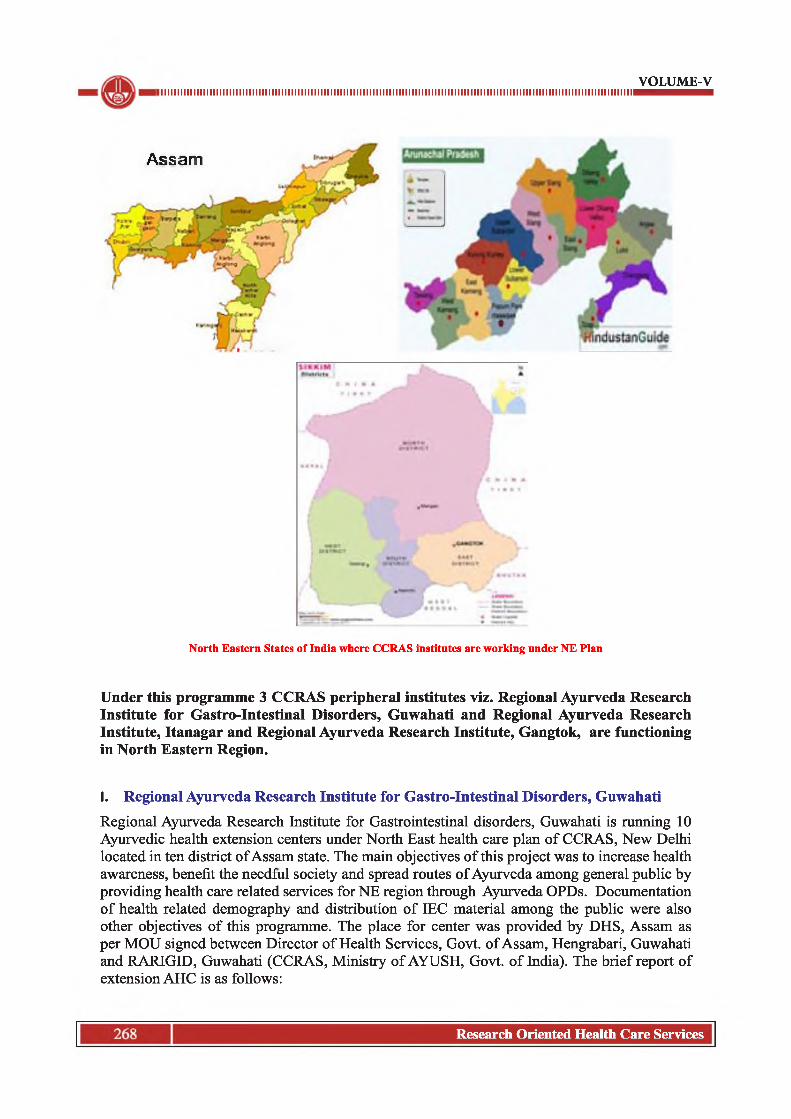
VOLUME-Viiiiiiiiiiiiiiiiiiiiiiiiiiiiiiiiiiiiiiiiiiiiiiiiiiiiiiiiiiiiiiiiiiiiiiiiiiiiiiiiiiiiiiiiiiiiiiiiiiiiiiiiiiiiiiiiiiiiiiiiiiiiiiiiiiiiiiiiiiiiiiiiiii
Assam
North Eastern States of India where CCRAS institutes are working under NE Flan
Under this programme 3 CCRAS peripheral institutes viz. Regional Ayurveda Research Institute for Gastro-Intestinal Disorders, Guwahati and Regional Ayurveda Research Institute, Itanagar and Regional Ayurveda Research Institute, Gangtok, are functioning in North Eastern Region.
I. Regional Ayurveda Research Institute for Gastro-Intestinal Disorders, GuwahatiRegional Ayurveda Research Institute for Gastrointestinal disorders, Guwahati is running 10 Ayurvedic health extension centers under North East health care plan of CCRAS, New Delhi located in ten district of Assam state. The main objectives of this project was to increase health awareness, benefit the needful society and spread routes of Ayurveda among general public by providing health care related services for NE region through Ayurveda OPDs. Documentation of health related demography and distribution of IEC material among the public were also other objectives o f this programme. The place for center was provided by DHS, Assam as per MOU signed between Director o f Health Services, Govt, of Assam, Hengrabari, Guwahati and RARIGID, Guwahati (CCRAS, Ministry of AYUSH, Govt, of India). The brief report of extension AHC is as follows:
Research Oriented Health Care Services

1 INI I INI I INI INI I INI I INI I III I INI I INI I INI INI I INI I INI I INI INI I INI I INI I III I INI I INI I INI INI I INI I INI I III I INI I INI I INI I III I INI
1. K am rup (R): AHC centre at District Kamrup (R) was inaugurated on 13/12/16 at Uma Kanta & Chandra Kanta Goswami PHC Barihat, Amranga. Dist-Kamrup ( R ). It is located nearly 50 km from the City of Guwahati and from the RARIGID Institute. It is near to the famous tourist place Chandubi lake. There are 20 numbers of villages under the P. H. C. It covers nearly 30000 population approximately. The main language spoken by the population is Assamese, Rabha and Boro. Common food habit includes mainly rice, non - vegetarian food, leafy vegetables, dal and other commonly available seasonal vegetables. Seasonal Fruits like banana, mango, guava, jack fruit, orange, etc. are commonly found. Electricity facility is available in most of the houses. Some part of this area is hilly and some parts are plain with a humid climatic condition. Govt, transport facility is not directly available to the center whereas private transport facilities like Magic, Tata sumo etc. are available up to the center. 75% of populations are educated. Many schools are available nearby. Three colleges are there within a distance o f 7 km. At a distance of around 4km from the center construction of new Central Forensic Science Laboratory is going on. There are 4 Mini PHCs and one civil hospital within range of 5- 7km. distance. During the present reporting period 2017 - 2018, a total 7146 no. of patient were treated. Among them 6026 no. of patients were newly registered and 1120 were old cases. Among all 1240 no. of patients of Vata vyadhi, 344 no. of Sandhivata, 513 no. ofTvakaroga, 517 no. of Jvara, 275 no. of Amlapitta, 221 no. ofArsha etc. were treated mostly. The center also arranged different awareness and free health camps in nearby villages. This center is providing every possible Ayurvedic treatment to the society. The people are also satisfied with the service and want the same in near future to continue.
2. M origaon: The AHC centre at Dist. Morigaon was inaugurated on 16/12/16 at old building premisesofNakhlaModelHospital, JagiroadDist-Morigaon. Itis approximately 28 km from Morigaon town and 65 km away from RARIGID institute and lies near the National highway. Transportation facilities are good with connectivity via both railway and road. The population of the town is approximately 48000. Assamese, Bengali and Hindi are the most commonly language spoken in this area. There is availability of 4 sub centres andl urban PHC under Nakhala Model Hospital. State govt, is also running Ayurveda OPD at Nakhala Model Hospital. During the present reporting period (2017 - 18), a total 7583 no. of patient were treated. Among them 4312 no. of patients were newly registered and 3271 were old cases. The diseases commonly prevalent and treated in center were found to be Pradara, Kasa, Sandhivata, Aamvata, Katishool, Amlapitta, Udarshool and Twakroga.
3. Golaghat: The AHC centre at Dist. Golaghat was inaugurated on 13/2/17 at Khumtai MPHC, Dist - Golaghat. Ayurvedic Health Centre, Khumtai is the only first full-fledged Ayurvedic OPD center running successfully in the area since inception. It is situated around 258 km. from RARIGID, Guwahati, in a remote village known as Khumtai Gaon in Golaghat district. Khumtai Gaon is a medium size village located in Khumtai Circle of Golaghat district, Assam with total 353 no. of families residing. The village has population of 1613 of which 836 are males while 777 are females as per Population Census 2011. Male literacy stands at 92.94 % while female literacy rate was 83.17 %. The main language spoken in this village is Assamese. The living condition of the people is well and good. The main source of earning is through different kinds o f farming and cultivations. The different modes of transportation are via public and private vehicles. The condition of the road is mostly good. Till to date there is no any Ayurvedic OPD functioning in the nearby vicinity. During the present reporting period 2017-18, a total 5902 no. of patient were treated. Among them 4128 no. of patients were newly registered and 1774 were old cases. The diseases commonly prevalent and treated in center are Vata vyadhi, Tvaka Rog, Udara Shul, Yoni Vyapad, Jvara, Amlapitta, Kasa, Hrid roga, Atisara, Grahanidosa etc,.
VOLUME-V
269Research Oriented Health Care Services

I INI I INI INI I INI I INI I III I INI I INI I INI INI I INI I INI I INI INI I INI I INI I III I INI I INI I INI INI I INI I INI I INI INI I INI I INI I III I INI I INI I
4. Nagaon: The AHC centre at Dist. Nagaon was inaugurated on 20-02-17 at CHC Raha, Ranthali District - Nagaon. It is 102.1 km away from RARIGID, Guwahati Institute. Raha is a small town in Nagaon District of Assam situated near National Highway 37. The river Kolong and Kopili flows near Raha. Raha town is one of the prominent trade centers in Assam for Agricultural product like jute, paddy and mustard. There are 125 villages in Raha circle and total population of 11,030 as per 2011 census. Urbanisation as per 2011 census is ll,030.and Assamese is the local language here.There are 80 no’s, of PHC, 15 no’s, of CHC along with 354 no’s of sub centers and 1 District Hospital (B.P.civil hospital Nagaon) for the health care assistance of people of Raha nagaon. There are many schools and colleges like Raha Higher secondary school, Raha Girls high school also college of Fisheries is also located in Raha. The main source of earning is through different kinds of farming and cultivations. The different modes o f transportation are via public and private vehicles. During the present reporting period 2017-18, a total 4989 no. of patient were treated. Among them 4267 no. of patients were newly registered and 722 were old cases. The diseases commonly prevalent and treated in center were Vata Vyadhi, Rakta vikara, Katishula, Amlapitta, Tvaka roga etc.
5. Barpeta: The AHC centre at Dist. Barpeta was inaugurated on 24-12-16 at Bahari MPHC, Dist - Barpeta. It is situated at a distance of approx. 100 km away from the Institute and 25 km away from Barpeta Town. Bahari is a large village located in Chenga Circle o f Barpeta district, Assam with total 780 no. of families residing. The Bahari village has population of 3352 of which 1672 are males while 1680 are females as per Population Census 2011. The total geographical area of village is 284.92 hectares. In Bahari Male literacy stands at 80.41 % while female literacy rate was 71.45 %. Total 264 Sub centres, 51 PHCs, 6 CHCs, 1 Sub district hospital and 1 District Hospital are available in Barpeta District. Transportation facilities like Govt, bus as well as private vehicles are available here. Main languages spoken are Assamese and Bengali. The living condition o f village is moderate and more poor families attracts towards Ayurveda OPD for seeking treatment. Maximum patient comes from the bank o f river Brahmaputra. During the present reporting period 2017-18, a total 12195 no. of patient were treated. Among them 6222 no. of patients were newly registered and 5973 were old cases. The diseases commonly prevalent and treated in center were Pradar, Amlapitta, Tvakroga, Vatavyadhi, Arsha, Swas, Kasa, Sandhivata, Rajodosa, Jwara, Kandu, Pravahika, Mutrakriccha, etc.
6. D arrang: The AHC centre at Dist. Darrang was inaugurated on 21-12-16 at Dhula MPHC, Dist. - Darrang. It is located nearly 80 kms. from the main center of Guwahati. The centre is established at Dhula point near National Highway which is about 8 kms from Mangaldoi, the district headquarter of Darrang Dist. The District comprises 1 civil hospital and 4 blocks PHC. The basic transportation is available in both public and private mode. The place is chosen as there is a big gap in providing health care facilities in a large area which comprises nearly 1.10 lakhs of population.The surrounding villages namely Paniakhat, Hirapara, Kahataniyapara, Atakata, Magurmari, Balabari, Kharikata, Thekrabari, Tangni, Garapuri are deprived of basic health care facilities. There is not even a single Ayurvedic clinic /establishment in this huge area. The demographic study shows that population comprises nearly 75% of Muslim, 15% of Hindu and 10% other religion. Assamese is the most common language spoken in the town. Nearly 55% of general population is under BPL. The hygienic and sanitation facilities are under minimum standards.During the present reporting period 2017-18, a total 7043 no. of patient were treated. Among them 6758 no. of patients was new cases and 285 were old cases. The diseases commonly prevalent and treated in center were Pratishya, Pandu roga, Tvaka roga, Vrana roga, Jwara, Amlapitta etc.
VOLUME-V
Research Oriented Health Care Services270

1 INI I INI I INI INI I INI I INI I III I INI I INI I INI INI I INI I INI I INI INI I INI I INI I III I INI I INI I INI INI I INI I INI I III I INI I INI I INI I III I INI
7. Jorhat: The AHC centre at Dist. - Jorhat was inaugurated on 25-03-17 at Kakojan BPHC MPHC, Dist. - Jorhat. It is situated at distance o f 350 km. from the main institute, 18 km towards East From Jorhat town, by the road side o f NH 37. Transportation facilities like Govt. Buses as well as private vehicles are available from Jorhat to Kakojan. Total population under Kakojan BPHC is 1,46,055. Number of CHC cum FRU is only one i.e. Teok FRU. No. o f MPHC is two i.e. Pulinahoroni and Chenijan MPHC. No. of SD is one i.e. Jajimukh SD. No. of sub-centre is 19. Common Languages spoken are Assamese, Bengali, Boro and Sadri. The earning source of this town is mainly from cultivation (tea garden). During the present reporting period 2017-18, a total 6070 no. of patient were treated. Among them 4558 no. of patients was new cases and 1512 were old cases. The diseases commonly prevalent and treated in center were Tvaka roga, Amlapitta, katishula, pradara roga, Sandhivata etc. etc.
8. Sonitpur: The AHC centre at Dist. - Sonitpur was inaugurated on 09-01-17 at Kanaklata Civil Hospital, Tezpur, Dist - Sonitpur. Tezpur is the Headquarter of Sonitpur District and the approximate population of Tezpur is 1.03 lakhs as per 2011 census report while the population of the whole Sonitpur District is 19.24 lakhs. It is situated at distance of 179 km via Jayson and 170 km via Mangaldoi from main institute - RARIGID, Guwahati. Assamese is the commonest language spoken here. Town has mixed population of Hindu and Muslims. In terms of educational status, there is 1 University, 13 colleges, 1 ITI, 30 higher secondary school, 166 High school 220 senior basic schools and 1 medical college. In terms of health center 6 Hospital, 23 primary health centers, 11 Dispensaries, 294 subcenter, and 1 mental hospital. There is availability of MO (Ayu.) at Kanaklata Civil hospital but is recently transferred to other district. During the present reporting period 2017-18, a total 5136 no. of patient were treated. Among them 2927 no. of patients was new cases and 2209 were old cases. The diseases commonly prevalent and treated in center were Pradara, Vata Vyadhi, Tvaka Roga, Amlapitta, Sandhishula etc. etc.
9. Goalpara: The AHC centre at Dist. - Goalpara was inaugurated on 18-02-17 at Bikali Model Hospital, Dhupdhara, Dist - Goalpara. It is situated at distance of approximate 105km. form the institute, 13 km from Rangjuli, half kilometer away from the NH-37 from the Dhupdhara bus station and also located 58 km towards East from District Headquarters Goalpara. This center attracts patients from nearby about 15 villages having about 10363 populations and there is no such Ayurveda center in this locality. Road connectivity is good. The main language spoken by the population is Assamese and Bengali. During the present reporting period 2017-18, a total 4921 no. of patient were treated. Among them 3184 no. of patients was new cases and 1737 were old cases. The diseases commonly prevalent and treated in center were Tvaka Roga, Sandhi vata, Pradara, Kasa, Katishula etc.
10. Nalbari: The AHC centre at Dist. - Nalbari was inaugurated on 14-12-16 at Mahatma Gandhi Model Hospital Adabari, Dist - Nalbari. It is situated at a distance of approximate 65 km. form the main institute, RARIGID, Guwahati and 20km away from Nalbari town. Adabari is a large village located in Barkhetri circle of Nalbari district, with total 412 families residing. This village has population of 2166 (1090 are males and 1076 are females) as per census 2011 report. Hindu and Muslim are the commonest community in this village. Assamese and Bengali are the common language spoken here in this village. Transportation facilities are good. Under district Nalbari, there isl Civil hospital, 4 Block PHC, 34 MPHC, 2 Model Hospital, 7 CHC, 5 SD, 4 Subsidiary health centre ,121 Health sub centre and 1510 Anganwadi centre. During the present reporting period 2017-18, a total 6423 no. of patient were treated. Among them 3512 no. of patients was new cases and
VOLUME-V
Research Oriented Health Care Services

I INI I INI INI I INI I INI I III I INI I INI I INI INI I INI I INI I INI INI I INI I INI I III I INI I INI I INI INI I INI I INI I INI INI I INI I INI I III I INI I INI IVOLUME-V
2911 were old cases. The diseases commonly prevalent and treated in center were Tvaka Roga, Sandhi vata, Pradara, Kasa, Katishula etc.
Statement Report of Patients attended at AHC OPD during 2016 - 17
Sr.
No
Name of centre
Number of Patients attended
NEW OLD TOTAL
(New + Old)Grand
TotalADULT CHILD TOTAL ADULT CHILD TOTAL
M F M F M F M F M F M F M F
1 Barihat, Kamrup
291 474 50 42 341 516 41 71 6 6 47 77 388 593 981
2 Nalbari 261 503 118 78 379 581 85 180 16 9 101 189 480 770 1250
3 Morigaon 278 328 55 38 333 366 151 131 20 9 171 140 504 506 1010
4 Darang 321 472 98 81 419 553 56 47 5 2 61 49 480 602 1082
5 Barpeta 331 1351 55 102 386 1453 124 520 5 14 129 534 515 1987 2502
6 Sonitpur 158 246 21 18 179 264 88 126 2 1 90 127 269 391 660
7 Golaghat 133 316 110 91 243 407 1 18 6 4 7 22 250 429 679
8 Goalpara 75 168 20 34 95 202 13 33 1 1 14 34 109 236 345
9 Raha 71 177 12 19 83 196 2 3 0 0 2 3 85 199 284
10 Jorhat 0 0 0 0 0 0 0 0 0 0 0 0 0 0 0
TOTAL 1919 4035 539 503 2458 4538 561 1129 61 46 622 1175 3080 5713 8793
Statement Report of Patients attended at AHC OPD during 2017 - 18
Number of Patients attended
S. New OldTOTAL Grand
TotalNo. centre Adult Child Total Adult Child Total
M F M F M F M F M F M F M F
1 Kamrup(R)
1897 3511 324 290 2221 3801 405 703 9 7 414 710 2635 4511 7146
2 Nalbari 1223 1783 266 240 1489 2023 1034 1732 73 72 1107 1804 2596 3827 6423
3 Morigaon 1712 2119 249 232 1961 2351 1336 1673 146 116 1482 1789 3443 4140 7583
4 Darang 1875 2821 1092 970 2967 3791 137 128 12 8 149 136 3116 3927 7043
5 Barpeta 1739 3473 441 569 2180 4042 1986 3040 396 551 2382 3591 4562 7633 12195
6 Sonitpur 1148 1444 165 170 1313 1614 816 1184 72 137 888 1321 2201 2935 5136
7 Golaghat 1117 1850 606 555 1723 2405 592 893 155 134 747 1027 2470 3432 5902
8 Goalpara 1169 1577 208 230 1377 1807 704 936 38 59 742 995 2119 2802 4921
9 Raha 1636 2288 153 190 1789 2478 282 428 6 6 288 434 2077 2912 4989
10 Jorhat 2032 2121 236 169 2268 2290 714 766 18 14 732 780 3000 3070 6070
TOTAL 15548 22987 3740 3615 19288 26602 8006 11483 925 1104 8931 12587 28219 39189 67408
Research Oriented Health Care Services272

1 INI I INI I INI INI I INI I INI I III I INI I INI I INI INI I INI I INI I INI INI I INI I INI I III I INI I INI I INI INI I INI I INI I III I INI I INI I INI I III I INIVOLUME-V
Prevalent Diseases
S.No. Diseases1 Vata vyadhi2 Amlapitta3 Sandhivata4 Aamvata5 Tvaka roga6 Jvara7 Arsha8 Pradara9 Swasa10 Kasa11 Pratishya12 Katishool13 Udara Shul14 Pradara15 Grahanidosa
11. Regional Ayurveda Research Institute, ItanagarThe six centres at different districts of Arunachal Pradesh were opened as an extension centre of RARI, Itanagar. All these centres remain opened from 9:30 am to 4:30 pm every day except Sunday, 2nd Saturday, and Gazetted holidays. Presently all these centres are running in District Hospital. OPD was started in these centres from May-June 2016. There are also several other activities conducted at these centres. The Free Health Camp and Awareness Programme was conducted at Bomdila of West Kameng District and Seppa of East Kameng District which was inaugurated by (Brig.) Dr. B.D. Mishra (Retd.) Governor of Arunachal Pradesh during his visit in OPD of Ayurveda Health Centre (extension unit of RARI, Itanagar). He expressed his feeling in the visitors’ register that “ I am delighted to see this Ayurvedic Branch o f the hospital which is being so efficiently managed. I wish them growth and all the expertise to meet the treatment requirements o f the patients coming to them” and Dr. Sonal Swaroop, IAS, Deputy Commissioner, West Kameng District, Arunachal Pradesh also expressed her feeling by discussing the health problems of the people, that they usually suffers from.
1. Bomdila (West Kameng District): OPD was started at this centre on dated 26-05-2016. Bomdilla is the head quarter and the major town of West Kameng district. The population is about 8000. The distance from Itanagar to Bomdilla is 271.6 km The majority of the local population include Aka, Miji ,Monpa,Bagun, etc. The main language spoken is Monpa but Hindi and Assamese are prevalently used by the local people for conversation. The living standards are high and are mostly traders and businessmen. Regular bus and sumo services are available for transportation. It has the modem facilities such as school, college, stadium, etc. The town has a district hospital covering nearby sub-urban Dirang and Rupa town.
2. Namsai (Namsai District): OPD was started at this centre on dated 26-05-2016. Namsai is the head quarter and the major town of Namsai district.The population is about 17000 .The distance from Itanagar to Namsai is 323 km (9 hours).The local population are the
273Research Oriented Health Care Services

I INI I INI INI I INI I INI I III I INI I INI I INI INI I INI I INI I INI INI I INI I INI I III I INI I INI I INI INI I INI I INI I INI INI I INI I INI I III I INI I INI I
Khamptis.The main language spoken is Khampti , English, Hindi and Assamese. The living standard is moderate and depends upon farming. Regular bus and sumo services are available for transportation. It has the modem facilities such as school, college etc. The town has a district hospital covering nearby sub-urban of Chowkham and Wakro town.
3. Tezu (Lohit District): OPD was started at this centre on dated 28-05-2016. Tezu is the head quarter and the major town of Lohit district. The population is about 18000.The distance from Itanagar toTezu is 377km (10 hrs).The majority of the local population including Mishmis and Adi etc. The main language spoken is Mishmi, Hindi. The living standard is moderate. Regular bus, sumo services and Air service are available for transportation. It has the modem facilities such as school, college, stadium, etc. The town has a district hospital covering nearby sub-urban of Sunpura town.
4. Seppa (East Kameng District): OPD was started at this centre on dated 26-05-2016. Seppa is the head quarter and the major town o f East Kameng district. The population is about 18000. The distance from Itanagar to Seppa is 217.5km (5 hrs approx).The majority o f the local population include Nyishi and Bangni.The main language spoken is Nyishi and Hindi. The living standard is high. Regular bus and sumo services are there for transportation. It has the modem facilities such as College, Schools, and Stadiums etc. The town has a district hospital covering nearby sub-urban o f town.
5. Pasighat (East Siang District): OPD was started at this centre on dated 09-06-2016. Pasighat is the head quarter and the major town of East Siang district. The population is about 25000.The distance from Itanagar to Pasighat is about km 256.6( 7 hrs approx).The majority of the local population are Adi and Mishing. The main language spoken is Adi and Hindi. The living standard is high. Regular Rail service and Air services are there for transportation. It has the modem facilities such as College, Schools, and Stadiums etc. The town has a district hospital covering nearby sub-urban of Ruksin town.
6. Likabali (West Siang District): OPD was started at this centre on dated 30-05-2016. Likabali is the major town of West Siang district in the border of Assam near to Shilapatthar town. The population is about 2000. The distance from Itanagar to Likabali is about 160.5 km (5 hrs approx).The majority of the local population are Galo. The main language spoken is Galo and Hindi. The living standard is high. Regular bus, sumo services and Rail service are available for transportation. It has the modem facilities such as Schools, college etc. The town has a Primary Health Center covering nearby sub-urban of Gensi town.
Prevalence of disease
VOLUME-V
S. No. Name of Disease1 Amlapitta2 Arsha3 Twak roga4 Jwar5 kasa6 Vatavyadhi7 Pradara8 Yakritvikara9 Udarashool10 kostabaddhata
Research Oriented Health Care Services274

VOLUME-V■iiiiiiiiiiiiiiiiiiiiiiiiiiiiiiiiiiiiiiiiiiiiiiiiiiiiiiiiiiiiiiiiiiiiiiiiiiiiiiiiiiiiiiiiiiiiiiiiiiiiiiiiiiiiiiiiiiiiiiiiiiiiiiiiiiiiiiiiiiiiiiiiii
11 Sandhishool12 Amvata13 Griddhrasi14 Grahani15 Pratishyaya
Statement Report of Patients attended at AHC OPD during 2016-17
s.No.
Name of the
Extension Centres
Number of patients attendedGrandTotal
GrandTotalNew Old
Adult Child Total Adult Child Total
M F M F M F M F M F M F M F (M+F)
01 Tezu 916 794 51 34 967 828 282 280 2 5 284 285 1251 1113 236402 Pasighat 366 508 48 41 414 549 155 178 9 9 164 187 578 736 131403 Namsai 494 455 152 172 646 627 278 220 23 22 301 242 947 869 181604 Bomdila 394 372 27 17 421 389 124 151 4 3 128 154 594 543 113705 Seppa 504 316 25 22 529 338 158 91 0 5 158 96 687 434 112106 Likabali 303 232 47 33 350 265 104 94 1 2 105 96 455 351 806
Total 2977 2677 350 319 3327 2996 1101 1014 39 46 1140 1060 4512 4046 8558
Statement Report of Patients attended at AHC OPD during 2017-18
Sr.No.
Name of the
Extension Centres
Number of patients attendedGrandTotal
GrandTotalNew Old
Adult Child Total Adult Child TotalM F M F M F M F M F M F M F (M+F)
01 Tezu 1483 1619 99 74 2345 1693 785 550 17 13 727 563 3072 2256 5328
02 Pasighat 1011 1410 238 209 1491 1619 541 532 74 62 587 594 2078 2213 4291
03 Namsai 696 791 249 368 1194 1159 314 228 19 51 311 279 1505 1438 2943
04 Bomdila 749 842 13 6 1026 848 446 427 2 0 404 427 1430 1275 2705
05 Seppa 1101 1018 184 144 1550 1162 576 484 35 46 550 530 2100 1692 3792
06 Likabali 1046 1158 328 276 1797 1434 545 419 12 8 482 427 2279 1861 4140
Total 6086 6838 1111 1077 9403 7915 3205 2640 159 180 3061 2820 12464 10735 23199
III. Regional Ayurveda Research Institute, Gangtok
The four centres at different districts viz; Gayzing West district, Jorethang-South District, Mangan- North District and Rangpo- East district were opened as an extension centre of RARI Gangtok under North East plan o f CCRAS. These centres are running in rented building as government space is not available. These centres are basically creating a separate entity for publicity as popularity of AYUSH system & Ayurveda in public domain. This Institute takes the opportunity to be the is 1st Ayurveda Institute in entire Sikkim as well each extension center is 1st Ayurveda health center in each district of Sikkim. Details of Each Extension Center are as follows-
1. Gayzing (West district): This is the 1st Centre of this extension programme which was inaugurated on 19.09.2016 in the auspisicious presence of Shri. K.B. Limbu, Chairman, Poultry Board, Dept, of Animal Husbandry,Govt, of Sikkim was present as
Research Oriented Health Care Services

VOLUME-Viiiiiiiiiiiiiiiiiiiiiiiiiiiiiiiiiiiiiiiiiiiiiiiiiiiiiiiiiiiiiiiiiiiiiiiiiiiiiiiiiiiiiiiiiiiiiiiiiiiiiiiiiiiiiiiiiiiiiiiiiiiiiiiiiiiiiiiiiiiiiiiiiii
chief guest. Gayzing is a small hill town situated in west district at 6500ft altitude; with total population 4013. This centre is around 137 km far away from the main Institute which takes around 4-5 hrs to reach there. Although the distance is not too far from main institute but the road is not good enough due to mountainous terrain. However there are proper government and private transportation facilities. There is only one district hospital at Gayzing, 7 PHC’s and 41 PHSC’s are present in West Sikkim district. The total population of west district is 136435 (Male-70238 & Female-66197) with 117 population density as per the last census. The most of the population around 96.15 % are living in rural areas as per 2011 census. The common language spoken is Nepali; Bhutia, Lepcha, limbo, Sherpa English and Hindi. The Government and private educational facilities are available in Geyzing district.
2. Jorethang (South District): This is the 2nd Centre which was inaugurated on 10.11.2016 in the presence of Panchayat President, Municipal Councillor & local people. Jorethang is the one of the major business center of South & West district. Jorethang is situated about 1056 ft altitude with total population of 9009 as per last census. This centre is around 96 km far away from the main Institute which takes around 3-4 hrs to reach there. Transportation facilities like Govt, bus as well as private vehicles are available but condition of road is pretty rundown. One district hospital is at Namchi, 5 PHC’s, 29 PHSC’s and one CHC are there in South district from which One PHC is at Jorethang. Total population of South district according to last census is 146850 (Male-76670 & Female-70180) with 196 population density. As per 2011 census, 14.44% lives in urban regions o f district. 85.56 % population of South Sikkim districts lives in rural areas of villages. The main language spoken is Nepali, Bhutia, Lepcha, limbo, Sherpa and English, Hindi are also spoken. Literacy rate is recorded as 81.42 which is quiet good. The Government and private educational facilities are available in Geyzing district.
3. Mangan (North District): This is the 3rd Centre inaugurated on 11.01.2017 in Mangan, district head quarter of North district with total population 4644. It was inaugurated in presence of DC, SP, CMOH, Panchayat President and other local peoples. This extension Center is the 1st Ayurveda OPD in North district.Mangan is situated about 3 136ft altitude. It is 72 km far away from the main Institute which takes around 3hrs to reach. The transportation facilities like govt, bus as well as private vehicles are available. However the road is very bad due to mountainous terrain and there are also frequent landslides during rainy season which makes this place inassessable to rest of Sikkim. There is only one district hospital is at Mangan, 5 PHC’s, 8 PHSC’s in North district. The total population of North district is 43709 (Male-24730 & Female- 18979) with 10 population density. 10.62 percent lives in urban regions of district. 89.38 % population of North Sikkim districts lives in rural areas of villages as per 2011 census. The main language spoken is Lepcha, Bhutia, Nepali, limbo, Sherpa. English, Hindi are also fairly spoken. The Government and private educational facilities are available in iii. Mangan. Literacy rate is recorded as 78.01.
4. Rangpo (East district): This is the 4th Centre which was inaugurated on 24.01.201 in presence of Panchayat President, SDPO of Rangpo and other Panchayat member & local people. The total population of East district is 283583 (Male-151432 & Female- 132151) with 297 population density as per the last census. However there is already one AYUSH hospital running in Gangtok, East Sikkim maintained by RARI. Hence it was decided to open one extension center at second largest town Rangpo, which has total population of 10,450. Rangpo is situated immediate to the border of West
Research Oriented Health Care Services

1 INI I INI I INI INI I INI I INI I III I INI I INI I INI INI I INI I INI I INI INI I INI I INI I III I INI I INI I INI INI I INI I INI I III I INI I INI I INI I III I INI
Bengal. It is situated at a distance of 34 km away from the main Institute which takes 2 hr to reach there. Rangpo is situated about 1056ft altitude. Transportation facilities are available and road condition is fairly good. There is one state hospital, 1 District hospital, 8 PHC’s, 48 PHSC’s, one CHC, one AYUSH hospital in East district from which One PHC is at Rangpo with 6 PHSC. 43.19 percent lives in urban regions of district. 56.81 % population of East Sikkim districts lives in rural areas of villages as per 2011 census. This is the 1st Ayurveda OPD in rangpo. The main language spoken is Nepali, Bhutia, Lepcha, limbo, Sherpa and English, Hindi are also spoken. Literacy rate is recorded as 83.85.
Prevalence of Diseases
VOLUME-V
S.No. Prevalant Diseaes1. Sandhi Vata2. Tvakroga,3. Vata Vyadhi4. Amlapitta5. Sandhisula6. Kasa7. Udar shula8. Arsha9. Katisula10. Prameha11. Vata Rakta,
Statement Report of Patients attended at AHC OPD during 2016-17
Name of Extension
Centres
Number of patients attended GrandTotal
(M + F)
New OldAdult Child Total Adult Child Total TOTAL
M F M F M F M F M F M F M FGeyzing 551 405 44 42 595 447 457 334 29 36 486 370 1081 817 1898Jorethang 590 525 45 37 635 562 584 537 39 30 623 567 1258 1129 2387Mangan 279 248 35 33 314 281 211 197 14 12 225 209 539 490 1029Rangpo 194 191 26 28 220 219 99 101 5 6 104 107 324 326 650Total 1614 1369 150 140 1764 1509 1351 1169 87 84 1438 1253 3202 2762 5964
Statement Report of Patients attended at AHC OPD during 2017-18
Name of Extension
Centres
Number of patients attended GrandTotal
(M + F)
New Old
Adult Child Total Adult Child Total TotalM F M F M F M F M F M F M F
Geyzing 885 624 76 62 961 686 908 617 61 72 969 689 1930 1375 3305Jorethang 1052 993 73 88 1125 1081 1287 1343 21 19 1308 1362 2433 2443 4876Mangan 498 456 46 34 544 490 977 695 48 8 1025 703 1569 1193 2762Rangpo 962 695 63 88 1025 783 940 622 39 52 979 674 2004 1457 3461Total 3397 2768 258 272 3655 3040 4112 3277 169 151 4281 3428 7936 6468 14404
277Research Oriented Health Care Services

I INI I INI INI I INI I INI I III I INI I INI I INI INI I INI I INI I INI INI I INI I INI I III I INI I INI I INI INI I INI I INI I INI INI I INI I INI I III I INI I INI I
CHAPTER - 6INTEGRATION OF AYUSH (AYURVEDA) WITH NATIONAL PROGRAMME FOR PREVENTION AND CONTROL OF CANCER, DIABETES, CARDIOVASCULAR DISEASES AND STROKE
BACKGROUND-
Non Communicable Diseases (NCDs) kills 40 million people each year, equivalent to 70% of all deaths globally. Every year, 15 million people die from a NCD between the ages of 30 and 69 years; over 80% of these “premature” deaths occur in low- and middle-income countries. Cardiovascular diseases account for most NCD deaths, followed by Cancers (8.8 million), respiratory diseases (3.9million), and Diabetes (1.6 million).These 4 groups of diseases account for over 80% of all premature NCD deaths. It is projected that globally NCDs will account for nearly 44 million deaths in 2020 (Global status report on non-communicable diseases 2010).
In India, as per the NCD country profile 2014 published by World Health Organization (WHO), overall mortality due to NCDs was 60%. The disease specific share was for Cardiovascular Diseases-26%, Cancers-7%, Diabetes-2%, COPD-13%, Other NCDs-12%. Based on National Cancer Registry Programme (NCRP) of Indian Council of Medical Research (ICMR), it is estimated that there are about 28 lakh cases of different types of Cancer in the country with new occurrence, about 11 lakh cases and about 5 lakh deaths annually. The three most prevalent cancers in India are breast, cervical and oral cancers.
NCDs are caused, to a larger extent, by four behavioural risk factors which are pervasive aspects of economic transition, rapid urbanization and 21st-century lifestyles: tobacco use, unhealthy diet, insufficient physical activity and the excessive use o f alcohol. The greater effects of these risk factors fall increasingly on low and middle-income countries, and on poor people within all countries, mirroring the underlying socioeconomic determinants. Ayurveda, food (Pathya & Apathya), life style (Vihara) play a key role in the maintenance of health and in prevention of many diseases. This includes advocacy on food items (Qualitative & Quantitative), according to the disease. Further, the daily routine activities (Dinacharya) such as dental care, oil massage, Yoga, Physical activities, Good conduct, Mental health and seasonal routine for maintenance of health are also described. Ayurveda emphasises the practice of healthy life style for healthy persons to prevent diseases and specific life style modifications for different diseases to arrest the progress o f the disease and complications. It was viewed that the potential of this unique contribution of Ayurveda may be adopted for the prevention of NCDs through food and life style counselling. Detection, screening and management of NCDs, as well as prevention of complications, are key components of therapeutic approach to NCDs.
INTRODUCTION
Government of India launched “National Programme for Prevention and Control of Cancer, Diabetes, Cardio-vascular diseases and Stroke (NPCDCS)” in 2008 to prevent and control the projected increase in the burden of Non-Communicable Diseases. This program has been implemented in 36 States by Directorate of Health Services.
The National Policy on Indian Systems of Medicine and Homeopathy adopted in 2002, suggested phase wise integration of ISM with health delivery systems. National Health Policy
VOLUME-V
Research Oriented Health Care Services278

1 INI I INI I INI INI I INI I INI I III I INI I INI I INI INI I INI I INI I INI INI I INI I INI I III I INI I INI I INI INI I INI I INI I III I INI I INI I INI I III I INI
2017, emphasizes on mainstreaming of AYUSH systems through integration and collocation for achievement on National goal and to reduce premature mortality from cardiovascular diseases, cancer, diabetes or chronic respiratory diseases up to 25% by 2025. During the past decade, the global emergence of integrative medicine has established that India has the potential to become a world leader in this sphere, if adequate support & opportunities for Research and Development is given the Integration will enable patients to choose the appropriate interventions. The ministry also desires to generate the health data of population in relation to various disease preventive factors described in AYUSH systems. AYUSH doctors can play a vital role in prevention and control of NCDs through primary health care network.
Keeping the strength o f AYUSH systems for prevention and management of NCDs by promoting healthy lifestyle, “Integration o f AYUSH (Ayurveda) with NPCDCS programme” was conceived in 2015 by Ministry of AYUSH & Central Council For Research In Ayurvedic Sciences in collaboration with Director General for Health Services, for imparting Health Services on Pilot basis. This would initially cover Districts of 3 states, viz. Bhilwara (Rajasthan), Surendranagar (Gujarat) and Gaya (Bihar). The programme was launched during Jan/Feb in 2 districts viz. Bhilwara (Rajasthan), Surendranagar (Gujarat) whereas in Gaya (Bihar) the programme was launched on April 2016.
OBJECTIVES• To integrate Ayurveda to the existing healthcare system for promotion, prevention and
control of non-communicable diseases through NPCDCS program.• To ensure early diagnosis o f NCDs for management through life style and behavioral
changes through the principles o f Ayurveda.• To reduce drug dependency in chronic cases through Ayurveda, Yoga practices and
Lifestyle changes.• To provide Ayurveda as an adjuvant therapy to reduce complications and associated
symptoms.• To ensure Evaluation, Monitoring and Surveillance of NCDs.
MATERIALS AND METHODS
Study Site
This program has been implemented on pilot basis in three districts of the three states at Community Health Centre (CHC) and Primary Health Centre (PHC) level and the details of the program are depicted in the table no. 1:
VOLUME-V
Table no.l: Details of study sites of NPCDCS Program
SI.No.
State Districts No. of CHCs/ Block PHC + District Hospital(DH)
No. of PHCs in the District
1 Bihar Gaya 17 CHCs / Block PHCs +1 DH 712 Gujarat Surendranagar 10 CHCs + 1DH 373 Rajasthan Bhilwara 22 CHCs + 1DH 75Total 49 CHCs & 3 District Hospital 183
279Research Oriented Health Care Services

VOLUME-Viiiiiiiiiiiiiiiiiiiiiiiiiiiiiiiiiiiiiiiiiiiiiiiiiiiiiiiiiiiiiiiiiiiiiiiiiiiiiiiiiiiiiiiiiiiiiiiiiiiiiiiiiiiiiiiiiiiiiiiiiiiiiiiiiiiiiiiiiiiiiiiiiii
Engagement of human resources
For this programme, technical manpower from Ayurveda and Yoga discipline and supporting manpower for other secretarial work has been engaged on temporary basis. They have been placed at CHC/Block PHC, districts hospitals o f the selected districts and at CCRAS headquarters. The details of the manpower engaged are depicted in Table no.2
Table no. 2: The details of the staff recruited in the programme
Name of the District & State Total
Sr.Consultant
(Ay.)
R.A.(Ay.)
Pharmacist(Ay.)
YogaInstructor DEO MTS
CCRAS Hqrs., N. Delhi
03 02 - - " 01 "
Surendranagar Distt., Guj.
77 02 20 22 11 11 11
Bhilwara Distt., Rajasthan
161 02 44 46 23 23 23
Gaya, Bihar 126 02 34 36 18 18 18
The roles and responsibilities of each category of manpower have been well defined for smooth implementation of the program. The details are as under -
Manpower Role & responsibilitiesSenior Consultant (Ay.) atDHC level
To screen, detect the NCD patients in early stages & arrest the disease progress through life style counseling.
To refer the patients of NCDs (non respondents to life style/ Ayurveda) for proper consultations.To entertain cross referrals from modem medicine & provide life style management to the patients.To coordinate with the District Nodal Officer (NPCDCS) and In-charges of NCD Clinics for Investigations support (diagnostic and laboratory).To provide service to NCD patients by giving consultation, life style counseling (Pathya-Apathya) and medicine.To generate awareness about risk factors of NCDs and importance of healthy diet, regular physical activity and Ayurvedic approach for prevention of NCDs.To co-ordinate with Yoga Instructor for Yoga prescription with practical demonstration of Yogic practices as required for NCD patients.To collect data o f NCD patients at Life Style Clinics.
Research Oriented Health Care Services

1 INI I INI I INI INI I INI I INI I III I INI I INI I INI INI I INI I INI I INI INI I INI I INI I III I INI I INI I INI INI I INI I INI I III I INI I INI I INI I III I INIVOLUME-V
Research Associate (Ay.) at CHC level
• To generate awareness about risk factors of NCDs and importance of healthy diet, regular physical activity and Ayurvedic approach for prevention of NCDs.
• To provide service to NCD patients by giving consultation, life style counseling (Pathya-apathya) and medicines.
• To co-ordinate with Yoga Instructor for Yoga prescription with practical demonstration of Yogic practices as required for NCD patients.
• To coordinate with the In-charge of CHC / NPCDCS cell for diagnostic and laboratory Investigations etc.
• To distribute medicines and IEC materials to the NCD patients visiting life style clinic and general public attending health camps arranged at PHC level.
Yogainstructor
• To generate awareness about role of yoga in prevention of NCDs.• To impart training to the identified Yoga volunteers on Yoga
procedures to enable them to conduct Yoga practices regularly at concerned PHC.
• To prescribe and demonstrate the Yoga -Asanas and other related procedures to the person susceptible for NCDs and patients (disease specific yoga procedures) in co-ordination with Ayurvedic consultant/ Research Associate and maintain the records.
Pharmacist(Ay.)
• To dispense medicines as prescribed by the Sr. Consultants/Research Associates at respective Life Style Clinics and camps and to keep all relevant records as required.
• To explain the procedure for taking medicines as advised by Sr. Consultants/ Research Associates.
• To counsel patients for better compliance of prescribed medicines, promotion of Health and prevention of diseases.
Data Entry Operator
• To assist Sr. Consultant/ Research Associate and Yoga Instructor in preparation of reports and maintenance of records of activities and tasks under the project.
Multi Tasking Staff (MTS)
• To assist in routine office work like diary, dispatch, Photocopying, sending of FAX, etc and to maintain the cleanliness, coordinate supply of electricity, water, housekeeping etc. of the premises
• To assist in outreach activities such as organization of camps, distribution of IEC materials etc.
INTERVENTIONSIn view of aetiology of NCDs Pharmacological and Non-pharmacological interventions have been advocated.
Pharmacological interventions
16 common classical Ayurvedic medicines have been identified in consultation with the experts
281Research Oriented Health Care Services

I INI I INI INI I INI I INI I III I INI I INI I INI INI I INI I INI I INI INI I INI I INI I III I INI I INI I INI INI I INI I INI I INI INI I INI I INI I III I INI I INI I
for the prevention and management of the NCDs. The medicines have been procured from GMP certified Ayurvedic pharmaceutical companies as per pharmacopoeial standards. The medicine were usually prescribed for 3 months or as required as per the discretion of the Ayurvedic doctors based on assessment of the condition of the patients and condition of the disease (Rogi Roga Pariksha). However, follow-up was done for another 3 months after treatment. List of the medicines with their doses are depicted in the Table-3.
VOLUME-V
Table-3: List of the selected classical Ayurvedic medicines for the NCDs with their doses& dosage form
S.No Medicine Disease condition Dose Per Day
1. Mamajjak Capsule Diabetes 1 gm BID
2. Arogyavardhini Vati Obesity & Dyslipidemia 500 mg BID (not more than 45 days)
3. Triphala Churna Obesity & Dyslipidemia 3 gm BID
4. Sarpagandha Mish- rana
Hypertension 250 mg BID
5. Pravala Pishti Hypertension 250 mg BID
6. Ashvagandha Churna Cancer 3 gm BID
7. Guduchi Churna Diabetes, Cancer 3 gm BID
8. Amalaki Churna Diabetes (Amlapitta) 3 gm BID
9. Ekangaveera Rasa Stroke/ Pakshaghat 125 mg BID
10. Haridra Khanda COPD, Ch. Bronchitis, Allergic Bronchitis
3 gm BID
11. Tribhuvan Mishran COPD, Ch. Bronchitis 1 Tab BID
12. Soma Churna COPD 500 mg BID
13. Chitrakadi Gutika Obesity & Dyslipidemia 250 mg BID
14. Kutajghan Vati Diabetes (Atisara, Grahani) 250 mg BID
15. Yograj Guggulu Obesity & Dyslipidemia 500 mg TID
16. Sitopaladi Churna COPD, Ch. Bronchitis 3 gm BID
The medicines selected for disease conditions as mentioned on the above table are as per their classical indications.
Non-Pharmacological interventions
i. Diet and Life style
It includes regulation of diets, lifestyle and Yogic Asanas. Some advocacy on diet and life styles for prevention of NCDs are presented in Table-4.
Research Oriented Health Care Services282

VOLUME-V^ ^ ^ ^ ^ ^ ^ ■ iiiiiiiiiiiiiiiiiiiiiiiiiiiiiiiiiiiiiiiiiiiiiiiiiiiiiiiiiiiiiiiiiiiiiiiiiiiiiiiiiiiiiiiiiiiiiiiiiiiiiiiiiiiiiiiiiiiiiiiiiiiiiiiiiiiiiiiiiiiiiiiiii
Table-4: Advocacy on diet and life styles for prevention of NCDs
DIABETES MELLITUSDo’s Dont’s
• Intake of old harvested cereals, barley (Yava), Sorghum (Jowar), whole wheat atta, bitter gourd (Karela), green leafy vegetables, garlic (Lasuna), turmeric (Haridra), aloe (Kumari) in vegetables and fruits like Guava, Oranges, Indian Blackberry (Jamun) etc.
• Timely intake of diet.• Regular exercise especially walking.• Regular practice of Yoga, Meditation etc. under
the supervision of Yoga specialist is suggested.
• Sugarcane juice, jaggery, sugar, milk products
• Reduce intake of rice, food rich in carbohydrate and fried or processed food
• Sedentary lifestyle• Sleeping in the day time and
excessive sleeping• Alcohol• Staying too long on empty stomach.
• Cold drinks, Ice cream, burger- pizza and other fast foods etc.
HYPERTENSION• Regular blood pressure check-up.• Timely intake of balanced diet, more use of
fruits and green vegetables.• Regular physical exercise.• Daily brisk walking for half an hour.
• Reduce intake o f oily, salty, sour and spicy food items.
• Weight reduction.• Barley (Yava), sorghum (Jowar), wheat,
green gram (Mudga/Moong dal), horse gram (Kulatha), moringa (Shigru), Bitter gourd (karela), bottle gourd (Ghia/ Lauki), turnip (Shalgam), carrot (Gajar), radish (Muli), Indian gooseberry (Amla), cucumber (Khira), blackgrapes (Draksha), pomegranate (Anar), apple, pineapple, cold milk etc.
• Timely sleeping and awakening.
• Regular practice of Yoga & Meditation under the supervision of Yoga expert
• Excessive intake of salt (sprinkling over salad, curd etc.)
• Excessive use of butter, ghee, chillies (red-green), pickles, Sesame Oil (Til taila), Bengal gram(Chana Dal), mustard oil (Sarson ka Taila), sour fruits, curd, tea, coffee etc.
• Intake o f animal fat, processed/oily food items.
• Alcohol consumption and smoking.
• Practice of day sleeping and awakening at night.
Research Oriented Health Care Services

VOLUME-Viiiiiiiiiiiiiiiiiiiiiiiiiiiiiiiiiiiiiiiiiiiiiiiiiiiiiiiiiiiiiiiiiiiiiiiiiiiiiiiiiiiiiiiiiiiiiiiiiiiiiiiiiiiiiiiiiiiiiiiiiiiiiiiiiiiiiiiiiiiiiiiiiii
OBESITY• Take low-fat and low-calorie food items.
• Take frequent small meals to avoid food cravings.
• Take more proteins to stay longer without food.• Use warm water for drinking.• Include cabbage in daily meal. It will stop the
conversion of sugars to fat.• Steamed, boiled and baked vegetables rather
than fried.• Drink skimmed milk instead of whole milk.• Include lemon in diet and drinks.• Take Healthy foods such as - oatmeal, walnuts,
salads, bitter gourd {Karela), drumstick (Shigru), barley (Yava), wheat, honey (Madhu), Indian Gooseberry (Amla), pomegranate (Anar) and snake gourd etc.
• Brisk morning walk of 30 minutes.• Yoga and Meditation to manage stress and fatigue.
• Watching TV while having food.
• High carbohydrate vegetables like - potato, rice etc.
• More sugary or sweet products, more dairy products, fried and oily foods, fast foods, excess salt.
• Sedentary habits.
• Excessive sleep.• Alcohol and Smoking• Salty foods or excessive salt in meals.
DYSLIPIDE MIA1. Intake of regular and balanced diet.
2. Use o f lukewarm water (Ushnodaka) for drinking.
3. Use of Barley (Yava), Sorghum (Jowar), Indian gooseberry (Amla), Honey (Madhu) and Butter milk (Takra)
4. Use of Green gram (Moong), Horse gram (Kulathi), Bengal gram (Chana) and Spilt Red Gram (Arhar)
5. Plenty o f green leafy vegetables and fruits
6. Fibrous food items
7. Brisk walking and j ogging in fresh air everyday in early morning
8. Regular exercise
9. Practice ofYoga & Naturopathy in consultation with the specialist.
1. Frequent and excessive intake of oily / heavy food items
2. Sleeping in day time (Diva-swapna)
3. Sleeping immediately after taking meals
4. Canned food products
5. Sedentary lifestyle.
6. Junk food like burger, pizza, cold drinks and fried food items
Research Oriented Health Care Services

1 INI I INI I INI INI I INI I INI I III I INI I INI I INI INI I INI I INI I INI INI I INI I INI I III I INI I INI I INI INI I INI I INI I III I INI I INI I INI I III I INI
ii. Yogic Asanas
Some useful Asanas/Kriyas/Pranayam have been advocated for the NCDs under the supervision of Yoga Experts. These are presented in Table-5.
Table-5: Shows some Yogasanas for Non Communicable Diseases
VOLUME-V
NAME OF THE DISEASE YOGA ASANAS PRANAYAM A KRIYA
DIABETESMELLITUS
Suryanamaskara, Tadasana, Katichakrasana, Sarvangasana, Halasana, Matsyasana,Ushtrasana, Gomukhasana, Ardhamatsyendrasana, Mandukasana, Paschimottanasana, Pawanmuktaasana, Bhujangasana, Shalabhasana, Dhanurasana, Vajrasana, Shavasana.
Nadishodhana,Suryabhedi,Bhastrika
Kunjal,Kapalabhati,Agnisara
HYPERTENSIONTadasana, Katichakrasana, Konasana, Uttanapadasana, Pavanamuktasana, Vajrasana, Ushtrasana, Shashankasana, Bhujangasana, Gomukhasana, Makarasana, Vakrasana, Shavasana.
Nadishodhana, Ujjayi, Shitali, Sitkari and Bhramari
Jalneti
OBESITY&DYSLIPIDEMIA
Surya Namaskar, Tadasana, Katichakrasana, Konasana, Pavanmuktasana, Ardha Padmasana, Padmasana, Pascimottanasana, Halasana, Bhujangasana, Shalabhasana, Dhanurasana, Naukasana, Navasana, Parvatasana, Vakrasana, Padahastasna, Vajrasana, Shashankasana, Sarvangasana, Ardhamatsyendrasana, Shavasana
Nadishodhana,Suryabhedi,Bhastrika.
Kunjal,Kapalabhati
STROKESurya Namaskar, Tadasana, Katichakrasana, Konasana, Pavanmuktasana, Bhujangasana, Uttanpadasana(Ekpad), Vakrasana, Makarasana, Ardhshalabhasana, Shavasan
Nadishodhana,Suryabhedi,Bhastrika
Kunjal,Kapalbhati
Research Oriented Health Care Services

VOLUME-Viiiiiiiiiiiiiiiiiiiiiiiiiiiiiiiiiiiiiiiiiiiiiiiiiiiiiiiiiiiiiiiiiiiiiiiiiiiiiiiiiiiiiiiiiiiiiiiiiiiiiiiiiiiiiiiiiiiiiiiiiiiiiiiiiiiiiiiiiiiiiiiiiii
CANCERSurya Namaskar, Tadasana, Ushtrasana, Vakrasana, Gomukhasana, Bhujangasana, Shalabhasana, Dhanurasana, Simhasana, Shavasana.
Nadishodhana, Ujjai, Shitali, Sitkari, Bhastrika
Kapalbhati.
RHEUMATIC HEART DISEASE
Tadasana, Katichakrasana, Konasana, Pavanmuktasana, Makarasana, Bhujangasana, Shalabhasana, Vakrasana, Paschimottnasana, Ushtrasana
Nadishodhana,Bhastrika,Suryabhedi
COPDSurya Namaskar, Tadasana, Katichakrasana, Konasana, Pavanamuktasan, Setubandhasan, Ushtrasan, Bhujangasan, Dhanurasan, Gomukhasan, Vajrasan, Vakrasan,
Bhastrika,Suryabhedi,Ujjai
Agnisara,Jalaneti,Vamandhouti(Kunjal),Kapalbhati.
ESTABLISHMENT OF AYUSH NPCDCS CLINIC/LIFE STYLE CLINICS
For establishing AYUSH-NPCDCS clinic/Life Style clinics in all the selected CHCs and District HQ., Hospitals (DH), initially the concerned state health Authorities were approached and made aware about this programme as health is the state subject. The state authorities extended their support by providing space/ rooms in CHCS/District Hospitals premises. The feasibility in existing conditions of CHCs was surveyed and the In-charges of the CHCS/ District Hospitals were also made aware about the programme through team visits and various meetings. The necessary equipments namely B.P. Apparatus, Stethoscope, Weighing machine, Thermometer, Torch, Measuring Tape, Height Scale were provided at every centre. Apart from this, Computer with Internet facility was provided to each Centre for recording the data and communicating reports to the monitoring centers i.e. CCRAS Institute of concerned state and CCRAS Hqrs.
DEVELOPMENT OF INFORMATION EDUCATION AND COMMUNICATION (IEC) MATERIALS, PROGRAMME GUIDELINES AND TRAINING MANUAL
The information in the form of Pamphlets on Prevention and management o f the selected NCDs through Ayurveda has been prepared and made available for wide distribution to the patients and general public in all the CHCs to create awareness. As a part of the implementation strategy, the AYUSH doctors are also disseminating healthy life style advices and benefits of Yoga practices to the attending patients regularly. A detailed “Guidelines and Training ManuaF has been prepared to depict approach & methodology to be adopted for screening and examination along with the selected Ayurveda & Yoga interventions.
Research Oriented Health Care Services

1 INI I INI I INI INI I INI I INI I III I INI I INI I INI INI I INI I INI I INI INI I INI I INI I III I INI I INI I INI INI I INI I INI I III I INI I INI I INI I III I INI
W orkshop/Training program m e for the engaged manpower
The workshop/training programmes were conducted at all the three selected districts to impart training to stake holders about the modus operandi of the programme. State Health authorities also participated in the training programme and emphasized the significance of Integration and the importance of working in coordination for the success of the programme. Various lectures on the NCDs like Diabetes, Hypertension, Dyslipidemia, Cancer etc. and the methodology to be adopted were imparted in this programme for better understanding and to work in a coordinated manner with a team spirit.
MODUS OPERANDI FOR THE EXECUTION OF THE PROGRAMME
Screening of the NCD patients
The patients attending the AYUSH NPCDCS clinic at District Hospital/CHC level are being thoroughly screened for NCDs. Further, the health camps are also being organized at PHC level of selected Districts on regular interval to screen the general population for NCDs and to sensitize them about the role of the faulty dietetic habits and lifestyles responsible for increasing incidence of NCDs along with creating awareness about the preventive measures to prevent the NCDs. A format has also been developed for the screening.
Facility for regular Yoga practice
The Yoga Asanas are being demonstrated and regularly put in to practice by the Yoga Instructors at CHCs and District Hospitals level for the susceptible/ diagnosed patients of NCDs. At each PHC level two volunteers (one male and one female) have been identified and trained by the Yoga Instructor who in turn provide regular yoga practices to general public at village level.
Treatm ent protocol for NCDs through Ayurveda
Based on the screening, the subjects who were identified to be in the risk zone of NCDs or established NCD patients have been registered in to two cohorts i.e. Pre disease group (A) and Disease group (B) and further sub divided in to treatment groups A l, A2 & B l, B2. The patients in the early stages of NCDs mainly of Diabetes, Hypertension and Dyslipidemia have been focused. The case record forms (CRFs) have been designed for recording the data of registered patients. The schematic diagrams of the projects undertaken with integration of Ayurveda to NPCDCS programme are depicted below (Figure I to IV).
VOLUME-V
Research Oriented Health Care Services

VOLUME-Viiiiiiiiiiiiiiiiiiiiiiiiiiiiiiiiiiiiiiiiiiiiiiiiiiiiiiiiiiiiiiiiiiiiiiiiiiiiiiiiiiiiiiiiiiiiiiiiiiiiiiiiiiiiiiiiiiiiiiiiiiiiiiiiiiiiiiiiiiiiiiiiiii
Figure I : Methodology adopted for Diabetes
1 ' r r . l l ^ b r f t i . 4 * i r l n nfl h h lia U ... | | h a l i i - l i a ( w jj f c Mi ta i lfc — ii D D T i i ) r - m n p l j* i b v a )
i m * - IM -I7 I 5mm i •- t+ > iv fc - j l i PTfl--
I f V ra, I b o . 1 m l n d b a ■■ a C nvup .A-1« A -2 !l \ 'M ■■ rrtgq ■■ hi OlvM|i i'l 44 J
— !—
4j s i i u | j A 3 I i I-j UM A - iv L d r i r i r rT a 2 iL ± rr tu q i ■ .V " ' i f rr7 -lir_" r
■ V : l r H
r— i - h ‘ V- ■ ■ .-i i '! U k "
U i j t i p U L L* 1-j-tJU J1-2b I J r i r i r a i n d A n u i n i ■ ■ _■ r i :■ *1 E>pC JXHTiKTI #■ C .■■ r=!i=cj] iij jim rm ■ l i l c ’- - ir iri-“—I . : c j i . ” i
* V
Figure I I : Methodology adopted for Hypertension
S i i f l f t c P i u | i 4 i rT* r r - h y p # n p i h p .* mW O-tf1 ■■■Ijiril '■il -i i i i I— ! r-.-,—-! .. . — H ■ I* - M id < lltpnhr.*!-* li-
fellJLKpJt-J■ ; '■ ■■■ t n v r 'IcV r ? w !■ 'l ' . | i-.‘ f-C«.-r.-T ■
IrJIIU Ji'.h *
■ Ij t . i i N r ' i m■ "i S ir fd C T j^ ri
I IT ■UluU U-,1
4 -V»rrib -■CfTMjp-U-S■i j|ILl .• jIIu (i ■■ I f j j i
% rr- ■■ L rrr-ta
■ "i . =i.-[■■jc&c-t
Figure I I I : Methodology adopted for Dyslipidemia
IWf dviluip h h kfi lln Rlh |!Ua1 h|i V l«!l! k*"l iMflf/linS -i uJCl a-Jrnn J JOO- Z .Wi LDLO*-fi»l lW-IJfr
■' i c t K L T c a f ' u l i Ai i
II jtv Lhr: Uni a CJmf A-lw \ 7
Givup A.J* L d n ! ' I re ;- :-4± e i r .* I ' ■ 73 pQKbiTI
A
I Lfi i U|>mi ImheiW«n
f n i i i O i i f c i . ' i s ; ! > 5 + 0UXLOMfefWl tl#ElLW
N t w , iJsra Inn i n £■ S»i'
I// ——
T » r te A ^ n z !C r a p D 1 V* J J ta p e f f i* m e d a n r * i A I . t p j p f i■ J .s r iT - lr .r - .v L .'a l ,■ y *7' p ! ■ - ri S- \ ; ACTi*4 1
Research Oriented Health Care Services

1 INI I INI I INI INI I INI I INI I III I INI I INI I INI INI I INI I INI I INI INI I INI I INI I III I INI I INI I INI INI I INI I INI I III I INI I INI I INI I III I INI
PROGRAMME MONITORING
Monitoring and evaluation of the programme is being carried out at different
levels through NCD cells, reports, regular visits to the field and periodic review meetings. National, State and District NCD Cell is established/strengthened to monitor and supervise the programme by providing the support for contractual manpower, establishment of physical infrastructure and for field visits, contingencies etc.
TREATMENT PERIOD AND ASSESSMENT
The registered patients are being provided the Ayurvedic interventions for period of 6 months. Till 31st January 2018,3, 01,102 patients have been screened and 59,107 patients have been enrolled under this Programme. The laboratory investigations such as Fasting Blood sugar, Postprandial Blood sugar, HbAlC, Liver Function Test (LFT), Kidney Function Test (KFT) and Lipid profile as required are being conducted (as per the availability o f investigations facilities with state health authorities).
Endpoint and Outcome measures
Primary Outcome
0 To evaluate the changes in blood sugar levels (FBS, PPBS, and HbAlC (Glycosylated Hemoglobin) at 3 and 6 months.
0 To evaluate the changes in systolic and diastolic blood pressure at 3 and 6 months.
0 To evaluate changes in lipid levels at 3 and 6 months.
Secondary Outcome
0 To evaluate changes in quality of life.
0 Reduction in dosage o f standard care (conventional treatment).
0 Comparison of side effects.
0 In addition to aiding in reducing the non communicable disease burden also aims to establish the effectiveness o f Ayurvedic management along with therapeutic lifestyle changes in preclinical NCDs (Pre Diabetes, Pre hypertension and Borderline high risk lipid levels) or Ayurvedic management along with life style therapy as add on to standard treatment in clinical NCDs (Diabetes and its complications, Hypertension, Hyperlipidemia, Hemiplegia & Cancer).
VOLUME-V
Research Oriented Health Care Services

11 INI I INI INI I INI I INI I III I INI I INI I INI INI I INI I INI I INI INI I INI I INI I III I INI I INI I INI INI I INI I INI I INI INI I INI I INI I III I INI I INI IVOLUME-V
DETAILS OF SERVICE EXTENDED SINCE INCEPTION TO 31st DECEMBER, 2017
1. Number of patients screened/ enrolled under this project-
S.No Name of District No. of Patients Screened
No. of Patients
Enrolled1 Bhilwara, Jaipur 112799 25423
2 Surendra Nagar, Rajasthan 72873 11298
3 Gaya, Bihar 115430 22386
No. of Patients Screened/ Enrolled115430
i No o f Patients Screened
I No o f Patients Enrolled
Bhilwara Surendra Nagar Gaya
2. Enrolled Patients for the Management of various NCDs
Bhilwara (Rajasthan)S.No Non Communicable Disease No. of Patients Enrolled1. Pre-Diabetes 18492. Diabetes 77093. Pre-Hypertension 3246
4. Hypertension 8472
5. Pre-Dyslipidemia 2227
6. Dyslipidemia 239
7. Cancer 2768. Hemiplegia 0
9. COPD 1200
10. Coronary Artery Disease 1
Research Oriented Health Care Services

VOLUME-V■iiiiiiiiiiiiiiiiiiiiiiiiiiiiiiiiiiiiiiiiiiiiiiiiiiiiiiiiiiiiiiiiiiiiiiiiiiiiiiiiiiiiiiiiiiiiiiiiiiiiiiiiiiiiiiiiiiiiiiiiiiiiiiiiiiiiiiiiiiiiiiiiii
No. of Patients Enrolled for Various NCDs at Bhilwara (Jaipur)
I No. of Patients Enrolled
J ? ^* ^ 53 <1
3. Status of enrolled patients for Various NCDs at Surendra Nagar (Gujrat)
Surendra Nagar (Gujarat)S.No Non Communicable Disease No. of Patients Enrolled1. Pre-Diabetes 34032. Diabetes 43563. Pre-Hypertension 51544. Hypertension 43335. Pre-Dyslipidemia 47446. Dyslipidemia 17147. Cancer 158. Hemiplegia 1509. COPD 14810. Coronary Artery Disease/RHD 9
No. of Patients Enrolled for Various NCDs at Surendra Nagar (Gujarat)
4 7 4 4
s s s' o.
No. of Patients Enrolled
Research Oriented Health Care Services

11 INI I INI INI I INI I INI I III I INI I INI I INI INI I INI I INI I INI INI I INI I INI I III I INI I INI I INI INI I INI I INI I INI INI I INI I INI I III I INI I INI IVOLUME-V
4. Status of Enrolled patients for Various NCDs at Gaya (Bihar)
Gaya (Bihar)S.No Non Communicable Disease No. of Patients Enrolled1. Pre-Diabetes 16722. Diabetes 63623. Pre-Hypertension 37984. Hypertension 56095. Pre-Dyslipidemia 44196. Dyslipidemia 4367. Cancer 908. Hemiplegia 09. COPD 010. Coronary Artery Disease/RHD 0
No. of Patients Enrolled for Various NCDs at Gaya (Bihar)
7000 63626000
50004000
30002000 1672
1000
J? J? •***■ •*>
O J
5609
44193798
436 90
& &
l No. of Patients Enrolled
5. Status of Yoga Classes and participants
S.No Districts No. of Yoga Classes No. of Participants1. Bhilwara (Rajasthan) 10501 149926
2. Surendra Nagar (Gujarat) 27330 22496
3. Gaya (Bihar) 15320 192200
Research Oriented Health Care Services

VOLUME-V■iiiiiiiiiiiiiiiiiiiiiiiiiiiiiiiiiiiiiiiiiiiiiiiiiiiiiiiiiiiiiiiiiiiiiiiiiiiiiiiiiiiiiiiiiiiiiiiiiiiiiiiiiiiiiiiiiiiiiiiiiiiiiiiiiiiiiiiiiiiiiiiiii
Yoga Classes/Participants
250000
200000 192200
149926150000
100000
50000 H 77 0027330224961 0 5 0 lB
i No. o f Yoga Classes
i No. o f Participants
Bhilwara (Rajasthan) Surendra Nagar Gaya (Bihar)(Gujarat)
5. Status of Yoga Classes and participants
S.No Districts No. of Outreach camps
No. of Participants
1. Bhilwara (Rajasthan) 1011 92709
2. Surendra Nagar (Gujarat) 138 20693
3. Gaya (Bihar) 1214 11332
Outreach Camps / Participants
100000
9000092709
■■ No. of Conducted Outreach
camps80000 ■ No. of Participants70000
60000
50000
40000
30000 2069320000
10000 1011
11332
138 1214|
Bhilwara(Rajasthan)
Surendra Nagar Gaya (Bihar) (Gujarat)
Research Oriented Health Care Services

VOLUME-Viiiiiiiiiiiiiiiiiiiiiiiiiiiiiiiiiiiiiiiiiiiiiiiiiiiiiiiiiiiiiiiiiiiiiiiiiiiiiiiiiiiiiiiiiiiiiiiiiiiiiiiiiiiiiiiiiiiiiiiiiiiiiiiiiiiiiiiiiiiiiiiiiii
CHRONOLOGICAL QUARTERLY PROGRESS-
1. Bhilwara (Rajasthan)
Chronological Progress
2. Surendra Nagar (Gujarat)
Research Oriented Health Care Services

VOLUME-V^ ^ ^ ^ ^ ^ ^ ■ iiiiiiiiiiiiiiiiiiiiiiiiiiiiiiiiiiiiiiiiiiiiiiiiiiiiiiiiiiiiiiiiiiiiiiiiiiiiiiiiiiiiiiiiiiiiiiiiiiiiiiiiiiiiiiiiiiiiiiiiiiiiiiiiiiiiiiiiiiiiiiiiii
3. Gaya (Bihar)
Chronological Progress
No. of Patients Screened
No. of Patients Enrolled
vO* c^ ' i f
CONCLUSION
The Integration o f AYUSH (Ayurveda) with NPCDCS programme has been successfully launched at three identified districts viz. Bhilwada, Surendra Nagar and Gaya of Rajasthan, Gujarat and Bihar states respectively by CCRAS through Ministry of AYUSH and DGHS and the study is continuing.
An interim analysis has revealed that the dosage or components of conventional medicines/ prescription were either reduced or discontinued, in consultation and supervision of Modem doctors, after integrating the intervention of Ayurveda, lifestyle modification & Yoga in patients of Diabetes, Hypertension and Dyslipidemia. Ayurveda - Modem medicine integrative health care services seems to be successful attempt of functional integration through delivering in the context o f Non-communicable diseases with encouraging benefits of stand-alone Ayurveda therapies as well as benefits as add-on therapies.
Present Integration of AYUSH with NPCDCS programme at grass root level will be a useful tool for future action plan and to take appropriate policy decisions for Integration which will further help to control and manage the disease burden. Strengthening of Health Care network by utilizing the services of AYUSH doctors can be adopted for the prevention and control of NCDs through primary health care network.
Research Oriented Health Care Services


CENTRAL COUNCIL FOR RESEARCH IN AYURVEDIC SCIENCESMinistry of AYUSH (Government of India)
Jawahar Lai Nehru Bhartiya Chikitsa Evam Homeopathy Anusandhan Bhawan, No. 61-65, Institutional Area, Opp. "D” Block, Janakpuri, New Delhi-110058
Tele.: 91-11-28524457, Fax: 91-11-28520748 Email: [email protected], Website : www.ccras.nic.in
ed
at: J
.K.
Offse
t Gr
aphic
s (P
) Lt
d.,
New
Delh
i