
Regular Session RS Milwaukie City Council
414
Regular Session RS Milwaukie City Council
-
Upload
khangminh22 -
Category
Documents
-
view
1 -
download
0
Transcript of Regular Session RS Milwaukie City Council

Regular Session RS
Milwaukie City Council

REVISED RS Agenda Page 1 of 2
2262nd Meeting
COUNCIL REGULAR SESSION REVISED AGENDA City Hall Council Chambers
10722 SE Main Street
www.milwaukieoregon.gov
FEBRUARY 6, 2018 (Revised February 2, 2018)
1. CALL TO ORDER – 6:00 p.m. Page #
Pledge of Allegiance 2. PROCLAMATIONS, COMMENDATIONS, SPECIAL REPORTS, AND AWARDS A. African American History Month – Proclamation 2 Presenter: Greg Hemer, Milwaukie Historical Society B. Solarize Milwaukie Campaign – Final Report 3 Staff: Peter Passarelli, Public Works Director 3. CONSENT AGENDA
These items are considered routine, and therefore, will not be allotted discussion time on the agenda; these items may be passed by the Council in one blanket motion; any Councilor may remove an item from the “Consent” agenda for discussion by requesting such action prior to consideration of that part of the agenda.
A. Approval of Council Meeting Minutes of:
1. January 9, 2018, Study Session. 6
B. Appointment of Joseph Edge to the Planning Commission – Resolution 9 C. Adoption of 2018 Council Committee Assignments 11 D. Authorization to Acquire Property for Meek Street Storm Sewer
Improvements – Resolution 25
E. Approval of Business Oregon Bond Refunding Participation – Letter 27 F. Approval of Oregon Liquor Control Commission (OLCC) Application for:
1. Roswell Market, 8929 SE 42nd Avenue – Off-Premises 30
G. Authorization of an Intergovernmental Agreement with Clackamas County for the Monroe Street Greenway – Resolution (Added to the Agenda February 2, 2018)
31
4. AUDIENCE PARTICIPATION
The presiding officer will call for citizen statements regarding City business. Pursuant to Milwaukie Municipal Code (MMC) Section 2.04.140, only issues that are “not on the agenda” may be raised. In addition, issues that await a Council decision and for which the record is closed may not be discussed. Persons wishing to address the Council shall first complete a comment card and submit it to the City Recorder. Pursuant to MMC Section 2.04.360, “all remarks shall be directed to the whole Council, and the presiding officer may limit comments or refuse recognition if the remarks become irrelevant, repetitious, personal, impertinent, or slanderous.” The presiding officer may limit the time permitted for presentations and may request that a spokesperson be selected for a group of persons wishing to speak.
5. PUBLIC HEARING
Public Comment will be allowed on items under this part of the agenda following a brief staff report presenting the item and action requested. The presiding officer may limit testimony.
A. North Milwaukie Industrial Area (NMIA) Comprehensive Plan Zoning Code Amendments (File #s CPA-2017-002, ZA-2017-003) – Ordinance (Draft Ordinance posted on January 31, 2018)
44
Staff: Amy Koski, Economic Resources Coordinator

REVISED RS Agenda Page 2 of 2
6. OTHER BUSINESS These items will be presented individually by staff or other individuals. A synopsis of each item together with a brief statement of the action being requested shall be made by those appearing on behalf of an agenda item.
A. None Scheduled. 7. INFORMATION
The Council and City Manager will provide brief reports on City and community events, projects, and programs.
8. ADJOURNMENT Americans with Disabilities Act (ADA) Notice The City of Milwaukie is committed to providing equal access to all public meetings and information per the requirements of the ADA and Oregon Revised Statutes (ORS). Milwaukie City Hall is wheelchair accessible and equipped with Assisted Listening Devices; if you require any service that furthers inclusivity please contact the Office of the City Recorder at least 48 hours prior to the meeting by email at [email protected] or phone at 503-786-7502 or 503-786-7555. Most Council meetings are streamed live on the City’s website and cable-cast on Comcast Channel 30 within Milwaukie City Limits.
Executive Sessions The City Council may meet in Executive Session pursuant to ORS 192.660(2); all discussions are confidential and may not be disclosed; news media representatives may attend but may not disclose any information discussed. Executive Sessions may not be held for the purpose of taking final actions or making final decisions and are closed to the public.
Meeting Information Times listed for each Agenda Item are approximate; actual times for each item may vary. Council may not take formal action in Study or Work Sessions. Please silence mobile devices during the meeting.

Regular Session Agenda Item No. 2
Proclamations, Commendations, Special Reports,
& Awards
RS1

Page 1 of 1 – Proclamation
PROCLAMATION
WHEREAS, in February, we recognize and acknowledge the African American
struggle for racial justice that stirred the very conscience of our nation and helped
guide the shape of her character; and
WHEREAS, African Americans for generations have courageously led the
pursuit of justice and equality, from Frederick Douglass to Harriet Tubman to Martin
Luther King, Jr. and beyond; as our nation struggles to overcome past and present
failings that result in persistent inequality, such leaders are crucial to help guide us
closer to the founding principle that all people are created equal; and
WHEREAS, African Americans have made significant contributions to our
nation’s economic, educational, political, artistic, literary, scientific and
technological advancements, despite historical and current injustices; and
WHEREAS, in Milwaukie, we celebrate the contributions of African Americans
who have been active in our community, including entrepreneurial boxing
promoter George Moore and Milwaukie Pastry Kitchen proprietors Hurtis and
Dorothy Hadley; and
WHEREAS, incidents in recent years have given rise to greater awareness of the
continued discrimination and even violence that African Americans face in their
daily lives, and the importance of a greater national dialogue to promote
understanding and break down barriers; and
WHEREAS, as individuals, we must learn more about the history of African
Americans generally, and in Oregon in particular, and work to build a Milwaukie
where every person has equal access to educational and employment
opportunities, and housing.
NOW, THEREFORE, I, Mark Gamba, Mayor of the City of Milwaukie, a municipal
corporation in the County of Clackamas, in the State of Oregon, and with the full
support and sponsorship of the Milwaukie Historical Society, do hereby proclaim
February 2018 to be African American History Month in Milwaukie and do
recommend its observance with appropriate programs and activities.
IN WITNESS WHEREOF, and with the consent of the City Council of the City of
Milwaukie, I have hereunto set my hand on this 6th day of February 2018.
Mark Gamba, Mayor
ATTEST:
Scott Stauffer, City Recorder
RS2
stauffers
Typewritten Text
RS 2. A. 2/6/18
stauffers
Typewritten Text
stauffers
Typewritten Text

African American
History Month 2018
stauffers
Typewritten Text
stauffers
Typewritten Text
RS 2. A. 2/6/18 Presentation
stauffers
Typewritten Text

Oregon’s First African American
Owned and Operated Bakery

“Put a Little Soul in Your Roll”

African
American
History Month
2018
Proclamation

1
Scott Stauffer
From: Greg Hemer <[email protected]>Sent: Tuesday, February 06, 2018 8:09 PMTo: _City Council; Scott Stauffer; Ann Ober; Hurtis Hadley; Milwaukie MuseumSubject: Thank you all!Attachments: 20180206_183029.jpg
Thank you so much for the African American History Month Proclamation! Milwaukie Historical Society is very proud to be a part of it! Thanks
stauffers
Typewritten Text
RS 2. A. 2/6/18 Correspondence
stauffers
Typewritten Text
stauffers
Typewritten Text


Page 1 of 2 – Milwaukie Bay Staff Report – Goal 3 Update 07.05.17
COUNCIL STAFF REPORT
To: Mayor and City Council Date: Friday, February 02, 2018
Through: Ann Ober, City Manager
From: Peter Passarelli, Public Works Director
Subject: Solarize Milwaukie Debrief
ACTION REQUESTED
Receive an update and thank involved staff for the Solarize Milwaukie campaign.
HISTORY OF PRIOR ACTIONS AND DISCUSSIONS April 2016 – Council established a “Solarize” program and set solar energy goals for the City of Milwaukie. June 2017 – City Staff developed the framework for the Solarize Milwaukie program. August 2017 – Staff held educational forums to educate interested participants in the program. Fall 2017 – Installation of 13 systems. ANALYSIS The Solarize Milwaukie program successfully provided education to local homeowners, directed residents to local solar installers, and reduced cost to those participating in the program. Sunlight Solar Energy was the sole solar installation company to service the program. In partnership with the company, Milwaukie hosted a number of solar workshops where residents could ask questions directly to local officials, representatives from Solar Oregon, and solar installers. Those trainings emphasized consumer education. In the end, Sunlight installed 13 systems, with a 14th being installed at the end of February. The program included a significant outreach arm, which led to its success. Staff utilized postcards, postings in the Pilot, fliers, stickers, and FAQ sheets. Posters were placed outside City Hall and at the Farmer’s Market, and a banner on the homepage of the City website. Alma Frankenstien served as the primary staff person throughout this process. Her thoughts are:
- Modify the RFP to make it simpler and to include requirements for a contractor, an evaluation of previous experience, and points for supporting the City’s values (i.e. diversity, giving back to the community).
- Reduce requirements and change policies around the $2M professional liability requirement. This issue will be included in the next round of procurement updates.
- Maintain the educational meetings – they made for the most educated customers and they were the most likely to proceed through purchase.
- Enlist more community members to do this outreach should the City do a solarize campaign again; people listen to their neighbors more than they do to City employees they don’t know.
- Continue to pass along Google’s Project Sunroof website (https://www.google.com/get/sunroof#p=0 ). It was our greatest tool at helping people understand their options.
RS3
stauffers
Typewritten Text
RS 2. B. 2/6/18
stauffers
Typewritten Text

Page 2 of 2 – Milwaukie Bay Staff Report – Goal 3 Update 07.05.17
Current Market Since we started developing the Solarize campaign, several things have changed in the market. First, the state has discontinued the state level tax credit for solar installations. Contracts in place by December 31, 2017 are able to claim the tax credit even if it is not installed within 2017. Second, a significant tariff has been placed on imported solar panels. These two changes are expected to have a negative impact on the solar industry in Oregon. Sunlight Solar says it is too soon to know how big of an impact it will be, but is expecting a downturn. Energy Trust of Oregon believes the impact could be as much as a 50 percent reduction the installations for 2018.
BUDGET IMPACTS
None
WORKLOAD IMPACTS
None
RS4

Regular Session Agenda Item No. 3
Consent Agenda
RS5

CCSS – 1/9/18 – DRAFT Minutes Page 1 of 3
COUNCIL STUDY SESSION MINUTES City Hall Conference Room
10722 SE Main Street
www.milwaukieoregon.gov
JANUARY 9, 2018
Mayor Mark Gamba called the Council meeting to order at 5:17 p.m.
Present: Council President Lisa Batey; Councilors Angel Falconer, Wilda Parks, Shane Abma
Staff: City Manager Ann Ober
City Recorder Scott Stauffer
Assistant City Manager Kelly Brooks
Public Works Director Peter Passarelli
Finance Director Haley Fish
Engineering Director Charles Eaton
Assistant Engineer Jennifer Garbely
1. Safe Access for Everyone (SAFE) Program Resourcing Proposal Mr. Eaton provided an overview of the SAFE program and the proposal to complete the program projects in an accelerated nine-year timeframe. The group discussed how the program projects had been prioritized by the Public Safety Advisory Committee (PSAC) and the Neighborhood District Associations (NDAs). Mayor Gamba and Mr. Eaton noted that the complexity of the Linwood Avenue project would delay its completion.
Mr. Eaton discussed program funding and explained that the projects had been grouped into 3-year cycles to correspond to the bonding cycle. He and Ms. Ober explained that the proposal was to complete all SAFE, ADA, Street Surface Maintenance Program (SSMP), Capital Improvement Plan (CIP), and gas tax-funded projects within 9 years at an estimated cost of approximately $80 million.
Mr. Eaton discussed how existing utility infrastructure encroached on right-of-way (ROW) property and would conflict with sidewalk projects. The group discussed ROW acquisitions, street design features, and utility and sidewalk encroachment issues. Council President Batey suggested that letters be sent to property owners notifying them of encroachment issues and that the City could use the ROWs in the future.
It was noted that the Study Session was no longer being broadcast live as of 6:15 p.m.
The group remarked on the likelihood that property owners would react negatively to the impact of sidewalks in the ROW. They noted situations where sidewalks on both sides of the street would not be feasible and discussed the potential loss of on-street parking.
Mr. Eaton explained the benefits of a nine-year timeframe for completing the projects, noting staffing needs, bonding cycles, and utility coordination issues. The group discussed the impacts of receiving grant funding for specific projects on the program timeframe and prioritization of projects. They remarked on the financial costs associated with conducting 25 years’ worth of projects in a nine-year timeframe.
Ms. Brooks presented and discussed three options for staffing the program to complete the projects in nine years. She suggested the City could hire employees to administer the program in-house, hire some employees and contract out some work, or administer the program with existing staff. She reported that staff recommended the hybrid approach of hiring staff and contracting out some program work.
The group discussed the accelerated timeframe’s impact on existing staff and the challenges of hiring qualified engineers. Mr. Eaton remarked that he did not think the projects could be completed in less than nine years.
RS6
stauffers
Typewritten Text
RS 3. A. 2/6/18

CCSS – 1/9/18 – DRAFT Minutes Page 2 of 3
The group discussed the benefits and costs associated with the proposal to complete the projects in a shorter timeframe. They remarked on the number of projects that would be happening in Milwaukie over the next few years.
Mr. Eaton and Mayor Gamba commented on the challenges of hiring contractors and the feasibility of the City hiring its own construction crew. Ms. Ober remarked on the need to assess the City’s space needs in terms of where new staff would be located. She asked for two Council members to serve on a staff committee to look at City facilities.
Council President Batey and Councilor Parks expressed support for the proposal to complete the projects in a nine-year timeframe.
The group noted that the City was in the process of acquiring property next to the Public Works Yard on Johnson Creek Boulevard that could house program staff. They remarked on how the projects had been prioritized by the PSAC and in which of the three bonding cycles various projects would be done.
Ms. Brooks discussed the costs of the proposed staffing approaches. She summarized that the hybrid model was projected to have the most cost savings and was the staff’s recommended option. She and Mr. Eaton explained how other cities have staffed similar programs and explained how staff would work with the consultants to make project decisions and negotiate ROW property arrangements. Ms. Ober remarked on the benefits for developing staff skill sets by doing some project work in-house.
Mayor Gamba expressed support for the hybrid staffing approach. He and Ms. Brooks remarked on whether applying for Federal grants for City projects was worth the effort given the requirements that come with receiving Federal funding through the Oregon Department of Transportation (ODOT). The group discussed the benefits and costs of the City seeking certification to handle allocations of Federal funding. They noted which agencies in the region were certified to process Federal funds and they discussed different ways the City could apply for Federal funding.
Councilor Parks and Councilor Abma noted their support for the proposed timeframe to complete the projects in the order identified by PSAC and the NDAs.
Councilor Abma and Councilor Falconer expressed support for Council President Batey’s recommendation that property owners with structures encroaching a ROW be given notice that the City may elect to conduct project work in the ROW. The group noted that the City had recently initiated a ROW permit program that involved a fee.
Ms. Ober summarized that Council was comfortable with a nine-year timeframe and hybrid staffing approach to complete the projects. She reported that staff would bring financing packages for Council discussion at a future Work Session. It was noted that staff would respond to an inquiry sent to Council from Robert Clark regarding program funding.
Ms. Fish briefly commented on the status of the bond funding for the Ledding Library construction project and the SAFE program. The group commented on the likelihood that the SAFE program fee would change in the coming years, as construction and debt service costs increase and as new residents move into the City.
Mr. Eaton and Ms. Fish asked for Council confirmation that staff was to move forward with the nine-year timeframe and make the associated changes to the City’s Capital Improvement Plan (CIP) that would incorporate the 152 projects identified in the SAFE
RS7

CCSS – 1/9/18 – DRAFT Minutes Page 3 of 3
program. It was Council consensus that staff should move forward with the program as recommended by staff.
Mr. Eaton presented an annual report on the SAFE program. He noted the staff and budget work done to establish the program and reviewed anticipated project timelines. He reported that the program had collected more funding than anticipated because the estimated revenue had not included any growth factors. The group remarked on the industry and regional cost indexes and market demands.
Mr. Eaton explained that two projects would be underway by the summer of 2018, around Milwaukie Elementary School and Ardenwald Elementary School. The group commented on the projects to be done around schools and the complexity of the work to be done on Linwood Avenue next to Linwood Elementary School. It was noted that the Linwood area projects were expected to be completed by the summer of 2021.
Mr. Eaton reviewed next steps in setting up the SAFE program, including refining project scopes and cost estimates, conducting community outreach work, and getting projects done. Councilor Abma asked about the staff’s response to the timeframe to complete the projects. Ms. Garbely, Mr. Eaton, and Ms. Ober remarked on the Engineering Department staff’s interest in developing their skill sets by doing project work and working with consultants. They remarked on the likelihood that some projects would not be completed in nine years given the unknown factors that often delay projects, and they noted staff’s eagerness in working hard for Milwaukie.
Ms. Ober reiterated her request that two members of Council serve on a City space needs committee with staff. The group discussed and agreed that Councilor Parks and Council President Batey would serve on the City space needs committee.
Mayor Gamba adjourned the Study Session at 7:58 p.m.
Respectfully submitted,
Amy Aschenbrenner, Administrative Specialist II Scott Stauffer, City Recorder
RS8

Page 1 of 1 – Staff Report – Board and Commission Appointments
COUNCIL STAFF REPORT
To: Mayor and City Council Date: 1/12/18 for 2/6/18
Through: Ann Ober, City Manager
Reviewed: Jason Wachs, Community Programs Coordinator From: Scott Stauffer, City Recorder, and
Amy Aschenbrenner, Administrative Specialist II
Subject: Appointment to the Planning Commission
ACTION REQUESTED Consider approving a resolution making an appointment to a City committee.
HISTORY OF PRIOR ACTIONS AND DISCUSSIONS Appointments to City boards and commissions are made on an as-needed basis.
ANALYSIS Authority to fill vacancies on City boards and commissions is granted to the Mayor and Council by Section 26 of the Milwaukie City Charter. Council and staff liaisons conduct interviews with interested applicants and provide appointment recommendations which are then considered by the entire Council. Appointed individuals serve for a term length determined by the Milwaukie Municipal Code (MMC). Upon the completion of a term, if the individual is still eligible to serve, they may be re-appointed with the Council’s consent.
Certain boards and commissions have positions that are filled by individuals nominated by neighborhood district associations (NDAs); NDA-nominated appointments are noted below.
BUDGET AND WORKLOAD IMPACTS There are no fiscal or workload impacts associated with the recommended actions.
COORDINATION, CONCURRENCE, OR DISSENT Staff and members of Council concur on the recommended actions.
STAFF RECOMMENDATION Staff recommends making the following appointments:
Planning Commission
Position Name Term Start Date Term End Date
3 Joseph Edge 2/6/2018 3/31/2018 ALTERNATIVES Council could decline to make the recommended appointment.
ATTACHMENTS 1. Appointing Resolution
RS9
stauffers
Typewritten Text
RS 3. B. 2/6/18

Page 1 of 1 – Resolution No.
COUNCIL RESOLUTION No.
A RESOLUTION OF THE CITY COUNCIL OF THE CITY OF MILWAUKIE, OREGON, MAKING AN APPOINTMENT TO THE PLANNING COMMISSION.
WHEREAS, Milwaukie Charter Section 26 authorizes the Mayor, with the consent of the Council, to make appointments to City boards and commissions; and
WHEREAS, the Milwaukie Municipal Code (MMC) authorizes neighborhood district associations (NDAs) to nominate NDA residents to serve on certain City boards and commissions; and
WHEREAS, board and commission vacancies exist; and
WHEREAS, members of Council and staff recommend the following qualified individual be appointed to a City committee:
Planning Commission
Position Name Term Start Date Term End Date
3 Joseph Edge 2/6/2018 3/31/2018
Now, Therefore, be it Resolved by the City Council of the City of Milwaukie, Oregon,
that the individuals named in this Resolution are hereby appointed to the identified boards and commissions of the City of Milwaukie for the term dates noted.
Introduced and adopted by the City Council on February 6, 2018.
This resolution is effective immediately.
Mark Gamba, Mayor
ATTEST:
APPROVED AS TO FORM: Jordan Ramis PC
Scott Stauffer, City Recorder City Attorney
RS10
stauffers
Typewritten Text
Attachment 1

Page 1 of 1 – Staff Report
MILWAUKIE CITY COUNCIL STAFF REPORT
To: Mayor and City Council
Through: Ann Ober, City Manager
Subject: Local and Regional Committee Assignments
From: Kelly Brooks, Assistant City Manager
Date: 1/26/2018
ACTION REQUESTED
Appoint Members of Council to local and regional committees.
HISTORY OF PRIOR ACTIONS AND DISCUSSION
1/16/18 – City Council reviewed a draft list of Local and Regional Committee Assignments and
provided edits.
ALTERNATIVES
1. Appoint Members of Council to local and regional committees
2. Further revise assignments and bring back for approval at a future meeting.
FISCAL IMPACTS
There is no fiscal impact associated with this action.
ATTACHMENTS
1. 2018 Proposed Committee Assignments
RS11
stauffers
Typewritten Text
RS 3. C. 2/6/18
stauffers
Typewritten Text

2018 Local and Regional Committee Assignments
1
COMMITTEE FOCUS GOVERNING AUTHORITY 2017 APPOINTEE 2018 APPOINTEE STAFF RESOURCES ELECTED REP
REQUIRED? MEETING SCHEDULE
Metro Joint Policy Advisory Committee on Transportation (JPACT)
Makes recommendations to Metro Council on transportation needs in the region. Recommends transportation priorities and develops transportation plans for the region. Metro Council must adopt recommendations before they become transportation policies.
Section 2.19.090(b) of the Metro Code and Article IV of the JPACT By-Laws establish the JPACT membership. Comprised of 17 members that serve as elected officials or representatives of transportation agencies across the region. Membership includes one city representative and one alternate from Clackamas County. Member and Alternate must be from different cities. Selection of Member and Alternate is by the cities within the county. Term of appointment is two years.
Primary: Paul Savas Clackamas County (represents Clackamas County) Alternate: (TBD) Clackamas County (represents Clackamas County) Primary: Tim Knapp City of Lake Oswego (represents Clackamas County Cities) Alternate: Mark Gamba City of Milwaukie (represents Clackamas County Cities)
Representatives to this committee are appointed by C-4.
Chuck Eaton Kelly Brooks
Yes Meetings are held on the third Thursday of the month, from 7:30 a.m. to 9 a.m. in the Metro Council Chambers. Meetings may be attended by the Council representative that serves on C4.
JPACT Finance Subcommittee
Subcommittee of JPACT that will be vetting a 2020 regional ballot measure to fund SW Corridor Light Rail and other transportation projects around the region.
Metro Chair: Craig Dirksen Clackamas County: Paul Savas Clackamas County Cities: Tim Knapp and Mark Gamba
Mark Gamba Kelly Brooks Yes Meetings are scheduled as needed.
RS12
stauffers
Typewritten Text
Attachment 1

2018 Local and Regional Committee Assignments
2
COMMITTEE FOCUS GOVERNING AUTHORITY 2017 APPOINTEE 2018 APPOINTEE STAFF RESOURCES ELECTED REP
REQUIRED? MEETING SCHEDULE
Metro Policy Advisory Committee (MPAC)
Established by the Metro Charter in 1992, MPAC advises the Metro Council on the amendment or adoption of the Regional Framework Plan While MPAC advises the Metro Council on growth management and land use issues at the policy level, the Metro Technical Advisory Committee provides input to MPAC at the technical level.
Section 26 of the Metro Charter establishes MPAC membership. There are 21 voting members, six nonvoting, with one member and an alternate from the largest city in Clackamas County. That member is selected by that jurisdiction. An additional member is selected by the remaining cities within Metro’s boundaries in Clackamas County. That member and alternate are selected by those cities.
Chair: Denny Doyle City of Beaverton Primary: Martha Schrader (TBD) Clackamas County (represents Clackamas County)
Alternate: Jim Bernard Clackamas County (represents Clackamas County) Primary: Mark Gamba City of Milwaukie (represents Clackamas County Other Cities) Alternate: Brenda Perry City of West Linn (represents Clackamas County Other Cities) Primary: Betty Dominguez (represents Clackamas County Citizen) Alternate: Ed Gronke (represents Clackamas County Citizen)
Clackamas representatives to this committee are appointed by C4.
Denny Egner Yes Meetings are held on the second and fourth Wednesdays of the month, from 5:00 p.m. to 7:00 p.m. in the Metro Council Chambers. Meetings may be attended by the Council representative that serves on C4.
Metro Affordable Housing Bond Committee
Established by Metro to vet proposals for a regional affordable housing bond.
Metro Mark Gamba Mark Gamba Yes TBD
RS13

2018 Local and Regional Committee Assignments
3
COMMITTEE FOCUS GOVERNING AUTHORITY 2017 APPOINTEE 2018 APPOINTEE STAFF RESOURCES ELECTED REP
REQUIRED? MEETING SCHEDULE
Metro Technical Advisory Committee (MTAC)
Staff-based committee that provides detailed technical support to the Metro Policy Advisory Committee (MPAC).
Comprised of 35 members who are planners, citizens and business representatives.
Primary: Denny Egner City of Milwaukie (represents Clackamas County Other Cities) Primary: Dan Chandler Clackamas County (represents Clackamas County) Alternate: Martha Fritzie Clackamas County (represents Clackamas County) Alternate: Steve Koper City of Happy Valley (represents Clackamas County Other Cities) Primary: Jerry Andersen (represents Clackamas County Citizen)
Alternate: Susan Nielsen (represents Clackamas County Citizen)
Representatives to this committee are appointed by MPAC. Denny Egner
Denny Egner No Meetings are held on the first and third Wednesdays of the month, from 10:00 a.m. to 12:00 p.m. in the Metro Council Chambers.
Staff attends these meetings.
Transportation Policy Alternatives Committee (TPAC)
Staff-based committee that provides detailed technical support to the Joint Policy Advisory Committee on Transportation (JPACT).
TPAC's 21 members consist of technical staff from the same governments and agencies as JPACT, plus a representative from the Southwest Washington Regional Transportation Council, and six community members appointed by the Metro Council. In addition, the Federal Highway Administration and C-TRAN have each appointed an associate non-voting member to the committee.
Primary: Karen Buehrig Clackamas County (represents Clackamas County) Primary: Nancy Kraushaar City of Wilsonville (represents Cities of Clackamas County)
Representatives to this committee are appointed by JPACT.
Chuck Eaton No Meetings are held on the last Friday of the month, from 9:30 a.m. to 12:00 p.m. in the Metro Council Chambers.
Staff attends these meetings.
RS14

2018 Local and Regional Committee Assignments
4
COMMITTEE FOCUS GOVERNING AUTHORITY 2017 APPOINTEE 2018 APPOINTEE STAFF RESOURCES ELECTED REP
REQUIRED? MEETING SCHEDULE
Clackamas County Coordinating Committee (C-4)
C-4 was founded by the County to promote a partnership between the County, its Cities, Special Districts, Hamlets, Villages and Community Planning Organizations (CPOs). C-4 provides Councilors with an opportunity to network and work on building consensus on regional issues.
Voting membership shall consist of one (1) elected representative and an elected alternate appointed by the City Council
Co-Chair: Jim Bernard Clackamas County Co-Chair: Brian Hodson City of Canby Other Clackamas Commissioner: Paul Savas Primary: Mark Gamba City of Milwaukie Alternate: Wilda Parks City of Milwaukie
Primary: Mark Gamba Alternate: Wilda Parks
Ann Ober Kelly Brooks
Yes Meetings are held on the first Thursday of the month starting at 6:45 p.m. in the Public Services Building of Clackamas County.
Clackamas County Coordinating Committee (C-4) – Metro Sub-Committee
C-4 members who are within the Metro jurisdiction shall be a subcommittee of C-4 named Metro subcommittee to discuss JPACT and MPAC issues. This subcommittee shall at a minimum be the body which nominates and elects cities’ representatives to: JPACT, MPAC, TPAC, MTAC, respectively.
Nominations and elections shall occur in November of each even numbered year in accordance with Metro Charter requirements.
Chair: Jim Bernarnd Clackamas County Co-Chair: Martha Schrader City of Lake Oswego Primary: Mark Gamba City of Milwaukie Alternate: Wilda Parks City of Milwaukie
Primary: Mark Gamba Alternate: Wilda Parks
Ann Ober Kelly Brooks
Yes Meetings are held on the third Wednesday of the month from 7:30 a.m. to 9:00 a.m. in the Public Services Building of Clackamas County.
Regional Elected Forum – Tri-City Service District and Clackamas County Service District No. 1
Formed in February 2010, the elected forum includes representation from the cities of Gladstone, Happy Valley, Milwaukie, Oregon City, West Linn, the unincorporated areas of Clackamas County Service District No. 1 (CCSD #1), and the Chair of the RiverHealth Advisory Board.
Primary: Shane Abma City of Milwaukie
Shane Abma Peter Passarelli
Yes Meetings are held as needed in the County Development Services Bldg.
RS15

2018 Local and Regional Committee Assignments
5
COMMITTEE FOCUS GOVERNING AUTHORITY 2017 APPOINTEE 2018 APPOINTEE STAFF RESOURCES ELECTED REP
REQUIRED? MEETING SCHEDULE
WES Elected Officials Forum
Forum for elected officials from cities and the board of county commissioners can discuss wastewater issues. Attendance is optional.
WES Chair: Eric Hofeld Clackamas County Primary: Shane Abma City of Milwaukie
Shane Abma Peter Passarelli Yes 2018 meeting schedule to be released soon. There is no city representative on the WES Advisory Committee.
Regional Water Providers Consortium
The Regional Water Providers Consortium serves as a collaborative and coordinating organization to improve the planning and management of municipal water supplies in the greater Portland, Oregon metropolitan region. Primary focus is conservation and planning interties of water systems to address emergency needs.
Formed in 1997, the Consortium serves the Multnomah, Clackamas, and Washington counties and is made up of 21 water providers and the regional government Metro. Together, these entities provide about 95 percent of the Portland metropolitan area’s drinking water Members of the Consortium are cities, water districts and a people’s utility district throughout the Portland, Oregon metropolitan area. The regional government Metro is also a member. Participation in the Consortium is voluntary and is funded through membership dues.
Executive Committee: Lisa Batey City of Milwaukie Conservation Committee: Vacant City of Milwaukie
Lisa Batey Peter Passarelli No Meetings are held quarterly. Typically, from 7:00 p.m. to 8:30 p.m. at Metro. Usually in the Metro Chambers.
Kellogg Good Neighbor Committee
The Committee's purpose is to recommend to City Council how "good neighbor funds" should be spent. This fund was established through the Intergovernmental Agreement between the City of Milwaukie and Clackamas County Service District #1 for the provision of wastewater treatment services. This fund is to be used to help mitigate the impact the Kellogg Plant has on the surrounding neighborhoods. CCSD#1 deposits $1.00 per EDU of the City's connections. CCSD#1 will also contribute $1 million as "seed" funding to the good neighbor fund.
The Committee is comprised of seven members with staff from Milwaukie and CCSD#1 providing assistance in ex officio positions: Two members from Island Station and Historic Milwuakie NDAs; One citizen at large; One downtown property owner or business; One City Council Member
City Council: Shane Abma Island Station: Bird and Tomei Historic: Park and Klein Citizen: Vacant Downtown Bus: Hankerson
Shane Abma Peter Passarelli
Yes Meetings are held on the second Tuesday evening of the month at 5:30 p.m. at the Kellogg Treatment Plant.
RS16

2018 Local and Regional Committee Assignments
6
COMMITTEE FOCUS GOVERNING AUTHORITY 2017 APPOINTEE 2018 APPOINTEE STAFF RESOURCES ELECTED REP
REQUIRED? MEETING SCHEDULE
North Clackamas Urban Watershed Council
The North Clackamas Urban Watersheds Council’s purpose is to advocate for the protection and enhancement of the watersheds’ fish and wildlife habitat and improve water quality through partnership with public and private entities, habitat restoration projects, community education and outreach, and strategic planning.
The number of Council Representatives may vary between a minimum of four (4) and a maximum of thirty (30). A minimum of one position will be reserved for each of the following watersheds and sub-basin areas; Upper Kellogg, Lower Kellogg, Lower Mt Scott, Dean, Middle Mt Scott/Cedar, Phillips, Upper Mt Scott, Minthorn Spring, Boardman Creek, River Forest, and Rinearson Creek. The term of office for Council Representatives shall be three years.
Primary: Lisa Batey (represents City of Milwaukie)
Alternate: Wilda Parks (represents City of Milwaukie) Citizen Advocate: (non-voting member)
Primary: Lisa Batey (represents City of Milwaukie)
Alternate: Wilda Parks (represents City of Milwaukie)
Peter Passarelli
No Meetings are held on the third Wednesday of the month from 6:00 p.m. to 8:00 p.m. at Oak Lodge Sanitary District.
North Clackamas Parks and Recreation District Advisory Board (DAB)
Purpose is to make recommendations to the District Board of Directors on the design, planning and development of parks and the provision of recreational programs in the district.
Section E(2) of the May 1, 1990 Agreement between Clackamas County and the City provide for the UPAB. City Council appoints the UPAB member. Apart from the Milwaukie representative, UPAB members are appointed for 3 year terms.
Primary: Wilda Parks
Alternate: Lisa Batey
Wilda Parks Kelly Brooks No Meetings are held on the second Wednesday of the month at 5:00 p.m. at North Clackamas Aquatic Park.
Clackamas County Library District Advisory Committee
Purpose is to advise the Clackamas County Library Service District (Board of County Commissioners) to support two county libraries and ten city libraries.
Committee involves 10 members that are typically appointed by respective library board. The advisory committee was created after the 2008 District creation.
Primary: Karol Miller City of Milwaukie
Recommendations for this Committee come from the Library Board.
Katie Newell No Meetings are held as needed.
North Clackamas Chamber of Commerce and Public Policy Team
Purpose is to discuss policy issues in front of the Chamber for position consideration.
Representatives appointed by the Chamber Board.
Primary: Vera Kolias Councilor: Wilda Parks
Suggest councilors rotate through, but always have a presence
Amy Koski Alma Flores Kelly Brooks
Ann Ober
No Meetings are held on the first Monday of the month from 12 p.m. to 1:15 p.m. at the Chamber Offices.
North Clackamas Social Needs Roundtable
Purpose is to prevent the spread of homelessness and food insecurity in Clackamas County.
Ad Hoc Committee comprised of school district, county, city, nonprofit, and private sector officials.
Primary: Angel Falconer Primary: Bill Stewart Clackamas County
Angel Falconer Alma Flores Amy Koski
No Meetings are held as needed. Typically, two to three times per year at a Milwaukie Church.
Milwaukie Center/Community Advisory Board (C/CAB)
The Milwaukie Center/Community Advisory Board is the primary policy advisor to Milwaukie Center staff and the North Clackamas Parks District Advisory Board.
Positions are applied for by individuals and appointed by C/CAB and County Board of Commissioners
Chair: Siri Bernard City of Milwaukie
Siri Bernard Kelly Brooks No Meetings are held on the second Friday of every month at 9:30 a.m. at the Milwaukie Center.
RS17

2018 Local and Regional Committee Assignments
7
COMMITTEE FOCUS GOVERNING AUTHORITY 2017 APPOINTEE 2018 APPOINTEE STAFF RESOURCES ELECTED REP
REQUIRED? MEETING SCHEDULE
Clackamas County Fire District #1 District Board Subcommittee
Purpose is to discuss collaborative opportunities, long-term facility needs, emergency preparedness, impacts of compression, and other challenges facing communities being served.
Subcommittee consists of two Fire Board members and two Council Members appointed by respective jurisdiction.
City Member: Lisa Batey City Member: Angel Falconer
Lisa Batey Angel Falconer
Ann Ober Kelly Brooks
Yes Meetings are held as needed.
Metro Mayor’s Consortium
Advocate at Metro and State on issues that affect all metro cities.
Membership limited to 20 local mayors of the Portland Metro Region.
Primary: Mark Gamba Mark Gamba
Ann Ober Kelly Brooks
Yes Meetings are held monthly on Wednesdays during lunchtime.
Greater Portland Inc. Greater Portland Inc (GPI) is a regional partnership (seven counties and two states) helping companies expand and locate to the Portland-Vancouver area.
City of Milwaukie is a member of the Small City Consortium, which includes public entities that investment less than $25,000.
Primary: Mark Gamba Mark Gamba Amy Koski Alma Flores Kelly Brooks
No Lunch meetings are held monthly. Date and location vary. Usually held after Metro Mayor Forum
Milwaukie Rotary Purpose is to promote and support community philanthropy and volunteerism.
The Rotary Club of Milwaukie is one of over 34,000 Rotary clubs worldwide.
Council Member: Wilda Parks
Wilda Parks (Member)
Steve Bartol (Member) Haley Fish (Member)
No Meets every Tuesday at Gray Gables Estates from noon to 1:15 p.m. *Council member is asked to attend once a month.
Oregon Mayors Association (OMA), Portland Metro Region Team
Purpose is to create a forum for discussing a wide variety of issues, and, most importantly, a unified voice in Salem. Established in 1972, the Oregon Mayors Association is a voluntary association of persons who hold the office of mayor. OMA is recognized as an affiliate organization in cooperation with the League of Oregon Cities. Over two-thirds of Oregon mayors are active members of OMA.
The leadership of the OMA is vested in a Board of ten directors which include a President, President-elect, Secretary-Treasurer, Immediate Past President and six members at-large. The Immediate Past President and the Secretary-Treasurer serve as ex-officio-Directors. The Secretary-Treasurer position is a nonvoting position held by the Executive Director of the League of Oregon Cities Board members are elected at the annual meeting of the OMA, held at the League of Oregon Cities' Annual Conference. The OMA constitution requires that consideration be given to geographic and size diversity on the Board.
Member: Mark Gamba Mark Gamba
Ann Ober Kelly Brooks
Yes Meetings are held as needed either by way of teleconference or at League of Oregon Cities’ Meetings.
Clackamas Cities Association
12 cities in Clackamas County get together for dinner and speaker events to share ideas and to network.
City of Tualatin provides general coordination for cities.
Council: Wilda Parks Council: Mark Gamba Council: Shane Abma Council: Lisa Batey Council: Angel Falconer
Council: Wilda Parks Council: Mark Gamba Council: Shane Abma Council: Lisa Batey Council: Angel Falconer
Ann Ober Scott Stauffer Kelly Brooks
No Dinners are held monthly. City to host in January for leg session. Typically, dinners are held on the third Thursday of the month.
RS18

2018 Local and Regional Committee Assignments
8
COMMITTEE FOCUS GOVERNING AUTHORITY 2017 APPOINTEE 2018 APPOINTEE STAFF RESOURCES ELECTED REP
REQUIRED? MEETING SCHEDULE
Local Contract Review Board
Purpose is to review and adopt public contracting rules and findings as to amendments of professional services contracts.
Established via Resolution by Council. Council: Wilda Parks Council: Mark Gamba Council: Shane Abma Council: Lisa Batey Council: Angel Falconer
Council: Wilda Parks Council: Mark Gamba Council: Shane Abma Council: Lisa Batey Council: Angel Falconer
Kelli Tucker Yes Meetings are held as needed.
Budget Committee The Budget Committee is established in accordance with the provisions of ORS 294.336 to review the annual city budget document as prepared by the city budget officer and to recommend an approved budget to the City Council for adoption.
The Committee includes five City Councilors plus an equal number of City residents who are registered voters. The Council appoints the citizen members for four year terms.
The Budget Committee meets as directed by City Council. Typically, the budget preparation meetings are held in the early spring, with additional meetings scheduled as needed and to review revenue and expenditure reports.
Council: Wilda Parks Council: Mark Gamba Council: Shane Abma Council: Lisa Batey Council: Angel Falconer
Council: Wilda Parks Council: Mark Gamba Council: Shane Abma Council: Lisa Batey Council: Angel Falconer
Haley Fish Yes Meetings are held quarterly in conjunction with City Council Work Sessions.
Hospital Facility Authority
Allow public and private nonprofit health care facilities to pay for capital improvements through tax-exempt bonds.
City Council voted 3-2 on Tuesday, April 15, 2014 to create a hospital facility authority.
Council: Wilda Parks Council: Mark Gamba Council: Shane Abma Council: Lisa Batey Council: Angel Falconer
Council: Wilda Parks Council: Mark Gamba Council: Shane Abma Council: Lisa Batey Council: Angel Falconer
Ann Ober Haley Fish
Yes Meetings are held as needed.
Safe Energy Leadership Alliance
Coalition raising awareness of the safety risks of coal and oil trains and their economic, cultural, environmental, and health impacts.
SELA is a coalition of more than 110 local, state, and tribal leaders from across the Pacific Northwest, Montana, and Canada working together to seek full assessment and disclosure of the economic, cultural, environmental, health impacts, and safety risks of coal and oil trains.
Council: Wilda Parks Council: Mark Gamba Council: Shane Abma Council: Lisa Batey Council: Angel Falconer
Council: Wilda Parks Council: Mark Gamba Council: Shane Abma Council: Lisa Batey Council: Angel Falconer
Peter Passarelli Kelly Brooks
Yes Meetings are held as needed.
Events Committee Partner with residents, neighborhoods and businesses to support and promote cultural tourism and quality of life events in the City of Milwaukie.
Not a formal committee created by Council via Resolution.
Lisa Batey Angel Falconer
Lisa Batey Angel Falconer
Kelly Brooks Jason Wachs
No Meetings are held as needed. Does this still exist?
RS19

2018 Local and Regional Committee Assignments
9
COMMITTEE FOCUS GOVERNING AUTHORITY 2017 APPOINTEE 2018 APPOINTEE STAFF RESOURCES ELECTED REP
REQUIRED? MEETING SCHEDULE
Audit Committee The City of Milwaukie recently created an Audit Committee of the Milwaukie City Council to ensure that audits of the City’s financial statements are completed annually in accordance with Oregon state law, to share oversight responsibility of the City’s independent auditors with management, and to assist City management in the review and selection of the City’s independent auditor (Res. No. 56-2012).
The Audit Committee is to consist of one member of the City Council and one member of the City Budget Committee each appointed by the Council for two-year staggered terms and two citizen members with an interest in City government financial operations, with preference first given to a Certified Public Accountant residing within City limits and second to a Certified Public Accountant with City affiliation, also for a two year term.
Primary: Shane Abma Shane Abma Haley Fish Yes Meetings are held at least twice annually
Urban Renewal Agency Facilitate and support urban renewal efforts in targeted areas of the City of Milwaukie
City Council Council: Wilda Parks Council: Mark Gamba Council: Shane Abma Council: Lisa Batey Council: Angel Falconer
Council: Wilda Parks Council: Mark Gamba Council: Shane Abma Council: Lisa Batey Council: Angel Falconer
Ann Ober Alma Flores,
Executive Director Haley Fish
Denny Egner
Yes Meet as needed during Council work, study, and regular sessions
Library Construction Task Force
Citizen oversight committee to assist library director and staff to effectively work with the project manager, architect and construction manager in the planning, design, expansion and renovation of the library.
Established via Resolution 90-2016. Comprised of the following members: Up to two City Councilors One Library Board Member Up to six at-large community members from the library service area with one position reserved for a member from the art community.
Mark Gamba Angel Falconer Ryan Healy TBD TBD TBD TBD TBD TBD
Mark Gamba Angel Falconer Rebecca Banyas Tina Fuenmayor Ryan Healy Paul Klein Julie Lund Ervin Miller Melissa Perkins Nancy Tice
Katie Newell Ann Ober
Alma Flores Haley Fish
Yes Meetings are held monthly. Schedule TBD.
Boards, Committees, and Commissions (BCC) Selection Committee
Purpose is to interview citizens who have applied to serve on citywide Boards, Committees, and Commissions.
Comprised of the Mayor, rotating Councilor, and Staff Liaison.
Mark Gamba Councilor: Rotating
Mayor: Mark Gamba Councilor: Any
Scott Stauffer Amy Aschenbrenner
Yes Interviews are held as needed.
Kellogg for Coho The project will remove the Kellogg Dam, address contaminated sediments, re-establish fish passage, and restore riparian habitat for endangered salmon and native wildlife.
Not a formal committee created by Council via Resolution
Mark Gamba
Mark Gamba Lisa Batey
Kelly Brooks Chuck Eaton
No Meetings are held as needed.
RS20

2018 Local and Regional Committee Assignments
10
COMMITTEE FOCUS GOVERNING AUTHORITY 2017 APPOINTEE 2018 APPOINTEE STAFF RESOURCES ELECTED REP
REQUIRED? MEETING SCHEDULE
North Clackamas Schools Citizens Oversight Committee
The Citizen Oversight Committee oversees implementation of bond projects in North Clackamas Schools, including construction of new schools and renovations and additions to existing schools.
Appointed by the School Board, this 12-member committee is composed of citizens from all three high school attendance areas, who represent parents, youth sports organizations, business professionals, neighborhood associations, and community leaders.
Angel Falconer Angel Falconer Kelly Brooks No The committee meets quarterly for briefings about ongoing projects, and meetings are open to the public.
Clackamas Community College Bond Projects Citizen Oversight Committee
The committee will provide oversight to the implementation of ballot measure 3-447, approved by voters in November 2015.
The committee is comprised of more than 30 people from the community, who represent each of the seven zones in the college district, as well as staff and students. The group will meet quarterly to ensure the bond projects reflect the community's input and needs.
Dave Aschenbrenner Wilda Parks
Dave Aschenbrenner Wilda Parks
Kelly Brooks No The committee meets quarterly for briefings about ongoing projects, and meetings are open to the public.
Clackamas County Business Alliance
The Alliance has direct and ongoing contact with local, regional, state and federal policy makers on issues of importance to Clackamas County business. Our relationships with key decision-makers and their staff allows for positive and constructive dialogue on business issues.
Public/private membership Wilda Parks Wilda Parks Amy Koski Vera Kolias
No The committee meets on the second Wednesdays of the month from 7:30am to 9:00am at Jordan Ramis, 2 Centerpointe Dr., 5th Floor, Lake Oswego, OR 97035
Clackamas County Economic Development Commission (EDC)
Advise and make recommendations to the Board of County Commissioners (BCC) on matters pertaining to the support and growth of a balanced, sustainable economy within the county and cities within the County.
The voting membership of the EDC shall consist of a maximum of twenty-five (25) voting members (“Members”), appointed by the BCC. A majority of the EDC Members shall be from the private sector. The EDC will actively solicit nominations from businesses in Clackamas County’s cities.
Wilda Parks Wilda Parks Amy Koski Alma Flores
No Development Services Building 150 Beavercreek Rd. Oregon City, OR 97045
Clackamas County Budget Committee
Citizen based budget committee appointed by Clackamas County Commissioners
Per Clackamas County Charter Wilda Parks Wilda Parks N/A No Meetings are held as needed.
RS21

2018 Local and Regional Committee Assignments
11
COMMITTEE FOCUS GOVERNING AUTHORITY 2017 APPOINTEE 2018 APPOINTEE STAFF RESOURCES ELECTED REP
REQUIRED? MEETING SCHEDULE
Climate Action Plan Committee
This Committee was formed to advise City Council throughout the Climate Action Planning process, represent community interests and help inform the community about the effort.
Milwaukie City Council Mark Gamba Shane Abma Additional members to be appointed at the January 16th, 2018 City Council meeting.
Peter Passereli No Expected to meet a minimum of three times in 2018:
Comprehensive Plan Advisory Committee
Advise the Planning Commission and Council regarding proposed revisions to the City Comprehensive Plan
Milwaukie City Council 18 members appointed to this ad hoc committee for the 2-year project
Mark Gamba Lisa Batey
David Levitan Denny Egner
No Monthly - TBD
Oregon Passenger Rail Leadership Council
Governor Kitzhaber created a Leadership Council of primarily elected officials from the Willamette Valley to advise the Governor and the Oregon Transportation Commission on a preferred alignment for inter-city passenger rail improvements that will become a foundation for the future to make Oregon more competitive in finding funding for future projects to our freight and passenger rail service in Oregon.
Positions are appointed by the Governor.
Makes recommendation to ODOT regarding a plan for higher speed passenger rail.
Primary: Mark Gamba Mark Gamba Ann Ober
Yes DEIS has been finalized. I could not confirm that the committee has been disbanded so we’re keeping it on.
RS22

2018 Local and Regional Committee Assignments
12
Proposed for Deletion
Visioning Steering Committee
Advise and make recommendations to the Visioning Advisory Committee
Not a formal committee created by Council via Resolution
Mark Gamba Wilda Parks Scott Archer Cindy Quintanilla
Mark Gamba Wilda Parks Scott Archer Cindy Quintanilla
David Levitan Denny Egner
Ann Ober Jordan Imlah
Mary Heberling Jason Wachs
Yes Visioning process is complete.
Visioning Advisory Committee
Committee comprised of 15 community members tasked with development of the 25-year vision statement and engagement of community members.
Not a formal committee created by Council via Resolution
Mark Gamba Angel Falconer
Mark Gamba Angel Falconer
David Levitan Denny Egner
15 Community Members
Yes Visioning process is complete.
North Milwaukie Industrial Area Project Advisory Group
The Project Advisory Group (PAG) advises the City of Milwaukie and Clackamas County for the North Milwaukie Industrial Area (NMIA) Plan project. The PAG is to provide recommendations to the Project Management Team (PMT): -Provide a forum for project partners and agencies to share their opinions, provide feedback and coordinate communications. -Serve as a link between the PMT and stakeholder groups. -Provide input on behalf of community stakeholders PAG members represent
Not a formal committee created by Council via Resolution
Wilda Parks Wilda Parks Amy Koski
Yes Project is complete.
North Milwaukie Industrial Area Technical Advisory Group
The Technical Advisory Group (TAG) provides technical expertise to the City of Milwaukie and Clackamas County for the North Milwaukie Industrial Area (NMIA) Plan project. The TAG will provide technical guidance and recommendations to the Project Management Team (PMT) as follows: -Provide a forum for project partners and agencies to share their opinions, provide feedback and coordinate communications.
Not a formal committee created by Council via Resolution
Mark Gamba Mark Gamba Amy Koski Chuck Eaton Gary Parkin Haley Fish
No Project is complete.
RS23

2018 Local and Regional Committee Assignments
13
-Provide technical review of deliverables related to each member’s area of expertise. -Provide input on behalf of the agency on the technical analysis.
Low Income Fare Task Force
To assist in the review and development of transportation fare options for people with low incomes
Metro N/A Mark Gamba N/A No inactive
Urban Growth Boundary Committee
Manage the region’s urban growth boundary
The task force was convened by Metro Council President Tom Hughes, in response to requests from cities that the Metro Council needed more flexibility in managing the region's urban growth boundary.
Mark Gamba Mark Gamba Denny Egner No Ad hoc group no longer meeting
RS24

Page 1 of 1 – Staff Report
COUNCIL STAFF REPORT
To: Mayor and City Council Date: January 19, 2018 for February 6, 2018
Through: Ann Ober, City Manager
Reviewed: Chuck Eaton, Engineering Director From: Jennifer Garbely, Assistant City Engineer
Subject: Meek Street Storm Sewer Improvements
Authorization to acquire property
ACTION REQUESTED Adoption of a resolution authorizing the Engineering Director to acquire real property for the Meek Street Storm Improvement Project.
HISTORY OF PRIOR ACTIONS AND DISCUSSIONS July 5, 2017 City Council authorized an engineering agreement for design and construction services related to the Meek Street Storm System Improvements. Those services included the determinization of a final alignment and property acquisition requirements for the completed project in addition to other tasks. The contract also provides for the appraisal of the properties to be acquired and the negotiation of settlements regarding the acquisition requirements.
January 16, 2018 – City Council held an executive session to discuss the acquisition of real property related to the Meek Street Storm System Improvements.
ANALYSIS Property acquisition is recommended before completion of final design to allow for any minor changes that may result from negotiations with property owners. The project is anticipated to be completed over three budget cycles with design and R/W acquisition in this budget, construction of Phase 1 in the upcoming budget and construction of Phase 2 in a future budget. Authorization to acquire property for the Meek Street Storm System Improvements is needed to keep the project on schedule.
BUDGET IMPACTS Property acquisition was anticipated within the project scope and property appraised values are within those estimates.
WORKLOAD IMPACTS This work has been included in anticipated staffing requirements and is part of the current Capital Improvement Plan.
STAFF RECOMMENDATION Staff recommend that the City Council authorize the Engineering Director to enter in negotiations and acquire the property identified for the Meek Street Storm System Improvements.
ALTERNATIVES Continue with final design of the project without property acquisition, which would be done later.
ATTACHMENTS
1. Resolution
RS25
stauffers
Typewritten Text
RS 3. D. 2/6/18

Page 1 of 1 – Resolution No.
COUNCIL RESOLUTION No.
A RESOLUTION OF THE CITY COUNCIL OF THE CITY OF MILWAUKIE, OREGON, AUTHORIZING THE ACQUISITION OF REAL PROPERTY FOR THE CONSTRUCTION OF THE MEEK STREET STORM SYSTEM.
WHEREAS, the Stormwater Master Plan identified the Meek Street system as a priority project to improve the City’s storm water infrastructure; and
WHEREAS, the acquisition of real property is required to construct the project; and
WHEREAS, real property transaction services were authorized with resolution 86-2016; and
WHEREAS, AKS Engineering and Forestry LLC has completed the identification and appraisal of the required properties for the project; and
WHEREAS, the City of Milwaukie possesses sufficient funds to fulfill the requirements to acquire the subject properties within the current budget.
Now, Therefore, be it Resolved that the Engineering Director of the City of Milwaukie is authorized to serve as the City’s designated agent to acquire the required real property for the construction of the Meek Street Storm System Improvements.
Introduced and adopted by the City Council on _________.
This resolution is effective on _________.
Mark Gamba, Mayor
ATTEST:
APPROVED AS TO FORM: Jordan Ramis PC
Scott S. Stauffer, City Recorder City Attorney
RS26
stauffers
Typewritten Text
Attachment 1

Page 1 of 1 – Staff Report
COUNCIL STAFF REPORT
To: Mayor and City Council Date: January 29, 2018 for February 6, 2018
Through: Ann Ober, City Manager
From: Haley Fish, Finance Director
Subject: Business Oregon Bond Refunding Participation
ACTION REQUESTED Pass a motion directing the Finance Director to sign letter of consent to participate in bond bank refunding of loan #K05005.
HISTORY OF PRIOR ACTIONS AND DISCUSSIONS June 21, 2005 – City Council passed resolution 35-2005 which approved a Special Public Works loan for infrastructure improvements related to the North Main Village development. May 1, 2007 the state closed on Oregon Bond Bank sale which included the City’s Special Public Works Fund Loan #K05005. ANALYSIS We have been contacted by the state as they are pursuing a debt refunding and have requested our participation. See letter attached.
BUDGET IMPACTS Per the states estimates in current market conditions the refunded debt would result in a net present value savings of approximately $45,000 net of estimated debt issuance costs of $5,000 to have our bond counsel give an opinion on the new loan documents. Note the new loan will have an 8 year period in which the loan cannot be prepaid without penalty.
WORKLOAD IMPACTS Staff time will be required to respond to state inquires and coordinate bond counsel review of the updated loan agreements between now and estimated time of issuance of April or May 2018. Additional Council action will be required in order to authorize the refunding loan.
STAFF RECOMMENDATION Pass the action requested.
ALTERNATIVES Prepay the loan in full in the amount of $507,533 which would result in interest savings of $176,740 which would have been paid over the next 15 years. This loan is funded by the general fund therefore the cash needed to prepay the loan would need to be reallocated from other general fund initiatives.
ATTACHMENTS
1. Letter from business Oregon
2. Consent to Participate in Bond Bank Refunding
RS27
stauffers
Typewritten Text
RS 3. E. 2/6/18

December 29, 2017
City of Milwaukie Attention: Haley Fish, Finance Director 10722 SE. Main Street, Milwaukie, Oregon 97222
RE: Bond Refunding K05005 , current balance: $507,533.00
Dear Haley Fish:
Current interest rates are generally lower then when the above-referenced loan was originated. This makes it possible for us to consider refunding certain bonds for debt service savings, including those that funded a portion of the City of Milwaukie loan . Refunding involves issuing new bonds at a lower interest rate to retire old, higher-rate bonds. Subject to approval by the Oregon Infrastructure Finance Authority Board, we estimate issuing the refunding bonds April or May 20 18; however our ability to do so depends on the availability of low interest rates at that time.
Current market conditions make it possible to issue refunding bonds for savings. If we issued the refunding bonds today and passed through the savings, the estimate for this loan would result in a percentage savings of 10.83% or a net present value savings of $45,472.59. Actual savings will depend on the interest rate environment at the time that the refunding bonds are sold. For example, if interest rates increase by 1.00% (or 100 basis points) from current rates your estimated savings decline to 4.89%, or $20,541 .66 of present value savings. The estimate of savings includes the costs of issuing the refunding bonds. In other words, savings estimates include the Bond Bank 's costs of issuance related to the sale of the refunding bonds. The City of Milwaukie may, however, incur costs related to retaining local counsel to confirm the validity and enforceability of the refunding loan.
The savings would not come in a lump sum but through lower loan payments over the remaining term of the City of Milwaukie loan. To set a new interest rate, we would need to amend the City of Milwaukie loan document(s), which would be sent to you. Note the refunding bonds, and thus, the amended loan, cannot be prepaid without penalty for eight years. All existing post compliance requirements would remain in force for the loan.
We are notifYing borrowers in advance of the refunding in order to offer them the opp01tunity to participate in the refunding or prepay their loans. We are not encouraging you to prepay. However, prepayment would affect the size and structure of the contemplated Bond Bank refunding, so we ask that you inform us if you intend to prepay. The deadline for notification is January 18, 2018, and the notification should be in writing at the above address.
We appreciate your business and hope you will stay with the loan program.
If you have any questions , please do not hesitate to call. Our number is 503-986-0123 .
Sincerely,
Rich Rodriguez Finance Officer
77 c; C:nmmPr C:t NF. C:tp ?01 • Sr~lf>m. OR qno1 • 503-986-0123 • fax 503-58I-5ll5 • www.oreqon4biz.com
RS28
stauffers
Typewritten Text
Attachment 1

CONSENT TO PARTICIPATE IN BOND BANK REFUNDING
City of Milwaukie Attention: Haley Fish, Finance Director 1 0722 SE. Main Street, Milwaukie, Oregon 97222
RE: Bond Refunding K05005 , current balance: $507,533 .00
The undersigned, an authorized representative of the municipal entity identified above, hereby consents to participate in the Business Oregon Bond Bank refunding- to take advantage of a potential reduced cost of borrowing.
X X Authorized Representative Date
RETURN BY JANUARY 18TH, 2018
ENVELOP ENCLOSED
775 Summer St. NE, Ste. 201 • Salem, OR 97301 • 503-986-0123 • fax 503-581-5115 • www.oregon4biz.com
RS29
stauffers
Typewritten Text
Attachment 2

To: Mayor Gamba and Milwaukie City Council
Through: Ann Ober, City M~
From: Steve Bartol, Chief of Polic~
Date: January 17, 2018
Subject: OLCC Application- ROSWELL MARKET- 8929 SE 42N° AVE, MILWAUKIE
Action Requested:
It is respectfully requested the Council approve the OLCC Application from Roswell Market- 8929 SE
42nd Ave.
Background:
We have conducted a background investigation and find no reason to deny the request for liquor
license.
RS30
stauffers
Typewritten Text
RS 3. F. 2/6/18

Page 1 of 2 – Staff Report
COUNCIL STAFF REPORT
To: Mayor and City Council Date: January 29, 2018 for February 6, 2018
Through: Ann Ober, City Manager
Reviewed: Haley Fish, Finance Director and Dennis Egner, Planning Director From: Charles Eaton, Engineering Director
Subject: Monroe Street Greenway Intergovernmental Agreement
ACTION REQUESTED Adopt a resolution authorizing the Mayor to sign an intergovernmental agreement (IGA) with Clackamas County to share resources to further study and refine the adopted concept plan.
HISTORY OF PRIOR ACTIONS AND DISCUSSIONS City Council held public hearings on November 3, 2015 and December 1, 2015 to take public testimony on the Monroe Street Greenway Concept Plan.
City Council adopted the Monroe Street Greenway Concept Plan with resolution 107-2015 on December 1, 2015 with the direction to City Staff to “conduct additional modeling of traffic data and then coordinate with other agencies as needed and where possible test diverters proposed in the Concept Plan.”
ANALYSIS The Concept plan resolution directed staff to conduct additional modeling to further the concept design and make refinements as needed, with attention given to any impacts the proposed diverters would pose to the adjoining neighborhoods. Staff applied for a Metro Grant to conduct the additional planning work and to obtain funding for the design and construction of the project.
Concurrently with the City application, Clackamas County independently submitted for a Metro Grant to Design and Construct the portion of the Greenway that is within Clackamas County.
With the unsuccessful application for funding from Metro, it became apparent that better coordination was needed between Clackamas County and the City for the entire project to succeed in obtaining funding. City staff has been working with Clackamas County to identify additional information required to refine both concepts and has identified resources that can be shared to obtain the necessary information to refine the concept and present those findings to the Council for further consideration.
BUDGET IMPACTS This work is budgeted within the current biennium.
WORKLOAD IMPACTS This work was planned and scheduled within the current biennium
COORDINATION, CONCURRENCE, OR DISSENT Planning and Finance concur with the proposed IGA to further refine the Monroe Street design concepts.
STAFF RECOMMENDATION Staff recommends approval of the resolution authorizing the mayor to sign an intragovernmental agreement with Clackamas County for the Monroe Street Greenway.
RS31
stauffers
Typewritten Text
RS 3. G. 2/6/18

Page 2 of 2 – Staff Report
ATTACHMENTS
1. Intragovernmental Agreement
2. Resolution
RS32

Page 1 of 9
INTERGOVERNMENTAL AGREEMENT BETWEEN CLACKAMAS COUNTY
AND THE CITY OF MILWAUKIE
RELATED TO THE MONROE STREET DESIGN PLAN
THIS AGREEMENT (this “Agreement”) is entered into and between Clackamas County (“COUNTY”),
a corporate body politic, and the City of Milwaukie (“CITY”), an Oregon municipality, pursuant to ORS
Chapter 190 (Cooperation of Governmental Units), collectively referred to as the “Parties” and each a “Party.”
RECITALS
WHEREAS, authority is conferred upon local governments under ORS 190.010 to enter into agreements
for the performance of any and all functions and activities that a party to the agreement, its officers or agencies
have authority to perform;
WHEREAS, Monroe Street is an important regional active transportation connection linking downtown
Milwaukie and the Willamette River Multiuse Path and the Clackamas Regional Center and the I-205 Multiuse
Path;
WHEREAS, the City of Milwaukie’s Transportation System Plan (“TSP”) identifies Monroe Street as a
significant neighborhood greenway and the County’s Active Transportation Plan (“ATP”) identifies Monroe
Street a Principle Active Transportation (“PAT”) Route;
WHEREAS, the Monroe Street corridor is located within the Milwaukie city limits and unincorporated
Clackamas County;
WHEREAS, the City Resolution R107-2015 adopted a concept plan for the Monroe Street
Neighborhood Greenway and directed staff to conduct additional modeling of traffic data and then coordinate
with other agencies as needed;
WHEREAS, the County has prepared a Neighborhood Street Design Plan for the section of Monroe
Street from the Monroe Street-Linwood Avenue Intersection to the Clackamas Town Center;
WHEREAS, on October 10, 2016 the Clackamas County Planning Commission voted against approving
the Monroe Street Neighborhood Design plan due, in part, to a desire for more refined traffic analysis and right-
of-way study;
WHEREAS, the City and County agree that Monroe Street requires the work set forth in Exhibit “A”
and Exhibit “B,” which is attached hereto and incorporated herein and, which generally includes traffic
modeling services and right-of-way surveying (the “Project”);
WHEREAS, the County would like to engage the City to perform the work set forth in Exhibit “A” and
the City (through contract with private entity) is willing to perform the work;
WHEREAS, the City would like to engage the County to perform the work set forth in Exhibit “B” and
the County is willing to perform the work;
WHEREAS, the City estimates that the total cost of the work associated with the portion of the Project
identified in Exhibit A (the “Traffic Impact Analysis Work”) will not exceed $70,000.00;
WHEREAS, the City shall be responsible for seventy-five percent (75%) of the costs associated with the
Traffic Impact Analysis Work identified in Exhibit A, and its contribution shall not exceed $52,500.00;
WHEREAS the County shall be responsible for twenty-five percent (25%) of the costs associated with
the Traffic Impact Analysis Work identified in Exhibit A, and its contribution shall not exceed $17,500.00;
RS33
stauffers
Typewritten Text
Attachment 1

Page 2 of 9
WHEREAS, the County estimates that the total cost of the work associated with the portion of the
Project identified in Exhibit B (the “Survey Work”) will not exceed $64,000.00;
WHEREAS, the City shall be responsible for eleven percent (11%) of the costs associated with the
Survey Work identified in Exhibit B, and its contribution shall not exceed $7,000.00; and
WHEREAS, the County shall be responsible for eighty-nine percent (89%) of the costs associated with
the Survey Work identified in Exhibit B, and its contribution shall not exceed $57,000.00.
AGREEMENT
NOW, THEREFORE, in consideration of the mutual promises set forth below and other good and
valuable consideration, the receipt and sufficiency of which are hereby acknowledged, the Parties hereby agree
as follows:
1. Term. This Agreement shall be effective upon execution, and shall expire upon the completion of each and
every obligation of the Parties set forth herein, or June 30, 2018, whichever is sooner.
2. Rights and Obligations of the County.
A. The County agrees to complete the Survey Work associated with the Project, as more specifically
described in Exhibit “B.”
B. The County will coordinate with the City in the Survey Work and the Traffic Impact Analysis Work
associated with the Project.
C. The County shall reimburse the City for twenty-five percent (25%) of the costs associated with the
Traffic Impact Analysis Work, which have been incurred by the City. The County shall issue payment to
the City for approved costs within 30 days of receipt of invoices submitted by the City. Notwithstanding
any provision herein which may be construed to the contrary, the total compensation provided to the
City by the County under this Agreement shall not exceed $17,500.00 without prior written amendment
of this Agreement executed by the County and the City.
D. The County shall submit an invoice to the City for reimbursement of costs billed to the Project within
thirty (30) days from the date the Survey Work is complete. Notwithstanding any provision herein which
may be construed to the contrary, the total compensation provided to the County by the City under this
Agreement shall be $7,000.00 without prior written amendment of this Agreement executed by the
County and the City.
The County shall submit its invoice to the City at the following address:
City of Milwaukee
Attention: Finance
6101 SE Johnson Creek Blvd.
Milwaukee, OR 97206
A copy of County invoices may be emailed to: [email protected]
E. Clackamas County is self-insured for workers' compensation, and general, auto and professional
liability, in accordance with the provisions of ORS 30.272 (Tort Claims Act) and ORS 656.403
(Workers' Compensation). The County maintains an insurance fund from which to pay all costs and
expenses relating to claims for which it is self-insured. The County's exposure for general, auto and
professional liability is limited by ORS 30.272.
RS34

Page 3 of 9
3. Rights and Obligations of the City.
A. The City agrees to complete the Traffic Impact Analysis Work associated with the Project, as more
specifically described in Exhibit “A.”
B. The City will coordinate with the County in the Traffic Impact Analysis Work and the Survey Work
associated with the Project.
C. The City shall reimburse the County for eleven percent (11%) of the costs associated with the Survey
Work, which have been incurred by the County. The City shall issue payment to the County for
approved costs within 30 days of receipt of invoices submitted by the County. Notwithstanding any
provision herein which may be construed to the contrary, the total compensation provided to the County
by the City under this Agreement shall not exceed $7,000.00 without prior written amendment of this
Agreement executed by the County and the City.
D. The City shall submit an invoice to the County for reimbursement of costs billed to the Project within
thirty (30) days from the date the Traffic Impact Analysis Work is complete. Notwithstanding any
provision herein which may be construed to the contrary, the total compensation provided to the City by
the County under this Agreement shall be $17,500.00 without prior written amendment of this
Agreement executed by the County and the City.
The City shall submit its invoice to the County at the following address:
Clackamas County
Attention: ________
150 Beavercreek Road
Oregon City, OR 97045
A copy of City invoices may be emailed to: ___________
E. The City of Milwaukie is self-insured for workers' compensation, and general, auto and professional
liability, in accordance with the provisions of ORS 30.272 (Tort Claims Act) and ORS 656.403
(Workers' Compensation). The City maintains an insurance fund from which to pay all costs and
expenses relating to claims for which it is self-insured. The County's exposure for general, auto and
professional liability is limited by ORS 30.272.
4. Work Plan and Project Schedule.
A. It is the desire of both Parties to complete the Project as soon as practicable, if possible prior to May 31,
2018.
B. In the event any part of the Project is unable to be completed by May 31, 2018, the Parties may mutually
agree in writing to adjust the Project timeline and this Agreement, or modify or terminate the Project as
necessary. In the event of alterations to the Project, other terms of this Agreement shall remain in effect
except for mutually agreed upon changes. In no event shall either Party claim any damages, monetary
or otherwise, resulting from the other Party’s failure to complete the Project by May 31, 2018.
5. Termination.
A. The County and the City, by mutual written agreement, may terminate this Agreement at any time.
B. Either the County or the City may terminate this Agreement in the event any part of the Project is unable
to be completed by May 31, 2018.
C. Either the County or the City may terminate this Agreement in the event of a breach of the Agreement
by the other. Prior to such termination however, the Party seeking the termination shall give the other
Party written notice of the breach and of the Party’s intent to terminate. If the breaching Party has not
entirely cured the breach within fifteen (15) days of deemed or actual receipt of the notice, then the
Party giving notice may terminate the Agreement at any time thereafter by giving written notice of
RS35

Page 4 of 9
termination stating the effective date of the termination. If the default is of such a nature that it cannot be
completely remedied within such fifteen (15) day period, this provision shall be complied with if the
breaching Party begins correction of the default within the fifteen (15) day period and thereafter
proceeds with reasonable diligence and in good faith to effect the remedy as soon as practicable. The
Party giving notice shall not be required to give more than one (1) notice for a similar default in any
twelve (12) month period.
D. The County or the City shall not be deemed to have waived any breach of this Agreement by the other
Party except by an express waiver in writing. An express written waiver as to one breach shall not be
deemed a waiver of any other breach not expressly identified, even though the other breach is of the
same nature as that waived.
E. Nothing herein shall prevent the Parties from meeting to mutually discuss the Project. Each Party shall
use best efforts to coordinate with the other to minimize conflicts.
F. Any termination of this Agreement shall not prejudice any rights or obligations accrued to the Parties
prior to termination
G. Either Party may invoice the other for all work performed as of the date of termination for that portion
of the work completed.
6. Indemnification.
A. Subject to the limits of the Oregon Constitution and the Oregon Tort Claims Act or successor statute, the
County agrees to indemnify, save harmless and defend the City, its officers, elected officials, agents and
employees from and against all costs, losses, damages, claims or actions and all expenses incidental to
the investigation and defense thereof (including legal and other professional fees) arising out of or based
upon damages or injuries to persons or property caused by the negligent or willful acts of the County or
its officers, elected officials, owners, employees, agents, or its subcontractors or anyone over which the
County has a right to control.
B. Subject to the limits of the Oregon Constitution and the Oregon Tort Claims Act or successor statute, the
City agrees to indemnify, save harmless and defend the County, its officers, elected officials, agents and
employees from and against all costs, losses, damages, claims or actions and all expenses incidental to
the investigation and defense thereof (including legal and other professional fees) arising out of or based
upon damages or injuries to persons or property caused by the negligent or willful acts of the City or its
officers, elected officials, owners, employees, agents, or its subcontractors or anyone over which the
City has a right to control.
7. Party Contacts
A. Karen Buehrig or her designee will act as liaison for the County for the Project.
Contact Information:
Clackamas County- Department of Transportation and Development
150 Beavercreek Road
Oregon City, OR 97045
(503) 742-4683 or [email protected]
RS36

Page 5 of 9
B. Charles Eaton or his designee will act as liaison for the City for the Project.
Contact Information:
City of Milwaukie
6101 SE Johnson Road
Milwaukie, OR 97206
(503) 786-7605 or [email protected]
C. Either Party may change the Party contact information, or the invoice or payment addresses by giving
prior written notice thereof to the other Party at its then current notice address.
8. General Provisions
A. Oregon Law and Forum. This Agreement shall be construed according to the laws of the State of
Oregon, without giving effect to the conflict of law provisions thereof.
B. Applicable Law. The Parties hereto agree to comply in all ways with applicable local, state and federal
ordinances, statutes, laws and regulations.
C. Non-Exclusive Rights and Remedies. Except as otherwise expressly provided herein, the rights and
remedies expressly afforded under the provisions of this Agreement shall not be deemed exclusive, and
shall be in addition to and cumulative with any and all rights and remedies otherwise available at law or
in equity. The exercise by either Party of any one or more of such remedies shall not preclude the
exercise by it, at the same or different times, of any other remedies for the same default or breach, or for
any other default or breach, by the other Party.
D. Record and Fiscal Control System. All payroll and financial records pertaining in whole or in part to
this Agreement shall be clearly identified and readily accessible. Such records and documents should be
retained for a period of three (3) years after receipt of final payment under this Agreement; provided that
any records and documents that are the subject of audit findings shall be retained for a longer time until
such audit findings are resolved
E. Access to Records. The Parties acknowledge and agree that each Party, the federal government, and
their duly authorized representatives shall have access to each Party’s books, documents, papers, and
records which are directly pertinent to this Agreement for the purpose of making audit, examination,
excerpts, and transcripts for a period of three years after final payment. Copies of applicable records
shall be made available upon request. The cost of such inspection shall be borne by the inspecting Party.
F. Debt Limitation. This Agreement is expressly subject to the debt limitation of Oregon counties set forth
in Article XI, Section 10, of the Oregon Constitution, and is contingent upon funds being appropriated
therefore. Any provisions herein which would conflict with law are deemed inoperative to that extent.
G. Severability. If any provision of this Agreement is found to be unconstitutional, illegal or
unenforceable, this Agreement nevertheless shall remain in full force and effect and the offending
provision shall be stricken. The Court or other authorized body finding such provision unconstitutional,
illegal or unenforceable shall construe this Agreement without such provision to give effect to the
maximum extent possible the intentions of the Parties.
RS37

Page 6 of 9
H. Integration, Amendment and Waiver. Except as otherwise set forth herein, this Agreement
constitutes the entire agreement between the Parties on the matter of the Project. There are no
understandings, agreements, or representations, oral or written, not specified herein regarding this
Agreement. No waiver, consent, modification or change of terms of this Agreement shall bind either
Party unless in writing and signed by both Parties and all necessary approvals have been obtained. Such
waiver, consent, modification or change, if made, shall be effective only in the specific instance and for
the specific purpose given. The failure of either Party to enforce any provision of this Agreement shall
not constitute a waiver by such Party of that or any other provision.
I. Interpretation. The titles of the sections of this Agreement are inserted for convenience of reference
only and shall be disregarded in construing or interpreting any of its provisions.
J. Independent Contractor. Each of the Parties hereto shall be deemed an independent contractor for
purposes of this Agreement. No representative, agent, employee or contractor of one Party shall be
deemed to be a representative, agent, employee or contractor of the other Party for any purpose, except
to the extent specifically provided herein. Nothing herein is intended, nor shall it be construed, to create
between the Parties any relationship of principal and agent, partnership, joint venture or any similar
relationship, and each Party hereby specifically disclaims any such relationship.
K. No Third-Party Beneficiary. Neither Party intends that this Agreement benefit, or create any right or
cause of action in, or on behalf of, any person or entity other than the County or the City.
L. No Assignment. No Party shall have the right to assign its interest in this Agreement (or any portion
thereof) without the prior written consent of the other Party, which consent may be withheld for any
reason. The benefits conferred by this Agreement, and the obligations assumed hereunder, shall inure to
the benefit of and bind the successors of the Parties.
M. Counterparts. This Agreement may be executed in any number of counterparts (electronic, facsimile or
otherwise) all of which when taken together shall constitute one agreement binding on all Parties,
notwithstanding that all Parties are not signatories to the same counterpart. Each copy of this Agreement
so executed shall constitute an original.
N. Authority. Each Party represents that it has the authority to enter into this Agreement on its behalf and
the individual signatory for a Party represents that it has been authorized by that Party to execute and
deliver this Agreement.
O. Necessary Acts. Each Party shall execute and deliver to the others all such further instruments and
documents as may be reasonably necessary to carry out this Agreement.
[Signatures on Following Page]
RS38

Page 7 of 9
IN WITNESS HEREOF, the Parties have executed this Agreement by the date set forth opposite their
names below.
Clackamas County City of Milwaukie
Chair, Board of County Commissioners Mark Gamba, Mayor
(BCC)
______________________________ ___________________________________
Date Date
RS39

Page 8 of 9
Exhibit A
SCOPE OF WORK TO BE COMPLETED BY CITY
Monroe Street Concept Plan
1. Work to include a Traffic Impact Analysis (“Analysis”) to assess the functionality of the Monroe Street
corridor and surrounding transportation system. The transportation system shall be assessed for
efficiency, capacity and safety. The study area shall be bounded by SE Fuller Road on the east; King
Road on the north; Harmony Road on the south and Highway 224 on the west.
Task
Estimated
Cost Assumptions/Comments
Traffic Impact Analysis
$70,000.00
Modeling includes test diverters at
Intersection of Linwood-Monroe and
42nd Ave. Analysis will model for both
An “open gap” and “closed gap” at
Monroe and 78th.
Less City share $53,500.00
Subtotal $ 17,500.00 Total County Cost
RS40

Page 9 of 9
Exhibit B
SCOPE OF WORK TO BE COMPLETED by COUNTY
Monroe Street Concept Plan
1. Work to include right-of-way surveying utilizing standard surveying practices in accordance with
applicable Oregon Revised Statutes. . Extent and location of survey work is as follows::
a. Section 1:SE Monroe Street and SE 72nd Avenue from the intersection of SE Monroe Street and
SE Linwood Avenue to the western boundary of Whitcomb Elementary School. Cost:
$43,200.00.
b. Section 2:SE Thompson Road from the western boundary of Whitcomb Elementary School to
SE Fuller Road. Cost $13,800.00
c. Section 3: The intersections of SE 42nd Avenue and SE Monroe Street; SE 47th Avenue and SE
Monroe Street and SE Home Avenue and SE Monroe Street. Cost $10,060.00
Task Estimated Cost Assumptions/Comments
ROW Survey $64,000.00 Surveying includes work
identified in above Scope
of Work
Less County Share $57,000.00
Subtotal $7,000.00 Total City Cost
RS41

Page 1 of 1 – Ordinance No.
COUNCIL RESOLUTION No.
A RESOLUTION OF THE CITY COUNCIL OF THE CITY OF MILWAUKIE, OREGON, AUTHORIZING THE MAYOR TO SIGN TO AN INTERGOVERNMENTAL AGREEMENT BETWEEN CLACKAMAS COUNTY AND THE CITY OF MIWAUKIE RELATED TO THE MONROE STREET GREENWAY CONCEPT PLAN.
WHEREAS, the City Council directed staff to conduct additional modeling of traffic data and coordinate with other agencies to test the diverters proposed in the Monroe Street Greenway Concept Plan; and
WHEREAS, the City and County have been working together to further the development of both the City of Milwaukie Greenway Concept Plan and the Clackamas County Neighborhood Street Design Plan; and
WHEREAS, an intergovernmental agreement has been negotiated that defines roles, shares resources and determines financial commitments of both the County and the City as they relate to the Monroe Street Greenway and Neighborhood Street Concept Plans.
Now, Therefore, the City of Milwaukie does ordain as follows:
Section 1. The Milwaukie City Council agrees to the terms of the intergovernmental Agreement with Clackamas County related to the Monroe Street Greenway Concept Plan.
Section 2. the Mayor is authorized to sign the Intragovernmental Agreement on behalf of the City of Milwaukie.
Introduced and adopted by the City Council on February 6, 2018.
This resolution is effective on February 6, 2018
Mark Gamba, Mayor
ATTEST:
APPROVED AS TO FORM: Jordan Ramis PC
Scott S. Stauffer, City Recorder City Attorney
RS42
stauffers
Typewritten Text
Attachment 2

Regular Session Agenda Item No. 4
Audience Participation

CITY OF MILWAUKIE CITY COUNCIL
10722 SE Main Street P) 503-786-7502 F) 503-653-2444 ocr@milwoukieoregon .gov
Name: fi/{1~0 b't.,vf-[A IV\ Organization:
Speaker Registration
The City of Milwaukie encourages all citizens to express their views to their city leaders in a respectful and appropriate manner. If you wish to speak before the City Council. fill out this cord and hand it to the City Recorder. Note that this Speakers Registration cord, once submitted to the City Recorder, becomes port of the public record .
Address: /ZtOb :5c J0-Ht
Phone: .SDS. · :j-1) z_ · Zf> 2--CJ Email: M~ J 0 . de 11. h ~~ Q.. ..3m a: t . C.Dwt
Meeting Date: 2.ol~ FE--e, h Agenda Item You Wish to Speak to:
a #4 Audience Participation
Topic: t<£, >J C /.deJtf. her :Jh; vQ
D #5 Public Hearing, Topic:
D #6 Other Business, Topic:
Comments:
You are Speaking ...
Din Support
D in Opposition
I
D from a Neutral Position
D to ask a Question
JN~i fo d/stt-(s~ nttl.L€ ~r of K&N u IYU-IM- k ()t 5 h >p

KGNC Membership I was concerned to read in the November 28th KGNC minutes (see below) that there was a concern expressed by a City Councilor that Island Station may be over represented.
I recently examined the membership requirements within the KGNC by-laws and became aware of a bias in membership that makes the Historic Milwaukie neighborhood over represented.
• By including a "downtown business or property owner" in the KGNC membership, the KGNC by-laws (see below) have created a bias with 3 members from Historic Milwaukie and only 2 members from Island Station.
• This occurs because 1) a "downtown business or property" is located entirely in the Historic
Milwaukie neighborhood; and 2) a "downtown business or property owner" is automatically a member
of the Historic Milwaukie NDA (see attached HMNDA By-laws).
I find bias especially concerning since the Water Resource Recovery Facility is located entirely within the Island Station neighborhood.
To correct this bias towards the Historic Milwaukie NDA, and to balance the membership
between the Historic Milwaukie and Island Station neighborhoods, I urge the KGNC to accept the application of Melissa Crawford (Perkins), who was invited to apply to be the citizen-at-large committee member in the KGNC.
Thank you, Milo Denham, Island Station Neighbor
KGNC November 28th 2017 Minutes KGNC committee recruitment
The committee discussed the current vacancy and the two potential candidates that had applied to fill the at-large position. There was discussion about the concern that both applicants were from the Island Station Neighborhood and that Island Station may be over represented. Carolyn Tomei mentioned that one of the applicants was younger and that other demographics besides neighborhoods should be considered for selection. The committee voted to continue to recruit through the end of year and discuss again at the January meeting. The committee voted 4-1 in favor with Carolyn Tomei casting a no vote.
KGNC By-Laws The KGNC by-laws establish membership as follows: There are seven (7) members on the Committee;
"four Neighborhood District Association (NDA) representatives, two each from Island Station and Historic Milwaukie neighborhoods, one downtown business or property owner, one citizen-at-large, and one member of City Council."

Historic Milwaukie NDA By-laws A review of Article III: "Membership Requirements" in the Historic Milwaukie NDA bylaws notes that the following are members of the NDA:
A. Anyone of voting age or older is a member of the Historic Milwaukie Neighborhood District Association who is:
1. A resident within the neighborhood district; or 2. A property owner whose property is located within the neighborhood
district; or 3. A business owner whose business is located within the neighborhood
district; or 4. A designated representative of a business, corporation, or trust located
within the neighborhood district; or 5. A designated representative of a non-profit business or group located
within a neighborhood district.
Note: You don't have to attend an NDA meeting to be a member of the Historic Milwaukie Neighborhood District Association. This is in contrast with the KGNC, where its members are expected to attend meetings.
Name Posit ion Current Term
Charles Bird Position 1, 3/5/2013 thru 3/31/2018 Is land Station NDA, Chair
Carolyn Tomei Position 2, 4/1/2017 thru 3/31/2019 Island Station NDA
Gary Klein Position 3,
3/5/2013 thru 3/31/2018 Historic Milwaukie NDA
Michael Park Position 4,
4/1/2017 thru 3/31/2019 Historic Milwaukie NDA
VACANT Position 5, At-Large thru 3/31/2017
Position 6,
Neil Hankerson Downtown Businesses -
3/5/2013 thru 3/31/2018 Historic Milwaukie Neighborhood
Shane Abma Position 7, Vice-Chair
City Council Liaison Hector Campbell ?
Peter Passarelli Public Works Director City Staff Liaison
Greg Geist Water Environment Services
CCSD#1 Liaison (WES) Director
Amy Kyle WES Community Relations CCSD#1 Liaison

KELLOGG GOOD NEIGHBOR COMMITTEE (GNC) BY-LAWS
Adopted by the Milwaukie City Council under Resolution __ _ December 19, 2017
ARTICLE I: MEMBERS AND VOTING PROCEDURES
1. Membership of the Kellogg Good Neighbor Committee ("Committee") has been established by Milwaukie Resolution No. 06-2013, and appointed by Milwaukie City Council ("City Council"). There are seven (7) members on the Committee; four Neighborhood District Association (NDA) representatives, two each from Island Station and Historic Milwaukie neighborhoods, one downtown business or property owner, one citizen-at-large, and one member of City Council.
2. The tem1 of office for members shall be as established by City Council. Initial appointments to the Committee were made by City Council action on March 5, 2013. Initial terms are either one or two years in length. Members may be appointed to the same position by City Council for up to three successive full two year terms, in accordance with MMC 2.1 0.030(D)(2) .
3. Members are expected to attend all meetings. Attendance may include participation by telephone or electronic means. Failure to attend at least seventy five percent (75%) of the regularly scheduled meetings in a twelve-month period shall be grounds for a Committee recommendation for removal by majority vote. An NDA representative shall not be recmmnended for removal without first notifying and consulting with the Island Station or Historic Milwaukie neighborhood district association that the applicable member represents. Any recommendation for removal shall be presented to City Council, which will make the final decision on whether the member shall be removed.
4. A quorum consists of a majority four (4) of the seven (7) members, one of which must be an elected officer under Article II, Section 1. If a quorum is not attained fifteen minutes following the scheduled time of call to order, the meeting can continue as an informational exchange only.
5. All members who are present at Committee meetings are allotted one vote on all motions.
6. One member must make a motion and another member must second that motion in order for the Committee to vote. A motion is passed by a majority of the Committee members present. All members who are present at Committee meetings may submit or second a motion.
ARTICLE II: DUTIES OF OFFICERS
1. The Committee shall elect a Chair, Vice Chair, and Secretary (each, an "officer").
2. The election of officers shall take place atmually at the April meeting. The term of office for officers shall be from their election at the April meeting until the corresponding meeting twelve (12) months later. In the event that an officer cannot complete a tem1, an emergency election shall be held for the completion of the tenn.
3. The Chair shall set the agenda, preside over meetings, appoint sub-committees as needed, and call special meetings or executive sessions as described in Article III. The Vice Chair shall assume the duties of the Chair in their absence. The Secretary shall insure that all documentation, including financial reports, is available for the Committee to review, and monitor the Committee's calendar.
4. In the event the Chair cannot attend a scheduled meeting, the Vice Chair shall act as the presiding officer, and, ifthe Vice Chair cannot serve, the Secretary shall fill that role.
5. The presiding officer shall preserve the order and decorum of the meeting; direct discussion and comment to relevant issues; establish and enforce time limits for discussion and comment as appropriate; encourage citizen input, and ensure that each person is treated with respect.

CITY OF MILWAUKIE HISTORIC MILWAUKIE NEIGHBORHOOD DISTRICT ASSOCIATION
STANDARD BYLAWS
ARTICLE I: PURPOSES OF THE HISTORIC MILWAUKIE NEIGHBORHOOD DISTRICT ASSOCIATION A To provide a channel for two-way communication between City government and
Historic Milwaukie Neighborhood District Association residents. B. To bring together citizens in the Historic Milwaukie Neighborhood District who have
an interest in shaping and maintaining the quality of life in their neighborhoods. C. To provide Historic Milwaukie neighborhood district residents with meaningful
opportunity for review and commentary of City policies and programs.
ARTICLE II: REQUIREMENTS FOR RECOGNITION BY THE CITY COUNCIL FOR THE HISTORIC MILWAUKIENEIGHBORHOOD DISTRICT ASSOCIATION A The Historic Milwaukie Neighborhood District Association shall represent District# 1
as described in Chapter 1 of Milwaukie's Comprehensive Plan. B. The Historic Milwaukie Neighborhood District Association shall adopt and abide by
the City of Milwaukie Neighborhood District Association Standard Bylaws. C. The Historic Milwaukie Neighborhood District Association shall maintain a separate
Land Use District Review Committee comprised of members and/or officers of the Association.
D. The Historic Milwaukie Neighborhood District Association shall actively seek and encourage membership that represents a broad cross-section of its district.
E. To retain recognition, the Historic Milwaukie Neighborhood District Association shall hold a minimum of four regular meetings each year where agenda items are addressed.
ARTICLE III: MEMBERSHIP REQUIREMENTS A Anyone of voting age or older is a member of the Historic Milwaukie Neighborhood
District Association who is: 1. A resident within the neighborhood district; or 2. A property owner whose property is located within the neighborhood
district; or 3. A business owner whose business is located within the neighborhood
district; or 4. A designated representative of a business, corporation, or trust located
within the neighborhood district; or 5. A designated representative of a non-profit business or group located within
a neighborhood district.
B. All rights, privileges, and responsibilities of membership including the right to vote on Association business shall accrue to members.
C. Only Neighborhood District Association members as defined above may be elected or appointed to officer or committee positions;
D. In compliance with applicable State and local civil rights statues membership in the Historic Milwaukie Neighborhood District Association shall be open to everyone who meets the requirements of Article III, Section A, above.

Downtown Businesses
Downtown business are located entirely within the Historic Milwaukie neighborhood.
For more info or to find out which
Neighborhood meeting to attend,
contact Milwaukie's Program
Coordinator at (503) 786-7568.
YNIW.MilwauldeOregon.gov
MUwaw.lrdt's NetghborhoorAs
ArdenwaldiJ.C. Hector Campbell Historic. Molwau!OO Island Station Lake Road Leweling l.inwood
~Timee. oat..~
/':'1 Mn.\'£~<\UKIE ":CC ' ,,
Ml_..l:l
~r~(!l
-Ofi<MII
Islanc Stolon
l.li<eRo.ad
I.e;, ......
Lm'ood
Md.ougtln ~Mtrbl
~-..a.~~ .. - .... hduslllal
6:30pm- Fourth Monday@Liz's Creative Cafe, 940 1 SE 3ZndAve. 6:30pm- Second Monday@ Pubtic Safety Building, 3200 SE Harrison St. 6;30 pm- Sccorod Monday@ Libbie's Restaurant, 11056 SE Main St 6.30 pm - Thi'd Wednesday @ Milwaukie Grange, 12018 SE 21st. 6:30 pm - Secood Wednesday@ Rowe Middle Semel. 3606 SE Lake Rd. 7:00 pm- Second Wednesday @ Lewellng Elementary. 5325 SE Log us SL 7;00 pm - Se<XJnd Thursday @ Unv,pod Elementary, 11909 SE UrrHQod Ave

Regular Session Agenda Item No. 5
Public Hearing
RS43

Page 1 of 15 – Staff Report
COUNCIL STAFF REPORT To: Mayor and City Council Date: January 29, 2018 for February 6, 2018
Regular Session
Through: Ann Ober, City Manager
Reviewed: Alma Flores, Community Development Director, and Denny Egner, Planning Director
From: Amy Koski, Economic Development Coordinator, and Vera Kolias, Associate Planner
Subject: North Milwaukie Industrial Area (NMIA) Plan and Code Amendments
ACTION REQUESTED Open the public hearing for application CPA-2017-002, ZA-2017-003. Discuss the proposed amendments to Milwaukie Comprehensive Plan Chapter 4, Tacoma Station Area Plan, Transportation System Plan and the North Milwaukie Industrial Area (NMIA) Plan, both ancillary documents to the Comprehensive Plan. Take public testimony and provide direction to staff regarding desired revisions to the proposed amendments. This is the first of two scheduled hearings on the NMIA Plan and code amendment package. The Council is encouraged to focus on the proposed Milport Mixed Use Overlay at the first hearing and to use the second hearing to address other issues. If time allows, the Council may address the entire proposal at the first hearing and use the second hearing for final adoption. The final ordinance and Findings of Approval will be provided in a follow-up meeting for final approval.
HISTORY OF PRIOR ACTIONS AND DISCUSSIONS July 18, 2017: The City Council adopted a resolution directing staff to prepare code and plan amendments to implement of the NMIA Framework Plan. The Framework Plan was developed through a year-long public process that focused on increasing employment density in the NMIA, providing amenities to serve employees, and accommodating office and industrial flex space.
October 10, 2017: The Planning Commission held a worksession with staff to discuss the amendments as well as to provide direction to staff on a few key issues, such as maximum building height, allowed uses, and the proposed zoning districts for the area.
October 24, 2017: The Planning Commission held a second worksession to discuss proposed design and development standards.
November 28, 2017: The Planning Commission held its first public hearing on the NMIA Plan amendments.
December 12, 2017: The Planning Commission held its second public hearing on the NMIA Plan and code amendments
December 19, 2017: The City Council held a worksession to discuss the proposed NMIA Plan and code amendments being considered by the Planning Commission.
January 9, 2018: The Planning Commission held its third public hearing on the NMIA Plan and code amendments and voted on a recommendation to the City Council.
January 16, 2018: The City Council held a worksession to discuss the proposed NMIA Plan and code amendments in preparation for the public hearing. Council identified several issues requiring further clarification and analysis. These issues are addressed in the Key Issues section of the staff report.
RS44
stauffers
Typewritten Text
RS 5. A. 2/6/18

Page 2 of 15 – Staff Report
BACKGROUND AND ANALYSIS On July 18, 2017, after multiple advisory group meetings of the Project Advisory Group (PAG) and Technical Advisory Group (TAG), 3 public open houses, and 3 Planning Commission meetings, City Council adopted a resolution directing staff to prepare plan and code amendments to implement the draft NMIA Framework Plan. The framework plan focuses on increasing employment density in the NMIA, providing amenities to serve employees, and accommodating office and industrial flex space.
The proposed amendment package that is now before the Council is intended to implement the plan, as well as streamline and simplify the zoning code. The proposed plan and code amendments are the result of a 2015 grant from the Metro Community Planning and Development Grant program, which funded the preparation of the NMIA Plan. The plan was also conducted in partnership with Clackamas County.
The NMIA Plan establishes a future land use framework that is intended to enhance economic opportunities and capitalize on the district’s strategic location to attract innovative and entrepreneurial businesses to create a strong regional center for next-generation traded sector employment and manufacturing as well as supporting commercial and service businesses. The vision for the area is to support and encourage existing and future businesses that provide family-wage jobs accessible by all modes of travel, and to respect the natural environment and incorporate sustainable design to reduce demand on citywide infrastructure. This includes improving access to the area for pedestrians, cyclists and vehicles and fostering a mix of industrial, commercial, and office uses with supportive residential uses in focused locations.
The project was led by staff, assisted by grant-funded land use and design consultants MIG, ECONorthwest, DKS Engineering, and Puttman Infrastructure. The project was overseen by a 19-member volunteer PAG that included representatives from City Council, Planning Commission, neighborhood associations, and state and regional agencies as well as business and property owners and a 14-member TAG made up of representatives from City departments, Clackamas County, Oregon Department of Transportation, Metro, TriMet, Oregon Department of Environmental Quality, Oregon Department of Land Conservation and Development, Portland General Electric, and City of Portland.
A. North Milwaukie Industrial Area – Project Area The NMIA is a major local and regional asset for manufacturing, transportation and jobs. It is one of the city’s 3 major industrial centers with a long history of industrial use and excellent access to the regional transportation network. With nearly 200 acres and 65 businesses, the area employs approximately 1,800 workers. A majority of land uses in the NMIA are currently industrial (57 percent) with various types of manufacturing, distribution, storage and similar uses.1 The project area also includes multiple publicly owned parcels including the Oregon Liquor Control Commission offices, a TriMet park-and-ride, the Clackamas County Community Corrections Center and Women’s Center and the vacant Oregon Department of Transportation offices and adjacent outdoor storage.
B. Planning Process The Project Management Team comprised of City and County staff began meeting early in 2016 to handle the IGA development, finalize the scope of work, and develop a request for proposal (RFP) process. In June 2016, MIG was selected as the project consultant and the full Project Team held a kick-off meeting in July and the Advisory Groups held a kick-off meeting and tour in August. Public outreach included:
• 6 Advisory Group Meetings – A list of Advisory Group member organizations and
meeting summaries can be found on the project website at www.northmilwaukie.com
under Stakeholders.
1 North Milwaukie Industrial Area Plan Existing Conditions Report, October 2016
RS45

Page 3 of 15 – Staff Report
• 1 Online Survey – Approximately 90 participants, distributed citywide:
o When asked about barriers to getting in and around the NMIA, responses were
mixed with some indicating confusing streets as well as some that don’t really
experience any barriers.
o When asked how they see the NMIA today, responses included big parking lots,
light/advanced manufacturing center, heavy truck traffic/transportation hub, and
shipping oriented.
o When asked how they describe their vision of the NMIA in the next five to 10 years,
responses were consistent in describing a light/advanced manufacturing center.
Descriptions included a vision of the area as an innovative and high employment
area with small business oriented/incubator space.
o When asked whether they agree or disagree if specific actions are needed in the
NMIA, adding more places for people to work and eat/restaurants and improving
connections across McLoughlin Blvd were high. Adding more places for people to
live and adding more parking for employees and visitors were low.
• 3 Public Open Houses – Open House summaries can be found on the project website
at www.northmilwaukie.com under Events & Meetings. Approximately 90 attendees
participated in the three Open Houses.
• Multiple Planning Commission and City Council Meetings
C. North Milwaukie Industrial Area Plan and Tacoma Station Area Plan The NMIA Plan builds on and incorporates much of the Tacoma Station Area Plan (TSAP) adopted in 2013 prior to the construction of the Tacoma Light Rail Station and MAX Orange line. The draft NMIA Plan being presented to the Council as part of this amendment package includes some remaining elements from the TSAP that were not specifically addressed during the NMIA Plan process. By incorporating these elements the city can repeal the TSAP and its associated documents so that there is a single plan for this area. The general changes to the NMIA Plan adopted by City Council in July 2017 are outlined as follows:
• Inclusion of remaining TSAP items
• Additional items from the planning process not included or properly referenced in the
first draft
• List of additional amendments provided as Exhibit D.1.
The NMIA Plan informs the City's policies for the area, which in turn informs, and is implemented by, regulations. The plan document incorporates the direction and feedback received at 6 PAG and TAG meetings, 3 public meetings, a community survey, and stakeholder/developer focus group meetings.
A summary of the key concepts from the draft Plan is provided below to provide an outline
for the Council’s review and discussion:
1. Ecodistrict Framework (Chapter 3)
• Incorporate and enhance Johnson Creek as a natural amenity
• Enhance the stormwater system through a variety of means to improve water
quality
• Improve McBrod Ave and integrate green street features
RS46

Page 4 of 15 – Staff Report
• Incorporate solar energy systems
• Develop greywater systems to reduce impacts on water supply and wastewater
treatment facilities
• Create a Transportation Management Association to manage parking and transit
access
• Create a NMIA brand
2. Transportation (Chapter 4)
• Improve circulation and wayfinding at the Ochoco St and Milport Rd intersections
with McLoughlin Blvd
• Extend the public ROW for an extension of Mailwell Dr from the MAX line to
Crystal Lake Dr and design the road to restrict large trucks from entering the
adjacent neighborhoods
• Reconfigure the street network at Moores St/Ochoco St/23rd Ave
• Provide a road connection over Johnson Creek at SE 24th Ave
• Develop a parking management plan, including shared on-street facilities
• As redevelopment occurs, create a local street network to support a more
walkable development pattern
• Maintain efficient freight access
• Improve bike and pedestrian connections throughout the district
3. Land Use (Chapter 5)
• Consolidate the M-TSA Subareas 1, 2, and 3 into one MUTSA Zone
• Create a new NME Zone that includes areas currently zoned M-Manufacturing
and M-TSA Subarea 4. Allow a wider range of office and employment uses in the
new zone
• Prohibit residential use and limit retail and service uses in the NME Zone.
Continue to allow warehouse and distribution uses
• Increase maximum building height to 65 feet within the NME zone, require a
minimum building height of 25 ft, and provide height bonuses within the MUTSA to
up to 90 ft
• Encourage active street frontages along key streets such as McBrod Ave and
other key gateways
4. Infrastructure (Chapter 6)
• Retrofit sites with regional or district level stormwater and green streets
• Incorporate renewable energy
• Allow for easy access to fiber and high-speed internet
5. Implementation Matrix (Chapter 7)
• Short- and long-term actions are identified along with a proposed timeframe,
estimated costs, potential funding sources, and the responsible
agency/department.
D. Proposed Comprehensive Plan Amendments The Comprehensive Plan is the policy document which implements the vision for and guides the physical development of the City. Several amendments to the Comprehensive
RS47

Page 5 of 15 – Staff Report
Plan are necessary to: formalize the area identified as the North Milwaukie Industrial Area; adopt the NMIA Plan as an ancillary document to the plan; repeal the TSAP; and incorporate recommendations of the NMIA Plan into the Transportation System Plan (TSP). Please refer to Figure 1 for the identified North Milwaukie Industrial Area.
Comprehensive Plan
The proposed amendments change existing policies that refer to the Tacoma Station area as it relates to the TSAP. A new objective is proposed in Chapter 4 – Economic Base and Industrial/Commercial Land Use Element– Objective #17– North Milwaukie Industrial Area. This new objective adopts and implements the NMIA Plan. The text amendments also delete references to the TSAP and Tacoma Station Area and replace them with references to the NMIA where appropriate. Amendments are also proposed for 2 comprehensive plan maps: an amendment to Map 8 Land Use to revise the boundary of the Tacoma Station Area and a new Map 10 identifying the North Milwaukie Industrial Area (see Figure 1). See Attachment 1 for the proposed amendments to the Comprehensive Plan in underline/strikeout format. Transportation System Plan
The Transportation System Plan (TSP) is the City's long-term plan for transportation improvements and includes policies and projects that could be implemented through the Capital Improvement Plan (CIP), private development, or grant funding. It is the guiding policy document for long-term transportation planning and represents the City's goals and policies while outlining and prioritizing proposed improvements for pedestrian, bicycle, public transit, motor vehicle, and freight systems; downtown parking; and neighborhood traffic management.
The NMIA Plan includes several implementation strategies to improve circulation in the NMIA, including vehicular, pedestrian, and bicycle connectivity. In order to move these strategies forward, the projects must also be included in the TSP. The proposed projects will be added to the overall list of projects, but will not be prioritized at this point. See Attachment 1 for the proposed amendments to the TSP.
E. Summary of Code Amendments The proposed amendments are detailed, but the key changes are summarized here: (Please refer to Exhibit G for draft language):
• Reduce the total number of zones in the NMIA from 5 to 2
o Combine the Manufacturing Zone and Tacoma Station Area Overlay Zone Subarea
4 areas into a new North Milwaukie Employment (NME) Zone
o Combine Tacoma Station Area Overlay Zone Subareas 1-3 into a single new
Tacoma Station Area Mixed-Use Zone (MUTSA)
• Delete the Tacoma Station Area Overlay Zone
• Propose code language that is organized in a way that is more consistent with the
Commercial Mixed-Use Zones
RS48

Page 6 of 15 – Staff Report
Proposed Zones The proposed amendments implement the NMIA Plan in a way that also simplifies the zoning code to reduce confusion. The subject area is made up of the following zones and overlays:
• Tacoma Station Area Manufacturing Zone (M-TSA)
• Manufacturing Zone (M)
• Tacoma Station Area Overlay Zone (TSA) – Subareas 1-4
The proposal removes the M-TSA and Manufacturing M zones in the subject area and replace them with 2 new zones: the Tacoma Station Area Mixed Use Zone (MUTSA) and the North Milwaukie Employment Zone (NME) (See Figure 1).
Figure 1 Current and Proposed Zoning
RS49

Page 7 of 15 – Staff Report
The proposed MUTSA would be made up of 3 subareas: M-TSA Subareas 1, 2, and 3. The proposed NME would be made up of M-TSA Subarea 4 and the areas currently zoned M in the subject area. The proposal eliminates MMC 19.406, the Tacoma Station Area Overlay Zone and combines the allowed uses and specific development and design standards of the overlay into the base zone. This removes the TSA overlay and addresses each base zone completely, rather than requiring referrals to another code section, which simplifies the code and makes it easier to use and understand. Further, by combining M-TSA Subareas 1, 2, and 3 into the single MUTSA, the code will apply consistently to the entire zone, rather than 3 separate areas that currently have minor differences between them.
The proposal re-organizes the existing M-TSA code language to be consistent with MMC 19.302 Commercial Mixed Use Zones and MMC 19.304 Downtown Mixed Use Zone, specifically including a table of uses with standards and additional provisions. The proposal streamlines the code language into a more readable format and provides a table of uses that addresses both proposed new zones and includes whether the uses are permitted outright, as limited uses, or prohibited. The table of uses is organized by major categories of uses: Residential; Commercial; Industrial, Manufacturing and Production; Community Service Use; and Marijuana Businesses. Specific standards for limited uses are detailed in one section, rather than being split between the current base and overlay zones. This simplifies the code and
Figure 2 Proposed zoning reflecting the Milport Mixed Use Overlay as recommended by Planning Commission
Milport Mixed Use Overlay (MMU) – Planning Commission proposal During the NMIA Plan process, there was extensive discussion about the area around McBrod Ave, Milport Rd, and McLoughlin Blvd because the area is subject to floodplain and natural resource constraints and construction within this area may be limited. As presented to Council at the January 16 worksession, the Planning Commission recommended approval of code language that includes a mixed-use overlay that would apply to properties in the southwest corner of the NME zone (see Figure 2). The Commission directed staff to prepare language for an overlay zone that would sunset in 10 years. This proposed overlay has been included in the package of proposed amendments as an option for Council consideration during the public hearing.
RS50

Page 8 of 15 – Staff Report
does not require reference to both the base zone and overlay zones to determine what uses would be permitted on a particular property.
The MUTSA and NME zones are intended to function differently, given the proximity of the MUTSA to the Tacoma light rail station and because the NME already contains a significant amount of existing industrial manufacturing development. The MUTSA zone allows some commercial and residential uses as well as intensive employment uses. The NME zone permits existing industry, but also increases the type and extent of employment uses
The MUTSA zone is intended to take advantage of its unique location near the Tacoma light rail station and provide opportunities for a wide range of uses. The primary uses in this zone include housing, limited commercial and service-related office use, high intensity office employment, and industrial uses including uses involved in production, manufacturing and processing of goods.
The NME zone is intended to support the goals and policies of the NMIA Plan and retain the area as a viable industrial and employment zone. The primary uses in the zone are intended to be uses involved in production, manufacturing, processing, and transportation of goods, as well as uses providing opportunities for higher intensity employment such as production-related office, laboratories, and research and development uses. Service-related office and commercial uses are intended to be incidental uses that are minor in relation to the industrial uses on a site and should be subordinate and accessory to the industrial uses in the zone.
Generally, the allowed uses are consistent with the existing M-TSA and M zones in the subject area, but are updated to reflect the goals and objectives of the NMIA Plan and the purpose statements for the MUTSA and NME zones. For example, office uses are proposed to be permitted in the NME without a corresponding manufacturing use, as is currently required. An additional example is that, reflecting concerns expressed by a current business owner, existing waste management uses are grandfathered, and would not be subject to Conditional Use review as required by the proposed code.
Design and Development Standards The proposed code language includes a table summarizing the development standards that apply to the MUTSA and the NME zones. This streamlines the code by identifying the standards in a table rather than in narrative text that currently exists in the current base and overlay zones.
The proposal includes additional details regarding specific standards that apply to uses in the MUTSA and NME zones, including landscaping, screening, and design standards. This section streamlines the code by combining standards currently found in both the base M-TSA zone and the TSA Overlay Zone with some revisions to reflect potential retrofit of existing buildings and new construction in the future. Staff has proposed deviations from the existing code to reflect the planned future of the NMIA while balancing the more likely retrofit of existing buildings that will occur in the immediate future. The proposal streamlines the code by incorporating the overlay zone standards in the base zone rather than requiring an additional applicable set of standards.
The proposed design and development standards can drive the new building form in the NMIA and set up the future of the area. One of the goals of the NMIA is to promote high quality construction and design in both the mixed use and industrial areas. The proposal identifies basic design standards, including building materials, minimum percentage of glass on street-facing walls, and weather protection requirements. This promotes a base level of architectural design and construction, and helps create a more comfortable pedestrian environment.
The MUTSA and NME are both part of the same overall mixed industrial-commercial area, but development in these zones could be quite different, particularly in scale. An objective of the proposed amendments is to regulate design to ensure that new development and major renovations meet minimum design standards, but that minor modifications and improvements to existing buildings does not place an undue burden on business operations and expansions.
RS51

Page 9 of 15 – Staff Report
Key Streets The proposed amendments tie the standards to key streets in the NMIA to require development that is more focused on pedestrian amenities along those streets. The current M-TSA zone applies these standards in the northeast portion of the district and to development along Main St (Figure 3). The proposed MUTSA code also proposes pedestrian oriented development standards along key streets but revises some of the standards, including exterior building materials, to be more consistent with the General Mixed Use Zone and the Flex Space Overlay standards found in Central Milwaukie.
The MUTSA proposal includes standards for flexible ground-floor space (taller ceilings) that would apply to new development and to applicable redevelopment on the street-facing facades along the key streets (see Figure 4). Staff notes that if the Milport Mixed Use Overlay is adopted, then the key street provisions should apply to the south side of Milport Rd to the west of McLoughlin Blvd.
Because the MUTSA zone is intended to promote a mix of uses that includes commercial, industrial, and residential, the pedestrian experience is critical and design standards are intended to support that objective. However, the NME zone likely will continue to function as a predominantly industrial area. Pedestrian safety along public streets is necessary, but we should consider to what extent pedestrian-oriented design standards should be imposed for buildings that utilize loading docks and a high level of truck traffic. The proposal recognizes that certain streets should be designed to accommodate these truck-dependent warehouse uses.
Figure 3 Existing key streets TSA overlay
RS52

Page 10 of 15 – Staff Report
Figure 4 Proposed key streets and corners
Key Issues and Questions 1. Should the NMIA include the Milport Mixed Use Overlay, thereby allowing residential uses in
the southwest portion of the district?
a. The Mill End Store, as a standalone retail use, is a non-conforming use in the Manufacturing zone. Should this use (a retail bulky fabric and textile sales use) be permitted outright in the NME in its current location?
2. Are there any questions or concerns about the proposed NMIA Plan?
3. Are there any questions or concerns about the revisions to the Comprehensive Plan or Transportation System Plan, including compliance with Goal 12 – Transportation?
4. Are there any questions or concerns about the proposed changes to the Tacoma Station Area?
5. Should there be a different list of permitted industrial uses in the MUTSA? Light industrial vs heavy industrial?
6. Should there be a different minimum building height standard?
RS53

Page 11 of 15 – Staff Report
Analysis 1. Should the NMIA include the Milport Mixed Use Overlay, thereby allowing residential
uses in a larger portion of the district? Figure 1 identifies the proposed zoning for the NMIA as directed by the City Council in July 2017. The MUTSA district is intended to take advantage of its unique location near the Tacoma light rail station and provide opportunities for a wide range of uses. The primary uses in this zone include housing, limited commercial and service-related office use, high intensity office employment, and industrial uses including uses involved in production, manufacturing and processing, of goods. Conversely, the primary uses in the NME zone are intended to be uses involved in production, manufacturing, processing, and transportation of goods, as well as uses providing opportunities for higher intensity employment such as production-related office, laboratories, and research and development uses. Service-related office and commercial uses are intended to be incidental uses that are minor in relation to the industrial uses on a site and should be subordinate and accessory to the industrial uses in the zone.
During the NMIA Plan process, there was extensive discussion about the area around McBrod Ave, Milport Rd, and McLoughlin Blvd because the area is subject to floodplain and natural resource constraints and construction within this area may be limited. On May 9, 2017, staff held a worksession with City Council for guidance on allowing additional residential in the southwest portion of the NMIA. The worksession was scheduled after staff heard from a property owner located in the M (Manufacturing) Base Zone who wanted more flexibility to allow residential use. Council provided direction to the NMIA project management team to focus employment uses in this area and not allow additional residential use.
Council’s policy direction was based on several factors:
A. Only 18.4 percent of the city is zoned for industrial/employment use. Approximately 75 percent of the city is currently zoned residential with 12.3 percent of that zoned medium and high density residential; this does not include residential uses allowed in mixed use zones. The NMIA is one of three employment districts that, in total, provide more than 12,300 jobs, and is critical to the jobs/housing balance.
B. A secondary reason for separating residential uses from the traditional manufacturing and warehouse/distribution use was concern about encroachment issues associated with residential adjacency to heavier manufacturing uses.
C. Through the year-long NMIA planning and outreach process, the recommendation pointed to limiting residential to where it is currently allowed in the north portion of the district in proximity to Tacoma Light Rail Transit Station.
At the June 27, 2017 public hearing, the Planning Commission voted to recommend that the NMIA Framework Plan include an M-TSA (now proposed as MUTSA) overlay without standalone multi-family residential with a 10-year sunset for the area bounded by Milport Rd, McLoughlin Blvd, and 17th Ave. The reasons for this recommendation were in response to testimony regarding construction limitations of the floodplain and a consideration for transportation connections and proximity of the area to downtown.
At the July 18, 2017 City Council public hearing, Council voted to adopt the NMIA Plan maintaining the NMIA (now proposed as NME) Zone throughout the entire southern portion of the district without the recommendation from Planning Commission for an overlay including residential. Council was interested in the reasons for Planning Commission’s recommendation but based their decision on the following: public input received during the planning process in public workshops about not allowing additional housing, compatibility of residential surrounded by industrial, 75 percent of the city is currently zoned residential with additional units in the pipeline, the primary goal of the plan was to protect jobs, competition with downtown, and how additional residential use would impact transportation. It was also
RS54

Page 12 of 15 – Staff Report
mentioned that all the reasons mentioned for why the southwest quadrant was good for residential would also be good reasons for maintaining employment land for office users.
Throughout the Planning Commission review process, testimony was provided in support of the mixed-use overlay, and the existing retail development. Testimony was provided by property owners, downtown business owners, and other interested parties. No one testified in opposition to the mixed-use overlay. Staff conducted outreach to stakeholders and property owners to discuss the overlay code language as well as the implications of the floodplain in the area. The proposed MMU Overlay code language is a product of this outreach and the testimony provided. The proposed overlay provides specific language allowing an existing non-conforming development to rebuild. Per MMC 19.800, non-conforming development may be rebuilt if destroyed by natural causes, such as a flood, but the proposed overlay allows the property owner to initiate rebuilding without destruction due to natural causes.
The Planning Commission’s recommendation to include the overlay was based on the following information and conclusions:
• There are significant economic impacts of redevelopment due to the Johnson Creek floodplain. Coupled with the low achievable rents of industrial space, residential development can make redevelopment economically feasible.
• Proximity of the proposed area to the downtown, existing residential areas, and the 17th Ave bikepath, warrant a wider range of uses, including residential. Also, Johnson Creek, while a development constraint, is also an amenity which could be particularly advantageous for mixed use development.
• The proposed overlay reflects the geography and specific circumstances of the area and is not a policy statement to allow residential development throughout the NMIA. The Commission believes that a limited opportunity for redevelopment of potentially catalytic development in this area is warranted, and it does not remove critical employment land from the City.
The Mill End Store, as a standalone retail use, is a non-conforming use in the Manufacturing zone. Should the use (a retail bulky fabric and textile sales use) be permitted outright in the NME in its current location? Testimony was provided at the Planning Commission hearings about the importance of the Mill End Store in Milwaukie. It has been described as a unique retail destination as well as an important employer.
The proposed code provides specific language allowing an existing non-conforming development to rebuild in the Milport Mixed Use Overlay. Per MMC 19.800, non-conforming development may be rebuilt if destroyed by natural causes, such as a flood, but the proposed overlay allows the property owner to initiate rebuilding without destruction due to natural causes. This question relates to adding language to the NMIA which would list bulky fabric stores and retail textile (the Mill End Store) as permitted uses in the NME, thereby allowing it to rebuild in the future in its current location up to its current size whether or not the mixed-use overlay exists.
2. Are there any questions or concerns about the proposed NMIA Plan? The Council did not direct staff to provide any alternative approaches to the policies contained in the NMIA Plan. Does the Council support the vision and key components of the NMIA?
3. Are there any questions or concerns about the revisions to the Comprehensive Plan or Transportation System Plan, including compliance with Goal 12 – Transportation? The Council is being asked if they concur with these essential elements, or whether changes or additional elements should be considered for inclusion. Specifically, does the
RS55

Page 13 of 15 – Staff Report
Council concur with the proposed improvements for vehicular, bicycle and pedestrian connectivity as proposed in the Transportation System Plan amendments?
A trip generation analysis was prepared as part of the NMIA Plan process. The purpose of the analysis, using a reasonable worst-case development scenario, was to determine whether further traffic impact evaluation would be required based on the Transportation Planning Rule (TPR) 660-012-0060. The analysis was based on buildable acreage and an assumption of land uses and FAR. The analysis took into account that a portion of the area is a Station Area. Based on the proposed development requirements, there are changes to the reasonable worst-case development assumptions, including a reduction in office use and an increase in industrial use. This resulted in a reduction of peak hour trips between existing and proposed zoning requirements and no net increase in trip generation. The analysis concluded that no further TPR analysis is necessary and is not proposed.
4. Are there any questions or concerns about the proposed changes to the Tacoma Station Area? The existing Tacoma Station Area as identified on Map 8 of the Comprehensive Plan, shares the boundary of the entire M-TSA zone. However, much of this area is well outside the typical ½-mile radius from the Tacoma light rail station. Staff proposes to revise this boundary to only include properties within ½-mile of the station (see Figures 5 and 6).
Figure 5 Comprehensive Plan - Existing Map 8 - Land Use
RS56

Page 14 of 15 – Staff Report
Figure 6 Comprehensive Plan - Proposed Map 10 - Tacoma Station Area
5. Should there be a different list of permitted industrial uses in the MUTSA? Light industrial vs heavy industrial? At the January 16 worksession, Council expressed concern about the mix of uses permitted in the proposed MUTSA. In particular, there was concern about heavy industrial uses being allowed in an area that also permits residential and commercial uses. A suggestion was made that perhaps an alternative list of permitted industrial and manufacturing uses specific to the MUTSA would be appropriate, which would prohibit heavy industrial uses.
The proposed code includes language in various sections that address this concern:
• In the MUTSA purpose statement, staff has added language that describes the intent of light manufacturing uses in the MUTSA and the general expectation that external impacts will be minimized.
• Footnote #1 associated with residential development, includes language requiring that a declaration of use be signed and recorded which is to serve as notice that the residential development is located within a zone that permits and encourages industrial uses.
• Manufacturing, Production, and Service and Repair uses are identified as Limited Uses in the MUTSA. Associate language prohibits certain uses in the MUTSA, such as fuel oil distributors, solid fuel yards, and manufacturing of such products as chemicals, paints, adhesives, steel, aluminum, and nonferrous metal.
• A detailed development standard has been added to residential development, requiring that new residential development that is adjacent to existing industrial uses install visual screening where adjacent to loading docks, truck delivery areas, and other potentially conflicting areas.
6. Should there be a different minimum building height standard? The proposed code language includes a minimum building height of 25 ft. It has been suggested that this minimum should be taller, effectively requiring multi-story development, including industrial development, in the NMIA. Staff does not recommend a taller minimum height as it creates a disincentive for new industrial development in the NMIA. Further, the
RS57

Page 15 of 15 – Staff Report
development feasibility analysis prepared by ECONorthwest indicated that multi-story industrial development would not be feasible.
Staff also notes that the Downtown Mixed Use Zone requires a minimum building height of 25 ft and the General Mixed Use Zone does not have a minimum building height. For comparison, staff notes that Portland does not require a minimum building height in the employment and industrial zones.
BUDGET IMPACTS The amendments are not expected to significantly alter the cost of administering the code. In fact, they are intended to simplify the process by providing more clarity.
WORKLOAD IMPACTS The amendments are expected to simplify and thereby potentially reduce some of the work load of the Planning Department for administration of the code.
COORDINATION, CONCURRENCE, OR DISSENT The Planning Commission held 2 work sessions and 3 public hearings to discuss the amendments and staff also met with the Design and Landmarks Committee to discuss the proposed design standards. The Planning Commission voted to recommend approval to City Council at the January 9, 2018 public hearing.
STAFF RECOMMENDATION Staff recommends adoption of the NMIA Plan and code amendment package.
ALTERNATIVES Alternatives for City Council include: A. Adopt the Plan with all recommendations from Planning Commission. B. Adopt the Plan with all recommendations from Planning Commission and modifications
based on comments received to date. C. Adopt the Plan with all recommendations from Planning Commission with modifications to
the way the southwestern quadrant is addressed: 1. No residential
2. Modified overlay
3. Other
D. Suggest additional editorial changes to the Plan.
ATTACHMENTS 1. Ordinance amending the Comprehensive Plan and Milwaukie Municipal Code (Titles 14 and 19)
Exhibit A. Findings in Support of Approval (Part 1: without Milport Mixed Use Overlay; Part
2: with Milport Mixed Use Overlay)
Exhibit B. Proposed Comprehensive Plan Amendments – Underline/Strikeout Version
Exhibit C. Proposed Comprehensive Plan Amendments – Clean Version – Includes Maps
Exhibit D. North Milwaukie Industrial Area Plan
Exhibit D.1 Additional NMIA Plan edits
Exhibit E. Transportation Systems Plan Amendments – Underline/Strikeout Version
Exhibit F. Transportation Systems Plan Amendments – Clean Version – includes Figures
Exhibit G. Proposed NMIA Code Amendments – Underline/Strikeout Version
Exhibit H. Proposed NMIA Code Amendments – Clean Version
Exhibit I. Proposed Zoning Map Amendments
2. Trip Generation Analysis memorandum – DKS Associates (August 30, 2017) 3. NMIA Project and Technical Advisory Group Members 4. NMIA Development Feasibility Study
RS58

Page 1 of 2 – Ordinance No.
COUNCIL ORDINANCE No. AN ORDINANCE OF THE CITY OF MILWAUKIE, OREGON, ADOPTING THE NORTH MILWAUKIE INDUSTRIAL AREA PLAN (NMIA PLAN) AS AN ANCILLARY DOCUMENT TO THE COMPREHENSIVE PLAN AND AMENDING TITLE 14 SIGN ORDINANCE, TITLE 19 ZONING ORDINANCE, ZONING MAP, AND RELATED ELEMENTS OF THE COMPREHENSIVE PLAN (FILE #ZA-2017-003, CPA-2017-002).
WHEREAS, the City of Milwaukie desires to encourage redevelopment and investment in the North Milwaukie Industrial Area (NMIA) and ensure that new development reflects the desires of the community; and
WHEREAS, the City Council approved Resolution 71-2017 directing city staff to prepare plan and code amendments to implement the NMIA Plan; and type text; and
WHEREAS, all NMIA property owners and tenants were notified of the amendments and opportunity for public input has been provided at multiple public meetings and through the City website; and
WHEREAS, the City has prepared a new North Milwaukie Industrial Area Plan that builds on the Tacoma Station Area Plan with a vision for a next generation employment area, and the City Council finds that the amendments will result in updated development and design standards that reflect the community's vision for future development in the NMIA ; and
WHEREAS, the proposed amendments have been processed pursuant to a Type V Legislative Review per Milwaukie Municipal Code Section 19.1008, with notice provided per the requirements of the Milwaukie Municipal Code and Oregon Revised Statutes, and duly advertised public hearings on the proposed amendments before the Planning Commission and City Council; and
WHEREAS, the City Council finds that the amendments are extensive in scope and require 60 days from the date of adoption to put into effect.
Now, Therefore, the City of Milwaukie does ordain as follows: Section 1. Findings. Findings of fact in support of the amendments are adopted by the
City Council and are attached as Exhibit A.
Section 2. Amendments. The Comprehensive Plan and Milwaukie Municipal Code are amended as described in Exhibit B (Comprehensive Plan underline/strikeout version), Exhibit C (Comprehensive Plan clean version), Exhibit D (North Milwaukie Industrial Area Plan clean version only), Exhibit E (Transportation System Plan underline/strikeout version), Exhibit F (Transportation System Plan clean version), Exhibit G (Titles 14 Signs and 19 Zoning underline/strikeout version), Exhibit H (Titles 14 Signs and 19 Zoning clean version), and Exhibit I (Zoning Map Amendments).
Section 3. Effective Date. The amendments shall become effective 60 days from the date of adoption.
Read the first time on _________, and moved to second reading by _________ vote of the City Council.
Read the second time and adopted by the City Council on _________.
ATTACHMENT 1
RS59

Page 2 of 2 – Ordinance No.
Signed by the Mayor on _________.
Mark Gamba, Mayor
ATTEST:
APPROVED AS TO FORM: Jordan Ramis PC
Scott S. Stauffer, City Recorder City Attorney
RS60

Recommended Findings in Support of Approval File #ZA-2017-003; CPA-2017-002
North Milwaukie Industrial Area Plan and Code Amendments
Sections of the Milwaukie Municipal Code not addressed in these findings are found to be inapplicable to the decision on this application.
1. The applicant, the City of Milwaukie, proposes to amend various North Milwaukie Industrial Area regulations that are contained in Title 14 Sign Ordinance and Title 19 Zoning Ordinance of the Milwaukie Municipal Code, the Milwaukie Zoning Map, various North Milwaukie Industrial Area regulations that are contained in Chapter 4 of the Milwaukie Comprehensive Plan (MCP), the Transportation System Plan (TSP), the Tacoma Station Area Plan (TSAP), and adopt a new North Milwaukie Industrial Area Plan (NMIA Plan) as an ancillary document of the MCP. The land use application file numbers are ZA-2017-003 and CPA-2017-002.
2. The purpose of the proposed amendments is to remove barriers, create incentives, and encourage the type of development projects that implement the community's vision for the NMIA. Amendments are proposed in several titles of the municipal code, as follows:
• MMC 19.312 – Replace Tacoma Station Area Manufacturing Zone (M-TSA) with North Milwaukie Industrial Area (NMIA)
• MMC 19.406 – Delete the Tacoma Station Area Overlay Zone (TSA)
• MMC 14.16.050 – Sign Districts: Manufacturing Zone
• Housekeeping amendments to various sections of the zoning code with reference updates
Additionally, amendments are proposed to Chapter 4 of the MCP to coordinate with the proposed amendments to Title 19.
3. The proposal is subject to the following provisions of the Milwaukie Municipal Code (MMC):
• MMC Section 19.902 Amendments to Maps and Ordinances
• MMC Chapter 19.1000 Review Procedures
4. Sections of the MMC not addressed in these findings are found to be not applicable to the decision on this land use application.
5. The application has been processed and public notice provided in accordance with MMC Section 19.1008 Type V Review. Public hearings were held on November 28, 2017, December 12, 2017, and January 9, 2018 as required by law.
6. MMC Chapter 19.1000 establishes the initiation and review requirements for land use applications. The City Council finds that these requirements have been met as follows.
a. MMC Subsection 19.1001.6 requires that Type V applications be initiated by the Milwaukie City Council, Planning Commission, Planning Director, or any individual.
The amendments were initiated by the Planning Director on September 25, 2017.
b. MMC Section 19.1008 establishes requirements for Type V review. The procedures for Type V Review have been met as follows:
(1) Subsection 19.1008.3.A.1 requires opportunity for public comment.
Exhibit A Part 1
RS61

Recommended Findings in Support of Approval (Part 1) North Milwaukie Industrial Area Plan Amendments Page 2 of 8 Master File #ZA-2017-003; CPA-2017-002 January 29, 2018
Opportunity for public comment and review has been provided. In addition to the numerous public open houses as part of the North Milwaukie Industrial Area plan process, the Planning Commission had 2 worksessions about the proposed amendments. Notice of the draft amendments were sent to members of the project steering committee, the Planning Commission, and “interested persons” for review in advance of the first Planning Commission worksession on October 10, 2017. The current version of the draft amendments have been posted on the application webpage since October 27, 2017. On October 27, 2017 staff e-mailed NDA leaders with information about the hearing and a link to the draft proposed amendments.
(2) Subsection 19.1008.3.A.2 requires notice of public hearing on a Type V Review to be posted on the City website and at City facilities that are open to the public at least 30 days prior to the hearing.
A notice of the Planning Commission’s November 28, 2017, hearing was posted as required on October 27, 2017. A notice of the City Council’s February 6, 2018, hearing was posted as required on January 5, 2018.
(3) Subsection 19.1008.3.A.3 requires notice be sent to individual property owners if the proposal affects a discrete geographic area or specific properties in the City.
The proposed amendments will apply to properties in the M-TSA and M zones in the NMIA. All affected property owners and tenants were notified of the hearing date via the Measure 56 notice, which was sent on October 30, 2017.
(4) Subsection 19.1008.3.B requires notice of a Type V application be sent to the Department of Land Conservation and Development (DLCD) 35 days prior to the first evidentiary hearing.
Notice of the proposed amendments was sent to DLCD on October 24, 2017.
(5) Subsection 19.1008.3.C requires notice of a Type V application be sent to Metro 45 days prior to the first evidentiary hearing.
Notice of the proposed amendments was sent to Metro on October 13, 2017.
(6) Subsection 19.1008.3.D requires notice to property owners if, in the Planning Director’s opinion, the proposed amendments would affect the permissible uses of land for those property owners.
The proposed amendments will apply to properties in the M-TSA and M zones in the NMIA. The City sent a Measure 56 Notice summarizing the proposal and announcing the date of the first public hearing to all property owners and tenants in the NMIA on October 30, 2017.
(7) Subsection 19.1008.4 and 5 establish the review authority and process for review of a Type V application.
The Planning Commission held duly advertised public hearings on November 28 and December 12, 2017 and January 9, 2018 and passed a motion recommending that the City Council approve the proposed amendments. The City Council held a duly advertised public hearing on February 6, 2018, and approved the amendments.
RS62

Recommended Findings in Support of Approval (Part 1) North Milwaukie Industrial Area Plan Amendments Page 3 of 8 Master File #ZA-2017-003; CPA-2017-002 January 29, 2018
7. MMC 19.902.3 establishes requirements for amendments to the text of the Milwaukie
Comprehensive Plan. The City Council finds that these requirements have been met as follows.
a. MMC Subsection 19.902.3.A requires that changes to the text of the Milwaukie Comprehensive Plan shall be evaluated through a Type V review per Section 19.1008.
The Planning Commission held duly advertised public hearings on November 28 and December 12, 2017 and January 9, 2018. The City Council held a duly advertised public hearing on February 6, 2018. Public notice was provided in accordance with MMC Subsection 19.1008.3.
b. MMC Subsection 19.902.3.B contains approval criteria for changes to the text of the Milwaukie Comprehensive Plan.
(1) MMC Subsection 19.902.3.B.1 requires that the proposed amendment be consistent with the goals and policies of the Comprehensive Plan, as proposed to be amended.
The goals and policies of the Comprehensive Plan and its ancillary documents support the development of the NMIA as a strong regional center for next-generation traded sector employment and manufacturing as well as supporting commercial and service businesses:
(a) The Goal Statement of the Economic Base and Industrial/Commercial Land Use Element reads as follows:
To continue to support and encourage the development of a broad industrial base in the City, and to encourage the expansion of service facilities in the community.
(b) Objective #6 – Industrial Land Use states:
To encourage new industries to locate within the three major industrial areas of the City, in order to take maximum advantage of existing access and public facilities serving industry.
The proposed amendments adopt the North Milwaukie Industrial Area Plan, an ancillary document of the Comprehensive Plan, that builds on the 2013 Tacoma Station Area Plan, establishes a vision for this critical employment area, and identifies projects that will implement the vision for the NMIA.
(2) MMC Subsection 19.902.3.B.2 requires that the proposed amendment is in the public interest with regard to neighborhood or community conditions.
The proposed amendments reflect the community’s desire for policies and regulations that encourage high-quality, attractive development while respecting the surrounding residential neighborhoods in central Milwaukie.
(3) MMC Subsection 19.902.3.B.3 requires the public need be best satisfied by this particular proposed amendment.
The proposed amendments confirm the community's vision for the development of the NMIA as a strong regional center for next-generation traded sector employment and manufacturing as well as supporting commercial and service businesses. Only 18.4 percent of the city is zoned for
RS63

Recommended Findings in Support of Approval (Part 1) North Milwaukie Industrial Area Plan Amendments Page 4 of 8 Master File #ZA-2017-003; CPA-2017-002 January 29, 2018
industrial/employment use. A need exists for the proposed amendment given that several sites in the NMIA are under-developed. The proposed amendments include language to encourage redevelopment that will provide both employment and services to residents of the city.
(4) MMC Subsection 19.902.3.B.4 requires that the proposed amendment is consistent with the Metro Urban Growth Management Functional Plan and relevant regional policies.
The proposed amendment is consistent with the Metro Urban Growth Management Functional Plan and relevant regional policies related to residential and employment capacity.
Title 4 seeks to provide and protect sites for employment by limiting the type and scale of non-industrial uses in Employment Areas. A portion of the proposed MUTSA and NME are identified as Employment Areas. The proposed amendments limit the size of commercial and retail uses to meet the goal that those uses are intended to serve the needs of businesses, employees, and residents in the NMIA, which is consistent with Title 4.
The city has identified a Tacoma Station Area for the purpose of Title 6, which calls for actions and investments by communities to enhance the role of station communities as centers of urban life. Title 6 includes requirements that the development code reduce barriers to mixed-use and transit-supportive development. The proposed amendments specifically allow residential and mixed-use development and associated service uses, as well as require design standards geared toward the pedestrian environment, in the proposed MUTSA zone which is within the proposed Tacoma Station area.
The proposed amendments were sent to Metro for comment. Metro did not identify any inconsistencies with the Metro Urban Grown Management Functional Plan or relevant regional policies. Metro provided comment that the code amendments are in compliance with Metro’s Functional Growth Management Plan and are in accordance with the changes reviewed and recommended by the NMIA Stakeholder Advisory Group.
(5) MMC Subsection 19.902.3.B.5 requires that the proposed amendment be consistent with relevant State statutes and administrative rules, including the Statewide Planning Goals and Transportation Planning Rule.
A trip generation analysis was prepared as part of the NMIA Plan process (see Attachment 1: Trip Generation Scenario Analysis Memorandum dated August 30, 2017). The purpose of the analysis, using a reasonable worst-case development scenario, was to determine whether further traffic impact evaluation would be required based on the Transportation Planning Rule (TPR) 660-012-0060. The analysis was based on buildable acreage and an assumption of land uses and FAR. The analysis took into account that a portion of the area is a Station Area. Based on the proposed development requirements, there are changes to the reasonable worst-case development assumptions, including a reduction in office use and an increase in industrial use. This resulted in a reduction of peak hour trips between existing and proposed zoning requirements and no net increase in trip generation. Therefore, no further TPR analysis is required.
RS64

Recommended Findings in Support of Approval (Part 1) North Milwaukie Industrial Area Plan Amendments Page 5 of 8 Master File #ZA-2017-003; CPA-2017-002 January 29, 2018
The proposed amendments were sent to the Department of Land Conservation and Development (DLCD) for comment. The DLCD did not identify any areas where the proposed amendments were inconsistent with State statutes and administrative rules.
8. MMC 19.902.5 establishes requirements for amendments to the text of the zoning ordinance. The City Council finds that these requirements have been met as follows.
a. MMC Subsection 19.902.5.A requires that changes to the text of the land use regulations of the Milwaukie Municipal Code shall be evaluated through a Type V review per Section 19.1008.
The Planning Commission held duly advertised public hearings on November 28 and December 12, 2017 and January 9, 2018. The City Council held a duly advertised public hearing on February 6, 2018. Public notice was provided in accordance with MMC Subsection 19.1008.3.
(1) MMC Subsection 19.902.5.B establishes the approval criteria for changes to land use regulations of the Milwaukie Municipal Code.
(a) MMC Subsection 19.905.B.1 requires that the proposed amendment be consistent with other provisions of the Milwaukie Municipal Code.
The proposed amendments coordinate and are consistent with other provisions of the Milwaukie Municipal Code.
(b) MMC Subsection 19.902.5.B.2 requires that the proposed amendment be consistent with the goals and policies of the Comprehensive Plan.
Current Comprehensive Plan goals and policies strongly support the development of the NMIA as a strong regional center for next-generation traded sector employment and manufacturing as well as supporting commercial and service businesses.
The Goal Statement of the Economic Base and Industrial/Commercial Land Use Element reads as follows:
To continue to support and encourage the development of a broad industrial base in the City, and to encourage the expansion of service facilities in the community.
Objective #6 – Industrial Land Use states:
To encourage new industries to locate within the three major industrial areas of the City, in order to take maximum advantage of existing access and public facilities serving industry.
The proposed amendments:
• Promote high-quality, urban design in the North Milwaukie Industrial Area
• Strengthens existing development standards to ensure that extensive redevelopment and new development is appropriate in scale and encourages investment.
RS65

Recommended Findings in Support of Approval (Part 1) North Milwaukie Industrial Area Plan Amendments Page 6 of 8 Master File #ZA-2017-003; CPA-2017-002 January 29, 2018
• Strengthen existing design standards to ensure that redevelopment and new development is appropriate, attractive and activates the pedestrian realm in key areas.
• Expand permitted uses in the proposed North Milwaukie Employment Zone (NME) to allow some office and service-related uses that will support industrial and manufacturing uses.
• The proposed amendments adopt the North Milwaukie Industrial Area Plan, an ancillary document of the Comprehensive Plan, that builds on the 2013 Tacoma Station Area Plan, establishes a vision for this critical employment area, and identifies projects that will implement the vision for the NMIA.
(c) MMC Subsection 19.902.5.B.3 requires that the proposed amendment be consistent with the Metro Urban Growth Management Functional Plan and relevant regional policies.
The proposed amendment is consistent with the Metro Urban Growth Management Functional Plan and relevant regional policies related to residential and employment capacity. The proposed amendments were sent to Metro for comment. Metro did not identify any inconsistencies with the Metro Urban Grown Management Functional Plan or relevant regional policies.
(d) MMC Subsection 19.902.5.B.4 requires that the proposed amendment be consistent with relevant State statutes and administrative rules, including the Statewide Planning Goals and Transportation Planning Rule.
The proposed amendments were sent to the Department of Land Conservation and Development (DLCD) for comment. The DLCD did not identify any areas where the proposed amendments were inconsistent with State statutes and administrative rules.
(e) MMC Subsection 19.902.5.B.5 requires that the proposed amendment be consistent with relevant federal regulations.
The City Council finds that the Federal Fair Housing Amendments Act of 1988 is relevant to the proposed amendments. The proposed amendments retain the current choice between clear and objective review and discretionary review of new multifamily development in the proposed Tacoma Station Area Mixed Use Zone (MUTSA).
b. MMC 19.902.6 establishes requirements for amendments to the Zoning Map. The City Council finds that these requirements have been met as follows.
(1) MMC Subsection 19.902.6.A states that changes to the Zoning Map shall be evaluated through either a Type III or a Type V review.
The Zoning Map amendments involve approximately 133 properties and 200 acres. The amendments are legislative in nature and subject to Type V review.
The Planning Commission held duly advertised public hearings on November 28 and December 12, 2017 and January 9, 2018. The City Council held a duly advertised public hearing on February 6, 2018. Public notice was provided in accordance with MMC Subsection 19.1008.3.
RS66

Recommended Findings in Support of Approval (Part 1) North Milwaukie Industrial Area Plan Amendments Page 7 of 8 Master File #ZA-2017-003; CPA-2017-002 January 29, 2018
(2) MMC Subsection 19.902.6.B contains approval criteria for changes to the
Zoning Map.
(a) The proposed amendment is compatible with the surrounding area based on the following factors:
i. Site location and character of the area.
The North Milwaukie Industrial Area zones (NME and MUTSA) are industrial in nature and include industrial and manufacturing development, vacant developable properties, publicly-owned properties, and multi-tenant flex space development. The proposed amendments would retain and enhance the industrial character of the area, define the station area as a mixed-use zone, and add some commercial and service uses to the NME.
ii. Predominant land use pattern and density of the area.
The predominant land use pattern of the NMIA is a combination of small and larger parcels developed with smaller commercial buildings and large manufacturing and distribution facilities. The NMIA is intended to be a next generation industrial activity hub for the City. The proposed amendments would continue the predominant land use pattern and density of the area.
iii. Expected changes in the development pattern for the area.
Given its proximity, the development pattern for the area is expected to intensify with the completion of the downtown and Tacoma light rail stations. The interest in and overall lack of industrial land in the city suggests that development in the area will intensify. The proposed amendments align with the expected development pattern for the area.
(b) The need is demonstrated for uses allowed by the proposed amendment.
The proposed amendments retain the existing NMIA uses and streamline and encourage additional uses that are desired by the community, such as employment uses and mixed-use development near the Tacoma light rail station. There is a lack of industrial land in the city and a need exists for the proposed amendment to encourage redevelopment and new investment in the area. The proposed amendments include language to encourage redevelopment of opportunity sites that will provide both services and employment to residents of the city.
(c) The availability is shown of suitable alternative areas with the same or similar zoning designation.
Staff has interpreted this criterion to mean that the finding shall show that there is no suitable alternative area with the same or similar zoning designation.
The most suitable area in Milwaukie for the application of the proposed MUTSA and NME zones is the NMIA. The area is already zoned Manufacturing and Tacoma Station Area Manufacturing, allowing for a variety of industries to locate near each other as well as to highways and
RS67

Recommended Findings in Support of Approval (Part 1) North Milwaukie Industrial Area Plan Amendments Page 8 of 8 Master File #ZA-2017-003; CPA-2017-002 January 29, 2018
freight rail. The Tacoma light rail station area is already zoned for mixed use development, which the MUTSA zone will mimic.
(d) The subject property and adjacent properties presently have adequate public transportation facilities, public utilities, and services to support the use(s) allowed by the proposed amendment, or such facilities, utilities, and services are proposed or required as a condition of approval for the proposed amendment.
The public transportation facilities, public utilities, and services in the NMIA are adequate to support the proposed amendments. The subject properties are already being used for, or are zoned for, industrial and employment purposes, and some commercial and residential uses close to the Tacoma light rail station. The proposed land use mix, and a reasonable worst-case analysis, indicate an increase in industrial land use and a decrease in office use. When balanced against the possible construction of residential uses in the MUTSA close to the Tacoma light rail station, the net effect is a slight reduction in vehicle trips in the NMIA. The proposed amendments would not increase the demand on the facilities, utilities, or services in the area. The application was referred to the City Engineering and Building departments for review and no service-related issues were identified.
(e) The proposed amendment is consistent with the functional classification, capacity, and level of service of the transportation system. A transportation impact study may be required subject to the provisions of Chapter 19.700.
The proposed amendment does not intensify the development potential of the NMIA. The proposed land use mix, and a reasonable worst-case analysis, indicate an increase in industrial land use and a decrease in office use. When balanced against the possible construction of residential uses and a higher assumed FAR in the MUTSA close to the Tacoma light rail station, the net effect is a slight reduction in vehicle trips in the overall NMIA.
(f) The proposed amendment is consistent with the goals and policies of the Comprehensive Plan, including the Land Use Map.
The subject area is designated Industrial. The goals and policies of the Comprehensive Plan for Industrial areas are that these areas are reserved for manufacturing, industrial, distribution and supporting land uses so that there is adequate opportunity for uses with high employment density. One objective is to encourage new industries to locate within the industrial areas to take advantage of existing facilities. The proposed amendment is consistent with those goals and policies.
(g) The proposed amendment is consistent with the Metro Urban Growth Management Functional Plan and relevant regional policies.
See Finding 8.a.(1)(c) above.
(h) The proposed amendment is consistent with relevant State statutes and administrative rules, including the Statewide Planning Goals and Transportation Planning Rule.
See Finding 8.a.(1)(d) above.
RS68

Recommended Findings in Support of Approval File #ZA-2017-003; CPA-2017-002
North Milwaukie Industrial Area Plan and Code Amendments (includes Milport Mixed Use Overlay)
Sections of the Milwaukie Municipal Code not addressed in these findings are found to be inapplicable to the decision on this application.
1. The applicant, the City of Milwaukie, proposes to amend various North Milwaukie Industrial Area regulations that are contained in Title 14 Sign Ordinance and Title 19 Zoning Ordinance of the Milwaukie Municipal Code, the Milwaukie Zoning Map, various North Milwaukie Industrial Area regulations that are contained in Chapter 4 of the Milwaukie Comprehensive Plan (MCP), the Transportation System Plan (TSP), the Tacoma Station Area Plan (TSAP), and adopt a new North Milwaukie Industrial Area Plan (NMIA Plan) as an ancillary document of the MCP. The land use application file numbers are ZA-2017-003 and CPA-2017-002.
2. The purpose of the proposed amendments is to remove barriers, create incentives, and encourage the type of development projects that implement the community's vision for the NMIA. Amendments are proposed in several titles of the municipal code, as follows:
• MMC 19.312 – Replace Tacoma Station Area Manufacturing Zone (M-TSA) with North Milwaukie Industrial Area (NMIA)
• MMC 19.406 – Delete the Tacoma Station Area Overlay Zone (TSA)
• MMC 14.16.050 – Sign Districts: Manufacturing Zone
• Housekeeping amendments to various sections of the zoning code with reference updates
Additionally, amendments are proposed to Chapter 4 of the MCP to coordinate with the proposed amendments to Title 19.
3. The proposal is subject to the following provisions of the Milwaukie Municipal Code (MMC):
• MMC Section 19.902 Amendments to Maps and Ordinances
• MMC Chapter 19.1000 Review Procedures
4. Sections of the MMC not addressed in these findings are found to be not applicable to the decision on this land use application.
5. The application has been processed and public notice provided in accordance with MMC Section 19.1008 Type V Review. Public hearings were held on November 28, 2017, December 12, 2017, and January 9, 2018 as required by law.
6. MMC Chapter 19.1000 establishes the initiation and review requirements for land use applications. The City Council finds that these requirements have been met as follows.
a. MMC Subsection 19.1001.6 requires that Type V applications be initiated by the Milwaukie City Council, Planning Commission, Planning Director, or any individual.
The amendments were initiated by the Planning Director on September 25, 2017.
b. MMC Section 19.1008 establishes requirements for Type V review. The procedures for Type V Review have been met as follows:
Exhibit A Part 2
RS69

Recommended Findings in Support of Approval (Part 2) North Milwaukie Industrial Area Plan Amendments Page 2 of 9 Master File #ZA-2017-003; CPA-2017-002 January 29, 2018
(1) Subsection 19.1008.3.A.1 requires opportunity for public comment.
Opportunity for public comment and review has been provided. In addition to the numerous public open houses as part of the North Milwaukie Industrial Area plan process, the Planning Commission had 2 worksessions about the proposed amendments. Notice of the draft amendments were sent to members of the project steering committee, the Planning Commission, and “interested persons” for review in advance of the first Planning Commission worksession on October 10, 2017. The current version of the draft amendments have been posted on the application webpage since October 27, 2017. On October 27, 2017 staff e-mailed NDA leaders with information about the hearing and a link to the draft proposed amendments.
(2) Subsection 19.1008.3.A.2 requires notice of public hearing on a Type V Review to be posted on the City website and at City facilities that are open to the public at least 30 days prior to the hearing.
A notice of the Planning Commission’s November 28, 2017, hearing was posted as required on October 27, 2017. A notice of the City Council’s February 6, 2018, hearing was posted as required on January 5, 2018.
(3) Subsection 19.1008.3.A.3 requires notice be sent to individual property owners if the proposal affects a discrete geographic area or specific properties in the City.
The proposed amendments will apply to properties in the M-TSA and M zones in the NMIA. All affected property owners and tenants were notified of the hearing date via the Measure 56 notice, which was sent on October 30, 2017.
(4) Subsection 19.1008.3.B requires notice of a Type V application be sent to the Department of Land Conservation and Development (DLCD) 35 days prior to the first evidentiary hearing.
Notice of the proposed amendments was sent to DLCD on October 24, 2017.
(5) Subsection 19.1008.3.C requires notice of a Type V application be sent to Metro 45 days prior to the first evidentiary hearing.
Notice of the proposed amendments was sent to Metro on October 13, 2017.
(6) Subsection 19.1008.3.D requires notice to property owners if, in the Planning Director’s opinion, the proposed amendments would affect the permissible uses of land for those property owners.
The proposed amendments will apply to properties in the M-TSA and M zones in the NMIA. The City sent a Measure 56 Notice summarizing the proposal and announcing the date of the first public hearing to all property owners and tenants in the NMIA on October 30, 2017.
(7) Subsection 19.1008.4 and 5 establish the review authority and process for review of a Type V application.
The Planning Commission held duly advertised public hearings on November 28 and December 12, 2017 and January 9, 2018 and passed a motion recommending that the City Council approve the proposed amendments. The City Council held a duly advertised public hearing on February 6, 2018, and approved the amendments.
RS70

Recommended Findings in Support of Approval (Part 2) North Milwaukie Industrial Area Plan Amendments Page 3 of 9 Master File #ZA-2017-003; CPA-2017-002 January 29, 2018
7. MMC 19.902.3 establishes requirements for amendments to the text of the Milwaukie Comprehensive Plan. The City Council finds that these requirements have been met as follows.
a. MMC Subsection 19.902.3.A requires that changes to the text of the Milwaukie Comprehensive Plan shall be evaluated through a Type V review per Section 19.1008.
The Planning Commission held duly advertised public hearings on November 28 and December 12, 2017 and January 9, 2018. The City Council held a duly advertised public hearing on February 6, 2018. Public notice was provided in accordance with MMC Subsection 19.1008.3.
b. MMC Subsection 19.902.3.B contains approval criteria for changes to the text of the Milwaukie Comprehensive Plan.
(1) MMC Subsection 19.902.3.B.1 requires that the proposed amendment be consistent with the goals and policies of the Comprehensive Plan, as proposed to be amended.
The goals and policies of the Comprehensive Plan and its ancillary documents support the development of the NMIA as a strong regional center for next-generation traded sector employment and manufacturing as well as supporting commercial and service businesses:
(a) The Goal Statement of the Economic Base and Industrial/Commercial Land Use Element reads as follows:
To continue to support and encourage the development of a broad industrial base in the City, and to encourage the expansion of service facilities in the community.
(b) Objective #6 – Industrial Land Use states:
To encourage new industries to locate within the three major industrial areas of the City, in order to take maximum advantage of existing access and public facilities serving industry.
The proposed amendments adopt the North Milwaukie Industrial Area Plan, an ancillary document of the Comprehensive Plan, that builds on the 2013 Tacoma Station Area Plan, establishes a vision for this critical employment area, and identifies projects that will implement the vision for the NMIA.
(2) MMC Subsection 19.902.3.B.2 requires that the proposed amendment is in the public interest with regard to neighborhood or community conditions.
The proposed amendments reflect the community’s desire for policies and regulations that encourage high-quality, attractive development while respecting the surrounding residential neighborhoods in central Milwaukie.
(3) MMC Subsection 19.902.3.B.3 requires the public need be best satisfied by this particular proposed amendment.
The proposed amendments confirm the community's vision for the development of the NMIA as a strong regional center for next-generation traded sector employment and manufacturing as well as supporting
RS71

Recommended Findings in Support of Approval (Part 2) North Milwaukie Industrial Area Plan Amendments Page 4 of 9 Master File #ZA-2017-003; CPA-2017-002 January 29, 2018
commercial and service businesses. Only 18.4 percent of the city is zoned for industrial/employment use. A need exists for the proposed amendment given that several sites in the NMIA are under-developed. The proposed amendments include language to encourage redevelopment that will provide both employment and services to residents of the city.
(4) MMC Subsection 19.902.3.B.4 requires that the proposed amendment is consistent with the Metro Urban Growth Management Functional Plan and relevant regional policies.
The proposed amendment is consistent with the Metro Urban Growth Management Functional Plan and relevant regional policies related to residential and employment capacity.
Title 4 seeks to provide and protect sites for employment by limiting the type and scale of non-industrial uses in Employment Areas. A portion of the proposed MUTSA and NME are identified as Employment Areas. The proposed amendments limit the size of commercial and retail uses to meet the goal that those uses are intended to serve the needs of businesses, employees, and residents in the NMIA, which is consistent with Title 4.
The proposed Milport Mixed Use Overlay Zone provides additional flexibility in the NME by providing opportunities for mixed-use residential development, but in recognition of the overall employment focus in the district, standalone residential development is prohibited. The overlay provisions sunset after 10 years and apply to less than fifteen percent of the total area of the NMIA, to ensure that the majority of the NMIA remains an employment-focused area. The proposed overlay zone allows the existing large format retail to continue to operate but prohibits additional retail over 20,000 sq ft in size. Further, the overlay permits industrial and manufacturing uses, so the expectation is that the area will continue to provide employment uses rather than only commercial or residential development.
The city has identified a Tacoma Station Area for the purpose of Title 6, which calls for actions and investments by communities to enhance the role of station communities as centers of urban life. Title 6 includes requirements that the development code reduce barriers to mixed-use and transit-supportive development. The proposed amendments specifically allow residential and mixed-use development and associated service uses, as well as require design standards geared toward the pedestrian environment, in the proposed MUTSA zone which is within the proposed Tacoma Station area.
The proposed amendments were sent to Metro for comment. Metro did not identify any inconsistencies with the Metro Urban Grown Management Functional Plan or relevant regional policies. Metro provided comment that the code amendments are in compliance with Metro’s Functional Growth Management Plan and are in accordance with the changes reviewed and recommended by the NMIA Stakeholder Advisory Group.
(5) MMC Subsection 19.902.3.B.5 requires that the proposed amendment be consistent with relevant State statutes and administrative rules, including the Statewide Planning Goals and Transportation Planning Rule.
RS72

Recommended Findings in Support of Approval (Part 2) North Milwaukie Industrial Area Plan Amendments Page 5 of 9 Master File #ZA-2017-003; CPA-2017-002 January 29, 2018
A trip generation analysis was prepared as part of the NMIA Plan process (see Attachment 1: Trip Generation Scenario Analysis Memorandum dated August 30, 2017). The purpose of the analysis, using a reasonable worst-case development scenario, was to determine whether further traffic impact evaluation would be required based on the Transportation Planning Rule (TPR) 660-012-0060. The analysis was based on buildable acreage and an assumption of land uses and FAR. The analysis took into account that a portion of the area is a Station Area. Based on the proposed development requirements, there are changes to the reasonable worst-case development assumptions, including a reduction in office use and an increase in industrial use. This resulted in a reduction of peak hour trips between existing and proposed zoning requirements and no net increase in trip generation. Therefore, no further TPR analysis is required.
The proposed amendments were sent to the Department of Land Conservation and Development (DLCD) for comment. The DLCD did not identify any areas where the proposed amendments were inconsistent with State statutes and administrative rules.
8. MMC 19.902.5 establishes requirements for amendments to the text of the zoning ordinance. The City Council finds that these requirements have been met as follows.
a. MMC Subsection 19.902.5.A requires that changes to the text of the land use regulations of the Milwaukie Municipal Code shall be evaluated through a Type V review per Section 19.1008.
The Planning Commission held duly advertised public hearings on November 28 and December 12, 2017 and January 9, 2018. The City Council held a duly advertised public hearing on February 6, 2018. Public notice was provided in accordance with MMC Subsection 19.1008.3.
(1) MMC Subsection 19.902.5.B establishes the approval criteria for changes to land use regulations of the Milwaukie Municipal Code.
(a) MMC Subsection 19.905.B.1 requires that the proposed amendment be consistent with other provisions of the Milwaukie Municipal Code.
The proposed amendments coordinate and are consistent with other provisions of the Milwaukie Municipal Code.
(b) MMC Subsection 19.902.5.B.2 requires that the proposed amendment be consistent with the goals and policies of the Comprehensive Plan.
Current Comprehensive Plan goals and policies strongly support the development of the NMIA as a strong regional center for next-generation traded sector employment and manufacturing as well as supporting commercial and service businesses.
The Goal Statement of the Economic Base and Industrial/Commercial Land Use Element reads as follows:
To continue to support and encourage the development of a broad industrial base in the City, and to encourage the expansion of service facilities in the community.
RS73

Recommended Findings in Support of Approval (Part 2) North Milwaukie Industrial Area Plan Amendments Page 6 of 9 Master File #ZA-2017-003; CPA-2017-002 January 29, 2018
Objective #6 – Industrial Land Use states:
To encourage new industries to locate within the three major industrial areas of the City, in order to take maximum advantage of existing access and public facilities serving industry.
The proposed amendments:
• Promote high-quality, urban design in the North Milwaukie Industrial Area
• Strengthens existing development standards to ensure that extensive redevelopment and new development is appropriate in scale and encourages investment.
• Strengthen existing design standards to ensure that redevelopment and new development is appropriate, attractive and activates the pedestrian realm in key areas.
• Expand permitted uses in the proposed North Milwaukie Employment Zone (NME) to allow some office and service-related uses that will support industrial and manufacturing uses.
• The proposed amendments adopt the North Milwaukie Industrial Area Plan, an ancillary document of the Comprehensive Plan, that builds on the 2013 Tacoma Station Area Plan, establishes a vision for this critical employment area, and identifies projects that will implement the vision for the NMIA.
(c) MMC Subsection 19.902.5.B.3 requires that the proposed amendment be consistent with the Metro Urban Growth Management Functional Plan and relevant regional policies.
The proposed amendment is consistent with the Metro Urban Growth Management Functional Plan and relevant regional policies related to residential and employment capacity. The proposed amendments were sent to Metro for comment. Metro did not identify any inconsistencies with the Metro Urban Grown Management Functional Plan or relevant regional policies.
(d) MMC Subsection 19.902.5.B.4 requires that the proposed amendment be consistent with relevant State statutes and administrative rules, including the Statewide Planning Goals and Transportation Planning Rule.
The proposed amendments were sent to the Department of Land Conservation and Development (DLCD) for comment. The DLCD did not identify any areas where the proposed amendments were inconsistent with State statutes and administrative rules.
(e) MMC Subsection 19.902.5.B.5 requires that the proposed amendment be consistent with relevant federal regulations.
The City Council finds that the Federal Fair Housing Amendments Act of 1988 is relevant to the proposed amendments. The proposed amendments retain the current choice between clear and objective review and
RS74

Recommended Findings in Support of Approval (Part 2) North Milwaukie Industrial Area Plan Amendments Page 7 of 9 Master File #ZA-2017-003; CPA-2017-002 January 29, 2018
discretionary review of new multifamily development in the proposed Tacoma Station Area Mixed Use Zone (MUTSA).
b. MMC 19.902.6 establishes requirements for amendments to the Zoning Map. The City Council finds that these requirements have been met as follows.
(1) MMC Subsection 19.902.6.A states that changes to the Zoning Map shall be evaluated through either a Type III or a Type V review.
The Zoning Map amendments involve approximately 133 properties and 200 acres. The amendments are legislative in nature and subject to Type V review.
The Planning Commission held duly advertised public hearings on November 28 and December 12, 2017 and January 9, 2018. The City Council held a duly advertised public hearing on February 6, 2018. Public notice was provided in accordance with MMC Subsection 19.1008.3.
(2) MMC Subsection 19.902.6.B contains approval criteria for changes to the Zoning Map.
(a) The proposed amendment is compatible with the surrounding area based on the following factors:
i. Site location and character of the area.
The North Milwaukie Industrial Area zones (NME and MUTSA) are industrial in nature and include industrial and manufacturing development, vacant developable properties, publicly-owned properties, and multi-tenant flex space development. The proposed amendments would retain and enhance the industrial character of the area, define the station area as a mixed-use zone, and add some commercial and service uses to the NME.
ii. Predominant land use pattern and density of the area.
The predominant land use pattern of the NMIA is a combination of small and larger parcels developed with smaller commercial buildings and large manufacturing and distribution facilities. The NMIA is intended to be a next generation industrial activity hub for the City. The proposed amendments would continue the predominant land use pattern and density of the area.
iii. Expected changes in the development pattern for the area.
Given its proximity, the development pattern for the area is expected to intensify with the completion of the downtown and Tacoma light rail stations. The interest in and overall lack of industrial land in the city suggests that development in the area will intensify. The proposed amendments align with the expected development pattern for the area.
(b) The need is demonstrated for uses allowed by the proposed amendment.
The proposed amendments retain the existing NMIA uses and streamline and encourage additional uses that are desired by the community, such as employment uses and mixed-use development near the Tacoma light rail station. There is a lack of industrial land in the city and a need exists for the proposed amendment to encourage redevelopment and new investment in
RS75

Recommended Findings in Support of Approval (Part 2) North Milwaukie Industrial Area Plan Amendments Page 8 of 9 Master File #ZA-2017-003; CPA-2017-002 January 29, 2018
the area. The proposed amendments include language to encourage redevelopment of opportunity sites that will provide both services and employment to residents of the city.
(c) The availability is shown of suitable alternative areas with the same or similar zoning designation.
Staff has interpreted this criterion to mean that the finding shall show that there is no suitable alternative area with the same or similar zoning designation.
The most suitable area in Milwaukie for the application of the proposed MUTSA and NME zones is the NMIA. The area is already zoned Manufacturing and Tacoma Station Area Manufacturing, allowing for a variety of industries to locate near each other as well as to highways and freight rail. The Tacoma light rail station area is already zoned for mixed use development, which the MUTSA zone will mimic.
(d) The subject property and adjacent properties presently have adequate public transportation facilities, public utilities, and services to support the use(s) allowed by the proposed amendment, or such facilities, utilities, and services are proposed or required as a condition of approval for the proposed amendment.
The public transportation facilities, public utilities, and services in the NMIA are adequate to support the proposed amendments. The subject properties are already being used for, or are zoned for, industrial and employment purposes, and some commercial and residential uses close to the Tacoma light rail station. The proposed land use mix, and a reasonable worst-case analysis, indicate an increase in industrial land use and a decrease in office use. When balanced against the possible construction of residential uses in the MUTSA close to the Tacoma light rail station, the net effect is a slight reduction in vehicle trips in the NMIA. The proposed amendments would not increase the demand on the facilities, utilities, or services in the area. The application was referred to the City Engineering and Building departments for review and no service-related issues were identified.
(e) The proposed amendment is consistent with the functional classification, capacity, and level of service of the transportation system. A transportation impact study may be required subject to the provisions of Chapter 19.700.
The proposed amendment does not intensify the development potential of the NMIA. The proposed land use mix, and a reasonable worst-case analysis, indicate an increase in industrial land use and a decrease in office use. When balanced against the possible construction of residential uses and a higher assumed FAR in the MUTSA close to the Tacoma light rail station, the net effect is a slight reduction in vehicle trips in the overall NMIA.
(f) The proposed amendment is consistent with the goals and policies of the Comprehensive Plan, including the Land Use Map.
The subject area is designated Industrial. The goals and policies of the Comprehensive Plan for Industrial areas are that these areas are reserved for manufacturing, industrial, distribution and supporting land uses so that
RS76

Recommended Findings in Support of Approval (Part 2) North Milwaukie Industrial Area Plan Amendments Page 9 of 9 Master File #ZA-2017-003; CPA-2017-002 January 29, 2018
there is adequate opportunity for uses with high employment density. One objective is to encourage new industries to locate within the industrial areas to take advantage of existing facilities. The proposed amendment is consistent with those goals and policies.
(g) The proposed amendment is consistent with the Metro Urban Growth Management Functional Plan and relevant regional policies.
See Finding 8.a.(1)(c) above.
(h) The proposed amendment is consistent with relevant State statutes and administrative rules, including the Statewide Planning Goals and Transportation Planning Rule.
See Finding 8.a.(1)(d) above.
RS77

Proposed Comprehensive Plan Amendment
North Milwaukie Industrial Area January 2, 2018 1 of 5
Underline/Strikeout Amendments
Comprehensive Plan
CHAPTER 4 — LAND USE
ECONOMIC BASE AND INDUSTRIAL/COMMERCIAL LAND USE ELEMENT OBJECTIVE #1 — ECONOMIC DEVELOPMENT
Policies
11. The City will implement the Tacoma Station Area North Milwaukie Industrial Area Plan to promote economic development and employment opportunities.
OBJECTIVE #4 – INDUSTRIAL LAND USE
Policies
3. Lands designated for industrial use as shown on Map 8, Land Use, should be reserved for industrial, manufacturing, distribution, and supporting land uses, except where otherwise indicated in the Tacoma Station Area North Milwaukie Industrial Area Plan and the Central Milwaukie Land Use and Transportation Plan.
OBJECTIVE #15 – TACOMA STATION AREA
To adopt and implement the Tacoma Station Area Mixed Use Zone (MUTSA) concept, which is the zone that implements the Tacoma station area boundary, as identified in the Tacoma Station Area North Milwaukie Industrial Area Plan as an ancillary document to the Comprehensive Plan and acknowledge the Tacoma station area boundary as shown on Map 8, as a station area community under Title 6 of the Metro Urban Growth Management Functional Plan.
Planning Concepts
The Tacoma Station Area North Milwaukie Industrial Area Plan establishes a future land use framework for the Tacoma station area that promotes the following:
• An active station area mixed-use employment district with residential and employment uses
• Multimodal access to the Tacoma light rail station and enhanced connections within the station area and North Milwaukie Industrial Area
• Increased employment intensity and number of high-paying jobs in the area
• Support for existing businesses while providing opportunities for a more transit-supportive mix of employment and residential uses in the long term
• Complementing development goals in the nearby downtown area
• A more transit-supportive mix of employment uses in the long term
• A balanced approach to parking demand management
Exhibit B
RS78

Proposed Comprehensive Plan Amendment
2 of 5 January 2, 2018 North Milwaukie Industrial Area
Policies
1. The Tacoma Station Area Plan is hereby adopted as an ancillary document to the Comprehensive Plan and will be implemented through these policies and associated Station Area Overlay Zone in the Zoning Ordinance.
1. Implementing the MUTSA Zone will provide opportunities for a wide range of uses. The primary uses include residential, limited commercial, and service-related office use, high intensity office employment, and industrial uses including uses involved in production, manufacturing and processing, of goods.
2. The Tacoma sStation aArea Overlay Zone boundary includes those lands shown on Map 8.
3. The City will strive to increase employment densities in the Tacoma station area by attracting high-employment businesses and supporting existing businesses.
4. The City will work to increase bicycling and walking trips between the Tacoma light rail station, the Springwater Corridor, and downtown Milwaukie.
5. The City will strive to improve Main St through the Tacoma station area to better serve all transportation modes by the year 2035.
36. The City will encourage and support formation of a transportation management association (TMA) among businesses within the Tacoma station area to increase transit use and multiple occupant trips and to manage parking supply/demand. At the time the TMA is established, the City may wish to include the downtown area businesses as well. Additionally, the City will work to bring on-street parking into conformance with City standards to increase driver, pedestrian, and cyclist safety.
7. The City will actively foster and support redevelopment of Opportunity Site B and the TriMet park-and-ride located in Subarea 4 the consistent with the Tacoma Station Area Plan.
8. The City supports the recommended improvements to the intersection of Highway 99E and Ochoco St as proposed by ODOT, as described in Appendix G of the Tacoma Station Area North Milwaukie Industrial Area Plan Tacoma Station Area Plan.
OBJECTIVE #17 – NORTH MILWAUKIE INDUSTRIAL AREA
To recognize and implement the North Milwaukie Industrial Area Plan as an ancillary document to the Comprehensive Plan and acknowledge the North Milwaukie Industrial Area boundary as shown on Map 10.
Planning Concepts
The North Milwaukie Industrial Area Plan establishes a future land use framework that is intended to enhance economic opportunities and capitalize on the district’s strategic location to attract innovative and entrepreneurial businesses to create a strong regional center for next-generation traded sector employment and manufacturing as well as supporting commercial and service businesses. The vision for the area is to support and encourage existing and future businesses that provide family-wage jobs accessible by all modes of travel, and to respect the natural environment and incorporate sustainable design to reduce demand on citywide infrastructure. This includes improving access to the area for
RS79

Proposed Comprehensive Plan Amendment
North Milwaukie Industrial Area January 2, 2018 3 of 5
pedestrians, cyclists and vehicles and fostering a mix of industrial, commercial, and office uses with supportive residential uses in focused locations.
Policies
1. The North Milwaukie Industrial Area Plan shall serve as an ancillary document to the Comprehensive Plan and will be implemented through these policies and associated Tacoma Station Area Mixed Use Zone and North Milwaukie Employment Zone in the Zoning Ordinance.
2. Incorporate existing development, infrastructure and transportation systems, identifying expansion or modification of those systems, as needed, to attract the next generation of employers.
3. The City will support creative re-use of existing buildings that permit flex-space uses and will actively recruit target industries while also assisting existing businesses that want to expand employment.
4. The City will coordinate infrastructure improvements, including parking management, across agencies to implement infrastructure goals.
5. Promote high-quality, urban design in the North Milwaukie Industrial Area.
6. The City will create an environment where a variety of small, medium and large businesses thrive and co-exist. The City will support emerging small businesses, including small-scale manufacturing and “maker” spaces.
7. The City will work to improve connectivity to and within the area, and will recognize the needs of freight vehicles in addition to personal vehicles, pedestrians and cyclists.
8. The City will strive to increase employment densities in the North Milwaukie Industrial Area by attracting high-employment businesses and supporting existing businesses.
9. The City will work to increase bicycling and walking trips between the Tacoma light rail station, the Springwater Corridor, and downtown Milwaukie.
10. The City will strive to improve Main St through the North Milwaukie Industrial Area to better serve all transportation modes by the year 2035.
RS80

Proposed Comprehensive Plan Amendment
4 of 5 January 2, 2018 North Milwaukie Industrial Area
Updates for Section References and Housekeeping Only
TABLE OF CONTENTS ANCILLARY DOCUMENTS (not included in this document; available for additional charge):
• Ardenwald Park Master Plan
• Balfour Park Master Plan
• Bowman-Brae Park Master Plan
• Central Milwaukie Land Use and Transportation Plan
• Downtown and Riverfront Land Use Framework Plan
• Elk Rock Island Natural Area Management Plan
• Furnberg Park Master Plan
• Homewood Park Master Plan
• Johnson Creek Resources Management Plan
• Kronberg Park Master Plan
• Lake Road Multimodal Connection Plan
• Lewelling Community Park Master Plan
• Milwaukie Vision Statement
• North Clackamas Park North Side Master Plan
• North Clackamas Urban Area Public Facilities Plan (4 volumes)
• North Milwaukie Industrial Area Plan
• Scott Park Master Plan
• Spring Park Master Plan
• Springwater Corridor Master Plan
• Stormwater Master Plan
• Tacoma Station Area Plan • Town Center Master Plan
• Transportation System Plan
• Wastewater Master Plan
• Water Master Plan
• Water Tower Park Master Plan
• Wichita Park Master Plan
RS81

Proposed Comprehensive Plan Amendment
North Milwaukie Industrial Area January 2, 2018 5 of 5
List of Tables and Maps
Maps After Page Map 1 Location Map ............................................................................................. Intro-5
Map 2 Neighborhood District Association Boundaries ................................................ 1-5
Map 3 Natural Hazards ............................................................................................... 3-5
Map 4 Historic Resources ......................................................................................... 3-11
Map 5 Natural Resources ......................................................................................... 3-19
Map 6 Buildable Lands ............................................................................................. 4-17
Map 7 Central Milwaukie Project Area ...................................................................... 4-51
Map 8 Land Use ........................................................................................................ 4-53
Map 9 King Road Neighborhood Center .............................................................. 4-55
Map 10 North Milwaukie Industrial Area ................................................................. 4-57
Appendix 2 Map—Natural Resource Sites ............................................................... APX2-5
Title 4—Lands Map ............................................................................................. Ancillary
RS82

Proposed Comprehensive Plan Amendment
North Milwaukie Industrial Area November 21, 2017 1 of 5
Clean Amendments
Comprehensive Plan
CHAPTER 4 — LAND USE
ECONOMIC BASE AND INDUSTRIAL/COMMERCIAL LAND USE ELEMENT OBJECTIVE #1 — ECONOMIC DEVELOPMENT
Policies
11. The City will implement the North Milwaukie Industrial Area Plan to promote economic development and employment opportunities.
OBJECTIVE #4 – INDUSTRIAL LAND USE
Policies
3. Lands designated for industrial use as shown on Map 8, Land Use, should be reserved for industrial, manufacturing, distribution, and supporting land uses, except where otherwise indicated in the North Milwaukie Industrial Area Plan and the Central Milwaukie Land Use and Transportation Plan.
OBJECTIVE #15 – TACOMA STATION AREA
To implement the Tacoma Station Area Mixed Use Zone (MUTSA) concept, which is the zone that implements the Tacoma station area boundary, as identified in the North Milwaukie Industrial Area Plan and acknowledge the Tacoma station area boundary as shown on Map 8, as a station area community under Title 6 of the Metro Urban Growth Management Functional Plan.
Planning Concepts
The North Milwaukie Industrial Area Plan establishes a future land use framework for the Tacoma station area that promotes the following:
• An active station area mixed-use district with residential and employment uses
• Multimodal access to the Tacoma light rail station and enhanced connections within the station area and North Milwaukie Industrial Area
• Support for existing businesses while providing opportunities for a more transit-supportive mix of employment and residential uses in the long term
• A balanced approach to parking demand management
Policies
1. Implementing the MUTSA Zone will provide opportunities for a wide range of uses. The primary uses include residential, limited commercial, and service-related office use, high intensity office employment, and industrial uses including uses involved in production, manufacturing and processing, of goods.
Exhibit C
RS83

Proposed Comprehensive Plan Amendment
2 of 5 October 23, 2017 North Milwaukie Industrial Area
2. The Tacoma station area includes those lands shown on Map 8.
3. The City will encourage and support formation of a transportation management association (TMA) among businesses within the Tacoma station area to increase transit use and multiple occupant trips and to manage parking supply/demand. At the time the TMA is established, the City may wish to include the downtown area businesses as well. Additionally, the City will work to bring on-street parking into conformance with City standards to increase driver, pedestrian, and cyclist safety.
OBJECTIVE #17 – NORTH MILWAUKIE INDUSTRIAL AREA
To recognize and implement the North Milwaukie Industrial Area Plan as an ancillary document to the Comprehensive Plan and acknowledge the North Milwaukie Industrial Area boundary as shown on Map 10.
Planning Concepts
The North Milwaukie Industrial Area Plan establishes a future land use framework that is intended to enhance economic opportunities and capitalize on the district’s strategic location to attract innovative and entrepreneurial businesses to create a strong regional center for next-generation traded sector employment and manufacturing as well as supporting commercial and service businesses. The vision for the area is to support and encourage existing and future businesses that provide family-wage jobs accessible by all modes of travel, and to respect the natural environment and incorporate sustainable design to reduce demand on citywide infrastructure. This includes improving access to the area for pedestrians, cyclists and vehicles and fostering a mix of industrial, commercial, and office uses with supportive residential uses in focused locations.
Policies
1. The North Milwaukie Industrial Area Plan shall serve as an ancillary document to the Comprehensive Plan and will be implemented through these policies and associated Tacoma Station Area Mixed Use Zone and North Milwaukie Employment Zone in the Zoning Ordinance.
2. Incorporate existing development, infrastructure and transportation systems, identifying expansion or modification of those systems, as needed, to attract the next generation of employers.
3. The City will support creative re-use of existing buildings that permit flex-space uses and will actively recruit target industries while also assisting existing businesses that want to expand employment.
4. The City will coordinate infrastructure improvements, including parking management, across agencies to implement infrastructure goals.
5. Promote high-quality, urban design in the North Milwaukie Industrial Area.
6. The City will create an environment where a variety of small, medium and large businesses thrive and co-exist. The City will support emerging small businesses, including small-scale manufacturing and “maker” spaces.
7. The City will work to improve connectivity to and within the area, and will recognize the needs of freight vehicles in addition to personal vehicles, pedestrians and cyclists.
8. The City will strive to increase employment densities in the North Milwaukie Industrial Area by attracting high-employment businesses and supporting existing businesses.
RS84

Proposed Comprehensive Plan Amendment
North Milwaukie Industrial Area November 21, 2017 3 of 5
9. The City will work to increase bicycling and walking trips between the Tacoma light rail station, the Springwater Corridor, and downtown Milwaukie.
10. The City will strive to improve Main St through the North Milwaukie Industrial Area to better serve all transportation modes by the year 2035.
RS85

Proposed Comprehensive Plan Amendment
4 of 5 October 23, 2017 North Milwaukie Industrial Area
Updates for Section References and Housekeeping Only
TABLE OF CONTENTS ANCILLARY DOCUMENTS (not included in this document; available for additional charge):
• Ardenwald Park Master Plan
• Balfour Park Master Plan
• Bowman-Brae Park Master Plan
• Central Milwaukie Land Use and Transportation Plan
• Downtown and Riverfront Land Use Framework Plan
• Elk Rock Island Natural Area Management Plan
• Furnberg Park Master Plan
• Homewood Park Master Plan
• Johnson Creek Resources Management Plan
• Kronberg Park Master Plan
• Lake Road Multimodal Connection Plan
• Lewelling Community Park Master Plan
• Milwaukie Vision Statement
• North Clackamas Park North Side Master Plan
• North Clackamas Urban Area Public Facilities Plan (4 volumes)
• North Milwaukie Industrial Area Plan
• Scott Park Master Plan
• Spring Park Master Plan
• Springwater Corridor Master Plan
• Stormwater Master Plan
• Town Center Master Plan
• Transportation System Plan
• Wastewater Master Plan
• Water Master Plan
• Water Tower Park Master Plan
• Wichita Park Master Plan
RS86

Proposed Comprehensive Plan Amendment
North Milwaukie Industrial Area November 21, 2017 5 of 5
List of Tables and Maps
Maps Page Map 1 Location Map ............................................................................................. Intro-5
Map 2 Neighborhood District Association Boundaries ................................................ 1-5
Map 3 Natural Hazards ............................................................................................... 3-5
Map 4 Historic Resources ......................................................................................... 3-11
Map 5 Natural Resources ......................................................................................... 3-19
Map 6 Buildable Lands ............................................................................................. 4-17
Map 7 Central Milwaukie Project Area ...................................................................... 4-51
Map 8 Land Use ........................................................................................................ 4-53
Map 9 King Road Neighborhood Center .............................................................. 4-55
Map 10 North Milwaukie Industrial Area ................................................................. 4-57
Appendix 2 Map—Natural Resource Sites ............................................................... APX2-5
Title 4—Lands Map ............................................................................................. Ancillary
RS87

32ND
34TH
UMATILLA
SHERRETT
HILLSIDEMANOR TC
MCLO
UGHL
IN
HARNEY
JOHNSON CREEK
HWY 224
MILPORT
OCHOCO
HWY 224-MCLOUGHLIN BLVD
MOORES
43RD
16TH
17TH
19TH
A
MCLO
UGHL
IN
D
35TH
WAKE
42ND
28TH
D
STUBB
FURAT
KATHRYN
38TH
HILLSIDE
40TH
36TH
37TH
24TH
HARNEY
MANCHESTER
FRON
TAGE
SHERRY
33RD31ST
HARNEY
VAN WATER
30TH
ETON
ANDOVER
VAN WATER
ROSWELL16TH
ROSWELL
SHERRETT
FIELDCREST
MARY
HARNEY
LINN
OLSEN24
TH15TH 21
ST
23RD
VAN W
ATER
36TH
41ST
BALFOUR
15TH
36TH
26TH
ROCKWOOD
WAKE
HARNEY
MEEK
UMATILLA
HAZEL
43RD
DRAKE
43RD
MAILWELL
ROCK
VORS
T
DWYER
ROSWELL
LOGUS
MELODY
TACOMAPARK
AND RIDE
34TH
34TH
B
FILBERT23
RD
SHERRETT
C
KING
COVELL
ST ANDREWS
OXFORD
KELVIN
MEADOWCREST
33RD
41ST
25TH
23RD
25TH
24TH
WAVERLY
MARION
CLATSOP
38TH
HARVEY
OLSEN
MASONHILL
29TH
HOWE
MAIN
41ST
CAMBRIDGE
MCBR
OD
MALCOLM
39TH
BETABOYD
31ST
30TH
28TH
OMAR
K
41ST
40TH
MASON
37TH
WAVE
RLY
FLOSS
37TH
HANNA
HARVESTER
C C
C
C
C
HDHD
I
LD
LD
MD
MD
MED. D
MED. D
MED. D
MED. D MED. D
MED. D
P
P
P
P
P
TCTC
0 500 1,000 1,500 2,000250Feet
The information depicted on this map is for generalreference only. The City of Milwaukie does not accept anyresponsibility for errors, omissions or positional accuracy.There are no warranties, expressed or implied, includingthe warranty of merchantability or fitness for a particularpurpose, accompanying this product.
Milwaukie Planning Dept.Data: City of Milwaukie GIS;
Metro RLISTacoma Station Area Milwaukie Comprehensive Plan Map 8 - Land Use - Proposed(Enlarged)
Date: 10/24/2017Author: Planning Staff±
LegendTacoma Station Area
RS88

HARRISON
SHERRETT
33RD
34TH
HILLSIDEMANOR TC
ROSWELL
MCLO
UGHL
IN
KING
JOHNSON CREEK
HWY 224
MILPORT
OCHOCO
HWY
224-MCLOUGHLIN
BLVD
MOORES
WAKEA
D
35THOCHOCO
28TH
12TH
D
STUBB
KATHRYN
38TH
LLEWELLYN
HILLSIDE
31ST
24TH
23RD
MANCHESTER
FRON
TAGE
SHERRY
31ST
VAN WATER
30TH
ETON
ANDOVER
VAN WATER
16TH
ROSWELL
11TH 13TH 15
TH
SHERRETT
MCLO
UGHL
IN
17TH
MARY
19TH
23RD
16TH
36TH
WEBBER
LINN
LLEWELLYN
24TH21ST
VAN W
ATER
36TH
BALFOUR
15TH
HAZELROCKWOOD
CRYSTALLAKE
MEEK
DRAKE
MAILWELL
ROCK
VORS
T
DWYER
HARVEY
32ND
34TH
34TH
BFILBERT
23RD
SHERRETT
CST ANDREWS
OXFORD
KELVIN
33RD
25TH
25THEXETER
29TH
MARIONCLATSOP
36TH
38TH
OLSEN
29TH
LLEWELLYN
CAMBRIDGE
MCBR
OD
MALCOLM
39TH
BETA
26TH24TH
BOYD
31ST
30TH
28TH
OMAR
K
LAVA
WAVERLY
37TH
OLSEN
MAIN
FLOSS
37TH
WAVE
RLY
HANNA HARVESTER
0 500 1,000 1,500 2,000250Feet
The information depicted on this map is for generalreference only. The City of Milwaukie does not accept anyresponsibility for errors, omissions or positional accuracy.There are no warranties, expressed or implied, includingthe warranty of merchantability or fitness for a particularpurpose, accompanying this product.
Milwaukie Planning Dept.Data: City of Milwaukie GIS;
Metro RLISNorth Milwaukie Industrial AreaMilwaukie Comprehensive PlanMap 10 - Proposed Date: 10/24/2017
Author: Planning Staff±
LegendNorth Milwaukie Industrial Area
RS89

Q U A L I F I C AT I O N S | S E P T E M B E R 1 1 , 2 0 1 3
EXISTING CONDITIONS REPORT
In association with
DKS Associates | ECONorthwest | Puttman Infrastructure Draft | September 2016JULY 2017
FRAMEWORK PLAN
Adopted by City Council on July 18, 2017.
FINAL VERSION IN EDITING PROCESSExhibit D
RS90
koskia
Cross-Out
koskia
Text Box
Revised Draft: October 2017
koskia
Cross-Out

RS91

Table of ContentsEXECUTIVE SUMMARY
1. INTRODUCTION.................................................................
2. PLAN VISION, GOALS AND OBJECTIVES.......................
3. ECODISTRICT FRAMEWORK...........................................
4. TRANSPORTATION............................................................
5. LAND USE..........................................................................
6. INFRASTRUCTURE...........................................................
7. INTERVENTIONS, PRIORITIZED ACTIONS.....................
AND FUNDING
APPENDIX A: EXISTING CONDITIONS REPORT
APPENDIX B: FEASIBILITY ANALYSIS
APPENDIX C: TRAFFIC SENSITIVITY ANALYSIS
APPENDIX D: PARKING MANAGEMENT PLAN
Appendices can also be found on the project website at
www.northmilwaukie.com/document-library/
North Milwaukie Industrial Area Plan
1
7
11
17
29
37
41
RS92
koskia
Cross-Out
koskia
Cross-Out
koskia
Cross-Out
koskia
Cross-Out
koskia
Cross-Out
koskia
Cross-Out

RS93

Pendleton Woolen Mills
e x e c u t i v e s u m m a r y
N O R T H M I L W A U K I E I N D U S T R I A L A R E A P L A N | i
Today, the City of Milwaukie sits on the cusp of unprecedented new development and new pressures. To address this dynamic opportunity, the City has undertaken several projects focused on how it retains its individualism, while moving forward in a planned and focused way.
EXECUTIVE SUMMARY
The North Milwaukie Industrial Area (NMIA) is one of three industrially zoned areas in Milwaukie that is experiencing high demand for space and is an important location for the region’s food processing industry cluster, warehousing and distribution functions, and incubator for future entrepreneurs. Building on this energy and these opportunities can create new activity and increased employment for the region.
The City, in partnership with Clackamas County and Metro, created this plan to understand how the NMIA is currently functioning as an employment hub and how to support and help guide its growth and evolution as a 21st century innovation district that meets the needs of diverse employment options over the next 20 years.
RS94

e x e c u t i v e s u m m a r y
ii | N O R T H M I L W A U K I E I N D U S T R I A L A R E A P L A N
• Integrate McLoughlin Boulevardas both a transportation huband gateway opportunityinto Milwaukie that supportsemployment growth in the NMIA;
• Develop an identity and brandfor the NMIA that supports thedistrict;
• Incorporate existingdevelopment, infrastructureand transportation systems,identifying expansion ormodification of those systems,as needed, to attract the nextgeneration of employers; and
• Identify phasing, funding andprioritization of projects toimplement the vision.
The City, with the help from its partners, will treat this plan as a living document and work to move the needle toward achieving the vision.
The North Milwaukie Industrial Area Plan (the Plan) is focused on:
• Increasing job density for the area;
• Providing much neededcommercial amenities to serveemployees; and
• Accommodating office andindustrial flex space forMilwaukie’s broader community’sgrowing and changing population.
The City is proud of the NMIA’s history, providing jobs that match the city’s demographic: blue collar work done by the hard-working men and women residing in and around the city. However, the city and region are changing with demographic shifts, a strengthening business market, and a diminishing number of commercial and industrial properties to provide the space and services that entrepreneurs seek.
The Plan builds upon the work of the Tacoma Station Area Plan that recommended improved multimodal connections and a greater mix of land uses that take advantage of the Tacoma light rail station at the
north end of the NMIA. This Plan incorporates that planning area and adds areas west of McLoughlin Boulevard to create an entire district made up of 200 acres. Additionally, the Plan includes findings from the City’s recently completed economic opportunities analysis, guiding the economic feasibility analysis and recommendations for the Plan.
The Plan establishes a vision for how we get there, with specific implementation strategies that:
• Identify connections anddevelopment potential createdon both sides of McLoughlinBoulevard;
• Integrate the adopted TacomaStation Area Plan findings andprojects, as applicable;
• Identify and analyze sites that cancatalyze development within theNMIA;
• Capitalize on Johnson Creek asa character-defining amenity thatattracts new investment coveringa mix of uses;
VisionThe North Milwaukie Industrial Area capitalizes on the District’s strategic location to attract innovative and entrepreneurial businesses to create a strong regional center for next-generation traded sector employment, manufacturing, makers and doers. The area supports existing and future businesses that provide family-wage jobs accessible by all modes of travel, respects the natural environment and incorporates sustainable design to reduce demand on citywide infrastructure.
RS95
koskia
Text Box
and repeal the TSAP

N O R T H M I L W A U K I E I N D U S T R I A L A R E A P L A N | 1
i n t r o d u c t i o n
chapter 1: introduction
PURPOSE
The North Milwaukie Industrial Area Framework Plan (Plan) positions the North Milwaukie Industrial Area (NMIA) to leverage its strategic location and attractiveness as an employment center as well as an innovative, dynamic location for the next generation of entrepreneurs.
The Plan provides recommendations and strategies to increase employment opportunities and support existing businesses through in-depth technical analysis or land use, development feasibility, open space, transportation and infrastructure. The Plan is a long-term vision that identifies regulatory, programmatic and infrastructure investments and is anticipated to be implemented over the next 20 years.
The Plan builds upon the work completed through the Tacoma Station Area Plan recommendations to improve multimodal connections and create a mix of land uses that
take advantage of the Tacoma light rail station at the north end of the NMIA and the City’s current citywide visioning process. This project incorporates that planning area and adds areas west of McLoughlin Boulevard to create an entire district. Additionally, the City recently completed a citywide economic opportunities analysis, that has been incorporated into the Plan and guiding the economic feasibility analysis and recommendations for the Plan.
The Plan establishes a vision and a set of implementation strategies that:
• Identify connections and development potential for both sides of McLoughlin Boulevard;
• Integrate the adopted Tacoma Station Area Plan findings and projects, as applicable;
• Identify and analyze sites that can catalyze development within the NMIA;
• Capitalize on Johnson Creek as a character defining amenity that attracts new investments covering a mix of uses;
• Integrate McLoughlin Boulevard as both a transportation hub and gateway opportunity into Milwaukie that supports employment growth in the NMIA;
• Develop an identity and brand for the NMIA district;
• Incorporate existing development, infrastructure and transportation systems, identifying expansion or modification of those systems, as needed, to attract the next generation of employers; and
• Identify phasing, funding and prioritization of projects to implement the vision.
In this chapter:
• Purpose
• Project Area
• Existing Land Uses and Building Stock
• Area History, Parcels and Buildings
RS96
koskia
Cross-Out
koskia
Text Box
and repeal the TSAP

YAMHILL
CLARKCOUNTY
COUNTY
COUNTY
COUNTY
MULTNOMAH
COUNTYCLACKAMAS
WASHINGTON
Barlow
Beaverton
Canby
Cornelius
Dundee
Durham
Estacada
Fairview
Forest Grove
Gladstone
Gresham
Happy Valley
Hillsboro
LakeOswego
Newberg
North Plains
OregonCity
Portland
Sherwood
Tigard
Troutdale
Tualatin
Vancouver
Washougal
WestLinn
Milwaukie
ProjectArea
5
5
5
405
205
205
84
205
217
99E
LEGEND County
City
Milwaukie
Freeways
Major Roads
Rail Transit
Parks and Open Space
Rivers and Streams
Project Area
FIGURE 1: REGIONAL CONTEXT
2 | N O R T H M I L W A U K I E I N D U S T R I A L A R E A P L A N
c h a p t e r 1
The Framework Plan includes an implementation strategy designed to help catalyze the NMIA’s vision, providing a general trajectory for the area for the next 20 years. This strategy will guide economic development programs and tools as well as branding of the district, in light of the area’s history as a traditional warehouse and distribution hub. It will also encourage catalytic opportunities, expanding upon the strengths as a key industrial district for Milwaukie and the region.
PROJECT AREA
The NMIA is centrally located in the region shown in Figure 1. It is one of the City of Milwaukie’s three major industrial centers. It has a long history of industrial uses with good access to the regional transportation network. The NMIA is a distinctive district with clearly defined political and physical boundaries (Figure 2):
• Portland City Limits to the north;
• 17th Avenue to the west;
• Highway 224 to the south;
• Union Pacific railroad and MAX Orange Line to the east; and
• Springwater bicycle and pedestrian corridor as an east-west connection.
McLoughlin Boulevard (OR 99E) and Johnson Creek are also major defining characteristics in the center of the area.
RS97
koskia
Cross-Out

Springwater Corridor
John
son C
reek
John
son C
reek
SellwoodCommunity
Garden
PortlandWaldorf School
JohnsonCreek Park
SpringwaterCorridor
WaverlyCountry
Club
WaverlyCountry
Club
BalfourPark
RoswellPond Open
Space
BrannenProperty
ScottPark
SpringwaterCorridor
SE Tacoma/Johnson Creek
MAX Station
99E
224
224
OCHOCO
17TH
STUBB24TH
FRO
NTA
GE
24TH
HARRISON
MA
IN
MA
IN
CLATSOP
MAILWELL
23R
D
MOORES
25TH
25TH
MILPORT
MC
BR
OD
BETA
OM
AR
K
MC
LOU
GH
LIN
WAVERLY
MC
LOU
GH
LIN
HWY 224
HANNA HARVESTER
SE Tacoma/Johnson Creek
MAX Station
SpppSS rirr nii gwaww terrrr CCorrrr irr dodd rr
Sellll wow oddCCCommunityyyt
GGardden
PPoPP rtrr ltt anddWaWW lddorffffrr Schhool
JJohhhnsonCCrerr ekk PParkkkrr
SSppSS rirr nii gwaww terrCCCCorrrr irr ddorr
WaWW vevv rlrr yylCCountrtt yyrr
CClubb
WaWW vevv rlrr yylCCountrtt yyrr
CClubb
ourBalfourParPark
Rosweww llllPPPoPP ndddd OOOppO en
SppSS ace
BrannenPPrPP oppertrr yyyyy
ScottPPaPP rkkrr
rrppSpringwaterCorridorC dCorridor
224OAHARRISON
223R
D
WWAWW VVAA ERLLYYLLL
//SE Tacomaacomaa//SSE Tacoma/JJJJJJoooooohhhhhnnnnssssoooon Creeknn Creekkn Creek
MAX StationMAX StatioMAX Station
0 500’ 1000’ 1/4 mile
N
City Limit
Park/Open Space
Building
Off-street TrailBus Stops
Orange Line Light Rail Line & StationRail Stream/Creek/Waterbody
PORTLANDMILWAUKIE
MILWAUKIE
Parcel outside/inside Project area
NORTHMilwaukieIndustrial Area Plan
FIGURE 2: PROJECT AREA
i n t r o d u c t i o n
RS98

Top: Historic photo of ODOT facility under construction
Right: Present-day photo of the ODOT site
4 | N O R T H M I L W A U K I E I N D U S T R I A L A R E A P L A N
c h a p t e r 1
EXISTING LAND USES AND BUILDING STOCK
Most of the approximately 195 acres in the NMIA is used for industrial purposes (57 percent) with various types of manufacturing, distribution, storage and similar uses. Approximately one-third of all parcels are vacant (Table 1), although many are used by adjacent businesses for surface storage. Nine vacant parcels totaling 4.4 acres are rights-of-way, with Metro’s Springwater Trail accounting for 3.7 acres.
The project area also includes multiple publicly owned parcels, including the Oregon Liquor Control Commission offices, a TriMet park-and-ride and the Clackamas County Community Corrections Center and Women’s Center. Fronting the east side of McLoughlin Blvd., the now vacant ODOT offices sit adjacent to approximately eight acres of outdoor storage.
The NMIA currently contains around 3.4 million square feet of rentable commercial space, supporting approximately 9.5 employees per acre. Most of this rentable area is classified as industrial space, with the industrial subcategories of distribution and warehousing comprising over 80 percent of the total square footage. The remaining rentable area in the NMIA is classified as flex office/industrial, general office and general retail.
RS99

TABLE 1: NMIA PARCELS BY CURRENT LAND USE AND SIZE (ACREAGE)
FIGURE 3: NMIA PARCEL SIZES AND PERCENT OF TOTAL NMIA ACREAGE
N O R T H M I L W A U K I E I N D U S T R I A L A R E A P L A N | 5
i n t r o d u c t i o n
As of 2014, there were 65 firms with 1,833 total employees within
the project area. According to Hoovers and ReferenceUSA, top
employers in the NMIA are Portland Mechanical Construction,
Alpine Food Distributing, Goodwill, PCC Structurals,
Stoner Electric, Advanced Entry Systems and the
Oregon Liquor Control Commission.
Area History, Parcels and Buildings
Over the last 100 years, the NMIA has developed as a warehousing and manufacturing district built around its easy access to heavy rail and McLoughlin Boulevard. Many of the buildings in the area retain rail spurs, some of which are used today, although most shipping is now done via truck and many of the rail spurs have been vacated.
The NMIA is generally composed of smaller parcels, shown in Figure 3. Most parcels (56 percent) are half an acre or smaller. Larger parcel sizes (sites over four acres) account for only 12 percent of the total parcels.
Some buildings in the NMIA are nearly 100 years old and have been continually repurposed. This includes the ODOT facility, a now vacant 1938 Works Progress Administration Project. The building initially housed State Highway Division engineers, support staff, and State Police for the Portland area. The building is eligible but not listed on the National Register of Historic Places. It is listed as a historic local resource in Milwaukie.
Other buildings reflect different eras and types of development. Of the 54 buildings in the project area, nine were built between 1918-1949, 29 were built from 1950-1969 and the remaining 16 were built from 1970-1982. No buildings have been constructed since the 1990s although some buildings are transitioning from single large tenants to flex space uses, where a single building holds multiple tenants and often through short-term leases.
Commercial 10 8% 6.1
Industrial 75 57% 174.6
Residential 4 3% 1.3
Vacant 42 32% 13.4
Total 131 100% 195.4
Source: City of Milwaukie
RS100

RS101
koskia
Text Box
Natural Resources and Infrastructure As the North Milwaukie Industrial Area redevelops, there will be opportunities to upgrade and improve existing infrastructure and restore natural areas. Stormwater management, drinking (potable) water, wastewater and communications infrastructure are located within the study area. To the west, Johnson Creek serves as a unique natural feature coursing through the district. Figure X: Natural Features identifies key opportunities and constraints based on each infrastructure type. Numbers on the map correspond to the list below. Each location identifies where general issues exist, but could also apply to larger areas where infrastructure improvements are likely needed throughout the NMIA. There are several opportunities and constraints related to existing infrastructure and stormwater, as indicated by the corresponding numbers on Figure X. 1. Johnson Creek Stormwater Outfall at Ochoco Street: As the north end of the project area redevelops, stormwater control and water quality improvements will improve the quality of stormwater runoff that enters the creek at this outfall. The catchment area for this outfall extends beyond the study area boundary. Within the project area, individual parcels can reduce impervious surfaces by adding more vegetation and stormwater controls. 2. Johnson Creek Stormwater Outfall at Milport Road: As the project area redevelops, stormwater control and water quality improvements will improve the quality of stormwater runoff that enters the creek at this outfall. Green infrastructure, including green roofs and vegetated stormwater facilities, can reduce impervious surfaces and pollutants that enter the creek. Due to the size of the existing parcels, there is significant potential for stormwater mitigation, though the existing pipe network may need to be reconfigured to accommodate changes in land use. 3. Johnson Creek: Johnson Creek has a large watershed that extends beyond the Milwaukie city limits. This portion of the creek is the last segment before it discharges into the Willamette River. There may be opportunities to improve the function and riparian habitat of the creek. However, there are also potential challenges regarding redevelopment of parcels adjacent to the creek channel, including building setbacks and buffer restoration. Johnson Creek is part of the Habitat Conservation Area designation that limits and/or requires mitigation for new development to occur. 4. Trees and vegetated stormwater facilities: As both public and private improvements are made to parcels and the public rights-of-way, elements such as street trees, landscaping and vegetated stormwater facilities can be incorporated to reduce impervious surfaces or mitigate runoff. Installing these facilities will require coordination with existing utility locations to meet setback requirements for installation. 5. Wastewater: Wastewater from the study area is conveyed to the Kellogg Treatment Plant just south of the planning area. Improvements to existing mainlines and service lines may be required to update alignment and materials to meet current standards. As parcels redevelop, further reduction in wastewater flows could occur with water saving fixtures and water reclamation. 6. Drinking (potable) water: The water supply for Milwaukie is provided by the Troutdale Gravels Aquifer through seven wells located within the city. Upgrades to materials and service connections may be needed based on land use and fire system requirements.

RS102
koskia
Stamp
koskia
Text Box
Figure X. Natural Features

Page intentionally left blank.
RS103

N O R T H M I L W A U K I E I N D U S T R I A L A R E A P L A N | 7
p l a n v i s i o n , g o a l s a n d o b j e c t i v e s
VISION
The future success of the NMIA depends on a shared long-term vision as a diverse employment area that is inspiring and supported by the community. This vision sets forth specific goals and objectives that lead to short and long-term actions.
The vision was created by the community after an open house, online survey, stakeholder interviews, and input from a project advisory group made up of businesses, community members, technical staff and area residents.
GOALS AND OBJECTIVES
The goals and objectives of the Plan guide future development and infrastructure improvements in the NMIA. In turn, these strategic decisions will ultimately serve to support and increase employment and economic opportunities in the district.
The following five goals and related objectives provide a comprehensive approach to achieve the envisioned future, providing implementable actions that can be completed as single projects or phased over time.
Chapter 7 presents specific actions to implement the goals and objectives.
Vision
The North Milwaukie Industrial Area capitalizes on the District’s strategic location to attract innovative and entrepreneurial businesses to create a strong regional center for next-generation traded sector employment, manufacturing, makers and doers. The area supports existing and future businesses that provides family-wage jobs accessible by all modes of travel, respects the natural environment and incorporates sustainable design to reduce demand on citywide infrastructure.
chapter 2: plan vision, goals and objectives
Goal 1: Economic Development and Employment
Goal 2: Infrastructure
Goal 3: Land Use and Urban Design
Goal 4: Transportation and Mobility
Goal 5: Community Supported Vision
RS104

8 | N O R T H M I L W A U K I E I N D U S T R I A L A R E A P L A N
c h a p t e r 2
Objective 1.1. Support existing businesses as the district evolves over time.
Objective 1.2. Build upon the locational advantages of the NMIA and its role within the region to increase employment density.
Objective 1.3. Support catalytic development of identified opportunity sites by incentivizing cluster-style development for multiple businesses to locate and grow.
Objective 1.4. Support creative re-use of existing buildings that permit flex-space uses.
Objective 1.5. Attract development and users that will take advantage of existing transit and non-motorized travel options.
Objective 1.6. Create an environment where a variety of small, medium and large businesses thrive and co-exist.
Objective 1.7. Support emerging small businesses, including small-scale manufacturing and “maker” spaces.
Objective 2.4. Increase the use of solar energy and related infrastructure that reduces energy/resource use for existing building retrofits and new building construction.
Objective 2.5. Identify landscape and streetscape enhancements that help address flooding, and enhance key gateways to the NMIA District and near significant public use areas such as the Johnson Creek corridor.
Objective 2.6. Coordinate infrastructure improvements, including parking management, across agencies to implement infrastructure goals.
Objective 2.7. Increase and protect tree canopy along Johnson Creek, parking areas and streets where right-of-way is available.
Objective 3.1. Identify land use strategies that increase employment densities and encourage cluster uses.
Objective 1.8. Actively recruit target industries while also assisting existing businesses that want to expand employment.
Objective 1.9. Identify strategies to fund public improvements through a combination of public and private sources.
Objective 1.10. Develop a parking management plan for the district.
Objective 2.1. Create a phased infrastructure improvement program that upgrades existing infrastructure to meet current and future demand, including facilities for electric vehicle charging, leverages private investment that embodies the vision for the area and provides a strong return on investment.
Objective 2.2. Explore strategies for infrastructure that reduce demand on citywide systems, such as on-site or district-wide stormwater and wastewater treatment.
Objective 2.3. Extend high speed fiber optic service to the NMIA.
GOAL 1
Economic Development and Employment. Encourage a balance of employment-focused land uses, programs and resources that increase private capital investment and family- wage jobs.
GOAL 2
Infrastructure. Identify infrastructure improvements necessary to meet existing and future planned development needs.
GOAL 3
Land Use and Urban Design. Provide for a diverse array of land uses that create an active employment center and facilitate commercial and mixed-use development that supports the employment focus of the district.
RS105

N O R T H M I L W A U K I E I N D U S T R I A L A R E A P L A N | 9
p l a n v i s i o n , g o a l s a n d o b j e c t i v e s
Objective 3.2. Enhance Johnson Creek as an open space amenity and important natural resource that helps attract new and more intensive development, through measures such as riparian restoration and possible creation of a linear park in the open area on the west side of the creek, consistent with the City’s designated Habitat Conservation Area requirements.
Objective 3.3. Ensure that land use and urban design requirements permit multi-story buildings to accommodate “vertical industrial” and manufacturing uses.
Objective 3.4. Focus on branding, public art and wayfinding to create distinct, identifiable features of the NMIA as a true district.
Objective 3.5. Through zoning, restrict residential development to areas where it is already permitted.
Objective 4.1. Create safer and more efficient transportation connections within the district, to Downtown and the neighborhoods and across busy corridors, especially McLoughlin Boulevard.
Objective 4.2. Maintain access to heavy rail service where appropriate.
Objective 4.3. Develop a street grid that provides options for transit, vehicles, pedestrians and bicyclists to connect to and through the District, where appropriate.
Objective 4.4. Provide safe, direct connections to the Tacoma/Johnson Creek light rail station and Springwater Corridor from both the east and west sides of McLoughlin Boulevard.
Objective 5.1. Continue to engage businesses and employees in the NMIA and the Milwaukie community in a conversation about the NMIA and its role as an employment and mixed-use district.
Objective 5.2. Maintain ongoing communications with existing businesses and landowners to identify potential opportunities and issues in implementing the Plan.
GOAL 4
Transportation and Mobility. Create a transportation system that provides safe and direct connections for bicycles and pedestrians while also providing for efficient truck access and circulation.
GOAL 5
Community Supported Vision.Create opportunities for NMIA businesses, landowners, employees and the greater community to stay informed and involved in the ongoing development of the District.
RS106

Page intentionally left blank.
c h a p t e r 2
RS107

An ecodistrict is a holistic
approach that creates a more
sustainable, ecologically
sensitive development
pattern, focusing on
sustainable infrastructure
systems that also provide
financial benefits to
businesses that locate in the
area. It is also an important
marketing tool for attracting
future businesses to the
NMIA. It works in tandem
with other parts of the
Framework Plan.
N O R T H M I L W A U K I E I N D U S T R I A L A R E A P L A N | 11
e c o d i s t r i c t f r a m e w o r k
infrastructure development can attract new tenants who are looking to be in a forward-thinking ecodistrict but may be priced out of other locations. Developing the Plan through ecodistrict lenses also aligns future tenants with the current City trajectory of increased sustainable measurable action.
The ecodistrict framework for the NMIA is an incremental approach and different than ecodistricts developed on a greenfield (see Chapter 6: Infrastructure). Ecodistrict implementation must work with existing infrastructure and strategies need to encourage a transition over time. Creating an ecodistrict, even incrementally, will require a commitment from the City, land and building owners to make it happen.
There are many actions needed to implement an ecodistrict, either directly through projects (identified in this chapter) or indirectly through land use action, funding and financing support or other types of incentives.
The NMIA is an active employment center that takes advantage of its proximity to Portland, light rail and surrounding neighborhoods in Milwaukie and Clackamas County.
More recently, long time uses have shifted to include increasingly in-demand flex space, where current buildings are being converted from a single large use to multiple smaller uses that share facilities and equipment like forklifts or other machinery. This flexibility allows new businesses to start in small spaces and then expand as they grow with smaller overhead commitments. The challenge for the NMIA is that many similar areas around the region are also competing for similar tenants, so attracting both the makers and doers as well as traditional manufacturing requires a plan that differentiates it from other areas.
Given the NMIA’s proximity to South Waterfront and Central Eastside in Portland, a focus on sustainable design, attractions and innovative
chapter 3: ecodistrict framework
In this chapter:
• Integrating NaturalResources
• Addressing InfrastructureNeeds
• Making TransportationWork for Everyone
• Creating a NMIA Brand
• Putting It All Together
RS108

Top: Conceptual diagram of sewer mine Bottom: Sewage and effluent samples
12 | N O R T H M I L W A U K I E I N D U S T R I A L A R E A P L A N
c h a p t e r 3
• Complete a Johnson CreekCorridor Plan that identifiesboth water quality and physicalimprovements to the corridor.The focus should be on improvingwatershed health and stormwatermanagement from adjacent right-of-way and development (Action2.2.2).
• Identify partnership opportunities,including with the Johnson CreekWatershed Council, to identifyand develop grant applications tofund riparian area and stormwaterimprovements (Action 3.2.1).
• Improve access and viewingopportunities along JohnsonCreek by designing existing vacantland east of SE McBrod Avenuefor recreation. Add viewpointsat the existing bridge crossings(Action 3.2.2).
ADDRESSING INFRASTRUCTURE NEEDS
Industry is about efficiency and reducing the cost to run a business, to make products and deliver services. The NMIA ecodistrict can create a competitive advantage compared to competing districts by identifying and implementing efficient energy, water and stormwater systems to help reduce operating costs. While some of these recommendations may add complexity to building design, short-term costs for sustainable systems
INTEGRATING NATURAL RESOURCES
The NMIA is both natural and urban. The NMIA ecodistrict should demonstrate the benefits of this human/nature connection by reconnecting with Johnson Creek as a functioning natural resource as well as a recreation attraction. Success will require collaboration between City, local and state agencies and non-profits, such as the Johnson Creek Watershed Council. There are several actions needed to transform Johnson Creek from what it is today to become a district amenity:
RS109

can often pay off over time as reduced operating costs over the life of the project.
Energy
Creating a district energy system can be challenging to successfully implement, even incrementally, where there is already existing infrastructure and development. District energy systems are often created in new development or through a phased development plan where the district energy system is designed along with the buildings.
However, there may be opportunities to incorporate solar energy. The large roof areas of the industrial businesses may provide opportunity for solar panels. Portland General Electric provides power to the project area and the State of Oregon’s net metering program is an option for customers to get credit for excess energy produced at their facility. Solar and other energy conservation measures can be implemented over time as buildings are redeveloped or building owners choose to install systems. The large number of existing buildings may be able to support some solar installations for building owners who may be interested, but the age of the roof, weight bearing capacity and the impact of drilling many holes into a roof to anchor a solar project need to be considered. Another factor to consider is shading. As the
area develops, new taller buildings might create shading on existing single story buildings and that would decrease the amount of energy that solar panels produce. With those considerations, the ecodistrict can implement solar energy project through the following actions:
• Assist existing businesses in applying for renewable energy grants, using the NMIA District Coordinator position (Action 1.1.3) as the point person to aid in applying for grant funding for solar energy (Action 2.4.3).
• Integrate renewable energy consumption and production goals for energy into a future Climate Action Plan (Action 2.4.1).
• Retrofit existing streetlights with LED lighting to reduce energy consumption (Action 2.4.2).
Sewer and Water Infrastructure
Based on the existing conditions analysis and mapping completed for the NMIA and proposed zoning densities, no significant infrastructure upgrades are anticipated other than projects already identified in existing capital improvement programs. Additionally, installation of new sewer and water infrastructure requires reconstructing existing roadways, but this infrastructure may remain unused for many years before new development occurs.
A more cost-effective approach is to focus on incentivizing building retrofits to reduce water usage and install greywater recycling systems either when extensive remodeling is completed or new buildings are constructed. Greywater is safe for use in toilets, for irrigation and other facilities where it is not consumed. Water and wastewater implementing actions for the ecodistrict include:
• Update existing building standards to encourage all new buildings or significant remodels to double plumb buildings for greywater recirculation and install fixtures with low-flow and other water saving devices (Action 2.2.5).
• Provide incentives for existing businesses to replace existing plumbing with low flow and/or greywater recirculation systems (Action 2.2.6).
The existing wastewater trunk line is located at the southwestern end of the NMIA. There may be an opportunity to create a “sewer mining district” (Action 2.2.8) that connects to the sewer trunk line to reduce wastewater flow to the City’s main treatment system. A sewer mining system extracts sewage directly from the sewer, treats it to produce recycled water and then discharges residual wastes back to the sewer. The recycled water
N O R T H M I L W A U K I E I N D U S T R I A L A R E A P L A N | 13
e c o d i s t r i c t f r a m e w o r k
RS110

SE Tacoma/Johnson Creek light rail station
14 | N O R T H M I L W A U K I E I N D U S T R I A L A R E A P L A N
c h a p t e r 3
provide funding options such as public/private partnerships and fee-in-lieu approaches.
• Assist in identifying fundingsources to retrofit existingbuildings with green/eco roofs.Through updated designstandards, encourage all newbuildings to integrate greenstormwater infrastructure intothe building and/or site design(Action 2.2.7).
• Address regional and onsiteand/or regional detention forstormwater to reduce untreatedrunoff from entering JohnsonCreek. This should includegreen street and streetscapeenhancements to address floodingand enhance key gateways, usingthe stormwater managementsystem also as a branding elementfor the district (Objective 2.5).
• Partner with ODOT to developa green street demonstrationproject for McLoughlin Boulevardbetween Downtown Milwaukieand the Springwater CorridorPedestrian Bridge (Action 2.2.1).This project can showcase thespecific ecodistrict approaches,improve the attractiveness ofthe corridor and create a visualdemarcation of the districtthrough stormwater managementand design.
can then be piped back to existing buildings for use in a greywater system. The most likely location for installing this type of system is the western side of McLoughlin Boulevard, where greywater circulation systems could be installed when SE McBrod is reconstructed or located on the shoulder without affecting the existing right-of-way. As buildings are redeveloped or remodeled, they would be connected to the greywater system.
Stormwater
Perhaps one of the biggest opportunities to create a sustainable, visually distinctive district is to address stormwater management on site and within the public right-of-way. There are several actions that will be required, from short-term planning actions to long-term district wide solutions. These include:
• Develop a stormwater master plan(Action 2.2.4) that identifies bothshort and long-term actions tomanage stormwater for the NMIA.This should include short-termactions that are property-focusedand can be implementedimmediately, particularly adjacentto Johnson Creek. The Plan shouldalso identify locations and sizingfor one or more regional facilitieson the west side of McLoughlinBoulevard; explore an integratedstreet/shared facility approach and
RS111

N O R T H M I L W A U K I E I N D U S T R I A L A R E A P L A N | 15
e c o d i s t r i c t f r a m e w o r k
• Redesign SE McBrod Avenueas a demonstration project thatintegrates green street/sharedstormwater facility approachesto treat both right-of-way andadjacent development (Action2.2.3). Treating adjacentdevelopment in the street asopposed to on site may spurdevelopment because it reducesthe cost to developers to developor redevelop property to modernstormwater standards. If thisaction is undertaken, it shouldbe combined with stormwaterreduction techniques such as ecoroofs (Action 2.2.7) to reducestormwater flows entering thestreet.
Making Transportation Work for Everyone
Transportation connections must be safe, convenient and efficient for all modes of travel. Additionally, providing usable multimodal connections helps reduce the carbon footprint of vehicles and ties directly to a future citywide Climate Action Plan. As a branded district that focuses on sustainable development, providing multiple options for people to get to work and for businesses to receive materials and ship products is essential. Today, the NMIA is dominated by vehicles and is not a safe environment for people
to ride their bikes to work or walk to transit. If they do drive, parking can be challenging. Creating a more connected environment will require several actions:
• Develop and implement a parkingmanagement plan that addressesseveral issues, including parkingmanagement and transportationdemand strategies that permitcentralized parking in specificlocations and/or offeringflexible parking options for newconstruction to locate parkingon-site or through a districtparking program (Action 1.10.3).
• Create a TransportationManagement Association (TMA)that manages parking, transitand non-automobile circulation(Action 1.10.1). Potential roles forthe TMA could include creatingand managing an incentiveprogram that provides free orreduced cost bus passes for NMIAemployees and/or commuterincentives for those walking,carpooling or riding bicycles towork (Action 1.10.5). The TMAcould also act as the lead forcreating and managing a localcirculator system that connectsshared parking locations withemployers and DowntownMilwaukie (Action 1.10.4).
• Implement recommendationsfrom the Tacoma Station AreaPlan that address improvedvehicle, bicycle and pedestrianconnectivity between the Tacomalight rail station and DowntownMilwaukie (Action 4.1.3).
• Partner with ODOT to extend/improve bicycle and pedestrianconnections throughoutthe NMIA, including acrossMcLoughlin Boulevard, andconnecting to the Tacoma light railstation, Downtown Milwaukie andSellwood (Actions 4.3.1- 4.3.4).
• Integrate the NMIA BusinessAssociation recommendation(Action 1.1.1) and the Cityeconomic developmentcoordinator for the NMIA(Action 1.1.3) as part of the TMAmanagement structure.
RS112
koskia
Callout
Based on the Transportation Demand Management & Parking Strategy Memo, October 4, 2017
koskia
Cross-Out
koskia
Cross-Out

CREATING A NMIA BRAND
Many people drive through the NMIA and know it only as that space “in between Portland and Downtown Milwaukie.” While it is an in-demand area, attracting new businesses and development will require a branding strategy to increase the visibility of and competitiveness of the area. Creating a district brand will require several actions, including:
• Build local energy within theNMIA and City through thecreation of a NMIA BusinessAssociation that will advocate forthe needs of existing and futurebusinesses (Action 1.1.1), andhire or assign a City economicdevelopment coordinator for theNMIA to be the single point ofcontact for all business activity inthe district (Action 1.1.3).
• Develop a wayfinding andbranding strategy that buildsupon the historic industrial, railand natural resources of theNMIA (e.g. the ODOT building,Johnson Creek and water tower)and focuses on businesses thatencourage transit use, pedestrianand bicycling as modes of travel(Actions 1.2.1).
• Visually demarcate the NMIAthrough gateway elements andwayfinding signage that identifiesthe area as a unique districtidentifiable from McLoughlinBoulevard and identifies pathsfrom the NMIA to the Tacomalight rail station, DowntownMilwaukie and Sellwood (Action1.2.1).
Together, these strategies form the basis of an implementation strategy to make the ecodistrict more visible. The branding strategy should also be organized in a manner that facilitates its use for marketing to attract future businesses.
PUTTING IT ALL TOGETHER
Creating an ecodistrict will take time, but several of the initial actions can be implemented easily now, with more focused design and construction of major infrastructure occurring later as the district evolves and funding is identified. Creating a place, at least initially, is as much about branding, business engagement and recruitment as it is about the projects that create the infrastructure to achieve the vision of a sustainable, employment- focused district.
Top: Build on specific elements in the NMIA to brand the area. Bottom: Example of a branded water tower
16 | N O R T H M I L W A U K I E I N D U S T R I A L A R E A P L A N
c h a p t e r 3
RS113

In this chapter:
• Future Street Network
• Future Bike and PedestrianCirculation
• Transit AccessConsiderations
McLoughlin Boulevard and Highway 224
N O R T H M I L W A U K I E I N D U S T R I A L A R E A P L A N | 17
t r a n s p o r t a t i o n
The NMIA’s access to transportation routes like McLoughlin Boulevard and the heavy rail system has made it a desirable business location for many years. The transportation infrastructure recommendations support the vision for the NMIA, calling for better connectivity within the district, to Downtown Milwaukie and to the adjacent neighborhoods.
The future street network for NMIA builds on previous planning efforts. Street types for the Plan are consistent with the Tacoma Station Area Plan (TSAP) project list which improves vehicle, bicycle and pedestrian connectivity in the NMIA.
The existing NMIA transportation network works for vehicles and freight, but lacks sufficient sidewalks and bike facilities. Additionally, there are a few connections for pedestrians either because there are no sidewalks or the long block lengths make it difficult to navigate by foot.
Key elements of the future system are shown in Figure 4 and Figure 7 and include:
• McLoughlin BoulevardSafety Improvements: Safetyimprovements include creatingsafer and more efficienttransportation connections forall modes across McLoughlinBoulevard in the NMIA, includingmaintaining freight access tobusinesses. The SE MilportRoad and SE Ochoco Streetintersections at McLoughlinBoulevard should be designedto permit better multimodalmovements (including freight) andincrease pedestrian safety andaccessibility for businesses alongFrontage Drive and Main Street.
• Maximum block lengths:Establishing a maximum blocklength standard for future streetswill identify potential areas whereroads can be located when newdevelopment occurs. All newroads should have sidewalks.Future block length standards are600-1,200 feet for the proposedNMIA district and 300-530 feet forTSA 1, TSA 2, and TSA 3.
chapter 4: transportation
RS114

Wheel stops provide physical separation for pedestrians and delineate the travel way.
In the interim, streets can be re-channelized between existing curbs to begin the behavior change process as the City anticipates future roadways built out to the specifications. For example, Dexter Street, Seattle WA (before-after pictures above) include paint to delineate and channelize narrowed travel lanes in addition to bus stop bulb-outs and buffered bike lanes.
18 | N O R T H M I L W A U K I E I N D U S T R I A L A R E A P L A N
c h a p t e r 4
Collector Streets
• Ochoco Street: Ochoco Street’srole in the NMIA will evolveto serve a variety of land uses.Ochoco Street is currentlyclassified in the TransportationSystem Plan (TSP) as part local andpart collector (at the McLoughlinBoulevard Blvd./99 E. intersection).Its future design should providemultimodal access.
The Tacoma Station Area Plan(TSAP) cross section for OchocoStreet (Figures 17 and 18, page26 in the TSAP) west and east ofMcLoughlin Boulevard generallydepicts the recommendationof this Plan, and requires 10’ ofadditional right-of-way to bededicated west of McLoughlinBoulevard. The TSAP notesminimum 8’ wide sidewalksare required along key streets,including Ochoco Street. Streettrees should have columnar formto prevent trucks from clippingtheir drip lines.
The Ochoco corridor is a gateway from the Sellwood neighborhood to the heart of the district. Johnson Creek is an important feature on the west side of the NMIA.
• Transitional Streets: Developinga transitional street designallows for low-cost, interimimprovements to addressexisting network deficienciesand complete connections forpeople traveling by foot orbike. Transitional streetscapeimprovements can enhancewalkability by providingcontinuous pedestrian accesswhile still providing vehiclemobility as the NMIA redevelops.Transitional street modificationscan also begin to engenderbehavior change amongstroadway users consistent withthe streetscape characteristicsplanned for full build out. Figure4 (Future Street Network) showsthe proposed transitional streetdesignation applied on fourstreets including SE McBrodAvenue and three other futurelocal street connections. Figures5 and 6 show how SE McBrodAvenue could change over timewith a transitional street approach.
FUTURE STREET NETWORK
Figure 4 shows the future street network and builds on several opportunities that exist in the NMIA. Table 2 summarizes the future street network.
RS115
koskia
Cross-Out
koskia
Callout
, shown in Figure X and X,
koskia
Cross-Out
koskia
Text Box
d
koskia
Callout
Figures X and X include conceptual designs developed by ODOT Region 1 in March 2013 as part of the TSAP and were a set of many different concepts considered. This could be considered a solution to Ochoco Street if the configuration shown in Figure 4 is not constructed.

RS116
koskia
Stamp
koskia
Stamp
koskia
Text Box
Figure X. Conceptual Cross-Section for Ochoco Street - West of Main Street within existing right-of-way (looking east)
koskia
Text Box
Figure X. Conceptual Cross-Section for Ochoco Street - East of Main Street within existing right-of-way (looking east)

RS117
koskia
Stamp
koskia
Text Box
Figure X. Indirect Left Pedestrian Enhancements Conceptual Design

RS118
koskia
Stamp
koskia
Text Box
Figure X. Indirect Left Pedestrian and Delineation Enhancements Conceptual Design

N O R T H M I L W A U K I E I N D U S T R I A L A R E A P L A N | 19
t r a n s p o r t a t i o n
Where Ochoco crosses Johnson Creek, viewing areas should be included at the bridge and green street design should incorporate, to the extent possible, native vegetation that is also appropriate to the riparian area along the creek.
• Main Street: The Plan maintainsthe TSAP cross section (Figures15 and 16, page 23 of the TSAP)for a separated 12’-14’ widemulti-use path all along MainStreet. In addition, the Planalso recommends an improvedpedestrian path under theSpringwater Trail at Main Street,connecting pedestrians andbicyclists to the LRT station. TheTSAP notes minimum 8’ widesidewalks along Main Streetwith special paving, wayfindingsignage and public art.
TABLE 2: PROPOSED NMIA PLAN STREET TYPES
Street Name Regional Route Arterial Collector Local
Industrial
Transitional Street
Approach
McLoughlin Boulevard/99E X
Highway 224 X
17th Avenue X
Main Street X X
Ochoco Street X X
Beta Street X
Clatsop Street X
Frontage Road X
Hanna Harvester Drive X
Mailwell Drive X X
Milport Road X
McBrod Avenue X X
Moores Street X
Omark Drive X X
Stubb Street X
24th Avenue X
25th Avenue X
New streets X X
RS119
koskia
Cross-Out
koskia
Callout
, shown in Figures X, X, X, X and X,
koskia
Cross-Out
koskia
Callout
d

RS120
koskia
Stamp
koskia
Stamp
koskia
Text Box
Figure X. Conceptual Cross-Section for Main Street - North of Beta Street within existing right-of-way (looking north)
koskia
Text Box
Figure X. Conceptual Cross-Section for Main Street - Milport Road to Beta Street within existing right-of-way (looking north)

RS121
koskia
Stamp

RS122
koskia
Stamp

RS123
koskia
Stamp

224
224
ANDOVER
WAVERLY
ROSWELL
BOYD
MALCOLM
OLSEN
KELVIN
BALFOUR
ST A
ND
REW
S
17TH
19TH
19TH
21ST
24TH
23R
D
Springwater Corridor
John
son C
reek
John
son C
reek
SellwoodCommunity
Garden
PortlandWaldorf School
JohnsonCreek Park
SpringwaterCorridor
WaverlyCountry
Club
BalfourPark
BrannenProperty
ScottPark
SE Tacoma/Johnson Creek
MAX Station
SE Tacoma/Johnson Creek
MAX Station
PORTLANDMILWAUKIE
3
1
1
4
2
2
MILPORT
OCHOCO
17TH
STUBB
FRO
NTA
GE
CRY
STA
L LA
KE
24TH
MA
IN
MA
IN
CLATSOP
MAILWELL
23R
D MOORES
25TH
25TH
MC
BR
OD
OM
AR
K
MC
LOU
GH
LIN
MC
LOU
GH
LIN
HWY 224
HANNA HARVESTER
HARRISON
0 500’ 1000’ 1/4 mile
N
EXISTINGRegional RouteArterialCollectorLocal Industrial
PROPOSED Local IndustrialTransitional OverlayImproved/New Intersection
Proposed connections from the Tacoma Station Area Plan (TSAP)
City Limit
Park/Open Space
Building
Off-street Trail
Orange Line Light Rail Line & StationRail Stream/Creek/Waterbody
Parcel
NORTHMilwaukieIndustrialAreaPlan
Logo | Concept 1
NORTHMilwaukieIndustrialAreaPlan
*
*
*
*
*
20 | N O R T H M I L W A U K I E I N D U S T R I A L A R E A P L A N
c h a p t e r 4
FIGURE 4: FUTURE STREET NETWORK
RS124

Improve circulation and/or make geometric and wayfinding/signage improvements at the Ochoco and Milport intersections at McLoughlin that improves freight access and other modes.
Extend Mailwell east across the MAX line connecting to Harrison via the Hwy. 224 underpass. Acquire right-of-way along private parking and loading dock area and also design road to restrict large trucks from entering the adjacent neighborhoods.
Reconfigure the street network at Moores/Ochoco/23rd to open up the area for a potential development site at the intersection and remove the turning movements that are dangerous for pedestrians.
Provide a road connection for an alternative egress from the area to accommodate future redevelopment.
District-wide: Develop a parking management plan, including shared on-street facilities.
District-wide: As redevelopment occurs, create a local street network to support a more walkable development pattern.
District-wide: Maintain efficient freight access.
FUTURE VEHICULAR STREET NETWORK AND IMPROVEMENTS
2
3
4
1
N O R T H M I L W A U K I E I N D U S T R I A L A R E A P L A N | 21
t r a n s p o r t a t i o n
RS125

Top: Renton, WA has integrated heavy rail into its Downtwon to carry 737 fuselages. Bottom: Rail and other uses can function together if properly designed.
22 | N O R T H M I L W A U K I E I N D U S T R I A L A R E A P L A N
c h a p t e r 4
Local Industrial Streets
• Mailwell Drive: Cross sectionsfor Mailwell Drive (between MainStreet and the railroad track)include bicycle and pedestrianfacilities to establish directconnections for pedestrians andbicyclists between the project areaand the Ardenwald neighborhood.The Plan incorporates Figure 23 ofthe TSAP, which reconciles truckand pedestrian uses. The 12-14’multi-use path should designatebike and pedestrian-only zones tominimize potential conflicts.
Mailwell Drive is the only street in the NMIA that crosses the LRT line. Though it could offer opportunities for enhanced connectivity, it ends at a private road immediately east of the tracks. The private road (also known as Mailwell Drive) runs south through industrial loading sites in the southeast corner of the project area and subsequently ends under the Hwy. 224 overpass, where it connects with Crystal Lake Dr. The private section of street should be dedicated as a public right-of-way by extending Mailwell Drive to connect to Harrison Street via Crystal Lake Drive. The cross section for this street should be designed to restrict large trucks from entering adjacent neighborhoods.
• Stubb Street: The TSAP crosssection and recommendation(Figure 24, page 33 of theTSAP) for Stubb Street isincorporated into this Plan. Whenredevelopment opportunitiesarise for adjacent properties,continuous access for head-inparking should be replaced with a12’ travel lane, a 5’ sidewalk and4’ planting.
RS126
koskia
Callout
X shown below from
koskia
Cross-Out
koskia
Cross-Out
koskia
Cross-Out
koskia
Callout
X shown below

RS127
koskia
Stamp
koskia
Text Box
Figure X. Conceptual Cross-Section for Mailwell Drive with continuous access (looking east)
koskia
Stamp
koskia
Text Box
Figure X. Conceptual Cross-Section for Stubb Street with continuous access (looking east)

Sidewalk Riparian Zone
On-street ParkingRail ROW (At-grade) Travel Lane
Right-of-Way
Travel Lane
Johnson Creek
McBROD AVENUE: PROPOSED FULLY IMPROVED STREET
MILWAUKIE, OREGONNORTHMilwaukie
Industrial Area Plan
60'
Sidewalk
Rail ROWIndustrial Development
Travel Lane
Right-of-Way
Travel Lane
Johnson Creek
On-street Parking
McBROD AVENUE: PROPOSED TRANSITIONAL STREET OVERLAY
MILWAUKIE, OREGONNORTHMilwaukie
Industrial Area Plan
60'
FIGURE 5: INTERIM IMPROVEMENTS ON MCBROD AVENUE (TRANSITIONAL STREET)
FIGURE 6: FULL BUILD-OUT OF MCBROD AVENUE
N O R T H M I L W A U K I E I N D U S T R I A L A R E A P L A N | 23
t r a n s p o r t a t i o n
RS128

24 | N O R T H M I L W A U K I E I N D U S T R I A L A R E A P L A N
c h a p t e r 4
• Other streets: Other local streetswithin the project area vary inright-of-way width from 40’-60.’For streets that are not anticipatedto carry additional pedestrianload, the TSAP cross sectionsof 60’ (Figure 21, page 31 of theTSAP) are adequate. TSAP notesthat all sidewalks should be 8’wide and stormwater plantersshould also be at least 5’ wide tofunction as designed (preferablywider). These streets shouldmeet the desired intersectionspacing standards and maximumblock length recommendationsdescribed in Chapter 5: Land Use.
Transitional Street-Phasing
Creating a transitional street is one way to complete initial modifications that enhances mobility, particularly for pedestrians and bicyclists, but the cost of completely rebuilding the street is high.
Example
SE McBrod Avenue, which is essentially the recommended transitional street, has approximately 60’ right-of-way with an active rail spur. At present, cars and trucks park on-street in the right-of-way. Figure 5 illustrates what a transitional street might include. The City of Milwaukie is already planning on improving the roadway, which will address stormwater treatment for the rail line and add sidewalks to
the east side of McBrod. A future modification (Figure 6) should create an at-grade rail line to provide better access to the adjacent buildings, and incorporate stormwater, open space and riparian area improvements to Johnson Creek.
FUTURE BIKE AND PEDESTRIAN CIRCULATION
Figure 7 shows the non-motorized street network, which would provide better access to MAX, the Springwater Corridor, and areas within and outside the project area.
• Better east-west connectionsto the Tacoma LRT station:Future redevelopment of theNMIA should improve bike andpedestrian circulation to takebetter advantage of the TacomaLRT station by addressing thebarriers to reaching the stationand the challenging pedestrianenvironment along McLoughlinBoulevard and Ochoco Street.This includes adding bike lanesand signage along Ochoco Streetand an improved intersection atOchoco Street and McLoughlin forall modes of travel.
• Improved access to theSpringwater Corridor: ThePlan incorporates the TSAPrecommendations to create aseparated multi-use path.
This path will eliminate gaps in the pedestrian network to establish a seamless connection between the Springwater Corridor (as well as the Tacoma LRT station) and other parts of the NMIA, to separate bicycles and pedestrians from freight traffic along the roadway.
• Creating connections adjacent tothe project area as well as withinthe district: Better connectionsfor bikes and pedestrians from theArdenwald neighborhood (east ofproject area) at Mailwell Drive andOchoco Street/Roswell.
On the west side of the NMIA, a multi-use path is proposed along SE McBrod Avenue adjacent to Johnson Creek. This new path will make it possible for people traveling along the Springwater Corridor to access the lower reach of Johnson Creek, as well as tie into the 17th Avenue multi-use path that connects to Downtown Milwaukie.
RS129
koskia
Cross-Out
koskia
Callout
Figures X and X
koskia
Cross-Out
koskia
Text Box
d
koskia
Callout
40' and
koskia
Cross-Out

5' 6" 8'
- pa~ 12' - 12' -60' ng!lt~f.way
8' - s· s·
RS130
koskia
Text Box
Figure X. Proposed Conceptual Cross-Section for Local Streets with a 60' right of way
koskia
Text Box
Figure X. Proposed Conceptual Cross-Section for Local Streets with a 40' right of way
koskia
Stamp
koskia
Stamp

N O R T H M I L W A U K I E I N D U S T R I A L A R E A P L A N | 25
t r a n s p o r t a t i o n
TRANSIT ACCESS CONSIDERATIONS
TriMet bus routes 70 (along 17th Avenue) and 30, 34, and 99 (along Main St) serve the project area. The project area is also served by the Tacoma/Johnson Creek MAX Station, located north of the project boundary.
New smaller-scale, flexible industrial and incubator spaces (without accompanying residential) on both west and east sides of the project area will bring more workers to NMIA. While some NMIA employees will use personal vehicles, a portion of them will rely on transit to get to and from work. Improving connections to adjacent neighborhoods can provide nearby residents access to work, transit, and recreation. Additionally, the Plan recommends creating a transportation management association (TMA) to coordinate transportation and parking issues within the NMIA. The goal of the TMA is to reduce single occupancy vehicle use, support businesses in the NMIA, and coordinate and manage transportation and parking needs. Implementation of an NMIA parking management plan will further support this effort.
RS131

224
ANDOVER
WAVERLY
ROSWELL
BOYD
MALCOLM
OLSEN
KELVIN
BALFOUR
ST A
ND
REW
S
17TH
19TH
24TH
29TH
29TH
23R
D
HARRISON
Springwater Corridor
John
son C
reek
John
son C
reek
SellwoodCommunity
Garden
PortlandWaldorf School
JohnsonCreek Park
WaverlyCountry
Club
BalfourPark
BrannenProperty
ScottPark
PORTLANDMILWAUKIE
MILWAUKIE
224
SE Tacoma/Johnson Creek
MAX Station
SE Tacoma/Johnson Creek
MAX Station
AMENITIES(Portland/ Sellwood)
To MilwaukieRiverfront Park
8
8
8
7
7
7
7
5
12
9
9
21
4
3
10
10
6
4
11
OCHOCO
17TH
STUBBFR
ON
TAG
E
24TH
MA
IN
MA
IN
CLATSOP
MAILWELL
23R
D MOORES
25TH
25TH
MILPORT
MC
BR
OD
OM
AR
K
MC
LOU
GH
LIN
HWY 224
HANNA HARVESTER
*
*
*
*
*
*
*
*
*
0 500’ 1000’ 1/4 mile
N
Potential Bike Lane and/or Path
Proposed connections from the Tacoma Station Area Plan (TSAP)
Proposed pedestrian and bike improvements at intersections
City Limit
Bus Lines & Bus Stop Potential New Bus Stop
Orange Line Light Rail Line & StationRail Potential Shared Lane and/or Pedestrian Improvement
Existing Bike and/or Pedestrian FacilityBuildingParcelPark/Open SpaceStream/Creek/WaterbodyOff-street Trail *
NORTHMilwaukieIndustrial Area Plan
Logo | Concept 1
NORTHMilwaukieIndustrial Area Plan
26 | N O R T H M I L W A U K I E I N D U S T R I A L A R E A P L A N
c h a p t e r 4
FIGURE 7: NON-MOTORIZED STREET NETWORK
RS132

Provide a pedestrian connection over Johnson Creek within the area.
Extend the pedestrian path from the Springwater Trail near Clatsop to circle the Pendleton site and connect to the LRT station.
Create a future separated pathway upon redevelopment on the west side of the LRT track from Ochoco north crossing the Springwater Trail and connecting to the LRT station or use the existing proposed connection from the TSAP on Main.
Enhance pedestrian and bicycle facilities on Main and Frontage with multi-use paths.
Add buffer and signage to protect pedestrians and bicycles along McLoughlin north of Main to the LRT station as a current/interim connection.
Provide bike lanes along the length of Ochoco.
Improve Stubb, Milport, Hanna Harvester and Mailwell for pedestrian and bicycle access and develop a future connection from each of these to a north/south access from Ochoco to Hanna Harvester along the west side of the LRT track, upon redevelopment.
Develop at-grade bicycle/pedestrian connection across the railroad tracks at Kelvin or Olsen and at Roswell.
Create a safe crossing for bicyclists and pedestrians at the Ochoco and Milport intersections at McLoughlin.
Connect Johnson Creek Park to Riverfront Park via greenway trail along Johnson Creek or along McBrod. South of Milport, trail follows McBrod to 17th.
Develop pedestrian linkages or path upon redevelopment.
As an interim measure to connect the light rail station to the NMIA south of the Springwater Corridor, add bicycle/pedestrian improvements of existing right-of-way along McLoughlin under the Springwater Corridor.
District-wide: Provide pedestrian and bicycle connections along new local streets and fill gaps in the sidewalk system on one or both sides of these streets.
NON-MOTORIZED STREET NETWORK AND IMPROVEMENTS
2
3
4
5
6
7
8
9
10
11
12
1
N O R T H M I L W A U K I E I N D U S T R I A L A R E A P L A N | 27
t r a n s p o r t a t i o n
RS133
koskia
Text Box
Include a stairway from the Springwater Corridor to McLoughlin Blvd on the west side of the NMIA.

Page intentionally left blank.
28 | N O R T H M I L W A U K I E I N D U S T R I A L A R E A P L A N
RS134

In this chapter:
• Recommended Land Uses
• Desired Built Form
N O R T H M I L W A U K I E I N D U S T R I A L A R E A P L A N | 29
l a n d u s e
Creating an innovative and diverse business mix in the NMIA requires both a commitment to creating and implementing an economic development strategy, one of the recommended actions of the Plan, and adopting a land use regulatory system that is flexible.
The Land Use Framework balances new and existing uses, but also promotes higher density employment with recommended changes to permitted uses. Figure 8 illustrates the proposed land use zoning for the NMIA.
Recommended Land Uses
Table 3 summarizes the primary land uses envisioned for NMIA and indicates whether these uses are currently permitted as a primary use or as an accessory or conditional use. Recommended primary land uses include similar uses in today’s NMIA, as well as additional uses that are more flexible in creating employment uses.
The primary land uses in Table 3 will be translated into zoning and site design standards as part of the project implementation process, one of the first steps in implementing the Plan.
Primary land uses are the major land uses that implement the NMIA vision. Proposed zoning designations include combining the three existing Tacoma Station Area subareas (1, 2, and 3), and one new zone (NMIA). This reduces the number of zones within the NMIA to two districts. For existing zoning in the NMIA, refer to the Existing Conditions Report (Map 3: Zoning, page 10).
chapter 5: land use
RS135
koskia
Cross-Out
koskia
Text Box
NME

Hood River Industrial Area mixes traditional warehousing and manufacturing with office mixed-use.
30 | N O R T H M I L W A U K I E I N D U S T R I A L A R E A P L A N
c h a p t e r 5
Design considerations within the TSA district include the following:
• 19.303.3 Development Standardsregarding commercial mixed-usezones
• Building heights: minimum of 25ft. and maximum of 65 ft., allowingfor multistory mixed use buildings
• Street frontage: developmentshould be oriented to the localstreet network where there arestrong pedestrian connections.
• Maximum block length: 300-530 feet
Desired Built Form
The NMIA (proposed) zone would permit existing industry, but also increase the type and extent of employment uses. Future design considerations should include the following:
• Emphasis on increasingemployment density withvaried uses and building types,potentially using incentives;
• Priority for flex space, lightmanufacturing (including makerspace), research & development(R&D);
• Building heights: minimum of25 ft. and maximum of 65 ft.Mixed use and vertical industrialpermitted;
• Street frontage: per standards inthe TSAP;
• Maximum block length: 600 to1,200 feet.; and
• Parking standards recommendedin the parking managementstrategy (To be completed).
Future streets and buildings should blend the physical design of buildings in relationship to the street front, and consider a range of factors such as density, public spaces and natural features, and green building design and development. Specific applications can include:
Tacoma Station Area Plan Zoning prescribed under the Tacoma Station Area Plan will be combined into one zoning district. The TSA district will continue to take advantage of the area’s strategic location near the Tacoma MAX Station, the Sellwood neighborhood, Johnson Creek and the Springwater Corridor. The general purpose of the TSA district is to still allow some commercial and residential uses as well as intensive employment uses.
RS136
koskia
Cross-Out
koskia
Callout
MUTSA
koskia
Cross-Out
koskia
Cross-Out
koskia
Cross-Out
koskia
Callout
NME
koskia
Cross-Out
koskia
Cross-Out
koskia
Callout
Transportation Demand Management and Parking Strategy
koskia
Cross-Out

N O R T H M I L W A U K I E I N D U S T R I A L A R E A P L A N | 31
l a n d u s e
• Activated Street fronts: Successful urban streetscapes attract people because they are active, exciting and safe. Elements such as blank walls and surface parking adjacent to sidewalks discourage street activity and erode the pedestrian realm. Active streetscapes should be encouraged by adopting design standards to ensure that buildings provide a safe and attractive edge to the pedestrian realm. This could include:
» Main building entrances should be located on the street (as opposed to a parking lot);
» New buildings should meet minimum transparency requirements for the building’s primary frontage. This can include glass doors and windows, transparent garage doors and other elements that reduce the monolithic features of large buildings (including warehouses);
» Require varied façade treatments to reduce the monolithic qualities of a building. Typical requirements found in mixed-use and employment areas require changes in building façade every forty feet;
» Building materials. While this is an employment district, tilt up
concrete construction should only be permitted if it can meet materials and transparency requirements described above. Raw concrete exteriors should be painted.
• Public Spaces and Natural Features: NMIA is well suited to build on unique and district-defining features to create an identity and brand. Existing water towers, historic machinery and rail materials, and Johnson Creek can all be used to better define the unique character of the area. These features should be enhanced, showcased and integrated into the design of new site amenities and public spaces, creating a common identity for NMIA.
• Reuse and Repurposing: Many of the buildings in the NMIA are very old (more than 50 years), but are well maintained and fully utilized. Older buildings can be creatively and adaptively reused as new office space, flex-space and small scale manufacturing. Sites such as the former ODOT building should be preserved and enhanced to protect the character of the NMIA. The Pendleton Woolen Mills adjacent to the Tacoma LRT station is a prime development opportunity.
• Green Design and Development: Green infrastructure includes
alternative energy sources, a healthy urban forest, on-site stormwater management such as green roofs, regional stormwater retention in planted areas, pervious paving, rain barrels and on-site detention tanks, and reuse of stormwater and greywater for irrigation, toilets and heat recovery. Energy consumption can be reduced by adaptively reusing existing buildings and requiring that all new construction and major remodels meet the goals of the greater NMIA as an ecodistrict.
• Restoration and Integration of Johnson Creek: Chapter 7 provides several actions to improve Johnson Creek, an important local and regional asset that provides a contrasting natural green space to the surrounding industrial lands within NMIA. New development along Johnson Creek should be oriented to the water, including building entrances and pedestrian areas. Other improvements could include stormwater infrastructure, native plant and tree restoration, public trail or interpretive sites and impervious surface reduction projects.
RS137
koskia
Text Box
Include details of site design/placemaking elements to apply to key streets and corners: §Building setbacks §Building orientation and entrances §Landscaping §Weather protection §Fenestration §Building materials and articulation §Building signage

RS138
koskia
Text Box
Site Design Elements • Building setbacks: Landscaped building setbacks can create a layer of semi-public space inviting to pedestrians and create a sense of enclosure along the sidewalk. Forecourts and other public spaces along the sidewalk should be allowed and potentially encouraged along key streets, including adjacent to Main Street associated with proposed civic/gathering spaces there, and where sidewalks are narrower than ideally desired. On-site surface parking will be oriented to secondary streets rather than to key streets, wherever possible. • Building Orientation and Entrances: New buildings will be oriented to and provide entrances that are directly connected to public sidewalks. Building entrances should provide lighting that is architecturally consistent with the overall building design. For corner parcels (particularly at important corners along key streets), buildings should ideally orient to the corner and/or provide architectural elements that address the corner. This may include projecting bays or articulated elements (as seen in Figure Xa), chamfered corners, or changes in color/material. • Landscaping: Where on-site surface parking is located adjacent to a sidewalk, dense landscaping should be provided in order to create a visual buffer. Weather Protection: At a minimum, building entrances should provide ample weather protection in the form of horizontal awnings; more continuous awnings that extend beyond the building entrance may also be provided (both variations are shown in Figure 8). Retrofitting existing industrial buildings to accommodate retail, office, or other commercial or employment uses may also create opportunities to incorporate other industrial building elements such as loading docks and covered bays, as shown in Figure Xa. Fenestration: When retrofitting existing industrial buildings, increasing ground floor transparency is crucial in terms of improving the pedestrian experience along the sidewalk. In many instances this may require increasing the size and number of ground floor windows. Figure Xb illustrates the importance of avoiding blank walls along the sidewalk. A minimum transparency requirement along ground floors can ensure that windows are provided; the minimum will be higher in more pedestrian-oriented portions of the Station Area. Building Materials and Articulation: A variety of materials and color and/or changes in building articulation should be provided to visually break up large building planes and to create visual interest. Figure Xc illustrates how articulated ground floor bays can create visual interest along the sidewalk by avoiding large, uninterrupted building planes. • Building Signage: Pedestrian-oriented building signage in the form of blade signs, awning signs, building signs, or projecting signs will be provided where uses are transitioning to retail or commercial uses (see Figure Xd). • Design of industrial uses. Design standards for new or redeveloped industrial uses will be less strict than for commercial or retail uses and would focus primarily on landscaping, street design, parking area and building entrances, as illustrated in Figure Xe. Some window coverage requirements also will be implemented. • Illumination of Potential Gateway Features. At least two areas can serve as future gateways to the MUTSA - the existing stone building on the ODOT site and the intersection of Ochoco and McLoughlin Blvd. Illuminating these areas at night would help attract people into the area and highlight these features and points of access.

RS139
koskia
Stamp
koskia
Stamp
koskia
Text Box
Figure Xa. Incorporating existing elements such as loading docks and covered bays can help retain the area's unique character.
koskia
Stamp
koskia
Text Box
Figure Xb. Examples of retrofitted industrial buildings illustrate how existing buildings can be rehabilitated to accommodate commercial, employment, or other uses. This type of redevelopment often includes improving the pedestrian experience by increasing the size and/or number of windows along the ground floor. These redevelopments should be encouraged, as they help create a unique "industrial" character for new development within a district.

RS140
koskia
Stamp
koskia
Text Box
Figure Xc. Retrofitted industrial building with horizontal awnings.
koskia
Stamp
koskia
Text Box
Figure Xd. Retrofitted industrial buildings with pedestrian-oriented signs.
koskia
Stamp
koskia
Text Box
Figure Xe. Examples of landscaping, parking lot and sidewalk improvements in an existing industrial area.

32 | N O R T H M I L W A U K I E I N D U S T R I A L A R E A P L A N
c h a p t e r 5
TABLE 3: PRIMARY LAND USES AND PROPOSED ZONING
Proposed Primary Land Use Category (with examples) Proposed Zoning
MTSA (combined 1-3) NMIA
MANUFACTURING
Manufacturing and Production • •
Creative space; studios • •
Repair and Service; Construction-related businesses • •
Waste Management •4
DISTRIBUTION
Wholesale Trade • •
Warehousing and Storage •1 •
OFFICE
Service Office
High level of face to face interaction with customers• •
Production Office; Research and Development
Limited face to face interaction with customers• •
COMMERCIAL/RETAIL
Retail Sales; Personal Service; Repair Businesses •3 •3
Eating and Drinking Establishments • •3
Health Club/Gym •3,4 •3,4
COMMUNITY SERVICE USE
Government offices •4 •
Transit Facilities •4 •4
Schools (public or private) •4 •4
Recreation facilities (public or private) •4 •4
Parks and open space • •
Utilities (pumping stations, water wells); communication facilities •4 •
RESIDENTIAL
Multifamily/Mixed Use •
1 Warehouse must be accessory to an industrial use or other permitted use
² See definitions for Service Office and Production Office
³ Limited Uses: Limitations on size, location, and/or review process; primarily intended to serve district employees
4 Conditional Use or Community Service Review (Type III)
RS141
koskia
Callout
MUTSA
koskia
Callout
NME
koskia
Callout
Update Table 3 as needed.

N O R T H M I L W A U K I E I N D U S T R I A L A R E A P L A N | 33
l a n d u s e
Springwater Corridor
John
son C
reek
John
son C
reek
SellwoodCommunity
Garden
PortlandWaldorf School
JohnsonCreek Park
SpringwaterCorridor
MilwaukiePioneer
Cemetery
WaverlyCountry
Club
WaverlyCountry
Club
BalfourPark
RoswellPond Open
Space
BrannenProperty
ScottPark
SpringwaterCorridor
SE Tacoma/Johnson Creek
MAX Station
OCHOCO
17TH
STUBB
24TH
FRO
NTA
GE
HARRISON
MA
IN
MA
IN
CLATSOP
MAILWELL
23R
D
MOORES
25TH
25TH
MILPORT
MC
BR
OD
OM
AR
K
MC
LOU
GH
LIN
WAVERLY
HANNA HARVESTER
BETA
SE Tacoma/Johnson Creek
MAX Station
SpppSS rirr nii gwaww terrrr CCorrrr irr dodd rr
Sellll wow oddCCommunityyyt
GGardden
PPoPP rtrr ltt anddWaWW lddorffffrr Schhool
JJohhhnsonCCrerr ekk PParkkkrr
SSppSS rirr nii gwaww terrCCCCorrrr irr ddorr
Mil kiMilwaukiePioneerPioneer
CemeteryCemetery
WaWW vevv rlrr yylCCountrtt yyrr
CClubb
WaWW vevv rlrr yylCCountrtt yyrr
CClubb
ourBalfourParPark
Rosweww llllPPPPoPP ndddd OOOppO en
SppSS ace
BrannenPPrPP oppertrr yyy
ScottPPaPP rkkrr
rrppSpringwaterCorridorC dCorridor
OAHARRISON
223R
D
WWAWW VVAA ERLLYYLLL
//SE Tacomaacomaa//SSE Tacoma/JJJJoooooohhhhhnnnnssssoooon Creeknn Creekkn Creek
MAX StationMAX StatioMAX Station
99E
224
Trimet Park and Ride
Trimet Park and Ride
City Limit ParcelPark/Open Space
Off-street Trail
Light Rail Line & StationRail Stream/Creek/Waterbody Tacoma Station
Manufacturing(M-TSA)
NMIA Zone M-TSA
PORTLANDMILWAUKIE
MILWAUKIE
0 500’ 1000’ 1/4 mile
N
M-TSA
NMIA Zone
NORTHMilwaukieIndustrial Area Plan
FIGURE 8: PROPOSED ZONING
RS142
koskia
Text Box
MUTSA
koskia
Cross-Out
koskia
Cross-Out
koskia
Text Box
NME

Area 2 - Existing
Area 2 - Proposed
FIGURE 9: ODOT SITE EXISTING AND CONCEPTUAL
34 | N O R T H M I L W A U K I E I N D U S T R I A L A R E A P L A N
c h a p t e r 5
RS143

Area 1b - Existing
Area 1b - Proposed
FIGURE 10: MCBROD AVENUE NORTH EXISTING AND CONCEPTUAL
N O R T H M I L W A U K I E I N D U S T R I A L A R E A P L A N | 35
l a n d u s e
RS144

Area 1a - Existing
Area 1a - Proposed
FIGURE 11: MCBROD AVENUE SOUTH EXISTING AND CONCEPTUAL
36 | N O R T H M I L W A U K I E I N D U S T R I A L A R E A P L A N
c h a p t e r 5
RS145

In this chapter:
• Sewer and Water
• Stormwater and Johnson Creek
• District Energy
• Fiber and High Speed Internet
N O R T H M I L W A U K I E I N D U S T R I A L A R E A P L A N | 37
i n f r a s t r u c t u r e
As the NMIA redevelops, there will be opportunities to upgrade and improve existing infrastructure systems and restore natural areas.
Specific strategies for stormwater management and district-level services will help support existing businesses as well as redefine the area as an ecodistrict (see Chapter 3: Ecodistrict Framework) and attractive environment for future development. Infrastructure improvements focus on implementable strategies that can be reasonably developed without significant changes to existing buildings, while still providing infrastructure to support future uses and construction that implements the sustainability goals of the Plan.
Retrofitting areas with more sustainable and resource reducing systems, such as greywater systems, can be challenging when an area is already highly developed. Incremental infrastructure improvements are more likely to occur. For the NMIA, a combination of building focused systems that can be developed at the individual site
level in combination with systems that are easier to create incrementally through public investment and development fees, such as regional or district level stormwater and green streets, are often more feasible and have greater branding and economic development potential.
Generally, existing infrastructure is located within existing rights-of-way. As new development occurs in the NMIA on existing vacant parcels or through redevelopment of existing buildings, water and sewer infrastructure would be extended from the existing system to serve new development. New public roads should include infrastructure to serve future development.
chapter 6: infrastructure
RS146

Johnson Creek near Ochoco Street
38 | N O R T H M I L W A U K I E I N D U S T R I A L A R E A P L A N
c h a p t e r 6
SEWER AND WATER
The 2010 Water System Master Plan states that there is generally capacity in the existing system for build out based on the current zoning. Upgrades to existing sewer and water lines are not assumed to be necessary under the proposed land use mix for this plan.
However, water saving features should be required in all new development to reduce water and sewer demand. Greywater systems should be encouraged (through incentives, such as reduced fees or rates) for new buildings.
The 2011 Wastewater Master Plan states that the system has capacity based on the existing zoning, although there are some failing or damaged pipes that need to be replaced within the NMIA. This would not necessarily limit redevelopment within the area.
There is an existing sewer main along SE McBrod Avenue that could provide an opportunity to treat wastewater and redistribute it back within the industrial area.
A membrane bioreactor (MBR) facility (sewer mine) would treat the water for non-potable uses such as irrigation or toilet flushing in new buildings or retrofitted existing buildings. Non-potable uses are distributed in a separate purple pipe system to differentiate from potable uses.
RS147

N O R T H M I L W A U K I E I N D U S T R I A L A R E A P L A N | 39
i n f r a s t r u c t u r e
STORMWATER AND JOHNSON CREEK
According to the Department of Environmental Quality, Johnson Creek exceeds the total maximum daily loads for bacteria, temperature, mercury, PCBs, PAHs, DDE, DDT, and Dieldrin, which can originate from untreated stormwater entering Johnson Creek from adjacent areas. Reducing the amount of untreated stormwater can be a challenge if both on site and regional stormwater options are not considered.
Onsite stormwater systems can be challenging to develop, particularly on smaller sites where a high percentage of building coverage can limit stormwater retention and treatment options. An additional challenge is that any new development will trigger the current stormwater code that requires on site treatment. Regional stormwater treatment should be considered for the following reasons:
• Creating regional facilities represents a potential cost savings to individual development projects, insofar as the regional facility creates economies of scale.
• It is an opportunity (with one or more regional facilities) to treat multiple properties in a single facility. These can include detention ponds, bioswales or
similar facilities without needing redevelopment to occur to address the stormwater issue onsite.
• Regional stormwater is an opportunity to pursue grant funding through partnerships with other organizations interested in improving conditions along the Johnson Creek corridor, in conjunction with land use changes and infrastructure improvements including roads and natural areas.
• Developing a stormwater treatment project can improve the quality of Johnson Creek, benefiting existing businesses and helping to develop a brand for the area through the project outcome, catalyzing redevelopment along McBrod.
• Existing Johnson Creek riparian and stream buffers could be locations for low impact facilities to treat stormwater runoff and where the City could allow properties to mitigate for on-site stormwater off site in a regional facility.
Regional stormwater facilities may require a variance from the City’s “Design and Performance Criteria for Stormwater Detention and Water Quality Treatment Facilities Constructed on Private Property,” which states:
“Except as permitted by the Engineering Director, as provided by the Public Works Standards, on-site mitigation facilities shall be located on private property and shall not be located on property that will become a public right-of-way, public stormwater easement, or future street plan.”
The Johnson Creek Watershed Council has been working to promote stewardship and restoration of Johnson Creek. There are precedent examples where they have coordinated with businesses and property owners in the project area to restore and improve Johnson Creek and its associated riparian corridor. Working as a partner, the City can coordinate and partner with this group to identify additional restoration efforts that could both meet the needs of Johnson Creek and provide a positive impact to property owners and as a catalyst project for the NMIA.
Potential projects related to Johnson Creek include channel and buffer restoration and upstream stormwater quality improvements to reduce quantity of polluted runoff into the stream.
RS148

40 | N O R T H M I L W A U K I E I N D U S T R I A L A R E A P L A N
c h a p t e r 6
DISTRICT ENERGY
Creating a district energy system can be challenging to successfully implement, even incrementally, where there is already existing infrastructure and development. District energy systems are often created in new development or through a phased development plan where the district energy system is designed along with the buildings.
However, there are opportunities to incorporate renewable energy, specifically solar energy. The large roof areas of the industrial businesses may provide opportunity for solar panels. Portland General Electric provides power to the project area and individual properties and may provide buy back opportunities for excess energy produced in the district. Solar and other energy conservation measures can be implemented over time as buildings are redeveloped or building owners choose to install systems. The large number of existing buildings could support a significant amount or renewable energy.
FIBER AND HIGH SPEED INTERNET
Fiber and high speed internet (wired or wireless) are essential for future businesses, particularly those with a web presence or where large amounts of data are shared between offices. From a NMIA marketability standpoint, access to high speed internet is something that businesses expect. While some businesses might add their own service if there are other features of the NMIA that make it attractive and affordable, easy access to this infrastructure is a basic component of any modern employment area.
RS149

In this chapter:
• Prioritized Implementation Matrix
• Funding and Financing
• Tax Credits and Abatements
• Other Incentives
N O R T H M I L W A U K I E I N D U S T R I A L A R E A P L A N | 41
i n t e r v e n t i o n s , p r i o r i t i z e d a c t i o n s a n d f u n d i n g
The Plan provides a framework for short- and long-term actions to implement the vision, goals, and objectives through specific actions that will be accomplished over the life of the Plan. Change happens slowly, and for dramatic long term change to happen, many factors will need to be addressed.
The Plan focuses on incremental actions and strategic policy initiatives such as zoning, forging key partnerships, and appropriate infrastructure investments scaled to the City’s limited resources. The NMIA will not change overnight, nor is the intent to force unwanted change on existing property owners. The aim is to strengthen the best aspects of the area, take advantage of opportunities as they arise, and gradually move towards the aspirations set forth in the vision and goals.
Understanding that the market can change at any time, the City wants to
be ready and poised for change in a strategic way that responds to the public feedback received through this process, and in a way that adequately contributes to a healthy jobs/housing balance for the City as whole, providing increased employment density and living wages for a variety of skills and education. In turn, this will allow the City to move toward the aspirations set by the vision and goals as market and opportunities allow.
PRIORITIZED IMPLEMENTATION MATRIX
This chapter identifies the specific action items necessary to implement the Plan with approximate timing and potential funding resources. Advancing the broad range of goals, strategies and projects included in the Plan will require the thoughtful and collaborative implementation of numerous specific actions. In some cases, regulatory actions may be the best ways to facilitate implementation. In other instances, public, private or public-private investment may be required. The City can also facilitate change directly through use of public property (existing or acquired)
chapter 7: interventions, prioritized actions and funding
and/or to help broker property transactions based on implementation strategies. As always, good working collaboration between the City, other public agencies and key stakeholders will be crucial, and where gaps in partnerships exist, the formation of new partnerships will be needed. Table 4 summarizes the prioritized plan recommendations.
This Implementation Plan will be used by the City throughout the life of the Plan and should be periodically reviewed and updated to reflect conditions as they change over time. Some funding sources, such as Local or Businesses Improvement Districts and Urban Renewal, will require additional analysis to determine if they are appropriate for the NMIA.
RS150

42 | N O R T H M I L W A U K I E I N D U S T R I A L A R E A P L A N
c h a p t e r 7
Action Items Timeframe Estimated CostPrimary
Responsibility/Partners
Potential Funding Sources
Goal 1: Economic Development and Employment. Encourage a balance of employment-focused land uses, programs and resources that increase private capital investment and family-wage jobs.
Objective 1.1. Support existing businesses as the district evolves over time.
See actions for this objective
• Action 1.1.1. Create a NMIA Business Association that will advocate for the needs of existing and future businesses.
2-5 years NA
Business and Property Owners, City
Staff
Business or Economic
Improvement District,
General Fund
Action 1.1.2. Maintain a current business contact list, including those in flex space locations to be used to inform businesses of relevant NMIA and citywide issues.
Ongoing NACommunity
Development Department
General Fund, BID/EID
•
Action 1.1.3. Hire or assign a City economic development coordinator for the NMIA to be the single point of contact for all businesses activity in the district.
1-3 years NACommunity
Development Department
General Fund, BID/EID
Objective 1.2. Build upon the locational advantages of the NMIA and its role within the region to increase employment density.
See actions for this objective
•
Action 1.2.1. Develop a branding strategy that highlights the industrial history of the area. Specific elements should include:
» The historic ODOT building, the water tower on Hanna Harvester, mechanical infrastructure on Frontage Road, and Johnson Creek as branded elements;
» Identifies the area as a unique district and identifiable from McLoughlin Boulevard;
» Focuses on taking advantage of the district’s proximity to transit and TOD supportive zoning.
1-3 years 50-100KCommunity
Development Department
Urban Renewal, Local Improvement District, (LID),
City CIP/Grants
Action 1.2.2. Develop and implement a business recruitment strategy that targets businesses identified in the City’s Economic Opportunities Analysis.
1-3 years
TBD. Dependent on strategy developed.
Community Development Department
General Fund
“•” denotes Ecodistrict-related element
TABLE 4: PRIORITIZED IMPLEMENTATION MATRIX
RS151

N O R T H M I L W A U K I E I N D U S T R I A L A R E A P L A N | 43
i n t e r v e n t i o n s , p r i o r i t i z e d a c t i o n s a n d f u n d i n g
Action Items Timeframe Estimated CostPrimary
Responsibility/Partners
Potential Funding Sources
Objective 1.3. Support catalytic development of identified opportunity sites by incentivizing cluster-style development for multiple businesses to locate and grow.
See actions for this objective
Action 1.3.1. Coordinate with Clackamas County and the State of Oregon to relocate OLCC, County correctional facilities, TriMet and ODOT facilities and acquire properties.
ODOT:1-2 years;
Others: TBD
TBD. Dependent on property costs.
Community Development Department, Clackamas
County Economic
Development
Urban Renewal, General Fund or GO Bonds
Action 1.3.2. Develop a revenue source, such as urban renewal to devote money to acquiring and controlling land within the NMIA for future development.
2-5 years 50K (for Urban Renewal Study)
Community Development Department
Urban Renewal, General Fund or GO Bonds
Objective 1.4. Support creative re-use of existing buildings that permit flex-space uses.
See actions for this objective
Action 1.4.1. Create a funding and incentive program to assist existing building owners to complete low-cost upgrades to systems that increase usage for flex space.
2-5 years 50-100KCommunity
Development Department
Tenant Improvement Grants could be funded by
Urban Renewal, CDBG Loans or
grants, or tax exempt bonds. Microenterprise
and Small Business Loans
Objective 1.5. Attract development and users that will take advantage of existing transit and non-motorized travel options.
Ongoing NACommunity
Development Department
General fund
Objective 1.6. Create an environment where a variety of small, medium and large businesses thrive and co-exist.
See actions for this objective
Action 1.6.1. Modify zoning to allow multi-story buildings 6-12 months 10K
Community Development Department
General fund
Action 1.6.2. Permit small scale retail uses in conjunction with other employment or residential development. Retail development should not be the primary use in any portion of the NMIA.
6-12 months NACommunity
Development Department
General fund
“•” denotes Ecodistrict-related element
TABLE 4: PRIORITIZED IMPLEMENTATION MATRIX (CONTINUED)
RS152

44 | N O R T H M I L W A U K I E I N D U S T R I A L A R E A P L A N
c h a p t e r 7
Action Items Timeframe Estimated CostPrimary
Responsibility/Partners
Potential Funding Sources
Objectives 1.7. Support emerging small businesses, including small-scale manufacturing and “maker” spaces.
See actions for this objective
Action 1.7.1. Fund and implement a “storefront improvement program” to fund small-scale improvements of existing buildings.
5-10 years 50KCommunity
Development Department
Urban Renewal, General Fund,
BID/EID
Action 1.7.2. Partner with the Portland Community College and Clackamas Community College to provide small business training assistance for emerging small businesses.
2-5 years TBD
Community Development Department, Clackamas
and Portland Community Colleges,
Clackamas County
General Fund, BID
Objective 1.8. Actively recruit target industries while also assisting existing businesses that want to expand employment.
Ongoing NACommunity
Development Department
General Fund, BID, EID
Objective 1.9. Identify strategies to fund public improvements through a combination of public and private sources.
See actions for this objective
Action 1.9.1 Encourage the use of local and/or business improvement districts to fund projects.
5-10 years NA
Community Development and Finance Departments
NA
Objective 1.10 Develop a parking management plan for the district. See actions for this objective
•
Action 1.10.1. Create a Transportation Management Association (TMA) that coordinates with the City on managing parking, transit and non-automobile circulation for the workers it serves.
5-10 years TBD
Community Development Department,
City of Milwaukie
Transportation Management Area (TMA),
General Fund
• Action 1.10.2. Acquire or lease land for centralized parking locations. 2-5 years
TBD. Dependent on
terms.
Community Development and Finance
Departments, City of
Milwaukie
Urban Renewal, LID, General fund or GO
Bonds
“•” denotes Ecodistrict-related element
TABLE 4: PRIORITIZED IMPLEMENTATION MATRIX (CONTINUED)
RS153

N O R T H M I L W A U K I E I N D U S T R I A L A R E A P L A N | 45
i n t e r v e n t i o n s , p r i o r i t i z e d a c t i o n s a n d f u n d i n g
Action Items Timeframe Estimated CostPrimary
Responsibility/Partners
Potential Funding Sources
•
Action 1.10.3. Offer flexible parking options for new construction to locate parking on-site or through a district parking program.
1-5 years NA
Community Development Department,
City of Milwaukie
Transportation Management Area (TMA),
General Fund
•
Action 1.10.4. Through a TMA, create a local circulator system that connects shared parking locations with employers and Downtown Milwaukie.
5-7 yearsTBD.
Dependent on TMA funding.
TMA, BID, General Fund
•
Action 1.10.5. Through a TMA, create an incentive program that provides free or reduced cost bus passes for NMIA employees and/or commuter incentives for those walking, carpooling or riding bicycles to work.
5-7 years 10K TMA, BID, General Fund
Goal 2: Infrastructure. Identify infrastructure improvements necessary to meet existing and future planned development needs.
Objective 2.1. Create a phased infrastructure improvement program that upgrades existing infrastructure to meet current and future demand, including facilities for electric vehicle charging, leverages private investment that embodies the vision for the area and provides a strong return on investment.
See actions for this objective
•
Action 2.1.1. On an annual basis, the City planning and public works staff should review the prioritized project list within this Plan to identify projects to include within the City’s Capital Improvement Program.
Ongoing NA
Community Development, Finance and Public Works departments
General Fund
Objective 2.2. Explore strategies for infrastructure that reduce demand on citywide systems, such as on-site or district-wide stormwater and wastewater treatment.
See actions for this objective
•
Action 2.2.1. Partner with ODOT to develop a green street demonstration project for McLoughlin Boulevard between Downtown Milwaukie and the Springwater Corridor Pedestrian Bridge.
10-15 years $4,120-4,820 per linear foot
Public Works and ODOT
Urban Renewal; Regional &
State Grants
“•” denotes Ecodistrict-related element
TABLE 4: PRIORITIZED IMPLEMENTATION MATRIX (CONTINUED)
RS154

46 | N O R T H M I L W A U K I E I N D U S T R I A L A R E A P L A N
c h a p t e r 7
Action Items Timeframe Estimated CostPrimary
Responsibility/Partners
Potential Funding Sources
•
Action 2.2.2. Develop a Johnson Creek Corridor Plan that identifies both water quality and physical improvements to the corridor. The focus should be on improving watershed health and stormwater management from adjacent right-of-way and development.
3-5 years 75-150K
Community Development Department, Watershed
Council
Grants, Urban Renewal,
General Fund
•
Action 2.2.3. Develop SE McBrod Avenue as a demonstration project that integrates green street/shared facility approaches to treat both right-of-way and adjacent development.
5-10 years
$1,135 per linear foot
(pavement /roadway)
$185 per linear foot (green
infrastructure/landscape)
Public Works Department
(Integrate with current project)
Adjacent businesses
Grants, LID, Urban Renewal
•
Action 2.2.4. Develop a stormwater master plan for the NMIA that addresses the following:
» Focus on short-term actions that are property focused and can be implemented immediately, particularly adjacent to Johnson Creek.
» Identifies locations and sizing for one or more regional facilities on the west side of McLoughlin Boulevard.
» Explores an integrated street/shared facility approach.
» Identifies green or eco roof options to treat stormwater on-site
» Explores funding options such as public/private partnerships and fee-in-lieu approaches.
2-5 years 100-150K
Community Development
and Public Works
Departments
Adjacent Businesses
DEQ
Johnson Creek Watershed
Council
Grants, General Fund
•
Action 2.2.5. Update existing building standards to encourage all new buildings or significant renovations to double plumb buildings for greywater recirculation.
3-5 years NACommunity
Development Department
General Fund
•
Action 2.2.6. Provide incentives for existing businesses to replace existing plumbing fixtures with low-flow and other water saving materials.
3-5 years 100KCommunity
Development Department
Grants, BID, Private Businesses
“•” denotes Ecodistrict-related element
TABLE 4: PRIORITIZED IMPLEMENTATION MATRIX (CONTINUED)
RS155

N O R T H M I L W A U K I E I N D U S T R I A L A R E A P L A N | 47
i n t e r v e n t i o n s , p r i o r i t i z e d a c t i o n s a n d f u n d i n g
Action Items Timeframe Estimated CostPrimary
Responsibility/Partners
Potential Funding Sources
•
Action 2.2.7. Encourage green/eco roof retrofits for existing buildings. Encourage all new buildings to integrate green stormwater infrastructure into the building and/or site design.
Ongoing NACommunity
Development Department
Grants, LID, Urban Renewal
•
Action 2.2.8. Create a “sewer mining district” that connects to the sewer main line at the southwest corner of the NMIA to reduce wastewater flow to the City main treatment system.
10-15 years
$6.5M (plant)
$1M (distribution
system)
Public Works Department
Grants, Urban Renewal, Private
Businesses
Objective 2.3. Extend high speed fiber optic service to the NMIA. 3-5 years
TBD. Dependent
on extension limits.
Business Oregon, LID,
Urban Renewal
Objective 2.4. Increase the use of solar energy and related infrastructure that reduces energy/resource use for existing building retrofits and new building construction.
See actions for this objective
•
Action 2.4.1. Identify a goal for energy consumption in the NMIA that will originate from renewable sources as part of a future citywide Climate Action Plan.
3-5 years NACommunity
Development Department
General Fund
• Action 2.4.2. Retrofit existing streetlights with LED lighting. 5-10 years
$450 per cobrahead
$800-1000 per ornamental
Public Works Department,
ODOT
LID, Urban Renewal
• Action 2.4.3. Through the NMIA coordinator position, aid in securing grant funding for solar energy.
Ongoing NACommunity
Development Department
Energy Trust of Oregon
•
Objective 2.5. Identify landscape and streetscape enhancements that help address flooding and enhance key gateways to the NMIA District and near significant public use areas such as the Johnson Creek corridor.
3-5 years
TBD. Dependent on level of
enhancement.
Community Development
and Public Works
Departments
Johnson Creek Watershed
Council
General Fund, BID, Grants
“•” denotes Ecodistrict-related element
TABLE 4: PRIORITIZED IMPLEMENTATION MATRIX (CONTINUED)
RS156

48 | N O R T H M I L W A U K I E I N D U S T R I A L A R E A P L A N
c h a p t e r 7
Action Items Timeframe Estimated CostPrimary
Responsibility/Partners
Potential Funding Sources
Objective 2.6. Coordinate infrastructure improvements, including parking management, across agencies to implement infrastructure goals.
Ongoing NA
Community Development, Public Works and Finance Departments
ODOT
TMA
TMA, Private Businesses,
General Fund
•
Objective 2.7. Increase and protect tree canopy along Johnson Creek, parking areas and streets where right-of-way is available.
5-10 years 25-50K
Community Development, Public Works and Finance Departments
Johnson Creek Watershed
Council
Regional Organizations
Partnership
Grants, LID, BID
Goal 3: Land Use and Urban Design. Provide for a diverse array of land uses that create an active employment center and facilitate commercial and mixed-use development that supports the employment focus of the district.
Objective 3.1. Identify land use strategies that increase employment densities and encourage cluster uses.
See actions for this objective
Action 3.1.1. Adopt zoning ordinances that direct where retail can be located. 6-12 months NA
Community Development Department
General Fund
Objective 3.2. Enhance Johnson Creek as an open space amenity and important natural resource that helps attract new and more intensive development, through measures such as riparian restoration and possible creation of a linear park in the open area on the west side of the creek, consistent with the City’s designated Habitat Conservation Area requirements
See actions for this objective
•
Action 3.2.1. Identify partnership opportunities, including with the Johnson Creek Watershed Council, to identify and develop grant applications to fund riparian area and stormwater improvements.
Ongoing NA
City of Milwaukie
Johnson Creek Watershed
Council
Metro Natural Areas Grant; Foundations
“•” denotes Ecodistrict-related element
TABLE 4: PRIORITIZED IMPLEMENTATION MATRIX (CONTINUED)
RS157

N O R T H M I L W A U K I E I N D U S T R I A L A R E A P L A N | 49
i n t e r v e n t i o n s , p r i o r i t i z e d a c t i o n s a n d f u n d i n g
Action Items Timeframe Estimated CostPrimary
Responsibility/Partners
Potential Funding Sources
•
Action 3.2.2. Improve access and viewing opportunities along Johnson Creek by designing existing vacant land east of SE McBrod Avenue for passive recreation. Add viewpoints at the existing bridge crossings.
5-7 years 75-100K (design)
Community Development Department
North Clackamas Parks and Recreation
District
Johnson Creek Watershed
Council
Grants, LID, Urban Renewal
Objective 3.3. Ensure that land use and urban design requirements permit multi-story buildings to accommodate “vertical industrial” and manufacturing uses.
6-12 months NACommunity
Development Department
General Fund
Objective 3.4. Focus on branding, public art and wayfinding to create distinct, identifiable features of the NMIA as a true district.
1-5 years NACommunity
Development Department
General Fund, Urban Renewal,
LID
Objective 3.5. Through zoning, restrict residential development except in areas to where it is already permitted.
6-12 months NACommunity
Development Department
General Fund
Goal 4: Transportation and Mobility. Create a transportation system that provides safe and direct connections for bicycles and pedestrians while also providing for efficient truck access and circulation.
Objective 4.1. Create safer and more efficient transportation connections within the district, to Downtown and the neighborhoods and across busy corridors, especially McLoughlin Boulevard.
See actions for this objective
Action 4.1.1. Complete a traffic study to identify potential actions to reduce speeds on McLoughlin Boulevard to 30-35 miles per hour and reconfigure the Ochoco and Milport intersections to be more accessible for pedestrians and cyclists.
7-10 years 30-50K
Community Development
and Public Works
Departments
ODOT
TMA
General Fund, ODOT, TMA
“•” denotes Ecodistrict-related element
TABLE 4: PRIORITIZED IMPLEMENTATION MATRIX (CONTINUED)
RS158

50 | N O R T H M I L W A U K I E I N D U S T R I A L A R E A P L A N
c h a p t e r 7
Action Items Timeframe Estimated CostPrimary
Responsibility/Partners
Potential Funding Sources
Action 4.1.2. Based on the outcomes of Action 4.1.1, redesign the Ochoco and Milport intersections to improve wayfinding, circulation and pedestrian safety. Improvements should include geometric and wayfinding/signage improvements.
10-15 years TBD
Community Development
and Public Works
Departments
ODOT
LID, Urban Renewal, MTIP
and CIP
•
Action 4.1.3. Implement recommendations from the Tacoma Station Area Plan that address improved vehicle, bicycle and pedestrian connectivity between the Tacoma light rail station and Downtown Milwaukie.
5-10 years, ongoing
See Tacoma Station Area
Plan Project List
Community Development
and Public Works
Departments
ODOT
LID, Urban Renewa, MTIP
and CIP
Action 4.1.4. Create a public right-of-way from Mailwell through the existing loading docks to SE 26th. Road design should restrict large trucks from entering the adjacent neighborhoods south of the project area.
5-10 yearsTBD.
Dependent on level of design.
Community Development
and Public Works
Departments
Private Businesses
TriMet
UP/P & W Railroads
Neighborhoods
LID, Urban Renewal, CIP
Objective 4.2. Maintain access to heavy rail service where appropriate.
Objective 4.3. Develop a street grid that provides options for transit, vehicles, pedestrians and bicyclists to connect to and through the District, where appropriate.
10-20 years, or as development
warrants new road
construction
TBD. Assumes most improvements occur as part
of private development.
Community Development
and Public Works
Departments
Private Businesses
Tri Met
UP/P & W Railroads
Neighborhoods
Grants, Urban Renewal, Private
Development, MTIP and CIP
“•” denotes Ecodistrict-related element
TABLE 4: PRIORITIZED IMPLEMENTATION MATRIX (CONTINUED)
RS159

N O R T H M I L W A U K I E I N D U S T R I A L A R E A P L A N | 51
i n t e r v e n t i o n s , p r i o r i t i z e d a c t i o n s a n d f u n d i n g
Action Items Timeframe Estimated CostPrimary
Responsibility/Partners
Potential Funding Sources
•
Action 4.3.1. Extend bicycle and pedestrian connections along SE Ochoco Street to SE Roswell Street across the railroad tracks to improve connectivity and circulation to/from the project area.
5-10 years, or as new
development creates
connections
$435 per linear foot
Community Development
and Public Works
Departments
Private Businesses
UP and P&W Railroads
Neighborhoods
Grants, LID, Urban Renewal, MTIP and CIP
• Action 4.3.2. Extend the Main Street multi-use path from SE Beta to the light rail station.
3-5 years $425 per linear foot
Community Development
and Public Works
Departments
ODOT
Tri Met
Grants, LID, Urban Renewal, MTIP and CIP
•
Action 4.3.3. Develop a bicycle and pedestrian connection across the railroad tracks at approximately Kelvin or Olsen Streets to connect to SE 29th Street.
5-10 years, or as new
development creates
connections
$525 per linear foot
Community Development
and Public Works
Departments
Tri Met
UP/P&W Railroad
Neighborhoods
Grants, LID, Urban Renewal, MTIP and CIP
•
Action 4.3.4. Connect Johnson Creek Park to Riverfront Park via a greenway trail along Johnson Creek and SE McBrod Avenue. The trail would terminate at the multi-use path along SE 17th Avenue.
5-10 years
Included in cost for McBrod Ave. (see
Action 2.2.3)
Community Development
and Public Works
Departments
Johnson Creek Water shed
Council
Grants, LID, Urban Renewal
“•” denotes Ecodistrict-related element
TABLE 4: PRIORITIZED IMPLEMENTATION MATRIX (CONTINUED)
RS160

52 | N O R T H M I L W A U K I E I N D U S T R I A L A R E A P L A N
c h a p t e r 7
Action Items Timeframe Estimated CostPrimary
Responsibility/Partners
Potential Funding Sources
Action 4.3.5. Provide sidewalks along Milport, Ochoco and new local streets. This includes filling gaps in the sidewalk network.
5-20 years, as development
occurs.
$860 per linear foot
Community Development
and Public Works
Departments
Grants, LID, Urban Renewal, MTIP and CIP
Action 4.3.6. Reconfigure the Moores/Ochoco/23rd Avenue area to be more navigable and easier to develop adjacent properties.
10-15 years
TBD. Dependent on traffic analysis
completed under Action
4.1.1.
Community Development
and Public Works
Departments
ODOT
Grants, LID, Urban Renewal, MTIP and CIP
Objective 4.4. Provide safe, direct connections to the Tacoma light rail station and Springwater Corridor from both the east and west sides of McLoughlin Boulevard.
5-15 yearsSee Tacoma Station Area
Plan Project List
Community Development
and Public Works
Departments
ODOT
Tri Met
Grants, LID, Urban Renewal
Goal 5: Community Supported Vision. Create opportunities for NMIA businesses, landowners, employees and the greater community to stay informed and involved in the ongoing development of the District.
Objective 5.1. Continue to engage businesses and employees in the NMIA and the Milwaukie community in a conversation about the NMIA and its role as an employment and mixed use district.
See actions for this objective
Action 5.1.1. Maintain and regularly update an NMIA website that identifies ongoing projects, new businesses and actions.
Ongoing 5-10K (annual)Community
Development Department
General Fund
Objective 5.2. Maintain ongoing communications with existing businesses and landowners to identify potential opportunities and issues in implementing the Plan.
See actions for this objective
“•” denotes Ecodistrict-related element
TABLE 4: PRIORITIZED IMPLEMENTATION MATRIX (CONTINUED)
RS161

N O R T H M I L W A U K I E I N D U S T R I A L A R E A P L A N | 53
i n t e r v e n t i o n s , p r i o r i t i z e d a c t i o n s a n d f u n d i n g
Action Items Timeframe Estimated CostPrimary
Responsibility/Partners
Potential Funding Sources
Action 5.2.1. Develop and maintain an NMIA email list that is regularly updated with changing businesses to provide district information (see also Objective 1).
Ongoing NACommunity
Development Department
General Fund
“•” denotes Ecodistrict-related element
TABLE 4: PRIORITIZED IMPLEMENTATION MATRIX (CONTINUED)
RS162

54 | N O R T H M I L W A U K I E I N D U S T R I A L A R E A P L A N
c h a p t e r 7
Below are four criteria for use when evaluating programs and tools to identify the most appropriate tool for each project. These criteria are focused on public investments and tools, but also provide a helpful framework for any funding mechanism.
1. Economic feasibility. This category covers everything related to creating and maintaining net revenues as efficiently as possible. Efficiency can be broken down into four subcategories: (1) revenue-generating capacity, (2) administrative costs, (3) revenue stability, and (4) revenue flexibility:
» Revenue-generating capacity considers how much money the source can generate.
» Administrative cost considers the portion of gross revenues that will be spent on administration. The easier it is to administer the tax or fee, the more of the gross revenue collected that will be available as net revenue for transportation projects and programs in the corridor.
» Revenue stability and predictability considers whether the source is likely to avoid large fluctuations each year and whether the source is likely to be close to the forecasts analysts might make.
FUNDING AND FINANCING
Encouraging new development and redevelopment of properties in the NMIA and improving infrastructure to meet the needs of new and existing users will require financial tools to fill feasibility gaps (especially in the near future when redevelopment is financially challenged), and capital funding programs to construct infrastructure projects. Filling these gaps and financing infrastructure could take several forms and come from several sources. Every community is different, and have difference assumptions, expectations, and capacities to support private development and fund public infrastructure projects.
This chapter contains a library of potential programs and tools that could be used by public and private stakeholders to support existing business, assist with new developments, and finance needed infrastructure. Some of these tools may not be attractive, feasible, or realistic for each private development or infrastructure project. Nevertheless, few areas that have undergone significant redevelopment have relied on a single source of funds or a single public financing tool. It is through the collaboration of multiple stakeholders working in partnership that successful area rejuvenation happens.
» Revenue flexibility considers limitations on the types of projects that can be funded with a given source. A funding source may be a little less useful to jurisdictions if its use is limited to certain types of projects.
» Return on investment. To justify the use of public funds, whether directly as part of a public-private partnership or indirectly in the form of infrastructure investment, the public funds should generate a considerably higher return over time. That is, for every public dollar of investment, the project generates several dollars or more of property tax revenues over time. Other measures, may be considered, such as jobs created or value of private investment.
RS163

N O R T H M I L W A U K I E I N D U S T R I A L A R E A P L A N | 55
i n t e r v e n t i o n s , p r i o r i t i z e d a c t i o n s a n d f u n d i n g
2. Political acceptability. Will stakeholders accept or support the tool? Political acceptability considers whether elected officials and the public at large are likely to support the funding source. This depends to a large extent on the efficiency components described above: if a revenue source is legal, efficient, and fair, then it should get political support from the public, advisory groups, and decision makers. For this analysis, we evaluate whether a source is politically acceptable using two approaches: (1) is the source widely used elsewhere in Oregon? And (2) does the source collect revenue mostly from non-locals (as opposed to local residents)?
3. Fairness. In the context of infrastructure funding, the key question related to fairness is “who pays?” A standard definition of fairness in public finance, especially relating to transportation infrastructure, is that the charges that fund the infrastructure system are tied to the users who receive benefits from (or impose costs on) the system. Fairness may also be referred to as equity.
4. Legality. All the benefits of a funding source are moot if the source is not legal or cannot become legal within the desired timeframe. If the source is currently prohibited by State statute, then there is a very big administrative hurdle to be surmounted up front.
Using the above criteria identified a range of potential funding tools. The tools outlined below are grouped into the following funding categories:
• Local Financing – Development Driven
• Tax Abatements and Credits
RS164

56 | N O R T H M I L W A U K I E I N D U S T R I A L A R E A P L A N
c h a p t e r 7
1. URBAN RENEWAL / TAX INCREMENT FINANCE (TIF)
How It Works Tax increment finance revenues are generated by the increase in total assessed value in an urban renewal district from the time the district is first established. As property values increase in the district, the increase in total property taxes (i.e., city, county, school portions) is used to pay off the bonds. When the bonds are paid off the entire valuation is returned to the general property tax rolls. Urban renewal funds can be invested in the form of low interest loans and/or grants for a variety of capital investments:
» Redevelopment projects, such as public/private, mixed-use or infill housing developments.
» Economic development strategies, such as capital improvement loans for small or startup businesses which can be linked to family-wage jobs.
» Streetscape improvements, including new lighting, trees and sidewalks.
» Land assembly for public as well as private re-use.
» Transportation enhancements, including intersection improvements.
» Historic preservation projects.
» Parks and open spaces.
Fund Sources Local taxing jurisdictions’ permanent rate property taxes.
Benefits » Over the long term (most districts are established for a period of 20 or more years), the district could produce significant revenues for capital projects.
» TIF can be used to help pay for infrastructure improvements (including parking garages), and provide loans/grants for adaptive re-use and new development.
» Among the most flexible incentives.
» Option exists to have a single project-based TIF district
Drawbacks » Defers incremental property tax accumulation by the city and county until the urban renewal district expires or pays off bonds.
» Due to the sometimes slow or indirect nature of property tax growth in relation to targeted projects, urban renewal can often take five or more years to produce meaningful levels of revenue resulting in loss of project alignment.
» Complex process requires extensive public involvement and community support, especially from other taxing jurisdictions. The City would need to explore options with county officials and elected leadership, tracking legislative changes in urban renewal law, and meeting with adjacent jurisdictions and overlapping taxing entities.
» Use of urban renewal can be politically contentious because of its impact on funds available to overlapping taxing districts, and because of the perception that the school districts are adversely impacted.
» Investing over $750,000 in TIF directly into a new or rehab private project may trigger prevailing wage requirements, which can increase overall project costs by 10 – 20%.
TABLE 5: LOCAL FINANCING - DEVELOPMENT DRIVEN
RS165

N O R T H M I L W A U K I E I N D U S T R I A L A R E A P L A N | 57
i n t e r v e n t i o n s , p r i o r i t i z e d a c t i o n s a n d f u n d i n g
2. LOCAL IMPROVEMENT DISTRICT (LID)
How It Works A special assessment district where property owners are assessed a fee to pay for capital improvements, such as streetscape enhancements, underground utilities, or shared open space. LIDs must be supported by most affected property owners.
Fund Sources LID bonds are backed by revenue committed by property owners (which can be public as well as private).
Benefits » Organizes property owners around a common goal.
» Allows property owners to make payments over time to bring about improvements quickly that benefit them individually.
» Improvements within smaller areas can enhance catalytic and redevelopment value of the area.
» LIDs can be bundled with other resources such as TIF.
Drawbacks » Setting up fair LID payments for various property owners, who are located different distances from the improvement, is challenging.
» Some lenders insist that LIDs be paid off when properties are transferred.
» Small geographic areas may not have sufficient LID revenues to support bonds for the desired improvement.
3. ECONOMIC IMPROVEMENT DISTRICT (EID) / BUSINESS IMPROVEMENT AREA (BID)
How It Works An EID is a funding mechanism designed to enable a community to fulfill its commercial revitalization goals and plans; and is established as an assessment to property owners for use in promoting and improving the defined business district. A BID is a funding mechanism designed to enable a community to fulfill its commercial revitalization goals and plans; and is established as an assessment (surcharge on business licenses) to business owners for use in promoting and improving the defined business district
Fund Sources EID (property owners), BID (Business Owners)
Benefits » Flexible source of funding that organizes property owners around a common goal.
» Allows property owners to make payments over time to bring about improvements quickly that benefit them individually.
» Improvements within smaller areas can enhance catalytic and redevelopment value of the area.
» Like LID’s, can be bundled with other resources such as TIF.
» A BID can be renewed indefinitely, but an EID has a term limit of 5 years.
Drawbacks » Can be disestablished with property or business owner petition.
» Does not fund capital improvements.
TABLE 5: LOCAL FINANCING - DEVELOPMENT DRIVEN (CONTINUED)
RS166

58 | N O R T H M I L W A U K I E I N D U S T R I A L A R E A P L A N
c h a p t e r 7
TABLE 5: LOCAL FINANCING - DEVELOPMENT DRIVEN (CONTINUED)
4. MICROENTERPRISE AND SMALL BUSINESS LOANS
How It Works Direct loans to help start-ups, micro-enterprises and small businesses expand or become established.
Fund Sources Urban Renewal (capital projects only), CDBG
Benefits » Targeted to support small businesses and start-ups
» Can be tailored to support local economic development strategies
Drawbacks » Requires careful underwriting and program administration to reduce public sector risk
5. TENANT IMPROVEMENT GRANTS/LOANS
How It Works Assist property owners and new business owners with tenant improvements to the interiors of commercial spaces. Used for office and industrial assistance in addition to retail.
Fund Sources Urban Renewal and CDBG loans or grants, tax exempt revenue bonds.
Benefits » Reduces costs of tenant improvements
Drawbacks » Often tied to job goals
» In some cases, prevailing wage would apply
6. SDC FINANCING OR CREDITS
How It Works SDC financing enables developers to stretch their SDC payment over time, thereby reducing upfront costs. Jurisdictions may opt to subordinate financed SDCs to other debt, potentially making this tool even more beneficial. Alternately, credits allow developers to make necessary improvements to the site in lieu of paying SDCs. Note that the City can control its own SDCS, but often small cities manage them on behalf of other jurisdictions including the County and special districts.
Fund Sources SDC fund / general fund. In some cases, there may be no financial impact.
Benefits » Reduced up-front costs for developers can enable quicker development timeframe and increase the availability of property to be taxed.
Drawbacks » Reduces the availability of SDC funds over the short term.
RS167

N O R T H M I L W A U K I E I N D U S T R I A L A R E A P L A N | 59
i n t e r v e n t i o n s , p r i o r i t i z e d a c t i o n s a n d f u n d i n g
TABLE 6: TAX CREDITS AND ABATEMENTS
7. ELECTRONIC COMMERCE ZONE (STATE OF OREGON ENABLED, LOCALLY ADOPTED)
How It Works Qualifying businesses in the zone receive a credit against the business’s annual state income or corporate excise tax liability based on 25% of the investment cost made in capital assets used in electronic-commerce operations.
Fund Sources State general fund (via income tax), and local general fund (via property taxes)
Benefits » Reduces the costs of operating a business, which increases the business’ financial viability
Drawbacks » Limited to supporting just electronic commerce (transactions via the internet or an internet-based computer platform)
8. ENTERPRISE ZONE (STATE OF OREGON ENABLED, LOCALLY ADOPTED)
How It Works Enterprise zones exempt businesses from local property taxes on new investments for a specified amount of time (3-5 years). Qualified investments include a new building/structure, structural modifications or additions, or newly installed machinery and equipment but not land, previously used property value and miscellaneous personal items. Eligible businesses include manufacturers, processors, and shippers. Retail, construction, financial and certain other defined activities are ineligible. The NMIA is currently inside the North Clackamas Enterprise Zone
Fund Sources Foregone revenue from general funds of local taxing jurisdictions that agree to participate–cities, school districts, counties, etc.
Benefits » Targeted tool to support businesses that is already adopted.
Drawbacks » Entails foregone general fund revenue funds for all overlapping taxing districts.
9. INDUSTRIAL DEVELOPMENT BONDS
How It Works Tax-exempt bonds issued by the state of Oregon that provide long-term financing for land, buildings and equipment for manufacturers.
Fund Sources Bonds are purchased by institutional investors
Benefits » Lower interest rates and tax-exempt status assist in reducing capital expenses.
» Generally, provide the greatest benefit to the borrower for bonds of $5 million or more. The Oregon Express Bond program is available for loans between $500,000 and $5 million.
» Can pay for up to 100% of project’s development costs
Drawbacks » Requires State backing
» Must have identified end user (can’t be used for speculative development)
RS168

60 | N O R T H M I L W A U K I E I N D U S T R I A L A R E A P L A N
c h a p t e r 7
TABLE 6: TAX CREDITS AND ABATEMENTS (CONTINUED)
10. STRATEGIC INVESTMENT PROGRAM (STATE OF OREGON)
How It Works Exempts a portion of very large (100M+)capital investments from property taxes, most often used for manufacturing firms and other “traded-sector” businesses.
Fund Sources Foregone revenue from local taxing jurisdictions’ general funds–cities, school districts, counties, etc.
Benefits » Targeted specifically to support traded-sector firms
» Can be very beneficial for businesses, depending on the investment size, in terms of net present value
Drawbacks » Revisitation clause is necessary to ensure that the program is functioning for the jurisdiction and the business.
» Foregone revenue from general funds for all overlapping taxing districts.
11. VERTICAL HOUSING TAX ABATEMENT (STATE OF OREGON ENABLED, LOCALLY ADOPTED)
How It Works Subsidizes “mixed-use” projects to encourage dense development or redevelopment by providing a partial property tax exemption on increased property value for qualified developments. The exemption varies in accordance with the number of residential floors on a mixed-use project with a maximum property tax exemption of 80 percent of imporvement value over 10 years. An additional property tax exemption on the land may be given if some or all the residential housing is for low-income persons (80 percent of area is median income or below). The proposed zone must meet at least one of the following criteria:
» Completely within the core area of an urban center.
» Entirely within half-mile radius of existing/planned light rail station.
» Entirely within one-quarter mile of fixed-route transit service (including a bus line).
» Contains property for which land-use comprehensive plan and imple¬menting ordinances effectively allow “mixed use” with residential.
State program webpage: http://www.oregon.gov/OHCS/Pages/HFS_Vertical_Housing_Program.aspx
Fund Sources Foregone revenue from general funds of local taxing jurisdictions that agree to participate–cities, school districts, counties, etc.
Benefits » Targeted tool to support mixed-use development in places with locational advantages.
» City may control on project-by-project basis, or it may create a zone as allowed by right.
Drawbacks » Entails foregone revenue from general fund for all overlapping taxing districts.
» Requires a lengthy approval process with taxing districts.
RS169

N O R T H M I L W A U K I E I N D U S T R I A L A R E A P L A N | 61
i n t e r v e n t i o n s , p r i o r i t i z e d a c t i o n s a n d f u n d i n g
TABLE 6: TAX CREDITS AND ABATEMENTS (CONTINUED)
12. LAND BANKING (STATE OF OREGON ENABLED FOR BROWNFIELD REDEVELOPMENT)
How It Works Municipalities purchase or acquire real property in anticipation of a future public/private partnership for private development or other public/community use. Property acquisition is most advantageous in down market cycles or before property values have appreciated to high levels.
Fund Sources Urban Renewal or general funds
Benefits » City-controlled development process
» Ability to achieve community goals after land prices have appreciated, e.g. affordable housing, or park development.
Drawbacks » Can be costly
» There may be legal restrictions on land acquisition or future disposition.
13. EPA BROWNFIELDS GRANTS
How It Works EPA funds several grant programs that help to pay for assessment, planning, remediation, revolving loan funds and environmental job training for sites identified as brownfields. EPA collaborates with other federal partners and state agencies to leverage resources for a variety of brownfields activities. These grants include:
» Cleanup Grants. Directly fund remediation of brownfield sites.
» Area-Wide Planning Grants. Grants fund research, planning and development of implementation strategies for areas affected by brownfields. Plans should inform the assessment, cleanup and reuse of brownfields and promote area-wide revitalization.
» Cleanup Grants. Directly fund remediation of brownfield sites.
» Environmental Workforce Development and Job Training Grants. Provide funding for recruitment, training and placement of low-income, minority, unemployed and under-employed residents of solid and hazardous waste-impacted communities with the skills needed to secure full-time, sustainable employment in environmental fields, including the assessment and cleanup work taking place in their communities.
» Training, Research and Technical Assistance Grants. Provide funding to eligible organizations to facilitate brownfields revitalization.
» More information: https://www.epa.gov/brownfields/types-brownfields-grant-funding#tab-5
In 2016, Clackamas County received EPA Assessment grant funds to identify brownfields in 5 communities, including Milwaukie, along McLoughlin Blvd.
Fund Sources Federal and State funds
Benefits » Direct public investment into private projects.
» Does not impact City funds.
Drawbacks » Highly competitive and must meet EPA-identified criteria (varies by program).
The list of tax credits and abatements can be used for industrial and economic development, and mixed-use buildings.
RS170

62 | N O R T H M I L W A U K I E I N D U S T R I A L A R E A P L A N
c h a p t e r 7
14. AFFORDABLE HOUSING PROPERTY TAX ABATEMENT (LOCALLY MANAGED, ENABLED BY STATE OF OREGON)
How It Works Since 1985, the State of Oregon has allowed for affordable housing property tax abatements when they are sought separately by non-profits that develop and operate affordable rental housing. Only the residential portion of a property located within a City that is used to house very low-income people, or space that is used directly in providing housing for its low-income residents is eligible for a property tax exemption.
Fund Sources Local taxing jurisdictions’ general funds–cities, school districts, counties, etc.
Benefits » Targeted tool to support multi-family rentals or mixed-use development in places with locational advantages.
» The affordable housing tax abatement can stand alone (without tax credits). For example, if a non-profit housing provider were to use bonds, it could still be eligible for an abatement, but it must apply for them separately.
» Can be blended with other resources such as TIF, tax credits, housing bonds.
Drawbacks » Reduces general fund revenues for all overlapping taxing districts if property tax abatement is sought by affordable housing providers and approved by local jurisdictions.
15. OREGON AFFORDABLE HOUSING TAX CREDIT (OAHTC)
How It Works Provides a state income tax credit for affordable housing equity investments that help reduce the financing costs for multi family rental units. Applications must demonstrate a 20 year term that the benefit of the tax credit will be entirely passed on to reduce rents for the tenants.
Program webpage: http://www.oregon.gov/ohcs/pages/hrs_oahtc_program.aspx
Fund Sources Institutional investors or high net worth individuals makes investments. State general fund is impacted.
Benefits » Targeted tool to support multi-family rentals or mixed-use development in places with locational advantages.
» The credit contributes to project equity, reducing developer’s out-of-pocket investment and can be a significant incentive for the provision of affordable housing.
Drawbacks » The state allows for affordable housing property tax abatements. These are applied for separately.
» Entails foregone revenue from general fund.
» Highly competitive process.
TABLE 6: TAX CREDITS AND ABATEMENTS (CONTINUED)
RS171

N O R T H M I L W A U K I E I N D U S T R I A L A R E A P L A N | 63
i n t e r v e n t i o n s , p r i o r i t i z e d a c t i o n s a n d f u n d i n g
TABLE 6: TAX CREDITS AND ABATEMENTS (CONTINUED)
16. LOW-INCOME HOUSING TAX CREDIT (FEDERAL PROGRAM, ADMINISTERED BY STATE OF OREGON)
How It Works Provides federal and state income tax credit for affordable housing equity investments that help reduce the financing costs for multi-family rental units. Applications must demonstrate that the project will be maintained as affordable housing for a minimum 30-year term. To be eligible, at least 20% of units must be at or below 50% or AMI, OR 40% must be at or below 60% AMI. There are two rates:
» The “9%” credit rate. New construction and substantial rehabilitation projects that are not otherwise subsidized by the federal government earn credits at a rate of approximately 9% of qualified basis, each year for a 10-year period. “9%” credits are more powerful but also more competitive.
» The “4%” credit rate. The 4% rate applies to acquisition of eligible, existing buildings and to federally-subsidized new construction or rehabilitation. The 4% rate also applies to all eligible bases in projects that are financed through the issuance of volume-cap multi-family tax-exempt bonds (the associated LIHTCs are sometimes called ”as of right” credits because they are automatically attached to the volume-cap bonds).
State program webpage: http://www.oregon.gov/OHCS/Pages/HRS_LIHTC_Program.aspx
Fund Sources Institutional investors or high net worth individuals make investments by purchasing tax credits, which infuses cash equity into a project that does not require repayment. Income tax receipts are impacted because investors’ income tax payments are reduced.
Benefits » Targeted tool to support multi-family rentals or mixed-use development in places with locational advantages. The credit contributes to project equity, reducing developer’s out-of-pocket investment and can be a significant incentive (particularly at the 9% level) for the provision of affordable housing.
» Can be blended with other resources such as TIF, property tax abatements, and housing bonds.
17. EB5
How It Works Attracts investment dollars for new commercial enterprises that will benefit the US economy primarily by creating new jobs for US citizens. There are two versions of the program: 1) the original program that requires foreign investor to commit $1 million for eligible projects that create at least 10 full-time direct jobs, and 2) the newer program that allows foreign investors to commit $500,000 in eligible projects within Targeted Employment Areas that create at least 10 direct and/or indirect jobs. In return for these investments, foreigners are eligible for US citizenship.
Fund Sources Foreign investors
Benefits » Relatively low-cost source of equity for appropriate projects. Projects can be construction (new or rehabilitation), or direct investments into businesses that will create required jobs.
» EB5 can be bundled with many other funding sources such as TIF.
» Among the most commonly sought-after projects are hotels and senior housing developments since both generate considerable jobs.
Drawbacks » $500,000 program investor projects must be in an EB-5 eligible “targeted employment area” or TEA. TEAs are areas that have unemployment rates in excess of 150% of the federal rate for a given year. TEAs are established and adjusted by the governors of each state.
» Must meet job generation requirements within 2.5 years.
» Investors expect to get their equity investment repaid at the end of five years.
» It takes added time to secure EB5 funds due to federally required process.
RS172

64 | N O R T H M I L W A U K I E I N D U S T R I A L A R E A P L A N
c h a p t e r 7
18. LAND ASSEMBLY AND PROPERTY PRICE BUY DOWN
How It Works The public sector sometimes controls land that has been acquired with resources that enable it to dispose of that land for targeted private and/or nonprofit redevelopment. Land acquired with funding sources such as urban renewal, EB5, or through federal resources such as CDBG or HUD Section 108 can be sold or leased at below market rates for various projects to help achieve redevelopment objectives. Publicly owned parcels can often be disposed of at lower costs or more flexible terms to induce redevelopment.
The public sector can provide technical assistance with the process of acquiring a private parcel for redevelopment or combining parcels together into one developable site. Other times, the public sector acquires the parcel(s), combines them, and sells to a private party.
Fund Sources Urban Renewal, CDBG/HUD 108
Benefits » Can help overcome development feasibility challenges by creating more viable redevelopment sites. Public ownership of assembled land makes land write-downs or ground leases more viable.
» Increases development feasibility by reducing development costs.
» Gives the public sector leverage to achieve its goals for the development via development agreement process with developer.
Drawbacks » Public agencies sometimes buy land at the appraised value because they want to achieve multiple goals – which can impact costs of future public and private acquisitions.
» Requires careful underwriting and program administration to reduce public sector risk and ensure program compliance.
19. WORKFORCE DEVELOPMENT PROGRAMS
How It Works Specially designed workforce training programs that cities, community colleges and workforce training entities help to jointly provide to businesses to train existing and potential employees.
Fund Sources Various
Benefits » Reduces difficulty of recruiting and cost of training staff
» Creates opportunities to partner with community colleges and other educational institutions
» Creates lasting benefits for individuals
Drawbacks » No clearly-delineated source of funds
» May require re-tooling of existing programs to ensure that the training programs are targeted to local industry needs
TABLE 6: TAX CREDITS AND ABATEMENTS (CONTINUED)
RS173

N O R T H M I L W A U K I E I N D U S T R I A L A R E A P L A N | 65
i n t e r v e n t i o n s , p r i o r i t i z e d a c t i o n s a n d f u n d i n g
TABLE 6: TAX CREDITS AND ABATEMENTS (CONTINUED)
20. PRE-DEVELOPMENT ASSISTANCE
How It Works Pre-development assistance. Grants or low interest loans for pre-development (evaluation of site constraints and opportunities, development feasibility, conceptual planning, etc.) to reduce pre-development costs.
Fund Sources CDBG, General Fund, Urban Renewal
Benefits » Reduces what are often risky pre- development costs for developments that fulfill community goals.
» Enables developers and communities to explore wider range of project possibilities, particularly those that can meet more community as well as private sector objectives.
Drawbacks » Can be perceived as favoring particular developers or property owners.
» CDBG and Urban Renewal are only available in eligible areas
21. NEW MARKETS TAX CREDITS (FEDERAL PROGRAM, ADMINISTERED BY A COMMUNITY DEVELOPMENT ENTITY)
How It Works The New Markets Tax Credits (NMTC) program is designed to attract capital investment to low-income communities by allowing investors to receive a tax credit (against their Federal income tax) in return for equity investments in Community Development Entities (CDEs), which invest in low-income communities. The tax credit is 39% of the original investment, claimed over seven years.
Fund Sources Investors
Benefits » Relatively low-cost source of equity for appropriate projects.
» Projects can be construction (new or rehabilitation).
» NMTC can be bundled with many other funding sources such as TIF.
Drawbacks » NMTC are only available for use in areas identified as distressed within a community.
» Requires partnership with a CDE to receive the NMTC.
» Costly and complex to use
» It takes added time to secure NMTC due to federally required process.
22. MICROENTERPRISE AND SMALL BUSINESS LOANS
How It Works Direct loans to help start-ups, micro-enterprises and small businesses expand or become established.
Fund Sources Urban Renewal (for capital only), CDBG
Benefits » Targeted to support small businesses and start-ups
» Can be tailored to support local economic development strategies
Drawbacks » Requires careful underwriting and program administration to reduce public sector risk
RS174

Q U A L I F I C AT I O N S | S E P T E M B E R 1 1 , 2 0 1 3
EXISTING CONDITIONS REPORT
In association with
DKS Associates | ECONorthwest | Puttman Infrastructure
Draft | September 2016RS175

List of additional amendments to the North Milwaukie Industrial Area Plan
In July of 2017, the City Council directed staff to implement the draft NMIA by creating development code language and incorporating the plan as an ancillary plan with the Comprehensive Plan. In October 2017, staff identified a set of amendments to the July 2017 version of the plan. These amendments were highlighted in red and shown as strikeouts and inserts within the document. Following that review, staff conducted a second review which identified additional changes which are described in this document. These changes primarily focus on temporal phrasing (e.g. removing references to future actions when they are actually occurring with adoption of the plan) and references to the Tacoma Station Area Plan.
The list of changes follows below:
Page Edit
Cover Insert the date the plan is adopted as part of the Comprehensive Plan
i The paragraph beginning with “Today, the City of Milwaukie sits on the cusp…..” should be replaced with: “The North Milwaukie Industrial Area presents opportunities for innovative redevelopment that takes advantage of a unique location that offers a variety of transportation options. This plan identifies policies and projects that are intended to encourage appropriate redevelopment in a thoughtful and focused way”.
ii Add “2013” before Tacoma Station Area Plan in the first column.
ii Revise the sentence in the 1st paragraph in the middle column to read: “Additionally the Plan has been informed by includes findings from the City’s recently completed economic opportunities….”
ii Replace the second bullet in the middle column with the following: “Incorporate the
TSAP into the NMIA Plan including concepts and projects to create a mixed use
district in close proximity to the light rail station. With adoption, the NMIA Plan
repeals and replaces the TSAP.
1 Add “2013” before Tacoma Station Area Plan in the first column.
1 In the sentence at the top of the second column, strike “current city wide visioning
process” and insert: “2017 community vision process” 1 In the third sentence in the second column, strike “recently completed a citywide” and
amend the text to read: “Additionally, the City’s 2016 economic opportunities analysis, ….”
1 In the second column after the first paragraph, add: “In addition, the NMIA Plan
serves as the Station Area Plan for the purposes of Title 6 of Metro's Urban Growth
Management Functional Plan. The actual Station Area is identified as the portion of
the NMIA district within approximately ½ mile of the light rail station.
1 Starting with the second paragraph in the second column, eliminate the text describing implementation strategies (8 bullets) and replace the text with a photograph of the Tacoma Light Rail Station. The 8 bullets being removed are repeated from the previous page (ii).
4 Change the heading to read: “Existing Land Use and Conditions”
4 Amend the first sentence to read: In 2017 as this plan was prepared, most of the approximately 195 acres….
Exhibit D.1
RS176

4 In the second sentence of the second paragraph strike “now vacant” and insert “former”.
4 Revise the first sentence of the third paragraph to read: In 2017, the NMIA contained around 3.4 million square feet…..”
5 In the title to Table 1, strike “current” and insert “2017”.
5A Add the following to the end of the paragraph on Johnson Creek (#3): “In addition, Johnson Creek includes land within the base flood area identified on FEMA floodplain maps. The base flood area is the area that has a 1% chance of flooding in any given year. The area to the south of Millport Rd is impacted by flood levels from the Willamette River.”
10 Add a new subsection in Chapter 2: Station Area Plan The NMIA Plan serves as the City of Milwaukie’s Station Area Plan for the purpose of meeting Title 6 requirements of Metro’s Urban Growth Management Functional Plan. The Station Area boundary for planning purposes is the area within approximately ½ mile of the Tacoma Light Rail Station as depicted in Figure 1, below. The NMIA Plan provides policies, projects, and programs aimed at enhancing the area around the Tacoma light rail station as a mixed-use district providing opportunities for housing, commercial, and employment uses. Projects focus on creating a pedestrian friendly environment in this area with strong connections to surrounding neighborhoods.
Figure 1 – Proposed Tacoma Station Area
17 Amend the second sentence in the second paragraph as follows: Add “2013“ before Tacoma Station Area Plan. Insert a period after (TSAP). Create a third sentence which reads: “The projects in the Plan improve vehicle, bicycle, and pedestrian connectivity in the NMIA.”
RS177

17 Under the Maximum block lengths bullet in the second column, replace the last
sentence with the following: “The industrial and employment area should have larger
block length standards (600-1200 feet) and the mixed use area should have tighter
blocks (300-530 feet).”
18 In the second paragraph of the third column, delete the words “Tacoma Station Area Plan (TSAP)” so that the sentence reads: “The cross section for Ochoco Street….”
18 Amend the second sentence in the second paragraph of the third column by deleting “The TSAP notes” and revise the sentence to read: “Minimum 8 ft-wide sidewalks are required along key streets …….”
19 Amend the Main Street bullet paragraph to remove the references to the TSAP. The first sentence should read as follows: “The Plan provides a cross section, shown in Figures X, X, X, X, and X, for a separated 12-14 ft-wide multi-use path…..”. Amend the last sentence by deleting “The TSAP notes” and insert “The Plan provides for minimum 8 ft-wide sidewalks along Main Street….”
22 Amend the text to remove references to the TSAP. Revise the second sentence under the Mailwell Drive bullet to read: “ The Plan includes Figure X (shown below) which reconciles truck and pedestrian uses.” Revise the first sentence under the Stubb Street bullet to strike “TSAP”.
24 Amend the second sentence under the Other streets bullet to strike “TSAP”. Amend the third sentence to strike the reference to the TSAP and read: “All sidewalks should be 8 ft wide and stormwater planters …..”
24 In the middle column under the bullet for Improved access to the Springwater Corridor, amend the text to read: “The Plan recommends the creation of a separated multi-use path.”
27 In project 3, delete the words: “from the TSAP”.
29 The plan and zoning will be adopted together. References to “proposed” zoning should be eliminated. Strike the word “proposed from the last sentence in the second paragraph of the first column. Add the following sentences: “The figure depicts two zones. The Mixed Use Tacoma Station Area (MUTSA) zone allows a broad mix of residential, commercial, and employment uses. The North Milwaukie Employment (NME) zone allows a mix of manufacturing, distribution, and production office uses.
29 In the second paragraph in column one, delete the word “proposed”. Revise the first sentence in the third paragraph to delete the word: “currently”. Revise the last sentence to read: “Primary land uses in the North Milwaukie Employment (NME) zone include manufacturing and distribution uses as well as…..”
29 Revise the first paragraph in the middle column to read: “ The primary land uses in Table 3 have been translated into zoning and site design standards as part of project implementation.
29 Revise the second in the second paragraph in the middle column to eliminate references to “proposed” zoning. Revise as follows: “The Plan combines three former Tacoma Station Area subareas (Areas 1, 2, and 3) into a single zone (MUTSA) and combines the former Tacoma Station Area subarea 4 with areas formerly zoned M-Manufacturing to create the NME zone.” Strike the final sentence in the paragraph – the existing conditions report is part of the initial plan document and is not being incorporated into the adopted plan.
30 In the first column, revise the subsection heading to read: “Zoning” and eliminate the first sentence. Drop the words “continue to” from the second sentence.
RS178

30 Under the Desired Build Form subsection, drop the word “(proposed)” from the first sentence. Drop the word “Future” from the second sentence.
32 In the headings of Table 3, drop the word “proposed” in three places. Strike the phrase “(combined 1-3)” at the top of the MUTSA column.
48 Amend Action 3.1.1 to read “Review zoning periodically to ensure that code language does not create a significant barrier to appropriate redevelopment.” Change the timing column to say “Annually”.
49 Amend Objective 3.5 to state: “Through zoning, restrict residential development except in areas near the Tacoma light rail station that are zoned for mixed use.” Change timing to “Ongoing”.
Throughout the plan
document
Correct stylistic formatting to be consistent with other City of Milwaukie documents (eg. use “6 ft wide” instead of “6’ wide“).
TBD Include suggestions from ODOT staff regarding:
• Research other successful Transportation Management Agencies
• Consider the addition of timed parking
RS179

Proposed Amendments
North Milwaukie Industrial Area February 2018 1 of 11
Underline/Strikeout Amendments
Transportation System Plan (TSP)
Executive Summary
TSP UPDATE PROCESS Identification of Needs and Potential Improvements The traffic volume projections forecasted from the Metro model formed the basis for identifying potential roadway deficiencies and evaluating alternative circulation improvements within Milwaukie. Needs for other modes were then identified, based on the future traffic forecasts and deficiencies in the existing infrastructure (sidewalks, bike lanes, transit stops, etc.).
Collectively, the master plans in Chapters 5 through 12 of the TSP describe the proposed capital and operational improvements to the transportation system between 2013 and 2035. While many of these potential improvements are presented as benefiting one mode, when possible, multiple modes are combined into one project. For instance, the Railroad Ave road-widening project listed in the Street Network Master Plan could include new bike lanes and sidewalks, as well as improvements for freight and transit.
Between the 2007 and 2013 TSP updates, the PMLR project became more defined, with construction starting in 2012. A thorough feasibility and impact study was conducted for the PMLR project, identifying and developing appropriate mitigation for the new light rail system's impacts to Milwaukie's transportation infrastructure. The warranted improvements are being constructed as the new light rail system is being built. Once completed, PMLR will become a part of the City's transportation system and will be further studied to identify and address needed improvements as part of future updates to the TSP.
In June 2013, the Tacoma Station Area Plan (TSAP) was adopted to address potential redevelopment opportunities near the new PMLR station at Tacoma St. The TSAP included a list of approximately 20 projects identified to meet new transportation needs. These projects were assigned order-of-magnitude costs and were added to the relevant project lists for the various modes.
In 2015, the Central Milwaukie Land Use and Transportation Plan (CMLUTP) was adopted to address potential new development and redevelopment opportunities in the central Milwaukie area. The CMLUTP included a variety of projects, particularly pedestrian and bicycle connections, which were added to the relevant project lists.
In 2017, the North Milwaukie Industrial Area Plan (NMIA Plan) was adopted to build on the TSAP to encourage redevelopment of this critical employment area. At the time it was adopted, the TSAP was repealed, as it was incorporated into the NMIA Plan. Additional transportation projects were identified in the NMIA Plan, which were added to the relevant project lists for the various modes.
Ranking and Prioritizing Improvements The action plans in Chapters 5 through 12 focus on the highest priority projects that are most likely to be funded over the next 22 years with limited City funds. The action plans are built upon the premise that, given the limited funds available, the City should prioritize funding of
Exhibit E
RS180

Proposed Amendments
2 of 11 February 2018 North Milwaukie Industrial Area
transportation projects that 1) effectively address identified problems, and 2) best meet the City's Goals.
To prioritize the projects as part of the 2007 TSP update, project staff and the Advisory Committee used three sources: the project rankings from the working groups, evaluation of each project against the nine TSP Goals, and other information regarding dependence on other projects, neighborhood support, etc. Using this approach, project staff and the Advisory Committee developed a relative ranking of the projects, grouping them into three categories (high, medium, and low priority).
For the 2013 TSP update, project staff did not reevaluate projects against the nine TSP Goals but, instead, considered the input generated around a public meeting that was held to discuss transportation project priorities. For approximately 20% of the existing projects, the priority classification was adjusted to reflect changes in current conditions or a new awareness of community need. For new projects arising from the Tacoma Station Area Plan (TSAP), staff assigned a priority to each based on input from the TSAP Advisory Committee as well as staff knowledge of overall system needs. Projects identified in the CMLUTP and NMIA Plan were not prioritized at the time of identification.
RS181

Proposed Amendments
North Milwaukie Industrial Area February 2018 3 of 11
Transportation System Plan (TSP)
Table 5-1 Pedestrian Master Plan Projects
Map ID1
Priority Type Project Name Project Description2 From To Cost
($1,000s3)
High Priority Projects
AX High C Improved Connection to Springwater Trail at 29th Ave and Sherrett St
Pave the connection to Springwater Trail at 29th Ave and Sherrett St. (TSAPNMIA Plan)
Location-specific Location-specific $20
AY High C Improved Connection from Springwater Trail to Pendleton Site (Ramps)
Construct ramps to improve existing connection of Springwater Trail to Pendleton site at Clatsop St. (TSAPNMIA Plan)
Location-specific Location-specific $630
AY High C Improved Connection from Springwater Trail to Pendleton Site (Widened Undercrossing)
Widen existing undercrossing to improve connection of Springwater Trail to Pendleton site at Clatsop St. (TSAPNMIA Plan)
Location-specific Location-specific $100
AZ High C Improved Connection from Springwater Trail to Tacoma Station
Construct stairs to connect Springwater Trail to Tacoma station. (TSAPNMIA Plan)
Location-specific Location-specific $80
Medium Priority Projects
BB Med C Bicycle/Pedestrian Improvements to Main St
Construct multiuse path or other improved bike/ped facilities on Main St to provide safer connection between downtown and Tacoma station. (TSAPNMIA Plan)
Hanna Harvester Dr Tacoma station $2,900
BC Med C Bicycle/Pedestrian Connection from Eastern Neighborhoods to Tacoma Station Area
Establish bike/ped connection over existing railroad tracks and light rail to Tacoma station area. (TSAPNMIA Plan)
Olsen St & Kelvin St Mailwell Dr $4,000
1 See Figure 5-1a. 2 The projects in this table assume traditional sidewalks on both sides of the street. In some cases, it may be appropriate to construct a nontraditional pedestrian facility on one side of the street. See Chapter 10 Street Design for more information on the City's approach to designing pedestrian facilities. 3 Project costs are order-of-magnitude estimates and are in 2012 dollars. Future costs may be more due to inflation. In the case of operational projects, estimated costs are for the entire 22-year planning period.
RS182

Proposed Amendments
4 of 11 February 2018 North Milwaukie Industrial Area
Map ID1
Priority Type Project Name Project Description2 From To Cost
($1,000s3)
BD Med C Improved Connection from Springwater Trail to McLoughlin Blvd
Construct stairs or other facility to connect Springwater Trail to west side of McLoughlin Blvd. (TSAPNMIA Plan)
Location-specific Location-specific $500
BE Med C Bicycle/Pedestrian Connection over Johnson Creek
Construct bike/ped bridge over Johnson Creek along Clatsop St at 23rd Ave to connect Tacoma station area with adjacent neighborhood. (TSAPNMIA Plan)
Location-specific Location-specific $400
BF Med C Improved Bicycle/Pedestrian Connections on West Side of Tacoma Station Area
Improve bike/ped connections to adjacent neighborhood to west of Tacoma station area at Ochoco St and Milport Rd. (TSAPNMIA Plan)
Location-specific Location-specific $500
Low Priority Projects
AY Low C Improved Connection from Springwater Trail to Pendleton Site (Tunnel)
Construct tunnel under Springwater Trail to improve connection to Pendleton site at Clatsop St. (TSAPNMIA Plan)
Location-specific Location-specific $1,200
BJ Low C Crossing Improvements for McLoughlin Blvd at Ochoco St and Milport Rd
Construct improvements at Ochoco St and Milport Rd to improve bike/ped crossing of McLoughlin Blvd (per ODOT, this will require full intersection improvements). (TSAPNMIA Plan)
Location-specific Location-specific $8,320
BK Low C Bicycle/Pedestrian Connection between McLoughlin Blvd and Stubb St
Establish bike/ped connection to McLoughlin Blvd sidewalk at west end of Stubb St. (TSAPNMIA Plan)
Location-specific Location-specific $20
Priority to be Determined
CA - C NMIA Bike-Ped Connections – Ochoco
Provide pedestrian/bicycle connection along Ochoco St to Roswell St across the railroad tracks to improve connectivity and circulation to/from the NMIA.
Location-specific Location-specific -
CB - C McBrod Ave green street Develop McBrod Ave as a demonstration project, where appropriate, that integrates green street/shared facility approaches to treat both the right-of-way and adjacent development.
Location-specific Location-specific
-
RS183

Proposed Amendments
North Milwaukie Industrial Area February 2018 5 of 11
Map ID1
Priority Type Project Name Project Description2 From To Cost
($1,000s3)
CC - C NMIA sidewalk improvements
Provide sidewalks along Milport Rd, Ochoco St and new local streets. This includes filling gaps in the sidewalk network.
Location-specific Location-specific -
CD - C NMIA McLoughlin Blvd green street demonstration
Partner with ODOT to develop a green street demonstration project for McLoughlin Boulevard between Downtown Milwaukie and the Springwater Corridor Pedestrian Bridge.
Location-specific Location-specific -
Notes: C = Capital Project High = High priority TSAP NMIA Plan = North Milwaukie Industrial Area Plan Tacoma Station Area Plan O = Operational Project Med = Medium priority P = Policy Project Low = Low priority
Table 6-2 Bicycle Master Plan Projects
Map ID4
Priority Type Project Name Project Description From To Cost
($1,000s5)
High Priority Projects
AG High C Improved Connection to Springwater Trail at 29th Ave and Sherrett St
Pave the connection to Springwater Trail at 29th Ave and Sherrett St. (TSAPNMIA Plan)
Location-specific Location-specific $20
AH High C Improved Connection from Springwater Trail to Pendleton Site (Ramps)
Construct ramps to improve existing connection of Springwater Trail to Pendleton site at Clatsop St. (TSAPNMIA Plan)
Location-specific Location-specific $630
AH High C Improved Connection from Springwater Trail to Pendleton Site (Widened Undercrossing)
Widen existing undercrossing to improve connection of Springwater Trail to Pendleton site at Clatsop St. (TSAPNMIA Plan)
Location-specific Location-specific $100
4 See Figure 6-83a. 5 Project costs are order-of-magnitude estimates and are in 2012 dollars. Future costs may be more due to inflation. In the case of operational projects, estimated costs are for the entire 22-year planning period.
RS184

Proposed Amendments
6 of 11 February 2018 North Milwaukie Industrial Area
Map ID4
Priority Type Project Name Project Description From To Cost
($1,000s5)
Medium Priority Projects
AJ Med C Bicycle/Pedestrian Improvements to Main St
Construct multiuse path or other improved bike/ped facilities on Main St to provide safer connection between downtown and Tacoma station. (TSAPNMIA Plan)
Hanna Harvester Dr Tacoma station $2,900
AK Med C Bicycle/Pedestrian Connection from Eastern Neighborhoods to Tacoma Station Area
Establish bike/ped connection over existing railroad tracks and light rail to Tacoma station area. (TSAPNMIA Plan)
Olsen St & Kelvin St Mailwell Dr $4,000
AL Med C Improved Connection from Springwater Trail to McLoughlin Blvd
Construct stairs or other facility to connect Springwater Trail to west side of McLoughlin Blvd. (TSAPNMIA Plan)
Location-specific Location-specific $500
AM Med C Bicycle/Pedestrian Connection over Johnson Creek
Construct bike/ped bridge over Johnson Creek along Clatsop St at 23rd Ave to connect Tacoma station area with adjacent neighborhood. (TSAPNMIA Plan)
Location-specific Location-specific $400
AN Med C Improved Bicycle/Pedestrian Connections on West Side of Tacoma Station Area
Improve bike/ped connections to adjacent neighborhood to west of Tacoma station area at Ochoco St and Milport Rd. (TSAPNMIA Plan)
Location-specific Location-specific $500
Low Priority Projects
AH Low C Improved Connection from Springwater Trail to Pendleton Site (Tunnel)
Construct tunnel under Springwater Trail to improve connection to Pendleton site at Clatsop St. (TSAPNMIA Plan)
Location-specific Location-specific $1,200
AQ Low C Crossing Improvements for McLoughlin Blvd at Ochoco St and Milport Rd
Construct improvements at Ochoco St and Milport Rd to improve bike/ped crossing of McLoughlin Blvd (per ODOT, this will require full intersection improvements). (TSAPNMIA Plan)
Location-specific Location-specific $8,320
AR Low C Bicycle/Pedestrian Connection between McLoughlin Blvd and Stubb St
Establish bike/ped connection to McLoughlin Blvd sidewalk at west end of Stubb St. (TSAPNMIA Plan)
Location-specific Location-specific $20
RS185

Proposed Amendments
North Milwaukie Industrial Area February 2018 7 of 11
Map ID4
Priority Type Project Name Project Description From To Cost
($1,000s5)
Priority to be Determined
BA - C NMIA Bike-Ped Connections – Ochoco St
Provide pedestrian/bicycle connection along Ochoco St to Roswell St across the railroad tracks to improve connectivity and circulation to/from the NMIA.
Location-specific Location-specific -
BB - C McBrod Ave green street Develop McBrod Ave as a demonstration project, where appropriate, that integrates green street/shared facility approaches to treat both the right-of-way and adjacent development.
Location-specific Location-specific -
BC - C NMIA McLoughlin Blvd green street demonstration
Partner with ODOT to develop a green street demonstration project for McLoughlin Boulevard between Downtown Milwaukie and the Springwater Corridor Pedestrian Bridge.
Location-specific Location-specific -
Notes: C = Capital Project High = High priority TSAP NMIA Plan = North Milwaukie Industrial Area Plan Tacoma Station Area Plan O = Operational Project Med = Medium priority P = Policy Project Low = Low priority
Table 8-10 Street Network Master Plan Projects
Map ID6 Priority Type Project Name Project Description From To Cost
($1,000s)7
Low Priority Projects
X Low C Local Street Connections in Tacoma Station Area
Connect local streets within Tacoma station area: 24th Ave between Ochoco St/Moores St & Clatsop St; Omark St between Mailwell Dr & Beta St (w/midblock connection from Main St); and Mailwell Dr to Harrison St via 26th Ave. (TSAPNMIA Plan)
Location-specific Location-specific $8,120
6 See Figure 8-54. 7 Project costs are order-of-magnitude estimates and are in 2012 dollars. Future costs may be more due to inflation. In the case of operational projects, estimated costs are for the entire 22-year planning period.
RS186

Proposed Amendments
8 of 11 February 2018 North Milwaukie Industrial Area
Map ID6 Priority Type Project Name Project Description From To Cost
($1,000s)7
Y Low C Local Street Improvements in Tacoma Station Area
Construct street improvements on Stubb St, Beta St, Ochoco St, Hanna Harvester Dr, and Mailwell Dr. (TSAPNMIA Plan)
Location-specific Location-specific $5,280
Priority to be Determined
AA - C McBrod Ave green street Develop McBrod Ave as a demonstration project, where appropriate, that integrates green street/shared facility approaches to treat both the right-of-way and adjacent development.
Location-specific Location-specific -
AB - C NMIA intersection redesign
Based on the outcomes, redesign the Ochoco St and Milport Rd intersections to improve wayfinding, circulation and pedestrian safety. Improvements should include geometric and wayfinding/signage improvements.
Location-specific Location-specific -
AC - C NMIA McLoughlin Blvd green street demonstration
Partner with ODOT to develop a green street demonstration project for McLoughlin Boulevard between Downtown Milwaukie and the Springwater Corridor Pedestrian Bridge.
Location-specific Location-specific -
AD - C NMIA navigability reconfiguration
Reconfigure the Moores St/Ochoco St/23rd Ave area to be more navigable and easier to develop adjacent properties.
Location-specific Location-specific -
AE - C NMIA right-of-way road design
Create a public right-of-way from Mailwell Dr through the existing loading docks to 26th Ave. Road design should restrict large trucks from entering the adjacent neighborhoods south of the project area.
Location-specific Location-specific -
Notes: C = Capital Project High = High priority TSAP NMIA Plan = North Milwaukie Industrial Area Plan Tacoma Station Area Plan O = Operational Project Med = Medium priority
P = Policy Project Low = Low priority
RS187

Proposed Amendments
North Milwaukie Industrial Area February 2018 9 of 11
Updates for Section References and Housekeeping Only
Chapter 9 Freight Element
Table 9-1 Freight Master Plan Projects
Map ID8
Priority Type Project Name Project Description From To Cost(s)
($1,000s9)
High Priority Projects
I High C Signage and Intersection Improvements at McLoughlin Blvd and Ochoco St
Establish signage for trucks and improve intersection. (TSAPNMIA Plan)
Location-specific Location-specific $1,600
Notes: C = Capital Project High = High priority TSAP NMIA Plan = North Milwaukie Industrial Area Plan Tacoma Station Area Plan O = Operational Project Med = Medium priority P = Policy Project Low = Low priority
8 See Figure 9-1. 9 Project costs are order-of-magnitude estimates and are in 2012 dollars. Future costs may be more due to inflation. In the case of operational projects, estimated costs are for the entire 22-year planning period.
RS188

Proposed Amendments
10 of 11 February 2018 North Milwaukie Industrial Area
Chapter 13 Funding and Implementation Plan
Table 13-4 Prioritized Master Plan Project List Project Name TSP
Chapter Project Description From To Estimated
Cost ($1,000s)10
Priority Ranking11
Is Project in Action
Plan?
Project Type
HIGH PRIORITY PROJECTS
Improved Connection to Springwater Trail at 29th Ave and Sherrett St
Pedestrian & Bicycle
Pave the connection to Springwater Trail at 29th Ave and Sherrett St. (TSAPNMIA Plan)
Location-specific
Location-specific
$20 High No Capital
Improved Connection from Springwater Trail to Pendleton Site (Ramps)
Pedestrian & Bicycle
Construct ramps to improve existing connection of Springwater Trail to Pendleton site at Clatsop St. (TSAPNMIA Plan)
Location-specific
Location-specific
$630 High No Capital
Improved Connection from Springwater Trail to Pendleton Site (Widened Undercrossing)
Pedestrian & Bicycle
Widen existing undercrossing to improve connection of Springwater Trail to Pendleton site at Clatsop St. (TSAPNMIA Plan)
Location-specific
Location-specific
$100 High No Capital
Improved Connection from Springwater Trail to Tacoma Station
Pedestrian Construct stairs to connect Springwater Trail to Tacoma station. (TSAPNMIA Plan)
Location-specific
Location-specific
$80 High No Capital
Signage and Intersection Improvements at McLoughlin Blvd and Ochoco St
Freight Establish signage for trucks and improve intersection. (TSAPNMIA Plan)
Location-specific
Location-specific
$1,600 High No Capital
MEDIUM PRIORITY PROJECTS
Bicycle/ Pedestrian Improvements to Main St
Pedestrian & Bicycle
Construct multiuse path or other improved bike/ped facilities on Main St to provide safer connection between downtown and Tacoma station. (TSAPNMIA Plan)
Hanna Harvester Dr
Tacoma station
$2,900 Medium No Capital
Bicycle/ Pedestrian Connection from Eastern Neighborhoods to Tacoma Station Area
Pedestrian & Bicycle
Establish bike/ped connection over existing railroad tracks and light rail to Tacoma station area. (TSAPNMIA Plan)
Olsen St & Kelvin St
Mailwell Dr $4,000 Medium No Capital
Improved Connection from Springwater Trail to McLoughlin Blvd
Pedestrian & Bicycle
Construct stairs or other facility to connect Springwater Trail to west side of McLoughlin Blvd. (TSAPNMIA Plan)
Location-specific
Location-specific
$500 Medium No Capital
Bicycle/ Pedestrian Connection over Johnson Creek
Pedestrian & Bicycle
Construct bike/ped bridge over Johnson Creek along Clatsop St at 23rd Ave to connect Tacoma station area with adjacent neighborhood. (TSAPNMIA Plan)
Location-specific
Location-specific
$400 Medium No Capital
10 Project costs are order-of-magnitude estimates and are in 2012 dollars. Future costs may be more due to inflation. In the case
of operational projects, estimated costs are for the entire 22-year planning period. 11 Projects are ranked as either high, medium, or low. They are in no particular order within their ranking.
RS189

Proposed Amendments
North Milwaukie Industrial Area February 2018 11 of 11
Project Name TSP Chapter
Project Description From To Estimated Cost
($1,000s)10
Priority Ranking11
Is Project in Action
Plan?
Project Type
Improved Bicycle/ Pedestrian Connections on West Side of Tacoma Station Area
Pedestrian & Bicycle
Improve bike/ped connections to adjacent neighborhood to west of Tacoma station area at Ochoco St and Milport Rd. (TSAPNMIA Plan)
Location-specific
Location-specific
$500 Medium No Capital
LOW PRIORITY PROJECTS
Improved Connection from Springwater Trail to Pendleton Site (Tunnel)
Pedestrian & Bicycle
Construct tunnel under Springwater Trail to improve connection to Pendleton site at Clatsop St. (TSAPNMIA Plan)
Location-specific
Location-specific
$1,200 Low No Capital
Crossing Improvements for McLoughlin Blvd at Ochoco St and Milport Rd
Pedestrian & Bicycle
Construct improvements at Ochoco St and Milport Rd to improve bike/ped crossing of McLoughlin Blvd (per ODOT, this will require full intersection improvements). (TSAPNMIA Plan)
Location-specific
Location-specific
$8,320 Low No Capital
Local Street Connections in Tacoma Station Area
Street Connect local streets within Tacoma station area: 24th Ave between Ochoco St/Moores St & Clatsop St; Omark St between Mailwell Dr & Beta St (w/ midblock connection from Main St); and Mailwell Dr to Harrison St via 26th Ave. (TSAPNMIA Plan)
Location-specific
Location-specific
$8,120 Low No Capital
Local Street Improvements in Tacoma Station Area
Street Construct street improvements on Stubb St, Beta St, Ochoco St, Hanna Harvester Dr, and Mailwell Dr. (TSAPNMIA Plan)
Location-specific
Location-specific
$5,280 Low No Capital
Bicycle/ Pedestrian Connection between McLoughlin Blvd and Stubb St
Pedestrian & Bicycle
Establish bike/ped connection to McLoughlin Blvd sidewalk at west end of Stubb St. (TSAPNMIA Plan)
Location-specific
Location-specific
$20 Low No Capital
REGIONAL PROJECTS WITHIN OR THROUGH THE CITY OF MILWAUKIE12
Pedestrian Overcrossing of McLoughlin Blvd at Umatilla St
— Construct bike/ped overcrossing of McLoughlin Blvd at Umatilla St. (TSAPNMIA Plan)
Location Specific
Location Specific
$2,200 — No Capital
Portland Bike-Share Station and Car Share Spaces at Tacoma Station
— Establish a Portland Bike-Share station and car-share spaces at Tacoma station. (TSAPNMIA Plan)
Location Specific
Location Specific
$70 — No Capital
Key: TSAP = Tacoma Station Area Plan NMIA Plan – North Milwaukie Industrial Area Plan
12 2004 Regional Transportation Plan (RTP) projects in the Milwaukie area that may or may not be shown on mode-specific master plans or project lists.
RS190

Proposed Amendments
North Milwaukie Industrial Area February 2018 1 of 11
Clean Amendments
Transportation System Plan (TSP)
Executive Summary
TSP UPDATE PROCESS Identification of Needs and Potential Improvements The traffic volume projections forecasted from the Metro model formed the basis for identifying potential roadway deficiencies and evaluating alternative circulation improvements within Milwaukie. Needs for other modes were then identified, based on the future traffic forecasts and deficiencies in the existing infrastructure (sidewalks, bike lanes, transit stops, etc.).
Collectively, the master plans in Chapters 5 through 12 of the TSP describe the proposed capital and operational improvements to the transportation system between 2013 and 2035. While many of these potential improvements are presented as benefiting one mode, when possible, multiple modes are combined into one project. For instance, the Railroad Ave road-widening project listed in the Street Network Master Plan could include new bike lanes and sidewalks, as well as improvements for freight and transit.
Between the 2007 and 2013 TSP updates, the PMLR project became more defined, with construction starting in 2012. A thorough feasibility and impact study was conducted for the PMLR project, identifying and developing appropriate mitigation for the new light rail system's impacts to Milwaukie's transportation infrastructure. The warranted improvements are being constructed as the new light rail system is being built. Once completed, PMLR will become a part of the City's transportation system and will be further studied to identify and address needed improvements as part of future updates to the TSP.
In June 2013, the Tacoma Station Area Plan (TSAP) was adopted to address potential redevelopment opportunities near the new PMLR station at Tacoma St. The TSAP included a list of approximately 20 projects identified to meet new transportation needs. These projects were assigned order-of-magnitude costs and were added to the relevant project lists for the various modes.
In 2015, the Central Milwaukie Land Use and Transportation Plan (CMLUTP) was adopted to address potential new development and redevelopment opportunities in the central Milwaukie area. The CMLUTP included a variety of projects, particularly pedestrian and bicycle connections, which were added to the relevant project lists.
In 2017, the North Milwaukie Industrial Area Plan (NMIA Plan) was adopted to build on the TSAP to encourage redevelopment of this critical employment area. At the time it was adopted, the TSAP was repealed, as it was incorporated into the NMIA Plan. Additional transportation projects were identified in the NMIA Plan, which were added to the relevant project lists for the various modes.
Ranking and Prioritizing Improvements The action plans in Chapters 5 through 12 focus on the highest priority projects that are most likely to be funded over the next 22 years with limited City funds. The action plans are built upon the premise that, given the limited funds available, the City should prioritize funding of
Exhibit F
RS191

Proposed Amendments
2 of 11 February 2018 North Milwaukie Industrial Area
transportation projects that 1) effectively address identified problems, and 2) best meet the City's Goals.
To prioritize the projects as part of the 2007 TSP update, project staff and the Advisory Committee used three sources: the project rankings from the working groups, evaluation of each project against the nine TSP Goals, and other information regarding dependence on other projects, neighborhood support, etc. Using this approach, project staff and the Advisory Committee developed a relative ranking of the projects, grouping them into three categories (high, medium, and low priority).
For the 2013 TSP update, project staff did not reevaluate projects against the nine TSP Goals but, instead, considered the input generated around a public meeting that was held to discuss transportation project priorities. For approximately 20% of the existing projects, the priority classification was adjusted to reflect changes in current conditions or a new awareness of community need. For new projects arising from the Tacoma Station Area Plan (TSAP), staff assigned a priority to each based on input from the TSAP Advisory Committee as well as staff knowledge of overall system needs. Projects identified in the CMLUTP and NMIA Plan were not prioritized at the time of identification.
RS192

Proposed Amendments
North Milwaukie Industrial Area February 2018 3 of 11
Transportation System Plan (TSP)
Table 5-1 Pedestrian Master Plan Projects
Map ID1 Priority Type Project Name Project Description2 From To Cost
($1,000s3)
High Priority Projects
AX High C Improved Connection to Springwater Trail at 29th Ave and Sherrett St
Pave the connection to Springwater Trail at 29th Ave and Sherrett St. (NMIA Plan)
Location-specific Location-specific $20
AY High C Improved Connection from Springwater Trail to Pendleton Site (Ramps)
Construct ramps to improve existing connection of Springwater Trail to Pendleton site at Clatsop St. (NMIA Plan)
Location-specific Location-specific $630
AY High C Improved Connection from Springwater Trail to Pendleton Site (Widened Undercrossing)
Widen existing undercrossing to improve connection of Springwater Trail to Pendleton site at Clatsop St. (NMIA Plan)
Location-specific Location-specific $100
AZ High C Improved Connection from Springwater Trail to Tacoma Station
Construct stairs to connect Springwater Trail to Tacoma station. (NMIA Plan)
Location-specific Location-specific $80
Medium Priority Projects
BB Med C Bicycle/Pedestrian Improvements to Main St
Construct multiuse path or other improved bike/ped facilities on Main St to provide safer connection between downtown and Tacoma station. (NMIA Plan)
Hanna Harvester Dr Tacoma station $2,900
BC Med C Bicycle/Pedestrian Connection from Eastern Neighborhoods to Tacoma Station Area
Establish bike/ped connection over existing railroad tracks and light rail to Tacoma station area. (NMIA Plan)
Olsen St & Kelvin St Mailwell Dr $4,000
BD Med C Improved Connection from Springwater Trail to McLoughlin Blvd
Construct stairs or other facility to connect Springwater Trail to west side of McLoughlin Blvd. (NMIA Plan)
Location-specific Location-specific $500
1 See Figure 5-1a. 2 The projects in this table assume traditional sidewalks on both sides of the street. In some cases, it may be appropriate to construct a nontraditional pedestrian facility on one side of the street. See Chapter 10 Street Design for more information on the City's approach to designing pedestrian facilities. 3 Project costs are order-of-magnitude estimates and are in 2012 dollars. Future costs may be more due to inflation. In the case of operational projects, estimated costs are for the entire 22-year planning period.
RS193

Proposed Amendments
4 of 11 February 2018 North Milwaukie Industrial Area
Map ID1 Priority Type Project Name Project Description2 From To Cost
($1,000s3)
BE Med C Bicycle/Pedestrian Connection over Johnson Creek
Construct bike/ped bridge over Johnson Creek along Clatsop St at 23rd Ave to connect Tacoma station area with adjacent neighborhood. (NMIA Plan)
Location-specific Location-specific $400
BF Med C Improved Bicycle/Pedestrian Connections on West Side of Tacoma Station Area
Improve bike/ped connections to adjacent neighborhood to west of Tacoma station area at Ochoco St and Milport Rd. (NMIA Plan)
Location-specific Location-specific $500
Low Priority Projects
AY Low C Improved Connection from Springwater Trail to Pendleton Site (Tunnel)
Construct tunnel under Springwater Trail to improve connection to Pendleton site at Clatsop St. (NMIA Plan)
Location-specific Location-specific $1,200
BJ Low C Crossing Improvements for McLoughlin Blvd at Ochoco St and Milport Rd
Construct improvements at Ochoco St and Milport Rd to improve bike/ped crossing of McLoughlin Blvd (per ODOT, this will require full intersection improvements). (NMIA Plan)
Location-specific Location-specific $8,320
BK Low C Bicycle/Pedestrian Connection between McLoughlin Blvd and Stubb St
Establish bike/ped connection to McLoughlin Blvd sidewalk at west end of Stubb St. (NMIA Plan)
Location-specific Location-specific $20
Priority to be Determined
CA - C NMIA Bike-Ped Connections – Ochoco
Provide pedestrian/bicycle connection along Ochoco St to Roswell St across the railroad tracks to improve connectivity and circulation to/from the NMIA.
Location-specific Location-specific -
CB - C McBrod Ave green street Develop McBrod Ave as a demonstration project, where appropriate, that integrates green street/shared facility approaches to treat both the right-of-way and adjacent development.
Location-specific Location-specific
-
CC - C NMIA sidewalk improvements Provide sidewalks along Milport Rd, Ochoco St and new local streets. This includes filling gaps in the sidewalk network.
Location-specific Location-specific -
RS194

Proposed Amendments
North Milwaukie Industrial Area February 2018 5 of 11
Map ID1 Priority Type Project Name Project Description2 From To Cost
($1,000s3)
CD - C NMIA McLoughlin Blvd green street demonstration
Partner with ODOT to develop a green street demonstration project for McLoughlin Boulevard between Downtown Milwaukie and the Springwater Corridor Pedestrian Bridge.
Location-specific Location-specific -
Notes: C = Capital Project High = High priority NMIA Plan = North Milwaukie Industrial Area Plan O = Operational Project Med = Medium priority P = Policy Project Low = Low priority
Table 6-2 Bicycle Master Plan Projects
Map ID4 Priority Type Project Name Project Description From To Cost
($1,000s5)
High Priority Projects
AG High C Improved Connection to Springwater Trail at 29th Ave and Sherrett St
Pave the connection to Springwater Trail at 29th Ave and Sherrett St. (NMIA Plan)
Location-specific Location-specific $20
AH High C Improved Connection from Springwater Trail to Pendleton Site (Ramps)
Construct ramps to improve existing connection of Springwater Trail to Pendleton site at Clatsop St. (NMIA Plan)
Location-specific Location-specific $630
AH High C Improved Connection from Springwater Trail to Pendleton Site (Widened Undercrossing)
Widen existing undercrossing to improve connection of Springwater Trail to Pendleton site at Clatsop St. (NMIA Plan)
Location-specific Location-specific $100
Medium Priority Projects
AJ Med C Bicycle/Pedestrian Improvements to Main St
Construct multiuse path or other improved bike/ped facilities on Main St to provide safer connection between downtown and Tacoma station. (NMIA Plan)
Hanna Harvester Dr Tacoma station $2,900
4 See Figure 6-8a. 5 Project costs are order-of-magnitude estimates and are in 2012 dollars. Future costs may be more due to inflation. In the case of operational projects, estimated costs are for the entire 22-year planning period.
RS195

Proposed Amendments
6 of 11 February 2018 North Milwaukie Industrial Area
Map ID4 Priority Type Project Name Project Description From To Cost
($1,000s5)
AK Med C Bicycle/Pedestrian Connection from Eastern Neighborhoods to Tacoma Station Area
Establish bike/ped connection over existing railroad tracks and light rail to Tacoma station area. (NMIA Plan)
Olsen St & Kelvin St Mailwell Dr $4,000
AL Med C Improved Connection from Springwater Trail to McLoughlin Blvd
Construct stairs or other facility to connect Springwater Trail to west side of McLoughlin Blvd. (NMIA Plan)
Location-specific Location-specific $500
AM Med C Bicycle/Pedestrian Connection over Johnson Creek
Construct bike/ped bridge over Johnson Creek along Clatsop St at 23rd Ave to connect Tacoma station area with adjacent neighborhood. (NMIA Plan)
Location-specific Location-specific $400
AN Med C Improved Bicycle/Pedestrian Connections on West Side of Tacoma Station Area
Improve bike/ped connections to adjacent neighborhood to west of Tacoma station area at Ochoco St and Milport Rd. (NMIA Plan)
Location-specific Location-specific $500
Low Priority Projects
AH Low C Improved Connection from Springwater Trail to Pendleton Site (Tunnel)
Construct tunnel under Springwater Trail to improve connection to Pendleton site at Clatsop St. (NMIA Plan)
Location-specific Location-specific $1,200
AQ Low C Crossing Improvements for McLoughlin Blvd at Ochoco St and Milport Rd
Construct improvements at Ochoco St and Milport Rd to improve bike/ped crossing of McLoughlin Blvd (per ODOT, this will require full intersection improvements). (NMIA Plan)
Location-specific Location-specific $8,320
AR Low C Bicycle/Pedestrian Connection between McLoughlin Blvd and Stubb St
Establish bike/ped connection to McLoughlin Blvd sidewalk at west end of Stubb St. (NMIA Plan)
Location-specific Location-specific $20
Priority to be Determined
BA - C NMIA Bike-Ped Connections – Ochoco St
Provide pedestrian/bicycle connection along Ochoco St to Roswell St across the railroad tracks to improve connectivity and circulation to/from the NMIA.
Location-specific Location-specific -
BB - C McBrod Ave green street Develop McBrod Ave as a demonstration project, where appropriate, that integrates green street/shared facility approaches to treat both the right-of-way and adjacent development.
Location-specific Location-specific -
RS196

Proposed Amendments
North Milwaukie Industrial Area February 2018 7 of 11
Map ID4 Priority Type Project Name Project Description From To Cost
($1,000s5)
BC - C NMIA McLoughlin Blvd green street demonstration
Partner with ODOT to develop a green street demonstration project for McLoughlin Boulevard between Downtown Milwaukie and the Springwater Corridor Pedestrian Bridge.
Location-specific Location-specific -
Notes: C = Capital Project High = High priority NMIA Plan = North Milwaukie Industrial Area Plan O = Operational Project Med = Medium priority P = Policy Project Low = Low priority
Table 8-10 Street Network Master Plan Projects
Map ID6 Priority Type Project Name Project Description From To Cost
($1,000s)7
Low Priority Projects
X Low C Local Street Connections in Tacoma Station Area
Connect local streets within Tacoma station area: 24th Ave between Ochoco St/Moores St & Clatsop St; Omark St between Mailwell Dr & Beta St (w/midblock connection from Main St); and Mailwell Dr to Harrison St via 26th Ave. (NMIA Plan)
Location-specific Location-specific $8,120
Y Low C Local Street Improvements in Tacoma Station Area
Construct street improvements on Stubb St, Beta St, Ochoco St, Hanna Harvester Dr, and Mailwell Dr. (NMIA Plan)
Location-specific Location-specific $5,280
Priority to be Determined
AA - C McBrod Ave green street Develop McBrod Ave as a demonstration project, where appropriate, that integrates green street/shared facility approaches to treat both the right-of-way and adjacent development.
Location-specific Location-specific -
6 See Figure 8-5. 7 Project costs are order-of-magnitude estimates and are in 2012 dollars. Future costs may be more due to inflation. In the case of operational projects, estimated costs are for the entire 22-year planning period.
RS197

Proposed Amendments
8 of 11 February 2018 North Milwaukie Industrial Area
Map ID6 Priority Type Project Name Project Description From To Cost
($1,000s)7
AB - C NMIA intersection redesign Based on the outcomes, redesign the Ochoco St and Milport Rd intersections to improve wayfinding, circulation and pedestrian safety. Improvements should include geometric and wayfinding/signage improvements.
Location-specific Location-specific -
AC - C NMIA McLoughlin Blvd green street demonstration
Partner with ODOT to develop a green street demonstration project for McLoughlin Boulevard between Downtown Milwaukie and the Springwater Corridor Pedestrian Bridge.
Location-specific Location-specific -
AD - C NMIA navigability reconfiguration Reconfigure the Moores St/Ochoco St/23rd Ave area to be more navigable and easier to develop adjacent properties.
Location-specific Location-specific -
AE - C NMIA right-of-way road design Create a public right-of-way from Mailwell Dr through the existing loading docks to 26th Ave. Road design should restrict large trucks from entering the adjacent neighborhoods south of the project area.
Location-specific Location-specific -
Notes: C = Capital Project High = High priority NMIA Plan = North Milwaukie Industrial Area Plan O = Operational Project Med = Medium priority
P = Policy Project Low = Low priority
RS198

Proposed Amendments
North Milwaukie Industrial Area February 2018 9 of 11
Updates for Section References and Housekeeping Only
Chapter 9 Freight Element
Table 9-1 Freight Master Plan Projects
Map ID8 Priority Type Project Name Project Description From To Cost(s)
($1,000s9)
High Priority Projects
I High C Signage and Intersection Improvements at McLoughlin Blvd and Ochoco St
Establish signage for trucks and improve intersection. (NMIA Plan)
Location-specific Location-specific $1,600
Notes: C = Capital Project High = High priority NMIA Plan = North Milwaukie Industrial Area Plan O = Operational Project Med = Medium priority P = Policy Project Low = Low priority
8 See Figure 9-1. 9 Project costs are order-of-magnitude estimates and are in 2012 dollars. Future costs may be more due to inflation. In the case of operational projects, estimated costs are for the entire 22-year planning period.
RS199

Proposed Amendments
10 of 11 February 2018 North Milwaukie Industrial Area
Chapter 13 Funding and Implementation Plan
Table 13-4 Prioritized Master Plan Project List Project Name TSP
Chapter Project Description From To Estimated
Cost ($1,000s)10
Priority Ranking11
Is Project in Action
Plan?
Project Type
HIGH PRIORITY PROJECTS
Improved Connection to Springwater Trail at 29th Ave and Sherrett St
Pedestrian & Bicycle
Pave the connection to Springwater Trail at 29th Ave and Sherrett St. (NMIA Plan)
Location-specific
Location-specific
$20 High No Capital
Improved Connection from Springwater Trail to Pendleton Site (Ramps)
Pedestrian & Bicycle
Construct ramps to improve existing connection of Springwater Trail to Pendleton site at Clatsop St. (NMIA Plan)
Location-specific
Location-specific
$630 High No Capital
Improved Connection from Springwater Trail to Pendleton Site (Widened Undercrossing)
Pedestrian & Bicycle
Widen existing undercrossing to improve connection of Springwater Trail to Pendleton site at Clatsop St. (NMIA Plan)
Location-specific
Location-specific
$100 High No Capital
Improved Connection from Springwater Trail to Tacoma Station
Pedestrian Construct stairs to connect Springwater Trail to Tacoma station. (NMIA Plan)
Location-specific
Location-specific
$80 High No Capital
Signage and Intersection Improvements at McLoughlin Blvd and Ochoco St
Freight Establish signage for trucks and improve intersection. (NMIA Plan)
Location-specific
Location-specific
$1,600 High No Capital
MEDIUM PRIORITY PROJECTS
Bicycle/ Pedestrian Improvements to Main St
Pedestrian & Bicycle
Construct multiuse path or other improved bike/ped facilities on Main St to provide safer connection between downtown and Tacoma station. (NMIA Plan)
Hanna Harvester Dr
Tacoma station
$2,900 Medium No Capital
Bicycle/ Pedestrian Connection from Eastern Neighborhoods to Tacoma Station Area
Pedestrian & Bicycle
Establish bike/ped connection over existing railroad tracks and light rail to Tacoma station area. (NMIA Plan)
Olsen St & Kelvin St
Mailwell Dr $4,000 Medium No Capital
Improved Connection from Springwater Trail to McLoughlin Blvd
Pedestrian & Bicycle
Construct stairs or other facility to connect Springwater Trail to west side of McLoughlin Blvd. (NMIA Plan)
Location-specific
Location-specific
$500 Medium No Capital
Bicycle/ Pedestrian Connection over Johnson Creek
Pedestrian & Bicycle
Construct bike/ped bridge over Johnson Creek along Clatsop St at 23rd Ave to connect Tacoma station area with adjacent neighborhood. (NMIA Plan)
Location-specific
Location-specific
$400 Medium No Capital
10 Project costs are order-of-magnitude estimates and are in 2012 dollars. Future costs may be more due to inflation. In the case
of operational projects, estimated costs are for the entire 22-year planning period. 11 Projects are ranked as either high, medium, or low. They are in no particular order within their ranking.
RS200

Proposed Amendments
North Milwaukie Industrial Area February 2018 11 of 11
Project Name TSP Chapter
Project Description From To Estimated Cost
($1,000s)10
Priority Ranking11
Is Project in Action
Plan?
Project Type
Improved Bicycle/ Pedestrian Connections on West Side of Tacoma Station Area
Pedestrian & Bicycle
Improve bike/ped connections to adjacent neighborhood to west of Tacoma station area at Ochoco St and Milport Rd. (NMIA Plan)
Location-specific
Location-specific
$500 Medium No Capital
LOW PRIORITY PROJECTS
Improved Connection from Springwater Trail to Pendleton Site (Tunnel)
Pedestrian & Bicycle
Construct tunnel under Springwater Trail to improve connection to Pendleton site at Clatsop St. (NMIA Plan)
Location-specific
Location-specific
$1,200 Low No Capital
Crossing Improvements for McLoughlin Blvd at Ochoco St and Milport Rd
Pedestrian & Bicycle
Construct improvements at Ochoco St and Milport Rd to improve bike/ped crossing of McLoughlin Blvd (per ODOT, this will require full intersection improvements). (NMIA Plan)
Location-specific
Location-specific
$8,320 Low No Capital
Local Street Connections in Tacoma Station Area
Street Connect local streets within Tacoma station area: 24th Ave between Ochoco St/Moores St & Clatsop St; Omark St between Mailwell Dr & Beta St (w/ midblock connection from Main St); and Mailwell Dr to Harrison St via 26th Ave. (NMIA Plan)
Location-specific
Location-specific
$8,120 Low No Capital
Local Street Improvements in Tacoma Station Area
Street Construct street improvements on Stubb St, Beta St, Ochoco St, Hanna Harvester Dr, and Mailwell Dr. (NMIA Plan)
Location-specific
Location-specific
$5,280 Low No Capital
Bicycle/ Pedestrian Connection between McLoughlin Blvd and Stubb St
Pedestrian & Bicycle
Establish bike/ped connection to McLoughlin Blvd sidewalk at west end of Stubb St. (NMIA Plan)
Location-specific
Location-specific
$20 Low No Capital
REGIONAL PROJECTS WITHIN OR THROUGH THE CITY OF MILWAUKIE12
Pedestrian Overcrossing of McLoughlin Blvd at Umatilla St
— Construct bike/ped overcrossing of McLoughlin Blvd at Umatilla St. (NMIA Plan)
Location Specific
Location Specific
$2,200 — No Capital
Portland Bike-Share Station and Car Share Spaces at Tacoma Station
— Establish a Portland Bike-Share station and car-share spaces at Tacoma station. (NMIA Plan)
Location Specific
Location Specific
$70 — No Capital
Key: NMIA Plan – North Milwaukie Industrial Area Plan
12 2004 Regional Transportation Plan (RTP) projects in the Milwaukie area that may or may not be shown on mode-specific master plans or project lists.
RS201

!! !
!!!!!!!!!!
!
!
!
! ! ! ! !
! ! ! ! ! ! !
!!
!!
!!!!
!!!
!
!!! ! ! ! !
!
!
! ! ! !
!!
! !
! !
!!
! !!!!
!!!!
!!!!!!
!
!
!
!!
! ! !
!
!!!!!
!!!
!
!
!
!
! !
! !
! ! ! !
!
!!!!!!
!!
! ! ! !!
! ! ! ! ! ! ! ! ! ! ! ! !
!
!
!
!
!!
!!
!!
!!
!!
!!
!!!!
!!!!!!!!!!!!!!!!
!!
!!
!!
!!!!!
!!
!!!
!!
!!!!
! ! ! ! ! ! ! ! ! ! ! !
!!!!!
!!!
!!!
!!!
!!
!!
!
!
!!
!! ! ! ! !
!
! ! ! ! ! ! ! ! ! ! ! ! !
!
!!
!!
!
!!
!
!!!!!
!
!
!
!
!!!
!
n
n
n
n
n
n
n
n
n
n
n
n
n
n
n
n
n
n
n¤
n¤
n¤
!.
!.
!.
!.
!.
!.
!.
!.
!.
!.!.!.!.
!.
!.
!.""AQ
""AP
""AO
""AT ""AS
""AR
""S""AE
""AD""AF
""W1
""Q""AN
""P
""U
""R
""AC
""AB
!!K
!!F
!!G
!!H!!C
""V2""AA
""O
""Z!!Y
""N
""AG
""AH
""AI ""X !!T
!!A
!!B""AK
""AJ""M
""AM""AL
""L
!!E
!!D""AU
""AU
""AV!!AW
""AX""AY ""AZ
""BA
""BB""BC
""BD""BE
""BF
""BF
!!BG
""BH""BI
""BK!!BJ
!!BJ ""V1
""W2
LOGUS RD
ALDER
RD
FIELD
RD
INTERNATIONAL WAY
HARRISON ST
WASHINGTON ST
OLSEN ST
ALBERTA AVE
70THA
VE
68TH A
VE
66TH A
VE
JOHNSON CREEK BLV D
MAILWELL DR
JOHNSON CREEK BLVD
JOHNSON CREEK BLVD
KING RD
MONROE ST
HOME
AVE
STAN
LEY A
VE
HARRISON ST
22ND A
VE
HIGHWAY 224
63RDA
VE
LAVA DR
SE RAILROAD AVE
LAKE RD
WEBS
TER R
D
AVE
OATFIELD RD
MCLOUGHLIN BLVD
COURTNEY AVE
MCLOUGHLIN BLVD
FREE
MAN
21ST AVE
40TH A
VE
MASON LN
ARDEN ST
DR
FILBERT ST
HARVEY ST
BELL
AVE
BOSS
LNVE
RNIE
AVE
WHER
E ELS
E LN
ASPEN ST
MADRONA DR
71ST S
T
OAK ST
BLUEBIRD ST
REGENTS DR 55TH
AVE
51ST A
VE
BROOKSIDE
BECK
MAN A
VE
HOWE ST
49TH A
VE
ADA LNWASHINGTON ST
66TH A
VEMA
PLEH
URST
RD
HARMONY DR
PLUM DRFURNBER G ST
WAVERLY DR
NIXON
58TH AVE
MIDVALE RD
SPARROW ST
60THA
VE
KING RD
MILLER ST
57THA
VE
46TH A
VE
FLAVEL ST
RUSK
RD
49THA
VE
MALDEN ST
54THA
VE
42ND
AVE
76TH P
L
BIDWELL ST
RIMROCK LN
OCHOCO ST
KUEH
N RD
LINWO
OD AV
E
HARNEY DR
OAT
WOOD
AVE
OGDEN ST
RIVER
RD
MAIN ST
TENINO DR
DRAKE ST
47TH A
VE
PARK AVE
45THA
VE44T
H AVE
39TH A
VE
37TH A
VE
42ND A
VE
BRIGG
S ST
FLAVEL
72NDA
VE
LAUR
IEAV
E
ROSWELL ST
MONROE ST
SHERRETT ST
STAN
LEY
AVE
MCLO
UGHL
IN BLV
D
9THAV
E
MOORES
LAKE RD
RIVER
SIDE D
R
31ST A
VE
LAKE RD
36TH A
VE
32ND
AVE
MONROE ST
CREST
33RD
AVE
64TH A
VE
24TH
AVE
37TH
AVE
FLAVEL ST
17TH AVE
HARMONY RD
FIELDI
NGRD
36TH A
VE37T
H AVE
LAKE RD
42ND A
VE
LINWO
OD AV
E
27TH A
VE
LAMBERT ST
70TH
AVE
29TH
AVE
DR
43RD
AV
E""BP
""BO
!!BM
""BN
TransportationSystem Plan
FIGURE 1-2PEDESTRIAN
MASTER PLANApril 2015
0 1,000 2,000 3,000 4,000500 Feet®
n SchoolsMajor RoadsStreetsRailroad
County Line10' ContoursWaterParks
City LimitsLight Rail Transit
n¤ Light Rail Station
LEGENDProposed ImprovementExisting Sidewalks
PROPOSED PROJECTSImprove Intersection to Increase Pedestrian Safety
Provide Pedestrian Facilities Where Not Currently PresentSee Table 5-1 for project descriptions L-AG, AI-AQ, BB, BH, CC
Enhance Existing Pedestrian Connection
!!H Railroad Ave/37th AveOlsen St/42nd Ave!!G
King Rd improvements!!FHarrison St/HWY 224!!EMonroe St/HWY 224!!DOak St/HWY 224!!C37th Ave/HWY 224!!BFreeman Way/HWY 224!!A
Stanley Ave/Logus Rd
Construct pedestrian underpass under HWY 99Eat Kellogg Creek""ARComplete Springwater Trail along Ochoco St""ATConstruct bike-ped overpass over Kellogg Creek""AU
!!K
Construct Kronberg Park Trail""AV
McLoughlin Blvd and 22nd Ave!!AW
Pave connection to Springwater Trail at 29th Ave and Sherrett""AXImprove connection from Springwater Corridor to Pendleton Site""AYConstruct stairs to connect Springwater Corridor to LRT Station""AZEstablish bike-ped connection across Railroad Ave and tracks""BAEstablish bike-ped connection over railroad tracks and LRT""BC
!!BG
Construct stairs from Springwater Corridor to McLoughlin Blvd""BDConstruct bike-ped bridge over Johnson Creek along Clatsop Stat 23rd Ave to connect to LRT station""BEImprove bike-ped connection to neighborhoods west of station""BF
Create ped connection from Rowe Middle School toNorth Clackamas Park""AH
All McLoughlin crossings
Establish bike-ped connection over McLoughlin at River Rd""BIEstablish bike-ped connection to McLoughlin at Stubb St""BK
!!BJ McLoughlin and Ochoco/Milport
!.Pedestrian IntersectionSafety ImprovementPedestrian Facilities
< 5 ft width5 ft - 10 ft width
! ! ! ! Kellogg Creek Trail! ! ! ! SpringwaterTrail! ! ! ! Trolley Trail
Provide Improved Pedestrian Facilities in Central MilwaukieSee Table 5-1 for project descriptions BM, BN, BO, and BP
Central Milwaukie 2015TSP Amendments
Original Map Created by DKS Associates in 2007, Amended by the City of Milwaukie in 2013 and 2015 RS202
KOLIASV
Polygonal Line
KOLIASV
Callout
CB
KOLIASV
Callout
CD
KOLIASV
Polygonal Line
KOLIASV
Callout
CA

n
n
n
n
n
n
n
n
n
n
n
n
n
n
n
n
n¤
n¤
n¤
!.
!.
!.
!.
!.
!.
!.
!.
!.
!.
!.
!.
LOGUS RD
ALDER
RD
FIELD
RD
INTERNATIONAL WAY
HARRISON ST
WASHINGTON ST
OLSEN ST
ALBERTA AVE
70THA
VE
68TH A
VE
66TH A
VE
JOHNSON CREEK BLV D
MAILWELL DR
JOHNSON CREEK BLVD
JOHNSON CREEK BLVD
KING RD
MONROE ST
HOME
AVE
STAN
LEY A
VE
HARRISON ST
22ND A
VE
HIGHWAY 224
63RDA
VE
LAVA DR
SE RAILROAD AVE
LAKE RD
WEBS
TER R
DAVE
OATFIELD RD
MCLOUGHLIN BLVD
COURTNEY AVE
MCLOUGHLIN BLVD
FREE
MAN
21ST AVE
40TH A
VE
MASON LN
ARDEN ST
DR
FILBERT ST
HARVEY ST
BELL
AVE
BOSS
LNVE
RNIE
AVE
WHER
E ELS
E LN
ASPEN ST
MADRONA DR
71ST S
T
OAK ST
BLUEBIRD ST
REGENTS DR 55TH
AVE
51ST A
VE
BROOKSIDE
BECK
MAN A
VE
HOWE ST
49TH A
VE
ADA LNWASHINGTON ST
66TH A
VEMA
PLEH
URST
RD
HARMONY DR
PLUM DRFURNBER G ST
WAVERLY DR
NIXON
DOHN CT
58TH AVE
MIDVALE RD
SPARROW ST
KING RD
MILLER ST
RUSK
RD
49THA
VE
42ND
AVE
76TH P
L
BIDWELL ST
RIMROCK LN
OCHOCO ST
KUEH
N RD
LINWO
OD AV
E
HARNEY DR
OAT
WOOD
AVE
RIVER
RD
MAIN ST
TENINO DR
DRAKE ST
47TH A
VE
PARK AVE
45THA
VE
39TH A
VE37T
H AVE
BRIGG
S ST
FLAVEL
72NDA
VE
LAUR
IEAV
E
ROSWELL ST
MONROE ST
SHERRETT ST
STAN
LEY
AVE
MCLO
UGHL
IN BLV
D
9THAV
E
MOORES
LAKE RD
RIVER
SIDE D
R
31ST A
VE
LAKE RD
36THA
VE
32ND
AVE
MONROE ST
CREST
33RD
AVE
64TH A
VE
24TH
AVE
37TH
AVE
FLAVEL ST
17TH AVE
HARMONY RD
FIELDI
NGRD
36TH A
VE37T
H AVE
LAKE RD
42ND A
VE
LINWO
OD AV
E
27TH A
VE
LAMBERT ST
70TH
AVE
29TH
AVE
DR
43RD
AV
E
""AD""AC
""I
""O
""L
!!G""M
""J
""K
""N""X
""V
""P
!!B
!!H!!F
!!E
""Q
""R
!!C
!!D""Z
""AB
""U2
""U4
""U7
""U6""AE
!!AF
""AG""AH
""AI
""AJ
""AK
""AL
""AM
""AN
""AN
""AP
!!AQ
!!AQ
""AR
""AO
""U1
""U5
""U3
""AT
!!AU
""AV
""AW
""AS
TransportationSystem Plan
BICYCLE MASTER PLANApril 2015
0 1,000 2,000 3,000 4,000500 Feet®
n SchoolsMajor RoadsStreets
RailroadCounty LineWaterParks
City Limits
n¤ Light Rail Station
Light Rail Transit
LEGEND
PROPOSED PROJECTSImprove Intersection to Increase Bicycle Safety
Adams St/21st Ave/Railroad CrossingJohnson Creek Blvd/Springwater TrailJohnson Creek Blvd/Linwood AveLinwood Ave/King Rd
!!A!!B!!C!!D!!E
!!F Linwood Ave/Harmony Rd
Enhance Existing Bicycle Connection
!!GWashington St/Oak St/HWY 224
!!H International Way/Lake Rd
Linwood Ave/Monroe St A!!F McLoughlin/Ochoco/Milport
Provide Bicycle Lanes Where not Currently Present See Table 6-2 for project descriptions B-R, AI, and AJ,
Improve Springwater Trail pavingImprove Kellogg Creek Trail""X
""W
Install Neighborhood Greenway treatments at various locationsConstruct bicycle overpass from Railroad Ave to International Way""V
""Y
""Z
""AB
Install Trolley Trail signageFill in gaps in exisiting bike network with bike lanes or multiuse path. Improve intersection safety on 17th Ave at HWY 224 and at 99E.Complete Springwater Trail along Ochoco St
""U#
Proposed Improvements
!. Bicycle IntersectionSafety Improvement
NeighborhoodGreenway
Construct pedestrian underpass under HWY 99Eat Kellogg Creek""AEConstruct bike-ped overpass over Kellogg Creek""ADConstruct Kronberg Park Trail""AC
Pave connection to Springwater Trail at 29th Ave and SherrettImprove connection from Springwater Corridor to Pendleton Site""AHEstablish bike-ped connection over railroad tracks and LRT""AKConstruct stairs to connect Springwater Corridor to McLoughlin Blvd""ALConstruct bike-ped bridge over Johnson Creek along Clatsop Stat 23rd Ave to connect to LRT station""AMImprove bike-ped connection to neighborhoods west of station""AN
Establish bike-ped connection over McLoughlin at River Rd""APEstablish bike-ped connection to McLoughlin at Stubb St""AR
!!AF McLoughlin and 22nd
""AG
Establish bike-ped path on Sparrow to connect River Rd to Trolley Trail""AO
Bicycle Lanes
FIGURE 1-3
Existing Bicycle FacillitiesShared LaneBicycle Lane
! ! ! Kellogg Creek Trail! ! ! SpringwaterTrail! ! ! Trolley Trail Central Milwaukie 2015
TSP Amendments
Provide Improved Bicycle Facilities in Central MilwaukieSee Table 6-2 for project descriptions AS, AT, AU, AV, and AWOriginal Map Created by DKS Associates in 2007, Amended by the City of Milwaukie in 2013 and 2015 RS203
KOLIASV
Polygonal Line
KOLIASV
Callout
BB
KOLIASV
Polygonal Line
KOLIASV
Callout
BC
KOLIASV
Callout
BA

!! ! !
!
!!!!!!!!!!!
!
!
!
! ! ! ! !
! ! ! ! ! !
!!
!!
!!
!!!
!!
!
!!! ! ! ! !
!
!
! ! ! !
!!
!
! !
!
!
!!
! !!!!
!!!! !
!!!!!!
!
!!
!!! ! !
!
!!!!!
!!!
!
!
!
!
! !
! !
! ! ! !
!
!!!!!!
!!
! ! ! !
!! ! ! ! ! ! ! ! ! ! ! ! !
!
!
!
!
!!
!!
!!
!!
!!
!!
!!!!!!!!!!!!!!!!!!!!
!!
!!
!!
!!
!!!
!!
!!!
!!
!!!!
! ! ! ! ! ! ! ! ! ! ! !
!!!!!
!!!
!!!
!!!!
!!
!!
!
!!
!
!! ! ! ! !
!
! ! ! ! ! ! ! ! ! ! ! ! !
!
!
!!
!!
!
!!
!
!
!!!!!
!
!
!
!!! !
!
n
n
n
n
n
n
n
n
n
n
n
n
n
n
n
n
n
n
n
n
n
n
n
n
n
n
n
n
!.
!.
!.
!.!.
!.
!.
!.
!.
!.
n¤
n¤
n¤!!U
!!S
!!R
!!P
!!K!!A
!!Q
!!O
!!N
!!M
!!L
!!C!!J
!!I
!!H
!!G
!!E
!!C
!!B
!!D!!V
!!W
!!X!!Y
MACADAM AVE
GRAY ST
LOGUS RD
ALDER
RD
FIELD
RD
INTERNATIONAL WAY
HARRISON ST
WASHINGTON ST
OLSEN ST
ALBERTA AVE
VIEW ACRES RD
71STA
VE70T
H AVE
69TH A
VE68T
H AVE
67TH A
VE
64TH A
VE66T
H AVE
JOHNSON CREEK BLV D
MAILWELL DR
JOHNSON CREEK BLVD
JOHNSON CREEK BLVD
KING RD
MONROE ST
HOME
AVE
STAN
LEY A
VE
HARRISON ST
22ND A
VE
HIGHWAY 224
63RDA
VE62N
D AVE
LAVA DR
HINKLEY AVE
OAKS PARK WAY
SE RAILROAD AVE
LAKE RD
WEBS
TER R
DAVE
OATFIELD RD
MCLOUGHLIN BLVD
COURTNEY AVE
MCLOUGHLIN BLVD
FREE
MAN
21ST AVE
AMBLER RD
40TH A
VE
MASON LN
ARDEN ST
DR
FILBERT ST
HARVEY ST
BELL
AVE
BOSS
LNVE
RNIE
AVE
WHER
E ELSE
LN
ASPEN ST
MADRONA DR
71ST S
T
OAK ST
BLUEBIRD ST
REGENTS DR 55TH
AVE
51ST A
VE
BROOKSIDE
TERWILLIGER BLVD
17THAVE84T
H AVE
OTTY RD
83RDA
VE
BECK
MAN A
VE
HOWE ST
49TH A
VE
ADA LNWASHINGTON ST
66TH A
VEMA
PLEH
URST
RD
HARMONY DR
PLUM DRFURNBER G ST
WAVERLY DR
LINN ST
ORCHARD LN
CAUSEY AVE
SUNNYBROOK BLVD
NIXON
UNDERHILL RD
DOHN CT
58TH AVE
LINDY ST
MALDEN CT
MIDVALE RD
MONTEREY AVE
SPARROW ST
60THA
VE
KING RD
MILLER ST
57THA
VE
46TH A
VE
HWY 224-82ND RAMP
FLAVEL ST
RUSK
RD
JASMIN
E LN
49TH A
VE
MALDEN ST
54THA
VE
42ND
AVE
76TH P
L
BIDWELL ST
RIMROCK LN
OCHOCO ST
78THA
VE
KUEH
N RD
82ND A
VE
LINWO
OD AV
E
HARNEY DR
RADCLIFFE RD
OAT
WOOD
AVE
OGDEN ST
RIVERDALE RD
REX ST
RIVER
RD
MAIN ST
TENINO DR
DRAKE ST
47TH A
VE
SUNNYSIDE RD
PARK AVE
CLACKAMAS ST
45THA
VE44T
H AVE
39TH A
VE37T
H AVE
KNAPP ST
42NDA
VE
BRIGG
S ST
7THAV
E
CAREY LN
FLAVEL
72NDA
VEFOOTHILLS RD
LAUR
IEAV
E
ROSWELL ST
MONROE ST
SHERRETT ST
STAN
LEY
AVE
MCLO
UGHL
IN BLV
D
SPENCER DR
9THAV
E
FOOTHILLS DR
MOORES
LAKE RD
RIVER
SIDE D
R
31ST A
VE
LAKE RD
36THA
VE
32ND
AVE
MONROE ST
OAKS
PARK WA
Y
CREST
33RD
AVE
64TH A
VE
24TH
AVE
HILL RD
37TH
AVE
FLAVEL ST
17TH AVE
HARMONY RD
KING RD
FLAVEL ST
FIELDI
NGRD
36TH A
VE37T
H AVE
LAKE RD
REX ST
42ND A
VE 82ND A
VE
LINWO
OD AV
E
27TH A
VE
LAMBERT ST
70TH
AVE
29TH
AVE
DR
43RD
AV
E
TransportationSystem Plan
FIGURE 1-5STREET NETWORK
MASTER PLANNovember 2013
0 1,000 2,000 3,000 4,000500 Feet®
n Schools! ! ! ! Kellogg Creek Trail! ! ! ! SpringwaterTrail! ! ! ! Trolley Trail
n¤ Light Rail StationLight Rail Transit
Major RoadsStreetsRailroadCounty LineWaterParksCity Limits
LEGEND
Conduct Refinement Plan for HWY 99E/HWY 224 focused on motorvehicle and freight mobility.!!C
- HWY 99E Project Limits: Tacoma St to 17th Ave- HWY 224 Project Limits: HWY 99E to Lake Rd Interchange
!!Q Improve intersection/modify access at HWY 224 and Freeman Way
!!K Widen Harrison St to standard three-lane cross section
!!M Widen Lake Rd to standard three-lane cross section
!!S Enhance connection along Stanley Ave at Monroe St!!R Enhance connection along Stanley Ave at King Rd
!!N Replace 3-way stop with signal when warranted and appropriate. (Coordinate with the City of Portland)
!!L Add left turn-lanes and protected signal phasing on Harrison St approaches
!!J Redesign intersections of River Rd and 22nd Ave to consolidate intersections; or Add northbound left turn pocket on River Rd
!!I Widen Railroad Ave to standard three lane cross section!!H Widen Linwood Ave to standard three lane cross section
Implement protected/permitted phasing for northbound and southbound left turns!!G
Add eastbound/westbound right turn lanes and integrate thetrail crossing!!E
Reconfigure intersection to consolidate 37th Ave/Industrial Way!!D
!!B Signalize Harrison St/42nd Ave
Prohibit left turn movement at 17th Ave/McLoughlin Blvd and include in Refinement Plan!!A
!!P Add protected signal phasing on Oak St approaches!!O Enhance connection between King Rd and Harrison St
!!V Improve safety of Trolley Trail crossing at 22nd Ave
PROPOSED PROJECTS
Proposed Street Network ImprovementsTravel RouteImprovementRoadway Widening Project
CorridorRefinementPlan
!. Intersection
!!W Realign intersection to improve traffic between 42nd Ave and King Rd east of 42nd Ave
!!X Connect local streets within Tacoma Station Area (see Fig 8-4)
!!Y Construct street improvements on Stubb St, Beta St, Ochoco St,Hanna Harvester Dr and Mailwell Dr (TSAP)
RS204
KOLIASV
Polygonal Line
KOLIASV
Callout
AA
KOLIASV
Callout
AB
KOLIASV
Polygonal Line
KOLIASV
Callout
AC
KOLIASV
Callout
AD
KOLIASV
Polygonal Line
KOLIASV
Callout
AE
KOLIASV
Text Box
For NMIA projects please refer to Table 8-10; AB - AE
martina
Line
martina
Text Box
AB

!! !
!!!!!!!!!!
!
!
!
! ! ! ! !
! ! ! ! ! ! !
!!
!!
!!!!
!!!
!
!!! ! ! ! !
!
!
! ! ! !
!!
! !
! !
!!
! !!!!
!!!!
!!!!!!
!
!
!
!!
! ! !
!
!!!!!
!!!
!
!
!
!
! !
! !
! ! ! !
!
!!!!!!
!!
! ! ! !!
! ! ! ! ! ! ! ! ! ! ! ! !
!
!
!
!
!!
!!
!!
!!
!!
!!
!!!!
!!!!!!!!!!!!!!!!
!!
!!
!!
!!!!!
!!
!!!
!!
!!!!
! ! ! ! ! ! ! ! ! ! ! !
!!!!!
!!!
!!!
!!!
!!
!!
!
!
!!
!! ! ! ! !
!
! ! ! ! ! ! ! ! ! ! ! ! !
!
!!
!!
!
!!
!
!!!!!
!
!
!
!
!!!
!
n
n
n
n
n
n
n
n
n
n
n
n
n
n
n
n
n
n
n¤
n¤
n¤
!.
!.
!.
!.
!.
!.
!.
!.
!.
!.!.!.!.
!.
!.
!.""AQ
""AP
""AO
""AT ""AS
""AR
""S""AE
""AD""AF
""W1
""Q""AN
""P
""U
""R
""AC
""AB
!!K
!!F
!!G
!!H!!C
""V2""AA
""O
""Z!!Y
""N
""AG
""AH
""AI ""X !!T
!!A
!!B""AK
""AJ""M
""AM""AL
""L
!!E
!!D""AU
""AU
""AV!!AW
""AX""AY ""AZ
""BA
""BB""BC
""BD""BE
""BF
""BF
!!BG
""BH""BI
""BK!!BJ
!!BJ ""V1
""W2
LOGUS RD
ALDER
RD
FIELD
RD
INTERNATIONAL WAY
HARRISON ST
WASHINGTON ST
OLSEN ST
ALBERTA AVE
70THA
VE
68TH A
VE
66TH A
VE
JOHNSON CREEK BLV D
MAILWELL DR
JOHNSON CREEK BLVD
JOHNSON CREEK BLVD
KING RD
MONROE ST
HOME
AVE
STAN
LEY A
VE
HARRISON ST
22ND A
VE
HIGHWAY 224
63RDA
VE
LAVA DR
SE RAILROAD AVE
LAKE RD
WEBS
TER R
D
AVE
OATFIELD RD
MCLOUGHLIN BLVD
COURTNEY AVE
MCLOUGHLIN BLVD
FREE
MAN
21ST AVE
40TH A
VE
MASON LN
ARDEN ST
DR
FILBERT ST
HARVEY ST
BELL
AVE
BOSS
LNVE
RNIE
AVE
WHER
E ELS
E LN
ASPEN ST
MADRONA DR
71ST S
T
OAK ST
BLUEBIRD ST
REGENTS DR 55TH
AVE
51ST A
VE
BROOKSIDE
BECK
MAN A
VE
HOWE ST
49TH A
VE
ADA LNWASHINGTON ST
66TH A
VEMA
PLEH
URST
RD
HARMONY DR
PLUM DRFURNBER G ST
WAVERLY DR
NIXON
58TH AVE
MIDVALE RD
SPARROW ST
60THA
VE
KING RD
MILLER ST
57THA
VE
46TH A
VE
FLAVEL ST
RUSK
RD
49THA
VE
MALDEN ST
54THA
VE
42ND
AVE
76TH P
L
BIDWELL ST
RIMROCK LN
OCHOCO ST
KUEH
N RD
LINWO
OD AV
E
HARNEY DR
OAT
WOOD
AVE
OGDEN ST
RIVER
RD
MAIN ST
TENINO DR
DRAKE ST
47TH A
VE
PARK AVE
45THA
VE44T
H AVE
39TH A
VE
37TH A
VE
42ND A
VE
BRIGG
S ST
FLAVEL
72NDA
VE
LAUR
IEAV
E
ROSWELL ST
MONROE ST
SHERRETT ST
STAN
LEY
AVE
MCLO
UGHL
IN BLV
D
9THAV
E
MOORES
LAKE RD
RIVER
SIDE D
R
31ST A
VE
LAKE RD
36TH A
VE
32ND
AVE
MONROE ST
CREST
33RD
AVE
64TH A
VE
24TH
AVE
37TH
AVE
FLAVEL ST
17TH AVE
HARMONY RD
FIELDI
NGRD
36TH A
VE37T
H AVE
LAKE RD
42ND A
VE
LINWO
OD AV
E
27TH A
VE
LAMBERT ST
70TH
AVE
29TH
AVE
DR
43RD
AV
E""BP
""BO
!!BM
""BN
TransportationSystem Plan
FIGURE 5-1aPEDESTRIAN
MASTER PLANApril 2015
0 1,000 2,000 3,000 4,000500 Feet®
n SchoolsMajor RoadsStreetsRailroad
County Line10' ContoursWaterParks
City LimitsLight Rail Transit
n¤ Light Rail Station
LEGENDProposed ImprovementExisting Sidewalks
PROPOSED PROJECTSImprove Intersection to Increase Pedestrian Safety
Provide Pedestrian Facilities Where Not Currently PresentSee Table 5-1 for project descriptions L-AG, AI-AQ, BB, BH, CC
Enhance Existing Pedestrian Connection
!!H Railroad Ave/37th AveOlsen St/42nd Ave!!G
King Rd improvements!!FHarrison St/HWY 224!!EMonroe St/HWY 224!!DOak St/HWY 224!!C37th Ave/HWY 224!!BFreeman Way/HWY 224!!A
Stanley Ave/Logus Rd
Construct pedestrian underpass under HWY 99Eat Kellogg Creek""ARComplete Springwater Trail along Ochoco St""ATConstruct bike-ped overpass over Kellogg Creek""AU
!!K
Construct Kronberg Park Trail""AV
McLoughlin Blvd and 22nd Ave!!AW
Pave connection to Springwater Trail at 29th Ave and Sherrett""AXImprove connection from Springwater Corridor to Pendleton Site""AYConstruct stairs to connect Springwater Corridor to LRT Station""AZEstablish bike-ped connection across Railroad Ave and tracks""BAEstablish bike-ped connection over railroad tracks and LRT""BC
!!BG
Construct stairs from Springwater Corridor to McLoughlin Blvd""BDConstruct bike-ped bridge over Johnson Creek along Clatsop Stat 23rd Ave to connect to LRT station""BEImprove bike-ped connection to neighborhoods west of station""BF
Create ped connection from Rowe Middle School toNorth Clackamas Park""AH
All McLoughlin crossings
Establish bike-ped connection over McLoughlin at River Rd""BIEstablish bike-ped connection to McLoughlin at Stubb St""BK
!!BJ McLoughlin and Ochoco/Milport
!.Pedestrian IntersectionSafety ImprovementPedestrian Facilities
< 5 ft width5 ft - 10 ft width
! ! ! ! Kellogg Creek Trail! ! ! ! SpringwaterTrail! ! ! ! Trolley Trail
Provide Improved Pedestrian Facilities in Central MilwaukieSee Table 5-1 for project descriptions BM, BN, BO, and BP
Central Milwaukie 2015TSP Amendments
Original Map Created by DKS Associates in 2007, Amended by the City of Milwaukie in 2013 and 2015 RS205
KOLIASV
Callout
CD
KOLIASV
Polygonal Line
KOLIASV
Callout
CB
KOLIASV
Polygonal Line
KOLIASV
Callout
CA

n
n
n
n
n
n
n
n
n
n
n
n
n
n
n
n
n¤
n¤
n¤
!.
!.
!.
!.
!.
!.
!.
!.
!.
!.
!.
!.
LOGUS RD
ALDER
RD
FIELD
RD
INTERNATIONAL WAY
HARRISON ST
WASHINGTON ST
OLSEN ST
ALBERTA AVE
70TH A
VE
68TH A
VE
66TH A
VE
JOHNSON CREEK BLV D
MAILWELL DR
JOHNSON CREEK BLVD
JOHNSON CREEK BLVD
KING RD
MONROE ST
HOME
AVE
STAN
LEY A
VE
HARRISON ST
22ND A
VE
HIGHWAY 224
63RD A
VE
LAVA DR
SE RAILROAD AVE
LAKE RD
WEBS
TER R
DAVE
OATFIELD RD
MCLOUGHLIN BLVD
COURTNEY AVE
MCLOUGHLIN BLVD
FREE
MAN
21ST AVE
40TH A
VE
MASON LN
ARDEN ST
DR
FILBERT ST
HARVEY ST
BELL
AVE
BOSS
LNVE
RNIE
AVE
WHER
E ELS
E LN
ASPEN ST
MADRONA DR
71ST S
T
OAK ST
BLUEBIRD ST
REGENTS DR 55TH
AVE
51ST A
VE
BROOKSIDE
BECK
MAN A
VE
HOWE ST
49TH A
VE
ADA LNWASHINGTON ST
66TH A
VEMA
PLEH
URST
RD
HARMONY DR
PLUM DRFURNBER G ST
WAVERLY DR
NIXON
DOHN CT
58TH AVE
MIDVALE RD
SPARROW ST
KING RD
MILLER ST
RUSK
RD
49TH A
VE
42ND
AVE
76TH P
L
BIDWELL ST
RIMROCK LN
OCHOCO ST
KUEH
N RD
LINWO
OD AV
E
HARNEY DR
OAT
WOOD
AVE
RIVER
RD
MAIN ST
TENINO DR
DRAKE ST
47TH A
VE
PARK AVE
45TH A
VE
39TH A
VE37T
H AVE
BRIGG
S ST
FLAVEL
72ND A
VE
LAUR
IE AV
E
ROSWELL ST
MONROE ST
SHERRETT ST
STAN
LEY
AVE
MCLO
UGHL
IN BLV
D
9TH AV
E
MOORES
LAKE RD
RIVER
SIDE D
R
31ST A
VE
LAKE RD
36TH A
VE
32ND
AVE
MONROE ST
CREST
33RD
AVE
64TH A
VE
24TH
AVE
37TH
AVE
FLAVEL ST
17TH AVE
HARMONY RD
FIELDI
NG RD
36TH A
VE37T
H AVE
LAKE RD
42ND A
VE
LINWO
OD AV
E
27TH A
VE
LAMBERT ST
70TH
AVE
29TH
AVE
DR
43RD
AV
E
""AD""AC
""I
""O
""L
!!G""M
""J
""K
""N""X
""V
""P
!!B
!!H!!F
!!E
""Q
""R
!!C
!!D""Z
""AB
""U2
""U4
""U7
""U6""AE
!!AF
""AG""AH
""AI
""AJ
""AK
""AL
""AM
""AN
""AN
""AP
!!AQ
!!AQ
""AR
""AO
""U1
""U5
""U3
""AT
!!AU
""AV
""AW
""AS
TransportationSystem Plan
BICYCLE MASTER PLANApril 2015
0 1,000 2,000 3,000 4,000500Feet®
n SchoolsMajor RoadsStreets
RailroadCounty LineWaterParks
City Limits
n¤ Light Rail Station
Light Rail Transit
LEGEND
PROPOSED PROJECTSImprove Intersection to Increase Bicycle Safety
Adams St/21st Ave/Railroad CrossingJohnson Creek Blvd/Springwater TrailJohnson Creek Blvd/Linwood AveLinwood Ave/King RdLinwood Ave/Monroe St
!!A!!B!!C!!D!!E
!!F Linwood Ave/Harmony Rd
Provide Bicycle Lanes Where not Currently Present
Enhance Existing Bicycle Connection
!!GWashington St/Oak St/HWY 224
!!H International Way/Lake Rd
See Table 6-2 for project descriptions B-R, AI, and AJ
Improve Springwater Trail pavingImprove Kellogg Creek Trail""X
""W
Install Neighborhood Greenway treatments at various locationsConstruct bicycle overpass from Railroad Ave to International Way""V
""Y
""Z
""AB
Install Trolley Trail signageFill in gaps in exisiting bike network with bike lanes or multiuse path. Improve intersection safety on 17th Ave at HWY 224 and at 99E.Complete Springwater Trail along Ochoco St
""U#
Proposed Improvements
!. Bicycle IntersectionSafety Improvement
NeighborhoodGreenway
Construct pedestrian underpass under HWY 99Eat Kellogg Creek""AEConstruct bike-ped overpass over Kellogg Creek""ADConstruct Kronberg Park Trail""AC
Pave connection to Springwater Trail at 29th Ave and SherrettImprove connection from Springwater Corridor to Pendleton Site""AHEstablish bike-ped connection over railroad tracks and LRT""AKConstruct stairs to connect Springwater Corridor to McLoughlin Blvd""ALConstruct bike-ped bridge over Johnson Creek along Clatsop Stat 23rd Ave to connect to LRT station""AMImprove bike-ped connection to neighborhoods west of station""AN
Establish bike-ped connection over McLoughlin at River Rd""APEstablish bike-ped connection to McLoughlin at Stubb St""AR
!!AF McLoughlin and 22nd
""AG
Establish bike-ped path on Sparrow to connect River Rd to Trolley Trail""AO
!!AF McLoughlin/Ochoco/Milport
Bicycle Lanes
FIGURE 6-8a
Existing Bicycle FacillitiesShared LaneBicycle Lane
! ! ! Kellogg Creek Trail! ! ! SpringwaterTrail! ! ! Trolley Trail Central Milwaukie 2015
TSP Amendments
Provide Improved Bicycle Facilities in Central MilwaukieSee Table 6-2 for project descriptions AS, AT, AU, AV, and AWOriginal Map Created by DKS Associates in 2007, Amended by the City of Milwaukie in 2013 and 2015 RS206
KOLIASV
Callout
BA
KOLIASV
Callout
BB
KOLIASV
Callout
BC
KOLIASV
Polygonal Line
KOLIASV
Polygonal Line

224
ANDOVER
WAVERLY
ROSWELL
BOYD
MALCOLM
OLSEN
KELVIN
BALFOUR
ST A
ND
REW
S
17TH
19TH
24TH
29TH
29TH
23R
D
HARRISON
Springwater Corridor
John
son C
reek
John
son C
reek
SellwoodCommunity
Garden
PortlandWaldorf School
JohnsonCreek Park
WaverlyCountry
Club
BalfourPark
BrannenProperty
ScottPark
PORTLANDMILWAUKIE
MILWAUKIE
224
SE Tacoma/Johnson Creek
MAX Station
SE Tacoma/Johnson Creek
MAX Station
AMENITIES(Portland/ Sellwood)
To MilwaukieRiverfront Park
8
8
8
7
7
7
7
5
12
9
9
21
4
3
10
10
6
4
11
OCHOCO
17TH
STUBBFR
ON
TAG
E
24TH
MA
IN
MA
IN
CLATSOP
MAILWELL
23R
D MOORES
25TH
25TH
MILPORT
MC
BR
OD
OM
AR
K
MC
LOU
GH
LIN
HWY 224
HANNA HARVESTER
*
*
*
*
*
*
*
*
*
0 500’ 1000’ 1/4 mile
N
Potential Bike Lane and/or Path
Proposed connections from the Tacoma Station Area Plan (TSAP)
Proposed pedestrian and bike improvements at intersections
City Limit
Bus Lines & Bus Stop Potential New Bus Stop
Orange Line Light Rail Line & StationRail Potential Shared Lane and/or Pedestrian Improvement
Existing Bike and/or Pedestrian FacilityBuildingParcelPark/Open SpaceStream/Creek/WaterbodyOff-street Trail *
NORTHMilwaukieIndustrial Area Plan
Logo | Concept 1
NORTHMilwaukieIndustrial Area Plan
26 | N O R T H M I L W A U K I E I N D U S T R I A L A R E A P L A N
c h a p t e r 4
FIGURE 7: NON-MOTORIZED STREET NETWORK
RS207

!! ! !
!
!!!!!!!!!!!
!
!
!
! ! ! ! !
! ! ! ! ! !
!!
!!
!!
!!!
!!
!
!!! ! ! ! !
!
!
! ! ! !
!!
!
! !
!
!
!!
! !!!!
!!!! !
!!!!!!
!
!!
!!! ! !
!
!!!!!
!!!
!
!
!
!
! !
! !
! ! ! !
!
!!!!!!
!!
! ! ! !
!! ! ! ! ! ! ! ! ! ! ! ! !
!
!
!
!
!!
!!
!!
!!
!!
!!
!!!!!!!!!!!!!!!!!!!!
!!
!!
!!
!!
!!!
!!
!!!
!!
!!!!
! ! ! ! ! ! ! ! ! ! ! !
!!!!!
!!!
!!!
!!!!
!!
!!
!
!!
!
!! ! ! ! !
!
! ! ! ! ! ! ! ! ! ! ! ! !
!
!
!!
!!
!
!!
!
!
!!!!!
!
!
!
!!! !
!
n
n
n
n
n
n
n
n
n
n
n
n
n
n
n
n
n
n
n
n
n
n
n
n
n
n
n
n
!.
!.
!.
!.!.
!.
!.
!.
!.
!.
n¤
n¤
n¤!!U
!!S
!!R
!!P
!!K!!A
!!Q
!!O
!!N
!!M
!!L
!!C!!J
!!I
!!H
!!G
!!E
!!C
!!B
!!D!!V
!!W
!!X!!Y
MACADAM AVE
GRAY ST
LOGUS RD
ALDER
RD
FIELD
RD
INTERNATIONAL WAY
HARRISON ST
WASHINGTON ST
OLSEN ST
ALBERTA AVE
VIEW ACRES RD
71ST A
VE70T
H AVE
69TH A
VE68T
H AVE
67TH A
VE
64TH A
VE66T
H AVE
JOHNSON CREEK BLV D
MAILWELL DR
JOHNSON CREEK BLVD
JOHNSON CREEK BLVD
KING RD
MONROE ST
HOME
AVE
STAN
LEY A
VE
HARRISON ST
22ND A
VE
HIGHWAY 224
63RD A
VE62N
D AVE
LAVA DR
HINKLEY AVE
OAKS PARK WAY
SE RAILROAD AVE
LAKE RD
WEBS
TER R
DAVE
OATFIELD RD
MCLOUGHLIN BLVD
COURTNEY AVE
MCLOUGHLIN BLVD
FREE
MAN
21ST AVE
AMBLER RD
40TH A
VE
MASON LN
ARDEN ST
DR
FILBERT ST
HARVEY ST
BELL
AVE
BOSS
LNVE
RNIE
AVE
WHER
E ELSE
LN
ASPEN ST
MADRONA DR
71ST S
T
OAK ST
BLUEBIRD ST
REGENTS DR 55TH
AVE
51ST A
VE
BROOKSIDE
TERWILLIGER BLVD
17TH AVE84T
H AVE
OTTY RD
83RD A
VE
BECK
MAN A
VE
HOWE ST
49TH A
VE
ADA LNWASHINGTON ST
66TH A
VEMA
PLEH
URST
RD
HARMONY DR
PLUM DRFURNBER G ST
WAVERLY DR
LINN ST
ORCHARD LN
CAUSEY AVE
SUNNYBROOK BLVD
NIXON
UNDERHILL RD
DOHN CT
58TH AVE
LINDY ST
MALDEN CT
MIDVALE RD
MONTEREY AVE
SPARROW ST
60TH A
VE
KING RD
MILLER ST
57TH A
VE
46TH A
VE
HWY 224-82ND RAMP
FLAVEL ST
RUSK
RD
JASMIN
E LN
49TH A
VE
MALDEN ST
54TH A
VE
42ND
AVE
76TH P
L
BIDWELL ST
RIMROCK LN
OCHOCO ST
78TH A
VE
KUEH
N RD
82ND A
VE
LINWO
OD AV
E
HARNEY DR
RADCLIFFE RD
OAT
WOOD
AVE
OGDEN ST
RIVERDALE RD
REX ST
RIVER
RD
MAIN ST
TENINO DR
DRAKE ST
47TH A
VE
SUNNYSIDE RD
PARK AVE
CLACKAMAS ST
45TH A
VE44T
H AVE
39TH A
VE37T
H AVE
KNAPP ST
42ND A
VE
BRIGG
S ST
7TH AV
E
CAREY LN
FLAVEL
72ND A
VEFOOTHILLS RD
LAUR
IE AV
E
ROSWELL ST
MONROE ST
SHERRETT ST
STAN
LEY
AVE
MCLO
UGHL
IN BLV
D
SPENCER DR
9TH AV
E
FOOTHILLS DR
MOORES
LAKE RD
RIVER
SIDE D
R
31ST A
VE
LAKE RD
36TH A
VE
32ND
AVE
MONROE ST
OAKS
PARK
WAY
CREST
33RD
AVE
64TH A
VE
24TH
AVE
HILL RD
37TH
AVE
FLAVEL ST
17TH AVE
HARMONY RD
KING RD
FLAVEL ST
FIELDI
NG RD
36TH A
VE37T
H AVE
LAKE RD
REX ST
42ND A
VE 82ND A
VE
LINWO
OD AV
E
27TH A
VE
LAMBERT ST
70TH
AVE
29TH
AVE
DR
43RD
AV
E
TransportationSystem Plan
FIGURE 8-5STREET NETWORK
MASTER PLANNovember 2013
0 1,000 2,000 3,000 4,000500Feet
®
n Schools! ! ! ! Kellogg Creek Trail! ! ! ! SpringwaterTrail! ! ! ! Trolley Trail
n¤ Light Rail StationLight Rail Transit
Major RoadsStreetsRailroadCounty LineWaterParksCity Limits
LEGEND
Conduct Refinement Plan for HWY 99E/HWY 224 focused on motorvehicle and freight mobility.!!C
- HWY 99E Project Limits: Tacoma St to 17th Ave- HWY 224 Project Limits: HWY 99E to Lake Rd Interchange
!!Q Improve intersection/modify access at HWY 224 and Freeman Way
!!K Widen Harrison St to standard three-lane cross section
!!M Widen Lake Rd to standard three-lane cross section
!!S Enhance connection along Stanley Ave at Monroe St!!R Enhance connection along Stanley Ave at King Rd
!!N Replace 3-way stop with signal when warranted and appropriate. (Coordinate with the City of Portland)
!!L Add left turn-lanes and protected signal phasing on Harrison St approaches
!!J Redesign intersections of River Rd and 22nd Ave to consolidate intersections; or Add northbound left turn pocket on River Rd
!!I Widen Railroad Ave to standard three lane cross section!!H Widen Linwood Ave to standard three lane cross section
Implement protected/permitted phasing for northbound and southbound left turns!!G
Add eastbound/westbound right turn lanes and integrate thetrail crossing!!E
Reconfigure intersection to consolidate 37th Ave/Industrial Way!!D
!!B Signalize Harrison St/42nd Ave
Prohibit left turn movement at 17th Ave/McLoughlin Blvd and include in Refinement Plan!!A
!!P Add protected signal phasing on Oak St approaches!!O Enhance connection between King Rd and Harrison St
!!V Improve safety of Trolley Trail crossing at 22nd Ave
PROPOSED PROJECTS
Proposed Street Network ImprovementsTravel RouteImprovementRoadway Widening Project
CorridorRefinementPlan
!. Intersection
!!W Realign intersection to improve traffic between 42nd Ave and King Rd east of 42nd Ave
!!X Connect local streets within Tacoma Station Area (see Fig 8-4)
!!Y Construct street improvements on Stubb St, Beta St, Ochoco St,Hanna Harvester Dr and Mailwell Dr (TSAP)
RS208
KOLIASV
Polygonal Line
KOLIASV
Callout
AA
KOLIASV
Text Box
AB
KOLIASV
Polygonal Line
KOLIASV
Polygonal Line
KOLIASV
Callout
AC
KOLIASV
Callout
AB
KOLIASV
Polygonal Line
KOLIASV
Callout
AE
KOLIASV
Text Box
For NMIA projects please refer to Table 8-10; AB - AE
martina
Line
martina
Callout
AD

224
224
ANDOVER
WAVERLY
ROSWELL
BOYD
MALCOLM
OLSEN
KELVIN
BALFOUR
ST A
ND
REW
S
17TH
19TH
19TH
21ST
24TH
23R
D
Springwater Corridor
John
son C
reek
John
son C
reek
SellwoodCommunity
Garden
PortlandWaldorf School
JohnsonCreek Park
SpringwaterCorridor
WaverlyCountry
Club
BalfourPark
BrannenProperty
ScottPark
SE Tacoma/Johnson Creek
MAX Station
SE Tacoma/Johnson Creek
MAX Station
PORTLANDMILWAUKIE
3
1
1
4
2
2
MILPORT
OCHOCO
17TH
STUBB
FRO
NTA
GE
CRY
STA
L LA
KE
24TH
MA
IN
MA
IN
CLATSOP
MAILWELL
23R
D MOORES
25TH
25TH
MC
BR
OD
OM
AR
K
MC
LOU
GH
LIN
MC
LOU
GH
LIN
HWY 224
HANNA HARVESTER
HARRISON
0 500’ 1000’ 1/4 mile
N
EXISTINGRegional RouteArterialCollectorLocal Industrial
PROPOSED Local IndustrialTransitional OverlayImproved/New Intersection
Proposed connections from the Tacoma Station Area Plan (TSAP)
City Limit
Park/Open Space
Building
Off-street Trail
Orange Line Light Rail Line & StationRail Stream/Creek/Waterbody
Parcel
NORTHMilwaukieIndustrialAreaPlan
Logo | Concept 1
NORTHMilwaukieIndustrialAreaPlan
*
*
*
*
*
20 | N O R T H M I L W A U K I E I N D U S T R I A L A R E A P L A N
c h a p t e r 4
FIGURE 4: FUTURE STREET NETWORK
RS209

!! !
!!!!!!!!!!
!
!
!
! ! ! ! !
! ! ! ! ! ! !
!!
!!
!!
!!
!!!
!
!!! ! ! ! !
!
!
! ! ! !
!!
!!
! !
!!
! !!!!!!!! !
!!!!!
!
!
!
!!
! ! !
!
!!!!!
!!!
!
!
!
!
! !
! !
! ! ! !
!
!!!!!!
! !
! ! ! !!
!! ! ! ! ! ! ! ! ! ! ! !
!
!
!
!
!!
!!
!!
!!
!!
!!
!!!!
!!!!!!!!!!!!!!!!
!!
!!
!!
!!!!!
!!
!!!
!!
!!!!
! ! ! ! ! ! ! ! ! ! ! !
!!!!!
!!
!
!!!
!!!
!!
!!
!
!
!!
!! ! ! ! !
!
! ! ! ! ! ! ! ! ! ! ! ! !
!
!!
!!
!
!!
!
!!!!!
!
!
!
!
!!
!
!
n
n
n
n
n
n
n
n
n
n
n
n
n
n
n
n
n
n
n¤
n¤
n¤LIN
WOOD
AVE
52ND
AVETENINO ST
HARMONY RD
55TH
AVE
HARRISON STKING RD
CLATSOP ST
OAK ST
OCHOCO ST
45TH
AVE
LAKE RD
TACOMA STRIV
ER RD
STAN
LEY A
VE
MONROE ST
PHEA
SANT
CT
ALDERCREST RD
HWY 224
PARK AVE
COURTNEY AVE
HARNEY DR
ALBERTA AVE
42ND
AVE
JOHNSON CREEK BLVD
66TH
AVE
COVELL ST
34TH
AVE
NEEDHAM ST
RAILROAD AVE
FLAVEL DR
37TH
AVE
BELL
AVE
RUSK
RD
MCLO
UGHL
IN BL
VD
MCLOUGHLIN BLVD
22ND
AVE
32ND
AVE
OATFIELD RD
LAKE RD
MAIN
ST
17T H AVE
43RD
AVE
!.
!.
!.
!.
!.
!.
!.
!.
!.
!.!.!.!.
!.
!.
!.""AQ
""AP
""AO
""AT ""AS
""AR
""S""AE
""AD""AF
""W1
""Q""AN
""P
""U
""R
""AC
""AB
!!K
!!F
!!G
!!H!!C
""V2""AA
""O
""Z!!Y
""N
""AG
""AH
""AI ""X !!T
!!A
!!B""AK
""AJ""M
""AM""AL
""L
!!E
!!D""AU
""AU
""AV!!AW
""AX""AY ""AZ
""BA
""BB""BC
""BD""BE
""BF
""BF
!!BG
""BH""BI
""BK!!BJ
!!BJ ""V1
""W2
TransportationSystem Plan
FIGURE A-1PEDESTRIANMASTER PLAN
November 2013
0 1,000 2,000 3,000 4,000500 Feet®
n SchoolsMajor RoadsStreetsRailroadCounty Line
WaterParksLight Rail Transit
n¤ Light Rail Station
LEGENDProposed ImprovementExisting Sidewalks
< 5 ft width5 ft - 10 ft width
! ! ! ! Kellogg Creek Trail! ! ! ! SpringwaterTrail! ! ! ! Trolley Trail
PROPOSED PROJECTSImprove Intersection to Increase Pedestrian Safety
Provide Pedestrian Facilities Where Not Currently Present See Table 5-1 for project descriptions L-AG, AI-AQ, BB, BH, CC
Enhance Existing Pedestrian Connection
!!H Railroad Ave/37th AveOlsen St/42nd Ave!!G
King Rd improvements!!FHarrison St/HWY 224!!EMonroe St/HWY 224!!DOak St/HWY 224!!C37th Ave/HWY 224!!BFreeman Way/HWY 224!!A
Stanley Ave/Logus Rd
Construct pedestrian underpass under HWY 99Eat Kellogg Creek""ARImprove ramp at Springwater Trail/HWY 99E""ASComplete Springwater Trail along Ochoco St""ATConstruct bike-ped overpass over Kellogg Creek""AU
!!K
Construct Kronberg Park Trail""AV
McLoughlin Blvd and 22nd Ave!!AW
Pave connection to Springwater Trail at 29th Ave and Sharrett""AXImprove connection from Springwater Corridor to Pendleton Site""AYConstruct stairs to connect Springwater Corridor to LRT Station""AZEstablish bike-ped connection across Railroad Ave and tracks""BAEstablish bike-ped connection over railroad tracks and LRT""BC
!!BG
Construct stairs to connect Springwater Corridor to McLoughlin""BDConstruct bike-ped bridge over Johnson Creek along Clatsop at 23rd Ave to connect to LRT station""BEImprove bike-ped connection to neighborhoods west of station""BF
Create ped connection from Rowe Middle School toNorth Clackamas Park""AH
All McLoughlin crossings
Establish bike-ped connection over McLoughlin at River Rd""BIEstablish bike-ped connection to McLoughlin at Stubb St""BK
!!BJ McLoughlin and Ochoco/Milport
!.Pedestrian IntersectionSafety ImprovementPedestrian Facilities
Neighborhood District AssociationsARDENWALDHECTOR CAMPBELLHISTORIC MILWAUKIEISLAND STATIONLAKE ROADLEWELLINGLINWOODMCLOUGHLIN INDUSTRIALMILWAUKIE BUSINESS INDUSTRIAL
RS210
KOLIASV
Callout
CA
KOLIASV
Callout
CB
KOLIASV
Callout
CD
KOLIASV
Polygonal Line
KOLIASV
Polygonal Line
martina
Text Box
BN
martina
Text Box
BP
martina
Pencil
martina
Text Box
BO
martina
Pencil
martina
Text Box
BM
martina
Pencil

n
n
n
n
n
n
n
n
n
n
n
n
n
n
n
n
n
n¤
n¤
n¤
!.
!.
!.
!.
!.
!.
!.
!.
!.
!.
!.
!.
LINWO
OD AV
E
52ND
AVETENINO ST
HARMONY RD
55TH
AVE
HARRISON STKING RD
CLATSOP ST
OAK ST
OCHOCO ST
45TH
AVE
LAKE RD
TACOMA ST
RIVER
RD
STAN
LEY A
VE
MONROE ST
PHEA
SANT
CT
ALDERCREST RD
HWY 224
PARK AVE
COURTNEY AVE
HARNEY DR
ALBERTA AVE
42ND
AVE
JOHNSON CREEK BLVD
66TH
AVE
COVELL ST
34TH
AVE
NEEDHAM ST
RAILROAD AVE
FLAVEL DR
37TH
AVE
BELL
AVE
RUSK
RD
MCLO
UGHL
IN BL
VD
MCLOUGHLIN BLVD
22ND
AVE
32ND
AVE
OATFIELD RD
LAKE RD
MAIN
ST
1 7TH AVE
43RD
AVE
""AD""AC
""I
""O
""L
!!G""M
""J
""K
""N""X
""V
""P
!!B
!!H!!F
!!E
""Q
""R
!!C
!!D""Z
""AB
""U2
""U4
""U7
""U6""AE
!!AF
""AG""AH
""AI
""AJ
""AK
""AL
""AM
""AN
""AN
""AP
!!AQ
!!AQ
""AR
""AO
""U1
""U5
""U3
TransportationSystem Plan
BICYCLE MASTER PLANNovember 2013
0 1,000 2,000 3,000 4,000500 Feet®
n SchoolsMajor RoadsStreetsRailroad
10' ContoursCounty LineWaterParks
n¤ Light Rail StationLight Rail Transit
LEGEND
PROPOSED PROJECTSImprove Intersection to Increase Bicycle Safety
Adams St/21st Ave/Railroad CrossingJohnson Creek Blvd/Springwater TrailJohnson Creek Blvd/Linwood AveLinwood Ave/King RdLinwood Ave/Monroe St
!!A!!B!!C!!D!!E
!!F Linwood Ave/Harmony Rd
Provide Bicycle Lanes Where not Currently Present
Enhance Existing Bicycle Connection
!!GWashington St/Oak St/HWY 224
!!H International Way/Lake Rd
See Table 6-2 for project descriptions B-R, AI, and AJ
Improve Springwater Trail pavingImprove Kellogg Creek Trail""X
""W
Install Neighborhood Greenway treatments at various locationsConstruct bicycle overpass from Railroad Ave to International Way""V
""Y
""Z
""AA
""AB
Install Trolley Trail signage
Improve ramp at Springwater Trail/HWY 99E
Fill in gaps in exisiting bike network with bike lanes or multiuse path.Improve intersection safety on 17th Ave at HWY 224 and at 99E.
Complete Springwater Trail along Ochoco St
""U#
Existing Bicycle FacillitiesShared LaneBicycle Lane
! ! ! Kellogg Creek Trail! ! ! SpringwaterTrail! ! ! Trolley Trail
Proposed Improvements
!. Bicycle IntersectionSafety Improvement
NeighborhoodGreenway
Construct pedestrian underpass under HWY 99Eat Kellogg Creek""AEConstruct bike-ped overpass over Kellogg Creek""ADConstruct Kronberg Park Trail""AC
Pave connection to Springwater Trail at 29th Ave and SharrettImprove connection from Springwater Corridor to Pendleton Site""AHEstablish bike-ped connection over railroad tracks and LRT""AKConstruct stairs to connect Springwater Corridor to McLoughlin""ALConstruct bike-ped bridge over Johnson Creek along Clatsop at 23rd Ave to connect to LRT station""AMImprove bike-ped connection to neighborhoods west of station""AN
Establish bike-ped connection over McLoughlin at River Rd""APEstablish bike-ped connection to McLoughlin at Stubb St""AR
!!AF McLoughlin and 22nd
""AG
Establish bike-ped path on Sparrow to connect River Rd to Trolley Trail""AO
!!AF McLoughlin/Ochoco/Milport
Bicycle Lanes
FIGURE A-2
Neighborhood District AssociationsARDENWALDHECTOR CAMPBELLHISTORIC MILWAUKIEISLAND STATIONLAKE ROADLEWELLINGLINWOODMCLOUGHLIN INDUSTRIALMILWAUKIE BUSINESS INDUSTRIAL
RS211
KOLIASV
Callout
BA
KOLIASV
Callout
BC
KOLIASV
Callout
BB
KOLIASV
Polygonal Line
KOLIASV
Polygonal Line
martina
Polygonal Line
martina
Polygonal Line
martina
Text Box
AT
martina
Text Box
AU
martina
Text Box
AS
martina
Text Box
AV
martina
Text Box
AW

!! ! !
!
!!!!!!!!!!!
!
!
!
! ! ! ! !
! ! ! ! ! !
!!
!!
!!!
!!
!!
!
!!! ! ! ! !
!
!
! ! ! !
!!
!
!!
!
!
!!
! !!!!!!!! !
!!!!!!
!
!!
!!! ! !
!
!!!!!
!!!
!
!
!
!
! !
! !
! ! ! !
!
!!!!!!
!!
! ! ! !
!! ! ! ! ! ! ! ! ! ! ! ! !
!
!
!
!
!!
!!
!!
!!
!!
!!
!!!!!!!!!!!!!!!!!!!!
!!
!!
!!
!!
!!!
!!
!!!
!!
!!!!
! ! ! ! ! ! ! ! ! ! ! !
!!!!!
!!!
!!!
!!!
!!
!!
!
!
!!
!
!! ! ! ! !
!
! ! ! ! ! ! ! ! ! ! ! ! !
!
!
!!
!!
!
!!
!
!
!!!!!
!
!
!
!!! !
!
n
n
n
n
n
n
n
n
n
n
n
n
n
n
n
n
n
n
n
n
n
n
n
n
n
n
n
n
!.
!.
!.
!.
!.
!.
!.
!.
!.
!.
!.
n¤
n¤
n¤!!U
!!S
!!R
!!P
!!K!!A
!!Q
!!O
!!N
!!M
!!L
!!C!!J
!!I
!!H
!!G
!!E
!!C
!!B
!!D!!V
!!W
!!X!!Y
LINWO
OD AV
E
52ND
AVETENINO ST
HARMONY RD
55TH
AVE
HARRISON STKING RD
CLATSOP ST
OAK ST
OCHOCO ST
45TH
AVE
LAKE RD
TACOMA ST
RIVER
RD
STAN
LEY A
VE
MONROE ST
PHEA
SANT
CT
ALDERCREST RD
HWY 224
PARK AVE
COURTNEY AVE
HARNEY DR
ALBERTA AVE
42ND
AVE
JOHNSON CREEK BLVD
66TH
AVE
COVELL ST
34TH
AVE
NEEDHAM ST
RAILROAD AVE
FLAVEL DR
37TH
AVE
BELL
AVE
RUSK
RD
MCLO
UGHL
IN BL
VD
MCLOUGHLIN BLVD
22ND
AVE
32ND
AVE
OATFIELD RD
LAKE RD
MAIN
ST
1 7TH AVE
43RD
AVE
TransportationSystem Plan
FIGURE A-4STREET NETWORK
MASTER PLANNovember 2013
0 1,000 2,000 3,000 4,000500 Feet®
n Schools
n¤ Light Rail StationLight Rail Rapid Transit
! ! ! ! Kellogg Creek Trail! ! ! ! SpringwaterTrail! ! ! ! Trolley Trail
Major RoadsStreetsRailroadCounty LineWaterParks
LEGEND
Conduct Refinement Plan for HWY 99E/HWY 224 focused on motorvehicle and freight mobility.!!C
- HWY 99E Project Limits: Tacoma St to 17th Ave- HWY 224 Project Limits: HWY 99E to Lake Rd Interchange
!!Q Improve intersection/modify access at HWY 224 and Freeman Way
!!K Widen Harrison St to standard three-lane cross section
!!M Widen Lake Rd to standard three-lane cross section
!!S Enhance connection along Stanley Ave at Monroe St!!R Enhance connection along Stanley Ave at King Rd
!!N Replace 3-way stop with signal when warranted and appropriate. (Coordinate with the City of Portland)
!!L Add left turn-lanes and protected signal phasing on Harrison St approaches
!!J Redesign intersections of River Rd and 22nd Ave to consolidate intersections; or Add northbound left turn pocket on River Rd
!!I Widen Railroad Ave to standard three lane cross section!!H Widen Linwood Ave to standard three lane cross section
Implement protected/permitted phasing for northbound and southbound left turns!!G
Create westbound shared through/right lane; orAdd eastbound right turn pocket!!F
Add eastbound/westbound right turn lanes and integrate thetrail crossing!!E
Reconfigure intersection to consolidate 37th Ave/Industrial Way!!D
!!B Signalize Harrison St/42nd Ave
Prohibit left turn movement at 17th Ave/McLoughlin Blvd and include in Refinement Plan!!A
!!P Add protected signal phasing on Oak St approaches!!O Enhance connection between King Rd and Harrison St
!!V Improve safety of Trolley Trail crossing at 22nd Ave
PROPOSED PROJECTS
Proposed Street Network ImprovementsTravel RouteImprovementRoadway Widening Project
CorridorRefinementPlan
!.IntersectionImprovement
!!W Realign intersection to improve traffic between 42nd Ave and King Rd east of 42nd Ave
!!X Connect local streets within Tacoma Station Area (see Fig 8-4)
!!Y Construct street improvements on Stubb St, Beta St, Ochoco St,Hanna Harvester Dr and Mailwell Dr (TSAP)
Neighborhood District AssociationsARDENWALDHECTOR CAMPBELLHISTORIC MILWAUKIEISLAND STATIONLAKE ROADLEWELLINGLINWOODMCLOUGHLIN INDUSTRIALMILWAUKIE BUSINESS INDUSTRIAL
RS212
KOLIASV
Polygonal Line
KOLIASV
Callout
AA
KOLIASV
Polygonal Line
KOLIASV
Callout
AC
KOLIASV
Callout
AD
KOLIASV
Polygonal Line
KOLIASV
Callout
AE
KOLIASV
Text Box
For NMIA projects please refer to Table 8-10; AB - AE
martina
Line
martina
Text Box
AB
martina
Callout
AB

!! ! !
!
!!!!!!!!!!!
!
!
!
! ! ! ! !
! ! ! ! ! !
!!
!!
!!!
!!
!!
!
!!! ! ! ! !
!
!
! ! ! !
!!
!
!!
!
!
!!
! !!!!!!!! !
!!!!!!
!
!!
!! ! ! !
!
!!!!!
!!!
!
!
!
!
! !
! !
! ! ! !
!
!!!!!!
!!
! ! ! !
!! ! ! ! ! ! ! ! ! ! ! ! !
!
!
!
!
!!
!!
!!
!!
!!
!!
!!!!!!!!!!!!!!!!!!!!
!!
!!
!!
!!
!!
!
!!
!!!
!!
!!!!
! ! ! ! ! ! ! ! ! ! ! !
!!!!!
!!!
!!!
!!!
!!
!!
!
!
!!
!
!! ! ! ! !
!
! ! ! ! ! ! ! ! ! ! ! ! !
!
!
!!
!!
!
!!
!
!
!!!!!
!
!
!
!!! !
!
n
n
n
n
n
n
n
n
n
n
n
n
n
n
n
n
n
n
n
n¤
n¤
n¤
LOGUS RD
ALDER
RD
FIELD
RD
INTERNATIONAL WAY
HARRISON ST
WASHINGTON ST
OLSEN ST
ALBERTA AVE
VIEW ACRES RD
70THA
VE
68TH A
VE
66TH A
VE
JOHNSON CREEK BLV D
MAILWELL DR
JOHNSON CREEK BLVD
JOHNSON CREEK BLVD
KING RD
MONROE ST
HOME
AVE
STAN
LEY A
VE
HARRISON ST
22ND A
VE
HIGHWAY 224
63RDA
VE
LAVA DR
SE RAILROAD AVE
LAKE RD
WEBS
TER R
DAVE
OATFIELD RD
MCLOUGHLIN BLVD
COURTNEY AVE
MCLOUGHLIN BLVD
FREE
MAN
21ST AVE
40TH A
VE
MASON LN
ARDEN ST
DR
FILBERT ST
HARVEY ST
BELL
AVE
BOSS
LNVE
RNIE
AVE
WHER
E ELSE
LN
ASPEN ST
MADRONA DR
71ST S
T
OAK ST
BLUEBIRD ST
REGENTS DR 55TH
AVE
51ST A
VE
BROOKSIDE
BECK
MAN A
VE
HOWE ST
49TH A
VE
ADA LNWASHINGTON ST
66TH A
VEMA
PLEH
URST
RD
HARMONY DR
PLUM DRFURNBER G ST
WAVERLY DR
NIXON
DOHN CT
58TH AVE
MIDVALE RD
SPARROW ST
60THA
VE
KING RD
MILLER ST
57THA
VE
46TH A
VE
FLAVEL ST
RUSK
RD
49THA
VE 54TH A
VE
42ND
AVE
76TH P
L
BIDWELL ST
RIMROCK LN
OCHOCO ST
KUEH
N RD
LINWO
OD AV
E
HARNEY DR
OAT
WOOD
AVE
RIVER
RD
MAIN ST
TENINO DR
DRAKE ST
47TH A
VE
PARK AVE
45THA
VE
39TH A
VE
37TH A
VE
BRIGG
S ST
FLAVEL
72NDA
VE
LAUR
IEAV
E
ROSWELL ST
MONROE ST
SHERRETT ST
STAN
LEY
AVE
MCLO
UGHL
IN BLV
D
9THAV
E
MOORES
LAKE RD
RIVER
SIDE D
R
31ST A
VE
LAKE RD
36THA
VE
32ND
AVE
MONROE ST
CREST
33RD
AVE
64TH A
VE
24TH
AVE
HILL RD
37TH
AVE
FLAVEL ST
17TH AVE
HARMONY RD
FIELDI
NGRD
36TH A
VE37T
H AVE
LAKE RD
42ND A
VE
LINWO
OD AV
E
27TH A
VE
LAMBERT ST
70TH
AVE
29TH
AVE
DR
43RD
AV
E
TransportationSystem Plan
FIGURE 8-4PROPOSED STREET
CONNECTIVITY PLANNovember 2013
Other Map Featuresn Schoolsn¤ Light Rail Station
Light Rail Transit! ! ! ! ! Kellogg Creek Trail! ! ! ! ! SpringwaterTrail! ! ! ! ! Trolley Trail
Major RoadsRailroadCounty LineWaterParksCity Limits
LEGEND
0 1,000 2,000 3,000 4,000500 Feet®
Street ConnectivityLots greater than 5 acres
Proposed Street Extension
Potential Future Street Extension(Tacoma Station Area Plan)
Functional ClassicationArterialCollector
LocalNeighborhood Route
RS213
martina
Cross-Out

Proposed Code Amendment
NMIA Code Amendments January 2018 1 of 40
Underline/Strikeout Amendments
Zoning Ordinance
CHAPTER 19.300 BASE ZONES
19.312 NORTH MILWAUKIE INDUSTRIAL AREA 19.312.1 Purpose A. The Tacoma Station Area Mixed Use Zone (MUTSA) is intended to support the goals and
policies of the North Milwaukie Industrial Area (NMIA) Plan. The MUTSA district is intended to take advantage of its unique location near the Tacoma light rail station and provide opportunities for a wide range of uses. The primary uses in this zone include housing, limited commercial and service-related office use, high intensity office employment, and light industrial uses including uses involved in production, manufacturing and processing, of goods. The intent of light industrial uses in the MUTSA is to provide an area to serve a wide variety of manufacturing and other industrial activities with controlled external impacts. These types of industries are often involved in the secondary processing of materials into components, the assembly of components into finished products, food and beverage processing, warehousing, and wholesaling. The external impact from these uses is generally less than heavy industrial uses and activities are generally located indoors.
B. The North Milwaukie Employment Zone (NME) Zone is intended to support the goals and policies of the NMIA Plan and retain the area as a viable industrial and employment zone. The primary uses in the zone are intended to be uses involved in production, manufacturing, processing, and transportation of goods, as well as uses providing opportunities for higher intensity employment such as production-related office, laboratories, and research and development uses. Limited specific uses not involving the production and transportation of goods, which are appropriate for industrial areas due to their use characteristics, are also allowed. Service-related office and commercial uses are intended to be incidental uses that are minor in relation to the industrial uses on a site and should be subordinate and accessory to the industrial uses in the zone.
19.312.2 Uses A. Permitted Uses
Uses allowed outright in the NMIA zones are listed in Table 19.312.2 with a “P.” These uses are allowed if they comply with the development and design standards and other regulations of this title.
B. Community Service Uses
Uses listed in Table 19.312.2 as “CSU” are permitted only as community service uses in conformance with Section 19.904.
C. Conditional Uses
Uses listed in Table 19.312.2 as “CU” are permitted only as conditional uses in conformance with Section 19.905.
D. Nonconforming Uses, Structures, and Development
Exhibit G
RS214

Proposed Code Amendment
2 of 40 January 2018 NMIA Code Amendments
Existing structures and uses that do not meet the standards for the NMIA zones may continue in existence. Alteration or expansion of a nonconforming use, structure, or development that brings the use, structure, or development closer to compliance may be allowed through development review pursuant to Section 19.906. Alteration or expansion of a nonconforming use or structure that does not bring the use or structure closer to compliance may be allowed through a Type III variance pursuant to Section 19.911. Except where otherwise stated in this section, the provisions of Chapter 19.800 Nonconforming Uses and Development apply.
E. Prohibited Uses
Uses not listed in Table 19.312.2, and not considered accessory or similar pursuant to Subsections 19.312.2.F and G below, are prohibited. Uses listed with an “N” in Table 19.312.2 are also prohibited.
F. Limited Uses
Uses listed in Table 19.312.2 as “L” are permitted only as limited uses in conformance with Section 19.312.4.
G. Accessory Uses
Uses that are accessory to a primary use are allowed if they comply with all development standards.
H. Similar Uses
The Planning Director, through a Type I review, may determine that a use that is not listed is considered similar to an example use listed in Table 19.312.2. The unlisted use shall be subject to the standards applicable to the similar example use.
Table 19.312.2 Uses Allowed in Commercial Mixed-Use Zones
Uses and Use Categories NME MUTSA Standards/Additional Provisions Residential1 Multifamily N P Subsection 19.312.6 Detailed
Development Standards Subsection 19.505.3 Multifamily
Housing
Mixed use residential N P Subsection 19.312.6 Detailed Development Standards
Live/work units N P Subsection 19.312.6 Detailed Development Standards
Subsection 19.505.6 Live/Work Units
Commercial Office
1. Production-related office uses are characterized by activities that, while conducted in an office-like setting, involve less face-to-face customer contact and do not tend to generate foot traffic. Their operations are less service-oriented than traditional office uses and focus on the development, testing,
P
P
RS215

Proposed Code Amendment
NMIA Code Amendments January 2018 3 of 40
Table 19.312.2 Uses Allowed in Commercial Mixed-Use Zones
Uses and Use Categories NME MUTSA Standards/Additional Provisions research, production, processing, packaging, or assembly of goods and products.
Examples include: corporate headquarters, architects, engineers, financial services or accounting firm headquarters, call offices/call centers; software and internet content development and publishing; telecommunication service providers; data processing; television, video, radio, and internet studios and broadcasting; scientific and technical services; government and utility research offices; call centers, marijuana testing and research facilities, and medical and dental labs or research/bioscience facility.
2. Service-Related Office Traditional service-related office uses are characterized by activities that generally focus on direct in-person, customer-focused services including government, professional, medical, or financial services. These office uses generally involve a high level of face-to-face customer contact and are typically expected to generate foot traffic.
Examples include: professional services such as lawyers; financial businesses such as lenders, retail brokerage houses, bank branches, or real estate agents; sales offices; government offices and public utility offices; counseling offices; and medical and dental clinics.
L L Subsection 19.312.4.A Standards for
Limited Uses
Drinking establishments
Drinking establishments primarily involve the sale of alcoholic beverages for on-site consumption.
Examples include taverns, bars, or cocktail lounges.
L L/CU Subsection 19.312.4.A Standards for Limited Uses
Eating establishments
Eating establishments primarily involve the sale of prepared food and beverages for on-site consumption or takeout. Eating establishments may include incidental sales of alcoholic beverages.
L L/CU Subsection 19.312.4.A Standards for Limited Uses
RS216

Proposed Code Amendment
4 of 40 January 2018 NMIA Code Amendments
Table 19.312.2 Uses Allowed in Commercial Mixed-Use Zones
Uses and Use Categories NME MUTSA Standards/Additional Provisions
Examples include restaurants, delicatessens, retail bakeries, coffee shops, concession stands, and espresso bars.
Retail-oriented sales
Sales-oriented retail firms are involved in the sale, leasing, and rental of new or used products to the general public.
Examples include stores selling, leasing, or renting consumer, home, and business goods including art, art supplies, bicycles, clothing, dry goods, electronics, fabric, gifts, groceries, hardware, household products, jewelry, pets and pet products, pharmaceuticals, plants, printed materials, stationery, and printed and electronic media.
L L Subsection 19.312.4.A Standards for Limited Uses
Personal service
Personal service firms are involved in providing consumer services.
Examples include hair, tanning, and spa services; pet grooming; photo and laundry drop-off; dry cleaners; and quick printing.
L L Subsection 19.312.4.A Standards for Limited Uses
Day care.
Day care is the provision of regular childcare, with or without compensation, to 4 or more children by a person or person(s) who are not the child’s parent, guardian, or person acting in place of the parent, in a facility meeting all State requirements.
Examples include nursery schools, before- and after-school care facilities, and child development centers.
L L Subsection 19.312.4.B.2 Standards for Limited Uses
Hotel/motel N CU Subsection 19.905 Conditional Uses
Adult entertainment businesses2 N CU Subsection 19.905 Conditional Uses
Industrial, Manufacturing and Production Manufacturing and production.
This category comprises establishments engaged in the mechanical, physical, or chemical transformation of materials, substances, or components into new products, including the assembly of component parts.
P L Subsection 19.312.4.B.1 Standards for Limited Uses
RS217

Proposed Code Amendment
NMIA Code Amendments January 2018 5 of 40
Table 19.312.2 Uses Allowed in Commercial Mixed-Use Zones
Uses and Use Categories NME MUTSA Standards/Additional Provisions
Examples include: alternative energy development; biosciences; food and beverage processing; software and electronics production; printing; fabrication of metal products; products made from manufactured glass; products made from rubber, plastic, or resin; converted paper and cardboard products; and microchip fabrication. Manufacturing may also include high-tech and research and development companies.
Construction: Contractors and Related Businesses
This category comprises businesses whose primary activity is performing specific building or other construction-related work, on- or off-site.
Examples include: residential and nonresidential building construction; utility/civil engineering construction; specialty trade contractors; and moving companies.
P P
Wholesale Trade, Warehousing, Distribution
This category comprises establishments engaged in selling and/or distributing merchandise to retailers; to industrial, commercial, or professional business users; or to other wholesalers, generally without transformation, and rendering services incidental to the sale of merchandise. Wholesalers sell or distribute merchandise exclusively to other businesses, not the general public, and normally operate from a warehouse or office and are not intended for walk-in traffic.
Examples include: operating warehousing and storage facilities for general merchandise, refrigerated goods, and other products and materials that have been manufactured and are generally being stored in anticipation of delivery to final customer. Includes fleet parking.
Ministorage facilities (generally used by many individual customers to store
P P
RS218

Proposed Code Amendment
6 of 40 January 2018 NMIA Code Amendments
Table 19.312.2 Uses Allowed in Commercial Mixed-Use Zones
Uses and Use Categories NME MUTSA Standards/Additional Provisions personal property) are not considered industrial warehousing and storage and are not permitted.
Repair and Service
This category comprises firms involved in repair and servicing of industrial, business, or consumer electronic equipment, machinery, and related equipment, products, or by-products. Few customers come to the site, particularly not general public daily customers. Auto service and repair shops for personal vehicles are not included in this category and are not permitted.
Examples include: welding shops; machine shops; tool, electric motor, and industrial instrument repair; sales, repair, or storage of heavy machinery, metal, and building materials; heavy truck servicing and repair; tire retreading or recapping; exterminators, including chemical mixing or storage and fleet storage and maintenance; janitorial and building maintenance services that include storage of materials and fleet storage and maintenance; fuel oil distributors; solid fuel yards; and large-scale laundry, dry-cleaning, and carpet cleaning plants.
P L Subsection 19.312.4.B.1 Standards for Limited Uses
Trade Schools and Training Facilities
This category comprises establishments whose primary purpose is to provide training for industrial needs and job-specific certification.
Examples include: electronic equipment repair training; truck-driving school; welding school; training for repair of industrial machinery; job skills training classrooms; and other industrial/employment skills training.
P P
Creative Space
Industrial/manufacturing space specifically for artist-type uses.
Examples include: artist manufacturing studios (welding, pottery, ceramics, painting, glass, etc.); sound stage and/or
P P
RS219

Proposed Code Amendment
NMIA Code Amendments January 2018 7 of 40
Table 19.312.2 Uses Allowed in Commercial Mixed-Use Zones
Uses and Use Categories NME MUTSA Standards/Additional Provisions film production; set design and production; music studio/production.
Waste Management3
This category comprises businesses that provide garbage and recycling hauling, including fleet parking and maintenance. Storage of waste or recycling materials collected by a waste management business for any period of time is not permitted.
CU/P N
Community Service Use Only the following community service uses are included in this district:
Section 19.904 Community Service Uses
See Trade Schools and Training
Facilities
1. Institutions
a. Government offices P P
b. Public transit facilities or passenger terminal
CSU CSU
c. Schools (public or private) CSU CSU
d. Recreation facilities (public or private)
CSU CSU
e. Parks and open space P P
f. Transitional or correctional facilities (public or private)
CSU CSU
g. Hospitals CSU CSU
2. Infrastructure
a. Utilities (water, sewer, and storm sewer facilities including but not limited to sewage pumping stations, water wells, pump stations, sewer mining)
P P
b. Communication facilities (includes WCF)
P P
c. Electrical power substations; solar facilities
P P
Marijuana Businesses 1. Marijuana retailers subject to the
standards of Subsections 19.312.4 and 19.509.1.
N CU Subsection 19.509.2 Security and Odor Control for Certain Marijuana Businesses
Subsection 19.312.4.A.5 Standards for Limited Uses
2. Marijuana processing, testing, research, and warehousing subject to the standards of Subsection 19.509.2.
P P Subsection 19.509.2 Security and Odor Control for Certain Marijuana Businesses
RS220

Proposed Code Amendment
8 of 40 January 2018 NMIA Code Amendments
Table 19.312.2 Uses Allowed in Commercial Mixed-Use Zones
Uses and Use Categories NME MUTSA Standards/Additional Provisions 3. Marijuana production subject to the
conditional use process and the standards of Subsections 19.509.2 and 19.509.3.
CU CU Subsection 19.509.2 Security and Odor Control for Certain Marijuana Businesses
Subsection 19.509.3 Marijuana Production Limitations
Section 19.905 Conditional Uses
P = Permitted.
N = Not permitted.
L = Limited
CSU = Permitted with community service use approval subject to provisions of Section 19.904. Type III review required to establish a new CSU or for major modification of an existing CSU. Type I review required for a minor modification of an existing CSU.
CU = Permitted with conditional use approval subject to the provisions of Section 19.905. Type III review required to establish a new CU or for major modification of an existing CU. Type I review required for a minor modification of an existing CU.
1. Multifamily residential is permitted outright in a stand-alone building or in stories above a ground-floor commercial or office use. Deed restrictions will apply to residential development in order to reduce potential conflicts between residential uses and surrounding manufacturing uses. Before receiving a building permit, all owners shall sign a declaration of use to be recorded with Clackamas County, to serve as actual and constructive notice to potential purchasers and tenants of the owner’s property status as a residential use that is located within a zone that permits and encourages industrial uses.
2. When considering an adult entertainment business, the following criteria shall be used:
a. The proposed location of an adult entertainment business shall not be within 500 ft of an existing or previously approved adult entertainment business or within 500 ft of either a public park, a church, a day-care center, a primary, elementary, junior high, or high school, or any residentially zoned property.
b. Distances shall be measured in a straight line, without regard to intervening structures, between the closest structural wall of the adult entertainment business and either the closest property line of the applicable property or the closest structural wall of any preexisting or previously approved adult entertainment business.
3. Waste Management uses in existence prior to December 31, 2017 are Permitted; uses proposed after that date are permitted as a Conditional Use.
19.312.3 Specific Prohibited Uses Any use which has a primary function of storing or manufacturing explosive materials or other hazardous material as defined by the Oregon Fire Code, Chapter 27.
19.312.4 Standards for Limited Uses The following standards apply to those uses listed as limited (L) in Table 19.312.2.
A. Retail, Service-Related Office, Eating and Drinking Establishments, and Personal Service Uses
To ensure that these uses are limited in size and scale and do not dominate land intended for manufacturing and higher intensity employment uses, the following standards apply. See Figure 19.313.6.B for an illustration of the size limitations.
1. In the NME, the total gross leasable square footage of an individual retail, service-related office, eating and drinking establishment, and personal service use shall not exceed 5,000 sq ft or 40% of the floor area of an individual building, whichever is less. The total cumulative gross leasable square footage of these uses in a development project shall not exceed 20,000 sq ft or 40% of the floor area. In the NME, retail, service-related office, eating and drinking establishments, and personal service uses
RS221

Proposed Code Amendment
NMIA Code Amendments January 2018 9 of 40
are not permitted in a stand-alone building. They must be included within a building whose primary purpose is for an allowed industrial, manufacturing and production, or production-office use. The retail, service-related office, eating and drinking establishment, and personal service use is not required to be related to the primary manufacturing use.
2. Food carts or a food cart pod are permitted. A food cart pod is limited to 5,000 sq ft or 40% of the floor area of the building on site and must be included on a site with an allowed industrial, manufacturing and production, or production-office use.
3. In the MUTSA, retail, service-related office, eating and drinking establishments, and personal service uses are permitted in a stand-alone building, or within a building with another permitted use, but shall not exceed a cumulative total of 20,000 gross sq ft per building or property.
4. In the MUTSA, eating and drinking establishments that exceed the above standards are subject to a conditional use review pursuant to Section 19.905.
5. Marijuana retail uses shall have a gross square footage of no more than 5,000 sq ft and are subject to a conditional use review pursuant to Section 19.905.
B. Other Uses
1. In the MUTSA, the following uses, or similar, are not permitted: sales, repair, or storage of heavy machinery; heavy truck servicing and repair; tire retreading or recapping; fleet storage and maintenance; fuel oil distributors; solid fuel yards; and manufacturing or production of: chemicals, synthetic rubber, pesticides, fertilizers, paints, adhesives, explosives, plastics, tires, cement, concrete, steel, ferroalloy, aluminum, nonferrous metal, and ammunition.
2. Day care uses must be part of a larger building and shall not be permitted in standalone buildings.
RS222

Proposed Code Amendment
10 of 40 January 2018 NMIA Code Amendments
Figure 19.312.4.A Size Limitations for Retail, Service Office, Eating and Drinking Establishments, and
Personal Service Uses (Illustrative Example)
19.312.5 Development Standards These development standards are intended to ensure that new development is appropriate in terms of building mass and scale, how the building addresses the street, and where buildings are located on a site.
Table 19.312.5 summarizes some of the development standards that apply in the NMIA. Development standards are presented in detail in Subsection 19.312.6.
Table 19.312.5 North Milwaukie Industrial Area —Summary of Development Standards
Standard NME MUTSA Standards/
Additional Provisions A. Lot Standards 1. Minimum lot size (sq ft) None None
2. Minimum street frontage (ft) None None
B. Development Standards 1. Floor area ratio (min/max) 0.5:1/3:1 0.5:1/3:1
2. Building height (ft)
a. Minimum 25 25
RS223

Proposed Code Amendment
NMIA Code Amendments January 2018 11 of 40
b. Maximum (Height bonus available)
65-90 65-90 Subsection 19.312.6.A – Building height bonus
3. Setbacks (ft) Subsection 19.501.2 Yard Exceptions
a. Minimum front yard setback None None
b. Maximum front yard setback 10-301 10-301
c. Side and rear setbacks None2 None2
4. Maximum lot coverage 85% 85%
5. Minimum Landscaping 15% 15% Subsection 19.312.6.G Landscaping
6. Flexible ground-floor space Yes, where applicable
Yes, where applicable
Subsection 19.312.7.B.7 Flexible ground-floor space
7. Off-street parking required Yes Yes Subsection 19.312.6.C Loading and Unloading Areas
Subsection 19.312.7.C Parking, Loading and Unloading Areas
Chapter 19.600 Off-Street Parking and Loading
8. Frontage occupancy 50% 50% Subsection 19.312.7.8 Frontage occupancy
C. Other Standards 1. Residential density requirements
(dwelling units per acre) Subsection 19.202.4 Density
Calculations a. Stand-alone residential
(1) Minimum N/A None
(2) Maximum N/A None
b. Mixed-use buildings N/A None
2. Signs Yes Yes Subsection 14.16.050 Commercial Zone
Subsection 19.312.6.F Signage for Non-manufacturing Uses
3. Design Standards Yes Yes Subsection 19.312.7.A Design Standards for All New Construction and Major Exterior Alterations
1. Properties in the MUTSA have a maximum front yard setback of 10 ft. Properties on key streets in the NME have a maximum front yard setback of 30 ft. Refer to 19.312.7 for key streets.
2. Side and rear lot lines abutting a residential zone have a minimum 10-ft setback. Side and rear lot lines not abutting a residential zone have no required setback.
19.312.6 Detailed Development Standards The following detailed development standards describe additional allowances, restrictions, and exemptions related to the development standards of Table 19.312.5.
The following development standards apply to all uses in the NMIA.
A. Height Bonuses
A building can utilize up to 2 of the development incentive bonuses of this subsection, for a total of 2 stories or 24 ft of additional height, whichever is less, above the 65-ft base height maximum.
RS224

Proposed Code Amendment
12 of 40 January 2018 NMIA Code Amendments
1. Residential
New buildings that devote at least 1 story or 25% of the gross floor area to residential uses are permitted 1 additional story or an additional 12 ft of building height, whichever is less.
2. Green Building
New buildings that receive certification (any level) under an ANSI-approved green building rating system (e.g., LEED, Earth Advantage, or Green Globes certified) are permitted 1 additional story or an additional 12 ft of building height, whichever is less.
Height bonus eligibility shall be verified at the time of building permit submittal and shall be contingent upon submittal of green building certification. The height bonus may be binding under a development agreement and height bonus awards may be revoked, and/or other permits or approvals may be withheld, if the project fails to achieve certification.
B. Screening of Outdoor Uses
Outdoor uses shall be screened as follows:
1. All outdoor storage areas shall be screened from adjacent properties by a 6-ft-high sight-obscuring fence or wall or by the use of vegetation. Vegetation used to screen outdoor storage areas shall be of such species, number, and spacing to provide the required screening within 1 year after planting.
2. All screened or walled outdoor use and storage areas which abut a public street shall be set back a minimum of 25 ft from the property line(s). Within that setback area, trees and evergreen shrubs shall be planted. The plants shall be of such a variety and arranged to allow only minimum gaps between foliage of mature trees and plants within 4 years of planting.
3. All plantings used to screen outdoor uses shall be maintained on an ongoing basis and shall be replaced if vegetation is diseased, dying, or dead.
C. Loading and Unloading Areas
In the NMIA, no loading or unloading facilities shall be located adjacent to lands designated for residential uses, or residential community services, if there are alternative locations of adequate size on the subject site.
D. External Effects
The potential external effects of industrial, manufacturing, and production uses shall be minimized as follows:
1. Except for exterior lighting, operations producing heat or glare shall be conducted entirely within an enclosed building.
2. Potential nuisances such as noise, odor, electrical disturbances, and other public health nuisances are subject to MMC Title 8 Health and Safety.
3. Roof-mounted mechanical equipment, such as ventilators and ducts, for buildings located adjacent to residential districts, arterial streets, or transit streets, shall be contained within a completely enclosed structure that may include louvers, latticework, or other similar features. This screening requirement does not apply to roof-mounted solar energy systems or wind energy systems.
E. Additional Standards
RS225

Proposed Code Amendment
NMIA Code Amendments January 2018 13 of 40
When new residential development is proposed adjacent to existing industrial, manufacturing, and production uses, visual screening, which may include walls, fences, horizontal separation or plantings, shall be provided for those areas adjacent to loading docks, truck or other delivery vehicle ingress or egress areas, dumpsters or other recycling vessels, and outdoor storage areas.
Chapter 19.500 Supplementary Development Regulations contains additional standards that may apply.
F. Signage for Non-manufacturing Uses
In addition to signage permitted in Title 14 Signs, 1 pedestrian-oriented sign per business may be provided along the building façade that faces the street. Pedestrian-oriented signs may be attached to the building, an awning, a kiosk, hanging, projecting, or otherwise so long as they are displayed no higher than 10 ft above the sidewalk and face the street and have a maximum area of 4 sq ft per sign face. All signs must comply with Title 14 Signs.
G. Landscaping
A minimum of 15% landscaping of the site is required. The required landscape area shall comply with the following:
1. Permitted landscape materials include trees, shrubs, ground cover plants, non-plant ground covers, and outdoor hardscape features.
2. No more than 20% of the required landscape area shall be covered in mulch or barkdust. Mulch or barkdust under the canopy of trees or shrubs is excluded from this limit.
3. Trees shall have a minimum 2-in caliper at time of planting, measured at 4 ft above grade.
4. Shrubs shall be planted from 5-gallon containers or larger.
5. All plantings shall be maintained on an ongoing basis and shall be replaced if vegetation is diseased, dying, or dead.
6. A green roof and/or green/living wall may be used as a substitute for this landscaping requirement.
19.312.7 Development Standards for All Uses in the MUTSA and on NME Key Streets The following development standards apply to all uses in the MUTSA Zone and in the NME Zone on properties located on the following key streets and key corners: McBrod Ave, Main St, 17th Ave, Ochoco St, and the south side of Milport St in the Milport Mixed Use Overlay (see Figure 312.7.1).
RS226

Proposed Code Amendment
14 of 40 January 2018 NMIA Code Amendments
Figure 19.312.7.1 Key Streets
A. Design Standards for All New Construction and Major Exterior Alterations
The design standards contained in this section are intended to encourage building design and construction with durable, high-quality materials. The design standards in this section generally apply to the street-facing façades of new, and major alterations to, commercial, institutional, manufacturing, and mixed-use buildings. Exterior maintenance and repair and minor exterior alterations are not subject to these standards. Subsection 19.312.7.B below defines exterior maintenance and repair and major/minor exterior and interior alterations.
1. Ground-Floor and Street-facing Windows and Doors
Long expanses of blank walls facing the street or other public area have negative impacts on the streetscape and the pedestrian environment.
The ground-floor street wall area is defined as the area up to the finished ceiling height of the space fronting the street or 15 ft above finished grade, whichever is less.
RS227

Proposed Code Amendment
NMIA Code Amendments January 2018 15 of 40
a. For nonresidential and mixed-use buildings:
(1) A minimum of 30% of the ground-floor street wall area must consist of openings; i.e., windows or glazed doors; or
(2) A combination of a minimum of 20% of the ground-floor street wall area must consist of openings; i.e., windows or glazed doors in addition to a living wall/green wall or art mural for the remaining area to equal the minimum 30%. A living wall or green wall is a self-sufficient vertical garden that is attached to the exterior or interior of a building.
b. Ground-floor windows shall be distributed along the wall area such that there are no lengths of windowless wall greater than 20 ft.
c. Clear glazing is required for ground-floor windows. Reflective, tinted, or opaque glazing is not permitted for windows facing streets or courtyards.
d. Ground-floor windows shall allow views into storefronts, working areas, or lobbies. No more than 50% of the window area may be covered by interior furnishings including but not limited to curtains, shades, signs, or shelves. Signs are limited to a maximum coverage of 50% of the window area.
2. Building Orientation
All buildings shall have at least one primary building entrance (e.g., dwelling entrance, customer entrance, tenant entrance, lobby entrance, or breezeway/courtyard entrance) facing an adjoining street (i.e., within 45 degrees of the street property line). If the building entrance is turned more than 45 degrees from the street (e.g., front door is on a side wall), the primary entrance shall not be more than 40 ft from a street sidewalk, except to provide pedestrian amenities. In all cases, a walkway shall connect the primary entrance to the sidewalk. See Figure 19.312.7.A.2 for illustration.
Figure 19.312.7.A.2 Building Entrances
RS228

Proposed Code Amendment
16 of 40 January 2018 NMIA Code Amendments
3. Weather Protection
All building entrances shall include an awning, canopy, recess, or some other form of shelter to provide weather protection and shade for users.
4. Design Standards for Walls
The following standards are applicable to the exterior walls of buildings facing streets, courtyards, and/or public squares.
a. Exterior wall-mounted mechanical equipment is prohibited.
b. The following standards are applicable to the exterior walls of new buildings facing streets, courtyards, and/or public squares. Table 19.312.6.I.4 specifies the primary, secondary, and prohibited material types referenced in this standard.
(1) Buildings shall utilize primary materials for at least 60% of the applicable building façades.
(2) Secondary materials are permitted on no greater than 40% of each applicable building façade.
(3) Accent materials are permitted on no greater than 10% of each applicable building façade as trims or accents (e.g. flashing, projecting features, ornamentation, etc.)
(4) Buildings shall not utilize materials listed as (N) prohibited material.
(5) For existing development, façade modifications that affect more than 50% of the façade shall comply with standards in this subsection. The Planning Director may waive this requirement if application of the standards would create an incongruous appearance of existing and new materials.
RS229

Proposed Code Amendment
NMIA Code Amendments January 2018 17 of 40
Table 19.312.7.B.4 Commercial Exterior Building Materials
Material Type Nonresidential and
Mixed-Use Brick P
Stone/masonry P
Stucco, when installed over concrete P
Glass (transparent, spandrel) P
Concrete (poured in place or precast) P
Finished wood, wood veneers, and wood siding P
Finished metal panels—such as anodized aluminum, stainless steel, or copper—featuring polished, brushed, or patina finish
S
Concrete blocks with integral color (ground, polished, or split-face finish) S
Fiber-reinforced cement siding and panels S
Ceramic tile S
Concrete blocks with integral color (glazed finish) A
Standing seam and corrugated metal A
Glass block A
Vegetated wall panels or trellises A
Vinyl siding N
Exterior insulation finishing system (EIFS) N
Plywood paneling N
P = Primary material
S = Secondary material
A = Accent material
N = Prohibited material
5. Design Standards for Roofs
The following standards are applicable to building roofs.
a. Flat roofs shall include a cornice with no less than 6 in depth (relief) and a height of no less than 12 in.
b. Mansard or decorative roofs on buildings less than 3 stories are prohibited.
6. Flexible ground-floor space
For newly constructed non-residential and mixed-use buildings, a minimum of 75% of the ground-floor space in a new building must meet the following requirements.
a. The ground-floor height must be at least 14 ft, as measured from the finished floor to the ceiling, or from the finished floor to the bottom of the structure above (as in a multistory building). The bottom of the structure above is the lowest portion of the structure and includes supporting beams, and any heating, ventilation and/or fire suppression sprinkler systems.
b. The interior floor area adjacent to the key street must be at least 20 ft deep, as measured from the inside building wall or windows facing the key street.
7. Frontage Occupancy Requirements
For block faces on key streets, 50% of the site frontage must be occupied by a building or buildings. If the development site has frontage on more than 1 street, the frontage occupancy requirement must be met on 1 street only.
RS230

Proposed Code Amendment
18 of 40 January 2018 NMIA Code Amendments
B. Applicability of Design Standards
Pre-existing buildings that do not meet the site or building design standards may continue and be modified subject to the standards below. Applicable standards only apply to the proposed modification and not to the nonmodified portion of the existing building unless the modification is a major exterior or interior alteration as defined below.
1. The design standards in Subsection 19.312.7.A above are applicable to major exterior and interior alterations as follows:
a. Major exterior alterations involving a wall(s) shall comply with the design standards for walls and the design standards for windows for that wall(s). A wall is considered the entire wall plane if the change in wall plane is less than 24 inches.
b. Major exterior alterations involving a roof shall comply with the design standards for roofs.
c. Major interior alterations require compliance with 19.312.7.A for applicable frontages.
2. Major exterior alterations include any of the following:
a. Alterations that do not fall within the definitions of “exterior maintenance and repair” or “minor exterior alterations.”
b. Demolition or replacement of more than 50% of the surface area of any exterior wall or roof. A wall is considered the entire wall plane if the change in wall plane is less than 24 inches.
c. In the MUTSA, floor area additions that exceed 50% of the existing floor area or demolition or replacement of 50% or more of the existing floor area.
d. In the NME, floor area additions that exceed 75% of the existing floor area or demolition or replacement of 50% or more of the existing floor area.
3. Major interior alterations include any of the following:
a. In the MUTSA, interior floor area additions that exceed 50% of the existing floor area.
b. In the NME, interior floor area additions that exceed 75% of the existing floor area.
4. Exterior maintenance and repair includes refurbishing, painting, and weatherproofing of deteriorated materials, as well as in-kind restoration or replacement of damaged materials. Exterior maintenance and repair does not include replacement of materials due to obsolescence or when associated with minor or major exterior renovation, as defined below. Exterior maintenance and repair does not include the placement of signs.
5. Minor exterior alterations include the exterior alterations of any portion of a structure that do not fall within the definitions of “exterior maintenance and repair” or “major exterior alterations.” Minor exterior alterations include, but are not limited to, the application or installation of finish building treatments, including windows and other glazing, doors, lintels, copings, vertical and horizontal projections (including awnings), and exterior sheathing and wall materials. Minor exterior alteration does not include the placement of signs.
RS231

Proposed Code Amendment
NMIA Code Amendments January 2018 19 of 40
6. Additions may be considered minor exterior alterations only when the additional floor area is designed and used solely for utility, HVAC, other mechanical equipment, ADA upgrades, or egress required by applicable fire safety or building codes.
C. Parking, Loading, and Unloading Areas
In the MUTSA and on NME key streets, parking, loading, and unloading areas shall be located as follows:
1. Parking areas shall not be located in more than 50% of the front yard.
2. No loading or unloading facilities shall be located adjacent to lands designated for residential uses, or residential community services, if there are alternative locations of adequate size on the subject site. No loading area shall be located between the front of a building and a front lot line, regardless of required setbacks.
19.312.8 Milport Mixed Use Overlay Zone A. Applicability
The Milport Mixed Use Overlay Zone applies to properties identified in Figure 19.312.8.1. The requirements and permissions set out under this section shall only be available for property development and/or redevelopment until XXXX, 20XX, the sunset date. Following that date, any property that has not developed and/or redeveloped in accordance with the overlay provisions shall conform to the base zone requirements only. Properties that have developed according to these provisions will be permitted to continue to utilize the overlay provisions. Nonconforming retail textile sales use in existence at the time of adoption of this code provision may be replaced but it shall not be more out of conformance with the land use or development regulations than the original use or development.
For the purposes of this section, properties are considered to be developed if all development permits have been issued for a project that includes a residential component.
Figure 19.312.8.1 Milport Mixed Use Overlay Zone
RS232

Proposed Code Amendment
20 of 40 January 2018 NMIA Code Amendments
B. Permitted Uses
The permitted uses are the same as those identified in the MUTSA in Table 19.312.2, except that standalone residential development is prohibited in the overlay, and are subject to all additional standards and limitations.
C. Development Standards
New development and redevelopment is subject to the development standards for the MUTSA in Table 19.312.5 and must meet all applicable sections of Title 19.
D. Design Standards
New development and redevelopment is subject to the design standards applicable to development in the MUTSA as identified in subsection 19.312.6.
E. Review Process
Development that proposes uses and development permitted in the overlay, but not permitted in the NME, is subject to Type II development review approval pursuant to Section 19.906.
RS233

Proposed Code Amendment
NMIA Code Amendments January 2018 21 of 40
19.312 TACOMA STATION AREA MANUFACTURING ZONE M-TSA 19.312.1 Purpose The M-TSA Zone is intended to support the goals and policies of the Tacoma Station Area Plan and retain the area as a viable industrial zone as the uses allowed by the Tacoma Station Area Overlay Zone become established. The primary uses in the zone are intended to be uses involved in production, manufacturing, processing, and transportation of goods. Some specific uses not involving goods, which are appropriate for industrial areas due to their use characteristics, are also allowed. Office uses are intended to be subordinate and accessory to the industrial uses, and commercial uses are intended to be incidental uses that are minor in relation to the industrial uses on a site.
19.312.2 Use Categories The categories of land uses that are permitted in the M-TSA Zone are listed in Table 19.312.2. Permitted uses are designated with a “P.” A “C” in this table indicates a use that may be authorized as a conditional use in conformance with Chapter 19.905. An “L” indicates a use that is permitted outright with certain limitations as described in Subsection 19.312.6. Uses not listed in the table are not allowed.
All uses must comply with the land use district standards of this section and all other applicable requirements of the Zoning Ordinance. If it is unclear whether a proposed use is allowed under the use categories, the applicant may submit a Director determination application per Subsection 19.903 to resolve the issue.
Table 19.312.2 M-TSA Zone Uses
Use Category Status A. Construction: Contractors and Related Businesses This category comprises businesses whose primary activity is performing specific building or other construction-related work, on- or off-site. Examples include: residential and nonresidential building construction, utility/civil engineering construction, specialty trade contractors, and moving companies. Any associated on-site office use must be accessory to the primary construction business consistent with Subsection 19.312.2.G.1.
P
B. Manufacturing
This category comprises establishments engaged in the mechanical, physical, or chemical transformation of materials, substances, or components into new products, including the assembly of component parts. Examples include: alternative energy development; biosciences; food and beverage processing; software and electronics production; printing; fabrication of metal products; products made from manufactured glass; products made from rubber, plastic, or resin; converted paper and cardboard products; and microchip fabrication. Manufacturing may also include high-tech and research and development companies.
P
C. Wholesale Trade
This category comprises establishments engaged in selling and/or distributing merchandise to retailers; to industrial, commercial, or professional business users; or to other wholesalers, generally without transformation, and rendering services incidental to the sale of merchandise. Wholesalers sell or distribute merchandise exclusively to other businesses, not the general public, and normally operate from a warehouse or office and are not intended for walk-in traffic. Associated retail is only allowed as an accessory use
P
RS234

Proposed Code Amendment
22 of 40 January 2018 NMIA Code Amendments
in conformance with Subsection 19.312.2.G.2 and other applicable standards in this section.
D. Warehousing and Storage
This category comprises industries that are primarily engaged in operating warehousing and storage facilities for general merchandise, refrigerated goods, and other products and materials that have been manufactured and are generally being stored in anticipation of delivery to final customer. Examples include: transportation and distribution uses with loading docks, temporary outdoor storage, and fleet parking. Ministorage facilities (generally used by many individual customers to store personal property) are not considered industrial warehousing and storage and are not permitted in the M-TSA Zone.
P
E. Trade Schools
This category comprises establishments whose primary purpose is to provide training for industrial needs and job-specific certification. Examples include: electronic equipment repair training, truck-driving school, welding school, training for repair of industrial machinery, and other industrial skills training.
P
F. Accessory Uses and Structures
This category comprises uses and structures defined as incidental and subordinate to the main use of a property and located on the same lot as the main use, including accessory parking.
P
G. Limited Uses
This category comprises uses that are primarily intended to support and serve other allowed uses in the M-TSA Zone. Limited uses are divided into two subcategories. See Subsection 19.312.6 for applicable limitations on these uses. 1. Administration and Support in Office Buildings This subcategory comprises uses in office-type buildings that are accessory to
industrial uses. They administer, oversee, and manage companies; manage financial assets and securities; do research and design; do laboratory testing; and/or provide document preparation and other industrial support services. Examples include: corporate offices, company business offices, call centers, and other office-type uses that primarily serve other industries and do not generate a significant number of daily customer visits.
2. Retail Commercial and Professional Services This subcategory comprises the sale of goods, materials, and professional services.
Examples of retail commercial uses include: restaurants, minimarts, factory outlet stores, and office supply stores. Examples of professional services that cater to employees and customers include: bank branches, day-care centers, dry cleaners, and health clubs.
L
H. Exclusive Heavy Industrial Uses
This category comprises uses exclusive to heavy industrial. Examples include: rock crushing facilities; natural resource extraction facilities; aggregate storage and distribution facilities; and concrete and/or asphalt batch plants. See Subsection 19.312.5.A.
C
I. Waste Management This category comprises businesses that provide garbage and recycling hauling, including fleet parking and maintenance. Storage of waste or recycling materials collected by a waste management business for any period of time is not permitted.
P
J. Repair and Service
This category comprises firms involved in repair and servicing of industrial, business, or consumer electronic equipment, machinery, and related equipment, products, or by-products. Examples include: welding shops; machine shops; tool, electric motor, and
P
RS235

Proposed Code Amendment
NMIA Code Amendments January 2018 23 of 40
industrial instrument repair; sales, repair, or storage of heavy machinery, metal, and building materials; heavy truck servicing and repair; tire retreading or recapping; exterminators, including chemical mixing or storage and fleet storage and maintenance; janitorial and building maintenance services that include storage of materials and fleet storage and maintenance; fuel oil distributors; solid fuel yards; and large-scale laundry, dry-cleaning, and carpet cleaning plants. Few customers come to the site, particularly not general public daily customers. Auto service and repair shops for personal vehicles are not included in this category and are not allowed in the M-TSA Zone.
K. High-Impact Commercial Use
This category comprises uses that generate substantial traffic, noise, light, irregular hours, or other potential impact on the community. Examples include, but are not limited to: drinking establishments, commercial recreation, adult entertainment businesses, theaters, hotels, and motels. See Subsection 19.312.5.B.
C
L. Marijuana Businesses (as Limited and Conditional Uses) This category includes the following businesses: 1. Marijuana retailers subject to the standards of Subsections 19.312.6.B and 19.509.1. 2. Marijuana processing, testing, research, and warehousing subject to the standards
of Subsection19.509.2. 3. Marijuana production subject to the conditional use process and the standards of
Subsections 19.509.2 and 19.509.3.
L C1
P = Permitted.
L = Limited.
C = Conditional use.
1 Only marijuana production is subject to the conditional use process.
19.312.3 Preexisting Uses and Developments Notwithstanding the provisions of Chapter 19.800 Nonconforming Uses and Development, prohibited uses and structures located in any mapped “employment” or “industrial” area, as shown on the Milwaukie Comprehensive Plan Title 4 Lands Map, that were lawfully in existence prior to May 6, 1999, and would be impacted by the size limitations on retail uses in Subsection 19.312.6, are considered to be approved uses and structures for the purposes of this section. If such a preexisting use or development is damaged or destroyed by fire, earthquake, or other natural force, then the use will retain its preexisting status under this provision, so long as it is substantially reestablished within 3 years of the date of the loss.
Notwithstanding the provisions of Chapter 19.800 Nonconforming Uses and Development, prohibited uses and structures located in any mapped “industrial” area, as shown on the Milwaukie Comprehensive Plan Title 4 Lands Map, that were lawfully in existence prior to March 17, 2009, may continue and expand to add up to 20% more floor area and 10% more land area than exists on the above-stated date. This expansion requires a conditional use review.
19.312.4 Specific Prohibited Uses A. Any use which has a primary function of storing, utilizing, or manufacturing explosive
materials or other hazardous material as defined by the Oregon Fire Code, Chapter 27.
B. New residential, religious institutions, or public schools.
19.312.5 Standards for Conditional Uses The following standards apply to those uses listed as conditional (C) in Table 19.312.2.
A. Exclusive Heavy Industrial Uses
RS236

Proposed Code Amendment
24 of 40 January 2018 NMIA Code Amendments
1. Open pit and gravel excavating or processing shall not be permitted nearer than 50 ft to the boundary of an adjoining property line, unless written consent of the owner of such property is first obtained. Excavating or processing shall not be permitted closer than 30 ft to the right-of-way line of an existing platted street or an existing public utility right-of-way.
2. An open pit or sand and gravel operation shall be enclosed by a fence suitable to prevent unauthorized access.
3. A rock crusher, washer, or sorter shall not be located nearer than 500 ft to a residential or commercial zone. Surface mining equipment and necessary access roads shall be constructed, maintained, and operated in such a manner as to eliminate, as far as is practicable, noise, vibration, or dust which is injurious or substantially annoying to persons living in the vicinity.
B. High-Impact Commercial Uses
When considering a high-impact commercial use, the Commission shall consider the following:
1. Nearness to dwellings, churches, hospitals, or other uses which require a quiet environment.
2. Building entrances, lighting, exterior signs, and other features which could generate or be conducive to noise or other disturbance for adjoining uses.
3. Parking vehicles and pedestrian access and circulation could contribute to noise or attract habitual assembly or unruly persons.
4. Hours of operation.
5. In addition to consideration of the above with respect to building and site design, the Planning Commission may attach conditions or standards of performance and impact, and methods for monitoring and evaluating these, to ensure that such establishments do not become unduly or unnecessarily disruptive.
6. In addition, when considering an adult entertainment business, the following criteria shall be used:
a. The proposed location of an adult entertainment business shall not be within 500 ft of an existing or previously approved adult entertainment business or within 500 ft of either a public park, a church, a day-care center, a primary, elementary, junior high, or high school, or any residentially zoned property.
b. Distances shall be measured in a straight line, without regard to intervening structures, between the closest structural wall of the adult entertainment business and either the closest property line of the applicable property or the closest structural wall of any preexisting or previously approved adult entertainment business.
C. Marijuana Production
1. Marijuana production shall be subject to the security and odor control standards of Subsection 19.509.2and the marijuana production limitations set forth in subsection 19.509.3.
19.312.6 Standards for Limited Uses The following standards apply to those uses listed as limited (L) in Table 19.312.2.
RS237

Proposed Code Amendment
NMIA Code Amendments January 2018 25 of 40
A. Administration and Support in Office Buildings
Only administrative and support offices which are related to the operation of a manufacturing use on the property are permitted in the M-TSA Zone. No greater than 20% of the floor area of a building may be used for administrative office space.
B. Retail Commercial and Professional Services
In order to ensure that these uses are limited in size and scale and do not dominate land intended for manufacturing uses, the following standards apply. See Figure 19.312.6.B for an illustration of the size limitations.
1. The total gross leasable square footage of an individual retail or professional service use shall not exceed 5,000 sq ft or 40% of the floor area of an individual building, whichever is less.
2. Multiple retail or professional service uses shall not exceed 20,000 cumulative gross leasable sq ft within the same development project. For the purposes of this section, a development project is defined as:
a. A single building with 50,000 sq ft or more of gross floor area.
b. Multiple buildings, each with less than 50,000 sq ft of gross floor area, that share common development features (such as access, parking, or utilities), whether or not the buildings are located on the same or a different parcel or lot.
3. Retail and professional service uses shall not be permitted in a stand-alone building. They must be included within a building whose primary purpose is for an allowed manufacturing use. The retail commercial or professional service use is not required to be related to the primary manufacturing use. Food carts are permitted as a stand-alone use.
RS238

Proposed Code Amendment
26 of 40 January 2018 NMIA Code Amendments
Figure 19.312.6.B Size Limitations for Retail and Professional Service Uses
19.312.7 Development Standards for All Uses The following development standards apply to all uses in the M-TSA Zone.
A. Setbacks (Minimum)
Front: 20 ft
Side: None*
Corner side yard: 10 ft
Rear: None*
* Except when abutting a residential district, in which case the setback shall match the abutting property.
B. Height (Maximum)
45 ft
C. Parking and Loading
See Chapter 19.600.
D. Landscaping
15% landscaping of the site is required. The required landscape area shall comply with the following:
RS239

Proposed Code Amendment
NMIA Code Amendments January 2018 27 of 40
1. Permitted landscape materials include trees, shrubs, ground cover plants, nonplant ground covers, and outdoor hardscape features.
2. No more than 20% of the required landscape area shall be covered in mulch or barkdust. Mulch or barkdust under the canopy of trees or shrubs is excluded from this limit.
3. Hardscape features (i.e., patios, decks, plazas, and similar) may cover up to 10% of the required landscape area.
4. Trees shall have a minimum 2-in caliper at time of planting, measured at 4 ft above grade.
5. Shrubs shall be planted from 5-gallon containers or larger.
6. All landscaped area that is not planted with trees and shrubs, or covered with nonplant material (barkdust or mulch), shall have ground cover plants that are sized and spaced as follows: a minimum of 1 plant per 12 in on center in triangular spacing, or other planting pattern that is designed to achieve 75% coverage of the area not covered by shrubs and tree canopy.
7. All plantings shall be maintained on an ongoing basis and shall be replaced if vegetation is diseased, dying, or dead.
E. Public Facility Improvements
As specified in Chapter 19.700.
F. Screening of Outdoor Uses
Outdoor uses shall be screened as follows:
1. All outdoor storage areas shall be screened from adjacent properties by a 6-ft-high sight-obscuring fence or wall or by the use of vegetation. Vegetation used to screen outdoor storage areas shall be of such species, number, and spacing to provide the required screening within 1 year after planting.
2. All screened or walled outdoor use and storage areas which abut a public street shall be set back a minimum of 25 ft from the property line(s). Within that setback area trees and evergreen shrubs shall be planted. The plants shall be of such a variety and arranged to allow only minimum gaps between foliage of mature trees and plants within 4 years of planting.
3. All plantings used to screen outdoor uses shall be maintained on an ongoing basis and shall be replaced if vegetation is diseased, dying, or dead.
G. Parking, Loading, and Unloading Areas
Parking, loading, and unloading areas shall be located as follows:
1. Parking, loading, and unloading areas shall not be located within required setbacks.
2. No loading or unloading facilities shall be located adjacent to lands designated for residential uses, or residential community services, if there are alternative locations of adequate size on the subject site.
H. External Effects
The potential external effects of manufacturing uses shall be minimized as follows:
RS240

Proposed Code Amendment
28 of 40 January 2018 NMIA Code Amendments
1. Except for exterior lighting, operations producing heat or glare shall be conducted entirely within an enclosed building.
2. Potential nuisances such as noise, odor, electrical disturbances and other public health nuisances are subject to Title 8 Health and Safety.
3. Roof-mounted mechanical equipment, such as ventilators and ducts, for buildings located adjacent to residential districts, arterial streets, or transit streets, shall be contained within a completely enclosed structure that may include louvers, latticework, or other similar features. This screening requirement does not apply to roof-mounted solar energy systems or wind energy systems.
I. Additional Standards
Chapter 19.500 Supplementary Development Regulations contains additional standards that may apply.
19.406 TACOMA STATION AREA OVERLAY ZONE TSA
19.406.1 Purpose This overlay zone implements the Tacoma Station Area Plan and will help ensure that future development in the station area is consistent with the vision established in the plan. The overlay zone is intended to facilitate the following:
A. A mix of employment and other appropriate uses with employment densities that support light rail transit, particularly in close proximity to the Tacoma light rail station.
B. Support for existing businesses.
C. An appropriate amount of parking for employees and visitors.
D. Attractive building designs and public facilities.
E. A simple and timely review process for new development.
19.406.2 Applicability The standards and requirements in this section apply to all properties within the Tacoma Station Area Overlay Zone as shown on the Zoning Map. 19.406.3 General Provisions
The following provisions apply to all development within the Tacoma Station Area Overlay Zone.
A. Consistency with Base Zone
The M-TSA Zone is the base zone for the properties within the Tacoma Station Area Overlay Zone and all requirements of the base zone apply unless otherwise noted in this section. Where conflicts occur between this section and other sections of the code, the standards and requirements of this section shall supersede.
B. Off-Site Impacts
In order to ensure greater compatibility between manufacturing and nonmanufacturing uses in the Tacoma station area, the following off-site impact standards apply in Subareas 1-3.
1. Applicability
RS241

Proposed Code Amendment
NMIA Code Amendments January 2018 29 of 40
The off-site impact standards in this section apply to all new machinery, equipment, and facilities associated with manufacturing uses. Machinery, equipment, or facilities that were at the site and in compliance with existing regulations as of August 1, 2013, the effective date of Ordinance #2071, are not subject to these off-site impact standards.
2. Noise
The City’s noise control standards and requirements in Chapter 8.08 apply.
3. Vibration
Continuous, frequent, or repetitive vibrations that exceed 0.002g peak are prohibited. Generally, this means that a person of normal sensitivities should not be able to feel any vibrations.
a. Temporary vibrations from construction activities or vehicles leaving the site are exempt.
b. Vibrations lasting less than 5 minutes per day are exempt.
c. Seismic or electronic measuring equipment may be used when there are doubts about the level of vibrations.
4. Odor
Continuous, frequent, or repetitive odors are prohibited. The odor threshold is the point at which an odor may just be detected. An odor detected for less than 15 minutes per day is exempt.
5. Illumination
Machinery, equipment, and facilities may not directly or indirectly cause illumination on other properties in excess of 0.5 footcandles of light.
6. Measurements
Measurements for compliance with these standards may be made from the property line or within the property of the affected site. Measurements may be made at ground level or at habitable levels of buildings.
7. Documentation
An applicant must provide documentation certified by a registered engineer or architect, as appropriate, to ensure that the proposed activity can achieve compliance with these standards.
C. Additional Standards
In addition to the standards of the base zone and the overlay zone, the following chapters contain requirements and standards that may apply:
1. Chapter 19.500 Supplementary Development Regulations
2. Chapter 19.600 Off-Street Parking and Loading
3. Chapter 19.700 Public Facility Improvements
4. Chapter 19.800 Nonconforming Uses and Development
D. Street Design
RS242

Proposed Code Amendment
30 of 40 January 2018 NMIA Code Amendments
New or improved streets within the station area shall be constructed consistent with the street design cross sections established in the Public Works Standards.
E. Review Process
All new or expanded/modified development in the overlay zone will be processed through Type I or Type II Development Review consistent with Section 19.906.
19.406.4 Tacoma Station Area Overlay Zone Subareas The Tacoma Station Area Overlay Zone has been divided into four subareas to further refine the design and appropriate mix of uses within the station area. Subarea boundaries are shown on the Zoning Map. The intent of the subareas is to recognize that the station area is not anticipated to develop uniformly in the future. Lands closest to the future Tacoma light rail station are expected to support a different mix of uses and design standards than lands further from the station. The transportation network, existing and planned, also establishes a distinction between the varying transportation demands associated with anticipated land uses within the subareas. As such, street design cross sections for the Tacoma station area, found in the Public Works Standards, may vary by subarea. The following subsections define the four subareas and provide specific requirements and standards for each.
19.406.5 Subarea 1: North of Springwater A. Subarea Boundary
Subarea 1 is located north of the Springwater Corridor and south of the Tacoma light rail station, as shown on the Zoning Map.
B. Subarea Characteristics
Due to its proximity to the Tacoma light rail station, Subarea 1 is intended to develop a mix of land uses, including retail commercial and limited residential uses that cater to light rail users. Subarea 1 is anticipated to develop as an active “station area community” supported by convenient access to light rail.
C. Permitted Uses
Permitted uses in Subarea 1 are the same as those permitted in the base M-TSA Zone, with the following exceptions:
1. Professional service and office uses are permitted in a stand-alone building with no size limitations (they do not need to be accessory to a manufacturing use).
2. Multifamily residential is permitted outright in a stand-alone building or in stories above a ground-floor commercial or office use.
D. Limited and Prohibited Uses
The following uses are not allowed or are allowed with limitations.
1. Retail uses are permitted in a stand-alone building (they do not need to be accessory to a manufacturing use). Retail uses shall not exceed 60,000 sq ft per building or development project.
2. Warehousing and storage uses, as defined in Subsection 19.312.2.D, are allowed only as accessory or secondary uses to a permitted use. Stand-alone warehouse and storage uses are prohibited.
3. Only those manufacturing uses that comply with the off-site impact standards in Subsection 19.406.3.B are allowed.
RS243

Proposed Code Amendment
NMIA Code Amendments January 2018 31 of 40
E. Development Standards for Nonmanufacturing Uses
In addition to the standards in the base M-TSA Zone, nonmanufacturing uses shall comply with the standards below.
1. Density
The density standards below apply to developments that include residential uses.
a. Minimum Density
There is no minimum residential density standard.
b. Maximum Density
The maximum residential density is 32.0 dwelling units per acre.
2. Floor Area Ratio
Minimum of 0.5:1 and maximum of 3:1.
3. Building Height
Minimum of 25 ft and maximum of 65 ft.
4. Minimum Setbacks
a. Front
(1) Buildings that are 2 stories or less than 25 ft high with a front setback along Main St have no minimum setback requirement.
(2) Buildings that are more than 2 stories and at least 25 ft high with a front setback along Main St have a minimum 5-ft setback.
(3) Front yard setbacks along any other street have a minimum 10-ft setback.
b. Side and rear
(1) Side and rear lot lines abutting a residential zone have a minimum 10-ft setback.
(2) Side and rear lot lines not abutting a residential zone have no required setback.
5. Parking Location
No surface parking shall be located within a front setback. No loading area shall be located between the front of a building and a front lot line, regardless of required setbacks.
6. Signage
At least 1 pedestrian-oriented sign shall be provided along the building façade that faces the street. Pedestrian-oriented signs may be attached to the building, an awning, a kiosk, hanging, or otherwise so long as they are displayed no higher than 10 ft above the sidewalk and face the street. All signs must comply with Title 14 Signs.
7. Stand-Alone Multifamily Residential Development
Stand-alone multifamily residential development shall comply with Subsection 19.505.3 Multifamily Housing. In addition, the ground floor of stand-alone multifamily buildings shall be constructed to meet building code standards for a retail use. This will facilitate efficient conversion of the ground-floor space from residential to retail in the future.
RS244
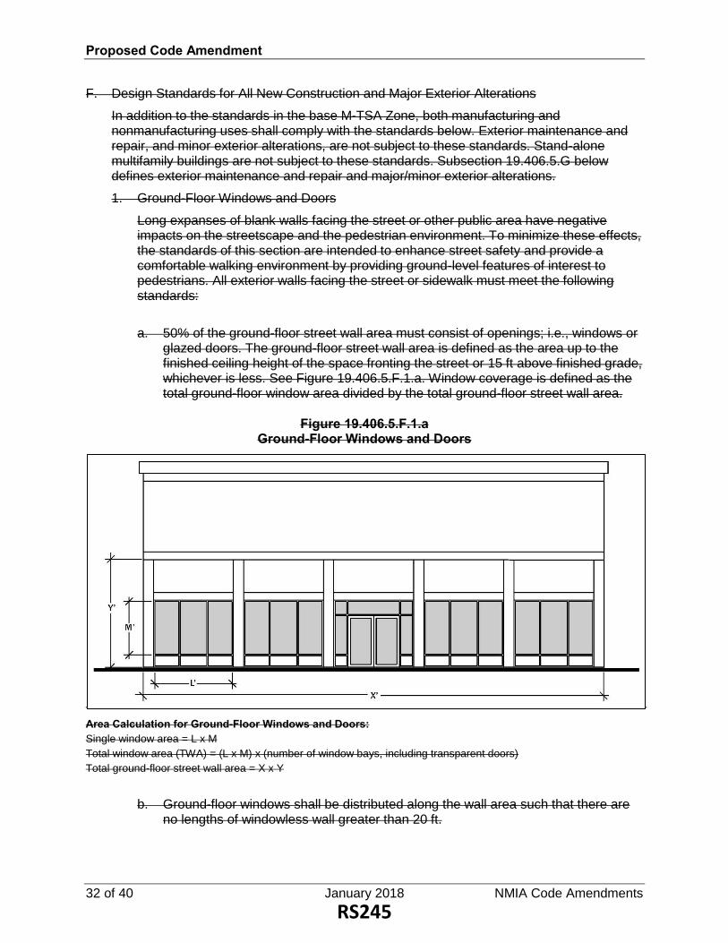
Proposed Code Amendment
32 of 40 January 2018 NMIA Code Amendments
F. Design Standards for All New Construction and Major Exterior Alterations
In addition to the standards in the base M-TSA Zone, both manufacturing and nonmanufacturing uses shall comply with the standards below. Exterior maintenance and repair, and minor exterior alterations, are not subject to these standards. Stand-alone multifamily buildings are not subject to these standards. Subsection 19.406.5.G below defines exterior maintenance and repair and major/minor exterior alterations.
1. Ground-Floor Windows and Doors
Long expanses of blank walls facing the street or other public area have negative impacts on the streetscape and the pedestrian environment. To minimize these effects, the standards of this section are intended to enhance street safety and provide a comfortable walking environment by providing ground-level features of interest to pedestrians. All exterior walls facing the street or sidewalk must meet the following standards:
a. 50% of the ground-floor street wall area must consist of openings; i.e., windows or glazed doors. The ground-floor street wall area is defined as the area up to the finished ceiling height of the space fronting the street or 15 ft above finished grade, whichever is less. See Figure 19.406.5.F.1.a. Window coverage is defined as the total ground-floor window area divided by the total ground-floor street wall area.
Figure 19.406.5.F.1.a Ground-Floor Windows and Doors
Area Calculation for Ground-Floor Windows and Doors: Single window area = L x M
Total window area (TWA) = (L x M) x (number of window bays, including transparent doors)
Total ground-floor street wall area = X x Y
b. Ground-floor windows shall be distributed along the wall area such that there are no lengths of windowless wall greater than 20 ft.
RS245

Proposed Code Amendment
NMIA Code Amendments January 2018 33 of 40
c. Clear glazing is required for ground-floor windows. Nontransparent, reflective, or opaque glazing are not permitted.
d. Ground-floor windows shall allow views into storefronts, working areas, or lobbies. No more than 50% of the window area may be covered by interior furnishings including but not limited to curtains, shades, signs, or shelves. Signs are limited to a maximum coverage of 20% of the window area.
2. Windows
The following standards are applicable to building windows facing streets, courtyards, and/or public squares.
a. Windows shall be “punched” openings recessed a minimum of 2 in from the wall surface.
b. Window height shall be equal to or greater than window width.
c. The following windows are prohibited.
(1) Reflective, tinted, or opaque glazing.
(2) Simulated divisions (internal or applied synthetic materials).
(3) Exposed, unpainted metal frame windows.
3. Building Orientation
All buildings shall have at least one primary building entrance (e.g., dwelling entrance, customer entrance, tenant entrance, lobby entrance, or breezeway/courtyard entrance) facing an adjoining street (i.e., within 45 degrees of the street property line). If the building entrance is turned more than 45 degrees from the street (e.g., front door is on a side wall), the primary entrance shall not be more than 40 ft from a street sidewalk, except to provide pedestrian amenities. In all cases, a walkway shall connect the primary entrance to the sidewalk. See Figure 19.406.5.F.3 for illustration.
RS246

Proposed Code Amendment
34 of 40 January 2018 NMIA Code Amendments
Figure 19.406.5.F.3 Building Entrances
4. Weather Protection
All building entrances shall include an awning, canopy, recess, or some other form of shelter to provide weather protection and shade for users.
5. Design Standards for Walls
The following standards are applicable to the exterior walls of buildings facing streets, courtyards, and/or public squares.
a. Exterior wall-mounted mechanical equipment is prohibited.
b. The following wall materials are prohibited at the street level of the building.
(1) EIFS or other synthetic stucco panels.
(2) Splitface or other masonry block.
(3) Plywood paneling.
(4) Brick with dimensions larger than 4 x 8 x 2 in.
(5) Vinyl or metal cladding.
(6) Composite wood fiberboard or composite cement-based siding.
6. Design Standards for Roofs
The following standards are applicable to building roofs.
a. Flat roofs shall include a cornice with no less than 6 in depth (relief) and a height of no less than 12 in.
b. Mansard or decorative roofs on buildings less than 3 stories are prohibited.
RS247

Proposed Code Amendment
NMIA Code Amendments January 2018 35 of 40
G. Definitions for Applicability of Design Standards
1. Exterior maintenance and repair includes refurbishing, painting, and weatherproofing of deteriorated materials, as well as in-kind restoration or replacement of damaged materials. Exterior maintenance and repair does not include replacement of materials due to obsolescence or when associated with minor or major exterior renovation, as defined below. Exterior maintenance and repair does not include the placement of signs.
2. Minor exterior alterations include the exterior alterations of any portion of a structure that do not fall within the definitions of “exterior maintenance and repair” or “major exterior alterations.” Minor exterior alterations include, but are not limited to, the application or installation of finish building treatments, including windows and other glazing, doors, lintels, copings, vertical and horizontal projections (including awnings), and exterior sheathing and wall materials. Minor exterior alteration does not include the placement of signs.
3. Additions not exceeding 250 sq ft may be considered minor exterior alterations only when the additional floor area is designed and used for utility, HVAC, other mechanical equipment, ADA upgrades, or egress required by applicable fire safety or building codes.
4. Major exterior alterations include any of the following:
a. Alterations that do not fall within the definitions of “exterior maintenance and repair” or “minor exterior alterations.”
b. Demolition or replacement of more than 25% of the surface area of any exterior wall or roof.
c. Floor area additions that exceed 250 sq ft or do not meet the limited purposes as defined under the minor exterior alteration (ADA upgrades, etc.).
5. The design standards in Subsection 19.406.5.F above are applicable to major exterior alterations as follows:
a. Major exterior alterations involving a wall(s) shall comply with the design standards for walls and the design standards for windows for that wall(s).
b. Major exterior alterations involving a roof shall comply with the design standards for roofs.
19.406.6 Subarea 2: West of McLoughlin A. Subarea Boundary
Subarea 2 is located north of Ochoco St, surrounding the Springwater Corridor west of McLoughlin Blvd, as shown on the Zoning Map.
B. Subarea Characteristics
This subarea is intended to develop with a mix of employment and residential uses, including live/work units that can be compatible with surrounding manufacturing uses.
C. Permitted Uses
Permitted uses in Subarea 2 are the same as those permitted in the base M-TSA Zone, with the following exceptions:
RS248

Proposed Code Amendment
36 of 40 January 2018 NMIA Code Amendments
1. Professional service and office uses are permitted in a stand-alone building with no size limitations (they do not need to be accessory to a manufacturing use).
2. Multifamily residential is permitted outright in a stand-alone building or in stories above a ground-floor commercial or office use.
3. Rowhouse development is permitted and can include live/work style units with groundfloor work space or commercial space.
D. Limited and Prohibited Uses
The following uses are not allowed or are allowed with limitations.
1. Retail uses are permitted in a stand-alone building (they do not need to be accessory to a manufacturing use). Retail uses shall not exceed 20,000 sq ft per building or development project.
2. Warehousing and storage uses, as defined in Subsection 19.312.2.D, are allowed only as accessory or secondary uses to a permitted use. Stand-alone warehouse and storage uses are prohibited.
3. Only those manufacturing uses that comply with the off-site impact standards in Subsection 19.406.3.B are allowed.
E. Conditional Use
A retail use of up to 30,000 sq ft may be permitted subject to conditional use approval, per Section 19.905.
F. Development and Design Standards
In addition to the standards in the base M-TSA Zone, the development and design standards for Subarea 1 in Subsections 19.406.5.E-G also apply to Subarea 2, with the following addition: Rowhouse development in Subarea 2 shall comply with Subsection 19.505.5 Rowhouses.
19.406.7 Subarea 3: Mixed Employment A. Subarea Boundary
Subarea 3 is located between Beta St and Springwater Corridor, east of McLoughlin Blvd, as shown on the Zoning Map.
B. Subarea Characteristics
Subarea 3 is intended to develop as a relatively intense mixed employment district including office, light manufacturing, research and development, and other general employment uses, along with supporting retail/commercial uses. Subarea 3 is also appropriate for larger-scale civic or institutional uses.
C. Permitted Uses
Permitted uses in Subarea 3 are the same as those permitted in the base M-TSA Zone, with the following exceptions:
1. Professional service uses are permitted in a stand-alone building with no size limitations (they do not need to be accessory to a manufacturing use).
2. Multifamily residential is permitted outright in a stand-alone building or in stories above a ground-floor commercial or office use. Deed restrictions will apply to multifamily
RS249

Proposed Code Amendment
NMIA Code Amendments January 2018 37 of 40
development in order to reduce potential conflicts between residential uses and surrounding manufacturing uses.
D. Limited and Prohibited Uses
The following uses are not allowed or are allowed with limitations.
1. Retail uses are permitted in a stand-alone building (they do not need to be accessory to a manufacturing use). Retail uses shall not exceed 20,000 sq ft per building or development project. Development standards for manufacturing uses will be the standards of the base zone plus additional standards similar to those in the Business Industrial Zone Subsection 19.310.6.
2. Warehousing and storage uses, as defined in Subsection 19.312.2.D, are allowed only as accessory or secondary uses to a permitted use. Stand-alone warehouse and storage uses are prohibited.
3. Only those manufacturing uses that comply with the off-site impact standards in Subsection 19.406.3.B are allowed.
E. Conditional Uses
1. Recreation and entertainment uses are allowed in Subarea 3 subject to conditional use approval, per Section 19.905. In permitting this use, the Planning Commission shall evaluate the following approval criteria:
a. The recreation and entertainment use is not inconsistent with the land use and urban design recommendations for Subarea 3 as described in the Tacoma Station Area Plan.
b. The recreation and entertainment use would establish a facility that is of benefit to the Milwaukie community and that is unique enough to attract visitors and users from elsewhere in the region.
c. The layout of the site and its structures feature high-quality design and materials. The site shall be designed in a manner that encourages transit use through location of building entrances, building orientation, and connections to public rights-of-way that connect to the Tacoma Light Rail Station.
2. A retail use of up to 30,000 sq ft may be permitted subject to conditional use approval, per Section 19.905.
F. Development and Design Standards
In addition to the standards in the base M-TSA Zone, the development and design standards for Subarea 1 in Subsections 19.406.5.E-G also apply to Subarea 3, with the following addition: All development with frontage along Main St shall have a 10-ft front setback.
19.406.8 Subarea 4: Manufacturing A. Subarea Boundary
Subarea 4 is located south of Beta St and north of Highway 224, as shown on the Zoning Map.
B. Subarea Characteristics
RS250

Proposed Code Amendment
38 of 40 January 2018 NMIA Code Amendments
This subarea is intended to continue to develop as a manufacturing district with some flexibility for nonmanufacturing uses to occur at higher levels than would be allowed in the base M-TSA Zone.
C. Permitted Uses
Permitted uses in Subarea 4 are the same as those permitted in the base M-TSA Zone, with the following exceptions: Retail commercial and professional service uses may be permitted in a stand-alone building (they do not need to be accessory to a manufacturing use). The size limitations of the base M-TSA Zone Subsections 19.312.6.C.1-2 still apply.
D. Limited and Prohibited Uses
The following uses are not allowed or are allowed with limitations: Warehousing and storage uses, as defined in Subsection 19.312.2.D, are allowed only as accessory or secondary uses to a permitted use. Stand-alone warehouse and storage uses are prohibited.
E. Parking Requirements
In Subarea 4, the following parking requirements apply and supersede any conflicting requirements found in Table 19.605.1 or other sections of the code.
1. General Office Uses
a. Minimum number of parking spaces: 2 per 1,000 sq ft of gross floor area
b. Maximum number of parking spaces: 4.1 per 1,000 sq ft of gross floor area
2. Retail Commercial Uses
a. Minimum number of parking spaces: 2 per 1,000 sq ft of gross floor area
b. Maximum number of parking spaces: 6.2 per 1,000 sq ft of gross floor area
3. Manufacturing Uses
a. Minimum number of parking spaces: 1 per 1,000 sq ft of gross floor area
b. Maximum number of parking spaces: none
4. The minimum and maximum parking requirements in Subsection 19.406.8.E may be modified consistent with Section 19.605.2 Quantity Modifications and Required Parking Determinations.
F. Development and Design Standards
In addition to the development standards in the base M-TSA Zone, the design standards in Subsections 19.406.5.F-G also apply to developments that have frontage on Main St in Subarea 4, with the following exceptions:
1. All development with frontage along Main St shall have a 10-ft front setback.
2. The ground-floor window coverage requirement in Subsection 19.406.5.F.1.a is reduced to 30% in this subarea.
RS251

Proposed Code Amendment
NMIA Code Amendments January 2018 39 of 40
Updates for Section References and Housekeeping Only
Sign Ordinance 14.16.050 MANUFACTURING ZONE No sign shall be installed or maintained in an M, BI, NME, or MUTSA M-TSA Zone, except as allowed under Section 14.12.010 Exempted Signs, or as otherwise noted in Table 14.16.050.
Table 14.16.050 Standards for Signs in Manufacturing Zones M, BI, NME, or MUTSA M-TSA
Sign Type Area Height Location Number Illumination1
Zoning Ordinance 19.107.1 Zone Classifications For the purposes of this title, the following base zones and overlay zones are established in the City per Table 19.107.1:
Table 19.107.1 Classification of Zones
Zone Description Abbreviated Description
Base Zones
Residential R-10
Residential R-7
Residential R-5
Residential R-3
Residential R-2.5
Residential R-2
Residential R-1
Residential-Business Office R-1-B
Downtown Mixed Use DMU
Open Space OS
Neighborhood Commercial C-N
Limited Commercial C-L
General Commercial C-G
Community Shopping Commercial C-CS
Manufacturing M
Business Industrial BI
Planned Development PD
Tacoma Station Area Manufacturing M-TSA
Tacoma Station Area Mixed Use MUTSA
North Milwaukie Employment NME
General Mixed Use GMU
RS252

Proposed Code Amendment
40 of 40 January 2018 NMIA Code Amendments
Neighborhood Mixed Use NMU
Overlay Zones
Willamette Greenway WG
Historic Preservation HP
Flex Space FS
Aircraft Landing Facility L-F
North Milwaukie Employment Mixed Use NME-MU
Tacoma Station Area TSA
19.509.3 Marijuana Production Limitations The following limitations apply to marijuana production in the M-Manufacturing, NME-North Milwaukie Employment, and MUTSA-Tacoma Station Area Mixed Use M-TSA Tacoma Station Area Manufacturing zones:
A. Within a building utilized for production, multiple producers may operate but no single producer shall operate in a manner where the mature marijuana plant grow canopy associated with that producer’s operation exceeds 10,000 sq ft.
B. A marijuana producer shall not be located in a building that is within 1,500 ft of another building that is utilized for marijuana production.
19.904.11 Standards for Wireless Communication Facilities
Table 19.904.11.C Wireless Communication Facilities—Type and Review Process
Towers WCFs Not Involving New Tower
Zones
New Monopole
Tower 100 Ft
Building Rooftop or Wall Mounted
Antenna
Water Towers, Existing Towers, and Other Stealth
Designs
On Existing Utility Pole in Row with or w/out Extensions
BI III P/II P/II P/II
M III P/II P/II P/II
MUTSA M-TSA
III P/II P/II P/II
NME III P/II P/II P/II
19.904.11.F.2 2. Height: maximum heights. Also see Table 19.904.11.C.
a. Height Restrictions
The maximum height limitation of the monopole tower and antennas shall not exceed the following:
(1) BI, M, NME, and MUTSA M-TSA Zones: 100 ft.
RS253

Proposed Code Amendment
NMIA Code Amendments January 2018 1 of 22
Clean Amendments
Zoning Ordinance
CHAPTER 19.300 BASE ZONES
19.312 NORTH MILWAUKIE INDUSTRIAL AREA 19.312.1 Purpose A. The Tacoma Station Area Mixed Use Zone (MUTSA) is intended to support the goals and
policies of the North Milwaukie Industrial Area (NMIA) Plan. The MUTSA district is intended to take advantage of its unique location near the Tacoma light rail station and provide opportunities for a wide range of uses. The primary uses in this zone include housing, limited commercial and service-related office use, high intensity office employment, and light industrial uses including uses involved in production, manufacturing and processing, of goods. The intent of light industrial uses in the MUTSA is to provide an area to serve a wide variety of manufacturing and other industrial activities with controlled external impacts. These types of industries are often involved in the secondary processing of materials into components, the assembly of components into finished products, food and beverage processing, warehousing, and wholesaling. The external impact from these uses is generally less than heavy industrial uses and activities are generally located indoors.
B. The North Milwaukie Employment Zone (NME) Zone is intended to support the goals and policies of the NMIA Plan and retain the area as a viable industrial and employment zone. The primary uses in the zone are intended to be uses involved in production, manufacturing, processing, and transportation of goods, as well as uses providing opportunities for higher intensity employment such as production-related office, laboratories, and research and development uses. Limited specific uses not involving the production and transportation of goods, which are appropriate for industrial areas due to their use characteristics, are also allowed. Service-related office and commercial uses are intended to be incidental uses that are minor in relation to the industrial uses on a site and should be subordinate and accessory to the industrial uses in the zone.
19.312.2 Uses A. Permitted Uses
Uses allowed outright in the NMIA zones are listed in Table 19.312.2 with a “P.” These uses are allowed if they comply with the development and design standards and other regulations of this title.
B. Community Service Uses
Uses listed in Table 19.312.2 as “CSU” are permitted only as community service uses in conformance with Section 19.904.
C. Conditional Uses
Uses listed in Table 19.312.2 as “CU” are permitted only as conditional uses in conformance with Section 19.905.
D. Nonconforming Uses, Structures, and Development
Exhibit H
RS254

Proposed Code Amendment
2 of 22 January 2018 NMIA Code Amendments
Existing structures and uses that do not meet the standards for the NMIA zones may continue in existence. Alteration or expansion of a nonconforming use, structure, or development that brings the use, structure, or development closer to compliance may be allowed through development review pursuant to Section 19.906. Alteration or expansion of a nonconforming use or structure that does not bring the use or structure closer to compliance may be allowed through a Type III variance pursuant to Section 19.911. Except where otherwise stated in this section, the provisions of Chapter 19.800 Nonconforming Uses and Development apply.
E. Prohibited Uses
Uses not listed in Table 19.312.2, and not considered accessory or similar pursuant to Subsections 19.312.2.F and G below, are prohibited. Uses listed with an “N” in Table 19.312.2 are also prohibited.
F. Limited Uses
Uses listed in Table 19.312.2 as “L” are permitted only as limited uses in conformance with Section 19.312.4.
G. Accessory Uses
Uses that are accessory to a primary use are allowed if they comply with all development standards.
H. Similar Uses
The Planning Director, through a Type I review, may determine that a use that is not listed is considered similar to an example use listed in Table 19.312.2. The unlisted use shall be subject to the standards applicable to the similar example use.
Table 19.312.2 Uses Allowed in Commercial Mixed-Use Zones
Uses and Use Categories NME MUTSA Standards/Additional Provisions Residential1 Multifamily N P Subsection 19.312.6 Detailed
Development Standards Subsection 19.505.3 Multifamily
Housing
Mixed use residential N P Subsection 19.312.6 Detailed Development Standards
Live/work units N P Subsection 19.312.6 Detailed Development Standards
Subsection 19.505.6 Live/Work Units
Commercial Office
1. Production-related office uses are characterized by activities that, while conducted in an office-like setting, involve less face-to-face customer contact and do not tend to generate foot traffic. Their operations are less service-oriented than traditional office uses and focus on the development, testing,
P
P
RS255

Proposed Code Amendment
NMIA Code Amendments January 2018 3 of 22
Table 19.312.2 Uses Allowed in Commercial Mixed-Use Zones
Uses and Use Categories NME MUTSA Standards/Additional Provisions research, production, processing, packaging, or assembly of goods and products.
Examples include: corporate headquarters, architects, engineers, financial services or accounting firm headquarters, call offices/call centers; software and internet content development and publishing; telecommunication service providers; data processing; television, video, radio, and internet studios and broadcasting; scientific and technical services; government and utility research offices; call centers, marijuana testing and research facilities, and medical and dental labs or research/bioscience facility.
2. Service-Related Office Traditional service-related office uses are characterized by activities that generally focus on direct in-person, customer-focused services including government, professional, medical, or financial services. These office uses generally involve a high level of face-to-face customer contact and are typically expected to generate foot traffic.
Examples include: professional services such as lawyers; financial businesses such as lenders, retail brokerage houses, bank branches, or real estate agents; sales offices; government offices and public utility offices; counseling offices; and medical and dental clinics.
L L Subsection 19.312.4.A Standards for
Limited Uses
Drinking establishments
Drinking establishments primarily involve the sale of alcoholic beverages for on-site consumption.
Examples include taverns, bars, or cocktail lounges.
L L/CU Subsection 19.312.4.A Standards for Limited Uses
Eating establishments
Eating establishments primarily involve the sale of prepared food and beverages for on-site consumption or takeout. Eating establishments may include incidental sales of alcoholic beverages.
L L/CU Subsection 19.312.4.A Standards for Limited Uses
RS256

Proposed Code Amendment
4 of 22 January 2018 NMIA Code Amendments
Table 19.312.2 Uses Allowed in Commercial Mixed-Use Zones
Uses and Use Categories NME MUTSA Standards/Additional Provisions
Examples include restaurants, delicatessens, retail bakeries, coffee shops, concession stands, and espresso bars.
Retail-oriented sales
Sales-oriented retail firms are involved in the sale, leasing, and rental of new or used products to the general public.
Examples include stores selling, leasing, or renting consumer, home, and business goods including art, art supplies, bicycles, clothing, dry goods, electronics, fabric, gifts, groceries, hardware, household products, jewelry, pets and pet products, pharmaceuticals, plants, printed materials, stationery, and printed and electronic media.
L L Subsection 19.312.4.A Standards for Limited Uses
Personal service
Personal service firms are involved in providing consumer services.
Examples include hair, tanning, and spa services; pet grooming; photo and laundry drop-off; dry cleaners; and quick printing.
L L Subsection 19.312.4.A Standards for Limited Uses
Day care.
Day care is the provision of regular childcare, with or without compensation, to 4 or more children by a person or person(s) who are not the child’s parent, guardian, or person acting in place of the parent, in a facility meeting all State requirements.
Examples include nursery schools, before- and after-school care facilities, and child development centers.
L L Subsection 19.312.4.B.2 Standards for Limited Uses
Hotel/motel N CU Subsection 19.905 Conditional Uses
Adult entertainment businesses2 N CU Subsection 19.905 Conditional Uses
Industrial, Manufacturing and Production Manufacturing and production.
This category comprises establishments engaged in the mechanical, physical, or chemical transformation of materials, substances, or components into new products, including the assembly of component parts.
P L Subsection 19.312.4.B.1 Standards for Limited Uses
RS257

Proposed Code Amendment
NMIA Code Amendments January 2018 5 of 22
Table 19.312.2 Uses Allowed in Commercial Mixed-Use Zones
Uses and Use Categories NME MUTSA Standards/Additional Provisions
Examples include: alternative energy development; biosciences; food and beverage processing; software and electronics production; printing; fabrication of metal products; products made from manufactured glass; products made from rubber, plastic, or resin; converted paper and cardboard products; and microchip fabrication. Manufacturing may also include high-tech and research and development companies.
Construction: Contractors and Related Businesses
This category comprises businesses whose primary activity is performing specific building or other construction-related work, on- or off-site.
Examples include: residential and nonresidential building construction; utility/civil engineering construction; specialty trade contractors; and moving companies.
P P
Wholesale Trade, Warehousing, Distribution
This category comprises establishments engaged in selling and/or distributing merchandise to retailers; to industrial, commercial, or professional business users; or to other wholesalers, generally without transformation, and rendering services incidental to the sale of merchandise. Wholesalers sell or distribute merchandise exclusively to other businesses, not the general public, and normally operate from a warehouse or office and are not intended for walk-in traffic.
Examples include: operating warehousing and storage facilities for general merchandise, refrigerated goods, and other products and materials that have been manufactured and are generally being stored in anticipation of delivery to final customer. Includes fleet parking.
Ministorage facilities (generally used by many individual customers to store
P P
RS258

Proposed Code Amendment
6 of 22 January 2018 NMIA Code Amendments
Table 19.312.2 Uses Allowed in Commercial Mixed-Use Zones
Uses and Use Categories NME MUTSA Standards/Additional Provisions personal property) are not considered industrial warehousing and storage and are not permitted.
Repair and Service
This category comprises firms involved in repair and servicing of industrial, business, or consumer electronic equipment, machinery, and related equipment, products, or by-products. Few customers come to the site, particularly not general public daily customers. Auto service and repair shops for personal vehicles are not included in this category and are not permitted.
Examples include: welding shops; machine shops; tool, electric motor, and industrial instrument repair; sales, repair, or storage of heavy machinery, metal, and building materials; heavy truck servicing and repair; tire retreading or recapping; exterminators, including chemical mixing or storage and fleet storage and maintenance; janitorial and building maintenance services that include storage of materials and fleet storage and maintenance; fuel oil distributors; solid fuel yards; and large-scale laundry, dry-cleaning, and carpet cleaning plants.
P L Subsection 19.312.4.B.1 Standards for Limited Uses
Trade Schools and Training Facilities
This category comprises establishments whose primary purpose is to provide training for industrial needs and job-specific certification.
Examples include: electronic equipment repair training; truck-driving school; welding school; training for repair of industrial machinery; job skills training classrooms; and other industrial/employment skills training.
P P
Creative Space
Industrial/manufacturing space specifically for artist-type uses.
Examples include: artist manufacturing studios (welding, pottery, ceramics, painting, glass, etc.); sound stage and/or
P P
RS259

Proposed Code Amendment
NMIA Code Amendments January 2018 7 of 22
Table 19.312.2 Uses Allowed in Commercial Mixed-Use Zones
Uses and Use Categories NME MUTSA Standards/Additional Provisions film production; set design and production; music studio/production.
Waste Management3
This category comprises businesses that provide garbage and recycling hauling, including fleet parking and maintenance. Storage of waste or recycling materials collected by a waste management business for any period of time is not permitted.
CU/P N
Community Service Use Only the following community service uses are included in this district:
Section 19.904 Community Service Uses
See Trade Schools and Training
Facilities
1. Institutions
a. Government offices P P
b. Public transit facilities or passenger terminal
CSU CSU
c. Schools (public or private) CSU CSU
d. Recreation facilities (public or private)
CSU CSU
e. Parks and open space P P
f. Transitional or correctional facilities (public or private)
CSU CSU
g. Hospitals CSU CSU
2. Infrastructure
a. Utilities (water, sewer, and storm sewer facilities including but not limited to sewage pumping stations, water wells, pump stations, sewer mining)
P P
b. Communication facilities (includes WCF)
P P
c. Electrical power substations; solar facilities
P P
Marijuana Businesses 1. Marijuana retailers subject to the
standards of Subsections 19.312.4 and 19.509.1.
N CU Subsection 19.509.2 Security and Odor Control for Certain Marijuana Businesses
Subsection 19.312.4.A.5 Standards for Limited Uses
2. Marijuana processing, testing, research, and warehousing subject to the standards of Subsection 19.509.2.
P P Subsection 19.509.2 Security and Odor Control for Certain Marijuana Businesses
RS260

Proposed Code Amendment
8 of 22 January 2018 NMIA Code Amendments
Table 19.312.2 Uses Allowed in Commercial Mixed-Use Zones
Uses and Use Categories NME MUTSA Standards/Additional Provisions 3. Marijuana production subject to the
conditional use process and the standards of Subsections 19.509.2 and 19.509.3.
CU CU Subsection 19.509.2 Security and Odor Control for Certain Marijuana Businesses
Subsection 19.509.3 Marijuana Production Limitations
Section 19.905 Conditional Uses
P = Permitted.
N = Not permitted.
L = Limited
CSU = Permitted with community service use approval subject to provisions of Section 19.904. Type III review required to establish a new CSU or for major modification of an existing CSU. Type I review required for a minor modification of an existing CSU.
CU = Permitted with conditional use approval subject to the provisions of Section 19.905. Type III review required to establish a new CU or for major modification of an existing CU. Type I review required for a minor modification of an existing CU.
1. Multifamily residential is permitted outright in a stand-alone building or in stories above a ground-floor commercial or office use. Deed restrictions will apply to residential development in order to reduce potential conflicts between residential uses and surrounding manufacturing uses. Before receiving a building permit, all owners shall sign a declaration of use to be recorded with Clackamas County, to serve as actual and constructive notice to potential purchasers and tenants of the owner’s property status as a residential use that is located within a zone that permits and encourages industrial uses.
2. When considering an adult entertainment business, the following criteria shall be used:
a. The proposed location of an adult entertainment business shall not be within 500 ft of an existing or previously approved adult entertainment business or within 500 ft of either a public park, a church, a day-care center, a primary, elementary, junior high, or high school, or any residentially zoned property.
b. Distances shall be measured in a straight line, without regard to intervening structures, between the closest structural wall of the adult entertainment business and either the closest property line of the applicable property or the closest structural wall of any preexisting or previously approved adult entertainment business.
3. Waste Management uses in existence prior to December 31, 2017 are Permitted; uses proposed after that date are permitted as a Conditional Use.
19.312.3 Specific Prohibited Uses Any use which has a primary function of storing or manufacturing explosive materials or other hazardous material as defined by the Oregon Fire Code, Chapter 27.
19.312.4 Standards for Limited Uses The following standards apply to those uses listed as limited (L) in Table 19.312.2.
A. Retail, Service-Related Office, Eating and Drinking Establishments, and Personal Service Uses
To ensure that these uses are limited in size and scale and do not dominate land intended for manufacturing and higher intensity employment uses, the following standards apply. See Figure 19.313.6.B for an illustration of the size limitations.
1. In the NME, the total gross leasable square footage of an individual retail, service-related office, eating and drinking establishment, and personal service use shall not exceed 5,000 sq ft or 40% of the floor area of an individual building, whichever is less. The total cumulative gross leasable square footage of these uses in a development project shall not exceed 20,000 sq ft or 40% of the floor area. In the NME, retail, service-related office, eating and drinking establishments, and personal service uses
RS261

Proposed Code Amendment
NMIA Code Amendments January 2018 9 of 22
are not permitted in a stand-alone building. They must be included within a building whose primary purpose is for an allowed industrial, manufacturing and production, or production-office use. The retail, service-related office, eating and drinking establishment, and personal service use is not required to be related to the primary manufacturing use.
2. Food carts or a food cart pod are permitted. A food cart pod is limited to 5,000 sq ft or 40% of the floor area of the building on site and must be included on a site with an allowed industrial, manufacturing and production, or production-office use.
3. In the MUTSA, retail, service-related office, eating and drinking establishments, and personal service uses are permitted in a stand-alone building, or within a building with another permitted use, but shall not exceed a cumulative total of 20,000 gross sq ft per building or property.
4. In the MUTSA, eating and drinking establishments that exceed the above standards are subject to a conditional use review pursuant to Section 19.905.
5. Marijuana retail uses shall have a gross square footage of no more than 5,000 sq ft and are subject to a conditional use review pursuant to Section 19.905.
B. Other Uses
1. In the MUTSA, the following uses, or similar, are not permitted: sales, repair, or storage of heavy machinery; heavy truck servicing and repair; tire retreading or recapping; fleet storage and maintenance; fuel oil distributors; solid fuel yards; and manufacturing or production of: chemicals, synthetic rubber, pesticides, fertilizers, paints, adhesives, explosives, plastics, tires, cement, concrete, steel, ferroalloy, aluminum, nonferrous metal, and ammunition.
2. Day care uses must be part of a larger building and shall not be permitted in standalone buildings.
RS262

Proposed Code Amendment
10 of 22 January 2018 NMIA Code Amendments
Figure 19.312.4.A Size Limitations for Retail, Service Office, Eating and Drinking Establishments, and
Personal Service Uses (Illustrative Example)
19.312.5 Development Standards These development standards are intended to ensure that new development is appropriate in terms of building mass and scale, how the building addresses the street, and where buildings are located on a site.
Table 19.312.5 summarizes some of the development standards that apply in the NMIA. Development standards are presented in detail in Subsection 19.312.6.
Table 19.312.5 North Milwaukie Industrial Area —Summary of Development Standards
Standard NME MUTSA Standards/
Additional Provisions A. Lot Standards 1. Minimum lot size (sq ft) None None
2. Minimum street frontage (ft) None None
B. Development Standards 1. Floor area ratio (min/max) 0.5:1/3:1 0.5:1/3:1
2. Building height (ft)
a. Minimum 25 25
RS263

Proposed Code Amendment
NMIA Code Amendments January 2018 11 of 22
b. Maximum (Height bonus available)
65-90 65-90 Subsection 19.312.6.A – Building height bonus
3. Setbacks (ft) Subsection 19.501.2 Yard Exceptions
a. Minimum front yard setback None None
b. Maximum front yard setback 10-301 10-301
c. Side and rear setbacks None2 None2
4. Maximum lot coverage 85% 85%
5. Minimum Landscaping 15% 15% Subsection 19.312.6.G Landscaping
6. Flexible ground-floor space Yes, where applicable
Yes, where applicable
Subsection 19.312.7.B.7 Flexible ground-floor space
7. Off-street parking required Yes Yes Subsection 19.312.6.C Loading and Unloading Areas
Subsection 19.312.7.C Parking, Loading and Unloading Areas
Chapter 19.600 Off-Street Parking and Loading
8. Frontage occupancy 50% 50% Subsection 19.312.7.8 Frontage occupancy
C. Other Standards 1. Residential density requirements
(dwelling units per acre) Subsection 19.202.4 Density
Calculations a. Stand-alone residential
(1) Minimum N/A None
(2) Maximum N/A None
b. Mixed-use buildings N/A None
2. Signs Yes Yes Subsection 14.16.050 Commercial Zone
Subsection 19.312.6.F Signage for Non-manufacturing Uses
3. Design Standards Yes Yes Subsection 19.312.7.A Design Standards for All New Construction and Major Exterior Alterations
1. Properties in the MUTSA have a maximum front yard setback of 10 ft. Properties on key streets in the NME have a maximum front yard setback of 30 ft. Refer to 19.312.7 for key streets.
2. Side and rear lot lines abutting a residential zone have a minimum 10-ft setback. Side and rear lot lines not abutting a residential zone have no required setback.
19.312.6 Detailed Development Standards The following detailed development standards describe additional allowances, restrictions, and exemptions related to the development standards of Table 19.312.5.
The following development standards apply to all uses in the NMIA.
A. Height Bonuses
A building can utilize up to 2 of the development incentive bonuses of this subsection, for a total of 2 stories or 24 ft of additional height, whichever is less, above the 65-ft base height maximum.
RS264

Proposed Code Amendment
12 of 22 January 2018 NMIA Code Amendments
1. Residential
New buildings that devote at least 1 story or 25% of the gross floor area to residential uses are permitted 1 additional story or an additional 12 ft of building height, whichever is less.
2. Green Building
New buildings that receive certification (any level) under an ANSI-approved green building rating system (e.g., LEED, Earth Advantage, or Green Globes certified) are permitted 1 additional story or an additional 12 ft of building height, whichever is less.
Height bonus eligibility shall be verified at the time of building permit submittal and shall be contingent upon submittal of green building certification. The height bonus may be binding under a development agreement and height bonus awards may be revoked, and/or other permits or approvals may be withheld, if the project fails to achieve certification.
B. Screening of Outdoor Uses
Outdoor uses shall be screened as follows:
1. All outdoor storage areas shall be screened from adjacent properties by a 6-ft-high sight-obscuring fence or wall or by the use of vegetation. Vegetation used to screen outdoor storage areas shall be of such species, number, and spacing to provide the required screening within 1 year after planting.
2. All screened or walled outdoor use and storage areas which abut a public street shall be set back a minimum of 25 ft from the property line(s). Within that setback area, trees and evergreen shrubs shall be planted. The plants shall be of such a variety and arranged to allow only minimum gaps between foliage of mature trees and plants within 4 years of planting.
3. All plantings used to screen outdoor uses shall be maintained on an ongoing basis and shall be replaced if vegetation is diseased, dying, or dead.
C. Loading and Unloading Areas
In the NMIA, no loading or unloading facilities shall be located adjacent to lands designated for residential uses, or residential community services, if there are alternative locations of adequate size on the subject site.
D. External Effects
The potential external effects of industrial, manufacturing, and production uses shall be minimized as follows:
1. Except for exterior lighting, operations producing heat or glare shall be conducted entirely within an enclosed building.
2. Potential nuisances such as noise, odor, electrical disturbances, and other public health nuisances are subject to MMC Title 8 Health and Safety.
3. Roof-mounted mechanical equipment, such as ventilators and ducts, for buildings located adjacent to residential districts, arterial streets, or transit streets, shall be contained within a completely enclosed structure that may include louvers, latticework, or other similar features. This screening requirement does not apply to roof-mounted solar energy systems or wind energy systems.
E. Additional Standards
RS265

Proposed Code Amendment
NMIA Code Amendments January 2018 13 of 22
When new residential development is proposed adjacent to existing industrial, manufacturing, and production uses, visual screening, which may include walls, fences, horizontal separation or plantings, shall be provided for those areas adjacent to loading docks, truck or other delivery vehicle ingress or egress areas, dumpsters or other recycling vessels, and outdoor storage areas.
Chapter 19.500 Supplementary Development Regulations contains additional standards that may apply.
F. Signage for Non-manufacturing Uses
In addition to signage permitted in Title 14 Signs, 1 pedestrian-oriented sign per business may be provided along the building façade that faces the street. Pedestrian-oriented signs may be attached to the building, an awning, a kiosk, hanging, projecting, or otherwise so long as they are displayed no higher than 10 ft above the sidewalk and face the street and have a maximum area of 4 sq ft per sign face. All signs must comply with Title 14 Signs.
G. Landscaping
A minimum of 15% landscaping of the site is required. The required landscape area shall comply with the following:
1. Permitted landscape materials include trees, shrubs, ground cover plants, non-plant ground covers, and outdoor hardscape features.
2. No more than 20% of the required landscape area shall be covered in mulch or barkdust. Mulch or barkdust under the canopy of trees or shrubs is excluded from this limit.
3. Trees shall have a minimum 2-in caliper at time of planting, measured at 4 ft above grade.
4. Shrubs shall be planted from 5-gallon containers or larger.
5. All plantings shall be maintained on an ongoing basis and shall be replaced if vegetation is diseased, dying, or dead.
6. A green roof and/or green/living wall may be used as a substitute for this landscaping requirement.
19.312.7 Development Standards for All Uses in the MUTSA and on NME Key Streets The following development standards apply to all uses in the MUTSA Zone and in the NME Zone on properties located on the following key streets and key corners: McBrod Ave, Main St, 17th Ave, Ochoco St, and the south side of Milport St in the Milport Mixed Use Overlay (see Figure 312.7.1).
RS266

Proposed Code Amendment
14 of 22 January 2018 NMIA Code Amendments
Figure 19.312.7.1 Key Streets
A. Design Standards for All New Construction and Major Exterior Alterations
The design standards contained in this section are intended to encourage building design and construction with durable, high-quality materials. The design standards in this section generally apply to the street-facing façades of new, and major alterations to, commercial, institutional, manufacturing, and mixed-use buildings. Exterior maintenance and repair and minor exterior alterations are not subject to these standards. Subsection 19.312.7.B below defines exterior maintenance and repair and major/minor exterior and interior alterations.
1. Ground-Floor and Street-facing Windows and Doors
Long expanses of blank walls facing the street or other public area have negative impacts on the streetscape and the pedestrian environment.
The ground-floor street wall area is defined as the area up to the finished ceiling height of the space fronting the street or 15 ft above finished grade, whichever is less.
RS267

Proposed Code Amendment
NMIA Code Amendments January 2018 15 of 22
a. For nonresidential and mixed-use buildings:
(1) A minimum of 30% of the ground-floor street wall area must consist of openings; i.e., windows or glazed doors; or
(2) A combination of a minimum of 20% of the ground-floor street wall area must consist of openings; i.e., windows or glazed doors in addition to a living wall/green wall or art mural for the remaining area to equal the minimum 30%. A living wall or green wall is a self-sufficient vertical garden that is attached to the exterior or interior of a building.
b. Ground-floor windows shall be distributed along the wall area such that there are no lengths of windowless wall greater than 20 ft.
c. Clear glazing is required for ground-floor windows. Reflective, tinted, or opaque glazing is not permitted for windows facing streets or courtyards.
d. Ground-floor windows shall allow views into storefronts, working areas, or lobbies. No more than 50% of the window area may be covered by interior furnishings including but not limited to curtains, shades, signs, or shelves. Signs are limited to a maximum coverage of 50% of the window area.
2. Building Orientation
All buildings shall have at least one primary building entrance (e.g., dwelling entrance, customer entrance, tenant entrance, lobby entrance, or breezeway/courtyard entrance) facing an adjoining street (i.e., within 45 degrees of the street property line). If the building entrance is turned more than 45 degrees from the street (e.g., front door is on a side wall), the primary entrance shall not be more than 40 ft from a street sidewalk, except to provide pedestrian amenities. In all cases, a walkway shall connect the primary entrance to the sidewalk. See Figure 19.312.7.A.2 for illustration.
Figure 19.312.7.A.2 Building Entrances
RS268

Proposed Code Amendment
16 of 22 January 2018 NMIA Code Amendments
3. Weather Protection
All building entrances shall include an awning, canopy, recess, or some other form of shelter to provide weather protection and shade for users.
4. Design Standards for Walls
The following standards are applicable to the exterior walls of buildings facing streets, courtyards, and/or public squares.
a. Exterior wall-mounted mechanical equipment is prohibited.
b. The following standards are applicable to the exterior walls of new buildings facing streets, courtyards, and/or public squares. Table 19.312.6.I.4 specifies the primary, secondary, and prohibited material types referenced in this standard.
(1) Buildings shall utilize primary materials for at least 60% of the applicable building façades.
(2) Secondary materials are permitted on no greater than 40% of each applicable building façade.
(3) Accent materials are permitted on no greater than 10% of each applicable building façade as trims or accents (e.g. flashing, projecting features, ornamentation, etc.)
(4) Buildings shall not utilize materials listed as (N) prohibited material.
(5) For existing development, façade modifications that affect more than 50% of the façade shall comply with standards in this subsection. The Planning Director may waive this requirement if application of the standards would create an incongruous appearance of existing and new materials.
RS269

Proposed Code Amendment
NMIA Code Amendments January 2018 17 of 22
Table 19.312.7.B.4 Commercial Exterior Building Materials
Material Type Nonresidential and
Mixed-Use Brick P
Stone/masonry P
Stucco, when installed over concrete P
Glass (transparent, spandrel) P
Concrete (poured in place or precast) P
Finished wood, wood veneers, and wood siding P
Finished metal panels—such as anodized aluminum, stainless steel, or copper—featuring polished, brushed, or patina finish
S
Concrete blocks with integral color (ground, polished, or split-face finish) S
Fiber-reinforced cement siding and panels S
Ceramic tile S
Concrete blocks with integral color (glazed finish) A
Standing seam and corrugated metal A
Glass block A
Vegetated wall panels or trellises A
Vinyl siding N
Exterior insulation finishing system (EIFS) N
Plywood paneling N
P = Primary material
S = Secondary material
A = Accent material
N = Prohibited material
5. Design Standards for Roofs
The following standards are applicable to building roofs.
a. Flat roofs shall include a cornice with no less than 6 in depth (relief) and a height of no less than 12 in.
b. Mansard or decorative roofs on buildings less than 3 stories are prohibited.
6. Flexible ground-floor space
For newly constructed non-residential and mixed-use buildings, a minimum of 75% of the ground-floor space in a new building must meet the following requirements.
a. The ground-floor height must be at least 14 ft, as measured from the finished floor to the ceiling, or from the finished floor to the bottom of the structure above (as in a multistory building). The bottom of the structure above is the lowest portion of the structure and includes supporting beams, and any heating, ventilation and/or fire suppression sprinkler systems.
b. The interior floor area adjacent to the key street must be at least 20 ft deep, as measured from the inside building wall or windows facing the key street.
7. Frontage Occupancy Requirements
For block faces on key streets, 50% of the site frontage must be occupied by a building or buildings. If the development site has frontage on more than 1 street, the frontage occupancy requirement must be met on 1 street only.
RS270

Proposed Code Amendment
18 of 22 January 2018 NMIA Code Amendments
B. Applicability of Design Standards
Pre-existing buildings that do not meet the site or building design standards may continue and be modified subject to the standards below. Applicable standards only apply to the proposed modification and not to the nonmodified portion of the existing building unless the modification is a major exterior or interior alteration as defined below.
1. The design standards in Subsection 19.312.7.A above are applicable to major exterior and interior alterations as follows:
a. Major exterior alterations involving a wall(s) shall comply with the design standards for walls and the design standards for windows for that wall(s). A wall is considered the entire wall plane if the change in wall plane is less than 24 inches.
b. Major exterior alterations involving a roof shall comply with the design standards for roofs.
c. Major interior alterations require compliance with 19.312.7.A for applicable frontages.
2. Major exterior alterations include any of the following:
a. Alterations that do not fall within the definitions of “exterior maintenance and repair” or “minor exterior alterations.”
b. Demolition or replacement of more than 50% of the surface area of any exterior wall or roof. A wall is considered the entire wall plane if the change in wall plane is less than 24 inches.
c. In the MUTSA, floor area additions that exceed 50% of the existing floor area or demolition or replacement of 50% or more of the existing floor area.
d. In the NME, floor area additions that exceed 75% of the existing floor area or demolition or replacement of 50% or more of the existing floor area.
3. Major interior alterations include any of the following:
a. In the MUTSA, interior floor area additions that exceed 50% of the existing floor area.
b. In the NME, interior floor area additions that exceed 75% of the existing floor area.
4. Exterior maintenance and repair includes refurbishing, painting, and weatherproofing of deteriorated materials, as well as in-kind restoration or replacement of damaged materials. Exterior maintenance and repair does not include replacement of materials due to obsolescence or when associated with minor or major exterior renovation, as defined below. Exterior maintenance and repair does not include the placement of signs.
5. Minor exterior alterations include the exterior alterations of any portion of a structure that do not fall within the definitions of “exterior maintenance and repair” or “major exterior alterations.” Minor exterior alterations include, but are not limited to, the application or installation of finish building treatments, including windows and other glazing, doors, lintels, copings, vertical and horizontal projections (including awnings), and exterior sheathing and wall materials. Minor exterior alteration does not include the placement of signs.
RS271

Proposed Code Amendment
NMIA Code Amendments January 2018 19 of 22
6. Additions may be considered minor exterior alterations only when the additional floor area is designed and used solely for utility, HVAC, other mechanical equipment, ADA upgrades, or egress required by applicable fire safety or building codes.
C. Parking, Loading, and Unloading Areas
In the MUTSA and on NME key streets, parking, loading, and unloading areas shall be located as follows:
1. Parking areas shall not be located in more than 50% of the front yard.
2. No loading or unloading facilities shall be located adjacent to lands designated for residential uses, or residential community services, if there are alternative locations of adequate size on the subject site. No loading area shall be located between the front of a building and a front lot line, regardless of required setbacks.
19.312.8 Milport Mixed Use Overlay Zone A. Applicability
The Milport Mixed Use Overlay Zone applies to properties identified in Figure 19.312.8.1. The requirements and permissions set out under this section shall only be available for property development and/or redevelopment until XXXX, 20XX, the sunset date. Following that date, any property that has not developed and/or redeveloped in accordance with the overlay provisions shall conform to the base zone requirements only. Properties that have developed according to these provisions will be permitted to continue to utilize the overlay provisions. Nonconforming retail textile sales use in existence at the time of adoption of this code provision may be replaced but it shall not be more out of conformance with the land use or development regulations than the original use or development.
For the purposes of this section, properties are considered to be developed if all development permits have been issued for a project that includes a residential component.
Figure 19.312.8.1 Milport Mixed Use Overlay Zone
RS272

Proposed Code Amendment
20 of 22 January 2018 NMIA Code Amendments
B. Permitted Uses
The permitted uses are the same as those identified in the MUTSA in Table 19.312.2, except that standalone residential development is prohibited in the overlay, and are subject to all additional standards and limitations.
C. Development Standards
New development and redevelopment is subject to the development standards for the MUTSA in Table 19.312.5 and must meet all applicable sections of Title 19.
D. Design Standards
New development and redevelopment is subject to the design standards applicable to development in the MUTSA as identified in subsection 19.312.6.
E. Review Process
Development that proposes uses and development permitted in the overlay, but not permitted in the NME, is subject to Type II development review approval pursuant to Section 19.906.
RS273

Proposed Code Amendment
NMIA Code Amendments January 2018 21 of 22
Updates for Section References and Housekeeping Only
Sign Ordinance 14.16.050 MANUFACTURING ZONE No sign shall be installed or maintained in an M, BI, NME, or MUTSA Zone, except as allowed under Section 14.12.010 Exempted Signs, or as otherwise noted in Table 14.16.050.
Table 14.16.050 Standards for Signs in Manufacturing Zones M, BI, NME, or MUTSA
Sign Type Area Height Location Number Illumination1
Zoning Ordinance 19.107.1 Zone Classifications For the purposes of this title, the following base zones and overlay zones are established in the City per Table 19.107.1:
Table 19.107.1 Classification of Zones
Zone Description Abbreviated Description
Base Zones
Residential R-10
Residential R-7
Residential R-5
Residential R-3
Residential R-2.5
Residential R-2
Residential R-1
Residential-Business Office R-1-B
Downtown Mixed Use DMU
Open Space OS
Neighborhood Commercial C-N
Limited Commercial C-L
General Commercial C-G
Community Shopping Commercial C-CS
Manufacturing M
Business Industrial BI
Planned Development PD
Tacoma Station Area Mixed Use MUTSA
North Milwaukie Employment NME
General Mixed Use GMU
Neighborhood Mixed Use NMU
RS274

Proposed Code Amendment
22 of 22 January 2018 NMIA Code Amendments
Overlay Zones
Willamette Greenway WG
Historic Preservation HP
Flex Space FS
Aircraft Landing Facility L-F
North Milwaukie Employment Mixed Use NME-MU
19.509.3 Marijuana Production Limitations The following limitations apply to marijuana production in the M-Manufacturing, NME-North Milwaukie Employment, and MUTSA-Tacoma Station Area Mixed Use zones:
A. Within a building utilized for production, multiple producers may operate but no single producer shall operate in a manner where the mature marijuana plant grow canopy associated with that producer’s operation exceeds 10,000 sq ft.
B. A marijuana producer shall not be located in a building that is within 1,500 ft of another building that is utilized for marijuana production.
19.904.11 Standards for Wireless Communication Facilities
Table 19.904.11.C Wireless Communication Facilities—Type and Review Process
Towers WCFs Not Involving New Tower
Zones
New Monopole
Tower 100 Ft
Building Rooftop or Wall Mounted
Antenna
Water Towers, Existing Towers, and Other Stealth
Designs
On Existing Utility Pole in Row with or w/out Extensions
BI III P/II P/II P/II
M III P/II P/II P/II
MUTSA III P/II P/II P/II
NME III P/II P/II P/II
19.904.11.F.2 2. Height: maximum heights. Also see Table 19.904.11.C.
a. Height Restrictions
The maximum height limitation of the monopole tower and antennas shall not exceed the following:
(1) BI, M, NME, and MUTSA Zones: 100 ft.
RS275

SHERRETT
LAVA
29TH
HILLSIDEMANOR TC
VAN WATER
MCLO
UGHL
IN
CLATSOP
MCLO
UGHL
IN
HWY 224
MILPORT
OCHOCO
HWY 2
24-M
CLOU
GHLIN
BLVD
MOORES
SHERRETT
HILLSIDE
D
LINN 28TH
D
STUBB
TACO
MAPA
RK AN
DRI
DE
24TH
24TH
HARNEYCA
MBRI
DGE
FRON
TAGE
ANDOVER
25TH
28TH
23RD
30TH16
TH
ROSWELL
17TH
HARNEY
24TH
LLEWELLYN
19TH 21
ST
23RD
C
CRYSTALLAKE
HARNEY
BOYD
MALCOLM
OLSENMAILWELL
ROCK
VORS
T
KELVIN
BALFOUR
TACOMA PARKAND RIDE
23RD
SHERRETT
MARION
CLATSOP
ST ANDREWS
MCLOUGHLIN
BLVD-OCHOCO ST
25TH
25TH
29TH
29TH
WAVERLY
MCBR
OD
BETA
26TH
24TH
30TH28TH
OMAR
K
CAMBRIDGE
MAIN
MCLOUGHLIN-HWY
224
WAVERLY
HANNA HARVESTER
LegendMUTSANMETaxlots
MUTSA
NME
NMEMMU(TBD)
Exhibit I
RS276

Memorandum
DATE: August 30, 2017
TO: North Milwaukie Industrial Area Management Team
FROM: Ray Delahanty, AICP, DKS Associates
Dock Rosenthal, EIT, DKS Associates
SUBJECT: North Milwaukie Industrial Area
Trip Generation Scenario Analysis
This memorandum summarizes trip generation assumptions and calculations related to potential
changes in zoning for certain portions of the North Milwaukie Industrial Area (NMIA). This summary
includes analysis of the existing conditions and of the proposed changes. Assumptions and
calculations for the existing zoning and proposed zoning changes are included in the following
sections.
Trip Generation from Existing NMIA Zoning
Potential Trip Generation
This section describes the reasonable
worst-case scenario for PM peak hour
vehicle trips under the existing zoning in
the planning area. The reasonable worst-
case trip generation establishes a
threshold against which trip generation
for possible zoning changes in the
planning area will be compared, helping
to determine whether further traffic
impact evaluation would be required
based on the Transportation Planning
Rule (TPR) 660-012-0060. This threshold
is important for the planning area, as
future year conditions (documented in
the City’s Transportation System Plan)
result in mobility deficiencies along SE
McLoughlin Boulevard, which would
likely require costly mitigation if a significant effect were found.
Figure 1: Zoning for planning area
ATTACHMENT 2
RS277

North Milwaukie Industrial Area Plan
2 | NMIA Trip Generation Scenarios
Zoning and Assumed Land Uses
The planning area is zoned Manufacturing (M) and M-TSA (Tacoma Station Manufacturing Zone) with
special overlays in four subareas (see Figure 1). The M-TSA Zone permits a combination of
manufacturing, office, and/or commercial uses, while the TSA overlay, comprised of four Subareas,
allows a wider mix of uses near Tacoma Station while retaining much of the southern part of the
planning area for industrial uses. For the purpose of this analysis, M-TSA Subarea 3 is further divided
into two subareas noted as M-TSA 3A and M-TSA 3B to take advantage of a 30% trip generation
reduction near the Tacoma Station.
To create a reasonable worst-case development scenario, this analysis assigns the highest allowable
percentage of floor area, based on Section 19.309, 19.312, and 19.406 of the City’s Zoning
Ordinance1, to the highest trip-generating uses reasonably allowed under the zoning. The proposed
land use mix for this analysis was previously vetted through the 2013 Tacoma Station Area Plan
(TSAP). Table 1 shows the percentage allocations for each land use based on percentage of leasable
square feet in each area used and agreed upon for the TSAP planning process. The numbers shown
for Zone M-TSA 4 vary from those reported in the NMIA Existing Conditions Report. Numbers in the
Existing Conditions Report were taken from a scenario analysis that reflected a lower office
percentage that was not ultimately implemented in the TSAP process. The table below correctly
shows the reasonable worst case land use mix as reflected in the adopted zoning.
Table 1: Land Use Mix Assumptions (leasable square feet)
West of McLoughlin
Boulevard
East of McLoughlin Boulevard
Land Use Type M (West) M-TSA 2 M-TSA 1 M-TSA 3A M-TSA 3B M-TSA 4 M (East)
Industrial 25% 25% 0% 35% 35% 25% 25%
Office 67.5% 25% 35% 40% 40% 67.5% 67.5%
Retail 7.5% 10% 65% 20% 20% 7.5% 7.5%
Residential 0% 40% 0% 5% 5% 0% 0%
M-TSA assumptions were developed as part of the TSAP. For the M Zone, Milwaukie’s Zoning Ordinance requires that a minimum of 25% of every project consist of Industrial uses, as described under Subsection 19.309.2.A. The remaining 75% of leasable square footage is allocated to non-Industrial uses, to create a worst-case scenario. The 7.5% retail shown must be accessory to a permitted office use.
1 Milwaukie Municipal Code, Title 19
RS278

NMIA Trip Generation Scenarios | 3
Buildable Acreage
Table 2: Buildable Acreage
West of McLoughlin Blvd
East of McLoughlin Blvd
Area Description
M (West) M-TSA 2 M-TSA 1 M-TSA 3A M-TSA 3B M-TSA 4 M (East)
Final Area (acres)
65.96 7.9a 1.9a 7.67a 10.69a 46.22b 17.32c
Initial Area (acres)
101.06
Additional Environmental Reduction (acres)
13.10
Additional Road reduction? (Yes/No)
Yes
a Measurement from Tacoma Station Area Plan analysis was retained for M-TSA subareas 1, 2, 3A, and 3B b Buildable acreage for adopted M-TSA 4 was calculated by subtracting M (East) buildable acreage from overall buildable
acreage from TSAP Zone 4, which included both the adopted M-TSA 4 and M (East) in the trip generation analysis c Buildable acreage for M Zone east of M-TSA 4 was measured directly in GIS
The analysis for the reasonable worst-case scenario is based on buildable acreage shown in Table 2
above. This procedure was more refined than that used for the NMIA Existing Conditions Report and
results in a reduction of the buildable lands for the study area. A description of the calculation for
each subarea follows:
• Buildable acreage for areas that are unchanged from the TSAP (subareas M-TSA 1, 2, 3A, and
3B) was also left unchanged for this analysis. The buildable acreage for those areas was
calculated using the gross area minus a 25% area reduction to account for road right of way.
• Buildable acreage for area M (East) was calculated by aggregating buildable parcels in GIS.
• Buildable acreage for M-TSA 4 was calculated by subtracting M (East) from the larger TSAP
Zone 4 area that was analyzed in the TSAP process. Zone 4 was originally comprised of the
current M-TSA 4 and M (East). The buildable acreage for this area also reflects a 25%
decrease to account for road right of way.
• The calculation for M (West) was more detailed. Due to the large footprint of Johnson Creek
and the presence of the Milwaukie Pioneer Cemetery, a larger reduction in buildable land
was considered appropriate. The footprint of Johnson Creek was determined using GIS data
from the Regional Land Information System. The final area of M (West) was reduced by that
footprint, the parcel size of the cemetery, and a 25% reduction for road right of way in the
remaining developable land.
RS279

North Milwaukie Industrial Area Plan
4 | NMIA Trip Generation Scenarios
FAR Assumptions and Calculations
For trip generation purposes, Floor Area Ratio (FAR) refers to total floor area of the structures on a
parcel expressed as a percentage of the parcel area. For example, a two-story building with two
floors of 3,000 square feet each on a 10,000 square foot lot would have a FAR of:
2 ∗ 3,000
10,000= 0.60
The reasonable worst-case analysis relies on observed FARs for areas with comparable uses and locations within the Portland Region2. The analysis uses the following FARs for the assumed land uses, with comparable areas noted:
• Manufacturing: 0.20 (Rivergate Industrial Area, 0.21)
• Office: 0.35 (Tigard Employment Area, 0.33)
• Retail: 0.25 (Division Main Street3, 0.26)
• Residential: 20 DU/Ac (minimum allowed 16 DU/Ac), a slight increase over the minimum
allowed was used to reflect reasonable worst case development expectations given a Station
Area community in the NMIA’s urban context
2 Metro Employment Density Study, 1999
3 FAR assumption from 2006 Division Green Street/Main Street Plan Existing Conditions
RS280

NMIA Trip Generation Scenarios | 5
Table 3: FAR
West of McLoughlin
Boulevard
East of McLoughlin Boulevard
Land Use Type M (West) M-TSA 2 M-TSA 1 M-TSA 3A M-TSA 3B M-TSA 4 M (East)
Industrial 0.2 0.2 0 0.2 0.2 0.2 0.2
Office 0.35 0.5 0.5 0.5 0.35 0.35 0.35
Retail 0.25 0.35 0.35 0.35 0.25 0.25 0.25
Residential a 0 20 DU/Ac 0 20 DU/Ac 20 DU/Ac 0 0
a Land use intensity for residential is expressed in dwelling units per acre (DU/Ac) rather than FAR.
The FAR was applied to the buildable acreage in Table 2 to match the proportions of leasable square
footage shown in Table 1. The total leasable square footage for each use and subarea are shown in
Table 4.
Table 4: Estimated Leasable Square Feet by Land Use and Subarea (1,000 SF)
West of McLoughlin Blvd
East of McLoughlin Blvd
Land Use Type M (West) M-TSA 2 M-TSA 1 M-TSA 3A M-TSA 3B M-TSA 4 M (East)
Industrial 206.51 25.39 0.00 35.66 41.96 143.28 54.22
Office 557.57 25.39 11.33 40.75 47.95 389.73 146.40
Retail 61.95 10.16 21.04 20.38 23.98 45.85 16.27
Total 826.03 60.94 32.37 96.79 113.88 578.87 216.89
Residential 0 63 0 8 11 0 0
M-TSA Subarea 3 is divided into two parts (3A and 3B), for this analysis, to account for the fact that
the area north of Stubb Street (3A) is closer to the LRT station and can be considered a Station Area
under Metro’s Urban Growth Management Functional Plan, while the part south of Stubb Street (3B)
is too far from the LRT station to be considered a Station Area in that context. This distinction was
vetted through the TSAP process, and is incorporated into the trip generation analysis described
below.
RS281

North Milwaukie Industrial Area Plan
6 | NMIA Trip Generation Scenarios
Trip Generation
The following Institute of Transportation Engineers (ITE) trip generation codes were used for estimating reasonable worst-case trip generation for each of the land uses. The ITE codes, including the mix of retail codes, were selected in coordination with City and ODOT staff during the Tacoma Station Area plan process, and therefore form the base case for TPR analysis.
Trip rates reflect the p.m. peak hour of adjacent street traffic, including General Office, for which the peak hour of the trip generator coincides with the peak hour of adjacent street traffic. These codes represent a range of trip patterns that can be expected for the area from low trip generation (residential 0.58 trips) to high trip generation (restaurant 9.85 trips). The land use codes chosen are not meant to explicitly prescribe the types of development expected, but to estimate a reasonable range and balance of trip generation rates. For retail, Sit-Down Restaurant is a proxy for relatively high commercial trip generation, while Health/Fitness Club represents a relatively low trip generator. This range is expected to result in a reasonable worst case scenario for the permitted zoning allocations.
• Industrial. ITE Code 110, Light Industrial, 0.97 p.m. peak hour trips per 1,000 square feet (KSF)
• Office (including Station Area). ITE Code 710, General Office, 1.49 p.m. peak hour trips per KSF
• Retail. Evenly split between uses where applicable: o ITE Code 932, Sit-Down Restaurant, 9.85 p.m. peak hour trips per KSF o ITE Code 492, Health/Fitness Club, 3.53 p.m. peak hour trips per KSF o ITE Code 820 Shopping center, 3.71 p.m. peak hour trips per KSF
• Residential. ITE Code 221, Low-Rise Apartment, 0.58 p.m. peak hour trips per dwelling unit
The General Office (710) use meets the ITE guidelines for using the given fitted curve equation rather than specific trip generation rates. The equation for Code 710 was applied to the total leasable office space in the study area, and then the trips derived from the equation were allocated proportionally back to the subareas. All other land uses relied on rates per 1,000 square feet or dwelling unit. For the Sit-Down Restaurant (932) and Shopping Center (820) uses, it is appropriate to apply a reduction for “pass-by” trips (trips attracting motorists who are already on the street). The pass-by reduction applied for code 932 is 43%, and for code 820 it is 34%.
Additionally, a 30% reduction from ITE rates for trips generated north of Stubb Street was included, given certain conditions in Metro’s Urban Growth Management Functional Plan4 being met for Station Communities.5 Final trip generation totals are shown in Table 5, below. The totals shown reflect a more refined estimate for the developable lands than that used in the NMIA Existing
4 Metro Urban Growth Management Functional Plan 3.07.630 (b) accessed at http://www.oregonmetro.gov/urban-growth-management-functional-plan
5 Milwaukie’s Tacoma Station Community was adopted as part of the Tacoma Station Area Plan and includes the area north of Ochoco Street west of Highway 99E and the area north of Beta Street east of Highway 99E.
RS282

NMIA Trip Generation Scenarios | 7
Conditions Report, as it accounts for the creek area and cemetery. This refined estimate of developable land results in a lower trip total than previously reported.
Table 5: Existing Zoning Reasonable Worst Case Development Trip Generation Estimates (PM Peak Hour)
West of McLoughlin
Boulevard
East of McLoughlin Boulevard
Land Use (ITE Code)
M MTSA2 MTSA1 MTSA3A MTSA3B MTSA4 M
Light Industrial (110)
200 18 0 25 41 139 53
General Office (710)
661 27 9 34 57 462 174
Sit-Down Restaurant (932)
174 20 0 40 67 129 46
Health/Fitness Club (492)
109 13 0 25 42 81 29
Shopping Center (820)
0 0 36 0 0 0 0
Low-Rise Apartment (221)
0 26 0 4 6 0 0
TOTAL 1,144 104 45 128 213 811 302
Source: DKS Associates
RS283

North Milwaukie Industrial Area Plan
8 | NMIA Trip Generation Scenarios
Trip Generation from Proposed Zoning Modifications
The proposed zoning change consolidates the current M-TSA Zones 1, 2 and 3 into a new single zone, M-TSA Zone. M-TSA 4 and M Zones are combined to become North Milwaukie Industrial Area (NMIA) Zone. Based on the proposed development requirements there are changes to the reasonable worst case development assumptions (shown as grey cells in the subsequent tables). The most significant of those changes is a reduction in the proportion of leasable square footage occupied by office land use from 67.5% to 42.5% and an increase of industrial use from 25% to 50%.
Table 6: Revised Land Use Percentages
West of McLoughlin
Boulevard
East of McLoughlin Boulevard
Land Use Type NMIA (M
West)
Modified M-TSA (M-
TSA 2)
Modified M-TSA (M-
TSA 1)
Modified M-TSA (M-
TSA 3A)
Modified M-TSA (M-
TSA 3B)
NMIA (M-TSA 4)
NMIA (M East)
Industrial 50% 25% 0% 35% 35% 50% 50%
Office 42.5% 25% 50% 40% 40% 42.5% 42.5%
Retail 7.5% 10% 25% 20% 20% 7.5% 7.5%
Residential 0% 40% 25% 5% 5% 0% 0%
Gray cells reflect assumptions differing from base zoning case
Table 6 shows the revised land use mix assumptions based on the proposed changes to zoning code. The zones are categorized by existing subarea to facilitate comparison with the existing zoning scenario. There are changes to Zone M-TSA 1 and the subareas proposed for the new NMIA zone (M West, M-TSA 4, and M East). These subareas reflect an increase in industrial land use and a decrease in office use compared to the percentages in the existing zoning scenario.
RS284

NMIA Trip Generation Scenarios | 9
Table 7: Revised FAR
West of McLoughlin
Boulevard
East of McLoughlin Boulevard
Land Use Type NMIA (M
West)
Modified M-TSA (M-
TSA 2)
Modified M-TSA (M-
TSA 1)
Modified M-TSA (M-
TSA 3A)
Modified M-TSA (M-
TSA 3B)
NMIA (M-TSA 4)
NMIA (M East)
Industrial 0.2 0.2 0 0.2 0.2 0.2 0.2
Office 0.5 0.5 0.5 0.5 0.5 0.5 0.5
Retail 0.35 0.35 0.35 0.35 0.35 0.35 0.35
Residential a 0 20 DU/Ac 20 DU/Ac 20 DU/Ac 20 DU/Ac 0 0
a Land use intensity for residential is expressed in dwelling units per acre (DU/Ac) rather than FAR.
Gray cells reflect reasonable worst case assumptions differing from base zoning case
Table 7 reflects the change in proposed development requirements in the new NMIA Zone and/or allowing building height to increase from 45’ to 65’ in the M-TSA 3, M-TSA 4 and M Zones. In these zones, the FAR is increased for office and retail, land use types that would potentially use that additional space. A residential density is now included for M-TSA 1. Although M-TSA-1 allows residential use under the base case, the reasonable worst case analysis assumed it was more likely that only retail and office (higher trip generators) would be constructed.
Table 8: Revised Leasable Square Feet (1000 SF)
West of McLoughlin Blvd
East of McLoughlin Blvd
Land Use Type NMIA (M
West) Modified
M-TSA (M-TSA 2)
Modified M-TSA (M-
TSA 1)
Modified M-TSA (M-
TSA 3A)
Modified M-TSA (M-
TSA 3B)
NMIA (M-TSA 4)
NMIA (M East)
Industrial 403.08 25.39 0.00 35.66 49.19 282.43 105.84
Office 342.62 25.39 18.12 40.75 56.22 240.07 89.96
Retail 60.46 10.16 9.06 20.38 28.11 42.36 15.88
Total 806.17 60.94 27.18 96.79 133.53 564.87 211.67
Residential 0 63 10 8 11 0 0
The revised leasable square footage based on the assumed FAR is tabulated in Table 8. The modified FAR increases the total leasable square footage, which in turn results in changes to leasable square footage in all land use categories, since the leasable square footage for all categories is based on the percentages shown in Table 6. This means that a land use category with no changes from the existing zoning might end up with a different total leasable square footage. The size of the zones and the assumptions for trip reduction rates is consistent with the previous analysis, resulting in the final trip totals in Table 9, below. The character of the retail shopping previously analyzed as Shopping Center (ITE code 820) is expected to be closer to Specialty Retail (ITE code 826) due to the lower square footage maximum in M-TSA 1. Specialty Retail has a PM peak hour trip rate of 2.71.
RS285

North Milwaukie Industrial Area Plan
10 | NMIA Trip Generation Scenarios
Table 9: Revised Zoning Reasonable Worst Case Development Trip Generation Estimates (PM Peak Hour)
West of McLoughlin
Boulevard
East of McLoughlin Boulevard
Land Use (ITE Code)
NMIA (M West)
Modified M-TSA (M-TSA
2)
Modified M-TSA (M-
TSA 1)
Modified M-TSA (M-
TSA 3A)
Modified M-TSA (M-
TSA 3B)
NMIA (M-TSA 4)
NMIA (M East)
Light Industrial (110)
391 18 0 25 48 274 103
General Office (710)
418 27 15 35 69 293 110
Sit-Down Restaurant (932)
170 20 0 40 79 119 44
Health/Fitness Club (492)
107 13 0 25 50 75 28
Specialty Retail (826)
0 0 12 0 0 0 0
Low-Rise Apartment (221)
0 26 4 4 6 0 0
TOTAL 1086 104 31 129 252 761 285
Table 10, below, shows the difference in trips between existing and proposed zoning requirements. 99 fewer trips can be expected based on the proposed zoning modification. Some small differences below come from the use of the ITE equation6, rather than rates, to calculate the trips generated for office land use. The equation is applied to the whole study area, and then allocated to subareas based on assumed leasable square footage. This analysis shows that the higher FAR assumptions documented in Table 7 can be counterbalanced by limiting office used in the NMIA zone, resulting in no net increase in trip generation over the existing zoning. Further TPR analysis would not be required.
6 The ITE equation for certain codes, such as Office, is typically applied instead of a rate to improve accuracy when the total square footage is above a minimum threshold. For this project, it results in a modeled total for the entire study area that is then proportionally allocated back to the subareas. For Office land use the equation is: 1.12*(leasable square footage/1,000) +78.45.
RS286

NMIA Trip Generation Scenarios | 11
Table 10: Revised Zoning Trip Generation Estimates Differences Versus Base Zoning
West of McLoughlin
Boulevard
East of McLoughlin Boulevard
Land Use (ITE Code)
NMIA (M West)
Modified M-TSA (M-TSA
2)
Modified M-TSA (M-
TSA 1)
Modified M-TSA (M-
TSA 3A)
Modified M-TSA (M-
TSA 3B)
NMIA (M-TSA 4)
NMIA (M East)
Light Industrial (110)
191 0 0 0 7 135 50
General Office (710)
-243 0 6 1 12 -169 -64
Sit-Down Restaurant (932)
-4 0 0 0 12 -10 -2
Health/Fitness Club (492)
-2 0 0 0 8 -6 -1
Specialty Retail (826)
0 0 -24 0 0 0 0
Low-Rise Apartment (221)
0 0 4 0 0 0 0
TOTAL -58 0 -14 1 39 -50 -17
Proposed Zoning Analysis Summary
This analysis shows how a zoning code that allows increased FAR in the study area can be supported by also designing the code to limit office uses to no more than 42.5% of all leasable square footage in the NMIA zone. The result of shifting 25% of the land use allocation between the existing zoning and the proposed zoning scenario is an overall reduction of 99 trips.
These land use assumptions for the NMIA zone reflect both the intention of the proposed NMIA zoning modification and the type of development that is reasonable to expect over the 20-year planning horizon. Distance from light rail and the predominantly industrial use of the existing parcels in the new NMIA zone can be expected to slow the transition catalyzed by the MAX Orange Line and Tacoma Station, whereas the MTSA zone is likely to develop a mix of uses more quickly.
The City of Milwaukie may take other measures to limit the growth of single-occupancy vehicle (SOV) trips generated by NMIA uses. Transportation Demand Management (TDM) strategies that leverage the advantageous location of the Tacoma Station MAX stop can help reduce reliance on the SOV. TDM can be generally defined as strategies to increase the occupancy rate of private vehicles or the utilization of alternative travel modes, times of travel, or locations of work. These include employer sponsored transit fares, carpool organization and bicycle facilities. TDM is discussed in detail in the TDM/Parking Plan for this project. TDM strategies are most effective if they can be administered at some level for all land use types in an area. This coordination is typically organized by the creation of a Transportation Management Association (TMA). Based on the potential for increased trip generation in some subareas, as well as meeting the requirements for a 30% trip reduction in the station area, it is recommended that a TMA is created for the study area.
RS287

North Milwaukie Industrial Area Plan
12 | NMIA Trip Generation Scenarios
Estimated Trip Distribution
If additional trips are generated by zoning changes, they will likely follow the distribution pattern shown in Figure 2. This distribution was derived from the Metro regional travel demand model for the 2040 PM peak hour, which would be the most relevant year and time period for further TPR analysis. As shown, the majority of the trips from the model transportation analysis zone (TAZ) that most closely corresponds with the NMIA will use Highway 99E to travel north or south, with many of the trips bound for Tacoma Street eastbound or Highway 224 eastbound (some by way of SE 17th Avenue).
The study area intersections likely to experience failing conditions and trigger TPR mitigation under a scenario with net new trip generation include the Highway 99E intersections at Tacoma Street, Ochoco Street, Milport Street, and Harrison Street. The percentage of new trips likely to impact these intersections, based on the distribution, are 45%, 45%, 30%, and 30%, respectively.
Figure 2: Estimated Distribution of New Trips
RS288

North Milwaukie Industrial Area Plan
Project and Technical Advisory Groups
Project Advisory Group – Throughout the planning process, volunteers made up the Project Advisory
Group and Technical Advisory Group. These advisory group members met five times from August 2016
to June 2017. Members of the Project Advisory Group included representatives from:
Organization Representative
City of Milwaukie City Council Councilor Wilda Parks
City of Milwaukie Planning Commission Commissioner Adam Argo
Clackamas County Board of Commissioners Commissioner Jim Bernard
Metro Councilor Carlotta Collette
Clackamas County Business & Community Services Gary Barth
Governor’s Regional Solutions Team Bobby Lee
Greater Portland Inc. Matt Miller
Business Oregon Mitchell Gee/Brian Guiney
Clackamas Community College Board of Education Greg Chaimov
Alpine Food Distributing, Inc. Greg Carlston/Shawn Hood
Mill End Store Peter Stark
Anderson Die & Manufacturing Co. Rick Anderson
Oregon Department of Transportation Ted Miller
Oregon Liquor Control Commission Bill Schuette
TriMet Dave Unsworth
Ardenwald Neighborhood District Association Bob Clark
Historic Milwaukie Neighborhood District Association Denise Emmerling-Baker
Alpha Stone Works Dan Canfield
Johnson Creek Watershed Council Daniel Newberry
Technical Advisory Group – The Technical Advisory Group (TAG) provided guidance on project
deliverables to ensure project outcomes were feasible from a technical perspective. Members of the
TAG included representatives from:
Organization Representative
City of Milwaukie Engineering Department Charles Eaton
City of Milwaukie Public Works Department Gary Parkin
City of Milwaukie Finance Department Haley Fish
Clackamas County Transportation Karen Buehrig
Clackamas County Community Development Chuck Robbins
Metro Rebecca Hamilton
Oregon Department of Transportation Gail Curtis
TriMet Kerry Ayres Palanuk/Grant O’Connell
Oregon Department of Environmental Quality Gil Wistar/Cheryl Grabham
Oregon Department of Land Conservation & Development Jennifer Donnelly
Portland General Electric Troy Gagliano
North Clackamas Parks & Recreation District Tonia Burns
Business Oregon Brownfields Program Karen Homolac
City of Portland Steve Kountz
ATTACHMENT 3
RS289

ECONorthwest | Portland | Seattle | Eugene | Boise | econw.com 1
DATE: March 28th, 2017
TO: City of Milwaukie
FROM: ECONorthwest
SUBJECT: NMIA CATALYST SITE OUTLINE (DEVELOPMENT FEASIBILITY STUDY)
1 Introduction
The purpose of this memorandum is to summarize the development feasibility analysis
performed by ECONorthwest for the North Milwaukie Industrial Area (NMIA) project1.
ECONorthwest conducted feasibility analyses to inform decision-making and policy direction
for the NMIA project. Analyses were conducted at two different scales using multiple
techniques. First, ECONorthwest used the MapCraft webtool to test development feasibility of a
multitude of building prototypes across the entire NMIA. Second, ECONorthwest took an in-
depth look into four sites in the NMIA to better understand the mechanics and nuances of
feasibility on specific properties. It is important to note that this analysis provides a snapshot in
time.
This memorandum is organized into three additional sections:
▪ Section Two, Summary of MapCraft Feasibility Analysis outlines the area wide
analysis ECONorthwest conducted using the MapCraft webtool.
▪ Section Three, Catalytic Site Analyses provides detail into the in-depth analyses
conducted on four sites in the NMIA.
▪ Section Four, Summary of Findings and Recommendations summarizes the findings of
the analyses conducted and provides detail on how the public sector can encourage
development or redevelopment that is aligned with the NMIA vision.
These analyses provide an opportunity to understand how to plan for desired outcomes and
how to avoid undesired development types. Currently, the market realities of the NMIA area
do not support the vision developed through the framework planning process. The analyses
presented here are snapshots of arms-length market rate transactions using current comparable
projects. However, development projects outside of the bounds of the market (e.g. a build-to-
1 NMIA Scope – Metro Exhibit A – Completion of Development Feasibility Analysis: A development feasibility
analysis that includes the following: 1) Matching potential uses with existing and new buildings and performing a
financial feasibility analysis; the feasibility will be based on development costs and economic viability in the near,
mid, and long term. 2) Identified financial sources and uses. 3) List of draft Framework Plan refinements and actions
necessary for implementation based on the feasibility analysis and focus group meetings with development experts.
NMIA Scope Item 8.4 – Catalytic Site Analysis: Consultant will conduct in-depth case study analysis of up to four
catalytic sites, depending on property owner interest and the results of site-specific property analysis in Task 8. This
analysis will include pro forma evaluations that identify potential financial sources and uses. As part of the catalytic
site(s) analysis, Consultants will provide recommendations for how to optimize the sites’ contributions to public
outcomes and support redevelopment that aligns with the public vision.
ATTACHMENT 4
RS290

ECONorthwest 2
suit project or if the City were to pay for portions of a project) are always possible and could
change the market feasibility of other portions of the NMIA.
Despite the results of the analyses that show that new development would be difficult to
achieve in the NMIA in today’s market, there are steps that can be taken to reach the
Framework Plan goals. These can include:
• Supporting interim implementation that focuses on retrofits and adaptive reuse of
existing buildings until new development is market feasible;
• Seeking strategic interventions with modestly size properties to catalyze future
development; and
• Maintaining a clear vision of the NMIA’s desired future through consistent policies,
incentive programs, and clear messaging.
2 NMIA MapCraft Feasibility Analysis
The consultant team employed the MapCraft Labs webtool to conduct an area-wide feasibility
analysis for the NMIA project. This section describes the MapCraft Labs setup process, analysis
conducted, findings and implications of those findings.
2.1 MapCraft Labs Application in NMIA
ECONorthwest utilized MapCraft’s Labs webtool (also referred to simply as “Labs”) to evaluate
the feasibility of development in the NMIA as part of the project’s Framework Plan process.
MapCraft Labs is the critical component of the methodology for assessing development
feasibility across the area and a first-step analysis prior to deep-dive feasibility assessments of
several sites. The NMIA Feasibility Lab was configured to assess parcel-level development
opportunities across the NMIA. Furthermore, the consultant team developed a comprehensive
set of Labs scenarios to test the potential for the adaptive reuse or retrofit of existing buildings
in the NMIA into other desired uses as outlined in the NMIA vision.
RS291

ECONorthwest 3
Exhibit 1. Example Lab Implementation
Source: MapCraft
MapCraft Labs works by applying vetted real estate industry financial modeling techniques to
assess development feasibility under varied policy options, future public investment scenarios,
and market environments. MapCraft Labs allows on-the-fly sensitivity analyses of policy and
market changes with immediate results in intuitive color-coded maps.
For the NMIA MapCraft Lab, the consultant team gathered area inputs and market
assumptions, developed prototypes, and created scenarios to test future policy and
infrastructure changes. Inputs and scenarios were presented to the NMIA Project Management
Team (PMT) who helped refine the inputs and clarify the outputs.
The primary metric used to assess development feasibility in the NMIA MapCraft Lab is
residual land value (RLV). Residual land value is the value produced by a development that can
be spent by a developer on the acquisition of a property. Basically, the income generated from a
development project is calculated using a targeted return threshold, with RLV as an output. It is
a way of asking a question a developer might ask - “if I have a certain development type in
mind, how much can I pay to acquire the property to build it?” Feasibility is broadly defined as
the ability of a development project to overcome financial hurdles and attract investment.
2.2 NMIA MapCraft Labs Inputs
The analysis rests on several inputs and assumptions critical to assessing the feasibility of
development and potential land use changes. ECONorthwest gathered the following inputs to
be directly input into the NMIA MapCraft Lab:
RS292

ECONorthwest 4
Exhibit 2. NMIA MapCraft Lab Inputs
Data Input ECO Data Acquisition Plan
Market Conditions
Rents Costar, Broker interviews, Existing
Conditions Report, Market Study and
Economic Feasibility Analysis
Vacancy Costar, Broker interviews Existing
Conditions Report, Market Study and
Economic Feasibility Analysis
Sales prices Zillow and other data sources
Development Costs
Construction Costs RS Means; Local contractors; Developer
interviews
Operating Costs Broker interviews
Parcel Price County assessor data
Return Rates Broker interviews
Cap Rates Broker interviews
Existing Policies
Zoning Jurisdiction’s zoning maps and other
policy docs
Existing incentives Jurisdiction-provided information on
existing development incentives in the
area
Source: ECONorthwest
All development scenarios, unless otherwise noted, model arms-length market rate
transactions. The model uses the above inputs as a baseline for understanding of the market
conditions in the NMIA. Models can only be as accurate as the inputs provided; should assessor
data, for example, not accurately reflect real market values, then the model will be off as well.
Inaccuracy of data inputs can present significant challenges to the analysis, even if these data
are the best available. Careful research, including stakeholder interviews, has gone into
building a model that is as accurate as possible.
2.3 NMIA MapCraft Labs Prototypes
The prototypes fall into three primary development categories: industrial, office, and
multifamily as shown in Exhibit 3. Both the office and multifamily categories contain some
mixed-use prototypes. These are prototypical buildings that contain either office or multifamily
residential as well as a retail component. The prototypes generally model buildings that exist or
are under construction in the Portland region. We have also included two specific prototypes
requested by the NMIA PMT. These include vertical manufacturing buildings and models that
mimic the redevelopment of current buildings within the NMIA into maker space.
2.3.1 Industrial Prototypes
▪ Manufacturing – These buildings host companies that fabricate, transform, or assemble
RS293

ECONorthwest 5
physical resources into physical goods. Building design can vary significantly for
manufacturing buildings as assembly lines and specifications for heavy equipment often
dictate building size, shape, and site orientation.
Manufacturing buildings can be more expensive to construct than other industrial
buildings. Reinforced flooring for heavy equipment loads, heavy power requirements,
air-conditioned spaces, and crane-ways all add to construction cost.
For the NMIA, we modeled manufacturing buildings that vary in size and
configuration. Like almost all industrial buildings, manufacturing buildings are
typically only one story in height. The visioning of the future NMIA included multistory
manufacturing buildings. We have modeled these prototypes as well.
▪ Distribution – Distribution warehouses are essentially single-story square structures
with many truck level doors. These buildings are relatively inexpensive to construct;
most are either metal frame or concrete tilt-up construction. Interior build-out is
minimal, with only modest heating and cooling systems necessary. Office build-out is
much reduced from other industrial buildings. Office build-out in distribution buildings
typically occupies 10 percent or less of the interior space.
For the NMIA, we modeled several distribution buildings that represent industry
standard sizes and configurations.
▪ Warehouse – The warehouse category of industrial buildings varies more than any other
type of industrial building. These buildings are used for light manufacturing, services,
large-scale storage, and small-scale distribution businesses. The level of office build-out
typically ranges from 10 to 20 percent, but can be up to 50 percent for smaller facilities.
These buildings can be single tenant or multitenant. Due to their high employment
occupancy and often a need for outdoor space to park service vehicles, trailers, or other
equipment, many warehouses demand more parking and yard space than other
industrial buildings.
For the NMIA, we modeled a range of warehouse buildings that represent single and
multitenant buildings.
▪ Flex Warehouse – Flex warehouse buildings differ from typical industrial warehouses
due to their appearance (more office like) and their high percent of interior office build-
out. Clusters of flex warehouses are synonymous with “business parks.” The term “flex”
comes from the flexibility of the interior spaces to expand or contract to the needs of the
tenants. Almost all flex office buildings are multitenant and feature interior office build-
out ranging from 30 to 90 percent of the interior space. Outdoor yard space is minimal,
however because flex office buildings typically have the highest employee occupancy of
any industrial type, large parking areas are necessary.
For the NMIA, we modeled flex warehouse building types that are common in the
Portland industrial market.
RS294

ECONorthwest 6
2.3.2 Office Prototypes
▪ General Office - Office building types vary significantly by location. For example, urban
office spaces are usually found in multi-story buildings with integrated and/or
underground parking. The associated construction costs and rents are subsequently
higher for urban office spaces and lower for suburban office spaces. Additionally, office
spaces have “classes” which correlate to construction type, cost, type of parking
supplied, and market rent. A Class A office building for example will have much better
interior finishes and exterior appearance, for which a cost premium is demanded.
For the NMIA, we modeled a range of suburban and urban office spaces ranging from a
Class B suburban, one-story buildings with only surface parking to a Class A downtown
office tower with only underground parking.
▪ Mixed Use Office - Mixed use commercial is a similar category of prototypes to that of
office, but with the addition of retail on the ground floor.
For the NMIA, we modeled a subset of the range of office prototypes where it was
appropriate to add retail (e.g. towers, mid-rise buildings). In addition to the inputs for
office (e.g. construction costs, rents), the mixed-use commercial prototypes have
additional inputs for the retail component.
2.3.3 Residential Prototypes
▪ Multifamily Residential - Multifamily residential consists of any commonly-built
construction type that contains multiple residences. These different construction types
include, but are not limited to, Type-I towers, mid-rise buildings with a concrete podium
and stick-built (wood frame construction) apartments above, stick-built townhomes, and
stick-built duplexes. Associated with these construction types is a mix of parking
construction that includes underground, integrated structure, tuck-under, and surface
parking. The building design and incorporation of parking can vary drastically by
region and regulatory environment.
For the NMIA, we modeled a range of residential types (towers down to duplex homes)
with inputs associated with for-rent and for-sale properties (e.g. high construction costs
with for-sale).
▪ Mixed Use Residential - Mixed use residential is a similar category of prototypes to that
of multifamily residential, but with the addition of commercial uses on the ground floor.
For the NMIA, we modeled a subset of the range of multifamily residential where it was
appropriate to add retail (e.g. towers, mid-rise buildings). In addition to the inputs for
residential (e.g. construction costs, rents), the mixed-use residential prototypes have
additional inputs for the retail component.
2.4 Retrofit Prototypes
▪ Industrial Retrofits - Retrofits are redevelopments of existing buildings. In Mapcraft,
we’re able to model retrofit prototypes by using data from existing properties and
RS295

ECONorthwest 7
making assumptions about how they would be redeveloped. For the NMIA, we have
developed two retrofit prototypes: Maker Space, and Tech Office. These two prototypes
mimic the two kinds of redevelopment of existing industrial buildings that is occurring
in other parts of the Portland region. As will be discussed in the scenarios section of this
report, we also further modified these prototypes to try to better understand retrofits
that are currently taking place in the NMIA.
o Maker Space: Maker Space is closely aligned with manufacturing or flex space
and in the current market has similar rents, vacancies, and absorption rates, but
there is a spectrum of different levels of quality and amenities resulting in higher
and lower-cost retrofits.
o Tech Office: Tech Office draws from data on creative office spaces throughout
the Portland office market. Rents tend to be close to Class A rents, despite starkly
different internal space buildouts.
RS296

ECONorthwest 8
Exhibit 3. Summary Table of Prototypes from NMIA MapCraft Lab
Source: ECONorthwest
*The information about the “Retrofit” prototypes vary depending on the unique information about each parcel (e.g. site size, existing building
area, etc.). These prototypes differ from the new developments because they are not static.
Type Prototype Name
Land Area of
Prototype's
Parcel
Gross Building
Area
Residential
units / acre FAR
Height
(stories) Height (ft)
Building
footprint
Lot
Coverage
Impervious
area
sq ft sq ft units / acre # stories ft sq ft % sq ft
Office Class B Suburban - 1 48,231 20,000 0 0 1 15 20,000 41% 38,585
Office Class B Suburban - 2 71,856 40,000 0 1 2 25 20,000 28% 57,485
Office Class B Suburban - 3 95,088 60,000 0 1 3 35 20,000 21% 76,070
Office Class B Suburban - 4 118,713 80,000 0 1 4 45 20,000 17% 94,970
Office Class B Suburban - 5 141,944 100,000 0 1 5 55 20,000 14% 113,555
Office Class A Suburban - 1 45,394 20,000 0 0 1 15 20,000 44% 38,585
Office Class A Suburban - 2 51,159 75,000 0 1 2 25 20,000 39% 25,985
Office Class A Suburban - 3 54,494 112,500 0 2 3 35 20,000 37% 28,820
Office Class A Suburban - 4 58,200 150,000 0 3 4 45 20,000 34% 31,970
Office Class A Suburban - 5 61,535 187,500 0 3 5 55 20,000 33% 34,805
Office Class A Suburban - 7 88,489 266,000 0 3 7 75 20,000 23% 37,640
Office Class A Suburban - 9 151,050 480,000 0 3 9 95 30,000 20% 93,945
Office Class A Suburban - 15 338,300 660,000 0 2 15 155 30,000 9% 262,470
Office Class A Urban - 1 21,053 20,000 0 1 1 15 20,000 95% 20,000
Office Class A Urban - 2 21,053 40,000 0 2 2 25 20,000 95% 20,000
Office Class A Urban - 3 21,053 60,000 0 3 3 35 20,000 95% 20,000
Office Class A Urban - 5 21,053 90,125 0 4 5 55 20,000 95% 20,000
Office Class A Urban - 7 21,053 132,250 0 6 7 75 20,000 95% 20,000
Office Class A Urban - 11 21,053 216,875 0 10 11 115 20,000 95% 20,000
Office Class A Urban - 16 21,053 301,500 0 14 16 165 20,000 95% 20,000
Office Class A Urban - 16 31,579 452,625 0 14 16 165 30,000 95% 30,000
Office Class A Urban - 28 31,579 833,250 0 26 28 285 30,000 95% 30,000
Office Suburban Office Research 95,088 60,000 0 1 3 35 20,000 21% 76,070
Industrial Manufacturing - 10k 14,505 10,000 0 1 1 20 10,000 69% 13,780
Industrial Manufacturing - 20k 29,342 20,000 0 1 1 20 20,000 68% 27,875
Industrial Manufacturing - 30k 44,179 30,000 0 1 1 20 30,000 68% 41,970
Industrial Manufacturing - 40k 59,016 40,000 0 1 1 20 40,000 68% 56,065
Industrial Distribution - 25k 35,268 25,000 0 1 1 20 25,000 71% 33,505
Industrial Distribution - 50k 70,868 50,000 0 1 1 20 50,000 71% 67,325
Industrial Distribution - 75k 106,468 75,000 0 1 1 20 75,000 70% 101,145
Industrial Distribution - 100k 141,737 100,000 0 1 1 20 100,000 71% 134,650
Industrial Distribution - 150k 212,937 150,000 0 1 1 20 150,000 70% 202,290
Industrial Warehouse - 25k 42,895 25,000 0 1 1 20 25,000 58% 40,750
Industrial Warehouse - 50k 79,158 50,000 0 1 1 20 50,000 63% 75,200
Industrial Warehouse - 75k 118,737 75,000 0 1 1 20 75,000 63% 112,800
Industrial Warehouse - 100k 151,353 100,000 0 1 1 20 100,000 66% 143,785
Industrial Warehouse - 150k 216,253 150,000 0 1 1 20 150,000 69% 205,440
Industrial Flex - 20k 34,316 20,000 0 1 1 20 20,000 58% 32,600
Industrial Flex - 40k 68,963 40,000 0 1 1 20 40,000 58% 65,515
Industrial Flex - 60k 103,279 60,000 0 1 1 20 60,000 58% 98,115
Industrial Flex - 80k 137,926 80,000 0 1 1 20 80,000 58% 131,030
Industrial Multi-story manufacturing - 80k 81,786 80,000 0 1 3 60 26,667 33% 77,697
Industrial Multi-story manufacturing - 120k 105,837 120,000 0 1 5 100 24,000 23% 100,545
Retrofit* Retrofit - Maker Space Parcel
specific
Parcel
specific
Parcel
specific
Parcel
specific
Parcel
specific
Parcel
specific
Parcel
specific
Parcel
specific
Parcel
specific
Retrofit* Retrofit - Maker Space reduced Parcel
specific
Parcel
specific
Parcel
specific
Parcel
specific
Parcel
specific
Parcel
specific
Parcel
specific
Parcel
specific
Parcel
specific
Retrofit* Retrofit - Tech Office Parcel
specific
Parcel
specific
Parcel
specific
Parcel
specific
Parcel
specific
Parcel
specific
Parcel
specific
Parcel
specific
Parcel
specific
Retrofit* Retrofit - Tech Office reduced Parcel
specific
Parcel
specific
Parcel
specific
Parcel
specific
Parcel
specific
Parcel
specific
Parcel
specific
Parcel
specific
Parcel
specific
Retrofit* Retrofit - Warehouse Parcel
specific
Parcel
specific
Parcel
specific
Parcel
specific
Parcel
specific
Parcel
specific
Parcel
specific
Parcel
specific
Parcel
specific
Mixed Use Commercial MUC - 2 - 5000 74,819 40,000 0 1 2 25 20,000 27% 74,819
Mixed Use Commercial MUC - 2 - 10000 99,630 40,000 0 0 2 25 20,000 20% 99,630
Mixed Use Commercial MUC - 3 - 5000 124,079 60,000 0 0 3 35 20,000 16% 124,079
Mixed Use Commercial MUC - 3 - 10000 149,253 60,000 0 0 3 35 20,000 13% 149,253
Mixed Use Commercial MUC - 4 - 5000 58,702 80,000 0 1 4 45 20,000 34% 58,702
Mixed Use Commercial MUC - 4 - 10000 83,513 80,000 0 1 4 45 20,000 24% 83,513
Mixed Use Commercial MUC - 5 - 5000 139,760 100,000 0 1 5 55 20,000 14% 139,760
Mixed Use Commercial MUC - 5 - 10000 164,933 100,000 0 1 5 55 20,000 12% 164,933
Mixed Use Commercial MUC - 7 - 5000 177,337 140,000 0 1 7 75 20,000 11% 177,337
Mixed Use Commercial MUC - 7 - 10000 223,416 140,000 0 1 7 75 20,000 9% 223,416
Mixed Use Commercial MUC - 9 - 7500 416,312 270,000 0 1 9 95 30,000 7% 416,312
Mixed Use Commercial MUC - 9 - 15000 617,084 270,000 0 0 9 95 30,000 5% 617,084
RS297

ECONorthwest 9
Exhibit 3. Summary Table of Prototypes from NMIA MapCraft Lab (continued)
Source: ECONorthwest
2.5 NMIA Mapcraft Analysis
The purpose of the MapCraft analysis was to:
▪ Evaluate the feasibility of a range of development prototypes across the NMIA.
▪ To test the impacts of future investment scenarios
▪ To identify locations where development is most likely to occur
To accomplish this task ECONorthwest started by developing several scenarios to model
current, future, and hypothetical development conditions. The first scenario is titled, “Let the
Market Decide.”
The Let the Market Decide scenario considered the NMIA as if there were no land use
regulations in place. The scenario asks the question, “What would be built in the current market
if developers had no land use restrictions at all?” This scenario provides an example of the
highest and best use for each property, without any regulatory filter.
Exhibit 4 shows the results of the Let the Market Decide Scenario.
RS298

ECONorthwest 10
Exhibit 4. Output from "Let the Market Decide" Scenario
The most feasible building prototype category in this scenario is residential. However, as can
been seen in the exhibit above, residential prototypes are only feasible in select areas of the
NMIA (areas in green). Most parcels in the NMIA cannot be feasibly developed by any of the
development prototypes (areas in red). A second MapCraft scenario used the same assumptions
and inputs as the Let the Market Decide scenario, but with a filter for current land use
restrictions. In this second scenario the green areas of the map fall off, with the exception of
parcels to the north that are located closer to the transit station.
Having found that new construction of almost all development prototypes were not feasible
and that residential prototypes were the most likely to occur (a land use that, while allowed in
select locations is not the primary focus of the area) the consultant team shifted to investigate
development types that are seen in the market today, meet the vision and goals of the project,
and/or are likely to occur in the near term.
2.5.1 Retrofit Scenarios
The NMIA today has almost full occupancy of its commercial space. In the current market, there
are several businesses that have invested heavily in their properties, others that only made
minimal structural improvements to their properties, and a few that are conducting low-cost
adaptive reuse of existing buildings.
The two prototypes the consultant team initially created to model retrofit space – maker space
and tech office - are not feasible in the NMIA today with current market conditions. As
RS299

ECONorthwest 11
described earlier in this section, these prototypes are intended to mimic higher-cost build-outs
of industrial space that is occurring in Portland’s inner eastside. Exhibit 5 below illustrates the
lack of feasibility of industrial prototypes generally, including these two retrofit prototypes.
Exhibit 5. Industrial Output from "Let the Market Decide"
Realizing that there are retrofits of existing space occurring in the NMIA today such as
Northwest Flex Space at 10100 SE Main Street and 1887 SE Milport Road2, the consultant team
attempted to model this current market activity by making changes to the two retrofit
prototypes.
Making one change in the assumptions for these prototypes yields a slightly different result.
Moving the retrofit redevelopment cost from the baseline assumption of $80 per square foot,
down to $20 per square foot enables low-cost retrofits to be feasible on a few select parcels. This
is analogous to minimal improvement and division of existing warehouse space in return for
slightly higher rents. Exhibit 6 illustrates this difference from the infeasibility of higher-cost
retrofits shown in Exhibit 5 to lower-cost retrofits.
2 These parcels do not show up as feasible in the model even though we know that there are retrofits of these spaces
currently taking place. This is due to that fact that we do not have full knowledge of the terms and conditions of the
new leases, the buildings’ conditions and retrofit costs, or other expenses incurred by the property or business
owners. However, this could be an indicator that there may be more opportunity for this type of use than what the
model shows within the district.
RS300

ECONorthwest 12
Exhibit 6. Low-Cost Adaptive Reuse Scenario
Making additional changes to required parking ratios further adds to retrofit feasibility, but still
only on select parcels. Information gathered from property owners currently redeveloping
properties in the NMIA indicate that a lack of current on-site and area-wide parking is an issue
for their businesses. Retrofitting buildings to a more employee dense use will only exacerbate
this problem, leading to less competitiveness for NMIA spaces. The parking issue is not only a
regulatory challenge, but a physical and market issue. Existing NMIA properties have large site
coverage ratios, leaving little space for parking. Parking regulations are lenient and flexible, but
many current and prospective businesses demand more parking than is available or required by
the regulations.
Generally, the combination of low market rents, the high opportunity cost to redevelop existing
properties (most of which have rent paying tenants), and the parking necessary to support
higher intensity retrofit uses, are the primary inhibitors to retrofits as well as other new
development types in the NMIA.
2.5.2 Feasibility Gaps
The previous MapCraft exhibits showed where development prototypes were feasible or
infeasible, but provided no indication of how far the infeasible prototypes were from being
viable projects.
The following two exhibits present the range of the feasibility gap for the two retrofit
prototypes – maker space and warehouse, using the lower redevelopment retrofit cost
($20/Square Foot). The gap at the parcel level ranges from zero dollars (feasible) up to nine
RS301

ECONorthwest 13
million dollars for larger and more valuable parcels for the Retrofit Maker Space prototype.
There is a similar range for the Retrofit Warehouse Prototype.
Exhibit 7. Retrofit Maker Space Feasibility Gaps
Exhibit 8. Retrofit Warehouse Feasibility Gaps
RS302

ECONorthwest 14
These are significantly large gaps for development to overcome. Exhibit 9 shows the feasibility
gaps on a per square foot basis for each general development type across the NMIA. After
residential prototypes, retrofit prototypes are the closest to feasibility, followed by office,
mixed-use commercial, warehouse, and manufacturing.
Exhibit 9. General Development Types - Feasibility Gaps (Dollar per Square Foot)
How does this dollar per square foot feasibility gap look at the site level? Exhibit 10 below
identifies a warehouse property on the west side of the NMIA. The exhibit shows the feasibility
gap range for a 20,000 square foot manufacturing prototype. This development type is infeasible
on the site and across the NMIA.
RS303

ECONorthwest 15
Exhibit 10. Example Warehouse Property
The following exhibit displays the feasibility gap range for the identified warehouse site. The
gap ranges from around $500,000 for a warehouse retrofit to millions of dollars for office or
manufacturing prototypes, as also illustrated in Exhibit 11.
RS304

ECONorthwest 16
Exhibit 11. Example Warehouse Site - Gross Feasibility Gap Range
2.5.3 Key Findings from MapCraft Labs
The area-wide MapCraft Labs analysis showed that most new development in the NMIA is
infeasible. After low-intensity residential (a building type out-of-sync with the vision of the
NMIA) retrofitting existing buildings with low cost improvements is the next most feasible
prototype. New construction prototypes, situations where a developer purchases a property,
razes existing structures, and builds a new building are, by and large, infeasible without
significant subsidy. The primary takeaways from the MapCraft Labs exercise are:
▪ Zone for residential, get residential – Land use restrictions play an important role in
shaping the future of the NMIA. Low intensity residential prototypes were shown to be
the most feasible prototypes on many parcels. To maintain the employment, industrial,
and manufacturing focus of the area, restrictive zoning should continue to be employed
and enforced.
▪ Parking is a major barrier to investment – Parking was shown to restrict retrofit
prototypes and also contributed significantly to the infeasibility of new development.
Developing a parking strategy and management plan will assist with future
reinvestment in the area.
▪ Smaller sites offer the best opportunities for investment – Larger sites in the NMIA
have considerable value and would require major investments to redevelop. Conversely,
smaller sites may offer opportunities for reinvestment that only require inexpensive
subsidies.
RS305

ECONorthwest 17
▪ Most prototypes have a feasibility gap – Some type of subsidy would be needed to
make most development prototypes feasible, but the most feasible and desired
prototype include retrofit as this point in time.
3 Catalytic Site Analyses
3.1.1 Framework
The catalytic sites were chosen based on specific attributes, including the variety of locations
within the NMIA, proximity to other assets like nearby neighborhoods or infrastructure,
property ownership diversity (including publicly and privately owned), and expressed
willingness to redevelop. For each of the sites, the consultant team considered multiple
development types that fit with the unique characteristics of each site. The selection of
development types was informed by the results of the MapCraft analysis, which led to some
sites having a greater sampling of hypothetical industrial developments and others a greater
representation of mixed-use developments.
The team analyzed four sites in the NMIA. These are identified in the map below and further
referenced by their current ownership or use - Goodwill, ODOT, TriMet, and Mill End.
RS306

ECONorthwest 18
Exhibit 12. NMIA Catalytic Sites
On each of the catalyst sites the consultant team analyzed the existing use as the baseline
scenario followed by a minor rehabilitation (if applicable – not used on vacant sites), and a
couple of new developments ranging from industrial to mixed-use residential.
The inputs for market demand and assumptions for the catalytic site analyses were derived
from the existing conditions analysis conducted for the NMIA. We modified the inputs, when
appropriate, for the various developments. For example, rents for the baseline analysis were
lower than the average, while rents for new construction were higher than the average.
The consultant team summarized the typical inputs used for market demand, along with the
total range of the values, and compared those values to the market demand in central Portland.
RS307

ECONorthwest 19
Exhibit 13. Market Demand Assumptions
Similarly, we modeled the construction costs based on the existing data we acquired during the
MapCraft Labs phase and then slightly modified these costs where appropriate. The largest
range of costs was for the retrofit developments. For instance, on the ODOT site, retrofitting the
existing historic building for a commercial use would cost a different amount than retrofitting
the garages that currently exist on the rest of the site.
Exhibit 14. Typical Construction Costs
The analysis of each development, across all sites, was based on a one-year construction period
with a ten-year hold and sale at the end of year ten. We also assumed a two-year stabilization
period with vacancies higher in year one than in year three. Most importantly, we assumed that
for every development the owner and/or developer was leasing to a third party in an arms-
length transaction.
The results of our analyses consider the following measures of development feasibility:
● Construction Cost – This is the total cost to construct the project. This number excludes
land value but includes hard costs, soft costs (e.g. design fees, contingency), and the
developer fee.
● Rate of Return – This is the rate of return the investors would receive based on each
project’s cash flow.
● Residual Land Value – This is the value of the land, derived from the income potential
of the development.
● Financing Gap – This is the total gap in funding sources. To make the development
RS308

ECONorthwest 20
feasible, this gap would need to be closed, likely through a subsidy. This value takes into
consideration the likely market transaction value.
● Equity Required – This is the total amount of money required from the investors. If
investors were to contribute more money to the deal (for instance, to eliminate the
financing gap) they would receive a lower, and in most cases negative, return on their
investment.
We chose to assess each scenario with and without land price because it is illustrative to review
the feasibility at a minimum land value and then at the likely market transaction value.
Additionally, for each new development we assumed that the minimum internal rate of return
needed to attract equity was 14 percent - holding this value constant was important for equally
comparing the development options.
After analyzing each development scenario on each catalytic site, and identifying any potential
development feasibility gap, we compared the gap to the potential benefits of job growth and
tax revenue. We used existing data from prior ECONorthwest research on the average number
of jobs per unit of different uses (e.g. square feet of use, or leasable apartment unit). The table
below shows the average jobs per use, which we adjusted where appropriate (e.g. boutique
retail has less employees than a restaurant use). We also collected tax information from
Clackamas County to approximate the new revenue.
Exhibit 15. Typical Amount of Jobs by Use
3.1.2 Site Analyses
The Goodwill Site, 1740 SE Ochoco Street
The Goodwill site is in the northwest corner of the NMIA and is also currently occupied by
Darigold, close to the amenity-rich Sellwood neighborhood although furthest away from
downtown Milwaukie.
RS309

ECONorthwest 21
Exhibit 16. Map of Goodwill Site
We analyzed the following development types on the Goodwill site:
● Baseline – assumed the existing owner, and use as a Goodwill retail location and
Darigold warehouse, remained the same.
● Minor Rehab – assumed the existing owner remained the same, but took out a loan to
complete some critical upgrades (at $20 per square foot), which led to slightly higher
rents.
● Creative Maker Space – assumed a new owner purchased the land, retrofitted the
building to address necessary upgrades and subdivide into smaller leasable spaces, and
subsequently achieved higher than market rents for the spaces.
● Mixed Use Residential – assumed a new owner purchased the land, demolished the
existing buildings, and constructed both a 5-story mixed-use building with 176 units
(retail on the ground floor) on the corner of the site and 4-story stick apartments with
675 units on the rest of the site. We modeled the maximum of the existing market rents.
● Flex Industrial – assumed a new owner purchased the land, demolished the existing
buildings, and constructed a new flex industrial warehouse with 50% of the interior
devoted to office use. We assumed a new building would achieve slightly higher rents
than other industrial spaces in the NMIA.
RS310

ECONorthwest 22
The results of this analysis show that for the new development options, if the land price was
excluded, the developer of the “Creative Maker Space” would be able to pay $6.3 million
dollars, while the developer of the “Mixed Use Residential” or “Flex Industrial” would face a
feasibility gap of $25.1 million dollars and $4.3 million dollars respectively.
If the land price was factored in, and based on the value of the highest and best use on the site
(in this case the baseline at $10.5 million dollars), then the developer would have a total gap of
$4.1 million to build “Creative Maker Space”, $34.6 million to build “Mixed Use Residential”,
and $14.8 million to build “Flex Industrial”. In addition to these feasibility gaps, the investors
would need to come up with a range of equity contributions to get these projects to completion.
In some cases, like “Mixed Use Residential”, the equity required of the development exceeds
current equity contributions to new tower projects in Downtown Portland. This means that
“Mixed Use Residential” would need to be more compelling than a new development in
downtown in order to attract institutional equity.
Exhibit 17. Feasibility Results for the Goodwill Site
The subsidy for “Creative Maker Space” and “Flex Industrial” would result in the creation of
approximately 184 jobs and 327 jobs respectively, while demolishing the Goodwill building and
developing residential would result in a loss of approximately 96 jobs.
Exhibit 18. Benefits of New Development on the Goodwill Site
The ODOT Site, 9002 SE McLoughlin Blvd
The ODOT site is located in the eastern half of the NMIA, and has great visibility from
McLoughlin Boulevard. It currently houses a historic Works Progress Administration-era
building eligible for the National Registry and maintenance sheds and storage for ODOT
facilities.
RS311
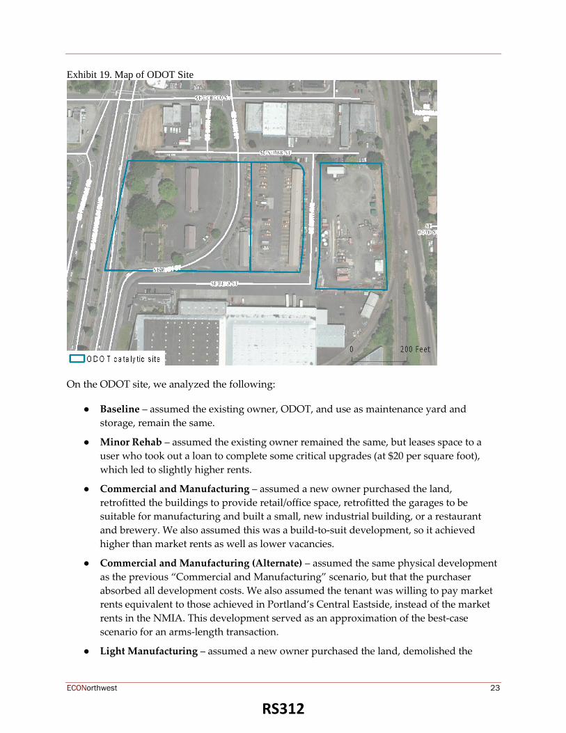
ECONorthwest 23
Exhibit 19. Map of ODOT Site
On the ODOT site, we analyzed the following:
● Baseline – assumed the existing owner, ODOT, and use as maintenance yard and
storage, remain the same.
● Minor Rehab – assumed the existing owner remained the same, but leases space to a
user who took out a loan to complete some critical upgrades (at $20 per square foot),
which led to slightly higher rents.
● Commercial and Manufacturing – assumed a new owner purchased the land,
retrofitted the buildings to provide retail/office space, retrofitted the garages to be
suitable for manufacturing and built a small, new industrial building, or a restaurant
and brewery. We also assumed this was a build-to-suit development, so it achieved
higher than market rents as well as lower vacancies.
● Commercial and Manufacturing (Alternate) – assumed the same physical development
as the previous “Commercial and Manufacturing” scenario, but that the purchaser
absorbed all development costs. We also assumed the tenant was willing to pay market
rents equivalent to those achieved in Portland’s Central Eastside, instead of the market
rents in the NMIA. This development served as an approximation of the best-case
scenario for an arms-length transaction.
● Light Manufacturing – assumed a new owner purchased the land, demolished the
RS312

ECONorthwest 24
existing buildings, and constructed a new manufacturing building with 15% of the
interior devoted to office use. We assumed a new building would achieve slightly higher
rents than other industrial spaces in the NMIA.
The results of this analysis show that for the new development options, if the land price was
excluded, the developer and occupant of the “Commercial and Manufacturing (Alternate)”
would be able to pay $626,000 dollars, while the developer of the “Commercial and
Manufacturing” or “Light Manufacturing” would face a feasibility gap of $1.3 million dollars
and $7.3 million dollars respectively.
If the land price was factored in, and based on the value of the highest and best use on the site
(in this case the Minor Rehab at $2.4 million dollars), then the developer would face a gap of
$1.8 million to build “Commercial and Manufacturing (Alternate)”, $3.8 million to build
“Commercial and Manufacturing”, and $9.7 million to build “Light Manufacturing”. In
addition to these feasibility gaps, the investors would need to come up with a range of equity
contributions, $3.2 million to $8.3 million, to get these new development projects to completion.
It is important to note that if the National Registry eligibility of the historic building on site was
realized, it would influence the economics of a rehab through a freeze of the property tax and a
20% income tax credit.
Exhibit 20. Feasibility Results for the ODOT Site
The subsidy for the “Commercial and Manufacturing” developments would result in the
creation of approximately 78 jobs and the “Light Manufacturing” would result in 97 jobs.
Exhibit 21. Benefits of New Development on the ODOT Site
The Mill End Site, 9701 SE McLoughlin Blvd
The Mill End site is located in the western half of the NMIA, and has great visibility from
McLoughlin Boulevard. It is currently occupied by Mill End Store, a fabric retailer.
RS313

ECONorthwest 25
Exhibit 22. Map of Mill End Site
On the Mill End site, we analyzed the following:
● Baseline – assumed the existing owner, Mill End, leases out the space, via an arms-
length transaction, to a new warehouse tenant3.
● Minor Rehab – assumed the existing owner remained the same, but took out a loan to
complete some upgrades (at $20 per square foot), which led to slightly higher rents from
a new warehouse tenant.
● MultiStory Industrial Office – assumed a new owner purchased the land, demolished
the existing building, and constructed a new multi-story industrial building with 50% of
the interior devoted to office use. We assumed a new building would achieve slightly
higher rents than other industrial spaces in the NMIA.
● Commercial and Manufacturing – assumed a new owner purchased the land and
3 Our baseline scenario is structured differently than the actual real estate lease structure at the Mill End property
today. We have used the assumption that the business and the property owner are two different entities. In actuality
these entities are one and the same. Commonly, when businesses own their own real estate, their business income
and expenses gets intertwined with those of the real property. This is difficult to model, as the comingling of cash
flows can be structured quite differently than an arm’s length market transaction. Our baseline scenario, with
separate business and property owners, is a better model for how an independent property owner would approach
their property in today’s market.
RS314

ECONorthwest 26
retrofitted the building to provide retail/office space and new manufacturing
capabilities. We also assumed this was a build-to-suit development, so it achieved
higher than market rents as well as lower vacancies.
The results of this analysis show that for the new development options, if the land price was
excluded, the developer of the “MultiStory Industrial Office” would face a feasibility gap of $8
million dollars while the developer of the “Commercial and Manufacturing” retrofit would face
a gap of only $137,760.
If the land price was factored in, and based on the value of the highest and best use on the site
(in this case the Baseline at $2.5 million dollars), then the developer would have a gap of $10.5
million to build “MultiStory Industrial Office” and $3.8 million to retrofit the building to
“Commercial and Manufacturing.” An important factor to note about the multi-story
development on the Mill End site is that the land size, and subsequent value, is relatively small
which makes the subsidy for this development less than it might be on a different site.
In addition to these feasibility gaps, the investors would need to come up with either $18.4
million or $3.8 million respectively in equity to get these projects to completion.
Exhibit 23. Feasibility Results for the Mill End Site
The subsidy for the “MultiStory Industrial Office” development would result in the creation of
approximately 274 jobs.
Exhibit 24. Benefits of New Development on the Mill End Site
The TriMet Site, 9600 SE Main Street
The TriMet site is located in the eastern half of the NMIA, has great visibility from McLoughlin
Boulevard, and is currently a TriMet Park and Ride.
RS315

ECONorthwest 27
Exhibit 25. Map of TriMet Site
On the TriMet site, we analyzed the following:
● Minor Rehab – Parking low– assumed the use as a parking lot remains the same but
that the owner, TriMet, improved the lot with charging stations and rented each parking
stall for $1 per day.
● Minor Rehab – Parking high – assumed the existing use as a parking lot remains the
same but that the owner, TriMet, improved the lot with charging stations and rented
each parking stall for $2 per day.
● Warehouse – assumed a new owner purchased the land, and constructed a new
warehouse building with 30% of the interior devoted to office use. We assumed a new
building would achieve slightly higher rents than other industrial spaces in the NMIA.
● Light Manufacturing – assumed a new owner purchased the land, and constructed a
new manufacturing building with 15% of the interior devoted to office use. We assumed
a new building would achieve slightly higher rents than other industrial spaces in the
NMIA.
The results of this analysis show that for the new development options, if the land price were
excluded, the developer of the “Warehouse” or “Light Manufacturing” would face a feasibility
gap of $1.3 million dollars and $4.7 million dollars respectively.
RS316

ECONorthwest 28
If the land price was factored in, and based on the value of the highest and best use on the site
(in this case the “Minor Rehab-Parking high” at $1.2 million dollars), then the developer would
need a total subsidy of $2.6 million to build the “Warehouse” and $6 million to build “Light
Manufacturing”. In addition to these feasibility gaps, the investors would need to come up with
$5.5 million in equity to get either of these new projects to completion.
Exhibit 26. Feasibility Results for the TriMet Site
The subsidy for the “Warehouse” development would result in the creation of approximately
110 jobs and the “Light Manufacturing” would result in 78 jobs.
Exhibit 27. Benefits of New Development on the TriMet Site
3.2 Potential Gap Financing Tools
Most of the development scenarios require gap financing to achieve feasibility. Filling the gap
for these projects could take several forms and come from several sources. Below is a list of
possible gap financing tools. Some of these tools and programs may only be applicable to
specific sites or certain uses. Also, we have added additional tools that the City should consider
for supporting business retention and recruitment as these strategies usually go hand in hand
with encouraging new development.
▪ Urban Renewal (Tax Increment Financing) - Tax increment finance revenues are
generated by the increase in total assessed value in an urban renewal district from the
time the district is first established. As property values increase in the district, the
increase in total property taxes (i.e., city, county, school portions) is used to pay off the
bonds. When the bonds are paid off the entire valuation is returned to the general
property tax rolls. Urban renewal funds can be invested in the form of low interest loans
and/or grants for a variety of capital investments including development gap financing.
▪ Microenterprise and Small Business Loans - Direct loans to help start-ups, micro-
enterprises and small businesses expand or become established. These loans could assist
target businesses interested in relocating to the NMIA
▪ Tenant Improvement Grants/Loans - Assist property owners and new business owners
with tenant improvements to the interiors of commercial spaces. Used for office and
RS317

ECONorthwest 29
industrial assistance in addition to retail. Funding can come from a variety of sources
including Urban Renewal and Community Development Block Grant (CDBG) loans or
grants, tax exempt revenue bonds.
▪ System Development Charge (SDC) Financing and Credits - SDC financing enables
developers to stretch their SDC payment over time, thereby reducing upfront costs.
Alternately, credits allow developers to make necessary improvements to the site in lieu
of paying SDCs. Note that the City can control its own SDCs, but often small cities
manage them on behalf of other jurisdictions including the County and special districts.
▪ Electronic Commerce Zone - Qualifying businesses in the zone receive a credit against
the business's annual state income or corporate excise tax liability based on 25% of the
investment cost made in capital assets used in electronic-commerce operations.
▪ Enterprise Zone - Enterprise zones exempt businesses from local property taxes on new
investments for a specified amount of time (3-5 years). Qualified investments include a
new building/structure, structural modifications or additions, or newly installed
machinery and equipment may qualify for exemption but not land, previously used
property value and miscellaneous personal items. Eligible businesses include
manufacturers, processors, and shippers. Retail, construction, financial and certain other
defined activities are ineligible.
▪ Industrial Development Bonds - Tax-exempt bonds issued by the state of Oregon that
provides long-term financing for land, buildings and equipment for manufacturers.
▪ State of Oregon Strategic Investment Program - Exempts a portion of large capital
investments from property taxes, Most often used for manufacturing firms and other
"traded-sector" businesses.
▪ Land Banking – Land banking, when a public or non-profit entity acquires real property
with the intent to save it for a future use, is an advantageous tool for well capitalized
jurisdictions. Land banking can be used to hold key properties for either more valuable
future uses or those that may struggle to pencil in a higher valued market, i.e. affordable
housing projects.
▪ Brownfields Assistance – There are several regional, state, and federal grant programs
that provide environmental assessments, and pre-development assistance for sites that
are potentially contaminated. Many of these funds are flexible, enabling jurisdictions to
provide a range of planning and assessment services to private property owners.
▪ Vertical Housing Development Zone - Subsidizes "mixed-use" projects to encourage
dense development or redevelopment by providing a partial property tax exemption on
increased property value for qualified developments.
3.3 Developer Interview Summary
The feasibility analysis conducted for the North Milwaukie Industrial Area (NMIA) presented
comprehensive findings regarding near to long term possibilities for future development. The
RS318

ECONorthwest 30
consultant team invited development professionals to comment on the findings of the analysis,
and offer their reflections on the NMIA in general. The participants for this development
“reality check” were:
▪ Josh Fuhrer – Developer with experience in retail, industrial, and mixed-use projects.
Josh is also a former City Council Member for the City of Gresham, and the current head
of the Gresham Redevelopment Commission.
▪ Roy Kim – Developer with experience in land, subdivision, and mixed-use
development.
▪ Phil Hanshew, MAI – Managing Director of Integra Realty Resources (Portland office);
the largest commercial real estate appraisal firm in the U.S.
Interview comments are summarized below.
NMIA Opportunities
▪ The NMIA location is terrific given its proximity to downtown, access to light rail and
freeway linkages.
▪ There’s dwindling supply of industrial land in the region. The NMIA will continue to be
an attractive location for development.
▪ Distribution uses are a great fit because of location and access – hence the legacy users.
▪ Existing building floorplates are quite a bit larger than those in Inner SE Portland. This is
a huge benefit to distribution/logistics businesses.
▪ Large building footprints could serve as a niche for expanding startup to have space to
grow within the district.
▪ As to when [new development] happens, sooner than later. Five years, not 20 years,
especially given the dearth of industrial/employment land in the region (and land that,
again, is so well located).
▪ This area is not as strong for new high density development as Central Eastside, but
stronger than 217/Western Avenue. Hold on in the meanwhile. In the next market cycle,
there may well be a few bellwether projects – perhaps even a multi-story employment
use like the New York Building in NW Industrial. Multi-story distribution is only
happening in markets with much higher land values.
▪ There’s opportunity for businesses that don’t need to expand but need to be around
something cool. The challenge becomes creating a community “personality” that is
attractive and cool to these businesses.
▪ Preserve limited industrial land.
NMIA Constraints/Challenges
▪ Big hurdle to upgrade the area, to create higher density development, higher
concentration of jobs. Existing built environment a deterrent.
RS319

ECONorthwest 31
▪ Noise is a challenge with maker space. For that reason, it’s a difficult use to mix with
housing.
▪ Startups cannot pay high rents. When they’re successful they need to expand and if
there isn’t room for the expansion, they will need to move. (This is also an opportunity,
as there are a number of large existing buildings in the NMIA that could fit expanding
startups).
Development Feasibility
▪ The question is what/when will the tipping point be? The point at which the existing
buildings are no longer the highest and best use (today they are – ECO’s analysis
confirms that – nothing new pencils).
▪ Unlikely to see typical suburban industrial development, because these product types
grossly underutilize land.
▪ Industrial land in the NMIA is more and more valuable relative to buildings in the
NMIA. Once land becomes more valuable than a building on it, the property will flip to
a much more intense development type.
▪ Transition to maker space is already happening and is a good transitional use.
Encouraging Development
▪ What’s the vision for the area? What story does NMIA want to tell? Is there a specific
industry or sector? Could be a configuration of space and/or an industry. Without that,
development is going to feel random.
▪ Engage with long-term property owners to create a legacy to move forward
▪ If you’re looking for more intensive uses, focus manufacturing to the east, more
flexibility to the west. That would make it more attractive for redevelopment.
▪ City’s backstopping loans is an attractive option for developers, but there are some legal
limitations that make these programs difficult to implement.
▪ Allow a certain percentage of the property to be self-storage as long as it’s not the focal
point of the development. This would help with development feasibility.
▪ Destination retail/industrial - Rebuilding Center or similar anchor user that can draw
people in is needed. These uses are unique and tell a story. Think Hippo hardware.
Could you rethink the hardware store in the NMIA?
▪ Should look at the most scenic area for housing as a part of a mix of uses. The question is
how to not turn away industrial uses. More of a design question.
▪ Locating housing near downtown Milwaukie will feed and complement what’s happing
there today.
▪ There’s a lot of development risk for industrial projects that is wrapped up in the
entitlement process. The City holds the keys to this process and therefore has some
ability to lessen this risk and encourage development.
RS320

ECONorthwest 32
▪ Maker space can have difficult economics. Gresham has found a way to make it work in
new development through gap financing (via Urban Renewal).
▪ Can a shuttle service assist NMIA employee access to the area from centralized parking
or light rail?
4 Summary of Findings and Recommendations for
Framework Plan
The consultant team conducted two levels of development feasibility analyses for the North
Milwaukie Industrial Area. First, the consultant team used the MapCraft webtool to test
development feasibility of a multitude of building prototypes across the entire area. Second,
ECONorthwest took an in-depth look into four sites in the NMIA to better understand the
mechanics and nuances of feasibility on specific properties. Each analysis modeled arm’s length
transactions using current market inputs.
Based mainly on the value of both land and existing buildings, the area-wide MapCraft Labs
analysis showed that most new development in the NMIA is infeasible. After low-intensity
residential (a building type out of sync with the vision of the NMIA), retrofitting existing
buildings is the next most feasible prototype. New construction prototypes, situations where a
developer purchases a property, razes and existing structures, and builds a new building are by
and large infeasible without significant subsidy.
The second analysis, a deep-dive into the nuance of development on four specific potentially
catalytic properties, produced results consistent with the MapCraft Labs findings. New
development prototypes were shown to be infeasible without subsidies. The catalytic analysis
emphasized that, for many building owners, the best financial decision in the near term is to
conduct a minor retrofit of existing buildings. The balance of the low investment cost to
complete the retrofit, with the slight boost in achievable rent results in the best overall financial
outcome.
4.1.1 Recommendations
“The North Milwaukie Industrial Area capitalizes on the District’s strategic location that attracts
innovative and entrepreneurial businesses to create a hub for employment and manufacturing
that respects the natural environment. Existing and future businesses provide family-wage jobs
that are accessible by all modes of travel, and incorporate sustainable design that reduces demand
on citywide infrastructure while serving as a model in the region.” – NMIA Vision Statement
We must first acknowledge that the NMIA is already a hub for employment and manufacturing
with a high occupancy rate and relatively high employment density (currently at 9.5 jobs per
acre) when compared to other warehouse areas in the region. The City is striving to increase the
density through increased intensification of uses and new innovative uses as part of the NMIA
vision
RS321

ECONorthwest 33
The findings from the analyses have shown that new construction of desired employment
focused building types is unlikely to occur in the current market or in the near to mid-term.
Low-cost retrofits of existing buildings however, are already occurring in the area and have
proven to be feasible in the models employed in the analyses. The consultant team recommends
the following for achieving the NMIA’s vision as part of the Framework Plan:
1. Easy wins are low cost – Creating a parking management plan and hiring an area property
manager are low cost actions that can make a difference for current business and property
owners, especially those that are considering a reinvestment in their properties. In the near
term, the focus should be enhancing an already successful area and setting the stage for the
future. Other actions include; initiating a district funding strategy, conducting property
owner outreach (to both public and private property owners), branding and wayfinding
initiatives, and a reevaluation of zoning and parking strategies.
2. Set the stage for a “unicorn” project – Sometimes property owners sell land for less than
market value, and other times businesses are willing to pay more than a market rate to be in
a specific area. These situations happen, often times in locations like the NMIA where long
term property owners have a low basis in their buildings, but these developments are
difficult to model and impossible to predict. Increasing the likelihood that a “unicorn”
project happens in the NMIA will involve effective outreach with property and business
owners and identification of conditions to support a desired target sector. A new office
build-to-suit situation or a brewery that desires the NMIA location are possible soon, but
only if provided a subsidy (e.g. costs are lowered), or are willing to pay more than current
market rates. The City has the opportunity to make the case for these businesses to be in the
NMIA no matter what and be ready for a property owner that is able and willing to part
with the land for less than full value.
3. Maintain focus on goals and vision – The NMIA has a compelling vision for a vibrant
employment and manufacturing center. Maintaining focus on the area’s vision will reinforce
the area’s brand and strengthen the case for existing businesses to reinvest, and for new
businesses to move in. Maintaining focus involves conducting capital improvements that
are consistent with the vision, and opportunistically funding onsite and offsite
improvements that support core businesses. Most importantly, make sure that restrictive
policies preclude uses that are not compatible with the area’s vision and goals, and
encourage uses that complement and build upon the NMIA’s location and strengths.
4. Zone with care – If the city wants to continue industrial uses and discourage expanded
residential and/or other uses such as big box retail, zone appropriately to manage this
vision. But also allow some flexibility for innovative uses that can adapt and thrive as the
market changes to create more jobs and foster creative uses of the district.
RS322

F r o m :C A SA BRUNO 5 0 3 235 1049 0 2/05 / 2018 1 4:49 # 358 P.001 / 001
Don Oman
Casa Bruno LLC
9304 SE Main Street
Milwaukie, Oregon 97222 February 5, 2018
To the Council :
I am writing you today to share my views on the proposed rules regarding the North Milwaukie Industrial zoning changes.
For twenty years I have operated my wholesale wine distribution and importing business in inner SE Portland. Nine days
ago we began operations out of our new distribution center in North Milwaukie at 9304 SE Main. We are excited to be
operating in this area for many reasons including its close proximity to the center (downtown Portland) of the tri-county
area where the majority of our customers operate .
During the last twenty years we have expanded our business to include 36 employees who sell and distribute nearly one
million bottles in Oregon each year. Our business ownership is based in two local families. Employees at Casa Bruno LLC are
well-compensated and from their first month of service receive health and dental care for themselves and their children. A
retirement plan is in place. Salaries begin at $30,000 for an untrained person in our business with three weeks of vacation
available in the first year of work. We have maintained a very reliable and growing workforce over the last twenty years.
It is not without some regret that we left our previous home in inner SE Portland, but we found ourselves unable to operate
any longer out of that area. The pressures of urban growth have made our previous neighborhood unworkable for our
business.
Inner SE Portland was once an area with numerous small and medium-sized businesses focusing on light manufacturing and
distribution. The produce distribution houses were at one time all centered there. Most of those businesses have now
gone. The city has not been successful at protecting small businesses in Inner SE Portland. Their commitment to the
business community of keeping the area free of retail has been unsuccessful. For years, small changes in what the city
allowed of businesses in the area allowed non-traditional development to find its way into the area. Parking has become
very difficult. Permitting has seen three price increases in as many years. Issues around homeless folks and various
encampments have also made it difficult to do business in the area. Housing, in general, has been a difficult issue
everywhere. Our business recognizes that many of the homeless have been driven out of their homes by the ever
increasing cost of houses and real estate .
But exchanging successful small and medium-sized businesses that employ people with living wages and good benefits for
housing and lower wage jobs is not a way to remedy this crisis. I urge you try to keep the north industrial area hospitable for
locally based businesses that provide good jobs for the people of Milwaukie. It is not an easy task. The pressures of rising
real estate values and the need for land from many sectors is formidable. It requires thoughtful leadership and forward
thinking planning to avoid the fate of the inner SE Portland. I moved my business here thinking that the next generation of
Casa Bruno LLC could maybe continue to build the business here in Milwaukie.
I urge you to plan for the long term, to build a community that has good jobs as well as good neighborhoods. Continuing to
preserve the North Milwaukie Industrial area for responsible businesses will be a positive step for the community.
Thank you for your consideration,
Don Oman
Partner, Casa Bruno LLC
stauffers
Typewritten Text
stauffers
Typewritten Text
stauffers
Typewritten Text
RS 5. A. 2/6/18 Correspondence
stauffers
Typewritten Text
stauffers
Typewritten Text

1
Scott Stauffer
From: Ann OberSent: Wednesday, February 07, 2018 7:59 AMTo: _City CouncilCc: Alma Flores; Vera Kolias; Amy KoskiSubject: Fwd: NMIA overlay
Council and Mayor‐ Per your request, here is the email sent by Rebecca at Metro to Peter Stark. Ann
Sent from my iPhone Begin forwarded message:
From: Rebecca Hamilton <[email protected]> Date: February 7, 2018 at 7:43:31 AM PST To: Ann Ober <[email protected]> Cc: Roger Alfred <[email protected]>, Alma Flores <[email protected]> Subject: Fw: NMIA overlay
Ann, Alma and Roger ‐
Here is what I sent.
Rebecca
From: Rebecca Hamilton Sent: Tuesday, February 6, 2018 2:17 PM To: [email protected] Cc: Megan Gibb; Taylor Unterberg Subject: NMIA overlay
Hello Peter,
Taylor Unterberg in the Metro Council Office informed me that you were seeking Metro’s endorsement of a 10‐year residential zoning overlay for the Deitrich’s property in the North Milwaukie Industrial Area.

2
The NMIA is not a designated Title 4 Land and so Metro would not challenge the Deitrich/Planning Commission’s proposed 10‐year overlay on grounds of a Functional Growth Plan conflict, but nor do we give our endorsement of it. Metro believes that the proposed Plan zoning (as currently written) is consistent with the stated goals of the NMIA Plan and the results of public outreach. Therefore, it would be best to refrain from invoking Metro’s support tonight as you make your case to Milwaukie City Council on the issue.
Thank you,
Rebecca Hamilton
Regional Planner
Metro
600 NE Grand Ave., Portland, OR 97232
(503) 797‐1721
Metro | Making a great place

PUBLIC HEARING ATTENDANCE SIGN-UP SHEET
If you wish to have standing and/or to be on the mailing list for Council information from tonight's hearing, please sign-in below.
2/6/18 North Milwaukie Industrial Area (NMIA) Comprehensive Plan Zoning Code Amendments
Land Use File No. CPA-2017-002, ZA-2017-003
Attendance Sign-Up Sheet Page _I of _j_

CITY OF MILWAUKIE CITY COUNCIL
l 0722 SE Main Street P) 503-786-7502 F) 503-653-2444 [email protected]
Speaker Registration
The City of Milwaukie encourages all citizens to express their views to their city leaders in a respecHul and appropriate manner. If you wish to speak before the City Council. fill out this card and hand it to the City Recorder. Note that this Speakers Registration card, once submitted to the City Recorder, becomes part of the public record .
Name: E~-__/iv-R~ Address: 2-YO~ /1~/ t/OAAc.v~ Organization: Phone: 50 ? -Lro -I 'r /<£
Ema1l: -e--~v~e.@d~r.Jee_..,~
Topic: /tlf/1/A Jlltie_r:/ UC-c.- Q/eV~ You are Speaking ...
Meeting Date: . z_jG /;~ I
Agenda Item You Wish to Speak to:
D #4 Audience Participation
[RI #5 Public Hearing, Topic: )JM If} D #6 Other Business, Topic:
Comments:
D(l in Support
D in Opposition
D from a Neutral Position
D to ask a Question

CITY OF MILWAUKIE CITY COUNCIL
1 0722 SE Main Street P) 503-786-7502 F) 503-653-2444 [email protected]
NameJtffi ~""{ Organization:
Speaker Registration
The City of Milwaukie encourages all citizens to express their views to their city leaders in a respectful and appropriate manner. If you wish to speak before the City Council, fill out this card and hand it to the City Recorder. Note that this Speakers Registration card, once submitted to the City Recorder, becomes part of the public record.
Address: IH6 ~~ ~ ~tit • f\ttf~ ~1~ 1'1 Pho~e: , ~ • ~ +fl • //, _.
Meet ing Date: "' • tl• 1$ Topic: Ematl: J'."f! f bl-fr11"'~I•I./WI NMih C. ~
Agenda Item You Wish to Speak to:
D #4 Audience Participation
~#5 Public Hearing, Topic:
D #6 Other Business, Topic:
Comments:
You are Speaking .. .
~n Support
D in Opposition
D from a Neutral Position
D to ask a Question

CITY OF MILWAUKIE CITY COUNCIL
10722 SE Main Street P) 503-786-7502 F) 503-653-2444 [email protected]
Name: P\YA\S-Cl 5 1J::x<Z-,IL Organization:
Speaker Registration
The City of Milwaukie encourages all citizens to express their views to their city leaders in a respectful and appropriate manner. If you wish to speak before the City Council, fill out this cord and hand it to the City Recorder. Note that this Speakers Registration cord, once submitted to the City Recorder, becomes port of the public record.
Address: Phone: Email:
rz_~~ NW e-o~~ Pb~~~'>l arz
Meeting Date: 2-- { & .I c.. a Agenda Item You Wish to Speak to:
Topic: ~A -- N 'N\ \ A
D #4 Audience Participation
D #5 Public Hearing, Topic:
D #6 Other Bu~iness, Topic:
Comments:
You are Speaking .. .
~ in Support
D in Opposition
D from a Neutral Position
D to ask a Question

CITY OF MILWAUKIE CITY COUNC IL
Speaker Registration
10722 SE Main Street The City of Milwaukie encourages all citizens to express their P) 503-786-7502 views to their city leaders in a respectful and appropriate F) 503-653-2444 manner. If you wish to speak before the City Council. fill out [email protected] this card and hand it to the City Recorder. Note that this
..,._ \ J... "'- ~ (/-( V \ ~ t\Z \ ~ .\ A Speakers Registration card, once submitted to the City I"' P"'"l"" :..-- ~I Recorder, becomes part of the public record .
Name: ~J 4-' ~ ,-{l; '- 1'c I Address: M 1
1 l-? ~"' ,{ 'J'J< Organization: {J R£~ \t(Jvv~ ~~oa~~: '7 ))6-/~ '/
Meeting Date: L- ~ Topic: tv.. t'tJB) o'Wf) Agenda Item You Wish to Speak to:
D #4 Audience Participation
_ #5 Public Hearing, Topic: f(j !ftt L/)-0 #6 Other Business, Topic:
Comments:
You are Speaking ...
rtxl in Support
D in Opposition
D from a Neutral Position
D to ask a Question

CITY OF MILWAUKIE CITY COUNCIL
1 0722 SE Main Street P) 503-786-7502 F) 503-653-2444 [email protected]
Speaker Registration
The City of Milwaukie encourages all citizens to express their views to their city leaders in a respectful and appropriate manner. If you wish to speak before the City Council, fill out this card and hand it to the City Recorder. Note that this Speakers Registration card, once submitted to the City Recorder, becomes part of the public record.
Name: ,J ~\l ~ L-k\?~ Add \ \l S{rl voLu~r>u\.. .,, <; u;;- ~ 3 0
_ _____________ ress: Phone: Email: J""'ie\ .. w~a ~'--~~wtNc. ~t-... Organization: (Y-~ f~O ( 1\( C
Meeting Date: 1..- &-l ~ Topic: t fr7A ---~---------------
Agenda Item You Wish to Speak to:
D #4 Audience Participation
'%k#5 Public Hearing, Topic:
D #6 Other Business, Topic:
Comments:
You are Speaking .. .
OOin Support
D in Opposition
D from a Neutral Position
D to ask a Question

CITY OF MILWAUKIE CITY COUNCIL
10722 SE Main Street P) 503-786-7502 F) 503-653-2444 [email protected]
Name: B1l--"(~~ G, u\ tJE'-1
Organization: 0US\~~ ~
Speaker Registration
The City of Milwaukie encourages all citizens to express their views to their city leaders in a respectful and appropriate manner. If you wish to speak before the City Council, fill out this cord and hand it to the City Recorder. Note that this Speakers Registration cord, once submitted to the City Recorder, becomes port of the public record.
Address: 'iGOt; sw wt:\-~ ~ Pho~e: (So3) 3D7 366-z_ Ema1l: .
Meeting Date: Z- (q ' ?D !fl . br'1a"'·J'""'ra~€ ~<M a 0 u./
Top1c: tJW",,~ ' j
Agenda Item You Wish to Speak to:
D #4 Audience Participation
17("'#5 Public Hearing, Topic: ~ )~ \~ D #6 Other Business, Topic:
Comments:
You are Speaking ...
0 in Support
0 in Opposition
D from a Neutral Position
D to ask a Question

Name:
Organization:
t:J
CITY OF MILWAUKIE CITY COUNCIL
10722 SE Main Street P) 503-786-7502 F) 503-653-2444 ocr@milwaukieoregon .gov
Z:. VVV\ w C\ ( +-<;e(-F-
Speaker Registration
The City of Milwaukie encourages all citizens to express their views to their city leaders in a respecHul and appropriate manner. If you wish to speak before the City Council, fill out this card and hand it to the City Recorder. Note that this Speakers Registration card, once submitted to the City Recorder, becomes part of the public record .
Address: 0'¥\ ~· ( ~ Phone:
Email:
Meeting Date: 2- ~ - l co Topic: '::> - A- . NM\~ ~.f' "v ~ '() Agenda Item You Wish to Speak to:
D #4 Audience Participation Nf/1/tl
~#5 Public Hearing, Topic: \t\e~ v c' ""6 D #6 Other Business, Topic:
Comments:
You are Speaking ...
Din Support
~in Opposition ((?YV -~ ~ \ l 't.\.-\J ')~) D from a Neutral Position
D to ask a Question

CITY OF MILWAUKIE CITY COUNCIL
10722 SE Main Street P) 503-786-7502 F) 503-653-2444 [email protected]
Speaker Registration
The City of Milwaukie encourages all citizens to express their views to their city leaders in a respectful and appropriate manner. If you wish to speak before the City Council. fill out this cord and hand it to the City Recorder. Note that this Speakers Registration cord, once submitted to the City Recorder, becomes part of the public record.
Name: 71 ~ (t;l -r/ .•• .M~ ~ _1/1
( -JLl . / ~ I.L114J[l Yll) ~ f/l Add . Organization IV{;' {Jrrv\P~: &71 &A .; ' ~ho~:~s. ot £.-h '6-c (? (.\ ~ ~ r ""s.s lc:911
Meeting Date: 'tMc~ . tiC'~~-~ eZtw~ · (})ih ~llf(!'b I OpiC:
Agenda Item You Wish to Speak to: --:~~=-~-----;------------.... _0 .!:::4 Audience Participation
~-(5 Public Hearing, Topic:\J \'(\\ fX_ D #6 Other Business, Topic:
Comments:
You are Speaking ... If\ Din Support
D in Opposition
D from a Neutral Position
D to ask a Question
'Sv \? -p o rt crf N'\1\..V BN+>
m 'x~d uP

CITY OF MILWAUKIE CITY COUNCIL
10722 SE Main Street P) 503-786-7502 F) 503-653-2444 [email protected]
~) NamG~ Organization:
Speaker Registration
The City of Milwaukie encourages all citizens to express their views to their city leaders in a respectful and appropriate manner. If you wish to speak before the City Council, fill out this card and hand it to the City Recorder. Note that this Speakers Registration card, once submitted to the City Recorder, becomes part of the public record.
Address: Phone: Email:
Meeting Date: ______ _ Topic:
Agenda Item You Wish to Speak to:
0 #4 Audience Participation
0 #5 Public Hearing, Topic:
0 #6 Other Business, Topic:
Comments:
-----------------
You are Speaking ...
0 in Support
0 in Opposition
0 from a Neutral Position
0 to ask a Question

CITY OF MILWAUKIE CITY COUNCIL
l 0722 SE Main Stree1 P) 503-786-7502 F) 503-653-2444 [email protected]
Name: ,)\'1\\Y'A~ ~C\Jl<0 Organization: ~W '(.-~-e,x ~~~U--
Speaker Registration
The City of Milwaukie encourages all citizens to express their views to their city leaders in a respecHul and appropriate manner. If you wish to speak before the City Council, fill out this card and hand it to the City Recorder. Note that this Speakers Registration card, once submitted to the City Recorder, becomes part of the public record.
Address: lotOO Sv~ Mil'•" ~\-. /V\i\W"-vk·t. DR-Phone: S"\>":> '>loo 1~~
Email: j''~'--"""1 (5 1\w \L£-v: \f(;._fL,vOV"'-
Meeting Date: v/~ / 1~ Topic: Zo11;1) Agenda Item You Wish to Speak to: You are Speaking .. .
D #4 Audience Participation ~ in Support
~ #5 Public Hearing, Topic: ~ N\\ A- D in Opposition
D #6 Other Business, Topic: D from a Neutral Position
0 to ask a Question
Comments:

CITY OF MILWAUKIE CITY COUNCIL
10722 SE Main Street P) 503-786-7502 F) 503-653-2444 [email protected]
Speaker Registration
The City of Milwaukie encourages all citizens to express their views to their city leaders in a respectful and appropriate manner. If you wish to speak before the City Council, fill out this card and hand it to the City Recorder. Note that this Speakers Registration card, once submitted to the City Recorder, becomes part of the public record .
1 1- eft' Name: 1};4 ~ CtL /V U!J8 ~d- Address:
Organization: ' Phone:
Meeting Date: _____ _
Agenda Item You Wish to Speak to:
D #4 Audience Participation
D #5 Public Hearing, Topic:
D #6 Other Business, Topic:
Comments:
Topic:
Email:
----------------------------------
You are Speaking ...
Din Support
D in Opposition
D from a Neutral Position
~--to ask a Question

CITY OF MILWAUKIE CITY COUNCIL
l 0722 SE Main Street P) 503-786-7502 F) 503-653-2444 ocr@milwaukieoregon .gov
Speaker Registration
The City of Milwaukie encourages all citizens to express their views to their city leaders in a respectful and appropriate manner. If you wish to speak before the City Council, fill out this card and hand it to the City Recorder. Note that this Speakers Registration card, once submitted to the City
\ Recorder, becomes part of the public record .
~ ~GwvP(NAddress: Z-4 ~r; ) .({? /'1.£:J(Pr"''Y Name:
Organization:
Meeting Date: 2- & -- /75 Agenda Item You Wish to Speak to:
D #4 Audience Participation
\ g. #5 Public Hearing, Topic:
~ #6 Other Business, Topic:
Comments:
Phone: Email:
Topic: ______________________________ __
You are Speaking ...
Din Support
D in Opposition
D from a Neutral Position
D to ask a Question

EXHIBIT l. -<.:- -\ £',.
S- tl.
Peter Stark, 2939 NW Cornell Rd, Portland
I am a licensed Architect in the State of Oregon and have also participated in many planning efforts including 20 plus years of planning in Portland's Central Eastside Industrial District and most recently on the NMIA Project Advisory Committee.
I am here on behalf of Nancy and Howard Dietrich and the Mill End Store in support of Planning Commission's proposal for a housing overlay on properties impacted by the floodplain.
Without this overlay, the city may loose a significant landmark business and eliminate hundreds of jobs currently in the floodplain.
The concern regarding the floodplain was first discussed during the NMIA meetings. There was also discussion to consider housing as a means to address the financial burden of development in floodplains.
I've called and confirmed there was 100% support for housing by NMIA members who could vote independent from City Councils directive to not include housing in the floodplain.
At this time we also have support from all the private businesses and property owners in the NMIA as well as the industrial businesses on the other side of Millport and 99E. Not to mention support from many of the prominent businesses in the downtown.
Planning Commission also agreed that an overlay would be a reasonable solution for these sites.
Why is this overlay necessary? Lets review what we know:
1) Both the NMIA consultant (EcoNW) and our own economist have confirmed multi-story industrial office will require $10-11M subsidy to be built.
2) Building in the floodplain, regardless of building height adds significant costs to the development- and in the case of the Mill End Store - that cost would be $3M.
3) Buildings in the floodplain will eventually be demolished due to flooding. This is certainly true for the Mill End Store given floodwaters were 4' high in the last flood.
4) Mixed use with housing will offset the substantial costs to elevate buildings in the floodplain.
5) Given the separation ofthe floodplain site from adjacent industrial businesses (by Milport, 99E and 224, housing proximate to Industrial is not an issue here.

Further- housing with industrial uses is already supported on the north end of the NMIA.
6) There is a shortage of housing in the city - and plenty of room for growth. Housing at this site will compliment other housing projects.
7) Unlike other properties in the NMIA that have limited potential for development, the owner of the Mill End Store is willing to commit resources to built high-rise development in the NMIA.
8) And as noted during the NMIA committee meetings - this site has the potential to be THE catalyst for development throughout this district.
9) Lastly, there is support from private businesses in the NMIA and the downtown as well as Planning Commission.
Consider the consequences with the proposed zoning without the overlay:
The area of the floodplain is a large area of the NMIA. If property in the floodplain doesn't have the zoning to create development opportunity- a large portion of the NMIA will become vacant with NO development No employment- derelict.
And Milwaukie would not only lose employment opportunity but one of its landmark businesses the Mill End Store.
We are concerned that this point is being lost.
Given the importance of economic and employment goals in the NMIA plan and the prominent success and community connection of the Mill End Store.
We urge Council to support Planning Commission proposal.
Thank you

ZA-2017-003; CPA-2017-002
NMIA Code and Plan AmendmentsPresentation to the
Milwaukie City Council
Amy Koski, Economic Development Coordinator
Vera Kolias, Associate Planner
February 6, 2018
stauffers
Typewritten Text
RS 5. A. 2/6/18 Presentation (Staff)
stauffers
Typewritten Text

Presentation Outline
1. Background/NMIA district character
2. NMIA process and input
3. Economics, vision, and case studies
4. NMIA Plan changes and comprehensive plan and
amendments
5. Code amendments
6. Key Questions

Hearing Schedule
Subject Area 02/06 02/20 03/06
Comprehensive Plan and NMIA
Plan; proposed mixed-use overlayX
Proposed Zoning Code Amendments;
proposed design and development
standards
X
Final amendment package
(if not completed on 2/20)X

Background
• Project goal: Implement the NMIA Framework Plan
and Implementation Strategy


Land Use and Development
• Central location/in demand
• Shipping-focused
• Flex-space
• Excellent transit access

Parcels and Building Age
•Small parcels
•Limited vacant land
•Old buildings and systems
•70 percent built before 1970

Key Economic Trends
• Total employment increased by 14% between 2002-2014
• Vacancies have decreased
– Q4 2006 = 19.8%
– Q2 2016 = 5%
• Relatively low rents
• Top employers by industry:
– Health care-related, construction, wholesale trade

NMIA Plan Outreach
• Project Advisory Group
• Technical Advisory Group
• Stakeholder meetings• New and established businesses/landowners
• Next generation “makers”
• Businesses interested in the NMIA
• Commercial Brokers
• Public meetings

Stakeholder Meetings
• Great location Hard to find space, expand
businesses
• Parking is challenging
• Great access but confusing
• Few use rail
• Need amenities for employees
• New tenants are looking for 5,000-15,000 sf
• Office and warehouse/manufacturing space

Public Meetings
• Approximately 90 attendees at
3 public meetings over 8
months

Online Survey Results - Summary• Barriers to getting around the area
• NMIA is a light manufacturing, heavy truck, shipping oriented
district
• Vision for the area
– Light and advanced manufacturing
– Small business oriented and incubator spaces
• Diverse opinions on actions:
– Emphasis on employment and amenities
– Less support for residential

NMIA as an Employment District
• Milwaukie:
– 77% Residential zoning
– 18% Industrial zoning
• MUTSA Zone allows mixed-use
• Industrial with residential creates
conflict
• Industrial land is typically
constrained land
• NME Zone increases flexibility

Case StudiesPearl District
• 285 acres
• Historically = warehouses, light
industry, railroad yards
• Zoning history:
– 1980s = mixed-use,
– Today = high-rise condominiums;
warehouse-to-loft conversions

Case Studies
South Waterfront
• 33 acres
• High-rise district + OHSU on
former brownfield industrial
land
• Future: 2,600 residential
units, 1.5 million SF office,
200-room hotel, and 3 parks

Case Studies
Central Eastside
• 681 acres and 20,000+
employees
• Adaptive reuse and new
construction = industrial offices,
residential, and retail
• 14,000 new jobs expected to be
created by 2035

Summary of Plan Amendments
• Update and Adopt the NMIA Plan
• Repeal the Tacoma Station Area Plan (TSAP)
• Update the Transportation System Plan (TSP)
• Update the Comprehensive Plan

NMIA Plan Changes
• Streamlines document/text refinement
• Adds figures from the TSAP
• Adds design elements
• Adds Natural Features section
• Updates Zone names: MUTSA and
NME

Transportation System Plan Amendments
• Includes identified NMIA
projects in the TSP
• Reconciles TSAP with
NMIA in the tables and
narrative

Comprehensive Plan Amendments
• New Objective #17
• Adopts and
implements the
NMIA Plan
• New Map 10 –
North Milwaukie
Industrial Area

Summary of Code Amendments
• Reduce total number of zones in the NMIA from 5 to 2
– new North Milwaukie Employment Zone (NME)
– new Tacoma Station Area Mixed-Use Zone (MUTSA)
• Delete the Tacoma Station Area Overlay Zone
• Code language consistent with the Commercial Mixed-
Use Zones
• Planning Commission recommendation: Milport Mixed-
Use Overlay
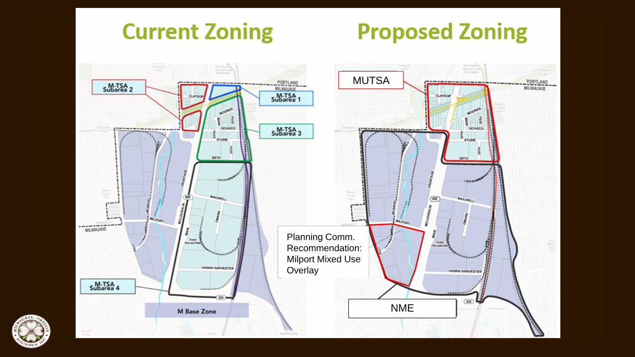
MUTSA
NME
Planning Comm.
Recommendation:
Milport Mixed Use
Overlay

Permitted Uses and Development Standards
• Permitted uses generally reflect the existing zoning
– Office uses and limited commercial uses are permitted in NME
• Summary of development standards
– Establish key streets and urban design standards
– Include minimum setbacks; parking restrictions; frontage
occupancy
– Height bonus available

Proposed
key
streets

Design Standards
• Ground floor and street-facing windows and doors
• Building orientation
• Corners
• Weather protection
• Walls – construction materials

Key Streets – Design Standards - Applicability
• Clarify applicability of design and development standards
– Demo or replacement of more than 50% of a wall or roof
– MUTSA: floor area additions (both interior and exterior) that
exceed 50% of the existing floor area or demo/replace 50% of
the existing floor area
– NME: floor area additions (both interior and exterior) that
exceed 75% of the existing floor area or demo/replace 75% of
the existing floor area

SE Main St
SE
Mailw
ell
Dr
Second floor or
additional interior floor
area

MUTSA
NME
Planning Comm.
Recommendation:
Milport Mixed Use
Overlay

Key Questions for Council
• Should the NMIA include the Milport Mixed Use Overlay,
thereby allowing residential uses in the southwest
portion of the district?
– The Mill End Store, as a standalone retail use, is a non-
conforming use in the Manufacturing zone. Should this use (a
retail bulky fabric and textile sales use) be permitted outright in
the NME in its current location?

Floodplain Issues
• Properties in the MMU are in the
floodplain
• The floodplain code allows
reconstruction within the
floodplain if displacement is no
greater with the new construction.

Key Questions for Council
• Should the NMIA include the Milport Mixed Use Overlay,
thereby allowing residential uses in the southwest portion of
the district?
– The Mill End Store, as a standalone retail use, is a non-
conforming use in the Manufacturing zone. Should this use
(a retail bulky fabric and textile sales use) be permitted
outright in the NME in its current location?

Key Questions for Council
• Are there any questions or concerns about the proposed
NMIA Plan?
• Are there any questions or concerns about the revisions to
the Comprehensive Plan or Transportation System Plan,
including compliance with Goal 12 – Transportation?

Key Questions for Council
• Are there any questions or concerns about the proposed changes to the Tacoma Station Area?
Existing Map 8 – Land Use Proposed Map 10 – Tacoma Station Area

Key Questions for Council
• Should there be a different list of permitted industrial uses in
the MUTSA?
• Proposed code includes:
• MUTSA purpose statement
• Requires a signed declaration of uses for residential development
• Industrial uses are limited uses in the MUTSA; some specific uses
prohibited.
• Require screening for new residential development near industrial
use

Key Questions for Council
• Should there be a different minimum building height
standard?
– Proposed minimum building height = 25 ft

Decision-Making Options
A. Recommend approval of the application subject to the
recommended Findings of Approval
B. Recommend approval of the application with modified
Findings of Approval
C. Recommend denial of the application upon finding that it
does not meet approval criteria
D. Continue the hearing

Process to Date and Next Steps• 10/10: PC worksession #1
• 10/24: PC worksession #2
• 11/13: DLC worksession #1
• 11/28: PC hearing #1 – plan amendments
• 12/4: DLC worksession #2
• 12/12: PC hearing #2 – zoning code amendments
• 12/19: Council work session #1
• 1/9: PC hearing #3 - vote
• 1/16: Council work session #2
• 2/6: Council hearing #1
• 2/20: Council hearing #2
• 3/6: Council hearing #3 – if needed

Staff Recommendation
• Recommend approval of the
proposed amendments.

ADDITIONAL SLIDES IF NEEDED DURING TESTIMONY

NMIA Economic Feasibility Analysis
• Retail rents from January-
October 2016 = average
$14.98/sf for Milwaukie; $19.72
in areas surrounding NMIA
• Office rents = $19.55 for
Milwaukie; $13.67 in the NMIA
• Industrial rents = $5.65 for
Milwaukie; $5.13 in the NMIA

Milwaukie Market Analysis for Office Space
• Challenges to development in
the NMIA included lacking
amenities, a dated industrial
environment, fragmented
ownership, and relatively strong
economics for existing uses –
though it represents a low-cost
alternative to Portland in terms of
land prices.

Milwaukie Market Analysis for Office Space
• Vacancy rates in Milwaukie
area = peaked at 8.2%;
below 5.0% since late 2012
• Lease rates in Downtown
Milwaukie = $22.00-24.50
today, $26-29 NNN next two
years

Gross Property Tax Assessment

Dietrich-Owned Sites in Milwaukie
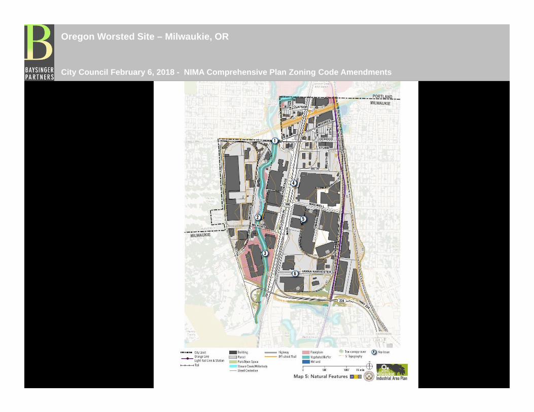
Oregon Worsted Site – Milwaukie, OR
City Council February 6, 2018 - NIMA Comprehensive Plan Zoning Code Amendments
stauffers
Typewritten Text
RS 5. A. 2/6/18 Presentation
stauffers
Typewritten Text
stauffers
Typewritten Text

Oregon Worsted Site – Milwaukie, OR
City Council February 6, 2018 - NIMA Comprehensive Plan Zoning Code Amendments

Oregon Worsted Site – Milwaukie, OR
City Council February 6, 2018 - NIMA Comprehensive Plan Zoning Code Amendments

Oregon Worsted Site – Milwaukie, OR
City Council February 6, 2018 - NIMA Comprehensive Plan Zoning Code Amendments

Oregon Worsted Site – Milwaukie, OR
City Council February 6, 2018 - NIMA Comprehensive Plan Zoning Code Amendments

Oregon Worsted Site – Milwaukie, OR
City Council February 6, 2018 - NIMA Comprehensive Plan Zoning Code Amendments

Oregon Worsted Site – Milwaukie, OR
City Council February 6, 2018 - NIMA Comprehensive Plan Zoning Code Amendments

Oregon Worsted Site – Milwaukie, OR
City Council February 6, 2018 - NIMA Comprehensive Plan Zoning Code Amendments

Oregon Worsted Site – Milwaukie, OR
City Council February 6, 2018 - NIMA Comprehensive Plan Zoning Code Amendments
•Floodplain
• North Milwaukie Industrial Area Plan

Oregon Worsted Site – Milwaukie, OR
City Council February 6, 2018 - NIMA Comprehensive Plan Zoning Code Amendments

Oregon Worsted Site – Milwaukie, OR
City Council February 6, 2018 - NIMA Comprehensive Plan Zoning Code Amendments

Oregon Worsted Site – Milwaukie, OR
City Council February 6, 2018 - NIMA Comprehensive Plan Zoning Code Amendments
•Floodplain
• North Milwaukie Industrial Area Plan

Oregon Worsted Site – Milwaukie, OR
City Council February 6, 2018 - NIMA Comprehensive Plan Zoning Code Amendments
•Floodplain
• FEMA Map

Oregon Worsted Site – Milwaukie, OR
City Council February 6, 2018 - NIMA Comprehensive Plan Zoning Code Amendments
• Site Aerial
����