South Pioneer Fire Salvage and Reforestation Project - USDA ...
Upload
khangminh22Category
view
2download
0
REFORESTATION IN GRASSLAND AREAS OF UCHINDILE, KILOMBERO,
TANZANIA & MAPANDA, MUFINDI, TANZANIA
CCBA IMPLEMENTATION REPORT FOR VERIFICATION UNDER THE CLIMATE, COMMUNITY AND BIODIVERSITY ALLIANCE
SECOND EDITION
01 MAY 2013 VERSION 2
2
CONTENTS
I. Basic Data
II. General Section
G1. Original Conditions in the Project Area
G2. Baseline Projections
G3. Project Design Goals
G4. Management Capacity and Best Practices
G5. Legal Status and Property Rights
III. Climate Section
CL1. Net Positive Climate Impacts
CL2. Offsite Climate Impacts (‘Leakage’)
CL3. Climate Impact Monitoring
IV. Community Section
CM1. Net Positive Community Impacts
CM2. Offsite Stakeholder Impacts
CM3. Community Impact Monitoring
V. Biodiversity Section
B1. Net Positive Biodiversity Impacts
B2. Offsite Biodiversity Impacts
B3. Biodiversity Impact Monitoring

3
Basic Data
Green Resources Limited (GRL) is a subsidiary of Green Resources AS of Norway. Green Resources AS is
the leading plantation, carbon offset and renewable energy company in Eastern Africa. Green Resources
conducts reforestation activities in a number of locations in Tanzania, Uganda and Mozambique deriving
revenue streams from the sales of carbon offset and high quality timber and transmission poles, whilst
simultaneously bringing community and environmental benefits. The Uchindile and Mapanda Forest
Project also validated under the Afforestation Revegetation and Reforestation (ARR) category of the
Voluntary Carbon Standards (VCS), applies CDM approved methodology AR-AM0005 version 03.
Version 02: 1st May 2013.
General Section
G1. Original Conditions in the Project Area
G1.1. Location of the project and basic physical parameters
Location
Mapanda and Uchindile Forest Projects are two discrete parcels of land covering a total of 13,334 ha
located in Mufindi and Kilombero Districts, Iringa and Morogoro Regions of Tanzania respectively. The
project boundaries and geographical locations are indicated below. The specific geographical positions
(longitude/latitude) have been determined from topographic sheets, satellite images and actual planting area
coordinates of the boundaries (polygons) established using GPS and stored in GIS.

4
Figure G1: Location of the proposed project activity
Physical Features
Hydrology
UFP: The hydrology of the area is characterised by several rivers and small streams flowing through the
area including the ones marking the borders of the project. Almost every valley bottom consists of
swampy grounds portraying springs and rivers flowing out of the valleys. The major rivers flowing
through Uchindile/Lugala are Ngokomiche, Kihata, and Luiga whose banks are covered with natural
vegetation. A few small streams have their sources within the area of the Forest Project. Most of the
streams flow into the Kilombero Valley which is to the south of the area.
MFP: The hydrology of Mapanda project area is characterized by major rivers, namely Mwenga river to
the west and Mkungwe, Kiverege, Mvino and Kiumbo rivers all flowing into the Mwenga river. A few
other small streams also have their sources in the project area. The river banks and valleys are covered by
5
natural vegetation dominated by riverine tree species e.g. Syzygium cordatum and grassland that are left
intact for protection purposes.
Climate
UFP: area has a bi-modal climate, characterised by a long dry season and a bi-modal rainfall distribution
in short and long rain periods. On average, it receives an annual rainfall of about 1000 mm. The project
area is located in a zone of potential evaporation varying between 800 - 1200 mm/year. The annually
variation in potential evaporation is smaller and steadier as compared to rainfall. The short rainy season
occurs during November-December and a longer season between March and May. The area is
predominantly dry between July and October. The average temperature is around 16oC with the coldest
months between May to August/ September. Winds normally blow from the North-East.
MFP: the mean annual precipitation is about 1050 mm, most of it falling between December and
April/May, but with drizzles (showers) extending to June and sometimes July. The prevailing winds blow
from East to West during the dry season and may blow from South-East to North-West during the wet
season. The mean temperature is 12oC and the coldest months are May to July.
Soil
UFP: The soil in most of the areas originates from granites which are deeply weathered. This type of soil
is moderately acid, poor, freely drained and markedly compacted near the surface where there is often a
very high coarse grained soil fraction. The top soil have been exposed to annual fires and therefore
exhausted in humus content and the pH varies from 4.4 - 6.5. The soil is in general red loamy sand
(latosol). The slopes of the ridges are high and in some places range from 20 - 40%.
MFP: The soil in Mapanda project area is a mixture of red and yellow clays often with dark humus top
soil whose agricultural productivity rating is medium. In some areas the top soil has been exposed to
excessive annual fires and erosion, and therefore exhausted in humus content. Soil colour ranges from red
clays to yellow. Soil pH ranges from 5.3 - 6.0. Some parts are prone to hardpans formation, which in most
cases are found on ridges.
Ecosystems
UFP: Within the boundary of the project area there are existing patches of naturally growing shrubs and
trees and vegetation cover, which are mainly observed along river banks, valleys and steep slopes. These
are left as conservation areas so as to protect the areas from erosion by rainwater, as well as protect the
rivers and streams from any negative hydrological impacts from the tree planting. The main species

6
dominating native vegetation cover are Combretum sp. Nuxia congesta, grasses dominated by species of
hyperenia, aristida and themada and shrubs species. The remaining areas are degraded grassland lands,
and are not currently used for any activities due to poor soil and grasses which are not suitable for grazing.
MFP: The plantation area has patches of natural vegetation consisting of tree species such as ficus,
albizia, savannah tree species and bushes. In river valleys riverine tree species can be observed dominated
by Syzygium cordatum, Syzygium guinense. The present vegetation in the area is savannah - like
commodities derived from montane forest. Remnants of the dominant species include Parinari
curatelifolia, Catha edulis, Maesa lanceolata, Albizia gumifera, Prunus Africana and Nuxia congesta. At
present the area is mainly grassland. Within the plantations the natural undergrowth is mainly
Hyperrhenia grasses with few scattered trees and shrubs. The soil is a mixture of red and yellow clays,
often with humus top soil.
G1.2. Types and condition of vegetation within the project area
The vegetation in project area is categorized mainly into two major types; grassland and some scattered
trees and shrubs. Before the project`s inception the area was covered with 90 % grass1. The vegetation of
the hill tops and along the hills slopes are dominated by grass. The natural undergrowth is composed of
patches of scattered trees and shrubs. The common species found in these slopes are Prothea angolensis,
Syzygium cordatum, fern (Tyelypteris confluens). River valleys and valley bottoms are rich in tree species
including Syzygium cordatum, Bridelia micrantha and Gardenia imperialis and fern (Tyelypteris
confluens). In the absence of the project activity theses patches of existing vegetation are threatened by
frequent wild fires, caused by anthropogenic burning (see also annex 3 in the VCS PDD, section 2 for
vegetation classification and stratification). Tree planting shall take place in degraded grassland regarded
as the project area.
Table G1.2.1 and G1.2.2 below show the different land classes and vegetation types at the end of the first
monitoring period.
Table G1.2.1. Land class stratification of Uchindile Forest Project
Land class Area (Ha)
Pine forest plantation 1528
1 Ecological survey, Munishi, 2006

7
Eucalyptus forest plantation 1316
Trial plantations (native and non-native species) 25
Areas to be planted 362
Grassland 440
Riverine vegetation 826
Valley bottoms 2284
Water bodies 109
Gullies 73
Fire belt 113
Total 7,076 ha
% of total area planted with Pine and Euc 42%
Table G1.2.2. Land class stratification of Mapanda Forest Project
Land class Area (Ha)
Pine forest plantation 2500
Eucalyptus forest plantation 507
Areas to be planted 4
Grassland 731
Riverine vegetation 1126
Valley bottoms 1000
Water bodies 88
Gullies 14
Fire belt 288
Total 6,258 ha
% of total area planted with Pine and Euc 48%
G1.3. Boundaries of the project area and the project zone
Uchindile Forest Project (UFP) (see figure G1.3a)
Project Boundary: This area of land is confined within a parcel of 7,076 ha of land, located
on the lower elevation of Mufindi Escarpment, between latitudes 8o39′ 34″ S to 8
o44′ 55″ S
and longitudes 35o23′ 28″ E to 35
o32′ 59″ E , in an altitude of between 1100m and 1437m
above sea level. The external boundaries are mainly rivers with Kihata to the West, Luiga to

8
the North, and Mgelela to the South. The area is grassland where the landscape is dominated
by undulating ridges with steep slopes. The topography is generally covered with steep
valleys. The area is degraded grassland from frequent anthropogenic caused fires.
Mapanda Forest Project (MFP) (see figure G1.3b):
Project Boundary: The MFP project activity is confined within a parcel of 6,258 ha of land
located on the lower elevation of Mufindi escarpment, within latitudes 8°24′30′′S to
8°33′19′′S longitudes. The altitude varies from 1400 m to 1753 m above sea level. The
external boundaries are rivers and the government owned Sao Hill Forest plantation in the
Western parts. In the north-east is village land and to the south is convergence of Mkungwe
and Mwenga rivers. The area is degraded grassland from frequent anthropogenic caused fires.
The project zone
Five villages that surround the two project sites make up the project zone. These are Uchindile, Kitete and
Lugala for Uchindile project site, and Mapanda and Chogo for Mapanda project site. The Bena and Hehe
are natives’ ethnic groups in these villages. These are small holder farmers who produce crops mainly for
subsistence. They are defined as primary stakeholders to the project.
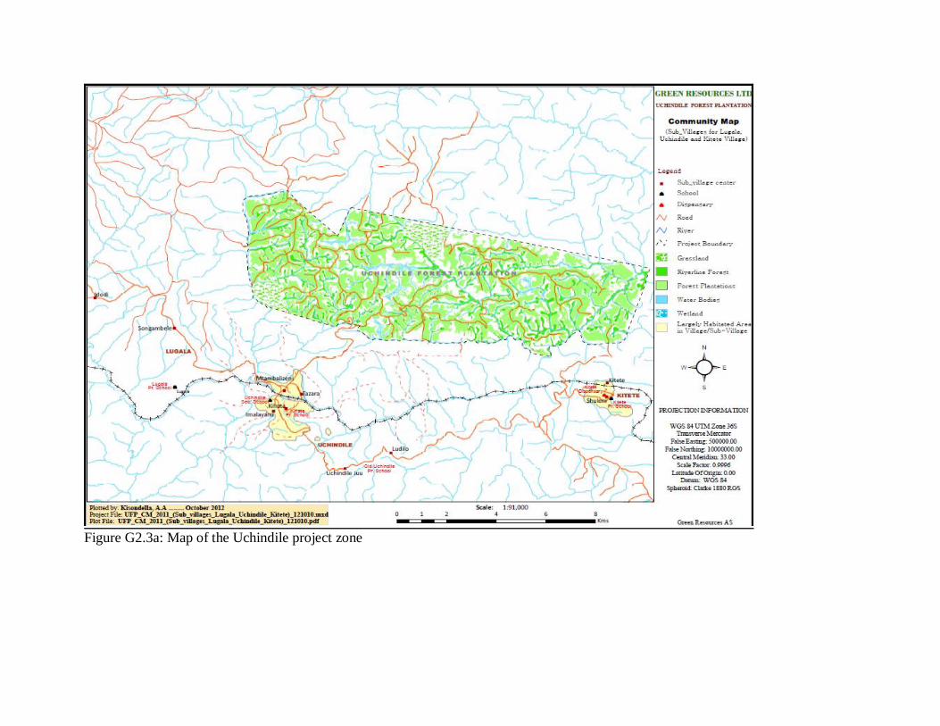
Figure G2.3a: Map of the Uchindile project zone

Figure G3.3b: Map of the Mapanda project zone
Both of the two blocks of Mapanda and Uchindile have similar characteristics; in that they are
degraded grasslands with scattered shrubs and pockets of indigenous trees along river valleys and
gullies. The baseline environmental conditions are described below.
G1.4. Current carbon stocks within the project area(s), using stratification by land-use or vegetation
type and methods of carbon calculation from the Intergovernmental Panel on Climate Change’s 2006
Guidelines for National GHG Inventories for Agriculture, Forestry and Other Land Use or a more
robust and detailed methodology
Please refer to this section of the CCBA PDD, dated 20th February, 2013.

11
G1.5. Description of communities in the project zone, including basic socio-economic and cultural
information that describes the social, economic and cultural diversity within communities, identifies
specific groups such as Indigenous Peoples and describes any community characteristics
Please refer to this section of the CCBA PDD, dated 20th February, 2013.
G1.6. Description of current land use and customary and legal property rights including community
property in the project zone, identifying any ongoing or unresolved conflicts or disputes over land
tenure that were resolved during the last ten years
Land use
The existing vegetation in the area at the project start is unmanaged degraded grassland that is exposed
into annual fires (picture G1.6 below). There are scattered trees, shrubs and small patches of
vegetations on the hills, and more of this concentrate on the river banks. Concentration of trees on the
valley bottoms is most probably due to annual fires that forced the vegetation back into river banks
where moisture content is high. The subsistence farming was practised alongside limited livestock
grazing where cattle were mainly kept in kraals. At the time of the project inception, baseline
assessments2 show that the farmers were harvesting their last food crop from this area as the poor soil
would not manage to give enough crops.
2 GRL, Uchindile EIA. Orgut Consult, 1999

12
Figure G1.6: Site conditions prior project commence
Land tenure
GRL inherited the land titles from Escarpment Forestry Company Ltd (EFC) which was taken
over by GRL in 2001 and has a long term lease for the discrete areas of land from the
Government for the purpose of long-term reforestation (Table G1.6).
GRL had a land dispute in the northern part of the Uchindile plantation, which has led to the
project boundary being adjusted to remove this area. The dispute was between the Tanzanian
Government’s Ministry of Natural Resources and Tourism and GRL. The dispute was raised by
the government owned Sao Hill Forest Plantation in Mgololo, which claims that the northern part
of GRL’s Uchindile Forest Plantation is within the Mgololo Forest Reserve, Mufindi District.
The disputed area was approximately 5,474 hectares3. GRL has the title deed for the whole area
of land and it has held, since 1999, a Certificate of Acceptance of Boundary Beacons from the
then Tanganyika Ministry of Lands, Forests and Wildlife, Survey Division approving the corner
beacons of the Uchindile land. In addition, GRL has received a letter from the Director of
3 All correspondence in relation to the disputed land is documented and will be presented to the DOE

13
Forestry and Beekeeping in 1996 declaring that the Ministry of Natural Resources and Tourism
categorically declared that it had no objections to GRL being granted the area. The company has
had several meetings with the Ministry of Natural Resources and Tourism to try and resolve the
problem and has agreed to surrender the disputed land back to the government, as the alternative
would be to follow the legal advice and pursue it in the courts. Green Resources had not been
planting in the disputed area and no GHG benefits have been claimed from the disputed area.
GRL has therefore decided to reduce the area of the project by changing the project boundary so
as to exclude the disputed area.
GRL has therefore decided to exclude this area from the VCS and CCBA project boundary area.
Table G1.6: Land area, tenure and legal title
Name Villages Area Tenure Deed
Uchindile Uchindile, Kitete 7,076 ha 99yrs from yr. 2000 50742
Mapanda Chogo 1,606 ha 99yrs from yr. 2003 8954 –
MBYLR
Chogo & Mapanda 4,652 ha 99yrs from yr. 2003 8955 –
MBYLR
G1.7. Current biodiversity within the project zone and threats to that biodiversity, using appropriate
methodologies, substantiated where possible with appropriate reference material
Please refer to this section of the CCBA PDD, dated 20th February, 2013.
G1.8. Evaluation of whether the project zone includes any of the following High Conservation
Values (HCVs) and a description of the qualifying attributes:
G1.8.1. Globally, regionally or nationally significant concentrations of biodiversity values; protected
areas; threatened species; endemic species; areas that support significant concentrations of a species
during any time in their lifecycle

14
Listed in Table G1.8.1 below are species in the IUCN Red List or local database that are of global,
regional or national or local values; species that are either endemic or endangered found within the
project zone. Assessment of HCVF4 with an aid of the toolkit has shown that the project zone contains
HCVFs due to presence of these species. Table G1.8.1: Overview of mammals, birds and plant species
found in the IUCN Red List.
S/N Species Name Life form Source Status
1 Prunus africana Tree IUCN Red List Vulnerable
2 Protea welwistchii and
Protea rupestris
Tree Munishi et al., 2009 Threatened
3 Osyris lanceolata Tree Munishi et al 2009 Threatened
4 Hirundo atrocaerulea Bird IUCN Red List/WCST,
2008
Vulnerable
5 Poeoptera kenricki Bird WCST, 2008 East African endemic
6 Sheppardia lowei Bird WCST, 2008 Vulnerable
7 Lanius marwitzi Bird WCST, 2008 Endemic to Iringa
8 Anas sparsa Bird Munishi, et al., 2009 Rare
9 Cephalophus spadix Mammal IUCN RED List Endangered
Sources: Ecological/botanical study, Environmental Impact Assessment reports
However, such species are not abundant or use the project zone in certain seasons of the year.
Although, very few of these species have been found, all area with possibilities of encountering such
species is precautionary protected as HCVAs. These areas include valley bottoms, riverine forest, the
blue swallow protected area, along streams and in rivers banks. The HCVAs have been mapped and
will be protected and monitored following requirements each species as shown in section B3.2.
G1.8.2 Globally, regionally or nationally significant large landscape-level areas where viable
populations of most if not all naturally occurring species exist in natural patterns of distribution and
abundance
No HCVFs falling under this category were found in the project zone.
4 GRL high Conservation Value Forest Report, Kimey, V. and Mtupile E (2012).

15
G1.8.3 Threatened or rare ecosystems
No threatened or rare ecosystems were found in the project zone
G1.8.4. Areas that provide critical ecosystem services
The VCS project activity which is being implemented along with this CCBA project is taking place
within parcels of land that are titled to GRL. GRL has use right to areas within the project boundary,
which communities are not expected to use for any economic activities; and with exception of very
few families, the communities settlements are far from the project (over 5 km by road). The only
ecosystem service that can link communities to the project are water resources through rivers. There
are abundant alternative sources of water in the villages including springs and rivers which are used by
the communities. In addition, only one originates from the project flow outside the project. However,
this river joins another river before in reaches communities. The rest of the rivers, do not flow into the
direction of the villages where communities are located.
Therefore, under the directive of the HCVF toolkit, because of available alternatives to these resources
and thus communities are not entirely depending on these rivers for their survival. There are no areas
that provide critical ecosystem services in the project zone that are likely to be affected by the project
activity.
G1.8.5. Areas that are fundamental for meeting the basic needs of local communities
As stated in section G1.8.4 above, communities will not obtain their basic needs within the project
boundary due to alternatives availability to them. Therefore, the area does not provide fundamental
basic needs for the communities. The project will not affect the use of any resources that are basic
needs to communities in the project zone other than the project boundary because GRL’s jurisdictional
area is only within the project area, and is not expected to encroach any areas outside this area.
G1.8.6. Areas that are critical for the traditional cultural identity of communities

16
The Uchindile and Mapanda project area was once inhabited with some few families, thus there were
cultural sites in the area when the project started. This project applies principles and criteria of FSC
and is certified under this standard. FSC require that prior to any activity communities must be
involved in the process of identifying areas that are used for cultural or traditional purposes. Similarly,
the requirements for land title are such that compensation is not issued cultural and traditional sites, as
they belong to people who own them. And in addition, these must be identified at this time. The only
cultural sites that were identified during land acquisition and by FSC were ritual sites and grave yards.
The identification of these sites was done with consultation of communities to whom such sites are of
cultural importance, which were communities in the project zone. GRL has undertaken an additional
stakeholder consultation5 to identify any graves that for any reason were missed during the first
exercise.
According to GRL’s High conservation Value forest guideline management of these sites is such that,
after identification, GPS coordinates are taken for mapping. On site, a radius of 10m from the centre is
left intact for protection of such sites. The periphery of the radius is screefed and a path made to the
nearest road. At the road signs are posted showing the direction of the grave, grave number and
distance from the road. Grave owners are welcomed to visit these sites at anytime that they want.
However, they are asked to give notice to the project manage prior to making such visits.
5 GRL Grave and Ritual Site Report. Mtupile, E., Kimey, V. & Kisondella, A. 2012

Figure G1.8.6a: Map Showing HCVF at Uchindile Forest Project

18
Figure G1.8.6b: Map Showing HCVF at Mapanda Forest Project
G2. Baseline Projections

19
G.2.1. Most likely land-use scenario in the absence of the project following IPCC 2006 GL
for AFOLU or a more robust and detailed methodology, describing the range of potential
land-use scenarios and the associated drivers of GHG emissions and justifying why the land-
use scenario selected is most likely
See section G.2.1 of the CCBA PDD
G.2.2 Document that project benefits would not have occurred in the absence of the project,
explaining how existing laws or regulations would likely affect land use and justifying that
the benefits being claimed by the project are truly ‘additional’ and would be unlikely to occur
without the project
See section G.2.2 of the CCBA PDD
G.2.3a Calculate the estimated carbon stock changes associated with the ‘without project’
reference scenario described above. This requires estimation of carbon stocks for each of the
land-use classes of concern and a definition of the carbon pools included, among the classes
defined in the IPCC 2006 GL for AFOLU. The timeframe for this analysis can be either the
project lifetime (see G3) or the project GHG accounting period, whichever is more
appropriate
The baseline carbon stock changes for the project have been assumed to be zero – see section
G.2.3a of the CCBA PDD
G.2.3b Estimate the net change in the emissions of non-CO2 GHG emissions such as CH4
and N2O in the ‘without project’ scenario. Non-CO2 gases must be included if they are likely
to account for more than 5% (in terms of CO2-equivalent) of the project’s overall GHG
impact over each monitoring period
See section G.2.3.b of the CCBA PDD and Climate Section of this report for the calculation
of actual non-CO2 GHG emissions.
G2.4. Describe how the ‘without project’ reference scenario would affect communities in the
project zone, including the impact of likely changes in water, soil and other locally important
ecosystem services

20
See section G.2.4 of the CCBA PDD
G2.5. Describe how the ‘without project’ reference scenario would affect biodiversity in the
project zone
See section G.2.5 of the CCBA PDD
G3.1. Summary of project’s major climate, community and biodiversity objectives
See section G.3.1 of the CCBA PDD
G3.2. Describe each project activity with expected climate, community and biodiversity
impacts and its relevance to achieving the project’s objectives
See section G.3.2 of the CCBA PDD
G3.3. Project location and boundaries of the project area(s), where the project activities will
occur, of the project zone and of additional surrounding locations that are predicted to be
impacted by project activities
The project location, boundaries of the project area, where the project activities will occur, of
the project zone and of additional surrounding locations that are predicted to be impacted by
project activities are shown in section G.1.3.
G3.4. Project lifetime and GHG accounting period
The timeframe for the proposed project activity is 99 years; determined by the Tanzanian
Land Act 1999, in which land can be leased for a maximum period of 99 years. Therefore the
two discrete parcels of land have land titles for 99 years each. Uchindile Forest Project has a
title deed for period from 1st April 2000 whilst Mapanda Forest Project has two titles of
ownership both for a period of 99 years from 06th December 2003.
The crediting period was chosen following the VCS guidance. Therefore the project shall use
a 99 years fixed crediting period commencing in 2002. The management plan for this project
indicates long term stewardship over the chosen crediting period.

21
G3.5. Likely natural and human-induced risks to the expected climate, community and
biodiversity benefits during the project lifetime and outline measures adopted to mitigate
these risks
See section G.3.5 of the CCBA PDD
G3.6. Specific measures to ensure the maintenance or enhancement of the high conservation
value attributes identified in G1 consistent with the precautionary principle
See section G.3.6 of the CCBA PDD
G3.7. Measures that will be taken to maintain and enhance the climate, community and
biodiversity benefits beyond the project lifetime
Please refer to this section of the CCBA PDD
G3.8. Community and stakeholder identification and involvement in project design through
effective consultation, particularly with a view to optimizing community and stakeholder
benefits, respecting local customs and values and maintaining high conservation values
Please refer to this section of the CCBA PDD
G3.9. Publicizing the CCBA public comment period to communities and other stakeholders and
to facilitate their submission of comments to CCBA
The CCBA public comments periods for the PDD validation and Implementation Report
verification will be published for stakeholder comments on the CCBA website. A number of
consultations will be held with each of the villages during the public comments periods so that
the any member of the community can submit comments.
G3.10. Handling of unresolved conflicts and grievances that arise during project planning and
implementation
Individuals or firms, both from within or outside the company can raise a contention or a
grievance to the attention of the Managing Director of GRL. The method of grievance

22
resolution is directed in the company’s SOPs 3. The Managing Director (MD) leads the
resolution process but the resolution is directed to respective head of departments, who
determines how such a grievance can be responded to before advice is given to the MD.
Since GRL works mostly in rural areas, the majority of potential stakeholders are in
these areas of operation. Thus, the easiest way of local communities to deliver their
queries has been through suggestion boxes installed at each village and in the plantation
offices, where surrounding communities visits regularly. The suggestion boxes are
emptied monthly by only one responsible person, who is unlikely to be affected by
actions or reactions of stakeholder to avoid conflicts of interests. Then, all grievances are
recorded in a registry log at GRL and sent to MD if action is needed. Workers can also
forward their complaints through their organization namely the Tanzania Plantation
Workers Union (TPAWU), through regular meetings or write a letter to the MD.
In this monitoring period, GRL conducted regular meetings and workshops with
communities where they aired their concerns, doubts and views. It was found during
interviews that communities were satisfied with the system employed by GRL in
handling their issues. A strong rapport between the company and communities were
observed. As such only two formal grievances were recorded, and most of the
documentation in the GRL grievance registry was in the form of comments or opinions
and were therefore not major issues as these seemed like regular communications that
GRL had with communities. Such comments were mainly on delays in payments of
salaries on a few occasions, requests for salary/wage increments, request for increased
number and early delivery of seedlings, as well as requests for further training on
woodlot management. The two formal grievances that were recorded are explained
below as well as the procedure taken to resolve them:
1. In 2009 the government brought in new legal measures making it mandatory that
all workers in the forestry sector, even if just seasonal labour, had to contribute to
the National Social Security Fund (NSSF) with their employer, deducting the
contribution from their wages. This raised contention amongst workers as
employees did not want to contribute to the NSSF and saw this deduction as
being unfair by the company. In addition, a lack of membership cards
exacerbated the situation as employees thought that there contributions were not
secure or they could retrieve their savings back. This was further aggravated by

23
the fact that they reside in very remote areas where it would be a challenge for
them to follow up with the fund. In abidance with the law, GRL had to
implement this policy, and in light of the issues raised carried out further
sensitisation on the NSSF programme and engaged with the government to
arrange further support on the matter for the villagers. The fund’s responsible
officers attended meetings at the project and villages to explain the need of the
government to initiate such a system and to ensure that the employees are fully
aware of why they have to contribute to the NSSF and its benefits. It was
therefore agreed that deductions would only occur after members had been
registered and membership cards issued.
2. GRL had a land dispute in the northern part of the Uchindile plantation, which
has led to the project boundary being adjusted to remove this area. The dispute
was between the Tanzanian Government’s Ministry of Natural Resources and
Tourism and GRL. The dispute was raised by the government owned Sao Hill
Forest Plantation in Mgololo, which claims that the northern part of GRL’s
Uchindile Forest Plantation is within the Mgololo Forest Reserve, Mufindi
District. The disputed area was approximately 5,474 hectares6. GRL has the title
deed for the whole area of land and it has held, since 1999, a Certificate of
Acceptance of Boundary Beacons from the then Tanganyika Ministry of Lands,
Forests and Wildlife, Survey Division approving the corner beacons of the
Uchindile land. In addition, GRL has received a letter from the Director of
Forestry and Beekeeping in 1996 declaring that the Ministry of Natural
Resources and Tourism categorically declared that it had no objections to GRL
being granted the area. The company has had several meetings with the Ministry
of Natural Resources and Tourism to try and resolve the problem and has agreed
to surrender the disputed land back to the government, as the alternative would
be to follow the legal advice and pursue it in the courts. Green Resources had not
been planting in the disputed area and no GHG benefits have been claimed from
the disputed area. GRL has therefore decided to reduce the area of the project by
changing the project boundary so as to exclude the disputed area.
6 All correspondence in relation to the disputed land is documented and will be presented to the DOE
24
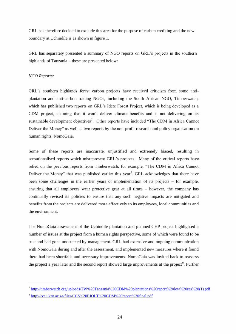
GRL has therefore decided to exclude this area for the purpose of carbon crediting and the new
boundary at Uchindile is as shown in figure 1.
GRL has separately presented a summary of NGO reports on GRL’s projects in the southern
highlands of Tanzania – these are presented below:
NGO Reports:
GRL’s southern highlands forest carbon projects have received criticism from some anti-
plantation and anti-carbon trading NGOs, including the South African NGO, Timberwatch,
which has published two reports on GRL’s Idete Forest Project, which is being developed as a
CDM project, claiming that it won’t deliver climate benefits and is not delivering on its
sustainable development objectives7. Other reports have included “The CDM in Africa Cannot
Deliver the Money” as well as two reports by the non-profit research and policy organisation on
human rights, NomoGaia.
Some of these reports are inaccurate, unjustified and extremely biased, resulting in
sensationalised reports which misrepresent GRL’s projects. Many of the critical reports have
relied on the previous reports from Timberwatch, for example, “The CDM in Africa Cannot
Deliver the Money” that was published earlier this year8. GRL acknowledges that there have
been some challenges in the earlier years of implementation of its projects – for example,
ensuring that all employees wear protective gear at all times – however, the company has
continually revised its policies to ensure that any such negative impacts are mitigated and
benefits from the projects are delivered more effectively to its employees, local communities and
the environment.
The NomoGaia assessment of the Uchindile plantation and planned CHP project highlighted a
number of issues at the project from a human rights perspective, some of which were found to be
true and had gone undetected by management. GRL had extensive and ongoing communication
with NomoGaia during and after the assessment, and implemented new measures where it found
there had been shortfalls and necessary improvements. NomoGaia was invited back to reassess
the project a year later and the second report showed large improvements at the project9. Further
7 http://timberwatch.org/uploads/TW%20Tanzania%20CDM%20plantations%20report%20low%20res%20(1).pdf
8 http://ccs.ukzn.ac.za/files/CCS%20EJOLT%20CDM%20report%20final.pdf

25
improvements have been made in the last few years with the company continuously reviewing
the effectiveness of its policies.
These reports have been included in the Implementation Report so that the DOE is aware of such
claims and can confirm through the onsite visit that GRL has systems and policies in place which
are ensuring that any such negative impacts are mitigated and overall the project is delivering net
positive benefits to the climate, community and biodiversity.
G3.11. Demonstration of financial mechanisms adopted, including projected revenues from
emission reductions and other sources are likely to provide an adequate flow of funds for
project implementation and to achieve the anticipated climate, community and biodiversity
benefits
The project is initially financed through Green Resources AS10
equity, as well as, timber and
carbon revenues, which will provide financing for future planting, biodiversity and
community benefits (e.g.: sharing of 10% carbon revenues with communities). Furthermore,
according to the project participant financial model the expected breakeven point would be in
2015 and thus the project is expected to be cash flow positive onwards.
G4. Management Capacity and Best Practices
G.4.1 Identify a single project proponent, which is responsible for the project’s design and
implementation. If multiple organizations or individuals are involved in the project’s
development and implementation the governance structure, roles and responsibilities of each
of the organizations or individuals involved must also be described
Please refer to this section of the CCBA PDD
G.4.2 Document key technical skills that will be required to implement the project
successfully, including community engagement, biodiversity assessment and carbon
measurement and monitoring skills. Document the management team’s expertise and prior
experience implementing land management projects at the scale of this project. If relevant
experience is lacking, the proponents must either demonstrate how other organizations will be
partnered with to support the project or have a recruitment strategy to fill the gaps
10
Green Resources Directors’ Report, 2010

26
Please refer to this section of the CCBA PDD
G.4.3 Include a plan to provide orientation and training for the project’s employees and
relevant people from the communities with an objective of building locally useful skills and
knowledge to increase local participation in project implementation. These capacity building
efforts should target a wide range of people in the communities, including minority and
underrepresented groups. Identify how training will be passed on to new workers when there
is staff turnover, so that local capacity will not be lost
GRL’s capacity building programme intends to empower its employees and the local
communities in areas of forest management practices and its associated activities and
risks through training and sensitization workshops. A summary of capacity building
that has been undertaken during this monitoring period is documented in table G.4.3
below. Not all capacity building has been documented, however, since little
monitoring and recording was carried out in the first few years of the project. Moving
forward, all capacity building sessions will be documented and updated into database
on annual basis. Aspects that communities have been trained on include HIV/ AIDS
awareness, FSC and Carbon certification, tree growing and woodlots management, fire
control, gender awareness, biodiversity conservation, grievance process, Health and
Safety as well as NSSF issues. Figures 53 to 58 show the various capacity building
programmes undertaken by GRL.
Figure 59 and 60: Community training on woodlot management at Uchindile (left) and
community woodlot area measurement at Lugala (right)

27
Figure 61 and 62: Fire Crews attending fire fighting training
Figure 63 and 64: HIV training (left) FSC, Carbon and Biodiversity Conservation (right)

Table G.4.3. Capacity Building Training/sen
sitization
Name of Training, Facilitator and
training date Location
Who
attended
No. of people
attended Evidence
HIV/ AIDS
awareness
TGA Reporting (training undertaken
together with TGA formulation and follow
ups). Malinga & Vailet, September 2010,
January, March and May 2011
Village offices and
Halls
TGA
members
only.
Photos, reports
Distribution of Fema magazines in schools
and dispensaries (Vailet, December 2010,
February, May, September, 2011)
Uchindile Sec,
Mapanda
Disp,Kihansi
Sec,Chogo disp,
Idete disp,Makungu
disp,Makungu
Sec,Mgololo Sec, Kiyowela
Sec,Kitasengwa disp
Secondary
schools and
dispensaries
- Receiving Forms, Photos
Suspicious
FSC
Community consultation on FSC (Kimey,
Majaliwa, Samson 2008)
Villages Open to all
community
members and
employees
Not recorded Report
Training On Certification Awareness (Dr.
P. M. Mussami, Castor Makeula, Wilfred
Pima, Simon Kizza, Zawjia Omari,
Mapanda-January 2010 and Uchindilw-
February, 2010)
Plantation site Patrolmen,
fire crew
- Report
Carbon
certification
Community consultation on carbon
(Kimey, Majaliwa, Samson 2008).
Classrooms, on open
grounds, community
halls
To all Not recorded Reports
Community consultation and training on carbon for Uchindile and Mapanda villages
(Ngegba, Malinga, Elly and Vailet, June
2011),
Open areas Open to all community
members
- Repots, photos, attendance
Tree
Growers
Associations
TGA Formulation (Malinga and Vailet,
Sept 2010).
Classrooms, on open
grounds, community
halls, on woodlot
sites
TGA
members only
- Photos and reports, attendance
Training on Constitution development
(Malinga and vailet; march, 2011)
Classrooms, on open
grounds, community
halls, on woodlot
sites
TGA
members only
- Photos and reports, attendance,
constitutions

29
Training on
Community
Woodlots
Nursery establishment (Malinga and
Vailet, Sept 2010),
Classrooms, on open
grounds, community
halls, on woodlot
sites
TGA
members only
- Photos and reports, attendance
Woodlot establishment (Malinga and
Vailet, Jan 2011),
Classrooms, on open
grounds, community
halls, on woodlot
sites
TGA
members only
- Photos and reports, attendance
Training on woodlot measurement and
mapping (Malinga, Vailet and Elly,
September 2011).
Classrooms, on open
grounds, community
halls, on woodlot
sites
Representativ
es from all
sub-villages,
in each village
- Reports, photos, attendance
Biodiversity Conservation (Malinga
&Vailet, June 2011)
Classrooms, on open grounds, community
halls, on woodlot
sites
TGA members only
- Report, training manuals and attendances
Woodlot management (Malinga and Vailet,
March, April, May 2011)
Classrooms, on open
grounds, community
halls, on woodlot
sites
TGA
members only
- Manual, reports, photos
Fire control
Training on fire protection (fire brigade
June, 2006-2011)
Open grounds Employees.
Fire crews
- Report
Fire fighting refresher training at GRL
forest plantation (Bariki Temu, Kimey, M.
Njowu, August, 2011)
Open grounds Community/E
mployees.
Fire crews
- Reports
Fire training during plantation ceremonies
at Mapanda and Uchindile project areas
(Malinga, 2008, 2009, 2010).
Open grounds Open to all
Community
members
Approx. Over
300 in each
seminar.
Reports
Video shows on fire campaigns in villages
surrounding the Uchindile and Mapanda plantations. Mbeya forest publicity, (2008-
11),
Open grounds Open to all
Community members
Not counted The videos and films belongs to the
forestry division publicity department, Mbeya zone
Red Cross fire Training (September, 2011) Saohil office Green
Resources
management,
plantation
29epresentativ
e for
community
24 from Saohil
and Green
Resources
Minutes, invitation letter

30
training
Fire training during plantation ceremony
(Malinga, 2008, 2009, 2010).
Mapanda and
Uchindile Project
sites
Open to all
Community
members
Not counted Report, photos
Video shows on fire campaigns (Mbeya
forest publicity, 2008-11)
Villages surrounding
Uchindile an
Mapanda Project
Open to all
village
members
Not counted ToRs, Invitation letters?
Fire training campaign by Malinga
(Ministry of Natural Resources and
Tourism August 2009)
Mapanda and Idete villagers and
workers
- Reports
Workshop on integrated fire management,
Forestry and bee keeping (MNRT),1-3September 2011
Morogoro H. Malinga
(CD & PR Manager)
Reports
Biodiversity
Conservatio
n and
Environmen
tal
management
Training on tree diseases and poisonous
mushroom (11th -12th January,5th February
2010 respectively) Dr
Musami,Kizza,Zawjia,Pima
Mapanda and
Uchindile project
sites
patrolmen,
fire crews and
supervisors
- Reports
Training on RTE species, invasive species,
HCV Forest and FSC/CDM, Dr.
Musami,Nambombe and Zawjia, (4th-5th
November, 12 December 2008). Mussami,
Uchindile and
Mapanda
Respectively
Patrolmen,
fire crewmen,
supervisors
and some
staffs
- Reports
Training on FSC awareness, RTE species,
invasive species, tree diseases and HCV
forests (Dr Mussami and V Kimey, Februry 2011)
Plantation offices Firecrew,
patrolemen,
plantation,
supervisors and managers
- Reports
Biodiversity conservation (Malinga and
Vailet, June 2011).
Open all Reports
Plantation
Management
Project Planning and Management
course,MS-TCDC,4th-15th May 2009
Arusha Samson Msilu
(CDO)
- Certificate
Certificate of Attendance on training on
the Application of community Monitoring
Guidelines for Green Resources, Raymond
Mariki, October 2010
GRL,Mafinga CDOs, - Certificate
Gender
awareness
Stakeholders consultation on gender issues
(Malinga &Vailet, Sept 2010, Jan 2011,
March, May 2011),
Open grounds,
community halls,
classrooms
Open to all
villager
members in
- Reports

31
village under
the TGA
Occupationa
l Health and
Safety
First Aid awareness (Bariki Temu and
Victor Kimey, March 2011)
Uchindile and
Mapanda forest
plantation
Plantation
management - Report
Oil spillage response, cleanup and disposal
tarinig (Bariki Temu, January 2011)
Plantation workers
plantation
All plantation
workers
plantation -
General Induction on OHS (Barki Temu,
Dec 2010 to June 2011)
Uchindile and
Mapanda Plantaions
Plantation
Workers -
List of attendants, training guidelines
Induction on OHS policy (Barki Temu,
January 2011)
Uchindile and
Mapanda Plantaions
Permanent
workers - Minutes
Use of chainsaws (Temu, B. February 2011) Plantations
Project
Chainsaw operators - List of attendants
Fire fighting training (Working on fire
International, June, 2011) Saohil office
Green
Resources
professional
employees,
plantation
workers - List of Participants, reports
Health Insurance (Christel, August 2011)
Uchindile, Mapnada
project sites
permanent
workers
- list of attendants, reports
National Social Security Funds training
(Christel, July 2011)
Mapanda and
Uchindile Project
sites and surround
ding villages
Both
permanent and
casual
- Reports, photos
Training programme on Chaisaw operator
and Environmental considarations and safety aspects in forest operations (by
Forest Industries Training
Institute,Ministry of Natural Resources and
Tourism 9th-13th February 2009)
GRL, Mafinga,Iringa Workers - Reports
Occupational Health and Safety training
(Peter Maganga, Nov. 2009) Mapanda FP Fire crew - Report

32
NSSF
Sensitization and awareness raising on
NSSF issue. (Shaidi, S, Mwaniki, n,
Sumari, S and C. Kiweha, May 2011)
Uchindile and
Mapanda
surrounding villages
All
employees,
casual and
permanent
- Minutes, reports, attendances
G.4.4 Show that people from the communities will be given an equal opportunity to fill all
employment positions (including management) if the job requirements are met. Project
proponents must explain how employees will be selected for positions and where relevant, must
indicate how local community members, including women and other potentially underrepresented
groups, will be given a fair chance to fill positions for which they can be trained
The project offers employment to residents of the project zone. The company procedure for
employee selection (SOP 07) will be used. Particular care is taken to ensure that selection criteria
are not in any way directly or indirectly discriminatory on grounds of gender, race, disability,
religion or belief. Local stakeholders with relevant skills are highly encouraged to fill higher
positions; though there are many job opportunities for less skilled workers. Therefore, if the local
communities develop the relevant skills, they will stand a better chance of holding higher posts.
The challenge lies on the fact that, currently the majority of local community members have very
low education and particularly skills on forestry are lacking.
G.4.5 Submit a list of all relevant laws and regulations covering worker’s rights in the host
country. Describe how the project will inform workers about their rights. Provide assurance that
the project meets or exceeds all applicable laws and/or regulations covering worker rights and,
where relevant, demonstrate how compliance is achieved
Please refer to this section of the CCBA PDD
G.4.6 Comprehensively assess situations and occupations that pose a substantial risk to worker
safety. A plan must be in place to inform workers of risks and to explain how to minimize such
risks. Where worker safety cannot be guaranteed, project proponents must show how the risks
will be minimized using best work practices
Green Resources’ occupational health and safety policy is formulated under the auspices of
creating and maintaining an environment where management and staff work together to ensure
that a safe and healthy workplace is provided for all employees, contractors, visitors and third
parties. To overcome substantial risks to worker’s safety GRL will ensure that Personal
Protection Equipments (PPEs) are in place and in use by staff at all time. Additionally the
company undertakes to proactively asses situations that pose risks to workers in order to design

34
training to workers for them to take precatioun during the operations. GRL has undertaken an
initial rist assesment at the Uchindile and Mapanda plantation11
sites. Areas identified as major
sources of risk include car/truck accidents during transport; which can be checked by ensuring
that only drivers with valid driving licence are recruited, use of fires while preparing fire breaks
and chemical contact can be reduced by proper use of PPEs. Wounds by Panga during pruning
can be avoided by use of power saws instead, and from using power saws if not well trained can
be avoided by poper training as well as use of PPEs. In all cases, staff properly dressed in PPEs
can reduce to a great extent chances of encountering risks. Therefore, GRL will insist regular use
of PPEs at the platation sites.
G.4.7 Document the financial health of the implementing organization(s) to demonstrate that
financial resources budgeted will be adequate to implement the project
As shown in section in G.4.1, the parent company, Green Resources AS provides financing to
GRL for implementation of Uchindile and Mapanda Forest Plantations. Green Resources AS is
financed through equity investment, with group shareholders’ equity at NOK 340mn (USD
49mn) at the end of 200812
. The company is therefore sufficiently capitalized to implement the
project.
G5. Legal Status and Property Rights
G.5.1 Submit a list of all relevant national and local laws and regulations in the host country and
all applicable international treaties and agreements. Provide assurance that the project will
comply with these and, where relevant, demonstrate how compliance is achieved
No laws or regulations were broken in this monitoring period. Please refer also to this section of
validated CCBA PDD.
11
GRL Forest Plantations of Idete, Uchindile and Mapanda; Hazard Identification and Risk Assessment.
Temu, B. (2012)
12 As evidenced in the Annual Report 2008, Equity financing, p43

35
G.5.2 Document that the project has approval from the appropriate authorities, including the
established formal and/or traditional authorities customarily required by the communities
The company has regularly received approvals to use of water in the form of water use right for
rivers that flow across the plantation. Water intensive activities such as nursery operations were
conducted after receiving water right.
Please refer to this section of the CCBA PDD.
G.5.3 Demonstrate with documented consultations and agreements that the project will not
encroach uninvited on private property, community property, or government property and has
obtained the free, prior, and informed consent of those whose rights will be affected by the
project
Please refer to this section of the CCBA PDD.
G.5.4 Demonstrate that the project does not require the involuntary relocation of people or of the
activities important for the livelihoods and culture of the communities. If any relocation of
habitation or activities is undertaken within the terms of an agreement, the project proponents
must demonstrate that the agreement was made with the free, prior, and informed consent of
those concerned and includes provisions for just and fair compensation
There was no relocation in this monitoring period. Please refer to this section of the CCBA PDD,
dated 20th February, 2013.
G.5.5 Identify any illegal activities that could affect the project’s climate, community or
biodiversity impacts (e.g., logging) taking place in the project zone and describe how the project
will help to reduce these activities so that project benefits are not derived from illegal activities
There is limited evidence that fires set to the project area were intended neither was it for the purpose of
extracting any illegal material from the project area. However, interviews indicate that setting fires to the
area by the local community was common as land preparation tool; which at times got out of control and
escaped to burn the vast grassland areas before the project started. The project area is grassland at the start
of the project with very few pockets of tree of little value. Furthermore, the 2009 fire occurred at

36
Uchindile was related to arson which is considered an illegal activity. Since then, GRL improved
prevention measures against fires (see VCS NPRR for more information) and has strengthen the
relationships with the communities surrounding the project.
No other illegal activities are expected at the project area.
G.5.6 Demonstrate that the project proponents have clear, uncontested title to the carbon rights, or
provide legal documentation demonstrating that the project is undertaken on behalf of the carbon
owners with their full consent. Where local or national conditions preclude clear title to the
carbon rights at the time of validation against the Standards, the project proponents must provide
evidence that their ownership of carbon rights is likely to be established before they enter into any
transactions concerning the project’s carbon assets
GRL inherited the land titles from Escarpment Forestry Company Ltd (EFC) which was taken over
by GRL in 2001 and has a long term lease for the discrete areas of land from the Government for
the purpose of long-term reforestation. The legal ownership of land is as given in table G.5.6 below.
Table G.5.6: Land tenure and legal title
Name Villages Area Tenure Deed
Uchindile Uchindile, Kitete 7,076 ha 99yrs from yr. 2000 50742
Mapanda Chogo 1,606ha 99yrs from yr. 2003 8954 –
MBYLR
Chogo &
Mapanda
4,652ha 99yrs from yr. 2003 8955 –
MBYLR
There is no provision under the government of the United Republic of Tanzania that provide for
sharing of carbon revenue from forestation projects, but since GRL has the right of ownership to
the land, GRL has thus, exclusive right for ownership of carbon revenues.

37
Climate Section
CL1. Net Positive Climate Impacts
Although this is the project’s first CCBA Verification, it has already undergone a VCS
verification which has verified net positive climate benefits for the period from 2002 – 2008 – see
the VCS Monitoring Report and Verification Report13
. The project has submitted the next VCS
Monitoring Report 2 for verification, which will be assessed simultaneously with the CCBA
Monitoring Results and Implementation Report. The VCS Monitoring Report 2 shows that further
net positive climate benefits have been achieved in this subsequent period.
The CCBA climate benefits will be assessed from project start, 1997, until 2012 for this first
verification period. – the first VCS monitoring period started from 2002 since it is a VCS rule that
the earliest a crediting period can begin is 2002.
CL1.1. Estimate the net change in carbon stocks due to the project activities using the methods of
calculation, formulae and default values of the IPCC 2006 GL for AFOLU or using a more robust
and detailed methodology
Ex post calculation of carbon stocks has been carried out through a 2012 inventory using
permanent sample plots – this is documented in the VCS Monitoring Report 2. The net change in
carbon stocks due to the project activity from the 1st January 1997 – 1
st September 2012 has been
calculated as 337,616 tCO2e14
.
CL1.2. Estimate the net change in emissions of non-CO2 GHG emissions such as CH4 and N2O in
the with and without project scenarios if those gases are likely to account for more than a 5%
increase or decrease of the project’s overall GHG emissions reductions or removals over each
monitoring period
The without project scenario emissions have conservatively been assumed to be zero – see CCBA
PDD for further detail.
13 https://vcsprojectdatabase2.apx.com/myModule/interactive.asp?Tab=Projects&a=2&i=142&lat=&lon=
14 See UMFP Inventory Carbon Model 121107
38
The non-CO2 GHG emissions in the with project scenario have been calculated ex post. Only
emissions from fires have been included in the calculations in line with the methodology
requirements.
As documented and verified in the VCS Monitoring Report for the period 2002 – 2008, non-CO2
emissions were calculated as 24,385 tCO2e. For the period from 2008 – 2012, non-CO2 emissions
have been calculated as 7,838 tCO2e. Therefore the total non-CO2 emissions are 32,223 tCO2e.
CL1.3. Estimate any other GHG emissions resulting from project activities. Emissions sources
include, but are not limited to, emissions from biomass burning during site preparation, emissions
from fossil fuel combustion, direct emissions from the use of synthetic fertilizers, and emissions
from the decomposition of N-fixing species
Fire emissions have been calculated in section CL 1.2. No other emissions are monitored in line
with the methodology requirements – see CCBA PDD for further detail.
CL.1.4 Demonstrate that the net climate impact of the project is positive. The net climate impact
of the project is the net change in carbon stocks plus net change in non-CO2 GHGs where
appropriate minus any other GHG emissions resulting from project activities minus any likely
project-related unmitigated negative offsite climate impacts (see CL2.3)
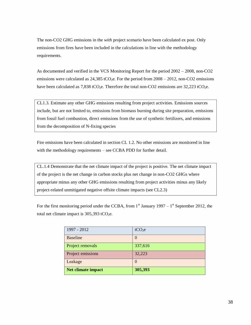
For the first monitoring period under the CCBA, from 1st January 1997 – 1
st September 2012, the
total net climate impact is 305,393 tCO2e.
1997 - 2012 tCO2e
Baseline 0
Project removals 337,616
Project emissions 32,223
Leakage 0
Net climate impact 305,393
39
CL.1.5 Specify how double counting of GHG emissions reductions or removals will be avoided,
particularly for offsets sold on the voluntary market and generated in a country with an emissions
cap
The GHG emission reductions from this project activity will be sold in the voluntary market.
However, no double counting is expected. The host country is a non-annex 1 country, and thus,
does not have an emissions cap. Furthermore, all VCUs will enter the VCS registry.
CL2. Offsite Climate Impacts (‘Leakage’)
CL.2.1 Determine the types of leakage that are expected and estimate potential offsite increases in
GHGs (increases in emissions or decreases in sequestration) due to project activities. Where
relevant, define and justify where leakage is most likely to take place
No leakage is expected from the project as demonstrated in the CCBA PDD.
CL.2.2 Document how any leakage will be mitigated and estimate the extent to which such
impacts will be reduced by these mitigation activities
Not applicable.
CL.2.3 Subtract any likely project-related unmitigated negative offsite climate impacts from the
climate benefits being claimed by the project and demonstrate that this has been included in the
evaluation of net climate impact of the project (as calculated in CL1.4)
Not applicable.
CL.2.4 Non-CO2 gases must be included if they are likely to account for more than a 5% increase
or decrease (in terms of CO2-equivalent) of the net change calculations (above) of the project’s
overall off-site GHG emissions reductions or removals over each monitoring period
Not applicable.
CL3. Climate Impact Monitoring
40
Climate impact monitoring is carried out through application of the VCS and CCBA PDD, which
uses the CDM approved methodology, AM-AR 005 Version 3.
CL.3.1a Develop an initial plan for selecting carbon pools and non-CO2 GHGs to be monitored,
and determine the frequency of monitoring. Potential pools include aboveground biomass, litter,
dead wood, belowground biomass, wood products, soil carbon and peat. Pools to monitor must
include any pools expected to decrease as a result of project activities, including those in the
region outside the project boundaries resulting from all types of leakage identified in CL2
See the VCS and CCBA PDD.
CL.3.1b A plan must be in place to continue leakage monitoring for at least five years after all
activity displacement or other leakage causing activity has taken place. Individual GHG sources
may be considered ‘insignificant’ and do not have to be accounted for if together such omitted
decreases in carbon pools and increases in GHG emissions amount to less than 5% of the total
CO2-equivalent benefits generated by the project. Non-CO2 gases must be included if they are
likely to account for more than 5% (in terms of CO2-equivalent) of the project’s overall GHG
impact over each monitoring period. Direct field measurements using scientifically robust
sampling must be used to measure more significant elements of the project’s carbon stocks. Other
data must be suitable to the project site and specific forest type
See the VCS and CCBA PDD – no potential leakage has been determined, therefore it is not
monitored.
CL.3.2 Commit to developing a full monitoring plan within six months of the project start date or
within twelve months of validation against the Standards and to disseminate this plan and the
results of monitoring, ensuring that they are made publicly available on the internet and are
communicated to the communities and other stakeholders
Monitoring of climate benefits is done following the VCS monitoring plan indicated in section E
of the VCS PDD. This plan is being made public through with the VCS PDD registration, and has
subsequently been assessed at each monitoring and results made publicly available. See the VCS
Monitoring Reports 1 and 2.

41
Community Section
CM.1.1 Use appropriate methodologies to estimate the impacts on communities, including all
constituent socio-economic or cultural groups such as indigenous peoples (defined in G1),
resulting from planned project activities. A credible estimate of impacts must include changes in
community well-being due to project activities and an evaluation of the impacts by the affected
groups. This estimate must be based on clearly defined and defendable assumptions about how
project activities will alter social and economic well-being, including potential impacts of
changes in natural resources and ecosystem services identified as important by the communities
(including water and soil resources), over the duration of the project. The ‘with project’ scenario
must then be compared with the ‘without project’ scenario of social and economic well-being in
the absence of the project (completed in G2). The difference (i.e., the community benefit) must be
positive for all community groups.
GRL has developed a monitoring plan to capture changes in socio economic situation of the local
communities in villages that are under the influence of the project at Uchindile and Mapanda
project, which was used to assess impacts of the project to the community between project start
and present. The first monitoring runs for the period from 1st January 1997until 1
st September
2012. Community monitoring has been carried out to quantify major impacts (both positive and
negative) brought about by the project during its implementation phase. Focus group discussions,
participatory rural appraisals and impact assessments, interviews and surveys, observations,
literature reviews and remote sensing and mapping have been used over the first monitoring
period to monitor project impact. This plan has been made available on the CCBA website.
At the onset of the project, an assessment of the project baseline scenario in terms of socio-
economic status was carried out alongside two EIAs15
which involved questionnaire survey and
interviews as well as Participatory Rural Appraisal methodologies backed up with secondary data
mainly the Tanzania national census, local village council growth pattern and development data,
and historic background accrued through elders from the villages around the project.
GRL has been able to compare changes that have occurred in the course of the project. During
this monitoring event, where first secondary data were missing to adequately quantify changes,
Participatory Impact Assessment (PIA) approach was used to guide assessment of impacts that
15 GRL, Uchindile EIA -Orgut Consult, 1999; and GRL, Mafinga EIA, ENATA Ltd, 2006

42
the project have caused. This is a collaborative work that was undertaken between facilitators and
communities, using indicators suggested by communities themselves to anticipatorily arrive into
conclusion on what communities thought were positive or negative outcome or impacts of the
project. This approach offered a comprehensive state of community livelihood and how it has
developed over time that would stand as reference points for future monitoring under the CCBA.
Project impacts were further assessed by relating developments that had occurred in the
monitoring period comparing to a similar timeframe prior to project to determine whether such
changes were attributable by the project or not. Negative and positive impacts were assessed in a
similar way. Negative impacts were then compared with positive impacts to get net
negative/positive impacts. The decision whether the project has delivered net positive impacts is
based on all the categories of the community monitoring. A summary of the different categories
and the overall impact are shown below:
Employment
At the end of 2011, the project had created 95 permanent and 267 seasonal jobs with the majority
of permanent jobs and all seasonal jobs going to the local communities. As shown by the
monitoring results, this level of employment has been constant since 2008. In addition, GRL has
provided employments benefits to the wider region through positions at its Sao Hill and Dar es
Salaam offices where it has 187 employees. In the local villages GRL is the main employer after
the government and has been employing a significant proportion of the workforce – ranging from
33 – 66%. GRL has been paying above the minimum wage in Tanzania for all the positions and
this has meant that GRL has provided a livelihood for a significant proportion of the village
populations and in turn helped develop the local economies – see local economy and household
income section.
Employment Key indicators and impacts
Positive 95 permanent jobs at the project site, with the
majority employed from local villages
267 seasonal jobs for local villages
Contributing to an additional 187 employees
based at Sao Hill and Dar
All employees paid above the minimum wage

43
Negative No negative impacts monitored
Impact rating POSITIVE
Local economy/ household income
Monitoring of the local economy compared key indicators which act as proxies for household income and
the health of the local economy. The results compared data from 2002 to 2011 and showed that the number
of businesses including shops, bars, kiosks, trade in farm produce and forest products such as honey and
household products were reported to increase, indicating increased incomes and the purchasing power of
households. Furthermore, monitoring of the changes in the types of houses in the villages was also
considered an indicator of household income.
Since GRL is the main employer within these communities, outside of the local government, it could be
concluded that a significant proportion of the developments is due to the company and its Uchindile and
Mapanda project.
At Uchindile and Mapanda villages, the transformation of housing style from muddy grass roofs into much
more modern and durable burnt brick and corrugated iron sheet houses was observed, as shown in figure
CM1.1.1. Other indicators of change in local incomes included ownership of various household assets and
spending, which were reported during focus group discussions. In addition, indirect indicators, such as
improved infrastructure from the project also contributed to the local economy and household income
through facilitating trade and communication.
Figure CM.1.1.1 A household moved from muddy-grass house into brick-corrugated iron sheet

44
Local economy/
income
Key indicators and impacts
Positive Significant increase in small businesses in villages
over the monitoring period; for example, the
number of kiosks has increased in every village
Significant increase in valuable personal assets:
including solar panels and bicycles
Household income has been increased over the
monitoring period
Increase in corrugated iron sheet roofs in the
villages: estimated change between 110 (2002)
and 1180 (2011)
Negative No negative impacts monitored
Impact rating POSITIVE
Community Woodlots
Through GRL’s programme of providing free seedlings to the local communities surrounding the project a
significant number of community woodlots have been developed in the project zone. These have been
identified and mapped as shown in the community results. Such woodlots have created significant value for
the owners and although many are yet to realise cash revenues from these woodlots, Focus Group
Discussions revealed owners are very positive towards this initiative16
.
In addition, the Tree Growers Association programme has already seen a wide uptake by local villages,
with over 400 members confirmed in 2011. Capacity building through the TGAs has equipped the members
with skills which will help sustain such livelihoods independently from the project.
Community
Woodlots
Key indicators and impacts
Positive Increase in number of community woodlots in
16 See CCBA Community Monitoring Results and Minutes of Focus Group, Mtupile, 2012

45
the villages
Formation TGAs with more than 400 members
Negative No negative impacts monitored
Impact rating POSITIVE
Education
GRL has contributed to the development and improvement to the educational facilities in each of
the villages surrounding the project. Prior to the project there was no secondary school but by the
end of the monitoring period there were two and GRL had helped in the construction of these. GRL
has also been building teachers’ houses since one of the problems common to the different schools
was that it was difficult to maintain teachers due to the poor living accommodation. Dormitories
constructed by GRL have also provided benefits to pupils, making it easier to attend school as often
the distances are far. The monitoring results show that the number of pupils passing primary school
and entering secondary school has been increasing over this first monitoring period and is likely to
have been due to a contribution from the Uchindile and Mapanda project. This is perceived as a
result from a combination of factors, like increased household income due to employment by the
project, which in turn made it possible for more families to afford paying for school fees, as well as,
improved infrastructures (roads, schools, health facilities).
Figures CM.1.1.2 and CM.1.1.3: Left: Kitete primary school (not supported). Right: Kihata School
(supported).

46
Figures CM.1.1.4 and Figures CM.1.1.5: Left: Teacher’s house (Kihansi secondary school). Right:
Dormitory, (Uchindile secondary school)
Education Key indicators and impacts
Positive Construction of five classrooms, four teachers’
houses and one teacher’s office at Kihata
primary school
Construction of a girl’s dormitory and two
classrooms at Uchindile secondary school
Construction of one classroom at Mapanda
primary school
Construction of three classrooms and one
teacher’s house at Chogo
Negative No negative impacts monitored
Impact rating POSITIVE
Infrastructure Development
A total of 66 kilometres of roads have been built or reconstructed by GRL in this monitoring period in
the villages surrounding the project. In addition, bridges were constructed in areas where villages
could not connect in certain seasons, which has been beneficial for the project as well as the
communitites. These roads facilitate other socio-economic activities such as trade and access to social
services – for example, connecting villages to health centres and attracting teachers to work in the
schools.

47
Although infrastructure development has created the abovementioned benefits, GRL also recognises
that there are negative impacts that often come with the interconnectivity of communities when new
roads are constructed. This includes the spread of sickness and disease. Such negative impacts have
not been quantified through the community monitoring programme; however, the monitoring of
safeguards, including HIV and AIDS awareness have been carried out, demonstrating that the
company is promoting awareness to mitigate any such negative impacts – see Health and Medication
section for further details.
Infrastructure
Development
Key indicators and impacts
Positive Development and maintenance of 66 km of roads
connecting the project and villages
Bridge construction
Great connectivity between communities,
providing new or increased trade routes as well
as better access to social services
Negative Potential increase in sickness and disease
Mitigation measure: sensitisation programmes on
HIV and AIDS help raise awareness to workers
and communities
Impact rating POSITIVE
Health and Medication
GRL has supported health services in building health facilities, awareness raising on prevalent
diseases as well as medical support. At Uchindile and Mapanda health facilities supported by GRL
have included a Dispensary at Kitete village, nurse house and a maternity ward at Mapanda, that
have been supported in full; also, construction materials were supplied at Chogo and Mapanda
dispensaries. A consignment of medical equipment was delivered by GRL in 2005 at Kilombero and
Mufindi District Hospitals as an aid given by GRL to all local dispensaries in villages of these
Districts, where Uchindile and Mapanda are located. Sick people continued to receive free transport

48
from the project when they are referred to a health centre/hospital far away from their village.
Figures CM1.1f and CM1.1g show the maternity ward at Mapanda and the dispensary at Kitete.
GRL engaged an external consultant from the AIDS Business Coalition of Tanzania (ABCT) to
undertake baseline study on workers’ HIV condition, and has put in place an HIV and AIDS
programme. In addition, GRL works with other NGO and government health departments to help
mitigate the spread of HIV/AIDS and other transferable diseases such as malaria. Furthermore, GRL
has engaged FEMINA, which is HIV awareness magazine to spread information to surrounding
communities and workers about the dangers and prevention of HIV/AIDS.
Figures CM1.1.6 and CM1.1.7: Maternity ward at Mapanda village (left); dispensary at Kitete (right)
Health and
Medication
Key impacts
Positive Construction of a dispensary in Kitete
Construction of a nurse’s house at Mapanda
Supplied construction materials to Chogo
dispensary and Mapanda health centre
Negative No negative impacts monitored
Impact rating POSITIVE

49
Water Quantity and Quality
The water quantity and quality results are covered in the biodiversity monitoring results and thus the
biodiversity section of this implementation report in more detail. However, in regard to community
impacts, the results show that there is not an overall decreasing trend: two rivers have maintained
their waters levels almost constantly, whilst one river has increased slightly and another decrease.
This could be due to seasonal fluctuations. More data over a longer time period is needed to confirm
this trend. In regard to water quality, the only level that was not within the acceptable range of the
WHO was the faecal coliform level for drinking water. GRL is investigating the faecal coliform
levels in more detail to determine what baseline levels are and possible sources of the coliforms.
The project has been providing water guard to workers and providing sensitisation on the
importance of water treatment; therefore helping mitigate the impact of the unsafe drinking water in
the region.
Water
quantity and
quality
Key impacts
Positive Provision of water guard and sensitisation on the
importance of water treatment
Neutral No negative impact on water quantity or water
quality directly from plantation implementation
Negative Possible contribution to faecal coliform
Impact rating NEUTRAL
Grievances and actions
Two formal grievances were raised in the monitoring period. The first related to employee
contributions to the National Social Security Fund (NSSF) and the second was from the government
regarding a land dispute in the north of the Uchindile plantation. However, GRL has engaged with all
the stakeholders involved in the grievances and has resolved the problems.

50
Grievances and
actions
Key impacts
Positive GRL has dealt with the grievances in an open
manner and provided solutions to all grievances
Negative Grievances raised by community members and
local government
Impact rating NEUTRAL
Cultural Aspects
GRL’s has identified all graves and ritual sites within the project and is conserving them – including
screefing the areas, maintaining buffer zones and ensuring signs are in place to indicate where the sites
are found - for local communities to access and maintain any cultural activities related to these sites.
Monitoring of the sites took place in March 2012 and confirmed that some buffer areas were not in
place. However, this has now been rectified so that all sites are now maintained in line with the
company policy and guideline.
Cultural
Aspects
Key impacts
Positive All graves and ritual sites have now been
conserved in line with the company policy
Negative It was found that some buffer zones had not been
adhered to but this has been rectified
Impact rating NEUTRAL
Community Carbon Money
GRL sold its first carbon credits from the Uchindile and Mapanda project in 2011, selling VCUs from
the monitoring period of 2002-2008 under the VCS. 10% of the revenue from the sale of the credits
was channelled directly back into the communities which have given land to the project. The
communities involved decided what they would like to put the money towards and GRL then
implemented this. There were some criteria which must be followed in this decision process; one of

51
the criteria is that the asset must be a fixed asset which serves the whole village community. There
were some delays in the process regarding setting up village bank accounts but overall the mechanism
has been a success with the implementation of two duplex teachers’ houses at Uchindile primary
school, a village office in Kitete, a nurse’s house at Mapanda and a teacher’s house at Chogo primary
school. Following the completion of the next verification under the VCS and CCBA and sale of
carbon credits, another 10% of the revenues will be shared.
The list of projects that the communities chose, which have been implemented with current
carbon money are summarised below, highlighting the benefits.
Uchindile Village
Final projects: Two duplex teachers’ houses at Uchindile primary school to
accommodate four teachers
Uchindile village has a primary school in excellent condition
(Fig CM1.1.11), attended by 258 pupils. Despite the impressive
school facilities the school has had trouble attracting and
sustaining teachers in the past. This is due to current sub-
standard accommodation that is often rented further in town.
This has lead to a high teacher turnover and often irregular
attendance. Additionally they have not been able to attract any
female teachers due to unsafe accommodation.
The village requested new teacher’s accommodation in close
proximity to the school. These were completed and handed over
to the community in September 2012
The improvement in teacher’s accommodation will encourage
teachers to remain for longer periods of time and secure teacher
attendance, resulting in more consistent teaching; this aims to
benefit the children attending the school by improving their
education. Due to the close proximity to the school and the
safety of the new accommodation, hopefully the school will
now be able to attract some female teachers.
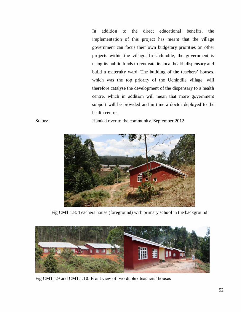
52
In addition to the direct educational benefits, the
implementation of this project has meant that the village
government can focus their own budgetary priorities on other
projects within the village. In Uchindile, the government is
using its public funds to renovate its local health dispensary and
build a maternity ward. The building of the teachers’ houses,
which was the top priority of the Uchindile village, will
therefore catalyse the development of the dispensary to a health
centre, which in addition will mean that more government
support will be provided and in time a doctor deployed to the
health centre.
Status: Handed over to the community. September 2012
Fig CM1.1.8: Teachers house (foreground) with primary school in the background
Fig CM1.1.9 and CM1.1.10: Front view of two duplex teachers’ houses

53
Fig CM1.1.11: Uchindile primary school classrooms (also built by Green Resources Limited)
Figure CM1.1.l: View of the new accommodation taken from the school, showing old teacher
accommodation left foreground

54
Figure CM1.1.12: Floor plan of the teacher’s house
Kitete
Project: Village office, including offices for village government members,
land registry and village meeting space
Benefits: There has never been a village government building in Kitete
village, this has meant that village government meetings and
general administration occurred infrequently. The development
of a village government office has provided more impetus to the
local village government to carry out their duties, thus improving
village governance overall. Additionally, there is now a land
registry office, which means that the local government will be
able to start processing land rights for the local villagers. This
means that villager’s land rights will be formally recognised
through title (this requires having a land registry). Through
having a land title other opportunities will then be available to the
title holders, e.g. being able to use the land title as collateral to
borrow money from local banks in order to buy more land or set
up small businesses.
Status: Handed over September 2012

55
Figure CM1.1.13: The completed village offices and meeting room
Figure CM1.1.14 and CM1.1.15: Village chairman, Moses Kilanzi, installed in his new office
(left) Hut previously used for village meetings (right)
Figure CM1.1.16: Floor plan of the village government office

56
Mapanda:
Project: Nurse’s house in the Mapanda Health Centre complex.
Benefits: The village of Mapanda has a health centre which serves both
Mapanda and Chogo villages. Mapanda is the largest village
surrounding the Uchindile and Mapanda Reforestation Project
and the village health centre struggles to meet the demand for its
services. This is exacerbated by the fact that the health centre
currently does not have a nurse’s house nearby, which has meant
nurses have had to live further away and in sub-standard
accommodation, the combination of factors has resulted in a high
turnover of nursing staff. Additionally Green Resources has just
constructed a maternity ward at the health centre and by having a
nurse living nearby it enables the maternity ward to run a 24 hour
service. The construction of the nurse’s house was prioritised by
the village in order to secure to a more reliable health service in
the village. The nurse’s house consists of 3 bedrooms, a living
area, washing facilities and a food preparation area; it is big
enough for a nurse and her family.
Status: Handed over September 2012
Figure CM1.1.17: The completed nurse’s house

57
Figure CM1.1.18 and CM1.1.19: the rear of the nurse’s house, showing washroom facilities
(left), the completed maternity ward (right)
Figure CM1.1.20 and CM1.1.21: Mapanda health centre (left) Dr. Andrew Kitamakanga
explains the benefit of the nurse’s house
Chogo
Final projects: Teacher’s house for the Chogo primary school.
Benefits: The village of Chogo had prioritised the renovation of a teacher’s
house with their community carbon money; however, after
discussion with GRL it was decided that it would be more
effective if the funds were used to build a new house, so that two
teachers would benefit from the new building.

58
GRL has provided support to Chogo’s primary school in the past
through the building of three classrooms. However, there have
been problems with attracting teachers to the school and retaining
them, a large part of the problem is the lack of accommodation,
and teachers usually have to resort to staying in the centre of the
village. This has proven not to be a sustainable arrangement and
has commonly resulted in teachers leaving their posts at the
school. Currently the Chogo primary school has five teachers and
it’s in need for more – the additional teacher’s house under
construction, will enable one more teacher to have reliable
accommodation, which in turn will hopefully ensure more
reliable teaching standard at the school.
Status: Final finishing to be completed
Figure CM1.1.22: Teacher’s house under finishing stages of construction
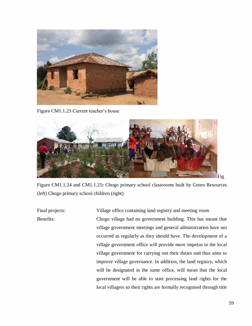
59
Figure CM1.1.23 Current teacher’s house
Fig
Figure CM1.1.24 and CM1.1.25: Chogo primary school classrooms built by Green Resources
(left) Chogo primary school children (right)
Final projects: Village office containing land registry and meeting room
Benefits: Chogo village had no government building. This has meant that
village government meetings and general administration have not
occurred as regularly as they should have. The development of a
village government office will provide more impetus to the local
village government for carrying out their duties and thus aims to
improve village governance. In addition, the land registry, which
will be designated in the same office, will mean that the local
government will be able to start processing land rights for the
local villagers so their rights are formally recognised through title

60
(this requires having a land registry). Through having land titles
other opportunities will then be available to them.
Status: Handed over September 2012
Figure CM1.1.26: Completed Chogo village hall and offices
Figure CM1.1.27: Building previously used for village meetings and administration
Community
Carbon Money
Key impacts
Positive Construction of two duplex teachers’ houses at
Uchindile
Construction of a village office in Kitete
Construction of a nurse’s house at Mapanda

61
Construction of a teacher’s house at Chogo
Negative Other than some delays in the process, no
negative impacts have been monitored
Impact rating POSITIVE
Capacity Building
Training and capacity building for various activities have been carried out in this monitoring
period. These are clearly documented in section 4.3. These trainings include tree planting,
management and protection, biodiversity protection, health and safety as well as conservation of
threatened and endangered species. The training has been conducted in form of presentations,
workshops and seminars.
Community
Carbon Money
Key impacts
Positive HIV and AIDS awareness
Occupational Health and Safety
Gender Awareness
Community Woodlots and TGAs
Plantation Management
Negative No negative impacts monitored
Impact rating POSITIVE
Overall impacts
Looking across all the different project impacts and comparing the project scenario to the without
project scenario, as shown in Table CM.1.1 below, it can be seen that overall the project impact to
the communities is positive.

62
Table CM.1.1 Community impacts in the wih project scenario compared to the without project
scenario
Indicator With project compared
to without project
Employment POSITIVE
Economy/ Income POSITIVE
Woodlots POSITIVE
Education POSITIVE
Infrastructure POSITIVE
Health and Medication POSITIVE
Water Quantity and Quality NEUTRAL
Housing POSITIVE
Grievances NEUTRAL
Cultural Aspects POSITIVE
Community Carbon Money POSITIVE
Capacity Building POSITIVE
CM.1.2 Demonstrate that no High Conservation Values identified in G1.8.4-6 will be negatively
affected by the project
See CCBA PDD and Cultural Section of the Community Results and CM.1.1 of the
Implementation Report.
CM2. Offsite Stakeholder Impacts
CM.2.1 Identify any potential negative offsite stakeholder impacts that the project activities are
likely to cause
See CCBA PDD and Cultural Section of the Community Results and CM.1.1 of the
Implementation Report.

63
CM.2.2 Describe how the project plans to mitigate these negative offsite social and economic
impacts
See CCBA PDD and Cultural Section of the Community Results and CM.1.1 of the
Implementation Report.
CM.2.3 Demonstrate that the project is not likely to result in net negative impacts on the well-
being of other stakeholder groups
See CCBA PDD and Cultural Aspects Section of the Community Results and CM.1.1 of the
Implementation Report.
CM3. Community Impact Monitoring
CM.3.1 Develop an initial plan for selecting community variables to be monitored and the
frequency of monitoring and reporting to ensure that monitoring variables are directly linked to
the project’s community development objectives and to anticipated impacts (positive and
negative)
The community monitoring plan has been developed and has been submitted along with the
monitoring results and this implementation report.
CM.3.2 Develop an initial plan for how they will assess the effectiveness of measures used to
maintain or enhance High Conservation Values related to community well-being (G1.8.4-6)
present in the project zone
Only grave site and ritual sites have been identified as values of great importance to communities
occurring within the project boundary in the project zone. Management of these values follows
suggestions of the communities who own them which the company obtained through
consultations. The company has demarcated these sites and is managing them following the High
Conservation Value forest guideline for the grave and ritual sites in GRL which requires that a
buffer of 10 metres radius be left, including mapping and screefing of the periphery and posting
sign boards at the roads to direct communities and forest users where this site is in the forest. The

64
grave and ritual sites are therefore undisturbed, protected areas within the projects in which
communities have access to visit them for whatever traditional/cultural reasons. Continuously
project management will raise awareness to workers and communities, informing them of their
right to come and visit these sites, for those who own them. The effectiveness of this process of
conserving these sites will be checked with a questionnaire, to obtain views of the owners, where
they are satisfied with management of these sites or not. If not, GRL will seek advice and agree
with them, on how best to improve the management of these sites.
CM.3.3 Commit to developing a full monitoring plan within six months of the project start date or
within twelve months of validation against the Standards and to disseminate this plan and the
results of monitoring, ensuring that they are made publicly available on the internet and are
communicated to the communities and other stakeholders
The project proponents have already initiated a full community monitoring plan which has been
implemented. This plan will be adhered to and results made publicly available on the internet and
communicated to the local communities in the local language.
Biodiversity Section
B1. Net Positive Biodiversity Impacts
B.1.1 Use appropriate methodologies to estimate changes in biodiversity as a result of the project
in the project zone and in the project lifetime. This estimate must be based on clearly defined and
defendable assumptions. The ‘with project’ scenario should then be compared with the baseline
‘without project’ biodiversity scenario completed in G2. The difference (i.e., the net biodiversity
benefit) must be positive.
GRL has developed a monitoring plan to assess the impact of the project in biodiversity in the
project area. This plan has been made available on the CCBA website.
The first monitoring period runs for the period from 1st January 1997until 1
st September 2012. This
has been done through ecological and botanical surveys as well as internal biodiversity
assessments. Methods used include point count surveys, line transects and permanent sample plots
(PSP), supported by interviews with locals; data collected included signs of animals, species
65
identification, richness and abundance in each of the conservation areas. Major changes in size and
vegetation composition of HCVFs as well as maintenance of buffer zones are assessed through
satellite images. The key findings from the biodiversity results for this monitoring period are
detailed below.
General data
The current land classifications for each plantation show that the majority of the land (> 50%) at
both plantation sites is native vegetation, with 42% and 48% of Uchindile and Mapanda,
respectively, planted with pine and eucalyptus. The areas of native vegetation are being conserved.
Maintenance of conservation areas
Overall biodiversity monitoring results show that the areas set aside for conservation have been
maintained in a good condition and unaffected by the project – this was confirmed through
comparing satellite images from different time periods. Ecological surveys and PSP monitoring
also confirmed this through field assessments – see Biodiversity Results.
HCVF
HCVFs were identified at the project (Figures G1.8.6a and b) due to RTE species being present or
likely to be present in some habitats of the project zone. Since RTE species are often difficult to
find, these HCVFs and other indicators were monitored as a proxy to assess habitat health and
suitability.
For Uchindile, satellite images were available for 2005 and 2010 and compared to monitor major
changes: overall HCVFs area has been maintained well. For Mapanda, only the 2010 image was
available and it will be used for comparison in future monitoring. Similarly, buffer zones have also
been monitored to confirm that a distance of 30 to 60 meters has been kept between plantations and
water sources like rivers and lakes, and natural vegetation.
RTE species of both flora and fauna were mainly found in riverine vegetation (table B1.1.1.) with
some found also in grassland. Monitoring of the riverine vegetation was carried out using
permanent sample plots and line transects, while for grasslands, transects with point counts were

66
used. Monitoring of the grassland included occasionally controlled burning to avoid overgrowth of
bushes and maintain the conditions that favour the requirements of the blue swallow.
During the last survey only blue swallow and Abbott’s duiker were identified. Furthermore, all
ecological surveys done since project start have reported significant richness of species in both
riverine vegetation and grassland, which is a good indicator that biodiversity has been conserved
therefore that these habitats are suitable for the RTE species.
Table B1.1.1. RTE species monitored through 2012 biodiversity assessment
RTE species Riverine vegetation/ valley
bottom Grassland
Prunus africana 9 0
Osyris lanceolata 5 0
Protea sp 3 21
Aloe sp 3 0
Iringa akalat 4 0
Lanius marwiti 1 5
Anas sparsa 1 0
Invasive species
Six invasive plant species were recorded within the project area (WCST, 2008)20
. The project has
been maintaining conservation areas so that no invasive species are present and that only native
species are found within these areas. When any such species are found within the project, these are
uprooted by GRL fire patrol and planting crew who are trained to identify invasive species and
report it to management. Therefore the project scenario has enabled conservation areas to better
maintain their native biodiversity compared to the without project scenario.
Water Monitoring
Water quality and quantity have been monitored in the project area to assess any changes in water
content (e.g. excessive fertilizer use in forest plantations) and water quantity (e.g. excessive uptake
of water by forest plantations).
20 Melamari et al, Consultancy report, WCST, 2008.

67
Water quality
Water quality monitoring has been done twice a year (during dry season and wet season) in this
monitoring period, with permanent water sampling points installed at rivers that flow crossing the
plantation. The samples collected were analysed at the laboratory of Rufiji water office in Iringa.
The results have shown that there were no direct negative impacts from the project. Below is a
summary of the results of the last two water quality assessments of dry season 2011 and wet season
2012:
o All water samples were found to range from acidic to alkaline with the pH between 6.4-
7.79 which are within the allowable limit. This range of pH is within the range of 6.5–8.5
stipulated for drinking and domestic purposes (WHO, 1993).
o Water sources indicated very clear that the level of transparency was greater than 90%
during dry season. The sediments level for all water sources within the forest projects
found to be less than 0.1 ml/l.
o All water samples found to be fresh water with total dissolved solid less than 40 and
500mg/l for the dry season 2011 and wet season 2012 respectively.
o There were very low levels of nutrient such as NH3, NO3, NO2 and orthophosphate which
means an absence of contamination from fertilizers, sewage and decayed matters.
o The amount of dissolved oxygen were found to range from 6.63 mg/l to 8.16 mg/l in all
water sources which meets the requirements for both domestic uses as well as supporting
aquatic life in water; with the exception of Selasini stream which had low dissolved oxygen
of 3.13mg/l in wet season 2012
o The level of turbidity in some water sources are within the allowable limit to fit all water
uses, with an exception of Selasini stream, Kihata, Isimani stream and Mgelela river which
found to be turbid to very turbid water.
From these findings it can be observed that, since the parameters tested (both physical and
chemical) indicated to be within the allowable standard limits for water to be used for several
purposes hence project activities are not having a negative impact on water quality.
Recently faecal coliform level has been monitored being the only result which has been found to be
outside of the acceptable range for drinking water as set by the WHO (0 counts/ 100ml). GRL has
carried out further research into the issue to better understand it21
, though the cause for it is still
21 GRL Faecal Coliform Survey Report. Mtupile, E and Msilu, S. 2012.

68
unclear. Monitoring of faecal coliforms will continue, as well as awareness raising on safety
practices when using water for human consumption among workers and villagers.
Water Quantity
In order to regularly check whether exotic forest plantations are having a negative impact on water
levels and flows, GRL studies water quantities in rivers flowing in the plantation.
Climate data has also been collected from weather stations at each plantation and analysed together
with water quantity results to differentiate weather related occurrences, like droughts, from possible
effects of plantations. Two parameters, temperature and rainfall have been monitored in this
monitoring period. Weather is recorded starting in November of one year until October of the next
year. Weather data from Uchindile has been recorded since 2002 and thus was used for comparison
(Figure B1.1a).
The findings of these studies show that, during this monitoring period, there were no significant
changes in water flow and volume. However most water quantity monitoring started only in 2007
making it difficult to establish a trend; except for Kihata river in Uchindile which is being
monitored since 2003 and has had only minor fluctuations indicating that plantations haven’t had a
negative impact in this river.
Figure B1.1a Climate trends at Uchindile Forest Plantations (1999-2011)
Source: GRL Activities Monitoring Report, 2011

69
Figure B1.1.b. Water levels at Uchindile rivers (2003-2011)
Source: GRL Activities Monitoring Report, 2011
Figure B1.1.c. Water levels at Mapanda rivers (2008-2010)
Source: GRL Activities Monitoring Report, 2011
Biodiversity Awareness and Capacity Building
Awareness campaigns and capacity building have been carried out with employees and the local
communities to raise their understanding of the biodiversity in their areas (see also section G.4.3).
These awareness sessions have been carried out in meetings, class training sessions as well as
presentations. They include training workers and communities on biodiversity conservation as well
as management of invasive tree species within and outside the plantation.

70
Other Benefits in the Project Zone
The project activity has meant that fire incidences have been reduced; resulting in the project area
changing from an annual fire pattern baseline which has led to degradation, into a land class with
permanent forest cover and conservation areas. Organic matter and soil nutrients are expected to
increase over time.
Furthermore, community tree planting has meant that degraded land is now being converted into
forest, which can be used to energy and construction reducing pressure on natural resources. This is
expected to have an indirect benefit in biodiversity in the project zone.
Business as Usual Scenario
In the absence of the project, it was expected that the land use would continue as unmanaged
degarded grassland. Anthropogenic fires in the without project scenario would continue to reduce
biodiversity of the area through further loss of the remaining forest cover and riverine vegetation,
loses in soil fertility, and soil erosion could increasse in the project zone. The business as usual
does not support tree planting which with increase demand of trees for fuel wood and construction
material would increase pressure in the isolated native tress. Similarly in this scenario extinction of
the RTE and the native species would be expected due to lack of conservation knowledge and the
high level of poverty by surrounding communities. Significant negative impacts on local
biodiversity in the project area over time would be expected.
Comparison of Project and Business as Usual Scenario
Comparing the “without project” to the “with project” scenarios in terms of impacts on
biodiversity, the project participant believes that the project scenario creates net positive
biodiversity benefits as shown in Table B.1.1.2 below.
Table B1.1.2. Biodiversity impacts in the with project compared to the without project scenarios
Indicator With project compared to without
project scenarios
Maintenance of Conservation areas POSITIVE

71
HCVF Monitoring POSITIVE
Invasive species POSITIVE
Water quality and quantity NEUTRAL
Awareness raising POSITIVE
B.1.2 Demonstrate that no High Conservation Values identified in G1.8.1-3 will be negatively
affected by the project.
See CCBA PDD and HCVF section of the Biodiversity Monitoring Results and B.1.1 of this report.
B.1.3 Identify all species to be used by the project and show that no known invasive species will
be introduced into any area affected by the project and that the population of any invasive species
will not increase as a result of the project.
See this section of the CCBA PDD.
B.1.4 Describe possible adverse effects of non-native species used by the project on the region’s
environment, including impacts on native species and disease introduction or facilitation. Project
proponents must justify any use of non-native species over native species.
The project proponents are planting both pine and eucalyptus species which are exotic in Tanzania.
Tree species planted are not invasive and therefore do not pose a threat to indigenous eco-systems
in and around the project site. The planted exotic species are fast growing tree species which were
obtained from high quality stock generated from genetically superior seeds and are well adapted to
the prevailing site conditions and broadened within and between species so as to ensure
sustainability of the plantations against pests, diseases and climatic fluctuations.
A few cases of diseases particularly aphids were identified twice, though no significant damage
was caused to the plantation.
See also this section of the CCBA PDD.
B.1.5 Guarantee that no GMOs will be used to generate GHG emissions reductions or removals.

72
No genetically modified organisms (GMOs) have been planted in the project.
B2. Offsite Biodiversity Impacts
B.2.1 Identify potential negative offsite biodiversity impacts that the project is likely to cause.
See this section in the CCBA PDD.
B.2.2 Document how the project plans to mitigate these negative offsite biodiversity impacts.
Mitigation measures are in place, covered mainly in the CCBA Biodiversity Monitoring Plan and
Results and are extensively discussed in this report in sections G.1.8, G.4.3 and B1 above.
Furthermore pest and diseases prevention and mitigation measures are covered in the VCS Non
Permanence Risk Report.
B.2.3 Evaluate likely unmitigated negative offsite biodiversity impacts against the biodiversity
benefits of the project within the project boundaries. Justify and demonstrate that the net effect of
the project on biodiversity is positive.
There were no unmitigated negative biodiversity impacts during this monitoring event.
B3 Biodiversity Impact Monitoring
B.3.1 Develop an initial plan for selecting biodiversity variables to be monitored and the
frequency of monitoring and reporting to ensure that monitoring variables are directly linked to
the project’s biodiversity objectives and to anticipated impacts (positive and negative).
The biodiversity monitoring plan has been developed23
and has been used to assess biodiversity
impacts during this monitoring event.
23 GRL Uchindile and Mapanda CCBA Biodiversity Monitoring Plan, 2012

73
B.3.2 Develop an initial plan for assessing the effectiveness of measures used to maintain or
enhance High Conservation Values related to globally, regionally or nationally significant
biodiversity (G1.8.1-3) present in the project zone.
See this section in the CCBA PDD.
B.3.3 Commit to developing a full monitoring plan within six months of the project start date or
within twelve months of validation against the Standards and to disseminate this plan and the
results of monitoring, ensuring that they are made publicly available on the internet and are
communicated to the communities and other stakeholders.
The biodiversity monitoring plan has been developed, was implemented and results will be made
publicly available locally an on the internet.
Gold Level Section
GL1. Climate Change Adaptation Benefits
GL.1.1. Identify likely regional climate change and climate variability scenarios and impacts,
using available studies, and identify potential changes in the local land-use scenario due to these
climate change scenarios in the absence of the project
GL.1.2. Identify any risks to the project’s climate, community and biodiversity benefits resulting
from likely climate change and climate variability impacts and explain how these risks will be
mitigated
N/A
GL.1.3. Demonstrate that current or anticipated climate changes are having or are likely to have
an impact on the well-being of communities and/or the conservation status of biodiversity in the
project zone and surrounding regions
N/A
GL.1.4. Demonstrate that the project activities will assist communities and/or biodiversity to
adapt to the probable impacts of climate change
N/A
GL2. Exceptional Community Benefits

74
GL.2.1. Demonstrate that the project zone is in a low human development country or in an
administrative area of a medium or high human development country in which at least 50% of the
population of that area is below the national poverty line
N/A
GL.2.2. Demonstrate that at least 50% of households within the lowest category of well-being
(e.g. poorest quartile) of the community are likely to benefit substantially from the project
N/A
GL.2.3. Demonstrate that any barriers or risks that might prevent benefits going to poorer
households have been identified and addressed in order to increase the probable flow of benefits
to poorer households
N/A
GL.2.4. Demonstrate that measures have been taken to identify any poorer and more vulnerable
households and individuals whose well-being or poverty may be negatively affected by the
project, and that the project design includes measures to avoid any such impacts. Where negative
impacts are unavoidable, demonstrate that they will be effectively mitigated
N/A
GL.2.5. Demonstrate that community impact monitoring will be able to identify positive and
negative impacts on poorer and more vulnerable groups. The social impact monitoring must take
a differentiated approach that can identify positive and negative impacts on poorer households
and individuals and other disadvantaged groups, including women
N/A
GL3. Exceptional Biodiversity Benefits
N/A
Copyright © 2022 FDOKUMEN