RAC AGENDA – May 2021 Electronic Meetings Only - Utah.gov
110
RAC AGENDA – May 2021 Electronic Meetings Only 1. Welcome, RAC Introductions and RAC Procedure - RAC Chair 2. Approval of Agenda and Minutes ACTION - RAC Chair 3. Wildlife Board Meeting Update INFORMATIONAL - RAC Chair 4. Regional Update INFORMATIONAL - DWR Regional Supervisor 5. HB 295 Waterfowl Rule Amendments ACTION - Blair Stringham, Migratory Game Bird Program Coordinator 6. R657-39 Electronic Meetings Rule Amendments ACTION - Kyle Maynard, Assistant Attorney General Regional Presentations Only NR Hat Island and Millville-Providence WMA HMP INFORMATIONAL John Neill and Pam Kramer Due to the continued presence of COVID-19 in Utah and associated public health and safety risks, large public gatherings are still strongly discouraged by the CDC and many local health departments. Based on these risks and recommendations, the Division of Wildlife Resources and the chair of this public body have determined that Regional Advisory Council and Wildlife Board meetings will continue in a purely electronic format for the time being. Anyone wishing to comment on agenda topics in future meetings or to observe this meeting may do so by logging on to the Division’s webpage at https://wildlife.utah.gov/agendas-materials-minutes.html where instructions and links are provided. CR RAC – May 11th, 6:00 PM https://youtu.be/7wdpnd-oYGY SER RAC – May 19th, 6:30 PM https://youtu.be/AjdZ1Dtsgps NR RAC – May 12th, 6:00 PM https://youtu.be/68z9VqGo9TE NER RAC – May 20th, 6:30 PM https://youtu.be/kb97aUKfl2Y SR RAC – May 18th, 7:00 PM https://youtu.be/Bt4guDQFqiY Board Meeting – June 3rd, 9:00 AM https://youtu.be/9QV-CweVIdI
-
Upload
khangminh22 -
Category
Documents
-
view
0 -
download
0
Transcript of RAC AGENDA – May 2021 Electronic Meetings Only - Utah.gov

RAC AGENDA – May 2021 Electronic Meetings Only
1. Welcome, RAC Introductions and RAC Procedure - RAC Chair 2. Approval of Agenda and Minutes ACTION - RAC Chair 3. Wildlife Board Meeting Update INFORMATIONAL - RAC Chair 4. Regional Update INFORMATIONAL
- DWR Regional Supervisor 5. HB 295 Waterfowl Rule Amendments ACTION - Blair Stringham, Migratory Game Bird Program Coordinator 6. R657-39 Electronic Meetings Rule Amendments ACTION - Kyle Maynard, Assistant Attorney General
Regional Presentations Only
NR Hat Island and Millville-Providence WMA HMP INFORMATIONAL John Neill and Pam Kramer Due to the continued presence of COVID-19 in Utah and associated public health and safety risks, large public gatherings are still strongly discouraged by the CDC and many local health departments. Based on these risks and recommendations, the Division of Wildlife Resources and the chair of this public body have determined that Regional Advisory Council and Wildlife Board meetings will continue in a purely electronic format for the time being. Anyone wishing to comment on agenda topics in future meetings or to observe this meeting may do so by logging on to the Division’s webpage at https://wildlife.utah.gov/agendas-materials-minutes.html where instructions and links are provided.
CR RAC – May 11th, 6:00 PM https://youtu.be/7wdpnd-oYGY
SER RAC – May 19th, 6:30 PM https://youtu.be/AjdZ1Dtsgps
NR RAC – May 12th, 6:00 PM https://youtu.be/68z9VqGo9TE
NER RAC – May 20th, 6:30 PM https://youtu.be/kb97aUKfl2Y
SR RAC – May 18th, 7:00 PM https://youtu.be/Bt4guDQFqiY
Board Meeting – June 3rd, 9:00 AM
https://youtu.be/9QV-CweVIdI

1594 West North Temple, Suite 3710 • PO Box 145610 • Salt Lake City, UT 84114-5610 • Telephone (801) 538-7200 • www.nr.utah.gov
State of Utah
SPENCER J. COX Governor DEIDRE M. HENDERSON Lieutenant Governor
MEMORANDUM Date: April 30, 2021 To: Wildlife Board and Regional Advisory Council Members From: Blair Stringham, Migratory Game Bird Program Coordinator Subject: WATERFOWL MANAGEMENT AREA AND CRANE HUNT AREA
RECOMMENDATIONS
In 2021, the Utah Legislature passed House Bill 295, which prohibits commercial hunting guides and outfitters from using waterfowl management areas without a permit, prohibits the construction of new blinds on waterfowl management areas, and authorizes the Wildlife Board to make rules regarding the creation and management of waterfowl management areas. Based on feedback from a recent survey, Utah Division of Wildlife Resources is recommending the following changes to R657-9:
1- Creation of regulations to not allow guiding on waterfowl management areas. 2- Creation of a permit process to allow for guides to use waterfowl management areas to
access non-division lands.
In addition, Utah Division of Wildlife Resources is recommending the following:
1- Adding Duchesne County to the Uintah County Hunt Area for sandhill crane. 2- Defining dog use, shot types and firearm use on Utah Lake Wetland Preserve (R657-6
and 9). 3- Prohibiting the construction of new blinds on waterfowl management areas (R657-9).
Department of Natural Resources BRIAN C. STEED Executive Director Division of Wildlife Resources J. RORY REYNOLDS Division Director

R657. Natural Resources, Wildlife Resources. R657-6. Taking Upland Game. R657-6-1. Purpose and Authority. (1) Under authority of Sections 23-14-18 and 23-14-19 and in accordance with 50 CFR 20, 2004 edition, which is incorporated by reference, the Wildlife Board has established this rule for taking upland game. (2) Specific season dates, bag and possession limits, areas open, number of permits and other administrative details that may change annually are published in the guidebook of the Wildlife Board for taking upland game and wild turkey. R657-6-7. Nontoxic Shot. (1) Only nontoxic shot may be used to take Sandhill crane. (2) Except as provided in Subsection (3), nontoxic shot is not required to take any species of upland game, except Sandhill crane. (3) A person may not possess or use lead shot or any other shot that has not been approved by the U.S. Fish and Wildlife Service while on federal refuges or the following state waterfowl or wildlife management areas: Bicknell Bottoms, Blue Lake, Brown's Park, Clear Lake, Desert Lake, Farmington Bay, Harold S. Crane, Howard Slough, Locomotive Springs, Manti Meadows, Mills Meadows, Ogden Bay, Powell Slough, Public Shooting Grounds, Salt Creek, Scott M. Matheson Wetland Preserve, Stewart Lake, [and ]Timpie Springs, and Utah Lake Wetland Preserve. R657-6-9. Use of Firearms, Crossbows, and Archery Tackle on State Waterfowl Management Areas.
(1) A person may not discharge a firearm, crossbow, or archery tackle on the Bicknell Bottoms, Blue Lake, Brown’s Park, Clear Lake, Desert Lake, Farmington Bay, Harold S. Crane, Howard Slough, Locomotive Springs, Mills Meadows, Ogden Bay, Powell Slough, Public Shooting Grounds, Salt Creek, Stewart Lake, Timpie Springs and Topaz Waterfowl Management areas, and Utah Lake Wetland Preserve, during any time of the year, except:
(a) the use of authorized weapons as provided in Utah Admin. Code R657-9-7 during open waterfowl hunting seasons for lawful hunting activities;
(b) as otherwise authorized by the Division in special use permit, certificate of registration, administrative rule, proclamation, or an order of the Wildlife Board; or
(c) for lawful purposes of self-defense. R657-6-20. Use of Dogs.
(1) An individual may not use or permit a dog to harass, pursue, or take protected wildlife unless otherwise allowed for in the Wildlife Code, administrative rules issued under Wildlife Code, or a guidebook of the Wildlife Board. (2) Dogs may be used to locate and retrieve upland game during open upland
game hunting seasons. (3) Dogs are generally allowed on state wildlife management and waterfowl
management areas, subject to the following conditions. (a) dogs are not allowed on the following state wildlife management areas and waterfowl management areas between March 10 and August 31 annually or as posted by the Division: (i) Annabella;

(ii) Bear River Trenton Property Parcel; (iii) Bicknell Bottoms; (iv) Blue Lake; (v) Browns Park; (vi) Bud Phelps; (vii) Clear Lake; (viii) Desert Lake; (ix) Farmington Bay; (x) Harold S. Crane; (xi) Hatt’s Ranch (xii) Howard Slough; (xiii) Huntington; (xiv) James Walter Fitzgerald; (xv) Kevin Conway; (xvi) Locomotive Springs; (xvii) Manti Meadows; (xviii) Mills Meadows; (xix) Montes Creek; (xx) Nephi; (xxi) Ogden Bay; (xxii) Pahvant; (xxiv) Public Shooting Grounds; (xxv) Redmond Marsh; (xxvi) Richfield; (xxvii) Roosevelt; (xxviii) Salt Creek; (xxix) Scott M. Matheson Wetland Preserve; (xxx) Steward Lake; (xxxi) Timpie Springs; (xxxii) Topaz Slough; (xxxiii) [Vernal]Utah Lake Wetland Preserve;[ and] (xxxiv) Vernal; and (xxxv) Willard Bay. (b) The Division may establish special restrictions for Division-managed properties, such as on-leash requirements and temporary or locational closures for dogs, and post them at specific Division properties and at Regional offices; (c) Organized events or group gatherings of twenty-five (25) or more individuals that involve the use of dogs, such as dog training or trials, that occur on Division properties may require a special use permit as described in R657-28; and (d) Dog training may be allowed in designated areas on Lee Kay Center and Willard Bay WMA by the Division without a special use permit. KEY: wildlife, birds, rabbits, game laws Date of Enactment or Last Substantive Change: August 10, 2020 Notice of Continuation: May 21, 2020 Authorizing, and Implemented or Interpreted Law: 23-14-18; 23-14-19

R657. Natural Resources, Wildlife Resources. R657-9. Taking Waterfowl, Wilson’s Snipe and Coot. R657-9-1. Purpose and Authority.
(1) Under authority of Sections 23-14-18 and 23-14-19, and in accordance with 50 CFR 20, 50 CFR 32.64 and 50 CFR 27.21, 2004 edition, which is incorporated by reference, the Wildlife Board has established this rule for taking waterfowl, Wilson’s snipe, and coot.
(2) Specific dates, areas, limits, requirements and other administrative details which may change annually are published in the guidebook of the Wildlife Board for taking waterfowl, Wilson’s snipe and coot. R657-9-2. Definitions.
(1)(a) Terms used in this rule are defined in Section 23-13-2. (b) The terms provided in Subsections 58-79-102(1) through (7) are incorporated by
reference. (2) In addition: (a) "Bait" means shelled, shucked or unshucked corn, wheat or other grain, salt or
other feed that lures, attracts or entices birds. (b) “Baiting” means the direct or indirect placing, exposing, depositing, distributing,
or scattering of salt, grain, or other feed that could serve as a lure or attraction for migratory games birds to, on, or over any areas where hunters are attempting to take them.
(c) "CFR" means the Code of Federal Regulations. (d) “Daily Bag Limit” means the maximum number of migratory game birds of a
single species or combination (aggregate) of species permitted to be taken by one person in any one day during the open season in any one specified geographic area for which a daily bag limit is prescribed.
(e) “Dark geese” means the following species: cackling, Canada, white-fronted and brant.
(f) “Light geese” means the following species: snow, blue and Ross’. (g) "Live decoys" means tame or captive ducks, geese or other live birds. (h) "Off-highway vehicle" means any motor vehicle designed for or capable of travel
over unimproved terrain. (i) "Permanent waterfowl blind" means any waterfowl blind that is left unattended
overnight and that is not a portable structure capable of immediate relocation. (j) “Possession limit” the maximum number of migratory game birds of a single
species or a combination of species permitted to be possessed by any one person when lawfully taken in the United States in any one specified geographic area for which a possession limit is prescribed.
(k) "Sinkbox" means any type of low floating device, having a depression, affording the hunter a means of concealment beneath the surface of the water.
(l) "Transport" means to ship, export, import or receive or deliver for shipment. (m) "Waterfowl" means ducks, mergansers, geese, brant and swans. (n) "Waterfowl blind" means any manufactured place of concealment, including
boats, rafts, tents, excavated pits, or similar structures, which have been designed to partially or completely conceal a person while hunting waterfowl.

(o) “Waterfowl Management Area” means the following properties owned or managed by the division primarily for the conservation, production, or recreational harvest of ducks, mergansers, geese, brant, swans, and other waterfowl:
(i) Bicknell Bottoms (ii) Brown's Park (iii) Blue Lake (iv) Clear Lake (v) Desert Lake (vi) Farmington Bay (vii) Fitzgerald (viii) Howard Slough (ix) Harold Crane (x) Locomotive Springs (xi) Mallard Springs (xii) Manti Meadows (xiii) Mills Meadows (xiv) Ogden Bay (xiv) Public Shooting Grounds (xv) Powell Slough (xvi) Redmond Marsh (xvii) Rock Island (xviii) Salt Creek (xix) Stewart Lake (xx) Timpie Springs (xxi) Topaz (xxii) Warm Springs (xxiii) Willard Spur
R657-9-9. Use of Weapons on State Waterfowl Management Areas.
(1) A person may not discharge a firearm, crossbow, or archery tackle on the Bicknell Bottoms, Blue Lake, Brown’s Park, Clear Lake, Desert Lake, Farmington Bay, Harold S. Crane, Howard Slough, Locomotive Springs, Mills Meadows, Ogden Bay, Powell Slough, Public Shooting Grounds, Salt Creek, Stewart’s Lake, Timpie Springs and Topaz Waterfowl Management areas or Utah Lake Wetland Preserve during any time of the year, except:
(a) the use of authorized weapons as provided in Utah Admin. Code R657-9-7 during waterfowl hunting seasons for lawful hunting activities;
(b) as otherwise authorized by the Division in special use permit, certificate of registration, administrative rule, proclamation, or order of the Wildlife Board; or
(c) for lawful purposes of self-defense. R657-9-28. Use of Dogs.
(1) An individual may not use or permit a dog to harass, pursue, or take protected wildlife unless otherwise allowed for in the Wildlife Code, administrative rules issued under Wildlife Code, or a guidebook of the Wildlife Board.

(2) Dogs may be used to locate and retrieve turkey during open turkey hunting seasons.
(3) Dogs are generally allowed on state wildlife management and waterfowl management areas, subject to the following conditions. (a) Dogs are not allowed on the following state wildlife management areas and waterfowl management areas between March 10 and August 31 annually or as posted by the Division: (i) Annabella; (ii) Bear River Trenton Property Parcel; (iii) Bicknell Bottoms; (iv) Blue Lake; (v) Browns Park; (vi) Bud Phelps; (vii) Clear Lake; (viii) Desert Lake; (ix) Farmington Bay; (x) Harold S. Crane; (xi) Hatt’s Ranch (xii) Howard Slough; (xiii) Huntington; (xiv) James Walter Fitzgerald; (xv) Kevin Conway; (xvi) Locomotive Springs; (xvii) Manti Meadows; (xviii) Mills Meadows; (xix) Montes Creek; (xx) Nephi; (xxi) Ogden Bay; (xxii) Pahvant; (xxiv) Public Shooting Grounds; (xxv) Redmond Marsh; (xxvi) Richfield; (xxvii) Roosevelt; (xxviii) Salt Creek; (xxix) Scott M. Matheson Wetland Preserve; (xxx) Steward Lake; (xxxi) Timpie Springs; (xxxii) Topaz Slough; (xxxiii) Utah Lake Wetland Preserve;
(xxxiv) Vernal; and ([xxxiv]xxxv) Willard Bay. (b) The Division may establish special restrictions for Division-managed properties,
such as on-leash requirements and temporary or locational closures for dogs, and post them at specific Division properties and at Regional offices;

(c) Organized events or group gatherings of twenty-five (25) or more individuals that involve the use of dogs, such as dog training or trials, that occur on Division properties may require a special use permit as described in R657-28; and (d) Dog training may be allowed in designated areas on Lee Kay Center and Willard Bay WMA by the Division without a special use permit. R657-9-34. Waterfowl Blinds on Waterfowl Management Areas
(1) Waterfowl blinds on division waterfowl management areas may be constructed or used as follows:
(a) waterfowl blinds may not be left unattended overnight, except for blinds constructed entirely of non-woody, vegetative materials that naturally occur where the blind is located;
(b) trees and shrubs on waterfowl management areas that are live or dead standing may not be cut or damaged except as expressly authorized in writing by the division;
(c) excavating soil or rock on waterfowl management areas above or below water surface is strictly prohibited, except as expressly authorized in writing by the division;
(d) rock and soil material may not be transported to waterfowl management areas for purposes of constructing a blind; and
(e) waterfowl blinds may not be constructed or used in any area or manner, which obstructs vehicular or pedestrian travel on dikes.
(2) The restrictions set forth in Subsection (1)(a) through Subsection (1)(c) do not apply to the following waterfowl management areas:
(a) Farmington Bay Waterfowl Management Area - West and North of Unit 1, Turpin Unit, and Doug Miller Unit;
(b) Howard Slough Waterfowl Management Area - West and South of the exterior
dike separating the waterfowl management area’s fresh water impoundments from the Great Salt Lake;
(c) Ogden Bay Waterfowl Management Area - West of Unit 1, Unit 2, and Unit 3; and
(d) Harold Crane Waterfowl Management Area - one half mile North and West of the exterior dike separating the waterfowl management area’s fresh water impoundments from Willard Spur.
(3)(a) The restrictions set forth in Subsection (1)(a) through Subsection (1)(c) do not apply to blinds on Willard Spur Waterfowl Management Area.
(b) The placement or use of any permanent blind on Willard Spur Waterfowl Management Area requires written permission from UDWR and FFSL.
(4) Waterfowl blinds constructed or maintained on waterfowl management areas in violation of this section may be removed or destroyed by the division without notice.
(5) Any unoccupied, permanent waterfowl blind located on state land open to public access for hunting may be used by any person without priority to the person that constructed the blind. It being the intent of this rule to make such blinds available to any person on a first-come, first-serve basis.
(6) Waterfowl blinds or decoys cannot be left unattended overnight on state land open to public access for hunting in an effort to reserve the particular location where the blinds or decoys are placed.

(7) A person may not construct a new permanent blind on a waterfowl management area after June 3, 2021.
R657-9-35. Commercial Guiding and Outfitting on Waterfowl Management Areas
(1) A commercial guide or outfitter may not perform guiding or outfitting services on a waterfowl management area.
(2) A commercial guide or outfitter must obtain a special use permit from the division before transporting clients across waterfowl management areas for the purpose of providing hunting guide services or outfitter services.
(3) A commercial guide or outfitter must follow the procedures provided in R657-28 to obtain a special use permit.
(4) In addition to the requirements in R657-28, a commercial guide or outfitter must: (a) maintain minimum general liability insurance consistent with the requirements in
R156-79-302; (b) provide proof of a Passenger for Hire license as provided in R651-206; and (c) not otherwise be on any active hunting or fishing license suspension or
revocation recognized by the division. KEY: wildlife, birds, migratory birds, waterfowl Date of Enactment or Last Substantive Amendment: February 22, 2021 Notice of Continuation August 1, 2016 Authorizing, and Implemented or Interpreted Law: 23-14-19; 23-14-18; 50 CFR part 20

1594 West North Temple, Suite 3710 • PO Box 145610 • Salt Lake City, UT 84114-5610 • Telephone (801) 538-7200 • www.nr.utah.gov
State of Utah
SPENCER J. COX Governor DEIDRE M. HENDERSON Lieutenant Governor
MEMORANDUM DATE: April 29, 2021 TO: Wildlife Board Members FROM: Kyle Maynard SUBJECT: Amendments to Electronic Meetings Rule – R657-39 As Utah progresses through the COVID-19 pandemic and state operations transition to a “new normal,” the Division of Wildlife Resources (“DWR”) is in the process of developing a new hybrid protocol for Regional Advisory Council and Wildlife Board meetings that we believe will improve our public process. DWR saw added flexibility and efficiency from adopting the electronic meeting format during the last year, but also recognizes the value of accommodating in-person attendance and comment. The hybrid model would allow for both in-person and electronic participation and will be presented once it has been fully developed. Edits to R657-39 include:
- Inclusion of the RACs in the existing Electronic Meetings provision. - Addition of language specifying an electronic meeting platform where the public may
provide comments and view meeting remotely.
Department of Natural Resources BRIAN C. STEED Executive Director Division of Wildlife Resources J. RORY REYNOLDS Division Director

R657. Natural Resources, Wildlife Resources. R657-39. Wildlife Board and Regional Advisory Councils. R657-39-1. Purpose and Authority. This rule is established under the authority of Sections 23-14-2, 23-14-2.6(7), 23-14-3, and 23 -14-19 to provide the standards and procedures for the operation of the Wildlife Board and regional advisory councils. R657-39-6. [Wildlife Board ]Electronic Meetings. (1) Utah Code Section 52-4-207 authorizes a public body to convene or conduct an electronic meeting provided written procedures are established for such meetings. This rule establishes procedures for conducting Wildlife Board and Regional Advisory Council meetings by electronic means. (2) The following provisions govern any meeting at which one or more Wildlife Board or Regional Advisory Council members appear telephonically or electronically pursuant to Section 52-4-207: (a) If one or more board or council members participate in a public meeting electronically or telephonically, public notices of the meeting shall specify: (i) the [board members participating in the meeting]platform that the public can use to submit public comments electronically and [how they will be connected to]view the meeting remotely; (ii) the anchor location where interested persons and the public may attend, monitor, and participate in the open portions of the meeting; (iii) the meeting agenda; and (iv) the date and time of the meeting. (b) Written or electronic notice of the meeting and the agenda shall be posted or provided no less than 24 hours prior to the meeting: (i) at the anchor location; (ii) on the Utah Public Notice Website; and (iii) to at least one newspaper of general circulation within the state or to a local media correspondent. These notices shall be provided at least 24 hours before the meetings. (c) Notice of the possibility of an electronic meeting shall be given to board or council members at least 24 hours before the meeting. In addition, the notice shall describe how a[ board] member may participate in the meeting electronically or telephonically. (d) When notice is given of the possibility of a board or council member appearing electronically or telephonically, any [board ]member may do so and shall be counted as present for purposes of a quorum and may fully participate and vote on any matter[ coming

before the board]. (i) At the commencement of the meeting, or at such time as any board or council member initially appears electronically or telephonically, the chair should identify for the record all those who are appearing telephonically or electronically. (ii) Votes by board or council members[ of the board] who are not at the physical location of the meeting shall be confirmed by the chair. (e) The anchor location, unless otherwise designated in the notice, shall be at the offices of the Utah Department of Natural Resources, 1594 West North Temple, Salt Lake City, Utah. (i) The anchor location is the physical location from which the electronic meeting originates or from which the participants are connected. (ii) The anchor location shall have space and facilities so that interested persons and the public may attend, monitor, and participate in the open portions of the meeting. R657-39-7. [ Wildlife Board] Emergency Meetings. (1) There are times when, due to the necessity of considering matters of an emergency or urgent nature, the public notice provisions of Sections 52-4-202(1) cannot be met. Pursuant to Section 52-4-202(5), the notice requirements in Section 52-4-202(1) may be disregarded when [unforseen]unforeseen circumstances require the [wildlife board]Wildlife Board or Regional Advisory Councils to meet and consider matters of an emergency or urgent nature. (2) The following procedure shall govern any emergency meeting: (a) No emergency meeting shall be held unless an attempt has been made to notify all [of the]board or council members[ of the board] of the proposed meeting and a majority of the convened members vote in the affirmative to hold such an emergency meeting. (b) Public notice of the emergency meeting shall be provided as soon as practicable and shall include at a minimum the following: (i) Posting of the date, time, and place of the meeting and the topics to be considered: (A) at the offices of the division; (B) on the division's web page; and (C) at the location where the emergency meeting will be held. (ii) If members of the board or council appear electronically or telephonically, notice shall comply with the requirements of R657-39-6(2) to the extent practicable. (c) In convening the meeting and voting in the affirmative to hold such an emergency meeting, the board or council shall affirmatively state and find what unforeseen circumstances have rendered it necessary[ for the board] to hold an emergency meeting to consider matters of an emergency or urgent nature such that the

ordinary public notice of meetings provisions of Utah Code Section 52-4-202 could not be followed. KEY: terms of office, public meetings, regional advisory councils Date of Enactment or Last Substantive Amendment: October 22, 2009 Notice of Continuation: November 10,2020 Authorizing, and Implemented or Interpreted Law: 23-14-2.6(7); 23-14-19

Hat Island WILDLIFE MANAGEMENT AREA
HABITAT MANAGEMENT PLAN
Prepared by: UTAH DIVISION OF WILDLIFE RESOURCES — NORTHERN REGION

~ ii ~
EXECUTIVE SUMMARY
Hat Island Wildlife Management Area Habitat Management Plan
January 2020
The habitat management plan for the Hat Island Wildlife Management Area (HIWMA) contains the following sections: background information (property description and location, encumbrances, land acquisition and management history, historic uses, purpose of ownership, and key wildlife species); property inventory (existing capital improvements, cultural resources, Species of Greatest Conservation Need, important habitats, habitat conditions and limitations, human use-related problems, and potential impacts from adjacent land uses); management goals and objectives; strategies for property management; strategies for habitat management; summary of proposed uses; and monitoring and evaluation. The appendices contain location maps of HIWMA, acquisition and legal documents, and species lists and distribution maps. This habitat management plan provides background information and management direction to Utah Division of Wildlife Resources personnel. Listed below is a short summary of important aspects of the habitat management plan for HIWMA. Primary Purpose of Hat Island Wildlife Management Area The primary purpose of the Hat Island Wildlife Management Area (HIWMA) is to preserve and protect Hat Island for wildlife use in perpetuity, particularly for colonial nesting species such as California gull, black-crowned night-heron, great blue heron, Caspian tern, and American white pelican. Any public use of HIWMA is expressly prohibited, including a one-mile buffer surrounding Hat Island from the shoreline at the lake elevation of 4,200 feet above mean sea level. Property Location, Acquisition, and Encumbrances The Hat Island Wildlife Management Area within Box Elder County, Utah lies between Carrington and Gilbert bays in the central part of Great Salt Lake. It is 22.07 acres approximately three miles north-northwest of Carrington Island and roughly 12 miles southwest of the southern tip of Promontory Point. For the purpose of protecting nesting American white pelicans, the Pelican Management Act, enacted by the Utah legislature and signed into law by the governor in 1977, authorized the condemnation and purchase of Hat Island and Gunnison Island, which were privately held under mineral patent. The final court decree and purchase of the islands were completed in 1980. The decree allowed the previous owner to retain their subsurface mineral rights, but placed strict limits on where, when, and how the rights could be utilized. These rights have not been acted upon and could be considered expired in a court of law. Wildlife Species Hat Island is considered one of the more valuable colonial bird nesting sites in the state and is one of the largest (top six) California gull nesting colonies in North America. The island’s

~ iii ~
isolation from predators and human disturbances, and its location on Great Salt Lake make it an ideal nesting location to several bird species that inhabit the area. Hat Island is crucial to maintaining a healthy and productive environment for these bird populations at Great Salt Lake and across their range. Other bird species known to nest or have nested on the island in the past are Caspian tern, American white pelican, great blue heron, black-crowned night-heron, and prairie falcon. The area is home to two reptiles (Great Basin whiptail lizard and northern side-blotched lizard) and two mammals (North American deermouse and a subspecies of the chisel-toothed kangaroo rat). There are no springs or seeps on the island, so no fish, aquatic mollusks, or amphibians live on the island. Capital Improvements There is only one functional structure on the island, which is a weather station owned by the Utah Division of Wildlife Resources and maintained by the University of Utah. The structure is maintained on an annual or semiannual basis, and it is serviced when impacts to breeding California gulls and herons can be minimized. Cultural Resources Without any archaeological investigation, it is unclear the number or distribution of cultural resources on the island, but at the minimum, there are three possible historic-period sites and potential for other historic or prehistoric resources. There is a rock jetty on the southeast side of Hat Island and a rock-lined path extending from the jetty to the highest point of the island marked by a rock cairn holding up a wooden board. Habitat Conditions/Problems Some invasive plant species range over the island (e.g., cheatgrass brome and prickly Russian thistle), but they do not pose problems for nesting California gulls or herons, since plenty of space exists to accommodate all nesting birds. The biggest threat to nesting birds and other wildlife at HIWMA are low water levels in Great Salt Lake. Great Salt Lake is a terminal lake with no outflow. Lake levels rise with inputs by precipitation, groundwater, and rivers; and lake levels fall with evaporation. Low water levels expose a land bridge to HIWMA from the south, where people and land-based predators can access the island. Coyotes have been documented on the island when the land bridge is exposed, but no major disturbance has been observed from occasional predator or human researcher visits.

~ iv ~
Table of Contents I. Background Information.......................................................................................................... 1
Property Description and Location ......................................................................................... 1
Encumbrances ......................................................................................................................... 3
Land Acquisition and Management History ........................................................................... 3
Historic Uses ........................................................................................................................... 4
Purpose of Division Ownership .............................................................................................. 4
Federal Aid Grant ................................................................................................................... 4
Key Wildlife Species Occurring on Hat Island Wildlife Management Area .......................... 5
Public Recreation Opportunities ............................................................................................. 5
Conservation Partners Involved in Acquisition ...................................................................... 6
II. Property Inventory.................................................................................................................. 6
Existing Capital Improvements............................................................................................... 6
Cultural Resources .................................................................................................................. 6
Species of Greatest Conservation Need .................................................................................. 7
Important Fish and Wildlife Habitats ..................................................................................... 8
General Condition of Habitats ................................................................................................ 9
Plant Community Species ....................................................................................................... 9
Habitat Limitations ................................................................................................................. 9
Human Use-Related Problems .............................................................................................. 10
Adjacent Land Uses and Potential Impacts .......................................................................... 10
III. Management Goals and Objectives .................................................................................... 11
Strategic Plan of the Utah Division of Wildlife Resources .................................................. 12
Utah Wildlife Action Plan .................................................................................................... 12
Great Salt Lake Comprehensive Management Plan and Mineral Leasing Plan ................... 13
Great Salt Lake Drainage Management Plan ........................................................................ 14
Intermountain West Waterbird Conservation Plan ............................................................... 14
IV. Strategies for Property Management .................................................................................. 14
Development Activities ........................................................................................................ 14
Annual Maintenance Activities ............................................................................................. 14
Compatibility of Proposed Uses with Local Government General Plans and Zoning and Land Use Ordinances ............................................................................................................ 14
V. Strategies for Habitat Management...................................................................................... 15
Unit Management Plans for Wildlife Species ....................................................................... 15

~ v ~
Habitat Improvement Plan .................................................................................................... 15
Access Management Plan ..................................................................................................... 15
Fire Management Plan .......................................................................................................... 15
Wood Products Plan .............................................................................................................. 15
Livestock Grazing Plan ......................................................................................................... 15
Other Plans ............................................................................................................................ 15
Compatibility of Proposed Plans with Local Government General Plans and Zoning and Land Use Ordinances ............................................................................................................ 15
VI. Summary Statement of Proposed Uses ............................................................................... 15
VII. Monitoring and Evaluation ................................................................................................ 15
VIII. Appendices ....................................................................................................................... 16
Appendix A – Maps .............................................................................................................. 17
Appendix B – Legal Description and Encumbrances, Agreements, Enhancements, and Easements ............................................................................................................................. 20
Appendix C – Plants and Birds ............................................................................................. 31
Appendix D – Literature Cited ............................................................................................. 33

~ 1 ~
Hat Island Wildlife Management Area Habitat Management Plan
January 2020
I. Background Information Property Description and Location Hat Island Wildlife Management Area (HIWMA) is near the south-central border of Box Elder County, Utah and occurs in Great Salt Lake between Carrington Bay on the west and Gilbert Bay on the east. Specifically, HIWMA is found within Section 24, Township 4 North, Range 7 West, Salt Lake Base and Meridian. It is approximately 42 miles northwest of Salt Lake City and roughly 3.3 miles north of the Carrington Island (Appendix A). The name of Hat Island originates from the crew members of the Howard Stansbury expedition that surveyed GSL in 1849 and 1850 (Van Cott, 1990), but it has been also referred to as Bird Island (Rawley, 1976). Hat Island covers 22.07 acres with a roughly egg-shaped perimeter about two-thirds of a mile in length at an average lake elevation, and extending from its southern shore is a natural, sand spit nearly one-mile long (Figure 1). In profile reminiscent of a wide-brimmed hat, the island has a central, north-south rock outcrop that slopes down to the perimeter becoming more gradual toward the shore. The northwestern quadrant of the island has additional rock outcrops, but the rest of the island is rather flat and covered in loose rocks. The bedrock is composed of metamorphic glacial deposits of Precambrian age. The slaty, black rocks look like a conglomerate with bits of quartzite and similar metaphoric rocks embedded inside (Stokes, 1980). It has a relief of 75 feet with a maximum elevation of 4,275 feet above sea level (Figure 2). The island is considered one of the more valuable colonial bird nesting sites in the state and was historically home to an American white pelican (Pelecanus erythrorhynchos) colony. Hat Island’s isolation from predators and human disturbances, and location on Great Salt Lake make it an ideal
Figure 1. Hat Island Wildlife Management Area, Great Salt Lake, Utah. Aerial image taken looking south on May 29, 2019.

~ 2 ~
nesting location to several bird species that inhabit the area. Hat Island is crucial to maintaining a healthy and productive environment for these bird populations at Great Salt Lake and across their range.
Figure 2. Map showing Hat Island Wildlife Management Area, Great Salt Lake, Utah. Selected cultural feature locations shown. A natural, sand spit extends south from the island. Aerial imagery from National Agriculture Imagery Program taken August 17, 2018 with a Great Salt Lake elevation of 4,193.0 feet above mean sea level.
The lakebed surrounding Hat Island WMA and below the Great Salt Lake meander line is sovereign land owned by the State of Utah and managed for the Public Trust by the Utah Division of Forestry, Fire and State Lands (Map 1, Appendix A; Trimmer and Kappe). The closest upland areas to Hat Island are a mix of private and federal ownership of Carrington Island to the south. The federal land is managed by the United States Bureau of Land Management.

~ 3 ~
Encumbrances ● Mineral Rights:
Prior private ownership of Hat Island by the Utah Fertilizer Company retained all mineral rights following the condemnation and sale of Hat Island by the State of Utah in the First District Court in and for Box Elder County on February 28, 1980, Civil Number 14375. The area was designated as Lot No. 4693 by the Surveyor General on April 29, 1902 and became a privately held mineral patent on October 10, 1903 owned by P. W. Madsen and Thomas R. Cutler. Their ‘Birds Nest’ placer mining claim was issued under the name of President Theodore Roosevelt. All lands lie within Section 24 of Township 4 North, Range 7 West, Salt Lake Base and Meridian (Appendix B). The court decree says “in the event of a mineral discovery, it shall be obtained by off-shore slant drilling or mining.” The decree sets strict limits on mineral extraction such as where, when, and how the mineral extraction activities can occur. Any island activity must be limited to “the south end of Hat Island.” Activities can only take place from October 1st to February 28th. Additionally, bird life cannot be disturbed and any structures or equipment “shall be so erected or placed as to avoid disturbing the natural habitat of and migratory patterns of the bird life on said property, including camouflaging the same where necessary.” A stipulation in the decree revokes the right “to remove oil and/or natural gas . . . after twenty (20) years from the date of the settlement” if discovery and extraction was not acted upon. These rights have not been acted upon since 1980 and could be considered expired in a court of law.
● Water Rights/shares No water rights were identified for HIWMA.
● Easements/Rights-of-Way (ROW’s)/MOU’s: Easements, rights-of-way, and memorandums of understanding do not currently exist.
● Grazing Grazing on HIWMA is not allowed in order to protect colonial nesting California gulls and other wildlife from disturbance.
Land Acquisition and Management History In 1977, Utah enacted the Pelican Management Act, Utah Code Annotated, Section 23-21a, which allowed for the condemnation and purchase of Hat Island and Gunnison Island for the purpose of protecting American white pelicans and designating the islands as wildlife management areas (Appendix B). The Act appropriated $11,000 in non-lapsing funds for the appraisal and toward the purchase of the islands. On February 14, 1980, the Utah Legislature appropriated and approved another $30,000 in non-lapsing funds for the final purchase of Hat and Gunnison islands by the Utah Division of Wildlife Resources (DWR). The purchase cost totaled $39,239.50. After payment, the DWR was officially declared owner of Hat Island on February 28, 1980 by court decree, Civil Number 14375 in the First District Court in and for Box Elder County, Utah (Appendix B). An internal record of ownership of the islands by the DWR, based on the court decree, was submitted to the Utah Division of Forestry, Fire and State Lands on May 29, 1990 (Appendix B).

~ 4 ~
Although current ownership of Hat Island by the DWR followed the path described above, other history shows that Great Salt Lake, including Hat Island through a quirk in its surveyed boundaries, has always been “owned” by Utah ever since the time of statehood on January 4, 1896. This determination involved a decade long court case between the State of Utah and the United States Bureau of Land Management that finally ended on June 28, 1976 after several trips to the Supreme Court of the United States (1975; Appendix B). As a result of this case, the United States Bureau of Land Management was denied all claims of ownership to Great Salt Lake, and Utah reasserted ownership (Dewsnup and Jensen, 1980). At the time of statehood, Utah obtained ownership of Great Salt Lake under the Equal Footing Doctrine, which gave States ownership of all navigable waterways and the land beneath them. The United States’ official survey of Great Salt Lake determined the boundaries or meander line of the lake over 18 separate surveys from 1855 to 1966. Any water, lakebed, or unsurveyed land within the surveyed meander line was granted to Utah as sovereign land (Trimmer and Kappe, 2002). At the time of statehood, Hat Island was considered unsurveyed land within Great Salt Lake and considered state sovereign land. Only later was Hat Island surveyed and the final meander line placed around it. Utah’s dispute with the United States Bureau of Land Management arose when they wanted to designate the boundary of Great Salt Lake at its elevation at the time of statehood, which was 4,201.8 feet above mean sea level. The decrees from the Supreme Court of the United States ended the dispute, but Hat Island was privately held under mineral patent previously issued on October 10, 1903 by the United State Bureau of Land Management (see Mineral Rights in previous section for more details). As mentioned above, the Pelican Management Act started the process of ownership transfer to the DWR. Historic Uses During the mid-1890s into the early 1900s, guano sifters began collecting rich deposits of guano from the nesting California gulls (Larus californicus) and American white pelicans. The guano sifters eventually filed for and received a mineral patent from the United States Bureau of Land Management for Hat Island, thereby gaining ownership of the land. See previous section, Land Acquisition and Management History, for additional details on the patent. Sightseeing tours took place prior to the island being protected (Behle, 1935). Hat Island, along with two other locations around Great Salt Lake, were used as bombing practice by the United States Air Force in October 1940 (“Bombers ‘Attack’ Isles”, 1940). Purpose of Division Ownership In 1977, Utah enacted the Pelican Management Act, Utah Code Annotated, Section 23-21a, which designated Gunnison and Hat islands “as wildlife management areas under jurisdiction of the Utah state Division of Wildlife Resources to be administered for the protection and perpetuation of the American white pelican” (Appendix B). Federal Aid Grant None.

~ 5 ~
Key Wildlife Species Occurring on Hat Island Wildlife Management Area A total of 14 avian species have been documented on Hat Island, and five of these species are known to have nested on Hat Island: California gull, Caspian tern (Hydroprogne caspia), American white pelican, great blue heron (Ardea herodias), black-crowned night-heron (Nycticorax Nycticorax), and prairie falcon (Falco mexicanus) (Appendix C; Behle, 1958). Hat Island is critical for these nesting birds. Hat Island serves a vital role in the Great Salt Lake ecosystem by providing a safe haven for colonial nesting species susceptible to disturbance. Historically, American white pelicans have nested on the island with up to 8,000 adults, and they are listed as a Species of Greatest Conservation Need in the Wildlife Action Plan for Utah (Behle, 1958; Utah Wildlife Action Plan Joint Team, 2015). Pelicans are extremely susceptible to disturbance and will abandon their nests if human encroachment and activity becomes too close or frequent. When the artist and author Alfred Lambourne homesteaded on Gunnison Island (1895-1897), he noted that no pelicans nested on the island. Instead, they nested on Hat Island, presumably, due to his presence, other visitors, and the activities of guano collectors (Behle, 1958; Morgan, 1995). Great Salt Lake is home to the largest concentration of breeding California gulls in the world. Several islands, including Hat, are important to this population. A 2010 survey of the large complex of California gulls nesting on Hat Island estimated around 20,000 breeding adults or approximately 17% of the total breeding population at Great Salt Lake. Hat Island is also one of the most secure sites over time for breeding California gulls. They have nested here during both the historic low and historic high lake elevations. Gilbert Bay is a Global IBA (Important Bird Area), a designation given by the National Audubon Society under the auspices of an initiative by BirdLife International, in part, because of the large population of nesting California gulls on HIWMA. An area qualifies as a Global IBA if it has more than 1% of the continental population of a species during the year or more than 5% during a season (Evans and Martinson, 2008). Caspian terns are historical nesters with up to 50 nests. Great blue herons and black-crowned night-herons are current nesters with 10-20 nests, but great blue herons historically had as many as 40 nests on Hat Island (Behle, 1958). Two reptiles and four mammals are known to occur on the Hat Island Wildlife Management Area. Behle (1935) documented the Great Basin whiptail (Aspidoscelis tigris tigris), and Rawley (1976) observed the northern side-blotched lizard (Uta stansburiana stansburiana). The four mammals are the North American deermouse (Peromyscus maniculatus sonoriensis), a subspecies of the chisel-toothed kangaroo rat (Dipodomys microps subtenuis), house mouse (Mus musculus), though it likely came from a tourist vessel, and coyote (Canis latrans lestes) (Marshall, 1940; Setzer, 1949; Rawley, 1976; Hayssen, 1991). No fish or amphibians reside on the WMA or in the surrounding water due to the arid habitat, no freshwater, and the high salinity of lake water. Mollusks have not been described on the WMA. Public Recreation Opportunities Public recreation is not permitted on Hat Island or within one mile in any direction from the shoreline at the 4,200-foot mean sea level elevation. This restriction is year-round and detailed in DWR Administrative Rule: R657-15 – Closure of Gunnison, Cub and Hat Islands (Appendix B).

~ 6 ~
Conservation Partners Involved in Acquisition Acquisition money for the purchase of Hat Island came from the Utah State Legislature. Lobbying for the purchase and protection of both Gunnison and Hat islands was from concerned citizens, researchers, and organizations like The Nature Conservancy and Utah Audubon Society (Knopf, 1975; Kijowski et al., 2020). II. Property Inventory Existing Capital Improvements There are not any existing roads, fences, facilities, water rights, water developments, harbors or piers, or wood products on HIWMA. There is only one functional structure on the island, a weather station owned by the DWR and maintained by the University of Utah (Figure 3). Cultural Resources Known cultural resources (see Figure 2 for locations) include a handmade rock jetty (Figure 4) on the southeast side of the island with a path cleared of and bordered by rocks extending from the jetty toward the peak of Hat Island for sightseers (Figure 5), a rock cairn supporting a wooden stake at highest point of Hat Island (Figure 3), and the metal remains of the 1940 test bombing (Bombers ‘Attack’ Isles, 1940). Remains of other historical objects may also be present,
including remnants from Howard Stansbury’s expedition of 1849 and 1850 to survey Great Salt Lake. On April 10, 1850, they visited Hat Island to erect a triangulation station (Stansbury, 1852). Historical photos and accounts show a shack likely constructed by guano sifters who began harvesting guano from nesting bird colonies in the mid-1890s and a wooden boat pier that no longer exists (Figure 6).
Figure 3. Modern weather station located next to the highest point of Hat Island Wildlife Management Area, which is marked with a wooden stake supported by a rock cairn. Image taken looking west on October 21, 2020.
Figure 4. Handmade rock jetty on southeast side of Hat Island. Image taken looking west on October 21, 2020.

~ 7 ~
Species of Greatest Conservation Need There are two wildlife species that have been known to occur on HIWMA and are considered a Species of Greatest Conservation Need as designated in the 2015-2025 Utah Wildlife Action Plan (Table 1; Utah Wildlife Action Plan Joint Team, 2015). Neither species, American white pelican and Caspian tern, has recently occurred on HIWMA. Not since the mid-1900s have American white pelicans nested on HIWMA. The last year with known nesting was in 1943 (Behle, 1958; Lies and Behle, 1960). For Caspian terns, nesting was only known before 1920 (Behle, 1958). An additional two species on these lists (snowy plover and kit fox) may reside in the mainland nearby and could potentially migrate to or take up residence on the WMA given the habitat types present (Table 1). Pelicans are extremely susceptible to disturbance and will abandon their nests if human encroachment and activity become too close or frequent. Their sensitivity goes so far that even the
Figure 6. Possible guano sifters shack and wooden pier located on Hat Island Wildlife Management Area, Great Salt Lake, Utah. Image from Utah State Historical Society taken in 1921 on south side of island.
Figure 5. Rock-cleared path located on the east side of Hat Island Wildlife Management Area, Great Salt Lake, Utah. Image taken looking southeast on October 21, 2020.

~ 8 ~
disruption of nesting substrate during the non-breeding season can cause colony abandonment. Tourist visits and the activities of guano collectors during the nesting season may have contributed to the abandonment of HIWMA by pelicans and terns; however, low lake elevations expose a land bridge to Hat Island and increase the chance of land-based disturbance by people or predators. A consistent period of time with lake elevations above 4,199 feet would provide sufficient protection against land-based disturbance and may encourage reestablishment of pelican and tern colonies. Table 1. Species and potential species, given habitat present, on Hat Island Wildlife Management Area that are designated as Utah Species of Greatest Conservation Need. B--Known Breeder; P-Potential Breeder/Migrant.
Species Scientific Name Status American White Pelican Pelecanus erythrorhynchos B Caspian Tern Hydroprogne caspia B Snowy Plover Charadrius nivosus P Kit Fox Vulpes macrotis P
The Species of Greatest Conservation Need listed in Table 1 do not have specific management plans to guide their management. In the future, as species management plans are written and adopted by the Utah Wildlife Board, they may be implemented at HIWMA. Important Fish and Wildlife Habitats No fish habitat is present on HIWMA or in the surrounding water due to the high salt content of Gilbert and Carrington bays. The commercially profitable brine shrimp (Artemia franciscana) flourishes in this part of Great Salt Lake, and there is active harvest of brine shrimp cysts from the shore and lake during the harvest season from October 1st to January 31st each year. Harvesters are not permitted to be within 1-mile of HIWMA on land, water, or in air. The island is devoid of any freshwater streams, seeps or springs. The remoteness and isolation of HIWMA, sparse vegetation, and gently sloping shores of the island provide important habitat for colonial nesting birds, such as black-crowned night-herons, great blue herons, and California gulls. The habitat on HIWMA is not considered a key terrestrial or aquatic habitat type as defined in the Utah Wildlife Action Plan. Hat Island is remote enough to provide security, yet it is still within a reasonable distance of some of the food rich marshes and riverine environments along the Wasatch Mountains. These areas provide the herons and gulls with important foraging areas. Greasewood and other vegetation, rock outcrops, and driftwood provide shade for many of the young, flightless birds during the long and hot summer period. Hat Island WMA has several features that accentuate its importance. It is isolated, fairly small, and not easily accessible by land. The relief of the island is enough that it still provides nesting habitat in high water years; however, at the lake elevations between 4,199 and 4,198 feet above mean sea level, a land-bridge develops allowing land-based predators and human disturbance to access the island (Baskin, 2005). Low lake conditions since 2002 have exposed the land-bridge, but high lake levels from 1982 to 2002 did not see the return of nesting pelicans and Caspian terns to Hat Island. Prior to 1982, lake elevations were low for 50 years with an exposed land-bridge to

~ 9 ~
Hat Island (United States Geological Survey, 2020). General Condition of Habitats Plant Community Species The habitat on HIWMA is cold desert shrub (Figure 7, Figure 8, Figure 9, and Figure 10. Vegetative cover descriptions and species maps were last completed during the mid-1970s (Appendix C). The described species are forbs, grasses, and shrubs (Table 2).
Habitat Limitations In general, there are no major habitat concerns or problems at HIWMA. The island is isolated and relatively free from disturbance and habitat manipulation. Although there are several invasive or
Figure 7. Carrington Island in the distance and the sand spit seen from the highest point of Hat Island Wildlife Management Area. Image taken looking south on October 21, 2020.
Figure 10. Vegetation on the mudflat surrounding Hat Island Wildlife Management Area. Image taken looking northwest on June 22, 2010.
Figure 9. Nesting California gulls on Hat Island Wildlife Management Area. Image taken looking northwest on June 22, 2010.
Figure 8. Shrubs among the rock outcrops near the highest point of Hat Island Wildlife Management Area. Image taken looking north-northeast on June 22, 2010.

~ 10 ~
non-native plants (e.g., cheatgrass brome and prickly Russian thistle), these species do not seem to interfere or limit the nesting areas for the herons and California gulls. If any habitat management techniques were to be needed, access and application of the treatments would be technically and fiscally challenging due to the remoteness of HIWMA. Access by all-terrain vehicles is only possible over the exposed land bridge when lake levels are below 4,198.5 feet above mean sea level. Table 2. List of native, introduced (*), and undetermined (†) plants species (forbs, grasses, and shrubs) found on Hat Island Wildlife Management Area (Rawley, 1976; United States Department of Agriculture, 2020).
Grasses Cheatgrass brome (Bromus tectorum)*
Shrubs Rubber rabbitbrush (Ericameria nauseosa) Greasewood (Sarcobatus vermiculatus)
Forbs Bristly fiddleneck (Amsinckia tessellata) Lambsquarters (Chenopodium album)† Western tansymustard (Descurainia pinnata)
Forbs (continued) Mountain tansymustard (Descurainia
richardsonii) Herb sophia (Descurainia sophia)* Saltlover (Halogeton glomeratus)* Burningbush (Bassia scoparia)* Prickly lettuce (Lactuca serriola)* Nuttall's povertyweed (Monolepis nuttalliana) Alyssum evening primrose (Camissonia boothii) Prickly Russian thistle (Salsola tragus)* Tall tumblemustard (Sisymbrium altissimum)*
Human Use-Related Problems Hat Island WMA is off limits to the general public, so problems related to human use are restricted to official fieldwork and trespass. The remoteness of HIWMA limits access by humans either by boat or by land, so impacts are reduced. Access to the island by boat under low lake conditions is more difficult due to the extensive mudflat and shallow water surrounding the island along with the lack of a good landing location. Official fieldwork associated with monitoring the colonial nesting species typically requires 2-3 biologists on the ground or in a plane circling while taking pictures. Impacts to the colony are not significant during aerial surveys and are limited during ground surveys by conducting research in the morning when temperatures are cooler and keeping time spent on the island to a minimum. Annual maintenance of the weather station is done outside of the breeding season. Adjacent Land Uses and Potential Impacts There are no adjacent land use issues, since HIWMA is an island and surrounded by lakebed that is state sovereign land. There are no existing leases surrounding Hat Island. The surrounding lakebed is considered Class 3 by the Great Salt Lake Comprehensive Management plan meaning it is managed as “open for consideration of any use.” Leasing of the land near Hat Island is not allowed for mineral extraction, but the brines may be used. Oil and gas leasing is allowed surrounding Hat Island, but surface occupancy is not allowed.

~ 11 ~
III. Management Goals and Objectives Management Goals
1. Protect the existing resources, wildlife and habitat from unnecessary disturbances with an
emphasis on colonial nesting birds. 2. Educate and inform the public about the Great Salt Lake ecosystem with an emphasis on
the island and its value to colonial nesting birds in Utah and the continent. 3. Maintain and monitor the island’s habitat and wildlife with special attention paid to
mitigate against disturbance, abandonment, and mortality of colonial nesting species.
Management Objectives
1. Continue periodic California gull population surveys to monitor status and trends and cooperate with the continental conservation efforts by sharing these data for regional and continental roll-up of population data and trends.
2. Educate the public at large, lake industries, and other agencies as to the value of Hat Island and its role in the continental population of American white pelicans.
Property Management Objectives
1. Limit access on island to essential studies or surveys. 2. Maintain a 1-mile buffer zone and closure (R657-15) on and around the island that cannot
be trespassed upon unless authorized by DWR as provided for by Rule R657-15-2 and Utah Code Annotated 23-21a-3.
3. Maintain a 1-mile “no fly zone” around the island that cannot be compromised unless otherwise authorized by DWR as provided for by Rule R657-15-2 and Utah Code Annotated 23-21a-3.
4. Provide access and cooperate with official personnel to maintain the weather station. 5. Protect and preserve archaeological and historical resources as compatible with wildlife
management needs, and consult with the Utah State Historic Preservation Office on proposed undertakings pursuant to Utah Code Annotated 9-8-404.
6. Collaborate with State History to complete archaeological inventories and potential National Register of Historic Places nominations for identified resources.
Habitat Management Objectives
1. Monitor general habitat conditions during annual colonial nesting survey and other periodic visits to the island.
2. Update vegetation maps as needed. Hat Island WMA management is based primarily upon the goals, objectives, and strategies of various plans summarized below.

~ 12 ~
Strategic Plan (2019) of the Utah Division of Wildlife Resources The management of HIWMA has relevance to the following goals and objectives as outlined in the Strategic Plan of the DWR.
Constituency Goal: Strengthen support for wildlife management by demonstrating the value and importance of wildlife to all Utahns.
Objective C5 — Improve our understanding of how the broader public views and
values wildlife – and how it contributes to their quality of life – and take reasonable steps to address their needs, wishes and priorities.
Objective C8 — Maintain and/or increase public understanding and political support for our agency and Utah's wildlife.
Resource Goal: Conserve, enhance and actively manage Utah's protected wildlife
populations.
Objective R1 — Increase, decrease or maintain wildlife populations, as needed, to meet the objectives in our management plans.
Objective R2 — Maintain existing wildlife habitat and increase the quality of critical habitats and watersheds throughout the state.
Objective R4 — Decrease risks to species and their habitats through integrated implementation of the Wildlife Action Plan, species recovery plans, conservation agreements and other management plans (species, AIS, disease, etc.).
Objective R5 — Manage sensitive species populations to prevent them from being federally listed as threatened or endangered, and work to delist those species that are currently listed.
These goals and objectives will be accomplished by properly managing the vegetation, wildlife, and human components of HIWMA according to those strategies mentioned in the property and habitat management sections below. These sections detail property maintenance and development, wildlife species and habitat management, and access and fire management on the WMA. Utah Wildlife Action Plan The 2015-2025 edition of the Utah Wildlife Action Plan (WAP) was created with the express purpose and goal of managing native wildlife species and their habitats to help prevent listings under the Endangered Species Act. To help achieve this goal, the WAP provides a statewide approach for the partnership-based, coordinated planning and implementation of wildlife and habitat conservation practices. The WAP addresses the following elements:
● Conservation targets include species of greatest conservation need, and those species' key habitats; information about the status and distribution of these species; and information about the location and condition of these key habitats.
● Threats and limiting factors facing designated species and habitats and the research required to help managers more effectively address these problems. Threats are measured and prioritized on a statewide basis and based on how many targets they impact and how
John Neill
Objective will be replaced once it is rewritten by DWR leadership to remove “sensitive species” reference.

~ 13 ~
severely the targets are impacted. ● Conservation actions required to abate the highest-priority threats and improve the supply
of these limiting factors. ● Monitoring the status of these targets, and in particular the effectiveness of these actions. ● Approaches for including the public, partners, and stakeholders, in consideration of the
mission and authority of partners. ● Provisions for coordinating the WAP with other natural resource management plans.
The HIWMA habitat management plan process is used to address wildlife species and habitats found on the WMA by explicitly including their needs in routine, novel, and emergency management activities. This aligns well with the intent of the WAP, which identifies specific management actions that can be taken to reduce priority threats to these species and habitats.
Great Salt Lake Comprehensive Management Plan and Mineral Leasing Plan In order to more specifically articulate the Utah Department of Natural Resources (DNR) management objectives for the resources of Great Salt Lake, and to reconcile the diverse mandates of the seven divisions within DNR, the Great Salt Lake Planning Project was initiated. The DWR has authority for managing wildlife in, on and around Great Salt Lake, and participated in the development of both the Great Salt Lake Comprehensive Management Plan and the Mineral Leasing Plan (Utah Division of Forestry, Fire and State Lands, 2013a; Utah Division of Forestry, Fire and State Lands, 2013b). The Utah Division of Forestry, Fire and State Lands has been given authority (via Utah Code Annotated 65A-2; and Utah Administrative Code R652-90) to prepare and adopt comprehensive management plans for sovereign lands and resources, including Great Salt Lake, and was the lead agency in developing these plans. There are several purposes of the Great Salt Lake Planning project:
● Establish unifying DNR management objectives and policies for Great Salt Lake trust resources.
● Coordinate the management, planning, and research activities of DNR divisions on Great Salt Lake.
● Improve coordination among DNR divisions, establish a decision-making proposal review and appeal process, resolve some issues between divisions, and improve management of the lake and its resources.
● Develop a sovereign land and resource management plan for the lake that balances multiple-uses and sustainability issues.
● Establish processes for plan implementation, monitoring, evaluation, and amendment. The comprehensive management plan covers a wide range of elements of Great Salt Lake including information about the hydrology, chemistry, water quality, wetlands, air quality, climate, biology, ecosystem, land, minerals and hydrocarbons, recreation, tourism, paleontological and cultural resources, commercial and industrial use, agriculture, transportation, law enforcement, search and rescue, open space, critical lands, and visual resource management. It also developed a Great Salt Lake level matrix and lake level management strategies to help guide the timing of various management strategies to minimize impacts to trust resources.

~ 14 ~
The mineral leasing plan identifies the extractive resources found on, in, adjacent to or under Great Salt Lake. It further identifies critical wildlife habitat areas where habitat protection is the preferred option. One of the goals of this planning effort is to integrate mineral resource planning with other resources and resource planning efforts. Although these plans do not classify sovereign land adjacent to Hat Island as protecting potential or existing resource preservation, there are no existing leases. Potential future leases for mineral extraction may only take lake brines. Oil and gas leases may not have any surface occupancy. Great Salt Lake Drainage Management Plan The DWR’s Great Salt Lake Drainage Management Plan (Utah Division of Wildlife Resources, 2011) mainly describes and catalogs the aquatic resources of the many diverse habitats of Great Salt Lake and the surrounding wetlands, but it does briefly mention some terrestrial reptiles and the abundance of birds utilizing the resources of the lake. The plan also mentions major resource issues concerning Great Salt Lake: water use; habitat fragmentation and loss; pollution; land ownership; hunting and wildlife viewing; boating and sailing; camping, hiking, and off-highway vehicle use; industry; commercial lake use; and species of concern. Management objectives pertinent to the Hat Island Wildlife Management Area are listed below.
● Identify, monitor, and manage the avian resources utilizing Great Salt Lake throughout the whole year.
● Monitor populations of native aquatic species and reptiles. ● Coordinate all objective actions to reduce potential conflicts.
Intermountain West Waterbird Conservation Plan The DWR is supportive of the Intermountain West Waterbird Conservation Plan and the state has benefitted from several Intermountain West Joint Venture projects, although no specific projects have been completed on HIWMA. IV. Strategies for Property Management Development Activities
● Communication needs: Communicate with law enforcement, brine shrimp harvesters, and the boating public to discuss ways to limit trespass by land, by water or by air within one mile of Hat Island.
Annual Maintenance Activities
● Weather station: Transport and assist personnel who conduct annual maintenance of the Hat Island weather station. Assure that California gulls and other nesting birds are not disturbed.
Compatibility of Proposed Uses with Local Government General Plans and Zoning and Land Use Ordinances There are no known conflicts with existing local government general plans, zoning regulations or land use ordinances.

~ 15 ~
V. Strategies for Habitat Management Unit Management Plans for Wildlife Species There are no management plans for the individual species that utilize HIWMA. Habitat Improvement Plan Habitat improvements for HIWMA are not planned. If regular and cursory monitoring of the habitat notes significant changes worthy of attention (e.g., fire damage), then a plan will be developed to address the problem. Access Management Plan The general public is not permitted on HIWMA, so an access management plan has not been developed. Fire Management Plan Due to the remoteness of HIWMA a fire management plan has not been developed. Wood Products Plan The general public is not permitted on HIWMA, so a wood products plan has not been developed. Livestock Grazing Plan Livestock are not permitted on the property due to lack of forage quality and quantity, and lack of freshwater sources. A livestock grazing plan has not been developed. Other Plans Other plans have not been developed for HIWMA, since it receives very little use. Compatibility of Proposed Plans with Local Government General Plans and Zoning and Land Use Ordinances There are no known conflicts with existing local government general plans, zoning regulations or land use ordinances. VI. Summary Statement of Proposed Uses The primary purpose of HIWMA is to preserve and protect Hat Island in perpetuity for California gulls, black-crowned night-herons, great blue herons, other potential colonial nesting species (i.e., American white pelicans and Caspian terns), and other wildlife. Any public use of HIWMA, including a one-mile buffer surrounding Hat Island from the shoreline at the lake elevation of 4,200 feet above mean sea level, is expressly prohibited. Any authorized use is at the behest of the Program Manager for the Great Salt Lake Ecosystem Program or certified peace officers and emergency personnel acting under the direction of the DWR. VII. Monitoring and Evaluation Monitoring and evaluation is accomplished through cursory site assessments by land and by plane, colonial nesting surveys, and through general observations. The Program Manager for the Great Salt Lake Ecosystem Program is responsible for monitoring projects to ensure they meet all stated goals and objectives. Assistance will be required and requested, as needed, from other sections

~ 16 ~
within DWR and from divisions within the Utah Department of Natural Resources. VIII. Appendices Appendix A – Maps
● Great Salt Lake and Vicinity (Map 1) ● Land Ownership (Map 2) ● Master Title Plat (Map 3)
Appendix B – Legal Description and Encumbrances, Agreements, Enhancements, and
Easements ● Supreme Court of the United States Decree, Utah v. United States, 427 U.S. 461 ● Chapter 21a Pelican Management Act ● Utah First District Court Final Order of Condemnation, Civil No. 14375 ● Utah Division of Wildlife Resources Land Acquisition Record ● Federal Land Status Historical Index Page for Township 4 North Range 7 West ● R657-15. Closure of Gunnison, Cub and Hat Islands
Appendix C – Plants and Birds
● Vegetative Map of Hat Island ● Bird List for Hat Island Wildlife Management Area
Appendix D – Literature Cited

~ 17 ~
Appendix A – Maps
Map 1. Map showing Hat Island Wildlife Management Area within Great Salt Lake in northern Utah. Great Salt Lake extent shows an approximate long-term average elevation of 4,200 feet above mean sea level.

~ 18 ~
Map 2. Land ownership map of Hat Island Wildlife Management Area within Great Salt Lake, Utah. Aerial imagery from National Agriculture Imagery Program taken August 17, 2018 with a Great Salt Lake elevation of 4,193.0 feet above mean sea level.

~ 19 ~
Map 3. Master Title Plat for Hat Island, Great Salt Lake, Utah

~ 20 ~
Appendix B – Legal Description and Encumbrances, Agreements, Enhancements, and Easements

~ 21 ~

~ 22 ~
Chapter 21a Pelican Management Act
23-21a-1 Short title. This act shall be known and may be cited as the "Pelican Management Act."
Enacted by Chapter 103, 1977 General Session
23-21a-2 Legislative findings and policy. The legislature of the state of Utah recognizes that the number of breeding sites of
the American white pelican has been reduced from in excess of 50 prior to 1932 to only seven major sites in 1976 as a result of the removal of water barriers around breeding sites, loss of food supply, and human disturbance of nesting colonies. The legislature of the state of Utah further recognizes that Gunnison Island in the Great Salt Lake, one of the seven remaining pelican rookeries in North America, produces over 20% of the world's population of the American white pelican, and is the only remaining major pelican rookery that does not have refuge status. It is hereby declared to be the policy of the state of Utah that areas that will support certain threatened life forms shall be preserved for their benefit and for the benefit and enjoyment of present and future generations of people.
Enacted by Chapter 103, 1977 General Session
23-21a-3 State to condemn and purchase islands in Great Salt Lake -- Protection of American white pelican.
This act proposes to implement the policy set forth in Section 23-21a-2 by initiating the condemnation and purchase of the 163-acre Gunnison Island and the 22-acre Hat (Bird) Island in the Great Salt Lake situated in Box Elder County in the state of Utah, to be designated as wildlife management areas under jurisdiction of the Utah state Division of Wildlife Resources to be administered for the protection and perpetuation of the American white pelican.
Enacted by Chapter 103, 1977 General Session
23-21a-4 Payment of fair market value to landowners -- Impartial appraisal. The state of Utah, through condemnation, will pay to the landowners a sum equal to
the fair market value, as determined by impartial appraisal, for their right, title and interest in and to the surface of said lands.
Enacted by Chapter 103, 1977 General Session
23-21a-5 Mineral rights retained by landowners -- Oil discovery. The landowners will retain the mineral rights to said lands and in the event of oil
discovery, it shall be obtained by off-shore slant drilling.

~ 23 ~
Enacted by Chapter 103, 1977 General Session
23-21a-6 Nonlapsing appropriation for appraisal and purchase. There is appropriated from the General Fund to the Division of Wildlife
Resources the sum of $11,000 for appraisal and purchase of the lands designated in Section 23-21a-3. This appropriation shall be non-lapsing.
Enacted by Chapter 103, 1977 General Session

~ 24 ~

~ 25 ~

~ 26 ~

~ 27 ~

~ 28 ~

~ 29 ~

~ 30 ~
R657. Natural Resources, Wildlife Resources. R657-15. Closure of Gunnison, Cub and Hat Islands. R657-15-1. Purpose and Authority.
Under authority of Section 23-21a-3, this rule provides for the management of Gunnison, Cub, and Hat islands for the protection and perpetuation of the American white pelican, Pelacanus erythrorhynchos, and other avian species. R657-15-2. Closed Areas.
(1) The following areas are closed to air, water, and land trespass as a conservation measure to protect colonial bird nesting areas:
(a) Gunnison and Cub islands, located in Sections 9, 10, 15 and 16, Township 7 North, Range 9 West, Salt Lake Base and Meridian; and
(b) Hat Island, located in Section 24, Township 4 North, Range 7 West, Salt Lake Base and Meridian.
(2) This closure encompasses all of Gunnison, Cub, and Hat islands and the surrounding waters and beaches of the Great Salt Lake one mile in every direction from the 4200-foot mean sea level elevation shoreline of Gunnison, Cub, and Hat islands.
(3) The provisions of this rule do not apply to division personnel while performing their official duties, or to certified peace officers and emergency personnel acting under their direction when engaged in exigent law enforcement activities or emergency rescue operations.
KEY: wildlife, birds, conservation, wildlife management Date of Enactment or Last Substantive Amendment: July 5, 2005 Notice of Continuation: March 3, 2015 Authorizing, and implemented or Interpreted Law: 23-21a-3

~ 31 ~
Appendix C – Plants and Birds
Vegetative Map of Hat Island
After Rawley (1976)
LEGEND
Annuals (Mustards)
Annuals (Sunflowers)
Greasewood, Rubber Rabbitbrush

~ 32 ~
Bird List for Hat Island Wildlife Management Area
Taxonomic list (Order, Family, Common Name and Scientific Name) of 15 bird species found on Hat Island as reported by Palmer (1916), Behle (1958), Rawley (1976), and subsequent visits by the Utah Division of Wildlife Resources. Underlined species (6) are known to have nested on the islands. The one species preceded by an asterisk (*) was documented on the island since Behle (1958) and Rawley (1976). CHARADRIIFORMES
Charadriidae (Plovers & Lapwings) Killdeer, Charadrius vociferus
Scolopacidae (Sandpipers and Allies) Sanderling, Calidris alba
Laridae (Gulls, Terns, and Skimmers) California Gull, Larus californicus Caspian Tern, Hydroprogne caspia
PELECANIFORMES
Pelecanidae (Pelicans) American White Pelican, Pelecanus erythrorhynchos
Ardeidae (Herons, Egrets, and Bitterns) Great Blue Heron, Ardea herodias *Black-crowned Night-Heron, Nycticorax nycticorax
FALCONIFORMES
Falconidae (Falcons and Caracaras) Prairie Falcon, Falco mexicanus
PASSERIFORMES
Tyrannidae (Tyrant Flycatchers) Western Wood-Pewee, Contopus sordidulus
Alaudidae (Larks) Horned Lark, Eremophila alpestris
Troglodytidae (Wrens) Rock Wren, Salpinctes obsoletus
Passerellidae (New World Sparrows) Brewer's Sparrow, Spizella breweri Green-tailed Towhee, Pipilo chlorurus
Parulidae (New World Warblers) Yellow Warbler, Setophaga petechia
~ 33 ~
Appendix D – Literature Cited Baskin, R. L. 2005. Calculation of area and volume for the south part of Great Salt Lake, Utah.
U.S. Geological Survey Open-File Report 2005–2894. Accessed 9/21/2020 at https://pubs.usgs.gov/of/2005/2894/.
Behle, W.H. 1935. A history of the bird colonies of the Great Salt Lake with map. The Condor 37: 24-35.
Behle, W.H. 1958. The bird life of the Great Salt Lake. Univ. Utah Press, Salt Lake City. 230 pp. Bombers ‘Attack’ Isles in Great Salt Lake in War Games Monday. 1940, October 17. Springville
Herald, p. 2. Dewsnup, R.L. and D.W. Jensen. 1980. Legal battles over ownership of the Great Salt Lake in
Gwynn, J.W., editor. Great Salt Lake: a scientific, historical, and economic overview. Utah Geological and Mineral Survey Bulletin 116, p. 15-18.
Evans, K. and W. Martinson. 2008. Utah's featured birds and viewing sites: a conservation platform for IBAs and BHCAs. Sun Lithio, Salt Lake City, Utah.
Hayssen, V. 1991. Dipodomys microps. Mammalian Species 389: 1-9. Kijowski, A.K., J. Neill, A. Wickline, J. Swift, J.K. Butler, D.A. Kimberly, J. VanLeeuwen, J.
Luft, and K. Stone. 2020. American white pelicans of Gunnison Island. In: Baxter, B.K. and J.K. Butler (eds) Great Salt Lake biology: a terminal lake in a time of change. Springer, Cham
Knopf, F.L. 1975. Spatial and temporal aspects of colonial nesting of the white pelican (Pelecanus erythrorhynchos). Ph.D. Dissertation. Utah State University, Logan, pp 1–86
Lies, M. F. and W. H. Behle. 1966. Status of the white pelican in the United States and Canada through 1964. The Condor 68: 279-292.
Marshall, W.H. 1940. A survey of the mammals of the islands in Great Salt Lake, Utah. Journal of Mammalogy 21: 144-159.
Morgan, D.L. 1995. The Great Salt Lake. Salt Lake City, UT: Scribner. Palmer, R.H. 1916. A visit to Hat and Egg Islands, Great Salt Lake. Condor 18: 113-123. Rawley, E.V. 1976. Small islands of the Great Salt Lake. Publication Number 76-19. Utah
Division of Wildlife Resources, Salt Lake City. 109 pp. Setzer, H.W. 1949. Subspeciation in the Kangaroo Rat, Dipodomys ordii. University of Kansas
Publications, Museum of Natural History 1: 473-573. Stansbury, H. 1852. Exploration and survey of the valley of the Great Salt Lake of Utah, including
a reconnaissance of a new route through the Rocky Mountains. Philadelphia, PA: Lippincott, Grambo & Co.
Stokes, W.L. 1980. Geologic setting of Great Salt Lake in Gwynn, J. W., editor. Great Salt Lake: a scientific, historical and economic overview. Utah Geological and Mineral Survey Bulletin 116, p. 55-68.
Supreme Court Of The United States. 1975. U.S. Reports: Utah v. United States, 427 U.S. 461. [Periodical] Retrieved from the Library of Congress, https://www.loc.gov/item/usrep427461/.
Trimmer, E. and K. Kappe. 2002. History of state ownership, resource development, and management of Great Salt Lake in Gwynn, J. W., ed. Great Salt Lake: an overview of change. Utah Department of Natural Resources Special Publication, p. 523-540.

~ 34 ~
United States Geological Survey. 2020. USGS surface-water daily data for the nation. Accessed 9/21/2020 at https://waterdata.usgs.gov/nwis/dv?referred_module=sw&site_no= 10010000.
United States Department of Agriculture. 2020. The PLANTS Database. Accessed 9/22/2020 at http://plants.usda.gov.
Utah Division of Forestry, Fire and State Lands. 2013a. Final Great Salt Lake comprehensive management plan and record of decision. Utah Division of Forestry, Fire and State Lands, Salt Lake City. 391 pp.
Utah Division of Forestry, Fire and State Lands. 2013b. Final Great Salt Lake mineral leasing plan and record of decision. Utah Division of Forestry, Fire and State Lands, Salt Lake City. 105 pp.
Utah Division of Wildlife Resources. 2011. Great Salt Lake drainage management plan: hydrologic unit 16020310. Publication Number 11-11. Utah Division of Wildlife Resources, Salt Lake City. 80 pp.
Utah Wildlife Action Plan Joint Team. 2015. Utah wildlife action plan: a plan for managing native wildlife species and their habitats to help prevent listings under the Endangered Species Act. Publication Number 15-14. Utah Division of Wildlife Resources, Salt Lake City. 374 pp.
Van Cott, J.W. 1990. Utah place names. University of Utah Press, Salt Lake City. 453 pp.

1

2
DRAFT
Executive Summary
Millville –Providence Wildlife Management Area
Habitat Management Plan
May 2021
Primary Purposes of WMA
The Millville-Providence Wildlife Management Area (MPWMA) was purchased for the primary
purposes of preserving and protecting big game winter range and wintering wildlife, and
reducing deer and elk depredation on surrounding private properties. With roughly 41% of mule
deer winter range in Wildlife Management Unit 2 being privately owned (See Table 3), the
property provides habitat for wildlife and protects historical crucial big game winter range.
Currently, many of the private properties north, south and west of the MPWMA are rapidly
developing into residential properties. Additional purposes include providing recreational
opportunities that support, and are consistent with, the primary purposes.
Background Information
The MPWMA is located on the eastern foothills of Cache County, east of Providence and Millville
cities. The MPWMA has 3,199.82 acres that were acquired to protect big game winter habitat for
deer and elk. The Property has two canyons (Millville and Providence Canyons) which both support
riparian habitat. Blacksmith Fork Canyon and highway SR-101 form part of the southern boundary.
In July 1940, the Utah Department of Fish and Game (now the Utah Division of Wildlife
Resources; UDWR) proposed to purchase lands on the Millville Face at the mouth of Blacksmith
Fork Canyon in order to reduce crop depredation by big game in Cache Valley. A big game
exclusion fence was installed along the western boundary of UDWR ownership to prevent big game
animals from accessing private agricultural fields on the valley floor during the winter months. This
fence has now been extended to the north by other parties, and is located from Blacksmith Fork
Canyon on the south, to Logan Canyon on the north. Additional fencing has been installed over time
to prevent illegal OHV use and to provide for an efficient grazing program.
Additional land parcels above the deer fence were slowly acquired and/or exchanged from the
1970’s until 1995 to provide a contiguous band of UDWR ownership between the deer fence on the
west and US Forest Service lands on the east.
Elk Feeding
During the late 1970’s and early 1980’s, elk moved onto the WMA during the winter and began
competing with deer for forage. UDWR began trapping and moving elk from the Millville-
Providence WMA to Hardware Ranch (typically about 50-75 elk were moved/year). The Cache
Wildlife Federation (Federation) requested and received permission to feed elk on the WMA.
Around the same time, UDWR purchased the Richmond WMA in northern Cache County. Portions
of the Richmond WMA was planted into alfalfa hay by the Federation. The hay was subsequently
cut, baled and hauled to the Millville-Providence WMA by the Federation to feed increasing
numbers of elk.

3
During the late 1990’s and early 2000’s, many western states, including Utah began to be concerned
about concentrating wintering animals on feed rows due to the potential for disease to spread
between animals. Due to disease concerns, a shift in UDWR management goals for both property
management and deer/elk management, a new policy on animal feeding, and because Federation
numbers had dwindled to a handful of members capable of feeding elk, UDWR ended the elk
feeding program on the MPWMA.
Facilities, Infrastructure and Encumbrances
The property supports water infrastructure for both Millville and Providence Towns. This includes
spring developments and culinary water pipelines. Formal easements and special use permits need
to be developed with Millville and Providence Town’s for their infrastructure. There are 4 parking
lots located at the entrances to all three canyons, and one in Providence Canyon. A transmission
power line is located along the western boundary.
Signs are located around the WMA to identify WMA boundaries and seasonal closures. Corrals and
water troughs were constructed by permittees to facilitate grazing activities. UDWR does not have
any water rights on the WMA.
Key Wildlife Species:
Mule deer, elk, moose, cougar, furbearers, cottontail rabbit, small mammals, Rio Grande turkey,
chukar, pheasants, mourning dove, forest grouse, neotropical migrant birds, diurnal and
nocturnal raptors, and Bonneville cutthroat trout can all be found on the WMA. In addition, there
are 13 Species of Greatest Conservation Need (as identified in the Utah Wildlife Plan (WAP);
see Table 5).
Wildlife Action Plan Habitats
The Utah Wildlife Action Plan identifies five key habitats of statewide concern, which are found
on the WMA: Mountain Sagebrush; Mountain Shrub; Aquatic Forested; Aquatic Scrub-shrub;
and Riverine. One of the intents of the WAP in identifying these habitats is that local-area
management efforts can better focus actions on those specific habitats where actions can have the
most benefit for species of greatest conservation need. Most of the threats to the key habitats are
unable to be directly addressed on the MPWMA. However, management at MPWMA attempts
to address threats to these habitats to the extent possible, by managing for a diverse range of
habitats in various successional stages that maintain and benefit the wide variety of wildlife
species found on the WMA.
Habitat Conditions and Challenges:
Overall, the winter browse condition on the WMA is considered to be in poor to fair condition.
This condition is caused primarily by the dominance of annual grasses on many of the south and
west facing slopes. There has been a significant reduction in habitat quality due to the loss of
critical browse species (sagebrush, bitterbrush etc), primarily through fire events. Human use-
related problems include illegal OHV use, illegal trail construction, encroachment from adjacent
homeowners, vandalism of the deer fence and signs, and harassing big game. Adjacent land use
was traditionally farmland, but has recently become highly valued for development.

4
Maintenance Activities
Typical annual maintenance activities occur on the WMA including maintenance on fences,
gates, cattle guards, parking lots, and weed spraying. Water infrastructure and trails are
maintained by the appropriate entities.
Habitat Improvement Opportunities
There have been seven Watershed Restoration Initiative habitat activities on the WMA to
improve the winter browse conditions (see Table 6). Future habitat improvement plans include
scalping to remove the competition from annual grass to help establish critical winter browse.
Scalping was initially used on the WMA prior to 2013, and has proved to be an effective method
of establishing browse on steep sites that are dominated with annual grasses or other highly
competitive non-desired species. The WMA was treated again with the scalper fall of 2019 with
similar results expected. Given the difficulty of effectively treating steep sites, scalping projects
are planned to continue on the WMA with the goal of establishing a varied age class of browse
species. In addition, outdoor recreation groups and dedicated hunting groups will continue to be
used for planting potted browse species into the scalps.
Access Management
The MPWMA, with the exception of the main access roads in Providence and Millville Canyons
that access USFS lands, will be annually closed to all public access during the winter months
(Jan. 1 through the second Saturday in April) to protect wintering wildlife. When the property is
within a hunt unit boundary where late season hunts are available, public non-motorized access
to the WMA will be provided to hunters with valid hunting tags for this unit.
The property is accessible from the Millville Canyon Road, Providence Canyon Road, and
Blacksmith Fork Canyon Road. Several trails are located on the WMA including the Bonneville
Shoreline Trail along the “deer fence road”, and the Providence Canyon trail.
The Millville-Providence WMA, including all walking trails and areas off of the public roads, is
annually closed to all public access during the winter months (Jan. 1 – opening on the second
Saturday of April) to protect wintering wildlife and habitats. This closure is effective for ALL
activities on the property, including, but not limited to: hiking; running; walking; biking; antler
gathering; horse-back riding; snowmobiling; hunting; shooting; trapping; camping; picnicking;
snowshoeing; cross-country skiing; and dog walking. These closure dates may be adjusted if
necessary for biological or management reasons. Explicit signs have been posted at entrance
locations to notify the public of this closure.
Target shooting and overnight camping are not permitted in the canyon bottoms of either
Providence or Millville Canyons. This is due to yearlong high vehicle and pedestrian traffic,
along with the increase in “squatters”, trash and illegal activities. This closure extends from the
western WMA boundary entrance of each canyon, east to the eastern WMA boundary with the
U.S. Forest Service.
Fire Management
There have been multiple wildfires on the WMA in the past 15-20 years. The Utah Division of
Forestry, Fire and State Lands (FF&SL) provided UDWR with a Wildfire Risk Assessment Plan
to better understand fire risk and behavior on the WMA. In addition, FF&SL recommended

5
several actions that could be taken to reduce this risk including:
Improving and widening the deer fence road to accommodate fire fighting
vehicles.
Creating 30’ wide buffer strips adjacent to the east side of the deer fence road to
reduce fuel loads. This strip would be planted with drought tolerant, wildfire
resistant grasses and forbs that provide forage value for wildlife. This strip would
also provide a continuous fuel break with firefighter access between Millville and
Providence Canyons.
Remove the dense stands of juniper and other woodland plants on both sides of
the Providence Canyon road from the canyon entrance, east to the WMA property
boundary. This project would reduce fuels in Providence Canyon and tie in with
similar Forest Service projects in upper Providence Canyon.
Livestock Grazing
Cattle grazing has been historically used on the property, and will continue using a grazing
prescription designed to achieve specific goals and objectives to increase winter browse habitats.
The property has been fenced into 4 different pastures to accommodate a rotational grazing
program. Livestock will be limited to spring use and applied to give a growth advantage to
shrubs and to reduce fire potential.

6
Millville-Providence Wildlife Management Area
Habitat Management Plan
May 2021
I. Background Information
Property Description
The Millville-Providence Wildlife Management Area (MPWMA) is located on the eastern foothills
of Cache County, Utah, east of the cities of Providence and Millville. Private lands are located on
the northern and western borders, U.S. Forest Service lands are found on the eastern border and
Highway 101 is located along the southern boundary. The 3,199.82 acres of land was acquired
primarily to protect big game winter habitat for deer and elk. Lands are located within all or portions
of: T11N R1E Sections 11, 13, 14, 23, 25, 26, 35, 36; and T10N R1E Sections 1, 2, 11. See
Appendix B for more information.
Historical Background and Context
The town of Hyrum, located near the mouth of Blacksmith Fork Canyon, was settled in 1860 by
23 pioneer families. By 1870, farming was well established in the southern areas of Cache
Valley. The history of the Millville-Providence WMA is tied to the history of the settlements
nearby. The “Garr Boys”, who were prominent in the ranching period of Cache Valley in 1855,
established the Elkhorn Ranch in the Millville/Providence area, and helped to found the
settlement of Millville. They, with other early ranchers and settlers, are closely connected with
the early history of Cache Valley. The area was important in supplying flour from gristmills, and
lumber from sawmills. Timber was supplied from the canyons nearby the settlements. Rock was
quarried in Millville and Providence Canyons in the late 1800s’ to the early 1900s’. Millions of
tons of limestone were quarried from Providence Canyon for refineries in Cache Valley, and the
Pacific Northwest. The first irrigation water for Millville City was taken from the large spring on
the east bench later known as the Garr Spring (this is on the WMA and water is still taken from
the spring for use within Millville City). There was not sufficient water from the spring, so a
canal was built from the Blacksmith Fork River to supply the settlers with water.
By 1900, unrestricted hunting by early settlers had eliminated most of the elk from their natural
range in northern, central and south-central Utah. Although a hunting season was established in
1898, the only remnant Utah elk herd was in the Uinta Mountains. Interstate transplants brought
200 elk into Utah from Idaho, Montana, and Wyoming between 1912 and 1925, and elk from
Yellowstone National Park were released into Logan Canyon, and near Brigham City at about
the same time. Hunters from Smithfield also moved 5 elk from Montana into Smithfield Canyon
during the same period. Elk populations began to increase and by 1929, small numbers of elk
were being moved within Utah in an attempt to redistribute them into areas that would aid and
balance the recovery. By the 1940s, the elk population in the mountains above Cache Valley had
increased dramatically and numbered in the hundreds. A few hundred wintered along the
benches and began causing depredation issues by eating haystacks and crops, and by interfering
with the increasing dairy and agricultural activities. Mule deer were also thriving and
contributing to crop depredation.

7
In July 1940, the Utah Department of Fish and Game (now the Utah Division of Wildlife
Resources; UDWR) proposed to purchase lands on the Millville Face at the mouth of Blacksmith
Fork Canyon in order to reduce crop depredation by big game in Cache Valley. The Preliminary
Project Statement indicated:
“This area has, since colonization of the valley, been heavily grazed by livestock. After
creation of the National Forests and control of grazing seasons thereon was initiated, these
lands received added abuse as they were subjected to over-stocking during fall, winter, and
spring months… Grazing by livestock should be prohibited if game animals are to be
perpetuated in this locality... Although the State has done a great deal of supplemental
feeding here for a number of years, the game herd has reached its peak and has definitely
started down-hill with a heavy loss from poverty showing in the spring of 1939… With
proper administration of these lands, game can again be increased without damaging results
to the range… Some 2500 to 3000 deer and 400 to 500 elk are involved.”
Following the initial land purchase in 1941, subsequent acquisitions added lands to the Millville
Winter Range area now known as the Millville-Providence Wildlife Management Area.
Elk Feeding
During the late 1970’s and early 1980’s, elk moved onto the WMA during the winter and began
competing with deer for forage. UDWR began trapping and moving elk from the MPWMA to
Hardware Ranch (typically about 50-75 elk were moved/year). The Cache Wildlife Federation
(Federation), like many wildlife federations at the time, was very active and politically
connected. They requested and received permission to feed elk on the Millville-Providence
WMA. Around the same time, UDWR purchased the Richmond WMA in northern Cache
County. The Richmond WMA was the first property purchased by the Rocky Mountain Elk
Foundation in Utah. The Oxkiller Unit had some areas of relatively flat, level ground which was
planted into alfalfa hay by the Federation. The hay was subsequently cut, baled and hauled to the
Millville-Providence WMA by the Federation to feed elk. A maximum of 250 elk/year were fed.
In the mid to late 1980’s, the Federation requested and received permission to build a hay shed
on the Millville WMA to store the hay from the Richmond WMA. The shed not been used in
many years, and collapsed in a windstorm during the Summer of 2020.
During the late 1990’s and early 2000’s, many western states, including Utah began to be
concerned about concentrating wintering animals on feed rows due to the potential for disease to
spread between animals. The initial disease of concern was primarily Brucellosis, which can
cause elk and cattle to abort a fetus. More recent concerns are related to Chronic Wasting
Disease, a prion disease which affects the brain and spine of animals, causing death. Due to
disease concerns, a shift in UDWR management goals for property management and deer/elk
management, a new policy on animal feeding, and that Federation numbers had dwindled to a
handful of members capable of feeding elk, UDWR ended the elk feeding program on the WMA.
UDWR will follow the Emergency Big Game Winter Feeding policy (W5WLD-02).
Land Acquisition History
The majority of the Millville-Providence WMA was acquired in the early 1940’s to the late
1950’s from several different landowners. Due to crop depredation, a big game exclusion fence

8
was installed along the western boundary of UDWR ownership to prevent big game animals
from accessing private agricultural fields. Additional land parcels above the deer fence were
slowly acquired and/or exchanged from the 1970’s until 1995 to provide a contiguous band of
UDWR ownership between the deer fence on the west and US Forest Service lands on the east.
The CELCO acquisition occurred in 1995 and included a combination of a land trade of 2
MPWMA parcels (one on the south side of SR-101 and one on the west side of the deer fence) to
CELCO, with UDWR acquiring 24 acres of CELCO lands located east of the deer fence. In
addition, this transaction also included CELCO donating 69.32 acres east of the deer fence to
UDWR. By UDWR acquiring the 93.32 acres east of the deer fence, big game winter range was
protected from loss due to development, there was no additional breach of the deer fence which
could have resulted in additional big game depredation in the valley, and UDWR did not have to
move the deer fence to surround the new development. Portions of this CELCO land was
excluded from Federal Aid encumbrance.
In 1996, a land exchange occurred between UDWR and Millville City. Millville City desired to
acquire approximately 14.21 acres of land west of the deer fence, between Millville Canyon and
Providence Canyon, to support culinary water infrastructure, including a water tank and
pipelines. This property had lost its primary value as crucial big game winter range, as the deer
fence location along the eastern boundary of the property precluded access by big game. In a
value-for-value exchange, Millville City purchased 27 acres located on the east side of the Bear
River, immediately south of Hwy. 142. This land was exchanged to UDWR for the property
located on the west side of the deer fence. The Bear River property is now part of the Bear River
Bottoms Wildlife Management Area.
In 2015, a land exchange occurred between UDWR and a private landowner. UDWR desired to
obtain a 40-acre private inholding at Hardware Ranch WMA (just north of the feeding meadow),
and the private landowner desired 1.45 acres of the MPWMA located adjacent to his property
near SR-101 (on the west side of the deer fence). Due to the higher value of the Hardware Ranch
property, UDWR provided monetary compensation to the private landowner to complete the land
trade.

9
Date
Acquired
Previous Owners &
Deed Reference #
Acquisition
Method
Acreage Township, Range,
Sections
Federal Aid
1941 Moses and Sara Thatcher
#192343
Warranty
Deed
147.49 Township 11 North,
Range 1 East, Section
23
Yes
1942 G. Alfred and Amanda
Anderson
#195420
Warranty
Deed
1831.64 Township 11 North,
Range 1 East. Sections
25, 26, 35, 36
Township 10 North,
Range 1 East, Sections
1, 2
Yes
1955 John and Matilda Rice
#272615
Warranty
Deed
158.68 Township 11 North,
Range 1 East, Section
26
Yes
1955 John and Matilda Rice
#273999
Quit-Claim
Deed
3.98 Township 11 North,
Range 1 East, Section
23
Yes
1958 Norman and Carrie
Salvesen
#294056
Warranty
Deed
236.43 Township 10 North,
Range 1 East, Section 2
Yes
1972 Elnora Nielson
Strikwerda
#368305
Warranty
Deed
7.52 Township 11 North,
Range 1 East, Section
26
Yes
1972 Utah Power & Light
Company
#368306
Deed 48.55 Township 10 North,
Range 1 East, Sections
2, 11
Yes
1983 O. Claude Wennergren
#464209
Warranty
Deed
664.36 Township 11 North,
Range 1 East, Section
13
Yes
1986 Valleview Estates
#485240
Grant Deed 7.91 Township 11 North,
Range 1 East, Section
11
No
1995 Q.B.D.B.G. LLC
#626247
Special
Warranty
Deed
23.48 Township 11 North,
Range 1 East, Section
23
Yes and No
(exchange)
1995 CELCO, INC.
#626248
Special
Warranty
Deed
69.78 Township 11 North,
Range 1 East, Sections
14, 23
Yes and No
(exchange land
and donated
land)
TOTAL 3,199.82
Table 1. Millville-Providence WMA Acquisition History (See App. B for full legal descriptions).

10
Encumbrances
Minerals:
Mineral right information is available at the UDWR Salt Lake Office. In summary, the
majority of the mineral rights on the property have been retained by the various grantors.
Detailed information about these rights can also be found in the deeds or purchase
contracts.
Water rights/shares:
The Division of Wildlife Resources does not own any water rights on the Millville-
Providence Wildlife Management Area. Please see Table 2 for a listing of water rights on
the WMA owned by other individuals and entities.
Table 2. Water Rights on the Millville-Providence Wildlife Management Area.
Water
Right #
Name Flow Uses Source Priority
Date
25-3037 Spring Creek Water Co. 4.6 cfs Irrigation Rocky Hollow
Spring
12/10/1917
25-3507 Spring Creek Water Co. 16.0 cfs Irrigation, Stockwatering Spring Creek 5/1/1860
25-3508 South Cache Milling
Company
30.0 cfs Irrigation Blacksmith Fork
River
2/21/1922
25-4254 Hyrum Blacksmith Fork
Irrigation Company
10.0 cfs Irrigation Blacksmith Fork
River
5/1/1861
25-4255 Providence Blacksmith
Fork Irrigation Company
40.0 cfs Irrigation, Stockwatering
& Domestic
Blacksmith Fork
River
5/1/1861
25-4256 Providence Blacksmith
Fork Irrigation Company
10.0 cfs Irrigation, Stockwatering
& Domestic
Blacksmith Fork
River
5/1/1861
25-4334 USU 10.0 cfs Irrigation, Stockwatering Millville Canyon
Creek
00/00/1897
25-4412 Hyrum City 0 Stockwatering Blacksmith Fork
River
00/00/1858
25-4413 Pacificorp 0 Stockwatering Blacksmith Fork
River
00/00/1858
25-4429 Millville Irrigation
Company
40.0 cfs Irrigation, Stockwatering
& Domestic
Blacksmith Fork
River
5/1/1861
25-4524 Millville Irrigation
Company
10.0 cfs Irrigation, Stockwatering
& Domestic
Blacksmith Fork
River
5/1/1861
25-5171 Millville City 2.0 cfs Municipal Well 2/16/1971
25-8394 Garr Spgs. Irrigation Co. 0.30 cfs Municipal Garr Spring 1/27/1978
25-8597 Kent A. Hogan 0.1 cfs Irrigation, Domestic Well 8/2/1984
25-9059 CELCO Inc. .0670 cfs Irrigation, Stockwatering
& Domestic
Well 5/4/1990

11
Easements/ROWs/MOUs:
A full summary of all easements, ROW’s and MOU’s can be reviewed in UDWR’s Salt Lake
office. The following easements currently have the greatest impact on land management
activities.
Cache Big Game Control (Wildlife Exclusion) Fence
The 8’ tall, “V”-mesh big game exclusion fence is approximately 37,850.30 ft. (7.16
miles) long and runs between Blacksmith Fork Canyon to an approximate area north of
Providence canyon. The fence was constructed from 1948 to 1951 (Federal Aid #W-47-
D) to prevent deer and elk depredation of private farms and orchards. It was constructed
along the lower slope of the WMA and followed logical terrain features to an
approximate area north of Providence Canyon. Nine landowners originally signed the
fence agreement in 1948, and two other landowners later entered the agreement, which
granted ROW easements to the Utah Department of Fish and Game (now UDWR). Each
landowner has an individual easement with the UDWR. Over the subsequent years, the
fence was extended by other entities, and now extends north to Logan Canyon. However,
there are multiple gates in various states of effectiveness in keeping animals on the east
side of the fence.
In 1948, the Fish and Game Department created and signed a perpetual fence agreement
with William Rice, George Bankhead, Arthur Checketts, Joseph Baer, Al Baer, Marion
Chugg, Joe Rinderknecht, Hyrum Gibbons, and George Kendrick to build, patrol and
maintain a deer fence for the purpose of protecting the parties from trespass by deer and
elk. This agreement was Certified by Utah’s Attorney General in 1953, and recorded in
Cache County on March 28th, 1990, Entry 531461, Book 468, page 562.
Elnora Nielson entered into the fence agreement in December 1948. The new signature
on the agreement was not recorded with Cache County. In 1951, Nielson granted the
Utah Department of Fish and Game a 16 ½ ft. wide right-of-way easement across Section
26, T11N, R1E, SLB&M, to build, replace, maintain, repair, or alter the Cache Big Game
Drift Fence, and maintain the roadway adjacent to the fence. The center line of the
easement runs with the fence. The document was recorded in Cache County, Utah in
1990, Entry 531464, Book 468, page 563.
Norman H. Salvesen entered into the fence agreement on January 15th, 1949. The new
signature on the agreement was not recorded with Cache County. In 1952, Salvesen
granted the Department of Fish and Game a 16 ½ wide right-of-way easement across
Section 2, T10N, R1E, SLB&M, to build, replace, maintain, repair, or alter the Cache Big
Game Drift Fence, and maintain the roadway adjacent to the fence. The center line of the
easement runs with the fence. The document was recorded in Cache County, Utah in
1990, Entry 531463, Book 468, page 565.
During the Summer of 1959, an intense and concentrated rainstorm caused mud-rock
flows on the hillsides between Millville Canyon and Dry Canyon. The fence was
destroyed in 18 places as a result of this storm event. In addition, a boulder went through
another section of fence. Hunters cut holes in the fence to create additional access points.
The fence was repaired.

12
In 1983, the entire fence was evaluated to identify holes in the fence, and the fence was
fixed. The road from Providence canyon to River Heights was closed due to heavy fence
destruction. Cattleguards were added in Millville and Providence Canyons to keep deer
and elk from getting below the fence.
In 1984, UDWR hired a contractor to maintain the fence due to the large workload
necessary to maintain the fence. J.C. Construction and Tile was contracted (Contract #
84-5221) to repair and maintain the entire 8 miles of deer fence between Blacksmith Fork
Canyon and Logan Canyon.
In 1987, a three-year fence maintenance contract (87-2460) was developed with the
Cache Valley Wildlife Federation. UDWR would furnish materials and the Federation
would do the labor, and provide the necessary equipment, tools and machinery. In 1989,
this contract was amended to increase the contract amount, thereby extending the life of
the contract. The contract also clarified that no work would be initiated without prior
approval of the area conservation officer, and that billing must be submitted within 2
weeks of the actual work.
Picture 1. Millville-Providence WMA Big Game fence and Administrative Road/Trail.
Photo taken facing south.
American Telephone & Telegraph Company of WY: In 1971, the American Telephone &
Telegraph Company acquired a perpetual ROW easement for a 20 ft. wide buried cable
found in Section 2, T10N, R1E, and Section 7 T10, R2E, SLB&M containing 1.38 acres.
The document was recorded in Cache County, Utah in 1971: Contract# 5328, Book 132,
page 683. This easement also includes sections of Hardware Ranch.
U.S. Forest Service (Contract# 20052). In 1973, the Forest Service acquired a perpetual ROW
easement for a 66 ft. (33 ft. off both sides of the centerline) roadway along the Millville
Canyon road in Section 26 T11N, R1E, SLB&M, containing 3.81 acres, and extending
2,517.20 feet. One of the reservations made by UDWR was the right to annually lock the

13
gate across the road, from December1 through March 31. The document easement was
recorded in Cache County, Utah. Currently the gate remains open providing access to the
canyon bottom. If winter use increases to a point that it is detrimental to wildlife, the
option of seasonally closing and locking the gate will be explored.
Utah Power & Light Company: In 1980, UDWR granted a perpetual easement to Utah Power &
Light Company (Contract #81-5138). This easement allows for the construction and
maintenance of a power line with a 60’ wide ROW (30’ either side of centerline) making
up 0.173 acre in Section 23, T11N, R1E. UDWR recommended a wildlife beneficial seed
mixture to seed all disturbed lands.
Rocky Mountain Power has taken over operations and maintenance of the powerline and
associated infrastructure on the WMA. Periodic maintenance includes cutting of
vegetation below the power lines and around the poles to reduce possible impacts from
fire to power transmission.
Millville Water System: In 1980, UDWR provided Millville City a letter regarding the Millville
Water System. This letter was needed in order to meet the Utah Health Department
requirements. The letter indicates that UDWR does not have the intent to locate or permit
concentrated sources of pollution within the protection zone around the Garr Spring area.
Prohibited sources of pollution include septic tanks, drain fields, garbage dumps, drain
lines, sewer lines, corrals, etc.
Millville Culinary Water Feeder Line: In 1991, UDWR issued Millville City an Agreement for a
20’ ROW for the construction, operation, maintenance and inspection of a culinary water
feeder line and appurtenant structures (SE1/4 of Section 23, T11N, R1E). No activities
are permitted to occur from Nov. 1 – April 15, without prior written consent of UDWR.
This Agreement expires 30 years after the date of signing (in 2021). A new easement
needs to be issued to Millville City for this water infrastructure.
The infrastructure consists of 1335.54 feet of road access that is 20 ft. wide, and includes
a reasonable right to ingress and egress over and upon the described land for construction
and maintenance of the pipeline. Millville City agreed to improve road conditions along
the fence, and that all fences and gates must be restored to original condition. Millville is
also responsible for ensuring minimal disturbance to the land, and to revegetate disturbed
areas.
Garr Spring
Garr Spring is a large spring on the bench east of Millville City which was originally
developed sometime during the 1800’s. It is owned by the Garr Springs Irrigation
Company with Millville City holding 27.42 water shares (out of 225 shares) which they
use for culinary water. Garr Springs water rights were appropriated in 1860. During the
winter, the City has access to 100% of the water. In 1997, UDWR granted Millville
City’s request to enter the WMA to make improvements to the Garr Spring area in order
to meet state and local health standards and maintain use of the water for culinary uses.
As this spring was developed long before UDWR acquisition of the land, no easement
exists with UDWR to document existing infrastructure on the WMA. UDWR will pursue
an easement with the Garr Springs Irrigation Company to document all existing
infrastructure on the WMA and provide a mechanism for future improvements.

14
The Garr Spring water system infrastructure on DWR property includes: a concrete
junction and collection box; a 6’ high fence that surrounds the water system; overflow
outlets that drain into a ditch; and a 12” diameter buried PVC pipe running west from the
spring, and crossing under the Big Game fence to Millville’s 300,000-gallon water
storage reservoir. A wildlife water trough and waterline have been installed immediately
north and adjacent to the fence surrounding Garr Spring, to provide wildlife and livestock
with water during the summer months. This water system is found in the northern part of
SW/4 Section 23 T11N, R1E, SLM&B. The wildlife water trough, is currently in a
substantially degraded condition and no longer holds water for wildlife. However,
overflow from the Garr Spring collection system flows outside the fenced spring area and
becomes available to wildlife before heading into a culvert under the road and then under
the 8’ tall wildlife exclusion fence. If this water becomes unavailable to wildlife in the
future, UDWR would request that Millville City replace and upgrade the water trough
and water line to provide water for wildlife and livestock.
Picture 2. Garr Spring. Photo taken facing east.

15
Picture 3. Garr Spring with UDWR trough. Photo taken facing southeast.
Bonneville Shoreline Trail (Millville-Providence WMA) and Blacksmith Fork Canyon Trail:
This is a 2016 License Agreement with Cache County (Division # CACH-1603LI-0602;
702127) for the construction of two recreational trails: the Blacksmith Fork River Trail
(1.8 miles; on UDWR property, but not on this WMA), which will run along an existing
water pipeline on the southern side of the Blacksmith Fork River; and a segment of the
Bonneville Shoreline Trail (2.75 miles), which will run along an existing, unimproved
access road that follows the western border of Millville-Providence WMA (along the
deer fence). The Bonneville Shoreline trail segment was constructed and will be
maintained by the Utah Conservation Corps (UCC). It is approximately ten feet wide
and safe for use by UDWR vehicles. The Blacksmith Fork River Trail will be
constructed by the UCC and maintained by Hyrum City, in conjunction with Cache
County. It is planned to be between three and five feet wide for the use of foot and off
road bicycle traffic. The two trails will connect at the UDWR parking area on SR101
(located at the southwest corner of the MPWMA).
Providence Trail:
This is a 2010 License Agreement between Cache County and UDWR (Division #
CAC-1005LI-145 70 1419) regarding the construction of a non-motorized recreational
trail in Providence Canyon. Construction is to be completed by the Utah Conservation
Corps (UCC) and maintenance is to be completed by Cache County. The 24” wide,
approximately 0.9-mile trail is located above the Providence creek south river bank from
the mouth of Providence Canyon, until it connects further east to a section of a trail that
the Uinta-Wasatch-Cache National Forest, Logan Ranger District, has constructed. This
trail was recently completed.
Providence City:
In 1983, just prior to UDWR’s acquisition of this land parcel, the prior landowner
deeded Providence City a 1-acre parcel for a utility easement, together with a 16.50 ft.
ROW for the construction and maintenance of a water pipeline and feeder lines from the
easement to the Providence City Reservoir site (Section 13 T11N, R1E, SLM&B)
located on City property. The document was filed in Cache County on 8/22/1983 as
Entry# 462122, Book 321, page 243.

16
In November 1998, UDWR provided permission to Providence City for a “special use
permit” for a 1-acre parking lot about ¾ mile up from the mouth of Providence Canyon,
just east of the City’s water tank. This was needed to reduce the occurrences of illegal
parking in the area, and to support non-motorized public access to the Bonneville
Shoreline Trail and the Providence Canyon Trail. No public access is allowed outside of
the main access road in the bottom of the canyon during the regular WMA winter
closure period to protect wintering wildlife. Providence City agreed to patrol and
enforce activities in the canyon area. The parking lot is currently maintained by
Providence City Public Works. No formal Special Use Permit was issued for this
parking lot. A Special Use Permit needs to be secured.
In July 1999, UDWR approved Providence City’s request to place 2-3 picnic tables in
the vicinity of the parking area in Providence Canyon. Stipulations included that the
picnic tables will be available to the public free of charge and the City would build and
maintain the tables in a manner acceptable to UDWR. This request became part of the
UDWR and Providence City “agreement” of November 17, 1998. This information
should be added into the Special Use Permit to be secured in the future.
Grazing:
Prior to UDWR ownership, the past grazing history of the property is unknown, but is
suspected to have included frequent grazing on the lower bench slopes.
In 1986, the lower elevation benches of the WMA between Blacksmith Fork Canyon and
Millville Canyon (approx. 500 acres) were evaluated for possible grazing beginning on a
one-year trial basis. Vegetation production was estimated at 400 lbs/acre which indicated
approximately 100 AUM’s could utilize the area for spring grazing. The Millville Cattle
Association grazed the property beginning in 1988, in concert with their U.S. Forest
Service Millville Canyon grazing allotment. UDWR anticipated a grazing pattern of 2
years of grazing, with 1 year of rest. Forage production was estimated at 693 lbs/acre in
1989 and 1200 lbs/acre in 1990. The property was rested during 1991 and 1992 with
formal grazing bids requested in 1993 for 131 AUM’s.
In 2018, Millville Cattle Association had a grazing permit for the WMA for 88
AUM’s. There are currently 2 grazed pastures south of Millville Canyon, splitting the
south half of the WMA in half. Please see the map in Appendix A for more information.
Currently, the MPWMA contains 4 grazing pastures. The two southern pastures are
located between Millville and Blacksmith Fork canyons, and the two northern pastures
are located between Providence and Millville canyons. The two northern pastures have
not been utilized in several years and will be grazed during the summer of 2020. The
southern pastures have greater amounts of forage available and a less severe aspect
allowing for more area to be utilized. Consequently, the southern pastures are capable of
being grazed for a longer period of time. This southern pasture is being rested for a few
years to allow recent habitat restoration seeding efforts to become established.

17
The southern pastures are grazed from May 1 - June 30 with the cattle spending
approximately 30 days per pasture. The northern pasture is grazed from May 15 - June 15
with the cattle spending approximately 15 days per pasture. During grazing, the pastures
are stocked at a rate of 88 AUMs for the grazing period. Both north and south sides
contain 2 permanent watering points, one in each pasture. The permittee holder provides
in-kind labor in lieu of payment. Their in-kind work includes fence maintenance &
repair, fence replacement as necessary, watering point maintenance and improvement,
and regular riding to insure grazing objectives are being met.
In the 1960’s, UDWR secured a grazing lease on Utah State Division of Lands (now
SITLA; the Utah School and Institutional Trust Lands Administration) land located in T
11 North, R 2 East, Section 32. This land is east of and not adjacent to the WMA. In
1969, UDWR signed an MOU with the U.S. Forest Service to allow them to administer
grazing on this Utah State Division of Lands land in concert with their grazing program
and the Millville Canyon grazing allotment.
In 1973, UDWR secured a 10-year term grazing lease on Utah State Division of Lands
(grazing lease #19980, 565.68 acres) located in T 11 North, R 2 East, Section 32. In
1976, UDWR and the USFS signed another MOU wherein UDWR allowed the USFS to
administer the Utah State Division of Lands land within the Millville Cattle Association
grazing allotment. This agreement was renewed in June 1984, and expired in Jan. 1993. It
was never renewed.
Grazing on WMA’s is identified in the UDWR Use of Division Lands Rule (R657-28).
Cattle grazing will be done using a grazing prescription designed to achieve specific
goals and objectives. Grazing will be annually evaluated based on present range
conditions, habitat projects, and the need to meet wildlife goals.
Conservation Partners Involved with Purchase:
Roughly 98% of the MPWMA was acquired using monies from the U.S. Fish and Wildlife
Service, Wildlife and Sportfish Restoration (Federal Aid) grant program: Millville Game Winter
Range Proposal project numbers W-12-L-1, W-12-L-7, W-12-L-9. The grant proposals described
that the land would be used to insure the existence of big game herds in the Cache Valley area.
The land would allow hunting, and provide forage for deer, elk, and a newly expanding moose
herd.
Purpose of Division Ownership The MPWMA was acquired for the purposes of preserving big game winter range, protecting
wintering wildlife species from disturbance, and reducing deer and elk depredation on
surrounding private properties. With roughly 41% of mule deer winter range and 32% of elk
winter range in Wildlife Management Unit 2 being privately owned (See Tables 3 and 4), the
WMA protects crucial deer and elk winter ranges. Currently, many of the private properties
north, south and west of the MPWMA are rapidly developing into residential properties.

18
Unit 2 Mule Deer Habitat Yearlong range Summer Range Winter Range
Ownership Area
(acres) %
Area
(acres) %
Area
(acres) %
Forest Service 0 0% 273,346 55% 52,358 16%
Bureau of Land Management 845 <1% 46,126 9% 94,909 29%
Utah State Institutional Trust Lands 245 <1% 25,001 5% 28,933 9%
Private 104,662 99% 146,362 30% 133,488 41%
Utah State Parks 0 0% 0 0% 17 <1%
Utah Division of Wildlife Resources 81 <1% 4,552 1% 11,823 4%
TOTAL 105,833 100% 495,387 100% 321,528 100%
Table 3. Unit 2 Mule Deer Habitat Land Ownership (from “Deer Herd Unit Management Plan, Deer
Herd Unit #2 (Cache), October 2017).
Unit 2 Elk Habitat Yearlong range Summer Range Winter Range
Ownership Area
(acres) %
Area
(acres) %
Area
(acres) %
Forest Service 5,701 25 202,884 65 116,462 32
Bureau of Land Management 0 0 16,627 5 97,367 27
Utah State Institutional Trust Lands 0 0 13,432 4 18,929 5
Private 16,043 72 78,415 25 118,553 32
Utah Division of Wildlife Resources 629 3 1,187 <1 14,972 4
TOTAL 22,374 100% 312,544 100% 366,283 100%
Table 4. Unit 2 Elk Habitat Land Ownership (from “Elk Herd Unit Management Plan, Elk Herd Unit #2
(Cache), June 2016).
The MPWMA also provides recreational opportunities that are consistent with and support the
property’s wildlife values. Primary recreation opportunities are upland game and big game
hunting in the fall, and turkey hunting and shed antler gathering in the spring. Horseback riding,
hiking, and camping are also popular uses of the MPWMA.
Key Wildlife Species occurring on the WMA
Big Game
The south and west facing slopes, and associated ridges, of the Millville-Providence WMA
provide crucial winter habitat for mule deer (Odocoileus hemionus), and elk (Cervus
canadensis). Moose (Alces alces) can occasionally be found along the Blacksmith Fork River.
Beginning in the winter of 1983/84, the Cache Wildlife Federation began an elk feeding program to
reduce depredation on surrounding private lands. As many as 325 elk could be observed feeding on

19
the WMA at any one time, along with high numbers of deer. This feeding program continued until
2010. Recent warmer winters in northern Utah have reduced the need to feed elk. UDWR is
currently reviewing all big game feeding efforts due to concerns associated with wildlife disease
transmission and habitat degradation.
Upland Game
The WMA has diverse upland habitats of grasses, shrub, riparian habitats and mountain brush
communities that support a number of upland game species including: cottontail rabbit (Sylvilagus
nuttalli); ringneck pheasant (Phasianus colchicus); dusky grouse (Dendragapus obscurus); ruffed
grouse (Bonasa umbellus); Rio Grande turkey (Meleagris gallopavo intermedia); chukar (Alectoris
chukar); and mourning dove (Zenaida macroura). Hungarian partridge (Perdix perdix) and
California quail (Callipepla californica) possibly inhabit the area as well. The North American
beaver (Castor canadensis) can also be found in the Blacksmith Fork River.
Carnivores
Cougar (Puma concolor), coyote (Canis latrans), red fox (Vulpes vulpes), long tailed weasel
(Mustela frenata), bobcat (Lynx rufus), striped skunk (Mephitis mephitis), American mink (Mustela
vison), and raccoon (Procyon lotor) can be found in appropriate habitats on the WMA.
Non-Game Birds Numerous non-game bird species can be found on the WMA, with several being included in the
Utah Wildlife Action Plan as a Species of Greatest Conservation Concern (Table 5). These
species include: the Bald eagle (Haliaeetus leucocephalus); the Golden Eagle (Aquila
chrysaetos); the Lewis' woodpecker (Melanerpes lewis); and the Northern pygmy owl
(Glaucidium gnoma). Additional species include a wide suite of migratory songbirds which
breed and nest on the WMA, such as warblers, sparrows, chickadees, swallows, nuthatches,
etc… A detailed non-game bird survey or inventory has not been completed on the WMA.
Non-Game Mammals Numerous non-game mammal species may be found on the WMA, with several being included
in the Utah Wildlife Action Plan as a Species of Greatest Conservation Concern (Table 5). These
species include: the Little brown myotis (Myotis lucifugus); the Townsend's big-eared bat
(Corynorhinus townsendii); and the Fringed myotis (Myotis thysanodes). A detailed non-game
mammal survey or inventory has not been completed on the WMA.
Amphibians The aquatic resources on the WMA, such as springs, wetlands, riparian habitats and streams,
provide potential habitat for amphibians. Although a detailed amphibian survey or inventory has
not been completed, the various habitats found on the WMA may support the following species:
Boreal Chorus Frog (Pseudacris maculate) and Tiger Salamander (Ambystoma tigrinum). In
addition, there are two amphibian species with the potential to occur on the WMA, which are
included in the Utah Wildlife Action Plan as a Species of Greatest Conservation Concern (Table
5). These include: the Northern Leopard Frog (Lithobates pipens) and the Western (Boreal) Toad
(Anaxyrus boreas).

20
Reptiles Although a detailed reptile survey or inventory has not been completed, the various habitats
found on the WMA may support the following species: Rubber Boa (Charina bottae); Northern
Sagebrush Lizard (Sceloporus graciosus); Western Yellowbellied Racer (Coluber constrictor
mormon); Great Basin Rattlesnake (Crotalus oreganus lutosus); Great basin Gopher Snake
(Pituophis catenifer deserticola); Valley Garter Snake (Thamnophis sirtalis fitchi); and
Wandering Garter Snake (Thamnophis elegans).
Fish There are three flowing streams on the WMA: The Blacksmith Fork River, Millville Canyon
Creek and Spring Creek (in Providence Canyon). The Blacksmith Fork River has been surveyed
for fish species with the river potentially supporting a variety of native and non-native fish
species including: Utah Chub (Gila atraria); Longnose Dace (Rhinichthys cataractae); Speckled
Dace (Rhinichthys osculus); Mottled Sculpin (Cottus bairdii); Redside Shiner (Richardsonius
balteatus); Mountain Sucker (Catostomus platyrhynchus); Utah Sucker (Catostomus ardens);
and Mountain Whitefish (Prosopium williamsoni). The Blacksmith Fork River also supports
Bonneville cutthroat trout (BCT) (Oncorhynchus clarki utah) which is identified in the Utah
Wildlife Action Plan as a Species of Greatest Conservation Concern (Table 5).
Neither Millville Creek nor Spring Creek have been surveyed for the presence of fish. The cold
water fisheries in both of these creeks are constrained by low flows in late summer, and a viable,
self-sustaining, year-round fishery is unavailable in these waters. In 2015, the U.S. Uinta-
Wasatch-Cache National Forest surveyed these creeks on Forest lands east of the WMA.
Millville Creek was fishless, and Spring Creek supported brown trout (Salmo trutta).
Mollusks A detailed survey or inventory for mollusks has not been completed on the WMA. However, the
habitat on the WMA may support mollusk species, with several being included in the Utah
Wildlife Action Plan as a Species of Greatest Conservation Concern (Table 5). Possible mollusks
which may occur on the WMA include: Creeping Ancylid (Ferrissia rivularis); Lance Aplexa
(Aplexa elongate); Rocky Mountain Duskysnail (Colligyrus greggi); Flexed Gyro (Gyraulus
deflectus); Swamp Lymnaea (Lymnaea stagnalis); Deseret Mountainsnail (Oreohelix
peripherica); Lyrate Mountainsnail (Oreohelix haydeni haydeni); Green River Pebblesnail
(Fluminicola coloradoensis); Glossy Pillar (Cochlicopa lubrica); Marsh Rams-horn (Planorbella
trivolvus); Toquerville Springsnail (Pyrgulopsis kolobensis); and Button Sprite (Menetus
opercularis).
Species of Greatest Conservation Need
On the WMA, there are thirteen wildlife species which are identified as a Species of Greatest
Conservation Need (SGCN; from the 2015 -2025 Wildlife Action Plan). The SGCN species were
identified through a multi-stakeholder effort to identify those species most in need of
conservation due to various threats affecting species habitats. Table 5 includes SGCN species
that have been either observed on the WMA, or would be expected to occur given habitat types
present on the WMA. Other than surveys completed for Bonneville Cutthroat Trout in the
Blacksmith Fork River, no species surveys for either terrestrial or aquatic wildlife have been
completed elsewhere on the WMA.

21
Species Scientific Name
Bald eagle Haliaeetus leucocephalus
Golden eagle Aquila chrysaetos
Lewis' woodpecker Melanerpes lewis
Northern pygmy owl Glaucidium gnoma
Townsend’s big-eared bat Corynorhinus townsendii
Little brown myotis Myotis lucifugus
Fringed myotis Myotis thysanodes
Bonneville cutthroat trout* Oncorhynchus clarkii utah
Boreal (Western) Toad Anaxyrus Boreas
Northern leopard frog Lithobates pipiens
Deseret Mountainsnail Oreohelix peripherica
Lyrate Mountainsnail Oreohelix haydeni haydeni
Green River Pebblesnail Fluminicola coloradoensis
Table 5. Species on Millville-Providence Wildlife Management Area identified as Utah Species
of Greatest Conservation Need (SGCN) from the Utah Wildlife Action Plan (2015-2025). A (*)
designates a Conservation Agreement Species.
Public recreation opportunities/Access
The property experiences heavy use from Cache County residents. Depending on the appropriate
season, the major public recreation opportunities on the property include hunting for big game and
upland game, fishing, hiking, horseback riding and shed antler hunting/gathering. Other
opportunities include camping and wildlife viewing. The Providence and Millville Canyon dirt
roads are open for motorized vehicle use year round. Both of these canyons provide public access to
Forest Service land on the eastern boundary of MPWMA.
In 1998, UDWR granted Providence City permission for a 1-acre parking lot at the bottom of
Providence Canyon, just east of the City’s water tank. This was needed to reduce the occurrences
of illegal parking in the area, and to support non-motorized public access to the Bonneville
Shoreline Trail and the Providence Canyon Trail. A formal MOU between UDWR and
Providence City needs to be developed to authorize the operation and maintenance of this
parking lot.
UDWR granted a license agreement to Cache County in 2010 to construct a non-motorized trail in
Providence Canyon to reduce the potential for accidents between motorized and non-motorized
traffic. Unauthorized creation and use of off-road routes has been a concern with the heavy use of
this canyon. Boulder barriers and buck pole fencing has been used to close off access to the problem
areas.
The administrative road that runs along the big game fence remains closed to all public vehicle use.
UDWR granted a license agreement to Cache County in 2016 to construct and improve a segment
of the Bonneville Shoreline Trail (2.75 miles), which incorporates portions of the existing,
unimproved access road that partially follows the big game fence along western border of
Millville-Providence WMA. This trail segment begins at the UDWR parking lot on SR-101
(located at the southwest corner of the WMA), and runs north on the bench along the fence

22
above Hyrum and Millville towns. It is approximately 10’ wide, will be maintained by the Utah
Conservation Corps (UCC), and accessible by UDWR vehicles.
The Millville-Providence WMA, including all walking trails and areas off of the public roads, is
annually closed to all public access during the winter months (Jan. 1 – opening on the second
Saturday of April) to protect wintering wildlife and habitats. This closure is effective for ALL
activities on the property, including, but not limited to: hiking; running; walking; biking; antler
gathering; horse-back riding; snowmobiling; hunting; shooting; trapping; camping; picnicking;
snowshoeing; cross-country skiing; and dog walking. These closure dates may be adjusted if
necessary for biological or management reasons. Explicit signs have been posted at entrance
locations to notify the public of this closure.
Target shooting and overnight camping are not permitted in the canyon bottoms of either
Providence or Millville Canyons. This has become a public safety issue due to yearlong high
vehicle and pedestrian traffic on the roads and trails, along with the increase in long-term
encampments, trash and illegal activities. This closure extends from the western WMA boundary
entrance of each canyon, east to the eastern WMA boundary with the U.S. Forest Service:
Providence Canyon = 1 mile; Millville Canyon = ½ mile.
Outside of the canyon bottoms, as per UDWR Administrative Land Use Rule (R657-28), camping
is permitted on the WMA for 14 consecutive days. However, if resource damage occurs, the
camping limit may be restricted and/or the area may be closed to camping.
All activities on the WMA will be considered according to the UDWR Administrative Land Rule
(R657-28). In general, activities that do not support the purpose for which the WMA was acquired,
or activities which do not promote or protect the goals and objectives of the unit, will be prohibited.
This specifically applies to those activities that disturb or harass wildlife, or degrade important
habitats.
II. Property Inventory
Existing Capital Improvements
Fences
The 8’ tall, “V”-mesh big game exclusion fence is approximately 37,850.30 ft.
(7.16 miles) long and runs between Blacksmith Fork Canyon and Logan Canyon.
The portion of fence on the MPWMA was installed in the 1950’s, and is
approximately 5.50-5.75 miles long. The fence needs continual maintenance. The
Cache Wildlife Federation is no longer available to undertake this maintenance as
they have in the past, so UDWR is preforming all maintenance. The livestock
grazers also help maintain the integrity of the fence. There have been questions on
whether the fence has outlived its usefulness due to holes that are constantly being
cut into it, which allow deer to pass through, or that much of the cropland that the
fence was meant to exclude big game from has been developed into houses.
However, there have not been many recent complaints about deer on private
property just west of the fence.

23
The eastern boundary of the WMA is not fenced as it abuts the United States
Forest Service lands. In addition to the big game exclusion fence, there are several
additional sections of fence on the WMA. These include:
Approximately 0.5-mile of buck and pole wooden fencing along both sides of the
Millville Canyon road, extending from the deer fence on the west to the property
boundary on the east.
Approximately 0.25-mile buck and pole wooden fencing around the Blacksmith
Fork parking area to protect the spring area. This wooden fencing extends
approximately 350 yards east, up Blacksmith Fork Canyon, ending at a
convenient topographical location, west of the property corner. This wooden
fencing up Blacksmith Fork Canyon has a let-down fence immediately adjacent
and parallel to it to keep livestock from getting through the fence.
Millville City has a 689 ft. perimeter chain-link fence that surrounds their water
collection system on Garr Spring.
Approximately 0.25 miles of wood fencing in located in Providence Canyon to
exclude OHVs from the riparian corridor.
Gates
There are numerous vehicle and livestock gates, and pedestrian gates and walk-
through’s located throughout the property. At this time, there is not an accurate
accounting of all these gates. Repairs are made as needed.
Facilities
A large hay shed was built approximately 25-30 years ago to store hay for feeding elk
on the WMA in the winter. The shed was approximately 30’ wide x 50’ long x 15’ tall,
with 7’ tall side walls and could hold approximately 800, 50-pound hay bales. The shed
has not been utilized since 2010 when UDWR stopped winter-feeding of big game
animals on the WMA. The shed had fallen into disrepair and collapsed during a
windstorm in the summer of 2020. It is scheduled for removal during 2021.
Pictures 4a and 4b. Millville-Providence WMA hay barn (Oct. 2018 and Oct. 2020).

24
Signs
There are 2 large WMA entrance signs located at the mouth of Millville Canyon and at
the Blacksmith Fork day use area trailhead. There is no formal entrance sign in
Providence Canyon. Providence Canyon has also been posted with signs from the City
and other agencies regarding ATV use and fire restrictions. There are also a number of
regulatory signs on the property posting the closure dates and permitted activities
during the winter months. Both Millville and Providence Canyons have many
recreation concerns with the public wanting to use the canyons throughout the winter
for a variety of uses. While the canyon bottoms are open for public and vehicle access,
lands outside of the canyon bottoms are annually closed to all public access from Jan. 1
– second Saturday in April. A new entrance signs will be posted at the Providence
Canyon entrance.
Kiosks
There are two kiosks located on the WMA: one at the Blacksmith Fork Canyon day-use
area and the second at the Millville Canyon entrance
Roads
There are two paved roads that provide public access to Millville and Providence
Canyons respectively, with both of these roads transitioning into gravel roads upon
entering the WMA. There are also a few unpaved roads that are used for authorized
vehicles including: a road that runs approximately north-south along the deer fence; a
short road, approximately 25 yards, that leads to the hay shed; a 0.39 mile utility road
that leads south from Millville Canyon Road to the power lines; a ¼ mile long road
from the deer fence north of Blacksmith Fork canyon, east to the upper lake terrace for
maintenance and habitat restoration activities; and a short spur road servicing the
Millville City Garr spring area. In addition, both canyons have OHV spur roads usually
associated with “hill climbs”, along with webs of “two-tracks” associated with
dispersed camping activities. Providence Canyon also supports more dispersed “tracks”
from previous target shooting and paintball activities.
Cattleguards
There is one cattleguard located at the mouth of Millville Canyon. It has filled with dirt
and will be evaluated for replacement to prevent cattle from leaving the WMA.
Parking Lots
There are four parking areas.
A small parking area is located at the mouth of Blacksmith Fork Canyon along
SR-101 (Blacksmith Fork highway), to provide walk-in access to the south
boundary of MWMA.
A 1-acre parking lot at the mouth of Millville Canyon. This parking area is
split by the big game fence, so vehicles can park on either private property
(west side of fence), or UDWR property (east side of fence).
A 0.5-acre parking lot is located at the bottom of Providence Canyon.
A 1-acre parking area is located approximately ¾ of a mile up Providence
Canyon as a snowmobile parking area, and for non-motorized public access to

25
the Bonneville Shoreline and Providence Canyon trails. UDWR approved
Providence City to create and maintain this parking lot. However, there is no
signed easement for this parking lot.
Snowmobile Garage
There is a garage for snow grooming machines owned by a private individual. This individual
also grooms the dirt road in the winter to facilitate snowmobile access. This building is
adjacent to the livestock corral and parking area, approximately ¾ mile up the canyon. The
building owner has informed UDWR that the building is no longer used and will be removed in
Summer 2021.
Livestock Corrals
There are 2 livestock corrals located on the WMA. One corral is located about ¾ mile
up from the mouth of Providence Canyon, and is adjacent to the parking lot and
Providence City garage. This corral is used to collect livestock moving off from the
adjacent USFS lands. The corral is located approximately 430 yards west from the
WMA eastern property boundary, in a convenient area to collect livestock with room
for large livestock trailers to have easy access. The second corral is located at the
mouth of Millville Canyon, on the south side of the entrance road. This corral is used to
collect animals that have grazed the WMA lands.
Water developments
UDWR maintains 3 livestock troughs. However, there are several developments on the
WMA owned by other entities, each of which has an easement granted by UDWR. See
section on “Easements” earlier in this plan for more details.
Millville has a culinary water collection system on the western boundary of the
WMA.
Garr Springs Irrigation Company, in association with Millville City, maintains the
Garr Spring area including fence, spur road and other infrastructure.
Providence City has a water tank and feeder lines located ¾ mile up Providence
Canyon.
There are three livestock water troughs and one livestock water access site on the
WMA to facilitate livestock grazing. Please see the map in Appendix B.
One trough is located along the Big Game fence, near Providence Canyon,
southwest from the entrance gate at Providence Canyon Road.
One trough is located immediately north of the fence surrounding Garr
Spring. This is east of the Big Game fence, between Millville and
Providence Canyons.
One trough is located along the Big Game fence south of Millville Canyon.
On the south end of the WMA, the Blacksmith Fork river backs up under
the Big Game fence, with the water used by livestock.
Water rights
The Division of Wildlife Resources does not have any water rights on the WMA.

26
Water Resources
There are 3 sources of perennial lotic water on the WMA: The Blacksmith Fork river,
Spring creek (Providence Canyon), and Millville Canyon creek. There are at least 2
springs on the west and south facing bench areas which provide water for wildlife.
These include: Garr Spring (developed, but overflow waters are available for wildlife);
and the spring adjacent to the UDWR parking lot at the mouth of Blacksmith Fork
canyon.
Wood products
Forestry resources are very limited, with the WMA supporting some juniper, and trees
associated with riparian areas, but no harvestable timber resources.
Cultural Resources Approximately 267 acres of the WMA have been surveyed for cultural resources. Three cultural
resource inventories have occurred related to habitat restoration, fire break creation, and
emergency stabilization projects. No cultural resources have been documented. The steep
vertical face of the Millville-Providence WMA and heavy vegetative cover are most likely why
cultural resources have not been found within the boundaries of the WMA. A single broken disk
was encountered during one of the cultural resource surveys pointing to the history of soil
disturbance from past habitat projects implemented along the flatter, lower elevation areas of the
WMA.
Important Fish and Wildlife Habitats The south and west facing slopes and associated ridges of the WMA provide critical winter
habitat for big game. The range is considered to be in fair to poor condition, primarily due to the
dominance of cheatgrass, bulbous bluegrass, and other annual grasses and weeds on many of the
south and west facing slopes. UDWR has undertaken a wide variety of habitat enhancement
activities over the past 25+ years, with limited success. This limited success is due in part to the
hot, dry slopes which quickly lose moisture, and to the increased occurrence of fires (both
lightening and man-caused).

27
Picture 5. Millville-Providence WMA (2007). Picture taken facing north.
Wildlife Action Plan Habitats (2015-2025)
The Utah Wildlife Action Plan (WAP) (See additional information in Section III, Management
Goals and Objectives), identifies two key terrestrial habitats and three key aquatic habitats that
occur on the MPWMA. The WAP identifies habitats of conservation concern which were
identified using the following criteria: the percentage of the habitat type within Utah; the number
of SGCN species in the habitat; wildlife diversity; the threats to that habitat type; and the value
to humans. Habitat Condition is also assessed by identifying the quantity and intensity of threats
facing each habitat type, and then ranks the impact of that threat (the scope and severity or S&S)
according to the number of Species of Greatest Conservation Need that could be affected from
that threat.
Mountain Sagebrush habitat: Mountain sagebrush habitats on MPWMA are susceptible to
invasion by non-native annual grasses (mainly cheatgrass with increasing amounts of
bulbous bluegrass), widespread encroachment by juniper, and general understory
depletion of native grasses and forbs. These issues can lead to a deficit of young and
mid-age classes, and a surplus of older age classes of sagebrush. On the WMA, the
primary concern is loss of mature sagebrush plants and depletion of quality understory
vegetation component.
o The priority threats include: Problematic Plant Species – Native Upland (Very
High S&S); Drought (High S&S); Improper Grazing – Historic (High S&S).
o In addition, there are several mountain sagebrush habitat threats on the WMA,
which are considered moderate statewide, but the threats are causing a significant
negative impact on this WMA. These threats include: Invasive Plant Species –
Non-native; and Inappropriate Fire Frequency and Intensity. Both of these threats
are resulting in an additional threat: Habitat Shifting and Alteration.
Mountain Shrub habitat: Mountain shrub habitats on the MPWMA are comprised of
Rocky Mtn. maple, serviceberry, chokecherry, snowberry, mountain mahogany, and, in
canyons and ravines, bigtooth maple. Some of these species have re-sprouted following

28
the numerous fires that have occurred on the WMA, while other species are now limited
in distribution across the property. There are no very high or high threats to this habitat
type.
o The priority threats include: Invasive Plant Species – Non-native (Medium S&S);
and Seeding of Non-native plants (Medium S&S).
o In addition, there are several mountain shrub habitat threats on the WMA, which
are not of concern statewide, but which are causing a significant negative impact
on this WMA. These threats include: Inappropriate Fire Frequency and Intensity
and Problematic Plant Species – Native Upland. Both of these threats are resulting
in an additional threat: Habitat Shifting and Alteration.
Aquatic Forested habitat: Aquatic forested habitats are characterized by woody
vegetation greater than 6 meters in heights. On the WMA, this habitat is found primarily
along the Blacksmith Fork river, and in association with several springs: Garr spring and
the spring at the mouth of Blacksmith Fork Canyon (this spring does not have a name).
o The priority threats include: Presence of Diversions (Very High S&S); Water
Allocation Policies (Very High S&S); Agricultural/Municipal/Industrial Water
Usage (Very High S&S); Presence of Dams (High S&S); Channelization/Bank
Alteration (direct, intentional) (High S&S); and Droughts (High S&S).
Aquatic-Scrub/Shrub habitat: Aquatic scrub/shrub habitats are characterized by woody
vegetation less than 6 meters high. On the WMA, this habitat is primarily found along
Millville Canyon creek, Spring creek (Providence Canyon), and as an understory
component at both spring locations and along the Blacksmith Fork River.
o The priority threats include: Presence of Diversions (Very High S&S); Water
Allocation Policies (Very High S&S); Agricultural/Municipal/Industrial Water
Usage (Very High S&S); Improper Grazing (current) (High S&S);
Channelization/Bank Alteration (direst, intentional) (High S&S); and Droughts
(High S&S).
Riverine habitat: Riverine habitats are primarily perennial streams that are constrained to
a channel. On the WMA, this habitat is primarily found along the Blacksmith Fork river
that has been constrained by the SR-101 bridge, homes located adjacent to and within the
western floodplain, and by an irrigation diversion structure located immediately
downstream of the WMA.
The priority threats include: Presence of Diversions (Very High S&S); Water
Allocation Policies (Very High S&S); Agricultural/Municipal/Industrial Water
Usage (Very High S&S); Presence of Dams (High S&S); Channelization/Bank
Alteration (direct, intentional) (High S&S); Improper grazing (current); and
Droughts (High S&S).
Big Game Range Trend Studies
Range trend condition information has been collected for the last 40 years by the Division. There
is one active range trend transect site, and two suspended range trend transects located on the
Millville-Providence WMA. A summary of this information is provided below. For more
information, please refer to the following documents: 1971, Utah Big Game Range Inventory;
1982-1992, Utah Big Game Range Trend Studies; and 1995-2016, Utah Big Game Range Trend
Study Reports (https://wildlife.utah.gov/range-trend.html). The Division will undertake another

29
analysis of the range trend site on the MPWMA in 2021.
The UDWR monitors one range trend transect on this management area, located at the mouth of
Blacksmith Fork canyon (Site 2-2). In 2001, two transects were suspended on the WMA:
Millville Canyon (2-8) and Broad Hollow Flat (2-10). Site (2-8) was suspended after inspection
by the project leader found that there was very little sign of any wildlife use on the site. At Site
(2-10), abundant elk pellet groups were found, but the site was dominated by bulbous bluegrass,
with a few scattered, unused sagebrush and bitterbrush plants. Elk were being fed hay in the area
during the winter by nearby landowners. Both sites are located in close proximity to each other
and to the site at the Mouth of Blacksmith Fork Canyon (2-2). Range restoration efforts have
been undertaken and as restoration continues, these suspended sites may be reactivated.
Mouth of Blacksmith Fork – Assessment Study No. 2-2
Site Description: This study is located slightly north of where the Blacksmith Fork river
enters the Cache Valley. The study sits on a narrow bench about 200 feet above the big
game fence, which runs along the east edge of the valley. When established in 1984,
the plant community was a mountain big sagebrush site with sagebrush (Artemisia
tridentata ssp. vaseyana) being the dominant browse species, with the herbaceous
understory dominated by the invasive annual grasses: jointed goatgrass (Aegilops
cylinderica) and cheatgrass (Bromus tectorum). The study site burned in 2007 and
2013. Following the fires, the site transitioned into an annual grass community with
cereal rye (Secale cereale) and jointed goatgrass being the dominant species. The
herbaceous understory has remained relatively diversified despite recent seeding
efforts to rehabilitate the area. With the high cover of annual grass, the site has entered
a period of increased fire frequency and lowered resilience to disturbance.
Utah’s Watershed Restoration Initiative (WRI)/Habitat Council Habitat Projects
The Watershed Restoration Initiative (WRI) was established in 2005 as a partnership based
program in Utah to improve high priority watersheds throughout the state. WRI is sponsored by
the Utah Partners for Conservation and Development. The Watershed Program focuses on three
ecosystem values: 1) watershed health and biological diversity, 2) water quality and yield, and 3)
opportunities for sustainable uses of natural resources. WRI is a bottom-up initiative where
project planning, review, and ranking occur at a local level.
The WRI focuses on enhancing Utah’s water quality and yield, as well as its biological diversity.
To achieve these results, WRI partners fund and perform physical and mechanical habitat
manipulation, negotiate administrative changes in land management, and strengthen
communication and team-building among the public and stakeholders.
As part of the habitat manipulation projects, range trend data is collected on selected treatment
areas. Pre-treatment and post-treatment data is collected. The WRI range trend studies are used
to evaluate the success and failure of land treatment projects. The health and vigor of big game
populations are closely correlated to the quality and quantity of forage in key areas. Utah
Division of Wildlife Resources (UDWR) biologists, public land managers and private
landowners for habitat improvement planning purposes use range trend data.
Over the years, many vegetation restoration efforts have been undertaken to improve winter

30
forage conditions for both deer and elk. Table 6 includes projects completed on the Millville-
Providence WMA since 1985. For project specific information, please see:
https://wri.utah.gov/wri/.
Project # Year Completed Acres Project Name
Pre-WRI 1985 ?? 30,000 shrub seedlings planted
597 2008 112 Millville Face WMA
972 2008 793 Millville WMA Fire Rehabilitation
1210 2010 27 Millville WMA Project
2322 2013 0.15 Millville WMA Shrub Planting
2486 2013 110 Millville WMA/USFS Fire Rehabilitation
2839 2014 1942 Millville WMA Fire Rehabilitation
4928 2019 150 Northern Region Browse
Table 6. WRI habitat projects on the Millville-Providence WMA.
Picture 6. WRI Project #4928. Scalper used to create planting strips.
Picture taken facing north, November 18, 2019.

31
Picture 7. WRI Project #4928. Scalper used to create planting strips.
Picture taken facing north, May 28, 2020.
Picture 8. WRI Project #4928. Scalper used to create planting strips. Note seedlings.
May 28, 2020.
Future habitat improvement plans include scalping to remove the competition from annual grass
to help establish critical winter browse. Scalping was first used on the WMA prior to 2013 and

32
proved to be an effective method of establishing of establishing browse in steep sites that are
dominated with annual grasses or other highly competitive non desired species. The WMA was
treated again with the scalper fall of 2019 with similar results expected. Given the difficulty of
effectively treating steep sites, scalping projects are planned to continue on the WMA with the
goal of establishing a varied age class of browse species. In addition, outdoor recreation groups
and dedicated hunting groups will continue to be utilized in planting potted browse species into
the scalps.
Habitat Limitations
Over the years, the lower elevations and south slopes of the MPWMA have lost many of the
perennial grass and winter browse component species important for wintering wildlife. This shift
of habitat condition has been due primarily to wildfire events, along with past grazing practices
and drought. Most of the slopes on the WMA are steep and rocky making it difficult to prepare
an adequate seedbed, and subsequently seed the property into a desired browse condition. In
addition, proliferation of invasive and aggressive annual grasses, such as cheatgrass and bulbous
bluegrass, makes it challenging for rangeland seeding to be successful. Over the years, many
types of equipment have been utilized to create an adequate seed bed, with limited success.
Habitat projects involving the use of scalping appear to be the most effective treatment method
utilized to date.
Picture 9. Fire on Millville-Providence WMA, July 2007.
Human use-related concerns
Throughout the years there have been increasing problems with illegal OHV use throughout the
property which is degrading habitat, and creating illegal trails and hill climbs that have led to
erosion. In addition, paintball enthusiasts and target shooters have heavily utilized Providence
Canyon, and have brought in a lot of junk debris and material. As one result of a USU study (see
discussion below), UDWR completed a concerted clean-up effort of these materials. In addition, the

33
UDWR portion of the property was signed to identify appropriate uses. When the Providence
Canyon trail was created, the paintball and target shooting use substantially diminished in the
immediate area. However, the shooting has been pushed to other areas of the canyon on the WMA
and onto the adjacent USFS lands. As noted in the Public Recreation section of this plan,
Providence Canyon will be closed to target shooting to provide for public safety in this heavily used
area.
In addition to the dispersed camping throughout Providence Canyon, there has also been dispersed
camping along the Blacksmith Fork River. This camping tramples and degrades important riparian
habitat.
The most common problem occurring in both Millville and Providence Canyons is litter left behind
by non-traditional activities (paint ball shooting; air-soft activities; etc…).
While UDWR has approved several trails on the WMA, we are aware of several other illegally
created trails throughout the property. Where feasible, those trails will be reclaimed and we will
work to prevent additional illegal trails. In addition, instead of using the identified and existing
access points on the WMA, the public frequently cuts the deer fence on the western boundary of the
WMA to gain access. UDWR finds and repairs these holes, but new holes continue to be cut.
The diversity of recreational uses resulted in user conflicts within Providence Canyon and
subsequently led to concerns about how to address the myriad of uses. In 2008, a graduate student
from Utah State University completed a Capstone project in fulfillment of a Masters of Natural
Resources degree (Ms. Peggy Wilson). This report, “Characterization of Resource and Social
Conditions in Providence Canyon of the Uinta-Wasatch-Cache National Forest in Cache, Utah”
included both UDWR and U.S. Forest Service lands. The purpose of the research was to
“understand participants’ perception of compatibility or non-compatibility of outdoor recreational
activities and their attitudes toward the degree and kind of management and recreation in the
project area”. This objective of the research was to provide information and recommendations to
both management agencies to reduce user conflicts. The top 2 concerns raised from the study
included: Water Quality; and Unmanaged Recreational Activities which includes irresponsible
OHV use and user-developed trails; too many dispersed camping sites; and recreational target
shooting. Recommendations included that “agencies cooperate and develop a plan for the whole
area so the confusion of what is acceptable and not under different lands owners was made clearer.”
As of this time, no formal plan has been developed between UDWR and the USFS, however each
agency continues to work independently to resolve user conflicts, while having similar goals and
with keeping the other agency in mind.
Since the 8’high wildlife exclusion fence was installed, the fencing on the west bank of Blacksmith
Fork River, on the south-western corner of the WMA, has either fallen into disrepair and/or been
removed by landowners whose backyards abut up to the WMA. As a result, homeowners have
taken it upon themselves to “use” the WMA land as part of their residential lot. This use has
included removing fencing and signs, clearing riparian vegetation to gain access, planting
ornamental plants and gardens, and, in one case, building a deck/pier out over the river. UDWR has
proposed a re-fencing project for this boundary area, using wooden fencing which should be more
palatable to the homeowners. The boundary will also be signed. Clearing a trail south to the SR-101
Bridge over the river has also been proposed to provide visible angler access.

34
The majority of the property is annually closed Jan. 1, opening on the second Saturday of April.
However, both the Millville Canyon and Providence Canyon roads in the canyon bottoms remain
open yearlong. Antler/shed, gathering is a huge activity on the property that has created problems
with people trespassing in order to collect deer and elk sheds. Some people also trespass on private
property around the WMA to collect sheds. There have also been problems of people chasing deer
to promote antler shedding, and reports of poachers killing deer to collect antlers.
Target shooting and overnight camping are not permitted in the canyon bottoms of either
Providence or Millville Canyons. This is due the public safety issues created by yearlong high
vehicle and pedestrian traffic on roads and trails, along with the increase in long-term
encampments, trash and illegal activities. This closure extends from the western WMA boundary
entrance of each canyon, east to the eastern WMA boundary with the U.S. Forest Service:
Providence Canyon = 1 mile; Millville Canyon = ½ mile.
Adjacent Land Uses and Potential Impacts
Much of the property to the west has been developed into residential neighborhoods. This urban
sprawl is expanding closer to the WMA’s western boundary and the big game fence.
Traditionally, the land to the west was used for agriculture, particularly dairy production. Some
agricultural land still exists and serves as pasture for livestock, and for small grain and hay
production. The land to the east is owned by the U.S. Forest Service. Various recreation uses
occur and include camping, hiking, hunting, and OHV recreation. The Forest Service
experiences illegal off highway vehicle use that degrades soil and vegetation during the spring,
summer and fall months, and snowmobiles that disturb wintering deer and elk. The land north
and south of the WMA is privately owned, with the primary activity being cattle grazing.
III. Management Goals and Objectives
Management of the Millville-Providence WMA will take into account the goals, objectives and
strategies of other Division planning efforts. These other plans are briefly discussed below.
UDWR Strategic Plan (2019)
The management of the Millville-Providence WMA has relevance to the following goals
and objectives outlined in the Division’s strategic plan:
Resource Goal: Conserve, enhance and actively manage Utah’s protected wildlife
populations.
Objective R1 - Increase, decrease or maintain wildlife populations, as needed, to
meet the objectives in our management plans.
Objective R2 - Maintain existing wildlife habitat and increase the quality of
critical habitats and watersheds throughout the state.
Objective R3 - Increase our knowledge of crucial fish and wildlife habitats and
migration patterns.

35
Objective R4 - Decrease risks to species and their habitats through integrated
implementation of the Wildlife Action Plan, species recovery plans, conservation
agreements and other management plans (species, AIS, disease, etc.).
Objective R5 – Manage [special status species] populations to prevent them from
being federally listed as threatened or endangered, and work to delist those
species that are currently listed.
Constituency Goal: Strengthen support for wildlife management by demonstrating the
value and importance of wildlife to all Utahan’s.
Objective C1- Increase participation in fishing, hunting and other wildlife-related
activities.
Objective C6- Increase hunting and fishing opportunities.
The UDWR Strategic Plan (2019) is in the process of being updated and the text in
brackets above may be changed in the new version of the Strategic Plan. Overall, these
goals and objectives will be accomplished by properly managing the vegetation, wildlife
and human components of the WMA according to those strategies mentioned in the
property and habitat management sections below. The sections detail property
maintenance and development, wildlife and habitat management, and access and fire
management on the WMA.
Wildlife Action Plan
The current Wildlife Action Plan (WAP), effective 2015-2025, is entitled the “Utah
Wildlife Action Plan: A plan for managing native wildlife species and their habitats to
help prevent listing under the Endangered Species Act.” This document outlines a state-
wide approach for the planning, cooperation, coordination, and implementation of
wildlife and habitat conservation practices. The WAP address the following elements:
● Wildlife distribution and abundance, especially for Species of Greatest
Conservation Need.
● The habitat extent and conditions essential for the conservation of rare and
declining species.
● The major problems impacting rare and declining wildlife species and their
essential habitats.
● The research or surveys needed for identifying and understanding the key factors
in effective restoration and conservation.
● Prioritized actions to be taken to conserve rare and declining wildlife species and
their habitats.
● The need for periodic monitoring of selected species or their habitats, to gauge the
effectiveness of conservation actions, and to adapt conservation to better
information or changing conditions.
The MPWMA HMP process is used to address wildlife species and habitats found on the WMA,
by explicitly including their needs in routine, novel, and emergency management activities. This
aligns well with the intent of the WAP, which identifies specific management actions that can be
taken to reduce priority threats to these species and habitats.
36
The MPWMA has several key habitats of statewide and local concern that include aquatic
scrub/shrub, riverine, mountain sagebrush and mountain shrub habitats. One of the intents of the
WAP in identifying these habitats is that local-area management efforts can better focus actions
on those specific habitats where actions can have the most benefit for species of greatest
conservation need. Most of the threats to the key habitats are unable to be directly addressed on
the MPWMA. However, management at MPWMA attempts to address threats to these habitats
to the extent possible, by managing for a diverse range of habitats in various successional stages
that maintain and benefit the wide variety of wildlife species found on the WMA. For more
information on the habitats of concern identified in the Wildlife Action Plan, please see the
discussion in Section II Property Inventory, Important Fish and Wildlife Habitats, Wildlife
Action Plan Habitats.
Wildlife Species Management Plans The management of this unit will address the limiting factors and habitat needs identified in each
of these species plans, and will seek to implement habitat management strategies that are needed
to reach or maintain population objectives. Overall management goals include a population of
healthy animals capable of providing a broad range of wildlife recreational opportunities,
including hunting and non-consumptive opportunities, such as wildlife viewing. UDWR also
strives to consider impacts of the deer and elk herds on other land uses and public interests,
including private property rights, agricultural crops and local economies. This goal also includes
activities to maintain populations at levels that are within the long-term capability of the
available habitat to support.
The UDWR manages deer and elk in conjunction with local agencies, along with the Mule Deer
Foundation and the Rocky Mountain Elk Foundation. These agencies all work to restore,
improve, and protect important habitat; foster cooperation with other federal, state, and private
organizations; and educate the public about conservation, management, and hunting ethics.
Deer and Elk Management Plans – Unit 2 (Cache; 2017)
Deer Management Plan-Unit 2 (Cache Unit includes Cache and Rich Counties)
The deer management plan for this unit was completed in 2017 with the deer population
currently being under objective. The target winter herd size is 25,000 wintering deer, with
a post hunting season herd composition of 15-17 bucks per 100 does. The current
population estimate on the Unit is 15,000 wintering animals.
The largest threat to mule deer habitat on the Wellsville and Cache areas is the direct loss
of crucial winter range acres due to development and urbanization. Most of the increase
in home building is occurring on the foothills in what was historic deer winter range.
Additional threats and losses to deer winter range is the reduction in habitat quality due to
the loss of critical browse species (sagebrush, bitterbrush etc…). This loss has been
attributed to a number of factors, including fire, agriculture, drought etc. However, the
abundance of weedy annual grass species, such as cheatgrass, and the increase of the
exotic, weedy, perennial bulbous bluegrass are the more likely causes of sagebrush
decline. These weedy species can form dense mats of cover that compete with seedlings
and young sagebrush plants, which limits establishment of new sagebrush plants into the
population. As the sagebrush population matures, decadence increases and density
decreases as old plants begin to die. The range trend summary on the WMA shows an
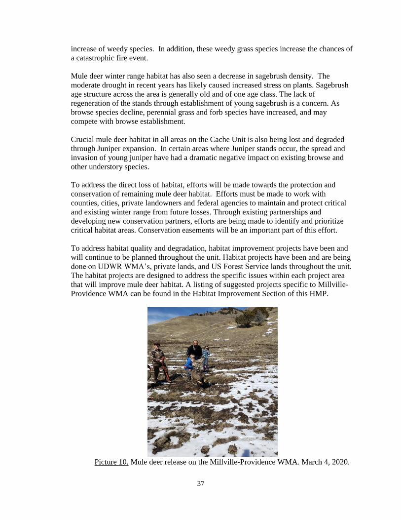
37
increase of weedy species. In addition, these weedy grass species increase the chances of
a catastrophic fire event.
Mule deer winter range habitat has also seen a decrease in sagebrush density. The
moderate drought in recent years has likely caused increased stress on plants. Sagebrush
age structure across the area is generally old and of one age class. The lack of
regeneration of the stands through establishment of young sagebrush is a concern. As
browse species decline, perennial grass and forb species have increased, and may
compete with browse establishment.
Crucial mule deer habitat in all areas on the Cache Unit is also being lost and degraded
through Juniper expansion. In certain areas where Juniper stands occur, the spread and
invasion of young juniper have had a dramatic negative impact on existing browse and
other understory species.
To address the direct loss of habitat, efforts will be made towards the protection and
conservation of remaining mule deer habitat. Efforts must be made to work with
counties, cities, private landowners and federal agencies to maintain and protect critical
and existing winter range from future losses. Through existing partnerships and
developing new conservation partners, efforts are being made to identify and prioritize
critical habitat areas. Conservation easements will be an important part of this effort.
To address habitat quality and degradation, habitat improvement projects have been and
will continue to be planned throughout the unit. Habitat projects have been and are being
done on UDWR WMA’s, private lands, and US Forest Service lands throughout the unit.
The habitat projects are designed to address the specific issues within each project area
that will improve mule deer habitat. A listing of suggested projects specific to Millville-
Providence WMA can be found in the Habitat Improvement Section of this HMP.
Picture 10. Mule deer release on the Millville-Providence WMA. March 4, 2020.

38
Elk Management Plan-Unit 2 (Cache Unit includes Cache and Rich Counties; 2016)
The Unit Management Plan for elk was completed in 2016 with the elk population
currently being at objective. The target winter herd size is 2,300 wintering elk. Average
age of bulls harvested from the South Cache is 6.75 years old. Most of the range on the
unit is in suitable condition to expect growth in elk numbers into the future. Population
management objectives can be achieved by enhancing winter range forage production
through direct range improvements throughout the unit.
At this point in time, neither habitat quality nor quantity appears to be a limiting factor on
this unit. Brucellosis has not been detected in elk on the Cache unit, but neighboring
States have positive populations. Other issues like external parasites, and more common
diseases, do occur within the population.
Due to the above risks, it is not advisable to continue to congregate elk on feed rows
within the unit. Annual feeding has been phased out on the Millville-Providence WMA,
and it is being evaluated at Hardware Ranch WMA. This is being accomplished using a
phased process which began in the winter of 2016-2017, with placing GPS collars on elk
to monitor their movements before and after changes to the feeding program at Hardware
Ranch. Feeding operations will spread elk out over the large meadow area in order to
reduce nose to nose contact, and feeding will cease around the second weekend in
February to encourage dispersion as the elk enter the window of greatest disease risk due
to fetal abortions in the last 5 months of pregnancy. UDWR will continue to conduct
disease sampling efforts and monitor collared elk movements.
Habitat projects will be proposed in the area in anticipation for more dispersed elk
throughout the area. Management will be adaptable during this process, as we evaluate
how elk are reacting to the changes. This change in the feeding operations at Hardware
Ranch WMA may contribute to changes in elk and mule deer use of the MPWMA.
UDWR will monitor where elk are going, impacts to habitat, and to other ungulates,
especially mule deer. Disease monitoring will continue to detect any disease outbreaks
within the herd.
Habitat improvement projects have been and will continue to be planned throughout the
unit. Specific projects will be developed to enhance habitat in the greater Hardware
Ranch WMA area, which includes the Millville-Providence WMA, to disperse animals
and minimize disease concerns. In addition, efforts will continue to pursue conservation
easements in Cache Valley to protect critical elk habitats. A listing of suggested projects
specific to MPWMA can be found in the Habitat Improvement Section of this HMP.
Bonneville Cutthroat Trout Range-wide Conservation Agreement and Strategy (UDWR
Publication #18-11; 2019)
Under this Agreement, Bonneville cutthroat trout are currently managed as a Conservation
Agreement Species by the U.S. Fish and Wildlife Service. As part of the Agreement and
strategy, all the signatories to the Agreement, including UDWR, have agreed to work towards
restoration of the species to prevent further population declines and to prevent the species from
being listed as threatened or endangered. As part of this overall strategy, efforts to protect
existing Bonneville cutthroat trout populations are undertaken, along with efforts to restore or

39
recover the trout into historical habitats. The Agreement officially took effect in Dec. 2019 when
the final signatures were secured.
IV. Strategies for Property Management
Administrative Activities
Issue an easement to Millville City for all water pipelines and infrastructure.
Issue an easement to the Garr Springs Irrigation Company for Garr Spring
infrastructure.
Develop an MOU with Providence City for the 3 parking lots and 2, day-use only
areas with picnic tables.
Annual Maintenance Activities
Fence and gate maintenance: The deer fence is maintained yearly by UDWR. In
addition, the livestock grazers annually ride and fix the fence as needed prior to
turnout of their animals. Other fences along the roads and inside the property are
repaired or replaced as needed.
The fencing on the west bank of Blacksmith Fork River, on the south-western corner
of the WMA, has either fallen into disrepair and/or been removed by landowners
whose backyards abut up to the WMA. UDWR has proposed a re-fencing project for
this boundary using wooden fencing which should be more palatable to the
homeowners. The boundary will also be signed. Clearing a trail south to the SR-
101 Bridge over the river has also been proposed to provide visible angler access.
Signs: Maintain boundary, entrance, and regulatory signs to clearly identify
ownership, access, vehicle restrictions, and rules and regulations enforced on the
WMA. In addition, add the following signs:
o Providence Canyon: Post new signs to prohibit camping and target
shooting in the canyon bottom for one mile from the WMA western
boundary canyon entrance to the eastern boundary with the USFS lands.
o Millville Canyon: Post new signs to prohibit camping and target shooting
in the canyon bottom for one-half mile from the WMA western boundary
canyon entrance to the eastern boundary with the USFS lands.
Road maintenance: The roads on the property are closed to public vehicle access
year round, except for the main canyon access roads. These main access roads are
not maintained by UDWR. The dirt/gravel access roads are improved as needed.
UDWR maintains the road along the big game fence.
o The cattle guard in Millville Canyon will be evaluated for replacement.
o In the spring of 2020, Cache County mowed the vegetation on the deer
fence road, approximately 8’ wide, to reduce the fire hazard. Mowing will
continue to be done as needed to reduce the fire hazard.
Parking areas: There are four small parking areas located on the WMA: one at the
mouth of Providence Canyon; one three quarters of a mile up Providence Canyon;

40
one at the mouth of Millville Canyon; and one at the mouth of Blacksmith Fork
Canyon associated with the day use area. UDWR maintains 3 of the 4 parking
areas on the WMA. Providence City maintains the parking area adjacent to the
snowmobile garage in Providence Canyon.
Water Developments: The water developments on the property, with two-track
roads running to them, are owned by Millville City and Providence City. The
cities maintain both the water developments and the spur access roads at their
discretion. The administrative road that follows the Big Game fence serves as
access roads to these structures.
Wildlife/Livestock troughs: UDWR and the livestock grazers maintain the
troughs as needed.
Hay Shed: The hay shed has collapsed and will be removed.
Snowmobile Shed: The owner of the building will remove it in summer 2020/
Trails: There are numerous trails on the WMA including the Bonneville Shoreline
Trail along the deer fence road and the Providence Canyon Trail up Providence
Canyon. Millville City, Providence City and Cache County maintain these trails,
along with installing and maintaining signage and pedestrian gates.
Noxious weed control: Map invasive weeds on an annual basis to prevent further
weed expansion on the property. Annually spray weeds as needed.
Kiosk: Repair and paint the 2 Kiosks every 2-3 years or as needed. Consider
adding a kiosk in Providence Canyon. Providence City has indicated a desire to
create, install and maintain a kiosk.
Compatibility of Proposed Uses with Local Government General Plans and Zoning
and Land Use Ordinances
The current and proposed wildlife habitat and recreation uses for the MPWMA are
compatible with local government plans, zoning requirements and land use ordinances
for Cache County. The WMA land above the deer fence is currently zoned by Cache
County as Forest Recreation, FR-40. Land on the eastern boundary of the WMA is
owned by the U.S. Forest Service.
The majority of the WMA lies east of, and outside of, the town boundaries of both
Millville and Providence Cities, with the 8’ high deer fence “defacto” marking the
boundary between the WMA/County administered lands boundary and each City’s
boundary. Each City has zoned the lands immediately west of the deer fence as
residential. As the deer fence has been in place since the 1950’s, and the WMA has
been managed for wildlife for the same period of time, landowners/homeowners
appear to accept the presence of the WMA and appreciate the open space behind their

41
homes. However, hunters, hikers, bikers and other individuals continue to cut holes in
the fence behind homes to access the WMA. Many times these areas are not re-secured
to prevent deer from getting onto the downslope private lands.
Currently, Millville City is developing land west of the deer fence road. This will
significantly increase the number of homes along the border of the WMA. The
increase in homes will provide a greater likelihood of fire starts advancing into the
WMA, as well as increased risks to public and property should a fire start on the
mountain and burn down toward the new homes.
There are two small parcels of adjacent private lands, one in each town, are located
east of the deer fence. These parcels are surrounded on the north, south and east by the
rest of the WMA. UDWR will continue to contact these private landowners to acquire
these land parcels.
V. Strategies for Habitat Management
Unit Management Plans for wildlife species
Strategies for habitat management will be consistent with those outlined in the deer
and elk management plans for Unit #2, and the Utah Wildlife Action Plan. These
strategies include, but are not limited to:
Continue to monitor the permanent range trend study site located on the WMA.
Plan and implement habitat improvement on the WMA to re-establish browse
communities for deer. Continue efforts to control non-native annual grasses.
Work cooperatively with land management agencies and private landowners to
plan and implement projects that will improve wildlife habitat and range
conditions in general on surrounding lands. Improvement projects will focus on
improving winter range for deer and elk within Unit 2.
The property should be surveyed for the presence of state sensitive terrestrial and
aquatic species, and for WAP SGCN species.
Recognize the value of the WMA for migrating and nesting neotropical bird
species, and maintain and enhance high quality habitat for these birds, while
minimizing disturbance impacts.
There are no individual management plans for any Species of Greatest
Conservation Need. In the future, as species management plans are written and
adopted by the Utah Wildlife Board, they may be implemented at MPWMA.
Habitat and Infrastructure Improvement Plan
Maintain entrance fences and gates to prevent habitat damage from unauthorized
vehicles use.
Continue to monitor illegal mountain bike trails and work to reclaim the sites.
Monitor and spray noxious weeds to reduce and eliminate the spread of these
weeds on the property
Continue to use livestock grazing as a habitat management tool to assist with
revegetation efforts, control noxious and invasive species, and to reduce fuels.
Monitor the intensity of the grazing and its effects on the WMA. Evaluate current

42
grazing leases to determine if additional infrastructure is needed.
Implement the wildfire management recommendations to reduce the risk of
wildfire across the property. These recommendations include working closely
with the FF&SL and the Cache County Fire Marshal.
o Improving and widening the deer fence road to accommodate fire fighting
vehicles.
o Creating a 30’ wide buffer strip adjacent to the east side of the deer fence
road to reduce fuel loads. This strip would be planted with drought
tolerant, fire-resistant grasses and forbs that also provide forage value for
wildlife. This strip would also provide a continuous fuel break with
firefighter access between Millville and Providence Canyons.
o Remove the dense stands of juniper and other woodland plants on both
sides of the Providence Canyon road from the canyon entrance, east to the
WMA property boundary. This project would reduce fuels in Providence
Canyon and tie in with similar Forest Service projects in upper Providence
Canyon.
Undeveloped crucial winter range on private lands surrounding the WMA will be
evaluated for potential protection and habitat enhancement efforts through
conservation easements, fee title acquisition, and habitat improvement
opportunities.
Specific projects are currently being developed to enhance the browse habitat on
the steep slopes of the WMA. Projects will include the use of the scalper to
establish browse and forbs. Additional projects may be proposed in the future for
the lower foothill and benches, along with continued weed treatments.
Work with UDWR Range Trend Crew to consider the movement of the range
trend transect to more suitable locations which will provide for a better
assessment of habitat conditions. UDWR will evaluate re-activation of the
suspended range trend sites.
Access Management Plan
All activities on the WMA will be considered according to the UDWR Administrative
Land Rule (R657-28). In general, activities that do not support the purpose for which the
WMA was acquired, or activities which do not promote or protect the goals and
objectives of the unit, will be prohibited. This specifically applies to those activities that
disturb or harass wildlife, or degrade important habitats.
The MPWMA, outside of the main access roads in the canyon bottoms, will be annually
closed to all public access during the winter months (Jan. 1 to the second Saturday in
April, opening on that second Saturday) to protect wintering wildlife. When the property
is within a hunt unit boundary where late season big game hunts are available, public
non-motorized access to the WMA may be provided to hunters with a valid big game
hunting tag for this unit.
The property is accessible yearlong from the Millville Canyon Road, Providence Canyon
Road, and Blacksmith Fork Canyon Road. The “deer fence road” is only open for
Administrative access by UDWR and Millville City (to maintain Garr Spring water

43
development). Non-motorized trails are located on the western boundary of the WMA
(the Bonneville Shoreline Trail), and up Providence Canyon (Providence Canyon Trail).
There are four small parking areas located on the WMA: one at the mouth of Providence
Canyon; one three quarters of a mile up Providence Canyon; one at the mouth of
Millville Canyon; and one at the mouth of Blacksmith Fork Canyon associated with the
day use area.
Target shooting and overnight camping are not permitted in the canyon bottoms of either
Providence or Millville Canyons. This is due to yearlong high vehicle and pedestrian
traffic, along with the increase in “squatters”, trash and illegal activities. This closure
extends from the western WMA boundary entrance of each canyon, east to the eastern
WMA boundary with the U.S. Forest Service.
Fire Management Plan
Over the last 15-20 years, there have been multiple wildfires on the WMA with multi-
agency discussions about what actions need to be taken to control fire, and to prevent or
decrease the severity of wild fires.
In general, Utah Wildfire Risk Assessment’s (WRA) provide a consistent, comparable set
of scientific results to be used as a foundation for wildfire mitigation and prevention
planning in Utah. Results of these assessments can be used to help prioritize areas in the
state where mitigation treatments, community interaction and education, or tactical
analyses might be necessary to reduce risk from wildfires. Specifically, WRA’s are
designed to provide the information needed to support the following key priorities:
Identify areas that are most prone to wildfire.
Plan and prioritize fuel treatment within programs.
Allow agencies to work together to better define priorities and improve
emergency response, particularly across jurisdictional boundaries.
Increase communication with local residents and the public to address community
priorities and needs.
Identify areas where additional tactical planning may be desirable, specifically
related to mitigation projects and Community Wildfire Protection Planning.
Provide the information necessary to support resource, budget and funding
requests.
Plan for response and wildfire suppression resource needs.
The Utah Division of Forestry, Fire and State Lands (FF&SL) developed a (WRA) report
for the Millville-Providence WMA to help UDWR understand the various fire aspects on
the WMA. This report provides a large amount of information about the WMA including:
historical fire patterns; the vegetation susceptibility to fire; and the fire risk and threats to
the WMA. While the Millville WRA only uses fire data up until 2008, the WRA
information is valuable to understanding the history of fires on the WMA and to assist
with planning for future WMA habitat activities to reduce wildfire impacts.
Between 1999-2004, the WMA had fires every year that each burned several hundred
acres. The cause of these fires includes campfires, along with natural causes. The bench
above Millville east of the deer fence is a constant problem for wildland firefighters due

44
to the difficult terrain and inadequate access for fire apparatus. By improving the deer
fence road and reducing the fuels that grow in and around the road, firefighters will be
able to access the area in a timelier manner, and with less risk. This area would greatly
benefit from an improved road along with a thirty-foot buffer along the east edge of the
road to reduce fuels and encourage fire resistant species. In addition, dense junipers and
woodland species along Providence Canyon road are creating hazardous conditions for
wildland firefighters to fight fire in this area.
The Millville WRA provides several data layers identifying different aspects of the
wildfire risk. The Wildfire Risk Assessment combines Fire Threats (the likelihood of an
area burning), with Fire Effects (areas which have important values, and where fire
suppression activities are difficult). Almost 70% of the WMA has a wildfire risk category
between moderate (12.4%) to extreme (19.2%). This equates to approximately 3,341
acres.
Figure 1. Millville-Providence WMA Wildfire Risk Categories.
In addition to the Wildfire Risk Assessment, the Fire Threat Index is derived from historical fire
occurrence, landscape characteristics including surface fuels and canopy fuels, percentile
weather derived from historical weather observations and terrain conditions. These inputs are
combined using analysis techniques based on established fire science to develop resultant fire
behavior. The Wildfire Threat Index for the Millville-Providence WMA includes approximately
3,053 acres or 65% of the WMA that is considered at moderate to extreme risk for wildfire.

45
Figure 2. Millville-Providence WMA Wildfire Threat categories.
The WRA Suppression Difficulty data layer reflects the difficulty or relative cost to suppress a
fire given the terrain and vegetation conditions. This layer is an overall index that combines the
slope steepness and the fuel type characterization to identify areas where it would be difficult or
costly to suppress a fire due to the underlying terrain and vegetation.
Figure 3. Millville-Providence WMA Suppression Difficulty category.
The WRA also provides information pertaining to the vegetation components which could be
most adversely affected by fire. This includes forested lands categorized by canopy height,
canopy cover and susceptibility or response to wildfire. Of the approximately 2,767 acres of
forested habitat on the WMA, approximately 65% of the vegetation is considered resilient
(species with characteristics that help the tree resist damage from fire) and 32% are considered
adaptive (tree species adapted with the ability to regenerate following fire).
Several projects have been proposed by FF&SL on the WMA to reduce the wildfire risk and

46
severity of wildfire on the WMA. These projects also address one of the key threats to the WMA
as identified in the WAP: "Inappropriate Fire Frequency and Intensity". These proposed projects
include, but are not limited to:
Improving and widening the deer fence road to accommodate fire fighting
vehicles.
Creating 30’ wide buffer strips adjacent to the east side of the deer fence road to
reduce fuel loads. This strip would be planted with fire-resistant vegetation. This
would also provide a continuous fuel break with firefighter access between
Millville and Providence Canyons.
Remove the dense stands of juniper and other woodland plants on both sides of
the Providence Canyon road from the canyon entrance, east to the WMA property
boundary. This project would reduce fuels in Providence Canyon and tie in with
similar Forest Service projects in upper Providence Canyon.
Livestock Grazing Plan
Grazing is undertaken on the WMA using the UDWR Use of Division Lands Rule (R657-28).
Cattle grazing will be done using a grazing prescription designed to achieve specific goals and
objectives. Annual livestock grazing is planned to continue along the fenced portion of the
Millville bench between Blacksmith Fork and Millville Canyons. The two southern pastures will
be rested from annual grazing to accommodate restoration activities. The grazing will be moved
to the northern pastures for several years. Livestock will be limited to spring use and applied to
give a growth advantage to shrubs and to reduce fire potential. Livestock grazing is currently
scheduled between the dates of 1 May to 15 June. However, in years of early spring green-up,
livestock grazing may begin as early as the second Saturday of April, and in years of a late
spring or heavy growth, livestock grazing may continue until as late as 30 June, as determined by
the area biologist.
Wood Products There are no wood products to be harvested from the MPWMA.
VI. Summary Statement of Proposed Uses
The Millville-Providence WMA is used primarily for winter range for deer and elk, and
is closed to the public from January 1 until the second Saturday of April. During the
summer and fall, there are opportunities for outdoor recreation including hiking, hunting,
fishing, horseback riding, and wildlife watching.
VII. Monitoring and Evaluation
UDWR will complete the following monitoring and evaluation on the WMA.
Vegetation Transects at the range trend survey sites every 5 years.
New habitat projects will be developed and implemented.
Completed habitat projects will also be monitored.
Fish and wildlife surveys/counts for game and non-game species.

47
The Northern Region Habitat Section, area wildlife biologist, Habitat maintenance specialist and
the area conservation officer will be responsible for monitoring the overall effectiveness of this
plan. Appropriate sections and staff will provide expertise as required. The Habitat Maintenance
Specialist will monitor the needs and effectiveness of physical facilities and improvements. If
necessary, the district conservation officer will write or amend an action plan for this property.
All individuals and sections will report to the Regional Management Team through their
supervisors. The area wildlife biologist, with assistance from a regional team, will amend this
plan as needed.
VIII. Appendices A. Maps
General Location Map
Land Ownership Map
Access Map
Infrastructure Map
Grazing Map
B. Legal Descriptions and Encumbrances:
Parcel Deed Map
Legal Boundary Descriptions and Parcel Encumbrances

48
Appendix A
Maps

49

50

51

52

53

54
Appendix B
Legal Descriptions and Encumbrances

55

56
Parcel Legal Boundary Descriptions
Agreements, Enhancements, and Easements
Grantor: Moses and Sarah Thatcher (147.49 acres)
Warranty Deed #192343 Book: 77 Page: 508 Signed: 9/13/1941 Recorded: 9/13/1941
Township 11 North, Range 1 East
Section 23: SE1/4
Encumbrances & Limitations:
ROW for Telluride Power Company
Grantor: G. Alfred and Amanda Anderson (1,831.64 acres)
Warranty Deed #195420 Book: 78 Page: 198 Signed: 5/16/1942 Recorded: 5/16/1942
Township 11 North, Range 1 East
Section 25: W1/2 (133.4 acres)
Section 26: E1/2SW1/4, S1/2SE1/4 (160 acres)
Section 35: E3/4 (480 acres)
Section 36: ALL (640 acres)
Township 10 North, Range 1 East
Section 1: N1/2 (320 acres)
Section 2: Lots 1 – 4 (160 acres)
Encumbrances & Limitations:
None listed
Grantor: John and Matilda Rice (158.68 acres)
Warranty Deed #272615 Book: 29 Page: 26-11-1E Signed: 1/14/1955 Recorded: 1/14/1955
Township 11 North, Range 1 East
Section 26: E1/2NW1/4*, W1/2NE1/4, NW1/4SE1/4
Encumbrances & Limitations:
None listed
*deer fence serves as western border
Grantor: John and Matilda Rice (3.98 acres)
Quit-Claim Deed #273999 Book: 95 Page: 616 Signed: 1/26/1955 Recorded: 4/8/1955
Township 11 North, Range 1 East
Section 23: Central line of S1/4*
Encumbrances & Limitations:
None listed
*deer fence central throughout
Grantor: Norman and Carrie Salvesen (236.43 acres)
Warranty Deed #294056 Book: 30 Page: 360 Signed: 9/15/1958 Recorded: 9/23/1958
Township 10 North, Range 1 East

57
Section 2: S1/2NE1/4, N1/2SE1/4, SE1/4SE1/4, SE1/4NW1/4, NE1/4SW1/4
Encumbrances & Limitations:
None listed
Grantor: Elnora Nielson Strikwerda (7.52 acres)
Warranty Deed #368305 Book: ? Page: ? Signed: 6/23/1972 Recorded: ?
Township 11 North, Range 1 East
Section 26: SE1/4NW1/4
Encumbrances & Limitations:
None listed
Grantor: Utah Power & Light Company (48.55 acres)
Deed #368306 Book: 147 Page: 29-32 Signed: 8/18/1972 Recorded: 8/21/1972
Township 10 North, Range 1 East
Section 2: SW1/4SE1/4* (83 acres)
Section 11: NE1/4NE1/4* (15.7 acres)
Encumbrances & Limitations:
None listed
*Blacksmith Fork River, Hyrum Power Canal, and Route 101 (Project #0528) form
the southwestern border
Grantor: O. Claude Wennergren (664.36 acres)
Warranty Deed #464209 Book: 325 Page: 188 Signed: 7/18/1983 Recorded: 11/3/1983
Township 11 North, Range 1 East
Section 13: ALL except for 1 acre in SW corner of NW1/4SE1/4
Encumbrances & Limitations:
None listed
Grantor: Valleview Estates (7.91acres)
Grant Deed #485240 Book: 367 Page: 516 Signed: 1/14/1986 Recorded: 1/14/1986
Township 11 North Range 1 East
Section 11: S3/4 of E border of SE1/4
Encumbrances & Limitations:
None listed
Grantor: Q.B.D.B.G. LLC (23.48 acres)
Sp. Warranty Deed #626247 Book: 665 Page: 925 Signed: 8/31/1995 Recorded: 9/11/1995
Township 11 North, Range 1 East
Section 23: S1/2 of SE1/4NE1/4*
Encumbrances & Limitations:

58
None listed
*deer fence serves as western border
Grantor: CELCO, INC. (69.78 acres)
Sp. Warranty Deed #626248 Book: 665 Page: 927 Signed: 8/31/1995 Recorded: 9/11/1995
Township 11 North, Range 1 East
Section 14: E1/2 of E1/2SE1/4*
Section 23: N3/4 of E1/2NE1/4*
Encumbrances & Limitations:
None listed
*deer fence serves as western border