Puaxant Tuvip: Powerlands Southern Paiute Cultural Landscapes and Pilgrimage Trail
392
Puaxant Tuvip: Powerlands Southern Paiute Cultural Landscapes and Pilgrimage Trails by Kathleen A. Van Vlack _____________________ A Dissertation Submitted to the Faculty of the American Indian Studies In Partial Fulfillment of the Requirements For the Degree of DOCTOR OF PHILOSOPHY In the Graduate College THE UNIVERSITY OF ARIZONA 2012
-
Upload
independent -
Category
Documents
-
view
1 -
download
0
Transcript of Puaxant Tuvip: Powerlands Southern Paiute Cultural Landscapes and Pilgrimage Trail

Puaxant Tuvip:
Powerlands
Southern Paiute Cultural Landscapes and Pilgrimage Trails
by
Kathleen A. Van Vlack
_____________________
A Dissertation Submitted to the Faculty of the
American Indian Studies
In Partial Fulfillment of the Requirements
For the Degree of
DOCTOR OF PHILOSOPHY
In the Graduate College
THE UNIVERSITY OF ARIZONA
2012

2
THE UNIVERSITY OF ARIZONA
GRADUATE COLLEGE
As members of the Dissertation Committee, we certify that we have read the dissertation
prepared by Kathleen A. Van Vlack
entitled Puaxant Tuvip: Powerlands Southern Paiute Cultural Landscapes and Pilgrimage
Trails
and recommend that it be accepted as fulfilling the dissertation requirement for the
Degree of Doctor of Philosophy
_______________________________________________________________________ Date: April 6, 2012
Richard Stoffle
_______________________________________________________________________ Date: April 6, 2012
Mamadou Baro
_______________________________________________________________________ Date: April 6, 2012
Benedict Colombi
_______________________________________________________________________ Date: April 6, 2012
Tsianina Lomawaima
_______________________________________________________________________ Date: April 6, 2012
Nancy Parezo
Final approval and acceptance of this dissertation is contingent upon the candidate’s
submission of the final copies of the dissertation to the Graduate College.
I hereby certify that I have read this dissertation prepared under my direction and
recommend that it be accepted as fulfilling the dissertation requirement.
________________________________________________ Date: April 6, 2012
Dissertation Director: Richard Stoffle

3
STATEMENT BY AUTHOR
This dissertation has been submitted in partial fulfillment of requirements for an
advanced degree at the University of Arizona and is deposited in the University Library
to be made available to borrowers under rules of the Library.
Brief quotations from this dissertation are allowable without special permission, provided
that accurate acknowledgment of source is made. Requests for permission for extended
quotation from or reproduction of this manuscript in whole or in part may be granted by
the copyright holder.
SIGNED: Kathleen A. Van Vlack
4
Acknowledgements
Graduate school has been a roller coaster journey with many highs and lows and
now it is coming to an end! During my journey, I have crossed paths with many people
who helped make this all possible.
First, I offer my deepest gratitude to all the Southern Paiute people and tribal
governments who have made this document possible. Without them, none of this could
have been possible. I am forever in debt to them taking their time and sharing their
knowledge with me during the past 10 years. Specifically, I wish to thank the following
people: Betty Cornelius, Larry Eddy, Glendora Homer, Brittanni Wero, Tim Rogers,
Richard Arnold, Lee Choe, Debbie Drye, Cecil Homer, Clarence John, Carmen
Martineau, Arthur Richards, and DeAlva Ward. Thank you. I hope I did this story justice.
This research project was made possible by financial assistance from the Ruth
Landes Memorial Research Fund, a program of The Reed Foundation. I also want to
recognize the Arizona Archaeology who provided funding that helped make this
dissertation possible. I want to thank both foundations for their academic and financial
support of this endeavor.
Next, I want to acknowledge my PhD committee. They have been a wonderful
group of teachers who always set the bar high for me and expected me to not only reach it
but go beyond it. To my advisor, Rich Stoffle, it has been a crazy ten years filled with so
many memories from our adventures in the Bahamas to me watching you break cars in
the Spring Mountains to you watching me break cars on LPP. Thanks for taking a chance
on some wide-eyed 19-year kid back in 2002! Thank you for your friendship and your
mentorship, they mean the world to me. To Nancy Parezo, thank you for the support and
friendship throughout this process. It truly means a lot! To Ben Colombi, thank you for
your friendship and constant support. You have always been there when I needed a friend
and I am forever grateful. I have always enjoyed our times talking “shop” and cycling. To
Tsianina Lomawaima, I will always appreciate how you challenged me and forced me to
push my writing and my thoughts beyond what I thought was my limit. It has made me a
better researcher and scholar. Thank you. To Mamadou Baro, I have long appreciated
your constant support and positive words! They have meant a lot throughout the
dissertation. Thank you! I also would like to acknowledge a few important colleagues
along the way who have offered their kindness and support, particularly Dr. Nieves
Zedeño, Dr. Kathleen Sherman, Jessica Savage, Phillip Dukes, Hannah Johnson, and
Shawn Kelley. Thanks to my friends, Jennifer Hill and Steve Clark who provided very
important technical and editorial assistance when I needed it!
Last but certainly not least, to my mom, you were my rock for sticking this out
with me through everything through the good and the bad times, especially those
moments when I wanted to walk away from it all. This is as much yours as it is mine! I
love you! You are the best!! Who’s ready for the next adventure? Allez!

5
Dedication
Education is the most powerful weapon, which you can use to change the world.
– Nelson Mandela
This is for all those who I have met during this journey who have inspired me along the
way.
Most importantly, this is for the Southern Paiute people who have taught me more about
the world than any classroom could.

6
TABLE OF CONTENTS
LIST OF FIGURES ........................................................................................................ 15
LIST OF TABLES .......................................................................................................... 20
ABSTRACT .................................................................................................................... 22
CHAPTER 1: PILGRIMAGE AND PLACE MAKING THEORY/LITERATURE
REVIEW ......................................................................................................................... 23
1.1: Cultural Landscapes ....................................................................................... 23
1.2: Pilgrimage Theory and Victor Turner ............................................................ 26
1.2.1: Victor Turner ..................................................................................... 29
1.2.2: Liminality .......................................................................................... 30
1.2.3: Communitas ....................................................................................... 31
1.2.4: Flow ................................................................................................... 34
1.3: Critiques of Turner ......................................................................................... 35
1.4: Pilgrimage as Ritual Performance .................................................................. 41
1.5: Pilgrimages in Context ................................................................................... 45
1.5.1: Pilgrimages in a Global Context ........................................................ 47
1.5.2 Native American Pilgrimages ............................................................. 50
1.6: Conclusion ...................................................................................................... 53
CHAPTER 2: WHO ARE THE SOUTHERN PAIUTES? A BRIEF ETHNOGRAPHIC
OVERVIEW ................................................................................................................... 54
2.1: The Great Basin as an Ecological Region ...................................................... 55

7
TABLE OF CONTENTS-CONTINUED
2.2: The Great Basin as a Cultural Region ............................................................ 56
2.3: The Southern Paiute Nation ........................................................................... 57
2.3.1: The Paranayi Subtribe ....................................................................... 60
2.3.2: The Yanawant Subtribe ..................................................................... 60
2.3.3: Southern Paiute Districts ................................................................... 61
2.3.4: Local Communities ............................................................................ 65
2.4: Southern Paiute Farming ................................................................................ 65
2.5: Southern Paiute Traditional Leadership ......................................................... 68
2.5.1: High Chiefs ........................................................................................ 69
2.5.2: Lesser Chiefs .................................................................................... 69
2.5.3: Advisory Chiefs ................................................................................. 70
2.5.4: John Wesley Powell and the Southern Paiute Census ....................... 70
2.6: Southern Paiute Epistemology and Ritual ...................................................... 72
2.6.1: Ceremonial Activity and Power Acquisition ..................................... 73
2.6.2: Puha and Ceremony ........................................................................... 77
2.7: Purpose of this Study ..................................................................................... 78
2.8: Dissertation Format ........................................................................................ 79
CHAPTER 3: METHODOLOGY .................................................................................. 80
3.1: Writing a New Great Basin Ethnography .................................................... 80
3.2: Study Methodology ..................................................................................... 83
3.2.1: My Role as a Researcher ................................................................... 84

8
TABLE OF CONTENTS-CONTINUED
3.2.2: Site Visits- Cultural Protocols and Respect ....................................... 86
3.3: Building on the BARA Methodology .......................................................... 87
3.3.1: Native American Cultural Resources Interview Form ...................... 88
3.3.2 Ethnoarchaeology-Rock Art Form ..................................................... 88
3.3.3 Cultural Landscape Form ................................................................... 89
3.3.4 Dissertation Instrument ....................................................................... 89
3.3.5 Open-ended Interviews ....................................................................... 89
3.4: Summary of Interviews .................................................................................. 90
3.4.1: Tribal Involvement ............................................................................ 90
3.4.2: Confidence in Findings ..................................................................... 91
CHAPTER 4: SOUTHERN PAIUTE PLACE LOGIC AND
SACRED ECOLOGY ..................................................................................................... 93
4.1: Sacred Ecology ............................................................................................... 93
4.2: Southern Paiute Epistemology. ...................................................................... 96
4.3: Place Logic and Pilgrimage Trails ............................................................... 100
4.3.1: Home Communities ......................................................................... 102
4.3.2: Purification Sites .............................................................................. 103
4.3.3: Tumpituxwinap (Rock Art) Sites .................................................... 105
4.3.4: Narrow and Constricted Spaces ....................................................... 107
4.3.5: Water Source ................................................................................... 110
4.3.6: First View of Destination ................................................................ 111

9
TABLE OF CONTENTS-CONTINUED
4.3.7: Medicine Collection and Preparation Areas .................................... 112
4.3.8: Paint/Mineral Sources...................................................................... 113
4.3.9: Ceremonial Laydown Areas ............................................................ 114
4.3.10: Final Preparation Site/Support Camp ............................................ 115
4.3.11: Destination Place with a Viewscape .............................................. 116
4.4: Conclusion .................................................................................................... 118
CHAPTER 5: KAVAICUWAC- A CEREMONIAL LANDSCAPE IN THE PARIA
RIVER HYDROLOGICAL SYSTEM ......................................................................... 119
5.1: Lake Powell Pipeline Southern Paiute Ethnographic Study
Study Methodology ................................................................................... 119
5.2: Kavaicuwac Puha Po in Ethnographic Context ........................................... 121
5.3: Kavaicuwac Puha Po Performance Characteristics ...................................... 123
5.4: Following the Kavaicuwac Puha Po and Place Analysis ............................. 124
5.4.1: Home Communities along the Paria River ...................................... 125
5.4.2: Tumpituxwinap- Catstair Canyon ................................................... 127
5.4.3: Upper Catstair Canyon .................................................................... 131
5.4.4: Five Mile Spring ............................................................................. 132
5.4.5: The Grandmother Tree .................................................................... 134
5.4.6: Trail Map Rock ............................................................................... 137
5.4.7: Kavaicuwac Paayuxwitse ............................................................... 140
5.4.8: Destination- Kavaicuwac ................................................................. 143

10
TABLE OF CONTENTS-CONTINUED
5.5: Conclusions ............................................................................................................ 144
CHAPTER 6: PILGRIMAGES ON THE ARIZONA STRIP ...................................... 146
6.1: Arizona Strip Cultural Landscape and Place Name Study ........................... 147
6.2: Arizona Strip Puha Pos in Ethnographic Context ........................................ 149
6.3: Arizona Strip Puha Pos Performance Characteristics .................................. 150
6.4: Following the Arizona Strip Puha Pos and Place Analysis .......................... 151
6.4.1: Toroweap Puha Po ........................................................................... 153
6.4.2: Vulcan’s Anvil Puha Po .................................................................. 163
6.5: Conclusions ............................................................................................................ 171
CHAPTER 7: PILGRIMAGES TO THE PLACE OF CREATION ............................ 173
7.1: The Spring Mountains Cultural Landscape Study ....................................... 174
7.2: The Spring Mountains in Ethnographic Context ......................................... 175
7.3: Mount Potosi Puha Po Performance Characteristics .................................... 179
7.4: Following the Mount Potosi Puha Po and Place Analysis ........................... 180
7.4.1: Home Communities ......................................................................... 180
7.4.2: Yellow Yucca .................................................................................. 182
7.4.3: Aztec Tank ....................................................................................... 184
7.4.4: Yellow Plug ..................................................................................... 187
7.4.5 Mount Potosi ..................................................................................... 190
7.5: Conclusions .................................................................................................. 193

11
TABLE OF CONTENTS-CONTINUED
CHAPTER 8: The BACKBONE OF THE RIVER: A PILGRIMAGE TO SUGARLOAF
MOUNTAIN ................................................................................................................. 195
8.1: Hoover Dam Bypass Ethnographic Study Methodology ............................. 196
8.2: Sugarloaf Mountain Puha Po Ethnographic Context ................................... 198
8.2.1: Southern Paiute Connections to Sugarloaf Mountain...................... 198
8.2.2: Southern Paiute-Hualapai Connections ........................................... 201
8.3: Sugarloaf Mountain Puha Po Performance Characteristics ......................... 202
8.4: Following the Sugarloaf Mountain Puha Po and Place Analysis ................. 203
8.4.1: Home Communities ......................................................................... 204
8.4.2: Keyhole Canyon .............................................................................. 204
8.4.3: Pecked Boulder Field ....................................................................... 206
8.4.4: Goldstrike Canyon ........................................................................... 207
8.4.5: Colorado River Crossing ................................................................. 211
8.4.6: Sugarloaf Mountain ......................................................................... 213
8.5: Conclusion- The Current Management-Status ............................................. 218
CHAPTER 9: BLACK MOUNTAIN- A MULTI-ETHNIC VOLCANIC CEREMONIAL
LANDSCAPE ............................................................................................................... 220
9.1: Black Mountain Cultural Landscape Study Methodology ........................... 220
9.2: The Black Mountain Puha Po in Ethnographic Context .............................. 223
9.2.1: Volcanism ........................................................................................ 224
9.2.2: The Amargosa River Hydrological System ..................................... 224
12
TABLE OF CONTENTS-CONTINUED
9.3: Black Mountain Puha Po Performance Characteristics ............................... 226
9.4: Following the Black Mountain Puha Po and Place Analysis ....................... 228
9.4.1: Oasis Valley Hot springs ................................................................. 228
9.4.2: The Six Rock shelter Complex ........................................................ 229
9.4.3: Pillar Springs ................................................................................... 239
9.4.4: The Big Ceremony Site ................................................................... 243
9.4.5: Caldera Pecking Site ........................................................................ 246
9.4.6: Boulder Rock Shelters ..................................................................... 248
9.4.7: Black Mountain ............................................................................... 250
9.5: Conclusion- Current Management Status .................................................... 252
CHAPTER 10: SCRUGHAM PEAK- A PUHA PLACE IN A VOLCANIC
CEREMONIAL LANDSCAPE .................................................................................... 253
10.1: Native American Consultation on the Nevada Test Site ............................ 253
10.2: The Scrugham Peak Puha Po Ethnographic Context ................................. 255
10.3: Scrugham Peak Puha Po Performance Characteristics .............................. 257
10.4: Following the Scrugham Peak Puha Po and Place Analysis ...................... 259
10.4.1: Tippipah Village and Springs ........................................................ 259
10.4.2: Geoglyph One Area ....................................................................... 262
10.4.3: Doctor Rock ................................................................................... 268
10.4.4: Eagle Rock ..................................................................................... 270
10.4.5: Entrance to Upper Fortymile Canyon ............................................ 272
13
TABLE OF CONTENTS-CONTINUED
10.4.6: Geoglyph Two Area ...................................................................... 274
10.4.7: Vision Questing Boulders .............................................................. 275
10.4.8: Buckboard Mesa ............................................................................ 279
10.4.9: Scrugham Peak .............................................................................. 282
10.5: Conclusion- Current Management Status .................................................. 285
CHAPTER 11: SOUTHERN PAIUTE COMMUNITAS- LINKING PEOPLE, OBJECT,
AND PLACE ................................................................................................................ 287
11.1: Southern Paiute Pilgrimage Trail Performance Characteristics ................ 287
11.2: Communitas Revisited ............................................................................... 289
11.3: Southern Paiute Communitas Formation ................................................... 290
11.3.1: Time ............................................................................................... 291
11.3.2: Movement ...................................................................................... 292
11.3.3: People-People Relationships ......................................................... 295
11.3.4: People-Place Relationships............................................................ 301
11.3.5: People-Object Relationships .......................................................... 302
11.4: The Implications of Southern Paiute Communitas .................................... 311
CHAPTER 12: CONCLUSIONS AND NEXT STEPS ............................................... 314
12.1: Cultural Preservation Law and Policy ........................................................ 314
12.1.1: National Historic Preservation Act ................................................ 315
12.1.2: National Environmental Policy Act ............................................... 317
12.1.3: American Indian Religious Freedom Act ...................................... 318

14
TABLE OF CONTENTS-CONTINUED
12.1.4: Executive Order 13007-Indian Sacred Sites .................................. 319
12.2: A Cultural Landscape Approach to Management ...................................... 319
12.3: Types of Protections ................................................................................... 322
12.3.1: Traditional Cultural Properties ...................................................... 323
12.3.2: Rural and Historic Landscapes ...................................................... 325
12.3.3: National Historic Landmarks ......................................................... 326
12.4: Where Do We Go From Here? ................................................................... 328
APPENDIX A: SURVEY INSTRUMENT USED....................................................... 336
REFERENCES: ............................................................................................................ 368

15
LIST OF FIGURES
FIGURE 2.1 The Great Basin with Traditional Numic Territory Outlined in Black ..... 58
FIGURE 2.2: Map of the Southern Paiute Nation with Subtribal Boundaries ............... 59
FIGURE 2.3: Map of Traditional Southern Paiute Territory .......................................... 63
FIGURE 3.1: Approximate Locations of the Six Pilgrimage Trails ............................... 85
FIGURE 4.1: The Entrance to Catstair Canyon............................................................ 107
FIGURE 4.2: Trail from Pillar Springs to Black Mountain.......................................... 108
FIGURE 4.3: Caldera Pecking Site .............................................................................. 109
FIGURE 4.4: Cairn Marking the Trail to Black Mountain ........................................... 109
FIGURE 4.5: Cairns Located along the Edge of Buckboard Mesa
Marking Vision Questing ........................................................................ 110
FIGURE 4.6: Offerings left for Kavaicuwac at Five Mile Spring ................................ 111
FIGURE 4.7: Grinding Slicks found at Aztec Tanks ................................................... 113
FIGURE 4.8: Support Camp on Mount Potosi ............................................................. 115
FIGURE 4.9: Shoshone Mountain ................................................................................ 116
FIGURE 4.10: Ceremonial Song Cave in the Spring Mountains ................................. 117
FIGURE 4.11: Black Butte, Nevada ............................................................................. 117
FIGURE 5.1: General Location of the Kavaicuwac Puha Po ....................................... 122
FIGURE 5.2: Catstair Canyon ...................................................................................... 127
FIGURE 5.3: Water Babies Found at Catstair Canyon ................................................ 129
FIGURE 5.4: Overview of Five Mile Spring................................................................ 132
FIGURE 5.5: Offerings Found at this Site.................................................................... 134
16
LIST OF FIGURES –CONTINUED
FIGURE 5.6: The Grandmother Tree ........................................................................... 135
FIGURE 5.7: Offerings found at the Grandmother Tree .............................................. 136
FIGURE 5.8: Trail Map Rock ...................................................................................... 138
FIGURE 5.9: Grinding Slicks ....................................................................................... 139
FIGURE 5.10: Kavaicuwac Paayuxwitse ..................................................................... 141
FIGURE 5.11: Ritually Deposited Items ...................................................................... 141
FIGURE 5.12 Kavaicuwac ........................................................................................... 143
FIGURE 6.1: The Arizona Strip (Outlined in Black) ................................................... 146
FIGURE 6.2: Local Landscapes in the Arizona Strip and Grand Canyon ................... 153
FIGURE 6.3: Little Springs Lava Flow ....................................................................... 155
FIGURE 6.4: Hornitos Present ..................................................................................... 156
FIGURE 6.5: Sherd Rocks ............................................................................................ 158
FIGURE 6.6: Rock Peckings at Nampaweap ............................................................... 159
FIGURE 6.7: Vulcan’s Throne ..................................................................................... 161
FIGURE 6.8: Toroweap Overlook ................................................................................ 161
FIGURE 6.9: Lava Falls ............................................................................................... 166
FIGURE 6.10: Water Baby Peckings ........................................................................... 167
FIGURE 6.11: Rock Shelter and Yellow Paint Deposit ............................................... 169
FIGURE 6.12: Vulcan’s Anvil ..................................................................................... 170
FIGURE 7.1: Approximate Location of the Mount Potosi Puha Po............................. 173
FIGURE 7.2: Mount Charleston ................................................................................... 177

17
LIST OF FIGURES –CONTINUED
FIGURE 7.3: Cottonwood Spring ................................................................................ 181
FIGURE 7.4: Large Knotted String Pecking at Yellow Yucca .................................... 183
FIGURE 7.5: Large Rock Tanks .................................................................................. 185
FIGURE 7.6: Ocean Woman’s Net .............................................................................. 186
FIGURE 7.7: Tumpituxwinap found at Aztec Tank ..................................................... 186
FIGURE 7.8: Yellow Plug ............................................................................................ 187
FIGURE 7.9: Tumpituxwinap at Yellow Plug ............................................................. 188
FIGURE 7.10: Trail up the Dry Wash .......................................................................... 190
FIGURE 7.11: Support Camp ....................................................................................... 191
FIGURE 7.12: Mount Potosi Peak ............................................................................... 192
FIGURE 8.1 Approximate Location of Sugarloaf Mountain ....................................... 195
FIGURE 8.2: Keyhole Canyon ..................................................................................... 205
FIGURE 8.3: Tumpituxwinap at Keyhole Canyon ....................................................... 205
FIGURE 8.4: Anthropomorphic Figure in Keyhole Canyon ....................................... 206
FIGURE 8.5: Anthropomorphic Figure at the Pecked Boulder Field .......................... 207
FIGURE 8.6: Goldstrike Canyon .................................................................................. 208
FIGURE 8.7: Goldstrike Canyon Hot Springs ............................................................. 209
FIGURE 8.8: The Colorado River Crossing ................................................................. 212
FIGURE 8.9: Sugarloaf Mountain ................................................................................ 213
FIGURE 8.10: Native American Elders Holding the Healing Stones .......................... 214
FIGURE 8.11: Anthropomorphic Figure at Sugarloaf Mountain ................................. 215

18
LIST OF FIGURES-CONTINUED
FIGURE 8.12: Ceremonial Clearings ........................................................................... 216
FIGURE 9.1: Cultural Affiliation of Black Mountain .................................................. 221
FIGURE 9.2: The Amargosa River Hydrological Complex ......................................... 226
FIGURE 9.3: Painted Water Baby Figures ................................................................... 231
FIGURE 9.4: Tonal Rocks ............................................................................................ 232
FIGURE 9.5: Grinding Stones in the Foreground Found in the Rock Shelter ............. 233
FIGURE 9.6: Wooden Mortar and Stone Pestle inside the Rock Shelter ..................... 235
FIGURE 9.7: Obsidian Needs inside the Rock Shelter ................................................ 237
FIGURE 9.8: Arrow Shaft Rock Shelter ...................................................................... 238
FIGURE 9.9: Pillar Springs .......................................................................................... 239
FIGURE 9.10: Artifacts found at Pillar Springs ........................................................... 240
FIGURE 9.11: The Trail Segment from Pillar Springs to the Big Ceremony Site ....... 242
FIGURE 9.12: Overview of the Big Ceremony Site .................................................... 244
FIGURE 9.13: Offerings found at the Big Ceremony Site ........................................... 245
FIGURE 9.14: The Caldera Pecking Site ..................................................................... 247
FIGURE 9.15: Mountain Sheep and Water Baby Peckings ......................................... 248
FIGURE 9.16: Boulder Rock Shelters .......................................................................... 249
FIGURE: 9.17: Boulder Formation Resembling a Mountain Sheep ............................ 249
FIGURE 10.1: Approximate Location of the Scrugham Peak Puha Po ....................... 254
FIGURE 10.2: Tippipah Springs .................................................................................. 260
FIGURE 10.3: Geoglyph One Overview ...................................................................... 263

19
LIST OF FIGURES-CONTINUED
FIGURE 10.4: Pecked Boulder ..................................................................................... 264
FIGURE 10.5: Water Sources Found Near the Geoglyph ............................................ 268
FIGURE 10.6: The Doctor Rock and Associated Pecking Panels................................ 269
FIGURE 10.7: Eagle Rock and Associated Peckings ................................................... 271
FIGURE 10.8: Pecked Images in Upper Fortymile Canyon ......................................... 272
FIGURE 10.9: Large Pecked Boulder and a Southern Paiute Elder............................. 273
FIGURE 10.10 Geoglyph Two ..................................................................................... 274
FIGURE 10.11: Vision Questing Boulders .................................................................. 276
FIGURE 10.12: Rattlesnake Found at Geoglyph Two ................................................. 277
FIGURE 10.13: Pecked Images .................................................................................... 277
FIGURE 10.14: Tumpituxwinap Found on Buckboard Mesa ...................................... 279
FIGURE 10.15: Rock Cairns along the Rim of Buckboard Mesa ................................ 280
FIGURE 10.16: Scrugham Peak ................................................................................... 283
FIGURE 10.17: Rock Cairns Found on the Western Side of Scrugham Peak ............. 283
FIGURE 11.1: Southern Paiute Communitas ............................................................... 290
FIGURE 11.2: Communitas Formation Across Time and Movement
Along the Trail .................................................................................... 295

20
LIST OF TABLES
Table 4.1: Pilgrimage Trail Performance Characteristics ............................................ 102
Table 5.1: Site Assessments Collected During the LPP Ethnographic Study
For Places along the Kavaicuwac Puha Po ................................................ 121
Table 5.2 Performance Characteristics and Associated Places .................................. 123
Table 6.1 Types of Interviews Conducted at Places along
The Arizona Strip Puha Pos ....................................................................... 148
Table 6.2 Arizona Strip Puha Pos Performance Characteristics and
Associated Places ....................................................................................... 151
Table 7.1 Interviews Conducted at Places along the Mount Potosi Puha Po ............ 175
Table 7.2 Performance Characteristics and Associated Places .................................. 179
Table 8.1 Interviews Conducted During the Hoover Dam Bypass Studies ............... 197
Table 8.2 Sugarloaf Mountain Puha Po Performance Characteristics and
Associated Places ....................................................................................... 203
Table 9.1 Total Number of Interviews by Site and Survey Form along the Black
Mountain Puha Po ..................................................................................... 223
Table 9.2 Black Mountain Puha Po Performance Characteristics and
Associated Places ....................................................................................... 227
Table 10.1 Interviews by Place and Study ................................................................... 255
Table 10.2 Scrugham Peak Puha Po Performance Characteristics and
Associated Places ....................................................................................... 258
Table 11.1: Performance Characteristics Found Along Six Pilgrimage Trails ............. 288

21
Table 12.1: Pilgrimage Trails and Protection Options .................................................. 330

22
ABSTRACT
Southern Paiute people stipulate that when the world was formed, the Creator
gave them sole possession of the lands that constitute the traditional Southern Paiute
nation and the Creator gave them the responsibilities to tend to the land, resources, and
each other. As a result, from these stewardship duties, Southern Paiute people developed
complex socio-ecological methods for promoting and maintaining both ecological and
spiritual balance. One method was used by medicine people or Puha’gants and it
involved them traveling to special ceremonial areas to acquire knowledge and power.
These journeys required Puha’gants to undergo intense purification and preparation and
they traveled along designated trails to places far away from their home communities.
The pilgrimage process allowed the pilgrims to gain knowledge and power at their
destination places to use in ceremonies to restore balance and promote sustainability in
their home communities.
My dissertation study examines six pilgrimage trails across Southern Paiute
territory in an effort to understand this process. As a way to frame my discussion, this
analysis draws upon four concepts—(1) Southern Paiute place logic, (2) cultural
landscapes, (3) pilgrimage, and (4) communitas. For trail systems under study, I examine
the types of places visited and their associated performance characteristics, and
specifically the types of relationships pilgrims, or Puhahivats with each other, the places
visited, and objects used.

23
CHAPTER ONE
PILGRIMAGE AND PLACE MAKING THEORY/LITERATURE
REVIEW
In many societies around the world, religious specialists engage in the act of
pilgrimage. While on pilgrimage, these specialists travel to unique and powerful places
and landscapes. The trails that they follow have long been established as ceremonial
pathways. As the pilgrims follow these trails, they perform ritual acts, which are critical
to successfully completing the pilgrimage ceremony. The ways in which people engage
in these ritual activities, the places they travel to, and how they are interconnected have
been the focus of many anthropological studies (Bauer and Stanish 2001, Colemen and
Eade 2004, Silverman 1994, Smythers 1997, Turner 1969, Underhill et al. 1997).
Understanding how pilgrimages and their associated performance characteristics
manifest themselves physically in a particular region has led to interesting questions
about how places and people are connected and how trail systems manifest themselves
across a landscape. For those who have an interest in heritage conservation, identifying
pilgrimage trails and their performance characteristics presents unique challenges in
preservation and land management planning. This research focuses on these issues, as
they are manifest within the frame of Southern Paiute culture.
1.1 Cultural Landscapes
Human societies form complex connections and relationships with the
environment that surrounds them; researchers use the concept of cultural landscape to
describe these relationships. Hicks, McAtackrey, and Fairclough (2007) write that

24
cultural landscapes are ways of explaining and capturing complex intersections among
people, material culture, and geography. For many American Indian people, these
intersections are grounded in their epistemologies and oral traditions (Anyon et al.1996;
Basso 1996; Deloria 2003). Scholars have theories pertaining to cultural landscape and
models for documenting and interpreting these connections.
Cultural landscapes develop from a people’s historical memory. Their cultural
understandings of the land is shared and is transferred over generations (Hicks,
McAtackrey, and Fairclough 2007; Stoffle, Toupal, and Zedeño 2001) through oral
traditions and ceremony. Many cultural groups or ethnic groups can hold different
understandings of the same land (Barth 1969). For example, in the Salt River Valley in
central Arizona, present-day Tonto National Monument is culturally important to
multiple Native American ethnic groups. Hopi and Zuni people believe that the
monument lands are tied to clan migrations and to indigenous astronomy ceremonies
prior to the arrival of Euro-Americans. For Apache people, the monument lands contain
the memories of Apache people living in the area and assisting in the construction of
Roosevelt Dam in the early 1900s (Stoffle et al. 2008).
Cultural landscapes differ from a culture’s special places, to which one or more
cultural groups have attached specific cultural meanings. The notion that not all places
within a landscape have the same cultural value or power is central to the conception of
cultural landscapes. Value is given to places because of the type of experiences or
interactions people have with the location (Zedeño 2000). According to Greider and
Garkovitch (1994:8):
25
Cultural groups socially construct landscapes as reflections of themselves.
In the process, the social, cultural, and natural environments are meshed
and become part of the shared symbols and beliefs of members of the
groups. Thus, the natural environment and changes in it take on different
meanings depending on the social and cultural symbols affiliated with it.
Tilley (1994) distinguishes between the concepts of place and landscape. Landscapes
encompass relationships among singular locales and events. A cultural landscape should
make sense from the perspective of the connected human group or groups.
Throughout traditional Southern Paiute territory, places are connected through
songs, oral history, human relations, ceremony, and both physical and spiritual trails.
These connections create synergistic relationships between people, places, and objects.
Sometimes the best way to understand these complex relationships is to look at them on a
smaller scale or on a local level (Stoffle et al. 2004). These smaller landscapes are
sometimes referred to as local landscapes and they are composed of place connections in
small geographic areas like a particular mountain range or river system as opposed to an
ethnic group’s entire traditional territory. These landscape connections can be associated
with understanding how people and why people traveled along trails from their
communities to ceremonial and resource use areas.
Not all Southern Paiute trails to ceremonial areas are pilgrimage trails, but those
used for pilgrimage have certain characteristics and place logic. Ritual specialists who
use these trails visit shrines to acquire power and knowledge that will be needed when
they arrive at their destinations. Southern Paiute pilgrimage trails have eleven unique
performance characteristics: (1) home communities, (2): purification sites, (3)
tumpituxwinap (rock peckings and paintings) sites, (4) narrow and constricted spaces, (5)
26
trail water sources, (6) medicine collection/preparation areas, (7) mineral and paint
sources, (8) first view of the destination places, (9) ceremonial laydown areas, (10)
ceremonial support camps, and (11) ceremonial destination places. Performance
characteristics describe the behavioral capabilities an object, place, or element must
possess in order to fulfill its roles in specific activities (Schiffer and Skibo 1987). These
are vital for successful completion of a pilgrimage.
1.2 Pilgrimage Theory and Victor Turner
In order to understand the pilgrimage concept and its associated performance
characteristics within Southern Paiute society and beyond it is important to examine some
of the theoretical foundations behind the study of place and pilgrimage in the academic
literature. The act of pilgrimage is at times discussed and understood as a form of ritual
performance, which has been studied by many social scientists. An extensive body of
academic literature exists on this topic (Bouchy 1987; Gabriel 1991; MacDougal 1908;
Sallnow 1981; Tebbutt 1962; Titiev 1937; and Turner 1969). During the past 40 years,
two prominent typologies came to the forefront: fixed and flexible pilgrimages. These
typologies have proven to be useful in terms of understanding the concept of pilgrimage
and they lend themselves to the discussion of whether these classifications are useful in
discussing issues associated with Native American ceremonies and pilgrimages.
In 1983, Stephen Glazier published on pilgrimages in the Caribbean. He argued
that pilgrimages fall into two categories—fixed or flexible. A fixed pilgrimage involves
people traveling to a particular well-defined destination place by preparing for their
journey and following a clear path to their destination for ceremony. For fixed

27
pilgrimages, place and landscape are important features. People who take part in this type
of pilgrimage can come from various religious and cultural backgrounds to take part in
these types of ceremonies (Glazier 1983: 316).
Flexible pilgrimages, on the other hand, are not as clearly defined because they do
not constitute specific journeys or specific destination places as their goals. Place is not
important for these types of ceremonies in that the actions occurring become the focus of
the pilgrimage. Glazier describes this process occurring amongst the Spiritual Baptists in
Trinidad. These pilgrimages focus on people traveling to engage in Church sponsored
activities like baptisms and wedding than following a predetermined path with
subsequent prayer places to reach a destination place. Glazier contends that little is
known about flexible pilgrimages because they lack a strong attachment to place and thus
do not fit the definition of fixed pilgrimage (the Turner Model) which is in line with
Southern Paiute pilgrimage.
Anthropologist, E. A. Morinis developed another typology to discuss the act of
pilgrimage. Morinis categorized pilgrimages based on the motivations and actions of the
pilgrims rather than place and destination. He argues that while there may not be many
types of pilgrimages, people participate in these ceremonies for very person and unique
reasons (Morinis 1992). According to his typology, there are six forms of pilgrimage: (1)
devotional, (2) instrumental, (3) normative, (4) obligatory, (5), initiatory, and (6)
wandering.
Devotion pilgrimages are centered on the pilgrim praising and meeting a “shrine
divinity, personage or symbol,” (Morinis 1992: 10). Pilgrims travel to holy sites where

28
the divine was once or is currently present. Instrumental pilgrimages focus on achieving
specific worldly goals, such as partaking in the journey to find cures for illness or general
enlightenment. These types of pilgrimages, according to Morinis, tend to be self-serving
in nature.
Normative pilgrimages involve people’s life cycles and occur when a person
reaches a certain age or during a certain phrase in a calendar cycle. A person or a group’s
daily routines are broken and they transition into a spiritual realm to take part in this
process. Pilgrimage shrines and destinations are understood as fixed places that are
resistant to social and cultural change and as such they appeal to travelers on normative
pilgrimages (Morinis 1992). Obligatory pilgrimages are journeys required by a person’s
faith or culture, like the Muslim pilgrimage to Mecca. Any member of the culture or
religion can take part in these pilgrimages (Morinis 1992).Initiatory pilgrimages focus on
the travelers undergoing some sort of physical, social, psychological, and/or spiritual
transformation. These types of pilgrimages are often associated with rites of passage
activities (Morinis 1992).
The last type of pilgrimage described by Morinis is known as wandering
pilgrimages. These journeys are similar to Glazier’s flexible pilgrimages in that pilgrims
on these journeys do not set out with a specific destination goal. They seek meaning and
power by traveling away from normal life to fulfill a spiritual and psychological void.
The ceremonial is the overall journey without a defined geographical location.
These two typologies are examples of ways in which academics have tried to
understand and explain pilgrimage. Academics like Turner, Glazier and Morinis are some

29
of the few who have engaged this topic for looking at ways people express themselves
through ceremony as part of their religious faiths and practices. While scholars like
Glazier argue that place is not necessarily an important factor, my research counters that
position by stressing the importance of place and movement along a trail.
1.2.1 Victor Turner
In pilgrimage and ritual performance studies, one cannot overlook Victor Turner’s
contributions to this field of study. In many respects, Turner’s theories are considered
foundational. Turner’s theories will be examined and tested as part this analysis.
Throughout his career, Turner studied ritual processes and performance in many societies
around the world. His interests in rituals led him to examine pilgrimages in Christianity.
Resulting from his work, Turner defines pilgrimage as
Turner (1973: 204) defines pilgrimage as:
…that form of institutionalized or "symbolic" "antistructure" (or perhaps
"metastructure") which succeeds the major initiation rites of puberty in
tribal societies as the dominant historical form. It is the ordered anti-
structure of patrimonial-feudal systems. It is infused with voluntariness
though by no means independent of structural obligatoriness. Its limen is
much longer than that of initiation rites, and it breeds new types of secular
liminality and communitas.
The following sections explain in further detail Turner’s notion of pilgrimage.
30
1.2.2 Liminality
Liminality describes the state and process of mid-transition during pilgrimage
activities (Turner 1969; van Gennep 1909). During this period, the pilgrims, who are also
referred to as liminars, pass through a cultural realm that is vastly different from the
physical and spiritual states they have experienced in the past or will experience in the
future. Turner describes people in the liminal state as being in a condition that is likened
to dying, being in the womb, experiencing darkness and invisibility before being reborn
(Turner 1969) Liminars are removed from the current social status, responsibilities, roles
and authority they possessed in their home communities and are transitioned into a
homogenous state. In other words, Turner maintains that during pilgrimage, the travelers
become equals along the trail and that they need each other to endure the ritual
experience.
The pilgrims’ lack of secular power is compensated by the acquisition of sacred
power but at the transitional or liminal stage, the sacred power is weak. Turner believed
that sacred power is derived from the resurgence of the ability to receive sacred
knowledge. The ability to receive this power is linked to being liberated from the
rigidness of secular social structure and the abilities of participants to form a sense of
communitas amongst themselves while on pilgrimage (Turner 1969: 94-96).
While Turner focuses mostly on rites of passage activities, this transition also can
be applied to other types of pilgrimages. Turner refers to all non-pilgrimage/day-to-day
interactions as secular practices and interactions occurring during pilgrimage as sacred
31
practices. These issues are addressed later in Chapter Eleven as they relate to Southern
Paiute culture and pilgrimage.
1.2.3 Communitas
Like liminality, communitas is another key concept introduced by Victor Turner.
Communitas describes the process by which the act of pilgrimage serves to bond pilgrims
together during their journey. The process is transformative because the rituals performed
are used to transition pilgrims from a normal life to a powerful and spiritual phase of
existence during which pilgrims are receptive to acquiring power and spiritual knowledge
(Turner 1969). This transition and transformation are necessary because the power
acquired during pilgrimage is not available in the normal activities of daily life. Turner
also writes that pilgrims who travel in groups seeking a shared experience undergo
spontaneous bonding and community formation (Turner and Turner 1978: 250). This
issue is explored in depth in Chapter Eleven.
Communitas is “a relational quality of full undedicated communication, even
communion” with other pilgrims. According to Victor and Edith Turner, communitas
formation “combines the qualities of lowliness, sacredness, homogeneity, and
comradeship” (Turner and Turner 1978: 250). A key aspect of communitas is a lack of
formal social structure that would normally dictate relationships between people in
secular society. “Turner defines social structure as: the patterned arrangement of role sets,
status sets, and status sequences consciously recognized and regularly operative in a
given society and closely bound up with legal and political norms and sanctions (Turner
and Turner 1978: 252; Turner 1974:20).”

32
During pilgrimage, the travelers are left without their normal community social
structure and during pilgrimage rituals, a community (even if it is temporary) is formed
(Turner 1974). Pilgrims use these new relationships to develop protocols for how to
behave and perform rituals along the trail. These roles are based on the pilgrims’
ceremonial responsibilities and needs that necessary for a successful pilgrimage.
Turner preferred the Latin term communitas to the English term community
because he wanted to emphasize the distinction between the area of common daily living
and sacred space. He also argues that the distinction between communitas and social
structure is not the same as the separation between secular and sacred. This distinction
which may hold true in many parts of the world is problematic in native North America,
where the secular and sacred realms are not differentiated. Secular or social roles may
have sacred attributes (such as traditional leadership positions, hunters, and midwives) to
them. In terms of understanding communitas, however, the sacred component to these
new relationships and roles are acquired during rites of passage or pilgrimage where
pilgrims change positions (Turner 1969). For example pilgrims may come from different
socio-economic classes (perhaps upper and lower class). Under normal circumstances
these two groups would not intermingle but the act of pilgrimage suspends this division.
The ceremony allows them to form a new relationship.
Turner identifies three types of communitas: (1) Spontaneous, Existential
Communitas, (2) Normative Communitas, and (3) Ideological Communitas. These three
types of community formation serve a purpose in ceremony and pilgrimage. Depending
33
on the purpose of the pilgrimage and the cultural rules that guide the ritual actions, a
certain type of communitas is formed.
Turner argues that “true” communitas is formed spontaneously and is without a
true structure. He referred to this as existential communitas (Turner 1969: 132). It is the
polar opposite of social structure. Other pilgrimage scholars like Sallnow have described
this as the “purest form of communitas” (Sallnow 1981: 163).
Normative communitas is the attempt to capture and preserve spontaneous
communitas in a system of ethical precepts and legal rules (Turner 1978:252). Normative
communitas is formed when a group of pilgrimages come under temporal pressure and
confront a need to mobilize resources and organize themselves, or that the group requires
some sort of social control because some ritual activities require more experienced
leaders to guide those that lacked the knowledge through the experience. During
normative communitas, the social structure present in the group’s religion will not be
eliminated and that this social structure becomes part of the ceremonial process.
Ideological communitas is “the formulation of remembered attributes of the
communitas experience.” The pilgrims’ shared experience causes them to develop what
Turner calls a “utopian blueprint” to reform their society into the image of the sense of
community that was created during pilgrimage (Turner 1969:132, Turner and Turner
1978:252). This type of communitas is desired when pilgrims seek knowledge from their
destination place to correct an environmental or social problem. In some cases this could
be seen as the equivalent of going on group pilgrimages to restore balance on a
community, regional or global level.
34
In addition to communitas, the act of pilgrimage has attributes of liminal phases,
particularly in rites of passage experiences. People on pilgrimage release themselves from
the mundane structure of daily life, i.e., their normal behavior, and they experience
communitas both during the journey and as part of achieving healing, renewal, and
knowledge. Pilgrims on their journey also are supposed to reflect on the meanings of
their core religious and cultural values and understandings. They partake in ritualized
reenactments of the interface between their religious paradigm and their shared human
experience through both physical and psychological movement from the mundane center
to a sacred periphery. This transition makes the once sacred outer boundary the center of
the pilgrims’ present existence.
According to Turner, movement against stasis symbolizes the uncapturablity and
temporal nature of communitas. In general, participation in pilgrimage is voluntary,
pilgrimage engagements are considered liminoid (the state of being temporary outside the
boundaries of the economic, political, and structural process) and not liminal, particularly
in contemporary Christian pilgrimages in Europe. In many indigenous societies, this
notion of being liminoid does not always hold weight, as will be explained later.
1.2.4 Flow
Movement or flow during pilgrimage is described as the merging of action and
awareness (Csikszentmihalyi 1975; Turner and Turner 1978). Flow is the state in which
actions occur in a particular order according to a cultural or societal internal logic. Flow
is experienced by a person or a group in many different types of settings; for example,
flow can be experienced in secular activities like sport or play. In terms of ceremony and

35
pilgrimage, flow is an important part of ritual. It is achievable when a person or group
centers their all attention on performing a ceremony and ignoring any issues or events
that might be occurring in their home communities at this time. Ritual actions require
focus, concentration, isolation, framing from the everyday world, and preparation;
situations that impact those factors could disrupt the course of the ceremonial act.
The need for total concentration and complete focus has been noted in recent
ethnographic studies with Native Americans. Thomas Greider examined the potential
impacts of low altitude military flyovers on Native American ceremonial areas in the
southeastern United States. Indian people who Greider interviewed said that any
ceremony interrupted by noise increased the likelihood that songs would be disrupted and
mistakes made. The mistakes had the potential to be detrimental to the patient and the
medicine person because the medicine might not work due to the disruptions or errors.
Greider added that Indian medicine and ceremony are introspective processes, and
unexpected noise would result in a loss of effectiveness (Greider 1993:80). Thus the flow
of the ceremony is critical for its success in the presence and use of traditional
ceremonies (pilgrimages) and rituals in the future.
1.3 Critiques of Turner
Victor Turner’s theories of pilgrimage have been very influential in the social
sciences. Most scholars (this author included), begin their studies of pilgrimage with a
discussion of his concepts and theoretical model. On the other hand, scholars like Yamba
(1995: 9) feel this is a problematic homage. “Anthropologists who embark on the study
of pilgrimage almost all start out debating with the pronouncements of Victor Turner,

36
whose framework they invariably employ as a point of departure.” Coleman and Eade
caution scholars to avoid taking pilgrimage paradigm down the proverbial theoretical cul-
de-sac in terms of its all-encompassing character and its implications that pilgrimage
travel could be/should be divorced from more every day social, political, and cultural
processes. As Tremlett (2003) pointed out, this view of pilgrimage is based on the
“romanticist” belief that religion exists as a deep inner space or realm that can stand a
critique of modernity (Colemen and Eade 2004). While Victor Turner’s work on
pilgrimage is considered foundational, his work should not be the only work examined.
In fact, numerous scholars in recent years have begun to reexamine and challenge some
of his core theories, particularly the notion of communitas.
One of the major critics of Turner’s communitas theory has been Michael
Sallnow. His research focused on pilgrimages in the Andes Mountains in Peru,
particularly to Copisa (this trail’s destination place). Sallnow contends that while Turner
argues that disputes and inter-group tensions do not exist on pilgrimages, this is an
unsupported assumption that does not stand up under the scrutiny of empirical evidence. ,
While this may be a cultural ideal—something pilgrims and their societies would like to
occur, behaviorally conflict is common. Sallnow’s research documented that during
pilgrimage, tensions and disputes were common due to the presence of people from
different social and economic castes traveling the trails together. The act of pilgrimage
only deepened and made visual the social divides amongst pilgrims instead of dissolving
them like Turner theorized (Sallnow 1991a: 304).

37
According to Sallnow, pilgrimage social groups in Peru purposefully segregate
themselves from each other, acting in a manner contradictory to Turner’s integrative
systemic model. While on pilgrimage Peruvian groups frequently passed each other along
the trail and as they passed a ritual exchange of religious items took place. Sallnow
maintains that this action does not unify the pilgrimage groups but instead divides them
and causes animosity between the groups. Sallnow noted that pilgrims do not like to be
bothered while they are traversing the trail because it distracted them from focusing on
their destination. Social niceties including gifting and reciprocity-social rather than
religious (thought, concentration, and focus on the spiritual aspects of the pilgrimage
experience) took over briefly. In order to avoid social interruptions, often travelers would
seek out alternate, infrequently traveled routes to their destination place to avoid
encounters with other travelers that required social interaction and ritual gifting. Ethnic
conflicts also occurred on the trail between Mestizo and Indigenous pilgrims as well
(Sallnow 1981). This is due to long standing tensions between the Catholic and heavily
European Mestizo populations and the native Quechua people who traditionally used
these trails for thousands of years before colonization. Sallnow concluded that if
communitas was the ultimate goal of the act of pilgrimage then Andean pilgrimages
consisted of a complex social network of egalitarianism, nepotism, and factionalism
based on competition and conflict, not spontaneous community formation. A conflict
model explains one aspect of pilgrimage as well as a functionalist, systemic model of
community building.

38
Some scholars have called into question Turner’s pronouncement of pilgrimage as
a religious activity rooted in the sacred that is rigidly separated from the secular,
mundane or every day. In their work on Christian pilgrimage, Eade and Sallnow (1991)
wrote that pilgrimage and pilgrimage places have multiple meanings and that each
individual brings his or her own significance to a place based on life experiences and
understandings. In short, while pilgrimages are special, they are not distinct from the rest
of life, especially for cultures where the sacred and the daily are not exclusive. Christians
make pilgrimages to religious places for different reasons and they come from different
cultural, economic, social, gendered, and religious experiences. They also return to these
preconditions—as they exist in their daily lives. Due to the diversity of their life histories,
it is almost impossible for them—the authors of the pilgrims themselves-- to prescribe the
same religious meaning to a place and thus the pilgrimage destination or arena takes on
competing and secular understandings (Eade and Sallnow 1991:5).
Some scholars contend that pilgrimages are not group ceremonial activities at all
but rather individual journeys. E.A. Morinis’ research (1992) has documented numerous
cases in which Turner’s concepts of community building do not hold true; for example,
in Bengal the pilgrimage process is very personal and focused on one individual. Morinis
also challenges the idea that pilgrimage can be compared and understood in the same
manner as rites of passage. While rites of passage ceremonies are frequently associated
with pilgrimage and ceremony, not all pilgrimages are rites of passages activities.
One current argument in the pilgrimage literature is that pilgrimages are not
unique religious events; instead, they are common practices open to all members of a

39
given society and occur frequently (Coleman and Eade 2004). While this notion is true
for some cultural and social groups around the world, it is not necessarily true for all
societies. Some can argue that Turner’s pilgrimages are a subset of all kinds of
pilgrimages as journeys of some kind. They focus on how people transition physically
and spiritually from a secular existence into a heightened spiritual or sacred (in the sense
of taking on holiness or supernatural power) state as people travel to special places to
gain knowledge and guidance to achieve some sort of balance for the individual and
community. As part of the journey, pilgrims form bonds with each other, sometimes
spontaneously or sometimes as dictated by social and cultural principles (Turner and
Turner 1978: 30). In this sense, these types of pilgrimages do form a special type of
community based on mutual and intentional experience and intent.
My research supports Turner’s view of pilgrimage as a unique ceremonial and
ritual action occurring outside normal bounds of worship and not something that is done
daily as a habitual cultural activity, like prayers said every morning to greet the sun. As
will be documented in later chapters, in Southern Paiute society only a select group made
pilgrimages and they travel on behalf of the entire community as well as themselves.
Those who went on these journeys were medicine men or those in training to become
medicine men. These spiritual journeys were not supposed to be taken by everyone
because there were great physical and spiritual risks involved. While ceremonial
activities such as ritual cleansing and daily prayers occurred in a pilgrim’s home
community, most of the ritual associated with pilgrimage took place far away from daily
living space in very controlled settings along the trails.

40
As to the notion of communitas, some argue that it does not occur and others
argue it is insignificant to the overall goal of the pilgrimage. My research demonstrates
that community formation and maintenance is a critical part of Southern Paiute
pilgrimage and ritual. While Turner’s work focuses on humans, I stipulate that because of
the Southern Paiute worldview, communitas is actually created between people, place,
and objects because Southern Paiute people believe that the world is alive and all
elements (including place) have agency that needs to be respected. As described earlier
communitas focuses on the establishment of social bonds between pilgrim participants.
These bonds carry with them expectations and commitments to relationship building or
reaffirmation. These connections can be applied to a place and objects like water, plants,
animals, and offerings. For example, in Southern Paiute culture, when Paiute people visit
places and interact with them, the places remember the stories, prayers, and songs of
thousands of years of visitation and use. Offerings found at these places represent the
physical manifestations of those interactions. Paiute people establish communitas with
these locations. The interactions with the place itself, the landforms, the rocks, the
animals, plants, and other natural elements are part of the ceremony, part of the
pilgrimage, and hence part of community formation and community continuance. These
complex interactions are part of the pilgrimage ceremony. It is also important to
understand that from a Paiute perspective, that these types of ceremonies are conducted
not to fulfill self-serving needs but to benefit their communities and their indigenous
nations. Such reasoning is found throughout Indian Country.

41
1.4 Pilgrimage as Ritual Performance
During pilgrimage, a person’s actions are part of a ritual performance. These acts
are intentionally directed towards the transformation of the pilgrim and the world around
him or her (Turner 1969). Each ritual that takes place along a pilgrimage trail is
understood as a performative and transformative act aimed at communicating and
enacting a greater truth (Tuan 1997). Archaeologist William Walker (1995, 1999) adds
that ritual involves a given action or a sequence of actions designed to achieve an
observable or measurable transformation that will have a lasting effect. Pilgrims perform
such rituals in special and powerful places. Sequential prayers, songs, and activities must
be performed at specific places and times along the pilgrimage trail in order for the
pilgrims to be properly prepared to reach their destination place. Pilgrimage destination
places, or pilgrimage centers, are powerful areas that only select individuals are allowed
to visit and use. Morinis and Crumrine (1991: 8) describe pilgrimage destination places
as physically and socially separate from pilgrims’ home communities; “the sacred place
participates in the sacred/profane opposition by representing the sacred within the
profane sphere.”
A pilgrimage journey is not solely about reaching a destination place; instead, it is
about doing so in a specific order across a specific landscape. McEwan and van de
Guchte (1991) argue that the patterns of human movement during pilgrimage may take
on a spiritual or cosmological significance. The journeys to shrines are identified with
macrocosmic cycles or movement manifestation of ideological beliefs and cultural

42
practices. Pilgrims kinesthetically map the space they travel and transform topography
into a continuous sacred landscape (McEwan and van de Guchte 1991).
Like the act of pilgrimage, rituals are based on actions that can be replicated. The
success of these actions is dependent upon the ritual specialists’ ability to use power from
the physical and spiritual world effectively. In their research, Victor and Edith Turner
examine rituals and symbols as meaningful performances and modes of signification in
the context of temporal socio-cultural performances (Turner and Turner 1978).
Victor Turner defines ritual as “a formal behavior prescribed for occasions not
given over to technological routine that have reference to the beliefs in mystical beings or
powers” (Turner 1967:19; Turner and Turner 1978: 243). Ritual can be also the
orchestration of many types of performances (Turner and Turner 1978). Building
Ritual performances include the enactment of rites and behaviors associated with
pilgrimage and the corresponding oral history and traditions (Turner 1967). Carroll,
Zedeño, and Stoffle (2004) describe these performances as ritual actions, which are
conducted to impact and influence outcomes such as improving health, calling down the
rain, or rebalancing the world. These ritual performances are the foundations of collective
interpretations on how the world operates. While the ritual specialists may change over
time, the frameworks of the performances remain constant because the performances are
socially sanctioned activity sequences (Carroll, Zedeño, and Stoffle 2004; Turner 1967;
Walker 1995).
As part of the performance, particular items and imagery are used to enhance the
occurring ceremonial act. Ritual symbols are the smallest units of ritual behavior. They

43
are associated with particular objects, activities, relationships, words, gestures, or
landscape features. Victor Turner maintains that ritual symbols influence social action
associated with the collective ends and means of pilgrimage (Turner 1967). Within the
context of ritual symbols, Turner discusses dominant and instrumental symbols. These
two types are pertinent to the Southern Paiute case study.
Dominant symbols, sometimes referred to as core symbols are present in many
different ritual contexts and their meaning is considered highly consistent throughout a
cultural system. Turner (1967) argues that people understand the meanings of dominant
symbols regardless of what ritual activity is occurring. A society may sometimes regard
these symbols as eternal objects in the sense that they are timeless. In his work, Turner
(1975) uses the Virgin of Guadalupe to illustrate his concept. He points out that in
Catholic theology and folk practice in Mexico the Virgin of Guadalupe has consistently
been understood as the Mother of God. The Virgin’s meaning is a constant regardless of
where her imagery appears, whether in religious activities or in political events (Turner
1975).
According to Turner (1967), instrumental symbols are used during particular
ritual acts. These symbols need to be interpreted in terms of their use in particular ritual
acts and in a wider cultural context in terms of an entire ritual system. According to
Turner, the use of candles and the act of kneeling for prayer during Christian pilgrimages
are examples of instrumental symbols. In this context, candles are ritual items and
kneeling is part of the ritual performance. Outside of this ceremonial activity, the use of
candles and the act of kneeling have practical purposes in secular life. It is only during a
44
ritual action that they come to symbolize something more (Turner 1967; Turner and
Turner 1978).
Dominant and instrumental symbols are present in many ritual contexts in
Southern Paiute culture. These symbols manifest themselves in cultural and natural
resources found on a landscape such as medicine plants or rock art.
Mountain sheep petroglyphs are considered dominant symbols in Southern Paiute
culture. Southern Paiute people understand that the presence of mountain sheep
petroglyphs at a site demonstrates that it was used for ceremonial activity. Mountain
sheep petroglyphs are part of different types of ceremonies performed by different types
of medicine men. When medicine men visit these sites, sometimes they need the
assistance of a mountain sheep spirit helper. For example, a medicine man calls upon his
mountain sheep spirit helper during rain making ceremonies or doctoring ceremonies.
Also, there are places in Southern Paiute territory where a medicine man visits and
interacts with mountain sheep petroglyphs to pray for protection from encroaching
dangers (Stoffle et al. 2009). There are also times when medicine men visit mountain
sheep petroglyph panels during pilgrimages to acquire spirit helpers in order to obtain
enough Puha to complete their journey. Even though these ceremonial activities serve
different purposes, the role of the mountain sheep as a powerful entity remains the same.
Instrumental symbols are also very prevalent in Southern Paiute culture. In certain
non-ritual settings, the presence of arrowheads or pottery suggests that these sites are the
locations of older permanent residential areas or temporary gathering camps. These
artifacts take on a different meaning, however, when found at ceremonial sites. For

45
example, the deposition of finely crafted arrowheads or pieces of pottery at particular
locations such as a mountain peak or a spring is understood as a ritual act of prayer and
paying homage to a place for providing its power to the person leaving the arrowhead or
piece of pottery.
1.5 Pilgrimages in Context
From a scholarly perspective, it is important to place Southern Paiute pilgrimages
within a global and regional context and within understandings and theoretical
frameworks provided by the pilgrimage literature. Included are discussions of three
unique pilgrimages found in South America, Europe, and Japan and four pilgrimages
from Native North America. The purpose of including these seven unique examples is to
demonstrate that Southern Paiute people had similar religious practices to other
indigenous peoples in North and South American but to communities in Europe and Asia.
Southern Paiute people are one of many societies around the world that engaged in this
ceremonial practice. These case studies help lay an intellectual foundation for
understanding Southern Paiute pilgrimages and their associated performance
characteristics.
In Great Basin anthropology, it is difficult to discuss society and religious
complexity amongst Numic-Speaking peoples because there is a tendency for authors to
uncritically rely upon the Julian Steward cultural model, which describes Paiute and
Shoshone peoples as simple hunter-gatherer groups who lacked the ability to develop
complex religious and social practices (Steward 1938; Steward 1955). In his 1938
monograph entitled Basin-Plateau Aboriginal Sociopolitical Groups, Steward wrote that

46
“Basin-Plateau peoples were also the simple hunters and gathers with a sparse and
scattered population... Most of the Basin-Plateau people lived at a bare subsistence level.
Their culture was meager in content and simple in structure" (Steward 1938: 1).
Later, Steward published his general theory of multi-linear evolution and culture
change. In his book, he described how human societies progressed along a socio-
evolutionary scale at different rates. He used examples from around world, including
Native North America. He described Paiutes and Shoshones as being on the lowest
evolutionary level and that “the Shoshonean Indians of the Great Basin...exemplifies a
society of hunters and gathers which functioned on a family basis” (Steward 1955: 6).
This issue will be explored in more detail in Chapter Two. At this moment, let me say
that for those who challenge these assumptions, it is necessary to place Numic culture, or
in this case Southern Paiute culture specifically within the context of other Native
American societies, and other cultures globally. This lends credence to the issue if many
other societies practice pilgrimage rituals, and then it is highly possible that Southern
Paiutes do too.
The case studies included in this chapter show how pilgrimages are important
cultural activities in societies around the world including throughout native North
America. Most pilgrimages involve performances similar to those carried out by Southern
Paiute pilgrims. During each pilgrimage, the pilgrims undergo a transition from the
secular world and daily life to a heightened powerful state that is reserved only for
special religious activities that occur at a distance from their home communities. Each
pilgrimage involves a person or persons interacting with their natural environment and
47
visiting prayer shrines to engage in ceremonial activities along a predetermined trail
system to a powerful destination. These destinations are often high mountain peaks that
have unobstructed viewscapes, places to gather or collect important ceremonial materials
such as salt or sacred stones, or places associated with time keeping.
1.5.1 Pilgrimages in a Global Context
As part of situating my research in the broader pilgrimage trail literature and
discussions, I have included three case studies from different parts of the world. These
examples not only share important characteristics of Turner’s understandings of
pilgrimage but Southern Paiute pilgrimage as well. Pilgrims who traveled these trails
experienced physical and spiritual demands as part of the ceremony as they transitioned
from their daily lives into a ceremonial realm as part of the overall ritual performance of
pilgrimage. These examples also demonstrate that the act of pilgrimage is not something
that is exclusive to certain cultures or geographic regions but instead are important
ceremonies to many different societies throughout the world.
Japan- Inari Mountain
The act of pilgrimage is found throughout Japan, a ceremonial act performed by
both Shinto and Buddhist religious practitioners. In the Kyoto region, Buddhists make
pilgrimages to the top of Inari Mountain. Pilgrims start their spiritual journeys at the foot
of the mountain, which is surrounded by red buildings that house the five kami of the
Fushimi Inari Shrine and a number of other deities. The pilgrims first perform a ritual
purification by washing their hands and rinsing out their mouths in the stone basin just
outside the main gate. Next, they pray inside the main sanctuary. Then the pilgrims

48
proceed toward the mountain. Several huge red torii (large ceremonial flags) line the trail;
these indicate that the travelers are passing into a more sacred space than the space used
for daily living. At one point, the trail is covered with so many red torii that it becomes a
tunnel. This is seen as a symbolic birth canal from which the pilgrims are reborn in the
sacred space of the kami's mountain. At the first opening of the tunnel, at the Okusha, is a
shrine with a stylized map of the trail that leads up the mountain. Leaving this shrine, the
pilgrims turn left and travel up the mountain path, which is still covered by numerous
torii. As the path heads upward, pilgrims pass various rock altar clusters on their right. At
the end of a long stairway is a pond where pilgrims partake in their first tea ceremony.
The pilgrims continue to travel up the mountain through the dense forest, and they pass
more altar clusters perched on the steep hillside. At a place along the trail known as the
"Four Crossroads," the pilgrims have a panoramic view of the surrounding landscape.
From this point, the pilgrims climb to the mountain’s three peaks. As they ascend the
peaks, they visit and interact with stone altars where they pray and leave offerings. Once
they complete this act, they travel down the mountain and stop at the last shrine along the
trail to transition back into the secular world (Smythers 1997).
Ireland- Croagh Patrick
One of most sacred places in Ireland is Croagh Patrick and this mountain has
been the destination for thousands of Christian pilgrims annually. As part of their
pilgrimage, the people follow a trail that mimics the footsteps of the first Christians who
ascended to the mountain’s peak. The pilgrims perform ritual acts during their journey.
These acts test their physical strength, like walking barefoot over the jagged ground, and

49
the strength of their faith, by visiting three prayer shrines. While visiting these shrines,
the pilgrims perform three acts of devotion by leaving offerings and making seven deisal
(praying circuits) around each shrine. When they reach their destination they pray and
atone for their sins (Lehrhaupt 1985).
Peru- Cahuachi
Located in the Nazca Desert of Peru, Cahuachi is one of the largest and most
complex sites from the Early Intermediate Period (AD 1-700) (Silverman 1994).
According to Silverman, this site was a large Nazca ceremonial center and pilgrimage
destination place. It was used during certain times of the year, in accordance with the
ritual calendar of the late Andean pre-contact period.
Given the harsh dry environment of the Nazca Desert, pilgrims would make the
journey to Cahuachi because of the presence of water. According to Silverman (1994),
the immediate Cahuachi area is known as a 'donde aflora el agua' ('where water
emerges'), due to the convergence of the water table and ground surface. The emergence
of water from the ground links Cahuachi to the underworld via its subsurface water flow.
Surrounding Cahuachi are important landscape features believed to be connected and
integral parts of ceremonial activities and pilgrimages. The first feature is Cerro Blanco,
Nazca's sacred mountain; it is the headwaters of the underground aquifer. The Nazca
Lines are the other important features that factor into ceremonial activity, particularly the
one known as Pampa de Nazca. This geoglyph is directly opposite Cahuachi and is
viewed as an essential component of Nazca sacred space. Researchers believe that some
of the Nazca Lines are physical markers of pilgrimage trails to and from Cahuachi.
50
Silverman adds that pilgrims marked their routes with stone markers. The pilgrims also
danced across many of the geoglyphs as part of their ritual performance during their
pilgrimages (Silverman 1994).
1.5.2 Native American Pilgrimages
The act of pilgrimage is undertaken by members of native societies across North
America. Many Indian groups have a long tradition involving ritual specialists traveling
along pilgrimage trails to reach destination places in order to acquire power, knowledge,
and sacred items. During pilgrimage, specialists also conduct local, regional, and/or
world balancing ceremonies. Once their activities are complete, they return to their home
communities with their ritually obtained knowledge and paraphernalia.
Hopi Salt Pilgrimage
The Hopi salt pilgrimage into the Grand Canyon has all the previously discussed
pilgrimage characteristics. Hopi pilgrims follow a trail from the Hopi mesas to the
junction of the Colorado and Little Colorado rivers in the Grand Canyon to gather
ceremonial salt. As part of this pilgrimage, the ritual specialists visit shrines along the
trail and perform rituals by saying prayers and leaving offerings as a means of preparing
themselves to collect the ceremonial salt. Once the pilgrims reach their destination, they
mine salt and leave offerings. After completing their task, they reverse their steps by
returning and praying at the previously visited shrines. This portion of the pilgrimage is a
transitional action that is needed to restore balance and order. The collected salt is taken
back so it can be used in medicines during certain ceremonies (Titiev 1937).

51
Gable and Rattlesnake Mountains
In the Columbia Basin, the Wanapum and other Sahaptin speaking peoples of the
Columbia Basin traditionally made pilgrimages to both Gable and Rattlesnake Mountains
in eastern Washington. Prior to the withdrawal of these lands for the Hanford nuclear
facility in the 1940s, Sahaptin-speaking peoples came to these places for vision questing
and power acquisition. The powers gained from these ritual activities were used in the
Indian peoples’ home communities to maintain balance on local, regional, and global
levels. In the mid-1800s, Wanapum religious leader Smoholla[‘, went on pilgrimage to
Rattlesnake Mountain for vision questing and acquired the foundations for the Long
House Religion, which became the dominant religion of the Columbia Basin tribes
(Relander 1986).
Medicine Mountain Ceremonial Complex
Medicine Mountain is a large ceremonial complex in present day Wyoming.
Many Native American groups from the High Plains, Great Basin, and Plateau regions
have used it as a pilgrimage destination for thousands of years. Medicine Mountain is the
epicenter of numerous trails leading into the area from different directions. Along these
trails are rock cairns surrounded by ritually deposited artifact, or offerings. Once they
reached Medicine Mountain, they begin the final segment of their journey. Numerous
features are located along the trails up the mountain such as stone-lined arrow effigies,
rock cairns, prayer shrines, patches of medicinal plants, and places for short and long
term occupancy. When reaching the top of the mountain, pilgrims access designated areas
for vision questing along the rim. The large medicine wheel at the top of the mountain is
52
also a ceremonial destination area. The medicine wheel has been used for two distinct
ceremonial purposes during two time periods. It is believed that ritual specialists first
used the medicine wheel as a time keeping instrument with a select and highly
specialized group of religious leaders involved in time keeping ceremonies. It was likely
their pilgrimages to Medicine Mountain occurred at different periods than those for
vision quest. At a later point in time, the medicine wheel became an area associated with
doctoring ceremonies. During healing ceremonies, balance would be restored to both the
patient and the surrounding environment (Boggs 1997; Boggs 2003; Simmons and
Simmons 2009).
Pipestone Quarry
In the eastern Great Plains region of the United States, numerous Native
American ethnic groups would make pilgrimages to the sacred pipestone quarry presently
located inside Pipestone National Monument in Pipestone, Minnesota. During these
pilgrimages, Indian people would arrive at an entranceway near the Three Maidens, large
rocks that were surrounded by petroglyph panels. The pilgrims had to wait for permission
from the Creator to continue on their journey past the entrance way. Once permission was
granted, in the form of a clap of thunder, the pilgrims make their way to the deposit of
pipestone or catlinite. This stone was and is used for carving ceremonial pipes, which are
staple ritual items found throughout Native North America. In addition to mining
catlinite, pilgrims travel to Pipestone for vision questing and rites of passage activities.
Given the presence of numerous medicine plants found throughout the Pipestone
landscape, pilgrims managed the landscape by setting control burns and practiced

53
sustainable harvesting techniques the numerous medicine plants. The control burning and
associated prayers are forms of environmental renewal. The harvested medicine plants
are used in later ritual activities (Toupal et al. 2003).
1.6 Conclusions
Pilgrimages are found throughout many cultures in North America and the world
and are well documented but for Numic-speaking peoples, particularly, Southern Paiutes,
ceremonial practice and ritual performance is not documented or discussed in the
literature. This research expands upon the existing literature on Southern Paiute
ethnography and pilgrimage trail theory. It is my goal to add new dimensions to how
scholars approach pilgrimage studies by bringing forth Southern Paiute perspectives on
place connections and ceremony. The following chapters will document Southern Paiute
ritual performance and sacred ecology within the pilgrimage framework.

54
CHAPTER TWO
WHO ARE THE SOUTHERN PAIUTES? A BRIEF
ETHNOGRAPHIC OVERVIEW
In many societies around the world, religious specialists engage in the act of
pilgrimage. While on pilgrimage, these specialists travel on long established ceremonial
pathways to unique and powerful places and landscapes. As the pilgrims follow these
trails, they perform ritual acts at a series of places before reaching their destination. These
rituals and shrines are critical components to successfully completing the pilgrimage
ceremonial complex. Understanding how pilgrimages and associated performance
characteristics manifest themselves physically leads to interesting questions about how
places and people are connected and how trail systems manifest themselves across a
landscape.
For those who have an interest in heritage conservation, identifying cultural
landscapes, particularly pilgrimage trails and understanding their performance
characteristics presents unique challenges in preservation planning and environmental
impact assessments. These issues are major themes regarding heritage management in the
western United States, specifically in the Great Basin. This dissertation, as noted in the
introduction examines the pilgrimage trail concept in Numic culture, specifically, in
Southern Paiute society. Southern Paiute people commonly are referred to as a Great
Basin society or culture. This label carries with it some implications both geographically
and culturally and need to be explored in order to frame conversations on Southern Paiute
culture as it relates to ceremony and pilgrimage and the ways in which Southern Paiute
55
pilgrimage places can be protected and preserved for future generations. In this chapter, I
provide an ethnographic description of Southern Paiute culture in order to lay the
foundation for later discussions on how Southern Paiute people engaged in the pilgrimage
ceremony.
2.1 The Great Basin as an Ecological Region
The Great Basin is an environmentally and sociologically complex region.
Ecologically, it covers one-third of the western United States and extends into five states:
Oregon, California, Idaho, Nevada, and Utah. The Great Basin is bounded by the Sierra
Nevada in the west, Wasatch Mountains to the east, southern Cascades, and the Snake
River plains to the north, and the Mojave Desert, Colorado Plateau, and the Colorado
River to the south.
The Great Basin is considered basin-and-range country, which means that literally
hundreds of relatively small parallel mountain ranges rise out of the desert plains. Most
mountain ranges run north to south and they are short fault block volcanic ranges
(Grayson 1993). Volcanism is wide-spread throughout the Great Basin and is responsible
for the formation of numerous mountain ranges, hot springs, and deep crater lakes. Five
of the six pilgrimage trails under study in my dissertation involved people visiting places
of volcanic activity.
The Great Basin is like a large bowl in which all the water that enters area
becomes part of the region’s hydrological system. Water does not flow to the ocean; the
rivers all flow towards the region’s lakes. Some lakes and rivers are now dry but during
extremely wet periods like at the end of the Pleistocene flowed above ground. An

56
example is the Armargosa River, which flowed from central Nevada into California and
emptied into Lake Manley in what is now Death Valley (Grayson 1993).
The Great Basin receives on average seven to twelve inches of rainfall a year and
when compared to the other North American deserts, the precipitation is evenly dispersed
throughout the year. Despite the low precipitation numbers, this region is a diverse desert
ecosystem that has many different species of plants and animals. In the low elevation
deserts, plants such as creosote, Mojave yucca, desert trumpets, and Joshua trees can be
found. These low elevation deserts are home for numerous species of reptiles and small
mammals like the desert tortoise, Great Basin rattlesnake, coyotes, and jackrabbits. As
elevation increases, plants that are well-adapted to colder temperatures, such as big
sagebrush, Indian rice grass, piñon pine, and juniper. These habitats are home to animals
like mule deer, mountain lions, and mountain sheep. When elevation climbs to 8000 feet
or above, plants like the ponderosa pine and quaking aspens are likely to be found
(Grayson 1993).
2.2 The Great Basin as a Cultural Region
The Great Basin is not only unique from an ecology and geology standpoint, but it
is also unique from a human standpoint as well. The Great Basin is part of the traditional
territory of the Numic language branch of the Uto-Aztecan language family. The Numic
branch has three subcategories: western Numic, central Numic, and southern Numic. The
different subcategories represent different geographical locations and ethnic groups. The
western Numic language group is divided into Mono and Northern Paiute. Speakers of
this group include the Owens Valley Paiute and the Northern Paiute groups of Bannock,

57
McDermitt, Yerington, and Schruz. The central Numic language group is comprised of
Panamint and Shoshone. Speakers in this group include the Panamint Shoshone
(Panamint), the Shoshone groups of Reese River, Austin, Duckwater, Ely, Battle
Mountain, Elko, Ruby Valley, Owyhee of Duck Valley, Washakie, Fort Hall, and Wind
River, and the Goshute of Skull Valley. The southern Numic language group is divided
into Kawaiisu, which is spoken by the Kawaiisu people and Southern Paiute-Ute, which
is spoken, by the Southern Paiute and Ute tribes (Mithun 2001). Traditionally, Numic-
speaking people occupied territory that equaled about one-sixth of the entire United
States. The land ranged from the Sierra Nevada Mountains in the west to the front range
of the Rocky Mountains in the east, the Mojave Desert in the south and the Snake River
Valley in the north as represented in Figure 2.1.
2.3 The Southern Paiute Nation
Southern Paiute people maintain that they existed and functioned as a nation both
politically and culturally well into the contact period. The lands of the Southern Paiute
nation range from the low desert brush of the Mojave Desert along the western bank of
the Colorado River, to lush riparian regions of southern Nevada, to the upland regions of
southern and central Utah and northern Arizona. The Southern Paiute people traditionally
have lived in this territory for at least 12,000 years. This long-term inhabitance has
resulted in an intimate relationship with their environment through complex social and
ecological understandings. These understandings and relationships exist and they are
expressed on social and spiritual levels. It is important to note that the term nation is
being used in this dissertation to describe how a particular ethnic group had semi-

58
autonomous districts which are linked economically, politically, socially, and culturally
and controlled had defined geographic and linguistic boundaries (Stewart 1966).
Figure 2.1 The Great Basin with Traditional Numic Territory Outlined in Black
The Southern Paiute nation was divided into at least two larger divisions, which
each encompassed a number of districts. Within each district were local communities
located near stable water sources and agricultural fields. Ethnographic research suggests
there were two major divisions or subtribes. The western subtribe was named Paranayi
(Sapir 1910) and the eastern subtribe was labeled Yanawant (Brooks 1950: 27; Stoffle
and Dobyns 1982; Stoffle and Dobyns 1983; Stoffle et al. 1994b: 7-8). The term
“subtribe” is only used here as geographic references and does not imply cultural

59
differences between regions within the Southern Paiute nation. Figure 2.2 shows how the
watersheds differ in the western and eastern portions of the Southern Paiute Nation. The
terms Paranayi subtribe and Yanawant subtribe are used to in this case to discuss
geographic and hydrological variability. They are not intended to suggest cultural
differences.
Figure 2.2 Map of the Southern Paiute Nation with Subtribal Boundaries

60
2.3.1 The Paranayi Subtribe
The term Paranayi has two rough translations: “marshy spring people” (Hodge
1910: 202) and “people with a foot in the water” (Palmer 1928: 11; Kelly 1934: 554).
Paranayi refers to the people who lived in the Pahranagat Valley-Meadow Valley-Moapa
Valley riverine oasis. The important water source flows down the Pahranagat Valley,
Meadow Valley Wash and joins up with the Muddy River. Then the water flows into the
Virgin River and on to the Colorado River. From here water flows back to the headwaters
of Pahranagat Valley and Meadow Valley. This area was rich in Southern Paiute irrigated
agriculture until Euro-American encroachment (Stoffle and Dobyns 1983).
This large geographical area contained a number of recognized districts, which
included Moapa-Pahranagat, Las Vegas, Pahrump-Ash Meadows, and Chemehuevi. Each
district had large agricultural communities near their major water sources. In the Las
Vegas and Pahrump-Ash Meadows districts, the communities were located near the large
springs found in the respective valleys. For the Moapa-Pahranagat peoples, their
communities were found along the Muddy and White Rivers. The people in the
Chemehuevi district lived along the western bank of the Colorado River and depended
upon seasonal flooding.
2.3.2 The Yanawant Subtribe
The Yanawant subtribe refers to the Southern Paiute who lived in the districts
located in the higher plateaus of southern Utah and northern Arizona. They frequented a
number of water sources for agriculture. In some places, Southern Paiute people planted
their crops along the Tunakwint oasis (tributary of the Virgin River) and Kanab Creek

61
and in other locations, Southern Paiute people grew corn and other crops on the sandbars
along the Colorado River (Stoffle et al. 1997). The San Juan Paiutes planted their fields
along the San Juan River and its tributaries and additionally they practiced flood plain
farming along the Echo Cliffs to the Moenkopi area near Tuba City (Bunte and Franklin
1987: 30).
2.2.3 Southern Paiute Districts
The Southern Paiute nation contained numerous semi-autonomous districts. The
term district is used to describe the different territorial regions that traditionally made up
the Southern Paiute nation (Doybns and Euler 1970; Steward 1938; Kelly 1934). Each
district consisted of a sphere of influence within a geographic territory. The individual
districts were defined by natural features (mainly the water sources and watersheds) and
on some level the existence of neighboring groups. Each Southern Paiute district
contained all or most of the resources necessary for the survival of its population (Stoffle
et al. 1994b). Each district contained a full range of resources, including oasis areas with
either riverine or spring fed water sources which provided sufficient water for irrigation
farming, and upland and desert areas containing game animals, piñon nuts, and wild seed
grains. Each district had permanent settlements near irrigated fields in oasis areas where
the people were concentrated. The districts also had sites that were used as outlying
temporary camps in the upland and desert territories for intermittent and seasonal
harvesting of wild plant and animal resources.
This resource use style is known as a “transhumant adaptive strategy.” A
transhumant way of live involved the harvesting of a diverse range of plants and animals

62
during the course of a complex annual cycle that involved periods of travel throughout an
expansive territory or in this case district. This environmental adaptation optimized the
carrying-capacity of the desert environment by spreading resource use over a wide range
of species and locations due to maturation rates, differences in elevation, and weather
patterns.
Adjacent districts in each sub-tribe traditionally had close economic and social
ties developed through intermarriage, and political cooperation. They established and
maintained social and political agreements to define their spheres of influence and
resource use territories. Southern Paiutes maintained their permanent communities near
major water sources to safeguard their claims to those crucial resources.
The number of Paiute districts recorded has varied throughout the contact period
due to population change, and movement and consolidation of communities groups. The
first census data collected for the Southern Paiutes occurred in the early 1870s by John
Wesley Powell and George W. Ingalls (Fowler and Fowler 1971). They documented
thirty-one Southern Paiute groups living in Arizona, Utah, Nevada, and California, which
they referred to as districts.
Years later, Isabel Kelly and Catherine Fowler (1986) defined sixteen Southern
Paiute subgroups. Their term subgroup corresponds with the Powell and Ingalls' category
of district. Kelly and Fowler’s data suggest that three of the districts, the Gunlock, St.
George, and Shivwits were made up a single subgroup. It is important to understand that
in the decades after contact, there was a massive impact from Euro-American
encroachment, which caused a major shift in traditional Southern Paiute society and

63
resulted in the gradual breakdown of regional political organization which caused
communities to consolidate for survival Many Southern Paiutes were forced to relocate to
regions of refuge in the upland areas like the Shivwits and Uinkaret Plateaus on the
Arizona Strip (Stoffle et al. 2005) and the Spring Mountains (Stoffle et al. 2004a).
Figure 2.3 Map of Traditional Southern Paiute Territory (Stoffle et al. 2005)
According to Southern Paiute oral testimony, St. George and Gunlock were not
two self-contained districts but rather components of a larger Shivwits district.
Traditionally the Gunlock and Saint George areas were part of a single larger subgroup or
district that included the Shivwits District; this also included the Tunakwint and the
64
Shivwits Plateau. These two groups likely were post-contact development of localized
labor gangs in the corresponding Mormon communities. Indian workers often were hired
by members of non-Indian communities to work in the construction or mining industries
during this period. The Indian workers set up small camps on the edges of the non-Indian
communities in order to be in close proximity to the wage labor jobs (Stoffle et al. 2012).
In recent years, Bureau of Applied Research in Anthropology researchers at the
University of Arizona constructed a map per tribal request of traditional Southern Paiute
territory. This map was built using the previous work of Powell and Ingalls and Kelly and
Fowler and ethnographic information collected by Dr. Richard Stoffle and members of
his research team during the past forty years. The Stoffle team added three more districts
to Kelly and Fowler’s list of districts. The other Southern Paiute districts added to the list
were the Pahvants and the Moanunts- Koosharem Paiutes as the northernmost Southern
Paiute district, and the Pahrump-Ash Meadows Southern Paiutes as the westernmost
district based on oral history and ethnographic studies conducted in these locations
(Halmo, Stoffle and Evans 1990; Stoffle, Van Vlack, Chmara-Huff 2004). With these
changes, the Southern Paiute nation would include the following districts: Chemehuevi
District, Las Vegas District, Pahrump-Ash Meadows District, Moapa-Pahranagat District,
Beaver District, Cedar City District, Shivwits- District, Uinkaret District, Panguitch
District, Moanunts- Koosharem, Kaibab District, Kaiparowits District, Antarianunts
District, and San Juan District. Today these traditional districts have been broken up and
divided into the seven federally recognized and one unrecognized Southern Paiute tribes.
65
This map (Figure 2.3) has been approved by all the Southern Paiute tribes and it is
currently the official map of the traditional Southern Paiute nation.
2.3.4 Local Communities
Prior to the reservation period, local communities were the smallest socio-
political and geographic unit of the Southern Paiute nation. These communities were
composed of numerous families and extended family members. Communities were
located at permanent water sources such as springs or segments of a river to which
community members had territorial usufruct rights. These communities varied in
population size and this difference was of course was directly linked to the size and
stability of the water source, that is, the region’s carrying capacity. In areas such as
Pahranagat Valley, for example, Paiute communities numbered over 200 hundred people
(Nye 1886). At Cottonwood Spring, a much smaller water source than in Pahranagat
Valley, located near Mount Potosi at the southern Spring Mountains, the local community
only had a population of 69 people in the late 1860s (Fowler and Fowler 1971). These
numbers reflect post-contact populations. It was likely that these population figures were
higher prior to Euro-American encroachment.
2.4 Southern Paiute Farming
The Great Basin culture area, as defined by Driver (1961), Kroeber (1925),
Steward (1938), and Wissler (1938) categorizes Numic people as non-agriculturalists or
nomadic hunter-gather societies. Ethnographic evidence suggests much more variability
and also evidence of extensive farming. Agriculture was commonly practiced by Numic-
speaking people long before the Euro-American encroachment occurred.

66
Agriculture was central to Southern Paiute culture; so much so that they have origin
stories focused on the acquisition of plants and the knowledge needed to tend to them.
When John Wesley Powell interviewed Southern Paiute people in the late 1870s, he
recorded a story entitled, “Corn is brought to Earth” (Fowler and Fowler 1971: 96-97).
This story recounts how Sinauav (the Creator) challenged a young boy to prove to
Sinauav that he could be trusted. Once the young boy earned Sinauav’s confidence, the
boy was given seeds of kumaa or Indian corn. Some of these seeds eventually were
planted and some were saved for the following year. The Paiute people tended these
plants and cared for them by protecting them from insects and animals. When autumn or
tamun arrived, the corn was ripe so people came together to harvest the corn. They also
held a large festival where they danced the Kumaa wepa (the corn dance). This story
explained how corn was a gift from the Creator and began an important part of Southern
Paiute life. It is worth noting that when Powell documented this story almost 140 years
ago, the Southern Paiute people he interviewed did not attribute the origin of corn, or
corn cultivation and care, or the Kumaa wepa to Euro-Americans or through cultural
diffusion from neighboring Indian groups. Sinauav gave Southern Paiute people this plant
and thus it became the people’s responsibility to care not only for it but for the land
where it is grown.
Southern Paiute and other Indian people have planted and cared for corn for about
7,000 years (Fish 2004). Suzanne Fish (2004:135) noted that the locations considered
most favorable for agriculture were consistently occupied by people following the advent
of farming in the Southwest. She also notes that the Southwest Agricultural Complex

67
includes ceremony and Creation story explanations and are found across Indian groups in
this region (Fish 2004: 136-154).
Southern Paiute farmers utilize the riverine systems and a variety of growing tools
throughout their territory to grow the many types of plant species. Some common plants
in addition to corn were squash, varieties of beans, amaranth, chenopodium, and
sunflowers. The technique tended to be regionally specific. In Utah, Southern Paiute
farmers had fields along the Tunakwint (also known as the Santa Clara River), irrigating
by stream diversion into primary canals and field laterals. Southern Paiutes adapted their
irrigation technology to a variety of environmental conditions in their diverse habitat. For
example along the Colorado River the volume of flow was too large to permit diversion
canals, therefore the Southern Paiutes cultivated sand bars after spring inundation
(Brooks 1977:67; Euler 1966:81; Laird 1976:23; Powell 1957:103,108).
In contrast to the rapid uncontrollable flow of the Colorado, spring flows in other
rivers are physically easier to divert and manage. Southern Paiutes diverted water from
many springs throughout their territory to irrigate crops (Angel 1881:186; Lockwood
1872:75; Lyle 1872:84, 85, 90). Located at the head of Pahranagat Creek in southern
Nevada, at Crystal Spring is an eight-foot wide by six foot deep Southern Paiute canal
that runs for several miles (Angel 1881:186).Similarly, the flow from the Tunakwint was
small enough that Southern Paiutes could successfully dam it and divert its waters. Dams
sometimes were up to about fifty feet wide (Brooks 1972:56-57). At peak flow, the
Tunakwint occasionally damaged the Southern Paiutes' dams, but they would repair them
or built new ones.
68
In southwestern Nevada, the Southern Paiute farmers of Ash Meadows practiced
dry farming as well as irrigation farming. They planted their crops with the aid of a
digging stick and preserved squash through dehydration techniques (Steward 1941:232).
As part of their land management strategy, farmers using dry farming methods would
burn to clear areas of brush and stimulate new growth, as well as transplant and prune
plants (Steward 1941:232).
Ash Meadows Paiutes grew two types of hau’ wiv (corn), known locally as
“squaw” and “speckled squash.” They also grew three types of pumpkins or squash,
padan’a (crooked-necked squash), hama’tats (round furrowed, and green or brown), and
tuwunt’ (large, round, and green), along with kaka’damudi (blackeyed beans) and
wa’samudi (brown beans) (Steward 1941:231). Additional crops included muskmelons
(kamitu), sunflowers (a:k u), beans (a white variety), and watermelons (pavonokutc)
Steward (1941:232).
2.5 Southern Paiute Traditional Leadership
Traditionally, Southern Paiutes and other Numic-speaking people had a
hierarchical political structure that functioned on three levels: local (individual
communities), regional (districts), and national (entire Southern Paiute nation) with three
types of leaders: High Chiefs, Lesser Chiefs, and Advisory Chiefs. The High Chiefs were
the ruling elite and led people on the national and district levels. These positions were
inherited patrilineally. The leadership position was filled differently at the community
level; here leaders were known as a Lesser Chief an elected position. The third type of
leader was an Advisory Chief. Advisory Chiefs were people with specialized knowledge;

69
they counseled the High and Lesser chiefs by sharing vital information that was needed to
ensure the survival and success of the nation. Advisory Chiefs were very important in
environmental management and ceremonial activities. In the early literature written by
government officials and anthropologists, the Advisory Chiefs were often identified as
political chiefs because people followed their instructions but these positions were not
political. These chiefs were not elected nor were they necessarily members of the elite
families; their knowledge and abilities were gained through vision-seeking or pure talent.
2.5.1 High Chiefs
The High Chiefs were the ruling elite in Numic societies. Each High Chief was a
descendent from a long line of leaders who was given the gift of being a great
communicator. These leaders held special social status and in many instances, they
functioned as religious leaders. This position was regarded as a sacred office that was
interlocked with the religious beliefs of the people (Laird 1976).
The High Chiefs, the Lesser Chiefs and their families wore turquoise, which was
a culturally significant stone. After the arrival of Euro-Americans, they were privileged to
the extent that they were able to eat quail beans (Kakaramurih- black eyed peas). The
High Chiefs spoke a special dialect of the Southern Paiute language known as “real
speech” or tivitsi’ampagapi (Laird 1976; Van Vlack 2007).
2.5.2 Lesser Chiefs
The people of the individual communities selected Lesser Chiefs or community
leaders. The community chose Lesser Chiefs based upon whom they believed was the
most qualified man in terms of life experience and cultural and environmental

70
knowledge. The Lesser Chiefs were generally senior male members of the community
with excellent communication skills. This person had to entice people to listen to him and
follow the decisions he made in regards to environmental management, social relations,
and traditional exchange. One Southern Paiute representative added, “The people
themselves picked them. He knew…he was wise; they knew he was the talker. He would
call the council [Advisory Chiefs] together and all decide what to do. And any family
could have someone be chief, as long as that person could talk,” (Van Vlack 2007: 75).
2.5.3 Advisory Chief
The role of Advisory Chief was not an inherited or an elected position. People
who filled these roles had special types of knowledge and power that they used to aid the
High and Lesser Chiefs. Their areas of experience were dependent on their knowledge
and talent. Some possessed the ability to know where all the game animals were located
and could assist the chiefs in directing the hunters where they should go. Others had the
ability to call on certain natural elements like the wind, while others were skilled in the
art of war. The Advisory Chiefs were not directly involved in the decision making
process. They could offer only the other chiefs their opinions as experts on particular
subjects for the High or Lesser Chiefs made the final decisions.
2.5.4 John Wesley Powell and the Southern Paiute Census
Various government officials who came to survey Southern Paiute territory have
documented leaders on the national level. Between the years 1859 and 1869, some
government officials declared that Tutseguvits was the leader of the Southern Paiute
nation (Fenton 1859: 203; Forney 1859: 73). In the early 1870s, John Wesley Powell and

71
his team recorded that a man named Tagon was the principle chief of the entire nation
(Fowler and Fowler 1971). Powell and his men were unclear as to what role Tagon
played in Southern Paiute society as the nation chief.
John Wesley Powell and George Ingalls were important figures in documenting
the existence of the High Chiefs system and they attempted to unpack the complexity of
the Southern Paiute leadership structure. They believed that regional chiefs were leaders
of what they termed confederacies of local communities (Fowler and Fowler 1971:104).
During their expedition, Powell and Ingalls identified twelve High Chiefs and called
them Chiefs of Alliance. These regional chiefs were in charge of the local leaders and
their communities. One of the Chiefs of Alliance that they mentioned was To-ko-pur or
Tecopa. He served as the leader for at least seven local communities that were located in
the Pahrump District: (1) the vicinity of Potosi, (2) Pah-room Spring; (3) Kingston
Mountain, (4) Ivanpah, (5) Providence Mountain, (6) Ash Meadows, and (7) Armargosa
(Fowler and Fowler 1971: 104-105; Laird 1976: 24).
Powell and Ingalls also recorded detailed information on other regional leaders
and the local communities they oversaw. They acknowledged in their documentation that
what they recorded during the late 1860s and early 1870s was an altered version of how
the system previously functioned and existed prior to contact. Powell and Ingalls stated
that communities along the water systems in the Moapa-Pahranagat District had relocated
to other communities or other areas due to Euro-American colonization. By this time in
Southern Paiute history, they had been affected by numerous devastating disease episodes

72
causing massive population loss and encroachment by explorers, traders, and settlers
which led to reduction in traditional territory and natural resources.
2.6 Southern Paiute Epistemology and Ritual
Like their leadership system, Southern Paiute people had a complex religious
system. Prior to Euro-American encroachment, it is believed that each Southern Paiute
district had a high number of specialized religious leaders or shamans which served large
district and national populations. This assumption is based on the notion that the more
people a society has there becomes a greater need to have a three-tiered leadership and
religious system to support the people (Van Vlack 2007).
Relationships Southern Paiute people build with each other and the surrounding
environment are based on a core principle. According to Southern Paiute epistemology,
the universe is alive and everything is interconnected. Roy Rappaport (1999) describes
this type of worldview as the ultimate sacred postulate. This concept is fundamental to
any discussion of Southern Paiute culture. For the Southern Paiutes, the universe is alive
in the same manner humans are alive. The universe has a discrete energy force, which
manifests itself in various levels of intensity that is found in all elements of the world.
Power is often referred to as Puha, and it concentrates in special places, people, and
resources and leads to relationship formation among these three components of the
universe.
Southern Paiute people believe that every element in the universe is sentient and
has agency. All elements have the ability to talk to humans who demonstrate that they are
prepared to respect and properly use the knowledge the elements bestow upon them.

73
These resources are bound together in broad categories based upon function,
interdependency, and proximity rather than physical characteristics. In order to
understand a place and the meaning associated with it, interpretation is not always driven
by what is found in and around a site but rather where it is located in reference to other
places. For example, the meaning of rock art is attributed to the composition of the stone
itself and where the rock art is placed, not what is pecked or painted on the stones. These
understandings of place and landscape connections shape how Southern Paiutes relate to
and use the world around them and thus direct the responsibilities they have for the
protection and management of their homelands. These connections were established at
Creation when the proper balance between use and preservation was established (Miller
1983; Stoffle, Zedeño and Halmo 2001).
2.6.1 Ceremonial Activity and Power Acquisition
Numic religion is an intricate system that focuses on Puha, using it in a variety of
rituals such as balancing ceremonies, rain making activities, and rites of passage. These
activities take place as specifically defined ceremonial places, which are understood to be
an area where there are concentrations of powerful elements1. In other words, ceremonial
places are bounded by topography and universal elements.
For some men, power acquisition is a life-long process and involves pilgrimages
to special places like volcanic mountain tops or caves to acquire songs. This process for
young men begins during coming of age activities and continues throughout his life. It is
1 Elements range from medicine plants like Indian tobacco, geologic features such as volcanic materials,
and animals.

74
believed that some women have gained power through this process as well but little is
known about it at this time.
During ceremonies, an individual often experiences a vision and acquires a spirit
helper. Such a helper resides at a specific place and it there to be drawn on if a more
intense supernatural experience were to be desired by the individual. For the most part,
vision questing is understood as an activity that is associated with being part of male
rites-of-passage. In southern Nevada, some places have been documented as having the
necessary cultural conditions for vision quests. The conditions needed for this ceremony
include open, elevated, and not readily accessible spaces such as mountain peaks. Many
of these locales are associated with volcanic activity, obsidian, basal flows, basalt
boulders, medicine plants, mountains, and vistas. Tobacco places, for example, are found
growing at these places. Animals such as mountain sheep, rattlesnakes, and eagles are
often present.
Few adults made the transition to religious practitioners, but exposure to the spirit
helper during rites of passage was common. To be formally a shaman is to remove
oneself from the normal activities of society, so most people consciously turn away from
acquiring extensive and potent supernatural power. Religious practitioners obtain spirit
helpers throughout their lives to aid them in certain ceremonial practices such as curing
or rain making activities. Spirit helpers are generally non-human/animal spirits and are
only visible to those who possess them. The type of medicine man a person becomes is
usually linked to a person’s spirit helper. For Southern Paiute people, spirit helpers are
known as tututuguuvi and are summoned through song. They come from a number of

75
different places throughout Southern Paiute territory. One place identified by
Chemehuevi Paiute, George Laird was a place known as Huawawangkigari, which is
believed to be the Avwatz Mountains (Laird 1976).
Medicine men would call upon certain spirit helpers depending upon the spirit
helpers roles. For example, the mouse and the packrat were most helpful in doctoring
because they were able to “steal the disease away.” Some spirit helpers such as mountain
sheep were associated with rain making. The medicine men that possessed mountain
sheep spirit helpers frequently dreamed of the mountain sheep, the associated songs, the
ceremonial activity the medicine man needed to perform, and how to perform the
particular task. The mountain sheep spirit helper, along with others such as deer, would
be summoned from the Huawawangkigari (Laird 1976).
It was common for Southern Paiute medicine men (or women) to live alone,
isolated from their local communities. This practice was considered a matter of
protection. First, the isolation and distance protected those who practiced traditional
doctoring and the non-initiated peoples from being harmed by outside forces and large
concentrations of power (Puha). Second, the isolation allowed medicine men to practice
their ceremonies without fear of being interrupted; this was critical because, if a
ceremony was disturbed, it could result in highly negative consequences causing the
participants physical and spiritual harm or even death. In the case of Tuku’nïmpï, for
example, rattlesnake shamans were involved in important rain making ceremonies, so the
success of their activities was critical to the health of the community.

76
In his Southern Paiute field notes, Edward Sapir has a detailed discussion of
Southern Paiute medicine men. According to Sapir, both men and women could be
shamans in Southern Paiute culture. It was explained to him that they acquired their
powers through dreaming which occurred sometime after puberty but before they reached
30 to 40 years of age. Each shaman had a spirit helper or spirit guardian, which was
summoned through song. Sapir described the use of song as follows:
Every spirit has his special songs; these seem to have no intelligible
words. Knowledge of the songs was gained by dreaming of them. One of
the most powerful of the medicine spirits was the eagle. As soon as the
medicine-man begins his song, the guardian spirit, no matter how far away
at the time approaches, and from a distance communicates with the
medicine man, telling him of the whereabouts of the sickness (Sapir 1909
in Bright 1992: 830-831).
Sapir also noted that an aging shaman could give some of his or her power away by
gifting others the songs. If this happened, the power of the medicine man would lessen. It
however, would help ensure that knowledge was passed to younger medicine men and the
cultural practices continued (Sapir 1909 in Bright 1992: 831).
Many medicine people acquired their power and knowledge through the act of
pilgrimage. They made journeys to special features throughout Southern Paiute territory.
Sometimes, they visited high mountain peaks on vision quests, sometimes they traveled
to small volcanic buttes to acquire spirit helpers, and sometimes they journeyed to caves
to acquire songs. These pilgrimages were intended to be difficult journeys that required
the travelers to prepare themselves to not only make the trip but to receive large amounts
of Puha. The knowledge and power they gained during these ceremonies aided their

77
communities, districts, and the entire Southern Paiute nation. Puha’gants gained the
knowledge to conduct rain making ceremonies, heal the sick, and to the world in balance.
2.6.2 Puha and Ceremony
People use Puha for a number of different ceremonies, each of which occur in
unique places and require people to seek those places out for ceremony. One type of
place people visited for ceremonies was a place where they could perform activities that
brought individuals, communities, and the world in balance, also known as round dances.
The place required for a round dance has the following features: large space, flat, has
associations with Creation. Round Dance sites are found throughout the Great Basin and
the Southwest and they can be sites that involve human participants or animal
participants. The ceremony involves a large number of people, all of whom have traveled
some distance away from their home community. One round dance site is the Rabbit
Circle Dance site in the Spring Mountains (Stoffle et al. 2004a). This site was used by
Rabbit (a Creator being) in the mythic times to balance the world. Other significant round
dance sites in southern Nevada are Corn Creek, Indian Springs and Wellington Canyon.
Another well documented round dance site is found near Kanab, Utah. On
January 6, 1872, John Wesley Powell and Fredrick Dellenbaugh saw a round dance at
this site. Dellenbaugh stated that the entire Kaibab Paiute band was camped together
which would have been approximately 200 people. At the center of the dance circle was a
cedar tree with most of its branches removed. All that remained was a tuff at its top. The
entire group formed a large circle around the tree and danced and sang. A man stood at
78
the center of the dance circle and he was in charge leading the group in song
(Dellenbaugh 1962).
Round Dances were performed seasonally in order to keep the world in balance.
Some round dances took place following the harvest of planted crops or the gathering of
wild plant resources like pine nuts or agave. There were other types of round dances were
performed on an irregular basis such as the Ghost Dance, when extraordinary forces
seemed to place the world more out of balance than normal (Carroll and Stoffle 2003;
Carroll, Zedeño and Stoffle 2004).
Some ceremonies like pilgrimages were performed by a small number of
specialized shamans. These activities required physical and spiritual preparation to
handle being isolated from normal daily lives and making the long difficult journey to
high mountain peaks. Shamans also needed to be prepared to acquire large amounts of
power during their ceremonial trek. Southern Paiute shamans went on pilgrimage for two
predominant reasons—rites of passage activities for young males and for obtaining
knowledge and power to be used doctoring and balancing ceremonies.
2.7 Purpose of This study
For my dissertation, I will examine Southern Paiute pilgrimage trails and their
associated performance characteristics. Southern Paiute people have developed deep and
complex relationships with their diverse territory for at least 12,000 years. Pilgrimage
trails and ceremonial places are found throughout traditional Southern Paiute territory.
While pilgrimage trails have been documented in Southern Paiute territory in previous
79
studies, no in-depth analysis of pilgrimage performance characteristics and pilgrimage
community formation exists.
Even though the legal ownership of traditional Southern Paiute lands largely has
shifted to the United States government, the moral, spiritual, and cultural stewardship of
these lands continues to be a perceived responsibility by Southern Paiute people. They
share portions of their knowledge with federal land managers in order to regain and
maintain their traditional roles as stewards.
2.8 Dissertation Format
This dissertation contains eleven chapters that are intended to provide a
theoretical foundation and a cultural understanding as to how Southern Paiute people
relate to the pilgrimage landscape and understand the act of pilgrimage. Chapter Three
explain how my dissertation work builds upon on research I assisted with during the past
decade at the Bureau of Applied Research in Anthropology at the University of Arizona
and provides a new and unique analysis to six Southern Paiute pilgrimage trails. Chapter
Four provides the Southern Paiute cultural context for understanding how people, place,
and object are interconnected and how these relationships are the foundations of Southern
Paiute epistemology. Chapters Five through Ten present individual case studies of
different pilgrimage trails throughout Southern Paiute territory. Chapter Eleven explores
the notion of communitas and Southern Paiute perceptions of relationship building during
pilgrimage. Finally, the dissertation concludes with Chapter 12 and a discussion on how
the various trail systems can be properly managed and protected in ways that make sense
culturally and legally.

80
CHAPTER THREE
RESEARCH METHODOLOGY
My dissertation is an in-depth examination of Southern Paiute pilgrimages to
special ceremonial places throughout traditional Southern Paiute territory. These journeys
involved methodological movements along trails and ritualized interactions with places,
objects, and people. In order to understand how these pilgrimage pieces are connected, I
developed a methodology that allowed me to revisit previously conducted ethnographic
studies and conduct key follow-up interviews with Southern Paiute cultural experts. This
chapter explains the process by which I designed my study and how data was obtained.
Before I begin my discussion in regards to my research methodology, I want to
take this opportunity to acknowledge those who supported this project financially. This
research project was made possible by financial assistance from the Ruth Landes
Memorial Research Fund, a program of The Reed Foundation.
3.1 Writing a New Great Basin Ethnography
In this era of decolonization and self-determination, indigenous peoples around
the world are working towards reclaiming the telling of their histories and their cultures.
Indigenous peoples are positioning themselves to put forth certain parts of their cultures
that have been ignored or misinterpreted by those in the scholarly world to combat
stereotypes and rhetoric that disconnect them from their traditional lands (Battiste 2000).
In some places, indigenous peoples have been successful in this process, like the Maori of
New Zealand (Sully 2007). In other places like in the United States, it is an on-going
struggle. In the Great Basin and Colorado Plateau region of the United States, Southern

81
Paiute people have long expressed a need and desire to have certain aspects of their
cultural systems documented as a tool to aid in cultural preservation and revitalization
and to counter long-standing misrepresentations in the academic literature. To honor this
request, the research presented here details this important aspect of Southern Paiute
culture.
The Great Basin as a culture region has long been an interest ethnographically for
scholars and explorers dating back to the days of John Wesley Powell. The rise of Great
Basin anthropology as an area study begins in the early the 1900s with Alfred Kroeber
and then later Julian Steward. It has long been dominated by those who have reduced and
homogenized Indian cultures to an essentializing categorization as simplistic hunter-
gathers that were unable to organize above the extended family level without any form of
religion. This view of Great Basin peoples became engrained in the academic cannon
through the scholarly writing of Julian Steward. He published two pieces that had
profound impacts on how people viewed and understood the Great Basin’s indigenous
peoples: his first piece Basin-Plateau Aboriginal Sociopolitical Groups (Steward 1938)
was a synthesis of his earlier Great Basin cultural field research and his second piece was
the culmination of his years of research, Theory of Culture Change: The Methodology of
Multi-Linear Evolution (Steward 1955).
In his writings, Steward described Great Basin peoples as lowest on the social
evolutional scale, equating them to living fossils exemplifying what human society must
have been tens of thousands of years prior to the advent of agriculture, cities, and any
other Euro-American cultural traits. Steward combined his evolutionary theory with his

82
cultural ecology theory, which in turn became one of the foundations of contemporary
Great Basin anthropology. Steward’s ethnographic descriptions of Great Basin peoples
also appear in introductory textbooks not only in Anthropology but in American Indian
Studies as well (Oswalt 2005). In these texts, Great Basin peoples consistently were used
to represent the earliest evolutionary forms of mankind – socially and culturally simple
hunters and gathers.
Southern Paiutes and other Great Basin peoples have long maintained that their
societies traditionally did not function in the ways in which Steward described them and
they have worked to provide a version of their histories that they believe best reflects
their societies and cultures.
This project has provided Southern Paiute people to discuss aspects of their
culture that has never been discussed in the existing literature. The process of telling their
own stories play an important part in developing ways in which they reconcile and begin
the recovery process from the impacts of colonization and historic trauma. Documenting
Native histories has been noted as having recuperative effects through bringing tribal
members together to share stories and knowledge (Frank et al. 2008) and it preserves
aspects of their culture for future generations.
While previous research has documented the existence of Southern Paiute cultural
landscapes and trail networks, there has not been a study that specifically examined
pilgrimage trails and their associated performance characteristics. My dissertation was
designed fill this void. In order to conduct this study, I needed to develop a series of
principle research questions which are as follows:
83
1. What are the performance characteristics of Southern Paiute pilgrimage trails?
2. Is there a pattern of performance characteristics to these trails?
3. If a pattern exists, can this be used to predict the locations of trails yet to be
identified?
4. What types of relationships do people using these pilgrimage trails form and how
does these relationships effect performance?
With these questions serving as the core of my project, I began to build an appropriate
methodology that made sense based on the experience I have had working with Southern
Paiute people.
3.2 Study Methodology
This project has been built upon almost a decade of research and collaboration
with Southern Paiute people and their associated tribal governments. In 2002, I took a
research assistantship at the Bureau of Applied Research in Anthropology (BARA) at the
University of Arizona. During my tenure at BARA I have worked on numerous Native
American ethnographic studies in the western United States. These projects often were
federally funded research projects that required tribal consultation and majority off the
projects involved members from the eight Southern Paiute tribes. Like all research
projects, the Southern Paiute focused projects raised interesting questions in regards to
Southern Paiute society, cultural landscapes, cultural preservation, and heritage
management. These questions provided an opening for future research.
Trail networks and pilgrimage trails frequently were discussed as important
cultural resources during these projects. It is worth noting that the trail systems were

84
never the sole focus of these studies and were not examined in detail. Southern Paiute
tribal representatives believed that since these journeys have been an important part of
Southern Paiute culture, steps needed to be taken to record the stories and meanings of
places and their associated trails. The ultimate goal for this project is to find ways to best
protect these trails future generations.
3.2.1 My Role as a Researcher
During the time when I needed to design a project for the completion of my PhD
education, the request for an in-depth study focused pilgrimage trail study came to the
forefront again due to work that was being done during an environmental impact
assessment in northern Arizona. In response to this request, I reviewed past and current
BARA research projects and selected six known trail systems to assess and provide an
ethnographic analysis of each landscape and their performance characteristics for my
dissertation research. The following are the pilgrimage trails that are examined in later
chapters (in the order in which they are discussed):
1. Kavaicuwac, Arizona-Utah (Stoffle et al. 2011),
2. Mount Trumbull-Toroweap Overlook, Arizona (Stoffle et al. 2005),
3. Sugarloaf Mountain, Nevada/Arizona (Stoffle et al. 1998; Stoffle et al. 2000b),
4. Mount Potosi, Nevada (Stoffle et al. 2004a),
5. Black Mountain, Nevada (Carroll et al. 2006; Stoffle et al. 2009a),
6. Scrugham Peak, Nevada (Stoffle et al. 2006).
With the exception of the original research projects involving places along the
Sugarloaf Mountain pilgrimage trail, I was actively and directly involved in the original
research projects. For the five projects I directly participated in, I had a major role in all
aspects of project activity and report production. Prior to going into the field, I assisted in
building project study designs and planning and organizing field sessions. This included
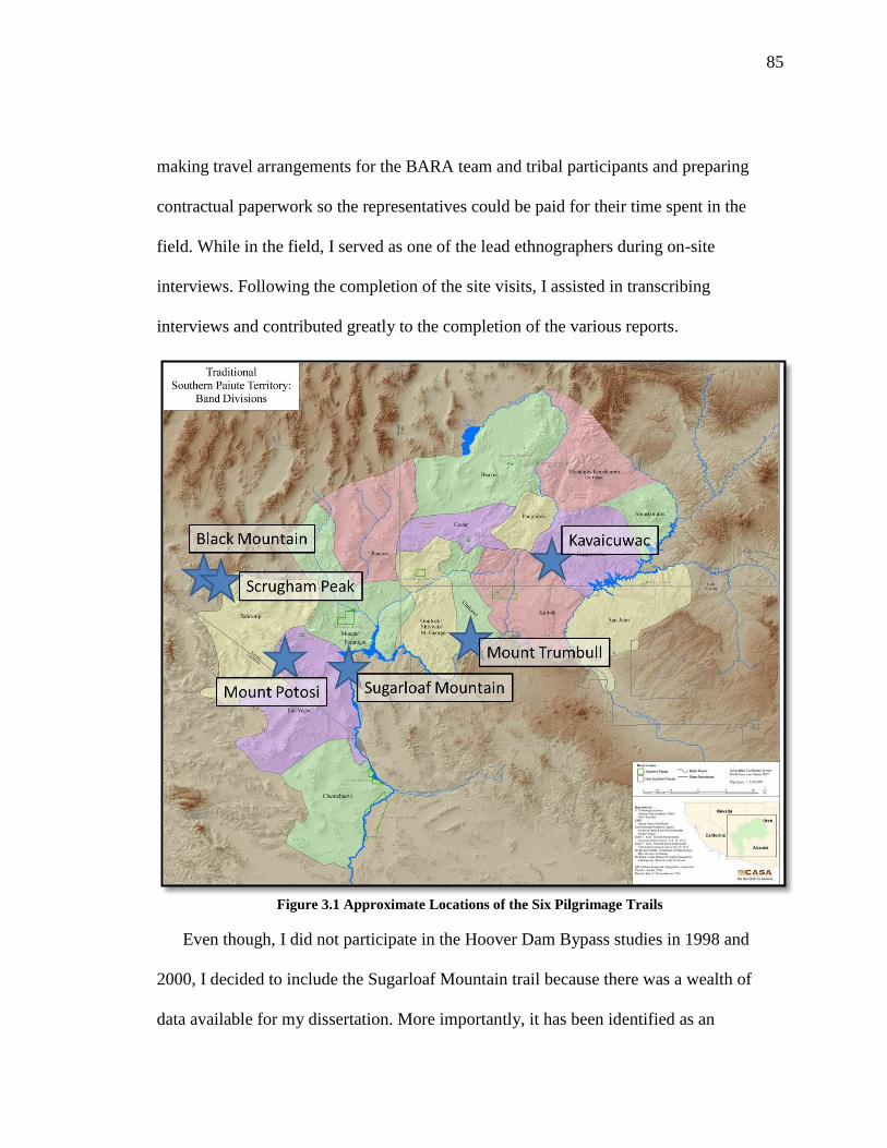
85
making travel arrangements for the BARA team and tribal participants and preparing
contractual paperwork so the representatives could be paid for their time spent in the
field. While in the field, I served as one of the lead ethnographers during on-site
interviews. Following the completion of the site visits, I assisted in transcribing
interviews and contributed greatly to the completion of the various reports.
Figure 3.1 Approximate Locations of the Six Pilgrimage Trails
Even though, I did not participate in the Hoover Dam Bypass studies in 1998 and
2000, I decided to include the Sugarloaf Mountain trail because there was a wealth of
data available for my dissertation. More importantly, it has been identified as an

86
important cultural landscape to Southern Paiute people. It also provided an interesting
case study in regards to long-term management of ceremonial places. In trying to be
attentive to tribal requests and to seek possible geographic diversity, these trails were
located within different Southern Paiute districts/borderlands. Figure 3.1 shows proximal
trail locations and corresponding districts.
3.2.2 Site Visits- Cultural Protocols and Respect
During field visits for each of the original studies, it was important that site visits
were guided by Southern Paiute cultural principles for visiting places throughout their
traditional territory. At the start of each day, tribal representatives, and BARA
ethnographers (myself included) gathered to say prayers and smudged ourselves with
sage before exploring sites. Southern Paiute representatives requested that everyone take
part in these actions in order for group members to spiritually prepare themselves for the
field visits. This action made sure that the group members were not taking any
imbalances and impurities with them to these places that could cause the group harm
during the day.
While at each site, some tribal representatives said individual prayers and left
offerings. When looking at artifacts that were left by the Enughwuhipe (ancient ones),
some materials were picked up to be photographed and examined more closely. These
items were returned to the spots where they were found and no artifacts were collected.
During some studies, it was important for the group to gather at the end of each
field day for exit prayers and smudging in order to prevent bringing spirits into the
communities used as the base of operation and everyone’s home communities. These

87
spirits might cause people harm and sickness. For Southern Paiute representatives, these
actions were necessary because visitors need to show the land, the plants, the animals, the
ancestors, and other elements respect.
3.3 Building on the BARA Methodology
The BARA research team has worked with the Southern Paiute people for over 30
years and over this period of time a strong research partnership has been established. This
partnership has directly influenced how I approach research projects involving Indian
people and tribes and my research methodology. I have adapted BARA’s approach in that
this research involves the use of mixed methods (Tashakkori and Teddlie 1998; Beebe
2001) and triangulation (Campbell and Fisk 1959). This approach involves collecting
qualitative and quantitative data, and where there is convergence, confidence in the
findings grows considerably (Jick 1979).
In designing an optimal ethnographic study, it is important to allow for studies to
build upon one another. These are called iterative studies. Lessons learned in one study
can influence the kinds of questions asked in the next, so the intellectual foundation of
the work itself increases from study to study. Ideally, the findings of each study would be
placed together for analysis. By creating a database for the initial study, each new study
regardless of its scale can add interviews until the optimal study level is reached. When
ethnographic studies are viewed from the perspective of being iterative studies, they are
viewed as open-ended and waiting for new findings. The types of questions asked in the
course of this ethnographic study, and to some extent even the exact survey instruments
have been used over recent decades during a number of ethnographic studies situated in

88
and around the six pilgrimage trails. Included in this discussion is a brief summary of
each form that has been used in the projects build upon and the one I developed
specifically for my dissertation. I have also included the forms in Appendix A.
3.3.1 Native American Cultural Resources (the Site Form)
The Native American Cultural Resources Interview form is place-specific and is
used to record site use history and types of ethnographic resources associated with site
use including water, plants, animals, minerals, landforms, and archaeological remains.
With this form, the ethnographer can elicit detailed information on material, behavioral,
and spiritual connections among resource types, and between each resource and a place.
It was used initially during BARA’s Zion National Park and Pipe Spring National
Monument Study (Stoffle, et al. 1997). This form has since been successfully applied in
numerous federally funded projects that involved tribes in the West and Midwest regions
of the United States.
3.3.2 Ethnoarchaeology-Rock Art Form
The Ethnoarchaeology-Rock Art Form is used in the event that the Site Interview
was too general, and more fine-grained analysis is deemed feasible and useful for a study.
This form specifically is used when petroglyphs or pictographs are the dominant resource
at the site. This form focuses on an individual’s and ethnic group’s use, meaning of rock
peckings and paints, and their understanding of how it is connected to the surrounding
landscape (Stoffle et al. 1995, Zedeño at al. 1999).

89
3.3.3 Cultural Landscapes Form
The Cultural Landscape Form was designed with input from federal agencies who
needed to have a way to manage much larger areas as integrated cultural phenomena and
with Indian people whose culture is organized in terms of such big areas. At a national
federal policy level such efforts correspond with the concept of Ecosystem Management
(Yaffee et al. 1996). The landscape form frames place and resource-specific information
in a broader regional and more abstract cultural context. With this form, we investigate
origin and migration traditions, ethnic group settlement and land use history, and specific
use patterns of the natural topography. Data on trail systems, including travel across land
and through water, and ceremonial trails associated with songs, drum circles, dreaming,
pilgrimages, and individual quests, also are crucial to unraveling complex cultural
connections between places and resources.
3.3.4 Dissertation Instrument
This survey instrument was developed in consultation with Southern Paiute
religious leaders and knowledgeable cultural experts for understanding pilgrimage and
relationship formations. The eleven page instrument contains questions pertaining to
relationship formation between people, places, and objects along a pilgrimage trail
followed by questions on how and why these relationships are formed and maintained
and how this contributes to the overall pilgrimage ceremony.
3.3.5 Open-ended Interviews
Open-ended interviews have been an important research tool used during this
study. Open-ended interviews are defined as a conversation between an ethnographer and

90
cultural representative during which information specific to the project is shared and
recorded. Open-ended interviews and discussions can occur for various reasons. Probably
the two most common reasons are that the ethnographer and the cultural representative
are traveling to or from a place that is being studied or the ethnographer and the cultural
representative are walking around a place and examining it together. Either the place or
the conversation may elicit a response that is relevant to some cultural dimension of the
study. In most cases the information is offered at a time when it is difficult to record it on
a survey instrument, and so the ethnographer instead records the comments by tape or the
tribal representative provides personal notes in regards to their thoughts and concerns
about a place or an important cultural resource.
3.4 Summary of Interviews
I interviewed tribal members on the place logic and performance characteristics of
pilgrimage trails, the formation of communitas during pilgrimage. These interviews
supplemented the previous interviews conducted during the previous studies. This study
draws upon 740 interviews. In each pilgrimage chapter, I included a detailed description
of the original project purposes and methodologies and project specific breakdown of the
conducted interviews.
3.4.1Tribal Involvement
A number of factors contributed to which tribes were selected for targeted
interviews. Some information had tribal restrictions placed on it due to the contentious
nature of the original project, so I had to seek permission from the Kaibab Band of Paiute
Indians in order to use this material in my dissertation. Because Kaibab took part in this
91
in this project, I wanted to conduct follow up interviews with the participating tribal
members.
The Pahrump Paiute Tribe and the Colorado River Indian Tribes were selected
because I have a long standing working relationship with tribal members who are seen as
cultural experts. Tribal members interviewed also were participants in many of the
original studies. They have provided valuable input to the creation of my survey
instrument and the overall project development.
3.4.2 Confidence in Findings
Confidence in research findings depends directly on the number of Indian people
who are interviewed with a specific form. Knowledge in human societies is unevenly
distributed by gender, age, and status. This study uses the BARA position on conducting
Native American ethnographic studies which is that a minimal ethnographic study
requires four people per ethnic group be interviewed with the same form on the same
topic that is being studied (Stoffle et al. 1999). In this case, the term ethnic group means
people who share a common history, language, and culture. These requirements have
been met by this study.
While, traditionally, pilgrimages were men’s activities, women in contemporary
Southern Paiute society possess knowledge of power acquisition and they understand that
ceremonies like pilgrimage have an inherit logic. In ethnographic studies, it is important
to interview men and women on the topic being studied to understand the broader
perspective. Men and women might have knowledge on the topic that may be culturally

92
transmitted in different ways and they may relate to an issue differently so it becomes
important to document those differences.
It is important to recognize, however, that confidence in the findings derives from
an overall triangulation of comparable findings from any of these instruments and oral
histories. The triangulation of data involves comparing responses generated with different
instruments. When two or more instruments provide the same answer to a research
question, then the confidence in the accuracy of the answer is increased. Confidence in
the accuracy of responses also increases to the extent that most interviewees provide the
same answer.

93
CHAPTER FOUR
SOUTHERN PAIUTE SACRED ECOLOGY AND PLACE
LOGIC
In order to understand how Southern Paiute pilgrimage trails and ceremonial
activities manifest themselves on a landscape, it is necessary to examine how Southern
Paiute people relate to the world. The basic underlying theme in Southern Paiute culture
is that everything is connected therefore a person’s actions impact not only his or herself
but also the places one visits and natural elements of the universe. The interdependence
and interconnectedness of people, place, and objects form complex relationships that
have been established during and maintained since Creation. During pilgrimage, these
long-standing relationships influence how and why a person interacts with a given
landscape. Places found along pilgrimage trails have a cultural logic to them that reflect
the flow and distribution of power. This chapter examines this cultural logical (aptly
referred to as place logic) and how this is reflected in Southern Paiute pilgrimage and
associated trail networks.
4.1 Sacred Ecology
In Native North America, Indian people maintain that they were created in their
traditional homelands at the beginning of time and have developed deep-rooted
connections and understandings of their landscape. Their knowledge is developed and
shared over time and has allowed their respective communities to plan for events that
change the normal social and ecological cycles through the existence of regulations and

94
hierarchies. This structure has allowed them to maintain control over how resources are
being used and managed by individuals, families, and larger social groups.
Communities with long-term occupation in an area develop an extensive body of
knowledge that has been time-tested through native science and cumulative experience
and shared on a community level. This knowledge is so accepted that it becomes
tradition; it is no longer debated but viewed as undeniable fact. Because it is trusted,
people use this knowledge to make ecological predictions. They use their abilities to
understand and predict ecological affects by incorporating it into their religious
institutions and ceremonial cycles.
This body of knowledge often is referred to as traditional ecological knowledge.
An ecologist from the University of Manitoba, Fikret Berkes, in his book Sacred Ecology
(Berkes, 2008: 3) offers a fundamental definition of traditional ecological knowledge
(TEK): “a cumulative body of knowledge, practice, and belief, evolving by adaptive
processes and handed down through generations by cultural transmission about the
relationship of living beings (including humans) with one another with their
environment.” The people and their environment co-adapt with each other and become
heavily co-dependent over time, a symbiosis necessary in order to keep the system
productive and to maintain and increase biodiversity.
Many scholars who examine TEK focus only on contemporary environmental use
and the management aspects of the human-environment relationships. While valuable,
these authors often fail to explain an important part of TEK: how these relationships were
grounded in complex cultural systems that in many cases been in existence for thousands

95
of years. These relationships with the environment are more than simply observing and
understanding animal migration patterns, weather cycles, and then developing plant
management techniques. Long-term multi-generational co-adaptation and interaction with
the environment leads to spiritual interactions between community members and the
landscape. Stoffle, Toupal, and Zedeño (2003) describe these types of connections as the
period when the barriers between secular and spiritual relationships are broken down and
there is no clear distinction between interacting with the environment for survival
activities and religious activities.
The linkages human communities have with a landscape are not synonymous with
natural untouched environments. Instead, people engage with and modify the landscape
to create dynamic systems that become manifest during the interaction of ecological and
social systems (Anschuetz, Wilshusen, and Scheick 2001: 160, Cosgrove and Daniels
1988). At the intersection of these interacting systems is where sacred ecology is created
and maintained through the ritual performance of ceremonial activity.
Ceremonial landscapes are formed when nature, culture and the identities of
people and places overlap. Christopher Tilley explains that people are immersed in a
world of places where they aim to understand and preserve sites/locales as recorders of
human experiences. These experiences are constructed in movement, historic memory,
encounter, and association (Tilley 1994: 15). Cultural narratives that link people to place
are at the core of ontological and epistemological understandings, historic memory, and
TEK. Places retain memories of human interactions in the same manner that people retain
96
memories of places and associated interactions. The memories held by both places and
people influence how socio-ecological interactions take place.
Understanding the relationships between people and their environment is
fundamental to understanding the cultural logic involved in ritual actions and
performances like pilgrimage. According to anthropologist, Kristen Carroll, pilgrimages
are important to a society’s cultural connections to the environment. Pilgrimages are
important to a society’s cultural connection to their local environment. She also notes
that, “the incorporation of pilgrimage into ritual sequences affirms the collective
valuation of particular places and the social memories inscribed in the landscape”
(Carroll 2007:70).
4.2 Southern Paiute Epistemology-Puha
The ways in which societies relate to their environments are grounded in their
epistemologies. In Southern Paiute society, relationships and deep connections with their
environment were formed during Creation. Southern Paiutes maintain that the Creator
gave them the responsibility to manage their environment to promote environmental
growth and sustainability. They have developed numerous strategies and activities that
increase biodiversity and biocomplexity throughout their homeland. The basic tenants of
Southern Paiute epistemology help forge the relationship they have with their
environment. To Southern Paiutes, the universe is alive and everything is interconnected
through all types of relations, what anthropologist Roy Rappaport (1999:263-271; 446)
calls “the ultimate sacred postulate.” The universe is alive in the same way that humans
are alive and the universe possesses most of the same anthropomorphic characterizes as

97
well. The universe has discrete physical components such as power and elements. It is a
living system. This concept of the living universe is so fundamental that any discussion
of Southern Paiute culture cannot occur without it.
As explained by Liljeblad (1986: 643-644), to the Southern Paiutes power is
everywhere and is “a source of individual competence, mental and physical ability,
health, and success.” Power is referred to as Puha. This concept is common to that of
many different tribes living throughout the western United States. Other Numic speaking
people such as the Ute, Western Shoshone, Owens Valley Paiutes, and Northern Paiutes
have similar words in their languages1 Puha is a fundamental principle of their
epistemologies as well. The concept of power is not limited to Great Basin and Colorado
Plateau peoples; it is also a core epistemological principle in the cultures of nearby
Upland and Colorado River Yuman-speaking peoples such as the Mojave, Hualapai, and
Havasupai.
According to Numic and Yuman beliefs, Puha is derived from Creation and
permeates the universe, which resembles a spider web. Sometimes it is like a thin
scattering; at other times, it occurs where there are clusters of life in definite
concentrations with currents. Puha exists throughout the universe but varies in intensity
from person to person, place to place, element to element, and object to object. This is
similar to how strength differs among humans. Puha can also vary in what it can be used
for and it determines the tasks certain elements (air, water, rocks, plants, animals) can
perform or accomplish. Puha is networked; it connects, disconnects, and reconnects
1 Ute- Puwavi, Western Shoshone- Puha and Poha, Northern Paiute- Puha. The Chemehuevi and Southern
Paiute are the same people with a common language. The word for Puha is the same.

98
elements in different ways. This occurs because of the will of the elements that have the
power. Puha is present in and can move between the three levels of the universe: the
upper level—where powerful anthropomorphic beings live, the middle level—where
people live now, and the lower live—where extraordinary beings with reptilian or
distorted humanoid appearances live (Stoffle et al. 2001).
In his article, “Basin Religion and Theology: A Comparative Study of Power
(Puha),” Miller (1983: 79-89) noted that:
Power is diffused everywhere in continuous flux and flow, which
however, is not haphazard because, as an aspect of memory, power is
rational. From all available evidence, the routes of concentrated power
within generalized dispersion are web-like, moving both in radial patterns
and in recursive concentric ones, out from the center and back again…The
web image is reflected in the stories where Coyote assumes the form of a
water spider to carry humans to land and Sun takes the form of a spider
who is webbing the firmament of the universe…The web of power,
however, is not static like that of a spider because the webbing actually
consists of the flow of power rather than filaments per se. Rather, the web
is pulsating and multidimensional, even having aspects of a spiral, some-
times regular and sometimes erratic, intersection with the radials from the
center. This spiral movement is represented most graphically by an in-
dwelling soul of a person that can be seen escaping the body at death as a
whirlwind.
While operating in a dynamic equilibrium within the universe, Puha is also
entropic (Bean 1976; Blackburn 1974; Stoffle, Zedeño, and Halmo 2001; White 1963).
This means that over time, Puha has gradually diminished since Creation in quality,
quantity, and availability. The reason for this is that human beings at various times treated
it improperly, and failed to uphold their responsibilities their responsibilities in the
relationship they have with the interdependent system. Indian people believe that a very
rapid loss of Puha occurred after the European encroachment. Knowledge concerning
99
how to regulate relationships with powerful elements was lost through the processes of
colonization. Despite this Puha is always retrievable in some form as long as new
guidelines are established for obtaining, maintaining, and respecting it.
In Southern Paiute culture, there are rules for handling Puha and powerful
objects. These rules function to control the person with the Puha and prevent him
or her from misusing it in one of two ways. First, power can only be used at
proper times and in proper places and it must be used in accordance with
standardized procedures such as preparation and pilgrimage to ceremonial areas.
Secondly, people who have obtained and control Puha and its knowledge may
withhold information on procedures for acquiring and maintaining power from
uninitiated persons or persons who are deemed unworthy candidates. As Stoffle,
Zedeño, and Halmo (2001: 65) wrote, “the diversity and unpredictability of power
was consistent with an ecosystem that was equally diverse and unpredictable,
although often kind and bountiful in the resources provided by nature.”
In her ethnographic piece on the Northern Paiute (culturally and linguistically
similar to Southern Paiutes), Catherine Fowler (1992:170-172) described how the people
of Fox Peak believe Puha is present in all elements of the Earth:
One of the most basic beliefs that guided the interactions of people with
the land and its resources was the concept that the Earth was a living
being, just as were the Sun and Moon, the Stars and natural forces such as
Water, Wind, and Fire. The life force within all of these, as well as
particular geographic features and classes of spirit beings, was power
(Puha)… Although power potentially resides anywhere, its association
with mountains caves, spirits or other water sources, and the results of past
activities by Immortals or humans was particularly apparent.

100
This discussion of Puha in her ethnographic piece emphasizes that power concentrates in
all aspects of the universe and serves as the life force in these elements as well. Fowler
also notes that power is attracted to special people who can channel it and use it during
prayer and ceremony. For Numic-speaking peoples of the Great Basin and Colorado
Plateau, this concept and understanding frames how they relate to, understand, interact
with, and use the lands around them.
4.3 Place Logic and Pilgrimage Trails
Southern Paiute people use their cultural knowledge to understand the logic
behind how and why different kinds of places are found throughout a particular landscape
by reading the land for cultural indicators of power. The locations of places, for example,
can be predicted based on a suite of factors such as topography, geologic composition,
the presence of natural resources like Indian tobacco, its reference to other features, and
how these factors are understood from a particular society’s epistemology. From a
Southern Paiute perspective, place logic is linked to the distribution of Puha across their
traditional lands. Since Puha mimics the movement of water in a watershed, it flows from
the point of Creation to every corner of traditional Southern Paiute territory. When Puha
is dispersed, it clusters in certain types of places such as narrow and constricted places,
stone water tanks, mountain peaks, caves, and at the point of convergence of hydrological
systems (Stoffle, Zedeño, and Halmo 2001). Puha also is found at places associated with
volcanic activity, such as hot springs, basalt lava flows, and volcanic mountains. The
presence of volcanism indicates that the Earth is being reborn through Puha traveling to
the surface from deep inside the Earth.

101
Pilgrimage trails can be predicted using Southern Paiute place logic. For example,
knowing that people follow pilgrimage trails to powerful destination places, one knows
that the trail needs to pass through places with high levels of Puha. A pilgrimage trail is
likely to pass by a water source, a place of volcanic activity, and through some sort of
narrow and constricted space. By following these trails, pilgrims travel to isolated places
far away from their communities and other people. The isolation factor is important for
two reasons. First, the place logic for pilgrimage activities, like vision questing, is a
personal learning experience that needs to be free from outside social influences and
distractions. Pilgrimage involves being separated physically and spiritually from daily
community activities. Pilgrims need to observe strict water and food restrictions and they
need to closely follow instructions given to them from the experienced medicine men
who accompany them as part of the journey. The second reason is related to the way that
Puha concentrates. While the power of a place teaches a pilgrim, the Puha of the
surrounding landscape is also an essential part of the learning experience. Pilgrimage trail
sites are places with specific visible features and the land teach the individual by
strengthening the connection the pilgrims have with their surrounding environment
(Carroll et al. 2006).
Southern Paiute pilgrimage trails have eleven main components. These components
represent places along the trail pilgrims visited and interacted with as part of the overall
ceremony seen as a complex of sequential events and ritual interactions. These
components are listed in Table 4.1.

102
Pilgrimage Trail Performance Characteristics
1. Home Communities
2. Purification Sites
3. Tumpituxwinap (Rock Art) Sites
4. Narrow and Constricted Spaces
5. Trail Water Sources
6. First View of Destination Place
7. Medicine Collection and Preparation Areas
8. Paint/Mineral Sources
9. Ceremonial Lay-Down Areas
10. Final Preparation/Support Camp
11. Destination Place with a Viewscape
12. Communitas
Table 4.1 Pilgrimage Trail Performance Characteristics.
These places are found along pilgrimage trails because they provide pilgrims with the
necessary physical and spiritual resources that are needed to complete the journey. It is
worth noting that some features may fit into other categories listed in Table 4.1. The
eleven features are defined in this chapter and will be used to frame trail analysis in
subsequent chapters.
4.3.1 Home Communities
Prior to colonization and depopulation, the Southern Paiute Nation lands or use
territory included those in present day southern California, Nevada, Arizona, and Utah.
These lands were divided into fifteen districts that each contained several communities
centered around stable water sources needed for irrigated agriculture. These communities
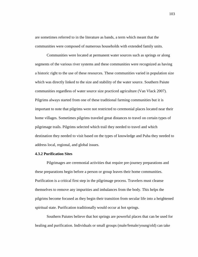
103
are sometimes referred to in the literature as bands, a term which meant that the
communities were composed of numerous households with extended family units.
Communities were located at permanent water sources such as springs or along
segments of the various river systems and these communities were recognized as having
a historic right to the use of these resources. These communities varied in population size
which was directly linked to the size and stability of the water source. Southern Paiute
communities regardless of water source size practiced agriculture (Van Vlack 2007).
Pilgrims always started from one of these traditional farming communities but it is
important to note that pilgrims were not restricted to ceremonial places located near their
home villages. Sometimes pilgrims traveled great distances to travel on certain types of
pilgrimage trails. Pilgrims selected which trail they needed to travel and which
destination they needed to visit based on the types of knowledge and Puha they needed to
address local, regional, and global issues.
4.3.2 Purification Sites
Pilgrimages are ceremonial activities that require pre-journey preparations and
these preparations begin before a person or group leaves their home communities.
Purification is a critical first step in the pilgrimage process. Travelers must cleanse
themselves to remove any impurities and imbalances from the body. This helps the
pilgrims become focused as they begin their transition from secular life into a heightened
spiritual state. Purification traditionally would occur at hot springs.
Southern Paiutes believe that hot springs are powerful places that can be used for
healing and purification. Individuals or small groups (male/female/young/old) can take

104
part in this ritual activity. Hot springs are geologically connected to volcanic activity,
which contributes to their healing properties and Puha. The combination of water and
volcanism produce a culturally special place where both ceremonial and medicinal
activities occur (Stoffle et al. 2000). Hot springs are so culturally central that they factor
into Numic Creation stories. For example, the Owens Valley Paiutes have a single origin
story for all the hot springs in the southern Great Basin and northern Mohave Desert.
According to their story, a great ball of fire came from the sky and landed at Coso Hot
Springs. The fireball splashed to form at once all the other hot springs in the region. One
elder recounted this story (Stoffle et al. 2000:7):
Grandfather said Creator is the one who put the first language in that
valley and I speak it, and these people [other Indians] got their language
put in their valley too. He has those [the little] people working for him.
Maybe you won’t believe me, but that’s the way it is. In every valley in the
Northern Plains were put Indians here and there, and so it was with hot
water too. It was made for Indians for sickness or to clean up with. He put
that big Coso Hot Springs over there. The Sun fell, the story went, and it
fell into the hot spring and it splashed here and there, and the places
where they have hot springs, it came from over there. Since I talked the
language, I’ve been teaching one [girl] and now she’s starting to talk the
language. She’ll be teaching soon.
Owens Valley Paiutes and other Numic groups (including the Southern Paiutes)
have rules for interacting and maintaining relationships with a hot spring because these
places are connected to Creation and volcanism. Before entering a hot spring, a person
would speak to the spirit of the spring by introducing him or herself and then would
explain the purpose of the visit (Stoffle et al. 1995).
In previous ethnographic studies, Southern Paiute elders have often stated that
shamans used hot springs for ritual purification prior to visiting sacred caves or other

105
spiritual locations. The elders maintained that purification was necessary in order to
prepare the mind and body for a safe and proper interaction with spiritual beings and
powerful places (Stoffle et al 1995, Stoffle at al 2000, Stoffle et al. 2006, Stoffle et al.
2009a).
4.3.3 Tumpituxwinap (Rock Art) Sites
Rock art or petroglyph sites are important Puha places. These are places where a
person on pilgrimage would visit to acquire power or a spirit helper to be used in
ceremony. Numic-speaking people hold strong beliefs that the rocks are alive, have
power, and spiritual value. People interact with these places to aid in ceremony and
power acquisition to address issues on local, regional, and global scales. Great Basin
archaeologist, David Whitley (2000) noted that that Native people in California and the
Great Basin view rock art as gateways to the spirit world. Religious specialists can enter
the spirit world through certain types of storied rocks as part of ceremonial activity.
The word petroglyph is the technical name for the figures found carved into rock
faces. This word has been grouped by scientists and lay people with pictographs, or
paintings on rocks, into the term rock art focusing on the aesthetic or pictorial aspect of
beautifying a place. Conceptually, the term rock art can imply “expressive cultural
activities which are generally understood under the term art” (Stoffle et al. 1995: 3) and
convey both meanings and stories. Western connotations attached to the word “art” do
not always match with Native American cognition of petroglyphs and pictographs. This
classification is an oversimplification of a complex cultural phenomenon. Rock art does
not fully capture the full meaning of the images pecked or painted on the rocks.

106
In Southern Paiute culture, the term rock art is a misnomer in that it does not fully
explain the meaning and purpose of the peckings and paintings. The preferred term is
tumpituxwinap which when translated into English means “storied rocks.”
Tumpituxwinap refers to petroglyphs and pictographs placed on stone surfaces for only
sacred purposes. These images are not meant to be forms of casual communications or
expressions of cultural aesthetics. Based on over thirty years of collaboration and
research with Numic-speaking peoples, researchers from the Bureau of Applied Research
in Anthropology have documented consistent and reoccurring themes when discussing
tumpituxwinap. They noted the following (Stoffle, Zedeño, and Halmo 2001: 122):
The meaning of a petroglyph or panel is not meant for the public nor widely
shared by a community or ethnic group; the exact meaning is revealed to humans
individually.
Storied rocks derive from supernatural authorship, whether they are made by the
spirits or re-revealed. The rocks were once alive, were once people, but became
rocks for human benefit. The writings on them related to this transformation and
are part of the cosmos.
The strong beliefs that the rocks are alive, have power, and spiritual value, and fit
into the larger scheme of things, corroborate the ethnographic conclusion that the
worldview perceived that all the world is alive, its components all interconnected
and interdependent, and that power or knowledge is revealed to individuals
through dreams and private visits to such locations.
A storied rock is a permanent feature that modifies and becomes integrated with
the natural surroundings. It is a landmark, a place that draws people and is
remembered by people regardless of its original intent.
The key to understanding tumpituxwinap is to know that the place was powerful prior to
the appearance of the peckings or paintings. Based on how Puha manifests itself across a
landscape, powerful places attract powerful elements. At places containing
tumpituxwinap, other powerful elements like medicine plants, hawks, water, and

107
evidence of volcanism in and around the storied rocks are found. This is because the
elements that comprise the universe have individual personalities, dispositions, and
characters; therefore like humans, such elements are attracted to and negotiate
relationships with each other. In order words, powerful elements are attracted to each
other and like to exist in places together.
Figure 4.1 The Entrance to Catstair Canyon
4.3.4 Narrow and Constricted Spaces
It is easy from a Western perspective to focus on places that contain
archaeological or even ethnobotanical materials, however some places are deemed
culturally important to a pilgrimage due to a place’s unique topographic qualities and
geological formations. In Southern Paiute culture, narrow or constricted spaces such as
caves, slot canyons, and washes influence cultural meaning and influence the movement
of natural elements like wind and water. Pilgrimage trails pass through or near these

108
narrow spaces, because these are areas where Puha converges and collects in a manner
similar to how water will pool in constricted places. As a trail passes through these types
of locations, a pilgrim can experience and draw upon the power of the area as he or she
progresses on the journey. It is common to find in these narrow spaces petroglyphs or
painted figures and sometimes the entranceways into these constrictions are marked with
rock cairns (see Figures 4.1, 4.2, and 4.3).
Figure 4.2 Trail from Pillar Springs to Black Mountain
Cairns are indicators of ceremonial activity and use. They are constructed along
the trail to serve as physical indicators that pilgrimage occurred in a particular area.
Cairns serve three purposes along the trail. Sometimes they are used are trail markers as
seen in Figure 4.4. Secondly, the Western Shoshone have noted that cairns are used as
places of prayer where a pilgrim’s prayers are sent out to the different levels of the

109
universe (Stoffle et al. 2009a). The third purpose is that cairns are markers of where
vision quests have occurred, as seen in Figure 4.5 (Stoffle et al. 2006).
Figure 4.3 Caldera Pecking Site
Figure 4.4 Cairn Marking the Trail to Black Mountain

110
Figure 4.5 Cairns Located along the Edge of Buckboard Mesa Marking Vision Questing
4.3.5 Trail Water Sources
In the Great Basin and Colorado Plateau, water is the most important element for
all life forms. Southern Paiute people often associate water with power and ceremony
because it sustains life. Water is viewed as a sacred element and its power is found in
clouds, rain, snow springs (hot and cold), seeps, lakes streams, and rivers (Miller 1983).
It is understood that Puha is strongly attracted to water and it is used as a purifying agent
(Whiting 1950).
Because water is associated with Puha and ceremony, it is understandable that
water sources are important parts of pilgrimage trails and the water is used in ritual
activities. Water sources such as springs are key components of pilgrimage ceremonies.
Hot springs are used in pre-pilgrimage preparations of ritual cleansing. During
pilgrimage, pilgrims visit water sources during their journey. It is common for at least
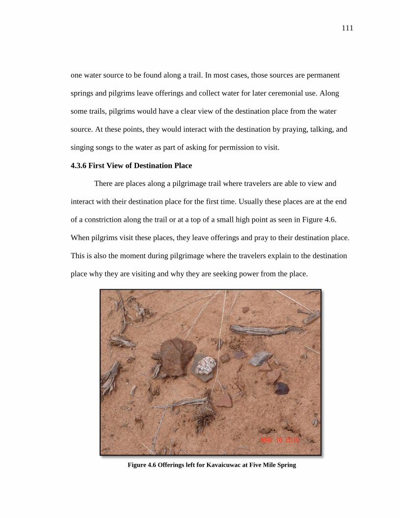
111
one water source to be found along a trail. In most cases, those sources are permanent
springs and pilgrims leave offerings and collect water for later ceremonial use. Along
some trails, pilgrims would have a clear view of the destination place from the water
source. At these points, they would interact with the destination by praying, talking, and
singing songs to the water as part of asking for permission to visit.
4.3.6 First View of Destination Place
There are places along a pilgrimage trail where travelers are able to view and
interact with their destination place for the first time. Usually these places are at the end
of a constriction along the trail or at a top of a small high point as seen in Figure 4.6.
When pilgrims visit these places, they leave offerings and pray to their destination place.
This is also the moment during pilgrimage where the travelers explain to the destination
place why they are visiting and why they are seeking power from the place.
Figure 4.6 Offerings left for Kavaicuwac at Five Mile Spring

112
4.3.7 Medicine Collection and Preparation Areas
During their journeys, pilgrims visit places along the trail to gather certain
materials for medicines to use in preparations to complete their journeys. Pilgrims seek
out places along pilgrimage trails to gather special medicine plants. While these types of
plants grow throughout traditional Southern Paiute territory, pilgrims need those that
grow along the trail because they have high concentrations of Puha. The power of the
trail system attracts medicine plants like Indian tobacco, purple sage, and creosote bush.
The power in the plants contributes to the overall pilgrimage ceremony, therefore
pilgrims gather during their journey as opposed to before they begin their trek to their
destination place.
Southern Paiutes believe plants like all other beings on Earth have agency and
Puha. If a person mistreats or improperly uses these plants, the plants can choose not to
help in ceremony, or the plants can choose to remove themselves from this level of the
universe. This understanding is the foundation for how Southern Paiute people gather
medicine plants. In order to gather medicine plants properly, they need to be approached
with great respect. Those who seek medicine plants need to explain to the plants why
they need them from this particular location. People collecting these plants must leave
offerings as a way of thanking the plants for giving their lives to the people collecting
them and thank the plants for their assistance. In most cases, water is left. Once the
pilgrims obtain the proper combination of plants, pilgrims either prepare them at the
gathering site or take them to a place further along the trail to prepare the medicines.
Archaeologically, it is common to find grinding stones or slicks and/or mortar and pestles
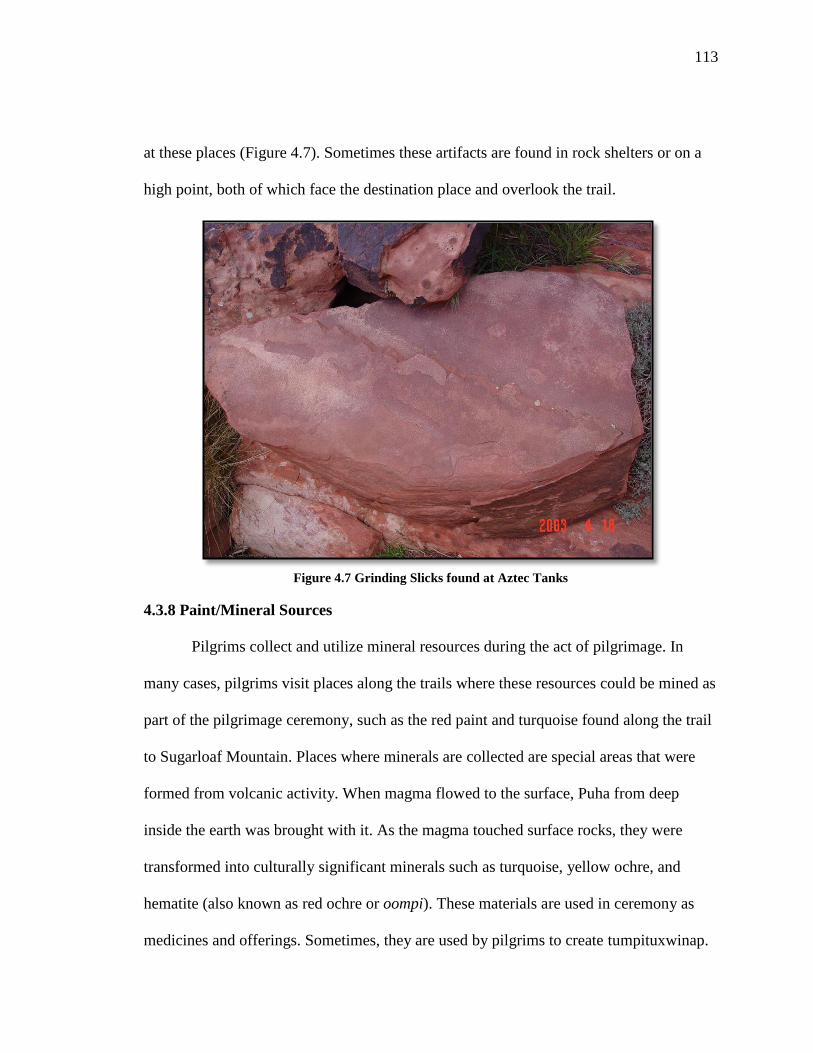
113
at these places (Figure 4.7). Sometimes these artifacts are found in rock shelters or on a
high point, both of which face the destination place and overlook the trail.
Figure 4.7 Grinding Slicks found at Aztec Tanks
4.3.8 Paint/Mineral Sources
Pilgrims collect and utilize mineral resources during the act of pilgrimage. In
many cases, pilgrims visit places along the trails where these resources could be mined as
part of the pilgrimage ceremony, such as the red paint and turquoise found along the trail
to Sugarloaf Mountain. Places where minerals are collected are special areas that were
formed from volcanic activity. When magma flowed to the surface, Puha from deep
inside the earth was brought with it. As the magma touched surface rocks, they were
transformed into culturally significant minerals such as turquoise, yellow ochre, and
hematite (also known as red ochre or oompi). These materials are used in ceremony as
medicines and offerings. Sometimes, they are used by pilgrims to create tumpituxwinap.
114
4.3.9 Ceremonial Lay-Down Areas
Ceremonial lay down areas are stopping places along pilgrimage trails where the
travelers have full-unobstructed views of their destination places. Ceremonial lay down
areas are located at the end of constricted spaces and have high densities of
archaeological materials like pottery or pieces of arrowheads and medicinal plants. In a
previous ethnographic study, one such place was identified on the Nevada Test Site. This
area overlooked Fortymile Canyon and faced the western side of Shoshone Mountain.
Archaeologists documented one of the largest collections of Pinto Basin points in the
Great Basin at this site. Tribal representatives who examined the points and the site
believed that people visiting Shoshone Mountain left these points are offerings to the
mountain as part of ceremonial activities.
Ceremonial lay down areas are complex places that can sometimes be
misinterpreted in archaeological studies. The high concentrations of artifacts have led
archaeologists to identify these places as village or hunting sites or random lithic scatters,
which were created by careless Indian travelers. Southern Paiute people interpret places
based on not only the types of archaeological materials found but also the types of natural
resources available and where the place is located in relation to known ceremonial areas.
Places where people lived would not have been located at the base of a ceremonial
mountain because it would have been too dangerous for women and children to be around
such high concentrations of Puha. It makes more sense from a cultural perspective to see
the places where pilgrims left offerings for the mountain

115
4.3.10 Final Preparation Site/Support Camp
Probably the next least understood feature along a pilgrimage trail is the support
camp near the destination place (Figure 4.8). This location is proximate to the actual
destination place but is removed sufficiently from that location to afford the person
seeking power and knowledge privacy. At the support camp, a group of medicine people
monitors activity that is occurring at the destination place. Those at the support camp
have four primary roles: (1) help the seeker finalize his or her preparations to visit the
destination place; (2) advise the seeker on what he or she has or will experience, (3) help
interpret what is happening, and (4) assure that the vision seeker does not become
comatose or hurt by acquiring large amounts of Puha.
Figure 4.8 Support Camp on Mount Potosi

116
Figure 4.9 Shoshone Mountain
4.3.11 Destination Place with a Viewscape
Pilgrimage destination places are isolated locations and are difficult to access.
Depending on the type of pilgrimage a person or group is on, the destination place varies.
Sometimes a destination place may be a high mountain peak (Figure 4.9), a cave in a high
cliff side (Figure 4.10), or small volcanic buttes (Figure 4.11). Destination places have
high concentrations of Puha and can be approached only by the properly prepared. When
pilgrims reach their destination, they interact with it by singing and praying to it. Places
like to interact with each other and share power, particularly mountains. A Southern
Paiute elder explained, “Mountains stand on their toes so they can look at each other.
They enjoy each other’s company and share their energy” (Stoffle et al. 2010). Pilgrims
interact with the surrounding landscape that they can see from the high elevation in order
to draw upon their power.

117
Figure 4.10 Ceremonial Song Cave in the Spring Mountains
Figure 4.11 Black Butte, Nevada

118
4.4 Conclusions
As discussed in this chapter, Southern Paiute people have complex deep rooted
connections to their traditional lands. These relationships have been established and
maintained since Creation and are founded in the notion of a living universe with people,
places, and objects possessing varying degrees of Puha. The way in which Puha
manifests itself and clusters throughout a landscape influences the types of interactions
between people, place, and object that occurs. Movement along pilgrimage trails and
their associated performance characteristics are reflected in these relationships. The
analysis in this chapter provides a foundation for understanding the types of places and
objects found along designated pilgrimage trails and provides the framework the
subsequent analysis in later chapters.
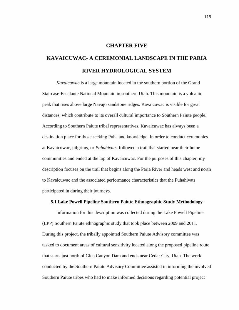
119
CHAPTER FIVE
KAVAICUWAC- A CEREMONIAL LANDSCAPE IN THE PARIA
RIVER HYDROLOGICAL SYSTEM
Kavaicuwac is a large mountain located in the southern portion of the Grand
Staircase-Escalante National Mountain in southern Utah. This mountain is a volcanic
peak that rises above large Navajo sandstone ridges. Kavaicuwac is visible for great
distances, which contribute to its overall cultural importance to Southern Paiute people.
According to Southern Paiute tribal representatives, Kavaicuwac has always been a
destination place for those seeking Puha and knowledge. In order to conduct ceremonies
at Kavaicuwac, pilgrims, or Puhahivats, followed a trail that started near their home
communities and ended at the top of Kavaicuwac. For the purposes of this chapter, my
description focuses on the trail that begins along the Paria River and heads west and north
to Kavaicuwac and the associated performance characteristics that the Puhahivats
participated in during their journeys.
5.1 Lake Powell Pipeline Southern Paiute Ethnographic Study Methodology
Information for this description was collected during the Lake Powell Pipeline
(LPP) Southern Paiute ethnographic study that took place between 2009 and 2011.
During this project, the tribally appointed Southern Paiute Advisory committee was
tasked to document areas of cultural sensitivity located along the proposed pipeline route
that starts just north of Glen Canyon Dam and ends near Cedar City, Utah. The work
conducted by the Southern Paiute Advisory Committee assisted in informing the involved
Southern Paiute tribes who had to make informed decisions regarding potential project

120
impacts. Members of this committee are from the Kaibab Band of Paiute Indians, Paiute
Indian Tribe of Utah, and the San Juan Southern Paiute Tribe. This project originally was
funded by the Bureau of Indian Affairs to assist the Kaibab Band of Paiute Indians in
documenting culturally sensitive areas during the early phase of the environmental
impact assessment in 2009. The state of Utah’s Division of Water Resources funded the
second phase of this study in 2010. The involved Southern Paiute tribes selected
University of Arizona (UofA) researchers to help facilitate this study during the early
phases of the environmental assessment process.
Project field visits and meetings took place between May 2009 and November
2010. During the six field sessions committee members selected places that contained a
range of Native American cultural resources such as archaeological materials, rock
peckings and paintings, known burials, ceremonial areas, and ethnobotanical materials.
The committee stipulated that Southern Paiute people have used these places for
thousands of years. In total, the Southern Paiute Advisory Committee visited a total of 40
individual places along the proposed LPP route. While visiting these places, committee
members were asked to write a brief statement describing what they thought was
culturally significant about each site and they provided the UofA ethnographers with
culturally appropriate names. These assessments served as the core of their report and the
foundation for my analysis. In total, the committee provided the UofA team with 364
assessments which include completed survey forms and personal statements regarding the
meaning of places and their importance to Southern Paiute people today. In this chapter,
eight places associated with the Kavaicuwac pilgrimage trail are analyzed; this equates to

121
74 site assessments. Table 5.1 summarizes the number of assessments per trip for places
along the trail.
Place Number of Assessments per Field Session
May-09 Oct-09 Mar-10 May-10 Sept-10 Nov-10 Total
Paria River Crossing 5 0 0 0 0 0 5
Catstair Canyon 5 3 7 0 0 0 15
Upper Catstair
Canyon 5 0 0 0 0 0 5
Five Mile Spring 0 0 9 0 0 0 9
The Grandmother
Tree 0 8 0 0 0 0 8
Trail Map Rock 0 0 9 0 9 0 18
Kavaicuwac
Paayuxwitse 0 0 0 0 7 0 7
Kavaicuwac 0 0 0 0 7 0 7
TOTAL
INTERVIEWS 15 11 25 0 23 0 74
Table 5.1 Site Assessments Collected during the LPP Ethnographic Study for Places along the
Kavaicuwac Puha Po
During this project, I took part in all project field sessions and participated in
many of the interviews were tribal representatives. Because of my involvement in this
study I had access to the interview database which I drew upon for my dissertation
research. I also received permission from the Kaibab Band of Paiute Indians to use this
material in my dissertation providing I do not reveal sensitive locational information.
5.2Kavaicuwac Puha Po in Ethnographic Context
Kavaicuwac is a Southern Paiute word that translates to mean “Mountain
Breathing” or “Mountain’s Breath.” At the request of the Southern Paiute Advisory
Committee and the Kaibab Band of Paiute Indians’ Tribal Council, appropriate Southern
Paiute terms are used in this dissertation whenever possible, especially when the

122
discussions deals with pilgrimage trails and sacred places. They believe that Southern
Paiute names properly reflect the cultural significance of a place and landscape and
protect the integrity of these areas from people who could cause damage to cultural
resources associated with these locations.
Figure 5.1 General Location of the Kavaicuwac Puha Po
Southern Paiute religious specialists have used Kavaicuwac and the surrounding
landscape since time immemorial. This pilgrimage trail or Puha Po is located within the
Kaibab district of the Southern Paiute Nation (see Figure 5.1) and situated in the Five
Mile Valley-Telegraph Flat hydrological system. This hydrological system starts in the
high peaks and mesas of the Grand Staircase-Escalante National Monument. Kavaicuwac
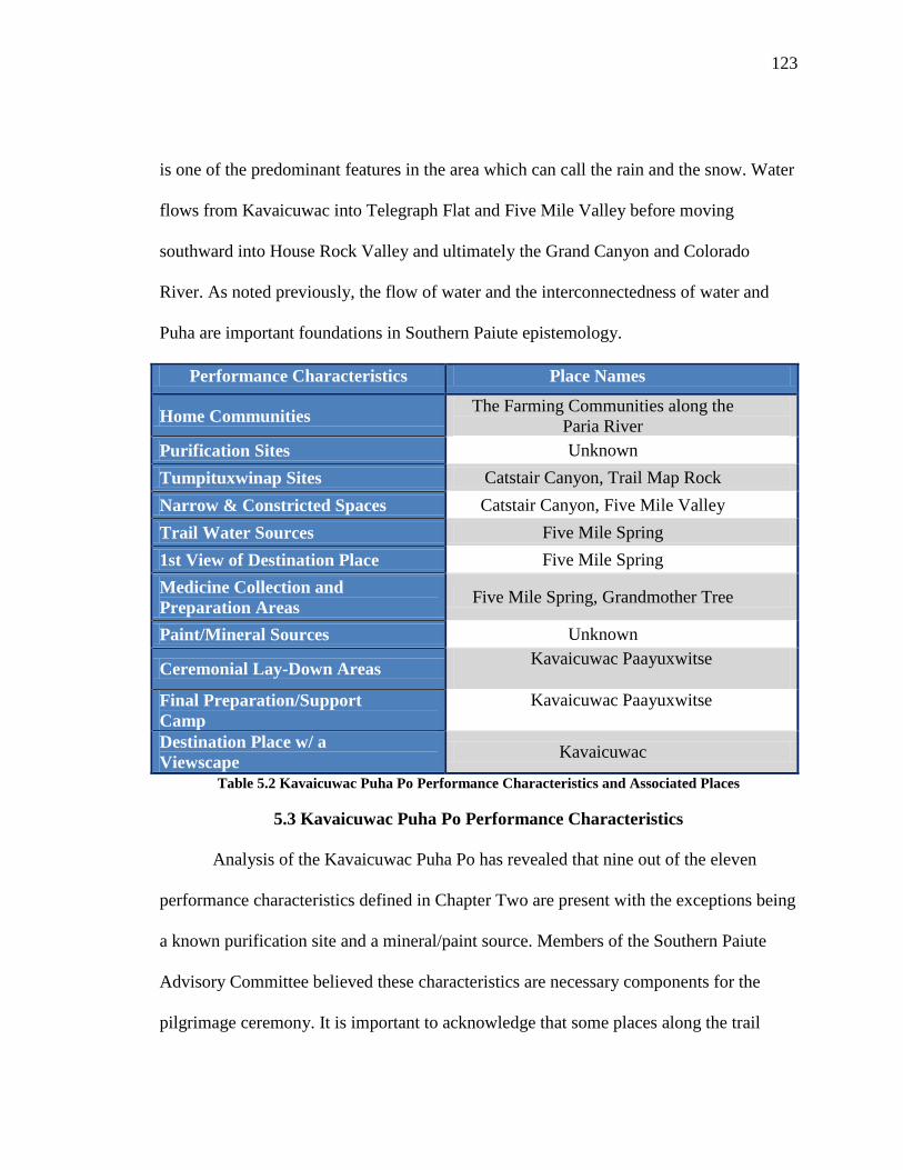
123
is one of the predominant features in the area which can call the rain and the snow. Water
flows from Kavaicuwac into Telegraph Flat and Five Mile Valley before moving
southward into House Rock Valley and ultimately the Grand Canyon and Colorado
River. As noted previously, the flow of water and the interconnectedness of water and
Puha are important foundations in Southern Paiute epistemology.
Performance Characteristics Place Names
Home Communities The Farming Communities along the
Paria River
Purification Sites Unknown
Tumpituxwinap Sites Catstair Canyon, Trail Map Rock
Narrow & Constricted Spaces Catstair Canyon, Five Mile Valley
Trail Water Sources Five Mile Spring
1st View of Destination Place Five Mile Spring
Medicine Collection and
Preparation Areas Five Mile Spring, Grandmother Tree
Paint/Mineral Sources Unknown
Ceremonial Lay-Down Areas Kavaicuwac Paayuxwitse
Final Preparation/Support
Camp
Kavaicuwac Paayuxwitse
Destination Place w/ a
Viewscape Kavaicuwac
Table 5.2 Kavaicuwac Puha Po Performance Characteristics and Associated Places
5.3 Kavaicuwac Puha Po Performance Characteristics
Analysis of the Kavaicuwac Puha Po has revealed that nine out of the eleven
performance characteristics defined in Chapter Two are present with the exceptions being
a known purification site and a mineral/paint source. Members of the Southern Paiute
Advisory Committee believed these characteristics are necessary components for the
pilgrimage ceremony. It is important to acknowledge that some places along the trail

124
have multiple characteristics, which is due to how Puha manifests itself across the
landscape. Table 5.2 provides a summary of the types of performance characteristics that
correspond with places along the trail. The table is organized by type of resource and
corresponding place and generally reflects the order in which these characteristics appear
along the trail with the exception being Trail Map Rock. Southern Paiute people believe
this site was visited by Puhahivats following the visitation to the Grandmother Tree.
During the LPP ethnographic study, purification sites and paint sources were not
found along the trail because it was impossible to access all areas due to poor road
conditions and time constrictions. This does not mean that these types of cultural
resources did not play a role on this pilgrimage trail or the ceremonies performed there.
While hot springs are not present near this Puha Po, the Puhahivats likely performed acts
of purification and ritual cleansing in other ways before they began their journeys. One
Advisory Committee member suggested that instead of using hot springs, the Puhahivats
may have cleansed themselves in the Paria River. Other Southern Paiute people
suggested that ritual sweats may have been used as part of ceremonial preparation. Paint
sources are numerous throughout this portion of the Southern Paiute Nation and one
could conclude that paints such as red, yellow, blue, and white ochres were gathered prior
to the journey.
5.4 Following the Kavaicuwac Puha Po and Place Analysis
The pilgrimage to Kavaicuwac involves visiting and interacting with a series of
places along this trail. This trail begins in Southern Paiute communities along the Paria
River and passes through Catstair Canyon before crossing over the Cockscomb into Five

125
Mile Valley and turning north towards the mountain. This section provides a description
of each place and defines their associated performance characteristics and role in the
pilgrimage ceremony. Statements provided by the Southern Paiute Advisory Committee
who participated in the LPP ethnographic study are included in these discussions.
5.4.1 Home Communities along the Paria River
Puhahivats began preparing for their ceremonial journey to Kavaicuwac in their
home communities. While people from surrounding Southern Paiute districts and
communities likely visited Kavaicuwac, this analysis focuses on agricultural communities
in the Kaibab District, particularly those along the Paria River.
Tribal oral histories, explorers’ accounts, and contemporary ethnographic reports
have long documented the Paria River as a major Southern Paiute agricultural area. Since
the late 1700s, explorers and settlers have noted Southern Paiute use of the river system.
For example, in 1776, Fathers Dominguez, Escalante, and their party traveled along
portions of the Paria River as they returned to Santa Fe, after failing to find a suitable
route to California. In his diary Dominguez described an encounter he had with a
Southern Paiute Puha’gant (medicine man or shaman) in one of the Paria River
communities. Dominguez noted that one of their expedition members had fallen gravely
ill and they turned to this Puha’gant for help. The Puha’gant sang over the ill man all
night in an attempt to cure the Spaniard (Euler 1966: 111). This account is important
because not only did the Spaniard live but it also documents that Southern Paiute people

126
had communities in this area and that these communities had Puha’gants who had
knowledge and power to combat sickness and imbalances.
Anthropologist Isabel T. Kelly documented fourteen villages in the Paria River
region during her ethnographic survey in the 1930s (Kelly 1971:18-20). She noted that
Southern Paiute farmers grew a variety of crops such as corn, beans, squash, sunflowers,
and amaranth. They inter-planted these crops to protect the soil from becoming nutrient
poor. Wild plants also grew near the fields; these plants were used for medicine, food,
and construction. These farming villages are stable permanent communities that provided
necessary support for the Puhahivats on the pilgrimage trail. According to some Southern
Paiute elders, Puhahivats and Puha’gants in general served their communities and
understood that their spiritual tasks had a larger social and cultural meaning. Puha’gants
took on this role to serve their communities, districts, and the whole Southern Paiute
nation. They were given this ability by the Creator to aid Southern Paiute people by
keeping the world in balance, heal the sick, and call upon the natural elements like the
rain; all for the betterment of the Southern Paiute way of life. Members of the Southern
Paiute Advisory Committee stressed during interviews that the support the Puha’gants
received from community and family members helped them during their journey to their
destination place because they all prayed for the Puha’gants safe return. Additionally,
community members knew that a successful pilgrimage brought with it knowledge
needed to deal with any imbalance or impurities that existed. In their communities, the
Puhahivats began their preparations for their journey. This often included some form of

127
ritual purification. Without a hot springs, present along the trail, Puhahivats probably
participated in a ceremonial sweat.
Figure 5.2 Catstair Canyon
5.4.2 Tumpituxwinap- Catstair Canyon
Once ritual purification was complete, the Puhahivats left their communities for
Kavaicuwac. They traveled approximately four miles from the river to Catstair Canyon,
the first identified stopping point along the trail. The Advisory Committee members
believed that this site was an important place used during ceremony during the
pilgrimage to Kavaicuwac, due to the presence of powerful symbols and cultural features.
An Advisory Committee member commented on the resources found at this site and how
this place is connected to others along the trail and throughout the region:
The markings and the grinding stone in addition to the plants in that area
led to the conclusion that it is used as a medicine place and therefore
sacred. It appears to have a connection to the rock formation to the

128
northwest of the trail. I have come to this conclusion because in the
journey for honoring a sacred place, water would be used as an offering
and if a person had water from the Colorado River and the Paria River it
could be seen as seeking power for particular ceremonies or great
healing.
The entrance to Catstair Canyon is a narrow opening in the Cockscomb Ridge as
seen in Figure 5.2, which allows Puha to collect and attract powerful elements such as
medicine plants and rock peckings and paintings. Because the canyon is so close to the
Paria River communities, it represents an entrance into the spiritual state, which is
different from what is experienced under normal daily living conditions. As the
Puhahivats entered the site, they would have encountered a steady stream flowing
through the canyon towards the Paria River. Water is attracted to Puha places and
powerful elements such as tumpituxwinap, plants, and offerings, are attracted to the
water. Once inside the canyon, the Puhahivats interacted with these elements, particularly
the tumpituxwinap (storied rocks/rock peckings and paintings) are located along the
southern wall. One committee member added:
Tumpituxwinap panel tells a story about Paiute travel and gives directions
to travel. It shows a water baby and red and yellow painted
tumpituxwinap. Look at the surrounding area. Take in the beauty around
the area. Breathe the air. It is a power source only to Paiutes and all who
want peacefulness. Sacred plants are at this area.
Some images have been pecked into the rock while others have been painted in
red, yellow, and white ochres. The method in which the images were placed on the
canyon wall does not suggest one technique is more culturally valuable than the other;
instead, the two methods demonstrate long-term use of the place by Southern Paiute
Puha’gants. The painted figures were recently added to the canyon wall. While pecked

129
images can last for thousands of years, painted figures are more susceptible to weathering
and therefore have a shorter lifespan. Since a paint or mineral source has not been
identified along the trail, it is likely that the Puhahivats gathered paints at other places
and brought them on their journeys. As stated above, such paints are found throughout
this portion of traditional Southern Paiute territory like Kanab Creek and the Grand
Canyon.
Figure 5.3 Water Babies Found at Catstair Canyon
The images placed on the canyon are symbols associated with Puha and Puha
acquisition. Water babies, as seen in Figures 5.3, are pecked and painted in red ochre.
Water babies are spirit helpers that traditionally were used by extremely powerful
Puha’gants in rain making ceremonies. Water babies are so dangerous that most Southern
Paiute people learn to avoid them and treat them with respect. Special Puha’gants
interacted with water babies in ceremony because the pilgrims have the ability to take on

130
that high level of power and use it properly. Mountain sheep peckings are also present.
Puha’gants use mountain sheep frequently in ceremony as spirit helpers and mountain
sheep peckings are indicative of several kinds of ceremonial activity. It was common for
mountain sheep spirit helpers to be acquired during a pilgrimage. They help the
Puhahivats in Puha acquisition along a trail and during the ceremonies performed once
the pilgrims reached their destination places. Committee members identified Ocean
Woman’s net in one of the panels. This image links Catstair Canyon to Southern Paiute
Creation and to the Southern Paiute song trail to the afterlife. Two committee members
provided the following comments in regards to the importance to the tumpituxwinap
panels. They said:
This site we visited was said to be the only visible passing through the
Cockscomb. At this location there were visible peckings on the rock’s that
portrayed this to be a place of extreme importance to the people that were present
here at one time. The peckings on the rock had the visible Ocean Woman’s net
and the sign of the knots, which indicates it to be a place of sacredness and
worship. Also there’s extremely smooth grinding rock which would not of been
used for preparing food but would have been used for the preparation of
something much finer like medicines used to heal the sick or those in need of some
kind of doctoring. The presence of vulva rings also depicted the sign of a young
girl going through her time, as she would change into a young woman. This is of
extreme importance to the Native people and such an important step in life and to
see that this is a place that she would pass through or that she would of come to,
would say to me that this was a place of extremely high importance. Also present
here was the use of the white paint and the yellow paint. It was said that these
signs were also signs of very traditional areas to the people. I could have stayed
here for quite a while just looking at the signs on the rocks, taking in the
importance of this place. This is a place I will make a point to return to being that
it is very accessible. What takes away from this site and the feeling there is the
highway that runs near and the sound of cars and trucks coming down the
hillside.
We stopped at Catstair Canyon so the two new people could look at the water
baby painting and mountain sheep peckings. This is where numerous
tumpituxwinap are painted in red. There are peckings in the rock, sheep figures,

131
and people figures. I think this place will be destroyed by the pipeline. When the
pipeline starts their project, everything will not be the same. Everything will be
destroyed. There are numerous tumpituxwinap paintings in red, some rocks are
pecked and old artwork figures such as sheep, humans, and a water baby can be
seen. Catstair Canyon is located on the pipeline project. Paiutes do not want this
location to be destroyed by the pipeline project because some of our members and
children come to see these sites. I think our Paiute people need to protect this site.
Located below the tumpituxwinap are a series of grinding slicks and traditional
use plants. The Puhahivats used the grinding slicks to prepare paints and medicines to be
used during ritual activity at Catstair Canyon. It was possible that they took the prepared
medicines to other places along the trail.
5.4.3 Upper Catstair Canyon
After visiting the tumpituxwinap at the entrance to Catstair Canyon, the
Puhahivats traveled through the canyon to reach Five Mile Valley. High rock walls bound
the narrow canyon and as one moves from east to west, the canyon gains in elevation
before descending into the neighboring valley. Prior to the construction of Highway 89,
Catstair Canyon served as the logical choice for crossing the Cockscomb Ridge, which is
a large sandstone ridge that extends south from the Vermillion Cliffs.
Narrow canyons and constricted spaces such as Upper Catstair Canyon influence
how Puha and other natural elements move and collect in specific places throughout the
canyon. Water flows from the upper portion of the canyon to the entrance and towards
the Paria River, linking these places together. Puhahivats pass through this narrow space
because the canyon is a place where Puha converges and collects. The Puhahivats
interacted with the canyon by saying prayers and leaving offerings as part of preparation
to reach Kavaicuwac. As the Puhahivats traveled along the trail, they formed a

132
relationship with the place. Thee canyon became, in a sense, a partner in the ceremony
because the canyon amplified their prayers and provided the pilgrims with Puha from not
only the canyon itself but from the memories of the previously occurred pilgrimages.
5.4.4 Five Mile Spring
Five Mile Spring is located in in the north end of Five Mile Valley just west of the
Cockscomb, southeast of Kavaicuwac. During the LPP study, Southern Paiute Advisory
Committee members requested that time be spent examining this site because they
believe it was one of the areas visited by those on pilgrimage to Kavaicuwac. The spring
was the first permanent water source located along the trail after the Puhahivats left the
Paria River.
Figure 5.4 Overview of Five Mile Spring
The area around the spring contained traditional use resources including a large
deposit of archaeological materials (Figures 5.4 and 5.5). The majority of the artifacts

133
found at the site were located atop a one hundred foot tall sand dune, located slightly
west of the spring. The presence of artifacts on top of the dune is directly linked to the
unobstructed view of the top of Kavaicuwac. Southern Paiute people have stated that one
can always find archaeological materials that were deposited as offerings at places where
a Puhahivats would have unobstructed views of the destination place. One committee
member talked about this spring and its role on the trail to Kavaicuwac and said:
This was part of a Puha Po (possibly) starting from the Paria area. We
hiked about a mile into this area. The spring was no longer operational.
We saw four wing salt brush, cattails, cedar, sage, dried tamarack trees,
yucca, rabbit brush, sand sagebrush, and buffalo berries. We hiked to a
peak above the spring to look for any type of offering. None were found
however, others in the group found evidence of offerings further up.
Another Advisory Committee member talked about the importance of water
sources along this Puha Po and similar ones:
This spring was one of the many springs that were used by the Paiute
people. Families had stewardship of the springs throughout the area. They
looked after the springs. They talked to the water and gave offerings to the
spring for providing fresh water to drink. The animals used the water.
Places with water were places of refuge. Today this spring has a hose
running into it. I saw sand sagebrush, Indian ricegrass, buffalo berry, pine
trees, and snake weed.
When the Puhahivats saw the destination for the first time, it marked a significant
moment in the pilgrimage journey. Puhahivats had the first chance to interact directly
with the mountain. The Puhahivats talked to, sang to, and prayed to the mountain, letting
it know the purpose of their visit. During previous Southern Paiute ethnographic studies,
it was common to find sites similar to Five Mile Spring along pilgrimage routes. These
sites often contained a large number of lithics scattered among pieces of pottery, unique
and rare stones, crystals, grinding stones, and glass beads (Carroll et el. 2005; Stoffle et

134
al. 2009). The materials found at these first sighting places were not left accidently due to
the carelessness of previous Indian visitors, but rather purposely placed as gifts to the site
and to the pilgrimage destination, as was evident at Five Mile Spring.
Figure 5.5 Offerings Found at this Site
The Puhahivats also collected water that could be used for future offerings along
the trail. After activities at the spring were complete, the Puhahivats traveled west across
Telegraph Flat, towards the Grandmother Tree and Kitchen Corral Wash, and then
northward toward Trail Map Rock before turning towards Kavaicuwac. From Five Mile
Spring, the Advisory Committee believes that the trail follows the natural flow of water
and therefore, the trail traverses the side canyons and washes.
5.4.5 The Grandmother Tree
Located on the north slope of Five Mile Mountain, is west of Five Mile Spring
and the Cockscomb. During the LPP study, members of the Southern Paiute Advisory

135
Committee believed that this place was linked to the trail to Kavaicuwac. As one
Advisory Committee member noted:
We need to visit Kavaicuwac and the Puha Po. This stop is probably
connected to the trail and Kavaicuwac. Preparation may have been made at
the power line site. This site is also a deer migration site. The deer was and
still is important to the Paiute people.
Committee members believed that after the Puhahivats left Five Mile Spring, they
traveled through a small canyon to the Grandmother Tree before heading northward to
Kavaicuwac.
The Grandmother Tree, a large old juniper (Figure 5.6), was identified as one of the
key features of this site. Based on environmental evidence, this tree has been able to
withstand drought and fire where other trees did not survive. The committee thought that
given the tree’s age and resilience, it is culturally important to the site and to the Puha Po.
Figure 5.6 The Grandmother Tree

136
Committee members also documented a variety of cultural resources while visiting
this site. The Southern Paiute Advisory Committee and team researchers found a large
number of lithics and pieces of pottery in an area where a person would have had another
unobstructed view of Kavaicuwac (see Figure 5.7). It was argued that these items were
ritually placed there as a way to interact with the mountain.
Figure 5.7 Offerings found at the Grandmother Tree
Committee members also documented that grinding stones were present near the tree,
which likely were used in medicine preparation. These medicines were probably prepared
with water collected at Five Mile Spring. The medicines, whether they were used at the
Grandmother Tree or at later points along the trail, were part of ritual preparation to assist
the Puhahivats in safely reaching Kavaicuwac through spiritual and physical cleansing. A
committee member added:

137
A lot of flakes, ancient cedar trees and a grinding stone were found here.
The trees give evidence that this was a spiritual area for those coming to
pray and getting ready to go to Kavaicuwac or Kanav’uipi. The location
gives the thought that it can be reached from the east of Catstair Canyon.
The information there gives the connection as a spiritual trail connecting
the Colorado and Paria, sources of water which are important to all
Paiutes, to the Catstair, Ancient Trees, and Kavaicuwac. The trail also
goes west to Kanav’uipi, thereby creating the connection of the cultural
landscape.
These interactions are a key component to the pilgrimage ceremony as the Puhahivats
transition into a heightened spiritual state. While it might seem as though medicine
preparations at multiple sites along the Puha Po are redundant actions but they are seen as
necessary as part of the complex relationships the Puhahivats have with places and
resources located along the trail.
5.4.6 Trail Map Rock
After interacting with the Grandmother Tree and its surrounding area, the
Puhahivats traveled across Telegraph Flat and northward up Kitchen Corral Wash. The
next place visited along the Puha Po was Trail Map Rock and it is located to the
southwest of Kavaicuwac, near the junction of the Park and Kitchen Corral Washes. This
site contains numerous cultural resources that were important for ceremony and travel to
Kavaicuwac.
Trail Map Rock (Figure 5.8) is a twenty-five-foot tall sandstone boulder with one
large panel of pecked images found on its western face. According to the committee
members, the Tumpituxwinap represents a map showing the Puha Po to Kavaicuwac.
One person noted that “This site would have been used to gather directions to

138
Kavaicuwac. It could have served as a break or resting spot before making the journey up
to Kavaicuwac.”
Another tribal representative added:
The area as a whole is very interesting. Kavaicuwac is a landmark for
Paiute travel. Look at the surrounding area. Take in the beauty around the
area. Breathe the air. It is a power source only to Paiutes and all who
want peacefulness. Sacred plants are at this area.
Figure 5.8 Trail Map Rock
Members also explained that this pecking panel with multiple images shows how
regional water sources are connected to each other and to the mountain. This was
expressed by one committee member when this person explained:
This site is connected to Five Mile Spring. There are possible other sites
along the way that may not be along the road that Indian people would
have use for rest and to orient themselves. There are possibly other
markings that are unknown along the trail with site offerings.

139
Numerous medicinal use plants, such as big sagebrush (Artemisia tridentata) and
Indian Tea (Ephedera spp), are located throughout the valley and immediately
surrounding the rock. These plants are important elements in ceremonial activity and are
used not only to heal sickness but also for ritual cleansing. Big sagebrush often is used in
smudging (using the smoke to ward away any spiritual impurities) and Indian tea serves
as a diuretic, which physically cleanses a person’s body.
Figure 5.9 Grinding Slicks
Evidence at the site suggests that Puhahivats prepared medicines while visiting
Trail Map Rock. Committee members found two grinding slicks located along the base of
the southern edge of Trail Map Rock (Figure 5.9). Advisory Committee members
believed these slicks were used for preparing medicines either to be used at Trail Map
Rock or later when the Puhahivats reached Kavaicuwac.
The narrow opening along the eastern side of Trail Map Rock is another
important performance characteristic. The opening is wide enough to allow a
person to enter and reach the center portion of the boulder. Once inside a person’s
voice is amplified and projected outward and throughout the canyon. The
acoustics aid the Puhahivats in sending prayers and songs across the landscape.

140
5.4.7 Kavaicuwac Paayuxwitse
Kavaicuwac Paayuxwitse (Kavaicuwac Lake) is located approximately 2.07 miles
to the north of Kavaicuwac. The committee believed Kavaicuwac Paayuxwitse (Figure
5.10) was the last place visited before ascending the mountain. The lake is be naturally
occurring and it flows into Kitchen Canyon. This canyon slopes southeastward towards
the Paria River. Kavaicuwac Paayuxwitse is 3.9 miles to the east Kitchen Corral Wash
and about 6.5 miles northeast of Trail Map Rock. The lake sits in Navajo sandstone,
which is known for being white, pink, and brown in color, and is common throughout the
Grand Staircase area. This type of sandstone acts as a natural water filtration and water
storage system. Kavaicuwac Paayuxwitse is the only naturally occurring lake in the
Grand Staircase and in this part of the Southern Paiute homeland. Due to the presence of
water and its location at the north end of Kavaicuwac, this place is a powerful location
that would have been part of pilgrimage activities.
At some point near the lake was likely where the ceremonial support camp was
established. The camp would be far enough removed from the destination so that the
person going to the mountain had enough privacy to seek Puha but close enough in case
the supplicant needed assistance from the more experienced Puha’gants in the group. The
Southern Paiute Advisory Committee also noted that the lake shores were home to many
important traditional use plants further linking it to the support camp. Some plants like
big sagebrush (Artemisia tridentata) and Indian paintbrush (Castilleja sp.) are known
medicinal plants and could have been utilized by those making the ceremonial journey to
Kavaicuwac.
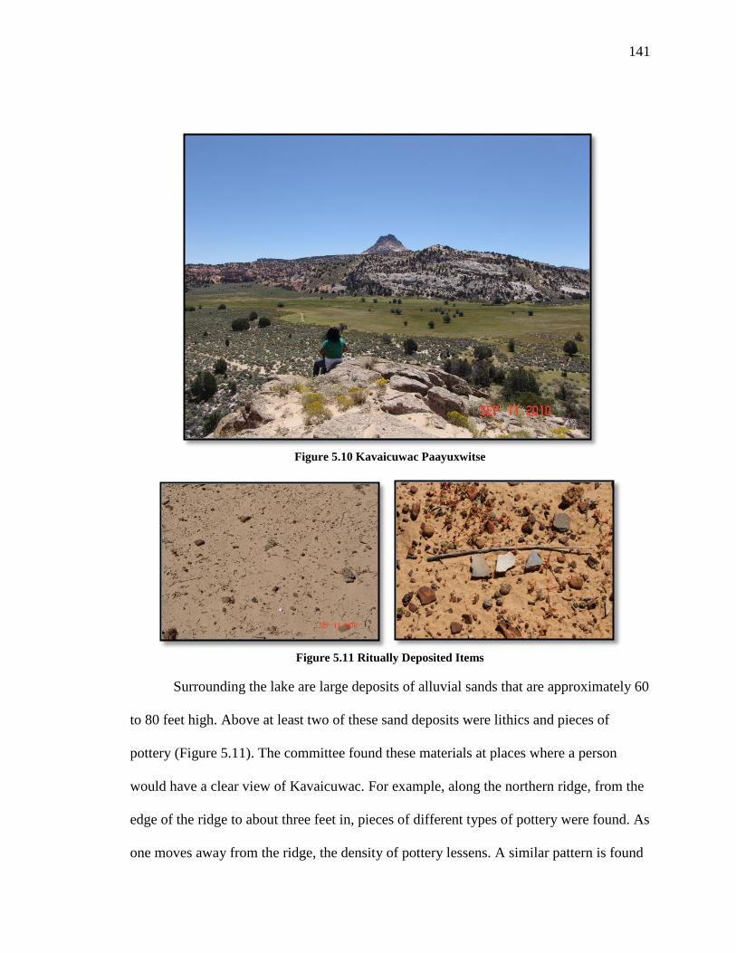
141
Figure 5.10 Kavaicuwac Paayuxwitse
Figure 5.11 Ritually Deposited Items
Surrounding the lake are large deposits of alluvial sands that are approximately 60
to 80 feet high. Above at least two of these sand deposits were lithics and pieces of
pottery (Figure 5.11). The committee found these materials at places where a person
would have a clear view of Kavaicuwac. For example, along the northern ridge, from the
edge of the ridge to about three feet in, pieces of different types of pottery were found. As
one moves away from the ridge, the density of pottery lessens. A similar pattern is found

142
along the eastern ridge where instead of a high concentration of pottery, numerous lithics
were present. In a similar manner to the pottery, the lithics were only located near the
edge. Puhahivats left deposited these items as offerings to Kavaicuwac. Advisory
Committee members commented on the importance of this place in the Kavaicuwac
pilgrimage and the importance of the offerings found. They provided the following
comments on this issue:
This place is a migration route/marker. You can see long ways once on top. The
Prayer Rock…you get the feeling its spirit is all around us. There is a natural
spring and there’s animals here with cedar, pinion trees, sagebrush, and rabbit
brush. There is a lot of pottery and jasmine. This is a place of getting together.
This place has a water source (spring) and a food source (pine nuts, roots, and
seeds). There is evidence that ceremony took place here. There is sage, cedar, and
offerings used for prayers. People camped here too.
We stopped at Kavaicuwac Paayuxwitse. From this site you can see Kavaicuwac.
There are two knolls on each side of the road and if you walked to the top, you
can have a good view of Kavaicuwac. Thousands of pottery pieces and minerals
were found. This suggests that these spots were offering spots to Kavaicuwac.
There were also lava minerals in this area. I believe Kavaicuwac was once a
volcano. Indians would make this journey for sacred ceremonies of offerings to
this volcano. This site needs to be protected because this is an offering site and it
is sacred.
Kavaicuwac Paayuxwitse was a special place. To the south of the lake is the huge,
white, cone-shaped mountain called Kavaicuwac by the Paiute people, meaning
mountain that breathes. I have a strong feeling that this mountain was a sacred
place. Mountains or places that have a breath of life coming out of it are sacred
places. The mountain probably also has eagles nest on it. It could have been a
place for vision during a rite of passage for boys or a Puha mountain (place of
power) for medicine men/women.
Below the mountain near the water, the Enugwuhype [the Ancient Ones] had
places to live/camp. There I found pottery, chips, arrowheads, and tools. The
Paiutes also used this wonderful place as a seasonal camp, for gathering food
and plants, and hunting deer and possibly mountain sheep. The meadow had
medicinal and food plants. I found plantain, mullin, clover, horsetail, purple bee
plant, cocklebur, dandelion, Indian rhubarb, Indian spinach, and reeds. This was
a place that could sustain life. This area needs more research.
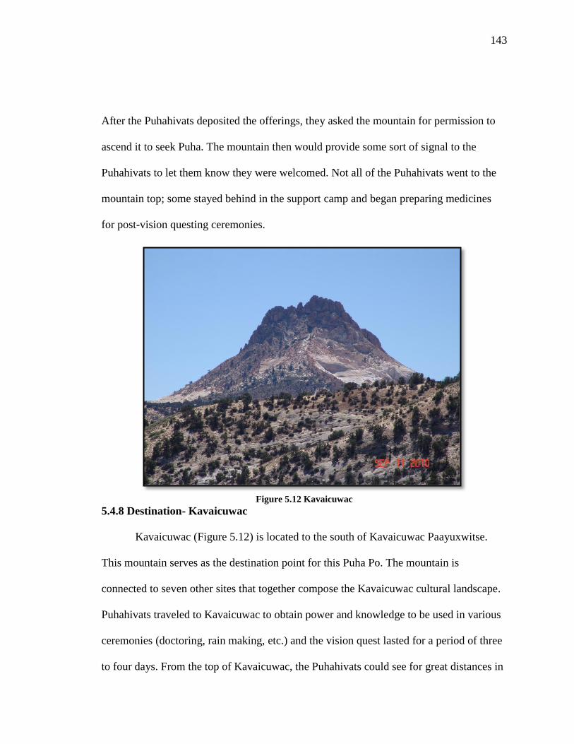
143
After the Puhahivats deposited the offerings, they asked the mountain for permission to
ascend it to seek Puha. The mountain then would provide some sort of signal to the
Puhahivats to let them know they were welcomed. Not all of the Puhahivats went to the
mountain top; some stayed behind in the support camp and began preparing medicines
for post-vision questing ceremonies.
Figure 5.12 Kavaicuwac
5.4.8 Destination- Kavaicuwac
Kavaicuwac (Figure 5.12) is located to the south of Kavaicuwac Paayuxwitse.
This mountain serves as the destination point for this Puha Po. The mountain is
connected to seven other sites that together compose the Kavaicuwac cultural landscape.
Puhahivats traveled to Kavaicuwac to obtain power and knowledge to be used in various
ceremonies (doctoring, rain making, etc.) and the vision quest lasted for a period of three
to four days. From the top of Kavaicuwac, the Puhahivats could see for great distances in

144
every direction. The viewscape allowed the vision seeker an opportunity to interact with
surrounding landscape features in addition to Kavaicuwac.
From the peak, one could see places such as Mount Trumbull, Navajo Mountain
(Paiute Mountain), Bryce Canyon, Kaibab Plateau, and the mountains in present-day
Zion National Park. The vision seeker could talk and sing to these mountains and draw
upon their Puha to help him acquire his power. Once vision questing was completed, the
Puhahivats would begin the transition needed to return to their home communities by
reversing their steps and revisiting places along the route for exit prayers.
5.5 Conclusions
In order to protect the trail and resources, the Southern Paiute Advisory
Committee recommended that the trail be nominated as an American Indian Sacred Site
under Executive Order 13007 (1996). This presidential act allows tribes simply to declare
an area on federal land within their traditional territory as sacred. Federal land
management agencies must accept the declaration and consult with tribes in protecting
and managing the area’s cultural integrity and the land managers cannot deny tribal
members access to these places. Following the Advisory Committee’s recommendation,
the Kaibab tribal council passed a resolution in regards to the nomination in 2011
Currently, the Kaibab Band of Paiute Indians is exploring ways in which they can
add another level of protection to the Kavaicuwac Puha Po. In March 2011, the Southern
Paiute Advisory Committee recommended that the trail and connected places be
nominated to the National Register of Historic Places as a Traditional Cultural Property
(TCP). In order to become a TCP, the corresponding State Historic Preservation Office

145
(SHPO) must approve the nomination. This process involves providing the SHPO with
documentation of the place’s cultural importance to a community in the past, present, and
future. As a result, this request and the proper discussions that lead to writing the
documents in the appropriate style and language and navigating the state and federal
systems are expensive. This process will be discussed further in a later chapter. The key
is that the Kaibab Band of Paiute Indians is actively working on protecting this sacred
trail.

146
CHAPTER SIX
PILGRIMAGES ON THE ARIZONA STRIP
The Arizona Strip is a unique ecological region located along the present day
Utah-Arizona border between the Colorado River to the east and the Virgin River to the
west. This region includes upland areas of the Shivwits Plateau and the North Rim of the
Grand Canyon (Figure 6.1). These lands were part of three traditional Southern Paiute
districts—Shivwits, Unikaret, and Kaibab. The Arizona Strip provided Paiute people with
a multitude of resources that were used in daily and ceremonial activities.
Figure 6.1 The Arizona Strip (Outlined in Black)
The southern portion of the Arizona Strip contains numerous volcanoes and
volcanic places. These areas have been described by Paiute people as powerful places
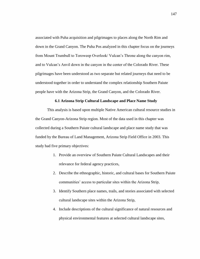
147
associated with Puha acquisition and pilgrimages to places along the North Rim and
down in the Grand Canyon. The Puha Pos analyzed in this chapter focus on the journeys
from Mount Trumbull to Toroweep Overlook/ Vulcan’s Throne along the canyon rim,
and to Vulcan’s Anvil down in the canyon in the center of the Colorado River. These
pilgrimages have been understood as two separate but related journeys that need to be
understood together in order to understand the complex relationship Southern Paiute
people have with the Arizona Strip, the Grand Canyon, and the Colorado River.
6.1 Arizona Strip Cultural Landscape and Place Name Study
This analysis is based upon multiple Native American cultural resource studies in
the Grand Canyon-Arizona Strip region. Most of the data used in this chapter was
collected during a Southern Paiute cultural landscape and place name study that was
funded by the Bureau of Land Management, Arizona Strip Field Office in 2003. This
study had five primary objectives:
1. Provide an overview of Southern Paiute Cultural Landscapes and their
relevance for federal agency practices,
2. Describe the ethnographic, historic, and cultural bases for Southern Paiute
communities’ access to particular sites within the Arizona Strip,
3. Identify Southern place names, trails, and stories associated with selected
cultural landscape sites within the Arizona Strip,
4. Include descriptions of the cultural significance of natural resources and
physical environmental features at selected cultural landscape sites,
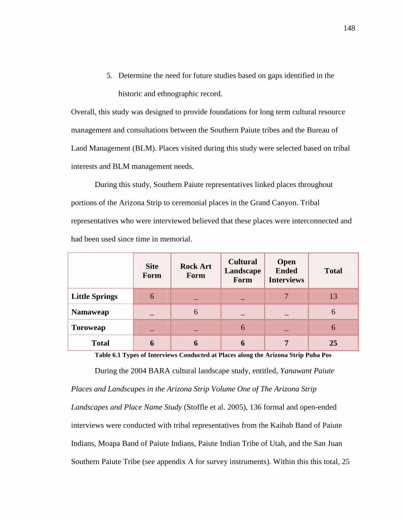
148
5. Determine the need for future studies based on gaps identified in the
historic and ethnographic record.
Overall, this study was designed to provide foundations for long term cultural resource
management and consultations between the Southern Paiute tribes and the Bureau of
Land Management (BLM). Places visited during this study were selected based on tribal
interests and BLM management needs.
During this study, Southern Paiute representatives linked places throughout
portions of the Arizona Strip to ceremonial places in the Grand Canyon. Tribal
representatives who were interviewed believed that these places were interconnected and
had been used since time in memorial.
Site
Form
Rock Art
Form
Cultural
Landscape
Form
Open
Ended
Interviews
Total
Little Springs 6 _ _ 7 13
Namaweap _ 6 _ _ 6
Toroweap _ _ 6 _ 6
Total 6 6 6 7 25
Table 6.1 Types of Interviews Conducted at Places along the Arizona Strip Puha Pos
During the 2004 BARA cultural landscape study, entitled, Yanawant Paiute
Places and Landscapes in the Arizona Strip Volume One of The Arizona Strip
Landscapes and Place Name Study (Stoffle et al. 2005), 136 formal and open-ended
interviews were conducted with tribal representatives from the Kaibab Band of Paiute
Indians, Moapa Band of Paiute Indians, Paiute Indian Tribe of Utah, and the San Juan
Southern Paiute Tribe (see appendix A for survey instruments). Within this this total, 25

149
interviews focused on places along the two Mount Trumbull-centered Puha Pos or
pilgrimage trails (see Table 6.1). The Arizona Strip study serves are the core of the
ethnographic analysis for this chapter. During this project, I took part in four field
sessions and I conducted many of the inerviews were tribal representatives. Because of
my involvement in this study, I had access to the interview database, which I drew upon
for my dissertation research.
6.2 Arizona Strip Puha Pos in Ethnographic Context
Since the Grand Canyon has a prominent role in the two Arizona Strip
pilgrimages discussed in this chapter, it is important to understand the meaning the
canyon and the Colorado River have for to Southern Paiute People. Since Creation, the
Grand Canyon region has been a critical part of Southern Paiute culture. Piapaxa 'uipi
(Grand Canyon) always has provided Southern Paiute people with many important
physical and spiritual items needed for survival. These include but are not limited to
places where they could collect important ceremonial items like high quality red pigment
and salt, places for ceremony and doctoring, places for farming and hunting, and places
for traditional exchange with other tribal peoples like the Hualapai and Hopi.
Natural resources are understood by the Southern Paiute as having human-like
characteristics and Puha. Water, especially, the Colorado River (Piapaxa) is one of the
most powerful natural resources within traditional Southern Paiute lands. Southern Paiute
people believe the river’s power and the gifts it can provide people when it is treated
properly and respectfully. Traditionally Southern Paiutes lived, farmed, collected plants,
hunted, and performed ritual activities along the Colorado River where it passed through

150
their land. For this reason, the banks of the Colorado River contain numerous culturally
significant artifacts, natural elements, and places.
The Grand Canyon region is important to Southern Paiute people in part due to its
rich biological diversity. This landscape experiences great variations in microclimate,
soils, and rainfall; and due to geographic isolation caused by the Colorado River and high
mountains located to the east and west. During the 1990s, a series of cultural resource
studies were conducted in the Grand Canyon involving Southern Paiute people. Elders
were asked about the Paiute conceptualization of the Grand Canyon’s regional landscape.
Specifically they were asked what types of places are connected to the Grand Canyon and
Colorado River and why. In response the elders stated that the power of the canyon and
the river ties places together and place meanings are best understood in this context. A
San Juan Southern Paiute elder defined this connection and the Grand Canyon’s cultural
landscape in terms of water:
The river there is like our veins. Some are like the small streams and
tributaries that run into the river there, so the same things; it's like blood -
it's the veins of the world...This story has been carried down from
generation to generation. It's been given to them by the old people...It
would be given to the new generation, too (Stoffle, et al. 1994b:1).
By comparing the connected watersheds to their own veins, Southern Paiute people can
explain the direct personal relationship they maintain with the Grand Canyon regional
landscape.
6.3 Arizona Strip Puha Pos Performance Characteristics
Analysis of this Puha Po has revealed that eleven of the eleven performance
characteristics defined in Chapter Two are present. These characteristics have been

151
identified by Southern Paiute representatives as being important features for
understanding the ceremonial journeys throughout the Arizona Strip. Some places along
the trail exhibit multiple performance features due to how Puha flows across the
landscape and attracts certain powerful elements to various places. The following table
(Table 6.2) provides a summary of the types of performance characteristics that
correspond with places along the trail.
Performance Characteristics Place Names
Home Communities Kanab Creek, Virgin River
Purification Sites Little Springs, Warm Mineral Springs
Tumpituxwinap Sites Namaweap, Water Baby Site
Narrow & Constricted Spaces Namaweap, Grand Canyon
Trail Water Sources Nixon Spring, Little Springs, Colorado
River
1st View of Destination Place Toroweap Valley
Medicine Collection and
Preparation Areas Little Springs
Paint/Mineral Sources Whitmore Wash
Ceremonial Lay-Down Areas Toroweap Valley
Final Preparation/Support
Camp Toroweap Valley
Destination Place w/ a
Viewscape Vulcan’s Throne, Vulcan’s Anvil
Table 6.2 Arizona Strip Puha Pos Performance Characteristics and Associated Places
6.4 Following the Arizona Strip Puha Pos and Place Analysis
As Puha distributes itself across the landscape, it gathers in unique and powerful
locations and these places become connected in a complex web. Throughout the Arizona
Strip, there are spatially large landscapes that involve hundreds of places and are
connected by an extensive network of spiritual and physical trails. There are also local
landscapes that are composed of a small number of places connected by a few trails. The

152
following is a reconstruction of two local ceremonial landscapes found near Mount
Trumbull in the south central portion of the Arizona Strip. This reconstruction is based on
place and landscape interpretations made by elders who participated in this 2004. study.
Some of the places involved in these two landscapes have cultural meaning and
ceremonial roles in other landscapes creating what can best be described as an
overlapping mosaic of nested landscapes. Therefore, it is always important to think of
places in terms of multiple cultural meanings.
Mount Trumbull is connected to two local landscapes. The first is a ceremonial
landscape that focuses on a pilgrimage to Toroweap Overlook (and Vulcan’s Throne) at
the North Rim of the Grand Canyon. The second local landscape utilizes Mount Trumbull
as a power spot on a pilgrimage to a ceremonial landscape at Vulcan’s Anvil at the
bottom of the Grand Canyon. Both local landscapes involve trails along the pilgrimage,
which lead to Mount Trumbull, followed by a visitation at Nixon Spring. One landscape,
and perhaps both given the spiritual needs of the Puhahivats, involves purification,
acquiring Puha, and water at Little Spring. It seems likely, given what is known at this
time, that the two landscapes may have been interactive inasmuch as they fundamentally
conclude where past lava flows from the North Rim have filled the Colorado River from
top to bottom forming a massive upstream lake. Evidence of former lava flows exist in
abundance at the Vulcan’s Anvil, Vulcan’s Throne, and Lava Falls area.

153
Figure 6.2 Local Landscapes on the Arizona Strip and Grand Canyon
6.4.1 Toroweap Puha Po
This Puha Po contains six places: (1) trails into the Mount Trumbull area (2)
Nixon Springs, (3) Little Springs, (4) Nampaweap, (5) trail to the North Rim, and, (6) the
edge of the North Rim above Lava Falls. These Puha places were only visited by people
who have certain amounts of Puha and had begun a long series of preparations prior to
arriving in the Mount Trumbull area. For Southern Paiute people who would seek
visions, spirit helpers, or medical cures, each of these places has a unique function. In
addition, each place is linked sequentially creating a ceremonial landscape that is
integrated in terms of time, function, and space.

154
Southern Paiute agricultural communities associated with these Puha Pos were
located north of Mount Trumbull and were approximately sixty to seventy miles away.
The closest communities were located along the Virgin River and Kanab Creek. Before
embarking on the long journey to the Mount Trumbull area, Puhahivats started to prepare
themselves. For those living in communities along the Virgin River, Puhahivats might
have utilized neighboring hot springs for initial purification. Those who lived near Kanab
Creek likely had other means for initial cleansing which are unknown as this time.
People traveling to the Mount Trumbull area would have used the major trails
leading to this portion of the Arizona Strip. Many of the trails have been given Anglo
names because of the frequency with which Euro-Americans traveled these trails during
the exploration and expansion periods. These old Indian trails cut across large portions of
the Arizona Strip and into Utah and Nevada. The Mormon Temple Trail, the Honeymoon
Trail, and the path used by Escalante and Dominguez were originally Indian trails.
These were the kinds of trails that would have been taken by people en route to
the southern Arizona Strip for ceremony in the Mount Trumbull area. It is believed that
Puhahivats established a support community at Nixon Spring which is located on the
southwestern flank of Mount Trumbull. There is archaeological evidence found nearby at
Uinkaret Pueblo that shows Indian people used this area about what time period. This
support community differed from the large agriculturally communities the Puhahivats
called home. Southern Paiute people believe that the Uinkaret Pueblo-Nixon Spring area
likely was used only by religious leaders who traveled to the area for ceremony. A

155
caretaker may have lived at the community permanently but the majority of the
population came and went depending on ceremonial cycles.
Figure 6.3 Little Springs Lava Flow
Stopping at Little Springs Lava Flow
As the Puhahivats left the Nixon camp, they traveled to Little Springs Lava Flow
(Figure 6.3), which is approximately four miles away from the Nixon Spring Support
Camp. Little Springs Lava Flow is a recent basaltic lava flow southwest of Mount
Trumbull, which has its own spring found at the northern edge of the flow. Puhahivats
would have interacted with the lava flow spring to cleanse and purify themselves for their
journey. The hornitos (Figure 6.4) located throughout the lava flow would have been
ideal places for ceremonial sweats since the lava rocks are well suited for holding heat.
While they prepared for the purification rituals, Puhahivats sang songs and said prayers to
the lava flow, the mountains, the water, the plants, and animals. They asked for a safe

156
journey to the North Rim and back, for the protection of their families and for the safety
of the environment around them. Puhahivats collected water from the spring and brought
it with them to Nampaweap and the North Rim. This water would have been used during
a ceremony to bless places and leave as an offering.
Figure 6.4 Hornitos Present
Overall tribal representatives believed that the pottery sherds found near the lava
flow showed that people used to come to Little Springs to live, gather plants, conduct
ceremonies, and to acquire power. One representative added that this place was where
people came to prepare for ceremonial activity; “This place is a very secluded area and is
part of the lava trail, which is a place to prepare for what is to be part of a person’s reason
for being born to this area.” Another tribal representative believed that this was a
powerful place. During the site visit, the representative stated that, “This could be a place
of healing or to get some sort of powers.”

157
Representatives also linked Little Springs to ceremonial places, particularly places
along the two Puha Pos. They connected Little Springs to the Grand Canyon and the
Colorado River and other ceremonial sites near Kanab Creek as part of a larger
ceremonial landscape. One Southern Paiute elder added, “I think it could be connected
with down Vulcan’s Anvil and the River. That site could even be connected to Snake
Gulch.”
Little Springs is an interesting site in that there is evidence that demonstrates that
Southern Paiute people have used this site for over thousands of years. There is evidence
that also suggests Indian people used this site during volcanic eruptions that occurred
around 1100AD (Smithsonian Institution Global Volcanism Program 2012). Evidence
that points to this is linked to a special type of artifact that has been found at this site in
recent years.
Little Springs is similar to other volcanic ceremonial places in Northern Arizona.
Places like Sunset Crater and Wupatki have evidence that Indian peoples interacted with
the active lava flows and the erupting volcanos for ceremonial purposes. Special human
modified lave rocks were found at Wupatki and Sunset Crater that were imbedded with
corncobs. Often these artifacts are referred to as “corn rocks.” Similar rocks were found
at Little Springs. Instead of corncobs, however, Indian people used pottery (Figure 6.5),
which have been named sherd rocks (Elson and Ort 2003; Stoffle et al. 2004; Toupal and
Stoffle 2004).

158
Figure 6.5 Sherd Rocks
The corn and sherd rocks were made during dangerous ceremonies in which only
powerful Puha’gants would perform required activities. At Little Springs, ceremonies
were conducted on the lava flow itself, after it had cooled sufficiently. Trails were
constructed across the flow leading to geologic structures called “hornitos.” These
structures are “small rootless spatter cones that form on the surface of a basaltic lava
flow, which develops when a lava is forced up through an opening in the cooled surface
of a flow and then accumulates around the opening,” (USGS Volcanic Hazards Program
Glossary 2012). Pottery would be placed along the hornito edge in order to catch the lava
as it was forced to the surface. The lava then engulfs the pottery; subsequently when the
lava cools, the sherd rocks are formed. Southern Paiute people believe that the sherd
rocks were most likely used as ceremonial objects in traditional doctoring ceremonies or
offerings to places along the two trails under study.
Prayers at Nampaweap
From Little Springs, the Puhahivats would travel roughly three miles to
Nampaweap, which is a small basaltic canyon that constricts the obvious trail to the
North Rim. The upper portion of the canyon has a series of peckings (Figure 6.6), a rock

159
shelter, and a spring, thus it has high concentrations of Puha. Tribal representatives
believed this place was associated with ceremonial activity. According to those who
visited the site, Nampaweap was where people came to seek knowledge and power and
communicate with spiritual beings.
Figure 6.6 Rock Peckings at Nampaweap
One representative added that the canyon and peckings were associated with
traditional songs:
What kind of stories…just by looking at rocks, there’s stories of the
animals who fed and clothed these people. The Mountain Sheep song
could probably be sung here, but I know the Mountain Sheep songs mostly
sung for the dances. They could be singing to them—the sheep images too
while they’re putting them on the rock.
When people came to Nampaweap, they would have interacted with it as another
place where people prepared themselves for their arrival at the North Rim. People would
have first offered the place the water brought from Little Springs, and then they would
explain the purpose of why they were there and seek the Puha they would need to
continue to the North Rim area. The small canyon may provide a song to be sent to the
big canyon and used during another ceremony. Additionally, more water was collected

160
from the spring found above the rock art panels, which would have served both as an
offering and for physical needs at the vision quest support camp.
Vision Questing on the North Rim
Following prayers at Nampaweap, people would head east towards Toroweap
Valley and then south towards the North Rim of the Grand Canyon, covering a distance
of twelve miles. While traveling down the valley, the Puhahivats continued to pray and
interact with the landscape. They had to announce to the canyon and the mountains why
they were there, and ask for permission to enter the area. The Puhahivats may have
waited for a sign, like an eagle flying by, which would have signaled they had permission
to enter the area.
Upon reaching the North Rim and receiving permission to enter, the vision seeker
could have gone to two locations to obtain their vision: Vulcan’s Throne (Figure 6.7) and
Toroweap Overlook (Figure 6.8). From these locations, there are impressive views of the
Grand Canyon, the Colorado River and places located along the South Rim.
Vulcan’s Throne is a basaltic cinder cone located on the North Rim near
Toroweap Overlook. This old volcano, which erupted on five separate occasions, is a
feature in the volcanic system that is responsible for filling the Grand Canyon with lava
twelve times during the last 1.2 million years. The lava flows created a series of dams in
the Grand Canyon, which were responsible for creating a series of lakes that extended to
the head of today’s Lake Powell. The Vulcan’s Throne flow was approximately eight to
ten miles long. The flows from Vulcan’s Throne are some of the oldest and largest in
terms of volume in the Grand Canyon (Hamblin 1989: 190-192).
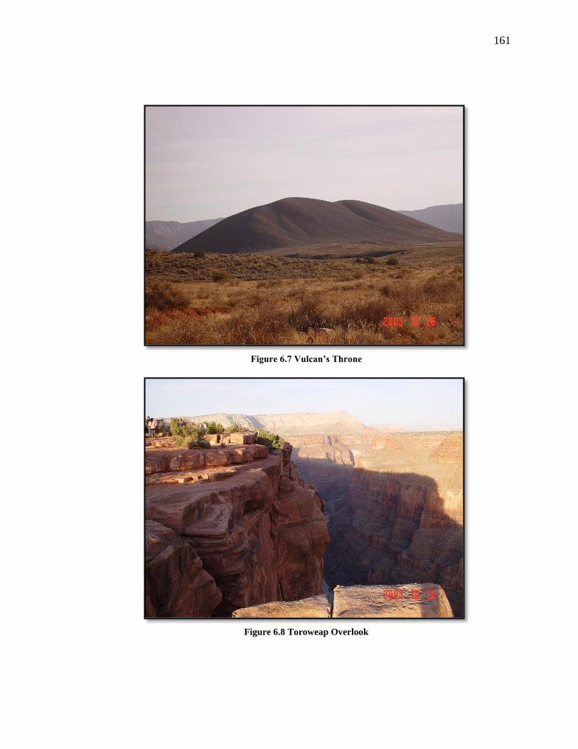
161
Figure 6.7 Vulcan’s Throne
Figure 6.8 Toroweap Overlook

162
From the southern edge of the volcano, one can look at Lava Falls and Vulcan’s
Anvil. As discussed earlier, volcanoes are unique places where Puha from inside the
Earth is brought to the surface; therefore people would have stopped at this spot to
interact with it. They would have prayed to the mountain and explained their purpose for
being in the area. Also, they could have brought Puha-pah, plants, and stones to this place
to leave as an offering to the mountain.
At Toroweap Overlook, people have a clear view of Vulcan’s Anvil and Lava
Falls, two important powerful ceremonial features located within the Grand Canyon. It is
important to note that Toroweap Overlook is the only place where a person can look from
the upper rim of the Grand Canyon directly down at the Colorado River.
This allows the Puhahivats to have a clear view of the powerful places below. A
Puhahivats would be able to talk directly to the Colorado River and draw from its Puha,
and seek some type of Puha from the place, such as a vision, song, or a spirit helper. The
person could seek more Puha to help him confront new problems facing him or his
people. In addition, perhaps the Puhahivats is preparing himself to go into the canyon for
the ceremony at Lava Falls.
A small camp would be set up to serve as support for the vision seeker. This
location would be near to where the vision seeking would occur, but would be
sufficiently removed from to give the vision seeker privacy. Little is known about vision
quest support people except they had two roles: (1) to advise the seeker and to help
interpret what was happening and (2) to assure that the vision seeker did not become
comatose. The vision was sought over a period of two to three days. When the vision was
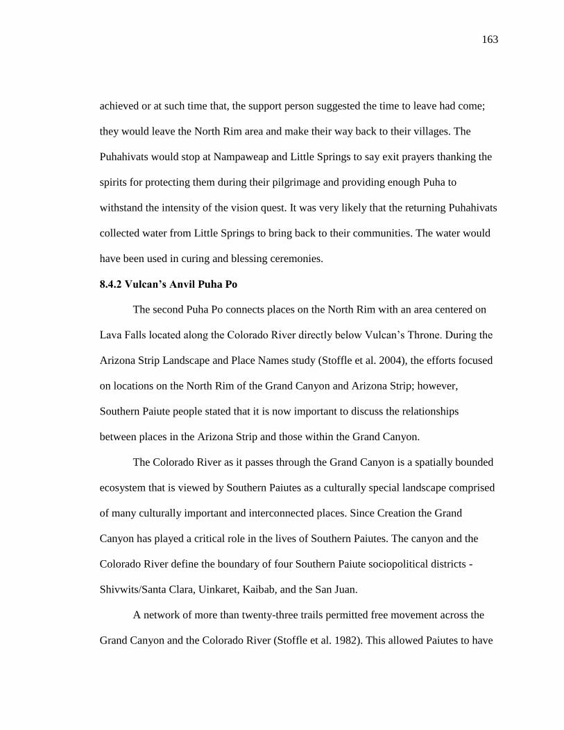
163
achieved or at such time that, the support person suggested the time to leave had come;
they would leave the North Rim area and make their way back to their villages. The
Puhahivats would stop at Nampaweap and Little Springs to say exit prayers thanking the
spirits for protecting them during their pilgrimage and providing enough Puha to
withstand the intensity of the vision quest. It was very likely that the returning Puhahivats
collected water from Little Springs to bring back to their communities. The water would
have been used in curing and blessing ceremonies.
8.4.2 Vulcan’s Anvil Puha Po
The second Puha Po connects places on the North Rim with an area centered on
Lava Falls located along the Colorado River directly below Vulcan’s Throne. During the
Arizona Strip Landscape and Place Names study (Stoffle et al. 2004), the efforts focused
on locations on the North Rim of the Grand Canyon and Arizona Strip; however,
Southern Paiute people stated that it is now important to discuss the relationships
between places in the Arizona Strip and those within the Grand Canyon.
The Colorado River as it passes through the Grand Canyon is a spatially bounded
ecosystem that is viewed by Southern Paiutes as a culturally special landscape comprised
of many culturally important and interconnected places. Since Creation the Grand
Canyon has played a critical role in the lives of Southern Paiutes. The canyon and the
Colorado River define the boundary of four Southern Paiute sociopolitical districts -
Shivwits/Santa Clara, Uinkaret, Kaibab, and the San Juan.
A network of more than twenty-three trails permitted free movement across the
Grand Canyon and the Colorado River (Stoffle et al. 1982). This allowed Paiutes to have

164
access to many things within the canyon, such as farming, hunting, trade, and ceremony
with the Hopis, Havasupai, and Hualapai.
This section focuses on a particular local landscape involving places on the North
Rim and a series of locations found within the Grand Canyon, associated with Paiute
doctoring, ceremonies, and the acquisition of spirit helpers. This landscape is linked to
ceremonies discussed for the previous local landscape. This landscape contains steps in
preparation for ceremonies at Vulcan’s Anvil near Lava Falls. Vulcan’s Anvil is a
powerful doctoring area, which would require long periods of preparation and ceremony
before a person or persons could enter the area.
This pilgrimage landscape involves the Mount Trumbull area discussed in the
previous section. The Vulcan’s Anvil Puhahivats travel to the North Rim, perform
ceremonies along the way, and use Nixon Spring as their base camp. The places involved
along this Puha Po are (1) the Puhahivats’ home areas as preparation sites, (2) Mount
Trumbull-Nixon Spring, (3) the trail into the Grand Canyon at Whitmore Wash, and (4)
Vulcan’s Anvil-Lava Falls Ceremonial Complex that includes a water baby place, a
warm mineral spring, a paint source wall, a ceremonial rock shelter, and Vulcan’s Anvil.
It is possible and logical that given the importance of the Vulcan’s Anvil area,
people would have begun to ready themselves by first taking a pilgrimage to the
Toroweap overlook discussed previously. Upon returning home from this trip, people
would have begun another series of preparations, which included more prayers and
purification through songs and sweats. Once the Puhahivats received a sign, whether it
was a dream, an appearance of a certain type of animal or some other part of the

165
landscape signaling them, they would proceed back to the North Rim for the second
portion of their pilgrimage.
As people left their villages and began to make their way towards the North Rim
area, they followed the major trail system that crosses the Arizona Strip. As mentioned
earlier, many of the major Anglo-named trails were once well-traveled Indian trails.
Given the great distances people would have traveled to access these places, it is
necessary that the Puhahivats would have a place to stay before they proceed with their
journey. They would have returned to the Mount Trumbull area and stayed at Nixon
Spring. The camp would have served a similar purpose as it did during the previous
pilgrimage. Along their way, the Puhahivats would have sung songs and said prayers to
ensure a safe journey and protection for themselves, their families, and their environment.
Trail into the Grand Canyon
From Mount Trumbull Puhahivats would have proceeded to Whitmore Wash.
This area is the location of one of the major foot trails into the Grand Canyon. The trail
leads directly to Whitmore Rapids and a shallow rock shelter located about thirty meters
above the river. On its walls are hundreds of red and white pictographs, including some
identified as part of the Ghost Dance ceremony. At one point, the shelter contained a
large amount of charcoal, animal bone, cordage, corncobs, and matting. The
archaeological evidence shows that the Puhahivats stopped at this location to say prayers
before continuing their journey either up or down the Canyon (Stoffle et al. 1994b: 165).

166
Vulcan’s Anvil-Lava Falls Complex
The Vulcan’s Anvil-Lava Falls complex (Figure 6.9) was also known as a
powerful doctoring site. A well-known Southern Paiute religious leader was associated
with this area. Eventually he moved across the Colorado River and married two Hualapai
women, and because of this, he became one of their primary medicine persons. As such,
he became an important figure in both Hualapai and Southern Paiute history. His
connections to Hualapai society strengthened ties between them and Southern Paiute
people. These two ethnic groups, while speaking different languages (Southern Paiute-
Numic language; Hualapai- Yuman language) have a long history of coming together for
ceremonies and social gatherings. These relationships are discussed in greater detail in a
later chapter.
Figure 6.9 Lava Falls

167
This area is part of the ceremonial landscape that connects the North Rim to
places in the Canyon. The Vulcan’s Anvil-Lava Falls Complex is composed of locations
that are connected to ceremonies performed at Vulcan’s Anvil. Once Puhahivats
descended into the canyon, they proceeded up river stopping at a series of Puha places to
prepare themselves for going to Vulcan’s Anvil.
During the Arizona Strip study, tribal representatives stressed the connections
between places above the Grand Canyon and down in the canyon along the river. When
discussing the connections one elder added, “There were probably ceremonies conducted
down in the canyon…you know with that medicine man going to that rock (Vulcan’s
Anvil) that we use as a place of power.”
Figure 6.10 Water Baby Peckings
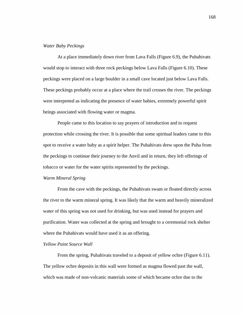
168
Water Baby Peckings
At a place immediately down river from Lava Falls (Figure 6.9), the Puhahivats
would stop to interact with three rock peckings below Lava Falls (Figure 6.10). These
peckings were placed on a large boulder in a small cave located just below Lava Falls.
These peckings probably occur at a place where the trail crosses the river. The peckings
were interpreted as indicating the presence of water babies, extremely powerful spirit
beings associated with flowing water or magma.
People came to this location to say prayers of introduction and to request
protection while crossing the river. It is possible that some spiritual leaders came to this
spot to receive a water baby as a spirit helper. The Puhahivats drew upon the Puha from
the peckings to continue their journey to the Anvil and in return, they left offerings of
tobacco or water for the water spirits represented by the peckings.
Warm Mineral Spring
From the cave with the peckings, the Puhahivats swam or floated directly across
the river to the warm mineral spring. It was likely that the warm and heavily mineralized
water of this spring was not used for drinking, but was used instead for prayers and
purification. Water was collected at the spring and brought to a ceremonial rock shelter
where the Puhahivats would have used it as an offering.
Yellow Paint Source Wall
From the spring, Puhahivats traveled to a deposit of yellow ochre (Figure 6.11).
The yellow ochre deposits in this wall were formed as magma flowed past the wall,
which was made of non-volcanic materials some of which became ochre due to the

169
intense heat and pressure. Yellow ochre like red ochre is a powerful element associated
with ceremony. The yellow ochre wall is covered in red ochre blessing smudges. The
yellow ochre was used in medicine and ceremony conducted at Vulcan’s Anvil. To be
used in ceremony the pigment had to be mixed with water to make the yellow paint. In
order to collect the pigment, the Puhahivats would have left water from the spring as an
offering as they collected the pigment. Once the pigment was gathered, the Puhahivats
ventured to a nearby ceremonial rock shelter.
Figure 6.11 Rock Shelter and Yellow Paint Deposit
Preparation Rock shelter
At the ceremonial rock shelter, which is located directly above the yellow paint
wall and Lava Falls, the people continued their preparations for ceremonies at Vulcan’s
Anvil. The rock shelter contains paint figures made in part from the yellow paint. Inside
the rock shelter, the Puhahivats would have prayed and prepared themselves. They used

170
the water brought in from the mineral spring. After prayers, the Puhahivats would have
waited for a signal to proceed with their journey. It is possible that people could have
received songs during this period to take with them to Vulcan’s Anvil. According to
Southern Paiute epistemology, rock shelters are powerful places that people visit to
acquire Puha and songs. Once the Puhahivats received Puha from the rock shelter and the
appropriate signal, they could continue to Vulcan’s Anvil. The Puhahivats’ support
person would remain on shore–perhaps in the rock shelter-during the Puhahivats’ time on
Vulcan’s Anvil.
Figure 6.12 Vulcan’s Anvil
Vulcan’s Anvil
In order to reach Vulcan’s Anvil (Figure 6.12), the Puhahivats (including patients
if doctoring was the purpose of the pilgrimage) would have to swim to the center of the
Colorado River where Vulcan’s Anvil occurs as a large volcanic plug or throat. Vulcan’s

171
Anvil is surrounded by a calm and very deep portion of the Colorado River created in
part as the backwater of materials that constitute Lava Falls. Vulcan’s Anvil is the only
rock of its kind along the entire Grand Canyon Corridor. Vulcan’s Anvil can best be
described as a power rock in a power place making it a very special destination for
Puha’gants (medicine men).
When the Puhahivats reached Vulcan’s Anvil, they climbed from the water up its
vertical slick sides to the wide flat top. On top, a person had a view of the Grand Canyon
and the Colorado River up- and downstream. Looking up, the Puhahivats would view the
vertical canyon face containing evidence of a dozen previous volcanic dams and
hundreds of separate lava flows. Here people could draw from the power of the rock, the
river, the canyon, and the presence of volcanoes.
6.5 Conclusions
During the Arizona Strip study, tribal representatives requested that more time
and funds be allocated and devoted to Native American consultation and research in
order to understand the cultural importance of the Mount Trumbull areas. Since 2005, the
BLM has been more proactive in involving the culturally affiliated tribes in cultural
heritage and preservation activities throughout the entire Arizona Strip district. These
activities involve reconnecting elders and children to traditional places during traditional
camps. These events provide elders with opportunities to teach the youth cultural
knowledge.
In late 2011, funding became available for a follow-up cultural landscape study
that focuses specifically on the Mount Trumbull region. The analysis provided in this

172
chapter will serve as the foundation to this new project when the work begins in late
spring 2012.
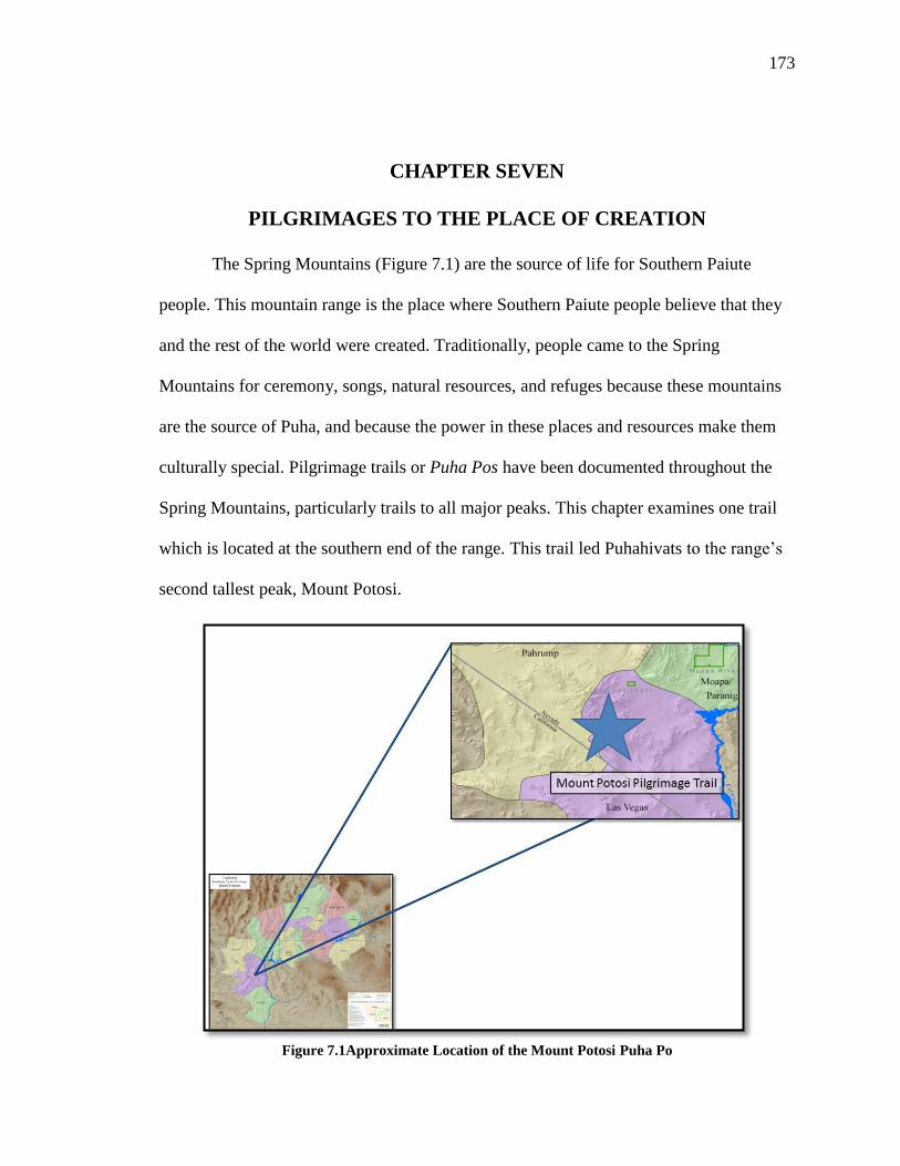
173
CHAPTER SEVEN
PILGRIMAGES TO THE PLACE OF CREATION
The Spring Mountains (Figure 7.1) are the source of life for Southern Paiute
people. This mountain range is the place where Southern Paiute people believe that they
and the rest of the world were created. Traditionally, people came to the Spring
Mountains for ceremony, songs, natural resources, and refuges because these mountains
are the source of Puha, and because the power in these places and resources make them
culturally special. Pilgrimage trails or Puha Pos have been documented throughout the
Spring Mountains, particularly trails to all major peaks. This chapter examines one trail
which is located at the southern end of the range. This trail led Puhahivats to the range’s
second tallest peak, Mount Potosi.
Figure 7.1Approximate Location of the Mount Potosi Puha Po

174
7.1 The Spring Mountains Cultural Landscape Study
Information for this analysis was initially collected during a 2003 ethnographic
study funded by the United States Forest Service (USFS), entitled Puha Flows from It:
the Cultural Landscape Study of the Spring Mountains (Stoffle et al. 2004a). This project
was an applied ethnographic study that focused on a cultural landscape assessment of the
Spring Mountain National Recreation Area, Humboldt-Toiyabe National Forest. The
project examined the traditional, religious, and cultural values of Southern Paiute people
inherent in the Spring Mountains of southern Nevada.
The study design required that the BARA team work with tribal representatives to
prepare a map through a rapid assessment to identify sites, areas, and landscapes that are
of cultural and religious importance to the Southern Paiute people. The second task was
to provide the USFS with an overview essay summarizing the ethnographic archival field
notes and literature relevant to Southern Paiute cultural values of the Spring Mountains.
The third task required field visits and interviews with tribal members that focused on the
overall cultural importance of the Spring Mountains and individual places visited
throughout the mountain range. This work served as the ethnographic core of the overall
report and the basis for USFS management decisions and tribal consultation.
During this project, twenty-two sites were visited within the Spring Mountains
region and 216 interviews were conducted. From this total, four places were linked to the
pilgrimage to Mount Potosi. This equates to thirty-seven interviews as seen in Table 7.1

175
Site
Form
Rock Art
Form
Cultural
Landscape
Form
Total
Yellow Yucca 1 5 0 6
Aztec Tanks 3 4 5 12
Yellow Plug 3 4 0 7
Potosi Ridge 6 0 6 12
Total 13 13 11 37
Table 7.1 Interviews Conducted at Places along the Mount Potosi Puha Po.
BARA ethnographers interviewed tribal representatives with three forms during
the three field sessions (Native American Resources Form, Ethnoarchaeology-Rock Art
Form, and Cultural Landscapes Form). The use of the different forms allowed questions
to be asked that helped link together places in this special ceremonial landscape. I took
part in two out of the three project field sessions and participated in many of the
interviews were tribal representatives. During the field sessions I participated in, tribal
representatives and BARA ethnographers visited Yellow Yucca, Aztec Tanks, Yellow
Plug, and Potosi Ridge. Since I was actively involved in the data collection for this study,
I had access to the interview database which I drew upon for my dissertation research.
7.2 The Spring Mountains in Ethnographic Context
To the Southern Paiutes, the Spring Mountains are the center of Creation. They
believe that they, as a people, were created in these mountains at the beginning of time.
As one Southern Paiute religious leader stated,
The Spring Mountain range is a powerful area that is centrally located in
the lives, history, and minds of Nuwuvi people. The range is a storied land
which exists as both physical and mythic reality, both simultaneously

176
connected by portals through which humans and other life forms can and
do pass back and forth. This is as it was at Creation.
In a testament to being linked to Creation, the Spring Mountains were formed from
Precambrian rocks, which are believed to be approximately 20 million years old. The
Spring Mountains are the oldest geologic features in not only the state of Nevada but also
traditional Southern Paiute territory. The Spring Mountains are located within the
traditional Pahrump and Las Vegas districts of the Southern Paiute Nation. The
mountains, today, serve as a boundary between the cities of Las Vegas and Pahrump,
Nevada.
Southern Paiutes believe that the Spring Mountains constitute a living being that
has a zoomorphic shape. This being has a head which is found at the northern end of the
range at Mount Sterling, a tail located at Mount Potosi, and in the center at Mount
Charleston, a womb which created life (Figure 7.2). Mount Charleston is the geographic
and cultural center of the Spring Mountains. It is easy to locate and recognize because it
is the tallest peak in the range and it is usually covered with snow ten months out of the
year. During the tines when the mountain top is snow free, the peak still is distinctive in
that it is devoid of vegetation. Southern Paiute oral history explains why occurs. Their
stories talk about a time before humans inhabited the Earth and a great flood covered the
landscape. The top of Mount Charleston was the only place not under water at this time
so all the animals sought refuge. In order to survive, however, they ate all the plants from
the peak, leaving it permanently bare.
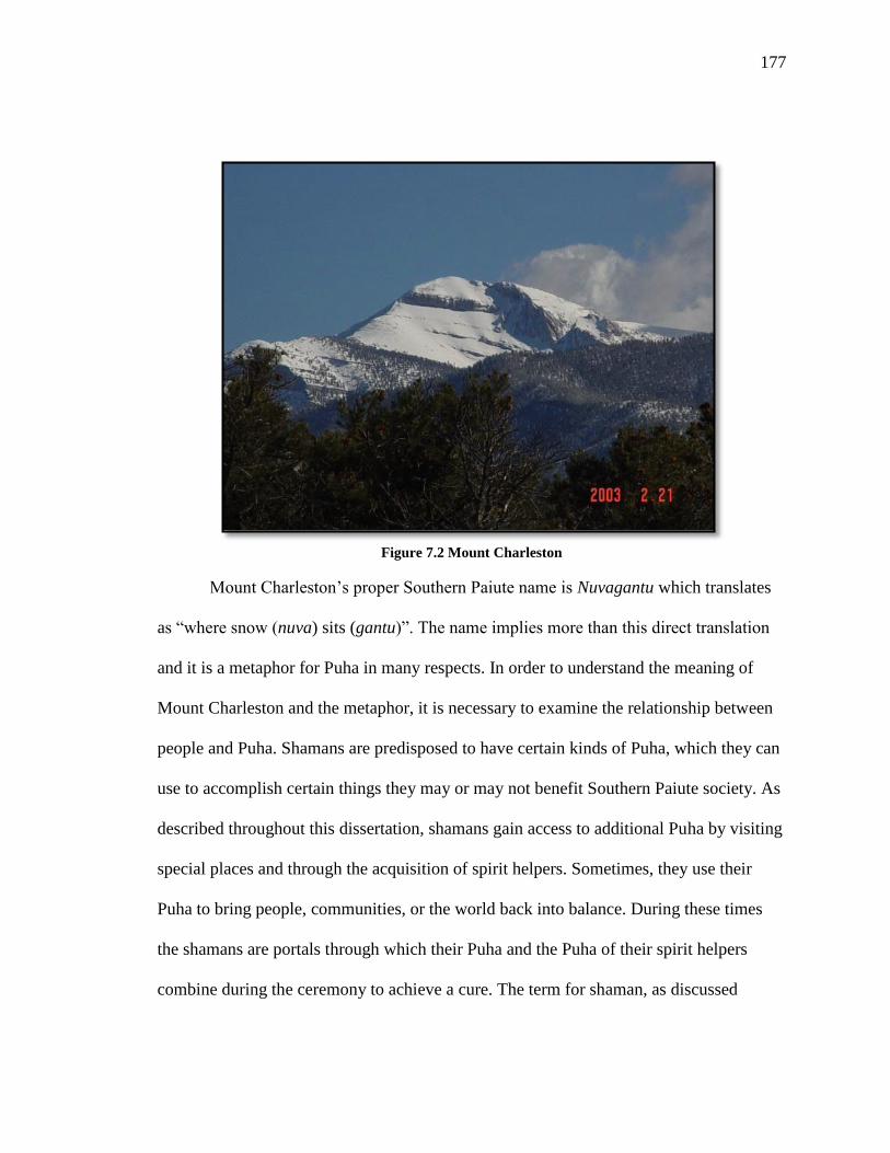
177
Figure 7.2 Mount Charleston
Mount Charleston’s proper Southern Paiute name is Nuvagantu which translates
as “where snow (nuva) sits (gantu)”. The name implies more than this direct translation
and it is a metaphor for Puha in many respects. In order to understand the meaning of
Mount Charleston and the metaphor, it is necessary to examine the relationship between
people and Puha. Shamans are predisposed to have certain kinds of Puha, which they can
use to accomplish certain things they may or may not benefit Southern Paiute society. As
described throughout this dissertation, shamans gain access to additional Puha by visiting
special places and through the acquisition of spirit helpers. Sometimes, they use their
Puha to bring people, communities, or the world back into balance. During these times
the shamans are portals through which their Puha and the Puha of their spirit helpers
combine during the ceremony to achieve a cure. The term for shaman, as discussed

178
earlier, in Southern Paiute is Puha’gant or Puha’ganti and its direct English translation is
“where power sits.”
The use of the word “-ganti” for both powerful shamans and for Mount
Charleston draws comparisons between the two. Each has a close connection with higher
elevations in mountains and Puha; and between Puha and water in its various forms.
Nuvagantu, or Mount Charleston, means more to Southern Paiute people than just “where
snow sits.” The mountain is like a shaman in that the mountain is a window in which
Puha flows through in its various forms to achieve balance in the world. Nuvagantu (and
the rest of the Spring Mountains) serves as a gateway between the physical and storied
worlds in the Southern Paiute universe.
Origin Mountains often are the tallest peaks in an ethnic groups’ traditional
territory and they often produce the most convectional rainfall (Stoffle et al 2004a).
Southern Paiute people maintain that mountains, especially their origin mountain play a
key role in creating weather. Overall, mountains are important features that interact with
the sky and clouds to call down the rain and snow. Without this action there would be no
water, hence no life. Puha, like water flows down from the mountain tops connecting
places in the similar manner that water moves and collects throughout the landscape. One
Southern Paiute man described the connections between places as:
All the mountains are a big circle, all connected. Mt. Charleston is where
we were created; it is connected with Sunrise, McCullough, and Bird
Spring Mountains. People would go to Gypsum Cave in the Frenchman
Mountains to get our songs. Mountain sheep would come to them in songs
along with other animals used in doctoring. Pintwater Cave, in the
Pintwater Mountains is where wolf lived and it is the home of little
mountain spirits and the wind. Sheep Mountains are a point of connection

179
between the Indian people living in Moapa, Las Vegas, and Pahrump.
There is red paint there too.
Southern Paiutes argue that the Spring Mountains have a complex relationship with
Paiute and the surrounding environment which shape how people interact with and
understand both places and resources. The deep attachment Southern Paiutes have with
the Spring Mountains is a birth-right connection of rights and obligations which has and
continues to be transferred from generation to generation since Creation. The Creator
taught Paiute people how to talk to the mountains and how to behave in their presence.
Performance Characteristics Place Names
Home Communities Cottonwood Spring (and other
surrounding Communities)
Purification Sites Unknown along the trail, but regionall
available
Tumpituxwinap Sites Yellow Yucca, Aztec Tank, Yellow Plug
Narrow & Constricted Spaces The wash leading up Mount Potosi
Trail Water Sources Aztec Tank
1st View of Destination Place Yellow Plug
Medicine Collection and
Preparation Areas Aztec Tank
Paint/Mineral Sources Yellow Plug
Ceremonial Lay-Down Areas Potosi Ridge
Final Preparation/Support Camp Potosi Ridge
Destination Place w/ a Viewscape Mount Potosi
Table 7.2 Mount Potosi Puha Po Performance Characteristics and Associated Places
7.3 Mount Potosi Puha Po Performance Characteristics
Analysis of the Mount Potosi Puha Po has revealed that ten out of the eleven
performance characteristics defined in Chapter Two are present with only a purification
site unidentified. It is important to acknowledge that some places along the trail have

180
multiple characteristics, which is due to how Puha manifests itself across the landscape.
Table 7.2 provides a summary of the types of performance characteristics that correspond
with places along the trail. The table is organized by type of resource and corresponding
place. The table generally reflects the order in which these characteristics appear along
the trail.
7.4 Following the Mount Potosi Puha Po and Place Analysis
This Puha Po is primarily used for vision questing on two of Mt. Potosi’s highest
peaks. Vision seeking in the severe environment of Potosi Mountain requires one or more
support persons to assure the safety of the vision seeker. The pilgrimage Mount Potosi
involves visiting and interacting with a series of places along the 10-mile trail. For the
purpose of this analysis, the trail begins at Cottonwood Springs, the closest Southern
Paiute community. Puhahivats from this community traveled to Yellow Yucca, the first
known site along the trail and then followed the trail to Aztec Tanks and Yellow Plug
before ascending the mountain for power acquisition. This section provides an analysis of
each place and associated performance characteristics and their role in the pilgrimage
ceremony.
7.4.1 Home Communities
Puhahivats traveling to Mount Potosi likely came from a number of different
Southern Paiute communities. Large communities have been well documented in the Las
Vegas Valley at Pah hu wichi, or Big Springs, Corn Creek and Indian Springs. In the
Pahrump Valley to the west, large communities were located at Pahrump Springs, and the

181
major water sources in Ash Meadows. This analysis focuses on the closest community to
Mount Potosi and the associated pilgrimage places.
Figure 7.3 Cottonwood Spring
Cottonwood Spring was a traditional Southern Paiute community1 located at the
southern end of the Spring Mountains (Figure 7.3). The spring flowed all year and
provided enough water for permanent settlement and agriculture. This spring was home
to a local Southern Paiute group named Nogwats (Fowler and Fowler 1971). It was one of
the largest communities located outside of the Las Vegas Valley in this part of present-
day southern Nevada. Agricultural activities at Cottonwood Spring have been well
documented by explorers and government officials during their journeys through
Southern Paiute territory. For example when George M. Wheeler’s reconnaissance team
traveled from the Grand Canyon to Camp Independence, California, they documented
Indian communities along their route. When they passed through the Spring Mountain

182
region, Wheeler’s lieutenant Daniel Lockwood recorded Southern Paiute agricultural
activity at Cottonwood Spring. He noted that:
At Cottonwood Springs and at Las Vegas there were quite a large
number (Southern Paiutes), who moved back and forward between the
two places, according to their fancy. They have small farms or gardens
and besides the corn, pumpkins, melons, etc., raised by themselves,
obtain scanty supplies for what little work that they do (Wheeler
1872:75).
Cottonwood Spring was much smaller in size when compared to neighboring
communities which could have easily supported at least 300 people (Nye 1889). The
earliest population count for Cottonwood Spring was taken in the late 1860s when Powell
and Ingalls counted 57 people living in this area (Fowler and Fowler 1971). It is
important to note that the community likely had a larger population, however due to
disease, slavery, and loss of resources, Southern Paiute populations declined.
Due to its permanent water source and agricultural productivity, Cottonwood
Spring would have provided Puhahivats with the necessary community support to prepare
for their journey to the top of Mount Potosi. While hot springs are not found in the
immediate area, ritual cleansing was likely done through other means.
7.4.2 Yellow Yucca
Once the Puhahivats left Cottonwood Spring, they traveled in a southwesterly
direction across Cottonwood Valley before turning south towards Yellow Yucca, the first
documented site along the trail. Yellow Yucca is a north-south trending ridge along
Mount Potosi’s eastern flank. The ridge is covered with large to medium size sandstone
rocks. Along the bottom portion of the ridge are a series of boulders containing

183
tumpituxwinap. Southern Paiute people has been interpreted Yellow Yucca as being an
entrance or a place where Puhahivats transitioned into an enhanced spiritual state.
One particular pecking caught the interest of tribal representatives during the
2003 study. On one boulder was a large pecked “knotted string” (see Figure 7.4) or
tapitcapi. Traditionally, knotted springs were time keeping devises as well as place
markers. During some pilgrimage journeys, knotted strings marked places where
Puhahivats needed to stop and offer prayers and offerings to the place (Laird 1976:27;
Stoffle, et al. 2000).
Figure 7.4 Large Knotted String Pecking at Yellow Yucca
Yellow Yucca provides Puhahivats with the first opportunity to interact with their
destination place. From the base of the ridge, they can see Mount Potosi dominate the
skyline above them so they take this moment to explain to the mountain why they are

184
seeking knowledge and power from their Origin Mountains. The Puhahivats likely said
prayers and left offerings for both the mountain and the site.
7.4.3 Aztec Tank
After ceremonial activities at Yellow Plug, the Puhahivats traveled a short
distance to the trail’s water source. Aztec Tank is a complex site that contains an array of
cultural resources that suggest that this site was used in pilgrimage and ceremony. One of
the main features of the site is a series of large natural stone tanks (Figure 7.5). As water
flows down from the mountain side, water collects in a series of large rock tanks.
Puhahivats visited the tanks to collect water and leave offerings to thank the water for
providing itself to them. During pilgrimage the water was used at a later time along the
trail in prayers and possibly to help sustain the Puhahivats. The tanks would also be
tended to by the travelers in that any debris or sediment would be removed. This action is
part of the Puhahivats’ stewardship responsibilities as part of the pilgrimage ceremony
and as their obligations to their traditional lands as Southern Paiute people.
In addition to the rock tanks, this site contains ritually deposited lithics. Paiute
people believe that these materials were not carelessly discarded by a random Indian
person passing through this site. Instead, these items purposely were left by Puhahivats as
gifts to Aztec Tank. The offerings served as a means of thanking the site for providing
the Puhahivats with Puha and other resources (water and medicine plants) needed to
complete the journey and the offerings served as a way of creating a relationship with the
site. This relationship is based upon both people and places being sentient and having
agency and thus the two can interact with each other.

185
Figure 7.5 Large Rock Tank
Aztec Tank also contains a series of tumpituxwinap panels located near the rock
tanks. Tribal representatives expressed interest in one particular pecking located alone on
a rock face near one of the rock tanks. Ocean Woman’s Net is distinctive for its
honeycomb pattern as seen in Figure 7.6. It is most closely linked to Southern Paiute
Creation stories and the spiritual trail to the afterlife. This image is also indicative of
ceremonial areas and pilgrimage. Ocean Woman’s Net is found along the trails to
Kavaicuwac and Toroweap/Grand Canyon area.

186
Figure 7.6 Ocean Woman’s Net
Tribal representatives also identified a number of grinding slicks located near the
tumpituxwinap panels (Figure 7.7). It is believed that these slicks were used for preparing
medicines and paints. Puhahivats likely used them as part of ritual activities to prepare
themselves to visit both Yellow Plug and Mount Potosi.
Figure 7.7 Tumpituxinap found at Aztec Tank

187
7.4.4 Yellow Plug
After leaving Aztec Tank, Puhahivats traveled to the southwest to Yellow Plug.
This site is a large rock outcrop where Puhahivats visited to seek Puha needed to continue
their pilgrimage. Yellow Plug has a very distinctive shape and color that makes it stand
out in its immediate landscape (see Figure 7.8). The rock formation, from a distance,
looks like a large plug used to block drainage into a hole. The yellow sandstone helps
create a contrast between the green-gray vegetation surrounding the site thus making it
highly visible.
Figure 7.8 Yellow Plug
The site contains numerous cultural features associated with ceremony and
pilgrimage. During site visits, tribal representatives observed and noted numerous panels
containing tumpituxwinap along the eastern facing wall which corresponds with the
rising sun. Some images were pecked and some were painted in red ochre. The different
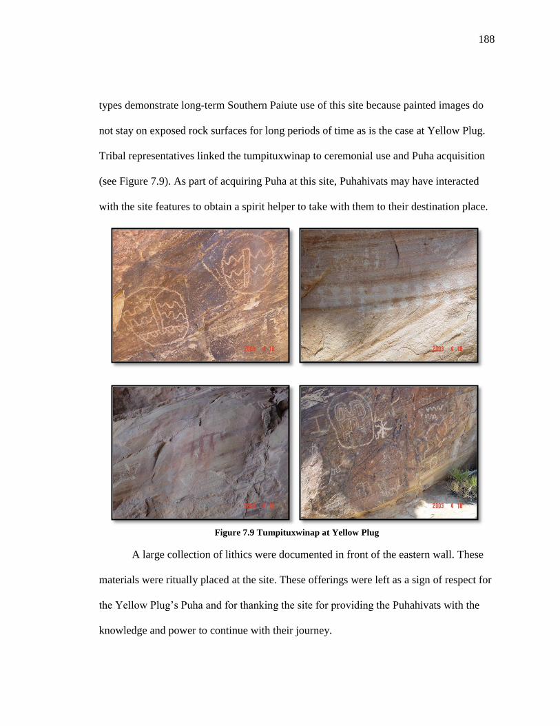
188
types demonstrate long-term Southern Paiute use of this site because painted images do
not stay on exposed rock surfaces for long periods of time as is the case at Yellow Plug.
Tribal representatives linked the tumpituxwinap to ceremonial use and Puha acquisition
(see Figure 7.9). As part of acquiring Puha at this site, Puhahivats may have interacted
with the site features to obtain a spirit helper to take with them to their destination place.
Figure 7.9 Tumpituxwinap at Yellow Plug
A large collection of lithics were documented in front of the eastern wall. These
materials were ritually placed at the site. These offerings were left as a sign of respect for
the Yellow Plug’s Puha and for thanking the site for providing the Puhahivats with the
knowledge and power to continue with their journey.

189
Representatives noted that minerals used in ceremony were found at this site.
Minerals, like plants, are used in medicines and offerings. Some minerals like red ochre,
or oompi is used in placing tumpituxwinap on powerful rock faces. One tribal
representative explained the importance of minerals and their Puha, “Mountains hold
minerals. Minerals have power. Traditionalists carried minerals for its power and they
used it for ceremonies and/or healing. Some of these panels are in red paint.”
When Puhahivats visited Yellow Plug, it believed that they would visit during
specific times of the day during certain times of the year. Tribal representatives believed
that visitation and ceremonial activity occurred during the early morning hours. This was
so that the prayers could coincide with the sunrise and the start of a new day. Tribal
representatives thought that there was a seasonality issue in regards to visiting this site
during pilgrimage. They believed that people likely came here during the warmer months
of spring and summer.
When interviewed, tribal representatives offered important insights as to Yellow
Plug’s overall cultural significance and its role in the pilgrimage ceremony to Mount
Potosi. One representative offered her view on this issue:
Men have the strength and stamina, so the Yellow Plug wall is symbolic
looking as having strength and endurability, foreverness. When I look at
panels such as Yellow Plug, I see a hand of an unseen artist spreading of
an actual event to the future. It’s like the Fox Trail from the south, where
the fox shot an arrow toward Pahrump and then the fox ran so fast that he
caught his own arrow before it landed on the ground. Fox did this three
times-directing his shots toward Death Valley. This is how I view the
petroglyphs-as an arrow shot into the sky by an unseen hand only to be
caught in another time by the same unseen hand. This is powerful stuff. It's
scary, too, because it deals with prophecies and future omens.
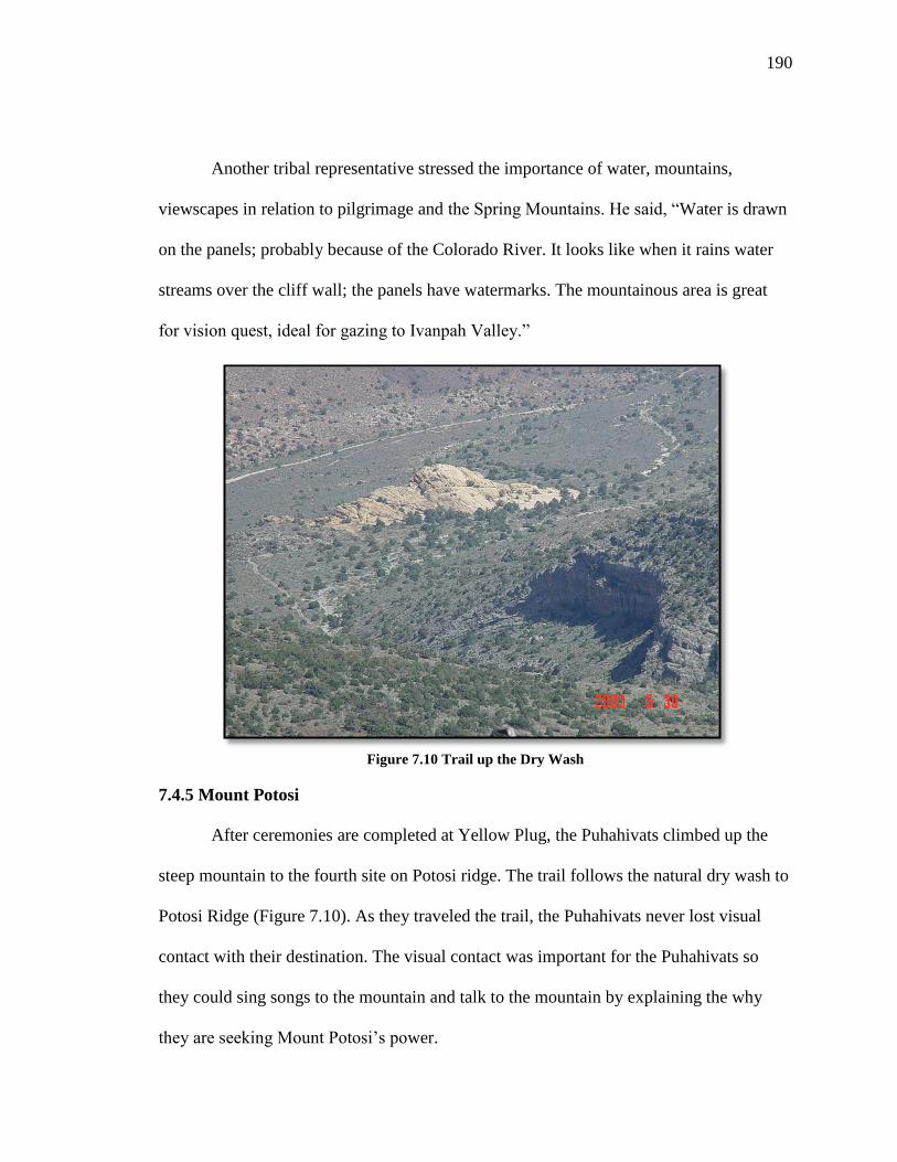
190
Another tribal representative stressed the importance of water, mountains,
viewscapes in relation to pilgrimage and the Spring Mountains. He said, “Water is drawn
on the panels; probably because of the Colorado River. It looks like when it rains water
streams over the cliff wall; the panels have watermarks. The mountainous area is great
for vision quest, ideal for gazing to Ivanpah Valley.”
Figure 7.10 Trail up the Dry Wash
7.4.5 Mount Potosi
After ceremonies are completed at Yellow Plug, the Puhahivats climbed up the
steep mountain to the fourth site on Potosi ridge. The trail follows the natural dry wash to
Potosi Ridge (Figure 7.10). As they traveled the trail, the Puhahivats never lost visual
contact with their destination. The visual contact was important for the Puhahivats so
they could sing songs to the mountain and talk to the mountain by explaining the why
they are seeking Mount Potosi’s power.

191
The wash is the most logical location for the trail when one examines the
surrounding terrain but it is also the most logical from a cultural perspective. The trail
follows the path that Puha takes as moves from the mountain peaks to the valley. It also
corresponds with Mount Potosi’s hydrological system. When snow and rain fall down the
flanks of mountain, it flows down the wash to the trail’s three connected sites.
Figure 7.11 Support Camp
When the Puhahivats reached the Potosi Ridge, a small support camp was set up
on the ridge (Figure 7.11). When this site was visited in 2003, BARA ethnographers and
tribal representatives documented numerous pieces of pottery and lithics. Tribal
representatives all agreed that at over 8,000 feet that this camp was not a seasonal camp
used during pine harvests or hunting. This camp was used during pilgrimage. During
group pilgrimages, experienced Puha’gants would accompany the inexperienced ones to
aid them in the ceremony. As the inexperienced Puha’gants went to the mountain peak to

192
acquire Puha, the experienced ones stayed at the camp to provide the vision seeker
necessary privacy but they were close enough to assist in case something should go
wrong.
Figure 7.12 Mount Potosi Peak
Vision quest support people had their roles – to serve to advise the seeker, to help
interpret what was happening, and to assure that the vision seeker did not become
comatose. From the support camp the seeker climbs to top of nearby peak (Figure 7.12)
for vision questing. This ceremony is conducted over a period of two to four days.
Viewscapes have always been important components of vision questing. The person
seeking the power from this ceremony needed to be able to interact with not only the
mountain top the person is sitting upon but also the Puha from other powerful places.
From Mount Potosi, the vision seeker saw a number of places in the four directions these
193
include the Nopah Range and Kingston Mountains to the west, McCullough Mountains to
the southeast, Mount Charleston to the north, and the Las Vegas Range to the northeast.
After the ceremony was complete, the Puhahivats descended the mountain and
followed the trail home. In doing so, they revisited Yellow Plug, Aztec Tank, and Yellow
Yucca. At each site, they said prayers thanking the places for aiding them on their
journey. Water was also collected from Aztec Tank. This water could have been used to
rehydrate the Puhahivats who had gone without water for a period of time and it also
could have been collected to take home to use in medicines and ceremony.
7.5 Conclusions
Today, most of the physical control of Southern Paiute aboriginal lands has been
transferred to the United States, and in turn to various federal agencies. Southern Paiute
people, however, still maintain their cultural connections to their entire homeland. Their
connections officially were recognized in the U.S. Indian Claims Commission hearings as
being owned by them before these lands were transferred to the US. While the legal
ownership has shifted, the moral, spiritual, and cultural stewardship responsibilities and
obligations for these lands remain in the hands of Southern Paiute people. For that reason,
the tribes chose to participate in this ethnographic study and share portions of their
knowledge about their Creation place. The study offered Southern Paiute people an
opportunity to share their thoughts on how places and resources throughout the Spring
Mountains should be managed.
After the 2003 study was completed, the USFS began to implement some of the
tribes’ recommendations into their overall management place for the Spring Mountains.

194
Tribal representatives who visited the places along the Mount Potosi Puha Po had
concerns that the sites were vulnerable to vandalism, especially since some sites had
evidence of unwanted visitors, including looters. Representatives with the support of their
respective tribal governments requested that the roads to Mount Potosi, Yellow Plug, and
Aztec Tank be closed or have very limited access. The USFS managers agreed to this
request and the roads have been closed since 2004. The USFS has also stated in 2004 that
they would support tribal efforts to nominate the Mount Potosi Puha Po as a traditional
cultural property thus the prospects for preservation in the Spring Mountains case is high.

195
CHAPTER EIGHT
THE BACKBONE OF THE RIVER: A PILGRIMAGE TO
SUGARLOAF MOUNTAIN
Sugarloaf Mountain is located along the Colorado River where the river enters
Black Canyon near to Hoover Dam. Because of its location, Sugarloaf Mountain has been
a ceremonial destination place for Numic and Yuman speaking peoples since time in
memorial. Traditionally, religious specialists from Southern Paiute, Hualapai, and
Mohave communities traveled to Sugarloaf Mountain to obtain knowledge and power
which was used in traditional doctoring and other ceremonies upon returning to their
home communities. In this chapter I examine one of the three trails to Sugarloaf
Mountain while contextualizing this pilgrimage within the frame of complex inter-ethnic
relationships.
Figure 8.1 Approximate Location of Sugarloaf Mountain

196
8.1 Hoover Dam Bypass Ethnographic Study Methodology
Places along the Puha Po to Sugarloaf Mountain originally were visited during the
two ethnographic studies. These projects were part of an environmental impact
assessment (EIS) that examined the potential effects of three possible alternatives for the
Hoover Dam Bypass Project. Each alternative was located within a mile from where
United States Highway 93 used to cross the over the top of Hoover Dam at the Arizona-
Nevada border. Two of the proposed routes passed right next to Sugarloaf Mountain and
the other passed through neighboring Goldstrike Canyon. At the time government
officials maintained that over the past 30 years, Hoover Dam had seen a major increase in
traffic which posed a series of issues that needed to be addressed. The major issue was
centered on the growing need to construct a roadway that directed traffic away from
Hoover Dam in order to increase safety for not only the tourists visiting the dam but for
the structural integrity of the dam itself. Various federal, state, and local government
officials pushed to find a way to solve this problem and thus the Hoover Dam Bypass
project was funded.
A critical component to this EIS was the determination of which ethnic groups
and corresponding tribes should be involved. This process is critical component to
American Indian ethnographic assessments. This determination is based on the notion of
cultural affiliation or in other words who is culturally connected to a place or landscape.
A group’s culture ties to a place are not determined by length of time staying in a given
area but instead it is based on what that place means in terms of identify and use. For this
project it was determined that the Southern Paiute, Hualapai, and Mojave ethic groups

197
were connected and they chose to participate in this study. Groups such as the Hopi and
Zuni also were connected to places in and around Sugarloaf Mountain but chose to defer
to the other groups. In total, ten tribes and one-pan-Indian organization took part in these
studies. This total includes all eight Southern Paiute tribes.
During the 1998 and 2000 studies, 158 interviews were completed at various
places located along the three proposed alternative routes. In total 61 site interviews, 36
landscape interviews, and 61 final Hoover Dam Bypass EIS evaluations were conducted.
Table 8.1 provides a breakdown of interviews by site, gender, and form.
Site Gender Site Form Cultural
Landscape
EIS
Evaluation Total
Sugarloaf
Mountain
Male 20 18 20 58
Female 18 18 18 54
Goldstrike
Canyon
Male 6 6 12
Female 7 7 14
Goldstrike
Canyon-Hot
Springs
Male 4 4 8
Female 6 6 12
Total
Male 30 30 60
Female 31 31 62
61 36 61 158 Table 8.1 Interviews Conducted During the Hoover Dam Bypass Studies
While Table 8.1 provides an overall summary of interview data collected for this
project, in 1998 and 2000. It is important to note that while interviews conducted during
these two studies discussed at times the pilgrimages to Sugarloaf, they were not the focus
of these studies. These studies focused on assessing potential impacts caused by bypass
construction. While I did not participate in the original data collection, I was given

198
special permission to examine interview data and analyze information Southern Paiute
representatives provided for my study.
8.2 Sugarloaf Mountain Puha Po in Ethnographic Context
Sugarloaf Mountain has served as a regional multi-ethnic ceremonial center for
thousands of years. During the Hoover Dam Bypass studies, tribal elders discussed how
Southern Paiute, Hualapai, and Mojave religious leaders traditionally used Sugarloaf
Mountain as a place for practicing spiritual, scientific, educational, political, economic,
and social activities. Each group has unique cultural ties to the mountain and to each
other, particularly the connections between Southern Paiute and Hualapai peoples.
8.2.1 Southern Paiute Connections to Sugarloaf Mountain
Since Creation, Southern Paiute people have a complex multi-layered relationship
with Sugarloaf Mountain. Paiute people link this mountain to ceremony for both the
living and the deceased. One elder described this relationship as such, “Sugarloaf is a
sacred place to Southern Paiutes. It is the only place of its kind that is used as a path to
communicate with spiritual beings in the area.”
According to Southern Paiute oral tradition, Sugarloaf Mountain is on the song
trail to the afterlife. This trail and associated songs predate the Euro-American arrival and
continue to be used. In Southern Paiute and Hualapai communities, when a person dies,
his or her soul is sung into the afterlife. Southern Paiute people refer to this ceremony as
“the Cry.” This ceremony brings together both Paiute and Hualapai people to sing the
soul of the deceased along a thousand mile journey (Stoffle, Halmo, and Austin 1997).
As the deceased’s soul travels along the trail, the location of the spirit traveling the trail

199
to the afterlife is marked at the end of each set of songs. At this time, the living know the
deceased’s progress and the deceased also informs the living when he or she reaches the
afterlife or spirit world (Stoffle, Halmo, and Austin 1997). In a recent interview with a
Southern Paiute religious leader, this journey is understood as the one pilgrimage that
every Paiute person makes regardless of social or cultural status. A Salt Song singer from
the Chemehuevi Paiute Tribe the trail to the afterlife, also known as Salt Song Trail as:
The Salt Songs talk about, sing about sacred sites on 1000 mile journey
begin at rock cave at fork of Bill Williams river all the deep sacred sites
between there and a circle at Chemehuevi Valley, Mojave Valley,
Hualapai, Grand Canyon, Utah, Nevada, and California, and the different
sacred sites they visited in the journey and things they did explains the
whole history of our people with life and the connections we have with the
elements (the Salt Song Project).
Topographically, the Salt Song Trail marks important places by the end of various songs
or sets of songs. Indian people say that the song is about a journey. It describes physical
things, but the journey itself is spiritual. While on the journey, a person’s spirit will visit
a sacred site and then travel to the next one along the song trail. The song demonstrates
the strong personal connection that a person has with the land, elements, and resources.
When a person sings the song, the connection is made. For Indian people, the song is
about healing, ceremony, and the sacred.
The Salt Song Trail is associated with the travel two sisters, Yárïk a wild goose,
and Avínankawats, a small water bird that is similar to a duck (Kelly 1933). Isabel Kelly
documented the journey of the two sisters in her field notes and she noted that the sisters:
…lived at the mountain called Áγai, between Searchlight and Fort
Mohave. [The sisters] traveled to Ft Mohave then came back, but on the
other side of the river. [The sisters] crossed on the other shore to
Kútsakaib (Grey Mountain). Thus these songs went to Ft Mohave, but

200
turned and came back; this is where the Mohave lost the songs; they do
not have them. The sisters came up the river on the east side to a place
called Mowáv حt (a mountain unspecified). [They] crossed the Colorado at
the junction of the Virgin; [they] went up to the Salt Cave there and named
it. From there [the sisters] came to Charleston Peak then to Ash Meadows;
then to the town of Shoshone, to the salt lake below the town called
Paníγį; thence straight to Old Woman mountain, then down towards
Imperial Valley; went almost to Blythe (Kelly 1933: 18-106).
The sisters crossed the river one last time and came up the east side and arrived just
before the sun rose at the Kwi’nava Mountains. The mountains had a large cave for the
sisters to stay during the daytime, because they did all of their traveling at night (Kelly
1933). According to Kelly’s informants, the sisters “sang en route” and as they were
“traveling along, [they] named everything they saw- the mountains, water, everything,”
(Kelly 1933: 18-106).
Other noted scholars such as Carobeth Laird (1976) have documented portions of
this song trail. Among the places described are Dumont Dunes (California) the Spring
Mountains (Nevada), the Las Vegas Valley (Nevada), and the Grand Canyon (Laird
1976). The places marked along the Salt Song trail are all important and interconnected.
John Wesley Powell recorded a traditional Southern Paiute story in regards to the
creation of Sugarloaf Mountain region. This story specifically relates to the formation of
Black Canyon, a narrow constriction where the Colorado River passes by Sugarloaf
Mountain. This story explains how this volcanic ceremonial landscape was formed.
…many years ago when wise and good men lives on the Earth. The great
chief of all the Utes lost his beloved wife. Day and night he grieved, and
all his people were sad The Ta-vwoats [one of the dignitaries in the
mythology] appeared to the chief and tried to comfort him, but his sorrow
could not be allayed. So at last Ta-vwoats promised to take him to a
country away to the south-west where he said his dead wife had gone and
let him see how happy she was if he would agree to grieve no more on his

201
return. So he promised. Then Ta-vwoats took his magical ball and rolled it
before him, as it rolled it rent the Earth and mountains, and crushed the
rocks and made a way for them to that beautiful land—a trail through the
mountains which intervened between that home of the dead and the
hunting grounds of the living. And following the ball, which was a rolling
globe of fire, they came to the Spirit Land. Then the great chief saw his
wife and the blessed abode of the Spirits where all was plenty and all way
joy, and he was glad. Now, Ta-vwoats enjoined upon the chief that he
should never travel this trail during life, and that all his people should be
warned not to walk therein. Yet still he feared that they would attempt it
so he rolled a river into the trail—a mad raging river into the gorge made
by the globe of fire, which should overwhelm any who might seek to enter
there (Fowler and Fowler 1971: 76-77).
8.2.2 Southern Paiute-Hualapai Connections
The joint-use of Sugarloaf Mountain as a pilgrimage destination place was not the
only cultural practice Southern Paiute and Hualapai communities shared. Southern Paiute
and Hualapai peoples are two cultural groups that are seemingly not connected to each
other because of the distinctive language barrier, however, this is not the case. These
groups have a long history of sharing and coming together for ceremony and traditional
exchange. As a testament to their connection, Southern Paiute and Hualapai people share
the same song trail to the afterlife which is also known as the Salt Song Trail. The trail
gets its name from a set of Southern Paiute songs by the same name. This trail exists both
physically and spiritually in both Southern Paiute and Hualapai territory (Laird 1976).
During funeral ceremonies, Southern Paiute and Hualapai singers are needed to sing their
respective songs in order to send the deceased to the afterlife. In previous ethnographic
studies, Southern Paiute elders explained that sharing songs associated with the funeral
songs were an important part of their interactions with the Hualapai.
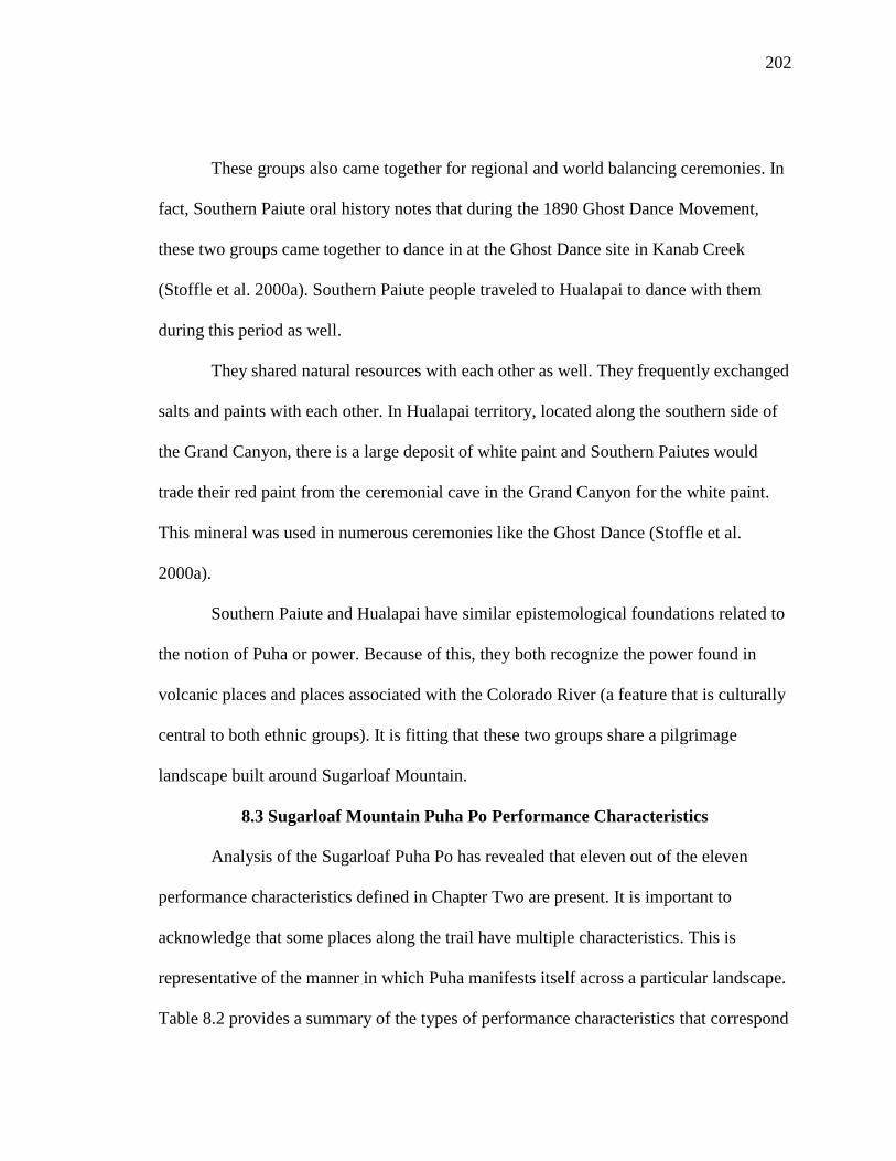
202
These groups also came together for regional and world balancing ceremonies. In
fact, Southern Paiute oral history notes that during the 1890 Ghost Dance Movement,
these two groups came together to dance in at the Ghost Dance site in Kanab Creek
(Stoffle et al. 2000a). Southern Paiute people traveled to Hualapai to dance with them
during this period as well.
They shared natural resources with each other as well. They frequently exchanged
salts and paints with each other. In Hualapai territory, located along the southern side of
the Grand Canyon, there is a large deposit of white paint and Southern Paiutes would
trade their red paint from the ceremonial cave in the Grand Canyon for the white paint.
This mineral was used in numerous ceremonies like the Ghost Dance (Stoffle et al.
2000a).
Southern Paiute and Hualapai have similar epistemological foundations related to
the notion of Puha or power. Because of this, they both recognize the power found in
volcanic places and places associated with the Colorado River (a feature that is culturally
central to both ethnic groups). It is fitting that these two groups share a pilgrimage
landscape built around Sugarloaf Mountain.
8.3 Sugarloaf Mountain Puha Po Performance Characteristics
Analysis of the Sugarloaf Puha Po has revealed that eleven out of the eleven
performance characteristics defined in Chapter Two are present. It is important to
acknowledge that some places along the trail have multiple characteristics. This is
representative of the manner in which Puha manifests itself across a particular landscape.
Table 8.2 provides a summary of the types of performance characteristics that correspond

203
with places along the trail. When Puhahivats began their journey, they visited places in
the following order: (1) Keyhole Canyon, (2) Pecked Boulder Field, (3) Goldstrike
Canyon, (4) Turquoise Mine, (5), River Crossing and (6) Sugarloaf Mountain.
Performance Characteristics Place Names
Home Communities
Neighboring Agricultural
Communities in the Las Vegas
and Chemehuevi Districts
Purification Sites Hot Springs in Gold Strike
Canyon
Tumpituxwinap Sites Keyhole Canyon, Pecked Boulder
Field, Top of Sugarloaf
Narrow & Constricted Spaces Gold Strike Canyon, Black
Canyon
Trail Water Sources The Colorado River Crossing
1st View of Destination Place The River Crossing
Medicine Collection and
Preparation Areas
Turquoise Mine, Base of
Sugarloaf Mountain
Paint/Mineral Sources Turquoise Mine
Ceremonial Lay-Down Areas Keyhole Canyon, Pecked Boulder
Field, Top of Sugarloaf Mountain
Final Preparation/Support
Camp Base of Sugarloaf Mountain
Destination Place w/ a
Viewscape Sugarloaf Mountain
Table 8.2 Sugarloaf Mountain Puha Po Performance Characteristics and Associated Places
8.4 Following the Sugarloaf Mountain Puha Po and Place Analysis
Sugarloaf Mountain is the nexus of three distinct Puha Pos—one coming from the
north, one coming from the east, and one coming from the south. During the 1998 and
2000 cultural landscape interviews, tribal representatives believed that Hualapai religious
specialists visited Sugarloaf Mountain via the trail to the east and that the trails from the
north and south were used by Southern Paiute Puha’gants. This discussion focuses

204
specifically on the trail that starts in the south at Keyhole Canyon approximately seven
miles away from Sugarloaf Mountain.
8.4.1 Home Communities
Each Puha Po to Sugarloaf Mountain began at the various agricultural villages in
the greater Mojave Desert-Colorado Plateau region. Specifically, for pilgrims who
traveled the southern trail, their home communities were located along the western shores
of the Colorado River. These villages practiced a different form of farming compared to
their northern neighbors. Farmers in these southern communities depended upon the
annual rise of the Colorado River to water their fields. These types of farms were located
mainly in the Chemehuevi District of the Southern Paiute nation.
8.4.2 Keyhole Canyon
After leaving their communities, the Puhahivats traveled to Keyhole Canyon, the
first stopping point along the trail. For the Puhahivats, Keyhole Canyon served as the
gateway to Sugarloaf Mountain along the southern Puha Po route. Keyhole Canyon has
this designation because it is located less than ten miles from Sugarloaf Mountain.
When Puha’gants entered Keyhole Canyon (Figure 8.2) at the start of their
journey, it was believed that they made a transition into a state where all their energy and
efforts were focused on completing a successful pilgrimage to Sugarloaf Mountain. This
transition required pilgrims to interact with the canyon and its associated features.
Pilgrims might have prayed and left offerings to the canyon and tumpituxwinap (Figure
8.3) as a means to acquire a spirit helper, which would have aided the pilgrims on the rest
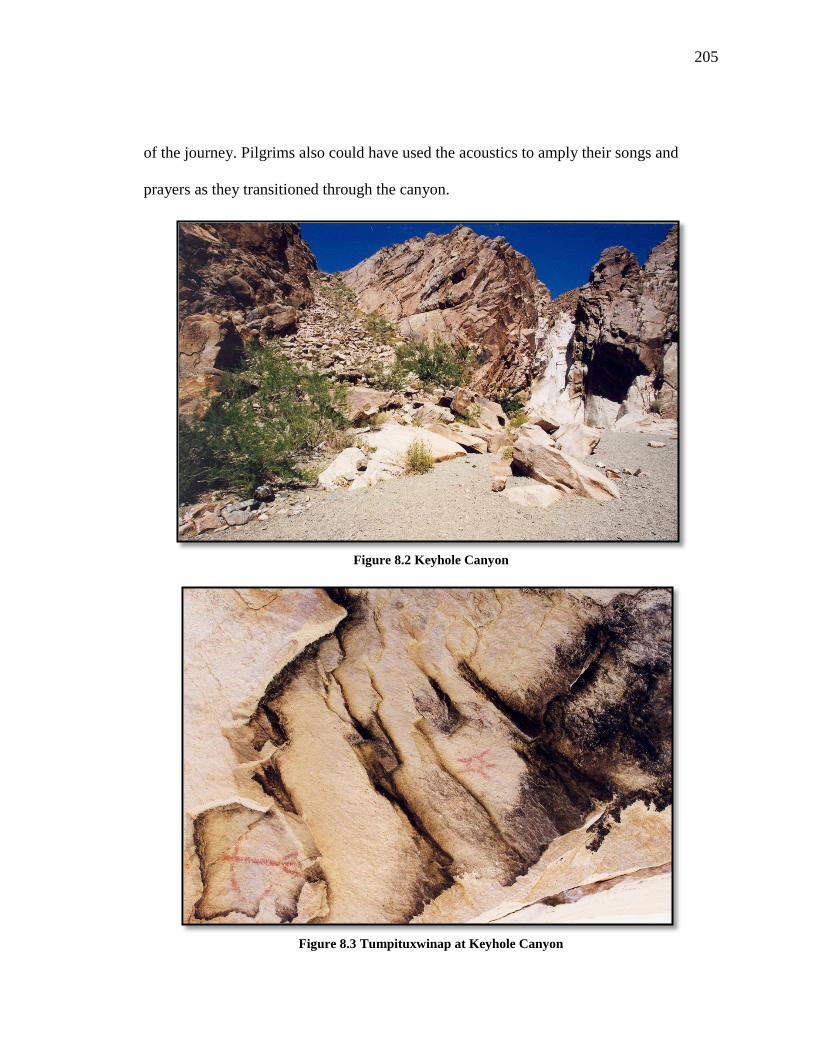
205
of the journey. Pilgrims also could have used the acoustics to amply their songs and
prayers as they transitioned through the canyon.
Figure 8.2 Keyhole Canyon
Figure 8.3 Tumpituxwinap at Keyhole Canyon

206
The canyon can best be described as a volcanic constriction. The canyon walls
contained tumpituxwinap panels. Tribal representatives thought that people interacted
with these images are part of the pilgrimage ceremony. One particular pecking caught the
attention of tribal representatives. This image was described as an anthropomorphic
figure and it is found at other places along the trail (Figure 8.4). Southern Paiute elders
thought that the reoccurrence of this image along the trail was a testament to these places
being ceremonially connected.
Figure 8.4 Anthropomorphic Figure in Keyhole Canyon
8.4.3 Pecked Boulder Field
After the pilgrims exited Keyhole Canyon, they traveled a short distance north to
an area covered in small to medium size volcanic boulders. At first this place does not
appear to contain any outstanding features such as a large stand of medicine plants or a
large uniquely shaped rock formation. This site, however, was identified by tribal elders
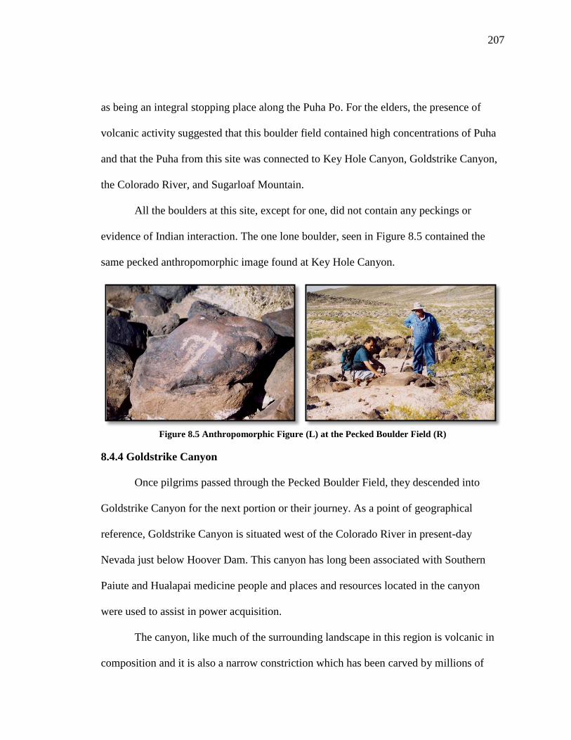
207
as being an integral stopping place along the Puha Po. For the elders, the presence of
volcanic activity suggested that this boulder field contained high concentrations of Puha
and that the Puha from this site was connected to Key Hole Canyon, Goldstrike Canyon,
the Colorado River, and Sugarloaf Mountain.
All the boulders at this site, except for one, did not contain any peckings or
evidence of Indian interaction. The one lone boulder, seen in Figure 8.5 contained the
same pecked anthropomorphic image found at Key Hole Canyon.
Figure 8.5 Anthropomorphic Figure (L) at the Pecked Boulder Field (R)
8.4.4 Goldstrike Canyon
Once pilgrims passed through the Pecked Boulder Field, they descended into
Goldstrike Canyon for the next portion or their journey. As a point of geographical
reference, Goldstrike Canyon is situated west of the Colorado River in present-day
Nevada just below Hoover Dam. This canyon has long been associated with Southern
Paiute and Hualapai medicine people and places and resources located in the canyon
were used to assist in power acquisition.
The canyon, like much of the surrounding landscape in this region is volcanic in
composition and it is also a narrow constriction which has been carved by millions of

208
years of erosion caused by water flowing through the canyon towards the Colorado River.
As described previously volcanic places and constricted places are viewed as powerful
because Puha collects and manifests itself at these locations. As a result, the Puha found
in Goldstrike Canyon (Figure 8.6) has attracted numerous medicine plants and
ceremonial red paint deposits.
Figure 8.6 Goldstrike Canyon
According to Southern Paiute worldview, powerful places also exist at the
convergence of waterways. They also believe that water is the most important component
of life. With its affinity for life, water is seen as a powerful element. Miller (1983)
describes all types of water as sacred and its power adheres to its reservoirs as clouds,
rain, snow, springs, seeps, lakes, streams or the occasional river in the desert. The Puha
that is concentrated at the places where two waters sources meet create special

209
ceremonial areas. In this particular landscape, a powerful hot spring is located at the
junction of the canyon and the Colorado River (Figure 8.7).
Figure 8.7 Goldstrike Canyon Hot Springs
This particular hot springs is different than others talked about in previous
chapters because the water from this hot spring flows from the canyon sides and bottom
producing a mineral bath and shower, and adding a hot stream flow to the Colorado
River. Puha’gants visited the hot springs for a number of reasons. Puha’gants came to this
hot spring because the water had important healing powers and a variety of medicine
plants. According to Southern Paiute elders, visiting the hot springs was part of the
training young Puha’gants received during pilgrimages. During the Hoover Dam Bypass

210
studies, one Southern Paiute elder added this perspective in regards to the roles of the hot
springs and other places located along the trail:
Turquoise, springs, mountains, trails. Each of these features plays a part
of very complex and holistic religious activities. Some items are discarded
as markers of territory. All could be used for teaching or preparing
someone for ceremonies.
As part of the pilgrimage to Sugarloaf Mountain, Puha’gants conducted
purification and healing ceremonies. The waters acted as a laxative and had powerful
system cleansing properties. These activities were necessary to prepare the mind and
body for safe and proper interactions with the spiritual beings. Some Puha’gants bathed
in the hot spring waters. Others would use the water to make medicinal teas. The healing
capacity of the canyon included the knowledge and spiritual power provided guidance to
those seeking spiritual and medicinal assistance during their pilgrimage.
The acoustics of the canyon, according to tribal representatives also contributed to
ceremonial activity. In the canyon when pilgrims sang songs or prayed to the canyon, the
hot spring, and to Sugarloaf Mountain, their voices echoed and traveled through the
canyon. The acoustics acted like an amplifier to send the prayers across, above, and
below the landscape.
A traditional Native American turquoise mine is located at mouth of Goldstrike
Canyon. Archaeological and ethnographic research noted that this mine was used long
before the arrival of non-Indians. According to a piece written for the Engineering and
Mining Journal (Stoffle et al. 2000b), researchers documented numerous stone
implements and prehistoric workings were found in the mine. This mining zone was half
a mile wide and approximately half a mile long.”

211
In Southern Paiute culture, turquoise has been associated with traditional leaders
and Puha’gants (Van Vlack 2007). The powerful nature of this element is linked to it
being a product of volcanic activity. Southern Paiute elders thought that mining turquoise
would have been an important part of the pilgrimage to Sugarloaf Mountain and how
visiting the mine and places along the trail were part a complex ceremony. As one
Southern Paiute elder added:
Turquoise, springs, mountains, trails. Each of these features play a part of
very complex and holistic religious activities. Some items are discarded as
markers of territory. All could be used for teaching or preparing someone
for ceremonies.
8.4.5 Colorado River Crossing
After visiting places and cleansing themselves in Goldstrike Canyon, the pilgrims
began the final portion of their journey to Sugarloaf Mountain. In order to reach the
mountain base, they had to cross the Colorado River at the Goldstrike Canyon opening
(Figure 8.8). The river at this section is approximately 300 feet wide and swimming was
the only appropriate manner to cross. This action was not an easy task and by design was
extremely dangerous. The risks involved in travel served as a testament to the notion that
pilgrimages were tests of dedication and strength. Southern Paiute elders stressed that
these journeys were not about ease of travel and that there were moments when pilgrims
needed to prove themselves in order to show they were able to receive Puha and
knowledge from their destination place.

212
Figure 8.8 The Colorado River Crossing
Southern Paiute people often described the Colorado River as a major source of
Puha in their traditional territory. The Colorado River has often been described as the
lifeblood of the Earth with the water being seen as a medicine. Since the Colorado River
was the only cold water source located along the trail, pilgrims left offerings to the river
and prayed to it before crossing. They likely collected water to take with them to leave as
an offering when they reached the top of Sugarloaf Mountain.
At the river crossing, the Puhahivats had the first unobstructed view of their
destination place. They would have prayed and sang to Sugarloaf Mountain and
explained to it why they came for ceremony and Puha.

213
8.4.6 Sugarloaf Mountain
When pilgrims crossed the Colorado River, the trail led them directly to the base
of the mountain. The final scent up Sugarloaf Mountain (Figure 8.9) was extremely
difficult due to the steep mountain slopes and uneven terrain. In order to reach the top,
pilgrims needed to climb one thousand feet in elevation from the riverbank to the summit
in approximately 1.25 miles.
Figure 8.9 Sugarloaf Mountain
Powerful elements such as animals and medicine plants have existed in and
around the base of the mountain since time in memorial. When tribal elders visited
Sugarloaf Mountain in 1998 and 2000, they were greeted by a mountain sheep herd. The
physical presence of mountain sheep was special because like Indian tobacco and
tumpituxwinap, special animals also are attracted to Puha places (Stoffle et al. 2000b).
For Southern Paiute people mountain sheep have always been associated with Puha’gants

214
and calling down the rain. The presence of the herd was a further testament to tribal
representatives of the powerful nature of this volcanic landscape. Elders also discovered
and interacted with a rattlesnake that lived at the base of the mountain. In Southern Paiute
culture, rattlesnakes served as guardians to ceremonial areas and they have been linked to
rain making Puha’gants (Kelly 1936).
Figure 8.10 Native American Elders Holding the Healing Stones
While no ritually deposited items were found along the mountain base or on top,
thousands of palm sized smooth oval-shaped quartz stones were documented (Figure
8.10). Elders identified these rocks as healing stones that carefully were made by the
mountain for the visiting Puha’gants (Stoffle et al. 2000b). The stones were then used in
doctoring and balancing ceremonies following the completion of the pilgrimage. In order
to acquire these healing stones, it was likely that Puha’gants had to establish a
relationship with Sugarloaf Mountain. In order to do this, offerings needed to be given. It

215
was possible that water from either the hot springs in Goldstrike Canyon or the Colorado
River was given to the mountain to thank it for providing the stones. Why would water be
used as opposed to obsidian, red jasper, or pottery? In recent ethnographic interviews,
Southern Paiute elders described water as the most powerful element on Earth and that
places, like humans, need it to survive thus it would have been appropriate to provide
Sugarloaf Mountain with water.
Figure 8.11 Anthropomorphic Figure at Sugarloaf Mountain
Receiving these special healing stones was a key moment in the pilgrimage
ceremony but it was not the last action. In order to complete this portion of the
pilgrimage, the Puha’gants had to reach the mountain top. The summit differed from
other destination places in that there no rock cairns to indicate vision questions like those
found at Scrugham Peak. In the center on the top of Sugarloaf Mountain was a large
upright boulder that contained the same anthropomorphic figure found at Keyhole
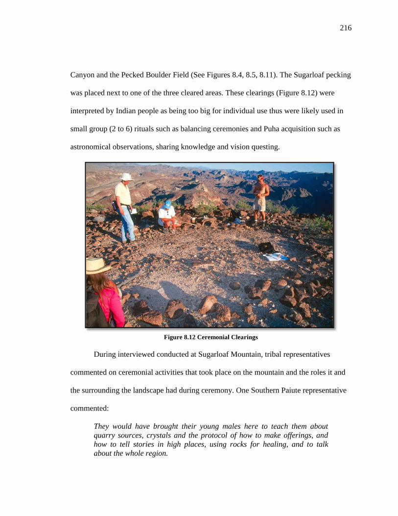
216
Canyon and the Pecked Boulder Field (See Figures 8.4, 8.5, 8.11). The Sugarloaf pecking
was placed next to one of the three cleared areas. These clearings (Figure 8.12) were
interpreted by Indian people as being too big for individual use thus were likely used in
small group (2 to 6) rituals such as balancing ceremonies and Puha acquisition such as
astronomical observations, sharing knowledge and vision questing.
Figure 8.12 Ceremonial Clearings
During interviewed conducted at Sugarloaf Mountain, tribal representatives
commented on ceremonial activities that took place on the mountain and the roles it and
the surrounding the landscape had during ceremony. One Southern Paiute representative
commented:
They would have brought their young males here to teach them about
quarry sources, crystals and the protocol of how to make offerings, and
how to tell stories in high places, using rocks for healing, and to talk
about the whole region.

217
Another elder added:
Sugarloaf Mountain is marked by stones and topographical features.
(They) used the healing stones for doctoring. The top of the mountain was
used for ceremony and stargazing. The surrounding areas features trail
marks and travel marks used for territorial markers.
A Southern Paiute elder acknowledged the importance of pilgrimage and vision
question but also commented on the importance of Sugarloaf Mountain and the
surrounding landscape in understanding the song trail to the afterlife. This elder
commented:
If you are helping with vision quests, the families came here in supporting
you. They set up camp, sacred ceremonial purposes, for prayers. This was
the Salt Song pathway. Knowing how close Gypsum Cave was- The hot
springs were used by other tribes their way. This spot was used for
ceremony and sacredness because it is so centered- every song that you
sing and every step that you take and this is the Salt Song Trail. Oh my
goodness! Seeing is believing.
Viewscapes were important to the successful completion of these ceremonies
because people and places draw upon each other’s Puha and they communicate with each
other. Southern Paiutes have maintained that the landscape was and always has been
dynamic and places like mountains, rivers, streams, and canyons are alive (Miller 1983,
Stoffle 1993). From Sugarloaf Mountain, pilgrims had clear views of the Colorado River,
Black Canyon, and Gypsum Cave. Southern Paiute people made special pilgrimages to
this cave to acquire songs such as the Salt Songs. One elder believed that the pilgrimage
to Sugarloaf Mountain was linked to the pilgrimage to Gypsum Cave. This elder said:
There is a connection to the Salt Song taking you part way on the trail. It
is part of the Salt Song Trail. Gypsum Cave is near and the hot springs are
right down there. Here is the spiritual connection with the Creator. Vision
quests were performed here. Before you go to Gypsum Cave, you have to
go to a high spot. If the Creator feels that this is what you need and thinks
218
you need and you go to the cave to get stronger in your songs, to ask them
to stay with you, all the time so that the songs will not be forgotten. The
songs and what you do to prepare and receive them . . . it’s so spiritual.
You have to do it with the right frame of mind and have a connection with
the Creator.
This sentiment also was expressed by another Southern Paiute person who took part in
the original Hoover Dam Bypass Study. This tribal representative added:
Before you go to Gypsum Cave, you have to go to a high spot. If the
Creator feels that this is what you need and thinks you need and you go to
the cave to get stronger in your songs, to ask them to stay with you, all the
time so that the songs will not be forgotten. The songs and what you do to
prepare and receive them. It's so spiritual. You have to do it with the right
frame of mind and have a connection with the Creator.
8.5 Conclusion- The Current Management Status
Following the completion of the Hoover Dam Bypass study in 2000, the culturally
affiliated tribes decided that the ethnographic report alone was not enough to protect
Sugarloaf Mountain, especially since the FHWA rejected the BARA findings (Stoffle et
al. 2004b). As a result, the tribes decided to nominate portions of the Puha Po as
traditional cultural properties (TCPs) to the National Register of Historic Places.
Specifically, they sought to nominate Sugarloaf Mountain and Goldstrike Canyon
because these places were under intense direct threat from the proposed road
construction.
This duel TCP nomination was complex because these places are located in
Nevada and Arizona. They had to be approved by both state historic preservation offices
(SHPO) before the nominations moved on to the federal level. According to those who
were closely involved in the nomination process, the Arizona SHPO quickly approved
and showed support for the nomination. The Nevada SHPO, however, was faced with

219
intense political pressure to delay the nomination process until after road construction
was well underway. It was believed that the delay tactic done in order to prevent any
action stopping it. For the state of Nevada, it was a high dollar and high visibility project
that was projected to boost the state’s economy through increased commerce and tourism
revenue. Despite the four year delay, Sugarloaf Mountain and Goldstrike Canyon were
nominated successfully to the National Register and were listed on September 4, 2004.
This TCP remains the only two-state listing in the United States.

220
CHAPTER NINE
BLACK MOUNTAIN- A MULTI-ETHNIC VOLCANIC
CEREMONIAL LANDSCAPE
Black Mountain is a large volcanic place in southern Nevada that has been used
by Indian people for thousands of years. Numic and Yuman speaking peoples have
identified Black Mountain as a multi-ethnic ceremonial destination place. The Puha of
this mountain and the surrounding landscape attracted religious specialists from Owens
Valley, Western Shoshone, Southern Paiute, and Mojave territory (Figure 9.1). The
journey to this mountain involves traveling along a twenty-six mile trail from Oasis
Valley along the Amargosa River hydrological system. An analysis of this pilgrimage
trail and its associated performance characteristics illustrates how seven unique places are
linked sequentially along a 30 mile trail. This discussion begins in Oasis Valley at the
large Indian villages and ends on top of Black Mountain, the largest mountain in the
Amargosa River Valley. Each place is assessed in terms of its role along the pilgrimage
trail, or Puha Po and the types of cultural resources found.
9.1 Black Mountain Cultural Landscape Study Methodology
The data used in this dissertation was collected during a multi-year ethnographic
study funded by the United States Air Force, Nellis Air Force Base (NAFB). The original
research project was designed as part of on-going government-to-government
consultations with the culturally affiliated tribes and was intended to contribute to the
larger goal of understanding and demonstrating the interrelationships among Native
Americans and the NAFB lands. Nellis land managers want to develop management

221
plans that effectively protect Native American cultural resources while keeping in line
with the overall defense mission of the United States Air Force. The Black Mountain
Cultural Landscape study was one of the first to occur in the northern portion of the range
and it aided in documenting the types of cultural resources and places that existed.
Another intended goal was to help form long-term partnerships between the culturally
affiliated tribes, ethnographers, and archaeologists (Myhrer 2003).
Figure 9.1 Cultural Affiliation of Black Mountain
Since 1996, NAFB funded ethnographic resource assessments as part of on-going
tribal consultation, required by the National Historic Preservation Act and the National
Environmental Policy Act. As part of their efforts to actively engage with tribes, NAFB

222
started its Native American Interaction Program. This has proactively involved the tribes
in planning, reviewing, and participating in all field research projects.
The Black Mountain-Thirsty Canyon ethnographic studies involved multiple field
sessions between 2004 and 2008. Field research included the active participation of the
Consolidated Group of Tribes and Organizations (CGTO), which is a pan-tribal, multi-
ethnic group created in 1990 to consult with federal facilities located within traditional
territories in southern Nevada (Beck, Zedeño, and Furlow 2000). The CGTO comprises
17 tribes and pan-Indian organizations from the Mojave, Southern Paiute, Western
Shoshone, and Owens Valley Paiute ethnic groups. The Fort Mojave tribe also is
involved in consultation on NAFN because they have cultural ties to the southern portion
of the base.
During the two Black Mountain ethnographic studies, a total of 271 interviews
were conducted, with 153 men and 118 women. Three primary survey instruments were
used: the site form, the rock art form, and the cultural landscape form (see Appendix A).
The site form was modified for the second study to reflect the unique sites visited such as
the Six Rock Shelters. Questions were asked to determine how this site was connected to
Black Mountain, the order in which the shelters were used by Puha’gants and also to
ascertain how the site was used during different time periods. Table 9.1 presents the total
number of interviews conducted at places only along this trail. In total 200 interviews
occurred at places specifically along the Black Mountain Puha Po and of these 84
interviews were conducted with Southern Paiute cultural representatives.

223
Place Interview Type Ethnic Group Total
Site Landscape Rock
Art
Open-
ended
OVP WSH SP MOJ
Black Mountain X X 4 3 7 0 14
Pillar Springs X X 12 7 15 0 34
Big Ceremony Site X X 8 10 17 2 37
Boulder Rock
Shelters
X X 7 11 13 3 34
Caldera Pecking
Site
X X 2 7 7 3 19
Six Rock Shelter
Complex
X X 5 4 7 0 16
Landscape-Various
Places
X X 8 16 18 4 46
TOTAL
INTERVIEWS
46 58 84 12 200
Table 9.1 Total Number of Interviews by Site and Survey Form along the Black Mountain Puha Po
During this project, I took part in all project field sessions and participated in
many of the interviews were tribal representatives. Because of my involvement in this
study I had access to the interview database which I drew upon for my dissertation
research.
9.2 The Black Mountain Puha Po in Ethnographic Context
To understand the cultural significance of the pilgrimage to Black Mountain and
its associated performance characteristics, it important to place this region into a broader
context of meaning for Numic-speaking peoples, particularly Southern Paiute people. The
Black Mountain region’s geologic composition contributes to the distribution of Puha and
the formation of a major hydrological feature both which contribute to the cultural
meaning and value to Southern Paiute people. The following discussion frames how and
why Southern Paiute religious specialists used and interacted with places along the trail
as they traveled to Black Mountain to acquire knowledge and power.

224
9.2.1 Volcanism
Volcanoes have a special place in Southern Paiute epistemology, and Southern
Paiute people are strongly culturally attached to volcanic places and events. Volcanic
episodes are distinctive moments when Puha moves from lower to higher levels of
existence and causes the power to accumulate in these areas (Stoffle et al. 1995, Stoffle et
al. 2000, Stoffle et al. 2004, Stoffle et al.2005). Puha moves from the lower portions of
the Earth to form hot springs, mountains, volcanic cones, basalt mesas, lava tubes, basalt
bombs, and obsidian deposits. Volcanic places and materials play important roles in the
formation of special minerals and biotic communities found here. Some resources can be
found only where volcanic activity has created power landscapes. Southern Paiute people
respect and interact with places of volcanic activity because these places contain
powerful forces, spiritual beings who can balance human society at local, regional, and
world levels. As one Southern Paiute elder said, “Volcanoes are sacred mountains. The
old people knew it was alive, like the mother earth is alive. We have a song about the
rocks shooting out of a volcano near home.”
Black Mountain is a powerful mountain that has been used as a ceremonial center
for thousands of years. The Puha that was dispersed from the mountain top links places
throughout traditional Southern Paiute territory and helped form one of the major
hydrological systems in traditional Numic territory.
9.2.2 The Amargosa River Hydrological System
The Black Mountain Puha Po follows the flow of the Amargosa River, an
important hydrological feature for Southern Paiute and Western Shoshone peoples since

225
the beginning of time. The river is responsible for how how Puha is distributed across the
landscape because it begins at the top of Black Mountain (see Figure 9.2). This volcanic
mountain is one of the highest regional volcanoes and long has been understood as a
ceremonial place. Millions of years ago, when Black Mountain was created, its caldera
formed a large lake. Over time, the southern wall of the caldera eroded and broke in two
places releasing its waters, which began the process of carving two large dendritic
volcanic canyons. Collectively these canyons are known today as Thirsty Canyon. The
Amargosa River hydrological complex is one of the most important in the region (Figure
9.2). Given that water and Puha flow downhill, Black Mountain is the ultimate source of
regional Puha and water. The river, mountain, and associated features such as, rock
peckings and paintings, viewscapes, offerings, medicine plants, and water are
performance features in Paiute and Shoshone pilgrimage to Black Mountain.
Water flows through Thirsty Canyon toward the Oasis Valley passing the
ceremonial hot springs. Then the water flows south along the northeast side of the
Funeral Mountains, past the town of Shoshone, California and Dumont Dunes a large
sand dune in California. There, the river turns quickly to the west and empties into Death
Valley. Today, this 198 mile river runs underground most of the year, but it once was the
major river feeding Lake Manley, the Pleistocene lake that existed in Death Valley
(Stoffle et al. 2009). Segments of the river follow the Southern Paiute song trail to the
afterlife, thus linking the Puha from Black Mountain to other important ceremonial places
in traditional Southern Paiute territory.

226
Figure 9.2 The Amargosa River Hydrological Complex
9.3 Black Mountain Puha Po Performance Characteristics
Analysis of the Black Mountain Puha Po has revealed the presence of ten of the
eleven performance characteristics defined in Chapter Two with only a mineral/paint
source being unidentified at this time.. Southern Paiute representatives identify these
characteristics as important features for understanding the ceremonial journey to Black
Mountain.

227
Some places along the trail exhibit multiple performance features due to the ways
Puha flows across the landscape and attracts certain powerful elements to various places.
The following table (Table 9.2) provides a summary of the types of performance
characteristics that correspond with places along the trail. During the two ethnographic
studies in 2004 and 2008, it was impossible to access all areas along the trail due to poor
road conditions and security access issues, therefore a paint source along the trail could
not be located. Previous research, however, has located paint sources exist in the region
and it is possible that pilgrims prepared paint prior to starting their journeys as part of
their initial preparation.
Performance Characteristics Place Names
Home Communities Oasis Valley
Purification Sites Oasis Valley- Hot Springs
Tumpituxwinap Sites Boulder Pecking Site, 6 Rock
Shelter Complex
Narrow & Constricted Spaces
Pillar Springs to Big Ceremony
Site, Boulder Pecking Site
Canyon, Thirsty Canyon
Trail Water Sources Pillar Springs
1st View of Destination Place 6 Rock Shelter Complex
Medicine Collection and
Preparation Areas
6 Rock Shelter Complex, Boulder
Rock Shelter
Paint/Mineral Sources Unknown, but regionally found
Ceremonial Lay-Down Areas Big Ceremony Site
Final Preparation/Support
Camp Boulder Rock Shelter
Destination Place w/ a
Viewscape Black Mountain
Table 9.2 Black Mountain Puha Po Performance Characteristics and Associated Places
228
9.4 Following the Black Mountain Puha Po and Place Analysis
Pilgrims, also known as Puhahivats (people seeking Puha) to Black Mountain
visit and interact with a series of places along this 30 mile trail. The trail begins in Oasis
Valley and passes through Thirsty Canyon before crossing over the caldera rim and up
the northern side of the mountain.
9.4.1 Oasis Valley Hot Springs
Puhahivats began their initial preparation in home communities that were
important agricultural centers. The closest locations to the beginning of the trail were Ash
Meadows and Oasis Valley (Lingenfelter 1986; Stoffle et al. 1990). The initial
preparations for their journey involved prayers and ritual cleansing. In the Oasis Valley
area, Puhahivats utilized the ceremonial hot springs produced by the region’s volcanic
activity. In volcanic areas, Puha not only follows the flow of water, but also follows the
flow of magma. The diffusion of Puha underground links together regional volcanic
places, thus connecting the hot springs in Oasis Valley to volcanic mountains such as
Black Mountain.
At the Oasis Valley hot springs, Puhahivats cleansed themselves of impurities and
ill thoughts through prayer and ritual bathing. According a Southern Paiute elder, only
Indian people used the original hot spring in Oasis Valley to purify themselves for
ceremonial and doctoring uses during the 1920s and 1930s. People visiting the hot
springs brought pieces of obsidian, chert, or other stone pieces to leave as offerings to

229
thank the springs for healing and preparing the travelers for their journey. In this way, the
Puhahivats established or reaffirmed a relationship with the hot spring.
9.4.2 The Six Rock Shelter Complex
From the hot springs, Puhahivats traveled along the west branch of Thirsty
Canyon to the Six Rock Shelter Complex.1 The Six Rock Shelter Complex was formed
from the same volcanic trachytic rock that created Pillar Springs and the rim of the Black
Mountain caldera. The six shelters at this site contain different materials and features,
which suggest that each one had a very specific use during ceremonial and doctoring
activities during pilgrimage. At the Rock Shelters, Puhahivats prepared themselves
physically and spiritually for the rest of their journey.
The complex is located to the southeast of Pillar Springs, the area’s only
permanent water source. Present at this location are six unique rock shelters and a small
hill lined with a series of special perched rocks. Five out of the six rock shelters contain
one specific culture resource: red, white, and yellow painted figures; grinding stones;
obsidian needles; arrow shafts; and a wooden mortar with red paint on the inside and a
stone pestle. The sixth rock shelter does not contain any items or rock art but does exhibit
amplifying acoustics. Puhahivats visited the shelters in a particular order.
The Painted Cave
When entering the rock shelter complex, Puhahivats first stopped at the Painted
Cave, which provided Puhahivats with the first view of Black Mountain and an
1 It is possible that important stopping places occur along portions of the west branch of Thirsty Canyon,
however due to access restrictions, this area was not visited.
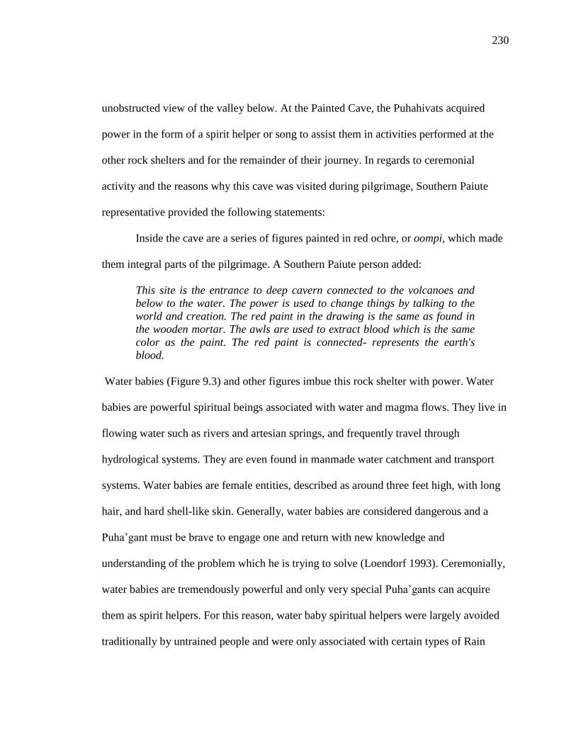
230
unobstructed view of the valley below. At the Painted Cave, the Puhahivats acquired
power in the form of a spirit helper or song to assist them in activities performed at the
other rock shelters and for the remainder of their journey. In regards to ceremonial
activity and the reasons why this cave was visited during pilgrimage, Southern Paiute
representative provided the following statements:
Inside the cave are a series of figures painted in red ochre, or oompi, which made
them integral parts of the pilgrimage. A Southern Paiute person added:
This site is the entrance to deep cavern connected to the volcanoes and
below to the water. The power is used to change things by talking to the
world and creation. The red paint in the drawing is the same as found in
the wooden mortar. The awls are used to extract blood which is the same
color as the paint. The red paint is connected- represents the earth's
blood.
Water babies (Figure 9.3) and other figures imbue this rock shelter with power. Water
babies are powerful spiritual beings associated with water and magma flows. They live in
flowing water such as rivers and artesian springs, and frequently travel through
hydrological systems. They are even found in manmade water catchment and transport
systems. Water babies are female entities, described as around three feet high, with long
hair, and hard shell-like skin. Generally, water babies are considered dangerous and a
Puha’gant must be brave to engage one and return with new knowledge and
understanding of the problem which he is trying to solve (Loendorf 1993). Ceremonially,
water babies are tremendously powerful and only very special Puha’gants can acquire
them as spirit helpers. For this reason, water baby spiritual helpers were largely avoided
traditionally by untrained people and were only associated with certain types of Rain

231
Shamans. Their connection with water made them very valuable for rain making
activities.
Figure 9.3 Painted Water Baby Figure (Image Enhanced)
From Painted Cave, Puhahivats had a clear unobstructed view of the top of Black
Mountain, likely the first such clear view of their destination place. While in the Painted
Cave, Puhahivats likely prayed to Black Mountain and explained to it why they were
seeking the mountain’s assistance. One tribal representative added, “I think they did some
their prayers there so that they would be able to do their ceremonies or doctoring.”After
ritual activity was complete in this rock shelter, the Puhahivats proceeded across the
canyon floor toward the other five shelters.
Tonal Rocks
In the middle of the Rock Shelter Complex are a number of perched stone slabs
(Figure 9.4), composed of basaltic trachyandesite, a special volcanic rock found in the

232
Black Mountain region. The stones range from four to five feet in length and from two to
three feet wide. When tapped, the stones project musical tones. In earlier studies
conducted by members of the BARA (Bureau of Applied Research in Anthropology)
team, Native American representatives identified these stones as tonal rocks, which have
been associated with ceremonial centers such as Prow Pass and the Doctor Rock near the
entrance to Cat Canyon and Water Bottle Canyon (Stoffle et al. 2005; Stoffle, Van Vlack,
and Arnold 2005). One elder discussed the importance of these features as follows,
“Energy Rocks! If someone played the rocks, the people were aware of the drumming.
Tonal rocks are energized- they speak back to you.” The tonal rocks were placed along
the edge of two small hills on the canyon floor. When the tonal rocks are tapped, the
sounds amplify across the valley, suggesting that Puhahivats might have used these
stones as drums during their journey.
Figure 9.4 Tonal Rocks

233
Grinding Stone Rock Shelter
The Grinding Stone Rock Shelter is the largest, most easternmost rock shelter.
Tribal representatives believed that after the visiting the Painted Cave, Puhahivats
continued to the Grinding Stone Rock Shelter. The grinding stones (Figure 9.5) that are
present were used to prepare food and medicines to take with them on their multiple day
journeys. One elder noted:
The stones are part of the ceremonial use when processing food that
comes from the earth and the animals that are killed with the arrows.
Once killed the bloodletting from the awls are used to extract blood, which
represents the magma, or red paint that is found in the wooden mortar and
paint cave that is tied to the volcano.
The medicines were used in ceremonies associated with the pilgrimage and doctoring
activities. It is possible that medicines and food items were also left as offerings along the
trail.
Figure 9.5 Grinding Stones in the Foreground Found in the Rock Shelter
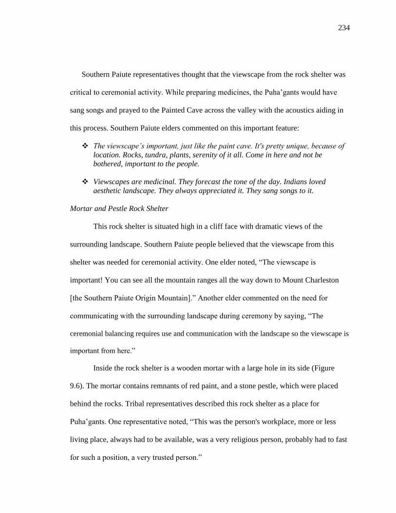
234
Southern Paiute representatives thought that the viewscape from the rock shelter was
critical to ceremonial activity. While preparing medicines, the Puha’gants would have
sang songs and prayed to the Painted Cave across the valley with the acoustics aiding in
this process. Southern Paiute elders commented on this important feature:
The viewscape’s important, just like the paint cave. It's pretty unique, because of
location. Rocks, tundra, plants, serenity of it all. Come in here and not be
bothered, important to the people.
Viewscapes are medicinal. They forecast the tone of the day. Indians loved
aesthetic landscape. They always appreciated it. They sang songs to it.
Mortar and Pestle Rock Shelter
This rock shelter is situated high in a cliff face with dramatic views of the
surrounding landscape. Southern Paiute people believed that the viewscape from this
shelter was needed for ceremonial activity. One elder noted, “The viewscape is
important! You can see all the mountain ranges all the way down to Mount Charleston
[the Southern Paiute Origin Mountain].” Another elder commented on the need for
communicating with the surrounding landscape during ceremony by saying, “The
ceremonial balancing requires use and communication with the landscape so the viewscape is
important from here.”
Inside the rock shelter is a wooden mortar with a large hole in its side (Figure
9.6). The mortar contains remnants of red paint, and a stone pestle, which were placed
behind the rocks. Tribal representatives described this rock shelter as a place for
Puha’gants. One representative noted, “This was the person's workplace, more or less
living place, always had to be available, was a very religious person, probably had to fast
for such a position, a very trusted person.”

235
Figure 9.6 Wooden Mortar and Stone Pestle inside the Rock Shelter
The items found in this cave have been attributed to a medicine man. The wooden
mortar would have been used to prepare oompi, which was likely used later in the
pilgrimage at Pillar Springs or at the Caldera Pecking Site. One elder believed that the red
paint was prepared in this shelter and used to interact with water babies. This elder said,
“They were used for preparing oompi to make the drawings to communicate with the
deep water babies, deep in the earth.”
Indian people believed that the hole was intentionally placed, signifying that the
mortar had been ritually killed. After the mortar was killed, it was purposely hidden
inside the shelter in order to reduce the probability that it would be found by another
person. Hiding the mortar and pestle inside the shelter also enable the items to be
protected by the surrounding Puha and Black Mountain.
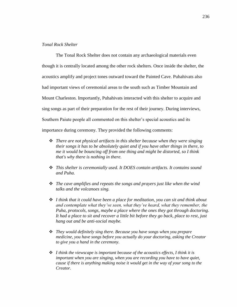
236
Tonal Rock Shelter
The Tonal Rock Shelter does not contain any archaeological materials even
though it is centrally located among the other rock shelters. Once inside the shelter, the
acoustics amplify and project tones outward toward the Painted Cave. Puhahivats also
had important views of ceremonial areas to the south such as Timber Mountain and
Mount Charleston. Importantly, Puhahivats interacted with this shelter to acquire and
sing songs as part of their preparation for the rest of their journey. During interviews,
Southern Paiute people all commented on this shelter’s special acoustics and its
importance during ceremony. They provided the following comments:
There are not physical artifacts in this shelter because when they were singing
their songs it has to be absolutely quiet and if you have other things in there, to
me it would be bouncing off from one thing and might be distorted, so I think
that's why there is nothing in there.
This shelter is ceremonially used. It DOES contain artifacts. It contains sound
and Puha.
The cave amplifies and repeats the songs and prayers just like when the wind
talks and the volcanoes sing.
I think that it could have been a place for meditation, you can sit and think about
and contemplate what they’ve seen, what they’ve heard, what they remember, the
Puha, protocols, songs, maybe a place where the ones they got through doctoring.
It had a place to sit and recover a little bit before they go back, place to rest, just
hang out and be anti-social maybe.
They would definitely sing there. Because you have songs when you prepare
medicine, you have songs before you actually do your doctoring, asking the Creator
to give you a hand in the ceremony.
I think the viewscape is important because of the acoustics effects, I think it is
important when you are singing, when you are recording you have to have quiet,
cause if there is anything making noise it would get in the way of your song to the
Creator.

237
Obsidian Needles Rock Shelter
Located to the west of the Tonal Rock Shelter, the Obsidian Needles Rock Shelter
was used for medicine and ritual preparation. Indian people identified this shelter as a
doctoring place due to numerous small obsidian needles (Figure 9.7) found on the floor
of the shelter and pieces of burnt wood lodged inside cracks in the ceiling. Obsidian
needles have long been interpreted as tools used by Puha’gants in doctoring ceremonies,
such as bloodletting to release sickness from a person as a way to restore balance.
Figure 9.7 Obsidian Needs inside the Rock Shelter
The needles at this site are believed to rely upon the Puha of the magma flow,
which links the Rock Shelter Complex, Black Mountain, and the other volcanic places in
the region together. As part of their doctoring practices, Puha’gants often placed sticks
into cave ceilings in order to allow prayers to be sent to the Creator and to rid the area of
the illness. According to one Southern Paiute person, “These needles are used

238
symbolically for bloodletting to release the bad or sickness. It relies on the power of the
red magma from the volcano that travels far below the surface and heats up the hot
springs and travels through the Armargosa River and Crater Flats.” Fire and smoke also
were used to purify the area.
Arrow Shaft Rock Shelter
The Arrow Shaft Rock Shelter (Figure 9.8) is located in the most remote part of
the rock shelter complex, along the western edge of the site. This shelter has two
openings, both of which could have been used for entering or exiting. Inside the shelter is
a cluster of arrow shafts that have been ritually deposited in one corner of the cave.
Places like the Arrow Shaft Rock Shelter serve as portals to other dimensions for spiritual
travel and are used to send imbalances into the earth. All the shelters served as areas
where Puhahivats underwent a transition from a normal life into a heightened spiritual
state and transition back to a normal state on the return journey to their home
communities.
Figure 9.8 Arrow Shaft Rock Shelter
The unique features and items found within the Rock Shelter Complex
demonstrate how this place is linked to ceremony through learning and doctoring.

239
Interviews affirmed this site was important in preparing for ceremonial activities as part
of the pilgrimage. During interviews, Southern Paiute representatives added, “The arrows
can bring blood aka plasma, hot water, which brings pain. The arrows are a critical and
essential component of the doctoring ceremony,” and “The arrows were placed here at
the beginning of a balancing ceremony. This was done because things were wrong in the
world. This central location called/used the power of Black Mountain to bring things
back to order.” After preparations and ceremonies, the Puhahivats continued on to Pillar
Springs for the next part of the pilgrimage.
Figure 9.9 Pillar Springs
9.4.3 Pillar Springs
The Pillar Springs complex (Figure 9.9) was the Puhahivats’ first dependable
water source along the trail, since departing Oasis Valley. The Pillar Springs Complex is
located to the northwest of the Rock Shelters Complex and south-southwest of the Black

240
Mountain summit. The Pillar Springs Complex contains a canyon, volcanic outcrops
composed of large pillar shaped boulders, rock shelters, three springs, and several small
carved out depressions, also known as pohs. Artifacts (Figure 9.10) found at the site
include pottery and a bone awl, as well as lithic artifacts including obsidian flakes, chert
flakes, a knife blade, a hammer stone, grinding stones, metates, and manos.
Figure 9.10 Artifacts found at Pillar Springs
Puhahivats prayed and made offerings to the spring before collecting water to be
used during the remaining portion of their journey to the top of Black Mountain. One
elder noted, “I'm sure they stopped and got water there. And it’s probably half a day
journey or a day so they probably camped there and then they went on to the climb Black
Mountain.” Travelers set up a support camp for the person who sought power. This camp

241
had to be close to a water source but sufficiently removed from Black Mountain to give
the vision-seeker privacy. Another tribal representative added
Now that I've seen this area, it’s clear. It is an oasis. People had to have
been here. The reason they came was for the water, but they probably
would have camped and stayed. And then they would have the resources to
go up into the mountain to have their ceremonies. Ceremonies would have
happened here too. Before they went to the water they would have prayed.
This area would have been more dangerous, more animals. Mountain
lions…and because of the water and because they knew that the animals
would be watching them too. That’s why they would have ceremonies
above the springs, because there are other things here. The water has stuff
in it, other spirits. So they would not just wander around, they would have
had to do things first.
The trail led from the Pillar Springs Complex directly over the top of the caldera
wall between the volcanic pillars, and into the Big Ceremony Site (Figure 9.11). A large
rock cairn at the top, before the trail drops down, serves as a trail marker. The route
passes through a narrow and constricted space with a distance down the chute of 0.06
miles and an elevation change of 107 feet. Indian people believed that this was the logical
route since it is difficult to traverse and passes through a constricted narrow space. The
top of the chute is the first vantage point where the Puhahivats can see all of Black
Mountain. Puhahivats used this opportunity to interact with the mountain by praying to it,
perhaps singing to it, and further explaining the purpose of their journey.
For Puhahivats, the journey was not designed to be an easy passage. The
difficulty of travel was a key component of the pilgrimage. The hike down the narrow
chute from Pillar Springs to the Big Ceremony Site was dangerous. During the field visits
to this trail segment, snow, ice, and water were present. While it made travel difficult,
water was a testament to the presence of Puha in this area. Puha collects in places just as
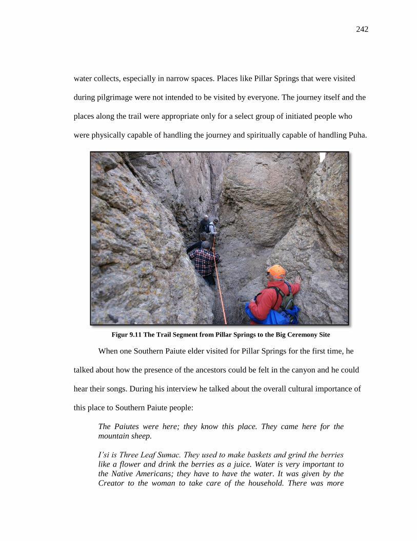
242
water collects, especially in narrow spaces. Places like Pillar Springs that were visited
during pilgrimage were not intended to be visited by everyone. The journey itself and the
places along the trail were appropriate only for a select group of initiated people who
were physically capable of handling the journey and spiritually capable of handling Puha.
Figur 9.11 The Trail Segment from Pillar Springs to the Big Ceremony Site
When one Southern Paiute elder visited for Pillar Springs for the first time, he
talked about how the presence of the ancestors could be felt in the canyon and he could
hear their songs. During his interview he talked about the overall cultural importance of
this place to Southern Paiute people:
The Paiutes were here; they know this place. They came here for the
mountain sheep.
I’si is Three Leaf Sumac. They used to make baskets and grind the berries
like a flower and drink the berries as a juice. Water is very important to
the Native Americans; they have to have the water. It was given by the
Creator to the woman to take care of the household. There was more
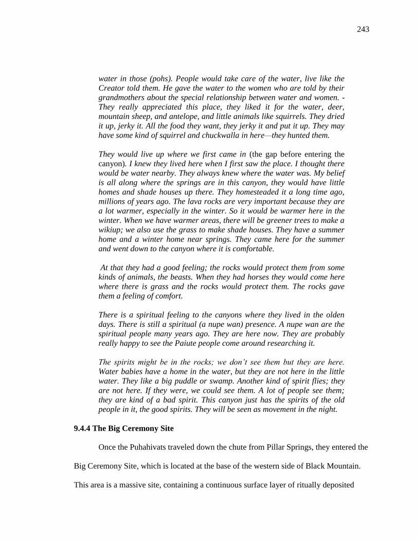
243
water in those (pohs). People would take care of the water, live like the
Creator told them. He gave the water to the women who are told by their
grandmothers about the special relationship between water and women. -
They really appreciated this place, they liked it for the water, deer,
mountain sheep, and antelope, and little animals like squirrels. They dried
it up, jerky it. All the food they want, they jerky it and put it up. They may
have some kind of squirrel and chuckwalla in here—they hunted them.
They would live up where we first came in (the gap before entering the
canyon). I knew they lived here when I first saw the place. I thought there
would be water nearby. They always knew where the water was. My belief
is all along where the springs are in this canyon, they would have little
homes and shade houses up there. They homesteaded it a long time ago,
millions of years ago. The lava rocks are very important because they are
a lot warmer, especially in the winter. So it would be warmer here in the
winter. When we have warmer areas, there will be greener trees to make a
wikiup; we also use the grass to make shade houses. They have a summer
home and a winter home near springs. They came here for the summer
and went down to the canyon where it is comfortable.
At that they had a good feeling; the rocks would protect them from some
kinds of animals, the beasts. When they had horses they would come here
where there is grass and the rocks would protect them. The rocks gave
them a feeling of comfort.
There is a spiritual feeling to the canyons where they lived in the olden
days. There is still a spiritual (a nupe wan) presence. A nupe wan are the
spiritual people many years ago. They are here now. They are probably
really happy to see the Paiute people come around researching it.
The spirits might be in the rocks; we don’t see them but they are here.
Water babies have a home in the water, but they are not here in the little
water. They like a big puddle or swamp. Another kind of spirit flies; they
are not here. If they were, we could see them. A lot of people see them;
they are kind of a bad spirit. This canyon just has the spirits of the old
people in it, the good spirits. They will be seen as movement in the night.
9.4.4 The Big Ceremony Site
Once the Puhahivats traveled down the chute from Pillar Springs, they entered the
Big Ceremony Site, which is located at the base of the western side of Black Mountain.
This area is a massive site, containing a continuous surface layer of ritually deposited

244
items. These ritually deposited materials stretch from the caldera rim and continue down
into the upper Pillar Springs valley. Some Indian people have argued that the upper Pillar
Springs valley, caldera rim, and the Big Ceremony Site are a single place used for
common and interrelated ceremonial activities.
Figure 9.12 Overview of the Big Ceremony Site
While visiting the Big Ceremony Site (Figure 9.12), tribal representatives noted
the presence of many grinding stones, pendants, knife blades, beads, exotic stones,
crystals, pottery fragments, and diverse projectile points made from obsidian, jasper, and
white chert. During one site visit, tribal representatives and the BARA team found a point
made from a chert material that appears to be identical to the material found near the
summit of Black Mountain. Additional offerings included Kanab Wonder Stone, a type of
sandstone with multiple bands of colors from the Northern Arizona-Southern Utah area,
which was found in the face of a volcanic tuff boulder.
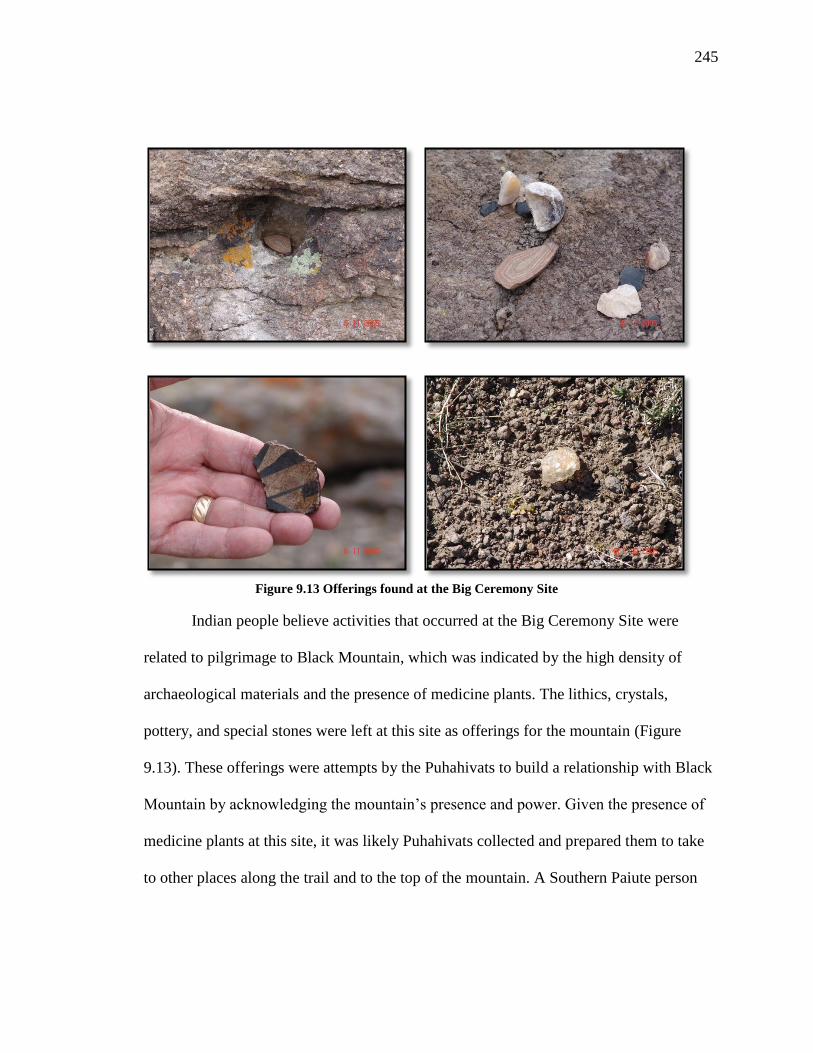
245
Figure 9.13 Offerings found at the Big Ceremony Site
Indian people believe activities that occurred at the Big Ceremony Site were
related to pilgrimage to Black Mountain, which was indicated by the high density of
archaeological materials and the presence of medicine plants. The lithics, crystals,
pottery, and special stones were left at this site as offerings for the mountain (Figure
9.13). These offerings were attempts by the Puhahivats to build a relationship with Black
Mountain by acknowledging the mountain’s presence and power. Given the presence of
medicine plants at this site, it was likely Puhahivats collected and prepared them to take
to other places along the trail and to the top of the mountain. A Southern Paiute person

246
commented on the importance of these ritually deposited items and associated site
features:
There’s a lot to be said and there’s more stories to be about where I’m at
and this location. There’s a lot of things that I had spoken earlier about
and some things I want to add. First of all with the- this is the first day we
come out here and tomorrow we go over to the massive site that’s the
support area and over there there’s a lot of things that are used in
doctoring that are used and connected with Black Mountain. We were
finding crystals- large crystals probably about the size of a golf ball at
least. We found pendants; we found a finely crafted white knife. It’s too
thin for hunting. It’s what they use in ceremonies. We found those around.
We found small little mortars they’re not for food. It’s what you use for
paint and you use that for medicine. We found those around. We found
beads in the area. It’s something I think that you don’t find those in a
place where people think or people process food. It’s not a food
processing place. You’ll feel it and Indian people can feel it if they’re
right.
Another elder added, “Black Mountain is a source of Puha. The caves were used for
meditation and for connecting with the spirits. The grinding stones were used for
preparing food and medicine.”
9.4.5 Caldera Pecking Site
The Caldera Pecking Site is located east of the Big Ceremony Site, approximately
one mile west-southwest of Black Mountain (Figure 9.14). One person commented that,
“This place is connected to Black Mountain which is centrally located in the landscape.
They probably followed the wash of Thirsty Canyon here and then went to Black
Mountain.” Visible from the top of Black Mountain, the site is located in an
approximately 100’ long wash that drains into the west fork of Thirsty Canyon. It
includes offering holes, pohs, and ritually deposited pieces of obsidian and white chert.
The dozens of peckings on extremely hard, dark gray, basalt rock are the dominate

247
features of this site. Puhahivats interacted with the peckings by saying prayers, leaving
offerings, and singing songs. Prior to traveling to the top of Black Mountain, the
Puhahivats acquired Puha in the form of a spirit helper. Since bighorn sheep and water
baby peckings were present in the canyon (Figure 9.15), a Puhahivats could have
acquired them so use in rain making ceremonies at Black Mountain. A tribal
representative said that the canyon revealed the trail to Black Mountain, “This was also
used as a way to go to the volcano, the sacred way to the volcano, the petroglyphs.
Figure 9.14 The Caldera Pecking Site
The bighorn sheep is an important symbol representing a spiritual animal
associated with ritual activities, as well as an animal relied upon for everyday needs. The
natural shape of the rock was incorporated to create a mountain sheep head pecking
(Figure 9.15). The eye of this mountain sheep was a natural hole in the rock face that was
used during ritual activity. Puhahivats would place their finger, covered with red paint,
248
into the eye and then bring their finger down along the wall leaving a trail of red paint.
The eye functions as a portal to another dimension of the universe. This portal was used
as part of the transition Puhahivats make during their spiritual journey.
Figure 9.15 Mountain Sheep and Water Baby Peckings
9.4.6 Boulder Rock Shelters
From the Caldera Pecking Site, Puhahivats traveled to the last preparation site
before they started their trek to the top of Black Mountain, located on the northern flank
of Black Mountain, less than a mile from the summit. The Boulder Rock Shelters (Figure
9.16) consist of ten rock shelters that contain ritually deposited items such as pieces of
pottery, a hammer stone, and projectile points made from obsidian and chert. A broken
metate lay in front of one rock shelter, which was inscribed with oompi and contained
manos. There are many pumice-rich boulders of distinctive shapes ranging up to 30 feet
in height. One rock shelter was described as resembling a mountain sheep (Figure 9.17).
Puhahivats visited these rock shelters to make their final preparations before ascending
the mountain.

249
Figure 9.16 Boulder Rock Shelters
Figure 9.17 Boulder Formation Resembling a Mountain Sheep

250
An elder added:
The Indians used this place that provided many provisions. Traditionally
they used it either as a ceremonial place to gain knowledge, vision quest
or as a stopover during hunting. Red paint in a cave is used by shamans or
medicine men who gather healing plants. Deer were present meaning the
abundance of food was nearby. The cave with red pain could be a place
where prayers were offered.
This site would be the last place where they acquired any necessary Puha to make the
climb up the north slope of Black Mountain.
9.4.7 Black Mountain
From the Boulder Rock Shelters, Puhahivats traveled a short distance to the top of
Black Mountain. During a multiple day period, Puhahivats sought visions. An important
part of the vision quest was the viewscape. At 7,235 feet, the summit of Black Mountain
is one of the highest points in the region and the vision seeker could see other regional
ceremonial centers, including Mount Helen to the northeast, Stonewall Mountain to the
northwest, Scrugham Peak, Buckboard Mesa, and Sleeping Volcano to the southeast, and
Mount Charleston, Shoshone Mountain, and Timber Mountain to the south. The
viewscape is an important component of vision questing because Southern Paiute people
believe that mountains interact with each other and the vision seeker can draw upon their
interactions to gain knowledge and Puha during the ceremony.
During the numerous visits to the top of Black Mountain, Southern Paiute
representatives commented on the mountain’s role in Puha acquisition as a ceremonial
center and its connections to other places in Southern Paiute territory. As part of their
interviews, they provided the following comments:
251
Everything we are doing in the world is connected. We are all created to live off
the land and have food and water. All culture and people with color have taken
care of themselves and the land and their cultures. I see a lot of beauty and I see a
lot of things that should not have happened. There are probably things under the
golf ball structures that are lost forever. It has to do with respecting the earth,
even the simplest rock. Everything serves a purpose. That’s the way I was brought
up, to believe and respect this earth.
There are other sacred mountains. Black Mountain might be connected to Mt.
Trumbull.
The Sacred Mountain (Black Mountain) would have been most important to this
site- it's alive and has power.
Black Mountain is volcanic and has a caldera. Indian people would have used
this area.
They would make tools from the chert and obsidian from volcanic flows and rock
shelters.
It’s a volcano. It is alive. It is a sacred place up high. A spiritual person prays at
such places to the four directions. You would have to prepare oneself. There are
certain ways to go up. In the early 1900s Black Mountain was probably used for
ceremony…The mountain rocks are special. They could have come to ask for
rocks for healing and ceremony… People went to the top of mountains for
spiritual reasons; to pay respect to the mountain. It could kill you. I would go to
definitely pray. Medicine people would have gone to the mountain to get power.
This place was used for visions up there on the mountain. It is perfect!
When the vision was achieved, or at such time, that the support person suggested the
time to leave had come, they would leave the Black Mountain area. The Puhahivats could
not return directly to their home communities because they had acquired high amounts of
Puha during their journey. They would have to undergo a process to transition back to
normal life. This was accomplished by the Puhahivats returning to the shrines already
visited and by saying exit prayers.

252
9.5 Conclusion- Current Management Status
Currently, NAFB does not recognize or encourage the nominations or
declarations of Native American sacred sites, traditional cultural properties, or cultural
landscapes as protected resources. Their position has been that managing and protecting
cultural resources cannot interfere with the overall mission and goals of the United States
Air Force. Despite this hard-line stand, NAFB land managers have shown a willingness
to work closely with the culturally affiliated tribes to develop appropriate strategies that
will lessen the impact military activities may have on cultural resources.
One aspect of cultural resource protection on NAFB is a side-effect of the fact
that the base is a secure facility, where only pre-approved personnel are allowed on the
range. This secure designation protects places (particularly places along the Black
Mountain Puha Po) from being overrun by pot hunters or being destroyed by
development.
The long-standing Native American consultation program on NAFB has been
working over the past fifteen years to incorporate tribal concerns and recommendations
into planning, research, and management decisions. This framework has worked to
protect cultural resources and in turn the Black Mountain Puha Po.

253
CHAPTER TEN
SCRUGHAM PEAK- A PUHA PLACE IN A VOLCANIC
CEREMONIAL LANDSCAPE
Like Black Mountain to the northwest, Scrugham Peak was a multi-ethnic
ceremonial destination place. Owens Valley Paiute, Southern Paiute, and Western
Shoshone religious specialists visited this red volcanic peak located along the edge of the
Timber Mountain Caldera. Numic-speaking peoples have visited places and interpreted
this landscape for almost thirty years. They long have regarded the Timber Mountain
Caldera as the epicenter for religious activity in the southern Great Basin. The Indian
people who visited Scrugham Peak traveled from the trail’s beginning at Tippipah
Springs to Scrugham Peak, a volcanic mountain located on top of Buckboard Mesa.
Scrugham Peak is one of many ceremonial destination places located within the Timber
Mountain Caldera landscape. Its approximate location is seen in Figure 10.1.
10.1 Native American Consultation on the Nevada Test Site
The Scrugham Peak Puha Po analysis is grounded in over twenty years of
research with the culturally affiliated ethnic groups on the Nevada Test Site (NTS).
BARA ethnographers began collecting data pertaining to places associated with the
Scrugham Peak Puha Po in the late 1980s during the first Native American studies
conducted on the NTS in relation to the Yucca Mountain High Level Nuclear Waste
Repository Environmental Impact Statement. This research has involved tribal
representatives from Owens Valley Paiute, Western Shoshone, and Southern Paiute
ethnic groups.

254
Figure 10.1 Approximate Location of the Scrugham Peak Puha Po
Research pertaining to Yucca Mountain began in 1987, and over the next decade.
After 1997, research shifted to focus on managing Native American resources throughout
the entire NTS and assessing new potential energy development projects that could have
impacted places found within the Timber Mountain Caldera, especially those located
along the Scrugham Peak Puha Po. The last full scale ethnographic study occurred in
2005, when the tribes and BARA researchers conducted the Timber Mountain Caldera
Landscape Study.
This analysis focuses specifically on data collected during the Timber Mountain
Caldera Landscape Study and the four primary foundation studies (Stoffle et al. 2006,
Stoffle et al. 1994a, Stoffle et al. 1996, Zedeño et al. 1999). The findings presented in this
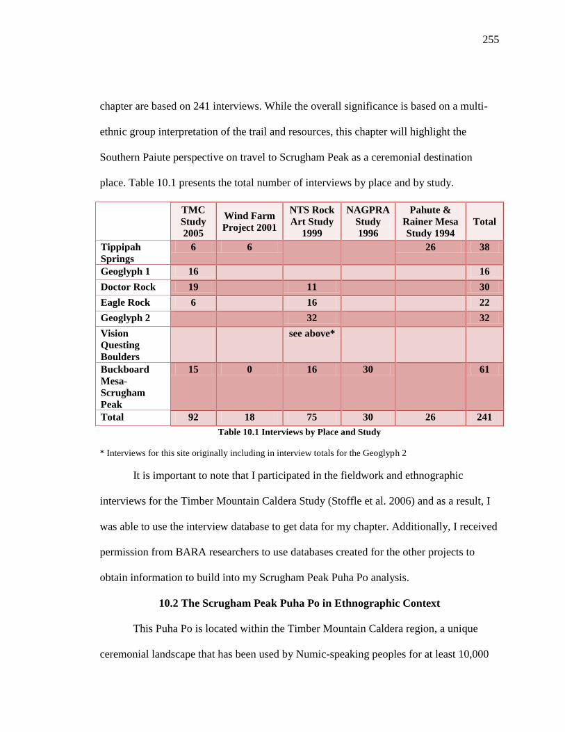
255
chapter are based on 241 interviews. While the overall significance is based on a multi-
ethnic group interpretation of the trail and resources, this chapter will highlight the
Southern Paiute perspective on travel to Scrugham Peak as a ceremonial destination
place. Table 10.1 presents the total number of interviews by place and by study.
TMC
Study
2005
Wind Farm
Project 2001
NTS Rock
Art Study
1999
NAGPRA
Study
1996
Pahute &
Rainer Mesa
Study 1994
Total
Tippipah
Springs
6 6 26 38
Geoglyph 1 16 16
Doctor Rock 19 11 30
Eagle Rock 6 16 22
Geoglyph 2 32 32
Vision
Questing
Boulders
see above*
Buckboard
Mesa-
Scrugham
Peak
15 0 16 30 61
Total 92 18 75 30 26 241
Table 10.1 Interviews by Place and Study
* Interviews for this site originally including in interview totals for the Geoglyph 2
It is important to note that I participated in the fieldwork and ethnographic
interviews for the Timber Mountain Caldera Study (Stoffle et al. 2006) and as a result, I
was able to use the interview database to get data for my chapter. Additionally, I received
permission from BARA researchers to use databases created for the other projects to
obtain information to build into my Scrugham Peak Puha Po analysis.
10.2 The Scrugham Peak Puha Po in Ethnographic Context
This Puha Po is located within the Timber Mountain Caldera region, a unique
ceremonial landscape that has been used by Numic-speaking peoples for at least 10,000

256
years (Stoffle, Van Vlack and Arnold 2006). The Timber Mountain Caldera is part of a
major ceremonial center for the three affiliated Numic ethnic groups.
Within the Timber Mountain Caldera, Puha’gants could visit and acquire power
and knowledge from a number of ceremonial destination places. Many of the major trail
networks began at Tippipah Springs and headed towards Geoglyph One and the Doctor
Rock before diverting to the various Puha places. One trail led Puhahivats to Shoshone
Mountain. Southern Paiute representatives have identified this mountain as being a place
where the wind originates and people visited this mountain to acquire power and
knowledge to use in ceremonial activities (Stoffle et al 2006). Another trail headed north
from the Doctor Rock to a place named Water Bottle Canyon. This ceremonial area is
located at the junction of multiple caldera and lava flows. This convergence of volcanic
activity has created a powerful location where people came together to balance the world
(Stoffle, Van Vlack and Arnold 2006). The third trail which is the focus of this analysis
led Puhahivats to Scrugham Peak, a small volcanic peak located along the eastern edge of
the Timber Mountain Caldera.
Timber Mountain is one of the largest volcanos in this part of Numic territory and
it is also one of the major sources of Puha. Volcanoes and volcanic places have been
viewed as culturally unique and special locations for people throughout history and
around the world (Sheets and Grayson 1979). Traditional peoples who live near such
places associate them with powerful forces and spiritual beings. These spiritual elements
exist to help serve the greater good of human society on local, regional, and global levels.

257
Ceremonial interactions and spiritual connections with volcanoes and volcanic
places occur throughout Numic territory as discussed throughout this dissertation.
According to Numic epistemology, volcanic places are seen as important ceremonial
areas with high concentrations of Puha. When a volcanic eruption occurs, Puha moves
from lower levels of existence to higher ones. People traveled great distances to seek
knowledge and power from these sites. Puha’gants visit these locations to attain
information to better help serve their communities, Native nation, and the greater whole
of humanity by bringing things into balance.
The volcanic composition of places along the Scrugham Peak Puha Po contributes
to is overall cultural significance to Southern Paiute people. This trail and the larger
Timber Mountain Caldera have attracted some of the most powerful elements in the
Numic universe. It is also worth noting that over 90% of all the rock peckings and
paintings found within the boundaries of the NTS are located within the Timber
Mountain Caldera. Paiute and Shoshone peoples believe that this is due to the fact that
powerful places attract powerful elements.
10.3 Scrugham Peak Puha Po Performance Characteristics
Analysis of the Puha Po has revealed the presence of eleven out of the eleven
performance characteristics defined in Chapter Two. These characteristics have been
identified by Southern Paiute representatives as important features for understanding the
ceremonial journey to Scrugham Peak. Some places along the trail exhibit multiple
performance features due to how Puha flows across the landscape and attracts certain

258
powerful elements to various places. Table 10.2 provides a summary of the types of
performance characteristics that correspond with places along the trail.
Performance Characteristics Place Names
Home Communities Indian Spring, Oasis Valley, Corn
Creek.
Purification Sites Tippipah Spring
Tumpituxwinap Sites Geoglyph 1, the Doctor Rock, Eagle
Rock, Geoglyph 2, Buckboard Mesa
Narrow & Constricted Spaces Geoglyph 1, Upper Fortymile
Canyon
Trail Water Sources Tippipah Springs, Geoglyph 1 & 2
1st View of Destination Place Upper Fortymile Canyon/Buckboard
Mesa
Medicine Collection and
Preparation Areas
Tippipah Springs,
Paint/Mineral Sources Geoglyph 1
Ceremonial Lay-Down Areas Upper Fortymile Canyon
Final Preparation/Support Camp Geoglyph 2/Vision Questing
Boulders
Destination Place w/ a Viewscape Scrugham Peak
Communitas Pilgrim-Place Relationships
Table 10.2 Scrugham Peak Puha Po Performance Characteristics and Associated Places
The confidence in the findings for this analysis was built upon a long-term
research program on the NTS. The multiple projects gave tribal representatives
opportunities to visit places in areas where Indian people have not been allowed access
since the United States government set the land aside for a military base in the 1940s.
The studies have built upon one another and thus by 2005, tribal representatives were
able to connect places together along a series of Puha Pos throughout the Timber
Mountain Caldera for the purposes of nominating places to the National Register of
Historic Places
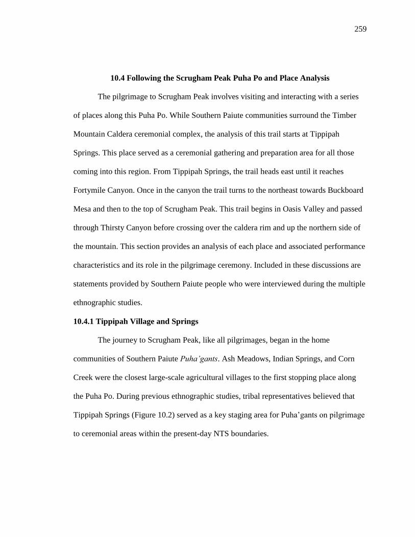
259
10.4 Following the Scrugham Peak Puha Po and Place Analysis
The pilgrimage to Scrugham Peak involves visiting and interacting with a series
of places along this Puha Po. While Southern Paiute communities surround the Timber
Mountain Caldera ceremonial complex, the analysis of this trail starts at Tippipah
Springs. This place served as a ceremonial gathering and preparation area for all those
coming into this region. From Tippipah Springs, the trail heads east until it reaches
Fortymile Canyon. Once in the canyon the trail turns to the northeast towards Buckboard
Mesa and then to the top of Scrugham Peak. This trail begins in Oasis Valley and passed
through Thirsty Canyon before crossing over the caldera rim and up the northern side of
the mountain. This section provides an analysis of each place and associated performance
characteristics and its role in the pilgrimage ceremony. Included in these discussions are
statements provided by Southern Paiute people who were interviewed during the multiple
ethnographic studies.
10.4.1 Tippipah Village and Springs
The journey to Scrugham Peak, like all pilgrimages, began in the home
communities of Southern Paiute Puha’gants. Ash Meadows, Indian Springs, and Corn
Creek were the closest large-scale agricultural villages to the first stopping place along
the Puha Po. During previous ethnographic studies, tribal representatives believed that
Tippipah Springs (Figure 10.2) served as a key staging area for Puha’gants on pilgrimage
to ceremonial areas within the present-day NTS boundaries.
260
Figure 10.2 Tippipah Springs
Tippipah Springs is located in a wide valley along the northeast side of Shoshone
Mountain. The springs are situated in the red and white volcanic tuff at the mountain’s
base. When it rains or snows, the water filters through the basalt and flows out of the
mountain and the spring complex is formed. Tippipah Springs has consistently been a
stable water source in this region.
Archaeological and ethnographic research conducted in the 1930s and 1940s
documented that a small village was located at Tippipah Springs. This site has
consistently been viewed as a place that was permanently occupied by Indian people.
Archaeological surveys have recorded evidence of previous Indian use, including pieces
of obsidian, chert, and various artifacts from the late historic period such as metal objects
and an abrader that was cached near sagebrush (Stoffle et al. 2001b: 5-6). While the exact
population of this community is unknown at this time, one can assume based on a number

261
of factors that it was likely small in size (Stoffle et al. 2001). When Julian Steward was
conducting his research for the cultural elements distribution lists (Steward 1941) and his
monograph on Great Basin societies (Steward 1938), he asked some of his Nevada
informants about Indian people living in the Tippipah Springs region. They told him that
at the end of the 1800s, a man by the name of Kipitasuguputsi and his family lived at the
springs. Steward also documented a translation for the word Tippipah which meant the
following: Tupipa (tupi- rock, pa - water).
The notion of having a permanently occupied support village at the beginning of
one or more Puha Pos is discussed throughout this document. In all cases, the support
village would have been composed of hundreds of people practicing irrigated agriculture.
The people of these villages would also receive Puhahivats by allowing them to rest and
refresh before continuing on the final and rigorous portions of their pilgrimage. Tippipah
Springs, however, did not function in this manner.
Because the Timber Mountain Calder region was culturally significant to three
ethnic groups, Puha’gants came to visit and use these ceremonial areas with some
frequency to acquire Puha. Tippipah Springs became a central area for Puha’gants to
gather before traveling to various ceremonial centers throughout the NTS. It was likely
that Tippipah Springs traditionally was inhabited by a Puha’gant or a series of Puha’gants
that assisted Puhahivats prepare for their journeys. In Southern Paiute communities,
powerful Puha’gants often lived in isolated areas away from the large agricultural
villages because the Puha’gants possessed power that could have caused harm to the very

262
young, very old, and uninitiated people. Puha’gants also needed to be free from any
outside distraction when performing a ceremony thus the isolation was necessary.
According to a Southern Paiute representative who participated in the Shoshone
Mountain Wind Farm Rapid Cultural Assessment (Stoffle et al. 2001), Tippipah Springs
is an important component to ceremonial activity in this region. This Southern Paiute
person said:
The area was used for ceremonial and a living area. When you listen to
the surrounding area, you can hear the wind talk and the mountains sing.
The wind will travel through this area on its journey to Pintwater Cave to
the south and to Shoshone Mountain near the proposed project area. The
area is considered so important that the CGTO has brought Indian youth
to the area to perpetuate the culture. The Tippipah Springs area is the
opening or beginning to a much broader landscape that is directly
connected to Shoshone Mountain. A long time ago, special ceremonies,
prayers, and songs were sung when the sun came up to hear and answer
the messages of the songs and prayers. If these were not done properly,
the water would dry up and the wind will get angry and cause great harm
to the area.
Living in isolation at Tippipah Springs likely aided Puha’gants assist Puhahivats.
While this spring complex served a ceremonial purpose traditionally, it is possible that
when Julian Steward (1938) recorded the names of the Shoshone family living in the
area that they came to Tippipah Springs to seek refuge from encroachment by Euro-
American homesteaders, miners, and explorers. This pattern occurred in other places
throughout Numic territory like in the Spring Mountains (Stoffle et al. 2005 and the
Escalante Desert (Stoffle et al. 2012).
10.4.2 Geoglyph One Area
After leaving the settlement at Tippipah Springs, Puhahivats traveled to an area
identified as Geoglyph One (Figure 10.3), located less than four miles from Tippipah

263
Springs in a valley between low white ash flow hills. The geoglyph is one of the key
features of this area. This feature is a series of red-brown cobbles have been placed upon
the light colored hills in linear and circular patterns. Geoglyphs are large drawings or
designs made on the ground; they often best are seen by looking down on them from a
high location such as a mountain or hill top.
Figure 10.3 Geoglyph One Overview
Geoglyphs are unique cultural features found in different locations places
throughout the world. Perhaps the most famous ones are found in the Nazca Desert in
Peru. The Nazca Lines, as they are commonly referred to, cover over 400 square miles
and include over 1,000 figures (Aveni 2000). These figures are associated with ceremony
and appear in the shapes of sacred figures and animals. Geoglyphs also are found in
Australia and throughout the United States. For example in the Mojave Desert, a series of
geoglyphs have been recorded that have been used by Numic and Yuman-speaking

264
groups during pilgrimage. During ceremony, geoglyphs are used by shamans as places
where they can interact with the landscape and stones placed on the ground.
Archaeologists von Werlhof and Casey studied geoglyphs extensively in the Mojave
Desert and they noted that:
Geoglyphs were considered very important to the Indian people along the
Colorado River who often use the designs in connection with religious
ritual, dancing on the lines as if they were paths. This is an important point
because geoglyphs and trails are connected. In fact, geoglyphs in the
southwestern United States are thought to forge a spiritual link to trails
(von Werlhof and Casey 1987:7).
In the case of Geoglyph One, Puhahivats entered this formation at one spot and followed
the path through to the other side. This passage serves as a physical and symbolic
transition from a more secular state to a hyper-spiritual state. It also allowed for the
Puhahivats to leave behind any spiritual impurities that may have been following the
Puhahivats during their journey.
Figure 10.4 Pecked Boulder

265
On one of the cobbles is a moderate size pecking (see Figure 10.4). This pecking
is similar in style to those found at Geoglyph Two, which Puhahivats visited during a
later point in the pilgrimage.
Archaeological research conducted in 1940 by S. M. Wheeler documented that
the geoglyph contained patterns that appeared to create walkways leading to circles,
which were likely used for dance or other ritual activities. Also when Wheeler excavated
the site, he uncovered evidence of yellow ochre, a well-known and important paint source
for Numic-speaking people, located in the vicinity of the geoglyph. Puhahivats used the
paint in ritual performed at this site. Wheeler also recorded and removed from the site
numerous artifacts such as pieces of worked chert, obsidian drills, pieces of pottery, fire
hardened juniper sticks, a bifacial scrapper, a silicified volcanic knife, and ground stone
(Wheeler 1940, Winslow 1996:154-159).
Because people came here for ceremonial purposes, tribal representatives thought
that Puhahivats would have camped in this area, too. The rock shelters near Geoglyph
One would have provided a logical place for a temporary campsite. The rock shelter
might have also been used as a preparation location before entering the geoglyph. During
interviews, tribal representatives discussed why the Puhahivats came to this site. One
person commented:
[Indian people] probably came out for days at a time. Some ceremonies
lasted weeks at a time. Sometimes they would go for ten days and then
they would rest for maybe seven days. Lots of times, they took their tools
(lots of scatter up there). They made a lot of stuff. [Indian people] camped
over by the rock shelters and would be away from where the ceremony
would be. This could have very well been the camp. They had different
ways to tell time and when to do certain things. The light around the arch
could have been used to tell when to start a ceremony.

266
Another tribal representative added, “The site was used to tell stories, pass on
knowledge. There is not much food here so they were here to do ceremony. I was
wondering if some of those rocks down in the center have been moved over time.”
Others believed that the Geoglyph needed to be understood in relation to other
places along the trail. They made the following comments:
Yes, it’s probably connected to Scrugham Peak fasting and vision questing.
[Indian people] came here to prepare. It is all connected to Black Mountain and
Scrugham Peak. Everything is connected: valley, geoglyph, the hill with scatter,
the arch, and the other places that are tied together.
I believe [there is a] connection to Tippipah Springs and the pecked rock art
entrance to Cat Canyon (I don’t refer to that as Doctor Rock). I believe people in
Tippipah would use the place as a place to pray and perform their ceremonies
that was needed to complete whatever specific ceremony they were conducting.
They would stop at the day camp where prayers and necessary preparations
would take place before coming to the place. People coming here from the west,
such as Timber Mountain and other areas, would stop at the pecked rock where
prayers in preparation for this place would be conducted prior to their arrival
here.
Yes, it is connected to Doctor Rock in Cat Canyon, rock art near Big George
Cave, Scrugham Peak. It has to be connected to that area. [The connection] could
be ceremonial; come for power, vision quests.
It is connected through the volcanoes, through a power spot, by having everything
you would need. They would have cleaned themselves at the hot spring in Beatty
before coming up here. It is a well-used area. They had to spend a lot of time
together and they came here to do that. Where we parked the car, in that cave was
a story telling area. This idea [for the geoglyph] could have come from far away,
even South America where they have these. The idea here is that someone can see
it from above. It was to talk to those above. The [geoglyph] could be seen from
the top of the volcanoes to the south. You could see the area and know about the
area. We need to go to the top to see what alignment with Scrugham Peak and
people could put themselves in a trance and go quietly from one area to another
few miles and just be there very quickly. That is an Owens Valley story from an
old person who was told it by his grandfather. They could travel without using
much energy. There were people used for sending messages. Most of the people
who traveled could do that. The mind can do many things. It is capable if you use
it right.

267
To the west of Geoglyph One, tribal representatives discovered two water
sources. Tribal representatives believed that these water sources were part of Geoglyph
One and needed to be included in any site discussions. These water sources are part of the
Fortymile Canyon hydrological system. As they followed the flow of water from
Geoglyph One towards the next place along the trail, they moved towards Fortymile
Canyon., which led them northward closer towards Buckboard Mesa and Scrugham Peak.
From a cultural perspective, it is logical that the trail followed the area’s major
hydrological system to one of the most prominent volcanic peaks in the region.
One elder believed that water was connected to this site and was important to
activities that occurred at this site. This person said, “Indian people would have used it
because of the placement of the geoglyph. They could have camped, maybe a little ways
away. Willows show that there has to be a spring or water nearby.” The closest water
source to the geoglyph was a large rock tank (Figure 10.5). Water sources such as this
tank were important water storage areas in the desert. They provided people and animals
with water when access to a spring or a more permanent water source was not available.
Rock tanks collect rain water, snow melt, and any surface runoff, however over time they
become filled with sediment and debris and need to be cleaned out. In the case of this
particular rock tank, the cleaning became the responsibility of those on pilgrimage. The
Puhahivats removed the debris from the tank so it could be functional again as part of the
pilgrimage ritual performance and communitas formation with the surrounding
environment.

268
Figure 10.5 Water Sources Found Near the Geoglyph
During the Timber Mountain Caldera Landscape Study, a small spring was
discovered a short distance from the rock tank. It was interpreted that Puhahivats visited
and used resources in and around the spring during their journey. It is possible that they
collected water to use as offerings during later points in time and they gathered medicine
plants. During these interactions, they left offerings and said prayers.
10.4.3 Doctor Rock
Once activities were completed at the Geoglyph One, Puhahivats traveled less
than five miles west to the Doctor Rock (Figure 10.6). This site is located along a wash
that feeds into Fortymile Canyon and the site is situated between two low ridges that
extend from the base of Shoshone Mountain. Members of the BARA team and tribal
representatives originally visited the Doctor Rock during the initial Yucca Mountain
cultural resources studies (Stoffle et al. 1990). During that study and the others that

269
preceded it, elders identified this site as being a place of ritual activity and Puha (Stoffle
et al. 2006; Zedeño et al 1999).
Figure 10.6 The Doctor Rock (L) and Associated Pecking Panels (R)
This site contains several cultural features that were integral components for
ceremony. Two large boulders containing complex peckings are present at the bottom of
the drainage. Indian people interviewed during these earlier studies believed that these
panels represented a map of regional trail networks that brought Puha’gants to this place.
A Southern Paiute elder described this site as a meeting ground for tribal peoples. One
interviewed tribal representative thought that, “This was where they came and rested and
prayed…it was a stopping point between two different areas like the Geoglyph and other
glyphs across here.” This meeting location could have been a place where Puha’gants met
and prepared themselves to go on pilgrimage to one of the surrounding ceremonial
destination places, or they could have come to this site for the specific purposes of
conducting traditional healing ceremonies.
Another person commented on how this place was an important ceremonial place
along the Scrugham Peak Puha Po:
270
It is definitely connected because it is a part of the trail that goes to the
Tippipah village site. The trail went from here to the geoglyph. Too many
markers not to go that way. I would think a lot of the people coming
through this way would be on vision quests, medicine people seeking
power.
The Doctor Rock itself is a large flat boulder with a hole carved out of the center.
The Doctor Rock is unique in that when it is tapped it projects tonal sounds in a similar
manner to the tonal rocks found along the Black Mountain Puha Po. This healing stone
was also perched at some point in time, which is evident by the stones placed underneath.
These stones are covered in the same desert varnish as the Doctor Rock suggesting these
rocks are the same age.
Even though the Doctor Rock was definitely a place of ceremonial activity, its
role in the pilgrimage to Scrugham Peak is unclear. The site is located at the junction of
trails to vision questing and world balancing places, and Puhahivats had to pass this site
as part of their journey. One can argue that even if rituals were not performed at the
Doctor Rock as part of pilgrimage, the Puha’gants likely left offerings as signs of respect
for the place and its powerful properties. Archaeologists documented the presence of
pieces of obsidian in the site vicinity. It is possible that Puhahivats left these items as
offerings as they traveled to their destination place or they could have been used as part
of traditional medicine occurring at this site.
10.4.4 Eagle Rock
Eagle Rock (10.7) is a large, isolated, welded tuff boulder, which Indian people
believe is shaped like an eagle. It is located in Fortymile Wash, the west of the Doctor
Rock. Indian representatives believed that the eagle shape and volcanic composition

271
contributed to its cultural importance and its role in pilgrimage ceremonies. Eagles are
understood as sacred animals and places associated with them, especially those that are
volcanic are considered extremely powerful.
Figure 10.7 Eagle Rock and Associated Peckings
Numerous items used in pilgrimage activity were found located on and around the
rock such as a rock ring, ground stone, and numerous prehistoric and historic artifacts
(Zedeño et al. 1999). The top of Eagle Rock contains a series of peckings and ritually
deposited materials were found underneath the peckings and in the rock’s immediate
vicinity (Jones and Drollinger 1997: 26, 28).
Tribal representatives believed that Eagle Rock served as a place where elders
taught boys who were on rites of passage pilgrimages how to tend to certain types of
places and how to read the landscape. For example, boys were taught how to clean out
water tanks and how the patterns of the stars guided travel. In addition to being a
medicine place, it was used also a landmark that people on pilgrimage would have had
stories about and immediately would have been recognized.

272
10.4.5 Entrance to Upper Fortymile Canyon
After leaving the Eagle Rock, the Puhahivats traveled a short distance before the
trail enters the upper portion of Fortymile Canyon at the southern end of Buckboard
Mesa. At this point, the canyon narrows and a traditional use spring is located in the mesa
cliff face along the east side of a place called Brushy Canyon. Puhahivats may have
visited the spring to collect water and leave offerings.
Figure 10.8 Pecked Images in Upper Fortymile Canyon
Along the west side of the canyon, the trail was marked by a large volcanic
boulder, which contained a complex interconnected pecked image. The boulder stands by
itself. It is covered in a dark desert varnish, which makes the peckings stand out so
Puhahivats could easily spot them along the trail (Figure 10.8). Tribal representatives
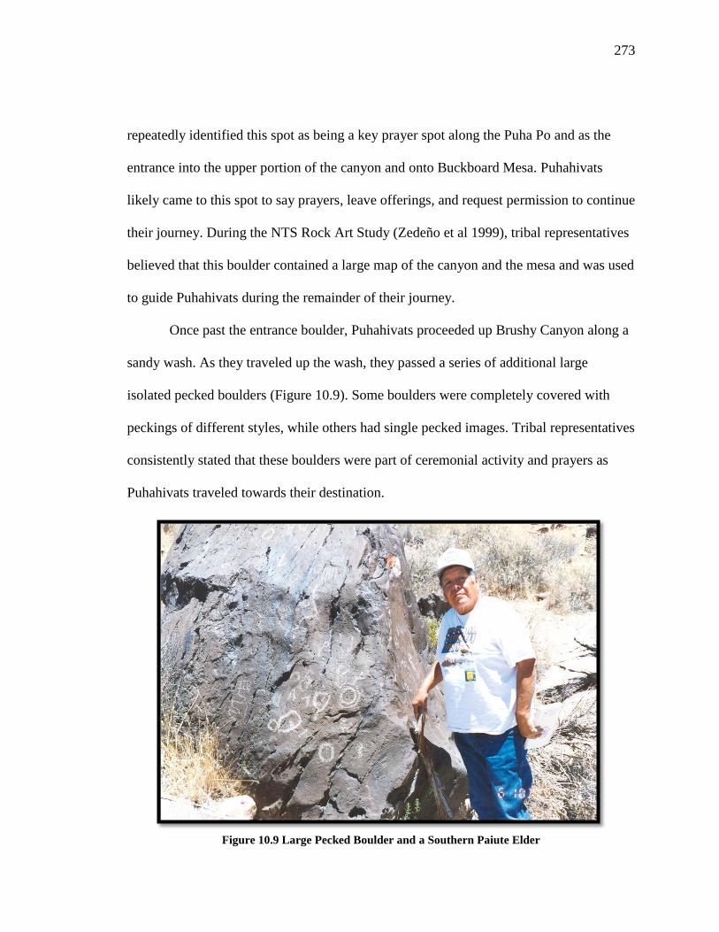
273
repeatedly identified this spot as being a key prayer spot along the Puha Po and as the
entrance into the upper portion of the canyon and onto Buckboard Mesa. Puhahivats
likely came to this spot to say prayers, leave offerings, and request permission to continue
their journey. During the NTS Rock Art Study (Zedeño et al 1999), tribal representatives
believed that this boulder contained a large map of the canyon and the mesa and was used
to guide Puhahivats during the remainder of their journey.
Once past the entrance boulder, Puhahivats proceeded up Brushy Canyon along a
sandy wash. As they traveled up the wash, they passed a series of additional large
isolated pecked boulders (Figure 10.9). Some boulders were completely covered with
peckings of different styles, while others had single pecked images. Tribal representatives
consistently stated that these boulders were part of ceremonial activity and prayers as
Puhahivats traveled towards their destination.
Figure 10.9 Large Pecked Boulder and a Southern Paiute Elder

274
10.4.6 Geoglyph Two Area
After passing the entrance boulder in Brushy Canyon, Puhahivats reached the
Geoglyph Two (Figure 10.10) which is almost two miles from the previous site. This site
was the second geoglyph along this Puha Po and it was one of the last places Puhahivats
interacted with before reaching Scrugham Peak. Puhahivats traveled through the
geoglyph as part of ritually purification and preparation. Passing through the geoglyph
allowed individuals to cleanse themselves of undue influence and ill thoughts. This
transition assisted the Puhahivats to be prepared to achieve visions.
Figure 10.10 Geoglyph Two
Geoglyph Two has multiple cultural features that were used in ritual activity. In
the southwest portion of the site, numerous items were ritually deposited on the exposed
bedrock and thin soil. Two rectangular clearings, a rock ring, and a rock cache are located
near the geoglyph. Near the east edge of a ridge, a circular rock alignment with two
275
appended semicircles is present (Zedeño et al. 1999). Although some rocks may have
rolled from their original locations, the circles are clearly visible and do not appear
disturbed (Jones 1996:27). One Pinto point (~8000 to 4000 years old) and one Rosegate
point (~2000 years old) were recorded at this site (Jones 1996). The age of their items
demonstrated long-term Indian use of this site (or deposition of curated items).
10.4.7 Vision Questing Boulders
From the Geoglyph Two, Puhahivats traveled less than two miles along the trail
before reaching the Buckboard Mesa rim and the Vision Quest Boulders (Figure 10.11).
This area contains hundreds of volcanic boulders each covered with a strong desert
varnish and a single intricate pecking. When interviewed about this place, an elder talked
the sacredness of this site and its importance in ceremony:
I look at it as a spiritual place. They have a lot of spiritual items there,
starting with the Power Rock and the Eagle Rock. An elder who would see
that Power Rock would tell you that that was a sacred site. They would
gather there for ceremony—healing—and stay a few days while doing the
ceremony. They have stories about people who stay there by their selves,
all night. They will see big animals, snakes. They have to stay all night,
they cannot run away.
Paiute and Shoshone consultants believed that this was a place that was visited
after a pilgrim’s vision quest. As a Southern Paiute person noted, “These panels are used
for seeking knowledge/power, communicating with spirits, teaching other people. Here
you seek your inner self, seek guidance. You visualize the past as well as the future.” An
individual would return to this site from Scrugham Peak and he would peck the message
or image that he has received onto the boulder. These boulder peckings were revealed to
individuals on vision quests, by spirits or spirit helpers, and are intended to be understood

276
only by that individual. The peckings serve as landmarks and as permanent features that
become integrated into the surrounding landscape the natural surroundings. This place
draws Puha’gants and future vision seekers, and people, regardless of its original intent,
remember this place.
Figure 10.11 Vision Questing Boulders
Each boulder found at this site contains a smooth area located to the side of the
pecking. This smooth space was used for preparing paint pigments and medicines. The
pecked images represent many aspects of ceremony and Creation. For example, one
boulder contains a pecking of Ocean Woman’s net. Ocean Woman is a key figure in the
Southern Paiute Creation story and the presence of her net suggests that this area was
traditionally used by Southern Paiute people. Indian people also believe that some of the
other images represent Puhahivats in altered states as part of the pilgrimage ceremony.
Puhahivats traveling to Scrugham Peak passed by the pecked boulders and likely
left offerings for them as a sign of respect to the place and the associated powerful
elements. This site was important to post-vision quest activities. A tribal representative
added, “People came here to have a vision of where things are. The rocks help give
visions, so a record of the vision is recorded here by the chief leader.” Puhahivats

277
returned to this place and recorded their experiences onto a boulder, thus a physical
marker of the view was created. According to a person interviews, “This was a place
where a man saw a vision—came from the rock, as well as supernatural.” The high
number of pecked boulders at this site is indicative of long-term use by Numic-speaking
peoples for pilgrimage ceremonies. Not only are the peckings reminders of the events,
but the rocks and surrounding landscape retain memories of experiences and past
pilgrimages.
When tribal representatives and BARA ethnographers visited this site during the
1999 rock art study, a rattlesnake was discovered near a series of peckings (Figures 10.12
and 10.13). Rattlesnakes are associated with rain and rainmaking ceremonies (Yava
1992). They are traditionally the spirit helpers of rain shamans, and are often considered
the guardians of sacred areas, such as this site.
Figure 10.12 Rattlesnake Found Near Geoglyph Two

278
Figure 10.13 Pecked Images
One central assumption in the interpretation of petroglyphs is that the place was
powerful prior to the appearance of the peckings (Stoffle et al. 2001: 72). Since powerful
places attract powerful elements, one accounts not only for the pecking itself, but also for
its local environment. Like humans, the elements that comprise the universe have
individual personalities, dispositions, and characters; also like humans, elements are
attracted to and negotiate relationships with each other. Many such “powerful elements”
are found in proximity to Upper Fortymile Canyon. One of these elements is water.
Water runs seasonally through this area, and was represented in peckings along the
canyon. The drainage here suggests seasonal flooding of over a meter in depth, and
Native American consultants felt that there might have been more water at this place in
the past, to further support a base camp in the area.

279
Figure 10.14 Tumpituxwinap Found on Buckboard Mesa
10.4.8 Buckboard Mesa
After passing through the Vision Questing Boulders Area, the trail heads up to the
rim of Buckboard Mesa. The rim escarpment ranges from approximately 65 feet to 100
feet high basalt cliff that outlines the entire edge of the mesa. The rim also contains
numerous natural ledges and rock shelters. When archaeologists surveyed this area in the
late 1980s and 1990s they documented evidence of previous Indian use including a
traditional use area that directly overlooks the Big George’s Cave-Geoglyph Two area.
Resources recorded include a large horizontal alignment of rock cairns along the mesa
edge that are spatially associated with the pecked boulders, large rock pecking panels on
the escarpment below the rim (Figure 10.14), a milling stone used for preparing

280
medicines, a possible rock wall, and ritually deposited lithics. The rock cairns (Figure
10.15) that line the rim area indicate places where vision questing may have occurred.
These small piles of rocks are spaced at regular intervals 1,650 feet in each direction from
the location of a natural staircase that leads the trail up onto the mesa from the valley
floor (Jones and Drollinger 1997; Pippin and Henton 1991).
Figure 10.15 Rock Cairn along the Rim of Buckboard Mesa
Tribal representatives, during the UofA-BARA NTS Rock Art Study (Zedeño et
al. 1999) also noted that the location where the trail ascends to the top of the mesa, there
were small individual boulders clustered near this point of the trail. The peckings on
these boulders represent a series of circular and line patterns. Some peckings were
interpreted as being zoomorphic figures including snakes and lizards. Located along the
escarpment face just below the mesa rim are images that resemble human like stick-
figures, vulva glyphs, and different types of lines patterns. Next to the entrance to the top
281
of the mesa, three large panels with complex arrays of peckings and etchings are found.
One is located next to this natural staircase. The others are found about 330 feet east and
west of the staircase, respectively. Notably, the western panel, located next to a rock
shelter, depicts a large stick figure with three extremities and a vulva form design. The
eastern panel contains a series of paired scratched vertical lines.
In Southern Paiute culture, rock peckings and paintings sometimes are associated
with small spiritual beings, or “Little People.” One Southern Paiute elder discussed how
the Little People affected this site and associated ceremonies. This elder said:
According to our parents, all the peckings and paintings were made by
elves (Little People). Their writing is called Tutovo Poop. There were
Indians living in the area and the old Indians probably knew about the
peckings. They just lived here by the springs. A medicine man could see
the Little People. The elves did not talk to the medicine man about the
meaning of the peckings.
Indian people believed that these peckings were associated with ceremony and
vision questing activities that occurred along this Puha Po. They believed that some
figures were linked directly to vision questing and some were used for acquiring spirit
helpers to assist them in the last segment of their journey to Scrugham Peak. Southern
Paiute elders said:
To me, this was a medicine place. That is what I see here. This was a power
place. Nothing associated with women up here- this whole mountain top.
This is an area that was used to teach the youth or young men and they would
come here for seek visions.
People would come any time to use the panels. When you know it is time to seek
your medicine, then you make that journey. You would come at any time of the
day, probably early in the morning when the vision is over but it would go for
days. The time and duration depends on belief.

282
They lived there and then came up here to do their spirit seeking. Have to be a
group—the seeker needs helpers. There were no women in these camps. The rock
piles are where they stayed to seek their vision/ medicine. A person who received
the medicine made the pile. The later ones would use the same piles. They have
been reused for thousands of years.
During the 1996 NAGPRA consultations, Native American representatives
commented on a traditional use feature at the northern base of Buckboard Mesa. At this
location, a series of rock shelters were used for obsidian tool making, and extensive
ritually deposited materials are found here. Numerous rock shelters associated with the
rock peckings indicate that this area was used for thousands of years. The materials found
at this site were likely left as offerings to Scrugham Peak. Once on top of the mesa,
Puhahivats had the first full view of the mountain; it was important at this time for
travelers to talk to the mountain and explain to it the journey’s purpose. The act of
leaving offerings for the mountain served as a way to establish communitas with the
landscape, particularly Scrugham Peak. The rock shelters were places where the
Puhahivats conducted their final preparations before ascending to the top of Scrugham
Peak. Tribal representatives thought as part of the preparation boys would learn about
particular types of resource procurement and ceremony which using the shelters during
rites of passage pilgrimages (Stoffle et al. 1996)
10.4.9 Scrugham Peak
Scrugham Peak served as the ceremonial destination place for most Puhahivats
along this Puha Po. This mountain is a distinct red colored volcano that sits atop
Buckboard Mesa at an elevation of approximately 6,040 feet (Figure 10.16) Puhahivats
traveled up the western slope to reach the top for vision questing and medicine.

283
Figure 10.16 Scrugham Peak
Figure 10.17 Rock Cairns Found on the Western Side of Scrugham Peak
A series of rock cairns are found along the trail (Figure 10.17). These features not
only served as trail markers but also as physical markers associated with ceremonial
284
activity. Paiute and Shoshone peoples have thought that cairns are prayer beacons in that
a Puha’gant used the cairns to send their prayers across the landscape and into the other
levels of the universe. In the case of the journey to Scrugham Peak, Puhahivats likely
engaged the cairns as part their ritual performance during the pilgrimage ceremony.
Southern Paiute representatives talked about the powerful nature of Scrugham Peak and
its role in Puha acquisition. During their interviews they provided the following
statements:
It could have been used as a vision questing site, out here where no one would
bother you. Sometimes you were alone and sometimes you were with a group.
People also might have stored stuff below to use on the way back.
There are places where they do medicine…see the peckings down below. We
always pray because the Earth is our mother. The sun provides life too. It is hard
to separate areas but some areas are for vision quest; some caves were for that
too. They could come up here for a vision quest. This is a vantage point for seeing
everything all around.
They would bring spiritual things here like plants. Prayers and offerings are
given here too.
This area is alive. It helps doctor and provides power. The mountain serves as a
distant landmark that’s connected to other volcanoes in the area.
Scrugham and Buckboard Mesa are connected to Black Mountain, Crater Flats,
the cinder cones, Timber Mountain, Oasis Valley, and Coso Hot Springs. The
place above produces great power. The Puha is channeled through the hot
springs and the obsidian. It's in the air and on the ground. It is sacred ground that
is connected by songs and prayers.
When Puhahivats reached the top of the mountain, they stayed for a period of
days in order to acquire Puha. While on top of Scrugham Peak, Puhahivats were afforded
unobstructed views of the surrounding volcanic mountains. To the northwest, Puhahivats
saw Black Mountain (see Chapter Four) and Stonewall Mountain, a large volcanic massif

285
associated with ceremonial activity. To the west, they saw Timber Mountain, the volcanic
center of the caldera. Shoshone Mountain and Water Bottle Canyon, the pilgrimage
destination places described earlier, are located to the south and east. Puhahivats on top
of Scrugham Peak used these viewscapes to interact with these surrounding Puha places.
Southern Paiute people believe that mountains like to see each other and interact with
each other. They also believe that volcanic places are connected by the flow of magma
thus; Scrugham peak culturally is linked to these places. It would have been important for
Puhahivats to acknowledge these connections during ritual activity in order to draw upon
their Puha. Following the completion of the vision quest, Puhahivats returned home by
revisiting places along the trail in reverse order. The purpose of this activity was to make
sure the large amounts of Puha acquired during the pilgrimage did not return to the home
communities because high concentrations of power are dangerous to non-Puha’gants.
10.5 Conclusion- Current Management Status
For over twenty years, ethnographic studies have brought Numic-speaking
peoples to places through the Timber Mountain Caldera in efforts to understand how
places traditionally were used and to develop proper management strategies. The
Scrugham Peak Puha Po is predominately located on the NTS, a secure government
facility. Since public access was forbidden in the 1940s, cultural resources have been
protected from development projects and looters and in many cases, sites remain in great
condition despite areas used for nuclear weapons testing. Through tribal consultation,
Indian people have been able to reconnect with places they have not been allowed to
access since pre-World War II.

286
In building a long term consultation program with the NTS, the affiliated tribes
desired to push site protection to a level beyond documenting what is found on facility
lands. They decided places needed to be nominated as traditional cultural properties and
cultural landscapes. During the 2005 Timber Mountain Cultural Landscape study, tribal
representatives recommended that the Scrugham Peak Puha Po and associated places be
nominated to the National Register of Historic Places as a traditional cultural proper. This
recommendation received agency support however after the 2005 study a series of issues
arose which directly impacted Native American consultation and ethnographic studies.
As it currently stands, efforts have been redirected to focus on Native American
contributions for the programmic environmental impact statement for the Greater than
Class C radioactive waste and the 2010 site wide environmental impact assessment for
the NTS. The TCP nomination and the other recommended ethnographic studies are on
hold.
287
CHAPTER ELEVEN
SOUTHERN PAIUTE COMMUNITAS- LINKING PEOPLE, OBJECT
AND PLACE
Previous chapters described in detail six different pilgrimage trails throughout
traditional Southern Paiute territory. Each pilgrimage depended upon relationships
formed amongst not only those who traveled along the trail together but also relationships
the pilgrims formed with places visited and objects (resources) used. Relationship
formation, also known as communitas was a complex process necessary for pilgrimage
ceremonies because without these relationships, pilgrimages could not be successful. This
chapter examines these issues by providing an in-depth analysis of how and why
Southern Paiute pilgrims formed communitas during pilgrimage. While this chapter is
focused on Southern Paiute pilgrimages, examples from other Native peoples from the
American Southwest are brought in to complement the Southern Paiute case study.
11.1 Southern Paiute Pilgrimage Trail Performance Characteristics
Research presented in this dissertation stipulates that Southern Paiute pilgrimage
trails have a cultural logic to them in terms of how the trails manifest across a landscape
and the types of resources found along them. These trails led pilgrims to Puha places and
ultimately to powerful destination places for the purposes of obtaining power. Based on
my research with Southern Paiute people, pilgrimage trails potentially have eleven main
components to them. While the research did not visibly find all of these components
along each of the trails, it is believed that they were present as discussed in previous
chapters. Table 11.1 shows which characteristics are present along each trail. The data
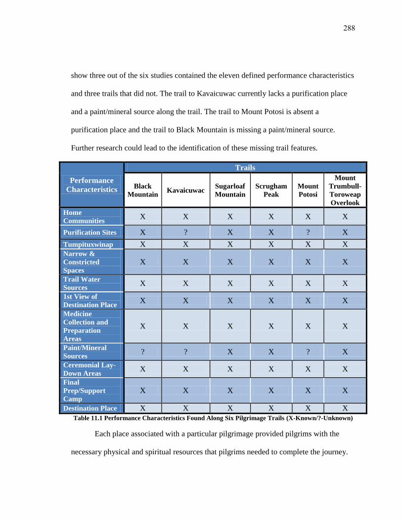
288
show three out of the six studies contained the eleven defined performance characteristics
and three trails that did not. The trail to Kavaicuwac currently lacks a purification place
and a paint/mineral source along the trail. The trail to Mount Potosi is absent a
purification place and the trail to Black Mountain is missing a paint/mineral source.
Further research could lead to the identification of these missing trail features.
Performance
Characteristics
Trails
Black
Mountain Kavaicuwac
Sugarloaf
Mountain
Scrugham
Peak
Mount
Potosi
Mount
Trumbull-
Toroweap
Overlook
Home
Communities X X X X X X
Purification Sites X ? X X ? X
Tumpituxwinap X X X X X X
Narrow &
Constricted
Spaces
X X X X X X
Trail Water
Sources X X X X X X
1st View of
Destination Place X X X X X X
Medicine
Collection and
Preparation
Areas
X X X X X X
Paint/Mineral
Sources ? ? X X ? X
Ceremonial Lay-
Down Areas X X X X X X
Final
Prep/Support
Camp
X X X X X X
Destination Place X X X X X X
Table 11.1 Performance Characteristics Found Along Six Pilgrimage Trails (X-Known/?-Unknown)
Each place associated with a particular pilgrimage provided pilgrims with the
necessary physical and spiritual resources that pilgrims needed to complete the journey.

289
When pilgrims visited these places, they conducted rituals that helped them establish and
maintain long term relationships. These included building connections between the group
of pilgrims traveling together and the objects used in medicine or as offerings.
11.2 Communitas Revisited
It is worth revisiting Victor Turner’s concept of communitas in order to
understand these relationships. Communitas is defined as “a relational quality of full
undedicated communication, even communion” with other pilgrims and that communitas
formation combined “the qualities of lowliness, sacredness, homogeneity, and
comradeship” (Turner and Turner 1978: 250). In other words, pilgrims were not bounded
by formal social structure that dictated relationships between people in secular society
and during pilgrimage, pilgrims formed new connections and a new sense of community
through ritual performance. This spontaneous and new community may have lasted a
lifetime or it may have been only temporary (Turner 1974).
As part of this pilgrimage community, a group of people must be taken out of
their familiar setting and transition into what Turner defines as a liminal state. The
pilgrimage setting had to be different from normal daily life. While on the trail, pilgrims
also were not bounded by daily social constraints; they had to negotiate or develop new
roles within the flow of the pilgrimage.
Turner’s work emphasized the distinction between the area of common living and
sacred space. These distinctions between the two should not be seen as the same as the
separation between secular and sacred. Instead, the separation can be attributed more to
the act of pilgrimage and communitas formation occurring in a social and ritual setting

290
located some physical distance away from the regular activities taking place in the
pilgrims’ home communities (Turner 1969).
Figure 11.1 Southern Paiute Communitas
11.3 Southern Paiute Communitas Formation
While Turner’s notion of communitas formation is focused solely on how people
engage each other and connect to each other during pilgrimage, Southern Paiute people
stipulate that when seeking Puha and knowledge the People-People interactions are not
the only important component to pilgrimage. People-Place and People-Object interactions
are equally important and necessary for pilgrimage completion. These types of
relationships are related directly to how Puha is disturbed to places and objects and how
Southern Paiutes view themselves within their universe. From a Southern Paiute
perspective, the universe is a living entity and all elements within it are alive and have
Puha. This keeps the universe in a state of dynamic equilibrium (Bean 1976). Humans, in

291
order to engage with a place or resource to use it in ceremony or in daily activities, need
to respect that resource or place’s Puha by praying to it and leaving offerings. Southern
Paiute communitas is formed from the establishment and maintenance of these
synergistic relationships through time and movement along pilgrimage trails. Figure 11.1
demonstrates this complex relationship.
11.3.1 Time
The roles of time and movement need to be included in a discussion on pilgrims
engaged in ritual performance during pilgrimage and communitas formation. For
Southern Paiute people, time determines when all ceremonies can occur and time and
time influences when pilgrimages take place. Tribal representatives argue that
traditionally, pilgrimages were seasonal activities that took place during the warmer times
of the year, which allowed for access to the high mountain peaks.
In additional to the seasonality of pilgrimage, Puha places had to be visited during
specific times of the day. According to Southern Paiute cultural traditions, places needed
to be visited during the early morning hours in conjunction with the rising sun. Tribal
representatives noted that this was the time of day when the Puha of a place is the most
intense. When visiting a place in the early morning, pilgrims prayed not only to the place
and left offerings but also prayed to the sun as part of their morning prayers. This issue
was discussed at length by those interviewed and they said the following:
Certain times a day along the trail…you know Indian people are told, and
those especially who practice Puha or spirituality, they get up early in the
morning when the sun is first coming up to get the sun with offerings and
prayers at that time. There were probably certain places along the trail
where they stopped to do some of those things like at Catstair or places
where there springs, to give an offering there or maybe do purification

292
before they reached their destination. There are a number of places where
they could have done that kind of thing, like a long the Paria River. They
could have started there with the purification, stopping at the springs, and
the lake…even carrying water up there.
You know I don’t know but they probably stayed there as long as it took to
do their offerings and stuff like that. I don’t know if there was a certain
time limit…you just did what you had to do there. If there was a greater
spiritual need, maybe you stay longer. It all depended on what they were
doing and why they were going to Kavaicuwac. I am sure there were other
people who went there to make offerings who weren’t necessarily
Puha’gants. It might have even depended upon the kind of power that
person was seeking too. You know not everybody had good power, good
medicine. There was also bad medicine out there so that would also
depend on what kind of ritual you would be performing before you
reached your destination.
11.3.2 Movement
Human interaction is the most important aspect of communitas formation and
maintenance of cultural landscapes. In order for this to happen, pilgrims need to engage
places to develop a cognition of these places and the spaces surrounding them. This
understanding is built upon the need to have direct access to sacred places. Trail networks
provide people (in this case Southern Paiute people) with the direct links to places
resources and communities. Trails facilitate movement of people not only to secular
places but also places associated with pilgrimage. For Southern Paiutes, and other
indigenous groups, trails and movement along them are closely associated with the
sacred. To best understand this, Christopher Tilley describes movement along trails as the
equivalent to reciting a religious text in a ritual. Tilley argues that if ritual text is not
spoken then it is not recalled and thus a trail is not traveled or enacted (Tilley 1994). The
act of physically walking and spiritually moving along the trail is an enactment of the
synergistic relationships between places, resources, and people which combine to

293
produce something greater than its individual components. Tilley also notes that repeated
use of trails represent what he calls spatiotemporal linkages which serve as templates for
all movement and for relationship formation and preservation.
The act of traveling along trails has ceremonial and medicinal aspects to it
because movement constitutes part of the communitas formation. As pilgrims travel
along the trail and interact with places, they might receive a song or a spirit helper which
would be used throughout the journey and during times afterwards. The song and spirit
helper become central to the lives of the pilgrims and these acquired spiritual items link
people to places forever.
Communitas formation focuses on complex relationship building amongst
pilgrims and their ceremonial landscape. The relationships pilgrims form with each other
and place carry with them the expectations and commitments to relationship building and
maintenance. From a Southern Paiute perspective, when Paiute people visit places and
interact with them, the places remember the stories, prayers, and songs of thousands of
years of visitation and use. Offerings found at these places represent the physical
manifestations of those interactions and Southern Paiute people establish communitas
with these locations. The interactions with the place itself, the landforms, the rocks, the
animals, plants, and other natural elements are part of the ceremony, part of the
pilgrimage, and are part of community formation. These complex interactions are critical
aspects of the pilgrimage ceremony.
Movement along trails occurs both physically and spiritually. Trail travel also is
associated with pilgrims’ spiritual transition from daily life into a ceremonial existence.

294
This transition is referred to as liminality (Turner 1969: 94-96; van Gennep 1909). While
Turner focused on liminality occurring within the context of this physical universe,
Southern Paiute pilgrims moved into a liminal state throughout the three dimensions of
the Southern Paiute world. There are moments during pilgrimage when pilgrims leave
this physical world and enter into a spiritual dimension. This transition most frequently
occurs at tumpituxwinap places. For example, during the Black Mountain pilgrimage,
pilgrims seek Puha from the mountain sheep head pecking at the Caldera Pecking Site by
entering into the image through the eye. Pilgrims insert their finger covered in red paint
or oompi into the eye hole. This act transitions them inside the rock and into the spiritual
dimension. Objects and places also are known to move between dimensions. Puha places
are dynamic and they connect the different levels of the universe to the physical present.
Places such as the Spring Mountains have been described by Southern Paiute religious
leaders as moving in and out of this dimension and into the spiritual world.
Figure 11.2 shows that each component of Southern Paiute communitas is focused
on prayer and movement along the trail through time. Prayers associated with visiting
places, leaving offerings, and vision questing connect the people to each other, to the
places, and to the objects used. Pilgrims’ physical and spiritual movements along the
trails demonstrate how communitas elements are connected. Each aspect of Southern
Paiute communitas formation is examined in the following sections.

295
Figure 11.2 Communitas Formation across Time and Movement along the Trail
11.3.3 People-People Relationships
In Southern Paiute society the group pilgrimage activity has been identified as
important moments when young Puha’gants were able to interact with each other and
gain knowledge from older and more experienced Puha’gants during geographically
isolated ceremonial events. These groups were small in numbers with as little as two or as
many as six people involved.
An older more experienced Puha’gant led the group and he took responsibility for
overseeing the younger ones by guiding them through the pilgrimage. The experienced

296
Puha’gants also taught the youth how to engage with place along the trail. During
interviews, a Southern Paiute representative described this interaction:
The men who were taking them to teach them and to oversee that they
were safe. I'm sure that they had their training. Preparing these males for
that and whatever they were coming up on, and these men who were
taking them. In ceremony, you know when you're going into ceremony,
and the males in charge- He's there to watch over everything, whether you
get sick or even maybe you went into a say, what we would call a trance,
or something of that nature, they're there to make sure you're ok. In any
sense of whatever may have happened or occur, whether you come upon,
say you may come upon spirits, they have to deal with that. So the men in
charge, or the medicine men in charge or the leader, he would have to be
prepared to deal with a lot of different situations. Even say, you came
upon a rattlesnake or you- there's certain ways to deal with that, there's
certain prayers to be given. There's certain messages to receive and he
would be trained to deal with all of that. So as far as the leader, definitely,
he would have the knowledge and the training of how to deal with the
different situations. Because, this is the reason why I say that, because
today when you go into ceremony, like- Ok, I'm attending. I'm a
participant. Well if somebody next to me passes out, I'm not the one to
deal with that. I'm a participant. The guy in charge or the guy who is
running and overseeing the ceremony, he deals with that. I don't jump
over there and say, 'Ok, I'm here.' I don't do that. So that's why I say that.
There were instances when larger groups needed to embark on pilgrimages
together. One Southern Paiute tribal representative suggested that these groups contained
ten to twenty people. He believed the larger group provided pilgrims with both physical
and spiritual protection but it is unclear as to the exact roles and functions of the larger
group during pilgrimage in Southern Paiute society. By examining how large group
pilgrimages in other native communities in the Southwest it is possible to get a sense on
how the activities operated amongst the Southern Paiutes. For example, the Tohono
O’Odham sent young men from each village on an eight-day pilgrimage to the Gulf of
California. The Tohono O’Odham pilgrims follow a trail across the desert without water

297
while stopping at various places to perform ritual activities that assist in preparing them
for their destination. While the young men engaged in ceremony, the older religious
leaders who traveled with them would speak words of encouragement to the young men
to guide them along the trail. As part of their ritual performance, the pilgrims speak a
special dialect of the Tohono O’Odham language, which is reserved for ceremonies such
as this. When the pilgrims reach the Gulf of California, they collect sea salt and perform a
series of ceremonies in order to ensure that the ocean winds will bring the important
summer rains. The rains are vital to the agricultural cycle and signal a period of renewal
that begins the O’Odham year (Underhill et al. 1997).
It was important for the younger Puha’gants to learn from the older ones because
ceremonial knowledge was gained through time and in small increments. A Southern
Paiute religious leader described this mentoring process:
A great medicine man like that, he would mentor a boy. And he would
spend one or two nights with him, telling him different stories about how
'the coyote did this or the coyote did that, and the wolf did this, and
somebody else did that. And they got here. They went to this place, they
went to that place. And he acquired this there and did this there.' And [the
medicine man] would give that boy the knowledge and the will to go to
these places and see if he could acquire the power.
The younger Puha’gants needed to be taught how to properly handle and use the Puha
they were acquiring during pilgrimage. If the Puha was not handled correctly, it could
cause serious physical and spiritual harm to the group. There were times when the
experienced Puha’gants had to aid the younger ones in understanding a song or
tumpituxwinap and there were times when the young ones experienced instances during

298
their journey that they did not understand so the experienced Puha’gants had to explain to
them what had occurred.
Experienced Puha’gants had the responsibility to first introduce the group to
places upon arrival. The experienced ones led the group in prayer and left offerings.
While doing so, the experienced Puha’gants showed the others how to properly respect
and enter a place. During the journey, this action was sometimes given to the younger
Puha’gants when the older ones believed that it was appropriate. This decision was based
on the older Puha’gant’s understanding of group dynamics and experiences along the
trail. One Southern Paiute representative explained:
That's why you would have that leader who would have that knowledge.
He would know what plants to pick, how to process them. He would
probably be carrying the ones that had to be used in a dry manner. But he
had all that knowledge; so if there were plants that could be picked fresh
and utilized fresh, I'm sure he would, he would do that. Or food, plants
that could be eaten as a food resource, then he would have that
knowledge. If they were medicines to be picked and to be dried and then to
be used in that fashion, then he would have those in his possession.
One representative noted that while pilgrims traveled in a small group, the act of
achieving a vision or gaining knowledge was something that occurred on a personal level
within the context of group pilgrimage.
You know, I don’t know back then but people gather together to support
each other. If there was a group of Puha’gants, they might have been
there in support of the one seeking power. But it seems like you went off by
yourself to acquire that. These people might have gone with them just so
far to help perform some of the rituals that needed to be done. But I don’t
know if they would have made the journey all the way to where they were
supposed to go. Sometimes people gather to support a person but the
journey has to be made by that individual alone. That would be the same
for a medicine person. All these other people can go with them to support
them but they are not going to help him get his medicine. He has to
acquire it himself. So when they were going to Kavaicuwac, they would

299
get the person as far as the lake and that person would then go to the top
of the mountain to acquire power because that power is given to you and
you have to be the one that’s going to receive it.
For young Puha’gants, pilgrimages provided them with the opportunities to gain
knowledge and learn how to engage places and use Puha properly. As part of the
pilgrimage experience, the young Puha’gants learned how to prepare medicines to use
along the trail and how and where to leave offerings such as red jasper, obsidian, pottery,
or water.
It is important to note that knowledge and Puha were gained over time and that
pilgrimages provided experienced Puha’gants with opportunities to acquire more
powerful songs, medicines, and spirit helpers, especially during times when they were
unable to correct problems facing their communities, districts, and nation. Since power
acquisition is a life-long process, the older Puha’gants became the more one was able to
use and control greater amounts of Puha. For example, only the most experienced
Puha’gants could acquire a water baby as a spirit helper because they knew how to
properly handle this very powerful and very dangerous spirit being.
When the group reached their destination place, the ones seeking the vision
needed the support from the group in order for it to be successful. The group aided the
vision seekers by supervising him from a distance to make sure he did not become
physically ill or injured. The group also prayed for the seeker so a vision could be
achieved. Afterwards the group aided the vision seeker off the mountain top and they
began to prepare to return to their home communities.

300
The journeys to a high mountain peak were difficult treks that required abstaining
from water and food and required intense physical and spiritual purification. Some
Southern Paiute people today liken this experience to ultra-endurance events where
pilgrims had to physically endure or suffer to prove they could handle not only the
journey but the Puha and knowledge gained. One representative explained:
To me, it would make sense to- because a lot of this is endurance, testing
your endurance, and it was a journey and you are gaining something.
Each side, it would probably be dependent upon the time of day. I don't
believe that they would travel at night. I would believe that they would try
to travel mainly during the day hours and when it came night they would
definitely bed down and again, rise early to get going again. So utilizing
as much of the day hours as they could. But again, knowing where- I don't
even think that maybe sometimes you can go- like it's an endurance thing
it's not a pleasurable journey, it's endurance. Even if they came to a spring
source they were learning to endure, learning to gain strength that water
was important but you also had to learn to go without water. Even today,
they into a ceremony which isn't Paiute but they go in for four days
without water and that's an endurance test. So they're not, the importance
is not having water, it's learning to endure, learning to gain strength,
learning to believe at a higher level that you will make it through. So,
coming to a spring source was important but I think, overall, it is more
important to learn to do without for a day or so.
But the other thing, it was fasting. In order to obtain that spiritual journey
to the max, fasting had to take place. Because that's the only way you're
going to obtain that. It's not going to happen if you are leisurely eating
and drinking water. You're not going to get to that spiritual place that you
are needing, trying to obtain. Because when you're fasting for so many
days, then it puts your mind at a different place. You're not focusing on
food or water, you are focusing on something else and that's what fasting
would do.
I think their knowledge was so vast back then and there was a vast number
of resources that were undisturbed and that were available to them, that
mostly likely water- Yes, they would have had a resource for starting out
the journey but knowing where the resources were along the journey. But
again, I think part of the whole journey and the purpose for the whole
journey was probably to really go without. Because that was how you were
going to obtain that medicine or that gift. So, and I only say that because
301
I, you know- Participating in different ceremonies, you watch, they go in
to obtain something without food or water. You go into a sweat without
food or water. You're going in there to really, to suffer. You're going in to
pray. You're going to have your prayers heard. You're going in there for
strength and endurance. The whole point of that being is not having those
things. So again, I think even though it was a long journey, they would've
definitely, the purpose was to go without.”
This act bounds the group together in that they experienced the same event and
withstood the same hardships. This was a group learning experience that taught them how
to interact with places handle Puha, and acquire knowledge needed to use in ceremony
throughout their lives.
11.3.4 People-Place Relationships
The second aspect of Southern Paiute Communitas formation is the relationships
people form with places during pilgrimage. The pilgrim-place relationship influences
how people interact with various stopping points along the trail and what the pilgrims
take from or give to places during these ceremonies.
Tilley (1994) notes that the manner in which meaning is given to places is born
from the ways places become reshaped through the production and recognition of
meaning in particular places and through unique events. Tilley (1994, 2010) also argues
that places are formed through people’s acknowledgements of special environmental
properties and cultural production. In Southern Paiute culture, Puha is dispersed in a
complex network of relationships amongst all elements of the universe. At various points
in this network, Puha gathers and creates powerful places that people identify with and
commemorate during ceremony. Maria Nieves Zedeño (2000) noted that places are
constructed because they are at the nexus of human interactions with both the physical

302
and spiritual worlds. Powerful places are identified by Southern Paiute people by its form
(geological composition and shape) its location in relation to other powerful features and
the presence of ceremonial symbols (tumpituxwinap) and ritually deposited items. In a
previous study an involved tribal representative illustrated this point by stating:
Places are designs that certain people experience. These people have an
innate gift to bring out the natural design or specific meaning of why the
place gas has these powers. It is similar to a basket weaver who knows the
design is waiting to be brought out by the hands that know how to draw it
out. Special places lay in waiting for the right spirit or human or both
together to connect and create a fantastic plan.
Another tribal representative recently stated:
Everything is connected in the way that we believe. There is a connection
to everything. If you have a relationship with one place like the spring, it
connects everything along the trail because maybe you are taking water
from that spring to that mountain and maybe you are using that water
along the way to give offerings along your journey. Or maybe at a certain
spring you gather plant medicines that you make offerings with along your
journey. So in that way it’s all connected.
People can acquire Puha through reoccurring spiritual and physical interactions
with places. This type of interaction is important to other groups as well. For example,
Hualapai shamans, the land plays an integral role in power acquisition (Stoffle and
Zedeño 2002). A perspective shaman is alerted by a deceased relative through a series of
dreams. His powers are strengthened by aligning himself with the spirits of various
geographical features in traditional Hualapai territory.
11.3.5 People-Objects Relationships
The relationships pilgrims form with objects used along the trails are the third
component to Southern Paiute Communitas. Objects, in this case, are meant to describe
the plants and animals used, offerings deposited, water, and minerals collected and used.

303
In previous studies, Southern Paiute elders and tribal representatives often stressed the
importance of relationships people have with these objects because these natural elements
of the universe have power and need to be respected. These objects contribute to
successful pilgrimage completion.
Objects used during pilgrimage serve a broad range of functions but ultimately
they assist the pilgrims in acquiring knowledge and Puha as part of the journey. Pilgrims,
as a result, form complex and unique relationships with all objects used. Christopher
Tilley (2004) argues that the connections people have to objects are constructed in both
thought and action and objects must be experienced in the same manner socially and
culturally that places and people are experienced. Tilley also notes that when examining
how materials or objects are used in place is fundamental because objects exert their
agency or authority in relation to how people use and engage them (Tilley 2004).
Offerings
One aspect of the pilgrim-object relationship that needs to be discussed is the
process by which pilgrims leave ritually deposited materials along the trail along each of
the six studied pilgrimages. There are places where pilgrims stopped to leave pieces of
obsidian, red and yellow jasper, broken pottery, chert, and other culturally valuable
materials. The times when the pilgrims chose to leave these offerings were interpreted by
Southern Paiute people as key moments in the ceremony. These moments included the
times when the pilgrims saw their destination for the first time or when they encounter
the trail’s water source. These moments are vital for place making and gaining Puha.
Pilgrims placed offerings at a chosen spot and they prayed to the Creator and to the

304
surrounding places (particularly to their destination). These offerings served in the past
and continued to serve today as the physical representation of the pilgrims’ prayers and
are the direct link between the people and place.
During recent interviews conducted for this study, Southern Paiute people talked
about the importance of leaving offerings along the trail. One representative explained:
[What types of objects a pilgrim would bring with him along the trail and
use as medicine or offerings [When going on these journeys, would they
bring paints with them?] You know most people have their paints. You
have your medicine bag with you and you have your paints in there or
whatever you need for your protection. If you didn’t have it, you can
prepare it along the way if you found some.
[Would there be anything else they would have brought with them on their
journey?] Not only paint medicine but maybe plant medicine. A bad
person, maybe that bone medicine. They could have even brought food
with them because you share your food with the mountain by offering.
When you are eating in the mountains, you make sure you share your food
with it and with the four directions. Pieces of obsidian or red jasper would
be things they brought too. Those things, too, are what you find in a
person’s medicine bag. If that’s what they wanted to offer, they would take
it out of there and leave it there. Even they would take rocks. Rocks don’t
seem like seem like much...a plain little rock you can use as an offering. A
piece of pottery or food or plants or Indian tobacco that you take from the
plants or make from the plants. There are different kinds of tobaccos out
there.
[Does the type of place determine the type of offering you would leave?]
You know like I said when you are in the mountains, if you are eating up
there, you use food. I have seen some offering sites where there’s just
plain little sandstones or sometimes there’s even pottery in there. Maybe
even some turquoise—different kinds of things were given.
Another discussed how pilgrims’ experiences along the trail likely
influenced the types of offerings left and the importance of Indian tobacco as an
offering. This representative said:
Probably in these days the things they saw affected the types of offerings

305
they gave, in early times when they were using these trails. But we all have
a source of tobacco as native people, and we're all basically across the
board- that's one of the things that you would offer, a smoke. They would
call it a smoke, which is tobacco, maybe a rolled cigarette in our version
today. Or even just taking that tobacco and offering it. But on our study
there was different rocks, different pieces of, like you say, obsidian.
Different minerals that were offered there. Whereas today, because we
don't utilize all those things today. Today it's pretty much tobacco, but
back in those days the teaching were strong and different. They probably
did leave things maybe of more value to them. And maybe those rocks,
those minerals or those rocks that they left. Maybe back in those days,
because the teachings and the beliefs were so different and so stronger.
Maybe those little things carried some type of power. That was a different
type of power in these different stones.
According to Southern Paiute beliefs, the offerings contain the prayers forever and they
continue to send their Puha across the landscape long after the pilgrim finished his
pilgrimage. The offerings left at these places are linked to Southern Paiute history and
cultural memory.
Plants
The relationship between pilgrims and traditional use plants is another part of the
people-object relationship that is established during pilgrimage. Plants are interesting in
that they have human qualities to them and they must be treated with high levels of
respect. The ways in which plants are treated can influence how they choose to use their
Puha. For instance, if a plant feels that it was not respected and mistreated it can decide
not to offer its Puha and medicine to the person who abused it and in some cases a plant
or a group of plants can decide to leave an area.
In order to prevent either of these scenarios from occurring, Southern Paiute
Puha’gants needed to show their respect to the plants they wanted to use by first talking
to the plants and explaining why the plants were needed to be used in ceremony. Then the

306
Puha’gants left offerings to the plants. Water likely was the preferred offering in this
setting because water provides the necessary sustenance for future plant life to grow. If
the plants approved, they offered themselves to the pilgrims. The plants, then, were used
in medicines to aid in purification and vision questing.
Sometimes plants, like Indian tobacco and sage, were gathered along the trail and
later used as offerings at other trail stopping points and other times plants were collected
and brought back to the pilgrims’ home communities to be used in doctoring ceremonies.
When asked about the importance of traditional use plants during pilgrimage,
Southern Paiute representatives believed pilgrims needed the assistance of these
medicinal plants in order to complete the ceremony. One person noted:
Kinds of plants…depending on the type of medicine person you were, if
you were a spiritual healer, there is sage out there, cedar, purple sage,
coyote tobacco, coyote willow. Those are the only ones I know up here at
Kaibab. There might have been others in different areas.
[Would they have collected the plants ahead of time before their journey?]
Yeah I think they may have because they might have known that certain
plants don’t grow in that area so we got to take this kind of medicine with
us. They may have brought some with them from a different area because
they knew it doesn’t grow up there like Indian tobacco and purple sage. It
doesn’t grow everywhere so maybe you bring some of that with you.
During a discussion on traditional use plants and ceremony, another tribal
representative brought up the importance of Indian tobacco to Southern Paiute people and
said:
Probably in these days it did, in early times when they were using these
trails. But we all have a source of tobacco as native people, and we're all
basically across the board- that's one of the things that you would offer, a
smoke. They would call it a smoke, which is tobacco, maybe a rolled
cigarette in our version today. Or even just taking that tobacco and
offering it. But on our study there was different rocks, different pieces of,

307
like you say, obsidian. Different minerals that were offered there. Whereas
today, because we don't utilize all those things today. Today it's pretty
much tobacco, but back in those days the teaching were strong and
different. They probably did leave things maybe of more value to them.
And maybe those rocks, those minerals or those rocks that they left. Maybe
back in those days, because the teachings and the beliefs were so different
and so stronger. Maybe those little things carried some type of power.
That was a different type of power in these different stones.
The relationships formed between pilgrims and plants are grounded in the notion of
respect and the acknowledgement of each other’s Puha. When plants give themselves to
pilgrims for medicine, the two groups became bonded. The plants recognized the
importance of the pilgrims’ journey to acquire the Puha and knowledge needed to keep
everything in balance. The pilgrims also knew that their journey would fail without the
Puha obtained from the used medicine plants.
Animals
As the pilgrims moved along the trail, they depended upon various animals both
physically and spiritually to aid them in handling certain types of Puha and conducting
certain types of ceremonies. Puha’gants had beings known as spirit helpers to aid them in
certain ceremonial practices such as curing or rain making activities.
Spirit helpers are generally non-human/animal spirits and are only visible to those
who possess them. A medicine man’s type is usually linked to that person’s spirit helper.
For Southern Paiute people, spirit helpers are known as tututuguuvi and are summoned
through song. The Chemehuevi Paiutes believe that spirit helpers originate in a place
known as Huawawangkigari which is believed to be the Avwatz Mountains (Laird 1976:
32-34). Spirit helpers also reside in places like Black Butte-Delamar Valley, Nevada,

308
Gypsum Cave, Nevada, and the Grand Canyon. In regards to the importance of spirit
helpers, tribal representatives stated:
Animals and animal spirit helpers played a big part. Of course the animals you
might have caught along the way to eat. But then some of those spiritual journeys
too you didn’t necessarily eat a whole lot. You would definitely meet some of your
spiritual helpers along the way.
The type of spirit helper you met along the way—I think the type of spirit helper
was dependent upon what type of Puha’gant you were. Out here, I would think if
you were a Puha’gant and people knew your spirit helper was an owl. People
would probably already assume that he doesn’t have good medicine. That owl
doesn’t have good representation. If your spirit help might have been an eagle,
they might have considered you as a very powerful medicine man. Mountain
Sheep—you see him everywhere out here. There are a lot of petroglyphs out there.
He symbolizes a lot of different things. Aside from rainmaking, I think those were
also used to show you the way. I say that because down at Lee’s Ferry, they got
all those mountain sheep coming down [a slope]. You are making a journey down
or a journey up.
I know that in your life, when you walk about your daily living- You said you saw
three hawks yesterday- that's a sign that might be your spirit helper. But normally
if you see them more often after that and every time you see one and you say,
‘That's neat’, maybe then he's trying to let you know that he's your spirit helper.
But my brother always says that if you see animals that are, they come out to
watch you or they want to look at you, and you see them repeatedly, the animal
could be your spirit helper. And how he comes to you is through your dreaming.
When you're receptive to him he will poke, pop up in your dream, and that way
he's letting you know that he's near you. His spirit is there and he's maybe a
probable- but you can have more than one. You can have two, three, four, five- as
many as you want, but one is dominate in your vision of these animals. They once,
a long time ago, could talk to you. But this is how they talk to you now, through
your dreams and through your daily walk. Their eye contact, looking at you and
watching you, and they're trying to connect and bond with you. You're the one
who has to be receptive. 'How am I going to bond to this little creature? What
can he offer me?' And there are ways afterwards that you could get to him and
one of them is through his breathing. Because that is what you and him share
together, you're a mammal and he's a mammal. And you could call him and say I
want to know you and he will recognize that. I know that in the traditional, in our
way.

309
Puha’gants called upon different spirit helpers depending upon the types of
ceremonies that were being conducted. For example, the mouse and the packrat were
most helpful in doctoring because they were able to “steal the disease away”. Some spirit
helpers were associated with rain making such as mountain sheep. The medicine men that
possessed mountain sheep spirit helpers frequently dreamed of the mountain sheep, the
associated songs, the ceremony to be performed, and how to perform the particular task.
The mountain sheep spirit helper, along with others such as deer, would be summoned
from the Huawawangkigari (Laird 1976: 32:34). One elder, during this study noted the
importance of mountain sheep as spirit helpers and how to handle them by stating:
Spirit helpers are real powerful and the sheep is the most powerful. So you
yourself, as a person, have to convince that sheep that you're powerful
too. And you might not receive it or they might give you a test. If you're
capable and you withstand whatever it is they throw at you to withstand,
you have to match it equally. Like my grandfather, his helpers were the
bat and the mouse- those were his two helpers.
Water
Water is the fundamental element for all life on Earth. Water connects places,
people, and objects through how it flows to various points across a landscape. Southern
Paiute people frequently use water in ritual cleansing, medicine preparations and as
offerings. Like plants water needs to be respected or else it can become upset and the
water source can go dry thus hurting all elements that depend on it for survival.
I believe yes, they probably did follow the water because water is such a
powerful source. Water in itself carries such a spirit. It has power. Even
today, we're taught that water can take life as well as give life. And if you
think about that- you can drown in just a little, itty bitty amount of water.
But also, if you're dying and needing- you're out in the middle of the desert
you need water to survive. It's so powerful in itself, just water. That
definitely would have been part of the journey.

310
Pilgrims respected water sources by always bringing an offering to thank
the water for being there and for providing its medicine to the pilgrims. This was
evident when pilgrims visited hot springs for purification ceremonies and when
they visited water sources along the trails. One tribal representative noted that
water was used in making medicines and as used as an offering. During the
interview she said:
Water is such a blessing. Water's so important. Water is sent from The
Creator. Without water, we cannot survive. So, definitely water would be
respected. You would definitely flush yourself with the water. And you're
making me thirsty.
Always, that's always given that you visit a water source along the trail
and leave offerings. I always get after myself. Today as a modern day
Indian, I don't always carry stuff with me and it goes back to that teaching
of 'give me an offering'. These people in the past, it was a given. That's all
they had was their medicine pouch and every time they came up on things
like this, they would give an offering. So we get so, sucked into this new
world where we don't do that.
[Aside from collecting water to drink and to leave as offerings what else
could they have used the water for?] To mix minerals. They used fat for
that too. It could have been used for mixing other kind of plants or boiling
if it was some kind of medicine you had to prepare along the way. Blessing
your path—sprinkle a little water here or there as you are going along for
blessing. It all depended upon what they were doing. They might not have
done that; they might have done that at a certain spot. I don’t know.
Each water source along the pilgrimage trails discussed in the previous chapter
had ritually deposited items found in its vicinity. Pilgrims tended to and cared for the
water sources along the trails as well. One Southern Paiute representative discussed the
need to tend to water sources like springs. While her statements focus on a spring located
near her home, the stewardship responsibilities remain the same throughout traditional
Southern Paiute lands.

311
I do know that people in this area Paiute people…certain families had
claims to all the springs in this area. They were the ones that were keeping
them clean. That person that was on his journey, he would have made an
offering at that spring before using it. He let that spring know why he was
there and why he was going to take some of that water with him for
drinking or with him to take to the mountain. Yeah people took care of all
those springs. Over there at Sixmile, is where my children’s grandfather
and their family settled there. They settled there because of that spring
and they maintained one of those springs. And it still flows today and the
other one they didn’t really take care of. And part of our teachings, if you
don’t take care of those springs and look after them, they are going to be
lost to you and that is exactly what happened to that other spring there. So
families in the area too care of those springs and other people came by to
use it too, to drink. Of course they went off to do their gatherings and stuff
like that and people knew that ‘Oh that family owns that spring’ or ‘that’s
where they winter’ or that kind of thing. It’s been known out here at
Kaibab that there was a medicine man or two that lived at certain springs
with their families. So if you were like that then you would maintain the
spring
In some cases, rock tanks are found along the trails like those to Scrugham Peak
and Mount Potosi. These tanks fill with sediment and debris from time to time preventing
water from collecting in these basins. As part of their stewardship responsibilities and the
relationships they have with the water sources along the trail, they cleaned out the tanks
so the water could return and be drinkable again.
11.4 The Implications of Southern Paiute Communitas
Pilgrimage ceremonies in Southern Paiute society depended upon communitas
formation in order for the pilgrims to gain knowledge and Puha. The relationships formed
along the trail are based in the principles of respect and in understanding that pilgrims
need to draw Puha from each other, places, and objects in order to handle what they
might receive from their destination place. The Puha’gants traveling together needed each
other to help endure the long and difficult journey and to learn together. As Victor Turner
312
points out, during pilgrimage, the group undergoes a spiritual transformation together that
only they can understand and build upon the knowledge gained (Turner 1969; Turner
1973; Turner 1974). While Turner argues that this bond is created spontaneously, one can
argue that this does not necessarily reflect Southern Paiute understandings of pilgrimage
and worldview.
In Southern Paiute culture, every event happens for a reason and not by chance. It
is believed that every movement, every action, and every reaction has a purpose. The
methodical movements along the trail, the prayers said, offerings made, and pilgrims
bonding together were part of the overall ceremony. The Puha’gants embarking on this
journey would have anticipated and planned for communitas formation.
The relationships pilgrimages form between places and objects are grounded in
the Southern Paiute epistemology. If the universe and all of its elements are seen as being
alive and have agency then this influences how people interact with those elements. A
person’s behavior directly influences how a place or an object will respond. During
pilgrimage, Puha’gants know that places and objects are key actors in the ritual process
due to their levels of Puha so Puha’gants need be attentive and respectful of the places
visited and the objects used. The ways these relationships are negotiated through prayers
and depositing offerings affect the long term success of the pilgrimage and the
ceremonies performed by those with the newly acquired Puha. Places and objects know
that the long term outcomes of a successful pilgrimage will ultimately benefit them and
the people who use them. These synergistic relationships cause the formation of deep

313
spiritual connections and bonds which are required in order to keep the world in a
balanced state.

314
CHAPTER 12
CONCLUSIONS- CULTURAL PRESERVATION AND FUTURE
STUDIES
Previous chapters have presented the complex nature of how Southern Paiute
people, places, objects are interconnected through physical and spiritual trail networks.
Southern Paiute people consistently have stated the need to treat these trails as one
integrated cultural resource. Questions have arisen as to how to manage and protect these
pilgrimage trails in a manner that makes sense culturally and legally. It is appropriate to
conclude this dissertation with a discussion regarding what options are available to the
Southern Paiute tribes for protecting these trails, places, and resources associated with
pilgrimage. This chapter will explore the legal frameworks in which the Southern Paiute
tribes become involved in land management decision making on federal lands and the
types of laws and regulations that have been developed to protect important cultural
places.
12.1 Cultural Preservation Law and Policy
In trying to find a management approach that best matches pilgrimage trails and
associated resources, it is necessary to explore and work within the current governmental
framework to understand the tribal-federal relationship in regards to cultural resources
and land management decision making. Because tribes are sovereign entities within the
boundaries of the United States, this framework allows for tribes to be powerful voices
and active participants in management decisions.
315
12.1.1 National Historic Preservation Act
In the United States, cultural and historic preservation is driven by the National
Historic Preservation Act (NHPA), 16 U.S.C. §§ 470a to 470w-6 (NHPA 1966). NHPA
was passed in 1966 and established the current national preservation program and a
system of protections that encourage the identification and protection of cultural and
historic resources. NHPA and its subsequent amendments established a comprehensive
program for how to get cultural and historic resources listed on the National Register of
Historic Places. The act led to the creation of federal-state/tribal-local partnerships for
implementing preservation programs. It requires federal agencies to take into
consideration any action that could adversely affect properties (places) listed or eligible
for listing on the National Register as part of what is known as the Section 106 Review
Process.
NHPA led to the creation of the Advisory Council on Historic Preservation
(ACHP), which oversees federal agency responsibilities during the 106 process. During a
Section 106 review, values ascribed to historic properties by the public, or the most
affected segments of the public, are taken into consideration when evaluating a possible
project that may affect such properties (places). Potential adverse effects are minimized
by identifying them during project planning and seeking negotiated mitigation solutions
from among the concerned parties (ACHP 2012). Under Section 110, NHPA directed
Federal agencies to assume more responsibility for the stewardship and protection of
historic properties they owned or controlled which has led to long-term partnerships with
tribes in some locations like on Nellis Air Force Base.
316
In 1992, the NHPA was amended again, to provide greater authority and assistance
to federally recognized tribes. These amendments specifically mention the need for Federal
agencies to contact and consult with Indian tribes. A federal agency must consult with any
tribe that has connections to places of traditional religious and cultural importance that are
eligible for inclusion on the National Register.
As a response to the amendments, the ACHP adopted guidelines known as
“Consultation with Native Americans Concerning Properties of Traditional Religious and
Cultural Importance,” in 1993, which were finalized on January 11, 2001. The policy
provides explicit principles for application of the amendments. This includes the
statement that Native American groups who ascribe cultural values to a property or area
be identified by culturally appropriate methods” and that participants in the Section 106
process need to learn how to approach Native Americans in “culturally informed ways”
(ACHP 2012). Consultation with Native Americans must be conducted with sensitivity in
order to respect cultural values, socio-economic factors, and administrative issues such as
a seasonal availability of tribal participants. The ACHP policy statement also reaffirms
the U.S. government’s commitment to maintaining confidentiality regarding cultural
resources and states that participants in the Section 106 process “should seek only the
information necessary for planning” (ACHP 2012). The tribal consultation requirements
have been reaffirmed multiple times since 1992 in the form of two executive orders (EO
13084 and EO 13175) and most recently by President Obama’s 2009 memorandum on
tribal consultation.

317
NHPA has been strengthened over the years by a series of amendments like those
described previously but it also have been strengthen by the passage of other laws that
have sought to involve tribes and the American people at large in environmental
decisions and preservation actions.
12.1.2 National Environmental Policy Act
In 1969, efforts were made to involve the American people directly in
environmental decision making when the National Environmental Policy Act (NEPA)
was passed. NEPA (1969) declares that:
…a national policy which will encourage productive and enjoyable
harmony between man and his environment; to promote efforts which will
prevent or eliminate damage to the environment and biosphere and
stimulate the health and welfare of man; to enrich the understanding of the
ecological systems and natural resources important to the Nation (Public
Law 91-190; 83 Stat. 852).
Under NEPA, federal agencies must consider environmental impacts of any planned
action on federal lands such as road, pipeline, power line, and dam construction. All
projects are required to meet NEPA guidelines when a federal agency provides any
portion of the financing for the project. The NEPA process is a three step process that
begins with the Environmental Assessment (EA). An EA examines potential
environmental impacts of the proposed action such as unavoidable adverse impacts;
alternatives such as “no action required,” the relationships between short-term use and
long term sustainability, irreversible and irretrievable commitments of resources; and
secondary and/or cumulative effects of implementing the proposed action. The EA
process determines if a larger study is needed to address potential impacts. If a larger
study deemed necessary then an Environmental Impact Statement (EIS) must be issued.
318
An EIS is similar to the EA except the EIS is generally a larger document and much more
detailed. In terms of Native American communities, NEPA created a system that required
federal agencies to consider the cultural environment in addition to the physical
environment, thus initiating government-to-government consultation between tribes and
federal agencies (Stapp and Burney 2002). For Native American communities, NEPA
created a system that required federal agencies to consider the cultural environment in
addition to the physical environment.
12.1.3 American Indian Religious Freedom Act
AIRFA was signed into law on August 11, 1978 (Public Law 95-341; 92 Stat.
469) and it specifically reaffirms the First Amendment of the United States Constitution
rights of American Indian people to have access to lands and natural resources essential
in conducting their traditional religious activities. They have these rights even though the
lands and natural resources are located beyond the boundaries of a tribal reservation.
AIRFA (1978) also requires federal agencies to “evaluate their policies and procedures in
consultation with native traditional religious leaders in order to determine appropriate
changes necessary to protect and preserve Native American religious cultural rights and
practices,” (Public Law 95-341; 92 Stat. 469).
Amendments to AIRFA were passed by the United States Congress in 1994
(U.S.C. 103D- Report 103-675). These amendments explicitly include provisions for
protecting, in addition to sacred sites and objects, substances (plants and animals) that are
needed for the practice of Native American religious rites and ceremonies. Executive
Orders 13007 directly addresses sacred sites protection policies.

319
12.1.4 Executive Order 13007- Indian Sacred Sites
In 1996, President Bill Clinton exercised his executive authority and signed an
executive order enhances protections of Native American religious freedom. Executive
Order 13007 was signed May 24, 1996. The order was designed for the purposes of
protecting and preserving Indian religious practices. It says that federal agencies must
“accommodate access to and ceremonial use of Indian sacred sites by Indian religious
practitioners, and 2) avoid adversely affecting the physical integrity of such sacred sites.
Where appropriate, agencies shall maintain the confidentiality of sacred sites (EO
13007).
12.2 A Cultural Landscape Approach to Management
From a Southern Paiute perspective, it is best to manage the places along the
pilgrimage trails together rather than separate units because these places do not function
without the others. The sites are spatially and culturally linked. The landscape perspective
helps fulfill the land management agencies (Bureau of Land Management, National Park
Service, U.S. Forest Service, Bureau of Reclamation) desire and need to understand the
human cultural resources that exist within the boundaries of their management
responsibilities. Most federal agencies have mandates to move the identification,
assessment of significance, and management recommendations of cultural resources to
the landscape scale.
Cultural landscapes explain cultural relationships to the environment. These
relationships are recognized by federal land management agencies as important tools for
understanding cultural attachment and traditional use and landscape connections help

320
contextualize places and guide management decisions. The shift in policy decisions
signal a fundamental shift in the ways in which researchers and managers recognize
cultural attachments and uses of the land.
This shift in the way of thinking is not without complexities and difficulty in
understanding and identifying connections. In an essay published by the Institute for
Cultural Landscape Studies (ICLS) (http://www.icls.harvard.edu/), Alice E. Ingerson,
confronts the complexity of the concept and how it is being used in land management
(Ingerson 2003). She defines "cultural landscape" as a way of seeing landscapes that
emphasize the interaction between human beings and nature over time. Ingerson’s essay
points out why most people and federal agencies such as the National Park Service (NPS)
and the need be concerned about cultural landscapes and the ways they are defined. The
NPS) and the National Register of Historic Places (NRHP) (http://www.cr.nps.gov/nr/)
have their own an operational definition of "cultural landscape."
Ingerson notes that cultural landscapes legally can receive special protection and
national recognition by being included into the NRHP. She concludes with the notion that
protecting and managing cultural landscapes can involve planning for positive change as
well as preventing negative change.
Cultural Landscapes are recognized as needing different types of management
based on what they contain. For example, a mountain range may have hot springs, above-
timberline vistas, obsidian outcrops, caves, and patches of medicine plants but each has
its own value and together they make up the cultural landscape for a traditional people.
Each feature of this landscape can have different management responses based on the

321
needs of the federal agency and the culture of the appropriate people. Hot springs are
meant to be visited and used in a culturally appropriate manner by people of all ages, but
caves are too powerful for people who are not trained (initiated) in their use. People from
different cultures can use vision questing spots like Sugarloaf Mountain or Black
Mountain, and can only be used by those who are properly prepared. Traditional people
in consultation with federal land managers can explain these differences and tailor access
rules and regulations. These features and the spaces between them taken together as a
cultural landscape can be recognized by the federal agency as a special area in its own
right.
In the case of the pilgrimage trails presented in this dissertation, each trail
contains a series of sites near each other that are linked through ceremonial events
associated with vision questing. This connection was only made through conducting on-
site ethnographic interviews with Southern Paiute people. The ethnographic data
collected allow for tribes and agencies to discuss ways to best protect these resource. For
Southern Paiutes, everything is sentient, has agency, and will talk to humans who are
prepared to respect and properly use the knowledge. From a Paiute perspective, cultural
resources are bound together in broad categories based upon function, interdependency,
and proximity rather than physical characteristics. In order to understand a place and the
meaning associated with it, interpretation includes about what is found at the site and
where it is located in reference to other places.
Southern Paiute responsibilities for the protection and management of their
homeland were established at Creation. At that time, the proper balance between use and

322
preservation and conservation were established. Encroachment and colonization,
however, have caused the once massive Southern Paiute Nation to be reduced into small
reservations in four states thus much of the physical control of Southern Paiute aboriginal
lands has been transferred to the United States and various land management agencies.
Even though, while the legal ownership has shifted, the moral, spiritual, and cultural
stewardship responsibilities for these lands remain in the hands of Southern Paiute
people. For that reason, the Southern Paiute people share portions of their knowledge of
this Creation land so they can remain in a stewardship capacity to advise on moral,
spiritual, and cultural matters. Through the identification of cultural landscapes, large or
small, Southern Paiute people and their tribal governments use these as the basis for
protecting, preserving and maintaining important cultural sites through a culturally
appropriate approach by managing places as a whole instead as disconnected individual
sites.
12.3 Types of Protections
Federal laws and regulations provide a range of options for tribes to protect and
manage cultural places and landscapes. While land managers can make decisions in
regards to local decision making plans, tribes, because of their unique status as sovereign
entities, can actually have a proactive role in management. Laws like NHPA and NEPA
and subsequent executive orders and presidential memorandums require tribal
consultation. Tribes can use that as a means to work with agencies to better manage
places, resources, and landscapes. In order to understand what management tools are

323
available, it is important to define them and see how they differ and then see which ones
are appropriate for a given situation.
12.3.1 Traditional Cultural Properties
Traditional cultural properties (TCPs), as defined by Bulletin 38, are a type of
historic property that is eligible for inclusion on the National Register of Historic Places
because their traditional cultural significance derived from an association between the
place (property) and a living community’s cultural practices or belief systems. TCPs are
rooted in a given community’s history and are important in maintaining their cultural
identify in the present and future (Parker and King 1998).
Places are only considered TCPs if the place is associated with a living
community. These communities could be tribes like the Kaibab Band of Paiute Indians,
or an ethnic group like the Western Shoshone. In fact, non-Indian people who share a
common cultural identity. Groups like the Scandinavian folk fishers from the upper Great
Lakes, the Amish, and the African-American communities in the Mississippi Delta region
each constitute a living community with a shared culture and identity and can have places
be designated as TCPs. The community’s associations with the nominated place to have
to be linked to historically rooted practices or beliefs that are that are important in
maintaining the continuing cultural identity of the community.
TCPs are tangible places. They are not people, a culture or cultural practices of
people but cultural practices are necessary to explain why a place should be a TCP. The
TCP has to be a tangible property. It has to have integrity of both association and
condition (both determined from the community’s perspective). The TCP label is not a

324
mutually exclusive category. TCPs can be archeology sites, cultural landscapes, historic
buildings, or historic objects. Because TCPs are tangible properties; they always have to
have their geographical references. It is important to note that a place might have
historical significance to a community but not have contemporary cultural importance; it
is not a TCP.
When nominating a place as a TCP, the goal is to document how the community
defines the cultural significance of the place by connecting their practices or beliefs about
the place to their continuing cultural identity. When preparing the nomination packet, it is
necessary to make sure it meets one of the four National Register criteria:
1. Association with events that have made a significant contribution to the broad
patterns of our history,
2. Association with the lives of persons significant in our past,
3. Embodiment of the distinctive characteristics of a type, period, or method of
construction,
4. History of yielding, or potential to yield, information important in prehistory or
history.
Documentation is critical for a nomination. For tribes, finding the right balance between
sharing sensitive cultural knowledge is important if they choose to pursue the TCP
nomination route as part of heritage management. After the nomination packet is
prepared it is sent to the appropriate State Historic Preservation Office (SHPO). The
SHPO has to agree that a place is eligible as a TCP before it is sent to the Keeper of the
National Register for a final decision. If the Keeper agrees, the property is included on
the National Register of Historic Places.
325
12.3.2 Rural and Historic Landscapes
Cultural landscapes as defined by Bulletin 30 of the National Register of Historic
Places offers another option for place and resource protection. In Bulletin 30 (Keller,
Keller, and Melnick 1999), cultural landscapes are referred to as rural historic landscapes.
This feature is defined as a geographical area that historically has been used by people, or
influenced by human activity, and that possesses a significant concentration, linkage, or
continuity of areas of land use (Keller, Keller, and Melnick 1999; McClelland et al.
1999).
Bulletin 30 states that rural historic landscapes can be used for a range of activities
relating to agriculture, industry, maritime activities, transportation systems, migration
trails, conservation, ceremonial, religious, or other cultural activities. Sometimes
landscapes can fall into multiple areas based on the historical use. While these landscape
types are diverse, they all contain sizable areas of vegetation, open space or natural
features that represent past use and significant historical value.
The National Historic Preservation Office separates these types of landscapes from
those that have been designed or modified by landscape architects or professional
designers. Professionally designed landscapes like botanical gardens have their own
guidelines for evaluation and protection. Rural landscapes have tangible features or
characteristics have resulted from historic human use. Bulletin 30 requires that evidence
of human activity or use be examined through eleven landscape characteristics:
1. Patterns of spatial organization
2. Response to the natural environment
3. Cultural traditions
4. Circulation networks

326
5. Boundary demarcations
6. Vegetation related to land use
7. Buildings, structures, and objects
8. Clusters
9. Archeological sites
10. Small-scale elements.
11. Land uses and activities
If Southern Paiute pilgrimage trails were to be nominated to the National Register as a
rural historic landscape, it could be argued that these ceremonial landscapes were shaped
by cultural traditions. Southern Paiute identity and religious beliefs shaped how the land
was used and modified through time and their cultural significance continues today.
The designation process is similar to a TCP nomination in that a document needs
to be prepared to demonstrate how a particular landscape meets the criteria for
nomination. A nomination packet requires not only providing historical documentation
including oral histories but also field investigations to ground truth the landscape
components. When rural historic landscapes are successfully nominated and listed in the
National Register, they appear either as sites or as historic districts
12.3.3 National Historic Landmarks
While TCP and Historic Landscape designations afford places higher levels of
protection, they do not completely prevent projects from occurring in and around the
designated place. They add a layer of protection to culturally significant places that force
agencies to develop strategies to mitigate impacts. Unlike TCPs, a National Historic
Landmark designation provides places and resources with the highest level of protection
and prevents development projects from impacting the place.

327
A National Historic Landmark (NHL) is defined as a historic building, site,
object, or district that represents a special aspect of American culture and history (NPS
2010). Similar to TCP and Landscape listings, the NHL program is a federal designation
program that lists places and districts to the National Register of Historic Places. In order
to be a NHL, a location must meet one of the four criteria. A NHL may be a location that
is associated with an important event or turning point in United States history such as a
battlefield or a massacre site. A landmark designation might be given to a place if the
location is seen as the best place to tell the story of an individual who played a major role
in the history of the United States such as the birthplace of Abraham Lincoln. A NHL can
also be a place that is seen as being an exceptional representation of a certain building
type or engineering method or technique. Places like Hoover Dam and San Xavier del
Bac Mission are examples of this type of NHL. Lastly, a NHL has to provide the
potential to yield innovative information about the past through archaeological
investigations. This argument was used for the original designation of Medicine
Mountain in Wyoming.
The nomination process has multiple steps and it is more complex than a TCP,
Landscape nomination or a sacred site declaration. In the case of a NHL, a number of
agencies or individuals can submit an initial letter of inquiry in regards a nomination. For
example, state, tribal, and federal preservation officers can initiate interest but this can
also come from tribal governments and cultural resource staff, scholars, or an interested
member of the general public. Once the letter is written NHL staff review the request to
determine if the place meets the criteria. If the staff deems the site has the potential to

328
become a NHL then a detailed nomination is prepared. The document is sent to the
Landmarks Committee for review. If this committee approves the recommendation is sent
to the National Park System Advisory Board, who oversees the NHL program. The
Landmarks Committee and the National Park System Advisory Board meet twice a year
to review nominations, which accounts for the extended time frame for reviewing and
nominating NHLs (NPS 2010).
During these bi-annual meetings, if the National Park System Advisory Board
approves, the nomination is sent to the Secretary of the Interior for the final review. The
Secretary considers the recommendations and he or she ultimately decides whether to
designate the property as a National Historic Landmark. Overall the process is lengthy
and it could take anywhere between 2-5 years to have something designated.
If a place or an area received the designation as a National Historic Landmark, the
resources are afforded a great level of protection and will be preserved. From a cultural
standpoint, it is argued that a landmark designation ensures that nationally important
events, places, persons, and associated stories are recognized and preserved for the
benefit of all Americans. It is also stressed by the NHL office that this designation
provides the property with a measure of protection against any project initiated by the
Federal government (NPS 2010).
12.4 Where Do We Go From Here?
My research has shown that pilgrimage trails consist of many unique places and
resources on paths found throughout a landscape. Some trails that were previously
discussed had more than five places found along the trail while others had fewer sites.

329
Either way, Southern Paiute people have maintained that these trails need to be protected.
This means finding the best possible solutions though the type of protection pursued
needs to consider multiple factors.
The Southern Paiute tribes have a number of options if they choose to pursue the
next steps in cultural preservation. If any one of the tribes were to take up this issue, it
would make sense to decide what might work best for a specific trail system. This
decision would likely be based on a number of factors such as but not limited to,
currently political climate (pro-development/anti-preservation, responsible
development/pro-preservation, etc.), tribal, and relationships with the particular federal
agency. If tribes have a positive working relationship with an agency, it is likely that the
agency would likely support a nomination to the National Register nomination and the
chances of succeeding are high. This, however, is not always the case as explained
elsewhere.
Table 12.1 provides a breakdown of each trail and the types of options are
available for protection. Included in this table is a summary of the current status of sacred
sites declarations and National Register nominations and my opinion on whether future
nominations would have agency support. The agency support factor is based on the
responses to the past ethnographic studies and the current consultation situations with the
tribes and the respective agencies.

330
Trail Name Protection Options
Sacred Site TCP NHL Landscape
Black Mountain
NOT ELIGIBLE- Conflict with US Air Force Mission
Kavaicuwac Declared-2011 Nomination In Process Eligible Eligible- Possible
Next Step
Mount Potosi
Eligible Eligible- Likely Agency
Support
Eligible-Likely
Agency Support
Eligible-Possible Nomination for
entire Spring Mountains
Mount Trumbull
Eligible Eligible- Likely Agency
Support Eligible
Eligible-Strong Option
Scrugham Peak
Eligible Eligible Eligible Eligible
Sugarloaf Mountain
Eligible Sugarloaf Mountain &
Goldstrike Canyon - TCPs 2004
Eligible Eligible- Possible
Next Step
Table 12.1 Pilgrimage Trails and Protection Options
Decisions on whether to pursue nominations to the National Register or to declare
sacred sites under Executive Order 13007 are made at the tribal government level. If a
tribe decides to use the sacred sites option for pilgrimage trail protection, then they can
simply declare it in writing. This option, for the most part is not labor intensive or time
consuming and it forces the agencies who manage the land where the trails are located to
protect them as sacred sites and it increases consultation between the tribes and the
agencies. The Kaibab Band of Paiute Indians took this approach in 2011 when they
declared the Kavaicuwac Puha Po as previously discussed in Chapter Five.
Pursuing a TCP nomination is more difficult than a sacred site declaration in a
number of ways. First the process involves more effort in that a nomination packet needs
to be completed. A nomination requires a detailed report documenting a tribe or tribes’
area and traditional and continued of an area along with boundary designations. This is a

331
labor intense activity and if a tribe does not have a person who can do this then they need
to seek a non-community member to assist. Sometimes tribes can provide funding. Other
times the involved federal agency may have funds to assist, but chances are money may
not be available.
Agency and state historic preservation office (SHPO) support for TCP
nominations is key factor in successful nominations. In the case of the Sugarloaf
Mountain and Goldstrike Canyon TCPs, the Nevada SHPO delayed approval even after
the involved federal agencies and the Arizona SHPO expressed their clear support to
move the nomination forward. This delay slowed down the nomination process until the
construction of the Hoover Dam Bypass Bridge had already begun. Once the project was
well underway, the Nevada SHPO approved and the places became TCPs.
While there are hurdles that must be cleared in order to successfully nominate an
area as a TCP, tribes should not be dissuaded by the process. Instead, they should be
prepared for possible obstacles and have a strategy for how to combat them. TCPs do not
stop projects from occurring in and around the designated area but TCPs force agencies
to work closely with the affiliated tribes to make sure potential impacts are properly
mitigated.
As described earlier, NHLs provide places with the strongest levels of protection
in that they cannot be altered in any way and are considered “project stoppers.” They are
preserved because they contribute to United States history and culture. The landmark
nomination process is lengthy due to the multiple levels of reviews by both government
officials and academic experts. Similar to the TCP nomination, the NHL is also labor

332
intensive. A landmark nomination needs the approval of all landowners within the
proposed boundaries before the nomination can proceed. If private holdings are involved
then this is subjected to the will of the landowners and their relationships with the
affiliated tribes and their overall concern for how the designation would impact how the
landholders use their lands. If the landowners support the nomination then it can proceed.
Moreover, if a nomination is successful then the tribes have scored a major victory for
cultural preservation and heritage management.
Can sacred site declarations, TCPs, and NHLs protect pilgrimage trails? In many
respects this is uncharted territory but there are options. These designations were
originally intended to protect places and not necessarily landscapes. As cultural resource
management expert, Thomas King (2004: 251) has stated, “Landscapes do not fit very
readily into the well-understood taxonomy of ‘building, site, district, structure, and
object’ used by the National Register.” Southern Paiute tribal governments, however,
have taken steps have been taken in recent years to protect portions of ceremonial
landscapes through the TCP process. The Sugarloaf Mountain and Goldstrike Canyon
TCPs have provided protection to only individual places (or sites) and small segments of
the pilgrimage trail.
Perhaps it makes sense to look at an example from beyond traditional Southern
Paiute territory to understand the limitations of a TCP or a NHL. Medicine Mountain is a
ceremonial area located in Wyoming and it first was listed to the National Register as a
NHL in 1970 in order to protect the Big Horn Medicine Wheel located at the top of the
mountain. Part of the original boundaries of this designation included segments of the

333
trail and nearby associated archaeology sites near the medicine wheel. In 2010, efforts
were made by the U.S. Forest Service and the tribes to expand the landmark boundaries
to include the entire mountain and portions of the surrounding foothills which were seen
as connected to the mountain and associated ceremonial activity. This action was
successful and in 2011 the new boundaries were on the landmark’s listing in National
Register.
A cultural landscape nomination as defined in Bulletin 30 perhaps provides a
better solution for protecting pilgrimage trails. By definition, the cultural importance of
each component is recognized and together they make a whole whose total value to a
culturally connected people is greater than the sum significance of the component parts.
Cultural landscapes are recognized as needing different types of management based on
the type of places and resources that fit together to make the landscape. In looking at
pilgrimage trails, these landscapes have purification places, viewscapes, medicine
collection and preparation areas, and tumpituxwinap sites. Each place and cultural
resource can only be fully understood within the context of the act of pilgrimage and
within the landscape this ceremony creates. A cultural landscape designation allows for
flexibly in management based on the needs of the federal agencies and the affiliated
people’s cultural rules. A landscape designation should not be seen as the ultimate
solution in heritage management and cultural preservation because this designation still
faces many of the same obstacles as previously described.
Ultimately outside researchers, like me, cannot force a tribe to nominate or
declare anything. As an outside researcher, I can simply advise and offer assistance if

334
requested or needed. Tribes as sovereign nations have to make these decisions and move
forward a sacred site declaration or a TCP nomination.

335
When I saw trail in my dictionary, I looked up trail and it has these
definitions: access, approach, pass, path, route, way, strait, shoot for,
shadow, and tail. And I would say that it is, it represents all of that.
Mainly because we always had access to these trails and we always knew
how to approach the trails and we always passed that way. It was a path
for us. It was a route. And it was a way and it was straight where we
wanted to go, and it was always something that we shot for. And these last
two, where is says shadow or tail, I would say that Indian people have left
their shadows there on those trails. I would say that many of them were at
the tail end of the trail. And I would say that probably I, myself, would be
at that tail of the trail, behind all our leaders and all our medicine people.
So, was it innovative? To us it was always innovative because generations
changed. Was it new? I would say no, it wasn't new. Would I say it was
novel? No, I wouldn't say it was novel, no. Would I say it's original? I
would say yes. Would I say it's pioneering? I would say no. Was it
unprecedented? I would say yes. And that's how I would describe the trails
of the trail blazing Southern Paiutes.
- Southern Paiute Elder
2011

336
APPENDIX A: SURVEY INSTRUMENTS

337
NATIVE AMERICAN ETHNOGRAPHIC RESOURCES
Site Form
University of Arizona
***NOTE: You must record a response for every question asked in order for data to be correctly
coded***
Interview Number: ______________
1. Date:______________
2. Respondent’s Name: ____________________________
3. Tribe/Organization: _______________________ 3a. Ethnic Group:
________________________
4. Gender: Male Female
5. Date of Birth: ___/___/___ 5a. Age _____
6. Place of Birth (Town, Reservation): ___________________ 6a. U.S. State of Birth
______________
7. Study Area Site Number (ethnographer fill this in): ________________________
. What is the name of this place in English? 8a. What is the name of this
place in your native language?
___________________________________
_________________________________
9. Please describe the geography of this area or elements which stand out.

338
10. Would Indian people have used this area? 1= YES 2= NO 8= Don’t Know 9=
No Response
10a. (IF YES) Why or for what purpose would Indian people have used this area?
1= [permanent]LIVING 2= HUNTING 3= [seasonal]CAMPING 4=
CEREMONY/POWER 5= GATHERING FOOD 6= OTHER
8= Don’t Know 9= No Response
10b. Comments on 10a:
11. Is this place part of a group of connected places (Is this place connected to others?)
1=YES 2= NO 8= Don’t Know 9= No Response
11a. (IF YES) What kinds of other places might this place be connected with and where are
they? 1= Comment given 8=Don’t Know 9= No Response
11b. (IF COMMENT GIVEN) How is this place connected to the others you mentioned? 1=
Comment given 8= Don’t Know 9= No Response
11bb. (IF ANSWERED 1 TO 11b) Comments given:

339
PLACE FEATURES (Explain you will now begin asking questions about the physical
features of the place)
Which, if any, of the following features is an important part of why this place is significant to
Indian people?
Feature Type 1=
YES
2= NO List and Describe each specific feature, like
Waterfall, Mormon Tea Plant, Mt. Sheep
12a. Source for Water 12aa.
12b. Source for Plants 12bb.
12c. Source for
Animals
12cc.
12d. Evidence of
Previous Indian Use
e.g.- rock rings,
historic structures,
rock art
12dd.
12e. Geological
Features
e.g.- mountain, spring,
cave, canyon,
landmarks
12ee.
FOR EACH FEATURE PLEASE FILL OUT APPROPRIATE FEATURE PAGE
FEATURE TYPE A: WATER SOURCE (List specific feature from table on page 3)
______________________________________
13. Would Indian people have used this __(Name the feature)_ ? 1= YES 2= NO 8=
Don’t Know 9= No Response

340
14. (IF YES) Why or for what purpose would Indian people have used this __Feature(s)__ ?
1= FOOD/DRINK 2= MEDICINE 3= CEREMONY 4= OTHER 8= Don’t Know
9= No Response
14a. Comments:
15. How would you evaluate the condition of the ___Feature(s)__? 1= EXCELLENT 2=
GOOD 3= FAIR 4= POOR 9=No Response
16. Is there anything affecting the condition of the __Feature(s)__? 1= YES 2= NO 8=
Don’t Know 9= No Response
16a. (IF YES) What in your opinion, is affecting the condition of ____________?
FEATURE TYPE B: PLANT SOURCE (List features from table on page 3)
________________________________________
17. Would Indian people have used the plants at this particular site? 1= YES 2= NO 8=
Don’t Know 9= No Response
18. (IF YES), Why or for what purpose would Indian people have used these plants?
1= FOOD 2= MEDICINE 3= CEREMONY 4= MAKING THINGS 8= Don’t Know
9= No Response
18a. Comments (if given):

341
19. How would you evaluate the condition of these plants? 1= EXCELLENT 2= GOOD
3= FAIR 4= POOR 9= No Response
20. Is there anything affecting the condition of these plants? 1= YES 2= NO 8= Don’t
Know 9= No Response
20a. (IFYES) What in your opinion, is affecting the condition of the plants?
FEATURE TYPE C: ANIMAL SOURCE (List features from table on page 3)
___________________________________
21. Would Indian people have used the animals at this place? 1= YES 2= NO 8= Don’t
Know 9= No Response
22. Why or for what purpose would Indian people have used the animals in this site?
1= FOOD 2= MEDICINE 3= CEREMONY 4= CLOTHING 5= TOOLS 6=
OTHER 8= Don’t Know 9= No Response
22a. Comments:
23. How would you evaluate the condition of these animals/habitat? 1= EXCELLENT 2=
GOOD 3= FAIR 4= POOR 9= No Response
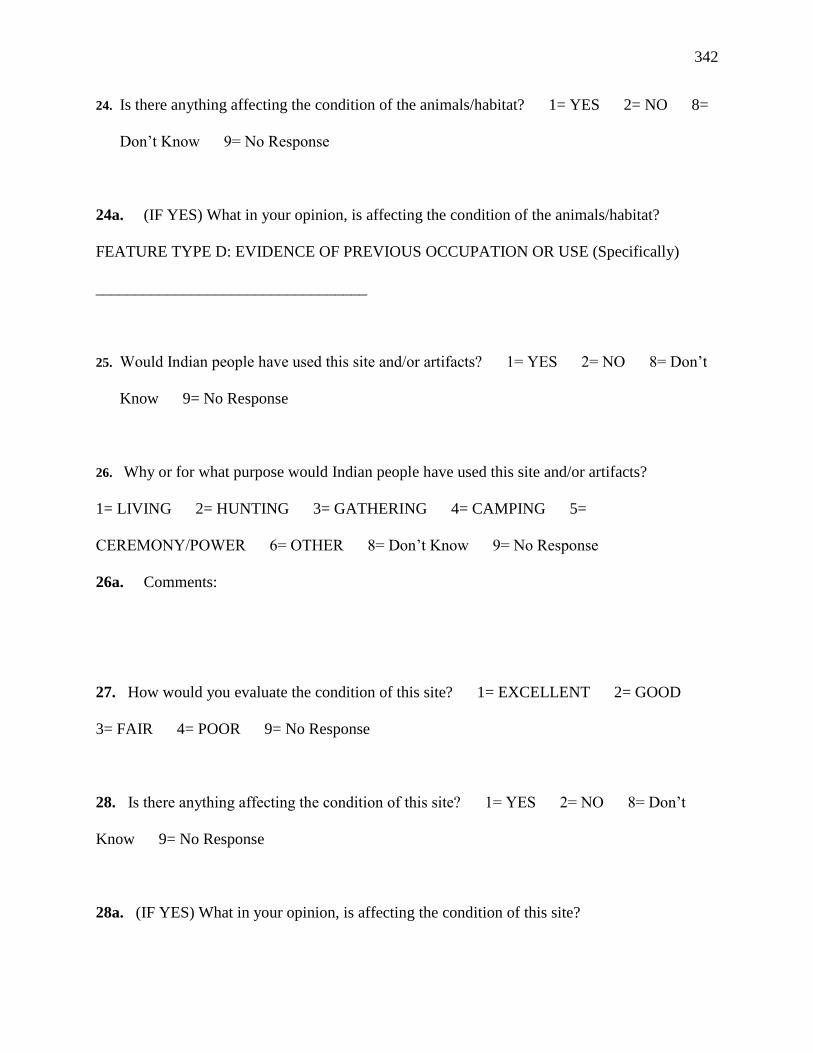
342
24. Is there anything affecting the condition of the animals/habitat? 1= YES 2= NO 8=
Don’t Know 9= No Response
24a. (IF YES) What in your opinion, is affecting the condition of the animals/habitat?
FEATURE TYPE D: EVIDENCE OF PREVIOUS OCCUPATION OR USE (Specifically)
__________________________________
25. Would Indian people have used this site and/or artifacts? 1= YES 2= NO 8= Don’t
Know 9= No Response
26. Why or for what purpose would Indian people have used this site and/or artifacts?
1= LIVING 2= HUNTING 3= GATHERING 4= CAMPING 5=
CEREMONY/POWER 6= OTHER 8= Don’t Know 9= No Response
26a. Comments:
27. How would you evaluate the condition of this site? 1= EXCELLENT 2= GOOD
3= FAIR 4= POOR 9= No Response
28. Is there anything affecting the condition of this site? 1= YES 2= NO 8= Don’t
Know 9= No Response
28a. (IF YES) What in your opinion, is affecting the condition of this site?

343
FEATURE TYPE E: GEOLOGIC FEATURES (specifically
________________________________)
29. Would Indian people have visited or used this __(Feature)__ ? 1= YES 2= NO 8=
Don’t Know 9= No Response
30. Why or for what purpose would Indian people have used this __(Feature)__ ?
1= SEEK KNOWLEDGE/POWER 2= COMMUNICATE WITH OTHER INDIANS 3=
CEREMONY 4= COMMUNICATE WITH SPIRITUAL BEINGS 5= TEACHING
OTHER INDIANS 6= TERRITORIAL MARKER 7= OTHER 8= Don’t Know 9=
No Response
30a. Comments:
31. How would you evaluate the condition of the __(Feature)__? 1= EXCELLENT 2=
GOOD 3= FAIR 4= POOR 9= No Response
32. Is there anything affecting the condition of the __(Feature)__? 1= YES 2= NO 8=
Don’t Know 9= No Response
32a. (IF YES) What in your opinion, is affecting the condition of __(Feature)__?
MANAGEMENT AND ACCESS RECOMMENDATIONS

344
33. How would you evaluate the condition of this place? 1= EXCELLENT 2= GOOD
3= FAIR 4= POOR 9= No Response
34. Is there anything affecting the condition of this place? 1= YES 2= NO 8= Don’t
Know 9= No Response
34a. (IF YES) What in your opinion is affecting the condition of this place?
Above you identified specific features at this site. What would be your recommendation for
protecting each specific feature?
35. Water Source:
36. Plant Source:
37. Animal Source:
38. Traditional Use Feature:
39. Geological Feature:
40. What would be your recommendation for protecting this place?
41. Do you think Indian people would want to have access to this place? 1= YES 2= NO
8= Don’t Know 9= No Response
41a. (IF YES) Why would Indian people want to come to this place?

345
42. Are there any special conditions that must be met for Indian people to use this place? 1=
YES 2= NO 8= Don’t Know 9= No Response
42a. (IF YES) What special conditions are needed for Indian people who want to come to this
place?
Comments:

346
NATIVE AMERICAN ETHNOGRAPHIC RESOURCES ETHNOARCHAEOLOGY-ROCK ART QUESTIONS
University of Arizona Interview Form
Date:
Interview #:
Interviewer:
2. Respondent's Name:
3a. Tribe: 3b. Ethnic Group:
4. Gender: (Circle) 1 = M 2 = F
5a. English Name of site 5b. Site No.: NV
5e. Quad Name 5f. Compass Orientation
5g. Elevation
6a. Study Area Site # 6b. Ecozone Location: 6c.
Topography: 6d: Main Water Source:
i. canyon wall i. delta
i. River edge
ii. UDSZ-desert ii. side
canyon ii. River flood
iii. OHWS-old riparian iii. wash or
drain iii. Side stream
iv. REPS-new riparian iv. mesa top
iv. Spring
v. side canyon riparian v. canyon
wall v. Rainfall
vi. dry mesa top vi. saddle
vi. rock tank
vii. stream bed vii. talus
vii. wash
viii. high desert flats viii. cave
ix. upper Mohave desert
x. lower Mohave desert
xi. stream bank
xii. woodland
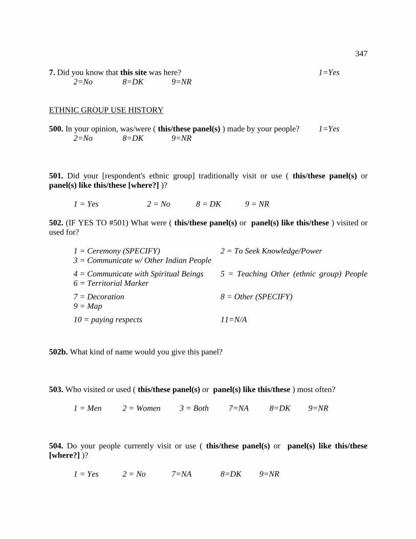
347
7. Did you know that this site was here? 1=Yes
2=No 8=DK 9=NR
ETHNIC GROUP USE HISTORY
500. In your opinion, was/were ( this/these panel(s) ) made by your people? 1=Yes
2=No 8=DK 9=NR
501. Did your [respondent's ethnic group] traditionally visit or use ( this/these panel(s) or
panel(s) like this/these [where?] )?
1 = Yes 2 = No 8 = DK 9 = NR
502. (IF YES TO #501) What were ( this/these panel(s) or panel(s) like this/these ) visited or
used for?
1 = Ceremony (SPECIFY) 2 = To Seek Knowledge/Power
3 = Communicate w/ Other Indian People
4 = Communicate with Spiritual Beings 5 = Teaching Other (ethnic group) People
6 = Territorial Marker
7 = Decoration 8 = Other (SPECIFY)
9 = Map
10 = paying respects 11=N/A
502b. What kind of name would you give this panel?
503. Who visited or used ( this/these panel(s) or panel(s) like this/these ) most often?
1 = Men 2 = Women 3 = Both 7=NA 8=DK 9=NR
504. Do your people currently visit or use ( this/these panel(s) or panel(s) like this/these
[where?] )?
1 = Yes 2 = No 7=NA 8=DK 9=NR

348
505. (If yes to #504) What are ( this/these panel(s) or panel(s) like this/these ) visited or used
for? CIRCLE BELOW
1 = Ceremony (SPECIFY) 2 = To Seek Knowledge/Power
3 = Communicate w/ Other Indian People
4 = Communicate with Spiritual Beings 5 = Teaching Other (ethnic group) People
6 = Territorial Marker
7 = Decoration 8 = Other (SPECIFY)
9 = Map
10 = paying respects 11=N/A
506. Who visits or uses ( this/these panel(s) / panel(s) like this/these ) most often?
1 = Men 2 = Women 3 = Both 7=NA 8=DK 9=NR
CONNECTIONS
517. Are there (ethnic group stories and legends associated with ( this/these panel(s) or
panel(s) like this/these)
1 = Yes 2 = No 8 = DK 9 = NR
517a. If YES, What is the name of that story?
517b. Can it be told to outsiders?
1 = Yes 2 = No 8 = DK 9 = NR
517c. IF YES, will you tell us about that story? (make sure to record on tape)

349
518. I would like to ask you about the connections between ( this/these panel(s) or panel(s) like
this/these ) and other resources.
519a. Are the pecking/paintings in this panel and connected in anyway with panels elsewhere?
1 = Yes 2 = No 8 = DK 9 = NR
520a. Where and how are they connected?
519b. Are archaeology sites connected with these panels? 1=Yes 2=No
8=DK 9=NR
520b. How are they connected?
519c. Are plants connected with these panels? 1=Yes 2=No
8=DK 9=NR
520c. How are they connected?
519d. Are animals connected with these panels? 1=Yes 2=No
8=DK 9=NR
520d. How are they connected?
519e. Are minerals connected with these panels? 1=Yes 2=No
8=DK 9=NR
520e. How are they connected?

350
519f. Is water connected with these panels? 1=Yes 2=No
8=DK 9=NR
520f. How is it connected?
519g. Is the surrounding land (geography, topog.) connected with these panels? 1=Yes
2=No 8=DK 9=NR
520g. How is it connected?
HISTORY OF ETHNIC USE
521. Did Indian people who are not (your ethnic group) use ( this/these panel(s) or panel(s)
like this/these )?
1 = Yes 2 = No 8 = DK 9 = NR
522a. (IF YES TO #521) Who were those Indian people?
522b. Did those people use ( this/these panel(s) or panel(s) like this/these ) [before, after,
same time as] respondent's ethnic group?
1 = Before 2 = After 3 = Same time as
4= All of above 7 = NA 8=DK
9=NR
SEASONALITY, USE AND MEANING
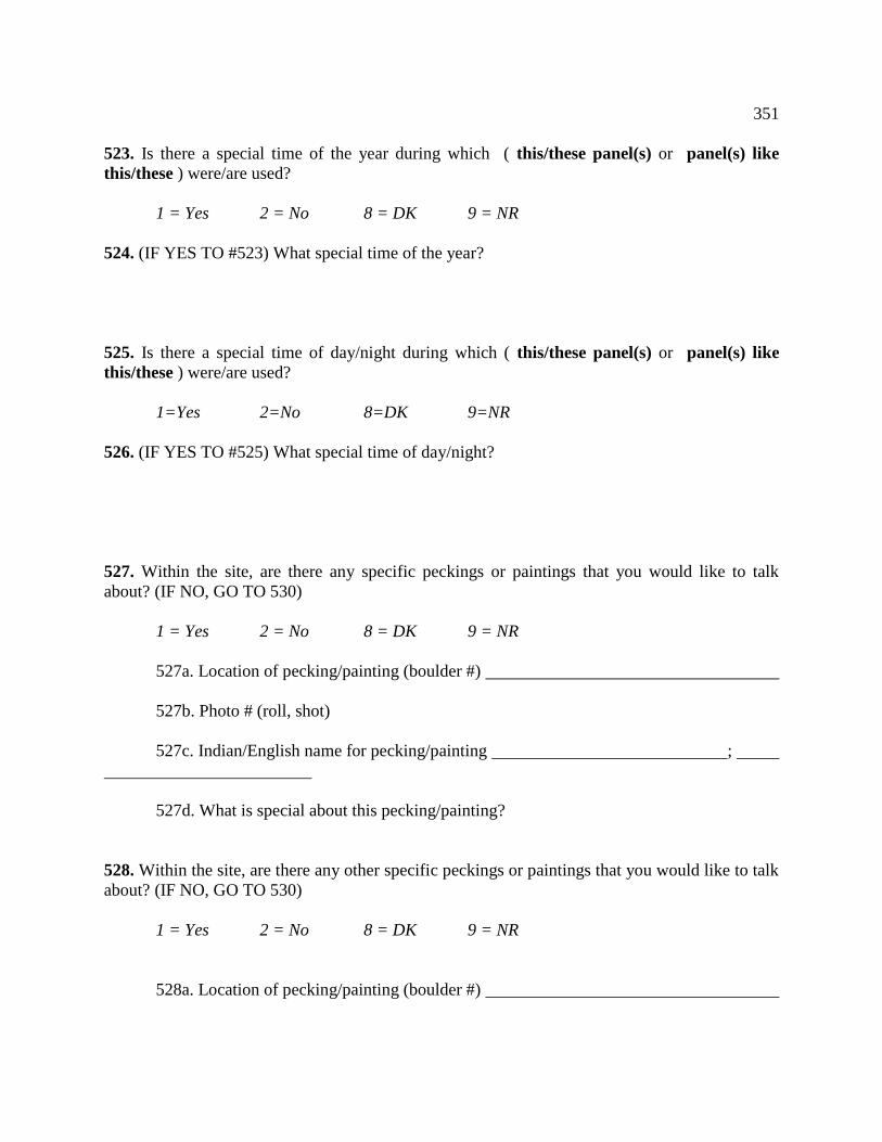
351
523. Is there a special time of the year during which ( this/these panel(s) or panel(s) like
this/these ) were/are used?
1 = Yes 2 = No 8 = DK 9 = NR
524. (IF YES TO #523) What special time of the year?
525. Is there a special time of day/night during which ( this/these panel(s) or panel(s) like
this/these ) were/are used?
1=Yes 2=No 8=DK 9=NR
526. (IF YES TO #525) What special time of day/night?
527. Within the site, are there any specific peckings or paintings that you would like to talk
about? (IF NO, GO TO 530)
1 = Yes 2 = No 8 = DK 9 = NR
527a. Location of pecking/painting (boulder #)
527b. Photo # (roll, shot)
527c. Indian/English name for pecking/painting ;
527d. What is special about this pecking/painting?
528. Within the site, are there any other specific peckings or paintings that you would like to talk
about? (IF NO, GO TO 530)
1 = Yes 2 = No 8 = DK 9 = NR
528a. Location of pecking/painting (boulder #)

352
528b. Photo # (roll, shot)
528c. Indian/English name for pecking/painting ;
528d. What is special about this pecking/painting?
529. Within the site, are there any other specific peckings or paintings that you would like to talk
about? (IF NO, GO TO 530)
1 = Yes 2 = No 8 = DK 9 = NR
529a. Location of pecking/painting (boulder #)
529b. Photo # (roll, shot)
529c. Indian/English name for pecking/painting ;
529d. What is special about this pecking/painting?
(BACK to General Discussion of site)
530. Based on the rock art that you see at the site and on the ground, what Indian activities or
events occurred at this site? [specify site]
531. Does the site have a personal meaning for you? 1=Yes 2=No
8=DK 9=NR
532. (IF YES TO #531) What does the site mean to you?
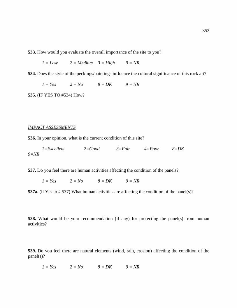
353
533. How would you evaluate the overall importance of the site to you?
1 = Low 2 = Medium 3 = High 9 = NR
534. Does the style of the peckings/paintings influence the cultural significance of this rock art?
1 = Yes 2 = No 8 = DK 9 = NR
535. (IF YES TO #534) How?
IMPACT ASSESSMENTS
536. In your opinion, what is the current condition of this site?
1=Excellent 2=Good 3=Fair 4=Poor 8=DK
9=NR
537. Do you feel there are human activities affecting the condition of the panels?
1 = Yes 2 = No 8 = DK 9 = NR
537a. (if Yes to # 537) What human activities are affecting the condition of the panel(s)?
538. What would be your recommendation (if any) for protecting the panel(s) from human
activities?
539. Do you feel there are natural elements (wind, rain, erosion) affecting the condition of the
panel(s)?
1 = Yes 2 = No 8 = DK 9 = NR

354
540. (IF YES TO #539) What natural elements are affecting the condition of the panel(s)?
[specify general weather, other]
541. What would be your recommendation (if any) for protecting the panel(s) from natural
elements?
542. Can you tell me anything else about the importance of ( this/these panel(s) or panel(s) like
this/these ) to (respondent's ethnic group) that we haven't talked about?
NATIVE AMERICAN ETHNOGRAPHIC RESOURCES
The University of Arizona in Tucson
LANDSCAPE QUESTIONS – use along with map so people can point at places they talk about
**NOTE: You must record a response for every question asked in order for data to be correctly
coded- blank spaces are not responses***
Interview Number: ______________Tape Number ______________
Date:______________ Respondent’s Name:
____________________________
Tribe/Organization: _______________________ Ethnic Group:
________________________
Gender: Male Female
Date of Birth: ___/___/___ Age _____

355
Place of Birth (Town, Reservation): _________________ U.S. State of Birth ______________
Study Area / place of interview (ethnographer fill this in): ________________________
(1) Were there Indian villages in relation to this area?
1 =Yes, 2 = No, 8 = Don't Know, 9= No Response.
(2) If yes, were the area villages connected with villages elsewhere in the Southern Nevada/
California region?
1 =Yes, 2 = No, 8 = Don't Know, 9= No Response.
(3) If yes, how were these connected?
(4) Do you know what the Indian people did when they were here in the area?
1 =Yes, 2 = No, 8 = Don't Know, 9= No Response.

356
(5) If yes, what kinds of activities -
* farming
* gathering plants
* gambling
* ceremonies
* political meetings
* others (specify)
(6) Do you know of Indian trails that were connected with this area?
1 =Yes, 2 = No, 8 = Don’t Know, 9= No Response.
(7) If yes, can you tell me something about those trails - like
* where did they go, * why did your people travel the trails, and
* were these trails somehow special to your people? How?
(8) Do you know of any songs associated with this area?
1 =Yes, 2 = No, 8 = Don't Know, 9= No Response.
(9) If yes, can you tell me something about the songs – were they
* traveling songs
* ceremony songs, or
* other-purpose songs

357
(10) Do you know of any ceremonies that were conducted at or near this area ?
1 =Yes, 2 = No, 8 = Don't Know, 9= No Response.
(11) If yes, can you tell me something about these ceremonies?
* Ceremony #1 - place _______________, when ______________, why
___________
* Ceremony #2 - place _______________, when _____________, why
____________
* Ceremony #3 - place _______________, when _____________, why
_____________
(12) Is this area at or near the place where your people were created?
1 =Yes, 2 = No, 8 = Don’t Know, 9= No Response.
(13) If yes, where is the Creation place?
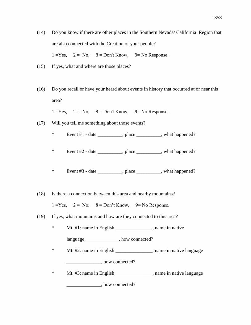
358
(14) Do you know if there are other places in the Southern Nevada/ California Region that
are also connected with the Creation of your people?
1 =Yes, 2 = No, 8 = Don't Know, 9= No Response.
(15) If yes, what and where are those places?
(16) Do you recall or have your heard about events in history that occurred at or near this
area?
1 =Yes, 2 = No, 8 = Don't Know, 9= No Response.
(17) Will you tell me something about those events?
* Event #1 - date __________, place __________, what happened?
* Event #2 - date __________, place __________, what happened?
* Event #3 - date __________, place __________, what happened?
(18) Is there a connection between this area and nearby mountains?
1 =Yes, 2 = No, 8 = Don’t Know, 9= No Response.
(19) If yes, what mountains and how are they connected to this area?
* Mt. #1: name in English _______________, name in native
language______________, how connected?
* Mt. #2: name in English _______________, name in native language
______________, how connected?
* Mt. #3: name in English _______________, name in native language
______________, how connected?
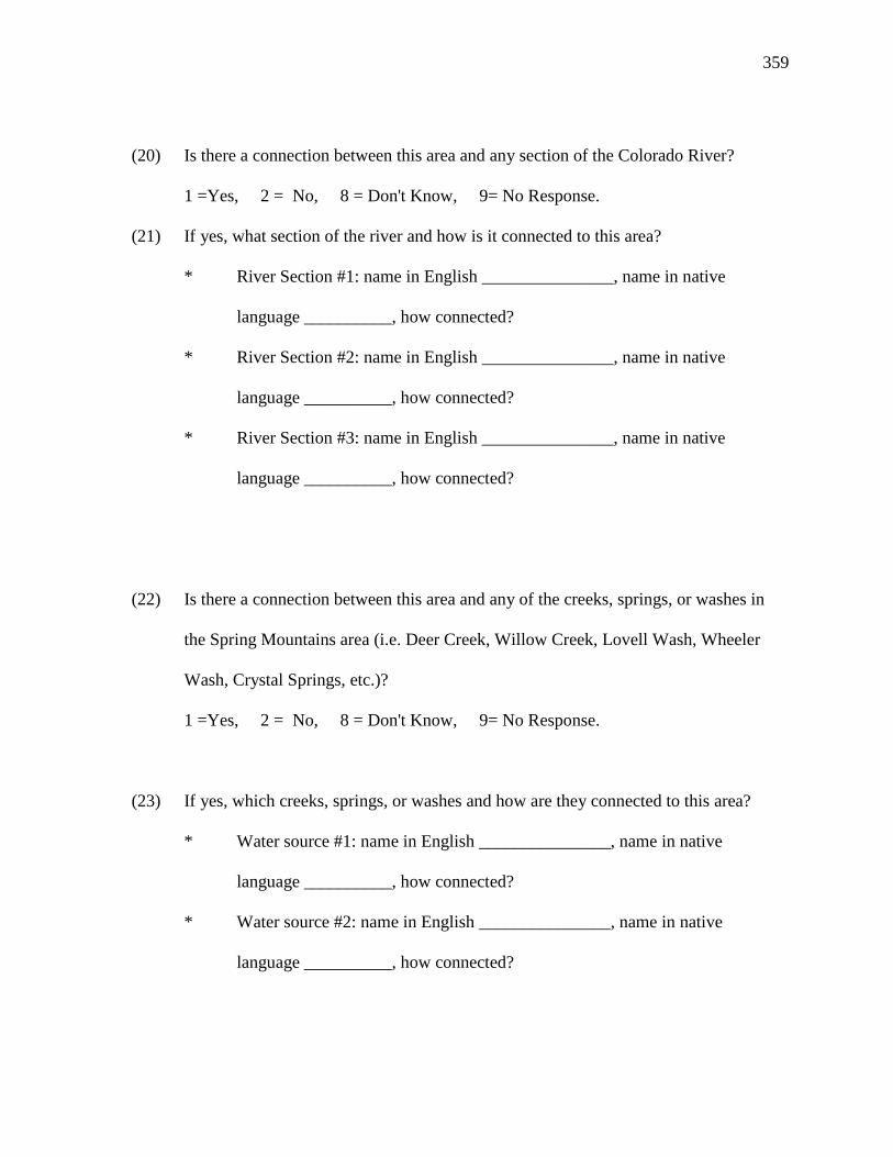
359
(20) Is there a connection between this area and any section of the Colorado River?
1 =Yes, 2 = No, 8 = Don't Know, 9= No Response.
(21) If yes, what section of the river and how is it connected to this area?
* River Section #1: name in English _______________, name in native
language __________, how connected?
* River Section #2: name in English _______________, name in native
language __________, how connected?
* River Section #3: name in English _______________, name in native
language __________, how connected?
(22) Is there a connection between this area and any of the creeks, springs, or washes in
the Spring Mountains area (i.e. Deer Creek, Willow Creek, Lovell Wash, Wheeler
Wash, Crystal Springs, etc.)?
1 =Yes, 2 = No, 8 = Don't Know, 9= No Response.
(23) If yes, which creeks, springs, or washes and how are they connected to this area?
* Water source #1: name in English _______________, name in native
language __________, how connected?
* Water source #2: name in English _______________, name in native
language __________, how connected?

360
* Water source #3: name in English _______________, name in native
language __________, how connected?
(23) Is this area connected to any places or events in the region that we have not already
talked about?
1 =Yes, 2 = No, 8 = Don’t Know, 9= No Response.
(24) If yes, what other connections would you like to talk about?
* Connection #1 - place _________, event ____________, connection
___________
* Connection #1 - place _________, event ____________, connection
___________
* Connection #1 - place _________, event ____________, connection
___________
(25) Is this area connected to any places or events in your traditional territory that we have
not already talked about?
1 =Yes, 2 = No, 8 = Don't Know, 9= No Response.
(26) If yes, what other connections would you like to talk about?
* Connection #1 - place _________, event ____________, connection
___________

361
* Connection #1 - place _________, event ____________, connection
___________
* Connection #1 - place _________, event ____________, connection
___________

362
Southern Paiute Cultural Landscapes and Pilgrimage Trails
American Indian Studies
University of Arizona
Interview Number: Tape #:
Date:
Respondent Code Number:
Tribe/Organization:
Gender: Male Female
Study Location (ethnographer fill this in):
****Ethnographer’s Note****
Thank you for your participation in my research project. This study is focused on
understanding Southern Paiute pilgrimage trails. These trail systems we will be talking
about today have been identified in previous ethnographic studies. During these previous
studies, involved Southern Paiute elders requested that more time be spent understanding
these trails and their associated features. My project seeks to fulfill their request.
The elders who participated during those studies discussed how groups of puha’gants
(medicine men) to seek knowledge or power used these trails. The elders also discussed
as part of this ceremonial process, they visited places along the trails to interact with
these locations as part of preparations to reach ceremonial destination places. My study
will focus on how these puha’gants formed relationships with each other and with the
places along the trail.

363
1. Before we begin, some Southern Paiute people have stated the terms pilgrimage trail,
pilgrimage, and pilgrim are not culturally appropriate, what terms to you wish to see used
in all future discussions of these ceremonial trails and the travelers who used these trails?
2. Why do you think the trail was used?
Rites of passage Restore Balance Time Keeping Acquire Songs
Acquire Spirit Helpers Acquire Knowledge Medicine Other
4. What time of year do you think this pilgrimage trail was used?
1= Spring 2= Summer 3= Fall 4= Winter 5= Year-round
8= Don’t Know 9= No Response
5. Do you think ceremonial travelers would visit this site during a certain time of day?
1= Yes 2= No 8=Don’t Know 9=No Response
6. What time of day?
1=Morning 2=Afternoon 3= Evening
Why?
7. How long do you think they stayed at places along the trail?
8. Would anything be brought with them from their home communities to use during
pilgrimage?
1= Yes 2= No 8=Don’t Know 9=No Response
8a. What would those be?
COMMUNITAS FORMATION
I would like to ask you now some questions pertaining to relationship formation between
people, places, and objects along the pilgrimage trail. I am interested in how and why

364
these relationships are formed and maintained and how this contributes to the overall
pilgrimage ceremony.
9. When a person visits a place along the trail, does that person establish a relationship
with that place?
1= Yes 2= No 8=Don’t Know 9=No Response
9a. Why or Why not?
9b. Does that relationship effect how a person interacts with other places along
the trail?
10. Who do you think used this trail?
1= Men 2= Women 3=Both
10a. At the same time or separate?
11. Why do you think people used this trail?
12. Do you think only specific types of puha’gant used this trail?
13. In previous studies, Southern Paiute people mentioned that pilgrims often traveled in
groups to ceremonial destination places. Why do you think they traveled together?
13a. If groups- how many people do you think were in the group?
13b. Do you think the people in the group had special skills and roles?
1-Yes 2-No 8-Not Sure 9-No Response
13bb. What types of skills or roles do you think they had?

365
13c. Elders have described pilgrimage has been described as leaving normal life
and transitioning into a spiritual state to acquire knowledge and power. How do
you think the group helped each other as they transitioned from normal everyday
life into a state of high amounts of Puha?
14. Do you think they were all from the same community or were they from different
Southern Paiute communities and districts?
1- Same Community, 2- Different Communities but Same District , 3-
Different Communities and Districts
8-Don’t Know , 9- No Response
14a. If they were from different communities, why do you think they would have
traveled together?
14b. When ceremonies were conducted at the shrines along the trail, do you think
they were done by the entire group or one individual?
Interethnic Community Formation
15. Do you think only Southern Paiute people used these trails?
1-Yes 2-No 8-Not Sure 9-No Response
15a. If yes, why?
15b If no- Who else do you think used this trail?
15bb. Would they have used them at the same time as Southern Paiute
people?
1= Yes _____, 2= No _____, 8= Don’t Know _____, 9= No
Response _____

366
15bbb. If yes- do you think they would have traveled along the
trail together and performed ceremonies together to prepare
for acquiring power at the destination spot?
16. Are the relationships formed with the other travelers important to the overall success
of the pilgrimage ceremony?
1-Yes 2-No 8-Not Sure 9-No Response
16a Why or why not?
TRAIL RESOURCES AND PERFORMANCE CHACTERISTICS
In previous studies, Southern Paiute elders and tribal representatives have stressed the
importance of relationships people have with the natural elements of the universe because
these elements have power and need to be respected. This next section focuses on
different types of resources, people might have used during pilgrimage. I am interested
how people used these resources and how they built and maintained relationships with
them as they traveled along pilgrimage trails.
WATER
16. Before leaving on their journey, do you think the travelers collected water to bring
with them?
1-Yes 2-No 8-Not Sure 9-No Response
16a. If Yes- Where would they have collected the water before their journey?
16bWhy was this water source important?
17. During their journey, why do you think it was important for them to visit a water
source?

367
17a. Do you think they left offerings for the water?
1-Yes 2-No 8-Not Sure 9-No Response
17aa. Why or Why not?
18. Do you think they collected water from the water source?
1-Yes 2-No 8-Not Sure 9-No Response
18a What would they have used the water for?
1-Drink 2-Prepare Medicine 3-Offerings 4-Cleansing 5-Other
8-Don’t Known 9- No Response
18aa.Why?
PLANTS
19. What kinds of plants would have been used by travelers during their journey?
19a. Medicine:
19b. Other:
20. Did they gather plants to take with them on their journey before departing?
1-Yes 2-No 8-Not Sure 9-No Response
Why or Why not?
21. Were plants gathered along the trail?
1-Yes 2-No 8-Not Sure 9-No Response
21a. What were the plants used for during the journey?

368
ANIMALS
22. Were animals used as part of the pilgrimage journey?
1-Yes 2-No 8-Not Sure 9-No Response
22a. If yes, what kinds of animals were used?
22b. What were they used for?
23. Were animal spirits acquired as spirit helpers?
1-Yes 2-No 8-Not Sure 9-No Response
24. Where would a traveler acquire a spirit helper?
24a. Before the journey?
24b. During the journey?
GEOLOGIC FEATURES
25. In the past studies, the elders, identified the trail following the flow of water, why do
you think these pilgrimage trails follow this path?
26. Narrow and constricted places have been described in the past as areas where Puha
collects and concentrates so how do narrow and constricted places contribute to the group
of pilgrims transitioning from daily life to a spiritual state?
26a. Would this be a place where offerings were left and prayers were said?

369
27. When pilgrims reach their destination place, do the people and place form a
relationship with each other?
1-Yes 2-No 8-Not Sure 9-No Response
27a. How is this relationship formed?
27b. Is the viewscape an important part of this process?
OFFERINGS
28. What types of offerings did people leave at the places along the trail?
Water (Source) Pottery Obsidian Red Jasper Chert
Crystals Medicine Plants Turquoise Red Paint Other
29. Did each place visited along the trail have its only special type of offering?
1-Yes 2-No 8-Not Sure 9-No Response
29a. Why?
30. Were there special spots that the offerings would be placed?
31. Why did they leave offerings at places along the trail?
32. When did they leave offerings at the places along the trail?
1-First visit only 2-Return Visit at the end of Pilgrimage Only 3-Both? 8-
Not Sure 9-No Response
32a. Why?

370
THE TRAIL
33. In previous studies, Southern Paiute people stated the trail itself was an important
feature in the pilgrimage ceremony. Do you agree or disagree with that statement?
33a. Why or why not?
34. Do you think pilgrims formed a relationship with the trail?
1-Yes 2-No 8-Not Sure 9-No Response
34a.Why or why not?

371
REFERENCES
ACHP (Advisory Council on Historic Preservation)
2012 The National Historic Preservation Program. Available at
www.achp.gov/nhpp.html. Accessed January 3, 2012.
AIRFA (American Indian Religious Freedom Act)
1978 American Indian Religious Freedom Act. 42 U.S.C. § 1996 (Pub. L. 95-
341, § 1, Aug. 11, 1978, 92 Stat. 469).
Angel, Myron, ed.
1881 History of Nevada, with Illustrations and Biographical Sketches of its
Prominent Men and Pioneers. Oakland, CA: Thompson and West
Anschuetz, Kurt F, Richard H Wilshusen, Cherie L Scheick
2001 An Archaeology of Landscapes: Perspectives and Directions. Journal of
Archaeological Research. 9(2): 157-211
Anyon, Roger, T.J. Ferguson, Loretta Jackson, and Lillie Lane
1996 Native American Oral Traditions and Archaeology. SAA Bulletin 14(2).
Aveni, Anthony F.
2000 Between the Lines. Austin: University of Texas Press.
Barth, Fredrik
1969 Ethnic Groups and Boundaries: The Social Organization of Culture
Difference. Prospect Heights, Il: Waveland Press Inc.
Basso, Keith H.
1996 Wisdom Sits in Places: Landscape and Language among the Western
Apache. Albuquerque, NM: University of New Mexico Press.
Battiste, M.
2000 Reclaiming Indigenous Voice and Vision. Vancouver, Canada: UBC
Press.

372
Bauer, Brian S. and Charles Stanish
2001 Ritual and Pilgrimage in the Ancient Andes: the Islands of the Sun and
the Moon. Austin: University of Texas Press.
Bean, Lowell J.
1976 Power and Its Applications in Native California. In Native Californians: A
Theoretical Retrospective. L.J. Bean and T.C. Blackburn, eds. Pp. 407-20.
Ramona, CA: Ballena Press.
Beck, Colleen, M., N. Zedeño, and R. Furlow
2000 Time, Trust, and the Measure of Success: The Nevada Test Site Cultural
Resources Program. In Working Together: Native Americans and
Archaeologists. K. Dongoske, M. Aldenderfer, and K. Doehner eds.
Pp.165-71. Washington, D.C.: Society for American Archaeology.
Beebe, J.
2001 Rapid Assessment Process. Walnut Creek, CA: Altamira Press.
Berkes, Fikret
2008 Sacred Ecology: Traditional Ecological Knowledge and Management
Systems. Philadelphia, PA: Francis & Taylor.
Blackburn, Thomas
1974 Chumash Oral Traditions: A Cultural Analysis. Ph.D dissertation.
University of California-Los Angeles.
Boggs, James. P.
1997 Medicine Mountain Ethnographic Project. Report on file, USFS Bighorn
National Forest, Sheridan, Wyoming and Wyoming State Historic
Preservation Office, Cheyenne.
2003 Medicine Mountain and the Bighorn Medicine Wheel between Two
Worlds: A Native American Cultural Landscape in Twenty-First Century
North America. Report on file, USFS Bighorn National Forest, Sheridan,
Wyoming and Wyoming State Historic Preservation Office, Cheyenne.

373
Bouchy, A.
1987 The Cult of Mount Atago and the Atago Confraternities. The Journal of
Asian Studies 46(2):255-277.
Brooks, Juanita
1950 "The Southern Indian Mission" Under Dixie Sun: A History of
Washington County by Those Who Loved their Forebears Washington
County Chapter D.U.P. pp. 23-33.
1972 Journal of the Southern Indian Mission: Diary of Thomas D. Brown.
Logan, Utah: Utah
Brooks, G. R., Ed
1977 The Southwest Expedition of Jedediah Smith: His Personal Account of the
Journey to California 1826-1827. Glendale, CA: Arthur A. Clark Co.
Bunte, Pamela A. and Robert J. Franklin
1987 From the Sands to the Mountain: Change and Persistence in a Southern
Paiute Community. Lincoln: University of Nebraska Press.
Campbell, A. and D. Fiske
1959 Convergent and Discriminate Validation by the Multi-Trail Multimethod
Matrix, Psychological Bulletin 56:81–105.
Carroll, Alex K., and Richard W. Stoffle
2005 Puhagants. In American Indian Religious Traditions An Encyclopedia,
vol. 2. Suzanne J. Crawford and Dennis F. Kelley eds. Pp. 779–782. Santa
Barbara, CA: ABC-CLIO Inc.
Carroll A., R. Stoffle, R. Toupal, K. Van Vlack, H. Fauland, A. Haverland, and
R. Arnold
2006 Black Mountain: Traditional Uses of a Volcanic Landscape. Prepared for
U.S. Air Force - Air Combat Command Nevada Test and Training Range Native
American Program and the URS Group.

374
Carroll, Alex K. and Richard Stoffle
2003 The Ghost Dance in Ancient Voices, Storied Places: Themes In
Contemporary Indian History. M. N. Zedeño, A. K. Carroll, and R.W.
Stoffle, (eds.). Prepared for Nellis Air Force Base and Range Complex
Nevada Test and Training Range and National Nuclear Security
Administration Nevada Operations Office. Tucson, Arizona: Bureau of
Applied Research in Anthropology, University of Arizona.
Carroll, Alex, Nieves Zedeño, and Richard Stoffle
2004 Landscapes of the Ghost Dance: A Cartography of Numic Ritual. Journal
of Archaeological Method and Theory 11(2):127-156.
Carroll, Kristen J.
2007 Place, Performance, and Social Memory in the 1890s Ghost Dance.
Ph.D. dissertation, Department of Anthropology, University of Arizona.
Coleman, Simon and John Eade
2004 Reframing Pilgrimage: Cultures in Motion. New York: Routledge.
Cosgrove, Denis and Stephen Daniels (eds)
1988 The Iconography of Landscape: Essays on the Symbolic Representation,
Design and Use of Past Environments. Cambridge: Cambridge University
Press
Csikszentmihalyi, Mihaly
1975 Beyond Boredom and Anxiety: The Experience of Play in Work and
Games. San Francisco: Josey-Bass.
Dellenbaugh, Frederick S.
1962 A Canyon Voyage: The Narrative of the Second Powell Expedition Down
the Green-Colorado River from Wyoming, and the Explorations on Land
in the Years 1871-1872. New Haven: Yale University Press.
Deloria, Vine
2003 God is Red. Golden, Colorado: Fulcrum Press.

375
Driver, Harold
1961 Indians of North America. Chicago, IL: University of Chicago Press.
Dobyns, Henry F. and Robert C. Euler
1970 Wauba Yuma’s People: The Comparative Socio-Political Structure of the
Pai Indians of Arizona. Prescott, Arizona: Prescott College Press.
Eade, John, and Michael J. Sallnow, eds.
1991 Contesting the Sacred: The Anthropology of Christian Pilgrimage.
London, UK: Routledge.
Elson, Mark D., and Michael H. Ort, editors
2003 In the Shadow of the Volcano: Recent Research at Sunset Crater.
Archaeology Southwest 17(1).
EO 13007
1996 Indian Sacred Sites. Ex. Ord. No. 13007, May 24, 1996, 61 F.R. 26771.
Available at: http://www.achp.gov/EO13007.html, accessed November
02, 2011.
EO 13175
2000 Consultation and Coordination with Indian Tribal Governments. Ex. Ord.
No. 13175, Nov. 6, 2000, 65 F.R. 67249. Available at:
http://www.schlosserlawfiles.com/consult/EO13175Nov%202000.pdf,
accessed November 02, 2011
Euler, Robert C.
1966 Southern Paiute Ethnohistory. University of Utah Anthropological Papers,
78. Salt Lake City, UT: University of Utah Press.
Fenton, R. N.
1869 "Report" Annual Report, Commissioner of Indian Affairs, 1869
Washington: Government Printing Office. pp. 203-04.
376
Fish, Suzanne K.
2004 Corn, Crops, and Cultivation in the North American Southwest. In People
and Plants in Ancient Western North America. Paul E. Minnis, ed. Pp. 115-166.
Washington, DC: Smithsonian Books.
Forney, J.
1859 "Visit of the Superintendent of Indian Affairs to Southern Utah" Deseret
News vol. 9, no. 10. May 11, 1859. p.73, col. 1.
Fowler, Catherine
1992 In the Shadow of Fox Peak: An Ethnography of the Cattail-Eater Northern
Paiute People of Stillwater Marsh. Cultural Resource Series, 5. U.S.
Department of the Interior, Fish and Wildlife Service, Region 1, Stillwater
National Wildlife Refuge, Fallon, Nevada.
Fowler, Don D., and Catherine S. Fowler, eds.
1971 Anthropology of the Numa: John Wesley Powell's Manuscripts on the
Numic Peoples of Western North America, 1868–1880. Washington,
D.C.: Smithsonian Institution Press.
Frank, G., S. Murphy, H. J. Kitching, D. M. Garfield, Sr.,and N. McDarment
2008 The Tule River Tribal History Project: Evaluating a California Tribal
Government’s Collaboration with Anthropology and Occupational
Therapy to Preserve Indigenous History and Promote Tribal Goals.
Human Organization 67 (4): 430- 442.
Gabriel, K.
1991 Roads to Center Place: A Cultural Atlas of Chaco Canyon and the
Anasazi. Boulder: Johnson Publishing.
Grayson, Donald K.
1993 The Desert’s Past: A Natural Prehistory of the Great Basin. Washington,
D.C.: Smithsonian Institution Press.

377
Glazier, Stephen D.
1983 Caribbean Pilgrimage: A Typology. Journal for the Scientific Study of
Religion. 22 (4): 316-325.
Greider, Thomas
1993 Aircraft Noise and the Practice of Indian Medicine: The Symbolic
Transformation of the Environment. Human Organization 52 (1) 76-82.
Greider, Thomas and Lorraine Garkovich
1994 Landscapes: The Social Construction of Nature and the Environment.
Rural Sociology. 59(1): 1-24.
Halmo, David B., Richard W. Stoffle, and Michael J. Evans
1993 Paitu Nanasuagaindu Pahonupi (Three Sacred Valleys): Cultural
Significance of Gosiute, Paiute, and Ute Plants. Human Organization:
Journal of the Society for Applied Anthropology 52(2):142–150.
Hamblin, W. Kenneth
1989 Pleistocene Volcanic Rocks of the Western Grand Canyon, Arizona. In
Geology of Grand Canyon, Northern Arizona. D.P. Elston, G.H.
Billingsley, and R.A. Young, eds. Washington, D.C.: American
Geophysical Union.
Hicks, Dan, Laura McAtackney, and Graham Fairclough
2007 Envisioning Landscape: Situations and Standpoints in Archaeology and
Heritage. Walnut Creek, CA: Left Coast Press.
Hodge, Fredrick Webb
1910 Handbook of American Indians north of Mexico Bulletin Smithsonian
Institution, Bureau of American Ethnology No. 30. House Document
(United States Congress, First Session, No. 926) Washing-ton: G.P.O.,
1907-1910.
Ingerson, Alice E.
2003 What are Cultural Landscapes? Institute for Cultural Landscape Studies.

378
Jick, T. J.
1979 Mixing Qualitative and Quantitative Methods: Triangulation in Action,
Administrative Science Quarterly 24: 601–611.
Jones, Robert
1996 Phase 1 of a cultural resources reconnaissance of the Fortymile Canyon
Archaeological Rock Art and Site Research Area, Areas 18 and 30,
Nevada Test Site, Nye County, NV. Las Vegas, Nevada: Desert Research
Institute, Quarternary Sciences Center, Short Report No. SR51396-1.
Jones, Robert and Harold Drollinger
1997 Phase 2 of a Cultural Resources Reconnaissance of the Fortymile Canyon
Archaeological Rock Art and Site Research Area, Areas 18 and 30,
Nevada Test Site, Nye County, NV. Las Vegas, Nevada: Desert Research
Institute, Quaternary Sciences Center, Short Report No. SR111296-1.
Keller, J. T., G. Keller, and R. Melnick
1998 Guidelines for Evaluating and Documenting Rural Historic Landscapes.
National Register Bulletin 30. Washington D.C: National Register of
Historic Places, National Park Service. Available at:
http://www.nps.gov/nr/publications/bulletins/pdfs/nrb38.pdf. Accessed
January 2, 2011.
Kelly, Isabel
1933 Las Vegas (and Pahrump) Field Notes. Notebook 18.
1934 Southern Paiute Bands. American Anthropologist 36(4):548–560.
1936 Southern Paiute Shamanism Anthropological Records 2(4). Kroeber
Anniversary Volume Essays in Anthropology. Berkeley, CA: University
of California Press.
1971 Southern Paiute Ethnography. University of Utah Glen Canyon Series, 21.
New York, NY: Johnson Reprint Corporation.
379
Kelly, Isabel T. and Catherine S. Fowler
1986 "Southern Paiute." Handbook of North American Indians, Volume 11:
Great Basin. Warren L. D'Azevedo, ed. Washington: Smithsonian
Institution. pp. 368-411.
King, Thomas F.
2004 Cultural Resource Laws and Practice. Walnut Creek: Altamira Press.
Kroeber, A. L.
1925 Handbook of the Indians of California. Washington, DC: Government
Printing Office.
Laird, Carobeth
1976 The Chemehuevis. Banning, CA: Malki Museum Press.
Lehrhaupt, Linda
1985 Processional Aspects of Irish Pilgrimage. The Drama Review. 29(3): 48-
64.
Liljeblad, Sven
1986 Oral Tradition: Content and Style of Verbal Arts. In Handbook of North
American Indians, vol. 11: Great Basin. W.L. d’Azevedo, ed. Pp. 641–
659. Washington D.C.: Smithsonian Institution.
Lockwood, Daniel W.
1872 Appendix A: Report of Daniel Lockwood, First Lieutenant of Engineers.
In 1872 Preliminary Report Concerning Explorations and Surveys
Principally in Nevada and Arizona: Prosecuted in Accordance with
Paragraph 2, Special Orders No. 109, War Department, March 18, 1871,
and Letter of Instructions of March 23, 1871. Washington DC:
Government Printing Office.
Loendorf, Lawrence
1993 Rock Art and Water Ghost Woman on the Wind River, Wyoming. Paper
presented at the Shamanism Conference, Witt Museum, San Antonio, TX,
February 27.

380
Lyle, D. A.
1872 Appendix B: Report of Second Lieutenant D.A. Lyle, Second United States
Artillery. In 1872 Preliminary Report Concerning Explorations and
Surveys Principally in Nevada and Arizona: Prosecuted in Accordance
with Paragraph 2, Special Orders No. 109, War Department, March 18,
1871, and Letter of Instructions of March 23, 1871. Washington DC:
Government Printing Office.
MacDougal, D.T.
1908 Across Papagueria. Bulletin of the American Geographical Society.
40(12): 705-725. American Geographic Society.
McClelland, Linda Flint, J. Timothy Keller, Genevieve P. Keller, and Robert Z.
Melnick
1999 Guidelines for Evaluating and Documenting Rural Historic Landscapes
(Revised, Originally 1989), Vol. 2004: National Park Service, U. S.
Department of Interior National Register Bulletin No. 30.
McEwan, C. and M. van de Guchte
1991 Ancestral Time and Sacred Space in Inca State Ritual. In The Ancient
Americas: Art from Sacred Landscapes (ed. R. F. Townsend). Chicago:
The Art Institute of Chicago, pp. 359-71.
Miller, Jay
1983 Basin Religion and Theology: A Comparative Study of Power (Puha).
Journal of California and Great Basin Anthropology 5(1,2):66-86.
Mithun, Marianne
2001 The Languages of Native North America. Cambridge: Cambridge
University Press.
Morinis, Alan
1992 Sacred Journeys: The Anthropology of Pilgrimage. Westport, CT:
Greenwood Press.

381
Morinis, A. and N.R. Crumrine
1991 La Peregrinacion: the Pilgrimage in Latin America. In Pilgrimage in Latin
America (eds N. R. Crumrine and A. Morinis). Westport: Greenwood
Press, pp. 1-17.
National Park Service
2010 Secretary of the Interior’s Guidelines for the Treatment of Cultural
Landscapes. Electronic Document. www.nps.gov/
history/hps/hli/landscape_guidelines/index.htm. Accessed March 3, 2012.
NEPA
1970 National Environmental Policy Act. 42 U.S.C. 4321 (Pub. L. 91-190, § 2,
Jan. 1, 1970, 83 Stat. 852).
NHPA
1966 National Historic Preservation Act. 16 U.S.C. § 470 et seq. (Pub. L. 89–
665, § 1, Oct. 15, 1966, 80 Stat. 915).
Nye, William
1886 A Winter Among the Piutes. Overland Monthly and Out West Magazine
7(39):293-298.
Oswalt, Wendell H.
2005 This Land was Theirs: A Study of Native North Americans. New York:
Oxford University Press.
Palmer, William R.
1928 "Indian Names in Utah Geography" Utah Historical Quarterly 1(1): 5-25.
Parker, Patricia L., and Thomas F. King
1990 National Register Bulletin 38: Guidelines for Evaluating and Documenting
Traditional Cultural Properties. U.S. Department of the Interior, National
Park Service, National Register, History and Education, National Register
of Historic Places. Available at:
http://www.nps.gov/nr/publications/bulletins/pdfs/nrb38.pdf, accessed
January 2, 2011.
\

382
Pippin, L. C. and G. H. Henton
1991 Research Designs and Methods. In Archaeological Investigations on the
Buckboard Mesa Road Project. Las Vegas, Nevada: Desert Research
Institute Technical Report No. 69.
Powell, John W.
1957 Exploration of the Colorado River and its Canyons. Chicago, IL:
University of Chicago Press.
Rappaport, Roy A.
1999 Ritual and Religion in the Making of Humanity, New York: Cambridge
University Press.
Relander, Click
1986 Drummers and Dreamers. Seattle: Northwest Interpretive Association.
Sallnow, M.J.
1981 Communitas Reconsidered: The Sociology of Andean Pilgrimage. Man,
New Series 16(2): 163-182.
1991 Dual Cosmology and Ethnic Division in an Andean Pilgrimage Cult. In
Pilgrimage in Latin America. N. Ross Crumrine and Alan Morinis, eds.
New York, NY: Greenwood Press.
Sapir, Edward
1910 Kaibab Paiute Linguistic and Ethnologic Fieldnotes. Manuscript No.2643.
Philadelphia: American Philosophical Library.
Sapir, Edward, and William Bright
1992 Southern Paiute and Ute: Linguistics and Ethnography. Berlin ; New
York: Mouton de Gruyter.

383
Schiffer, Michael, B. and James M. Skibo
1987 Theory and Experiment in the Study of Technological Change. Current
Anthropology.
Silverman, Helaine
1994 The Archaeological Identification of an Ancient Peruvian Pilgrimage
Center. World Archaeology. 26(1): 1-18.
Simmons, Thomas and R. Laurie Simmons
2009 Medicine Mountain National Historic Landmark Nomination, Big Horn
National Forest, Wyoming. Prepared for United States Forest Service.
Denver: Front Range Research Associates, Inc.
Smithsonian Institution
2012 Unikaret Field Summar. Global Volcanism Program. Available at
http://www.volcano.si.edu. Accessed March 3, 2012.
Smythers, Karen
1997 Inari Pilgrimage: Following One’s Path on the Mountain. Journal of
Religious Studies 24(3/4): 427-452.
Stapp, Darby C. and Michael S. Burney
2002 Tribal Cultural Resource Management: The Full Circle to Stewardship.
Walnut Creek: Altamira Press.
Steward, Julian H.
1938 Basin-Plateau Aboriginal Sociopolitical Groups. Bulletin 120. Washington
D.C.: Bureau of American Ethnology, Smithsonian Institution.
1941 Cultural Element Distributions, XIII: Nevada Shoshone. University of
California Anthropological Records 4(2):209–360. Berkeley, CA:
University of California Press.
384
1955 The Theory of Culture Change: The Methodology of Multilinear
Evolution. Urbana, IL: University of Illinois Press.
Stewart, Omer C.
1966 Tribal Distributions and Boundaries in the Great Basin. The Current
Status of Anthropological Research in the Great Basin 1964. Warren L.
D’Azevedo et al., editors. Pp. 167-239. Desert Research Institute
Technical Report Series S-H. Social Sciences and Humanities Publications
No. 1. Reno: Desert Research Institute.
Stoffle, Richard W., and Richard W. Arnold
2003 Confronting the Angry Rock: American Indian Situated Risk from
Radioactivity. Ethnos 68(2):230–248.
Stoffle, Richard, Richard Arnold, Jerry Charles, Betty Cornelius, Maurice Frank-
Churchill, Vernon Miller and Gaylene Moose
2001 Shoshone Mountain, Nevada Test Site: Its Meaning in Numic culture
Based on Extant Studies. Prepared for U.S. Department of Energy
Nevada Operations Office, Las Vegas, Nevada. Bureau of Applied
Research in Anthropology University of Arizona, Tucson, Arizona.
Stoffle, Richard W., Richard W. Arnold, Kathleen A. Van Vlack, Sean M. O’Meara,
Jessica L. Medwied-Savage.
2009 U-Nav-Kai-Vi Duepeth Toyave Volume Two: Black Mountain-Thirsty
Canyon Traditional Uses of a Volcanic Landscape. Prepared for U.S. Air
Force - Air Combat Command Nevada Test and Training Range Native
American Program and Prewitt and Associates, Inc. Bureau of Applied
Research in Anthropology, The University of Arizona in Tucson, Arizona.
Stoffle, Richard W., Diane Austin, David Halmo and Arthur Phillips III
1995 Ethnographic Overview and Assessment: Zion National Park, Utah and
Pipe Spring National Monument, Arizona. Tucson: Bureau of Applied
Research in Anthropology, University of Arizona.
385
Stoffle, Richard W., Fletcher P. Chmara-Huff, Kathleen A. Van Vlack, and Rebecca
S. Toupal
2004 Puha Flows from It: The Cultural Landscape Study of the Spring
Mountains. Tucson: Bureau of Applied Research in Anthropology,
University of Arizona.
Stoffle, Richard W., and Henry F. Dobyns
1982 Puaxant Tuvip: Utah Indians Comment on the Intermountain Power
Project, Utah Section of Intermountain Adelanto Bipole I Proposal.
Kenosha, WS: Applied Urban Field School, University of Wisconsin-
Parkside.
1983 Nuvagantu: Nevada Indians Comment on the Intermountain Power
Project. Kenosha, WI: Applied Urban Field School, University of
Wisonsin-Parkside.
Stoffle, Richard W., Michael J. Evans, David B. Halmo, Molly E. Dufort, and Brian
K. Fulfrost
1994a Native American Cultural Resources on Pahute and Rainier Mesas,
Nevada Test Site. Tucson, AZ: Bureau of Applied Research in
Anthropology, University of Arizona.
Stoffle, Richard W., David Halmo, and Diane E. Austin
1997 Cultural Landscapes and Traditional Cultural Properties: A Southern
Paiute View of the Grand Canyon and Colorado River. American Indian
Quarterly 21(2):229–250.
Stoffle, Richard W., David B. Halmo, Michael J. Evans, and Diane E. Austin
1994b Piapaxa 'Uipi' (Big River Canyon): Southern Paiute Ethnographic Resource
Inventory and Assessment for the Colorado River Corridor, Glen Canyon
National Recreation Area, Utah and Arizona, and Grand Canyon National
Park, Arizona. Tucson: Bureau of Applied Research In Anthropology,
University of Arizona.

386
Stoffle, Richard W., Merle Cody Jake, Pamela Bunte, and Michael J. Evans
1982 Southern Paiute Peoples' SIA Responses to Energy Proposals. In Indian
SIA: The Social Impact Assessment of Rapid Resource Development on
Native Peoples. C.C. Geisler, R. Green, D. Usner, and P.C. West, eds:
University of Michigan.
Stoffle, Richard W., Lawrence Loendorf, Diane E. Austin, David B. Halmo, and
Angelita Bulletts
2000a Ghost Dancing the Grand Canyon: Southern Paiute Rock Art, Ceremony,
and Cultural Landscapes. Current Anthropology 41(1):11–38.
Stoffle, Richard W., Lawrence L. Loendorf, Diane E. Austin, David B. Halmo,
Angelita S. Bulletts, and Brian K. Fulfrost
1995 Tumpituxwinap (Storied Rocks): Southern Paiute Rock Art in the
Colorado River Corridor. Tucson, AZ: Bureau of Applied Research in
Anthropology, University of Arizona.
Stoffle, Richard, Rebecca Toupal, and Maria Nieves Zedeño
2002 Landscape, Nature, and Culture: A Diachronic Model of Human-Nature
Co-Adaptations. In Nature across Culture: View of Nature and the
Environment in Non-Western Cultures. H. Selin (ed.) Great Britain:
Kluwer Academic Publishers
Stoffle, R. R. Toupal, K. Van Vlack, R. Diaz de Valdes, S. O’Meara, J. Medwied-
Savage, M. Gemein, P. Dukes, and D. Borysewicz).
2008 Native American Ethnographic Study of Tonto National Monument.
Prepared for National Park Service. Bureau of Applied Research in
Anthropology, University of Arizona.
Stoffle, Richard W., Kathleen A. Van Vlack, and Richard W. Arnold
2006 Paa’oasta Hunuvi: Water Bottle Canyon Traditional Cultural Property
Study. Tucson, AZ: Bureau of Applied Research in Anthropology,
University of Arizona.

387
Stoffle, Richard, W, Kathleen A. Van Vlack, Alex. K Carroll, Fletcher P, Chmara-
Huff, Aja Y. Martinez
2005 Yanawant: Paiute Places and Landscapes on the Arizona Strip- Volume
One of the Arizona Strip Landscapes and Place Name Study. Prepared for
the Bureau of Land Management, Arizona Strip Field Office. Tucson, AZ:
Bureau of Applied Research in Anthropology, University of Arizona.
Stoffle, R.W., K.A. Van Vlack, S.C. De Sola, H.A. Acosta, H.Z. Johnson, P. T.
Dukes, J.L. Savage, K. Beck.
2011 Southern Paiute Ethnographic Study for the Lake Powell Pipeline EIS:
Report Regarding Study Plan 23- Ethnographic Resources, for Kaibab
Band of Paiute Indians, San Juan Southern Paiute Tribe, and Paiute Indian
Tribe of Utah, for the Lake Powell Hydroelectric System. Report Prepared
for Utah Division of Water Resources. Submitted on Behalf of the Kaibab
Band of Paiute Indians, Paiute Indian Tribe of Utah, and the San Juan
Southern Paiute Tribe. Bureau of Applied Research in Anthropology,
University of Arizona, Tucson AZ.
Stoffle, R., K. Van Vlack, H. Johnson, P. Dukes, S. De Sola, K. Simmons
2012 Tribally Approved American Indian Ethnographic Analysis of the
Proposed Escalante Valley Solar Energy Zone. Prepared for the Solar
Energy Development Programmatic Environmental Impact Statement.
Available at
http://solareis.anl.gov/documents/ethnographic/EthnographicAnalysis_Esc
alanteValley.pdf. Accessed March 1, 2012.
Stoffle, Richard W., Kathleen Van Vlack, R. Toupal, Sean O’Meara, and Richard
Arnold
2008 American Indians and the Old Spanish Trail. Tucson, AZ: Bureau of
Applied Research in Anthropology, University of Arizona.
Stoffle, Richard and Maria Nieves Zedeño
2001 Historical Memory and Ethnographic Perspectives on the Southern Paiute
Homeland. Journal of California and Great Basin Anthropology 23(2):227-
246.
2002 The Concept of “Power” in Numic and Yuman Epistemologies. High
Plains Applied Anthropologist 22(2): 172-193

388
Stoffle, Richard W., Maria Nieves Zedeño, Richard Arnold, Kathleen Van Vlack,
Mance Buttram, M.E, Heather Fauland, and Aja Martinez
2006 Dá Me Na-Nu-Wu-Tsi: “Our Relations All of Mother Earth” The Timber
Caldera Ethnographic Report. Tucson, AZ: Bureau of Applied Research in
Anthropology, University of Arizona.
Stoffle, Richard W., María Nieves Zedeño, Diane E. Austin, and David B. Halmo—
1996 Native American Graves Protection and Repatriation Act Consultation and
the Nevada Test Site Collection. Technical Report 89. Las Vegas: Desert
Research Institute.
Stoffle, Richard W., Maria Nieves Zedeño, A. Eisenberg, F. Pittaluga, J. Amato, T.
G. Earnest, and G. Dewey
1998 Ha’tata (The Backbone of the River): American Indian Ethnographic
Studies Regarding the Hoover Dam Bypass Project. Tucson, AZ: Bureau
of Applied Research in Anthropology, University of Arizona.
Stoffle, Richard. M. Nieves Zedeño, Amy Eisenberg, Rebecca Toupal and Alex
Carroll
2004 Shifting Risks: Hoover Dam Impacts on American Indian Sacred
Landscapes In Facility Siting: Risk, Power and Identity in Land Use
Planning. Edited by Asa Boholm , Ragnar E. Löfstedt. Pp.127-144.
London: Earthscan Publications Ltd.
Stoffle, Richard W., Maria Nieves Zedeño, A. Eisenberg, Rebecca Toupal, A. Carroll,
F. Pittaluga, J. Amato, T. G. Earnest, and G. Dewey
2000b Ha’tata (The Backbone of the River): American Indian Ethnographic
Studies Regarding the Hoover Dam Bypass Project. Tucson, AZ: Bureau
of Applied Research in Anthropology, University of Arizona.
Stoffle, Richard W., Maria Nieves Zedeño, and David B. Halmo, eds.
2001 American Indians and the Nevada Test Site: A Model of Research and
Consultation. Washington, D.C.: Government Printing Office.
Sully, Dean
2007 Decolonising Conservation: Caring for Maori Meeting Houses Outside
New Zealand. Walnut Creek: Left Coast Press.

389
Tashakkori, Abbas, and Charles Teddlie
1998 Mixed Methodology: Combining Qualitative and Quantitative
Approaches. Thousand Oaks, CA: Sage Publications.
Tebbutt, C.F.
1962 St. Patrick’s Well, Oran, Eire. Folklore. 73(1):55-56
Tilley, Christopher
1994 A Phenomenology of Landscapes: Places, Paths, and Monuments. Oxford,
U.K.: Berg.
2004 The Materiality of Stone: Explorations in Landscape Phenomenology.
Oxford: Berg.
2010 Interpreting Landscapes: Geologies, Topographies, Identities Explorations
in Landscape Phenomenology 3. Walnut Creek: Left Coast Press.
Titiev, Mischa
1937 A Hopi Salt Expedition. American Anthropologist 39(2): Pp. 244-258.
Toupal, R., and R. Stoffle
2004 Traditional Resource Use of the Flagstaff Area Monuments. National Park
Service Cooperative Agreement, 1443CA1250-96-006. Tucson: Bureau of
Applied Research in Anthropology, University of Arizona.
Toupal, Rebecca, Richard Stoffle, Nathaniel O’Meara, and Jill Dumbauld
2003 Sioux Cultural Landscapes and Ethnobotany of Pipestone National
Monument, Minnesota. Prepared for by the National Park Service
Midwest Region Tucson, AZ: Bureau of Applied Research in
Anthropology, The University of Arizona.
Tremlett, P.
2003 The Problem of Belief: A Response to Matthew Engelke. Anthropology
Today 19(4): 24

390
Tuan, Y.
1997 Space and Place: The Perspective of Experience. Minneapolis: University
of Minnesota Press.
Turner, Victor
1967 The Forest of Symbols: Aspects of Ndembu Ritual. Ithaca, NY: Cornell
University Press.
1969 The Ritual Process. Chicago, IL: Aldine Press.
1973 The Center Out There: Pilgrim’s Goal. History of Religions. 12: 191-230.
1974 Pilgrimage and Communitas. Studia Mssionalia. 23: 305-327.
1975 Symbolic Studies, Annual Review of Anthropology. 4:145-161.
Turner, Victor and Edith Turner
1978 Image and Pilgrimage in Christian Culture. New York, NY: Columbia
University Press.
Underhill, Ruth, Donald Bahr, Baptisto Lopez, Jose Pancho, and David Lopez
1997 Rainhouse and Ocean: Speeches for the Papago Year. Tucson, AZ:
University of Arizona Press.
United States Geological Survey
2012 Hornito. Volcano Harards Program Glossary. Available at:
http://volcanoes.usgs.gov/images/pglossary/hornito.php. Accessed March 3,
2012.
van Gennep, Arnold
1909 The Rites of Passage. London: Routledge and Kegan Paul.
391
Van Vlack, Kathleen
2007 Traditional Ecological Knowledge and Resilience of the Southern Paiute
High Chief System. M.A. Thesis, Department of American Indian Studies,
University of Arizona.
von Werhof, Jay and Harry Casey
1987 Spirits of the Earth: A study of earthen art in the North American deserts.
El Centro, CA: Imperial Valley College Museum Society.
Walker, William H.
1995 Ceremonial Trash. In Expanding Archaeology. James M. Skibo, William
H. Walker, and Axel E. Nielsen, eds. Pp. 67–79. Salt Lake City, UT:
University of Utah Press.
1999 Ritual, Life Histories, and the Afterlives of People and Things. Journal of
the Southwest 41(3):383–405.
Wheeler, S.M.
1940 Preliminary report of reconnaissance in the Fortymile Canyon Area.
Manuscript on file at Nevada State Museum. State of Nevada, State Park
Commission, Carson City.
White, Raymond C.
1963 Luiseño Social Organization. University of California Publications in
American Archaeology and Ethnology no. 48. Berkely and Los Angeles:
University of California Press.
Whiting, Beatrice B.
1950 Paiute Sorcery. New York: Viking Fund Publications in Anthropology No.
15.
Whitley, David
2000 The Art of the Shaman: Rock Art of California. Salt Lake City, UT:
University of Utah Press.
392
Winslow, Diane L.
1996 Restricted reconnaissance: The History and Archaeology of S. M. Wheeler
in Nye County, Nevada. M.A. Thesis, University of Nevada.
Wissler, Clark
1938 The American Indian. New York.
Yaffee, S.L., A.F. Phillips, I.C. Frentz , P.W. Hardy, S.M. Maleki, and B.E.Thorpe
1996 Ecosystem Management in the United States: An Assessment of
Current Experience. Washington, D.C.: Island Press.
Yamba, C. Bawa
1995 Permanent Pilgrims: The Role of Pilgrimage in the Lives of West African
Muslims in Sudan. Edinburgh: Edinburgh University Press.
Yava, Albert,
1992 Big Falling Snow: A Tewa-Hopi Indian's Life and Times and the History
and Traditions of His People. Albuquerque, NM: University of New
Mexico Press.
Zedeño, María Nieves
2000 On What People Make of Places: A Behavioral Cartography. In Social
Theory in Archaeology. M.B. Schiffer, ed. Pp. 97-111. Salt Lake City:
University of Utah Press.
Zedeño, Maria Nieves, Richard W. Stoffle, Genevieve Dewey-Hefley, and David
Shaul
1999 Storied Rocks: American Indian Inventory and Interpretation of Rock Art
on the Nevada Test Site. Desert Research Institute Technical Report 93.
Bureau of Applied Research in Anthropology, University of Arizona,
Tucson.