Preliminary damage survey report on 2015 Nepal Gorkha ...
53
Preliminary damage survey report on 2015 Nepal Gorkha Earthquake Pokhrel R.M., Chiaro G., Kiyota T., Katagiri T. Institute of Industrial Science, University of Tokyo, Japan Goda K. Bristol University, UK Sharma K. Alberta University, Canada Tokyo, 13 May 2015
-
Upload
khangminh22 -
Category
Documents
-
view
1 -
download
0
Transcript of Preliminary damage survey report on 2015 Nepal Gorkha ...
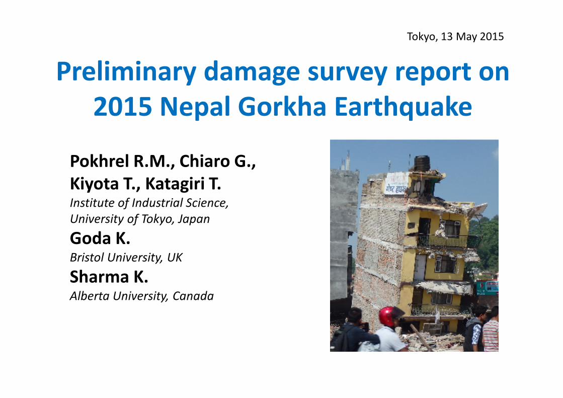
Preliminary damage survey report on
2015 Nepal Gorkha Earthquake
Pokhrel R.M., Chiaro G.,
Kiyota T., Katagiri T.Institute of Industrial Science,
University of Tokyo, Japan
Goda K.Bristol University, UK
Sharma K.Alberta University, Canada
Tokyo, 13 May 2015

Advance Party of Japanese Investigation Team
for the 2015 Nepal Earthquake Disaster
JSCE: Japanese Society of Civil Engineers
JGS: Japanese Geotechnical Society
ATC3, ISSMGE: Asian Technical Committee, Int. Society of Soil Mech. & Geotech. Eng.
Survey team2
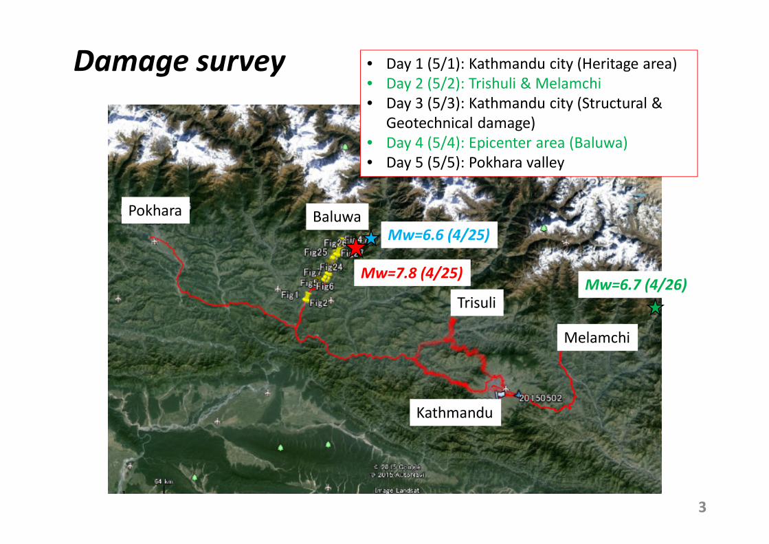
Damage survey
3
• Day 1 (5/1): Kathmandu city (Heritage area)
• Day 2 (5/2): Trishuli & Melamchi
• Day 3 (5/3): Kathmandu city (Structural &
Geotechnical damage)
• Day 4 (5/4): Epicenter area (Baluwa)
• Day 5 (5/5): Pokhara valley
Melamchi
Trisuli
Kathmandu
BaluwaPokhara
Mw=7.8 (4/25)Mw=6.7 (4/26)
Mw=6.6 (4/25)
4
PART I
Damage survey in
Kathmandu City
Dr Pokhrel Rama Mohan (PhD)
JSPS Research Fellow
Institute of Industrial Science
University of Tokyo
5
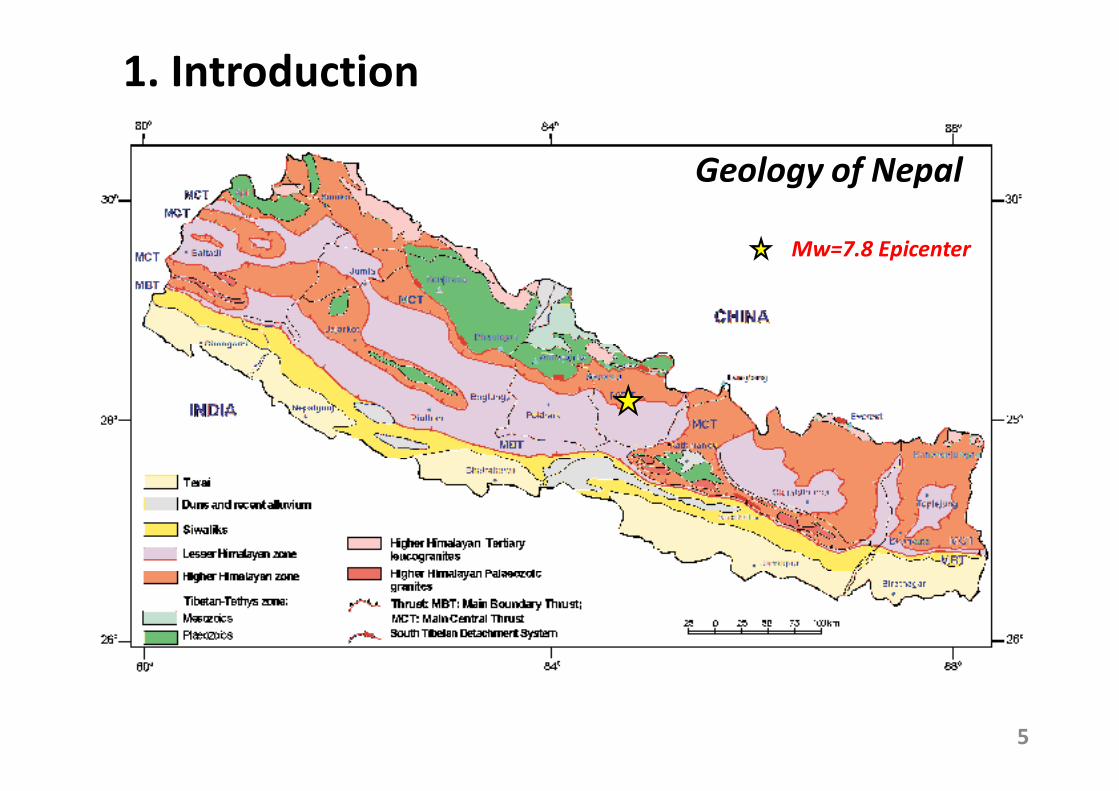
1. Introduction
Mw=7.8 Epicenter
Geology of Nepal
(Source:
Department
of Mines and
Geology
(DMG, 1998)
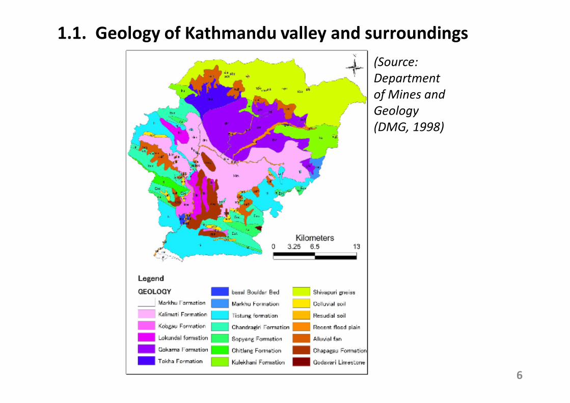
1.1. Geology of Kathmandu valley and surroundings
6
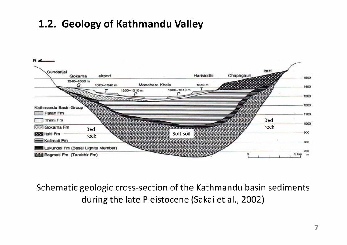
Schematic geologic cross-section of the Kathmandu basin sediments
during the late Pleistocene (Sakai et al., 2002)
Bed
rock
Soft soilBed
rock
1.2. Geology of Kathmandu Valley
7
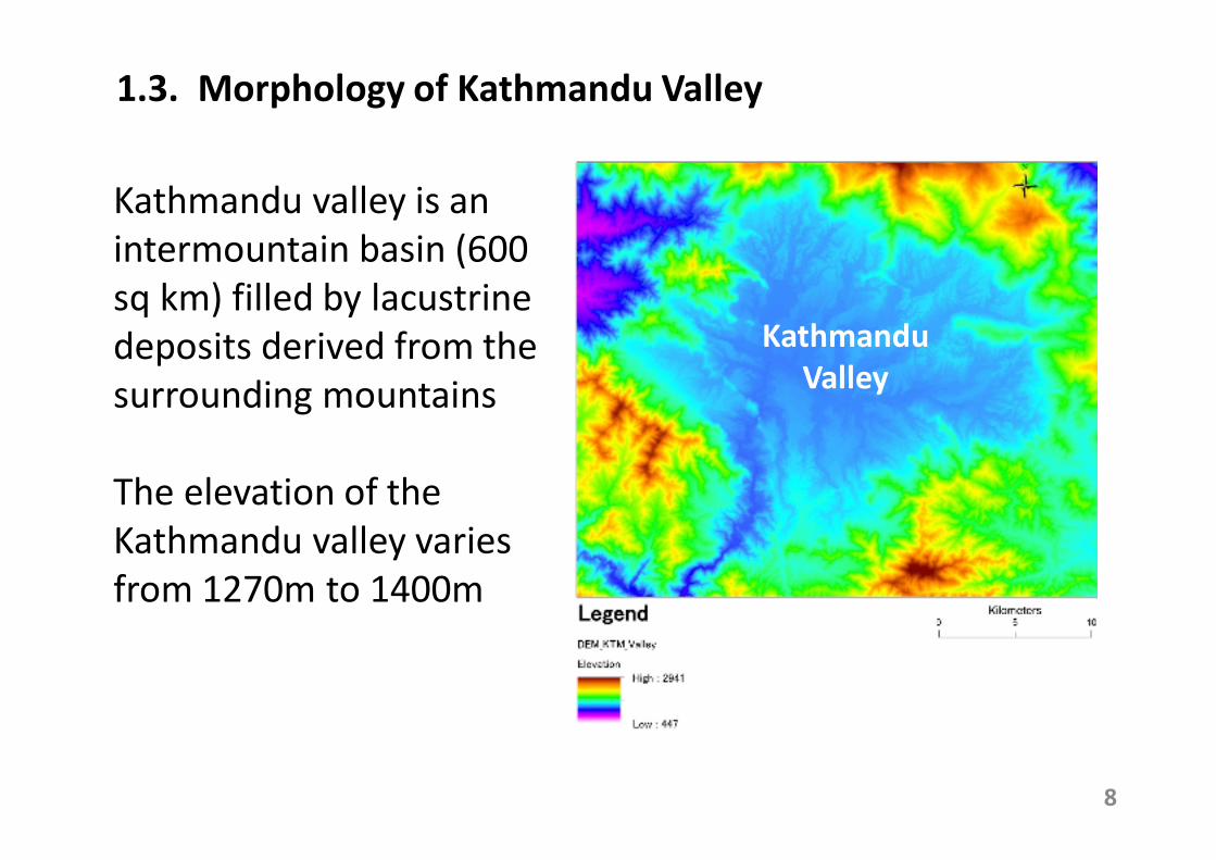
Kathmandu valley is an
intermountain basin (600
sq km) filled by lacustrine
deposits derived from the
surrounding mountains
The elevation of the
Kathmandu valley varies
from 1270m to 1400m
1.3. Morphology of Kathmandu Valley
Kathmandu
Valley
8
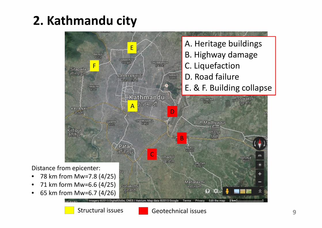
2. Kathmandu city
E
A
B
C
A. Heritage buildings
B. Highway damage
C. Liquefaction
D. Road failure
E. & F. Building collapse
D
F
9Structural issues Geotechnical issues
Distance from epicenter:
• 78 km from Mw=7.8 (4/25)
• 71 km form Mw=6.6 (4/25)
• 65 km from Mw=6.7 (4/26)
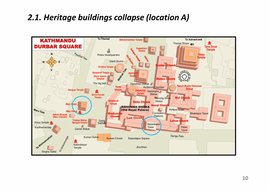
2.1. Heritage buildings collapse (location A)
10
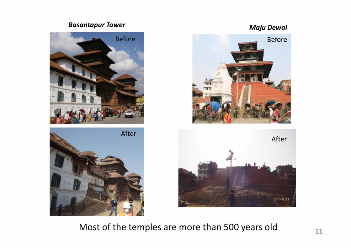
11Most of the temples are more than 500 years old
Basantapur Tower
Before
After
Maju Dewal
Before
After
12
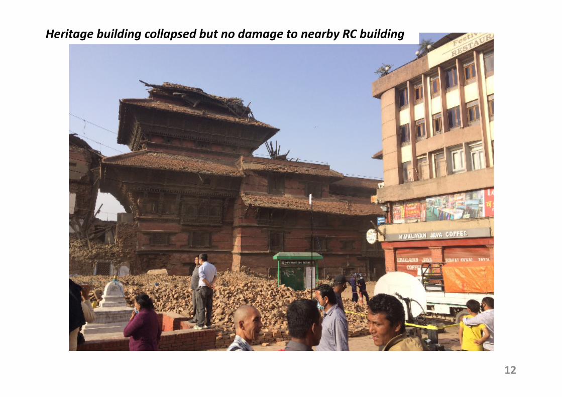
Heritage building collapsed but no damage to nearby RC building
13
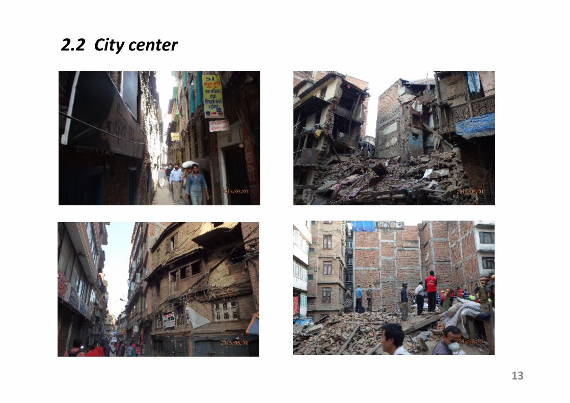
2.2 City center
14
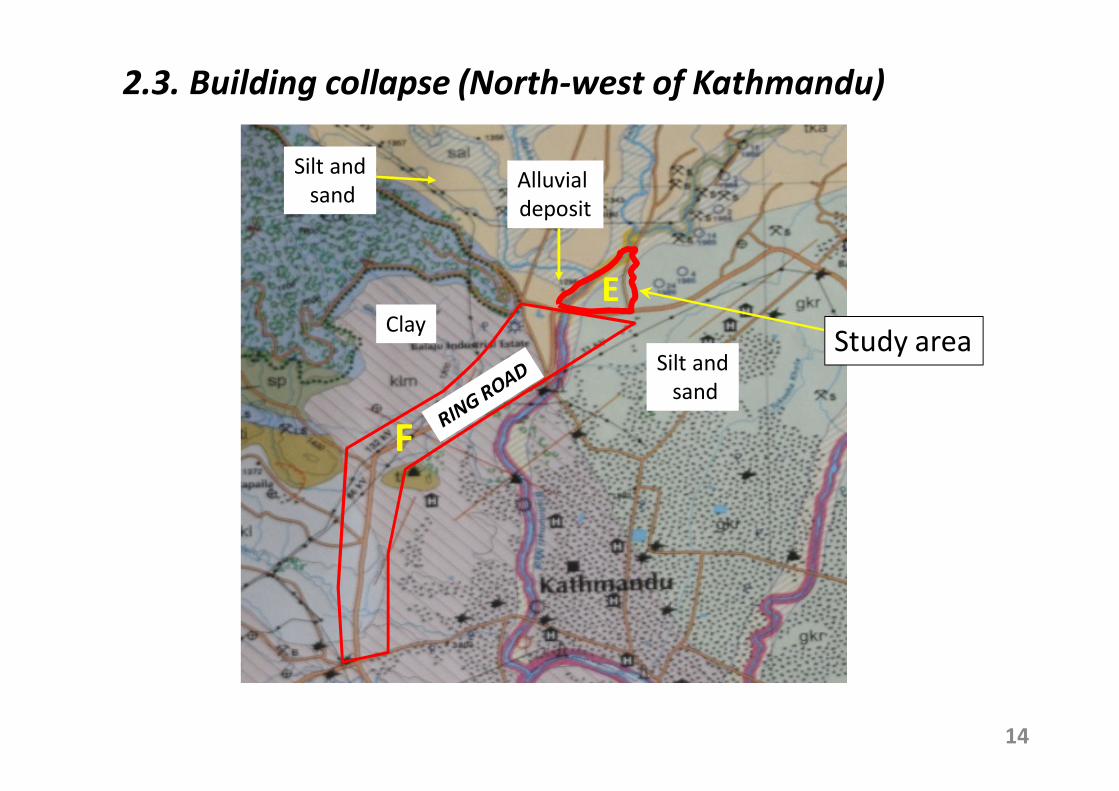
2.3. Building collapse (North-west of Kathmandu)
B
D
E
F
Study areaClay
Alluvial
deposit
Silt and
sand
Silt and
sand

Study area (location E)
15
At least 28 buildings totally collapsed or should be demolished
Most heavily damaged buildings are located on the alluvial soil deposit
Alluvial soil
(Holocene)
Pleistocene
depositPleistocene soil
RING ROAD
Alluvial soil
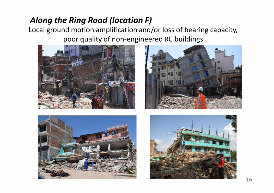
Along the Ring Road (location F)
16
Local ground motion amplification and/or loss of bearing capacity,
poor quality of non-engineered RC buildings
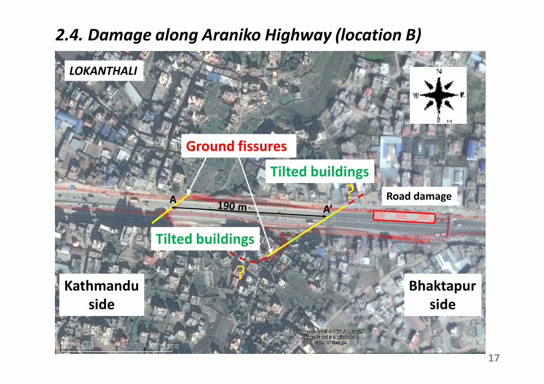
2.4. Damage along Araniko Highway (location B)
17
Kathmandu
side
Bhaktapur
side
AA’
Tilted buildings
LOKANTHALI
Ground fissures
Road damage
Tilted buildings
?
?

Embankment settlement
Before earthquake
During survey
Photo source: Google map
May 2013
Bhaktapur side
Extension completed
in 2011Just after earthquake
Kathmandu side
Photo source: wordpress.com18
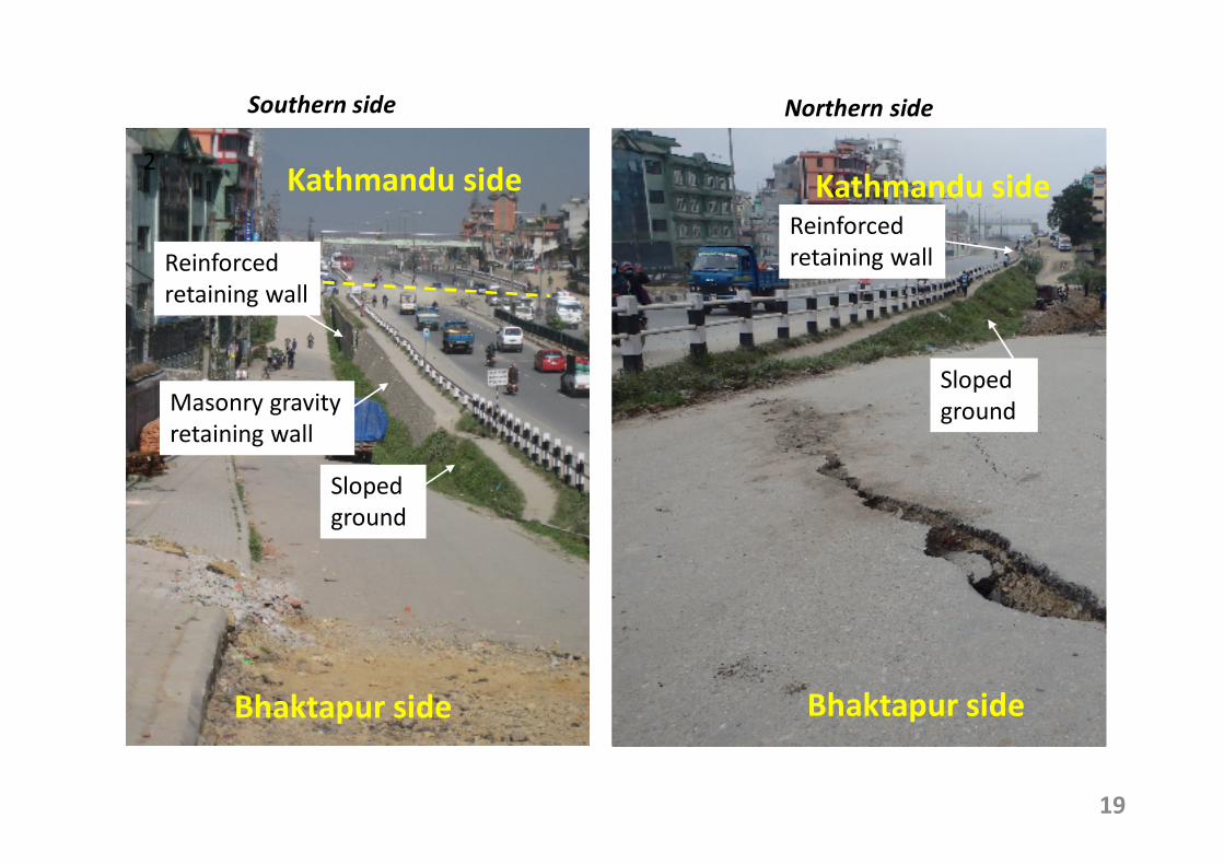
2Kathmandu side
Bhaktapur side
Kathmandu side
Bhaktapur side
Southern side Northern side
Reinforced
retaining wall
Masonry gravity
retaining wall
Sloped
ground
Reinforced
retaining wall
Sloped
ground
19
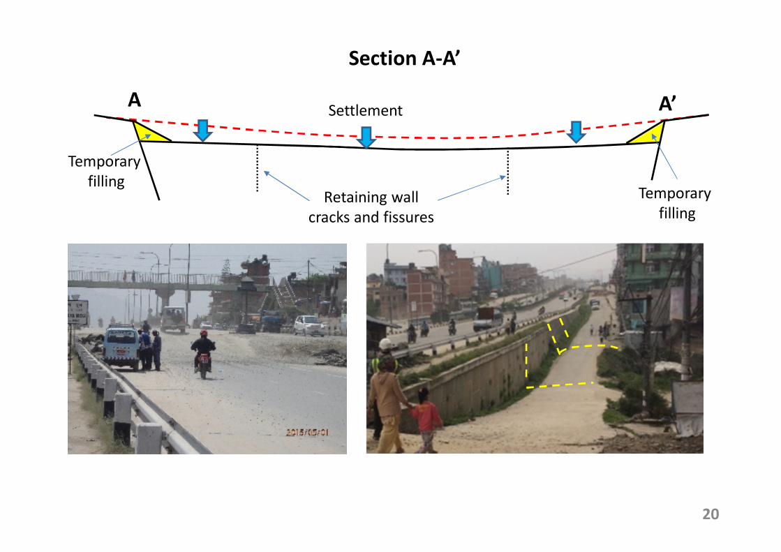
A A’
Temporary
fillingTemporary
fillingRetaining wall
cracks and fissures
Settlement
Section A-A’
20
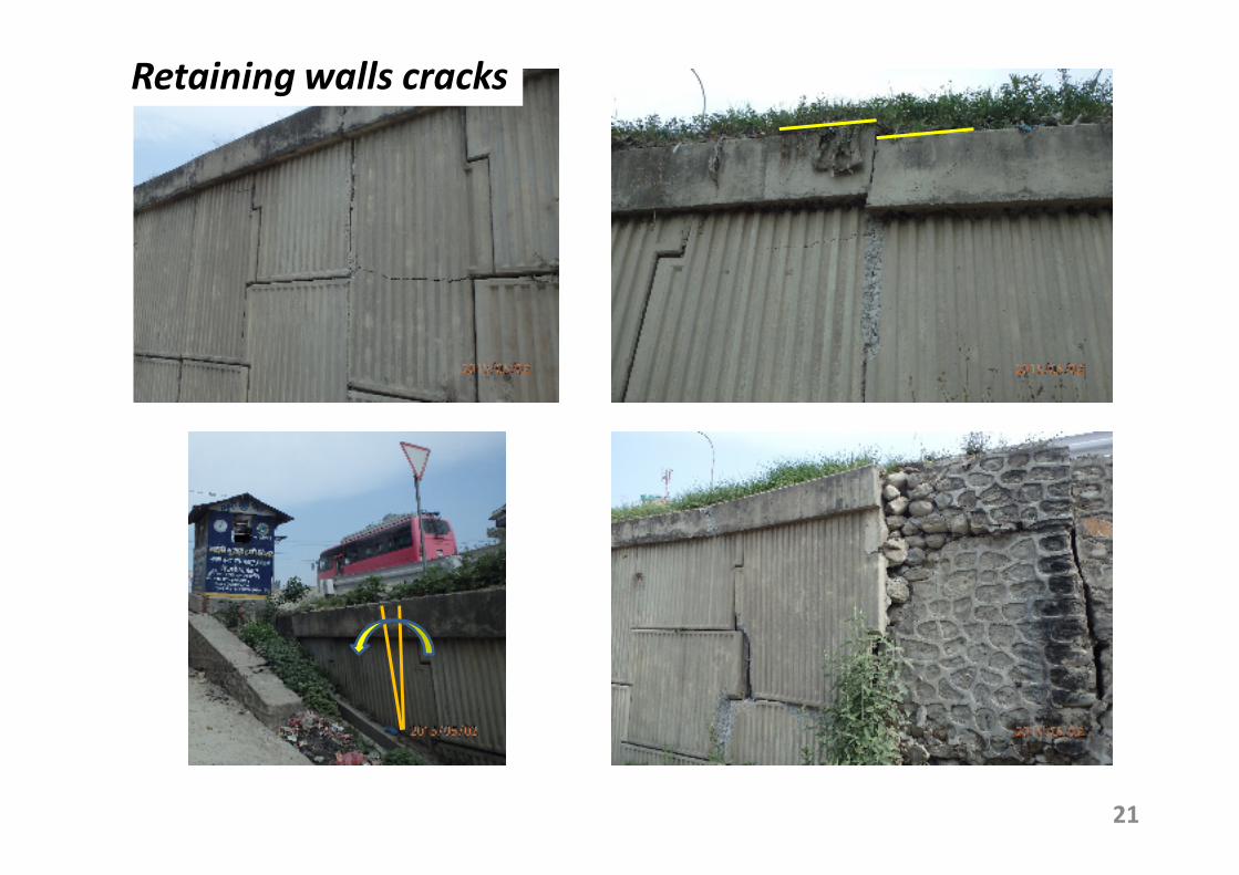
21
Retaining walls cracks
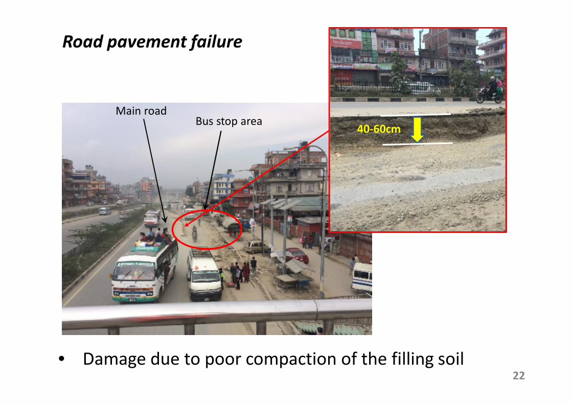
22
Bus stop area
• Damage due to poor compaction of the filling soil
Main road
Road pavement failure
40-60cm
120 cm
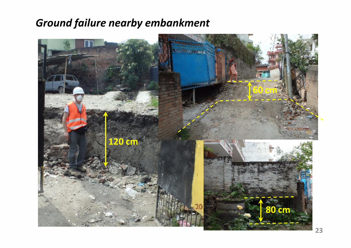
Ground failure nearby embankment
60 cm
80 cm
23
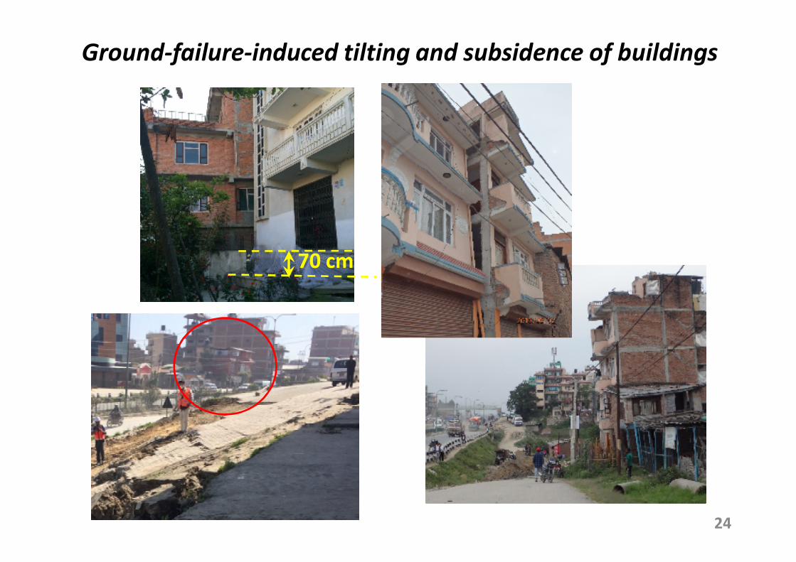
Ground-failure-induced tilting and subsidence of buildings
24
70 cm
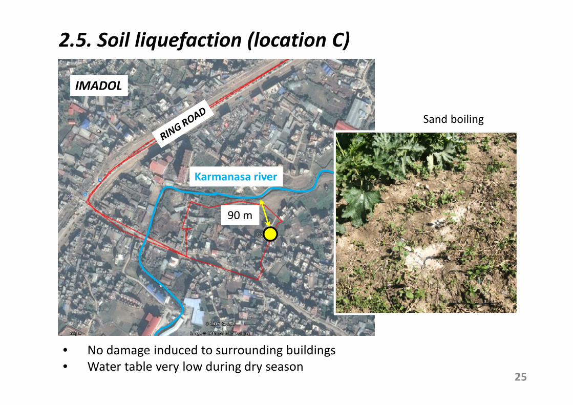
2.5. Soil liquefaction (location C)
25
• No damage induced to surrounding buildings
• Water table very low during dry season
Sand boiling
90 m
Karmanasa river
IMADOL
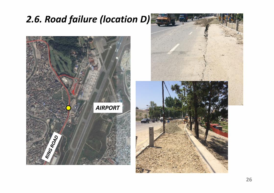
2.6. Road failure (location D)
26
AIRPORT
27
PART II
Damage survey near
Epicenter Area and Pokhara
Dr Chiaro Gabriele (PhD)
JSPS Research Fellow
Institute of Industrial Science
University of Tokyo
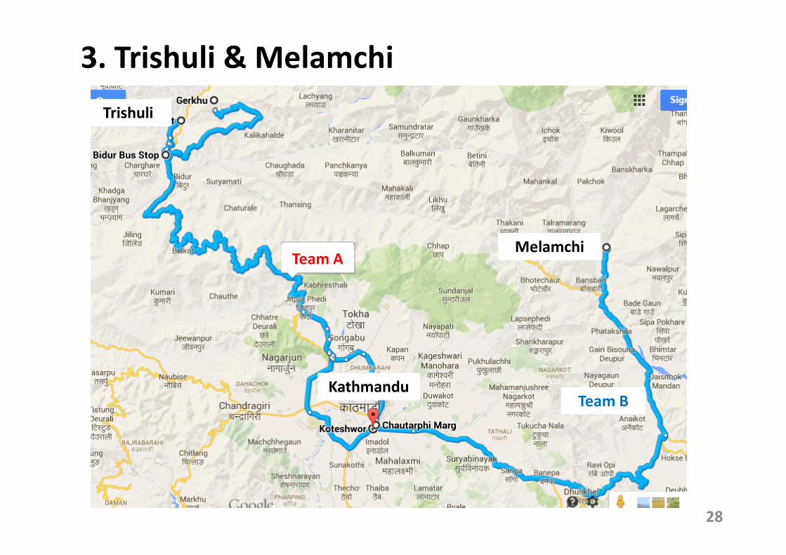
3. Trishuli & Melamchi
Melamchi
Trishuli
Kathmandu
Team A
Team B
28
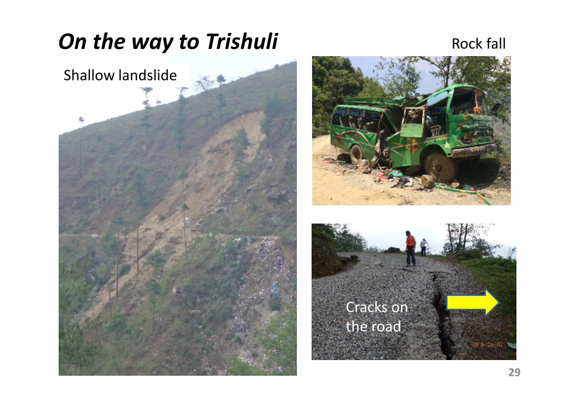
On the way to Trishuli
29
Shallow landslide
Rock fall
Cracks on
the road
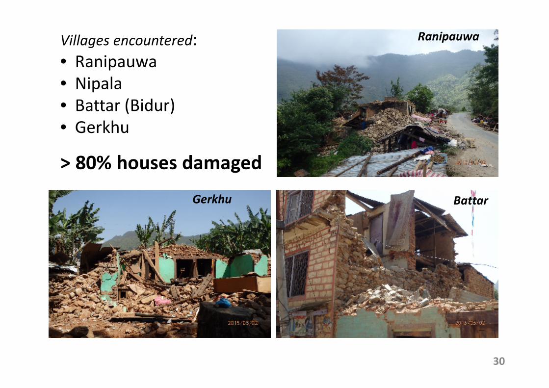
30
Villages encountered:
• Ranipauwa
• Nipala
• Battar (Bidur)
• Gerkhu
> 80% houses damaged
BattarGerkhu
Ranipauwa
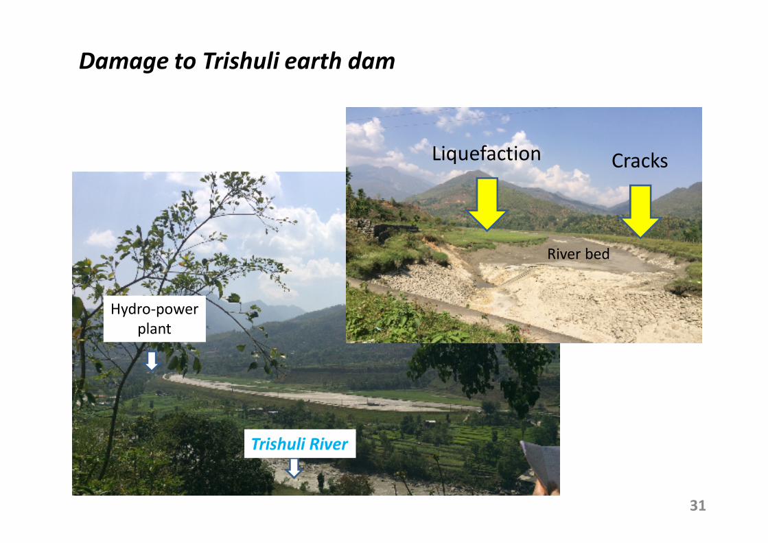
Damage to Trishuli earth dam
CracksLiquefaction
31
Hydro-power
plant
River bed
Trishuli River
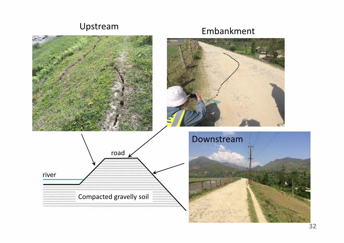
UpstreamEmbankment
Downstream
Compacted gravelly soil
32
river
road
Sand
boiling
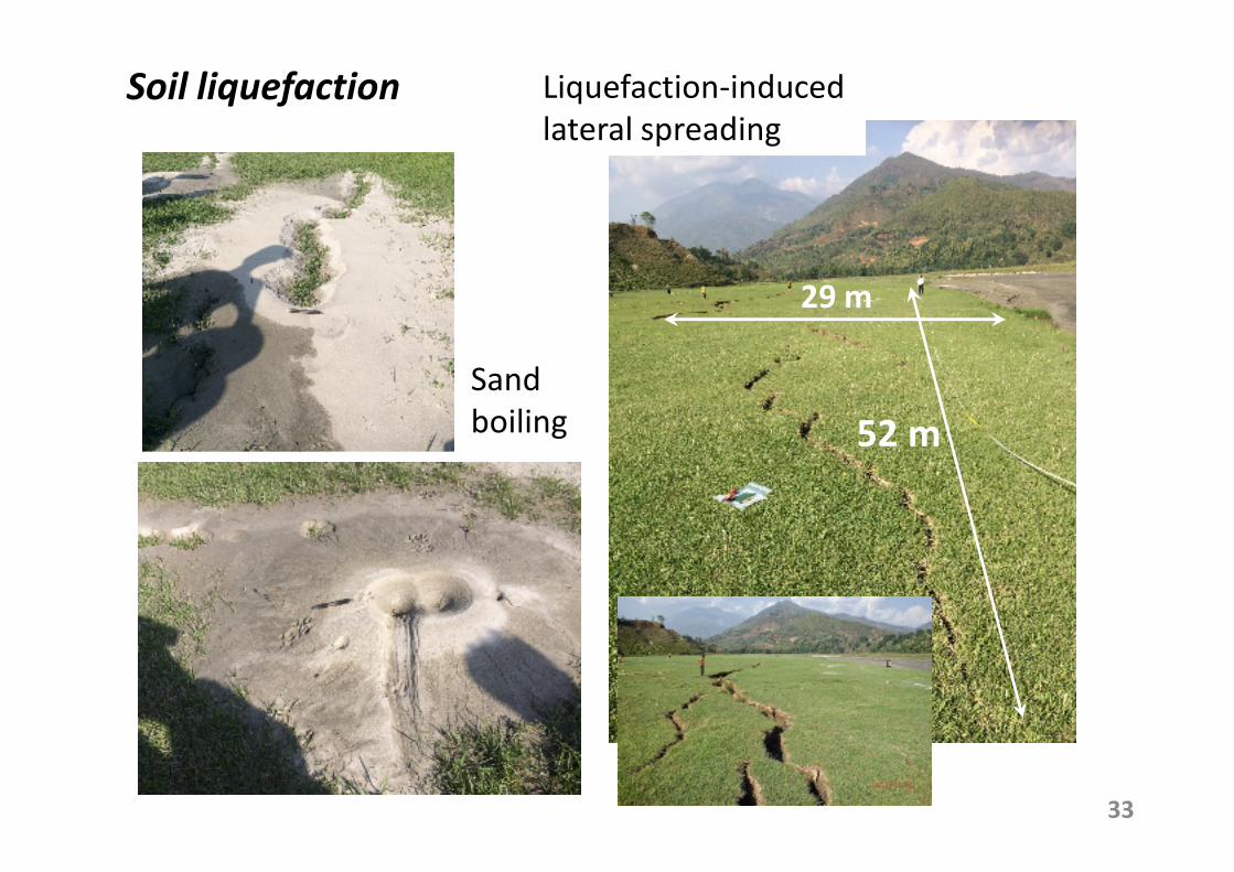
33
29 m
52 m
Liquefaction-induced
lateral spreading
Soil liquefaction
34
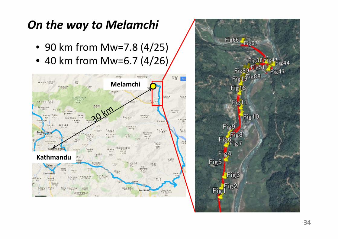
On the way to Melamchi
Melamchi
Kathmandu
• 90 km from Mw=7.8 (4/25)
• 40 km from Mw=6.7 (4/26)
35
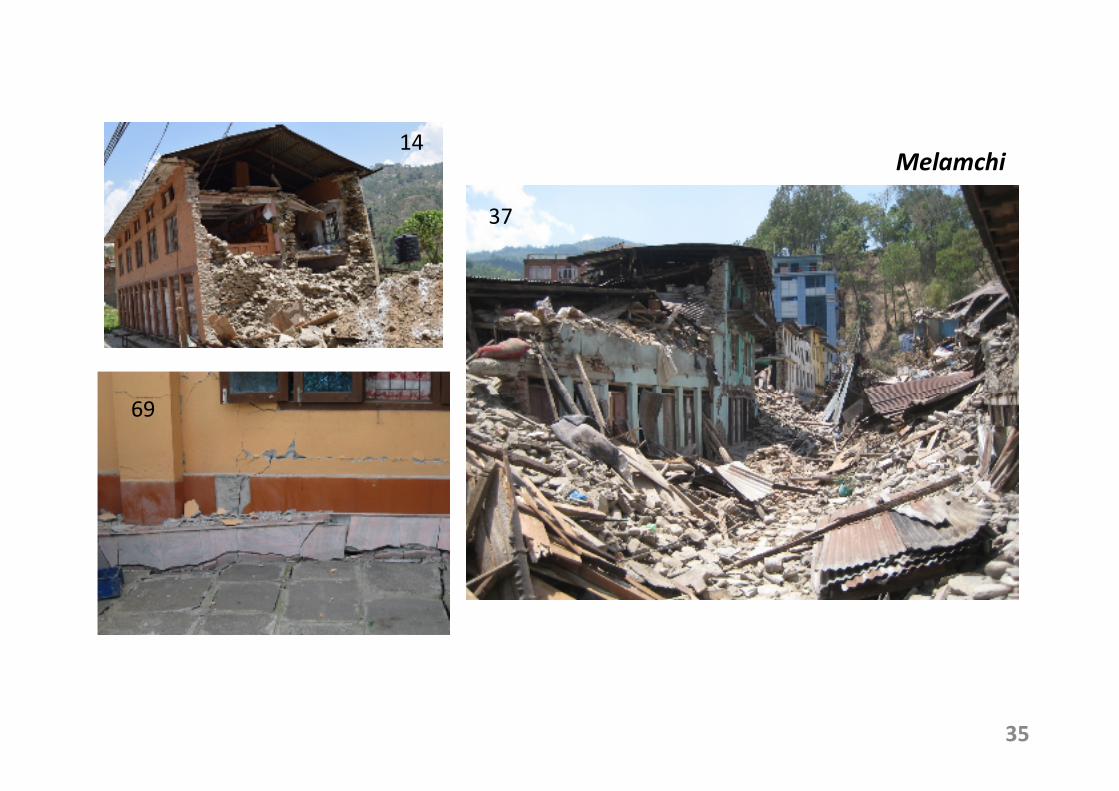
14
69
37
Melamchi
36
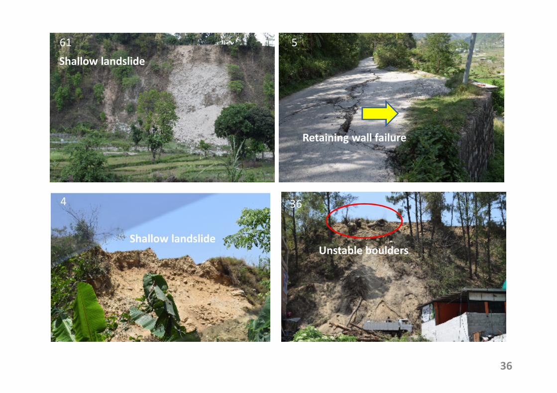
61
36
5
4
Retaining wall failure
Shallow landslide
Unstable bouldersShallow landslide
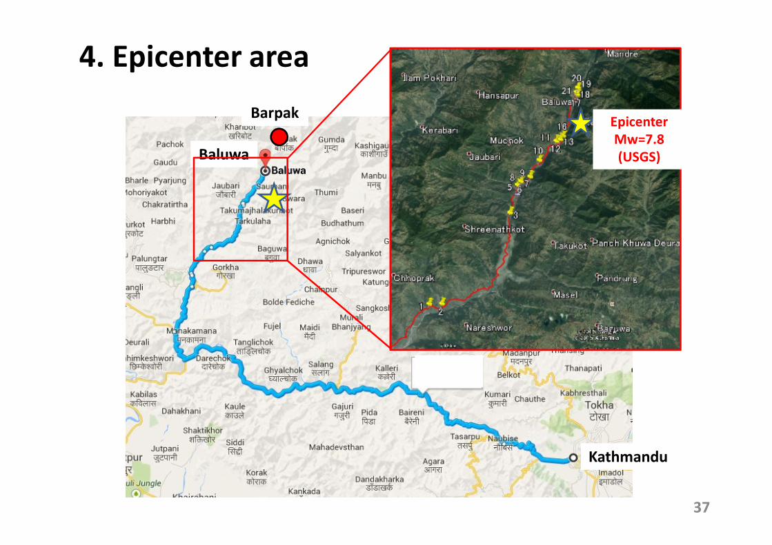
4. Epicenter area
37
Baluwa
Kathmandu
BarpakEpicenter
Mw=7.8
(USGS)
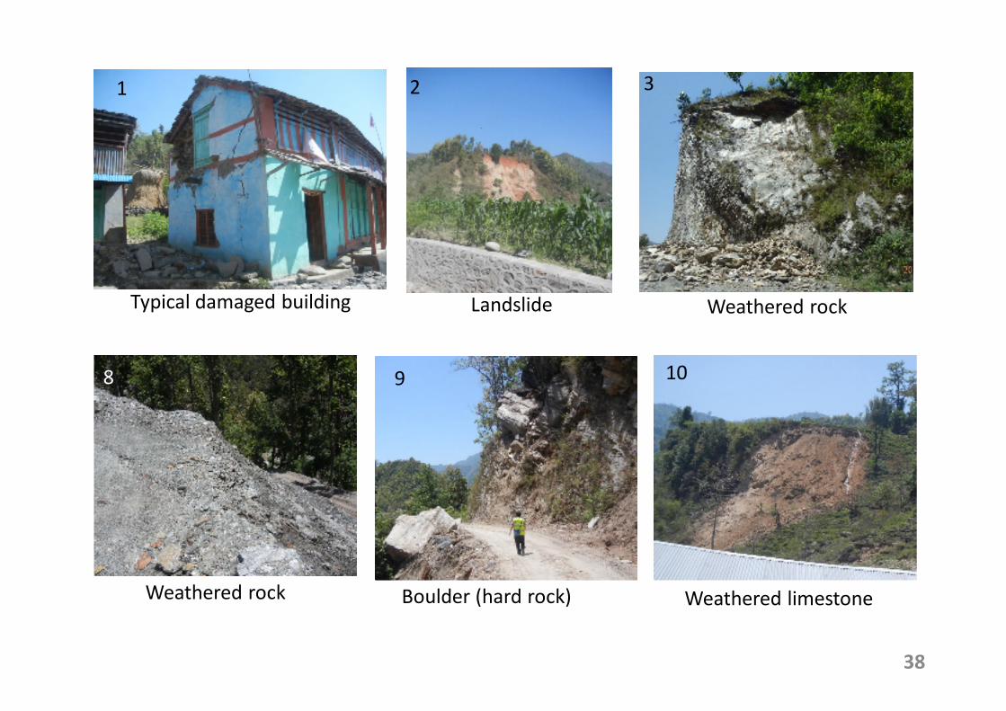
38
1 2 3
8 9 10
Weathered rock Boulder (hard rock) Weathered limestone
Weathered rockLandslideTypical damaged building
39
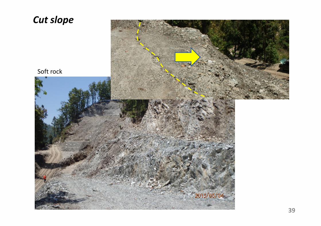
Cut slope
Soft rock
40
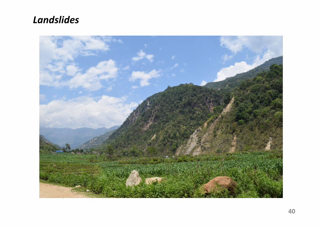
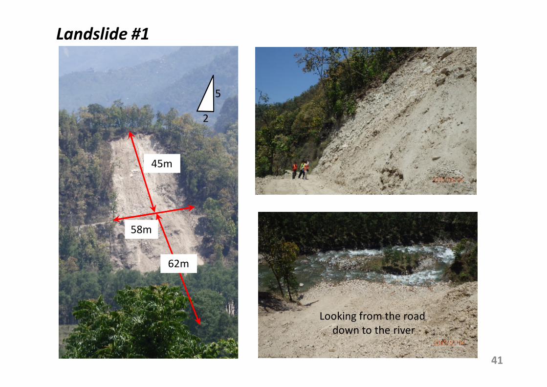
Landslides
41
Landslide #1
45m
58m
62m
Looking from the road
down to the river
5
2
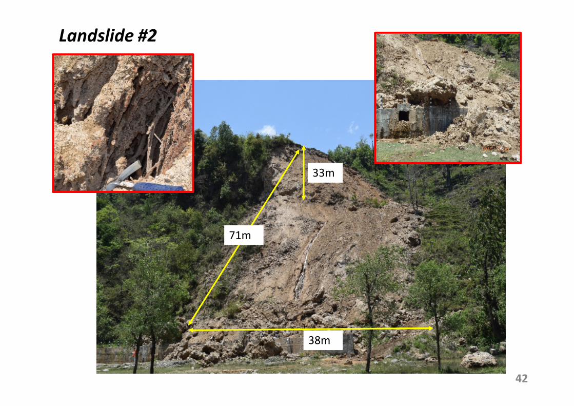
42
33m
71m
38m
Landslide #2
Baluwa
Jholunge
Da
rau
da
Kh
ola
Riv
er
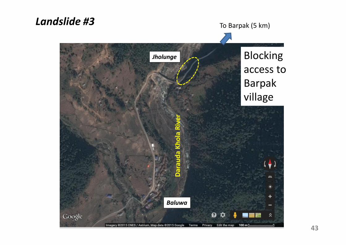
43
Landslide #3
Blocking
access to
Barpak
village
To Barpak (5 km)
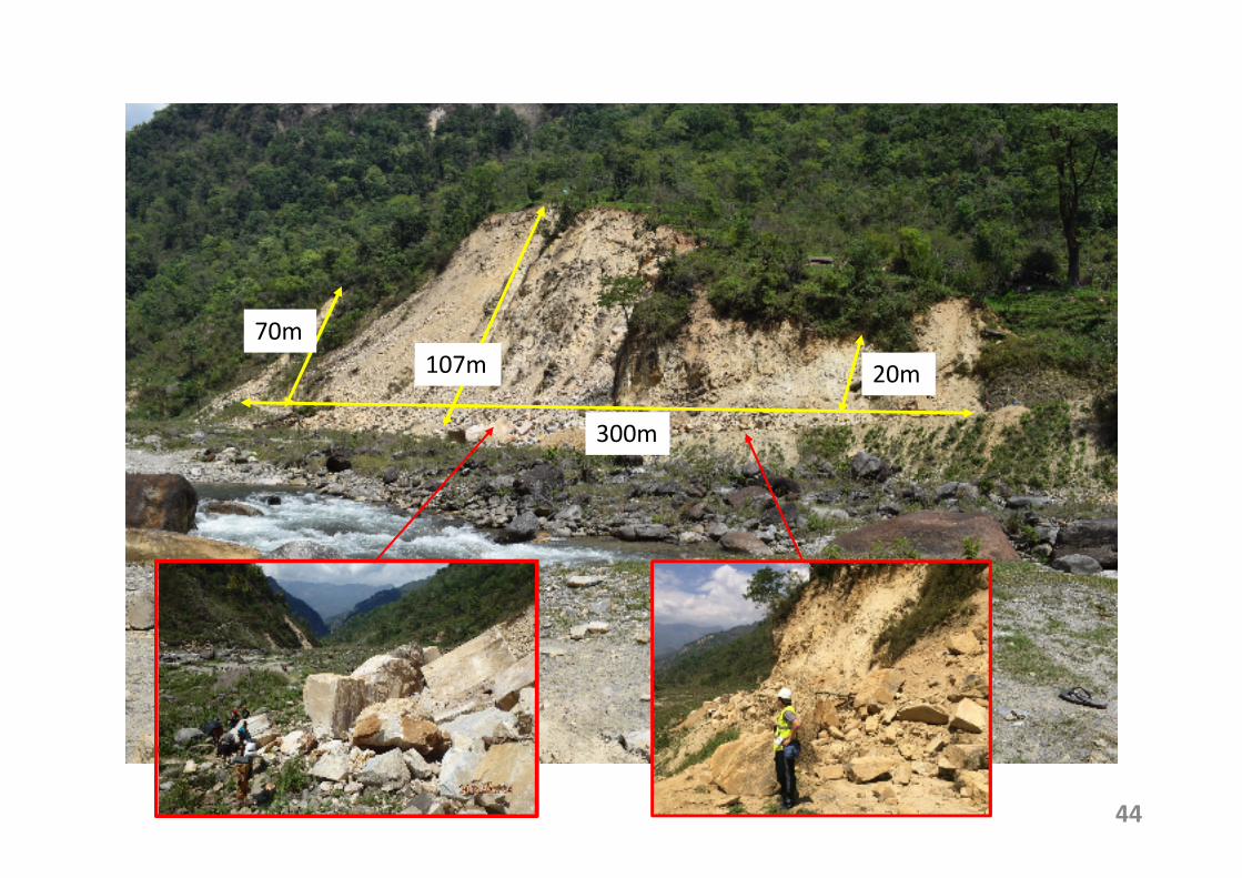
44
107m
300m
70m
20m
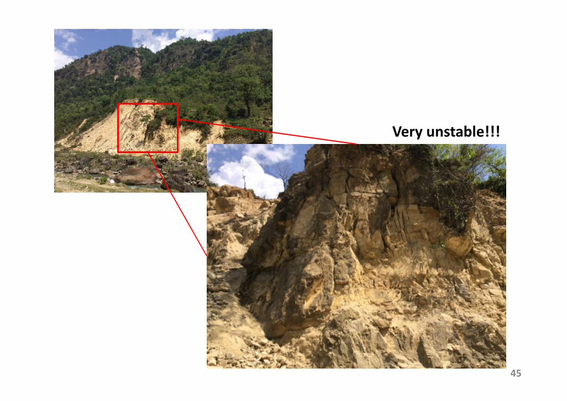
45
Very unstable!!!
46
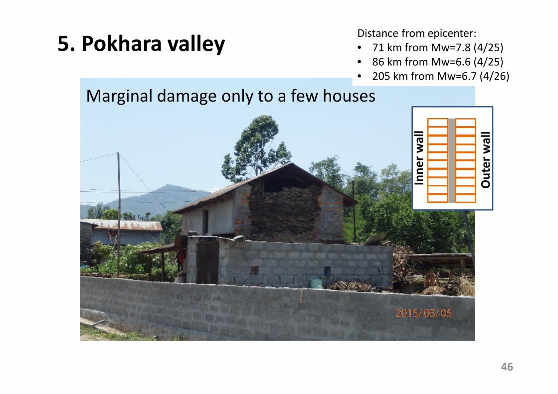
5. Pokhara valley
Marginal damage only to a few houses
Distance from epicenter:
• 71 km from Mw=7.8 (4/25)
• 86 km from Mw=6.6 (4/25)
• 205 km from Mw=6.7 (4/26)
Inn
er
wa
ll
Ou
ter
wa
ll
47
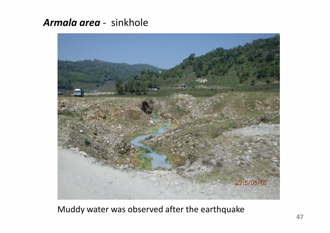
Armala area - sinkhole
Muddy water was observed after the earthquake
48
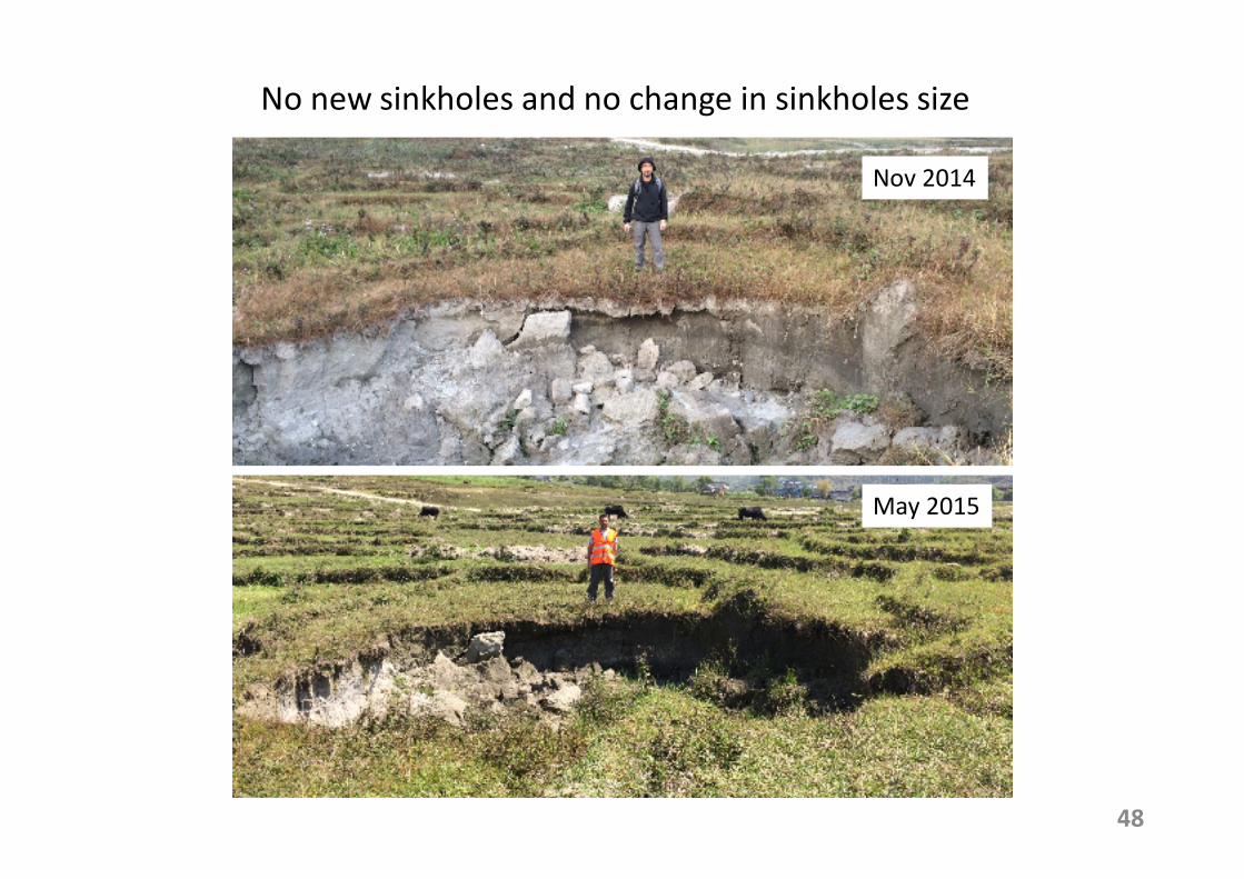
No new sinkholes and no change in sinkholes size
Nov 2014
May 2015
49
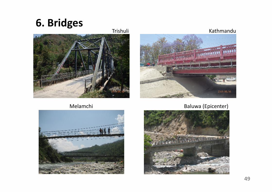
6. Bridges Trishuli Kathmandu
Baluwa (Epicenter)Melamchi
50
7. Summary
• Survey damage was conducted in Kathmandu city, Trishuli, Melamchi, Epicenter area and Pokhara city
• In Kathmandu city, most of structural damage was observed in the city center (heritage buildings and old masonry houses) and in the north-west area along the ring road (non-engineered RC building, loss of bearing capacity of soft soils)
• Ground failure induced the settlement of an embankment along the Araniko Highway, sinking and tilting of a number of RC buildings
51
• In Trishuli, liquefaction was observed. However, most significantly, cracks along the upstream side of the earth dam are of concern
• In Melamchi, damage to houses and landslides were widely observed (close to Mw=6.7 epicenter of 4/26)
• In the epicenter area, many villages were completely devastated and a number of landslides could be observed
• In Pokhara valley, only minor damage to houses were observed. In Armala area, no new sinkholes were formed
• No damage to bridges was observed during the survey
52
8. Concluding remarks
• House inspection should be done as early as possible
• Inspection of the landslide area is also important because damaged rocks as well as large cracks still remain on the slope. Survived slopes could have further damage (aftershocks/during rainy season )
• We couldn’t reach the mountain area where a natural landslide dam is reported. Need helicopter or long trekking
• The damage to the roads and buildings in the Kathmandu valley would be linked with ground condition
• Damage distribution in the fault area corresponds well with the characteristics of the earthquake (i.e. heavy damage in the east area while no damage in east (and south) area from the epicenter

53
Thank you very much
for your kind attention!
Acknowledgement
Pokhrel P. (Tribhuvan University, Nepal)Kato, Y. (NHK)Hirano, M. and Kaneko, J. (The Mainichi Newspapers)