PP7 - Monitoring land surfaces at SAFE using field and remote sensing data
7
Monitoring land surfaces at SAFE using field and remote sensing data Workshop, Science@SAFE 2014 Marion Pfeifer 1 , Robert Ewers 1
Transcript of PP7 - Monitoring land surfaces at SAFE using field and remote sensing data
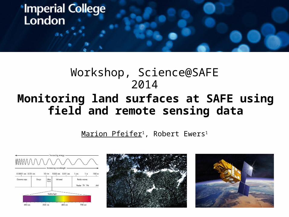
Monitoring land surfaces at SAFE using field and remote sensing data
Workshop, Science@SAFE 2014
Marion Pfeifer1, Robert Ewers1

Earth Observation At SAFE
Schedule for course:
Remotely sensed data currently available SlidesDetails on these data: structure, temporal, spatial coverage
Lab
Processing of the data SlidesHow we use the data at F.E.C. and what maps we produce
Slides + Lab
Vero’s forest quality metric SlidesRemotely sensed data and maps in the future Slides +
LabOnline accessible satellite products for land surface analyses
Slides
Question time: in and between
Earth Observation At SAFE EO of land surfaces
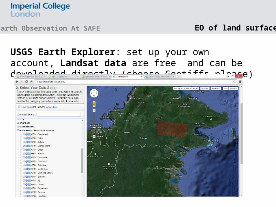
USGS Earth Explorer: set up your own account, Landsat data are free and can be downloaded directly (choose Geotiffs please)

Earth Observation At SAFE EO of land surfaces
REVERB ECHO NASA: set up your own account, MODIS Products e.g. land cover (MDC12Q1; 500m), NDVI and EVI (MOD13 and MYD13, 250 m), Active Fire (MOD14, MYD14, 1km), Burned Area (MCD45, 500m), ASTER GDEM (30 m)

Earth Observation At SAFE EO of land surfaces
Global Forest Change Maps (Hansen et al. 2013): http://www.earthenginepartners.appspot.com/science-2013-global-forest/download.html
Use with caution
Landsat derived as well: new Chinese land cover maphttp://glc30.tianditu.com/
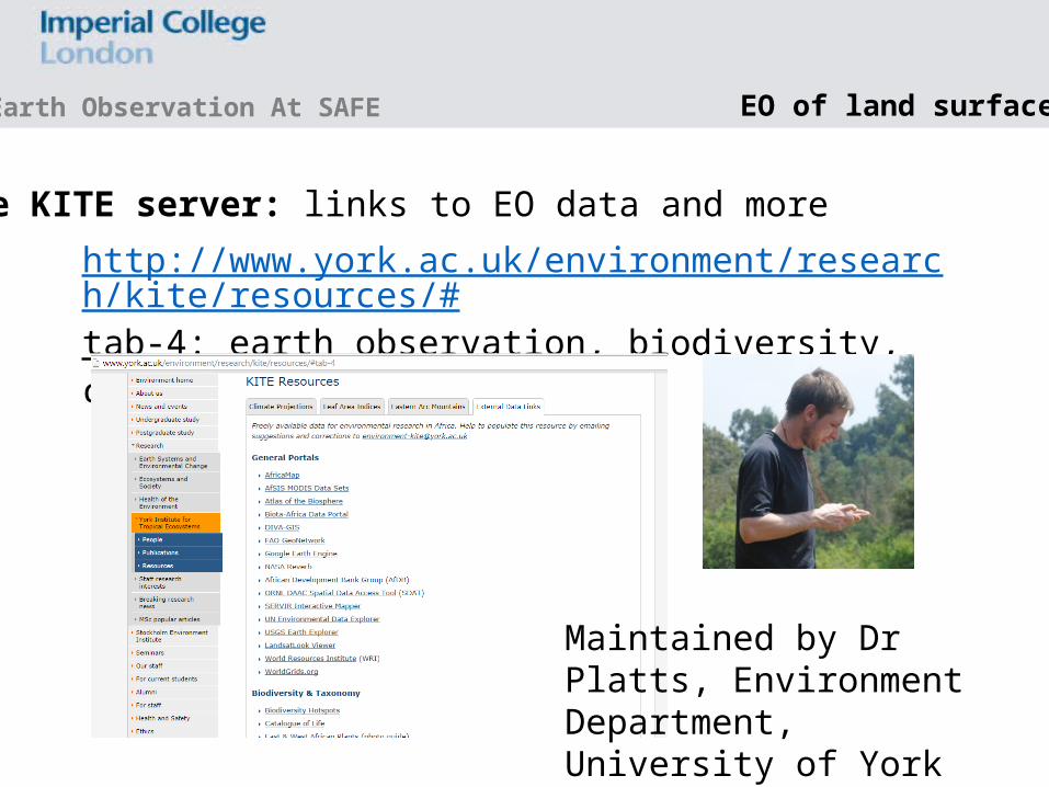
http://www.york.ac.uk/environment/research/kite/resources/#tab-4: earth observation, biodiversity, climate, people…….
Maintained by Dr Platts, Environment Department, University of York
Earth Observation At SAFE EO of land surfaces
The KITE server: links to EO data and more

Thank you
Funding ERC, Sime Darby Foundation, European Space Agency
Earth Observation At SAFE