POTENTIAL HYDROCARBON OF JAMBI SUB-BASIN IN ...
21
Ministry of Energy & Mineral Resources of the Republic of Indonesia POTENTIAL HYDROCARBON OF JAMBI SUB-BASIN IN SOUTH SUMATRA BASIN CHONG QING, 12 JULY 2018
-
Upload
khangminh22 -
Category
Documents
-
view
3 -
download
0
Transcript of POTENTIAL HYDROCARBON OF JAMBI SUB-BASIN IN ...

Ministry of Energy & Mineral Resources of the Republic of Indonesia
POTENTIAL HYDROCARBON OF JAMBI SUB-BASIN IN SOUTH SUMATRA BASIN
CHONG QING, 12 JULY 2018
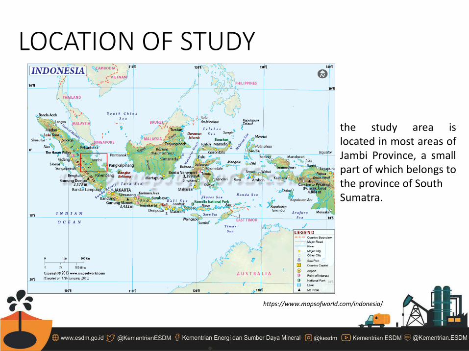
LOCATION OF STUDY
https://www.mapsofworld.com/indonesia/
the study area is located in most areas of Jambi Province, a small part of which belongs to the province of South Sumatra.

GEOLOGICAL REVIEW
Regional Tectonic Setting of Sumatra (Darman, 2000) Internal Report of PT. PERTAMINA EP Asset 2, 2013)
Target Area
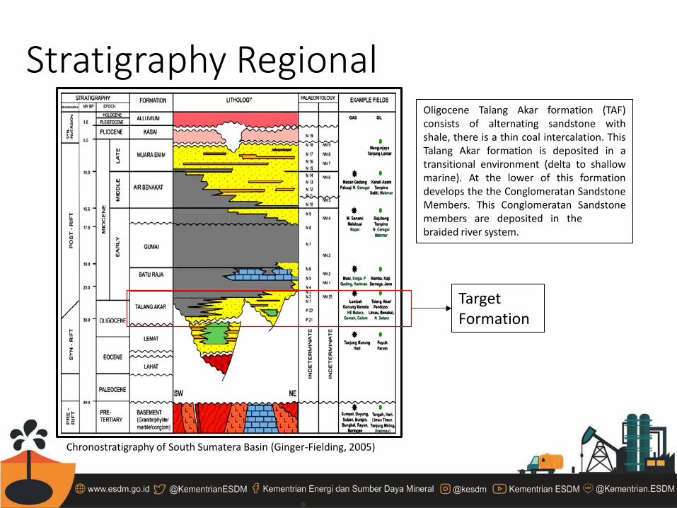
Stratigraphy Regional
Chronostratigraphy of South Sumatera Basin (Ginger-Fielding, 2005)
Target Formation
Oligocene Talang Akar formation (TAF) consists of alternating sandstone with shale, there is a thin coal intercalation. This Talang Akar formation is deposited in a transitional environment (delta to shallow marine). At the lower of this formation develops the the Conglomeratan Sandstone Members. This Conglomeratan Sandstone members are deposited in the braided river system.
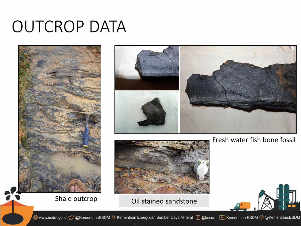
OUTCROP DATA
Shale outcrop
Fresh water fish bone fossil
Oil stained sandstone
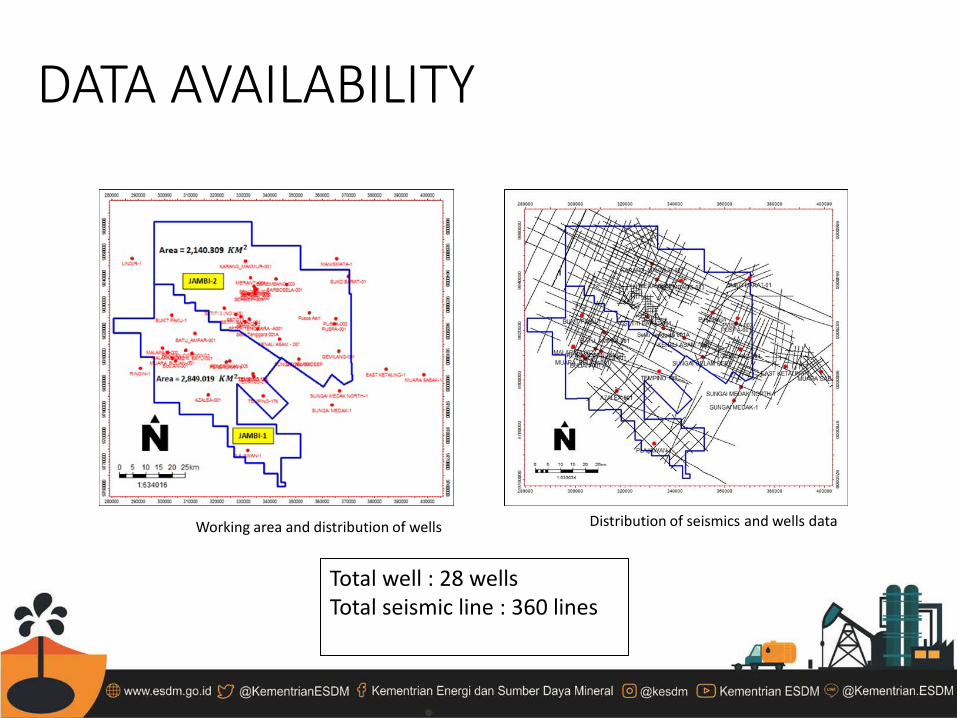
DATA AVAILABILITY
Working area and distribution of wells Distribution of seismics and wells data
Total well : 28 wells Total seismic line : 360 lines
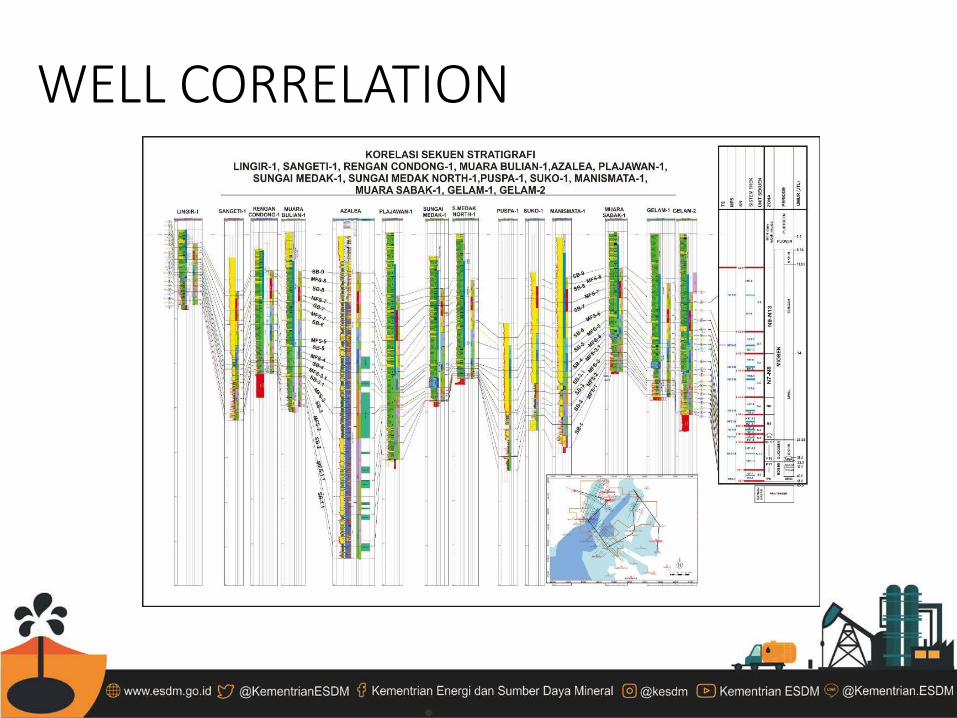
WELL CORRELATION
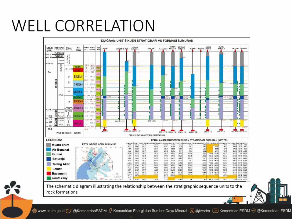
WELL CORRELATION
The schematic diagram illustrating the relationship between the stratigraphic sequence units to the rock formations
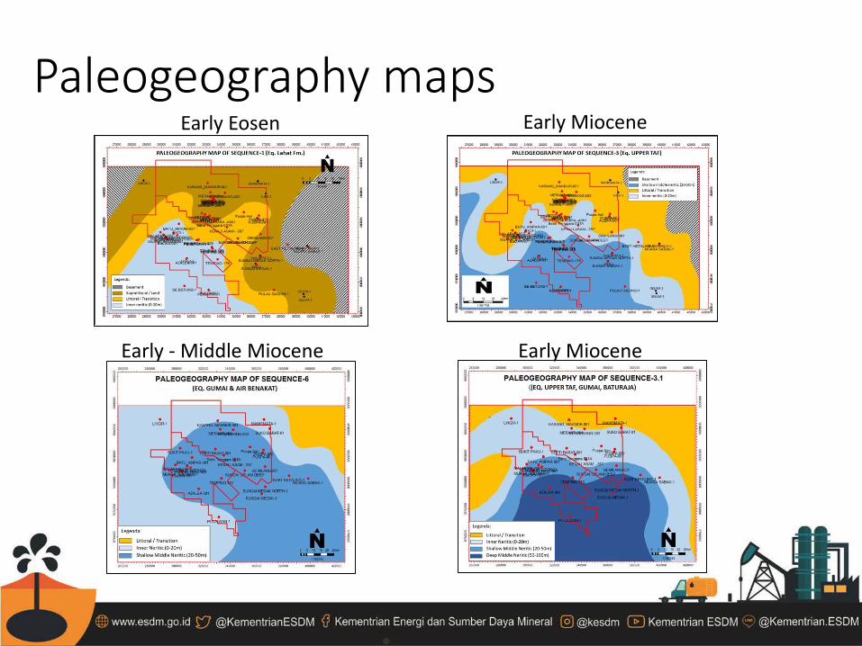
Paleogeography maps Early Eosen Early Miocene
Early Miocene Early - Middle Miocene

SEISMIC INTERPRETATION
One of key line seismics (90JM-18), this line is located not far from the southeast of Jambi-II area.
SEISMIC INTERPRETATION
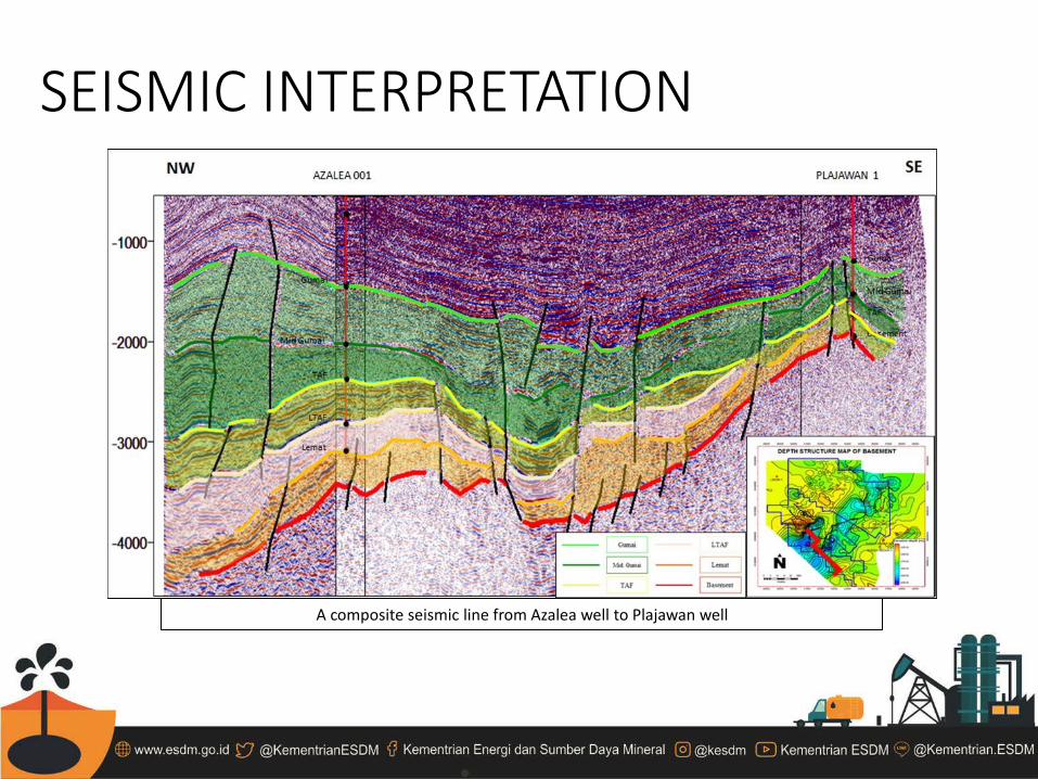
A composite seismic line from Azalea well to Plajawan well
SEISMIC INTERPRETATION
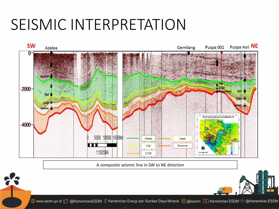
A composite seismic line in SW to NE direction

STRUCTURE MAPS
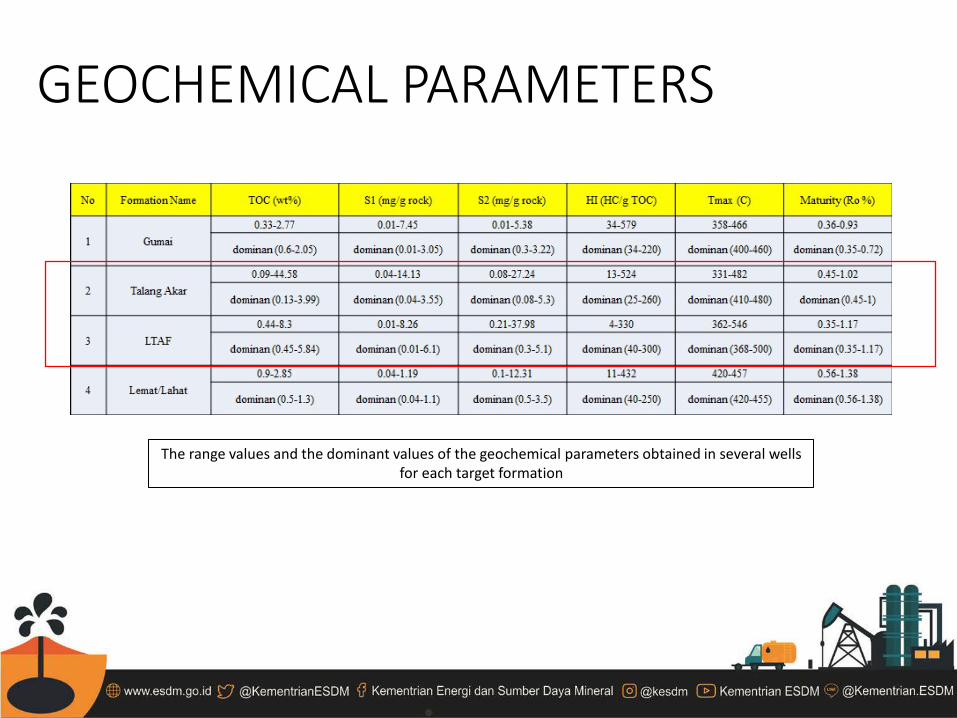
GEOCHEMICAL PARAMETERS
The range values and the dominant values of the geochemical parameters obtained in several wells for each target formation
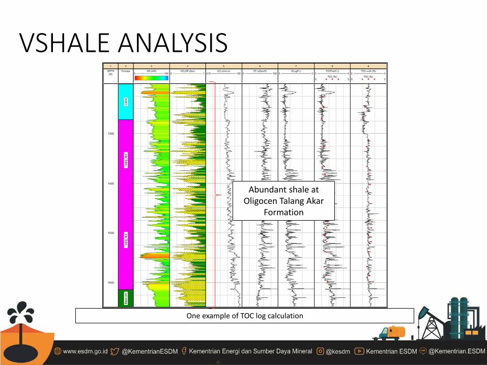
VSHALE ANALYSIS
One example of TOC log calculation
Abundant shale at Oligocen Talang Akar
Formation

VSHALE AND TOC DISTRIBUTION
Vshale Distribution Map of Upper TAF TOC Distribution Map of Upper TAF
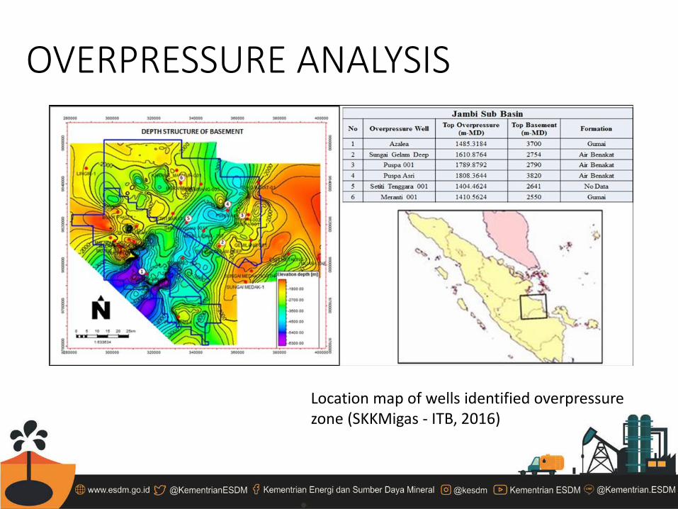
OVERPRESSURE ANALYSIS
Location map of wells identified overpressure zone (SKKMigas - ITB, 2016)

PETROPHYSICAL ANALYSIS
Summary of petrophysical analysis
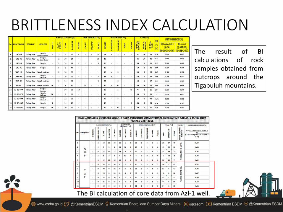
BRITTLENESS INDEX CALCULATION The result of BI calculations of rock samples obtained from outcrops around the Tigapuluh mountains.
The BI calculation of core data from Azl-1 well.
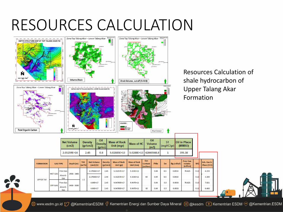
RESOURCES CALCULATION
Resources Calculation of shale hydrocarbon of Upper Talang Akar Formation
THANK YOU

![Synthesis and Characterization of LiFePO[sub 4] and LiTi[sub 0.01]Fe[sub 0.99]PO[sub 4] Cathode Materials](https://static.fdokumen.com/doc/165x107/631dae063dc6529d5d079742/synthesis-and-characterization-of-lifeposub-4-and-litisub-001fesub-099posub.jpg)