PHASE I INITIAL SITE ASSESSMENT - City of Newport Beach
418
PHASE I INITIAL SITE ASSESSMENT PARK AVENUE BRIDGE REPLACEMENT PROJECT COUNTY OF ORANGE, CALIFORNIA Federal Project No. BRLO-5151(026) Prepared in General Accordance with: ASTM E 1527-13 Standard Practice for Environmental Site Assessments For: City of Newport Beach 100 Civic Center Drive Newport Beach, CA 92660 and CALIFORNIA DEPARTMENT OF TRANSPORTATION-DISTRICT 12 3347 Michelson Drive Irvine, CA 92612 By: RBF Consulting A Company of Michael Baker Corporation 14725 Alton Parkway Irvine, California 92618 Contact: Kristen Bogue 949-855-5747 July 2014 (Revisal of May 2014) JN 130307
-
Upload
khangminh22 -
Category
Documents
-
view
1 -
download
0
Transcript of PHASE I INITIAL SITE ASSESSMENT - City of Newport Beach

PHASE I
INITIAL SITE ASSESSMENT
PARK AVENUE BRIDGE REPLACEMENT PROJECT COUNTY OF ORANGE, CALIFORNIA
Federal Project No. BRLO-5151(026)
Prepared in General Accordance with: ASTM E 1527-13 Standard Practice for Environmental Site Assessments
For:
City of Newport Beach 100 Civic Center Drive
Newport Beach, CA 92660
and
CALIFORNIA DEPARTMENT OF TRANSPORTATION-DISTRICT 12 3347 Michelson Drive
Irvine, CA 92612
By:
RBF Consulting A Company of Michael Baker Corporation
14725 Alton Parkway Irvine, California 92618 Contact: Kristen Bogue
949-855-5747
July 2014 (Revisal of May 2014)
JN 130307

July 23, 2014 130307 CITY OF NEWPORT BEACH 100 Civic Center Drive Newport Beach, CA 92660 CALIFORNIA DEPARTMENT OF TRANSPORTATION-DISTRICT 12 3347 Michelson Drive Irvine, CA 92612 SUBJECT: Phase I Initial Site Assessment for the Park Avenue Bridge Replacement
Project located in the City of Newport Beach, California To Whom It May Concern: RBF Consulting (RBF) is pleased to submit this Phase I Initial Site Assessment (ISA) for the above referenced project, herein referenced as the “subject site.” The goal of this Phase I ISA is to identify recognized environmental conditions (RECs) associated with the subject site. This Phase I ISA has been prepared for the sole use of the City of Newport Beach and the California Department of Transportation-District 12 for the above-referenced subject site. Neither this Phase I ISA, nor any of the information contained herein, shall be used or relied upon for any purpose by any person or entity other than the City of Newport Beach and the California Department of Transportation-District 12. The Phase I ISA was prepared using methods consistent with the ASTM International (ASTM) E 1527-13 Standard Practice for Environmental Site Assessments, the California Department of Transportation’s Standard Environmental Reference (SER), the scope of services, and inherent limitations presented in our proposal. The Phase I ISA is not intended to present specific quantitative information as to the actual presence of hazardous substances on or adjacent to the subject site, but is to identify RECs based on available information. Should you or your staff have any questions or concerns after reviewing the enclosed report, please do not hesitate to contact me at 949/855-5747. Sincerely, Kristen Bogue Environmental Professional Planning/Environmental Services

STATEMENT OF ENVIRONMENTAL PROFESSIONAL I [We] declare that, to the best of my [our] professional knowledge and belief, I[we] meet the definition of Environmental Professional as defined in §312.10 of Title 40, Code of Federal Regulations (CFR) 312 and I[we] have the specific qualifications based on education, training, and experience to assess a property of the nature, history, and setting of the subject property. I[we] have developed and performed all appropriate inquiries in conformance with the standards and practices set forth in 40 CFR Part 312. ____________________________________ Signature of RBF Environmental Professional Kristen Bogue

Table of Contents
Park Avenue Bridge Replacement Project Phase I ISA | i
TABLE OF CONTENTS Executive Summary .............................................................................................................................. E-1 Section 1.0 Introduction .................................................................................................................. 1-1 1.1 Project Description ........................................................................................... 1-1 1.2 Purpose of the ISA ......................................................................................... 1-11 1.3 Detailed Scope of Services ............................................................................ 1-11
1.4 Significant Assumptions ............................................................................... 1-12 1.5 Limitations, Deviations, and Exceptions .................................................... 1-12 1.6 User Responsibilities ..................................................................................... 1-13 1.7 Special Terms and Conditions ..................................................................... 1-16 1.8 User Reliance .................................................................................................. 1-16
Section 2.0 User Provided Information ........................................................................................ 2-1 2.1 Previous Documents ........................................................................................ 2-1 2.2 Litigation/Administrative Proceedings ....................................................... 2-2 2.3 Governmental Notices..................................................................................... 2-2 2.4 Environmental Liens ....................................................................................... 2-2 2.5 Activity and Use Limitations ......................................................................... 2-2 2.6 Specialized Knowledge or Experience .......................................................... 2-2 2.7 Commonly Known or Reasonably Ascertainable Information ................. 2-2 2.8 Valuation Reduction for Environmental Issues ........................................... 2-2 2.9 Degree of Obviousness .................................................................................... 2-3 2.10 Reason for Performing Phase I ....................................................................... 2-3 Section 3.0 Records Review ............................................................................................................ 3-1 3.1 Physical Setting Sources .................................................................................. 3-1 3.2 Standard Environmental Records Sources ................................................... 3-5 3.3 File Record Reviews ........................................................................................ 3-8 3.4 Historical Use Information on the Subject Site and Adjoining Properties ............................................... 3-8 Section 4.0 Site Reconnaissance .................................................................................................... 4-1 4.1 Methodology and Limiting Conditions ........................................................ 4-1 4.2 On-Site Observations ....................................................................................... 4-1 4.3 Off-Site Observations ...................................................................................... 4-5

Table of Contents
Park Avenue Bridge Replacement Project Phase I ISA | ii
Section 5.0 Interviews ...................................................................................................................... 5-1 5.1 Property Owner ............................................................................................... 5-1 5.2 Key Site Manager/Operator ........................................................................... 5-1 5.3 Occupants.......................................................................................................... 5-1 5.4 Local Government Officials ............................................................................ 5-2 5.5 Other Persons ................................................................................................... 5-2 Section 6.0 Evaluation ...................................................................................................................... 6-1 6.1 Findings and Opinions .................................................................................... 6-1 6.2 Conclusions ....................................................................................................... 6-6 6.3 Recommendations ........................................................................................... 6-6 6.4 Limiting Conditions/Deviations ................................................................... 6-7 Section 7.0 References ..................................................................................................................... 7-1 List of Exhibits 1. Regional Vicinity .............................................................................................. 1-2 2. Site Vicinity ....................................................................................................... 1-3 3. Subject Site ........................................................................................................ 1-4 4. Park Avenue Bridge Site Plan ........................................................................ 1-7 5. Balboa Avenue Temporary Bridge Option ................................................ 1-10 6. Overview Map .................................................................................................. 3-6 7. On-Site Photographs ....................................................................................... 4-2 8. Off-Site Photographs ....................................................................................... 4-3 List of Tables E-1. Phase I ESA Findings, Opinions, and Conclusions .................................... E-2 1-1. Groundwater Plume Dimension Assumptions ......................................... 1-12 3-1. Database Summaries ....................................................................................... 3-7 3-2. Historical Uses Summary ............................................................................. 3-11 Appendices Appendix A: ASTM Terminology Appendix B: Database Records Searches Appendix C: Documentation Appendix D: ISA Checklist

Acronyms
Park Avenue Bridge Replacement Project Phase I ISA | iii
LIST OF ACRONYMS ACM Asbestos Containing Materials APN Assessor’s Parcel Number AST Aboveground Storage Tank ATSDR Agency for Toxic Substances and Disease Registry AULs Activity and Use Limitations CERCLIS Comprehensive Environmental Response, Compensation, and Liability
Information System (maintained by the Environmental Protection Agency) CFR Code of Federal Regulations CORRACTS facilities subject to Corrective Action under RCRA CPSC United States Consumer Product Safety Commission DDD Dichlorodiphenyldichloroethane DDE Dichlorodiphenyldichloroethylene DDT Dichlorodiphenyltrichloroethane DOGGR California Department of Oil, Gas, and Geothermal Resources DPH County of Fresno Department of Public Health DTSC Department of Toxic Substances Control EDR Environmental Data Resources EPA United States Environmental Protection Agency EPCRA Emergency Planning and Community Right to Know Act (also known as SARA
Title III), 42 U.S.C. §§11001-11050 et seq.) ERNS emergency response notification system FOIA U.S. Freedom of Information Act (5 U.S.C. §552 as amended by Public Law No.
104-231, 110 Stat.) FR Federal Register HREC Historical Recognized Environmental Condition ICs Institutional Controls ISA Initial Site Assessment LBP Lead Based Paints LUFT Leaking Underground Fuel Tank LUST Leaking Underground Storage Tank MSDS Material Safety Data Sheet msl Mean sea level NCP National Contingency Plan NFRAP former CERCLIS sites where no further remedial action is planned under
CERCLA

Acronyms
Park Avenue Bridge Replacement Project Phase I ISA | iv
NPDES National Pollutant Discharge Elimination System NPL National Priorities List PCBs Polychlorinated Biphenyls REC Recognized Environmental Condition RCRA Resource Conservation and Recovery Act (as amended, 42 U.S.C. §§6901 et seq.) RWQCB Regional Water Quality Control Board SBBM San Bernardino Base and Meridian SCS Soil Conservation Service TPH Total Petroleum Hydrocarbons TRI Toxics Release Inventory TSDF hazardous waste treatment, storage, or disposal facility USDA United States Department of Agriculture USGS United States Geological Survey UST Underground Storage Tank

Park Avenue Bridge Replacement Project Phase I ISA | E-1
EXECUTIVE SUMMARY The proposed Park Avenue Bridge Replacement Project is located at the existing Park Avenue bridge (over the Grand Canal) and the vicinity of the Balboa Avenue and the Grand Canal (herein referenced as the “subject site”), within the City of Newport Beach (City), Orange County, State of California (Section 35, Range 10 West [R.10W], Township 6 South [T.6S], San Bernardino Base and Meridian [SBBM]). Overall, the subject site is situated within a developed area of the southern portion of the City. Specifically, the subject site consists of a bridge structure, transportation uses and associated public right-of-way (ROW), and the Grand Canal. No new areas of ROW are required. Currently, the Park Avenue Bridge is the only connection between Balboa Island and Little Balboa Island, traversing over the Grand Canal in an east-west direction. The optional Temporary Bridge site is bounded by the Grand Canal to the north and south and Balboa Avenue to the east and west. Both bridge sites are further surrounded by single-family residential uses in all directions. Commercial uses are present along Marine Avenue. This ISA was conducted in accordance with the ASTM International (ASTM) E 1527-13 Standard Practice for Environmental Site Assessments (Standard Practice) and satisfies the requirements of 40 Code of Federal Regulations (CFR) Part 312 titled Standards and Practices for All Appropriate Inquiries, as required under Section 101(35)(B)(ii) and (iii) of the Comprehensive Environmental Response, Compensation, and Liability Act (CERCLA). The purpose of conducting this Phase I ISA is to identify Recognized Environmental Conditions (RECs). FINDINGS AND OPINIONS RBF Consulting’s (RBF’s) findings and opinions are based upon a review of reasonably ascertainable referenced material available during the preparation of this Phase I ISA, which included a review of historical aerial photographs, historical topographic maps, regulatory databases, and other documentation, as well as interviews and site reconnaissance. Table E-1, Phase I ISA Findings, Opinions, and Conclusions, summarizes RBF’s findings, opinions, and conclusions made during the preparation of this Phase I ISA.

Executive Summary
Park Avenue Bridge Replacement Project Phase I ISA | E-2
Table E-1 Phase I ISA Findings, Opinions, and Conclusions
Finding Opinion Conclusion1
Current On-Site Uses
Bridge Structures (Asbestos-Containing Materials)
As ACMs are commonly known to be used in building materials for bridge structures, ACMs may be present in the on-site bridge structures (constructed prior to 1934). No visible evidence to suggest the release of ACMs into the environment was observed. Therefore, it is RBF’s opinion that the on-site bridge structure have not resulted in a REC on the subject site as a result of ACMs. Although RBF has determined that the on-site bridge structure has not resulted in a REC on the subject site as a result of ACMs, a recommendation for potential ACMs in the on-site bridge structure has been included in this ISA.
No REC
Bridge Structures (Lead-Based Paints)
As LBPs are commonly known to be used in building materials for bridge structures, LBPs may be present in the on-site bridge structure, which was constructed prior to 1934. No visible evidence to suggest the release of LBPs into the environment was observed. Therefore, it is RBF’s opinion that the on-site bridge structure has not resulted in a REC on the subject site as a result of LBPs. Although RBF has determined that the on-site bridge structure has not resulted in a REC on the subject site as a result of LBPs, a recommendation for potential LBPs in the on-site bridge structure has been included in this ISA.
No REC
Traffic Striping Material
LBPs were commonly used in traffic striping materials before the discontinued use of lead chromate pigment in traffic striping/marking materials and hot-melt thermoplastic stripe materials (discontinued in 1996 and 2004, respectively). RBF observed traffic striping within the boundaries of the subject site during the April 29, 2014 site visit. Thus, the potential for LBPs to be present on-site as a result of traffic striping is likely. As the on-site striping materials are currently contained, and no visible evidence to suggest the release of LBPs into the environment was observed during the site visit, it is RBF’s opinion that the likely presence of LBPs in traffic striping materials is not a REC at the time of this Phase I ISA. Although RBF has determined that the on-site striping materials have not resulted in an REC on the subject site as a result of LBPs, a recommendation for on-site traffic striping materials has been included in this ISA.
No REC
Transformers
Pole-mounted transformers and pad-mounted utility boxes were noted on-site during the April 29, 2014 site visit. No evidence of dielectric fluid or staining was noted on-site. It is the opinion of RBF that the on-site transformers and other electrical utilities have not resulted in an REC on the subject site. A recommendation has been included in this ISA in order to ensure safety concerns during construction with regard to potential PCBs in on-site transformers and other utilities.
No REC

Executive Summary
Park Avenue Bridge Replacement Project Phase I ISA | E-3
Table E-1 (continued) Phase I ISA Findings, Opinions, and Conclusions
Finding Opinion Conclusion1
Past On-Site Uses
Aerially Deposited Lead
Based on the low number of vehicles traveling through the subject site (a residential collector road) and developed nature of the surrounding area (mostly paved surfaces and the Grand Canal), it is the opinion of RBF that the potential for lead contamination to exist within exposed soils on-site due to aerially deposited lead is unlikely. It is RBF’s opinion that there is no REC on the subject site as a result of aerially deposited lead.
No REC
Current Adjoining Properties
Residential Uses
Based on available information reviewed as part of this Phase I ISA, current adjoining properties consist of residential uses. Based on the EDR database report, no known corrective action, restoration, or remediation has been planned, is currently taking place, or has been completed on any known adjoining properties. Adjoining properties do not appear to have been under investigation for violation of any environmental laws, regulations, or standards, as identified in the databases reported by EDR. Thus, it is the opinion of RBF that no REC has resulted from current adjoining properties.
No REC
Past Adjoining Uses
Residential Uses
Based on available documentation obtained and the April 29, 2014 site visit, off-site uses appear to have consisted of residential uses, similar to existing conditions. Based on the evidence of past uses associated with adjoining properties reviewed as part of this ISA, it is the opinion of RBF that no REC has resulted at the subject site as a result of adjoining past uses.
No REC
Current and Past Adjacent Uses
Drycleaner Facilities (Bayside Cleaners located at 1056 Bayside Drive)
This property is located approximately 1,000 feet (0.19-mile) and up-gradient to the northwest of the subject site and is listed in the SLIC, Orange Co. Industrial Site, and DRYCLEANERS databases. The site is reported SLIC released Tetrachloroethylene to soil. This case was reported closed on March 17, 1999. Based on Orange Co. Industrial Site database, closure certification was issued for a release of Perchloroethylene. According to EDR, this site has been used for dry cleaning and laundry services (except Coin Operated) since 1988. RBF contacted the Bayside Cleaners to obtain information regarding their cleaning method and whether they had chemical releases in the past. Based on the interview conducted with staff, cleaning activities are performed at this property and this facility has operated at this property for more than 30 years. Staff stated that they do not have any knowledge pertaining to whether or not a past chemical release has or did occur in association with this drycleaner facility. Based on their website, their operations recently switched to a new Ecolab laundry system, in which the detergents used are now biodegradable.
No REC
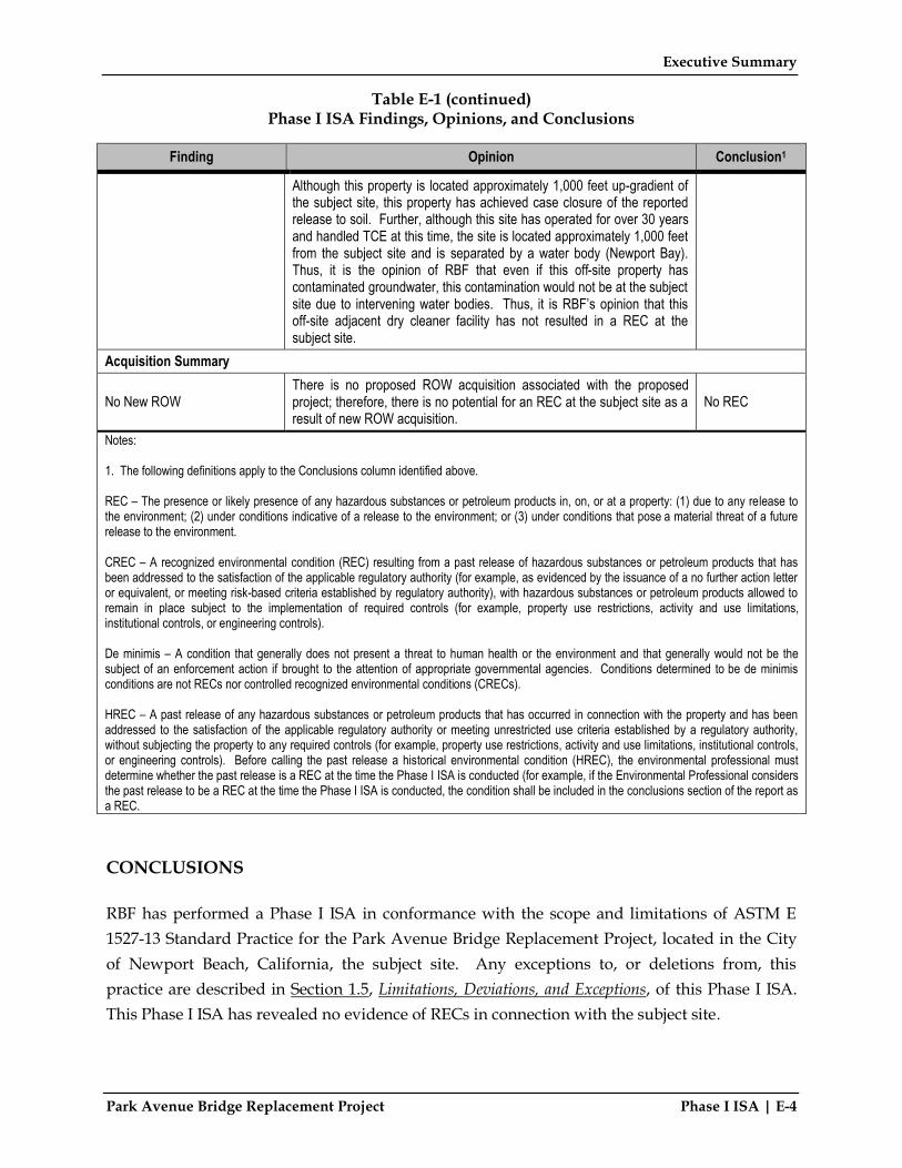
Executive Summary
Park Avenue Bridge Replacement Project Phase I ISA | E-4
Table E-1 (continued) Phase I ISA Findings, Opinions, and Conclusions
Finding Opinion Conclusion1
Although this property is located approximately 1,000 feet up-gradient of the subject site, this property has achieved case closure of the reported release to soil. Further, although this site has operated for over 30 years and handled TCE at this time, the site is located approximately 1,000 feet from the subject site and is separated by a water body (Newport Bay). Thus, it is the opinion of RBF that even if this off-site property has contaminated groundwater, this contamination would not be at the subject site due to intervening water bodies. Thus, it is RBF’s opinion that this off-site adjacent dry cleaner facility has not resulted in a REC at the subject site.
Acquisition Summary
No New ROW There is no proposed ROW acquisition associated with the proposed project; therefore, there is no potential for an REC at the subject site as a result of new ROW acquisition.
No REC
Notes: 1. The following definitions apply to the Conclusions column identified above. REC – The presence or likely presence of any hazardous substances or petroleum products in, on, or at a property: (1) due to any release to the environment; (2) under conditions indicative of a release to the environment; or (3) under conditions that pose a material threat of a future release to the environment. CREC – A recognized environmental condition (REC) resulting from a past release of hazardous substances or petroleum products that has been addressed to the satisfaction of the applicable regulatory authority (for example, as evidenced by the issuance of a no further action letter or equivalent, or meeting risk-based criteria established by regulatory authority), with hazardous substances or petroleum products allowed to remain in place subject to the implementation of required controls (for example, property use restrictions, activity and use limitations, institutional controls, or engineering controls). De minimis – A condition that generally does not present a threat to human health or the environment and that generally would not be the subject of an enforcement action if brought to the attention of appropriate governmental agencies. Conditions determined to be de minimis conditions are not RECs nor controlled recognized environmental conditions (CRECs). HREC – A past release of any hazardous substances or petroleum products that has occurred in connection with the property and has been addressed to the satisfaction of the applicable regulatory authority or meeting unrestricted use criteria established by a regulatory authority, without subjecting the property to any required controls (for example, property use restrictions, activity and use limitations, institutional controls, or engineering controls). Before calling the past release a historical environmental condition (HREC), the environmental professional must determine whether the past release is a REC at the time the Phase I ISA is conducted (for example, if the Environmental Professional considers the past release to be a REC at the time the Phase I ISA is conducted, the condition shall be included in the conclusions section of the report as a REC. CONCLUSIONS RBF has performed a Phase I ISA in conformance with the scope and limitations of ASTM E 1527-13 Standard Practice for the Park Avenue Bridge Replacement Project, located in the City of Newport Beach, California, the subject site. Any exceptions to, or deletions from, this practice are described in Section 1.5, Limitations, Deviations, and Exceptions, of this Phase I ISA. This Phase I ISA has revealed no evidence of RECs in connection with the subject site.

Executive Summary
Park Avenue Bridge Replacement Project Phase I ISA | E-5
RECOMMENDATIONS The following recommendations are based on the findings, opinions, and conclusions noted during the course of this ISA. It is the opinion of RBF Consulting that the following recommendations be implemented:
• If unknown wastes or suspect materials are discovered during construction by the contractor, which he/she believes may involve hazardous waste/materials, the contractor shall:
o Immediately stop work in the vicinity of the suspected contaminant, removing workers and the public from the area;
o Notify the Project Engineer of the implementing agency; o Secure the areas as directed by the Project Engineer; and o Notify the implementing agency’s Hazardous Waste/Materials Coordinator.
• Asbestos Containing Materials (On-Site Bridge Structure): Although RBF has
determined that the on-site structure has not resulted in a REC on the subject site as a result of potential ACMs, it is the opinion of RBF that when demolition/modification of the bridge structure occurs, asbestos testing should be conducted at the time of demolition/modification by a certified specialist retained by the City of Newport Beach and/or its consultant/contractor. If asbestos is present, the certified asbestos abatement specialist should monitor the disposal of the ACMs as they are uncovered.
• Lead-Based Paint (On-Site Bridge Structure): Although RBF has determined that the on-
site bridge structure has not resulted in a REC on the subject site as a result of LBPs, it is the opinion of RBF that when construction activities result in demolition or modification of the bridge structure, the generated waste should be disposed of at an appropriate, permitted disposal facility as determined by a lead specialist retained by the City of Newport Beach and/or its consultant/contractor. The City of Newport Beach and/or its consultant/contractor would be responsible for containing/transporting and properly disposing of the waste in accordance with the Federal, State, and local laws and regulations.
• Disturbance of Traffic Striping: Although RBF has determined that the on-site roadways
containing traffic striping have not resulted in an REC at the subject site as a result of LBPs, it is the opinion of RBF that should construction activities result in the disturbance of traffic striping materials, the generated wastes should be disposed of at an appropriate, permitted disposal facility as determined by a lead specialist retained by

Executive Summary
Park Avenue Bridge Replacement Project Phase I ISA | E-6
the City of Newport Beach and/or its consultant/contractor. The City of Newport Beach and/or its consultant/contractor would be responsible for containing/transporting and properly disposing of the waste in accordance with the Federal, State, and local laws and regulations.
• PCBs: Although RBF has determined that the on-site transformers and electrical utilities have not resulted in an REC on the subject site, it is RBF’s opinion that any transformer/electrical utilities to be relocated/removed during site construction/demolition should be conducted under the purview of the local purveyor, as coordinated by the City of Newport Beach and/or its consultant/contractor, to identify property-handling procedures regarding potential PCBs, if applicable.

Park Avenue Bridge Replacement Project Phase I ISA | 1-1
SECTION 1.0 INTRODUCTION The proposed Park Avenue Bridge Replacement Project is located at the existing Park Avenue bridge (over the Grand Canal) and the vicinity of the Balboa Avenue and the Grand Canal (herein referenced as the “subject site”), within the City of Newport Beach (City), Orange County, State of California (Section 35, Range 10 West [R.10W], Township 6 South [T.6S], San Bernardino Base and Meridian [SBBM]) (refer to Exhibit 1, Regional Vicinity). Overall, the subject site is situated within a developed area of the southern portion of the City (refer to Exhibit 2, Site Vicinity). Specifically, the subject site consists of a bridge structure, transportation uses and associated public right-of-way (ROW), and the Grand Canal (refer to Exhibit 3, Subject Site). No new areas of ROW are required. Currently, the Park Avenue Bridge is the only connection between Balboa Island and Little Balboa Island, traversing over the Grand Canal in an east-west direction. The optional Temporary Bridge site is bounded by the Grand Canal to the north and south and Balboa Avenue to the east and west. Both bridge sites are further surrounded by single-family residential uses in all directions. Commercial uses are present along Marine Avenue.
1.1 PROJECT DESCRIPTION
1.1.1 PURPOSE AND NEED The existing Park Avenue Bridge is over 80 years old and does not meet current bridge design and seismic safety standards. The City has identified structural and functional deficiencies with the bridge, such as severely deteriorated concrete in girders, pile caps, and piles. As such, through the California Department of Transportation (Caltrans) Sufficiency Rating process, Caltrans has identified the bridge as “functionally obsolete”. The proposed project would construct a new bridge meeting current engineering standards in order to enhance the safety of motorists, bicyclists, and pedestrians in the project area.

PA
CI F
I C O
CE
AN
O R A N G E
C O U N T Y
S A N D I E G O
C O U N T Y
R I V E R S I D E
C O U N T Y
S A N B E R N A R D I N O
C O U N T Y
L O S A N G E L E S
C O U N T Y
261
241
241
142
1
1
22
39
5
5
5
133
55
405
405
605
15
5
5791
72
91
71
90
74
73
IMPERIAL HWY.
EDINGER AVE.
W BALL ROAD
WARNER AVE.
CR
OW
N V
ALL
EY P
KWY.
EASTE
RN
TR
AN
S. C
OR
R.
WHITTIER BLVD.
BE
AC
H
BLV
D.
EL T
ORO
RD
.
CHAPMAN AVE.
MO
ULTO
N PRKY.
STR
EET
OF
TH
E
GO
LD
EN L
AN
TE
RN
JAM
BO
RE
E
RD.
MAC
AR
TH
UR
BLV
D.
OLD
N
EWPO
RT B
LV
D .
YORBA LINDA BLVD.
SAN JOAQUIN HILLS
TR
A N S. CORRIDOR
PR
OP
. FOO
THILL TR
AN
S. C
OR
RID
OR
HA
RB
OR
B
LVD
.
KATELLA AVE.
SANTIAGO CA
NYO
N RD.
IRVINE BLVD.
TRABUCO RD IRVINE CENTER DR
.
MA
RG
UER
ITE
PK
WY
MARGARITA
SANTA
PORTOLA
AN
TONI
O
PK
WY
LIVE
PORTOLA PKWY
UNIVERSITY DR
NewportBeach
SanClemente
SantaAna
Anaheim
Fullerton
LaHabra
Brea
Cypress
BuenaPark
YorbaLinda
VillaPark
AnaheimHills
Mission Viejo
LakeForest
LagunaBeach
DanaPoint
San JuanCapistrano
LagunaNiguel
Orange
HuntingtonBeach
CostaMesa
SealBeach
GardenGrove Tustin
Irvine
LosAlamitos
4/23/14 JN 130307-20157 MAS Exhibit 1
Regional Vicinitynot to scalePARK AVENUE BRIDGE REPLACEMENT PROJECT • PHASE I ISA
Subject Site
SubjectSite
SubjectSite

Exhibit 2
Site Vicinity0 2500'
APPROXIMATE
1
1
55
Subject Site Area
Subject Site
Temporary Bridge Option
SOURCE: USGS topo Map, Newport Beach, CA Quadrangle, dated1965, photorevised 1981.
4/23/14 JN 130307-20157 MAS
PARK AVENUE BRIDGE REPLACEMENT PROJECT • PHASE I ISA

BALBOA AVENUEBALBOA AVENUE
S. BAY FRONTS. BAY FRONTM
AR
INE
AV
EN
UE
MA
RIN
E A
VE
NU
E
AB
AL
ON
E A
VE
NU
EA
BA
LO
NE
AV
EN
UE
GR
AN
D C
AN
AL
GR
AN
D C
AN
AL
CR
YS
TAL
AV
EN
UE
CR
YS
TAL
AV
EN
UE
AM
ET
HY
ST
AV
EN
UE
AM
ET
HY
ST
AV
EN
UE
AP
OL
EN
A A
VE
NU
EA
PO
LE
NA
AV
EN
UE
CO
RA
L A
VE
NU
EC
OR
AL
AV
EN
UE
ON
YX
AV
EN
UE
ON
YX
AV
EN
UE
BAYSIDE DRIVE
BAYSIDE DRIVE
PARK AVENUEPARK AVENUE
SERENADE TERRACE
SERENADE TERRACE
EL PASEO DR
EL PASEO DR
DOLPHIN TERRACE
DOLPHIN TERRACET
HE
GR
AN
D C
AN
AL
TH
E G
RA
ND
CA
NA
L
NEWPORT BAYNEWPORT BAY
not to scale
Exhibit 3
PARK AVENUE BRIDGE REPLACEMENT PROJECT • PHASE I ISA
Subject SiteSOURCE: Google Earth Pro Aerial, 2013.
TemporaryBridge OptionTemporaryBridge Option
Little BalboaIsland
Little BalboaIsland
Subject SiteSubject Site
4/24/14 JN 130307-20157 MAS

Section 1.0 | Introduction
Park Avenue Bridge Replacement Project Phase I ISA | 1-5
1.1.2 PROJECT DESCRIPTION The proposed project includes the demolition of the existing Park Avenue Bridge and construction of an improved seismically-reinforced bridge over the Grand Canal. The primary components of the project are as follows:
• Precast Post-Tensioned Bridge Structure. The proposed project would implement a precast post-tensioned bridge structure at the project site. The new bridge would remain 100 feet long and would include 11-foot vehicle lanes and 6-foot raised sidewalks. The proposed bridge would be slightly wider than the existing bridge, with a width of approximately 36 feet (compared to the existing width of approximately 30 feet). The bridge would be supported by abutments at each bank of the canal and two bents comprised of 24-inch diameter piles within the canal. The number of spans associated with the bridge would be reduced from the current five to the proposed three. The improved bridge structure would be positioned within existing City ROW, and does not include nor require any ROW acquisition. All utilities attached to the existing bridge structure would be relocated during construction, and would be concealed and protected within utility openings in the new bridge. It should be noted that the City proposes to rebuild the immediate adjacent deteriorating seawalls at the bridge abutment as part of final design and construction.
• Vertical Curve. The profile of the existing bridge is on a vertical curve, which provides sufficient freeboard between the bridge and the high water surface of the canal. The vertical curve also accommodates boat navigation. The existing vertical curve provides a design speed of 24 miles per hour (MPH), which does not meet the American Association of State Highway and Transportation Officials (AASHTO) criteria of 25 MPH for this classification of roadway. In order to meet the AASHTO criteria, the bridge would need to be lowered by six inches at the crest of the vertical curve, which would not provide adequate freeboard between the bridge and the high water surface of the canal. The lowering of the bridge profile would also not provide adequate freeboard for boat navigation. Because the travel speeds on Balboa Island and Little Balboa Island are relatively low, it was decided that the proposed bridge structure would maintain the existing vertical curve profile and match the existing freeboard.
• ADA Switchback Ramps. ADA-compliant switchback ramps are currently provided from the at-grade sidewalks to the bridge-mounted sidewalks to the east and west of the existing Park Avenue Bridge. Both existing switchback ramps on the east side of the Grand Canal have a two-foot landscape strip that would be eliminated to accommodate the proposed bridge structure. The switchback ramps on the west side of the existing

Section 1.0 | Introduction
Park Avenue Bridge Replacement Project Phase I ISA | 1-6
bridge are currently five feet, six inches wide; the project would reduce the width of each switchback ramp by one foot, resulting in four feet, six inch-wide switchback ramps. Reducing the switchback ramps by two feet on all sides of the bridge to accommodate the wider traffic lanes and sidewalks.
• Bridge Architecture. The proposed bridge architecture would generally be consistent
with the existing bridge to maintain the character of the project area. Entry monumentation would be given special attention in the design, providing a combination of landscaping and appropriate signage as an entrance to Little Balboa Island. Bridge lighting would be provided for both pedestrian safety and architectural character. The existing style of concrete light poles and lamps would replicate the existing luminaires and would line both sidewalks.
The plan, cross section, profile grade, and elevation of the proposed bridge are depicted on Exhibit 4, Park Avenue Bridge Site Plan. As noted above, all improvements would occur within existing City ROW and no ROW acquisition would be required. Temporary construction easements (TCEs) may be required at two residential driveway locations (i.e., the two dwelling units nearest the project site on Little Balboa Island, adjacent to Grand Canal). No construction activities would occur on these residential properties; however, the TCEs would be required since access to these two driveways would be temporarily restricted during a portion of the construction process. Access to the two nearest alleys parallel to the Grand Canal (one on Balboa Island and one on Little Balboa Island) may require a temporary detour during a portion of the construction process; however, these alleys would remain accessible at all times via alternative access points further north and south. 1.1.2.1 Construction Methodology Since the Park Avenue Bridge is the only connection between Balboa Island and Little Balboa Island, access over the Grand Canal must be maintained at all times. The City has identified two potential options for construction of the new bridge: 1) stage construction, where the Park Avenue Bridge would be demolished and reconstructed one half at a time; and 2) installation of a temporary bridge at Balboa Avenue, which would allow for demolition of the entire Park Avenue Bridge at one time and reconstruction in a single phase. These methodologies are further described below:

Exhibit 4
Park Avenue Bridge Site Plan5/5/14 JN 130307-20157 MAS
PARK AVENUE BRIDGE REPLACEMENT PROJECT • PHASE I ISA

Section 1.0 | Introduction
Park Avenue Bridge Replacement Project Phase I ISA | 1-8
Stage Construction Option The stage construction methodology would be phased such that approximately half the bridge would remain open for vehicle, bicycle, and pedestrian use at all times. Boat access along the Grand Canal beneath the bridge would also be maintained continuously. Existing utilities along the bridge would be relocated to allow for demolition of half the bridge while maintaining utility service throughout the duration of the construction process. Construction would be phased as follows:
1. Removal of 13 feet of the existing bridge, with 17 feet of the bridge remaining for a 4-foot sidewalk, 2-foot concrete barrier, and 10-foot travel lane.
2. Construct 15 feet of new bridge. 3. Relocate utilities and traffic to the new structure, which would consist of a temporary
4-foot sidewalk and 11-foot travel lane. A temporary cantilevered pedestrian walkway would need to be constructed onto the exterior of the new bridge to allow for pedestrian and bicycle travel.
4. Remove the remainder of the existing bridge. 5. Complete construction of approximately 21 feet of the new bridge.
Since the phased construction would provide for a single 10-foot travel lane, one-way traffic would be controlled by a temporary traffic signal to allow for alternating travel in each direction. Emergency response vehicles would have preemptive control over the traffic control system. As noted above, access over the Grand Canal would be maintained at all times throughout the duration of construction. Bridge construction activities would be facilitated by barge-mounted equipment in the Grand Canal. Although dredging would be necessary within the canal to accommodate the barge platforms, the City is currently developing a separate project to dredge the Grand Canal and it is scheduled to occur prior to initiation of construction of the proposed bridge replacement. Utilities would remain in full service throughout the construction period and the relocations would be coordinated as part of the stage construction. Utilities within the portion of the bridge that would be removed in the first stage would be relocated to the remaining portion of the existing bridge. In the second stage of construction, all utilities would be relocated to the new

Section 1.0 | Introduction
Park Avenue Bridge Replacement Project Phase I ISA | 1-9
bridge structure constructed in the first phase. The stage construction option would require approximately 12 months for completion. Temporary Bridge Option This approach would involve construction of a temporary bridge over Grand Canal at Balboa Avenue; refer to Exhibit 5, Balboa Avenue Temporary Bridge Option. Balboa Avenue is a local two-lane roadway (one vehicle lane and sidewalk in each direction) trending in an east-west direction across Balboa Island and Little Balboa Island. There is no bridge crossing over the Grand Canal along Balboa Avenue, and the roadway currently terminates at each end of the canal. This location is immediately surrounded by single-family residential uses on all sides. Retail/commercial uses are situated to the west along Marine Avenue. The temporary bridge would maintain access to Little Balboa Island with two 10-foot lanes of traffic. No form of additional traffic control would be necessary once the temporary bridge is in place. Bicycle and pedestrian access would also be provided via a 5-foot wide walkway to be located adjacent to the vehicle travel lanes. The temporary bridge includes ramps for ADA compliance at the ends of walkways providing access northerly along the boardwalks and also easterly/westerly along Balboa Avenue. Construction of the temporary bridge includes temporary piles within Grand Canal. Approximately eight temporary piles would be located within the channel (four piles on each side of Grand Canal). The piles would be located approximately five feet away from the existing seawall, and the piles would be spaced approximately three to four feet apart. It is expected that the piles would be a maximum of 18 inches in diameter. The proposed temporary piles would vibrate into place in lieu of driving to minimize noise/vibration impacts to adjacent receptors. Approximately six parking spaces would be temporarily affected by implementing this option. Under the temporary bridge option, bridge construction activities would be facilitated from the adjacent approaches on Park Avenue and Balboa Avenue for the replaced bridge and temporary bridge, respectively. Construction activities within the Grand Canal would include geotechnical investigations, reconstruction of the seawall within the project limits, and the removal and reconstruction of the bridge piers. Utilities would remain in full service throughout the construction period and the relocations would be coordinated as part of the bridge removal and reconstruction. Since the temporary bridge option would allow for the complete demolition of the existing Park Avenue Bridge, utilities within the existing bridge would be relocated to a temporary “utility bridge” immediately adjacent to the existing bridge

GRANDCANAL
5’ WALKWAY
90’47’ 47’10’ 10’
6% RAMP 6% RAMP
100’
2-LANE TRUSS BRIDGE
2-LANE TRUSS BRIDGE
ABUTMENT STEEL PILE SUPPORT
CONCRETE BEARING BLOCKBOARDWALK
SEAWALL
28’
CURB
-TO-
CURB
20’
RAMP RAMP
RAMPSRAMPS
BALBOAAVE
(WEST)BALBOA
AVE(EAST)
28’
CURB
-TO-
CURB
Exhibit 5
PARK AVENUE BRIDGE REPLACEMENT PROJECT • PHASE I ISA
Balboa Avenue Temporary Bridge Option5/6/14 JN 130307-20157 MAS
0510 10 20 30’

Section 1.0 | Introduction
Park Avenue Bridge Replacement Project Phase I ISA | 1-11
prior to demolition. After construction of the new bridge, the utilities would be relocated to the new bridge. Construction of the temporary bridge at Balboa Avenue would occur within existing City ROW and no ROW acquisition would be required. Utilizing the temporary bridge option at Balboa Avenue, the replacement of the Park Avenue Bridge would take approximately 10 months to complete.
1.1.3 PROPOSED RIGHT-OF-WAY ACQUISITION There is no proposed ROW acquisition associated with the project.
1.2 PURPOSE OF THE ISA The purpose of conducting this ISA is to identify Recognized Environmental Conditions (RECs) as defined by the ASTM International (ASTM) E 1527-13 Standard Practice for Environmental Site Assessments (Standard Practice). The ASTM E 1527-13 Standard Practice defines the term REC as “the presence or likely presence of any hazardous substances or petroleum products in, on, or at a property: (1) due to any release to the environment; (2) under conditions indicative of a release to the environment; or (3) under conditions that pose a material threat of a future release to the environment. De minimis conditions are not RECs.” This Phase I ISA was conducted in accordance with the ASTM E 1527-13 Standard Practice and satisfies the requirements of 40 Code of Federal Regulations (CFR) Part 312 titled Standards and Practices for All Appropriate Inquiries, as required under Section 101(35)(B)(ii) and (iii) of the Comprehensive Environmental Response, Compensation, and Liability Act (CERCLA). The purpose of conducting an All Appropriate Inquiries (AAI) investigation into the previous ownership and uses of a property is to meet the provisions necessary for the innocent landowner, contiguous property owner, or bona fide prospective purchaser to qualify for certain landowner liability protections under CERCLA. To assist in understanding the terminology contained in this Phase I ISA, a glossary of terms associated with the ASTM E 1527-13 Standard Practice is provided in Appendix A, ASTM Terminology.
1.3 DETAILED SCOPE OF SERVICES This scope of work follows the ASTM E 1527-13 Standard Practice. The ASTM E 1527-13 Standard Practice outlines a procedure for completing Phase I ISAs that includes review of

Section 1.0 | Introduction
Park Avenue Bridge Replacement Project Phase I ISA | 1-12
Federal, tribal, State, and local government records; site reconnaissance; interviews with current owners, operators, occupants, and government officials; and report preparation. This practice does not include any testing or sampling of materials (for example, soil, water, air, building materials, etc.). This Phase I ISA is not intended to provide specific qualitative or quantitative information as to the actual presence of hazardous substances at the subject site, but is to merely identify the potential presence based on available information.
1.4 SIGNIFICANT ASSUMPTIONS Unless stated otherwise in this Phase I ISA, RBF assumes that groundwater flow follows the topography. In lieu of reasonably available public information pertaining to groundwater contamination, RBF assumes that groundwater plume dimensions are within the 90th percentile of plumes determined by research conducted as part of ASTM E 2600-10 Standard Guide for Vapor Encroachment Screening on Property Involved in real Estate Transactions, which is described in detail in Table 1-1, Groundwater Plume Dimension Assumptions.
Table 1-1 Groundwater Plume Dimension Assumptions
Chemical Contamination Length of Plume Up-Gradient From Source
Length of Plume Down-Gradient from Source
Maximum Width of Plume From Source
Chemical of Concern 100 feet 1,760 feet 365 feet Petroleum Hydrocarbon Chemical of Concern
With Free Product 100 feet 528 feet 165 feet Dissolved 100 feet 528 feet 95 feet
Notes: These dimension assumptions are based on research conducted as part of ASTM E 2600-10 Standard Guide for Vapor Encroachment Screening on Property Involved in real Estate Transactions, which has determined that 90 percent of plumes are these dimensions or less. Source: ASTM, Screening for Vapor Encroachment onto Properties Involved in Real Estate Transactions Course, November 14, 2013.
1.5 LIMITATIONS, DEVIATIONS, AND EXCEPTIONS RBF was unable to identify, within a five year interval, when the on-site bridge structure was constructed on-site. Although RBF did not achieve data within a five year interval of a change in use at the subject site, no other records reviewed as part of this Phase I ISA has suggested that land uses other than those noted have been associated with the subject site. An adjacent dry cleaner of concern has been reported in regulatory databases. However, due to the nature of the regulatory databases, it is the opinion of RBF that additional file reviews for

Section 1.0 | Introduction
Park Avenue Bridge Replacement Project Phase I ISA | 1-13
this property would not provide additional information relative to determining the potential for a REC at the subject site as a result of this off-site dry cleaner facility. Thus, no file reviews were conducted for this off-site dry cleaner site. Further, no additional scope items, or items outside of the scope of a Phase I ISA E 1527-13 Standard Practice, were conducted as part of this Phase I ISA.
1.6 USER RESPONSIBILITIES This Phase I ISA does not satisfy continuing obligations under CERCLA liability protections provided for innocent landowners, bona fide prospective purchasers, and contiguous property owners, which includes, but is not limited to, duties required after property acquisition (i.e., compliance with land use restrictions and institutional controls, undertaking “reasonable steps” with respect to hazardous substances releases, compliance with other obligations such as reporting obligations and information requests, etc.). ASTM E 1527-13 Standard Practice defines the user as “the party seeking to use Practice E 1527 to complete an environmental site assessment of the property. A user may include, without limitation, a potential purchaser of property, a potential tenant of property, an owner of property, a lender, or a property manager.” The purpose of this section is to describe tasks to be performed by the user that will help identify the possibility of recognized environmental conditions in connection with the subject site. These tasks do not require the technical expertise of an environmental professional and are not required to be performed by environmental professional performing a Phase I ESA [or ISA]. The user questionnaire utilized within this Phase I ISA is optional to the user and aids the environmental professional in gathering information from the user that may be material to identifying RECs (refer to Section 2.0, User Provided Information, for a discussion of the User Questionnaire conducted as part of this Phase I ISA. It should be noted that the following tasks are required, by the user of this Phase I ISA, to satisfy the requirements of conducting all appropriate inquiries.
1.6.1 REVIEW TITLE AND JUDICIAL RECORDS FOR
ENVIRONMENTAL LIENS OR ACTIVITY AND USE LIMITATIONS (AULS)
To meet the requirements of 40 CFR 312.20 and 312.25, a search for the existence of environmental liens and AULs that are filed or recorded against the property must be conducted. Environmental liens and AULs are legally distinct instruments and have very different purposes and both can commonly be found within recorded land title records (e.g.,

Section 1.0 | Introduction
Park Avenue Bridge Replacement Project Phase I ISA | 1-14
County Recorder/Registry of Deeds). The types of title reports that may disclose environmental liens and AULs include Preliminary Title Reports, Title Commitments, Condition of Title, and Title Abstracts. Chain of title reports will not normally disclose environmental liens or AULs. Environmental liens and AULs that are imposed by judicial authorities may be recorded or filed in judicial records only. In jurisdictions where environmental liens or AULs are only recorded or filed in judicial records, the judicial records must be searched for environmental liens and AULs. Any environmental liens and AULs known to the user should be reported to the environmental professional conducting a Phase I ESA (or ISA). Unless added by a change in the scope of work to be performed by the environmental professional (refer to Section 1.5, Limitations, Deviations, and Exceptions), this practice does not impose on the environmental professional the responsibility to undertake a review of recorded land title records and judicial records for environmental liens or activity and use limitations. The user should either (1) engage a title company or title professional to undertake a review of reasonably ascertainable recorded land title records and lien records for environmental liens or activity and use limitations currently recorded against or relating to the property, or (2) negotiate such an engagement of a title company or title professional as an addition to the scope of work to be performed by the environmental professional.
1.6.1.1 Reasonably Ascertainable Title and Judicial Records for Environmental
Liens and Activity and Use Limitations Environmental liens and AULs that are recorded or filed in any place other than recorded land title records are not considered to be reasonably ascertainable unless applicable Federal, tribal, State, or local statues, or regulations specify a place other than recorded land title records for recording or filing of environmental liens and AULs.
1.6.2 SPECIALIZED KNOWLEDGE OR EXPERIENCE OF THE USER Users must take into account their specialized knowledge to identify conditions indicative of releases or threatened releases. If the user has any specialized knowledge or experience that is material to RECs in connection with the property, the user should communicate any information based on such specialized knowledge or experience to the environmental professional. The user should do so before the environmental professional conducts the site reconnaissance.
1.6.3 ACTUAL KNOWLEDGE OF THE USER If the user has actual knowledge of any environmental lien or AULs encumbering the property or in connection with the property, the user should communicate such information to the

Section 1.0 | Introduction
Park Avenue Bridge Replacement Project Phase I ISA | 1-15
environmental professional. The user should do so before the environmental professional conducts the site reconnaissance.
1.6.4 REASON FOR SIGNIFICANTLY LOWER PURCHASE PRICE In a transaction involving the purchase of a parcel of commercial real estate, the user shall consider the relationship of the purchase price of the property to the fair market value of the property if the property was not affected by hazardous substances or petroleum products. The user should try to identify an explanation for a lower price which does not reasonably reflect fair market value if the property were not contaminated, and make a written record of such explanation. Among the factors to consider will be the information that becomes known to the user pursuant to the Phase I ISA. The ASTM E 1527-13 Standard Practice does not require that a real estate appraisal be obtained in order to ascertain fair market value of the property. The user should inform the environmental professional if the user believes that the purchase price of the property is lower than the fair market value due to contamination. The user is not required to disclose the purchase price to the environmental professional.
1.6.5 COMMONLY KNOWN OR REASONABLY ASCERTAINABLE INFORMATION
Commonly known or reasonably ascertainable information within the local community about the property must be taken into account by the user. If the user is aware of any commonly known or reasonably ascertainable information within the local community about the property that is material to recognized environmental conditions in connection with the property, the user should communicate such information to the environmental professional. The user should do so before the environmental professional conducts the site reconnaissance. The user must gather such information to the extent necessary to identify conditions indicative of releases or threatened releases of hazardous substances or petroleum products.
1.6.6 DEGREE OF OBVIOUSNESS The user must consider the degree of obviousness of the presence or likely presence of releases or threatened releases at the property and the ability to detect releases or threatened releases by appropriate investigation including the information collected under the following sections within this Phase I ISA:
• Section 1.6.1, Review Title and Judicial Records for Environmental Liens and Activity and Use Limitations (AULs);
• Section 1.6.2, Specialized Knowledge or Experience of the User;
Section 1.0 | Introduction
Park Avenue Bridge Replacement Project Phase I ISA | 1-16
• Section 1.6.4, Reason for Significantly Lower Purchase Price; • Section 1.6.5, Commonly Known or Reasonably Ascertainable Information; • Section 3.2, Standard Environmental Records Sources; • Section 3.4, Historical Use Information on the Subject Site and Adjoining Properties; • Section 4.0, Site Reconnaissance; and • Section 5.0, Interviews.
1.6.7 OTHER Either the user shall make known to the environmental professional the reason why the user wants to have the Phase I ISA performed or, if the user does not identify the purpose of the Phase I ISA, the environmental professional shall assume the purpose is to qualify for an LLP to CERCLA liability and state this in the report.
1.7 SPECIAL TERMS AND CONDITIONS No special terms and conditions were identified for this scope of work.
1.8 USER RELIANCE The information and opinions rendered in this Phase I ISA are exclusively for use by City of Newport Beach and California Department of Transportation-District 12. RBF will not distribute or publish this report without the consent of the City of Newport Beach and/or California Department of Transportation-District 12, except as required by law or court order. The information and opinions expressed in this Phase I ISA are given in response to RBF’s scope of services and limitations indicated above, and should be considered and implemented only in light of the scope of services and limitations. The services provided by RBF in completing this Phase I ISA were consistent with normal standards of the profession. No warranty, expressed or implied, is made.

Park Avenue Bridge Replacement Project Phase I ISA | 2-1
SECTION 2.0 USER PROVIDED INFORMATION Per ASTM E 1527-13, the user of the Phase I ISA has an obligation to answer questions posed by RBF at the time of the Phase I ISA, in good faith, to the extent of his or her actual knowledge or to designate a key site manager to do so. If answers to questions are unknown or partially unknown to the user or such key site manager, this section shall not thereby deemed incomplete. The City of Newport Beach (City) is the user of this Phase I ISA and has provided RBF with information regarding the proposed project (bridge replacement) for the subject site. The City has requested this Phase I ISA to support environmental documentation for the proposed project. Other information/documentation provided by the City is also referenced throughout this Phase I ISA, as applicable.
2.1 PREVIOUS DOCUMENTS The user did not provide any previous documents, including but not limited, to the following during the course of this Phase I ISA:
• Environmental site assessments; • Environmental compliance audit reports; • Environmental permits; • Registrations for underground and aboveground storage tanks; • Material safety data sheets; • Community right-to-known plan; • Safety plans; preparedness and prevention plans; spill prevention, countermeasure, and
control plans; facility response plans; etc.; • Reports regarding hydrogeologic conditions on the property or surrounding area; • Notices or other correspondence from any government agency relating to past or current
violations of environmental laws with respect to the property or relating to environmental liens encumbering the property;
• Hazardous waste generator notices or reports; • Geotechnical studies; • Risk assessments; and • Recorded AULs.

Section 2.0 | User Provider Information
Park Avenue Bridge Replacement Project Phase I ISA | 2-2
2.2 LITIGATION/ADMINISTRATIVE PROCEEDINGS The user did not provide any information pertaining to any pending, threatened, or past litigation and/or administrative proceedings relevant to hazardous substances or petroleum products in, on, or from the property during the course of this Phase I ISA.
2.3 GOVERNMENTAL NOTICES The user did not provide any information pertaining to any notices from any governmental entity regarding any possible violation of environmental laws or possible liability relating to hazardous substances or petroleum products during the course of this Phase I ISA.
2.4 ENVIRONMENTAL LIENS The user did not provide any environmental lien information during the course of this Phase I ISA.
2.5 ACTIVITY AND USE LIMITATIONS The user did not provide any activity and use limitation information during the course of this Phase I ISA.
2.6 SPECIALIZED KNOWLEDGE OR EXPERIENCE The user did not provide any specialized knowledge or experience related to the subject site during the course of this Phase I ISA.
2.7 COMMONLY KNOWN OR REASONABLY ASCERTAINABLE INFORMATION
The user did not provide any commonly known or reasonably ascertainable information during the course of this Phase I ISA.
2.8 VALUATION REDUCTION FOR ENVIRONMENTAL ISSUES
The user did not report valuation reduction for environmental issues.

Section 2.0 | User Provider Information
Park Avenue Bridge Replacement Project Phase I ISA | 2-3
2.9 DEGREE OF OBVIOUSNESS The user did not report any obvious indicators that point to the presence or likely presence of releases at the property during the course of this Phase I ISA.
2.10 REASON FOR PERFORMING PHASE I This Phase I ISA has been requested by the California Department of Transportation, as part of the environmental clearance for the proposed project.

Park Avenue Bridge Replacement Project Phase I ISA | 3-1
SECTION 3.0 RECORDS REVIEW
3.1 PHYSICAL SETTING SOURCES Physical setting sources typically provide information regarding geologic, hydrogeologic, hydrologic, or topographic characteristics of a property. The following information is primarily based on review of the United States Geological Survey (USGS) Newport Beach, California Quadrangle, dated 1965, photorevised in 1981, and a site inspection conducted by RBF on April 29, 2014. Other miscellaneous resources utilized within this section and throughout the Phase I ISA are referenced in Section 7.0, References.
3.1.1 SUBJECT SITE DESCRIPTION 3.1.1.1 Location The subject site located at the existing Park Avenue Bridge and the vicinity of Balboa Avenue over the Grand Canal within the City (Section 35, R.10W, T.6S, SBBM) (refer to Exhibit 1 and Exhibit 2). 3.1.1.2 Current Use(s) of the Subject Site Currently, the subject site consists of a bridge structure, transportation uses and associated roadway ROW, and the Grand Canal. 3.1.1.3 Description of On-Site Structures and Roads Park Avenue is a local two-lane roadway (one vehicle lane and sidewalk in each direction) trending in an east-west direction across Balboa Island and Little Balboa Island. The existing Park Avenue Bridge is approximately 100 feet long and 30 feet wide, and provides two 10-foot vehicle lanes with 5-foot raised sidewalks on each side. The existing Park Avenue Bridge extends over the Grand Canal with a vertical curve profile; the vertical profile provides variable freeboard between the high water surface of the canal and allows for boat navigation beneath the bridge. Currently, the existing bridge structure consists of five 20-foot spans supported by precast concrete pile extensions at the piers and abutments. Each end of the bridge includes ADA-accessible ramps extending from the adjacent at-grade sidewalks to the bridge-mounted sidewalks. The bridge is illuminated by pole-mounted

Section 3.0 | Records Review
Park Avenue Bridge Replacement Project Phase I ISA | 3-2
luminaires on both sides of each bridge approach. Wet and dry utility conduits/pipelines extend across the Grand Canal and are attached to the underside of the existing bridge. Balboa Avenue is a local two-lane roadway (one vehicle lane and sidewalk in each direction) trending in an east-west direction. Grand Canal traverses Balboa Avenue in a north-south direction, through the subject site.
3.1.2 TOPOGRAPHY The USGS maps show geological formations and their characteristics, describing the physical setting of an area through contour lines and major surface features including lakes, rivers, streams, buildings, landmarks, and other factors that impact the spread of contamination. Additionally, the maps depict topography through color and contour lines and are helpful in determining elevations and site latitude and longitude. Based on the USGS Newport Beach, California Quadrangle, dated 1965 and photorevised 1981, on-site topography is at sea level to approximately 5 feet above msl, is generally located at Balboa Island in Newport Bay. The subject site appears to consist of transportation uses (Park Avenue and Balboa Avenue, one bridge structure, and a canal). The existing bridge structure is located at Park Avenue. The canal feature is visible traversing the subject site in a north-south direction. Adjoining land uses appear to consist of developed land. A fire station is visible to the north of the subject site. Beacon Bay to the north and Balboa Reach to the south of the Balboa Island are also noted. No on-site pits, ponds, or lagoons are noted within the boundaries of the subject site.
3.1.3 CURRENT USES OF ADJOINING PROPERTIES For the scope of this Phase I ISA, properties are defined and categorized based upon their physical proximity to the subject site. An adjoining property is considered any real property or properties the border of which is contiguous or partially contiguous with that of the subject site, or that would be contiguous or partially contiguous with that of the subject site but for a street, road, or other public thoroughfare separating them. An adjacent property is any real property located within 0.25 mile of the subject site’s border. The following is a detailed description of each adjoining land use observed on April 29, 2014:
• North: Residential uses and Grand Canal are located to the north of the subject site. • East: Transportation (Park Avenue and Balboa Avenue) and residential uses are
located to the east of the subject site. • South: Residential uses and Grand Canal are located to the south of the subject site.

Section 3.0 | Records Review
Park Avenue Bridge Replacement Project Phase I ISA | 3-3
• West: Transportation (Park Avenue and Balboa Avenue) and residential uses are located to the west of the subject site.
3.1.4 GEOLOGIC CONDITIONS 3.1.4.1 Geology The USGS Geological Map Index was searched by EDR for available Geological Maps that cover the subject site and surrounding areas. These Geological Maps indicate geological formations that are overlaid on a topographic map. Some maps focus on specific issues (i.e., bedrock, sedimentary rocks, etc.) while others may identify artificial fills (including landfills). Geological maps can be effective in estimating permeability and other factors that influence the spread of contamination. According to the Newport Beach General Plan (General Plan), adopted July 25, 2006, the geologic diversity of Newport Beach is strongly related to tectonic movement along the San Andreas Fault and its broad zone of subsidiary faults. This, along with sea level fluctuations related to changes in climate, has resulted in a landscape that is also diverse in geologic hazards. Some of the geologic units in the Newport Beach area, including both surficial soils and bedrock, have fine-grained components that are moderate to highly expansive. These materials may be present at the surface or exposed by grading activities. City of Newport Beach has a variety of coastal features ranging from replenished beach sands in West Newport, to steep bluffs comprised of sandstone and siltstone to the south of Corona del Mar. According to the EDR GeoCheck Report, the land consists of a stratified sequence from the Cenozoic era. 3.1.4.2 Soils The subject site is situated on the Myford association. The Myford association is nearly level to moderately steep, moderately well drained sandy loams that have strongly developed subsoil; on terraces. The U.S. Department of Agriculture (USDA) Soil Conservation Service (SCS) Soil Survey Maps were searched for available soils within the subject site. Two (2) soil types are reported to be within the boundaries of the subject site, which are described as follows:
• Beaches (115): This soil consists of sandy, gravelly, or cobbly coastal shores that are washed and rewashed by tidal and wave action. These areas may be partly covered with water during high tides or stormy periods. Runoff is very slow, and the erosion hazard is high.

Section 3.0 | Records Review
Park Avenue Bridge Replacement Project Phase I ISA | 3-4
• Water (227): A portion of the subject site lies atop water via a bridge structure.
3.1.4.3 Radon Radon is a radioactive gas that is found in certain geologic environments and is formed by the natural breakdown of radium, which is found in the earth’s crust. Radon is an invisible, odorless, inert gas that emits alpha particles, known to cause lung cancer. Radon levels are highest in basements (areas in close proximity to the soil) that are poorly ventilated. A radon survey was not included within the scope of this investigation. According to the “U.S. EPA Map of Radon Zones,” the County of Orange is located within Zone 3, which has a predicted average indoor screening level of less than 2.0 Picocuries per liter (pCi/L). EPA recommends remedial actions when radon levels are greater than 4.0 pCi/L.
3.1.5 BIOLOGICAL SETTING The biotic community that exists within the subject site consists of typical roadway ROW and the Grand Canal. Plant and animals in the area have been introduced by humans and are tolerant to urban land uses. The biological setting of the subject site appears to consist of minimal ornamental landscaping and that associated with the Grand Canal.
3.1.6 DRAINAGE/HYDROLOGY 3.1.6.1 Drainage Due to the impervious nature of the subject site, drainage of the subject site is accomplished by overland sheet flow, which is generally toward the City’s stormwater drainage system within the roadway ROW. Ultimately, drainage flows into the Grand Canal which is located on-site and ultimately the greater Newport Bay. 3.1.6.2 Flood Hazards Flood Prone Area Maps published by the USGS show areas prone to 100-year floods overlaid on a topographical map. These maps are not considered the official Federal Emergency Management Agency (FEMA) flood maps; therefore, in cases where a property is located immediately adjacent to or within the flood prone boundary, a FEMA map should be obtained. According to the FEMA Flood Insurance Rate Map (FIRM), the subject site is located within the 100-year flood zone (refer to the Appendix C, Documentation).

Section 3.0 | Records Review
Park Avenue Bridge Replacement Project Phase I ISA | 3-5
3.1.6.3 Groundwater Drainage is accomplished by overland sheet flow, ultimately flowing toward the Grand Canal. Based on the subject site location, within Newport Bay, RBF anticipates that groundwater is very shallow. No technical groundwater data was readily available for the subject site during the preparation of this ISA. As a result, RBF assumes groundwater at portions of the subject site located on the ground in the area follows topography, toward Newport Bay. 3.1.6.4 Water Wells According to the EDR Database search, no water wells are noted within the boundaries of the subject site. Additionally, there are no water wells within one-mile radius of the subject site. EDR did identify available groundwater information locations, which identified that “Groundwater Flow Varies at Location”, within a one-mile radius of the subject site.
3.2 STANDARD ENVIRONMENTAL RECORDS SOURCES
The governmental sources have been searched by EDR (at the request of RBF) for sites within the subject site and within an approximate one-mile radius of the subject site boundaries. Upon completion of their search, EDR provided RBF with their findings dated April 11, 2014. RBF makes no claims as to the completeness or accuracy of the referenced sources. Our review of EDR's findings can only be as current as their listings and may not represent all known or potential hazardous waste or contaminated sites. To reduce the potential for omitting possible hazardous material sites on the subject site and within the surrounding area, sites may be listed in this report if there is any doubt as to the location because of discrepancies in map location, zip code, address, or other information. Refer to Appendix B, Database Records Searches, for a listing and description of the Federal, tribal, State, and local records searched.
3.2.1 SUBJECT SITE The lists that were reviewed did not report any regulatory properties within the boundaries of the subject site (Exhibit 6, Overview Map). No known corrective action, restoration, or remediation has been planned, is currently taking place, or has been completed on the subject site. The subject site has not been under investigation for violation of any environmental laws, regulations, or standards, as identified in the databases reported by EDR (refer to Appendix B, Database Records Searches).

Exhibit 6
PARK AVENUE BRIDGE REPLACEMENT PROJECT • PHASE I ISA
Overview Map
Source: EDR, Inc., 2014
4/23/14 JN 130307-20157 MAS

Section 3.0 | Records Review
Park Avenue Bridge Replacement Project Phase I ISA | 3-7
3.2.2 OFF-SITE PROPERTIES Approximately nine listed regulatory sites are located within a one mile radius of the subject site and are listed in one or more of the regulatory databases listed in Appendix B, Database Records Searches. For a complete list of sites identified and their status, refer to Appendix B. Eight of the nine regulatory sites are considered to have a low potential of affecting the subject site for one or more of the following reasons: distance from the subject site, direction of anticipated groundwater flow, site status, and/or no contamination has been reported at the site. The following properties have been further evaluated due to the potential of these sites to impact groundwater underlying the subject site. Refer to Table 3-1, Database Summaries, for a description of regulatory databases discussed.
Table 3-1 Database Summaries
Database Description
DRYCLEANERS
The DRYCLEANERS database includes drycleaner related facilities that have EPA ID numbers. These are facilities with certain SIC codes: power laundries, family and commercial; garment pressing and cleaners’ agents; linen supply; coin-operated laundries and cleaning; drycleaning plants except rugs; carpet and upholster cleaning; industrial launderers; laundry and garment services.
Orange Co. Industrial Site List of industrial site cleanups maintained by the Orange County Health Care Agency (HCA), including petroleum and non-petroleum spills.
SLIC The SLIC (Spills, Leaks, Investigations and Cleanup) program is designed to protect and restore water quality from spills, leaks, and similar discharges.
Adjoining Properties The lists that were reviewed did not report any regulatory properties for adjoining properties to the subject site. No known corrective action, restoration, or remediation has been planned, is currently taking place, or has been completed on any known adjoining properties. Adjoining properties do not appear to have been under investigation for violation of any environmental laws, regulations, or standards, as identified in the databases reported by EDR (refer to Appendix B, Database Records Searches).
Adjacent Properties 1056 Bayside Drive (Bayside Cleaners): This property is located approximately 1,000 feet (0.19-mile) and up-gradient to the northwest of the subject site and is listed in the SLIC, Orange Co. Industrial Site, and DRYCLEANERS databases. The site is reported SLIC released Tetrachloroethylene (PCE) to soil. This case was reported closed on March 17, 1999. Based on

Section 3.0 | Records Review
Park Avenue Bridge Replacement Project Phase I ISA | 3-8
Orange Co. Industrial Site database, closure certification was issued for a release of Perchloroethylene. According to EDR, this site has been used for dry cleaning and laundry services (except Coin Operated) since 1988.
3.3 FILE RECORD REVIEWS If the subject site or any of the adjoining properties are identified on one or more of the standard environmental record sources, pertinent regulatory files and/or records associated with the listing should be reviewed. The purpose of the regulatory file review is to obtain sufficient information to assist the environmental professional in determining if a REC, HREC, CREC, or a de minimis condition exists at the property in connection with the listing. If, in the environmental professional’s opinion, such a review is not warranted, the environmental professional must explain the justification for not conducting the regulatory file review. Based on the regulatory listings, provided by EDR, the following adjacent property is recommended for additional file review:
• 1056 Bayside Drive (Bayside Cleaners). This adjacent property has been noted as dry cleaning operations in the subject site vicinity and presents a concern to the subject site soley based on the EDR regulatory database search. Due to the nature of the regulatory databases, it is the opinion of RBF that additional file reviews for this property would not provide additional information relative to determining the potential for a REC at the subject site as a result of this off-site dry cleaner facility. Thus, no file reviews were conducted for this off-site dry cleaner site.
3.4 HISTORICAL USE INFORMATION ON THE SUBJECT SITE AND ADJOINING PROPERTIES
The objective of consulting historical sources is to develop a history of the previous uses of the subject site and surrounding area, in order to help identify the likelihood of past uses having led to RECs in connection with the subject site. The standard sources identified by ASTM E 1527-13 include aerial photographs, fire insurance maps, property tax files, recorded land title records (a chain-of-title), historical USGS topographic maps, local street directories, building department records, zoning/land use records, prior assessments, and other historical sources (i.e., any source or sources, other than those listed, that are credible to a reasonable person and that identify past uses of the property). The focus is on usage rather than ownership, which is why a chain-of-title is not sufficient by itself.

Section 3.0 | Records Review
Park Avenue Bridge Replacement Project Phase I ISA | 3-9
3.4.1 METHODOLOGY AND LIMITING CONDITIONS 3.4.1.1 Methodology Data failure (a subset of a data gap) occurs when all of the standard historical sources that are reasonably ascertainable and likely to be useful have been reviewed and yet the historical source review objectives have not been met. USES OF THE PROPERTY Per ASTM E 1527-13 Standard Practice, historical uses “shall be identified from the present, back to the property’s obvious first development use including (agricultural and fill activities), or back to 1940, whichever is earlier.” This task requires reviewing only as many of the standard historical sources as are necessary and both reasonably ascertainable and likely to be useful. Historical information for the subject site was obtained from 1901 to the present. In 1901, the subject site appears to have consisted of vacant land. Sources reviewed have been cited throughout this section and are referenced in Section 7.0, References, of this Phase I ISA. INTERVALS Review of standard historical sources at less than approximately five year intervals is not required by ASTM E 1527-13 Standard Practice. If the specific use of the property appears unchanged over a period longer than five years, then it is not required by ASTM E 1527-13 Standard Practice to research the use during that period. RBF was unable to identify, within a five year interval, when the on-site wooden bridge located at Park Avenue was constructed and when it was demolished. Additionally, RBF was unable to identify, within a five year interval, when the on-site Park Avenue Bridge structure (the existing bridge) was constructed. RBF was also unable to identify, within a five year interval, when Balboa Avenue, Park Avenue, and the Grand Canal were constructed on-site. USES OF PROPERTIES IN SURROUNDING AREA Per the ASTM E 1527-13 Standard Practice, uses in the area surrounding a property shall be identified in the Phase I ISA, but this task is only required to the extent that this information is revealed in the course of researching the property itself. If the environmental professional uses sources that include the surrounding area, surrounding uses should be identified to a distance

Section 3.0 | Records Review
Park Avenue Bridge Replacement Project Phase I ISA | 3-10
determined at the discretion of the environmental professional. Factors to consider in making this determination include, but are not limited to:
• The extent to which information is reasonably ascertainable; • The time and cost involved in reviewing surrounding uses; • The extent to which information is useful, accurate, and complete in light of the purpose
of the records review; • The likelihood of the information being significant to RECs in connection with the
property; • The extent to which potential concerns are obvious; • Known hydrogeologic/geologic conditions that may indicate a high probability of
hazardous substances or petroleum products migration to the property; • How recently local development has taken place; • Information obtained from interviews and other sources; and • Local good commercial and customary practice.
Surrounding land uses have been noted throughout the Phase I ISA, as applicable, and are referenced accordingly. 3.4.1.2 Limiting Conditions RBF did not encounter any other conditions, other than those identified in Intervals above, that limited the historical use review during the course of this Phase I ISA.
3.4.2 STANDARD HISTORICAL SOURCES
3.4.2.1 Historical Uses Summary Based upon evaluation of the documented land use as demonstrated in the resources reviewed as part of this Phase I ISA, the subject site appears to have been vacant land in 1901 and 1902. Park Avenue, Balboa Avenue, Grand Canal, and a wooden bridge were constructed on-site by 1922. The on-site bridge structure was further improved in the late 1920’s/early 1930’s. Surrounding uses have consisted of primarily residential uses since approximately the 1930’s. Refer to Table 3-2, Historical Uses Summary, for a detailed description of sources reviewed

Section 3.0 | Records Review
Park Avenue Bridge Replacement Project Phase I ISA | 3-11
Table 3-2 Historical Uses Summary
Year On-Site Use Surrounding Uses Source
1901 The subject site appears to have consisted of vacant land associated with Newport Bay.
The general vicinity appears to consist of vacant land associated with Newport Bay. Two railroads connecting Newport Beach to other parts of the southern California are noted further to the west of the subject site. The Southern Pacific railroad trends in a northeast-southwest direction and the other railroad feature trends in a northwest-southeast direction. The San Joaquin Hills and Laguna Canyon are noted further to the east and Hollow Rock is visible to the south.
USGS Topographic Maps
1902 No changes noted. No changes noted. USGS Topographic Maps
1922 Park Avenue, Grand Canal, and a wooden bridge are visible on-site.
Adjoining properties to the subject site at Park Avenue appear to consist of vacant land. Spares structures are noted adjacent the subject site.
Sanborn Maps
1927 Balboa Avenue has been constructed.
Surrounding areas consist of vacant land and structures. With the exception of an adjoining building structure to the west of Grand Canal and south of Park Avenue, other adjoining properties appear to consist of vacant land.
Aerial Photographs
1928 Bridge Improvements Plan No changes noted. Interviews
1929 No changes noted.
Residential buildings have increased in the surrounding area. Masonic Childrens Home with separated boys and girls dormitories is visible to the east of the Grand Canal along Balboa Avenue to the south. A residential building adjoins the subject site to the west of the Grand Canal at Balboa Avenue. In addition, a residential building adjoins the subject site to the west of the Grand Canal at Park Avenue. Fire department, Station No. 8, is located along Marine Avenue, between Park Avenue and Balboa Avenue. Gas/oil station is noted to the northwest of the intersection of Balboa Avenue (Central Avenue) and Marine Avenue.
Sanborn Maps
1935 No changes noted.
Buildings are noted in the surrounding area. The majority of the adjoining properties appear to consist of vacant land. 18 Highway is noted to the north. Corona del Mar, Balboa, and Balboa Beach are visible further to the south.
USGS Topographic Maps
1938 No changes noted.
Improvements have been increased in Balboa Island. Grading activities are noted in the vacant lands adjoining the Grand Canal.
Aerial Photographs

Section 3.0 | Records Review
Park Avenue Bridge Replacement Project Phase I ISA | 3-12
Table 3-2 (continued) Historical Uses Summary
Year On-Site Use Surrounding Uses Source
1942 No changes noted.
Surrounding area consists of developed land. A paved road connects Balboa Island to the lands located to the north and east of the island.
USGS Topographic Maps
1945 The Park Avenue Bridge appears to have been improved.
A residential building adjoins the subject site to the east of the Grand Canal at Park Avenue. Gas/Oil station with Auto Services adjacent the subject site at Park Avenue (124 Marine Avenue is noted). Masonic Childrens Home (historically to the east of the Grand Canal at Balboa Avenue) has been replaced with residential uses. Gas/oil station (historically to the northwest of the intersection of Balboa Avenue and Marine Avenue) has been replaced with commercial use (restaurant). Gas/oil station is noted to the southwest of the intersection of Balboa Avenue and Marine Avenue.
Sanborn Maps
1946 No listings reported. Listed surrounding uses include residential uses and commercial uses (e.g., Whites Coffee Shops and Market Spot)
City Directory
1947 No changes noted. Residential uses are noted to the east and west of the Grand Canal. Aerial Photographs
1950 No listings reported. Listed surrounding uses include residential and commercial uses (e.g., Jax Inc. Beauty Salon).
City Directory
1951 No changes noted.
A post office (PO) is noted to the west of the subject site at Park Avenue. Two churches are noted to the west of Grand Canal. Bayside Drive and Pacific Coast Highway are visible further to the north.
USGS Topographic Maps
1952 No changes noted. No changes noted. Aerial Photographs 1955 No listings reported. No changes noted. City Directory
1959 No changes noted. Residential development has increased in the surrounding area. Sanborn Maps
1960 No listings reported. No changes noted. City Directory 1961 No changes noted. No changes noted. Sanborn Maps
1963 No changes noted. Residential uses are noted within the lands to the north and east of Balboa Island. Aerial Photographs
1965 No changes noted. A fire station is visible to the west of the Grand Canal and north of the subject site. Jamboree Road is noted further to the north.
USGS Topographic Maps
1966 No listings reported. No changes noted. City Directory 1970 No listings reported. No changes noted. City Directory
1972 No changes noted. No changes noted to the immediate vicinity of the subject site and in Balboa Island; however, development to the north and east of Balboa Island have increased.
USGS Topographic Maps Aerial Photographs

Section 3.0 | Records Review
Park Avenue Bridge Replacement Project Phase I ISA | 3-13
Table 3-2 (continued) Historical Uses Summary
Year On-Site Use Surrounding Uses Source
1975 No listings reported. No changes noted. City Directory 1980 No listings reported. No changes noted. City Directory 1981 No changes noted. No changes noted. USGS Topographic Maps
1983 No changes noted. Surrounding areas further to the north of Balboa Island have been developed. Aerial Photographs
1986 No listings reported. Listed surrounding uses include residential and commercial uses (e.g., Power Sales Co located at 106 Abalone Avenue).
City Directory
1990 No changes noted. Gas/oil station located at 124 Marine Avenue is no longer visible.
Aerial Photographs
1991 No listings reported. Listed surrounding uses include residential and commercial uses (e.g., Island Girl). City Directory
1995 No changes noted. A new structure has been constructed at 124 Marine Avenue. Aerial Photographs
2002 No listings reported. No changes noted. City Directory 2003 No listings reported. No changes noted. City Directory 2005 No changes noted. No changes noted. Aerial Photographs 2008 No listings reported. No changes noted. City Directory 2009 No changes noted. No changes noted. Aerial Photographs 2010 No changes noted. No changes noted. Aerial Photographs 2013 No listings reported. No changes noted. City Directory
Notes: Bold denotes an interval data gap, as described in Section 3.4.1.1, Methodology, Intervals. Source: Refer to Section 7.0, References, and Appendix C, Documentation, for full citation and documentation of sources utilized in this table.
3.4.2.2 Property Tax Files RBF searched the subject site for property data via First American Real Estate Solutions and the legal description for the subject site. This data typically provides current property ownership information and includes information regarding on-site improvements, zoning, land use, transfer of last sale, and other miscellaneous structural improvements. RBF searched for available property information via First American, RealQuest Property Data. However, no property data is available for the subject site, as the subject site consist of vacant land, transportation uses, and a canal, and does not include addresses or APNs. 3.4.2.3 Zoning/Land Use Records Zoning/land use records generally consist of records of the local government in which the subject site is located and indicate the use permitted by the local government in particular zones within its jurisdiction. The records may consist of maps and/or written records. The subject

Section 3.0 | Records Review
Park Avenue Bridge Replacement Project Phase I ISA | 3-14
site consists of transportation land uses. According to the City of Newport Beach General Plan Circulation Element, Figure CE1, Master Plan of Streets and Highways, Park Avenue and Balboa Avenue are roadways. 3.4.2.4 California Department of Oil, Gas, and Geothermal Resources RBF reviewed the California Department of Oil, Gas, and Geothermal Resources (DOGGR) online mapping system (on May 1, 2014), which indicates existing and historical oil and gas wells within the immediate vicinity of the subject site. Current well status for any well indicated in the online mapping system should be confirmed at the appropriate Division of Oil and Gas District Office. According to DOGGR, no oil/gas wells are located within the subject site. The subject site does not appear to be located within an oil field. One oil/gas well is located within a one-mile radius of the subject site. This listed oil/gas well is located approximately 3,300 feet to the northeast of the subject site and is plugged. The operator of this oil/gas well was Coalinga-Mohawk Oil Co. Oil Refineries, Inc. (refer to Appendix C, Documentation). 3.4.2.5 Other Historical Sources Other historical sources include miscellaneous maps, newspaper archives, and records in the files and/or personal knowledge of the property owner and/or occupants. No other sources were reviewed by RBF during the course of this Phase I ISA.
Park Avenue Bridge Replacement Project Phase I ISA | 4-1
SECTION 4.0 SITE RECONNAISSANCE According to the ASTM E 1527-13 Standard Practice, the objective of the site reconnaissance is to obtain information indicating the likelihood of identifying RECs in connection with the subject site.
4.1 METHODOLOGY AND LIMITING CONDITIONS 4.1.1 METHODOLOGY RBF performed a visual observation of readily accessible areas of the subject site and immediately adjoining properties on April 29, 2014. At this time, the subject site was visually inspected. Refer to Exhibit 7, On-Site Photographs, and Exhibit 8, Off-Site Photographs, for photograph documentation conducted during the site visit. The subject site was viewed from all public thoroughfares. If roads or paths with no apparent outlet are observed on the subject site, the use of the road or path was identified to determine whether it was likely to have been used as an avenue for disposal of hazardous substances or petroleum products.
4.1.2 LIMITING CONDITIONS RBF did not encounter limiting conditions during the April 29, 2014 site visit.
4.2 ON-SITE OBSERVATIONS 4.2.1 DESCRIPTION OF ON-SITE USES The subject site consists of transportation uses and associated roadway ROW as well as the Grand Canal. No structures (other than the Park Avenue Bridge) are located within the boundaries of the subject site.
4.2.2 DESCRIPTION OF ON-SITE STRUCTURES AND ROADS The Park Avenue Bridge structure is located within the subject site at Park Avenue. Areas of ROW encompass sidewalk, ADA switchback ramps, and minimal ornamental landscaping. On-site roadways consist of Park Avenue and Balboa Avenue, both trending in an east-west direction.

View of the existing on-site bridge structure at Park Avenue looking east. View of the existing on-site bridge structure and Grand Canal.
View of the existing on-site bridge structure at Park Avenue looking west. View of the Grand Canal at the proposed temporary bridge structure locationalong Balboa Avenue looking west.
Exhibit 7
PARK AVENUE BRIDGE REPLACEMENT PROJECT • PHASE I ISA
On-Site Photographs4/30/14 JN 130307-20157 MAS

View of residential uses to the west of Grand Canal at Park Avenue. View of residential uses and the Grand Canal to the south of the existing on-sitebridge structure at Park Avenue.
View of residential uses and the Grand Canal from Balboa Avenue lookingto the south.
View of the commercial use to the northeast of the intersection of Balboa Avenueand Marine Avenue.
Exhibit 8
PARK AVENUE BRIDGE REPLACEMENT PROJECT • PHASE I ISA
Off-Site Photographs5/5/14 JN 130307-20157 MAS

Section 4.0 | Site Reconnaissance
Park Avenue Bridge Replacement Project Phase I ISA | 4-4
4.2.3 DESCRIPTION OF PAST USES OF THE SUBJECT SITE Based on review of aerial photographs, past uses of the subject site are reported to consist of transportation and canal uses similar to the existing condition. No evidence to suggest the presence of past uses was noted during the site visit.
4.2.4 HAZARDOUS SUBSTANCES AND PETROLEUM PRODUCTS RBF did not observe hazardous substances or petroleum products on-site during the site visit.
4.2.5 CHEMICAL STORAGE TANKS (ASTS AND USTS) During the site visit the subject site was inspected for fill pipes, vent pipes, areas of abnormal or heavy staining, manways, manholes, access covers, concrete pads not homogenous with surrounding surfaces, concrete build-up areas potentially indicating pump islands, abandoned pumping equipment, or fuel pumps. No evidence of manholes or hazardous material storage that appeared to be associated with chemical storage tanks was noted.
4.2.6 SPILLS No visual or physical evidence of stained catch basins, drip pads, sumps, or stained soils was observed during the site visit.
4.2.7 SOLID WASTE DISPOSAL No indication of on-site solid waste disposal practices (i.e., landfills) was apparent during the site visit.
4.2.8 UTILITIES
Water-related utilities were noted within the boundaries of the subject site during the April 29, 2014 site visit. No staining or leakage was noted with respect to on-site utilities. 4.2.8.1 Polychlorinated Biphenyls (PCBs) Overhead power lines trend along the western boundary of the subject site. One (1) pole-mounted transformer was noted in the vicinity of the proposed temporary bridge structure location. No evidence of di-electric fluid or staining was noted.

Section 4.0 | Site Reconnaissance
Park Avenue Bridge Replacement Project Phase I ISA | 4-5
4.2.8.2 Wells No water wells were noted within the boundaries of the subject site during the site visit. No evidence of monitoring, oil, injection, or dry wells was observed on-site. 4.2.8.3 Potable Water Supply The vicinity appeared to be connected to a water line, which was noted via manhole covers. 4.2.8.4 Sewage Disposal System The project site and surrounding area appears to be served by the City’s local sewer system. No evidence of other sewage disposal systems (including septic systems) was noted during the site visit. 4.2.8.5 Heating/Cooling No habitable structures are located within the subject site; therefore, RBF did not observe any heating or cooling systems during the April 29, 2014 site visit.
4.2.9 DRAINS AND SUMPS Storm drains and associated outfall structure were noted in the area as well as along Grand Canal.
4.2.10 PITS, PONDS, LAGOONS No evidence of pits, ponds, or lagoons was observed during the April 29, 2014, site visit.
4.3 OFF-SITE OBSERVATIONS An adjoining property is considered any real property or properties that the border of which is contiguous or partially contiguous with that of the subject site, or that would be contiguous or partially contiguous with that of the subject site but for a street, road, or other public thoroughfare separating them. An adjacent property is any real property located within 0.25 miles of the subject site’s border. Visual observations of the publicly accessible portions of adjoining properties were conducted on April 29, 2014 as part of this Phase I ISA and are described below.

Section 4.0 | Site Reconnaissance
Park Avenue Bridge Replacement Project Phase I ISA | 4-6
4.3.1 DESCRIPTION OF CURRENT AND PAST USES OF THE SURROUNDING AREA
Surrounding current and past off-site uses appeared to consist of residential, commercial, transportation, and waterway uses. No evidence of past uses was noted during the site visit.
4.3.2 DESCRIPTION OF CURRENT USES AND
STRUCTURES AT ADJOINING PROPERTIES Current adjoining properties to the subject site consist of residential and transportation uses. Grand Canal trends to the north and south of the subject site. During a preliminary observation of adjoining properties from public thoroughfares, no visible or physical evidence was observed to suggest that a surface release of petroleum-based material has recently occurred. No unusual or suspicious materials handling or storage practices were observed with respect to adjoining properties.
4.3.3 DESCRIPTION OF PAST USES AND STRUCTURES AT ADJOINING PROPERTIES
Based on available documentation obtained, off-site uses appear to have consisted of residential and commercial uses, similar to existing conditions. No evidence to suggest these past uses were observed during the April 29, 2014 site visit.
4.3.4 OBSERVATIONS OF OFF-SITE PROPERTIES 4.3.4.1 Utilities Typical utilities (e.g., pole-mounted electrical transformer, sewer, and water facilities) were noted within adjacent roads during the April 29, 2014 site visit. No staining or leaking was observed with respect to off-site utilities during the April 29, 2014 site visit. 4.3.4.2 Chemical Storage Tanks No chemical storage tanks or evidence of chemical storage tanks were noted at adjacent properties during the site visit.

Section 4.0 | Site Reconnaissance
Park Avenue Bridge Replacement Project Phase I ISA | 4-7
4.3.4.3 Hazardous Materials During a preliminary observation of accessible areas on April 29, 2014, no visible or physical evidence was observed to suggest that a surface release of hazardous materials or petroleum based material has recently occurred. No unusual or suspicious materials handling or storage practices were observed with respect to adjacent properties.

Park Avenue Bridge Replacement Project Phase I ISA | 5-1
SECTION 5.0 INTERVIEWS The ASTM E 1527-13 Standard Practice indicates that the objective of interviews is to obtain information indicating RECs in connection with the subject site. Interviews with past and present owners, operators, and occupants of the property consist of questions to be asked in the manner and of persons as described in the ASTM E 1527-13 Standard Practice. The content of questions to be asked shall attempt to obtain information about uses and conditions observed during the site reconnaissance as well as the documentation review. The content of questions to be asked of State and/or local government officials shall be decided in the discretion of the environmental professional(s) conducting the Phase I ISA, provided that the questions shall generally be directed towards identifying RECs in connection with the subject site.
5.1 PROPERTY OWNER The subject site consists of transportation uses and associated ROW and water way uses, owned by the City of Newport Beach. Refer to Section 2.0, User Provided Information, for information obtained at the time of this Phase I ISA.
5.2 KEY SITE MANAGER/OPERATOR A key site manager, identified by the property owner, is a person with good knowledge of the uses and physical characteristics of the property. Often the Key Site Manager is the property manager, the chief physical plant supervisor, or head maintenance person. If the user is the current property owner, the user has an obligation to identify a key site manager, even if it is the user himself or herself. The Project Engineer, Mr. Bo Burick, was available for interview at the time of this Phase I ISA. Mr. Burick confirmed that on-site bridge structure at Park Avenue was constructed prior to 1934.
5.3 OCCUPANTS No occupants were available for interview during the course of this Phase I ISA, as the subject site consists of transportation uses and associated ROW and waterway uses.

Section 5.0 | Interviews
Park Avenue Bridge Replacement Project Phase I ISA | 5-2
5.4 LOCAL GOVERNMENT OFFICIALS
5.4.1 City of Newport Beach Public Works Department RBF contacted the City of Newport Beach Public Works Department to obtain information about the exact year of construction of the Park Avenue Bridge structure. Mr. Fong Tse, City Principal Civil Engineer, was not able to specify the exact time of the bridge construction. However, he identified, based on the City of Newport Beach (Plan No. 352), the improvement plans for the Park Avenue Bridge were dated on November 06, 1928 and that based on this information, the bridge should have been built prior to 1934.
5.5 OTHER PERSONS
5.5.1 Bayside Cleaners RBF contacted the adjacent drycleaner facility (Bayside Cleaners) located at 1056 Bayside Drive to obtain information regarding their cleaning method and whether they had chemical releases in the past. Based on the interview conducted with staff, cleaning activities are performed at this property and this facility has operated at this property for more than 30 years. Staff stated that they do not have any knowledge pertaining to whether or not a past chemical release has or did occur in association with this drycleaner facility. Based on their website, their operations recently switched to a new Ecolab laundry system, in which the detergents used are now biodegradable.

Park Avenue Bridge Replacement Project Phase I ISA | 6-1
SECTION 6.0 EVALUATION RBF has performed a Phase I ISA in general conformance with the scope of services and limitations of ASTM E 1527-13 Standard Practice for the Park Avenue Bridge Replacement Project, located in the City of Newport Beach, California, also known as the subject site within this Phase I ISA. Any exceptions to, or deletions from, this practice are described in the Section 1.5, Limitations, Deviations, and Exceptions, of this Phase I ISA. This Phase I ISA has revealed the following in connection with the subject site.
6.1 FINDINGS AND OPINIONS The following findings and opinions are based upon review of reasonable ascertainable referenced material available to RBF during the preparation of this Phase I ISA, which included a review of historical aerial photographs, historical topographic maps, regulatory databases, and other documentation, as well as interviews and site reconnaissance.
6.1.1 CURRENT ON-SITE USES Currently, the subject site consists of one bridge structure, transportation uses and associated roadway ROW, and the Grand Canal. The following findings are noted in association with the existing on-site uses. 6.1.1.1 Bridge Structures Asbestos-Containing Materials Asbestos is a strong, incombustible, and corrosion resistant material, which was used in many commercial products since prior to the 1940s and up until the early 1970s. If inhaled, asbestos fibers can result in serious health problems. Asbestos containing-materials (ACMs) are building materials containing more than one percent (1%) asbestos (some state and regional regulators impose a one-tenth of one percent (0.1%) threshold). As ACMs are commonly known to be used in building materials for bridge structures, ACMs may be present in the on-site bridge structures (constructed prior to 1934). No visible evidence to suggest the release of ACMs into the environment was observed. Therefore, it is RBF’s opinion that the on-site bridge structure have not resulted in a REC on the subject site as a result of ACMs.

Section 6.0 | Evaluation
Park Avenue Bridge Replacement Project Phase I ISA | 6-2
Although RBF has determined that the on-site bridge structure has not resulted in a REC on the subject site as a result of ACMs, it is the opinion of RBF that should construction activities result in demolition or renovation activities, pursuant to SCAQMD regulations, an asbestos survey must be conducted by an Asbestos Hazard Emergency Response Act (AHERA) and California Occupational Health and Safety Administration (Cal/OSHA) certified building inspector to determine the levels of asbestos in the on-site structure. Compliance with District Rule 1403 (Asbestos Emissions from Demolition/Renovation Activities) would be required for any demolition or renovation work involving ACMs. Lead-Based Paints Until 1978, when the U.S Consumer Product Safety Commission (CPSC) phased out the sale and distribution of residential paint containing lead, many homes were treated with paint containing some amount of lead. It is estimated that over 80 percent of all housing built prior to 1978 contains some LBP. The mere presence of lead in paint may not constitute a material to be considered hazardous. In fact, if in good condition (no flaking or pealing), most intact LBP is not considered to be a hazardous material. In poor condition LBPs can create a potential health hazard for building occupants, especially children. As LBPs are commonly known to be used in building materials for bridge structures, LBPs may be present in the on-site bridge structure, which was constructed prior to 1934. No visible evidence to suggest the release of LBPs into the environment was observed. Therefore, it is RBF’s opinion that the on-site bridge structure has not resulted in a REC on the subject site as a result of LBPs.
Although RBF has determined that the on-site bridge structure has not resulted in a REC on the subject site as a result of LBPs, it is the opinion of RBF that should construction activities result in the demolition or modification of the bridge structure, the generated waste should be disposed of at an appropriate, permitted disposal facility as determined by a lead specialist. 6.1.1.2 Traffic Striping Materials LBPs were commonly used in traffic striping materials before the discontinued use of lead chromate pigment in traffic striping/marking materials and hot-melt thermoplastic stripe materials (discontinued in 1996 and 2004, respectively). RBF observed traffic striping within the boundaries of the subject site during the April 29, 2014 site visit. Thus, the potential for LBPs to be present on-site as a result of traffic striping is likely. As the on-site striping materials are currently contained, and no visible evidence to suggest the release of LBPs into the environment was observed during the site visit, it is RBF’s opinion that the likely presence of LBPs in traffic striping materials is not a REC at the time of this Phase I

Section 6.0 | Evaluation
Park Avenue Bridge Replacement Project Phase I ISA | 6-3
ISA. Although RBF has determined that the on-site striping materials have not resulted in an REC on the subject site as a result of LBPs, it is the opinion of RBF that should construction activities result in the disturbance of traffic striping materials, the generated wastes should be disposed of at an appropriate, permitted disposal facility as determined by a lead specialist. 6.1.1.3 Transformers Pole-mounted transformers and pad-mounted utility boxes were noted on-site during the April 29, 2014 site visit. No evidence of dielectric fluid or staining was noted on-site. It is the opinion of RBF that the on-site transformers and other electrical utilities have not resulted in an REC on the subject site. A recommendation has been included in this ISA in order to ensure safety concerns during construction with regard to potential PCBs in on-site transformers and other utilities.
6.1.2 PAST ON-SITE USES Based upon evaluation of the documented land use as demonstrated in the resources reviewed as part of this Phase I ISA, the subject site appears to have been vacant land in 1901 and 1902. Park Avenue, Balboa Avenue, Grand Canal, and a wooden bridge were constructed on-site by 1922. The on-site bridge structure was further improved in the late 1920’s/early 1930’s. Based on the past on-site uses, the following findings with respect to the subject site are noted: 6.1.2.1 Aerially Deposited Lead Until the mid-1980s, gasoline and other fuels contained lead, a toxic metal. As each car or truck traveled highways and roads, tiny particles of lead were released in the exhaust and settled on the soils next to the road. Most of the time, lead tends not to move very far or fast in the environment. Caltrans has sampled sediment adjacent to traffic lanes in major metropolitan areas and determined that lead from leaded gasoline emissions is present. Elevated lead levels have been found to be highest at the surface (zero to six inches) and decreases with depth. Levels are highest immediately adjacent to the traveled way and decreases with distance from the road. Total lead levels on average are not greater that the Total Threshold Limit Concentration (TTLC) but will often exceed the Soluble Threshold Limit Concentration (STLC) found in Title 22, California Code of Regulations (CCR). The construction process of excavation, stockpiling, transporting, and disposing of material (i.e., soils), which exceeds the STLC for lead, makes the material a hazardous waste. If the material exceeds the Threshold Concentration Leaching

Section 6.0 | Evaluation
Park Avenue Bridge Replacement Project Phase I ISA | 6-4
Potential (TCLP) test limits for lead, it is considered a Federal hazardous waste. However, tests conducted by Caltrans has concluded that materials excavated adjacent to freeways rarely exceed the TCLP threshold. Based on the low number of vehicles traveling through the subject site (a residential collector road) and developed nature of the surrounding area (mostly paved surfaces and the Grand Canal), it is the opinion of RBF that the potential for lead contamination to exist within exposed soils on-site due to aerially deposited lead is unlikely. It is RBF’s opinion that there is no REC on the subject site as a result of aerially deposited lead.
6.1.3 CURRENT ADJOINING PROPERTIES Based on available information reviewed as part of this Phase I ISA, current adjoining properties consist of residential uses. Based on the EDR database report, no known corrective action, restoration, or remediation has been planned, is currently taking place, or has been completed on any known adjoining properties. Adjoining properties do not appear to have been under investigation for violation of any environmental laws, regulations, or standards, as identified in the databases reported by EDR. Thus, it is the opinion of RBF that no REC has resulted from current adjoining properties.
6.1.4 PAST ADJOINING USES Based on available documentation obtained and the April 29, 2014 site visit, off-site uses appear to have consisted of residential uses, similar to existing conditions. Based on the evidence of past uses associated with adjoining properties reviewed as part of this ISA, it is the opinion of RBF that no REC has resulted at the subject site as a result of adjoining past uses.
6.1.5 CURRENT AND PAST ADJACENT USES Based on available documentation obtained, off-site uses appear to have consisted of residential and commercial uses, similar to existing conditions. Based on the EDR database report, adjacent uses may have impacted the subject site, which are further described as follows. 6.1.5.1 Drycleaner Facilities According to the U.S. Environmental Protection Agency (USEPA), dry cleaners are known to use a significant amount of chemicals, such as perchloroethylne (perc), which pose environmental concerns. At the end of the dry cleaning process, the cleaning fluid is separated from waste water by distillation. In the past, the waste water was often poured down floor

Section 6.0 | Evaluation
Park Avenue Bridge Replacement Project Phase I ISA | 6-5
drains. Perc can seep through the ground and contaminate surface water, groundwater, and potentially drinking water. Since a small amount of perc can contaminate a large amount of water, properties within a close proximately to dry cleaners or past dry cleaner sites have been found to potentially have subsurface contamination. 1056 Bayside Drive (Bayside Cleaners): This property is located approximately 1,000 feet (0.19-mile) and up-gradient to the northwest of the subject site and is listed in the SLIC, Orange Co. Industrial Site, and DRYCLEANERS databases. The site is reported SLIC released Tetrachloroethylene to soil. This case was reported closed on March 17, 1999. Based on Orange Co. Industrial Site database, closure certification was issued for a release of Perchloroethylene. According to EDR, this site has been used for dry cleaning and laundry services (except Coin Operated) since 1988. RBF contacted the Bayside Cleaners to obtain information regarding their cleaning method and whether they had chemical releases in the past. Based on the interview conducted with staff, cleaning activities are performed at this property and this facility has operated at this property for more than 30 years. Staff stated that they do not have any knowledge pertaining to whether or not a past chemical release has or did occur in association with this drycleaner facility. Based on their website, their operations recently switched to a new Ecolab laundry system, in which the detergents used are now biodegradable. Although this property is located approximately 1,000 feet up-gradient of the subject site, this property has achieved case closure of the reported release to soil. Further, although this site has operated for over 30 years and handled TCE at this time, the site is located approximately 1,000 feet from the subject site and is separated by a water body (Newport Bay). Thus, it is the opinion of RBF that even if this off-site property has contaminated groundwater, this contamination would not be at the subject site due to intervening water bodies. Thus, it is RBF’s opinion that this off-site adjacent dry cleaner facility has not resulted in a REC at the subject site.
6.1.6 Acquisition Summary There is no proposed ROW acquisition associated with the proposed project; therefore, there is no potential for an REC at the subject site as a result of new ROW acquisition.
6.1.7 DATA GAPS A data gap is a lack of or inability to obtain information required by the ASTM E 1527-13 Standard Practice despite good faith efforts by the Environmental Professional to gather such information. Data gaps may result from incompleteness in any of the activities required by this

Section 6.0 | Evaluation
Park Avenue Bridge Replacement Project Phase I ISA | 6-6
practice, including but not limited to site reconnaissance (for example, an inability to conduct the site visit) and interviews (for example, an inability to interview the key site manager, regulatory officials, etc.). A data gap by itself is not inherently significant. For example, if a property’s historical use in not identified back to 1940 because of data failure, but the earliest source shows that the property was undeveloped, this data gap by itself would not be significant. A data gap is only significant if other information and/or professional experience raises reasonable concerns involving the data gap. For example, if a building on the property is inaccessible during the site visit, and the Environmental Professional’s experience indicates that such a building often involves activity that leads to a REC, the inability to inspect the building would be a significant data gap warranting comment. RBF encountered data gaps as part of this Phase I ISA. However, as discussed in Section 6.4, Limiting Conditions/Deviations, below, it is the opinion of RBF that these identified data gaps do not present significant data gaps and no RECs have resulted in this regard.
6.2 CONCLUSIONS RBF has performed a Phase I ISA in conformance with the scope and limitations of ASTM E 1527-13 Standard Practice for the Park Avenue Bridge Replacement Project, located in the City of Newport Beach, California, the subject site. Any exceptions to, or deletions from, this practice are described in Section 1.5, Limitations, Deviations, and Exceptions, of this Phase I ISA. This Phase I ISA has revealed no evidence of RECs in connection with the subject site.
6.3 RECOMMENDATIONS The following recommendations are based on the findings, opinions, and conclusions noted during the course of this ISA. It is the opinion of RBF Consulting that the following recommendations be implemented:
• If unknown wastes or suspect materials are discovered during construction by the contractor, which he/she believes may involve hazardous waste/materials, the contractor shall:
o Immediately stop work in the vicinity of the suspected contaminant, removing workers and the public from the area;
o Notify the Project Engineer of the implementing agency; o Secure the areas as directed by the Project Engineer; and o Notify the implementing agency’s Hazardous Waste/Materials Coordinator.

Section 6.0 | Evaluation
Park Avenue Bridge Replacement Project Phase I ISA | 6-7
• Asbestos Containing Materials (On-Site Bridge Structure): Although RBF has determined that the on-site structure has not resulted in a REC on the subject site as a result of potential ACMs, it is the opinion of RBF that when demolition/modification of the bridge structure occurs, asbestos testing should be conducted at the time of demolition/modification by a certified specialist retained by the City of Newport Beach and/or its consultant/contractor. If asbestos is present, the certified asbestos abatement specialist should monitor the disposal of the ACMs as they are uncovered.
• Lead-Based Paint (On-Site Bridge Structure): Although RBF has determined that the on-
site bridge structure has not resulted in a REC on the subject site as a result of LBPs, it is the opinion of RBF that when construction activities result in demolition or modification of the bridge structure, the generated waste should be disposed of at an appropriate, permitted disposal facility as determined by a lead specialist retained by the City of Newport Beach and/or its consultant/contractor. The City of Newport Beach and/or its consultant/contractor would be responsible for containing/transporting and properly disposing of the waste in accordance with the Federal, State, and local laws and regulations.
• Disturbance of Traffic Striping: Although RBF has determined that the on-site roadways
containing traffic striping have not resulted in an REC at the subject site as a result of LBPs, it is the opinion of RBF that should construction activities result in the disturbance of traffic striping materials, the generated wastes should be disposed of at an appropriate, permitted disposal facility as determined by a lead specialist retained by the City of Newport Beach and/or its consultant/contractor. The City of Newport Beach and/or its consultant/contractor would be responsible for containing/transporting and properly disposing of the waste in accordance with the Federal, State, and local laws and regulations.
• PCBs: Although RBF has determined that the on-site transformers and electrical utilities have not resulted in an REC on the subject site, it is RBF’s opinion that any transformer/electrical utilities to be relocated/removed during site construction/demolition should be conducted under the purview of the local purveyor, as coordinated by the City of Newport Beach and/or its consultant/contractor, to identify property-handling procedures regarding potential PCBs, if applicable.
6.4 LIMITING CONDITIONS/DEVIATIONS RBF was unable to identify, within a five year interval, when the on-site bridge structure was constructed on-site. Although RBF did not achieve data within a five year interval of a change

Section 6.0 | Evaluation
Park Avenue Bridge Replacement Project Phase I ISA | 6-8
in use at the subject site, no other records reviewed as part of this Phase I ISA has suggested that land uses other than those noted have been associated with the subject site. An adjacent dry cleaner of concern has been reported in regulatory databases. However, due to the nature of the regulatory databases, it is the opinion of RBF that additional file reviews for this property would not provide additional information relative to determining the potential for a REC at the subject site as a result of this off-site dry cleaner facility. Thus, no file reviews were conducted for this off-site dry cleaner site. Further, no additional scope items, or items outside of the scope of a Phase I ISA E 1527-13 Standard Practice, were conducted as part of this Phase I ISA.

Park Avenue Bridge Replacement Project Phase I ISA | 7-1
SECTION 7.0 REFERENCES ASTM International, Standard Practice for Environmental Site Assessments: Phase I
Environmental Site Assessment Process, Designation: E 1527 – 13 ASTM International, Screening for Vapor Encroachment onto Properties Involved in Real Estate
Transactions Course, November 14, 2013. Bayside Cleaners and Laundry, http://baysidecleaners.com, accessed May 6, 2014. City of Newport Beach, City of Newport Beach General Plan, adopted on July 25, 2006. City of Newport Beach, Map Viewer, City of Newport Beach, GIS System, accessed on May 1, 2014. Department of Conservation, Division of Oil, Gas & Geothermal Resources, Version 2.1 of the
Online Mapping System (DOMS), http://www.conservation.ca.gov/dog/Pages/WellFinder.aspx, accessed on May 1, 2014.
Environmental Data Resources, Inc., EDR City Directory Report, dated April 15, 2014. Environmental Data Resources, Inc., EDR Radius Map with GeoCheck, dated April 11, 2014. Environmental Data Resources, Inc., Historical Aerial Photographs, received from EDR on April
17, 2014. Environmental Data Resources, Inc., Historical Topographic California Quadrangles, received from
EDR on April 14, 2014. Environmental Data Resources Inc., Sanborn Fire Insurance Maps, April 11, 2014. State Water Resource Control Board, GeoTracker, http://geotracker.waterboards.ca.gov,
accessed April 30, 2014. Interview, Mr. Bo Burick, RBF Consulting, May 2014.

Section 7.0 | References
Park Avenue Bridge Replacement Project Phase I ISA | 7-2
Interview, Mr. Fong Tse, Principal Civil Engineer, City of Newport Beach Public Works
Department, May 2014. Interview, Staff at Bayside Cleaners, conducted by RBF Consulting on May 7, 2014. Federal Emergency management Agency, Flood Insurance Rate Map, Map Number 06059C0382J.
map revised December 3, 2009, website accessed April 30, 2014. Site Visit, conducted on April 29, 2014. United States Environmental Protection Agency, EPA Map of Radon Zones, dated 1993. USGS Topographic Quadrangle, Newport Beach, California, Quadrangle, dated 1965,
photorevised 1981.

APPENDICES

APPENDIX A: ASTM TERMINOLOGY

Park Avenue Bridge Replacement Project Phase I ISA | A-1
TERMINOLOGY The following definitions and descriptions of terms are from the ASTM E1527-13 Standard Practice for Environmental Site Assessments: Phase I Environmental Site Assessment Process. Abandoned property – property that can be presumed to be deserted, or an intent to relinquish
possession or control can be inferred from the general disrepair or lack of activity thereon such that a reasonable person could believe that there was an intent on the part of the current owner to surrender rights to the property.
Activity and use limitations – legal or physical restrictions or limitations on the use of, or
access to, a site or facility: (1) to reduce or eliminate potential exposure to hazardous substances or petroleum products in the soil, soil vapor, groundwater, and/or surface water on the property, or (2) to prevent activities that could interfere with the effectiveness of a response action, in order to ensure maintenance of a condition of no significant risk to public health or the environment. These legal or physical restrictions, which may include institutional and/or engineering controls, are intended to prevent adverse impacts to individuals or populations that may be exposed to hazardous substances and petroleum products in the soil, soil vapor, groundwater, and/or surface water on the property. See Note 1.
NOTE 1 — the term AUL is taken from Guide E2091 to include both legal (that is, institutional) and physical (that is, engineering) controls within its scope. Other agencies, organizations, and jurisdictions may define or utilize these terms differently (for example, EPA and California do not include physical controls within their definitions of “institutional controls.” Department of Defense and International County/City Management Association use “Land Use Controls.” The term ‘land use restrictions” is used but not defined in the Brownfields Amendments).
Actual knowledge – the knowledge actually possessed by an individual who is a real person,
rather than an entity. Actual knowledge is to be distinguished from constructive knowledge that is knowledge imputed to an individual or entity.
Adjoining properties – any real property or properties the border of which is contiguous or
partially contiguous with that of the property, or that would be contiguous or partially contiguous with that of the property but for a street, road, or other public thoroughfare separating them.

Appendix A | ASTM Terminology
Park Avenue Bridge Replacement Project Phase I ISA | A-2
Aerial photographs – photographs taken from an aerial platform with sufficient resolution to allow identification of development and activities of areas encompassing the property. Aerial photographs are often available from government agencies or private collections unique to a local area.
All appropriate inquiry – that inquiry constituting “all appropriate inquiry into the previous
ownership and uses of the property consistent with good commercial or customary practice” as defined in CERCLA. 42 U.S.C. §9601(35)(B), that will qualify a party to a commercial real estate transaction for one of threshold criteria for satisfying the LLPs to CERCLA liability (42 U.S.C. §9601(35)(A) & (B), §9607(b)(3), §(9607(q); and §9607(r)), assuming compliance with other elements of the defense.
Approximate minimum search distance – the area for which records must be obtained and
reviewed pursuant to Section 8 subject to the limitations provided in that section. This may include areas outside the property and shall be measured from the nearest property boundary. This term is used in lieu of radius to include irregularly shaped properties.
Bona fide prospective purchaser liability protection – (42 U.S.C. §9607(r) – a person may
qualify as a bona fide prospective purchaser if, among other requirements, such person made “all appropriate inquiries into the previous ownership and uses of the facility in accordance with generally accepted good commercial and customary standards and practices.” Knowledge of contamination resulting from all appropriate inquiry would not generally preclude this liability protection. A person must make all appropriate inquiries on or before the date of purchase. The facility must have been purchased after January 11, 2002.
Brownfields Amendments – amendments to CERCLA pursuant to the Small Business Liability
Relief and Brownfields Revitalization Act, Pub. L. No. 107-118 (2002), 42 U.S.C. §§9601 et. seq.
Building department records – those records of the local government in which the property is
located indicating permission of the local government to construct, alter, or demolish improvements on the property. Often building department records are located in the building department of a municipality or county.
Business environmental risk – a risk which can have a material environmental or
environmentally-driven impact on the business associated with the current or planned use of a parcel of commercial real estate, not necessarily limited to those environmental issues required to be investigated in this practice. Consideration of business

Appendix A | ASTM Terminology
Park Avenue Bridge Replacement Project Phase I ISA | A-3
environmental risk issues may involve addressing one or more non-scope considerations, some of which are identified in Section 13.
Commercial real estate – any real property except a dwelling or property with no more than
four dwelling units exclusively for residential use (except that a dwelling or property with no more than four dwelling units exclusively for residential use is included in this term when it has a commercial function, as in the building of such dwellings for profit). This term includes but is not limited to undeveloped real property and real property used for industrial, retail, office, agricultural, other commercial, medical, or educational purposes: property used for residential purposes that has more than four residential dwelling units; and property with no more than four dwelling units for residential use when it has a commercial function, as in the building of such dwellings for profit.
Commercial and real estate transaction – a transfer of title to or possession of real property or
receipt of a security interest in real property, except that it does not include transfer of title to or possession of real property or the receipt of a security interest in real property or the receipt of a security interest in real property with respect to an individual dwelling or building containing fewer than five dwelling units, nor does it include the purchase of a lot or lots to construct a dwelling for occupancy by a purchaser, but a commercial real estate transaction does include real property purchased or leased by persons or entities in the business of building or developing dwelling units.
Comprehensive Environmental Response, Compensation, and Liability Information System
(CERCLIS) – the list of sites compiled by EPA that EPA has investigated or is currently investigating for potential hazardous substance contamination for possible inclusion on the National Priorities List.
Construction debris – concrete, brick, asphalt, and other such building materials discarded in
the construction of a building or other improvement to property. Contaminated public wells – public wells used for drinking water that have been designated
by a government entity as contaminated by hazardous substances (for example, chlorinated solvents), or as having water unsafe to drink without treatment.
Contiguous property owner liability protection – (42 U.S.C. §9607(q) – a person may qualify
for the contiguous property owner liability protection if, among other requirements, such person owns real property that is contiguous to, and that is or may be contaminated by hazardous substances from other real property that is not owned by that person. Furthermore, such person conducted all appropriate inquiries at the time of

Appendix A | ASTM Terminology
Park Avenue Bridge Replacement Project Phase I ISA | A-4
acquisition of the property and did not know or have reason to know that the property was or could be contaminated by a release or threatened release from the contiguous property. The all appropriate inquiries must not result in knowledge of contamination. If it does, then such person did “know” or “had reason to know” of contamination and would not be eligible for the contiguous property owner liability protection. See Appendix X1 for the other necessary requirements that are beyond the scope of this practice.
Controlled recognized environmental condition – a recognized environmental condition
resulting from a past release of hazardous substances or petroleum products that has been addressed to the satisfaction of the applicable regulatory authority (for example, as evidenced by the issuance of a no further action letter or equivalent, or meeting risk-based criteria established by regulatory authority), with hazardous substances or petroleum products allowed to remain in place subject to the implementation of required controls (for example, property use restrictions, activity and use limitations, institutional controls, or engineering controls). (See Note 2). A condition considered by the environmental professional to be controlled recognized environmental condition shall be listed in the findings section of the Phase I Environmental Site Assessment report, and as a recognized environmental condition in the conclusions section of the Phase I Environmental Site Assessment report. (See Note 3).
Note 2 — For example, if a leaking underground storage tank has been cleaned up to a commercial use standard, but does not meet unrestricted residential cleanup criteria, this would be considered a controlled recognized environmental condition. The “control” is represented by the restriction that the property use remains commercial. Note 3 — A condition identified as a controlled recognized environmental condition does not imply that the environmental professional has evaluated or confirmed the adequacy, implementation, or continued effectiveness of the required control that has been, or is intended to be implemented.
CORRACTS list – a list maintained by EPA of hazardous waste treatment, storage, or disposal
facilities and other RCRA-regulated facilities (due to past interim status or storage of hazardous waste beyond 90 days) that have been notified by the U.S. Environmental Protection Agency to undertake corrective action under RCRA. The CORRACTS list is a subset of the EPA database that manages RCRA data.
Data failure – a failure to achieve the historical research objectives in 8.3.1 through 8.3.2.2 even
after reviewing the standard historical sources 8.3.4.1 through 8.3.4.8 that are reasonably ascertainable and likely to be useful. Data failure is one type of data gap. See 8.3.2.3.

Appendix A | ASTM Terminology
Park Avenue Bridge Replacement Project Phase I ISA | A-5
Data gap – a lack of or inability to obtain information required by this practice despite good faith efforts by the environmental professional to gather such information. Data gaps may result from incompleteness in any of the activities required by this practice, including, but not limited to site reconnaissance (for example, an inability to conduct the site visit), and interviews (for example, an inability to interview the key site manager, regulatory officials, etc.). See 12.7.
Demolition debris – concrete, brick, asphalt, and other such building materials discarded in the
demolition of a building or other improvement to property. De minimis condition – a condition that generally does not present a threat to human health or
the environment and that generally would not be the subject of an enforcement action if brought to the attention of appropriate governmental agencies. Conditions determined to be de minimis conditions are not recognized environmental conditions nor controlled recognized environmental conditions.
Drum – a container (typically, but not necessarily, holding 55 gal (208 L) of liquid) that may be
used to store hazardous substances or petroleum products. Dry wells – underground areas where soil has been removed and replaced with pea gravel,
coarse sand, or large rocks. Dry wells are used for drainage, to control storm runoff, for the collection of spilled liquids (intentional and non-intentional) and wastewater disposal (often illegal).
Due diligence – the process of inquiring into the environmental characteristics of a parcel of
commercial real estate or other conditions, usually in connection with a commercial real estate transaction. The degree and kind of due diligence vary for different properties and differing purposes. See Appendix X1.
Dwelling – structure or portion thereof used for residential habitation. Engineering controls (EC) – physical modifications to a site or facility (for example, capping,
slurry walls, or point of use water treatment) to reduce or eliminate the potential for exposure to hazardous substances or petroleum products in the soil or groundwater on the property. Engineering controls are a type of activity and use limitation (AUL).
Environment – environment shall have the same meaning as the definition of environment in
CERCLA 42 U.S.C. § 9601 (8). For additional background information, see Legal Appendix (Appendix X1) to section XI. 1.1 “Releases and Threatened Release.”

Appendix A | ASTM Terminology
Park Avenue Bridge Replacement Project Phase I ISA | A-6
Environmental compliance audit – the investigative process to determine if the operations of an existing facility are in compliance with applicable environmental laws and regulations. This term should not be used to describe this practice, although an environmental compliance audit may include an environmental site assessment or, if prior audits are available, may be part of an environmental site assessment.
Environmental lien – a charge, security, or encumbrance upon title to a property to secure the
payment of a cost, damage, debt, obligation, or duty arising out of response actions, cleanup, or other remediation of hazardous substances or petroleum products upon a property, including (but not limited to) liens imposed pursuant to CERCLA 42 U.S.C. §§9607(1) & 9607(r) and similar state or local laws.
Environmental professional – a person meeting the education, training, and experience
requirements as set forth in 40 CFR §312.10(b). For the convenience of the reader, this section is reprinted in Appendix X2. The person may be an independent contractor or an employee of the user.
Environmental site assessment (ESA) – the process by which a person or entity seeks to
determine if a particular parcel of real property (including improvements) is subject to recognized environmental conditions. At the option of the user, an environmental site assessment may include more inquiry than that constituting all appropriate inquiries or, if the user is not concerned about qualifying for the LLPs, less inquiry than that constituting all appropriate inquiries. An environmental site assessment is both different from and often less rigorous than an environmental compliance audit.
ERNS list – EPA’s emergency response notification system list of reported CERCLA hazardous
substance releases or spills in quantities greater than the reportable quantity, as maintained at the National Response center. Notification requirements for such releases or spills are codified in 40 CFR Parts 302 and 335.
Federal Register (FR) – publication of the United States government published daily (except for
federal holidays and weekends) containing all proposed and final regulations and some other activities of the Federal Government. When regulations become final, they are included in the Code of Federal Regulations (CFR), as well as published in the Federal Register.
Fill dirt – dirt, soil, sand, or other earth, that is obtained off-site, that is used to fill holes or
depressions, create mounds, or otherwise artificially change the grade or elevation or

Appendix A | ASTM Terminology
Park Avenue Bridge Replacement Project Phase I ISA | A-7
real property. It does not include material that is used in limited quantities for normal landscaping activities.
Fire insurance maps – maps produced for private fire insurance map companies that indicate
uses of properties at specified dates and that encompass the property. These maps are often available at local libraries, historical societies, private resellers, or from the map companies who produced them.
Good faith – the absence of any intention to seek an unfair advantage or to defraud another
party; an honest and sincere intention to fulfill one’s obligations in the conduct or transaction concerned.
Hazardous substance – a substance defined as a hazardous substance pursuant to CERCLA 42
U.S.C. §9601(14), as interpreted by EPA regulations and the courts: “(A) any substance designated pursuant to section 1321(b)(2)(A) of Title 33, (B) any element, compound, mixture, solution, or substance designated pursuant to section 9602 of this title, (C) any hazardous waste having the characteristics identified under or listed pursuant to section 3001 of the Resource Conservation and Recovery Act of 1976 (RCRA), as amended, (42 U.S.C. §6921) (but not including any waste the regulation of which under RCRA (42 U.S.C. §§6901 et seq.) has been suspended by Act of Congress, (D) any toxic pollutant listed under section 1317(a) of Title 33, (E) any hazardous air pollutant listed under section 112 of the Clean Air Act (42 U.S.C. §7412), and (F) any imminently hazardous chemical substance or mixture with respect to which the Administrator (of EPA) has taken action pursuant to section 2606 of Title 15. The term does not include petroleum, including crude oil or any fraction thereof which is not otherwise specifically listed or designated as a hazardous substance under subparagraphs (A) through (F) of this paragraph, and the term does not include natural gas, natural gas liquids, liquefied natural gas, or synthetic gas usable for fuel (or mixtures of natural gas and such synthetic gas).” (See Appendix X1.)
Hazardous waste – any hazardous waste having the characteristics identified under or listed
pursuant to section 3001 of RCRA, as amended, (42 U.S.C. §6921) (but not including any waste the regulation of which under RCRA (42 U.S.C. §§6901-6992(k) has been suspended by Act of Congress). RCRA is sometimes also identified as the Solid Waste Disposal Act. RCRA defines a hazardous waste, at 42 U.S.C. §6903, as: “a solid waste, or combination of solid wastes, which because of its quantity, concentration, or physical, chemical, or infectious characteristics may – (A) cause, or significantly contribute to an increase in mortality or an increase in serious irreversible, or incapacitating reversible, illness; or (B) pose a substantial present or potential hazard to human health or the
Appendix A | ASTM Terminology
Park Avenue Bridge Replacement Project Phase I ISA | A-8
environment when improperly treated, stored, transported, or disposed of, or otherwise managed.”
Hazardous waste/contaminated sites – sites on which a release has occurred, or is suspected to
have occurred, of any hazardous substance, hazardous waste, or petroleum products, and that release or suspected release has been reported to a government entity.
Historical recognized environmental condition – a past release of any hazardous substances or
petroleum products that has occurred in connection with the property and has been addressed to the satisfaction of the applicable regulatory authority or meeting unrestricted use criteria established by a regulatory authority, without subjecting the property to any required controls (for example, property use restrictions, activity and use limitations, institutional controls, or engineering controls). Before calling the past release a historical recognized environmental condition, the environmental professional must determine whether the past release is a recognized environmental condition at the time the Phase I Environmental Site Assessment is conducted (for example, if there has been a change in the regulatory criteria). If the EP considers the past release to be a recognized environmental condition at the time the Phase I ESA is conducted, the condition shall be included in the conclusions section of the report as a recognized environmental condition.
IC/EC registries – databases of institutional controls or engineering controls that may be
maintained by a federal, state or local environmental agency for purposes of tracking sites that may contain residual contamination and AULs. The names for these may vary from program to program and state to state, and include terms such as Declaration of Environmental Use Restriction database (Arizona), list of “deed restrictions” (California), environmental real covenants list (Colorado), brownfields site list (Indiana, Missouri, Pennsylvania), and the Pennsylvania Activity and Use Limitation (PA AUL) Registry.
Innocent landowner defense – (42 U.S.C. §§9601(35) and 9607(b)(3)) – a person may qualify as
one of three types of innocent landowners: (i) a person who “did not know and had no reason to know” that contamination existed on the property at the time the purchaser acquired the property; (ii) a government entity which acquired the property by escheat, or through any other involuntary transfer or acquisition, or through the exercise of eminent domain authority by purchase or condemnation; and (iii) a person who “acquired the facility by inheritance or bequest.” To qualify for the first type of innocent landowner defense, such person must have made all appropriate inquiries on or before the date of purchase. Furthermore, the all appropriate inquiry must not have resulted in

Appendix A | ASTM Terminology
Park Avenue Bridge Replacement Project Phase I ISA | A-9
knowledge of the contamination. If it does, then such person did “know” or “had reason to know” of contamination and would not be eligible for the innocent landowner defense. See Appendix X1 for the other necessary requirements that are beyond the scope of this practice.
Institutional controls (IC) – a legal or administrative restriction (for example, “deed
restrictions,” restrictive covenants, easements, or zoning) on the use of, or access to, a site or facility to (1) reduce or eliminate potential exposure to hazardous substances or petroleum products in the soil or groundwater on the property, or (2) to prevent activities that could interfere with the effectiveness of a response action, in order to ensure maintenance of a condition of no significant risk to public health or the environment. An institutional control is a type of Activity and Use Limitation (AUL).
Interviews – those portions of this practice that are contained in Section 10 and 11 thereof and
address questions to be asked of past and present owners, operators, and occupants of the property and questions to be asked of local government officials.
Key site manager – the person identified by the owner or operator of a property as having good
knowledge of the uses and physical characteristics of the property. See 10.5.1. Landfill – a place, location, tract of land, area, or premises used for the disposal of solid wastes
as defined by state solid waste regulations. The term is synonymous with the term solid waste disposal site and is also known as a garbage dump, trash dump, or similar term.
Landowner Liability Protections (LLPs) – landowner liability protections under CERCLA;
these protections include the bona fide prospective purchaser liability protection, contiguous property owner liability protection, and innocent landowner defense from CERCLA liability. See 42 U.S.C. §§9601(35)(A), 9601(40), 9607(b), 9607(q), 9607(r).
Local government agencies – those agencies of municipal or county government having
jurisdiction over the property. Municipal and county government agencies include but are not limited to cities, parishes, townships, and similar entities.
Local street directories – directories published by private (or sometimes government) sources
that show ownership, occupancy, and/or use of sites by reference to street addresses. Often local street directories are available at libraries, or historical societies, and/or local municipal offices. See 8.3.4.6 of this practice.

Appendix A | ASTM Terminology
Park Avenue Bridge Replacement Project Phase I ISA | A-10
LUST sites – state lists of leaking underground storage tank sites. RCRA gives EPA and states, under cooperative agreements with EPA, authority to clean up releases from UST systems or require owners and operators to do so. (42 U.S.C. §6991b).
Major occupants – those tenants, subtenants, or other persons or entities each of which uses at
least 40% of the leasable area of the property or any anchor tenant when the property is a shopping center.
Material safety data sheet (MSDS) – written or printed material concerning a hazardous
substance which is prepared by chemical manufacturers, importers, and employers for hazardous chemicals pursuant to OSHA’s Hazard Communication Standard, 29 C.F.R. §1910.1200.
Material threat – A physically observable or obvious threat which is reasonably likely to lead to
a release that, in the opinion of the environmental professional, is threatening and might result in impact to public health or the environment. An example might include an aboveground storage tank system that contains a hazardous substance and which shows evidence of damage. The damage would represent a material threat if it is deemed serious enough that it may cause or contribute to tank integrity failure with release of contents to the environment.
Migrate/migration – for the purposes of this practice, “migrate” and “migration” refers to the
movement of hazardous substances or petroleum products in any form, including, for example, solid and liquid at the surface or subsurfaces, and vapor in the subsurface. See Note 4.
Note 4 — Vapor migration in the subsurface is described in Guide E2600; however, nothing in this practice should be construed to require application of the Guide E2600 standard to achieve compliance with all appropriate inquiries.
National Contingency Plan (NCP) – the National Oil and Hazardous Substances Pollution
Contingency Plan, found at 40 C.F.R. Part 300, that is the EPA’s blueprint on how hazardous substances are to be cleaned up pursuant to CERCLA.
National Priorities List (NPL) – list compiled by EPA pursuant to CERCLA 42 U.S.C.
§9605(a)(8)(B) of properties with the highest priority for cleanup pursuant to EPA’s Hazard Ranking System. See 40 C.F.R. Part 300.

Appendix A | ASTM Terminology
Park Avenue Bridge Replacement Project Phase I ISA | A-11
Obvious – that which is plain or evident; a condition or fact that could not be ignored or overlooked by a reasonable observer while visually or physically observing the property.
Occupants – those tenants, subtenants, or other persons or entities using the property or a
portion of the property. Operator – the person responsible for the overall operation of a facility. Other historical sources – any source or sources other than those designated in Sections 8.3.4.1
through 8.3.4.8 that are credible to a reasonable person and that identify past uses of the property. The term includes, but is not limited to: miscellaneous maps, newspaper archives, internet sites, community organizations, local libraries, historical societies, current owners or occupants of neighboring properties, and records in the files and/or personal knowledge of the property owner and/or occupants. See 8.3.4.9.
Owner – generally the fee owner of record of the property. Petroleum exclusion – the exclusion from CERCLA liability provided in 42 U.S.C. §9601(14), as
interpreted by the courts and EPA: “The term (hazardous substance) does not include petroleum, including crude oil or any fraction thereof which is not otherwise specifically listed or designated as a hazardous substance under subparagraphs (A) through (F) of this paragraph, and the term does not include natural gas, natural gas liquids, liquefied natural gas, or synthetic gas usable for fuel (or mixtures of natural gas and such synthetic gas).”
Petroleum products – those substances included within the meaning of the petroleum exclusion
to CERCLA, 42 U.S.C. §9601(14), as interpreted by the courts and EPA, that is: petroleum, including crude oil or any fraction thereof which is not otherwise specifically listed or designated as a hazardous substance under Subparagraphs (A) through (F) of 42 U.S.C. §9601(14), natural gas, natural gas liquids, liquefied natural gas, and synthetic gas usable for fuel (or mixtures of natural gas and such synthetic gas). (The word fraction refers to certain distillates of crude oil, including gasoline, kerosene, diesel oil, jet fuels, and fuel oil, pursuant to Standard Definitions of Petroleum Statistics. )
Phase I Environmental Site Assessment – the process described in this practice. Physical setting sources – sources that provide information about the geologic, hydrogeologic,
hydrologic, or topographic characteristics of a property. See 8.2.4.

Appendix A | ASTM Terminology
Park Avenue Bridge Replacement Project Phase I ISA | A-12
Pits, ponds, or lagoons – man-made or natural depressions in a ground surface that are likely to hold liquids or sludge containing hazardous substances or petroleum products. The likelihood of such liquids or sludge being present is determined by evidence of factors associated with the pit, pond, or lagoon, including, but not limited to, discolored water, distressed vegetation, or the presence of an obvious wastewater discharge.
Practically reviewable – information that is practically reviewable means that the information is
provided by the source in a manner and in a form that, upon examination, yields information relevant to the property without the need for extraordinary analysis of irrelevant data. The form of the information shall be such that the user can review the records for a limited geographic area. Records that cannot be feasibly retrieved by reference to the location of the property or a geographic area in which the property is located are not generally practically reviewable. Most databases of public records are practically reviewable if they can be obtained from the source agency by the county, city, zip code, or other geographic area of the facilities listed in the record system. Records that are sorted, filed, organized, or maintained by the source agency only chronologically are not generally practically reviewable. Listings in publicly available records which do not have adequate address information to be located geographically are not generally considered practically reviewable. For large databases with numerous records (such as RCRA hazardous waste generators and registered underground storage tanks), the records are not practically reviewable unless they can be obtained from the source agency in the smaller geographic area of zip codes. Even when information is provided by zip code for some large databases, it is common for an unmanageable number of sites to be identified within a given zip code. In these cases, it is not necessary to review the impact of all of the sites that are likely to be listed in any given zip code because that information would not be practically reviewable. In other words, when so much data is generated that it cannot be feasibly reviewed for its impact on the property, it is not practically reviewable.
Property – the real property that is the subject of the environmental site assessment described in
this practice. Real property includes buildings and other fixtures and improvements located on the property and affixed to the land.
Property tax files – the files kept for property tax purposes by the local jurisdiction where the
property is located and may include records of past ownership, appraisals, maps, sketches, photos, or other information that is reasonably ascertainable and pertaining to the property. See 8.3.4.3.

Appendix A | ASTM Terminology
Park Avenue Bridge Replacement Project Phase I ISA | A-13
Publicly available – information that is publicly available means that the source of the information allows access to the information by anyone upon request.
RCRA generators – those persons or entities that generate hazardous wastes, as defined and
regulated by RCRA. RCRA generators list – list kept by EPA of those persons or entities that generate hazardous
wastes as defined and regulated by RCRA. RCRA TSD facilities – those facilities on which treatment, storage, and/or disposal of
hazardous wastes takes place, as defined and regulated by RCRA. RCRA TSD facilities list – list kept by EPA of those facilities on which treatment, storage,
and/or disposal of hazardous wastes takes place, as defined and regulated by RCRA. Reasonably ascertainable – information that is (1) publicly available, (2) obtainable from its
source within reasonable time and cost constraints, and (3) practically reviewable. Recognized environmental conditions – the presence or likely presence of any hazardous
substances or petroleum products in, on, or at a property: (1) due to release to the environment; (2) under conditions indicative of a release to the environment; or (3) under conditions that pose a material threat of a future release to the environment. De minimis conditions are not recognized environmental conditions.
Recorded land title records – records of historical fee ownership, which may include leases,
land contracts, and AULs on or of the property recorded in the place where land title records are, by law or custom, recorded for the local jurisdiction in which the property is located. (Often such records are kept by a municipal or county recorder or clerk.) Such records may be obtained from title companies or directly from the local government agency. Information about the title to the property that is recorded in a U.S. district court or any place other than where land title records are, by law or custom, recorded for the local jurisdiction in which the property is located, are not considered part of recorded land title records. See 8.3.4.4.
Records of emergency release notifications EPCRA – (42 U.S.C. §11004) – requires operators of
facilities to notify their local emergency planning committee (as defined in EPCRA) and state emergency response commission (as defined in EPCRA) and state emergency response commission (as defined in EPCRA) of any release beyond the facility’s boundary of any reportable quantity of any extremely hazardous substance. Often the

Appendix A | ASTM Terminology
Park Avenue Bridge Replacement Project Phase I ISA | A-14
local fire department is the local emergency planning committee. Records of such notifications are “Records of Emergency Release Notifications” (42 U.S.C. 11004).
Records review – that part that is contained in Section 8 of this practice which addresses
records shall or may be reviewed. Release – a release of any hazardous substance or petroleum product shall have the same
meaning as the definition of “release” in CERCLA 42 U.S.C. § 9601(22)). For additional background information, see Legal Appendix (Appendix X1) to X1.1.1 “Releases and Threatened Release.”
Report – the written report prepared by the environmental professional and constituting part of
a “Phase I Environmental Site Assessment,” as required by this practice. Site reconnaissance – that part that is contained in Section 9 of this practice and addresses what
should be done in connection with the site visit. The site reconnaissance includes, but is not limited to, the site visit done in connection with such a Phase I Environmental Site Assessment.
Site visit – the visit to the property during which observations are made constituting the site
reconnaissance section of this practice. Solid waste disposal site – a place, location, tract of land, area, or premises used for the
disposal of solid wastes as defined by state solid waste regulations. The term is synonymous with the term landfill and is also known as a garbage dump, trash dump, or similar term.
Solvent – a chemical compound that is capable of dissolving another substance and may itself
be a hazardous substance, used in a number of manufacturing/industrial processes including but not limited to the manufacture of paints and coatings for industrial and household purpose, equipment clean-up, and surface degreasing in metal fabricating industries.
Standard environmental record sources – those records specified in Section 8.2.1. Standard historical sources – those sources of information about the history of uses of property
specified in Section 8.3.4.

Appendix A | ASTM Terminology
Park Avenue Bridge Replacement Project Phase I ISA | A-15
Standard physical setting source – a current (USGS 7.5 Minute Topographic Map (if any) showing the area on which the property is located.
Standard practice – the activities set forth in this practice. Standard sources – sources of environmental, physical setting, or historical records specified in
section 8 of this practice. State registered USTs – state lists of underground storage tanks required to be registered under
Subtitle I, Section 9002 of RCRA. Sump – a pit, cistern, cesspool, or similar receptacle where liquids drain, collect, or are stored. TSD facility – treatment, storage, or disposal facility (see RCRA TSD facilities). Underground injection – the emplacement or discharge of fluids into the subsurface by means
of a well, improved sinkhole, sewage drain hole, subsurface fluid distribution system or other system, or groundwater point source.
Underground storage tank (UST) – any tank, including underground piping connected to the
tank, that is or has been used to contain hazardous substances or petroleum products and the volume of which is 10% or more beneath the surface of the ground.
User – the party seeking to use Practice E1527 to complete and environmental site assessment of
the property. A user may include, without limitation, a potential purchaser of property, a potential tenant of property, an owner of property, a lender, or a property manager. The user has specific obligations for completing a successful application of this practice as outlined in Section 6.
USGS 7.5 Minute Topographic Map – the map (if any) available from or produced by the
United States Geological Survey entitled “USGS 7.5 Minute Topographic Map,” and showing the property.
Visually and/or physically observed – during a site visit pursuant to this practice, this term
means observations made by vision while walking through a property and the structures located on it and observations made by the sense of smell, particularly observations of noxious or foul odors. The term “walking through” is not meant to imply that disabled persons who cannot physically walk may not conduct a site visit;

Appendix A | ASTM Terminology
Park Avenue Bridge Replacement Project Phase I ISA | A-16
they may do so by the means at their disposal for moving through the property and the structures located on it.
Wastewater – water that (1) is or has been used in an industrial or manufacturing process, (2)
conveys or has convey sewage, or (3) is directly related to manufacturing, processing, or raw materials storage areas at an industrial plant. Wastewater does not include water originating on or passing through or adjacent to a site, such as stormwater flows, that has not been used in industrial or manufacturing processes, has not been combined with sewage, or is not directly related to manufacturing, processing, or raw materials storage areas at an industrial plant.
Zoning/land use records – those records of the local government in which the property is
located indicating the uses permitted by the local government in particular zones within its jurisdiction. The records may consist of maps and/or written records. They are often located in the planning department of a municipality or county. See 8.3.4.8.

APPENDIX B: DATABASE RECORDS SEARCHES

FORM-LBC-KKT
®kcehCoeG htiw tropeR ™paM suidaR RDE ehT
6 Armstrong Road, 4th floorShelton, CT 06484Toll Free: 800.352.0050www.edrnet.com
Park Avenue Bridge Replacement ProjectNANewport Beach, CA 92662
Inquiry Number: 3909823.2sApril 11, 2014

SECTION PAGE
Executive Summary ES1
Overview Map 2
Detail Map 3
Map Findings Summary 4
Map Findings 8
Orphan Summary 30
Government Records Searched/Data Currency Tracking GR-1
GEOCHECK ADDENDUM
Physical Setting Source Addendum A-1
Physical Setting Source Summary A-2
Physical Setting SSURGO Soil Map A-5
Physical Setting Source Map A-9
Physical Setting Source Map Findings A-11
Physical Setting Source Records Searched A-8
TC3909823.2s Page 1
Thank you for your business.Please contact EDR at 1-800-352-0050
with any questions or comments.
Disclaimer - Copyright and Trademark Notice
This Report contains certain information obtained from a variety of public and other sources reasonably available to Environmental DataResources, Inc. It cannot be concluded from this Report that coverage information for the target and surrounding properties does not exist fromother sources. NO WARRANTY EXPRESSED OR IMPLIED, IS MADE WHATSOEVER IN CONNECTION WITH THIS REPORT. ENVIRONMENTALDATA RESOURCES, INC. SPECIFICALLY DISCLAIMS THE MAKING OF ANY SUCH WARRANTIES, INCLUDING WITHOUT LIMITATION,MERCHANTABILITY OR FITNESS FOR A PARTICULAR USE OR PURPOSE. ALL RISK IS ASSUMED BY THE USER. IN NO EVENT SHALLENVIRONMENTAL DATA RESOURCES, INC. BE LIABLE TO ANYONE, WHETHER ARISING OUT OF ERRORS OR OMISSIONS, NEGLIGENCE,ACCIDENT OR ANY OTHER CAUSE, FOR ANY LOSS OF DAMAGE, INCLUDING, WITHOUT LIMITATION, SPECIAL, INCIDENTAL,CONSEQUENTIAL, OR EXEMPLARY DAMAGES. ANY LIABILITY ON THE PART OF ENVIRONMENTAL DATA RESOURCES, INC. IS STRICTLYLIMITED TO A REFUND OF THE AMOUNT PAID FOR THIS REPORT. Purchaser accepts this Report "AS IS". Any analyses, estimates, ratings,environmental risk levels or risk codes provided in this Report are provided for illustrative purposes only, and are not intended to provide, norshould they be interpreted as providing any facts regarding, or prediction or forecast of, any environmental risk for any property. Only a Phase IEnvironmental Site Assessment performed by an environmental professional can provide information regarding the environmental risk for anyproperty. Additionally, the information provided in this Report is not to be construed as legal advice.
Copyright 2014 by Environmental Data Resources, Inc. All rights reserved. Reproduction in any media or format, in wholeor in part, of any report or map of Environmental Data Resources, Inc., or its affiliates, is prohibited without prior written permission.
EDR and its logos (including Sanborn and Sanborn Map) are trademarks of Environmental Data Resources, Inc. or its affiliates. All othertrademarks used herein are the property of their respective owners.
TABLE OF CONTENTS

EXECUTIVE SUMMARY
TC3909823.2s EXECUTIVE SUMMARY 1
A search of available environmental records was conducted by Environmental Data Resources, Inc (EDR).The report was designed to assist parties seeking to meet the search requirements of EPA’s Standardsand Practices for All Appropriate Inquiries (40 CFR Part 312), the ASTM Standard Practice forEnvironmental Site Assessments (E 1527-13) or custom requirements developed for the evaluation ofenvironmental risk associated with a parcel of real estate.
TARGET PROPERTY INFORMATION
ADDRESS
NANEWPORT BEACH, CA 92662
COORDINATES
33.6064000 - 33˚ 36’ 23.04’’Latitude (North): 117.8890000 - 117˚ 53’ 20.40’’Longitude (West): Zone 11Universal Tranverse Mercator: 417522.9UTM X (Meters): 3718676.8UTM Y (Meters): 0 ft. above sea levelElevation:
USGS TOPOGRAPHIC MAP ASSOCIATED WITH TARGET PROPERTY
33117-E8 NEWPORT BEACH OE S, CATarget Property Map:1981Most Recent Revision:
33117-E7 LAGUNA BEACH, CAEast Map:1981Most Recent Revision:
AERIAL PHOTOGRAPHY IN THIS REPORT
2012Photo Year:USDASource:
TARGET PROPERTY SEARCH RESULTS
The target property was not listed in any of the databases searched by EDR.
DATABASES WITH NO MAPPED SITES
No mapped sites were found in EDR’s search of available ("reasonably ascertainable ") governmentrecords either on the target property or within the search radius around the target property for thefollowing databases:
STANDARD ENVIRONMENTAL RECORDS
Federal NPL site list
NPL National Priority List

EXECUTIVE SUMMARY
TC3909823.2s EXECUTIVE SUMMARY 2
Proposed NPL Proposed National Priority List SitesNPL LIENS Federal Superfund Liens
Federal Delisted NPL site list
Delisted NPL National Priority List Deletions
Federal CERCLIS list
CERCLIS Comprehensive Environmental Response, Compensation, and Liability Information SystemFEDERAL FACILITY Federal Facility Site Information listing
Federal CERCLIS NFRAP site List
CERC-NFRAP CERCLIS No Further Remedial Action Planned
Federal RCRA CORRACTS facilities list
CORRACTS Corrective Action Report
Federal RCRA non-CORRACTS TSD facilities list
RCRA-TSDF RCRA - Treatment, Storage and Disposal
Federal RCRA generators list
RCRA-LQG RCRA - Large Quantity GeneratorsRCRA-SQG RCRA - Small Quantity GeneratorsRCRA-CESQG RCRA - Conditionally Exempt Small Quantity Generator
Federal institutional controls / engineering controls registries
US ENG CONTROLS Engineering Controls Sites ListUS INST CONTROL Sites with Institutional ControlsLUCIS Land Use Control Information System
Federal ERNS list
ERNS Emergency Response Notification System
State- and tribal - equivalent NPL
RESPONSE State Response Sites
State and tribal landfill and/or solid waste disposal site lists
SWF/LF Solid Waste Information System
State and tribal leaking storage tank lists
INDIAN LUST Leaking Underground Storage Tanks on Indian Land
State and tribal registered storage tank lists
AST Aboveground Petroleum Storage Tank Facilities

EXECUTIVE SUMMARY
TC3909823.2s EXECUTIVE SUMMARY 3
INDIAN UST Underground Storage Tanks on Indian LandFEMA UST Underground Storage Tank Listing
State and tribal voluntary cleanup sites
VCP Voluntary Cleanup Program PropertiesINDIAN VCP Voluntary Cleanup Priority Listing
ADDITIONAL ENVIRONMENTAL RECORDS
Local Brownfield lists
US BROWNFIELDS A Listing of Brownfields Sites
Local Lists of Landfill / Solid Waste Disposal Sites
DEBRIS REGION 9 Torres Martinez Reservation Illegal Dump Site LocationsODI Open Dump InventoryWMUDS/SWAT Waste Management Unit DatabaseSWRCY Recycler DatabaseHAULERS Registered Waste Tire Haulers ListingINDIAN ODI Report on the Status of Open Dumps on Indian Lands
Local Lists of Hazardous waste / Contaminated Sites
US CDL Clandestine Drug LabsHIST Cal-Sites Historical Calsites DatabaseSCH School Property Evaluation ProgramToxic Pits Toxic Pits Cleanup Act SitesCDL Clandestine Drug LabsUS HIST CDL National Clandestine Laboratory Register
Local Lists of Registered Storage Tanks
CA FID UST Facility Inventory DatabaseSWEEPS UST SWEEPS UST Listing
Local Land Records
LIENS 2 CERCLA Lien InformationLIENS Environmental Liens ListingDEED Deed Restriction Listing
Records of Emergency Release Reports
HMIRS Hazardous Materials Information Reporting SystemCHMIRS California Hazardous Material Incident Report SystemLDS Land Disposal Sites ListingMCS Military Cleanup Sites ListingOrange Co. Industrial Site List of Industrial Site CleanupsSPILLS 90 SPILLS 90 data from FirstSearch
Other Ascertainable Records
RCRA NonGen / NLR RCRA - Non Generators

EXECUTIVE SUMMARY
TC3909823.2s EXECUTIVE SUMMARY 4
DOT OPS Incident and Accident DataDOD Department of Defense SitesFUDS Formerly Used Defense SitesCONSENT Superfund (CERCLA) Consent DecreesROD Records Of DecisionUMTRA Uranium Mill Tailings SitesUS MINES Mines Master Index FileTRIS Toxic Chemical Release Inventory SystemTSCA Toxic Substances Control ActFTTS FIFRA/ TSCA Tracking System - FIFRA (Federal Insecticide, Fungicide, & Rodenticide Act)/TSCA (Toxic Substances Control Act)HIST FTTS FIFRA/TSCA Tracking System Administrative Case ListingSSTS Section 7 Tracking SystemsICIS Integrated Compliance Information SystemPADS PCB Activity Database SystemMLTS Material Licensing Tracking SystemRADINFO Radiation Information DatabaseFINDS Facility Index System/Facility Registry SystemRAATS RCRA Administrative Action Tracking SystemRMP Risk Management PlansCA BOND EXP. PLAN Bond Expenditure PlanUIC UIC ListingNPDES NPDES Permits ListingCUPA Listings CUPA Resources ListNotify 65 Proposition 65 RecordsDRYCLEANERS Cleaner FacilitiesWIP Well Investigation Program Case ListENF Enforcement Action ListingHAZNET Facility and Manifest DataEMI Emissions Inventory DataINDIAN RESERV Indian ReservationsSCRD DRYCLEANERS State Coalition for Remediation of Drycleaners ListingUS AIRS Aerometric Information Retrieval System Facility SubsystemPRP Potentially Responsible PartiesCOAL ASH DOE Steam-Electric Plant Operation DataHWT Registered Hazardous Waste Transporter DatabaseHWP EnviroStor Permitted Facilities ListingUS FIN ASSUR Financial Assurance InformationFinancial Assurance Financial Assurance Information ListingWDS Waste Discharge SystemLEAD SMELTERS Lead Smelter Sites2020 COR ACTION 2020 Corrective Action Program ListEPA WATCH LIST EPA WATCH LISTPROC Certified Processors DatabasePCB TRANSFORMER PCB Transformer Registration DatabaseCOAL ASH EPA Coal Combustion Residues Surface Impoundments ListMWMP Medical Waste Management Program Listing
EDR HIGH RISK HISTORICAL RECORDS
EDR Exclusive Records
EDR MGP EDR Proprietary Manufactured Gas PlantsEDR US Hist Cleaners EDR Exclusive Historic Dry Cleaners

EXECUTIVE SUMMARY
TC3909823.2s EXECUTIVE SUMMARY 5
EDR RECOVERED GOVERNMENT ARCHIVES
Exclusive Recovered Govt. Archives
RGA LUST Recovered Government Archive Leaking Underground Storage TankRGA LF Recovered Government Archive Solid Waste Facilities List
SURROUNDING SITES: SEARCH RESULTS
Surrounding sites were identified in the following databases.
Elevations have been determined from the USGS Digital Elevation Model and should be evaluated ona relative (not an absolute) basis. Relative elevation information between sites of close proximityshould be field verified. Sites with an elevation equal to or higher than the target property have beendifferentiated below from sites with an elevation lower than the target property.Page numbers and map identification numbers refer to the EDR Radius Map report where detaileddata on individual sites can be reviewed.
Sites listed in bold italics are in multiple databases.
Unmappable (orphan) sites are not considered in the foregoing analysis.
STANDARD ENVIRONMENTAL RECORDS
State- and tribal - equivalent CERCLIS
ENVIROSTOR: The Department of Toxic Substances Control’s (DTSC’s) Site Mitigation and BrownfieldsReuse Program’s (SMBRP’s) EnviroStor database identifes sites that have known contamination or sites for whichthere may be reasons to investigate further. The database includes the following site types: FederalSuperfund sites (National Priorities List (NPL)); State Response, including Military Facilities and StateSuperfund; Voluntary Cleanup; and School sites. EnviroStor provides similar information to the informationthat was available in CalSites, and provides additional site information, including, but not limited to,identification of formerly-contaminated properties that have been released for reuse, properties whereenvironmental deed restrictions have been recorded to prevent inappropriate land uses, and riskcharacterization information that is used to assess potential impacts to public health and the environment atcontaminated sites.
A review of the ENVIROSTOR list, as provided by EDR, and dated 03/12/2014 has revealed that there is 1 ENVIROSTOR site within approximately 1 mile of the target property.
PageMap IDDirection / Distance Address Equal/Higher Elevation ____________________ ________ ___________________ _____ _____
US COAST GUARD PATROL BASE ESE 1/4 - 1/2 (0.311 mi.) 10 19Status: Inactive - Needs Evaluation
State and tribal leaking storage tank lists
LUST: The Leaking Underground Storage Tank Incident Reports contain an inventory of reportedleaking underground storage tank incidents. The data come from the State Water Resources Control Board LeakingUnderground Storage Tank Information System.
A review of the LUST list, as provided by EDR, and dated 12/16/2013 has revealed that there are 7

EXECUTIVE SUMMARY
TC3909823.2s EXECUTIVE SUMMARY 6
LUST sites within approximately 0.5 miles of the target property.
PageMap IDDirection / Distance Address Equal/Higher Elevation ____________________ ________ ___________________ _____ _____
MOBIL #18-HG7 1500 BALBOA 0 - 1/8 (0.000 mi.) 1 8Status: Completed - Case Closed
UNOCAL #1299 124 MARINE AVE SSW 0 - 1/8 (0.056 mi.) A3 10Status: Completed - Case Closed
EMA NORTH BEACHES 1901 BAYSIDE DR ESE 1/4 - 1/2 (0.304 mi.) B8 16Status: Completed - Case Closed
NORTH BEACH COASTAL 1901 BAYSIDE DR ESE 1/4 - 1/2 (0.304 mi.) B9 17 MOBIL S S #18-HND 1000 COAST N 1/4 - 1/2 (0.386 mi.) C12 22
Status: Completed - Case Closed
UNOCAL / BALBOA ISLAND PR 504 BAY FRONT WNW 1/4 - 1/2 (0.391 mi.) 13 24 SHELL OIL (FORMER) 990 COAST NNW 1/4 - 1/2 (0.451 mi.) 14 25
Status: Open - Verification Monitoring
SLIC: SLIC Region comes from the California Regional Water Quality Control Board.
A review of the SLIC list, as provided by EDR, and dated 12/16/2013 has revealed that there is 1 SLIC site within approximately 0.5 miles of the target property.
PageMap IDDirection / Distance Address Equal/Higher Elevation ____________________ ________ ___________________ _____ _____
BAYSIDE CLEANERS 1056 BAYSIDE DR NNW 1/4 - 1/2 (0.300 mi.) 7 15Facility Status: Completed - Case Closed
State and tribal registered storage tank lists
UST: The Underground Storage Tank database contains registered USTs. USTs are regulated underSubtitle I of the Resource Conservation and Recovery Act (RCRA). The data come from the State Water ResourcesControl Board’s Hazardous Substance Storage Container Database.
A review of the UST list, as provided by EDR, and dated 12/16/2013 has revealed that there is 1 UST site within approximately 0.25 miles of the target property.
PageMap IDDirection / Distance Address Equal/Higher Elevation ____________________ ________ ___________________ _____ _____
UNOCAL #1299 124 MARINE AVE SSW 0 - 1/8 (0.056 mi.) A5 14
ADDITIONAL ENVIRONMENTAL RECORDS
Local Lists of Registered Storage Tanks
HIST UST: Historical UST Registered Database.
A review of the HIST UST list, as provided by EDR, and dated 10/15/1990 has revealed that there are 2 HIST UST sites within approximately 0.25 miles of the target property.

EXECUTIVE SUMMARY
TC3909823.2s EXECUTIVE SUMMARY 7
PageMap IDDirection / Distance Address Equal/Higher Elevation ____________________ ________ ___________________ _____ _____
UNOCAL #1299 124 MARINE AVE SSW 0 - 1/8 (0.056 mi.) A3 10 STATION #1299 124 MARINE SSW 0 - 1/8 (0.060 mi.) A6 14
Other Ascertainable Records
Cortese: The sites for the list are designated by the State Water Resource Control Board (LUST),the Integrated Waste Board (SWF/LS), and the Department of Toxic Substances Control (Cal-Sites).
A review of the Cortese list, as provided by EDR, and dated 12/30/2013 has revealed that there is 1 Cortese site within approximately 0.5 miles of the target property.
PageMap IDDirection / Distance Address Equal/Higher Elevation ____________________ ________ ___________________ _____ _____
GW CLEANUP-N.B.,PCH 18-HND 1000 PACIFIC COAST HIGH N 1/4 - 1/2 (0.386 mi.) C11 20
HIST CORTESE: The sites for the list are designated by the State Water Resource Control Board [LUST],the Integrated Waste Board [SWF/LS], and the Department of Toxic Substances Control [CALSITES]. Thislisting is no longer updated by the state agency.
A review of the HIST CORTESE list, as provided by EDR, and dated 04/01/2001 has revealed that there are 3 HIST CORTESE sites within approximately 0.5 miles of the target property.
PageMap IDDirection / Distance Address Equal/Higher Elevation ____________________ ________ ___________________ _____ _____
UNOCAL #1299 124 MARINE SSW 0 - 1/8 (0.056 mi.) A4 14 MOBIL S S #18-HND 1000 COAST N 1/4 - 1/2 (0.386 mi.) C12 22 UNOCAL / BALBOA ISLAND PR 504 BAY FRONT WNW 1/4 - 1/2 (0.391 mi.) 13 24
EDR HIGH RISK HISTORICAL RECORDS
EDR Exclusive Records
EDR US Hist Auto Stat: EDR has searched selected national collections of business directories and has collectedlistings of potential gas station/filling station/service station sites that were available to EDRresearchers. EDR’s review was limited to those categories of sources that might, in EDR’s opinion, includegas station/filling station/service station establishments. The categories reviewed included, but were notlimited to gas, gas station, gasoline station, filling station, auto, automobile repair, auto service station,service station, etc. This database falls within a category of information EDR classifies as "High RiskHistorical Records", or HRHR. EDR’s HRHR effort presents unique and sometimes proprietary data about pastsites and operations that typically create environmental concerns, but may not show up in current governmentrecords searches.
A review of the EDR US Hist Auto Stat list, as provided by EDR, has revealed that there is 1 EDR US Hist Auto Stat site within approximately 0.25 miles of the target property.
PageMap IDDirection / Distance Address Equal/Higher Elevation ____________________ ________ ___________________ _____ _____
MILLER G A 301 MARINE AVE NW 0 - 1/8 (0.030 mi.) 2 10

EXECUTIVE SUMMARY
TC3909823.2s EXECUTIVE SUMMARY 8
Due to poor or inadequate address information, the following sites were not mapped. Count: 8 records.
Site Name Database(s)____________ ____________
LIDO PARK CONDOMINIUMS RGA LUSTLIDO PARK CONDOMINIUMS RGA LUSTGW CLEANUP-N.B.,PCH & BAL HIST CORTESELOWER SANTA ANA RIVER MARSH DREDGI NPDESSOUTH BASIN OIL CO WELL #1 CERC-NFRAPWARD RANCH HIST USTHERENT MEGERDICHIAN HIST USTDRY CLEANERS RCRA-SQG

EDR Inc.EDR Inc.EDR Inc.EDR Inc.EDR Inc.EDR Inc.EDR Inc.EDR Inc.EDR Inc.EDR Inc.EDR Inc.EDR Inc.EDR Inc.EDR Inc.EDR Inc.EDR Inc.EDR Inc.EDR Inc.EDR Inc.EDR Inc.EDR Inc.EDR Inc.EDR Inc.EDR Inc.EDR Inc.EDR Inc.EDR Inc.EDR Inc.EDR Inc.EDR Inc.EDR Inc.EDR Inc.EDR Inc.EDR Inc.EDR Inc.EDR Inc.EDR Inc.EDR Inc.EDR Inc.EDR Inc.
8 0
40
20
0
0
40
16
0
16
0
12 0
12
0
8 0
12 0
80
8 0
80
8 0
80
40
4 0
40
40
40
80
1
2 01
6 0
1
20
200
8 0
24
0
240
16 0
1 2 0
120
40

EDR Inc.EDR Inc.EDR Inc.EDR Inc.EDR Inc.EDR Inc.EDR Inc.EDR Inc.EDR Inc.EDR Inc.EDR Inc.EDR Inc.EDR Inc.EDR Inc.EDR Inc.EDR Inc.EDR Inc.EDR Inc.EDR Inc.EDR Inc.EDR Inc.EDR Inc.EDR Inc.EDR Inc.EDR Inc.EDR Inc.EDR Inc.EDR Inc.EDR Inc.EDR Inc.EDR Inc.EDR Inc.EDR Inc.EDR Inc.EDR Inc.EDR Inc.EDR Inc.EDR Inc.EDR Inc.EDR Inc.
40

MAP FINDINGS SUMMARY
SearchTargetDistance Total
Database Property(Miles) < 1/8 1/8 - 1/4 1/4 - 1/2 1/2 - 1 > 1 Plotted
STANDARD ENVIRONMENTAL RECORDS
Federal NPL site list
0 NR 0 0 0 0 1.000NPL 0 NR 0 0 0 0 1.000Proposed NPL 0 NR NR NR NR NR TPNPL LIENS
Federal Delisted NPL site list
0 NR 0 0 0 0 1.000Delisted NPL
Federal CERCLIS list
0 NR NR 0 0 0 0.500CERCLIS 0 NR NR 0 0 0 0.500FEDERAL FACILITY
Federal CERCLIS NFRAP site List
0 NR NR 0 0 0 0.500CERC-NFRAP
Federal RCRA CORRACTS facilities list
0 NR 0 0 0 0 1.000CORRACTS
Federal RCRA non-CORRACTS TSD facilities list
0 NR NR 0 0 0 0.500RCRA-TSDF
Federal RCRA generators list
0 NR NR NR 0 0 0.250RCRA-LQG 0 NR NR NR 0 0 0.250RCRA-SQG 0 NR NR NR 0 0 0.250RCRA-CESQG
Federal institutional controls /engineering controls registries
0 NR NR 0 0 0 0.500US ENG CONTROLS 0 NR NR 0 0 0 0.500US INST CONTROL 0 NR NR 0 0 0 0.500LUCIS
Federal ERNS list
0 NR NR NR NR NR TPERNS
State- and tribal - equivalent NPL
0 NR 0 0 0 0 1.000RESPONSE
State- and tribal - equivalent CERCLIS
1 NR 0 1 0 0 1.000ENVIROSTOR
State and tribal landfill and/orsolid waste disposal site lists
0 NR NR 0 0 0 0.500SWF/LF
State and tribal leaking storage tank lists
7 NR NR 5 0 2 0.500LUST
TC3909823.2s Page 4

MAP FINDINGS SUMMARY
SearchTargetDistance Total
Database Property(Miles) < 1/8 1/8 - 1/4 1/4 - 1/2 1/2 - 1 > 1 Plotted
1 NR NR 1 0 0 0.500SLIC 0 NR NR 0 0 0 0.500INDIAN LUST
State and tribal registered storage tank lists
1 NR NR NR 0 1 0.250UST 0 NR NR NR 0 0 0.250AST 0 NR NR NR 0 0 0.250INDIAN UST 0 NR NR NR 0 0 0.250FEMA UST
State and tribal voluntary cleanup sites
0 NR NR 0 0 0 0.500VCP 0 NR NR 0 0 0 0.500INDIAN VCP
ADDITIONAL ENVIRONMENTAL RECORDS
Local Brownfield lists
0 NR NR 0 0 0 0.500US BROWNFIELDS
Local Lists of Landfill / SolidWaste Disposal Sites
0 NR NR 0 0 0 0.500DEBRIS REGION 9 0 NR NR 0 0 0 0.500ODI 0 NR NR 0 0 0 0.500WMUDS/SWAT 0 NR NR 0 0 0 0.500SWRCY 0 NR NR NR NR NR TPHAULERS 0 NR NR 0 0 0 0.500INDIAN ODI
Local Lists of Hazardous waste /Contaminated Sites
0 NR NR NR NR NR TPUS CDL 0 NR 0 0 0 0 1.000HIST Cal-Sites 0 NR NR NR 0 0 0.250SCH 0 NR 0 0 0 0 1.000Toxic Pits 0 NR NR NR NR NR TPCDL 0 NR NR NR NR NR TPUS HIST CDL
Local Lists of Registered Storage Tanks
0 NR NR NR 0 0 0.250CA FID UST 2 NR NR NR 0 2 0.250HIST UST 0 NR NR NR 0 0 0.250SWEEPS UST
Local Land Records
0 NR NR NR NR NR TPLIENS 2 0 NR NR NR NR NR TPLIENS 0 NR NR 0 0 0 0.500DEED
Records of Emergency Release Reports
0 NR NR NR NR NR TPHMIRS 0 NR NR NR NR NR TPCHMIRS 0 NR NR NR NR NR TPLDS
TC3909823.2s Page 5

MAP FINDINGS SUMMARY
SearchTargetDistance Total
Database Property(Miles) < 1/8 1/8 - 1/4 1/4 - 1/2 1/2 - 1 > 1 Plotted
0 NR NR NR NR NR TPMCS 0 NR NR NR NR NR TPOrange Co. Industrial Site 0 NR NR NR NR NR TPSPILLS 90
Other Ascertainable Records
0 NR NR NR 0 0 0.250RCRA NonGen / NLR 0 NR NR NR NR NR TPDOT OPS 0 NR 0 0 0 0 1.000DOD 0 NR 0 0 0 0 1.000FUDS 0 NR 0 0 0 0 1.000CONSENT 0 NR 0 0 0 0 1.000ROD 0 NR NR 0 0 0 0.500UMTRA 0 NR NR NR 0 0 0.250US MINES 0 NR NR NR NR NR TPTRIS 0 NR NR NR NR NR TPTSCA 0 NR NR NR NR NR TPFTTS 0 NR NR NR NR NR TPHIST FTTS 0 NR NR NR NR NR TPSSTS 0 NR NR NR NR NR TPICIS 0 NR NR NR NR NR TPPADS 0 NR NR NR NR NR TPMLTS 0 NR NR NR NR NR TPRADINFO 0 NR NR NR NR NR TPFINDS 0 NR NR NR NR NR TPRAATS 0 NR NR NR NR NR TPRMP 0 NR 0 0 0 0 1.000CA BOND EXP. PLAN 0 NR NR NR NR NR TPUIC 0 NR NR NR NR NR TPNPDES 1 NR NR 1 0 0 0.500Cortese 3 NR NR 2 0 1 0.500HIST CORTESE 0 NR NR NR 0 0 0.250CUPA Listings 0 NR 0 0 0 0 1.000Notify 65 0 NR NR NR 0 0 0.250DRYCLEANERS 0 NR NR NR 0 0 0.250WIP 0 NR NR NR NR NR TPENF 0 NR NR NR NR NR TPHAZNET 0 NR NR NR NR NR TPEMI 0 NR 0 0 0 0 1.000INDIAN RESERV 0 NR NR 0 0 0 0.500SCRD DRYCLEANERS 0 NR NR NR NR NR TPUS AIRS 0 NR NR NR NR NR TPPRP 0 NR NR NR NR NR TPCOAL ASH DOE 0 NR NR NR 0 0 0.250HWT 0 NR 0 0 0 0 1.000HWP 0 NR NR NR NR NR TPUS FIN ASSUR 0 NR NR NR NR NR TPFinancial Assurance 0 NR NR NR NR NR TPWDS 0 NR NR NR NR NR TPLEAD SMELTERS 0 NR NR NR 0 0 0.2502020 COR ACTION 0 NR NR NR NR NR TPEPA WATCH LIST 0 NR NR 0 0 0 0.500PROC
TC3909823.2s Page 6

MAP FINDINGS SUMMARY
SearchTargetDistance Total
Database Property(Miles) < 1/8 1/8 - 1/4 1/4 - 1/2 1/2 - 1 > 1 Plotted
0 NR NR NR NR NR TPPCB TRANSFORMER 0 NR NR 0 0 0 0.500COAL ASH EPA 0 NR NR NR 0 0 0.250MWMP
EDR HIGH RISK HISTORICAL RECORDS
EDR Exclusive Records
0 NR 0 0 0 0 1.000EDR MGP 1 NR NR NR 0 1 0.250EDR US Hist Auto Stat 0 NR NR NR 0 0 0.250EDR US Hist Cleaners
EDR RECOVERED GOVERNMENT ARCHIVES
Exclusive Recovered Govt. Archives
0 NR NR NR NR NR TPRGA LUST 0 NR NR NR NR NR TPRGA LF
NOTES:
TP = Target Property
NR = Not Requested at this Search Distance
Sites may be listed in more than one database
TC3909823.2s Page 7

MAP FINDINGSMap IDDirection
EDR ID NumberDistanceEPA ID NumberDatabase(s)SiteElevation
Closure/No Further Action LetterAction: 10/17/2000Date: ENFORCEMENTAction Type: T0605900496Global Id:
Regulatory Activities:
10/17/2000Status Date: Completed - Case ClosedStatus: T0605900496Global Id:
06/18/1987Status Date: Open - Case Begin DateStatus: T0605900496Global Id:
Status History:
9513206375Phone Number: [email protected]: RIVERSIDECity: 3737 MAIN STREET, SUITE 500Address: SANTA ANA RWQCB (REGION 8)Organization Name: ROSE SCOTTContact Name: Regional Board CaseworkerContact Type: T0605900496Global Id:
7144336255Phone Number: [email protected]: SANTA ANACity: 1241 E. DYER ROAD, STE. 120Address: ORANGE COUNTY LOPOrganization Name: DENAMARIE BAKERContact Name: Local Agency CaseworkerContact Type: T0605900496Global Id:
Contact:
Click here to access the California GeoTracker records for this facility:
Not reportedSite History: GasolinePotential Contaminants of Concern: Other Groundwater (uses other than drinking water)Potential Media Affect: Local AgencyFile Location: 87UT166LOC Case Number: 083000618TRB Case Number: ORANGE COUNTY LOPLocal Agency: DBCase Worker: ORANGE COUNTY LOPLead Agency: 10/17/2000Status Date: Completed - Case ClosedStatus: LUST Cleanup SiteCase Type: -117.8887695Longitude: 33.6070039Latitude: T0605900496Global Id: STATERegion:
LUST:
1 ft.
Relative:Higher
Actual:7 ft.
< 1/8 NEWPORT BEACH, CA 926591500 BALBOA N/A
1 LUSTMOBIL #18-HG7 S103444588
TC3909823.2s Page 8

MAP FINDINGSMap IDDirection
EDR ID NumberDistanceEPA ID NumberDatabase(s)SiteElevation
10/17/2000Close Date: Not reportedEnforcement Date: 6/18/1987Discover Date: Not reportedDate Preliminary Assessment Began: Not reportedDate Confirmation of Leak Began: Not reportedEnter Date: 9/9/9999How Stopped Date: T0605900496Global ID: UnknownLeak Source: UnknownLeak Cause: Close TankHow Stopped: Tank ClosureHow Discovered: Not reportedFunding: Not reportedEnf Type: Not reportedCross Street: Not reportedAbate Method: 0Qty Leaked: GasolineSubstance: Other ground water affectedCase Type: 87UT166Local Case Num: 083000618TCase Number: Case ClosedFacility Status: Santa Ana RegionRegional Board: OrangeCounty: 8Region:
LUST REG 8:
RO0002629Record ID: Other Ground WaterCase Type: 10/17/2000Date Closed: Gasoline-Automotive (motor gasoline and additives), leaded & unleadedReleased Substance: Certification (Case Closed)Current Status: 87UT166Facility Id: ORANGERegion:
ORANGE CO. LUST:
Leak DiscoveryAction: 01/01/1950Date: OtherAction Type: T0605900496Global Id:
Leak ReportedAction: 01/01/1950Date: OtherAction Type: T0605900496Global Id:
Pump & Treat (P&T) GroundwaterAction: 01/01/1950Date: REMEDIATIONAction Type: T0605900496Global Id:
ExcavationAction: 01/01/1950Date: REMEDIATIONAction Type: T0605900496Global Id:
MOBIL #18-HG7 (Continued) S103444588
TC3909823.2s Page 9

MAP FINDINGSMap IDDirection
EDR ID NumberDistanceEPA ID NumberDatabase(s)SiteElevation
Not reportedSummary: Not reportedWork Suspended: Not reportedCleanup Fund Id: Not reportedPriority: MARBeneficial: Not reportedHydr Basin #: 30000LLocal Agency: Local AgencyLead Agency: JKStaff Initials: RSStaff: *MTBE Class: Site NOT Tested for MTBE.Includes Unknown and Not Analyzed.MTBE Tested: 1MTBE Fuel: Not reportedMax MTBE Soil: 0MTBE Concentration: Not reportedMax MTBE GW: Not reportedMTBE Date: -117.9206492Longitude: 33.6071486Latitude: LUSTOversite Program: Not reportedInterim: Not reportedFacility Contact: Not reportedOperator: Not reportedSoil Qualifies: Not reportedGW Qualifies: Not reportedEnter Date: Not reportedDate Post Remedial Action Monitoring: Not reportedDate Remedial Action Underway: Not reportedDate Remediation Plan Submitted: Not reportedDate Pollution Characterization Began: Not reportedDate Prelim Assessment Workplan Submitted:
MOBIL #18-HG7 (Continued) S103444588
AUTO SERVICE STATIONSType: 1936Year: MILLER G AName:
EDR Historical Auto Stations:
157 ft.0.030 mi.
Relative:Higher
Actual:8 ft.
< 1/8 NEWPORT HARBOR, CA NW 301 MARINE AVE N/A2 EDR US Hist Auto StatMILLER G A 1009093528
Completed - Case ClosedStatus: LUST Cleanup SiteCase Type: -117.889572Longitude: 33.605524Latitude: T0605900810Global Id: STATERegion:
LUST:
298 ft. Site 1 of 4 in cluster A0.056 mi.
Relative:Higher
Actual:8 ft.
< 1/8 NEWPORT BEACH, CA 92662SSW HIST UST124 MARINE AVE N/AA3 LUSTUNOCAL #1299 U001577465
TC3909823.2s Page 10

MAP FINDINGSMap IDDirection
EDR ID NumberDistanceEPA ID NumberDatabase(s)SiteElevation
Leak DiscoveryAction: 01/01/1950Date: OtherAction Type: T0605900810Global Id:
Leak ReportedAction: 01/01/1950Date: OtherAction Type: T0605900810Global Id:
ExcavationAction: 01/01/1950Date: REMEDIATIONAction Type: T0605900810Global Id:
Regulatory Activities:
02/03/1993Status Date: Completed - Case ClosedStatus: T0605900810Global Id:
05/19/1988Status Date: Open - Case Begin DateStatus: T0605900810Global Id:
Status History:
7144336255Phone Number: [email protected]: SANTA ANACity: 1241 E. DYER ROAD, STE. 120Address: ORANGE COUNTY LOPOrganization Name: DENAMARIE BAKERContact Name: Local Agency CaseworkerContact Type: T0605900810Global Id:
Not reportedPhone Number: [email protected]: RIVERSIDECity: 3737 MAIN STREET, SUITE 500Address: SANTA ANA RWQCB (REGION 8)Organization Name: NANCY OLSON-MARTINContact Name: Regional Board CaseworkerContact Type: T0605900810Global Id:
Contact:
Click here to access the California GeoTracker records for this facility:
Not reportedSite History: Waste Oil / Motor / Hydraulic / Lubricating, GasolinePotential Contaminants of Concern: Other Groundwater (uses other than drinking water)Potential Media Affect: Local AgencyFile Location: 88UT146LOC Case Number: 083001024TRB Case Number: ORANGE COUNTY LOPLocal Agency: DBCase Worker: ORANGE COUNTY LOPLead Agency: 02/03/1993Status Date:
UNOCAL #1299 (Continued) U001577465
TC3909823.2s Page 11
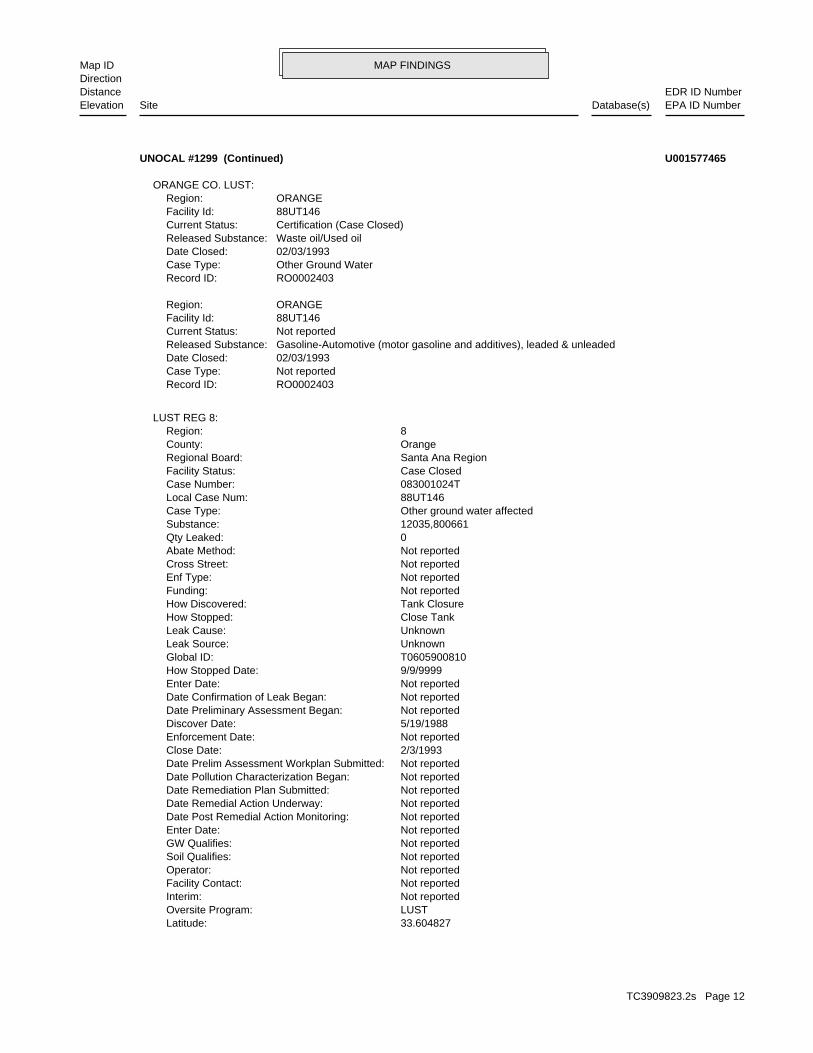
MAP FINDINGSMap IDDirection
EDR ID NumberDistanceEPA ID NumberDatabase(s)SiteElevation
33.604827Latitude: LUSTOversite Program: Not reportedInterim: Not reportedFacility Contact: Not reportedOperator: Not reportedSoil Qualifies: Not reportedGW Qualifies: Not reportedEnter Date: Not reportedDate Post Remedial Action Monitoring: Not reportedDate Remedial Action Underway: Not reportedDate Remediation Plan Submitted: Not reportedDate Pollution Characterization Began: Not reportedDate Prelim Assessment Workplan Submitted: 2/3/1993Close Date: Not reportedEnforcement Date: 5/19/1988Discover Date: Not reportedDate Preliminary Assessment Began: Not reportedDate Confirmation of Leak Began: Not reportedEnter Date: 9/9/9999How Stopped Date: T0605900810Global ID: UnknownLeak Source: UnknownLeak Cause: Close TankHow Stopped: Tank ClosureHow Discovered: Not reportedFunding: Not reportedEnf Type: Not reportedCross Street: Not reportedAbate Method: 0Qty Leaked: 12035,800661Substance: Other ground water affectedCase Type: 88UT146Local Case Num: 083001024TCase Number: Case ClosedFacility Status: Santa Ana RegionRegional Board: OrangeCounty: 8Region:
LUST REG 8:
RO0002403Record ID: Not reportedCase Type: 02/03/1993Date Closed: Gasoline-Automotive (motor gasoline and additives), leaded & unleadedReleased Substance: Not reportedCurrent Status: 88UT146Facility Id: ORANGERegion:
RO0002403Record ID: Other Ground WaterCase Type: 02/03/1993Date Closed: Waste oil/Used oilReleased Substance: Certification (Case Closed)Current Status: 88UT146Facility Id: ORANGERegion:
ORANGE CO. LUST:
UNOCAL #1299 (Continued) U001577465
TC3909823.2s Page 12

MAP FINDINGSMap IDDirection
EDR ID NumberDistanceEPA ID NumberDatabase(s)SiteElevation
Stock Inventor, 10Leak Detection: Not reportedTank Construction: PREMIUMType of Fuel: PRODUCTTank Used for: 00010000Tank Capacity: 1968Year Installed: 1299-22Container Num: 003Tank Num:
Stock Inventor, 10Leak Detection: Not reportedTank Construction: UNLEADEDType of Fuel: PRODUCTTank Used for: 00010000Tank Capacity: 1968Year Installed: 1299-11Container Num: 002Tank Num:
NoneLeak Detection: Not reportedTank Construction: WASTE OILType of Fuel: WASTETank Used for: 00000550Tank Capacity: 1968Year Installed: 1299-34Container Num: 001Tank Num:
SAN DIEGO, CA 92108Owner City,St,Zip: 123 CAMINO DELA REINAOwner Address: UNION OIL COMPANY OF CALIFORNIOwner Name: 7146732573Telephone: JAMES S. JENNINGSContact Name: 0003Total Tanks: Not reportedOther Type: Gas StationFacility Type: 00000017911Facility ID: STATERegion:
HIST UST:
Not reportedSummary: Not reportedWork Suspended: Not reportedCleanup Fund Id: Not reportedPriority: MARBeneficial: Not reportedHydr Basin #: 30000LLocal Agency: Local AgencyLead Agency: JKStaff Initials: NOMStaff: *MTBE Class: Not Required to be Tested.MTBE Tested: 0MTBE Fuel: Not reportedMax MTBE Soil: 0MTBE Concentration: Not reportedMax MTBE GW: Not reportedMTBE Date: -117.8896814Longitude:
UNOCAL #1299 (Continued) U001577465
TC3909823.2s Page 13

MAP FINDINGSMap IDDirection
EDR ID NumberDistanceEPA ID NumberDatabase(s)SiteElevation
083001024TReg Id: LTNKAReg By: 30Facility County Code: CORTESERegion:
HIST CORTESE:
298 ft. Site 2 of 4 in cluster A0.056 mi.
Relative:Higher
Actual:8 ft.
< 1/8 BALBOA ISLAND, CA SSW 124 MARINE N/AA4 HIST CORTESEUNOCAL #1299 S102440268
ORANGE COUNTYPermitting Agency:-117.88981Longitude:33.60496Latitude:2197Facility ID:
UST:
298 ft. Site 3 of 4 in cluster A0.056 mi.
Relative:Higher
Actual:8 ft.
< 1/8 NEWPORT BEACH, CA 92662SSW 124 MARINE AVE N/AA5 USTUNOCAL #1299 U003942624
VisualLeak Detection: 6 inchesTank Construction: Not reportedType of Fuel: WASTETank Used for: 00000000Tank Capacity: 1968Year Installed: 1299-00Container Num: 001Tank Num:
SAN DIEGO, CA 92108Owner City,St,Zip: 1450 FRAZEE ROADOwner Address: UNION OIL COMPANY OF CALIFORNIOwner Name: 7146732753Telephone: JAMES S. JENNINGSContact Name: 0001Total Tanks: Not reportedOther Type: Gas StationFacility Type: 00000040578Facility ID: STATERegion:
HIST UST:
317 ft. Site 4 of 4 in cluster A0.060 mi.
Relative:Higher
Actual:8 ft.
< 1/8 BALBOA, CA 92662SSW 124 MARINE N/AA6 HIST USTSTATION #1299 U001577464
TC3909823.2s Page 14

MAP FINDINGSMap IDDirection
EDR ID NumberDistanceEPA ID NumberDatabase(s)SiteElevation
peter hacatoryanContact Name: 9497593593Owner Telephone: Not reportedOwner Address 2: 9 SEYNEOwner Address: PETER HACATORYANOwner Name: Not reportedFacility Addr2: Not reportedInactive Date: YesFacility Active: 06/17/1988Create Date: Power Laundries, Family and CommercialSIC Description: 7211SIC Code: Drycleaning and Laundry Services (except Coin-Operated)NAICS Description: 81232NAICS Code: CAD982050999EPA Id:
DRYCLEANERS:
PERCHLOROETHYLENEReleased Chemical: Closure certification issuedClosure Type: CLOSED 5/8/1998Current Status: RO0000615Record ID: ORANGERegion: 97IC044Case ID:
Orange Co. Industrial Site:
919-C1Thomas Bros Code: NB-1Location Code: Regional BoardLead Agency: PCESubstance: WDMStaff: ClosedFacility Status: SoilType:
SLIC REG 8:
Click here to access the California GeoTracker records for this facility:
Not reportedSite History: Tetrachloroethylene (PCE)Potential Contaminants of Concern: SoilPotential Media Affected: Regional BoardFile Location: SLT8R078RB Case Number: Not reportedLocal Agency: Not reportedCase Worker: Cleanup Program SiteCase Type: -117.890510559082Longitude: 33.6107415191646Latitude: Not reportedLead Agency Case Number: SANTA ANA RWQCB (REGION 8)Lead Agency: SLT8R0783961Global Id: 03/17/1999Status Date: Completed - Case ClosedFacility Status: STATERegion:
SLIC:
1582 ft.0.300 mi.
Relative:Higher
Actual:18 ft.
1/4-1/2 DRYCLEANERSNEWPORT BEACH, CA 92660NNW Orange Co. Industrial Site1056 BAYSIDE DR N/A7 SLICBAYSIDE CLEANERS 1000382114
TC3909823.2s Page 15
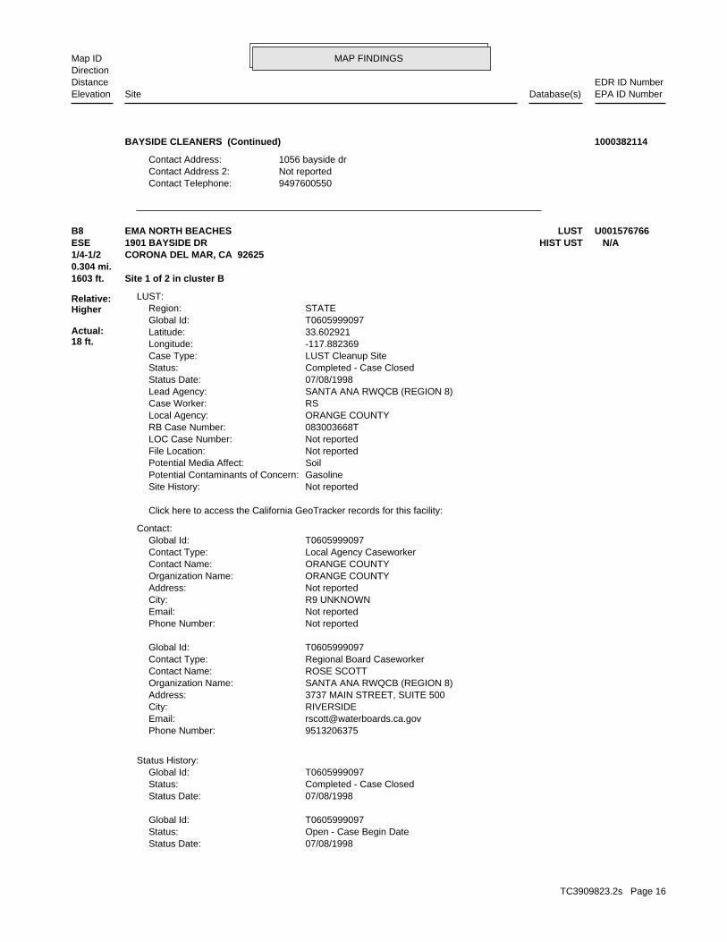
MAP FINDINGSMap IDDirection
EDR ID NumberDistanceEPA ID NumberDatabase(s)SiteElevation
9497600550Contact Telephone: Not reportedContact Address 2: 1056 bayside drContact Address:
BAYSIDE CLEANERS (Continued) 1000382114
07/08/1998Status Date: Open - Case Begin DateStatus: T0605999097Global Id:
07/08/1998Status Date: Completed - Case ClosedStatus: T0605999097Global Id:
Status History:
9513206375Phone Number: [email protected]: RIVERSIDECity: 3737 MAIN STREET, SUITE 500Address: SANTA ANA RWQCB (REGION 8)Organization Name: ROSE SCOTTContact Name: Regional Board CaseworkerContact Type: T0605999097Global Id:
Not reportedPhone Number: Not reportedEmail: R9 UNKNOWNCity: Not reportedAddress: ORANGE COUNTYOrganization Name: ORANGE COUNTYContact Name: Local Agency CaseworkerContact Type: T0605999097Global Id:
Contact:
Click here to access the California GeoTracker records for this facility:
Not reportedSite History: GasolinePotential Contaminants of Concern: SoilPotential Media Affect: Not reportedFile Location: Not reportedLOC Case Number: 083003668TRB Case Number: ORANGE COUNTYLocal Agency: RSCase Worker: SANTA ANA RWQCB (REGION 8)Lead Agency: 07/08/1998Status Date: Completed - Case ClosedStatus: LUST Cleanup SiteCase Type: -117.882369Longitude: 33.602921Latitude: T0605999097Global Id: STATERegion:
LUST:
1603 ft. Site 1 of 2 in cluster B0.304 mi.
Relative:Higher
Actual:18 ft.
1/4-1/2 CORONA DEL MAR, CA 92625ESE HIST UST1901 BAYSIDE DR N/AB8 LUSTEMA NORTH BEACHES U001576766
TC3909823.2s Page 16

MAP FINDINGSMap IDDirection
EDR ID NumberDistanceEPA ID NumberDatabase(s)SiteElevation
NoneLeak Detection: Not reportedTank Construction: PREMIUMType of Fuel: PRODUCTTank Used for: 00001500Tank Capacity: Not reportedYear Installed: 1Container Num: 001Tank Num:
CORONA DEL MAR, CA 92625Owner City,St,Zip: 1901 BAYSIDE DR.Owner Address: COUNTY OF ORANGEOwner Name: 7148346106Telephone: ED WILLIAMSContact Name: 0001Total Tanks: Not reportedOther Type: OtherFacility Type: 00000031617Facility ID: STATERegion:
HIST UST:
Leak DiscoveryAction: 01/01/1950Date: OtherAction Type: T0605999097Global Id:
Leak ReportedAction: 01/01/1950Date: OtherAction Type: T0605999097Global Id:
Leak StoppedAction: 01/01/1950Date: OtherAction Type: T0605999097Global Id:
Closure/No Further Action LetterAction: 07/08/1998Date: ENFORCEMENTAction Type: T0605999097Global Id:
Regulatory Activities:
EMA NORTH BEACHES (Continued) U001576766
Soil onlyCase Type: Not reportedLocal Case Num: 083003668TCase Number: Case ClosedFacility Status: Santa Ana RegionRegional Board: OrangeCounty: 8Region:
LUST REG 8:
1603 ft. Site 2 of 2 in cluster B0.304 mi.
Relative:Higher
Actual:18 ft.
1/4-1/2 CORONA DEL MAR, CA 92662ESE 1901 BAYSIDE DR N/AB9 LUSTNORTH BEACH COASTAL S104539398
TC3909823.2s Page 17

MAP FINDINGSMap IDDirection
EDR ID NumberDistanceEPA ID NumberDatabase(s)SiteElevation
Not reportedSummary: NoWork Suspended: Not reportedCleanup Fund Id: Not reportedPriority: Not reportedBeneficial: UNNAMED BASINHydr Basin #: 30000Local Agency: Regional BoardLead Agency: Not reportedStaff Initials: RSStaff: *MTBE Class: Site NOT Tested for MTBE.Includes Unknown and Not Analyzed.MTBE Tested: 1MTBE Fuel: Not reportedMax MTBE Soil: 0MTBE Concentration: Not reportedMax MTBE GW: Not reportedMTBE Date: -117.882369Longitude: 33.602921Latitude: LUSTOversite Program: Not reportedInterim: Not reportedFacility Contact: Not reportedOperator: Not reportedSoil Qualifies: Not reportedGW Qualifies: 5/10/2000Enter Date: Not reportedDate Post Remedial Action Monitoring: Not reportedDate Remedial Action Underway: Not reportedDate Remediation Plan Submitted: Not reportedDate Pollution Characterization Began: Not reportedDate Prelim Assessment Workplan Submitted: 7/8/1998Close Date: Not reportedEnforcement Date: 7/8/1998Discover Date: Not reportedDate Preliminary Assessment Began: Not reportedDate Confirmation of Leak Began: 5/10/2000Enter Date: 7/8/1998How Stopped Date: T0605999097Global ID: PipingLeak Source: Other CauseLeak Cause: Not reportedHow Stopped: OMHow Discovered: Not reportedFunding: Not reportedEnf Type: JAMBOREE & PCHCross Street: Not reportedAbate Method: 1Qty Leaked: Premium GasolineSubstance:
NORTH BEACH COASTAL (Continued) S104539398
TC3909823.2s Page 18

MAP FINDINGSMap IDDirection
EDR ID NumberDistanceEPA ID NumberDatabase(s)SiteElevation
Not reportedSchedule Revised Date: Not reportedSchedule Due Date: Not reportedSchedule Document Type: Not reportedSchedule Sub Area Name: Not reportedSchedule Area Name: Not reportedFuture Due Date: Not reportedFuture Document Type: Not reportedFuture Sub Area Name: Not reportedFuture Area Name:
Not reportedComments: 09/21/1999Completed Date: Inventory Project Report (INPR)Completed Document Type: Not reportedCompleted Sub Area Name: PROJECT WIDECompleted Area Name:
Completed Info:
Envirostor ID NumberAlias Type: 80001151Alias Name: INPRAlias Type: J09CA7455Alias Name: Federal Facility IDAlias Type: CA99799FA48100Alias Name: Alternate NameAlias Type: US Coast Guard Patrol BaseAlias Name: NONE SPECIFIEDPotential Description: NONE SPECIFIEDConfirmed COC: NONE SPECIFIEDPotential COC: NONE SPECIFIEDPast Use: NONE SPECIFIEDAPN: -117.8833Longitude: 33.605Latitude: DERAFunding: NONE SPECIFIEDSite Mgmt Req: NORestricted Use: Not reportedSpecial Program: 37Senate: 74Assembly: Cleanup CypressDivision Branch: Douglas BautistaSupervisor: Not reportedProgram Manager: SMBRPLead Agency: SMBRPRegulatory Agencies: NONPL: Not reportedAcres: FUDSSite Type Detailed: Military EvaluationSite Type: Not reportedSite Code: 07/01/2005Status Date: Inactive - Needs EvaluationStatus: 80001151Facility ID:
ENVIROSTOR:
1643 ft.0.311 mi.
Relative:Higher
Actual:50 ft.
1/4-1/2 NEWPORT BEACH, CA ESE N/A10 ENVIROSTORUS COAST GUARD PATROL BASE S107737502
TC3909823.2s Page 19

MAP FINDINGSMap IDDirection
EDR ID NumberDistanceEPA ID NumberDatabase(s)SiteElevation
Not reportedFacility Waste Type 3: Not reportedFacility Waste Type 2: Contaminated ground waterFacility Waste Type: X - Facility is not a POTWPretreatment: AComplexity: 3Threat To Water Quality: 0.1902Design Flow: Reg MeasSource Of Facility: 1# Of Places: Not reportedNAICS Desc 3: Not reportedNAICS Code 3: Not reportedNAICS Desc 2: Not reportedNAICS Code 2: Not reportedNAICS Desc 1: Not reportedNAICS Code 1: Not reportedSIC Desc 3: Not reportedSIC Code 3: Not reportedSIC Desc 2: Not reportedSIC Code 2: Sanitary Services, NECSIC Desc 1: 4959SIC Code 1: Not reportedPlace Longitude: Not reportedPlace Latitude: 1# Of Agencies: Privately-Owned BusinessAgency Type: All other facilitiesFacility Type: Gasoline Service StationPlace Subtype: Service/CommercialPlace Type: Mobil Business Resources CorporationAgency Name: 228422Facility Id: 8Region:
ENF:
Not reportedWaste Management Uit Name: Not reportedSolid Waste Id No: 8 302583001WID Id: 8Region 2: 11/10/1988Effective Date: Not reportedWaste Discharge System No: Not reportedOrder No: CORTESEFlag: Not reportedSwat R: Not reportedEnf Type: Not reportedOwner: Not reportedLongitude: Not reportedLatitude: Not reportedSite Code: Not reportedStatus Date: Not reportedCleanup Status: Not reportedSite/Facility Type: Not reportedEnvirostor Id: CORTESERegion:
CORTESE:
2038 ft. Site 1 of 2 in cluster C0.386 mi.
Relative:Higher
Actual:92 ft.
1/4-1/2 NEWPORT BEACH, CA 92660North ENF1000 PACIFIC COAST HIGHWAY N/AC11 CorteseGW CLEANUP-N.B.,PCH 18-HND S111023304
TC3909823.2s Page 20

MAP FINDINGSMap IDDirection
EDR ID NumberDistanceEPA ID NumberDatabase(s)SiteElevation
0Total $ Paid/Completed Amount: 0Project $ Completed: 0Liability $ Paid: 0Project $ Amount: 0Liability $ Amount: 0Initial Assessed Amount: 0Total Assessment Amount: 1# Of Programs1: Not reportedLatest Milestone Completion Date: NPDNONMUNIPRCSProgram: GW CLEANUP.Description: Enforcement - 8 302583001Title: ActiveStatus: Not reportedEPL Issuance Date: Not reportedACL Issuance Date: Not reportedTermination Date: Not reportedAchieve Date: Not reportedAdoption/Issuance Date: 04/14/1989Effective Date: Clean-up and Abatement OrderEnforcement Action Type: 89-037Order / Resolution Number: 8Region: 223819Enforcement Id(EID): PassiveDirection/Voice: Not reportedFee Code: IIndividual/General: YStatus Enrollee: Not reportedWDR Review - Planned: Not reportedWDR Review - Pending: Not reportedWDR Review - No Action Required: Not reportedWDR Review - Rescind: Not reportedWDR Review - Revise/Renew: Not reportedWDR Review - Amend: 06/11/1998Termination Date: Not reportedExpiration/Review Date: 11/10/1988Effective Date: 11/10/1988Status Date: HistoricalStatus: Not reportedApplication Fee Amt Received: Not reported301H: Not reportedDredge Fill Fee: N - NoReclamation: Not reportedNpdes Type: Not reportedMajor-Minor: Not reportedNpdes# CA#: 96-018Order #: 8Region: EnrolleeReg Measure Type: 205929Reg Measure Id: 8 302583001WDID: 1# Of Programs: NPDESWWProgram Category2: NPDESWWProgram Category1: NPDNONMUNIPRCSProgram: Not reportedFacility Waste Type 4:
GW CLEANUP-N.B.,PCH 18-HND (Continued) S111023304
TC3909823.2s Page 21

MAP FINDINGSMap IDDirection
EDR ID NumberDistanceEPA ID NumberDatabase(s)SiteElevation
01/06/2000Status Date: Completed - Case ClosedStatus: T0605900217Global Id:
11/12/1984Status Date: Open - Case Begin DateStatus: T0605900217Global Id:
Status History:
9513206375Phone Number: [email protected]: RIVERSIDECity: 3737 MAIN STREET, SUITE 500Address: SANTA ANA RWQCB (REGION 8)Organization Name: ROSE SCOTTContact Name: Regional Board CaseworkerContact Type: T0605900217Global Id:
7144336255Phone Number: [email protected]: SANTA ANACity: 1241 E. DYER ROAD, STE. 120Address: ORANGE COUNTY LOPOrganization Name: DENAMARIE BAKERContact Name: Local Agency CaseworkerContact Type: T0605900217Global Id:
Contact:
Click here to access the California GeoTracker records for this facility:
Not reportedSite History: GasolinePotential Contaminants of Concern: Other Groundwater (uses other than drinking water)Potential Media Affect: Local AgencyFile Location: 84UT016LOC Case Number: 083000280TRB Case Number: ORANGE COUNTY LOPLocal Agency: DBCase Worker: ORANGE COUNTY LOPLead Agency: 01/06/2000Status Date: Completed - Case ClosedStatus: LUST Cleanup SiteCase Type: -117.8905314Longitude: 33.6128998Latitude: T0605900217Global Id: STATERegion:
LUST:
8 302583001Reg Id: WBC&DReg By: 30Facility County Code: CORTESERegion:
HIST CORTESE:
2038 ft. Site 2 of 2 in cluster C0.386 mi.
Relative:Higher
Actual:92 ft.
1/4-1/2 NEWPORT BEACH, CA 92625North LUST1000 COAST N/AC12 HIST CORTESEMOBIL S S #18-HND S101299876
TC3909823.2s Page 22

MAP FINDINGSMap IDDirection
EDR ID NumberDistanceEPA ID NumberDatabase(s)SiteElevation
Not reportedEnforcement Date: 11/12/1984Discover Date: Not reportedDate Preliminary Assessment Began: Not reportedDate Confirmation of Leak Began: Not reportedEnter Date: 9/9/9999How Stopped Date: T0605900217Global ID: UnknownLeak Source: UnknownLeak Cause: Close TankHow Stopped: Tank ClosureHow Discovered: Not reportedFunding: Not reportedEnf Type: Not reportedCross Street: Not reportedAbate Method: 0Qty Leaked: GasolineSubstance: Other ground water affectedCase Type: 84UT016Local Case Num: 083000280TCase Number: Case ClosedFacility Status: Santa Ana RegionRegional Board: OrangeCounty: 8Region:
LUST REG 8:
RO0001056Record ID: Other Ground WaterCase Type: 01/06/2000Date Closed: Gasoline-Automotive (motor gasoline and additives), leaded & unleadedReleased Substance: Certification (Case Closed)Current Status: 84UT016Facility Id: ORANGERegion:
ORANGE CO. LUST:
Leak DiscoveryAction: 01/01/1950Date: OtherAction Type: T0605900217Global Id:
Free Product RemovalAction: 01/01/1950Date: REMEDIATIONAction Type: T0605900217Global Id:
ExcavationAction: 01/01/1950Date: REMEDIATIONAction Type: T0605900217Global Id:
Leak ReportedAction: 01/01/1950Date: OtherAction Type: T0605900217Global Id:
Regulatory Activities:
MOBIL S S #18-HND (Continued) S101299876
TC3909823.2s Page 23

MAP FINDINGSMap IDDirection
EDR ID NumberDistanceEPA ID NumberDatabase(s)SiteElevation
Not reportedSummary: Not reportedWork Suspended: Not reportedCleanup Fund Id: Not reportedPriority: MUNBeneficial: Not reportedHydr Basin #: 30000LLocal Agency: Local AgencyLead Agency: JKStaff Initials: RSStaff: *MTBE Class: Site NOT Tested for MTBE.Includes Unknown and Not Analyzed.MTBE Tested: 1MTBE Fuel: Not reportedMax MTBE Soil: 0MTBE Concentration: Not reportedMax MTBE GW: Not reportedMTBE Date: -117.8900264Longitude: 33.6128218Latitude: LUSTOversite Program: Not reportedInterim: Not reportedFacility Contact: Not reportedOperator: Not reportedSoil Qualifies: Not reportedGW Qualifies: Not reportedEnter Date: Not reportedDate Post Remedial Action Monitoring: Not reportedDate Remedial Action Underway: Not reportedDate Remediation Plan Submitted: Not reportedDate Pollution Characterization Began: Not reportedDate Prelim Assessment Workplan Submitted: 1/6/2000Close Date:
MOBIL S S #18-HND (Continued) S101299876
approved site Excavate and Dispose - remove contaminated soil and dispose inAbate Method: Not reportedQty Leaked: DieselSubstance: Other ground water affectedCase Type: 86UT039Local Case Num: 083000433TCase Number: Case ClosedFacility Status: Santa Ana RegionRegional Board: OrangeCounty: 8Region:
LUST REG 8:
083000433TReg Id: LTNKAReg By: 30Facility County Code: CORTESERegion:
HIST CORTESE:
2064 ft.0.391 mi.
Relative:Higher
Actual:2 ft.
1/4-1/2 BALBOA ISLAND, CA 92662WNW LUST504 BAY FRONT N/A13 HIST CORTESEUNOCAL / BALBOA ISLAND PR S103943484
TC3909823.2s Page 24

MAP FINDINGSMap IDDirection
EDR ID NumberDistanceEPA ID NumberDatabase(s)SiteElevation
Not reportedSummary: Not reportedWork Suspended: Not reportedCleanup Fund Id: Not reportedPriority: Not reportedBeneficial: UNNAMED BASINHydr Basin #: 30000LLocal Agency: Regional BoardLead Agency: JKStaff Initials: NOMStaff: *MTBE Class: Not Required to be Tested.MTBE Tested: 0MTBE Fuel: Not reportedMax MTBE Soil: 0MTBE Concentration: Not reportedMax MTBE GW: Not reportedMTBE Date: -117.8980156Longitude: 33.6054759Latitude: LUSTOversite Program: YesInterim: Not reportedFacility Contact: Not reportedOperator: Not reportedSoil Qualifies: Not reportedGW Qualifies: 5/19/1987Enter Date: Not reportedDate Post Remedial Action Monitoring: 1/15/1987Date Remedial Action Underway: Not reportedDate Remediation Plan Submitted: Not reportedDate Pollution Characterization Began: Not reportedDate Prelim Assessment Workplan Submitted: 5/12/1996Close Date: Not reportedEnforcement Date: Not reportedDiscover Date: Not reportedDate Preliminary Assessment Began: Not reportedDate Confirmation of Leak Began: 5/19/1987Enter Date: Not reportedHow Stopped Date: T0605900347Global ID: UNKLeak Source: UNKLeak Cause: Not reportedHow Stopped: OMHow Discovered: Not reportedFunding: Not reportedEnf Type: PACIFIC COAST HWYCross Street:
UNOCAL / BALBOA ISLAND PR (Continued) S103943484
-117.890992787Longitude: 33.613233514Latitude: T0605901569Global Id: STATERegion:
LUST:
2381 ft.0.451 mi.
Relative:Higher
Actual:72 ft.
1/4-1/2 NEWPORT BEACH, CA 92660NNW 990 COAST N/A14 LUSTSHELL OIL (FORMER) S102430341
TC3909823.2s Page 25

MAP FINDINGSMap IDDirection
EDR ID NumberDistanceEPA ID NumberDatabase(s)SiteElevation
* Verbal CommunicationAction: 04/30/2003Date: ENFORCEMENTAction Type: T0605901569Global Id:
Notice of ResponsibilityAction: 07/09/1992Date: ENFORCEMENTAction Type: T0605901569Global Id:
Regulatory Activities:
06/29/2003Status Date: Open - Verification MonitoringStatus: T0605901569Global Id:
08/01/1990Status Date: Open - Case Begin DateStatus: T0605901569Global Id:
Status History:
7144336255Phone Number: [email protected]: SANTA ANACity: 1241 E. DYER ROAD, STE. 120Address: ORANGE COUNTY LOPOrganization Name: DENAMARIE BAKERContact Name: Local Agency CaseworkerContact Type: T0605901569Global Id:
9517824495Phone Number: [email protected]: RIVERSIDECity: 3737 MAIN STREET, SUITE 500Address: SANTA ANA RWQCB (REGION 8)Organization Name: CARL BERNHARDTContact Name: Regional Board CaseworkerContact Type: T0605901569Global Id:
Contact:
Click here to access the California GeoTracker records for this facility:
submitted by consultants for the responsible party. accuracy of any professional interpretations provided in reports GeoTracker for site history. Orange County is not responsible for the Please refer to recent Site Documents or Monitoring Reports inSite History: GasolinePotential Contaminants of Concern: Other Groundwater (uses other than drinking water)Potential Media Affect: Local AgencyFile Location: 92UT086LOC Case Number: 083002129TRB Case Number: ORANGE COUNTY LOPLocal Agency: DBCase Worker: ORANGE COUNTY LOPLead Agency: 06/29/2003Status Date: Open - Verification MonitoringStatus: LUST Cleanup SiteCase Type:
SHELL OIL (FORMER) (Continued) S102430341
TC3909823.2s Page 26

MAP FINDINGSMap IDDirection
EDR ID NumberDistanceEPA ID NumberDatabase(s)SiteElevation
ENFORCEMENTAction Type: T0605901569Global Id:
Other Workplan - Regulator RespondedAction: 04/01/2013Date: RESPONSEAction Type: T0605901569Global Id:
Staff LetterAction: 01/18/2012Date: ENFORCEMENTAction Type: T0605901569Global Id:
Leak DiscoveryAction: 01/01/1950Date: OtherAction Type: T0605901569Global Id:
Other (Use Description Field)Action: 01/01/1950Date: REMEDIATIONAction Type: T0605901569Global Id:
Leak ReportedAction: 01/01/1950Date: OtherAction Type: T0605901569Global Id:
Staff LetterAction: 06/08/2012Date: ENFORCEMENTAction Type: T0605901569Global Id:
File reviewAction: 05/12/2011Date: ENFORCEMENTAction Type: T0605901569Global Id:
File reviewAction: 12/14/2010Date: ENFORCEMENTAction Type: T0605901569Global Id:
Staff LetterAction: 03/01/2013Date: ENFORCEMENTAction Type: T0605901569Global Id:
Staff LetterAction: 12/21/2004Date: ENFORCEMENTAction Type: T0605901569Global Id:
Staff LetterAction: 05/29/2003Date: ENFORCEMENTAction Type: T0605901569Global Id:
SHELL OIL (FORMER) (Continued) S102430341
TC3909823.2s Page 27

MAP FINDINGSMap IDDirection
EDR ID NumberDistanceEPA ID NumberDatabase(s)SiteElevation
LUSTOversite Program: Not reportedInterim: Not reportedFacility Contact: Not reportedOperator: NDSoil Qualifies: NDGW Qualifies: Not reportedEnter Date: 6/29/2003Date Post Remedial Action Monitoring: Not reportedDate Remedial Action Underway: Not reportedDate Remediation Plan Submitted: Not reportedDate Pollution Characterization Began: Not reportedDate Prelim Assessment Workplan Submitted: Not reportedClose Date: Not reportedEnforcement Date: 8/1/1990Discover Date: Not reportedDate Preliminary Assessment Began: Not reportedDate Confirmation of Leak Began: Not reportedEnter Date: 9/9/9999How Stopped Date: T0605901569Global ID: UnknownLeak Source: UnknownLeak Cause: Other MeansHow Stopped: Subsurface MonitoringHow Discovered: Not reportedFunding: VEREnf Type: Not reportedCross Street: Not reportedAbate Method: 0Qty Leaked: GasolineSubstance: Other ground water affectedCase Type: 92UT086Local Case Num: 083002129TCase Number: Post remedial action monitoringFacility Status: Santa Ana RegionRegional Board: OrangeCounty: 8Region:
LUST REG 8:
RO0002957Record ID: Other Ground WaterCase Type: Not reportedDate Closed: Gasoline-Automotive (motor gasoline and additives), leaded & unleadedReleased Substance: Post Remedial ActionCurrent Status: 92UT086Facility Id: ORANGERegion:
ORANGE CO. LUST:
Staff LetterAction: 04/09/2009Date: ENFORCEMENTAction Type: T0605901569Global Id:
Staff LetterAction: 07/09/2009Date:
SHELL OIL (FORMER) (Continued) S102430341
TC3909823.2s Page 28

MAP FINDINGSMap IDDirection
EDR ID NumberDistanceEPA ID NumberDatabase(s)SiteElevation
Not reportedSummary: Not reportedWork Suspended: Not reportedCleanup Fund Id: Not reportedPriority: BIOL,COMM,EST,MAR,NAV,RARE,REC-1,REC-2,SHELL,SPWN,Beneficial: Not reportedHydr Basin #: 30000LLocal Agency: Local AgencyLead Agency: JKStaff Initials: CABStaff: *MTBE Class: MTBE Detected. Site tested for MTBE & MTBE detectedMTBE Tested: 1MTBE Fuel: 0Max MTBE Soil: 0MTBE Concentration: 50Max MTBE GW: 9/17/2004MTBE Date: -117.8901714Longitude: 33.6128458Latitude:
SHELL OIL (FORMER) (Continued) S102430341
TC3909823.2s Page 29

ORPHAN SUMMARY
City EDR ID Site Name Site Address Zip Database(s)
Count: 8 records.
AGUANGO U001577458 WARD RANCH HWY. 79 92660 HIST USTCORONA DEL MAR 1000107758 DRY CLEANERS 3536 E PACICFIC COAST HWY 92625 RCRA-SQGDEL MAR U001576767 HERENT MEGERDICHIAN 3636 COAST HWY 92625 HIST USTNEWPORT BEACH 1003878042 SOUTH BASIN OIL CO WELL #1 204 & 206 43RD ST 92663 CERC-NFRAPNEWPORT BEACH S114643994 LIDO PARK CONDOMINIUMS 601 RGA LUSTNEWPORT BEACH S114643992 LIDO PARK CONDOMINIUMS 601 LIDO PARK RGA LUSTNEWPORT BEACH S112832512 LOWER SANTA ANA RIVER MARSH DREDGI NORTH OF PCH EAST OF SANTA ANA 92663 NPDESNEWPORT BEACH S105025221 GW CLEANUP-N.B.,PCH & BAL PCH AND BALBOA BLVD HIST CORTESE
TC3909823.2s Page 30

To maintain currency of the following federal and state databases, EDR contacts the appropriate governmental agencyon a monthly or quarterly basis, as required.
Number of Days to Update: Provides confirmation that EDR is reporting records that have been updated within 90 daysfrom the date the government agency made the information available to the public.
STANDARD ENVIRONMENTAL RECORDS
Federal NPL site list
NPL: National Priority ListNational Priorities List (Superfund). The NPL is a subset of CERCLIS and identifies over 1,200 sites for prioritycleanup under the Superfund Program. NPL sites may encompass relatively large areas. As such, EDR provides polygoncoverage for over 1,000 NPL site boundaries produced by EPA’s Environmental Photographic Interpretation Center(EPIC) and regional EPA offices.
Date of Government Version: 10/25/2013Date Data Arrived at EDR: 11/11/2013Date Made Active in Reports: 01/28/2014Number of Days to Update: 78
Source: EPATelephone: N/ALast EDR Contact: 04/08/2014Next Scheduled EDR Contact: 07/21/2014Data Release Frequency: Quarterly
NPL Site Boundaries
Sources:
EPA’s Environmental Photographic Interpretation Center (EPIC)Telephone: 202-564-7333
EPA Region 1 EPA Region 6Telephone 617-918-1143 Telephone: 214-655-6659
EPA Region 3 EPA Region 7Telephone 215-814-5418 Telephone: 913-551-7247
EPA Region 4 EPA Region 8Telephone 404-562-8033 Telephone: 303-312-6774
EPA Region 5 EPA Region 9Telephone 312-886-6686 Telephone: 415-947-4246
EPA Region 10Telephone 206-553-8665
Proposed NPL: Proposed National Priority List SitesA site that has been proposed for listing on the National Priorities List through the issuance of a proposed rulein the Federal Register. EPA then accepts public comments on the site, responds to the comments, and places onthe NPL those sites that continue to meet the requirements for listing.
Date of Government Version: 10/25/2013Date Data Arrived at EDR: 11/11/2013Date Made Active in Reports: 01/28/2014Number of Days to Update: 78
Source: EPATelephone: N/ALast EDR Contact: 04/08/2014Next Scheduled EDR Contact: 07/21/2014Data Release Frequency: Quarterly
NPL LIENS: Federal Superfund LiensFederal Superfund Liens. Under the authority granted the USEPA by CERCLA of 1980, the USEPA has the authorityto file liens against real property in order to recover remedial action expenditures or when the property ownerreceived notification of potential liability. USEPA compiles a listing of filed notices of Superfund Liens.
Date of Government Version: 10/15/1991Date Data Arrived at EDR: 02/02/1994Date Made Active in Reports: 03/30/1994Number of Days to Update: 56
Source: EPATelephone: 202-564-4267Last EDR Contact: 08/15/2011Next Scheduled EDR Contact: 11/28/2011Data Release Frequency: No Update Planned
TC3909823.2s Page GR-1
GOVERNMENT RECORDS SEARCHED / DATA CURRENCY TRACKING

Federal Delisted NPL site list
DELISTED NPL: National Priority List DeletionsThe National Oil and Hazardous Substances Pollution Contingency Plan (NCP) establishes the criteria that theEPA uses to delete sites from the NPL. In accordance with 40 CFR 300.425.(e), sites may be deleted from theNPL where no further response is appropriate.
Date of Government Version: 10/25/2013Date Data Arrived at EDR: 11/11/2013Date Made Active in Reports: 01/28/2014Number of Days to Update: 78
Source: EPATelephone: N/ALast EDR Contact: 04/08/2014Next Scheduled EDR Contact: 07/21/2014Data Release Frequency: Quarterly
Federal CERCLIS list
CERCLIS: Comprehensive Environmental Response, Compensation, and Liability Information SystemCERCLIS contains data on potentially hazardous waste sites that have been reported to the USEPA by states, municipalities,private companies and private persons, pursuant to Section 103 of the Comprehensive Environmental Response, Compensation,and Liability Act (CERCLA). CERCLIS contains sites which are either proposed to or on the National PrioritiesList (NPL) and sites which are in the screening and assessment phase for possible inclusion on the NPL.
Date of Government Version: 10/25/2013Date Data Arrived at EDR: 11/11/2013Date Made Active in Reports: 02/13/2014Number of Days to Update: 94
Source: EPATelephone: 703-412-9810Last EDR Contact: 02/28/2014Next Scheduled EDR Contact: 06/09/2014Data Release Frequency: Quarterly
FEDERAL FACILITY: Federal Facility Site Information listingA listing of National Priority List (NPL) and Base Realignment and Closure (BRAC) sites found in the ComprehensiveEnvironmental Response, Compensation and Liability Information System (CERCLIS) Database where EPA Federal FacilitiesRestoration and Reuse Office is involved in cleanup activities.
Date of Government Version: 05/31/2013Date Data Arrived at EDR: 07/08/2013Date Made Active in Reports: 12/06/2013Number of Days to Update: 151
Source: Environmental Protection AgencyTelephone: 703-603-8704Last EDR Contact: 01/10/2014Next Scheduled EDR Contact: 04/21/2014Data Release Frequency: Varies
Federal CERCLIS NFRAP site List
CERCLIS-NFRAP: CERCLIS No Further Remedial Action PlannedArchived sites are sites that have been removed and archived from the inventory of CERCLIS sites. Archived statusindicates that, to the best of EPA’s knowledge, assessment at a site has been completed and that EPA has determinedno further steps will be taken to list this site on the National Priorities List (NPL), unless information indicatesthis decision was not appropriate or other considerations require a recommendation for listing at a later time.This decision does not necessarily mean that there is no hazard associated with a given site; it only means that,based upon available information, the location is not judged to be a potential NPL site.
Date of Government Version: 10/25/2013Date Data Arrived at EDR: 11/11/2013Date Made Active in Reports: 02/13/2014Number of Days to Update: 94
Source: EPATelephone: 703-412-9810Last EDR Contact: 02/28/2014Next Scheduled EDR Contact: 06/09/2014Data Release Frequency: Quarterly
Federal RCRA CORRACTS facilities list
CORRACTS: Corrective Action ReportCORRACTS identifies hazardous waste handlers with RCRA corrective action activity.
TC3909823.2s Page GR-2
GOVERNMENT RECORDS SEARCHED / DATA CURRENCY TRACKING

Date of Government Version: 03/11/2014Date Data Arrived at EDR: 03/13/2014Date Made Active in Reports: 04/09/2014Number of Days to Update: 27
Source: EPATelephone: 800-424-9346Last EDR Contact: 03/13/2014Next Scheduled EDR Contact: 07/14/2014Data Release Frequency: Quarterly
Federal RCRA non-CORRACTS TSD facilities list
RCRA-TSDF: RCRA - Treatment, Storage and DisposalRCRAInfo is EPA’s comprehensive information system, providing access to data supporting the Resource Conservationand Recovery Act (RCRA) of 1976 and the Hazardous and Solid Waste Amendments (HSWA) of 1984. The databaseincludes selective information on sites which generate, transport, store, treat and/or dispose of hazardous wasteas defined by the Resource Conservation and Recovery Act (RCRA). Transporters are individuals or entities thatmove hazardous waste from the generator offsite to a facility that can recycle, treat, store, or dispose of thewaste. TSDFs treat, store, or dispose of the waste.
Date of Government Version: 03/11/2014Date Data Arrived at EDR: 03/13/2014Date Made Active in Reports: 04/09/2014Number of Days to Update: 27
Source: Environmental Protection AgencyTelephone: (415) 495-8895Last EDR Contact: 03/13/2014Next Scheduled EDR Contact: 07/14/2014Data Release Frequency: Quarterly
Federal RCRA generators list
RCRA-LQG: RCRA - Large Quantity GeneratorsRCRAInfo is EPA’s comprehensive information system, providing access to data supporting the Resource Conservationand Recovery Act (RCRA) of 1976 and the Hazardous and Solid Waste Amendments (HSWA) of 1984. The databaseincludes selective information on sites which generate, transport, store, treat and/or dispose of hazardous wasteas defined by the Resource Conservation and Recovery Act (RCRA). Large quantity generators (LQGs) generateover 1,000 kilograms (kg) of hazardous waste, or over 1 kg of acutely hazardous waste per month.
Date of Government Version: 03/11/2014Date Data Arrived at EDR: 03/13/2014Date Made Active in Reports: 04/09/2014Number of Days to Update: 27
Source: Environmental Protection AgencyTelephone: (415) 495-8895Last EDR Contact: 03/13/2014Next Scheduled EDR Contact: 07/14/2014Data Release Frequency: Quarterly
RCRA-SQG: RCRA - Small Quantity GeneratorsRCRAInfo is EPA’s comprehensive information system, providing access to data supporting the Resource Conservationand Recovery Act (RCRA) of 1976 and the Hazardous and Solid Waste Amendments (HSWA) of 1984. The databaseincludes selective information on sites which generate, transport, store, treat and/or dispose of hazardous wasteas defined by the Resource Conservation and Recovery Act (RCRA). Small quantity generators (SQGs) generatebetween 100 kg and 1,000 kg of hazardous waste per month.
Date of Government Version: 03/11/2014Date Data Arrived at EDR: 03/13/2014Date Made Active in Reports: 04/09/2014Number of Days to Update: 27
Source: Environmental Protection AgencyTelephone: (415) 495-8895Last EDR Contact: 03/13/2014Next Scheduled EDR Contact: 07/14/2014Data Release Frequency: Quarterly
RCRA-CESQG: RCRA - Conditionally Exempt Small Quantity GeneratorsRCRAInfo is EPA’s comprehensive information system, providing access to data supporting the Resource Conservationand Recovery Act (RCRA) of 1976 and the Hazardous and Solid Waste Amendments (HSWA) of 1984. The databaseincludes selective information on sites which generate, transport, store, treat and/or dispose of hazardous wasteas defined by the Resource Conservation and Recovery Act (RCRA). Conditionally exempt small quantity generators(CESQGs) generate less than 100 kg of hazardous waste, or less than 1 kg of acutely hazardous waste per month.
Date of Government Version: 03/11/2014Date Data Arrived at EDR: 03/13/2014Date Made Active in Reports: 04/09/2014Number of Days to Update: 27
Source: Environmental Protection AgencyTelephone: (415) 495-8895Last EDR Contact: 03/13/2014Next Scheduled EDR Contact: 07/14/2014Data Release Frequency: Varies
TC3909823.2s Page GR-3
GOVERNMENT RECORDS SEARCHED / DATA CURRENCY TRACKING

Federal institutional controls / engineering controls registries
US ENG CONTROLS: Engineering Controls Sites ListA listing of sites with engineering controls in place. Engineering controls include various forms of caps, buildingfoundations, liners, and treatment methods to create pathway elimination for regulated substances to enter environmentalmedia or effect human health.
Date of Government Version: 12/17/2013Date Data Arrived at EDR: 01/14/2014Date Made Active in Reports: 01/28/2014Number of Days to Update: 14
Source: Environmental Protection AgencyTelephone: 703-603-0695Last EDR Contact: 03/10/2014Next Scheduled EDR Contact: 06/23/2014Data Release Frequency: Varies
US INST CONTROL: Sites with Institutional ControlsA listing of sites with institutional controls in place. Institutional controls include administrative measures,such as groundwater use restrictions, construction restrictions, property use restrictions, and post remediationcare requirements intended to prevent exposure to contaminants remaining on site. Deed restrictions are generallyrequired as part of the institutional controls.
Date of Government Version: 12/17/2013Date Data Arrived at EDR: 01/14/2014Date Made Active in Reports: 01/28/2014Number of Days to Update: 14
Source: Environmental Protection AgencyTelephone: 703-603-0695Last EDR Contact: 03/10/2014Next Scheduled EDR Contact: 06/23/2014Data Release Frequency: Varies
LUCIS: Land Use Control Information SystemLUCIS contains records of land use control information pertaining to the former Navy Base Realignment and Closureproperties.
Date of Government Version: 11/20/2013Date Data Arrived at EDR: 11/21/2013Date Made Active in Reports: 02/24/2014Number of Days to Update: 95
Source: Department of the NavyTelephone: 843-820-7326Last EDR Contact: 02/14/2014Next Scheduled EDR Contact: 06/02/2014Data Release Frequency: Varies
Federal ERNS list
ERNS: Emergency Response Notification SystemEmergency Response Notification System. ERNS records and stores information on reported releases of oil and hazardoussubstances.
Date of Government Version: 09/30/2013Date Data Arrived at EDR: 10/01/2013Date Made Active in Reports: 12/06/2013Number of Days to Update: 66
Source: National Response Center, United States Coast GuardTelephone: 202-267-2180Last EDR Contact: 04/04/2014Next Scheduled EDR Contact: 07/14/2014Data Release Frequency: Annually
State- and tribal - equivalent NPL
RESPONSE: State Response SitesIdentifies confirmed release sites where DTSC is involved in remediation, either in a lead or oversight capacity.These confirmed release sites are generally high-priority and high potential risk.
Date of Government Version: 03/12/2014Date Data Arrived at EDR: 03/13/2014Date Made Active in Reports: 04/10/2014Number of Days to Update: 28
Source: Department of Toxic Substances ControlTelephone: 916-323-3400Last EDR Contact: 03/13/2014Next Scheduled EDR Contact: 05/19/2014Data Release Frequency: Quarterly
State- and tribal - equivalent CERCLIS
TC3909823.2s Page GR-4
GOVERNMENT RECORDS SEARCHED / DATA CURRENCY TRACKING

ENVIROSTOR: EnviroStor DatabaseThe Department of Toxic Substances Control’s (DTSC’s) Site Mitigation and Brownfields Reuse Program’s (SMBRP’s)EnviroStor database identifes sites that have known contamination or sites for which there may be reasons to investigatefurther. The database includes the following site types: Federal Superfund sites (National Priorities List (NPL));State Response, including Military Facilities and State Superfund; Voluntary Cleanup; and School sites. EnviroStorprovides similar information to the information that was available in CalSites, and provides additional site information,including, but not limited to, identification of formerly-contaminated properties that have been released forreuse, properties where environmental deed restrictions have been recorded to prevent inappropriate land uses,and risk characterization information that is used to assess potential impacts to public health and the environmentat contaminated sites.
Date of Government Version: 03/12/2014Date Data Arrived at EDR: 03/13/2014Date Made Active in Reports: 04/10/2014Number of Days to Update: 28
Source: Department of Toxic Substances ControlTelephone: 916-323-3400Last EDR Contact: 03/13/2014Next Scheduled EDR Contact: 05/19/2014Data Release Frequency: Quarterly
State and tribal landfill and/or solid waste disposal site lists
SWF/LF (SWIS): Solid Waste Information SystemActive, Closed and Inactive Landfills. SWF/LF records typically contain an inve ntory of solid waste disposalfacilities or landfills. These may be active or i nactive facilities or open dumps that failed to meet RCRA Section4004 criteria for solid waste landfills or disposal sites.
Date of Government Version: 02/14/2014Date Data Arrived at EDR: 02/18/2014Date Made Active in Reports: 03/18/2014Number of Days to Update: 28
Source: Department of Resources Recycling and RecoveryTelephone: 916-341-6320Last EDR Contact: 02/18/2014Next Scheduled EDR Contact: 06/02/2014Data Release Frequency: Quarterly
State and tribal leaking storage tank lists
LUST REG 9: Leaking Underground Storage Tank ReportOrange, Riverside, San Diego counties. For more current information, please refer to the State Water ResourcesControl Board’s LUST database.
Date of Government Version: 03/01/2001Date Data Arrived at EDR: 04/23/2001Date Made Active in Reports: 05/21/2001Number of Days to Update: 28
Source: California Regional Water Quality Control Board San Diego Region (9)Telephone: 858-637-5595Last EDR Contact: 09/26/2011Next Scheduled EDR Contact: 01/09/2012Data Release Frequency: No Update Planned
LUST REG 8: Leaking Underground Storage TanksCalifornia Regional Water Quality Control Board Santa Ana Region (8). For more current information, please referto the State Water Resources Control Board’s LUST database.
Date of Government Version: 02/14/2005Date Data Arrived at EDR: 02/15/2005Date Made Active in Reports: 03/28/2005Number of Days to Update: 41
Source: California Regional Water Quality Control Board Santa Ana Region (8)Telephone: 909-782-4496Last EDR Contact: 08/15/2011Next Scheduled EDR Contact: 11/28/2011Data Release Frequency: Varies
LUST REG 7: Leaking Underground Storage Tank Case ListingLeaking Underground Storage Tank locations. Imperial, Riverside, San Diego, Santa Barbara counties.
Date of Government Version: 02/26/2004Date Data Arrived at EDR: 02/26/2004Date Made Active in Reports: 03/24/2004Number of Days to Update: 27
Source: California Regional Water Quality Control Board Colorado River Basin Region (7)Telephone: 760-776-8943Last EDR Contact: 08/01/2011Next Scheduled EDR Contact: 11/14/2011Data Release Frequency: No Update Planned
TC3909823.2s Page GR-5
GOVERNMENT RECORDS SEARCHED / DATA CURRENCY TRACKING

LUST REG 6V: Leaking Underground Storage Tank Case ListingLeaking Underground Storage Tank locations. Inyo, Kern, Los Angeles, Mono, San Bernardino counties.
Date of Government Version: 06/07/2005Date Data Arrived at EDR: 06/07/2005Date Made Active in Reports: 06/29/2005Number of Days to Update: 22
Source: California Regional Water Quality Control Board Victorville Branch Office (6)Telephone: 760-241-7365Last EDR Contact: 09/12/2011Next Scheduled EDR Contact: 12/26/2011Data Release Frequency: No Update Planned
LUST REG 6L: Leaking Underground Storage Tank Case ListingFor more current information, please refer to the State Water Resources Control Board’s LUST database.
Date of Government Version: 09/09/2003Date Data Arrived at EDR: 09/10/2003Date Made Active in Reports: 10/07/2003Number of Days to Update: 27
Source: California Regional Water Quality Control Board Lahontan Region (6)Telephone: 530-542-5572Last EDR Contact: 09/12/2011Next Scheduled EDR Contact: 12/26/2011Data Release Frequency: No Update Planned
LUST REG 5: Leaking Underground Storage Tank DatabaseLeaking Underground Storage Tank locations. Alameda, Alpine, Amador, Butte, Colusa, Contra Costa, Calveras, ElDorado, Fresno, Glenn, Kern, Kings, Lake, Lassen, Madera, Mariposa, Merced, Modoc, Napa, Nevada, Placer, Plumas,Sacramento, San Joaquin, Shasta, Solano, Stanislaus, Sutter, Tehama, Tulare, Tuolumne, Yolo, Yuba counties.
Date of Government Version: 07/01/2008Date Data Arrived at EDR: 07/22/2008Date Made Active in Reports: 07/31/2008Number of Days to Update: 9
Source: California Regional Water Quality Control Board Central Valley Region (5)Telephone: 916-464-4834Last EDR Contact: 07/01/2011Next Scheduled EDR Contact: 10/17/2011Data Release Frequency: No Update Planned
LUST REG 4: Underground Storage Tank Leak ListLos Angeles, Ventura counties. For more current information, please refer to the State Water Resources ControlBoard’s LUST database.
Date of Government Version: 09/07/2004Date Data Arrived at EDR: 09/07/2004Date Made Active in Reports: 10/12/2004Number of Days to Update: 35
Source: California Regional Water Quality Control Board Los Angeles Region (4)Telephone: 213-576-6710Last EDR Contact: 09/06/2011Next Scheduled EDR Contact: 12/19/2011Data Release Frequency: No Update Planned
LUST REG 3: Leaking Underground Storage Tank DatabaseLeaking Underground Storage Tank locations. Monterey, San Benito, San Luis Obispo, Santa Barbara, Santa Cruz counties.
Date of Government Version: 05/19/2003Date Data Arrived at EDR: 05/19/2003Date Made Active in Reports: 06/02/2003Number of Days to Update: 14
Source: California Regional Water Quality Control Board Central Coast Region (3)Telephone: 805-542-4786Last EDR Contact: 07/18/2011Next Scheduled EDR Contact: 10/31/2011Data Release Frequency: No Update Planned
LUST REG 2: Fuel Leak ListLeaking Underground Storage Tank locations. Alameda, Contra Costa, Marin, Napa, San Francisco, San Mateo, SantaClara, Solano, Sonoma counties.
Date of Government Version: 09/30/2004Date Data Arrived at EDR: 10/20/2004Date Made Active in Reports: 11/19/2004Number of Days to Update: 30
Source: California Regional Water Quality Control Board San Francisco Bay Region (2)Telephone: 510-622-2433Last EDR Contact: 09/19/2011Next Scheduled EDR Contact: 01/02/2012Data Release Frequency: Quarterly
LUST REG 1: Active Toxic Site InvestigationDel Norte, Humboldt, Lake, Mendocino, Modoc, Siskiyou, Sonoma, Trinity counties. For more current information,please refer to the State Water Resources Control Board’s LUST database.
TC3909823.2s Page GR-6
GOVERNMENT RECORDS SEARCHED / DATA CURRENCY TRACKING

Date of Government Version: 02/01/2001Date Data Arrived at EDR: 02/28/2001Date Made Active in Reports: 03/29/2001Number of Days to Update: 29
Source: California Regional Water Quality Control Board North Coast (1)Telephone: 707-570-3769Last EDR Contact: 08/01/2011Next Scheduled EDR Contact: 11/14/2011Data Release Frequency: No Update Planned
LUST: Geotracker’s Leaking Underground Fuel Tank ReportLeaking Underground Storage Tank Incident Reports. LUST records contain an inventory of reported leaking undergroundstorage tank incidents. Not all states maintain these records, and the information stored varies by state. Formore information on a particular leaking underground storage tank sites, please contact the appropriate regulatoryagency.
Date of Government Version: 12/16/2013Date Data Arrived at EDR: 12/17/2013Date Made Active in Reports: 01/04/2014Number of Days to Update: 18
Source: State Water Resources Control BoardTelephone: see region listLast EDR Contact: 03/19/2014Next Scheduled EDR Contact: 06/30/2014Data Release Frequency: Quarterly
SLIC: Statewide SLIC CasesThe SLIC (Spills, Leaks, Investigations and Cleanup) program is designed to protect and restore water qualityfrom spills, leaks, and similar discharges.
Date of Government Version: 12/16/2013Date Data Arrived at EDR: 12/17/2013Date Made Active in Reports: 01/16/2014Number of Days to Update: 30
Source: State Water Resources Control BoardTelephone: 866-480-1028Last EDR Contact: 03/19/2014Next Scheduled EDR Contact: 06/30/2014Data Release Frequency: Varies
SLIC REG 1: Active Toxic Site InvestigationsThe SLIC (Spills, Leaks, Investigations and Cleanup) program is designed to protect and restore water qualityfrom spills, leaks, and similar discharges.
Date of Government Version: 04/03/2003Date Data Arrived at EDR: 04/07/2003Date Made Active in Reports: 04/25/2003Number of Days to Update: 18
Source: California Regional Water Quality Control Board, North Coast Region (1)Telephone: 707-576-2220Last EDR Contact: 08/01/2011Next Scheduled EDR Contact: 11/14/2011Data Release Frequency: No Update Planned
SLIC REG 2: Spills, Leaks, Investigation & Cleanup Cost Recovery ListingThe SLIC (Spills, Leaks, Investigations and Cleanup) program is designed to protect and restore water qualityfrom spills, leaks, and similar discharges.
Date of Government Version: 09/30/2004Date Data Arrived at EDR: 10/20/2004Date Made Active in Reports: 11/19/2004Number of Days to Update: 30
Source: Regional Water Quality Control Board San Francisco Bay Region (2)Telephone: 510-286-0457Last EDR Contact: 09/19/2011Next Scheduled EDR Contact: 01/02/2012Data Release Frequency: Quarterly
SLIC REG 3: Spills, Leaks, Investigation & Cleanup Cost Recovery ListingThe SLIC (Spills, Leaks, Investigations and Cleanup) program is designed to protect and restore water qualityfrom spills, leaks, and similar discharges.
Date of Government Version: 05/18/2006Date Data Arrived at EDR: 05/18/2006Date Made Active in Reports: 06/15/2006Number of Days to Update: 28
Source: California Regional Water Quality Control Board Central Coast Region (3)Telephone: 805-549-3147Last EDR Contact: 07/18/2011Next Scheduled EDR Contact: 10/31/2011Data Release Frequency: Semi-Annually
SLIC REG 4: Spills, Leaks, Investigation & Cleanup Cost Recovery ListingThe SLIC (Spills, Leaks, Investigations and Cleanup) program is designed to protect and restore water qualityfrom spills, leaks, and similar discharges.
TC3909823.2s Page GR-7
GOVERNMENT RECORDS SEARCHED / DATA CURRENCY TRACKING
Date of Government Version: 11/17/2004Date Data Arrived at EDR: 11/18/2004Date Made Active in Reports: 01/04/2005Number of Days to Update: 47
Source: Region Water Quality Control Board Los Angeles Region (4)Telephone: 213-576-6600Last EDR Contact: 07/01/2011Next Scheduled EDR Contact: 10/17/2011Data Release Frequency: Varies
SLIC REG 5: Spills, Leaks, Investigation & Cleanup Cost Recovery ListingThe SLIC (Spills, Leaks, Investigations and Cleanup) program is designed to protect and restore water qualityfrom spills, leaks, and similar discharges.
Date of Government Version: 04/01/2005Date Data Arrived at EDR: 04/05/2005Date Made Active in Reports: 04/21/2005Number of Days to Update: 16
Source: Regional Water Quality Control Board Central Valley Region (5)Telephone: 916-464-3291Last EDR Contact: 09/12/2011Next Scheduled EDR Contact: 12/26/2011Data Release Frequency: Semi-Annually
SLIC REG 6V: Spills, Leaks, Investigation & Cleanup Cost Recovery ListingThe SLIC (Spills, Leaks, Investigations and Cleanup) program is designed to protect and restore water qualityfrom spills, leaks, and similar discharges.
Date of Government Version: 05/24/2005Date Data Arrived at EDR: 05/25/2005Date Made Active in Reports: 06/16/2005Number of Days to Update: 22
Source: Regional Water Quality Control Board, Victorville BranchTelephone: 619-241-6583Last EDR Contact: 08/15/2011Next Scheduled EDR Contact: 11/28/2011Data Release Frequency: Semi-Annually
SLIC REG 6L: SLIC SitesThe SLIC (Spills, Leaks, Investigations and Cleanup) program is designed to protect and restore water qualityfrom spills, leaks, and similar discharges.
Date of Government Version: 09/07/2004Date Data Arrived at EDR: 09/07/2004Date Made Active in Reports: 10/12/2004Number of Days to Update: 35
Source: California Regional Water Quality Control Board, Lahontan RegionTelephone: 530-542-5574Last EDR Contact: 08/15/2011Next Scheduled EDR Contact: 11/28/2011Data Release Frequency: No Update Planned
SLIC REG 7: SLIC ListThe SLIC (Spills, Leaks, Investigations and Cleanup) program is designed to protect and restore water qualityfrom spills, leaks, and similar discharges.
Date of Government Version: 11/24/2004Date Data Arrived at EDR: 11/29/2004Date Made Active in Reports: 01/04/2005Number of Days to Update: 36
Source: California Regional Quality Control Board, Colorado River Basin RegionTelephone: 760-346-7491Last EDR Contact: 08/01/2011Next Scheduled EDR Contact: 11/14/2011Data Release Frequency: No Update Planned
SLIC REG 8: Spills, Leaks, Investigation & Cleanup Cost Recovery ListingThe SLIC (Spills, Leaks, Investigations and Cleanup) program is designed to protect and restore water qualityfrom spills, leaks, and similar discharges.
Date of Government Version: 04/03/2008Date Data Arrived at EDR: 04/03/2008Date Made Active in Reports: 04/14/2008Number of Days to Update: 11
Source: California Region Water Quality Control Board Santa Ana Region (8)Telephone: 951-782-3298Last EDR Contact: 09/12/2011Next Scheduled EDR Contact: 12/26/2011Data Release Frequency: Semi-Annually
SLIC REG 9: Spills, Leaks, Investigation & Cleanup Cost Recovery ListingThe SLIC (Spills, Leaks, Investigations and Cleanup) program is designed to protect and restore water qualityfrom spills, leaks, and similar discharges.
TC3909823.2s Page GR-8
GOVERNMENT RECORDS SEARCHED / DATA CURRENCY TRACKING

Date of Government Version: 09/10/2007Date Data Arrived at EDR: 09/11/2007Date Made Active in Reports: 09/28/2007Number of Days to Update: 17
Source: California Regional Water Quality Control Board San Diego Region (9)Telephone: 858-467-2980Last EDR Contact: 08/08/2011Next Scheduled EDR Contact: 11/21/2011Data Release Frequency: Annually
INDIAN LUST R5: Leaking Underground Storage Tanks on Indian LandLeaking underground storage tanks located on Indian Land in Michigan, Minnesota and Wisconsin.
Date of Government Version: 02/13/2014Date Data Arrived at EDR: 02/14/2014Date Made Active in Reports: 02/24/2014Number of Days to Update: 10
Source: EPA, Region 5Telephone: 312-886-7439Last EDR Contact: 01/27/2014Next Scheduled EDR Contact: 05/12/2014Data Release Frequency: Varies
INDIAN LUST R1: Leaking Underground Storage Tanks on Indian LandA listing of leaking underground storage tank locations on Indian Land.
Date of Government Version: 02/01/2013Date Data Arrived at EDR: 05/01/2013Date Made Active in Reports: 11/01/2013Number of Days to Update: 184
Source: EPA Region 1Telephone: 617-918-1313Last EDR Contact: 01/30/2014Next Scheduled EDR Contact: 05/12/2014Data Release Frequency: Varies
INDIAN LUST R4: Leaking Underground Storage Tanks on Indian LandLUSTs on Indian land in Florida, Mississippi and North Carolina.
Date of Government Version: 11/21/2013Date Data Arrived at EDR: 11/26/2013Date Made Active in Reports: 02/24/2014Number of Days to Update: 90
Source: EPA Region 4Telephone: 404-562-8677Last EDR Contact: 01/27/2014Next Scheduled EDR Contact: 05/12/2014Data Release Frequency: Semi-Annually
INDIAN LUST R6: Leaking Underground Storage Tanks on Indian LandLUSTs on Indian land in New Mexico and Oklahoma.
Date of Government Version: 09/12/2011Date Data Arrived at EDR: 09/13/2011Date Made Active in Reports: 11/11/2011Number of Days to Update: 59
Source: EPA Region 6Telephone: 214-665-6597Last EDR Contact: 02/21/2014Next Scheduled EDR Contact: 05/12/2014Data Release Frequency: Varies
INDIAN LUST R7: Leaking Underground Storage Tanks on Indian LandLUSTs on Indian land in Iowa, Kansas, and Nebraska
Date of Government Version: 08/27/2013Date Data Arrived at EDR: 08/27/2013Date Made Active in Reports: 11/01/2013Number of Days to Update: 66
Source: EPA Region 7Telephone: 913-551-7003Last EDR Contact: 01/27/2014Next Scheduled EDR Contact: 05/12/2014Data Release Frequency: Varies
INDIAN LUST R8: Leaking Underground Storage Tanks on Indian LandLUSTs on Indian land in Colorado, Montana, North Dakota, South Dakota, Utah and Wyoming.
Date of Government Version: 08/27/2012Date Data Arrived at EDR: 08/28/2012Date Made Active in Reports: 10/16/2012Number of Days to Update: 49
Source: EPA Region 8Telephone: 303-312-6271Last EDR Contact: 01/27/2014Next Scheduled EDR Contact: 05/12/2014Data Release Frequency: Quarterly
TC3909823.2s Page GR-9
GOVERNMENT RECORDS SEARCHED / DATA CURRENCY TRACKING

INDIAN LUST R9: Leaking Underground Storage Tanks on Indian LandLUSTs on Indian land in Arizona, California, New Mexico and Nevada
Date of Government Version: 03/01/2013Date Data Arrived at EDR: 03/01/2013Date Made Active in Reports: 04/12/2013Number of Days to Update: 42
Source: Environmental Protection AgencyTelephone: 415-972-3372Last EDR Contact: 01/27/2014Next Scheduled EDR Contact: 05/12/2014Data Release Frequency: Quarterly
INDIAN LUST R10: Leaking Underground Storage Tanks on Indian LandLUSTs on Indian land in Alaska, Idaho, Oregon and Washington.
Date of Government Version: 11/06/2013Date Data Arrived at EDR: 11/07/2013Date Made Active in Reports: 12/06/2013Number of Days to Update: 29
Source: EPA Region 10Telephone: 206-553-2857Last EDR Contact: 01/27/2014Next Scheduled EDR Contact: 05/12/2014Data Release Frequency: Quarterly
State and tribal registered storage tank lists
UST: Active UST FacilitiesActive UST facilities gathered from the local regulatory agencies
Date of Government Version: 12/16/2013Date Data Arrived at EDR: 12/17/2013Date Made Active in Reports: 01/07/2014Number of Days to Update: 21
Source: SWRCBTelephone: 916-341-5851Last EDR Contact: 03/19/2014Next Scheduled EDR Contact: 06/30/2014Data Release Frequency: Semi-Annually
AST: Aboveground Petroleum Storage Tank FacilitiesA listing of aboveground storage tank petroleum storage tank locations.
Date of Government Version: 08/01/2009Date Data Arrived at EDR: 09/10/2009Date Made Active in Reports: 10/01/2009Number of Days to Update: 21
Source: California Environmental Protection AgencyTelephone: 916-327-5092Last EDR Contact: 04/07/2014Next Scheduled EDR Contact: 07/21/2014Data Release Frequency: Quarterly
INDIAN UST R8: Underground Storage Tanks on Indian LandThe Indian Underground Storage Tank (UST) database provides information about underground storage tanks on Indianland in EPA Region 8 (Colorado, Montana, North Dakota, South Dakota, Utah, Wyoming and 27 Tribal Nations).
Date of Government Version: 07/29/2013Date Data Arrived at EDR: 08/01/2013Date Made Active in Reports: 11/01/2013Number of Days to Update: 92
Source: EPA Region 8Telephone: 303-312-6137Last EDR Contact: 01/27/2014Next Scheduled EDR Contact: 05/12/2014Data Release Frequency: Quarterly
INDIAN UST R1: Underground Storage Tanks on Indian LandThe Indian Underground Storage Tank (UST) database provides information about underground storage tanks on Indianland in EPA Region 1 (Connecticut, Maine, Massachusetts, New Hampshire, Rhode Island, Vermont and ten TribalNations).
Date of Government Version: 02/01/2013Date Data Arrived at EDR: 05/01/2013Date Made Active in Reports: 01/27/2014Number of Days to Update: 271
Source: EPA, Region 1Telephone: 617-918-1313Last EDR Contact: 01/30/2014Next Scheduled EDR Contact: 05/12/2014Data Release Frequency: Varies
TC3909823.2s Page GR-10
GOVERNMENT RECORDS SEARCHED / DATA CURRENCY TRACKING

INDIAN UST R4: Underground Storage Tanks on Indian LandThe Indian Underground Storage Tank (UST) database provides information about underground storage tanks on Indianland in EPA Region 4 (Alabama, Florida, Georgia, Kentucky, Mississippi, North Carolina, South Carolina, Tennesseeand Tribal Nations)
Date of Government Version: 11/21/2013Date Data Arrived at EDR: 11/26/2013Date Made Active in Reports: 02/24/2014Number of Days to Update: 90
Source: EPA Region 4Telephone: 404-562-9424Last EDR Contact: 01/27/2014Next Scheduled EDR Contact: 05/12/2014Data Release Frequency: Semi-Annually
INDIAN UST R5: Underground Storage Tanks on Indian LandThe Indian Underground Storage Tank (UST) database provides information about underground storage tanks on Indianland in EPA Region 5 (Michigan, Minnesota and Wisconsin and Tribal Nations).
Date of Government Version: 02/13/2014Date Data Arrived at EDR: 02/14/2014Date Made Active in Reports: 02/24/2014Number of Days to Update: 10
Source: EPA Region 5Telephone: 312-886-6136Last EDR Contact: 01/27/2014Next Scheduled EDR Contact: 05/12/2014Data Release Frequency: Varies
INDIAN UST R10: Underground Storage Tanks on Indian LandThe Indian Underground Storage Tank (UST) database provides information about underground storage tanks on Indianland in EPA Region 10 (Alaska, Idaho, Oregon, Washington, and Tribal Nations).
Date of Government Version: 02/05/2013Date Data Arrived at EDR: 02/06/2013Date Made Active in Reports: 04/12/2013Number of Days to Update: 65
Source: EPA Region 10Telephone: 206-553-2857Last EDR Contact: 01/27/2014Next Scheduled EDR Contact: 05/12/2014Data Release Frequency: Quarterly
INDIAN UST R9: Underground Storage Tanks on Indian LandThe Indian Underground Storage Tank (UST) database provides information about underground storage tanks on Indianland in EPA Region 9 (Arizona, California, Hawaii, Nevada, the Pacific Islands, and Tribal Nations).
Date of Government Version: 07/29/2013Date Data Arrived at EDR: 07/30/2013Date Made Active in Reports: 12/06/2013Number of Days to Update: 129
Source: EPA Region 9Telephone: 415-972-3368Last EDR Contact: 01/27/2014Next Scheduled EDR Contact: 05/12/2014Data Release Frequency: Quarterly
INDIAN UST R7: Underground Storage Tanks on Indian LandThe Indian Underground Storage Tank (UST) database provides information about underground storage tanks on Indianland in EPA Region 7 (Iowa, Kansas, Missouri, Nebraska, and 9 Tribal Nations).
Date of Government Version: 12/31/2012Date Data Arrived at EDR: 02/28/2013Date Made Active in Reports: 04/12/2013Number of Days to Update: 43
Source: EPA Region 7Telephone: 913-551-7003Last EDR Contact: 01/27/2014Next Scheduled EDR Contact: 05/12/2014Data Release Frequency: Varies
INDIAN UST R6: Underground Storage Tanks on Indian LandThe Indian Underground Storage Tank (UST) database provides information about underground storage tanks on Indianland in EPA Region 6 (Louisiana, Arkansas, Oklahoma, New Mexico, Texas and 65 Tribes).
Date of Government Version: 01/29/2014Date Data Arrived at EDR: 01/29/2014Date Made Active in Reports: 03/12/2014Number of Days to Update: 42
Source: EPA Region 6Telephone: 214-665-7591Last EDR Contact: 01/27/2014Next Scheduled EDR Contact: 05/12/2014Data Release Frequency: Semi-Annually
TC3909823.2s Page GR-11
GOVERNMENT RECORDS SEARCHED / DATA CURRENCY TRACKING

FEMA UST: Underground Storage Tank ListingA listing of all FEMA owned underground storage tanks.
Date of Government Version: 01/01/2010Date Data Arrived at EDR: 02/16/2010Date Made Active in Reports: 04/12/2010Number of Days to Update: 55
Source: FEMATelephone: 202-646-5797Last EDR Contact: 01/13/2014Next Scheduled EDR Contact: 04/28/2014Data Release Frequency: Varies
State and tribal voluntary cleanup sites
VCP: Voluntary Cleanup Program PropertiesContains low threat level properties with either confirmed or unconfirmed releases and the project proponentshave request that DTSC oversee investigation and/or cleanup activities and have agreed to provide coverage forDTSC’s costs.
Date of Government Version: 03/12/2014Date Data Arrived at EDR: 03/13/2014Date Made Active in Reports: 04/10/2014Number of Days to Update: 28
Source: Department of Toxic Substances ControlTelephone: 916-323-3400Last EDR Contact: 03/13/2014Next Scheduled EDR Contact: 05/19/2014Data Release Frequency: Quarterly
INDIAN VCP R1: Voluntary Cleanup Priority ListingA listing of voluntary cleanup priority sites located on Indian Land located in Region 1.
Date of Government Version: 09/17/2013Date Data Arrived at EDR: 10/01/2013Date Made Active in Reports: 12/06/2013Number of Days to Update: 66
Source: EPA, Region 1Telephone: 617-918-1102Last EDR Contact: 04/01/2014Next Scheduled EDR Contact: 07/14/2014Data Release Frequency: Varies
INDIAN VCP R7: Voluntary Cleanup Priority LisitngA listing of voluntary cleanup priority sites located on Indian Land located in Region 7.
Date of Government Version: 03/20/2008Date Data Arrived at EDR: 04/22/2008Date Made Active in Reports: 05/19/2008Number of Days to Update: 27
Source: EPA, Region 7Telephone: 913-551-7365Last EDR Contact: 04/20/2009Next Scheduled EDR Contact: 07/20/2009Data Release Frequency: Varies
ADDITIONAL ENVIRONMENTAL RECORDS
Local Brownfield lists
US BROWNFIELDS: A Listing of Brownfields SitesBrownfields are real property, the expansion, redevelopment, or reuse of which may be complicated by the presenceor potential presence of a hazardous substance, pollutant, or contaminant. Cleaning up and reinvesting in theseproperties takes development pressures off of undeveloped, open land, and both improves and protects the environment.Assessment, Cleanup and Redevelopment Exchange System (ACRES) stores information reported by EPA Brownfieldsgrant recipients on brownfields properties assessed or cleaned up with grant funding as well as information onTargeted Brownfields Assessments performed by EPA Regions. A listing of ACRES Brownfield sites is obtained fromCleanups in My Community. Cleanups in My Community provides information on Brownfields properties for which informationis reported back to EPA, as well as areas served by Brownfields grant programs.
Date of Government Version: 03/20/2014Date Data Arrived at EDR: 03/20/2014Date Made Active in Reports: 04/09/2014Number of Days to Update: 20
Source: Environmental Protection AgencyTelephone: 202-566-2777Last EDR Contact: 03/20/2014Next Scheduled EDR Contact: 07/07/2014Data Release Frequency: Semi-Annually
Local Lists of Landfill / Solid Waste Disposal Sites
TC3909823.2s Page GR-12
GOVERNMENT RECORDS SEARCHED / DATA CURRENCY TRACKING

DEBRIS REGION 9: Torres Martinez Reservation Illegal Dump Site LocationsA listing of illegal dump sites location on the Torres Martinez Indian Reservation located in eastern RiversideCounty and northern Imperial County, California.
Date of Government Version: 01/12/2009Date Data Arrived at EDR: 05/07/2009Date Made Active in Reports: 09/21/2009Number of Days to Update: 137
Source: EPA, Region 9Telephone: 415-947-4219Last EDR Contact: 01/27/2014Next Scheduled EDR Contact: 05/12/2014Data Release Frequency: No Update Planned
ODI: Open Dump InventoryAn open dump is defined as a disposal facility that does not comply with one or more of the Part 257 or Part 258Subtitle D Criteria.
Date of Government Version: 06/30/1985Date Data Arrived at EDR: 08/09/2004Date Made Active in Reports: 09/17/2004Number of Days to Update: 39
Source: Environmental Protection AgencyTelephone: 800-424-9346Last EDR Contact: 06/09/2004Next Scheduled EDR Contact: N/AData Release Frequency: No Update Planned
WMUDS/SWAT: Waste Management Unit DatabaseWaste Management Unit Database System. WMUDS is used by the State Water Resources Control Board staff and theRegional Water Quality Control Boards for program tracking and inventory of waste management units. WMUDS is composedof the following databases: Facility Information, Scheduled Inspections Information, Waste Management Unit Information,SWAT Program Information, SWAT Report Summary Information, SWAT Report Summary Data, Chapter 15 (formerly Subchapter15) Information, Chapter 15 Monitoring Parameters, TPCA Program Information, RCRA Program Information, ClosureInformation, and Interested Parties Information.
Date of Government Version: 04/01/2000Date Data Arrived at EDR: 04/10/2000Date Made Active in Reports: 05/10/2000Number of Days to Update: 30
Source: State Water Resources Control BoardTelephone: 916-227-4448Last EDR Contact: 02/10/2014Next Scheduled EDR Contact: 05/26/2014Data Release Frequency: No Update Planned
SWRCY: Recycler DatabaseA listing of recycling facilities in California.
Date of Government Version: 12/16/2013Date Data Arrived at EDR: 12/17/2013Date Made Active in Reports: 01/07/2014Number of Days to Update: 21
Source: Department of ConservationTelephone: 916-323-3836Last EDR Contact: 03/18/2014Next Scheduled EDR Contact: 06/30/2014Data Release Frequency: Quarterly
HAULERS: Registered Waste Tire Haulers ListingA listing of registered waste tire haulers.
Date of Government Version: 02/18/2014Date Data Arrived at EDR: 02/20/2014Date Made Active in Reports: 03/27/2014Number of Days to Update: 35
Source: Integrated Waste Management BoardTelephone: 916-341-6422Last EDR Contact: 02/14/2014Next Scheduled EDR Contact: 06/02/2014Data Release Frequency: Varies
INDIAN ODI: Report on the Status of Open Dumps on Indian LandsLocation of open dumps on Indian land.
Date of Government Version: 12/31/1998Date Data Arrived at EDR: 12/03/2007Date Made Active in Reports: 01/24/2008Number of Days to Update: 52
Source: Environmental Protection AgencyTelephone: 703-308-8245Last EDR Contact: 11/04/2013Next Scheduled EDR Contact: 02/17/2014Data Release Frequency: Varies
TC3909823.2s Page GR-13
GOVERNMENT RECORDS SEARCHED / DATA CURRENCY TRACKING

Local Lists of Hazardous waste / Contaminated Sites
US CDL: Clandestine Drug LabsA listing of clandestine drug lab locations. The U.S. Department of Justice ("the Department") provides thisweb site as a public service. It contains addresses of some locations where law enforcement agencies reportedthey found chemicals or other items that indicated the presence of either clandestine drug laboratories or dumpsites.In most cases, the source of the entries is not the Department, and the Department has not verified the entryand does not guarantee its accuracy. Members of the public must verify the accuracy of all entries by, for example,contacting local law enforcement and local health departments.
Date of Government Version: 12/04/2013Date Data Arrived at EDR: 12/10/2013Date Made Active in Reports: 02/13/2014Number of Days to Update: 65
Source: Drug Enforcement AdministrationTelephone: 202-307-1000Last EDR Contact: 03/04/2014Next Scheduled EDR Contact: 06/16/2014Data Release Frequency: Quarterly
HIST CAL-SITES: Calsites DatabaseThe Calsites database contains potential or confirmed hazardous substance release properties. In 1996, CaliforniaEPA reevaluated and significantly reduced the number of sites in the Calsites database. No longer updated by thestate agency. It has been replaced by ENVIROSTOR.
Date of Government Version: 08/08/2005Date Data Arrived at EDR: 08/03/2006Date Made Active in Reports: 08/24/2006Number of Days to Update: 21
Source: Department of Toxic Substance ControlTelephone: 916-323-3400Last EDR Contact: 02/23/2009Next Scheduled EDR Contact: 05/25/2009Data Release Frequency: No Update Planned
SCH: School Property Evaluation ProgramThis category contains proposed and existing school sites that are being evaluated by DTSC for possible hazardousmaterials contamination. In some cases, these properties may be listed in the CalSites category depending on thelevel of threat to public health and safety or the environment they pose.
Date of Government Version: 03/12/2014Date Data Arrived at EDR: 03/13/2014Date Made Active in Reports: 04/10/2014Number of Days to Update: 28
Source: Department of Toxic Substances ControlTelephone: 916-323-3400Last EDR Contact: 03/13/2014Next Scheduled EDR Contact: 05/19/2014Data Release Frequency: Quarterly
TOXIC PITS: Toxic Pits Cleanup Act SitesToxic PITS Cleanup Act Sites. TOXIC PITS identifies sites suspected of containing hazardous substances where cleanuphas not yet been completed.
Date of Government Version: 07/01/1995Date Data Arrived at EDR: 08/30/1995Date Made Active in Reports: 09/26/1995Number of Days to Update: 27
Source: State Water Resources Control BoardTelephone: 916-227-4364Last EDR Contact: 01/26/2009Next Scheduled EDR Contact: 04/27/2009Data Release Frequency: No Update Planned
CDL: Clandestine Drug LabsA listing of drug lab locations. Listing of a location in this database does not indicate that any illegal druglab materials were or were not present there, and does not constitute a determination that the location eitherrequires or does not require additional cleanup work.
Date of Government Version: 12/31/2013Date Data Arrived at EDR: 02/28/2014Date Made Active in Reports: 03/20/2014Number of Days to Update: 20
Source: Department of Toxic Substances ControlTelephone: 916-255-6504Last EDR Contact: 04/10/2014Next Scheduled EDR Contact: 07/28/2014Data Release Frequency: Varies
TC3909823.2s Page GR-14
GOVERNMENT RECORDS SEARCHED / DATA CURRENCY TRACKING

US HIST CDL: National Clandestine Laboratory RegisterA listing of clandestine drug lab locations. The U.S. Department of Justice ("the Department") provides thisweb site as a public service. It contains addresses of some locations where law enforcement agencies reportedthey found chemicals or other items that indicated the presence of either clandestine drug laboratories or dumpsites.In most cases, the source of the entries is not the Department, and the Department has not verified the entryand does not guarantee its accuracy. Members of the public must verify the accuracy of all entries by, for example,contacting local law enforcement and local health departments.
Date of Government Version: 09/01/2007Date Data Arrived at EDR: 11/19/2008Date Made Active in Reports: 03/30/2009Number of Days to Update: 131
Source: Drug Enforcement AdministrationTelephone: 202-307-1000Last EDR Contact: 03/04/2014Next Scheduled EDR Contact: 06/16/2014Data Release Frequency: No Update Planned
Local Lists of Registered Storage Tanks
CA FID UST: Facility Inventory DatabaseThe Facility Inventory Database (FID) contains a historical listing of active and inactive underground storagetank locations from the State Water Resource Control Board. Refer to local/county source for current data.
Date of Government Version: 10/31/1994Date Data Arrived at EDR: 09/05/1995Date Made Active in Reports: 09/29/1995Number of Days to Update: 24
Source: California Environmental Protection AgencyTelephone: 916-341-5851Last EDR Contact: 12/28/1998Next Scheduled EDR Contact: N/AData Release Frequency: No Update Planned
UST MENDOCINO: Mendocino County UST DatabaseA listing of underground storage tank locations in Mendocino County.
Date of Government Version: 09/23/2009Date Data Arrived at EDR: 09/23/2009Date Made Active in Reports: 10/01/2009Number of Days to Update: 8
Source: Department of Public HealthTelephone: 707-463-4466Last EDR Contact: 03/03/2014Next Scheduled EDR Contact: 06/16/2014Data Release Frequency: Annually
HIST UST: Hazardous Substance Storage Container DatabaseThe Hazardous Substance Storage Container Database is a historical listing of UST sites. Refer to local/countysource for current data.
Date of Government Version: 10/15/1990Date Data Arrived at EDR: 01/25/1991Date Made Active in Reports: 02/12/1991Number of Days to Update: 18
Source: State Water Resources Control BoardTelephone: 916-341-5851Last EDR Contact: 07/26/2001Next Scheduled EDR Contact: N/AData Release Frequency: No Update Planned
SWEEPS UST: SWEEPS UST ListingStatewide Environmental Evaluation and Planning System. This underground storage tank listing was updated andmaintained by a company contacted by the SWRCB in the early 1990’s. The listing is no longer updated or maintained.The local agency is the contact for more information on a site on the SWEEPS list.
Date of Government Version: 06/01/1994Date Data Arrived at EDR: 07/07/2005Date Made Active in Reports: 08/11/2005Number of Days to Update: 35
Source: State Water Resources Control BoardTelephone: N/ALast EDR Contact: 06/03/2005Next Scheduled EDR Contact: N/AData Release Frequency: No Update Planned
Local Land Records
LIENS 2: CERCLA Lien InformationA Federal CERCLA (’Superfund’) lien can exist by operation of law at any site or property at which EPA has spentSuperfund monies. These monies are spent to investigate and address releases and threatened releases of contamination.CERCLIS provides information as to the identity of these sites and properties.
TC3909823.2s Page GR-15
GOVERNMENT RECORDS SEARCHED / DATA CURRENCY TRACKING

Date of Government Version: 02/06/2013Date Data Arrived at EDR: 04/25/2013Date Made Active in Reports: 05/10/2013Number of Days to Update: 15
Source: Environmental Protection AgencyTelephone: 202-564-6023Last EDR Contact: 01/27/2014Next Scheduled EDR Contact: 05/12/2014Data Release Frequency: Varies
LIENS: Environmental Liens ListingA listing of property locations with environmental liens for California where DTSC is a lien holder.
Date of Government Version: 01/17/2014Date Data Arrived at EDR: 01/21/2014Date Made Active in Reports: 02/11/2014Number of Days to Update: 21
Source: Department of Toxic Substances ControlTelephone: 916-323-3400Last EDR Contact: 03/10/2014Next Scheduled EDR Contact: 06/23/2014Data Release Frequency: Varies
DEED: Deed Restriction ListingSite Mitigation and Brownfields Reuse Program Facility Sites with Deed Restrictions & Hazardous Waste ManagementProgram Facility Sites with Deed / Land Use Restriction. The DTSC Site Mitigation and Brownfields Reuse Program(SMBRP) list includes sites cleaned up under the program’s oversight and generally does not include currentor former hazardous waste facilities that required a hazardous waste facility permit. The list represents deedrestrictions that are active. Some sites have multiple deed restrictions. The DTSC Hazardous Waste ManagementProgram (HWMP) has developed a list of current or former hazardous waste facilities that have a recorded landuse restriction at the local county recorder’s office. The land use restrictions on this list were required bythe DTSC HWMP as a result of the presence of hazardous substances that remain on site after the facility (orpart of the facility) has been closed or cleaned up. The types of land use restriction include deed notice, deedrestriction, or a land use restriction that binds current and future owners.
Date of Government Version: 03/10/2014Date Data Arrived at EDR: 03/11/2014Date Made Active in Reports: 04/10/2014Number of Days to Update: 30
Source: DTSC and SWRCBTelephone: 916-323-3400Last EDR Contact: 03/11/2014Next Scheduled EDR Contact: 06/23/2014Data Release Frequency: Semi-Annually
Records of Emergency Release Reports
HMIRS: Hazardous Materials Information Reporting SystemHazardous Materials Incident Report System. HMIRS contains hazardous material spill incidents reported to DOT.
Date of Government Version: 12/31/2013Date Data Arrived at EDR: 01/03/2014Date Made Active in Reports: 02/24/2014Number of Days to Update: 52
Source: U.S. Department of TransportationTelephone: 202-366-4555Last EDR Contact: 04/01/2014Next Scheduled EDR Contact: 07/14/2014Data Release Frequency: Annually
CHMIRS: California Hazardous Material Incident Report SystemCalifornia Hazardous Material Incident Reporting System. CHMIRS contains information on reported hazardous materialincidents (accidental releases or spills).
Date of Government Version: 10/14/2013Date Data Arrived at EDR: 10/30/2013Date Made Active in Reports: 12/03/2013Number of Days to Update: 34
Source: Office of Emergency ServicesTelephone: 916-845-8400Last EDR Contact: 01/30/2014Next Scheduled EDR Contact: 05/12/2014Data Release Frequency: Varies
LDS: Land Disposal Sites ListingThe Land Disposal program regulates of waste discharge to land for treatment, storage and disposal in waste managementunits.
Date of Government Version: 12/16/2013Date Data Arrived at EDR: 12/17/2013Date Made Active in Reports: 01/04/2014Number of Days to Update: 18
Source: State Water Qualilty Control BoardTelephone: 866-480-1028Last EDR Contact: 03/19/2014Next Scheduled EDR Contact: 06/30/2014Data Release Frequency: Quarterly
TC3909823.2s Page GR-16
GOVERNMENT RECORDS SEARCHED / DATA CURRENCY TRACKING

MCS: Military Cleanup Sites ListingThe State Water Resources Control Board and nine Regional Water Quality Control Boards partner with the Departmentof Defense (DoD) through the Defense and State Memorandum of Agreement (DSMOA) to oversee the investigationand remediation of water quality issues at military facilities.
Date of Government Version: 12/16/2013Date Data Arrived at EDR: 12/17/2013Date Made Active in Reports: 01/04/2014Number of Days to Update: 18
Source: State Water Resources Control BoardTelephone: 866-480-1028Last EDR Contact: 03/19/2014Next Scheduled EDR Contact: 06/30/2014Data Release Frequency: Quarterly
SPILLS 90: SPILLS90 data from FirstSearchSpills 90 includes those spill and release records available exclusively from FirstSearch databases. Typically,they may include chemical, oil and/or hazardous substance spills recorded after 1990. Duplicate records that arealready included in EDR incident and release records are not included in Spills 90.
Date of Government Version: 06/06/2012Date Data Arrived at EDR: 01/03/2013Date Made Active in Reports: 02/22/2013Number of Days to Update: 50
Source: FirstSearchTelephone: N/ALast EDR Contact: 01/03/2013Next Scheduled EDR Contact: N/AData Release Frequency: No Update Planned
Other Ascertainable Records
RCRA NonGen / NLR: RCRA - Non GeneratorsRCRAInfo is EPA’s comprehensive information system, providing access to data supporting the Resource Conservationand Recovery Act (RCRA) of 1976 and the Hazardous and Solid Waste Amendments (HSWA) of 1984. The databaseincludes selective information on sites which generate, transport, store, treat and/or dispose of hazardous wasteas defined by the Resource Conservation and Recovery Act (RCRA). Non-Generators do not presently generate hazardouswaste.
Date of Government Version: 03/11/2014Date Data Arrived at EDR: 03/13/2014Date Made Active in Reports: 04/09/2014Number of Days to Update: 27
Source: Environmental Protection AgencyTelephone: (415) 495-8895Last EDR Contact: 03/13/2014Next Scheduled EDR Contact: 07/14/2014Data Release Frequency: Varies
DOT OPS: Incident and Accident DataDepartment of Transporation, Office of Pipeline Safety Incident and Accident data.
Date of Government Version: 07/31/2012Date Data Arrived at EDR: 08/07/2012Date Made Active in Reports: 09/18/2012Number of Days to Update: 42
Source: Department of Transporation, Office of Pipeline SafetyTelephone: 202-366-4595Last EDR Contact: 02/06/2014Next Scheduled EDR Contact: 05/19/2014Data Release Frequency: Varies
DOD: Department of Defense SitesThis data set consists of federally owned or administered lands, administered by the Department of Defense, thathave any area equal to or greater than 640 acres of the United States, Puerto Rico, and the U.S. Virgin Islands.
Date of Government Version: 12/31/2005Date Data Arrived at EDR: 11/10/2006Date Made Active in Reports: 01/11/2007Number of Days to Update: 62
Source: USGSTelephone: 888-275-8747Last EDR Contact: 01/15/2014Next Scheduled EDR Contact: 04/28/2014Data Release Frequency: Semi-Annually
FUDS: Formerly Used Defense SitesThe listing includes locations of Formerly Used Defense Sites properties where the US Army Corps of Engineersis actively working or will take necessary cleanup actions.
TC3909823.2s Page GR-17
GOVERNMENT RECORDS SEARCHED / DATA CURRENCY TRACKING

Date of Government Version: 12/31/2011Date Data Arrived at EDR: 02/26/2013Date Made Active in Reports: 03/13/2013Number of Days to Update: 15
Source: U.S. Army Corps of EngineersTelephone: 202-528-4285Last EDR Contact: 03/10/2014Next Scheduled EDR Contact: 06/23/2014Data Release Frequency: Varies
CONSENT: Superfund (CERCLA) Consent DecreesMajor legal settlements that establish responsibility and standards for cleanup at NPL (Superfund) sites. Releasedperiodically by United States District Courts after settlement by parties to litigation matters.
Date of Government Version: 12/31/2013Date Data Arrived at EDR: 01/24/2014Date Made Active in Reports: 02/24/2014Number of Days to Update: 31
Source: Department of Justice, Consent Decree LibraryTelephone: VariesLast EDR Contact: 03/27/2014Next Scheduled EDR Contact: 07/14/2014Data Release Frequency: Varies
ROD: Records Of DecisionRecord of Decision. ROD documents mandate a permanent remedy at an NPL (Superfund) site containing technicaland health information to aid in the cleanup.
Date of Government Version: 11/25/2013Date Data Arrived at EDR: 12/12/2013Date Made Active in Reports: 02/24/2014Number of Days to Update: 74
Source: EPATelephone: 703-416-0223Last EDR Contact: 03/11/2014Next Scheduled EDR Contact: 06/23/2014Data Release Frequency: Annually
UMTRA: Uranium Mill Tailings SitesUranium ore was mined by private companies for federal government use in national defense programs. When the millsshut down, large piles of the sand-like material (mill tailings) remain after uranium has been extracted fromthe ore. Levels of human exposure to radioactive materials from the piles are low; however, in some cases tailingswere used as construction materials before the potential health hazards of the tailings were recognized.
Date of Government Version: 09/14/2010Date Data Arrived at EDR: 10/07/2011Date Made Active in Reports: 03/01/2012Number of Days to Update: 146
Source: Department of EnergyTelephone: 505-845-0011Last EDR Contact: 02/25/2014Next Scheduled EDR Contact: 06/09/2014Data Release Frequency: Varies
US MINES: Mines Master Index FileContains all mine identification numbers issued for mines active or opened since 1971. The data also includesviolation information.
Date of Government Version: 08/01/2013Date Data Arrived at EDR: 09/05/2013Date Made Active in Reports: 10/03/2013Number of Days to Update: 28
Source: Department of Labor, Mine Safety and Health AdministrationTelephone: 303-231-5959Last EDR Contact: 03/05/2014Next Scheduled EDR Contact: 06/16/2014Data Release Frequency: Semi-Annually
TRIS: Toxic Chemical Release Inventory SystemToxic Release Inventory System. TRIS identifies facilities which release toxic chemicals to the air, water andland in reportable quantities under SARA Title III Section 313.
Date of Government Version: 12/31/2011Date Data Arrived at EDR: 07/31/2013Date Made Active in Reports: 09/13/2013Number of Days to Update: 44
Source: EPATelephone: 202-566-0250Last EDR Contact: 02/26/2014Next Scheduled EDR Contact: 06/09/2014Data Release Frequency: Annually
TSCA: Toxic Substances Control ActToxic Substances Control Act. TSCA identifies manufacturers and importers of chemical substances included on theTSCA Chemical Substance Inventory list. It includes data on the production volume of these substances by plantsite.
TC3909823.2s Page GR-18
GOVERNMENT RECORDS SEARCHED / DATA CURRENCY TRACKING

Date of Government Version: 12/31/2006Date Data Arrived at EDR: 09/29/2010Date Made Active in Reports: 12/02/2010Number of Days to Update: 64
Source: EPATelephone: 202-260-5521Last EDR Contact: 03/28/2014Next Scheduled EDR Contact: 07/07/2014Data Release Frequency: Every 4 Years
FTTS: FIFRA/ TSCA Tracking System - FIFRA (Federal Insecticide, Fungicide, & Rodenticide Act)/TSCA (Toxic Substances Control Act)FTTS tracks administrative cases and pesticide enforcement actions and compliance activities related to FIFRA,TSCA and EPCRA (Emergency Planning and Community Right-to-Know Act). To maintain currency, EDR contacts theAgency on a quarterly basis.
Date of Government Version: 04/09/2009Date Data Arrived at EDR: 04/16/2009Date Made Active in Reports: 05/11/2009Number of Days to Update: 25
Source: EPA/Office of Prevention, Pesticides and Toxic SubstancesTelephone: 202-566-1667Last EDR Contact: 02/24/2014Next Scheduled EDR Contact: 06/09/2014Data Release Frequency: Quarterly
FTTS INSP: FIFRA/ TSCA Tracking System - FIFRA (Federal Insecticide, Fungicide, & Rodenticide Act)/TSCA (Toxic Substances Control Act)A listing of FIFRA/TSCA Tracking System (FTTS) inspections and enforcements.
Date of Government Version: 04/09/2009Date Data Arrived at EDR: 04/16/2009Date Made Active in Reports: 05/11/2009Number of Days to Update: 25
Source: EPATelephone: 202-566-1667Last EDR Contact: 02/24/2014Next Scheduled EDR Contact: 06/09/2014Data Release Frequency: Quarterly
HIST FTTS: FIFRA/TSCA Tracking System Administrative Case ListingA complete administrative case listing from the FIFRA/TSCA Tracking System (FTTS) for all ten EPA regions. Theinformation was obtained from the National Compliance Database (NCDB). NCDB supports the implementation of FIFRA(Federal Insecticide, Fungicide, and Rodenticide Act) and TSCA (Toxic Substances Control Act). Some EPA regionsare now closing out records. Because of that, and the fact that some EPA regions are not providing EPA Headquarterswith updated records, it was decided to create a HIST FTTS database. It included records that may not be includedin the newer FTTS database updates. This database is no longer updated.
Date of Government Version: 10/19/2006Date Data Arrived at EDR: 03/01/2007Date Made Active in Reports: 04/10/2007Number of Days to Update: 40
Source: Environmental Protection AgencyTelephone: 202-564-2501Last EDR Contact: 12/17/2007Next Scheduled EDR Contact: 03/17/2008Data Release Frequency: No Update Planned
HIST FTTS INSP: FIFRA/TSCA Tracking System Inspection & Enforcement Case ListingA complete inspection and enforcement case listing from the FIFRA/TSCA Tracking System (FTTS) for all ten EPAregions. The information was obtained from the National Compliance Database (NCDB). NCDB supports the implementationof FIFRA (Federal Insecticide, Fungicide, and Rodenticide Act) and TSCA (Toxic Substances Control Act). SomeEPA regions are now closing out records. Because of that, and the fact that some EPA regions are not providingEPA Headquarters with updated records, it was decided to create a HIST FTTS database. It included records thatmay not be included in the newer FTTS database updates. This database is no longer updated.
Date of Government Version: 10/19/2006Date Data Arrived at EDR: 03/01/2007Date Made Active in Reports: 04/10/2007Number of Days to Update: 40
Source: Environmental Protection AgencyTelephone: 202-564-2501Last EDR Contact: 12/17/2008Next Scheduled EDR Contact: 03/17/2008Data Release Frequency: No Update Planned
SSTS: Section 7 Tracking SystemsSection 7 of the Federal Insecticide, Fungicide and Rodenticide Act, as amended (92 Stat. 829) requires allregistered pesticide-producing establishments to submit a report to the Environmental Protection Agency by March1st each year. Each establishment must report the types and amounts of pesticides, active ingredients and devicesbeing produced, and those having been produced and sold or distributed in the past year.
TC3909823.2s Page GR-19
GOVERNMENT RECORDS SEARCHED / DATA CURRENCY TRACKING

Date of Government Version: 12/31/2009Date Data Arrived at EDR: 12/10/2010Date Made Active in Reports: 02/25/2011Number of Days to Update: 77
Source: EPATelephone: 202-564-4203Last EDR Contact: 01/28/2014Next Scheduled EDR Contact: 05/12/2014Data Release Frequency: Annually
ICIS: Integrated Compliance Information SystemThe Integrated Compliance Information System (ICIS) supports the information needs of the national enforcementand compliance program as well as the unique needs of the National Pollutant Discharge Elimination System (NPDES)program.
Date of Government Version: 07/20/2011Date Data Arrived at EDR: 11/10/2011Date Made Active in Reports: 01/10/2012Number of Days to Update: 61
Source: Environmental Protection AgencyTelephone: 202-564-5088Last EDR Contact: 10/09/2014Next Scheduled EDR Contact: 07/21/2014Data Release Frequency: Quarterly
PADS: PCB Activity Database SystemPCB Activity Database. PADS Identifies generators, transporters, commercial storers and/or brokers and disposersof PCB’s who are required to notify the EPA of such activities.
Date of Government Version: 06/01/2013Date Data Arrived at EDR: 07/17/2013Date Made Active in Reports: 11/01/2013Number of Days to Update: 107
Source: EPATelephone: 202-566-0500Last EDR Contact: 01/28/2014Next Scheduled EDR Contact: 04/28/2014Data Release Frequency: Annually
MLTS: Material Licensing Tracking SystemMLTS is maintained by the Nuclear Regulatory Commission and contains a list of approximately 8,100 sites whichpossess or use radioactive materials and which are subject to NRC licensing requirements. To maintain currency,EDR contacts the Agency on a quarterly basis.
Date of Government Version: 07/22/2013Date Data Arrived at EDR: 08/02/2013Date Made Active in Reports: 11/01/2013Number of Days to Update: 91
Source: Nuclear Regulatory CommissionTelephone: 301-415-7169Last EDR Contact: 03/10/2014Next Scheduled EDR Contact: 06/23/2014Data Release Frequency: Quarterly
RADINFO: Radiation Information DatabaseThe Radiation Information Database (RADINFO) contains information about facilities that are regulated by U.S.Environmental Protection Agency (EPA) regulations for radiation and radioactivity.
Date of Government Version: 01/09/2014Date Data Arrived at EDR: 01/10/2014Date Made Active in Reports: 03/12/2014Number of Days to Update: 61
Source: Environmental Protection AgencyTelephone: 202-343-9775Last EDR Contact: 04/09/2014Next Scheduled EDR Contact: 07/21/2014Data Release Frequency: Quarterly
FINDS: Facility Index System/Facility Registry SystemFacility Index System. FINDS contains both facility information and ’pointers’ to other sources that contain moredetail. EDR includes the following FINDS databases in this report: PCS (Permit Compliance System), AIRS (AerometricInformation Retrieval System), DOCKET (Enforcement Docket used to manage and track information on civil judicialenforcement cases for all environmental statutes), FURS (Federal Underground Injection Control), C-DOCKET (CriminalDocket System used to track criminal enforcement actions for all environmental statutes), FFIS (Federal FacilitiesInformation System), STATE (State Environmental Laws and Statutes), and PADS (PCB Activity Data System).
Date of Government Version: 11/18/2013Date Data Arrived at EDR: 02/27/2014Date Made Active in Reports: 03/12/2014Number of Days to Update: 13
Source: EPATelephone: (415) 947-8000Last EDR Contact: 03/14/2014Next Scheduled EDR Contact: 06/23/2014Data Release Frequency: Quarterly
TC3909823.2s Page GR-20
GOVERNMENT RECORDS SEARCHED / DATA CURRENCY TRACKING

RAATS: RCRA Administrative Action Tracking SystemRCRA Administration Action Tracking System. RAATS contains records based on enforcement actions issued under RCRApertaining to major violators and includes administrative and civil actions brought by the EPA. For administrationactions after September 30, 1995, data entry in the RAATS database was discontinued. EPA will retain a copy ofthe database for historical records. It was necessary to terminate RAATS because a decrease in agency resourcesmade it impossible to continue to update the information contained in the database.
Date of Government Version: 04/17/1995Date Data Arrived at EDR: 07/03/1995Date Made Active in Reports: 08/07/1995Number of Days to Update: 35
Source: EPATelephone: 202-564-4104Last EDR Contact: 06/02/2008Next Scheduled EDR Contact: 09/01/2008Data Release Frequency: No Update Planned
RMP: Risk Management PlansWhen Congress passed the Clean Air Act Amendments of 1990, it required EPA to publish regulations and guidancefor chemical accident prevention at facilities using extremely hazardous substances. The Risk Management ProgramRule (RMP Rule) was written to implement Section 112(r) of these amendments. The rule, which built upon existingindustry codes and standards, requires companies of all sizes that use certain flammable and toxic substancesto develop a Risk Management Program, which includes a(n): Hazard assessment that details the potential effectsof an accidental release, an accident history of the last five years, and an evaluation of worst-case and alternativeaccidental releases; Prevention program that includes safety precautions and maintenance, monitoring, and employeetraining measures; and Emergency response program that spells out emergency health care, employee training measuresand procedures for informing the public and response agencies (e.g the fire department) should an accident occur.
Date of Government Version: 11/01/2013Date Data Arrived at EDR: 12/12/2013Date Made Active in Reports: 02/13/2014Number of Days to Update: 63
Source: Environmental Protection AgencyTelephone: 202-564-8600Last EDR Contact: 01/27/2014Next Scheduled EDR Contact: 05/12/2014Data Release Frequency: Varies
BRS: Biennial Reporting SystemThe Biennial Reporting System is a national system administered by the EPA that collects data on the generationand management of hazardous waste. BRS captures detailed data from two groups: Large Quantity Generators (LQG)and Treatment, Storage, and Disposal Facilities.
Date of Government Version: 12/31/2011Date Data Arrived at EDR: 02/26/2013Date Made Active in Reports: 04/19/2013Number of Days to Update: 52
Source: EPA/NTISTelephone: 800-424-9346Last EDR Contact: 02/28/2014Next Scheduled EDR Contact: 06/09/2014Data Release Frequency: Biennially
CA BOND EXP. PLAN: Bond Expenditure PlanDepartment of Health Services developed a site-specific expenditure plan as the basis for an appropriation ofHazardous Substance Cleanup Bond Act funds. It is not updated.
Date of Government Version: 01/01/1989Date Data Arrived at EDR: 07/27/1994Date Made Active in Reports: 08/02/1994Number of Days to Update: 6
Source: Department of Health ServicesTelephone: 916-255-2118Last EDR Contact: 05/31/1994Next Scheduled EDR Contact: N/AData Release Frequency: No Update Planned
UIC: UIC ListingA listing of wells identified as underground injection wells, in the California Oil and Gas Wells database.
Date of Government Version: 09/25/2013Date Data Arrived at EDR: 12/17/2013Date Made Active in Reports: 01/07/2014Number of Days to Update: 21
Source: Deaprtment of ConservationTelephone: 916-445-2408Last EDR Contact: 03/18/2014Next Scheduled EDR Contact: 06/30/2014Data Release Frequency: Varies
TC3909823.2s Page GR-21
GOVERNMENT RECORDS SEARCHED / DATA CURRENCY TRACKING

NPDES: NPDES Permits ListingA listing of NPDES permits, including stormwater.
Date of Government Version: 02/17/2014Date Data Arrived at EDR: 02/18/2014Date Made Active in Reports: 03/27/2014Number of Days to Update: 37
Source: State Water Resources Control BoardTelephone: 916-445-9379Last EDR Contact: 02/18/2014Next Scheduled EDR Contact: 06/02/2014Data Release Frequency: Quarterly
CORTESE: "Cortese" Hazardous Waste & Substances Sites ListThe sites for the list are designated by the State Water Resource Control Board (LUST), the Integrated WasteBoard (SWF/LS), and the Department of Toxic Substances Control (Cal-Sites).
Date of Government Version: 12/30/2013Date Data Arrived at EDR: 12/31/2013Date Made Active in Reports: 02/11/2014Number of Days to Update: 42
Source: CAL EPA/Office of Emergency InformationTelephone: 916-323-3400Last EDR Contact: 04/01/2014Next Scheduled EDR Contact: 07/14/2014Data Release Frequency: Quarterly
HIST CORTESE: Hazardous Waste & Substance Site ListThe sites for the list are designated by the State Water Resource Control Board [LUST], the Integrated Waste Board[SWF/LS], and the Department of Toxic Substances Control [CALSITES]. This listing is no longer updated by thestate agency.
Date of Government Version: 04/01/2001Date Data Arrived at EDR: 01/22/2009Date Made Active in Reports: 04/08/2009Number of Days to Update: 76
Source: Department of Toxic Substances ControlTelephone: 916-323-3400Last EDR Contact: 01/22/2009Next Scheduled EDR Contact: N/AData Release Frequency: No Update Planned
NOTIFY 65: Proposition 65 RecordsListings of all Proposition 65 incidents reported to counties by the State Water Resources Control Board and theRegional Water Quality Control Board. This database is no longer updated by the reporting agency.
Date of Government Version: 10/21/1993Date Data Arrived at EDR: 11/01/1993Date Made Active in Reports: 11/19/1993Number of Days to Update: 18
Source: State Water Resources Control BoardTelephone: 916-445-3846Last EDR Contact: 04/07/2014Next Scheduled EDR Contact: 07/07/2014Data Release Frequency: No Update Planned
DRYCLEANERS: Cleaner FacilitiesA list of drycleaner related facilities that have EPA ID numbers. These are facilities with certain SIC codes:power laundries, family and commercial; garment pressing and cleaner’s agents; linen supply; coin-operated laundriesand cleaning; drycleaning plants, except rugs; carpet and upholster cleaning; industrial launderers; laundry andgarment services.
Date of Government Version: 09/10/2013Date Data Arrived at EDR: 09/11/2013Date Made Active in Reports: 10/16/2013Number of Days to Update: 35
Source: Department of Toxic Substance ControlTelephone: 916-327-4498Last EDR Contact: 03/10/2014Next Scheduled EDR Contact: 06/23/2014Data Release Frequency: Annually
WIP: Well Investigation Program Case ListWell Investigation Program case in the San Gabriel and San Fernando Valley area.
Date of Government Version: 07/03/2009Date Data Arrived at EDR: 07/21/2009Date Made Active in Reports: 08/03/2009Number of Days to Update: 13
Source: Los Angeles Water Quality Control BoardTelephone: 213-576-6726Last EDR Contact: 03/31/2014Next Scheduled EDR Contact: 07/14/2014Data Release Frequency: Varies
TC3909823.2s Page GR-22
GOVERNMENT RECORDS SEARCHED / DATA CURRENCY TRACKING

ENF: Enforcement Action ListingA listing of Water Board Enforcement Actions. Formal is everything except Oral/Verbal Communication, Notice ofViolation, Expedited Payment Letter, and Staff Enforcement Letter.
Date of Government Version: 02/25/2014Date Data Arrived at EDR: 02/27/2014Date Made Active in Reports: 03/18/2014Number of Days to Update: 19
Source: State Water Resoruces Control BoardTelephone: 916-445-9379Last EDR Contact: 02/10/2014Next Scheduled EDR Contact: 05/05/2014Data Release Frequency: Varies
HAZNET: Facility and Manifest DataFacility and Manifest Data. The data is extracted from the copies of hazardous waste manifests received each yearby the DTSC. The annual volume of manifests is typically 700,000 - 1,000,000 annually, representing approximately350,000 - 500,000 shipments. Data are from the manifests submitted without correction, and therefore many containsome invalid values for data elements such as generator ID, TSD ID, waste category, and disposal method.
Date of Government Version: 12/31/2012Date Data Arrived at EDR: 07/16/2013Date Made Active in Reports: 08/26/2013Number of Days to Update: 41
Source: California Environmental Protection AgencyTelephone: 916-255-1136Last EDR Contact: 01/17/2014Next Scheduled EDR Contact: 04/28/2014Data Release Frequency: Annually
EMI: Emissions Inventory DataToxics and criteria pollutant emissions data collected by the ARB and local air pollution agencies.
Date of Government Version: 12/31/2010Date Data Arrived at EDR: 06/25/2013Date Made Active in Reports: 08/22/2013Number of Days to Update: 58
Source: California Air Resources BoardTelephone: 916-322-2990Last EDR Contact: 03/25/2014Next Scheduled EDR Contact: 07/07/2014Data Release Frequency: Varies
INDIAN RESERV: Indian ReservationsThis map layer portrays Indian administered lands of the United States that have any area equal to or greaterthan 640 acres.
Date of Government Version: 12/31/2005Date Data Arrived at EDR: 12/08/2006Date Made Active in Reports: 01/11/2007Number of Days to Update: 34
Source: USGSTelephone: 202-208-3710Last EDR Contact: 01/15/2014Next Scheduled EDR Contact: 04/28/2014Data Release Frequency: Semi-Annually
SCRD DRYCLEANERS: State Coalition for Remediation of Drycleaners ListingThe State Coalition for Remediation of Drycleaners was established in 1998, with support from the U.S. EPA Officeof Superfund Remediation and Technology Innovation. It is comprised of representatives of states with establisheddrycleaner remediation programs. Currently the member states are Alabama, Connecticut, Florida, Illinois, Kansas,Minnesota, Missouri, North Carolina, Oregon, South Carolina, Tennessee, Texas, and Wisconsin.
Date of Government Version: 03/07/2011Date Data Arrived at EDR: 03/09/2011Date Made Active in Reports: 05/02/2011Number of Days to Update: 54
Source: Environmental Protection AgencyTelephone: 615-532-8599Last EDR Contact: 01/20/2014Next Scheduled EDR Contact: 05/05/2014Data Release Frequency: Varies
COAL ASH DOE: Sleam-Electric Plan Operation DataA listing of power plants that store ash in surface ponds.
Date of Government Version: 12/31/2005Date Data Arrived at EDR: 08/07/2009Date Made Active in Reports: 10/22/2009Number of Days to Update: 76
Source: Department of EnergyTelephone: 202-586-8719Last EDR Contact: 01/13/2014Next Scheduled EDR Contact: 04/28/2014Data Release Frequency: Varies
TC3909823.2s Page GR-23
GOVERNMENT RECORDS SEARCHED / DATA CURRENCY TRACKING

HWT: Registered Hazardous Waste Transporter DatabaseA listing of hazardous waste transporters. In California, unless specifically exempted, it is unlawful for anyperson to transport hazardous wastes unless the person holds a valid registration issued by DTSC. A hazardouswaste transporter registration is valid for one year and is assigned a unique registration number.
Date of Government Version: 01/13/2014Date Data Arrived at EDR: 01/14/2014Date Made Active in Reports: 02/11/2014Number of Days to Update: 28
Source: Department of Toxic Substances ControlTelephone: 916-440-7145Last EDR Contact: 01/14/2014Next Scheduled EDR Contact: 04/28/2014Data Release Frequency: Quarterly
HWP: EnviroStor Permitted Facilities ListingDetailed information on permitted hazardous waste facilities and corrective action ("cleanups") tracked in EnviroStor.
Date of Government Version: 02/24/2014Date Data Arrived at EDR: 02/25/2014Date Made Active in Reports: 03/18/2014Number of Days to Update: 21
Source: Department of Toxic Substances ControlTelephone: 916-323-3400Last EDR Contact: 02/25/2014Next Scheduled EDR Contact: 06/09/2014Data Release Frequency: Quarterly
US FIN ASSUR: Financial Assurance InformationAll owners and operators of facilities that treat, store, or dispose of hazardous waste are required to provideproof that they will have sufficient funds to pay for the clean up, closure, and post-closure care of their facilities.
Date of Government Version: 02/25/2014Date Data Arrived at EDR: 02/27/2014Date Made Active in Reports: 04/09/2014Number of Days to Update: 41
Source: Environmental Protection AgencyTelephone: 202-566-1917Last EDR Contact: 02/14/2014Next Scheduled EDR Contact: 06/02/2014Data Release Frequency: Quarterly
Financial Assurance 2: Financial Assurance Information ListingA listing of financial assurance information for solid waste facilities. Financial assurance is intended to ensurethat resources are available to pay for the cost of closure, post-closure care, and corrective measures if theowner or operator of a regulated facility is unable or unwilling to pay.
Date of Government Version: 02/14/2014Date Data Arrived at EDR: 02/18/2014Date Made Active in Reports: 03/18/2014Number of Days to Update: 28
Source: California Integrated Waste Management BoardTelephone: 916-341-6066Last EDR Contact: 02/14/2014Next Scheduled EDR Contact: 06/02/2014Data Release Frequency: Varies
Financial Assurance 1: Financial Assurance Information ListingFinancial Assurance information
Date of Government Version: 01/28/2014Date Data Arrived at EDR: 01/30/2014Date Made Active in Reports: 02/11/2014Number of Days to Update: 12
Source: Department of Toxic Substances ControlTelephone: 916-255-3628Last EDR Contact: 01/27/2014Next Scheduled EDR Contact: 05/05/2014Data Release Frequency: Varies
PCB TRANSFORMER: PCB Transformer Registration DatabaseThe database of PCB transformer registrations that includes all PCB registration submittals.
Date of Government Version: 02/01/2011Date Data Arrived at EDR: 10/19/2011Date Made Active in Reports: 01/10/2012Number of Days to Update: 83
Source: Environmental Protection AgencyTelephone: 202-566-0517Last EDR Contact: 01/30/2014Next Scheduled EDR Contact: 05/12/2014Data Release Frequency: Varies
TC3909823.2s Page GR-24
GOVERNMENT RECORDS SEARCHED / DATA CURRENCY TRACKING

COAL ASH EPA: Coal Combustion Residues Surface Impoundments ListA listing of coal combustion residues surface impoundments with high hazard potential ratings.
Date of Government Version: 08/17/2010Date Data Arrived at EDR: 01/03/2011Date Made Active in Reports: 03/21/2011Number of Days to Update: 77
Source: Environmental Protection AgencyTelephone: N/ALast EDR Contact: 03/11/2014Next Scheduled EDR Contact: 06/23/2014Data Release Frequency: Varies
MWMP: Medical Waste Management Program ListingThe Medical Waste Management Program (MWMP) ensures the proper handling and disposal of medical waste by permittingand inspecting medical waste Offsite Treatment Facilities (PDF) and Transfer Stations (PDF) throughout thestate. MWMP also oversees all Medical Waste Transporters.
Date of Government Version: 09/20/2013Date Data Arrived at EDR: 12/11/2013Date Made Active in Reports: 01/04/2014Number of Days to Update: 24
Source: Department of Public HealthTelephone: 916-558-1784Last EDR Contact: 03/10/2014Next Scheduled EDR Contact: 06/23/2014Data Release Frequency: Varies
PROC: Certified Processors DatabaseA listing of certified processors.
Date of Government Version: 12/16/2013Date Data Arrived at EDR: 12/17/2013Date Made Active in Reports: 01/07/2014Number of Days to Update: 21
Source: Department of ConservationTelephone: 916-323-3836Last EDR Contact: 03/18/2014Next Scheduled EDR Contact: 06/30/2014Data Release Frequency: Quarterly
EPA WATCH LIST: EPA WATCH LISTEPA maintains a "Watch List" to facilitate dialogue between EPA, state and local environmental agencies on enforcementmatters relating to facilities with alleged violations identified as either significant or high priority. Beingon the Watch List does not mean that the facility has actually violated the law only that an investigation byEPA or a state or local environmental agency has led those organizations to allege that an unproven violationhas in fact occurred. Being on the Watch List does not represent a higher level of concern regarding the allegedviolations that were detected, but instead indicates cases requiring additional dialogue between EPA, state andlocal agencies - primarily because of the length of time the alleged violation has gone unaddressed or unresolved.
Date of Government Version: 06/30/2013Date Data Arrived at EDR: 08/13/2013Date Made Active in Reports: 09/13/2013Number of Days to Update: 31
Source: Environmental Protection AgencyTelephone: 617-520-3000Last EDR Contact: 02/10/2014Next Scheduled EDR Contact: 05/26/2014Data Release Frequency: Quarterly
PRP: Potentially Responsible PartiesA listing of verified Potentially Responsible Parties
Date of Government Version: 04/15/2013Date Data Arrived at EDR: 07/03/2013Date Made Active in Reports: 09/13/2013Number of Days to Update: 72
Source: EPATelephone: 202-564-6023Last EDR Contact: 04/04/2014Next Scheduled EDR Contact: 07/14/2014Data Release Frequency: Quarterly
2020 COR ACTION: 2020 Corrective Action Program ListThe EPA has set ambitious goals for the RCRA Corrective Action program by creating the 2020 Corrective ActionUniverse. This RCRA cleanup baseline includes facilities expected to need corrective action. The 2020 universecontains a wide variety of sites. Some properties are heavily contaminated while others were contaminated buthave since been cleaned up. Still others have not been fully investigated yet, and may require little or no remediation.Inclusion in the 2020 Universe does not necessarily imply failure on the part of a facility to meet its RCRA obligations.
TC3909823.2s Page GR-25
GOVERNMENT RECORDS SEARCHED / DATA CURRENCY TRACKING

Date of Government Version: 11/11/2011Date Data Arrived at EDR: 05/18/2012Date Made Active in Reports: 05/25/2012Number of Days to Update: 7
Source: Environmental Protection AgencyTelephone: 703-308-4044Last EDR Contact: 02/14/2014Next Scheduled EDR Contact: 05/26/2014Data Release Frequency: Varies
LEAD SMELTER 1: Lead Smelter SitesA listing of former lead smelter site locations.
Date of Government Version: 01/29/2013Date Data Arrived at EDR: 02/14/2013Date Made Active in Reports: 02/27/2013Number of Days to Update: 13
Source: Environmental Protection AgencyTelephone: 703-603-8787Last EDR Contact: 04/04/2014Next Scheduled EDR Contact: 07/21/2014Data Release Frequency: Varies
LEAD SMELTER 2: Lead Smelter SitesA list of several hundred sites in the U.S. where secondary lead smelting was done from 1931and 1964. These sitesmay pose a threat to public health through ingestion or inhalation of contaminated soil or dust
Date of Government Version: 04/05/2001Date Data Arrived at EDR: 10/27/2010Date Made Active in Reports: 12/02/2010Number of Days to Update: 36
Source: American Journal of Public HealthTelephone: 703-305-6451Last EDR Contact: 12/02/2009Next Scheduled EDR Contact: N/AData Release Frequency: No Update Planned
FEDLAND: Federal and Indian LandsFederally and Indian administrated lands of the United States. Lands included are administrated by: Army Corpsof Engineers, Bureau of Reclamation, National Wild and Scenic River, National Wildlife Refuge, Public Domain Land,Wilderness, Wilderness Study Area, Wildlife Management Area, Bureau of Indian Affairs, Bureau of Land Management,Department of Justice, Forest Service, Fish and Wildlife Service, National Park Service.
Date of Government Version: 12/31/2005Date Data Arrived at EDR: 02/06/2006Date Made Active in Reports: 01/11/2007Number of Days to Update: 339
Source: U.S. Geological SurveyTelephone: 888-275-8747Last EDR Contact: 01/15/2014Next Scheduled EDR Contact: 04/28/2014Data Release Frequency: N/A
WDS: Waste Discharge SystemSites which have been issued waste discharge requirements.
Date of Government Version: 06/19/2007Date Data Arrived at EDR: 06/20/2007Date Made Active in Reports: 06/29/2007Number of Days to Update: 9
Source: State Water Resources Control BoardTelephone: 916-341-5227Last EDR Contact: 02/24/2014Next Scheduled EDR Contact: 06/09/2014Data Release Frequency: Quarterly
US AIRS (AFS): Aerometric Information Retrieval System Facility Subsystem (AFS)The database is a sub-system of Aerometric Information Retrieval System (AIRS). AFS contains compliance dataon air pollution point sources regulated by the U.S. EPA and/or state and local air regulatory agencies. Thisinformation comes from source reports by various stationary sources of air pollution, such as electric power plants,steel mills, factories, and universities, and provides information about the air pollutants they produce. Action,air program, air program pollutant, and general level plant data. It is used to track emissions and compliancedata from industrial plants.
Date of Government Version: 10/23/2013Date Data Arrived at EDR: 11/06/2013Date Made Active in Reports: 12/06/2013Number of Days to Update: 30
Source: EPATelephone: 202-564-5962Last EDR Contact: 03/31/2014Next Scheduled EDR Contact: 07/14/2014Data Release Frequency: Annually
TC3909823.2s Page GR-26
GOVERNMENT RECORDS SEARCHED / DATA CURRENCY TRACKING

US AIRS MINOR: Air Facility System DataA listing of minor source facilities.
Date of Government Version: 10/23/2013Date Data Arrived at EDR: 11/06/2013Date Made Active in Reports: 12/06/2013Number of Days to Update: 30
Source: EPATelephone: 202-564-5962Last EDR Contact: 03/31/2014Next Scheduled EDR Contact: 07/14/2014Data Release Frequency: Annually
EDR HIGH RISK HISTORICAL RECORDS
EDR Exclusive Records
EDR MGP: EDR Proprietary Manufactured Gas PlantsThe EDR Proprietary Manufactured Gas Plant Database includes records of coal gas plants (manufactured gas plants)compiled by EDR’s researchers. Manufactured gas sites were used in the United States from the 1800’s to 1950’sto produce a gas that could be distributed and used as fuel. These plants used whale oil, rosin, coal, or a mixtureof coal, oil, and water that also produced a significant amount of waste. Many of the byproducts of the gas production,such as coal tar (oily waste containing volatile and non-volatile chemicals), sludges, oils and other compoundsare potentially hazardous to human health and the environment. The byproduct from this process was frequentlydisposed of directly at the plant site and can remain or spread slowly, serving as a continuous source of soiland groundwater contamination.
Date of Government Version: N/ADate Data Arrived at EDR: N/ADate Made Active in Reports: N/ANumber of Days to Update: N/A
Source: EDR, Inc.Telephone: N/ALast EDR Contact: N/ANext Scheduled EDR Contact: N/AData Release Frequency: No Update Planned
EDR US Hist Auto Stat: EDR Exclusive Historic Gas StationsEDR has searched selected national collections of business directories and has collected listings of potentialgas station/filling station/service station sites that were available to EDR researchers. EDR’s review was limitedto those categories of sources that might, in EDR’s opinion, include gas station/filling station/service stationestablishments. The categories reviewed included, but were not limited to gas, gas station, gasoline station,filling station, auto, automobile repair, auto service station, service station, etc. This database falls withina category of information EDR classifies as "High Risk Historical Records", or HRHR. EDR’s HRHR effort presentsunique and sometimes proprietary data about past sites and operations that typically create environmental concerns,but may not show up in current government records searches.
Date of Government Version: N/ADate Data Arrived at EDR: N/ADate Made Active in Reports: N/ANumber of Days to Update: N/A
Source: EDR, Inc.Telephone: N/ALast EDR Contact: N/ANext Scheduled EDR Contact: N/AData Release Frequency: Varies
EDR US Hist Cleaners: EDR Exclusive Historic Dry CleanersEDR has searched selected national collections of business directories and has collected listings of potentialdry cleaner sites that were available to EDR researchers. EDR’s review was limited to those categories of sourcesthat might, in EDR’s opinion, include dry cleaning establishments. The categories reviewed included, but werenot limited to dry cleaners, cleaners, laundry, laundromat, cleaning/laundry, wash & dry etc. This database fallswithin a category of information EDR classifies as "High Risk Historical Records", or HRHR. EDR’s HRHR effortpresents unique and sometimes proprietary data about past sites and operations that typically create environmentalconcerns, but may not show up in current government records searches.
Date of Government Version: N/ADate Data Arrived at EDR: N/ADate Made Active in Reports: N/ANumber of Days to Update: N/A
Source: EDR, Inc.Telephone: N/ALast EDR Contact: N/ANext Scheduled EDR Contact: N/AData Release Frequency: Varies
TC3909823.2s Page GR-27
GOVERNMENT RECORDS SEARCHED / DATA CURRENCY TRACKING

EDR US Hist Cleaners: EDR Proprietary Historic Dry Cleaners - Cole
Date of Government Version: N/ADate Data Arrived at EDR: N/ADate Made Active in Reports: N/ANumber of Days to Update: N/A
Source: N/ATelephone: N/ALast EDR Contact: N/ANext Scheduled EDR Contact: N/AData Release Frequency: Varies
EDR US Hist Auto Stat: EDR Proprietary Historic Gas Stations - Cole
Date of Government Version: N/ADate Data Arrived at EDR: N/ADate Made Active in Reports: N/ANumber of Days to Update: N/A
Source: N/ATelephone: N/ALast EDR Contact: N/ANext Scheduled EDR Contact: N/AData Release Frequency: Varies
EDR RECOVERED GOVERNMENT ARCHIVES
Exclusive Recovered Govt. Archives
RGA LF: Recovered Government Archive Solid Waste Facilities ListThe EDR Recovered Government Archive Landfill database provides a list of landfills derived from historical databasesand includes many records that no longer appear in current government lists. Compiled from Records formerly availablefrom the Department of Resources Recycling and Recovery in California.
Date of Government Version: N/ADate Data Arrived at EDR: 07/01/2013Date Made Active in Reports: 01/13/2014Number of Days to Update: 196
Source: Department of Resources Recycling and RecoveryTelephone: N/ALast EDR Contact: 06/01/2012Next Scheduled EDR Contact: N/AData Release Frequency: Varies
RGA LUST: Recovered Government Archive Leaking Underground Storage TankThe EDR Recovered Government Archive Leaking Underground Storage Tank database provides a list of LUST incidentsderived from historical databases and includes many records that no longer appear in current government lists.Compiled from Records formerly available from the State Water Resources Control Board in California.
Date of Government Version: N/ADate Data Arrived at EDR: 07/01/2013Date Made Active in Reports: 12/30/2013Number of Days to Update: 182
Source: State Water Resources Control BoardTelephone: N/ALast EDR Contact: 06/01/2012Next Scheduled EDR Contact: N/AData Release Frequency: Varies
COUNTY RECORDS
ALAMEDA COUNTY:
Contaminated SitesA listing of contaminated sites overseen by the Toxic Release Program (oil and groundwater contamination fromchemical releases and spills) and the Leaking Underground Storage Tank Program (soil and ground water contaminationfrom leaking petroleum USTs).
Date of Government Version: 01/22/2014Date Data Arrived at EDR: 01/23/2014Date Made Active in Reports: 02/11/2014Number of Days to Update: 19
Source: Alameda County Environmental Health ServicesTelephone: 510-567-6700Last EDR Contact: 03/31/2014Next Scheduled EDR Contact: 07/14/2014Data Release Frequency: Semi-Annually
Underground TanksUnderground storage tank sites located in Alameda county.
TC3909823.2s Page GR-28
GOVERNMENT RECORDS SEARCHED / DATA CURRENCY TRACKING

Date of Government Version: 01/22/2014Date Data Arrived at EDR: 01/23/2014Date Made Active in Reports: 02/12/2014Number of Days to Update: 20
Source: Alameda County Environmental Health ServicesTelephone: 510-567-6700Last EDR Contact: 03/31/2014Next Scheduled EDR Contact: 07/14/2014Data Release Frequency: Semi-Annually
AMADOR COUNTY:
CUPA Facility ListCupa Facility List
Date of Government Version: 12/05/2013Date Data Arrived at EDR: 12/10/2013Date Made Active in Reports: 01/03/2014Number of Days to Update: 24
Source: Amador County Environmental HealthTelephone: 209-223-6439Last EDR Contact: 03/24/2014Next Scheduled EDR Contact: 06/23/2014Data Release Frequency: Varies
BUTTE COUNTY:
CUPA Facility ListingCupa facility list.
Date of Government Version: 08/01/2013Date Data Arrived at EDR: 08/02/2013Date Made Active in Reports: 08/22/2013Number of Days to Update: 20
Source: Public Health DepartmentTelephone: 530-538-7149Last EDR Contact: 04/10/2014Next Scheduled EDR Contact: 07/28/2014Data Release Frequency: No Update Planned
CALVERAS COUNTY:
CUPA Facility ListingCupa Facility Listing
Date of Government Version: 09/30/2013Date Data Arrived at EDR: 10/01/2013Date Made Active in Reports: 11/26/2013Number of Days to Update: 56
Source: Calveras County Environmental HealthTelephone: 209-754-6399Last EDR Contact: 03/31/2014Next Scheduled EDR Contact: 07/14/2014Data Release Frequency: Quarterly
COLUSA COUNTY:
CUPA Facility ListCupa facility list.
Date of Government Version: 12/05/2013Date Data Arrived at EDR: 12/05/2013Date Made Active in Reports: 01/27/2014Number of Days to Update: 53
Source: Health & Human ServicesTelephone: 530-458-0396Last EDR Contact: 03/13/2014Next Scheduled EDR Contact: 05/26/2014Data Release Frequency: Varies
CONTRA COSTA COUNTY:
Site ListList includes sites from the underground tank, hazardous waste generator and business plan/2185 programs.
TC3909823.2s Page GR-29
GOVERNMENT RECORDS SEARCHED / DATA CURRENCY TRACKING

Date of Government Version: 02/24/2014Date Data Arrived at EDR: 02/25/2014Date Made Active in Reports: 03/18/2014Number of Days to Update: 21
Source: Contra Costa Health Services DepartmentTelephone: 925-646-2286Last EDR Contact: 02/05/2014Next Scheduled EDR Contact: 05/19/2014Data Release Frequency: Semi-Annually
DEL NORTE COUNTY:
CUPA Facility ListCupa Facility list
Date of Government Version: 01/09/2013Date Data Arrived at EDR: 01/10/2013Date Made Active in Reports: 02/25/2013Number of Days to Update: 46
Source: Del Norte County Environmental Health DivisionTelephone: 707-465-0426Last EDR Contact: 11/04/2013Next Scheduled EDR Contact: 02/17/2014Data Release Frequency: Varies
EL DORADO COUNTY:
CUPA Facility ListCUPA facility list.
Date of Government Version: 02/20/2014Date Data Arrived at EDR: 02/21/2014Date Made Active in Reports: 03/20/2014Number of Days to Update: 27
Source: El Dorado County Environmental Management DepartmentTelephone: 530-621-6623Last EDR Contact: 02/04/2014Next Scheduled EDR Contact: 05/19/2014Data Release Frequency: Varies
FRESNO COUNTY:
CUPA Resources ListCertified Unified Program Agency. CUPA’s are responsible for implementing a unified hazardous materials and hazardouswaste management regulatory program. The agency provides oversight of businesses that deal with hazardous materials,operate underground storage tanks or aboveground storage tanks.
Date of Government Version: 12/31/2013Date Data Arrived at EDR: 01/14/2014Date Made Active in Reports: 02/11/2014Number of Days to Update: 28
Source: Dept. of Community HealthTelephone: 559-445-3271Last EDR Contact: 01/13/2014Next Scheduled EDR Contact: 04/28/2014Data Release Frequency: Semi-Annually
HUMBOLDT COUNTY:
CUPA Facility ListCUPA facility list.
Date of Government Version: 12/16/2013Date Data Arrived at EDR: 12/17/2013Date Made Active in Reports: 01/07/2014Number of Days to Update: 21
Source: Humboldt County Environmental HealthTelephone: N/ALast EDR Contact: 02/24/2014Next Scheduled EDR Contact: 06/09/2014Data Release Frequency: Varies
IMPERIAL COUNTY:
TC3909823.2s Page GR-30
GOVERNMENT RECORDS SEARCHED / DATA CURRENCY TRACKING

CUPA Facility ListCupa facility list.
Date of Government Version: 01/27/2014Date Data Arrived at EDR: 01/28/2014Date Made Active in Reports: 02/11/2014Number of Days to Update: 14
Source: San Diego Border Field OfficeTelephone: 760-339-2777Last EDR Contact: 01/27/2014Next Scheduled EDR Contact: 05/12/2014Data Release Frequency: Varies
INYO COUNTY:
CUPA Facility ListCupa facility list.
Date of Government Version: 09/10/2013Date Data Arrived at EDR: 09/11/2013Date Made Active in Reports: 10/14/2013Number of Days to Update: 33
Source: Inyo County Environmental Health ServicesTelephone: 760-878-0238Last EDR Contact: 02/24/2014Next Scheduled EDR Contact: 06/09/2014Data Release Frequency: Varies
KERN COUNTY:
Underground Storage Tank Sites & Tank ListingKern County Sites and Tanks Listing.
Date of Government Version: 08/31/2010Date Data Arrived at EDR: 09/01/2010Date Made Active in Reports: 09/30/2010Number of Days to Update: 29
Source: Kern County Environment Health Services DepartmentTelephone: 661-862-8700Last EDR Contact: 02/10/2014Next Scheduled EDR Contact: 05/26/2014Data Release Frequency: Quarterly
KINGS COUNTY:
CUPA Facility ListA listing of sites included in the county’s Certified Unified Program Agency database. California’s Secretaryfor Environmental Protection established the unified hazardous materials and hazardous waste regulatory programas required by chapter 6.11 of the California Health and Safety Code. The Unified Program consolidates the administration,permits, inspections, and enforcement activities.
Date of Government Version: 02/25/2014Date Data Arrived at EDR: 02/27/2014Date Made Active in Reports: 03/20/2014Number of Days to Update: 21
Source: Kings County Department of Public HealthTelephone: 559-584-1411Last EDR Contact: 02/24/2014Next Scheduled EDR Contact: 06/09/2014Data Release Frequency: Varies
LAKE COUNTY:
CUPA Facility ListCupa facility list
Date of Government Version: 01/23/2013Date Data Arrived at EDR: 01/25/2013Date Made Active in Reports: 02/27/2013Number of Days to Update: 33
Source: Lake County Environmental HealthTelephone: 707-263-1164Last EDR Contact: 01/20/2014Next Scheduled EDR Contact: 05/05/2014Data Release Frequency: Varies
LOS ANGELES COUNTY:
TC3909823.2s Page GR-31
GOVERNMENT RECORDS SEARCHED / DATA CURRENCY TRACKING

San Gabriel Valley Areas of ConcernSan Gabriel Valley areas where VOC contamination is at or above the MCL as designated by region 9 EPA office.
Date of Government Version: 03/30/2009Date Data Arrived at EDR: 03/31/2009Date Made Active in Reports: 10/23/2009Number of Days to Update: 206
Source: EPA Region 9Telephone: 415-972-3178Last EDR Contact: 03/24/2014Next Scheduled EDR Contact: 07/07/2014Data Release Frequency: No Update Planned
HMS: Street Number ListIndustrial Waste and Underground Storage Tank Sites.
Date of Government Version: 12/06/2013Date Data Arrived at EDR: 01/28/2014Date Made Active in Reports: 03/17/2014Number of Days to Update: 48
Source: Department of Public WorksTelephone: 626-458-3517Last EDR Contact: 04/02/2014Next Scheduled EDR Contact: 07/28/2014Data Release Frequency: Semi-Annually
List of Solid Waste FacilitiesSolid Waste Facilities in Los Angeles County.
Date of Government Version: 01/20/2014Date Data Arrived at EDR: 01/21/2014Date Made Active in Reports: 02/11/2014Number of Days to Update: 21
Source: La County Department of Public WorksTelephone: 818-458-5185Last EDR Contact: 01/21/2014Next Scheduled EDR Contact: 05/05/2014Data Release Frequency: Varies
City of Los Angeles LandfillsLandfills owned and maintained by the City of Los Angeles.
Date of Government Version: 03/05/2009Date Data Arrived at EDR: 03/10/2009Date Made Active in Reports: 04/08/2009Number of Days to Update: 29
Source: Engineering & Construction DivisionTelephone: 213-473-7869Last EDR Contact: 01/20/2014Next Scheduled EDR Contact: 05/05/2014Data Release Frequency: Varies
Site Mitigation ListIndustrial sites that have had some sort of spill or complaint.
Date of Government Version: 01/07/2014Date Data Arrived at EDR: 02/25/2014Date Made Active in Reports: 03/25/2014Number of Days to Update: 28
Source: Community Health ServicesTelephone: 323-890-7806Last EDR Contact: 01/20/2014Next Scheduled EDR Contact: 05/05/2014Data Release Frequency: Annually
City of El Segundo Underground Storage TankUnderground storage tank sites located in El Segundo city.
Date of Government Version: 02/10/2014Date Data Arrived at EDR: 02/12/2014Date Made Active in Reports: 03/17/2014Number of Days to Update: 33
Source: City of El Segundo Fire DepartmentTelephone: 310-524-2236Last EDR Contact: 01/20/2014Next Scheduled EDR Contact: 05/05/2014Data Release Frequency: Semi-Annually
City of Long Beach Underground Storage TankUnderground storage tank sites located in the city of Long Beach.
Date of Government Version: 03/28/2003Date Data Arrived at EDR: 10/23/2003Date Made Active in Reports: 11/26/2003Number of Days to Update: 34
Source: City of Long Beach Fire DepartmentTelephone: 562-570-2563Last EDR Contact: 01/30/2014Next Scheduled EDR Contact: 05/12/2014Data Release Frequency: Annually
TC3909823.2s Page GR-32
GOVERNMENT RECORDS SEARCHED / DATA CURRENCY TRACKING

City of Torrance Underground Storage TankUnderground storage tank sites located in the city of Torrance.
Date of Government Version: 07/15/2013Date Data Arrived at EDR: 07/18/2013Date Made Active in Reports: 08/20/2013Number of Days to Update: 33
Source: City of Torrance Fire DepartmentTelephone: 310-618-2973Last EDR Contact: 01/13/2014Next Scheduled EDR Contact: 04/28/2014Data Release Frequency: Semi-Annually
MADERA COUNTY:
CUPA Facility ListA listing of sites included in the county’s Certified Unified Program Agency database. California’s Secretaryfor Environmental Protection established the unified hazardous materials and hazardous waste regulatory programas required by chapter 6.11 of the California Health and Safety Code. The Unified Program consolidates the administration,permits, inspections, and enforcement activities.
Date of Government Version: 12/09/2013Date Data Arrived at EDR: 12/10/2013Date Made Active in Reports: 02/20/2014Number of Days to Update: 72
Source: Madera County Environmental HealthTelephone: 559-675-7823Last EDR Contact: 02/24/2014Next Scheduled EDR Contact: 06/09/2014Data Release Frequency: Varies
MARIN COUNTY:
Underground Storage Tank SitesCurrently permitted USTs in Marin County.
Date of Government Version: 01/03/2014Date Data Arrived at EDR: 01/09/2014Date Made Active in Reports: 02/12/2014Number of Days to Update: 34
Source: Public Works Department Waste ManagementTelephone: 415-499-6647Last EDR Contact: 04/07/2014Next Scheduled EDR Contact: 07/21/2014Data Release Frequency: Semi-Annually
MERCED COUNTY:
CUPA Facility ListCUPA facility list.
Date of Government Version: 03/10/2014Date Data Arrived at EDR: 03/11/2014Date Made Active in Reports: 04/10/2014Number of Days to Update: 30
Source: Merced County Environmental HealthTelephone: 209-381-1094Last EDR Contact: 03/10/2014Next Scheduled EDR Contact: 06/09/2014Data Release Frequency: Varies
MONO COUNTY:
CUPA Facility ListCUPA Facility List
Date of Government Version: 03/03/2014Date Data Arrived at EDR: 03/04/2014Date Made Active in Reports: 04/01/2014Number of Days to Update: 28
Source: Mono County Health DepartmentTelephone: 760-932-5580Last EDR Contact: 03/03/2014Next Scheduled EDR Contact: 06/16/2014Data Release Frequency: Varies
MONTEREY COUNTY:
TC3909823.2s Page GR-33
GOVERNMENT RECORDS SEARCHED / DATA CURRENCY TRACKING

CUPA Facility ListingCUPA Program listing from the Environmental Health Division.
Date of Government Version: 01/09/2014Date Data Arrived at EDR: 01/10/2014Date Made Active in Reports: 02/14/2014Number of Days to Update: 35
Source: Monterey County Health DepartmentTelephone: 831-796-1297Last EDR Contact: 02/24/2014Next Scheduled EDR Contact: 06/09/2014Data Release Frequency: Varies
NAPA COUNTY:
Sites With Reported ContaminationA listing of leaking underground storage tank sites located in Napa county.
Date of Government Version: 12/05/2011Date Data Arrived at EDR: 12/06/2011Date Made Active in Reports: 02/07/2012Number of Days to Update: 63
Source: Napa County Department of Environmental ManagementTelephone: 707-253-4269Last EDR Contact: 03/03/2014Next Scheduled EDR Contact: 06/06/2014Data Release Frequency: No Update Planned
Closed and Operating Underground Storage Tank SitesUnderground storage tank sites located in Napa county.
Date of Government Version: 01/15/2008Date Data Arrived at EDR: 01/16/2008Date Made Active in Reports: 02/08/2008Number of Days to Update: 23
Source: Napa County Department of Environmental ManagementTelephone: 707-253-4269Last EDR Contact: 03/03/2014Next Scheduled EDR Contact: 06/16/2014Data Release Frequency: No Update Planned
NEVADA COUNTY:
CUPA Facility ListCUPA facility list.
Date of Government Version: 11/06/2013Date Data Arrived at EDR: 11/07/2013Date Made Active in Reports: 12/04/2013Number of Days to Update: 27
Source: Community Development AgencyTelephone: 530-265-1467Last EDR Contact: 02/14/2014Next Scheduled EDR Contact: 05/19/2014Data Release Frequency: Varies
ORANGE COUNTY:
List of Industrial Site CleanupsPetroleum and non-petroleum spills.
Date of Government Version: 02/01/2014Date Data Arrived at EDR: 02/12/2014Date Made Active in Reports: 03/17/2014Number of Days to Update: 33
Source: Health Care AgencyTelephone: 714-834-3446Last EDR Contact: 02/10/2014Next Scheduled EDR Contact: 05/26/2014Data Release Frequency: Annually
List of Underground Storage Tank CleanupsOrange County Underground Storage Tank Cleanups (LUST).
Date of Government Version: 02/03/2014Date Data Arrived at EDR: 02/13/2014Date Made Active in Reports: 03/18/2014Number of Days to Update: 33
Source: Health Care AgencyTelephone: 714-834-3446Last EDR Contact: 02/10/2014Next Scheduled EDR Contact: 05/26/2014Data Release Frequency: Quarterly
TC3909823.2s Page GR-34
GOVERNMENT RECORDS SEARCHED / DATA CURRENCY TRACKING

List of Underground Storage Tank FacilitiesOrange County Underground Storage Tank Facilities (UST).
Date of Government Version: 02/01/2014Date Data Arrived at EDR: 02/12/2014Date Made Active in Reports: 03/18/2014Number of Days to Update: 34
Source: Health Care AgencyTelephone: 714-834-3446Last EDR Contact: 02/10/2014Next Scheduled EDR Contact: 05/26/2014Data Release Frequency: Quarterly
PLACER COUNTY:
Master List of FacilitiesList includes aboveground tanks, underground tanks and cleanup sites.
Date of Government Version: 03/10/2014Date Data Arrived at EDR: 03/11/2014Date Made Active in Reports: 04/10/2014Number of Days to Update: 30
Source: Placer County Health and Human ServicesTelephone: 530-745-2363Last EDR Contact: 03/10/2014Next Scheduled EDR Contact: 06/23/2014Data Release Frequency: Semi-Annually
RIVERSIDE COUNTY:
Listing of Underground Tank Cleanup SitesRiverside County Underground Storage Tank Cleanup Sites (LUST).
Date of Government Version: 01/14/2014Date Data Arrived at EDR: 01/15/2014Date Made Active in Reports: 02/11/2014Number of Days to Update: 27
Source: Department of Environmental HealthTelephone: 951-358-5055Last EDR Contact: 03/02/2014Next Scheduled EDR Contact: 07/07/2014Data Release Frequency: Quarterly
Underground Storage Tank Tank ListUnderground storage tank sites located in Riverside county.
Date of Government Version: 01/14/2014Date Data Arrived at EDR: 01/15/2014Date Made Active in Reports: 02/12/2014Number of Days to Update: 28
Source: Department of Environmental HealthTelephone: 951-358-5055Last EDR Contact: 03/24/2014Next Scheduled EDR Contact: 07/07/2014Data Release Frequency: Quarterly
SACRAMENTO COUNTY:
Toxic Site Clean-Up ListList of sites where unauthorized releases of potentially hazardous materials have occurred.
Date of Government Version: 11/21/2013Date Data Arrived at EDR: 01/09/2014Date Made Active in Reports: 02/11/2014Number of Days to Update: 33
Source: Sacramento County Environmental ManagementTelephone: 916-875-8406Last EDR Contact: 04/04/2014Next Scheduled EDR Contact: 07/21/2014Data Release Frequency: Quarterly
Master Hazardous Materials Facility ListAny business that has hazardous materials on site - hazardous material storage sites, underground storage tanks,waste generators.
Date of Government Version: 11/21/2013Date Data Arrived at EDR: 01/09/2014Date Made Active in Reports: 02/11/2014Number of Days to Update: 33
Source: Sacramento County Environmental ManagementTelephone: 916-875-8406Last EDR Contact: 04/04/2014Next Scheduled EDR Contact: 07/21/2014Data Release Frequency: Quarterly
SAN BERNARDINO COUNTY:
TC3909823.2s Page GR-35
GOVERNMENT RECORDS SEARCHED / DATA CURRENCY TRACKING

Hazardous Material PermitsThis listing includes underground storage tanks, medical waste handlers/generators, hazardous materials handlers,hazardous waste generators, and waste oil generators/handlers.
Date of Government Version: 11/26/2013Date Data Arrived at EDR: 11/27/2013Date Made Active in Reports: 12/31/2013Number of Days to Update: 34
Source: San Bernardino County Fire Department Hazardous Materials DivisionTelephone: 909-387-3041Last EDR Contact: 02/10/2014Next Scheduled EDR Contact: 05/26/2014Data Release Frequency: Quarterly
SAN DIEGO COUNTY:
Hazardous Materials Management Division DatabaseThe database includes: HE58 - This report contains the business name, site address, business phone number, establishment’H’ permit number, type of permit, and the business status. HE17 - In addition to providing the same informationprovided in the HE58 listing, HE17 provides inspection dates, violations received by the establishment, hazardouswaste generated, the quantity, method of storage, treatment/disposal of waste and the hauler, and informationon underground storage tanks. Unauthorized Release List - Includes a summary of environmental contamination casesin San Diego County (underground tank cases, non-tank cases, groundwater contamination, and soil contaminationare included.)
Date of Government Version: 09/23/2013Date Data Arrived at EDR: 09/24/2013Date Made Active in Reports: 10/17/2013Number of Days to Update: 23
Source: Hazardous Materials Management DivisionTelephone: 619-338-2268Last EDR Contact: 03/10/2014Next Scheduled EDR Contact: 06/23/2014Data Release Frequency: Quarterly
Solid Waste FacilitiesSan Diego County Solid Waste Facilities.
Date of Government Version: 10/31/2013Date Data Arrived at EDR: 11/19/2013Date Made Active in Reports: 12/31/2013Number of Days to Update: 42
Source: Department of Health ServicesTelephone: 619-338-2209Last EDR Contact: 02/14/2014Next Scheduled EDR Contact: 05/12/2014Data Release Frequency: Varies
Environmental Case ListingThe listing contains all underground tank release cases and projects pertaining to properties contaminated withhazardous substances that are actively under review by the Site Assessment and Mitigation Program.
Date of Government Version: 03/23/2010Date Data Arrived at EDR: 06/15/2010Date Made Active in Reports: 07/09/2010Number of Days to Update: 24
Source: San Diego County Department of Environmental HealthTelephone: 619-338-2371Last EDR Contact: 03/10/2014Next Scheduled EDR Contact: 06/23/2014Data Release Frequency: No Update Planned
SAN FRANCISCO COUNTY:
Local Oversite FacilitiesA listing of leaking underground storage tank sites located in San Francisco county.
Date of Government Version: 09/19/2008Date Data Arrived at EDR: 09/19/2008Date Made Active in Reports: 09/29/2008Number of Days to Update: 10
Source: Department Of Public Health San Francisco CountyTelephone: 415-252-3920Last EDR Contact: 02/10/2014Next Scheduled EDR Contact: 05/26/2014Data Release Frequency: Quarterly
TC3909823.2s Page GR-36
GOVERNMENT RECORDS SEARCHED / DATA CURRENCY TRACKING

Underground Storage Tank InformationUnderground storage tank sites located in San Francisco county.
Date of Government Version: 11/29/2010Date Data Arrived at EDR: 03/10/2011Date Made Active in Reports: 03/15/2011Number of Days to Update: 5
Source: Department of Public HealthTelephone: 415-252-3920Last EDR Contact: 02/10/2014Next Scheduled EDR Contact: 05/26/2014Data Release Frequency: Quarterly
SAN JOAQUIN COUNTY:
San Joaquin Co. USTA listing of underground storage tank locations in San Joaquin county.
Date of Government Version: 12/18/2013Date Data Arrived at EDR: 12/19/2013Date Made Active in Reports: 01/08/2014Number of Days to Update: 20
Source: Environmental Health DepartmentTelephone: N/ALast EDR Contact: 04/07/2014Next Scheduled EDR Contact: 07/07/2014Data Release Frequency: Semi-Annually
SAN LUIS OBISPO COUNTY:
CUPA Facility ListCupa Facility List.
Date of Government Version: 02/24/2014Date Data Arrived at EDR: 02/26/2014Date Made Active in Reports: 03/26/2014Number of Days to Update: 28
Source: San Luis Obispo County Public Health DepartmentTelephone: 805-781-5596Last EDR Contact: 02/24/2014Next Scheduled EDR Contact: 06/09/2014Data Release Frequency: Varies
SAN MATEO COUNTY:
Business InventoryList includes Hazardous Materials Business Plan, hazardous waste generators, and underground storage tanks.
Date of Government Version: 01/13/2014Date Data Arrived at EDR: 01/14/2014Date Made Active in Reports: 02/11/2014Number of Days to Update: 28
Source: San Mateo County Environmental Health Services DivisionTelephone: 650-363-1921Last EDR Contact: 03/17/2014Next Scheduled EDR Contact: 06/30/2014Data Release Frequency: Annually
Fuel Leak ListA listing of leaking underground storage tank sites located in San Mateo county.
Date of Government Version: 12/12/2013Date Data Arrived at EDR: 12/17/2013Date Made Active in Reports: 01/07/2014Number of Days to Update: 21
Source: San Mateo County Environmental Health Services DivisionTelephone: 650-363-1921Last EDR Contact: 03/17/2014Next Scheduled EDR Contact: 06/30/2014Data Release Frequency: Semi-Annually
SANTA BARBARA COUNTY:
CUPA Facility ListingCUPA Program Listing from the Environmental Health Services division.
TC3909823.2s Page GR-37
GOVERNMENT RECORDS SEARCHED / DATA CURRENCY TRACKING

Date of Government Version: 09/08/2011Date Data Arrived at EDR: 09/09/2011Date Made Active in Reports: 10/07/2011Number of Days to Update: 28
Source: Santa Barbara County Public Health DepartmentTelephone: 805-686-8167Last EDR Contact: 02/24/2014Next Scheduled EDR Contact: 06/09/2014Data Release Frequency: Varies
SANTA CLARA COUNTY:
Cupa Facility ListCupa facility list
Date of Government Version: 03/04/2014Date Data Arrived at EDR: 03/06/2014Date Made Active in Reports: 03/20/2014Number of Days to Update: 14
Source: Department of Environmental HealthTelephone: 408-918-1973Last EDR Contact: 03/03/2014Next Scheduled EDR Contact: 06/16/2014Data Release Frequency: Varies
HIST LUST - Fuel Leak Site Activity ReportA listing of open and closed leaking underground storage tanks. This listing is no longer updated by the county.Leaking underground storage tanks are now handled by the Department of Environmental Health.
Date of Government Version: 03/29/2005Date Data Arrived at EDR: 03/30/2005Date Made Active in Reports: 04/21/2005Number of Days to Update: 22
Source: Santa Clara Valley Water DistrictTelephone: 408-265-2600Last EDR Contact: 03/23/2009Next Scheduled EDR Contact: 06/22/2009Data Release Frequency: No Update Planned
LOP ListingA listing of leaking underground storage tanks located in Santa Clara county.
Date of Government Version: 03/03/2014Date Data Arrived at EDR: 03/05/2014Date Made Active in Reports: 03/18/2014Number of Days to Update: 13
Source: Department of Environmental HealthTelephone: 408-918-3417Last EDR Contact: 03/03/2014Next Scheduled EDR Contact: 06/16/2014Data Release Frequency: Annually
Hazardous Material FacilitiesHazardous material facilities, including underground storage tank sites.
Date of Government Version: 02/07/2014Date Data Arrived at EDR: 02/11/2014Date Made Active in Reports: 03/17/2014Number of Days to Update: 34
Source: City of San Jose Fire DepartmentTelephone: 408-535-7694Last EDR Contact: 02/10/2014Next Scheduled EDR Contact: 05/26/2014Data Release Frequency: Annually
SANTA CRUZ COUNTY:
CUPA Facility ListCUPA facility listing.
Date of Government Version: 02/24/2014Date Data Arrived at EDR: 02/25/2014Date Made Active in Reports: 03/20/2014Number of Days to Update: 23
Source: Santa Cruz County Environmental HealthTelephone: 831-464-2761Last EDR Contact: 02/24/2014Next Scheduled EDR Contact: 06/09/2014Data Release Frequency: Varies
SHASTA COUNTY:
TC3909823.2s Page GR-38
GOVERNMENT RECORDS SEARCHED / DATA CURRENCY TRACKING

CUPA Facility ListCupa Facility List.
Date of Government Version: 12/03/2013Date Data Arrived at EDR: 12/04/2013Date Made Active in Reports: 01/02/2014Number of Days to Update: 29
Source: Shasta County Department of Resource ManagementTelephone: 530-225-5789Last EDR Contact: 02/24/2014Next Scheduled EDR Contact: 06/09/2014Data Release Frequency: Varies
SOLANO COUNTY:
Leaking Underground Storage TanksA listing of leaking underground storage tank sites located in Solano county.
Date of Government Version: 12/16/2013Date Data Arrived at EDR: 12/18/2013Date Made Active in Reports: 01/08/2014Number of Days to Update: 21
Source: Solano County Department of Environmental ManagementTelephone: 707-784-6770Last EDR Contact: 03/17/2014Next Scheduled EDR Contact: 06/30/2014Data Release Frequency: Quarterly
Underground Storage TanksUnderground storage tank sites located in Solano county.
Date of Government Version: 12/16/2013Date Data Arrived at EDR: 12/19/2013Date Made Active in Reports: 01/08/2014Number of Days to Update: 20
Source: Solano County Department of Environmental ManagementTelephone: 707-784-6770Last EDR Contact: 03/17/2014Next Scheduled EDR Contact: 06/30/2014Data Release Frequency: Quarterly
SONOMA COUNTY:
Cupa Facility ListCupa Facility list
Date of Government Version: 12/31/2013Date Data Arrived at EDR: 01/02/2014Date Made Active in Reports: 02/11/2014Number of Days to Update: 40
Source: County of Sonoma Fire & Emergency Services DepartmentTelephone: 707-565-1174Last EDR Contact: 03/31/2014Next Scheduled EDR Contact: 07/14/2014Data Release Frequency: Varies
Leaking Underground Storage Tank SitesA listing of leaking underground storage tank sites located in Sonoma county.
Date of Government Version: 01/03/2014Date Data Arrived at EDR: 01/03/2014Date Made Active in Reports: 02/11/2014Number of Days to Update: 39
Source: Department of Health ServicesTelephone: 707-565-6565Last EDR Contact: 03/31/2014Next Scheduled EDR Contact: 07/14/2014Data Release Frequency: Quarterly
SUTTER COUNTY:
Underground Storage TanksUnderground storage tank sites located in Sutter county.
Date of Government Version: 12/10/2013Date Data Arrived at EDR: 12/11/2013Date Made Active in Reports: 01/04/2014Number of Days to Update: 24
Source: Sutter County Department of AgricultureTelephone: 530-822-7500Last EDR Contact: 03/24/2014Next Scheduled EDR Contact: 06/23/2014Data Release Frequency: Semi-Annually
TUOLUMNE COUNTY:
TC3909823.2s Page GR-39
GOVERNMENT RECORDS SEARCHED / DATA CURRENCY TRACKING

CUPA Facility ListCupa facility list
Date of Government Version: 01/27/2014Date Data Arrived at EDR: 01/28/2014Date Made Active in Reports: 03/17/2014Number of Days to Update: 48
Source: Divison of Environmental HealthTelephone: 209-533-5633Last EDR Contact: 01/27/2014Next Scheduled EDR Contact: 05/12/2014Data Release Frequency: Varies
VENTURA COUNTY:
Business Plan, Hazardous Waste Producers, and Operating Underground TanksThe BWT list indicates by site address whether the Environmental Health Division has Business Plan (B), WasteProducer (W), and/or Underground Tank (T) information.
Date of Government Version: 01/28/2014Date Data Arrived at EDR: 02/25/2014Date Made Active in Reports: 03/20/2014Number of Days to Update: 23
Source: Ventura County Environmental Health DivisionTelephone: 805-654-2813Last EDR Contact: 02/18/2014Next Scheduled EDR Contact: 06/02/2014Data Release Frequency: Quarterly
Inventory of Illegal Abandoned and Inactive SitesVentura County Inventory of Closed, Illegal Abandoned, and Inactive Sites.
Date of Government Version: 12/01/2011Date Data Arrived at EDR: 12/01/2011Date Made Active in Reports: 01/19/2012Number of Days to Update: 49
Source: Environmental Health DivisionTelephone: 805-654-2813Last EDR Contact: 04/04/2014Next Scheduled EDR Contact: 07/21/2014Data Release Frequency: Annually
Listing of Underground Tank Cleanup SitesVentura County Underground Storage Tank Cleanup Sites (LUST).
Date of Government Version: 05/29/2008Date Data Arrived at EDR: 06/24/2008Date Made Active in Reports: 07/31/2008Number of Days to Update: 37
Source: Environmental Health DivisionTelephone: 805-654-2813Last EDR Contact: 02/17/2014Next Scheduled EDR Contact: 06/02/2014Data Release Frequency: Quarterly
Medical Waste Program ListTo protect public health and safety and the environment from potential exposure to disease causing agents, theEnvironmental Health Division Medical Waste Program regulates the generation, handling, storage, treatment anddisposal of medical waste throughout the County.
Date of Government Version: 10/02/2013Date Data Arrived at EDR: 10/30/2013Date Made Active in Reports: 11/27/2013Number of Days to Update: 28
Source: Ventura County Resource Management AgencyTelephone: 805-654-2813Last EDR Contact: 03/21/2014Next Scheduled EDR Contact: 05/12/2014Data Release Frequency: Quarterly
Underground Tank Closed Sites ListVentura County Operating Underground Storage Tank Sites (UST)/Underground Tank Closed Sites List.
Date of Government Version: 11/26/2013Date Data Arrived at EDR: 12/18/2013Date Made Active in Reports: 01/08/2014Number of Days to Update: 21
Source: Environmental Health DivisionTelephone: 805-654-2813Last EDR Contact: 03/17/2014Next Scheduled EDR Contact: 06/30/2014Data Release Frequency: Quarterly
YOLO COUNTY:
TC3909823.2s Page GR-40
GOVERNMENT RECORDS SEARCHED / DATA CURRENCY TRACKING

Underground Storage Tank Comprehensive Facility ReportUnderground storage tank sites located in Yolo county.
Date of Government Version: 12/18/2013Date Data Arrived at EDR: 12/24/2013Date Made Active in Reports: 01/08/2014Number of Days to Update: 15
Source: Yolo County Department of HealthTelephone: 530-666-8646Last EDR Contact: 03/24/2014Next Scheduled EDR Contact: 07/07/2014Data Release Frequency: Annually
YUBA COUNTY:
CUPA Facility ListCUPA facility listing for Yuba County.
Date of Government Version: 02/11/2014Date Data Arrived at EDR: 02/13/2014Date Made Active in Reports: 03/17/2014Number of Days to Update: 32
Source: Yuba County Environmental Health DepartmentTelephone: 530-749-7523Last EDR Contact: 12/06/2013Next Scheduled EDR Contact: 02/17/2014Data Release Frequency: Varies
OTHER DATABASE(S)
Depending on the geographic area covered by this report, the data provided in these specialty databases may or may not becomplete. For example, the existence of wetlands information data in a specific report does not mean that all wetlands in thearea covered by the report are included. Moreover, the absence of any reported wetlands information does not necessarilymean that wetlands do not exist in the area covered by the report.
CT MANIFEST: Hazardous Waste Manifest DataFacility and manifest data. Manifest is a document that lists and tracks hazardous waste from the generator throughtransporters to a tsd facility.
Date of Government Version: 07/30/2013Date Data Arrived at EDR: 08/19/2013Date Made Active in Reports: 10/03/2013Number of Days to Update: 45
Source: Department of Energy & Environmental ProtectionTelephone: 860-424-3375Last EDR Contact: 02/21/2014Next Scheduled EDR Contact: 06/02/2014Data Release Frequency: Annually
NJ MANIFEST: Manifest InformationHazardous waste manifest information.
Date of Government Version: 12/31/2011Date Data Arrived at EDR: 07/19/2012Date Made Active in Reports: 08/28/2012Number of Days to Update: 40
Source: Department of Environmental ProtectionTelephone: N/ALast EDR Contact: 01/17/2014Next Scheduled EDR Contact: 04/28/2014Data Release Frequency: Annually
NY MANIFEST: Facility and Manifest DataManifest is a document that lists and tracks hazardous waste from the generator through transporters to a TSDfacility.
Date of Government Version: 12/31/2013Date Data Arrived at EDR: 02/07/2014Date Made Active in Reports: 03/31/2014Number of Days to Update: 52
Source: Department of Environmental ConservationTelephone: 518-402-8651Last EDR Contact: 03/12/2014Next Scheduled EDR Contact: 05/19/2014Data Release Frequency: Annually
TC3909823.2s Page GR-41
GOVERNMENT RECORDS SEARCHED / DATA CURRENCY TRACKING

PA MANIFEST: Manifest InformationHazardous waste manifest information.
Date of Government Version: 12/31/2012Date Data Arrived at EDR: 07/24/2013Date Made Active in Reports: 08/19/2013Number of Days to Update: 26
Source: Department of Environmental ProtectionTelephone: 717-783-8990Last EDR Contact: 01/20/2014Next Scheduled EDR Contact: 05/05/2014Data Release Frequency: Annually
RI MANIFEST: Manifest informationHazardous waste manifest information
Date of Government Version: 12/31/2012Date Data Arrived at EDR: 06/21/2013Date Made Active in Reports: 08/05/2013Number of Days to Update: 45
Source: Department of Environmental ManagementTelephone: 401-222-2797Last EDR Contact: 02/24/2014Next Scheduled EDR Contact: 06/09/2014Data Release Frequency: Annually
WI MANIFEST: Manifest InformationHazardous waste manifest information.
Date of Government Version: 12/31/2012Date Data Arrived at EDR: 08/09/2013Date Made Active in Reports: 09/27/2013Number of Days to Update: 49
Source: Department of Natural ResourcesTelephone: N/ALast EDR Contact: 03/17/2014Next Scheduled EDR Contact: 06/30/2014Data Release Frequency: Annually
Oil/Gas Pipelines: This data was obtained by EDR from the USGS in 1994. It is referred to by USGS as GeoData Digital Line Graphsfrom 1:100,000-Scale Maps. It was extracted from the transportation category including some oil, but primarilygas pipelines.
Electric Power Transmission Line DataSource: Rextag Strategies Corp.Telephone: (281) 769-2247U.S. Electric Transmission and Power Plants Systems Digital GIS Data
Sensitive Receptors: There are individuals deemed sensitive receptors due to their fragile immune systems and special sensitivityto environmental discharges. These sensitive receptors typically include the elderly, the sick, and children. While the location of allsensitive receptors cannot be determined, EDR indicates those buildings and facilities - schools, daycares, hospitals, medical centers,and nursing homes - where individuals who are sensitive receptors are likely to be located.
AHA Hospitals:Source: American Hospital Association, Inc.Telephone: 312-280-5991The database includes a listing of hospitals based on the American Hospital Association’s annual survey of hospitals.
Medical Centers: Provider of Services ListingSource: Centers for Medicare & Medicaid ServicesTelephone: 410-786-3000A listing of hospitals with Medicare provider number, produced by Centers of Medicare & Medicaid Services,a federal agency within the U.S. Department of Health and Human Services.
Nursing HomesSource: National Institutes of HealthTelephone: 301-594-6248Information on Medicare and Medicaid certified nursing homes in the United States.
Public SchoolsSource: National Center for Education StatisticsTelephone: 202-502-7300The National Center for Education Statistics’ primary database on elementaryand secondary public education in the United States. It is a comprehensive, annual, national statisticaldatabase of all public elementary and secondary schools and school districts, which contains data that arecomparable across all states.
Private SchoolsSource: National Center for Education StatisticsTelephone: 202-502-7300The National Center for Education Statistics’ primary database on private school locations in the United States.
TC3909823.2s Page GR-42
GOVERNMENT RECORDS SEARCHED / DATA CURRENCY TRACKING

Daycare Centers: Licensed FacilitiesSource: Department of Social ServicesTelephone: 916-657-4041
Flood Zone Data: This data, available in select counties across the country, was obtained by EDR in 2003 & 2011 from the FederalEmergency Management Agency (FEMA). Data depicts 100-year and 500-year flood zones as defined by FEMA.
NWI: National Wetlands Inventory. This data, available in select counties across the country, was obtained by EDRin 2002, 2005 and 2010 from the U.S. Fish and Wildlife Service.
Scanned Digital USGS 7.5’ Topographic Map (DRG)Source: United States Geologic SurveyA digital raster graphic (DRG) is a scanned image of a U.S. Geological Survey topographic map. The map imagesare made by scanning published paper maps on high-resolution scanners. The raster imageis georeferenced and fit to the Universal Transverse Mercator (UTM) projection.
STREET AND ADDRESS INFORMATION
© 2010 Tele Atlas North America, Inc. All rights reserved. This material is proprietary and the subject of copyright protectionand other intellectual property rights owned by or licensed to Tele Atlas North America, Inc. The use of this material is subjectto the terms of a license agreement. You will be held liable for any unauthorized copying or disclosure of this material.
TC3909823.2s Page GR-43
GOVERNMENT RECORDS SEARCHED / DATA CURRENCY TRACKING

TC3909823.2s Page A-1
geologic strata.of the soil, and nearby wells. Groundwater flow velocity is generally impacted by the nature of theGroundwater flow direction may be impacted by surface topography, hydrology, hydrogeology, characteristics
2. Groundwater flow velocity. 1. Groundwater flow direction, and
Assessment of the impact of contaminant migration generally has two principal investigative components:
forming an opinion about the impact of potential contaminant migration.EDR’s GeoCheck Physical Setting Source Addendum is provided to assist the environmental professional in
1981Most Recent Revision:33117-E7 LAGUNA BEACH, CAEast Map:
1981Most Recent Revision:33117-E8 NEWPORT BEACH OE S, CATarget Property Map:
USGS TOPOGRAPHIC MAP
0 ft. above sea levelElevation:3718676.8UTM Y (Meters): 417522.9UTM X (Meters): Zone 11Universal Tranverse Mercator: 117.889 - 117˚ 53’ 20.40’’Longitude (West): 33.6064 - 33˚ 36’ 23.04’’Latitude (North):
TARGET PROPERTY COORDINATES
NEWPORT BEACH, CA 92662NAPARK AVENUE BRIDGE REPLACEMENT PROJECT
TARGET PROPERTY ADDRESS
®GEOCHECK - PHYSICAL SETTING SOURCE ADDENDUM®

TC3909823.2s Page A-2
should be field verified.on a relative (not an absolute) basis. Relative elevation information between sites of close proximitySource: Topography has been determined from the USGS 7.5’ Digital Elevation Model and should be evaluated
SURROUNDING TOPOGRAPHY: ELEVATION PROFILES
Ele
vatio
n (f
t)E
leva
tion
(ft)
TP
TP0 1/2 1 Miles
✩Target Property Elevation: 0 ft.
North South
West East
000
12114000009
81
88
3723
45
55430 6 0 0 4 9 10 11 10 0 7 0
61
84
97
102
112
138
181
General SSWGeneral Topographic Gradient:TARGET PROPERTY TOPOGRAPHY
should contamination exist on the target property, what downgradient sites might be impacted.assist the environmental professional in forming an opinion about the impact of nearby contaminated properties or,Surface topography may be indicative of the direction of surficial groundwater flow. This information can be used toTOPOGRAPHIC INFORMATION
collected on nearby properties, and regional groundwater flow information (from deep aquifers).sources of information, such as surface topographic information, hydrologic information, hydrogeologic datausing site-specific well data. If such data is not reasonably ascertainable, it may be necessary to rely on otherGroundwater flow direction for a particular site is best determined by a qualified environmental professionalGROUNDWATER FLOW DIRECTION INFORMATION
®GEOCHECK - PHYSICAL SETTING SOURCE SUMMARY®

TC3909823.2s Page A-3
For additional site information, refer to Physical Setting Source Map Findings.
Varies1/2 - 1 Mile NWB7Varies1/2 - 1 Mile NWB6Not Reported1/2 - 1 Mile East5Not Reported1/4 - 1/2 Mile NorthA4Not Reported1/4 - 1/2 Mile NorthA3Not Reported1/4 - 1/2 Mile NorthA2Varies0 - 1/8 Mile South1
GENERAL DIRECTIONLOCATIONGROUNDWATER FLOWFROM TPMAP ID
hydrogeologically, and the depth to water table.authorities at select sites and has extracted the date of the report, groundwater flow direction as determinedflow at specific points. EDR has reviewed reports submitted by environmental professionals to regulatoryEDR has developed the AQUIFLOW Information System to provide data on the general direction of groundwater
AQUIFLOW®
Search Radius: 1.000 Mile.
Not found Status:1.25 miles Search Radius:
Site-Specific Hydrogeological Data*:
* ©1996 Site−specific hydrogeological data gathered by CERCLIS Alerts, Inc., Bainbridge Island, WA. All rights reserved. All of the information and opinions presented are those of the cited EPA report(s), which were completed undera Comprehensive Environmental Response Compensation and Liability Information System (CERCLIS) investigation.
contamination exist on the target property, what downgradient sites might be impacted.environmental professional in forming an opinion about the impact of nearby contaminated properties or, shouldof groundwater flow direction in the immediate area. Such hydrogeologic information can be used to assist theHydrogeologic information obtained by installation of wells on a specific site can often be an indicatorHYDROGEOLOGIC INFORMATION
YES - refer to the Overview Map and Detail MapNEWPORT BEACH
NATIONAL WETLAND INVENTORYNWI ElectronicData CoverageNWI Quad at Target Property
Not ReportedAdditional Panels in search area:
06059C - FEMA DFIRM Flood dataFlood Plain Panel at Target Property:
YES - refer to the Overview Map and Detail MapORANGE, CA
FEMA FLOOD ZONEFEMA FloodElectronic DataTarget Property County
and bodies of water).Refer to the Physical Setting Source Map following this summary for hydrologic information (major waterways
contamination exist on the target property, what downgradient sites might be impacted.the environmental professional in forming an opinion about the impact of nearby contaminated properties or, shouldSurface water can act as a hydrologic barrier to groundwater flow. Such hydrologic information can be used to assistHYDROLOGIC INFORMATION
®GEOCHECK - PHYSICAL SETTING SOURCE SUMMARY®

TC3909823.2s Page A-4
Map, USGS Digital Data Series DDS - 11 (1994).of the Conterminous U.S. at 1:2,500,000 Scale - a digital representation of the 1974 P.B. King and H.M. BeikmanGeologic Age and Rock Stratigraphic Unit Source: P.G. Schruben, R.E. Arndt and W.J. Bawiec, Geology
ROCK STRATIGRAPHIC UNIT GEOLOGIC AGE IDENTIFICATION
Stratified SequenceCategory:CenozoicEra:TertiarySystem:MioceneSeries:TmCode: (decoded above as Era, System & Series)
at which contaminant migration may be occurring.Geologic information can be used by the environmental professional in forming an opinion about the relative speedGEOLOGIC INFORMATION IN GENERAL AREA OF TARGET PROPERTY
move more quickly through sandy-gravelly types of soils than silty-clayey types of soils.characteristics data collected on nearby properties and regional soil information. In general, contaminant plumesto rely on other sources of information, including geologic age identification, rock stratigraphic unit and soilusing site specific geologic and soil strata data. If such data are not reasonably ascertainable, it may be necessaryGroundwater flow velocity information for a particular site is best determined by a qualified environmental professionalGROUNDWATER FLOW VELOCITY INFORMATION
®GEOCHECK - PHYSICAL SETTING SOURCE SUMMARY®

EDR Inc.EDR Inc.EDR Inc.EDR Inc.EDR Inc.EDR Inc.EDR Inc.EDR Inc.EDR Inc.EDR Inc.EDR Inc.EDR Inc.EDR Inc.EDR Inc.EDR Inc.EDR Inc.EDR Inc.EDR Inc.EDR Inc.EDR Inc.EDR Inc.EDR Inc.EDR Inc.EDR Inc.EDR Inc.EDR Inc.EDR Inc.EDR Inc.EDR Inc.EDR Inc.EDR Inc.EDR Inc.EDR Inc.EDR Inc.EDR Inc.EDR Inc.EDR Inc.EDR Inc.EDR Inc.EDR Inc.
2
3
1
4
2
2
0 1/16 1/8 1/4 Miles

TC3909823.2s Page A-6
> 92 inchesDepth to Watertable Min:
> 0 inchesDepth to Bedrock Min:
HighCorrosion Potential - Uncoated Steel:
Hydric Status: All hydric
Poorly drainedSoil Drainage Class:
water table, or are shallow to an impervious layer.Class D - Very slow infiltration rates. Soils are clayey, have a highHydrologic Group:
sandSoil Surface Texture:
BEACHESSoil Component Name:
Soil Map ID: 2
No Layer Information available.
> 0 inchesDepth to Watertable Min:
> 0 inchesDepth to Bedrock Min:
Not ReportedCorrosion Potential - Uncoated Steel:
Hydric Status: Not hydricSoil Drainage Class:
Not reportedHydrologic Group:Soil Surface Texture:
WaterSoil Component Name:
Soil Map ID: 1
in a landscape. The following information is based on Soil Conservation Service SSURGO data.for privately owned lands in the United States. A soil map in a soil survey is a representation of soil patternsSurvey (NCSS) and is responsible for collecting, storing, maintaining and distributing soil survey informationThe U.S. Department of Agriculture’s (USDA) Soil Conservation Service (SCS) leads the National Cooperative Soil
DOMINANT SOIL COMPOSITION IN GENERAL AREA OF TARGET PROPERTY
®GEOCHECK - PHYSICAL SETTING SOURCE SUMMARY®

TC3909823.2s Page A-7
Max: Min: Min: 0Max: 1.4 Not reportedNot reported
bedrockweathered18 inches14 inches 2
Min: 7.9Max: 8.4
Min: 4Max: 14
50%), Lean Claylimit less thanClays (liquidSOILS, Silts andFINE-GRAINED
Soils.200), Siltypassing No.than 35 pct.Materials (moreSilt-Clayclay loam14 inches 0 inches 1
Soil Layer Information
Boundary Classification Saturatedhydraulicconductivitymicro m/sec
Layer Upper Lower Soil Texture Class AASHTO Group Unified Soil Soil Reaction(pH)
> 0 inchesDepth to Watertable Min:
> 0 inchesDepth to Bedrock Min:
HighCorrosion Potential - Uncoated Steel:
Hydric Status: Not hydric
Well drainedSoil Drainage Class:
water table, or are shallow to an impervious layer.Class D - Very slow infiltration rates. Soils are clayey, have a highHydrologic Group:
clay loamSoil Surface Texture:
CALLEGUASSoil Component Name:
Soil Map ID: 3
Min: 5.1Max: 7.8
Min: 42Max: 141 Not reportedNot reportedcoarse sand59 inches 5 inches 2
Min: 5.1Max: 7.8
Min: 42Max: 141 Not reportedNot reportedsand 5 inches 0 inches 1
Soil Layer Information
Boundary Classification Saturatedhydraulicconductivitymicro m/sec
Layer Upper Lower Soil Texture Class AASHTO Group Unified Soil Soil Reaction(pH)
®GEOCHECK - PHYSICAL SETTING SOURCE SUMMARY®

TC3909823.2s Page A-8
1.000State DatabaseNearest PWS within 1 mileFederal FRDS PWS1.000Federal USGS
WELL SEARCH DISTANCE INFORMATION
SEARCH DISTANCE (miles)DATABASE
opinion about the impact of contaminant migration on nearby drinking water wells.professional in assessing sources that may impact ground water flow direction, and in forming anEDR Local/Regional Water Agency records provide water well information to assist the environmental
LOCAL / REGIONAL WATER AGENCY RECORDS
Min: 6.1Max: 6.5
Min: 4Max: 14 Not reportedNot reportedsandy loam79 inches70 inches 5
Min: 6.1Max: 8.4
Min: 0.01Max: 0.42 Not reportedNot reportedsandy clay loam70 inches38 inches 4
Min: 5.6Max: 8.4
Min: 0.01Max: 0.42 Not reportedNot reportedsandy clay loam38 inches27 inches 3
Min: 5.6Max: 8.4
Min: 0.01Max: 0.42 Not reportedNot reportedsandy clay27 inches22 inches 2
5.1Max: 6 Min:
Min: 14Max: 42 Not reportedNot reportedsandy loam22 inches 0 inches 1
Soil Layer Information
Boundary Classification Saturatedhydraulicconductivitymicro m/sec
Layer Upper Lower Soil Texture Class AASHTO Group Unified Soil Soil Reaction(pH)
> 0 inchesDepth to Watertable Min:
> 0 inchesDepth to Bedrock Min:
HighCorrosion Potential - Uncoated Steel:
Hydric Status: Not hydric
Moderately well drainedSoil Drainage Class:
water table, or are shallow to an impervious layer.Class D - Very slow infiltration rates. Soils are clayey, have a highHydrologic Group:
sandy loamSoil Surface Texture:
MYFORDSoil Component Name:
Soil Map ID: 4
®GEOCHECK - PHYSICAL SETTING SOURCE SUMMARY®
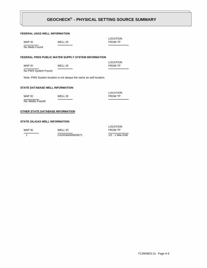
TC3909823.2s Page A-9
1/2 - 1 Mile ENECAOG9A000003071 1
STATE OIL/GAS WELL INFORMATION
LOCATIONFROM TPWELL IDMAP ID
OTHER STATE DATABASE INFORMATION
No Wells Found
STATE DATABASE WELL INFORMATION
LOCATIONFROM TPWELL IDMAP ID
Note: PWS System location is not always the same as well location.
No PWS System Found
FEDERAL FRDS PUBLIC WATER SUPPLY SYSTEM INFORMATION
LOCATIONFROM TPWELL IDMAP ID
No Wells Found
FEDERAL USGS WELL INFORMATION
LOCATIONFROM TPWELL IDMAP ID
®GEOCHECK - PHYSICAL SETTING SOURCE SUMMARY®

EDR Inc.EDR Inc.EDR Inc.EDR Inc.EDR Inc.EDR Inc.EDR Inc.EDR Inc.EDR Inc.EDR Inc.EDR Inc.EDR Inc.EDR Inc.EDR Inc.EDR Inc.EDR Inc.EDR Inc.EDR Inc.EDR Inc.EDR Inc.EDR Inc.EDR Inc.EDR Inc.EDR Inc.EDR Inc.EDR Inc.EDR Inc.EDR Inc.EDR Inc.EDR Inc.EDR Inc.EDR Inc.EDR Inc.EDR Inc.EDR Inc.EDR Inc.EDR Inc.EDR Inc.EDR Inc.EDR Inc.
8 0
8 04 0 8
0
1 2 0 16
0
2 0 020
0
200
1 60
12
08
08
01
20
16
0
2 0 0
2
0 0
80
8 0
8 0
40
20
0
8 0
8 0
8 0
4 0
4 01 6
0
16
0
12 0
12
0
80
1
2 08
0
8 0
80
8 0
80
40
4 0
40
40
40
8
0
80
20
0
80
20
0
20 0
1 2 0
1
2 0
2 0 016 0 1 6 0
1 6 01
60
2 0 02 0 02 0 0
200
20
0
1
20
20
0
200
2 0 0
8 0
2
24
0
240
24
0
16 0
16 0
1 2 0
1 2 0
80
40
40
CA

TC3909823.2s Page A-11
Date: 04/06/1999Average Water Depth: 7.71Deep Water Depth: Not ReportedShallow Water Depth: Not ReportedGroundwater Flow: VariesSite ID: 083000246TB7
NW1/2 - 1 MileHigher
54864AQUIFLOW
Date: 04/06/1999Average Water Depth: 7.71Deep Water Depth: Not ReportedShallow Water Depth: Not ReportedGroundwater Flow: VariesSite ID: 083000246TB6
NW1/2 - 1 MileHigher
54863AQUIFLOW
Date: 12/13/1994Average Water Depth: 15Deep Water Depth: Not ReportedShallow Water Depth: Not ReportedGroundwater Flow: Not ReportedSite ID: 083002357T5
East1/2 - 1 MileHigher
67220AQUIFLOW
Date: 12/04/1998Average Water Depth: Not ReportedDeep Water Depth: 10Shallow Water Depth: 5Groundwater Flow: Not ReportedSite ID: 083002129TA4
North1/4 - 1/2 MileHigher
65121AQUIFLOW
Date: 09/30/1998Average Water Depth: Not ReportedDeep Water Depth: 95Shallow Water Depth: 75Groundwater Flow: Not ReportedSite ID: 083000280TA3
North1/4 - 1/2 MileHigher
54859AQUIFLOW
Date: 09/30/1998Average Water Depth: Not ReportedDeep Water Depth: 95Shallow Water Depth: 75Groundwater Flow: Not ReportedSite ID: 083000280TA2
North1/4 - 1/2 MileHigher
54860AQUIFLOW
Date: 03/17/1992Average Water Depth: Not ReportedDeep Water Depth: 5.14Shallow Water Depth: 2.35Groundwater Flow: VariesSite ID: 083001024T1
South0 - 1/8 MileHigher
67205AQUIFLOW
Map IDDirectionDistanceElevation EDR ID NumberDatabase
®GEOCHECK - PHYSICAL SETTING SOURCE MAP FINDINGS®

TC3909823.2s Page A-12
CAOG9A000003071Site id:POGGissymbol:/ /Completion:/ /Abandonedd:Not ReportedRedrillfoo:Not ReportedWelldeptha:30-DEC-99Spuddate:NConfidenti:NHydraulica:NEpawell:1Wellnumber:Not ReportedLeasename:
Not ReportedComments:hudGissourcec:-117.878045Glong:33.609017Glat:Not ReportedLocationde:
Not ReportedElevation:SBBasemeridi:10WRange:06STownship:
36Section:Any AreaAreaname:
Any FieldFieldname:OrangeCountyname:Coalinga-Mohawk Oil Co.Operatorna:
PWellstatus:NDryhole:Not ReportedRedrillcan:NBlmwell:05900891Apinumber:1Districtnu:
1ENE1/2 - 1 Mile
CAOG9A000003071OIL_GAS
Map IDDirectionDistance EDR ID NumberDatabase
®GEOCHECK - PHYSICAL SETTING SOURCE MAP FINDINGS®

TC3909823.2s Page A-13
Not ReportedNot ReportedNot ReportedNot ReportedBasementNot ReportedNot ReportedNot ReportedNot ReportedLiving Area - 2nd Floor0%0%100%0.763 pCi/LLiving Area - 1st Floor
% >20 pCi/L% 4-20 pCi/L% <4 pCi/LAverage ActivityArea
Number of sites tested: 30
Federal Area Radon Information for ORANGE COUNTY, CA
: Zone 3 indoor average level < 2 pCi/L. : Zone 2 indoor average level >= 2 pCi/L and <= 4 pCi/L. Note: Zone 1 indoor average level > 4 pCi/L.
Federal EPA Radon Zone for ORANGE County: 3
AREA RADON INFORMATION
®GEOCHECK - PHYSICAL SETTING SOURCE MAP FINDINGSRADON
®

TOPOGRAPHIC INFORMATION
USGS 7.5’ Digital Elevation Model (DEM)Source: United States Geologic SurveyEDR acquired the USGS 7.5’ Digital Elevation Model in 2002 and updated it in 2006. The 7.5 minute DEM correspondsto the USGS 1:24,000- and 1:25,000-scale topographic quadrangle maps. The DEM provides elevation datawith consistent elevation units and projection.
Scanned Digital USGS 7.5’ Topographic Map (DRG)Source: United States Geologic SurveyA digital raster graphic (DRG) is a scanned image of a U.S. Geological Survey topographic map. The map imagesare made by scanning published paper maps on high-resolution scanners. The raster imageis georeferenced and fit to the Universal Transverse Mercator (UTM) projection.
HYDROLOGIC INFORMATION
Flood Zone Data: This data, available in select counties across the country, was obtained by EDR in 2003 & 2011 from the FederalEmergency Management Agency (FEMA). Data depicts 100-year and 500-year flood zones as defined by FEMA.
NWI: National Wetlands Inventory. This data, available in select counties across the country, was obtained by EDRin 2002, 2005 and 2010 from the U.S. Fish and Wildlife Service.
HYDROGEOLOGIC INFORMATION
AQUIFLOW Information SystemR
Source: EDR proprietary database of groundwater flow informationEDR has developed the AQUIFLOW Information System (AIS) to provide data on the general direction of groundwater
flow at specific points. EDR has reviewed reports submitted to regulatory authorities at select sites and hasextracted the date of the report, hydrogeologically determined groundwater flow direction and depth to water tableinformation.
GEOLOGIC INFORMATION
Geologic Age and Rock Stratigraphic UnitSource: P.G. Schruben, R.E. Arndt and W.J. Bawiec, Geology of the Conterminous U.S. at 1:2,500,000 Scale - A digitalrepresentation of the 1974 P.B. King and H.M. Beikman Map, USGS Digital Data Series DDS - 11 (1994).
STATSGO: State Soil Geographic DatabaseSource: Department of Agriculture, Natural Resources Conservation ServicesThe U.S. Department of Agriculture’s (USDA) Natural Resources Conservation Service (NRCS) leads the nationalConservation Soil Survey (NCSS) and is responsible for collecting, storing, maintaining and distributing soilsurvey information for privately owned lands in the United States. A soil map in a soil survey is a representationof soil patterns in a landscape. Soil maps for STATSGO are compiled by generalizing more detailed (SSURGO)soil survey maps.
SSURGO: Soil Survey Geographic DatabaseSource: Department of Agriculture, Natural Resources Conservation Services (NRCS)Telephone: 800-672-5559SSURGO is the most detailed level of mapping done by the Natural Resources Conservation Services, mappingscales generally range from 1:12,000 to 1:63,360. Field mapping methods using national standards are used toconstruct the soil maps in the Soil Survey Geographic (SSURGO) database. SSURGO digitizing duplicates theoriginal soil survey maps. This level of mapping is designed for use by landowners, townships and countynatural resource planning and management.
TC3909823.2s Page A-8
PHYSICAL SETTING SOURCE RECORDS SEARCHED

LOCAL / REGIONAL WATER AGENCY RECORDS
FEDERAL WATER WELLS
PWS: Public Water SystemsSource: EPA/Office of Drinking WaterTelephone: 202-564-3750Public Water System data from the Federal Reporting Data System. A PWS is any water system which provides water to at
least 25 people for at least 60 days annually. PWSs provide water from wells, rivers and other sources.
PWS ENF: Public Water Systems Violation and Enforcement DataSource: EPA/Office of Drinking WaterTelephone: 202-564-3750Violation and Enforcement data for Public Water Systems from the Safe Drinking Water Information System (SDWIS) after
August 1995. Prior to August 1995, the data came from the Federal Reporting Data System (FRDS).
USGS Water Wells: USGS National Water Inventory System (NWIS)This database contains descriptive information on sites where the USGS collects or has collected data on surfacewater and/or groundwater. The groundwater data includes information on wells, springs, and other sources of groundwater.
STATE RECORDS
Water Well DatabaseSource: Department of Water ResourcesTelephone: 916-651-9648
California Drinking Water Quality DatabaseSource: Department of Public HealthTelephone: 916-324-2319The database includes all drinking water compliance and special studies monitoring for the state of California
since 1984. It consists of over 3,200,000 individual analyses along with well and water system information.
OTHER STATE DATABASE INFORMATION
California Oil and Gas Well LocationsSource: Department of ConservationTelephone: 916-323-1779Oil and Gas well locations in the state.
RADON
State Database: CA RadonSource: Department of Health ServicesTelephone: 916-324-2208Radon Database for California
Area Radon InformationSource: USGSTelephone: 703-356-4020The National Radon Database has been developed by the U.S. Environmental Protection Agency(USEPA) and is a compilation of the EPA/State Residential Radon Survey and the National Residential Radon Survey.The study covers the years 1986 - 1992. Where necessary data has been supplemented by information collected atprivate sources such as universities and research institutions.
EPA Radon ZonesSource: EPATelephone: 703-356-4020Sections 307 & 309 of IRAA directed EPA to list and identify areas of U.S. with the potential for elevated indoorradon levels.
TC3909823.2s Page A-9
PHYSICAL SETTING SOURCE RECORDS SEARCHED

OTHER
Airport Landing Facilities: Private and public use landing facilitiesSource: Federal Aviation Administration, 800-457-6656
Epicenters: World earthquake epicenters, Richter 5 or greaterSource: Department of Commerce, National Oceanic and Atmospheric Administration
California Earthquake Fault Lines: The fault lines displayed on EDR’s Topographic map are digitized quaternary fault lines,prepared in 1975 by the United State Geological Survey. Additional information (also from 1975) regarding activity at specific faultlines comes from California’s Preliminary Fault Activity Map prepared by the California Division of Mines and Geology.
STREET AND ADDRESS INFORMATION
© 2010 Tele Atlas North America, Inc. All rights reserved. This material is proprietary and the subject of copyright protectionand other intellectual property rights owned by or licensed to Tele Atlas North America, Inc. The use of this material is subjectto the terms of a license agreement. You will be held liable for any unauthorized copying or disclosure of this material.
TC3909823.2s Page A-10
PHYSICAL SETTING SOURCE RECORDS SEARCHED

4/30/2014 GeoTracker
http://geotracker.waterboards.ca.gov/map/?global_id=T0605900810 1/1
LINK TO THIS MAP
MAP AN ADDRESS: Go!
GEOTRACKER
SIGNIFIES A CLOSED SITE
Leaking Underground Tank
(LUST) Cleanup Sites
Other Cleanup Sites
Land Disposal Sites
Military Sites
WDR Sites
Irrigated Lands Regulatory
Program
Permitted Underground
Storage Tank (UST) Facilities
Monitoring Wells
DTSC Cleanup Sites
DTSC Haz Waste Permit
640x480
Site List - EXPORT TO EXCEL
3 Sites
LAYERS
MAP SIZE
OPTIONS
Map data ©2014 GoogleReport a map error100 m
SHOW SITES WITHIN 1000 FEET OF THE FOLLOWING ADDRESS: Go
SITE LISTSITE NAME GLOBAL ID STATUS ADDRESS CITY
MOBIL #18-HG7 T0605900496 COMPLETED - CASE CLOSED 1500 BALBOA NEWPORT BEACH
UNOCAL #1299 T0605900810 COMPLETED - CASE CLOSED 124 MARINE NEWPORT BEACH
US COAST GUARD PATROL BASE 80001151 INACTIVE - NEEDS EVALUATION NEWPORT BEACH
Measure a Distance

4/30/2014 GeoTracker
http://geotracker.waterboards.ca.gov/profile_report.asp?global_id=T0605900810 1/1
Copyright © 2014 State of California
0.3945313 seconds
UNOCAL #1299 (T0605900810) - (MAP) SIGN UP FOR EMAIL ALERTS
124 MARINENEWPORT BEACH, CA 92662ORANGE COUNTYLUST CLEANUP SITE PRINTABLE CASE SUMMARY
CLEANUP OVERSIGHT AGENCIESORANGE COUNTY LOP (LEAD) - CASE #: 88UT146
CASEWORKER: DENAMARIE BAKER
SANTA ANA RWQCB (REGION 8) - CASE #: 083001024T
CASEWORKER: NANCY OLSON-MARTIN
CUF Claim #: 7560
CUF Priority Assigned: D
CUF Amount Paid:
Regulatory Profile
CLEANUP STATUS - DEFINITIONS
COMPLETED - CASE CLOSED AS OF 2/3/1993 - CLEANUP STATUS HISTORY
POTENTIAL CONTAMINANTS OF CONCERNGASOLINE, WASTE OIL / MOTOR / HYDRAULIC /LUBRICATING
POTENTIAL MEDIA AFFECTEDOTHER GROUNDWATER (USES OTHER THANDRINKING WATER)
FILE LOCATIONLOCAL AGENCY
BENEFICIAL USESW - MARINE HABITAT
Site History
No site history available

APPENDIX C: DOCUMENTATION

Soil Map—Orange County and Part of Riverside County, California
Natural ResourcesConservation Service
Web Soil SurveyNational Cooperative Soil Survey
4/14/2014Page 1 of 3
3718
770
3718
790
3718
810
3718
830
3718
850
3718
870
3718
890
3718
910
3718
930
3718
950
3718
770
3718
790
3718
810
3718
830
3718
850
3718
870
3718
890
3718
910
3718
930
3718
950
417460 417480 417500 417520 417540 417560 417580 417600
417460 417480 417500 417520 417540 417560 417580 417600
33° 36' 25'' N11
7° 5
3' 2
3'' W
33° 36' 25'' N
117°
53'
17'
' W
33° 36' 19'' N
117°
53'
23'
' W
33° 36' 19'' N
117°
53'
17'
' W
N
Map projection: Web Mercator Corner coordinates: WGS84 Edge tics: UTM Zone 11N WGS840 45 90 180 270
Feet0 10 20 40 60
MetersMap Scale: 1:946 if printed on A portrait (8.5" x 11") sheet.

MAP LEGEND MAP INFORMATION
Area of Interest (AOI)Area of Interest (AOI)
SoilsSoil Map Unit Polygons
Soil Map Unit Lines
Soil Map Unit Points
Special Point FeaturesBlowout
Borrow Pit
Clay Spot
Closed Depression
Gravel Pit
Gravelly Spot
Landfill
Lava Flow
Marsh or swamp
Mine or Quarry
Miscellaneous Water
Perennial Water
Rock Outcrop
Saline Spot
Sandy Spot
Severely Eroded Spot
Sinkhole
Slide or Slip
Sodic Spot
Spoil Area
Stony Spot
Very Stony Spot
Wet Spot
Other
Special Line Features
Water FeaturesStreams and Canals
TransportationRails
Interstate Highways
US Routes
Major Roads
Local Roads
BackgroundAerial Photography
The soil surveys that comprise your AOI were mapped at 1:24,000.
Warning: Soil Map may not be valid at this scale.
Enlargement of maps beyond the scale of mapping can causemisunderstanding of the detail of mapping and accuracy of soil lineplacement. The maps do not show the small areas of contrastingsoils that could have been shown at a more detailed scale.
Please rely on the bar scale on each map sheet for mapmeasurements.
Source of Map: Natural Resources Conservation ServiceWeb Soil Survey URL: http://websoilsurvey.nrcs.usda.govCoordinate System: Web Mercator (EPSG:3857)
Maps from the Web Soil Survey are based on the Web Mercatorprojection, which preserves direction and shape but distortsdistance and area. A projection that preserves area, such as theAlbers equal-area conic projection, should be used if more accuratecalculations of distance or area are required.
This product is generated from the USDA-NRCS certified data as ofthe version date(s) listed below.
Soil Survey Area: Orange County and Part of Riverside County,CaliforniaSurvey Area Data: Version 7, Jan 15, 2014
Soil map units are labeled (as space allows) for map scales 1:50,000or larger.
Date(s) aerial images were photographed: May 3, 2010—Jun 19,2010
The orthophoto or other base map on which the soil lines werecompiled and digitized probably differs from the backgroundimagery displayed on these maps. As a result, some minor shiftingof map unit boundaries may be evident.
Soil Map—Orange County and Part of Riverside County, California
Natural ResourcesConservation Service
Web Soil SurveyNational Cooperative Soil Survey
4/14/2014Page 2 of 3

Map Unit Legend
Orange County and Part of Riverside County, California (CA678)
Map Unit Symbol Map Unit Name Acres in AOI Percent of AOI
115 Beaches 2.1 71.8%
227 Water 0.8 28.2%
Totals for Area of Interest 3.0 100.0%
Soil Map—Orange County and Part of Riverside County, California
Natural ResourcesConservation Service
Web Soil SurveyNational Cooperative Soil Survey
4/14/2014Page 3 of 3


EDR Historical Topographic Map Report
Park Avenue Bridge Replacement Project
NA
Newport Beach, CA 92662
Inquiry Number: 3909823.4
April 14, 2014

EDR Historical Topographic Map Report
Environmental Data Resources, Inc.s (EDR) Historical Topographic Map Report is designed to assist professionals inevaluating potential liability on a target property resulting from past activities. EDRs Historical Topographic Map Reportincludes a search of a collection of public and private color historical topographic maps, dating back to the early 1900s.
Thank you for your business.Please contact EDR at 1-800-352-0050
with any questions or comments.
Disclaimer - Copyright and Trademark Notice
This Report contains certain information obtained from a variety of public and other sources reasonably available to Environmental Data Resources, Inc.It cannot be concluded from this Report that coverage information for the target and surrounding properties does not exist from other sources. NOWARRANTY EXPRESSED OR IMPLIED, IS MADE WHATSOEVER IN CONNECTION WITH THIS REPORT. ENVIRONMENTAL DATARESOURCES, INC. SPECIFICALLY DISCLAIMS THE MAKING OF ANY SUCH WARRANTIES, INCLUDING WITHOUT LIMITATION,MERCHANTABILITY OR FITNESS FOR A PARTICULAR USE OR PURPOSE. ALL RISK IS ASSUMED BY THE USER. IN NO EVENT SHALLENVIRONMENTAL DATA RESOURCES, INC. BE LIABLE TO ANYONE, WHETHER ARISING OUT OF ERRORS OR OMISSIONS, NEGLIGENCE,ACCIDENT OR ANY OTHER CAUSE, FOR ANY LOSS OF DAMAGE, INCLUDING, WITHOUT LIMITATION, SPECIAL, INCIDENTAL,CONSEQUENTIAL, OR EXEMPLARY DAMAGES. ANY LIABILITY ON THE PART OF ENVIRONMENTAL DATA RESOURCES, INC. IS STRICTLYLIMITED TO A REFUND OF THE AMOUNT PAID FOR THIS REPORT. Purchaser accepts this Report AS IS. Any analyses, estimates, ratings,environmental risk levels or risk codes provided in this Report are provided for illustrative purposes only, and are not intended to provide, nor should theybe interpreted as providing any facts regarding, or prediction or forecast of, any environmental risk for any property. Only a Phase I Environmental SiteAssessment performed by an environmental professional can provide information regarding the environmental risk for any property. Additionally, theinformation provided in this Report is not to be construed as legal advice.
Copyright 2014 by Environmental Data Resources, Inc. All rights reserved. Reproduction in any media or format, in whole or in part, of any report or mapof Environmental Data Resources, Inc., or its affiliates, is prohibited without prior written permission.
EDR and its logos (including Sanborn and Sanborn Map) are trademarks of Environmental Data Resources, Inc. or its affiliates. All other trademarksused herein are the property of their respective owners.

Historical Topographic Map
→
NTARGET QUADTARGET QUADNAME: SANTA ANAMAP YEAR: 1901
SERIES: 15SCALE: 1:62500
SITE NAME: Park Avenue BridgeReplacement Project
ADDRESS: NANewport Beach, CA 92662
LAT/LONG: 33.6064 / -117.889
CLIENT: RBF ConsultingCONTACT: Kristen BogueINQUIRY#: 3909823.4RESEARCH DATE: 04/14/2014

Historical Topographic Map
→
NTARGET QUADTARGET QUADNAME: SOUTHERN CA SHEET 1MAP YEAR: 1901
SERIES: 60SCALE: 1:250000
SITE NAME: Park Avenue BridgeReplacement Project
ADDRESS: NANewport Beach, CA 92662
LAT/LONG: 33.6064 / -117.889
CLIENT: RBF ConsultingCONTACT: Kristen BogueINQUIRY#: 3909823.4RESEARCH DATE: 04/14/2014

Historical Topographic Map
→
NTARGET QUADTARGET QUADNAME: CORONAMAP YEAR: 1902
SERIES: 30SCALE: 1:125000
SITE NAME: Park Avenue BridgeReplacement Project
ADDRESS: NANewport Beach, CA 92662
LAT/LONG: 33.6064 / -117.889
CLIENT: RBF ConsultingCONTACT: Kristen BogueINQUIRY#: 3909823.4RESEARCH DATE: 04/14/2014

Historical Topographic Map
→
NTARGET QUADTARGET QUADNAME: NEWPORT BEACHMAP YEAR: 1935
SERIES: 7.5SCALE: 1:31680
SITE NAME: Park Avenue BridgeReplacement Project
ADDRESS: NANewport Beach, CA 92662
LAT/LONG: 33.6064 / -117.889
CLIENT: RBF ConsultingCONTACT: Kristen BogueINQUIRY#: 3909823.4RESEARCH DATE: 04/14/2014

Historical Topographic Map
→
NTARGET QUADTARGET QUADNAME: SANTA ANAMAP YEAR: 1942
SERIES: 15SCALE: 1:50000
SITE NAME: Park Avenue BridgeReplacement Project
ADDRESS: NANewport Beach, CA 92662
LAT/LONG: 33.6064 / -117.889
CLIENT: RBF ConsultingCONTACT: Kristen BogueINQUIRY#: 3909823.4RESEARCH DATE: 04/14/2014

Historical Topographic Map
→
NTARGET QUADTARGET QUADNAME: NEWPORT BEACHMAP YEAR: 1951
SERIES: 7.5SCALE: 1:24000
SITE NAME: Park Avenue BridgeReplacement Project
ADDRESS: NANewport Beach, CA 92662
LAT/LONG: 33.6064 / -117.889
CLIENT: RBF ConsultingCONTACT: Kristen BogueINQUIRY#: 3909823.4RESEARCH DATE: 04/14/2014

Historical Topographic Map
→
NTARGET QUADTARGET QUADNAME: NEWPORT BEACHMAP YEAR: 1965
SERIES: 7.5SCALE: 1:24000
SITE NAME: Park Avenue BridgeReplacement Project
ADDRESS: NANewport Beach, CA 92662
LAT/LONG: 33.6064 / -117.889
CLIENT: RBF ConsultingCONTACT: Kristen BogueINQUIRY#: 3909823.4RESEARCH DATE: 04/14/2014

Historical Topographic Map
→
NTARGET QUADTARGET QUADNAME: NEWPORT BEACHMAP YEAR: 1972PHOTOREVISED FROM :1965SERIES: 7.5SCALE: 1:24000
SITE NAME: Park Avenue BridgeReplacement Project
ADDRESS: NANewport Beach, CA 92662
LAT/LONG: 33.6064 / -117.889
CLIENT: RBF ConsultingCONTACT: Kristen BogueINQUIRY#: 3909823.4RESEARCH DATE: 04/14/2014

Historical Topographic Map
→
NTARGET QUADTARGET QUADNAME: NEWPORT BEACHMAP YEAR: 1981PHOTOREVISED FROM :1965SERIES: 7.5SCALE: 1:24000
SITE NAME: Park Avenue BridgeReplacement Project
ADDRESS: NANewport Beach, CA 92662
LAT/LONG: 33.6064 / -117.889
CLIENT: RBF ConsultingCONTACT: Kristen BogueINQUIRY#: 3909823.4RESEARCH DATE: 04/14/2014

The EDR Aerial Photo Decade Package
Park Avenue Bridge Replacement Project
NA
Newport Beach, CA 92662
Inquiry Number: 3909823.9
April 17, 2014

EDR Aerial Photo Decade Package
Environmental Data Resources, Inc. (EDR) Aerial Photo Decade Package is a screening tool designed to assistenvironmental professionals in evaluating potential liability on a target property resulting from past activities. EDR’sprofessional researchers provide digitally reproduced historical aerial photographs, and when available, provide one photoper decade.
When delivered electronically by EDR, the aerial photo images included with this report are for ONE TIME USEONLY. Further reproduction of these aerial photo images is prohibited without permission from EDR. For moreinformation contact your EDR Account Executive.
Thank you for your business.Please contact EDR at 1-800-352-0050
with any questions or comments.
Disclaimer - Copyright and Trademark Notice
This Report contains certain information obtained from a variety of public and other sources reasonably available to Environmental Data Resources, Inc.It cannot be concluded from this Report that coverage information for the target and surrounding properties does not exist from other sources. NOWARRANTY EXPRESSED OR IMPLIED, IS MADE WHATSOEVER IN CONNECTION WITH THIS REPORT. ENVIRONMENTAL DATARESOURCES, INC. SPECIFICALLY DISCLAIMS THE MAKING OF ANY SUCH WARRANTIES, INCLUDING WITHOUT LIMITATION,MERCHANTABILITY OR FITNESS FOR A PARTICULAR USE OR PURPOSE. ALL RISK IS ASSUMED BY THE USER. IN NO EVENT SHALLENVIRONMENTAL DATA RESOURCES, INC. BE LIABLE TO ANYONE, WHETHER ARISING OUT OF ERRORS OR OMISSIONS, NEGLIGENCE,ACCIDENT OR ANY OTHER CAUSE, FOR ANY LOSS OF DAMAGE, INCLUDING, WITHOUT LIMITATION, SPECIAL, INCIDENTAL,CONSEQUENTIAL, OR EXEMPLARY DAMAGES. ANY LIABILITY ON THE PART OF ENVIRONMENTAL DATA RESOURCES, INC. IS STRICTLYLIMITED TO A REFUND OF THE AMOUNT PAID FOR THIS REPORT. Purchaser accepts this Report AS IS. Any analyses, estimates, ratings,environmental risk levels or risk codes provided in this Report are provided for illustrative purposes only, and are not intended to provide, nor should theybe interpreted as providing any facts regarding, or prediction or forecast of, any environmental risk for any property. Only a Phase I Environmental SiteAssessment performed by an environmental professional can provide information regarding the environmental risk for any property. Additionally, theinformation provided in this Report is not to be construed as legal advice.
Copyright 2014 by Environmental Data Resources, Inc. All rights reserved. Reproduction in any media or format, in whole or in part, of any report or mapof Environmental Data Resources, Inc., or its affiliates, is prohibited without prior written permission.
EDR and its logos (including Sanborn and Sanborn Map) are trademarks of Environmental Data Resources, Inc. or its affiliates. All other trademarksused herein are the property of their respective owners.

Date EDR Searched Historical Sources:Aerial PhotographyApril 17, 2014
Target Property:NA
Newport Beach, CA 92662
Year Scale Details Source
1927 Aerial Photograph. Scale: 1"=500' Flight Year: 1927 Fairchild
1938 Aerial Photograph. Scale: 1"=500' Flight Year: 1938 EDR
1947 Aerial Photograph. Scale: 1"=500' Flight Year: 1947 Fairchild
1952 Aerial Photograph. Scale: 1"=500' Flight Year: 1952 EDR
1963 Aerial Photograph. Scale: 1"=500' Flight Year: 1963 EDR
1972 Aerial Photograph. Scale: 1"=500' Flight Year: 1972 EDR
1983 Aerial Photograph. Scale: 1"=500' Flight Year: 1983 AMI
1990 Aerial Photograph. Scale: 1"=500' Flight Year: 1990 USGS
1995 Aerial Photograph. Scale: 1"=500' /DOQQ - acquisition dates: 1995 EDR
2005 Aerial Photograph. Scale: 1"=500' Flight Year: 2005 EDR
2009 Aerial Photograph. Scale: 1"=500' Flight Year: 2009 EDR
2010 Aerial Photograph. Scale: 1"=500' Flight Year: 2010 EDR
2012 Aerial Photograph. Scale: 1"=500' Flight Year: 2012 EDR
3909823.92

INQUIRY #:
YEAR:
3909823.9
1927
= 500'

INQUIRY #:
YEAR:
3909823.9
1938
= 500'

INQUIRY #:
YEAR:
3909823.9
1947
= 500'

INQUIRY #:
YEAR:
3909823.9
1952
= 500'

INQUIRY #:
YEAR:
3909823.9
1963
= 500'

INQUIRY #:
YEAR:
3909823.9
1972
= 500'

INQUIRY #:
YEAR:
3909823.9
1983
= 500'

INQUIRY #:
YEAR:
3909823.9
1990
= 500'

INQUIRY #:
YEAR:
3909823.9
1995
= 500'

INQUIRY #:
YEAR:
3909823.9
2005
= 500'
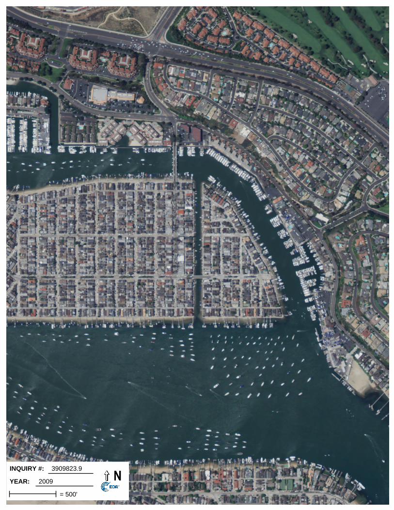
INQUIRY #:
YEAR:
3909823.9
2009
= 500'

INQUIRY #:
YEAR:
3909823.9
2010
= 500'

Certified Sanborn® Map Report
Park Avenue Bridge Replacement Project
NA
Newport Beach, CA 92662
Inquiry Number: 3909823.3
April 11, 2014

Certified Sanborn® Map Report 4/11/14
Site Name:Park Avenue BridgeNANewport Beach, CA 92662
Client Name:RBF Consulting14725 Alton ParkwayIrvine, CA 92618
Contact: Kristen BogueEDR Inquiry # 3909823.3
The Sanborn Library has been searched by EDR and maps covering the target property location as provided by RBFConsulting were identified for the years listed below. The Sanborn Library is the largest, most complete collection of fireinsurance maps. The collection includes maps from Sanborn, Bromley, Perris & Browne, Hopkins, Barlow, and others.Only Environmental Data Resources Inc. (EDR) is authorized to grant rights for commercial reproduction of maps by theSanborn Library LLC, the copyright holder for the collection. Results can be authenticated by visitingwww.edrnet.com/sanborn.
The Sanborn Library is continually enhanced with newly identified map archives. This report accesses all maps in thecollection as of the day this report was generated.
Certified Sanborn Results:
Site Name: Park Avenue Bridge Replacement ProjectAddress: NACity, State, Zip: Newport Beach, CA 92662Cross Street:P.O. # 130307Project: Phase I ISACertification # B438-489B-A9FF
Library of Congress
University Publications of America
EDR Private Collection
The Sanborn Library LLC Since 1866™
The Sanborn Library includes more than 1.2 millionfire insurance maps from Sanborn, Bromley, Perris &Browne, Hopkins, Barlow and others which trackhistorical property usage in approximately 12,000American cities and towns. Collections searched:
Sanborn® Library search resultsCertification # B438-489B-A9FF
Maps Provided:
1961
1959
1945
1929
1922
Limited Permission To Make CopiesRBF Consulting (the client) is permitted to make up to FIVE photocopies of this Sanborn Map transmittal and each fire insurance mapaccompanying this report solely for the limited use of its customer. No one other than the client is authorized to make copies. Upon request madedirectly to an EDR Account Executive, the client may be permitted to make a limited number of additional photocopies. This permission isconditioned upon compliance by the client, its customer and their agents with EDR's copyright policy; a copy of which is available upon request.
Disclaimer - Copyright and Trademark noticeThis Report contains certain information obtained from a variety of public and other sources reasonably available to Environmental Data Resources, Inc. It cannot beconcluded from this Report that coverage information for the target and surrounding properties does not exist from other sources. NO WARRANTY EXPRESSED ORIMPLIED, IS MADE WHATSOEVER IN CONNECTION WITH THIS REPORT. ENVIRONMENTAL DATA RESOURCES, INC. SPECIFICALLY DISCLAIMS THEMAKING OF ANY SUCH WARRANTIES, INCLUDING WITHOUT LIMITATION, MERCHANTABILITY OR FITNESS FOR A PARTICULAR USE OR PURPOSE. ALLRISK IS ASSUMED BY THE USER. IN NO EVENT SHALL ENVIRONMENTAL DATA RESOURCES, INC. BE LIABLE TO ANYONE, WHETHER ARISING OUT OFERRORS OR OMISSIONS, NEGLIGENCE, ACCIDENT OR ANY OTHER CAUSE, FOR ANY LOSS OF DAMAGE, INCLUDING, WITHOUT LIMITATION, SPECIAL,INCIDENTAL CONSEQUENTIAL, OR EXEMPLARY DAMAGES. ANY LIABILITY ON THE PART OF ENVIRONMENTAL DATA RESOURCES, INC. IS STRICTLYLIMITED TO A REFUND OF THE AMOUNT PAID FOR THIS REPORT. Purchaser accepts this Report "AS IS". Any analyses, estimates, ratings, environmental risklevels or risk codes provided in this Report are provided for illustrative purposes only, and are not intended to provide, nor should they be interpreted as providingany facts regarding, or prediction or forecast of, any environmental risk for any property. Only a Phase I Environmental Site Assessment performed by anenvironmental professional can provide information regarding the environmental risk for any property. Additionally, the information provided in this Report is not to beconstrued as legal advice.
Copyright 2014 by Environmental Data Resources, Inc. All rights reserved. Reproduction in any media or format, in whole or in part, of any report or map ofEnvironmental Data Resources, Inc., or its affiliates, is prohibited without prior written permission.
EDR and its logos (including Sanborn and Sanborn Map) are trademarks of Environmental Data Resources, Inc. or its affiliates. All other trademarks used herein arethe property of their respective owners.
3909823 - 3 page 2

Sanborn Sheet Thumbnails
This Certified Sanborn Map Report is based upon the following SanbornFire Insurance map sheets.
1961 Source Sheets
Volume 1, Sheet 22 Volume 1, Sheet 23 Volume 1, Sheet 24
1959 Source Sheets
Volume 1, Sheet 22 Volume 1, Sheet 23 Volume 1, Sheet 24
1945 Source Sheets
Volume 1, Sheet 22 Volume 1, Sheet 23 Volume 1, Sheet 24
1929 Source Sheets
Volume 1, Sheet 22 Volume 1, Sheet 23 Volume 1, Sheet 24
3909823 - 3 page 3

1922 Source Sheets
Volume 1, Sheet 9
3909823 - 3 page 4

1961 Certified Sanborn Map
B438-489B
-A9F
F
Order Date:EDR Inquiry:
Client:
Site Name:
Address:
City, ST, ZIP:
Certification #
Copyright: 1961
4/11/2014 8:56:00 PM3909823.3
RBF Consulting
Park Avenue Bridge Replacement Project
NA
Newport Beach CA 92662
B438-489B-A9FF
This Certified Sanborn Map combines the following sheets.Outlined areas indicate map sheets within the collection.
Volume 1, Sheet 22
Volume 1, Sheet 23
Volume 1, Sheet 24
0 Feet 150 300 600
3909823 - 3 page 5

1959 Certified Sanborn Map
B438-489B
-A9F
F
Order Date:EDR Inquiry:
Client:
Site Name:
Address:
City, ST, ZIP:
Certification #
Copyright: 1959
4/11/2014 8:56:00 PM3909823.3
RBF Consulting
Park Avenue Bridge Replacement Project
NA
Newport Beach CA 92662
B438-489B-A9FF
This Certified Sanborn Map combines the following sheets.Outlined areas indicate map sheets within the collection.
Volume 1, Sheet 22
Volume 1, Sheet 23
Volume 1, Sheet 24
0 Feet 150 300 600
3909823 - 3 page 6

1945 Certified Sanborn Map
B438-489B
-A9F
F
Order Date:EDR Inquiry:
Client:
Site Name:
Address:
City, ST, ZIP:
Certification #
Copyright: 1945
4/11/2014 8:56:00 PM3909823.3
RBF Consulting
Park Avenue Bridge Replacement Project
NA
Newport Beach CA 92662
B438-489B-A9FF
This Certified Sanborn Map combines the following sheets.Outlined areas indicate map sheets within the collection.
Volume 1, Sheet 22
Volume 1, Sheet 23
Volume 1, Sheet 24
0 Feet 150 300 600
3909823 - 3 page 7

1929 Certified Sanborn Map
B438-489B
-A9F
F
Order Date:EDR Inquiry:
Client:
Site Name:
Address:
City, ST, ZIP:
Certification #
Copyright: 1929
4/11/2014 8:56:00 PM3909823.3
RBF Consulting
Park Avenue Bridge Replacement Project
NA
Newport Beach CA 92662
B438-489B-A9FF
This Certified Sanborn Map combines the following sheets.Outlined areas indicate map sheets within the collection.
Volume 1, Sheet 22
Volume 1, Sheet 23
Volume 1, Sheet 24
0 Feet 150 300 600
3909823 - 3 page 8

1922 Certified Sanborn Map
B438-489B
-A9F
F
Order Date:EDR Inquiry:
Client:
Site Name:
Address:
City, ST, ZIP:
Certification #
Copyright: 1922
4/11/2014 8:56:00 PM3909823.3
RBF Consulting
Park Avenue Bridge Replacement Project
NA
Newport Beach CA 92662
B438-489B-A9FF
This Certified Sanborn Map combines the following sheets.Outlined areas indicate map sheets within the collection.
Volume 1, Sheet 9
0 Feet 150 300 600
3909823 - 3 page 9

Park Avenue Bridge Replacement Project
Park Avenue Bridge Replacement ProjectNewport Beach, CA 92662
Inquiry Number: 3909823.5April 15, 2014
The EDR-City Directory Abstract
6 Armstrong RoadShelton, CT 06484800.352.0050www.edrnet.comEnvironmental Data Resources IncEnvironmental Data Resources IncEnvironmental Data Resources IncEnvironmental Data Resources Inc

TABLE OF CONTENTS
SECTION
Executive Summary
Findings
City Directory Images
Thank you for your business. Please contact EDR at 1-800-352-0050
with any questions or comments.
Disclaimer - Copyright and Trademark Notice
This Report contains certain information obtained from a variety of public and other sources reasonably available to Environmental Data Resources, Inc. It cannot be concluded from this Report that coverage information for the target and surrounding properties does not exist from other sources. NO WARRANTY EXPRESSED OR IMPLIED, IS MADE WHATSOEVER IN CONNECTION WITH THIS REPORT. ENVIRONMENTAL DATA RESOURCES, INC. SPECIFICALLY DISCLAIMS THE MAKING OF ANY SUCH WARRANTIES, INCLUDING WITHOUT LIMITATION, MERCHANTABILITY OR FITNESS FOR A PARTICULAR USE OR PURPOSE. ALL RISK IS ASSUMED BY THE USER. IN NO EVENT SHALL ENVIRONMENTAL DATA RESOURCES, INC. BE LIABLE TO ANYONE, WHETHER ARISING OUT OF ERRORS OR OMISSIONS, NEGLIGENCE, ACCIDENT OR ANY OTHER CAUSE, FOR ANY LOSS OR DAMAGE, INCLUDING, WITHOUT LIMITATION, SPECIAL, INCIDENTAL, CONSEQUENTIAL, OR EXEMPLARY DAMAGES. ANY LIABILITY ON THE PART OF ENVIRONMENTAL DATA RESOURCES, INC. IS STRICTLY LIMITED TO A REFUND OF THE AMOUNT PAID FOR THIS REPORT. Purchaser accepts this Report "AS IS". Any analyses, estimates, ratings, environmental risk levels or risk codes provided in this Report are provided for illustrative purposes only, and are not intended to provide, nor should they be interpreted as providing any facts regarding, or prediction orforecast of, any environmental risk for any property. Only a Phase I Environmental Site Assessment performed by an environmental professional can provide information regarding the environmental risk for any property. Additionally, the information provided in this Report is not to be construed as legal advice.
Copyright 2013 by Environmental Data Resources, Inc. All rights reserved. Reproduction in any media or format, in whole or in part, of any report or map of Environmental Data Resources, Inc. or its affiliates is prohibited without prior written permission.
EDR and its logos (including Sanborn and Sanborn Map) are trademarks of Environmental Data Resources, Inc. or its affiliates. All other trademarks used herein are the property of their respective owners.

EXECUTIVE SUMMARY
DESCRIPTION
Environmental Data Resources, Inc.’s (EDR) City Directory Abstract is a screening tool designed to assist environmental professionals in evaluating potential liability on a target property resulting from past activities. EDR’s City Directory Abstract includes a search and abstract of available city directory data. For each address, the directory lists the name of the corresponding occupant at five year intervals.
Business directories including city, cross reference and telephone directories were reviewed, if available, at approximately five year intervals for the years spanning 1920 through 2013. This report compiles information gathered in this review by geocoding the latitude and longitude of properties identified and gathering information about properties within 660 feet of the target property.
A summary of the information obtained is provided in the text of this report.
RESEARCH SUMMARY
The following research sources were consulted in the preparation of this report. An "X" indicates where information was identified in the source and provided in this report.
Source TPYear Adjoining Text Abstract Source Image
2013 Cole Information Services - X X -
2008 Cole Information Services - X X -
2003 Cole Information Services - X X -
2002 Haines Company - X X -
2001 Pacific Telephone - - - -
1997 Pacific Bell - - - -
1995 Pacific Bell - X X -
1992 Pacific Bell - - - -
1991 Pacific Bell - X X -
1986 Pacific Bell - X X -
1980 Pacific Telephone - X X -
1975 Luskey Brothers & Co., Inc. - X X -
1971 Luskey Brothers Co., Inc. - - - -
1970 General Telephone Co., of California - X X -
1966 Pacific Telephone - X X -
1965 Ross Publications, Inc., - - - -
1961 Luskey Brothers & Co., - - - -
1960 Luskey Brothers & Co., - X X -
1956 Luskey Brothers & Co., Inc. - - - -
1955 The Pacific Telephone and Telegraph Co. - X X -
1952 Luskeys Directory Service Co. - - - -
1950 The Pacific Telephone and Telegraph Co. - X X -
1946 Southern California Telephone Co. - X X -
1945 McCutcheon & Bragonier - - - -
1941 Southern California Telephone Co. - - - -
3909823- 5 Page 1

EXECUTIVE SUMMARY
Source TPYear Adjoining Text Abstract Source Image
1936 Western Directory Co. - - - -
1930 Western Directory Co. - - - -
1926 Pacific Telephone - - - -
1925 Western Directory Co. - - - -
1922 Kaasen Directory Co. - - - -
1921 Western Directory Co. - - - -
1920 Santa Ana Directory Co. - - - -
3909823- 5 Page 2
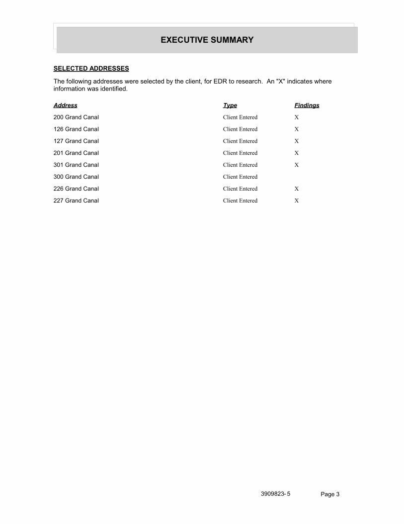
EXECUTIVE SUMMARY
SELECTED ADDRESSES
The following addresses were selected by the client, for EDR to research. An "X" indicates where information was identified.
Address Type Findings
200 Grand Canal Client Entered X
126 Grand Canal Client Entered X
127 Grand Canal Client Entered X
201 Grand Canal Client Entered X
301 Grand Canal Client Entered X
300 Grand Canal Client Entered
226 Grand Canal Client Entered X
227 Grand Canal Client Entered X
3909823- 5 Page 3

FINDINGS
TARGET PROPERTY INFORMATION
ADDRESS
Park Avenue Bridge Replacement ProjectNewport Beach, CA 92662
FINDINGS DETAIL
Target Property research detail.
3909823- 5 Page 4

FINDINGS
ADJOINING PROPERTY DETAIL
The following Adjoining Property addresses were researched for this report. Detailed findings are provided for each address.
ABALONE
212 ABALONE
Year Uses Source
1970 Schoenborn Mary General Telephone Co., of California
251 ABALONE
Year Uses Source
1970 Kirby Michael J R General Telephone Co., of California
ABALONE AVE
106 ABALONE AVE
Year Uses Source
2002 OJACOBSWaller Haines Company
1991 Jacobs Walter G Pacific Bell
Jacobs Well Christian Centre Pacific Bell
Power Sales Co Pacific Bell
1986 Power Sales Co Pacific Bell
Jacobs Walter G Pacific Bell
1980 Stone Eugene James Pacific Telephone
Martin Dave Pacific Telephone
1950 Stewart Richard I r The Pacific Telephone and Telegraph Co.
1946 Cass Alonzo B Dr r Southern California Telephone Co.
107 ABALONE AVE
Year Uses Source
2002 PROSTORJe I Haines Company
0 PROSTORJef Haines Company
1991 Loubet Pierre Pacific Bell
Louca Tarek E Pacific Bell
1986 Loubet J W Pacific Bell
1975 Loubet J W Luskey Brothers & Co., Inc.
Loubet Judith W psyclgst Luskey Brothers & Co., Inc.
1970 Loubet Jean General Telephone Co., of California
LOUBET WINGERT LOUBET General Telephone Co., of California
3909823- 5 Page 5

Year Uses Source
FINDINGS
Year Uses Source
1970 Loubet Judith W psyclgst General Telephone Co., of California
1950 Skinner E H r The Pacific Telephone and Telegraph Co.
1946 Ridgway Carroll r Southern California Telephone Co.
109 ABALONE AVE
Year Uses Source
1955 Mc Donald Geo D r The Pacific Telephone and Telegraph Co.
1950 Mc Donald Geo D r The Pacific Telephone and Telegraph Co.
1946 Mc Donald Geo D r Southern California Telephone Co.
110 ABALONE AVE
Year Uses Source
2002 LEWISAr/hur Haines Company
1991 Lewis E S Pacific Bell
1986 Lewis E S Pacific Bell
1980 Lewis Elizabeth Pacific Telephone
1975 Ogara Danl Luskey Brothers & Co., Inc.
Lewis Elizabeth Luskey Brothers & Co., Inc.
1955 Godber G R r The Pacific Telephone and Telegraph Co.
1950 Godber G R r The Pacific Telephone and Telegraph Co.
1946 Kercheval Leonard I Maj r Southern California Telephone Co.
Henderson R H r Southern California Telephone Co.
111 ABALONE AVE
Year Uses Source
2002 WITT Bas Haines Company
1995 Driver Julie Pacific Bell
Driver T & E Pacific Bell
1991 Driver T & E Pacific Bell
Driver Julie Pacific Bell
1986 Driver Julie Pacific Bell
1980 Driver Julie Pacific Telephone
1975 Jordan Richard V Luskey Brothers & Co., Inc.
112 ABALONE AVE
Year Uses Source
2002 OVOLK Richard Haines Company
1995 Havlken Robt C Dr Pacific Bell
1991 Haviken Robt C Dr Pacific Bell
1986 Haviken Robt C Dr Pacific Bell
3909823- 5 Page 6

Year Uses Source
FINDINGS
Year Uses Source
1980 Haviken K Pacific Telephone
Haviken Robt C Dr Pacific Telephone
1975 Haviken Robt C Dr Luskey Brothers & Co., Inc.
1970 Havlken Robt C Dr General Telephone Co., of California
1950 Clark John D r The Pacific Telephone and Telegraph Co.
1946 Robertson Alex r Southern California Telephone Co.
115 ABALONE AVE
Year Uses Source
2002 OERBERTJohn Haines Company
1991 Clendening Warren E Pacific Bell
Griffen C Evan Pacific Bell
1986 Allen Audrey W Pacific Bell
Clendenlng Warren E Pacific Bell
1980 Clendeniig Warren E Pacific Telephone
Sutton K D Pacific Telephone
1975 Clendening Warren E Luskey Brothers & Co., Inc.
Clendening Warren E Luskey Brothers & Co., Inc.
116 ABALONE AVE
Year Uses Source
2002 PODLEYWilliam Haines Company
WILLIAMSCa Haines Company
WILLIAMS R Haines Company
1995 Woods Geo C Pacific Bell
1991 Woods Geo C Pacific Bell
1980 Woods Geo C Jr i S Apolena Av Sal Is Pacific Telephone
Woods Go C Pacific Telephone
1975 Woods Geo C Luskey Brothers & Co., Inc.
1950 Harper W B r The Pacific Telephone and Telegraph Co.
1946 Harper W B r Southern California Telephone Co.
117 ABALONE AVE
Year Uses Source
2002 CHASELee Haines Company
Chase Haines Company
FRANDSEN Cy Haines Company
1995 Chase Lee & Suzanne Pacific Bell
Thielen Cynthia & Mickey Pacific Bell
3909823- 5 Page 7

Year Uses Source
FINDINGS
Year Uses Source
1991 Chase Steven H Pacific Bell
1986 Chase Lee & Suzanne Pacific Bell
1980 Thielen Cynthia Pacific Telephone
Chase Leo & Suzanne Pacific Telephone
1975 Vandling Larry M Luskey Brothers & Co., Inc.
Chase Lee A Luskey Brothers & Co., Inc.
Vandling Larry M Luskey Brothers & Co., Inc.
1970 Chase Lee A General Telephone Co., of California
118 ABALONE AVE
Year Uses Source
2002 OMIRECKI Beverly Haines Company
1980 Vanderburg Herbert Pacific Telephone
1975 Vanderburg Herbert Luskey Brothers & Co., Inc.
Richwine R E Luskey Brothers & Co., Inc.
1970 Vanderburg Herbert General Telephone Co., of California
1950 Hartman Don Lee r The Pacific Telephone and Telegraph Co.
Hartman Don Lee r The Pacific Telephone and Telegraph Co.
119 ABALONE AVE
Year Uses Source
2002 HUNTThomas E Haines Company
1995 Hunt Thos E Pacific Bell
1991 Purnell Harry G Pacific Bell
Hunt EThos E Pacific Bell
1986 Hunt Thos E Pacific Bell
1980 Hunt Thos E Pacific Telephone
1975 Purnell Harry G Luskey Brothers & Co., Inc.
1950 Mayers Henry r The Pacific Telephone and Telegraph Co.
120 ABALONE AVE
Year Uses Source
2002 FARMER Robt L Haines Company
FARMER Er/ C Haines Company
FARMEREnc C Haines Company
1995 Farmer Robt L Pacific Bell
1986 Farmer Robt L Pacific Bell
Farmer Eric C Pacific Bell
1980 Anchor Mooring Co Pacific Telephone
3909823- 5 Page 8

Year Uses Source
FINDINGS
Year Uses Source
1980 Farmer Robt L Pacific Telephone
1975 Hanauer Eric Luskey Brothers & Co., Inc.
Farmer Robt L Luskey Brothers & Co., Inc.
1970 Farmner Robt L General Telephone Co., of California
1950 Grant Burton S r The Pacific Telephone and Telegraph Co.
121 ABALONE AVE
Year Uses Source
2002 COOKDouglas Haines Company
1995 Cook Douglas Pacific Bell
1991 Cook Douglas Pacific Bell
1986 Cook Douglas Pacific Bell
1980 Cook David Pacific Telephone
Cook Douglas Pacific Telephone
1975 Sibley Hiram S Luskey Brothers & Co., Inc.
Cook Douglas Luskey Brothers & Co., Inc.
1970 Cook W Douglas General Telephone Co., of California
Sibley Hiram S General Telephone Co., of California
122 ABALONE AVE
Year Uses Source
2002 DUMLER Haines Company
HAND Deborah Haines Company
1995 Nichols Cheryl& Pat Pacific Bell
1991 Horwitt Danielle Pacific Bell
Horwitz Alan & Cindy Pacific Bell
Horwitl Laq B Pacific Bell
Hand Milton N Pacific Bell
1986 Hand Milton N Pacific Bell
1980 Hand Milton N Pacific Telephone
1975 Hand Milton N Luskey Brothers & Co., Inc.
1955 Lavagnino Emanuele The Pacific Telephone and Telegraph Co.
1950 Lavagnino Emanuele r The Pacific Telephone and Telegraph Co.
123 ABALONE AVE
Year Uses Source
2002 ODEWI Douglas H Haines Company
1995 De Witt Douglas H Pacific Bell
1991 De Witt Douglas H Pacific Bell
3909823- 5 Page 9

Year Uses Source
FINDINGS
Year Uses Source
1986 De Witt Douglas H Pacific Bell
1980 De Witt Douglas H Pacific Telephone
1975 De Witt Douglas H Luskey Brothers & Co., Inc.
1970 De Witt Douglas H General Telephone Co., of California
1950 Von Breton Hal r The Pacific Telephone and Telegraph Co.
1946 Von Boeton Hal r Southern California Telephone Co.
124 ABALONE AVE
Year Uses Source
2002 A ROGERS Sam L Haines Company
Ol KESonia Haines Company
1995 Rogers Sam L Pacific Bell
1986 Alexander M T Pacific Bell
1980 Alexander MT Pacific Telephone
ALE XAN DE R MACHIN E Pacific Telephone
1975 Alexander M T Luskey Brothers & Co., Inc.
1970 Alexander M T General Telephone Co., of California
125 ABALONE AVE
Year Uses Source
2002 XXXX Haines Company
1991 Sachsman D B Pacific Bell
Sachsman David Pacific Bell
1975 Angle Geo L Luskey Brothers & Co., Inc.
1970 Vilagra a R J General Telephone Co., of California
1955 Villagrana R J r The Pacific Telephone and Telegraph Co.
1950 Villagrana R J r The Pacific Telephone and Telegraph Co.
1946 Villagrana R J r Southern California Telephone Co.
126 ABALONE AVE
Year Uses Source
2002 0 DONAH 0 EJH Haines Company
1995 Donahue E A & J H Pacific Bell
Falardeau J P Pacific Bell
1991 Donahue E A & J H Pacific Bell
Donahue E J Jr Pacific Bell
Donahue Elaine M Pacific Bell
Donahue Frank C Pacific Bell
1986 Holmes Byron M Pacific Bell
3909823- 5 Page 10

Year Uses Source
FINDINGS
Year Uses Source
1980 Holmes Byron M Pacific Telephone
1975 Holmes Byron M Luskey Brothers & Co., Inc.
Holmes Byron M Luskey Brothers & Co., Inc.
1970 Holmes Byron M General Telephone Co., of California
127 ABALONE AVE
Year Uses Source
2003 OSTERKAMP JOHN A MD Cole Information Services
2002 OOSTERKAMPJohn Haines Company
1980 Forman Leon MD Pacific Telephone
1975 Otto Rick Luskey Brothers & Co., Inc.
Otto Lois Luskey Brothers & Co., Inc.
Otto Doug Luskey Brothers & Co., Inc.
Beyer Alan Luskey Brothers & Co., Inc.
1970 Otto Will F General Telephone Co., of California
1950 Hagerty Kerrwin r The Pacific Telephone and Telegraph Co.
Hagerty Kerrwin r The Pacific Telephone and Telegraph Co.
1946 Flemming Marian Mrs r Southern California Telephone Co.
Smith Dixon H r Southern California Telephone Co.
200 ABALONE AVE
Year Uses Source
2002 00 ROURKE Leslae Haines Company
1970 Retchling Wm H General Telephone Co., of California
1955 Hyer Nona r The Pacific Telephone and Telegraph Co.
1950 Hyer Nona r The Pacific Telephone and Telegraph Co.
201 ABALONE AVE
Year Uses Source
1980 Dunlap Mickey Pacific Telephone
1975 Dunlap Mickey Luskey Brothers & Co., Inc.
1946 Abbott M A Mrs r Southern California Telephone Co.
202 ABALONE AVE
Year Uses Source
2002 OSEGARDons Haines Company
1995 Rice Jas S Pacific Bell
1991 Rice Jas S Pacific Bell
1986 Rice Jas S Pacific Bell
1980 Gatti Marilyn Pacific Telephone
3909823- 5 Page 11

Year Uses Source
FINDINGS
Year Uses Source
1975 Wakefield Paula Luskey Brothers & Co., Inc.
Easley David W Luskey Brothers & Co., Inc.
1970 Easley David W General Telephone Co., of California
1950 Locke Houston r The Pacific Telephone and Telegraph Co.
1946 Bohman Curt r Southern California Telephone Co.
204 ABALONE AVE
Year Uses Source
2002 LANDON Jerrold E Haines Company
1995 Landon Jerrold E Pacific Bell
1991 Landon Jerrold E Pacific Bell
1980 Hocker Kim & Lori Pacific Telephone
1975 Hargraves Lazella B Luskey Brothers & Co., Inc.
1970 Hargraves Laze la B General Telephone Co., of California
1950 Black Jacqueline r The Pacific Telephone and Telegraph Co.
Robinson Marcella r The Pacific Telephone and Telegraph Co.
1946 Reid Karl D r Southern California Telephone Co.
205 ABALONE AVE
Year Uses Source
2003 DEWINE MELOYDE Cole Information Services
2002 A HUNTER Kalherne Haines Company
OBANASPatrck Haines Company
1995 De Wine Meloyde Pacific Bell
Dewine Sean Pacific Bell
1980 Roberts Robert U Pacific Telephone
Roberts R Pacific Telephone
1975 Hardesty K J Luskey Brothers & Co., Inc.
1970 Swift Kenneth R General Telephone Co., of California
206 ABALONE AVE
Year Uses Source
2002 JONESM Haines Company
1995 Jones Milton Pacific Bell
1991 Labus Kim Pacific Bell
Jones Morgan Pacific Bell
Jones Monica C Pacific Bell
Jones Milton Pacific Bell
1986 Jones Milton Pacific Bell
3909823- 5 Page 12

Year Uses Source
FINDINGS
Year Uses Source
1980 Manuell Philip A& Deborah Pacific Telephone
1975 Olsen Kenneth K Luskey Brothers & Co., Inc.
1970 Stromberg Lloyd L General Telephone Co., of California
207 ABALONE AVE
Year Uses Source
2002 BIRDSONGJ Haines Company
1975 Flinn Jacqueline Luskey Brothers & Co., Inc.
Thomas Terry Luskey Brothers & Co., Inc.
208 ABALONE AVE
Year Uses Source
1991 Siegel Stanley H Pacific Bell
1980 Wig Lona E Pacific Telephone
1975 Rogen Orian C Luskey Brothers & Co., Inc.
Preston Diana Luskey Brothers & Co., Inc.
209 ABALONE AVE
Year Uses Source
2002 0 ROBISON Robed Haines Company
OFOSS Howard Haines Company
1991 Smith Ronald Earl MD Pacific Bell
1986 Brenner Martin Pacific Bell
1975 Bodamer R T Luskey Brothers & Co., Inc.
210 ABALONE AVE
Year Uses Source
2002 r SALYER Dolores H Haines Company
GASH David L Haines Company
1995 Gash David L Pacific Bell
1991 Gash David l Pacific Bell
Gash EM Pacific Bell
1986 Gash David L Pacific Bell
1980 Gash David L Pacific Telephone
1975 Gash David L Luskey Brothers & Co., Inc.
Rodeffer J Luskey Brothers & Co., Inc.
211 ABALONE AVE
Year Uses Source
2002 OHOFFMANSusan Haines Company
3909823- 5 Page 13

Year Uses Source
FINDINGS
Year Uses Source
1986 Boland Thos Pacific Bell
1980 Boland Thos Pacific Telephone
212 ABALONE AVE
Year Uses Source
2002 OBOEARTH Flora Haines Company
OBOZARTH David H Haines Company
1995 B ornstad Harvey Pacific Bell
Black Edward J Pacific Bell
Jackson Robert Pacific Bell
1991 Black Edward J Pacific Bell
1986 Black Edw J Pacific Bell
213 ABALONE AVE
Year Uses Source
2008 ELITE INTERIORS Cole Information Services
2002 HASBROUCKRichard Haines Company
1986 Siegel Stanley H Pacific Bell
1980 S Iegel Stanley N Pacific Telephone
1975 Grant Lester F Luskey Brothers & Co., Inc.
1970 Ferris I J General Telephone Co., of California
214 ABALONE AVE
Year Uses Source
2002 MUSEY Peler M Haines Company
1995 Musey Peter M Pacific Bell
1975 Hietbrink Jas M Luskey Brothers & Co., Inc.
215 ABALONE AVE
Year Uses Source
2002 BERRY Carolyn Haines Company
1995 Berentsen Michael & Gayle Pacific Bell
Rumbold Charles S Col Pacific Bell
1991 Margel Roy & Linda @Huntington Beach@
Pacific Bell
Margedant K E Pacific Bell
Margel L @Huntington Beach@ Pacific Bell
Rumbold Charles S Cob Pacific Bell
1986 Rumbold Charles W Pacific Bell
Rumbold Charles S Col Pacific Bell
3909823- 5 Page 14

Year Uses Source
FINDINGS
Year Uses Source
1980 Rumbold Charles S Col Pacific Telephone
1975 Rumbold Charles S Col Luskey Brothers & Co., Inc.
Rumbold Chas W Sr Luskey Brothers & Co., Inc.
1970 Rumbold Charles S Col General Telephone Co., of California
216 ABALONE AVE
Year Uses Source
2008 DAVID ROVSEK Cole Information Services
2002 OGHOURDJIAN Manhew Haines Company
1995 Brownell Doug Pacific Bell
1991 Brownell Doug Pacific Bell
217 ABALONE AVE
Year Uses Source
2002 WHITEGail Haines Company
1991 Whrte Stroller Pacific Bell
1980 White Stroller Pacific Telephone
1975 White Stroller Luskey Brothers & Co., Inc.
1970 White Stroller General Telephone Co., of California
1950 White Stroller r The Pacific Telephone and Telegraph Co.
218 ABALONE AVE
Year Uses Source
2002 MACNAB Martha Haines Company
CAMPBELLWm P Haines Company
1995 Mondini D Pacific Bell
Campbell Wm P Pacific Bell
1991 Eastman George Pacific Bell
1980 van Duker Beppie Pacific Telephone
1975 Van Duker Beppie Luskey Brothers & Co., Inc.
219 ABALONE AVE
Year Uses Source
2002 HERDMANJenrey Haines Company
1995 Herdman Clifford Pacific Bell
1991 Herdman Clifford Pacific Bell
1986 Herdman Clifford Pacific Bell
Lchr S Pacific Bell
1980 Herdman Clifford Pacific Telephone
1975 Simmons Mark E Luskey Brothers & Co., Inc.
3909823- 5 Page 15

Year Uses Source
FINDINGS
Year Uses Source
1970 Weeke Don General Telephone Co., of California
1946 Ver Burg M H r Southern California Telephone Co.
220 ABALONE AVE
Year Uses Source
2002 EGOORFRodney Haines Company
1991 Johnson Thomas H Pacific Bell
1986 Johnson Thomas H Pacific Bell
1980 Mc Duffee M D Pacific Telephone
1975 Strange C J Luskey Brothers & Co., Inc.
1970 Thompson W L General Telephone Co., of California
1946 Hutchings Maxine r Southern California Telephone Co.
221 ABALONE AVE
Year Uses Source
2002 WICKETTGnolrey B Haines Company
1995 Wickett Teresa Pacific Bell
Wickett Geof & Mike Pacific Bell
1991 Wickett Teresa Pacific Bell
Wickett Geof & Mike Pacific Bell
1980 Wickett Geolrey B Pacific Telephone
1975 Wickett Geofrey B Luskey Brothers & Co., Inc.
1955 Harper Anna M Mrs r The Pacific Telephone and Telegraph Co.
1950 Harper Anna M Mrs r The Pacific Telephone and Telegraph Co.
222 ABALONE AVE
Year Uses Source
2002 MADISONJas M Haines Company
MADISON Lis Haines Company
MADISON Rene Haines Company
1995 Madison Jas M Pacific Bell
1991 Makrs Evangelos Pacific Bell
Makns CT Pacific Bell
Makns Angelo Pacific Bell
Makndis Mike Pacific Bell
Madison Lisa & Rene Pacific Bell
Madison Jas M Pacific Bell
1986 Madison Lisa & Rene Pacific Bell
Madison Jas M Pacific Bell
3909823- 5 Page 16

Year Uses Source
FINDINGS
Year Uses Source
1980 Madison Jas M Pacific Telephone
Madison Lisa & Rene Pacific Telephone
1975 Madison Jas M Luskey Brothers & Co., Inc.
Shield Eric G Luskey Brothers & Co., Inc.
223 ABALONE AVE
Year Uses Source
2002 OBOGGSJL Haines Company
1995 Boggs J L Pacific Bell
1991 Boggs JL Pacific Bell
1986 Boggs J L Pacific Bell
1980 Boggs Jas Pacific Telephone
Boggs D L Pacific Telephone
1975 Brenner Martin Luskey Brothers & Co., Inc.
Boggs J L Luskey Brothers & Co., Inc.
225 ABALONE AVE
Year Uses Source
2002 GEORGERon Haines Company
301 ABALONE AVE
Year Uses Source
2002 CAMISASCAHenry Haines Company
BUCKHOL Haines Company
1995 Moon Thos B Pacific Bell
1991 Moon Thos B Pacific Bell
1986 Moon Tom Architect FAIA Pacific Bell
Moon Thos B Pacific Bell
1980 Moon Thos B Pacific Telephone
1975 Moon Thos B Luskey Brothers & Co., Inc.
1950 Knapp John C r The Pacific Telephone and Telegraph Co.
306 ABALONE AVE
Year Uses Source
2002 CORMIER Leonard Haines Company
1986 Coamier L Pacific Bell
1975 Cormier Leonard Luskey Brothers & Co., Inc.
3909823- 5 Page 17

Year Uses Source
FINDINGS
307 ABALONE AVE
Year Uses Source
2002 OWESTERMANCorah Haines Company
WESTE 9 MANWayne Haines Company
1995 Westerman Wayne & Corah Pacific Bell
1991 Westerman Wayne & Corah Pacific Bell
1975 Dalton Clair N Luskey Brothers & Co., Inc.
1970 Nash W F General Telephone Co., of California
1946 Graham S W r Southern California Telephone Co.
ABALONE DR
106 ABALONE DR
Year Uses Source
1955 Warren Fred D The Pacific Telephone and Telegraph Co.
107 ABALONE DR
Year Uses Source
1970 Screened Personnel Associates General Telephone Co., of California
112 ABALONE DR
Year Uses Source
1955 Wright Laurence E The Pacific Telephone and Telegraph Co.
115 ABALONE DR
Year Uses Source
1955 Vandling Theo H The Pacific Telephone and Telegraph Co.
118 ABALONE DR
Year Uses Source
1955 Vanderburg Herbert The Pacific Telephone and Telegraph Co.
119 ABALONE DR
Year Uses Source
1955 Mayers Henry r The Pacific Telephone and Telegraph Co.
123 ABALONE DR
Year Uses Source
1955 De Witt Douglas H r The Pacific Telephone and Telegraph Co.
3909823- 5 Page 18

Year Uses Source
FINDINGS
126 ABALONE DR
Year Uses Source
1955 Gerlich Vivian The Pacific Telephone and Telegraph Co.
Alexander Homer W The Pacific Telephone and Telegraph Co.
1950 Palmer P A r The Pacific Telephone and Telegraph Co.
1946 Res Southern California Telephone Co.
127 ABALONE DR
Year Uses Source
1955 Blackmar R C r The Pacific Telephone and Telegraph Co.
201 ABALONE DR
Year Uses Source
1955 Lewis Myron P Jr Lt Col The Pacific Telephone and Telegraph Co.
204 ABALONE DR
Year Uses Source
1955 Barnett W W The Pacific Telephone and Telegraph Co.
208 ABALONE DR
Year Uses Source
1955 Riley F W The Pacific Telephone and Telegraph Co.
215 ABALONE DR
Year Uses Source
1955 OBrien Allen The Pacific Telephone and Telegraph Co.
Swim Ralph L The Pacific Telephone and Telegraph Co.
217 ABALONE DR
Year Uses Source
1955 White Stroller The Pacific Telephone and Telegraph Co.
220 ABALONE DR
Year Uses Source
1955 Smith Warren B The Pacific Telephone and Telegraph Co.
306 ABALONE DR
Year Uses Source
1955 Knapp John C The Pacific Telephone and Telegraph Co.
3909823- 5 Page 19

Year Uses Source
FINDINGS
307 ABALONE DR
Year Uses Source
1955 Adair Tom The Pacific Telephone and Telegraph Co.
ABALONE LN
1510 ABALONE LN
Year Uses Source
1975 Shaw Jared W Luskey Brothers & Co., Inc.
306 ABALONE LN
Year Uses Source
1970 Robferta Harry R General Telephone Co., of California
ABALONE PL
106 ABALONE PL
Year Uses Source
1966 Warren Fred D Pacific Telephone
110 ABALONE PL
Year Uses Source
1966 Lewis Elizabeth Pacific Telephone
111 ABALONE PL
Year Uses Source
1966 Jordan Janet B Pacific Telephone
Jordan Richard V Pacific Telephone
112 ABALONE PL
Year Uses Source
1966 Haviken Robt C Dr Pacific Telephone
116 ABALONE PL
Year Uses Source
1966 Woods Geo C Pacific Telephone
117 ABALONE PL
Year Uses Source
1966 Thielen Michel Pacific Telephone
Chase Lee A Pacific Telephone
3909823- 5 Page 20

Year Uses Source
FINDINGS
118 ABALONE PL
Year Uses Source
1966 Vanderburg Herbert Pacific Telephone
119 ABALONE PL
Year Uses Source
1966 Mayers Henry Pacific Telephone
120 ABALONE PL
Year Uses Source
1966 Farmer Robt L Pacific Telephone
122 ABALONE PL
Year Uses Source
1966 Lavagnino Emanuele Pacific Telephone
123 ABALONE PL
Year Uses Source
1966 De Witt Douglas H Pacific Telephone
125 ABALONE PL
Year Uses Source
1966 Villagrana R J Pacific Telephone
126 ABALONE PL
Year Uses Source
1966 Holmes Jeanne Mrs Pacific Telephone
127 ABALONE PL
Year Uses Source
1966 Brewster Jas R Pacific Telephone
1509 ABALONE PL
Year Uses Source
2002 William Haines Company
HOLLINGSWORTH Haines Company
1995 Robison Eric C Pacific Bell
1991 Holmberg Pat Pacific Bell
1986 Holmberg Joel A Pacific Bell
1980 Ho berg Joel A Pacific Telephone
1975 Holmberg Joel A Luskey Brothers & Co., Inc.
1966 Eckerman Harry T Pacific Telephone
3909823- 5 Page 21

Year Uses Source
FINDINGS
Year Uses Source
1955 St Clair Robt W The Pacific Telephone and Telegraph Co.
1950 Henderson H A r The Pacific Telephone and Telegraph Co.
1510 ABALONE PL
Year Uses Source
2002 ROVSEK David Haines Company
OHOEBELVirgma Haines Company
1995 Surf Drain & Sewer Pacific Bell
1986 Surf Drain & Sewer Pacific Bell
1980 i Day Richard C Pacific Telephone
1955 Causey Gill B r The Pacific Telephone and Telegraph Co.
Rhodes Frank A Jr The Pacific Telephone and Telegraph Co.
De Grace Pete M T The Pacific Telephone and Telegraph Co.
1950 Causey Gill B r The Pacific Telephone and Telegraph Co.
1511 ABALONE PL
Year Uses Source
2008 ALL STAR BAIL BONDS Cole Information Services
2002 SEYMOUR Marchele Haines Company
1991 Seymour M Pacific Bell
1986 Simpkins Henry Pacific Bell
1980 Nash Z Pacific Telephone
1975 Wulff Wm H Luskey Brothers & Co., Inc.
1966 Nipple Mary E Mrs Pacific Telephone
1955 Nipple Mary E Mrs The Pacific Telephone and Telegraph Co.
1950 Kahen F E r The Pacific Telephone and Telegraph Co.
1516 ABALONE PL
Year Uses Source
2002 ODEl TZKenneth Haines Company
1518 ABALONE PL
Year Uses Source
2002 KENSEYJohn Haines Company
1995 Pyles Manuel A Pacific Bell
1991 Pyles Thomas T Pacific Bell
1986 Bidnick Edward & Billie Pacific Bell
1980 Bidnick Edward & Billie Pacific Telephone
1975 Louitz Judi Luskey Brothers & Co., Inc.
Feldman Lisa Luskey Brothers & Co., Inc.
3909823- 5 Page 22

Year Uses Source
FINDINGS
Year Uses Source
1975 Amann Leslie Luskey Brothers & Co., Inc.
1520 ABALONE PL
Year Uses Source
2002 KENSEYJohn Haines Company
ROTHSCHILD Lnda Haines Company
1995 Pyles Thomas T Pacific Bell
1986 Larsan DN Pacific Bell
1975 Bross Jeff Luskey Brothers & Co., Inc.
Courteau M Adrian Luskey Brothers & Co., Inc.
De Vaney Dee Luskey Brothers & Co., Inc.
200 ABALONE PL
Year Uses Source
1966 Reichling Wm H Pacific Telephone
202 ABALONE PL
Year Uses Source
1966 Easley David W Pacific Telephone
Schulz Sherman E Pacific Telephone
204 ABALONE PL
Year Uses Source
1966 Hargraves Lazella B Pacific Telephone
Hargraves Eugene R Pacific Telephone
205 ABALONE PL
Year Uses Source
1966 Swift Kenneth R Pacific Telephone
206 ABALONE PL
Year Uses Source
1966 Jones Franklin Mrs Pacific Telephone
209 ABALONE PL
Year Uses Source
1966 Bodamer R T Pacific Telephone
210 ABALONE PL
Year Uses Source
1966 Petherbridge Jean Pacific Telephone
3909823- 5 Page 23

Year Uses Source
FINDINGS
Year Uses Source
1966 Lopez Priscilla Pacific Telephone
Barnhouse Carol Pacific Telephone
211 ABALONE PL
Year Uses Source
1966 Muller Robt H Pacific Telephone
212 ABALONE PL
Year Uses Source
1966 Bozarth David H Pacific Telephone
213 ABALONE PL
Year Uses Source
1966 Ferris I J Pacific Telephone
215 ABALONE PL
Year Uses Source
1966 Rumbold Chas S Lt Col Pacific Telephone
217 ABALONE PL
Year Uses Source
1966 White Stroller Pacific Telephone
219 ABALONE PL
Year Uses Source
1966 Jackson E B Pacific Telephone
220 ABALONE PL
Year Uses Source
1966 Thompson W L Pacific Telephone
221 ABALONE PL
Year Uses Source
1966 English Gerard A Pacific Telephone
222 ABALONE PL
Year Uses Source
1966 Zukin Jos Jr Pacific Telephone
306 ABALONE PL
Year Uses Source
1966 Roberts Harry R Pacific Telephone
3909823- 5 Page 24

Year Uses Source
FINDINGS
307 ABALONE PL
Year Uses Source
1966 Davidson Gordon T Pacific Telephone
AMETHYST
200 AMETHYST
Year Uses Source
1975 Minor Robt S Luskey Brothers & Co., Inc.
201 AMETHYST
Year Uses Source
1991 Wimer Dick & Barbara Pacific Bell
1975 Smith Eugenia F Luskey Brothers & Co., Inc.
202 AMETHYST
Year Uses Source
1995 Van De Verg Nathaniel Pacific Bell
1991 Van De Verg Nathaniel Pacific Bell
1980 Van De Verg Nathaniel Pacific Telephone
1975 Van De Verg Nathaniel Luskey Brothers & Co., Inc.
1955 Van De Verg M Mrs The Pacific Telephone and Telegraph Co.
203 AMETHYST
Year Uses Source
1991 Cheney Robt J Pacific Bell
1986 Cheney Robt J Pacific Bell
1955 Cheney Robt J The Pacific Telephone and Telegraph Co.
204 AMETHYST
Year Uses Source
1991 Lee J Pacific Bell
1980 Leet Pacific Telephone
1966 Pellissier Frank L Pacific Telephone
1955 Pellissier Frank L The Pacific Telephone and Telegraph Co.
205 AMETHYST
Year Uses Source
1995 Hilker Gloria J Pacific Bell
1991 Hilker Gloria J Pacific Bell
1980 Hilker Fred M Pacific Telephone
3909823- 5 Page 25

Year Uses Source
FINDINGS
Year Uses Source
1975 Hilker Fred M Luskey Brothers & Co., Inc.
1966 Haldy W O Mrs Pacific Telephone
206 AMETHYST
Year Uses Source
1995 Ion Video Industries Pacific Bell
1991 Ion W A Pacific Bell
1986 Ion Wm A Pacific Bell
1980 Ion Wm A Pacific Telephone
1975 Ion Wm A Luskey Brothers & Co., Inc.
1966 Burnette Fred T Pacific Telephone
Carp Glen W Pacific Telephone
Spicuzza Le Roy C Pacific Telephone
1955 Chipperfield Claude B The Pacific Telephone and Telegraph Co.
207 AMETHYST
Year Uses Source
1991 Ewing Robt Llnc Pacific Bell
Ewing Robt L Pacific Bell
1986 Ewing Robt L Pacific Bell
1980 Ewing Robt L Pacific Telephone
1975 Southworth Thos S Luskey Brothers & Co., Inc.
Ewing Robt L Luskey Brothers & Co., Inc.
209 AMETHYST
Year Uses Source
1955 Lawler Michael R The Pacific Telephone and Telegraph Co.
210 AMETHYST
Year Uses Source
1980 Soulia Susan Pacific Telephone
1975 Boyer Richard S Luskey Brothers & Co., Inc.
1966 Evans Hy Pacific Telephone
1955 Mc Phail Patricia C The Pacific Telephone and Telegraph Co.
211 AMETHYST
Year Uses Source
1991 Lee Renato Pacific Bell
Lam Cheong Pacific Bell
1986 Lam Cheong Pacific Bell
3909823- 5 Page 26

Year Uses Source
FINDINGS
Year Uses Source
1980 Lam Cheong Pacific Telephone
1975 Cox John Luskey Brothers & Co., Inc.
1966 Dyer Bonar Pacific Telephone
1955 Dyer Bonar The Pacific Telephone and Telegraph Co.
212 AMETHYST
Year Uses Source
1995 Stover Byron J Pacific Bell
1991 Stover Byron J Pacific Bell
1986 Stover Byron J Pacific Bell
1975 Thompson Dorothy Luskey Brothers & Co., Inc.
Comstock Joyce Luskey Brothers & Co., Inc.
1970 Besoyan S General Telephone Co., of California
1966 Wiesseman Carl F Pacific Telephone
Pamperin Grace Pacific Telephone
1955 Wiesseman Carl F The Pacific Telephone and Telegraph Co.
Macfarren Anne O Mrs The Pacific Telephone and Telegraph Co.
213 AMETHYST
Year Uses Source
1986 Rutter Rita Pacific Bell
214 AMETHYST
Year Uses Source
1991 Anderson William B Pacific Bell
Bain B J Pacific Bell
1980 Deane Bill Pacific Telephone
D eane C Pacific Telephone
I Deane Wm Pacific Telephone
1975 Deane Wm Luskey Brothers & Co., Inc.
1955 Stearns A C The Pacific Telephone and Telegraph Co.
215 AMETHYST
Year Uses Source
1995 Hatfield David M Pacific Bell
1991 Hatfield David M Pacific Bell
1986 Hatfield David M Pacific Bell
1966 Stephenson Wm C Pacific Telephone
3909823- 5 Page 27

Year Uses Source
FINDINGS
216 AMETHYST
Year Uses Source
1991 Lindberg V Pacific Bell
Lindblom Jack A Pacific Bell
1980 Blanchete Lynn M Pacific Telephone
1975 Prescott Janna Luskey Brothers & Co., Inc.
1966 Crane Iris R Pacific Telephone
217 AMETHYST
Year Uses Source
1991 Leeper Robt E Pacific Bell
1986 Leeper Robt E Pacific Bell
1980 Leeper Robt E Pacific Telephone
1975 Leeper Robt E Luskey Brothers & Co., Inc.
218 AMETHYST
Year Uses Source
1991 Lagerlof & Associates Pacific Bell
Ellis Marjorie Pacific Bell
Dorney Kathryn Pacific Bell
Day Lesile Pacific Bell
1986 Root H G Pacific Bell
1980 Root H G Pacific Telephone
1975 Eaton Stephen L Luskey Brothers & Co., Inc.
1966 Pickett L E Pacific Telephone
219 AMETHYST
Year Uses Source
1991 Blom Brent A Pacific Bell
Blom John D Pacific Bell
1986 Blom John D Pacific Bell
Blom Brent A Pacific Bell
220 AMETHYST
Year Uses Source
1991 Klein Norman Pacific Bell
Klein Norman Pacific Bell
1986 Klein Norman Pacific Bell
1980 Klein Norman Pacific Telephone
1975 Klein Norman Luskey Brothers & Co., Inc.
1966 Tower M E Pacific Telephone
3909823- 5 Page 28

Year Uses Source
FINDINGS
Year Uses Source
1955 Anderson E B Jr Mrs The Pacific Telephone and Telegraph Co.
Tower M E The Pacific Telephone and Telegraph Co.
221 AMETHYST
Year Uses Source
1986 Ciampa George Pacific Bell
1975 Ciampa Geo Luskey Brothers & Co., Inc.
1966 Holbrook Robt L Pacific Telephone
Williams Gary E Pacific Telephone
222 AMETHYST
Year Uses Source
1966 Hendricks Jas C Pacific Telephone
Hicks Robt L Pacific Telephone
1955 Baker Ruth L The Pacific Telephone and Telegraph Co.
223 AMETHYST
Year Uses Source
1991 Leonard Ruth Pacific Bell
Leonard S J Pacific Bell
1975 Woodard Stewart Luskey Brothers & Co., Inc.
Lawrence Wm C Luskey Brothers & Co., Inc.
1955 Parker Jas F The Pacific Telephone and Telegraph Co.
224 AMETHYST
Year Uses Source
1995 Christensen John E Pacific Bell
1991 Christensen John E Pacific Bell
1986 Chnstensen John E Pacific Bell
1980 Christensen John Pacific Telephone
1975 Christensen John E Luskey Brothers & Co., Inc.
225 AMETHYST
Year Uses Source
1995 Patscheclk Ray & Angle Pacific Bell
Patscheck Raymond Pacific Bell
1991 Clock Betsy Pacific Bell
1986 Mc Crary Angie Pacific Bell
1975 Walker D E Luskey Brothers & Co., Inc.
1970 Fish Kenneth A General Telephone Co., of California
3909823- 5 Page 29
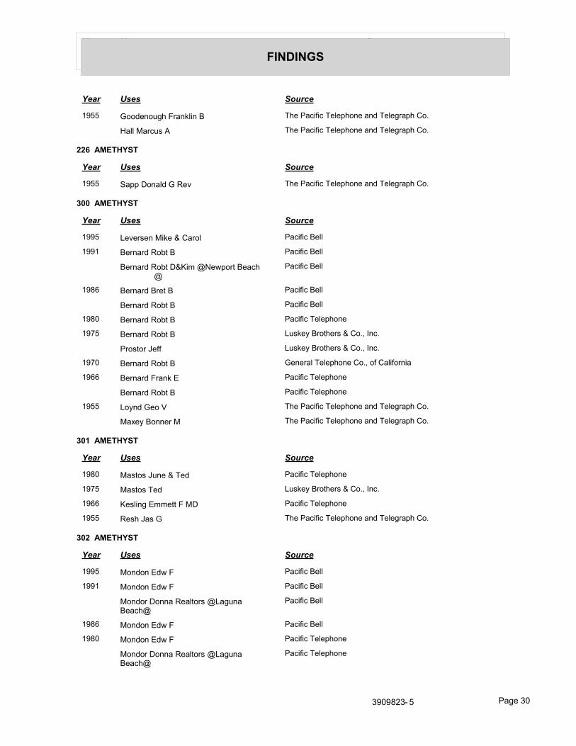
Year Uses Source
FINDINGS
Year Uses Source
1955 Goodenough Franklin B The Pacific Telephone and Telegraph Co.
Hall Marcus A The Pacific Telephone and Telegraph Co.
226 AMETHYST
Year Uses Source
1955 Sapp Donald G Rev The Pacific Telephone and Telegraph Co.
300 AMETHYST
Year Uses Source
1995 Leversen Mike & Carol Pacific Bell
1991 Bernard Robt B Pacific Bell
Bernard Robt D&Kim @Newport Beach@
Pacific Bell
1986 Bernard Bret B Pacific Bell
Bernard Robt B Pacific Bell
1980 Bernard Robt B Pacific Telephone
1975 Bernard Robt B Luskey Brothers & Co., Inc.
Prostor Jeff Luskey Brothers & Co., Inc.
1970 Bernard Robt B General Telephone Co., of California
1966 Bernard Frank E Pacific Telephone
Bernard Robt B Pacific Telephone
1955 Loynd Geo V The Pacific Telephone and Telegraph Co.
Maxey Bonner M The Pacific Telephone and Telegraph Co.
301 AMETHYST
Year Uses Source
1980 Mastos June & Ted Pacific Telephone
1975 Mastos Ted Luskey Brothers & Co., Inc.
1966 Kesling Emmett F MD Pacific Telephone
1955 Resh Jas G The Pacific Telephone and Telegraph Co.
302 AMETHYST
Year Uses Source
1995 Mondon Edw F Pacific Bell
1991 Mondon Edw F Pacific Bell
Mondor Donna Realtors @Laguna Beach@
Pacific Bell
1986 Mondon Edw F Pacific Bell
1980 Mondon Edw F Pacific Telephone
Mondor Donna Realtors @Laguna Beach@
Pacific Telephone
3909823- 5 Page 30

Year Uses Source
FINDINGS
Year Uses Source
1975 Mondon Edw F Luskey Brothers & Co., Inc.
303 AMETHYST
Year Uses Source
1995 Breltkreutz W C & Dora Pacific Bell
1991 Breitkreutz WC & Dora Pacific Bell
1986 Breitkreutz W C & Dora Pacific Bell
1980 Breitkreutz W C & Dora Pacific Telephone
1975 Pence Fred M Luskey Brothers & Co., Inc.
1966 Pence Fred M Pacific Telephone
Heasley Betty Mrs Pacific Telephone
1955 Beidler Paul W The Pacific Telephone and Telegraph Co.
304 AMETHYST
Year Uses Source
1980 Blazic ML Pacific Telephone
1975 Blazic M L Luskey Brothers & Co., Inc.
1966 Blazic Louis L Pacific Telephone
1955 Johnson W E Gene The Pacific Telephone and Telegraph Co.
Johnson Gene The Pacific Telephone and Telegraph Co.
305 AMETHYST
Year Uses Source
1995 Hassett K Pacific Bell
1991 Cranston John Pacific Bell
1986 Cranston John Pacific Bell
1980 Bono Dorothy M Pacific Telephone
306 AMETHYST
Year Uses Source
1975 Thompson Judy Mrs Luskey Brothers & Co., Inc.
307 AMETHYST
Year Uses Source
1980 Foxcroft Bill Pacific Telephone
1975 Foxcroft Bill Luskey Brothers & Co., Inc.
1966 Fleer Florence F Pacific Telephone
Fleer Wallace Pacific Telephone
3909823- 5 Page 31

Year Uses Source
FINDINGS
AMETHYST AVE
200 AMETHYST AVE
Year Uses Source
1970 Dudley Joe Bryon General Telephone Co., of California
201 AMETHYST AVE
Year Uses Source
1946 Wightman Richard R Lt r Southern California Telephone Co.
203 AMETHYST AVE
Year Uses Source
1995 Cheney Robt J Pacific Bell
1950 Poyas Francis H r The Pacific Telephone and Telegraph Co.
204 AMETHYST AVE
Year Uses Source
1995 Lee J Pacific Bell
1970 Fine Neil S General Telephone Co., of California
Pellissler Frank L General Telephone Co., of California
1950 Ewing Robt L r The Pacific Telephone and Telegraph Co.
205 AMETHYST AVE
Year Uses Source
1986 Hilker Fred M Pacific Bell
1970 Hilker Fred M General Telephone Co., of California
1955 Haldy W O Dr The Pacific Telephone and Telegraph Co.
1950 Haldy W O Dr r The Pacific Telephone and Telegraph Co.
1946 Haldy W O Dr r Southern California Telephone Co.
206 AMETHYST AVE
Year Uses Source
1995 Ion Video Industries Pacific Bell
lon WA Pacific Bell
1970 Kochevar KA General Telephone Co., of California
1950 Van Every Jas V r The Pacific Telephone and Telegraph Co.
207 AMETHYST AVE
Year Uses Source
1970 Ewing Robt L General Telephone Co., of California
3909823- 5 Page 32

Year Uses Source
FINDINGS
208 AMETHYST AVE
Year Uses Source
1950 Holmes Pauline V r The Pacific Telephone and Telegraph Co.
1946 Ehrenclou V L r Southern California Telephone Co.
209 AMETHYST AVE
Year Uses Source
1970 Ullman David General Telephone Co., of California
1946 Lyman Roy E r Southern California Telephone Co.
210 AMETHYST AVE
Year Uses Source
1950 Kerwick Michael F r The Pacific Telephone and Telegraph Co.
211 AMETHYST AVE
Year Uses Source
1995 Lam Cheong Pacific Bell
212 AMETHYST AVE
Year Uses Source
1970 Thompson Wayne E General Telephone Co., of California
1950 Bolin Lee r The Pacific Telephone and Telegraph Co.
1946 Bolin Lee r Southern California Telephone Co.
214 AMETHYST AVE
Year Uses Source
1970 Gammon Cheryl L General Telephone Co., of California
1950 Kraushaar R J r The Pacific Telephone and Telegraph Co.
215 AMETHYST AVE
Year Uses Source
1955 Donahoo Jos N r The Pacific Telephone and Telegraph Co.
1950 Donahoo Jos N r The Pacific Telephone and Telegraph Co.
1946 Eastman Robt A r Southern California Telephone Co.
217 AMETHYST AVE
Year Uses Source
1970 Schoenewey Lynn General Telephone Co., of California
Scales Sharon General Telephone Co., of California
Sanders Alice General Telephone Co., of California
Pleschel Stephanie General Telephone Co., of California
Brick Ann Marie General Telephone Co., of California
3909823- 5 Page 33

Year Uses Source
FINDINGS
Year Uses Source
1970 Pieschel Douglas General Telephone Co., of California
1955 Reed Herbert H The Pacific Telephone and Telegraph Co.
1950 Reed Herbert H r The Pacific Telephone and Telegraph Co.
1946 Reed Herbert H r Southern California Telephone Co.
218 AMETHYST AVE
Year Uses Source
1995 Renaud Ron Pacific Bell
219 AMETHYST AVE
Year Uses Source
1995 Balboa Johnny Pacific Bell
Blom John D Pacific Bell
220 AMETHYST AVE
Year Uses Source
1995 Klein Norman Pacific Bell
1970 Kemp Thomas P General Telephone Co., of California
221 AMETHYST AVE
Year Uses Source
1950 Carlyle Herbert Rex r The Pacific Telephone and Telegraph Co.
222 AMETHYST AVE
Year Uses Source
1986 Garrison Robert Dale Pacific Bell
1970 Hoyt H W General Telephone Co., of California
1950 Res The Pacific Telephone and Telegraph Co.
223 AMETHYST AVE
Year Uses Source
1995 Leonard Ruth Pacific Bell
1950 Dunn Betty r The Pacific Telephone and Telegraph Co.
Aita Joan r The Pacific Telephone and Telegraph Co.
224 AMETHYST AVE
Year Uses Source
1991 Sclater HC Pacific Bell
1955 Smith Roy C r The Pacific Telephone and Telegraph Co.
1950 Smith Roy C r The Pacific Telephone and Telegraph Co.
3909823- 5 Page 34

Year Uses Source
FINDINGS
225 AMETHYST AVE
Year Uses Source
1991 Patscheck Ray & Angie Pacific Bell
1986 Patscheck Ray Pacific Bell
1980 Anderson Catherine Pacific Telephone
1950 White E S r The Pacific Telephone and Telegraph Co.
1946 White E S r Southern California Telephone Co.
300 AMETHYST AVE
Year Uses Source
1950 Vitalich J r The Pacific Telephone and Telegraph Co.
1946 Elliott Frank R r Southern California Telephone Co.
301 AMETHYST AVE
Year Uses Source
1970 Kesling Emmett F MD General Telephone Co., of California
1950 Dearborn Margaret R r The Pacific Telephone and Telegraph Co.
1946 Dearborn Margaret R r Southern California Telephone Co.
302 AMETHYST AVE
Year Uses Source
1970 Mondon Edw F General Telephone Co., of California
1950 Richardson Jane r The Pacific Telephone and Telegraph Co.
1946 Bauer Wm T Jr r Southern California Telephone Co.
Brainerd E C Mrs r Southern California Telephone Co.
303 AMETHYST AVE
Year Uses Source
1970 Pence Fred M General Telephone Co., of California
304 AMETHYST AVE
Year Uses Source
1986 Blazic M L Pacific Bell
1950 O Brien J Marcy r The Pacific Telephone and Telegraph Co.
1946 OBrien J Marcy r Southern California Telephone Co.
305 AMETHYST AVE
Year Uses Source
1946 Miller Robt S Maj r Southern California Telephone Co.
3909823- 5 Page 35

Year Uses Source
FINDINGS
306 AMETHYST AVE
Year Uses Source
2008 THOMPSONS Cole Information Services
1970 Thompson Judy Mrs General Telephone Co., of California
307 AMETHYST AVE
Year Uses Source
1970 Fleer Wallace General Telephone Co., of California
AMETHYST ST
200 AMETHYST ST
Year Uses Source
2002 JCOTAJames Haines Company
201 AMETHYST ST
Year Uses Source
2002 MERRITTWendy Haines Company
STEWART Lynn Haines Company
202 AMETHYST ST
Year Uses Source
2002 7 VANDe Verg N Haines Company
203 AMETHYST ST
Year Uses Source
2002 9 CHENEYAobl J Haines Company
205 AMETHYST ST
Year Uses Source
2002 OHLINGE 8 Peter Haines Company
206 AMETHYST ST
Year Uses Source
2002 ARBOGASTJudilh Haines Company
207 AMETHYST ST
Year Uses Source
2002 EWINGRobaert Haines Company
3909823- 5 Page 36

Year Uses Source
FINDINGS
208 AMETHYST ST
Year Uses Source
2002 ARBOGASTJudlh Haines Company
209 AMETHYST ST
Year Uses Source
2002 0 DEROSAJohn Haines Company
210 AMETHYST ST
Year Uses Source
2002 COLLINSMidred Haines Company
211 AMETHYST ST
Year Uses Source
2002 LAMCheong Haines Company
212 AMETHYST ST
Year Uses Source
2002 STOVER Byrond Haines Company
HAYESJessaca Haines Company
213 AMETHYST ST
Year Uses Source
2002 BROWN Gary 00 B Haines Company
214 AMETHYST ST
Year Uses Source
2002 KELLEY R Haines Company
215 AMETHYST ST
Year Uses Source
2002 HATFIELD Oavid M Haines Company
216 AMETHYST ST
Year Uses Source
2002 LINDBLOMJack A Haines Company
217 AMETHYST ST
Year Uses Source
2002 LEEPERRobl E Haines Company
3909823- 5 Page 37

Year Uses Source
FINDINGS
218 AMETHYST ST
Year Uses Source
2002 ODORNEY Roger W Haines Company
90 RNEYKaohy Haines Company
219 AMETHYST ST
Year Uses Source
2002 SLEEPERRobed Haines Company
221 AMETHYST ST
Year Uses Source
2002 CIAMPAGeorge Haines Company
222 AMETHYST ST
Year Uses Source
2002 ROMANOThomas Haines Company
223 AMETHYST ST
Year Uses Source
2002 XXXX Haines Company
224 AMETHYST ST
Year Uses Source
2002 CHRISTENSENJohn E Haines Company
225 AMETHYST ST
Year Uses Source
2002 THOMSON Sl Haines Company
226 AMETHYST ST
Year Uses Source
2002 STEWART Haines Company
STEWARTSusan Haines Company
VAUTRINMary Haines Company
1986 Mahoney Jos Pacific Bell
300 AMETHYST ST
Year Uses Source
2002 ry BERNARD Roba B Haines Company
3909823- 5 Page 38
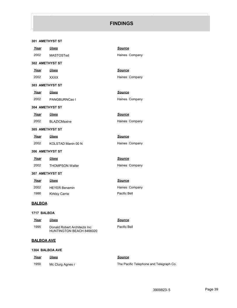
Year Uses Source
FINDINGS
301 AMETHYST ST
Year Uses Source
2002 MASTOSTed Haines Company
302 AMETHYST ST
Year Uses Source
2002 XXXX Haines Company
303 AMETHYST ST
Year Uses Source
2002 PANGBURNCao I Haines Company
304 AMETHYST ST
Year Uses Source
2002 BLAZICMaxine Haines Company
305 AMETHYST ST
Year Uses Source
2002 KOLSTAD Manin 00 N Haines Company
306 AMETHYST ST
Year Uses Source
2002 THOMPSON Waller Haines Company
307 AMETHYST ST
Year Uses Source
2002 HEYER Benamin Haines Company
1986 Kirklsy Carrie Pacific Bell
BALBOA
1717 BALBOA
Year Uses Source
1995 Donald Robert Architects Inc HUNTINGTON BEACH 8466020
Pacific Bell
BALBOA AVE
1304 BALBOA AVE
Year Uses Source
1950 Mc Clurg Agnes r The Pacific Telephone and Telegraph Co.
3909823- 5 Page 39

Year Uses Source
FINDINGS
1504 BALBOA AVE
Year Uses Source
1991 Brandow GE Pacific Bell
1986 Brandow G E Pacific Bell
1975 Brandow G E Luskey Brothers & Co., Inc.
1508 BALBOA AVE
Year Uses Source
2002 BRANDOW Peler Haines Company
1995 Brandow G E Pacific Bell
1980 Snider L Pacific Telephone
Snider LR @Fountain Valley@ Pacific Telephone
1970 Mac Clyment Alan D General Telephone Co., of California
1511 BALBOA AVE
Year Uses Source
2002 NOTTBruce Haines Company
1995 George Ronald C Pacific Bell
1991 George Ronald C Pacific Bell
1986 George Ronald C Pacific Bell
1980 George Curtis W Pacific Telephone
1975 George Curtis W Luskey Brothers & Co., Inc.
1950 Short Mac r The Pacific Telephone and Telegraph Co.
1512 BALBOA AVE
Year Uses Source
2002 XXXX Haines Company
1991 Niblo Heather Pacific Bell
1975 Cladek Jas Luskey Brothers & Co., Inc.
1514 BALBOA AVE
Year Uses Source
2002 SEASTLeon Haines Company
1995 East Leon Pacific Bell
1991 East Leon Pacific Bell
1986 East Leon Pacific Bell
1975 East Leon Luskey Brothers & Co., Inc.
1970 East Leon General Telephone Co., of California
3909823- 5 Page 40

Year Uses Source
FINDINGS
1517 BALBOA AVE
Year Uses Source
2002 XXXX Haines Company
1600 BALBOA AVE
Year Uses Source
2002 BONKOWSK 1 Shoven Haines Company
1986 Seymour M Pacific Bell
1955 Keeler M L r The Pacific Telephone and Telegraph Co.
1950 Keeler M L r The Pacific Telephone and Telegraph Co.
1946 Keeler M L r Southern California Telephone Co.
1601 BALBOA AVE
Year Uses Source
1991 Kveen H Gil Jr Pacific Bell
1986 Kveen H Gil Jr Pacific Bell
1970 Madison Jas M General Telephone Co., of California
1950 Holmes Fletcher r The Pacific Telephone and Telegraph Co.
1946 Dixson Edw B r Southern California Telephone Co.
1602 BALBOA AVE
Year Uses Source
2002 GRAHAMAudrey Haines Company
1995 Graham Eugene Jr Pacific Bell
1986 Graham Eugene Jr Pacific Bell
1980 Graham Eugene Jr Pacific Telephone
1975 Graham Eugene Jr Luskey Brothers & Co., Inc.
1970 Becker Tennie W General Telephone Co., of California
1950 Hodgkins Jean r The Pacific Telephone and Telegraph Co.
1603 BALBOA AVE
Year Uses Source
2003 BUSTER HAMMOND Cole Information Services
2002 HAMMOND Buser Haines Company
1995 Hammond Buster Pacific Bell
1991 Hammond Buster Pacific Bell
1975 Hammond Roland R Luskey Brothers & Co., Inc.
1950 Carnahan Howard F r The Pacific Telephone and Telegraph Co.
3909823- 5 Page 41

Year Uses Source
FINDINGS
1604 BALBOA AVE
Year Uses Source
2002 DYEREJ Haines Company
1991 Reilly M T Pacific Bell
1986 Reilly M T Pacific Bell
1605 BALBOA AVE
Year Uses Source
1986 Guney Donna Pacific Bell
1980 Werner Nancy Pacific Telephone
Reyes Rahni Pacific Telephone
1975 Joiner Fleetwood B Luskey Brothers & Co., Inc.
1950 Woodhouse Albert L r The Pacific Telephone and Telegraph Co.
1946 Dodd Marion C r Southern California Telephone Co.
1607 BALBOA AVE
Year Uses Source
2002 RENO Edward Haines Company
1975 Starege C A Luskey Brothers & Co., Inc.
1970 Starege Charlotte A General Telephone Co., of California
1955 Starege Kenneth r The Pacific Telephone and Telegraph Co.
1950 Starege Kenneth r The Pacific Telephone and Telegraph Co.
1608 BALBOA AVE
Year Uses Source
2002 SMITHRulh Haines Company
1980 Smith AUen E Pacific Telephone
1975 Smith Allen E Luskey Brothers & Co., Inc.
Clayson Jill Luskey Brothers & Co., Inc.
1970 Smith Allen E General Telephone Co., of California
Mc Phetridge R S General Telephone Co., of California
1609 BALBOA AVE
Year Uses Source
2002 G 1 ERMANN Edward Haines Company
1986 Collins Geoffrey F Dr Pacific Bell
1980 i Collins George Pacific Telephone
Collins Geoffrey F Dr Pacific Telephone
1975 Collins Geoffrey F Dr Luskey Brothers & Co., Inc.
1970 Collins Geoffrey F Dr General Telephone Co., of California
3909823- 5 Page 42
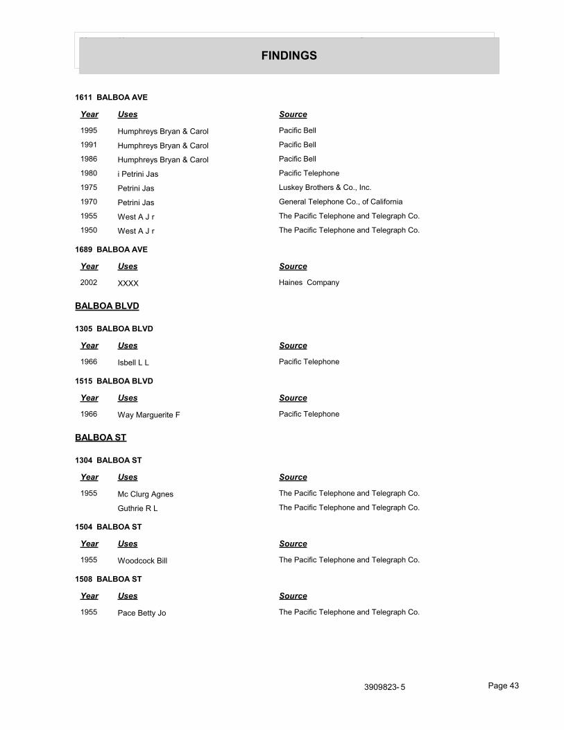
Year Uses Source
FINDINGS
1611 BALBOA AVE
Year Uses Source
1995 Humphreys Bryan & Carol Pacific Bell
1991 Humphreys Bryan & Carol Pacific Bell
1986 Humphreys Bryan & Carol Pacific Bell
1980 i Petrini Jas Pacific Telephone
1975 Petrini Jas Luskey Brothers & Co., Inc.
1970 Petrini Jas General Telephone Co., of California
1955 West A J r The Pacific Telephone and Telegraph Co.
1950 West A J r The Pacific Telephone and Telegraph Co.
1689 BALBOA AVE
Year Uses Source
2002 XXXX Haines Company
BALBOA BLVD
1305 BALBOA BLVD
Year Uses Source
1966 Isbell L L Pacific Telephone
1515 BALBOA BLVD
Year Uses Source
1966 Way Marguerite F Pacific Telephone
BALBOA ST
1304 BALBOA ST
Year Uses Source
1955 Mc Clurg Agnes The Pacific Telephone and Telegraph Co.
Guthrie R L The Pacific Telephone and Telegraph Co.
1504 BALBOA ST
Year Uses Source
1955 Woodcock Bill The Pacific Telephone and Telegraph Co.
1508 BALBOA ST
Year Uses Source
1955 Pace Betty Jo The Pacific Telephone and Telegraph Co.
3909823- 5 Page 43

Year Uses Source
FINDINGS
1514 BALBOA ST
Year Uses Source
1955 Krenek Aymond F The Pacific Telephone and Telegraph Co.
1601 BALBOA ST
Year Uses Source
1955 Fetters Frank The Pacific Telephone and Telegraph Co.
1602 BALBOA ST
Year Uses Source
1955 Horn Gerald F The Pacific Telephone and Telegraph Co.
1603 BALBOA ST
Year Uses Source
1955 Carnahan Howard F The Pacific Telephone and Telegraph Co.
1608 BALBOA ST
Year Uses Source
1955 Taylor W A The Pacific Telephone and Telegraph Co.
CRYSTAL
118 CRYSTAL
Year Uses Source
1966 Holden Perry W Pacific Telephone
119 CRYSTAL
Year Uses Source
1966 Banning Wm P Jr Pacific Telephone
120 CRYSTAL
Year Uses Source
1966 Hough Elizabeth G Mrs Pacific Telephone
121 CRYSTAL
Year Uses Source
1966 Rutt A W Pacific Telephone
122 CRYSTAL
Year Uses Source
1966 Woodworth Philip R MD Pacific Telephone
Nichols Joan E Pacific Telephone
3909823- 5 Page 44

Year Uses Source
FINDINGS
123 CRYSTAL
Year Uses Source
1966 Borchsenius Harold Pacific Telephone
124 CRYSTAL
Year Uses Source
1966 Little Thos K Pacific Telephone
125 CRYSTAL
Year Uses Source
1966 Power H J Dr Pacific Telephone
127 CRYSTAL
Year Uses Source
1966 Lehr Neill Pacific Telephone
201 CRYSTAL
Year Uses Source
1966 Vail Helen Pacific Telephone
Vail Robt Pacific Telephone
204 CRYSTAL
Year Uses Source
1966 Askew Mary Mrs Pacific Telephone
205 CRYSTAL
Year Uses Source
1966 Howard Laura Pacific Telephone
Spring Julie D Pacific Telephone
206 CRYSTAL
Year Uses Source
1966 Turner Alan S Jr Pacific Telephone
208 CRYSTAL
Year Uses Source
1966 Brandenburg Judy Pacific Telephone
Thielges Theresa Pacific Telephone
209 CRYSTAL
Year Uses Source
1966 Mc Colloch Leland J Pacific Telephone
3909823- 5 Page 45

Year Uses Source
FINDINGS
210 CRYSTAL
Year Uses Source
1966 Sewell Harry A Dr Pacific Telephone
211 CRYSTAL
Year Uses Source
1966 Anderson Roy L Jr Pacific Telephone
213 CRYSTAL
Year Uses Source
1966 Jacques Ed J Pacific Telephone
215 CRYSTAL
Year Uses Source
1966 Mc Murtrie Arthur J Pacific Telephone
216 CRYSTAL
Year Uses Source
1966 Hearn E L Jr Pacific Telephone
217 CRYSTAL
Year Uses Source
1966 Kier Pam A Pacific Telephone
Dorsey Clete MD Pacific Telephone
Kier Janet L Pacific Telephone
218 CRYSTAL
Year Uses Source
1966 Brennan Robt W Pacific Telephone
219 CRYSTAL
Year Uses Source
1966 Oliver Kaleta Mrs Pacific Telephone
221 CRYSTAL
Year Uses Source
1966 Keller Lillian B Pacific Telephone
Griffiths Chas T Pacific Telephone
223 CRYSTAL
Year Uses Source
1966 Schmiesing Clifford A Pacific Telephone
3909823- 5 Page 46

Year Uses Source
FINDINGS
303 CRYSTAL
Year Uses Source
1966 Schroeder Wm H Pacific Telephone
311 CRYSTAL
Year Uses Source
1966 Coulter Wm A Pacific Telephone
Coulter Ranches Pacific Telephone
323 CRYSTAL
Year Uses Source
1966 Maffil H V Pacific Telephone
331 CRYSTAL
Year Uses Source
1966 Baum Arthur J Pacific Telephone
337 CRYSTAL
Year Uses Source
1966 Robinson Richard H Pacific Telephone
CRYSTAL AVE
116 CRYSTAL AVE
Year Uses Source
2002 BORELLAJoseph Haines Company
1995 Simeone Daniel J Pacific Bell
1991 Green Lisa Pacific Bell
1980 Miller Robt F Pacific Telephone
1975 Schroeder David C Luskey Brothers & Co., Inc.
Millar Robt F Luskey Brothers & Co., Inc.
117 CRYSTAL AVE
Year Uses Source
1980 Rodriguez Phyllis Pacific Telephone
1975 Rodriguez Phyllis Luskey Brothers & Co., Inc.
1946 Purcell Carl M r Southern California Telephone Co.
118 CRYSTAL AVE
Year Uses Source
2002 CALLAHANTery Haines Company
HANES Healher Haines Company
3909823- 5 Page 47

Year Uses Source
FINDINGS
Year Uses Source
2002 HANESKelly Haines Company
1995 Callahan Terry A Pacific Bell
Hanes Heather Pacific Bell
1991 Callahan Terry A Pacific Bell
Hanes Heather Pacific Bell
Hanes Kelly Pacific Bell
1975 Holden Priscilla M Luskey Brothers & Co., Inc.
1950 Pearman John B r The Pacific Telephone and Telegraph Co.
1946 Steele C B r Southern California Telephone Co.
119 CRYSTAL AVE
Year Uses Source
2003 NEWPORT ADVENTURE TOURS Cole Information Services
2002 PARKSWIIi 9m R Haines Company
1995 Parks Wm Robt I latty Pacific Bell
1991 Parks Wm Robt III atty Pacific Bell
Parks Wm R Pacific Bell
1986 Parks Wm Robt III atty Pacific Bell
Parks Wm R Pacific Bell
1975 Duncan B J Luskey Brothers & Co., Inc.
Parks Wm R Luskey Brothers & Co., Inc.
1950 Little Frank M r The Pacific Telephone and Telegraph Co.
1946 Mason Jack r Southern California Telephone Co.
120 CRYSTAL AVE
Year Uses Source
2002 MARISCALDaniel J Haines Company
DORSEYVer Haines Company
1986 Dorsey Clete Pacific Bell
1975 Dorsey Clete S Dr Luskey Brothers & Co., Inc.
1950 Gregg John D r The Pacific Telephone and Telegraph Co.
1946 Gregg John D r Southern California Telephone Co.
121 CRYSTAL AVE
Year Uses Source
2002 lo HAMILTON Jack Haines Company
JUTTAW Haines Company
HAMILTONJack Haines Company
1991 Rutt A W Pacific Bell
3909823- 5 Page 48

Year Uses Source
FINDINGS
Year Uses Source
1986 Rutt A W Pacific Bell
1975 Rutt A W Luskey Brothers & Co., Inc.
Mullally David Luskey Brothers & Co., Inc.
1946 Bal Isle Nursery School Southern California Telephone Co.
122 CRYSTAL AVE
Year Uses Source
2002 FPIRKLEH Haines Company
PIRKLEJC Haines Company
1991 Pirkle J C & H C Pacific Bell
1986 Schreiner Richard W Pacific Bell
1980 Woodworth Philip R MD Pacific Telephone
1975 Woodworth Philip R MD Luskey Brothers & Co., Inc.
1946 Van Dyke Stanley C r Southern California Telephone Co.
123 CRYSTAL AVE
Year Uses Source
2002 SYDUNTEmory 00 B Haines Company
1975 Borchsenius Harold Luskey Brothers & Co., Inc.
1955 Borchsenius Harold r The Pacific Telephone and Telegraph Co.
1950 Borchsenius Harold r The Pacific Telephone and Telegraph Co.
124 CRYSTAL AVE
Year Uses Source
2002 CALKINSRA Haines Company
1986 Calkins R A Pacific Bell
1975 Calkins R A Luskey Brothers & Co., Inc.
125 CRYSTAL AVE
Year Uses Source
2002 POWER Gary Haines Company
POWER John Haines Company
1995 Power Gary & John Pacific Bell
1991 Power Gary & John Pacific Bell
1986 Arnold Fyrn Power Pacific Bell
1975 Arnold Fyrn Power Luskey Brothers & Co., Inc.
1955 Power H J Dr r The Pacific Telephone and Telegraph Co.
1950 Power H J Dr r The Pacific Telephone and Telegraph Co.
3909823- 5 Page 49

Year Uses Source
FINDINGS
126 CRYSTAL AVE
Year Uses Source
2008 BALBOA INVESTMENTS Cole Information Services
1991 Mariscal Daniel J Pacific Bell
Mariscal Daniel J Pacific Bell
1986 Manscal Jos F Pacific Bell
1975 Mariscal Jos F Luskey Brothers & Co., Inc.
1946 Culver M M r Southern California Telephone Co.
127 CRYSTAL AVE
Year Uses Source
2002 BROWNWil Oam W Haines Company
1980 Gould Gene Pacific Telephone
1975 Brown Wm W Luskey Brothers & Co., Inc.
1950 Hendrickson L W r The Pacific Telephone and Telegraph Co.
1946 Smith Evan M Mrs r Southern California Telephone Co.
200 CRYSTAL AVE
Year Uses Source
2003 CHADWICK DESIGNS Cole Information Services
2002 NELSON Edwn N Haines Company
1995 Girling Wallace D Pacific Bell
1986 Girling Wallace D Pacific Bell
1975 Byron Ralph L Dr MD Luskey Brothers & Co., Inc.
1950 Carter J Coolidge r The Pacific Telephone and Telegraph Co.
1946 Loynd Harold r Southern California Telephone Co.
201 CRYSTAL AVE
Year Uses Source
2002 ONE 101 Barry 00 C Haines Company
1980 II LL Pacific Telephone
1975 Vail Helen Luskey Brothers & Co., Inc.
Vail Robt Luskey Brothers & Co., Inc.
1955 Mason C W r The Pacific Telephone and Telegraph Co.
1950 Mason C W r The Pacific Telephone and Telegraph Co.
1946 Mason C W r Southern California Telephone Co.
204 CRYSTAL AVE
Year Uses Source
2002 OLOCKMANPalcia Haines Company
1995 Lockman Richard Pacific Bell
3909823- 5 Page 50

Year Uses Source
FINDINGS
Year Uses Source
1991 Lockman Richard Pacific Bell
1986 Lockman Richard Pacific Bell
1975 Lockman Richard Luskey Brothers & Co., Inc.
1950 Griswold Harlan B r The Pacific Telephone and Telegraph Co.
Griswold Ranch Co The Pacific Telephone and Telegraph Co.
1946 Ellerbroek Philmer r Southern California Telephone Co.
205 CRYSTAL AVE
Year Uses Source
2002 WENDELLMinie Haines Company
1991 Winchell N Pacific Bell
Malcolm Patricia Pacific Bell
Kolde Annelise Pacific Bell
1986 Quinton K Pacific Bell
Folsom Michael & Carolyn Pacific Bell
1980 Malcolm Patricia Pacific Telephone
1975 Farroux Patricia Luskey Brothers & Co., Inc.
Youngblood Paula Luskey Brothers & Co., Inc.
Sippy J M Luskey Brothers & Co., Inc.
1950 Devere B E r The Pacific Telephone and Telegraph Co.
Smith Vernon O r The Pacific Telephone and Telegraph Co.
1946 Jenkins Fred B r Southern California Telephone Co.
206 CRYSTAL AVE
Year Uses Source
1975 Berg Richard W Luskey Brothers & Co., Inc.
207 CRYSTAL AVE
Year Uses Source
2002 W SMITH Liza A Haines Company
ORYDMANJach Haines Company
1991 Reilly Glenn & Suky Pacific Bell
1986 Ringwald K L Pacific Bell
1980 Mhig Lewis C Pacific Telephone
Ihrig Craig W Pacific Telephone
1950 Ramsey Dale C r The Pacific Telephone and Telegraph Co.
1946 Hyer Nona r Southern California Telephone Co.
3909823- 5 Page 51

Year Uses Source
FINDINGS
208 CRYSTAL AVE
Year Uses Source
1980 Artunian J R Pacific Telephone
1975 Quick John R Luskey Brothers & Co., Inc.
209 CRYSTAL AVE
Year Uses Source
2002 MURRAY David Haines Company
1986 Murray David T MD Pacific Bell
1980 Murray David T MD Pacific Telephone
1975 Murray David T MD Luskey Brothers & Co., Inc.
1950 Greer B J r The Pacific Telephone and Telegraph Co.
1946 Ramsey Dale C r Southern California Telephone Co.
210 CRYSTAL AVE
Year Uses Source
2002 Bt DNICKEdward Haines Company
Bt DNICKBlllie Haines Company
1991 Girling Wallace D Pacific Bell
Bidnick Edward & Billie Pacific Bell
1986 Sewell Harry A Dr Pacific Bell
1980 Sewel Harry A Dr Pacific Telephone
1975 Sewell Harry A Dr Luskey Brothers & Co., Inc.
1950 Merrill Howard W Dr r The Pacific Telephone and Telegraph Co.
1946 Pence A O r Southern California Telephone Co.
211 CRYSTAL AVE
Year Uses Source
2002 UNCAPHERKelh Haines Company
1975 Tudor Ann Luskey Brothers & Co., Inc.
Boyle Stephanie Luskey Brothers & Co., Inc.
Robertson Lisa Luskey Brothers & Co., Inc.
212 CRYSTAL AVE
Year Uses Source
2002 MCCLOSKEYRobert Haines Company
1991 Whte NJ Pacific Bell
Whte Nathans Pacific Bell
1980 Blankenship B Pacific Telephone
Aguinaga Dan Pacific Telephone
1975 Hakala Mathew Luskey Brothers & Co., Inc.
3909823- 5 Page 52

Year Uses Source
FINDINGS
Year Uses Source
1975 Olund Julius Luskey Brothers & Co., Inc.
213 CRYSTAL AVE
Year Uses Source
2002 HANCOCKDonna Haines Company
1995 Holmberg Joel A Pacific Bell
1991 Holmberg Joel A Pacific Bell
1980 Brown Peggy Pacific Telephone
1975 Jacques Ed J Luskey Brothers & Co., Inc.
1970 Jacques Ed J General Telephone Co., of California
1946 Jenkins J O r Southern California Telephone Co.
214 CRYSTAL AVE
Year Uses Source
2002 DAVISMaly Haines Company
1995 Christy James R Pacific Bell
1980 Flanagan C A Pacific Telephone
1975 Cunningham Joanna Luskey Brothers & Co., Inc.
215 CRYSTAL AVE
Year Uses Source
2002 YONKERS Kennelh Haines Company
1980 S Wth E ric Pacific Telephone
Smit E L Pacific Telephone
1975 Chandler Asa Luskey Brothers & Co., Inc.
1950 Allen John M r The Pacific Telephone and Telegraph Co.
1946 Allen John M r Southern California Telephone Co.
216 CRYSTAL AVE
Year Uses Source
1995 Michaels Greg Pacific Bell
1991 Nelson Edwma Mrs Pacific Bell
Nelson Edwin N Pacific Bell
1986 Nelson Edwin N Pacific Bell
1975 Nelson Ed Luskey Brothers & Co., Inc.
217 CRYSTAL AVE
Year Uses Source
2002 ROSENDALEWo Ian Haines Company
1986 Fiva Ole Pacific Bell
3909823- 5 Page 53

Year Uses Source
FINDINGS
Year Uses Source
1980 Fiva Ole Pacific Telephone
1975 Fiva Ole Luskey Brothers & Co., Inc.
Yendall D Luskey Brothers & Co., Inc.
1950 Crowner Robt R r The Pacific Telephone and Telegraph Co.
218 CRYSTAL AVE
Year Uses Source
2002 XXXX Haines Company
1986 Clayton Michael A Pacific Bell
1975 ONeill Terry Luskey Brothers & Co., Inc.
219 CRYSTAL AVE
Year Uses Source
2002 OLIVER Richard Haines Company
1980 Olivet R Boone Dr Pacific Telephone
1975 Oliver R Boone Dr Luskey Brothers & Co., Inc.
1950 Oliver Kaleta Mrs r The Pacific Telephone and Telegraph Co.
1946 Oliver Kaleta Mrs r Southern California Telephone Co.
221 CRYSTAL AVE
Year Uses Source
2002 OGRIFFENCOD Haines Company
1991 Griffen C D Pacific Bell
1986 Griffiths Chas T Pacific Bell
1980 Thomas F W Pacific Telephone
Griffiths Chas T Pacific Telephone
1975 Griffiths Chas T Luskey Brothers & Co., Inc.
1950 Butterworth Dorothy E r The Pacific Telephone and Telegraph Co.
223 CRYSTAL AVE
Year Uses Source
2002 LEONARD Ruth Haines Company
1991 Gugert Mike Pacific Bell
1986 Speik Robt L Pacific Bell
1980 I Walsh Jim Pacific Telephone
1955 Reitz Manly H r The Pacific Telephone and Telegraph Co.
1950 Doyle E J Maj r The Pacific Telephone and Telegraph Co.
Reitz Manly H r The Pacific Telephone and Telegraph Co.
1946 Cutshall John B r Southern California Telephone Co.
Devenish Geo B r Southern California Telephone Co.
3909823- 5 Page 54

Year Uses Source
FINDINGS
226 CRYSTAL AVE
Year Uses Source
1980 Nelson Edwin N Pacific Telephone
Nelson Edwna Mrs Pacific Telephone
271 CRYSTAL AVE
Year Uses Source
2002 XXXX Haines Company
290 CRYSTAL AVE
Year Uses Source
2002 GIRLING Wall Uce Haines Company
296 CRYSTAL AVE
Year Uses Source
2002 MAYS Richard A Haines Company
MAYS Richard A Haines Company
303 CRYSTAL AVE
Year Uses Source
2002 MCOGINLEYTed Haines Company
1991 Broms E Pacific Bell
1986 Schroeder Wm H Pacific Bell
1975 Schroeder Wm H Luskey Brothers & Co., Inc.
1950 Wickett Wm H Jr Dr r The Pacific Telephone and Telegraph Co.
1946 Gowen Harlan r Southern California Telephone Co.
305 CRYSTAL AVE
Year Uses Source
1946 Stewart Mark E r Southern California Telephone Co.
311 CRYSTAL AVE
Year Uses Source
2008 BALDWIN GROUP Cole Information Services
2002 BALLBACK SIeve Haines Company
BALDWINGROUPTHE Haines Company
1995 Baldwin Group The Pacific Bell
1986 Donovan Wm Pacific Bell
1980 Donovan Wm Pacific Telephone
1975 Donovan Wm Luskey Brothers & Co., Inc.
1950 Morrison Alex M r The Pacific Telephone and Telegraph Co.
3909823- 5 Page 55

Year Uses Source
FINDINGS
Year Uses Source
1946 Duncan Preston Southern California Telephone Co.
321 CRYSTAL AVE
Year Uses Source
2002 XXXX Haines Company
323 CRYSTAL AVE
Year Uses Source
2002 LEGALLEE Robet Haines Company
PARISCandace Haines Company
1991 Rosenast Tom Pacific Bell
1980 l Rosenast Tom Pacific Telephone
Ricatto Paul H Pacific Telephone
1975 Sharrow Philip J Luskey Brothers & Co., Inc.
1955 Hauser Theo R r The Pacific Telephone and Telegraph Co.
1950 Hauser Theo R r The Pacific Telephone and Telegraph Co.
331 CRYSTAL AVE
Year Uses Source
2002 HEIMSTAEDTJelfrey Haines Company
1986 Baum Arthur J Pacific Bell
1975 Baum Arthur J Luskey Brothers & Co., Inc.
1950 Steele C B r The Pacific Telephone and Telegraph Co.
1946 Linn J A Dr r Southern California Telephone Co.
337 CRYSTAL AVE
Year Uses Source
2002 RICATTOPaul A Haines Company
1995 Ricatto Paul A Pacific Bell
1991 Ricatto Paul A Pacific Bell
1980 I Surf Drain & Sewer Pacific Telephone
1975 Norton Victor A Luskey Brothers & Co., Inc.
1955 Van Wissman E H r The Pacific Telephone and Telegraph Co.
1950 Van Wissman E H r The Pacific Telephone and Telegraph Co.
CRYSTAL CIR
205 CRYSTAL CIR
Year Uses Source
1970 Howard Laura General Telephone Co., of California
3909823- 5 Page 56

Year Uses Source
FINDINGS
CRYSTAL CT
120 CRYSTAL CT
Year Uses Source
1955 Gregg John D The Pacific Telephone and Telegraph Co.
Hough P Royce The Pacific Telephone and Telegraph Co.
121 CRYSTAL CT
Year Uses Source
1955 Chisholm Edith S The Pacific Telephone and Telegraph Co.
Richwine Ruth Ellen Mrs The Pacific Telephone and Telegraph Co.
122 CRYSTAL CT
Year Uses Source
1955 Gray Jack The Pacific Telephone and Telegraph Co.
200 CRYSTAL CT
Year Uses Source
1955 Maypole Roy The Pacific Telephone and Telegraph Co.
204 CRYSTAL CT
Year Uses Source
1955 Askew Mary Mrs The Pacific Telephone and Telegraph Co.
205 CRYSTAL CT
Year Uses Source
1955 Smith Helen Mae Mrs The Pacific Telephone and Telegraph Co.
Devere B E The Pacific Telephone and Telegraph Co.
206 CRYSTAL CT
Year Uses Source
1955 Runciman Leo A Mrs The Pacific Telephone and Telegraph Co.
Ocheltree Lloyd A Dr The Pacific Telephone and Telegraph Co.
207 CRYSTAL CT
Year Uses Source
1955 Beech Crowell H The Pacific Telephone and Telegraph Co.
208 CRYSTAL CT
Year Uses Source
1955 Nelson Ed The Pacific Telephone and Telegraph Co.
3909823- 5 Page 57

Year Uses Source
FINDINGS
209 CRYSTAL CT
Year Uses Source
1955 Mc Colloch Leland J The Pacific Telephone and Telegraph Co.
210 CRYSTAL CT
Year Uses Source
1955 Sewell Harry A Dr The Pacific Telephone and Telegraph Co.
213 CRYSTAL CT
Year Uses Source
1955 Jacques Ed J The Pacific Telephone and Telegraph Co.
215 CRYSTAL CT
Year Uses Source
1955 Lockwood Russell N The Pacific Telephone and Telegraph Co.
217 CRYSTAL CT
Year Uses Source
1955 Lawrence Ruth E The Pacific Telephone and Telegraph Co.
Duey Florence The Pacific Telephone and Telegraph Co.
218 CRYSTAL CT
Year Uses Source
1955 Lansdowne Ferd The Pacific Telephone and Telegraph Co.
219 CRYSTAL CT
Year Uses Source
1955 Oliver Kaleta Mrs The Pacific Telephone and Telegraph Co.
221 CRYSTAL CT
Year Uses Source
1955 Ledford June Mrs The Pacific Telephone and Telegraph Co.
303 CRYSTAL CT
Year Uses Source
1980 Schroeder Wm H Pacific Telephone
311 CRYSTAL CT
Year Uses Source
1955 Ferry C Douglass The Pacific Telephone and Telegraph Co.
3909823- 5 Page 58

Year Uses Source
FINDINGS
E BAY FRONT
285 E BAY FRONT
Year Uses Source
1991 Draft Anthony C & Rose Pacific Bell
301 E BAY FRONT
Year Uses Source
2002 r 1807 Richard Haines Company
1991 Rivett Richard C Pacific Bell
1986 Rivett Richard C Pacific Bell
Richardson Traci Pacific Bell
Gibbo Tod Edmund Pacific Bell
1980 I Lippnik Eugene J Pacific Telephone
1955 Doolittle D H The Pacific Telephone and Telegraph Co.
305 E BAY FRONT
Year Uses Source
1991 Kensey Trevor Pacific Bell
Kensey Alexander Pacific Bell
1980 ie ir Jon S Pacific Telephone
1966 Baum Judith A Pacific Telephone
Kensey Alex Pacific Telephone
1955 Dunlap W E The Pacific Telephone and Telegraph Co.
Dunlap W E Jr The Pacific Telephone and Telegraph Co.
307 E BAY FRONT
Year Uses Source
2002 RUFFELL Dave Haines Company
1986 Ruffell Dave & Judy Pacific Bell
1980 Ruffell Dave & Judy Pacific Telephone
1966 Coulter Stuart A Pacific Telephone
1955 Wickett Wm H Sr Dr The Pacific Telephone and Telegraph Co.
309 E BAY FRONT
Year Uses Source
2002 WICKETTChas M Haines Company
1995 Wickett Chas M Pacific Bell
1991 Wickett Chas M Pacific Bell
1980 Wickett Chas M Pacific Telephone
1966 Mc Nary Edw Pacific Telephone
3909823- 5 Page 59

Year Uses Source
FINDINGS
Year Uses Source
1955 Wickett Chas M The Pacific Telephone and Telegraph Co.
311 E BAY FRONT
Year Uses Source
2002 HOWARDPaul W Haines Company
1986 Howard Paul W Pacific Bell
1980 Howard Paul W Pacific Telephone
1966 Graham Eugene Jr Pacific Telephone
313 E BAY FRONT
Year Uses Source
2002 MANCLARKWILLIAM R Haines Company
1991 Manclark Wm R Dr Pacific Bell
315 E BAY FRONT
Year Uses Source
1986 Pinckney Jas D Pacific Bell
1980 Pinckney Jas D Pacific Telephone
1966 Barrett Richard E Pacific Telephone
1955 Callahan A D r The Pacific Telephone and Telegraph Co.
317 E BAY FRONT
Year Uses Source
2002 HILLSIDE Balboa Haines Company
1991 Boland A C Pacific Bell
1980 Karl Stuart Pacific Telephone
1966 Berry Lloyd E Pacific Telephone
1955 Torrance Arthur G The Pacific Telephone and Telegraph Co.
319 E BAY FRONT
Year Uses Source
2002 HILLSIDE Balboa Haines Company
1986 Chambers Eugene R Pacific Bell
1980 Chambers Eu ne R Pacific Telephone
1966 Chambers Eugene R Pacific Telephone
321 E BAY FRONT
Year Uses Source
2002 FENNINGTONDonna Haines Company
1991 Zimmerman Arthur L Pacific Bell
3909823- 5 Page 60

Year Uses Source
FINDINGS
Year Uses Source
1991 Zimmerman B Pacific Bell
1980 N C T Ie Pacific Telephone
1966 Wood Laurin L Dr Pacific Telephone
323 E BAY FRONT
Year Uses Source
2002 BARON Rudy Haines Company
1991 Baron Rudy Pacific Bell
1986 Baron Alan & Michele Pacific Bell
Baron Rudy Pacific Bell
1980 Baron Rudy Pacific Telephone
325 E BAY FRONT
Year Uses Source
2002 OSBORNEJ Mathew Haines Company
1991 Osborne J Matthew Pacific Bell
1986 Osborne J Matthew Pacific Bell
1980 Osbome J Matthew Pacific Telephone
1955 Meiklejohn Wm r The Pacific Telephone and Telegraph Co.
331 E BAY FRONT
Year Uses Source
2002 BRID 3 ESJas C Haines Company
1991 Hargraves LB Pacific Bell
1980 Nargraves LB Pacific Telephone
Palmer Brad Pacific Telephone
1970 Smith Don D General Telephone Co., of California
1966 Smith Don D Pacific Telephone
1955 Waters Frank J The Pacific Telephone and Telegraph Co.
333 E BAY FRONT
Year Uses Source
2002 FURMANSKI Martin Haines Company
1966 Robertson Helen R Dr Pacific Telephone
1955 Robertson Helen R Dr The Pacific Telephone and Telegraph Co.
335 E BAY FRONT
Year Uses Source
1986 Steigerwald A J Pacific Bell
1980 Knock Mary Elizabeth Pacific Telephone
3909823- 5 Page 61

Year Uses Source
FINDINGS
337 E BAY FRONT
Year Uses Source
2002 ZINZER Frank Haines Company
BRYANTKa Ihleen A Haines Company
WALES K Haines Company
1991 Block John C Pacific Bell
Day Jason Pacific Bell
1986 Block John C Pacific Bell
339 E BAY FRONT
Year Uses Source
2002 GROSSLIGHTSleven Haines Company
1995 WItalis T W MD Pacific Bell
1991 Witalis TWMD Pacific Bell
1980 Witalls T W MD Pacific Telephone
1966 Witalis T W MD Pacific Telephone
1955 Wickett Wm H Jr Dr The Pacific Telephone and Telegraph Co.
341 E BAY FRONT
Year Uses Source
2002 LASHELLERodenck Haines Company
1991 Brent Henry Pacific Bell
1986 Brent Henry Pacific Bell
1980 Brent Henry Pacific Telephone
1966 Brent Henry Pacific Telephone
1955 Brent Henry The Pacific Telephone and Telegraph Co.
343 E BAY FRONT
Year Uses Source
2002 LEWAND Kevin Haines Company
1966 Slater Georgia D Mrs Pacific Telephone
1955 Slater Georgia D Mrs The Pacific Telephone and Telegraph Co.
351 E BAY FRONT
Year Uses Source
1966 Hillgren Carl Pacific Telephone
1955 Hillgren Carl The Pacific Telephone and Telegraph Co.
3909823- 5 Page 62

Year Uses Source
FINDINGS
E BAY FRONT BAL ISLAND
301 E BAY FRONT BAL ISLAND
Year Uses Source
1966 Kennedy R S Pacific Telephone
E BAY FRONT SAL ISLAND
331 E BAY FRONT SAL ISLAND
Year Uses Source
1986 Hargraves L B Pacific Bell
E BAYFRONT
265 E BAYFRONT
Year Uses Source
1966 Mc Grath Ann V Pacific Telephone
269 E BAYFRONT
Year Uses Source
1966 Croswell P W Pacific Telephone
275 E BAYFRONT
Year Uses Source
1966 Crystal Maynard S Pacific Telephone
283 E BAYFRONT
Year Uses Source
1966 Freund Edwin Pacific Telephone
E ONYX AVE
303 E ONYX AVE
Year Uses Source
1970 Meyer Helen General Telephone Co., of California
GRAND CAN
114 GRAND CAN
Year Uses Source
1980 Mynatt Hugh Pacific Telephone
3909823- 5 Page 63

Year Uses Source
FINDINGS
GRAND CANAL
106 GRAND CANAL
Year Uses Source
2002 OSELMI Daniel Haines Company
109 GRAND CANAL
Year Uses Source
2002 MILLSAdam Haines Company
110 GRAND CANAL
Year Uses Source
2002 SHAW Richard Haines Company
SHAW Leslie Haines Company
1995 Shaw Richard Pacific Bell
1980 Saw so Pacific Telephone
111 GRAND CANAL
Year Uses Source
2002 SDEBUYSPalnca 000a Haines Company
112 GRAND CANAL
Year Uses Source
2002 WILSON Hunler Haines Company
113 GRAND CANAL
Year Uses Source
2002 ROHRSMarvn Haines Company
114 GRAND CANAL
Year Uses Source
2002 SHUNTEdward SJr Haines Company
fr SAUSERJan Haines Company
SAU 4 R 0 Mike Haines Company
115 GRAND CANAL
Year Uses Source
2002 CHANTOSCamne Haines Company
SWHITE Michael Haines Company
3909823- 5 Page 64

Year Uses Source
FINDINGS
116 GRAND CANAL
Year Uses Source
2002 GOULD Laurence K Haines Company
117 GRAND CANAL
Year Uses Source
2002 LAVALLEYDonald R Haines Company
LAVALLEYDonald R Haines Company
1980 Anderson D M Pacific Telephone
118 GRAND CANAL
Year Uses Source
2013 DEPENDABLE REAL ESTATE & MOR Cole Information Services
2002 SSCHWARTINGJan Haines Company
119 GRAND CANAL
Year Uses Source
2002 WHITE M Haines Company
LA GALLERIA FINEART Haines Company
SWURNER Ha Haines Company
120 GRAND CANAL
Year Uses Source
2002 BCROSSONThomas Haines Company
121 GRAND CANAL
Year Uses Source
2002 SWATERSMary E Haines Company
123 GRAND CANAL
Year Uses Source
2002 SOVERENDRalph J Haines Company
124 GRAND CANAL
Year Uses Source
2002 BOELKESG Haines Company
125 GRAND CANAL
Year Uses Source
2013 SADLERS ROOFING CO Cole Information Services
2008 SADLER ROOFING CO Cole Information Services
2002 SSAOLERRonald Haines Company
3909823- 5 Page 65

Year Uses Source
FINDINGS
Year Uses Source
2002 SADLERS ROOFING CO Haines Company
SADLERS ROOFING CO Haines Company
1966 Smith Walter B Pacific Telephone
126 GRAND CANAL
Year Uses Source
2003 FRANCES B ZEFF Cole Information Services
2002 ZEFF Frances Brown Haines Company
Grand Canal
126 Grand Canal
Year Uses Source
2002 ZEFF Frances Brown Haines Company
127 Grand Canal
Year Uses Source
2002 SKINTON Sandra 00 C Haines Company
GRAND CANAL
127 GRAND CANAL
Year Uses Source
2002 SKINTON Sandra 00 C Haines Company
1980 Kinney L Pacific Telephone
Grand Canal
127 Grand Canal
Year Uses Source
1980 Kinney L Pacific Telephone
GRAND CANAL
200 GRAND CANAL
Year Uses Source
2008 ABRAMS DONALD Cole Information Services
2002 SDUTWILER Leone Haines Company
3909823- 5 Page 66

Year Uses Source
FINDINGS
Grand Canal
200 Grand Canal
Year Uses Source
2002 SDUTWILER Leone Haines Company
201 Grand Canal
Year Uses Source
2002 CUSHING Jeannee Haines Company
SCUSHING Mrchael Haines Company
GRAND CANAL
201 GRAND CANAL
Year Uses Source
2002 CUSHING Jeannee Haines Company
SCUSHING Mrchael Haines Company
202 GRAND CANAL
Year Uses Source
2002 SLINDAHLMargalre Haines Company
203 GRAND CANAL
Year Uses Source
2002 NAGLERJames Haines Company
204 GRAND CANAL
Year Uses Source
2002 Ir SMITH Michael Haines Company
205 GRAND CANAL
Year Uses Source
2002 SPESHEKEphy Haines Company
206 GRAND CANAL
Year Uses Source
2002 HAGGSTROM Rober Haines Company
207 GRAND CANAL
Year Uses Source
2002 HARTWELL James V Haines Company
3909823- 5 Page 67

Year Uses Source
FINDINGS
209 GRAND CANAL
Year Uses Source
2002 HALTER A Haines Company
210 GRAND CANAL
Year Uses Source
2002 STONEBradford Haines Company
211 GRAND CANAL
Year Uses Source
2002 SMITH Donald M Haines Company
212 GRAND CANAL
Year Uses Source
2002 TYLERW Haines Company
213 GRAND CANAL
Year Uses Source
2002 FORDHerbert M Haines Company
214 GRAND CANAL
Year Uses Source
2002 GODFREYPaulne Haines Company
HESSDavd Haines Company
V ROSAS Monica Haines Company
215 GRAND CANAL
Year Uses Source
2002 WATERSLaughlm Haines Company
216 GRAND CANAL
Year Uses Source
2002 JENNISONGary Haines Company
1970 Emery Margaret F Mrs General Telephone Co., of California
1966 Emery Margaret F Mrs Pacific Telephone
217 GRAND CANAL
Year Uses Source
2002 OJUSTINBunly Haines Company
3909823- 5 Page 68

Year Uses Source
FINDINGS
218 GRAND CANAL
Year Uses Source
2002 TUPPAN Glenda Haines Company
219 GRAND CANAL
Year Uses Source
2002 ROHANRobert Haines Company
221 GRAND CANAL
Year Uses Source
1980 Lake Chas P Pacific Telephone
222 GRAND CANAL
Year Uses Source
2002 SLIPPNIK Eugene Haines Company
TURNERS Haines Company
223 GRAND CANAL
Year Uses Source
2002 RANEYMchele Haines Company
224 GRAND CANAL
Year Uses Source
2002 FLAMM Donald E Haines Company
225 GRAND CANAL
Year Uses Source
2002 SMOINTIRE Harold Haines Company
226 GRAND CANAL
Year Uses Source
2002 DAVISCarol S Haines Company
SEASLEYMacy Haines Company
Grand Canal
226 Grand Canal
Year Uses Source
2002 SEASLEYMacy Haines Company
DAVISCarol S Haines Company
3909823- 5 Page 69

Year Uses Source
FINDINGS
GRAND CANAL
226 GRAND CANAL
Year Uses Source
1980 Southern Kay Pacific Telephone
Grand Canal
226 Grand Canal
Year Uses Source
1980 Southern Kay Pacific Telephone
227 Grand Canal
Year Uses Source
2002 SANWILER Martha Haines Company
GRAND CANAL
286 GRAND CANAL
Year Uses Source
2002 SXUNan Haines Company
301 GRAND CANAL
Year Uses Source
2002 SRANEYAIdan Haines Company
Grand Canal
301 Grand Canal
Year Uses Source
2002 SRANEYAIdan Haines Company
GRAND CANAL
302 GRAND CANAL
Year Uses Source
2002 TOHRANCEVictor Haines Company
303 GRAND CANAL
Year Uses Source
2002 HEWITTEL Haines Company
SROHRERBarbara Haines Company
3909823- 5 Page 70

Year Uses Source
FINDINGS
Year Uses Source
1966 Mc Farland Rita Pacific Telephone
304 GRAND CANAL
Year Uses Source
2002 SMOOTCharles Reed Haines Company
305 GRAND CANAL
Year Uses Source
2002 CHAPMAN Richard Haines Company
306 GRAND CANAL
Year Uses Source
2008 ANGLERS SCIENCE Cole Information Services
2002 SKRASSEJeanne Haines Company
307 GRAND CANAL
Year Uses Source
2002 BUETTELLMike Haines Company
BU 56 TTELLSue Haines Company
308 GRAND CANAL
Year Uses Source
2002 DAVIDSONGordon T Haines Company
309 GRAND CANAL
Year Uses Source
2002 SFELLINGEHaany Lee Haines Company
310 GRAND CANAL
Year Uses Source
2002 SPARKERNigel Haines Company
PETERSEN Dan Haines Company
311 GRAND CANAL
Year Uses Source
2002 SBRANDTJoy Haines Company
CHANDLERTam Haines Company
313 GRAND CANAL
Year Uses Source
2002 BERWALDJohn R Haines Company
3909823- 5 Page 71

Year Uses Source
FINDINGS
Year Uses Source
2002 SBERWALDJohn R Haines Company
a BERWALDJoihn R Haines Company
315 GRAND CANAL
Year Uses Source
2002 NICOLABarbara Haines Company
316 GRAND CANAL
Year Uses Source
2002 BGARDEILAThemas Haines Company
317 GRAND CANAL
Year Uses Source
2002 WILSONHunaer Haines Company
318 GRAND CANAL
Year Uses Source
2008 LOHRBACH & ASSOCIATES Cole Information Services
2002 SHILLGRENCarl Haines Company
319 GRAND CANAL
Year Uses Source
2002 SSTULLJames Haines Company
320 GRAND CANAL
Year Uses Source
2002 CUSTER Fred Haines Company
CUSTER Joanne Haines Company
321 GRAND CANAL
Year Uses Source
2002 WARNER Diana Lu Haines Company
WARNER Rickey Haines Company
322 GRAND CANAL
Year Uses Source
2002 SMEYERSMichael Haines Company
323 GRAND CANAL
Year Uses Source
2002 SZIEGLERJames Haines Company
3909823- 5 Page 72

Year Uses Source
FINDINGS
Year Uses Source
1980 Thomas Helen F Pacific Telephone
324 GRAND CANAL
Year Uses Source
2002 SABRAMS Donald L Haines Company
1995 Abrams Donald L Pacific Bell
325 GRAND CANAL
Year Uses Source
2002 SBURNJAM Bren Haines Company
1986 Mc Garry Mary Anne Pacific Bell
327 GRAND CANAL
Year Uses Source
2002 JONESTony Haines Company
331 GRAND CANAL
Year Uses Source
2002 HEAD Sydney Haines Company
333 GRAND CANAL
Year Uses Source
2002 FURMANSKIMartin Haines Company
GRAND CANAL BAELTS
212 GRAND CANAL BAELTS
Year Uses Source
1980 Witer Pacific Telephone
GRAND CANAL BALL
219 GRAND CANAL BALL
Year Uses Source
1980 Parke L Pacific Telephone
GRAND CANAL BDAL ISLAND
218 GRAND CANAL BDAL ISLAND
Year Uses Source
1980 Iuppan Petr Mrs Pacific Telephone
3909823- 5 Page 73

Year Uses Source
FINDINGS
GRAND CANAL SALIS
116 GRAND CANAL SALIS
Year Uses Source
1980 Could Laurence K Pacific Telephone
GRAND CANL
119 GRAND CANL
Year Uses Source
1966 Murray Arthur L Pacific Telephone
161 GRAND CANL
Year Uses Source
1970 Tuppan Erwin General Telephone Co., of California
M MARINE AVE
302 M MARINE AVE
Year Uses Source
1995 Freedland EC Pacific Bell
MARIAN AVE
105 MARIAN AVE
Year Uses Source
1980 Longman B D Pacific Telephone
213 MARIAN AVE
Year Uses Source
1980 Rumbold Realty Investments Pacific Telephone
312 MARIAN AVE
Year Uses Source
1980 Etcetera Etc Pacific Telephone
MARINE
210 MARINE
Year Uses Source
1970 Eaglesons gifts General Telephone Co., of California
3909823- 5 Page 74

Year Uses Source
FINDINGS
221 MARINE
Year Uses Source
1995 Vodegel Husnl D & Melani P 8266490 Pacific Bell
225 MARINE
Year Uses Source
1970 Patio The General Telephone Co., of California
302 MARINE
Year Uses Source
1970 Balboa Island Pharmacy General Telephone Co., of California
315 MARINE
Year Uses Source
1995 Waterhouse & Associates 9970424 Pacific Bell
319 MARINE
Year Uses Source
1970 Eves Beauty Salon Macdonald Eve hair stylist
General Telephone Co., of California
322 MARINE
Year Uses Source
1970 Mac Caskill Paul L General Telephone Co., of California
327 MARINE
Year Uses Source
1995 LDon Danielle European Skin & Beauty Care
Pacific Bell
LDon Danielle European Skin & Beauty Care
Pacific Bell
MARINE AVE
105 MARINE AVE
Year Uses Source
2002 OBRIENThomas Haines Company
1991 Bullard Peter Pacific Bell
1975 Dore Frank J Luskey Brothers & Co., Inc.
1955 Dore Frank J r The Pacific Telephone and Telegraph Co.
1950 Dore Frank J r The Pacific Telephone and Telegraph Co.
3909823- 5 Page 75

Year Uses Source
FINDINGS
106 MARINE AVE
Year Uses Source
2002 MARKS Ronald Haines Company
le BAILESRobert D Haines Company
1995 Rosemond Leland Advertizing Consultant Pacific Bell
1986 Krem I Bud Pacific Bell
North Ron Pacific Bell
1980 Edwards Julie Pacific Telephone
1975 Heinecke T Luskey Brothers & Co., Inc.
Miller Bonnie Luskey Brothers & Co., Inc.
1970 Marks Odelle Mrs General Telephone Co., of California
1955 Marks Odelle Mrs The Pacific Telephone and Telegraph Co.
1950 Marks Odelle Mrs r The Pacific Telephone and Telegraph Co.
1946 Marks Odelle Mrs r Southern California Telephone Co.
110 MARINE AVE
Year Uses Source
2002 DEPUTYDonald Haines Company
i JOHNSONShlrley Haines Company
1975 Lewis Edgar D Luskey Brothers & Co., Inc.
111 MARINE AVE
Year Uses Source
1986 Mitchell Frank J Mrs Pacific Bell
1980 Mitchell Frank 3 Mrs Pacific Telephone
1975 Rowles C Luskey Brothers & Co., Inc.
Mitchell Frank J Mrs Luskey Brothers & Co., Inc.
112 MARINE AVE
Year Uses Source
2002 JENNINGSJames Haines Company
1975 Leva Barbara Luskey Brothers & Co., Inc.
Doyle Richard Luskey Brothers & Co., Inc.
1946 Thomlinson W M r Southern California Telephone Co.
113 MARINE AVE
Year Uses Source
2002 ROBINSONSltuar Haines Company
1986 Allison Wm L Pacific Bell
1946 Clark Irving T r Southern California Telephone Co.
3909823- 5 Page 76

Year Uses Source
FINDINGS
114 MARINE AVE
Year Uses Source
2002 TRETRAULTSharon Haines Company
1991 Webster C Pacific Bell
1975 Webster Jack D Luskey Brothers & Co., Inc.
ODonnell Michael Luskey Brothers & Co., Inc.
Hoover Mark Luskey Brothers & Co., Inc.
Dunmire Larry Luskey Brothers & Co., Inc.
1950 Schierman D W Dr r The Pacific Telephone and Telegraph Co.
1946 Schierman D W Dr r Southern California Telephone Co.
115 MARINE AVE
Year Uses Source
2003 ISLAND BELL Cole Information Services
2002 OLARSON arrell Haines Company
B 061 ECHANTE Haines Company
1995 Sacks Mark A Pacific Bell
1980 Hutchins Mark Pacific Telephone
1975 Hildreth Elon E Luskey Brothers & Co., Inc.
1950 Hildreth Jack E r The Pacific Telephone and Telegraph Co.
116 MARINE AVE
Year Uses Source
2002 LEWISRobert C Haines Company
1991 Lewis Robert C Pacific Bell
1986 Loos Sue & Jack Pacific Bell
1980 Moodey Katy Pacific Telephone
1975 Rogers Norman Luskey Brothers & Co., Inc.
117 MARINE AVE
Year Uses Source
2002 XXXX Haines Company
1995 Pavone William Pacific Bell
Erickson Linda Pacific Bell
1991 Marjama R Pacific Bell
1986 Jones Phil Pacific Bell
1980 Hildreth Jack E atty Pacific Telephone
118 MARINE AVE
Year Uses Source
2008 SAVARY ASSOCIATES Cole Information Services
3909823- 5 Page 77

Year Uses Source
FINDINGS
Year Uses Source
2003 SAVARY ASSOCS Cole Information Services
2002 KALLALChuck Haines Company
SAVARYSoaanne Haines Company
SAVARYASSOCIATES Haines Company
1991 Sonderman Louise Mrs Pacific Bell
1986 Sonderman Louise Mrs Pacific Bell
1975 Sonderman Louise Mrs Luskey Brothers & Co., Inc.
Pastalaniec Dennis Luskey Brothers & Co., Inc.
1946 Res Southern California Telephone Co.
119 MARINE AVE
Year Uses Source
2002 RANKIN William Haines Company
1995 Miller Suzanne Suzy Pacific Bell
1991 Lee Chris Pacific Bell
Lee Chris & Brandon Pacific Bell
Lee Christina Pacific Bell
1950 Werlie John W r The Pacific Telephone and Telegraph Co.
120 MARINE AVE
Year Uses Source
2002 STELLINOFrank Haines Company
1995 Dickey CS Pacific Bell
1991 Dickey C S Pacific Bell
1986 Dickey C S Pacific Bell
1980 i Dickey CS Pacific Telephone
1975 Tuell Max A Luskey Brothers & Co., Inc.
Stoneham Daryl Luskey Brothers & Co., Inc.
1946 Dickey Helmer r Southern California Telephone Co.
121 MARINE AVE
Year Uses Source
2003 BIOLINKS TECHNOLOGIES Cole Information Services
2002 DEMLEREvere O Haines Company
1955 Cunningham Richard N r The Pacific Telephone and Telegraph Co.
1950 Cunningham Richard N r The Pacific Telephone and Telegraph Co.
Miller Norman H r The Pacific Telephone and Telegraph Co.
1946 Cunningham Richard N r Southern California Telephone Co.
3909823- 5 Page 78

Year Uses Source
FINDINGS
122 MARINE AVE
Year Uses Source
2002 a SMORCOS Eli F Haines Company
1995 Morcos Ellis F Pacific Bell
1991 Morcos Ellis F Pacific Bell
1986 Morcos Ellis F Pacific Bell
1980 Morco Ellis F Realtor ll OOQuai @Newport Beach@
Pacific Telephone
Morcos Ellis F Pacific Telephone
123 MARINE AVE
Year Uses Source
2002 TOLLGeorge Haines Company
WILSON Larry Haines Company
1995 Boring CS Pacific Bell
1991 Joslin Murray Pacific Bell
1986 Major Robin P Pacific Bell
1975 Skall John W Luskey Brothers & Co., Inc.
124 MARINE AVE
Year Uses Source
1980 Jennings Jim Union Oil DIr Pacific Telephone
1975 Jennings Jim Union Oil Dir Luskey Brothers & Co., Inc.
127 MARINE AVE
Year Uses Source
2013 VILLAGE INN Cole Information Services
2008 VILLAGE INN RESTAURANT & LOUNGE Cole Information Services
2003 VILLAGE INN RESTAURANT & LNG Cole Information Services
2002 RESTAURANT THE Haines Company
OTOLLGeorge Haines Company
BAROGRILL Haines Company
BALBOAISLVLGINN 949 67 B 83 W Haines Company
VILLAGEINN Haines Company
1995 Village Inn Pacific Bell
1991 VILLAGEINN Pacific Bell
1980 I Village Inn Pacific Telephone
1950 Whites Park Ave Cafe The Pacific Telephone and Telegraph Co.
1946 Whites Coffee Shops Southern California Telephone Co.
3909823- 5 Page 79

Year Uses Source
FINDINGS
129 MARINE AVE
Year Uses Source
2002 XXXX Haines Company
1975 Village Inn Luskey Brothers & Co., Inc.
200 MARINE AVE
Year Uses Source
2013 BB & C LLC Cole Information Services
2002 OFINLEYRulth Haines Company
HERSHEYS MARKET Haines Company
1995 Hersheys Market & Grog Shop Pacific Bell
1991 HERSHEYS MARKET & GROG SHOP Pacific Bell
Beef Baron Pacific Bell
1986 HE RS HE YS MARKE T & GROG S HOP Pacific Bell
Reef Baron Pacific Bell
1980 Hersheys Market & Grog Shop Pacific Telephone
Beef Baron Pacific Telephone
1975 Hersheys Market & Grog Shop Luskey Brothers & Co., Inc.
1955 Market Spot The Pacific Telephone and Telegraph Co.
Hershey Anton Market Spot The Pacific Telephone and Telegraph Co.
1950 Market Spot The Pacific Telephone and Telegraph Co.
Hershey Anton Market Spot The Pacific Telephone and Telegraph Co.
1946 Market Spot Southern California Telephone Co.
Hershey Anton r Southern California Telephone Co.
Hershey Anton Market Spot Southern California Telephone Co.
201 MARINE AVE
Year Uses Source
2013 COLDWELL BANKER Cole Information Services
2003 BALBOA ISLAND IMPRVMNT ASCTN Cole Information Services
HURLEY & MITCHELL Cole Information Services
2002 IMPROVEMENT ASSN Haines Company
NEWPORT PRPRTS BALBOAISLAND Haines Company
BALBOA IS RLTY Haines Company
1995 Balboa Island Realty & Investment Co Pacific Bell
1991 Balboa Island Realty & Investment Co Pacific Bell
1986 Balboa Island Realty & investment Co Pacific Bell
1980 Balboa Island Realty & Investment Co I Pacific Telephone
1975 Balboa Island Realty & Investment Co Luskey Brothers & Co., Inc.
3909823- 5 Page 80

Year Uses Source
FINDINGS
203 MARINE AVE
Year Uses Source
2013 WILMAS PATIO RESTAURANT Cole Information Services
2008 WILMAS PATIO RESTAURANT INC Cole Information Services
2003 WILMAS PATIO RESTAURANT INC Cole Information Services
2002 STAUDINGERWinma Haines Company
WILMAS PATIO Haines Company
RESTAURANT Haines Company
1995 Peppers On The Island Pacific Bell
1991 Island Cafe Pacific Bell
1986 Balboa Island Pacific Bell
1980 Balboa Island Pacific Telephone
1975 Balboa Island Luskey Brothers & Co., Inc.
1950 Jolly Roger malt shop The Pacific Telephone and Telegraph Co.
204 MARINE AVE
Year Uses Source
2013 MAXWELL J P Cole Information Services
2003 MAXWELL JP Cole Information Services
2002 JP MAXWELL Haines Company
MAXWELLJP Haines Company
1995 J P Maxwell Pacific Bell
1991 Maxwell J P Pacific Bell
J P Maxwell Pacific Bell
1986 JP Maxwell Pacific Bell
Maxwell J P Pacific Bell
1975 Balboa Island Luskey Brothers & Co., Inc.
1950 Naylors Ida Beach Togs The Pacific Telephone and Telegraph Co.
1946 Naylors Ida Beach Togs Southern California Telephone Co.
205 MARINE AVE
Year Uses Source
2002 XXXX Haines Company
1955 Fowler Heber rl est The Pacific Telephone and Telegraph Co.
1950 Fowler Heber rl est The Pacific Telephone and Telegraph Co.
206 MARINE AVE
Year Uses Source
2008 UNITED STATES POSTAL SERVICE Cole Information Services
WORLD SPORTS MEDICINE ASSOCS FOR REG
Cole Information Services
3909823- 5 Page 81

Year Uses Source
FINDINGS
Year Uses Source
1980 Balboa Island Stn Pacific Telephone
1975 Balboa Island Stn Luskey Brothers & Co., Inc.
1950 Balboa Island The Pacific Telephone and Telegraph Co.
207 MARINE AVE
Year Uses Source
2013 EVEN SISTERS Cole Information Services
2008 EVEN SISTERS Cole Information Services
SURFTIQUE LLC Cole Information Services
2003 EVEN SISTERS Cole Information Services
2002 EVEN SISTERS 949 673 21 M Haines Company
1995 Even Sisters Pacific Bell
1991 Local Color Pacific Bell
Balboa Beauty Supplies Pacific Bell
1986 Balboa Beauty Supplies Pacific Bell
Local Color Pacific Bell
1980 Aardvark A A & Co Pacific Telephone
A A Aardvark & Co Pacific Telephone
1975 Aardvark A A & Co Luskey Brothers & Co., Inc.
A A Aardvark & Co Luskey Brothers & Co., Inc.
1955 Sawyer Sport Shop The Pacific Telephone and Telegraph Co.
1950 Sawyer Sport Shop The Pacific Telephone and Telegraph Co.
1946 Sawyer Sport Shop Southern California Telephone Co.
208 MARINE AVE
Year Uses Source
2013 GIFT BOX THE Cole Information Services
2008 GIFT BOX THE Cole Information Services
2003 GIFT BOX Cole Information Services
2002 GIFTBOXTHE Haines Company
LEHMAN Haines Company
1995 Gift Box The Pacific Bell
Johnston Patrick atty Pacific Bell
1991 Gift Box The Pacific Bell
1980 Gift Box The Pacific Telephone
1975 Blue Heaven Luskey Brothers & Co., Inc.
McCue A A Luskey Brothers & Co., Inc.
Sheridan A A Luskey Brothers & Co., Inc.
1955 Seely Richard Photographer The Pacific Telephone and Telegraph Co.
3909823- 5 Page 82

Year Uses Source
FINDINGS
Year Uses Source
1950 Seely Richard Photographer The Pacific Telephone and Telegraph Co.
Gallagher Gene r The Pacific Telephone and Telegraph Co.
1946 Vogel Dick radios Southern California Telephone Co.
Seely Richard Photographer Southern California Telephone Co.
209 MARINE AVE
Year Uses Source
2013 MAGNOLIA CHARLIE Cole Information Services
NZSCH Cole Information Services
2008 MJW FINE ART Cole Information Services
MICHAEL ZSCHOCHE GALLERY Cole Information Services
2003 GRAPHICS GALLERY Cole Information Services
2002 CLOTHING MAGASIN Haines Company
WOOOS George Haines Company
BALBOA ISLAND KIDS Haines Company
1995 Eaton Place Pacific Bell
1986 Eaton Place Pacific Bell
1975 Yagemann W F Luskey Brothers & Co., Inc.
TYLERS SHOE EMPORIUM Luskey Brothers & Co., Inc.
1950 Jax Inc beauty salon The Pacific Telephone and Telegraph Co.
1946 Ninas Southern California Telephone Co.
Lee Keith Beauty Salon Southern California Telephone Co.
210 MARINE AVE
Year Uses Source
2013 WATERPOINTE REAL ESTATE GROUP Cole Information Services
OLIVE OIL & BEYOND Cole Information Services
ART FOR THE SOUL Cole Information Services
WATERPOINTE HOMES Cole Information Services
2008 BLUE KIDS Cole Information Services
LES ALPILLES DE PROVIDENCE Cole Information Services
ART FOR THE SOUL Cole Information Services
2003 ART FOR THE SOUL Cole Information Services
CHIC SHACK Cole Information Services
2002 OMESERVE Edwin Haines Company
CHICSHACKTHE Haines Company
BALBOA BEACH CO Haines Company
ARTFORTHESOUL Haines Company
1995 Balboa Beach Co Pacific Bell
3909823- 5 Page 83

Year Uses Source
FINDINGS
Year Uses Source
1995 Balboa Beach Company Corporate Headquarters
Pacific Bell
Roberts Jim Entertainment Pacific Bell
1991 BALBOA BEACH CO Pacific Bell
1986 Beach Enterprises Pacific Bell
BALBOA BE ACH CO Pacific Bell
1975 Eaglesons gifts Luskey Brothers & Co., Inc.
1950 Island Hdwe The Pacific Telephone and Telegraph Co.
Rod & Reel Shop The The Pacific Telephone and Telegraph Co.
1946 Richardson Tooling Products mach shops Southern California Telephone Co.
Paine Albert Bay Dist Hdwe Southern California Telephone Co.
Rod & Reel Shop The Southern California Telephone Co.
Bay Dist Hdwe Southern California Telephone Co.
211 MARINE AVE
Year Uses Source
2013 HAKONE Cole Information Services
AMORE Cole Information Services
2008 THE WEST WING Cole Information Services
2003 LES ALPILLES PROVENCAL IMPORTS Cole Information Services
THE WEST WING Cole Information Services
BALBOA JUICE TOWN Cole Information Services
JUICE TOWN Cole Information Services
MICKIES SWIM SHOP Cole Information Services
2002 LESALPILLES Haines Company
HANSONMichele Haines Company
BALBOAJUICETOWN Haines Company
1995 Dianes Swimwear Pacific Bell
Main Squeeze Pacific Bell
1991 Patrick James Pacific Bell
Higgins Diana Pacific Bell
Doctor Bs Chicken Pacific Bell
A Little Color Pacific Bell
1986 bland Yogurt Shoppe Pacific Bell
Henry Don Pacific Bell
Balboa Island Jewelry Emporium Pacific Bell
1980 Delli Santi Fred Pacific Telephone
1975 Nova Lucia K Luskey Brothers & Co., Inc.
Balboa Island Florist Luskey Brothers & Co., Inc.
3909823- 5 Page 84

Year Uses Source
FINDINGS
Year Uses Source
1975 Jax @Balboa@ Island Inc womens sportswr
Luskey Brothers & Co., Inc.
1950 Dodd Marion C r The Pacific Telephone and Telegraph Co.
1946 Runkle T E r Southern California Telephone Co.
212 MARINE AVE
Year Uses Source
1975 Exotica Luskey Brothers & Co., Inc.
1950 Farm House The eggs The Pacific Telephone and Telegraph Co.
1946 Shook Conrad H contr Southern California Telephone Co.
213 MARINE AVE
Year Uses Source
2013 FAMILY TS Cole Information Services
BALBOA BOARD SPORTS Cole Information Services
2008 THE SANDPIPER VARIETY STORE Cole Information Services
FAMILY TS Cole Information Services
2003 SANDPIPER Cole Information Services
2002 ViFAMILYTS Haines Company
SANDPIPERTHE Haines Company
HANSOHMtchele Haines Company
1995 Sandpiper The Pacific Bell
1991 Family Ts Pacific Bell
1986 Sandpiper The Pacific Bell
Family Ts Pacific Bell
1980 I Rumbold Chuck realtor Pacific Telephone
Ho Charge To Calling Party Pacific Telephone
Varig Bresilian Airlines Passenger Reservations & Information
Pacific Telephone
Variety Shop Balboa Island Pacific Telephone
Rumbold Montana Pacific Telephone
RUMBOLD CHARUE S S realtor Pacific Telephone
Balboa Island Variety Shop Pacific Telephone
1975 BALBOA ISLAND VARIETY SHOP Luskey Brothers & Co., Inc.
VARIETY SHOP BALBOA ISLAND Luskey Brothers & Co., Inc.
1950 Balboa Island Variety Store The Pacific Telephone and Telegraph Co.
1946 Balboa Island Variety Store Southern California Telephone Co.
3909823- 5 Page 85

Year Uses Source
FINDINGS
214 MARINE AVE
Year Uses Source
2013 ALEXS FASHION CENTER Cole Information Services
2003 ALEXS FASHION CTR Cole Information Services
2002 ALEXS FASHION CNTR Haines Company
KOYOUMJIANAlex Haines Company
1995 Alexs Fashion Center Pacific Bell
1991 Alexs Fashion Center Pacific Bell
1986 Alexs Fashion Center Pacific Bell
1975 HYDENS BALBOA ISLAND Luskey Brothers & Co., Inc.
1950 Islanders The gift shop The Pacific Telephone and Telegraph Co.
Christler H E The Islanders The Pacific Telephone and Telegraph Co.
1946 Islanders The gift shop Southern California Telephone Co.
Christler H E The Islanders Southern California Telephone Co.
215 MARINE AVE
Year Uses Source
2013 PASSIONATE COLLECTOR THE Cole Information Services
ESPRIT PROVENCE Cole Information Services
2008 ALOHA BABOA Cole Information Services
2003 RACHELS Cole Information Services
2002 JOHNSON Harry Haines Company
1995 Marcs sportswr Pacific Bell
Johnson Harry Pacific Bell
1991 Haldane B Pacific Bell
Johnson Harry Pacific Bell
Marcs sportswr Pacific Bell
1986 Evans Walter R Pacific Bell
Johnson Harry Pacific Bell
Marc s sportswr Pacific Bell
1980 Camera Shop The Pacific Telephone
Evans Walter R Pacific Telephone
Evans Walter S Pacific Telephone
Island Camera Shop Pacific Telephone
Johnson Harry Pacific Telephone
1975 Camera Shop The Luskey Brothers & Co., Inc.
Clothes Horse The sportswr Luskey Brothers & Co., Inc.
Evans Walter R Luskey Brothers & Co., Inc.
Johnson Harry Luskey Brothers & Co., Inc.
1950 Balboa Island Camera Supply The Pacific Telephone and Telegraph Co.
3909823- 5 Page 86

Year Uses Source
FINDINGS
Year Uses Source
1950 Clothes Horse The sportswr The Pacific Telephone and Telegraph Co.
Mull I Photography The Pacific Telephone and Telegraph Co.
1946 Forsythe Camera Supply Southern California Telephone Co.
Mobarry & Mc Cartney electrcns Southern California Telephone Co.
216 MARINE AVE
Year Uses Source
2013 PAS TU CAFE Cole Information Services
RACHELS Cole Information Services
2003 ELIZABETH THAI Cole Information Services
SIMON FINE ART Cole Information Services
2002 MEXI GRILL Haines Company
SIMONFINEART Haines Company
GALLERY 6 STUDIO Haines Company
GRAPHICSGALLERY Haines Company
MLSTOCKWELL Haines Company
INTERIORS WHITE DESIGN Haines Company
WHITESUSAN EASID Haines Company
LORBEERWIlbur Haines Company
1995 Sentimental Reasons Pacific Bell
PIzza Pacific Bell
1991 Holy Cow Gourmet Grazing Pacific Bell
Sentimental Reasons Pacific Bell
1986 Henry Every Pacific Bell
1980 Bartalie Dick F Pacific Telephone
Island Outlook Pacific Telephone
1975 Marine Beauty Boutique Luskey Brothers & Co., Inc.
1955 Balboa Island The Pacific Telephone and Telegraph Co.
Island Clnrs The Pacific Telephone and Telegraph Co.
1950 Balboa Island The Pacific Telephone and Telegraph Co.
Hadfield Margaret L Hadfield Stanley rltr The Pacific Telephone and Telegraph Co.
Hadfield Stanley rltr The Pacific Telephone and Telegraph Co.
Island Clnrs The Pacific Telephone and Telegraph Co.
Ofc The Pacific Telephone and Telegraph Co.
Workman Rus Hadfield Stanley rltr The Pacific Telephone and Telegraph Co.
1946 Island Clnrs Southern California Telephone Co.
Balboa Island Southern California Telephone Co.
3909823- 5 Page 87

Year Uses Source
FINDINGS
217 MARINE AVE
Year Uses Source
2013 OUR GANGS GENERAL STORE Cole Information Services
BASILIC RESTAURANT Cole Information Services
BALLBACK STEVEN R DDS Cole Information Services
2008 OUR GANGS GENERAL STORE Cole Information Services
R STEVEN BALLBACK DDS Cole Information Services
BASILIC RESTAURANT Cole Information Services
ISLAND DENTISTRY INC Cole Information Services
BALIBACK R STEVEN DDS Cole Information Services
2003 OUR GANGS GENERAL STORE Cole Information Services
BASILIC RESTAURANT Cole Information Services
ARMBRUSTER STANLEY DDS Cole Information Services
2002 BALLBACKSteve 00 S Haines Company
BASILIC RESTAURANT Haines Company
TETEATETERSTRNT Haines Company
STANLEY DDS Haines Company
ARMBRUSTER Haines Company
1995 Our Gangs General Store Pacific Bell
1991 Our Gangs General Store Pacific Bell
STEINRECKS RESTAURANT Pacific Bell
1986 S TE IN BE CKS CRE ATIVE CUIS IN E Pacific Bell
1980 Hemingways Restaurant Pacific Telephone
Our Gangs General Store Pacific Telephone
1975 Hemingways Luskey Brothers & Co., Inc.
Our Gangs General Store Luskey Brothers & Co., Inc.
Our Gangs General Store Luskey Brothers & Co., Inc.
1950 Brown Colin F bkkpng serv The Pacific Telephone and Telegraph Co.
Doane Katey clnrs The Pacific Telephone and Telegraph Co.
Toy Box The The Pacific Telephone and Telegraph Co.
218 MARINE AVE
Year Uses Source
2013 BEACH TIME REALTY Cole Information Services
ISLAND SEASHELL Cole Information Services
2008 BEACH TIME REALTY Cole Information Services
CALIFORNIA SEASHELL Cole Information Services
2003 GOLDEN SHELL Cole Information Services
BEACH TIME REALTY Cole Information Services
1995 Beach Time Realty Pacific Bell
3909823- 5 Page 88
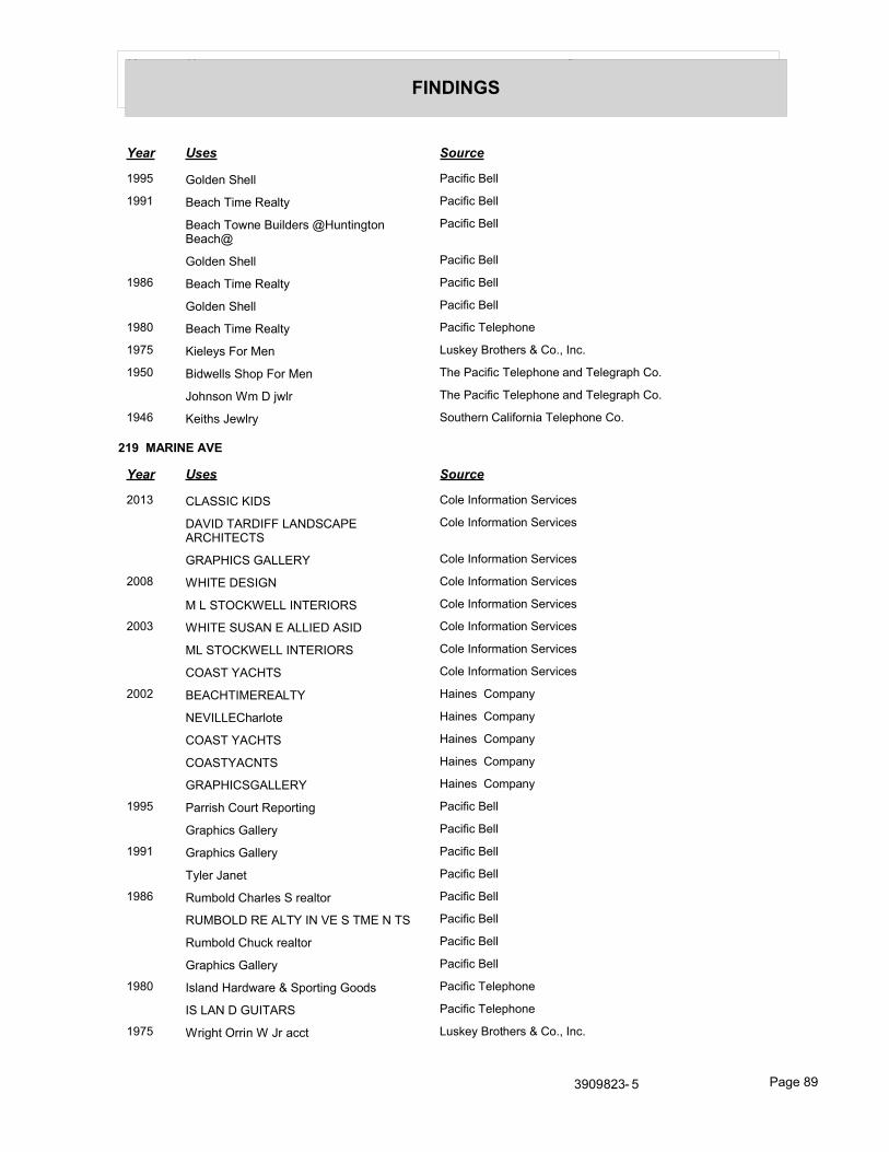
Year Uses Source
FINDINGS
Year Uses Source
1995 Golden Shell Pacific Bell
1991 Beach Time Realty Pacific Bell
Beach Towne Builders @Huntington Beach@
Pacific Bell
Golden Shell Pacific Bell
1986 Beach Time Realty Pacific Bell
Golden Shell Pacific Bell
1980 Beach Time Realty Pacific Telephone
1975 Kieleys For Men Luskey Brothers & Co., Inc.
1950 Bidwells Shop For Men The Pacific Telephone and Telegraph Co.
Johnson Wm D jwlr The Pacific Telephone and Telegraph Co.
1946 Keiths Jewlry Southern California Telephone Co.
219 MARINE AVE
Year Uses Source
2013 CLASSIC KIDS Cole Information Services
DAVID TARDIFF LANDSCAPE ARCHITECTS
Cole Information Services
GRAPHICS GALLERY Cole Information Services
2008 WHITE DESIGN Cole Information Services
M L STOCKWELL INTERIORS Cole Information Services
2003 WHITE SUSAN E ALLIED ASID Cole Information Services
ML STOCKWELL INTERIORS Cole Information Services
COAST YACHTS Cole Information Services
2002 BEACHTIMEREALTY Haines Company
NEVILLECharlote Haines Company
COAST YACHTS Haines Company
COASTYACNTS Haines Company
GRAPHICSGALLERY Haines Company
1995 Parrish Court Reporting Pacific Bell
Graphics Gallery Pacific Bell
1991 Graphics Gallery Pacific Bell
Tyler Janet Pacific Bell
1986 Rumbold Charles S realtor Pacific Bell
RUMBOLD RE ALTY IN VE S TME N TS Pacific Bell
Rumbold Chuck realtor Pacific Bell
Graphics Gallery Pacific Bell
1980 Island Hardware & Sporting Goods Pacific Telephone
IS LAN D GUITARS Pacific Telephone
1975 Wright Orrin W Jr acct Luskey Brothers & Co., Inc.
3909823- 5 Page 89

Year Uses Source
FINDINGS
Year Uses Source
1955 Vagabond House The Pacific Telephone and Telegraph Co.
1950 Gibbs Arthur B Capt r The Pacific Telephone and Telegraph Co.
Gibbs Ruth Paddock r The Pacific Telephone and Telegraph Co.
Vagabond House The Pacific Telephone and Telegraph Co.
1946 Marples Irma Vagabond House Southern California Telephone Co.
Vagabond House Southern California Telephone Co.
220 MARINE AVE
Year Uses Source
2013 PIZZERIA AMICI Cole Information Services
CINNAMON ROLL FAIR Cole Information Services
2008 CINNAMON ROLL FAIR Cole Information Services
PAIN DU MONDE Cole Information Services
2003 PAIN DMND BREAD OF THE WORLD Cole Information Services
2002 PAINDUMONDE Haines Company
HANSONMichele Haines Company
CINNAMON ROLL FAIR Haines Company
1995 Cinnamon Roll Fair Pacific Bell
Pain Du Monde bread of the world Pacific Bell
1991 Saxon Brian Pacific Bell
Pain Du Mondebreadoftheworld Pacific Bell
Cinnamon Roll Fair Pacific Bell
1986 Island Llquors Pacific Bell
Balboa Island Liquors Pacific Bell
1980 S Balboa Island l iquors Pacific Telephone
island Liu Pacific Telephone
Is LAN hll OC Pacific Telephone
1975 Stroles Nicholas Luskey Brothers & Co., Inc.
Balboa Island Liquors Luskey Brothers & Co., Inc.
1950 Island Liquor Store The Pacific Telephone and Telegraph Co.
221 MARINE AVE
Year Uses Source
2013 NOYES JEWELERS Cole Information Services
MARYAMS SALON Cole Information Services
2008 BEACH TIME REALTY Cole Information Services
MARYAMS SALON Cole Information Services
JOHN E NOYES JEWELRY Cole Information Services
NOYES J Cole Information Services
3909823- 5 Page 90

Year Uses Source
FINDINGS
Year Uses Source
2008 GLENN LEWIS Cole Information Services
2003 MARYAMS SALON Cole Information Services
J NOYES JEWELERS Cole Information Services
2002 MARYAMSSALON Haines Company
LEWISGIenn Haines Company
1995 Maryams Salon Pacific Bell
Noyes J iwlr Pacific Bell
1991 Noyes J Iwlr Pacific Bell
1986 Alfredos Hair Etc Pacific Bell
LDon Dasille Skin Care Pacific Bell
1980 Panache Pacific Telephone
HMS Pinafore womenswr Pacific Telephone
1975 TOP DRAWER THE Luskey Brothers & Co., Inc.
1950 Shipmates chldrns wear The Pacific Telephone and Telegraph Co.
Cheney F L r The Pacific Telephone and Telegraph Co.
222 MARINE AVE
Year Uses Source
2013 ISLAND GIRL Cole Information Services
IRVINE MUSEUM Cole Information Services
IRVINE MUSEUM THE Cole Information Services
HEART OF THE ISLAND GALLERY Cole Information Services
2008 SALLY HUSS GALLERY Cole Information Services
HEART OF THE ISLAND Cole Information Services
2003 HUSS SALLY GALLERY Cole Information Services
FOOT BOUTIQUE Cole Information Services
2002 FOOT BOUTIQUE Haines Company
HUSSSALLYGALLERY Haines Company
NOYESJohn Haines Company
1991 O & W Inc Pacific Bell
Schofield Eric J Pacific Bell
1986 Beaulolais Pacific Bell
1980 CEst Bon Pacific Telephone
1975 Sabu Bazaar Luskey Brothers & Co., Inc.
1955 Balboa Island Sporting Goods The Pacific Telephone and Telegraph Co.
1950 Balboa Island Sporting Goods The Pacific Telephone and Telegraph Co.
Higgins Harold J r The Pacific Telephone and Telegraph Co.
1946 Abell John C Balboa Island Sporting Goods
Southern California Telephone Co.
3909823- 5 Page 91

Year Uses Source
FINDINGS
Year Uses Source
1946 Balboa Island Sporting Goods Southern California Telephone Co.
Island Liquor Store The Southern California Telephone Co.
223 MARINE AVE
Year Uses Source
2013 CIAO Cole Information Services
HOOFE PATENTS Cole Information Services
2008 CIAO ITALIAN RESTAURANT Cole Information Services
HOOFE PATENTS Cole Information Services
CIAO Cole Information Services
2003 CIAO CATERING Cole Information Services
CIAO Cole Information Services
2002 HOOFE William Haines Company
CIAO CATERING Haines Company
OSAUTERGary Haines Company
1995 LITE TILE PATENTS Pacific Bell
1991 ROCKOS CUISINE INC Pacific Bell
LITE TILE PATENTS Pacific Bell
1986 ROCKOS PIZZARIA Pacific Bell
UITETLE & S HAKE PAN E LS IN C Pacific Bell
Calia Lori Pacific Bell
1980 California Ranch Marlcets Inc Pacific Telephone
Balboa Island Pacific Telephone
1975 Springer P Luskey Brothers & Co., Inc.
Balboa Island Luskey Brothers & Co., Inc.
Cross B Luskey Brothers & Co., Inc.
1955 Roberts Jewlrs The Pacific Telephone and Telegraph Co.
Prendergast John B rltr The Pacific Telephone and Telegraph Co.
1950 Woodward Eugene V Mrs r The Pacific Telephone and Telegraph Co.
White Carl r The Pacific Telephone and Telegraph Co.
Roberts Jewlrs The Pacific Telephone and Telegraph Co.
Poore W W r The Pacific Telephone and Telegraph Co.
Eastman Robt A atty The Pacific Telephone and Telegraph Co.
Prendergast John B rltr The Pacific Telephone and Telegraph Co.
224 MARINE AVE
Year Uses Source
2013 BLISS FINE FLORALS Cole Information Services
ROSEY TOES Cole Information Services
3909823- 5 Page 92

Year Uses Source
FINDINGS
Year Uses Source
2013 FIVE SEAS Cole Information Services
2008 FIVE SEAS Cole Information Services
ROSEY TOES Cole Information Services
BLISS FINE FLORALS Cole Information Services
2003 BLOSSUMS Cole Information Services
2002 BALBOA PORCH Haines Company
1995 Kids Clothing Co Pacific Bell
Balboa Island Kids Clothing Co The Pacific Bell
1991 Kids Clothing Co Pacific Bell
Balboa Island Kids Clothing Co The Pacific Bell
1986 Seven Seas Dress Shop Pacific Bell
1980 Seven Seas Dress Shop Pacific Telephone
1975 Robb Donald A Luskey Brothers & Co., Inc.
Jack & Jill Wee chldrns shop Luskey Brothers & Co., Inc.
Abracadabra Luskey Brothers & Co., Inc.
1950 Holman Elizabeth r The Pacific Telephone and Telegraph Co.
1946 Holman Elizabeth r Southern California Telephone Co.
225 MARINE AVE
Year Uses Source
2013 TANGO ROSE Cole Information Services
2008 TEDDY BEARS & TEA CUPS Cole Information Services
TEDDYBEARSANDTEACUPS Cole Information Services
2003 TEDDY BEARS & TEACUPS Cole Information Services
2002 TEDDY Haines Company
BEARS&TEACUPS Haines Company
1991 Wilmas Patio Pacific Bell
1980 LA ROCHE LLE FRE N CH RE S TAURAN T
Pacific Telephone
1975 Theee Patio Luskey Brothers & Co., Inc.
1955 Balboa Island Ofc The Pacific Telephone and Telegraph Co.
1950 Balboa Island Ofc The Pacific Telephone and Telegraph Co.
1946 Balboa Island Ofc Southern California Telephone Co.
226 MARINE AVE
Year Uses Source
2013 C & J HOUSTON Cole Information Services
SANDCASTLE MONOGRAM Cole Information Services
STARBUCKS COFFEE Cole Information Services
3909823- 5 Page 93

Year Uses Source
FINDINGS
Year Uses Source
2008 PERSONAL ASSISTANCE LEAGUE Cole Information Services
2003 DCRTV FNSHNG OF NWPRT BEAC Cole Information Services
SANDCASTLE MNGRMNG & GIFTS Cole Information Services
2002 SANDCASTLETOWEL Haines Company
COMPANY STARBUCKS COFFEE Haines Company
1995 Maggenti Baylor Eldric Pacific Bell
Clemens Mark & Kim Pacific Bell
Coastal Living Pacific Bell
1991 Maggenti Baylor Eldnc Pacific Bell
Mole Hole Of Balboa Island The Pacific Bell
Maggi M Pacific Bell
Maggi Jean & Theresa Pacific Bell
1986 Espinosa David R Pacific Bell
Acapulco Beach Club Pacific Bell
1980 Symes Jim Pacific Telephone
Carri Wicket Balboa Island Pacific Telephone
1975 ELLEN CARTER LADIES HABERDASHER
Luskey Brothers & Co., Inc.
1950 Ted Owen Restaurants The Pacific Telephone and Telegraph Co.
229 MARINE AVE
Year Uses Source
2013 DEBRA HUSE GALLERY Cole Information Services
PERSIMMON TREE THE Cole Information Services
2008 PERSIMMON TREE Cole Information Services
DEBRA HUSE GALLERY Cole Information Services
THE BALBOA ISLAND ARTWALK Cole Information Services
2003 HUSE DEBRA DESIGN Cole Information Services
PERSIMMON TREE INC Cole Information Services
DEBRA HUSE GALLERY Cole Information Services
2002 CAMPBELLJune Haines Company
HUSEDEBRA DESIGN Haines Company
HUSEDEBRA DESIGN Haines Company
PERSIMMON TREETHE Haines Company
1995 Gallery Newman Pacific Bell
Rumbold Charles S realtor Pacific Bell
Newman & Newman Advertising Pacific Bell
Persimmon Tree The Pacific Bell
RUMBOLD REALTY Pacific Bell
3909823- 5 Page 94

Year Uses Source
FINDINGS
Year Uses Source
1991 Jacobs Robert atty Pacific Bell
Herman Richard Patty Pacific Bell
Rumbold Charles S realtor Pacific Bell
Higbie & Siebel lwyrs Pacific Bell
Higbie Richard A atty Pacific Bell
Jacobs Robt B Pacific Bell
Persimmon Tree The Pacific Bell
RUMBOLDREALTY Pacific Bell
Siebel G Edmund atty Pacific Bell
1986 Herman Richard P atty Pacific Bell
Contact Debbie Pacific Bell
Higbie C A atty Pacific Bell
Higbie Richard A any Pacific Bell
Lubel Allan G atty Pacific Bell
1980 Anfinson Accountancy Corp Pacific Telephone
Higbie C A atty Pacific Telephone
Higbie Richard A atty Pacific Telephone
Newport Bay Co Pacific Telephone
Salter Bradley DAtty At Law Pacific Telephone
Sardam William W Pacific Telephone
From Santa Ana Telephones Call Pacific Telephone
Sardam William W atty Pacific Telephone
Brechtel Lou & Associates real estate Pacific Telephone
1975 Higbie C A atty Luskey Brothers & Co., Inc.
Higbie Richard A atty Luskey Brothers & Co., Inc.
Holder Ronald G Luskey Brothers & Co., Inc.
Jafra Cosmetics Persimmon Tree Luskey Brothers & Co., Inc.
Persimmon Tree The Luskey Brothers & Co., Inc.
Robinson Suzanne atty Ofc Luskey Brothers & Co., Inc.
1950 Gay Togs The Pacific Telephone and Telegraph Co.
233 MARINE AVE
Year Uses Source
2002 XXXX Haines Company
300 MARINE AVE
Year Uses Source
2013 SHANGHAI PINE GARDENS RESTAURANT
Cole Information Services
3909823- 5 Page 95

Year Uses Source
FINDINGS
Year Uses Source
2008 SHANGHAI PINE GARDENS RESTAURANT
Cole Information Services
2003 SHANGHAI PINE GARDENS RSTRNT Cole Information Services
2002 GARDENS RSTRNT Haines Company
SHANGHAI PINE Haines Company
LAMCheang Haines Company
1995 Shanghai Pine Gardens Restaurant Pacific Bell
1991 Tse Kent T Pacific Bell
SHANGHAI PINE GARDENS RESTAURANT
Pacific Bell
1986 S HAN GHAI PIN E GARDE N S RE S TAURAN T
Pacific Bell
1975 Shanghai Pine Gardens Restaurant Luskey Brothers & Co., Inc.
1950 Island Patio The Pacific Telephone and Telegraph Co.
1946 S O S Radio & Elec Co Southern California Telephone Co.
301 MARINE AVE
Year Uses Source
2013 LAVISH BATH & BODY INC Cole Information Services
SULLIVAN TOM PHOTOGRAPHY Cole Information Services
BALBOA CANDY Cole Information Services
2008 BEACH BUMZ Cole Information Services
BALBOA CANDY Cole Information Services
ISLAND REALTY Cole Information Services
2003 YIN N YANG INC Cole Information Services
ISLAND REAL ESTATE Cole Information Services
2002 ADAMS DESIGNS Haines Company
BALBOA Candy Haines Company
YIN NYANG INC Haines Company
SULUVANTOM PHOTO Haines Company
SSREDSAIL Haines Company
ONEILBany Haines Company
ISLAND REAL ESTATE Haines Company
1995 Island Auto Repair&Tire Pacific Bell
land Entertainment Pacific Bell
Sulllvan Tom Photography Pacific Bell
Balboa Island Pacific Bell
Weir Canyon Pacific Bell
Weir Canyon Pacific Bell
BREA Pacific Bell
3909823- 5 Page 96

Year Uses Source
FINDINGS
Year Uses Source
1991 Newport Video & Photography Pacific Bell
Balboa Island Pacific Bell
Island Entertainment Pacific Bell
Island Fish Co Pacific Bell
1986 Balboa Island Pacific Bell
Harlequin Software Pacific Bell
Mr Mittys Pacific Bell
Newport Video & Photography Pacific Bell
Sullvan Tom Photography Pacific Bell
Opportunity Associates Pacific Bell
1980 Island Tennis Pacific Telephone
1975 Elaine Schlup Goldsmith Silversmith Luskey Brothers & Co., Inc.
Mr Mittys Luskey Brothers & Co., Inc.
Mynatts Stateroom Luskey Brothers & Co., Inc.
Schlup Elaine Goldsmith Silversmith Luskey Brothers & Co., Inc.
Stateroom nautcl shop Luskey Brothers & Co., Inc.
Yellow Brick Road The Luskey Brothers & Co., Inc.
1955 Boardmans Mkt The Pacific Telephone and Telegraph Co.
1950 Boardmans Mkt The Pacific Telephone and Telegraph Co.
302 MARINE AVE
Year Uses Source
2013 SUNTERRA PRODUCE TRADERS INC Cole Information Services
COAST ENTERPRISE GROUP Cole Information Services
2008 SUN TERRA FARMS INC Cole Information Services
SUNTERRA PRODUCE TRADERS INC Cole Information Services
MAGGIE MOO ICE CREAM & TREATERY
Cole Information Services
BALBOA LIFESTYLES Cole Information Services
2003 LIFESCIENCE RESOURCES Cole Information Services
ABRAMS DONALD L LAW OFFICES Cole Information Services
CLAREY TECHNOLOGY GROUP INC Cole Information Services
ORBYTENET WORKS TECHNOLOGY Cole Information Services
2002 LAW OFFICES RUMBOLD R Haines Company
ABRAMS DONALD L Haines Company
1995 Ignatia Group Inc Pacific Bell
Gift Market Pacific Bell
1991 Island Photographic Co Pacific Bell
Island Pharmacy Pacific Bell
3909823- 5 Page 97

Year Uses Source
FINDINGS
Year Uses Source
1991 Color & Herbal Co Pacific Bell
Balboa Island Pharmacy Pacific Bell
1986 Kennedy Patrick J graplsc desgnr Pacific Bell
Art Expressions Pacific Bell
Balboa Island Pharmacy Pacific Bell
Handwriting Analysis By Miss Marks Pacific Bell
bland Tanning Inc Pacific Bell
1980 D Balboa Island Pharmacy Pacific Telephone
Balboa Village Pharmacy Pacific Telephone
Leroys Balboa Island Pharmacy Pacific Telephone
1975 Leroys @Balboa@ Island Pharmacy Luskey Brothers & Co., Inc.
Balboa Island Pharmacy Luskey Brothers & Co., Inc.
Balboa Village Pharmacy Luskey Brothers & Co., Inc.
Elgin Kenneth Inc Luskey Brothers & Co., Inc.
Kroesch E Leroy Luskey Brothers & Co., Inc.
1950 Hinkleys Pharmacy The Pacific Telephone and Telegraph Co.
303 MARINE AVE
Year Uses Source
1946 Boardman Harbor Mkt Southern California Telephone Co.
304 MARINE AVE
Year Uses Source
2013 SUNNY DAYS Cole Information Services
2003 WILSONS BEACH COTTAGE Cole Information Services
2002 COTTAGE Haines Company
WILSONS BEACH Haines Company
CROISSANT Rodney Haines Company
BEACH COTTAGE Haines Company
1991 Cotton Field Pacific Bell
1986 Sundance Pacific Bell
1975 Sundance Luskey Brothers & Co., Inc.
1950 Estelle s Beauty Shop The Pacific Telephone and Telegraph Co.
1946 Mariska House of Beauty Southern California Telephone Co.
305 MARINE AVE
Year Uses Source
2013 GIORGIO LA TRATTORIA Cole Information Services
2003 GIORGIO LATRATTORIA Cole Information Services
3909823- 5 Page 98

Year Uses Source
FINDINGS
Year Uses Source
2002 TRATTORIA Haines Company
GIORGIOL Haines Company
ODUNWELL Stephen Haines Company
1995 Giorgio La Trattoria Pacific Bell
Balboa Island Pacific Bell
1986 Paparazzi Ristorante Italiano Pacific Bell
1980 Craig M Pacific Telephone
1975 Rhodes John E Luskey Brothers & Co., Inc.
1955 Nichols Kenneth L Cottage Waffle Shop The Pacific Telephone and Telegraph Co.
Cottage Waffle Shop The Pacific Telephone and Telegraph Co.
1950 Nichols Kenneth L Cottage Waffle Shop The Pacific Telephone and Telegraph Co.
Cottage Waffle Shop The Pacific Telephone and Telegraph Co.
1946 Cottage Do Nut & Waffle Shop Southern California Telephone Co.
306 MARINE AVE
Year Uses Source
2013 HEAVENLY COUTURE Cole Information Services
ANNETTES PLACE Cole Information Services
2008 AEGIR PROPERTIES INC Cole Information Services
WEEKEND TRAFFIC Cole Information Services
2003 WEEKEND TRAFFIC Cole Information Services
2002 AEGIRPROPERITES Haines Company
WEEKENDTRAFFIC Haines Company
1995 Aegir Properties Inc Pacific Bell
Line Up For Sport Pacific Bell
1991 Aegir Properties Inc Pacific Bell
Line Up For Sport Pacific Bell
Rowan Mark Pacific Bell
1986 Aegir Properties Inc Pacific Bell
Doner Michael D Pacific Bell
Balboa Island Book Shoppe Pacific Bell
Chasens J Pacific Bell
1980 Book Shop On The Island Pacific Telephone
Island Bookshop Pacific Telephone
LE R DON & AS S OCIATE S RE ALTORS
Pacific Telephone
1975 Book Shop On The Island Luskey Brothers & Co., Inc.
Mione John Luskey Brothers & Co., Inc.
SOMERS REALTY Luskey Brothers & Co., Inc.
3909823- 5 Page 99

Year Uses Source
FINDINGS
Year Uses Source
1950 Community Chest of Newport Beach The Pacific Telephone and Telegraph Co.
Gibson Alfred E genl ins The Pacific Telephone and Telegraph Co.
Gibson Nelda rl est The Pacific Telephone and Telegraph Co.
Higbie C A atty The Pacific Telephone and Telegraph Co.
Mazet Horace S rl est The Pacific Telephone and Telegraph Co.
1946 Isom Homer r Southern California Telephone Co.
307 MARINE AVE
Year Uses Source
2013 BALBOA DIAMONDS JEWELRY Cole Information Services
EDWARD JONES FINANCIAL ADVISOR BO
Cole Information Services
ANDIAMO HAIR Cole Information Services
2008 ISLAND PILATES STUDIO Cole Information Services
KM FINN & ASSOCIATES Cole Information Services
EDWARD D JONES & CO LP Cole Information Services
ELEGANT ILLUSIONS INC Cole Information Services
SYDNEY MICHELLE Cole Information Services
2003 STECKS PERSONALIZED TEES & SWT Cole Information Services
SOLICS Cole Information Services
EDWARD JONES Cole Information Services
JUBILEE PLAZA Cole Information Services
2002 EDWARD JONES Haines Company
TEESASWTS Haines Company
PERSONALIZED Haines Company
STECKS Haines Company
SOLICS Haines Company
JOSTEN BOB Haines Company
1995 Jones Edward D & Company Pacific Bell
Spauldlngs Jewelers Pacific Bell
Josten Bob Pacific Bell
Cellines Boutique Ltd Pacific Bell
1991 Marcelles Boutique Pacific Bell
Mrs C & Me Sweet Shop Pacific Bell
SPAULDINGS JEWELERS Pacific Bell
Stecks Personalized Sweat Shirts Pacific Bell
Van Valkenberg Unlimited Pacific Bell
1986 S PAULDIN GS JE W E LE RS Pacific Bell
Stecks Personalized Sweat Shirts Pacific Bell
3909823- 5 Page 100

Year Uses Source
FINDINGS
Year Uses Source
1986 Maul On The Mainland Sweet Shop Pacific Bell
Register Jos Pacific Bell
1980 KIllgore M E Pacific Telephone
Old Time Photo Pacific Telephone
Original Olde Tiime Photo Slioppe The Pacific Telephone
Spauldings Jewelers Pacific Telephone
Stecks Personalized Sweat Shirts Pacific Telephone
1975 BRASS OWL THE Luskey Brothers & Co., Inc.
Holm Taina Luskey Brothers & Co., Inc.
Kilgore M E Luskey Brothers & Co., Inc.
Lezlies Handcrafted Wares Luskey Brothers & Co., Inc.
Nixon J L Luskey Brothers & Co., Inc.
Spauldings Jewelers Luskey Brothers & Co., Inc.
Stecks Personalized Sweat Shirts Luskey Brothers & Co., Inc.
Sunflower Swimwear Luskey Brothers & Co., Inc.
308 MARINE AVE
Year Uses Source
2013 JUST BASICS Cole Information Services
MARTHAS BOOKSTRORE Cole Information Services
2008 MARTHAS BOOKSTORE Cole Information Services
JUST BASICS Cole Information Services
NEWPORT BEACH PICTURE MAP Cole Information Services
2003 SS RED SAIL Cole Information Services
MARTHAS BOOKSTORE Cole Information Services
2002 JUSTBASICS Haines Company
TORREY Margaret Haines Company
1995 Just Basics Pacific Bell
1991 Just Basics Pacific Bell
Marthas Bookstore Pacific Bell
1980 Hammond Gerry H Pacific Telephone
I Taste Of Honey Pacific Telephone
Taste Freesu Pacific Telephone
1975 Keys John Luskey Brothers & Co., Inc.
Bashful Bikini The Luskey Brothers & Co., Inc.
Averyt P K Luskey Brothers & Co., Inc.
1950 Maggie vrns The Pacific Telephone and Telegraph Co.
Waldron Gertrude A Mrs rl est The Pacific Telephone and Telegraph Co.
1946 Sanford Wm W Waldron Gertrude A Mrs Southern California Telephone Co.
3909823- 5 Page 101

Year Uses Source
FINDINGS
Year Uses Source
1946 Waldron Gertrude A Mrs rl est Southern California Telephone Co.
309 MARINE AVE
Year Uses Source
1991 Hall Greg Pacific Bell
310 MARINE AVE
Year Uses Source
2013 SUGAR N SPICE Cole Information Services
2003 SUGAR N SPICE Cole Information Services
2002 CONNOLLYHalen Haines Company
SUGAR N Haines Company
1995 Sugar n Spice Pacific Bell
1991 Sugar n Spice Pacific Bell
1986 Sugar N Spice Pacific Bell
1950 Dot & Bob candies The Pacific Telephone and Telegraph Co.
311 MARINE AVE
Year Uses Source
2013 AMELIAS SEAFOOD & ITALIAN RESTAURAN
Cole Information Services
2008 AMELIA S SEAFOOD & ITALIAN RESTAUR
Cole Information Services
AMELIAS Cole Information Services
2003 AMELIAS SEAFOOD & ITALIAN REST Cole Information Services
AMELIAS ON BALBOA ISLANE Cole Information Services
2002 AMELIAS SEAFD REST Haines Company
SETON Amelia Haines Company
1995 Amelias Seafood & Italian Restaurant Pacific Bell
1991 Amelias Seafood & Italian Restaurant Pacific Bell
1986 Amelias Sea Food & Italian Restaurant Pacific Bell
1980 AME LIAS S E A FOOD & ITALIAN RE S TAURAN T
Pacific Telephone
1975 Balboa Island Luskey Brothers & Co., Inc.
1955 Gates Blanche A Realtor The Pacific Telephone and Telegraph Co.
1950 Gates Blanche A Realtor The Pacific Telephone and Telegraph Co.
Corson David C contr The Pacific Telephone and Telegraph Co.
Cape Cod House restrnt The Pacific Telephone and Telegraph Co.
1946 Taylor Ethel I Mrs r Southern California Telephone Co.
3909823- 5 Page 102

Year Uses Source
FINDINGS
312 MARINE AVE
Year Uses Source
2013 ETCETERA ETC Cole Information Services
2008 ETCETERA ETC Cole Information Services
2002 ETCETERA ETC Haines Company
eCOLDLOFT Haines Company
MCDERMOTTThomas J Haines Company
WINTERS Robt C Haines Company
WINTERS Rob 9 C Haines Company
1995 Etcetera Etc Pacific Bell
Winters Robt C Pacific Bell
1991 Winters Robt C Pacific Bell
Etcetera Etc Pacific Bell
1986 Etcetera Etc Pacific Bell
1980 Berberet J Pacific Telephone
1975 DAYTON ALBERT E rltr Luskey Brothers & Co., Inc.
Donnas Wig Salon Luskey Brothers & Co., Inc.
La Donnas Wigs Luskey Brothers & Co., Inc.
Stewart Karen Wig Salon Luskey Brothers & Co., Inc.
1950 Vick Linwood rltr The Pacific Telephone and Telegraph Co.
Tobias W A Linwood Vick rltr The Pacific Telephone and Telegraph Co.
Schmidt Wm G Linwood Vick rltr The Pacific Telephone and Telegraph Co.
1946 Vick E L r Southern California Telephone Co.
313 MARINE AVE
Year Uses Source
2013 ISLAND HOME Cole Information Services
2008 ISLAND HOME Cole Information Services
2003 ISLAND HOME Cole Information Services
2002 ISLANDHOME Haines Company
OLARAWAY Charles Haines Company
1995 Belie Fleurs Of Balboa Island Pacific Bell
Laraways Pacific Bell
Les Belle Fleurs Of Balboa Island Pacific Bell
1991 Laraways Pacific Bell
1980 Laraways Specialty Shoppe Pacific Telephone
LARAY CO IN C Pacific Telephone
1975 Laraways Specialty Shoppe Luskey Brothers & Co., Inc.
1955 Suess O G Dr dntst The Pacific Telephone and Telegraph Co.
1950 Suess O G Dr dntst The Pacific Telephone and Telegraph Co.
3909823- 5 Page 103

Year Uses Source
FINDINGS
Year Uses Source
1950 Williams Vera r The Pacific Telephone and Telegraph Co.
1946 Ellerbroek Philmer bldr Southern California Telephone Co.
Brown Colin F bkkpng serv Southern California Telephone Co.
314 MARINE AVE
Year Uses Source
2013 ST JOHN VIANNEY CHAPEL Cole Information Services
2008 SAINT JOHN VIANNEY CHAPEL Cole Information Services
2003 ST JOHN VIANNEY CHAPEL Cole Information Services
2002 STJOHNVIANNEY Haines Company
CHAPEL Haines Company
1986 Chapel Pacific Bell
315 MARINE AVE
Year Uses Source
2013 ABRAMS COASTAL PROPERTIES Cole Information Services
2008 DON ABRAMS REAL ESTATE BROKER Cole Information Services
ABRAMS COASTAL PROPERTIES Cole Information Services
2002 SALES OFC Haines Company
SALISBURYAlleen Haines Company
COLDWEL Haines Company
1991 Salisbury Chester F Pacific Bell
1980 Waterfront Properties Inc Pacific Telephone
Salisbury Chester F Pacific Telephone
1975 SALISBURY REALTY Luskey Brothers & Co., Inc.
Salisbury Chester F II Luskey Brothers & Co., Inc.
Half Moon Bay Land & Development Co Luskey Brothers & Co., Inc.
1950 Leidy Marilyn F rltr The Pacific Telephone and Telegraph Co.
317 MARINE AVE
Year Uses Source
2013 CRUSH CLOTHING Cole Information Services
2008 MAGNOLIA CHARLIE Cole Information Services
2003 MAGNOLIA CHARLIE Cole Information Services
2002 MAGNOLIAChalie Haines Company
OCHANYUm Haines Company
1995 Sky Stone Pacific Bell
1991 Sky Stone Pacific Bell
Balboa Dental Arts Pacific Bell
3909823- 5 Page 104

Year Uses Source
FINDINGS
Year Uses Source
1986 Sky Stone Pacific Bell
1980 Tasic Milena DOS Pacific Telephone
Sky Stone Pacific Telephone
Sales Ofcs Pacific Telephone
1975 Sky Stone Luskey Brothers & Co., Inc.
Parker Louis F And Associates DDS Luskey Brothers & Co., Inc.
Danon Jacques DDS Luskey Brothers & Co., Inc.
1950 Balboa Isle Nursery School The Pacific Telephone and Telegraph Co.
318 MARINE AVE
Year Uses Source
2013 DADS DONUT & BAKERY SHOP Cole Information Services
2008 DADS DONUT SHOP & BAKERY Cole Information Services
2003 DADS DONUT SHOP & BAKERY Cole Information Services
2002 SHOP&BAKERY Haines Company
YAMKhosung Haines Company
1995 Dads Donut Shop & Bakery Pacific Bell
Harvey Cabot Pacific Bell
1991 Dads Donut Shop & Bakery Pacific Bell
1986 Dad s Donut Shop & Bakery Pacific Bell
1975 Dads Donut Shop & Bakery Luskey Brothers & Co., Inc.
1950 La Fresta wearng apprl The Pacific Telephone and Telegraph Co.
1946 Walkers Frozen Foods Southern California Telephone Co.
319 MARINE AVE
Year Uses Source
2013 WATSON CRAIG A CPA Cole Information Services
KING KONG PRODUCTION VEHICLES Cole Information Services
DUCKS & DAISIES Cole Information Services
CANDLESSENCE Cole Information Services
2008 KING KONG PRODUCTION VEHICLES Cole Information Services
COPEEN INC Cole Information Services
RIMINI IMP & EXPO Cole Information Services
BALBOA ISLAND T SHIRT CO Cole Information Services
CINDYS Cole Information Services
2003 BALBOA ISLAND T SHIRT CO Cole Information Services
ESNARD R P ATTY Cole Information Services
2002 TODD Clifford Haines Company
SHIELDSJohn Haines Company
3909823- 5 Page 105

Year Uses Source
FINDINGS
Year Uses Source
2002 JACOUELINESBOUTQ Haines Company
SHIRT CO ESNARDR PATTY Haines Company
BALBOA ISLAND T Haines Company
1995 Balboa Island T Shirt Co Pacific Bell
Esnard R P atty Pacific Bell
Jacquelines Boutique Pacific Bell
Pickering Bel & Major Pacific Bell
1991 Runners High Pacific Bell
Rosten David Pacific Bell
Rosten D Pacific Bell
Island Engineering Inc Pacific Bell
Island Draperies Pacific Bell
Esnard R Patty Pacific Bell
Cunningham Enterprises Inc Pacific Bell
Balboa Island T Shirt Co Pacific Bell
1986 Owens Ernest Designs Pacific Bell
Esnard R P atty Pacific Bell
BALBOA IS LAN D TS HIRT CO Pacific Bell
Alexs Fashion Center Pacific Bell
1980 Alexs Fashion Center Pacific Telephone
Atttude The Pacific Telephone
Microwave Associates Inc Pacific Telephone
Microwave Controls Co Pacific Telephone
Moodey Rogers Living Voices Pacific Telephone
1975 Macdonald E Luskey Brothers & Co., Inc.
Attitude The Luskey Brothers & Co., Inc.
1950 Hyer Grainger The Pacific Telephone and Telegraph Co.
1946 Hyer Grainger Southern California Telephone Co.
320 MARINE AVE
Year Uses Source
2013 PICANTE MARTINS MEXICAN RESTAURANT
Cole Information Services
2008 PICANTE MARTINS MEXICAN RESTAURANT
Cole Information Services
2003 PICANTE MARTINS MEXICAN RSTRNT Cole Information Services
2002 PICANTE MARTINS Haines Company
MEXICAN REST Haines Company
SCHINAIAAIier I Haines Company
SUNSLASS SOLUTIONS Haines Company
3909823- 5 Page 106

Year Uses Source
FINDINGS
Year Uses Source
1995 Windsors Gifts Internatl Pacific Bell
Florence Pacific Bell
1986 European Optical Pacific Bell
Annies Jewelry Shop Pacific Bell
1980 Bay Co The mens clthas Pacific Telephone
Annigoni Rick Pacific Telephone
Annies Jewelry Shop Pacific Telephone
Balboa Skate Co Pacific Telephone
1975 Little Place The Luskey Brothers & Co., Inc.
1955 Jacks Barber Shop The Pacific Telephone and Telegraph Co.
Huckabee Z V Jacks Barber Shop The Pacific Telephone and Telegraph Co.
1950 Huckabee Z V Jacks Barber Shop The Pacific Telephone and Telegraph Co.
Jacks Barber Shop The Pacific Telephone and Telegraph Co.
Snip & Stitch The Pacific Telephone and Telegraph Co.
1946 Jacks Barber Shop Southern California Telephone Co.
321 MARINE AVE
Year Uses Source
2013 SCULPTURES OF BALBOA Cole Information Services
RIMINI INCE Cole Information Services
2008 SCULPTURES OF BALBOA Cole Information Services
RIMINI EXPORT IMPORT INC Cole Information Services
2003 SCULPTURES OF BALBOA Cole Information Services
ULTIMATE VACATION & TRAVEL Cole Information Services
SHARON TARPO Cole Information Services
2002 SCULPTURES OF Haines Company
BALBOA ULTIMATE Haines Company
VACAT 10 N 8 TRAVEL Haines Company
1995 Agate 108 Annex Cottage Plates Pacific Bell
Cottage Plates Pacific Bell
Geneva Of Beverly Hills Pacific Bell
1991 WE TRAVEL Pacific Bell
Island Waterworks Pacific Bell
Balboa Island We Travel Pacific Bell
1986 BALBOA IS LAN DW E TRAVE L Pacific Bell
CC & COMPANZ Pacific Bell
1980 BALBOA IS LAN D W E TRAVE L Pacific Telephone
CC & Company Pacific Telephone
1975 Alexs Fashion Center Luskey Brothers & Co., Inc.
3909823- 5 Page 107

Year Uses Source
FINDINGS
Year Uses Source
1975 WE Travel Luskey Brothers & Co., Inc.
1950 Barnett C B MD The Pacific Telephone and Telegraph Co.
1946 Dorcy Laurence H MD Southern California Telephone Co.
322 MARINE AVE
Year Uses Source
2013 SJODIN COMMUNICATIONS Cole Information Services
2008 THE BARKERY Cole Information Services
SJODIN COMMUNICATIONS Cole Information Services
2003 BARKERY Cole Information Services
SJODIN COMMUNICATIONS Cole Information Services
2002 BARKE Haines Company
ODURNIAN Charles Haines Company
i/MELODYS GARDEN Haines Company
WHITE Piclketl Haines Company
1995 Balboa Island Coffee Co Pacific Bell
Wales K Pacific Bell
1991 Miller Jim Pacific Bell
Balboa Sandwich Co The Pacific Bell
Lapperts Ice Cream & Bake Shop Pacific Bell
1986 Balboa Ice Emporium Pacific Bell
Ripps Sandwich Shop & Deli Pacific Bell
1980 Marcs mans clthns Pacific Telephone
1975 S O S Radio & TV Luskey Brothers & Co., Inc.
SOS RADIO & TV Luskey Brothers & Co., Inc.
1955 S O S Radio & Elec Co The Pacific Telephone and Telegraph Co.
1950 S O S Radio & Elec Co The Pacific Telephone and Telegraph Co.
Deems Howard E r The Pacific Telephone and Telegraph Co.
Hanson Jeanette r The Pacific Telephone and Telegraph Co.
1946 Christian C W Cheryls Cafe Southern California Telephone Co.
Cheryls Cafe Southern California Telephone Co.
323 MARINE AVE
Year Uses Source
2013 FRESH PRODUCE BALBOA ISLAND Cole Information Services
2008 FRESH PRODUCE BALBOA ISLAND Cole Information Services
SUNNY DAYS RETAIL INC Cole Information Services
2002 SKIMChong Haines Company
3909823- 5 Page 108

Year Uses Source
FINDINGS
324 MARINE AVE
Year Uses Source
2013 CANDACE PAIGE Cole Information Services
VANCE LORA W REALTOR Cole Information Services
2008 ALEXIOS INC Cole Information Services
SOMMERSKA Cole Information Services
LE COLLAGE Cole Information Services
LORA W VANCE REALTOR Cole Information Services
CHANTEL & VICKI Cole Information Services
2003 SOMMERSKA Cole Information Services
LORA W VANCE REALTOR Cole Information Services
2002 OKOURY Robert Haines Company
LORAWVANCERLTR Haines Company
+SOMMERSKA Haines Company
VANCELORAWRLTR Haines Company
1995 Vance Lora W Realtor Pacific Bell
Le Collage Pacific Bell
LORAWVANCE REALTOR Pacific Bell
1991 Jurgensen Teresa Pacific Bell
Le Collage antiqs Pacific Bell
Lora Vance realtor Pacific Bell
LORAWVANCEREALTOR Pacific Bell
1986 Lora Vance realtor Pacific Bell
LORA W VAN CE RE ALTOR Pacific Bell
Le Collage antiqs Pacific Bell
1980 Jurgensen S M Pacific Telephone
Le Collage antiqs Pacific Telephone
1975 Le Collage antiqs Luskey Brothers & Co., Inc.
Vance Lora W realtor Luskey Brothers & Co., Inc.
Jurgensen S M Luskey Brothers & Co., Inc.
1950 Reid Karl D r The Pacific Telephone and Telegraph Co.
El Mirador Apts The Pacific Telephone and Telegraph Co.
1946 Roth Herbert C Rev r Southern California Telephone Co.
Knox Louis C Mrs r Southern California Telephone Co.
325 MARINE AVE
Year Uses Source
2013 SHIRLEYS HEART Cole Information Services
2008 SHIRLEYS HEART INC Cole Information Services
2003 SHIRLEYS HEART Cole Information Services
3909823- 5 Page 109

Year Uses Source
FINDINGS
Year Uses Source
2002 GREGORIUSWilliam Haines Company
SHIRLEYSHEART Haines Company
1995 Gregorlus Karl Dr Pacific Bell
1991 Gregorius Karl Dr Pacific Bell
Gregorius William Pacific Bell
Guinn M Pacific Bell
1986 Gregonus Karl Dr Pacific Bell
Guinn M Pacific Bell
1980 a adybug Sportswear Inc Pacific Telephone
1975 Gregorius Karl Dr Luskey Brothers & Co., Inc.
Ladybug Sportswear Inc Luskey Brothers & Co., Inc.
326 MARINE AVE
Year Uses Source
2013 OC COUTURE Cole Information Services
ISLAND TIME Cole Information Services
2008 JUNES FINE ART GALLERY Cole Information Services
NGUYEN Cole Information Services
CHRISTOPHERSON SANDY ANDIAMO HAIR
Cole Information Services
ANDIAMO SALON Cole Information Services
2003 ANDIAMO HAIR Cole Information Services
MESA COMMERCIAL SERVICES Cole Information Services
JUNES FINE ART GALLERY Cole Information Services
2002 CHRISTOPHERSONSA Haines Company
JUNESFINEART Haines Company
GALLERY NGUYEN Haines Company
A ANDIAMO HAIR Haines Company
1995 Price S Pacific Bell
Mann Donald Pacific Bell
Christopherson Sandy Andlamo Hair Pacific Bell
Andlamo Hair Pacific Bell
Nguyen Nguyet Pacific Bell
1991 Patricks For Hair Pacific Bell
A 1 Remodeling Pacific Bell
Nguyen Nguyet Pacific Bell
A l Rent A Fence Pacific Bell
South China Rag Company Pacific Bell
1986 Catalani J R Pacific Bell
3909823- 5 Page 110

Year Uses Source
FINDINGS
Year Uses Source
1986 South China Rag Company Pacific Bell
1980 Mercantile Island Jim Pacific Telephone
island Mercantile Pacific Telephone
1975 ANYTHING GOES Luskey Brothers & Co., Inc.
ALFREDOS HAIR ETC coiffures Luskey Brothers & Co., Inc.
Painter Pete Luskey Brothers & Co., Inc.
Crabtree Bill Luskey Brothers & Co., Inc.
327 MARINE AVE
Year Uses Source
2013 ORNATE HOMES Cole Information Services
2003 TURQUOISE LADY Cole Information Services
2002 EUROPN SKIN&BTY Haines Company
DANIELLELOON Haines Company
1995 Shirleys Heart Pacific Bell
LDon Danielle European Skin & Beauty Care
Pacific Bell
Danielle LDon European Skin & Beauty Care
Pacific Bell
1991 Le A @Huntington Beach@ Pacific Bell
Taxco Silver Jewelry Pacific Bell
Le A Pacific Bell
LDon Danialle European Skin & Beauty Care
Pacific Bell
Danielle LDon European Skin & Beauty Care
Pacific Bell
1986 S MITH N ATION AL JE W E LRY Pacific Bell
1980 N Howard C bldg desgnr Pacific Telephone
1975 Martin Howard C bldg desgnr Luskey Brothers & Co., Inc.
1950 Marine Beauty Salon The Pacific Telephone and Telegraph Co.
1946 Marine Beauty Salon Southern California Telephone Co.
328 MARINE AVE
Year Uses Source
2002 XXXX Haines Company
329 MARINE AVE
Year Uses Source
2008 SEASIDE COTTAGE Cole Information Services
HIDDEN TREASURES Cole Information Services
2002 a KEENAN Frank Haines Company
3909823- 5 Page 111
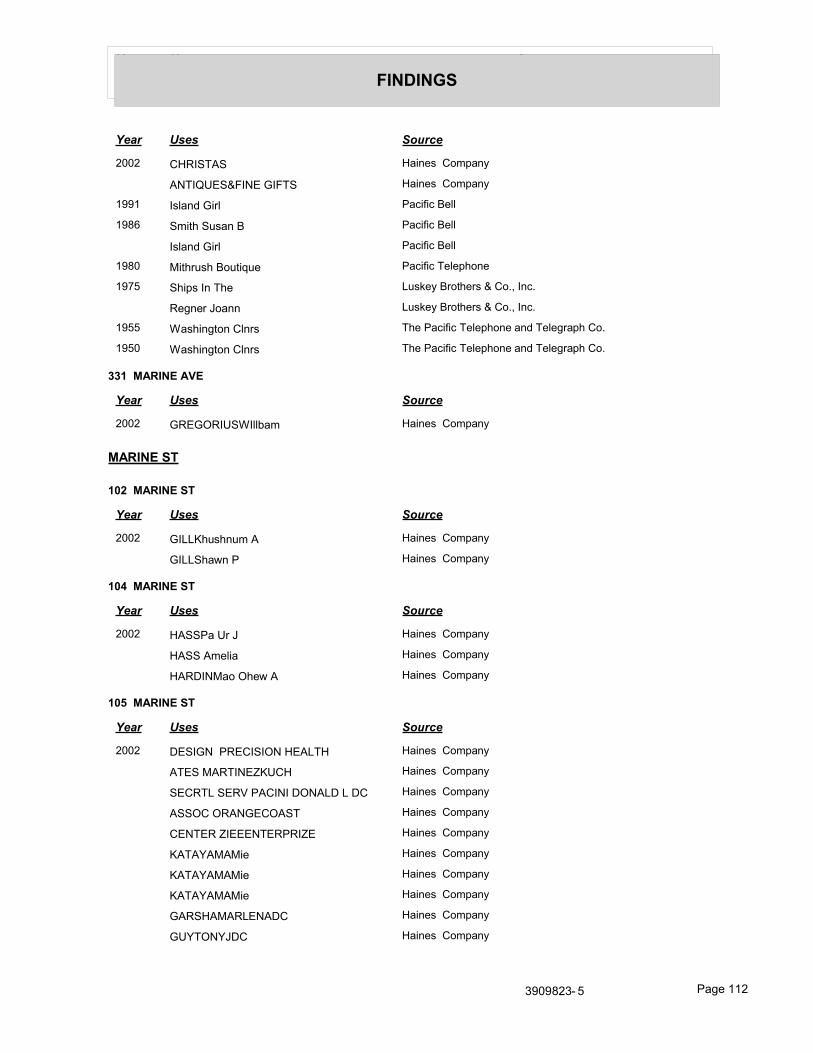
Year Uses Source
FINDINGS
Year Uses Source
2002 CHRISTAS Haines Company
ANTIQUES&FINE GIFTS Haines Company
1991 Island Girl Pacific Bell
1986 Smith Susan B Pacific Bell
Island Girl Pacific Bell
1980 Mithrush Boutique Pacific Telephone
1975 Ships In The Luskey Brothers & Co., Inc.
Regner Joann Luskey Brothers & Co., Inc.
1955 Washington Clnrs The Pacific Telephone and Telegraph Co.
1950 Washington Clnrs The Pacific Telephone and Telegraph Co.
331 MARINE AVE
Year Uses Source
2002 GREGORIUSWIllbam Haines Company
MARINE ST
102 MARINE ST
Year Uses Source
2002 GILLKhushnum A Haines Company
GILLShawn P Haines Company
104 MARINE ST
Year Uses Source
2002 HASSPa Ur J Haines Company
HASS Amelia Haines Company
HARDINMao Ohew A Haines Company
105 MARINE ST
Year Uses Source
2002 DESIGN PRECISION HEALTH Haines Company
ATES MARTINEZKUCH Haines Company
SECRTL SERV PACINI DONALD L DC Haines Company
ASSOC ORANGECOAST Haines Company
CENTER ZIEEENTERPRIZE Haines Company
KATAYAMAMie Haines Company
KATAYAMAMie Haines Company
KATAYAMAMie Haines Company
GARSHAMARLENADC Haines Company
GUYTONYJDC Haines Company
3909823- 5 Page 112

Year Uses Source
FINDINGS
Year Uses Source
2002 JONES MARK K DC Haines Company
JUNIESTOUCH Haines Company
LEGATE ROBERTLAW Haines Company
OFFICE OF LUNDSTROM&ASSOCI Haines Company
PANAMA JOES HAIR Haines Company
110 MARINE ST
Year Uses Source
2002 WALDMAN Sylv Haines Company
WUYuansahih R Haines Company
WALOMANStan Iey Haines Company
111 MARINE ST
Year Uses Source
2002 FRUTOSJack Haines Company
112 MARINE ST
Year Uses Source
2002 WARD Chrs G Haines Company
1955 Thomlinson Effie The Pacific Telephone and Telegraph Co.
113 MARINE ST
Year Uses Source
1955 Spring Clayte P The Pacific Telephone and Telegraph Co.
114 MARINE ST
Year Uses Source
2002 LAURSENT Haines Company
1955 Scofield Robt W The Pacific Telephone and Telegraph Co.
Ehlers John A L Mrs The Pacific Telephone and Telegraph Co.
115 MARINE ST
Year Uses Source
2002 CORBETTSwan Haines Company
1955 Hildreth Jack E The Pacific Telephone and Telegraph Co.
116 MARINE ST
Year Uses Source
1955 Allen Martha J Mrs The Pacific Telephone and Telegraph Co.
Wright Jas T The Pacific Telephone and Telegraph Co.
3909823- 5 Page 113

Year Uses Source
FINDINGS
118 MARINE ST
Year Uses Source
2002 SPOHRRyan Haines Company
RAISROHANIAIr Haines Company
1955 Lowe Fount L The Pacific Telephone and Telegraph Co.
121 MARINE ST
Year Uses Source
1955 Lee W S The Pacific Telephone and Telegraph Co.
122 MARINE ST
Year Uses Source
1960 Ward HL JE 1 a Luskey Brothers & Co.,
123 MARINE ST
Year Uses Source
2002 CRUZ Richard Haines Company
1955 Soule Maydean The Pacific Telephone and Telegraph Co.
135 MARINE ST
Year Uses Source
2002 JIMENEZJJuan Lurr Haines Company
JIANGY Vg Haines Company
138 MARINE ST
Year Uses Source
1955 Baier Emile C The Pacific Telephone and Telegraph Co.
140 MARINE ST
Year Uses Source
2002 CERNACesar G Haines Company
CONTRERASLus Haines Company
CASTi LLOGnse O a 714 56a Haines Company
142 MARINE ST
Year Uses Source
1955 Cameron Vincent The Pacific Telephone and Telegraph Co.
146 MARINE ST
Year Uses Source
1955 Sorsabal Andy Sr The Pacific Telephone and Telegraph Co.
3909823- 5 Page 114

Year Uses Source
FINDINGS
150 MARINE ST
Year Uses Source
2002 HERNANOEZRaa UI Haines Company
HERRERAFIondaroa Haines Company
IRENJU 1to Haines Company
156 MARINE ST
Year Uses Source
1955 Crowell Ida S The Pacific Telephone and Telegraph Co.
170 MARINE ST
Year Uses Source
2002 HERBASJuan 714 554 V Haines Company
200 MARINE ST
Year Uses Source
1955 Balboa Island The Pacific Telephone and Telegraph Co.
201 MARINE ST
Year Uses Source
2002 YAMSHONSIeven Haines Company
1960 Hoare GE JE 1 a Luskey Brothers & Co.,
1955 Island Pharmacy The Pacific Telephone and Telegraph Co.
1950 Allens Pharmacy The Pacific Telephone and Telegraph Co.
1946 Allens Pharmacy Southern California Telephone Co.
202 MARINE ST
Year Uses Source
2002 SABOS Haines Company
203 MARINE ST
Year Uses Source
2002 VAUGHN Steve C Haines Company
204 MARINE ST
Year Uses Source
2002 RINDAHL Edward Haines Company
1955 LORNE apprl The Pacific Telephone and Telegraph Co.
205 MARINE ST
Year Uses Source
1955 Smith Hal Will rl est The Pacific Telephone and Telegraph Co.
3909823- 5 Page 115

Year Uses Source
FINDINGS
Year Uses Source
1950 Smith Hal Will rl est The Pacific Telephone and Telegraph Co.
1946 Smith Hal Will rl est Southern California Telephone Co.
206 MARINE ST
Year Uses Source
2002 KIVISTO Douglas J Haines Company
1955 Balboa Island @Stanton@ The Pacific Telephone and Telegraph Co.
208 MARINE ST
Year Uses Source
2002 UPCHURCH Jassie Haines Company
SUOIYAMAV Haines Company
THANMY 1 NTS Haines Company
UPCHURCHJessa L Haines Company
UPCHURCHJesse L 949 724 1 B Haines Company
UPCHURCHJBSSBL Haines Company
1955 Balboa Island Ofc The Pacific Telephone and Telegraph Co.
209 MARINE ST
Year Uses Source
2002 LAKES Marge Haines Company
LAKES Ed Haines Company
1955 Snipn Stitch The Pacific Telephone and Telegraph Co.
210 MARINE ST
Year Uses Source
2002 ESOUIVELVic Or 714 836 19 3 i Haines Company
CA 0 RANZA 0 Arluro 714 541 3 A Haines Company
1955 Island Hardware The Pacific Telephone and Telegraph Co.
Rod & Reel Shop The The Pacific Telephone and Telegraph Co.
211 MARINE ST
Year Uses Source
2002 LOUGHRANV Haines Company
1955 Jax Balboa Island Inc womens sportswr The Pacific Telephone and Telegraph Co.
Carrousel Burtons Gene apprl The Pacific Telephone and Telegraph Co.
Burtons Gene Carrousel apprl The Pacific Telephone and Telegraph Co.
3909823- 5 Page 116

Year Uses Source
FINDINGS
212 MARINE ST
Year Uses Source
2002 LYCHEJeremy Haines Company
LYCHEKalhy Haines Company
1955 Kim of Calif sportswr The Pacific Telephone and Telegraph Co.
213 MARINE ST
Year Uses Source
1955 Balboa Island Variety Store The Pacific Telephone and Telegraph Co.
214 MARINE ST
Year Uses Source
2002 REINAJim J Haines Company
1955 Islanders The gifts The Pacific Telephone and Telegraph Co.
Islanders The furn The Pacific Telephone and Telegraph Co.
Hydens The Pacific Telephone and Telegraph Co.
215 MARINE ST
Year Uses Source
2002 MCGEADYGIenna Haines Company
1955 Camera Shop The The Pacific Telephone and Telegraph Co.
Clothes Horse The sportswr The Pacific Telephone and Telegraph Co.
216 MARINE ST
Year Uses Source
1960 Vacant Luskey Brothers & Co.,
1955 Bray Doris rltr The Pacific Telephone and Telegraph Co.
Lake C D Bray Doris rltr The Pacific Telephone and Telegraph Co.
Bray Doris rltr The Pacific Telephone and Telegraph Co.
217 MARINE ST
Year Uses Source
1955 Gay Togs The Pacific Telephone and Telegraph Co.
Toy Box The The Pacific Telephone and Telegraph Co.
Brown John Advertising The Pacific Telephone and Telegraph Co.
218 MARINE ST
Year Uses Source
1955 Johnsons Jewelry The Pacific Telephone and Telegraph Co.
Johnson Wm D Johnsons Jewelry The Pacific Telephone and Telegraph Co.
Balboa Island Shop The Pacific Telephone and Telegraph Co.
3909823- 5 Page 117

Year Uses Source
FINDINGS
219 MARINE ST
Year Uses Source
1955 Community Chest of Newport Beach The Pacific Telephone and Telegraph Co.
Wright Orrin W Jr acct The Pacific Telephone and Telegraph Co.
220 MARINE ST
Year Uses Source
2002 AMERCRMTNSVOF Haines Company
SDDLBCKCHPL MCDANIELPhyl N s Haines Company
MCDANi EL Wiliram Haines Company
SADOLBCK CHAPEL Haines Company
SADDLBCKCHPL Haines Company
MTRYVCAMTN SV TUSTIN MORTUARY Haines Company
NAGELMargo Haines Company
NAGELPatrick Haines Company
TKCINC Haines Company
TRANAnna Haines Company
TRANLawerence C Haines Company
1955 Island Liquors The Pacific Telephone and Telegraph Co.
Nouts Louise The Pacific Telephone and Telegraph Co.
221 MARINE ST
Year Uses Source
1980 Peel Matique Pacific Telephone
1955 Top Drawer chldrns wear The Pacific Telephone and Telegraph Co.
Store The Pacific Telephone and Telegraph Co.
223 MARINE ST
Year Uses Source
2002 THOBURN Robert Haines Company
TAMURAKagualho Haines Company
1955 Bruner Jesslyn T Prendergast John B rltr The Pacific Telephone and Telegraph Co.
224 MARINE ST
Year Uses Source
1955 Holman Elizabeth The Pacific Telephone and Telegraph Co.
225 MARINE ST
Year Uses Source
1955 Willmes Robt F The Pacific Telephone and Telegraph Co.
Stanley Mortgage & Investment Co The Pacific Telephone and Telegraph Co.
3909823- 5 Page 118

Year Uses Source
FINDINGS
Year Uses Source
1955 Stanley Escrow Serv The Pacific Telephone and Telegraph Co.
Stanley Earl W assemblyman The Pacific Telephone and Telegraph Co.
226 MARINE ST
Year Uses Source
1955 Beckilou Specialty Restaurant The Pacific Telephone and Telegraph Co.
229 MARINE ST
Year Uses Source
1955 Higbie C A atty The Pacific Telephone and Telegraph Co.
235 MARINE ST
Year Uses Source
2002 OPEATNSEMNTC Haines Company
CITYOFTUSTIN WATER Haines Company
DEPT TUSTIN CTY WATER Haines Company
245 MARINE ST
Year Uses Source
2002 XXXX Haines Company
250 MARINE ST
Year Uses Source
2002 XXXX Haines Company
260 MARINE ST
Year Uses Source
2002 RIVERAManuel Haines Company
11D RIVERAMo Ica Haines Company
RODRIGUEZJose Alfredo Haines Company
268 MARINE ST
Year Uses Source
2002 CRUZA 01a Luc Haines Company
DIAZicse Haines Company
ORYERSlevan M Haines Company
270 MARINE ST
Year Uses Source
2002 PRESCOTTThos B Haines Company
3909823- 5 Page 119

Year Uses Source
FINDINGS
275 MARINE ST
Year Uses Source
2002 XXXX Haines Company
285 MARINE ST
Year Uses Source
2002 SUPPLY Haines Company
SEKOPOOL 4 SPACO Haines Company
AMER HOME LOANS Haines Company
ASSOCIATION Haines Company
SERVICES CITY CARE MEDICAL Haines Company
DENICOLA Car Olyn Haines Company
FARMERS INS AGENT Haines Company
JR V ENGINEERING INC Haines Company
LAWSON FRANK Haines Company
288 MARINE ST
Year Uses Source
2002 SALDIVARRauben Haines Company
290 MARINE ST
Year Uses Source
2002 JUAREZAAfonso Haines Company
300 MARINE ST
Year Uses Source
2002 XXXX Haines Company
1955 Island Patio restrnt The Pacific Telephone and Telegraph Co.
Swartz Charles E The Pacific Telephone and Telegraph Co.
301 MARINE ST
Year Uses Source
2002 BORJE Dona Id J Haines Company
302 MARINE ST
Year Uses Source
1960 Munion CB JE 1 a Luskey Brothers & Co.,
1955 LEES PHARMCY The Pacific Telephone and Telegraph Co.
Wholesale The Pacific Telephone and Telegraph Co.
3909823- 5 Page 120

Year Uses Source
FINDINGS
304 MARINE ST
Year Uses Source
1955 Estelles Pride & Joy impshades The Pacific Telephone and Telegraph Co.
Elite Beauty Shop The Pacific Telephone and Telegraph Co.
305 MARINE ST
Year Uses Source
2002 CATHYSKIDSCLUB Haines Company
ANDERSONLeon Haines Company
ANDERSONKaren G Haines Company
1955 Waffle Shop Cottage Waffle Shop The Pacific Telephone and Telegraph Co.
306 MARINE ST
Year Uses Source
1955 Gibson Nelda Realtor The Pacific Telephone and Telegraph Co.
307 MARINE ST
Year Uses Source
1955 Ciraci Helen Mrs The Pacific Telephone and Telegraph Co.
Ciraci Paul The Pacific Telephone and Telegraph Co.
Spaulding N John jwlr The Pacific Telephone and Telegraph Co.
MULL I PHOTOGRAPHY The Pacific Telephone and Telegraph Co.
Mc Kinnon Chas N ins The Pacific Telephone and Telegraph Co.
308 MARINE ST
Year Uses Source
2002 SOMMERFIELDOPalnck M Haines Company
1955 Waldron Realty rl est The Pacific Telephone and Telegraph Co.
Manley Betty J The Pacific Telephone and Telegraph Co.
Benz Blanche Mrs Yarn Shop The varns The Pacific Telephone and Telegraph Co.
Yarn Shop The yrns The Pacific Telephone and Telegraph Co.
310 MARINE ST
Year Uses Source
1955 Cameron Don H Dot & Bob The Pacific Telephone and Telegraph Co.
Avey W F The Pacific Telephone and Telegraph Co.
Dot & Bob candies The Pacific Telephone and Telegraph Co.
Cook R S The Pacific Telephone and Telegraph Co.
3909823- 5 Page 121

Year Uses Source
FINDINGS
311 MARINE ST
Year Uses Source
1955 Nortons Cape Cod House restrnt The Pacific Telephone and Telegraph Co.
Gates Realty Ofc Gates Blanche A Realtor
The Pacific Telephone and Telegraph Co.
312 MARINE ST
Year Uses Source
1955 Wahner Carol Hassard The Pacific Telephone and Telegraph Co.
Vick Linwood The Pacific Telephone and Telegraph Co.
JAMES FRANK rltr The Pacific Telephone and Telegraph Co.
Warner Carol Hassard The Pacific Telephone and Telegraph Co.
Lansdownes Mens Wear The Pacific Telephone and Telegraph Co.
Vick Nellie The Pacific Telephone and Telegraph Co.
Vick Linwood Jas Frank rltr The Pacific Telephone and Telegraph Co.
315 MARINE ST
Year Uses Source
1955 Wade Frank S The Pacific Telephone and Telegraph Co.
Salisbury Chester F rltr The Pacific Telephone and Telegraph Co.
316 MARINE ST
Year Uses Source
2002 TECHNOLOGYINC Haines Company
DATAMAX Haines Company
DAMBRUNAlbert C Haines Company
317 MARINE ST
Year Uses Source
2002 CONDOMINIUMS Haines Company
METRO RENTAL Haines Company
MCKNIGHTAmy Haines Company
1955 Kopper Kettle restrnt The Pacific Telephone and Telegraph Co.
318 MARINE ST
Year Uses Source
2002 RAMIREZJuana Haines Company
1960 Ramsey Peggy S JE 1 a Luskey Brothers & Co.,
1955 Mariners Isle Realty The Pacific Telephone and Telegraph Co.
Seacomber gifts The Pacific Telephone and Telegraph Co.
Mazet Horace S Mariners Isle Realty The Pacific Telephone and Telegraph Co.
3909823- 5 Page 122

Year Uses Source
FINDINGS
Year Uses Source
1955 Houser Harold L Mariners Isle Realty The Pacific Telephone and Telegraph Co.
319 MARINE ST
Year Uses Source
1955 Book Shop of the Island The Pacific Telephone and Telegraph Co.
Island Knit Shop The Pacific Telephone and Telegraph Co.
320 MARINE ST
Year Uses Source
2002 NONOYAMAKazuaaka Haines Company
MILLANJared Haines Company
321 MARINE ST
Year Uses Source
1955 Barnett C B MD The Pacific Telephone and Telegraph Co.
322 MARINE ST
Year Uses Source
1955 SOS RADIO & ELECTRIC CO The Pacific Telephone and Telegraph Co.
Leidy Marilyn F rltr The Pacific Telephone and Telegraph Co.
324 MARINE ST
Year Uses Source
1955 Hertford E K Dr The Pacific Telephone and Telegraph Co.
Berger Katherine M The Pacific Telephone and Telegraph Co.
327 MARINE ST
Year Uses Source
1955 Marine Beauty Salon The Pacific Telephone and Telegraph Co.
329 MARINE ST
Year Uses Source
2002 LOPEZGeranro Haines Company
1955 Candelori Jack The Pacific Telephone and Telegraph Co.
MARINIIE AVE
229 MARINIIE AVE
Year Uses Source
1980 BOS TROM RUS S E LL A atty Pacific Telephone
3909823- 5 Page 123

Year Uses Source
FINDINGS
ONYX
112 ONYX
Year Uses Source
1970 Gordon Alan C General Telephone Co., of California
1966 Holleman Harold G Pacific Telephone
113 ONYX
Year Uses Source
1966 Mackenzie Jas B Pacific Telephone
115 ONYX
Year Uses Source
1966 Hastings Howard Pacific Telephone
116 ONYX
Year Uses Source
1966 Moss Frank Pacific Telephone
117 ONYX
Year Uses Source
1966 Finley Lyle V Pacific Telephone
Huffman Ralph W Pacific Telephone
118 ONYX
Year Uses Source
1966 Yeamans Richard K Pacific Telephone
121 ONYX
Year Uses Source
1966 Ryckoff Paul H Pacific Telephone
122 ONYX
Year Uses Source
1970 Lee Wal Nung C General Telephone Co., of California
1966 Feierabend Peter Pacific Telephone
Feierabend Kent Pacific Telephone
Feierabend Ruth B Pacific Telephone
123 ONYX
Year Uses Source
1966 Morley Wm Pacific Telephone
3909823- 5 Page 124

Year Uses Source
FINDINGS
124 ONYX
Year Uses Source
1966 Smith Rosemarie L B Pacific Telephone
125 ONYX
Year Uses Source
1966 Thompson H LV Pacific Telephone
126 ONYX
Year Uses Source
1966 Werlie John W Pacific Telephone
Trowe Pamela Jane Pacific Telephone
171 ONYX
Year Uses Source
1970 Lombardo Libby General Telephone Co., of California
200 ONYX
Year Uses Source
1966 Silber Howard A Pacific Telephone
202 ONYX
Year Uses Source
1966 Whelan Danl Clifford Pacific Telephone
203 ONYX
Year Uses Source
1966 Hill Carl Jr Pacific Telephone
Pedley Geo C Pacific Telephone
206 ONYX
Year Uses Source
1966 Beasley J C Pacific Telephone
Phelan M A Pacific Telephone
207 ONYX
Year Uses Source
1966 Forde Helen B Mrs Pacific Telephone
208 ONYX
Year Uses Source
1970 Hershey Anton General Telephone Co., of California
3909823- 5 Page 125

Year Uses Source
FINDINGS
Year Uses Source
1966 Hershey Anton Pacific Telephone
Toolen Josephine L Pacific Telephone
211 ONYX
Year Uses Source
1966 Gleason Geo B Pacific Telephone
212 ONYX
Year Uses Source
1966 Rubly Barbara Pacific Telephone
213 ONYX
Year Uses Source
1966 Bowden Faith Rose Pacific Telephone
Carter Pat W Pacific Telephone
215 ONYX
Year Uses Source
1966 Tupman T G Pacific Telephone
216 ONYX
Year Uses Source
1966 Leddy Francis J Pacific Telephone
218 ONYX
Year Uses Source
1966 Stokes Heath Pacific Telephone
Swayne Thos Pacific Telephone
219 ONYX
Year Uses Source
1980 Brown David A Pacific Telephone
220 ONYX
Year Uses Source
1966 Sutton Gwen I Pacific Telephone
224 ONYX
Year Uses Source
1966 Horton Wilmont Pacific Telephone
3909823- 5 Page 126

Year Uses Source
FINDINGS
225 ONYX
Year Uses Source
1966 Boardman C L Pacific Telephone
226 ONYX
Year Uses Source
1966 Brenner Gene Pacific Telephone
Wright Mabel E Pacific Telephone
300 ONYX
Year Uses Source
1966 Neuman Cherie Pacific Telephone
Royce Donald Jr Pacific Telephone
Thielen Georgia Pacific Telephone
Watkin Sharon Pacific Telephone
Jenkins Nancy Pacific Telephone
306 ONYX
Year Uses Source
1966 Dixon Dee Diane Pacific Telephone
Dixon Jas L Pacific Telephone
308 ONYX
Year Uses Source
1966 Lake W J Pacific Telephone
310 ONYX
Year Uses Source
1966 Guenther Robt W Pacific Telephone
Fallon Jas Mrs Pacific Telephone
314 ONYX
Year Uses Source
1966 Edgar Karen R Pacific Telephone
Esterley Bonita D Pacific Telephone
315 ONYX
Year Uses Source
1966 Mather Margaret A Mrs Pacific Telephone
3909823- 5 Page 127

Year Uses Source
FINDINGS
318 ONYX
Year Uses Source
1966 Wilson Harold E Pacific Telephone
Jones David H Pacific Telephone
320 ONYX
Year Uses Source
1966 Slott Harold M Pacific Telephone
321 ONYX
Year Uses Source
1966 Boland Anthony C Pacific Telephone
322 ONYX
Year Uses Source
1966 Butterworth Frank E Rev Pacific Telephone
324 ONYX
Year Uses Source
1966 Hudson Arthur L Jr Dr Pacific Telephone
ONYX AVE
112 ONYX AVE
Year Uses Source
1995 Bartz Greg Pacific Bell
1970 Wherry Thos K General Telephone Co., of California
113 ONYX AVE
Year Uses Source
2002 LANGJack Haines Company
114 ONYX AVE
Year Uses Source
2002 XXXX Haines Company
1995 Dickinson N Pacific Bell
1991 Dickinson N Pacific Bell
1986 Gale Lee Pacific Bell
115 ONYX AVE
Year Uses Source
2002 MCLEAN Donald Haines Company
3909823- 5 Page 128

Year Uses Source
FINDINGS
Year Uses Source
1970 Skall Dean B General Telephone Co., of California
Skall Dean B Manufacturers Agent General Telephone Co., of California
Skalldean B General Telephone Co., of California
116 ONYX AVE
Year Uses Source
2008 ABRACADABRA PRESS Cole Information Services
2002 SAARERegna Haines Company
1970 Moss Mac Ia General Telephone Co., of California
Moss Ardeth J General Telephone Co., of California
117 ONYX AVE
Year Uses Source
2002 FINLEYRuth Haines Company
1970 Finley Tony General Telephone Co., of California
Finley Susan General Telephone Co., of California
Finley Lyle V General Telephone Co., of California
118 ONYX AVE
Year Uses Source
1995 Yeamans Lenore Pacific Bell
1970 Yeamans Richard K General Telephone Co., of California
120 ONYX AVE
Year Uses Source
2002 EDWARDS Leonard L Haines Company
1995 Edwards Leonard L Pacific Bell
121 ONYX AVE
Year Uses Source
2008 KLEIN MILTON Cole Information Services
2003 KLEIN MILTON INS Cole Information Services
2002 KLEIN Maureen Haines Company
KLEIN Milton Haines Company
KLEN Milton Haines Company
1995 Klein Milton & Maureen Pacific Bell
Klein Milton ins Pacific Bell
1970 Culver Eunice V General Telephone Co., of California
3909823- 5 Page 129

Year Uses Source
FINDINGS
122 ONYX AVE
Year Uses Source
2002 FRENKIEL Edgar Haines Company
1970 Feierabend Ruth B General Telephone Co., of California
Felerabend Peter General Telephone Co., of California
Felerabend Kent General Telephone Co., of California
123 ONYX AVE
Year Uses Source
2002 YUSEM David Haines Company
1970 Storey C Reynard General Telephone Co., of California
124 ONYX AVE
Year Uses Source
2002 BAl NMan JIt Haines Company
125 ONYX AVE
Year Uses Source
2002 VANDAGRIFF Vrginia R Haines Company
1995 Vandagriff Harry G Pacific Bell
126 ONYX AVE
Year Uses Source
2002 WERLIEJohn W Haines Company
1995 Werlie John W Pacific Bell
1970 Werlie John W General Telephone Co., of California
127 ONYX AVE
Year Uses Source
2002 FEICHT Kalhleen Haines Company
1995 Nelson Kathleen J Dr Pacific Bell
200 ONYX AVE
Year Uses Source
2002 QETZELMAN William Haines Company
FUREYLinda A Haines Company
1995 Fraser Brooke Pacific Bell
201 ONYX AVE
Year Uses Source
2002 MADISAN Jenniler Haines Company
LEE Vigin Haines Company
3909823- 5 Page 130

Year Uses Source
FINDINGS
Year Uses Source
2002 LEEMarvm Haines Company
1995 Lee Marvin & Virginia Pacific Bell
202 ONYX AVE
Year Uses Source
2002 FREDERICKSThomas R Haines Company
1995 Fredericks Thomas R Pacific Bell
1970 Whelan Dail Clifftrd General Telephone Co., of California
203 ONYX AVE
Year Uses Source
2002 PEDLE Frances Haines Company
PONZIONLgune B Haines Company
1970 Pedley Geo C General Telephone Co., of California
204 ONYX AVE
Year Uses Source
2002 BAINManpl Haines Company
SPENCEIIPAIOE Haines Company
STEPNICKATY Haines Company
1995 Notary Brook Pacific Bell
Holway M Pacific Bell
1970 Morrison R General Telephone Co., of California
205 ONYX AVE
Year Uses Source
2002 MAOSEN Julia Haines Company
MCHALE George Haines Company
1980 Mc Hale Geo Pacific Telephone
Mc Hale J Pacific Telephone
1970 Ilos WA General Telephone Co., of California
In Co Bpeny In General Telephone Co., of California
Calkins R A General Telephone Co., of California
207 ONYX AVE
Year Uses Source
2002 ZILUl GTT Evelyn Haines Company
3909823- 5 Page 131

Year Uses Source
FINDINGS
208 ONYX AVE
Year Uses Source
1995 Savona A Pacific Bell
209 ONYX AVE
Year Uses Source
2002 BARRONELH Haines Company
BUTERAHARKETi NG Haines Company
GROUP Haines Company
1995 Barrone L H Pacific Bell
1970 Schugt John C General Telephone Co., of California
210 ONYX AVE
Year Uses Source
2002 RACKUFFEGary Haines Company
211 ONYX AVE
Year Uses Source
2002 WILESMaraaret Haines Company
1995 Gleason Geo B Pacific Bell
1970 Gleason Geo B General Telephone Co., of California
212 ONYX AVE
Year Uses Source
2002 MORTIMERWendelt Haines Company
1995 Mortimer Wendell Jr Pacific Bell
1970 Wood B A General Telephone Co., of California
213 ONYX AVE
Year Uses Source
2002 ESNARDJ Haines Company
CREACYCharies Haines Company
1995 Esnard J Pacific Bell
1980 K irby Herbert R Pacific Telephone
214 ONYX AVE
Year Uses Source
2002 CELl ORfchard Haines Company
215 ONYX AVE
Year Uses Source
2002 COOKDon$ Haines Company
3909823- 5 Page 132

Year Uses Source
FINDINGS
Year Uses Source
1970 Tupman T G General Telephone Co., of California
216 ONYX AVE
Year Uses Source
2002 REEVES Shirey 0 9a Haines Company
1970 Leddy Francis J General Telephone Co., of California
217 ONYX AVE
Year Uses Source
2002 OKRANOPhyll Bs Haines Company
1995 Okrand Alex E Dr Pacific Bell
1970 Gkrend Alex E Dr General Telephone Co., of California
Olcooriaeo Union Oil Service General Telephone Co., of California
218 ONYX AVE
Year Uses Source
2002 XXXX Haines Company
1995 Swayne Thos Pacific Bell
1970 Swayre Thos General Telephone Co., of California
219 ONYX AVE
Year Uses Source
2002 PRICHARDJohn Haines Company
RITCHIECralg Haines Company
1995 Prichard John Pacific Bell
1970 Prichard John E General Telephone Co., of California
220 ONYX AVE
Year Uses Source
2002 HODSON Herbert Haines Company
221 ONYX AVE
Year Uses Source
1995 Hamel John A Pacific Bell
1970 Burtons Eric General Telephone Co., of California
Mann Leonard General Telephone Co., of California
222 ONYX AVE
Year Uses Source
2002 CONLEYLM Haines Company
1995 Conley L M Pacific Bell
3909823- 5 Page 133

Year Uses Source
FINDINGS
223 ONYX AVE
Year Uses Source
2002 MGLAUGHil N Pater Haines Company
1970 Eliot Edwin DVM General Telephone Co., of California
224 ONYX AVE
Year Uses Source
2008 FINANCAIR Cole Information Services
2002 ADAMS Angela Haines Company
1970 Hubbard S General Telephone Co., of California
Kane Michael General Telephone Co., of California
225 ONYX AVE
Year Uses Source
2002 WASSERMANPa Ul Haines Company
1995 Wasserman Paul Pacific Bell
226 ONYX AVE
Year Uses Source
1995 Jones Richard D Maj Pacific Bell
227 ONYX AVE
Year Uses Source
2003 CRTNY DNL AUDIO VIDEO INSTLR Cole Information Services
300 ONYX AVE
Year Uses Source
2002 COWAN Linda Haines Company
301 ONYX AVE
Year Uses Source
2002 MARAKASJohn Haines Company
1970 Rosenthal David General Telephone Co., of California
302 ONYX AVE
Year Uses Source
2008 COAST TO COAST PRODUCTIONS Cole Information Services
2002 HOLLAND Chris Haines Company
LEAVITTNed Haines Company
1995 Leavitt Ned & Lorraine Pacific Bell
3909823- 5 Page 134

Year Uses Source
FINDINGS
303 ONYX AVE
Year Uses Source
2002 CRAIGIvan A Haines Company
1995 Craig Ivan A Pacific Bell
Meyer Helen Pacific Bell
306 ONYX AVE
Year Uses Source
2002 KIRKMichael Haines Company
i OLIVER Jason Haines Company
CHAFFERS S Haines Company
1995 Oliver Jason Pacific Bell
Chaffers S Pacific Bell
1970 Dixon H Audell Mrs General Telephone Co., of California
307 ONYX AVE
Year Uses Source
2002 MILLERJames Haines Company
1970 Winematt Robt S General Telephone Co., of California
308 ONYX AVE
Year Uses Source
2002 WOLF Alan S Haines Company
1970 Lake W J General Telephone Co., of California
309 ONYX AVE
Year Uses Source
2003 JOHNSTON PATRICK L LAW OFC Cole Information Services
2002 JOHNSTON Patrick L Haines Company
JOHNSTON PATRICK L 94c J Haines Company
LAW OFFICES Haines Company
INZER Barb Mra Haines Company
STORCH Richan Haines Company
1995 Johnston Patrickl Pacific Bell
310 ONYX AVE
Year Uses Source
2002 A MORRIST Haines Company
GOBBELLBIl Haines Company
COOK Peggy Haines Company
1995 Warwick Clayton Pacific Bell
3909823- 5 Page 135

Year Uses Source
FINDINGS
Year Uses Source
1995 Alexander Valarle Pacific Bell
311 ONYX AVE
Year Uses Source
2002 RODHEIM Penny Haines Company
CARLSONLerinart OQ Haines Company
RODHEIM Ralph Haines Company
1995 Rodheim Ralph & Penny Pacific Bell
312 ONYX AVE
Year Uses Source
2002 JOSENHAN 8 Wallace L Haines Company
1995 Josenhans Wallace L Pacific Bell
313 ONYX AVE
Year Uses Source
1970 Ernst F General Telephone Co., of California
314 ONYX AVE
Year Uses Source
2002 WILLIAMSON Craig Haines Company
ROOT Harold Haines Company
BALUSSEAU Vincent Haines Company
COSTELLAKtistne Haines Company
1970 Gorman Nat L General Telephone Co., of California
315 ONYX AVE
Year Uses Source
2002 PHIU IPSRobet C Haines Company
1995 Phillips Robt C Pacific Bell
1970 Matiser Margaret A Mrs General Telephone Co., of California
316 ONYX AVE
Year Uses Source
2002 BRADYSleven M Haines Company
RAEX Earl Haines Company
GIDDENS Marian Haines Company
GIDDENSJohn Haines Company
GIDDENSJohn Haines Company
3909823- 5 Page 136

Year Uses Source
FINDINGS
317 ONYX AVE
Year Uses Source
2002 LIDDICOAT Ausln Haines Company
1970 Breen M E General Telephone Co., of California
318 ONYX AVE
Year Uses Source
2002 LARSENON Haines Company
1995 Larsen DN Pacific Bell
319 ONYX AVE
Year Uses Source
2002 BJORKQ VISTCarl R Haines Company
b BAKER Blayne Haines Company
1995 B orkqvlst Carl R Pacific Bell
1970 Hut Nibert David A General Telephone Co., of California
320 ONYX AVE
Year Uses Source
2002 LAFITE aven Haines Company
LAFITTEBI 19849 g Haines Company
TIPTON Palsy Haines Company
1995 Lafitte Bill & Raven Pacific Bell
1980 Eden Jeff L Pacific Telephone
1970 Slott Harold NI General Telephone Co., of California
321 ONYX AVE
Year Uses Source
2002 RENICK Richard Haines Company
a WHITMAN Theresa A Haines Company
1995 Wayt WL&TR Pacific Bell
322 ONYX AVE
Year Uses Source
2002 COOK Gregory A A Haines Company
1995 Cook Gregory A Pacific Bell
1970 Butterworth Frank E Rev General Telephone Co., of California
323 ONYX AVE
Year Uses Source
2002 ESNARDJ Haines Company
3909823- 5 Page 137

Year Uses Source
FINDINGS
324 ONYX AVE
Year Uses Source
2002 WALTERS Ronald L Haines Company
WALTERS Marron Haines Company
SHEBANEKM Haines Company
NYXAV 92682 CONr T Haines Company
1995 Walters Ronald L & Marion Pacific Bell
1970 Walters Ronald L General Telephone Co., of California
325 ONYX AVE
Year Uses Source
2003 KNET RESULTS Cole Information Services
2002 STULL James Haines Company
PARK
1708 PARK
Year Uses Source
1970 Sucss O G Dr General Telephone Co., of California
PARK AVE
1205 PARK AVE
Year Uses Source
2002 JONESShearson Haines Company
1297 PARK AVE
Year Uses Source
2002 WRIGHTJack Haines Company
1304 PARK AVE
Year Uses Source
2002 YOKUMGreg Haines Company
1995 Wagner Susan Pacific Bell
1305 PARK AVE
Year Uses Source
2002 OLEMENAnne Haines Company
1306 PARK AVE
Year Uses Source
2002 CONTRACTING Haines Company
3909823- 5 Page 138

Year Uses Source
FINDINGS
Year Uses Source
2002 WOOD FRED Haines Company
1986 Number One Newport Ltd Pacific Bell
Audaz International Ltd Pacific Bell
Audaz Internatl Ltd Pacific Bell
1980 Indian Wells Ofc Pacific Telephone
Newport Beach Ofc Pacific Telephone
1975 Indian Traders International Luskey Brothers & Co., Inc.
1966 Seeley Ruth Realtor Pacific Telephone
1308 PARK AVE
Year Uses Source
2002 XXXX Haines Company
1506 PARK AVE
Year Uses Source
2002 BROMBERGSt Iven Haines Company
1986 Stephenson Dobber Pacific Bell
1980 lloyd Wm H s Peacock @Irvine@ Pacific Telephone
Lloyd Wm F Pacific Telephone
1966 Greenhalgh Clifford B Pacific Telephone
1508 PARK AVE
Year Uses Source
2002 CHESEBR 00e Iben Haines Company
1995 Salyer Dolores H Pacific Bell
1607 PARK AVE
Year Uses Source
1966 Crabtree Phil B Pacific Telephone
1950 Kiene Kenneth r The Pacific Telephone and Telegraph Co.
1946 Dunlap W E Jr r Southern California Telephone Co.
1608 PARK AVE
Year Uses Source
2002 FIYAOle Haines Company
HIDLEL Haines Company
1991 Fiva Ole Pacific Bell
1980 Yendall D Pacific Telephone
1975 Traendly John F Luskey Brothers & Co., Inc.
1966 Brady Adell Pacific Telephone
3909823- 5 Page 139

Year Uses Source
FINDINGS
Year Uses Source
1950 Torrance Arthur G r The Pacific Telephone and Telegraph Co.
1610 PARK AVE
Year Uses Source
2002 STUHLMULLERCarmen Haines Company
1980 Johnson Erstine Pacific Telephone
1975 Johnson Erskine Luskey Brothers & Co., Inc.
1950 Garrett Leroy A r The Pacific Telephone and Telegraph Co.
1946 Toifl Eugene Lt r Southern California Telephone Co.
1611 PARK AVE
Year Uses Source
2002 0 XXX Haines Company
1645 PARK AVE
Year Uses Source
2002 XXXX Haines Company
1702 PARK AVE
Year Uses Source
2002 WRIGHTDonald Haines Company
1991 Wright D K Pacific Bell
1980 Biron Glen & Mary Pacific Telephone
1975 Wright Donald Luskey Brothers & Co., Inc.
1966 Nissen G Marcus Pacific Telephone
1946 OBrien Allen Mrs r Southern California Telephone Co.
1704 PARK AVE
Year Uses Source
2002 SARCHETJeremy Haines Company
1980 Day B E Pacific Telephone
1975 Day B E Luskey Brothers & Co., Inc.
1966 Easley J Bert Pacific Telephone
1950 Scouller John D r The Pacific Telephone and Telegraph Co.
1946 Palmer L H r Southern California Telephone Co.
1705 PARK AVE
Year Uses Source
2002 MARISCALDaniel J Haines Company
1995 Mariscal Daniel J Pacific Bell
3909823- 5 Page 140

Year Uses Source
FINDINGS
1706 PARK AVE
Year Uses Source
2003 BLUE STAR TRADING Cole Information Services
1995 Groves Geoff & Mimi Pacific Bell
1991 Carpenter S Pacific Bell
1986 Banning S Pacific Bell
1980 Marks Marvin D Pacific Telephone
1975 Schneider A J Luskey Brothers & Co., Inc.
Marks Marvin D Luskey Brothers & Co., Inc.
1966 Lockett Bev Pacific Telephone
Hancock Beth Pacific Telephone
1707 PARK AVE
Year Uses Source
2002 00 LETREE Charlie Haines Company
1980 I Minaesian Maryann Pacific Telephone
1975 Strickland Nelson A Luskey Brothers & Co., Inc.
Strickland C Luskey Brothers & Co., Inc.
1708 PARK AVE
Year Uses Source
2002 THOMASJS Haines Company
GIRLING Wallace Haines Company
W ONYX AVE
224 W ONYX AVE
Year Uses Source
1995 G oding Adrian Pacific Bell
3909823- 5 Page 141

FINDINGS
TARGET PROPERTY: ADDRESS NOT IDENTIFIED IN RESEARCH SOURCE
The following Target Property addresses were researched for this report, and the addresses were not identified in the research source.
Address Researched Address Not Identified in Research Source
Park Avenue Bridge Replacement Project
2013, 2008, 2003, 2002, 2001, 1997, 1995, 1992, 1991, 1986, 1980, 1975, 1971, 1970, 1966, 1965, 1961, 1960, 1956, 1955, 1952, 1950, 1946, 1945, 1941, 1936, 1930, 1926, 1925, 1922, 1921, 1920
ADJOINING PROPERTY: ADDRESSES NOT IDENTIFIED IN RESEARCH SOURCE
The following Adjoining Property addresses were researched for this report, and the addresses were not identified in research source.
Address Researched Address Not Identified in Research Source
102 MARINE ST 2013, 2008, 2003, 2001, 1997, 1995, 1992, 1991, 1986, 1980, 1975, 1971, 1970, 1966, 1965, 1961, 1960, 1956, 1955, 1952, 1950, 1946, 1945, 1941, 1936, 1930, 1926, 1925, 1922, 1921, 1920
104 MARINE ST 2013, 2008, 2003, 2001, 1997, 1995, 1992, 1991, 1986, 1980, 1975, 1971, 1970, 1966, 1965, 1961, 1960, 1956, 1955, 1952, 1950, 1946, 1945, 1941, 1936, 1930, 1926, 1925, 1922, 1921, 1920
105 MARIAN AVE 2013, 2008, 2003, 2002, 2001, 1997, 1995, 1992, 1991, 1986, 1975, 1971, 1970, 1966, 1965, 1961, 1960, 1956, 1955, 1952, 1950, 1946, 1945, 1941, 1936, 1930, 1926, 1925, 1922, 1921, 1920
105 MARINE AVE 2013, 2008, 2003, 2001, 1997, 1995, 1992, 1986, 1980, 1971, 1970, 1966, 1965, 1961, 1960, 1956, 1952, 1946, 1945, 1941, 1936, 1930, 1926, 1925, 1922, 1921, 1920
105 MARINE ST 2013, 2008, 2003, 2001, 1997, 1995, 1992, 1991, 1986, 1980, 1975, 1971, 1970, 1966, 1965, 1961, 1960, 1956, 1955, 1952, 1950, 1946, 1945, 1941, 1936, 1930, 1926, 1925, 1922, 1921, 1920
106 ABALONE AVE 2013, 2008, 2003, 2001, 1997, 1995, 1992, 1975, 1971, 1970, 1966, 1965, 1961, 1960, 1956, 1955, 1952, 1945, 1941, 1936, 1930, 1926, 1925, 1922, 1921, 1920
106 ABALONE DR 2013, 2008, 2003, 2002, 2001, 1997, 1995, 1992, 1991, 1986, 1980, 1975, 1971, 1970, 1966, 1965, 1961, 1960, 1956, 1952, 1950, 1946, 1945, 1941, 1936, 1930, 1926, 1925, 1922, 1921, 1920
106 ABALONE PL 2013, 2008, 2003, 2002, 2001, 1997, 1995, 1992, 1991, 1986, 1980, 1975, 1971, 1970, 1965, 1961, 1960, 1956, 1955, 1952, 1950, 1946, 1945, 1941, 1936, 1930, 1926, 1925, 1922, 1921, 1920
106 GRAND CANAL 2013, 2008, 2003, 2001, 1997, 1995, 1992, 1991, 1986, 1980, 1975, 1971, 1970, 1966, 1965, 1961, 1960, 1956, 1955, 1952, 1950, 1946, 1945, 1941, 1936, 1930, 1926, 1925, 1922, 1921, 1920
106 MARINE AVE 2013, 2008, 2003, 2001, 1997, 1992, 1991, 1971, 1966, 1965, 1961, 1960, 1956, 1952, 1945, 1941, 1936, 1930, 1926, 1925, 1922, 1921, 1920
107 ABALONE AVE 2013, 2008, 2003, 2001, 1997, 1995, 1992, 1980, 1971, 1966, 1965, 1961, 1960, 1956, 1955, 1952, 1945, 1941, 1936, 1930, 1926, 1925, 1922, 1921, 1920
107 ABALONE DR 2013, 2008, 2003, 2002, 2001, 1997, 1995, 1992, 1991, 1986, 1980, 1975, 1971, 1966, 1965, 1961, 1960, 1956, 1955, 1952, 1950, 1946, 1945, 1941, 1936, 1930, 1926, 1925, 1922, 1921, 1920
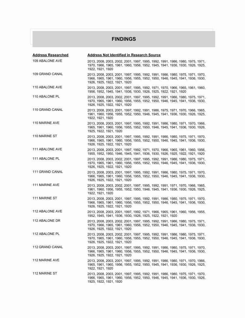
FINDINGS
Address Researched Address Not Identified in Research Source
109 ABALONE AVE 2013, 2008, 2003, 2002, 2001, 1997, 1995, 1992, 1991, 1986, 1980, 1975, 1971, 1970, 1966, 1965, 1961, 1960, 1956, 1952, 1945, 1941, 1936, 1930, 1926, 1925, 1922, 1921, 1920
109 GRAND CANAL 2013, 2008, 2003, 2001, 1997, 1995, 1992, 1991, 1986, 1980, 1975, 1971, 1970, 1966, 1965, 1961, 1960, 1956, 1955, 1952, 1950, 1946, 1945, 1941, 1936, 1930, 1926, 1925, 1922, 1921, 1920
110 ABALONE AVE 2013, 2008, 2003, 2001, 1997, 1995, 1992, 1971, 1970, 1966, 1965, 1961, 1960, 1956, 1952, 1945, 1941, 1936, 1930, 1926, 1925, 1922, 1921, 1920
110 ABALONE PL 2013, 2008, 2003, 2002, 2001, 1997, 1995, 1992, 1991, 1986, 1980, 1975, 1971, 1970, 1965, 1961, 1960, 1956, 1955, 1952, 1950, 1946, 1945, 1941, 1936, 1930, 1926, 1925, 1922, 1921, 1920
110 GRAND CANAL 2013, 2008, 2003, 2001, 1997, 1992, 1991, 1986, 1975, 1971, 1970, 1966, 1965, 1961, 1960, 1956, 1955, 1952, 1950, 1946, 1945, 1941, 1936, 1930, 1926, 1925, 1922, 1921, 1920
110 MARINE AVE 2013, 2008, 2003, 2001, 1997, 1995, 1992, 1991, 1986, 1980, 1971, 1970, 1966, 1965, 1961, 1960, 1956, 1955, 1952, 1950, 1946, 1945, 1941, 1936, 1930, 1926, 1925, 1922, 1921, 1920
110 MARINE ST 2013, 2008, 2003, 2001, 1997, 1995, 1992, 1991, 1986, 1980, 1975, 1971, 1970, 1966, 1965, 1961, 1960, 1956, 1955, 1952, 1950, 1946, 1945, 1941, 1936, 1930, 1926, 1925, 1922, 1921, 1920
111 ABALONE AVE 2013, 2008, 2003, 2001, 1997, 1992, 1971, 1970, 1966, 1965, 1961, 1960, 1956, 1955, 1952, 1950, 1946, 1945, 1941, 1936, 1930, 1926, 1925, 1922, 1921, 1920
111 ABALONE PL 2013, 2008, 2003, 2002, 2001, 1997, 1995, 1992, 1991, 1986, 1980, 1975, 1971, 1970, 1965, 1961, 1960, 1956, 1955, 1952, 1950, 1946, 1945, 1941, 1936, 1930, 1926, 1925, 1922, 1921, 1920
111 GRAND CANAL 2013, 2008, 2003, 2001, 1997, 1995, 1992, 1991, 1986, 1980, 1975, 1971, 1970, 1966, 1965, 1961, 1960, 1956, 1955, 1952, 1950, 1946, 1945, 1941, 1936, 1930, 1926, 1925, 1922, 1921, 1920
111 MARINE AVE 2013, 2008, 2003, 2002, 2001, 1997, 1995, 1992, 1991, 1971, 1970, 1966, 1965, 1961, 1960, 1956, 1955, 1952, 1950, 1946, 1945, 1941, 1936, 1930, 1926, 1925, 1922, 1921, 1920
111 MARINE ST 2013, 2008, 2003, 2001, 1997, 1995, 1992, 1991, 1986, 1980, 1975, 1971, 1970, 1966, 1965, 1961, 1960, 1956, 1955, 1952, 1950, 1946, 1945, 1941, 1936, 1930, 1926, 1925, 1922, 1921, 1920
112 ABALONE AVE 2013, 2008, 2003, 2001, 1997, 1992, 1971, 1966, 1965, 1961, 1960, 1956, 1955, 1952, 1945, 1941, 1936, 1930, 1926, 1925, 1922, 1921, 1920
112 ABALONE DR 2013, 2008, 2003, 2002, 2001, 1997, 1995, 1992, 1991, 1986, 1980, 1975, 1971, 1970, 1966, 1965, 1961, 1960, 1956, 1952, 1950, 1946, 1945, 1941, 1936, 1930, 1926, 1925, 1922, 1921, 1920
112 ABALONE PL 2013, 2008, 2003, 2002, 2001, 1997, 1995, 1992, 1991, 1986, 1980, 1975, 1971, 1970, 1965, 1961, 1960, 1956, 1955, 1952, 1950, 1946, 1945, 1941, 1936, 1930, 1926, 1925, 1922, 1921, 1920
112 GRAND CANAL 2013, 2008, 2003, 2001, 1997, 1995, 1992, 1991, 1986, 1980, 1975, 1971, 1970, 1966, 1965, 1961, 1960, 1956, 1955, 1952, 1950, 1946, 1945, 1941, 1936, 1930, 1926, 1925, 1922, 1921, 1920
112 MARINE AVE 2013, 2008, 2003, 2001, 1997, 1995, 1992, 1991, 1986, 1980, 1971, 1970, 1966, 1965, 1961, 1960, 1956, 1955, 1952, 1950, 1945, 1941, 1936, 1930, 1926, 1925, 1922, 1921, 1920
112 MARINE ST 2013, 2008, 2003, 2001, 1997, 1995, 1992, 1991, 1986, 1980, 1975, 1971, 1970, 1966, 1965, 1961, 1960, 1956, 1952, 1950, 1946, 1945, 1941, 1936, 1930, 1926, 1925, 1922, 1921, 1920

FINDINGS
Address Researched Address Not Identified in Research Source
112 ONYX 2013, 2008, 2003, 2002, 2001, 1997, 1995, 1992, 1991, 1986, 1980, 1975, 1971, 1965, 1961, 1960, 1956, 1955, 1952, 1950, 1946, 1945, 1941, 1936, 1930, 1926, 1925, 1922, 1921, 1920
112 ONYX AVE 2013, 2008, 2003, 2002, 2001, 1997, 1992, 1991, 1986, 1980, 1975, 1971, 1966, 1965, 1961, 1960, 1956, 1955, 1952, 1950, 1946, 1945, 1941, 1936, 1930, 1926, 1925, 1922, 1921, 1920
113 GRAND CANAL 2013, 2008, 2003, 2001, 1997, 1995, 1992, 1991, 1986, 1980, 1975, 1971, 1970, 1966, 1965, 1961, 1960, 1956, 1955, 1952, 1950, 1946, 1945, 1941, 1936, 1930, 1926, 1925, 1922, 1921, 1920
113 MARINE AVE 2013, 2008, 2003, 2001, 1997, 1995, 1992, 1991, 1980, 1975, 1971, 1970, 1966, 1965, 1961, 1960, 1956, 1955, 1952, 1950, 1945, 1941, 1936, 1930, 1926, 1925, 1922, 1921, 1920
113 MARINE ST 2013, 2008, 2003, 2002, 2001, 1997, 1995, 1992, 1991, 1986, 1980, 1975, 1971, 1970, 1966, 1965, 1961, 1960, 1956, 1952, 1950, 1946, 1945, 1941, 1936, 1930, 1926, 1925, 1922, 1921, 1920
113 ONYX 2013, 2008, 2003, 2002, 2001, 1997, 1995, 1992, 1991, 1986, 1980, 1975, 1971, 1970, 1965, 1961, 1960, 1956, 1955, 1952, 1950, 1946, 1945, 1941, 1936, 1930, 1926, 1925, 1922, 1921, 1920
113 ONYX AVE 2013, 2008, 2003, 2001, 1997, 1995, 1992, 1991, 1986, 1980, 1975, 1971, 1970, 1966, 1965, 1961, 1960, 1956, 1955, 1952, 1950, 1946, 1945, 1941, 1936, 1930, 1926, 1925, 1922, 1921, 1920
114 GRAND CAN 2013, 2008, 2003, 2002, 2001, 1997, 1995, 1992, 1991, 1986, 1975, 1971, 1970, 1966, 1965, 1961, 1960, 1956, 1955, 1952, 1950, 1946, 1945, 1941, 1936, 1930, 1926, 1925, 1922, 1921, 1920
114 GRAND CANAL 2013, 2008, 2003, 2001, 1997, 1995, 1992, 1991, 1986, 1980, 1975, 1971, 1970, 1966, 1965, 1961, 1960, 1956, 1955, 1952, 1950, 1946, 1945, 1941, 1936, 1930, 1926, 1925, 1922, 1921, 1920
114 MARINE AVE 2013, 2008, 2003, 2001, 1997, 1995, 1992, 1986, 1980, 1971, 1970, 1966, 1965, 1961, 1960, 1956, 1955, 1952, 1945, 1941, 1936, 1930, 1926, 1925, 1922, 1921, 1920
114 MARINE ST 2013, 2008, 2003, 2001, 1997, 1995, 1992, 1991, 1986, 1980, 1975, 1971, 1970, 1966, 1965, 1961, 1960, 1956, 1952, 1950, 1946, 1945, 1941, 1936, 1930, 1926, 1925, 1922, 1921, 1920
114 ONYX AVE 2013, 2008, 2003, 2001, 1997, 1992, 1980, 1975, 1971, 1970, 1966, 1965, 1961, 1960, 1956, 1955, 1952, 1950, 1946, 1945, 1941, 1936, 1930, 1926, 1925, 1922, 1921, 1920
115 ABALONE AVE 2013, 2008, 2003, 2001, 1997, 1995, 1992, 1971, 1970, 1966, 1965, 1961, 1960, 1956, 1955, 1952, 1950, 1946, 1945, 1941, 1936, 1930, 1926, 1925, 1922, 1921, 1920
115 ABALONE DR 2013, 2008, 2003, 2002, 2001, 1997, 1995, 1992, 1991, 1986, 1980, 1975, 1971, 1970, 1966, 1965, 1961, 1960, 1956, 1952, 1950, 1946, 1945, 1941, 1936, 1930, 1926, 1925, 1922, 1921, 1920
115 GRAND CANAL 2013, 2008, 2003, 2001, 1997, 1995, 1992, 1991, 1986, 1980, 1975, 1971, 1970, 1966, 1965, 1961, 1960, 1956, 1955, 1952, 1950, 1946, 1945, 1941, 1936, 1930, 1926, 1925, 1922, 1921, 1920
115 MARINE AVE 2013, 2008, 2003, 2001, 1997, 1992, 1991, 1986, 1971, 1970, 1966, 1965, 1961, 1960, 1956, 1955, 1952, 1946, 1945, 1941, 1936, 1930, 1926, 1925, 1922, 1921, 1920
115 MARINE AVE 2013, 2008, 2002, 2001, 1997, 1995, 1992, 1991, 1986, 1980, 1975, 1971, 1970, 1966, 1965, 1961, 1960, 1956, 1955, 1952, 1950, 1946, 1945, 1941, 1936, 1930, 1926, 1925, 1922, 1921, 1920

FINDINGS
Address Researched Address Not Identified in Research Source
115 MARINE ST 2013, 2008, 2003, 2001, 1997, 1995, 1992, 1991, 1986, 1980, 1975, 1971, 1970, 1966, 1965, 1961, 1960, 1956, 1952, 1950, 1946, 1945, 1941, 1936, 1930, 1926, 1925, 1922, 1921, 1920
115 ONYX 2013, 2008, 2003, 2002, 2001, 1997, 1995, 1992, 1991, 1986, 1980, 1975, 1971, 1970, 1965, 1961, 1960, 1956, 1955, 1952, 1950, 1946, 1945, 1941, 1936, 1930, 1926, 1925, 1922, 1921, 1920
115 ONYX AVE 2013, 2008, 2003, 2001, 1997, 1995, 1992, 1991, 1986, 1980, 1975, 1971, 1966, 1965, 1961, 1960, 1956, 1955, 1952, 1950, 1946, 1945, 1941, 1936, 1930, 1926, 1925, 1922, 1921, 1920
116 ABALONE AVE 2013, 2008, 2003, 2001, 1997, 1992, 1986, 1971, 1970, 1966, 1965, 1961, 1960, 1956, 1955, 1952, 1945, 1941, 1936, 1930, 1926, 1925, 1922, 1921, 1920
116 ABALONE PL 2013, 2008, 2003, 2002, 2001, 1997, 1995, 1992, 1991, 1986, 1980, 1975, 1971, 1970, 1965, 1961, 1960, 1956, 1955, 1952, 1950, 1946, 1945, 1941, 1936, 1930, 1926, 1925, 1922, 1921, 1920
116 CRYSTAL AVE 2013, 2008, 2003, 2001, 1997, 1992, 1986, 1971, 1970, 1966, 1965, 1961, 1960, 1956, 1955, 1952, 1950, 1946, 1945, 1941, 1936, 1930, 1926, 1925, 1922, 1921, 1920
116 GRAND CANAL 2013, 2008, 2003, 2001, 1997, 1995, 1992, 1991, 1986, 1980, 1975, 1971, 1970, 1966, 1965, 1961, 1960, 1956, 1955, 1952, 1950, 1946, 1945, 1941, 1936, 1930, 1926, 1925, 1922, 1921, 1920
116 GRAND CANAL SALIS 2013, 2008, 2003, 2002, 2001, 1997, 1995, 1992, 1991, 1986, 1975, 1971, 1970, 1966, 1965, 1961, 1960, 1956, 1955, 1952, 1950, 1946, 1945, 1941, 1936, 1930, 1926, 1925, 1922, 1921, 1920
116 MARINE AVE 2013, 2008, 2003, 2001, 1997, 1995, 1992, 1971, 1970, 1966, 1965, 1961, 1960, 1956, 1955, 1952, 1950, 1946, 1945, 1941, 1936, 1930, 1926, 1925, 1922, 1921, 1920
116 MARINE ST 2013, 2008, 2003, 2002, 2001, 1997, 1995, 1992, 1991, 1986, 1980, 1975, 1971, 1970, 1966, 1965, 1961, 1960, 1956, 1952, 1950, 1946, 1945, 1941, 1936, 1930, 1926, 1925, 1922, 1921, 1920
116 ONYX 2013, 2008, 2003, 2002, 2001, 1997, 1995, 1992, 1991, 1986, 1980, 1975, 1971, 1970, 1965, 1961, 1960, 1956, 1955, 1952, 1950, 1946, 1945, 1941, 1936, 1930, 1926, 1925, 1922, 1921, 1920
116 ONYX AVE 2013, 2008, 2003, 2001, 1997, 1995, 1992, 1991, 1986, 1980, 1975, 1971, 1966, 1965, 1961, 1960, 1956, 1955, 1952, 1950, 1946, 1945, 1941, 1936, 1930, 1926, 1925, 1922, 1921, 1920
116 ONYX AVE 2013, 2003, 2002, 2001, 1997, 1995, 1992, 1991, 1986, 1980, 1975, 1971, 1970, 1966, 1965, 1961, 1960, 1956, 1955, 1952, 1950, 1946, 1945, 1941, 1936, 1930, 1926, 1925, 1922, 1921, 1920
117 ABALONE AVE 2013, 2008, 2003, 2001, 1997, 1992, 1971, 1966, 1965, 1961, 1960, 1956, 1955, 1952, 1950, 1946, 1945, 1941, 1936, 1930, 1926, 1925, 1922, 1921, 1920
117 ABALONE PL 2013, 2008, 2003, 2002, 2001, 1997, 1995, 1992, 1991, 1986, 1980, 1975, 1971, 1970, 1965, 1961, 1960, 1956, 1955, 1952, 1950, 1946, 1945, 1941, 1936, 1930, 1926, 1925, 1922, 1921, 1920
117 CRYSTAL AVE 2013, 2008, 2003, 2002, 2001, 1997, 1995, 1992, 1991, 1986, 1971, 1970, 1966, 1965, 1961, 1960, 1956, 1955, 1952, 1950, 1945, 1941, 1936, 1930, 1926, 1925, 1922, 1921, 1920
117 GRAND CANAL 2013, 2008, 2003, 2001, 1997, 1995, 1992, 1991, 1986, 1975, 1971, 1970, 1966, 1965, 1961, 1960, 1956, 1955, 1952, 1950, 1946, 1945, 1941, 1936, 1930, 1926, 1925, 1922, 1921, 1920
117 MARINE AVE 2013, 2008, 2003, 2001, 1997, 1992, 1975, 1971, 1970, 1966, 1965, 1961, 1960, 1956, 1955, 1952, 1950, 1946, 1945, 1941, 1936, 1930, 1926, 1925, 1922, 1921, 1920

FINDINGS
Address Researched Address Not Identified in Research Source
117 ONYX 2013, 2008, 2003, 2002, 2001, 1997, 1995, 1992, 1991, 1986, 1980, 1975, 1971, 1970, 1965, 1961, 1960, 1956, 1955, 1952, 1950, 1946, 1945, 1941, 1936, 1930, 1926, 1925, 1922, 1921, 1920
117 ONYX AVE 2013, 2008, 2003, 2001, 1997, 1995, 1992, 1991, 1986, 1980, 1975, 1971, 1966, 1965, 1961, 1960, 1956, 1955, 1952, 1950, 1946, 1945, 1941, 1936, 1930, 1926, 1925, 1922, 1921, 1920
118 ABALONE AVE 2013, 2008, 2003, 2001, 1997, 1995, 1992, 1991, 1986, 1971, 1966, 1965, 1961, 1960, 1956, 1955, 1952, 1946, 1945, 1941, 1936, 1930, 1926, 1925, 1922, 1921, 1920
118 ABALONE DR 2013, 2008, 2003, 2002, 2001, 1997, 1995, 1992, 1991, 1986, 1980, 1975, 1971, 1970, 1966, 1965, 1961, 1960, 1956, 1952, 1950, 1946, 1945, 1941, 1936, 1930, 1926, 1925, 1922, 1921, 1920
118 ABALONE PL 2013, 2008, 2003, 2002, 2001, 1997, 1995, 1992, 1991, 1986, 1980, 1975, 1971, 1970, 1965, 1961, 1960, 1956, 1955, 1952, 1950, 1946, 1945, 1941, 1936, 1930, 1926, 1925, 1922, 1921, 1920
118 CRYSTAL 2013, 2008, 2003, 2002, 2001, 1997, 1995, 1992, 1991, 1986, 1980, 1975, 1971, 1970, 1965, 1961, 1960, 1956, 1955, 1952, 1950, 1946, 1945, 1941, 1936, 1930, 1926, 1925, 1922, 1921, 1920
118 CRYSTAL AVE 2013, 2008, 2003, 2001, 1997, 1992, 1986, 1980, 1971, 1970, 1966, 1965, 1961, 1960, 1956, 1955, 1952, 1945, 1941, 1936, 1930, 1926, 1925, 1922, 1921, 1920
118 GRAND CANAL 2013, 2008, 2003, 2001, 1997, 1995, 1992, 1991, 1986, 1980, 1975, 1971, 1970, 1966, 1965, 1961, 1960, 1956, 1955, 1952, 1950, 1946, 1945, 1941, 1936, 1930, 1926, 1925, 1922, 1921, 1920
118 GRAND CANAL 2008, 2003, 2002, 2001, 1997, 1995, 1992, 1991, 1986, 1980, 1975, 1971, 1970, 1966, 1965, 1961, 1960, 1956, 1955, 1952, 1950, 1946, 1945, 1941, 1936, 1930, 1926, 1925, 1922, 1921, 1920
118 MARINE AVE 2013, 2002, 2001, 1997, 1995, 1992, 1991, 1986, 1980, 1975, 1971, 1970, 1966, 1965, 1961, 1960, 1956, 1955, 1952, 1950, 1946, 1945, 1941, 1936, 1930, 1926, 1925, 1922, 1921, 1920
118 MARINE AVE 2013, 2008, 2003, 2001, 1997, 1995, 1992, 1980, 1971, 1970, 1966, 1965, 1961, 1960, 1956, 1955, 1952, 1950, 1945, 1941, 1936, 1930, 1926, 1925, 1922, 1921, 1920
118 MARINE ST 2013, 2008, 2003, 2001, 1997, 1995, 1992, 1991, 1986, 1980, 1975, 1971, 1970, 1966, 1965, 1961, 1960, 1956, 1952, 1950, 1946, 1945, 1941, 1936, 1930, 1926, 1925, 1922, 1921, 1920
118 ONYX 2013, 2008, 2003, 2002, 2001, 1997, 1995, 1992, 1991, 1986, 1980, 1975, 1971, 1970, 1965, 1961, 1960, 1956, 1955, 1952, 1950, 1946, 1945, 1941, 1936, 1930, 1926, 1925, 1922, 1921, 1920
118 ONYX AVE 2013, 2008, 2003, 2002, 2001, 1997, 1992, 1991, 1986, 1980, 1975, 1971, 1966, 1965, 1961, 1960, 1956, 1955, 1952, 1950, 1946, 1945, 1941, 1936, 1930, 1926, 1925, 1922, 1921, 1920
119 ABALONE AVE 2013, 2008, 2003, 2001, 1997, 1992, 1971, 1970, 1966, 1965, 1961, 1960, 1956, 1955, 1952, 1946, 1945, 1941, 1936, 1930, 1926, 1925, 1922, 1921, 1920
119 ABALONE DR 2013, 2008, 2003, 2002, 2001, 1997, 1995, 1992, 1991, 1986, 1980, 1975, 1971, 1970, 1966, 1965, 1961, 1960, 1956, 1952, 1950, 1946, 1945, 1941, 1936, 1930, 1926, 1925, 1922, 1921, 1920
119 ABALONE PL 2013, 2008, 2003, 2002, 2001, 1997, 1995, 1992, 1991, 1986, 1980, 1975, 1971, 1970, 1965, 1961, 1960, 1956, 1955, 1952, 1950, 1946, 1945, 1941, 1936, 1930, 1926, 1925, 1922, 1921, 1920
119 CRYSTAL 2013, 2008, 2003, 2002, 2001, 1997, 1995, 1992, 1991, 1986, 1980, 1975, 1971, 1970, 1965, 1961, 1960, 1956, 1955, 1952, 1950, 1946, 1945, 1941, 1936, 1930, 1926, 1925, 1922, 1921, 1920

FINDINGS
Address Researched Address Not Identified in Research Source
119 CRYSTAL AVE 2013, 2008, 2003, 2001, 1997, 1992, 1980, 1971, 1970, 1966, 1965, 1961, 1960, 1956, 1955, 1952, 1945, 1941, 1936, 1930, 1926, 1925, 1922, 1921, 1920
119 CRYSTAL AVE 2013, 2008, 2002, 2001, 1997, 1995, 1992, 1991, 1986, 1980, 1975, 1971, 1970, 1966, 1965, 1961, 1960, 1956, 1955, 1952, 1950, 1946, 1945, 1941, 1936, 1930, 1926, 1925, 1922, 1921, 1920
119 GRAND CANAL 2013, 2008, 2003, 2001, 1997, 1995, 1992, 1991, 1986, 1980, 1975, 1971, 1970, 1966, 1965, 1961, 1960, 1956, 1955, 1952, 1950, 1946, 1945, 1941, 1936, 1930, 1926, 1925, 1922, 1921, 1920
119 GRAND CANL 2013, 2008, 2003, 2002, 2001, 1997, 1995, 1992, 1991, 1986, 1980, 1975, 1971, 1970, 1965, 1961, 1960, 1956, 1955, 1952, 1950, 1946, 1945, 1941, 1936, 1930, 1926, 1925, 1922, 1921, 1920
119 MARINE AVE 2013, 2008, 2003, 2001, 1997, 1992, 1986, 1980, 1975, 1971, 1970, 1966, 1965, 1961, 1960, 1956, 1955, 1952, 1946, 1945, 1941, 1936, 1930, 1926, 1925, 1922, 1921, 1920
120 ABALONE AVE 2013, 2008, 2003, 2001, 1997, 1992, 1991, 1971, 1966, 1965, 1961, 1960, 1956, 1955, 1952, 1946, 1945, 1941, 1936, 1930, 1926, 1925, 1922, 1921, 1920
120 ABALONE PL 2013, 2008, 2003, 2002, 2001, 1997, 1995, 1992, 1991, 1986, 1980, 1975, 1971, 1970, 1965, 1961, 1960, 1956, 1955, 1952, 1950, 1946, 1945, 1941, 1936, 1930, 1926, 1925, 1922, 1921, 1920
120 CRYSTAL 2013, 2008, 2003, 2002, 2001, 1997, 1995, 1992, 1991, 1986, 1980, 1975, 1971, 1970, 1965, 1961, 1960, 1956, 1955, 1952, 1950, 1946, 1945, 1941, 1936, 1930, 1926, 1925, 1922, 1921, 1920
120 CRYSTAL AVE 2013, 2008, 2003, 2001, 1997, 1995, 1992, 1991, 1980, 1971, 1970, 1966, 1965, 1961, 1960, 1956, 1955, 1952, 1945, 1941, 1936, 1930, 1926, 1925, 1922, 1921, 1920
120 CRYSTAL CT 2013, 2008, 2003, 2002, 2001, 1997, 1995, 1992, 1991, 1986, 1980, 1975, 1971, 1970, 1966, 1965, 1961, 1960, 1956, 1952, 1950, 1946, 1945, 1941, 1936, 1930, 1926, 1925, 1922, 1921, 1920
120 GRAND CANAL 2013, 2008, 2003, 2001, 1997, 1995, 1992, 1991, 1986, 1980, 1975, 1971, 1970, 1966, 1965, 1961, 1960, 1956, 1955, 1952, 1950, 1946, 1945, 1941, 1936, 1930, 1926, 1925, 1922, 1921, 1920
120 MARINE AVE 2013, 2008, 2003, 2001, 1997, 1992, 1971, 1970, 1966, 1965, 1961, 1960, 1956, 1955, 1952, 1950, 1945, 1941, 1936, 1930, 1926, 1925, 1922, 1921, 1920
120 ONYX AVE 2013, 2008, 2003, 2001, 1997, 1992, 1991, 1986, 1980, 1975, 1971, 1970, 1966, 1965, 1961, 1960, 1956, 1955, 1952, 1950, 1946, 1945, 1941, 1936, 1930, 1926, 1925, 1922, 1921, 1920
1205 PARK AVE 2013, 2008, 2003, 2001, 1997, 1995, 1992, 1991, 1986, 1980, 1975, 1971, 1970, 1966, 1965, 1961, 1960, 1956, 1955, 1952, 1950, 1946, 1945, 1941, 1936, 1930, 1926, 1925, 1922, 1921, 1920
121 ABALONE AVE 2013, 2008, 2003, 2001, 1997, 1992, 1971, 1966, 1965, 1961, 1960, 1956, 1955, 1952, 1950, 1946, 1945, 1941, 1936, 1930, 1926, 1925, 1922, 1921, 1920
121 CRYSTAL 2013, 2008, 2003, 2002, 2001, 1997, 1995, 1992, 1991, 1986, 1980, 1975, 1971, 1970, 1965, 1961, 1960, 1956, 1955, 1952, 1950, 1946, 1945, 1941, 1936, 1930, 1926, 1925, 1922, 1921, 1920
121 CRYSTAL AVE 2013, 2008, 2003, 2001, 1997, 1995, 1992, 1980, 1971, 1970, 1966, 1965, 1961, 1960, 1956, 1955, 1952, 1950, 1945, 1941, 1936, 1930, 1926, 1925, 1922, 1921, 1920
121 CRYSTAL CT 2013, 2008, 2003, 2002, 2001, 1997, 1995, 1992, 1991, 1986, 1980, 1975, 1971, 1970, 1966, 1965, 1961, 1960, 1956, 1952, 1950, 1946, 1945, 1941, 1936, 1930, 1926, 1925, 1922, 1921, 1920

FINDINGS
Address Researched Address Not Identified in Research Source
121 GRAND CANAL 2013, 2008, 2003, 2001, 1997, 1995, 1992, 1991, 1986, 1980, 1975, 1971, 1970, 1966, 1965, 1961, 1960, 1956, 1955, 1952, 1950, 1946, 1945, 1941, 1936, 1930, 1926, 1925, 1922, 1921, 1920
121 MARINE AVE 2013, 2008, 2003, 2001, 1997, 1995, 1992, 1991, 1986, 1980, 1975, 1971, 1970, 1966, 1965, 1961, 1960, 1956, 1952, 1945, 1941, 1936, 1930, 1926, 1925, 1922, 1921, 1920
121 MARINE AVE 2013, 2008, 2002, 2001, 1997, 1995, 1992, 1991, 1986, 1980, 1975, 1971, 1970, 1966, 1965, 1961, 1960, 1956, 1955, 1952, 1950, 1946, 1945, 1941, 1936, 1930, 1926, 1925, 1922, 1921, 1920
121 MARINE ST 2013, 2008, 2003, 2002, 2001, 1997, 1995, 1992, 1991, 1986, 1980, 1975, 1971, 1970, 1966, 1965, 1961, 1960, 1956, 1952, 1950, 1946, 1945, 1941, 1936, 1930, 1926, 1925, 1922, 1921, 1920
121 ONYX 2013, 2008, 2003, 2002, 2001, 1997, 1995, 1992, 1991, 1986, 1980, 1975, 1971, 1970, 1965, 1961, 1960, 1956, 1955, 1952, 1950, 1946, 1945, 1941, 1936, 1930, 1926, 1925, 1922, 1921, 1920
121 ONYX AVE 2013, 2008, 2003, 2001, 1997, 1992, 1991, 1986, 1980, 1975, 1971, 1966, 1965, 1961, 1960, 1956, 1955, 1952, 1950, 1946, 1945, 1941, 1936, 1930, 1926, 1925, 1922, 1921, 1920
121 ONYX AVE 2013, 2002, 2001, 1997, 1995, 1992, 1991, 1986, 1980, 1975, 1971, 1970, 1966, 1965, 1961, 1960, 1956, 1955, 1952, 1950, 1946, 1945, 1941, 1936, 1930, 1926, 1925, 1922, 1921, 1920
122 ABALONE AVE 2013, 2008, 2003, 2001, 1997, 1992, 1971, 1970, 1966, 1965, 1961, 1960, 1956, 1952, 1946, 1945, 1941, 1936, 1930, 1926, 1925, 1922, 1921, 1920
122 ABALONE PL 2013, 2008, 2003, 2002, 2001, 1997, 1995, 1992, 1991, 1986, 1980, 1975, 1971, 1970, 1965, 1961, 1960, 1956, 1955, 1952, 1950, 1946, 1945, 1941, 1936, 1930, 1926, 1925, 1922, 1921, 1920
122 CRYSTAL 2013, 2008, 2003, 2002, 2001, 1997, 1995, 1992, 1991, 1986, 1980, 1975, 1971, 1970, 1965, 1961, 1960, 1956, 1955, 1952, 1950, 1946, 1945, 1941, 1936, 1930, 1926, 1925, 1922, 1921, 1920
122 CRYSTAL AVE 2013, 2008, 2003, 2001, 1997, 1995, 1992, 1971, 1970, 1966, 1965, 1961, 1960, 1956, 1955, 1952, 1950, 1945, 1941, 1936, 1930, 1926, 1925, 1922, 1921, 1920
122 CRYSTAL CT 2013, 2008, 2003, 2002, 2001, 1997, 1995, 1992, 1991, 1986, 1980, 1975, 1971, 1970, 1966, 1965, 1961, 1960, 1956, 1952, 1950, 1946, 1945, 1941, 1936, 1930, 1926, 1925, 1922, 1921, 1920
122 MARINE AVE 2013, 2008, 2003, 2001, 1997, 1992, 1975, 1971, 1970, 1966, 1965, 1961, 1960, 1956, 1955, 1952, 1950, 1946, 1945, 1941, 1936, 1930, 1926, 1925, 1922, 1921, 1920
122 MARINE ST 2013, 2008, 2003, 2002, 2001, 1997, 1995, 1992, 1991, 1986, 1980, 1975, 1971, 1970, 1966, 1965, 1961, 1956, 1955, 1952, 1950, 1946, 1945, 1941, 1936, 1930, 1926, 1925, 1922, 1921, 1920
122 ONYX 2013, 2008, 2003, 2002, 2001, 1997, 1995, 1992, 1991, 1986, 1980, 1975, 1971, 1965, 1961, 1960, 1956, 1955, 1952, 1950, 1946, 1945, 1941, 1936, 1930, 1926, 1925, 1922, 1921, 1920
122 ONYX AVE 2013, 2008, 2003, 2001, 1997, 1995, 1992, 1991, 1986, 1980, 1975, 1971, 1966, 1965, 1961, 1960, 1956, 1955, 1952, 1950, 1946, 1945, 1941, 1936, 1930, 1926, 1925, 1922, 1921, 1920
123 ABALONE AVE 2013, 2008, 2003, 2001, 1997, 1992, 1971, 1966, 1965, 1961, 1960, 1956, 1955, 1952, 1945, 1941, 1936, 1930, 1926, 1925, 1922, 1921, 1920
123 ABALONE DR 2013, 2008, 2003, 2002, 2001, 1997, 1995, 1992, 1991, 1986, 1980, 1975, 1971, 1970, 1966, 1965, 1961, 1960, 1956, 1952, 1950, 1946, 1945, 1941, 1936, 1930, 1926, 1925, 1922, 1921, 1920

FINDINGS
Address Researched Address Not Identified in Research Source
123 ABALONE PL 2013, 2008, 2003, 2002, 2001, 1997, 1995, 1992, 1991, 1986, 1980, 1975, 1971, 1970, 1965, 1961, 1960, 1956, 1955, 1952, 1950, 1946, 1945, 1941, 1936, 1930, 1926, 1925, 1922, 1921, 1920
123 CRYSTAL 2013, 2008, 2003, 2002, 2001, 1997, 1995, 1992, 1991, 1986, 1980, 1975, 1971, 1970, 1965, 1961, 1960, 1956, 1955, 1952, 1950, 1946, 1945, 1941, 1936, 1930, 1926, 1925, 1922, 1921, 1920
123 CRYSTAL AVE 2013, 2008, 2003, 2001, 1997, 1995, 1992, 1991, 1986, 1980, 1971, 1970, 1966, 1965, 1961, 1960, 1956, 1952, 1946, 1945, 1941, 1936, 1930, 1926, 1925, 1922, 1921, 1920
123 GRAND CANAL 2013, 2008, 2003, 2001, 1997, 1995, 1992, 1991, 1986, 1980, 1975, 1971, 1970, 1966, 1965, 1961, 1960, 1956, 1955, 1952, 1950, 1946, 1945, 1941, 1936, 1930, 1926, 1925, 1922, 1921, 1920
123 MARINE AVE 2013, 2008, 2003, 2001, 1997, 1992, 1980, 1971, 1970, 1966, 1965, 1961, 1960, 1956, 1955, 1952, 1950, 1946, 1945, 1941, 1936, 1930, 1926, 1925, 1922, 1921, 1920
123 MARINE ST 2013, 2008, 2003, 2001, 1997, 1995, 1992, 1991, 1986, 1980, 1975, 1971, 1970, 1966, 1965, 1961, 1960, 1956, 1952, 1950, 1946, 1945, 1941, 1936, 1930, 1926, 1925, 1922, 1921, 1920
123 ONYX 2013, 2008, 2003, 2002, 2001, 1997, 1995, 1992, 1991, 1986, 1980, 1975, 1971, 1970, 1965, 1961, 1960, 1956, 1955, 1952, 1950, 1946, 1945, 1941, 1936, 1930, 1926, 1925, 1922, 1921, 1920
123 ONYX AVE 2013, 2008, 2003, 2001, 1997, 1995, 1992, 1991, 1986, 1980, 1975, 1971, 1966, 1965, 1961, 1960, 1956, 1955, 1952, 1950, 1946, 1945, 1941, 1936, 1930, 1926, 1925, 1922, 1921, 1920
124 ABALONE AVE 2013, 2008, 2003, 2001, 1997, 1992, 1991, 1971, 1966, 1965, 1961, 1960, 1956, 1955, 1952, 1950, 1946, 1945, 1941, 1936, 1930, 1926, 1925, 1922, 1921, 1920
124 CRYSTAL 2013, 2008, 2003, 2002, 2001, 1997, 1995, 1992, 1991, 1986, 1980, 1975, 1971, 1970, 1965, 1961, 1960, 1956, 1955, 1952, 1950, 1946, 1945, 1941, 1936, 1930, 1926, 1925, 1922, 1921, 1920
124 CRYSTAL AVE 2013, 2008, 2003, 2001, 1997, 1995, 1992, 1991, 1980, 1971, 1970, 1966, 1965, 1961, 1960, 1956, 1955, 1952, 1950, 1946, 1945, 1941, 1936, 1930, 1926, 1925, 1922, 1921, 1920
124 GRAND CANAL 2013, 2008, 2003, 2001, 1997, 1995, 1992, 1991, 1986, 1980, 1975, 1971, 1970, 1966, 1965, 1961, 1960, 1956, 1955, 1952, 1950, 1946, 1945, 1941, 1936, 1930, 1926, 1925, 1922, 1921, 1920
124 MARINE AVE 2013, 2008, 2003, 2002, 2001, 1997, 1995, 1992, 1991, 1986, 1971, 1970, 1966, 1965, 1961, 1960, 1956, 1955, 1952, 1950, 1946, 1945, 1941, 1936, 1930, 1926, 1925, 1922, 1921, 1920
124 ONYX 2013, 2008, 2003, 2002, 2001, 1997, 1995, 1992, 1991, 1986, 1980, 1975, 1971, 1970, 1965, 1961, 1960, 1956, 1955, 1952, 1950, 1946, 1945, 1941, 1936, 1930, 1926, 1925, 1922, 1921, 1920
124 ONYX AVE 2013, 2008, 2003, 2001, 1997, 1995, 1992, 1991, 1986, 1980, 1975, 1971, 1970, 1966, 1965, 1961, 1960, 1956, 1955, 1952, 1950, 1946, 1945, 1941, 1936, 1930, 1926, 1925, 1922, 1921, 1920
125 ABALONE AVE 2013, 2008, 2003, 2001, 1997, 1995, 1992, 1986, 1980, 1971, 1966, 1965, 1961, 1960, 1956, 1952, 1945, 1941, 1936, 1930, 1926, 1925, 1922, 1921, 1920
125 ABALONE PL 2013, 2008, 2003, 2002, 2001, 1997, 1995, 1992, 1991, 1986, 1980, 1975, 1971, 1970, 1965, 1961, 1960, 1956, 1955, 1952, 1950, 1946, 1945, 1941, 1936, 1930, 1926, 1925, 1922, 1921, 1920
125 CRYSTAL 2013, 2008, 2003, 2002, 2001, 1997, 1995, 1992, 1991, 1986, 1980, 1975, 1971, 1970, 1965, 1961, 1960, 1956, 1955, 1952, 1950, 1946, 1945, 1941, 1936, 1930, 1926, 1925, 1922, 1921, 1920

FINDINGS
Address Researched Address Not Identified in Research Source
125 CRYSTAL AVE 2013, 2008, 2003, 2001, 1997, 1992, 1980, 1971, 1970, 1966, 1965, 1961, 1960, 1956, 1952, 1946, 1945, 1941, 1936, 1930, 1926, 1925, 1922, 1921, 1920
125 GRAND CANAL 2013, 2008, 2003, 2001, 1997, 1995, 1992, 1991, 1986, 1980, 1975, 1971, 1970, 1965, 1961, 1960, 1956, 1955, 1952, 1950, 1946, 1945, 1941, 1936, 1930, 1926, 1925, 1922, 1921, 1920
125 GRAND CANAL 2003, 2002, 2001, 1997, 1995, 1992, 1991, 1986, 1980, 1975, 1971, 1970, 1966, 1965, 1961, 1960, 1956, 1955, 1952, 1950, 1946, 1945, 1941, 1936, 1930, 1926, 1925, 1922, 1921, 1920
125 ONYX 2013, 2008, 2003, 2002, 2001, 1997, 1995, 1992, 1991, 1986, 1980, 1975, 1971, 1970, 1965, 1961, 1960, 1956, 1955, 1952, 1950, 1946, 1945, 1941, 1936, 1930, 1926, 1925, 1922, 1921, 1920
125 ONYX AVE 2013, 2008, 2003, 2001, 1997, 1992, 1991, 1986, 1980, 1975, 1971, 1970, 1966, 1965, 1961, 1960, 1956, 1955, 1952, 1950, 1946, 1945, 1941, 1936, 1930, 1926, 1925, 1922, 1921, 1920
126 ABALONE AVE 2013, 2008, 2003, 2001, 1997, 1992, 1971, 1966, 1965, 1961, 1960, 1956, 1955, 1952, 1950, 1946, 1945, 1941, 1936, 1930, 1926, 1925, 1922, 1921, 1920
126 ABALONE DR 2013, 2008, 2003, 2002, 2001, 1997, 1995, 1992, 1991, 1986, 1980, 1975, 1971, 1970, 1966, 1965, 1961, 1960, 1956, 1952, 1945, 1941, 1936, 1930, 1926, 1925, 1922, 1921, 1920
126 ABALONE PL 2013, 2008, 2003, 2002, 2001, 1997, 1995, 1992, 1991, 1986, 1980, 1975, 1971, 1970, 1965, 1961, 1960, 1956, 1955, 1952, 1950, 1946, 1945, 1941, 1936, 1930, 1926, 1925, 1922, 1921, 1920
126 CRYSTAL AVE 2013, 2008, 2003, 2002, 2001, 1997, 1995, 1992, 1980, 1971, 1970, 1966, 1965, 1961, 1960, 1956, 1955, 1952, 1950, 1945, 1941, 1936, 1930, 1926, 1925, 1922, 1921, 1920
126 CRYSTAL AVE 2013, 2003, 2002, 2001, 1997, 1995, 1992, 1991, 1986, 1980, 1975, 1971, 1970, 1966, 1965, 1961, 1960, 1956, 1955, 1952, 1950, 1946, 1945, 1941, 1936, 1930, 1926, 1925, 1922, 1921, 1920
126 GRAND CANAL 2013, 2008, 2002, 2001, 1997, 1995, 1992, 1991, 1986, 1980, 1975, 1971, 1970, 1966, 1965, 1961, 1960, 1956, 1955, 1952, 1950, 1946, 1945, 1941, 1936, 1930, 1926, 1925, 1922, 1921, 1920
126 GRAND CANAL 2013, 2008, 2003, 2001, 1997, 1995, 1992, 1991, 1986, 1980, 1975, 1971, 1970, 1966, 1965, 1961, 1960, 1956, 1955, 1952, 1950, 1946, 1945, 1941, 1936, 1930, 1926, 1925, 1922, 1921, 1920
126 Grand Canal 2013, 2008, 2003, 2001, 1997, 1995, 1992, 1991, 1986, 1980, 1975, 1971, 1970, 1966, 1965, 1961, 1960, 1956, 1955, 1952, 1950, 1946, 1945, 1941, 1936, 1930, 1926, 1925, 1922, 1921, 1920
126 ONYX 2013, 2008, 2003, 2002, 2001, 1997, 1995, 1992, 1991, 1986, 1980, 1975, 1971, 1970, 1965, 1961, 1960, 1956, 1955, 1952, 1950, 1946, 1945, 1941, 1936, 1930, 1926, 1925, 1922, 1921, 1920
126 ONYX AVE 2013, 2008, 2003, 2001, 1997, 1992, 1991, 1986, 1980, 1975, 1971, 1966, 1965, 1961, 1960, 1956, 1955, 1952, 1950, 1946, 1945, 1941, 1936, 1930, 1926, 1925, 1922, 1921, 1920
127 ABALONE AVE 2013, 2008, 2003, 2001, 1997, 1995, 1992, 1991, 1986, 1971, 1966, 1965, 1961, 1960, 1956, 1955, 1952, 1945, 1941, 1936, 1930, 1926, 1925, 1922, 1921, 1920
127 ABALONE AVE 2013, 2008, 2002, 2001, 1997, 1995, 1992, 1991, 1986, 1980, 1975, 1971, 1970, 1966, 1965, 1961, 1960, 1956, 1955, 1952, 1950, 1946, 1945, 1941, 1936, 1930, 1926, 1925, 1922, 1921, 1920
127 ABALONE DR 2013, 2008, 2003, 2002, 2001, 1997, 1995, 1992, 1991, 1986, 1980, 1975, 1971, 1970, 1966, 1965, 1961, 1960, 1956, 1952, 1950, 1946, 1945, 1941, 1936, 1930, 1926, 1925, 1922, 1921, 1920

FINDINGS
Address Researched Address Not Identified in Research Source
127 ABALONE PL 2013, 2008, 2003, 2002, 2001, 1997, 1995, 1992, 1991, 1986, 1980, 1975, 1971, 1970, 1965, 1961, 1960, 1956, 1955, 1952, 1950, 1946, 1945, 1941, 1936, 1930, 1926, 1925, 1922, 1921, 1920
127 CRYSTAL 2013, 2008, 2003, 2002, 2001, 1997, 1995, 1992, 1991, 1986, 1980, 1975, 1971, 1970, 1965, 1961, 1960, 1956, 1955, 1952, 1950, 1946, 1945, 1941, 1936, 1930, 1926, 1925, 1922, 1921, 1920
127 CRYSTAL AVE 2013, 2008, 2003, 2001, 1997, 1995, 1992, 1991, 1986, 1971, 1970, 1966, 1965, 1961, 1960, 1956, 1955, 1952, 1945, 1941, 1936, 1930, 1926, 1925, 1922, 1921, 1920
127 GRAND CANAL 2013, 2008, 2003, 2001, 1997, 1995, 1992, 1991, 1986, 1975, 1971, 1970, 1966, 1965, 1961, 1960, 1956, 1955, 1952, 1950, 1946, 1945, 1941, 1936, 1930, 1926, 1925, 1922, 1921, 1920
127 Grand Canal 2013, 2008, 2003, 2001, 1997, 1995, 1992, 1991, 1986, 1975, 1971, 1970, 1966, 1965, 1961, 1960, 1956, 1955, 1952, 1950, 1946, 1945, 1941, 1936, 1930, 1926, 1925, 1922, 1921, 1920
127 MARINE AVE 2013, 2008, 2003, 2001, 1997, 1992, 1986, 1975, 1971, 1970, 1966, 1965, 1961, 1960, 1956, 1955, 1952, 1945, 1941, 1936, 1930, 1926, 1925, 1922, 1921, 1920
127 MARINE AVE 2002, 2001, 1997, 1995, 1992, 1991, 1986, 1980, 1975, 1971, 1970, 1966, 1965, 1961, 1960, 1956, 1955, 1952, 1950, 1946, 1945, 1941, 1936, 1930, 1926, 1925, 1922, 1921, 1920
127 ONYX AVE 2013, 2008, 2003, 2001, 1997, 1992, 1991, 1986, 1980, 1975, 1971, 1970, 1966, 1965, 1961, 1960, 1956, 1955, 1952, 1950, 1946, 1945, 1941, 1936, 1930, 1926, 1925, 1922, 1921, 1920
129 MARINE AVE 2013, 2008, 2003, 2001, 1997, 1995, 1992, 1991, 1986, 1980, 1971, 1970, 1966, 1965, 1961, 1960, 1956, 1955, 1952, 1950, 1946, 1945, 1941, 1936, 1930, 1926, 1925, 1922, 1921, 1920
1297 PARK AVE 2013, 2008, 2003, 2001, 1997, 1995, 1992, 1991, 1986, 1980, 1975, 1971, 1970, 1966, 1965, 1961, 1960, 1956, 1955, 1952, 1950, 1946, 1945, 1941, 1936, 1930, 1926, 1925, 1922, 1921, 1920
1304 BALBOA AVE 2013, 2008, 2003, 2002, 2001, 1997, 1995, 1992, 1991, 1986, 1980, 1975, 1971, 1970, 1966, 1965, 1961, 1960, 1956, 1955, 1952, 1946, 1945, 1941, 1936, 1930, 1926, 1925, 1922, 1921, 1920
1304 BALBOA ST 2013, 2008, 2003, 2002, 2001, 1997, 1995, 1992, 1991, 1986, 1980, 1975, 1971, 1970, 1966, 1965, 1961, 1960, 1956, 1952, 1950, 1946, 1945, 1941, 1936, 1930, 1926, 1925, 1922, 1921, 1920
1304 PARK AVE 2013, 2008, 2003, 2001, 1997, 1992, 1991, 1986, 1980, 1975, 1971, 1970, 1966, 1965, 1961, 1960, 1956, 1955, 1952, 1950, 1946, 1945, 1941, 1936, 1930, 1926, 1925, 1922, 1921, 1920
1305 BALBOA BLVD 2013, 2008, 2003, 2002, 2001, 1997, 1995, 1992, 1991, 1986, 1980, 1975, 1971, 1970, 1965, 1961, 1960, 1956, 1955, 1952, 1950, 1946, 1945, 1941, 1936, 1930, 1926, 1925, 1922, 1921, 1920
1305 PARK AVE 2013, 2008, 2003, 2001, 1997, 1995, 1992, 1991, 1986, 1980, 1975, 1971, 1970, 1966, 1965, 1961, 1960, 1956, 1955, 1952, 1950, 1946, 1945, 1941, 1936, 1930, 1926, 1925, 1922, 1921, 1920
1306 PARK AVE 2013, 2008, 2003, 2001, 1997, 1995, 1992, 1991, 1971, 1970, 1965, 1961, 1960, 1956, 1955, 1952, 1950, 1946, 1945, 1941, 1936, 1930, 1926, 1925, 1922, 1921, 1920
1308 PARK AVE 2013, 2008, 2003, 2001, 1997, 1995, 1992, 1991, 1986, 1980, 1975, 1971, 1970, 1966, 1965, 1961, 1960, 1956, 1955, 1952, 1950, 1946, 1945, 1941, 1936, 1930, 1926, 1925, 1922, 1921, 1920

FINDINGS
Address Researched Address Not Identified in Research Source
135 MARINE ST 2013, 2008, 2003, 2001, 1997, 1995, 1992, 1991, 1986, 1980, 1975, 1971, 1970, 1966, 1965, 1961, 1960, 1956, 1955, 1952, 1950, 1946, 1945, 1941, 1936, 1930, 1926, 1925, 1922, 1921, 1920
138 MARINE ST 2013, 2008, 2003, 2002, 2001, 1997, 1995, 1992, 1991, 1986, 1980, 1975, 1971, 1970, 1966, 1965, 1961, 1960, 1956, 1952, 1950, 1946, 1945, 1941, 1936, 1930, 1926, 1925, 1922, 1921, 1920
140 MARINE ST 2013, 2008, 2003, 2001, 1997, 1995, 1992, 1991, 1986, 1980, 1975, 1971, 1970, 1966, 1965, 1961, 1960, 1956, 1955, 1952, 1950, 1946, 1945, 1941, 1936, 1930, 1926, 1925, 1922, 1921, 1920
142 MARINE ST 2013, 2008, 2003, 2002, 2001, 1997, 1995, 1992, 1991, 1986, 1980, 1975, 1971, 1970, 1966, 1965, 1961, 1960, 1956, 1952, 1950, 1946, 1945, 1941, 1936, 1930, 1926, 1925, 1922, 1921, 1920
146 MARINE ST 2013, 2008, 2003, 2002, 2001, 1997, 1995, 1992, 1991, 1986, 1980, 1975, 1971, 1970, 1966, 1965, 1961, 1960, 1956, 1952, 1950, 1946, 1945, 1941, 1936, 1930, 1926, 1925, 1922, 1921, 1920
150 MARINE ST 2013, 2008, 2003, 2001, 1997, 1995, 1992, 1991, 1986, 1980, 1975, 1971, 1970, 1966, 1965, 1961, 1960, 1956, 1955, 1952, 1950, 1946, 1945, 1941, 1936, 1930, 1926, 1925, 1922, 1921, 1920
1504 BALBOA AVE 2013, 2008, 2003, 2002, 2001, 1997, 1995, 1992, 1980, 1971, 1970, 1966, 1965, 1961, 1960, 1956, 1955, 1952, 1950, 1946, 1945, 1941, 1936, 1930, 1926, 1925, 1922, 1921, 1920
1504 BALBOA ST 2013, 2008, 2003, 2002, 2001, 1997, 1995, 1992, 1991, 1986, 1980, 1975, 1971, 1970, 1966, 1965, 1961, 1960, 1956, 1952, 1950, 1946, 1945, 1941, 1936, 1930, 1926, 1925, 1922, 1921, 1920
1506 PARK AVE 2013, 2008, 2003, 2001, 1997, 1995, 1992, 1991, 1975, 1971, 1970, 1965, 1961, 1960, 1956, 1955, 1952, 1950, 1946, 1945, 1941, 1936, 1930, 1926, 1925, 1922, 1921, 1920
1508 BALBOA AVE 2013, 2008, 2003, 2001, 1997, 1992, 1991, 1986, 1975, 1971, 1966, 1965, 1961, 1960, 1956, 1955, 1952, 1950, 1946, 1945, 1941, 1936, 1930, 1926, 1925, 1922, 1921, 1920
1508 BALBOA ST 2013, 2008, 2003, 2002, 2001, 1997, 1995, 1992, 1991, 1986, 1980, 1975, 1971, 1970, 1966, 1965, 1961, 1960, 1956, 1952, 1950, 1946, 1945, 1941, 1936, 1930, 1926, 1925, 1922, 1921, 1920
1508 PARK AVE 2013, 2008, 2003, 2001, 1997, 1992, 1991, 1986, 1980, 1975, 1971, 1970, 1966, 1965, 1961, 1960, 1956, 1955, 1952, 1950, 1946, 1945, 1941, 1936, 1930, 1926, 1925, 1922, 1921, 1920
1509 ABALONE PL 2013, 2008, 2003, 2001, 1997, 1992, 1971, 1970, 1965, 1961, 1960, 1956, 1952, 1946, 1945, 1941, 1936, 1930, 1926, 1925, 1922, 1921, 1920
1510 ABALONE LN 2013, 2008, 2003, 2002, 2001, 1997, 1995, 1992, 1991, 1986, 1980, 1971, 1970, 1966, 1965, 1961, 1960, 1956, 1955, 1952, 1950, 1946, 1945, 1941, 1936, 1930, 1926, 1925, 1922, 1921, 1920
1510 ABALONE PL 2013, 2008, 2003, 2001, 1997, 1992, 1991, 1975, 1971, 1970, 1966, 1965, 1961, 1960, 1956, 1952, 1946, 1945, 1941, 1936, 1930, 1926, 1925, 1922, 1921, 1920
1511 ABALONE PL 2013, 2008, 2003, 2001, 1997, 1995, 1992, 1971, 1970, 1965, 1961, 1960, 1956, 1952, 1946, 1945, 1941, 1936, 1930, 1926, 1925, 1922, 1921, 1920
1511 ABALONE PL 2013, 2003, 2002, 2001, 1997, 1995, 1992, 1991, 1986, 1980, 1975, 1971, 1970, 1966, 1965, 1961, 1960, 1956, 1955, 1952, 1950, 1946, 1945, 1941, 1936, 1930, 1926, 1925, 1922, 1921, 1920
1511 BALBOA AVE 2013, 2008, 2003, 2001, 1997, 1992, 1971, 1970, 1966, 1965, 1961, 1960, 1956, 1955, 1952, 1946, 1945, 1941, 1936, 1930, 1926, 1925, 1922, 1921, 1920

FINDINGS
Address Researched Address Not Identified in Research Source
1512 BALBOA AVE 2013, 2008, 2003, 2001, 1997, 1995, 1992, 1986, 1980, 1971, 1970, 1966, 1965, 1961, 1960, 1956, 1955, 1952, 1950, 1946, 1945, 1941, 1936, 1930, 1926, 1925, 1922, 1921, 1920
1514 BALBOA AVE 2013, 2008, 2003, 2001, 1997, 1992, 1980, 1971, 1966, 1965, 1961, 1960, 1956, 1955, 1952, 1950, 1946, 1945, 1941, 1936, 1930, 1926, 1925, 1922, 1921, 1920
1514 BALBOA ST 2013, 2008, 2003, 2002, 2001, 1997, 1995, 1992, 1991, 1986, 1980, 1975, 1971, 1970, 1966, 1965, 1961, 1960, 1956, 1952, 1950, 1946, 1945, 1941, 1936, 1930, 1926, 1925, 1922, 1921, 1920
1515 BALBOA BLVD 2013, 2008, 2003, 2002, 2001, 1997, 1995, 1992, 1991, 1986, 1980, 1975, 1971, 1970, 1965, 1961, 1960, 1956, 1955, 1952, 1950, 1946, 1945, 1941, 1936, 1930, 1926, 1925, 1922, 1921, 1920
1516 ABALONE PL 2013, 2008, 2003, 2001, 1997, 1995, 1992, 1991, 1986, 1980, 1975, 1971, 1970, 1966, 1965, 1961, 1960, 1956, 1955, 1952, 1950, 1946, 1945, 1941, 1936, 1930, 1926, 1925, 1922, 1921, 1920
1517 BALBOA AVE 2013, 2008, 2003, 2001, 1997, 1995, 1992, 1991, 1986, 1980, 1975, 1971, 1970, 1966, 1965, 1961, 1960, 1956, 1955, 1952, 1950, 1946, 1945, 1941, 1936, 1930, 1926, 1925, 1922, 1921, 1920
1518 ABALONE PL 2013, 2008, 2003, 2001, 1997, 1992, 1971, 1970, 1966, 1965, 1961, 1960, 1956, 1955, 1952, 1950, 1946, 1945, 1941, 1936, 1930, 1926, 1925, 1922, 1921, 1920
1520 ABALONE PL 2013, 2008, 2003, 2001, 1997, 1992, 1991, 1980, 1971, 1970, 1966, 1965, 1961, 1960, 1956, 1955, 1952, 1950, 1946, 1945, 1941, 1936, 1930, 1926, 1925, 1922, 1921, 1920
156 MARINE ST 2013, 2008, 2003, 2002, 2001, 1997, 1995, 1992, 1991, 1986, 1980, 1975, 1971, 1970, 1966, 1965, 1961, 1960, 1956, 1952, 1950, 1946, 1945, 1941, 1936, 1930, 1926, 1925, 1922, 1921, 1920
1600 BALBOA AVE 2013, 2008, 2003, 2001, 1997, 1995, 1992, 1991, 1980, 1975, 1971, 1970, 1966, 1965, 1961, 1960, 1956, 1952, 1945, 1941, 1936, 1930, 1926, 1925, 1922, 1921, 1920
1601 BALBOA AVE 2013, 2008, 2003, 2002, 2001, 1997, 1995, 1992, 1980, 1975, 1971, 1966, 1965, 1961, 1960, 1956, 1955, 1952, 1945, 1941, 1936, 1930, 1926, 1925, 1922, 1921, 1920
1601 BALBOA ST 2013, 2008, 2003, 2002, 2001, 1997, 1995, 1992, 1991, 1986, 1980, 1975, 1971, 1970, 1966, 1965, 1961, 1960, 1956, 1952, 1950, 1946, 1945, 1941, 1936, 1930, 1926, 1925, 1922, 1921, 1920
1602 BALBOA AVE 2013, 2008, 2003, 2001, 1997, 1992, 1991, 1971, 1966, 1965, 1961, 1960, 1956, 1955, 1952, 1946, 1945, 1941, 1936, 1930, 1926, 1925, 1922, 1921, 1920
1602 BALBOA ST 2013, 2008, 2003, 2002, 2001, 1997, 1995, 1992, 1991, 1986, 1980, 1975, 1971, 1970, 1966, 1965, 1961, 1960, 1956, 1952, 1950, 1946, 1945, 1941, 1936, 1930, 1926, 1925, 1922, 1921, 1920
1603 BALBOA AVE 2013, 2008, 2003, 2001, 1997, 1992, 1986, 1980, 1971, 1970, 1966, 1965, 1961, 1960, 1956, 1955, 1952, 1946, 1945, 1941, 1936, 1930, 1926, 1925, 1922, 1921, 1920
1603 BALBOA AVE 2013, 2008, 2002, 2001, 1997, 1995, 1992, 1991, 1986, 1980, 1975, 1971, 1970, 1966, 1965, 1961, 1960, 1956, 1955, 1952, 1950, 1946, 1945, 1941, 1936, 1930, 1926, 1925, 1922, 1921, 1920
1603 BALBOA ST 2013, 2008, 2003, 2002, 2001, 1997, 1995, 1992, 1991, 1986, 1980, 1975, 1971, 1970, 1966, 1965, 1961, 1960, 1956, 1952, 1950, 1946, 1945, 1941, 1936, 1930, 1926, 1925, 1922, 1921, 1920
1604 BALBOA AVE 2013, 2008, 2003, 2001, 1997, 1995, 1992, 1980, 1975, 1971, 1970, 1966, 1965, 1961, 1960, 1956, 1955, 1952, 1950, 1946, 1945, 1941, 1936, 1930, 1926, 1925, 1922, 1921, 1920

FINDINGS
Address Researched Address Not Identified in Research Source
1605 BALBOA AVE 2013, 2008, 2003, 2002, 2001, 1997, 1995, 1992, 1991, 1971, 1970, 1966, 1965, 1961, 1960, 1956, 1955, 1952, 1945, 1941, 1936, 1930, 1926, 1925, 1922, 1921, 1920
1607 BALBOA AVE 2013, 2008, 2003, 2001, 1997, 1995, 1992, 1991, 1986, 1980, 1971, 1966, 1965, 1961, 1960, 1956, 1952, 1946, 1945, 1941, 1936, 1930, 1926, 1925, 1922, 1921, 1920
1607 PARK AVE 2013, 2008, 2003, 2002, 2001, 1997, 1995, 1992, 1991, 1986, 1980, 1975, 1971, 1970, 1965, 1961, 1960, 1956, 1955, 1952, 1945, 1941, 1936, 1930, 1926, 1925, 1922, 1921, 1920
1608 BALBOA AVE 2013, 2008, 2003, 2001, 1997, 1995, 1992, 1991, 1986, 1971, 1966, 1965, 1961, 1960, 1956, 1955, 1952, 1950, 1946, 1945, 1941, 1936, 1930, 1926, 1925, 1922, 1921, 1920
1608 BALBOA ST 2013, 2008, 2003, 2002, 2001, 1997, 1995, 1992, 1991, 1986, 1980, 1975, 1971, 1970, 1966, 1965, 1961, 1960, 1956, 1952, 1950, 1946, 1945, 1941, 1936, 1930, 1926, 1925, 1922, 1921, 1920
1608 PARK AVE 2013, 2008, 2003, 2001, 1997, 1995, 1992, 1986, 1971, 1970, 1965, 1961, 1960, 1956, 1955, 1952, 1946, 1945, 1941, 1936, 1930, 1926, 1925, 1922, 1921, 1920
1609 BALBOA AVE 2013, 2008, 2003, 2001, 1997, 1995, 1992, 1991, 1971, 1966, 1965, 1961, 1960, 1956, 1955, 1952, 1950, 1946, 1945, 1941, 1936, 1930, 1926, 1925, 1922, 1921, 1920
161 GRAND CANL 2013, 2008, 2003, 2002, 2001, 1997, 1995, 1992, 1991, 1986, 1980, 1975, 1971, 1966, 1965, 1961, 1960, 1956, 1955, 1952, 1950, 1946, 1945, 1941, 1936, 1930, 1926, 1925, 1922, 1921, 1920
1610 PARK AVE 2013, 2008, 2003, 2001, 1997, 1995, 1992, 1991, 1986, 1971, 1970, 1966, 1965, 1961, 1960, 1956, 1955, 1952, 1945, 1941, 1936, 1930, 1926, 1925, 1922, 1921, 1920
1611 BALBOA AVE 2013, 2008, 2003, 2002, 2001, 1997, 1992, 1971, 1966, 1965, 1961, 1960, 1956, 1952, 1946, 1945, 1941, 1936, 1930, 1926, 1925, 1922, 1921, 1920
1611 PARK AVE 2013, 2008, 2003, 2001, 1997, 1995, 1992, 1991, 1986, 1980, 1975, 1971, 1970, 1966, 1965, 1961, 1960, 1956, 1955, 1952, 1950, 1946, 1945, 1941, 1936, 1930, 1926, 1925, 1922, 1921, 1920
1645 PARK AVE 2013, 2008, 2003, 2001, 1997, 1995, 1992, 1991, 1986, 1980, 1975, 1971, 1970, 1966, 1965, 1961, 1960, 1956, 1955, 1952, 1950, 1946, 1945, 1941, 1936, 1930, 1926, 1925, 1922, 1921, 1920
1689 BALBOA AVE 2013, 2008, 2003, 2001, 1997, 1995, 1992, 1991, 1986, 1980, 1975, 1971, 1970, 1966, 1965, 1961, 1960, 1956, 1955, 1952, 1950, 1946, 1945, 1941, 1936, 1930, 1926, 1925, 1922, 1921, 1920
170 MARINE ST 2013, 2008, 2003, 2001, 1997, 1995, 1992, 1991, 1986, 1980, 1975, 1971, 1970, 1966, 1965, 1961, 1960, 1956, 1955, 1952, 1950, 1946, 1945, 1941, 1936, 1930, 1926, 1925, 1922, 1921, 1920
1702 PARK AVE 2013, 2008, 2003, 2001, 1997, 1995, 1992, 1986, 1971, 1970, 1965, 1961, 1960, 1956, 1955, 1952, 1950, 1945, 1941, 1936, 1930, 1926, 1925, 1922, 1921, 1920
1704 PARK AVE 2013, 2008, 2003, 2001, 1997, 1995, 1992, 1991, 1986, 1971, 1970, 1965, 1961, 1960, 1956, 1955, 1952, 1945, 1941, 1936, 1930, 1926, 1925, 1922, 1921, 1920
1705 PARK AVE 2013, 2008, 2003, 2001, 1997, 1992, 1991, 1986, 1980, 1975, 1971, 1970, 1966, 1965, 1961, 1960, 1956, 1955, 1952, 1950, 1946, 1945, 1941, 1936, 1930, 1926, 1925, 1922, 1921, 1920
1706 PARK AVE 2013, 2008, 2003, 2002, 2001, 1997, 1992, 1971, 1970, 1965, 1961, 1960, 1956, 1955, 1952, 1950, 1946, 1945, 1941, 1936, 1930, 1926, 1925, 1922, 1921, 1920

FINDINGS
Address Researched Address Not Identified in Research Source
1706 PARK AVE 2013, 2008, 2002, 2001, 1997, 1995, 1992, 1991, 1986, 1980, 1975, 1971, 1970, 1966, 1965, 1961, 1960, 1956, 1955, 1952, 1950, 1946, 1945, 1941, 1936, 1930, 1926, 1925, 1922, 1921, 1920
1707 PARK AVE 2013, 2008, 2003, 2001, 1997, 1995, 1992, 1991, 1986, 1971, 1970, 1966, 1965, 1961, 1960, 1956, 1955, 1952, 1950, 1946, 1945, 1941, 1936, 1930, 1926, 1925, 1922, 1921, 1920
1708 PARK 2013, 2008, 2003, 2002, 2001, 1997, 1995, 1992, 1991, 1986, 1980, 1975, 1971, 1966, 1965, 1961, 1960, 1956, 1955, 1952, 1950, 1946, 1945, 1941, 1936, 1930, 1926, 1925, 1922, 1921, 1920
1708 PARK AVE 2013, 2008, 2003, 2001, 1997, 1995, 1992, 1991, 1986, 1980, 1975, 1971, 1970, 1966, 1965, 1961, 1960, 1956, 1955, 1952, 1950, 1946, 1945, 1941, 1936, 1930, 1926, 1925, 1922, 1921, 1920
171 ONYX 2013, 2008, 2003, 2002, 2001, 1997, 1995, 1992, 1991, 1986, 1980, 1975, 1971, 1966, 1965, 1961, 1960, 1956, 1955, 1952, 1950, 1946, 1945, 1941, 1936, 1930, 1926, 1925, 1922, 1921, 1920
1717 BALBOA 2013, 2008, 2003, 2002, 2001, 1997, 1992, 1991, 1986, 1980, 1975, 1971, 1970, 1966, 1965, 1961, 1960, 1956, 1955, 1952, 1950, 1946, 1945, 1941, 1936, 1930, 1926, 1925, 1922, 1921, 1920
200 ABALONE AVE 2013, 2008, 2003, 2001, 1997, 1995, 1992, 1991, 1986, 1980, 1975, 1971, 1966, 1965, 1961, 1960, 1956, 1952, 1946, 1945, 1941, 1936, 1930, 1926, 1925, 1922, 1921, 1920
200 ABALONE PL 2013, 2008, 2003, 2002, 2001, 1997, 1995, 1992, 1991, 1986, 1980, 1975, 1971, 1970, 1965, 1961, 1960, 1956, 1955, 1952, 1950, 1946, 1945, 1941, 1936, 1930, 1926, 1925, 1922, 1921, 1920
200 AMETHYST 2013, 2008, 2003, 2002, 2001, 1997, 1995, 1992, 1991, 1986, 1980, 1971, 1970, 1966, 1965, 1961, 1960, 1956, 1955, 1952, 1950, 1946, 1945, 1941, 1936, 1930, 1926, 1925, 1922, 1921, 1920
200 AMETHYST AVE 2013, 2008, 2003, 2002, 2001, 1997, 1995, 1992, 1991, 1986, 1980, 1975, 1971, 1966, 1965, 1961, 1960, 1956, 1955, 1952, 1950, 1946, 1945, 1941, 1936, 1930, 1926, 1925, 1922, 1921, 1920
200 AMETHYST ST 2013, 2008, 2003, 2001, 1997, 1995, 1992, 1991, 1986, 1980, 1975, 1971, 1970, 1966, 1965, 1961, 1960, 1956, 1955, 1952, 1950, 1946, 1945, 1941, 1936, 1930, 1926, 1925, 1922, 1921, 1920
200 CRYSTAL AVE 2013, 2008, 2003, 2001, 1997, 1992, 1991, 1980, 1971, 1970, 1966, 1965, 1961, 1960, 1956, 1955, 1952, 1945, 1941, 1936, 1930, 1926, 1925, 1922, 1921, 1920
200 CRYSTAL AVE 2013, 2008, 2002, 2001, 1997, 1995, 1992, 1991, 1986, 1980, 1975, 1971, 1970, 1966, 1965, 1961, 1960, 1956, 1955, 1952, 1950, 1946, 1945, 1941, 1936, 1930, 1926, 1925, 1922, 1921, 1920
200 CRYSTAL CT 2013, 2008, 2003, 2002, 2001, 1997, 1995, 1992, 1991, 1986, 1980, 1975, 1971, 1970, 1966, 1965, 1961, 1960, 1956, 1952, 1950, 1946, 1945, 1941, 1936, 1930, 1926, 1925, 1922, 1921, 1920
200 GRAND CANAL 2013, 2008, 2003, 2001, 1997, 1995, 1992, 1991, 1986, 1980, 1975, 1971, 1970, 1966, 1965, 1961, 1960, 1956, 1955, 1952, 1950, 1946, 1945, 1941, 1936, 1930, 1926, 1925, 1922, 1921, 1920
200 Grand Canal 2013, 2008, 2003, 2001, 1997, 1995, 1992, 1991, 1986, 1980, 1975, 1971, 1970, 1966, 1965, 1961, 1960, 1956, 1955, 1952, 1950, 1946, 1945, 1941, 1936, 1930, 1926, 1925, 1922, 1921, 1920
200 GRAND CANAL 2013, 2003, 2002, 2001, 1997, 1995, 1992, 1991, 1986, 1980, 1975, 1971, 1970, 1966, 1965, 1961, 1960, 1956, 1955, 1952, 1950, 1946, 1945, 1941, 1936, 1930, 1926, 1925, 1922, 1921, 1920

FINDINGS
Address Researched Address Not Identified in Research Source
200 MARINE AVE 2008, 2003, 2002, 2001, 1997, 1995, 1992, 1991, 1986, 1980, 1975, 1971, 1970, 1966, 1965, 1961, 1960, 1956, 1955, 1952, 1950, 1946, 1945, 1941, 1936, 1930, 1926, 1925, 1922, 1921, 1920
200 MARINE AVE 2013, 2008, 2003, 2001, 1997, 1992, 1971, 1970, 1966, 1965, 1961, 1960, 1956, 1952, 1945, 1941, 1936, 1930, 1926, 1925, 1922, 1921, 1920
200 MARINE ST 2013, 2008, 2003, 2002, 2001, 1997, 1995, 1992, 1991, 1986, 1980, 1975, 1971, 1970, 1966, 1965, 1961, 1960, 1956, 1952, 1950, 1946, 1945, 1941, 1936, 1930, 1926, 1925, 1922, 1921, 1920
200 ONYX 2013, 2008, 2003, 2002, 2001, 1997, 1995, 1992, 1991, 1986, 1980, 1975, 1971, 1970, 1965, 1961, 1960, 1956, 1955, 1952, 1950, 1946, 1945, 1941, 1936, 1930, 1926, 1925, 1922, 1921, 1920
200 ONYX AVE 2013, 2008, 2003, 2001, 1997, 1992, 1991, 1986, 1980, 1975, 1971, 1970, 1966, 1965, 1961, 1960, 1956, 1955, 1952, 1950, 1946, 1945, 1941, 1936, 1930, 1926, 1925, 1922, 1921, 1920
201 ABALONE AVE 2013, 2008, 2003, 2002, 2001, 1997, 1995, 1992, 1991, 1986, 1971, 1970, 1966, 1965, 1961, 1960, 1956, 1955, 1952, 1950, 1945, 1941, 1936, 1930, 1926, 1925, 1922, 1921, 1920
201 ABALONE DR 2013, 2008, 2003, 2002, 2001, 1997, 1995, 1992, 1991, 1986, 1980, 1975, 1971, 1970, 1966, 1965, 1961, 1960, 1956, 1952, 1950, 1946, 1945, 1941, 1936, 1930, 1926, 1925, 1922, 1921, 1920
201 AMETHYST 2013, 2008, 2003, 2002, 2001, 1997, 1995, 1992, 1986, 1980, 1971, 1970, 1966, 1965, 1961, 1960, 1956, 1955, 1952, 1950, 1946, 1945, 1941, 1936, 1930, 1926, 1925, 1922, 1921, 1920
201 AMETHYST AVE 2013, 2008, 2003, 2002, 2001, 1997, 1995, 1992, 1991, 1986, 1980, 1975, 1971, 1970, 1966, 1965, 1961, 1960, 1956, 1955, 1952, 1950, 1945, 1941, 1936, 1930, 1926, 1925, 1922, 1921, 1920
201 AMETHYST ST 2013, 2008, 2003, 2001, 1997, 1995, 1992, 1991, 1986, 1980, 1975, 1971, 1970, 1966, 1965, 1961, 1960, 1956, 1955, 1952, 1950, 1946, 1945, 1941, 1936, 1930, 1926, 1925, 1922, 1921, 1920
201 CRYSTAL 2013, 2008, 2003, 2002, 2001, 1997, 1995, 1992, 1991, 1986, 1980, 1975, 1971, 1970, 1965, 1961, 1960, 1956, 1955, 1952, 1950, 1946, 1945, 1941, 1936, 1930, 1926, 1925, 1922, 1921, 1920
201 CRYSTAL AVE 2013, 2008, 2003, 2001, 1997, 1995, 1992, 1991, 1986, 1971, 1970, 1966, 1965, 1961, 1960, 1956, 1952, 1945, 1941, 1936, 1930, 1926, 1925, 1922, 1921, 1920
201 GRAND CANAL 2013, 2008, 2003, 2001, 1997, 1995, 1992, 1991, 1986, 1980, 1975, 1971, 1970, 1966, 1965, 1961, 1960, 1956, 1955, 1952, 1950, 1946, 1945, 1941, 1936, 1930, 1926, 1925, 1922, 1921, 1920
201 Grand Canal 2013, 2008, 2003, 2001, 1997, 1995, 1992, 1991, 1986, 1980, 1975, 1971, 1970, 1966, 1965, 1961, 1960, 1956, 1955, 1952, 1950, 1946, 1945, 1941, 1936, 1930, 1926, 1925, 1922, 1921, 1920
201 MARINE AVE 2013, 2008, 2003, 2001, 1997, 1992, 1971, 1970, 1966, 1965, 1961, 1960, 1956, 1955, 1952, 1950, 1946, 1945, 1941, 1936, 1930, 1926, 1925, 1922, 1921, 1920
201 MARINE AVE 2008, 2002, 2001, 1997, 1995, 1992, 1991, 1986, 1980, 1975, 1971, 1970, 1966, 1965, 1961, 1960, 1956, 1955, 1952, 1950, 1946, 1945, 1941, 1936, 1930, 1926, 1925, 1922, 1921, 1920
201 MARINE ST 2013, 2008, 2003, 2001, 1997, 1995, 1992, 1991, 1986, 1980, 1975, 1971, 1970, 1966, 1965, 1961, 1956, 1952, 1945, 1941, 1936, 1930, 1926, 1925, 1922, 1921, 1920
201 ONYX AVE 2013, 2008, 2003, 2001, 1997, 1992, 1991, 1986, 1980, 1975, 1971, 1970, 1966, 1965, 1961, 1960, 1956, 1955, 1952, 1950, 1946, 1945, 1941, 1936, 1930, 1926, 1925, 1922, 1921, 1920

FINDINGS
Address Researched Address Not Identified in Research Source
202 ABALONE AVE 2013, 2008, 2003, 2001, 1997, 1992, 1971, 1966, 1965, 1961, 1960, 1956, 1955, 1952, 1945, 1941, 1936, 1930, 1926, 1925, 1922, 1921, 1920
202 ABALONE PL 2013, 2008, 2003, 2002, 2001, 1997, 1995, 1992, 1991, 1986, 1980, 1975, 1971, 1970, 1965, 1961, 1960, 1956, 1955, 1952, 1950, 1946, 1945, 1941, 1936, 1930, 1926, 1925, 1922, 1921, 1920
202 AMETHYST 2013, 2008, 2003, 2002, 2001, 1997, 1992, 1986, 1971, 1970, 1966, 1965, 1961, 1960, 1956, 1952, 1950, 1946, 1945, 1941, 1936, 1930, 1926, 1925, 1922, 1921, 1920
202 AMETHYST ST 2013, 2008, 2003, 2001, 1997, 1995, 1992, 1991, 1986, 1980, 1975, 1971, 1970, 1966, 1965, 1961, 1960, 1956, 1955, 1952, 1950, 1946, 1945, 1941, 1936, 1930, 1926, 1925, 1922, 1921, 1920
202 GRAND CANAL 2013, 2008, 2003, 2001, 1997, 1995, 1992, 1991, 1986, 1980, 1975, 1971, 1970, 1966, 1965, 1961, 1960, 1956, 1955, 1952, 1950, 1946, 1945, 1941, 1936, 1930, 1926, 1925, 1922, 1921, 1920
202 MARINE ST 2013, 2008, 2003, 2001, 1997, 1995, 1992, 1991, 1986, 1980, 1975, 1971, 1970, 1966, 1965, 1961, 1960, 1956, 1955, 1952, 1950, 1946, 1945, 1941, 1936, 1930, 1926, 1925, 1922, 1921, 1920
202 ONYX 2013, 2008, 2003, 2002, 2001, 1997, 1995, 1992, 1991, 1986, 1980, 1975, 1971, 1970, 1965, 1961, 1960, 1956, 1955, 1952, 1950, 1946, 1945, 1941, 1936, 1930, 1926, 1925, 1922, 1921, 1920
202 ONYX AVE 2013, 2008, 2003, 2001, 1997, 1992, 1991, 1986, 1980, 1975, 1971, 1966, 1965, 1961, 1960, 1956, 1955, 1952, 1950, 1946, 1945, 1941, 1936, 1930, 1926, 1925, 1922, 1921, 1920
203 AMETHYST 2013, 2008, 2003, 2002, 2001, 1997, 1995, 1992, 1980, 1975, 1971, 1970, 1966, 1965, 1961, 1960, 1956, 1952, 1950, 1946, 1945, 1941, 1936, 1930, 1926, 1925, 1922, 1921, 1920
203 AMETHYST AVE 2013, 2008, 2003, 2002, 2001, 1997, 1992, 1991, 1986, 1980, 1975, 1971, 1970, 1966, 1965, 1961, 1960, 1956, 1955, 1952, 1946, 1945, 1941, 1936, 1930, 1926, 1925, 1922, 1921, 1920
203 AMETHYST ST 2013, 2008, 2003, 2001, 1997, 1995, 1992, 1991, 1986, 1980, 1975, 1971, 1970, 1966, 1965, 1961, 1960, 1956, 1955, 1952, 1950, 1946, 1945, 1941, 1936, 1930, 1926, 1925, 1922, 1921, 1920
203 GRAND CANAL 2013, 2008, 2003, 2001, 1997, 1995, 1992, 1991, 1986, 1980, 1975, 1971, 1970, 1966, 1965, 1961, 1960, 1956, 1955, 1952, 1950, 1946, 1945, 1941, 1936, 1930, 1926, 1925, 1922, 1921, 1920
203 MARINE AVE 2013, 2008, 2003, 2001, 1997, 1992, 1971, 1970, 1966, 1965, 1961, 1960, 1956, 1955, 1952, 1946, 1945, 1941, 1936, 1930, 1926, 1925, 1922, 1921, 1920
203 MARINE AVE 2002, 2001, 1997, 1995, 1992, 1991, 1986, 1980, 1975, 1971, 1970, 1966, 1965, 1961, 1960, 1956, 1955, 1952, 1950, 1946, 1945, 1941, 1936, 1930, 1926, 1925, 1922, 1921, 1920
203 MARINE ST 2013, 2008, 2003, 2001, 1997, 1995, 1992, 1991, 1986, 1980, 1975, 1971, 1970, 1966, 1965, 1961, 1960, 1956, 1955, 1952, 1950, 1946, 1945, 1941, 1936, 1930, 1926, 1925, 1922, 1921, 1920
203 ONYX 2013, 2008, 2003, 2002, 2001, 1997, 1995, 1992, 1991, 1986, 1980, 1975, 1971, 1970, 1965, 1961, 1960, 1956, 1955, 1952, 1950, 1946, 1945, 1941, 1936, 1930, 1926, 1925, 1922, 1921, 1920
203 ONYX AVE 2013, 2008, 2003, 2001, 1997, 1995, 1992, 1991, 1986, 1980, 1975, 1971, 1966, 1965, 1961, 1960, 1956, 1955, 1952, 1950, 1946, 1945, 1941, 1936, 1930, 1926, 1925, 1922, 1921, 1920
204 ABALONE AVE 2013, 2008, 2003, 2001, 1997, 1992, 1986, 1971, 1966, 1965, 1961, 1960, 1956, 1955, 1952, 1945, 1941, 1936, 1930, 1926, 1925, 1922, 1921, 1920

FINDINGS
Address Researched Address Not Identified in Research Source
204 ABALONE DR 2013, 2008, 2003, 2002, 2001, 1997, 1995, 1992, 1991, 1986, 1980, 1975, 1971, 1970, 1966, 1965, 1961, 1960, 1956, 1952, 1950, 1946, 1945, 1941, 1936, 1930, 1926, 1925, 1922, 1921, 1920
204 ABALONE PL 2013, 2008, 2003, 2002, 2001, 1997, 1995, 1992, 1991, 1986, 1980, 1975, 1971, 1970, 1965, 1961, 1960, 1956, 1955, 1952, 1950, 1946, 1945, 1941, 1936, 1930, 1926, 1925, 1922, 1921, 1920
204 AMETHYST 2013, 2008, 2003, 2002, 2001, 1997, 1995, 1992, 1986, 1975, 1971, 1970, 1965, 1961, 1960, 1956, 1952, 1950, 1946, 1945, 1941, 1936, 1930, 1926, 1925, 1922, 1921, 1920
204 AMETHYST AVE 2013, 2008, 2003, 2002, 2001, 1997, 1992, 1991, 1986, 1980, 1975, 1971, 1966, 1965, 1961, 1960, 1956, 1955, 1952, 1946, 1945, 1941, 1936, 1930, 1926, 1925, 1922, 1921, 1920
204 CRYSTAL 2013, 2008, 2003, 2002, 2001, 1997, 1995, 1992, 1991, 1986, 1980, 1975, 1971, 1970, 1965, 1961, 1960, 1956, 1955, 1952, 1950, 1946, 1945, 1941, 1936, 1930, 1926, 1925, 1922, 1921, 1920
204 CRYSTAL AVE 2013, 2008, 2003, 2001, 1997, 1992, 1980, 1971, 1970, 1966, 1965, 1961, 1960, 1956, 1955, 1952, 1945, 1941, 1936, 1930, 1926, 1925, 1922, 1921, 1920
204 CRYSTAL CT 2013, 2008, 2003, 2002, 2001, 1997, 1995, 1992, 1991, 1986, 1980, 1975, 1971, 1970, 1966, 1965, 1961, 1960, 1956, 1952, 1950, 1946, 1945, 1941, 1936, 1930, 1926, 1925, 1922, 1921, 1920
204 GRAND CANAL 2013, 2008, 2003, 2001, 1997, 1995, 1992, 1991, 1986, 1980, 1975, 1971, 1970, 1966, 1965, 1961, 1960, 1956, 1955, 1952, 1950, 1946, 1945, 1941, 1936, 1930, 1926, 1925, 1922, 1921, 1920
204 MARINE AVE 2013, 2008, 2003, 2001, 1997, 1992, 1980, 1971, 1970, 1966, 1965, 1961, 1960, 1956, 1955, 1952, 1945, 1941, 1936, 1930, 1926, 1925, 1922, 1921, 1920
204 MARINE AVE 2008, 2002, 2001, 1997, 1995, 1992, 1991, 1986, 1980, 1975, 1971, 1970, 1966, 1965, 1961, 1960, 1956, 1955, 1952, 1950, 1946, 1945, 1941, 1936, 1930, 1926, 1925, 1922, 1921, 1920
204 MARINE ST 2013, 2008, 2003, 2001, 1997, 1995, 1992, 1991, 1986, 1980, 1975, 1971, 1970, 1966, 1965, 1961, 1960, 1956, 1952, 1950, 1946, 1945, 1941, 1936, 1930, 1926, 1925, 1922, 1921, 1920
204 ONYX AVE 2013, 2008, 2003, 2001, 1997, 1992, 1991, 1986, 1980, 1975, 1971, 1966, 1965, 1961, 1960, 1956, 1955, 1952, 1950, 1946, 1945, 1941, 1936, 1930, 1926, 1925, 1922, 1921, 1920
205 ABALONE AVE 2013, 2008, 2003, 2001, 1997, 1992, 1991, 1986, 1971, 1966, 1965, 1961, 1960, 1956, 1955, 1952, 1950, 1946, 1945, 1941, 1936, 1930, 1926, 1925, 1922, 1921, 1920
205 ABALONE AVE 2013, 2008, 2002, 2001, 1997, 1995, 1992, 1991, 1986, 1980, 1975, 1971, 1970, 1966, 1965, 1961, 1960, 1956, 1955, 1952, 1950, 1946, 1945, 1941, 1936, 1930, 1926, 1925, 1922, 1921, 1920
205 ABALONE PL 2013, 2008, 2003, 2002, 2001, 1997, 1995, 1992, 1991, 1986, 1980, 1975, 1971, 1970, 1965, 1961, 1960, 1956, 1955, 1952, 1950, 1946, 1945, 1941, 1936, 1930, 1926, 1925, 1922, 1921, 1920
205 AMETHYST 2013, 2008, 2003, 2002, 2001, 1997, 1992, 1986, 1971, 1970, 1965, 1961, 1960, 1956, 1955, 1952, 1950, 1946, 1945, 1941, 1936, 1930, 1926, 1925, 1922, 1921, 1920
205 AMETHYST AVE 2013, 2008, 2003, 2002, 2001, 1997, 1995, 1992, 1991, 1980, 1975, 1971, 1966, 1965, 1961, 1960, 1956, 1952, 1945, 1941, 1936, 1930, 1926, 1925, 1922, 1921, 1920
205 AMETHYST ST 2013, 2008, 2003, 2001, 1997, 1995, 1992, 1991, 1986, 1980, 1975, 1971, 1970, 1966, 1965, 1961, 1960, 1956, 1955, 1952, 1950, 1946, 1945, 1941, 1936, 1930, 1926, 1925, 1922, 1921, 1920

FINDINGS
Address Researched Address Not Identified in Research Source
205 CRYSTAL 2013, 2008, 2003, 2002, 2001, 1997, 1995, 1992, 1991, 1986, 1980, 1975, 1971, 1970, 1965, 1961, 1960, 1956, 1955, 1952, 1950, 1946, 1945, 1941, 1936, 1930, 1926, 1925, 1922, 1921, 1920
205 CRYSTAL AVE 2013, 2008, 2003, 2001, 1997, 1995, 1992, 1971, 1970, 1966, 1965, 1961, 1960, 1956, 1955, 1952, 1945, 1941, 1936, 1930, 1926, 1925, 1922, 1921, 1920
205 CRYSTAL CIR 2013, 2008, 2003, 2002, 2001, 1997, 1995, 1992, 1991, 1986, 1980, 1975, 1971, 1966, 1965, 1961, 1960, 1956, 1955, 1952, 1950, 1946, 1945, 1941, 1936, 1930, 1926, 1925, 1922, 1921, 1920
205 CRYSTAL CT 2013, 2008, 2003, 2002, 2001, 1997, 1995, 1992, 1991, 1986, 1980, 1975, 1971, 1970, 1966, 1965, 1961, 1960, 1956, 1952, 1950, 1946, 1945, 1941, 1936, 1930, 1926, 1925, 1922, 1921, 1920
205 GRAND CANAL 2013, 2008, 2003, 2001, 1997, 1995, 1992, 1991, 1986, 1980, 1975, 1971, 1970, 1966, 1965, 1961, 1960, 1956, 1955, 1952, 1950, 1946, 1945, 1941, 1936, 1930, 1926, 1925, 1922, 1921, 1920
205 MARINE AVE 2013, 2008, 2003, 2001, 1997, 1995, 1992, 1991, 1986, 1980, 1975, 1971, 1970, 1966, 1965, 1961, 1960, 1956, 1952, 1946, 1945, 1941, 1936, 1930, 1926, 1925, 1922, 1921, 1920
205 MARINE ST 2013, 2008, 2003, 2002, 2001, 1997, 1995, 1992, 1991, 1986, 1980, 1975, 1971, 1970, 1966, 1965, 1961, 1960, 1956, 1952, 1945, 1941, 1936, 1930, 1926, 1925, 1922, 1921, 1920
205 ONYX AVE 2013, 2008, 2003, 2001, 1997, 1995, 1992, 1991, 1986, 1975, 1971, 1966, 1965, 1961, 1960, 1956, 1955, 1952, 1950, 1946, 1945, 1941, 1936, 1930, 1926, 1925, 1922, 1921, 1920
206 ABALONE AVE 2013, 2008, 2003, 2001, 1997, 1992, 1971, 1966, 1965, 1961, 1960, 1956, 1955, 1952, 1950, 1946, 1945, 1941, 1936, 1930, 1926, 1925, 1922, 1921, 1920
206 ABALONE PL 2013, 2008, 2003, 2002, 2001, 1997, 1995, 1992, 1991, 1986, 1980, 1975, 1971, 1970, 1965, 1961, 1960, 1956, 1955, 1952, 1950, 1946, 1945, 1941, 1936, 1930, 1926, 1925, 1922, 1921, 1920
206 AMETHYST 2013, 2008, 2003, 2002, 2001, 1997, 1992, 1971, 1970, 1965, 1961, 1960, 1956, 1952, 1950, 1946, 1945, 1941, 1936, 1930, 1926, 1925, 1922, 1921, 1920
206 AMETHYST AVE 2013, 2008, 2003, 2002, 2001, 1997, 1992, 1991, 1986, 1980, 1975, 1971, 1966, 1965, 1961, 1960, 1956, 1955, 1952, 1946, 1945, 1941, 1936, 1930, 1926, 1925, 1922, 1921, 1920
206 AMETHYST ST 2013, 2008, 2003, 2001, 1997, 1995, 1992, 1991, 1986, 1980, 1975, 1971, 1970, 1966, 1965, 1961, 1960, 1956, 1955, 1952, 1950, 1946, 1945, 1941, 1936, 1930, 1926, 1925, 1922, 1921, 1920
206 CRYSTAL 2013, 2008, 2003, 2002, 2001, 1997, 1995, 1992, 1991, 1986, 1980, 1975, 1971, 1970, 1965, 1961, 1960, 1956, 1955, 1952, 1950, 1946, 1945, 1941, 1936, 1930, 1926, 1925, 1922, 1921, 1920
206 CRYSTAL AVE 2013, 2008, 2003, 2002, 2001, 1997, 1995, 1992, 1991, 1986, 1980, 1971, 1970, 1966, 1965, 1961, 1960, 1956, 1955, 1952, 1950, 1946, 1945, 1941, 1936, 1930, 1926, 1925, 1922, 1921, 1920
206 CRYSTAL CT 2013, 2008, 2003, 2002, 2001, 1997, 1995, 1992, 1991, 1986, 1980, 1975, 1971, 1970, 1966, 1965, 1961, 1960, 1956, 1952, 1950, 1946, 1945, 1941, 1936, 1930, 1926, 1925, 1922, 1921, 1920
206 GRAND CANAL 2013, 2008, 2003, 2001, 1997, 1995, 1992, 1991, 1986, 1980, 1975, 1971, 1970, 1966, 1965, 1961, 1960, 1956, 1955, 1952, 1950, 1946, 1945, 1941, 1936, 1930, 1926, 1925, 1922, 1921, 1920
206 MARINE AVE 2013, 2008, 2003, 2002, 2001, 1997, 1995, 1992, 1991, 1986, 1971, 1970, 1966, 1965, 1961, 1960, 1956, 1955, 1952, 1946, 1945, 1941, 1936, 1930, 1926, 1925, 1922, 1921, 1920
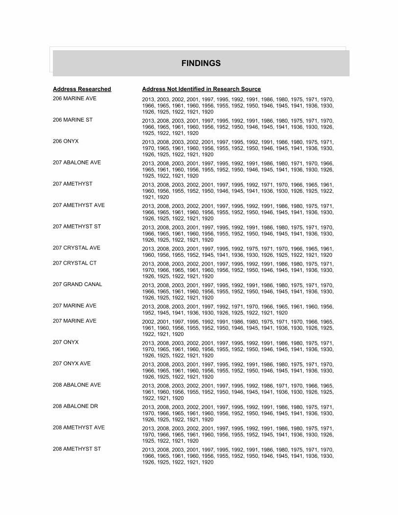
FINDINGS
Address Researched Address Not Identified in Research Source
206 MARINE AVE 2013, 2003, 2002, 2001, 1997, 1995, 1992, 1991, 1986, 1980, 1975, 1971, 1970, 1966, 1965, 1961, 1960, 1956, 1955, 1952, 1950, 1946, 1945, 1941, 1936, 1930, 1926, 1925, 1922, 1921, 1920
206 MARINE ST 2013, 2008, 2003, 2001, 1997, 1995, 1992, 1991, 1986, 1980, 1975, 1971, 1970, 1966, 1965, 1961, 1960, 1956, 1952, 1950, 1946, 1945, 1941, 1936, 1930, 1926, 1925, 1922, 1921, 1920
206 ONYX 2013, 2008, 2003, 2002, 2001, 1997, 1995, 1992, 1991, 1986, 1980, 1975, 1971, 1970, 1965, 1961, 1960, 1956, 1955, 1952, 1950, 1946, 1945, 1941, 1936, 1930, 1926, 1925, 1922, 1921, 1920
207 ABALONE AVE 2013, 2008, 2003, 2001, 1997, 1995, 1992, 1991, 1986, 1980, 1971, 1970, 1966, 1965, 1961, 1960, 1956, 1955, 1952, 1950, 1946, 1945, 1941, 1936, 1930, 1926, 1925, 1922, 1921, 1920
207 AMETHYST 2013, 2008, 2003, 2002, 2001, 1997, 1995, 1992, 1971, 1970, 1966, 1965, 1961, 1960, 1956, 1955, 1952, 1950, 1946, 1945, 1941, 1936, 1930, 1926, 1925, 1922, 1921, 1920
207 AMETHYST AVE 2013, 2008, 2003, 2002, 2001, 1997, 1995, 1992, 1991, 1986, 1980, 1975, 1971, 1966, 1965, 1961, 1960, 1956, 1955, 1952, 1950, 1946, 1945, 1941, 1936, 1930, 1926, 1925, 1922, 1921, 1920
207 AMETHYST ST 2013, 2008, 2003, 2001, 1997, 1995, 1992, 1991, 1986, 1980, 1975, 1971, 1970, 1966, 1965, 1961, 1960, 1956, 1955, 1952, 1950, 1946, 1945, 1941, 1936, 1930, 1926, 1925, 1922, 1921, 1920
207 CRYSTAL AVE 2013, 2008, 2003, 2001, 1997, 1995, 1992, 1975, 1971, 1970, 1966, 1965, 1961, 1960, 1956, 1955, 1952, 1945, 1941, 1936, 1930, 1926, 1925, 1922, 1921, 1920
207 CRYSTAL CT 2013, 2008, 2003, 2002, 2001, 1997, 1995, 1992, 1991, 1986, 1980, 1975, 1971, 1970, 1966, 1965, 1961, 1960, 1956, 1952, 1950, 1946, 1945, 1941, 1936, 1930, 1926, 1925, 1922, 1921, 1920
207 GRAND CANAL 2013, 2008, 2003, 2001, 1997, 1995, 1992, 1991, 1986, 1980, 1975, 1971, 1970, 1966, 1965, 1961, 1960, 1956, 1955, 1952, 1950, 1946, 1945, 1941, 1936, 1930, 1926, 1925, 1922, 1921, 1920
207 MARINE AVE 2013, 2008, 2003, 2001, 1997, 1992, 1971, 1970, 1966, 1965, 1961, 1960, 1956, 1952, 1945, 1941, 1936, 1930, 1926, 1925, 1922, 1921, 1920
207 MARINE AVE 2002, 2001, 1997, 1995, 1992, 1991, 1986, 1980, 1975, 1971, 1970, 1966, 1965, 1961, 1960, 1956, 1955, 1952, 1950, 1946, 1945, 1941, 1936, 1930, 1926, 1925, 1922, 1921, 1920
207 ONYX 2013, 2008, 2003, 2002, 2001, 1997, 1995, 1992, 1991, 1986, 1980, 1975, 1971, 1970, 1965, 1961, 1960, 1956, 1955, 1952, 1950, 1946, 1945, 1941, 1936, 1930, 1926, 1925, 1922, 1921, 1920
207 ONYX AVE 2013, 2008, 2003, 2001, 1997, 1995, 1992, 1991, 1986, 1980, 1975, 1971, 1970, 1966, 1965, 1961, 1960, 1956, 1955, 1952, 1950, 1946, 1945, 1941, 1936, 1930, 1926, 1925, 1922, 1921, 1920
208 ABALONE AVE 2013, 2008, 2003, 2002, 2001, 1997, 1995, 1992, 1986, 1971, 1970, 1966, 1965, 1961, 1960, 1956, 1955, 1952, 1950, 1946, 1945, 1941, 1936, 1930, 1926, 1925, 1922, 1921, 1920
208 ABALONE DR 2013, 2008, 2003, 2002, 2001, 1997, 1995, 1992, 1991, 1986, 1980, 1975, 1971, 1970, 1966, 1965, 1961, 1960, 1956, 1952, 1950, 1946, 1945, 1941, 1936, 1930, 1926, 1925, 1922, 1921, 1920
208 AMETHYST AVE 2013, 2008, 2003, 2002, 2001, 1997, 1995, 1992, 1991, 1986, 1980, 1975, 1971, 1970, 1966, 1965, 1961, 1960, 1956, 1955, 1952, 1945, 1941, 1936, 1930, 1926, 1925, 1922, 1921, 1920
208 AMETHYST ST 2013, 2008, 2003, 2001, 1997, 1995, 1992, 1991, 1986, 1980, 1975, 1971, 1970, 1966, 1965, 1961, 1960, 1956, 1955, 1952, 1950, 1946, 1945, 1941, 1936, 1930, 1926, 1925, 1922, 1921, 1920

FINDINGS
Address Researched Address Not Identified in Research Source
208 CRYSTAL 2013, 2008, 2003, 2002, 2001, 1997, 1995, 1992, 1991, 1986, 1980, 1975, 1971, 1970, 1965, 1961, 1960, 1956, 1955, 1952, 1950, 1946, 1945, 1941, 1936, 1930, 1926, 1925, 1922, 1921, 1920
208 CRYSTAL AVE 2013, 2008, 2003, 2002, 2001, 1997, 1995, 1992, 1991, 1986, 1971, 1970, 1966, 1965, 1961, 1960, 1956, 1955, 1952, 1950, 1946, 1945, 1941, 1936, 1930, 1926, 1925, 1922, 1921, 1920
208 CRYSTAL CT 2013, 2008, 2003, 2002, 2001, 1997, 1995, 1992, 1991, 1986, 1980, 1975, 1971, 1970, 1966, 1965, 1961, 1960, 1956, 1952, 1950, 1946, 1945, 1941, 1936, 1930, 1926, 1925, 1922, 1921, 1920
208 MARINE AVE 2013, 2008, 2003, 2001, 1997, 1992, 1986, 1971, 1970, 1966, 1965, 1961, 1960, 1956, 1952, 1945, 1941, 1936, 1930, 1926, 1925, 1922, 1921, 1920
208 MARINE AVE 2002, 2001, 1997, 1995, 1992, 1991, 1986, 1980, 1975, 1971, 1970, 1966, 1965, 1961, 1960, 1956, 1955, 1952, 1950, 1946, 1945, 1941, 1936, 1930, 1926, 1925, 1922, 1921, 1920
208 MARINE ST 2013, 2008, 2003, 2001, 1997, 1995, 1992, 1991, 1986, 1980, 1975, 1971, 1970, 1966, 1965, 1961, 1960, 1956, 1952, 1950, 1946, 1945, 1941, 1936, 1930, 1926, 1925, 1922, 1921, 1920
208 ONYX 2013, 2008, 2003, 2002, 2001, 1997, 1995, 1992, 1991, 1986, 1980, 1975, 1971, 1965, 1961, 1960, 1956, 1955, 1952, 1950, 1946, 1945, 1941, 1936, 1930, 1926, 1925, 1922, 1921, 1920
208 ONYX AVE 2013, 2008, 2003, 2002, 2001, 1997, 1992, 1991, 1986, 1980, 1975, 1971, 1970, 1966, 1965, 1961, 1960, 1956, 1955, 1952, 1950, 1946, 1945, 1941, 1936, 1930, 1926, 1925, 1922, 1921, 1920
209 ABALONE AVE 2013, 2008, 2003, 2001, 1997, 1995, 1992, 1980, 1971, 1970, 1966, 1965, 1961, 1960, 1956, 1955, 1952, 1950, 1946, 1945, 1941, 1936, 1930, 1926, 1925, 1922, 1921, 1920
209 ABALONE PL 2013, 2008, 2003, 2002, 2001, 1997, 1995, 1992, 1991, 1986, 1980, 1975, 1971, 1970, 1965, 1961, 1960, 1956, 1955, 1952, 1950, 1946, 1945, 1941, 1936, 1930, 1926, 1925, 1922, 1921, 1920
209 AMETHYST 2013, 2008, 2003, 2002, 2001, 1997, 1995, 1992, 1991, 1986, 1980, 1975, 1971, 1970, 1966, 1965, 1961, 1960, 1956, 1952, 1950, 1946, 1945, 1941, 1936, 1930, 1926, 1925, 1922, 1921, 1920
209 AMETHYST AVE 2013, 2008, 2003, 2002, 2001, 1997, 1995, 1992, 1991, 1986, 1980, 1975, 1971, 1966, 1965, 1961, 1960, 1956, 1955, 1952, 1950, 1945, 1941, 1936, 1930, 1926, 1925, 1922, 1921, 1920
209 AMETHYST ST 2013, 2008, 2003, 2001, 1997, 1995, 1992, 1991, 1986, 1980, 1975, 1971, 1970, 1966, 1965, 1961, 1960, 1956, 1955, 1952, 1950, 1946, 1945, 1941, 1936, 1930, 1926, 1925, 1922, 1921, 1920
209 CRYSTAL 2013, 2008, 2003, 2002, 2001, 1997, 1995, 1992, 1991, 1986, 1980, 1975, 1971, 1970, 1965, 1961, 1960, 1956, 1955, 1952, 1950, 1946, 1945, 1941, 1936, 1930, 1926, 1925, 1922, 1921, 1920
209 CRYSTAL AVE 2013, 2008, 2003, 2001, 1997, 1995, 1992, 1991, 1971, 1970, 1966, 1965, 1961, 1960, 1956, 1955, 1952, 1945, 1941, 1936, 1930, 1926, 1925, 1922, 1921, 1920
209 CRYSTAL CT 2013, 2008, 2003, 2002, 2001, 1997, 1995, 1992, 1991, 1986, 1980, 1975, 1971, 1970, 1966, 1965, 1961, 1960, 1956, 1952, 1950, 1946, 1945, 1941, 1936, 1930, 1926, 1925, 1922, 1921, 1920
209 GRAND CANAL 2013, 2008, 2003, 2001, 1997, 1995, 1992, 1991, 1986, 1980, 1975, 1971, 1970, 1966, 1965, 1961, 1960, 1956, 1955, 1952, 1950, 1946, 1945, 1941, 1936, 1930, 1926, 1925, 1922, 1921, 1920
209 MARINE AVE 2013, 2008, 2003, 2001, 1997, 1992, 1991, 1980, 1971, 1970, 1966, 1965, 1961, 1960, 1956, 1955, 1952, 1945, 1941, 1936, 1930, 1926, 1925, 1922, 1921, 1920

FINDINGS
Address Researched Address Not Identified in Research Source
209 MARINE AVE 2002, 2001, 1997, 1995, 1992, 1991, 1986, 1980, 1975, 1971, 1970, 1966, 1965, 1961, 1960, 1956, 1955, 1952, 1950, 1946, 1945, 1941, 1936, 1930, 1926, 1925, 1922, 1921, 1920
209 MARINE ST 2013, 2008, 2003, 2001, 1997, 1995, 1992, 1991, 1986, 1980, 1975, 1971, 1970, 1966, 1965, 1961, 1960, 1956, 1952, 1950, 1946, 1945, 1941, 1936, 1930, 1926, 1925, 1922, 1921, 1920
209 ONYX AVE 2013, 2008, 2003, 2001, 1997, 1992, 1991, 1986, 1980, 1975, 1971, 1966, 1965, 1961, 1960, 1956, 1955, 1952, 1950, 1946, 1945, 1941, 1936, 1930, 1926, 1925, 1922, 1921, 1920
210 ABALONE AVE 2013, 2008, 2003, 2001, 1997, 1992, 1971, 1970, 1966, 1965, 1961, 1960, 1956, 1955, 1952, 1950, 1946, 1945, 1941, 1936, 1930, 1926, 1925, 1922, 1921, 1920
210 ABALONE PL 2013, 2008, 2003, 2002, 2001, 1997, 1995, 1992, 1991, 1986, 1980, 1975, 1971, 1970, 1965, 1961, 1960, 1956, 1955, 1952, 1950, 1946, 1945, 1941, 1936, 1930, 1926, 1925, 1922, 1921, 1920
210 AMETHYST 2013, 2008, 2003, 2002, 2001, 1997, 1995, 1992, 1991, 1986, 1971, 1970, 1965, 1961, 1960, 1956, 1952, 1950, 1946, 1945, 1941, 1936, 1930, 1926, 1925, 1922, 1921, 1920
210 AMETHYST AVE 2013, 2008, 2003, 2002, 2001, 1997, 1995, 1992, 1991, 1986, 1980, 1975, 1971, 1970, 1966, 1965, 1961, 1960, 1956, 1955, 1952, 1946, 1945, 1941, 1936, 1930, 1926, 1925, 1922, 1921, 1920
210 AMETHYST ST 2013, 2008, 2003, 2001, 1997, 1995, 1992, 1991, 1986, 1980, 1975, 1971, 1970, 1966, 1965, 1961, 1960, 1956, 1955, 1952, 1950, 1946, 1945, 1941, 1936, 1930, 1926, 1925, 1922, 1921, 1920
210 CRYSTAL 2013, 2008, 2003, 2002, 2001, 1997, 1995, 1992, 1991, 1986, 1980, 1975, 1971, 1970, 1965, 1961, 1960, 1956, 1955, 1952, 1950, 1946, 1945, 1941, 1936, 1930, 1926, 1925, 1922, 1921, 1920
210 CRYSTAL AVE 2013, 2008, 2003, 2001, 1997, 1995, 1992, 1971, 1970, 1966, 1965, 1961, 1960, 1956, 1955, 1952, 1945, 1941, 1936, 1930, 1926, 1925, 1922, 1921, 1920
210 CRYSTAL CT 2013, 2008, 2003, 2002, 2001, 1997, 1995, 1992, 1991, 1986, 1980, 1975, 1971, 1970, 1966, 1965, 1961, 1960, 1956, 1952, 1950, 1946, 1945, 1941, 1936, 1930, 1926, 1925, 1922, 1921, 1920
210 GRAND CANAL 2013, 2008, 2003, 2001, 1997, 1995, 1992, 1991, 1986, 1980, 1975, 1971, 1970, 1966, 1965, 1961, 1960, 1956, 1955, 1952, 1950, 1946, 1945, 1941, 1936, 1930, 1926, 1925, 1922, 1921, 1920
210 MARINE 2013, 2008, 2003, 2002, 2001, 1997, 1995, 1992, 1991, 1986, 1980, 1975, 1971, 1966, 1965, 1961, 1960, 1956, 1955, 1952, 1950, 1946, 1945, 1941, 1936, 1930, 1926, 1925, 1922, 1921, 1920
210 MARINE AVE 2013, 2008, 2003, 2001, 1997, 1992, 1980, 1971, 1970, 1966, 1965, 1961, 1960, 1956, 1955, 1952, 1945, 1941, 1936, 1930, 1926, 1925, 1922, 1921, 1920
210 MARINE AVE 2002, 2001, 1997, 1995, 1992, 1991, 1986, 1980, 1975, 1971, 1970, 1966, 1965, 1961, 1960, 1956, 1955, 1952, 1950, 1946, 1945, 1941, 1936, 1930, 1926, 1925, 1922, 1921, 1920
210 MARINE ST 2013, 2008, 2003, 2001, 1997, 1995, 1992, 1991, 1986, 1980, 1975, 1971, 1970, 1966, 1965, 1961, 1960, 1956, 1952, 1950, 1946, 1945, 1941, 1936, 1930, 1926, 1925, 1922, 1921, 1920
210 ONYX AVE 2013, 2008, 2003, 2001, 1997, 1995, 1992, 1991, 1986, 1980, 1975, 1971, 1970, 1966, 1965, 1961, 1960, 1956, 1955, 1952, 1950, 1946, 1945, 1941, 1936, 1930, 1926, 1925, 1922, 1921, 1920
211 ABALONE AVE 2013, 2008, 2003, 2001, 1997, 1995, 1992, 1991, 1975, 1971, 1970, 1966, 1965, 1961, 1960, 1956, 1955, 1952, 1950, 1946, 1945, 1941, 1936, 1930, 1926, 1925, 1922, 1921, 1920

FINDINGS
Address Researched Address Not Identified in Research Source
211 ABALONE PL 2013, 2008, 2003, 2002, 2001, 1997, 1995, 1992, 1991, 1986, 1980, 1975, 1971, 1970, 1965, 1961, 1960, 1956, 1955, 1952, 1950, 1946, 1945, 1941, 1936, 1930, 1926, 1925, 1922, 1921, 1920
211 AMETHYST 2013, 2008, 2003, 2002, 2001, 1997, 1995, 1992, 1971, 1970, 1965, 1961, 1960, 1956, 1952, 1950, 1946, 1945, 1941, 1936, 1930, 1926, 1925, 1922, 1921, 1920
211 AMETHYST AVE 2013, 2008, 2003, 2002, 2001, 1997, 1992, 1991, 1986, 1980, 1975, 1971, 1970, 1966, 1965, 1961, 1960, 1956, 1955, 1952, 1950, 1946, 1945, 1941, 1936, 1930, 1926, 1925, 1922, 1921, 1920
211 AMETHYST ST 2013, 2008, 2003, 2001, 1997, 1995, 1992, 1991, 1986, 1980, 1975, 1971, 1970, 1966, 1965, 1961, 1960, 1956, 1955, 1952, 1950, 1946, 1945, 1941, 1936, 1930, 1926, 1925, 1922, 1921, 1920
211 CRYSTAL 2013, 2008, 2003, 2002, 2001, 1997, 1995, 1992, 1991, 1986, 1980, 1975, 1971, 1970, 1965, 1961, 1960, 1956, 1955, 1952, 1950, 1946, 1945, 1941, 1936, 1930, 1926, 1925, 1922, 1921, 1920
211 CRYSTAL AVE 2013, 2008, 2003, 2001, 1997, 1995, 1992, 1991, 1986, 1980, 1971, 1970, 1966, 1965, 1961, 1960, 1956, 1955, 1952, 1950, 1946, 1945, 1941, 1936, 1930, 1926, 1925, 1922, 1921, 1920
211 GRAND CANAL 2013, 2008, 2003, 2001, 1997, 1995, 1992, 1991, 1986, 1980, 1975, 1971, 1970, 1966, 1965, 1961, 1960, 1956, 1955, 1952, 1950, 1946, 1945, 1941, 1936, 1930, 1926, 1925, 1922, 1921, 1920
211 MARINE AVE 2013, 2008, 2003, 2001, 1997, 1992, 1971, 1970, 1966, 1965, 1961, 1960, 1956, 1955, 1952, 1945, 1941, 1936, 1930, 1926, 1925, 1922, 1921, 1920
211 MARINE AVE 2002, 2001, 1997, 1995, 1992, 1991, 1986, 1980, 1975, 1971, 1970, 1966, 1965, 1961, 1960, 1956, 1955, 1952, 1950, 1946, 1945, 1941, 1936, 1930, 1926, 1925, 1922, 1921, 1920
211 MARINE ST 2013, 2008, 2003, 2001, 1997, 1995, 1992, 1991, 1986, 1980, 1975, 1971, 1970, 1966, 1965, 1961, 1960, 1956, 1952, 1950, 1946, 1945, 1941, 1936, 1930, 1926, 1925, 1922, 1921, 1920
211 ONYX 2013, 2008, 2003, 2002, 2001, 1997, 1995, 1992, 1991, 1986, 1980, 1975, 1971, 1970, 1965, 1961, 1960, 1956, 1955, 1952, 1950, 1946, 1945, 1941, 1936, 1930, 1926, 1925, 1922, 1921, 1920
211 ONYX AVE 2013, 2008, 2003, 2001, 1997, 1992, 1991, 1986, 1980, 1975, 1971, 1966, 1965, 1961, 1960, 1956, 1955, 1952, 1950, 1946, 1945, 1941, 1936, 1930, 1926, 1925, 1922, 1921, 1920
212 ABALONE 2013, 2008, 2003, 2002, 2001, 1997, 1995, 1992, 1991, 1986, 1980, 1975, 1971, 1966, 1965, 1961, 1960, 1956, 1955, 1952, 1950, 1946, 1945, 1941, 1936, 1930, 1926, 1925, 1922, 1921, 1920
212 ABALONE AVE 2013, 2008, 2003, 2001, 1997, 1992, 1980, 1975, 1971, 1970, 1966, 1965, 1961, 1960, 1956, 1955, 1952, 1950, 1946, 1945, 1941, 1936, 1930, 1926, 1925, 1922, 1921, 1920
212 ABALONE PL 2013, 2008, 2003, 2002, 2001, 1997, 1995, 1992, 1991, 1986, 1980, 1975, 1971, 1970, 1965, 1961, 1960, 1956, 1955, 1952, 1950, 1946, 1945, 1941, 1936, 1930, 1926, 1925, 1922, 1921, 1920
212 AMETHYST 2013, 2008, 2003, 2002, 2001, 1997, 1992, 1980, 1971, 1965, 1961, 1960, 1956, 1952, 1950, 1946, 1945, 1941, 1936, 1930, 1926, 1925, 1922, 1921, 1920
212 AMETHYST AVE 2013, 2008, 2003, 2002, 2001, 1997, 1995, 1992, 1991, 1986, 1980, 1975, 1971, 1966, 1965, 1961, 1960, 1956, 1955, 1952, 1945, 1941, 1936, 1930, 1926, 1925, 1922, 1921, 1920
212 AMETHYST ST 2013, 2008, 2003, 2001, 1997, 1995, 1992, 1991, 1986, 1980, 1975, 1971, 1970, 1966, 1965, 1961, 1960, 1956, 1955, 1952, 1950, 1946, 1945, 1941, 1936, 1930, 1926, 1925, 1922, 1921, 1920

FINDINGS
Address Researched Address Not Identified in Research Source
212 CRYSTAL AVE 2013, 2008, 2003, 2001, 1997, 1995, 1992, 1986, 1971, 1970, 1966, 1965, 1961, 1960, 1956, 1955, 1952, 1950, 1946, 1945, 1941, 1936, 1930, 1926, 1925, 1922, 1921, 1920
212 GRAND CANAL 2013, 2008, 2003, 2001, 1997, 1995, 1992, 1991, 1986, 1980, 1975, 1971, 1970, 1966, 1965, 1961, 1960, 1956, 1955, 1952, 1950, 1946, 1945, 1941, 1936, 1930, 1926, 1925, 1922, 1921, 1920
212 GRAND CANAL BAELTS 2013, 2008, 2003, 2002, 2001, 1997, 1995, 1992, 1991, 1986, 1975, 1971, 1970, 1966, 1965, 1961, 1960, 1956, 1955, 1952, 1950, 1946, 1945, 1941, 1936, 1930, 1926, 1925, 1922, 1921, 1920
212 MARINE AVE 2013, 2008, 2003, 2002, 2001, 1997, 1995, 1992, 1991, 1986, 1980, 1971, 1970, 1966, 1965, 1961, 1960, 1956, 1955, 1952, 1945, 1941, 1936, 1930, 1926, 1925, 1922, 1921, 1920
212 MARINE ST 2013, 2008, 2003, 2001, 1997, 1995, 1992, 1991, 1986, 1980, 1975, 1971, 1970, 1966, 1965, 1961, 1960, 1956, 1952, 1950, 1946, 1945, 1941, 1936, 1930, 1926, 1925, 1922, 1921, 1920
212 ONYX 2013, 2008, 2003, 2002, 2001, 1997, 1995, 1992, 1991, 1986, 1980, 1975, 1971, 1970, 1965, 1961, 1960, 1956, 1955, 1952, 1950, 1946, 1945, 1941, 1936, 1930, 1926, 1925, 1922, 1921, 1920
212 ONYX AVE 2013, 2008, 2003, 2001, 1997, 1992, 1991, 1986, 1980, 1975, 1971, 1966, 1965, 1961, 1960, 1956, 1955, 1952, 1950, 1946, 1945, 1941, 1936, 1930, 1926, 1925, 1922, 1921, 1920
213 ABALONE AVE 2013, 2008, 2003, 2001, 1997, 1995, 1992, 1991, 1971, 1966, 1965, 1961, 1960, 1956, 1955, 1952, 1950, 1946, 1945, 1941, 1936, 1930, 1926, 1925, 1922, 1921, 1920
213 ABALONE AVE 2013, 2003, 2002, 2001, 1997, 1995, 1992, 1991, 1986, 1980, 1975, 1971, 1970, 1966, 1965, 1961, 1960, 1956, 1955, 1952, 1950, 1946, 1945, 1941, 1936, 1930, 1926, 1925, 1922, 1921, 1920
213 ABALONE PL 2013, 2008, 2003, 2002, 2001, 1997, 1995, 1992, 1991, 1986, 1980, 1975, 1971, 1970, 1965, 1961, 1960, 1956, 1955, 1952, 1950, 1946, 1945, 1941, 1936, 1930, 1926, 1925, 1922, 1921, 1920
213 AMETHYST 2013, 2008, 2003, 2002, 2001, 1997, 1995, 1992, 1991, 1980, 1975, 1971, 1970, 1966, 1965, 1961, 1960, 1956, 1955, 1952, 1950, 1946, 1945, 1941, 1936, 1930, 1926, 1925, 1922, 1921, 1920
213 AMETHYST ST 2013, 2008, 2003, 2001, 1997, 1995, 1992, 1991, 1986, 1980, 1975, 1971, 1970, 1966, 1965, 1961, 1960, 1956, 1955, 1952, 1950, 1946, 1945, 1941, 1936, 1930, 1926, 1925, 1922, 1921, 1920
213 CRYSTAL 2013, 2008, 2003, 2002, 2001, 1997, 1995, 1992, 1991, 1986, 1980, 1975, 1971, 1970, 1965, 1961, 1960, 1956, 1955, 1952, 1950, 1946, 1945, 1941, 1936, 1930, 1926, 1925, 1922, 1921, 1920
213 CRYSTAL AVE 2013, 2008, 2003, 2001, 1997, 1992, 1986, 1971, 1966, 1965, 1961, 1960, 1956, 1955, 1952, 1950, 1945, 1941, 1936, 1930, 1926, 1925, 1922, 1921, 1920
213 CRYSTAL CT 2013, 2008, 2003, 2002, 2001, 1997, 1995, 1992, 1991, 1986, 1980, 1975, 1971, 1970, 1966, 1965, 1961, 1960, 1956, 1952, 1950, 1946, 1945, 1941, 1936, 1930, 1926, 1925, 1922, 1921, 1920
213 GRAND CANAL 2013, 2008, 2003, 2001, 1997, 1995, 1992, 1991, 1986, 1980, 1975, 1971, 1970, 1966, 1965, 1961, 1960, 1956, 1955, 1952, 1950, 1946, 1945, 1941, 1936, 1930, 1926, 1925, 1922, 1921, 1920
213 MARIAN AVE 2013, 2008, 2003, 2002, 2001, 1997, 1995, 1992, 1991, 1986, 1975, 1971, 1970, 1966, 1965, 1961, 1960, 1956, 1955, 1952, 1950, 1946, 1945, 1941, 1936, 1930, 1926, 1925, 1922, 1921, 1920
213 MARINE AVE 2013, 2008, 2003, 2001, 1997, 1992, 1971, 1970, 1966, 1965, 1961, 1960, 1956, 1955, 1952, 1945, 1941, 1936, 1930, 1926, 1925, 1922, 1921, 1920

FINDINGS
Address Researched Address Not Identified in Research Source
213 MARINE AVE 2002, 2001, 1997, 1995, 1992, 1991, 1986, 1980, 1975, 1971, 1970, 1966, 1965, 1961, 1960, 1956, 1955, 1952, 1950, 1946, 1945, 1941, 1936, 1930, 1926, 1925, 1922, 1921, 1920
213 MARINE ST 2013, 2008, 2003, 2002, 2001, 1997, 1995, 1992, 1991, 1986, 1980, 1975, 1971, 1970, 1966, 1965, 1961, 1960, 1956, 1952, 1950, 1946, 1945, 1941, 1936, 1930, 1926, 1925, 1922, 1921, 1920
213 ONYX 2013, 2008, 2003, 2002, 2001, 1997, 1995, 1992, 1991, 1986, 1980, 1975, 1971, 1970, 1965, 1961, 1960, 1956, 1955, 1952, 1950, 1946, 1945, 1941, 1936, 1930, 1926, 1925, 1922, 1921, 1920
213 ONYX AVE 2013, 2008, 2003, 2001, 1997, 1992, 1991, 1986, 1975, 1971, 1970, 1966, 1965, 1961, 1960, 1956, 1955, 1952, 1950, 1946, 1945, 1941, 1936, 1930, 1926, 1925, 1922, 1921, 1920
214 ABALONE AVE 2013, 2008, 2003, 2001, 1997, 1992, 1991, 1986, 1980, 1971, 1970, 1966, 1965, 1961, 1960, 1956, 1955, 1952, 1950, 1946, 1945, 1941, 1936, 1930, 1926, 1925, 1922, 1921, 1920
214 AMETHYST 2013, 2008, 2003, 2002, 2001, 1997, 1995, 1992, 1986, 1971, 1970, 1966, 1965, 1961, 1960, 1956, 1952, 1950, 1946, 1945, 1941, 1936, 1930, 1926, 1925, 1922, 1921, 1920
214 AMETHYST AVE 2013, 2008, 2003, 2002, 2001, 1997, 1995, 1992, 1991, 1986, 1980, 1975, 1971, 1966, 1965, 1961, 1960, 1956, 1955, 1952, 1946, 1945, 1941, 1936, 1930, 1926, 1925, 1922, 1921, 1920
214 AMETHYST ST 2013, 2008, 2003, 2001, 1997, 1995, 1992, 1991, 1986, 1980, 1975, 1971, 1970, 1966, 1965, 1961, 1960, 1956, 1955, 1952, 1950, 1946, 1945, 1941, 1936, 1930, 1926, 1925, 1922, 1921, 1920
214 CRYSTAL AVE 2013, 2008, 2003, 2001, 1997, 1992, 1991, 1986, 1971, 1970, 1966, 1965, 1961, 1960, 1956, 1955, 1952, 1950, 1946, 1945, 1941, 1936, 1930, 1926, 1925, 1922, 1921, 1920
214 GRAND CANAL 2013, 2008, 2003, 2001, 1997, 1995, 1992, 1991, 1986, 1980, 1975, 1971, 1970, 1966, 1965, 1961, 1960, 1956, 1955, 1952, 1950, 1946, 1945, 1941, 1936, 1930, 1926, 1925, 1922, 1921, 1920
214 MARINE AVE 2013, 2008, 2003, 2001, 1997, 1992, 1980, 1971, 1970, 1966, 1965, 1961, 1960, 1956, 1955, 1952, 1945, 1941, 1936, 1930, 1926, 1925, 1922, 1921, 1920
214 MARINE AVE 2008, 2002, 2001, 1997, 1995, 1992, 1991, 1986, 1980, 1975, 1971, 1970, 1966, 1965, 1961, 1960, 1956, 1955, 1952, 1950, 1946, 1945, 1941, 1936, 1930, 1926, 1925, 1922, 1921, 1920
214 MARINE ST 2013, 2008, 2003, 2001, 1997, 1995, 1992, 1991, 1986, 1980, 1975, 1971, 1970, 1966, 1965, 1961, 1960, 1956, 1952, 1950, 1946, 1945, 1941, 1936, 1930, 1926, 1925, 1922, 1921, 1920
214 ONYX AVE 2013, 2008, 2003, 2001, 1997, 1995, 1992, 1991, 1986, 1980, 1975, 1971, 1970, 1966, 1965, 1961, 1960, 1956, 1955, 1952, 1950, 1946, 1945, 1941, 1936, 1930, 1926, 1925, 1922, 1921, 1920
215 ABALONE AVE 2013, 2008, 2003, 2001, 1997, 1992, 1971, 1966, 1965, 1961, 1960, 1956, 1955, 1952, 1950, 1946, 1945, 1941, 1936, 1930, 1926, 1925, 1922, 1921, 1920
215 ABALONE DR 2013, 2008, 2003, 2002, 2001, 1997, 1995, 1992, 1991, 1986, 1980, 1975, 1971, 1970, 1966, 1965, 1961, 1960, 1956, 1952, 1950, 1946, 1945, 1941, 1936, 1930, 1926, 1925, 1922, 1921, 1920
215 ABALONE PL 2013, 2008, 2003, 2002, 2001, 1997, 1995, 1992, 1991, 1986, 1980, 1975, 1971, 1970, 1965, 1961, 1960, 1956, 1955, 1952, 1950, 1946, 1945, 1941, 1936, 1930, 1926, 1925, 1922, 1921, 1920
215 AMETHYST 2013, 2008, 2003, 2002, 2001, 1997, 1992, 1980, 1975, 1971, 1970, 1965, 1961, 1960, 1956, 1955, 1952, 1950, 1946, 1945, 1941, 1936, 1930, 1926, 1925, 1922, 1921, 1920

FINDINGS
Address Researched Address Not Identified in Research Source
215 AMETHYST AVE 2013, 2008, 2003, 2002, 2001, 1997, 1995, 1992, 1991, 1986, 1980, 1975, 1971, 1970, 1966, 1965, 1961, 1960, 1956, 1952, 1945, 1941, 1936, 1930, 1926, 1925, 1922, 1921, 1920
215 AMETHYST ST 2013, 2008, 2003, 2001, 1997, 1995, 1992, 1991, 1986, 1980, 1975, 1971, 1970, 1966, 1965, 1961, 1960, 1956, 1955, 1952, 1950, 1946, 1945, 1941, 1936, 1930, 1926, 1925, 1922, 1921, 1920
215 CRYSTAL 2013, 2008, 2003, 2002, 2001, 1997, 1995, 1992, 1991, 1986, 1980, 1975, 1971, 1970, 1965, 1961, 1960, 1956, 1955, 1952, 1950, 1946, 1945, 1941, 1936, 1930, 1926, 1925, 1922, 1921, 1920
215 CRYSTAL AVE 2013, 2008, 2003, 2001, 1997, 1995, 1992, 1991, 1986, 1971, 1970, 1966, 1965, 1961, 1960, 1956, 1955, 1952, 1945, 1941, 1936, 1930, 1926, 1925, 1922, 1921, 1920
215 CRYSTAL CT 2013, 2008, 2003, 2002, 2001, 1997, 1995, 1992, 1991, 1986, 1980, 1975, 1971, 1970, 1966, 1965, 1961, 1960, 1956, 1952, 1950, 1946, 1945, 1941, 1936, 1930, 1926, 1925, 1922, 1921, 1920
215 GRAND CANAL 2013, 2008, 2003, 2001, 1997, 1995, 1992, 1991, 1986, 1980, 1975, 1971, 1970, 1966, 1965, 1961, 1960, 1956, 1955, 1952, 1950, 1946, 1945, 1941, 1936, 1930, 1926, 1925, 1922, 1921, 1920
215 MARINE AVE 2013, 2008, 2003, 2001, 1997, 1992, 1971, 1970, 1966, 1965, 1961, 1960, 1956, 1955, 1952, 1945, 1941, 1936, 1930, 1926, 1925, 1922, 1921, 1920
215 MARINE AVE 2002, 2001, 1997, 1995, 1992, 1991, 1986, 1980, 1975, 1971, 1970, 1966, 1965, 1961, 1960, 1956, 1955, 1952, 1950, 1946, 1945, 1941, 1936, 1930, 1926, 1925, 1922, 1921, 1920
215 MARINE ST 2013, 2008, 2003, 2001, 1997, 1995, 1992, 1991, 1986, 1980, 1975, 1971, 1970, 1966, 1965, 1961, 1960, 1956, 1952, 1950, 1946, 1945, 1941, 1936, 1930, 1926, 1925, 1922, 1921, 1920
215 ONYX 2013, 2008, 2003, 2002, 2001, 1997, 1995, 1992, 1991, 1986, 1980, 1975, 1971, 1970, 1965, 1961, 1960, 1956, 1955, 1952, 1950, 1946, 1945, 1941, 1936, 1930, 1926, 1925, 1922, 1921, 1920
215 ONYX AVE 2013, 2008, 2003, 2001, 1997, 1995, 1992, 1991, 1986, 1980, 1975, 1971, 1966, 1965, 1961, 1960, 1956, 1955, 1952, 1950, 1946, 1945, 1941, 1936, 1930, 1926, 1925, 1922, 1921, 1920
216 ABALONE AVE 2013, 2008, 2003, 2001, 1997, 1992, 1986, 1980, 1975, 1971, 1970, 1966, 1965, 1961, 1960, 1956, 1955, 1952, 1950, 1946, 1945, 1941, 1936, 1930, 1926, 1925, 1922, 1921, 1920
216 ABALONE AVE 2013, 2003, 2002, 2001, 1997, 1995, 1992, 1991, 1986, 1980, 1975, 1971, 1970, 1966, 1965, 1961, 1960, 1956, 1955, 1952, 1950, 1946, 1945, 1941, 1936, 1930, 1926, 1925, 1922, 1921, 1920
216 AMETHYST 2013, 2008, 2003, 2002, 2001, 1997, 1995, 1992, 1986, 1971, 1970, 1965, 1961, 1960, 1956, 1955, 1952, 1950, 1946, 1945, 1941, 1936, 1930, 1926, 1925, 1922, 1921, 1920
216 AMETHYST ST 2013, 2008, 2003, 2001, 1997, 1995, 1992, 1991, 1986, 1980, 1975, 1971, 1970, 1966, 1965, 1961, 1960, 1956, 1955, 1952, 1950, 1946, 1945, 1941, 1936, 1930, 1926, 1925, 1922, 1921, 1920
216 CRYSTAL 2013, 2008, 2003, 2002, 2001, 1997, 1995, 1992, 1991, 1986, 1980, 1975, 1971, 1970, 1965, 1961, 1960, 1956, 1955, 1952, 1950, 1946, 1945, 1941, 1936, 1930, 1926, 1925, 1922, 1921, 1920
216 CRYSTAL AVE 2013, 2008, 2003, 2002, 2001, 1997, 1992, 1980, 1971, 1970, 1966, 1965, 1961, 1960, 1956, 1955, 1952, 1950, 1946, 1945, 1941, 1936, 1930, 1926, 1925, 1922, 1921, 1920

FINDINGS
Address Researched Address Not Identified in Research Source
216 GRAND CANAL 2013, 2008, 2003, 2001, 1997, 1995, 1992, 1991, 1986, 1980, 1975, 1971, 1965, 1961, 1960, 1956, 1955, 1952, 1950, 1946, 1945, 1941, 1936, 1930, 1926, 1925, 1922, 1921, 1920
216 MARINE AVE 2013, 2008, 2003, 2001, 1997, 1992, 1971, 1970, 1966, 1965, 1961, 1960, 1956, 1952, 1945, 1941, 1936, 1930, 1926, 1925, 1922, 1921, 1920
216 MARINE AVE 2008, 2002, 2001, 1997, 1995, 1992, 1991, 1986, 1980, 1975, 1971, 1970, 1966, 1965, 1961, 1960, 1956, 1955, 1952, 1950, 1946, 1945, 1941, 1936, 1930, 1926, 1925, 1922, 1921, 1920
216 MARINE ST 2013, 2008, 2003, 2002, 2001, 1997, 1995, 1992, 1991, 1986, 1980, 1975, 1971, 1970, 1966, 1965, 1961, 1956, 1952, 1950, 1946, 1945, 1941, 1936, 1930, 1926, 1925, 1922, 1921, 1920
216 ONYX 2013, 2008, 2003, 2002, 2001, 1997, 1995, 1992, 1991, 1986, 1980, 1975, 1971, 1970, 1965, 1961, 1960, 1956, 1955, 1952, 1950, 1946, 1945, 1941, 1936, 1930, 1926, 1925, 1922, 1921, 1920
216 ONYX AVE 2013, 2008, 2003, 2001, 1997, 1995, 1992, 1991, 1986, 1980, 1975, 1971, 1966, 1965, 1961, 1960, 1956, 1955, 1952, 1950, 1946, 1945, 1941, 1936, 1930, 1926, 1925, 1922, 1921, 1920
217 ABALONE AVE 2013, 2008, 2003, 2001, 1997, 1995, 1992, 1986, 1971, 1966, 1965, 1961, 1960, 1956, 1955, 1952, 1946, 1945, 1941, 1936, 1930, 1926, 1925, 1922, 1921, 1920
217 ABALONE DR 2013, 2008, 2003, 2002, 2001, 1997, 1995, 1992, 1991, 1986, 1980, 1975, 1971, 1970, 1966, 1965, 1961, 1960, 1956, 1952, 1950, 1946, 1945, 1941, 1936, 1930, 1926, 1925, 1922, 1921, 1920
217 ABALONE PL 2013, 2008, 2003, 2002, 2001, 1997, 1995, 1992, 1991, 1986, 1980, 1975, 1971, 1970, 1965, 1961, 1960, 1956, 1955, 1952, 1950, 1946, 1945, 1941, 1936, 1930, 1926, 1925, 1922, 1921, 1920
217 AMETHYST 2013, 2008, 2003, 2002, 2001, 1997, 1995, 1992, 1971, 1970, 1966, 1965, 1961, 1960, 1956, 1955, 1952, 1950, 1946, 1945, 1941, 1936, 1930, 1926, 1925, 1922, 1921, 1920
217 AMETHYST AVE 2013, 2008, 2003, 2002, 2001, 1997, 1995, 1992, 1991, 1986, 1980, 1975, 1971, 1966, 1965, 1961, 1960, 1956, 1952, 1945, 1941, 1936, 1930, 1926, 1925, 1922, 1921, 1920
217 AMETHYST ST 2013, 2008, 2003, 2001, 1997, 1995, 1992, 1991, 1986, 1980, 1975, 1971, 1970, 1966, 1965, 1961, 1960, 1956, 1955, 1952, 1950, 1946, 1945, 1941, 1936, 1930, 1926, 1925, 1922, 1921, 1920
217 CRYSTAL 2013, 2008, 2003, 2002, 2001, 1997, 1995, 1992, 1991, 1986, 1980, 1975, 1971, 1970, 1965, 1961, 1960, 1956, 1955, 1952, 1950, 1946, 1945, 1941, 1936, 1930, 1926, 1925, 1922, 1921, 1920
217 CRYSTAL AVE 2013, 2008, 2003, 2001, 1997, 1995, 1992, 1991, 1971, 1970, 1966, 1965, 1961, 1960, 1956, 1955, 1952, 1946, 1945, 1941, 1936, 1930, 1926, 1925, 1922, 1921, 1920
217 CRYSTAL CT 2013, 2008, 2003, 2002, 2001, 1997, 1995, 1992, 1991, 1986, 1980, 1975, 1971, 1970, 1966, 1965, 1961, 1960, 1956, 1952, 1950, 1946, 1945, 1941, 1936, 1930, 1926, 1925, 1922, 1921, 1920
217 GRAND CANAL 2013, 2008, 2003, 2001, 1997, 1995, 1992, 1991, 1986, 1980, 1975, 1971, 1970, 1966, 1965, 1961, 1960, 1956, 1955, 1952, 1950, 1946, 1945, 1941, 1936, 1930, 1926, 1925, 1922, 1921, 1920
217 MARINE AVE 2013, 2008, 2003, 2001, 1997, 1992, 1971, 1970, 1966, 1965, 1961, 1960, 1956, 1955, 1952, 1946, 1945, 1941, 1936, 1930, 1926, 1925, 1922, 1921, 1920
217 MARINE AVE 2002, 2001, 1997, 1995, 1992, 1991, 1986, 1980, 1975, 1971, 1970, 1966, 1965, 1961, 1960, 1956, 1955, 1952, 1950, 1946, 1945, 1941, 1936, 1930, 1926, 1925, 1922, 1921, 1920

FINDINGS
Address Researched Address Not Identified in Research Source
217 MARINE ST 2013, 2008, 2003, 2002, 2001, 1997, 1995, 1992, 1991, 1986, 1980, 1975, 1971, 1970, 1966, 1965, 1961, 1960, 1956, 1952, 1950, 1946, 1945, 1941, 1936, 1930, 1926, 1925, 1922, 1921, 1920
217 ONYX AVE 2013, 2008, 2003, 2001, 1997, 1992, 1991, 1986, 1980, 1975, 1971, 1966, 1965, 1961, 1960, 1956, 1955, 1952, 1950, 1946, 1945, 1941, 1936, 1930, 1926, 1925, 1922, 1921, 1920
218 ABALONE AVE 2013, 2008, 2003, 2001, 1997, 1992, 1986, 1971, 1970, 1966, 1965, 1961, 1960, 1956, 1955, 1952, 1950, 1946, 1945, 1941, 1936, 1930, 1926, 1925, 1922, 1921, 1920
218 AMETHYST 2013, 2008, 2003, 2002, 2001, 1997, 1995, 1992, 1971, 1970, 1965, 1961, 1960, 1956, 1955, 1952, 1950, 1946, 1945, 1941, 1936, 1930, 1926, 1925, 1922, 1921, 1920
218 AMETHYST AVE 2013, 2008, 2003, 2002, 2001, 1997, 1992, 1991, 1986, 1980, 1975, 1971, 1970, 1966, 1965, 1961, 1960, 1956, 1955, 1952, 1950, 1946, 1945, 1941, 1936, 1930, 1926, 1925, 1922, 1921, 1920
218 AMETHYST ST 2013, 2008, 2003, 2001, 1997, 1995, 1992, 1991, 1986, 1980, 1975, 1971, 1970, 1966, 1965, 1961, 1960, 1956, 1955, 1952, 1950, 1946, 1945, 1941, 1936, 1930, 1926, 1925, 1922, 1921, 1920
218 CRYSTAL 2013, 2008, 2003, 2002, 2001, 1997, 1995, 1992, 1991, 1986, 1980, 1975, 1971, 1970, 1965, 1961, 1960, 1956, 1955, 1952, 1950, 1946, 1945, 1941, 1936, 1930, 1926, 1925, 1922, 1921, 1920
218 CRYSTAL AVE 2013, 2008, 2003, 2001, 1997, 1995, 1992, 1991, 1980, 1971, 1970, 1966, 1965, 1961, 1960, 1956, 1955, 1952, 1950, 1946, 1945, 1941, 1936, 1930, 1926, 1925, 1922, 1921, 1920
218 CRYSTAL CT 2013, 2008, 2003, 2002, 2001, 1997, 1995, 1992, 1991, 1986, 1980, 1975, 1971, 1970, 1966, 1965, 1961, 1960, 1956, 1952, 1950, 1946, 1945, 1941, 1936, 1930, 1926, 1925, 1922, 1921, 1920
218 GRAND CANAL 2013, 2008, 2003, 2001, 1997, 1995, 1992, 1991, 1986, 1980, 1975, 1971, 1970, 1966, 1965, 1961, 1960, 1956, 1955, 1952, 1950, 1946, 1945, 1941, 1936, 1930, 1926, 1925, 1922, 1921, 1920
218 GRAND CANAL BDAL ISLAND
2013, 2008, 2003, 2002, 2001, 1997, 1995, 1992, 1991, 1986, 1975, 1971, 1970, 1966, 1965, 1961, 1960, 1956, 1955, 1952, 1950, 1946, 1945, 1941, 1936, 1930, 1926, 1925, 1922, 1921, 1920
218 MARINE AVE 2013, 2008, 2003, 2002, 2001, 1997, 1992, 1971, 1970, 1966, 1965, 1961, 1960, 1956, 1955, 1952, 1945, 1941, 1936, 1930, 1926, 1925, 1922, 1921, 1920
218 MARINE AVE 2002, 2001, 1997, 1995, 1992, 1991, 1986, 1980, 1975, 1971, 1970, 1966, 1965, 1961, 1960, 1956, 1955, 1952, 1950, 1946, 1945, 1941, 1936, 1930, 1926, 1925, 1922, 1921, 1920
218 MARINE ST 2013, 2008, 2003, 2002, 2001, 1997, 1995, 1992, 1991, 1986, 1980, 1975, 1971, 1970, 1966, 1965, 1961, 1960, 1956, 1952, 1950, 1946, 1945, 1941, 1936, 1930, 1926, 1925, 1922, 1921, 1920
218 ONYX 2013, 2008, 2003, 2002, 2001, 1997, 1995, 1992, 1991, 1986, 1980, 1975, 1971, 1970, 1965, 1961, 1960, 1956, 1955, 1952, 1950, 1946, 1945, 1941, 1936, 1930, 1926, 1925, 1922, 1921, 1920
218 ONYX AVE 2013, 2008, 2003, 2001, 1997, 1992, 1991, 1986, 1980, 1975, 1971, 1966, 1965, 1961, 1960, 1956, 1955, 1952, 1950, 1946, 1945, 1941, 1936, 1930, 1926, 1925, 1922, 1921, 1920
219 ABALONE AVE 2013, 2008, 2003, 2001, 1997, 1992, 1971, 1966, 1965, 1961, 1960, 1956, 1955, 1952, 1950, 1945, 1941, 1936, 1930, 1926, 1925, 1922, 1921, 1920
219 ABALONE PL 2013, 2008, 2003, 2002, 2001, 1997, 1995, 1992, 1991, 1986, 1980, 1975, 1971, 1970, 1965, 1961, 1960, 1956, 1955, 1952, 1950, 1946, 1945, 1941, 1936, 1930, 1926, 1925, 1922, 1921, 1920

FINDINGS
Address Researched Address Not Identified in Research Source
219 AMETHYST 2013, 2008, 2003, 2002, 2001, 1997, 1995, 1992, 1980, 1975, 1971, 1970, 1966, 1965, 1961, 1960, 1956, 1955, 1952, 1950, 1946, 1945, 1941, 1936, 1930, 1926, 1925, 1922, 1921, 1920
219 AMETHYST AVE 2013, 2008, 2003, 2002, 2001, 1997, 1992, 1991, 1986, 1980, 1975, 1971, 1970, 1966, 1965, 1961, 1960, 1956, 1955, 1952, 1950, 1946, 1945, 1941, 1936, 1930, 1926, 1925, 1922, 1921, 1920
219 AMETHYST ST 2013, 2008, 2003, 2001, 1997, 1995, 1992, 1991, 1986, 1980, 1975, 1971, 1970, 1966, 1965, 1961, 1960, 1956, 1955, 1952, 1950, 1946, 1945, 1941, 1936, 1930, 1926, 1925, 1922, 1921, 1920
219 CRYSTAL 2013, 2008, 2003, 2002, 2001, 1997, 1995, 1992, 1991, 1986, 1980, 1975, 1971, 1970, 1965, 1961, 1960, 1956, 1955, 1952, 1950, 1946, 1945, 1941, 1936, 1930, 1926, 1925, 1922, 1921, 1920
219 CRYSTAL AVE 2013, 2008, 2003, 2001, 1997, 1995, 1992, 1991, 1986, 1971, 1970, 1966, 1965, 1961, 1960, 1956, 1955, 1952, 1945, 1941, 1936, 1930, 1926, 1925, 1922, 1921, 1920
219 CRYSTAL CT 2013, 2008, 2003, 2002, 2001, 1997, 1995, 1992, 1991, 1986, 1980, 1975, 1971, 1970, 1966, 1965, 1961, 1960, 1956, 1952, 1950, 1946, 1945, 1941, 1936, 1930, 1926, 1925, 1922, 1921, 1920
219 GRAND CANAL 2013, 2008, 2003, 2001, 1997, 1995, 1992, 1991, 1986, 1980, 1975, 1971, 1970, 1966, 1965, 1961, 1960, 1956, 1955, 1952, 1950, 1946, 1945, 1941, 1936, 1930, 1926, 1925, 1922, 1921, 1920
219 GRAND CANAL BALL 2013, 2008, 2003, 2002, 2001, 1997, 1995, 1992, 1991, 1986, 1975, 1971, 1970, 1966, 1965, 1961, 1960, 1956, 1955, 1952, 1950, 1946, 1945, 1941, 1936, 1930, 1926, 1925, 1922, 1921, 1920
219 MARINE AVE 2013, 2008, 2003, 2001, 1997, 1992, 1971, 1970, 1966, 1965, 1961, 1960, 1956, 1952, 1945, 1941, 1936, 1930, 1926, 1925, 1922, 1921, 1920
219 MARINE AVE 2002, 2001, 1997, 1995, 1992, 1991, 1986, 1980, 1975, 1971, 1970, 1966, 1965, 1961, 1960, 1956, 1955, 1952, 1950, 1946, 1945, 1941, 1936, 1930, 1926, 1925, 1922, 1921, 1920
219 MARINE ST 2013, 2008, 2003, 2002, 2001, 1997, 1995, 1992, 1991, 1986, 1980, 1975, 1971, 1970, 1966, 1965, 1961, 1960, 1956, 1952, 1950, 1946, 1945, 1941, 1936, 1930, 1926, 1925, 1922, 1921, 1920
219 ONYX 2013, 2008, 2003, 2002, 2001, 1997, 1995, 1992, 1991, 1986, 1975, 1971, 1970, 1966, 1965, 1961, 1960, 1956, 1955, 1952, 1950, 1946, 1945, 1941, 1936, 1930, 1926, 1925, 1922, 1921, 1920
219 ONYX AVE 2013, 2008, 2003, 2001, 1997, 1992, 1991, 1986, 1980, 1975, 1971, 1966, 1965, 1961, 1960, 1956, 1955, 1952, 1950, 1946, 1945, 1941, 1936, 1930, 1926, 1925, 1922, 1921, 1920
220 ABALONE AVE 2013, 2008, 2003, 2001, 1997, 1995, 1992, 1971, 1966, 1965, 1961, 1960, 1956, 1955, 1952, 1950, 1945, 1941, 1936, 1930, 1926, 1925, 1922, 1921, 1920
220 ABALONE DR 2013, 2008, 2003, 2002, 2001, 1997, 1995, 1992, 1991, 1986, 1980, 1975, 1971, 1970, 1966, 1965, 1961, 1960, 1956, 1952, 1950, 1946, 1945, 1941, 1936, 1930, 1926, 1925, 1922, 1921, 1920
220 ABALONE PL 2013, 2008, 2003, 2002, 2001, 1997, 1995, 1992, 1991, 1986, 1980, 1975, 1971, 1970, 1965, 1961, 1960, 1956, 1955, 1952, 1950, 1946, 1945, 1941, 1936, 1930, 1926, 1925, 1922, 1921, 1920
220 AMETHYST 2013, 2008, 2003, 2002, 2001, 1997, 1995, 1992, 1971, 1970, 1965, 1961, 1960, 1956, 1952, 1950, 1946, 1945, 1941, 1936, 1930, 1926, 1925, 1922, 1921, 1920
220 AMETHYST AVE 2013, 2008, 2003, 2002, 2001, 1997, 1992, 1991, 1986, 1980, 1975, 1971, 1966, 1965, 1961, 1960, 1956, 1955, 1952, 1950, 1946, 1945, 1941, 1936, 1930, 1926, 1925, 1922, 1921, 1920

FINDINGS
Address Researched Address Not Identified in Research Source
220 MARINE AVE 2013, 2008, 2003, 2001, 1997, 1992, 1971, 1970, 1966, 1965, 1961, 1960, 1956, 1955, 1952, 1946, 1945, 1941, 1936, 1930, 1926, 1925, 1922, 1921, 1920
220 MARINE AVE 2002, 2001, 1997, 1995, 1992, 1991, 1986, 1980, 1975, 1971, 1970, 1966, 1965, 1961, 1960, 1956, 1955, 1952, 1950, 1946, 1945, 1941, 1936, 1930, 1926, 1925, 1922, 1921, 1920
220 MARINE ST 2013, 2008, 2003, 2001, 1997, 1995, 1992, 1991, 1986, 1980, 1975, 1971, 1970, 1966, 1965, 1961, 1960, 1956, 1952, 1950, 1946, 1945, 1941, 1936, 1930, 1926, 1925, 1922, 1921, 1920
220 ONYX 2013, 2008, 2003, 2002, 2001, 1997, 1995, 1992, 1991, 1986, 1980, 1975, 1971, 1970, 1965, 1961, 1960, 1956, 1955, 1952, 1950, 1946, 1945, 1941, 1936, 1930, 1926, 1925, 1922, 1921, 1920
220 ONYX AVE 2013, 2008, 2003, 2001, 1997, 1995, 1992, 1991, 1986, 1980, 1975, 1971, 1970, 1966, 1965, 1961, 1960, 1956, 1955, 1952, 1950, 1946, 1945, 1941, 1936, 1930, 1926, 1925, 1922, 1921, 1920
221 ABALONE AVE 2013, 2008, 2003, 2001, 1997, 1992, 1986, 1971, 1970, 1966, 1965, 1961, 1960, 1956, 1952, 1946, 1945, 1941, 1936, 1930, 1926, 1925, 1922, 1921, 1920
221 ABALONE PL 2013, 2008, 2003, 2002, 2001, 1997, 1995, 1992, 1991, 1986, 1980, 1975, 1971, 1970, 1965, 1961, 1960, 1956, 1955, 1952, 1950, 1946, 1945, 1941, 1936, 1930, 1926, 1925, 1922, 1921, 1920
221 AMETHYST 2013, 2008, 2003, 2002, 2001, 1997, 1995, 1992, 1991, 1980, 1971, 1970, 1965, 1961, 1960, 1956, 1955, 1952, 1950, 1946, 1945, 1941, 1936, 1930, 1926, 1925, 1922, 1921, 1920
221 AMETHYST AVE 2013, 2008, 2003, 2002, 2001, 1997, 1995, 1992, 1991, 1986, 1980, 1975, 1971, 1970, 1966, 1965, 1961, 1960, 1956, 1955, 1952, 1946, 1945, 1941, 1936, 1930, 1926, 1925, 1922, 1921, 1920
221 AMETHYST ST 2013, 2008, 2003, 2001, 1997, 1995, 1992, 1991, 1986, 1980, 1975, 1971, 1970, 1966, 1965, 1961, 1960, 1956, 1955, 1952, 1950, 1946, 1945, 1941, 1936, 1930, 1926, 1925, 1922, 1921, 1920
221 CRYSTAL 2013, 2008, 2003, 2002, 2001, 1997, 1995, 1992, 1991, 1986, 1980, 1975, 1971, 1970, 1965, 1961, 1960, 1956, 1955, 1952, 1950, 1946, 1945, 1941, 1936, 1930, 1926, 1925, 1922, 1921, 1920
221 CRYSTAL AVE 2013, 2008, 2003, 2001, 1997, 1995, 1992, 1971, 1970, 1966, 1965, 1961, 1960, 1956, 1955, 1952, 1946, 1945, 1941, 1936, 1930, 1926, 1925, 1922, 1921, 1920
221 CRYSTAL CT 2013, 2008, 2003, 2002, 2001, 1997, 1995, 1992, 1991, 1986, 1980, 1975, 1971, 1970, 1966, 1965, 1961, 1960, 1956, 1952, 1950, 1946, 1945, 1941, 1936, 1930, 1926, 1925, 1922, 1921, 1920
221 GRAND CANAL 2013, 2008, 2003, 2002, 2001, 1997, 1995, 1992, 1991, 1986, 1975, 1971, 1970, 1966, 1965, 1961, 1960, 1956, 1955, 1952, 1950, 1946, 1945, 1941, 1936, 1930, 1926, 1925, 1922, 1921, 1920
221 MARINE 2013, 2008, 2003, 2002, 2001, 1997, 1992, 1991, 1986, 1980, 1975, 1971, 1970, 1966, 1965, 1961, 1960, 1956, 1955, 1952, 1950, 1946, 1945, 1941, 1936, 1930, 1926, 1925, 1922, 1921, 1920
221 MARINE AVE 2013, 2008, 2003, 2001, 1997, 1992, 1971, 1970, 1966, 1965, 1961, 1960, 1956, 1955, 1952, 1946, 1945, 1941, 1936, 1930, 1926, 1925, 1922, 1921, 1920
221 MARINE AVE 2002, 2001, 1997, 1995, 1992, 1991, 1986, 1980, 1975, 1971, 1970, 1966, 1965, 1961, 1960, 1956, 1955, 1952, 1950, 1946, 1945, 1941, 1936, 1930, 1926, 1925, 1922, 1921, 1920
221 MARINE ST 2013, 2008, 2003, 2002, 2001, 1997, 1995, 1992, 1991, 1986, 1975, 1971, 1970, 1966, 1965, 1961, 1960, 1956, 1952, 1950, 1946, 1945, 1941, 1936, 1930, 1926, 1925, 1922, 1921, 1920

FINDINGS
Address Researched Address Not Identified in Research Source
221 ONYX AVE 2013, 2008, 2003, 2002, 2001, 1997, 1992, 1991, 1986, 1980, 1975, 1971, 1966, 1965, 1961, 1960, 1956, 1955, 1952, 1950, 1946, 1945, 1941, 1936, 1930, 1926, 1925, 1922, 1921, 1920
222 ABALONE AVE 2013, 2008, 2003, 2001, 1997, 1992, 1971, 1970, 1966, 1965, 1961, 1960, 1956, 1955, 1952, 1950, 1946, 1945, 1941, 1936, 1930, 1926, 1925, 1922, 1921, 1920
222 ABALONE PL 2013, 2008, 2003, 2002, 2001, 1997, 1995, 1992, 1991, 1986, 1980, 1975, 1971, 1970, 1965, 1961, 1960, 1956, 1955, 1952, 1950, 1946, 1945, 1941, 1936, 1930, 1926, 1925, 1922, 1921, 1920
222 AMETHYST 2013, 2008, 2003, 2002, 2001, 1997, 1995, 1992, 1991, 1986, 1980, 1975, 1971, 1970, 1965, 1961, 1960, 1956, 1952, 1950, 1946, 1945, 1941, 1936, 1930, 1926, 1925, 1922, 1921, 1920
222 AMETHYST AVE 2013, 2008, 2003, 2002, 2001, 1997, 1995, 1992, 1991, 1980, 1975, 1971, 1966, 1965, 1961, 1960, 1956, 1955, 1952, 1946, 1945, 1941, 1936, 1930, 1926, 1925, 1922, 1921, 1920
222 AMETHYST ST 2013, 2008, 2003, 2001, 1997, 1995, 1992, 1991, 1986, 1980, 1975, 1971, 1970, 1966, 1965, 1961, 1960, 1956, 1955, 1952, 1950, 1946, 1945, 1941, 1936, 1930, 1926, 1925, 1922, 1921, 1920
222 GRAND CANAL 2013, 2008, 2003, 2001, 1997, 1995, 1992, 1991, 1986, 1980, 1975, 1971, 1970, 1966, 1965, 1961, 1960, 1956, 1955, 1952, 1950, 1946, 1945, 1941, 1936, 1930, 1926, 1925, 1922, 1921, 1920
222 MARINE AVE 2013, 2008, 2003, 2001, 1997, 1995, 1992, 1971, 1970, 1966, 1965, 1961, 1960, 1956, 1952, 1945, 1941, 1936, 1930, 1926, 1925, 1922, 1921, 1920
222 MARINE AVE 2002, 2001, 1997, 1995, 1992, 1991, 1986, 1980, 1975, 1971, 1970, 1966, 1965, 1961, 1960, 1956, 1955, 1952, 1950, 1946, 1945, 1941, 1936, 1930, 1926, 1925, 1922, 1921, 1920
222 ONYX AVE 2013, 2008, 2003, 2001, 1997, 1992, 1991, 1986, 1980, 1975, 1971, 1970, 1966, 1965, 1961, 1960, 1956, 1955, 1952, 1950, 1946, 1945, 1941, 1936, 1930, 1926, 1925, 1922, 1921, 1920
223 ABALONE AVE 2013, 2008, 2003, 2001, 1997, 1992, 1971, 1970, 1966, 1965, 1961, 1960, 1956, 1955, 1952, 1950, 1946, 1945, 1941, 1936, 1930, 1926, 1925, 1922, 1921, 1920
223 AMETHYST 2013, 2008, 2003, 2002, 2001, 1997, 1995, 1992, 1986, 1980, 1971, 1970, 1966, 1965, 1961, 1960, 1956, 1952, 1950, 1946, 1945, 1941, 1936, 1930, 1926, 1925, 1922, 1921, 1920
223 AMETHYST AVE 2013, 2008, 2003, 2002, 2001, 1997, 1992, 1991, 1986, 1980, 1975, 1971, 1970, 1966, 1965, 1961, 1960, 1956, 1955, 1952, 1946, 1945, 1941, 1936, 1930, 1926, 1925, 1922, 1921, 1920
223 AMETHYST ST 2013, 2008, 2003, 2001, 1997, 1995, 1992, 1991, 1986, 1980, 1975, 1971, 1970, 1966, 1965, 1961, 1960, 1956, 1955, 1952, 1950, 1946, 1945, 1941, 1936, 1930, 1926, 1925, 1922, 1921, 1920
223 CRYSTAL 2013, 2008, 2003, 2002, 2001, 1997, 1995, 1992, 1991, 1986, 1980, 1975, 1971, 1970, 1965, 1961, 1960, 1956, 1955, 1952, 1950, 1946, 1945, 1941, 1936, 1930, 1926, 1925, 1922, 1921, 1920
223 CRYSTAL AVE 2013, 2008, 2003, 2001, 1997, 1995, 1992, 1975, 1971, 1970, 1966, 1965, 1961, 1960, 1956, 1952, 1945, 1941, 1936, 1930, 1926, 1925, 1922, 1921, 1920
223 GRAND CANAL 2013, 2008, 2003, 2001, 1997, 1995, 1992, 1991, 1986, 1980, 1975, 1971, 1970, 1966, 1965, 1961, 1960, 1956, 1955, 1952, 1950, 1946, 1945, 1941, 1936, 1930, 1926, 1925, 1922, 1921, 1920
223 MARINE AVE 2013, 2008, 2003, 2001, 1997, 1992, 1971, 1970, 1966, 1965, 1961, 1960, 1956, 1952, 1946, 1945, 1941, 1936, 1930, 1926, 1925, 1922, 1921, 1920

FINDINGS
Address Researched Address Not Identified in Research Source
223 MARINE AVE 2002, 2001, 1997, 1995, 1992, 1991, 1986, 1980, 1975, 1971, 1970, 1966, 1965, 1961, 1960, 1956, 1955, 1952, 1950, 1946, 1945, 1941, 1936, 1930, 1926, 1925, 1922, 1921, 1920
223 MARINE ST 2013, 2008, 2003, 2001, 1997, 1995, 1992, 1991, 1986, 1980, 1975, 1971, 1970, 1966, 1965, 1961, 1960, 1956, 1952, 1950, 1946, 1945, 1941, 1936, 1930, 1926, 1925, 1922, 1921, 1920
223 ONYX AVE 2013, 2008, 2003, 2001, 1997, 1995, 1992, 1991, 1986, 1980, 1975, 1971, 1966, 1965, 1961, 1960, 1956, 1955, 1952, 1950, 1946, 1945, 1941, 1936, 1930, 1926, 1925, 1922, 1921, 1920
224 AMETHYST 2013, 2008, 2003, 2002, 2001, 1997, 1992, 1971, 1970, 1966, 1965, 1961, 1960, 1956, 1955, 1952, 1950, 1946, 1945, 1941, 1936, 1930, 1926, 1925, 1922, 1921, 1920
224 AMETHYST AVE 2013, 2008, 2003, 2002, 2001, 1997, 1995, 1992, 1986, 1980, 1975, 1971, 1970, 1966, 1965, 1961, 1960, 1956, 1952, 1946, 1945, 1941, 1936, 1930, 1926, 1925, 1922, 1921, 1920
224 AMETHYST ST 2013, 2008, 2003, 2001, 1997, 1995, 1992, 1991, 1986, 1980, 1975, 1971, 1970, 1966, 1965, 1961, 1960, 1956, 1955, 1952, 1950, 1946, 1945, 1941, 1936, 1930, 1926, 1925, 1922, 1921, 1920
224 GRAND CANAL 2013, 2008, 2003, 2001, 1997, 1995, 1992, 1991, 1986, 1980, 1975, 1971, 1970, 1966, 1965, 1961, 1960, 1956, 1955, 1952, 1950, 1946, 1945, 1941, 1936, 1930, 1926, 1925, 1922, 1921, 1920
224 MARINE AVE 2013, 2008, 2003, 2001, 1997, 1992, 1971, 1970, 1966, 1965, 1961, 1960, 1956, 1955, 1952, 1945, 1941, 1936, 1930, 1926, 1925, 1922, 1921, 1920
224 MARINE AVE 2002, 2001, 1997, 1995, 1992, 1991, 1986, 1980, 1975, 1971, 1970, 1966, 1965, 1961, 1960, 1956, 1955, 1952, 1950, 1946, 1945, 1941, 1936, 1930, 1926, 1925, 1922, 1921, 1920
224 MARINE ST 2013, 2008, 2003, 2002, 2001, 1997, 1995, 1992, 1991, 1986, 1980, 1975, 1971, 1970, 1966, 1965, 1961, 1960, 1956, 1952, 1950, 1946, 1945, 1941, 1936, 1930, 1926, 1925, 1922, 1921, 1920
224 ONYX 2013, 2008, 2003, 2002, 2001, 1997, 1995, 1992, 1991, 1986, 1980, 1975, 1971, 1970, 1965, 1961, 1960, 1956, 1955, 1952, 1950, 1946, 1945, 1941, 1936, 1930, 1926, 1925, 1922, 1921, 1920
224 ONYX AVE 2013, 2008, 2003, 2001, 1997, 1995, 1992, 1991, 1986, 1980, 1975, 1971, 1966, 1965, 1961, 1960, 1956, 1955, 1952, 1950, 1946, 1945, 1941, 1936, 1930, 1926, 1925, 1922, 1921, 1920
224 ONYX AVE 2013, 2003, 2002, 2001, 1997, 1995, 1992, 1991, 1986, 1980, 1975, 1971, 1970, 1966, 1965, 1961, 1960, 1956, 1955, 1952, 1950, 1946, 1945, 1941, 1936, 1930, 1926, 1925, 1922, 1921, 1920
224 W ONYX AVE 2013, 2008, 2003, 2002, 2001, 1997, 1992, 1991, 1986, 1980, 1975, 1971, 1970, 1966, 1965, 1961, 1960, 1956, 1955, 1952, 1950, 1946, 1945, 1941, 1936, 1930, 1926, 1925, 1922, 1921, 1920
225 ABALONE AVE 2013, 2008, 2003, 2001, 1997, 1995, 1992, 1991, 1986, 1980, 1975, 1971, 1970, 1966, 1965, 1961, 1960, 1956, 1955, 1952, 1950, 1946, 1945, 1941, 1936, 1930, 1926, 1925, 1922, 1921, 1920
225 AMETHYST 2013, 2008, 2003, 2002, 2001, 1997, 1992, 1980, 1971, 1966, 1965, 1961, 1960, 1956, 1952, 1950, 1946, 1945, 1941, 1936, 1930, 1926, 1925, 1922, 1921, 1920
225 AMETHYST AVE 2013, 2008, 2003, 2002, 2001, 1997, 1995, 1992, 1975, 1971, 1970, 1966, 1965, 1961, 1960, 1956, 1955, 1952, 1945, 1941, 1936, 1930, 1926, 1925, 1922, 1921, 1920
225 AMETHYST ST 2013, 2008, 2003, 2001, 1997, 1995, 1992, 1991, 1986, 1980, 1975, 1971, 1970, 1966, 1965, 1961, 1960, 1956, 1955, 1952, 1950, 1946, 1945, 1941, 1936, 1930, 1926, 1925, 1922, 1921, 1920

FINDINGS
Address Researched Address Not Identified in Research Source
225 GRAND CANAL 2013, 2008, 2003, 2001, 1997, 1995, 1992, 1991, 1986, 1980, 1975, 1971, 1970, 1966, 1965, 1961, 1960, 1956, 1955, 1952, 1950, 1946, 1945, 1941, 1936, 1930, 1926, 1925, 1922, 1921, 1920
225 MARINE 2013, 2008, 2003, 2002, 2001, 1997, 1995, 1992, 1991, 1986, 1980, 1975, 1971, 1966, 1965, 1961, 1960, 1956, 1955, 1952, 1950, 1946, 1945, 1941, 1936, 1930, 1926, 1925, 1922, 1921, 1920
225 MARINE AVE 2013, 2008, 2003, 2001, 1997, 1995, 1992, 1986, 1971, 1970, 1966, 1965, 1961, 1960, 1956, 1952, 1945, 1941, 1936, 1930, 1926, 1925, 1922, 1921, 1920
225 MARINE AVE 2002, 2001, 1997, 1995, 1992, 1991, 1986, 1980, 1975, 1971, 1970, 1966, 1965, 1961, 1960, 1956, 1955, 1952, 1950, 1946, 1945, 1941, 1936, 1930, 1926, 1925, 1922, 1921, 1920
225 MARINE ST 2013, 2008, 2003, 2002, 2001, 1997, 1995, 1992, 1991, 1986, 1980, 1975, 1971, 1970, 1966, 1965, 1961, 1960, 1956, 1952, 1950, 1946, 1945, 1941, 1936, 1930, 1926, 1925, 1922, 1921, 1920
225 ONYX 2013, 2008, 2003, 2002, 2001, 1997, 1995, 1992, 1991, 1986, 1980, 1975, 1971, 1970, 1965, 1961, 1960, 1956, 1955, 1952, 1950, 1946, 1945, 1941, 1936, 1930, 1926, 1925, 1922, 1921, 1920
225 ONYX AVE 2013, 2008, 2003, 2001, 1997, 1992, 1991, 1986, 1980, 1975, 1971, 1970, 1966, 1965, 1961, 1960, 1956, 1955, 1952, 1950, 1946, 1945, 1941, 1936, 1930, 1926, 1925, 1922, 1921, 1920
226 AMETHYST 2013, 2008, 2003, 2002, 2001, 1997, 1995, 1992, 1991, 1986, 1980, 1975, 1971, 1970, 1966, 1965, 1961, 1960, 1956, 1952, 1950, 1946, 1945, 1941, 1936, 1930, 1926, 1925, 1922, 1921, 1920
226 AMETHYST ST 2013, 2008, 2003, 2001, 1997, 1995, 1992, 1991, 1980, 1975, 1971, 1970, 1966, 1965, 1961, 1960, 1956, 1955, 1952, 1950, 1946, 1945, 1941, 1936, 1930, 1926, 1925, 1922, 1921, 1920
226 CRYSTAL AVE 2013, 2008, 2003, 2002, 2001, 1997, 1995, 1992, 1991, 1986, 1975, 1971, 1970, 1966, 1965, 1961, 1960, 1956, 1955, 1952, 1950, 1946, 1945, 1941, 1936, 1930, 1926, 1925, 1922, 1921, 1920
226 GRAND CANAL 2013, 2008, 2003, 2001, 1997, 1995, 1992, 1991, 1986, 1975, 1971, 1970, 1966, 1965, 1961, 1960, 1956, 1955, 1952, 1950, 1946, 1945, 1941, 1936, 1930, 1926, 1925, 1922, 1921, 1920
226 Grand Canal 2013, 2008, 2003, 2001, 1997, 1995, 1992, 1991, 1986, 1975, 1971, 1970, 1966, 1965, 1961, 1960, 1956, 1955, 1952, 1950, 1946, 1945, 1941, 1936, 1930, 1926, 1925, 1922, 1921, 1920
226 MARINE AVE 2013, 2008, 2003, 2001, 1997, 1992, 1971, 1970, 1966, 1965, 1961, 1960, 1956, 1955, 1952, 1946, 1945, 1941, 1936, 1930, 1926, 1925, 1922, 1921, 1920
226 MARINE AVE 2002, 2001, 1997, 1995, 1992, 1991, 1986, 1980, 1975, 1971, 1970, 1966, 1965, 1961, 1960, 1956, 1955, 1952, 1950, 1946, 1945, 1941, 1936, 1930, 1926, 1925, 1922, 1921, 1920
226 MARINE ST 2013, 2008, 2003, 2002, 2001, 1997, 1995, 1992, 1991, 1986, 1980, 1975, 1971, 1970, 1966, 1965, 1961, 1960, 1956, 1952, 1950, 1946, 1945, 1941, 1936, 1930, 1926, 1925, 1922, 1921, 1920
226 ONYX 2013, 2008, 2003, 2002, 2001, 1997, 1995, 1992, 1991, 1986, 1980, 1975, 1971, 1970, 1965, 1961, 1960, 1956, 1955, 1952, 1950, 1946, 1945, 1941, 1936, 1930, 1926, 1925, 1922, 1921, 1920
226 ONYX AVE 2013, 2008, 2003, 2002, 2001, 1997, 1992, 1991, 1986, 1980, 1975, 1971, 1970, 1966, 1965, 1961, 1960, 1956, 1955, 1952, 1950, 1946, 1945, 1941, 1936, 1930, 1926, 1925, 1922, 1921, 1920
227 Grand Canal 2013, 2008, 2003, 2001, 1997, 1995, 1992, 1991, 1986, 1980, 1975, 1971, 1970, 1966, 1965, 1961, 1960, 1956, 1955, 1952, 1950, 1946, 1945, 1941, 1936, 1930, 1926, 1925, 1922, 1921, 1920

FINDINGS
Address Researched Address Not Identified in Research Source
227 ONYX AVE 2013, 2008, 2002, 2001, 1997, 1995, 1992, 1991, 1986, 1980, 1975, 1971, 1970, 1966, 1965, 1961, 1960, 1956, 1955, 1952, 1950, 1946, 1945, 1941, 1936, 1930, 1926, 1925, 1922, 1921, 1920
229 MARINE AVE 2002, 2001, 1997, 1995, 1992, 1991, 1986, 1980, 1975, 1971, 1970, 1966, 1965, 1961, 1960, 1956, 1955, 1952, 1950, 1946, 1945, 1941, 1936, 1930, 1926, 1925, 1922, 1921, 1920
229 MARINE AVE 2013, 2008, 2003, 2001, 1997, 1992, 1971, 1970, 1966, 1965, 1961, 1960, 1956, 1955, 1952, 1946, 1945, 1941, 1936, 1930, 1926, 1925, 1922, 1921, 1920
229 MARINE ST 2013, 2008, 2003, 2002, 2001, 1997, 1995, 1992, 1991, 1986, 1980, 1975, 1971, 1970, 1966, 1965, 1961, 1960, 1956, 1952, 1950, 1946, 1945, 1941, 1936, 1930, 1926, 1925, 1922, 1921, 1920
229 MARINIIE AVE 2013, 2008, 2003, 2002, 2001, 1997, 1995, 1992, 1991, 1986, 1975, 1971, 1970, 1966, 1965, 1961, 1960, 1956, 1955, 1952, 1950, 1946, 1945, 1941, 1936, 1930, 1926, 1925, 1922, 1921, 1920
233 MARINE AVE 2013, 2008, 2003, 2001, 1997, 1995, 1992, 1991, 1986, 1980, 1975, 1971, 1970, 1966, 1965, 1961, 1960, 1956, 1955, 1952, 1950, 1946, 1945, 1941, 1936, 1930, 1926, 1925, 1922, 1921, 1920
235 MARINE ST 2013, 2008, 2003, 2001, 1997, 1995, 1992, 1991, 1986, 1980, 1975, 1971, 1970, 1966, 1965, 1961, 1960, 1956, 1955, 1952, 1950, 1946, 1945, 1941, 1936, 1930, 1926, 1925, 1922, 1921, 1920
245 MARINE ST 2013, 2008, 2003, 2001, 1997, 1995, 1992, 1991, 1986, 1980, 1975, 1971, 1970, 1966, 1965, 1961, 1960, 1956, 1955, 1952, 1950, 1946, 1945, 1941, 1936, 1930, 1926, 1925, 1922, 1921, 1920
250 MARINE ST 2013, 2008, 2003, 2001, 1997, 1995, 1992, 1991, 1986, 1980, 1975, 1971, 1970, 1966, 1965, 1961, 1960, 1956, 1955, 1952, 1950, 1946, 1945, 1941, 1936, 1930, 1926, 1925, 1922, 1921, 1920
251 ABALONE 2013, 2008, 2003, 2002, 2001, 1997, 1995, 1992, 1991, 1986, 1980, 1975, 1971, 1966, 1965, 1961, 1960, 1956, 1955, 1952, 1950, 1946, 1945, 1941, 1936, 1930, 1926, 1925, 1922, 1921, 1920
260 MARINE ST 2013, 2008, 2003, 2001, 1997, 1995, 1992, 1991, 1986, 1980, 1975, 1971, 1970, 1966, 1965, 1961, 1960, 1956, 1955, 1952, 1950, 1946, 1945, 1941, 1936, 1930, 1926, 1925, 1922, 1921, 1920
265 E BAYFRONT 2013, 2008, 2003, 2002, 2001, 1997, 1995, 1992, 1991, 1986, 1980, 1975, 1971, 1970, 1965, 1961, 1960, 1956, 1955, 1952, 1950, 1946, 1945, 1941, 1936, 1930, 1926, 1925, 1922, 1921, 1920
268 MARINE ST 2013, 2008, 2003, 2001, 1997, 1995, 1992, 1991, 1986, 1980, 1975, 1971, 1970, 1966, 1965, 1961, 1960, 1956, 1955, 1952, 1950, 1946, 1945, 1941, 1936, 1930, 1926, 1925, 1922, 1921, 1920
269 E BAYFRONT 2013, 2008, 2003, 2002, 2001, 1997, 1995, 1992, 1991, 1986, 1980, 1975, 1971, 1970, 1965, 1961, 1960, 1956, 1955, 1952, 1950, 1946, 1945, 1941, 1936, 1930, 1926, 1925, 1922, 1921, 1920
270 MARINE ST 2013, 2008, 2003, 2001, 1997, 1995, 1992, 1991, 1986, 1980, 1975, 1971, 1970, 1966, 1965, 1961, 1960, 1956, 1955, 1952, 1950, 1946, 1945, 1941, 1936, 1930, 1926, 1925, 1922, 1921, 1920
271 CRYSTAL AVE 2013, 2008, 2003, 2001, 1997, 1995, 1992, 1991, 1986, 1980, 1975, 1971, 1970, 1966, 1965, 1961, 1960, 1956, 1955, 1952, 1950, 1946, 1945, 1941, 1936, 1930, 1926, 1925, 1922, 1921, 1920
275 E BAYFRONT 2013, 2008, 2003, 2002, 2001, 1997, 1995, 1992, 1991, 1986, 1980, 1975, 1971, 1970, 1965, 1961, 1960, 1956, 1955, 1952, 1950, 1946, 1945, 1941, 1936, 1930, 1926, 1925, 1922, 1921, 1920

FINDINGS
Address Researched Address Not Identified in Research Source
275 MARINE ST 2013, 2008, 2003, 2001, 1997, 1995, 1992, 1991, 1986, 1980, 1975, 1971, 1970, 1966, 1965, 1961, 1960, 1956, 1955, 1952, 1950, 1946, 1945, 1941, 1936, 1930, 1926, 1925, 1922, 1921, 1920
283 E BAYFRONT 2013, 2008, 2003, 2002, 2001, 1997, 1995, 1992, 1991, 1986, 1980, 1975, 1971, 1970, 1965, 1961, 1960, 1956, 1955, 1952, 1950, 1946, 1945, 1941, 1936, 1930, 1926, 1925, 1922, 1921, 1920
285 E BAY FRONT 2013, 2008, 2003, 2002, 2001, 1997, 1995, 1992, 1986, 1980, 1975, 1971, 1970, 1966, 1965, 1961, 1960, 1956, 1955, 1952, 1950, 1946, 1945, 1941, 1936, 1930, 1926, 1925, 1922, 1921, 1920
285 MARINE ST 2013, 2008, 2003, 2001, 1997, 1995, 1992, 1991, 1986, 1980, 1975, 1971, 1970, 1966, 1965, 1961, 1960, 1956, 1955, 1952, 1950, 1946, 1945, 1941, 1936, 1930, 1926, 1925, 1922, 1921, 1920
286 GRAND CANAL 2013, 2008, 2003, 2001, 1997, 1995, 1992, 1991, 1986, 1980, 1975, 1971, 1970, 1966, 1965, 1961, 1960, 1956, 1955, 1952, 1950, 1946, 1945, 1941, 1936, 1930, 1926, 1925, 1922, 1921, 1920
288 MARINE ST 2013, 2008, 2003, 2001, 1997, 1995, 1992, 1991, 1986, 1980, 1975, 1971, 1970, 1966, 1965, 1961, 1960, 1956, 1955, 1952, 1950, 1946, 1945, 1941, 1936, 1930, 1926, 1925, 1922, 1921, 1920
290 CRYSTAL AVE 2013, 2008, 2003, 2001, 1997, 1995, 1992, 1991, 1986, 1980, 1975, 1971, 1970, 1966, 1965, 1961, 1960, 1956, 1955, 1952, 1950, 1946, 1945, 1941, 1936, 1930, 1926, 1925, 1922, 1921, 1920
290 MARINE ST 2013, 2008, 2003, 2001, 1997, 1995, 1992, 1991, 1986, 1980, 1975, 1971, 1970, 1966, 1965, 1961, 1960, 1956, 1955, 1952, 1950, 1946, 1945, 1941, 1936, 1930, 1926, 1925, 1922, 1921, 1920
296 CRYSTAL AVE 2013, 2008, 2003, 2001, 1997, 1995, 1992, 1991, 1986, 1980, 1975, 1971, 1970, 1966, 1965, 1961, 1960, 1956, 1955, 1952, 1950, 1946, 1945, 1941, 1936, 1930, 1926, 1925, 1922, 1921, 1920
300 AMETHYST 2013, 2008, 2003, 2002, 2001, 1997, 1992, 1971, 1965, 1961, 1960, 1956, 1952, 1950, 1946, 1945, 1941, 1936, 1930, 1926, 1925, 1922, 1921, 1920
300 AMETHYST AVE 2013, 2008, 2003, 2002, 2001, 1997, 1995, 1992, 1991, 1986, 1980, 1975, 1971, 1970, 1966, 1965, 1961, 1960, 1956, 1955, 1952, 1945, 1941, 1936, 1930, 1926, 1925, 1922, 1921, 1920
300 AMETHYST ST 2013, 2008, 2003, 2001, 1997, 1995, 1992, 1991, 1986, 1980, 1975, 1971, 1970, 1966, 1965, 1961, 1960, 1956, 1955, 1952, 1950, 1946, 1945, 1941, 1936, 1930, 1926, 1925, 1922, 1921, 1920
300 Grand Canal 2013, 2008, 2003, 2002, 2001, 1997, 1995, 1992, 1991, 1986, 1980, 1975, 1971, 1970, 1966, 1965, 1961, 1960, 1956, 1955, 1952, 1950, 1946, 1945, 1941, 1936, 1930, 1926, 1925, 1922, 1921, 1920
300 MARINE AVE 2013, 2008, 2003, 2001, 1997, 1992, 1980, 1971, 1970, 1966, 1965, 1961, 1960, 1956, 1955, 1952, 1945, 1941, 1936, 1930, 1926, 1925, 1922, 1921, 1920
300 MARINE AVE 2002, 2001, 1997, 1995, 1992, 1991, 1986, 1980, 1975, 1971, 1970, 1966, 1965, 1961, 1960, 1956, 1955, 1952, 1950, 1946, 1945, 1941, 1936, 1930, 1926, 1925, 1922, 1921, 1920
300 MARINE ST 2013, 2008, 2003, 2001, 1997, 1995, 1992, 1991, 1986, 1980, 1975, 1971, 1970, 1966, 1965, 1961, 1960, 1956, 1952, 1950, 1946, 1945, 1941, 1936, 1930, 1926, 1925, 1922, 1921, 1920
300 ONYX 2013, 2008, 2003, 2002, 2001, 1997, 1995, 1992, 1991, 1986, 1980, 1975, 1971, 1970, 1965, 1961, 1960, 1956, 1955, 1952, 1950, 1946, 1945, 1941, 1936, 1930, 1926, 1925, 1922, 1921, 1920
300 ONYX AVE 2013, 2008, 2003, 2001, 1997, 1995, 1992, 1991, 1986, 1980, 1975, 1971, 1970, 1966, 1965, 1961, 1960, 1956, 1955, 1952, 1950, 1946, 1945, 1941, 1936, 1930, 1926, 1925, 1922, 1921, 1920
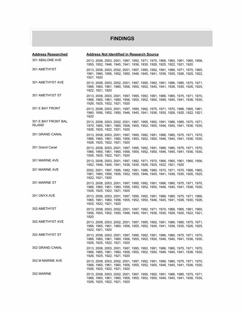
FINDINGS
Address Researched Address Not Identified in Research Source
301 ABALONE AVE 2013, 2008, 2003, 2001, 1997, 1992, 1971, 1970, 1966, 1965, 1961, 1960, 1956, 1955, 1952, 1946, 1945, 1941, 1936, 1930, 1926, 1925, 1922, 1921, 1920
301 AMETHYST 2013, 2008, 2003, 2002, 2001, 1997, 1995, 1992, 1991, 1986, 1971, 1970, 1965, 1961, 1960, 1956, 1952, 1950, 1946, 1945, 1941, 1936, 1930, 1926, 1925, 1922, 1921, 1920
301 AMETHYST AVE 2013, 2008, 2003, 2002, 2001, 1997, 1995, 1992, 1991, 1986, 1980, 1975, 1971, 1966, 1965, 1961, 1960, 1956, 1955, 1952, 1945, 1941, 1936, 1930, 1926, 1925, 1922, 1921, 1920
301 AMETHYST ST 2013, 2008, 2003, 2001, 1997, 1995, 1992, 1991, 1986, 1980, 1975, 1971, 1970, 1966, 1965, 1961, 1960, 1956, 1955, 1952, 1950, 1946, 1945, 1941, 1936, 1930, 1926, 1925, 1922, 1921, 1920
301 E BAY FRONT 2013, 2008, 2003, 2001, 1997, 1995, 1992, 1975, 1971, 1970, 1966, 1965, 1961, 1960, 1956, 1952, 1950, 1946, 1945, 1941, 1936, 1930, 1926, 1925, 1922, 1921, 1920
301 E BAY FRONT BAL ISLAND
2013, 2008, 2003, 2002, 2001, 1997, 1995, 1992, 1991, 1986, 1980, 1975, 1971, 1970, 1965, 1961, 1960, 1956, 1955, 1952, 1950, 1946, 1945, 1941, 1936, 1930, 1926, 1925, 1922, 1921, 1920
301 GRAND CANAL 2013, 2008, 2003, 2001, 1997, 1995, 1992, 1991, 1986, 1980, 1975, 1971, 1970, 1966, 1965, 1961, 1960, 1956, 1955, 1952, 1950, 1946, 1945, 1941, 1936, 1930, 1926, 1925, 1922, 1921, 1920
301 Grand Canal 2013, 2008, 2003, 2001, 1997, 1995, 1992, 1991, 1986, 1980, 1975, 1971, 1970, 1966, 1965, 1961, 1960, 1956, 1955, 1952, 1950, 1946, 1945, 1941, 1936, 1930, 1926, 1925, 1922, 1921, 1920
301 MARINE AVE 2013, 2008, 2003, 2001, 1997, 1992, 1971, 1970, 1966, 1965, 1961, 1960, 1956, 1952, 1946, 1945, 1941, 1936, 1930, 1926, 1925, 1922, 1921, 1920
301 MARINE AVE 2002, 2001, 1997, 1995, 1992, 1991, 1986, 1980, 1975, 1971, 1970, 1966, 1965, 1961, 1960, 1956, 1955, 1952, 1950, 1946, 1945, 1941, 1936, 1930, 1926, 1925, 1922, 1921, 1920
301 MARINE ST 2013, 2008, 2003, 2001, 1997, 1995, 1992, 1991, 1986, 1980, 1975, 1971, 1970, 1966, 1965, 1961, 1960, 1956, 1955, 1952, 1950, 1946, 1945, 1941, 1936, 1930, 1926, 1925, 1922, 1921, 1920
301 ONYX AVE 2013, 2008, 2003, 2001, 1997, 1995, 1992, 1991, 1986, 1980, 1975, 1971, 1966, 1965, 1961, 1960, 1956, 1955, 1952, 1950, 1946, 1945, 1941, 1936, 1930, 1926, 1925, 1922, 1921, 1920
302 AMETHYST 2013, 2008, 2003, 2002, 2001, 1997, 1992, 1971, 1970, 1966, 1965, 1961, 1960, 1956, 1955, 1952, 1950, 1946, 1945, 1941, 1936, 1930, 1926, 1925, 1922, 1921, 1920
302 AMETHYST AVE 2013, 2008, 2003, 2002, 2001, 1997, 1995, 1992, 1991, 1986, 1980, 1975, 1971, 1966, 1965, 1961, 1960, 1956, 1955, 1952, 1945, 1941, 1936, 1930, 1926, 1925, 1922, 1921, 1920
302 AMETHYST ST 2013, 2008, 2003, 2001, 1997, 1995, 1992, 1991, 1986, 1980, 1975, 1971, 1970, 1966, 1965, 1961, 1960, 1956, 1955, 1952, 1950, 1946, 1945, 1941, 1936, 1930, 1926, 1925, 1922, 1921, 1920
302 GRAND CANAL 2013, 2008, 2003, 2001, 1997, 1995, 1992, 1991, 1986, 1980, 1975, 1971, 1970, 1966, 1965, 1961, 1960, 1956, 1955, 1952, 1950, 1946, 1945, 1941, 1936, 1930, 1926, 1925, 1922, 1921, 1920
302 M MARINE AVE 2013, 2008, 2003, 2002, 2001, 1997, 1992, 1991, 1986, 1980, 1975, 1971, 1970, 1966, 1965, 1961, 1960, 1956, 1955, 1952, 1950, 1946, 1945, 1941, 1936, 1930, 1926, 1925, 1922, 1921, 1920
302 MARINE 2013, 2008, 2003, 2002, 2001, 1997, 1995, 1992, 1991, 1986, 1980, 1975, 1971, 1966, 1965, 1961, 1960, 1956, 1955, 1952, 1950, 1946, 1945, 1941, 1936, 1930, 1926, 1925, 1922, 1921, 1920

FINDINGS
Address Researched Address Not Identified in Research Source
302 MARINE AVE 2013, 2008, 2003, 2001, 1997, 1992, 1971, 1970, 1966, 1965, 1961, 1960, 1956, 1955, 1952, 1946, 1945, 1941, 1936, 1930, 1926, 1925, 1922, 1921, 1920
302 MARINE AVE 2002, 2001, 1997, 1995, 1992, 1991, 1986, 1980, 1975, 1971, 1970, 1966, 1965, 1961, 1960, 1956, 1955, 1952, 1950, 1946, 1945, 1941, 1936, 1930, 1926, 1925, 1922, 1921, 1920
302 MARINE ST 2013, 2008, 2003, 2002, 2001, 1997, 1995, 1992, 1991, 1986, 1980, 1975, 1971, 1970, 1966, 1965, 1961, 1956, 1952, 1950, 1946, 1945, 1941, 1936, 1930, 1926, 1925, 1922, 1921, 1920
302 ONYX AVE 2013, 2008, 2003, 2001, 1997, 1992, 1991, 1986, 1980, 1975, 1971, 1970, 1966, 1965, 1961, 1960, 1956, 1955, 1952, 1950, 1946, 1945, 1941, 1936, 1930, 1926, 1925, 1922, 1921, 1920
302 ONYX AVE 2013, 2003, 2002, 2001, 1997, 1995, 1992, 1991, 1986, 1980, 1975, 1971, 1970, 1966, 1965, 1961, 1960, 1956, 1955, 1952, 1950, 1946, 1945, 1941, 1936, 1930, 1926, 1925, 1922, 1921, 1920
303 AMETHYST 2013, 2008, 2003, 2002, 2001, 1997, 1992, 1971, 1970, 1965, 1961, 1960, 1956, 1952, 1950, 1946, 1945, 1941, 1936, 1930, 1926, 1925, 1922, 1921, 1920
303 AMETHYST AVE 2013, 2008, 2003, 2002, 2001, 1997, 1995, 1992, 1991, 1986, 1980, 1975, 1971, 1966, 1965, 1961, 1960, 1956, 1955, 1952, 1950, 1946, 1945, 1941, 1936, 1930, 1926, 1925, 1922, 1921, 1920
303 AMETHYST ST 2013, 2008, 2003, 2001, 1997, 1995, 1992, 1991, 1986, 1980, 1975, 1971, 1970, 1966, 1965, 1961, 1960, 1956, 1955, 1952, 1950, 1946, 1945, 1941, 1936, 1930, 1926, 1925, 1922, 1921, 1920
303 CRYSTAL 2013, 2008, 2003, 2002, 2001, 1997, 1995, 1992, 1991, 1986, 1980, 1975, 1971, 1970, 1965, 1961, 1960, 1956, 1955, 1952, 1950, 1946, 1945, 1941, 1936, 1930, 1926, 1925, 1922, 1921, 1920
303 CRYSTAL AVE 2013, 2008, 2003, 2001, 1997, 1995, 1992, 1980, 1971, 1970, 1966, 1965, 1961, 1960, 1956, 1955, 1952, 1945, 1941, 1936, 1930, 1926, 1925, 1922, 1921, 1920
303 CRYSTAL CT 2013, 2008, 2003, 2002, 2001, 1997, 1995, 1992, 1991, 1986, 1975, 1971, 1970, 1966, 1965, 1961, 1960, 1956, 1955, 1952, 1950, 1946, 1945, 1941, 1936, 1930, 1926, 1925, 1922, 1921, 1920
303 E ONYX AVE 2013, 2008, 2003, 2002, 2001, 1997, 1995, 1992, 1991, 1986, 1980, 1975, 1971, 1966, 1965, 1961, 1960, 1956, 1955, 1952, 1950, 1946, 1945, 1941, 1936, 1930, 1926, 1925, 1922, 1921, 1920
303 GRAND CANAL 2013, 2008, 2003, 2001, 1997, 1995, 1992, 1991, 1986, 1980, 1975, 1971, 1970, 1965, 1961, 1960, 1956, 1955, 1952, 1950, 1946, 1945, 1941, 1936, 1930, 1926, 1925, 1922, 1921, 1920
303 MARINE AVE 2013, 2008, 2003, 2002, 2001, 1997, 1995, 1992, 1991, 1986, 1980, 1975, 1971, 1970, 1966, 1965, 1961, 1960, 1956, 1955, 1952, 1950, 1945, 1941, 1936, 1930, 1926, 1925, 1922, 1921, 1920
303 ONYX AVE 2013, 2008, 2003, 2001, 1997, 1992, 1991, 1986, 1980, 1975, 1971, 1970, 1966, 1965, 1961, 1960, 1956, 1955, 1952, 1950, 1946, 1945, 1941, 1936, 1930, 1926, 1925, 1922, 1921, 1920
304 AMETHYST 2013, 2008, 2003, 2002, 2001, 1997, 1995, 1992, 1991, 1986, 1971, 1970, 1965, 1961, 1960, 1956, 1952, 1950, 1946, 1945, 1941, 1936, 1930, 1926, 1925, 1922, 1921, 1920
304 AMETHYST AVE 2013, 2008, 2003, 2002, 2001, 1997, 1995, 1992, 1991, 1980, 1975, 1971, 1970, 1966, 1965, 1961, 1960, 1956, 1955, 1952, 1945, 1941, 1936, 1930, 1926, 1925, 1922, 1921, 1920
304 AMETHYST ST 2013, 2008, 2003, 2001, 1997, 1995, 1992, 1991, 1986, 1980, 1975, 1971, 1970, 1966, 1965, 1961, 1960, 1956, 1955, 1952, 1950, 1946, 1945, 1941, 1936, 1930, 1926, 1925, 1922, 1921, 1920

FINDINGS
Address Researched Address Not Identified in Research Source
304 GRAND CANAL 2013, 2008, 2003, 2001, 1997, 1995, 1992, 1991, 1986, 1980, 1975, 1971, 1970, 1966, 1965, 1961, 1960, 1956, 1955, 1952, 1950, 1946, 1945, 1941, 1936, 1930, 1926, 1925, 1922, 1921, 1920
304 MARINE AVE 2013, 2008, 2003, 2001, 1997, 1995, 1992, 1980, 1971, 1970, 1966, 1965, 1961, 1960, 1956, 1955, 1952, 1945, 1941, 1936, 1930, 1926, 1925, 1922, 1921, 1920
304 MARINE AVE 2008, 2002, 2001, 1997, 1995, 1992, 1991, 1986, 1980, 1975, 1971, 1970, 1966, 1965, 1961, 1960, 1956, 1955, 1952, 1950, 1946, 1945, 1941, 1936, 1930, 1926, 1925, 1922, 1921, 1920
304 MARINE ST 2013, 2008, 2003, 2002, 2001, 1997, 1995, 1992, 1991, 1986, 1980, 1975, 1971, 1970, 1966, 1965, 1961, 1960, 1956, 1952, 1950, 1946, 1945, 1941, 1936, 1930, 1926, 1925, 1922, 1921, 1920
305 AMETHYST 2013, 2008, 2003, 2002, 2001, 1997, 1992, 1975, 1971, 1970, 1966, 1965, 1961, 1960, 1956, 1955, 1952, 1950, 1946, 1945, 1941, 1936, 1930, 1926, 1925, 1922, 1921, 1920
305 AMETHYST AVE 2013, 2008, 2003, 2002, 2001, 1997, 1995, 1992, 1991, 1986, 1980, 1975, 1971, 1970, 1966, 1965, 1961, 1960, 1956, 1955, 1952, 1950, 1945, 1941, 1936, 1930, 1926, 1925, 1922, 1921, 1920
305 AMETHYST ST 2013, 2008, 2003, 2001, 1997, 1995, 1992, 1991, 1986, 1980, 1975, 1971, 1970, 1966, 1965, 1961, 1960, 1956, 1955, 1952, 1950, 1946, 1945, 1941, 1936, 1930, 1926, 1925, 1922, 1921, 1920
305 CRYSTAL AVE 2013, 2008, 2003, 2002, 2001, 1997, 1995, 1992, 1991, 1986, 1980, 1975, 1971, 1970, 1966, 1965, 1961, 1960, 1956, 1955, 1952, 1950, 1945, 1941, 1936, 1930, 1926, 1925, 1922, 1921, 1920
305 E BAY FRONT 2013, 2008, 2003, 2002, 2001, 1997, 1995, 1992, 1986, 1975, 1971, 1970, 1965, 1961, 1960, 1956, 1952, 1950, 1946, 1945, 1941, 1936, 1930, 1926, 1925, 1922, 1921, 1920
305 GRAND CANAL 2013, 2008, 2003, 2001, 1997, 1995, 1992, 1991, 1986, 1980, 1975, 1971, 1970, 1966, 1965, 1961, 1960, 1956, 1955, 1952, 1950, 1946, 1945, 1941, 1936, 1930, 1926, 1925, 1922, 1921, 1920
305 MARINE AVE 2013, 2008, 2003, 2001, 1997, 1992, 1991, 1971, 1970, 1966, 1965, 1961, 1960, 1956, 1952, 1945, 1941, 1936, 1930, 1926, 1925, 1922, 1921, 1920
305 MARINE AVE 2008, 2002, 2001, 1997, 1995, 1992, 1991, 1986, 1980, 1975, 1971, 1970, 1966, 1965, 1961, 1960, 1956, 1955, 1952, 1950, 1946, 1945, 1941, 1936, 1930, 1926, 1925, 1922, 1921, 1920
305 MARINE ST 2013, 2008, 2003, 2001, 1997, 1995, 1992, 1991, 1986, 1980, 1975, 1971, 1970, 1966, 1965, 1961, 1960, 1956, 1952, 1950, 1946, 1945, 1941, 1936, 1930, 1926, 1925, 1922, 1921, 1920
306 ABALONE AVE 2013, 2008, 2003, 2001, 1997, 1995, 1992, 1991, 1980, 1971, 1970, 1966, 1965, 1961, 1960, 1956, 1955, 1952, 1950, 1946, 1945, 1941, 1936, 1930, 1926, 1925, 1922, 1921, 1920
306 ABALONE DR 2013, 2008, 2003, 2002, 2001, 1997, 1995, 1992, 1991, 1986, 1980, 1975, 1971, 1970, 1966, 1965, 1961, 1960, 1956, 1952, 1950, 1946, 1945, 1941, 1936, 1930, 1926, 1925, 1922, 1921, 1920
306 ABALONE LN 2013, 2008, 2003, 2002, 2001, 1997, 1995, 1992, 1991, 1986, 1980, 1975, 1971, 1966, 1965, 1961, 1960, 1956, 1955, 1952, 1950, 1946, 1945, 1941, 1936, 1930, 1926, 1925, 1922, 1921, 1920
306 ABALONE PL 2013, 2008, 2003, 2002, 2001, 1997, 1995, 1992, 1991, 1986, 1980, 1975, 1971, 1970, 1965, 1961, 1960, 1956, 1955, 1952, 1950, 1946, 1945, 1941, 1936, 1930, 1926, 1925, 1922, 1921, 1920
306 AMETHYST 2013, 2008, 2003, 2002, 2001, 1997, 1995, 1992, 1991, 1986, 1980, 1971, 1970, 1966, 1965, 1961, 1960, 1956, 1955, 1952, 1950, 1946, 1945, 1941, 1936, 1930, 1926, 1925, 1922, 1921, 1920

FINDINGS
Address Researched Address Not Identified in Research Source
306 AMETHYST AVE 2013, 2008, 2003, 2002, 2001, 1997, 1995, 1992, 1991, 1986, 1980, 1975, 1971, 1966, 1965, 1961, 1960, 1956, 1955, 1952, 1950, 1946, 1945, 1941, 1936, 1930, 1926, 1925, 1922, 1921, 1920
306 AMETHYST AVE 2013, 2003, 2002, 2001, 1997, 1995, 1992, 1991, 1986, 1980, 1975, 1971, 1970, 1966, 1965, 1961, 1960, 1956, 1955, 1952, 1950, 1946, 1945, 1941, 1936, 1930, 1926, 1925, 1922, 1921, 1920
306 AMETHYST ST 2013, 2008, 2003, 2001, 1997, 1995, 1992, 1991, 1986, 1980, 1975, 1971, 1970, 1966, 1965, 1961, 1960, 1956, 1955, 1952, 1950, 1946, 1945, 1941, 1936, 1930, 1926, 1925, 1922, 1921, 1920
306 GRAND CANAL 2013, 2008, 2003, 2001, 1997, 1995, 1992, 1991, 1986, 1980, 1975, 1971, 1970, 1966, 1965, 1961, 1960, 1956, 1955, 1952, 1950, 1946, 1945, 1941, 1936, 1930, 1926, 1925, 1922, 1921, 1920
306 GRAND CANAL 2013, 2003, 2002, 2001, 1997, 1995, 1992, 1991, 1986, 1980, 1975, 1971, 1970, 1966, 1965, 1961, 1960, 1956, 1955, 1952, 1950, 1946, 1945, 1941, 1936, 1930, 1926, 1925, 1922, 1921, 1920
306 MARINE AVE 2002, 2001, 1997, 1995, 1992, 1991, 1986, 1980, 1975, 1971, 1970, 1966, 1965, 1961, 1960, 1956, 1955, 1952, 1950, 1946, 1945, 1941, 1936, 1930, 1926, 1925, 1922, 1921, 1920
306 MARINE AVE 2013, 2008, 2003, 2001, 1997, 1992, 1971, 1970, 1966, 1965, 1961, 1960, 1956, 1955, 1952, 1945, 1941, 1936, 1930, 1926, 1925, 1922, 1921, 1920
306 MARINE ST 2013, 2008, 2003, 2002, 2001, 1997, 1995, 1992, 1991, 1986, 1980, 1975, 1971, 1970, 1966, 1965, 1961, 1960, 1956, 1952, 1950, 1946, 1945, 1941, 1936, 1930, 1926, 1925, 1922, 1921, 1920
306 ONYX 2013, 2008, 2003, 2002, 2001, 1997, 1995, 1992, 1991, 1986, 1980, 1975, 1971, 1970, 1965, 1961, 1960, 1956, 1955, 1952, 1950, 1946, 1945, 1941, 1936, 1930, 1926, 1925, 1922, 1921, 1920
306 ONYX AVE 2013, 2008, 2003, 2001, 1997, 1992, 1991, 1986, 1980, 1975, 1971, 1966, 1965, 1961, 1960, 1956, 1955, 1952, 1950, 1946, 1945, 1941, 1936, 1930, 1926, 1925, 1922, 1921, 1920
307 ABALONE AVE 2013, 2008, 2003, 2001, 1997, 1992, 1986, 1980, 1971, 1966, 1965, 1961, 1960, 1956, 1955, 1952, 1950, 1945, 1941, 1936, 1930, 1926, 1925, 1922, 1921, 1920
307 ABALONE DR 2013, 2008, 2003, 2002, 2001, 1997, 1995, 1992, 1991, 1986, 1980, 1975, 1971, 1970, 1966, 1965, 1961, 1960, 1956, 1952, 1950, 1946, 1945, 1941, 1936, 1930, 1926, 1925, 1922, 1921, 1920
307 ABALONE PL 2013, 2008, 2003, 2002, 2001, 1997, 1995, 1992, 1991, 1986, 1980, 1975, 1971, 1970, 1965, 1961, 1960, 1956, 1955, 1952, 1950, 1946, 1945, 1941, 1936, 1930, 1926, 1925, 1922, 1921, 1920
307 AMETHYST 2013, 2008, 2003, 2002, 2001, 1997, 1995, 1992, 1991, 1986, 1971, 1970, 1965, 1961, 1960, 1956, 1955, 1952, 1950, 1946, 1945, 1941, 1936, 1930, 1926, 1925, 1922, 1921, 1920
307 AMETHYST AVE 2013, 2008, 2003, 2002, 2001, 1997, 1995, 1992, 1991, 1986, 1980, 1975, 1971, 1966, 1965, 1961, 1960, 1956, 1955, 1952, 1950, 1946, 1945, 1941, 1936, 1930, 1926, 1925, 1922, 1921, 1920
307 AMETHYST ST 2013, 2008, 2003, 2001, 1997, 1995, 1992, 1991, 1980, 1975, 1971, 1970, 1966, 1965, 1961, 1960, 1956, 1955, 1952, 1950, 1946, 1945, 1941, 1936, 1930, 1926, 1925, 1922, 1921, 1920
307 E BAY FRONT 2013, 2008, 2003, 2001, 1997, 1995, 1992, 1991, 1975, 1971, 1970, 1965, 1961, 1960, 1956, 1952, 1950, 1946, 1945, 1941, 1936, 1930, 1926, 1925, 1922, 1921, 1920
307 GRAND CANAL 2013, 2008, 2003, 2001, 1997, 1995, 1992, 1991, 1986, 1980, 1975, 1971, 1970, 1966, 1965, 1961, 1960, 1956, 1955, 1952, 1950, 1946, 1945, 1941, 1936, 1930, 1926, 1925, 1922, 1921, 1920

FINDINGS
Address Researched Address Not Identified in Research Source
307 MARINE AVE 2013, 2008, 2003, 2001, 1997, 1992, 1971, 1970, 1966, 1965, 1961, 1960, 1956, 1955, 1952, 1950, 1946, 1945, 1941, 1936, 1930, 1926, 1925, 1922, 1921, 1920
307 MARINE AVE 2002, 2001, 1997, 1995, 1992, 1991, 1986, 1980, 1975, 1971, 1970, 1966, 1965, 1961, 1960, 1956, 1955, 1952, 1950, 1946, 1945, 1941, 1936, 1930, 1926, 1925, 1922, 1921, 1920
307 MARINE ST 2013, 2008, 2003, 2002, 2001, 1997, 1995, 1992, 1991, 1986, 1980, 1975, 1971, 1970, 1966, 1965, 1961, 1960, 1956, 1952, 1950, 1946, 1945, 1941, 1936, 1930, 1926, 1925, 1922, 1921, 1920
307 ONYX AVE 2013, 2008, 2003, 2001, 1997, 1995, 1992, 1991, 1986, 1980, 1975, 1971, 1966, 1965, 1961, 1960, 1956, 1955, 1952, 1950, 1946, 1945, 1941, 1936, 1930, 1926, 1925, 1922, 1921, 1920
308 GRAND CANAL 2013, 2008, 2003, 2001, 1997, 1995, 1992, 1991, 1986, 1980, 1975, 1971, 1970, 1966, 1965, 1961, 1960, 1956, 1955, 1952, 1950, 1946, 1945, 1941, 1936, 1930, 1926, 1925, 1922, 1921, 1920
308 MARINE AVE 2013, 2008, 2003, 2001, 1997, 1992, 1986, 1971, 1970, 1966, 1965, 1961, 1960, 1956, 1955, 1952, 1945, 1941, 1936, 1930, 1926, 1925, 1922, 1921, 1920
308 MARINE AVE 2002, 2001, 1997, 1995, 1992, 1991, 1986, 1980, 1975, 1971, 1970, 1966, 1965, 1961, 1960, 1956, 1955, 1952, 1950, 1946, 1945, 1941, 1936, 1930, 1926, 1925, 1922, 1921, 1920
308 MARINE ST 2013, 2008, 2003, 2001, 1997, 1995, 1992, 1991, 1986, 1980, 1975, 1971, 1970, 1966, 1965, 1961, 1960, 1956, 1952, 1950, 1946, 1945, 1941, 1936, 1930, 1926, 1925, 1922, 1921, 1920
308 ONYX 2013, 2008, 2003, 2002, 2001, 1997, 1995, 1992, 1991, 1986, 1980, 1975, 1971, 1970, 1965, 1961, 1960, 1956, 1955, 1952, 1950, 1946, 1945, 1941, 1936, 1930, 1926, 1925, 1922, 1921, 1920
308 ONYX AVE 2013, 2008, 2003, 2001, 1997, 1995, 1992, 1991, 1986, 1980, 1975, 1971, 1966, 1965, 1961, 1960, 1956, 1955, 1952, 1950, 1946, 1945, 1941, 1936, 1930, 1926, 1925, 1922, 1921, 1920
309 E BAY FRONT 2013, 2008, 2003, 2001, 1997, 1992, 1986, 1975, 1971, 1970, 1965, 1961, 1960, 1956, 1952, 1950, 1946, 1945, 1941, 1936, 1930, 1926, 1925, 1922, 1921, 1920
309 GRAND CANAL 2013, 2008, 2003, 2001, 1997, 1995, 1992, 1991, 1986, 1980, 1975, 1971, 1970, 1966, 1965, 1961, 1960, 1956, 1955, 1952, 1950, 1946, 1945, 1941, 1936, 1930, 1926, 1925, 1922, 1921, 1920
309 MARINE AVE 2013, 2008, 2003, 2002, 2001, 1997, 1995, 1992, 1986, 1980, 1975, 1971, 1970, 1966, 1965, 1961, 1960, 1956, 1955, 1952, 1950, 1946, 1945, 1941, 1936, 1930, 1926, 1925, 1922, 1921, 1920
309 ONYX AVE 2013, 2008, 2003, 2001, 1997, 1992, 1991, 1986, 1980, 1975, 1971, 1970, 1966, 1965, 1961, 1960, 1956, 1955, 1952, 1950, 1946, 1945, 1941, 1936, 1930, 1926, 1925, 1922, 1921, 1920
309 ONYX AVE 2013, 2008, 2002, 2001, 1997, 1995, 1992, 1991, 1986, 1980, 1975, 1971, 1970, 1966, 1965, 1961, 1960, 1956, 1955, 1952, 1950, 1946, 1945, 1941, 1936, 1930, 1926, 1925, 1922, 1921, 1920
310 GRAND CANAL 2013, 2008, 2003, 2001, 1997, 1995, 1992, 1991, 1986, 1980, 1975, 1971, 1970, 1966, 1965, 1961, 1960, 1956, 1955, 1952, 1950, 1946, 1945, 1941, 1936, 1930, 1926, 1925, 1922, 1921, 1920
310 MARINE AVE 2013, 2008, 2003, 2001, 1997, 1992, 1980, 1975, 1971, 1970, 1966, 1965, 1961, 1960, 1956, 1955, 1952, 1946, 1945, 1941, 1936, 1930, 1926, 1925, 1922, 1921, 1920
310 MARINE AVE 2008, 2002, 2001, 1997, 1995, 1992, 1991, 1986, 1980, 1975, 1971, 1970, 1966, 1965, 1961, 1960, 1956, 1955, 1952, 1950, 1946, 1945, 1941, 1936, 1930, 1926, 1925, 1922, 1921, 1920

FINDINGS
Address Researched Address Not Identified in Research Source
310 MARINE ST 2013, 2008, 2003, 2002, 2001, 1997, 1995, 1992, 1991, 1986, 1980, 1975, 1971, 1970, 1966, 1965, 1961, 1960, 1956, 1952, 1950, 1946, 1945, 1941, 1936, 1930, 1926, 1925, 1922, 1921, 1920
310 ONYX 2013, 2008, 2003, 2002, 2001, 1997, 1995, 1992, 1991, 1986, 1980, 1975, 1971, 1970, 1965, 1961, 1960, 1956, 1955, 1952, 1950, 1946, 1945, 1941, 1936, 1930, 1926, 1925, 1922, 1921, 1920
310 ONYX AVE 2013, 2008, 2003, 2001, 1997, 1992, 1991, 1986, 1980, 1975, 1971, 1970, 1966, 1965, 1961, 1960, 1956, 1955, 1952, 1950, 1946, 1945, 1941, 1936, 1930, 1926, 1925, 1922, 1921, 1920
311 CRYSTAL 2013, 2008, 2003, 2002, 2001, 1997, 1995, 1992, 1991, 1986, 1980, 1975, 1971, 1970, 1965, 1961, 1960, 1956, 1955, 1952, 1950, 1946, 1945, 1941, 1936, 1930, 1926, 1925, 1922, 1921, 1920
311 CRYSTAL AVE 2013, 2003, 2002, 2001, 1997, 1995, 1992, 1991, 1986, 1980, 1975, 1971, 1970, 1966, 1965, 1961, 1960, 1956, 1955, 1952, 1950, 1946, 1945, 1941, 1936, 1930, 1926, 1925, 1922, 1921, 1920
311 CRYSTAL AVE 2013, 2008, 2003, 2001, 1997, 1992, 1991, 1971, 1970, 1966, 1965, 1961, 1960, 1956, 1955, 1952, 1945, 1941, 1936, 1930, 1926, 1925, 1922, 1921, 1920
311 CRYSTAL CT 2013, 2008, 2003, 2002, 2001, 1997, 1995, 1992, 1991, 1986, 1980, 1975, 1971, 1970, 1966, 1965, 1961, 1960, 1956, 1952, 1950, 1946, 1945, 1941, 1936, 1930, 1926, 1925, 1922, 1921, 1920
311 E BAY FRONT 2013, 2008, 2003, 2001, 1997, 1995, 1992, 1991, 1975, 1971, 1970, 1965, 1961, 1960, 1956, 1955, 1952, 1950, 1946, 1945, 1941, 1936, 1930, 1926, 1925, 1922, 1921, 1920
311 GRAND CANAL 2013, 2008, 2003, 2001, 1997, 1995, 1992, 1991, 1986, 1980, 1975, 1971, 1970, 1966, 1965, 1961, 1960, 1956, 1955, 1952, 1950, 1946, 1945, 1941, 1936, 1930, 1926, 1925, 1922, 1921, 1920
311 MARINE AVE 2013, 2008, 2003, 2001, 1997, 1992, 1971, 1970, 1966, 1965, 1961, 1960, 1956, 1952, 1945, 1941, 1936, 1930, 1926, 1925, 1922, 1921, 1920
311 MARINE AVE 2002, 2001, 1997, 1995, 1992, 1991, 1986, 1980, 1975, 1971, 1970, 1966, 1965, 1961, 1960, 1956, 1955, 1952, 1950, 1946, 1945, 1941, 1936, 1930, 1926, 1925, 1922, 1921, 1920
311 MARINE ST 2013, 2008, 2003, 2002, 2001, 1997, 1995, 1992, 1991, 1986, 1980, 1975, 1971, 1970, 1966, 1965, 1961, 1960, 1956, 1952, 1950, 1946, 1945, 1941, 1936, 1930, 1926, 1925, 1922, 1921, 1920
311 ONYX AVE 2013, 2008, 2003, 2001, 1997, 1992, 1991, 1986, 1980, 1975, 1971, 1970, 1966, 1965, 1961, 1960, 1956, 1955, 1952, 1950, 1946, 1945, 1941, 1936, 1930, 1926, 1925, 1922, 1921, 1920
312 MARIAN AVE 2013, 2008, 2003, 2002, 2001, 1997, 1995, 1992, 1991, 1986, 1975, 1971, 1970, 1966, 1965, 1961, 1960, 1956, 1955, 1952, 1950, 1946, 1945, 1941, 1936, 1930, 1926, 1925, 1922, 1921, 1920
312 MARINE AVE 2013, 2008, 2003, 2001, 1997, 1992, 1971, 1970, 1966, 1965, 1961, 1960, 1956, 1955, 1952, 1945, 1941, 1936, 1930, 1926, 1925, 1922, 1921, 1920
312 MARINE AVE 2003, 2002, 2001, 1997, 1995, 1992, 1991, 1986, 1980, 1975, 1971, 1970, 1966, 1965, 1961, 1960, 1956, 1955, 1952, 1950, 1946, 1945, 1941, 1936, 1930, 1926, 1925, 1922, 1921, 1920
312 MARINE ST 2013, 2008, 2003, 2002, 2001, 1997, 1995, 1992, 1991, 1986, 1980, 1975, 1971, 1970, 1966, 1965, 1961, 1960, 1956, 1952, 1950, 1946, 1945, 1941, 1936, 1930, 1926, 1925, 1922, 1921, 1920
312 ONYX AVE 2013, 2008, 2003, 2001, 1997, 1992, 1991, 1986, 1980, 1975, 1971, 1970, 1966, 1965, 1961, 1960, 1956, 1955, 1952, 1950, 1946, 1945, 1941, 1936, 1930, 1926, 1925, 1922, 1921, 1920

FINDINGS
Address Researched Address Not Identified in Research Source
313 E BAY FRONT 2013, 2008, 2003, 2001, 1997, 1995, 1992, 1986, 1980, 1975, 1971, 1970, 1966, 1965, 1961, 1960, 1956, 1955, 1952, 1950, 1946, 1945, 1941, 1936, 1930, 1926, 1925, 1922, 1921, 1920
313 GRAND CANAL 2013, 2008, 2003, 2001, 1997, 1995, 1992, 1991, 1986, 1980, 1975, 1971, 1970, 1966, 1965, 1961, 1960, 1956, 1955, 1952, 1950, 1946, 1945, 1941, 1936, 1930, 1926, 1925, 1922, 1921, 1920
313 MARINE AVE 2013, 2008, 2003, 2001, 1997, 1992, 1986, 1971, 1970, 1966, 1965, 1961, 1960, 1956, 1952, 1945, 1941, 1936, 1930, 1926, 1925, 1922, 1921, 1920
313 MARINE AVE 2002, 2001, 1997, 1995, 1992, 1991, 1986, 1980, 1975, 1971, 1970, 1966, 1965, 1961, 1960, 1956, 1955, 1952, 1950, 1946, 1945, 1941, 1936, 1930, 1926, 1925, 1922, 1921, 1920
313 ONYX AVE 2013, 2008, 2003, 2002, 2001, 1997, 1995, 1992, 1991, 1986, 1980, 1975, 1971, 1966, 1965, 1961, 1960, 1956, 1955, 1952, 1950, 1946, 1945, 1941, 1936, 1930, 1926, 1925, 1922, 1921, 1920
314 MARINE AVE 2013, 2008, 2003, 2001, 1997, 1995, 1992, 1991, 1980, 1975, 1971, 1970, 1966, 1965, 1961, 1960, 1956, 1955, 1952, 1950, 1946, 1945, 1941, 1936, 1930, 1926, 1925, 1922, 1921, 1920
314 MARINE AVE 2002, 2001, 1997, 1995, 1992, 1991, 1986, 1980, 1975, 1971, 1970, 1966, 1965, 1961, 1960, 1956, 1955, 1952, 1950, 1946, 1945, 1941, 1936, 1930, 1926, 1925, 1922, 1921, 1920
314 ONYX 2013, 2008, 2003, 2002, 2001, 1997, 1995, 1992, 1991, 1986, 1980, 1975, 1971, 1970, 1965, 1961, 1960, 1956, 1955, 1952, 1950, 1946, 1945, 1941, 1936, 1930, 1926, 1925, 1922, 1921, 1920
314 ONYX AVE 2013, 2008, 2003, 2001, 1997, 1995, 1992, 1991, 1986, 1980, 1975, 1971, 1966, 1965, 1961, 1960, 1956, 1955, 1952, 1950, 1946, 1945, 1941, 1936, 1930, 1926, 1925, 1922, 1921, 1920
315 E BAY FRONT 2013, 2008, 2003, 2002, 2001, 1997, 1995, 1992, 1991, 1975, 1971, 1970, 1965, 1961, 1960, 1956, 1952, 1950, 1946, 1945, 1941, 1936, 1930, 1926, 1925, 1922, 1921, 1920
315 GRAND CANAL 2013, 2008, 2003, 2001, 1997, 1995, 1992, 1991, 1986, 1980, 1975, 1971, 1970, 1966, 1965, 1961, 1960, 1956, 1955, 1952, 1950, 1946, 1945, 1941, 1936, 1930, 1926, 1925, 1922, 1921, 1920
315 MARINE 2013, 2008, 2003, 2002, 2001, 1997, 1992, 1991, 1986, 1980, 1975, 1971, 1970, 1966, 1965, 1961, 1960, 1956, 1955, 1952, 1950, 1946, 1945, 1941, 1936, 1930, 1926, 1925, 1922, 1921, 1920
315 MARINE AVE 2013, 2008, 2003, 2001, 1997, 1995, 1992, 1986, 1971, 1970, 1966, 1965, 1961, 1960, 1956, 1955, 1952, 1946, 1945, 1941, 1936, 1930, 1926, 1925, 1922, 1921, 1920
315 MARINE AVE 2003, 2002, 2001, 1997, 1995, 1992, 1991, 1986, 1980, 1975, 1971, 1970, 1966, 1965, 1961, 1960, 1956, 1955, 1952, 1950, 1946, 1945, 1941, 1936, 1930, 1926, 1925, 1922, 1921, 1920
315 MARINE ST 2013, 2008, 2003, 2002, 2001, 1997, 1995, 1992, 1991, 1986, 1980, 1975, 1971, 1970, 1966, 1965, 1961, 1960, 1956, 1952, 1950, 1946, 1945, 1941, 1936, 1930, 1926, 1925, 1922, 1921, 1920
315 ONYX 2013, 2008, 2003, 2002, 2001, 1997, 1995, 1992, 1991, 1986, 1980, 1975, 1971, 1970, 1965, 1961, 1960, 1956, 1955, 1952, 1950, 1946, 1945, 1941, 1936, 1930, 1926, 1925, 1922, 1921, 1920
315 ONYX AVE 2013, 2008, 2003, 2001, 1997, 1992, 1991, 1986, 1980, 1975, 1971, 1966, 1965, 1961, 1960, 1956, 1955, 1952, 1950, 1946, 1945, 1941, 1936, 1930, 1926, 1925, 1922, 1921, 1920

FINDINGS
Address Researched Address Not Identified in Research Source
316 GRAND CANAL 2013, 2008, 2003, 2001, 1997, 1995, 1992, 1991, 1986, 1980, 1975, 1971, 1970, 1966, 1965, 1961, 1960, 1956, 1955, 1952, 1950, 1946, 1945, 1941, 1936, 1930, 1926, 1925, 1922, 1921, 1920
316 MARINE ST 2013, 2008, 2003, 2001, 1997, 1995, 1992, 1991, 1986, 1980, 1975, 1971, 1970, 1966, 1965, 1961, 1960, 1956, 1955, 1952, 1950, 1946, 1945, 1941, 1936, 1930, 1926, 1925, 1922, 1921, 1920
316 ONYX AVE 2013, 2008, 2003, 2001, 1997, 1995, 1992, 1991, 1986, 1980, 1975, 1971, 1970, 1966, 1965, 1961, 1960, 1956, 1955, 1952, 1950, 1946, 1945, 1941, 1936, 1930, 1926, 1925, 1922, 1921, 1920
317 E BAY FRONT 2013, 2008, 2003, 2001, 1997, 1995, 1992, 1986, 1975, 1971, 1970, 1965, 1961, 1960, 1956, 1952, 1950, 1946, 1945, 1941, 1936, 1930, 1926, 1925, 1922, 1921, 1920
317 GRAND CANAL 2013, 2008, 2003, 2001, 1997, 1995, 1992, 1991, 1986, 1980, 1975, 1971, 1970, 1966, 1965, 1961, 1960, 1956, 1955, 1952, 1950, 1946, 1945, 1941, 1936, 1930, 1926, 1925, 1922, 1921, 1920
317 MARINE AVE 2013, 2008, 2003, 2001, 1997, 1992, 1971, 1970, 1966, 1965, 1961, 1960, 1956, 1955, 1952, 1946, 1945, 1941, 1936, 1930, 1926, 1925, 1922, 1921, 1920
317 MARINE AVE 2002, 2001, 1997, 1995, 1992, 1991, 1986, 1980, 1975, 1971, 1970, 1966, 1965, 1961, 1960, 1956, 1955, 1952, 1950, 1946, 1945, 1941, 1936, 1930, 1926, 1925, 1922, 1921, 1920
317 MARINE ST 2013, 2008, 2003, 2001, 1997, 1995, 1992, 1991, 1986, 1980, 1975, 1971, 1970, 1966, 1965, 1961, 1960, 1956, 1952, 1950, 1946, 1945, 1941, 1936, 1930, 1926, 1925, 1922, 1921, 1920
317 ONYX AVE 2013, 2008, 2003, 2001, 1997, 1995, 1992, 1991, 1986, 1980, 1975, 1971, 1966, 1965, 1961, 1960, 1956, 1955, 1952, 1950, 1946, 1945, 1941, 1936, 1930, 1926, 1925, 1922, 1921, 1920
318 GRAND CANAL 2013, 2008, 2003, 2001, 1997, 1995, 1992, 1991, 1986, 1980, 1975, 1971, 1970, 1966, 1965, 1961, 1960, 1956, 1955, 1952, 1950, 1946, 1945, 1941, 1936, 1930, 1926, 1925, 1922, 1921, 1920
318 GRAND CANAL 2013, 2003, 2002, 2001, 1997, 1995, 1992, 1991, 1986, 1980, 1975, 1971, 1970, 1966, 1965, 1961, 1960, 1956, 1955, 1952, 1950, 1946, 1945, 1941, 1936, 1930, 1926, 1925, 1922, 1921, 1920
318 MARINE AVE 2013, 2008, 2003, 2001, 1997, 1992, 1980, 1971, 1970, 1966, 1965, 1961, 1960, 1956, 1955, 1952, 1945, 1941, 1936, 1930, 1926, 1925, 1922, 1921, 1920
318 MARINE AVE 2002, 2001, 1997, 1995, 1992, 1991, 1986, 1980, 1975, 1971, 1970, 1966, 1965, 1961, 1960, 1956, 1955, 1952, 1950, 1946, 1945, 1941, 1936, 1930, 1926, 1925, 1922, 1921, 1920
318 MARINE ST 2013, 2008, 2003, 2001, 1997, 1995, 1992, 1991, 1986, 1980, 1975, 1971, 1970, 1966, 1965, 1961, 1956, 1952, 1950, 1946, 1945, 1941, 1936, 1930, 1926, 1925, 1922, 1921, 1920
318 ONYX 2013, 2008, 2003, 2002, 2001, 1997, 1995, 1992, 1991, 1986, 1980, 1975, 1971, 1970, 1965, 1961, 1960, 1956, 1955, 1952, 1950, 1946, 1945, 1941, 1936, 1930, 1926, 1925, 1922, 1921, 1920
318 ONYX AVE 2013, 2008, 2003, 2001, 1997, 1992, 1991, 1986, 1980, 1975, 1971, 1970, 1966, 1965, 1961, 1960, 1956, 1955, 1952, 1950, 1946, 1945, 1941, 1936, 1930, 1926, 1925, 1922, 1921, 1920
319 E BAY FRONT 2013, 2008, 2003, 2001, 1997, 1995, 1992, 1991, 1975, 1971, 1970, 1965, 1961, 1960, 1956, 1955, 1952, 1950, 1946, 1945, 1941, 1936, 1930, 1926, 1925, 1922, 1921, 1920
319 GRAND CANAL 2013, 2008, 2003, 2001, 1997, 1995, 1992, 1991, 1986, 1980, 1975, 1971, 1970, 1966, 1965, 1961, 1960, 1956, 1955, 1952, 1950, 1946, 1945, 1941, 1936, 1930, 1926, 1925, 1922, 1921, 1920

FINDINGS
Address Researched Address Not Identified in Research Source
319 MARINE 2013, 2008, 2003, 2002, 2001, 1997, 1995, 1992, 1991, 1986, 1980, 1975, 1971, 1966, 1965, 1961, 1960, 1956, 1955, 1952, 1950, 1946, 1945, 1941, 1936, 1930, 1926, 1925, 1922, 1921, 1920
319 MARINE AVE 2013, 2008, 2003, 2001, 1997, 1992, 1971, 1970, 1966, 1965, 1961, 1960, 1956, 1955, 1952, 1945, 1941, 1936, 1930, 1926, 1925, 1922, 1921, 1920
319 MARINE AVE 2002, 2001, 1997, 1995, 1992, 1991, 1986, 1980, 1975, 1971, 1970, 1966, 1965, 1961, 1960, 1956, 1955, 1952, 1950, 1946, 1945, 1941, 1936, 1930, 1926, 1925, 1922, 1921, 1920
319 MARINE ST 2013, 2008, 2003, 2002, 2001, 1997, 1995, 1992, 1991, 1986, 1980, 1975, 1971, 1970, 1966, 1965, 1961, 1960, 1956, 1952, 1950, 1946, 1945, 1941, 1936, 1930, 1926, 1925, 1922, 1921, 1920
319 ONYX AVE 2013, 2008, 2003, 2001, 1997, 1992, 1991, 1986, 1980, 1975, 1971, 1966, 1965, 1961, 1960, 1956, 1955, 1952, 1950, 1946, 1945, 1941, 1936, 1930, 1926, 1925, 1922, 1921, 1920
320 GRAND CANAL 2013, 2008, 2003, 2001, 1997, 1995, 1992, 1991, 1986, 1980, 1975, 1971, 1970, 1966, 1965, 1961, 1960, 1956, 1955, 1952, 1950, 1946, 1945, 1941, 1936, 1930, 1926, 1925, 1922, 1921, 1920
320 MARINE AVE 2013, 2008, 2003, 2001, 1997, 1992, 1991, 1971, 1970, 1966, 1965, 1961, 1960, 1956, 1952, 1945, 1941, 1936, 1930, 1926, 1925, 1922, 1921, 1920
320 MARINE AVE 2002, 2001, 1997, 1995, 1992, 1991, 1986, 1980, 1975, 1971, 1970, 1966, 1965, 1961, 1960, 1956, 1955, 1952, 1950, 1946, 1945, 1941, 1936, 1930, 1926, 1925, 1922, 1921, 1920
320 MARINE ST 2013, 2008, 2003, 2001, 1997, 1995, 1992, 1991, 1986, 1980, 1975, 1971, 1970, 1966, 1965, 1961, 1960, 1956, 1955, 1952, 1950, 1946, 1945, 1941, 1936, 1930, 1926, 1925, 1922, 1921, 1920
320 ONYX 2013, 2008, 2003, 2002, 2001, 1997, 1995, 1992, 1991, 1986, 1980, 1975, 1971, 1970, 1965, 1961, 1960, 1956, 1955, 1952, 1950, 1946, 1945, 1941, 1936, 1930, 1926, 1925, 1922, 1921, 1920
320 ONYX AVE 2013, 2008, 2003, 2001, 1997, 1992, 1991, 1986, 1975, 1971, 1966, 1965, 1961, 1960, 1956, 1955, 1952, 1950, 1946, 1945, 1941, 1936, 1930, 1926, 1925, 1922, 1921, 1920
321 CRYSTAL AVE 2013, 2008, 2003, 2001, 1997, 1995, 1992, 1991, 1986, 1980, 1975, 1971, 1970, 1966, 1965, 1961, 1960, 1956, 1955, 1952, 1950, 1946, 1945, 1941, 1936, 1930, 1926, 1925, 1922, 1921, 1920
321 E BAY FRONT 2013, 2008, 2003, 2001, 1997, 1995, 1992, 1986, 1975, 1971, 1970, 1965, 1961, 1960, 1956, 1955, 1952, 1950, 1946, 1945, 1941, 1936, 1930, 1926, 1925, 1922, 1921, 1920
321 GRAND CANAL 2013, 2008, 2003, 2001, 1997, 1995, 1992, 1991, 1986, 1980, 1975, 1971, 1970, 1966, 1965, 1961, 1960, 1956, 1955, 1952, 1950, 1946, 1945, 1941, 1936, 1930, 1926, 1925, 1922, 1921, 1920
321 MARINE AVE 2013, 2008, 2003, 2001, 1997, 1992, 1971, 1970, 1966, 1965, 1961, 1960, 1956, 1955, 1952, 1945, 1941, 1936, 1930, 1926, 1925, 1922, 1921, 1920
321 MARINE AVE 2002, 2001, 1997, 1995, 1992, 1991, 1986, 1980, 1975, 1971, 1970, 1966, 1965, 1961, 1960, 1956, 1955, 1952, 1950, 1946, 1945, 1941, 1936, 1930, 1926, 1925, 1922, 1921, 1920
321 MARINE ST 2013, 2008, 2003, 2002, 2001, 1997, 1995, 1992, 1991, 1986, 1980, 1975, 1971, 1970, 1966, 1965, 1961, 1960, 1956, 1952, 1950, 1946, 1945, 1941, 1936, 1930, 1926, 1925, 1922, 1921, 1920
321 ONYX 2013, 2008, 2003, 2002, 2001, 1997, 1995, 1992, 1991, 1986, 1980, 1975, 1971, 1970, 1965, 1961, 1960, 1956, 1955, 1952, 1950, 1946, 1945, 1941, 1936, 1930, 1926, 1925, 1922, 1921, 1920

FINDINGS
Address Researched Address Not Identified in Research Source
321 ONYX AVE 2013, 2008, 2003, 2001, 1997, 1992, 1991, 1986, 1980, 1975, 1971, 1970, 1966, 1965, 1961, 1960, 1956, 1955, 1952, 1950, 1946, 1945, 1941, 1936, 1930, 1926, 1925, 1922, 1921, 1920
322 GRAND CANAL 2013, 2008, 2003, 2001, 1997, 1995, 1992, 1991, 1986, 1980, 1975, 1971, 1970, 1966, 1965, 1961, 1960, 1956, 1955, 1952, 1950, 1946, 1945, 1941, 1936, 1930, 1926, 1925, 1922, 1921, 1920
322 MARINE 2013, 2008, 2003, 2002, 2001, 1997, 1995, 1992, 1991, 1986, 1980, 1975, 1971, 1966, 1965, 1961, 1960, 1956, 1955, 1952, 1950, 1946, 1945, 1941, 1936, 1930, 1926, 1925, 1922, 1921, 1920
322 MARINE AVE 2013, 2008, 2003, 2001, 1997, 1992, 1971, 1970, 1966, 1965, 1961, 1960, 1956, 1952, 1945, 1941, 1936, 1930, 1926, 1925, 1922, 1921, 1920
322 MARINE AVE 2002, 2001, 1997, 1995, 1992, 1991, 1986, 1980, 1975, 1971, 1970, 1966, 1965, 1961, 1960, 1956, 1955, 1952, 1950, 1946, 1945, 1941, 1936, 1930, 1926, 1925, 1922, 1921, 1920
322 MARINE ST 2013, 2008, 2003, 2002, 2001, 1997, 1995, 1992, 1991, 1986, 1980, 1975, 1971, 1970, 1966, 1965, 1961, 1960, 1956, 1952, 1950, 1946, 1945, 1941, 1936, 1930, 1926, 1925, 1922, 1921, 1920
322 ONYX 2013, 2008, 2003, 2002, 2001, 1997, 1995, 1992, 1991, 1986, 1980, 1975, 1971, 1970, 1965, 1961, 1960, 1956, 1955, 1952, 1950, 1946, 1945, 1941, 1936, 1930, 1926, 1925, 1922, 1921, 1920
322 ONYX AVE 2013, 2008, 2003, 2001, 1997, 1992, 1991, 1986, 1980, 1975, 1971, 1966, 1965, 1961, 1960, 1956, 1955, 1952, 1950, 1946, 1945, 1941, 1936, 1930, 1926, 1925, 1922, 1921, 1920
323 CRYSTAL 2013, 2008, 2003, 2002, 2001, 1997, 1995, 1992, 1991, 1986, 1980, 1975, 1971, 1970, 1965, 1961, 1960, 1956, 1955, 1952, 1950, 1946, 1945, 1941, 1936, 1930, 1926, 1925, 1922, 1921, 1920
323 CRYSTAL AVE 2013, 2008, 2003, 2001, 1997, 1995, 1992, 1986, 1971, 1970, 1966, 1965, 1961, 1960, 1956, 1952, 1946, 1945, 1941, 1936, 1930, 1926, 1925, 1922, 1921, 1920
323 E BAY FRONT 2013, 2008, 2003, 2001, 1997, 1995, 1992, 1975, 1971, 1970, 1966, 1965, 1961, 1960, 1956, 1955, 1952, 1950, 1946, 1945, 1941, 1936, 1930, 1926, 1925, 1922, 1921, 1920
323 GRAND CANAL 2013, 2008, 2003, 2001, 1997, 1995, 1992, 1991, 1986, 1975, 1971, 1970, 1966, 1965, 1961, 1960, 1956, 1955, 1952, 1950, 1946, 1945, 1941, 1936, 1930, 1926, 1925, 1922, 1921, 1920
323 MARINE AVE 2013, 2008, 2003, 2001, 1997, 1995, 1992, 1991, 1986, 1980, 1975, 1971, 1970, 1966, 1965, 1961, 1960, 1956, 1955, 1952, 1950, 1946, 1945, 1941, 1936, 1930, 1926, 1925, 1922, 1921, 1920
323 MARINE AVE 2003, 2002, 2001, 1997, 1995, 1992, 1991, 1986, 1980, 1975, 1971, 1970, 1966, 1965, 1961, 1960, 1956, 1955, 1952, 1950, 1946, 1945, 1941, 1936, 1930, 1926, 1925, 1922, 1921, 1920
323 ONYX AVE 2013, 2008, 2003, 2001, 1997, 1995, 1992, 1991, 1986, 1980, 1975, 1971, 1970, 1966, 1965, 1961, 1960, 1956, 1955, 1952, 1950, 1946, 1945, 1941, 1936, 1930, 1926, 1925, 1922, 1921, 1920
324 GRAND CANAL 2013, 2008, 2003, 2001, 1997, 1992, 1991, 1986, 1980, 1975, 1971, 1970, 1966, 1965, 1961, 1960, 1956, 1955, 1952, 1950, 1946, 1945, 1941, 1936, 1930, 1926, 1925, 1922, 1921, 1920
324 MARINE AVE 2013, 2008, 2003, 2001, 1997, 1992, 1971, 1970, 1966, 1965, 1961, 1960, 1956, 1955, 1952, 1945, 1941, 1936, 1930, 1926, 1925, 1922, 1921, 1920
324 MARINE AVE 2002, 2001, 1997, 1995, 1992, 1991, 1986, 1980, 1975, 1971, 1970, 1966, 1965, 1961, 1960, 1956, 1955, 1952, 1950, 1946, 1945, 1941, 1936, 1930, 1926, 1925, 1922, 1921, 1920

FINDINGS
Address Researched Address Not Identified in Research Source
324 MARINE ST 2013, 2008, 2003, 2002, 2001, 1997, 1995, 1992, 1991, 1986, 1980, 1975, 1971, 1970, 1966, 1965, 1961, 1960, 1956, 1952, 1950, 1946, 1945, 1941, 1936, 1930, 1926, 1925, 1922, 1921, 1920
324 ONYX 2013, 2008, 2003, 2002, 2001, 1997, 1995, 1992, 1991, 1986, 1980, 1975, 1971, 1970, 1965, 1961, 1960, 1956, 1955, 1952, 1950, 1946, 1945, 1941, 1936, 1930, 1926, 1925, 1922, 1921, 1920
324 ONYX AVE 2013, 2008, 2003, 2001, 1997, 1992, 1991, 1986, 1980, 1975, 1971, 1966, 1965, 1961, 1960, 1956, 1955, 1952, 1950, 1946, 1945, 1941, 1936, 1930, 1926, 1925, 1922, 1921, 1920
325 E BAY FRONT 2013, 2008, 2003, 2001, 1997, 1995, 1992, 1975, 1971, 1970, 1966, 1965, 1961, 1960, 1956, 1952, 1950, 1946, 1945, 1941, 1936, 1930, 1926, 1925, 1922, 1921, 1920
325 GRAND CANAL 2013, 2008, 2003, 2001, 1997, 1995, 1992, 1991, 1980, 1975, 1971, 1970, 1966, 1965, 1961, 1960, 1956, 1955, 1952, 1950, 1946, 1945, 1941, 1936, 1930, 1926, 1925, 1922, 1921, 1920
325 MARINE AVE 2013, 2008, 2003, 2001, 1997, 1992, 1971, 1970, 1966, 1965, 1961, 1960, 1956, 1955, 1952, 1950, 1946, 1945, 1941, 1936, 1930, 1926, 1925, 1922, 1921, 1920
325 MARINE AVE 2002, 2001, 1997, 1995, 1992, 1991, 1986, 1980, 1975, 1971, 1970, 1966, 1965, 1961, 1960, 1956, 1955, 1952, 1950, 1946, 1945, 1941, 1936, 1930, 1926, 1925, 1922, 1921, 1920
325 ONYX AVE 2013, 2008, 2002, 2001, 1997, 1995, 1992, 1991, 1986, 1980, 1975, 1971, 1970, 1966, 1965, 1961, 1960, 1956, 1955, 1952, 1950, 1946, 1945, 1941, 1936, 1930, 1926, 1925, 1922, 1921, 1920
325 ONYX AVE 2013, 2008, 2003, 2001, 1997, 1995, 1992, 1991, 1986, 1980, 1975, 1971, 1970, 1966, 1965, 1961, 1960, 1956, 1955, 1952, 1950, 1946, 1945, 1941, 1936, 1930, 1926, 1925, 1922, 1921, 1920
326 MARINE AVE 2013, 2008, 2003, 2001, 1997, 1992, 1971, 1970, 1966, 1965, 1961, 1960, 1956, 1955, 1952, 1950, 1946, 1945, 1941, 1936, 1930, 1926, 1925, 1922, 1921, 1920
326 MARINE AVE 2002, 2001, 1997, 1995, 1992, 1991, 1986, 1980, 1975, 1971, 1970, 1966, 1965, 1961, 1960, 1956, 1955, 1952, 1950, 1946, 1945, 1941, 1936, 1930, 1926, 1925, 1922, 1921, 1920
327 GRAND CANAL 2013, 2008, 2003, 2001, 1997, 1995, 1992, 1991, 1986, 1980, 1975, 1971, 1970, 1966, 1965, 1961, 1960, 1956, 1955, 1952, 1950, 1946, 1945, 1941, 1936, 1930, 1926, 1925, 1922, 1921, 1920
327 MARINE 2013, 2008, 2003, 2002, 2001, 1997, 1992, 1991, 1986, 1980, 1975, 1971, 1970, 1966, 1965, 1961, 1960, 1956, 1955, 1952, 1950, 1946, 1945, 1941, 1936, 1930, 1926, 1925, 1922, 1921, 1920
327 MARINE AVE 2013, 2008, 2003, 2001, 1997, 1992, 1971, 1970, 1966, 1965, 1961, 1960, 1956, 1955, 1952, 1945, 1941, 1936, 1930, 1926, 1925, 1922, 1921, 1920
327 MARINE AVE 2008, 2002, 2001, 1997, 1995, 1992, 1991, 1986, 1980, 1975, 1971, 1970, 1966, 1965, 1961, 1960, 1956, 1955, 1952, 1950, 1946, 1945, 1941, 1936, 1930, 1926, 1925, 1922, 1921, 1920
327 MARINE ST 2013, 2008, 2003, 2002, 2001, 1997, 1995, 1992, 1991, 1986, 1980, 1975, 1971, 1970, 1966, 1965, 1961, 1960, 1956, 1952, 1950, 1946, 1945, 1941, 1936, 1930, 1926, 1925, 1922, 1921, 1920
328 MARINE AVE 2013, 2008, 2003, 2001, 1997, 1995, 1992, 1991, 1986, 1980, 1975, 1971, 1970, 1966, 1965, 1961, 1960, 1956, 1955, 1952, 1950, 1946, 1945, 1941, 1936, 1930, 1926, 1925, 1922, 1921, 1920
329 MARINE AVE 2013, 2008, 2003, 2001, 1997, 1995, 1992, 1971, 1970, 1966, 1965, 1961, 1960, 1956, 1952, 1946, 1945, 1941, 1936, 1930, 1926, 1925, 1922, 1921, 1920

FINDINGS
Address Researched Address Not Identified in Research Source
329 MARINE AVE 2013, 2003, 2002, 2001, 1997, 1995, 1992, 1991, 1986, 1980, 1975, 1971, 1970, 1966, 1965, 1961, 1960, 1956, 1955, 1952, 1950, 1946, 1945, 1941, 1936, 1930, 1926, 1925, 1922, 1921, 1920
329 MARINE ST 2013, 2008, 2003, 2001, 1997, 1995, 1992, 1991, 1986, 1980, 1975, 1971, 1970, 1966, 1965, 1961, 1960, 1956, 1952, 1950, 1946, 1945, 1941, 1936, 1930, 1926, 1925, 1922, 1921, 1920
331 CRYSTAL 2013, 2008, 2003, 2002, 2001, 1997, 1995, 1992, 1991, 1986, 1980, 1975, 1971, 1970, 1965, 1961, 1960, 1956, 1955, 1952, 1950, 1946, 1945, 1941, 1936, 1930, 1926, 1925, 1922, 1921, 1920
331 CRYSTAL AVE 2013, 2008, 2003, 2001, 1997, 1995, 1992, 1991, 1980, 1971, 1970, 1966, 1965, 1961, 1960, 1956, 1955, 1952, 1945, 1941, 1936, 1930, 1926, 1925, 1922, 1921, 1920
331 E BAY FRONT 2013, 2008, 2003, 2001, 1997, 1995, 1992, 1986, 1975, 1971, 1965, 1961, 1960, 1956, 1952, 1950, 1946, 1945, 1941, 1936, 1930, 1926, 1925, 1922, 1921, 1920
331 E BAY FRONT SAL ISLAND
2013, 2008, 2003, 2002, 2001, 1997, 1995, 1992, 1991, 1980, 1975, 1971, 1970, 1966, 1965, 1961, 1960, 1956, 1955, 1952, 1950, 1946, 1945, 1941, 1936, 1930, 1926, 1925, 1922, 1921, 1920
331 GRAND CANAL 2013, 2008, 2003, 2001, 1997, 1995, 1992, 1991, 1986, 1980, 1975, 1971, 1970, 1966, 1965, 1961, 1960, 1956, 1955, 1952, 1950, 1946, 1945, 1941, 1936, 1930, 1926, 1925, 1922, 1921, 1920
331 MARINE AVE 2013, 2008, 2003, 2001, 1997, 1995, 1992, 1991, 1986, 1980, 1975, 1971, 1970, 1966, 1965, 1961, 1960, 1956, 1955, 1952, 1950, 1946, 1945, 1941, 1936, 1930, 1926, 1925, 1922, 1921, 1920
333 E BAY FRONT 2013, 2008, 2003, 2001, 1997, 1995, 1992, 1991, 1986, 1980, 1975, 1971, 1970, 1965, 1961, 1960, 1956, 1952, 1950, 1946, 1945, 1941, 1936, 1930, 1926, 1925, 1922, 1921, 1920
333 GRAND CANAL 2013, 2008, 2003, 2001, 1997, 1995, 1992, 1991, 1986, 1980, 1975, 1971, 1970, 1966, 1965, 1961, 1960, 1956, 1955, 1952, 1950, 1946, 1945, 1941, 1936, 1930, 1926, 1925, 1922, 1921, 1920
335 E BAY FRONT 2013, 2008, 2003, 2002, 2001, 1997, 1995, 1992, 1991, 1975, 1971, 1970, 1966, 1965, 1961, 1960, 1956, 1955, 1952, 1950, 1946, 1945, 1941, 1936, 1930, 1926, 1925, 1922, 1921, 1920
337 CRYSTAL 2013, 2008, 2003, 2002, 2001, 1997, 1995, 1992, 1991, 1986, 1980, 1975, 1971, 1970, 1965, 1961, 1960, 1956, 1955, 1952, 1950, 1946, 1945, 1941, 1936, 1930, 1926, 1925, 1922, 1921, 1920
337 CRYSTAL AVE 2013, 2008, 2003, 2001, 1997, 1992, 1986, 1971, 1970, 1966, 1965, 1961, 1960, 1956, 1952, 1946, 1945, 1941, 1936, 1930, 1926, 1925, 1922, 1921, 1920
337 E BAY FRONT 2013, 2008, 2003, 2001, 1997, 1995, 1992, 1980, 1975, 1971, 1970, 1966, 1965, 1961, 1960, 1956, 1955, 1952, 1950, 1946, 1945, 1941, 1936, 1930, 1926, 1925, 1922, 1921, 1920
339 E BAY FRONT 2013, 2008, 2003, 2001, 1997, 1992, 1986, 1975, 1971, 1970, 1965, 1961, 1960, 1956, 1952, 1950, 1946, 1945, 1941, 1936, 1930, 1926, 1925, 1922, 1921, 1920
341 E BAY FRONT 2013, 2008, 2003, 2001, 1997, 1995, 1992, 1975, 1971, 1970, 1965, 1961, 1960, 1956, 1952, 1950, 1946, 1945, 1941, 1936, 1930, 1926, 1925, 1922, 1921, 1920
343 E BAY FRONT 2013, 2008, 2003, 2001, 1997, 1995, 1992, 1991, 1986, 1980, 1975, 1971, 1970, 1965, 1961, 1960, 1956, 1952, 1950, 1946, 1945, 1941, 1936, 1930, 1926, 1925, 1922, 1921, 1920
351 E BAY FRONT 2013, 2008, 2003, 2002, 2001, 1997, 1995, 1992, 1991, 1986, 1980, 1975, 1971, 1970, 1965, 1961, 1960, 1956, 1952, 1950, 1946, 1945, 1941, 1936, 1930, 1926, 1925, 1922, 1921, 1920

5/1/2014 California Oil, Gas, and Geothermal Resources (DOGGR)
http://maps.conservation.ca.gov/doggr/index.html# 1/1
Lat: 33.60969, Long: -117.88800
Division of Oil, Gas & Geothermal Resources Well Finder


APPENDIX D: ISA CHECKLIST

etric
Caltrans
Initial Site Assessment (ISA) Checklist
Project Information District 12 County Orange Route Park Avenue Federal Project Number BRLO-5151(026) Description: Refer to Section 1.1.1, Project Description, of the ISA (page 1). Is the project on the HW Study Minimal-Risk Projects List (HW1)? NO
Project Manager ________________ phone # __________________
Project Engineer Fong Tse, City Principal Civil Engineer phone # (949) 644-3321 Project Screening Attach the project location map to this checklist to show location of all known and/or potential HW sites identified. 1. Project Features: New R/W? NO Excavation? YES Railroad Involvement? NO
Structure demolition/modification? YES (bridges) Subsurface utility relocation? YES
2. Project Setting Refer to page 3-1, Section 3.1.1.1, Project Location, of the ISA.
Rural or Urban Urban
Current land uses Transportation and Waterway uses
Adjacent land uses Transportation, Residential, Commercial, Waterway, and Vacant land uses.
3. Check federal, State, and local environmental and health regulatory agency records as
necessary, to see if any known hazardous waste site is in or near the project area. If a known site is identified, show its location on the attached map and attach additional sheets, as needed, to provide pertinent information for the proposed project.
Refer to page 3-6, Exhibit 6, Overview Map, of the ISA, for the mapping of hazardous waste sites, and page 3-5, Section 3.2, Standard Environmental Record Sources, of the ISA for a discussion of hazardous waste sites on-site and in the vicinity.
4. Conduct Field Inspection. Date 04-29-14
Use the attached map to locate potential or known HW sites. Refer to page 3-6, Exhibit 6, Overview Map, of the ISA, for the mapping of hazardous waste sites; page 4-1, Section 4.0, Site Reconnaissance, for a discussion of the field inspection conducted on April 29, 2014; and Exhibits 7 and 8 (pages 4-2 and 4-3 of the ISA), for photographic documentation of the field inspection.
STORAGE STRUCTURES / PIPELINES: Underground tanks NONE OBSERVED Surface tanks NONE OBSERVED Sumps NONE OBSERVED Ponds NONE OBSERVED Drums NONE OBSERVED Basins NONE OBSERVED Transformers In Vicinity Landfill NONE OBSERVED

Other NO
CONTAMINATION: (spills, leaks, illegal dumping, etc.)
Surface staining NONE OBSERVED Oil sheen NONE OBSERVED Odors NONE OBSERVED Vegetation damage NONE OBSERVED Other NO
HAZARDOUS MATERIALS: (asbestos, lead, etc.)
Buildings NOT APPLICABLE Spray-on fireproofing NOT APPLICABLE Pipe wrap NOT APPLICABLE Friable tile NOT APPLICABLE Acoustical plaster NOT APPLICABLE Serpentine NOT APPLICABLE Paint LEAD BASED PAINT ROADWAY STRIPING Other ACMs and LBPs associated with the on-site bridge structure.
5. Additional record search, as necessary, of subsequent land uses that could have resulted in a
hazardous waste site. Use the attached map to show the location of potential hazardous waste sites. Refer to Exhibit 6, Overview Map, of the Phase I ISA for the mapping of hazardous waste sites, and Section 3.2, Standard Environmental Record Sources, of the Phase I ISA for a discussion of hazardous waste sites in the surrounding area.
6. Other comments and/or observations: NONE.
ISA Determination Does the project have potential hazardous waste involvement? NO If there is known or potential hazardous waste involvement, is additional ISA work needed before task orders can be prepared for the Investigation? NO If "YES," explain; then give an estimate of additional time required: NA A brief memo should be prepared to transmit the ISA conclusions to the Project Manager and Project Engineer.
ISA Conducted by _________________________________________ Date 05-08-14 Ms. Kristen Bogue Attachments: Phase I Initial Site Assessment (ISA)