of places in England and Wales with extant enclosure maps
125
Index of places in England and Wales with extant enclosure maps Each entry in the Index has seven components: 1 Place name. Supplementary or alternative names are given in parentheses. 2 County name. There is a key to the three-letter abbreviations on pp. xix–xx. 3 Date of map 4 Scale of map in chains (number of 22 yard (20.3m) chains on the ground that are represented by one inch (2.54 cm) on the map). Some equivalent representative fractions are: 1-chain 1:792 2-chains 1:1584 3-chains 1:2376 3.16-chains 1:2500 4-chains 1:3168 5-chains 1:3960 6-chains 1:4752 7-chains 1:5544 8-chains 1:6336 9-chains 1:7128 10-chains 1:7920 12-chains 1:9504 16-chains 1:12,672 5 Percentage of parish/township etc. mapped. 6 National Grid Reference of the approximate enclosure map centroid. 7 Reference number of the full WWW catalogue entry. The website address is http://hds.essex.ac.uk/em/index.html Abberley, WOR, 1821, 6 chns, 5%, SO 747662 – 15086 Abbeycwmhir, RAD, see Llandewy Ystradenny Abbots Bromley, STF, 1799, 4 chns, 10%, SK 098247 – 12509 Abbots Morton, WOR, 1803, 6 chns, 100%, SP 034546 – 15078 Abbots Wood, GLO, see Lower Swell Abbotsbury, DOR, 1814, 6 chns, 95%, SY 574854 – 12213 Abbotside, YON, see High Abbotside Abbotsley, HNT, 1838, 6 chns, 100%, TL 233568 – 14523 Abbotts Ann, HMP, 1774, 12 chns, 52%, SU 322432 – 14553 Abbotts Wood, HMP, see Dockenfield Abdon and Stoke St Milborough, SHR, 1813, 6 chns, 20%, SO 589836 – 15269 Aberdare, FLI, see Hirwain Aberdaron (with Abereirich, Bryncroes, Denio, Llanegan, Llanvaelrhys Rhiw, Penrhose), CRN, 1814, 4 chns, 18%, SH 265295 – 12465 Abereirich, CRN, see Aberdaron Aberford (Becca and Aberford), YOW, 1828, 6 chns, 29%, SE 428398 – 16686 Abergele, DEN, 1811, 6 chns, 27%, SH 950777 – 15382 Abergwili, CRM, 1854, 2 chns, 2%, SN 440210 – 13251 Abergwili, CRM, see also Llanllawddog Aberhafesp, MTG, 1815, 6 chns, 53%, SO 048957 – 15508 Abernant, CRM, 1860, 3 chns, 1%, SN 353661 – 13142 Abernant, CRM, 1868, 3 chns, 1%, SN 323278 – 13045 Abingdon, BRK, 1842, 6 chns, 40%, SU 482979 – 14638 Abthorpe, NTP, 1826, 6 chns, 100%, SP 657459 – 14904 Acklam, YOE, 1853, 2 chns, 23%, SE 794617 – 13550 Ackworth, YOW, 1774, 6 chns, 100%, SE 448175 – 16480 Acle, NFK, 1799, 9 chns, 100%, TG 400100 – 17929 Acomb and Holgate, YOW, 1776, 8 chns, 100%, SE 577512 – 16448 Acrise, KNT, see Swingfield Acton, MDX, 1859, 3 chns, 18%, TQ 205799 – 13750–1 www.cambridge.org © Cambridge University Press Cambridge University Press 052182771X - The Enclosure Maps of England and Wales, 1595-1918 - Roger J. P. Kain, John Chapman and Richard R. Oliver Index More information
-
Upload
khangminh22 -
Category
Documents
-
view
7 -
download
0
Transcript of of places in England and Wales with extant enclosure maps

Index of places in England and Wales withextant enclosure maps
Each entry in the Index has seven components:
1 Place name. Supplementary or alternative names are given in parentheses.2 County name. There is a key to the three-letter abbreviations on pp. xix–xx.3 Date of map4 Scale of map in chains (number of 22 yard (20.3m) chains on the ground that are represented by one inch (2.54
cm) on the map). Some equivalent representative fractions are:1-chain 1:7922-chains 1:15843-chains 1:23763.16-chains 1:25004-chains 1:31685-chains 1:39606-chains 1:4752
7-chains 1:55448-chains 1:63369-chains 1:7128
10-chains 1:792012-chains 1:950416-chains 1:12,672
5 Percentage of parish/township etc. mapped.6 National Grid Reference of the approximate enclosure map centroid.7 Reference number of the full WWW catalogue entry. The website address is http://hds.essex.ac.uk/em/index.html
Abberley, WOR, 1821, 6 chns, 5%, SO 747662 –15086
Abbeycwmhir, RAD, see Llandewy YstradennyAbbots Bromley, STF, 1799, 4 chns, 10%,
SK 098247 – 12509Abbots Morton, WOR, 1803, 6 chns, 100%,
SP 034546 – 15078Abbots Wood, GLO, see Lower SwellAbbotsbury, DOR, 1814, 6 chns, 95%,
SY 574854 – 12213Abbotside, YON, see High AbbotsideAbbotsley, HNT, 1838, 6 chns, 100%,
TL 233568 – 14523Abbotts Ann, HMP, 1774, 12 chns, 52%,
SU 322432 – 14553Abbotts Wood, HMP, see DockenfieldAbdon and Stoke St Milborough, SHR, 1813,
6 chns, 20%, SO 589836 – 15269Aberdare, FLI, see HirwainAberdaron (with Abereirich, Bryncroes, Denio,
Llanegan, Llanvaelrhys Rhiw, Penrhose),CRN, 1814, 4 chns, 18%, SH 265295 –12465
Abereirich, CRN, see Aberdaron
Aberford (Becca and Aberford), YOW, 1828, 6 chns,29%, SE 428398 – 16686
Abergele, DEN, 1811, 6 chns, 27%, SH 950777 – 15382Abergwili, CRM, 1854, 2 chns, 2%, SN 440210 – 13251Abergwili, CRM, see also LlanllawddogAberhafesp, MTG, 1815, 6 chns, 53%,
SO 048957 – 15508Abernant, CRM, 1860, 3 chns, 1%, SN 353661 –
13142Abernant, CRM, 1868, 3 chns, 1%, SN 323278 –
13045Abingdon, BRK, 1842, 6 chns, 40%,
SU 482979 – 14638Abthorpe, NTP, 1826, 6 chns, 100%,
SP 657459 – 14904Acklam, YOE, 1853, 2 chns, 23%, SE 794617 – 13550Ackworth, YOW, 1774, 6 chns, 100%,
SE 448175 – 16480Acle, NFK, 1799, 9 chns, 100%, TG 400100 – 17929Acomb and Holgate, YOW, 1776, 8 chns, 100%,
SE 577512 – 16448Acrise, KNT, see SwingfieldActon, MDX, 1859, 3 chns, 18%,
TQ 205799 – 13750–1
www.cambridge.org© Cambridge University Press
Cambridge University Press052182771X - The Enclosure Maps of England and Wales, 1595-1918 - Roger J. P. Kain, John Chapman and RichardR. OliverIndexMore information

292 The Enclosure Maps of England and Wales
Addingham (High, Middle and Low Moors), YOW,1872, 3 chns, 23%, SE 060494 – 13568
Addle, YOW, see AdelAdel, YOW, 1839, 6 chns, 12%, SE 278407 – 16639Adlingfleet, YOW, 1847, 6 chns, 8%,
SE 805185 – 16491Adsett, GLO, see Westbury-on-SevernAdstock, BUC, 1798, 6 chns, 100%, SP 744308 –
12407Aighton, LNC, see ChippingAike, YOE, see LockingtonAikton and Wiggonby, CMB, 1816, 3 chns, 11%,
NY 299542 – 15770Ailsworth, NTP, see CastorAinstable, CMB, 1821, 8 chns, 100%,
NY 532453 – 15727Ainsworth, LNC, see RadcliffeAirton (Highside Pasture), YOW, 1861, 3 chns, 25%,
SD 863617 – 13738Aisby, LIN, see HaydorAiskew, YON, 1807, 3 chns, 9%, SE 289908 – 16312Aislaby, YON, 1832, 8 chns, 20%, NZ 856087 –
16334Akeld and Humbleton, NTB, 1866, 3.16 chns, 2%,
NT 956283 – 13078Akeley cum Stockholt, BUC, 1794, 6 chns, 100%,
SP 704381 – 14674Alburgh and Wortwell, NFK, 1803, 6 chns, 100%,
TM 271859 – 17850Alburgh, NFK, see DentonAlbury, HRT, 1864, 3 chns, 10%, TL 440247 – 12732Alby and West Beckham, NFK, 1843, 4.5 chns, 100%,
TG 143396 – 17955Alconbury, Alconbury Weston
(Alconbury-cum-Weston), HNT, 1791, 3 chns,80%, TL 188767 – 14482
Aldborough, YOW, 1808, 6 chns, 100%,SE 411655 – 16585
Aldbourne, WLT, 1809, 12 chns, 100%,SU 240760 – 12451
Aldbrough, YOE, 1764, 8 chns, 90%,TA 250383 – 17013
Aldeby, NFK, 1810, 7 chns, 6%, TM 463933 – 12575Aldenham (excluding Theobalds Street), HRT, 1803,
12 chns, 100%, TQ 153981 – 14124Alderbury, WLT, 1809, 8 chns, 100%,
SU 189263 – 16029Aldermaston, BRK, 1814, 6 chns, 40%,
SU 602630 – 14621Aldershot, HMP, 1855, 4 chns, 65%,
SU 856514 – 12798
Alderton or Aldrington, NTP, 1821, 6 chns, 100%,SP 742472 – 14801
Alderton, GLO, 1809, 6 chns, 75%, SO 999326 – 14917Alderton, NTP, see WhittleburyAldingham, LNC, see UrswickAldington, WOR, 1808, 6 chns, 100%,
SP 063443 – 15082Aldridge (Druid’s Heath), STF, ?1799, 5 chns, 13%,
SK 064016 – 16143Aldrington, NTP, see AldertonAldsworth, GLO, 1799, 7 chns, 100%,
SP 160104 – 14921Alford, LIN, 1838, 4 chns, 22%, TF 451752 – 17648Alford, SOM, 1805, 4 chns, 100%, ST 609318 – 11994Alfreton, DRB, 1816, 4 chns, 100%,
SK 420540 – 16923Algarkirk cum Fosdyke, LIN, 1772, 8 chns, 68%,
TF 216466 – 17697Algarkirk, LIN, see also Holland FenAlkborough, LIN, 1768, 10 chns, 100%,
SE 882218 – 18169Alkerton, OXF, 1777, 3 chns, 100%,
SP 381428 – 14242Alkham, KNT, 1848, 2 & 6 chns, 100%,
TR 250420 – 12931Alkinton, CHE, see TarporleyAll Cannings and Allington, WLT, 1799, 8 chns, 100%,
SU 077623 – 15889Allendale Common, NTB, see HexhamshireAller Peverell, DEV, see KentisbeareAller, SOM, 1798, 4 chns, 25%, ST 403319 – 11992Aller, SOM, see also West Sedge MoorAllerston, YON, 1818, 24 chns, 92%,
SE 890890 – 16369Allerton, YOW, 1841, 3 chns, 5%, SE 111344 – 16689Allerton Bywater, YOW, 1805, 6 chns, 100%,
SE 420280 – 16546Allesley, WAR, 1824, 5 chns, 2%, SP 290810 – 16044Allhallows, CMB, see AspatriaAllington (East and West Allington), LIN, 1798,
12 chns, 100%, SK 856404 – 17500Allington, WLT, 1795, 9 chns, 100%,
SU 207392 – 15832Allington, WLT, see also All CanningsAllington Mead, WLT, see ChippenhamAllonby, CMB, 1820, 4 chns, 37%, NY 096438 – 15720Allostock, CHE, 1815, 6 chns, 25%,
SJ 745707 – 15241Allstone, GLO, see CheltenhamAlmondsbury, GLO, 1822, 6 chns, 9%,
ST 568839 – 14919
www.cambridge.org© Cambridge University Press
Cambridge University Press052182771X - The Enclosure Maps of England and Wales, 1595-1918 - Roger J. P. Kain, John Chapman and RichardR. OliverIndexMore information

Index of places with extant enclosure maps 293
Almsworthy, SOM, 1848, 6 chns, 19%,SS 839411 – 12009
Alne, YON, 1811, 4 chns, 97%, SE 496653 – 16316Alnham, NTB, 1776, 20 chns, 100%,
NT 965125 – 16209Alnwick (Alnwick Moor), NTB, 1854, 3 chns, 57%,
NU 156116 – 12795Alpington, NFK, see Bergh AptonAlrewas, STF, 1810, 9 chns, 100%,
SK 158140 – 16161Alsager, CHE, 1834, 6 chns, 23%,
SJ 790557 – 15250Alston, CMB, 1820, 10 chns, 80%, NY 730440 –
15689Alston (Crookdale Moor), CMB, 1843, 3 chns, 1%,
NY 710461 – 15750Alston (Wanwood), CMB, 1854, 3 chns, 1%,
NY 706477 – 13215Alstonefield, Fawfield Head, Hollinsclough, Heathilee,
Lower Elkstone, Quarnford and Warslow, STF,1839, 9 chns, 14%, SK 070600 – 16130
Althorpe, LIN, 1794, 7 chns, 100%,SE 828102 – 12601
Altofts, YOW, 1810, 6 chns, 100%,SE 374238 – 16588
Alton or Alveton and Bradley in the Moors, STF, 1833,6 chns, 38%, SK 032453 – 16183
Alvaston and Boulton, DRB, 1805, 6 chns, 100%,SK 384334 – 12474
Alvediston, WLT, 1792, 8 chns, 50%,ST 976232 – 15816
Alveley (Tuck Hill, Gosty Green, Patches Green, LaneGreen), SHR, 1804, 3 chns, 1%,SO 787871 – 15349
Alvescot, OXF, 1796, 8 chns, 100%,SP 270048 – 14226
Alveston, Olveston and Tockington, GLO, 1839,4 chns, 4%, ST 633875 – 14928
Alveton, STF, see AltonAlvingham, LIN, 1822, 8 chns, 100%,
TF 363916 – 17574Alvington, GLO, 1813, 6 chns, 100%,
SO 598014 – 14920Alwalton, HNT, 1809, 6 chns, 100%,
TL 136958 – 14507Alwinton (Harbottle Common), NTB, 1817, 8 chns,
5%, NT 922038 – 16243Alwinton (Alwinton Common), NTB, 1856, 3 chns,
2%, NT 897095 – 12775Amberley, SSX, 1828, 6 chns, 100%,
TQ 033132 – 14297
Ambleside (Scandale Head or Seat Sandal and HindCove Stinted Pasture), WML, 1863, 3.16 chns,22%, NY 383087 – 13497
Ambleside below Stock (Bird House Common Field),WML, 1853, 2 chns, 1%, NY 372042 – 15624
Amcotts, LIN, 1780, 8 chns, 100%, SE 840140 –17570
Amersham, BUC, 1815, 6 chns, 12%,SU 957973 – 12428
Ampleforth, YON, 1809, 6 chns, 100%,SE 589788 – 16313
Ampthill, BDF, 1808, 6.67 chns, 100%,TL 033383 – 13917
Anderby, LIN, 1805, 6 chns, 100%,TF 539755 – 17572
Anderby (Anderby Out Marsh), LIN, 1850, 3 chns,12%, TF 547762 – 11846
Andover, HMP, 1785, 9 chns, 31%, SU 381459 –14546
Angmering, SSX, 1809, 6 chns, 14%,TQ 070040 – 12336
Anlaby, YOE, see HessleAnnesley (Annesley Commons), NTT, 1809, 9 chns,
19%, SK 513528 – 17220Ansley, WAR, see HartshillAnslow, STF, see Rolleston on DoveAnstey, HRT, 1832, 6 chns, 100%,
TL 407327 – 12371Ansty, WLT, 1809, 5 chns, 27%, ST 949252 – 15971Anthorn, CMB, 1842, 6 chns, 75%,
NY 200590 – 15739Antrobus, CHE, 1852, 2 chns, 15%,
SJ 648821 – 13531Anwick, LIN, 1794, 9 chns, 100%,
TF 126508 – 17501Apethorpe, NTP, see NassingtonAppleby (St Michael Appleby or Bongate township),
WML, 1774, 5.3 chns, 25%, NY 700200 – 15586Appleford, BRK, 1838, 6 chns, 100%,
SU 527933 – 14889Appleshaw, HMP, see WeyhillApplethwaite, WML, see HugillAppleton, BRK, 1832, 6 chns, 100%,
SP 438018 – 14639Appleton Thorn, CHE, 1768, 4 chns, 3%,
SJ 620850 – 15208Ardens Grafton, WAR, see Temple GraftonArdington, BRK, 1811, 6 chns, 100%,
SU 432882 – 12384Ardsley (Ardsley Common), YOW, 1762, 3 chns, 24%,
SE 362059 – 17336
www.cambridge.org© Cambridge University Press
Cambridge University Press052182771X - The Enclosure Maps of England and Wales, 1595-1918 - Roger J. P. Kain, John Chapman and RichardR. OliverIndexMore information

294 The Enclosure Maps of England and Wales
Ardwick, LNC, 1826, 1.36 chns, 100%,SJ 861973 – 16560
Arelestone, GLO, see CheltenhamAreley Kings, WOR, 1847, 2 chns, 4%,
SO 802703 – 13634Arkesden, ESX, 1821, 6 chns, 100%,
TL 480348 – 14063Arkholme with Cawood, LNC, see HornbyArkleside, YON, see Carlton HighdaleArksey, YOW, see BentleyArle, GLO, see CheltenhamArlecdon, CMB, see KeltonArlesey, BDF, 1808, 6 chns, 100%,
TL 199370 – 13918Arley (Old Arley), WAR, 1866, 2 chns, 1%,
SP 279899 – 13377Arlingham, GLO, 1802, 6 chns, 100%,
SO 720105 – 14924Arlington, SSX, see HailshamArminghall, NFK, see East PoringlandArmley, YOW, 1799, 6 chns, 100%, SE 273336 – 16762Armscote, WOR, see TredingtonArmthorpe, YOW, 1774, 8 chns, 100%,
SE 636047 – 16714Arncott, OXF, 1816, 6 chns, 100%,
SP 614176 – 14191Arnesby, LEI, 1795, 5 chns, 3%,
SP 617922 – 17264Arnewood, HMP, see BoldreArnold, NTT, 1791, 6 chns, 100%,
SK 589467 – 16993Arustley, MTG, see LlanidloesAsby Coatsforth (Asby Mask), WML, 1852, 3 chns,
55%, NY 701121 – 12842Asby Winderwath (Asby High Intake), WML, 1847,
3 chns, 5%, NY 668134 – 13325Asby Winderwath (Asby Low Intake), WML, 1847,
3 chns, 2%, NY 704129 – 13355Asby Winderwath (Asby Scar, Rakes and Longmoor),
WML, 1867, 3.16 chns, 90%, NY 662117 –12719
Ascott-under-Wychwood, OXF, 1838, 6 chns, 100%,SP 302191 – 14232
Ascott-under-Wychwood, OXF, 1858, 3 chns, 90%,SP 295192 – 12835
Ascott-under-Wychwood, OXF, see Wychwood ForestAsh, DOR, see Cranborne Chase, StourpaineAsh, SOM, see MartockAsh, SUR, 1852, 3 chns, 24%, SU 900522 – 13512Ashbrittle (Heniton or Hennington Hill), SOM, 1857,
3 chns, 3%, ST 038214 – 13324
Ashby by Partney, LIN, 1817, 6 chns, 100%,TF 431667 – 17576
Ashby de la Launde, LIN, 1815, 12 chns, 100%,TF 041507 – 17502
Ashby de la Zouch (Ashby Woulds), LEI, 1807,7.5 chns, 31%, SK 317159 – 17265
Ashby St Peter and Hellington, NFK, 1840, 3 chns,100%, TG 319023 – 18076
Ashby [in Bottesford], LIN, 1809, 16 chns, 100%,SE 894084 – 18116
Ashchurch (Aston upon Carrant and PamingtonHomedowns), GLO, 1816, 6 chns, 12%,SO 946344 – 14925
Ashchurch (Fiddington), GLO, 1814, 6 chns, 43%,SO 927326 – 14926
Ashchurch (Pamington), GLO, 1808, 6 chns, 18%,SO 942327 – 14927
Ashcombe, DOR, see Cranborne ChaseAshcott, SOM, 1798, 6 chns, 22%,
ST 435375 – 11995Ashdon and Bartlow, ESX, 1851, 6 chns, 19%,
TL 588427 – 14074Ashford (Echelford), MDX, 1811, 9 chns, 100%,
TQ 073712 – 13753Ashford in the Water and Sheldon, DRB, 1767, 8 chns,
40%, SK 167682 – 16853Ashgrove, DOR, see Cranborne ChaseAshill, NFK, 1786, 12 chns, 100%,
TF 889042 – 17950Ashill, SOM, see Isle Moor, Neroche ForestAshington, SOM, see IlchesterAshington, SSX, see WarminghurstAshley cum Silverley, CAM, 1815, 12 chns, 100%,
TL 700610 – 12533Ashley, HMP, see MiltonAshley Heath, HMP, see RingwoodAshley, NTP, 1807, 6 chns, 100%,
SP 799908 – 14741Ashley, STF, 1830, 9 chns, 33%, SJ 752364 – 16177Ashmanhaugh, NFK, 1810, 7 chns, 100%,
TG 318212 – 17848Ashmore, DOR, 1858, 3 chns, 27%,
ST 912179 – 13618Ashmore, DOR, see also Cranborne ChaseAshover, DRB, 1779, 18 chns, 39%, SK 340640 – 16903Ash Priors, SOM, see Taunton DeaneAshreigney (Riddlecombe Moor), DEV, 1859, 3 chns,
6%, SS 593131 – 13524Ashridge, BRK, see WokinghamAshtead, SUR, 1839, 6 chns, 16%, TQ 185573 – 13833Ashton, NTP, see Oundle
www.cambridge.org© Cambridge University Press
Cambridge University Press052182771X - The Enclosure Maps of England and Wales, 1595-1918 - Roger J. P. Kain, John Chapman and RichardR. OliverIndexMore information

Index of places with extant enclosure maps 295
Ashton, NTP, see RoadeAshton, NTP, see UffordAshton Gifford, WLT, see Codford St PeterAshton under Lyne (Lees Field), LNC, 1841, 1.5 chns,
1%, SD 954045 – 15471–2Ashurst, SSX, see WarminghurstAshwell, HRT, 1859, 3 chns, 100%,
TL 263393 – 12659Ashwellthorpe, NFK, 1814, 6 chns, 100%,
TM 149977 – 17969Ashwood Hay, STF, see KingswinfordAskern, Campsall and Norton, YOW, 1814, 6 chns,
100%, SE 550146 – 16715Askerswell, DOR, 1852, 3 chns, 36%,
SY 536929 – 12886Askerton, CMB, 1800, 4 chns, 60%,
NY 505695 – 15685Askham, NTT, 1840, 8 chns, 100%,
SK 741753 – 17193Askham (Askham High Field), WML, 1852, 2 chns,
13%, NY 506245 – 13554Askham Bryan, YOW, 1813, 8 chns, 100%,
SE 558486 – 16449Askham Richard, YOW, 1821, 6 chns, 100%,
SE 539479 – 16450Askrigg, YON, 1819, 8 chns, 60%,
SD 945930 – 16394Askwith, YOW, 1781, 8 chns, 100%,
SE 170500 – 16761Aslacton, NFK, 1806, 6 chns, 100%,
TM 153900 – 17847Aslacton, NTT, see ScarringtonAspatria, Bromfield and Allhallows, CMB, 1825,
6 chns, 17%, NY 170440 – 15713Aspenden, HRT, 1869, 3 chns, 27%,
TL 361288 – 13471Aspley Guise, BDF, 1761, 3 chns, 85%,
SP 941367 – 13920Asselby, YOE, 1840, 6 chns, 100%,
SE 715277 – 17123Asserby, LIN, see BilsbyAssington, SFK, see Stoke next NaylandAsterby, LIN, see GoulcebyAsterton, SHR, 1854, 3 chns, 90%,
SO 405904 – 12725Asthall, OXF, 1814, 6.67 chns, 100%,
SP 290106 – 14196Asthall, Wychwood and Fulbrook,
OXF, 1860, 3 & 6.67 chns,70%, SP 298114 – 13480–1
Asthall, OXF, see also Wychwood
Astley, LNC, 1763, 4.4 chns, 45%,SJ 702977 – 15836
Astley, WOR, 1813, 4 chns, 12%,SO 809681 – 15087
Aston, DRB, see HopeAston, HRE, see LeintwardineAston, HRT, 1857, 3 chns, 18%,
TL 275233 – 12845Aston or Aston Abbots, SHR, see OswestryAston Blank, GLO, see Cold AstonAston Clinton, BUC, 1816, 6 chns, 100%,
SP 892101 – 14823Aston on Carrant, GLO, see AshchurchAston Pigott, SHR, see WorthenAston Rogers, SHR, 1820, 6 chns, 5%,
SJ 325012 – 15276Aston Rogers, SHR, see WorthenAston Rowant (Chalford), OXF, 1857, 3 chns, 8%,
SP 718002 – 13272Aston Rowant, OXF, 1834, 6 chns, 100%,
SU 734988 – 14233Aston Tirrold and Aston Upthorpe, BRK, 1808, 6 chns,
57%, SU 560853 – 14605Aston Upthorpe, BRK, 1793, 6 chns, 100%,
SU 547857 – 14591Astwick, BDF, 1804, 6 chns, 100%,
TL 214393 – 13919Astwood, BUC, 1840, 6 chns, 100%,
SP 952474 – 14844Atch Lench, WOR, 1840, 6 chns, 17%,
SP 034511 – 15146Atherwick, YOE, see AtwickAttercliffe and Darnall, YOW, 1820, 10 chns, 100%,
SK 386882 – 16595Attleborough, NFK, 1815, 8 chns, 100%,
TM 038952 – 17849Atwick or Atherwick, YOE, 1769, 8 chns, 100%,
TA 190510 – 17033Aubourn, LIN, 1853, 3 chns, 25%,
SK 932626 – 11851Auckley, NTT & YOW, see FinningleyAukborough, LIN, see AlkboroughAunby, LIN, see Little BythamAusterfield, YOW, 1767, 6 chns, 100%,
SK 651963 – 16618Austonley, YOW, see HolmeAustrey, WAR, 1793, 4 chns, 22%, SK 299075 – 16045Austwick, YOW, 1814, 12 chns, 30%,
SD 784723 – 16641Avebury, WLT, 1794, 8 chns, 75%,
SU 090690 – 15814
www.cambridge.org© Cambridge University Press
Cambridge University Press052182771X - The Enclosure Maps of England and Wales, 1595-1918 - Roger J. P. Kain, John Chapman and RichardR. OliverIndexMore information

296 The Enclosure Maps of England and Wales
Avon Dassett, WAR, 1780, 3 chns, 100%,SP 410500 – 16041
Axbridge, SOM, 1801, 2 chns, 90%,ST 431547 – 12153
Axminster (Smallridge Hill and Smallridge Moor),DEV, 1853, 3 chns, 1%, ST 218018 –13114
Aydon, NTB, 1809, 3 chns, 4%,NZ 006659 – 16255
Ayke, YOE, see LockingtonAylesbury, BUC, 1771, 6 chns, 53%,
SP812142 – 14666Aylesbury [Walton], BUC, 1799, 6 chns, 40%,
SP 830128 – 14806Aylesford, KNT, 1853, 3 chns, 1%,
TQ 749610 – 13112Aylmerton, NFK, see FelbriggAymestrey and Kingsland, HRE, 1817, 8 chns, 3%,
SO 393657 – 15159Aymestrey, HRE, see also ShobdenAynho, NTP, 1793, 6.67 chns, 63%,
SP 516333 – 14716Bacheldre, MTG, see ChurchstokeBackwell, SOM, 1812, 8 chns, 100%,
ST 495681 – 12071Bacton, NFK, see WittonBadbury, WLT, see ChiseldenBadby, NTP, 1779, 7.5 chns, 100%,
SP 553594 – 14707Badcombe, SOM, see NylandsBadgeworth, GLO, 1872, 3 chns, 3%,
SO 930158 – 12901Badgeworth and Shurdington, GLO, 1846, 6 chns,
27%, SO 911189 – 14940Badsey, WOR, 1812, 6 chns, 100%,
SP 080425 – 15116Badshott, SUR, see FarnhamBagby (Bagby Low Moor), YON, 1794, 4 chns, 5%,
SE 457791 – 16367Bagby and Balk (Bagby High Moor), YON, 1796,
4 chns, 7%, SE 465814 – 16366Bagendon, GLO, 1792, 8 chns, 100%,
SP 012066 – 14930Bahailon, MTG, see ChurchstokeBailey, LNC, see ChippingBainbridge, YON, 1807, 8 chns, 89%,
SD 860870 – 16446Bainbridge (Stalling Busk: Crooks or Crookdales),
YON, 1837, 2 chns, 3%, SD 914868 – 16378Bainbridge (Cragg Common), YON, 1849, 3 chns, 2%,
SD 906877 – 13668
Bainbridge, YON, 1851, 3 chns, 6%,SD 885865 – 13111
Bainton, NTP, see UffordBainton, YOE, 1776, 8 chns, 100%,
SE 959521 – 17047Bakewell and Over Haddon, DRB, 1810, 9 chns,
100%, SK 206677 – 16876Balby, YOW, see HexthorpeBaldwin Brightwell, OXF, 1802, 6 chns, 100%,
SU 652944 – 14193Bale or Bathley, NFK, 1813, 4.5 chns, 100%,
TG 010368 – 18099Baleoxly, HMP, see MiltonBalk, YON, see BagbyBallesley, MTG, see BausleyBallorly, HMP, see MiltonBallow, GLO, see Westbury-on-SevernBalsall, WAR, see Hampton in ArdenBalscote, OXF, see WroxtonBalsham, CAM, 1806, 6 chns, 100%,
TL 570510 – 14333Balterley, STF, 1814, 6 chns, 20%,
SK 741504 – 16197Baltonsborough, SOM, see DitcheatBaltonsborough and Bradley, SOM, 1720, 4 chns, 12%,
ST 551395 – 12139Bamburgh, LIN, see BaumberBamford, DRB, 1855, 3 chns, 55%,
SK 213850 – 12944Bampton (Sackwath Common Field), WML, 1846,
2 chns, 1%, NY 513189 – 15593Bampton, OXF, 1821, 6 chns, 100%,
SP 321038 – 12396Bampton and Shilton, OXF, 1854, 3 chns, 100%,
SP 355025 – 12702–4Bandon, SUR, see BeddingtonBanningham, NFK, see ErpinghamBanwell and Churchill, SOM, 1797, 4 chns, 25%,
ST 420595 – 12061Barby, NTP, 1779, 4 chns, 67%,
SP 540708 – 14703Bardney, LIN, 1847, 3 chns, 4%,
TF 133691 – 18207Bardwell, SFK, 1831, 12 chns, 100%,
TL 943752 – 17397Baresby, LEI, see BarsbyBarford, NFK, 1816, 5 chns, 100%,
TG 108077 – 17851Barford St Martin, South Newton and Baverstock
(including Stowford), WLT, 1812, 6 chns, 43%,SU 052317 – 15979
www.cambridge.org© Cambridge University Press
Cambridge University Press052182771X - The Enclosure Maps of England and Wales, 1595-1918 - Roger J. P. Kain, John Chapman and RichardR. OliverIndexMore information

Index of places with extant enclosure maps 297
Barford St Michael, OXF, see DeddingtonBarham, HNT, 1780, 2.5 chns, 100%,
TL 138753 – 14479Barholm, LIN, 1809, 4.5 chns, 100%,
TF 091107 – 17503Barkestone-le-Vale, LEI, see BarstonBarkeswell, WAR, see BerkswellBarking and Dagenham (Barking Common),
ESX, 1863, 3 chns, 3%, TQ 460919 – 12900Barking, ESX, see Hainault ForestBarkisland, YOW, 1815, 6 chns, 100%,
SE 057191 – 16813Barkston, YOW, see SherburnBarkway and Reed, HRT, 1804, 10 chns, 100%,
TL 380360 – 12356Barlaston, STF, see TittensorBarlborough, DRB, 1802, 20 chns, 100%,
SK 476773 – 16867Barlby, YOE, 1856, 3 chns, 54%,
SE 635345 – 13182Barley, HRT, 1813, 6 chns, 100%,
TL 397385 – 14129Barlow, DRB, 1820, 6 chns, 100%,
SK 310742 – 16927Barlow (Barlow Common), YOW, 1839, 8 chns, 11%,
SE 629287 – 16486Barmby Moor, YOE, 1783, 10 chns, 100%,
SE 775495 – 16458Barmby on the Marsh, YOE, 1849, 3 chns, 100%,
SE 692282 – 12865–6Barmby upon Dunn, YOW, see Barnby DunBarming, KNT, 1866, 3 chns, 8%,
TQ 730552 – 13043Barming, KNT, see also DittonBarmston, YOE, 1819, 16 chns, 100%,
TA 157599 – 17099Barnard Castle, DRH, 1784, 1.75 chns, 17%,
NZ 066167 – 16272Barnard Castle, DRH, 1798, 8 chns, 46%,
NZ 066167 – 16273Barnardiston, SFK, 1849, 3 chns, 20%,
TL 711488 – 17411Barnburgh, YOW, 1822, 6 chns, 70%,
SE 484025 – 16605Barnby and Mutford, SFK, 1799, 6 chns, 32%,
TM 480890 – 17429Barnby, NTT, 1809, 6.67 chns, 100%,
SK 662844 – 17178Barnby, YON, see LytheBarnby Dun, YOW, 1805, 8 chns, 100%,
SE 620098 – 16552
Barnes (Lammas Lands), SUR, 1855, 3 chns, 3%,TQ 219769 – 13086
Barnet, HRT, see Chipping BarnetBarney, NFK, 1814, 6 chns, 100%,
TF 992323 – 17852Barnham, SSX, 1852, 2 chns, 10%,
SU 955025 – 13082Barnham Broom and Bickerston, NFK, 1812, 6 chns,
100%, TG 088078 – 17853Barningham, SFK, 1798, 6 chns, 100%,
TL 962768 – 17366Barningham (Barningham Cow Close), YON, 1803,
4 chns, 9%, NZ 062100 – 16427Barnoldby le Beck, LIN, 1770, 8 chns, 100%,
TA 239032 – 17679Barnoldswick and Saltersforth, YOW, 1829, 6 chns,
32%, SD 870442 – 16650Barnsley, YOW, 1779, 6 chns, 100%,
SE 341063 – 16504Barnston, CHE, 1836, 4.5 chns, 25%,
SJ 280820 – 15246Barnwood, GLO, see GloucesterBarony (Railey Fell), DRH, 1765, 4 chns, 28%,
NZ 150280 – 16264Barrington, CAM, 1800, 7.5 chns, 100%,
TL 389502 – 14336Barrington, SOM, see West MoorBarrow, RUT, see CottesmoreBarrow, SFK, 1849, 3 chns, 100%,
TL 771641 – 12804Barrowby, LIN, 1763, 8 chns, 45%,
SK 888364 – 17723Barrowden, RUT, 1881, 3 chns, 100%,
SK 947003 – 13629Barrow upon Humber, LIN, 1803, 12 chns, 100%,
TA 071212 – 12629Barrow upon Trent, DRB, 1788, 6 chns, 100%,
SK 353288 – 12455Barsby and South Croxton, LEI, 1798, 3 chns, 65%,
SK 698107 – 17267Barston or Barkeston and Plungar, LEI, 1794, 10 chns,
100%, SK 779338 – 17263Barston and Berkeswell, WAR, 1818, 3 chns, 1%,
SP 207780 – 15922Bartlow, Castle Camps and Shudy Camps, CAM, 1861,
3 chns, 21%, TL 605446 – 12758Bartlow, ESX, see AshdonBartnetby le Wold (Coskills or Costhills), LIN, 1841,
3 chns, 3%, TA 047099 – 12587Barton and Whitwell, CAM, 1840, 6 chns, 100%,
TL 402562 – 14410
www.cambridge.org© Cambridge University Press
Cambridge University Press052182771X - The Enclosure Maps of England and Wales, 1595-1918 - Roger J. P. Kain, John Chapman and RichardR. OliverIndexMore information

298 The Enclosure Maps of England and Wales
Barton Hartshorne and Chetwode,BUC, 1813, 7.5 chns, 100%,SP 639298 – 14840
Barton in the Clay, BDF, 1814, 6 chns, 100%,TL 088306 – 13922
Barton Mills, SFK, 1796, 6 chns, 100%,TL 719728 – 17362
Barton Stacey, HMP, 1756, 12 chns, 86%,SU 437393 – 12343
Barton Turf, NFK, 1810, 6 chns, 100%,TG 349223 – 17854
Barton-under-Needwood, STF, 1804, 6 chns, 73%,SK 188188 – 16158
Barton-under-Needwood and Tatenhill,Yoxall and Hoarcross, Nethertown and HampstallRidware, STF, 1815, 6 chns, 4%,SK 105178 – 16127
Barton-under-Needwood (Catholme Meadow), STF,1840, 2 chns, 3%, SK 200157 – 16190
Barton-upon-Humber, LIN, 1796, 12 chns, 100%,TA 031211 – 12602
Barugh and Darton, YOW, 1823, 6 chns, 55% (Barugh100%, Darton 13%), SE 320080 – 16684
Baschurch (The Berth, in Weston Sullingfield), SHR,1821, 3 chns, 1%, SJ 430238 – 15275
Basford, NTT, 1792, 7.5 chns, 100%,SK 559428 – 16996
Basford, STF, see CheddletonBashall Eaves, YOW, see GrindlefordBashley, HMP, see MiltonBasildon, BRK, 1809, 8 chns, 8%,
SU 602773 – 14608Basingstoke, HMP, 1788, 10 chns, 100%,
SU 628518 – 14547Baslow, Bubnell, Curbar and Frogatt, DRB, 1826,
9 chns, 54%, SK 272738 – 16928Bassenthwaite, CMB, 1771, 9 chns, 49%,
NY 250300 – 15675Bassingbourn, CAM, 1806, 12 chns, 100%,
TL 337437 – 14334Bassingham, LIN, 1654, 5 chns, 100%,
SK 977593 – 17705Bassingham, NFK, see BessinghamBaston and Langtoft, LIN, 1813, 6 chns, 100%,
TF 124134 – 17529Baston, LIN, see Deeping FenBatcombe, DOR, 1861, 3 chns, 35%,
ST 614033 – 13489Batcombe, SOM, see NylandsBathford (Bathford Hill and Warleigh Common), SOM,
1866, 3 chns, 8%, ST 792651 – 13244Bathley, NFK, see Bale
Bathley, NTT, see North MuskhamBatley (Ilbe Road Field, Brownhill, Clark Green,
Havercroft, Staincliffe Common), YOW, 1809,3 chns, 12%, SE 231236 – 16803
Battisford, SFK, 1812, 8 chns, 100%,TM 050542 – 12574
Battle, BRE, 1861, 3 chns, 26%,SO 009332 – 13362
Battleburn, YOE, see KirkburnBattleshall, ESX, see Colchester, St GilesBaughurst (Inhurst), HMP, 1827, 6 chns, 24%,
SU 577620 – 14652Baughurst, HMP, 1856, 3 chns, 7%,
SU 582599 – 14858Baumber or Bamburgh, LIN, 1759, 9 chns, 100%,
TF 218741 – 17577Bausley or Ballesley, MTG, 1835, 4 chns, 14%,
SJ 317147 – 15526Baverstock, WLT, see Barford Saint MartinBawburgh, NFK, see DraytonBawdeswell and Lyng, NFK, 1810, 6 chns, 100%,
TG 076167 – 17953Bawdsey, SFK, 1812, 2 chns, 1%,
TM 347402 – 17437Baxterley, WAR, 1866, 2 chns, 6%,
SP 280970 – 13046Bayston Hill, SHR, see CondoverBayton, WOR, 1817, 2.5 chns, 10%,
SO 691732 – 15123Beadlam, YON, 1819, 12 chns, 100%,
SE 645859 – 16342Beaghall, YOW, see BealBeal and Kellingley, YOW, 1793, 6 chns, 100%,
SE 533250 – 16514Beaminster, DOR, 1809, 4 chns, 10%,
ST 490020 – 12224Bearley, WAR, 1775, 3.33 chns, 100%,
SP 181603 – 15927Bearwardcote, DRB, see EtwallBeaumont Chase, RUT, see UppinghamBecca, YOW, see AberfordBecconsall, LNC, see HeskethBeckingham and Sutton, LIN, 1770, 8 chns, 100%,
SK 883534 – 12606Beckingham, NTT, 1777, 9 chns, 100%,
SK 783899 – 16987Beckley, Horton and Studley, OXF, 1831, 6 chns,
100%, SP 584124 – 14235Beddington and Bandon, SUR, 1820, 6 chns, 100%,
TQ 300640 – 13835Bedfield, SFK, 1852, 3 chns, 3%, TM 218671 –
13155
www.cambridge.org© Cambridge University Press
Cambridge University Press052182771X - The Enclosure Maps of England and Wales, 1595-1918 - Roger J. P. Kain, John Chapman and RichardR. OliverIndexMore information

Index of places with extant enclosure maps 299
Bedford St Mary, BDF, 1799, 3 chns, 100%,TL 050488 – 13925
Bedford, St Paul, St Peter and St Cuthbert [and smallpart of Goldington], BDF, 1795, 6.67 chns, 100%,TL 050504 – 13926
Bedgelert, CRN, see Traeth Mawr SandsBedingfield, SFK, 1867, 3 chns, 2%,
TM 180670 – 13055Bedingham, NFK, 1843, 6 chns, 100%,
TM 290920 – 17956Bedworth, WAR, 1864, 2 chns, 1%,
SP 346863 – 13179Beech Hill, BRK, see Stratfield TurgisBeechingstoke, WLT, see UrchfontBeedon, BRK, 1843, 6 chns, 100%,
SU 480780 – 14888Beedon (Beedon Common), BRK, 1854, 3 chns, 6%,
SU 474765 – 13252Beedon (Stanmore Common), BRK, 1854, 3 chns, 6%,
SU 470768 – 13212Beeford [excluding Moor Grange], YOE, 1768,
10 chns, 100%, TA 130540 – 17023Beeley, DRB, 1832, 12 chns, 100%,
SK 285680 – 16880Beenham and Padworth, BRK, 1814, 6 chns, 62%,
SU 601682 – 12386Beenham, BRK, see also WoolhamptonBeer Crocombe, SOM, see Isle Moor, Neroche Forest,
West Sedge MoorBeer Hackett, DOR, 1853, 3 chns, 32%,
ST 610112 – 12262Beeston, NTT, 1809, 9 chns, 100%, SK 535365 –
17202Beeston next Mileham, NFK, 1814, 9 chns, 100%,
TF 906156 – 17920Beetham, WML, 1821, 7 chns, 8%,
SD 493783 – 15607Beguildy (Creig Byther), RAD, 1855, 3 chns, 13%,
SO 135805 – 12729Beguildy, RAD, see also HeyopBeighton, DRB, 1799, 7 chns, 100%,
SK 424832 – 16913Beighton, Lingwood and Moulton St Mary, NFK,
1803, 6 chns, 100%, TG 388079 – 17957Beilby, YOE, 1817, 6 chns, 100%,
SE 792439 – 17094Belaugh, Scottow, Little Hautbois and Hoveton St
Peter, NFK, 1830, 6 chns, 100%,TG 268236 – 17954
Belchamp Otten and Belchamp Walter, ESX, 1840,3 chns, 4%, TL 821421 – 14077
Belchelwell, DOR, see Okeford Fitzpaine
Belchford, LIN, 1804, 6 chns, 100%,TF 295756 – 12631–2
Bellasize, YOE, see EastringtonBelleau, LIN, see SwabyBellerby, YON, 1772, 6 chns, 64%,
SE 098938 – 16383Bellingham and Wark (Elingham Rigg Common,
Shitlington Common), NTB, 1811, 12 chns, 6%,NY 812814 – 16213
Bellingham (Hareshaw Common), NTB, 1853, 4 chns,45%, NY 830872 – 12735
Belminsthorpe or Belmesthorpe, RUT, see RyhallBelper, DRB, 1791, 8 chns, 80%, SK 351483 – 16915Belton, LEI, see Charnwood ForestBelton, LIN, see EpworthBelton, SFK, 1814, 8 chns, 100%, TG 487022 –
17423Belvoir, LEI, see RedmileBenefield, NTP, 1824, 12 chns, 93%,
SP 973888 – 14778Bengeo, HRT, 1852, 3 chns, 12%,
TL 330158 – 12821Benington, HRT, 1857, 3 chns, 13%,
TL 291221 – 12891Benington, LIN, 1813, 12 chns, 100%,
TF 400460 – 17458Bensington, OXF, see BensonBenson, Berrick Salome and Ewelme, OXF, 1862,
3 chns, 75%, SU 625925 – 12689Bentham (Bentham Moor), YOW, 1767, 5.09 chns,
41%, SD 667707 – 16613Bentham, GLO, 1871, 3 chns, 3%,
SO 920160 – 13691Bentley, HMP, 1857, 3 chns, 5%,
SU 791439 – 12741Bentley with Arksey, YOW, 1830, 9 chns, 100%,
SE 574063 – 16608Benwick, CAM, 1856, 4 chns, 2%,
TL 342905 – 13515Bepton (Bepton Common), SSX, 1834, 4 chns, 11%,
SU 869204 – 14446Berden, ESX, 1841, 6 chns, 35%,
TL 482297 – 14049Bere Forest, HMP, see Forest of BereBere Regis, DOR, 1841, 8 chns, 100%,
SY 855935 – 12307Bere Regis, DOR, 1846, 6 chns, 17%,
SY 845950 – 12260Bergh Apton, Alpington, Holveston, Thurton, and
Yelverton, NFK, 1806, 7 chns, 100%,TG 310010 – 17961
Berghill, SHR, see Whittington
www.cambridge.org© Cambridge University Press
Cambridge University Press052182771X - The Enclosure Maps of England and Wales, 1595-1918 - Roger J. P. Kain, John Chapman and RichardR. OliverIndexMore information

300 The Enclosure Maps of England and Wales
Berkeley (Westfield, in Alkington, Berkeley, Breadstone,Ham & Stone, Hamfollow, Hinton), GLO, 1827,3 chns, 1%, SO 679001 – 14931–2
Berkeley (lands in Alkington, Berkeley, Breadstone,Ham & Stone, Hamfollow, Hinton), GLO, 1843,2 chns, 5%, ST 683992 – 14942
Berkeswell, WAR, see BarstonBerkhamstead St Mary or Northchurch, HRT, 1863,
3 chns, 5%, SP 962099 – 12876Berkley and Standerwick, SOM, 1818, 6 chns, 100%,
ST 806497 – 12089Berkswell, WAR, 1808, 9 chns, 75%,
SP 250775 – 15917Berkswich, STF, see PenkridgeBerrick Prior (and parts of Newington and Holcombe),
OXF, 1814, 6 chns, 55%, SU 625951 – 12420Berriew (Brithdir), MTG, 1824, 12 chns, 3%,
SJ 196027 – 15549Berriew, MTG, 1805, 6 chns, 8%,
SO 163993 – 15554Berriew, MTG, 1805, 10 chns, 6%,
SJ 183013 – 15553Berriew, MTG, 1807, 6 chns, 5%,
SJ 132018 – 15518Berriew, MTG, see also PoolBerrington, WOR, see TenburyBerrow, WOR, 1856, 3 chns, 100%,
SO 795345 – 13616Berrynabor (Berry Down), DEV, 1811, 4 chns, 11%,
SS 569437 – 11901Berwick St John, DOR, see Cranborne ChaseBerwick St Leonard, WLT, 1840, 8 chns, 100%,
ST 924343 – 16007Bessingby, YOE, 1769, 4 chns, 100%,
TA 164664 – 17148Bessingham, NFK, 1828, 4 chns, 100%,
TG 168368 – 18192Besthorpe, NFK, 1818, 6 chns, 100%,
TM 078960 – 17960Besthorpe, NTT, 1845, 3 chns, 100%,
SK 820643 – 17223Bettws Abergele, DEN, 1814, 6 chns, 53%,
SH 869717 – 15383Bettws, MTG, see Bettws CedewainBettws Cedewain, MTG, 1807, 6 chns, 12%,
SO 122968 – 15524Bettws Disserth (Bettws Disserth Common), RAD,
1885, 3 chns, 35%, SO 098582 – 13620Bettws Gwerfil Goch (Bettws Hills), MER, 1865,
3 chns, 4%, SH 992473 – 13074Bettws Gwerfil Goch, MER, 1865, 3 chns, 39%,
SJ 021499 – 13658
Bettws-y-crwyn (Bettws y Crewen), SHR, 1854, 3 chns,28%, SO 190828 – 12927
Bettws-yn-Rhos, DEN, see Bettws AbergeleBeverston, GLO, 1804, 9 chns, 100%,
ST 856936 – 14933Bewcastle, CMB, 1814, 8 chns, 39%,
NY 520820 – 15711Bewcastle, CMB, 1820, 10 chns, 12%,
NY 560820 – 15726Bewcastle (Highstone Common), CMB, 1815, 6 chns,
71%, NY 528758 – 15721Bewcastle (Greyfell Common), CMB, 1849, 4 chns,
50%, NY 595785 – 12907Bewerley (Bewerley and Hardcastle Moor), YOW,
1850, 3 chns, 52%, SE 122642 – 12928Bexley, KNT, 1819, 2.5 chns, 6%, TQ 492752 – 14030Bickenhall, SOM, see Neroche ForestBickenhill and Little Packington, and Diddington,
WAR, 1824, 4 chns, 55%, SP 207841 – 15879Bicker, LIN, 1839, 6 chns, 100%,
TF 212381 – 18147Bickerston, NFK, see Barnham BroomBickerton, CHE, 1849, 3 chns, 40%,
SJ 512549 – 13354Bickington, WAR, see BickenhillBicton (Bicton Heath), SHR, 1669, 3 chns, 1%,
SJ 452153 – 15298Bicton (Bicton Heath), SHR, 1768, 5.3 chns, 4%,
SJ 452141 – 15352Biddenham, BDF, 1828, 6 chns, 100%,
TL 024498 – 13923Biddestone St Nicholas, Biddestone St Peter and
Slaughterford, WLT, 1812, 5.5 chns, 80%,ST 858733 – 15986
Biddisham, SOM, see Chapel AllertonBiddulph (Nether Biddulph and Middle Biddulph),
STF, 1841, 4 chns, 8%, SJ 891587 – 16202Bierton and Hulcott, BUC, 1780, 3 chns, 100%,
SP 848157 – 14669Biglands, CMB, see GamblesbyBilborough, NTT, see StrelleyBillesdon, LEI, 1764, 4 chns, 90%, SK 720035 – 17266Billingborough and Birthorpe, LIN, 1769, 7.5 chns,
100%, TF 127337 – 17504Billinge, LNC, 1877, 2 chns, 4%, SD 530022 – 13663Billingford, NFK, 1866, 3 chns, 4%,
TG 015197 – 13079Billingford, NFK, see also SparhamBillinghay, Walcott and Dogdyke, LIN, 1779, 12 chns,
100%, TF 165565 – 17713Billingley, YOW, 1831, 3 chns, 3%,
SE 439042 – 17352
www.cambridge.org© Cambridge University Press
Cambridge University Press052182771X - The Enclosure Maps of England and Wales, 1595-1918 - Roger J. P. Kain, John Chapman and RichardR. OliverIndexMore information

Index of places with extant enclosure maps 301
Billington, BDF, 1841, 6 chns, 100%,SP 940230 – 13927
Billington, BDF, 1848, 6 chns, 8%,SP 940219 – 13928
Billockby, NFK, see Burgh St MargaretBilsby with Asserby and Thurlby, LIN, 1839, 6 chns,
33%, TF 482765 – 17665Bilton, NTB, see Threap MoorBilton, YOW, see Forest of KnaresboroughBinbrook, LIN, 1740, 10 chns, 100%,
TF 222928 – 11877Binbrook (Binbrook Cow Pasture), LIN, 1806, 6 chns,
9%, TF 198938 – 12619Bincombe, DOR, 1827, 6 chns, 100%,
SY 681849 – 12241Binfield, BRK, see Windsor ForestBingley (Gilstead Moor and Romels Moor), YOW,
1861, 3 chns, 20%, SE 116431 – 12675Binham, NFK, 1815, 6 chns, 100%,
TF 975400 – 18104Binsted and Kingsley (includes Wrecclesham and
parts of East Worldham and Headley), HMP,1852, 3 & 6 chns, 100%, SU 790410 –12965–6
Binsted, HMP, see DockenfieldBintree and Twyford, NFK, 1796, 7.5 chns, 100%,
TG 012240 – 18187Birbury, WAR, see BirdingburyBirchanger, ESX, 1860, 3 chns, 34%,
TL 512230 – 12815Bircholt, KNT, see BrabourneBirdham (Birdham Common), SSX, 1793, 4 chns, 20%,
SZ 824999 – 14284Birdingbury and Marton, WAR, 1802, 6 chns, 100%,
SP 473679 – 15912Birkby, CMB, see CrosbyBirkin, YOW, 1815, 8 chns, 100%,
SE 531272 – 16642Birlingham, WOR, see NaffordBirmingham, WAR, 1802, 4 chns, 15%,
SP 050882 – 15916Birstwith, YOW, see Forest of KnaresboroughBirthorpe, LIN, see BillingboroughBirtsmorton, WOR, 1845, 4 chns, 7%,
SO 802362 – 15095Biscathorpe, LIN, 1738, 10 chns, 100%,
TF 228849 – 11852Bishampton, WOR, 1795, 3 chns, 100%,
SO 993511 – 15113Bishop Burton, YOE, 1771, 10 chns, 100%,
SE 982392 – 17150Bishop Ings, YON, see Crosby
Bishop Monckton, YOW, 1816, 3 chns, 51%,SE 326663 – 16380
Bishop Norton, LIN, 1772, 6 chns, 100%,SK 992926 – 17620
Bishops Cannings and Marden, WLT, 1812, 8 chns,50%, SU 030640 – 15830
Bishops Cannings (Bourton, Easton, Forton, Nursteedand Week tithings), WLT, 1819, 6 chns, 40%,SU 062657 – 15999
Bishop’s Castle, SHR, see Lydbury NorthBishops Cleeve, GLO, 1847, 6 chns, 100%,
SO 980265 – 14946Bishops Hull, SOM, see Taunton DeaneBishopstoke and South Stoneham (Allington), HMP,
1825, 6 chns, 48% (Bishopstoke and Allington100%), SU 484180 – 14650
Bishopstoke (Stroud Wood and Peat Ponds), HMP,1856, 3 chns, 6%, SU 515195 – 13412
Bishopstone and Mansell Lacy, HRE, 1833, 4 chns, 8%,SO 426449 – 15151
Bishopstone, WLT, 1792, 8 chns, 100%,SU 078254 – 15817
Bishopstone, WLT, 1813, 6 chns, 100%,SU 248827 – 15982
Bishop’s Stortford, HRT, 1827, 6 chns, 12%,TL 486219 – 14146
Bishop’s Stortford, ESX, see also FarnhamBishopstrow, Norton Bavant and Warminster
(Bishopstrow and Pitmead), WLT, 1811, 7.5 chns,10%, ST 905450 – 15977
Bishop’s Tachbrook, WAR, 1729, 9 chns, 18%,SP 305610 – 15923
Bishop’s Waltham, HMP, 1865, 3 chns, 2%,SU 566159 – 13470
Bishop’s Waltham (Curdridge), HMP, 1854, 3 chns,4%, SU 534141 – 13725
Bishop Wilton, YOE, 1772, 8 chns, 100%,SE 802556 – 17034
Bishton, MON, see RedwickBisley, GLO, 1868, 3 chns, 12%, SO 903059 –
13467Bisley, SUR, 1858, 3 chns, 10%,
SU 952596 – 13837–8Bispham, LNC, see Poulton, Lawton HawesBittering, NFK, see East BilneyBitton, GLO, 1827, 2 chns, 7%,
ST 675716 – 14941Bitton, GLO, 1862, 2 chns, 7%,
ST 665705 – 13031Bixley, NFK, see Framingham EarlBlaby, LEI, 1766, 4 chns, 95%,
SK 575964 – 17273
www.cambridge.org© Cambridge University Press
Cambridge University Press052182771X - The Enclosure Maps of England and Wales, 1595-1918 - Roger J. P. Kain, John Chapman and RichardR. OliverIndexMore information

302 The Enclosure Maps of England and Wales
Blackden, CHE, 1811, 2 chns, 10%,SJ 785707 – 15242
Blackford, SOM, see WedmoreBlackland, WLT, see CalneBlackthorn, OXF, 1777, 3 chns, 45%,
SP 620203 – 14241Blacktoft, Faxfleet, Gilberdyke and Hythe, YOE, 1833,
5 chns, 28%, SE 842260 – 17104Black Torrington (West Chilla Moor), DEV, 1849,
3 chns, 1%, SS 440023 – 13551Blackwell, WOR, see TredingtonBlaenpennal, CRD, 1856, 3 chns, 34%,
SN 613666 – 12950Blagdon, SOM, 1787, 8 chns, 31%,
ST 500570 – 12046Blagrove, BRK, see LambournBlakeney, Wiveton and Glandford, NFK, 1824, 6 chns,
75%, TG 035428 – 18080Blankney, LIN, 1799, 6 chns, 57%,
TF 064602 – 17506Blankney, LIN, see also MartinBlaxton, NTT & YOW, see FinningleyBlaydon, DRH, see RytonBleadon, SOM, 1791, 4 chns, 80%,
ST 340570 – 12098Bleasby, NTT, 1779, 6 chns, 100%,
SK 711499 – 12540Bleatarn, WML, 1791, 6 chns, 36%,
NY 724138 – 15590Bleddfa and Llangunllo, RAD, 1853, 6 chns, 40%,
SO 210690 – 15574Bledington, GLO, 1770, 13.33 chns, 100%,
SP 240231 – 14937Bledington (Farr Heath and Cow Common),
GLO, 1829, 6 chns, 8%, SP 242248 –14934
Bledlow, BUC, 1812, 8 chns, 100%,SP 778001 – 14817
Blencogo, CMB, 1849, 3 chns, 15%,NY 199477 – 15787
Blendworth, HMP, see ChaltonBletchingley and Horne, SUR, 1814, 6 chns, 9%,
TQ 335465 – 13839Bletchley, BUC, 1813, 6 chns, 100%,
SP 868334 – 14819Blewberry, BRK, 1805, 9 chns, 61%,
SU 524847 – 12385Blidworth, NTT, 1770, 9 chns, 28%,
SK 593561 – 16680Blidworth, NTT, 1812, 12 chns, 43%,
SK 581553 – 16681
Blindbothel, CMB, see EaglesfieldBlisworth, NTP, 1809, 6 chns, 100%,
SP 729537 – 12403Blockley (Blockley, Draycot and Paxford), WOR, 1773,
8 chns, 29%, SP 183363 – 14936Blofield and Hemblington, NFK, 1805, 4 chns, 100%,
TG 337109 – 17855Blo’ Norton, NFK, 1822, 6 chns, 100%,
TM 020798 – 17866Bloxham, OXF, 1835, 6 chns, 100%,
SP 435363 – 14244Blundeston, SFK, 1805, 8 chns, 100%,
TM 512968 – 12569Blunham and Moggerhanger, BDF, 1799, 10 chns,
100%, TL 145506 – 13933Bluntisham and Earith, HNT, 1820, 6 chns, 100%,
TL 367743 – 14519Blymhill, STF, 1827, 3 chns, 2%, SJ 808122 – 16174Blyth, NTT, 1817, 8 chns, 100%,
SK 629873 – 17169Blythburgh, SFK, 1862, 3 chns, 2%,
TM 462732 – 13033Blyton, Wharton, Pilham and Gilby, LIN, 1797, 8 chns,
100%, SK 856941 – 18142Boarhunt, HMP, see Forest of BereBobbington, STF & SHR, 1827, 6 chns, 15%,
SO 835916 – 16182Boddington, GLO, see BoddingtonBodenham, HRE, 1813, 8 chns, 100%,
SO 546512 – 12426Bodham, NFK, 1810, 6 chns, 100%,
TG 121393 – 12539Bodymore Heath, WAR, see KingsburyBoldon, DRH, 1859, 3 chns, 1%,
NZ 322612 – 16279Boldre and Hordle (Sway and Arnewood), HMP, 1820,
9 chns, 4%, SZ 284973 – 14581Bolehall, WAR, see GlascoteBolingbroke, LIN, see Old Bolingbroke, Wildmore FenBolnhurst, BDF, 1778, 6 chns, 54%,
TL 086597 – 13932Bolsover and Clowne (Oxcroft), DRB, 1780, 12 chns,
100%, SK 480730 – 16860Bolsterstone, YOW, 1782, 18 chns, 100%,
SK 243978 – 16616Bolton, CMB, 1781, 12 chns, 61%,
NY 260420 – 15676Bolton (Great Bolton), LNC, 1792, 3 chns, 30%,
SD 718901 – 15852Bolton, WML, 1813, 6 chns, 20%,
NY 637221 – 15577
www.cambridge.org© Cambridge University Press
Cambridge University Press052182771X - The Enclosure Maps of England and Wales, 1595-1918 - Roger J. P. Kain, John Chapman and RichardR. OliverIndexMore information

Index of places with extant enclosure maps 303
Bolton (Bolton Common), YOW, 1824, 3 chns, 3%,SE 166355 – 16769
Bondgate, YOW, see RiponBonehill, WOR, see BromsgroveBonsall, DRB, 1776, 6 chns, 7%, SK 253591 –
16901Bonsall-leys, DRB, 1774, 6 chns, 20%,
SK 263573 – 16858Boothby, LIN, see Welton le MarshBoothby Graffoe, LIN, 1772, 9 chns, 95%,
SK 987592 – 17720Bootle (Hyce Moor Marsh and Little Moor), CMB,
1801, 3.5 chns, 7%, SD 088899 – 15760Bootle (Bootle Fell), CMB, 1856, 3 chns, 17%,
SD 138894 – 12693Bootle and Waberthwaite, CMB, 1868, 3.16 chns,
11%, SD 081935 – 13715Bordley (Bordley Intack), YOW, 1848, 3 chns, 4%,
SD 955635 – 13121Borough Fen, NTP, see NewboroughBoroughbridge, YOW, 1855, 2 chns, 25%,
SE 396653 – 13094Boroughbury, NTP, see PeterboroughBorwick (Borwick Moor), LNC, 1819, 2 chns, 18%,
SD 541730 – 15461Bosbury, HRE, 1851, 3 chns, 2%,
SO 683441 – 13261Bosbury (Upleadon), HRE, 1865, 3 chns, 1%,
SO 675417 – 13029Bosham, SSX, 1837, 8 chns, 100%,
SU 819036 – 12452Boston, LIN, see Holland FenBotesdale, SFK, see RedgraveBotley, HMP, 1860, 3 chns, 5%,
SU 497132 – 13195Bottesford, Easthorpe and Normanton, LEI, 1721,
10 chns, 100%, SK 807352 – 17321Bottesford and Yaddlethorpe, LIN, 1795, 8 chns,
100%, SE 882069 – 18115Bottisham, CAM, 1808, 6 chns, 100%,
TL 541613 – 14341Boughrood and Llanstephan, RAD, 1861, 3 chns, 17%,
SO 134430 – 12880Boughton, NFK, 1803, 3 chns, 100%,
TF 706027 – 17867Boughton, NTT, 1871, 3 chns, 9%,
SK 678686 – 13006Boughton Aluph, KNT, see KenningtonBoughton Monchelsea, KNT, see CoxheathBoulmer, NTB, see LonghoughtonBoulton, DRB, see Alvaston
Bourn, CAM, 1820, 6 chns, 100%,TL 329575 – 14361
Bourne, LIN, 1770, 8 chns, 30%,TF 100210 – 17706
Bourne (South Fen), LIN, 1777, 4 chns, 8%,TF 126192 – 17508
Bourne, LIN, see Deeping FenBourton, WLT, see Bishops CanningsBourton-on-the-Hill, GLO, 1821, 6 chns, 100%,
SP 168327 – 14939Bourton-on-the-Water, GLO, 1773, 4 chns, 100%,
SP 167199 – 14938Bovey Tracey (Lower Down), DEV, 1864, 3 chns, 4%,
SX 791785 – 11955Bovey Tracey (Bovey Heathfield), DEV, 1865, 3 chns,
8%, SX 824765 – 12672Bow Brickhill, BUC, 1791, 6 chns, 100%,
SP 904346 – 14672Bowden Chapel, DRB, see Chapel-en-le-FrithBowden Middlecale, DRB, see HayfieldBowerchalke, WLT, 1792, 8 chns, 97%,
SU 012223 – 15818Bowerchalke, WLT, 1859, 4 chns, 34%,
SU 011209 – 13667Bowerchalke, WLT, see also Cranborne ChaseBowes (Bowes Moor), YON, 1858, 13.33 chns, 60%,
NY 920100 – 12856Bowes (Bowes Moor – Old Enclosures), YON, 1859,
6 chns, 25%, NZ 005143 – 12857Bowness-on-Solway, CMB, 1810, 8 chns, 60%,
NY 216607 – 15694Bowness-on-Solway, CMB, 1837, 3 chns, 10%,
NY 233584 – 13645Boxford, BRK, 1819, 9 chns, 100%,
SU 432715 – 14622Boxgrove (Boxgrove Common), SSX, 1849, 3 chns,
2%, SU 923086 – 13083Boxted, ESX, 1815, 6 chns, 21%, TL 995304 –
12374Boxted, ESX, 1815, 9 chns, 100%,
TM 003324 – 14062Boxwell and Leighterton, GLO, 1794, 3 chns, 25%,
ST 821915 – 14935Boxworth, CAM, 1842, 6 chns, 85%,
TL 343642 – 14429Boyton (Langdon Moor), CNW, 1859, 3 chns, 2%,
SX 306912 – 13128Boyton (Corton), WLT, 1829, 6 chns, 55%,
ST 924380 – 16018Bozeat, NTP, 1799, 6 chns, 100%,
SP 913585 – 14726
www.cambridge.org© Cambridge University Press
Cambridge University Press052182771X - The Enclosure Maps of England and Wales, 1595-1918 - Roger J. P. Kain, John Chapman and RichardR. OliverIndexMore information

304 The Enclosure Maps of England and Wales
Brabourne, Bircholt, Sellinge, and Smeeth, KNT,1824, 4.5 chns, 4%, TR 084405 –14032
Brace Meole, SHR, see Meole BraceBraceborough and Wilsthorpe, LIN, 1817, 6 chns,
100%, TF 078134 – 17509Brackley, St James and St Peter, NTP, 1832, 6 chns,
70%, SP 586379 – 14767Bradden, NTP, 1804, 6 chns, 100%,
SP 652485 – 12421Bradenham (East Bradenham), NFK, 1816, 6 chns,
100%, TF 942090 – 17865Bradfield, YOW, 1826, 12 chns, 36%,
SK 220930 – 17342Bradfield St George, SFK, 1851, 2 chns, 3%,
TL 915597 – 13560Bradford-on-Avon, WLT, 1821, 3 chns, 1%,
ST 837624 – 16055Bradford-on-Avon (Trowle Common), WLT, 1852,
2 chns, 2%, ST 837581 – 12892Bradford-on-Avon (Holt), WLT, 1866, 2 chns, 1%,
ST 866619 – 13075Bradley, SOM, see BaltonsboroughBradley, WOR, see StockBradley, YOW, see Bradleys BothBradley in the Moors, STF, see AltonBradleys Both, YOW, 1791, 9 chns, 40%,
SE 005483 – 1662Bradnop, STF, 1769, 12 chns, 88%,
SK 032552 – 16132Bradwell (Cresswell Part), DRB, 1871, 3 chns, 2%,
SK 161813 – 13000Bradwell, DRB, see HopeBradwell, SFK, 1814, 9 chns, 100%,
TG 505039 – 17422Brafield-on-the-Green, NTP, see Little HoughtonBrailes (Winderton), WAR, 1854, 6 chns, 100%,
SP 338409 – 15925Brailsford, DRB, see HollingtonBraithwell, YOW, 1857, 6 chns, 26%,
SK 524978 – 16703Bramcote, NTT, 1848, 2 chns, 4%,
SK 507388 – 13123Bramcote, NTT, see also StaplefordBramerton, NFK, 1851, 3 chns, 14%,
TG 296056 – 13125Bramham, YOW, 1809, 8 chns, 100%,
SE 428422 – 16556Bramhope, YOW, 1806, 6 chns, 100%,
SE 247432 – 16638Brampton, CMB, 1778, 7 chns, 53%,
NY 540598 – 15681
Brampton, DRB, 1831, 12 chns, 100%,SK 320710 – 16883
Brampton, HNT, 1773, 6 chns, 82%,TL 205705 – 14471
Brampton, WML, 1772, 6 chns, 52%,NY 677222 – 15583
Bramshott, HMP, see Woolmer ForestBrancaster, NFK, 1756, 9 chns, 40%,
TF 783433 – 17949Brancepeth (Brancepeth Common and Stockley
Common), DRH, 1759, 4 chns, 36%,NZ 195385 – 16282
Brandesburton, YOE, 1847, 6 chns, 100%,TA 113489 – 17112
Brandiston, NFK, see SwanningtonBrandon, SFK, 1809, 6 chns, 100%,
TL 770855 – 17376Brandon Parva or Little Brandon, NFK, 1813, 6 chns,
100%, TG 067086 – 18054Brandsby, YON, 1857, 3 chns, 7%,
SE 595735 – 13124Bransby, LIN, see StowBranston, STF, see Burton upon TrentBrantingham and Thorpe Brantingham, YOE, 1766,
8 chns, 100%, SE 940290 – 16308Branton, YOW, see Upper DunsforthBrassington, DRB, 1808, 9 chns, 100%,
SK 229552 – 12531Brasted (Brasted Chart), KNT, 1850, 3 chns, 10%,
TQ 470525 – 13390Brattleby, LIN, 1780, 9 chns, 100%,
SK 948809 – 18129Bratton Clovelly (Blagrove Moor), DEV, 1866, 3 chns,
5%, SX 459943 – 13705Bratton Clovelly (Brocks Common), DEV, 1866,
3 chns, 6%, SX 471952 – 13380Bratton Fleming (Bratton Down and Berry Hill), DEV,
1841, 6 chns, 38%, SS 662386 – 11915Braughing, HRT, 1820, 6 chns, 100%,
TL 402255 – 14132Braunston, RUT, 1807, 6 chns, 100%,
SK 828608 – 17270Braunton (Braunton Marsh, Velator Marsh, and part of
South-Burrow), DEV, 1824, 3 chns, 10%,SS 472345 – 11900
Bray, BRK, 1817, 9 chns, 100%,SU 899777 – 14623
Bray, BRK, see also Windsor ForestBrayton, Thorp Willowby, and Burton, YOW, 1803,
6 chns, 100%, SE 592308 – 16534Breadsall, DRB, 1817, 6 chns, 100%,
SK 374406 – 12549
www.cambridge.org© Cambridge University Press
Cambridge University Press052182771X - The Enclosure Maps of England and Wales, 1595-1918 - Roger J. P. Kain, John Chapman and RichardR. OliverIndexMore information

Index of places with extant enclosure maps 305
Brearton (Brearton Common and Rigg Moor), YOW,1772, 6 chns, 43%, SE 319604 – 16786
Bredicot, WOR, 1846, 3 chns, 100%,SO 907549 – 15096
Bredon, WOR, 1809, 6 chns, 100%,SO 922362 – 15069
Bredon’s Norton, WOR, 1815, 6 chns, 100%,SO 932393 – 15075
Bremerton, WLT, see BremhillBremhill (Bremerton and Christian Malford), WLT,
1775, 8 chns, 43%, ST 980750 – 16024Bremhill, WLT, see also Christian MalfordBrent Heathfield, DEV, see TavistockBrent Knoll (South Brent and Lympsham), SOM, 1801,
4 chns, 100%, ST 330535 – 12035, 12078Brentor, DEV, see TavistockBressingham, NFK, 1802, 6 chns, 100%,
TM 078811 – 17864Brewood (Bishop’s Wood), STF, 1844, 6 chns, 1%,
SJ 837099 – 16185Briantspuddle, DOR, 1839, 6 chns, 15%,
SY 819936 – 12215Bridgham, NFK, 1806, 8 chns, 100%,
TL 953861 – 17856Bridgnorth, SHR, see WorfieldBridgwater, SOM, see Chilton TrinityBridlington, YOE, 1771, 9 chns, 95%,
TA 173692 – 17027Briestfield, YOW, 1849, 3 chns, 72%,
SE 224166 – 16659Briestwistle, YOW, see BriestfieldBrigg, LIN, see WrawbyBrigham, CMB, 1819, 3 chns, 31%,
NY 103299 – 15715Brigham, YOE, 1813, 8 chns, 74%,
TA 080540 – 17022Brighthampton, OXF, see StandlakeBrightside Bierlow, YOW, 1790, 8 chns, 100%,
SK 365896 – 17341Brightwalton, BRK, 1862, 3 chns, 3%,
SU 433794 – 13279Brightwell, BRK, 1811, 6 chns, 100%,
SU 576909 – 14616Brigstock, NTP, 1805, 6 chns, 62%,
SP 953860 – 14722Brigstock, NTP, see also StanionBrimington, DRB, 1853, 6 chns, 100%,
SK 405735 – 16938Brimpsfield, GLO, 1842, 6 chns, 45%,
SO 934124 – 14954Brimpton, BRK, 1815, 6 chns, 100%,
SU 561646 – 14614
Bringhurst and Drayton, LEI, 1805, 6 chns, 100%,SP 832922 – 17272
Brington, HNT, 1807, 6 chns, 100%,TL 084768 – 14505
Briningham and Stody, NFK, 1807, 8 chns, 100%,TG 045345 – 17857
Brinkhill, LIN, 1774, 6 chns, 100%,TF 372734 – 17578
Brinkley, CAM, 1816, 4 chns, 100%,TL 613552 – 14374
Brinkworth, WLT, 1808, 6 chns, 10%,SU 024852 – 16032
Brinsley, NTT, 1779, 6 chns, 11%,SK 459492 – 17208
Brinsworth, YOW, 1814, 4 chns, 16%,SK 414899 – 16578
Brinton, NFK, 1807, 4 chns, 100%,TG 038356 – 17858
Brisco, CMB, see CarletonBrislington or Bussleton, SOM, 1780, 6 chns, 17%,
ST 631708 – 12158Briston, NFK, 1868, 3 chns, 8%,
TG 065316 – 13469Britford (East Harnham), WLT, 1846, 8 chns, 14%,
SU 143284 – 16002Brithdir, MTG, see BerriewBritwell Prior, OXF, see Britwell SalomeBritwell Salome and Britwell Prior, OXF, 1843, 6 chns,
100%, SU 672931 – 14245Brixham, DEV, 1862, 1 chn, 1%, SX 921562 – 11919Brixham, DEV, 1868, 1 chn, 2%, SX 928563 – 13642Broad Chalke, WLT, 1792, 8 chns, 100%,
SU 011227 – 15819Broad Chalke and Chilmark, WLT, 1861, 6 chns,
(Broad Chalke 100%, Chilmark 65%), SU041244 – 15997
Broad Common, WOR, see ElmbridgeBroad Hinton and Clyffe Pypard, WLT, 1822, 6 chns,
7%, SU 090770 – 16015Broad Hinton, WLT, see also WroughtonBroad Somerford, WLT, see Great SomerfordBroadbridge Heath, SSX, see Horsham, WarnhamBroadclyst, DEV, 1833, 6 chns, 5%,
SX 991967 – 11889Broadholme, LIN, see SaxilbyBroadmayne, DOR, 1811, 6 chns, 100%,
SY 719858 – 12223Broadwater and Worthing, SSX, 1806, 3 chns, 53%,
TQ 150035 – 12347Broadway, SOM, see Neroche Forest, West Sedge MoorBroadway, WOR, 1771, 6 chns, 46%,
SP 095382 – 15060
www.cambridge.org© Cambridge University Press
Cambridge University Press052182771X - The Enclosure Maps of England and Wales, 1595-1918 - Roger J. P. Kain, John Chapman and RichardR. OliverIndexMore information

306 The Enclosure Maps of England and Wales
Broadwell, GLO, 1795, 5 chns, 100%,SP 206274 – 14950
Broadwoodwidger (Downcary Moor), DEV, 1848,3 chns, 3%, SX 384902 – 13300
Brockford, SFK, see WetheringsettBrockham and East Betchworth, SUR, 1812, 6 chns,
100%, TQ 205495 – 13836Brocklesby and Great Limber, LIN, 1815, 16 chns,
83%, TA 133081 – 18210Brockley, SFK, 1850, 3 chns, 3%,
TL 828555 – 13314Brodsworth, YOW, 1830, 6 chns, 100%,
SE 513075 – 16602Brome, Oakley, Thrandeston, Yaxley and Eye,
SFK, 1812, 6 chns, 3%, TM 134760 –17451
Bromfield, CMB, see AspatriaBromfield, SHR, see Stanton LacyBromham, WLT, 1814, 8 chns, 6%,
ST 955646 – 16051Bromley, KNT, 1826, 6 chns, 100%,
TQ 420688 – 14033Brompton Ralph, SOM, see Huish ChampflowerBrompton Regis, SOM, see Kings BromptonBromsberrow, GLO, 1863, 1 chn, 1%,
SO 738332 – 13202Bromsberrow (Bromsberrow Heath), GLO, 1865,
2 chns, 1%, SO 739330 – 13073Bromsgrove (Chadwick Commons), WOR, 1795,
5 chns, 4%, SO 972749 – 15122Bromsgrove (Bonehill or Bunhill), WOR, 1813, 3 chns,
2%, SO 992753 – 15085Bromsgrove (Woodcote Green), WOR, 1855, 2 chns,
1%, SO 918730 – 13085Bronington, FLI, 1777, 5 chns, 52%,
SJ 493381 – 15338Bronllys, BRE, 1862, 3 chns, 5%,
SO 153357 – 13483Brooke and Shalfleet (Brook Green), IOW, 1834,
1.25 chns, 1%, SZ 391836 – 17357Brooke, NFK, 1801, 5 chns, 7%, TM 285985 – 12564Brookthorpe, Harescombe, Haresfield, Hempstead,
Matson, Quedgeley, Tuffley, Upton St Leonardsand Whaddon, GLO, 1863, 3 chns, 3%,SO 837125 – 12737
Broom, DRH, see EshBroome, NFK, see EllinghamBroomfleet (Broomfleet Sandbed), YOE, 1792,
4.5 chns, 10%, SE 887273 – 17132Brothertoft, LIN, see Holland FenBrotherwick, NTB, see Warkworth
Brough (Market Brough Intack), WML, 1842, 4 chns,2%, NY 813156 – 15633
Brough and Shatton, DRB, 1850, 3 chns, 100%,SK 192817 – 12887
Brough (Church Brough Intake), WML, 1854, 2 chns,1%, NY 819143 – 13021
Brough (Lowgill Field), WML, 1856, 3 chns, 1%,NY 778148 – 15630
Brough (Capel Rigg Intake), WML, 1857, 2 chns, 1%,NY 885115 – 13097
Brough (Helbeck or Hillbeck), WML, 1858, 3 chns,4%, NY 809186 – 12742
Brough (Hillbeck or Helbeck), WML, 1865, 3.16 chns,2%, NY 798165 – 13379
Brough (East Stainmore), WML, 1890, 3.16 chns, 24%,NY 853148 – 12695
Brougham (Brougham Moor and Sandwath), WML,1776, 3 chns, 4%, NY 550272 – 12547
Brougham (Cliburn Ling), WML, 1867, 4 chns, 1%,NY 571257 – 15625
Broughton, DRB, see ScroptonBroughton, FLI, see HawardenBroughton, HMP, 1790, 12 chns, 100%,
SU 314336 – 14549Broughton, HNT, 1794, 6 chns, 100%,
TL 283772 – 14484Broughton (Broughton Common), LIN, 1846, 3 chns,
12%, SE 984105 – 11832Broughton Hackett or Hacketts-Broughton, WOR,
1808, 6 chns, 100%, SO 926455 – 15065Broughton in Furness, LNC, 1847, 6 chns, 100%,
SD 230900 – 15794Broxbourne, HRT, 1843, 3 chns, 3%,
TL 369068 – 14156Broxbourne, HRT, 1850, 3 & 6 chns, 100%,
TL 353070 – 13556–7Broxbourne, HRT, see also HoddesdonBroyle Park, SSX, see RingmerBrumby (Brumby Moors), LIN, 1865, 3 chns, 20%,
SE 867096 – 11839Brumby (East and West Commons), LIN, 1865, 3 chns,
26%, SE 918098 – 11834Brumfield, CMB, see AspatriaBrundholme, CMB, 1815, 8 chns, 58%,
NY 265265 – 15705Bryncroes, CRN, see AberdaronBryneglwys, DEN, 1815, 6 chns, 39%,
SJ 66497 – 15387Bubbenhall (Bubnel), WAR, 1726, 7 chns, 90%,
SP 364721 – 15945Bubnel, WAR, see Bubbenhall
www.cambridge.org© Cambridge University Press
Cambridge University Press052182771X - The Enclosure Maps of England and Wales, 1595-1918 - Roger J. P. Kain, John Chapman and RichardR. OliverIndexMore information

Index of places with extant enclosure maps 307
Bubnell, DRB, see BaslowBubwith, YOE, 1837, 6 chns, 100%,
SE 723364 – 17105Buckden (Kirkgill Pasture), YOW, 1847, 3 chns, 6%,
SD 918774 – 13562Buckden (Outershaw Stinted Pastures), YOW, 1848,
4 chns, 17%, SD 850822 – 12939Buckden and Starbotton, YOW, 1831, 8 chns, 20%,
SD 955765 – 16408Buckden, HNT, 1813, 6 chns, 100%,
TL 194677 – 14517Buckhorn Weston, DOR, 1804, 4.5 chns, 28%,
ST 745240 – 12300Buckingham (Gawcott and Prebend-end), BUC, 1803,
6 chns, 26%, SP 678322 – 14809Buckland, BUC, 1844, 4 chns, 100%,
SP 904100 – 14834Buckland and Laverton, GLO, 1779, 6 chns, 100%,
SP 067356 – 14951Buckland, HRT, 1852, 3 chns, 71%,
TL 359339 – 12772–3Buckland Brewer (Galsworthy Moor), DEV, 1849,
3 chns, 3%, SS 403159 – 13158Buckland Newton, DOR, 1850, 2 chns, 5%,
ST 678079 – 13305Buckland St Mary (Westcombland), SOM, 1825,
5 chns, 24%, ST 254148 – 12037Buckland St Mary, SOM, 1849, 4 chns, 75%,
ST 274144 – 12921Buckland St Mary, SOM, see also Neroche ForestBucklesham and Foxhall, SFK, 1804, 10 chns, 100%,
TM 240420 – 12603Bucknall (Meadow and Cottager’s Pasture), LIN, 1865,
3 chns, 5%, TF 165675 – 11844Bucknell, Shelderton and Stokesay, SHR, 1822, 6 chns,
27%, SO 341746 – 15200Bugbrooke, NTP, 1779, 6 chns, 100%,
SP 682575 – 14709Buglawton, CHE, 1818, 6 chns, 15%,
SJ 898636 – 15251Bunbury, CHE, 1831, 4 chns, 15%,
SJ 569581 – 15248Bunhill, WOR, see BromsgroveBunny, NTT, 1798, 10 chns, 100%,
SK 585296 – 12553Bunwell, NFK, 1811, 6 chns, 100%,
TM 130930 – 17958Burbage, WLT, see Collingbourne KingstonBurcombe, WLT, see WiltonBurford, Upton and Signet, OXF, 1823, 24 chns,
100%, SP 243111 – 14216
Burgh by Sands, CMB, 1847, 4 chns, 100%,NY 310604 – 13640
Burgh Castle, SFK, 1819, 7 chns, 100%,TG 484051 – 17418
Burghclere, HMP, see HighclereBurghfield, BRK, 1841, 5 chns, 35%,
SU 670700 – 14895Burghfield, BRK, 1849, 3 chns, 6%,
SU 661683 – 12889Burgh le Marsh, LIN, 1839, 6 chns, 13%,
TF 488659 – 17674Burgh next Aylsham, NFK, see SkeytonBurgh St Margaret (Fleggburgh) and Billockby, NFK,
1804, 9 chns, 100%, TG 443139 – 18053Burgh St Peter, NFK, 1811, 9 chns, 100%,
TM 483940 – 17962Burghwallis and Haywood, YOW, 1813, 9 chns, 40%,
SE 535116 – 16654Buriton (Holt Down and Head Down), HMP, 1855,
3 chns, 16%, SU 729182 – 13444Buriton (Petersfield Heath), HMP, 1856, 3 chns, 1%,
SU 756223 – 12970Burley, YOW, see HeadingleyBurliscombe, DEV, 1801, 2.67 chns, 5%,
ST 081161 – 11892Burliscombe, DEV, see also Sampford PeverellBurlton, SHR, see LoppingtonBurmington, WAR, 1844, 6 chns, 100%,
SP 272374 – 15936Burn, YOW, 1852, 3 chns, 3%, SE 593286 – 13533Burnaston, DRB, see EtwallBurnham Deepdale, Burnham Norton, Burnham Overy,
and Burnham Westgate, Sutton and Thorpe, NFK,1825, 9 chns, 53% (Burnham Deepdale, BurnhamNorton, Burnham Overy 100%), TF 835443 –18057
Burnham . . . , NFK, see Burnham DeepdaleBurnham-on-Sea, SOM, 1797, 4 chns, 4%,
ST 329482 – 12126Burnhope and Hamsteels (Hamsteels Moor), DRH,
1774, 4 chns, 63%, NZ 180440 – 16296Burnsall, YOW, see ThreshfieldBurntwood, Eidal and Woodhouses (Cannock Chase),
STF, 1860, 3 chns, 42%, SK 047095 – 13440,13740
Burringham, LIN, 1843, 6 chns, 3%,SE 847085 – 17667
Burrington, HRE, see LeintwardineBurroway (Burroway, Sharney, Norton and Bourton
Meadows and Nipenham or Nipnam Pasture),OXF, 1850, 3 chns, 100%, SP 303003 – 13283–4
www.cambridge.org© Cambridge University Press
Cambridge University Press052182771X - The Enclosure Maps of England and Wales, 1595-1918 - Roger J. P. Kain, John Chapman and RichardR. OliverIndexMore information

308 The Enclosure Maps of England and Wales
Bursledon, HMP, 1854, 3 chns, 34%,SU 489099 – 13184
Burston, NFK, see ShimplingBurstow (Burstow, Copthorne, Outwood, Smallfield
and Weather Hill Commons), SUR, 1855, 3 chns,15%, TQ 312412 – 13445
Burstwick, YOE, 1777, 10 chns, 40%,TA 235278 – 17046
Burton, CHE, 1817, 6 chns, 21%,SJ 315745 – 15229
Burton, Holme and Dalton, LNC & WML, 1818,9 chns, 33%, SD 548772 – 15610
Burton, YON, see ThoralbyBurton, YOW, see BraytonBurton cum Walden, YON, see ThoralbyBurton Extra, STF, see Burton upon TrentBurton-in-Kendal, Holme and Dalton, WML,
1818, 9 chns, 33%, SD 548772 –15610
Burton Latimer, NTP, 1803, 6 chns, 100%,SP 909748 – 14735
Burton Leonard, YOW, 1790, 6 chns, 15%,SE 319644 – 16513
Burton Pidsea, YOE, 1762, 8 chns, 100%,TA 253309 – 17011
Burton Salmon, YOW, 1819, 6 chns, 90%,SE 495266 – 16607
Burton upon Stather, and Stather, Darby, Thealby andColeby, LIN, 1806, 8 chns, 100%,SE 886185 – 12566
Burton upon Trent (including Branston, Burton uponTrent, Burton Extra, Horninglow, Stapenhill,Stretton, Whinshull), STF, 1823, 4, 6 & 12 chns,5%, SK 242232 – 16178
Burwardsley, CHE, 1830, 4.5 chns, 10%,SJ 515565 – 15258
Burwell, CAM, 1817, 6 chns, 52%,TL 592666 – 14385
Bury, HNT, 1844, 6 chns, 55%,TL 282838 – 14525
Bury, SSX, 1854, 4 chns, 100%,TQ 005148 – 14305
Bury St Edmunds, SFK, 1816, 9 chns, 100%,TL 859639 – 17389
Bushbury and Brewood (Coven Heath and SladeHeath), STF, 1855, 1 chns, 1%,SJ 913057 – 13585
Bushey, HRT, 1806, 5 chns, 10%,TQ 149941 – 12357
Buslingthorpe, LIN, see Lissinglea FieldBussleton, SOM, see Brislington
Butleigh (Southmoor), SOM, 1676, 3 chns, 4%,ST 523351 – 12196
Butleigh, SOM, 1796, 8 chns, 15%,ST 440350 – 12102
Butterton, STF, 1776, 8 chns, 31%,SK 062566 – 12512
Butterwick, LIN, see FreistonButtington, MTG, see PoolBuxted, SSX, see FramfieldBuxton, DRB, 1774, 16 chns, 54%,
SK 086712 – 16899Buxton and Lamas, NFK, 1824, 7 chns, 85%,
TG 238228 – 18014Byers Green, DRH, 1809, 3 chns, 44%,
NZ 220337 – 16271Byfield and Westrup, NTP, 1780, 7 chns, 100%,
SP 513542 – 14706Byfleet and Weybridge, SUR, 1801, 12 chns, 100%,
TQ 072613 – 13843Byford, HRE, 1832, 3 chns, 6%,
SO 388435 – 15150Bythorn, HNT, 1800, 6 chns, 100%,
TL 061761 – 14493Bywell St Andrew, NTB, see Great Shildon Common,
OvinghamBywell St Peter, NTB, see Great Shildon Common,
OvinghamCabourne or Caborn, LIN, 1815, 16 chns, 100%,
TA 140025 – 18209Caddington, BDF, 1798, 6 chns, 100%,
TL 063198 – 13934Cadeby, YOW, 1809, 6 chns, 100%,
SE 519003 – 16586Cadishead, LNC, 1854, 2 & 3 chns, 23%,
SJ 709922 – 13600–01Caereinion Iscoed, MTG, see Llanfair
CaereinionCaerhun, CRN, 1855, 4 chns, 100%,
SH 715685 – 12696Caerwys, FLI, 1850, 10 chns, 45%,
SJ 127753 – 15374Caister-on-Sea, NFK, 1815, 9 chns, 100%,
TG 516121 – 17888Caistor, LIN, 1796, 6 chns, 13%,
TA 113012 – 12628Caistor Moor (in North Kelsey, South Kelsey, Clixby,
Searby and Caistor), LIN, 1814, 10 chns, 100%,TA 088019 – 11874
Caistor St Edmund, NFK, see East PoringlandCaldbeck (Netherrow Common), CMB, 1839, 2 chns,
2%, NY 327384 – 15764
www.cambridge.org© Cambridge University Press
Cambridge University Press052182771X - The Enclosure Maps of England and Wales, 1595-1918 - Roger J. P. Kain, John Chapman and RichardR. OliverIndexMore information

Index of places with extant enclosure maps 309
Caldbeck (Ox Park), CMB, 1839, 2 chns, 4%,NY 321382 – 15765
Caldecote, CAM, 1853, 3 chns, 100%,TL 349577 – 13703–4
Caldecott, NTP, see ChelstonCaldecott, RUT, 1800, 6 chns, 100%,
SP 871940 – 17274Calder, CMB, 1852, 3 and 4 chns, 35%,
NY 038042 – 13546–7Caldicot, MON, 1858, 2 chns, 12%,
ST 481881 – 12832Caldicot, Llanvihangel juxta Rogiett, Rogiett,
Shirenewton and Undy (Bon Acre, Caldicot Moor,Common Sea, Cwm Wood, Earlswood Common,Myndd Bach, Rogiett Moor), MON, 1851, 2 chns,15%, ST 462869 – 12789
Callestock (in Perranzubuloe), CNW, 1844, 8 chns,11%, SW 770497 – 11981
Callington, CNW, 1860, 3 chns, 24%,SX 371703 – 13400
Callingwood, STF, see Rolleston on DoveCallow, DRB, see Kirk IretonCalne (Calstone, Wellington and Blackland), WLT,
1818, 6 chns, 17%, ST 999716 – 15991Calstock (Hingston Down Common), CNW, 1859,
3 chns, 26%, SX 402718 – 12668Calstone, WLT, see CalneCam, GLO, 1871, 3 chns, 6%,
SO 743003 – 13527Camblesforth, YOW, see CarltonCambridge, Cowfenleys (parish of St Mary the
Less), CAM, 1817, 2 chns, 100%,TL 450573 – 14422
Cambridge, St Giles, CAM, 1804, 6 chns, 100%,TL 433590 – 14342
Cambridge, St Thomas’s Leys or Pembroke Leys(parishes of St Botolph, St Andrew the Great,St Benedict and St Mary the Less), CAM, 1803,2 chns, 100%, TL 452580 – 14421
Camerton, CMB, 1830, 4 chns, 54%,NY 040320 – 15737
Camerton, YOE, see RyehillCampsall, YOW, see AskernCampton and Shefford, BDF, 1799, 6.67 chns, 100%,
TL 130383 – 13935Candlesby, LIN, 1780, 6.67 chns, 100%,
TF 457671 – 17625Canford Magna and Poole, DOR, 1822, 9 chns, 100%,
SZ 040940 – 12251Cann (West Melbury), DOR, 1812, 5 chns, 22%,
ST 882215 – 12253
Cannington (Wild Moor), SOM, 1818, 4 chns, 2%,ST 249411 – 12193
Cannington and Otterhampton (North Moor andSouth Moor), SOM, 1866, 2 chns, 1%,ST 246414 – 13375
Cannock, STF, see PenkridgeCannock (Cannock Chase), STF, 1865, 3 chns, 36%,
SK 013121 – 12662Cannock Chase, STF, see Burntwood, Cannock,
Hammerwich, Norton Canes, RugeleyCanon Pyon (Westhope Hill), HRE, 1865, 3 chns, 1%,
SO 468519 – 13003Cantley, YOW, see DoncasterCantref (Mynyddffernach), BRE, 1857, 3 chns, 1%,
SO 039255 – 13103Canwick, LIN, 1787, 6 chns, 100%,
SK 997694 – 17711Carbrooke, NFK, 1803, 8 chns, 100%,
TF 953018 – 18032Cardiff Heaths (St John the Baptist, Cardiff,
Whitchurch and Llanishen parishes), GLA, 1802,6 chns, 23%, ST 172792 – 14880
Cardigan, CRD, 1855, 3 chns, 8%,SN 193471 – 13639
Cardington, BDF, 1808, 8 chns, 64%,TL 080476 – 13937
Cardington and Church Stretton, SHR, 1822, 6 chns,26%, SJ 490955 – 15280
Carisbrooke, IOW, see GodshillCark, LNC, see CartmelCarlby, LIN, 1806, 6 chns, 100%,
TF 045146 – 17703Carleton and Coat Hill and Cumwhinton, CMB, 1854,
2 chns, 3%, NY 457543 – 15752Carleton, Brisco and Wreay, CMB, 1778, 8 chns, 37%,
NY 427507 – 15679Carleton Moor, YOW, 1872, 3 chns, 100%,
SD 956475 – 13438Carlton, NTT, see GedlingCarlton, YOW, see Carleton MoorCarlton, YOW, see PontefractCarlton and Camblesforth, YOW, 1808, 6 chns, 100%,
SE 643255 – 16539Carlton and Chellington, BDF, 1807, 6 chns, 100%,
SP 961553 – 13936Carlton and Lofthouse, YOW, 1843, 3 chns, 38%,
SE 340265 – 16619Carlton Colville, Kirkley and Oulton, SFK, 1803,
6 chns, 45%, TM 522920 – 12562Carlton cum Willingham, CAM, 1799, 6 chns, 100%,
TL 622540 – 14324
www.cambridge.org© Cambridge University Press
Cambridge University Press052182771X - The Enclosure Maps of England and Wales, 1595-1918 - Roger J. P. Kain, John Chapman and RichardR. OliverIndexMore information

310 The Enclosure Maps of England and Wales
Carlton Forehoe, NFK, see KimberleyCarlton Highdale (Arkleside Common), YON, 1883,
3 chns, 8%, SE 048794 – 13619Carlton Highdale (Gammersgill: Sata, New Close and
Colt Park), YON, 1866, 3 chns, 3%,SE 042845 – 13459
Carlton in Lindrick, NTT, 1768, 8 chns, 100%,SK 593836 – 16979
Carlton Rode, NFK, 1779, 6 chns, 100%,TM 107924 – 18105
Carlton Town, YON, 1815, 8 chns, 77%,SE 042844 – 16325
Carn-wen (Grange), CRM, 1853, 4 chns, 6%,SN 397343 – 13282
Carnforth, LNC, 1863, 3 chns, 7%,SD 485705 – 13221
Carperby cum Thoresby, YON, 1819, 8 chns, 50%,SD 992910 – 16425
Carrigcweli, CRN, see NefynCarshalton and Wallington, SUR, 1851, 3 chns, 39%,
TQ 278631 – 12796Carsington, DRB, 1831, 6 chns, 50%,
SK 245540 – 16926Cartmel [including Cark, Flookburgh,
Grange-over-Sands, Lindale], LNC, 1807, 12 chns,100%, SD 400840 – 15591
Cartworth, YOW, see HolmeCascob, Ednol and Kinnerton, RAD, 1816, 12 chns,
45%, SO 204052 – 15568Cassington, OXF, 1801, 8 chns, 100%,
SP 454115 – 14195Casterton, WML, 1816, 8 chns, 58%,
SD 668814 – 15601Castle Bytham, Counthorpe, Holywell and Little
Bytham, LIN, 1807, 9 chns, 75%,SK 990190 – 17510
Castle Caereinion, MTG, 1818, 6 chns, 16%,SJ 145050 – 15507
Castle Caereinion, MTG, see Llanfair Caereinion,Llanlugan, Pool
Castle Camps, CAM, see BartlowCastle Carrock, CMB, 1809, 10 chns, 63%,
NY 543554 – 15687Castle Church (Forebridge), STF, 1851, 6 chns, 30%,
SJ 885185 – 16124Castle Dennis and the Goss Moor, CNW, see
St Columb MajorCastle Donington, LEI, 1779, 2 chns, 80%,
SK 441272 – 17325Castleford and Houghton, YOW, 1822, 6 chns, 100%,
SE 435247 – 16598
Castlemorton, WOR, 1845, 4 chns, 12%,SO 795372 – 15100
Castlerigg, CMB, see DerwentwaterCastle Sowerby, CMB, 1769, 10 chns, 35%,
NY 386391 – 15674Castley (Castley Carr and Castley Common), YOW,
1814, 3 chns, 13%, SE 266463 – 16790Castor and Ailsworth, NTP, 1898, 3.16 chns, 80%,
TF 126001 – 12691Catcott, SOM, 1799, 8 chns, 25%,
ST 401401 – 12118Caterham, SUR, 1850, 3 chns, 19%,
TQ 327560 – 13539Catfield and Sutton, NFK, 1807, 6 chns, 100%,
TG 382215 – 17859Cathedine, BRE, 1860, 3 chns, 32%,
SO 159250 – 12948Catherington and Clanfield, HMP, 1816, 6 chns,
100%, SU 695145 – 14566Catherington, HMP, see Forest of BereCathorne (Cawthorne), YOW, see SilkstoneCaton, LNC, 1818, 6 chns, 60%,
SD 565615 – 15462Cattistock, DOR, 1816, 6 chns, 37%,
SY 601998 – 12222Cattshull, SUR, see GodalmingCatwick, YOE, ?c.1790, 8 chns, 100%,
TA 133451 – 17009Catworth, HNT, see Great CatworthCaughall, CHE, 1770, 3 chns, 7%,
SJ 419705 – 12438Caundle Marsh, DOR, 1841, 3 chns, 8%,
ST 676136 – 12261Caunton, NTT, 1795, 6.67 chns, 100%,
SK 741603 – 16998Cavenham, SFK, 1802, 9 chns, 100%,
TL 760706 – 17401Caversham, OXF, 1834, 6 chns, 15%,
SU 717757 – 14249Caversham, OXF, 1862, 3 chns, 4%,
SU 709773 – 13567Cawood, LNC, see HornbyCawood and Wistow, YOW, 1780, 8 chns, 100%,
SE 580360 – 16398Cawston, NFK, 1801, 6 chns, 100%,
TG 150240 – 17964Cawthorne, YOW, see SilkstoneCaxton, CAM, 1834, 6 chns, 100%,
TL 304586 – 14392Caythorpe, NTT, see LowdhamCefn Coch, MTG, see Llanraiadr-ym-Mochnant
www.cambridge.org© Cambridge University Press
Cambridge University Press052182771X - The Enclosure Maps of England and Wales, 1595-1918 - Roger J. P. Kain, John Chapman and RichardR. OliverIndexMore information

Index of places with extant enclosure maps 311
Cefnllys, RAD, 1865, 3 chns, 2%,SO 009627 – 13406
Cefnllys (Hendy Bank Common), RAD, 1885, 3 chns,3%, SO 128600 – 13080
Cefnllys, RAD, see also LlandrindodCellan, CRD, 1852, 3 chns, 59%,
SN 630480 – 12933Cerrig-y-Druidion, DEN, 1855, 3 chns, 32%,
SH 905485 – 12714Cerrig-y-Druidion, DEN, see also Tir Abbot UchaCeulan-y-maesmawr, CRD, 1869, 6 chns, 2%,
SN 708908 – 12999Ceulan-y-maesmawr and Llancynfelin, CRD, 1871,
6 chns, 16%, SN 686923 – 12899Chaddesden, DRB, 1792, 6 chns, 100%,
SK 382372 – 16864Chaddleworth, BRK, 1813, 6 chns, 58%,
SU 411770 – 12387Chadlington, OXF, see East ChadlingtonChaigeley, LNC, see ChippingChaldon, SUR, 1862, 3 chns, 5%, TQ 316552 –
13196Chale, IOW, 1849, 3 chns, 6%, SZ 487767 –
13120Chalfont St Peter (Latchmore Field), BUC, 1846,
3 chns, 1%, TQ 001897 – 14845Chalford, OXF, see Aston RowantChalgrave, BDF, 1800, 6 chns, 100%,
SP 998266 – 13938Chalgrove, OXF, 1846, 6 chns, 100%,
SU 639973 – 14250Challacombe, DEV, see High BrayChalton, Blendworth and Idsworth, HMP, 1816,
6 chns, 100%, SU 724145 – 14565Chalvey, BUC, see SloughChankton, SSX, see WarminghurstChapel Allerton, Biddisham and Weare, SOM, 1796,
4 chns, 13%, ST 395505 – 12057Chapel Allerton, YOW, 1812, 6 chns, 31%,
SE 303379 – 16766Chapel Chorlton, STF, see EccleshallChapel-en-le-Frith (Bowden Chapel), DRB, 1712,
5.3 chns, 8%, SK 083808 – 16941Chapel Haddesley, YOW, see West HaddesleyChapel Honeyborn, GLO, see Cow HoneybourneChapel St Leonards, LIN, see HogsthorpeChard, SOM, 1819, 8 chns, 23%,
ST 344070 – 12018Chard, SOM, 1871, 3 chns, 1%, ST 349071 – 12976Chardstock, DOR, 1856, 3 chns, 17%,
ST 300035 – 12666
Charfield (Charfield Common), GLO, 1839, 4 chns,7%, ST 726919 – 14956
Charing and Lenham, KNT, 1867, 1.5 chns, 1%,TQ 922494 – 13233
Charing, KNT, see WestwellCharley, LEI, see Charnwood ForestCharlton (Whychurch, Milbourne and Little
Somerford), WLT, 1792, 9 chns, 8%,SU 020873 – 16027
Charlton, BRK, 1861, 3 chns, 77%,SU 412878 – 13226
Charlton Adam and Charlton Mackrell, SOM, 1809,6.67 chns, 100%, ST 535280 – 12002
Charlton-All-Saints, WLT, 1806, 8 chns, 10%,SU 161242 – 15897
Charlton Horethorne, SOM, 1815, 6 chns, 100%,ST 655235 – 11998
Charlton Mackrell, SOM, see Charlton AdamCharlton Musgrove, SOM, see KilmingtonCharlton-on-Otmoor and Oddington, OXF, 1857,
3 chns, 39%, SP 558164 – 13686Charlwood, SUR, 1846, 6 chns, 10%,
TQ 250410 – 13847Charney Bassett, BRK, 1804, 6 chns, 100%,
SU 381948 – 14599Charnwood Forest (Charnwood or Charley Forest or
Chace and Rothley Plain: in Belton, Charley,Hugglecote & Donington, Markfield, NewtownLinford, Ratby, Sheepshed, Stanton under Bardon,Ulverscroft, Whitwick, and Woodhouse), LEI,1829, 6 chns, 100% (50% of constituent parishes),SK 500140 – 17276
Chatcull Green, STF, see EccleshallChatford, SHR, see WestleyChatley, ESX, see Great LeighsChatteris, CAM, 1818, 12 chns, 100%,
TL 410860 – 14362Chaxhill, GLO, see Westbury-on-SevernCheadle, CHE, 1812, 4 chns, 2%,
SJ 869874 – 15227Cheadle, STF, 1831, 6 chns, 12%,
SK 027419 – 16171Cheam, SUR, 1806, 6 chns, 100%,
TQ 243640 – 13849Checkendon, OXF, 1861, 3 chns, 19%,
SU 625845 – 13492Checkley (Upper Tean, Nether Tean, Madleyholme),
STF, 1831, 6 chns, 6%, SK 039399 – 16123Chedburgh, SFK, see ChevingtonCheddar, SOM, 1801, 12 chns, 100%,
ST 460535 – 12077
www.cambridge.org© Cambridge University Press
Cambridge University Press052182771X - The Enclosure Maps of England and Wales, 1595-1918 - Roger J. P. Kain, John Chapman and RichardR. OliverIndexMore information

312 The Enclosure Maps of England and Wales
Cheddington and Ivinghoe, BUC, 1854, 3 chns,(Cheddington 100%; Ivinghoe ?5%),SP 920175 – 12736
Cheddleton, STF, 1736, 12 chns, 31%,SJ 955485 – 16131
Cheddleton (Basford), STF, 1810, 8 chns, 10%,SJ 995517 – 12507
Chedworth and Compton Abdale, GLO, 1805, 6 chns,100%, SP 052134 – 14944
Chellaston and Sinfin Moor, DRB, 1804, 6 chns, 100%,SK 369308 – 12473
Chellington, BDF, see CarltonChelmarsh, SHR, 1865, 1.5 chns, 4%,
SO 722867 – 13373Chelmorton and Flagg, DRB, 1809, 9 chns, 100%,
SK 116693 – 16872Chelston or Chelveston cum Caldecott, NTP, 1801,
6 chns, 100%, SP 993691 – 14729Cheltenham, GLO, 1804, 8 chns, 25%,
SO 956224 – 14953Cheltenham (Arle and Arelestone or Allstone), GLO,
1835, 6 chns, 48%, SO 925223 – 14948Cherhill, WLT, 1823, 5 chns, 100%,
ST 044702 – 16011Cherrington, WLT, see ChirtonCherry Burton or North Burton, YOE, 1829, 6 chns,
100%, SE 980420 – 17100Cherry Hinton, CAM, 1806, 6 chns, 100%,
TL 481567 – 14355Cherry Orton, HNT, 1809, 6 chns, 100%,
TL 153957 – 14508Chertsey (Chertsey Beomond manor), SUR, 1814,
6 chns, 90%, TQ 030660 – 12330Chertsey (Laleham Burway), SUR, 1817, 5 chns, 2%,
TQ 047680 – 13852Chertsey, SUR, see also PyrfordCheselbourne, DOR, 1844, 7 chns, 29%,
SY 765998 – 12265Cheshunt, HRT, 1804, 3.5 chns, 31%,
TL 340030 – 12372Cheslyn Common, STF, see Great SaredonChessington, SUR, 1826, 6 chns, 8%,
TQ 177629 – 13853Chester-le-Street, DRH, 1800, 4 chns, 9%,
NZ 250510 – 16298Chesterhope (Chesterhope and Stiddlehill Commons),
NTB, 1810, 8 chns, 63%, NY 913845 – 16254Chesterton, CAM, 1840, 6 chns, 100%,
TL 463610 – 14403Cheswardine, SHR, 1801, 8 chns, 11%,
SJ 740310 – 15259
Cheswick, NTB, 1719, 8 chns, 75%,NU 028463 – 16246
Cheswick and Scremerston (Threap Common andCheswick Common), NTB, 1811, 4 chns, 2%,NU 020470 – 16247
Chettle, DOR, see Cranborne ChaseChetwode, BUC, see Barton HartshorneCheveley, CAM, 1844, 6 chns, 100%,
TL 672619 – 14415Chevington and Chedburgh, SFK, 1815, 9 chns, 100%,
TL 793596 – 17384Chevin Ward (including lands in Duffield, Hazlewood
and Makeney), DRB, 1787, 8 chns, 100%,SK 340440 – 16910
Chewton Mendip, SOM, 1800, 8 chns, 39%,ST 570520 – 12076
Chich St Osyth, ESX, see St OsythChickerell, DOR, see West ChickerellChicklade, WLT, 1781, 7 chns, 100%,
ST 909348 – 15802Chiddingfold, SUR, see GodalmingChiddingley, SSX, see LaughtonChidham, SSX, 1812, 6 chns, 25%,
SU 793036 – 14289Chidham (Hambrook Common), SSX, 1820,
4 chns, 26%, SU 794062 – 12346Chieveley, BRK, 1812, 6 chns, 35%,
SU 476744 – 14611Chieveley (Curridge), BRK, 1817, 6 chns, 18%,
SU 493722 – 12409Chigwell, ESX, 1863, 3 chns, 12%, TQ 453926 – 12878Chigwell, ESX, see also Hainault ForestChilbolton, HMP, 1838, 6 chns, 70%,
SU 399385 – 14660Chilcomb, HMP, 1884, 6 chns, 23%,
SU 624284 – 14860Chilcott, SOM, see St Cuthbert in WellsChild Okeford, DOR, 1845, 6 chns, 57%,
ST 828134 – 12263Childrey, BRK, see Letcombe BassettChilds Ercall (Hatton Heath and Ercall Heath), SHR,
1801, 9 chns, 22%, SJ 684227 – 15291Childwall, Great Woolton and Little Woolton, LNC,
1813, 3 chns, 14% (Childwall 7%,Great Woolton 22%,Little Woolton 5%), SJ 416878 – 15445
Chilfrome, DOR, 1823, 6 chns, 100%,SY 580990 – 12236
Chillington, SOM, 1874, 3 chns, 3%,ST 398100 – 12977
Chilmark, WLT, see Broad Chalke
www.cambridge.org© Cambridge University Press
Cambridge University Press052182771X - The Enclosure Maps of England and Wales, 1595-1918 - Roger J. P. Kain, John Chapman and RichardR. OliverIndexMore information

Index of places with extant enclosure maps 313
Chilson, OXF, 1825, 3 chns, 100%,SP 318198 – 14246
Chilson and Wychwood, OXF, 1858, 3 chns, 100%,SP 318198 – 13617
Chilthorne Domer, SOM, 1832, 6 chns, 14%,ST 522198 – 12092
Chilton, BRK, 1840, 6 chns, 100%,SU 486858 – 14893
Chilton, SOM, 1800, 4 chns, 12%,ST 371358 – 12021
Chilton, SFK, see Great WaldingfieldChilton Foliat, WLT & BRK, 1813, 6 chns, 100%,
SU 327712 – 12327Chilton Trinity, Wembdon, Durleigh and Bridgwater,
SOM, 1802, 4 chns, 5%,ST 294398 – 12080
Chilworth, HMP, 1866, 3 & 4 chns, 100%,SU 404184 – 13630–31
Chinnor (Hempton Winnall or Henton), OXF, 1846,6 chns, 27%, SP 759023 – 14213
Chinnor, OXF, 1849, 3 chns, 40%,SP 757004 – 13448
Chippenham and Langley Burrell (Westham BullMead and Humborne Common,Tytherton Lucas), WLT, 1854, 3 chns, 2%,ST 942743 – 16079
Chippenham and Langley Burrell (Allington Mead),WLT, 1866, 3 chns, 1%, ST 948765 – 13245
Chipping, Mitton and Ribchester (Aighton, Bailey,Chaigeley, Dutton, Ribchester and Thornley),LNC, 1812, 6 chns, 15%,SD 660400 – 15429
Chipping Lambourn, BRK, see LambournChipping Norton, OXF, 1770, 12 chns, 100%,
SP 320264 – 14229Chipping Norton, OXF, 1848, 3 chns, 2%,
SP 305269 – 13343Chipping Barnet and East Barnet, HRT, 1818, 6 chns,
100%, TQ 255958 – 14150Chipstable, SOM, 1837, 12 chns, 17%,
ST 045278 – 1200Chirton or Cherrington, WLT, 1808, 9 chns, 50%,
SU 074557 – 15896Chirton,WLT, 1816, 6 chns, 100%, SU 070553 – 12320Chiselden (Badbury), WLT, 1748, 4 chns, 14%,
SU 200790 – 15796Chisenbury-de-la-Folly, WLT, see EnfordChithurst, SSX, 1860, 3 chns, 24%,
SU 831252 – 13320Chitterne St Mary and Chitterne All Saints, WLT,
1818, 10 chns, 100%, ST 998447 – 16001
Chobham, SUR, 1842, 6 chns, 1%, SU 947608 – 13855Chobham, SUR, 1854, 2 chns, 1%, SU 968640 – 13210Cholsey, BRK, 1851, 3 chns, 79%, SU 590860 – 12903Chorley, LNC, 1766, 3.88 chns, 13%,
SD 583172 – 15491Chorley Green, CHE, 1849, 3 chns, 2%,
SJ 574511 – 13093Chrishall, ESX, 1808, 8 chns, 100%,
TL 445381 – 14047Christchurch and Holdenhurst (Hinton, Hurn, West
Stour, Winkton, Winkton Meadow), HMP, 1805,9 chns, 24%, SZ 125945 – 14575
Christchurch (Nea Common), HMP, 1811, 3 chns, 1%,SZ 204941 – 14865
Christchurch and Milton (Scots Hill Common, RoeshotCommon, Rushford Common, Salt Marsh, StanpitField, Walkford Common, Fernhill Common),HMP, 1827, 3 chns, 4%, SZ 190940 – 14571
Christchurch, HMP, 1876, 2 chns, 1%,SZ 154929 – 13680
Christian Malford and Bremhill (Dole Mead), WLT,1843, 3 chns, 1%, ST 956772 – 16065
Christian Malford, WLT, see also Bremhill, SeagryChristleton, CHE, 1794, 4 chns, 20%,
SJ 451657 – 15213Chudleigh (Chudleigh Haldon), DEV, 1817, 8 chns,
30%, SX 900820 – 11921Churcham, GLO, 1803, 6 chns, 100%,
SP 764182 – 14943Church Broughton, DRB, 1775, 8 chns, 90%,
SK 212335 – 16857Church Coniston (Tilberthwaite Fells), LNC, 1857,
3 chns, 15%, NY 285012 – 13610Church Coppenhall, CHE, 1820, 6 chns, 10%,
SJ 709571 – 15255Churchdown, GLO, 1844, 6 chns, 100%,
SO 882205 – 14947Church Enstone, OXF, see EnstoneChurchill, SOM, see BanwellChurch Iccomb, GLO, see IcombChurch Knowle, DOR, 1854, 3 chns, 5%,
SY 930811 – 13024Church Langton, LEI, see Tur LangtonChurchstanton, DEV, 1802, 8 chns, 100%,
ST 200140 – 12155Churchstanton (Churchstanton Turbary), DEV, 1855,
3 chns, 3%, ST 215135 – 13641Churchstanton, DEV, see also UpotteryChurchstoke (Lower Hopton, Bachedldre and Weston
Madoc townships), MTG, 1803, 6 chns, 8%,SO 233911 – 15519
www.cambridge.org© Cambridge University Press
Cambridge University Press052182771X - The Enclosure Maps of England and Wales, 1595-1918 - Roger J. P. Kain, John Chapman and RichardR. OliverIndexMore information

314 The Enclosure Maps of England and Wales
Churchstoke (Upper Hopton, Bahailon, Gwenthrew,Gwernygo and Caeliber Isa townships), MTG,1805, 6 chns, 9%, SO 222909 – 15520
Churchstoke and Hurdley (Todley Hill, The RoundtainBank, Old Churchstoke Hill, Cowton Llanfawrand The Marsh), MTG, 1852, 3 chns, 8%,SO 290960 – 13707
Church Stretton (Longmynd Common and PicklescottHill), SHR, 1790, 8 chns, 4%, SO 418988 – 15290
Church Stretton, SHR, see also CardingtonChurch Stretton, Wistanstow and Edgton, SHR, 1822,
4 chns, 6%, SO 415875 – 15279Church Tysoe, WAR, see TysoeCilcain, DEN, see LlanferresCilcennin, CRD, see LlanddewyaberarthCilfachgoch, CRD, see LlanddewyaberarthClaife, LNC, 1799, 4 chns, 24%,
SD 376968 – 15580Clanfield, HMP, see CatheringtonClanfield, OXF, 1840, 6 chns, 100%,
SP 294013 – 14210Clapham, YOW, 1849, 3 chns, 2%,
SD 717668 – 13156Clapton in Gordano, SOM, 1843, 6 chns, 12%,
ST 465739 – 12094Clarborough and Welham, NTT, 1777, 9 chns, 100%,
SK 737832 – 12554Clarborough (Moorgate), NTT, 1806, 4 chns, 10%,
SK 712820 – 17177Clas Garmon, RAD, see St HarmonClatworthy, SOM, see Huish ChampflowerClaughton in Lonsdale, LNC, 1806, 6 chns, 55%,
SD 574652 – 15444Clavering, ESX, 1861, 3 chns, 52%,
TL 467319 – 12722Claverley (Rudge Heath), SHR, 1813, 3 chns, 1%,
SO 794955 – 15412Claverley, SHR, see also WorfieldClaxton, LEI, see Long ClawstonClaxton, NFK, 1812, 5 chns, 100%,
TG 337036 – 17983Clayhidon, DEV, 1821, 5 chns, 11%,
ST 165160 – 11923Clayhidon (Bolham Hill), DEV, 1853, 3 chns, 2%,
ST 171125 – 13084Claypole, LIN, 1770, 8 chns, 100%,
SK 853498 – 18149Clayton, SSX, 1853, 3 chns, 4%, TQ 306195 – 13308Clayton, YOW, see FrickleyClayton le Moors, LNC, 1797, 5.08 chns, 50%,
SD 750309 – 15438
Clayworth, NTT, 1792, 6 chns, 100%,SK 732881 – 17161
Cleator, CMB, 1825, 8 chns, 100%,NY 020150 – 15725
Cleckheaton, YOW, 1797, 2.5 chns, 12%,SE 184258 – 16517
Cleckheaton, YOW, 1803, 3 chns, 8%,SE 173252 – 16802
Clee, LIN, 1846, 6 chns, 100%, TA 298085 – 11859Cleeton St Mary, SHR, 1862, 3 chns, 6%,
SO 602782 – 13697Cleeve, GLO, see Westbury-on-SevernClehonger, HRE, 1817, 6 chns, 100%,
SO 471381 – 15155Clenchwarton, NFK, see Marshland FenCleobury Mortimer (Hollifast or Hollywaste and Dods
Plot or Dods Pleck Commons), SHR, 1811, 6 chns,2%, SO 655761 – 15415
Cletterwood, MTG, see PoolClevedon, SOM, 1801, 9 chns, 18%,
ST 427705 – 12138Cleverton, WLT, see LeaCley next the Sea, NFK, 1812, 9 chns, 100%,
TG 054431 – 17861Cley next the Sea, NFK, see also WivetonCliburn, WML, 1820, 8 chns, 100%,
NY 590250 – 15597Cliff, WAR, see KingsburyCliffe, KNT, 1853, 3 & 6 chns, 3%,
TQ 771778 – 13330–1Cliffe cum Lund, YOE, 1863, 6 chns, 100%,
SE 665329 – 16465Cliffe Pypard, WLT, see Broad HintonClifford, YOW, 1807, 6 chns, 100%,
SE 425453 – 16545Clift, YOW, see Forest of KnaresboroughClifton, BDF, 1834, 6 chns, 100%,
TL 163389 – 13939Clifton, WML, 1813, 12 chns, 100%,
NY 540260 – 15600Clifton, YOW, see OtleyClifton Campville, STF, see Newton RegisClifton Reynes, BUC, 1823, 6 chns, 55%,
SP 906511 – 12538Clint, YOW, see Forest of KnaresboroughClipston, NTT, see PlumtreeClitheroe, LNC, 1786, 5.08 chns, 20%,
SD 743416 – 15436Clive, CHE, 1779, 6 chns, 17%, SJ 674660 – 15256Clive, Sansaw and Grinshill, SHR, 1783, 9 chns, 71%,
SJ 515240 – 15205
www.cambridge.org© Cambridge University Press
Cambridge University Press052182771X - The Enclosure Maps of England and Wales, 1595-1918 - Roger J. P. Kain, John Chapman and RichardR. OliverIndexMore information

Index of places with extant enclosure maps 315
Clixby, LIN, see Caistor MoorClophill, BDF, 1826, 6 chns, 100%,
TL 089383 – 13940Clotton or Clotton Hoofield and Duddon, CHE, 1816,
6 chns, 15%, SJ 524651 – 15236Clowne (Oxcroft), DRB, see BolsoverClun, SHR, 1845, 8 chns, 7%,
SO 310800 – 15285Clun (Forest of Clun), SHR, 1847, 8 chns, 55%,
SO 225855 – 15284Clun (Hobendrid, Hobharris, Menutton, Pentrehodry,
Perlogue, Spoad and Treverward), SHR, 1854,6 chns, 17%, SO 293767 – 15287
Clunbury, SHR, 1862, 3 chns, 3%,SO 377802 – 13346
Clyffe Pypard, WLT, see Broad HintonClynnog, CRN, see NefynCoaley and Frocester, GLO, 1873, 3 chns, 4%,
SO 772017 – 12858Coanwood (East Coanwood), NTB, 1849, 4 chns,
67%, NY 725575 – 12788Coat, SOM, see MartockCoat Hill, CMB, see CarletonCobham, SUR, 1795, 6 chns, 32%, TQ 110600 – 13859Cockermouth, CMB, 1832, 4 chns, 60%,
NY 130296 – 15718Coddington, NTT, 1762, 13.33 chns, 100%,
SK 838542 – 16988Codford St Mary or East Codford, WLT, 1844, 6 chns,
100%, ST 984406 – 16064Codford St Peter, WLT, 1810, 8 chns, 50%,
ST 966409 – 15978Codford St Peter (Ashton Gifford), WLT, 1815, 8 chns,
48%, ST 962416 – 15994Codicote, Welwyn and Knebworth, HRT, 1822, 9 chns,
1%, TL 231172 – 14133Codnor, DRB, see HeanorCodsall (Codsall Wood), STF, 1824, 2 chns, 4%,
SJ 846051 – 16184Cofton or Cofton Hackett, WOR, 1828, 2 chns, 10%,
SP 001751 – 15093Cogenhoe or Cooknoe, NTP, 1829, 6 chns, 100%,
SP 833607 – 14766Colby, NFK, 1824, 7 chns, 100%,
TG 221312 – 17881Colby, WML, 1765, 3 chns, 25%,
NY 658201 – 15635Colby, WML, 1852, 3 & 6 chns, 100%,
NY 660203 – 13605–6Colchester, St Giles (Battleshall), ESX, 1818, 4 chns,
5%, TM 020232 – 14059
Cold Aston or Aston Blank, GLO, 1795, 9 chns, 100%,SP 135199 – 14929
Cold Higham with Grimscote and Potcote, NTP, 1812,6 chns, 100%, SP 657434 – 14754
Coldwaltham, SSX, 1828, 6 chns, 100%,TQ 018164 – 14298
Coleby, LIN, see Burton upon StatherColerne, WLT, 1787, 6 chns, 100%,
ST 822723 – 15809Colesbourne, GLO, 1846, 6 chns, 100%,
SO 997132 – 14957Colkirk, NFK, 1868, 3 chns, 6%, TF 938252 – 13192Collingbourne Ducis, WLT, 1777, 6.67 chns, 100%,
SU 243525 – 15886Collingbourne Kingston, WLT, 1799, 6 chns, 8%,
SU 252568 – 15972Collingbourne Kingston, Burbage and Mildenhall
(includes Poulton), WLT, 1824, 6 chns, 12%,SU 220570 – 16052
Collingbourne Valence, WLT, see CollingbourneKingston
Collingham, YOW, 1816, 6 chns, 53%,SE 393459 – 16596
Collingtree, NTP, see Milton MalsorCollyweston, NTP, 1842, 6 chns, 100%,
TF 001022 – 14775Colmworth, BDF, 1838, 6 chns, 100%,
TL 104590 – 13943Colnbrook, BUC, 1815, 3 chns, 100%,
TQ 030772 – 14839Colne, HNT, 1820, 6 chns, 100%,
TL 376768 – 14520Colsterworth, Woolsthorpe and Twyford, LIN, 1808,
10 chns, 100%, SK 932241 – 17512Colva, RAD, see GladestryColveston, NFK, see MundfordColwinston, GLA, 1869, 2 chns, 4%,
SS 949765 – 13313Combe Florey, SOM, see Taunton DeaneCombe Martin (Girt Down, Holdstone Down, Knap
Down, Purwell Down), DEV, 1866, 3 chns, 31%,SS 608478 – 12753
Combe St Nicholas, SOM, 1818, 3 chns, 25%,ST 300120 – 12059
Comberford and Wiggington, STF, 1870, 9 chns,100%, SK 153053 – 16114
Comberton, CAM, 1840, 6 chns, 100%,TL 388572 – 14407
Compton, SUR, see Guildford St NicholasCompton Abbas, DOR, 1852, 3 chns, 48%,
ST 877188 – 13553
www.cambridge.org© Cambridge University Press
Cambridge University Press052182771X - The Enclosure Maps of England and Wales, 1595-1918 - Roger J. P. Kain, John Chapman and RichardR. OliverIndexMore information

316 The Enclosure Maps of England and Wales
Compton Abdale, GLO, see ChedworthCompton Bassett, WLT, 1837, 6 chns, 3%,
SU 036721 – 16062Compton Bishop, SOM, 1779, 4 chns, 9%,
ST 400547 – 12027Compton Dundon, SOM, 1803, 6 chns, 100%,
ST 490320 – 12109Compton Martin, SOM, 1791, 6 chns, 25%,
ST 530557 – 12133Compton Valence, DOR, 1809, 8 chns, 100%,
SY 591933 – 12301Condover (Great Lyth), SHR, 1807, 3 chns, 1%,
SJ 461027 – 15301Condover and Munslow (Bayston and Munslow),
SHR, 1847, 6 chns, 2%, SO 520880 – 15286Conesby, LIN, see ConingsbyCongerstone, LEI, 1825, 6 chns, 100%,
SK 374051 – 17278Congeston, LEI, see CongerstoneCongham, NFK, 1814, 8 chns, 100%,
TF 716237 – 18191Congleton, CHE, 1798, 3 chns, 21%,
SJ 860630 – 15226Congresbury, Week St Lawrence and Puxton, SOM,
1816, 6 chns, 85%,ST 430630 – 12043
Coningsby or Conesby, LIN, 1850, 6 chns, 100%,TF 250530 – 18211
Coningsby, LIN, see Wildmore FenConisbrough, YOW, 1857, 3 chns, 6%,
SK 525992 – 12922Conisbrough, YOW, 1857, 3 chns, 13%,
SK 514985 – 12945Conisholme, LIN, 1840, 6 chns, 25%,
TF 384941 – 17670Coniston, LNC, see UlverstonConiston, YOE, 1790, 4 chns, 100%,
TA 157353 – 17058Conistone, YOW, see KettlewellConnington, CAM, 1804, 6 chns, 100%,
TL 328662 – 14332Cookbury (Cookbury Moor), DEV, 1848, 4 chns, 25%,
SS 402061 – 13559Cookham, BRK, 1852, 3 chns, 30%,
SU 893838 – 14896Cookley, SFK, see HuntingfieldCoombe, WLT, see EnfordCoombe Bissett or Byset, WLT, 1806, 6 chns, 100%,
SU 103540 – 15904Copmanthorpe, YOW, 1840, 6 chns, 100%,
SE 557463 – 16700
Copt Hewick (Copt Hewick Stinted Pasture andMoor), YOW, 1772, 4 chns, 30%,SE 351721 – 16767
Corbridge, NTB, 1778, 9 chns, 39%,NY 990657 – 16215
Corbridge, NTB, see also Great Shildon CommonCorby, NTP, 1831, 6 chns, 80%,
SP 892888 – 14769Corby, NTP, see also RockinghamCorfe Mullen, DOR, 1813, 9 chns, 100%,
SY 985966 – 12221Corfe, SOM, see Taunton DeaneCorfton, SHR, see DiddleburyCorley (Corley Moor), WAR, 1847, 1.5 & 5 chns,
100%, SP 300853 – 13393–4Cornborough (Cornboro’ Common), YON, 1869,
2 chns, 3%, SE 625650 – 12973Cornsay and Hedleyhope (Ivesley Common), DRH,
?1758, 3 chns, 6%, NZ 168425 – 16291Corpusty, NFK, 1864, 3 chns, 4%,
TG 112302 – 13694Corringham (Great and Little Corringham) with
Springthorpe, LIN, 1851, 3 chns, 100%,SK 873910 – 11833
Corscombe (Corscombe Down), DOR, 1818, 4 chns,2%, ST 504043 – 12256
Corse, GLO, 1798, 6 chns, 100%,SO 799285 – 14958
Corsenside (Corsenside Common), NTB, 1794,16 chns, 32%, NY 871882 – 16252
Corsham, WLT, 1816, 3 chns, 1%,ST 873706 – 16054
Corsley, WLT, see WarminsterCorton, SFK, 1813, 7 chns, 100%,
TM 535978 – 17420Corton, WLT, see BoytonCorwen, Gwyddelwern, Llandrillo and Llangar
(Glyndyfrdwy, Rug and Gwyddelwern), MER,1825, 8 chns, 30%, SJ 100410 – 15537
Coscote, BRK, see East HagbourneCosgrave, NTP, see PotterspuryCosham, HMP, see WymeringCossey or Costessy, NFK, 1860, 3 chns, 30%,
TG 181115 – 12883–4Cossington, SOM, 1807, 4 chns, 12%,
ST 362362 – 12112Cossington, SOM, see also HuntspillCostessy, NFK, see CosseyCotham, LIN, see KeelbyCotherstone, YON, 1866, 13.33 chns, 61%,
NY 945172 – 13378
www.cambridge.org© Cambridge University Press
Cambridge University Press052182771X - The Enclosure Maps of England and Wales, 1595-1918 - Roger J. P. Kain, John Chapman and RichardR. OliverIndexMore information

Index of places with extant enclosure maps 317
Cotmoor, NTT, see SouthwellCoton in the Clay, STF, see HanburyCoton, CAM, see GrantchesterCoton, NTP, see GuilsboroughCoton, SHR, see WemCottam, YOE, 1843/51, 3 chns, 100%,
SE 988634 – 12800Cottenham, CAM, 1847, 6 chns, 100%,
TL 459687 – 14416Cottered, HRT, 1811, 9 chns, 100%,
TL 321292 – 14134Cotterstock and Glapthorne, NTP, 1814, 6 chns,
100%, TL 030907 – 14756Cottesmore with Barrow, RUT, 1807, 9 chns, 100%,
SK 898146 – 17268Cottingham-cum-Middleton, NTP, 1825, 6 chns, 66%,
SP 842903 – 14760Cottingham, NTP, see also RockinghamCottingham (Cottingham Common), YOE, 1766,
8 chns, 30%, TA 070320 – 17026Cottingham, YOE, 1793, 4 chns, 16%,
TA 023327 – 17056Cottisford, OXF, 1848, 3 chns, 100%,
SP 586314 – 12916Cotton, SHR, see WemCoulton, NFK, 1804, 6 chns, 100%,
TG 108092 – 17963Cound, SHR, 1830, 8 chns, 7%,
SJ 569031 – 15278Coundon and Keresley, WAR, 1843, 6 chns, 100%,
SP 315827 – 16038Counthorpe, LIN, see Castle BythamCove, HMP, 1857, 3 chns, 90%,
SU 855547 – 12869Covenham St Bartholomew and Covenham St Mary,
LIN, 1793, 7 chns, 100%, TF 347951 – 12650Coventry, WAR, 1859, 3 chns, 10%, SP 322799 –
12802Coventry (Waste Lands), WAR, 1874, 2 chns, 1%,
SP 335790 – 13425Covington, HNT, 1801, 6 chns, 100%,
TL 059714 – 14499Cow Honeybourne, GLO, 1778, 6 chns, 100%,
SP 109437 – 15062Cowbit, LIN, see Deeping FenCowfold, SSX, see West GrinsteadCowick, YOW, see SnaithCowley, MDX, see HillingdonCowley (The Marsh, Bullingdon Green and Elder
Stubbs), OXF, 1852, 2.5 chns, 100%,SP 542043 – 12765
Coxheath (in Boughton Monchelsea, Loose, Linton,East Farleigh, West Farleigh and Hunton), KNT,1817, 6 chns, 10%, (Coxheath 100%),TQ 750510 – 14026
Crackpot (Crackpott Pasture), YON, 1809, 4 chns,50%, SD 962965 – 16275
Cracoe, YOW, 1787, 5.1 chns, 32%,SD 978603 – 16510
Cradley (Birchwood and Merryhill Commons), HRE,1853, 2 chns, 1%, SO 749501 – 13563
Crakehall, YON, 1837, 4 chns, 10%,SE 263906 – 16336
Cranage, CHE, 1782, 6 chns, 42%,SJ 748697 – 15212
Cranborne (Alderholt), DOR, 1856, 3 chns, 7%,SU 120120 – 13624
Cranborne Chase (includes land in parishes ofAshcombe, Ash, Ashgrove, Ashmore, Berwick StJohn, Bower Chalk, Chettle, Donhead St Andrew,Ebbesbourne, Fifield, Fontmell Magna, GunvilleTarrant, Handley, Iwerne Minster, Little Farnham,Long Critchell, More Critchell, Pentridge,Pimperne, Stourpaine, Tarrant Rawston orRushton, Tollard Royal, West Woodyates,Witchampton), DOR & WLT, 1829, 24 chns, 9%,ST 950170 – 12220
Cranfield, BDF, 1840, 6 chns, 100%,SP 952423 – 13942
Cranford, MDX, 1820, 4.5 chns, 100%,TQ 102777 – 13752
Cranford St John, NTP, 1805, 6 chns, 100%,SP 928762 – 14742
Cranoe, LEI, see GloostonCratfield (Norwood Green), SFK, 1847, 3 chns, 4%,
TM 300765 – 13577Cratfield, SFK, 1850, 3 chns, 1%, TM 302750 – 13447Crawcrook, DRH, 1794–5, 6 chns, 53%,
NZ 132643 – 16265–6Crawley, HMP, 1791, 12 chns, 40%,
SU 433347 – 14550Crawley, OXF, see HaileyCrayford, KNT, 1820, 8 chns, 100%,
TQ 523759 – 14031Creech St Michael, SOM, 1814, 8 chns, 100%,
ST 280265 – 12108Cressage, SHR, see SheintonCresswell Part, DRB, see BradwellCrewkerne, SOM, 1823, 4 chns, 3%,
ST 421094 – 12100Crich and South Wingfield, DRB, 1788, 6 chns, 7%,
SK 352533 – 16906
www.cambridge.org© Cambridge University Press
Cambridge University Press052182771X - The Enclosure Maps of England and Wales, 1595-1918 - Roger J. P. Kain, John Chapman and RichardR. OliverIndexMore information

318 The Enclosure Maps of England and Wales
Crickheath, SHR, see OswestryCricklade St Sampson (Great and Little Chelworth),
WLT, 1788, 4 chns, 11%, SU 111926 – 16026Cricklade St Samson and Cricklade St Mary
(Great Chelworth and Little Chelworth,WLT, 1824, 4.5 chns, 9%, SU 086936 –15998
Crigglestone, YOW, see Sandal MagnaCromhall, GLO, see WickwarCromwell, NTT, 1774, 7.5 chns, 100%,
SK 797615 – 12644Crondall (Crookham), HMP, 1834, 6 chns, 35%,
SU 803530 – 14657Crondall (Ewshot), HMP, 1834, 6 chns, 25%,
SU 818505 – 14658Crondall (Dippenhall), HMP, 1848, 3 chns, 1%,
SU 801481 – 12957Crondon, Imphy and East West Hanningfield
(in Stock and West Hanningfieldparishes), ESX, 1815, 6 chns, 3%,TQ 702985 – 14087
Crook, WML, see WhitwellCrook and Billyrow Common, DRH, 1769, 4 chns,
54%, NZ 149381 – 16299Crookham, HMP, see CrondallCropredy, OXF, 1774, 8 chns, 100%,
SP 458470 – 14230Cropwell Bishop or Great Cropwell, NTT, 1804,
9 chns, 85%, SK 677351 – 16478Cropwell Butler, NTT, 1788, 8 chns, 100%,
SK 683372 – 12519Crosby (in Etterby and Stanwix), CMB, 1772, 4 chns,
6%, NY 394573 – 15775Crosby and Birkby, CMB, 1853, 3 chns, 19%,
NY 067382 – 13323Crosby, LNC, see Great CrosbyCrosby, LIN, 1807, 6 chns, 100%,
SE 882129 – 12337Crosby (Millar Ings, Alverton Ings, Thornton-Le-Beans
Ings and Bishop Ings), YON, 1868, 3 chns, 17%,SE 418900 – 12974
Crosby Garrett, WML, 1849, 3 chns, 11%,NY 714101 – 13299
Croscombe, SOM, see DinderCrossgate (Crossgate Moor), DRH, 1770, 4 chns, 38%,
NZ 261422 – 16307Crosthwaite, WML, see HevershamCroston, LNC, 1725, 3.52 chns, 36%,
SD 471173 – 15422Croughton, NTP, 1808, 6 chns, 100%,
SP 550333 – 14747
Crowcombe (Crowcombe Heathfield, Heddon and partof Quantock Hills), SOM, 1779, 10 chns, 37%,ST 140362 – 12049
Crowell, OXF, 1882, 3 chns, 60%,SU 746997 – 14251
Crowland (Crowland Washes and Fodder Lots, andCrowland Common or Goggusland), LIN, 1823,6 chns, 15%, TF 227112 – 17456
Crowland, LIN, see also Deeping FenCrowle, Eastoft and Ealand, LIN & YOW, 1822,
8 chns, 67%, SE 780130 – 17740Crowle, WOR, 1808, 5 chns, 100%,
SO 925565 – 15114Crowton, CHE, see KingsleyCroxall, DRB & STF, see EdingaleCroxton, CAM, 1811, 6 chns, 100%,
TL 252588 – 14369Croxton, LIN, 1810, 9 chns, 100%,
TA 088128 – 12335Croxton, NFK, 1815, 9 chns, 100%,
TL 880870 – 17871Croxton, NFK, see also FulmodestonCroydon, SUR, 1800, 5.5 chns, 100%,
TQ 330670 – 13863Croydon (Parsons Mead and Broad Green), SUR, 1825,
2 chns, 1%, TQ 320661 – 13864Crudwell, WLT, 1841, 8 chns, 22%,
ST 959923 – 16005Cuckfield (Haywards Heath), SSX, 1857, 3 chns, 2%,
TQ 332239 – 13345Cuddington, CHE, 1767, 4 chns, 37%,
SJ 594714 – 15207Cuddington, CHE, 1859, 1 chn, 2%,
SJ 465467 – 12874Cudworth, YOW, 1812, 6 chns, 14%,
SE 400072 – 16587Culcheth (Twiss Green), LNC, 1749, 4.4 chns, 12%,
SJ 653954 – 15835Culgaith, CMB, 1775, 4 chns, 55%,
NY 616306 – 15678Culham, OXF, 1810, 8 chns, 100%,
SU 514958 – 12406Cullingworth, YOW, see HardenCulverthorpe, LIN, see HaydorCumberworth, LIN, 1822, 8 chns, 100%,
TF 507731 – 17580Cumnor (Wootton, Boars Hill), BRK, 1795, 6 chns,
24%, SU 481018 – 14590Cumnor, BRK, 1814, 6 chns, 100%,
SP 465055 – 14275Cumrew, CMB, see Cumwhitton
www.cambridge.org© Cambridge University Press
Cambridge University Press052182771X - The Enclosure Maps of England and Wales, 1595-1918 - Roger J. P. Kain, John Chapman and RichardR. OliverIndexMore information

Index of places with extant enclosure maps 319
Cumwhinton (Moorthwaite Common), CMB, 1832,1 chn, 2%, NY 506503 – 15776
Cumwhinton, CMB, see also CarletonCumwhitton and Cumrew, CMB, 1801, 10 chns, 85%,
NY 525515 – 15683Curbar, DRB, see BaslowCurbridge, OXF, 1844, 6 chns, 100%,
SP 337090 – 14252Curridge, BRK, see ChieveleyCurry Mallett, SOM, see Isle Moor, West Sedge MoorCurry Rivell, SOM, see Isle Moor, Week Moor, West
Moor, West Sedge MoorCusop (Cusop Hill and Scudamore Common), HRE,
1855, 3 chns, 3%, SO 260409 – 13518Cutcombe, SOM, see ExtonCuxham, OXF, 1848, 3 chns, 100%,
SP 664953 – 14209Cwm, FLI, see NewmarketCwmcarvan, MON, see TrellechCwmminsbach, CRM, see Trelech ar BettwsCynhinfa, MTG, see LlangyniewCynynion, SHR, see OswestryDacre and Soulby, CMB, 1808, 8 chns, 100%,
NY 462264 – 15692Dacre (Dacre Pasture), YOW, 1844, 6 chns, 22%,
SE 183606 – 16701Dacre, YOW, 1869, 3 chns, 30%, SE 153622 – 12873Dagenham (Dagenham Common), ESX, 1863, 3 chns,
1%, TQ 480880 – 13040Dagenham, ESX, see also Barking, Hainault Forest,
Stapleford AbbotsDalbury, DRB, 1853, 2 chns, 3%,
SK 263364 – 13113Dalby and Dexthorpe, LIN, 1839, 6 chns, 100%,
TF 412701 – 17675Dalderby, LIN, see Wildmore FenDale and Stanton (Dale Moor), DRB, 1782, 6 chns,
3%, SK 457386 – 12496Dalham, SFK, 1818, 5 chns, 100%,
TL 729617 – 17391Dalston, CMB, 1807, 8 chns, 20%,
NY 370500 – 15690Dalston, CMB, see also Inglewood ForestDalton, LNC, see Burton, WMLDalton, WML, see Burton-in-KendalDalton, YOW, 1798, 6 chns, 100%,
SK 467932 – 16526Dalton, YOW, 1811, 6 chns, 34%,
SE 166169 – 16630Dalwood, DEV, 1837, 6 chns, 18%,
ST 245005 – 12294
Damerham, WLT, see South DamerhamDanbury (Lingwood Common), ESX, 1856, 1 chn, 1%,
TL 773061 – 14090Danby (Aikleyside or Oakley Side Pasture), YON,
1808, 3 chns, 3%, SE 730084 – 16442Darby, LIN, see Burton upon StatherDarfield, YOW, 1806, 3 chns, 8%,
SE 421048 – 17346Darlestone, SHR, see PreesDarley, YOW, see Forest of KnaresboroughDarley Dale (Darley Common), DRB, 1769, 6 chns,
60%, SK 295642 – 16894Darlingscott, WOR, see TredingtonDarnall, YOW, see AttercliffeDarrington, YOW, 1813, 8 chns, 100%,
SE 487198 – 16599Darsingham, NFK, see DersinghamDatchet, BUC, 1833, 6 chns, 100%,
SU 992769 – 14821Datchworth and Knebworth (Datchworth Common,
Oak Tree Common, Pinker’s Common, SlidingdaleCommon and Swangley’s Common), HRT, 1865,3 chns, 3%, TL 264204 – 13435
Daventry, NTP, 1803, 6 chns, 50%,SP 578628 – 14733
Dawlish, DEV, 1869, 3 chns, 3%,SX 921754 – 13473
Daywell, SHR, see WhittingtonDean, BDF, 1802, 6 chns, 100%,
TL 051682 – 13944Dean, CMB, 1815, 4 chns, 35%,
NY 060230 – 15700Dean, OXF, 1779, 3 chns, 16%,
SP 343237 – 14225Deanhead, YOW, see LongwoodDeanrow (Langley South Common), NTB, 1796,
10 chns, 80%, NY 830610 – 16233Dearham, CMB, 1827, 3 chns, 22%,
NY 059357 – 15668Deddington and Great Barford (Barford St Michael),
OXF, 1808, 9 chns, 100%, SP 459318 – 14192Deddithorpe, LIN, see DerrythorpeDedham, ESX, 1802, 3 chns, 27%,
TM 059325 – 12358Deeping Fen (in Baston, Bourne, Cowbit, Crowland,
Deeping, Langtoft, Pinchbeck, Spalding andThurlby), LIN, 1819, 6 chns, 100%,TF 205205 – 17465, 17749
Deeping Gate, NTP, see MaxeyDeeping St James and Market Deeping, LIN, 1815,
6 chns, 100%, TF 154105 – 17518
www.cambridge.org© Cambridge University Press
Cambridge University Press052182771X - The Enclosure Maps of England and Wales, 1595-1918 - Roger J. P. Kain, John Chapman and RichardR. OliverIndexMore information

320 The Enclosure Maps of England and Wales
Deeping St James and Market Deeping, LIN, see alsoDeeping Fen
Deerhurst and Leigh, GLO, 1815, 6 chns, 100%,SO 870275 – 14964
Defford, WOR, 1774, 6 chns, 100%,SO 910430 – 15108
Delamere Forest, CHE, 1819, 9 chns, 100%,SJ 550700 – 12450
Denby, YOW, 1802, 6 chns, 100%,SE 233080 – 16798
Denchworth, BRK, 1801, 6 chns, 100%,SU 379920 – 14597
Denio, CRN, see AberdaronDenshanger, NTP, 1772, 8 chns, 25%,
SP 760402 – 14696Denshanger, NTP, see also PassenhamDenstone, STF, 1853, 3 chns, 23%,
SK 096394 – 16145Dent, YOW, 1856, 13.33 chns, 100%,
SD 725855 – 12917Denton (and parts of Cuddesdon and Garsington),
OXF, 1848, 6 chns, 100%, SP 594024 – 14215Denton, HNT, 1802, 6 chns, 100%,
TL 171881 – 14503Denton, LIN, 1791, 12 chns, 100%,
SK 863323 – 17513Denton, NFK, 1807, 7 chns, 100%,
TM 275887 – 18059Denton and Alburgh, NFK, 1862, 3 chns, 1%,
TM 287684 – 17966Deopham, NFK, 1814, 8 chns, 100%,
TG 047002 – 17872Derby (St Alkmund and St Peter) and Litchurch
(Siddals Close and Chequers Closes), DRB, 1865,2 chns, 3%, SK 370358 – 13370
Derrythorpe or Deddithorpe, LIN, 1832, 5 chns, 25%,SE 822087 – 17669
Dersingham, NFK, 1858, 3 chns, 13%,TF 678305 – 13626
Derwentwater and Castlerigg (in St John’s Castleriggand Wythburn), CMB, 1848, 4 chns, 36%,NY 310210 – 15744
Desford, LEI, 1760, 4 chns, 44%, SK 480030 – 17261Deverill Longbridge, WLT, see Longbridge DeverillDewlish, DOR, 1818, 8 chns, 50%, SY 771985 – 12296Dewsbury, YOW, 1806, 3 chns, 20%,
SE 228216 – 16633Dewsland, PEM, see St DavidsDexthorpe, LIN, see DalbyDibden, HMP, 1860, 3 chns, 15%,
SU 401070 – 12984
Dickleburgh, NFK, 1855, 3 chns, 62%,TM 173835 – 13719–20
Didcot, BRK, 1852, 6 chns, 100%,SU 529537 – 14891
Diddenham, BRK, see ShinfieldDiddington, HNT, 1797, 6 chns, 100%,
TL 192657 – 14488Diddington, WAR, see BickenhillDiddlebury (Corfton Wood otherwise Corveton Wood
or Common), SHR, 1777, 14 chns, 3%,SO 486856 – 15194
Didmarton and Oldbury on the Hill, GLO, 1829,6 chns, 100%, ST 812882 – 14955
Dilham, NFK, 1829, 6 chns, 100%,TG 332259 – 17875
Dillicar, WML, 1850, 3 & 4 chns, 90%,SD 617974 – 13326–7
Dillington, NFK, see ScarningDilwyn, HRE, 1864, 3 & 6 chns, 19%,
SO 420552 – 13398–9Dinder and Croscombe, SOM, 1793, 4 chns, 33%,
ST 610468 – 12134Dinnington, YOW, 1778, 9 chns, 100%,
SK 532859 – 16502Dinton (Donnington), BUC, 1803, 8 chns, 100%,
SP 778097 – 14812Dinton and Teffont Magna, WLT, 1837, 6 chns, 100%,
SU 002326 – 16016Dippenhall, HMP, see CrondallDirham, GLO, see DyrhamDiscoed or Discoyed, RAD, 1850, 3 & 6 chns, 100%,
SO 272638 – 13337–8Diseworth, LEI, 1796, 9 chns, 95%,
SK 460240 – 17277Diss, NFK, 1816, 3.5 chns, 6%,
TM 117813 – 17877Distington, CMB, 1768, 4 chns, 37%,
NY 020220 – 15672Ditcheat and Baltonsborough (Lottisham and Dyles
Green), SOM, 1843, 3 chns, 4%,ST 570350 – 12164
Ditcheat, SOM, 1844, 30 chns, 65%,ST 620360 – 12131
Ditcheat (Wraxall Green and Kilkenny Green), SOM,1856, 2 chns, 1%, ST 602357 – 12144
Ditchingham, Earsham and Hedenham, NFK, 1816,8 chns, 100%, TM 312917 – 17874
Ditton, BUC, 1822, 6 chns, 100%,TQ 003774 – 12430
Ditton and Barming (Ditton Common), KNT, 1857,3 chns, 1%, TQ 722557 – 13122
www.cambridge.org© Cambridge University Press
Cambridge University Press052182771X - The Enclosure Maps of England and Wales, 1595-1918 - Roger J. P. Kain, John Chapman and RichardR. OliverIndexMore information

Index of places with extant enclosure maps 321
Ditton Priors, SHR, 1841, 4 chns, 7%,SO 608892 – 15281
Docker, LNC, see WhittingtonDocker, WML, see LambriggDocking, NFK, 1861, 3 chns, 85%,
TF 778379 – 12967Dockingfield (Abbotts Wood: includes parts of Binsted,
Headley and Kingsley), HMP & SUR, 1854,3 & 6 chns, 100%, SU 835405 – 13268–9
Doddinghurst (Doddinghurst Common), ESX, 1858,2 chns, 5%, TQ 577989 – 14089
Doddington, Wimblington and Manea, CAM, 1830,3 chns, 2%, TL 415920 – 14389
Dodleston, CHE, see HopeDogdyke, LIN, see Billinghay, Holland FenDogfludd, SUR, see FarnhamDogsthorpe, NTP, see PeterboroughDolgellau (Dolgelly), MER, 1817, 8 chns, 49%,
SH 720160 – 15539Doncaster and Cantley (Doncaster Carr), YOW, 1771,
4 chns, 10%, SE 581014 – 16614Donhead St Andrew, DOR, see Cranborne ChaseDonhead St Mary (Charlton Common Fields and Broad
Down), WLT, 1866, 3 chns, 10%,ST 909206 – 13454
Donington, LEI, see HugglescoteDonington, SHR, 1771, 9 chns, 90%,
SJ 815055 – 15192Donington le Heath, LEI, see HugglescoteDonington on Bain, LIN, 1789, 6 chns, 100%,
TF 246832 – 17742Donnington, BUC, see DintonDonyatt, SOM, see Neroche ForestDorchester and Overy, OXF, 1860, 3 chns, 53%,
SU 579964 – 13450Dore, DRB, 1822, 16 chns, 75%,
SK 283819 – 16879Dorrington, LIN, 1789, 9 chns, 100%,
TF 101537 – 17521Dorrington, LIN, see also RuskingtonDorstone, HRE, 1819, 8 chns, 27%,
SO 293403 – 15169Dorstone (Maerbach Common), HRE, 1867, 3 chns,
9%, SO 305445 – 12986Dorstone (Vowmine Common), HRE, 1867, 3 chns,
9%, SO 274403 – 13463Doulting and Stoke St Michael or Stoke Lane, SOM,
1776, 4 chns, 21%, ST 653454 – 12066Dovaston, SHR, see KnockinDovenby and Papcastle, CMB, 1842, 4 chns, 8%,
NY 106328 – 15740
Doveridge, DRB, 1791, 6 chns, 10%,SK 119348 – 16912
Down Ampney and Eysey, GLO & WLT, 1805, 9 chns,5%, SU 098965 – 14922
Down Hatherley, GLO, 1807, 6 chns, 100%,SO 879227 – 14977
Down Hatherley, GLO, see also GloucesterDownham, CAM, 1844, 6 chns, 9%,
TL 523837 – 14430Downton (East Downton and Hamptworth), WLT,
1822, 6 chns, 17%, SU 227183 – 16036Downton (Wick), WLT, 1846, 8 chns, 9%,
SU 152217 – 16003Downton on the Rock, HRE, see LeintwardineDowsby, LIN, 1840, 4 chns, 9%, TF 129795 – 17522Draughton (Draughton Moor), YOW, 1864, 3 chns,
12%, SE 042508 – 13232Drax, YOW, 1773, 4 chns, 13%,
SE 675267 – 17151Draycott, WOR, see BlockleyDraycott in the Clay, STF, see HanburyDraycott Moor or Southmoor, BRK, 1844, 6 chns,
75%, SU 399981 – 14892Drayton, BRK, 1815, 6 chns, 100%,
SU 467942 – 12388Drayton, LEI, see BringhurstDrayton, Bawburgh and Hellesdon, NFK, 1813,
6 chns, 75%, TG 185137 – 17876Drayton, SOM, 1818, 4 chns, 8%, ST 402245 – 12011Drayton, SOM, see Week Moor, West Moor, West
Sedge MoorDrayton Bassett (Wheatley Meadow and Fishers
Meadow), STF, 1849, 2 chns, 9%,SP 202998 – 13287
Drayton in Hales, SHR, 1774, 6 chns, 9%,SJ 687298 – 15206
Drayton in Hales (Sutton: The Warren), SHR, 1813,3 chns, 2%, SJ 652311 – 15318
Drayton Parslow, BUC, 1798, 6 chns, 100%,SP 853290 – 14802
Drayton Parva or Little Drayton, SHR, 1850, 2 chns,1%, SJ 662335 – 13357
Drayton St Leonard, OXF, 1860, 3 chns, 68%,SU 594968 – 12879
Driffield, GLO, 1802, 6 chns, 100%,SU 075992 – 14962
Driffield, YOE, see Great DriffieldDrigg, CMB, 1828, 6 chns, 100%,
SD 065990 – 15733Dringhoe, YOE, 1762, 12 chns, 100%,
TA 150550 – 17012
www.cambridge.org© Cambridge University Press
Cambridge University Press052182771X - The Enclosure Maps of England and Wales, 1595-1918 - Roger J. P. Kain, John Chapman and RichardR. OliverIndexMore information

322 The Enclosure Maps of England and Wales
Dringhouses, YOW, 1835, 6 chns, 76%,SE 598505 – 16451
Drinkstone, SFK, 1850, 2 chns, 2%,TL 959602 – 12992
Drointon and Hixon, STF, 1791, 6 chns, 60%,SK 011263 – 12640
Dronfield, DRB, 1846, 6 chns, 100%,SK 345784 – 16934
Droxford, HMP, 1854, 3 chns, 20%,SU 573148 – 12677
Drungewick, SSX, 1863, 3 chns, 2%,TQ 036302 – 13014
Drungewick, SSX, see also WarnhamDry Doddington, LIN, see WestboroughDry Drayton, CAM, 1811, 6 chns, 100%,
TL 378618 – 14358Drybeck, WML, see HoffDucklington, OXF, 1839, 6 chns, 100%,
SP 353072 – 14253Duddington, NTP, 1775, 6 chns, 90%,
SK 991003 – 14695Duddon, CHE, see ClottonDudleston, SHR, see EllesmereDuffield, DRB, see Chevin WardDufton (Keisley Field), WML, 1859, 4 chns, 52%,
NY 718238 – 15627Dullingham, CAM, 1807, 6 chns, 100%,
TL 630573 – 14347Dulverton (North Moor and Stream Coombe), SOM,
1851, 3 chns, 3%, SS 890289 – 13665Dulwich, SUR, 1809, 4 chns, 100%,
TQ 332731 – 13842Duncott, NTP, see Greens NortonDundraw, CMB, 1822, 6 chns, 44%,
NY 198488 – 15716Dundry, SOM, 1819, 4 chns, 16%,
ST 560670 – 12025Dungworth, YOW, see Upper HallamDunham on Trent and Ragnall, NTT, 1815, 6 chns,
100%, SK 808743 – 16476Dunham-on-the-Hill, CHE, 1801, 4 chns, 7%,
SJ 468734 – 15222Dunkeswell, DEV, 1813, 8 chns, 50%,
ST 140070 – 11926Dunkeswick, YOW, see WeetonDuns Tew, OXF, 1794, 3 chns, 100%,
SP 444288 – 14238Dunsborne Rouse, GLO, see Duntisbourne RouseDunsley, YON, see NewholmDunstall, STF, 1804, 6 chns, 50%,
SK 189202 – 16159
Dunster (Dunster Salt Marsh), SOM, 1865, 3 chns, 4%,SS 989450 – 1319
Dunston and Metheringham, LIN, 1792, 6 chns, 13%,TF 113640 – 17520
Dunston, LIN, 1793, 12 chns, 60%,TF 045625 – 17732
Duntisbourne Rouse, GLO, 1837, 6 chns, 100%,SO 980060 – 14965
Dunton, BDF, 1799, 8 chns, 100%,TL 240440 – 13945
Durley (Wintershill Common), HMP, 1856, 3 chns,5%, SU 521182 – 13106
Durnford Southend, WLT, see Great DurnfordDurrington, SSX, see GoringDurrington and Figheldean (Durrington and Knighton),
WLT, 1823, 6 chns, 43%, SU 135442 – 16009Dutton, LNC, see ChippingDuxford St John and Duxford St Peter, CAM, 1830,
6 chns, 100%, TL 467450 – 14388Dymeirchion, FLI, see TremeirchionDymock, GLO, 1856, 2 chns, 14%,
SO 705325 – 13743Dyrham and Hinton (Upper and Lower Fields), GLO,
1800, 6 chns, 18%, ST 748768 – 15049Eachwick, NTB, 1853, 2 chns, 1%,
NZ 116711 – 13347Eagle (Eagle High Moor), LIN, 1840, 3 chns, 7%,
SK 884679 – 17517Eaglesfield and Blindbothel, CMB, 1815, 4 chns, 21%,
NY 114278 – 15717Ealand, LIN, see CrowleEamont Bridge, WML, see SockbridgeEarith, HNT, see BluntishamEarl Shilton, LEI, 1778, 7 chns, 100%,
SP 473973 – 17279Earle and Wooler, NTB, 1866, 3.16 chns, 15%,
NT 974264 – 13081Earley, BRK, 1742, 4.5 chns, 19%,
SU 739732 – 14592Earls Barton, NTP, 1772, 3 chns, 100%,
SP 856634 – 14692Earnshill, SOM, see West MoorEarsham, NFK, see DitchinghamEartham, SSX, 1817, 9 chns, 100%,
SU 939099 – 12334Easington, YOE, 1771, 8 chns, 100%,
TA 397190 – 17035Easington, YON, 1817, 8 chns, 25%,
NZ 739139 – 16340Easington (Halstead and Crutchenber Hills), YOW,
1863, 3 chns, 5%, SD 745604 – 13341
www.cambridge.org© Cambridge University Press
Cambridge University Press052182771X - The Enclosure Maps of England and Wales, 1595-1918 - Roger J. P. Kain, John Chapman and RichardR. OliverIndexMore information

Index of places with extant enclosure maps 323
Easington (Hasgill Fell), YOW, 1863, 4 chns, 7%,SD 719597 – 13039
Easingwold, YON, 1812, 4 chns, 12%,SE 525702 – 16344
East Anstey, DEV, 1854, 3 chns, 17%,SS 872290 – 13717
East Ardsley, YOW, see West ArdsleyEast Barming, KNT, see BarmingEast Barnby, YON, see LytheEast Barnet, HRT, see Chipping BarnetEast Bedfont with Hatton, MDX, 1817, 10 chns,
100%, TQ 092743 – 13749East Bergholt, SFK, 1816, 6 chns, 100%,
TM 083346 – 17442East Bergholt, SFK, 1817, 7 chns, 100%,
TM 083346 – 12617East Betchworth, SUR, see BrockhamEast Bilney, Gressenhall and Great Bittering, NFK,
1813, 6 chns, 100%, TF 959158 – 18193Eastbourne, SSX, 1852, 3 chns, 13%,
TV 588960 – 12890Eastbury, BRK, see LambournEast Bradenham, NFK, see BradenhamEast Brent, SOM, 1795, 4 chns, 8%,
ST 350520 – 12054East Bridgford, NTT, 1796, 6 chns, 100%,
SK 702442 – 17257East Chadlington, OXF, 1812, 6 chns, 100%,
SP 335229 – 14247East Challow, BRK, see Letcombe BassettEast Chisenbury, WLT, 1852, 3 chns, 12%,
ST 160530 – 13191East Chisenbury, WLT, see also EnfordEast Clandon, SUR, 1865, 3 chns, 28%,
TQ 053532 – 13228East Codford, WLT, see Codford St MaryEast Cotham, YON, see KirkleathamEast Cottingwith, YOE, 1774, 8 chns, 100%,
SE 712420 – 17044East Cowick, YOW, see SnaithEast Dereham, NFK, 1815, 6 chns, 100%,
TG 007133 – 18075East Down (Race and Church-hill Downs), DEV, 1823,
4 chns, 11%, SS 583404 – 11903East Downton, WLT, see DowntonEast Drayton, NTT, 1825, 6 chns, 100%,
SK 775753 – 17191Eastergate, SSX, 1779, 3 chns, 13%,
SU 941064 – 14283Easterton, WLT, 1797, 9 chns, 100%,
SU 038529 – 15895
East Farleigh, KNT, see CoxheathEast Fen and West Fen, LIN, 1820, 24 chns, 100%,
TF 370570 – 17494East Fen, LIN, see also Wildmore FenEastfield, NTP, see PeterboroughEast Firsby, LIN, see FirsbyEast Flotmanby, YOE, see FolktonEast Grafton, WLT, see GraftonEast Grimstead, WLT, 1848, 6 chns, 100%,
SU 229271 – 16067East Haddesley, YOW, see West HaddesleyEast Hagbourne and Coscote, BRK, 1838, 6 chns,
100%, SU 534884 – 14890East Hagbourne (Marsh), BRK, 1841, 6 chns, 7%,
SU 542902 – 14636East Halton, LIN, 1802, 8 chns, 100%,
TA 138204 – 12559Eastham, WOR, see Hanley ChildEasthampstead, BRK, 1827, 9 chns, 100%,
SU 859674 – 14628Easthampstead, BRK, see also Windsor ForestEast Hanney, BRK, 1806, 6 chns, 100%,
SU 428936 – 12391East Hardwick, YOW, see PontefractEast Harling, NFK, 1804, 9 chns, 100%,
TM 005859 – 17899East Harnham, WLT, see BritfordEast Harptree (East Harptry-Hill in Forest of
Mendip), SOM, 1796, 8 chns, 40%, ST 550536 –12127
East Hauxwell (East Hauxwell Moor), YON, 1807,6 chns, 58%, SE 168948 – 16311
East Hendred (Westmanside), BRK, 1801, 6 chns, 59%,SU 458878 – 14588
East Hendred, BRK, 1814, 6 chns, 30%,SU 467871 – 14909
East Heslerton, YOE, 1770, 16 chns, 100%,SE 932763 – 17036
Easthorpe, LEI, see BottesfordEast Horrington, SOM, see St Cuthbert in WellsEastington or Northleach Foreign, GLO, 1783, 8 chns,
70%, SP 123126 – 14968East Keal or Easter Keal, LIN, 1774, 6 chns, 100%,
TF 378632 – 17592East Keswick, YOW, see HarewoodEast Knoyle, WLT, 1866, 4 chns, 6%,
ST 893301 – 13452East Langton, LEI, see Tur LangtonEast Lavant, SSX, 1849, 3 chns, 3%,
SU 861083 – 13217East Lavington, SSX, see Graffham
www.cambridge.org© Cambridge University Press
Cambridge University Press052182771X - The Enclosure Maps of England and Wales, 1595-1918 - Roger J. P. Kain, John Chapman and RichardR. OliverIndexMore information

324 The Enclosure Maps of England and Wales
East Leake, NTT, 1799, 10 chns, 100%,SK 558268 – 12520
East Lexham and Great Dunham, NFK, 1797, 8 chns,100%, TF 860160 – 18101
East Lockinge, BRK, 1852, 3 chns, 100%,SU 429862 – 12882
East Lydford, SOM, 1837, 5 chns, 27%,ST 572308 – 12103
East Malling and Teston, KNT, 1810, 6 chns, 38%,TQ 702571 – 14028
East Markham, NTT, 1816, 6 chns, 100%,SK 742732 – 17181
East Meon (Oxenbourne and Ramsdean), HMP, 1851,6 chns, 5%, SU 709188 – 14656
East Meon (Stroud Common and Sheets Common),HMP, 1857, 3 chns, 1%, SU 720238 – 13733
East Molesey (East Moulsey) and West Molesey, SUR,1821, 6 chns, 100%, TQ 139680 – 13897
Eastnor, HRE, 1816, 9 chns, 100%,SO 740370 – 15156
Eastoft, LIN & YOW, see CrowleEaston, HNT, 1774, 6 chns, 100%, TL 139709 – 14475Easton, IOW, see FreshwaterEaston, LIN, 1808, 9 chns, 100%,
SK 938266 – 17523Easton, WLT, see Bishops CanningsEaston on the Hill, NTP, 1820, 6 chns, 100%,
TF 019038 – 14768East Orchard, DOR, 1863, 3 chns, 3%,
ST 834169 – 13500East Overton, WLT, see FyfieldEast Poringland, West Poringland, Armeringhall,
Bixley, Caister St Edmund, Framingham Earl,Framingham Pigott, and Stoke Holy Cross, NFK,1805, 12 chns, 100%, TM 260030 – 17959
East Ravendale, LIN, 1841, 6 chns, 100%,TF 242992 – 11879
East Retford, NTT, 1845, 2 chns, 40%,SK 707807 – 17225
Eastrington, Bellasize, Newland and Sandholme, YOE,1819, 9 chns, 70%, SE 812292 – 17095
East Rudham, West Rainham and Helhoughton, NFK,1821, 8 chns, 100%, TF 840260 – 17986
East Ruston, NFK, 1810, 8 chns, 100%,TG 358283 – 17991
East Santon, LIN, see Upper SantonEast Somerton, NFK, see WintertonEast Stoke (Stockford Plain and Binegar Plain), DOR,
1867, 3 chns, 10%, SY 875881 – 13404East Stoke and Elston, NTT, 1796, 6 chns, 100%,
SK 757484 – 17167
East Stour, DOR, 1804, 6 chns, 16%,ST 819232 – 12249
East Stower, DOR, see East StourEast Teignmouth (Holcombe Down and Stickleway
Common), DEV, 1815, 3 chns, 17%,SX 945755 – 11948
East Tisbury, WLT, see TisburyEast Tuddenham, NFK, 1804, 7 chns, 100%,
TG 086116 – 17943Eastwick, SHR, see EllesmereEastwood, NTT, 1793, 6 chns, 100%,
SK 463470 – 17205East Woodhay, HMP, 1818, 6 chns, 15%,
SU 434622 – 12350Eaton, CHE, see TarporleyEaton, NTT, 1814, 9 chns, 100%,
SK 713780 – 17172Eaton (Ticklerton), SHR, 1804, 5 chns, 6%,
SO 488920 – 15263Eaton Bray, BDF, 1855, 3 chns, 100%,
SP 982199 – 12905–6Ebbesbourne, WLT, see Cranborne ChaseEbbesbourne Wake, WLT, 1792, 8 chns, 100%,
ST 990230 – 15820Ebnall, SHR, see WhittingtonEbrington and Hilcoat (or Hidcote Boyce), GLO, 1816,
5 chns, 58%, SP 181405 – 14960Ecchinswell, HMP, 1815, 6 chns, 20%,
SU 509596 – 14567Eccles, NFK, see HempsteadEcclesall Bierlow, YOW, 1788, 6 chns, 23%,
SK 326846 – 17337Ecclesfield, YOW, 1789, 8 chns, 100%,
SK 350940 – 17335Ecclesfield (Wisewood Common), YOW, 1815, 4 chns,
100%, SK 316899 – 17349Eccleshall (Chapel Chorlton), STF, 1819, 6 chns, 2%,
SJ 798389 – 16191Eccleshall (Chatcull Green), STF, 1856, 2 chns, 1%,
SJ 797342 – 13099Eccleshall (Offley Hay and Elford Heath in Horseley
township, and Whitley Heath in Wootton), STF,1845, 3 chns, 2%, SJ 792293 – 16188
Eccleshill, YOW, 1848, 6 chns, 100%,SE 186361 – 16690
Echelford, MDX, see AshfordEckington, DRB, 1804, 6 chns, 100%,
SK 423796 – 16866Eckington, WOR, 1813, 6 chns, 100%,
SO 924411 – 15071Edenhall, CMB, see Inglewood Forest
www.cambridge.org© Cambridge University Press
Cambridge University Press052182771X - The Enclosure Maps of England and Wales, 1595-1918 - Roger J. P. Kain, John Chapman and RichardR. OliverIndexMore information

Index of places with extant enclosure maps 325
Edgbaston, WAR, 1827, 6 chns, 100%,SP 050850 – 15933
Edgefield, NFK, 1815, 6 chns, 100%,TG 091344 – 17882
Edgerley, SHR, see KinnerleyEdgton, SHR, see Church StrettonEdgware (Edgware Bury Common), MDX, 1853,
2 chns, 3%, TQ 187945 – 13558Edgworth (Edgworth Moor), LNC, 1796, 6 chns, 47%,
SD 745181 – 15441Edingale and Croxall, DRB & STF, 1794, 6 chns, 30%,
SK 226126 – 16119Edingley, NTT, see HalamEdingthorpe, NFK, see WittonEdington [moor part], SOM, 1793, 4 chns, 45%,
ST 392430 – 12073Edington [upland part], SOM, 1816, 2 chns, 55%,
ST 387398 – 12023Edington and Stainton, YOW, 1815, 6 chns, 12%,
SK 550948 – 16647Edlesborough, BUC, 1857, 3 chns, 100%,
SP 975185 – 12909Edlington, LIN, see ThimblebyEdmondbyers (Ruffside), DRH, 1869, 6.32 chns, 19%,
NY 990506 – 12997Edmondsham, DOR, 1806, 9 chns, 100%,
SU 069113 – 12248Edmonton, MDX, 1802, 6 chns, 100%,
TQ 320937 – 13757Ednol, RAD, see CascobEdwinstowe (Hayes of Birkland and Bilhagh in the
Forest of Sherwood), NTT, 1821, 9 chns, 80%,SK 625666 – 17174
Effingham (East Court), SUR, 1808, 8 chns, 4%,TQ 116521 – 13867
Effingham, SUR, 1814, 4 chns, 4%,TQ 113498 – 13868
Eggborough, YOW, see High EgbroughEggington, BDF, 1840, 6 chns, 100%,
SP 951257 – 13948Eggleston, DRH, 1816, 9 chns, 74%,
NZ 005275 – 16283Egham, SUR, 1816, 7 chns, 100%,
SU 994701 – 12543Eglingham (Eglingham Outfield), NTB, 1781, 6 chns,
70%, NU 117193 – 16245Egloskerry (Tregeare Down and Redd Down),
CNW, 1847, 4 chns, 100%, SX 260865 –12673
Eglwys Bach, DEN, 1831, 8 chns, 5%,SH 833694 – 15384
Eglwsilian, GLA, 1861, 3 chns, 1%,ST 080905 – 13739
Eglwys Rhos, CRN, 1847, 3 chns, 3%,SH 804810 – 15559
Egmanton, NTT, 1825, 6 chns, 100%,SK 733688 – 17194
Egremont, CMB, 1783, 3 chns, 47%,NY 010110 – 15677
Egton, YON, 1852, 3 & 6 chns, 100%,NZ 780081 – 13441–2
Egton-with-Newland, LNC, 1823, 6 chns, 100%,SD 299825 – 12457
Eisey, GLO & WLT, see Down AmpneyElcombe, WLT, see WroughtonEldersfield, WOR, 1845, 2 chns, 18%,
SO 805315 – 15101Eldersfield, WOR, 1863–4, 3 & 6 chns, 100%,
SO 805315 – 13726–7Elham (Rhodes Minnis), KNT, 1871, 1.5 chns, 1%,
TR 156432 – 13007Eling, BRK, 1778, 10 chns, 36%,
SU 519742 – 14641Eling and Fawley, HMP, 1814, 6 chns, 20%,
SU 340110 – 14560Elishaw Common, NTB, see RochesterElkstone, GLO, 1835, 6 chns, 75%,
SO 973126 – 14959Elland, YOW, 1807, 6 chns, 34%, SE 099207 – 16549Ellenborough, CMB, 1847, 2 and 6 chns, 45%,
NY 039360 – 13536–7Ellerburn, YON, see Thornton-le-DaleEllerker, YOE, 1766, 10 chns, 100%,
SE 925295 – 17021Ellerton, YOE, 1810, 6 chns, 100%,
SE 718402 – 16464Ellesborough, BUC, 1805, 8 chns, 100%,
SP 842067 – 14814Ellesmere (New Marton Common, Perthy Common,
and Kenwickswood Common), SHR, 1810,3 chns, 2%, SJ 363337 – 15268
Ellesmere and St Martin (Dundleston, Weston Rhynand Ifton Rhyn), SHR, 1810, 6 chns, 2%,SJ 300360 – 15267
Ellesmere (Eastwick), SHR, 1827, 3 chns, 1%,SJ 371378 – 15358
Ellingham and Ibsley, HMP, 1827, 4.5 chns, 8%,SU 147088 – 14573
Ellingham, Broome, Geldeston and Kirby Cane, NFK,1806, 9 chns, 100%, TM 366932 – 17967
Ellington, HNT, 1774, 7.5 chns, 100%,TL 161719 – 14474
www.cambridge.org© Cambridge University Press
Cambridge University Press052182771X - The Enclosure Maps of England and Wales, 1595-1918 - Roger J. P. Kain, John Chapman and RichardR. OliverIndexMore information

326 The Enclosure Maps of England and Wales
Ellisfield, HMP, 1849, 3 & 6 chns, 100%,SU 642457 – 13669–70
Ellough, Worlingham, North Cove, SFK, 1796, 6 chns,Ellough 11%, Worlingham 13%, North Cove10%, TM 457880 – 17428
Elloughton and Wauldby, YOE, 1796, 12 chns, 100%,SE 955285 – 17062
Elm, CAM, 1838, 6 chns, 2%, TF 469062 – 14424Elmbridge (Broad Common), WOR, 1873, 2 chns, 2%,
SO 878676 – 12978Elmdon, ESX, see Wendon LoftsElmington, NTP, 1838, 3 chns, 100%,
TL 062892 – 14783Elmley Lovett (Broad Common, Cutnall Green and
Sneads Green), WOR, 1873, 2 chns, 6%,SO 870683 – 13683
Elmstead (Elmstead Heath), ESX, 1843, 4 chns, 2%,TM 063222 – 14072
Elmstone Hardwicke, GLO, 1913 & 1918, 3.16 chns,55%, SO 911271 – 12914–5
Elmswell, SFK, see Great AshfieldElmton, DRB, 1848, 3 chns, 7%, SK 510742 – 13702Elsdon, NTB, 1731, 20 chns, 12%,
NY 930950 – 16249Elsdon (Garretsheels Common), NTB, 1809, 8 chns,
3%, NY 840930 – 16253Elsenham, ESX, 1841, 6 chns, 8%,
TL 543252 – 14078Elsing, NFK, 1849, 6 chns, 100%,
TG 050168 – 17965Elstead, SUR, 1857, 3 chns, 35%,
SU 890410 – 12681Elston, NTT, see East StokeElstronwick, YOE, 1813, 4 chns, 100%,
TA 230320 – 17090Elsworth, CAM, 1804, 6 chns, 100%,
TL 312630 – 14331Eltisley, CAM, 1865, 3 chns, 100%,
TL 276598 – 12809Elton and Winster, DRB, 1822, 9 chns, 100%,
SK 219608 – 16881Elton, HRE, see LeintwardineElton, NTT, 1809, 7.5 chns, 100%,
SK 770387 – 17197Elvet (Elvet Moor), DRH, 1773, 4 chns, 8%,
NZ 267410 – 16305Elvetham, HMP, 1815, 6 chns, 100%,
SU 793567 – 14646Elwell, DOR, see UpweyElworthy, SOM, 1831, 6 chns, 24%,
ST 070342 – 12095
Ely St Mary, CAM, 1844, 6 chns, 72%,TL 528805 – 14431
Emberton, BUC, 1799, 6 chns, 100%,SP 897492 – 14803
Embleton, CMB, see SetmurthyEmley, YOW, 1820, 3 chns, 8%,
SE 227136 – 16792Emneth, NFK, 1820, 3 chns, 4%,
TF 496072 – 17883Emneth, NFK, see also Marshland FenEmpingham, RUT, 1795/1852, 6 chns, 100%,
SK 954083 – 17281Enborne, BRK, 1815, 6 chns, 16%,
SU 442646 – 14610Enfield (Enfield Chase), MDX, 1776, 8 chns, 66%,
TQ 290985 – 13761Enfield, MDX, 1803, 5.5 chns, 60%,
TQ 350970 – 13755Enford (West Chisenbury or Chisenbury-de-la-Folly),
WLT, 1795, 9 chns, 100%, SU 118526 – 15829Enford (Enford, Fifield, Coombe, Longstreet and East
Chisenbury), WLT, 1809, 6 chns, 45%,SU 140510 – 15974
Enford (Littlecott), WLT, 1817, 4 chns, 7%,SU 164523 – 15993
Englefield, BRK, 1774, 3 chns, 20%,SU 624709 – 14914
Englefield (Englefield Mead), BRK, 1791, 6 chns, 3%,SU 637702 – 14913
Englefield, BRK, 1829, 6 chns, 100%,SU 623720 – 14607
Ennerdale, CMB, 1865, 3.16 chns, 58%,NY 140149 – 12963
Ensham, OXF, see EynshamEnson, STF, see SaltEnstone (Church Enstone), OXF, 1843, 6 chns, 20%,
SP 385255 – 14220Enstone (Neat Enstone), OXF, 1843, 6 chns, 20%,
SP 368247 – 14219Entwistle (Cranberry Moss and Aushaw Moss), LNC,
1857, 2 chns, 20%, SD 710194 – 13522Epperstone, NTT, 1769, 6 chns, 100%,
SK 651495 – 17255Epsom, SUR, 1869, 3 chns, 12%,
TQ 215602 – 13247Epworth, Haxey, Belton and Owston, LIN, 1803,
8 chns, 100%, SE 785040 – 17729Erdington and Witton, WAR, 1804, 4 chns, 8%,
SP 100925 – 15885Eriswell, SFK, 1817, 8 chns, 100%,
TL 750780 – 17393
www.cambridge.org© Cambridge University Press
Cambridge University Press052182771X - The Enclosure Maps of England and Wales, 1595-1918 - Roger J. P. Kain, John Chapman and RichardR. OliverIndexMore information

Index of places with extant enclosure maps 327
Erpingham, Banningham and Ingworth, NFK, 1824,6 chns, 100%, TG 208302 – 17880
Escomb (West Mill Batts, Etherley Moor, Escomb Batts& Escomb Carr), DRH, 1804, 3 chns, 33%,NZ 180297 – 16300
Esh and Broom (Middlewood Moor or Ushaw Moor),DRH, 1763, 4 chns, 21%, NZ 224427 – 16263
Esher and Cobham (Milbourne), SUR, 1821, 10 chns,40%, TQ 141632 – 13861
Essington (Essington Wood and Sneyd Common), STF,1815, 6 chns, 33%, SJ 983042 – 16169
Etton, NTP, see MaxeyEtton, YOE, 1819, 12 chns, 100%,
SE 956434 – 17098Etwall, Burnaston and Bearwardcote, DRB, 1798,
7.5 chns, 100%, SK 280320 – 16870Evenjobb, RAD, 1848, 3 & 8 chns, 60%,
SO 264627 – 13259–60Evenley, NTP, 1780, 3 chns, 90%,
SP 582348 – 14713Everleigh, WLT, 1780, 8 chns, 100%,
SU 200540 – 16004Eversholt, BDF, 1808, 6 chns, 100%,
SP 987336 – 12363Eversley, HMP, 1865, 3 chns, 23%,
SU 780610 – 12717Everthorpe, YOE, 1773, 8 chns, 100%,
SE 903315 – 17042Everton, BDF, HNT & CAM, 1804, 6 chns, 100%,
TL 197514 – 12365Everton and Harwell, NTT, 1760, 6 chns, 100%,
SK 695915 – 16973Ewell, SUR, 1802, 4.5 chns, 100%,
TQ 222622 – 12332Ewerby (Ewerby Waith), LIN, 1863, 2 chns, 3%,
TF 146493 – 11850Ewshot, HMP, see CrondallExelby, Leeming and Newton, YON, 1840, 4 chns, 4%,
SE 292877 – 16373Exford, SOM, 1850, 3 chns, 17%,
SS 819382 – 12801Exhall, WAR, 1840, 6 chns, 7%,
SP 340850 – 15882Exmoor Forest, SOM, 1818, 16 & 22 chns, 100%,
SS 770390 – 11899, 12441–2Exning, SFK, 1811, 9 chns, 100%, TL 626653 – 17379Exton, RUT, 1807, 9 chns, 100%,
SK 923112 – 17269Exton and Cutcombe (Cutcombe Mohun and
Cutcombe Rawleigh), SOM, 1804, 8 chns, 25%,SS 920890 – 12152
Eyam, DRB, 1812, 9 chns, 100%,SK 216765 – 16917
Eye, NTP, 1821, 6 chns, 100%,TF 235030 – 14538
Eye, SFK, see BromeEynesbury, HNT, 1800, 6 chns, 88%,
TL 200577 – 14491Eynsham, OXF, 1800, 6 chns, 100%,
SP 423101 – 14228Eynsham, OXF, 1807, 3 chns, 1%,
SP 389125 – 14187Eysey, GLO, see Down AmpneyEysey, WLT, see Down Ampney, GLOFaddiley, CHE, 1867, 2 chns, 1%,
SJ 578526 – 13246Fadmoor (Fadmore), YON, 1763, 8 chns, 34%,
SE 673887 – 16417Fadmoor, YON, see also KirkbymoorsideFairburn, YOW, 1815, 6 chns, 100%,
SE 471286 – 16601Fairfield, DRB, 1772, 8 chns, 23%,
SK 059743 – 16854Fakenham, NFK, 1867, 3 chns, 7%,
TF 930293 – 13405Faldingworth, LIN, 1795, 6 chns, 100%,
TF 057847 – 17733Faldingworth, LIN, see also Lissinglea FieldFalstone, YOW, see HolmeFarcet, HNT, see StangroundFareham, HMP, 1807, 4 chns, 7%,
SU 562074 – 14576Farington, LNC, 1829, 6 chns, 25%,
SD 532243 – 15464Farlam, CMB, 1780, 12 chns, 42%,
NY 588602 – 15680Farlesthorpe, LIN, 1831, 6 chns, 100%,
TF 483743 – 17668Farley, WLT, see PittonFarlington (Farlington Common), YON, 1815, 4 chns,
6%, SE 609671 – 16348Farlington, HMP, see Forest of BereFarmington, GLO, 1708, 8 chns, 100%,
SP 141148 – 14966Farmington, GLO, 1714, 8 chns, 100%,
SP 141148 – 14967Farnborough, HMP, 1812, 12 chns, 100%,
SU 872555 – 14579Farndish, BDF, 1800, 5 chns, 23%,
SP 931635 – 13951Farndon, NTT, 1769, 9 chns, 100%,
SK 775515 – 16978
www.cambridge.org© Cambridge University Press
Cambridge University Press052182771X - The Enclosure Maps of England and Wales, 1595-1918 - Roger J. P. Kain, John Chapman and RichardR. OliverIndexMore information

328 The Enclosure Maps of England and Wales
Farnham, DOR, see Tollard FarnhamFarnham (and fragments in Bishop’s Stortford), ESX,
1826, 6 chns, 12%, TL 480248 – 14046Farnham (Badshott, Runfold, Dogfludd and
Wrecclesham), SUR, 1857, 3 chns, 12%,SU 838491 – 12748
Farnham (Cliff Carr), YOW, 1814, 3 chns, 2%,SE 351600 – 16488
Farnham Royal, BUC, 1831, 6 chns, 100%,SU 960840 – 14827
Farnsfield, NTT, 1779, 9 chns, 100%,SK 640567 – 12541
Farnworth and Kersley, LNC, 1798, 4 chns, 20%,SD 742046 – 15483
Farringdon, HMP, 1749, 4 chns, 25%,SU 683352 – 14863
Farworth, NTT, see StyrrupFauld, STF, see HanburyFauls, SHR, see PreesFawcett Forest, WML, see ShapFawdington (Fawdington Common), YON, 1821,
4.5 chns, 40%, SE 451731 – 16331Fawfield Head, STF, see AlstonefieldFawley and Bitterne, HMP, 1815, 5 chns, 26%,
SU 460030 – 14645Fawley, HMP, see ElingFaxfleet, YOE, see BlacktoftFazakerley, LNC, see WaltonFeatherstone or Fetherstonehaugh (Featherstone
Common), NTB, 1814, 6 chns, 54%,NY 672624 – 16241
Feckenham, WOR, 1830, 6 chns, 11%,SP 012628 – 15079
Felbrigg, Aylmerton and Metton, NFK, 1828, 9 chns,100%, TG 196392 – 17887
Felixkirk and Sutton under Whitestonecliff (Feliskirkand Sutton Low and High Moors), YON, 1796,4 chns, 27%, SE 484833 – 16343
Felliscliffe, YOW, see Forest of KnaresboroughFelmersham and Radwell, BDF, 1765, 8 chns, 100%,
SP 990575 – 13950Felmingham and part of Suffield, NFK, 1814, 9 chns,
50%, TG 259292 – 18102Felpham, SSX, 1826, 6 chns, 20%, SU 961011 – 14295Felsted (Vairy Common or Fairy Common), ESX,
1822, 5 chns, 2%, TL 723218 – 14069Felsted, ESX, 1866, 3 chns, 2%, TL 707208 – 12663Feltham, MDX, 1802, 9 chns, 100%,
TQ 103730 – 13759Felthorpe, NFK, 1779, 8 chns, 100%,
TG 171181 – 18061
Feltwell, NFK, 1815, 6 chns, 30%,TL 720910 – 17885
Feltwell, NFK, 1849, 3 chns, 7%, TL 682914 – 12930Fen Ditton, CAM, 1807, 6 chns, 100%,
TL 497601 – 14345Fen Drayton, CAM, 1841, 6 chns, 100%,
TL 340690 – 14404Fencott and Murcott, OXF, 1847, 3 chns, 100%,
SP 588164 – 12781–2Fenstanton, HNT, 1810, 6 chns, 100%,
TL 311679 – 14501Fernilee, DRB, see FeryleghFerrensby (Ferrinsby Moor), YOW, 1809, 1.5 chns,
12%, SE 370608 – 16434Ferriby, YOE, see North FerribyFerrybridge, YOW, 1800, 6 chns, 100%,
SE 478231 – 16528Ferrybridge, YOW, 1800, 6 chns, 100%,
SE 478231 – 16530Ferrybridge, YOW, 1834, 6 chns, 100%,
SE 478231 – 16611Ferylegh and Shalcross, DRB, 1776, 16 chns, 25%,
SK 043748 – 16944Fetcham, SUR, 1813, 6 chns, 100%,
TQ 150556 – 13876Fewston, YOW, see Forest of KnaresboroughFiddington, GLO, see AshchurchField Dalling, NFK, 1812, 6 chns, 100%,
TG 009386 – 17860Fifield, DOR, see Cranborne ChaseFifield, WLT, see Enford, FyfieldFifield Bavant, WLT, 1792, 8 chns, 100%,
SU 008256 – 15821Figheldean, WLT, 1844, 6 chns, 25%,
SU 170487 – 16066Figheldean, WLT, see DurringtonFiley, YOE, 1791, 4.5 chns, 100%,
TA 114812 – 17054Filton, GLO, 1857, 2 chns, 3%,
ST 603794 – 13061Fimber, YOE, 1806, 8 chns, 100%,
SE 902609 – 17087Finchley and Friern Barnet, MDX, 1814, 9 chns, 100%,
TQ 265910 – 13762Finden, SSX, see WarminghurstFindern, DRB, 1781, 10 chns, 100%,
SK 310304 – 12439Findon, SSX, 1854, 3 chns, 15%,
TQ 141093 – 12961Finedon or Thingdon, NTP, 1807, 6 chns, 100%,
SP 918715 – 14743
www.cambridge.org© Cambridge University Press
Cambridge University Press052182771X - The Enclosure Maps of England and Wales, 1595-1918 - Roger J. P. Kain, John Chapman and RichardR. OliverIndexMore information

Index of places with extant enclosure maps 329
Fingringhoe, ESX, 1815, 9 chns, 100%,TM 036196 – 14064
Finningham, SFK, 1804, 3.3 chns, 21%,TM 048711 – 17421
Finningley, Auckley and Blaxton, NTT & YOW, 1774,8 chns, 100%, SE 668004 – 16484
Finstock (Finstock Common), OXF, 1860, 3 chns, 3%,SP 365161 – 13693
Firbank, WML, 1849, 3 chns, 40%,SD 608938 – 13673
Firsby (East Firsby), LIN, 1819, 6 chns, 47%,TF 461637 – 17581
Fisherton de la Mere, WLT, 1807, 3 chns, 14%,SU 004392 – 15996
Fishlake, YOW, see HatfieldFishley, NFK, see UptonFishtoft, LIN, 1844, 8 chns, 100%,
TF 363427 – 17466Fishtoft, LIN, see also Wildmore FenFiskerton, NTT, see MortonFittleton, WLT, 1796, 9 chns, 22%, SU 155501 – 15828Fittleton (Hacklestone or Haxton), WLT, 1839, 6 chns,
55%, SU 180500 – 16068Fittleworth, SSX, see Wisborough GreenFitton, NFK, see Wiggenhall St GermansFitz, Mitton and Grafton (Forton Heath), SHR, 1785,
4 chns, 10%, SJ 436180 – 15303Fitz, SHR, 1789, 8 chns, 10%, SJ 436180 – 15195Fitz, SHR, 1819, 4 chns, 1%, SJ 455185 – 15304Fivehead, SOM, see Isle Moor, Week Moor, West Moor,
West Sedge MoorFladbury, WOR, 1789, 6 chns, 100%,
SO 992471 – 15110Flagg, DRB, see ChelmortonFlamborough, YOE, 1767, 10 chns, 100%,
TA 233702 – 17019Flasby with Winterburn (Winterburn Moor), YOW,
1857, 3 chns, 5%, SD 932599 – 13271Flawith, YON, see TholthorpeFlax Bourton, SOM, see NailseaFleeceston, YOE, see FlixtonFleggburgh, NFK, see Burgh St MargaretFletching, SSX, see Horstead Keynes [Broadhurst
Manor]Flimby, CMB, see SeatonFlint (Y Fflint), FLI, 1831, 3 chns, 17%,
SJ 241701 – 15373Flintham, NTT, 1775, 8 chns, 100%,
SK 740460 – 16982Flitton cum Silsoe and Pulloxhill, BDF, 1827, 6 chns,
100%, TL 067345 – 13952
Flitwick, BDF, 1807, 6 chns, 100%,TL 031349 – 12367
Flixton or Fleeceston, YOE, 1806, 12 chns, 100%,TA 038786 – 17080
Flookburgh, LNC, see CartmelFlore or Flower, NTP, 1779, 6 chns, 80%,
SP 646612 – 14705Flotmanby, YOE, see FolktonFlower, NTP, see FloreFlyford Flavell, WOR, 1816, 6 chns, 100%,
SO 980540 – 15074Foffont, WLT, see FovantFoleshill, WAR, 1775, 8 chns, 100%,
SP 350828 – 15880Folkton and East and West Flotmanby, YOE, 1807,
8 chns, 100%, TA 063788 – 17082Follifoot, YOW, 1772, 4 chns, 100%,
SE 332529 – 16763Fontmell Magna, DOR, 1847, 3 chns, 12%,
ST 888171 – 13092Fontmell Magna, DOR, see Cranborne ChaseFord, NTB, 1865, 3.16 chns, 12%,
NT 958386 – 13077Forden, MTG, 1803, 9 chns, 10%,
SJ 227011 – 15521Forden, YOE, see HunmanbyFordham, CAM, 1809, 6 chns, 100%,
TL 628705 – 14357Fordingbridge (Sandhill), HMP, 1864, 2 chns, 1%,
SU 121149 – 13206Fordington, LIN, see UlcebyForebridge, STF, see Castle ChurchForest of Bere (in parishes of Boarhunt, Catherington,
Farlington, Hambledon, Little Creech, Soberton,Southwick and Waterloo), HMP, 1814, 3.5 chns,25%, SU 650110 – 12444
Forest of Hainault, ESX, see Hainault ForestForest of Knaresborough (includes parts of Bilton,
Birstwith, Clift, Clint, Darley, Felliscliffe, Fewston,Hampsthwaite, Harrogate, Killinghall,Knaresborough, Pannal, Ripley, and Thruscross),YOW, 1778, 12 chns, 100%,SE 200560 – 16622–3
Forest of Needwood, STF, see Needwood ForestForest of Trawden, LNC, see TrawdenForest of Westward, CMB, 1822, 6 chns, 55%,
NY 310450 – 15707Forncett St Peter and Forncett St Mary, NFK, 1813,
7 chns, 100%, TM 158932 – 17884Fornham All Saints, SFK, 1804, 6 chns, 100%,
TL 831662 – 17369
www.cambridge.org© Cambridge University Press
Cambridge University Press052182771X - The Enclosure Maps of England and Wales, 1595-1918 - Roger J. P. Kain, John Chapman and RichardR. OliverIndexMore information

330 The Enclosure Maps of England and Wales
Fornham St Martin and Fornham St Genevieve, SFK,1820, 9 chns, 100%, TL 859671 – 17392
Forton, WLT, see Bishops CanningsFosdyke, LIN, see Algarkirk, Holland Fen, MoultonFoston and Long Bennington, LIN, 1796, 7 chns,
100%, SK 837433 – 17751Foston on the Wolds, YOE, 1776, 6 chns, 100%,
TA 101554 – 17052Foulk Stapleford, CHE, see StaplefordFoulsham and Themelthorpe, NFK, 1813, 9 chns,
100%, TG 044251 – 17889Fountains Earth, YOW, 1854, 3 chns, 60%,
SE 132732 – 12715Fourstones (Langley), NTB, 1779, 4 chns, 51%,
NY 891687 – 16218Fovant, WLT, 1792, 8 chns, 100%,
SU 006283 – 15822Fowlmere, CAM, 1848, 6 chns, 100%,
TL 417449 – 14419Foxhall, SFK, see BuckleshamFoxholes, YOE, 1840, 6 chns, 100%,
TA 016731 – 17122Foxley, NFK, 1815, 7 chns, 100%,
TG 040220 – 17890Foxton, CAM, 1830, 6 chns, 100%,
TL 416480 – 14390Fradswell, STF, 1854, 3 chns, 3%,
SK 004326 – 13023Framfield, Buxted, Hartfield, Mayfield, Uckfield and
Withyham, SSX, 1861, 3 chns, 4%,TQ 500230 – 13681
Framingham Earl and Bixley, NFK, 1805, 6 chns,100%, TG 265030 – 17933
Framingham Earl, NFK, see also East PoringlandFramingham Pigott, NFK, see East PoringlandFrampton Cotterell, GLO, 1831, 2 chns, 4%,
ST 820667 – 14973Frampton upon Severn and Slimbridge, GLO, 1815,
6 chns, 40%, SO 754066 – 14975Frampton, LIN, 1791, 6 chns, 30%,
TF 281433 – 17473Framwellgate (Low Brasside Moor, High Brasside
Moor, Harber House Moor and east part ofFramwellgate Moor), DRH, 1809, 4 chns, 22%,NZ 274458 – 16302
Framwellgate and Witton Gilbert (Charlaw Moor,Findon Hill Moor, Potter Moor, west part ofFramwellgate Moor, Well Springs Moor, the Intackor Cow Pasture and Shaw Wood), DRH, 1809,4 chns, 25%, NZ 245462 – 16301
Franckton, SHR, see Whittington
Freckenham, SFK, 1824, 10 chns, 100%,TL 680720 – 17390
Freethorpe, Limpenhoe and Reedham, NFK, 1842,6 chns, 100%, TF 414032 – 17973
Freiston and Butterwick, LIN, 1820, 8 chns, 100%,TF 383440 – 17468
Friesthorpe, LIN, see Lissinglea FieldFremington (Fremington Edge or Moor), YON, 1778,
9 chns, 65%, NZ 036011 – 16396Frensham, SUR, 1853, 4 chns, 20%,
SU 860390 – 12755Frensham (Pitfold), SUR, 1853, 4 chns, 3%,
SU 876345 – 13356Frenze, NFK, 1814, 6 chns, 100%,
TM 139801 – 17937Freshwater (Norton Common), IOW, 1859, 3 chns,
2%, SZ 338898 – 13129Freshwater (Easton), IOW, 1864, 1 chn, 1%,
SZ 343857 – 13711Fretherne and Saul, GLO, 1843, 5 chns, 100%,
SO 746094 – 14976Frickley cum Clayton or Clayton with Frickley, YOW,
1814, 6 chns, 100%, SE 460080 – 16597Fridaythorpe, YOE, 1811, 8 chns, 100%,
SE 877599 – 17088Friern Barnet, MDX, see FinchleyFrilford, BRK, 1861, 6 chns, 100%, SU 435972 – 14640Frilsham, BRK, 1856, 3 chns, 14%,
SU 545730 – 13507Frimley, SUR, 1802, 8 chns, 100%,
SU 891588 – 13829Friskney, LIN, 1847, 8 chns, 100%,
TF 465545 – 17673Frith Bank, LIN, see Wildmore FenFritton, SFK, 1814, 8 chns, 100%,
TG 468006 – 17432Fritwell, OXF, 1808, 9 chns, 100%,
SP 530297 – 14188Frizington, CMB, 1807, 4 chns, 29%,
NY 032177 – 15691Frocester, GLO, see CoaleyFrodingham, Scunthorpe and Gunhouse or Gunnas,
LIN, 1834, 9 chns, 100%, SE 887107 – 17641Frodsham and Helsby, CHE, 1797, 6 chns, 30%,
SJ 517754 – 15218Froggatt, DRB, see BaslowFrome Bishop, HRE, see Stanford BishopFrome St Quintin (Frome Hill), DOR, 1805, 6 chns,
28%, ST 606030 – 12279Froxfield and Fyfield, WLT, 1823, 6 chns, 30%,
SU 176202 – 16008
www.cambridge.org© Cambridge University Press
Cambridge University Press052182771X - The Enclosure Maps of England and Wales, 1595-1918 - Roger J. P. Kain, John Chapman and RichardR. OliverIndexMore information

Index of places with extant enclosure maps 331
Fugglestone St Peter (Quidhampton), WLT, 1797,6 chns, 35%, SU 116317 – 15970
Fugglestone St Peter, WLT, see WiltonFulbeck, LIN, 1804, 6.67 chns, 100%,
SK 950600 – 17525Fulbourn, CAM, 1806, 6 chns, 100%,
TL 525553 – 14353Fulbrook, OXF, 1819, 6 chns, 100%,
SP 258135 – 14261Fulbrook, OXF, see also AsthallFulbrook, Shipton under Wychwood and
Taynton, OXF, 1861, 3 & 6 chns, 100%,SP 258135 – 13487–8
Fulletby, LIN, 1776, 6 chns, 100%, TF 296732 – 17623Fullwood, see Upper HallamFulmer, BUC, 1865, 3 chns, 18%, TQ 001861 – 12955Fulmodeston with Croxton, NFK, 1810, 9 chns, 100%,
TF 989302 – 17892Fulshaw, CHE, 1852, 2 chns, 10%, SJ 838802 – 13270Fulstow, LIN, 1819, 8 chns, 100%, TF 332973 – 17588Fulwood (Forest of Fulwood or Fulwood and Cadeley
Moors), LNC, 1815, 6 chns, 45%,SD 549317 – 15451
Fundenhall, NFK, 1814, 6 chns, 100%,TM 145965 – 17970
Funtington, SSX, 1837, 8 chns, 100%,SU 812073 – 12448
Furneux Pelham, HRT, 1841, 6 chns, 20%,TL 441276 – 14155
Furzy Park and Portfield, PEM, 1840, 3 chns, 89%,SM 930150 – 15862
Fyfield, BRK, 1816, 6 chns, 100%, SU 415985 – 14617Fyfield and West Overton (East Overton, West
Overton, Lockridge and Fifield), WLT, 1816,12 chns, 100%, SU 140680 – 15995
Fyfield, WLT, see also FroxfieldFylingdales (Raw Pasture), YON, 1808, 3 chns, 3%,
NZ 949069 – 16435Gainsborough and Thonock, LIN, 1795, 7.5 chns,
95%, SK 825905 – 12630Gamblesby and Biglands, CMB, 1855, 3 chns, 19%,
NY 257535 – 13213Gamblesby, CMB, 1858, 3 chns, 33%,
NY 623403 – 12817Gamblesby, CMB, 1866, 3.16 chns, 34%,
NY 651409 – 12908Gamlingay, CAM, 1844, 6 chns, 100%,
TL 248528 – 14414Gammersgill, YON, see Carlton HighdaleGamston, NTT, 1809, 9 chns, 65%,
SK 712764 – 17196
Garboldisham, NFK, 1842, 7.5 chns, 100%,TM 004823 – 17895
Garford, BRK, 1826, 6 chns, 100%, SU 427954 – 12408Garforth, YOW, 1813, 6 chns, 100%,
SE 410326 – 16592Garsdale, YOW, 1850, 3 chns, 40%,
SD 785915 – 12661Garsington, OXF, 1823, 6 chns, 100%,
SP 578024 – 14217Garthbrengy, BRE, 1862, 3 chns, 5%,
SO 050344 – 13207Garthbrengy, BRE, 1862, 3 chns, 7%,
SO 058348 – 13205Garthorpe, LIN, see LuddingtonGarvestone, NFK, see YaxhamGateford, NTT, 1797, 6 chns, 3%,
SK 580804 – 16999Gateshead (Gateshead Town Fields), DRH, 1815,
4 chns, 5%, NZ 246619 – 16269Gateshead, DRH, 1822, 2 chns, 21%,
NZ 270602 – 16261Gawcott and Prebend End, BUC, 1803, 6 chns, 100%,
SP 678322 – 14809Gayton or Geyton, NFK, 1813, 6 chns, 100%,
TF 740200 – 17894Gaywood and Mintlyn, NFK, 1812, 6 chns, 100%,
TF 642198 – 17896Gazeley, SFK, 1839, 9 chns, 100%,
TL 735650 – 17399Geddington, NTP, see WeekleyGedgrave, SFK, see OrfordGedling, Stoke Bardolph and Carlton, NTT, 1796,
7.5 chns, 100%, SK 618424 – 17168Gedney and Gedney Fen, LIN, 1795, 6 chns, 100%,
TF 429273 – 17724Gedney, LIN, 1799, 6 chns, 2%, TF 469288 – 17492Gedney, LIN, 1879, 6 chns, 4%,
TG 468245 – 17462Geist, NFK, see GuistGeldeston, NFK, see EllinghamGenerglyn, CRD, 1847, 12 chns, 23%,
SN 632924 – 15492Germansweek, DEV, 1849, 3 chns, 20%,
SX 445958 – 13302Gilberdyke (Bishopsoil Common), YOE, 1772, 4 chns,
30%, SE 831294 – 17107Gilberdyke, YOE, see also BlacktoftGilby, LIN, see BlytonGillamoor, YON, 1771, 4 chns, 47%,
SE 688892 – 16418Gillamoor, YON, see also Kirkbymoorside
www.cambridge.org© Cambridge University Press
Cambridge University Press052182771X - The Enclosure Maps of England and Wales, 1595-1918 - Roger J. P. Kain, John Chapman and RichardR. OliverIndexMore information

332 The Enclosure Maps of England and Wales
Gilling (Gilling West), YON, 1815, 6 chns, 50%,NZ 180050 – 16345
Gillingham, NFK, see Gillingham St MaryGillingham All Saints, NFK, see Gillingham St MaryGillingham St Mary, Gillingham All Saints, Winston
and Windell, NFK, 1807, 6 chns, 80%,TM 415924 – 12580
Girton, CAM, 1808, 6 chns, 100%, TL 421617 – 14360Girton, NTT, 1850, 3 chns, 65%, SK 823664 –
13264–5Gisleham and Pakefield, SFK, 1799, 6 chns: Gisleham
18%, Pakefield 17%, TM 526885 – 17450Gladestry and Colva (Huntington Hill), RAD, 1813,
8 chns, 11% (Gladestry 14%, Colva 9%),SO 222522 – 15571
Glandford, NFK, see BlakeneyGlanvilles Wootton (Newland Common), DOR, 1847,
4 chns, 13%, ST 692092 – 12313Glanvilles Wootton (Osehill Green), DOR, 1854,
3 chns, 2%, ST 668090 – 13019Glapthorne, NTP, see CotterstockGlascote and Bolehall, WAR, 1809, 4 chns, 50%,
SK 225030 – 15935Glascwm (Cefn Drawen Hill, The Rhiew and
Werndridd Commons), RAD, 1885, 3 chns, 10%,SO 160560 – 13621
Glascwm (Llandegley Rhos), RAD, 1885, 3 chns, 10%,SO 132593 – 13695
Glass Houghton, YOW, see CastlefordGlasson, CMB, 1816, 6 chns, 100%,
NY 247606 – 15702Glassonby, CMB, 1865, 3.16 chns, 100%,
NY 585395 – 13456Glastonbury, SOM, 1722, 4 chns, 15%,
ST 502407 – 12082Glastonbury, St John and St Benedict, SOM, 1782,
4 chns, 21%, ST 475392 – 12026Glastonbury, St John the Baptist and St Benedict, SOM,
1800, 2 chns, 2%, ST 514411 – 12124Gleaston, LNC, 1858, 2 chns, 11%, SD 256697 – 13176Glenfield, LEI, 1809, 5 chns, 100%, SK 538061 – 17280Glinton, NTP, see MaxeyGlooston and Cranoe, LEI, 1828, 6 chns, 100%,
SP 756960 – 17282Glossop (Mellor), DRB, 1778, 5.75 chns, 1%,
SJ 993878 – 15228Glossop (Whitfield Commons), DRB, 1813, 9 chns,
11%, SK 059923 – 16920Glossop (Whitle), DRB, 1828, 2.7 chns, 2%,
SJ 999865 – 16929Glossop (Ollersett and Phoside), DRB, 1829, 5 chns,
3%, SK 030860 – 16930
Glossop (Great Hamlet), DRB, 1830, 8 chns, 5%,SK 049888 – 16931
Gloucester (including parts of Barnwood, DownHatherley, Gloucester, Kingsholm, Longford,Matson, Tuffley, Twigworth, and Wootton),GLO, 1799, 6 chns, 68%, SO 847187 –14974
Gloucester (Sudmeadow), GLO, 1815, 8 chns, 12%,SO 821174 – 14984
Glusburn, YOW, 1778, 6 chns, 46%,SD 984453 – 16612
Glyndyfrdwy, MER, see CorwenGnosall, STF, 1797, 6 chns, 2%,
SJ 792173 – 16139Godalming and Chiddingfold (Godalming and
Cattshull), SUR, 1808, 7 chns, 100%,SU 980410 – 13854
Godington, OXF, 1817, 12 chns, 100%,SP 636269 – 14197
Godley, CHE, 1845, 2 chns, 3%,SJ 965941 – 15245
Godmanchester, HNT, 1803, 1 chn, 8%,TL 245703 – 14502
Godmanstone, DOR, 1838, 6 chns, 100%,SY 658970 – 12240
Godshill, Carisbrooke and Wootton, IOW, 1860,4 chns, 4%, SZ 508812 – 17360
Golborn David, CHE, 1811, 3 chns, 8%,SJ 459601 – 15223
Golborne, LNC, 1763, 5.81 chns, 8%,SJ 603973 – 15473
Golcar, YOW, 1823, 6 chns, 100%,SE 095159 – 16808
Goldington, BDF, 1848, 6 chns, 49%,TL 077506 – 12940–1
Gooderstone, NFK, 1804, 9 chns, 100%,TF 775018 – 18083
Goodmanham, YOE, 1775, 12 chns, 100%,SE 906438 – 16460
Goodrich, HRE, 1835, 3 chns, 10%,SO 573183 – 15174
Goodworth Clatford, HMP, see Upper ClatfordGoring, OXF, 1812, 6 chns, 100%,
SU 623808 – 12400Goring (Durrington), SSX, 1818, 4 chns, 34%,
TQ 116058 – 14294Gorleston, SFK, 1813, 10 chns, 100%,
TG 520040 – 17436Gosberton, LIN, 1801, 8 chns, 100%,
TF 220300 – 17730Gosforth, CMB, 1810, 5 chns, 40%,
NY 072037 – 15706
www.cambridge.org© Cambridge University Press
Cambridge University Press052182771X - The Enclosure Maps of England and Wales, 1595-1918 - Roger J. P. Kain, John Chapman and RichardR. OliverIndexMore information

Index of places with extant enclosure maps 333
Gotham, NTT, 1806, 12 chns, 100%,SK 540300 – 16479
Gotherington, GLO, 1807, 6 chns, 100%,SO 963294 – 14972
Goulceby, Asterby and part of Stenigot, LIN, 1778,9 chns, 63%, TF 258788 – 17587
Gowdall, YOW, 1775, 4 chns, 100%,SE 619222 – 16722
Gowthorpe, YOE, 1811, 6 chns, 100%,SE 756545 – 17093
Goxhill, LIN, 1774, 12 chns, 100%,TA 114228 – 17726
Graffham, HNT, 1874, 6 chns, 83%,TL 159689 – 14476
Graffham, HNT, see also Great StaughtonGraffham, East Lavington and West Lavington
(Woolavington and Graffham), SSX, 1815, 6 chns,100%, SU 933180 – 14291
Grafton, OXF, 1845, 4 chns, 100%, SP 269004 –14254
Grafton, SHR, see FitzGrafton, Wilton, Little Bedwyn and Manton, WLT,
1792, 6 chns, 40%, SU 265610 – 15813Grafton, YOW, 1800, 6 chns, 100%,
SE 415636 – 16536Grafton, YOW, see also MartonGrafton Regis, NTP, see WhittleburyGrainthorpe, LIN, 1840, 6 chns, 22%,
TF 376957 – 11865Grainthorpe, LIN, see also MarshchapelGranby and Sutton, NTT, 1795, 10 chns, 100%,
SK 758366 – 16994Grandborough, BUC, 1796, 6 chns, 100%,
SP 768252 – 14679Grandborough (Woolscott), WAR, 1858, 3 chns, 1%,
SP 498680 – 13276Grange-over-Sands, LNC, see CartmelGrantchester and Coton, CAM, 1802, 8 chns, 100%,
TL 415575 – 14325Grantley, YOW, see SkeldonGrappenhall and Latchford, CHE, 1774, 4 chns, 8%,
SJ 630872 – 15210Grassthorpe, NTT, see MarnhamGraveley, CAM, 1802, 6 chns, 100%,
TL 255645 – 14343Gravenhunger, SHR, see MucclestoneGreasby, CHE, 1868, 3 chns, 3%,
SJ 255896 – 13051Great Abington, CAM, 1804, 6 chns, 100%,
TL 525475 – 14335Great Addington, NTP, 1803, 6 chns, 100%,
SP 749953 – 14732
Great Amwell, Hertford All Saints (Little Amwell) andSt Margarets, HRT, 1840, 6 chns, 12%,TL 367126 – 14148
Great Amwell (Ware Marsh), HRT, 1860, 3 chns, 1%,TL 363139 – 13066
Great Amwell (Crane Mead and Amwell Marsh),HRT, 1868, 2 & 6 chns, 3%, TL 372124 –13242–3
Great Amwell, HRT, see also HoddesdonGreat Ashfield, Elmswell, Norton and Hunston, SFK,
1814, 6 chns, 100%, TL 983665 – 17402Great Barford, BDF, 1824, 9 chns, 100%,
TL 120526 – 13924Great Barford, OXF, see DeddingtonGreat Barton, SFK, 1805, 9 chns, 100%,
TL 891669 – 17361Great Bedwyn (Marten), WLT, 1815, 6 chns, 8%,
SU 286603 – 15989Great Bentley, ESX, 1818, 3 chns, 3%,
TM 115205 – 14060Great Bittering, NFK, see East BilneyGreat Blencow, CMB, see Great and Little StaintonGreat Bolton, LNC, see BoltonGreat Bookham, SUR, 1822, 8 chns, 21%,
TQ 137539 – 13840Great Boughton, CHE, 1857, 1 chn, 4%,
SJ 425658 – 13277Great Bradley, SFK, 1814, 8 chns, 100%,
TL 673533 – 18184Great Braxtead (Tiptree Heath), ESX, 1805, 4.5 chns,
11%, TL 868145 – 14056Great Brickhill, BUC, 1772, 10 chns, 90%,
SP 900130 – 14667Great Bromley, ESX, 1846, 6 chns, 100%,
TM 088258 – 14073Great Broughton and Little Broughton, CMB, 1829,
6 chns, 6%, NY 057332 – 15729Great Broughton, YON, 1819, 6 chns, 15%,
NZ 553050 – 16329Great Burstead (Outwood Common, South Green, Tye
Common, Great Burstead Common), ESX, 1865,3 chns, 2%, TQ 677938 – 13433
Great Canford, DOR, see Canford MagnaGreat Catworth, HNT, 1793, 6 chns, 100%,
TL 084731 – 14485Great Chelworth WLT, see Cricklade St SampsonGreat Chesterford and Little Chesterford, ESX, 1802,
3 chns, 100%, TL 524436 – 14041Great Chesterford, ESX, 1804, 6 chns, 100%,
TL 523442 – 14042Great Chishill and Little Chishill, ESX, 1818, 6 chns,
100%, TL 422392 – 14048
www.cambridge.org© Cambridge University Press
Cambridge University Press052182771X - The Enclosure Maps of England and Wales, 1595-1918 - Roger J. P. Kain, John Chapman and RichardR. OliverIndexMore information

334 The Enclosure Maps of England and Wales
Great Cheverell and Little Cheverell, WLT, 1802,8 chns, 100%, ST 983534 – 15890
Great Clifton and Little Clifton, CMB, 1817, 6 chns,52%, NY 046278 – 15723
Great Comberton, WOR, 1820, 6 chns, 100%,SO 957424 – 15080
Great Cornard, SFK, see Great WaldingfieldGreat Corringham, LIN, see CorringhamGreat Coxwell, BRK, 1736, 10 chns, 100%,
SU 266941 – 14902Great Cressingham, NFK, 1803, 3 chns, 100%,
TF 847013 – 17870Great Croglin, CMB, 1815, 6 chns, 83%,
NY 601493 – 15698Great Cropwell, NTT, see Cropwell BishopGreat Crosby (Great Crosby Marsh), LNC, 1816,
6 chns, 50%, SJ 310995 – 15454Great Driffield and Little Driffield, YOE, 1742, 8 chns,
95%, TA 025595 – 16472Great Dunham, NFK, see East LexhamGreat Durnford (Hungerford Durnford) (North End
Tithing), WLT, 1793, 6 chns, 30%,SU 146386 – 15825
Great Durnford (Durnford Southend and Netton),WLT, 1824, 6 chns, 16%, SU 140367 – 16057
Great Easton, LEI, 1810, 6 chns, 100%,SP 847937 – 17271
Great Edstone, YON, see SinningtonGreat Ellingham, NFK, 1802, 9 chns, 100%,
TM 015968 – 17968Great Eversden and Little Eversden, CAM, 1811,
8 chns, 100%, TL 366563 – 14375Great Faringdon (Wadley), BRK, 1852, 3 chns, 18%,
SU 293987 – 12951–3Greatford, LIN, 1798, 6 chns, 100%,
TF 093120 – 17526Great Forest of Brecon, BRE, 1819, 30 chns, 100%,
SN 900180 – 12468Great Fransham, Little Fransham and North
Pickenham, NFK, 1807, 6 chns, 100%,TF 906130 – 17891
Great Gidding, HNT, 1866, 3 chns, 100%,TL 122838 – 12698–9
Great Gonerby and Manthorpe cum LittleGonerby, LIN, 1808, 6 chns, 100%,SK 903384 – 17524
Great Gransden, HNT, 1851, 6 chns, 100%,TL 274568 – 14524
Great Grimsby, LIN, see GrimsbyGreatham, HMP, 1850, 3 chns, 5%,
SU 773304 – 13607
Greatham, HMP, see Woolmer ForestGreat Hamlet, DRB, see GlossopGreat Harwood (Great Harwood Moor), LNC, 1762,
7.76 chns, 28%, SD 719326 – 15474Great Haseley, OXF, see HaseleyGreat Hinton, WLT, see Steeple AshtonGreat Hockham, NFK, 1798, 9 chns, 100%,
TL 951926 – 17912Great Holland, ESX, 1849, 1.5 chns, 1%,
TM 212199 – 14084Great Horkesley, ESX, 1815, 9 chns, 100%,
TL 973312 – 14061Great Hormead, HRT, 1823, 6 chns, 100%,
TL 404302 – 14142Great Horwood, BUC, 1842, 6 chns, 75%,
SP 766311 – 14835Great Hucklow, DRB, 1807, 8 chns, 100%,
SK 177774 – 16871Great Humby, LIN, see RopsleyGreat Kelk, YOE, 1848, 6 chns, 100%,
TA 101586 – 17154Great Kimble and Little Kimble, BUC, 1805, 8 chns,
100%, SP 820072 – 14815Great Kyre (Kyre Common), WOR, 1811, 3 chns, 2%,
SO 610625 – 15132Great Langdale, WML, 1853, 4 chns, 1%,
NY 310060 – 15628Great Leighs and Chatley, ESX, 1822, 6 chns, 19%,
TL 733188 – 14067Great Leke, NTT, see East LeakeGreat Limber, LIN, see BrocklesbyGreat Longstone and Little Longstone and
Wardlow, DRB, 1824, 10 chns, 100%,SK 195735 – 16878
Great Lyth, SHR, see CondoverGreat Marlow, BUC, 1854, 3 chns, 10%,
SU 850867 – 12898Great Marton, see Lawton HawesGreat Melton, NFK, 1826, 9 chns, 100%,
TG 136065 – 17925Great Milton, OXF, 1844, 6 chns, 100%,
SP 631029 – 14258Great Missenden, BUC, 1849, 2 chns, 15%,
SP 900010 – 12902Great Moulton, NFK, 1824, 6 chns, 100%,
TM 171899 – 18022Great Munden and Little Munden, HRT, 1852, 3 chns,
17%, TL 349235 – 12831Great Musgrave, WML, 1858, 3 chns, 43%,
NY 790186 – 12841Great Oakley, NTP, see Rockingham
www.cambridge.org© Cambridge University Press
Cambridge University Press052182771X - The Enclosure Maps of England and Wales, 1595-1918 - Roger J. P. Kain, John Chapman and RichardR. OliverIndexMore information

Index of places with extant enclosure maps 335
Great Offley, HRT, 1807, 12 chns, 100%,TL 141271 – 14125
Great Ormside, WML, 1773, 5 chns, 40%,NY 695155 – 15584
Great Parndon, ESX, 1799, 4 chns, 65%,TL 440076 – 14038
Great Paxton and Toseland, HNT, 1811, 6 chns, 100%,TL 227628 – 14514
Great Plumstead and Postwick, NFK, 1812, 10 chns,100%, TG 296093 – 17982
Great Ponton, LIN, 1772, 7.5 chns, 100%,SK 925301 – 18114
Great Raveley, HNT, 1787, 8 chns, 100%,TL 250811 – 14480
Great Raveley, HNT, 1848, 3 chns, 5%,TL 237826 – 13328
Great Rissington, GLO, 1816, 6 chns, 100%,SP 200175 – 14996
Great Ryburgh, NFK, see StibbardGreat Salkeld, CMB, see Inglewood ForestGreat Saredon, Little Saredon and Great Wyrley
(Cheslyn Common), STF, 1797, 8 chns, 22%,SJ 972070 – 16118
Great Sheepey, LEI, see Sheepy MagnaGreat Shefford or West Shefford, BRK, 1818, 8 chns,
100%, SU 376746 – 14624Great Shelford, CAM, 1835, 9 chns, 100%,
TL 464534 – 14394Great Shildon Common or Shildon Moor (in parishes
of Corbridge, Stamfordham, Bywell St Andrew,Bywell St Peter, Ovingham; townships of Newtonand Stelling), NTB, 1755, 16 chns, 100%,NZ 040670 – 16227
Great Snoring, NFK, 1813, 6 chns, 100%,TF 944341 – 18001
Great Somerford or Broad Somerford, WLT, 1809,8 chns, 100%, ST 955825 – 15975
Great Stainforth, YOW, see Stainforth under BarghGreat Stainton and Little Stainton, Newbiggin and
Great Blencow, CMB, 1775, 4 chns, 75%,NY 471295 – 15665
Great Stanmore, MDX, 1839, 3 chns, 14%,TQ 165905 – 13778
Great Staughton, HNT, 1804, 6 chns, 30%,TL 120635 – 12355
Great Staughton and part of Graffham, HNT, 1807,6 chns, 75%, TL 138651 – 14512
Great Steeping, LIN, 1839, 6 chns, 30%,TF 442650 – 17639
Great Stukeley, HNT, 1816, 9 chns, 100%,TL 223742 – 14518
Great Sturton, LIN, 1778, 6 chns, 100%,TF 211768 – 17606
Great Thurlow, SFK, 1825, 6 chns, 16%,TL 680500 – 17375
Great Tosson, NTB, see Tosson CommonGreat Totham (Tiptree Heath), ESX, 1805, 4 chns,
13%, TL 866128 – 14055Great Waldingfield, Great Cornard and Chilton, SFK,
1813, 8 chns, 100%, TL 903431 – 17382Great Walsingham, Little Walsingham and
Houghton next Walsingham(Houghton St Giles), NFK, 1812, 6 chns, 100%,TF 935367 – 18025
Great Warley, ESX, 1843, 6 chns, 100%,TQ 595889 – 14071
Great Washbourne, GLO, 1812, 6 chns, 100%,SO 994348 – 15021
Great Wilbraham, CAM, 1797, 12 chns, 100%,TL 550565 – 14322
Great Wishford, WLT, 1809, 12 chns, 100%,SU 070350 – 16071
Great Witchingham, NFK, 1811, 6 chns, 100%,TG 102199 – 18040
Great Wolford and Little Wolford, WAR, 1847, 6 chns,100%, SP 255345 – 15924
Great Woolton, LNC, see ChildwallGreatworth, NTP, 1634, 8 chns, 100%,
SP 556418 – 14796Great Wratting, SFK, 1817, 6 chns, 27%,
TL 684486 – 17381Great Wymondley and Little Wymondley, HRT, 1811,
6 chns, 100%, TL 221285 – 14126Great Wyrley, STF, see Great SaredonGreenford, MDX, 1814, 5.3 chns, 100%,
TQ 148832 – 13763Greenham, BRK, 1845, 6 chns, 10%,
SU 479664 – 14900Green Hammerton, YOW, 1805, 5 chns, 100%,
SE 468568 – 16542Green Moor, MON, see RedwickGreens Norton and Duncott, NTP, 1801, 6 chns, 62%,
SP 672499 – 12422Greetham, LIN, 1795, 6 chns, 100%,
TF 308709 – 17585Gresham and Sustead, NFK, 1828, 6 chns, 100%,
TG 177379 – 17886Gressenhall, NFK, see East BilneyGressingham, LNC, see HornbyGretton, NTP, 1837, 8 chns, 100%,
SP 896934 – 14777Gretton, NTP, see also Rockingham
www.cambridge.org© Cambridge University Press
Cambridge University Press052182771X - The Enclosure Maps of England and Wales, 1595-1918 - Roger J. P. Kain, John Chapman and RichardR. OliverIndexMore information

336 The Enclosure Maps of England and Wales
Greyrigg, WML, 1867, 3.16 chns, 100%,SD 593982 – 12705–6
Greysouthen, CMB, 1826, 5 chns, 33%,NY 076281 – 15730
Greystoke, CMB, 1796, 10 chns, 71%,NY 443308 – 15686
Grimsby, LIN, 1840, 6 chns, 100%,TA 263086 – 11862
Grimsby (East Marsh Pasture), LIN, 1857, 0.67 chns,5%, TA 287098 – 17684
Grimsby (Haycroft and Little Field Estate), LIN, 1876,0.67 chns, 3%, TA 259086 – 17685
Grimscote, NTP, see Cold HighamGrimston, NFK, 1868, 3 & 6 chns, 65%,
TF 705216 – 12849–50Grindale, YOE, 1844, 9 chns, 100%,
TA 138715 – 17121Grindleford, Bradford [West Bradford], Waddington,
Bashall [Bashall Eaves], YOW, 1819, 6 chns, 15%,SD 727476 – 16644
Gringley on the Hill, NTT, 1801, 9 chns, 100%,SK 737918 – 17173
Grinshill, SHR, see CliveGrinton (West Birks Pasture), YON, 1827, 4 chns,
11%, SD 992972 – 16333Grove, BRK, 1803, 6 chns, 100%,
SU 401905 – 14603Grunty Fen, CAM, 1858, 3 chns, 100%,
TL 498769 – 12749Guilden Morden, CAM, 1804, 6 chns, 100%,
TL 276422 – 14330Guildford St Nicholas and Compton (Loseley and
Polstead), SUR, 1823, 6 chns, 25%,SU 972471 – 13862
Guilsborough, Coton and Nortoft, NTP, 1764, 6 chns,50%, SP 669727 – 14691
Guilsfield and Myfod, MTG, 1800, 6 chns, 17%,SJ 219116 – 15510
Guiseley, YOW, 1800, 6 chns, 25%,SE 197437 – 16768
Guist, NFK, 1814, 6 chns, 100%,TG 002261 – 17897
Guldeford, SSX, see Rye HarbourGumley, LEI, 1773, 4 chns, 100%,
SP 679899 – 17283Gunby and North Witham [excluding Lobthorpe], LIN,
1776, 8 chns, 100%, SK 915211 – 12599Gunhouse, LIN, see FrodinghamGunthorpe, NFK, 1831, 6 chns, 100%,
TG 013353 – 18089Gunthorpe, NTT, see Lowdham
Gunville Tarrant, DOR, see Cranborne ChaseGussage St Michael, DOR, 1813, 9 chns, 42%,
ST 995127 – 12238Gwaenynog Issa, MTG, see LlangyniewGwaenyscor, FLI, 1804, 4 chns, 17%,
SJ 076811 – 15341Gwenthrew, MTG, see ChurchstokeGwernygo, MTG, see ChurchstokeGwnnws, CRD, see Llanfihangel-y-CreuddynGwyddelwern, MER, see CorwenGwydyr, CRN, see LlanwrstHabblesthorpe, NTT, see North LevertonHabrough, LIN, 1820, 8 chns, 100%,
TA 152141 – 12585Hacketts-Broughton, WOR, see Broughton HackettHackford, NFK, 1807, 5 chns, 100%,
TG 053023 – 17873Hacklestone, WLT, see FittletonHackness, YON, 1821, 6 chns, 14%,
SE 964944 – 16368Hackwell, ESX, see HawkwellHaddenham, BUC, 1834, 6 chns, 100%,
SP 734087 – 14830Haddenham, CAM, 1847, 6 chns, 100%,
TL 460758 – 14417Haddiscoe, NFK, 1806, 5.5 chns, 9%,
TM 446968 – 12565Haddiscoe, NFK, see also ThurltonHadleigh, ESX, 1852, 3 chns, 2%,
TQ 806873 – 13132Hadstock, ESX, 1805, 6 chns, 100%,
TL 563448 – 14040Hagley, WOR, 1831, 4 chns, 11%,
SO 915810 – 15091Hagley, WOR, 1834, 5 chns, 10%,
SO 915810 – 15094Hagnaby, LIN, see TrusthorpeHagworthingham, LIN, 1796, 9 chns, 100%,
TF 351698 – 17616Haile, CMB, 1814, 4 chns, 30%,
NY 051114 – 15709Hailey, OXF, 1823, 3 chns, 65%,
SP 353113 – 14203Hailey and Crawley, OXF, 1853, 3 chns, 6%,
SP 355125 – 12685Hailsham, Arlington and Hellingly, SSX, 1852, 3 chns,
1%, TQ 599092 – 12784Hail Weston, HNT, 1838, 6 chns, 100%,
TL 154624 – 14529Hainault Forest (in parishes of Barking, Chigwell,
Dagenham, Loughton, Navestock, Stapleford
www.cambridge.org© Cambridge University Press
Cambridge University Press052182771X - The Enclosure Maps of England and Wales, 1595-1918 - Roger J. P. Kain, John Chapman and RichardR. OliverIndexMore information

Index of places with extant enclosure maps 337
Abbots, and Woodford), ESX, 1851, 6 chns,100%, TQ 460920 – 14075
Hainault Forest (includes parts of Barking, Chigwell,Dagenham, Lambourne, Loughton, StaplefordAbbots, Woodford), ESX, 1860, 3 chns, 25%,TQ 467914 – 14076
Hainault Forest (includes parts of Barking, Chigwell,Dagenham, Lambourne, Loughton, StaplefordAbbots, Woodford), ESX, 1861, 9 chns, 25%,TQ 465915 – 13315
Hainault Forest, ESX, see also Stapleford AbbotsHalam and Edingley, NTT, 1779, 8 chns, 100%,
SK 669549 – 12621Halberton, Willand and Uffculme, DEV, 1864, 3 chns,
5%, ST 045115 – 11958Halberton, DEV, see also UffculmeHale and Halewood, LNC, 1803, 4.4 chns, 6%,
SJ 461824 – 15446Hallow, WOR, 1816, 3 chns, 2%,
SO 828579 – 15134Halse (Common Down and Whitmoor or Wet Moor),
SOM, 1854, 3 chns, 5%, ST 140280 – 13153Halstead, LEI, 1839, 6 chns, 20%,
SK 752056 – 17284Haltham (Haltham upon Bain) and Roughton, LIN,
1775, 6 chns, 100%, TF 247647 – 17638Haltham (Haltham upon Bain), LIN, see also
Wildmore FenHalton, LNC, 1800, 9 chns, 25%, SD 533677 – 15439Halton Gill (Fawcet Moor), YOW, 1846, 3 chns, 6%,
SD 849725 – 13367Haltwhistle, NTB, 1848, 4 chns, 100%,
NY 700650 – 16228Ham, WLT, 1828, 6 chns, 100%, SU 333624 – 16025Hambledon (Westend Down), HMP, 1856, 3 chns, 2%,
SU 650194 – 13729Hambledon (Broadhalfpenny Down), HMP, 1856,
3 chns, 5%, SU 673163 – 13565Hambledon (Chidden Down), HMP, 1867, 3 chns, 4%,
SU 666191 – 12855Hambledon (Anthill Common), HMP, 1870, 3 chns,
1%, SU 645125 – 12971Hambledon, HMP, see also Forest of BereHameringham, LIN, 1773, 6 chns, 100%,
TF 307667 – 17586Hammerwich (Cannock Chase), STF, 1856, 2 chns,
39%, SK 053077 – 12943Hampreston, DOR, 1813, 6.67 chns, 100%,
SU 062002 – 12225Hampstall Ridware, STF, see Hamstall RidwareHampsthwaite, YOW, see Forest of Knaresborough
Hampton, CHE, 1829, 5 chns, 5%,SJ 507488 – 15249
Hampton, MDX, 1826, 3 chns, 36%,TQ 134705 – 12344
Hampton in Arden (Balsall), WAR, 1802, 5 chns, 48%,SP 242758 – 15914
Hampton in Arden, WAR, 1812, 6 chns, 80%,SP 202811 – 15911
Hampton Poyle, OXF, 1797, 6 chns, 100%,SP 508152 – 14221
Hamptworth, WLT, see DowntonHamsey Green, SUR, see WarlinghamHamstall Ridware, STF, 1806, 6 chns, 85%,
SK 111199 – 16157Hamstall Ridware, STF, see also
Barton-under-NeedwoodHamstead Marshall, BRK, 1815, 6 chns, 8%,
SU 407647 – 14609Hamsteels, DRH, see BurnhopeHamsterley, DRH, 1760, 12 chns, 77%,
NZ 070290 – 16259Hanbury, Hanbury Woodend, Fauld, Coton in the Clay,
Draycott in the Clay, Moreton and Stubby Lane,STF, 1811, 9 chns, 100%, SK 170290 – 16160
Hanbury, WOR, 1783, 9 chns, 5%, SO 964642 – 15083Hanbury Woodend, STF, see HanburyHanby, LIN, see Welton le MarshHandley, CHE, 1830, 2 chns, 3%,
SJ 458586 – 15239Handley, DOR, see Cranborne ChaseHandsworth, STF, 1793, 6 chns, 4%,
SP 050900 – 16192Handsworth (Perry Barr), STF, 1814, 9 chns, 15%,
SP 084950 – 16194Handsworth, YOW, 1806, 12 chns, 100%,
SK 407858 – 16631Hanging Langford, WLT, see Steeple LangfordHankerton, WLT, 1809, 6 chns, 24%,
ST 987906 – 16033Hanley Castle, WOR, 1797, 11.2 chns, 100%,
SO 810430 – 15063Hanley Child, Hanley William and Eastham,
(Broadheath Common or Hanley Heath), WOR,1866, 2 chns, 2%, SO 663651 – 13410
Hanley William, WOR, see Hanley ChildHannah, LIN, see TrusthorpeHannington, NTP, 1802, 5 chns, 100%,
SP 817709 – 14734Hanslope, BUC, see Salcey ForestHanwell, MDX, 1814, 3.5 chns, 100%,
TQ 158801 – 13766
www.cambridge.org© Cambridge University Press
Cambridge University Press052182771X - The Enclosure Maps of England and Wales, 1595-1918 - Roger J. P. Kain, John Chapman and RichardR. OliverIndexMore information

338 The Enclosure Maps of England and Wales
Hanworth, MDX, 1803, 9 chns, 100%,TQ 118719 – 13769
Happisburgh, NFK, see HempsteadHarborough Banks, WAR, see LapworthHarbottle, NYB, see AlwintonHarbridge, HMP, see RingwoodHarby, LEI, 1793, 5 chns, 100%, SK 751304 – 17286Harby, NTT, see Saxilby, LINHarden (Cullingworth), YOW, 1816, 6 chns, 13%,
SE 059367 – 16640Harden, YOW, 1848, 3 & 6 chns, 100%,
SE 086388 – 13542Harden (Hainworth and Lees Commons or Moor),
YOW, 1855, 3 chns, 13%, SE 062387 – 13741Hardingham, NFK, 1815, 8 chns, 100%,
TG 042046 – 17901Hardingstone, NTP, 1767, 6 chns, 100%,
SP 760583 – 14686Hardley and Langley, NFK, 1812, 8 chns, 40%,
TG 381009 – 17971Hardwick, CAM, 1837, 6 chns, 100%,
TL 371584 – 14395Hardwick, NFK, 1815, 6 chns, 100%,
TM 225897 – 17900Hardwick, OXF, see StandlakeHarefield, MDX, 1813, 6 chns, 100%,
TQ 061895 – 13785Harehills, YOW, see PotternewtonHarescombe, GLO, see BrookthorpeHaresfield, GLO, 1831, 6 chns, 100%,
SO 812102 – 14970Haresfield, GLO, see BrookthorpeHarewood and East Keswick, YOW, 1801, 8 chns,
15%, SE 359451 – 16525Hargrave, NTP, 1818, 6 chns, 100%,
TL 032710 – 14730Harlaxton, LIN, 1796, 6 chns, 100%,
SK 887332 – 17743Harlington, BDF, 1810, 6 chns, 100%,
TL 043304 – 13955Harlington, MDX, 1821, 9 chns, 100%,
TQ 089784 – 13768Harlthorpe, YOE, 1837, 6 chns, 100%,
SE 743372 – 17106Harlton, CAM, 1808, 6 chns, 100%,
TL 386528 – 12375Harmanby, YON, see Thornton-le-DaleHarmby, YON, 1854, 2 chns, 5%,
SE 128899 – 16430Harmondsworth, MDX, 1819, 6 chns, 100%,
TQ 071767 – 13765
Harnham, WLT, see West HarnhamHarras (Harras Moor), CMB, 1849, 3 chns, 5%,
NX 990185 – 13389Harrietsham (Fairbourn Heath), KNT, 1871, 3 chns,
2%, TQ 862505 – 13004Harrington and Lowca, CMB, 1761, 4 chns, 42%,
NY 002247 – 15784Harrogate, YOW, see Forest of KnaresboroughHarrold, BDF, 1799, 6 chns, 100%,
SP 936972 – 13957Harrow, MDX, 1817, 9 chns, 100%,
TQ 150890 – 12340Harston and Hauxton, CAM, 1799, 6 chns, 100%,
TL 429515 – 14320Harston, LEI, 1791, 9 chns, 100%,
SK 843313 – 17287Hartfield, SSX, see FramfieldHartford, HNT, 1773, 5 chns, 100%,
TL 258739 – 14470Hartington, DRB, 1804, 9 chns, 100%,
SK 095675 – 16869Hartishead or Hartshead, YOW, 1842, 2 chns, 100%,
SE 181221 – 16699Hartlebury, WOR, 1821, 9 chns, 100%,
SO 836709 – 15124Hartleyburn, NTB, 1866, 3.16 chns, 90%,
NY 655585 – 12790Hartley Dummer, BRK, see ShinfieldHartley Wintney, HMP, 1866, 3 chns, 1%,
SU 773574 – 14562Hartlington (Hartlington Moor), YOW, 1860, 3 chns,
30%, SE 048641 – 13220Hartpury (Woolridge), GLO, 1809, 4.5 chns, 7%,
SO 802246 – 14969Hartshead, YOW, see HartisheadHartshill and Ansley, WAR, 1808, 6 chns, 4%,
SP 304934 – 15969Hartshorne, DRB, 1766, 8 chns, 32%,
SK 330208 – 16850Hartsop and Patterdale (Overdale Common Field),
WML, 1861, 4 chns, 1%, NY 402120 – 15631Hartsop and Patterdale (High and Low Hartsop),
WML, 1864, 3.16 chns, 12%, NY 420110 – 12871Hartwell and Stone, BUC, 1777, 3 chns, 100%,
SP 787121 – 14676Hartwell, NTP, 1828, 6 chns, 70%, SP 787493 – 14782Hartwell, NTP, see also Salcey ForestHartwith cum Winsley (Hartwith High Pasture), YOW,
1854, 3 chns, 7%, SE 213632 – 13724Harwell, BRK, 1804, 6 chns, 100%,
SU 493891 – 12382
www.cambridge.org© Cambridge University Press
Cambridge University Press052182771X - The Enclosure Maps of England and Wales, 1595-1918 - Roger J. P. Kain, John Chapman and RichardR. OliverIndexMore information

Index of places with extant enclosure maps 339
Harwell, NTT, see EvertonHarwood, LNC, 1801, 4 chns, 24%,
SD 745119 – 15435Harwood Dale, YON, 1860, 13.33 chns, 70%,
SE 960970 – 12949Harworth, NTT, 1804, 8 chns, 100%,
SK 640930 – 17199Haselbech, NTP, 1598, 6 chns, 100%,
SP 704773 – 14784Haseley (Great and Little Haseley), OXF, 1822, 6 chns,
17%, SP 643018 – 14205Haseley, WAR, see HattonHasland, DRB, 1780, 9 chns, 26%,
SK 405669 – 16905Haslingfield, CAM, 1810, 6 chns, 100%,
TL 406526 – 14365Hatch Beauchamp, SOM, see Neroche Forest,
West Sedge MoorHatfield Broad Oak (Hatfield Forest), ESX, 1854,
3 chns, 12%, TL 538198 – 13648Hatfield Chase, LIN, NTT & YOW, 1639, 80 chns,
100%, SE 710100 – 17249Hatfield, Thorne and Fishlake, YOW, 1825, 9 chns,
100%, SE 680120 – 16719Hathern, LEI, 1778, 6 chns, 100%,
SK 499220 – 17285Hathersage, DRB, 1830, 16 chns, 100%,
SK 230830 – 16877Hatherton and Kinvaston (Galley or Gailey Common),
STF, 1774, 5.5 chns, 25%, SJ 936106 – 12511Hatherton (Calf Heath), STF, 1858, 2 chns, 16%,
SJ 939096 – 13614Hatton, DRB, see Marston on DoveHatton, MDX, see East BedfontHatton, Haseley and Wroxhall, WAR, 1834, 6 chns,
17%, SP 228709 – 15884Haughley, SFK, 1851, 3 chns, 3%,
TM 026625 – 13676Haughton, CHE, 1856, 2 chns, 4%,
SJ 579563 – 13063Hauxton, CAM, see HarstonHavant and Hayling North, HMP, 1868, 3 chns, 22%,
SU 716092 – 12687Haverfordwest, PEM, see Furzy ParkHaverhill (includes fragments in Little Wratting,
Kedington and Sturmer), ESX, 1851, 3 chns, 45%,TL 680448 – 13644
Haverhill, SFK, 1855, 3 chns, 25%,TL 662463 – 12797
Havering-atte-Bower, ESX, 1814, 4.5 chns, 57%,TQ 530920 – 12373
Haverland, NFK, see SwanningtonHawarden (Saltney Marsh), FLI, 1778, 18 chns, 12%,
SJ 344668 – 15333Hawarden (Saltney Marsh), FLI, 1779, 8 chns, 12%,
SJ 344668 – 15334Hawarden (Pentrobin and Broughton), FLI, 1802,
6 chns, 3%, SJ 313633 – 15340Hawes (Snaizeholme Pasture), YON, 1847, 3 chns, 6%,
SD 838883 – 16379Hawes (Green Scarr Pasture), YON, 1855, 6 chns, 5%,
SD 803871 – 16375Hawkesbourne, SSX, see HorshamHawkesbury (Kilcott), GLO, 1843, 6 chns, 10%,
ST 790885 – 14978Hawkridge, SOM, 1858, 3 chns, 60%,
SS 830326 – 12843Hawkshead and Monk Coniston with Skelwith
(Skelwith Common), LNC, 1860, 3 chns, 7%,SD 335995 – 13525
Hawkshead and Monk Coniston with Skelwith(Hawkshead Moor, Borwick Ground Fell, HolmeFell, Tom Heights Hill Fell, Monk ConistonMoor), LNC, 1860, 3 chns, 18%,SD 340990 – 13573
Hawkswick, YOW, 1824, 6 chns, 62%,SD 958707 – 16606
Hawkwell (Hackwell Common), ESX, 1842, 3 chns,4%, TQ 847923 – 14083
Hawley, HMP, 1817, 6 chns, 32%, SU 842660 – 14648Hawsker cum Stainsiker or Stainsacre, YON, 1797,
4 chns, 5%, NZ 961034 – 16439Haxey, LIN, see EpworthHaxton, WLT, see FittletonHaydon, Haydon Wick, WLT, see Rodbourne CheneyHaydor, Aisby, Oseby and Culverthorpe, LIN, 1804,
6 chns, 100%, TF 008391 – 17536Hayes, MDX, 1816, 5 chns, 100%,
TQ 115800 – 13771Hayfield (Bowden Middlecale), DRB, 1640, 10 chns,
20%, SK 055868 – 16942Hayfield (Kinder), DRB, 1840, 12 chns, 18%,
SK 073874 – 16939Hayling North, HMP, see HavantHayton, CMB, 1814, 2.5 chns, 3%,
NY 508577 – 15695Hayton, NTT, 1764, 7.5 chns, 100%,
SK 723843 – 16989Haywards Heath, SSX, see CuckfieldHaywood, YOW, see BurghwallisHazelbury Bryan, DOR, 1858, 3 chns, 6%,
ST 736100 – 12264
www.cambridge.org© Cambridge University Press
Cambridge University Press052182771X - The Enclosure Maps of England and Wales, 1595-1918 - Roger J. P. Kain, John Chapman and RichardR. OliverIndexMore information

340 The Enclosure Maps of England and Wales
Hazlewood, DRB, see Chevin WardHeacham, NFK, 1781, 9 chns, 100%,
TF 682377 – 18056Heacham, NFK, 1851, 3 chns, 6%,
TF 673366 – 13286Headbourne Worthy, HMP, 1788, 12 chns, 100%,
SU 473331 – 14548Headingley cum Burley, YOW, 1834, 6 chns, 100%,
SE 276363 – 16693Headington, OXF, 1804, 6 chns, 100%,
SP 548069 – 12402Headley, HMP, 1854, 3 & 6 chns, 100%,
SU 835365 – 12726–7Headley, HMP, see also Woolmer ForestHeadon cum Upton, NTT, 1818, 8 chns, 100%,
SK 749773 – 17179Healing, LIN, 1853, 6 chns, 100%,
TA 213104 – 11863Heanor and Codnor, DRB, 1792, 6 chns, 14%,
SK 431466 – 16909Heapham, LIN, 1775, 6 chns, 100%,
SK 885885 – 17692Heath and Reach, BDF, 1841, 6 chns, 100%,
SP 932287 – 13958Heath and Reach, BDF, 1848, 6 chns, 47%,
SP 922282 – 13931Heathencote, NTP, see Paulerspury, WhittleburyHeathilee, STF, see AlstonefieldHeaton, STF, 1820, 6 chns, 18%,
SJ 959617 – 16179Heaton, YOW, 1781, 4 chns, 43%,
SE 123357 – 16563Hebden (Hebden Moor), YOW, 1856, 3 chns, 74%,
SE 044662 – 12724Heckfield, HMP, 1860, 3 chns, 25%,
SU 727622 – 12946Heckingham, NFK, see Norton SubcourseHeckington, LIN, 1765, 4 chns, 90%,
TF 160450 – 17779Hedenham, NFK, see DitchinghamHedleyhope, DRH, see CornsayHeighington, LIN, see WashingboroughHelbeck, WML, see BroughHelhoughton, NFK, see East RudhamHellesdon, NFK, see DraytonHellidon, NTP, 1775, 3 chns, 100%,
SP 512585 – 14699Hellifield, YOW, 1846, 3 chns, 12%,
SD 865595 – 13329Hellingly, SSX, see HailshamHellington, NFK, see Ashby St Peter
Helmdon, NTP, 1758, 8 chns, 100%,SP 588441 – 14689
Helperby, YON, 1772, 4 chns, 38%,SE 461703 – 16457
Helperby, YON, 1813, 2 chns, 100%,SE 452695 – 16349
Helperthorpe, YOE, see WeaverthorpeHelpringham, LIN, 1774, 8 chns, 100%,
TF 147400 – 12637Helpston, NTP, see MaxeyHelsby, CHE, see FrodshamHelsington, WML, 1855, 6 chns, 20%,
SD 491902 – 15622Helston (Helston Downs), CNW, 1819, 6 chns, 2%,
SW 672258 – 12321Helton, WML, 1852, 2 chns, 2%,
NY 501212 – 13363Hemblington, NFK, see BlofieldHemingbrough, YOE, 1844, 6 chns, 47%,
SE 675296 – 16468Hemingby, LIN, 1778, 6 chns, 100%,
TF 249751 – 17594Hemingford Abbots, HNT, 1806, 6 chns, 100%,
TL 277697 – 14495Hemingford Grey, HNT, 1806, 6 chns, 100%,
TL 295693 – 14496Hemington, LEI, 1790, 8 chns, 100%,
SK 462292 – 12552Hempstead, GLO, see BrookthorpeHempstead [near Eccles; with marshes in Eccles,
Happishburgh, Ingham, Lessingham and Pallingnext the Sea], NFK, 1815, 7 chns, 100%,TG 405274 – 17898
Hemsby, NFK, 1811, 7 chns, 100%,TG 490170 – 17909
Hemswell, LIN, 1794, 8 chns, 100%,SK 938907 – 17691
Hemsworth, YOW, 1808, 8 chns, 100%,SE 427138 – 16550
Hemyock, DEV, 1836, 6 chns, 16%,ST 140140 – 11898
Henham, ESX, 1850, 3 chns, 27%,TL 545275 – 12808
Henllan, DEN, 1814, 6 chns, 25%, SH 975620 – 15386Henlow, BDF, 1798, 12 chns, 100%,
TL 180378 – 13960Hensall, YOW, 1821, 6 chns, 100%,
SE 597234 – 16603Henshaw, NTB, see MelkridgeHensingham, CMB, 1767, 5.5 chns, 26%,
NX 994173 – 15673
www.cambridge.org© Cambridge University Press
Cambridge University Press052182771X - The Enclosure Maps of England and Wales, 1595-1918 - Roger J. P. Kain, John Chapman and RichardR. OliverIndexMore information

Index of places with extant enclosure maps 341
Henstridge, SOM, 1849, 3 chns, 2%,ST 725202 – 12010
Hentley, SHR, see WhittingtonHenton, OXF, see ChinnorHepple, NTB, see Tosson CommonHepworth, SFK, 1817, 7 chns, 100%,
TL 985750 – 17407Hepworth, YOW, see HolmeHerriard (Southrope), HMP, 1795, 3 chns, 3%,
SU 680440 – 14864Herringfleet, SFK, 1819, 7 chns, 100%,
TM 473982 – 17419Herringswell, SFK, 1808, 9 chns, 100%,
TL 718697 – 17377Hertford All Saints, HRT, see Great AmwellHertford St John (Brickendon), HRT, 1803, 8 chns,
17%, TL 337130 – 14137Hertingfordbury, HRT, 1813, 8 chns, 16%,
TL 298117 – 14135Hesket in the Forest, CMB, see Inglewood Forest,
PenrithHesketh with Becconsall (Hesketh Marsh), LNC, 1866,
3 chns, 10%, SD 436241 – 13653Heslington St Lawrence and Heslington St Paul, YOE,
1857, 6 chns, 26%, SE 638508 – 16452Hessett, SFK, 1849, 2 chns, 5%, TL 936615 – 13582Hessle, Anlaby, Tranby and Wooferton, YOE, 1796,
12 chns, 100%, TA 043277 – 17057Heston, MDX, 1818, 5 chns, 100%,
TQ 134772 – 13767Heswall, CHE, 1854, 2 chns, 33%, SJ 265825 – 13615Hethersett, NFK, 1799, 6 chns, 100%,
TG 160048 – 17905Heversham, Levens, Crosthwaite, WML, 1813, 6 chns,
34%, SD 475875 – 15594Heworth (Upper Heworth and Nether Heworth),
DRH, 1767, 4 chns, 15%, NZ 276614 – 16306Heworth (Heworth Moor), YON, 1822, 6 chns, 18%,
SE 619537 – 16332Hexham (East and West Commons), NTB, 1755,
4 chns, 80%, NY 920625 – 16226Hexhamshire Common and Allendale Common, NTB,
1800, 12 chns, 100%, NY 850530 – 16219Hexthorpe with Balby, YOW, 1785, 8 chns, 57%,
SE 561011 – 16713Hexton (Cow Common), HRT, 1872, 3 chns, 2%,
TL 109318 – 13005Heybridge, ESX, 1815, 6 chns, 100%,
TL 859083 – 14058Heydon, ESX, 1831, 24 chns, 40%,
TL 431408 – 12362
Heyop, Beguildy, Knucklas and Llangunlo, RAD, 1873,3 chns, 4%, SO 245741 – 13526
Heytesbury, WLT, 1785, 9 chns, 100%,ST 928435 – 15805
Hibaldstow, LIN, 1796, 16 chns, 100%,SE 973023 – 17584
Hickling, NFK, 1808, 6 chns, 100%,TG 421232 – 12537
Hickling, NTT, 1776, 9 chns, 100%,SK 682283 – 16986
Hidcote Boyce, GLO, see EbringtonHigh Abbotside and Lower Abbotside, YON, 1835,
24 chns, 97%, SD 850960 – 16338High Abbotside and Lower Abbotside, YON, 1837,
8 chns, 11%, SD 900914 – 16337High Abbotside (Camshouse Pasture), YON, 1851,
3 chns, 2%, SD 902904 – 16374Higham, SFK, 1824, 12 chns, 100%,TL 660746 – 17408Higham Ferrers, NTP, 1839, 6 chns, 100%,
SP 970687 – 14772Higham on the Hill, LEI, 1807, 6 chns, 100%,
SP 379958 – 17288High Bishopside and Low Bishopside (High and Low
Bishopside Moor), YOW, 1862, 3 chns, 69%,SE 173677 – 12653
High Bray and Challacombe (Shoulsbarrow Commonor Shrewsborough Castle Common), DEV, 1870,3 chns, 2%, SS 710390 – 12998
High Buston, NTB, see Threap MoorHigh Callerton (Callerton Common), NTB, 1857,
3 chns, 15%, NZ 156698 – 13654Highclere and Burghclere, HMP, 1781, 12 chns, 25%,
SU 455620 – 14544Highclere, HMP, 1791, 5 chns, 36%,
SU 452618 – 14545Highedge, DRB, 1771, 6 chns, 19%,
SK 359501 – 16896High Egbrough, Low Egbrough, Sherwood, Hut Green,
and Tranmoor, YOW, 1802, 6 chns, 100%,SE 577241 – 16538
High Ham, SOM, 1799, 8 chns, 100%,ST 430310 – 12022
High Ireby, CMB, 1816, 8 chns, 58%,NY 239358 – 15712
High Legh, CHE, 1806, 9 chns, 5%,SJ 682841 – 15231
High Offley, STF, 1822, 8 chns, 5%,SJ 783262 – 16170
High Ongar (Paslow Wood Common), ESX, 1858,3 chns, 2%, TL 589018 – 13167
High Santon, LIN, see Upper Santon
www.cambridge.org© Cambridge University Press
Cambridge University Press052182771X - The Enclosure Maps of England and Wales, 1595-1918 - Roger J. P. Kain, John Chapman and RichardR. OliverIndexMore information

342 The Enclosure Maps of England and Wales
High Toynton (Toynton Supra), LIN, 1770, 6 chns,100%, TF 284700 – 17601
High Toynton, LIN, see Wildmore FenHighweek (Battisford Heathfield or Blatchford
Heathfield), DEV, 1857, 0.8 chn, 1%,SX 843729 – 13566
Highworth, WLT, 1779, 6 chns, 40%,SU 201930 – 15800
High Wycombe (St John’s Wood), BUC, 1869, 3 chns,5%, SU 896145 – 13465
Hilcoat, GLO, see EbringtonHildersham, CAM, 1888, 3 chns, 100%,
TL 545487 – 13650Hilderstone, STF, see StoneHill, GLO, 1867, 3 chns, 4%,
ST 645951 – 13462Hill and Moor, WOR, 1832, 7.5 chns, 100%,
SO 983481 – 15090Hillam, YOW, 1811, 6 chns, 100%,
SE 515295 – 16527Hillbeck, WML, see BroughHillingdon and Cowley, MDX, 1795, 8 chns, 6%,
TQ 059826 – 13754Hillingdon, MDX, 1825, 4.5 chns, 100%,
TQ 068825 – 13775Hilperton and Trowbridge, WLT, 1816, 4 chns, 5%,
ST 856581 – 16037Hilsea, HMP, see WymeringHilton, DRB, 1781, 6 chns, 100%,
SK 252311 – 12595Hilton, HNT, 1840, 4 chns, 100%,
TL 286658 – 14527Hinderclay, SFK, 1817, 6 chns, 100%,
TM 027768 – 17425Hinderwell, YON, 1853, 3 chns, 55%,
NZ 799164 – 13671Hindley, LNC, 1722, 2.9 chns, 8%,
SD 635036 – 15837Hindolveston, NFK, 1813, 6 chns, 100%,
TG 043294 – 17906Hindringham, NFK, 1817, 6 chns, 100%,
TF 980370 – 17908Hinford, SHR, see WhittingtonHinstock, SHR, see Stoke-upon-TernHinton, GLO, see DyrhamHinton, HMP, see ChristchurchHinxton, CAM, 1833, 6 chns, 100%,
TL 499459 – 14387Hinxworth, HRT, 1806, 6 chns, 100%,
TL 238403 – 14136Hipswell, YON, see Hudswell
Hirnant, MTG, 1814, 12 chns, 57%,SJ 050230 – 15527
Hirst Courtney, YOW, 1800, 6 chns, 100%,SE 615247 – 16533
Hirwain Common (in Aberdare and Ystradyfodwgparishes), GLA, 1864, 3 chns, 9%,SN 950055 – 12654
Histon and Impington, CAM, 1806, 6 chns, 100%,TL 440636 – 14337
Hitcham, BUC, 1779, 6 chns, 100%,SU 918832 – 14671
Hitchenden, BUC, 1853, 3 chns, 10%,SU 891967 – 12774
Hixon, STF, see DrointonHoarcross, STF, see Barton-under-NeedwoodHobendrid, SHR, see ClunHobharris, SHR, see ClunHockering and Morton, NFK, 1826, 6 chns, 100%,
TG 080140 – 17913Hockwold cum Wilton, NFK, 1818, 7.5 chns, 100%,
TL 732887 – 17910Hoddesdon (Lampits Close), HRT, 1841, 3 chns, 1%,
TL 376088 – 14153Hoddesdon and Great Amwell (Broxbourne and Great
Amwell parishes), HRT, 1854, 3 chns, 13%,TL 383089 – 12766
Hodnet (Woollerton), SHR, 1824, 2 chns, 1%,SJ 604316 – 15420
Hodnet, SHR, 1849, 3 chns, 4%,SJ 621298 – 13385
Hoe, NFK, see ScarningHoff and Hoff Row and Drybeck, WML, 1830, 6 chns,
31%, NY 655156 – 15617Hognaston, DRB, 1774, 8 chns, 37%,
SK 236505 – 16897Hogsthorpe and Mumby-cum-Chapel (Chapel St
Leonards), LIN, 1811, 10 chns, 100%,TF 537727 – 17650
Holbeach and Whaplode, LIN, 1818, 9 chns, 6%,TF 340240 – 17463
Holbrook, DRB, 1786, 7 chns, 100%,SK 364446 – 12435
Holdenhurst, HMP, see ChristchurchHoldgate, YOW, see AcombHoldingham, LIN, see New SleafordHolgate, YOW, see AcombHolland Fen (in Algarkirk, Boston, Brothertoft,
Dogdyke, Kirton, Skirbeck, Sutterton, Swineshead,Wigtoft and Wyberton), LIN, 1769, 20 chns,100%, TF 240460 – 12638
Holland Ward or Hollin Ward, DRB, see Hulland Ward
www.cambridge.org© Cambridge University Press
Cambridge University Press052182771X - The Enclosure Maps of England and Wales, 1595-1918 - Roger J. P. Kain, John Chapman and RichardR. OliverIndexMore information

Index of places with extant enclosure maps 343
Hollington (and part of Brailsford), DRB, 1820, 5 chns,14%, SK 229396 – 16887
Hollinsclough, STF, see AlstonefieldHollym and Withernsea, YOE, 1794, 9 chns, 100%,
TA 348255 – 17060Holme, NFK, see South RunctonHolme, NTT, see North MuskhamHolme, WML, see BurtonHolme, WML, see Burton-in-KendalHolme (Austonley, Cartworth, Falstone, Hepworth,
Holme, Upperthong and Wooddale), YOW, 1834,8 chns, 100%, SE 130050 – 16615
Holme Cultram, CMB, 1814, 8 chns, 25%,NY 177508 – 15755
Holme Cultram, CMB, 1841, 2 chns, 2%,NY 149507 – 15749
Holme Cultram, CMB, 1850, 2 chns, 2%,NY 209510 – 13161
Holme Hale and West Bradenham, NFK, 1802, 6 chns,100%, TF 903077 – 17911
Holme next the Sea (Holme juxta Mare), NFK, 1827,8 chns, 100%, TF 713434 – 17914
Holme next the Sea, NFK, 1859, 3 chns, 23%,TF 712441 – 13169
Holme on the Wolds, YOE, 1796, 8 chns, 100%,SE 942466 – 17065
Holme-on-Spalding-Moor, YOE, 1774, 16 chns, 68%,SE 820360 – 17049
Holmer, HRE, 1855, 6 chns, 22%,SO 505424 – 15177 – 8
Holmescales, WML, see ManserghHolmesfield, DRB, 1820, 7.5 chns, 100%,
SK 304773 – 16885Holmpton, YOE, 1807, 8 chns, 100%,
TA 366230 – 17067Holnest, DOR, 1800, 8 chns, 50%, ST 654104 – 12298Holster Yard, DEV, see MarystowHolt (Common Wood), DEN, 1847, 3 chns, 4%,
SJ 383535 – 13365Holt with part of Letheringsett, NFK, 1810, 6 chns,
75%, TG 081388 – 12612Holt, WLT, see BradfordHolton le Clay (Howton in the Clay or Holton in the
Marsh), LIN, 1765, 8 chns, 95%,TA 290023 – 11856
Holveston, NFK, see Bergh AptonHolwell, BDF, see ShillingtonHolwell, DOR, 1797, 8 chns, 100%,
ST 702111 – 12250Holy Island, NTB, 1792, 8 chns, 100%,
NU 130430 – 16244
Holyhead, AGL, 1861, 2 chns, 1%,SH 249809 – 13137
Holywell with Needingworth, HNT, 1803, 6 chns,100%, TL 340720 – 14487
Holywell, LIN, see Castle BythamHomanton, WLT, see MaddingtonHomington, WLT, 1787, 9 chns, 100%,
SU 122249 – 15807Honingham, NFK, 1814, 6 chns, 100%,
TG 099108 – 17915Honington, SFK, 1800, 6 chns, 100%,
TL 903745 – 17368Honley, YOW, 1788, 6 chns, 100%,
SE 136111 – 16800Hook Norton, OXF, 1774, 3 chns, 100%,
SP 357338 – 14236Hoon, DRB, see Marston on DoveHope, Lower Kinnerton and Dodleston, CHE & FLI,
1797, 6 chns, 100%, SJ 309583 – 15336Hope, Aston, Bradwell and Thornhill, DRB, 1819,
6 chns, 37%, SK 172830 – 16875Hope, MTG, 1811, 10 chns, 33%,
SJ 254071 – 15550Hope Mansel, HRE, 1808, 6 chns, 100%,
SO 626194 – 15167Hopesay, SHR, 1857, 3 & 6 chns, 100%,
SP 390834 – 13180–81Hopesay, SHR, see WistanstowHopton Wafers (Clee Hill), SHR, 1866, 3 chns, 15%,
SO 615772 – 13225Hopton [Hopton-on-Sea], SFK, 1813, 7 chns, 100%,
TG 523008 – 17424Hopton, SFK, 1827, 6 chns, 100%,
TL 987796 – 17410Hopwood (Siddal Moor), LNC, 1815, 4 chns, 11%,
SD 858902 – 15456Horbling, LIN, 1765, 12 chns, 100%,
TF 130353 – 17528Horbury, YOW, 1815, 3 chns, 28%,
SE 298178 – 16590Hordle, HMP, see BoldreHorley (Heaverswood Common), SUR, 1858,
3 & 8 chns, 15%, TQ 277454 – 13108–9Horley, SUR, 1812, 5 chns, 100%,
TQ 285445 – 12329Hornby, Gressingham, Arkholme with Cawood
(Whitmoor), LNC, 1804, 6 chns, 39%,SD 585686 – 15440
Horncastle, LIN, 1850, 4 chns, 100%,TF 263691 – 17631
Horncastle, LIN, see Wildmore Fen
www.cambridge.org© Cambridge University Press
Cambridge University Press052182771X - The Enclosure Maps of England and Wales, 1595-1918 - Roger J. P. Kain, John Chapman and RichardR. OliverIndexMore information

344 The Enclosure Maps of England and Wales
Horne, SUR, see BletchingleyHorning, NFK, 1818, 9 chns, 100%,
TG 367166 – 18077Horninglow, STF, 1773, 4 chns, 37%,
SK 225248 – 12514Horninglow, STF, see also Burton upon TrentHorningsea, CAM, 1810, 6 chns, 100%,
TL 497629 – 14339Horningtoft, NFK, 1816, 7 chns, 100%,
TF 938236 – 18037Hornsea [excluding Burton], YOE, 1809, 8 chns,
100%, TA 197477 – 17075Hornsey, MDX, 1815, 3.5 chns, 100%,
TQ 297887 – 13792Horringer and Westley, SFK, 1815, 8 chns, 100%,
TL 824622 – 17388Horseley, STF, see EccleshallHorsepath, OXF, 1855, 3 chns, 100%,
SP 575048 – 13652Horsey, NFK, 1816, 9 chns, 100%,
TG 458227 – 18106Horsford, Horsham Saint Faith and Newton Saint
Faith, NFK, 1802, 9 chns, 80% (Horsford 100%),TG 205165 – 17916
Horsham (Horsham, Hawkesbourne, Marlpost andRoughey), SSX, 1813, 6 chns, 25%,TQ 197323 – 14288
Horsham, SSX, see also WarnhamHorsham St Faith, NFK, see HorsfordHorsham, Sullington and Warnham (Broadbridge:
Broadbridge Heath), SSX, 1858, 3 chns, 1%,TQ 149318 – 13275
Horsington, LIN, 1775, 6 chns, 100%,TF 185678 – 17589
Horsington, Wincanton and Maperton, SOM, 1771,5 chns, 8%, ST 727252 – 12087
Horsley, NTB, 1815, 6 chns, 12%,NZ 081661 – 12643
Horstead Keynes and Fletching (Horstead KeynesBroadhurst), SSX, 1863, 3 chns, 2%,TQ 386297 – 13496
Horton, BUC, 1799, 4 chns, 100%,TQ 014760 – 14805
Horton, BUC, see also SlaptonHorton, GLO, 1815, 5 chns, 16%, ST 755845 – 14983Horton, OXF, see BeckleyHorton, STF, 1815, 6 chns, 40%, SJ 942574 – 16167Horton in Ribblesdale, YOW, 1821, 12 chns, 22%,
SD 825748 – 16651Horton in Ribblesdale, YOW, 1847, 3 chns, 6%,
SD 822749 – 12769
Horwich (Horwich Moor), LNC, 1820, 3 chns, 8%,SD 664119 – 15460
Hose, LEI, 1795, 10 chns, 100%, SK 739291 – 17290Houghton and South Stoke, SSX, 1809, 16 chns, 75%,
TQ 010110 – 14451Houghton, YOW, see CastlefordHoughton Conquest, BDF, 1808, 6 chns, 100%,
TL 046416 – 12364Houghton cum Wyton, HNT, 1773, 6 chns, 100%,
TL 287732 – 14472Houghton Regis, BDF, 1799, 6 chns, 100%,
TL 018239 – 13961Houghton St Giles, NFK, see Great WalsinghamHoundhill, STF, see MarchingtonHouseden, NTB, see HowtelHoveton St John, NFK, 1828, 7 chns, 100%,
TG 318176 – 18082Hoveton St Peter, NFK, see BelaughHowbenham, BRK, 1715, 4 chns, 3%,
SU 407682 – 14901Howden, YOE, 1854, 2 chns, 6%,
SE 759287 – 17018Howtel or Houseden, NTB, 1778, 4 chns, 42%,
NT 912329 – 16221Hoyland, YOW, 1799, 4 chns, 100%,
SE 370005 – 17343Hoylandswaine, YOW, see SilkstoneHuby, YON, 1841, 2 chns, 2%,
SE 570665 – 16403Huby, YON, 1841, 4 chns, 12%,
SE 560652 – 16402Hucknall Torkard, NTT, 1771, 8 chns, 100%,
SK 529483 – 17159Hudswell and Hipswell, YON, 1812, 8 chns, 40%,
SE 145995 – 16347Hugglecote and Donington, LEI, 1775, 4 chns, 20%,
SK 437127 – 17289Hugglecote and Donington, LEI, see also Charnwood
ForestHughenden, BUC, 1859, 3 chns, 7%,
SU 855967 – 12896Hugill, Applethwaite and Troutbeck, WML, 1842,
6 chns, 34%, NY 430020 – 15618Huish, WLT, see WilcotHuish Champflower, Clatworthy and Brompton Ralph,
SOM, 1845, 6 chns, 5%, ST 050310 – 12024Huish Episcopi, SOM, 1799, 8 chns, 100%,
ST 430270 – 12045Hulcott, BUC, see BiertonHulland Ward (Holland Ward or Hollin Ward), DRB,
1773, 8 chns, 96%, SK 263458 – 16898
www.cambridge.org© Cambridge University Press
Cambridge University Press052182771X - The Enclosure Maps of England and Wales, 1595-1918 - Roger J. P. Kain, John Chapman and RichardR. OliverIndexMore information

Index of places with extant enclosure maps 345
Humber and Stoke Prior, HRE, 1855, 6 chns, 5%,SO 552554 – 15180–81
Humbleton, NTB, see Akeld, WoolerHunderthwaite, YON, 1857, 3 chns, 65%,
NY 935195 – 12867Hundleby, LIN, 1804, 4 chns, 20%,
TF 388669 – 12571Hungarton, LEI, 1763, 4 chns, 34%,
SK 690070 – 17260Hungerford, BRK, 1819, 6 chns, 40%,
SU 337681 – 14618Hungerford Durnford, WLT, see Great DurnfordHunmanby and Forden, YOE, 1801, 12 chns, 100%,
TA 090760 – 17068Hunshelf (Hunshelf Fields), YOW, 1792, 6 chns, 5%,
SK 269998 – 17355Hunstanton, NFK, 1859, 3 chns, 4%,
TF 691433 – 13131Hunston, SFK, see Great AshfieldHunston, SSX, 1870, 3 chns, 7%,
SU 866023 – 13010Hunston, SSX, 1872, 2 chns, 2%,
SU 859015 – 13011Huntingfield, Cookley and Linstead Parva, SFK, 1863,
3 chns, 2%, TM 336768 – 13223Huntley, GLO, 1856, 2 chns, 5%, SO 724194 – 13511Huntley, GLO, 1870, 3 chns, 5%,
SO 707197 – 13439Hunton, HMP, 11733, 4 chns, 100%,
SU 495418 – 14862Hunton, KNT, see CoxheathHunton, YON, 1811, 6 chns, 100%, SE 187938 – 16315Huntspill and Cossington, SOM, 1782, 4 chns, 17%,
ST 330450 – 12039Huntspill (Stert Common), SOM, 1802, 4 chns, 3%,
ST 299465 – 12130Hunwick (Hunwick Edge), DRH, 1761, 5.3 chns, 63%,
NZ 179322 – 16262Hurdley, MTG, see ChurchstokeHurley, WAR, see KingsburyHurn, HMP, see ChristchurchHursley, HMP, 1812, 8 chns, 100%,
SU 430250 – 14578Hurst, BRK, 1812, 6 chns, 35%,
SU 799738 – 14604Hurstbourne Tarrant (Doles Woods and The Grubbed
Grounds), HMP, 1819, 6 chns, 15%,SU 372519 – 14649
Hurstwood, LNC, see WorsthorneHusborne Crawley, BDF, 1799, 10 chns, 100%,
SP 959363 – 12366
Husthwaite, YON, 1844, 2 chns, 1%,SE 522741 – 16428
Hut Green, YOW, see High EgbroughHuttoft, LIN, 1780, 9 chns, 100%,
TF 523777 – 17590Hutton, SOM, 1849, 4 chns, 6%,
ST 347597 – 12032Hutton, SOM, 1856, 3 chns, 12%,
ST 365585 – 13188Hutton Bushell (Hutton Buscel) and West Ayton, YON,
1780, 9 chns, 2%, SE 966876 – 16422Hutton Bushell (Hutton Buscel) and West Ayton, YON,
1795, 8 chns, 100%, SE 972861 – 16420Hutton Conyers, Rainton with Newby, and Melmerby,
YON, 1815, 6 chns, 35%, SE 366747 – 16320Hutton Cranswick, YOE, 1780, 8 chns, 100%,
TA 025525 – 17031Hutton in the Forest, CMB, see Inglewood ForestHutton ith’ Hay, WML, see ScatterthwaiteHutton Roof, WML, 1822, 9 chns, 34%,
SD 552786 – 15612Hutton Soil or Hutton John, CMB, 1817, 10 chns,
75%, NY 403277 – 15667Hwlfford (Haverfordwest), PEM, see Furzy ParkHyssington, MTG, 1853, 3 chns, 25%,
SO 322967 – 13508Hythe, YOE, see BlacktoftIbsley, HMP, see EllinghamIbstock, LEI, 1775, 8 chns, 45%,
SK 409108 – 12551Ickenham, MDX, 1780, 6 chns, 100%,
TQ 090851 – 13774Icklesham, SSX, see Rye HarbourIckleton, CAM, 1810, 6 chns, 100%,
TL 483428 – 14366Icomb, GLO, 1810, 5 chns, 100%,
SP 216231 – 14982Idle, YOW, 1813, 3 chns, 7%,
SE 172366 – 16636Idmiston, WLT, 1795, 9 chns, 25%,
SU 197373 – 15827Idmiston (Porton), WLT, 1850, 6 chns, 15%,
SU 207359 – 16077Idsall, SHR, see ShifnalIdsworth, HMP, see ChaltonIffley or Yeftley, OXF, 1830, 6 chns, 100%,
SP 530034 – 14207Ifield, SSX, 1854, 3 chns, 2%,
TQ 251372 – 13591Iford, SSX, see Kingston near LewesIfton Heath, SHR, see Ellesmere
www.cambridge.org© Cambridge University Press
Cambridge University Press052182771X - The Enclosure Maps of England and Wales, 1595-1918 - Roger J. P. Kain, John Chapman and RichardR. OliverIndexMore information

346 The Enclosure Maps of England and Wales
Iken, SFK, 1805, 8 chns, 4%, TM 413556 – 12593Ilchester, (Ilchester Mead: small part in
Stoke-under-Hambden, Tintinhull, Ashington andLymington), SOM, 1810, 3 chns, 65%,ST 525222 – 12001
Ilkeston, DRB, 1798, 9 chns, 100%,SK 466419 – 16865
Ilkley, YOW, 1857, 3 chns, 2%, SE 121474 – 13101Ilminster (Winterhay Green and Hort Mead), SOM,
1820, 3 chns, 2%, ST 532153 – 12030Ilminster, SOM, see Neroche ForestIlsington (Ilsington Heathfield), DEV, 1815, 4 chns,
8%, SX 819757 – 11930Ilton, SOM, see Isle MoorImmingham (Immingham Ings), LIN, 1841, 3 chns, 5%,
TA 190146 – 11854Impington, CAM, see HistonIngbirchworth, YOW, 1813, 2 chns, 100%,
SE 207054 – 17344Ingham, LIN, 1769, 8 chns, 100%, SK 948838 – 17591Ingham, NFK, 1823, 6 chns, 100%, TG 415246 – 17917Ingham, NFK, see also HempsteadIngleton, YOW, see Bentham (Bentham Moor)Inglewood Forest (in parishes of Dalston, Edenhall,
Great Salkeld, Hesket in the Forest, Hutton in theForest, Lazonby, Penrith and Wetheral), CMB,1819, 8 chns, 40%, NY 500400 – 15701
Ingoe (Ingoe Common), NTB, 1873, 1.054 chns, 3%,NZ 037748 – 16257
Ingoldisthorpe, NFK, 1856, 3 chns, 15%,TF 682320 – 13657
Ingrave (Ingrave Common), ESX, 1849, 4 chns, 3%,TQ 625918 – 14088
Ingworth, NFK, see ErpinghamInhurst, HMP, see BaughurstInkberrow, WOR, 1817, 9 chns, 100%,
SP 020580 – 15076Inkpen, BRK, 1815, 6 chns, 35%,
SU 365635 – 14612Instow (Instow Marsh), DEV, 1847, 3 chns, 20%,
SS 478313 – 13361Inwardleigh, DEV, 1849, 3 chns, 3%,
SX 561999 – 13318Iping, SSX, 1855, 2 chns, 13%,
SU 847253 – 12924Ipplepen, DEV, 1852, 3 chns, 16%,
SX 853666 – 13513Ippollitts, HRT, 1816, 6 chns, 100%,
TL 195266 – 14127Ipsden (Stoke Row), OXF, 1861, 3 chns, 3%,
SU 681840 – 13491
Ipsden, OXF, see North StokeIpstones, STF, 1780, 6 chns, 9%,
SK 042506 – 16136Iron Acton, GLO, 1780, 4 chns, 9%,
ST 696844 – 14918Irstead, NFK, 1810, 6 chns, 100%,
TG 361201 – 18194Irthington, CMB, 1781, 10 chns, 50%,
NY 498617 – 15666Irthlingborough, NTP, 1808, 6 chns, 100%,
SP 945708 – 14749Irton, CMB, 1813, 6 chns, 31%,
NY 130020 – 15703Irton, YON, see SeamerIsel, CMB, 1813, 6 chns, 60%,
NY 190354 – 15697Isle Abbotts, SOM, see Isle Moor, West MoorIsle Brewers, SOM, see Isle Moor, West MoorIsleham, CAM, 1848, 3 chns, 28%,
TL 648733 – 12779Isle Moor (Ashill, Beer Crocombe, Curry Mallett,
Curry Rivell, Fivehead, Ilton, Isle Abbotts, IsleBrewers, Swell and Whitelackington), SOM, 1818,3 chns, 100%, ST 538213 – 12031
Isleworth, MDX, 1819, 6 chns, 100%,TQ 157760 – 13780
Islington, NFK, see Marshland Fen, Tilney All SaintsIslip, NTP, 1800, 6 chns, 100%, SP 982790 – 14727Islip, OXF, 1806, 6 chns, 100%, SP 530140 – 12399Itchen Abbas (Itchen Common), HMP, 1812, 6 chns,
8%, SU 529358 – 14644Itteringham and Wickmere, NFK, 1823, 6 chns, 100%,
TG 148312 – 17923Iver, BUC, 1801, 6 chns, 100%,
TQ 087813 – 14808Ivesley Common, DRH, see CornsayIvinghoe, BUC, 1825, 6 chns, 100%,
SP 956160 – 14829Iwerne Minster, DOR, 1848, 6 chns, 21%,
ST 882151 – 12266Iwerne Minster, DOR, see also Cranborne ChaseIxworth, SFK, 1807, 9 chns, 100%,
TL 936710 – 17371Johnby, CMB, 1795, 6 chns, 90%,
NY 427334 – 15682Keadby, LIN, 1858, 6 chns, 17%,
SE 828127 – 17630Kearsley, LNC, see FarnworthKedington, ESX, see Haverhill, SturmerKeelby and Cotham, LIN, 1766, 4 chns, 50%,
TA 152104 – 11873
www.cambridge.org© Cambridge University Press
Cambridge University Press052182771X - The Enclosure Maps of England and Wales, 1595-1918 - Roger J. P. Kain, John Chapman and RichardR. OliverIndexMore information

Index of places with extant enclosure maps 347
Keevil, WLT, 1795, 9 chns, 100%, ST 924582 – 15826Kegworth, LEI, 1780, 6 chns, 100%,
SK 482270 – 12436Keighley [Keighley Moor], YOW, 1782, 16 chns, 50%,
SE 007409 – 16506Keinton Mandefield, SOM, 1810, 5 chns, 100%,
ST 550303 – 12008Kelby, LIN, 1803, 6 chns, 100%,
TF 015415 – 17535Keld (Keldside and Kisdon Pastures), YON, 1829,
4 chns, 80%, NY 879008 – 16276Kelfield, YOE, 1812, 6 chns, 100%,
SE 597390 – 16456Kelling, NFK, see SalthouseKellingley, YOW, see BealKellington, YOW, 1793, 12 chns, 100%,
SE 555244 – 16515Kelsale, SFK, 1848, 1 chn, 2%,
TM 404654 – 13303Kelsall, CHE, 1814, 6 chns, 25%,
SJ 524674 – 15225Kelshall, HRT, 1795, 7.5 chns, 100%,
TL 320370 – 14121Kelton, Winder, Arlecdon and Whillimoor, CMB, 1823,
4 chns, 32%, NY 050190 – 15728Kelvedon Hatch (Kelvedon Common), ESX, 1836,
3 chns, 5%, TQ 572982 – 14091Kempsford, GLO, 1802, 10 chns, 100%,
SU 166982 – 14961Kempston, BDF, 1804, 6 chns, 100%,
TL 022473 – 13963Kempston, NFK, 1814, 6 chns, 100%,
TF 883159 – 17921Kendal (Mintsfeet), WML, 1814, 2 chns, 5%,
SD 517940 – 12550Kenn (Great Haldon), DEV, 1823, 9 chns, 27%,
SX 901837 – 11936Kenn, SOM, see YattonKennett, CAM, 1820, 8 chns, 100%,
TL 694678 – 14380Kenninghall, NFK, 1801, 12 chns, 100%,
TM 048856 – 18103Kennington, BRK, 1803, 6 chns, 100%,
SP 523025 – 12393Kennington and Boughton Aluph (Kennington Lees
and Wall’s Green), KNT, 1860, 1.5 chns, 2%,TR 017452 – 13369
Kensworth, HRT, 1801, 6 chns, 100%,TL 032190 – 13964
Kentbury (Wilcott, Wormstall and Wallcott), BRK,1780, 8 chns, 9%, SU 398692 – 14583
Kentford, SFK, 1827, 6 chns, 100%,TL 710669 – 17395
Kentisbeare (Kentismoor), DEV, 1804, 6 chns, 15%,ST 058071 – 11897
Kentisbeare (Aller Peverell), DEV, 1816, 6 chns, 6%,ST 041052 – 11893
Kentisbury (Kentisbury Down), DEV, 1847, 3 chns,65%, SS 632435 – 12667
Kentmere, WML, 1850, 4 chns, 2%,NY 456032 – 15626
Kentmere (Green Quarter Pasture), WML, 1853,3 chns, 11%, NY 471036 – 13552
Kepnal, WLT, see SouthcottKeresley, WAR, see CoundonKerry, MTG, 1807, 8 chns, 47%,
SO 155890 – 15506Kettering, NTP, 1804, 6 chns, 100%,
SP 863784 – 14737Kettlestone, NFK, see ThursfordKettlewell and Conistone, YOW, 1802, 8 chns, 87%,
SD 971722 – 16543Kew, SUR, 1824, 3 chns, 7%, TQ 188778 – 13889Kewstoke (Milton), SOM, 1794, 2 chns, 10%,
ST 343614 – 12110Kewstoke, SOM, 1856, 3 chns, 12%,
ST 335633 – 13604Kexby, LIN, see UptonKeyham, LEI, 1771, 6 chns, 100%,
SK 677601 – 17322Keyingham [excluding Keyingham Marsh], YOE, 1805,
8 chns, 50%, TA 245255 – 17084Keymer (Broad Street Green, Haywards Heath,
St John’s Common and Valebridge Common),SSX, 1829, 6 chns, 13%, TQ 312192 – 14300
Keysoe, BDF, 1806, 5 chns, 100%, TL 073627 – 13965Keyston, HNT, 1850, 3 chns, 20%,
TL 034749 – 13529–30Keyworth, NTT, 1799, 6 chns, 100%,
SK 614303 – 12517Kibworth Beauchamp, Kibworth Harcourt and
Smeeton Westerby, LEI, 1781, 10 chns, 100%,SP 680935 – 17291
Kibworth Harcourt, LEI, see Kibworth BeauchampKidlington and Thrupp, OXF, 1818, 6 chns, 100%,
SP 482150 – 14202Kidwelly and Pembury, CRM, 1854, 4 chns, 6%,
SN 420045 – 15867Kilburn, YON, 1829, 8 chns, 100%, SE 513804 – 16346Kilcott, GLO, see HawkesburyKildwick (Kildwick Moor), YOW, 1849, 3 chns, 15%,
SE 012472 – 13319
www.cambridge.org© Cambridge University Press
Cambridge University Press052182771X - The Enclosure Maps of England and Wales, 1595-1918 - Roger J. P. Kain, John Chapman and RichardR. OliverIndexMore information

348 The Enclosure Maps of England and Wales
Kildwick, YOW, see also SkiptonKilham [excluding Swathorp], YOE, 1772, 16 chns,
100%, TA 050655 – 17149Kilken, DEN, see LlanferresKillamarsh, DRB, 1779, 9 chns, 20%,
SK 460810 – 16861Killinghall, YOW, see Forest of KnaresboroughKillington, WML, 1821, 9 chns, 42%,
SD 598891 – 15599Kilmington, Charlton Musgrove, Penselwood and
Wincanton, SOM, 1821, 3 chns, 10%,ST 740330 – 12041
Kilnsea [including Spurn Head], YOE, 1811, 4 chns,100%, TA 417152 – 17157
Kilnsea [excluding Spurn], YOE, 1840, 8 chns, 100%,TA 413161 – 17113
Kilrchdyn, CRM, see LlangellerKilton, SOM, see LilstockKimberley and Carlton Forehoe, NFK, 1770,
6.67 chns, 100%, TG 077049 – 17862Kimberworth (Masborough), YOW, 1763, 4 chns, 3%,
SK 419932 – 16576Kimberworth, YOW, 1800, 8 chns, 11%,
SK 396927 – 16524Kimberworth, YOW, see WentworthKimbolton (Stonely), HNT, 1769, 2.5 chns, 20%,
TL 116670 – 14468Kimbolton (Wornditch), HNT, 1795, 6 chns, 17%,
TL 095684 – 14486Kinder, DRB, see HayfieldKinfare or Kingsley, STF, 1809, 3 chns, 1%,
SO 878991 – 16164Kingham, OXF, 1850, 6 chns, 100%,
SP 262250 – 14257Kings Bromley, STF, 1818, 9 chns, 100%,
SK 118155 – 16144Kings Brompton, Upton and Skilgate, SOM, 1804,
8 chns, 24%, SS 970300 – 12068Kingsbury (Cliff and Bodymore Heath), WAR, 1855,
2 chns, 1%, SP 206975 – 13025Kingsbury (Hurley), WAR, 1822, 6 chns, 43%,
SP 248967 – 15967Kingsbury Episcopi, SOM, 1835, 3 chns, 22%,
ST 446210 – 12006Kingsbury Episcopi, SOM, see also West MoorKingsclere, HMP, 1845, 6 chns, 100%,
SU 530590 – 14572King’s Cliffe, NTP, 1813, 6 chns, 70%,
TL 008974 – 14750Kingsdon, SOM, 1810, 5 chns, 40%,
ST 515265 – 12159
Kingsholm, GLO, see GloucesterKingsland, HRE, 1816, 6 chns, 100%,
SO 450610 – 15185Kingsley, Newton near Kingsley, Norley and
Crowton, CHE, 1778, 4 chns, 28%,SJ 555730 – 15211
Kingsley, HMP, see Woolmer ForestKingsley (Whiston), STF, 1814, 6 chns, 16%,
SK 052468 – 16172Kingsley, STF, 1854, 3 & 6 chns, 100%,
SK 006469 – 13674–5King’s Meaburn, WML, 1779, 4 chns, 17%,
NY 630210 – 15588Kingsmoor (in Long Sutton and Somerton), SOM,
1803, 6 chns, 100%, ST 485238 – 12062Kings Pyon (Lidgemoor Common), HRE, 1826, 6 chns,
5%, SO 412499 – 15166King’s Sedge Moor, SOM, 1795, 15 chns, 100%,
ST 430340 – 12319Kings Sutton, NTP, 1805, 6 chns, 20%,
SP 498366 – 14739Kingsthorpe, NTP, 1767, 6 chns, 80%,
SP 754630 – 14694Kingston, CAM, 1815, 6 chns, 72%,
TL 343548 – 14368Kingston, SOM, see Taunton DeaneKingston Bagpuize, BRK, 1807, 6 chns, 100%,
SU 408992 – 12389Kingston Deverill, WLT, 1782, 11 chns, 100%,
ST 842362 – 15803Kingstone, HRE, 1812, 4 chns, 10%,
SO 426351 – 15153Kingstone, STF, 1843, 4.5 chns, 25%,
SK 052292 – 16201Kingston near Lewes and Iford, SSX, 1830, 6 chns,
60%, TQ 390080 – 14448Kingston upon Hull Holy Trinity and Sculcoates
(Myton Carr), YOE, 1771, 4 chns, 11%,TA 082288 – 17127
Kingston upon Thames and Imworth, SUR, 1838,6 chns, 60%, TQ 190678 – 13866
Kingswinford (Ashwood Hay), STF, 1777, 5 chns,26%, SO 877882 – 16733
Kingswinford (Pensnett Chace), STF, 1820, 2.5 chns,22%, SO 819878 – 16731
Kingswood, SUR, 1815, 9 chns, 100%,TQ 250546 – 13872
Kingswood, WAR, see LapworthKings Worthy (Worthy Down), HMP, 1851, 3 chns,
22%, SU 477343 – 13258Kingthorp, YON, see Thornton-le-Dale
www.cambridge.org© Cambridge University Press
Cambridge University Press052182771X - The Enclosure Maps of England and Wales, 1595-1918 - Roger J. P. Kain, John Chapman and RichardR. OliverIndexMore information

Index of places with extant enclosure maps 349
Kington (Kingswood, Kingswood Common, MoseleyMeer and Brickkiln Common), HRE, 1854,3 chns, 7%, SO 295546 – 13718
Kinnerley and Edgerley, SHR, 1789, 6 chns, 100%,SJ 338193 – 15197
Kinnerley, SHR, see also KnockinKinnerton, RAD, see CascobKintbury, BRK, 1815, 6 chns, 4%, SU 374669 – 14615Kinvaston, STF, see HathertonKinver or Kinfare (Kinver and Compton Common),
STF, 1774, 4.5 chns, 13%, SO 832834 – 16135Kippax, YOW, 1792, 6.67 chns, 100%,
SE 415305 – 16759Kirby Bedon, NFK, 1813, 6 chns, 100%,
TG 281057 – 17972Kirby Cane, NFK, see EllinghamKirby cum Netherby, YOW, see Kirkby OverblowKirby Hill and Langthorpe, YON, 1812, 6 chns, 33%,
SE 382682 – 16407Kirby Hill, YON, see also RavensworthKirkandrews-on-Eden, CMB, 1857, 3 chns, 100%,
NY 352575 – 13509–10Kirkbampton, CMB, 1775, 4 chns, 8%,
NY 310550 – 15756Kirk Bramwith, YOW, see MossKirkbride, CMB, 1816, 6 chns, 36%,
NY 230544 – 15704Kirkburn (Kirkburn Common and Battleburn
Common), YOE, 1851, 3 chns, 3%,SE 986552 – 17129
Kirkburton, YOW, 1816, 6 chns, 100%,SE 205131 – 16655
Kirkby-cum-Osgodby, LIN, 1806, 8 chns, 100%,TF 082921 – 12620
Kirkby Green, LIN, see ScopwickKirkby-in-Ashfield, NTT, 1803, 9 chns, 100%,
SK 505558 – 17182Kirkby Ireleth and Lindle and Marton (in Dalton),
LNC, 1831, 6 chns, 3%, SD 230780 – 15467Kirkby Ireleth (Low Quarter hamlet: Sandside or
Headcragg Marsh), LNC, 1864, 3 chns, 1%,SD 224824 – 13231
Kirkby Malhamdale (Scosthorp), YOW, 1798, 10 chns,50%, SD 877608 – 16494
Kirkbymoorside, Fadmoor and Gillamoor, YON, 1793,8 chns, 29%, SE 683881 – 16447
Kirkby on Bain, LIN, see TattershallKirkby Overblow, YOW, 1799, 4.5 chns, 8%,
SE 321498 – 16628Kirkby Overblow (Kirby cum Netherby), YOW, 1804,
6 chns, 100%, SE 339473 – 16540
Kirkby Ravensworth, YON, see RavensworthKirkby Stephen (Kirkby Intack), WML, 1850, 3 chns,
7%, NY 750048 – 13116Kirkby Stephen, WML, 1854, 3 & 6 chns, 90%,
NY 768089 – 13635–6Kirkby Thore, WML, 1820, 6 chns, 45%,
NY 652271 – 15603Kirkby Underwood, LIN, see RippingaleKirk Ella, YOE, see North Ferriby, West EllaKirk Hammerton, YOW, 1767, 4 chns, 57%,
SE 465555 – 16405Kirk Hammerton, YOW, 1858, 3 chns, 3%,
SE 472560 – 13141Kirkhaugh (Whitlow), NTB, 1860, 3 chns, 100%,
NY 683483 – 12828Kirkhaugh (Ayle Common), NTB, 1866, 3 chns, 26%,
NY 720510 – 12658Kirk Ireton and Callow, DRB, 1807, 6 chns, 8%,
SK 265512 – 12652Kirkland, CMB, 1856, 3 chns, 6%,
NY 662329 – 13183Kirkland, CMB, 1864, 3.16 chns, 50%,
NY 672334 – 12746Kirk Langley, DRB, 1837, 5 chns, 100%,
SK 283387 – 16889Kirkleatham (East Cotham Common), YON, 1848,
2 chns, 5%, NZ 595252 – 13387Kirkley, SFK, see Carlton ColvilleKirkoswald, CMB, 1876, 3.16 chns, 100%,
NY 580410 – 12761–2Kirk Sandal, YOW, 1807, 6 chns, 100%,
SE 616074 – 16553Kirk Smeaton, YOW, 1810, 6 chns, 100%,
SE 509159 – 16387Kirkstead, LIN, see Wildmore FenKirmington, LIN, 1778, 6 chns, 100%,
TA 103104 – 11872Kirstead, NFK, 1814, 8 chns, 100%,
TM 299977 – 17996Kirtling, CAM, 1815, 12 chns, 100%,
TL 690570 – 12376Kirtlington, OXF, 1811, 8 chns, 100%,
SP 502204 – 14218Kirton, LIN, 1873, 3 chns, 13%,
TF 320380 – 11838Kirton, LIN, see also Holland FenKirton, NTT, 1824, 6 chns, 100%,
SK 696687 – 17201Kirton, SFK, see Trimley St MaryKirton in Lindsey, LIN, 1801, 6 chns, 100%,
SK 936984 – 17774
www.cambridge.org© Cambridge University Press
Cambridge University Press052182771X - The Enclosure Maps of England and Wales, 1595-1918 - Roger J. P. Kain, John Chapman and RichardR. OliverIndexMore information

350 The Enclosure Maps of England and Wales
Kislingbury, NTP, 1779, 6 chns, 100%,SP 703585 – 14710
Knapwell, CAM, 1775, 6 chns, 100%,TL 331617 – 14321
Knaresborough, YOW, see Forest of KnaresboroughKnarsdale, NTB, 1856, 3 chns, 95%,
NY 660520 – 12701Knayton (Knayton Moor), YON, 1802, 4 chns, 22%,
SE 442882 – 16363Knebworth, HRT, see Codicote, DatchworthKnedlington, YOE, 1839, 6 chns, 55%,
SE 732272 – 17130Kneesworth, CAM, 1842, 6 chns, 100%,
TL 351428 – 14432Knightley, Mill Meece and Standon, STF, 1811, 6 chns,
16%, SJ 827355 – 16165Knighton, RAD, 1848, 6 chns, 2%,
SO 263726 – 15573Knighton, RAD, 1856, 3 chns, 2%,
SO 274726 – 13254Knighton, WLT, see DurringtonKnock, WML, 1823, 12 chns, 100%, NY 710300 –
15613Knockin, Kinnerley and Oswestry (Dovaston,
Kynaston, Maesbrook Ucha, Maesbrook Isha andMoreton), SHR, 1813, 9 chns, 15%,SJ 310203 – 15199
Knook, WLT, 1794, 9 chns, 100%,SU 940450 – 15815
Knottingley (Knottingley South Moor, Little Marsh andIngs), YOW, 1793, 4 chns, 12%,SE 516232 – 16529
Knottingley, YOW, see also PontefractKnowle and Solihull, WAR, 1820, 6 chns, 39%,
SP 180770 – 12416Knucklas, RAD, see HeyopKynaston, SHR, see KnockinLaceby (Cottagers Plot), LIN, 1838, 3 chns, 2%,
TA 234072 – 17651Lach Dennis, CHE, 1770, 2.25 chns, 5%,
SJ 706720 – 15240Lackenby, YON, see WiltonLaighton Bromswold, HNT, see Leighton BromswoldLaighton Ecclesia, HNT, see Leighton BromswoldLakenheath (Undley Common), SFK, 1820, 5 chns, 6%,
TL 699809 – 17409Lakenheath, SFK, 1837, 4 chns, 10%,
TL 720828 – 17398Laleham, MDX, 1803, 6 chns, 100%,
TQ 055690 – 12349Laleham Burway, SUR, see Chertsey
Lamas, NFK, see BuxtonLambeth, SUR, 1810, 1 chn, 60%, TQ 317747 – 13890Lambley (Lambley Common), NTB, 1868, 3.16 chns,
95%, NY 671585 – 13461Lambley, NTT, 1797, 6 chns, 26%,
SK 606452 – 17162Lambourn (Eastbury and Blagrove), BRK, 1776,
9 chns, 12%, SU 351787 – 14586Lambourn (Upper Lambourn), BRK, 1804, 6 chns,
13%, SU 312809 – 12380Lambourn (Chipping Lambourn, and Kings Heath,
Blagrove), BRK, 1805, 9 chns, 16%,SU 324789 – 12381
Lambourn, ESX, see Hainault Forest, StaplefordAbbots
Lambrigg and Docker, WML, 1864, 3 chns, 100%,SD 589947 – 12767–8
Lamerton, DEV, see TavistockLamesley and Tanfield, DRH, 1818, 10 chns, 30%,
NZ 232562 – 16288Lampeter, CRD, 1856, 3 chns, 1%, SN 552477 – 13519Lamplugh, CMB, 1860, 3 chns, 40%,
NY 099200 – 12660Lanchester, DRH, 1781, 4 chns, 35%,
NZ 170500 – 16258Lancing, SSX, 1803, 6 chns, 45%,
TQ 184049 – 14286Landbeach, CAM, 1813, 6 chns, 100%,
TL 477656 – 14354Landewednack (Lizard Common), CNW, 1878–9,
3.16 chns, 14%, SW 694135 – 13747–8Landford, WLT, 1858, 3 chns, 43%,
SU 264189 – 12863Landford (Landford Wood), WLT, 1858, 3 chns, 3%,
SU 263211 – 13732Laneham, NTT, 1774, 6 chns, 100%,
SK 808770 – 12581Lanercost, CMB, 1807, 8 chns, 20%,
NY 585680 – 15688Langcliffe, YOW, 1789, 8 chns, 55%,
SD 845664 – 16626Langdale, WML, 1843, 6 chns, 5%,
NY 648041 – 15629Langdale (Ellergill High Cowbound), WML, 1866,
2 chns, 1%, NY 638032 – 13076Langford, BDF, 1829, 6 chns, 100%,
TL 196401 – 13967Langford, OXF, 1808, 6 chns, 100%,
SP 241023 – 14223Langham, NFK, 1817, 6 chns, 100%,
TG 008412 – 17922
www.cambridge.org© Cambridge University Press
Cambridge University Press052182771X - The Enclosure Maps of England and Wales, 1595-1918 - Roger J. P. Kain, John Chapman and RichardR. OliverIndexMore information

Index of places with extant enclosure maps 351
Langibby (Tregrug), MON, 1809, 4.5 chns, 9%,ST 330970 – 14872
Langley (Langley Marish), BUC, 1815, 6 chns, 100%,TQ 008810 – 14838
Langley, ESX, 1851, 6 chns, 22%,TL 441503 – 12813–14
Langley, KNT, 1858, 2 chns, 4%,TQ 813515 – 13107
Langley, NFK, see HardleyLangley (Lees Fell), NTB, 1779, 4 chns, 20%,
NY 803607 – 16220Langley, NTB, see Deanrow, Fourstones, WardenLangley, OXF, see Wychwood ForestLangley, WAR, 1835, 9 chns, 100%, SP 192625 – 15913Langley Burrell, WLT, 1838, 6 chns, 12%,
ST 751927 – 16021Langley Burrell, WLT, see also ChippenhamLangsett or Langside, YOW, 1814, 18 chns, 61%,
SE 200010 – 16593–4Langthorpe, YON, see Kirby HillLangtoft, LIN, see Baston, Deeping FenLangtoft, YOE, 1805, 8 chns, 100%,
TA 004669 – 17072Langwathby, CMB, 1849, 3 chns, 25%,
NY 587333 – 13304Langwith, Pleasley, Stony Middleton and Shirbrook,
DRB, 1748, 3 chns, 18%, SK 511670 – 16892Lanivet (Reperry Common), CNW, 1864, 2 chns, 1%,
SX 050632 – 13044Lanivet (Bokiddick Common), CNW, 1873, 2 chns,
2%, SX 051622 – 13690Lapworth and Rowington (Kingswood), WAR, 1808,
6 chns, 6%, SP 190710 – 16039Lapworth (Harborough Banks), WAR, 1863, 2 chns,
1%, SP 187715 – 13032Larkton, CHE, 1860, 3 chns, 11%,
SJ 498522 – 13175Larling, NFK, 1817, 7.5 chns, 100%,
TL 973892 – 17974Lastingham, YON, 1787, 9 chns, 100%,
SE 731905 – 16362Latchford, CHE, see GrappenhallLathom and Skelmersdale, LNC, 1779, 5.81 chns,
10%, SD 467121 – 15433Latton, WLT, 1805, 9 chns, 50%,
SU 090960 – 14923Laughton and Chiddingley, SSX, 1818, 6 chns, 19%,
TQ 527138 – 14449Laughton-en-le-Morthern, YOW, 1771, 8 chns, 95%,
SK 514888 – 17338Launton, OXF, 1822, 8 chns, 100%, SP 611233 – 14201
Laverstock, WLT, 1820, 6 chns, 100%,SU 168322 – 16006
Laverton, GLO, see BucklandLawton Hawes (in Layton with Warbrick, Bispham,
Great Marton and Little Marton), LNC, 1767,8.75 chns, 100% (Layton with Warbrick 22%,Bispham 20%, Great Marton and Little Marton20%) SD 318320 – 15427
Laxton (Moorhouse), NTT, 1856, 3 chns, 9%,SK 752668 – 13170
Layer de la Haye (Layer Heath), ESX, 1801, 4 chns,8%, TL 977204 – 14113
Layer de la Haye (Layer Heath), ESX, 1849, 1.5 chns,2%, TL 969205 – 14114
Layston, HRT, see Little HormeadLayton with Warbrick, see Lawton HawesLazenby, YON, see WiltonLazonby, CMB, see Inglewood Forest, PenrithLea (in Dethick & Lea), DRB, 1777, 10 chns, 56%,
SK 341577 – 16900Lea, SHR, see Lydbury NorthLea and Cleverton, WLT, 1806, 6 chns, 10%,
ST 957863 – 16031Leadenham, LIN, 1778, 10 chns, 100%,
SK 949523 – 17530Leafield (Wychwood), OXF, 1859, 3 chns, 70%,
SP 322145 – 12838Leafield, OXF, see also Wychwood ForestLeake, LIN, see Old LeakeLearmouth, NTB, see WarkLeasingham, LIN, 1822, 6 chns, 100%,
TF 060485 – 17531Leatherhead (Common Fields), SUR, 1860, 3 chns,
25%, TQ 175555 – 13482Leatherhead (Leatherhead Common), SUR, 1863,
3 chns, 12%, TQ 160590 – 13498Leatherhead, SUR, see also Stoke D’AbernonLeathley (Leathley Common), YOW, 1748, 4 chns, 7%,
SE 244476 – 16785Leaton, SHR, 1813, 6 chns, 27%,
SJ 465195 – 15272Leavening, YOE, 1804, 6 chns, 100%,
SE 788631 – 17118Leckhampton, GLO, 1778, 8 chns, 100%,
SO 942193 – 14980Ledbury, HRE, 1816, 8 chns, 100%,
SO 700390 – 15157Lee, BUC, 1855, 3 chns, 100%,
SP 869046 – 13216Lee Brockhurst, SHR, 1800, 6 chns, 15%,
SJ 552273 – 15307
www.cambridge.org© Cambridge University Press
Cambridge University Press052182771X - The Enclosure Maps of England and Wales, 1595-1918 - Roger J. P. Kain, John Chapman and RichardR. OliverIndexMore information

352 The Enclosure Maps of England and Wales
Leek and Lowe, Leekfrith and Tittesworth, STF, 1811,6 chns, 25%, SK 013603 – 16163
Leekfrith, STF, see LeekLeek Wootton, WAR, 1821, 3 chns, 45%,
SP 307683 – 15937Leicester, St Mary (Southfields), LEI, 1810, 7 chns,
35%, SK 587029 – 17294Leigh, DOR, 1803, 5 chns, 25%, ST 624076 – 12247Leigh, GLO, see DeerhurstLeigh, Horley and Charlwood (Shellwood), SUR, 1852,
3 chns, 2%, TQ 225455 – 12721Leigh, WOR, 1831, 4.5 chns, 2%, SO 772481 – 15109Leighterton, GLO, see BoxwellLeighton and Thornton, CHE, 1814, 8 chns, 10%,
SJ 305809 – 15235Leighton Bromswold (Laighton Bromswold, Laighton
Ecclesia), HNT, 1768, 5 chns, 100%,TL 114758 – 14467
Leighton Buzzard, BDF, 1848, 3 chns, 13%,SP 922253 – 13929
Leighton Buzzard, BDF, 1848, 6 chns, 87%,SP 930260 – 13930
Leighton, SHR, see SheintonLeintwardine, Burrington, Downton, Aston and
Elton, HRE, 1803, 6 chns, 19%,SO 453730 – 15147
Leiston, SFK, see ThebertonLelley, YOE, 1843, 6 chns, 100%,
TA 218324 – 17032Lenham, KNT, see CharingLenton and Radford, NTT, 1799, 8 chns, 9%,
SK 557416 – 16990Leominster and Luston, HRE, 1811, 8 chns, 2%,
SO 503605 – 15168Leonard Stanley, GLO, 1834, 4.5 chns, 100%,
SO 801037 – 15010Lepton, YOW, 1780, 6.67 chns, 100%,
SE 195154 – 16805Lesbury, NTB, see Threap MoorLessingham, NFK, see HempsteadLetcombe Bassett and Childrey, BRK, 1775, 3 chns,
29%, SU 370840 – 14584Letcombe Regis, East Challow, BRK, 1801, 6 chns,
100%, SU 380870 – 14598Letheringsett, NFK, see HoltLetterston, PEM, 1863, 3 chns, 12%,
SM 939296 – 13493Letton, HRE, 1852, 3 chns, 6%,
SO 343476 – 13152Letton (Hurstley), HRE, 1861, 3 chns, 7%,
SO 353481 – 13140
Leven, YOE, 1792, 8 chns, 100%, TA 107450 – 17116Levens, WML, see HevershamLeverington, CAM, 1843, 6 chns, 7%,
TF 417120 – 14426Leverton, LIN, 1846, 8 chns, 100%,
TF 406478 – 17464Lewisham, KNT, 1819, 6 chns, 15%,
TQ 350720 – 14029Lewknor (Lewknor and Postcomb divisions), OXF,
1815, 6 chns, 60%, SU 717973 – 14199Lewknor Up Hill, OXF, see StokenchurchLexden, ESX, 1821, 3 chns, 12%,
TL 965241 – 14065Ley, GLO, see Westbury-on-SevernLeyburn (Leyburn Moor), YON, 1784, 8 chns, 40%,
SE 094919 – 16399Lidgate, SFK, 1817, 6 chns, 100%,
TL 725575 – 17383Lidiate, LNC, see LydiateLidlington, BDF, 1775, 3 chns, 100%,
SP 987393 – 13966Lillingstone Dayrell and Passenham (Whittlewood
Forest), BUC, 1869, 3 chns, 1%,SP 723419 – 12985
Lillingstone Dayrell, BUC, 1869, 3 chns, 1%,SP 723419 – 12985
Lillingstone Dayrell, BUC, see also Whittlebury, NTPLilstock and Kilton, SOM, 1810, 8 chns, 100%,
ST 180446 – 12117Limpenhoe, NFK, see FreethorpeLinby, NTT, 1854, 3 chns, 10%, SK 523506 – 13162Lincoln (St Nicholas, St Johns, St Peters, St Margarets),
LIN, 1811, 6 chns, 94%, SK 974726 – 18141Lindale, LNC, see CartmelLindeth, LNC, see WartonLindle, LNC, see Kirkby IrelethLindley (Lindley Fields), YOW, 1798, 4 chns, 70%,
SE 120180 – 16801Lindley (Lindley Common), YOW, 1818, 6 chns, 33%,
SE 108186 – 16646Lindrick Common, YOW, see South AnstonLindridge (Menithwood Common), WOR, 1822,
2 chns, 4%, SO 705692 – 15088Lindsey, SFK, 1862, 2 chns, 8%, TL 974456 – 17363Lingen, HRE, see ShobdenLingfield, SUR, 1816, 3 chns, 7%, TQ 390437 – 13894Lingwood, NFK, see BeightonLinn, DEV, see LyntonLinstead Parva, SFK, see HuntingfieldLinton, CAM, 1840, 6 chns, 100%,
TL 564474 – 14401
www.cambridge.org© Cambridge University Press
Cambridge University Press052182771X - The Enclosure Maps of England and Wales, 1595-1918 - Roger J. P. Kain, John Chapman and RichardR. OliverIndexMore information

Index of places with extant enclosure maps 353
Linton, KNT, see CoxheathLinton, YOW, 1862, 2 chns, 2%,
SE 382463 – 13037Linton in Craven, YOW, 1793, 6 chns, 34%,
SD 983623 – 16509Linwood, LIN, see Lissinglea FieldLisleburn (East Woodburn Common), NTB, 1794,
6 chns, 100%, NY 923872 – 16212Liss, HMP, 1857, 3 chns, 19%, SU 778277 – 13201Liss, HMP, see also Woolmer ForestLissinglea Field (in Buslingthorpe, Faldingworth,
Friesthorpe, Linwood, Lissington and MiddleRasen), LIN, 1849, 2 chns, 100%,TF 088841 – 11843
Lissington, LIN, see Lissinglea FieldLitcham, NFK, 1760, 6 chns, 33%,
TF 886182 – 17975Litcham, NFK, 1851, 3 chns, 2%,
TF 886181 – 13316Litchurch, DRB, see DerbyLitherland, LNC, 1791, 0.455 chns, 1%,
SJ 341976 – 15477Litlington, CAM, 1830, 6 chns, 100%,
TL 317421 – 14391Little Abington, CAM, 1803, 7.5 chns, 100%,
TL 532500 – 14338Little Addington, NTP, 1831, 6 chns, 100%,
SP 958735 – 14770Little Amwell, HRT, see Great AmwellLittle Baddow, ESX, 1813, 2 chns, 5%,
TL 782062 – 14082Little Barton or Barton Mills, SFK, see Barton MillsLittle Bedwyn, WLT, see GraftonLittle Berkhamsted, HRT, 1842, 6 chns, 12%,
TL 294082 – 14147Little Birch, HRE, see Much BirchLittle Bowden, NTP, 1780, 3 chns, 100%,
SP 744863 – 17296Little Brandon, NFK, see Brandon ParvaLittle Brickhill, BUC, 1797, 6 chns, 100%,
SP 908326 – 14681Littleborough, NTT, 1828, 4 chns, 100%,
SK 822831 – 17222Little Broughton, CMB, see Great BroughtonLittlebury, ESX, 1805, 6 chns, 100%,
TL 508393 – 14039Little Bytham and Aunby, LIN, 1804, 6 chns, 100%,
TF 017178 – 17753Little Bytham, LIN, 1804, 6 chns, 100%,
TF 017178 – 17511Little Bytham, LIN, see also Castle Bytham
Little Casterton, RUT, 1797, 9 chns, 100%,TF 021095 – 17275
Little Catworth, HNT, 1781, 2.5 chns, 25%,TL 104727 – 14481
Little Cawthorpe, LIN, 1837, 6 chns, 100%,TF 358831 – 17672
Little Chelworth, WLT, see Cricklade St SampsonLittle Chesterford, ESX, 1804, 5 chns, 100%,
TL 524418 – 14043Little Chesterford, ESX, see also Great ChesterfordLittle Chishill, ESX, see Great ChishillLittle Chiverell, WLT, see CheverellLittle Clifton, CMB, see Great CliftonLittle Comberton, WOR, 1806, 3 chns, 100%,
SO 970430 – 15064Little Corringham, LIN, see CorringhamLittlecott, WLT, see EnfordLittle Coxwell, BRK, 1803, 8.67 chns, 100%,
SU 282933 – 14596Little Creech, HMP, see Forest of BereLittle Drayton, SHR, see Drayton ParvaLittle Driffield, YOE, see Great DriffieldLittle Eaton, DRB, 1789, 6 chns, 100%,
SK 361422 – 12647Little Edstone, YON, see SinningtonLittle Ellingham, NFK, 1769, 6.67 chns, 100%,
TL 999989 – 17938Little Eversden, CAM, see Great EversdenLittle Farnham, DOR, see Cranborne ChaseLittle Fransham, NFK, see Great FranshamLittle Gaddesden, HRT, 1846, 3 chns, 3%,
SP 995148 – 14154Little Gonerby, LIN, see Great GonerbyLittle Gransden, CAM, 1826, 6 chns, 100%,
TL 282541 – 14383Little Hadham, HRT, 1857, 3 chns, 9%,
TL 433219 – 12829Little Hallingbury, ESX, 1844, 3 chns, 5%,
TL 501175 – 14085Littleham, DEV, 1839, 3 chns, 100%,
SS 435235 – 11987Littlehampton, SSX, 1841, 3 chns, 15%,
TQ 036026 – 14452Little Harwood, LNC, 1776, 2.61 chns, 11%,
SD 706288 – 15430Little Haseley, OXF, see HaseleyLittle Hautbois, NFK, see BelaughLittle Hereford (Bleathwood Common), HRE, 1800,
4 chns, 3%, SO 552701 – 15165Little Hormead and Layston, HRT, 1859, 3 chns, 11%,
TL 405289 – 13495
www.cambridge.org© Cambridge University Press
Cambridge University Press052182771X - The Enclosure Maps of England and Wales, 1595-1918 - Roger J. P. Kain, John Chapman and RichardR. OliverIndexMore information

354 The Enclosure Maps of England and Wales
Little Horwood, BUC, see Whaddon ChaseLittle Houghton and Brafield-on-the-Green, NTP,
1829, 6 chns, 100%, SP 822566 – 14765Little Hucklow, DRB, 1814, 6 chns, 100%,
SK 161786 – 16873Little Humby, LIN, see RopsleyLittle Kimble, BUC, see Great KimbleLittle Langton, YON, see YafforthLittle Longstone, DRB, see Great LongstoneLittle Marlow, BUC, 1821, 9 chns, 100%,
SU 878888 – 14826Little Marton, see Lawton HawesLittle Melton, NFK, 1817, 6 chns, 100%,
TG 161069 – 17926Little Milton, OXF, 1839, 6 chns, 100%,
SP 618011 – 14211Little Missenden (Holmer Green), BUC, 1851, 3 chns,
15%, SU 902972 – 13685Littlemore, OXF, 1819, 6 chns, 100%,
SP 543029 – 14200Little Munden, HRT, see Great MundenLittle Musgrave, WML, 1851, 3 & 6 chns, 100%,
NY 749132 – 13333–4Little Musgrave (Little Musgrave Intake), WML, 1852,
3 chns, 33%, NY 749128 – 13335Little Neston, CHE, 1808, 4 chns, 18%,
SJ 314781 – 15224Little Oakley, NTP, 1808, 9 chns, 100%,
SP 893858 – 14745Little Ormside, WML, 1827, 4.5 chns, 44%,
NY 709160 – 12475Little Orton, CMB, 1878, 3.16 chns, 1%,
NY 349551 – 15780Little Ouseburn, YOW, 1806, 6 chns, 100%,
SE 442606 – 16541Littleover, DRB, 1768, 6 chns, 100%,
SK 329337 – 16851Little Packington, WAR, see BickenhillLittle Paxton, HNT, 1812, 6 chns, 100%,
TL 180630 – 14516Little Plumstead, NFK, 1801, 5 chns, 100%,
TG 304117 – 17979Little Ponton, LIN, 1813, 12 chns, 93%,
SK 934322 – 17539Littleport, CAM, 1840, 6 chns, 4%,
TL 562859 – 12352Little Ribston, YOW, 1851, 3 chns, 18%,
SE 390531 – 12980Little Rowsley, DRB, 1817, 6 chns, 4%,
SK 274654 – 16925Little Ryburgh, NFK, see Stibbard
Little Salkeld, CMB, 1849, 6 chns, 100%,NY 580360 – 15741
Little Saredon, STF, see Great SaredonLittle Sheepy (Sheepy Parva), LEI, 1769, 6 chns, 100%,
SK 336013 – 17309Little Shelford, CAM, 1814, 3 chns, 100%,
TL 454504 – 14381Little Smeaton and Walden Stubbs, YOW, 1788,
6 chns, 100%, SE 540167 – 16388Little Snoring, NFK, 1810, 6 chns, 100%,
TF 960330 – 18004Little Sodbury, GLO, see Old SodburyLittle Somerford, WLT, see CharltonLittle Staughton, BDF, 1803, 6 chns, 100%,
TL 099623 – 13997Little Stukeley, HNT, 1773, 6 chns, 95%,
TL 209752 – 14473Little Thetford, CAM, 1856, 6 chns, 100%,
TL 530761 – 14418Littlethorpe, YOW, see Ripon, WhitcliffeLittleton, HMP, 1844, 6 chns, 100%,
SU 458326 – 14659Littleton, MDX, 1846, 3 chns, 100%,
TQ 070690 – 13655Littleton Drew, WLT, 1847, 6 chns, 100%,
ST 840805 – 16074–5Little Useburn, YOW, see Little OuseburnLittle Walsingham, NFK, see Great WalsinghamLittle Weeton, YOE, see Little WeightonLittle Weighton (Little Weeton), YOE, 1801, 8 chns,
100%, SE 979338 – 17077Little Wilbraham, CAM, 1797, 12 chns, 100%,
TL 550585 – 14323Little Wolford, WAR, see Great WolfordLittle Woolton, LNC, see ChildwallLittle Wratting, ESX, see HaverhillLittle Wymondley, HRT, see Great WymondleyLitton, DRB, 1764, 12 chns, 100%,
SK 166746 – 16849Litton Cheney, DOR, 1812, 6 chns, 18%,
SY 552918 – 12235Llanaber, Llanfair, Llanbedr, Llandenddwyn,
Llanddwywe, MER, 1836, 16 chns, 46%,SN 645225 – 12476
Llanaelhaiarn, CRN, see NefynLlananno, RAD, see Llandewy YstradennyLlanarmon Dyffyn Ceiriog, DEN, see LlanymynechLlanarmon Mynydd-mawr, DEN,
see LlanymynechLlanarmon-yn-Ial, DEN, 1830, 8 chns, 55%,
SJ 190560 – 15391
www.cambridge.org© Cambridge University Press
Cambridge University Press052182771X - The Enclosure Maps of England and Wales, 1595-1918 - Roger J. P. Kain, John Chapman and RichardR. OliverIndexMore information

Index of places with extant enclosure maps 355
Llanarthney, Llanon, Llandelye and LlanfihangelAberbythych, CRM, 1820, 12 chns, 18%,SN 572138 – 15868
Llanasa, FLI, 1846, 12 chns, 25%, SJ 119839 – 15377Llanasa (Picton Marsh), FLI, 1852, 3 chns, 25%,
SJ 128838 – 13126Llanbadarn Fawr, RAD, see LlandrindodLlanbadarn Fynydd, RAD, see Llandewy YstradennyLlanbadarntrefeglwys, CRD, see LlanddewyaberarthLlanbedr, MER, see LlanaberLlanbedr Newborough, AGL, see LlangeinwenLlanbedr-y-cennin, CRN, 1850, 3 chns, 30%,
SH 742690 – 12807Llanbedrog, Llanfihangel Bachelleth, Llangian and
Llaniestyn, CRN, 1825, 3 chns, 27%,SH 300310 – 15561
Llanblethian, GLA, see TalyvanLlancadwaladur, DEN, see LlanymynechLlancynfelin, CRD, see Ceulan y MaesmawrLlanddeiniolen, CRN, 1813, 8 chns, 36%,
SH 590630 – 15564Llanddew, BRE, 1862, 3 chns, 3%, SO 067322 – 13036Llanddewi Ystradenny, RAD, 1861, 3 chns, 8%,
SO 135700 – 13477Llanddewiaberarth, CRD, see LlanddewyaberarthLlanddewyaberarth, Llanbadarntrefeglwys,
Llansaintfraed, Llanrhystid, Cilcennin,Cilfachgoch, CRD, 1816, 12 chns, 13%,SN 575650 – 15493
Llanddwywe, MER, see LlanaberLlandefailog Fach (Sarnau Common), BRE, 1861,
3 chns, 10%, SO 015342 – 13479Llandefailog Fach, BRE, see also Llanfihangel-FechanLlandefeilog, CRM, 1859, 3 chns, 1%,
SN 421158 – 13171Llandefeisant, CRM, Llandilo PatriaLlandegla, DEN, 1830, 8 chns, 68%,
SJ 220510 – 15392Llandegley, RAD, see LlandrindodLlandeilo and Talley, CRM, 1818, 6 chns, 2%,
SN 605295 – 15869Llandelye, CRM, see LlanarthneyLlandenny in St Brides, MON, see RedwickLlandewi-Brefi, CRD, 1887, 6 chns, 63%,
SN 720540 – 12929Llandewir Cwm, Alltmawr (Henallt Common), BRE,
1856, 3 chns, 3%, SO 067478 – 13090Llandewy, RAD, see LlandrindodLlandewy Ystradenny, Abbeycwmhir, St Harmon,
Llananno and Llanbadarn Fynydd, RAD, 1857,6 chns, 20%, SO 040750 – 15567
Llandilo, PEM, see MaenclochogLlandilofawr, CRM, see LlandeiloLlandilo Patria, Llangadock and Llanfynydd, CRM,
1816, 8 chns, 2%, SN 555295 – 15870Llandisilio, AGL, 1827, 3 chns, 29%,
SH 553723 – 12461Llandogo, MON, see TrellechLlandrillo, MER, see CorwenLlandrillo-yn-Rhos, DEN, 1847, 6 chns, 7%,
SH 841738 – 15400Llandrindod, Cefynllys, Llanbadarn Fawr, Llandewy,
Ystradenny and Llandegley (Swydd Neithon),RAD, 1868, 3 chns, 10%, SO 130630 – 13682
Llandrinio, Llandysilio, Llansantffraid Deythur,Meifod, (Streetmarshal, Tirymyneth and Deythur),MTG, 1799, 9 chns, 20%, SJ 260180 – 15504
Llandudno, CRN, 1847, 6 chns, 65%,SH 776829 – 15557
Llandwrog, Llanwnda and Llanfaglan (Morfa DinasDinlle), CRN, 1831, 6 chns, 15%,SH 439585 – 15562
Llandwrog and Llanwnda, CRN, 1848, 10 chns, 12%,SH 525558 – 15565
Llandysilio, MTG, see LlandrinioLlandyssil, MTG, see LlandysulLlandysul, MTG, 1803, 6 chns, 25%,
SO 192950 – 15541Llanegan, CRN, see AberdaronLlanegwad, CRM, see LlanllawddogLlaneilian, AGL, 1827, 3 chns, 14%,
SH 466926 – 12460Llanelian-yn-Rhos, DEN, 1814, 5 chns, 11%,
SH 850743 – 15397Llanelidan, DEN, 1816, 6 chns, 22%,
SJ 122483 – 15388Llanelli, CRM, 1810, 5 chns, 3%,
SS 521991 – 15871Llanelli, Llangenech and Llanedi, CRM, 1843, 8 chns,
5%, SN 510030 – 15872Llanelltyd, MER, see LlanfachraethLlanelwy, FLI, see St AsaphLlanen, CRM, see LlanelliLlanendwyn, MER, see LlanaberLlanerchemrys, MTG, see Llansaintffraid DeythurLlanerchydol, MTG, 1808, 6 chns, 10%,
SJ 206043 – 15546Llanerchydol, MTG, see also Pool LowerLlanerfyl, MTG, 1826, 12 chns, 30%,
SH 997063 – 15505Llanfachreth and Llanelltyd, MER, 1812, 12 chns,
55%, SH 730220 – 15538
www.cambridge.org© Cambridge University Press
Cambridge University Press052182771X - The Enclosure Maps of England and Wales, 1595-1918 - Roger J. P. Kain, John Chapman and RichardR. OliverIndexMore information

356 The Enclosure Maps of England and Wales
Llanfaglan, CRN, see LlandwrogLlanfair, MER, see LlanaberLlanfair, MTG, see Llanfair CaereinionLlanfairarybryn (Cefn Arthan Common), CRM, 1862,
2 chns, 1%, SN 836344 – 13457Llanfair Caereinion (Llanlothian Issa), MTG, 1809,
6 chns, 1%, SJ 101073 – 15495Llanfair Caereinion (Penarth, Kylyrwch, Brinelen and
Gellygasson), MTG, 1818, 6 chns, 8%,SJ 107048 – 15503
Llanfair Caereinion, MTG, 1819, 12 chns, 16%,SJ 055050 – 15512
Llanfair Caereinion, Llangyniew and Castle Caereinion(Caereinion Iscoed), MTG, 1826, 20 chns, 100%,SJ 080080 – 15500
Llanfair Caereinion, MTG, 1826, 6 chns, 2%,SJ 100082 – 15516
Llanfair Clydogau, CRD, 1856, 3 chns, 36%,SN 652506 – 12904
Llanfairpwllgwyngyll (Rhos y Gad), AGL, 1863,2 chns, 8%, SH 530720 – 13038
Llanfair Waterdine, SHR, 1827, 6 chns, 3%,SO 264774 – 15282
Llanfair Waterdine (Clewisley), SHR, 1857, 3 chns,11%, SO 223803 – 12776
Llanfair Waterdine (Skyborry), SHR, 1872, 3 chns, 6%,SO 274751 – 13569
Llanfair Waterdine, SHR, 1890, 3.16 chns, 20%,SO 252791 – 12759
Llanfechan, MTG, see Llansaintffraid DeythurLlanfechell, AGL, 1868, 3 chns, 7%,
SH 359898 – 13241Llanferhan, MTG, see Llansaintffraid DeythurLlanferres and Cilcain, DEN, 1801, 4 chns, 40%,
SJ 170630 – 15337Llanfihangel Aberyshich, CRM, see LlanarthneyLlanfihangel-ar-arth, CRM, 1854, 3 chns, 3%,
SN 493356 – 13504Llanfihangel-ar-arth, CRM, 1868, 3 chns, 7%,
SN 487344 – 12764Llanfihangel Esgeifiog, AGL, see Malltdraeth
MarshLlanfihangel-Fechan (Llandefailog-fach), BRE, 1862,
3 chns, 23%, SO 050377 – 12894Llanfihangel Geneurglyn (Scybor y Coed), CRD, 1869,
6 chns, 3%, SN 732951 – 12996Llanfihangel Geneurglyn, CRD, see
Ceulan-y-maesmawrLlanfihangel Glyn Myfyr, DEN, 1864, 3 chns, 31%,
SH 990480 – 12818Llanfihangel-Helygen, RAD, see Nantmel
Llanfihangel-Nant-Melan, RAD, 1820, 16 chns, 25%,SO 176576 – 15570
Llanfihangel Rhydithon, RAD, 1862, 3 chns, 47%,SO 177662 – 12731
Llanfihangel Rogiet, MON, see RogietLlanfihangel-Tre’r-beirdd (Mynydd Bodafon), AGL,
1870, 2 chns, 5%, SH 467850 – 12994Llanfihangel-y-Creuddyn and Gwnnws, CRD, 1863,
4 chns, 20%, SN 810785 – 12708Llanfihangel-ye-Roth, CRM, see Llanfihangel ar arthLlanfihangel-yng-Ngwynfa, MTG, see Llansaintffraid
DeythurLlanfihangel y Pennant, CRN, see Traeth Mawr SandsLlanfihangelytraethau, CRN, see Traeth Mawr SandsLlanfilo, BRE, see LlansantffraedLlanfrothen (Traeth Mawr Sands), CRN, 1823, 8 chns,
9%, SH 595413 – 15563Llanforda, SHR, see OswestryLlanfrothen, CRN, see Traeth Mawr SandsLlanfwrog, DEN, 1805, 3 chns, 22%,
SJ 098562 – 15385Llanfyhangel . . . , see Llanfihangel . . .Llanfyllin (Cefn Llan Common), MTG, 1797, 3 chns,
2%, SJ 133197 – 15529Llanfyllin and Mechen Uchcoed (all in Meifod parish),
MTG, 1818, 6 chns, 25%,SJ 145145 – 15544
Llanfyllin, MTG, 1819, 6 chns, 30%,SJ 100200 – 15511
Llanfyllin and Mechen Uchcoed, MTG, 1826, 6 chns,18%, SJ 075160 – 15545
Llanfyllin, MTG, see also Llansaintffraid DeythurLlanfynydd CRM, see Llandilo PatriaLlanfyrnach, PEM, 1812, 8 chns, 40%,
SN 185310 – 15859Llangadfan, MTG, 1829, 12 chns, 30%,
SJ 005115 – 15536Llangaffo, AGL, see Malltdraeth MarshLlangan, CRM, 1833, 3 chns, 1%,
SN 192191 – 15865Llanganlan, PEM, see MaenclochogLlanganten (Rhydins Common), BRE, 1856, 3 chns,
1%, SN 992508 – 13091Llangar, MER, see CorwenLlangedwyn, DEN, 1836, 4 chns, 9%,
SJ 187241 – 15535Llangefni, AGL, 1814, 3 chns, SH 543790, 48%,
12458Llangeinwen and Llanbedr Newborough [Newborough
Warren], AGL, 1843, 8 chns, 28%,SH 460640 – 15555
www.cambridge.org© Cambridge University Press
Cambridge University Press052182771X - The Enclosure Maps of England and Wales, 1595-1918 - Roger J. P. Kain, John Chapman and RichardR. OliverIndexMore information

Index of places with extant enclosure maps 357
Llangeitho, CRD, 1856, 3 chns, 15%,SN 603640 – 13521
Llangeler, CRM, 1852, 3 chns, 17%,SN 365391 – 13307
Llangeler, Penboyr and Kilrhedyn (Rhos Llangeler,Rhos Penboyr, Rhos Kilrhedyn, Cwmhiraeth andWaun Gilwen), CRM, 1872, 3 chns, 11%,SN 354344 – 13687
Llangenech, CRM, see LlanelliLlangerniew, DEN, see LlangernwynLlangernwyn, DEN, 1843, 6 chns, 15%,
SH 859648 – 15399Llangollen, DEN, 1848, 6 chns, 7%,
SJ 236434 – 15402Llangollen, DEN, 1849, 6 chns, 17%,
SJ 192403 – 15404Llangollen, DEN, 1851, 6 chns, 6%,
SJ 220350 – 15405Llangolman, PEM, see MaenclochogLlangristiolus, AGL, see Malltdraeth MarshLlangunllo, RAD, see Bleddfa, HeyopLlangurig (Brynpostig Hill), MTG, 1856, 3 chns, 1%,
SN 958822 – 13253Llangurig (Blaenpathuog, Clap Llanerch and Waunt
wrch in townships of Glyngynwidd andGlynbrochan), MTG, 1858, 3 chns, 1%,SN 928816 – 13168
Llangwm, DEN, 1865, 3 chns, 12%,SH 940450 – 12723
Llangwstenin, CRN, see LlanwsteninLlangwynnog, CRM, see LlangynogLlangyniew (Cynhinfa, Mathrafal, Gwaenynog Issa),
MTG, 1822, 6 chns, 53%, SJ 105110 – 15501Llangyniew, MTG, see also Llanfair CaereinionLlangynog and Llansteffan, CRM, 1812, 4 chns, 14%,
SN 341565 – 15874Llanharry, GLA, see TalyvanLlanidan, AGL, see Malltdraeth MarshLlanidloes, MTG, 1826, 6 chns, 12%,
SN 890860 – 15533Llanidloes and Trefeglwys (Arustley), MTG, 1826,
6 chns, 1%, SN 907873 – 15531Llanishen, MON, see TrellechLlanllawddog, Abergwili, Llanegwad, CRM, 1819,
8 chns, 5%, SN 486270 – 15866Llanllwchaiarn, MTG, 1806, 6 chns, 17%,
SO 112938 – 15525Llanllyfni, CRN, see NefynLlanlothian Issa, MTG, see Llanfair CaereinionLlanlugan and Castle Caereinion, MTG, 1854, 3 chns,
10%, SJ 010025 – 12897
Llanmerewig, MTG, 1803, 6 chns, 25%,SO 158937 – 15517
Llanon, CRM, see LlanarthneyLlanraiadr-ym-Mochnant (Llanrhaeadr-ym-Mochnant)
(Mochnant: Cefn Coch), MTG, 1859, 4 chns, 8%,SJ 100257 – 15552
Llanrhaedr, DEN, 1836, 8 chns, 29%,SJ 003584 – 15398
Llanrhaiadr-ym-Mochnant, DEN, see alsoLlanymynech
Llanrhaiadr in Kinnerch, DEN, see LlanrhaedrLlanrhystid, CRD, see LlanddewyaberarthLlanrog, CRN, see LlanrugLlanrug and Llanbeblig, CRN, 1816, 7.5 chns, 22%,
SH 545615 – 12466Llansadwrn, CRM, 1816, 3 chns, 20%,
SN 688291 – 15875Llansadwrn, CRM, 1817, 8 chns, 11%,
SN 681352 – 15876Llansaintffraid, DEN, 1848, 6 chns, 31%,
SJ 180390 – 15403Llansaintffraid Deythur, Llanfernan, Llanfyllin,
Llanfihangel and Myfod, MTG, 1798, 9 chns, 2%,SJ 200190 – 15514
Llansaintffraid Deythur, Llanfyllin, Llanfihangel,Meifod, MTG, 1798, 9 chns, 4%,SJ 170217 – 15509
Llansaintffraid Deythur, Llanfechan, Llanfyllin,Llanfihangel-yng-Ngwynfa and Meifod, MTG,1828, 6 chns, 1%, SJ 118173 – 15528
Llansaintffraid-ym-Mechain, MTG, see LlansaintffraidDeythur
Llansaintfraed, CRD, see LlanddewyaberarthLlansaintfraid, MTG, see Llansaintffraid DeythurLlansanffraid Glan Conwy, DEN, 1831, 8 chns, 28%,
SH 840725 – 15393Llansannor, GLA, see TalyvanLlansantffraed and Llanfilo, BRE, 1817, 4 chns, 10%,
SO 126236 – 15569Llansantffraid Deythur, MTG, see LlandrinioLlansilin, DEN, see LlanymynechLlanstephan, CRM, see LlangynogLlanstephan, RAD, see BoughroodLlanteague Common (Crunwere), PEM, 1868, 3 chns,
11%, SN 178097 – 13234Llanvaelrhys Rhiw, CRN, see AberdaronLlanvihangel Helygen, RAD, see St HarmonLlanvihangel juxta Rogiett, MON, see CaldicotLlanvihangel nant Melan and New Radnor (Radnor
Forest), RAD, 1867, 3 chns, 37%,SO 175616 – 12743
www.cambridge.org© Cambridge University Press
Cambridge University Press052182771X - The Enclosure Maps of England and Wales, 1595-1918 - Roger J. P. Kain, John Chapman and RichardR. OliverIndexMore information

358 The Enclosure Maps of England and Wales
Llanvirnach, PEM see LlanfyrnachLlanwbante, CRM, see Trelech ar BettwsLlanwdna, CRN, see LlandwrogLlanwrst (Gwydyr), CRN, 1830, 6 chns, 3%,
SH 740550 – 15558Llanwrst, DEN, 1831, 8 chns, 32%,
SH 850585 – 15390Llanwstenin, CRN, 1847, 6 chns, 18%,
SH 816795 – 15556Llanwyddelan, MTG, 1813, 12 chns, 100%,
SJ 061003 – 15513Llanyblodwell, SHR, 1817, 12 chns, 20%,
SJ 236232 – 15548Llanybydder, CRM, 1891, 3.16 chns, 19%,
SN 560410 – 12694Llanybyther, CRM, see LlanybydderLlanycrwys, CRM, 1852, 3 chns, 30%,
SN 621459 – 13632Llanymynech, Llanrhaeadr-ym-Mochnant, Llanarmon
Mynydd-mawr, Llanarmon Dyffyn Ceiriog,Llansilin and Llancadwaladur, DEN, 1845, 6 chns,53%, SJ 150300 – 15401
Llanymynech, SHR, see also OswestryLlanynys (Ysgeibion), DEN, 1805, 6 chns, 12%,
SJ 075585 – 15389Llanyre, RAD, see St HarmonLlwyntidman, SHR, see OswestryLlysfaen, CRN, 1868, 3 chns, 15%,
SH 893773 – 13622Llyswen, BRE, 1857, 3 chns, 3%,
SO 125382 – 13102Llyswen, BRE, 1857, 3 chns, 8%,
SO 135384 – 13105Llywel (Cefen Erthan Common), BRE, 1851, 4 chns,
6%, SN 835335 – 13189Lockeridge, WLT, see FyfieldLockerley (Butlers Wood), HMP, 1815, 6 chns, 16%,
SU 310242 – 14580Locking, SOM, 1801, 6 chns, 90%,
ST 364603 – 12132Lockington and Ayke, YOE, 1772, 8 chns, 100%,
TA 012466 – 17038Lockton, YON, 1784, 16 chns, 100%,
SE 920860 – 16395Lockton (Lockton Low Moor and Saltersgate Moor),
YON, 1871, 3 chns, 45%, SE 857950 – 12799Lockwood and Linthwaite (North Crossland), YOW,
1802, 6 chns, 36%,SE 102144 – 16629
Loddiswell (Blackdown), DEV, 1857, 3 chns, 4%,SX 720520 – 13185
Lolworth, CAM, 1845, 6 chns, 100%,TL 364637 – 14433
Londesborough, YOE, 1822, 8 chns, 100%,SE 875455 – 17097
Londonthorpe, LIN, 1796, 6 chns, 100%,SK 944378 – 17568
Long Ashton, SOM, 1820, 6 chns, 15%,ST 531712 – 12033
Long Bennington, LIN, see FostonLongbenton, NTB, 1762, 8 chns, 20%,
NZ 280702 – 16232Longbridge Deverill or Deverill Longbridge and
Monkton Deverill, WLT, 1795, 6 chns, 67%,ST 870422 – 15812
Long Buckby, NTP, see WatfordLong Clawston (Claxton), LEI, 1780, 10 chns, 100%,
SK 723273 – 17295Longcott, BRK, 1796, 6 chns, 100%,
SU 272910 – 14589Long Crendon, BUC, 1827, 6 chns, 100%,
SP 695087 – 14828Long Critchell, DOR, see Cranborne ChaseLongdon, WOR, 1845, 4 chns, 21%,
SO 832361 – 15099Longdon (Longdon Marsh), WOR, 1872, 2 chns, 3%,
SO 826356 – 13475Long Eaton, DRB, 1766, 4 chns, 85%,
SK 497329 – 16848Longford, GLO, see GloucesterLongframlington, NTB, 1854, 3 chns, 18%,
NU 113047 – 13659Longham, NFK, 1814, 7 chns, 100%,
TF 936158 – 17918Longhope (May Hill Commons, Hopes Wood and
Barefoot Wood), GLO, 1872, 3 chns, 14%,SO 697211 – 13571
Longhoughton and Boulmer & Seaton House(Longhoughton Common), NTB, 1815, 4 chns,13%, NU 256136 – 16239
Long Load, SOM, see MartockLong Marton, WML, 1809, 6 chns, 75%,
NY 670260 – 15595Long Preston, YOW, 1815, 4.5 chns, 16%,
SE 824584 – 16495Longney, GLO, 1815, 6 chns, 100%,
SO 762130 – 14981Longnor, STF, 1785, 6 chns, 48%,
SK 089654 – 16116Longparish (West Aston or West Yaston and
Mickleton), HMP, 1804, 9 chns, 14%,SU 447441 – 14554
www.cambridge.org© Cambridge University Press
Cambridge University Press052182771X - The Enclosure Maps of England and Wales, 1595-1918 - Roger J. P. Kain, John Chapman and RichardR. OliverIndexMore information

Index of places with extant enclosure maps 359
Long Sandall, YOW, 1785, 9 chns, 95%,SE 610067 – 16712
Long Sleddale (Sleddale Forest), WML, 1849, 3 chns,15%, NY 491021 – 13446
Long Sleddale, WML, 1866, 3.16 chns, 40%,NY 480080 – 12925–6
Long Stanton All Saints, CAM, 1812, 5 chns, 100%,TL 393670 – 14370
Long Stanton St Michael, CAM, 1812, 5.5 chns, 100%,TL 399655 – 14371
Longstowe, CAM, 1799, 6 chns, 100%,TL 306546 – 14326
Longstreet, WLT, see EnfordLong Sutton, LIN, 1790, 6 chns, 30%,
TF 445231 – 17479Long Sutton, SOM, 1814, 6 chns, 75%,
ST 468255 – 11996Long Sutton, SOM, see also KingsmoorLongton, LNC, 1819, 2 chns, 2%,
SD 471253 – 15421Longville, SHR, see WistanstowLong Wittenham, BRK, 1809, 6 chns, 100%,
SU 550934 – 14606Longwood and Deanhead (Longwood Common,
Deanhead Common), YOW, 1818, 6 chns, 100%,SE 030143 – 16804
Loose, KNT, see CoxheathLoppington (Burlton), SHR, 1803, 2 chns, 1%,
SJ 466275 – 15309–10Lords Mere (Saddleworth), YOW, 1834, 8 chns, 70%,
SE 038048 – 16643Lorton, CMB, 1832, 8 chns, 73%,
NY 187255 – 15738Loseley, SUR, see Guildford St NicholasLostock (Chew Moor), LNC, 1808, 4 chns, 5%,
SD 653080 – 15447Loughor, GLA, 1835, 4 chns, 35%,
SS 577979 – 14881Loughton, BUC, 1769, 3 chns, 100%,
SP 837381 – 14665Loughton, ESX, see Hainault ForestLoughton, SHR, 1821, 6 chns, 36%,
SO 602834 – 15418Lound, LIN, see Witham on the HillLound, NTT, see TorworthLound, SFK, 1805, 8 chns, 100%,
TM 511994 – 12570Louth, LIN, 1805, 6 chns, 100%, TF 332872 – 12567Low Bishopside, YOW, see High BishopsideLow Dunsforth, YOW, 1809, 6 chns, 100%,
SE 442645 – 16584
Lowdham, Caythorpe and Gunthorpe, NTT, 1766,8 chns, 100%, SK 670457 – 16974
Low Egbrough, YOW, see High EgbroughLower Abbotside, YON, see High AbbotsideLower Clatford, HMP, see Upper ClatfordLower Darwen (Lower Darwen Moor), LNC,
1779, 3.28 chns, 25%, SD 707260 – 15434Lower Elkstone, STF, see AlstonefieldLower Hopton, MTG, see ChurchstokeLower Kinnerton, CHE, see Hope, FLILower Mitton (Burlish Common), WOR, 1830, 3 chns,
30%, SO 801730 – 15092Lower Slaughter, GLO, see SlaughterLower Swell (Abbots Wood), GLO, 1872, 3 chns, 37%,
SO 660110 – 15032Lower Tysoe, WAR, see TysoeLowestoft and Oulton, SFK, 1813, 6 chns, 4%,
TM 540940 – 17439Lowestoft, SFK, 1838, 4 chns, 8%,
TM 540940 – 17434Loweswater, CMB, 1863, 3.16 chns, 80%,
NY 133183 – 12716Lowside Quarter (in St Bees), CMB, 1859, 2 chns, 3%,
NY 000086 – 15746Lowton, LNC, 1763, 3.63 chns, 27%,
SJ 022976 – 15834Low Toynton, LIN, see Wildmore FenLoxley Chase, YOW, see WadsleyLoxton, SOM, 1850, 3 chns, 15%,
ST 369568 – 13358Loxwood, SSX, see Wisborough GreenLudborough, LIN, 1775, 6 chns, 100%,
TF 296960 – 11876Luddington and Garthorpe, LIN, 1797, 6 chns, 100%,
SE 842173 – 17845Luddington in the Brook, NTP & HNT, 1808, 9 chns,
100%, TL 104836 – 14736Ludford [excluding Tows], LIN, 1792, 7 chns, 100%,
TF 200895 – 12635Ludgershall, WLT, 1851, 3 chns, 2%,
SU 275508 – 13386Ludham, NFK, 1802, 9 chns, 100%,
TG 389185 – 17902Lugershall, BUC, 1777, 1.5 chns, 100%,
SP 662176 – 14670Lund, YOE, 1795, 12 chns, 85%,
SE 942479 – 17064Lund, YOE, see also CliffeLune (Lune Forest), YON, 1827, 6 chns, 20%,
NY 904231 – 16385Lupton, WML, see Mansergh
www.cambridge.org© Cambridge University Press
Cambridge University Press052182771X - The Enclosure Maps of England and Wales, 1595-1918 - Roger J. P. Kain, John Chapman and RichardR. OliverIndexMore information

360 The Enclosure Maps of England and Wales
Lurkenhope, SHR, 1850, 3 chns, 22%,SO 287745 – 13532
Luston, HRE, see LeominsterLutcham, NFK, see LitchamLutterworth, LEI, 1790, 2 chns, 33%,
SP 538841 – 17323Lutton, NTP & HNT, 1864–6, 3 chns, 49%,
TL 110872 – 13382–3Lydbury North, Bishop’s Castle, Totterton and Lea, and
Oakeley (Hucklement Common), SHR, 1791,3 chns, 3%, SO 347876 – 15308
Lyddington, RUT, 1804, 6 chns, 100%,SP 872966 – 17297
Lydeard St Lawrence, SOM, see Taunton DeaneLydiate, LNC, 1790, 2 chns, 1%,
SD 363057 – 15476Lydlinch (Haydon Common), DOR, 1867, 3 chns, 2%,
ST 753119 – 13371Lydney, GLO, 1862, 2 chns, 14%, SO 630030 – 12822Lyford, BRK, 1801, 8 chns, 100%,
SU 399945 – 14594Lyminge, KNT, 1849, 3 chns, 5%,
TR 148438 – 13306Lymington, SOM, see IlchesterLymm, CHE, 1768, 4 chns, 3%,
SJ 682868 – 15209Lympsham, SOM, see Brent KnollLyn, DEV, see LyntonLynby, NTT, see LinbyLyng, NFK, see BawdeswellLynton (In-Down, Valley of Rocks and Outer Down),
DEV, 1857, 3 chns, 7%, SS 706483 – 13734Lynton (Linn or Lyn: Lyn Down, Cleave), DEV, 1857,
3 chns, 8%, SS 726471 – 13172Lytchett Matravers and Lytchett Minster, DOR, 1829,
9 chns, 100%, SY 960950 – 12255Lythe, Mickleby, Barnby, YON, 1777, 8 chns, 45%,
NZ 825135 – 16440Mablethorpe (Mablethorpe, St Mary and St Peter: Fen
and Mill Field), LIN, 1840, 4 chns, 3%,TF 478841 – 11880
Macclesfield, CHE, 1804, 3 chns, 100%,SJ 913738 – 15221
Mackworth and Marton, DRB, 1763, 16 chns, 100%,SK 321378 – 16856
Maddington, WLT, 1853, 3 chns, 25%,SU 047440 – 12877
Maddington (Homanton), WLT, 1853, 3 chns, 40%,SU 060420 – 13301
Madley, HRE, 1863, 6 chns, 7%,SO 419387 – 15179
Madleyholme, STF, see CheckleyMaenclochog, Llanganlan, Llangolman and Llandilo,
PEM, 1820, 8 chns, 37%, SN 097306 – 15496Maer, STF, 1807, 6 chns, 40%,
SJ 776396 – 16173Maesbrook Isha and Maesbrook Ucha, SHR, see
KnockinMagor, MON, 1853, 2 chns, 8%,
ST 420878 – 12988Magor, MON, see also RedwickMaiden Newton, DOR, 1835, 6 chns, 100%,
SY 610980 – 12243Maids’ Moreton, BUC, 1803, 6 chns, 100%,
SP 705352 – 14813Mainstone (Relith), SHR, 1810, 6 chns, 3%,
SO 290874 – 15317Maisemore, GLO, 1866, 2 chns, 5%,
SO 819205 – 13458Maisey Hampton, GLO, see Meysey HamptonMakeney, DRB, see Chevin WardMalham, YOW, 1848, 3 chns, 65%,
SD 897646 – 12893Malltraeth Marsh (in Llanfihangel Esgeifiog, Llangaffo,
Llangristiolus, Llanidan parishes), AGL, 1821,20 chns, 24%, SH 440712 – 12459
Malmesbury (Kings Heath), WLT, 1825, 6 chns, 5%,ST 905849 – 16058
Maltby le Marsh, LIN, 1840, 6 chns, 100%,TF 470820 – 17653
Maltby, YOW, 1841, 4 chns, 7%,SK 530923 – 16580
Malton, YON, see Old MaltonManafon (Dwyrhiew), MTG, 1815, 12 chns, 100%,
SJ 010001 – 15499Manafon, MTG, 1807, 6 chns, 20%,
SJ 115036 – 15523Manby, LIN, 1817, 8 chns, 100%,
TF 405870 – 17600Manea, CAM, 1810, 6 chns, 19%,
TL 485910 – 14351Manea, CAM, see also DoddingtonManewden, ESX, 1841, 6 chns, 21%,
TL 484268 – 14050Manfield (Manfield Green), YON, 1817, 2 chns, 1%,
NZ 220132 – 16328Manley, CHE, 1869, 2 chns, 4%,
SJ 513723 – 13402Manningford Bohune, WLT, 1805, 8 chns, 100%,
SU 140570 – 15902Manningford Bruce, WLT, 1812, 6 chns, 100%,
SU 146576 – 15898
www.cambridge.org© Cambridge University Press
Cambridge University Press052182771X - The Enclosure Maps of England and Wales, 1595-1918 - Roger J. P. Kain, John Chapman and RichardR. OliverIndexMore information

Index of places with extant enclosure maps 361
Manorowen, PEM, 1832, 3 chns, 12%,SM 934349 – 15861
Mansel Lacy, HRE, see BishopstoneMansergh, WML, 1810, 6 chns, 42%,
SD 592853 – 15598Mansergh, Lupton, Old Hutton and Holmescales and
New Hutton, WML, 1847, 6 chns, 36%,SD 584920 – 15619
Mansfield (Sherwood Forest), NTT, 1850, 3 chns,100%, SK 525612 – 12679–80
Mansfield Woodhouse (Sherwood Forest), NTT,1849, 3 & 6 chns, 100%, SK 548637 –12791–2
Mansriggs, LNC, see OsmotherleyManthorpe, LIN, see Great GonerbyManthorpe, LIN, see Witham on the HillManton, LIN, 1829, 8 chns, 100%,
SE 932038 – 12589Manton, WLT, see GraftonMaperton, SOM, see HorsingtonMapledurwell, HMP, 1797, 3 chns, 100%,
SU 684512 – 14551Mapledurwell, HMP, 1863, 3 chns, 12%,
SU 681521 – 13278Mappleton, YOE, 1848, 3 chns, 100%,
TA 219439 – 13599March, CAM, 1794, 6 chns, 16%,
TL 419973 – 14349Marcham, BRK, 1818, 6 chns, 100%,
SU 457977 – 12398Marchington, or Marchington and Houndhill, STF,
1811, 9 chns, 100%, SK 135306 – 16153Marchington Woodlands, STF, 1811, 9 chns, 100%,
SK 112293 – 16151Marden, Sutton St Nicholas and Withington, HRE,
1820, 5 chns, 100%, SO 530470 – 12584Marden, WLT, see Bishops CanningsMareham le Fen (Mareham Severalls Moor), LIN,
1744, 4 chns, 25%, TF 274598 – 17598Mareham le Fen, LIN, 1798, 6 chns, 10%,
TF 279614 – 12598Mareham le Fen, LIN, see also Wildmore FenMareham on the Hill, LIN, 1826, 8 chns, 100%,
TF 288678 – 17596Mareham on the Hill, LIN, see also Wildmore FenMargaret Marsh, DOR, 1859, 3 chns, 2%,
ST 829194 – 13146Margaretting (Molehill Common), ESX, 1839, 3 chns,
2%, TL 688015 – 14086Marham, NFK, 1796, 6 chns, 100%,
TF 721095 – 18186
Mark, SOM, 1784, 8 chns, 40%,ST 379460 – 12163
Markby, LIN, 1843, 6 chns, 100%,TF 488788 – 17645
Market Deeping, LIN, see Deeping St JamesMarket Drayton, SHR, see Drayton in HalesMarket Lavington, WLT, 1778, 12 chns, 80%,
SO 033520 – 15798Market Overton, RUT, 1807, 6 chns, 100%,
SK 891167 – 17298Market Rasen, LIN, 1780, 6 chns, 100%,
TF 113886 – 11853Market Warsop, NTT, see WarsopMarket Weighton and Shipton [excluding Arras], YOE,
1776, 12 chns, 100%, SE 870410 – 17041Market Weston, SFK, 1817, 7.5 chns, 100%,
TL 988778 – 17406Markfield, LEI, see Charnwood ForestMarkham Clinton (West Markham and Milton), NTT,
1811, 8 chns, 100%, SK 714723 – 17184Markington with Wallerthwaite, YOW, 1792, 3 chns,
10%, SE 293655 – 16386Marlingford, NFK, 1862, 3 chns, 100%,
TG 128090 – 12823Marloes, PEM, 1814, 5 chns, 6%,
SM 767080 – 15860Marlow, BUC, see Great MarlowMarlpost, SSX, see HorshamMarnham and Normanton upon Trent (Grassthorpe),
NTT, 1801, 6 chns, 80%, SK 802677 – 17203Marnhull, DOR, 1859, 3 chns, 2%,
ST 781186 – 13418Marrick (Marrick Moor), YON, 1841, 12 chns, 65%,
NZ 049018 – 16339Marrick, YON, 1857, 2 chns, 1%,
SE 082988 – 13065Marsh Baldon and Toot Baldon, OXF, 1840, 6 chns,
100%, SU 569996 – 14234Marshchapel, LIN, 1846, 6 chns, 14%,
TA 357998 – 11869Marshchapel and Grainthorpe (Out Marsh or Fitty
Lands), LIN, 1857, 3 chns, 6%,TA 396002 – 11849
Marshfield, GLO, 1851, 2 chns, 5%,ST 793744 – 13708
Marsh Gibbon, BUC, 1852, 6 chns, 100%,SP 647222 – 14836
Marshland Fen and Marshland Smeeth (in Emneth,Terrington St Clement, Terrington St John, TilneyAll Saints, Tilney St Lawrence, Tilney withIslington, Walpole St Andrew, Walpole St Peter,
www.cambridge.org© Cambridge University Press
Cambridge University Press052182771X - The Enclosure Maps of England and Wales, 1595-1918 - Roger J. P. Kain, John Chapman and RichardR. OliverIndexMore information
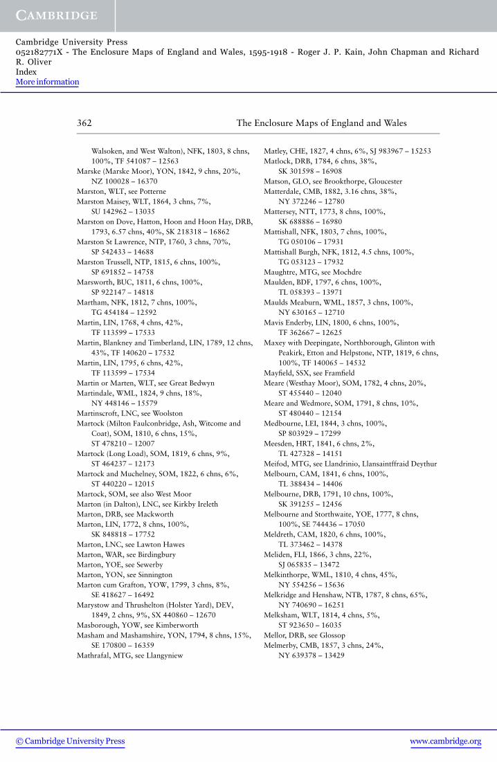
362 The Enclosure Maps of England and Wales
Walsoken, and West Walton), NFK, 1803, 8 chns,100%, TF 541087 – 12563
Marske (Marske Moor), YON, 1842, 9 chns, 20%,NZ 100028 – 16370
Marston, WLT, see PotterneMarston Maisey, WLT, 1864, 3 chns, 7%,
SU 142962 – 13035Marston on Dove, Hatton, Hoon and Hoon Hay, DRB,
1793, 6.57 chns, 40%, SK 218318 – 16862Marston St Lawrence, NTP, 1760, 3 chns, 70%,
SP 542433 – 14688Marston Trussell, NTP, 1815, 6 chns, 100%,
SP 691852 – 14758Marsworth, BUC, 1811, 6 chns, 100%,
SP 922147 – 14818Martham, NFK, 1812, 7 chns, 100%,
TG 454184 – 12592Martin, LIN, 1768, 4 chns, 42%,
TF 113599 – 17533Martin, Blankney and Timberland, LIN, 1789, 12 chns,
43%, TF 140620 – 17532Martin, LIN, 1795, 6 chns, 42%,
TF 113599 – 17534Martin or Marten, WLT, see Great BedwynMartindale, WML, 1824, 9 chns, 18%,
NY 448146 – 15579Martinscroft, LNC, see WoolstonMartock (Milton Faulconbridge, Ash, Witcome and
Coat), SOM, 1810, 6 chns, 15%,ST 478210 – 12007
Martock (Long Load), SOM, 1819, 6 chns, 9%,ST 464237 – 12173
Martock and Muchelney, SOM, 1822, 6 chns, 6%,ST 440220 – 12015
Martock, SOM, see also West MoorMarton (in Dalton), LNC, see Kirkby IrelethMarton, DRB, see MackworthMarton, LIN, 1772, 8 chns, 100%,
SK 848818 – 17752Marton, LNC, see Lawton HawesMarton, WAR, see BirdingburyMarton, YOE, see SewerbyMarton, YON, see SinningtonMarton cum Grafton, YOW, 1799, 3 chns, 8%,
SE 418627 – 16492Marystow and Thrushelton (Holster Yard), DEV,
1849, 2 chns, 9%, SX 440860 – 12670Masborough, YOW, see KimberworthMasham and Mashamshire, YON, 1794, 8 chns, 15%,
SE 170800 – 16359Mathrafal, MTG, see Llangyniew
Matley, CHE, 1827, 4 chns, 6%, SJ 983967 – 15253Matlock, DRB, 1784, 6 chns, 38%,
SK 301598 – 16908Matson, GLO, see Brookthorpe, GloucesterMatterdale, CMB, 1882, 3.16 chns, 38%,
NY 372246 – 12780Mattersey, NTT, 1773, 8 chns, 100%,
SK 688886 – 16980Mattishall, NFK, 1803, 7 chns, 100%,
TG 050106 – 17931Mattishall Burgh, NFK, 1812, 4.5 chns, 100%,
TG 053123 – 17932Maughtre, MTG, see MochdreMaulden, BDF, 1797, 6 chns, 100%,
TL 058393 – 13971Maulds Meaburn, WML, 1857, 3 chns, 100%,
NY 630165 – 12710Mavis Enderby, LIN, 1800, 6 chns, 100%,
TF 362667 – 12625Maxey with Deepingate, Northborough, Glinton with
Peakirk, Etton and Helpstone, NTP, 1819, 6 chns,100%, TF 140065 – 14532
Mayfield, SSX, see FramfieldMeare (Westhay Moor), SOM, 1782, 4 chns, 20%,
ST 455440 – 12040Meare and Wedmore, SOM, 1791, 8 chns, 10%,
ST 480440 – 12154Medbourne, LEI, 1844, 3 chns, 100%,
SP 803929 – 17299Meesden, HRT, 1841, 6 chns, 2%,
TL 427328 – 14151Meifod, MTG, see Llandrinio, Llansaintffraid DeythurMelbourn, CAM, 1841, 6 chns, 100%,
TL 388434 – 14406Melbourne, DRB, 1791, 10 chns, 100%,
SK 391255 – 12456Melbourne and Storthwaite, YOE, 1777, 8 chns,
100%, SE 744436 – 17050Meldreth, CAM, 1820, 6 chns, 100%,
TL 373462 – 14378Meliden, FLI, 1866, 3 chns, 22%,
SJ 065835 – 13472Melkinthorpe, WML, 1810, 4 chns, 45%,
NY 554256 – 15636Melkridge and Henshaw, NTB, 1787, 8 chns, 65%,
NY 740690 – 16251Melksham, WLT, 1814, 4 chns, 5%,
ST 923650 – 16035Mellor, DRB, see GlossopMelmerby, CMB, 1857, 3 chns, 24%,
NY 639378 – 13429
www.cambridge.org© Cambridge University Press
Cambridge University Press052182771X - The Enclosure Maps of England and Wales, 1595-1918 - Roger J. P. Kain, John Chapman and RichardR. OliverIndexMore information

Index of places with extant enclosure maps 363
Melmerby, YON, see Hutton ConyersMelsonby, YON, 1820, 6 chns, 18%,
NZ 191072 – 16330Meltham, YOW, 1832, 6 chns, 100%,
SE 092101 – 16657Melton, YOE, 1773, 8 chns, 100%,
SE 971259 – 16309Melton Parva, NFK, see Little MeltonMembury, DEV, 1815, 4 chns, 7%,
ST 281018 – 11949Menston (Menston Moor), YOW, 1822, 6 chns, 20%,
SE 158438 – 16503Mentmore (Ledburn Green), BUC, 1839, 7 chns, 6%,
SP 908212 – 14842Menutton, SHR, see ClunMeole Brace or Brace Meole (Pulley), SHR, 1801,
3 chns, 2%, SJ 486088 – 15320Meonstoke, HMP, 1863, 3 chns, 33%,
SU 636190 – 13484Mepal, CAM, 1851, 3 chns, 26%,
TL 442814 – 13317Meppershall, BDF, 1846, 3 chns, 100%,
TL 142374 – 12754Mere, WLT, 1821, 6 chns, 100%, ST 808323 –
15976Merthyr Cynog, BRE, 1862, 3 chns, 3%,
SO 016359 – 13204Merton, LIN, see MartinMerton, SUR, 1816, 4 chns, 5%,
TQ 243687 – 13896Messingham, LIN, 1804, 16 chns, 85%,
SE 875043 – 12558Metheringham, LIN, 1779, 12 chns, 100%,
TF 085625 – 11881Metheringham, LIN, see also DunstonMethley, YOW, 1787, 9 chns, 100%,
SE 390262 – 16512Methwold, NFK, 1806, 6.67 chns, 65%,
TL 725950 – 18065Methwold and Southery, NFK, 1848, 2 & 6 chns, 3%,
TL 621946 – 13586–7Methwold (Queens Ground), NFK, 1850, 3 chns, 3%,
TL 679929 – 12938Mettingham and Bungay Holy Trinity, SFK, 1817,
8 chns: Mettingham 100%; Bungay Holy Trinity,about 20%, TM 360900 – 17427
Metton, NFK, see FelbriggMexbrough, YOW, 1860, 3 chns, 8%,
SE 473003 – 13339Meysey Hampton, GLO, 1779, 3 chns, 100%,
SP 120005 – 14988
Michaelchurch Esceley and Peterchurch (UrishayCommon), HRE, 1855, 3 chns, 3%,SO 313376 – 13018
Mickleby, YON, see LytheMickleover, DRB, 1790, 6 chns, 100%,
SK 306352 – 16868Mickleton, HMP, see LongparishMid Lavant, SSX, 1849, 3 chns, 2%,
SU 855072 – 13190Middle, SHR, see MyddleMiddle Barton, OXF, see Westcott BartonMiddlehope, DRH, see Stanhope Park QuarterMiddle Littleton, WOR, see North LittletonMiddle Rasen, LIN, 1774, 8 chns, 100%,
TF 092892 – 17776Middle Rasen, LIN, see Lissinglea FieldMiddle Rawcliffe, LNC, see Out RawcliffeMiddleton and Youlgreave, DRB, 1818, 6 chns, 36%,
SK 180632 – 16884Middleton, ESX, 1840, 3 chns, 29%,
TL 876396 – 14079Middleton, NFK, 1816, 8 chns, 100%,
TF 662159 – 17927Middleton, NTP, see Cottingham, RockinghamMiddleton by Wirksworth, DRB, 1836, 2 chns, 50%,
SK 272554 – 16936Middleton Cheney, NTP, 1770, 3 chns, 85%,
SP 508413 – 14693Middleton-in-Teesdale, DRH, 1817, 16 chns, 69%,
NY 960290 – 16286Middleton-in-Teesdale, DRH, 1841, 16 chns, 69%,
NY 960290 – 16284Middleton-on-the-Wolds, YOE, 1803, 8 chns, 100%,
SE 930490 – 17083Middleton Tyas, YON, 1709, 4 chns, 7%,
NZ 219047 – 16444Middleton Tyas, YON, 1726, 4 chns, 4%,
NZ 213052 – 16443Middle Tysoe, WAR, see TysoeMiddlewood Moor, DRH, see EshMiddlezoy, SOM, 1800, 4 chns, 100%,
ST 370330 – 12065Middlezoy, SOM, see also Westonzoyland, MiddlezoyMidgham, BRK, 1815, 6 chns, 100%,
SU 558672 – 14620Milborne Port, SOM, 1817, 6 chns, 100%,
ST 668200 – 12048Milbourne, SUR, see EsherMilbourne, WLT, see CharltonMilburn, WML, 1855, 3 chns, 2%,
NY 668307 – 13095
www.cambridge.org© Cambridge University Press
Cambridge University Press052182771X - The Enclosure Maps of England and Wales, 1595-1918 - Roger J. P. Kain, John Chapman and RichardR. OliverIndexMore information

364 The Enclosure Maps of England and Wales
Mildenhall [‘upland’], SFK, 1812, 3 chns, 35%,TL 700760 – 17378
Mildenhall, WLT, see Collingbourn KingstonMileham, NFK, 1814, 6 chns, 100%,
TF 918187 – 17919Mill Meece, STF, see KnightleyMillbrook, BDF, 1803, 6 chns, 100%,
TL 014385 – 13972Millbrook (Hill and Shirley), HMP, 1832, 6 chns, 31%,
SU 406138 – 14655Millington, YOE, 1768, 16 chns, 100%,
SE 837541 – 17025Millom, CMB, 1824, 8 chns, 25%,
SD 185825 – 15732Milton, BRK, 1810, 5 chns, 100%, SU 485915 –
12383Milton, CAM, 1802, 6 chns, 100%,
TL 478631 – 14328Milton (Ashley), HMP, 1860, 3 chns, 39%,
SZ 256957 – 13746Milton (Bashley or Baleoxly or Ballorly), HMP, 1817,
6 chns, 4%, SZ 243972 – 14647Milton, HMP, see ChristchurchMilton, NTT, see Markham ClintonMilton [in Adderbury], OXF, 1768, 3 chns, 100%,
SP 448347 – 14239Milton, SOM, see KewstokeMilton Abbot (Ramsdown Common and Liddaton
Down Common), DEV, 1818, 6 chns, 9%,SX 427801 – 11937
Milton Abbot, DEV, see TavistockMilton Bryan, BDF, 1794, 6 chns, 100%,
SP 975304 – 13973Milton Ernest, BDF, 1803, 6 chns, 100%,
TL 021561 – 13974Milton Faulconbridge, SOM, see MartockMilton Lilbourne, WLT, 1778, 6 chns, 13%,
SU 193590 – 16022Milton Malsor and Collingtree, NTP, 1780, 6 chns,
100%, SP 740560 – 14712Milton under Wychwood, OXF, 1846, 3 chns, 100%,
SP 258173 – 12824Milverton, SOM, 1833, 4 chns, 6%,
ST 117257 – 12014Milverton, WAR, 1805, 6 chns, 100%,
SP 308672 – 15881Milwich, STF, 1787, 9 chns, 18%,
SJ 982342 – 16138Minera, DEN, 1768, 1 chn, 1%,
SJ 269520 – 15394Minera, DEN, see also Wrexham
Minety, WLT, 1813, 6 chns, 100%,SU 023913 – 16034
Minskip, YOW, 1839, 6 chns, 100%,SE 387643 – 16493
Minsterworth (Minsterworth Ham), GLO, 1782,3 chns, 12%, SO 801169 – 14985
Minsterworth, GLO, 1864, 3 chns, 6%,SO 789177 – 13198
Minsterworth, GLO, 1869, 3 chns, 95%,SO 789171 – 12778
Mintlyn, NFK, see GaywoodMirfield, YOW, 1806, 3 chns, 15%,
SE 193216 – 16730Miserden or Miserdine, GLO, 1824, 6 chns, 100%,
SO 921093 – 14986Mitchel Troy, MON, see TrellechMitton, LNC, see ChippingMochdre, MTG, 1810, 12 chns, 48%,
SO 063864 – 15542Mochnant, MTG, see Llanraiadr-ym-MochnantMoggerhanger, BDF, see BlunhamMold (Yr Wyddgrug), FLI, 1800, 8 chns, 20%,
SH 220590 – 15339Molescroft or Molscroft, YOE, 1803, 8 chns, 100%,
TA 025411 – 17074Molesworth, HNT, 1799, 6 chns, 100%,
TL 072770 – 14492Monk Coniston, LNC, see HawksheadMonk Fryston, YOW, 1793, 6 chns, 100%,
SE 513300 – 16521Monk Sherborne, HMP, 1832, 6 chns, 6%,
SU 614568 – 14653Monk Soham, SFK, 1855, 3 chns, 2%,
TM 207662 – 13139Monks Risborough, BUC, 1839, 6 chns, 100%,
SP 814049 – 14832Monkton Deverill, WLT, see Longbridge DeverillMonxton, HMP, 1808, 8 chns, 100%,
SU 311435 – 14557Monyash, DRB, 1776, 15 chns, 45%,
SK 150670 – 16895Moor, WOR, see HillMoorby cum Wilksby, LIN, 1773, 6 chns, 100%,
TF 291634 – 17597Moorby, LIN, see also Wildmore FenMoore, CHE, 1819, 3 chns, 17%,
SJ 573851 – 15234Moorgate, NTT, see ClarboroughMoorhouse, NTT, see LaxtonMoorlinch, SOM, 1800, 4 chns, 43%,
ST 398368 – 12070
www.cambridge.org© Cambridge University Press
Cambridge University Press052182771X - The Enclosure Maps of England and Wales, 1595-1918 - Roger J. P. Kain, John Chapman and RichardR. OliverIndexMore information

Index of places with extant enclosure maps 365
Moor Monkton, YOW, 1787, 8 chns, 60%,SE 511561 – 16469
Moor Place, BRK, see ShinfieldMoorsom (Moorsom Moor), YON, 1862, 3 chns,
14%, NZ 689127 – 13672Morcott, RUT, 1841, 6 chns, 100%,
SK 920010 – 17302More Critchell, DOR, see Cranborne ChaseMoresby (Moresby Moss), CMB, 1763, 5 chns, 25%,
NY 002202 – 15669Morestead, HMP, 1854, 3 chns, 7%,
SU 407260 – 13628Moreton, SHR, see KnockinMoreton STF, see GnosallMoreton, STF, see HanburyMoreton Baggot, WAR, see Morton BagotMoreton-in-Marsh, GLO, 1821, 6 chns, 100%,
SP 210318 – 14987Moreton Say (Smithey Moor or Smythemoor), SHR,
1826, 4 chns, 1%, SJ 620331 – 15314Moreton Say, SHR, see also PreesMoreton Valence, Standish and Putloe, GLO, 1823,
6 chns, 45%, SO 783092 – 14989Morfa Bychan, CRN, 1823, 6 chns, 5%,
SH 545370 – 15566Morland, WML, 1799, 4 chns, 100%,
NY 605225 – 15589Morley and Smalley, DRB, 1784, 8 chns, 100%,
SK 402429 – 12433Morley (Morley St Botolph and Morley St Peter), NFK,
1815, 6 chns, 100%, TM 066991 – 17977Morley, YOW, 1821, 3 chns, 4%,
SE 269276 – 16658Morton, LIN, 1771, 8 chns, 100%,
TF 117238 – 17708Morton, NFK, see HockeringMorton and Fiskerton, NTT, 1841, 6 chns, 100%,
SK 729512 – 17186Morton, YOW, see RiddlesdenMorton Bagot, WAR, 1807, 3 chns, 8%,
SP 098633 – 15920Morton Carr, LIN, 1801, 16 chns, 100%,
SK 805935 – 18143Moss and Kirk Bramwith, YOW, 1783, 6 chns, 100%,
SE 608133 – 16716Mosser, CMB, 1864, 3.16 chns, 35%,
NY 126239 – 13376Mosterton, DOR, 1853, 3 chns, 5%,
ST 455052 – 13134Mottram St Andrew, CHE, 1850, 3 chns, 8%,
SJ 882783 – 13602
Moulsoe, BUC, 1802, 6 chns, 100%,SP 908417 – 14810
Moulton, LIN, 1803, 12 chns, 100%,TF 305235 – 17477
Moulton and Fosdyke, LIN, 1879, 6 chns, 4%,TF 334324 – 17475
Moulton, NFK, see Great MoultonMoulton, SFK, 1841, 9 chns, 100%,
TL 691648 – 17400Moulton St Mary, NFK, see BeightonMucclestone or Muxton (Gravenhunger), SHR, 1867,
2 chns, 1%, SJ 737426 – 13013Much Birch and Little Birch, HRE, 1824, 3 chns, 8%,
SO 323506 – 15171Much Cowarne, HRE, 1823, 8 chns, 100%,
SO 627472 – 15158Muchelney, SOM, see MartockMuch Marcle, HRE, 1799, 6 chns, ? 100%,
SO 653332 – 15148Much Wenlock (Westwood Common), SHR, 1814,
6 chns, 9%, SJ 624001 – 15273Much Wenlock (Farley Common), SHR, 1818, 3 chns,
1%, SJ 634025 – 15348Much Woolton, LNC, see ChildwallMuker (Muker & Kisdon Pastures), YON, 1832,
4 chns, 50%, SD 900970 – 16277Muker (Angram Pasture and Sleddale Pasture), YON,
1840, 4 chns, 5%, SD 883995 – 16280Mumby, LIN, see HogsthorpeMundford and Colveston, NFK, 1844, 3 chns, 7%,
TL 942806 – 17935Mundham, NFK, see SeethingMungrisdale, CMB, 1892, 3.16 chns, 8%,
NY 368291 – 12847–8Munslow, SHR, see CondoverMurcott, NTP, see WatfordMurcott, OXF, see FencottMursley, BUC, 1819, 7 chns, 100%,
SP 819290 – 14824Mutford, SFK, see BarnbyMuxton, SHR, see MucclestoneMyddle, SHR, 1813, 6 chns, 6%,
SJ 467236 – 15271Myfod, MTG, see Guilsfield, Llansaintffraid DeythurMytton, SHR, see FitzNacton, SFK, see Trimley St MaryNafford and Birlingham, WOR, 1774, 6 chns, 100%,
SO 933430 – 15105Nannerch, DEN & FLI, see YsceifiogNantcwnlle, CRD, 1851, 3 chns, 13%,
SN 587621 – 13603
www.cambridge.org© Cambridge University Press
Cambridge University Press052182771X - The Enclosure Maps of England and Wales, 1595-1918 - Roger J. P. Kain, John Chapman and RichardR. OliverIndexMore information

366 The Enclosure Maps of England and Wales
Nantglyn, DEN, 1852, 3 chns, 55%,SH 967578 – 12718
Nantmel and Llanfihangel-Helygan (Iscoed), RAD,1863, 3 chns, 47%, SO 055643 – 13453
Nantmel and St Harmon (Ywchcoed), RAD, 1865,3 chns, 12%, SN 955720 – 12919
Nantmel (Rhysllyn), RAD, 1869, 3 chns, 17%,SO 030660 – 13501
Nantmel, RAD, see also St HarmonNantwich (Barony), CHE, 1866, 1 chn, 5%,
SJ 656529 – 13466Naseby, NTP, 1823, 6 chns, 100%,
SP 690780 – 14763Nash, BUC, see Whaddon, ChaseNassington, Yarwell, Apethorpe and Woodnewton,
NTP, 1778, 10 chns, 100%, TL 060960 – 14701Nassington and Woodnewton, NTP, 1782, 6 chns,
10%, TL 053968 – 14905Navenby, LIN, 1771, 9 chns, 100%,
SK 984578 – 17537Navestock and Loft Hall (Wendon Lofts), ESX, 1770,
6 chns, 13%, TQ 541956 – 14052Navestock, ESX, see also Hainault ForestNawton (Nawton Pasture), YON, 1787, 4 chns, 23%,
SE 647871 – 16415Nawton, YON, see WombletonNayland, SFK, see Stoke next NaylandNazeing, ESX, 1858, 3 chns, 11%,
TL 378064 – 12720Neat Enstone, OXF, see EnstoneNeatishead, NFK, 1811, 6 chns, 100%,
TG 338198 – 17976Necton or Neighton, NFK, 1817, 9 chns, 100%,
TF 890100 – 17978Needingworth, HNT, see HolywellNeedwood Forest, STF, 1805, 9 chns, 100%,
SK 160230 – 16147Neen Savage, SHR, 1812, 3 chns, 1%,
SO 672767 – 15360Nefyn, Pistyll, Carrigcweli, Llanaelhaearn, Clynnog
and Llanllyfni, CRN, 1817, 6 chns, 25%,SH 420470 – 15560
Neithrop, OXF, 1759, 3 chns, 30%,SP 442411 – 14243
Nene Outfall, LIN & NFK, 1836/47/62/67/73 &1911/18/27, 5, 6.45, 10 & 20 chns, 100%,TF 505220 – 17481–88
Neroche Forest (in Ilminster, Ashill, Broadway,Donyatt, Bickenhall, Hatch Beauchamp, BeerCrocombe and Buckland St Mary), SOM, 1833,8 chns, 100%, ST 300165 – 12020
Netheravon or Netherhaven, WLT, 1790, 9 chns,100%, SU 125480 – 15810
Netherby, YOW, see Kirkby OverblowNethercott and Tackley, OXF, 1873, 6 chns, 100%,
SP 486201 – 14260Nether Denton, CMB, see Upper DentonNether Hallam, see Upper HallamNether Hampen, Shipton Sollers and Shipton
Olliffe, GLO, 1792, 8 chns, 100%, SP 045192 –15005
Netherhampton, WLT, see WiltonNether Kellet, LNC, 1815, 8 chns, 27%,
SD 528681 – 15432Nether Silton or Silton Pannoll, YON, 1796, 5 chns,
34%, SE 468939 – 16445Nether Staveley, WML, see Strickland KettleNether Tean, STF, see CheckleyNetherthong, YOW, 1829, 4 chns, 35%,
SE 123093 – 16687Nethertown, STF, see Barton-under-NeedwoodNether Wasdale, CMB, 1808, 18 chns, 60%,
NY 190090 – 15790Nether Whitacre, WAR, 1835, 6 chns, 100%,
SP 230926 – 15941Nether Wyersdale (Barniker Moor), LNC, 1772,
3.88 chns, 10%, SD 531479 – 15428Netteswell, ESX, 1848, 3 & 6 chns, 100%,
TL 452080 – 13118–9Nettleham, LIN, 1777, 12 chns, 100%,
TF 004752 – 12596Nettleton, LIN, 1794, 12 chns, 100%,
TF 115989 – 17621Nettleton, WLT, 1814, 4 chns, 27%,
ST 827787 – 15988Netton, WLT, see Great DurnfordNevin, CRN, see NefynNew Alresford, HMP, 1807, 4.7 chns, 100%,
SU 584324 – 14556Newall, YOW, see OtleyNewark, NTP, see PeterboroughNewark-on-Trent, NTT, 1803, 6 chns, 50%,
SK 810548 – 17209Newball (Newbold Common), LIN, 1859, 3 chns, 5%,
TF 085755 – 11848Newbiggin Moor (in Newbiggin and Milburn), WML,
1849, 3 & 4 chns, (Newbiggin 100%,Milburn 7%), NY 652293 – 13574–6
Newbiggin, CMB, see Great and Little StaintonNewbold, DRB, 1839, 6 chns, 100%,
SK 369736 – 16937Newbold-on-Stour, WOR, see Tredington
www.cambridge.org© Cambridge University Press
Cambridge University Press052182771X - The Enclosure Maps of England and Wales, 1595-1918 - Roger J. P. Kain, John Chapman and RichardR. OliverIndexMore information

Index of places with extant enclosure maps 367
Newborough (Brown Moor or Hawden Field), NTB,1821, 8 chns, 13%, NY 839702 – 16211
Newborough and Peterborough Fen (Borough Fen),NTP, 1821, 12 chns, 9%, TF 218060 – 12414
Newborough with Thorny Lanes, STF, 1811, 9 chns,100%, SK 130254 – 16152
Newbury, BRK, 1849, 3 chns, 23%,SU 465665 – 12885
Newbury, BRK, 1855, 2 chns, 20%,SU 457641 – 13716
Newby (Newby High Moor and Low Moor), WML,1816, 5 chns, 41%, NY 570190 – 15596
Newholm cum Dunsley, YON, 1803, 8 chns, 36%,NZ 858099 – 16438
New Hutton, WML, see ManserghNewland, YOE, see EastringtonNewlands and Whittonstall (Newlands and
Whittonstall Common), NTB, 1819, 8 chns, 36%,NZ 059561 – 12499
Newlyn (Cargoll Common: in St Newlyn East), CNW,1844, 3 chns, 1%, SW 827541 – 11985
Newmarket and Cwm, FLI, 1821, 6 chns, 10%,SJ 079782 – 15347
Newmarket St Mary, SFK, 1821, 3 chns, 100%,TL 639634 – 17386
Newnham, NTP, 1765, 6 chns, 100%,SP 585603 – 14690
Newport (Newport Marsh), SHR, 1766, 4 chns, 20%,SJ 753186 – 15363
Newport Pagnell (Port Field), BUC, 1795, 3 chns, 27%,SP 868435 – 14680
Newport Pagnell, BUC, 1808, 6 chns, 40%,SP 896433 – 14675
Newport, ESX, 1858, 3 chns, 55%,TL 515342 – 13643
New Radnor, RAD, 1814, 8 chns, 46%,SO 202618 – 15576
Newsham, YOE, 1841, 4 chns, 100%,SE 189717 – 16441
Newsham, YON, 1778, 12 chns, 53%,NZ 080082 – 16426
New Sleaford and Holdingham, LIN, 1795, 9 chns,100%, TF 065466 – 17548
Newsome, YOE, see NewshamNewton Blossomville, BUC, 1813, 6 chns, 100%,
SP 922512 – 12427Newton Carr, CHE, see WallaseyNewton in the Thistles, STF, see Newton RegisNewton le Willows, YON, see Thornton StewardNewton Longville, BUC, 1841, 6 chns, 100%,
SP 848314 – 14846
Newton near Kingsley, CHE, see KingsleyNewton Nottage, GLA, 1862, 3 chns, 25%,
SS 838782 – 12953Newton, CAM, 1849, 3 chns, 8%,
TF 410135 – 12910–11–12Newton, CAM, 1851, 3 chns, 100%,
TL 437494 – 13540Newton, LIN, 1768, 8 chns, 97%,
TF 054363 – 17538Newton, LNC, 1804, 4 chns, 20%,
SD 882006 – 15425Newton, LNC, see WhittingtonNewton, NTB, see Great Shildon CommonNewton Regis and Clifton Campville (Newton Regis or
Newton in the Thistles and Clifton Heath), STF,1797, 8 chns, 31%, SK 278083 – 16120
Newton St Faith, NFK, see HorsfordNewton upon Ouse and Shipton, YON, 1815, 6 chns,
26%, SE 518605 – 16390Newton Valence, HMP, 1849, 3 & 12 chns, 100%,
SU 710337 – 13712–13Newtown, MTG, 1806, 12 chns, 30%,
SO 119904 – 15522Newtown Linford, LEI, see Charnwood ForestNew Windsor, BRK, see Windsor ForestNicholforest, CMB, 1761, 6 chns, 92%,
NY 447755 – 15777Nicholforest, CMB, 1810, 8 chns, 21%,
NY 475780 – 15763Nicholforest, CMB, 1835, 4 chns, 6%,
NY 500780 – 15774Ninehead, SOM, see Taunton DeaneNiton, IOW, 1856, 3 chns, 34%,
SZ 505767 – 13516–17Noke, OXF, 1829, 6 chns, 16%,
SP 542135 – 14255Noneley, SHR, 1818, 1 chn, 1%,
SJ 487279 – 15274Norbury, CHE, 1794, 4 chns, 15%,
SJ 556485 – 15247Norbury, CHE, 1826, 2 chns, 8%,
SJ 918862 – 15237Norbury (Norbury Hill), SHR, 1849, 3 & 6 chns, 90%,
SO 363921 – 13296–7Norley, CHE, see KingsleyNormacot (Lightwood Common), STF, 1794, 5 chns,
1%, SJ 929409 – 16140Normanby, YON, 1811, 4.5 chns, 7%,
NZ 552166 – 16317Normanby-by-Spital, LIN, 1791, 13 chns, 100%,
SK 999882 – 17832
www.cambridge.org© Cambridge University Press
Cambridge University Press052182771X - The Enclosure Maps of England and Wales, 1595-1918 - Roger J. P. Kain, John Chapman and RichardR. OliverIndexMore information

368 The Enclosure Maps of England and Wales
Normanton, DRB, 1770, 5 chns, 100%,SK 348334 – 16852
Normanton, LEI, see BottesfordNormanton, LIN, 1756, 10 chns, 100%,
SK 963468 – 17833Normanton, NTT, see SouthwellNormanton on Soar, NTT, 1771, 9 chns, 100%,
SK 526240 – 17259Normanton on Trent, NTT, 1802, 9 chns, 100%,
SK 793688 – 17187Normanton and Woodhouse, YOW, 1810, 6 chns,
100%, SE 387222 – 16555Norney, NTT, see StyrrupNorthampton (St Giles and St Sepulchre), NTP, 1779,
4 chns, 85%, SP 764609 – 14718Northaw, HRT, 1806, 6 chns, 100%,
TL 290027 – 12369North Baddesley, HMP, 1866, 3 chns, 100%,
SU 400207 – 12709North Bedburn, DRH, see Witton le WearNorth Bierley (Wibsey Slack and Low Moor
Commons), YOW, 1889, 2 chns, 12%,SE 158289 – 13413
North Bradley and Southwick, WLT, 1806, 6 chns,22%, ST 840551 – 16030
North Bradon, SOM, see West MoorNorthborough, NTP, see MaxeyNorth Burton, YOE, see Cherry BurtonNorth Chailey (Waningore), SSX, 1842, 3 chns, 1%,
TQ 387215 – 14460Northchurch, HRT, see Berkhamstead
St MaryNorth Cliffe, YOE, 1801, 6 chns, 40%,
SE 859373 – 17147North Collingham, NTT, 1790, 7.5 chns, 100%,
SK 836618 – 17160North Cotes, LIN, 1857, 3 chns, 100%,
TA 361016 – 11837Northcott, DEV, 1837, 3 chns, 35%,
SX 348929 – 11909Northcourt, BRK, 1841, 6 chns, 13%,
SU 507988 – 14894North Cove, SFK, see ElloughNorth Creake, NFK, 1812, 9 chns, 100%,
TF 843383 – 17868North Crossland, YOW, see LockwoodNorth Curry, SOM, see West Sedge MoorNorth Curry, Stoke St Gregory and West Hatch, SOM,
1800, 4 chns, 15%, ST 326276 – 12058North Dalton, YOE, 1779, 8 chns, 100%,
SE 929522 – 17051
North Deighton, YOW, 1785, 6 chns, 35%,SE 394512 – 16507
North Elmham, NFK, 1831, 7 chns, 100%,TF 982218 – 17879
North Ferriby, Swanland, Kirk Ella, West Ella andWillerby, YOE, 1837, 6 chns, 100%,SE 998273 – 17103
North Frodingham, YOE, 1880, 8 chns, 100%,TA 103523 – 17069
North Hayling, HMP, 1840, 4 chns, 15%,SU 723038 – 14662
North Hayling, HMP, 1867, 3 chns, 16%,SU 722026 – 14661
North Hayling, HMP, 1876, 4 chns, 15%,SU 722026 – 14664
North Hayling, HMP, see also HavantNorth Kelsey, LIN, 1840, 12 chns, 100%,
TA 040011 – 12622North Kelsey, LIN, see Caistor MoorNorth Killingholme and South Killingholme, LIN,
1779, 8 chns, 100%, TA 153172 – 17619North Kyme, LIN, see RuskingtonNorthleach, GLO, see EastingtonNorth Leverton with Habblesthorpe, NTT, 1795,
6 chns, 100%, SK 793821 – 17165North Littleton, Middle Littleton and South
Littleton, WOR, 1814, 6 chns, 100%,SP 090465 – 15072
North Lopham, NFK, 1815, 9 chns, 100%,TM 042827 – 17903
North Luffenham, RUT, 1881, 3 chns, 93%,SK 941034 – 12872
North Molton (Eastern and Western Commons), DEV,1850, 4 chns, 10%, SS 742358 – 13255
North Molton (North Radworthy, North Hey, HeadyPark and Shortcoome Common), DEV, 1850,4 chns, 3%, SS 767347 – 13267
North Molton (Span Common), DEV, 1851, 4 chns,1%, SS 731353 – 13100
North Moreton, BRK, 1847, 3 chns, 100%,SU 560902 – 13637
Northmoor, OXF, 1843, 6 chns, 100%,SP 142027 – 14212
North Muskham, Holme and Bathley, NTT, 1773,12 chns, 100%, SK 793595 – 12646
North Newbald and South Newbald, YOE, 1778,8 chns, 100%, SE 922373 – 16459
North Newnton, WLT, 1839, 6 chns, 18%,SU 126572 – 16069
North Nibley, GLO, 1864, 3 chns, 70%,ST 741955 – 13451
www.cambridge.org© Cambridge University Press
Cambridge University Press052182771X - The Enclosure Maps of England and Wales, 1595-1918 - Roger J. P. Kain, John Chapman and RichardR. OliverIndexMore information

Index of places with extant enclosure maps 369
Northolt, MDX, 1835, 4.5 chns, 100%,TQ 128842 – 13787
Northover, SOM, 1839, 3 chns, 40%,ST 523236 – 12104
Northowram, YOW, 1779, 4 chns, 15%,SE 094301 – 16621
North Perrott, SOM, 1804, 9 chns, 15%,ST 469109 – 12074
North Petherton, SOM, 1798, 8 chns, 15%,ST 324310 – 12042
North Petherwin (Langdon Moor), DEV, 1859, 3 chns,1%, SX 302905 – 13064
North Pickenham, NFK, see Great FranshamNorth Piddle, WOR, 1830, 6 chns, 100%,
SO 968545 – 15118North Rauceby and South Rauceby, LIN, 1790,
12 chns, 100%, TF 018463 – 17543North Runcton and Setchey, NFK, 1839, 6 chns, 100%,
TF 644157 – 17989North Somercotes, LIN, 1842, 6 chns, 100%,
TF 410970 – 17642North Stoke and South Stoke (Stoke Rochford),
LIN, 1796, 6 chns, 100%,SK 281918 – 17550
North Stoke and Ipsden, OXF, 1856, 6 chns, 33%,SU 624862 – 14259
North Tawton (Itton Moor), DEV, 1850, 3 chns, 12%,SS 687003 – 13535
North Thoresby, LIN, 1846, 6 chns, 100%,TF 305987 – 11875
North Walsham, NFK, 1814, 8 chns, 100%,TG 281298 – 18107
North Weald Bassett, ESX, 1857, 3 chns, 17%,TL 489042 – 12656
North Wheatley, NTT, 1840, 8 chns, 100%,SK 758869 – 17226
North Witham, LIN, see GunbyNorthwold (Cottage Fen), NFK, 1851, 3 chns, 2%,
TL 715985 – 13154Northwold, NFK, 1798, 9 chns, 100%,
TL 735975 – 17951Northwood, GLO, see Westbury-on-SevernNorthwood, HRE, see PembridgeNorth Wootton, SOM, see PiltonNortoft, NTP, see GuilsboroughNorton, DRB, 1815, 16 chns, 65%, SK 364817 – 16919Norton, GLO, 1807, 6 chns, 100%,
SO 856244 – 14990Norton, GLO, see also SandhurstNorton, HRT, 1796, 12 chns, 100%,
TL 225346 – 14122
Norton, RAD, 1865, 3 chns, 22%, SO 288678 – 13460Norton, SFK, see Great AshfieldNorton, WOR, see Bredon’s NortonNorton and Lenchwick, WOR, 1765, 6 chns, 30%,
SO 032472 – 15106Norton, YOW, see AskernNorton Bavant, WLT, 1809, 8 chns, 80%,
SU 918443 – 15973Norton Bavant, WLT, see BishopstrowNorton Canes or Norton under Cannock (Cannock
Chase), STF, 1868, 2 chns, 22%,SK 028078 – 12665
Norton in Hales, SHR, 1822, 5 chns, 100%,SJ 698392 – 12522
Norton in the Clay or Norton-le-Clay, YON, 1791,6 chns, 100%, SE 399708 – 16351
Norton juxta Kempsey, WOR, 1836, 2 chns, 3%,SO 872505 – 15097–8
Norton juxta Kempsey, WOR, 1852, 2 chns, 4%,SO 881499 – 13350–1
Norton Lindsey or Upper Norton, WAR, 1809, 6 chns,100%, SP 233629 – 15908
Norton Subcourse and Heckingham, NFK, 1822,6 chns, 100%, TM 402992 – 17980
Norwell, Norwell Woodhouse and Willoughby, NTT,1832, 6 chns, 100%, SK 760621 – 17189
Notgrove, GLO, 1771, 6.5 chns, 100%,SP 110200 – 14995
Nottingham (St Mary), NTT, 1846, 1 chn, 1%,SK 567399 – 17188
Nottingham (St Mary; West Croft and Burton Lees),NTT, 1848, 1 chn, 2%, SK 574392 – 17190
Nottingham (St Mary, St Nicholas, and St Peter), NTT,1865, 3 chns, 58%, SK 573408 – 17252
Nowton, SFK, 1828, 5.5 chns, 100%,TL 862610 – 17396
Nuneaton and Stockingford, WAR, 1817, 9 chns, 12%,SP 334918 – 15918
Nursteed, WLT, see Bishops CanningsNutbourne, SSX, see WestbourneNuthurst (Mannings Heath and Monks Common),
SSX, 1869, 3 chns, 1%, TQ 202279 – 13502Nutley, HMP, see Preston CandoverNutwith and Roomer Common (in Masham), YON,
1836, 8 chns, 100%, SE 223780 – 16335Nyetimber Common, SSX, see West ChiltingtonNylands with Batcombe (Badcombe), SOM, 1793,
4 chns, 47%, ST 450497 – 12083Oakeley, SHR, see Lydbury NorthOakham, RUT, 1836, 12 chns, 100%,
SK 853082 – 17301
www.cambridge.org© Cambridge University Press
Cambridge University Press052182771X - The Enclosure Maps of England and Wales, 1595-1918 - Roger J. P. Kain, John Chapman and RichardR. OliverIndexMore information

370 The Enclosure Maps of England and Wales
Oakington, CAM, 1834, 6 chns, 100%,TL 406643 – 14393
Oakley, BDF, 1804, 6 chns, 100%,TL 011540 – 12368
Oakley, BUC, 1821, 6 chns, 100%,SP 642112 – 14841
Oakley, SFK, see BromeOakworth (Oakworth Common), YOW, 1854, 3 chns,
10%, SE 994382 – 13309Oare, SOM, 1862, 3 chns, 100%,
SS 810450 – 12688Oare, WLT, see WilcotOathall, SSX, see WivelsfieldObley, SHR, 1849, 3 chns, 23%,
SO 326790 – 13548–9Ockbrook, DRB, 1773, 9 chns, 100%,
SK 423359 – 16855Ockham, SUR, 1869, 3 chns, 17%,
TQ 085575 – 13503Octon, YOE, see ThwingOddington, GLO, 1787, 6 chns, 100%,
SP 224254 – 14991Oddington, OXF, see Charlton-on-OtmoorOdstock, WLT, 1787, 9 chns, 100%,
SU 137247 – 15806Offley, HRT, see Great OffleyOfford Cluny, HNT, 1800, 6 chns, 100%,
TL 229673 – 14494Offord D’Arcy, HNT, 1811, 9 chns, 100%,
TL 228658 – 14509Ogbourne St George, WLT, 1794, 6 chns, 57%,
SU 202742 – 15824Ogley Hay, STF, 1839, 4 chns, 76%,
SK 062062 – 16186Okeford Fitzpaine (Belchelwell – Knackers Hole),
DOR, 1854, 2 chns, 2%, ST 784115 –12267
Okehampton (Barton Barn Estate), DEV, 1850, 3 chns,3%, SX 601955 – 13295
Old Arley, WAR, see ArleyOld Bolingbroke, LIN, 1800, 6 chns, 100%,
TF 350650 – 12624Oldbury on the Hill, GLO, see DidmartonOldcoats, NTT, see StyrrupOldham, LNC, 1804, 3 chns, 11%,
SD 925050 – 12544Old Hurst (and part of Woodhurst), HNT, 1803,
6 chns, 100%, TL 300770 – 14498Old Hutton,WML, see ManserghOld Leake, LIN, 1813, 12 chns, 100%,
TF 396516 – 17459
Old Malton, YON, 1805, 8 chns, 100%,SE 797738 – 16389
Old Radnor, RAD, 1869, 3 chns, 17%,SO 206588 – 13248
Old Sodbury and Little Sodbury, GLO, 1792, 6 chns,18%, ST 760820 – 15107
Old Stratford, WAR, see RowingtonOld Weston, HNT, 1843, 6 chns, 100%,
TL 097778 – 14530Old Windsor, BRK, see Windsor ForestOllerset, DRB, see GlossopOllerton, NTT, 1779, 9 chns, 100%,
SK 660679 – 12645Olveston, GLO, 1844, 4 chns, 4%,
ST 601873 – 14998Olveston, GLO, see also AlvestonOmbersley, WOR, 1827, 6 chns, 100%,
SO 840640 – 15073Onslow, SHR, see St Chad and St AlkmondOrby, LIN, 1838, 4 chns, 13%,
TF 483672 – 17654Orchard Portman, SOM, see Taunton DeaneOrcop, HRE, 1826, 6 chns, 11%,
SO 473262 – 15161Ordsall, NTT, 1813, 6 chns, 100%,
SK 709798 – 17216Oreton (Oreton Common), SHR, 1850, 3 chns, 31%,
SO 650799 – 13026Orford and Gedgrave, SFK, 1880, 3 chns, 1%,
TM 416507 – 13701Orgreave, YOW, 1871?, 6 chns, 6%,
SK 422869 – 17356Orleton, HRE, 1819, 6 chns, 16%,
SO 469686 – 15173Orlingbury, NTP, 1811, 6 chns, 100%,
SP 851721 – 14748Ormesby St Andrew, NFK, see Ormesby St MargaretOrmesby St Margaret, Ormesby St Michael, Ormesby
St Peter and Ormesby St Andrew, and Scratbyotherwise Scroteby, NFK, 1845, 6 chns, 100%,TG 493147 – 18081
Ormesby St Michael, NFK, see Ormesby St MargaretOrmesby St Peter, NFK, see Ormesby St MargaretOrsett, ESX, 1837, 4 chns, 6%,
TQ 627832 – 12359Orsett (Orsett Heath), ESX, 1837, 1 chn, 1%,
TQ 642799 – 12360Orsett (Strincocks Fen), ESX, 1837, 1 chn, 1%,
TQ 634844 – 12361Orston and Thoroton, NTT, 1796, 12 chns, 100%,
SK 774411 – 16995
www.cambridge.org© Cambridge University Press
Cambridge University Press052182771X - The Enclosure Maps of England and Wales, 1595-1918 - Roger J. P. Kain, John Chapman and RichardR. OliverIndexMore information

Index of places with extant enclosure maps 371
Orton, STF, see WombourneOrton, WML, 1779, 4 chns, 20%,
NY 640070 – 15582Orton Waterville, HNT, see Cherry OrtonOrwell, CAM, 1837, 6 chns, 100%,
TL 360496 – 14400Osbaldwick, YON, 1772, 4 chns, 36%,
SE 637519 – 16437Osbournby and Mickling Meadow, LIN, 1796, 6 chns,
100%, TF 074378 – 17540Oseby, LIN, see HaydorOsgathorpe, LEI, 1786, 7 chns, 100%,
SK 432197 – 12583Osgodby, LIN, see Kirkby-cum-OsgodbyOsgodby, YOE, 1819, 6 chns, 100%,
SE 649342 – 17091Osmondeston, NFK, see ScoleOsmotherley, and lands in Ulverston and Mansriggs,
LNC, 1860, 3 chns, 40%, SD 277811 – 12881Ossett, YOW, 1813, 3 chns, 19%,
SE 279208 – 16558Ossington (Wadnall Field), NTT, 1845, 3 chns, 2%,
SK 766668 – 17254Oswaldtwistle, LNC, 1774, 7.45 chns, 53%,
SD 735250 – 15426Oswestry (Aston or Aston Abbots), SHR, 1789, 8 chns,
2%, SJ 330287 – 15261Oswestry (Llanforda, Treferclawd, Cynynion, and
Pentregaer), SHR, 1808, 9 chns, 7%,SJ 255300 – 15411
Oswestry (Sweeney and Weston), SHR, 1811, 10 chns,2%, SJ 287269 – 15351
Oswestry and Llanymynech (Crickheath, Llwyntidmanand Treprenal), SHR, 1814, 6 chns, 2%,SJ 280230 – 15547
Oswestry (Trefloch, Trefonnen and Soughtin), SHR,1821, 6 chns, 5%, SJ 260250 – 15419
Oswestry, SHR, see also KnockinOthery, SOM, 1799, 8 chns, 52%,
ST 389325 – 12075Otley and Newall cum Clifton, YOW, 1783, 8 chns,
100%, SE 202453 – 16473Otmoor, OXF, 1829, 7.5 chns, 100%,
SP 372144 – 14206Otten Belchamp, ESX, see Belchamp OttenOtterbourne (Common Meadow), HMP, 1837, 2 chns,
4%, SU 463218 – 14663Otterford, SOM, see Taunton DeaneOtterhampton, SOM, see CanningtonOulton, CMB, 1835, 3 chns, 53%, NY 226524 –
15736
Oulton and Wood Dalling, NFK, 1823, 6 chns, 48%,TG 148280 – 17924
Oulton, SFK, see Carlton Colville, LowestoftOulton, YOW, see RothwellOundle with Ashton, NTP, 1810, 6 chns, 66%,
TL 040885 – 14744Ousby, CMB, 1861, 3 chns, 21%,
NY 652357 – 12810Ousden, SFK, 1816, 9 chns, 100%,
TL 737594 – 17380Ousefleet, YOW, 1832, 9 chns, 100%,
SE 835225 – 16610Out Newton, YOE, 1756, 9 chns, 100%,
TA 382218 – 17016Out Rawcliffe and Middle Rawcliffe and Stalmine with
Stainall, LNC, 1833, 8 chns, 28%,SD 409448 – 15469
Outwell, CAM, 1843, 3 chns, 18%,TF 496036 – 14428
Over, CAM, 1841, 6 chns, 100%,TL 383712 – 14425
Over Haddon, DRB, see BakewellOver Kellet, LNC, 1803, 9 chns, 31%,
SD 547707 – 15443Over Staveley, WML, 1851, 3 & 4 chns, 100%,
NY 474017 – 12861–2Overton, FLI, 1873, 2 chns, 1%, SJ 388407 – 12964Over Whitacre, WAR, 1822, 3 chns, 9%,
SP 250918 – 15968Overy, OXF, see DorchesterOving (Portfield and Guildenfield), SSX, 1848, 3 chns,
6%, SU 876049 – 13699–13700Ovingham, Bywell St Peter and Bywell St Andrew
(Firelemay and Apperley Commons), NTB, 1817,4 chns, 2%, NZ 041567 – 16222
Ovingham, Bywell St Peter and Bywell St Andrew(Mickley, Apperley and Broomley Commons),NTB, 1816, 4 chns, 7%, NZ 064594 – 16223
Ovingham, NTB, see also Great Shildon CommonOvington, NFK, 1801, 6 chns, 100%,
TF 928032 – 17928Owermoigne, DOR, 1846, 12 chns, 40%,
ST 769860 – 12303Owmby [near Spital], LIN, 1774, 6 chns, 100%,
SK 997872 – 17622Owmby [near Brigg], LIN, 1795, 8 chns, 100%,
TA 080051 – 12626Owselbury, HMP, 1859, 3 chns, 13%,
SU 520230 – 12728Owston (Owston Ferry), LIN, 1791, 6 chns, 6%,
SE 798007 – 18208
www.cambridge.org© Cambridge University Press
Cambridge University Press052182771X - The Enclosure Maps of England and Wales, 1595-1918 - Roger J. P. Kain, John Chapman and RichardR. OliverIndexMore information

372 The Enclosure Maps of England and Wales
Owston Ferry, LIN, see EpworthOwthorne, YOE, 1812, 4 chns, 100%,
TA 335280 – 17089Oxenbourne, HMP, see East MeonOxenhope, YOW, 1774, 9 chns, 47%,
SE 022332 – 16620Oxford St Giles, OXF, 1832, 6 chns, 100%,
SP 510084 – 14208Oxford St Thomas (Botley Meadow, Oatlands and
Osney Meadow), OXF, 1849, 3 chns, 25%,SP 499060 – 13364
Oxhill, WAR, 1802, 6 chns, 100%,SP 318458 – 15919
Oxon, SHR, see St Chad, ShrewsburyOxspring, YOW, 1831, 6 chns, 100%,
SE 268029 – 17353Oxton, NTT, 1850, 3 chns, 31%,
SK 621532 – 13664Packwood, WAR, 1817, 6 chns, 15%,
SP 165735 – 15909Padbury, BUC, 1795, 7 chns, 100%,
SP 722305 – 14678Padworth, BRK, see Beenham, WoolhamptonPaghill, YOE, see PaullPaignton (Yalberton Tor), DEV, 1860, 3 chns, 1%,
SX 868592 – 13135Paington, DEV, see PaigntonPakefield, SFK, see GislehamPakenham, SFK, 1804, 7.5 chns, 100%,
TL 924687 – 17373Palgrave, NFK, see SporlePalgrave, SFK, 1812, 6 chns, 13%,
TM 112792 – 17453Palling next the Sea, NFK, see HempsteadPamber, HMP, 1827, 6 chns, 100%,
SU 618600 – 14651Pamington, GLO, see AshchurchPampisford, CAM, 1799, 6 chns, 100%,
TL 502482 – 14329Pannal, YOW, see Forest of KnaresboroughPapcastle, CMB, see DovenbyPapworth Everard, CAM, 1818, 9 chns, 100%,
TL 288623 – 14386Parkham (Ash Moor), DEV, 1849, 3 chns, 3%,
SS 360203 – 13706Parkhurst Forest, IOW, 1815, 10 chns, 100%,
SZ 475905 – 12424Parracombe (Parracombe Common), DEV, 1858,
3 chns, 21%, SS 682445 – 12669Parton and Micklethwaite, CMB, 1819, 4 chns, 20%,
NY 281503 – 15762
Passenham (Wicken Common), NTP, 1859, 3 chns,3%, SP 747411 – 13722
Passenham (Potterspury and Yardley GobionCommon), NTP, 1860, 3 chns, 5%,SP 747420 – 13523
Passenham and Denshanger, NTP, 1860, 3 chns, 3%,SP 751405 – 13736
Paston, NFK, see WittonPatrington, YOE, 1769, 10 chns, 100%,
TA 313223 – 17024Patshull, STF, see PattinghamPatterdale, WML, see HartsopPattingham and Patshull, STF, 1811, 7.5 chns, 100%,
SO 815995 – 16122Pattiswick, ESX, 1824, 6 chns, 100%,
TL 815241 – 14070Paul (Brewinney Common), CNW, 1841, 3 chns, 2%,
SW 458269 – 11973Paulerspury and Heathencote, NTP, 1820, 6 chns,
100%, SP 720464 – 14762Paulerspury, NTP, see also WhittleburyPaull or Paghill, YOE, 1822, 8 chns, 50%,
TA 200240 – 17096Paxford, WOR, see BlockleyPeakirk, NTP, see MaxeyPebworth, GLO, 1814, 6 chns, 77%,
SP 130470 – 15117Peckham (North and South Common Fields), SUR,
1830, 3 chns, 5%, TQ 343776 – 13844Pecome, SSX, see PyecombePeggs Green, LEI, see WhitwickPembrey, CRM, see KidwellyPembridge (Northwood Common), HRE, 1783, 4 chns,
2%, SO 534592 – 15163Pembridge (Moseley Common), HRE, 1862, 3 chns,
1%, SO 379581 – 12968Pembridge, HRE, 1862, 3 chns, 1%,
SO 392581 – 13150Penallt, MON, see TrellechPenboyr, CRM, see LlangellerPencarreg, CRM, 1852, 3 chns, 26%,
SN 593435 – 12655Pendine, CRM, 1864, 2 chns, 33%,
SN 231082 – 13494Pendock, WOR, 1843, 6 chns, 14%,
SO 788331 – 15102Pendoylen, GLA, see TalyvanPenge, SUR, 1812, 4 chns, 1%,
TQ 348698 – 13832Penge, SUR, 1837, 4 chns, 100%,
TQ 348701 – 12572
www.cambridge.org© Cambridge University Press
Cambridge University Press052182771X - The Enclosure Maps of England and Wales, 1595-1918 - Roger J. P. Kain, John Chapman and RichardR. OliverIndexMore information

Index of places with extant enclosure maps 373
Penistone, YOW, 1826, 6 chns, 100%,SE 245015 – 16604
Penketh (Greystone Heath and Doe Green), LNC,1866, 3 chns, 10%, SJ 568879 – 13236
Penkridge, Cannock and Berkswich, and Teddesley orTeddesley Hay, STF, 1827, 6 chns, 60%,SJ 940150 – 16129
Penkridge (Whiston: Beacon Hill Common), STF,1862, 2 & 9 chns, 5%, SJ 895135 – 13144–5
Penley, FLI, 1790, 6 chns, 4%,SJ 414401 – 15335
Penllyn, GLA, 1858, 3 chns, 100%,SS 979767 – 12751
Penmorfa, CRN, see Traeth Mawr SandsPenn (Down Wood), BUC, 1850, 3 & 4 chns, 100%,
SU 920940 – 12744–5Pennant (Mochnant: Castellmoch and
Garthgelynen-fawr townships), MTG, 1835,8 chns, 100%, SJ 077283 – 15551
Pennington, LNC, 1827, 12 chns, 100%,SD 260780 – 15468
Penrhose, CRN, see AberdaronPenrith, Lazonby and Hesket in the Forest, CMB,
1871, 2 chns, 1%, NY 498333 – 15745Penrith, CMB, see also Inglewood ForestPenselwood, WLT, see KilmingtonPensham, WOR, 1812, 6 chns, 100%,
SO 943440 – 15067Pensnett Chace, STF, see KingswinfordPenstrowed and Llandinam, MTG, 1826, 6 chns, 33%,
SO 011910 – 15534Pentney, NFK, 1809, 6 chns, 100%,
TF 722133 – 17930Pentregaer, SHR, see OswestryPentrehodry, SHR, see ClunPentridge, DOR, see Cranborne ChasePentrobin, FLI, see HawardenPeopleton, WOR, 1841, 6 chns, 100%,
SO 949509 – 15084Perlogue, see ClunPerranzabuloe, CNW, 1864, 3 chns, 3%,
SW 773521 – 13374Perranzabuloe, CNW, see also CallestockPerry Barr, STF, see HandsworthPertenhall, BDF, 1799, 6 chns, 100%,
TL 088653 – 13979Peterborough and Boroughbury, and Dogsthorpe,
Eastfield and Newark, NTP, 1821, 6 chns, 100%,TF 198001 – 14533–4
Peterchurch, HRE, 1839, 3 chns, 1%,SO 340390 – 15176
Peterchurch, HRE, see also Michaelchurch EsceleyPetersfield (Petersfield Heath), HMP, 1857, 2 chns, 1%,
SU 743236 – 12969Pewsey, WLT, 1775, 8 chns, 44%, SU 168589 – 15797Phillack (Towans Common), CNW, 1855, 3 chns, 4%,
SW 562388 – 11975Phoside, DRB, see GlossopPickering and Newton, YON, 1790, 12 chns, 55%,
SE 799919 – 16355Piddington, BUC, see Salcey ForestPiddlehinton, DOR, 1835, 6 chns, 46%,
SY 714972 – 12245Piddletrenthide, DOR, 1817, 6 chns, 100%,
SY 709996 – 12259Pilham, LIN, see BlytonPilleth, RAD, 1815, 16 chns, 42%, SO 257697 – 12503Pilling, LNC, 1867, 3 chns, 19%, SD 441448 – 15470Pilton and North Wotton (Queen or Little Sedgemoor),
SOM, 1796, 4 chns, 12%, ST 538413 – 12060Pilton, DEV, 1845, 4 chns, 100%,
SS 555347 – 11990Pilton, RUT, 1846, 3 chns, 100%,
SK 903030 – 12993Pimperne, DOR, 1812, 8 chns, 100%,
ST 899097 – 12229Pimperne, DOR, see also Cranborne ChasePinchbeck, LIN, see Deeping FenPinkney or Sherston Parva, WLT, 1844, 3 chns, 12%,
ST 866873 – 16076Pipe and Lyde, HRE, 1861, 3 chns, 1%,
SO 494449 – 13147Pirton, HRT, 1818, 6 chns, 100%,
TL 149317 – 14131Pistill, CRN, see NefynPitfold, SUR, see FrenshamPitmead, WLT, see BishopstrowPitminster, SOM, see Taunton DeanePitney or Pitney Lortie, SOM, 1807, 6 chns, 100%,
ST 445289 – 12063Pitstone, BUC, 1854, 3 chns, 100%,
SP 947149 – 13647Pitton and Farley, WLT, 1819, 9 chns, 65%,
SU 220310 – 15985Playden, SSX, see Rye HarbourPleasley, DRB, see LangwithPlenmeller (Plenmeller Common), NTB, 1863, 3 chns,
62%, NY 727611 – 12713Plumley, CHE, 1801, 6 chns, 9%,
SJ 731748 – 15232Plumtree and Clipston, NTT, 1807, 12 chns, 100%,
SK 620337 – 17213
www.cambridge.org© Cambridge University Press
Cambridge University Press052182771X - The Enclosure Maps of England and Wales, 1595-1918 - Roger J. P. Kain, John Chapman and RichardR. OliverIndexMore information

374 The Enclosure Maps of England and Wales
Plungar, LEI, see BarstonPlush, DOR, 1825, 6 chns, 25%,
ST 715024 – 12233Podington, BDF, 1765, 3 chns, 78%,
SP 949620 – 13980Pointon (Pointon Common Fen and Cow Pasture),
LIN, 1791, 6 chns, 32%, TF 146316 – 17782Polesworth (Waberton or Warton), WAR, 1772, 6 chns,
20%, SK 282037 – 15883Poling, SSX, 1812, 8 chns, 30%, TQ 042046 – 14455Polstead, SFK, see Stoke next NaylandPolstead, SUR, see Guildford St NicholasPonsonby, CMB, 1852, 3 and 4 chns, 40%,
NY 056056 – 13544Pontefract (Carlton, East Hardwick, Knottingley,
Pontefract, Spittle Hardwick, Tanshelf), YOW,1800, 6 chns, 100%, SE 467220 – 16531
Pontesbury, SHR, 1848, 4 chns, 1%,SJ 395052 – 15316
Pontesford, SHR, 1828, 9 chns, 1%,SJ 411051 – 15315
Pool (Lower, Middle, and Upper), Castle Caereinionand Berriew (Stredal-fedan and Trehelig), MTG,1812, 6 chns, 1%, SJ 216034 – 15502
Pool (Upper, Middle and Lower Pool), Cletterwood,Buttington and Trewern, MTG, 1816, 6 chns,12%, SJ 249088 – 15543
Pool, YOW, 1774, 4 chns, 50%,SE 234444 – 16788
Pool Lower (Llanerchydol), MTG, 1810, 6 chns, 23%,SJ 202078 – 15515
Poolton cum Seacombe, CHE, WallaseyPoringland, NFK, see East PoringlandPorlock, SOM, 1864, 3 chns, 40%,
SS 845450 – 12730Portbury, SOM, 1806, 6 chns, 14%,
ST 498751 – 12136Portfield, SSX, see OvingPortishead, SOM, 1822, 5 chns, 100%,
ST 467759 – 12000Porton, WLT, see IdmistonPortsea (Beeston and Pitcroft Fields), HMP, 1822,
4 chns, 6%, SU 655013 – 14568Portslade, SSX, 1859, 3 chns, 26%,
TQ 243091 – 12947Postling, KNT, 1850, 3 chns, 4%,
TR 147385 – 13157Postwick, NFK, see Great PlumsteadPotcote, NTP, see Cold HighamPotterhanworth, LIN, 1775, 10 chns, 100%,
TF 070670 – 17775
Potter Heigham, NFK, 1806, 6 chns, 100%,TG 418197 – 12523
Potterne and Marston, WLT, 1835, 6 chns, 25%(Potterne 2%, Marston 100%),ST 968566 – 16060
Potternewton and Harehills, YOW, 1806, 6 chns, 8%,SE 309364 – 16632
Potterspury, NTP, see PassenhamPotterspury, Yardley Gobion and Cosgrave, NTP,
1776, 6 chns, 85%, SP 761438 – 14738Potton, BDF, 1775, 4 & 6 chns, 100%,
TL 230496 – 13981–3Poulton, GLO, 1796, 8 chns, 100%,
SP 107013 – 15000Poulton and Bispham (Thornton Marsh), LNC, 1806,
6 chns, 19%, SD 331422 – 15442Poulton, WLT, see Collingbourne KingstonPowerstock, DOR, 1812, 8 chns, 8%,
SY 535986 – 12254Powerstock, DOR, 1861, 3 chns, 10%,
SY 541955 – 13485Prees, Darlestone, Fauls, Winkley, Willaston, Moreton
Say and Stanton upon Hineheath, SHR, 1801,6 chns, 11%, SJ 600340 – 15260
Prees (Whixall Moss), SHR, 1821, 8 chns, 6%,SJ 492358 – 15283
Preston and Sutton Poyntz, DOR, 1798, 7 chns, 57%,SY 699830 – 12227
Preston, GLO, 1770, 3 chns, 100%,SP 047011 – 14992
Preston, YOE, 1774, 8 chns, 100%,TA 178307 – 17048
Preston Candover (Preston Oakholt or PrestonOakhills), HMP, 1867, 3 chns, 6%,SU 638437 – 13193
Preston Candover and Nutley, HMP, 1823, 6 chns,82%, SU 613414 – 14570
Preston Patrick, WML, 1814, 6 chns, 39%,SD 564847 – 15608
Prestwick Carr, NTB, 1856, 3 chns, 100%,NZ 190738 – 12826–7
Priestcliffe, DRB, see TaddingtonPriest Weston (Weston Hill and Rudge Hill), SHR,
1871, 3 chns, 2%, SO 298978 – 13570Princes Risborough, BUC, 1823, 6 chns, 100%,
SP 815015 – 14825Prinsted, SSX, see WestbournePriors Ditton, SHR, see Ditton PriorsPrudhoe (Rise Moor, Mickley Moor and Prudhoe
Lane), NTB, 1778, 6 chns, 54%,NZ 103603 – 16217
www.cambridge.org© Cambridge University Press
Cambridge University Press052182771X - The Enclosure Maps of England and Wales, 1595-1918 - Roger J. P. Kain, John Chapman and RichardR. OliverIndexMore information

Index of places with extant enclosure maps 375
Puckington, SOM, see West MoorPudlicot, OXF, see ShorthamptonPudsey, YOW, 1820, 4 chns, 15%,
SE 224333 – 16645Pulborough (North Heath), SSX, 1815, 3 chns, 5%,
TQ 064210 – 14290Pulborough (Nutbourne Common), SSX, 1851, 3 chns,
3%, TQ 072176 – 13280Pulborough (Pithington or Pithingdean Marsh),
SSX, 1856, 3 chns, 1%, TQ 033208 –13096
Pulham St Mary the Virgin and Pulham St MaryMagdalen [Pulham Market], NFK, 1840, 6 chns,100%, TM 204864 – 17981
Pulley, SHR, see Meole BracePulloxhill, BDF, see FlittonPuriton, SOM, 1798, 4 chns, 15%,
ST 308411 – 12086Puriton, WLT, see PurtonPurley, BRK, 1853, 3 chns, 35%,
SU 654765 – 13211Purston Jaglin, YOW, 1811, 6 chns, 100%,
SE 436199 – 16589Purton or Puriton, WLT, 1737, 6 chns, 15%,
SU 070874 – 16023Putloe, GLO, see Moreton ValencePuttenham, HRT, 1816, 6 chns, 100%,
SP 888147 – 14139Puxton, SOM, see CongresburyPyecombe, SSX, 1870, 3 chns, 13%,
TQ 285135 – 13257Pyrford, Woking and Chertsey (Pyrford and
Woodham), SUR, 1804, 9 chns, 20%,TQ 025607 – 13850
Pyrton, OXF, 1849, 2 chns, 13%,SU 698949 – 13281
Quadring and Quadring Hundred, LIN, 1776, 6 chns,100%, TF 213324 – 12634, 17794
Quainton, BUC, 1841, 6 chns, 34%,SP 748192 – 14833
Quarndon, DRB, 1816, 4 chns, 12%,SK 335411 – 12516
Quarnford, STF, see AlstonefieldQuarrington, LIN, 1794, 9 chns, 100%,
TF 059442 – 17549Quatford, SHR, see WorfieldQuedgeley, GLO, 1839, 6 chns, 13%,
SO 810140 – 14997Quedgeley, GLO, see also BrookthorpeQueenborough (Queenborough Common), KNT,
1855, 3 chns, 90%, TQ 912723 – 13214
Queen Camel, SOM, 1795, 6 chns, 100%,ST 590252 – 12106
Queenhill, WOR, 1807, 6 chns, 100%,SO 855370 – 15066
Queen Sedgemoor or Little Sedgemoor, SOM, see PiltonQueniborough, LEI, 1794, 2.5 chns, 1%,
SK 667117 – 17300Quernmore, LNC, 1817, 9 chns, 35%,
SD 518608 – 15455Quick (Denshaw Moor), YOW, 1812, 3 chns, 3%,
SD 990120 – 16637Quidhampton, WLT, see Fugglestone St PeterQuinton, BUC, see Salcey ForestQuinton, NTP, 1817, 6 chns, 100%,
SP 779541 – 14759Rackham, SSX, 1828, 6 chns, 90%,
TQ 050132 – 14299Rackheath, NFK, 1801, 8 chns, 100%,
TG 278138 – 17988Radcliffe and Ainsworth, LNC, 1812, 4 chns, 9%,
SD 768103 – 15449Radcliffe on Trent, NTT, 1790, 9 chns, 100%,
SK 657390 – 16991Radford, NTT, see LentonRadley, NTT, see SouthwellRadnage, BUC, 1858, 3 chns, 18%,
SU 782968 – 13745Radnor Forest, RAD, see Llanvihangel nant MelanRadway, WAR, 1756, 6.4 chns, 100%,
SP 369487 – 16048Radwell, BDF, see FelmershamRagnall, NTT, see Dunham on TrentRainton, YON, see Hutton ConyersRaithby, LIN, 1777, 6 chns, 100%, TF 374673 – 17603Rampisham, DOR, 1817, 6 chns, 100%,
ST 555025 – 12257Rampton, CAM, 1852, 6 chns, 100%,
TL 424684 – 14408Rampton, NTT, 1845, 6 chns, 100%,
SK 799783 – 17218Ramsbury, WLT, 1778, 3 chns, 11%,
SU 272718 – 15799Ramsdean, HMP, see East MeonRamsden, OXF, 1859, 3 chns, 57%,
SP 347151 – 13478Ramsden Bellhouse, ESX, 1856, 3 chns, 6%,
TQ 701962 – 13274Ramsey (Herne and Gore Commons), HNT, 1796,
3 chns, 3%, TL 252886 – 14535Ramsey, HNT, 1844, 6 chns, 2%,
TL 296870 – 14526
www.cambridge.org© Cambridge University Press
Cambridge University Press052182771X - The Enclosure Maps of England and Wales, 1595-1918 - Roger J. P. Kain, John Chapman and RichardR. OliverIndexMore information

376 The Enclosure Maps of England and Wales
Rangeworthy, GLO, 1813, 6 chns, 100%,ST 690860 – 12425
Ranskill, NTT, 1803, 6 chns, 100%,SK 657879 – 17212
Ratby, LEI, see Charnwood ForestRaunds, NTP, 1798, 6 chns, 100%,
TL 006736 – 14720Ravensden, BDF, 1816, 6 chns, 100%,
TL 070550 – 13984Ravensmoor, CHE, 1837, 6 chns, 35%,
SJ 621522 – 15243Ravensthorpe, NTP, 1795, 10 chns, 100%,
SP 668704 – 14702Ravensworth, Kirkby Ravensworth, and Whashton,
YON, 1778, 10 chns, 100%,NZ 142062 – 16404
Rawcliffe, YOW, 1854, 6 chns, 8%,SE 683225 – 16694
Rawcliffe, YOW, see SnaithRawmarsh, YOW, 1780, 6 chns, 100%,
SE 441968 – 16485Rawreth and Wickford (Rawreth Shot), ESX, 1854,
2 chns, 1%, TQ 774933 – 13020Reach, BDF, see HeathReagill, WML, 1813, 6 chns, 37%,
NY 591167 – 15581Rearsby, LEI, 1762, 4 chns, 100%,
SK 653142 – 17262Redgrave and Botesdale, SFK, 1817, 4.5 chns, 16%,
TM 048775 – 17454Redmile [with small part of Belvoir], LEI, 1795,
10 chns, 100%, SK 795355 – 17304Redmire and Preston (Redmire Pasture, Redmire Moor
and Preston Moor: in Wensley parish), YON,1819, 8 chns, 58%, SE 058931 – 16372
Rednal, SHR, see West FeltonRedwick, MON, 1851, 2 chns, 13%,
ST 399836 – 12757Redwick, Willcrick, Magor, Undy, Bishton, Llandenny
in St Brides and Green Moor (Magor le GreenMoor), MON, 1854, 2 chns, 9%,ST 399861 – 12833
Reed, HRT, see BarkwayReedham, NFK, see FreethorpeReepham (Reepham Moor), LIN, 1864, 2 chns, 1%,
TF 056742 – 11840Reighton or Righton, YOE, 1820, 8 chns, 100%,
TA 130750 – 17092Relith, SHR, see MainstoneRempstone, NTT, 1769, 9 chns, 100%,
SK 580245 – 16983
Renwick, CMB, 1818, 10 chns, 70%,NY 613453 – 15724
Renwick, CMB, 1863, 3.16 chns, 100%,NY 610450 – 12692
Rettendon, ESX, 1861, 3 chns, 6%,TQ 763982 – 13344
Revesby, LIN, see Wildmore FenReydon, SFK, 1800, 8 chns, 19%,
TM 501777 – 17430Rhayader, RAD, 1829, 3 chns, 100%,
SN 972682 – 15575Rhos-y-garth, CRD, 1859, 3 chns, 9%,
SN 636726 – 13136Rhuddlan and St Asaph, FLI, 1815, 5 chns, 9%,
SJ 008780 – 15344Rhyl Marsh, FLI, 1836, 3 chns, 45%,
SJ 006812 – 15408Rhysllyn, RAD, see NantmelRibbleton and Brockholes, LNC, 1862, 3 chns, 4%,
SD 567312 – 13194Ribchester, LNC, see ChippingRiccall, YOE, 1881, 3 chns, 40%,
SE 621378 – 13684Rickinghall Superior and Rickinghall Inferior, SFK,
1819, 9 chns, 100%, TM 040740 – 17426Rickling, ESX, 1843, 6 chns, 25%,
TL 505312 – 14080Rickmansworth (Batchworth Heath, Lockhill Wood),
HRT, 1858, 3 chns, 1%, TQ 073920 – 13164–65Riddlesden or Morton or Riddlesden with Morton,
YOW, 1790, 8 chns, 80%, SE 097443 – 16624Ridgeway, DOR, see UpweyRidgmont, BDF, 1797, 6 chns, 100%,
SP 976373 – 13985Righton, YOE, see ReightonRimswell, YOE, 1822, 1.5 chns, 5%,
TA 304294 – 17017Ringmer (The Broyle Park), SSX, 1771, 6 chns, 35%,
TQ 473139 – 14447Ringstead, NTP, 1841, 6 chns, 100%,
SP 986749 – 14906Ringwood, HMP, 1860, 6 chns, 100%,
SU 156038 – 14561Ringwood and Harbridge (Ashley Heath), HMP, 1867,
3 chns, 16%, SU 120060 – 12674Ripley, SUR, see SendRipley, YOW, see Forest of KnaresboroughRiplingham, YOE, 1802, 8 chns, 100%,
SE 966322 – 17078Ripon, Littlethorpe and Bondgate, YOW, 1744, 4 chns,
26%, SE 314704 – 16410
www.cambridge.org© Cambridge University Press
Cambridge University Press052182771X - The Enclosure Maps of England and Wales, 1595-1918 - Roger J. P. Kain, John Chapman and RichardR. OliverIndexMore information

Index of places with extant enclosure maps 377
Ripon and Whitcliffe with Littlethorpe, YOW, 1857,2 chns, 45%, SE 314711 – 16797
Rippingale and Kirkby Underwood, LIN, 1806,12 chns, 100%, TF 108282 – 17789
Ripple, WOR, 1808, 9 chns, 100%,SO 872395 – 15061
Ripple, WOR, see Upton upon SevernRisby, SFK, 1802, 6 chns, 100%, TL 798669 –
17370Riselip, MDX, see RuislipRisley, BDF, 1796, 6 chns, 100%, TL 040630 –
13986Road, SOM, see RodeRoade and Ashton, NTP, 1816, 6 chns, 100%,
SP 763512 – 14800Rochester (Rochester Common), NTB, 1866,
3.16 chns, 2%, NY 841989 – 16237Rochester (Elishaw Common), NTB, 1870, 3.16 chns,
1%, NY 860955 – 13397Rock (Alton Common, Buckeridge Common), WOR,
1822, 6 chns, 10%, SO 734739 – 15089Rockbeare, DEV, 1848, 3 chns, 40%,
SY 045940 – 13431Rockcliffe, CMB, 1815, 10 chns, 40%,
NY 370620 – 15772Rockhampton, GLO, 1839, 3 chns, 14%,
ST 640940 – 14999Rockingham, Corby, Cottingham cum Middleton,
Great Oakley and Gretton (Rockingham Forest),NTP, 1837, 6 chns, 40%, SP 880910 – 12418
Rockingham Forest, NTP, see RockinghamRockland St Mary, NFK, 1812, 6 chns, 100%,
TG 323047 – 17984Rodbourne Cheney (Haydon, Haydon Wick and
Morden), WLT, 1820, 6 chns, 50%,SU 130882 – 16010
Rode and North Bradley (Road Common), SOM &WLT, 1792, 6 chns, 14%, ST 817549 – 12119
Rodley, GLO, see Westbury-on-SevernRodney Stoke (Stoke Moor and Draycott Moor), SOM,
1793, 4 chns, 28%, ST 465495 – 12064Rodney Stoke, SOM, 1821, 6 chns, 100%,
ST 482504 – 12056Roecliffe, YOW, 1841, 8 chns, 100%,
SE 370650 – 16702Rogate (Wenham), SSX, 1825, 8 chns, 25%,
SU 794257 – 14292Rogate, SSX, 1856, 3 chns, 17%,
SU 807258 – 13449Rogate (Rogate Bohunt), SSX, 1870, 4 chns, 4%,
SU 817300 – 14450
Rogiett and Llanvihangel-juxta-Rogiett (Rogiett andMinutes Commons), MON, 1853, 3 chns, 4%,ST 448891 – 13578
Rogiett, MON, see CaldicotRollesby, NFK, 1816, 6 chns, 100%,
TG 449159 – 17985Rolleston on Dove, Ansllow and Callingwood, STF,
1807, 18 chns, 100%, SK 215265 – 16154Rolston, YOE, 1859, 6 chns, 100%,
TA 210450 – 17131Romaldkirk, YON, 1826, 6 chns, 50%,
NY 882262 – 16357Romsey (Romsey Extra), HMP, 1807–8, 8 chns, 67%,
SU 470207 – 14555Romsley, WOR, 1858, 2 chns, 19%,
SO 958796 – 13166Roos, YOE, 1784, 10 chns, 100%,
TA 287308 – 17053Ropsley, Great Humby and Little Humby, LIN, 1796,
9 chns, 100%, SK 990340 – 17542Roseash (Ash Moor), DEV, 1866, 3 chns, 9%,
SS 804203 – 13468Ross-on-Wye and Walford (Aylmarsh and Coughton
Marsh), HRE, 1860, 2 chns, 1%,SU 818249 – 12981
Rostherne, CHE, 1795, 2.9 chns, 5%,SJ 742837 – 15325
Rothbury (Chirnells Common), NTB, 1809, 3 chns,1%, NU 041032 – 16214
Rothbury (Rothbury Forest), NTB, 1834, 8 chns, 15%,NU 075040 – 16256
Rothbury, NTB, see also ThroptonRotherfield Greys, OXF, 1858, 3 chns, 5%,
SU 762819 – 13133Rothersthorpe, NTP, 1810, 6 chns, 100%,
SP 717572 – 14752Rotherwick, HMP, 1857, 3 chns, 10%,
ST 719564 – 13627Rothley Plain, LEI, see Charnwood ForestRothwell or Rowell, NTP, 1819, 12 chns, 90%,
SP 822810 – 14755Rothwell (Rothwell Haigh), YOW, 1793, 4 chns, 31%,
SE 335290 – 16770Rothwell, Oulton, Woodlesford, YOW, 1818, 2 chns,
17%, SE 357288 – 16591Rougham, SFK, 1813, 6 chns, 100%,
TL 912633 – 17385Roughey, SSX, see HorshamRoughton, LIN, see Haltham, Wildmore FenRoughton, NFK, 1868, 3 chns, 33%,
TG 221376 – 12830
www.cambridge.org© Cambridge University Press
Cambridge University Press052182771X - The Enclosure Maps of England and Wales, 1595-1918 - Roger J. P. Kain, John Chapman and RichardR. OliverIndexMore information

378 The Enclosure Maps of England and Wales
Rowington and Old Stratford, WAR, 1824, 4 chns, 4%,SP 198678 – 15921
Rowington, WAR, see LapworthRowley Regis, STF, 1807, 4 chns, 4%,
SO 972865 – 16737Rowlston, YOE, see RolstonRowsham, BUC, see WingraveRoxton, BDF, 1813, 6 chns, 100%,
TL 140551 – 13987Roxwell, ESX, see WrittleRoydon, ESX, 1857, 3 chns, 17%,
TL 417079 – 12895Ruddington, NTT, 1767, 9 chns, 100%,
SK 573330 – 16976Rudford, GLO, 1865, 3 chns, 2%,
SO 780217 – 13042Rudgwick (Exfold Wood Common and Greenhurst
Green), SSX, 1853, 3 chns, 1%,SU 070326 – 13709
Rufforth, YOW, 1795, 6 chns, 60%,SE 530510 – 16454
Ruffside, DRH, see EdmondbyersRug, MER, see CorwenRugeley (Cannock Chase), STF, 1884, 3 chns, 60%,
SK 014163 – 12712Ruishton (Ruishton Cowleaze), SOM, 1848, 3 chns,
5%, ST 271250 – 13312Ruishton (Sheepham Moor), SOM, 1848, 3 chns,
100%, ST 272239 – 13611–12Ruishton, SOM, see also Taunton DeaneRuislip or Riselip, MDX, 1806, 9 chns, 100%,
TQ 100880 – 12342Rumburgh and Wissett (Rumburgh Green), SFK, 1850,
2 chns, 5%, TM 349806 – 13332Rumworth, LNC, 1817, 3 chns, 22%,
SD 697077 – 15465Runcton Holme, NFK, see South RunctonRunfold, SUR, see FarnhamRunhall, NFK, 1851, 3 chns, 8%,
TG 058071 – 13348–9Runham, NFK, 1805, 9 chns, 100%,
TG 470106 – 17990Ruscombe, BRK, 1832, 6 chns, 100%,
SU 809762 – 14637Rushall, WLT, 1805, 6 chns, 100%,
SU 108549 – 16028Rushbury (Walls Bank and Gretton Common), SHR,
1806, 3 chns, 2%, SO 497926 – 15410Rushock, WOR, 1812, 3 chns, 100%,
SO 889708 – 15111–12Rushton, CHE, see Tarporley
Rushton James, STF, 1773, 6 chns, 39%,SJ 920610 – 12513
Rushton Spencer, STF, 1777, 6 chns, 17%,SJ 923632 – 16134
Ruskington, LIN, 1780, 12 chns, 100%,TF 097515 – 17545
Ruskington, Dorrington and North Kyme, LIN, 1839,6 chns, 15%, TF 130530 – 17544
Rustington, SSX, 1805, 4 chns, 39%,TQ 054021 – 14287
Rustington, SSX, 1839, 2 chns, 4%,TQ 050024 – 14461
Ruston, YON, see WykehamRuston Parva, YOE, 1801, 8 chns, 100%,
TA 066618 – 17070Ruthin, DEN, 1853, 3 chns, 20%,
SJ 140540 – 13430Rye Harbour (in Rye, Winchelsea, Icklesham,
Guldeford and Playden), SSX, 1838, 10 chns,100%, TQ 932198 – 14456
Ryehill, NTB, see Tosson CommonRyehill and Camerton, YOE, 1810, 9.5 chns, 100%,
TA 223263 – 17085Ryhall with Belminsthorpe, RUT, 1806, 6 chns, 100%,
TF 036110 – 17305Ryhill, YOE, see RyehillRympton, SOM, see Taunton DeaneRyton (Ryton Haugh), DRH, 1800, 4 chns, 13%,
NZ 158652 – 16289Ryton, Blaydon and Winlaton, DRH, 1828, 4 chns,
3%, NZ 162622 – 12545Saddleworth, YOW, see Lords MereSaffron Walden, ESX, 1823, 12 chns, 100%,
TL 550400 – 14045Saham Toney, NFK, 1800, 9 chns, 100%,
TF 907032 – 12613Saighton, CHE, 1813, 3 chns, 2%,
SJ 457450 – 15233St Andrew Auckland, DRH, see EscombSt Andrew the Less, otherwise Barnwell, CAM, 1811,
6 chns, 100%, TL 463577 – 14359St Ann’s End, NTT, see Sutton BonningtonSt Asaph (Llanelwy), FLI, 1827, 8 chns, 9%,
SJ 039743 – 15346St Asaph, FLI, see also RhuddlanSt Bees, CMB, 1816, 3 chns, 17%,
NX 986120 – 15768St Briavells (Bearse Common), GLO, 1867, 3 chns, 2%,
SO 573057 – 13395St Chad and St Alkmond (Onslow Hill), SHR, 1772,
6 chns, 1%, SJ 431136 – 15306
www.cambridge.org© Cambridge University Press
Cambridge University Press052182771X - The Enclosure Maps of England and Wales, 1595-1918 - Roger J. P. Kain, John Chapman and RichardR. OliverIndexMore information

Index of places with extant enclosure maps 379
St Chad (Shelton and Oxon), Shrewsbury, SHR, 1804,6 chns, 18%, SJ 455131 – 15414
St Clears, CRM, 1809, 3 chns, 8%, SN 270160 – 12469St Columb Major (Castle Dennis and the Goss Moor),
CNW, 1821, 6 chns, 5%, SW 948619 – 12453St Cuthbert in Wells (East Horrington and Chilcott),
SOM, 1794, 4 chns, 7%, ST 598479 – 12135St Cuthbert in Wells (Mendip), SOM, 1795, 8 chns,
30%, ST 560490 – 12067St Davids, PEM, 1864, 3 chns, 2%,
SM 738268 – 13696St Eval (Engollan Common), CNW, 1857, 3 chns, 12%,
SW 867693 – 13130St Giles, Durham (Gilligate Moor and Townfields),
DRH, 1817, 3 chns, 14%, NZ 294428 – 16303St Harmon, Nantmel, Llanyre and Llanvihangel
Helygen, RAD, 1843, 4 chns, 4%,SO 020615 – 15572
St Harmon, RAD, 1856, 3 chns, 19%,SO 010730 – 12684
St Harmon, RAD, see also Llandewy Ystradenny,Nantmel
St Ippollitts, HRT, see IppollittsSt Ive (St Ive Down), CNW, 1852, 3 chns, 4%,
SX 293699 – 13594St Ive (Penherget or Common Wood), CNW, 1855,
3 chns, 3%, SX 309705 – 13098St Ives, HNT, 1808, 6 chns, 100%,
TL 313722 – 14500St John, CMB, 1815, 3 chns, 6%,
NY 026097 – 15722St Johns, CMB, see ThrelkeldSt Juliot (Tresparrett Down), CNW, 1857, 3 chns,
20%, SX 143923 – 13520St Juliott, CNW, 1867, 3 chns, 37%,
SX 129929 – 13240St Just in Penwith (Bollowall), CNW, 1841, 2 chns, 2%,
SW 357313 – 12317St Keverne (Carnhewis Common), CNW, 1840, 4 chns,
1%, SW 738202 – 11970St Keverne (Rosuick), CNW, 1853, 3 chns, 2%,
SW 737211 – 13311St Lawrence Wootton, HMP, 1832, 6 chns, 3%,
SU 587577 – 14654St Lythans, GLA, 1858, 3 chns, 6%,
ST 112737 – 13067St Margarets, HRT, see Great AmwellSt Martin, SHR, see EllesmereSt Mary Cardigan, CRD, see CardiganSt Mary Extra and South Stoneham, HMP, 1814,
8 chns, 8%, SU 459114 – 14582
St Mary in Stafford (Stafford Common), STF, 1807,9 chns, 31%, SJ 921249 – 16126
St Mary, Leicester, see Leicester, St MarySt Mary Magdalene, SHR, see WorfieldSt Mary Newington (Walworth Common), SUR, 1851,
0.75 chn, 10%, TQ 337777 – 12611St Mary on the Hill, CHE, 1805, 4 chns, 9%,
SJ 402642 – 15216 – 17St Mary Without, Carlisle (Caldewgate and
Cummersdale), CMB, 1770, 5.3 chns, 36%,NY 372552 – 15671
St Marychurch, DEV, 1812, 4 chns, 2%,SX 926655 – 11953
St Michael Cwmdu (Myarth Common), BRE, 1856,3 chns, 2%, SO 173207 – 13186
St Neots, HNT, 1770, 2.5 chns, 67%,TL 208597 – 14469
St Newlyn East, CNW, see NewlynSt Osyth, ESX, 1859, 3 chns, 1%,
TM 144185 – 12972St Pinnock, CNW, 1871, 3 chns, 3%,
SX 201627 – 13237St Stephens by Launceston (St Stephen’s Down), CNW,
1848, 4 chns, 35%, SX 292860 – 13423Salcey Forest, NTP & BUC, 1826, 6 chns, 100%,
SP 802513 – 12423Salcombe Regis, DEV, 1848, 3 and 6 chns, 50%,
SY 140886 – 13359–60Sale, CHE, 1807, 4.5 chns, 15%,
SJ 792918 – 12437Saleby with Thoresthorpe, LIN, 1804, 6 chns, 100%,
TF 458782 – 17781Salford, BDF, 1808, 6 chns, 100%,
SP 930400 – 12354Salhouse, NFK, 1802, 7 chns, 100%,
TG 302147 – 17987Salmonby (The Three-Fields), LIN, 1838, 3 chns, 13%,
TF 317745 – 17656Salt and Enson, STF, 1845, 6 chns, 21%,
SJ 947270 – 16180Saltersforth, YOW, see BarnoldswickSaltfleet, LIN, see SkidbrookeSaltfleetby St Peters (North Ings), LIN, 1838, 4 chns,
12%, TF 420893 – 17655Saltford, SOM, 1850, 2 chns, 5%,
ST 693684 – 13342Salthouse and Kelling (and part of Cley next the Sea),
NFK, 1852, 8 chns, 100%,TG 091419 – 13290–93
Saltley and Washwood, WAR, 1817, 4 chns, 7%,SP 103883 – 15910
www.cambridge.org© Cambridge University Press
Cambridge University Press052182771X - The Enclosure Maps of England and Wales, 1595-1918 - Roger J. P. Kain, John Chapman and RichardR. OliverIndexMore information

380 The Enclosure Maps of England and Wales
Saltney, FLI, see HawardenSalvington, SSX, see TarringSalwarpe, WOR, 1817, 9 chns, 100%,
SO 887613 – 15121Sampford Peverell, Burliscombe (Leonard Moor,
Sampford Moor and Goose Moor), DEV, 1817,4 chns, 9%, ST 050135 – 11891
Sancreed (Goonvellan and Brane Common), CNW,1839, 3 chns, 3%, SW 407291 – 12316
Sancton, YOE, 1770, 8 chns, 75%,SE 913400 – 17030
Sandal Magna, Crigglestone and Walton, YOW, 1800,8 chns, 100%, SE 338172 – 16535
Sand Bramwith, YOW, 1846, 6 chns, 22%,SE 629109 – 16692
Sandford, BRK, see Sonning TownSandford, WML, 1773, 4 chns, 62%,
NY 726180 – 15585Sandholme, YOE, see EastringtonSandhurst, BRK, 1817, 8 chns, 100%,
SU 857622 – 14631Sandhurst, Norton and Wootton, GLO, 1865, 3 chns,
9%, SO 827232 – 12860Sand Hutton [near Pocklington], YON, 1808, 12 chns,
100%, SE 696586 – 16319Sand Hutton [near Thirsk], YON, 1840, 2 chns, 8%,
SE 379817 – 16361Sandon, HRT, 1842, 6 chns, 100%,
TL 322342 – 14152Sandon, STF, 1818, 6 chns, 10%,
SJ 944329 – 16181Sandy, BDF, 1799, 6 chns, 90%,
TL 182496 – 13989Sansaw, SHR, see CliveSapcote, LEI, 1778, 7.5 chns, 100%, SP 487932 – 17310Sapperton, DRB, 1799, 6 chns, 5%,
SK 178349 – 12521Satron (Satron Pasture), YON, 1841, 6 chns, 22%,
SD 940972 – 16281Satterthwaite (Satterthwaite High and Low Commons,
and Bristow Hall and Pennington Heights), LNC,1845, 6.67 chns, 11%, SD 330950 – 15482
Saul, GLO, see FretherneSaunderton, BUC, 1807, 6 chns, 100%,
SU 801998 – 14816Sawley, DRB, 1788, 6 chns, 100%,
SK 473318 – 12454Sawley and Winksley, YOW, 1799, 9 chns, 35%,
SE 235672 – 16765Sawston, CAM, 1811, 6 chns, 100%,
TL 482499 – 14344
Sawtry (Sawtry All Saints, Sawtry St Andrew, and partof Sawtry St Judith), HNT, 1809, 6 chns, 90%,TL 167837 – 14504
Saxilby, Harby and Broadholme, LIN & NTT, 1804,9 chns, 67%, SK 890750 – 17784
Saxlingham Nethergate and Saxlingham Thorpe(Saxlingham Common), NFK, 1872, 3 chns, 2%,TM 213980 – 13368
Saxton with Scarthingwell, YOW, 1849, 6 chns, 100%,SE 480370 – 16697
Scaleby, CMB, 1843, 2 chns, 2%,NY 457628 – 15751
Scaleby, CMB, 1853, 3 chns, 11%,NY 435635 – 13366
Scamblesby, LIN, 1769, 8 chns, 100%,TF 280780 – 17787
Scammmonden, YOW, 1815, 6 chns, 58%,SE 057164 – 16653
Scarning, Worthing, Hoe and Dillington, NFK, 1814,10 chns, 100%, TF 958120 – 17992
Scarrington and Aslacton, NTT, 1791, 8 chns, 100%,SK 741408 – 12594
Scarthingwell, YOW, see SaxtonScartho, LIN, 1795, 5.75 chns, 100%,
TA 267061 – 11868Scatterthwaite Rigg and Hutton ith’ Hay, WML, 1815,
6 chns, 30%, SD 550930 – 15602Scawby, LIN, 1771, 8 chns, 100%,
SE 972051 – 17678Sco Ruston, NFK, see TunsteadScole or Osmondeston, NFK, 1814, 6 chns, 100%,
TM 150793 – 17934Scopwick and Kirkby Green, LIN, 1799, 6 chns, 100%,
TF 065580 – 17507Scosthorp, YOW, see Kirkby MalhamdaleScotforth, LNC, 1808, 9 chns, 47%,
SD 498588 – 15448Scothern and Sudbrooke, LIN, 1768, 9 chns, 70%,
TF 040768 – 17785Scotter, LIN, 1820, 13 chns, 100%,
SE 871012 – 17635Scotton (Scotton Moor), YON, 1812, 6 chns, 25%,
SE 180957 – 16323Scotton and East Ferry Commons, LIN, 1884, 3 chns,
85%, SK 860995 – 11836Scotton and Scriven, YOW, 1830, 6 chns, 95%,
SE 342588 – 16609Scottow, NFK, see BelaughScoulton, NFK, 1807, 7 chns, 100%,
TF 980010 – 18055Scratby, NFK, see Ormesby St Margaret
www.cambridge.org© Cambridge University Press
Cambridge University Press052182771X - The Enclosure Maps of England and Wales, 1595-1918 - Roger J. P. Kain, John Chapman and RichardR. OliverIndexMore information

Index of places with extant enclosure maps 381
Scrayingham, YOE, 1830, 6 chns, 100%,SE 743598 – 16466
Scredington, LIN, 1797, 12 chns, 100%,TF 104404 – 17546
Scremby, LIN, 1811, 9 chns, 100%,TF 443680 – 17615
Scremerston, NTB, see CheswickScrivelsby, LIN, see Wildmore FenScriven, YOW, see ScottonScrooby, NTT, 1776, 6 chns, 100%,
SK 652903 – 16984Scropton, DRB, 1764, 8 chns, 22%,
SK 195317 – 12548Scropton (and part of Broughton), DRB, 1811, 9 chns,
56%, SK 195304 – 16149Sculcoates, YOE, see Kingston upon Hull Holy TrinitySculthorpe, NFK, 1830, 6 chns, 100%,
TF 900313 – 17993Scunthorpe, LIN, see FrodinghamSeagry and Christian Malford (Hungerdown Mead and
Lower Mead), WLT, 1883, 6 chns, 3%,ST 968801 – 16078
Seale, SUR, 1852, 3 chns, 22%,SU 891456 – 13584
Seamer and Irton, YON, 1810, 12 chns, 100%,TA 020850 – 16314
Searby, LIN, 1764, 8 chns, 100%,TA 075060 – 18110
Searby, LIN, see also Caistor MoorSeaton and Flimby, CMB, 1826, 6 chns, 20%,
NY 033322 – 15735Seaton, RUT, 1856, 3 chns, 100%,
SP 903982 – 12747Seaton House, NTB, see LonghoughtonSeaton Ross, YOE, 1814, 8 chns, 21%,
SE 780420 – 16467Sedbergham, CMB, 1765, 6.5 chns, 52%,
NY 338430 – 15670Sedgebarrow, WOR, 1813, 6 chns, 100%,
SP 015385 – 15068Sedgeford, NFK, 1797, 9 chns, 100%,
TF 720366 – 17941Seething and Mundham, NFK, 1814, 6 chns, 100%,
TM 322972 – 17995Seisdon, STF, 1775, 4 chns, 3%, SO 840950 – 12510Selattyn, SHR, see WhittingtonSelborne (Southey Common and Ridges Green), HMP,
1867, 3 chns, 2%, SU 784323 – 13235Selborne, HMP, see also Woolmer ForestSelby, YOW, 1801, 8 chns, 95%,
SE 591330 – 16627
Selley, SHR, see Llanfair WaterdineSellinge, KNT, 1813, 3 chns, 3%,
TR 102381 – 14027Sellinge, KNT, see BrabourneSelsey, SSX, 1821, 5 chns, 28%,
SZ 852932 – 12348Selside, WML, see WhitwellSelside (Selside Shaws Park and Lamb Pasture), YOW,
1791, 3 chns, 4%, SD 783766 – 16433Selston (Selston Common) (also parts of Annesley and
Felley), NTT, 1876, 3 chns, 40%,SK 472520 – 12697
Semington, WLT, see Steeple AshtonSend and Ripley, SUR, 1804, 8 chns, 100%,
TQ 040550 – 13898Sennen (Escalls Common, Green and Cliff), CNW,
1841, 3 chns, 10%, SW 365269 – 12323Setchey, NFK, see North RunctonSetmurthy and Embleton, CMB, 1824, 8 chns, 47%,
NY 165313 – 15719Settle, YOW, 1759, 5 chns, 97%,
SD 847622 – 16760Sevenhampton, GLO, 1819, 8 chns, 100%,
SP 030220 – 15004Sewerby cum Marton, YOE, 1811, 8 chns, 100%,
TA 199698 – 17081Shadingfield, SFK, 1806, 4.5 chns, 7%,
TM 431848 – 12618Shadwell, YOW, 1807, 6 chns, 100%,
SE 341395 – 16548Shalbourne, BRK & WLT, 1805, 3 chns, 100%,
SU 310617 – 15900Shalcross, DRB, see FeryleghShap, WML, 1820, 8 chns, 9%,
NY 565120 – 15604Shap (Shap Rough Intack), WML, 1838, 1 chns, 1%,
NY 563153 – 15632Shap (Fawcett Forest: Wadshaw Common and Hazel
Bank), WML, 1868, 3 chns, 5%,NY 545056 – 13403
Shapwick, DOR, 1813, 6 chns, 85%,ST 955025 – 12232
Shapwick, SOM, 1784, 6 chns, 30%,ST 429403 – 12093
Sharnbrook, BDF, 1812, 6 chns, 100%,SP 999599 – 13992
Sharrington, NFK, 1797, 8 chns, 100%,TG 034370 – 18085
Shatton, DRB, see BroughShawbury (Wytheford Heath), SHR, 1821, 3 chns, 1%,
SJ 558187 – 15356
www.cambridge.org© Cambridge University Press
Cambridge University Press052182771X - The Enclosure Maps of England and Wales, 1595-1918 - Roger J. P. Kain, John Chapman and RichardR. OliverIndexMore information

382 The Enclosure Maps of England and Wales
Sheepshed, LEI, see Charnwood ForestSheepy Magna (Great Sheepey), LEI, 1815, 6 chns,
47%, SK 327016 – 12577Sheepy Parva, LEI, see Little SheepySheet (Sheet Common, part of Petersfield Heath),
HMP, 1856, 3 chns, 18%, SU 761236 – 13728Shefford, BDF, see CamptonSheinton, Leighton and Cressage, SHR, 1813, 6 chns,
4%, SJ 611043 – 15416Shelderton, SHR, see BucknellSheldon, DRB, see Ashford in the WaterSheldon, WAR, 1813, 6 chns, 8%,
SP 154853 – 15934Shelley, YOW, 1807, 8 chns, 100%,
SE 210112 – 16634Shellwood, SUR, see LeighShelton, BDF, 1796, 3 chns, 100%,
TL 029696 – 13990Shelton, SHR, see St Chad, ShrewsburyShenley Brook End, BUC, 1850, 3 chns, 2%,
SP 825348 – 13266Shenley Brook End, BUC, see also Whaddon ChaseShenstone, STF, 1818, 6 chns, 100%,
SK 092035 – 16175Shepley, YOW, 1829, 6 chns, 100%,
SE 193098 – 16696Shepperton, MDX, 1842, 9 chns, 45%,
TQ 077673 – 13777Shepperton, MDX, 1859, 3 chns, 8%,
TQ 068667 – 13744Shepreth, CAM, 1823, 6 chns, 100%,
TL 394479 – 14372Shepshead, LEI, 1778, 6 chns, 46%,
SK 471202 – 17308Shepton Beauchamp, SOM, see West MoorShepton Mallet (Forest of Mendip and Winsor’s Hill),
SOM, 1785, 5.5 chns, 20%, ST 628461 – 12081Sherborne, DOR, 1849, 6 chns, 37%,
ST 628166 – 12270Sherborne St John, HMP, 1830, 6 chns, 28%,
SU 618549 – 14569Sherburn and Barkston, YOW, 1770, 8 chns, 35%,
SE 487343 – 16481Sherfield English (Sherfield Warren), HMP, 1809,
8 chns, 9%, SU 278228 – 14577Sheriffhales, STF, 1772, 6 chns, 20%,
SJ 781125 – 16193Sheringham, NFK, 1811, 6 chns, 100%,
TG 146421 – 18084Sherington, BUC, 1798, 6 chns, 100%,
SP 889465 – 12404
Shernborne, NFK, 1769, 6 chns, 100%,TF 724320 – 18096
Sherrington, WLT, 1796, 6 chns, 70%,ST 956381 – 16053
Sherston Parva, WLT, see PinkneySherwood Forest, NTT, see Mansfield, Mansfield
WoodhouseSherwood, YOW, see High EgbroughShifnal or Idsall (Lizard Common), SHR, 1786, 6 chns,
9%, SJ 774098 – 15204Shifnal or Idsall, SHR, 1794, 6 chns, 6%,
SJ 746086 – 15198Shifnal or Idsall (Upton Common), SHR, 1815, 8 chns,
1%, SJ 766060 – 15277Shildon Moor, NTB, see Great Shildon CommonShillington and Holwell, BDF, 1817, 10 chns, 100%,
TL 139343 – 13993Shilton, OXF, see BamptonShimpling and Burston, NFK, 1870, 3 chns, 2%,
TM 151834 – 13289Shinfield (Diddenham, Moor Place and Hartley
Dummer), BRK, 1847, 3 chns, 33%,SU 704684 – 12875
Shinfield, BRK, 1852, 3 chns, 7%,SU 732684 – 12942
Shinfield (Spencers Wood Common), BRK, 1862,3 chns, 1%, SU 712665 – 13015
Shipdham, NFK, 1809, 10 chns, 100%,TF 968079 – 17997
Shipham and Winscombe, SOM, 1799, 8 chns, 33%,ST 428563 – 12072
Shiplake, OXF, 1837, 6 chns, 35%,SU 768789 – 14224
Shiplake (Binfield Heath, Shiplake Bottom andLashbrook Green), OXF, 1864, 3 chns, 7%,SU 742789 – 13692
Shipley, YOW, 1825, 6 chns, 20%,SE 131368 – 16564
Shipston-on-Stour, WOR, 1812, 4 chns, 100%,SP 253403 – 15133
Shipton under Wychwood, OXF, 1852, 3 chns, 75%,SP 282167 – 12783
Shipton under Wychwood, OXF, see FulbrookShipton, YOE, see Market WeightonShipton, YON, see Newton upon OuseShirburn, OXF, 1805, 8 chns, 66%,
SU 702959 – 14194Shire Moor, NTB, 1790, 6.5 chns, 100%,
NZ 317704 – 16250Shirebrook, DRB, see LangwithShirenewton, MON, see Caldicot
www.cambridge.org© Cambridge University Press
Cambridge University Press052182771X - The Enclosure Maps of England and Wales, 1595-1918 - Roger J. P. Kain, John Chapman and RichardR. OliverIndexMore information

Index of places with extant enclosure maps 383
Shirland, DRB, 1778, 6 chns, 8%,SK 399591 – 16902
Shitlington, BDF, see ShillingtonShobdon, Lingen and Aymestry, HRE, 1829, 8 chns,
55% (Shobdon and Aymestry 100%),SO 407623 – 15149
Shorncote (Todmore or Toadmore Common and theGravel Patch), WLT, 1858, 3 chns, 10%,SU 032968 – 13256
Shorne (Shorne Mead), KNT, 1852, 3 chns, 3%,TQ 695748 – 13391 – 2
Shorthampton (Pudlicot), OXF, 1862, 3 chns, 2%,SP 337183 – 13148
Shotover Hill, OXF, 1824, 4 chns, 13%,SP 562068 – 14204
Shottesbrook, BRK, see White WalthamShotteswell, WAR, 1794, 3 chns, 100%,
SP 424456 – 16040Shrewton, WLT, 1800, 9 chns, 100%,
SU 085460 – 15891Shropham, NFK, 1801, 9 chns, 100%,
TL 984926 – 17942Shudy Camps, CAM, see BartlowShutlanger, NTP, see Stoke BruerneShuttington, WAR, 1804, 6 chns, 100%,
SK 251053 – 12432Sibsey, LIN, 1810, 8 chns, 100%,
TF 358516 – 17496Sibson, HNT, see StibbingtonSibson, LEI, 1804, 6 chns, 40%,
SK 353017 – 17311Sibton and Yoxford (Sibton Greens), SFK, 1819,
3.5 chns, 2%, TM 340714 – 17440Siddington, GLO, 1779, 9 chns, 100%,
SO 030990 – 15002Sidlesham, SSX, 1792, 12 chns, 80%,
SZ 850980 – 14454Signet, OXF, see BurfordSileby, LEI, 1760, 3 chns, 100%,
SK 607158 – 17313Silkstone, Hoyland Swaine and Cawthorne, YOW,
1809, 12 chns, 15%, SE 259052 – 16544Silsoe, BDF, see FlittonSilton, DOR, 1861, 3 chns, 6%,
ST 785302 – 13419Silton Pannoll, YON, see Nether SiltonSilverdale, LNC, 1811, 5 chns, 100%,
SD 473763 – 15452Silverdale, LNC, 1817, 6 chns, 51%,
SD 466759 – 15453Silverstone, NTP, see Whitfield
Simondburn and Wark (Warke’s Common andBroad-pool or Warkes Shield Common), NTB,1769, 8 chns, 16%, NY 825765 – 16229
Sinfin Moor, DRB, 1804, 6 chns, 100%,SK 361309 – 16916
Sinfin Moor, DRB, see also ChellastonSingleborough, BUC, 1800, 6 chns, 100%,
SP 765320 – 14807Sinnington with Marton and Edstone, YON, 1788,
8 chns, 25%, SE 721843 – 16432Sisland, NFK, 1814, 6 chns, 100%,
TM 342988 – 17994Skeffling, YOE, 1765, 8 chns, 95%,
TA 372195 – 17015Skegby, NTT, 1823, 6 chns, 100%,
SK 496612 – 17219Skelding, YOW, see SkeldonSkeldon and Grantley, YOW, 1820, 6 chns, 41%,
SE 220703 – 16652Skellingthorpe, LIN, 1830, 8 chns, 100%,
SK 934710 – 18131Skellow, YOW, 1801, 4.5 chns, 100%,
SE 532102 – 16547Skelmanthorpe, YOW, 1800, 5 chns, 16%,
SE 228108 – 16799Skelmersdale, LNC, see LathomSkelsmergh, WML, see WhitwellSkelton, CMB, 1769, 10 chns, 60%,
NY 428382 – 15664Skelton, YOE, 1815, 8 chns, 35%,
SE 718278 – 17120Skelton, YON, 1807, 6 chns, 100%,
SE 579575 – 16354Skelton in Cleveland, YON, 1844, 9 chns, 25%,
NZ 670130 – 16376Skelwith, LNC, see HawksheadSkeyton and Burgh next Aylsham, NFK, 1821, 6 chns,
100%, TG 248258 – 18000Skidbrooke cum Saltfleet, LIN, 1838, 6 chns, 8%,
TF 440932 – 17646Skidbrooke cum Saltfleet (Salt-marsh
and Warren), LIN, 1852, 2 chns, 15%,TF 449948 – 11842
Skidby, YOE, 1793, 8 chns, 100%,TA 006338 – 17059
Skidby, YOE, see ThearneSkilgate, SOM, see Kings BromptonSkillington, LIN, 1797, 12 chns, 100%,
SK 899258 – 17547Skipsea, YOE, 1764, 8 chns, 100%,
TA 178548 – 17014
www.cambridge.org© Cambridge University Press
Cambridge University Press052182771X - The Enclosure Maps of England and Wales, 1595-1918 - Roger J. P. Kain, John Chapman and RichardR. OliverIndexMore information

384 The Enclosure Maps of England and Wales
Skipton and Kildwick (Skipton Ings, Silsden Moor,Rumbles Moor), YOW, 1774, 8 chns, 18%,SE 057486 – 16483
Skipton-on-Swale (Skipton Moor), YON, 1768, 4 chns,25%, SE 376802 – 16436
Skirbeck Quarter (parochial allotment in Haut HuntreFen), LIN, 1772, 4 chns, 27%, TF 309437 – 17467
Skirbeck, LIN, 1833, 8 chns, 100%,TF 343444 – 17460
Skirbeck, LIN, see also Holland FenSkirethorns, YOW, see ThreshfieldSkirwith, CMB, 1857, 3 chns, 17%,
NY 634329 – 12811Skyborrah (Skyborry), SHR, see Llanfair WaterdineSlaley and Shotley Low Quarter (Bulbeck Common),
NTB, 1779, 8 chns, 83%, NZ 000550 – 16210Slapton andHorton, BUC, 1812, 6 chns, Slapton ?10%,
Horton 100%, SP 929202 – 14820Slaughter (Lower Slaughter and Upper Slaughter),
GLO, 1731, 3 chns, 100%, SP 160230 – 15003Slaughterford, WLT, see Biddestone St NicholasSleaford, LIN, see New SleafordSleagill, WML, 1813, 6 chns, 47%,
NY 608204 – 15592Sleddale Forest, WML, see Long SleddaleSlimbridge, Cam and Coaley, GLO, 1803, 6 chns, 40%,
SO 733035 – 15009Slimbridge, GLO, see also Frampton upon SevernSlindon, SSX, 1866, 3 chns, 22%,
SU 955110 – 12756Sloley, NFK, 1815, 6 chns, 100%,
TG 298240 – 18070Sloothby, LIN, see WilloughbySlough, Upton cum Chalvey, BUC, 1819, 6 chns, 100%,
SU 979795 – 12413Smalesmouth, NTB, see ThorneyburnSmallburgh, NFK, 1820, 6 chns, 100%,
TG 336241 – 18002Smalley, DRB, see MorleySmardale, WML, 1848, 3 & 8 chns, 100%,
NY 740080 – 13588–9Smeeth, KNT, see BrabourneSmeeton Westerby, LEI, see Kibworth BeauchampSmethcott, SHR, 1798, 6 chns, 24%,
SJ 449003 – 15355Smisby, DRB, 1827, 5 chns, 20%,
SK 352197 – 12497Snailwell, CAM, 1805, 3 chns, 100%,
TL 653668 – 14348Snaith, Cowick and Rawcliffe, YOW, 1754, 12 chns,
11%, SE 666210 – 17010
Snaith and Cowick, YOW, 1781, 7 chns, 20%,SE 656218 – 16482
Snaizholme, YON, see HawesSnape, SFK, 1859, 3 chns, 13%,
TM 401582 – 12888Sneaton, YON, 1824, 10 chns, 37%,
NZ 886009 – 12535Sneinton, NTT, 1798, 8 chns, 100%,
SK 539398 – 17247Snelston, DRB, 1828, 9 chns, 100%,
SK 158424 – 16888Snetterton, NFK, 1853, 3 chns, 15%,
TL 997917 – 13538Snettisham, NFK, 1766, 11 chns, 100%,
TF 700340 – 17936Snettisham (East Common and West Common), NFK,
1801, 6 chns, 10%, TF 656339 – 17998Snettisham, NFK, 1855, 3 chns, 2%,
TF 672339 – 13089Snitterby, LIN, ?1770, 8 chns, 35%,
TF 002944 – 17837Soberton, HMP, 1861, 3 chns, 8%,
SU 628172 – 12840Soberton, HMP, see also Forest of BereSockbridge, Eamont Bridge and Yanwath, WML, 1818,
6 chns, 9%, NY 510270 – 15606Solihull, WAR, 1843, 7 chns, 4%,
SP 129788 – 15932Solihull, WAR, see also KnowleSolport (Bableton Boggs), CMB, 1760, 5 chns, 20%,
NY 460730 – 15766Solport, CMB, 1816, 3 chns, 15%,
NY 486737 – 15758Solport, CMB, 1816, 4 chns, 15%,
NY 486737 – 15757Somerby, LIN, 1813, 12 chns, 100%,
SK 959342 – 17556Somerford Keynes, WLT, 1807, 6 chns, 100%,
SU 019960 – 15006Somerford Magna, WLT, see Great SomerfordSomerleyton, SFK, 1805, 8 chns, 100%,
TM 492972 – 12568Somerton, SOM, 1803, 6 chns, 42%,
ST 475285 – 12079Somerton, SOM, see KingsmoorSonning Town, Woodley and Sandford, BRK, 1820,
6 chns, 85%, SU 767743 – 14634Sopley, HMP, 1866, 3 chns, 27%, SZ 160990 – 12923Sotby, LIN, 1805, 6 chns, 100%, TF 202788 – 12633Sotherton, SFK, 1803, 4 chns, 12%,
TM 429786 – 12556
www.cambridge.org© Cambridge University Press
Cambridge University Press052182771X - The Enclosure Maps of England and Wales, 1595-1918 - Roger J. P. Kain, John Chapman and RichardR. OliverIndexMore information

Index of places with extant enclosure maps 385
Sotwell, BRK, 1842, 6 chns, 100%, SU 587914 – 14897Soughtin, SHR, see OswestrySoughton (Sychdyn), FLI, 1831, 3 chns, 6%,
SJ 246667 – 15371Soulby, CMB, see DacreSoulby, WML, 1812, 8.5 chns, 40%,
NY 738117 – 15578Souldern, OXF, 1853, 3 chns, 4%,
SP 497315 – 13027South Anston (Lindrick Common), YOW, 1888,
3 chns, 10%, SK 546827 – 16583South Bradon, SOM, see West MoorSouth Bramwith, YOW, see Sand BramwithSouth Brent, SOM, see Brent KnollSouthburn, YOE, 1793, 10 chns, 100%,
SE 988545 – 17061South Cave, YOE, 1785, 12 chns, 56%,
SE 923312 – 17055South Cerney, GLO, 1814, 6 chns, 100%,
SU 059971 – 14945South Clifton, NTT, 1870, 3 chns, 3%,
SK 818700 – 12987Southcott and Kepnal, WLT, 1826, 6 chns, 9%,
SU 185569 – 16061South Creake, NFK, 1859, 3 chns, 100%,
TF 862356 – 12707South Croxton, LEI, see BarsbySouth Dalton, YOE, 1823, 6 chns, 100%,
SE 959453 – 17101South Damerham, WLT, 1830, 8 chns, 100%,
SU 100163 – 12328South Down, DEV, see UpotterySouth Duffield, YOE, 1828, 8 chns, 100%,
SE 679338 – 17102Southease, SSX, 1844, 6 chns, 100%,
TQ 422048 – 14453Southelmham, St James and St Cross, SFK, 1854,
2 chns, 8%, TM 304820 – 13310South Elmsall, YOW, see South KirkbySouthery, NFK, see MethwoldSouth Ferriby, LIN, 1804, 8 chns, 100%,
SE 990204 – 12561South Hill (Redmoor and Golberdon Commons),
CNW, 1882, 3.16 chns, 12%,SX 352711 – 13689
South Hinksey, BRK, 1814, 5 chns, 100%,SP 511041 – 14272
South Hinksey (Bagley Wood), BRK, 1849, 3 chns, 8%,SP 511023 – 13218–19
South Hykeham, LIN, 1803, 9 chns, 100%,SK 642937 – 17791
Southill and Warden, BDF, 1800, 13.33 chns, 80%,TL 160428 – 13994
South Kelsey, LIN, 1794, 9.5 chns, 100%,TF 047988 – 12616
South Kelsey, LIN, see also Caistor MoorSouth Killingholme, LIN, see North KillingholmeSouth Kirkby and South Elmsall, YOW, 1808, 6 chns,
100%, SE 459109 – 16559South Leverton, NTT, 1796, 7 chns, 100%,
SK 794806 – 17258South Littleton, WOR, see North LittletonSouth Lopham, NFK, 1815, 8 chns, 100%,
TM 043294 – 17904South Luffenham, RUT, 1881, 3 chns, 100%,
SK 947021 – 13623South Moreton, BRK, 1818, 6 chns, 75%,
SU 554887 – 14632South Newbald, YOE, see North NewbaldSouth Newington, OXF, 1794, 3 chns, 100%,
SP 410324 – 14227South Newton, WLT, see Barford Saint MartinSouth Normanton, DRB, 1801, 4 chns, 13%,
SK 440561 – 16911Southoe, HNT, 1799, 6 chns, 100%,
TL 187644 – 14490Southorpe, NTP, 1843, 6 chns, 100%,
TF 084026 – 14537South Petherton (Petherton Broadmead), SOM, 1803,
4 chns, 3%, ST 443184 – 12137South Petherton, SOM, 1846, 4 chns, 40%,
ST 435164 – 12055South Petherton, SOM, see also West MoorSouth Rauceby, LIN, see North RaucebySouthrey, LIN, 1840, 6 chns, 100%,
TF 672132 – 17659Southrope, HMP, see HerriardSouth Runcton and Holme or Runcton Holme, NFK,
1818, 9 chns, 100%, TF 626092 – 17940South Somercotes, LIN, 1842, 6 chns, 100%,
TF 416934 – 17647South Somercotes (Salt Marsh and Warren), LIN, 1852,
2 chns, 1%, TF 440956 – 11847South Stoke, LIN, see North StokeSouth Stoke, OXF, 1849, 3 & 6 chns, 100%,
SU 635825 – 12836–7South Stoke, SSX, see HoughtonSouth Stoneham (Townhill or Shamblehurst), HMP,
1815, 9 chns, 38%, SU 482140 – 14643South Stoneham, HMP, see St Mary ExtraSouth Tawton (Itton Moor), DEV, 1871, 3 chns, 6%,
SX 685993 – 12671
www.cambridge.org© Cambridge University Press
Cambridge University Press052182771X - The Enclosure Maps of England and Wales, 1595-1918 - Roger J. P. Kain, John Chapman and RichardR. OliverIndexMore information

386 The Enclosure Maps of England and Wales
South Walsham St Lawrence and South Walsham StMary, NFK, 1807, 10 chns, 100%,TG 372131 – 17947
South Weald, ESX, 1819, 9 chns, 12%,TQ 556961 – 12648
Southwell (Cottmoor and Radley), NTT, 1775, 4 chns,7%, SK 662522 – 12504
Southwell (Normanton), NTT, 1775, 4 chns, 9%,SK 712549 – 12505
Southwell (Easthope Pasture and Easthope Car), NTT,1844, 4 chns, 2%, SK 723528 – 17175
South Weston, with part of Wheatfield, OXF,1855, 3 chns, 40% (South Weston 100%),SU 698987 – 13597
Southwick, HMP, see Forest of BereSouthwick (Eastern Sheep Down), SSX, 1858, 3 chns,
13%, TQ 242073 – 13069Southwick, WLT, see North BradleySouth Willingham, LIN, 1772, 8 chns, 100%,
TF 201837 – 18108South Wingfield, DRB, see CrichSouth Witham, LIN, 1794, 8 chns, 100%,
SK 922195 – 17797South Wootton, NFK, 1850, 3 chns, 100%,
TF 644227 – 12958Sowerby, YON, 1798, 8 chns, 36%,
SE 435805 – 16341Sowerby and Soyland, YOW, 1849, 6 chns, 98%,
SE 020220 – 16698Spalding, LIN, see Deeping FenSpaldwick, HNT, 1775, 6 chns, 100%,
TL 127726 – 14477Spalford and Wigsley, NTT, 1817, 8 chns, 100%,
SK 848695 – 17183Sparham and Billingford, NFK, 1809, 6 chns, 100%,
TG 072196 – 18003Sparsholt and Westcote, BRK, 1801, 6 chns, 90%,
SU 339871 – 14587Speen (Speen Mead or Moor), BRK, 1738, 2 chns, 4%,
SU 445671 – 14642Speen, BRK, 1780, 10.5 chns, 31%,
SU 456682 – 14585Spelsbury, OXF, 1803, 9 chns, 40%,
SP 363226 – 14268Spittal, NTB, see TweedmouthSpittle Hardwick, YOW, see PontefractSpittlegate, LIN, 1796, 6 chns, 100%,
SK 925342 – 17728Spoad, SHR, see ClunSpondon, DRB, 1789, 6 chns, 100%,
SK 403364 – 12639
Sporle and Palgrave, NFK, 1806, 9 chns, 100%,TF 846112 – 18008
Spotland, LNC, 1814, 4 chns, 1%,SD 853161 – 15481
Spridlington, LIN, 1775, 12 chns, 100%,TF 001842 – 17599
Springthorpe, LIN, see CorringhamSproatley, YOE, 1763, 8 chns, 100%,
TA 191240 – 17114Sprowston, NFK, 1801, 8 chns, 100%,
TG 256120 – 18007Staffield, CMB, 1816, 12 chns, 95%,
NY 586463 – 15693Stagsden, BDF, 1828, 6 chns, 100%,
SP 980490 – 13995Stainall, LNC, see Out RawcliffeStainburn, CMB, 1814, 6 chns, 43%,
NY 030282 – 15714Stainburn, YOW, 1777, 8 chns, 38%,
SE 250498 – 16789Staindrop, DRH, 1763, 3 chns, 26%,
NZ 097211 – 16274Staines, MDX, 1845, 6 chns, 30%,
TQ 042710 – 13793Stainforth under Bargh (Great Sannat Pasture), YOW,
1783, 4 chns, 8%, SD 827681 – 16794Stainland, YOW, 1816, 6 chns, 30%,
SE 070178 – 16793Stainsacre (Stainsiker), YON, see HawskerStainsby and Heath, DRB, 1832, 12 chns, 100%,
SK 450651 – 16932Stainton, CMB, see Great and Little StaintonStainton, YOW, see EdingtonStalbridge, DOR, 1813, 6 chns, 79%,
ST 745162 – 12258Stalham, NFK, 1810, 7 chns, 100%,
TG 368250 – 18005Stalling Busk, YON, see BainbridgeStalmine, LNC, see Out RawcliffeStamford and Tinwell, LIN & RUT, 1875, 3 chns,
55%, TF 022076 – 11835Stamfordham, NTB, see Great Shildon CommonStanbridge, BDF, 1840, 6 chns, 100%,
SP 959237 – 13996Standerwick, SOM, see BerkleyStandish, GLO, see Moreton ValenceStandlake, Brighthampton and Hardwick, OXF, 1849,
3 chns, 100%, SP 391035 – 12785–7Standon, HRT, 1835, 9 chns, 100%,
TL 383210 – 14149Standon, STF, see Knightley
www.cambridge.org© Cambridge University Press
Cambridge University Press052182771X - The Enclosure Maps of England and Wales, 1595-1918 - Roger J. P. Kain, John Chapman and RichardR. OliverIndexMore information

Index of places with extant enclosure maps 387
Stanfield, NFK, see WhissonsettStanford Bishop, HRE, 1858, 3 chns, 15%,
SO 690520 – 13420Stanford Bishop and Frome Bishop (Rumney Meadow),
HRE, 1858, 3 chns, 1%, SO 668518 – 13143Stanground and Farcet, HNT, 1805, 6 chns, 35%,
TL 215962 – 14497Stanhope (Forest of Weardale), DRH, 1815, 8 chns,
25%, NY 860380 – 16260Stanhope Park Quarter (Middlehope), DRH, 1816,
8 chns, 19%, NY 892402 – 16304Stanion and Brigstock, NTP, 1855, 6 chns, 1%,
SP 913871 – 14903Stanion, NTP, 1805, 6 chns, 67%,
SP 914873 – 14723Stanley, DRB, 1794, 12 chns, 93%,
SK 415405 – 12498Stanley, YOW, see WakefieldStanley Pontlarge, GLO, 1809, 6 chns, 100%,
SO 996298 – 15001Stanley St Leonards, GLO, see Leonard StanleyStanmore, MDX, see Great StanmoreStannington, YOW, see Upper HallamStansfield, YOW, 1816, 6 chns, 100%,
SD 946271 – 16727Stanstead Abbots (The Rye Meads, Stanstead Marsh,
Castle Mead and Causeway Mead), HRT, 1865,2 chns, 8%, TL 390107 – 12771
Stansted Mountfitchet, ESX, 1847, 6 chns, 21%,TL 510250 – 14051
Stanton, DRB, 1819, 6 chns, 100%,SK 247631 – 16922
Stanton, DRB, see also DaleStanton, SFK, 1799, 7.5 chns, 100%,
TL 968733 – 17367Stanton, STF, 1805, 6 chns, 100%,
SK 122468 – 12508Stanton Lacy and Bromfield, SHR, 1828, 9 chns, 20%,
SO 496788 – 15203Stanton St John, OXF, 1778, 3 chns, 100%,
SP 583096 – 14267Stanton St Quintin, WLT, 1783, 6 chns, 100%,
ST 917803 – 15804Stanton under Bardon, LEI, 1780, 6 chns, 81%,
SK 461103 – 12576Stanton upon Hineheath, SHR, see PreesStanway, GLO, see Westbury-on-SevernStanwell, MDX, 1792, 6 chns, 100%,
TQ 053740 – 13790Stanwick, NTP, 1838, 6 chns, 100%,
SP 986709 – 14771
Stapenhill, STF, see Burton upon TrentStapleford, CAM, 1812, 6 chns, 100%,
TL 487524 – 14373Stapleford (or Foulk Stapleford), CHE, 1869, 3 chns,
3%, SJ 485622 – 13407Stapleford and Bramcote, NTT, 1772, 6 chns, 57%,
SK 492378 – 16475Stapleford, WLT, 1812, 7 chns, 100%,
SU 077378 – 15983Stapleford Abbots, ESX, 1824, 6 chns, 70%,
TQ 508953 – 14068Stapleford Abbots, Lambourne and Dagenham (parts
of Hainault Forest), ESX, 1863, 3 chns, 2%,TQ 493944 – 13199
Stapleford Abbots, ESX, see also Hainault ForestStaplegrove, SOM, see Taunton DeaneStapleton (Wakey Hill Common), CMB, 1845, 4 chns,
15%, NY 485757 – 15743Stapleton (Kingswood Common), GLO, 1781,
4.5 chns, 23%, ST 636752 – 15007Stapleton, HRE, 1824, 4 chns, 9%,
SO 337662 – 15152Starbotton, YOW, see BuckdenStather, LIN, see Burton upon StatherStathern, LEI, 1799, 10 chns, 100%,
SK 769313 – 17312Staunton on Wye, HRE, 1784, 4 chns, 13%,
SO 357467 – 15164Staveley, DRB, 1782, 6 chns, 7%,
SK 452763 – 16907Staveley, WML, see Strickland KettleStaveley, YOW, 1805, 6 chns, 100%,
SE 370625 – 16412Staverton and Boddington, GLO, 1804, 6 chns, 100%,
SO 897240 – 15008Stawell, SOM, 1798, 4 chns, 10%,
ST 359379 – 12069Staxton, YOE, 1801, 8 chns, 100%,
TA 022785 – 17076Stean Beck Up, YOW, see Stonebeck UpSteep, HMP, 1857, 3 chns, 5%,
SU 746253 – 13072Steeple Ashton, West Ashton, Great Hinton,
Semington, WLT, 1818, 6 chns, 100%,ST 898568 – 15990
Steeple Aston, OXF, 1860, 3 chns, 100%,SP 475257 – 14264
Steeple Claydon, BUC, 1795, 8 chns, 100%,SP 703270 – 14677
Steeple Langford (Hanging Langford), WLT, 1836,6 chns, 20%, SU 024361 – 16019
www.cambridge.org© Cambridge University Press
Cambridge University Press052182771X - The Enclosure Maps of England and Wales, 1595-1918 - Roger J. P. Kain, John Chapman and RichardR. OliverIndexMore information

388 The Enclosure Maps of England and Wales
Steeple Langford, WLT, 1863, 3 chns, 35%,SU 043384 – 12770
Steeple Morden, CAM, 1817, 8 chns, 100%,TL 298412 – 14356
Stelling, NTB, see Great Shildon CommonStenigot, LIN, see GoulcebyStenson and Twyford, DRB, 1841, 10 chns, 100%,
SK 325299 – 16940Steppingley, BDF, 1840, 6 chns, 100%,
TL 012357 – 13998Stetchworth, CAM, 1814, 12 chns, 100%,
TL 641583 – 14384Stevenage, HRT, 1851, 3 & 6 chns, 100%,
TL 245250 – 13661–2Steventon, BDF, 1806, 6 chns, 100%,
SP 984529 – 14002Steventon, BRK, 1882, 3.16 chns, 57%,
SU 461923 – 13579Stewkley, BUC, 1814, 6 chns, 100%,
SP 848258 – 12395Stibbard, Great Ryburgh and Little Ryburgh,
NFK, 1810, 9 chns, 100%, TF 968278 –17893
Stibbington cum Wansford and Sibson, HNT, 1810,6 chns, 100%, TL 089977 – 14510
Stilton, HNT, 1805, 6 chns, 100%,TL 172894 – 14506
Stinchcombe, GLO, 1867, 3 chns, 12%,ST 732981 – 12839
Stock and Bradley, WOR, 1828, 5 chns, 16%,SO 988602 – 15125
Stockholt, BUC, see AkeleyStockingford, WAR, see NuneatonStockland, DEV, 1824, 6 chns, 32%,
ST 222036 – 11950Stockport, CHE, 1818, 4 chns, 9%,
SJ 906892 – 15219Stockton, WLT, 1815, 8 chns, 100%,
SU 973373 – 15980Stockton on the Forest, YON, 1817, 8 chns, 100%,
SE 656577 – 16360Stody, NFK, see BrininghamStoke Bardolph, NTT, see GedlingStoke Bruerne and Shutlanger, NTP, 1844, 6 chns,
100%, SP 737498 – 14774Stoke D’Abernon or Stoke Dawborne and
Leatherhead, SUR, 1823, 6 chns, 7%,TQ 145595 – 13891
Stoke Ferry, Wretton, Wereham and Winnold, NFK,1818, 6 chns, 100%, TL 689996 – 18006
Stoke Holy Cross, NFK, see East Poringland
Stokeinteignhead (Higher Gabwell and MaidencoombeCommons), DEV, 1810, 2 chns, 5%,SX 928692 – 11941
Stoke Lane, SOM, see DoultingStoke Mandeville, BUC, 1798, 9 chns, 100%,
SP 833107 – 14685Stokenchurch (Lewknor Up Hill), OXF, 1858, 3 chns,
1%, SU 782929 – 13163Stokenchurch, OXF, 1858, 3 chns, 30%,
SU 770953 – 12657Stoke next Nayland, Nayland, Wiston or Wissington,
Assington and Polstead, SFK, 1817, 10 chns,100%, TL 980360 – 17405
Stoke Orchard, GLO, 1840, 6 chns, 100%,SO 925285 – 15012
Stoke Pero (Stoke Ridge Common), SOM, 1849,3 chns, 16%, SS 877429 – 13432
Stoke Poges and Wexham, BUC, 1822, 6 chns, 100%,SU 980840 – 12417
Stoke Prior (Volca Common), HRE, 1857, 3 chns, 3%,SO 508571 – 13002
Stoke Prior, HRE, see HumberStoke Rochford, LIN, see North StokeStoke Row, OXF, see IpsdenStoke St Gregory, SOM, see North Curry, West Sedge
MoorStoke St Mary, SOM, see Taunton DeaneStoke St Michael, SOM, see DoultingStoke St Milborough, SHR, 1813, 6 chns, 15%,
SO 589836 – 15357Stoke St Milborough, SHR, see also AbdonStokesay, SHR, see BucknellStoke Talmage, OXF, 1813, 6 chns, 75%,
SU 679989 – 14198Stoke-under-Hambden, SOM,
see IlchesterStoke-upon-Tern and Hinstock, SHR, 1803, 6 chns,
14%, SJ 678275 – 15262Stone, BUC, see HartwellStone (Oulton Heath), STF, 1782, 6 chns, 3%,
SJ 906366 – 16137Stone (Stone Field and Sandpits), STF, 1801, 4 chns,
2%, SJ 896346 – 16121Stone (Hilderstone), STF, 1816, 6 chns, 1%,
SJ 957357 – 16176Stone (Motherson Heath), STF, 1816, 6 chns, 6%,
SJ 934386 – 16166Stonebeck Up, YOW, 1805, 12 chns, 78%,
SE 040740 – 16411Stonebeck Up (Lodge Pasture), YOW, 1835, 4 chns,
3%, SE 043775 – 16496
www.cambridge.org© Cambridge University Press
Cambridge University Press052182771X - The Enclosure Maps of England and Wales, 1595-1918 - Roger J. P. Kain, John Chapman and RichardR. OliverIndexMore information

Index of places with extant enclosure maps 389
Stonebeck Up (Harden Car), YOW, 1840, 4 chns, 3%,SE 053761 – 16497
Stonehouse, Stroud and Randwick (Kingley Field andPidgemore Field), GLO, 1844, 2 chns, 1%,SO 831051 – 15011
Stoneleigh, WAR, 1816, 6 chns, 5%,SP 276769 – 15931
Stonely, HNT, see KimboltonStonesby, LEI, 1781, 6 chns, 100%, SK 825242 – 12578Stony Houghton, DRB, see LangwithStorrington, SSX, 1851, 3 chns, 8%,
TQ 079145 – 12844Storrs, YOW, see Upper HallamStorthwaite, YOE, see MelbourneStotfold, BDF, 1848, 3 chns, 100%,
TL 212362 – 12763Stottingway, DOR, see UpweyStoughton (Walderton Down), SSX, 1861, 3 chns, 5%,
SU 799103 – 13723Stourpaine and Ash, DOR, 1859, 3 chns, 65%,
ST 873105 – 12816Stourpaine, DOR, see also Cranborne ChaseStow, Sturton by Stow and Bransby (excluding Stow
Park), LIN, 1804, 6 chns, 100%,SK 890815 – 12651
Stow (in Threckingham), LIN, 1769, 6 chns, 50%,TF 090350 – 17551
Stow Bedon, NFK, 1816, 9 chns, 100%,TL 951963 – 18012
Stow cum Quy, CAM, 1841, 6 chns, 100%,TL 520606 – 14405
Stowford, WLT, see Barford Saint MartinStow Longa, HNT, 1841, 6 chns, 100%,
TL 112712 – 14531Stradbroke, SFK, 1813, 4 chns, 4%,
TM 232740 – 17452Stradsett, NFK, 1802, 4 chns, 100%,
TF 669050 – 18011Stratfield Mortimer, BRK, 1804, 10 chns, 40%,
SU 636647 – 14886Stratfield Saye, BRK, see Stratfield TurgisStratfield Turgis, Stratfield Saye and Beech Hill, BRK,
1863, 3 chns, 3%, SU 680615 – 12954Stratford sub Castle and Milford, WLT, 1800, 9 chns,
50%, SU 134324 – 15894Stratford-under-the-Castle WLT, see Stratford sub
CastleStratton, GLO, 1771, 3 chns, 100%,
SP 010037 – 14994Stratton St Margaret, WLT, 1796, 9 chns, 100%,
SU 169873 – 15887
Streatley, BDF, 1856, 3 chns, 100%,TL 072289 – 12819
Streatley, BRK, 1814, 6 chns, 100%,SU 578803 – 12397
Street, SOM, 1792, 4 chns, 20%,ST 470365 – 12090
Strelley and Bilborough, NTT, 1828, 6 chns, 100%,SK 515422 – 17195
Strensham, WOR, 1817, 7 chns, 100%,SO 901398 – 15077
Stretham, CAM, 1835, 6 chns, 100%,TL 514739 – 14397
Stretton, DRB, 1778, 6 chns, 32%,SK 396623 – 16904
Stretton, STF, see Burton upon TrentStretton Grandison and Egleston, HRE, 1815, 6 chns,
100%, SO 635445 – 15160Stretton-Grandsome, HRE, see Stretton GrandisonStrickland Kettle and Nether Staveley, WML, 1816,
10 chns, 31%, SD 469954 – 15615Strickland Roger, WML, 1853, 6 chns, 48%,
NY 504991 – 15620Strubby cum Woodthorpe, LIN, 1843, 6 chns, 100%,
TF 452818 – 17663Strumpshaw, NFK, 1822, 6 chns, 100%,
TG 346071 – 18010Stubby Lane, STF, see HanburyStubs Walden, YOW, see Little SmeatonStudham, HRT, 1846, 6 chns, 13%,
TL 018135 – 14165Studham, HRT, 1865, 4 chns, 11%,
TL 023152 – 14024Studley, OXF, see BeckleyStudley, WAR, 1824, 6 chns, 5%,
SP 074649 – 15928Sturmer and Kedington (Sturmer Mere Meadow), ESX,
1849, 2.5 chns, 2%, TL 700447 – 13590Sturmer, ESX, see also HaverhillSturminster Marshall, DOR, 1845, 6 chns, 70%,
SY 940998 – 12268Sturminster Newton Castle, DOR, 1828, 6 chns, 10%,
ST 772226 – 12302Sturminster Newton (Bagber Common), DOR, 1844,
3 chns, 36%, ST 763146 – 12269Sturton by Stow, LIN, see StowSturton le Steeple, NTT, 1828, 8 chns, 100%,
SK 790840 – 17221Stuston, SFK, 1847, 3 chns, 9%,
TM 132776 – 13336Stutton, YOW, 1798, 6 chns, 16%,
SE 479412 – 16499
www.cambridge.org© Cambridge University Press
Cambridge University Press052182771X - The Enclosure Maps of England and Wales, 1595-1918 - Roger J. P. Kain, John Chapman and RichardR. OliverIndexMore information

390 The Enclosure Maps of England and Wales
Styrrup, Oldcoats, Farworth and Norney, NTT, 1806,9 chns, 100%, SK 608898 – 16477
Suckley (Old Storridge Common), WOR, 1868, 2 chns,3%, SO 749511 – 13443
Sudbourne, SFK, 1807, 4.5 chns, 3%,TM 414533 – 12557
Sudbrook [near Ancaster], LIN, 1770, 6 chns, 100%,SK 973451 – 12605
Sudbrooke, LIN, see ScothernSudcoates, YOE, 1757, 8 chns, 100%,
TA 122305 – 17115Suffield, NFK, see FelminghamSulhampstead Bannister, BRK, see Sulhampstead
AbbottsSulhampstead Abbotts and Sulhampstead Bannister,
BRK, 1811, 6 chns, 100%, SU 642681 – 14619Sullington, SSX, see HorshamSunbury, MDX, 1803, 7 chns, 100%,
TQ 102693 – 13781Sunninghill, BRK, see Windsor ForestSurfleet, LIN, 1778, 9 chns, 20%,
TF 250285 – 12555Surlingham, NFK, 1822, 6 chns, 100%,
TG 316063 – 18009Sustead, NFK, see GreshamSutterton, LIN, see Holland FenSutton, CAM, 1840, 6 chns, 24%,
TL 412782 – 14398Sutton, LIN, see BeckinghamSutton, NFK, see Burnham DeepdaleSutton, NFK, see CatfieldSutton, NTP, 1902, 3.16 chns, 100%,
TL 001992 – 13426Sutton, NTT, see GranbySutton, SHR, see Drayton in HalesSutton, SUR, 1808, 9 chns, 18%,
TQ 005542 – 13905Sutton (Benhill Wood), SUR, 1854, 3 chns, 11%,
TQ 262649 – 13608Sutton [in Campsall and Burghwallis], YOW, 1858,
3 chns, 100%, SE 545125 – 13613Sutton Bassett, NTP, see Weston by Welland, Sutton
BassettSutton Bonnington (St Ann’s End), NTT, 1775, 9 chns,
100%, SK 514250 – 16985Sutton Bonnington (Sutton St Michaels), NTT, 1777,
6 chns, 100%, SK 502258 – 16981Sutton Cheney, LEI, 1797, 5 chns, 100%,
SK 414003 – 12579Sutton Coldfield, WAR, 1851, 9 chns, 100%,
SP 122968 – 15929
Sutton Courtney, BRK, 1804, 6 chns, 100%,SU 508930 – 12378
Sutton cum Lound, NTT, 1778, 8 chns, 90%,SK 696859 – 17256
Sutton in Ashfield, NTT, 1795, 9 chns, 100%,SK 500590 – 17185
Sutton-in-Craven, YOW, 1820, 4 chns, 45%,SD 997422 – 16648
Sutton in the Marsh (Sutton on Sea), LIN, 1840,6 chns, 25%, TF 506801 – 17643
Sutton Mandeville, WLT, 1812, 6 chns, 90%,ST 987279 – 15992
Sutton-on-Hull, YOE, 1770, 12 chns, 100%,TA 115328 – 17126
Sutton on Trent, NTT, 1808, 6 chns, 100%,SK 789658 – 17253
Sutton Poyntz, DOR, see PrestonSutton St Michaels, NTT, see Sutton BonningtonSutton St Nicholas, HRE, see MardenSutton under Whitestonecliff, YON, see FelixkirkSutton Veny, WLT, 1804, 8 chns, 90%,
ST 900410 – 15893Sutton Wick, BRK, 1804, 6 chns, 100%,
SU 488957 – 12377Swaby and Belleau, LIN, 1789, 12 chns, 100%,
TF 391782 – 17602Swaffham, NFK, 1868, 3 chns, 100%,
TF 820085 – 12711Swaffham Bulbeck, CAM, 1800, 9 chns, 100%,
TL 569609 – 14327Swaffham Prior, CAM, 1814, 6 chns, 100%,
TL 566648 – 14346Swallow, LIN, 1806, 8 chns, 100%,
TA 173037 – 12623Swallowcliffe (Swallowclift), WLT, 1792, 6 chns, 65%,
ST 972263 – 15823Swallowfield, BRK, 1865, 3 chns, 3%,
SU 725650 – 12956Swanland, YOE, see North FerribySwannington, Brandiston and Haverland, NFK, 1850,
3 chns, 20%, TG 140212 – 13262–3Swanton Abbot, NFK, 1824, 6 chns, 100%,
TG 263263 – 18013Swanton Novers and Wood Norton, NFK, 1813,
6 chns, 100%, TG 013297 – 17907Swarby, LIN, 1796, 6 chns, 100%, TF 048407 – 17835Swaton, LIN, 1806, 6 chns, 100%, TF 138377 – 17824Swavesey, CAM, 1840, 6 chns, 100%,
TL 371674 – 14399Swayfield, LIN, 1797, 7.5 chns, 100%,
SK 988228 – 17553
www.cambridge.org© Cambridge University Press
Cambridge University Press052182771X - The Enclosure Maps of England and Wales, 1595-1918 - Roger J. P. Kain, John Chapman and RichardR. OliverIndexMore information

Index of places with extant enclosure maps 391
Sway Quarr, HMP, see BoldreSway Romsey, HMP, see BoldreSweeney, SHR, see OswestrySwell, SOM, see Isle Moor, West Moor, West Sedge
MoorSwillington, YOW, 1799, 6 chns, 100%,
SE 385313 – 16523Swinbrook and Asthall, OXF, 1813, 6 chns, 75%
(Swinbrook 100%), SP 282120 – 14190Swindon, STF, see WombourneSwineshead, BDF, 1810, 6 chns, 100%,
TL 060657 – 14005Swineshead, LIN, 1774, 6 chns, 37%,
TF 222425 – 17476Swineshead, LIN, see also Holland FenSwingfield and Acrise (Swingfield Minnis), KNT, 1844,
6 chns, 100%, TR 212428 – 14034Swinscoe, STF, 1815, 8 chns, 14%,
SK 123486 – 16162Swinstead, LIN, 1778, 8 chns, 100%,
SK 018225 – 17555Swinton, YOW, 1816, 6 chns, 100%,
SK 454987 – 16579Swithland, LEI, 1799, 6 chns, 100%,
SK 556131 – 17314Sychdyn, FLI, see SoughtonSydenham, OXF, see ThameSydling St Nicholas, DOR, 1824, 6 chns, 48%,
ST 633001 – 12237Syerston, NTT, 1792, 7.5 chns, 100%,
SK 748472 – 17163Syleham, SFK, 1851, 2 chns, 2%, TM 215780 – 13352Symondburn, NTB, see SimondburnSyston, LEI, 1778, 6 chns, 100%,
SK 631112 – 17316Tackley, OXF, see NethercottTaddington and Priestcliffe, DRB, 1795, 10 chns, 63%,
SK 143709 – 16863Tadley, HMP, 1848, 3 & 6 chns, 100%,
SU 598605 – 13677 – 8Talachddu, BRE, 1862, 3 chns, 7%,
SO 061352 – 13203Talaton (Tallaton Common), DEV, 1845, 3 chns, 7%,
SY 072982 – 11954Talkin, CMB, 1853, 3 chns, 68%, NY 569565 – 12812Talley, CRM, see LlandeiloTallington, LIN, see West DeepingTalworth, SUR, see TolworthTalyvan (in Pendoylen, Welsh St Donats, Ystradowen,
Llanblethian, Llansannor and Llanharry parishes),GLA, 1861, 3 chns, 5%, ST 035765 – 13424
Tanfield, DRH, see LamesleyTanshelf, YOW, see PontefractTansley (Tanfield Moor), DRH, 1807, 4 chns, 14%,
NZ 175559 – 16268Tansley, DRB, 1850, 2 chns, 100%,
SK 325605 – 12760Tansor, NTP, 1778, 6 chns, 100%, TL 068900 – 14795Tanworth-in-Arden, WAR, 1857, 2 chns, 2%,
SP 112735 – 13505Taplow, BUC, 1787, 6 chns, 100%,
SU 909820 – 14673Tarporley, Alkinton, Eaton and Rushton, CHE, 1808,
6 chns, 8%, SJ 565635 – 15230Tarrant Hinton, DOR, 1827, 9 chns, 90%,
ST 939113 – 12244Tarrant Rawston, DOR, see Cranborne ChaseTarrant Rushton, DOR, see Cranborne ChaseTarretburn, NTB, see TarsetTarring and Salvington, SSX, 1808, 3 chns, 16%,
TQ 128056 – 14463Tarset and Tarretburn (Tarretburn Common and
Smidywell Rig), NTB, 1818, 16 chns, 25%,NY 800920 – 12641
Tarvin, CHE, 1795, 4 chns, 5%, SJ 524674 – 15214Tasburgh, NFK, 1818, 6 chns, 100%,
TM 207961 – 18016Tatenhill, STF, 1803, 9 chns, 40%,
SK 201209 – 16155Tatenhill, STF, see also Barton-under-NeedwoodTatham (Lythe Fell and part of Burn Moor), LNC,
1853, 3 chns, 24%, SD 690627 – 12739Tattenhoe, BUC, see Whaddon ChaseTatterford, NFK, 1867, 3 chns, 8%, TF 871279 –
13054Tattershall, Tattershall Thorpe and Kirkby on Bain,
LIN, 1798, 12 chns, 100%, TF 220600 – 17608Taunton Deane [forest: includes parts of Ash Priors,
Bishops Hull, Combe Florey, Corfe, [Kingston],Lydeard St Lawrence, Ninehead, OrchardPortman, Otterford, Pitminster, Ruishton,Rympton, Staplegrove, Stoke St Mary, Taunton StJames, Taunton St Mary Magdalene, Trull,Wilton], SOM, 1851, 3 chns, 100%,ST 220220 – 12167, 13436–7.
Taunton St James, SOM, see Taunton DeaneTaunton St Mary Magdalene, SOM, see Taunton DeaneTavistock (Morwell Down), DEV, 1836, 6 chns, 6%,
SX 453706 – 11952Tavistock, Lamerton, Milton Abbot and Brentor (Brent
Heathfield), DEV, 1854, 8 chns, 12%,SX 467793 – 11916
www.cambridge.org© Cambridge University Press
Cambridge University Press052182771X - The Enclosure Maps of England and Wales, 1595-1918 - Roger J. P. Kain, John Chapman and RichardR. OliverIndexMore information

392 The Enclosure Maps of England and Wales
Taynton, OXF, 1822, 9 chns, 100%,SP 232147 – 12515
Taynton, OXF, see also FulbrookTealby or Tevilby, LIN, 1793, 7.5 chns, 100%,
TF 155905 – 12615Teddesley, STF, see PenkridgeTeddington, MDX, 1800, 5.5 chns, 100%,
TQ 157712 – 12449Teffont Magna, WLT, see DintonTeignmouth, DEV, see East TeignmouthTelscombe, SSX, 1814, 4.5 chns, 59%,
TQ 399029 – 14459Temple Grafton, Ardens Grafton and Hilborough
Meadow, WAR, 1815, 5 chns, 65%,SP 129543 – 15915
Temple Guiting, GLO, 1805, 9 chns, 90%,SP 103277 – 14971
Temple Hirst, YOW, see West HaddesleyTemple Newsam, YOW, 1834, 6 chns, 100%,
SE 355320 – 16489Temple Sowerby, WML, 1774, 4 chns, 40%,
NY 621258 – 15587Temple Tysoe, WAR, see TysoeTenbury (Berrington), WOR, 1867, 3 chns, 1%,
SO 580658 – 13050Terrington (Terrington St Clement and Terrington St
John), NFK, 1792, 5 chns, 7%, TF 537216 – 18093Terrington (Terrington St Clement, and Terrington St
John), NFK, 1849, 6 chns, 5%, TF 526228 – 18018Terrington (Terrington St Clement, and Terrington St
John), NFK, see also Marshland FenTerwick, SSX, 1850, 3 chns, 15%,
SU 818249 – 12979Teston, KNT, see East MallingTetney, LIN, 1778, 12 chns, 100%,
TA 325020 – 12536Teversham, CAM, 1815, 6 chns, 100%,
TL 501578 – 14367Tevilby, LIN, see TealbyTewkesbury (Oldbury Field & Meadows, Lilly Croft,
Lilly Croft Meadow and the Severn Ham), GLO,1811, 3 chns, 17%, SO 892327 – 15018
Thakeham, SSX, 1812, 12 chns, 32%,TQ 170110 – 14457
Thame and Sydenham (Old Thame, Priestend andMoreton in Thame), OXF, 1826, 6 chns, (Thame70%, Sydenham 100%), SP 712052 – 14263
Thatcham, BRK, 1817, 6 chns, 7%,SU 508930 – 12379
Thatcham, BRK, 1849, 3 chns, 5%,SU 513683 – 12734
Thaxted (Bardfield Green End and Richmonds Green),ESX, 1863, 3 chns, 1%, TL 627309 – 13490
Thealby, LIN, see Burton upon StatherThearne and Skidby, YOE, 1788, 8 chns, 25%,
TA 069363 – 17108Thearne, YOE, see also WoodmanseyTheberton and Leiston, SFK, 1824, 7 chns: Theberton,
8%; Leiston 6%, TM 455651 – 17455Thelnetham, SFK, 1821, 6 chns, 100%,
TM 002772 – 17394Themelthorpe, NFK, see FoulshamThetford (St Peter, St Cuthbert and St Mary), NFK &
SFK, 1806, 12 chns, 100%, TL 849837 – 17412Thimbleby and Edlington, LIN, 1779, 6 chns, 8%,
TF 197654 – 17583Thimbleby and Edlington, LIN, 1779, 6 chns, 100%,
TF 242702 – 17605Thingdon, NTP, see FinedonThingwall, CHE, 1866, 2 chns, 7%,
SJ 277846 – 13049Thirlwall (Thirlwall Common), NTB, 1804, 8 chns,
35%, NY 650655 – 16234Thirne, NFK, see ThurneThirsk (East and West Moors), YON, 1795, 4 chns,
23%, SE 427823 – 16365Thirsk, YON, 1840, 4 chns, 10%, SE 423828 – 16377Thixendale, YOE, 1793, 16 chns, 100%,
SE 846607 – 17152Tholthorpe and Flawith, YON, 1804, 8 chns, 100%,
SE 479669 – 16353Thompson, NFK, 1817, 6 chns, 100%,
TL 923967 – 18017Thonock, LIN, see GainsboroughThoralby and Burton cum Walden (West Burton
Pasture), YON, 1804, 8 chns, 20%,SE 020851 – 16382
Thoralby, YON, 1814, 4 chns, 45%,SD 945845 – 16401
Thoralby and Burton cum Walden (Bishopdale, BullPaddock, Burton Moor, the Holme, NewbigginPasture, Newhouse Gill Pasture, Ox Pasture,Ponder Acre and Wassett Fell), YON, 1816,8 chns, 30%, SD 975822 – 16326
Thoralby, YON, 1862, 3 chns, 6%, SD 970862 –13060
Thoresby, YON, see CarperbyThoresway, LIN, 1817, 10 chns, 100%,
TF 162967 – 12586Thorganby, YOE, see West CottingwithThormanby (Thormanby Carr), YON, 1785, 3 chns,
27%, SE 489735 – 16423
www.cambridge.org© Cambridge University Press
Cambridge University Press052182771X - The Enclosure Maps of England and Wales, 1595-1918 - Roger J. P. Kain, John Chapman and RichardR. OliverIndexMore information

Index of places with extant enclosure maps 393
Thornborough, BUC, 1798, 7 chns, 100%,SP 746335 – 14683
Thornborough, YON, see West TanfieldThornbury, GLO, 1836, 4 chns, 5%,
ST 633906 – 15014Thorne (Thorne Moors), YOW, 1879, 12 chns, 35%,
SE 735145 – 16708Thorne, YOW, see also HatfieldThorner, YOW, 1777, 8 chns, 100%,
SE 378400 – 16501Thorner (Scarcroft Moor), YOW, 1815, 5 chns, 10%,
SE 360413 – 16490Thorneyburn and Smalesmouth (Stannersburn
Common, Greystead Common, ThorneyburnCommon), NTB, 1816, 8 chns, 13%, NY740870 – 16225
Thorngrafton (Thorngrafton Common), NTB, 1797,8 chns, 61%, NY 790670 – 16224
Thornham, NFK, 1797, 3 chns, 100%,TF 739424 – 18078
Thornhill, DRB, see HopeThornley (Thornley Common), DRH, 1774, 4 chns,
45%, NZ 124386 – 16267Thornley, LNC, see ChippingThornsett (in New Mills), DRB, 1774, 5 chns, 5%,
SK 019908 – 16945Thornthwaite (High Ladstocks: in Above Derwent),
CMB, 1843, 3 chns, 1%, NY 218248 – 15747Thornthwaite, CMB, 1814, 6 chns, 9%,
NY 207247 – 12534Thornthwaite (Low Ladstocks: in Above Derwent),
CMB, 1843, 3 chns, 1%, NY 222246 – 15748Thornton, CHE, see LeightonThornton in Craven, YOW, 1825, 12 chns, 100%,
SD 916464 – 16660Thornton in Lonsdale, YOW, 1819, 10 chns, 53%,
SD 698779 – 16656Thornton-le-Dale, Harmanby, Ellerburn and
Kingthorp, YON, 1796, 8 chns, 20%,SE 840840 – 16397
Thornton Rust (Thornton Moor or Common), YON,1849, 3 chns, 70%, SD 959877 – 13583
Thornton Rust, YON, 1852, 3 chns, 16%,SD 965885 – 13017
Thornton Steward and Newton le Willows (NormansMoor), YON, 1801, 8 chns, 18%,SE 199882 – 16352
Thorny Lanes, STF, see NewboroughThoroton, NTT, see OrstonThorp Arch, YOW, 1829, 6 chns, 100%,
SE 436466 – 16461
Thorpe, NFK, see Burnham DeepdaleThorpe, SUR, 1811, 9 chns, 100%, TQ 027688 – 12351Thorpe Abbotts, NFK, 1803, 8 chns, 100%,
TM 191796 – 17945Thorpe Audlin, YOW, 1814, 6 chns, 100%,
SE 483161 – 16600Thorpe Brantingham, YOE, see BrantinghamThorpe by Water, RUT, 1852, 3 chns, 100%,
SP 890963 – 13595Thorpe Langton, LEI, see Tur LangtonThorpe next Haddiscoe, NFK, see ThurltonThorpe on the Hill, LIN, 1774, 6 chns, 93%,
SK 907652 – 17554Thorpe St Andrew (Low Common), NFK, 1861,
2 chns, 3%, TG 278084 – 13034Thorpe Willoughby, YOW, see BraytonThorpe [in Burnsall], YOW, 1789, 4.5 chns, 53%,
SD 007613 – 16511Thorrington, ESX, 1810, 6 chns, 6%,
TM 094202 – 14057Thrandeston, SFK, 1855, 3 chns, 4%,
TM 122771 – 13087Thrandeston, SFK, see also BromeThrapston, NTP, 1781, 6 chns, 100%,
TL 009781 – 14711Threapland, CMB, 1813, 5 chns, 20%,
NY 156363 – 15710Threap Moor (in Bilton, High Buston, Lesbury,
Warkworth and Wooden), NTB, 1815, 4 chns, 5%,NU 221097 – 16240
Threlkeld and St Johns (St John’s Castlerigg andWythburn), CMB, 1842, 3 chns, 1%,NY 320250 – 15753
Threshfield and Skirethorns and Burnsall, YOW, 1827,6 chns, 63%, SE 003628 – 16554
Thringstone, LEI, see WhitwickThriplow, CAM, 1844, 6 chns, 100%,
TL 439463 – 14412Throcking, HRT, 1868, 3 chns, 11%,
TL 352302 – 13052Thropton and Rothbury, NTB, 1815, 3 chns, 3%,
NU 035029 – 12642Thruscross, YOW, see Forest of KnaresboroughThurgoland, YOW, 1815, 6 chns, 100%,
SE 292019 – 17348Thurlby [near Alford], LIN, see BilsbyThurlby [near Bourne], LIN, 1810, 6 chns, 100%,
TF 109167 – 17557Thurlby [near Bourne], LIN, see also Deeping FenThurleigh, BDF, 1808, 6 chns, 100%,
TL 056582 – 14004
www.cambridge.org© Cambridge University Press
Cambridge University Press052182771X - The Enclosure Maps of England and Wales, 1595-1918 - Roger J. P. Kain, John Chapman and RichardR. OliverIndexMore information

394 The Enclosure Maps of England and Wales
Thurlton, Haddiscoe and Thorpe next Haddiscoe,NFK, 1814, 6 chns, 100%, TM 440985 – 18015
Thurne, NFK, 1820, 6 chns, 100%,TG 409160 – 18019
Thurning, NTP, 1839, 6 chns, 100%,TL 086830 – 14781
Thursford and Kettlestone, NFK, 1835, 6 chns, 100%,TF 979336 – 18020
Thurstaston, CHE, 1883, 3.16 chns, 17%,SJ 244851 – 13572
Thurston, SFK, 1807, 9 chns, 100%,TL 932652 – 17372
Thurstonland, YOW, 1805, 6 chns, 24%,SE 173112 – 16807
Thurton, NFK, see Bergh AptonThuxton, NFK, 1811, 6 chns, 100%,
TG 039073 – 18023Thwaite (Thwaite Pasture), YON, 1837, 6 chns, 28%,
SD 883979 – 16278Thwing and Octon, YOE, 1769, 16 chns, 100%,
TA 038702 – 17028Tibberton, GLO, 1848, 2 chns, 16%,
SO 763217 – 13581Tibberton, WOR, 1810, 4 chns, 100%,
SO 907570 – 15070Tibenham, NFK, 1822, 8 chns, 100%,
TM 130900 – 18021Tibshelf, DRB, 1779, 8 chns, 100%,
SK 439607 – 16859Tibshelf, DRB, 1850, 6 chns, 100%,
SK 439607 – 16959Tibthorpe, YOE, 1794, 12 chns, 100%,
SE 948568 – 17146Tickenham, SOM, 1803, 8 chns, 100%,
ST 458719 – 12105Tickhill, YOW, 1766, 6 chns, 30%,
SK 616932 – 16718Ticklerton, SHR, see EatonTickton, YOE, 1791, 8 chns, 100%,
TA 065417 – 17117Tid St Mary’s, LIN, see Tydd St MaryTidenham, Woolaston and Lancaut, GLO, 1815,
6 chns, 100%, ST 563973 – 15023Tideswell, DRB, see WhestonTiffield, NTP, 1780, 3 chns, 100%, SP 707521 – 14714Tilbrook, BDF, 1800, 6 chns, 100%,
TL 080697 – 14006Tilehurst, BRK, 1817, 6 chns, 100%,
SU 670730 – 14629Tilford, SUR, 1850, 3 chns, 13%,
SU 872435 – 12683
Tilney All Saints, Tilney St Lawrence and Islington,NFK, 1798, 12 chns, 6%, TF 562170 – 18079
Tilney All Saints, NFK, see also Marshland FenTilney St Lawrence, NFK, see Marshland Fen, Tilney
All SaintsTilney with Islington, NFK, see Marshland FenTilshead, WLT, 1813, 8 chns, 100%,
SU 030480 – 15987Timberland, LIN, 1760, 8 chns, 32%,
TF 112587 – 17806Timberland and Timberland Thorpe, LIN, 1789,
8 chns, 100%, TF 160590 – 17559Timberland, LIN, see MartinTinhead, WLT, 1863, 3 chns, 2%, ST 933553 – 13178Tintern, MON, see TrellechTintinhull, SOM, see IlchesterTinwell, RUT, see StamfordTir Abbot Ucha, DEN, 1866, 3 chns, 14%,
SH 962528 – 12678Tirley, GLO, 1798, 6 chns, 100%,
SO 837288 – 15016Tisbury (East Tisbury, West Tisbury and Wardour),
WLT, 1836, 8 chns, 100%,ST 934286 – 16063
Titchfield (Crofton), HMP, 1862, 3 chns, 1%,SU 545019 – 13455
Titchfield (Newland), HMP, 1865, 3 chns, 1%,SU 555030 – 13381
Titchfield (Swanwick Common), HMP, 1864, 3 chns,3%, SU 513072 – 12676
Titchfield, HMP, 1866, 3 chns, 5%,SU 513072 – 12682
Titchmarsh, NTP, 1779, 8 chns, 100%,TL 032794 – 14698
Titchwell, NFK, 1787, 6 chns, 100%,TF 759427 – 17948
Tittensor and Barlaston, STF, 1855, 9 chns, 7%,SJ 870370 – 16187
Tittesworth, STF, see LeekTivetshall St Margaret and Tivestshall St Mary, NFK,
1813, 6 chns, 100%, TM 172866 – 18028Tockington, GLO, see AlvestonTockwith, YOW, 1792, 6 chns, 100%,
SE 467528 – 16522Toddington, BDF, 1800, 6 chns, 100%,
TL 015285 – 14008Toft, CAM, 1812, 6 chns, 100%, TL 364563 – 14376Toft, LIN, see Witham on the HillTollard Farnham, DOR, 1849, 6 chns, 17%,
ST 949158 – 12271Tollard Royal, DOR, see Cranborne Chase
www.cambridge.org© Cambridge University Press
Cambridge University Press052182771X - The Enclosure Maps of England and Wales, 1595-1918 - Roger J. P. Kain, John Chapman and RichardR. OliverIndexMore information

Index of places with extant enclosure maps 395
Tollerton, YON, 1817, 6 chns, 100%,SE 521646 – 16327
Tolleshunt Major or Tolleshunt Beckingham, ESX,1807, 8 chns, 100%, TL 905112 – 14053
Tolworth or Talworth, SUR, 1819, 6 chns, 100%,TQ 198658 – 13865
Tonge, or Tonge with Halgh, LNC, 1818, 3 chns, 22%,SD 750103 – 15457
Toot Baldon, OXF, see Marsh BaldonTopcroft, NFK, 1806, 6 chns, 100%,
TM 271922 – 18189Torpenhow, CMB, 1811, 6 chns, 80%,
NY 197367 – 15696Tortworth, GLO, see WickwarTorworth, NTT, 1800, 6 chns, 35%,
SK 648858 – 17211Torworth and Lound, NTT, 1808, 6 chns, 10%,
SK 663865 – 17210Toseland, HNT, see Great PaxtonTosson Common otherwise Hepple Common (in Great
Tosson & Ryehill and Hepple Demesne), NTB,1806, 13.33 chns, 100%, NY 990980 – 16236
Totley, DRB, 1841, 6 chns, 100%,SK 290799 – 16935
Totternhoe, BDF, 1890, 1:2500, 100%,SP 990212 – 13625
Totterton, SHR, see Lydbury NorthTowednack, CNW, 1855, 2 chns, 2%,
SW 481368 – 13742Towersey, BUC, 1825, 6 chns, 100%,
SP 738848 – 14837Towyn (Vaenol), MER, 1809, 8 chns, 3%,
SJ 577012 – 15494Towyn (Gwiddelfynydd Marsh), MER, 1818, 4 chns,
1%, SH 610046 – 15540Toynton All Saints and Toynton St Peter, LIN, 1774,
8 chns, 100%, TF 403633 – 17604Toynton All Saints, LIN, see also Wildmore FenToynton St Peters, LIN, see Toynton All Saints,
Wildmore FenToynton Supra, LIN, see High ToyntonTraeth Mawr Sands (in Bedgelert, Llanfihangel y
Pennant, Llanfihangelythraethau, Llanfrothen,Penmorfa and Ynyscunhauran), CRN, 1823,8 chns, 100%, SH 595413 – 15563
Tranby, YOE, see HessleTranmoor, YOW, see High EgbroughTrawden, Winewall and Wycoller (Forest of Trawden),
LNC, 1821, 12 chns, 50%, SD 948372 – 15463Tredington, GLO, 1806, 6 chns, 100%,
SO 914299 – 15019
Tredington (Darlingscott), WOR, 1846, 6 chns, 14%,SP 239417 – 15938
Tredington (Newbold-on-Stour), WOR, 1849, 3 chns,15%, SP 239457 – 12820
Tredington (Armscote), WOR, 1862, 3 chns, 20%,SP 246447 – 13208
Tredington (Blackwell), WOR, 1864, 3 chns, 17%,SP 230435 – 13464
Tredington, WOR, 1878, 4 chns, 18%,SP 252427 – 15939
Trefeglwys, MTG, 1826, 6 chns, 38%,SN 935935 – 15532
Treferclawd, SHR, see OswestryTrefloch, SHR, see OswestryTreflys, CRN, see Morfa BychanTrefonnen, SHR, see OswestryTrefyclawdd, RAD, see KnightonTregrug, MON, see LangibbyTregynon, MTG, 1815, 12 chns, 100%,
SO 070980 – 15497Trelech ar Bettws (Llawrbante or Cwmminsbach),
CRM, 1867, 2 chns, 1%, SN 304286 – 13047Trellech, Penallt, Mitchel Troy, Cwmcarvan, Llandogo,
Tintern and Llanishen, MON, 1821, 4 chns, 38%,SO 515060 – 14873
Trelystan, MTG, 1803, 6 chns, 40%,SJ 268039 – 15498
Tremeirchion, FLI, 1831, 6 chns, 15%,SJ 091730 – 15372
Trent, SOM, 1852, 3 chns, 14%,ST 604190 – 12272
Treprenal, SHR, see OswestryTresham, GLO, 1827, 6 chns, 13%,
ST 798908 – 14979Tresham, GLO, see also HawkesburyTresmeer, CNW, 1847, 3 chns, 40%,
SX 238878 – 13561Treswell, NTT, 1841, 8 chns, 100%,
SK 788792 – 17176Treverward, see ClunTrewern, MTG, see PoolTrimley St Mary, Trimley St Martin, Kirton and
Nacton, SFK, 1807, 8 chns, 100%,TM 275375 – 17438
Tring, HRT, 1799, 8 chns, 100%, SP 919124 – 12370Troston, SFK, 1807, 6 chns, 100%, TL 899723 – 17374Troughend (Rattenraw or Brownrig Common), NTB,
1869, 3.16 chns, 4%, NY 835934 – 13660Troutbeck, WML, see HugillTrowbridge, WLT, see HilpertonTrowle Common, WLT, see Bradford
www.cambridge.org© Cambridge University Press
Cambridge University Press052182771X - The Enclosure Maps of England and Wales, 1595-1918 - Roger J. P. Kain, John Chapman and RichardR. OliverIndexMore information

396 The Enclosure Maps of England and Wales
Trull, SOM, see Taunton DeaneTrumfleet, YOW, 1865, 2 chns, 28%,
SE 604119 – 13401Trumpington, CAM, 1804, 6 chns, 100%,
TL 448550 – 14340Trusthorpe and Hannah cum Hagnaby, LIN, 1827,
8 chns, 100%, TF 493816 – 17644Trysull, STF, 1774, 8 chns, 25%,
SO 839928 – 12506Tuddenham St Mary, SFK, 1796, 15 chns, 100%,
TL 742708 – 17365Tuffley, GLO, see Brookthorpe, GloucesterTugford (Baalam’s Heath), SHR, 1815, 3 chns, 6%,
SO 542879 – 15417Tumby, LIN, see Wildmore FenTunstall, LNC, 1825, 12 chns, 67%,
SD 679792 – 15459Tunstall, YOE, 1777, 8 chns, 100%,
TA 305317 – 17040Tunstall (Tunstall Moor), YON, 1808, 3 chns, 11%,
SE 202952 – 16324Tunstead and Sco Ruston, NFK, 1820, 6 chns, 100%,
TG 306225 – 18026Turnworth, DOR, 1805, 7 chns, 100%,
ST 820080 – 12228Turvey, BDF, 1783, 3 chns, 100%,
SP 951521 – 14007Turweston, BUC, 1814, 6 chns, 100%,
SP 607374 – 14822Turwick, SSX, see TerwickTushingham cum Grindley, CHE, 1793, 6 chns, 100%,
SJ 528454 – 15220Tutbury, STF, 1811, 10 chns, 30%,
SK 208285 – 16150Tuttington, NFK, 1821, 6 chns, 100%,
TG 227271 – 17999Tuxford, NTT, 1804, 6 chns, 100%,
SK 736709 – 17192Tweedmouth and Spittal (Tweedmouth and Spittle
Commons), NTB, 1800, 2 chns, 55%,NT 998509 – 16248
Twickenham, MDX, 1818, 3 chns, 100%,TQ 159735 – 13782
Twigworth, GLO, see GloucesterTwitchen (Blindwell and Worth Commons), DEV,
1850, 4 chns, 12%, SS 802319 – 13127Twitchen, DEV, 1850, 4 chns, 10%,
SS 800323 – 13294Twyford, DRB, see StensonTwyford, HMP, 1851, 3 chns, 15%,
SU 482251 – 13633
Twyford, LIN, see ColsterworthTwyford, NFK, see BintreeTydd St Giles, CAM, 1843, 6 chns, 5%,
TF 426165 – 14427Tydd St Mary, LIN, 1793, 4 chns, 12%,
TF 451189 – 18130Tyddewi, PEM, see St DavidsTyrley (Tyrley Heath and Blore Heath), STF, 1774,
6 chns, 12%, SJ 716359 – 16133Tysoe, WAR, 1796, 8 chns, 100%, SP 345450 – 15926Tytherton Lucas, WLT, see ChippenhamUbley, SOM, 1772, 4 chns, 48%,
ST 520567 – 12123Uckfield, SSX, see FramfieldUckington, GLO, 1855, 6 chns, 100%,
SO 921253 – 15020Uffculme, Halberton and Willand, DEV, 1838, 4 chns,
3%, ST 120112 – 11888Uffculme, DEV, see also HalbertonUffington, LIN, 1794, 9 chns, 70%, TF 062087 –
17558Ufford with Ashford and Bainton, NTP, 1799, 6 chns,
90%, TF 102047 – 14725Ufton Nervet, BRK, 1805, 3 chns, 34%,
SU 630670 – 14600Ulceby, LIN, 1833, 8 chns, 100%, TA 108148 – 17661Ulceby with Fotherington otherwise Fordington
otherwise Forthington, LIN, 1836, 8 chns, 100%,TF 421728 – 17662
Ulleskelf, YOW, 1853, 3 chns, 52%,SE 520395 – 16617
Ulleskelf (Ulleskelf Mires), YOW, 1854, 2 chns, 10%,SE 514887 – 13187
Ulley, YOW, 1798, 6 chns, 100%,SK 469876 – 16532
Ullingswick, HRE, 1855, 3 chns, 15%,SO 588488 – 13596
Ulrome, YOE, 1787, 12 chns, 100%,TA 165570 – 17020
Ulverscroft, LEI, see Charnwood ForestUlverston, LNC, 1812, 6 chns, 36%,
SD 298787 – 15423Ulverston, LNC, see also OsmotherleyUnderbarrow and Bradley Field, WML, 1828, 7 chns,
42%, SD 481924 – 15614Undermillbeck, WML, 1822, 8 chns, 48%,
SD 427951 – 15605Undy, MON, 1853, 2 chns, 7%, ST 435874 – 13353Undy, MON, see also Caldicot, RedwickUnstone, DRB, 1842, 5 chns, 75%,
SK 378775 – 16933
www.cambridge.org© Cambridge University Press
Cambridge University Press052182771X - The Enclosure Maps of England and Wales, 1595-1918 - Roger J. P. Kain, John Chapman and RichardR. OliverIndexMore information

Index of places with extant enclosure maps 397
Upavon or Uphaven, WLT, 1804, 6 chns, 80%,SU 130540 – 15903
Upham, HMP, 1853, 3 chns, 8%,SU 520189 – 13174
Uphill, SOM, 1818, 6 chns, 100%, ST 322589 –12099
Upleadon, HRE, see BosburyUploders, DOR, 1821, 6 chns, 16%,
SY 505929 – 12239Uplyme, DEV, 1844, 6 chns, 25%,
SY 321953 – 11895Upottery (Rawridge), DEV, 1824, 8 chns, 14%,
ST 216066 – 11883Upottery and Churchstanton (South Down), DEV,
1850, 3 chns, 5%, ST 210110 – 13541Upottery (Beacon Hill), DEV, 1871, 3 chns, 1%,
ST 206093 – 13001Upper Gravenhurst and Lower Gravenhurst, BDF,
1851, 6 chns, 100%, TL 110350 – 13956Upper Boddington, NTP, 1868, 3 chns, 100%,
SP 477537 – 14687Upper Clatford and Lower or Goodworth Clatford
(Oakcutts Woods), HMP, 1854, 3 chns, 4%,SU 330397 – 13022
Upper Denton and Nether Denton, CMB, 1800,10 chns, 56%, NY 612625 – 15684
Upper Dunsforth and Branton, YOW, 1776, 6 chns,100%, SE 437628 – 16787
Upper Elkstone, STF, see WardlowUpper Hallam, Nether Hallam, Fullwood, Stannington,
Storrs and Dungworth, YOW, 1805, 12 chns,63%, SK 280870 – 16516
Upper Helmsley, YON, 1866, 3 chns, 20%,SE 684569 – 13230
Upper Heyford, OXF, 1842, 6 chns, 100%,SP 504261 – 14256
Upper Hopton, MTG, see ChurchstokeUpper Lambourn, BRK, see LambournUpper Norton, WAR, see Norton LindseyUpper Santon (East Santon or High Santon), LIN,
1833, 12 chns, 17%, SE 932118 – 17658Upper Slaughter, GLO, see SlaughterUpper Tean, STF, see CheckleyUpperthong, YOW, see HolmeUpper Tysoe, WAR, see TysoeUppingham and Beaumont Chase, RUT, 1804, 6 chns,
100%, SP 859995 – 17315Upshire (Broomstick Hall and Honey Lane Commons),
ESX, 1864, 3 chns, 2%, TL 394007 – 13222Upton, BUC, see SloughUpton, HNT, 1812, 6 chns, 100%, TL 171788 – 14515
Upton and Kexby, LIN, 1777, 6 chns, 100%,SK 875865 – 17689
Upton and Fishley, NFK, 1802, 6 chns, 80% (Upton100%), TG 129397 – 17946
Upton, NTT, 1795, 6 chns, 100%, SK 733546 –17164
Upton, NTT, see also HeadonUpton, OXF, see BurfordUpton, SOM, see Kings BromptonUpton cum Chalvey, BRK, 1819, 6 chns, 100%,
SU 979795 – 12413Upton Gray, HMP, 1794, 6 chns, 14%,
SU 694484 – 14552Upton Lovell, WLT, 1825, 6 chns, 100%,
ST 957422 – 16000Upton St Leonards, GLO, 1897, 3.16 chns, 17%,
SU 461923 – 13580Upton St Leonards, GLO, see also BrookthorpeUpton Scudamore or Upton Skidamore, WLT, 1805,
8 chns, 100%, ST 867478 – 15907Upton upon Severn and Ripple, WOR, 1859, 3 chns,
52%, SO 845400 – 12868Upwey (Elwell or Ridgeway and Stottingway), DOR,
1838, 6 chns, 42%, SY 667850 – 12242Upwood, HNT, 1852, 4 chns, 100%,
TL 256832 – 12793 – 4Urchfont and Beechingstoke, WLT, 1793, 6 chns, 26%,
SU 040563 – 15811Urpeth (Beamish South Moor), DRH, 1810, 4 chns,
27%, NZ 210535 – 16270Urswick and Aldingham (Skelding Moor or Skeldon
Moor), LNC, 1822, 3 chns, 1%,SD 264729 – 15466
Ushaw Moor, DRH, see EshVaenol, MER, see TowynVenn Ottery, DEV, 1860, 3 chns, 33%,
SY 063912 – 13149Waberthwaite, CMB, 1807, 2.5 chns, 15%,
SD 113942 – 15795Waberthwaite, CMB, see also BootleWaberton, WAR, see PolesworthWabourne, NFK, see WeybourneWaddingham (Cow Fold), LIN, 1847, 3 chns, 1%,
TF 005963 – 11841Waddington, LIN, 1770, 8 chns, 100%,
SK 980650 – 18216Waddington, YOW, see GrindlefordWadebridge (Trevanson Marsh), CNW, 1838, 2 chns,
1%, SW 985729 – 12318Wadenhoe, NTP, 1793, 6 chns, 100%,
TL 004839 – 14717
www.cambridge.org© Cambridge University Press
Cambridge University Press052182771X - The Enclosure Maps of England and Wales, 1595-1918 - Roger J. P. Kain, John Chapman and RichardR. OliverIndexMore information

398 The Enclosure Maps of England and Wales
Wadley, BRK, see Great FaringdonWadsley and Loxley Chace, YOW, 1789, 9 chns, 65%,
SK 302912 – 16508Wadworth, YOW, 1767, 6 chns, 66%,
SE 576091 – 16717Wainfleet All Saints (Wainfleet Common), LIN, 1867,
3 chns, 3%, TF 469593 – 11845Wainfleet St Mary, LIN, 1846, 9 chns, 37%,
TF 488581 – 17666Waitby (Waitby Intake and Kirkby Stephen High
Intake), WML, 1851, 3 chns, 19%,NY 755066 – 13117
Waitby, WML, 1854, 3 & 6 chns, 55%,NY 755089 – 13249–50
Waithe, LIN, 1811, 6 chns, 100%,TA 282005 – 11858
Wakefield and Stanley, YOW, 1805, 6 chns, 88%,SE 325225 – 16518–20
Walberton (Walberton Common), SSX, 1769, 4 chns,15%, SU 966071 – 14458
Walcote, LEI, 1796, 7.5 chns, 95%,SP 579832 – 17318
Walcot, LIN, see BillinghayWalden Stubbs, YOW, see Little SmeatonWalden, YON, see ThoralbyWalditch, DOR, 1813, 4 chns, 71%,
SY 483925 – 12234Wales, YOW, 1769, 8 chns, 85%,
SK 472829 – 17340Walesby, NTT, 1825, 6 chns, 100%,
SK 683706 – 17200Walkeringham, NTT, 1806, 9 chns, 100%,
SK 770924 – 17170Walkern, HRT, 1849, 3 chns, 19%,
TL 282268 – 13598Walkington, YOE, 1795, 12 chns, 100%,
SE 988369 – 17063Walkmill, NTB, see WarkworthWallasey, Newton Carr, and Poolton cum Seacombe,
CHE, 1824, 6 chns, 39%, SJ 280925 – 15238Wallcott, BRK, see KentburyWallerthwaite, YOW, see MarkingtonWalling Fen, YOE, 1780, 8 chns, 100%,
SE 870304 – 17110Wallington, SUR, see CarshaltonWallop, SHR, see WestburyWalmgate (Half Year Lands), YOW, 1828, 4 chns,
100%, SE 615505 – 16455Walpole St Andrew and Walpole St Peter, NFK, 1791,
4 chns, 3%, TF 503165 – 18050
Walpole St Andrew and Walpole St Peter (Walpole NewMarsh), NFK, 1837, 4.5 chns, 3%,TF 491191 – 18027
Walpole St Andrew and Walpole St Peter, NFK, see alsoMarshland Fen
Walsall (Walsall Wood), STF, 1873, 2 chns, 5%,SK 049039 – 13688
Walsham le Willows, SFK, 1819, 6 chns, 100%,TM 010710 – 12614
Walsoken, NFK, 1823, 6 chns, 3%,TF 477106 – 18195
Walsoken, NFK, see also Marshland FenWalter Belchamp, ESX, see Belchamp OttenWaltham, LIN, 1771, 47.5 chns, 100%,
TA 270037 – 17699Waltham St Lawrence, BRK, 1805, 6 chns, 16%,
SU 830770 – 14601Waltham St Lawrence, BRK, 1815, 6 chns, 100%,
SU 831751 – 14887Walthamstow, ESX, 1847, 3 chns, 4%,
TQ 364895 – 13288Walton, BUC, 1799, 6 chns, 100%,
SP 830128 – 14806Walton, DRB, 1803, 6.67 chns, 25%,
SK 349684 – 16921Walton and Fazakerley, LNC, 1726, 5.8 chns, 4%,
SJ 373974 – 15479Walton, NTP, see WerringtonWalton, YOW, 1829, 9 chns, 100%,
SE 449477 – 16462Walton, YOW, see Sandal MagnaWalton on Thames, SUR, 1802, 6 chns, 100%,
TQ 103643 – 13901Walton on the Wolds, LEI, 1792, 9 chns, 100%,
SK 600198 – 17319Walworth, SUR, see St Mary NewingtonWambrook, DOR, 1816, 6 chns, 100%,
ST 287078 – 12147Wampool (Whitrigglees), CMB, 1808, 5 chns, 30%,
NY 242573 – 15761Wampool (Leathes), CMB, 1825, 3 chns, 13%,
NY 248560 – 15769Waningore, SSX, see North ChaileyWansford, HNT, see StibbingtonWanstrow (Wanstrow Common), SOM, 1841, 3 chns,
3%, ST 716424 – 12004Wantage, BRK, 1803, 6 chns, 100%,
SU 400855 – 14602Warblington, HMP, 1814, 6 chns, 26%,
SU 744081 – 12333
www.cambridge.org© Cambridge University Press
Cambridge University Press052182771X - The Enclosure Maps of England and Wales, 1595-1918 - Roger J. P. Kain, John Chapman and RichardR. OliverIndexMore information

Index of places with extant enclosure maps 399
Warblington (common fields), HMP, 1819, 3 chns,10%, SU 757057 – 12345
Warborough, OXF, 1849, 3 chns, 100%,SU 601934 – 12825
Warboys, HNT, 1795, 6 chns, 71%,TL 314814 – 14536
Warcop, WML, 1831, 6 chns, 15%,NY 761174 – 15609
Warden, BDF, see SouthillWarden (Langley: Grindon Common), NTB, 1797,
10 chns, 16%, NY 827671 – 16231Wardington, OXF, 1762, 10 chns, 100%,
SP 490456 – 14222Wardlow and Elkstones (Upper Elkstone), STF, 1822,
7.5 chns, 8%, SK 044560 – 16128Wardlow, DRB, see Great LongstoneWardour, WLT, see TisburyWare (Wengeo Common), HRT, 1850, 3 chns, 1%,
TL 344146 – 13016Ware (High Oak Common), HRT, 1854, 3 chns, 1%,
TL 365153 – 13041Ware (Musley Common), HRT, 1854, 3 chns, 1%,
TL 365159 – 13030Wareham, Holy Trinity (Stoborough Heath), DOR,
1862, 3 chns, 12%, SY 931854 – 13408Wareham, Lady St Mary, DOR, 1846, 3 chns, 27%,
SY 906869 – 12216Wareham, Lady St Mary, DOR, 1846, 3 chns, 31%,
SY 900870 – 12311Waresley, HNT, 1822, 6 chns, 100%,
TL 242549 – 14511Warfield, BRK, 1817, 6 chns, 100%, SU 878720 – 14626Warfield, BRK, see also Windsor ForestWargrave, BRK, 1818, 6 chns, 100%,
SU 796791 – 14625Wark and Learmouth, NTB, 1799, 6 chns, 55%,
NT 807357 – 16235Wark, NTB, see Bellingham, SimondburnWarkton, NTP, 1808, 9 chns, 100%,
SP 903801 – 14746Warkworth, Brotherwick and Walkmill, NTB, 1851,
3 chns, 15%, NU 225048 – 13656Warkworth, NTB, see Threap MoorWarley, YOW, 1855, 3 & 6 chns, 100%,
SE 047284 – 12851–2Warlingham (Crewe’s Common), SUR, 1808, 2 chns,
8%, TQ 367589 – 13902Warlingham (Warlingham Commons and Hamsey
Green), SUR, 1865, 3 chns, 17%,TQ 358588 – 12750
Warminghurst, Ashington and Chankton (inWarminghurst, Ashington, Washington, Wiston,Ashurst and Finden) SSX, 1813, 6 chns, 2%,TQ 131159 – 14301
Warmington, NTP, 1775, 6 chns, 80%,TL 083911 – 14697
Warminster and Corsley, WLT, 1783, 7 chns, 100%,ST 870450 – 15801
Warminster, WLT, see also BishopstrowWarmwell, DOR, 1866, 3 chns, 37%,
SY 741862 – 13638Warnham, Horsham and Sullington (Drungewick:
Broadbridge Heath), SSX, 1858, 3 chns, 1%,TQ 149318 – 13273
Warnham, SSX, see HorshamWarningcamp, SSX, 1812, 4 chns, 67%,
TQ 038073 – 12341Warslow, STF, see AlstonefieldWarsop, NTT, 1825, 9 chns, 90%, SK 562673 – 17171Warthill, YON, 1826, 6 chns, 42%, SE 678567 – 16356Warton, WAR, see PolesworthWarton-with-Lindeth, LNC, 1817, 6 chns, 31%,
SD 492727 – 15450Washingborough and Heighington, LIN, 1834, 8 chns,
100%, TF 044695 – 17560Washington, SSX, 1849, 3 chns, 25%,
TQ 124133 – 12805–6Washington, SSX, see also WarminghurstWashwood, WAR, see SaltleyWater Eaton (Calf Heath), STF, 1813, 6 chns, 9%,
SJ 920097 – 16142Waterbeach, CAM, 1818, 9 chns, 100%,
TL 507681 – 14379Waterloo, HMP, see Forest of BereWatermillock, CMB, 1835, 8 chns, 47%,
NY 412230 – 15742Watford, HRT, 1854, 3 chns, 1%,
TQ 111957 – 13159 – 60Watford (Wiggenhall Mead and Middle Mead), HRT,
1865, 3 chns, 1%, TQ 104592 – 13238–9Watford and Long Buckby (Watford and Murcott),
NTP, 1771, 13 chns, 20%, SP 609676 – 14798Wath upon Dearne, YOW, 1814, 6 chns, 100%,
SE 441006 – 16575Watlington, OXF, 1815, 6 chns, 100%,
SU 698932 – 14214Wattisfield, SFK, 1852, 3 chns, 100%,
TM 010738 – 12752Watton, NFK, 1803, 6 chns, 100%, TF 921007 – 18031Wauldby, YOE, see Elloughton
www.cambridge.org© Cambridge University Press
Cambridge University Press052182771X - The Enclosure Maps of England and Wales, 1595-1918 - Roger J. P. Kain, John Chapman and RichardR. OliverIndexMore information

400 The Enclosure Maps of England and Wales
Waverton, CHE, 1792, 6 chns, 20%,SJ 457637 – 15329
Waverton, CMB, see WigtonWavertree, LNC, 1770, 4.4 chns, 60%,
SJ 394890 – 15845Weardale, DRH, see StanhopeWeare, SOM, see Chapel AllertonWeaverham, CHE, 1796, 9 chns, 5%,
SJ 611726 – 15215Weaverthorpe and Helperthorpe, YOE, 1804, 12 chns,
100%, SE 970700 – 17071Weddicar, CMB, 1809, 6 chns, 48%,
NY 020190 – 15767Wedmore, SOM, 1776, 4 chns, 25%,
ST 435475 – 12084Wedmore (Blackford), SOM, 1785, 4 chns, 9%,
ST 395486 – 12052Wedmore (Blackford), SOM, 1863, 4 chns, 3%,
ST 416484 – 12013Wedmore, SOM, see also MeareWeedon, BUC, 1802, 6 chns, 100%,
SP 819176 – 14811Week, WLT, see Bishops CanningsWeek Moor (in Curry Rivel, Drayton, Swell and
Fivehead), SOM, 1820, 4 chns, 100%,ST 378241 – 11993
Weekly and Geddington, NTP, 1808, 9 chns, 100%,SP 888817 – 14740
Weel, YOE, 1786, 8 chns, 35%,TA 074403 – 17109
Weeting, NFK, 1775, 12 chns, 100%,TL 782894 – 18029
Weeton, YOE, see WelwickWeeton and Dunkeswick (Dunkeswick Common, Huby
Common, Wescoehill Common and WeetonGreen), YOW, 1793, 5 chns, 35%,SE 284475 – 16557
Welborne, NFK, 1812, 6 chns, 100%,TG 068099 – 18100
Welby, LIN, 1776, 8 chns, 100%,SK 974382 – 12600
Welch Hampton, SHR, see WelshamptonWelford, BRK, 1721, 4 chns, 8%,
SU 414738 – 14898Welford, BRK, 1820, 9 chns, 100%,
SU 406726 – 14630Welham, NTT, see ClareboroughWelland,WOR, 1849, 3 chns, 40%, SO 797403 – 12864Welland, WOR, 1851, 3 chns, 3%, SO 802395 – 13666Wellington, SOM, 1820, 4 chns, 6%,
ST 141169 – 12111
Wellington, WLT, see CalneWellow, NTT, 1842, 4 chns, 100%,
SK 681663 – 17180Wells-next-the-Sea, NFK, 1813, 4 chns, 55%,
TF 916427 – 18033Welsh St Donats, GLA, see TalyvanWelshampton (Breadenheath, Welchampton Moss and
Clay Pits), SHR, 1827, 4 chns, 10%,SJ 447353 – 15305
Welshpool, MTG, see PoolWelton le Marsh, Boothby and Hanby, LIN, 1792,
9 chns, 100%, TF 474689 – 17610Welton, LIN, 1773, 8 chns, 100%,
TF 009802 – 17607Welton, YOE, 1773, 8 chns, 100%,
SE 965275 – 17043Welwick and Weeton, YOE, 1771, 8 chns, 100%,
TA 349207 – 17029Welwyn, HRT, see CodicoteWem (Cotton Wood), SHR, 1811, 3 chns, 1%,
SJ 541359 – 15413Wendling, NFK, 1815, 6 chns, 100%,
TF 933136 – 18034Wendon Lofts and Elmdon, ESX, 1829, 12 chns, 100%,
TL 467390 – 14044Wendon Lofts, ESX, see also NavestockWendover (Bottenden Hill), BUC, 1855, 3 chns, 1%,
SP 878077 – 13609Wendover, BUC, 1795, 9 chns, 100%,
SP 881065 – 12401Wenham, SSX, see RogateWensley, YON, see RedmireWentnor, SHR, 1850, 3 chns, 7%,
SO 402932 – 13714Wentworth, CAM, 1830, 6 chns, 100%,
TL 423788 – 14396Wentworth and Kimberworth, YOW, 1814, 6 chns,
4%, SK 376967 – 17339Wereham, NFK, see Stoke FerryWerrington and Walton, NTP, 1805,
6 chns, 100%, TF 171033 – 14528West Ardsley and East Ardsley, YOW, 1829, 6 chns,
100%, SE 290250 – 16691West Ashby, LIN, 1773, 8 chns, 100%,
TF 263732 – 17575West Ashby, LIN, see also Wildmore FenWest Ashton, WLT, see Steeple AshtonWest Aston, HMP, see LongparishWest Ayton, YON, see Hutton BushellWest Bagborough, SOM, 1809, 8 chns, 50%,
ST 173344 – 12113
www.cambridge.org© Cambridge University Press
Cambridge University Press052182771X - The Enclosure Maps of England and Wales, 1595-1918 - Roger J. P. Kain, John Chapman and RichardR. OliverIndexMore information

Index of places with extant enclosure maps 401
West Barnby, YON, see LytheWest Beckham, NFK, see AlbyWest Bergholt, ESX, 1864, 3 chns, 12%,
TL 962280 – 13499Westborough and Dry Doddington, LIN, 1771,
7.5 chns, 100%, SK 855465 – 12582West Boscombe, WLT, 1864, 3 chns, 35%,
SU 195395 – 13200Westbourne (Prinsted, Nutbourne and Woodmancote),
SSX, 1818, 6 chns, 75%, SU 772065 – 12338Westbourne, SSX, 1837, 3 chns, 3%,
SU 764073 – 14462Westbourne, SSX, 1858, 3 chns, 4%,
SU 756084 – 13062West Bradenham, NFK, see Holme HaleWest Bradford, YOW, see GrindlefordWest Bradley, SOM, see BaltonsboroughWest Bromwich, STF, 1804, 4 chns, 7%,
SP 006913 – 16146West Broughton, DRB, 1731, 3 chns, 4%,
SK 139331 – 16890West Buckland, SOM, 1814, 8 chns, 50%,
ST 170190 – 12120West Burton, YON, see ThoralbyWestbury (Wallop: Longley Hill), SHR, 1694, 2 chns,
1%, SJ 310070 – 15312Westbury (Wallop), SHR, 1696, 4 chns, 3%,
SJ 324069 – 15313Westbury, WLT, 1808, 6 chns, 100%,
ST 870510 – 15901Westbury on Severn (Adsett, Ballow, Chaxhill, Cleeve,
Ley, Northwood, Rodley and Stanway), GLO,1852, 3 chns, 11%, SO 750118 – 12690
Westbury on Severn (Strouds Field and Elton Meadow),GLO, 1859, 3 chns, 1%, SO 699131 – 13416
Westbury on Severn, GLO, 1860, 3 chns, 1%,SO 705135 – 13070–1
Westbury on Severn (Walmore Common), GLO, 1867,3 chns, 2%, SO 742151 – 13396
Westbury on Trym, Henbury and Compton Greenfield,GLO, 1822, 4 chns, 8%, ST 540780 – 15017
Westbury-sub-Mendip, SOM, 1791, 4 chns, 29%,ST 500490 – 12097
West Chadlington, OXF, 1812, 6 chns, 100%,SP 317229 – 14248
West Challow, BRK, 1802, 6 chns, 100%,SU 363887 – 14595
West Chickerell, DOR, 1804, 5.5 chns, 40%,SY 643806 – 12230
West Chiltington, SSX, 1866, 2 chns, 5%,TQ 087172 – 13224
West Chiltington, SSX, 1867, 2 chns, 5%,TQ 081194 – 13229
Westcombland, SOM, see Buckland St MaryWest Compton, BRK, 1814, 6 chns, 67%,
SU 515800 – 14627Westcote, BRK, see SparsholtWestcott Barton and Middle Barton, OXF, 1795,
6 chns, 100%, SP 436253 – 14231West Cottingwith and Thorganby, YOE, 1816, 6 chns,
100%, SE 686419 – 17153West Cowick, YOW, see SnaithWest Deeping and Tallington, LIN, 1813, 6 chns,
100%, TF 106091 – 17514West Drayton, MDX, 1828, 6 chns, 100%,
TQ 061790 – 13783West Ella, Kirk Ella, and Willerby, YOE, 1796,
12 chns, 100%, TA 019302 – 17066West Ella, YOE, see also North FerribyWesterdale, YON, 1812, 6 chns, 2%,
NZ 671062 – 16318Westerfield, SFK, 1808, 6 chns, 100%,
TM 176477 – 12573Westergate, SSX, 1777, 4 & 6 chns, 30%,
SU 942062 – 14281–2West Farleigh, KNT, see CoxheathWest Felton (Rednal), SHR, 1780, 11 chns, 21%,
SJ 368285 – 15193West Fen, LIN, 1820, 16 chns, 100%,
TF 310530 – 17491West Fen, LIN, see also East Fen, Wildmore FenWestfield, NFK, see YaxhamWestfield (Westfield Down), SSX, 1810, 4 chns, 3%,
TQ 813162 – 14465West Flotmanby, YOE, see FolktonWest Grafton, WLT, see GraftonWest Grimstead, WLT, 1804, 6 chns, 100%,
SU 212270 – 15905West Grinstead and Cowfold (Partridge Green and
Jolesfield Common), SSX, 1872, 3 chns, 1%,TQ 190200 – 13476
West Haddesley, Chapel and East Haddesley, andTemple Hirst, YOW, 1789, 8 chns, 100%,SE 578266 – 16463
West Hagbourne, BRK, 1842, 6 chns, 100%,SU 507882 – 14899
Westhall, SFK, 1852, 3 chns, 100%,TM 409817 – 12960
West Halton, LIN, 1773, 10 chns, 100%,SE 907213 – 17807
West Hanney, BRK, 1839, 6 chns, 100%,SU 403928 – 12410
www.cambridge.org© Cambridge University Press
Cambridge University Press052182771X - The Enclosure Maps of England and Wales, 1595-1918 - Roger J. P. Kain, John Chapman and RichardR. OliverIndexMore information

402 The Enclosure Maps of England and Wales
West Harnham, WLT, 1787, 6.67 chns, 100%,SU 127290 – 15808
West Harptree or Westharptry, SOM, 1790, 9 chns,28%, ST 540545 – 12096
West Hatch, SOM, see North CurryWest Horndon, ESX, 1778, 8 chns, 100%,
TQ 628889 – 14054West Horsley, SUR, 1803, 9 chns, 100%,
TQ 082527 – 12331West Ilsley, BRK, 1815, 6 chns, 100%,
SU 470826 – 14635West Keal, LIN, 1775, 8 chns, 100%,
TF 360628 – 17593West Kington, WLT, 1810, 8 chns, 100%,
ST 799771 – 15981West Kirby, CHE, 1830, 3 chns, 16%,
SJ 218864 – 15254West Langton, East Langton, Thorpe Langton and Tur
Langton, LEI, 1792, 10 chns, 92%,SP 727932 – 17292
West Lavington, SSX, see GraffhamWest Lavington, WLT, 1840, 12 chns, 95%,
SU 009506 – 16070Westley and Chatford, SHR, 1807, 3 chns, 1%,
SJ 460068 – 15299Westley, SFK, 1815, 8 chns, 100%,
TL 824645 – 17387Westley, SFK, see also HorringerWestlinton, CMB, 1810, 6 chns, 37%,
NY 385625 – 15771West Littleton, GLO, 1816, 4 chns, 50%,
ST 762761 – 12440West Lulworth, DOR, 1855, 3 chns, 46%,
SY 823813 – 13428West Lydford, SOM, 1826, 6 chns, 100%,
ST 570320 – 11999West Markham, NTT, see Markham ClintonWest Melbury, DOR, see CannWestmill, HRT, 1819, 6 chns, 90%,
TL 367264 – 14128West Monkton, SOM, 1821, 4 chns, 7%,
ST 261273 – 12091West Moor (in Barrington, Curry Rivell, Drayton,
Earnshill, Fivehead, Isle Abbotts, Isle Brewers,Kingsbury Episcopi, Martock, North Bradon,Puckington, Shepton Beauchamp, South Bradon,South Petherton, and Swell), SOM, 1837, 6 chns,100%, ST 412414 – 12016
West Newton, NFK, 1806, 4 chns, 100%,TF 701282 – 18068
West Newton (West Newton Common), NTB, 1865,3.16 chns, 10%, NT 872293 – 13372
Weston, CHE, 1803, 6 chns, 7%, SJ 733520 – 15327Weston and Bredwardine, HRE, 1819, 8 chns, 8%,
SO 317449 – 15170Weston, HRT, 1797, 7 chns, 100%,
TL 264300 – 14138Weston, NTT, 1803, 6 chns, 100%,
SK 770680 – 17214Weston, SHR, see OswestryWeston by Welland and Sutton Bassett, NTP, 1802, 6
chns, 100%, SP 773909 – 14731Weston in Gordano, SOM, 1809, 6 chns, 100%,
ST 447744 – 12121Westoning, BDF, 1842, 6 chns, 100%,
TL 033324 – 14010Weston Longville, NFK, 1827, 6 chns, 100%,
TG 105158 – 18035Weston Madoc, MTG, see ChurchstokeWeston Market, SFK, see Market WestonWeston Rhyn, SHR, see EllesmereWeston-sub-Edge, GLO, 1853, 2 chns, 97%,
SP 130405 – 12834Weston Sullingfield, SHR, see BaschurchWeston-super-Mare, SOM, 1815, 6 chns, 100%,
ST 328617 – 12029Weston Turville, BUC, 1799, 6 chns, 100%,
SP 856113 – 14804Weston under Wetherley, WAR, 1780, 12 chns, 46%,
SP 367698 – 12411Westonzoyland, SOM, 1801, 8 chns, 11%,
ST 358358 – 12156Westonzoyland and Middlezoy, SOM, 1833, 8 chns,
9%, ST 339340 – 12012West Overton, WLT, 1802, 6 chns, 100%,
SU 130671 – 16020West Overton, WLT, see also FyfieldWest Pennard, SOM, 1787, 4 chns, 4%,
ST 554390 – 12114West Poringland, NFK, see East PoringlandWest Rasen, LIN, 1803, 8 chns, 40%,
TF 061896 – 12560West Raynham, NFK, see East RudhamWestrup, NTP, see ByfieldWest Sedge Moor (in Aller, Beer Crowcombe,
Broadway, Curry Mallett, Curry Rivell, Drayton,Fivehead, Hatch Beauchamp, North Curry, StokeSt Gregory, and Swell), SOM, 1822, 8 chns, 100%,ST 360260 – 11997
West Shefford, BRK, see Great Shefford
www.cambridge.org© Cambridge University Press
Cambridge University Press052182771X - The Enclosure Maps of England and Wales, 1595-1918 - Roger J. P. Kain, John Chapman and RichardR. OliverIndexMore information

Index of places with extant enclosure maps 403
West Somerton, NFK, see Winterton-on-SeaWest Stour, HMP, see ChristchurchWest Tanfield (including Thornborough Moor), YON,
1797, 6 chns, 30%, SE 282797 – 16391West Thorney, SSX, 1820, 5 chns, 100%,
SU 756026 – 14293West Tisbury, WLT, see TisburyWest Walton, NFK, 1823, 6 chns, 10%,
TF 471132 – 18030West Walton, NFK, see also Marshland FenWestward, CMB, see Forest of WestwardWestwell or Westwell Leacon and Charing, KNT,
1849, 3 chns, 1%, TQ 959477 – 13104West Wellow, WLT, 1811, 8 chns, 100%,
SU 288182 – 14559Westwick, CAM, 1855, 3 chns, 100%,
TL 423656 – 13088West Wickham, CAM, 1812, 6 chns, 100%,
TL 613491 – 14377West Willoughby, LIN, 1773, 6 chns, 100%,
SK 970429 – 12604West Wittering (Westwittering Common and Cackham
Green), SSX, 1793, 2 chns, 8%,SZ 802992 – 14285
West Witton, YON, 1780, 8 chns, 100%,SE 052881 – 16419
West Woodyates, DOR, see Cranborne ChaseWest Wratting, CAM, 1813, 6 chns, 100%,
TL 592524 – 14363West Yaston, HMP, see LongparishWetheral, CMB, see Inglewood ForestWetheringsett and Brockford (Brockford Green),
SFK, 1847, 3 chns, 2%, TM 125648 –12991
Wetheringsett and Brockford, SFK, 1849, 2 chns, 7%,TM 148652 – 12935
Wetwang, YOE, 1806, 8 chns, 100%,SE 928591 – 17086
Wexham, BUC, see Stoke PogesWeybourne, NFK, 1805, 4.5 chns, 100%,
TG 118422 – 18188Weybridge, SUR, see ByfleetWeyhill and Appleshaw, HMP, 1818, 6 chns, 100%,
SU 318479 – 14563Whaddon and Nash [excluding Whaddon Chase],
BUC, 1831, 6 chns, 73%, SP 793345 – 14831Whaddon, BUC, see also Whaddon ChaseWhaddon, CAM, 1841, 6 chns, 100%,
TL 350468 – 14434Whaddon, GLO, see Brookthorpe
Whaddon Chase (in parishes of Little Horwood, Nash,Shenley Brook End, Tattenhoe and Whaddon),BRK, 1844, 6 chns, 100%, SP 803323 – 14843
Whaplode, LIN, see HolbeachWharton, LIN, see BlytonWhashton, YON, see RavensworthWhatton, NTT, 1795, 6 chns, 100%,
SK 745388 – 12518Wheatacre All Saints, NFK, 1812, 9 chns, 100%,
TM 466950 – 12590Wheatfield, OXF, see South WestonWheathill (Cold Green), SHR, 1810, 6 chns, 20%,
SO 527816 – 15266Wheatley, OXF, 1813, 6 chns, 100%,
SP 603049 – 12405Whepstead, SFK, 1816, 5 chns, 5%,
TL 832582 – 17404Wheston and Tideswell, DRB, 1821, 7.5 chns, 100%,
SK 142768 – 16874Whichwood, OXF, see WychwoodWhickham (Whickham Fell), DRH, 1821, 3 chns, 10%,
NZ 205598 – 16285Whillimoor, CMB, see KeltonWhinbergh, NFK, see YaxhamWhinfell, CMB, 1826, 6 chns, 47%,
NY 137253 – 15734Whinfell, WML, 1842, 8 chns, 51%,
NY 577007 – 15621Whinshull, STF, see Burton upon TrentWhissonsett (Wysingset) and Stanfield, NFK, 1816,
6 chns, 100%, TF 926216 – 18036Whiston, STF, see KingsleyWhiston, STF, see PenkridgeWhiston, YOW, 1823, 3 chns, 80%, SK 450900 – 17350Whitaside, YON, 1813, 4 chns, 10%,
SE 001974 – 16322Whitchurch, HMP, 1797, 3 chns, 40%,
SU 464487 – 14558Whitchurch, OXF, 1813, 6 chns, 25%,
SU 641779 – 14189Whitchurch, WAR, 1867, 3 chns, 100%,
SP 222475 – 12803Whitchurch-on-Thames, OXF, 1800, 6 chns, 100%,
SU 643782 – 14186Whitcliffe with Littlethorpe (Littlethorpe Moor),
YOW, 1742, 4 chns, 17%, SE 323680 – 16791Whitcliffe, YOW, see also RiponWhitelackington, SOM, see Isle MoorWhite Ladies Aston, WOR, 1828, 6 chns, 100%,
SO 921521 – 15081
www.cambridge.org© Cambridge University Press
Cambridge University Press052182771X - The Enclosure Maps of England and Wales, 1595-1918 - Roger J. P. Kain, John Chapman and RichardR. OliverIndexMore information

404 The Enclosure Maps of England and Wales
Whiteparish, WLT, 1804, 6 chns, 2%,SU 237236 – 15906
White Waltham and Shottesbrook Commons, BRK,1810, 6 chns, 15%, SU 865751 – 12390
Whitfield, NTP, 1797, 6 chns, 100%,SP 603395 – 14907
Whitfield and Silverstone (Whittlewood Forest,Hasleborough Walk), NTP, 1826, 6 chns, 16%,SP 664430 – 12443
Whitfield Commons, DRB, see GlossopWhitford, FLI, 1807, 6 chns, 25%,
SJ 142762 – 15343Whitgift, YOW, 1833, 6 chns, 15%,
SE 795175 – 16498Whitgreave, STF, 1774, 5.25 chns, 100%,
SJ 899288 – 16115Whitle, DRB, see GlossopWhitley (St Giles Reading), BRK, 1852, 3 chns, 9%,
SU 705710 – 12738Whitley, YOW, 1821, 6 chns, 100%,
SE 230160 – 16685Whitlow, NTB, see KirkhaughWhitmore, STF, 1846, 6 chns, 100%,
SJ 804414 – 16189Whitnash, WAR, 1849, 3 chns, 100%,
SP 330625 – 12920Whitney-on-Wye, HRE, 1823, 4 chns, 4%,
SO 267475 – 15172Whitrigglees, CMB, see WampoolWhitson, MON, 1869, 2 chns, 4%,
ST 373841 – 13384Whittington, DRB, 1825, 6 chns, 100%,
SK 388752 – 16886Whittington and Newton with Docker (Whittington
Moor, Whittington Common Holme, NewtonMoor, Docker Moor, Burrow Mill Holme, Rapes),LNC, 1817, 7.5 chns, 25%, SD 577764 – 15458
Whittington and Selattyn (Ceirn y bwch, HengoedCommon), SHR, 1784, 12 chns, 17%,SJ 256326 – 15202
Whittington (Berghill, Daywell, Ebnall, Franckton,Hentley, Hinford, Whittington), SHR, 1781,9 chns, 18%, SJ 326313 – 15201
Whittington, STF, 1882, 3 chns, 2%,SK 156089 – 13009
Whittlebury, NTP, 1797, 6 chns, 100%,SP 690442 – 12429
Whittlebury (Lillingstone Dayrell common), NTP,1858, 3 chns, 2%, SP 697421 – 13340
Whittlebury, NTP, 1860, 3 chns, 2%, SP691452 – 13564
Whittlebury (Alderton common), NTP, 1860, 3 chns,1%, SP 737447 – 13737
Whittlebury (Grafton Regis common), NTP, 1860,3 chns, 2%, SP 733448 – 13721
Whittlebury (Paulerspury and Heathencote common),NTP, 1860, 3 chns, 3%, SP 727439 – 13735
Whittlesey, CAM, 1844, 9 chns, 20%,TL 270977 – 14411
Whittlesford, CAM, 1812, 6 chns, 100%,TL 467480 – 14364
Whittlewood Forest, NTP & BUC, 1856, 3 chns,100%, SP 720430 – 12528
Whittlewood Forest, NTP, see also WhitfieldWhitton, LIN, 1775, 8 chns, 100%,
SE 907237 – 17820Whitton, RAD, 1867, 3 chns, 47%,
SO 280680 – 13679Whittonstall, NTB, see NewlandsWhitwell, DRB, 1823, 8 chns, 18%,
SK 512772 – 16882Whitwell and Selside, Skelsmergh and Crook, WML,
1829, 6 chns, 11%, SD 500960 – 15616Whitwick, LEI, 1807, 5 chns, 19%, SK 434149 – 17306Whitwick, Thringstone and Peggs Green, LEI, 1807,
7.5 chns, 55%, SK 434162 – 17307Whitwick, LEI, see Charnwood ForestWhixall Moss, SHR, see PreesWhychurch, WLT, see CharltonWick, WLT, see DowntonWicken, CAM, 1849, 6 chns, 100%,
TL 552718 – 14413Wicken, NTP, see PassenhamWicken Bonhunt, ESX, 1853, 3 chns, 34%,
TL 503328 – 13555Wick-juxta-Pershore, with Wyke Burnel and Wyke
Waryn, WOR, 1807, 6 chns, 100%,SO 962452 – 15115
Wickford, ESX, see RawrethWickhampton, NFK, 1818, 6 chns, 100%,
TG 443050 – 18041Wicklewood, NFK, 1810, 6 chns, 100%,
TG 078013 – 18042Wickmere, NFK, see ItteringhamWick St Lawrence, SOM, see CongresburyWickwar, Cromhall and Tortworth, GLO, 1839,
8 chns, 35% (Tortworth 100%,Wickwar and Cromhall 12%), ST 692905 – 15013
Widdington, ESX, 1869, 3 chns, 40%,TL 531322 – 12853
Widford, HRT, 1851, 3 chns, 37%, TL 426159 – 13651Widley, HMP, see Wymering
www.cambridge.org© Cambridge University Press
Cambridge University Press052182771X - The Enclosure Maps of England and Wales, 1595-1918 - Roger J. P. Kain, John Chapman and RichardR. OliverIndexMore information

Index of places with extant enclosure maps 405
Widmerpool, NTT, 1804, 10 chns, 100%,SK 638280 – 17217
Wiggenhall St Germans, Wiggenhall St MaryMagdalen, Wiggenhall St Mary the Virgin,Wiggenhall St Peter (Fitton), NFK, 1807, 6 chns,3%, TF 584139 – 18063
Wiggington (Wiggington Moor), YON, 1769, 4 chns,20%, SE 591577 – 16350
Wigginton, HRT, 1853, 3 chns, 100%,SP 949091 – 12846
Wigginton, STF, see ComberfordWiggonby, CMB, see AiktonWigmore, HRE, 1828, 6 chns, 27%,
SO 382674 – 15154Wigsley, NTT, see SpalfordWigtoft, LIN, see Holland FenWigton (Wigton Woodside) and Waverton, CMB,
1817, 8 chns, 44%, NY 234478 – 15708Wigton (Horse Park, Lessonhall and Lessonhall
Meadow), CMB, 1874, 3.16 chns, 6%,NY 219512 – 15754
Wigton (Wigton Common), YOW, 1797, 7.75 chns,40%, SE 328406 – 16500
Wike, YOW, see WykeWilberton, STF, see GnosallWilbrighton, STF, see GnosallWilburton, CAM, 1849, 3 chns, 40%,
TL 489751 – 13534Wilby, NTP, 1801, 6 chns, 100%,
SP 862665 – 14728Wilcot and Huish (Oare and Huish), WLT, 1803,
6 chns, 100%, SU 161634 – 15892Wilcott, BRK, see KentburyWilden, BDF, 1817, 6 chns, 100%, TL 099552 – 14012Wildmore Fen and West and East Fens, LIN, 1801,
32 chns, 100%, TF 310530 – 17493Wildmore Fen (in Bolingbroke, Coningsby, Dalderby,
Fishtoft, Frith Bank, Haltham upon Bain, HighToynton, Horncastle, Kirkstead, Low Toynton,Mareham le Fen, Mareham on the Hill, Moorby,Revesby, Roughton, Scrivelsby, Tumby, ToyntonAll Saints, Toynton Saint Peters, West Ashby, andWood Enderby), LIN, 1816, 18 chns, 100%,TF 260520 – 17472
Wildmore Fen and West and East Fens, LIN, 1820,32 chns, 100%, TF 310530 – 17495
Wilfholme, YOE, 1814, 4 chns, 100%,TA 053477 – 17119
Wilford, NTT, 1766, 5 chns, 100%, SK 574364 – 16975Wilksby, LIN, see Moorby, Wildmore FenWilland, DEV, see Halberton, Uffculme
Willaston, CHE, 1762, 2.9 chns, 3%,SJ 329787 – 15328
Willaston, SHR, see PreesWillcrick, MON, see RedwickWillerby, YOE, see North Ferriby, West EllaWilley, HRE, 1819, 4 chns, 8%,
SO 330680 – 15175Willingham, CAM, 1853, 6 chns, 100%,
TL 416708 – 14420Willingham by Stow, LIN, 1780, 8 chns, 100%,
SK 880841 – 17803Willoughby, NTT, see NorwellWilloughby on the Wolds, NTT, 1799, 12 chns, 100%,
SK 640250 – 16997Willoughby with Sloothby, LIN, 1838, 8 chns, 11%,
TF 462725 – 17627Willoughton, LIN, 1769, 9 chns, 100%,
SK 934927 – 17813Wilsford or Willesford [excluding Hanbeck], LIN,
1775, 9 chns, 100%,TF 001424 – 12607
Wilsford or Willsford Dauntsey, WLT, 1808, 6 chns,100%, SU 079543 – 15899
Wilshamstead [Wilstead], BDF, 1809, 6 chns, 100%,TL 070438 – 14013
Wilsthorpe, LIN, 1819, 12 chns, 100%,TF 087143 – 17564
Wilsthorpe, LIN, see also BraceboroughWilton, Burcombe, Netherhampton and Fugglestone
Saint Peter, WLT, 1859, 6 chns, 60%,SU 106307 – 16017
Wilton, Lazenby and Lackenby, YON, 1809, 6 chns,43%, NZ 570200 – 16371
Wilton, NFK, see Hockwold cum WiltonWilton, SOM, see Taunton DeaneWilton, WLT, see GraftonWily, WLT, 1861, 6 chns, 50%,
ST 991372 – 16072Wimblington [Wimblington Common], CAM, 1792,
6 chns, 12%, TL 433908 – 14350Wimblington, CAM, see also DoddingtonWimbolds Trafford, CHE, 1800, 2 chns, 9%,
SJ 449730 – 15244Wimborne Minster, DOR, 1786, 11 chns, 20%,
ST 980010 – 12226Wincanton, SOM, see Horsington, KilmingtonWinchcombe (Greet and Sudeley tenements), GLO,
1815, 6 chns, 30%, SP 031293 – 15024Winchcombe (Gretton), GLO, 1816, 6 chns, 15%,
SP 010307 – 15035Winchelsea, SSX, see Rye Harbour
www.cambridge.org© Cambridge University Press
Cambridge University Press052182771X - The Enclosure Maps of England and Wales, 1595-1918 - Roger J. P. Kain, John Chapman and RichardR. OliverIndexMore information

406 The Enclosure Maps of England and Wales
Windell, NFK, see Gillingham St MaryWinder, CMB, see KeltonWinderton, WAR, see BrailesWindlesham, SUR, 1813, 6 chns, 100%,
SU 930635 – 13904Windsor Forest (Binfield, Bray, Easthampstead, New
Windsor, Old Windsor, Sunninghill, Warfield,Winkfield, Wokingham), BRK, 1817, 10 chns,13%, SU 920690 – 12392
Winfrith Newburgh, DOR, 1771, 20 chns, 43%,SY 810840 – 12314
Winfrith Newburgh and Wool, DOR, 1838, 5 chns,14%, SY 835865 – 12246
Wing, BUC, 1798, 7 chns, 57%,SP 891225 – 14682
Wing, RUT, 1773, 6 chns, 100%,SK 895027 – 17317
Wingerworth, DRB, 1758, 10 chns, 21%,SK 364670 – 16891
Wingfield, WLT, 1823, 4 chns, 5%,ST 822573 – 16059
Wingrave with Rowsham, BUC, 1798, 6 chns, 100%,SP 867186 – 14684
Winkfield, BRK, see Windsor ForestWinkley, SHR, see PreesWinksley, YOW, see SawleyWinkton, HMP, see ChristchurchWinlaton, DRH, see RytonWinnersh, BRK, 1843, 6 chns, 100%,
SU 780708 – 14908Winnold, NFK, see Stoke FerryWinscales, CMB, see WorkingtonWinscombe, SOM, see ShiphamWinsford, SOM, 1849, 3 chns, 3%,
SS 884373 – 12934Winsford (Ison Hill), SOM, 1849, 3 chns, 2%,
SS 906935 – 13298Winsley, YOW, see HartwithWinster (Winster Moor), DRB, 1764, 4 chns, 36%,
SK 236594 – 16893Winster, DRB, see also EltonWinston, NFK, see Gillingham St MaryWinstone, GLO, 1782, 4 chns, 87%,
SO 962029 – 15022Winterborne Kingston, DOR, 1848, 6 chns, 50%,
SY 855980 – 12273Winterborne Monkton, DOR, 1816, 6 chns, 100%,
SY 677873 – 12231Winterborne . . ., see also Winterbourne . . .Winterbourne, GLO, 1831, 4 chns, 6%,
ST 651798 – 15015
Winterbourne Abbas (Winterbourne Down), DOR,1810, 6 chns, 40%, SY 595908 – 12252
Winterbourne Dauntsey, WLT, 1849, 3 chns, 37%,SU 165355 – 13321–2
Winterbourne Earls, WLT, 1795, 9 chns, 100%,SU 171340 – 15831
Winterbourne Gunner, WLT, 1853, 3 chns, 48%,SU 170360 – 13285
Winterbourne Monkton, WLT, 1815, 12 chns, 100%,SU 103722 – 12322
Winterbourne Steepleton, DOR, 1861, 3 chns, 45%,SY 610889 – 13486
Winterbourne Stoke, WLT, 1812, 8 chns, 100%,SU 090520 – 15984
WinterbourneWaste, DOR, seeWinterbourneMonktonWinterburn, YOW, see FlasbyWinterton, LIN, 1772, 10 chns, 30%,
SE 960190 – 17811Winterton, East Somerton and West Somerton, NFK,
1811, 6 chns, 100%, TG 480200 – 12591Winterton, East Somerton and West Somerton, NFK,
1828, 10 chns, 38%, TG 482197 – 18038–9Wintringham, LIN, 1795, 8 chns, 100%,
SE 941217 – 12627Winwick, HNT & NTP, 1794, 6 chns, 100%,
TL 104804 – 14483Wirksworth, DRB, 1806, 6 chns, 25%,
SK 290540 – 16914Wisbech St Mary, CAM, 1835, 3 chns, 2%,
TF 402057 – 14423Wisborough Green (Loxwood), SSX, 1830, 4 chns, 3%,
TQ 049323 – 14296Wisborough Green and Fittleworth, SSX, 1870, 3 chns,
2%, TQ 050260 – 13474Wiseton, NTT, 1763, 8 chns, 70%,
SK 715896 – 17215Wishaw, WAR, 1839, 3 chns, 100%,
SP 176953 – 12959Wissington, SFK, see Stoke next NaylandWistanstow and Hopesay (Longville), SHR, 1867,
3 chns, 1%, SO 412858 – 13048Wistanstow, SHR, see also Church StrettonWistaston, CHE, 1821, 6 chns, 6%,
SJ 686542 – 15257Wiston, SSX, see WarminghurstWistow, HNT, 1832, 6 chns, 100%,
TL 278813 – 14522Wiswell (Wiswell Moor), LNC, 1790, 5.08 chns, 36%,
SD 756371 – 15437Witcham, CAM, 1840, 6 chns, 85%,
TL 468803 – 14402
www.cambridge.org© Cambridge University Press
Cambridge University Press052182771X - The Enclosure Maps of England and Wales, 1595-1918 - Roger J. P. Kain, John Chapman and RichardR. OliverIndexMore information

Index of places with extant enclosure maps 407
Witchampton, DOR, see Cranborne ChaseWitchford, CAM, 1813, 6 chns, 21%,
TL 501803 – 14352Witchford, CAM, 1839, 6 chns, 100%,
TL 506795 – 12353Witcome, SOM, see MartockWitham on the Hill with Manthorpe, Toft and Lound,
LIN, 1818, 6 chns, 100%, TF 061167 – 17565Withcall, LIN, 1834, 12 chns, 90%, TF 280834 –
17652Withern, LIN, 1840, 12 chns, 100%,
TF 441831 – 17640Withernsea, YOE, see HollymWithernwick, YOE, 1812, 8 chns, 100%,
TA 198409 – 17079Withersfield, SFK, 1854, 3 chns, 25%,
TL 659479 – 12777Witherslack, WML, 1829, 8 chns, 43%,
SD 445835 – 15611Withington, GLO, 1819, 6.67 chns, 100%,
SP 018162 – 15037Withington, HRE, see MardenWithycombe Raleigh (Hulham Common), DEV, 1858,
3 chns, 2%, SY 025847 – 13110Withyham, SSX, see FramfieldWitton, HNT, see Houghton cum WytonWitton, Bacton, Edingthorpe and Paston, NFK, 1827,
6 chns, 100%, TG 330320 – 18044Witton, WAR, see ErdingtonWitton Gilbert, DRH, see FramwellgateWitton le Wear and North Bedburn, DRH, 1776,
4 chns, 25%, NZ 143329 – 16297Wiveliscombe, SOM, 1830, 4 chns, 4%,
ST 058284 – 12017Wivelsfield (Oathall), SSX, 1859, 3 chns, 1%,
TQ 336231 – 13068Wiveton and Cley next the Sea, NFK, 1824, 6 chns,
8%, TG 045435 – 17869Wiveton, NFK, see BlakeneyWoking, SUR, see PyrfordWokingham (Ashridge), BRK, 1814, 6 chns, 30%,
SU 818705 – 12394Wokingham, BRK, see also Windsor ForestWold Newton, YOE, 1772, 8 chns, 100%,
TA 044735 – 17039Wollaston, NTP, 1789, 9 chns, 95%, SP 908632 –
14719Wolsingham, DRH, 1767, 8 chns, 63%,
NZ 077373 – 16294Wolsingham (Town Quarter), DRH, 1770, 2 chns,
48%, NZ 093368 – 16295
Wolvercote, OXF, 1834, 6 chns, 70%,SP 494105 – 14262
Wolverley, WOR, 1778, 6 chns, 27%,SO 857797 – 15120
Wolverton, BUC, 1804, 3 chns, 100%,SP 808402 – 14850
Wolverton, HMP, 1860, 2 chns, 3%,SU 562582 – 13388
Wolverton, WAR, 1826, 7 chns, 100%,SP 214624 – 15940
Wombleton (Guncroft, Ox Close and Moon Wood),YON, 1753, 4 chns, 25%, SE 661859 – 16424
Wombleton and Nawton, YON, 1816, 8 chns, 100%,SE 661848 – 16358
Wombourne, Orton and Swindon, STF, 1825, 9 chns,10%, SO 866933 – 16168
Womersley, YOW, 1805, 6 chns, 100%,SE 543192 – 16537
Wooburn, BUC, 1803, 6 chns, 100%,SU 911882 – 12415
Woodborough, NTT, 1798, 12 chns, 100%,SK 627478 – 17166
Wooddale, YOW, see HolmeWood Dalling, NFK, see OultonWood Ditton, CAM, 1823, 9 chns, 100%,
TL 657601 – 14382Wooden, NTB, see Threap MoorWood Enderby, LIN, 1798, 6 chns, 100%,
TF 274632 – 12597Wood Enderby, LIN, see also Wildmore FenWoodford, ESX, see Hainault ForestWoodham (Woodham Common), ESX, 1800, 4 chns,
1%, TL 788020 – 14081Woodham, SUR, see PyrfordWoodhouse, LEI, see Charnwood ForestWoodhouse, YOW, see NormantonWoodland (Woodland Common), DRH, 1825, 9 chns,
83%, NZ 050255 – 16287Woodlesford, YOW, see RothwellWoodley, BRK, see Sonning TownWoodmancote, GLO, 1855, 2 chns, 3%,
SO 993102 – 13506Woodmancote, SSX, see WestbourneWoodmansey and Thearne, YOE, 1801, 8 chns, 80%,
TA 072367 – 17111Woodnewton, NTP, see NassingtonWood Norton, NFK, see Wood NortonWoodston, HNT, 1811, 6 chns, 100%,
TL 182960 – 14513Woodthorpe, LEI, 1663, 3 chns, 100%,
SK 542172 – 17324
www.cambridge.org© Cambridge University Press
Cambridge University Press052182771X - The Enclosure Maps of England and Wales, 1595-1918 - Roger J. P. Kain, John Chapman and RichardR. OliverIndexMore information

408 The Enclosure Maps of England and Wales
Woodthorpe, LIN, see StrubbyWoodton, NFK, 1814, 6 chns, 100%,
TM 287950 – 18045Wooferton, YOE, see HessleWookey, SOM, 1786, 8 chns, 40%,
ST 520460 – 12047Wool, DOR, see Winfrith NewburghWoolavington, SOM, 1797, 4 chns, 30%,
ST 352410 – 12085Woolavington, SSX, see GraffhamWooler (Wooler Common), NTB, 1778, 5 chns, 26%,
NT 962265 – 16230Wooler and Humbleton (Wooler and Humbleton
Common), NTB, 1866, 3.16 chns, 11%,NT 956272 – 13053
Wooler, NTB, see also EarleWoolhampton (includes lands in Beenham and
Padworth), BRK, 1814, 6 chns, 100%,SU 585666 – 14613
Woollerton, SHR, see HodnetWoolley (Woolley North Moor, Low Moor or Haigh
Moor), YOW, 1769, 12 chns, 12%,SE 310139 – 16505
Woolmer Forest (in Greatham, Liss, Selborne, Kingsley,Headley and Bramshott), HMP, 1863, 3 chns,43%, SU 790330 – 12686
Woolpit, SFK, 1849–51, 3 chns, 100%,TL 981619 – 12936
Woolscott, WAR, see GrandboroughWoolsthorpe, LIN, see ColsterworthWoolston with Martinscroft, LNC, 1849, 3 & 6 chns,
100%, SJ 650896 – 13592–3Wootton, BDF, 1838, 6 chns, 100%,
TL 006446 – 14014Wootton, GLO, see GloucesterWootton, GLO, see SandhurstWootton, IOW, see GodshillWootton, LIN, 1767, 9 chns, 100%,
TA 073152 – 17821Wootton, STF, see EccleshallWootton Bassett, WLT, 1821, 8 chns, 2%,
SU 063818 – 16056Wootton Courtenay, SOM, 1871, 3 chns, 33%,
SS 910420 – 12870Wootton Rivers, WLT, 1842, 3 chns, 11%,
SU 196638 – 16073Worfield (Crows Heath and Rudge Heath), SHR, 1806,
4 chns, 4%, SO 775972 – 15296Worfield, SHR, 1807, 3 chns, 3%, SO 748961 – 15370Worfield (Cranmere Heath), SHR, 1807, 4 chns, 4%,
SJ 750977 – 15297
Worfield, Bridgnorth St Mary Magdalene, Claverleyand Quatford, SHR, 1812, 9 chns, 31%,SO 750920 – 15270
Workington and Winscales, CMB, 1809, 8 chns, 24%,NY 022253 – 15699
Worksop, NTT, 1817, 8 chns, 10%, SK 590765 – 17000Worle, SOM, 1803, 6 chns, 85%,
ST 352630 – 12116Worlingham, SFK, see ElloughWorlington, SFK, 1799, 6 chns, 100%,
TL 693730 – 17364Worlingworth (Worlingworth Common or Green),
SFK, 1832, 3 chns, 4%, TM 212689 – 17441Wormegay, NFK, 1811, 6 chns, 100%,
TF 665120 – 18046Wormhill, DRB, 1821, 9 chns, 27%,
SK 111760 – 16918Wormington, GLO, 1815, 6 chns, 100%,
SP 044363 – 15036Wormley, HRT, 1854, 3 chns, 100%,
TL 350060 – 13514Wormstall, see KentburyWornditch, HNT, see KimboltonWorsborough, YOW, 1826, 6 chns, 10%,
SE 350027 – 17351Worsley (Walkden Moor), LNC, 1768, 3.52 chns, 10%,
SD 751038 – 15424Worstead, NFK, 1827, 6 chns, 100%,
TG 302266 – 18043Worsthorne with Hurstwood, LNC, 1847, 3 chns,
100%, SD 895315 – 12700Worthen, (Aston Pigot and Aston Rogers), SHR, 1804,
6 chns, 3%, SJ 300065 – 15264Worthen, SHR, 1804, 6 chns, 3%,
SJ 287065 – 15350Worthing, NFK, see ScarningWorthing, SSX, see BroadwaterWorthington and Newbold, LEI, 1806, 7 chns, 100%,
SK 403193 – 12649Wortley, YOW, 1846, 3 chns, 5%,
SE 267330 – 16688Worton (Worton and Brough Pastures, Waterling
Pasture), YON, 1810, 8 chns, 7%,SD 942882 – 16384
Wortwell, NFK, see AlburghWouldham, KNT, 1864, 3 chns, 11%,
TQ 724740 – 13434Wramplingham, NFK, 1815, 5 chns, 100%,
TG 116058 – 18049Wrangle, LIN, 1807, 9 chns, 100%,
TF 430520 – 17497
www.cambridge.org© Cambridge University Press
Cambridge University Press052182771X - The Enclosure Maps of England and Wales, 1595-1918 - Roger J. P. Kain, John Chapman and RichardR. OliverIndexMore information

Index of places with extant enclosure maps 409
Wrawby cum Brigg, LIN, 1805, 8 chns, 100%,TA 018092 – 17611
Wraxall, SOM, see NailseaWraxhall, Nailsea and Bourton, SOM, 1819, 6 chns,
13%, ST 449708 – 12044Wraysbury, BUC, 1803, 5 chns, 100%,
TQ 007737 – 12419Wreay, CMB, see CarletonWrecclesham, SUR, see FarnhamWrestlingworth, BDF, 1804, 6 chns, 100%,
TL 260471 – 14015Wretton, NFK, see Stoke FerryWrexham (Minera), DEN, 1816, 6 chns, 3%,
SJ 275521 – 12488Wrightington, LNC, 1720, 2.9 chns, 4%,
SD 535114 – 15480Wrightington, LNC, 1720, 4 chns, 4%,
SD 515118 – 15478Wrington, SOM, 1813, 6 chns, 95%,
ST 480630 – 12034Writtle and Roxwell, ESX, 1870, 3 chns, 5%,
TL 645045 – 12733Wroughton, WLT, 1795, 6 chns, 29%,
SU 145805 – 15833Wroughton and Broad Hinton (Elcombe), WLT, 1797,
6 chns, 15%, SU 132787 – 15888Wroxall, WAR, see HattonWroxton and Balscote, OXF, 1805, 3 chns, 100%,
SP 407422 – 14237Wroxton and Balscote, OXF, 1805, 6 chns, 100%,
SP 407422 – 14240Wyberton (lot in Holland Fen), LIN, 1791, 6 chns,
16%, TF 296436 – 17457Wyberton, LIN, see also Holland FenWychwood Forest, OXF, 1854, 9 chns, 100%,
SP 330160 – 12446Wychwood Forest, Ascott-under-Wychwood, Langley
and Leafield, OXF, 1857, 9 chns, 25%,SP 320170 – 12447
Wychwood, Asthall and Leafield (Minster Lovell),OXF, 1859, 3 chns, 1%,SP 307139 – 12445 & 13173
Wychwood, OXF, see also Asthall, ChilsonWyke, YOW, 1821, 4 chns, 16%,
SE 154267 – 16649Wyke Burnel, WOR, see Wick-juxta-PershoreWykeham and Ruston, YON, 1787, 9 chns, 52%,
SE 964834 – 16421Wyke Regis, DOR, 1797, 6 chns, 34%,
SY 667780 – 12295Wyke Waryn, WOR, see Wick-juxta-Pershore
Wymering, Widley, Cosham and Hilsea, HMP, 1815,8 chns, 23%, SU 658039 – 14564
Wymeswold, LEI, 1760, 6 chns, 100%,SK 615235 – 17320
Wymington, BDF, 1813, 5 chns, 43%,SP 962644 – 14016
Wymondham, NFK, 1810, 12 chns, 100%,TG 116004 – 18048
Wyre Piddle, WOR, 1841, 5 chns, 100%,SO 967478 – 15103
Wysall, NTT, 1801, 10 chns, 100%,SK 276607 – 17198
Wysingset, NFK, see WhissonsettWytham, BRK, 1814, 6 chns, 100%,
SP 469091 – 14633Wythop, CMB, 1830, 4 chns, 39%,
NY 186279 – 15731Wyton, HNT, see Houghton cum WytonYaddlethorpe, LIN, see BottesfordYafforth and Little Langton (Yafforth Moor), YON,
1788, 4 chns, 18%, SE 327956 – 16364Yanwath, WML, see SockbridgeYarburgh, LIN, 1813, 7.5 chns, 100%,
TF 353932 – 17618Yarcombe (Peterhayes), DEV, 1817, 6.67 chns, 7%,
ST 246064 – 11885Yarcombe, DEV, 1817, 6 chns, 100%,
ST 245095 – 11886Yardley, WOR, 1847, 8 chns, 13%,
SP 118830 – 18170Yardley Gobion, NTP, see Passenham, PotterspuryYarwell, NTP, see NassingtonYate, GLO, 1844, 6 chns, 100%, ST 710850 – 15038Yatton (Claverham Commons), SOM, 1749, 8 chns,
9%, ST 435671 – 12088Yatton and Kenn, SOM, 1814, 6 chns, 15%,
ST 431685 – 12051Yaxham, Westfield, Whinbergh and Garveston, NFK,
1812, 6 chns, 100%, TG 013091 – 18047Yaxley, SFK, see BromeY Drenewydd, MTG, see NewtownYeadon, YOW, 1806, 6 chns, 19%,
SE 218412 – 16635Yealand Conyers and Yealand Redmayne, LNC, 1778,
8 chns, 33%, SD 486765 – 15431Yearsley, YON, 1864, 3 chns, 10%,
SE 583753 – 13710Yeaveley, DRB, 1843, 3 chns, 5%,
SK 185410 – 16943Yeftley, OXF, see IffleyYelling, HNT, 1819, 6 chns, 100%, TL 261617 – 14521
www.cambridge.org© Cambridge University Press
Cambridge University Press052182771X - The Enclosure Maps of England and Wales, 1595-1918 - Roger J. P. Kain, John Chapman and RichardR. OliverIndexMore information

410 The Enclosure Maps of England and Wales
Yelverton, NFK, see Bergh AptonYeovil (Greenmoor), SOM, 1847, 1.5 chns, 1%,
ST 548198 – 12125Y Fflint, FLI, see FlintYnyscynhaiarn, CRN, see Morfa Bychan, Traeth Mawr
SandsYoulgreave, DRB, see MiddletonYoxall (Hoarcross), STF, 1803, 8 chns, 15%,
SK 123228 – 16148Yoxall, STF, 1811, 9 chns, 50%,
SK 139188 – 16156
Yoxall, STF, see also Barton-under-NeedwoodYoxford, SFK, see SibfordYr Wyddgrug, FLI, see MoldYsceifiog and Nannerch, DEN & FLI, 1805, 8 chns,
39%, SJ 145700 – 15342Ysgeibion or Yskeibion, DEN, see LlanynysYstradenny, RAD, see LlandrindodYstradowen, GLA, see TalyvanYstradyfodwg, GLA, see HirwainY Trallwng, MTG, see PoolYwchcoed, RAD, see Nantmel
www.cambridge.org© Cambridge University Press
Cambridge University Press052182771X - The Enclosure Maps of England and Wales, 1595-1918 - Roger J. P. Kain, John Chapman and RichardR. OliverIndexMore information

Index
Note: individual enclosures, surveyors and references to the General Acts in the ‘Counties’ chapter have not beenseparately indexed here. Entries in bold refer to major sections.
Abergwili, Carmarthenshire, 36act of parliament, use of, 13
reasons for use, 15acts, confirmatory, 16, 25agreements
formal, 9, 12–13, 15, 22–24legal impediments to, 15–17
agricultural land, depiction of, 187–189Alverstoke, Hampshire, 24Amport, Hampshire, 23Anglesey,140–141arbitrators, role of, 13, 31Attleborough, Norfolk, 184Attree, Richard Wakeford, 18
Badbury, Wiltshire, 36Bailey, John, 197Bainbridge, Thomas, 189Barnes, Richard, 182, 201Barnham, Sussex, 24Barrowby, Lincolnshire, 4Bedfordshire,47–49, 159, 162, 173, 182, 185,
195Berkshire, 22, 34, 49–51, 173, 182, 194Binbrook, Lincolnshire, 45, 167Black Death, role in enclosure, 9, 19Blaenpennal, Cardiganshire, 170Braceborough, Lincolnshire, 21Brauncewell, Lincolnshire, 19Breckland, 20Breconshire (Brecknockshire), 142–143, 173Brighton, Sussex, 7Browne, John, 194Buckinghamshire,51–53, 173, 182, 195building land, need for, 7buildings, depiction of, 176–177, 185–187Burton Pedwardine, Lincolnshire, 15buyers and sellers, 37
Caernarvonshire,143–144Caldicot, Monmouthshire, 20Cambridgeshire,53–55, 160, 162, 173, 175, 177, 178,
181, 182, 183, 184, 194, 195canals and railways, depiction of, 184–185Cannock Chase, Staffordshire, 7Cardiganshire,145Carmarthenshire,146Chancery, 7, 17Cheshire,56–58, 162, 170, 196Church of England, 15Church, William, 194, 201churches, depiction of, 186–187Coldwaltham, Sussex, 6colour
pictorial, decorative and inessential, 182‘standard scheme’, 174–176use of,174–182
commissioners, 13, 20, 28, 30common, definition of, 1common fields, legal status of, 11common of shack, 11common wastes, variation in, 5commons
legal status of, 11management of, 5problems of, 3–4, 5problems in enclosing, 12stinted, 5unstinted, 5
Copyhold, Tithe and Enclosure Commission, 46, 167,170
Corby, Robert, 182, 201Cornwall, 5, 58–59, 165, 173Corpus Christi College, Oxford, 30Corringham and Springthorpe, Lincolnshire, 169cottagers, 37Court of Pleas, 15
www.cambridge.org© Cambridge University Press
Cambridge University Press052182771X - The Enclosure Maps of England and Wales, 1595-1918 - Roger J. P. Kain, John Chapman and RichardR. OliverIndexMore information

412 Index
Courts of Record, 22, 46Cropton, Yorks, North Riding, 38Crown, the, 12, 19, 30, 46Cumberland, 21, 22, 23, 24, 59–61, 161, 162,
177Custance, William, 33
Darley in the Dale, Derbyshire, 6Davenport, Samuel, 201Davies, Walter, 5Dawson, Lt Robert Kearsley, 167, 174, 182decoration on maps,195–198Denbighshire,147–149, 161, 196, 197Denmark, evidence from, 4Derbyshire,61–63, 163, 194, 196deserted medieval villages, 19Devon,63–65, 165, 173Dickinson, Joseph, 189Dickinson, Samuel, 189disafforestation, 170dividing and allocating the land, 29–33Docking, Norfolk, 165Domesday of Parliamentary Enclosures, 9Dorset, 21, 22, 23, 24, 31, 65–67, 175, 187downland, 20, 23Durham (County), 7, 31, 67–68, 175, 182, 185,
193
East Anglia, 18, 194East Lulworth, Dorset, 16Ebberston, Yorks, North Riding, 6Egton, Yorks, North Riding, 165enclosure
by agreement, mapping of, 161–162consequences of, 33–39costs of, 36–37definition of, 3diffusion of, 17early background,18–20economic stimuli for, 2–3formal, definition of, 9in the eighteenth and nineteenth centuries, 20–21informal, 9–12, 24, 159legal meaning of, 1local factors, 6methods of,9–18motives for, 1–9non-parliamentary, 21–24parliamentary, extent of, 24–27permissive, 34physical impact of, 34
piecemeal, 10, 11–12social impact of, 34–39urban, 7
Enclosure Commission, 24, 167encroachments, 11–12, 24, 27England, northern, 175, 187England, southern, 21, 189, 190, 194England, western, 175Essex,69–70, 177, 178exchanges, depiction of, 181Exmoor, Somerset, 46
Feltham, Hanworth and Sunbury, Middlesex, 173fencing, cost of, 36Fens, The, 160, 162field boundaries and gates, depiction of, 189–190First World War, 4Flintshire,149–150, 161, 177, 196footpaths and bridleways, depiction of, 184Forest of Bere, Hampshire, 36Fowler, James, 202Framwellgate, Durham, 31fraud, cases of, 14, 33, 35
Gateshead, Durham, 7General Enclosure Acts, 9
of 1801, 40, 45, 204of 1836, 40, 171of 1845, 33, 40, 165, 167, 168, 170, 182, 202,
204Germany, evidence from, 19Gills, Robert Fisher, 33–35Glamorganshire,151–152glebe, 10, 14, 15, 19Gloucestershire, 31, 70–73Grafton Regis, Northamptonshire, 17Great Claybrook, Leicestershire, 25Great Sheepy, Leicestershire, 25Greatford, Lincolnshire, 21Greenwich Hospital, 16grouse shooting, as a motive, 7
Hainault Forest, Essex, 170Halesowen, Worcestershire, 7Halifax, Yorks, West Riding, 24Hall, John, 33–35Hampshire, 5, 20, 22, 23, 24, 74–75Hanwell, Middlesex, 16Hare, Edward, 201Haselbech, Northamptonshire, 159Healing, Lincolnshire, 162
www.cambridge.org© Cambridge University Press
Cambridge University Press052182771X - The Enclosure Maps of England and Wales, 1595-1918 - Roger J. P. Kain, John Chapman and RichardR. OliverIndexMore information
Index 413
Helmsley, Yorks, North Riding, 38Herefordshire,76–77Hertfordshire, 22, 78–79, 177, 178Heston, Middlesex, 46Holton-le-Clay, Lincolnshire, 185Homer, Rev. Henry, 40Horsham, Sussex, 12, 37Hudson, John, 189, 196, 201Huntingdonshire,79–81, 160, 173, 196,
200Hutton Buscel, Yorks, North Riding, 16, 25
Ilketshall, Suffolk, 21Isle of Wight, see Hampshire
Kent,81–82, 160Kesteven, 21Kingswinford, Staffordshire, 25Kirkburton, Yorks, West Riding, 28Kirkbymoorside, Yorks, North Riding, 12, 39
Lancashire, 31, 82–84, 170land drainage, 7–9land enclosed, amount of, 19–20, 21–29land enclosed, types of, 24, 27–29land ownership and acreages, depiction of,
190–194land values, changing, 6landless labourers, 35, 39Leatherhead, Surrey, 165Leckhampstead, Nascend and Foscott,
Buckinghamshire, 15Leicestershire, 3, 17, 22, 30, 84–86, 162, 163, 170,
181, 190, 194Lincolnshire, 20, 34, 46, 86–94, 160, 162, 170, 173,
174, 176, 177, 178, 181, 185, 186, 188, 189, 190,194, 196, 197
Lindrick, Yorks, West Riding, 162Llanymynech, Denbighshire, 28lord of the manor, 7, 11, 12, 16, 30Loughborough, Leicestershire, 5Lynton, Devon, 7
Mangotsfield, Gloucestershire, 6map scales,170–174mapping of enclosure
chronology of, 159extent within counties,159–161extent within parishes,162–167
maps and the enclosure movement, 39–46maps, ‘first class’, 167–170
limited cover, 163–165Public Record Office copies, 46, 168quintessential?,202–204whole district, 162–163
Marshall, William, 40Maughan, John, 18Maughan, Joseph, 202Meppershall, Bedfordshire, 165Merionethshire,152–153Mettingham, Suffolk, 21Middle Ages, 9, 18Middlesex,94–95, 160, 175, 181, 185Midlands belt, 3, 6, 18, 19, 31, 39, 162, 167, 178, 190,
194Milton, Cambridgeshire, 23Minsterworth, Gloucestershire, 17Monmouthshire, 5, 153Montgomeryshire,154, 161, 162, 177, 182,
194Moore, Sir Jonas, 160Morleston, Derbyshire, 11
names recorded on maps, 194–195Napoleonic Wars, 3National Enclosure Project, University of
Portsmouth, 9, 22, 28, 35natural features, depiction of, 187new roads and field boundaries, depiction of, 178newly enclosed land, depiction of, 181–182Newton, William, 182Nockolds family, 200non-agricultural land, depiction of, 185Norfolk, 29, 96–101, 160, 162, 170, 177, 178, 181,
182, 184, 185, 187, 188, 189, 194North Cotes, Lincolnshire, 170North Stoneham, Hampshire, 16North York Moors, 6Northamptonshire, 17, 22, 101–103, 163, 173,
204Northumberland,103–106, 182, 185, 197Nottingham, 7Nottinghamshire, 21, 106–108, 173, 174, 176, 177,
178, 181, 184, 188, 190, 194, 197
Odiham, Hampshire, 17, 30old enclosures, reallocation of, 25old field boundaries, depiction of, 178–181old-enclosed land, depiction of, 181Oldknow, Thomas, 200‘open’, definition of, 1open field system, ecological instability of, 4–5
www.cambridge.org© Cambridge University Press
Cambridge University Press052182771X - The Enclosure Maps of England and Wales, 1595-1918 - Roger J. P. Kain, John Chapman and RichardR. OliverIndexMore information

414 Index
open fields, efficiency of, 3–4open fields, naming on maps, 194–195Ordnance Survey, 167, 170, 175, 193, 202,
204ownership and tenure, depiction of, 182Oxford and Cambridge colleges, 16, 201Oxfordshire, 29, 30, 109–110, 160, 182
Parkhurst, Isle of Wight, 36Pembrokeshire,155, 160, 176Pennines, 5plans, ‘plain working’, 167, 182, 194, 196,
204poor rate, 6Portsea, Hampshire, 25Portsmouth, 5, 7, 35Potton, Bedfordshire, 167Pulborough, Sussex, 36
quality men, 31quantity men, 67Queen Anne’s Bounty, 16
Radnorshire,156–158Reagill, Westmorland, 25referees, 31Richardson, Richard junior, 200Richardson, Richard senior, 200rights, mineral, 7road infill, depiction of, 177road, drain and path, depiction of,
182–184Roxby, Yorks, North Riding, 6Rutland,111, 170, 178
sales to cover costs, 36Sawston, Cambridgeshire, 33Scotton, Lincolnshire, 23Select Committee on Enclosure, 167severalty, definition of, 1Shipmeadow, Suffolk, 21Shropshire,112–114, 162, 182smallholders, impact on, 35Somerford manor, Hampshire, 14Somerset, 31, 114–117, 161, 187, 189Staffordshire,117–119, 185Stuntney, Cambridgeshire, 10Suffolk,119–121, 160, 162, 169, 177, 178, 181, 182,
184, 189Sulzer, John, 200Sunningwell, Berkshire, 5
Surrey,122–123, 161, 185surveyors, 30, 198–202Sussex, 3, 22, 23, 24, 37, 123–125, 173Swarraton, Hampshire, 13
tenants for life, 15, 16Thistlewood, John, 189Thistlewood, William, 196Thornton, Lincolnshire, 15Thornton in Craven, Yorks, North Riding, 36Tilbrook, Thomas, 189, 201tithe, 6, 37–38, 162Tithe Act Amendment Act, 167Tithe Commission, 167Tithe Commutation Act, 38, 163tithe maps, 40tithe owners, 6, 30transport and communications, depiction of,
184–185Trumpington, Cambridgeshire, 17Tudor period, 18, 19turnpike roads, depiction of, 184
umpires, 32unity of possession, 9, 13, 17Upper Swell, Gloucestershire, 16Uttoxeter, Staffordshire, 6
valuers, 31virtual landscape mapping, 167
Wales, North, 17, 34Wales, South, 5Wales, West, 184Walesby, Lincolnshire, 14Wallingore, Sussex, 23Warwickshire,125–127, 185, 194Washingborough and Heighington, Lincolnshire,
187water infill, depiction of, 177Watford, Alexander senior and junior, 194,
201Webb family, 200Webster, Crayston, 181, 201, 202Wedge, Charles, 33Wedge, Edward Davy, 201West Ayton, Yorks, North Riding, 25West Overton, Wiltshire, 38Westmorland,127–129, 161, 177, 181, 184Whaddon, Cambridgeshire, 13Whittlewood Forest, Northamptonshire, 170
www.cambridge.org© Cambridge University Press
Cambridge University Press052182771X - The Enclosure Maps of England and Wales, 1595-1918 - Roger J. P. Kain, John Chapman and RichardR. OliverIndexMore information
Index 415
Wiltshire, 3, 4, 20, 22, 23, 129–130, 176, 187, 189,190
Witham, Lincolnshire, 21Witton Gilbert, Durham, 31Wood, William Bryan, 201, 202Worcestershire,131–132, 163, 184, 185Wychwood Forest, Oxfordshire, 170, 201
Yorkshire, 4, 23, 24, 204Yorkshire, East Riding, 30, 132–135, 173, 176, 184,
185, 187, 189, 190, 194Yorkshire, North Riding, 7, 22, 34, 135–137, 183, 184Yorkshire, West Riding, 30, 137–141, 162, 163, 183,
190, 194, 196Young, Arthur, 3, 38
www.cambridge.org© Cambridge University Press
Cambridge University Press052182771X - The Enclosure Maps of England and Wales, 1595-1918 - Roger J. P. Kain, John Chapman and RichardR. OliverIndexMore information